

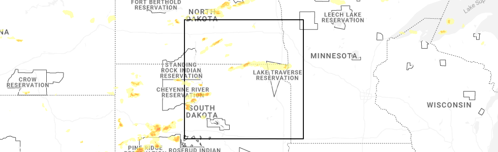
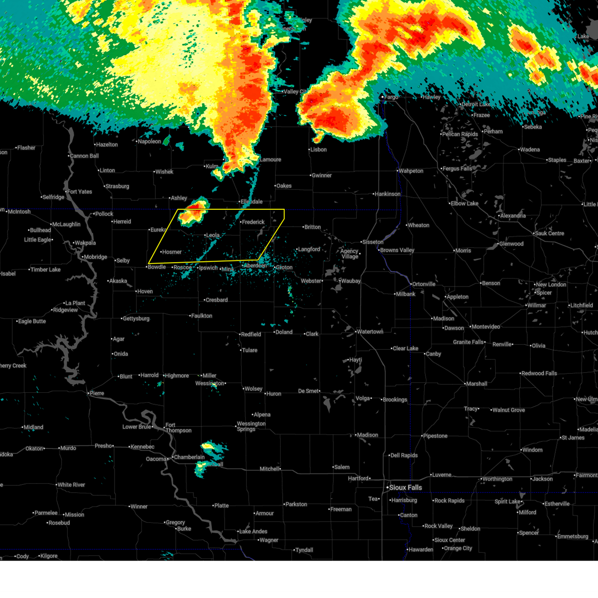
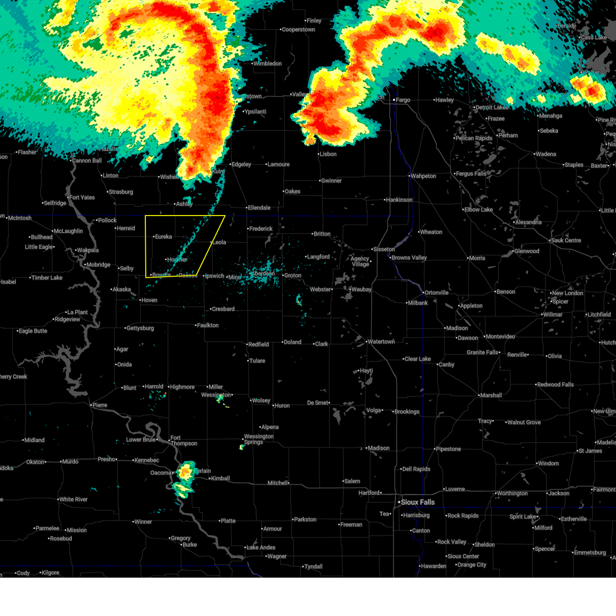
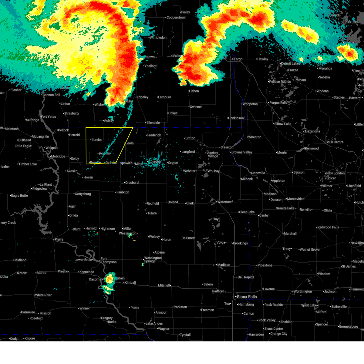
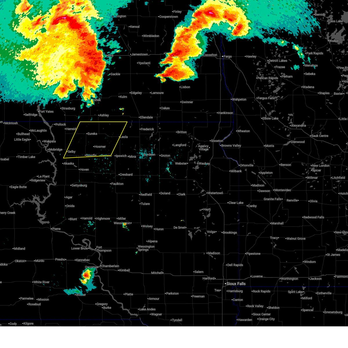
Hail Map for Leola, SD
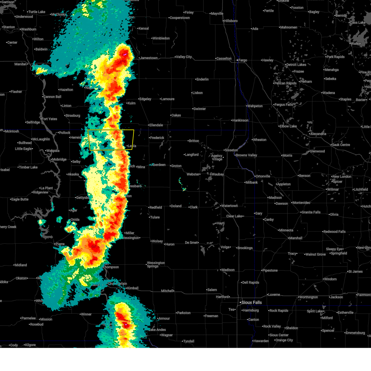
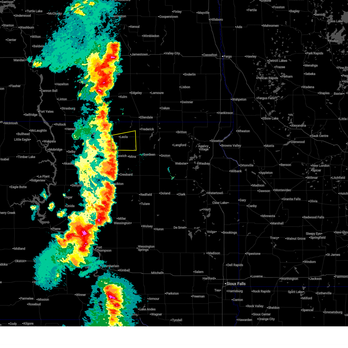
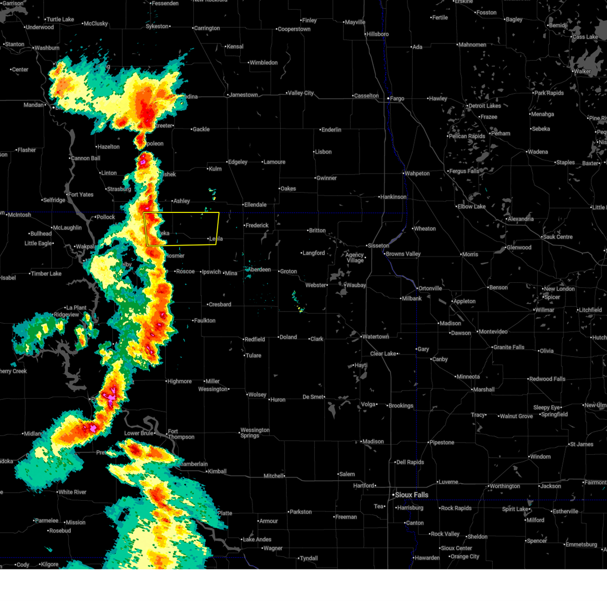
The Leola, SD area has had 14 reports of on-the-ground hail by trained spotters, and has been under severe weather warnings 10 times during the past 12 months. Doppler radar has detected hail at or near Leola, SD on 44 occasions, including 1 occasion during the past year.
| Name: | Leola, SD |
| Where Located: | 28.6 miles NW of Aberdeen, SD |
| Map: | Google Map for Leola, SD |
| Population: | 457 |
| Housing Units: | 258 |
| More Info: | Search Google for Leola, SD |
0
The Top Recent Hail Date for Leola, SD is Monday, July 14, 2025 (43rd out of 44)
Hail and Wind Damage Spotted near Leola, SD
| Date / Time | Report Details |
|---|---|
| 7/9/2025 9:21 PM CDT |
 The storm which prompted the warning has weakened below severe limits, and has exited the warned area. therefore, the warning will be allowed to expire. however, gusty winds are still possible with this thunderstorm. a severe thunderstorm watch remains in effect until 100 am cdt for north central south dakota. The storm which prompted the warning has weakened below severe limits, and has exited the warned area. therefore, the warning will be allowed to expire. however, gusty winds are still possible with this thunderstorm. a severe thunderstorm watch remains in effect until 100 am cdt for north central south dakota.
|
| 7/9/2025 9:12 PM CDT |
 Svrabr the national weather service in aberdeen has issued a * severe thunderstorm warning for, northeastern edmunds county in north central south dakota, west central brown county in northeastern south dakota, southeastern mcpherson county in north central south dakota, * until 945 pm cdt. * at 912 pm cdt, a severe thunderstorm was located near deerfield colony, or near leola, moving east at 30 mph (radar indicated). Hazards include 60 mph wind gusts. Expect damage to roofs, siding, and trees. this severe thunderstorm will be near, deerfield colony, grassland colony, long lake colony, and wetonka around 915 pm cdt. Richmond lake rec area around 930 pm cdt. Svrabr the national weather service in aberdeen has issued a * severe thunderstorm warning for, northeastern edmunds county in north central south dakota, west central brown county in northeastern south dakota, southeastern mcpherson county in north central south dakota, * until 945 pm cdt. * at 912 pm cdt, a severe thunderstorm was located near deerfield colony, or near leola, moving east at 30 mph (radar indicated). Hazards include 60 mph wind gusts. Expect damage to roofs, siding, and trees. this severe thunderstorm will be near, deerfield colony, grassland colony, long lake colony, and wetonka around 915 pm cdt. Richmond lake rec area around 930 pm cdt.
|
| 7/9/2025 8:30 PM CDT |
 Svrabr the national weather service in aberdeen has issued a * severe thunderstorm warning for, mcpherson county in north central south dakota, * until 930 pm cdt. * at 829 pm cdt, a severe thunderstorm was located over eureka, moving east at 30 mph (radar indicated). Hazards include 60 mph wind gusts and nickel size hail. Expect damage to roofs, siding, and trees. this severe thunderstorm will be near, new town corner around 840 pm cdt. Other locations in the path of this severe thunderstorm include long lake. Svrabr the national weather service in aberdeen has issued a * severe thunderstorm warning for, mcpherson county in north central south dakota, * until 930 pm cdt. * at 829 pm cdt, a severe thunderstorm was located over eureka, moving east at 30 mph (radar indicated). Hazards include 60 mph wind gusts and nickel size hail. Expect damage to roofs, siding, and trees. this severe thunderstorm will be near, new town corner around 840 pm cdt. Other locations in the path of this severe thunderstorm include long lake.
|
| 6/20/2025 11:03 PM CDT |
 Svrabr the national weather service in aberdeen has issued a * severe thunderstorm warning for, northern edmunds county in north central south dakota, northern brown county in northeastern south dakota, mcpherson county in north central south dakota, * until 1145 pm cdt. * at 1103 pm cdt, outflow from severe thunderstorms were located along a line extending from fullerton to near loyalton, moving east at 50 mph (radar indicated). Hazards include 60 mph wind gusts. Expect damage to roofs, siding, and trees. severe thunderstorms will be near, frederick, deerfield colony, grassland colony, long lake colony, and wetonka around 1110 pm cdt. richmond lake rec area and barnard around 1115 pm cdt. westport around 1120 pm cdt. Other locations in the path of these severe thunderstorms include hecla, sand lake wildlife refuge, columbia and houghton. Svrabr the national weather service in aberdeen has issued a * severe thunderstorm warning for, northern edmunds county in north central south dakota, northern brown county in northeastern south dakota, mcpherson county in north central south dakota, * until 1145 pm cdt. * at 1103 pm cdt, outflow from severe thunderstorms were located along a line extending from fullerton to near loyalton, moving east at 50 mph (radar indicated). Hazards include 60 mph wind gusts. Expect damage to roofs, siding, and trees. severe thunderstorms will be near, frederick, deerfield colony, grassland colony, long lake colony, and wetonka around 1110 pm cdt. richmond lake rec area and barnard around 1115 pm cdt. westport around 1120 pm cdt. Other locations in the path of these severe thunderstorms include hecla, sand lake wildlife refuge, columbia and houghton.
|
| 6/20/2025 10:42 PM CDT |
 the severe thunderstorm warning has been cancelled and is no longer in effect the severe thunderstorm warning has been cancelled and is no longer in effect
|
| 6/20/2025 10:42 PM CDT |
 At 1041 pm cdt, outflow from severe thunderstorms in nd were located along a line extending from 11 miles southeast of lehr to bowdle, moving east at 65 mph (radar indicated). Hazards include 60 mph wind gusts. Expect damage to roofs, siding, and trees. Locations impacted include, bowdle, hosmer, long lake, new town corner, roscoe, spring creek colony, leola and forbes. At 1041 pm cdt, outflow from severe thunderstorms in nd were located along a line extending from 11 miles southeast of lehr to bowdle, moving east at 65 mph (radar indicated). Hazards include 60 mph wind gusts. Expect damage to roofs, siding, and trees. Locations impacted include, bowdle, hosmer, long lake, new town corner, roscoe, spring creek colony, leola and forbes.
|
| 6/20/2025 10:16 PM CDT |
 Svrabr the national weather service in aberdeen has issued a * severe thunderstorm warning for, northwestern edmunds county in north central south dakota, eastern campbell county in north central south dakota, mcpherson county in north central south dakota, northeastern walworth county in north central south dakota, * until 1100 pm cdt. * at 1016 pm cdt, outflow winds from severe thunderstorms in nd were located along a line extending from 6 miles south of wishek to near akaska, moving east at 65 mph (radar indicated). Hazards include 60 mph wind gusts. Expect damage to roofs, siding, and trees. severe thunderstorms will be near, eureka, selby, java, greenway, and lake hiddenwood rec area around 1020 pm cdt. bowdle and hillsview around 1030 pm cdt. hosmer and new town corner around 1035 pm cdt. Other locations in the path of these severe thunderstorms include long lake, roscoe and spring creek colony. Svrabr the national weather service in aberdeen has issued a * severe thunderstorm warning for, northwestern edmunds county in north central south dakota, eastern campbell county in north central south dakota, mcpherson county in north central south dakota, northeastern walworth county in north central south dakota, * until 1100 pm cdt. * at 1016 pm cdt, outflow winds from severe thunderstorms in nd were located along a line extending from 6 miles south of wishek to near akaska, moving east at 65 mph (radar indicated). Hazards include 60 mph wind gusts. Expect damage to roofs, siding, and trees. severe thunderstorms will be near, eureka, selby, java, greenway, and lake hiddenwood rec area around 1020 pm cdt. bowdle and hillsview around 1030 pm cdt. hosmer and new town corner around 1035 pm cdt. Other locations in the path of these severe thunderstorms include long lake, roscoe and spring creek colony.
|
| 7/29/2024 10:08 PM CDT |
 At 1008 pm cdt, a severe thunderstorm was located near leola, moving east at 25 mph (trained weather spotters). Hazards include 60 mph wind gusts and penny size hail. Expect damage to roofs, siding, and trees. Locations impacted include, leola and elm lake. At 1008 pm cdt, a severe thunderstorm was located near leola, moving east at 25 mph (trained weather spotters). Hazards include 60 mph wind gusts and penny size hail. Expect damage to roofs, siding, and trees. Locations impacted include, leola and elm lake.
|
| 7/29/2024 10:08 PM CDT |
 Svrabr the national weather service in aberdeen has issued a * severe thunderstorm warning for, northwestern brown county in northeastern south dakota, eastern mcpherson county in north central south dakota, * until 1100 pm cdt. * at 1008 pm cdt, a severe thunderstorm was located near leola, moving east at 35 mph (trained weather spotters). Hazards include 60 mph wind gusts and penny size hail. Expect damage to roofs, siding, and trees. this severe thunderstorm will be near, elm lake around 1015 pm cdt. Other locations in the path of this severe thunderstorm include frederick, barnard and sand lake wildlife refuge. Svrabr the national weather service in aberdeen has issued a * severe thunderstorm warning for, northwestern brown county in northeastern south dakota, eastern mcpherson county in north central south dakota, * until 1100 pm cdt. * at 1008 pm cdt, a severe thunderstorm was located near leola, moving east at 35 mph (trained weather spotters). Hazards include 60 mph wind gusts and penny size hail. Expect damage to roofs, siding, and trees. this severe thunderstorm will be near, elm lake around 1015 pm cdt. Other locations in the path of this severe thunderstorm include frederick, barnard and sand lake wildlife refuge.
|
| 7/29/2024 9:32 PM CDT |
 Svrabr the national weather service in aberdeen has issued a * severe thunderstorm warning for, mcpherson county in north central south dakota, * until 1015 pm cdt. * at 932 pm cdt, a severe thunderstorm was located near new town corner, or 11 miles east of eureka, moving east at 40 mph (trained weather spotters). Hazards include 60 mph wind gusts and penny size hail. Expect damage to roofs, siding, and trees. this severe thunderstorm will be near, new town corner around 935 pm cdt. long lake around 940 pm cdt. Other locations in the path of this severe thunderstorm include leola. Svrabr the national weather service in aberdeen has issued a * severe thunderstorm warning for, mcpherson county in north central south dakota, * until 1015 pm cdt. * at 932 pm cdt, a severe thunderstorm was located near new town corner, or 11 miles east of eureka, moving east at 40 mph (trained weather spotters). Hazards include 60 mph wind gusts and penny size hail. Expect damage to roofs, siding, and trees. this severe thunderstorm will be near, new town corner around 935 pm cdt. long lake around 940 pm cdt. Other locations in the path of this severe thunderstorm include leola.
|
| 5/23/2024 4:24 PM CDT |
 the severe thunderstorm warning has been cancelled and is no longer in effect the severe thunderstorm warning has been cancelled and is no longer in effect
|
| 5/23/2024 4:12 PM CDT |
 At 412 pm cdt, a severe thunderstorm was located over leola, moving northeast at 25 mph (radar indicated). Hazards include 60 mph wind gusts and quarter size hail. Hail damage to vehicles is expected. expect wind damage to roofs, siding, and trees. This severe thunderstorm will remain over mainly rural areas of east central mcpherson county. At 412 pm cdt, a severe thunderstorm was located over leola, moving northeast at 25 mph (radar indicated). Hazards include 60 mph wind gusts and quarter size hail. Hail damage to vehicles is expected. expect wind damage to roofs, siding, and trees. This severe thunderstorm will remain over mainly rural areas of east central mcpherson county.
|
| 5/23/2024 3:57 PM CDT |
 Svrabr the national weather service in aberdeen has issued a * severe thunderstorm warning for, southeastern mcpherson county in north central south dakota, * until 445 pm cdt. * at 357 pm cdt, a severe thunderstorm was located near plainview colony, or near leola, moving northeast at 25 mph (radar indicated). Hazards include 60 mph wind gusts and quarter size hail. Hail damage to vehicles is expected. expect wind damage to roofs, siding, and trees. This severe thunderstorm will be near, leola around 400 pm cdt. Svrabr the national weather service in aberdeen has issued a * severe thunderstorm warning for, southeastern mcpherson county in north central south dakota, * until 445 pm cdt. * at 357 pm cdt, a severe thunderstorm was located near plainview colony, or near leola, moving northeast at 25 mph (radar indicated). Hazards include 60 mph wind gusts and quarter size hail. Hail damage to vehicles is expected. expect wind damage to roofs, siding, and trees. This severe thunderstorm will be near, leola around 400 pm cdt.
|
| 5/18/2024 1:06 AM CDT |
 The storm which prompted the warning has weakened below severe limits, and no longer poses an immediate threat to life or property. therefore, the warning will be allowed to expire. however, gusty winds are still possible with this thunderstorm. The storm which prompted the warning has weakened below severe limits, and no longer poses an immediate threat to life or property. therefore, the warning will be allowed to expire. however, gusty winds are still possible with this thunderstorm.
|
| 5/18/2024 12:51 AM CDT |
 At 1251 am cdt, a severe thunderstorm was located near plainview colony, or 11 miles southwest of leola, moving northeast at 55 mph (radar indicated). Hazards include 60 mph wind gusts. Expect damage to roofs, siding, and trees. this severe storm will be near, leola and plainview colony around 1255 am cdt. Other locations in the path of this severe thunderstorm include grassland colony. At 1251 am cdt, a severe thunderstorm was located near plainview colony, or 11 miles southwest of leola, moving northeast at 55 mph (radar indicated). Hazards include 60 mph wind gusts. Expect damage to roofs, siding, and trees. this severe storm will be near, leola and plainview colony around 1255 am cdt. Other locations in the path of this severe thunderstorm include grassland colony.
|
| 5/18/2024 12:40 AM CDT |
 Svrabr the national weather service in aberdeen has issued a * severe thunderstorm warning for, northeastern edmunds county in north central south dakota, eastern mcpherson county in north central south dakota, * until 115 am cdt. * at 1240 am cdt, a severe thunderstorm was located near roscoe, moving northeast at 55 mph (radar indicated). Hazards include 60 mph wind gusts. Expect damage to roofs, siding, and trees. this severe thunderstorm will be near, plainview colony around 1250 am cdt. leola around 1255 am cdt. Other locations in the path of this severe thunderstorm include grassland colony. Svrabr the national weather service in aberdeen has issued a * severe thunderstorm warning for, northeastern edmunds county in north central south dakota, eastern mcpherson county in north central south dakota, * until 115 am cdt. * at 1240 am cdt, a severe thunderstorm was located near roscoe, moving northeast at 55 mph (radar indicated). Hazards include 60 mph wind gusts. Expect damage to roofs, siding, and trees. this severe thunderstorm will be near, plainview colony around 1250 am cdt. leola around 1255 am cdt. Other locations in the path of this severe thunderstorm include grassland colony.
|
| 5/17/2024 9:58 PM CDT |
 The storms which prompted the warning have moved out of the area. therefore, the warning will be allowed to expire. however, gusty winds are still possible with these thunderstorms. a severe thunderstorm watch remains in effect until midnight cdt for north central and northeastern south dakota. The storms which prompted the warning have moved out of the area. therefore, the warning will be allowed to expire. however, gusty winds are still possible with these thunderstorms. a severe thunderstorm watch remains in effect until midnight cdt for north central and northeastern south dakota.
|
| 5/17/2024 9:08 PM CDT |
 Svrabr the national weather service in aberdeen has issued a * severe thunderstorm warning for, edmunds county in north central south dakota, northwestern brown county in northeastern south dakota, eastern mcpherson county in north central south dakota, * until 1000 pm cdt. * at 908 pm cdt, severe thunderstorms were located along a line extending from 6 miles west of spring creek colony to 8 miles north of onaka, moving east at 45 mph (radar indicated). Hazards include 60 mph wind gusts. Expect damage to roofs, siding, and trees. severe thunderstorms will be near, leola, roscoe, spring creek colony, plainview colony, and forbes around 915 pm cdt. ipswich and elm lake around 920 pm cdt. deerfield colony, grassland colony, and long lake colony around 925 pm cdt. Other locations in the path of these severe thunderstorms include pembrook colony, wetonka, cravens corner, frederick, mina lake rec area, mina, richmond lake rec area and barnard. Svrabr the national weather service in aberdeen has issued a * severe thunderstorm warning for, edmunds county in north central south dakota, northwestern brown county in northeastern south dakota, eastern mcpherson county in north central south dakota, * until 1000 pm cdt. * at 908 pm cdt, severe thunderstorms were located along a line extending from 6 miles west of spring creek colony to 8 miles north of onaka, moving east at 45 mph (radar indicated). Hazards include 60 mph wind gusts. Expect damage to roofs, siding, and trees. severe thunderstorms will be near, leola, roscoe, spring creek colony, plainview colony, and forbes around 915 pm cdt. ipswich and elm lake around 920 pm cdt. deerfield colony, grassland colony, and long lake colony around 925 pm cdt. Other locations in the path of these severe thunderstorms include pembrook colony, wetonka, cravens corner, frederick, mina lake rec area, mina, richmond lake rec area and barnard.
|
| 8/10/2023 4:40 PM CDT | Property blown off patio. pea-sized hail. 1.50 inch of rain in appx 30 minute in mcpherson county SD, 6.5 miles W of Leola, SD |
| 8/10/2023 4:38 PM CDT |
 At 438 pm cdt, a severe thunderstorm was located over grassland colony, or near leola, moving northeast at 20 mph (radar indicated). Hazards include 60 mph wind gusts and quarter size hail. Hail damage to vehicles is expected. Expect wind damage to roofs, siding, and trees. At 438 pm cdt, a severe thunderstorm was located over grassland colony, or near leola, moving northeast at 20 mph (radar indicated). Hazards include 60 mph wind gusts and quarter size hail. Hail damage to vehicles is expected. Expect wind damage to roofs, siding, and trees.
|
| 7/18/2023 11:50 PM CDT |
 At 1150 pm cdt, a severe thunderstorm was located 7 miles southeast of long lake, or 8 miles northwest of leola, moving southeast at 25 mph (radar indicated). Hazards include 60 mph wind gusts and quarter size hail. Hail damage to vehicles is expected. expect wind damage to roofs, siding, and trees. locations impacted include, leola. hail threat, radar indicated max hail size, 1. 00 in wind threat, radar indicated max wind gust, 60 mph. At 1150 pm cdt, a severe thunderstorm was located 7 miles southeast of long lake, or 8 miles northwest of leola, moving southeast at 25 mph (radar indicated). Hazards include 60 mph wind gusts and quarter size hail. Hail damage to vehicles is expected. expect wind damage to roofs, siding, and trees. locations impacted include, leola. hail threat, radar indicated max hail size, 1. 00 in wind threat, radar indicated max wind gust, 60 mph.
|
| 7/18/2023 11:34 PM CDT |
 At 1134 pm cdt, a severe thunderstorm was located over long lake, or 15 miles northwest of leola, moving southeast at 25 mph (radar indicated). Hazards include 60 mph wind gusts and quarter size hail. Hail damage to vehicles is expected. expect wind damage to roofs, siding, and trees. locations impacted include, leola. hail threat, radar indicated max hail size, 1. 00 in wind threat, radar indicated max wind gust, 60 mph. At 1134 pm cdt, a severe thunderstorm was located over long lake, or 15 miles northwest of leola, moving southeast at 25 mph (radar indicated). Hazards include 60 mph wind gusts and quarter size hail. Hail damage to vehicles is expected. expect wind damage to roofs, siding, and trees. locations impacted include, leola. hail threat, radar indicated max hail size, 1. 00 in wind threat, radar indicated max wind gust, 60 mph.
|
| 7/18/2023 11:14 PM CDT |
 At 1114 pm cdt, a severe thunderstorm was located 7 miles northwest of long lake, or 17 miles northeast of eureka, moving southeast at 25 mph (radar indicated). Hazards include 60 mph wind gusts and quarter size hail. Hail damage to vehicles is expected. expect wind damage to roofs, siding, and trees. this severe thunderstorm will be near, long lake around 1130 pm cdt. other locations in the path of this severe thunderstorm include leola. hail threat, radar indicated max hail size, 1. 00 in wind threat, radar indicated max wind gust, 60 mph. At 1114 pm cdt, a severe thunderstorm was located 7 miles northwest of long lake, or 17 miles northeast of eureka, moving southeast at 25 mph (radar indicated). Hazards include 60 mph wind gusts and quarter size hail. Hail damage to vehicles is expected. expect wind damage to roofs, siding, and trees. this severe thunderstorm will be near, long lake around 1130 pm cdt. other locations in the path of this severe thunderstorm include leola. hail threat, radar indicated max hail size, 1. 00 in wind threat, radar indicated max wind gust, 60 mph.
|
| 7/23/2022 6:42 AM CDT |
 At 642 am cdt, a severe thunderstorm was located 7 miles south of elm lake, or 18 miles southwest of ellendale, moving east at 45 mph (radar indicated). Hazards include 60 mph wind gusts and quarter size hail. Hail damage to vehicles is expected. expect wind damage to roofs, siding, and trees. locations impacted include, frederick and barnard. hail threat, radar indicated max hail size, 1. 00 in wind threat, radar indicated max wind gust, 60 mph. At 642 am cdt, a severe thunderstorm was located 7 miles south of elm lake, or 18 miles southwest of ellendale, moving east at 45 mph (radar indicated). Hazards include 60 mph wind gusts and quarter size hail. Hail damage to vehicles is expected. expect wind damage to roofs, siding, and trees. locations impacted include, frederick and barnard. hail threat, radar indicated max hail size, 1. 00 in wind threat, radar indicated max wind gust, 60 mph.
|
| 7/23/2022 6:14 AM CDT |
 At 614 am cdt, a severe thunderstorm was located near long lake, or 20 miles southeast of ashley, moving east at 45 mph (radar indicated). Hazards include 60 mph wind gusts and quarter size hail. Hail damage to vehicles is expected. expect wind damage to roofs, siding, and trees. this severe thunderstorm will be near, leola around 630 am cdt. other locations in the path of this severe thunderstorm include grassland colony, elm lake, frederick and barnard. hail threat, radar indicated max hail size, 1. 00 in wind threat, radar indicated max wind gust, 60 mph. At 614 am cdt, a severe thunderstorm was located near long lake, or 20 miles southeast of ashley, moving east at 45 mph (radar indicated). Hazards include 60 mph wind gusts and quarter size hail. Hail damage to vehicles is expected. expect wind damage to roofs, siding, and trees. this severe thunderstorm will be near, leola around 630 am cdt. other locations in the path of this severe thunderstorm include grassland colony, elm lake, frederick and barnard. hail threat, radar indicated max hail size, 1. 00 in wind threat, radar indicated max wind gust, 60 mph.
|
| 7/3/2022 9:13 PM CDT | Half Dollar sized hail reported 0.2 miles NNW of Leola, SD |
| 6/14/2022 4:50 AM CDT | Personal weather statio in mcpherson county SD, 5.6 miles SW of Leola, SD |
| 6/14/2022 4:41 AM CDT |
 At 439 am cdt, a severe thunderstorm was located over grassland colony, or 20 miles northeast of ipswich, moving northeast at 55 mph. this is a potentially destructive storm for eastern mcpherson and northern brown counties (radar indicated). Hazards include 80 mph wind gusts and quarter size hail. Flying debris will be dangerous to those caught without shelter. mobile homes will be heavily damaged. expect considerable damage to roofs, windows, and vehicles. extensive tree damage and power outages are likely. this severe thunderstorm will be near, elm lake around 450 am cdt. barnard around 455 am cdt. other locations in the path of this severe thunderstorm include frederick, sand lake wildlife refuge and hecla. thunderstorm damage threat, destructive hail threat, radar indicated max hail size, 1. 00 in wind threat, radar indicated max wind gust, 80 mph. At 439 am cdt, a severe thunderstorm was located over grassland colony, or 20 miles northeast of ipswich, moving northeast at 55 mph. this is a potentially destructive storm for eastern mcpherson and northern brown counties (radar indicated). Hazards include 80 mph wind gusts and quarter size hail. Flying debris will be dangerous to those caught without shelter. mobile homes will be heavily damaged. expect considerable damage to roofs, windows, and vehicles. extensive tree damage and power outages are likely. this severe thunderstorm will be near, elm lake around 450 am cdt. barnard around 455 am cdt. other locations in the path of this severe thunderstorm include frederick, sand lake wildlife refuge and hecla. thunderstorm damage threat, destructive hail threat, radar indicated max hail size, 1. 00 in wind threat, radar indicated max wind gust, 80 mph.
|
| 6/14/2022 4:35 AM CDT | Personal weather statio in mcpherson county SD, 3.5 miles NNE of Leola, SD |
| 6/14/2022 4:25 AM CDT | Ping Pong Ball sized hail reported 1.2 miles S of Leola, SD |
| 6/14/2022 4:22 AM CDT | Golf Ball sized hail reported 0.2 miles NNW of Leola, SD, report from mping: golf ball (1.75 in.). |
| 6/14/2022 3:54 AM CDT |
 At 353 am cdt, a severe thunderstorm was located near roscoe, or 16 miles west of ipswich, moving northeast at 55 mph. this is a destructive storm (radar indicated). Hazards include 80 mph wind gusts and ping pong ball size hail. Flying debris will be dangerous to those caught without shelter. mobile homes will be heavily damaged. expect considerable damage to roofs, windows, and vehicles. extensive tree damage and power outages are likely. this severe thunderstorm will be near, ipswich around 410 am cdt. Other locations in the path of this severe thunderstorm include plainview colony, cravens corner, deerfield colony, wetonka, long lake colony and grassland colony. At 353 am cdt, a severe thunderstorm was located near roscoe, or 16 miles west of ipswich, moving northeast at 55 mph. this is a destructive storm (radar indicated). Hazards include 80 mph wind gusts and ping pong ball size hail. Flying debris will be dangerous to those caught without shelter. mobile homes will be heavily damaged. expect considerable damage to roofs, windows, and vehicles. extensive tree damage and power outages are likely. this severe thunderstorm will be near, ipswich around 410 am cdt. Other locations in the path of this severe thunderstorm include plainview colony, cravens corner, deerfield colony, wetonka, long lake colony and grassland colony.
|
| 5/12/2022 5:37 PM CDT |
 At 537 pm cdt, severe thunderstorms were located along a line extending from near blumengard colony to near northville to near ashton, moving north at 55 mph (radar indicated). Hazards include 70 mph wind gusts and ping pong ball size hail. People and animals outdoors will be injured. expect hail damage to roofs, siding, windows, and vehicles. expect considerable tree damage. wind damage is also likely to mobile homes, roofs, and outbuildings. severe thunderstorms will be near, pembrook colony around 545 pm cdt. ipswich and warner around 550 pm cdt. cravens corner around 555 pm cdt. Other locations in the path of these severe thunderstorms include aberdeen, stratford, plainview colony, deerfield colony, long lake colony, richmond lake rec area, bath, leola, westport, putney, tacoma park and barnard. At 537 pm cdt, severe thunderstorms were located along a line extending from near blumengard colony to near northville to near ashton, moving north at 55 mph (radar indicated). Hazards include 70 mph wind gusts and ping pong ball size hail. People and animals outdoors will be injured. expect hail damage to roofs, siding, windows, and vehicles. expect considerable tree damage. wind damage is also likely to mobile homes, roofs, and outbuildings. severe thunderstorms will be near, pembrook colony around 545 pm cdt. ipswich and warner around 550 pm cdt. cravens corner around 555 pm cdt. Other locations in the path of these severe thunderstorms include aberdeen, stratford, plainview colony, deerfield colony, long lake colony, richmond lake rec area, bath, leola, westport, putney, tacoma park and barnard.
|
| 5/12/2022 6:15 AM CDT |
 At 615 am cdt, a severe thunderstorm was located near spring creek colony, or 22 miles southeast of ashley, moving northeast at 60 mph (radar indicated). Hazards include 60 mph wind gusts. Expect damage to roofs, siding, and trees. this severe thunderstorm will remain over mainly rural areas of north central edmunds and eastern mcpherson counties. hail threat, radar indicated max hail size, <. 75 in wind threat, radar indicated max wind gust, 60 mph. At 615 am cdt, a severe thunderstorm was located near spring creek colony, or 22 miles southeast of ashley, moving northeast at 60 mph (radar indicated). Hazards include 60 mph wind gusts. Expect damage to roofs, siding, and trees. this severe thunderstorm will remain over mainly rural areas of north central edmunds and eastern mcpherson counties. hail threat, radar indicated max hail size, <. 75 in wind threat, radar indicated max wind gust, 60 mph.
|
| 5/12/2022 5:50 AM CDT |
 At 550 am cdt, a severe thunderstorm was located near hosmer, or 16 miles southeast of eureka, moving northeast at 60 mph (radar indicated). Hazards include 70 mph wind gusts. Expect considerable tree damage. damage is likely to mobile homes, roofs, and outbuildings. this severe thunderstorm will be near, leola around 610 am cdt. thunderstorm damage threat, considerable hail threat, radar indicated max hail size, <. 75 in wind threat, radar indicated max wind gust, 70 mph. At 550 am cdt, a severe thunderstorm was located near hosmer, or 16 miles southeast of eureka, moving northeast at 60 mph (radar indicated). Hazards include 70 mph wind gusts. Expect considerable tree damage. damage is likely to mobile homes, roofs, and outbuildings. this severe thunderstorm will be near, leola around 610 am cdt. thunderstorm damage threat, considerable hail threat, radar indicated max hail size, <. 75 in wind threat, radar indicated max wind gust, 70 mph.
|
| 8/24/2021 12:01 AM CDT |
 At 1201 am cdt, a severe thunderstorm was located near leola, or 21 miles northeast of ipswich, moving east at 50 mph (radar indicated). Hazards include 60 mph wind gusts. Expect damage to roofs, siding, and trees. this severe thunderstorm will be near, wetonka and grassland colony around 1205 am cdt. frederick, westport and barnard around 1220 am cdt. other locations in the path of this severe thunderstorm include sand lake wildlife refuge, houghton and claremont. hail threat, radar indicated max hail size, <. 75 in wind threat, radar indicated max wind gust, 60 mph. At 1201 am cdt, a severe thunderstorm was located near leola, or 21 miles northeast of ipswich, moving east at 50 mph (radar indicated). Hazards include 60 mph wind gusts. Expect damage to roofs, siding, and trees. this severe thunderstorm will be near, wetonka and grassland colony around 1205 am cdt. frederick, westport and barnard around 1220 am cdt. other locations in the path of this severe thunderstorm include sand lake wildlife refuge, houghton and claremont. hail threat, radar indicated max hail size, <. 75 in wind threat, radar indicated max wind gust, 60 mph.
|
| 8/22/2021 5:13 PM CDT |
 The severe thunderstorm warning for northeastern mcpherson county will expire at 515 pm cdt, the storm which prompted the warning has moved out of the area. therefore, the warning will be allowed to expire. a severe thunderstorm watch remains in effect until 900 pm cdt for north central south dakota. remember, a severe thunderstorm warning still remains in effect for northeastern mcpherson county until 530 pm cdt. The severe thunderstorm warning for northeastern mcpherson county will expire at 515 pm cdt, the storm which prompted the warning has moved out of the area. therefore, the warning will be allowed to expire. a severe thunderstorm watch remains in effect until 900 pm cdt for north central south dakota. remember, a severe thunderstorm warning still remains in effect for northeastern mcpherson county until 530 pm cdt.
|
| 8/22/2021 5:02 PM CDT |
 At 502 pm cdt, a severe thunderstorm was located near leola, or 21 miles north of ipswich, moving northeast at 45 mph (radar indicated). Hazards include 60 mph wind gusts and quarter size hail. Hail damage to vehicles is expected. expect wind damage to roofs, siding, and trees. locations impacted include, leola. hail threat, radar indicated max hail size, 1. 00 in wind threat, radar indicated max wind gust, 60 mph. At 502 pm cdt, a severe thunderstorm was located near leola, or 21 miles north of ipswich, moving northeast at 45 mph (radar indicated). Hazards include 60 mph wind gusts and quarter size hail. Hail damage to vehicles is expected. expect wind damage to roofs, siding, and trees. locations impacted include, leola. hail threat, radar indicated max hail size, 1. 00 in wind threat, radar indicated max wind gust, 60 mph.
|
| 8/22/2021 4:50 PM CDT |
 At 449 pm cdt, a severe thunderstorm was located 7 miles northwest of plainview colony, or 14 miles north of ipswich, moving northeast at 45 mph (radar indicated). Hazards include 60 mph wind gusts and half dollar size hail. Hail damage to vehicles is expected. expect wind damage to roofs, siding, and trees. locations impacted include, leola. hail threat, radar indicated max hail size, 1. 25 in wind threat, radar indicated max wind gust, 60 mph. At 449 pm cdt, a severe thunderstorm was located 7 miles northwest of plainview colony, or 14 miles north of ipswich, moving northeast at 45 mph (radar indicated). Hazards include 60 mph wind gusts and half dollar size hail. Hail damage to vehicles is expected. expect wind damage to roofs, siding, and trees. locations impacted include, leola. hail threat, radar indicated max hail size, 1. 25 in wind threat, radar indicated max wind gust, 60 mph.
|
| 8/22/2021 4:33 PM CDT |
 At 432 pm cdt, a severe thunderstorm was located over roscoe, or 15 miles west of ipswich, moving northeast at 45 mph (radar indicated). Hazards include two inch hail and 60 mph wind gusts. People and animals outdoors will be injured. expect hail damage to roofs, siding, windows, and vehicles. Expect wind damage to roofs, siding, and trees. At 432 pm cdt, a severe thunderstorm was located over roscoe, or 15 miles west of ipswich, moving northeast at 45 mph (radar indicated). Hazards include two inch hail and 60 mph wind gusts. People and animals outdoors will be injured. expect hail damage to roofs, siding, windows, and vehicles. Expect wind damage to roofs, siding, and trees.
|
| 7/23/2021 11:09 PM CDT |
 The severe thunderstorm warning for central edmunds, southern brown and southeastern mcpherson counties will expire at 1115 pm cdt, the storms which prompted the warning have weakened below severe limits, and no longer pose an immediate threat to life or property. therefore, the warning will be allowed to expire. however gusty winds are still possible with these thunderstorms. a severe thunderstorm watch remains in effect until 200 am cdt for north central and northeastern south dakota. remember, a severe thunderstorm warning still remains in effect for portions of northern brown county until 1115 pm. The severe thunderstorm warning for central edmunds, southern brown and southeastern mcpherson counties will expire at 1115 pm cdt, the storms which prompted the warning have weakened below severe limits, and no longer pose an immediate threat to life or property. therefore, the warning will be allowed to expire. however gusty winds are still possible with these thunderstorms. a severe thunderstorm watch remains in effect until 200 am cdt for north central and northeastern south dakota. remember, a severe thunderstorm warning still remains in effect for portions of northern brown county until 1115 pm.
|
| 7/23/2021 10:57 PM CDT |
 At 1029 pm cdt, severe thunderstorms were located along a line extending from near leola to near plainview colony to near hosmer, moving east at 45 mph (trained weather spotters). Hazards include 60 mph wind gusts and penny size hail. Expect damage to roofs, siding, and trees. severe thunderstorms will be near, leola, deerfield colony and plainview colony around 1035 pm cdt. long lake colony and grassland colony around 1040 pm cdt. wetonka around 1045 pm cdt. Other locations in the path of these severe thunderstorms include mina lake rec area, westport, richmond lake rec area, ipswich, aberdeen, columbia, cravens corner, pembrook colony, bath, putney, mina and tacoma park. At 1029 pm cdt, severe thunderstorms were located along a line extending from near leola to near plainview colony to near hosmer, moving east at 45 mph (trained weather spotters). Hazards include 60 mph wind gusts and penny size hail. Expect damage to roofs, siding, and trees. severe thunderstorms will be near, leola, deerfield colony and plainview colony around 1035 pm cdt. long lake colony and grassland colony around 1040 pm cdt. wetonka around 1045 pm cdt. Other locations in the path of these severe thunderstorms include mina lake rec area, westport, richmond lake rec area, ipswich, aberdeen, columbia, cravens corner, pembrook colony, bath, putney, mina and tacoma park.
|
| 7/23/2021 10:29 PM CDT |
 At 1029 pm cdt, severe thunderstorms were located along a line extending from near leola to near plainview colony to near hosmer, moving east at 45 mph (trained weather spotters). Hazards include 60 mph wind gusts and penny size hail. Expect damage to roofs, siding, and trees. severe thunderstorms will be near, leola, deerfield colony and plainview colony around 1035 pm cdt. long lake colony and grassland colony around 1040 pm cdt. wetonka around 1045 pm cdt. Other locations in the path of these severe thunderstorms include mina lake rec area, westport, richmond lake rec area, ipswich, aberdeen, columbia, cravens corner, pembrook colony, bath, putney, mina and tacoma park. At 1029 pm cdt, severe thunderstorms were located along a line extending from near leola to near plainview colony to near hosmer, moving east at 45 mph (trained weather spotters). Hazards include 60 mph wind gusts and penny size hail. Expect damage to roofs, siding, and trees. severe thunderstorms will be near, leola, deerfield colony and plainview colony around 1035 pm cdt. long lake colony and grassland colony around 1040 pm cdt. wetonka around 1045 pm cdt. Other locations in the path of these severe thunderstorms include mina lake rec area, westport, richmond lake rec area, ipswich, aberdeen, columbia, cravens corner, pembrook colony, bath, putney, mina and tacoma park.
|
| 6/11/2021 3:56 AM CDT |
 The severe thunderstorm warning for edmunds, western faulk, eastern campbell, potter, mcpherson and eastern walworth counties will expire at 400 am cdt, the storm which prompted the warning has weakened below severe limits, and no longer poses an immediate threat to life or property. therefore, the warning will be allowed to expire. a severe thunderstorm watch remains in effect until 700 am cdt for north central south dakota. The severe thunderstorm warning for edmunds, western faulk, eastern campbell, potter, mcpherson and eastern walworth counties will expire at 400 am cdt, the storm which prompted the warning has weakened below severe limits, and no longer poses an immediate threat to life or property. therefore, the warning will be allowed to expire. a severe thunderstorm watch remains in effect until 700 am cdt for north central south dakota.
|
| 6/11/2021 3:16 AM CDT |
 At 316 am cdt, a severe thunderstorm was located near roscoe, or 17 miles west of ipswich, moving northeast at 15 mph (radar indicated). Hazards include 70 mph wind gusts and quarter size hail. Hail damage to vehicles is expected. expect considerable tree damage. wind damage is also likely to mobile homes, roofs, and outbuildings. This severe thunderstorm will remain over mainly rural areas of edmunds, western faulk, eastern campbell, potter, mcpherson and eastern walworth counties. At 316 am cdt, a severe thunderstorm was located near roscoe, or 17 miles west of ipswich, moving northeast at 15 mph (radar indicated). Hazards include 70 mph wind gusts and quarter size hail. Hail damage to vehicles is expected. expect considerable tree damage. wind damage is also likely to mobile homes, roofs, and outbuildings. This severe thunderstorm will remain over mainly rural areas of edmunds, western faulk, eastern campbell, potter, mcpherson and eastern walworth counties.
|
| 6/11/2021 2:37 AM CDT |
 At 237 am cdt, severe thunderstorms were located along a line extending from near venturia to near bowdle to near agar, moving east at 50 mph (radar indicated). Hazards include 60 mph wind gusts. Expect damage to roofs, siding, and trees. severe thunderstorms will be near, bowdle around 240 am cdt. Other locations in the path of these severe thunderstorms include roscoe, ipswich, pembrook colony and cravens corner. At 237 am cdt, severe thunderstorms were located along a line extending from near venturia to near bowdle to near agar, moving east at 50 mph (radar indicated). Hazards include 60 mph wind gusts. Expect damage to roofs, siding, and trees. severe thunderstorms will be near, bowdle around 240 am cdt. Other locations in the path of these severe thunderstorms include roscoe, ipswich, pembrook colony and cravens corner.
|
| 5/23/2021 11:58 PM CDT |
 At 1157 pm cdt, severe thunderstorms were located along a line extending from near ashley to near long lake to near long lake colony, moving north at 45 mph (trained weather spotters. at 1147 pm cdt, a 59 mph wind gust was reported 10 miles southwest of long lake). Hazards include 60 mph wind gusts. Expect damage to roofs, siding, and trees. Locations impacted include, eureka, leola, long lake, wetonka, plainview colony, long lake colony, deerfield colony, greenway, cravens corner, new town corner and grassland colony. At 1157 pm cdt, severe thunderstorms were located along a line extending from near ashley to near long lake to near long lake colony, moving north at 45 mph (trained weather spotters. at 1147 pm cdt, a 59 mph wind gust was reported 10 miles southwest of long lake). Hazards include 60 mph wind gusts. Expect damage to roofs, siding, and trees. Locations impacted include, eureka, leola, long lake, wetonka, plainview colony, long lake colony, deerfield colony, greenway, cravens corner, new town corner and grassland colony.
|
| 5/23/2021 11:51 PM CDT |
 At 1151 pm cdt, severe thunderstorms were located along a line extending from near venturia to near new town corner to deerfield colony, moving north at 50 mph (radar indicated). Hazards include 60 mph wind gusts. Expect damage to roofs, siding, and trees. Locations impacted include, long lake and leola. At 1151 pm cdt, severe thunderstorms were located along a line extending from near venturia to near new town corner to deerfield colony, moving north at 50 mph (radar indicated). Hazards include 60 mph wind gusts. Expect damage to roofs, siding, and trees. Locations impacted include, long lake and leola.
|
| 5/23/2021 11:30 PM CDT |
 At 1129 pm cdt, severe thunderstorms were located along a line extending from 7 miles southeast of mound city to near hosmer to near pembrook colony, moving north at 45 mph (trained weather spotters. at 1117 pm cdt, a 75 mph wind gust was reported at bowdle). Hazards include 70 mph wind gusts. Expect considerable tree damage. damage is likely to mobile homes, roofs, and outbuildings. severe thunderstorms will be near, hillsview and cravens corner around 1140 pm cdt. Other locations in the path of these severe thunderstorms include artas, new town corner, plainview colony, deerfield colony, long lake and leola. At 1129 pm cdt, severe thunderstorms were located along a line extending from 7 miles southeast of mound city to near hosmer to near pembrook colony, moving north at 45 mph (trained weather spotters. at 1117 pm cdt, a 75 mph wind gust was reported at bowdle). Hazards include 70 mph wind gusts. Expect considerable tree damage. damage is likely to mobile homes, roofs, and outbuildings. severe thunderstorms will be near, hillsview and cravens corner around 1140 pm cdt. Other locations in the path of these severe thunderstorms include artas, new town corner, plainview colony, deerfield colony, long lake and leola.
|
| 8/8/2020 8:58 AM CDT |
 The severe thunderstorm warning for northern edmunds and mcpherson counties will expire at 900 am cdt, the storm which prompted the warning has moved out of the area. therefore, the warning will be allowed to expire. however gusty winds are still possible with this thunderstorm. The severe thunderstorm warning for northern edmunds and mcpherson counties will expire at 900 am cdt, the storm which prompted the warning has moved out of the area. therefore, the warning will be allowed to expire. however gusty winds are still possible with this thunderstorm.
|
| 8/8/2020 8:58 AM CDT |
 At 857 am cdt, a severe thunderstorm was located near grassland colony, or 20 miles south of ellendale, moving east at 50 mph (radar indicated). Hazards include 60 mph wind gusts. expect damage to roofs, siding, and trees At 857 am cdt, a severe thunderstorm was located near grassland colony, or 20 miles south of ellendale, moving east at 50 mph (radar indicated). Hazards include 60 mph wind gusts. expect damage to roofs, siding, and trees
|
| 8/8/2020 8:25 AM CDT |
 At 825 am cdt, a severe thunderstorm was located 10 miles southeast of new town corner, or 18 miles north of ipswich, moving east at 50 mph (radar indicated). Hazards include 60 mph wind gusts. expect damage to roofs, siding, and trees At 825 am cdt, a severe thunderstorm was located 10 miles southeast of new town corner, or 18 miles north of ipswich, moving east at 50 mph (radar indicated). Hazards include 60 mph wind gusts. expect damage to roofs, siding, and trees
|
| 7/5/2020 8:12 PM CDT |
 At 811 pm cdt, a severe thunderstorm was located near leola, or 15 miles north of ipswich, moving northeast at 15 mph (radar indicated). Hazards include 60 mph wind gusts. Expect damage to roofs, siding, and trees. This severe thunderstorm will be near, leola around 835 pm cdt. At 811 pm cdt, a severe thunderstorm was located near leola, or 15 miles north of ipswich, moving northeast at 15 mph (radar indicated). Hazards include 60 mph wind gusts. Expect damage to roofs, siding, and trees. This severe thunderstorm will be near, leola around 835 pm cdt.
|
| 7/5/2020 7:53 PM CDT |
 At 753 pm cdt, a severe thunderstorm was located near long lake, or 17 miles south of ashley, moving southeast at 15 mph (radar indicated). Hazards include 60 mph wind gusts and quarter size hail. Hail damage to vehicles is expected. expect wind damage to roofs, siding, and trees. This severe thunderstorm will remain over mainly rural areas of central mcpherson county. At 753 pm cdt, a severe thunderstorm was located near long lake, or 17 miles south of ashley, moving southeast at 15 mph (radar indicated). Hazards include 60 mph wind gusts and quarter size hail. Hail damage to vehicles is expected. expect wind damage to roofs, siding, and trees. This severe thunderstorm will remain over mainly rural areas of central mcpherson county.
|
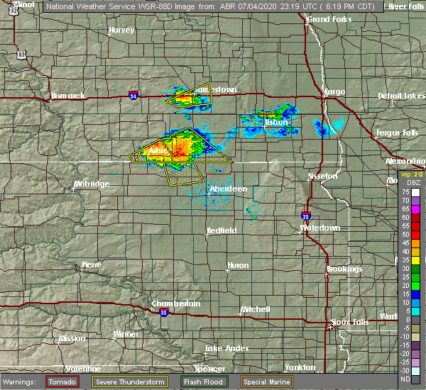
| 7/4/2020 7:35 PM CDT |
 At 734 pm cdt, a severe thunderstorm was located over wetonka, or 15 miles northwest of aberdeen, moving south at 30 mph. this is a very dangerous storm (radar indicated). Hazards include 80 mph wind gusts and ping pong ball size hail. Flying debris will be dangerous to those caught without shelter. mobile homes will be heavily damaged. expect considerable damage to roofs, windows, and vehicles. extensive tree damage and power outages are likely. This severe storm will be near, richmond lake rec area around 745 pm cdt. At 734 pm cdt, a severe thunderstorm was located over wetonka, or 15 miles northwest of aberdeen, moving south at 30 mph. this is a very dangerous storm (radar indicated). Hazards include 80 mph wind gusts and ping pong ball size hail. Flying debris will be dangerous to those caught without shelter. mobile homes will be heavily damaged. expect considerable damage to roofs, windows, and vehicles. extensive tree damage and power outages are likely. This severe storm will be near, richmond lake rec area around 745 pm cdt.
|
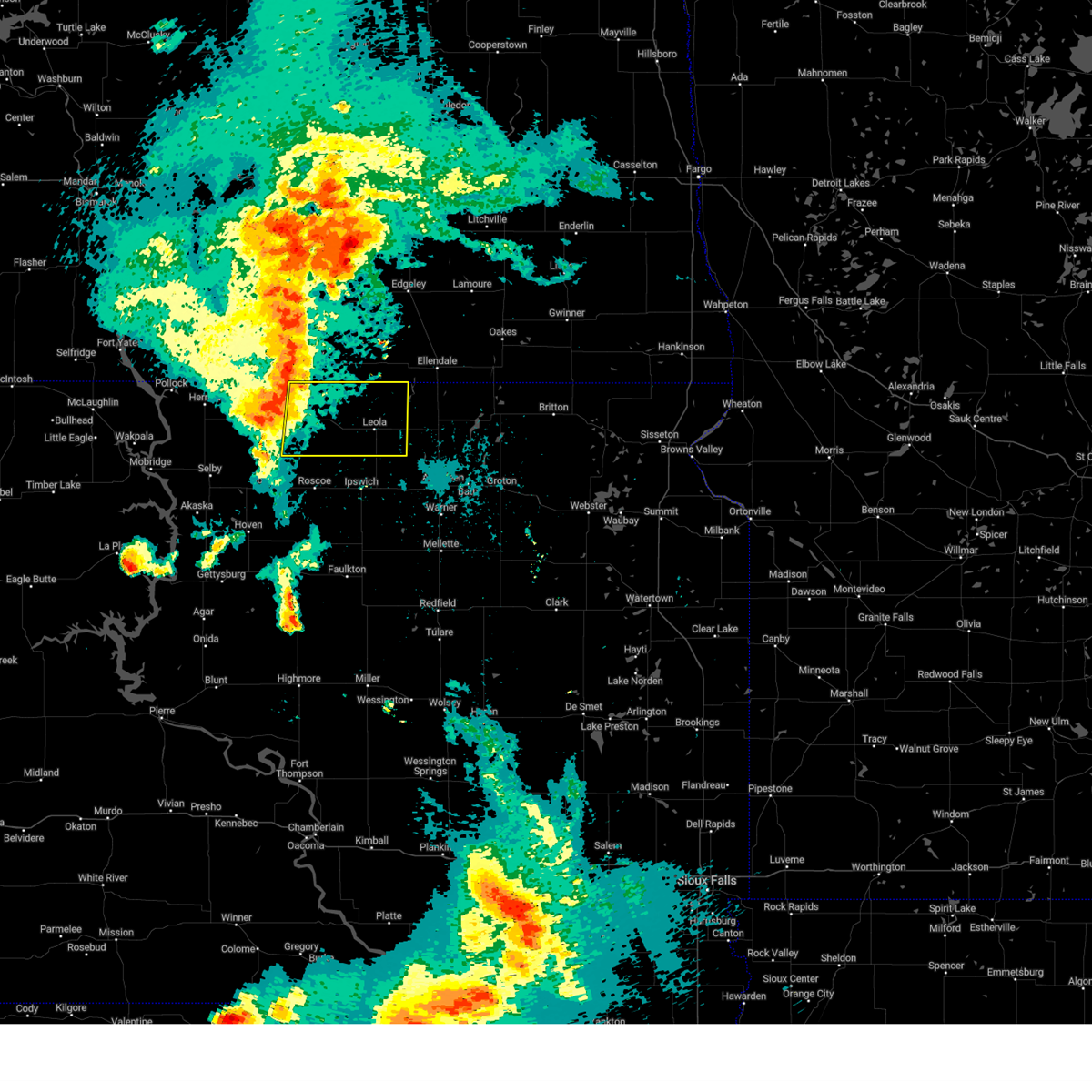
| 7/4/2020 7:04 PM CDT |
 At 704 pm cdt, a severe thunderstorm was located near elm lake, or 18 miles southwest of ellendale, moving southeast at 30 mph (radar indicated). Hazards include 60 mph wind gusts and half dollar size hail. Hail damage to vehicles is expected. expect wind damage to roofs, siding, and trees. this severe thunderstorm will be near, grassland colony around 725 pm cdt. wetonka and long lake colony around 730 pm cdt. Richmond lake rec area around 745 pm cdt. At 704 pm cdt, a severe thunderstorm was located near elm lake, or 18 miles southwest of ellendale, moving southeast at 30 mph (radar indicated). Hazards include 60 mph wind gusts and half dollar size hail. Hail damage to vehicles is expected. expect wind damage to roofs, siding, and trees. this severe thunderstorm will be near, grassland colony around 725 pm cdt. wetonka and long lake colony around 730 pm cdt. Richmond lake rec area around 745 pm cdt.
|
| 7/4/2020 6:23 PM CDT |
 At 622 pm cdt, a severe thunderstorm was located near spring creek colony, or 19 miles southwest of ellendale, moving south at 40 mph. this is a very dangerous storm (radar indicated). Hazards include 80 mph wind gusts and quarter size hail. Flying debris will be dangerous to those caught without shelter. mobile homes will be heavily damaged. expect considerable damage to roofs, windows, and vehicles. extensive tree damage and power outages are likely. This severe storm will be near, grassland colony around 640 pm cdt. At 622 pm cdt, a severe thunderstorm was located near spring creek colony, or 19 miles southwest of ellendale, moving south at 40 mph. this is a very dangerous storm (radar indicated). Hazards include 80 mph wind gusts and quarter size hail. Flying debris will be dangerous to those caught without shelter. mobile homes will be heavily damaged. expect considerable damage to roofs, windows, and vehicles. extensive tree damage and power outages are likely. This severe storm will be near, grassland colony around 640 pm cdt.
|
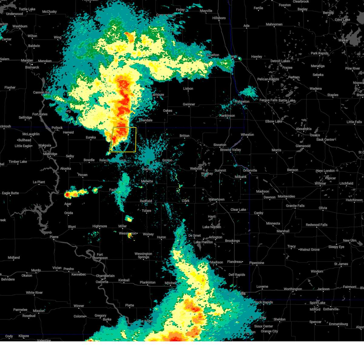
| 7/4/2020 6:19 PM CDT |
 At 619 pm cdt, a severe thunderstorm was located near spring creek colony, or 19 miles southwest of ellendale, moving south at 35 mph. this is a very dangerous storm (radar indicated). Hazards include 80 mph wind gusts and quarter size hail. Flying debris will be dangerous to those caught without shelter. mobile homes will be heavily damaged. expect considerable damage to roofs, windows, and vehicles. extensive tree damage and power outages are likely. this severe storm will be near, leola around 630 pm cdt. Grassland colony around 640 pm cdt. At 619 pm cdt, a severe thunderstorm was located near spring creek colony, or 19 miles southwest of ellendale, moving south at 35 mph. this is a very dangerous storm (radar indicated). Hazards include 80 mph wind gusts and quarter size hail. Flying debris will be dangerous to those caught without shelter. mobile homes will be heavily damaged. expect considerable damage to roofs, windows, and vehicles. extensive tree damage and power outages are likely. this severe storm will be near, leola around 630 pm cdt. Grassland colony around 640 pm cdt.
|
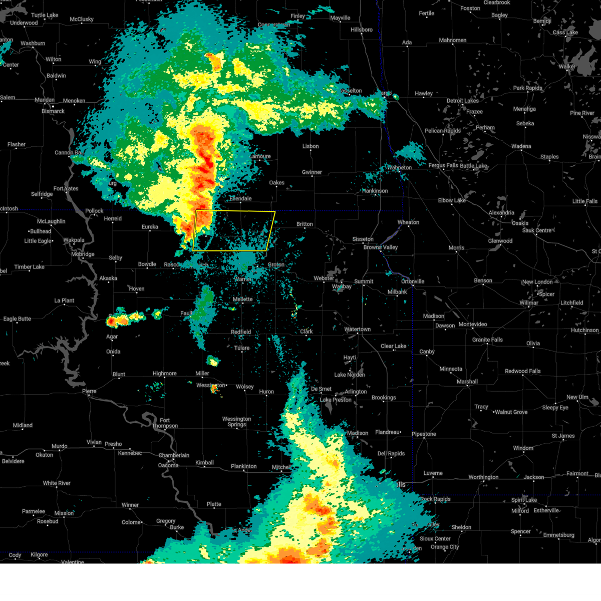
| 7/4/2020 6:05 PM CDT |
 At 605 pm cdt, a severe thunderstorm was located near spring creek colony, or 20 miles west of ellendale, moving south at 40 mph (radar indicated). Hazards include 70 mph wind gusts and quarter size hail. Hail damage to vehicles is expected. expect considerable tree damage. wind damage is also likely to mobile homes, roofs, and outbuildings. this severe thunderstorm will be near, spring creek colony around 610 pm cdt. leola around 625 pm cdt. Grassland colony around 635 pm cdt. At 605 pm cdt, a severe thunderstorm was located near spring creek colony, or 20 miles west of ellendale, moving south at 40 mph (radar indicated). Hazards include 70 mph wind gusts and quarter size hail. Hail damage to vehicles is expected. expect considerable tree damage. wind damage is also likely to mobile homes, roofs, and outbuildings. this severe thunderstorm will be near, spring creek colony around 610 pm cdt. leola around 625 pm cdt. Grassland colony around 635 pm cdt.
|
| 6/7/2020 8:07 PM CDT |
 At 807 pm cdt, a severe thunderstorm was located over cravens corner, or near ipswich, moving northeast at 70 mph (radar indicated). Hazards include 70 mph wind gusts. Expect considerable tree damage. damage is likely to mobile homes, roofs, and outbuildings. Locations impacted include, ipswich, leola, wetonka, pembrook colony, plainview colony, long lake colony, deerfield colony, cravens corner, mina, richmond lake rec area and mina lake rec area. At 807 pm cdt, a severe thunderstorm was located over cravens corner, or near ipswich, moving northeast at 70 mph (radar indicated). Hazards include 70 mph wind gusts. Expect considerable tree damage. damage is likely to mobile homes, roofs, and outbuildings. Locations impacted include, ipswich, leola, wetonka, pembrook colony, plainview colony, long lake colony, deerfield colony, cravens corner, mina, richmond lake rec area and mina lake rec area.
|
| 6/7/2020 7:55 PM CDT |
 At 755 pm cdt, a severe thunderstorm was located near norbeck, or 14 miles south of ipswich, moving northeast at 70 mph (radar indicated). Hazards include 60 mph wind gusts. expect damage to roofs, siding, and trees At 755 pm cdt, a severe thunderstorm was located near norbeck, or 14 miles south of ipswich, moving northeast at 70 mph (radar indicated). Hazards include 60 mph wind gusts. expect damage to roofs, siding, and trees
|
| 4/6/2020 8:10 PM CDT | Quarter sized hail reported 0.2 miles NNW of Leola, SD, report received via social media. time estimated from radar. |
| 7/17/2019 2:15 AM CDT |
 At 215 am cdt, severe thunderstorms were located along a line extending from 7 miles west of hillsview to near bowdle to tolstoy, moving east at 45 mph (radar indicated). Hazards include 60 mph wind gusts. expect damage to roofs, siding, and trees At 215 am cdt, severe thunderstorms were located along a line extending from 7 miles west of hillsview to near bowdle to tolstoy, moving east at 45 mph (radar indicated). Hazards include 60 mph wind gusts. expect damage to roofs, siding, and trees
|
| 6/28/2019 11:33 AM CDT |
 At 1132 am cdt, a severe thunderstorm was located near new town corner, or 9 miles southeast of eureka, moving east at 35 mph (public. at 1118 am cdt, quarter-sized hail was reported in eureka). Hazards include 60 mph wind gusts and quarter size hail. Hail damage to vehicles is expected. expect wind damage to roofs, siding, and trees. Locations impacted include, leola, hosmer, long lake, hillsview and new town corner. At 1132 am cdt, a severe thunderstorm was located near new town corner, or 9 miles southeast of eureka, moving east at 35 mph (public. at 1118 am cdt, quarter-sized hail was reported in eureka). Hazards include 60 mph wind gusts and quarter size hail. Hail damage to vehicles is expected. expect wind damage to roofs, siding, and trees. Locations impacted include, leola, hosmer, long lake, hillsview and new town corner.
|
| 6/28/2019 11:16 AM CDT |
 At 1116 am cdt, a severe thunderstorm was located over eureka, moving east at 30 mph (radar indicated). Hazards include 60 mph wind gusts and quarter size hail. Hail damage to vehicles is expected. Expect wind damage to roofs, siding, and trees. At 1116 am cdt, a severe thunderstorm was located over eureka, moving east at 30 mph (radar indicated). Hazards include 60 mph wind gusts and quarter size hail. Hail damage to vehicles is expected. Expect wind damage to roofs, siding, and trees.
|
| 8/26/2018 8:25 PM CDT |
 At 824 pm cdt, a severe thunderstorm was located near leola, or 22 miles northeast of ipswich, moving east at 25 mph (radar indicated). Hazards include golf ball size hail and 60 mph wind gusts. People and animals outdoors will be injured. expect hail damage to roofs, siding, windows, and vehicles. expect wind damage to roofs, siding, and trees. locations impacted include, leola, frederick, westport, barnard and grassland colony. A tornado watch remains in effect until 200 am cdt for north central and northeastern south dakota. At 824 pm cdt, a severe thunderstorm was located near leola, or 22 miles northeast of ipswich, moving east at 25 mph (radar indicated). Hazards include golf ball size hail and 60 mph wind gusts. People and animals outdoors will be injured. expect hail damage to roofs, siding, windows, and vehicles. expect wind damage to roofs, siding, and trees. locations impacted include, leola, frederick, westport, barnard and grassland colony. A tornado watch remains in effect until 200 am cdt for north central and northeastern south dakota.
|
| 8/26/2018 8:20 PM CDT | Quarter sized hail reported 0.2 miles NNW of Leola, SD, relayed through state radio from emergency mgmt. time estimated. |
| 8/26/2018 8:20 PM CDT |
 At 819 pm cdt, a severe thunderstorm was located near leola, or 21 miles north of ipswich, moving east at 30 mph (radar indicated). Hazards include 60 mph wind gusts and quarter size hail. Hail damage to vehicles is expected. Expect wind damage to roofs, siding, and trees. At 819 pm cdt, a severe thunderstorm was located near leola, or 21 miles north of ipswich, moving east at 30 mph (radar indicated). Hazards include 60 mph wind gusts and quarter size hail. Hail damage to vehicles is expected. Expect wind damage to roofs, siding, and trees.
|
| 8/26/2018 8:07 AM CDT |
 At 806 am cdt, a severe thunderstorm was located near plainview colony, or 13 miles north of ipswich, moving east at 50 mph (radar indicated). Hazards include 60 mph wind gusts and quarter size hail. Hail damage to vehicles is expected. Expect wind damage to roofs, siding, and trees. At 806 am cdt, a severe thunderstorm was located near plainview colony, or 13 miles north of ipswich, moving east at 50 mph (radar indicated). Hazards include 60 mph wind gusts and quarter size hail. Hail damage to vehicles is expected. Expect wind damage to roofs, siding, and trees.
|
| 7/4/2018 3:19 AM CDT |
 At 319 am cdt, severe thunderstorms were located along a line extending from 8 miles northwest of fullerton to near spring creek colony to 7 miles northeast of leola, moving northeast at 60 mph (trained weather spotters). Hazards include 70 mph wind gusts. Expect considerable tree damage. damage is likely to mobile homes, roofs, and outbuildings. Locations impacted include, leola, forbes, spring creek colony, plainview colony, long lake colony, deerfield colony and grassland colony. At 319 am cdt, severe thunderstorms were located along a line extending from 8 miles northwest of fullerton to near spring creek colony to 7 miles northeast of leola, moving northeast at 60 mph (trained weather spotters). Hazards include 70 mph wind gusts. Expect considerable tree damage. damage is likely to mobile homes, roofs, and outbuildings. Locations impacted include, leola, forbes, spring creek colony, plainview colony, long lake colony, deerfield colony and grassland colony.
|
| 7/4/2018 3:04 AM CDT |
 At 303 am cdt, severe thunderstorms were located along a line extending from 7 miles north of forbes to near leola to near cresbard, moving northeast at 50 mph (trained weather spotters). Hazards include 60 mph wind gusts. Expect damage to roofs, siding, and trees. Locations impacted include, ipswich, leola, forbes, pembrook colony, spring creek colony, plainview colony, long lake colony, deerfield colony, cravens corner and grassland colony. At 303 am cdt, severe thunderstorms were located along a line extending from 7 miles north of forbes to near leola to near cresbard, moving northeast at 50 mph (trained weather spotters). Hazards include 60 mph wind gusts. Expect damage to roofs, siding, and trees. Locations impacted include, ipswich, leola, forbes, pembrook colony, spring creek colony, plainview colony, long lake colony, deerfield colony, cravens corner and grassland colony.
|
| 7/4/2018 2:43 AM CDT |
 At 242 am cdt, severe thunderstorms were located along a line extending from 6 miles southeast of venturia to near brentwood colony, moving northeast at 60 mph (trained weather spotters). Hazards include 70 mph wind gusts. Expect considerable tree damage. Damage is likely to mobile homes, roofs, and outbuildings. At 242 am cdt, severe thunderstorms were located along a line extending from 6 miles southeast of venturia to near brentwood colony, moving northeast at 60 mph (trained weather spotters). Hazards include 70 mph wind gusts. Expect considerable tree damage. Damage is likely to mobile homes, roofs, and outbuildings.
|
| 6/14/2018 11:14 PM CDT |
 The national weather service in aberdeen has issued a * severe thunderstorm warning for. north central edmunds county in north central south dakota. northwestern brown county in northeastern south dakota. eastern mcpherson county in north central south dakota. Until midnight cdt. The national weather service in aberdeen has issued a * severe thunderstorm warning for. north central edmunds county in north central south dakota. northwestern brown county in northeastern south dakota. eastern mcpherson county in north central south dakota. Until midnight cdt.
|
| 9/19/2017 8:00 PM CDT |
 At 800 pm cdt, a severe thunderstorm capable of producing a tornado was located 8 miles southwest of spring creek colony, or 21 miles southeast of ashley, moving northeast at 35 mph (radar indicated rotation). Hazards include tornado and half dollar size hail. Flying debris will be dangerous to those caught without shelter. mobile homes will be damaged or destroyed. damage to roofs, windows, and vehicles will occur. tree damage is likely. this dangerous storm will be near, spring creek colony around 815 pm cdt. Forbes around 825 pm cdt. At 800 pm cdt, a severe thunderstorm capable of producing a tornado was located 8 miles southwest of spring creek colony, or 21 miles southeast of ashley, moving northeast at 35 mph (radar indicated rotation). Hazards include tornado and half dollar size hail. Flying debris will be dangerous to those caught without shelter. mobile homes will be damaged or destroyed. damage to roofs, windows, and vehicles will occur. tree damage is likely. this dangerous storm will be near, spring creek colony around 815 pm cdt. Forbes around 825 pm cdt.
|
| 9/19/2017 7:52 PM CDT |
 At 752 pm cdt, a severe thunderstorm capable of producing a tornado was located 7 miles southeast of long lake, or 21 miles southeast of ashley, moving northeast at 35 mph (radar indicated rotation). Hazards include tornado and half dollar size hail. Flying debris will be dangerous to those caught without shelter. mobile homes will be damaged or destroyed. damage to roofs, windows, and vehicles will occur. tree damage is likely. this dangerous storm will be near, spring creek colony around 815 pm cdt. Forbes and elm lake around 825 pm cdt. At 752 pm cdt, a severe thunderstorm capable of producing a tornado was located 7 miles southeast of long lake, or 21 miles southeast of ashley, moving northeast at 35 mph (radar indicated rotation). Hazards include tornado and half dollar size hail. Flying debris will be dangerous to those caught without shelter. mobile homes will be damaged or destroyed. damage to roofs, windows, and vehicles will occur. tree damage is likely. this dangerous storm will be near, spring creek colony around 815 pm cdt. Forbes and elm lake around 825 pm cdt.
|
| 7/21/2017 8:34 PM CDT |
 At 834 pm cdt, a severe thunderstorm was located 8 miles northwest of plainview colony, or 16 miles north of ipswich, moving northeast at 30 mph (radar indicated). Hazards include 70 mph wind gusts and quarter size hail. Hail damage to vehicles is expected. expect considerable tree damage. wind damage is also likely to mobile homes, roofs, and outbuildings. Locations impacted include, eureka, leola, hosmer, long lake, hillsview and new town corner. At 834 pm cdt, a severe thunderstorm was located 8 miles northwest of plainview colony, or 16 miles north of ipswich, moving northeast at 30 mph (radar indicated). Hazards include 70 mph wind gusts and quarter size hail. Hail damage to vehicles is expected. expect considerable tree damage. wind damage is also likely to mobile homes, roofs, and outbuildings. Locations impacted include, eureka, leola, hosmer, long lake, hillsview and new town corner.
|
| 7/21/2017 8:25 PM CDT |
 At 825 pm cdt, a severe thunderstorm was located 10 miles northwest of plainview colony, or 16 miles northwest of ipswich, moving northeast at 30 mph (radar indicated). Hazards include tennis ball size hail and 70 mph wind gusts. People and animals outdoors will be injured. expect hail damage to roofs, siding, windows, and vehicles. expect considerable tree damage. wind damage is also likely to mobile homes, roofs, and outbuildings. Locations impacted include, eureka, leola, hosmer, long lake, hillsview and new town corner. At 825 pm cdt, a severe thunderstorm was located 10 miles northwest of plainview colony, or 16 miles northwest of ipswich, moving northeast at 30 mph (radar indicated). Hazards include tennis ball size hail and 70 mph wind gusts. People and animals outdoors will be injured. expect hail damage to roofs, siding, windows, and vehicles. expect considerable tree damage. wind damage is also likely to mobile homes, roofs, and outbuildings. Locations impacted include, eureka, leola, hosmer, long lake, hillsview and new town corner.
|
| 7/21/2017 8:22 PM CDT |
 At 822 pm cdt, a severe thunderstorm was located 10 miles southeast of new town corner, or 16 miles northwest of ipswich, moving northeast at 30 mph (radar indicated). Hazards include golf ball size hail and 70 mph wind gusts. People and animals outdoors will be injured. expect hail damage to roofs, siding, windows, and vehicles. expect considerable tree damage. wind damage is also likely to mobile homes, roofs, and outbuildings. Locations impacted include, eureka, leola, hosmer, long lake, hillsview and new town corner. At 822 pm cdt, a severe thunderstorm was located 10 miles southeast of new town corner, or 16 miles northwest of ipswich, moving northeast at 30 mph (radar indicated). Hazards include golf ball size hail and 70 mph wind gusts. People and animals outdoors will be injured. expect hail damage to roofs, siding, windows, and vehicles. expect considerable tree damage. wind damage is also likely to mobile homes, roofs, and outbuildings. Locations impacted include, eureka, leola, hosmer, long lake, hillsview and new town corner.
|
| 7/21/2017 8:14 PM CDT |
 At 814 pm cdt, a severe thunderstorm was located 8 miles east of hosmer, or 17 miles northwest of ipswich, moving east at 30 mph (radar indicated). Hazards include 60 mph wind gusts and quarter size hail. Hail damage to vehicles is expected. Expect wind damage to roofs, siding, and trees. At 814 pm cdt, a severe thunderstorm was located 8 miles east of hosmer, or 17 miles northwest of ipswich, moving east at 30 mph (radar indicated). Hazards include 60 mph wind gusts and quarter size hail. Hail damage to vehicles is expected. Expect wind damage to roofs, siding, and trees.
|
| 7/5/2017 8:02 PM CDT |
 The national weather service in aberdeen has issued a * severe thunderstorm warning for. northeastern edmunds county in north central south dakota. southwestern mcpherson county in north central south dakota. Until 845 pm cdt * at 802 pm cdt, a severe thunderstorm was located over new town. The national weather service in aberdeen has issued a * severe thunderstorm warning for. northeastern edmunds county in north central south dakota. southwestern mcpherson county in north central south dakota. Until 845 pm cdt * at 802 pm cdt, a severe thunderstorm was located over new town.
|
| 8/10/2016 8:22 PM CDT |
 At 822 pm cdt, a severe thunderstorm was located over plainview colony, or 10 miles north of ipswich, moving northeast at 20 mph (radar indicated). Hazards include 60 mph wind gusts and quarter size hail. Hail damage to vehicles is expected. expect wind damage to roofs, siding, and trees. this severe thunderstorm will be near, deerfield colony around 830 pm cdt. Leola around 855 pm cdt. At 822 pm cdt, a severe thunderstorm was located over plainview colony, or 10 miles north of ipswich, moving northeast at 20 mph (radar indicated). Hazards include 60 mph wind gusts and quarter size hail. Hail damage to vehicles is expected. expect wind damage to roofs, siding, and trees. this severe thunderstorm will be near, deerfield colony around 830 pm cdt. Leola around 855 pm cdt.
|
| 8/10/2016 7:14 PM CDT |
 At 714 pm cdt, a severe thunderstorm was located near new town corner, or 12 miles east of eureka, moving northeast at 25 mph (radar indicated). Hazards include 60 mph wind gusts and half dollar size hail. Hail damage to vehicles is expected. expect wind damage to roofs, siding, and trees. this severe thunderstorm will be near, long lake around 740 pm cdt. Another storm is located 4 miles west of hillsview. At 714 pm cdt, a severe thunderstorm was located near new town corner, or 12 miles east of eureka, moving northeast at 25 mph (radar indicated). Hazards include 60 mph wind gusts and half dollar size hail. Hail damage to vehicles is expected. expect wind damage to roofs, siding, and trees. this severe thunderstorm will be near, long lake around 740 pm cdt. Another storm is located 4 miles west of hillsview.
|
| 8/10/2016 1:34 AM CDT |
 At 134 am cdt, a severe thunderstorm was located over grassland colony, or 20 miles northeast of ipswich, moving east at 55 mph (radar indicated). Hazards include 60 mph wind gusts and quarter size hail. Hail damage to vehicles is expected. expect wind damage to roofs, siding, and trees. this severe thunderstorm will be near, westport and barnard around 150 am cdt. columbia around 200 am cdt. putney around 205 am cdt. Claremont around 210 am cdt. At 134 am cdt, a severe thunderstorm was located over grassland colony, or 20 miles northeast of ipswich, moving east at 55 mph (radar indicated). Hazards include 60 mph wind gusts and quarter size hail. Hail damage to vehicles is expected. expect wind damage to roofs, siding, and trees. this severe thunderstorm will be near, westport and barnard around 150 am cdt. columbia around 200 am cdt. putney around 205 am cdt. Claremont around 210 am cdt.
|
| 8/10/2016 1:29 AM CDT |
 At 129 am cdt, a severe thunderstorm was located near leola, or 20 miles north of ipswich, moving east at 55 mph (radar indicated). Hazards include 70 mph wind gusts and quarter size hail. Hail damage to vehicles is expected. expect considerable tree damage. wind damage is also likely to mobile homes, roofs, and outbuildings. This severe thunderstorm will remain over mainly rural areas of eastern mcpherson and northeastern edmunds counties. At 129 am cdt, a severe thunderstorm was located near leola, or 20 miles north of ipswich, moving east at 55 mph (radar indicated). Hazards include 70 mph wind gusts and quarter size hail. Hail damage to vehicles is expected. expect considerable tree damage. wind damage is also likely to mobile homes, roofs, and outbuildings. This severe thunderstorm will remain over mainly rural areas of eastern mcpherson and northeastern edmunds counties.
|
| 8/10/2016 1:13 AM CDT |
 At 113 am cdt, severe thunderstorms were located along a line extending from 10 miles east of ashley to 6 miles south of long lake to near hosmer to 6 miles north of onaka, moving east at 55 mph (radar indicated). Hazards include 70 mph wind gusts and quarter size hail. Hail damage to vehicles is expected. expect considerable tree damage. wind damage is also likely to mobile homes, roofs, and outbuildings. these severe storms will be near, leola around 125 am cdt. spring creek colony around 130 am cdt. forbes, plainview colony and pembrook colony around 135 am cdt. deerfield colony and long lake colony around 140 am cdt. Grassland colony around 145 am cdt. At 113 am cdt, severe thunderstorms were located along a line extending from 10 miles east of ashley to 6 miles south of long lake to near hosmer to 6 miles north of onaka, moving east at 55 mph (radar indicated). Hazards include 70 mph wind gusts and quarter size hail. Hail damage to vehicles is expected. expect considerable tree damage. wind damage is also likely to mobile homes, roofs, and outbuildings. these severe storms will be near, leola around 125 am cdt. spring creek colony around 130 am cdt. forbes, plainview colony and pembrook colony around 135 am cdt. deerfield colony and long lake colony around 140 am cdt. Grassland colony around 145 am cdt.
|
| 8/10/2016 12:53 AM CDT |
 At 1252 am cdt, severe thunderstorms were located along a line extending from venturia to 9 miles northeast of java to near hoven, moving east at 45 mph. these are very dangerous storms (radar indicated). Hazards include 80 mph wind gusts and quarter size hail. Flying debris will be dangerous to those caught without shelter. mobile homes will be heavily damaged. expect considerable damage to roofs, windows, and vehicles. extensive tree damage and power outages are likely. severe thunderstorms will be near, hosmer and hillsview around 110 am cdt. roscoe, loyalton and new town corner around 120 am cdt. ipswich and pembrook colony around 135 am cdt. cravens corner around 145 am cdt. leola around 150 am cdt. Grassland colony around 155 am cdt. At 1252 am cdt, severe thunderstorms were located along a line extending from venturia to 9 miles northeast of java to near hoven, moving east at 45 mph. these are very dangerous storms (radar indicated). Hazards include 80 mph wind gusts and quarter size hail. Flying debris will be dangerous to those caught without shelter. mobile homes will be heavily damaged. expect considerable damage to roofs, windows, and vehicles. extensive tree damage and power outages are likely. severe thunderstorms will be near, hosmer and hillsview around 110 am cdt. roscoe, loyalton and new town corner around 120 am cdt. ipswich and pembrook colony around 135 am cdt. cravens corner around 145 am cdt. leola around 150 am cdt. Grassland colony around 155 am cdt.
|
| 8/3/2016 11:08 PM CDT |
 At 1108 pm cdt, a severe thunderstorm was located 7 miles west of barnard, or 19 miles south of ellendale, moving east at 45 mph (radar indicated). Hazards include 60 mph wind gusts and quarter size hail. Hail damage to vehicles is expected. expect wind damage to roofs, siding, and trees. This severe thunderstorm will remain over mainly rural areas of eastern mcpherson and northwestern brown counties. At 1108 pm cdt, a severe thunderstorm was located 7 miles west of barnard, or 19 miles south of ellendale, moving east at 45 mph (radar indicated). Hazards include 60 mph wind gusts and quarter size hail. Hail damage to vehicles is expected. expect wind damage to roofs, siding, and trees. This severe thunderstorm will remain over mainly rural areas of eastern mcpherson and northwestern brown counties.
|
| 8/3/2016 10:40 PM CDT |
 At 1040 pm cdt, a severe thunderstorm was located 8 miles east of long lake, or 21 miles southeast of ashley, moving east at 45 mph (radar indicated). Hazards include 70 mph wind gusts and quarter size hail. Hail damage to vehicles is expected. expect considerable tree damage. wind damage is also likely to mobile homes, roofs, and outbuildings. this severe storm will be near, leola and spring creek colony around 1050 pm cdt. Grassland colony around 1100 pm cdt. At 1040 pm cdt, a severe thunderstorm was located 8 miles east of long lake, or 21 miles southeast of ashley, moving east at 45 mph (radar indicated). Hazards include 70 mph wind gusts and quarter size hail. Hail damage to vehicles is expected. expect considerable tree damage. wind damage is also likely to mobile homes, roofs, and outbuildings. this severe storm will be near, leola and spring creek colony around 1050 pm cdt. Grassland colony around 1100 pm cdt.
|
| 8/3/2016 10:35 PM CDT |
 At 1035 pm cdt, a severe thunderstorm was located near long lake, or 18 miles southeast of ashley, moving east at 45 mph (radar indicated). Hazards include 60 mph wind gusts and quarter size hail. Hail damage to vehicles is expected. expect wind damage to roofs, siding, and trees. this severe thunderstorm will be near, leola and spring creek colony around 1050 pm cdt. Grassland colony around 1100 pm cdt. At 1035 pm cdt, a severe thunderstorm was located near long lake, or 18 miles southeast of ashley, moving east at 45 mph (radar indicated). Hazards include 60 mph wind gusts and quarter size hail. Hail damage to vehicles is expected. expect wind damage to roofs, siding, and trees. this severe thunderstorm will be near, leola and spring creek colony around 1050 pm cdt. Grassland colony around 1100 pm cdt.
|
| 7/26/2016 9:53 AM CDT |
 At 952 am cdt, a severe thunderstorm was located 7 miles west of spring creek colony, or 19 miles southeast of ashley, moving southeast at 25 mph (radar indicated). Hazards include quarter size hail. Damage to vehicles is expected. This severe thunderstorm will be near, leola around 1015 am cdt. At 952 am cdt, a severe thunderstorm was located 7 miles west of spring creek colony, or 19 miles southeast of ashley, moving southeast at 25 mph (radar indicated). Hazards include quarter size hail. Damage to vehicles is expected. This severe thunderstorm will be near, leola around 1015 am cdt.
|
| 7/22/2016 2:02 PM CDT |
 At 201 pm cdt, a severe thunderstorm was located near ipswich, moving southeast at 35 mph (radar indicated). Hazards include golf ball size hail and 60 mph wind gusts. People and animals outdoors will be injured. expect hail damage to roofs, siding, windows, and vehicles. expect wind damage to roofs, siding, and trees. This severe storm will be near, cravens corner and pembrook colony around 210 pm cdt. At 201 pm cdt, a severe thunderstorm was located near ipswich, moving southeast at 35 mph (radar indicated). Hazards include golf ball size hail and 60 mph wind gusts. People and animals outdoors will be injured. expect hail damage to roofs, siding, windows, and vehicles. expect wind damage to roofs, siding, and trees. This severe storm will be near, cravens corner and pembrook colony around 210 pm cdt.
|
| 7/22/2016 1:48 PM CDT |
 At 148 pm cdt, a severe thunderstorm was located 8 miles west of plainview colony, or 12 miles northwest of ipswich, moving southeast at 35 mph (radar indicated). Hazards include 60 mph wind gusts and half dollar size hail. Hail damage to vehicles is expected. expect wind damage to roofs, siding, and trees. this severe thunderstorm will be near, plainview colony around 200 pm cdt. ipswich around 210 pm cdt. Cravens corner and pembrook colony around 215 pm cdt. At 148 pm cdt, a severe thunderstorm was located 8 miles west of plainview colony, or 12 miles northwest of ipswich, moving southeast at 35 mph (radar indicated). Hazards include 60 mph wind gusts and half dollar size hail. Hail damage to vehicles is expected. expect wind damage to roofs, siding, and trees. this severe thunderstorm will be near, plainview colony around 200 pm cdt. ipswich around 210 pm cdt. Cravens corner and pembrook colony around 215 pm cdt.
|
| 7/22/2016 1:43 PM CDT | Quarter sized hail reported 14.6 miles ENE of Leola, SD, estimated 50 mph winds also. radar estimated time. |
| 7/16/2016 11:31 PM CDT |
 At 1130 pm cdt, a severe thunderstorm was located near richmond lake rec area, or 8 miles west of aberdeen, moving east at 50 mph (trained weather spotters). Hazards include 70 mph wind gusts. Expect considerable tree damage. damage is likely to mobile homes, roofs, and outbuildings. this severe storm will be near, aberdeen around 1140 pm cdt. bath and columbia around 1150 pm cdt. putney around 1200 am cdt. Groton around 1205 am cdt. At 1130 pm cdt, a severe thunderstorm was located near richmond lake rec area, or 8 miles west of aberdeen, moving east at 50 mph (trained weather spotters). Hazards include 70 mph wind gusts. Expect considerable tree damage. damage is likely to mobile homes, roofs, and outbuildings. this severe storm will be near, aberdeen around 1140 pm cdt. bath and columbia around 1150 pm cdt. putney around 1200 am cdt. Groton around 1205 am cdt.
|
| 7/16/2016 11:09 PM CDT |
 At 1109 pm cdt, a severe thunderstorm was located over ipswich, moving east at 50 mph (emergency management). Hazards include 70 mph wind gusts. Expect considerable tree damage. damage is likely to mobile homes, roofs, and outbuildings. this severe thunderstorm will be near, deerfield colony around 1115 pm cdt. mina lake rec area and mina around 1125 pm cdt. richmond lake rec area around 1130 pm cdt. aberdeen around 1140 pm cdt. bath and columbia around 1150 pm cdt. putney around 1200 am cdt. Groton around 1205 am cdt. At 1109 pm cdt, a severe thunderstorm was located over ipswich, moving east at 50 mph (emergency management). Hazards include 70 mph wind gusts. Expect considerable tree damage. damage is likely to mobile homes, roofs, and outbuildings. this severe thunderstorm will be near, deerfield colony around 1115 pm cdt. mina lake rec area and mina around 1125 pm cdt. richmond lake rec area around 1130 pm cdt. aberdeen around 1140 pm cdt. bath and columbia around 1150 pm cdt. putney around 1200 am cdt. Groton around 1205 am cdt.
|
| 7/16/2016 11:00 PM CDT |
 At 1059 pm cdt, a severe thunderstorm was located near ipswich, moving east at 60 mph (radar indicated). Hazards include 70 mph wind gusts and quarter size hail. Hail damage to vehicles is expected. expect considerable tree damage. wind damage is also likely to mobile homes, roofs, and outbuildings. this severe storm will be near, cravens corner around 1105 pm cdt. Mina and mina lake rec area around 1115 pm cdt. At 1059 pm cdt, a severe thunderstorm was located near ipswich, moving east at 60 mph (radar indicated). Hazards include 70 mph wind gusts and quarter size hail. Hail damage to vehicles is expected. expect considerable tree damage. wind damage is also likely to mobile homes, roofs, and outbuildings. this severe storm will be near, cravens corner around 1105 pm cdt. Mina and mina lake rec area around 1115 pm cdt.
|
| 7/16/2016 10:30 PM CDT |
 At 1029 pm cdt, a severe thunderstorm was located 9 miles southeast of bowdle, or 24 miles west of ipswich, moving east at 60 mph (radar indicated). Hazards include 70 mph wind gusts. Expect considerable tree damage. damage is likely to mobile homes, roofs, and outbuildings. this severe thunderstorm will be near, ipswich and pembrook colony around 1040 pm cdt. mina and cravens corner around 1045 pm cdt. mina lake rec area and richmond lake rec area around 1050 pm cdt. Time, mot, loc 0329z 263deg 117kt 4536 9951. At 1029 pm cdt, a severe thunderstorm was located 9 miles southeast of bowdle, or 24 miles west of ipswich, moving east at 60 mph (radar indicated). Hazards include 70 mph wind gusts. Expect considerable tree damage. damage is likely to mobile homes, roofs, and outbuildings. this severe thunderstorm will be near, ipswich and pembrook colony around 1040 pm cdt. mina and cravens corner around 1045 pm cdt. mina lake rec area and richmond lake rec area around 1050 pm cdt. Time, mot, loc 0329z 263deg 117kt 4536 9951.
|
| 7/9/2016 11:10 PM CDT |
 At 1109 pm cdt, severe thunderstorms were located along a line extending from 8 miles northwest of ashley to near onaka, moving east at 55 mph (radar indicated). Hazards include 70 mph wind gusts. Expect considerable tree damage. damage is likely to mobile homes, roofs, and outbuildings. Severe thunderstorms will be near, loyalton around 1120 pm cdt. At 1109 pm cdt, severe thunderstorms were located along a line extending from 8 miles northwest of ashley to near onaka, moving east at 55 mph (radar indicated). Hazards include 70 mph wind gusts. Expect considerable tree damage. damage is likely to mobile homes, roofs, and outbuildings. Severe thunderstorms will be near, loyalton around 1120 pm cdt.
|
| 7/4/2016 5:40 PM CDT | Several trees and an out building knocked down. time estimate in mcpherson county SD, 15 miles SSW of Leola, SD |
| 5/30/2016 8:17 PM CDT |
 At 817 pm cdt, a severe thunderstorm was located near grassland colony, or 18 miles northeast of ipswich, moving northeast at 45 mph (radar indicated). Hazards include 70 mph wind gusts and penny size hail. Expect considerable tree damage. damage is likely to mobile homes, roofs, and outbuildings. this severe storm will be near, wetonka and grassland colony around 820 pm cdt. elm lake around 835 pm cdt. barnard around 840 pm cdt. Frederick around 845 pm cdt. At 817 pm cdt, a severe thunderstorm was located near grassland colony, or 18 miles northeast of ipswich, moving northeast at 45 mph (radar indicated). Hazards include 70 mph wind gusts and penny size hail. Expect considerable tree damage. damage is likely to mobile homes, roofs, and outbuildings. this severe storm will be near, wetonka and grassland colony around 820 pm cdt. elm lake around 835 pm cdt. barnard around 840 pm cdt. Frederick around 845 pm cdt.
|
| 5/30/2016 7:53 PM CDT |
 At 753 pm cdt, a severe thunderstorm was located near plainview colony, or 7 miles northwest of ipswich, moving east at 40 mph (radar indicated). Hazards include 70 mph wind gusts and quarter size hail. Hail damage to vehicles is expected. expect considerable tree damage. wind damage is also likely to mobile homes, roofs, and outbuildings. this severe thunderstorm will be near, plainview colony around 805 pm cdt. deerfield colony around 810 pm cdt. long lake colony around 815 pm cdt. wetonka and grassland colony around 820 pm cdt. richmond lake rec area around 825 pm cdt. westport around 840 pm cdt. Barnard around 845 pm cdt. At 753 pm cdt, a severe thunderstorm was located near plainview colony, or 7 miles northwest of ipswich, moving east at 40 mph (radar indicated). Hazards include 70 mph wind gusts and quarter size hail. Hail damage to vehicles is expected. expect considerable tree damage. wind damage is also likely to mobile homes, roofs, and outbuildings. this severe thunderstorm will be near, plainview colony around 805 pm cdt. deerfield colony around 810 pm cdt. long lake colony around 815 pm cdt. wetonka and grassland colony around 820 pm cdt. richmond lake rec area around 825 pm cdt. westport around 840 pm cdt. Barnard around 845 pm cdt.
|
| 7/25/2015 5:19 PM CDT |
 At 519 pm cdt, a severe thunderstorm was located over leola, or 20 miles north of ipswich, moving southeast at 15 mph (radar indicated). Hazards include 60 mph wind gusts and quarter size hail. Hail damage to vehicles is expected. expect wind damage to roofs, siding and trees. this severe storm will be near, leola around 525 pm cdt. A tornado watch remains in effect until 1100 pm cdt for north central south dakota. At 519 pm cdt, a severe thunderstorm was located over leola, or 20 miles north of ipswich, moving southeast at 15 mph (radar indicated). Hazards include 60 mph wind gusts and quarter size hail. Hail damage to vehicles is expected. expect wind damage to roofs, siding and trees. this severe storm will be near, leola around 525 pm cdt. A tornado watch remains in effect until 1100 pm cdt for north central south dakota.
|
| 7/25/2015 4:49 PM CDT |
 At 448 pm cdt, a confirmed tornado was located near leola, or 22 miles north of ipswich, moving east at 20 mph (weather spotters confirmed tornado. at 444 pm...a storm chaser reported tornado about 5 miles northwest of leola). Hazards include damaging tornado and golf ball size hail. Flying debris will be dangerous to those caught without shelter. mobile homes will be damaged or destroyed. damage to roofs, windows and vehicles will occur. tree damage is likely. The tornado will be near, leola around 505 pm cdt. At 448 pm cdt, a confirmed tornado was located near leola, or 22 miles north of ipswich, moving east at 20 mph (weather spotters confirmed tornado. at 444 pm...a storm chaser reported tornado about 5 miles northwest of leola). Hazards include damaging tornado and golf ball size hail. Flying debris will be dangerous to those caught without shelter. mobile homes will be damaged or destroyed. damage to roofs, windows and vehicles will occur. tree damage is likely. The tornado will be near, leola around 505 pm cdt.
|
| 7/25/2015 4:41 PM CDT |
 At 440 pm cdt, a severe thunderstorm was located 8 miles southeast of long lake, or 21 miles southeast of ashley, moving east at 20 mph (radar indicated). Hazards include golf ball size hail and 60 mph wind gusts. People and animals outdoors will be injured. expect hail damage to roofs, siding, windows and vehicles. expect wind damage to roofs, siding and trees. this severe thunderstorm will be near, leola around 455 pm cdt. spring creek colony around 505 pm cdt. elm lake around 525 pm cdt. A tornado watch remains in effect until 1100 pm cdt for northeastern south dakota. At 440 pm cdt, a severe thunderstorm was located 8 miles southeast of long lake, or 21 miles southeast of ashley, moving east at 20 mph (radar indicated). Hazards include golf ball size hail and 60 mph wind gusts. People and animals outdoors will be injured. expect hail damage to roofs, siding, windows and vehicles. expect wind damage to roofs, siding and trees. this severe thunderstorm will be near, leola around 455 pm cdt. spring creek colony around 505 pm cdt. elm lake around 525 pm cdt. A tornado watch remains in effect until 1100 pm cdt for northeastern south dakota.
|
| 7/23/2015 10:10 PM CDT |
 At 1010 pm cdt, severe thunderstorms were located along a line extending from near elm lake to near plainview colony, moving southeast at 25 mph (radar indicated). Hazards include 60 mph wind gusts and half dollar size hail. Hail damage to vehicles is expected. expect wind damage to roofs, siding and trees. These severe storms will be near, wetonka and long lake colony around 1025 pm cdt. At 1010 pm cdt, severe thunderstorms were located along a line extending from near elm lake to near plainview colony, moving southeast at 25 mph (radar indicated). Hazards include 60 mph wind gusts and half dollar size hail. Hail damage to vehicles is expected. expect wind damage to roofs, siding and trees. These severe storms will be near, wetonka and long lake colony around 1025 pm cdt.
|
| 7/23/2015 9:48 PM CDT |
 At 947 pm cdt, severe thunderstorms were located along a line extending from near spring creek colony to 6 miles north of plainview colony, moving east at 30 mph (radar indicated). Hazards include 60 mph wind gusts and quarter size hail. Hail damage to vehicles is expected. expect wind damage to roofs, siding and trees. severe thunderstorms will be near, leola and spring creek colony around 955 pm cdt. forbes around 1005 pm cdt. long lake colony around 1010 pm cdt. wetonka, elm lake and grassland colony around 1015 pm cdt. Frederick and richmond lake rec area around 1030 pm cdt. At 947 pm cdt, severe thunderstorms were located along a line extending from near spring creek colony to 6 miles north of plainview colony, moving east at 30 mph (radar indicated). Hazards include 60 mph wind gusts and quarter size hail. Hail damage to vehicles is expected. expect wind damage to roofs, siding and trees. severe thunderstorms will be near, leola and spring creek colony around 955 pm cdt. forbes around 1005 pm cdt. long lake colony around 1010 pm cdt. wetonka, elm lake and grassland colony around 1015 pm cdt. Frederick and richmond lake rec area around 1030 pm cdt.
|
| 7/17/2015 5:49 PM CDT |
 At 548 pm cdt, a severe thunderstorm was located near grassland colony, or 20 miles northwest of aberdeen, moving east at 35 mph (radar indicated. at 543 pm cdt...golf ball size hail was reported 9 miles east of leola). Hazards include golf ball size hail and 60 mph wind gusts. People and animals outdoors will be injured. expect hail damage to roofs, siding, windows and vehicles. expect wind damage to roofs, siding and trees. this severe storm will be near, westport and barnard around 605 pm cdt. columbia around 620 pm cdt. sand lake wildlife refuge around 625 pm cdt. Houghton around 630 pm cdt. At 548 pm cdt, a severe thunderstorm was located near grassland colony, or 20 miles northwest of aberdeen, moving east at 35 mph (radar indicated. at 543 pm cdt...golf ball size hail was reported 9 miles east of leola). Hazards include golf ball size hail and 60 mph wind gusts. People and animals outdoors will be injured. expect hail damage to roofs, siding, windows and vehicles. expect wind damage to roofs, siding and trees. this severe storm will be near, westport and barnard around 605 pm cdt. columbia around 620 pm cdt. sand lake wildlife refuge around 625 pm cdt. Houghton around 630 pm cdt.
|
| 7/17/2015 5:41 PM CDT | Tennis Ball sized hail reported 3 miles N of Leola, SD |
| 7/17/2015 5:31 PM CDT | Baseball sized hail reported 2.1 miles W of Leola, SD |
| 7/17/2015 5:31 PM CDT |
 At 531 pm cdt, a severe thunderstorm was located near deerfield colony, or 15 miles north of ipswich, moving east at 35 mph (radar indicated). Hazards include ping pong ball size hail and 60 mph wind gusts. People and animals outdoors will be injured. expect hail damage to roofs, siding, windows and vehicles. expect wind damage to roofs, siding and trees. this severe thunderstorm will be near, grassland colony and long lake colony around 540 pm cdt. wetonka around 545 pm cdt. richmond lake rec area around 555 pm cdt. westport and barnard around 605 pm cdt. columbia around 620 pm cdt. Houghton around 630 pm cdt. At 531 pm cdt, a severe thunderstorm was located near deerfield colony, or 15 miles north of ipswich, moving east at 35 mph (radar indicated). Hazards include ping pong ball size hail and 60 mph wind gusts. People and animals outdoors will be injured. expect hail damage to roofs, siding, windows and vehicles. expect wind damage to roofs, siding and trees. this severe thunderstorm will be near, grassland colony and long lake colony around 540 pm cdt. wetonka around 545 pm cdt. richmond lake rec area around 555 pm cdt. westport and barnard around 605 pm cdt. columbia around 620 pm cdt. Houghton around 630 pm cdt.
|
| 7/17/2015 5:30 PM CDT | Baseball sized hail reported 0.2 miles NNW of Leola, SD, mixed in with alot of quarter size hail stones that cover the ground |
| 7/17/2015 5:25 PM CDT |
 At 525 pm cdt, a severe thunderstorm was located over leola, or 20 miles north of ipswich, moving east at 35 mph (radar indicated). Hazards include 60 mph wind gusts and quarter size hail. Hail damage to vehicles is expected. expect wind damage to roofs, siding and trees. This severe thunderstorm will remain over mainly rural areas of central mcpherson county. At 525 pm cdt, a severe thunderstorm was located over leola, or 20 miles north of ipswich, moving east at 35 mph (radar indicated). Hazards include 60 mph wind gusts and quarter size hail. Hail damage to vehicles is expected. expect wind damage to roofs, siding and trees. This severe thunderstorm will remain over mainly rural areas of central mcpherson county.
|
| 7/17/2015 5:24 PM CDT | Baseball sized hail reported 0.2 miles NNW of Leola, SD |
| 7/17/2015 5:21 PM CDT | Tennis Ball sized hail reported 3 miles SE of Leola, SD |
| 7/17/2015 5:19 PM CDT | Hen Egg sized hail reported 3.9 miles ENE of Leola, SD |
| 7/17/2015 4:52 PM CDT |
 At 451 pm cdt, a severe thunderstorm was located near new town corner, or 14 miles east of eureka, moving east at 20 mph (radar indicated). Hazards include quarter size hail. Damage to vehicles is expected. this severe thunderstorm will be near, long lake around 515 pm cdt. Leola around 540 pm cdt. At 451 pm cdt, a severe thunderstorm was located near new town corner, or 14 miles east of eureka, moving east at 20 mph (radar indicated). Hazards include quarter size hail. Damage to vehicles is expected. this severe thunderstorm will be near, long lake around 515 pm cdt. Leola around 540 pm cdt.
|
| 7/16/2015 8:25 PM CDT |
 At 825 pm cdt, a severe thunderstorm was located near grassland colony, or 17 miles northeast of ipswich, moving southeast at 25 mph (radar indicated). Hazards include 60 mph wind gusts and nickel size hail. Expect damage to roofs. siding and trees. this severe thunderstorm will be near, grassland colony and long lake colony around 835 pm cdt. wetonka around 840 pm cdt. Richmond lake rec area and mina lake rec area around 855 pm cdt. At 825 pm cdt, a severe thunderstorm was located near grassland colony, or 17 miles northeast of ipswich, moving southeast at 25 mph (radar indicated). Hazards include 60 mph wind gusts and nickel size hail. Expect damage to roofs. siding and trees. this severe thunderstorm will be near, grassland colony and long lake colony around 835 pm cdt. wetonka around 840 pm cdt. Richmond lake rec area and mina lake rec area around 855 pm cdt.
|
| 6/27/2015 5:30 PM CDT | Half Dollar sized hail reported 8 miles SW of Leola, SD, largest hail was slighly larger than quarters...ground white. |
| 6/27/2015 5:15 PM CDT | 60 mph winds along with a lot of pea hai in mcpherson county SD, 8.8 miles SW of Leola, SD |
| 6/22/2015 1:02 AM CDT |
 At 102 am cdt, a severe thunderstorm was located 7 miles southeast of long lake, or 21 miles southeast of ashley, moving east at 40 mph (radar indicated). Hazards include 60 mph wind gusts and quarter size hail. Hail damage to vehicles is expected. expect wind damage to roofs, siding and trees. this severe thunderstorm will be near, leola around 115 am cdt. Elm lake around 130 am cdt. At 102 am cdt, a severe thunderstorm was located 7 miles southeast of long lake, or 21 miles southeast of ashley, moving east at 40 mph (radar indicated). Hazards include 60 mph wind gusts and quarter size hail. Hail damage to vehicles is expected. expect wind damage to roofs, siding and trees. this severe thunderstorm will be near, leola around 115 am cdt. Elm lake around 130 am cdt.
|
| 6/21/2015 11:29 PM CDT |
 At 1129 pm cdt, a severe thunderstorm was located over leola, or 20 miles north of ipswich, moving southeast at 50 mph (radar indicated). Hazards include 70 mph wind gusts and ping pong ball size hail. People and animals outdoors will be injured. expect hail damage to roofs, siding, windows and vehicles. expect considerable tree damage. wind damage is also likely to mobile homes, roofs and outbuildings. this severe thunderstorm will be near, grassland colony and long lake colony around 1140 pm cdt. wetonka around 1145 pm cdt. westport and richmond lake rec area around 1155 pm cdt. Aberdeen around 1205 am cdt. At 1129 pm cdt, a severe thunderstorm was located over leola, or 20 miles north of ipswich, moving southeast at 50 mph (radar indicated). Hazards include 70 mph wind gusts and ping pong ball size hail. People and animals outdoors will be injured. expect hail damage to roofs, siding, windows and vehicles. expect considerable tree damage. wind damage is also likely to mobile homes, roofs and outbuildings. this severe thunderstorm will be near, grassland colony and long lake colony around 1140 pm cdt. wetonka around 1145 pm cdt. westport and richmond lake rec area around 1155 pm cdt. Aberdeen around 1205 am cdt.
|
| 6/21/2015 11:03 PM CDT |
 At 1103 pm cdt, a severe thunderstorm was located near new town corner, or 12 miles east of eureka, moving southeast at 55 mph (radar indicated). Hazards include 60 mph wind gusts and quarter size hail. Hail damage to vehicles is expected. expect wind damage to roofs, siding and trees. this severe thunderstorm will be near, long lake around 1110 pm cdt. leola around 1125 pm cdt. plainview colony around 1130 pm cdt. long lake colony, deerfield colony and grassland colony around 1135 pm cdt. wetonka around 1140 pm cdt. Richmond lake rec area and mina lake rec area around 1145 pm cdt. At 1103 pm cdt, a severe thunderstorm was located near new town corner, or 12 miles east of eureka, moving southeast at 55 mph (radar indicated). Hazards include 60 mph wind gusts and quarter size hail. Hail damage to vehicles is expected. expect wind damage to roofs, siding and trees. this severe thunderstorm will be near, long lake around 1110 pm cdt. leola around 1125 pm cdt. plainview colony around 1130 pm cdt. long lake colony, deerfield colony and grassland colony around 1135 pm cdt. wetonka around 1140 pm cdt. Richmond lake rec area and mina lake rec area around 1145 pm cdt.
|
| 7/9/2013 6:46 PM CDT | Corn flattened by strong thunderstorm winds in mcpherson county SD, 7.4 miles S of Leola, SD |
| 7/9/2013 6:38 PM CDT | Quarter sized hail reported 15.6 miles SW of Leola, SD |
| 5/22/2012 8:10 PM CDT | Storm damage reported in mcpherson county SD, 3 miles ESE of Leola, SD |
Hail Maps for Leola, SD
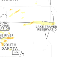


Connect with Interactive Hail Maps