

Hail Map for Leoti, KS
The Leoti, KS area has had 85 reports of on-the-ground hail by trained spotters, and has been under severe weather warnings 36 times during the past 12 months. Doppler radar has detected hail at or near Leoti, KS on 102 occasions, including 6 occasions during the past year.
| Name: | Leoti, KS |
| Where Located: | 44.1 miles NW of Garden City, KS |
| Map: | Google Map for Leoti, KS |
| Population: | 1534 |
| Housing Units: | 708 |
| More Info: | Search Google for Leoti, KS |
2
The Top Recent Hail Date for Leoti, KS is Saturday, June 28, 2025 (12th out of 102)
Hail and Wind Damage Spotted near Leoti, KS
| Date / Time | Report Details |
|---|---|
| 7/7/2025 12:29 AM CDT |
 The storms which prompted the warning have moved out of the area. therefore, the warning will be allowed to expire. however, gusty winds and heavy rain are still possible with these thunderstorms. a severe thunderstorm watch remains in effect until 300 am mdt/400 am cdt/ for west central kansas. to report severe weather, contact your nearest law enforcement agency. they will relay your report to the national weather service goodland. The storms which prompted the warning have moved out of the area. therefore, the warning will be allowed to expire. however, gusty winds and heavy rain are still possible with these thunderstorms. a severe thunderstorm watch remains in effect until 300 am mdt/400 am cdt/ for west central kansas. to report severe weather, contact your nearest law enforcement agency. they will relay your report to the national weather service goodland.
|
| 7/7/2025 12:12 AM CDT |
 the severe thunderstorm warning has been cancelled and is no longer in effect the severe thunderstorm warning has been cancelled and is no longer in effect
|
| 7/7/2025 12:12 AM CDT |
 At 1111 pm mdt/1211 am cdt/, severe thunderstorms were located along a line extending from 10 miles northwest of scott state lake to 5 miles south of leoti to 14 miles northeast of syracuse, moving east at 45 mph (mesonet. multiple weather stations around wichita county are reporting 60-65 mph wind gusts). Hazards include 60 mph wind gusts and penny size hail. Expect damage to roofs, siding, and trees. These severe thunderstorms will remain over mainly rural areas of wichita, logan and greeley counties, including the following locations, marienthal, lydia, and selkirk. At 1111 pm mdt/1211 am cdt/, severe thunderstorms were located along a line extending from 10 miles northwest of scott state lake to 5 miles south of leoti to 14 miles northeast of syracuse, moving east at 45 mph (mesonet. multiple weather stations around wichita county are reporting 60-65 mph wind gusts). Hazards include 60 mph wind gusts and penny size hail. Expect damage to roofs, siding, and trees. These severe thunderstorms will remain over mainly rural areas of wichita, logan and greeley counties, including the following locations, marienthal, lydia, and selkirk.
|
| 7/7/2025 12:01 AM CDT |
 At 1101 pm mdt/1201 am cdt/, severe thunderstorms were located along a line extending from 7 miles southeast of russell springs to 3 miles west of leoti to 17 miles south of tribune, moving east at 45 mph (mesonet. a 60 mph wind gust was reported 2 miles east of leoti). Hazards include 60 mph wind gusts and penny size hail. Expect damage to roofs, siding, and trees. these severe storms will be near, leoti around 1205 am cdt. Other locations impacted by these severe thunderstorms include marienthal, lydia, and selkirk. At 1101 pm mdt/1201 am cdt/, severe thunderstorms were located along a line extending from 7 miles southeast of russell springs to 3 miles west of leoti to 17 miles south of tribune, moving east at 45 mph (mesonet. a 60 mph wind gust was reported 2 miles east of leoti). Hazards include 60 mph wind gusts and penny size hail. Expect damage to roofs, siding, and trees. these severe storms will be near, leoti around 1205 am cdt. Other locations impacted by these severe thunderstorms include marienthal, lydia, and selkirk.
|
| 7/6/2025 11:56 PM CDT | Kansas mesonet site reports the gus in wichita county KS, 1.4 miles W of Leoti, KS |
| 7/6/2025 11:54 PM CDT | Kansas mesonet site reports a 60 mph wind gus in wichita county KS, 1.4 miles W of Leoti, KS |
| 7/6/2025 11:48 PM CDT |
 At 1047 pm mdt/1147 pm cdt/, severe thunderstorms were located along a line extending from near russell springs to 9 miles northwest of leoti to 9 miles south of tribune, moving east at 50 mph (mesonet. a 62 mph wind gust was reported southeast of sharon springs and a 59 mph wind gust was reported west of tribune). Hazards include 60 mph wind gusts and penny size hail. Expect damage to roofs, siding, and trees. these severe storms will be near, leoti around 1155 pm cdt. Other locations impacted by these severe thunderstorms include marienthal, lydia, and selkirk. At 1047 pm mdt/1147 pm cdt/, severe thunderstorms were located along a line extending from near russell springs to 9 miles northwest of leoti to 9 miles south of tribune, moving east at 50 mph (mesonet. a 62 mph wind gust was reported southeast of sharon springs and a 59 mph wind gust was reported west of tribune). Hazards include 60 mph wind gusts and penny size hail. Expect damage to roofs, siding, and trees. these severe storms will be near, leoti around 1155 pm cdt. Other locations impacted by these severe thunderstorms include marienthal, lydia, and selkirk.
|
| 7/6/2025 11:32 PM CDT |
 At 1032 pm mdt/1132 pm cdt/, severe thunderstorms were located along a line extending from near winona to 15 miles northeast of tribune to near horace, moving southeast at 45 mph (radar indicated). Hazards include 60 mph wind gusts and penny size hail. Expect damage to roofs, siding, and trees. these severe storms will be near, tribune and horace around 1035 pm mdt. russell springs around 1140 pm cdt. leoti around 1155 pm cdt. Other locations impacted by these severe thunderstorms include marienthal, lydia, and selkirk. At 1032 pm mdt/1132 pm cdt/, severe thunderstorms were located along a line extending from near winona to 15 miles northeast of tribune to near horace, moving southeast at 45 mph (radar indicated). Hazards include 60 mph wind gusts and penny size hail. Expect damage to roofs, siding, and trees. these severe storms will be near, tribune and horace around 1035 pm mdt. russell springs around 1140 pm cdt. leoti around 1155 pm cdt. Other locations impacted by these severe thunderstorms include marienthal, lydia, and selkirk.
|
| 7/6/2025 11:26 PM CDT |
 At 1025 pm mdt/1125 pm cdt/, severe thunderstorms were located along a line extending from 3 miles west of winona to 14 miles southeast of sharon springs to near horace, moving southeast at 40 mph (mesonet. a 59 mph wind gust was reported to the southwest of sharon springs). Hazards include 70 mph wind gusts and penny size hail. Expect considerable tree damage. damage is likely to mobile homes, roofs, and outbuildings. these severe storms will be near, winona around 1130 pm cdt. tribune and horace around 1030 pm mdt. russell springs around 1140 pm cdt. leoti around 1155 pm cdt. Other locations impacted by these severe thunderstorms include marienthal, lydia, and selkirk. At 1025 pm mdt/1125 pm cdt/, severe thunderstorms were located along a line extending from 3 miles west of winona to 14 miles southeast of sharon springs to near horace, moving southeast at 40 mph (mesonet. a 59 mph wind gust was reported to the southwest of sharon springs). Hazards include 70 mph wind gusts and penny size hail. Expect considerable tree damage. damage is likely to mobile homes, roofs, and outbuildings. these severe storms will be near, winona around 1130 pm cdt. tribune and horace around 1030 pm mdt. russell springs around 1140 pm cdt. leoti around 1155 pm cdt. Other locations impacted by these severe thunderstorms include marienthal, lydia, and selkirk.
|
| 7/6/2025 11:26 PM CDT |
 the severe thunderstorm warning has been cancelled and is no longer in effect the severe thunderstorm warning has been cancelled and is no longer in effect
|
| 7/6/2025 10:20 PM MDT |
 At 1020 pm mdt/1120 pm cdt/, severe thunderstorms were located along a line extending from 4 miles southwest of winona to 15 miles southeast of sharon springs to 3 miles northwest of horace, moving southeast at 45 mph (mesonet. a 59 mph wind gust was reported southwest of sharon springs). Hazards include 70 mph wind gusts and penny size hail. Expect considerable tree damage. damage is likely to mobile homes, roofs, and outbuildings. these severe storms will be near, russell springs around 1125 pm cdt. tribune and horace around 1025 pm mdt. leoti around 1145 pm cdt. Other locations impacted by these severe thunderstorms include marienthal, lydia, and selkirk. At 1020 pm mdt/1120 pm cdt/, severe thunderstorms were located along a line extending from 4 miles southwest of winona to 15 miles southeast of sharon springs to 3 miles northwest of horace, moving southeast at 45 mph (mesonet. a 59 mph wind gust was reported southwest of sharon springs). Hazards include 70 mph wind gusts and penny size hail. Expect considerable tree damage. damage is likely to mobile homes, roofs, and outbuildings. these severe storms will be near, russell springs around 1125 pm cdt. tribune and horace around 1025 pm mdt. leoti around 1145 pm cdt. Other locations impacted by these severe thunderstorms include marienthal, lydia, and selkirk.
|
| 7/6/2025 9:58 PM MDT |
 Svrgld the national weather service in goodland has issued a * severe thunderstorm warning for, southeastern cheyenne county in east central colorado, wichita county in west central kansas, wallace county in west central kansas, logan county in west central kansas, greeley county in west central kansas, * until 1130 pm mdt/1230 am cdt/. * at 957 pm mdt/1057 pm cdt/, severe thunderstorms were located along a line extending from 9 miles south of brewster to near sharon springs to 9 miles south of weskan, moving southeast at 45 mph (mesonet. multiple weather stations have reported 60-70 mph winds). Hazards include 70 mph wind gusts and penny size hail. Expect considerable tree damage. damage is likely to mobile homes, roofs, and outbuildings. severe thunderstorms will be near, sharon springs and wallace around 1000 pm mdt. winona around 1115 pm cdt. Other locations in the path of these severe thunderstorms include tribune, horace, russell springs and leoti. Svrgld the national weather service in goodland has issued a * severe thunderstorm warning for, southeastern cheyenne county in east central colorado, wichita county in west central kansas, wallace county in west central kansas, logan county in west central kansas, greeley county in west central kansas, * until 1130 pm mdt/1230 am cdt/. * at 957 pm mdt/1057 pm cdt/, severe thunderstorms were located along a line extending from 9 miles south of brewster to near sharon springs to 9 miles south of weskan, moving southeast at 45 mph (mesonet. multiple weather stations have reported 60-70 mph winds). Hazards include 70 mph wind gusts and penny size hail. Expect considerable tree damage. damage is likely to mobile homes, roofs, and outbuildings. severe thunderstorms will be near, sharon springs and wallace around 1000 pm mdt. winona around 1115 pm cdt. Other locations in the path of these severe thunderstorms include tribune, horace, russell springs and leoti.
|
| 7/5/2025 11:54 PM CDT |
 The storms which prompted the warning have weakened below severe limits, and have exited the warned area. therefore, the warning will be allowed to expire. to report severe weather, contact your nearest law enforcement agency. they will relay your report to the national weather service goodland. The storms which prompted the warning have weakened below severe limits, and have exited the warned area. therefore, the warning will be allowed to expire. to report severe weather, contact your nearest law enforcement agency. they will relay your report to the national weather service goodland.
|
| 7/5/2025 10:59 PM CDT |
 Svrgld the national weather service in goodland has issued a * severe thunderstorm warning for, wichita county in west central kansas, eastern wallace county in west central kansas, logan county in west central kansas, eastern greeley county in west central kansas, * until 1100 pm mdt/midnight cdt/. * at 958 pm mdt/1058 pm cdt, severe thunderstorms were located along a line extending from near winona to 17 miles southwest of leoti, moving east at 25 mph (mesonets. multiple reports of 60-70 mph gusts have been reported on various mesonets). Hazards include 60 mph wind gusts and quarter size hail. Hail damage to vehicles is expected. expect wind damage to roofs, siding, and trees. severe thunderstorms will be near, leoti, winona, and russell springs around 1105 pm cdt. Other locations in the path of these severe thunderstorms include monument. Svrgld the national weather service in goodland has issued a * severe thunderstorm warning for, wichita county in west central kansas, eastern wallace county in west central kansas, logan county in west central kansas, eastern greeley county in west central kansas, * until 1100 pm mdt/midnight cdt/. * at 958 pm mdt/1058 pm cdt, severe thunderstorms were located along a line extending from near winona to 17 miles southwest of leoti, moving east at 25 mph (mesonets. multiple reports of 60-70 mph gusts have been reported on various mesonets). Hazards include 60 mph wind gusts and quarter size hail. Hail damage to vehicles is expected. expect wind damage to roofs, siding, and trees. severe thunderstorms will be near, leoti, winona, and russell springs around 1105 pm cdt. Other locations in the path of these severe thunderstorms include monument.
|
| 7/5/2025 10:41 PM CDT |
 At 939 pm mdt/1039 pm cdt, severe thunderstorms were located along a line extending from 7 miles southwest of winona to 14 miles south of tribune, moving east at 25 mph (mesonet. at 931 pm mdt, a gust of 62 mph was reported by a mesonet in tribune). Hazards include 60 mph wind gusts and quarter size hail. Hail damage to vehicles is expected. expect wind damage to roofs, siding, and trees. these severe storms will be near, leoti and russell springs around 1050 pm cdt. Other locations impacted by these severe thunderstorms include marienthal, lydia, and selkirk. At 939 pm mdt/1039 pm cdt, severe thunderstorms were located along a line extending from 7 miles southwest of winona to 14 miles south of tribune, moving east at 25 mph (mesonet. at 931 pm mdt, a gust of 62 mph was reported by a mesonet in tribune). Hazards include 60 mph wind gusts and quarter size hail. Hail damage to vehicles is expected. expect wind damage to roofs, siding, and trees. these severe storms will be near, leoti and russell springs around 1050 pm cdt. Other locations impacted by these severe thunderstorms include marienthal, lydia, and selkirk.
|
| 7/5/2025 10:29 PM CDT |
 Svrgld the national weather service in goodland has issued a * severe thunderstorm warning for, wichita county in west central kansas, eastern wallace county in west central kansas, logan county in west central kansas, greeley county in west central kansas, * until 1000 pm mdt/1100 pm cdt/. * at 928 pm mdt/1028 pm cdt/, severe thunderstorms were located along a line extending from 9 miles southwest of winona to 13 miles south of tribune, moving east at 25 mph (trained weather spotters. at 913 pm mdt, a trained spotter reported 58 mph gusts in tribune). Hazards include 60 mph wind gusts and quarter size hail. Hail damage to vehicles is expected. expect wind damage to roofs, siding, and trees. Severe thunderstorms will be near, leoti and russell springs around 1045 pm cdt. Svrgld the national weather service in goodland has issued a * severe thunderstorm warning for, wichita county in west central kansas, eastern wallace county in west central kansas, logan county in west central kansas, greeley county in west central kansas, * until 1000 pm mdt/1100 pm cdt/. * at 928 pm mdt/1028 pm cdt/, severe thunderstorms were located along a line extending from 9 miles southwest of winona to 13 miles south of tribune, moving east at 25 mph (trained weather spotters. at 913 pm mdt, a trained spotter reported 58 mph gusts in tribune). Hazards include 60 mph wind gusts and quarter size hail. Hail damage to vehicles is expected. expect wind damage to roofs, siding, and trees. Severe thunderstorms will be near, leoti and russell springs around 1045 pm cdt.
|
| 6/28/2025 9:24 PM CDT | Emergency manager reports a microburst with broken poles and downed tree limbs around 6 inches in diamete in wichita county KS, 0.5 miles SSE of Leoti, KS |
| 6/28/2025 9:15 PM CDT | Mesonet station fw1490 leoti measured 71 mph wind gus in wichita county KS, 0.3 miles NE of Leoti, KS |
| 6/28/2025 8:29 PM CDT |
 At 828 pm cdt, a severe thunderstorm was located 6 miles northwest of modoc, moving east at 10 mph (radar indicated). Hazards include 60 mph wind gusts and quarter size hail. Hail damage to vehicles is expected. expect wind damage to roofs, siding, and trees. This severe thunderstorm will remain over mainly rural areas of eastern wichita county, including the following locations, marienthal. At 828 pm cdt, a severe thunderstorm was located 6 miles northwest of modoc, moving east at 10 mph (radar indicated). Hazards include 60 mph wind gusts and quarter size hail. Hail damage to vehicles is expected. expect wind damage to roofs, siding, and trees. This severe thunderstorm will remain over mainly rural areas of eastern wichita county, including the following locations, marienthal.
|
| 6/28/2025 8:21 PM CDT |
 At 821 pm cdt, a severe thunderstorm was located 7 miles east of leoti, moving east at 15 mph (radar indicated). Hazards include 60 mph wind gusts and quarter size hail. Hail damage to vehicles is expected. expect wind damage to roofs, siding, and trees. This severe thunderstorm will remain over mainly rural areas of wichita county, including the following locations, marienthal. At 821 pm cdt, a severe thunderstorm was located 7 miles east of leoti, moving east at 15 mph (radar indicated). Hazards include 60 mph wind gusts and quarter size hail. Hail damage to vehicles is expected. expect wind damage to roofs, siding, and trees. This severe thunderstorm will remain over mainly rural areas of wichita county, including the following locations, marienthal.
|
| 6/28/2025 8:13 PM CDT |
 At 813 pm cdt, a severe thunderstorm was located 5 miles northeast of leoti, moving northeast at 15 mph (radar indicated). Hazards include 60 mph wind gusts and quarter size hail. Hail damage to vehicles is expected. expect wind damage to roofs, siding, and trees. This severe thunderstorm will remain over mainly rural areas of wichita county, including the following locations, marienthal. At 813 pm cdt, a severe thunderstorm was located 5 miles northeast of leoti, moving northeast at 15 mph (radar indicated). Hazards include 60 mph wind gusts and quarter size hail. Hail damage to vehicles is expected. expect wind damage to roofs, siding, and trees. This severe thunderstorm will remain over mainly rural areas of wichita county, including the following locations, marienthal.
|
| 6/28/2025 8:03 PM CDT | Spotter estimated peak winds of 60 mp in wichita county KS, 1.4 miles W of Leoti, KS |
| 6/28/2025 7:58 PM CDT |
 Svrgld the national weather service in goodland has issued a * severe thunderstorm warning for, wichita county in west central kansas, * until 900 pm cdt. * at 758 pm cdt, a severe thunderstorm was located near leoti, moving northwest at 5 mph (radar indicated). Hazards include 60 mph wind gusts and quarter size hail. Hail damage to vehicles is expected. expect wind damage to roofs, siding, and trees. This severe thunderstorm will be near, leoti around 805 pm cdt. Svrgld the national weather service in goodland has issued a * severe thunderstorm warning for, wichita county in west central kansas, * until 900 pm cdt. * at 758 pm cdt, a severe thunderstorm was located near leoti, moving northwest at 5 mph (radar indicated). Hazards include 60 mph wind gusts and quarter size hail. Hail damage to vehicles is expected. expect wind damage to roofs, siding, and trees. This severe thunderstorm will be near, leoti around 805 pm cdt.
|
| 6/2/2025 6:39 PM CDT | The storm which prompted the warning has moved out of the area. therefore, the warning will be allowed to expire. however, heavy rain is still possible with this thunderstorm. a severe thunderstorm watch remains in effect until 900 pm mdt/1000 pm cdt/ for west central kansas. to report severe weather, contact your nearest law enforcement agency. they will relay your report to the national weather service goodland. |
| 6/2/2025 6:33 PM CDT |
 At 533 pm mdt/633 pm cdt/, a severe thunderstorm was located 14 miles north of leoti, moving north at 25 mph (radar indicated). Hazards include 70 mph wind gusts and quarter size hail. Hail damage to vehicles is expected. expect considerable tree damage. wind damage is also likely to mobile homes, roofs, and outbuildings. Locations impacted include, leoti and selkirk. At 533 pm mdt/633 pm cdt/, a severe thunderstorm was located 14 miles north of leoti, moving north at 25 mph (radar indicated). Hazards include 70 mph wind gusts and quarter size hail. Hail damage to vehicles is expected. expect considerable tree damage. wind damage is also likely to mobile homes, roofs, and outbuildings. Locations impacted include, leoti and selkirk.
|
| 6/2/2025 6:21 PM CDT |
 At 521 pm mdt/621 pm cdt/, a severe thunderstorm was located 8 miles north of leoti, moving northeast at 35 mph (radar indicated). Hazards include 70 mph wind gusts and quarter size hail. Hail damage to vehicles is expected. expect considerable tree damage. wind damage is also likely to mobile homes, roofs, and outbuildings. This severe thunderstorm will remain over mainly rural areas of wichita and east central greeley counties, including the following locations, marienthal, lydia, and selkirk. At 521 pm mdt/621 pm cdt/, a severe thunderstorm was located 8 miles north of leoti, moving northeast at 35 mph (radar indicated). Hazards include 70 mph wind gusts and quarter size hail. Hail damage to vehicles is expected. expect considerable tree damage. wind damage is also likely to mobile homes, roofs, and outbuildings. This severe thunderstorm will remain over mainly rural areas of wichita and east central greeley counties, including the following locations, marienthal, lydia, and selkirk.
|
| 6/2/2025 6:15 PM CDT |
 At 514 pm mdt/614 pm cdt/, a severe thunderstorm was located 4 miles northwest of leoti, moving northeast at 30 mph (radar indicated). Hazards include 60 mph wind gusts and quarter size hail. Hail damage to vehicles is expected. expect wind damage to roofs, siding, and trees. this severe storm will be near, leoti around 620 pm cdt. Other locations impacted by this severe thunderstorm include marienthal, lydia, and selkirk. At 514 pm mdt/614 pm cdt/, a severe thunderstorm was located 4 miles northwest of leoti, moving northeast at 30 mph (radar indicated). Hazards include 60 mph wind gusts and quarter size hail. Hail damage to vehicles is expected. expect wind damage to roofs, siding, and trees. this severe storm will be near, leoti around 620 pm cdt. Other locations impacted by this severe thunderstorm include marienthal, lydia, and selkirk.
|
| 6/2/2025 6:00 PM CDT | Svrgld the national weather service in goodland has issued a * severe thunderstorm warning for, wichita county in west central kansas, east central greeley county in west central kansas, * until 545 pm mdt/645 pm cdt/. * at 500 pm mdt/600 pm cdt/, a severe thunderstorm was located 8 miles west of leoti, moving northeast at 30 mph (radar indicated). Hazards include 60 mph wind gusts and penny size hail. Expect damage to roofs, siding, and trees. This severe thunderstorm will be near, leoti around 610 pm cdt. |
| 5/28/2025 6:00 PM CDT | Quarter sized hail reported 14.4 miles NNW of Leoti, KS, report of 1 inch hail. |
| 5/19/2025 4:42 PM CDT | Tennis Ball sized hail reported 14.3 miles S of Leoti, KS, sheriff reported golf ball to tennis ball sized hail along hwy 25. |
| 9/17/2024 8:47 PM CDT |
 the severe thunderstorm warning has been cancelled and is no longer in effect the severe thunderstorm warning has been cancelled and is no longer in effect
|
| 9/17/2024 8:47 PM CDT |
 At 846 pm cdt, severe thunderstorms were located along a line extending from 7 miles southeast of trenton to 3 miles west of rexford to 4 miles west of grigston, moving east at 50 mph (radar indicated). Hazards include 60 mph wind gusts. Expect damage to roofs, siding, and trees. these severe thunderstorms will remain over mainly rural areas of wichita, thomas, logan and rawlins counties, including the following locations, lydia, blakeman, beardsley, mingo, marienthal, and halford. This includes interstate 70 in kansas between mile markers 36 and 75. At 846 pm cdt, severe thunderstorms were located along a line extending from 7 miles southeast of trenton to 3 miles west of rexford to 4 miles west of grigston, moving east at 50 mph (radar indicated). Hazards include 60 mph wind gusts. Expect damage to roofs, siding, and trees. these severe thunderstorms will remain over mainly rural areas of wichita, thomas, logan and rawlins counties, including the following locations, lydia, blakeman, beardsley, mingo, marienthal, and halford. This includes interstate 70 in kansas between mile markers 36 and 75.
|
| 9/17/2024 8:24 PM CDT |
 At 724 pm mdt/824 pm cdt/, severe thunderstorms were located along a line extending from 5 miles south of stratton to 5 miles north of colby to modoc, moving east at 45 mph (radar indicated). Hazards include 60 mph wind gusts. Expect damage to roofs, siding, and trees. these severe storms will be near, colby, atwood, monument, and gem around 830 pm cdt. oakley and ludell around 835 pm cdt. other locations impacted by these severe thunderstorms include blakeman, selkirk, mingo, marienthal, halford, lydia, and edson. This includes interstate 70 in kansas between mile markers 22 and 75. At 724 pm mdt/824 pm cdt/, severe thunderstorms were located along a line extending from 5 miles south of stratton to 5 miles north of colby to modoc, moving east at 45 mph (radar indicated). Hazards include 60 mph wind gusts. Expect damage to roofs, siding, and trees. these severe storms will be near, colby, atwood, monument, and gem around 830 pm cdt. oakley and ludell around 835 pm cdt. other locations impacted by these severe thunderstorms include blakeman, selkirk, mingo, marienthal, halford, lydia, and edson. This includes interstate 70 in kansas between mile markers 22 and 75.
|
| 9/17/2024 7:58 PM CDT |
 Svrgld the national weather service in goodland has issued a * severe thunderstorm warning for, wichita county in west central kansas, eastern wallace county in west central kansas, eastern cheyenne county in northwestern kansas, thomas county in northwestern kansas, logan county in west central kansas, rawlins county in northwestern kansas, eastern greeley county in west central kansas, eastern sherman county in northwestern kansas, * until 800 pm mdt/900 pm cdt/. * at 657 pm mdt/757 pm cdt/, severe thunderstorms were located along a line extending from 4 miles east of benkelman to 8 miles north of brewster to 6 miles northwest of leoti, moving east at 70 mph (trained weather spotters. at 0640 pm mdt, estimated 60 to 65 mph wind gusts were reported 13 miles nw of edson). Hazards include 60 mph wind gusts. Expect damage to roofs, siding, and trees. severe thunderstorms will be near, levant, winona, and russell springs around 805 pm cdt. colby, atwood, and monument around 810 pm cdt. gem and ludell around 815 pm cdt. other locations in the path of these severe thunderstorms include oakley. This includes interstate 70 in kansas between mile markers 16 and 75. Svrgld the national weather service in goodland has issued a * severe thunderstorm warning for, wichita county in west central kansas, eastern wallace county in west central kansas, eastern cheyenne county in northwestern kansas, thomas county in northwestern kansas, logan county in west central kansas, rawlins county in northwestern kansas, eastern greeley county in west central kansas, eastern sherman county in northwestern kansas, * until 800 pm mdt/900 pm cdt/. * at 657 pm mdt/757 pm cdt/, severe thunderstorms were located along a line extending from 4 miles east of benkelman to 8 miles north of brewster to 6 miles northwest of leoti, moving east at 70 mph (trained weather spotters. at 0640 pm mdt, estimated 60 to 65 mph wind gusts were reported 13 miles nw of edson). Hazards include 60 mph wind gusts. Expect damage to roofs, siding, and trees. severe thunderstorms will be near, levant, winona, and russell springs around 805 pm cdt. colby, atwood, and monument around 810 pm cdt. gem and ludell around 815 pm cdt. other locations in the path of these severe thunderstorms include oakley. This includes interstate 70 in kansas between mile markers 16 and 75.
|
| 9/17/2024 7:51 PM CDT |
 At 650 pm mdt/750 pm cdt/, severe thunderstorms were located along a line extending from 3 miles west of benkelman to 10 miles northwest of brewster to 11 miles northeast of tribune, moving east at 45 mph (trained weather spotters. at 0640 pm mdt, estimated 60 to 65 mph wind gusts were reported 13 miles nw of edson). Hazards include 60 mph wind gusts. Expect damage to roofs, siding, and trees. these severe storms will be near, brewster and bird city around 755 pm cdt. benkelman around 655 pm mdt. mcdonald around 800 pm cdt. winona around 805 pm cdt. levant and russell springs around 810 pm cdt. stratton around 815 pm cdt. colby and atwood around 820 pm cdt. monument around 825 pm cdt. gem and ludell around 830 pm cdt. other locations impacted by these severe thunderstorms include blakeman, selkirk, mingo, marienthal, max, halford, and lydia. This includes interstate 70 in kansas between mile markers 1 and 74. At 650 pm mdt/750 pm cdt/, severe thunderstorms were located along a line extending from 3 miles west of benkelman to 10 miles northwest of brewster to 11 miles northeast of tribune, moving east at 45 mph (trained weather spotters. at 0640 pm mdt, estimated 60 to 65 mph wind gusts were reported 13 miles nw of edson). Hazards include 60 mph wind gusts. Expect damage to roofs, siding, and trees. these severe storms will be near, brewster and bird city around 755 pm cdt. benkelman around 655 pm mdt. mcdonald around 800 pm cdt. winona around 805 pm cdt. levant and russell springs around 810 pm cdt. stratton around 815 pm cdt. colby and atwood around 820 pm cdt. monument around 825 pm cdt. gem and ludell around 830 pm cdt. other locations impacted by these severe thunderstorms include blakeman, selkirk, mingo, marienthal, max, halford, and lydia. This includes interstate 70 in kansas between mile markers 1 and 74.
|
| 9/17/2024 7:32 PM CDT |
 At 630 pm mdt/730 pm cdt/, severe thunderstorms were located along a line extending from 7 miles east of haigler to 10 miles northeast of goodland to 7 miles south of tribune, moving northeast at 70 mph (trained spotter. at 0625 pm mdt, estimated 60 mph winds were reported 13 miles northwest of saint francis). Hazards include 60 mph wind gusts and nickel size hail. Expect damage to roofs, siding, and trees. these severe storms will be near, brewster and bird city around 735 pm cdt. wallace around 635 pm mdt. mcdonald around 740 pm cdt. benkelman around 640 pm mdt. leoti, levant, and winona around 745 pm cdt. russell springs around 750 pm cdt. colby, atwood, and stratton around 755 pm cdt. monument, gem, and ludell around 800 pm cdt. other locations impacted by these severe thunderstorms include blakeman, selkirk, mingo, marienthal, max, halford, and lydia. This includes interstate 70 in kansas between mile markers 1 and 74. At 630 pm mdt/730 pm cdt/, severe thunderstorms were located along a line extending from 7 miles east of haigler to 10 miles northeast of goodland to 7 miles south of tribune, moving northeast at 70 mph (trained spotter. at 0625 pm mdt, estimated 60 mph winds were reported 13 miles northwest of saint francis). Hazards include 60 mph wind gusts and nickel size hail. Expect damage to roofs, siding, and trees. these severe storms will be near, brewster and bird city around 735 pm cdt. wallace around 635 pm mdt. mcdonald around 740 pm cdt. benkelman around 640 pm mdt. leoti, levant, and winona around 745 pm cdt. russell springs around 750 pm cdt. colby, atwood, and stratton around 755 pm cdt. monument, gem, and ludell around 800 pm cdt. other locations impacted by these severe thunderstorms include blakeman, selkirk, mingo, marienthal, max, halford, and lydia. This includes interstate 70 in kansas between mile markers 1 and 74.
|
| 9/17/2024 7:32 PM CDT |
 the severe thunderstorm warning has been cancelled and is no longer in effect the severe thunderstorm warning has been cancelled and is no longer in effect
|
| 9/17/2024 6:21 PM MDT |
 At 620 pm mdt/720 pm cdt/, severe thunderstorms were located along a line extending from 6 miles southwest of haigler to near goodland to 13 miles southwest of horace, moving east at 35 mph (mesonet. at 0607 pm mdt, a 62 mph wind gust was reported near vernon). Hazards include 60 mph wind gusts and nickel size hail. Expect damage to roofs, siding, and trees. these severe storms will be near, st. francis around 725 pm cdt. goodland, sharon springs, tribune, and horace around 625 pm mdt. wallace around 635 pm mdt. brewster and bird city around 745 pm cdt. leoti, winona, and mcdonald around 800 pm cdt. other locations impacted by these severe thunderstorms include blakeman, selkirk, mingo, marienthal, max, halford, and lydia. this includes the following highways, interstate 70 in kansas between mile markers 0 and 74. Interstate 70 in colorado between mile markers 446 and 450. At 620 pm mdt/720 pm cdt/, severe thunderstorms were located along a line extending from 6 miles southwest of haigler to near goodland to 13 miles southwest of horace, moving east at 35 mph (mesonet. at 0607 pm mdt, a 62 mph wind gust was reported near vernon). Hazards include 60 mph wind gusts and nickel size hail. Expect damage to roofs, siding, and trees. these severe storms will be near, st. francis around 725 pm cdt. goodland, sharon springs, tribune, and horace around 625 pm mdt. wallace around 635 pm mdt. brewster and bird city around 745 pm cdt. leoti, winona, and mcdonald around 800 pm cdt. other locations impacted by these severe thunderstorms include blakeman, selkirk, mingo, marienthal, max, halford, and lydia. this includes the following highways, interstate 70 in kansas between mile markers 0 and 74. Interstate 70 in colorado between mile markers 446 and 450.
|
| 9/17/2024 5:57 PM MDT |
 Svrgld the national weather service in goodland has issued a * severe thunderstorm warning for, eastern cheyenne county in east central colorado, southeastern yuma county in northeastern colorado, eastern kit carson county in east central colorado, wichita county in west central kansas, cheyenne county in northwestern kansas, logan county in west central kansas, rawlins county in northwestern kansas, sherman county in northwestern kansas, wallace county in west central kansas, thomas county in northwestern kansas, greeley county in west central kansas, western hitchcock county in southwestern nebraska, southeastern dundy county in southwestern nebraska, * until 700 pm mdt/800 pm cdt/. * at 556 pm mdt/656 pm cdt/, severe thunderstorms were located along a line extending from 18 miles northwest of bonny reservoir to 9 miles southeast of burlington to 17 miles south of holly, moving east at 70 mph (asos. at 0547 pm mdt, a 66 mph wind gust was reported in burlington, colorado). Hazards include 70 mph wind gusts and nickel size hail. Expect considerable tree damage. damage is likely to mobile homes, roofs, and outbuildings. severe thunderstorms will be near, kanorado and bonny reservoir around 600 pm mdt. ruleton and weskan around 605 pm mdt. goodland, sharon springs, tribune, and horace around 615 pm mdt. st. francis around 720 pm cdt. haigler and wallace around 620 pm mdt. brewster and bird city around 730 pm cdt. leoti around 735 pm cdt. benkelman around 635 pm mdt. levant, winona, and mcdonald around 740 pm cdt. colby and russell springs around 745 pm cdt. other locations impacted by these severe thunderstorms include blakeman, beecher island, marienthal, max, halford, lydia, and edson. this includes the following highways, interstate 70 in kansas between mile markers 0 and 74. Interstate 70 in colorado between mile markers 444 and 450. Svrgld the national weather service in goodland has issued a * severe thunderstorm warning for, eastern cheyenne county in east central colorado, southeastern yuma county in northeastern colorado, eastern kit carson county in east central colorado, wichita county in west central kansas, cheyenne county in northwestern kansas, logan county in west central kansas, rawlins county in northwestern kansas, sherman county in northwestern kansas, wallace county in west central kansas, thomas county in northwestern kansas, greeley county in west central kansas, western hitchcock county in southwestern nebraska, southeastern dundy county in southwestern nebraska, * until 700 pm mdt/800 pm cdt/. * at 556 pm mdt/656 pm cdt/, severe thunderstorms were located along a line extending from 18 miles northwest of bonny reservoir to 9 miles southeast of burlington to 17 miles south of holly, moving east at 70 mph (asos. at 0547 pm mdt, a 66 mph wind gust was reported in burlington, colorado). Hazards include 70 mph wind gusts and nickel size hail. Expect considerable tree damage. damage is likely to mobile homes, roofs, and outbuildings. severe thunderstorms will be near, kanorado and bonny reservoir around 600 pm mdt. ruleton and weskan around 605 pm mdt. goodland, sharon springs, tribune, and horace around 615 pm mdt. st. francis around 720 pm cdt. haigler and wallace around 620 pm mdt. brewster and bird city around 730 pm cdt. leoti around 735 pm cdt. benkelman around 635 pm mdt. levant, winona, and mcdonald around 740 pm cdt. colby and russell springs around 745 pm cdt. other locations impacted by these severe thunderstorms include blakeman, beecher island, marienthal, max, halford, lydia, and edson. this includes the following highways, interstate 70 in kansas between mile markers 0 and 74. Interstate 70 in colorado between mile markers 444 and 450.
|
| 7/20/2024 12:25 AM CDT |
 At 1223 am cdt, severe thunderstorms were located along a line extending from 4 miles west of modoc to 10 miles west of leoti, moving south at 25 mph (radar indicated). Hazards include 60 to 70 mph wind gusts. Expect damage to roofs, siding, and trees. these severe thunderstorms will remain over mainly rural areas of wichita county, including the following locations, marienthal, lydia, and selkirk. these storms have a history of producing 60 to 70 mph wind gusts, mainly along the leading edge of thunderstorm outflow, in advance of any rain. a 67 mph wind gust was observed at nws goodland at 958 pm mdt. A 64 mph wind gust was measured by a kansas mesonet site in russell springs at 1033 pm mdt. At 1223 am cdt, severe thunderstorms were located along a line extending from 4 miles west of modoc to 10 miles west of leoti, moving south at 25 mph (radar indicated). Hazards include 60 to 70 mph wind gusts. Expect damage to roofs, siding, and trees. these severe thunderstorms will remain over mainly rural areas of wichita county, including the following locations, marienthal, lydia, and selkirk. these storms have a history of producing 60 to 70 mph wind gusts, mainly along the leading edge of thunderstorm outflow, in advance of any rain. a 67 mph wind gust was observed at nws goodland at 958 pm mdt. A 64 mph wind gust was measured by a kansas mesonet site in russell springs at 1033 pm mdt.
|
| 7/20/2024 12:08 AM CDT |
 At 1206 am cdt, severe thunderstorms were located along a line extending from 9 miles northwest of modoc to 13 miles northwest of leoti, moving south at 25 mph (radar indicated). Hazards include 60 to 70 mph wind gusts. Expect considerable tree damage. damage is likely to mobile homes, roofs, and outbuildings. these severe storms will be near, leoti around 1215 am cdt. other locations impacted by these severe thunderstorms include marienthal, lydia, and selkirk. these storms have a history of producing 60 to 70 mph wind gusts, mainly along the leading edge of thunderstorm outflow, in advance of any rain. a 67 mph wind gust was observed at nws goodland at 958 pm mdt. A 69 mph wind gust was measured by a home weather station in mcallaster at 1033 pm mdt. At 1206 am cdt, severe thunderstorms were located along a line extending from 9 miles northwest of modoc to 13 miles northwest of leoti, moving south at 25 mph (radar indicated). Hazards include 60 to 70 mph wind gusts. Expect considerable tree damage. damage is likely to mobile homes, roofs, and outbuildings. these severe storms will be near, leoti around 1215 am cdt. other locations impacted by these severe thunderstorms include marienthal, lydia, and selkirk. these storms have a history of producing 60 to 70 mph wind gusts, mainly along the leading edge of thunderstorm outflow, in advance of any rain. a 67 mph wind gust was observed at nws goodland at 958 pm mdt. A 69 mph wind gust was measured by a home weather station in mcallaster at 1033 pm mdt.
|
| 7/19/2024 11:52 PM CDT |
 Svrgld the national weather service in goodland has issued a * severe thunderstorm warning for, wichita county in west central kansas, * until 1245 am cdt. * at 1152 pm cdt, severe thunderstorms were located along a line extending from 10 miles west of scott state lake to 14 miles south of wallace, moving south at 35 mph (radar indicated). Hazards include 60 to 70 mph wind gusts. Expect considerable tree damage. damage is likely to mobile homes, roofs, and outbuildings. severe thunderstorms will be near, leoti around 1210 am cdt. These storms have a history of producing 60 to 70 mph wind gusts, mainly along the leading edge of thunderstorm outflow, in advance of any rain. Svrgld the national weather service in goodland has issued a * severe thunderstorm warning for, wichita county in west central kansas, * until 1245 am cdt. * at 1152 pm cdt, severe thunderstorms were located along a line extending from 10 miles west of scott state lake to 14 miles south of wallace, moving south at 35 mph (radar indicated). Hazards include 60 to 70 mph wind gusts. Expect considerable tree damage. damage is likely to mobile homes, roofs, and outbuildings. severe thunderstorms will be near, leoti around 1210 am cdt. These storms have a history of producing 60 to 70 mph wind gusts, mainly along the leading edge of thunderstorm outflow, in advance of any rain.
|
| 7/19/2024 10:01 PM MDT |
 Svrgld the national weather service in goodland has issued a * severe thunderstorm warning for, northeastern cheyenne county in east central colorado, eastern kit carson county in east central colorado, wichita county in west central kansas, wallace county in west central kansas, southwestern thomas county in northwestern kansas, logan county in west central kansas, northern greeley county in west central kansas, sherman county in northwestern kansas, * until 1100 pm mdt/midnight cdt/. * at 1000 pm mdt/1100 pm cdt/, severe thunderstorms were located along a line extending from 13 miles north of ruleton to 3 miles southwest of oakley, moving south at 60 mph (the national weather service in goodland measured a 67 mph wind gust at 958 pm mdt). Hazards include 70 mph wind gusts. Expect considerable tree damage. damage is likely to mobile homes, roofs, and outbuildings. severe thunderstorms will be near, monument around 1105 pm cdt. goodland and ruleton around 1005 pm mdt. winona around 1110 pm cdt. russell springs around 1115 pm cdt. kanorado around 1015 pm mdt. other locations in the path of these severe thunderstorms include wallace, sharon springs, weskan and leoti. this includes the following highways, interstate 70 in kansas between mile markers 0 and 34. interstate 70 in colorado between mile markers 422 and 450. Highway 385 between mile markers 147 and 206, and near mile marker 211. Svrgld the national weather service in goodland has issued a * severe thunderstorm warning for, northeastern cheyenne county in east central colorado, eastern kit carson county in east central colorado, wichita county in west central kansas, wallace county in west central kansas, southwestern thomas county in northwestern kansas, logan county in west central kansas, northern greeley county in west central kansas, sherman county in northwestern kansas, * until 1100 pm mdt/midnight cdt/. * at 1000 pm mdt/1100 pm cdt/, severe thunderstorms were located along a line extending from 13 miles north of ruleton to 3 miles southwest of oakley, moving south at 60 mph (the national weather service in goodland measured a 67 mph wind gust at 958 pm mdt). Hazards include 70 mph wind gusts. Expect considerable tree damage. damage is likely to mobile homes, roofs, and outbuildings. severe thunderstorms will be near, monument around 1105 pm cdt. goodland and ruleton around 1005 pm mdt. winona around 1110 pm cdt. russell springs around 1115 pm cdt. kanorado around 1015 pm mdt. other locations in the path of these severe thunderstorms include wallace, sharon springs, weskan and leoti. this includes the following highways, interstate 70 in kansas between mile markers 0 and 34. interstate 70 in colorado between mile markers 422 and 450. Highway 385 between mile markers 147 and 206, and near mile marker 211.
|
| 7/7/2024 1:14 AM CDT |
 the severe thunderstorm warning has been cancelled and is no longer in effect the severe thunderstorm warning has been cancelled and is no longer in effect
|
| 7/7/2024 1:00 AM CDT |
 At 1259 am cdt, a severe thunderstorm was located 5 miles south of leoti, moving southeast at 15 mph (radar indicated). Hazards include 60 mph wind gusts and quarter size hail. Hail damage to vehicles is expected. expect wind damage to roofs, siding, and trees. This severe thunderstorm will remain over mainly rural areas of central wichita county, including the following locations, marienthal. At 1259 am cdt, a severe thunderstorm was located 5 miles south of leoti, moving southeast at 15 mph (radar indicated). Hazards include 60 mph wind gusts and quarter size hail. Hail damage to vehicles is expected. expect wind damage to roofs, siding, and trees. This severe thunderstorm will remain over mainly rural areas of central wichita county, including the following locations, marienthal.
|
| 7/7/2024 12:41 AM CDT |
 At 1241 am cdt, a severe thunderstorm was located over leoti, moving east at 25 mph (radar indicated). Hazards include 60 mph wind gusts and quarter size hail. Hail damage to vehicles is expected. expect wind damage to roofs, siding, and trees. this severe storm will be near, leoti around 1245 am cdt. Other locations impacted by this severe thunderstorm include marienthal. At 1241 am cdt, a severe thunderstorm was located over leoti, moving east at 25 mph (radar indicated). Hazards include 60 mph wind gusts and quarter size hail. Hail damage to vehicles is expected. expect wind damage to roofs, siding, and trees. this severe storm will be near, leoti around 1245 am cdt. Other locations impacted by this severe thunderstorm include marienthal.
|
| 7/7/2024 12:32 AM CDT |
 Svrgld the national weather service in goodland has issued a * severe thunderstorm warning for, central wichita county in west central kansas, * until 130 am cdt. * at 1232 am cdt, a severe thunderstorm was located 6 miles west of leoti, moving east at 20 mph (radar indicated). Hazards include 60 mph wind gusts and quarter size hail. Hail damage to vehicles is expected. expect wind damage to roofs, siding, and trees. This severe thunderstorm will be near, leoti around 1240 am cdt. Svrgld the national weather service in goodland has issued a * severe thunderstorm warning for, central wichita county in west central kansas, * until 130 am cdt. * at 1232 am cdt, a severe thunderstorm was located 6 miles west of leoti, moving east at 20 mph (radar indicated). Hazards include 60 mph wind gusts and quarter size hail. Hail damage to vehicles is expected. expect wind damage to roofs, siding, and trees. This severe thunderstorm will be near, leoti around 1240 am cdt.
|
| 6/13/2024 5:18 PM CDT |
 the severe thunderstorm warning has been cancelled and is no longer in effect the severe thunderstorm warning has been cancelled and is no longer in effect
|
| 6/13/2024 4:47 PM CDT |
 At 447 pm cdt, a severe thunderstorm was located 4 miles southwest of leoti, moving southeast at 15 mph (radar indicated). Hazards include 60 mph wind gusts and quarter size hail. Hail damage to vehicles is expected. expect wind damage to roofs, siding, and trees. This severe thunderstorm will remain over mainly rural areas of southern wichita county. At 447 pm cdt, a severe thunderstorm was located 4 miles southwest of leoti, moving southeast at 15 mph (radar indicated). Hazards include 60 mph wind gusts and quarter size hail. Hail damage to vehicles is expected. expect wind damage to roofs, siding, and trees. This severe thunderstorm will remain over mainly rural areas of southern wichita county.
|
| 6/13/2024 4:32 PM CDT |
 Svrgld the national weather service in goodland has issued a * severe thunderstorm warning for, southern wichita county in west central kansas, * until 530 pm cdt. * at 431 pm cdt, a severe thunderstorm was located 6 miles west of leoti, moving southeast at 15 mph (radar indicated). Hazards include ping pong ball size hail and 60 mph wind gusts. People and animals outdoors will be injured. expect hail damage to roofs, siding, windows, and vehicles. expect wind damage to roofs, siding, and trees. This severe thunderstorm will be near, leoti around 440 pm cdt. Svrgld the national weather service in goodland has issued a * severe thunderstorm warning for, southern wichita county in west central kansas, * until 530 pm cdt. * at 431 pm cdt, a severe thunderstorm was located 6 miles west of leoti, moving southeast at 15 mph (radar indicated). Hazards include ping pong ball size hail and 60 mph wind gusts. People and animals outdoors will be injured. expect hail damage to roofs, siding, windows, and vehicles. expect wind damage to roofs, siding, and trees. This severe thunderstorm will be near, leoti around 440 pm cdt.
|
| 6/13/2024 4:21 PM CDT |
 At 420 pm cdt, a severe thunderstorm was located 6 miles south of leoti, moving southeast at 20 mph (radar indicated). Hazards include 60 mph wind gusts and quarter size hail. Hail damage to vehicles is expected. expect wind damage to roofs, siding, and trees. Locations impacted include, leoti and marienthal. At 420 pm cdt, a severe thunderstorm was located 6 miles south of leoti, moving southeast at 20 mph (radar indicated). Hazards include 60 mph wind gusts and quarter size hail. Hail damage to vehicles is expected. expect wind damage to roofs, siding, and trees. Locations impacted include, leoti and marienthal.
|
| 6/13/2024 4:18 PM CDT |
 the severe thunderstorm warning has been cancelled and is no longer in effect the severe thunderstorm warning has been cancelled and is no longer in effect
|
| 6/13/2024 4:12 PM CDT |
 At 411 pm cdt, a severe thunderstorm was located near leoti, moving east at 10 mph (law enforcement). Hazards include quarter size hail in leoti. Damage to vehicles is expected. Locations impacted include, leoti and marienthal. At 411 pm cdt, a severe thunderstorm was located near leoti, moving east at 10 mph (law enforcement). Hazards include quarter size hail in leoti. Damage to vehicles is expected. Locations impacted include, leoti and marienthal.
|
| 6/13/2024 3:56 PM CDT |
 Svrgld the national weather service in goodland has issued a * severe thunderstorm warning for, central wichita county in west central kansas, * until 445 pm cdt. * at 355 pm cdt, a severe thunderstorm was located over leoti, moving east at 20 mph (law enforcement in leoti). Hazards include quarter size hail. Damage to vehicles is expected. This severe thunderstorm will remain over mainly rural areas of central wichita county, including the following locations, marienthal. Svrgld the national weather service in goodland has issued a * severe thunderstorm warning for, central wichita county in west central kansas, * until 445 pm cdt. * at 355 pm cdt, a severe thunderstorm was located over leoti, moving east at 20 mph (law enforcement in leoti). Hazards include quarter size hail. Damage to vehicles is expected. This severe thunderstorm will remain over mainly rural areas of central wichita county, including the following locations, marienthal.
|
| 6/13/2024 3:54 PM CDT |
 Svrgld the national weather service in goodland has issued a * severe thunderstorm warning for, central wichita county in west central kansas, * until 445 pm cdt. * at 354 pm cdt, a severe thunderstorm was located over leoti, moving east at 20 mph (law enforcement). Hazards include quarter size hail. Damage to vehicles is expected. This severe thunderstorm will remain over mainly rural areas of central wichita county, including the following locations, marienthal. Svrgld the national weather service in goodland has issued a * severe thunderstorm warning for, central wichita county in west central kansas, * until 445 pm cdt. * at 354 pm cdt, a severe thunderstorm was located over leoti, moving east at 20 mph (law enforcement). Hazards include quarter size hail. Damage to vehicles is expected. This severe thunderstorm will remain over mainly rural areas of central wichita county, including the following locations, marienthal.
|
| 6/13/2024 3:46 PM CDT | Quarter sized hail reported 0.6 miles SW of Leoti, KS, dispatch in town. |
| 6/3/2024 1:27 AM CDT |
 The storm which prompted the warning has weakened below severe limits, and no longer poses an immediate threat to life or property. therefore, the warning will be allowed to expire. however, hail, gusty winds and heavy rain are still possible with this thunderstorm. to report severe weather, contact your nearest law enforcement agency. they will relay your report to the national weather service goodland. The storm which prompted the warning has weakened below severe limits, and no longer poses an immediate threat to life or property. therefore, the warning will be allowed to expire. however, hail, gusty winds and heavy rain are still possible with this thunderstorm. to report severe weather, contact your nearest law enforcement agency. they will relay your report to the national weather service goodland.
|
| 6/3/2024 1:05 AM CDT |
 At 104 am cdt, a severe thunderstorm was located 5 miles southwest of leoti, moving east at 30 mph (radar indicated). Hazards include 60 mph wind gusts and quarter size hail. Hail damage to vehicles is expected. expect wind damage to roofs, siding, and trees. Locations impacted include, leoti, lydia, selkirk, and marienthal. At 104 am cdt, a severe thunderstorm was located 5 miles southwest of leoti, moving east at 30 mph (radar indicated). Hazards include 60 mph wind gusts and quarter size hail. Hail damage to vehicles is expected. expect wind damage to roofs, siding, and trees. Locations impacted include, leoti, lydia, selkirk, and marienthal.
|
| 6/3/2024 1:05 AM CDT |
 the severe thunderstorm warning has been cancelled and is no longer in effect the severe thunderstorm warning has been cancelled and is no longer in effect
|
| 6/3/2024 12:57 AM CDT |
 At 1157 pm mdt/1257 am cdt/, a severe thunderstorm was located 8 miles southwest of leoti, moving east at 30 mph (radar indicated). Hazards include 60 mph wind gusts and quarter size hail. Hail damage to vehicles is expected. expect wind damage to roofs, siding, and trees. Locations impacted include, leoti, lydia, selkirk, and marienthal. At 1157 pm mdt/1257 am cdt/, a severe thunderstorm was located 8 miles southwest of leoti, moving east at 30 mph (radar indicated). Hazards include 60 mph wind gusts and quarter size hail. Hail damage to vehicles is expected. expect wind damage to roofs, siding, and trees. Locations impacted include, leoti, lydia, selkirk, and marienthal.
|
| 6/3/2024 12:36 AM CDT |
 Svrgld the national weather service in goodland has issued a * severe thunderstorm warning for, wichita county in west central kansas, northeastern greeley county in west central kansas, * until 1230 am mdt/130 am cdt/. * at 1135 pm mdt/1235 am cdt/, a severe thunderstorm was located 10 miles northeast of tribune, moving east at 30 mph (at 11:20 pm mdt local dispatch reported quarter sized hail in tribune). Hazards include 60 mph wind gusts and half dollar size hail. Hail damage to vehicles is expected. expect wind damage to roofs, siding, and trees. This severe thunderstorm will remain over mainly rural areas of wichita and northeastern greeley counties, including the following locations, marienthal, lydia, and selkirk. Svrgld the national weather service in goodland has issued a * severe thunderstorm warning for, wichita county in west central kansas, northeastern greeley county in west central kansas, * until 1230 am mdt/130 am cdt/. * at 1135 pm mdt/1235 am cdt/, a severe thunderstorm was located 10 miles northeast of tribune, moving east at 30 mph (at 11:20 pm mdt local dispatch reported quarter sized hail in tribune). Hazards include 60 mph wind gusts and half dollar size hail. Hail damage to vehicles is expected. expect wind damage to roofs, siding, and trees. This severe thunderstorm will remain over mainly rural areas of wichita and northeastern greeley counties, including the following locations, marienthal, lydia, and selkirk.
|
| 6/1/2024 6:21 PM CDT |
 The storm which prompted the warning has weakened below severe limits, and no longer poses an immediate threat to life or property. therefore, the warning will be allowed to expire. however, small hail and gusty winds are still possible with this thunderstorm. a severe thunderstorm watch remains in effect until midnight cdt for west central kansas. The storm which prompted the warning has weakened below severe limits, and no longer poses an immediate threat to life or property. therefore, the warning will be allowed to expire. however, small hail and gusty winds are still possible with this thunderstorm. a severe thunderstorm watch remains in effect until midnight cdt for west central kansas.
|
| 6/1/2024 6:03 PM CDT |
 At 602 pm cdt, a severe thunderstorm was located 13 miles south of leoti, moving northeast at 20 mph (radar indicated). Hazards include 60 mph wind gusts and quarter size hail. Hail damage to vehicles is expected. expect wind damage to roofs, siding, and trees. Locations impacted include, leoti and lydia. At 602 pm cdt, a severe thunderstorm was located 13 miles south of leoti, moving northeast at 20 mph (radar indicated). Hazards include 60 mph wind gusts and quarter size hail. Hail damage to vehicles is expected. expect wind damage to roofs, siding, and trees. Locations impacted include, leoti and lydia.
|
| 6/1/2024 6:03 PM CDT |
 the severe thunderstorm warning has been cancelled and is no longer in effect the severe thunderstorm warning has been cancelled and is no longer in effect
|
| 6/1/2024 5:37 PM CDT |
 Svrgld the national weather service in goodland has issued a * severe thunderstorm warning for, southern wichita county in west central kansas, southeastern greeley county in west central kansas, * until 530 pm mdt/630 pm cdt/. * at 437 pm mdt/537 pm cdt/, a severe thunderstorm was located 17 miles north of kendall, moving northeast at 35 mph (radar indicated). Hazards include 70 mph wind gusts and half dollar size hail. Hail damage to vehicles is expected. expect considerable tree damage. wind damage is also likely to mobile homes, roofs, and outbuildings. This severe thunderstorm will remain over mainly rural areas of southern wichita and southeastern greeley counties, including the following locations, lydia. Svrgld the national weather service in goodland has issued a * severe thunderstorm warning for, southern wichita county in west central kansas, southeastern greeley county in west central kansas, * until 530 pm mdt/630 pm cdt/. * at 437 pm mdt/537 pm cdt/, a severe thunderstorm was located 17 miles north of kendall, moving northeast at 35 mph (radar indicated). Hazards include 70 mph wind gusts and half dollar size hail. Hail damage to vehicles is expected. expect considerable tree damage. wind damage is also likely to mobile homes, roofs, and outbuildings. This severe thunderstorm will remain over mainly rural areas of southern wichita and southeastern greeley counties, including the following locations, lydia.
|
| 5/29/2024 9:27 PM CDT | Aero b ranch wundergroun in logan county KS, 16.2 miles SSE of Leoti, KS |
| 5/3/2024 8:22 PM CDT |
 At 821 pm cdt, a severe thunderstorm was located 12 miles southeast of leoti, moving east at 20 mph (trained weather spotters reported golf ball size hail in lydia. funnel clouds or some landspouts have been reported with the southern portion of this storm as well). Hazards include two inch hail and 60 mph wind gusts. People and animals outdoors will be injured. expect hail damage to roofs, siding, windows, and vehicles. expect wind damage to roofs, siding, and trees. Locations impacted include, leoti, marienthal, and lydia. At 821 pm cdt, a severe thunderstorm was located 12 miles southeast of leoti, moving east at 20 mph (trained weather spotters reported golf ball size hail in lydia. funnel clouds or some landspouts have been reported with the southern portion of this storm as well). Hazards include two inch hail and 60 mph wind gusts. People and animals outdoors will be injured. expect hail damage to roofs, siding, windows, and vehicles. expect wind damage to roofs, siding, and trees. Locations impacted include, leoti, marienthal, and lydia.
|
| 5/3/2024 8:19 PM CDT | Quarter sized hail reported 14.4 miles NNW of Leoti, KS, additional 1 inch hail reported with the funnel cloud report. |
| 5/3/2024 8:11 PM CDT |
 Svrgld the national weather service in goodland has issued a * severe thunderstorm warning for, eastern wichita county in west central kansas, * until 915 pm cdt. * at 810 pm cdt, a severe thunderstorm was located 11 miles south of leoti, moving east at 20 mph (trained weather spotters reported quarter to golf ball size hail near lydia at 810pm ct). Hazards include two inch hail and 60 mph wind gusts. People and animals outdoors will be injured. expect hail damage to roofs, siding, windows, and vehicles. expect wind damage to roofs, siding, and trees. This severe thunderstorm will remain over mainly rural areas of eastern wichita county, including the following locations, marienthal and lydia. Svrgld the national weather service in goodland has issued a * severe thunderstorm warning for, eastern wichita county in west central kansas, * until 915 pm cdt. * at 810 pm cdt, a severe thunderstorm was located 11 miles south of leoti, moving east at 20 mph (trained weather spotters reported quarter to golf ball size hail near lydia at 810pm ct). Hazards include two inch hail and 60 mph wind gusts. People and animals outdoors will be injured. expect hail damage to roofs, siding, windows, and vehicles. expect wind damage to roofs, siding, and trees. This severe thunderstorm will remain over mainly rural areas of eastern wichita county, including the following locations, marienthal and lydia.
|
| 5/3/2024 8:04 PM CDT |
 the severe thunderstorm warning has been cancelled and is no longer in effect the severe thunderstorm warning has been cancelled and is no longer in effect
|
| 5/3/2024 8:04 PM CDT |
 At 804 pm cdt, a severe thunderstorm was located 12 miles southeast of leoti, moving east at 35 mph (radar indicated). Hazards include two inch hail and 60 mph wind gusts. People and animals outdoors will be injured. expect hail damage to roofs, siding, windows, and vehicles. expect wind damage to roofs, siding, and trees. Locations impacted include, leoti, marienthal, and lydia. At 804 pm cdt, a severe thunderstorm was located 12 miles southeast of leoti, moving east at 35 mph (radar indicated). Hazards include two inch hail and 60 mph wind gusts. People and animals outdoors will be injured. expect hail damage to roofs, siding, windows, and vehicles. expect wind damage to roofs, siding, and trees. Locations impacted include, leoti, marienthal, and lydia.
|
| 5/3/2024 8:02 PM CDT | Golf Ball sized hail reported 14.4 miles NNW of Leoti, KS, trained spotter reports golf ball sized hail with heavy rain and about 25 mph wind gusts. |
| 5/3/2024 7:59 PM CDT |
 At 759 pm cdt, a severe thunderstorm was located 11 miles south of leoti, moving east at 35 mph (radar indicated). Hazards include two inch hail and 60 mph wind gusts. People and animals outdoors will be injured. expect hail damage to roofs, siding, windows, and vehicles. expect wind damage to roofs, siding, and trees. Locations impacted include, leoti, marienthal, and lydia. At 759 pm cdt, a severe thunderstorm was located 11 miles south of leoti, moving east at 35 mph (radar indicated). Hazards include two inch hail and 60 mph wind gusts. People and animals outdoors will be injured. expect hail damage to roofs, siding, windows, and vehicles. expect wind damage to roofs, siding, and trees. Locations impacted include, leoti, marienthal, and lydia.
|
| 5/3/2024 7:53 PM CDT |
 the severe thunderstorm warning has been cancelled and is no longer in effect the severe thunderstorm warning has been cancelled and is no longer in effect
|
| 5/3/2024 7:53 PM CDT |
 At 752 pm cdt, a severe thunderstorm was located 12 miles south of leoti, moving northeast at 20 mph (radar indicated). Hazards include ping pong ball size hail and 60 mph wind gusts. People and animals outdoors will be injured. expect hail damage to roofs, siding, windows, and vehicles. expect wind damage to roofs, siding, and trees. Locations impacted include, leoti, marienthal, and lydia. At 752 pm cdt, a severe thunderstorm was located 12 miles south of leoti, moving northeast at 20 mph (radar indicated). Hazards include ping pong ball size hail and 60 mph wind gusts. People and animals outdoors will be injured. expect hail damage to roofs, siding, windows, and vehicles. expect wind damage to roofs, siding, and trees. Locations impacted include, leoti, marienthal, and lydia.
|
| 5/3/2024 7:33 PM CDT |
 At 633 pm mdt/733 pm cdt/, a severe thunderstorm was located 5 miles northwest of leoti, moving east at 30 mph (radar indicated). Hazards include 60 mph wind gusts and half dollar size hail. Hail damage to vehicles is expected. expect wind damage to roofs, siding, and trees. Locations impacted include, leoti, lydia, selkirk, and marienthal. At 633 pm mdt/733 pm cdt/, a severe thunderstorm was located 5 miles northwest of leoti, moving east at 30 mph (radar indicated). Hazards include 60 mph wind gusts and half dollar size hail. Hail damage to vehicles is expected. expect wind damage to roofs, siding, and trees. Locations impacted include, leoti, lydia, selkirk, and marienthal.
|
| 5/3/2024 7:21 PM CDT |
 At 621 pm mdt/721 pm cdt/, a severe thunderstorm was located 8 miles northwest of leoti, moving east at 35 mph. a second severe storm was moving into southern portions of wichita county (radar indicated). Hazards include ping pong ball size hail and 60 mph wind gusts. People and animals outdoors will be injured. expect hail damage to roofs, siding, windows, and vehicles. expect wind damage to roofs, siding, and trees. Locations impacted include, leoti, tribune, lydia, selkirk, and marienthal. At 621 pm mdt/721 pm cdt/, a severe thunderstorm was located 8 miles northwest of leoti, moving east at 35 mph. a second severe storm was moving into southern portions of wichita county (radar indicated). Hazards include ping pong ball size hail and 60 mph wind gusts. People and animals outdoors will be injured. expect hail damage to roofs, siding, windows, and vehicles. expect wind damage to roofs, siding, and trees. Locations impacted include, leoti, tribune, lydia, selkirk, and marienthal.
|
| 5/3/2024 6:58 PM CDT |
 Svrgld the national weather service in goodland has issued a * severe thunderstorm warning for, wichita county in west central kansas, southeastern wallace county in west central kansas, southwestern logan county in west central kansas, eastern greeley county in west central kansas, * until 715 pm mdt/815 pm cdt/. * at 557 pm mdt/657 pm cdt/, a severe thunderstorm was located over tribune, moving east at 35 mph (public reported half dollar size hail in horace). Hazards include ping pong ball size hail and 60 mph wind gusts. People and animals outdoors will be injured. expect hail damage to roofs, siding, windows, and vehicles. expect wind damage to roofs, siding, and trees. This severe thunderstorm will remain over mainly rural areas of wichita, southeastern wallace, southwestern logan and eastern greeley counties, including the following locations, marienthal, lydia, and selkirk. Svrgld the national weather service in goodland has issued a * severe thunderstorm warning for, wichita county in west central kansas, southeastern wallace county in west central kansas, southwestern logan county in west central kansas, eastern greeley county in west central kansas, * until 715 pm mdt/815 pm cdt/. * at 557 pm mdt/657 pm cdt/, a severe thunderstorm was located over tribune, moving east at 35 mph (public reported half dollar size hail in horace). Hazards include ping pong ball size hail and 60 mph wind gusts. People and animals outdoors will be injured. expect hail damage to roofs, siding, windows, and vehicles. expect wind damage to roofs, siding, and trees. This severe thunderstorm will remain over mainly rural areas of wichita, southeastern wallace, southwestern logan and eastern greeley counties, including the following locations, marienthal, lydia, and selkirk.
|
| 5/1/2024 11:38 PM CDT |
 the severe thunderstorm warning has been cancelled and is no longer in effect the severe thunderstorm warning has been cancelled and is no longer in effect
|
| 5/1/2024 11:38 PM CDT |
 At 1138 pm cdt, severe thunderstorms were located along a line extending from 7 miles southwest of russell springs to 6 miles west of leoti, moving northeast at 50 mph (radar indicated). Hazards include 60 mph wind gusts and quarter size hail. Hail damage to vehicles is expected. expect wind damage to roofs, siding, and trees. these severe storms will be near, russell springs around 1145 pm cdt. oakley around 1210 am cdt. other locations impacted by these severe thunderstorms include angelus, the monument rocks, selkirk, and marienthal. This includes interstate 70 in kansas between mile markers 76 and 87. At 1138 pm cdt, severe thunderstorms were located along a line extending from 7 miles southwest of russell springs to 6 miles west of leoti, moving northeast at 50 mph (radar indicated). Hazards include 60 mph wind gusts and quarter size hail. Hail damage to vehicles is expected. expect wind damage to roofs, siding, and trees. these severe storms will be near, russell springs around 1145 pm cdt. oakley around 1210 am cdt. other locations impacted by these severe thunderstorms include angelus, the monument rocks, selkirk, and marienthal. This includes interstate 70 in kansas between mile markers 76 and 87.
|
| 5/1/2024 11:25 PM CDT |
 Svrgld the national weather service in goodland has issued a * severe thunderstorm warning for, wichita county in west central kansas, southeastern wallace county in west central kansas, southeastern logan county in west central kansas, southwestern sheridan county in northwestern kansas, southeastern greeley county in west central kansas, western gove county in west central kansas, * until 1130 pm mdt/1230 am cdt/. * at 1025 pm mdt/1125 pm cdt/, severe thunderstorms were located along a line extending from 13 miles southeast of wallace to 7 miles southeast of tribune, moving northeast at 50 mph (radar indicated). Hazards include 60 mph wind gusts and quarter size hail. Hail damage to vehicles is expected. expect wind damage to roofs, siding, and trees. severe thunderstorms will be near, russell springs around 1145 pm cdt. other locations in the path of these severe thunderstorms include oakley. This includes interstate 70 in kansas between mile markers 76 and 87. Svrgld the national weather service in goodland has issued a * severe thunderstorm warning for, wichita county in west central kansas, southeastern wallace county in west central kansas, southeastern logan county in west central kansas, southwestern sheridan county in northwestern kansas, southeastern greeley county in west central kansas, western gove county in west central kansas, * until 1130 pm mdt/1230 am cdt/. * at 1025 pm mdt/1125 pm cdt/, severe thunderstorms were located along a line extending from 13 miles southeast of wallace to 7 miles southeast of tribune, moving northeast at 50 mph (radar indicated). Hazards include 60 mph wind gusts and quarter size hail. Hail damage to vehicles is expected. expect wind damage to roofs, siding, and trees. severe thunderstorms will be near, russell springs around 1145 pm cdt. other locations in the path of these severe thunderstorms include oakley. This includes interstate 70 in kansas between mile markers 76 and 87.
|
| 4/25/2024 7:26 PM CDT |
 the severe thunderstorm warning has been cancelled and is no longer in effect the severe thunderstorm warning has been cancelled and is no longer in effect
|
| 4/25/2024 7:11 PM CDT |
 At 611 pm mdt/711 pm cdt/, a severe thunderstorm was located 9 miles southeast of tribune, moving northeast at 40 mph (public). Hazards include quarter size hail. Damage to vehicles is expected. Locations impacted include, leoti and selkirk. At 611 pm mdt/711 pm cdt/, a severe thunderstorm was located 9 miles southeast of tribune, moving northeast at 40 mph (public). Hazards include quarter size hail. Damage to vehicles is expected. Locations impacted include, leoti and selkirk.
|
| 4/25/2024 7:00 PM CDT |
 Svrgld the national weather service in goodland has issued a * severe thunderstorm warning for, wichita county in west central kansas, southeastern wallace county in west central kansas, southwestern logan county in west central kansas, eastern greeley county in west central kansas, * until 700 pm mdt/800 pm cdt/. * at 559 pm mdt/659 pm cdt/, a severe thunderstorm was located 12 miles southeast of tribune, moving northeast at 40 mph. the public reported golfball to two inch hail 10 miles north of syracuse (public). Hazards include two inch hail. People and animals outdoors will be injured. expect damage to roofs, siding, windows, and vehicles. This severe thunderstorm will remain over mainly rural areas of wichita, southeastern wallace, southwestern logan and eastern greeley counties, including the following locations, selkirk. Svrgld the national weather service in goodland has issued a * severe thunderstorm warning for, wichita county in west central kansas, southeastern wallace county in west central kansas, southwestern logan county in west central kansas, eastern greeley county in west central kansas, * until 700 pm mdt/800 pm cdt/. * at 559 pm mdt/659 pm cdt/, a severe thunderstorm was located 12 miles southeast of tribune, moving northeast at 40 mph. the public reported golfball to two inch hail 10 miles north of syracuse (public). Hazards include two inch hail. People and animals outdoors will be injured. expect damage to roofs, siding, windows, and vehicles. This severe thunderstorm will remain over mainly rural areas of wichita, southeastern wallace, southwestern logan and eastern greeley counties, including the following locations, selkirk.
|
| 4/25/2024 6:40 PM CDT | Tennis Ball sized hail reported 4.7 miles SE of Leoti, KS, reissued report. report with photo via social media of hail up to 2 1/2 inch. |
| 4/25/2024 6:30 PM CDT | Hen Egg sized hail reported 5.2 miles SE of Leoti, KS |
| 4/25/2024 6:30 PM CDT | Tennis Ball sized hail reported 5.2 miles SE of Leoti, KS, corrects previous hail report from 5 nw leoti. social media report with pictures of hail mostly around 2 inches but at least one closer two and a half inches. |
| 4/25/2024 6:06 PM CDT | Golf Ball sized hail reported 10.9 miles S of Leoti, KS, ongoing quarter to golf ball sized hail. |
| 4/25/2024 6:06 PM CDT | Ping Pong Ball sized hail reported 13.3 miles SSE of Leoti, KS, trained spotter reports inch to 1 1/2 inch hail. |
| 4/25/2024 5:52 PM CDT | Quarter sized hail reported 0.3 miles NE of Leoti, KS, report via social media with photo of quarter size hail in leoti. |
| 4/25/2024 5:40 PM CDT | Quarter sized hail reported 0.3 miles NE of Leoti, KS, time estimated via radar. |
| 4/25/2024 5:40 PM CDT | Tennis Ball sized hail reported 4.7 miles SE of Leoti, KS, corrects previous hail report from 5 nw leoti. reissued report. report with photo via social media of hail up to 2 1/2 inch. |
| 4/25/2024 5:39 PM CDT |
 At 539 pm cdt, a severe thunderstorm was located 5 miles northeast of leoti, moving northeast at 45 mph (trained weather spotters). Hazards include golf ball size hail. People and animals outdoors will be injured. expect damage to roofs, siding, windows, and vehicles. Locations impacted include, leoti, russell springs, and marienthal. At 539 pm cdt, a severe thunderstorm was located 5 miles northeast of leoti, moving northeast at 45 mph (trained weather spotters). Hazards include golf ball size hail. People and animals outdoors will be injured. expect damage to roofs, siding, windows, and vehicles. Locations impacted include, leoti, russell springs, and marienthal.
|
| 4/25/2024 5:33 PM CDT |
 At 532 pm cdt, a severe thunderstorm was located over leoti, moving northeast at 40 mph (radar indicated). Hazards include quarter size hail. Damage to vehicles is expected. Locations impacted include, leoti, russell springs, and marienthal. At 532 pm cdt, a severe thunderstorm was located over leoti, moving northeast at 40 mph (radar indicated). Hazards include quarter size hail. Damage to vehicles is expected. Locations impacted include, leoti, russell springs, and marienthal.
|
| 4/25/2024 5:30 PM CDT | Tennis Ball sized hail reported 7.1 miles ENE of Leoti, KS, report with photo via social media of hail up to 2 1/2 inch. |
| 4/25/2024 5:18 PM CDT |
 Svrgld the national weather service in goodland has issued a * severe thunderstorm warning for, wichita county in west central kansas, southern logan county in west central kansas, * until 600 pm cdt. * at 517 pm cdt, a severe thunderstorm was located over leoti, moving northeast at 45 mph (radar indicated). Hazards include quarter size hail. Damage to vehicles is expected. This severe thunderstorm will remain over mainly rural areas of wichita and southern logan counties, including the following locations, marienthal. Svrgld the national weather service in goodland has issued a * severe thunderstorm warning for, wichita county in west central kansas, southern logan county in west central kansas, * until 600 pm cdt. * at 517 pm cdt, a severe thunderstorm was located over leoti, moving northeast at 45 mph (radar indicated). Hazards include quarter size hail. Damage to vehicles is expected. This severe thunderstorm will remain over mainly rural areas of wichita and southern logan counties, including the following locations, marienthal.
|
| 9/10/2023 3:53 PM CDT | Quarter sized hail reported 14.4 miles NNW of Leoti, KS, trained spotter reports a few 1 inch hailstones. |
| 9/10/2023 12:57 AM CDT | Kansas mesonet site at 10 in wichita county KS, 1.4 miles W of Leoti, KS |
| 9/10/2023 12:57 AM CDT |
 At 1257 am cdt, a severe thunderstorm was located over leoti, moving southeast at 25 mph (radar indicated). Hazards include 60 mph wind gusts and quarter size hail. Hail damage to vehicles is expected. expect wind damage to roofs, siding, and trees. this severe thunderstorm will be near, leoti around 105 am cdt. hail threat, radar indicated max hail size, 1. 00 in wind threat, radar indicated max wind gust, 60 mph. At 1257 am cdt, a severe thunderstorm was located over leoti, moving southeast at 25 mph (radar indicated). Hazards include 60 mph wind gusts and quarter size hail. Hail damage to vehicles is expected. expect wind damage to roofs, siding, and trees. this severe thunderstorm will be near, leoti around 105 am cdt. hail threat, radar indicated max hail size, 1. 00 in wind threat, radar indicated max wind gust, 60 mph.
|
| 8/12/2023 8:50 PM CDT |
 The severe thunderstorm warning for southern wichita and southeastern greeley counties will expire at 800 pm mdt/900 pm cdt/, the storm which prompted the warning has weakened below severe limits, and has exited the warned area. therefore, the warning will be allowed to expire. however gusty winds are still possible with this thunderstorm. to report severe weather, contact your nearest law enforcement agency. they will relay your report to the national weather service goodland. The severe thunderstorm warning for southern wichita and southeastern greeley counties will expire at 800 pm mdt/900 pm cdt/, the storm which prompted the warning has weakened below severe limits, and has exited the warned area. therefore, the warning will be allowed to expire. however gusty winds are still possible with this thunderstorm. to report severe weather, contact your nearest law enforcement agency. they will relay your report to the national weather service goodland.
|
| 8/12/2023 8:18 PM CDT |
 At 718 pm mdt/818 pm cdt/, a severe thunderstorm was located 14 miles southwest of leoti, moving northeast at 15 mph (radar indicated). Hazards include 60 mph wind gusts and nickel size hail. expect damage to roofs, siding, and trees At 718 pm mdt/818 pm cdt/, a severe thunderstorm was located 14 miles southwest of leoti, moving northeast at 15 mph (radar indicated). Hazards include 60 mph wind gusts and nickel size hail. expect damage to roofs, siding, and trees
|
| 8/7/2023 9:25 PM CDT | Golf Ball sized hail reported 6.4 miles N of Leoti, KS, hail covering the road to a depth of one inch at the intersection of road v and highway 25 south of leoti. hail was predominately dime to nickel sized... with a few lar |
| 8/7/2023 9:23 PM CDT |
 At 822 pm mdt/922 pm cdt/, a severe thunderstorm was located 6 miles southeast of leoti, moving southeast at 30 mph (radar indicated). Hazards include golf ball size hail and 60 mph wind gusts. People and animals outdoors will be injured. expect hail damage to roofs, siding, windows, and vehicles. expect wind damage to roofs, siding, and trees. locations impacted include, leoti, marienthal and selkirk. thunderstorm damage threat, considerable hail threat, radar indicated max hail size, 1. 75 in wind threat, radar indicated max wind gust, 60 mph. At 822 pm mdt/922 pm cdt/, a severe thunderstorm was located 6 miles southeast of leoti, moving southeast at 30 mph (radar indicated). Hazards include golf ball size hail and 60 mph wind gusts. People and animals outdoors will be injured. expect hail damage to roofs, siding, windows, and vehicles. expect wind damage to roofs, siding, and trees. locations impacted include, leoti, marienthal and selkirk. thunderstorm damage threat, considerable hail threat, radar indicated max hail size, 1. 75 in wind threat, radar indicated max wind gust, 60 mph.
|
| 8/7/2023 9:13 PM CDT | Half Dollar sized hail reported 0.8 miles ENE of Leoti, KS, social media report with pictures of hail ranging from an inch to 1.25 inches. |
| 8/7/2023 9:04 PM CDT |
 At 804 pm mdt/904 pm cdt/, a severe thunderstorm was located 4 miles northwest of leoti, moving south at 30 mph (public reported golf ball size hail 10 miles north of leoti). Hazards include tennis ball size hail and 60 mph wind gusts. People and animals outdoors will be injured. expect hail damage to roofs, siding, windows, and vehicles. expect wind damage to roofs, siding, and trees. locations impacted include, leoti, marienthal and selkirk. thunderstorm damage threat, considerable hail threat, radar indicated max hail size, 2. 50 in wind threat, radar indicated max wind gust, 60 mph. At 804 pm mdt/904 pm cdt/, a severe thunderstorm was located 4 miles northwest of leoti, moving south at 30 mph (public reported golf ball size hail 10 miles north of leoti). Hazards include tennis ball size hail and 60 mph wind gusts. People and animals outdoors will be injured. expect hail damage to roofs, siding, windows, and vehicles. expect wind damage to roofs, siding, and trees. locations impacted include, leoti, marienthal and selkirk. thunderstorm damage threat, considerable hail threat, radar indicated max hail size, 2. 50 in wind threat, radar indicated max wind gust, 60 mph.
|
| 8/7/2023 8:45 PM CDT | Quarter sized hail reported 13.3 miles SSE of Leoti, KS, broken skylights were reported. |
| 8/7/2023 8:45 PM CDT | Golf Ball sized hail reported 10.4 miles SSE of Leoti, KS, corrects previous hail report from 10 nnw leoti. spotter estimated quarter to golf ball sized hail. time estimated. |
| 8/7/2023 8:30 PM CDT | Golf Ball sized hail reported 10.4 miles SSE of Leoti, KS, spotter estimated quarter to golf ball sized hail. time estimated. |
| 8/7/2023 8:20 PM CDT |
 At 719 pm mdt/819 pm cdt/, a severe thunderstorm was located 6 miles southeast of wallace, or 12 miles east of sharon springs, moving southeast at 30 mph (radar indicated). Hazards include tennis ball size hail and 60 mph wind gusts. People and animals outdoors will be injured. expect hail damage to roofs, siding, windows, and vehicles. Expect wind damage to roofs, siding, and trees. At 719 pm mdt/819 pm cdt/, a severe thunderstorm was located 6 miles southeast of wallace, or 12 miles east of sharon springs, moving southeast at 30 mph (radar indicated). Hazards include tennis ball size hail and 60 mph wind gusts. People and animals outdoors will be injured. expect hail damage to roofs, siding, windows, and vehicles. Expect wind damage to roofs, siding, and trees.
|
| 8/3/2023 11:27 PM CDT |
 The severe thunderstorm warning for wichita, southeastern wallace, southwestern logan and eastern greeley counties will expire at 1030 pm mdt/1130 pm cdt/, the storms which prompted the warning have weakened below severe limits, and no longer pose an immediate threat to life or property. therefore, the warning will be allowed to expire. however gusty winds and heavy rain are still possible with these thunderstorms. a severe thunderstorm watch remains in effect until 300 am mdt/400 am cdt/ for west central kansas. The severe thunderstorm warning for wichita, southeastern wallace, southwestern logan and eastern greeley counties will expire at 1030 pm mdt/1130 pm cdt/, the storms which prompted the warning have weakened below severe limits, and no longer pose an immediate threat to life or property. therefore, the warning will be allowed to expire. however gusty winds and heavy rain are still possible with these thunderstorms. a severe thunderstorm watch remains in effect until 300 am mdt/400 am cdt/ for west central kansas.
|
| 8/3/2023 11:15 PM CDT |
 At 1015 pm mdt/1115 pm cdt/, severe thunderstorms were located along a line extending from 8 miles northeast of wallace to 8 miles southwest of leoti, moving east at 25 mph (radar indicated). Hazards include 60 mph wind gusts. Expect damage to roofs, siding, and trees. locations impacted include, leoti, sharon springs, tribune, horace, wallace, russell springs and selkirk. hail threat, radar indicated max hail size, <. 75 in wind threat, radar indicated max wind gust, 60 mph. At 1015 pm mdt/1115 pm cdt/, severe thunderstorms were located along a line extending from 8 miles northeast of wallace to 8 miles southwest of leoti, moving east at 25 mph (radar indicated). Hazards include 60 mph wind gusts. Expect damage to roofs, siding, and trees. locations impacted include, leoti, sharon springs, tribune, horace, wallace, russell springs and selkirk. hail threat, radar indicated max hail size, <. 75 in wind threat, radar indicated max wind gust, 60 mph.
|
| 8/3/2023 10:56 PM CDT |
 At 956 pm mdt/1056 pm cdt/, severe thunderstorms were located along a line extending from 4 miles north of wallace to 10 miles southeast of tribune, moving east at 25 mph (radar indicated). Hazards include 60 mph wind gusts. expect damage to roofs, siding, and trees At 956 pm mdt/1056 pm cdt/, severe thunderstorms were located along a line extending from 4 miles north of wallace to 10 miles southeast of tribune, moving east at 25 mph (radar indicated). Hazards include 60 mph wind gusts. expect damage to roofs, siding, and trees
|
| 7/20/2023 11:06 PM CDT |
 The severe thunderstorm warning for wichita county will expire at 1115 pm cdt, the storm which prompted the warning has weakened and no longer poses an immediate threat to life or property. as a result, the warning will be allowed to expire. a severe thunderstorm watch remains in effect until midnight cdt for west central kansas. The severe thunderstorm warning for wichita county will expire at 1115 pm cdt, the storm which prompted the warning has weakened and no longer poses an immediate threat to life or property. as a result, the warning will be allowed to expire. a severe thunderstorm watch remains in effect until midnight cdt for west central kansas.
|
| 7/20/2023 10:55 PM CDT |
 At 1054 pm cdt, a severe thunderstorm was located 7 miles southwest of modoc, moving east at 25 mph (the automated weather observing site in tribune measured a 71 mph gust at 922 pm mdt/1022 pm cdt/). Hazards include 70 mph wind gusts. Expect considerable tree damage. damage is likely to mobile homes, roofs, and outbuildings. locations impacted include, leoti, lydia, selkirk and marienthal. thunderstorm damage threat, considerable hail threat, radar indicated max hail size, <. 75 in wind threat, observed max wind gust, 70 mph. At 1054 pm cdt, a severe thunderstorm was located 7 miles southwest of modoc, moving east at 25 mph (the automated weather observing site in tribune measured a 71 mph gust at 922 pm mdt/1022 pm cdt/). Hazards include 70 mph wind gusts. Expect considerable tree damage. damage is likely to mobile homes, roofs, and outbuildings. locations impacted include, leoti, lydia, selkirk and marienthal. thunderstorm damage threat, considerable hail threat, radar indicated max hail size, <. 75 in wind threat, observed max wind gust, 70 mph.
|
| 7/20/2023 10:44 PM CDT |
 At 943 pm mdt/1043 pm cdt/, a severe thunderstorm was located 6 miles southeast of leoti, moving east at 30 mph (the automated weather observing site in tribune measured a 71 mph gust at 922 pm mdt/1022 pm cdt/). Hazards include 70 mph wind gusts. Expect considerable tree damage. damage is likely to mobile homes, roofs, and outbuildings. locations impacted include, leoti, lydia, selkirk and marienthal. thunderstorm damage threat, considerable hail threat, radar indicated max hail size, <. 75 in wind threat, observed max wind gust, 70 mph. At 943 pm mdt/1043 pm cdt/, a severe thunderstorm was located 6 miles southeast of leoti, moving east at 30 mph (the automated weather observing site in tribune measured a 71 mph gust at 922 pm mdt/1022 pm cdt/). Hazards include 70 mph wind gusts. Expect considerable tree damage. damage is likely to mobile homes, roofs, and outbuildings. locations impacted include, leoti, lydia, selkirk and marienthal. thunderstorm damage threat, considerable hail threat, radar indicated max hail size, <. 75 in wind threat, observed max wind gust, 70 mph.
|
| 7/20/2023 10:34 PM CDT |
 At 933 pm mdt/1033 pm cdt/, a severe thunderstorm was located 8 miles southwest of leoti, moving southeast at 25 mph (the automated weather observing site in tribune measured a 71 mph gust at 922 pm mdt/1022 pm cdt/). Hazards include 70 mph wind gusts. Expect considerable tree damage. damage is likely to mobile homes, roofs, and outbuildings. locations impacted include, leoti, lydia, selkirk and marienthal. thunderstorm damage threat, considerable hail threat, radar indicated max hail size, <. 75 in wind threat, observed max wind gust, 70 mph. At 933 pm mdt/1033 pm cdt/, a severe thunderstorm was located 8 miles southwest of leoti, moving southeast at 25 mph (the automated weather observing site in tribune measured a 71 mph gust at 922 pm mdt/1022 pm cdt/). Hazards include 70 mph wind gusts. Expect considerable tree damage. damage is likely to mobile homes, roofs, and outbuildings. locations impacted include, leoti, lydia, selkirk and marienthal. thunderstorm damage threat, considerable hail threat, radar indicated max hail size, <. 75 in wind threat, observed max wind gust, 70 mph.
|
| 7/20/2023 9:19 PM MDT |
 At 919 pm mdt/1019 pm cdt/, a severe thunderstorm was located 9 miles east of tribune, moving east at 30 mph (the automated weather observing site in tribune measured a 64 mph gust at 911 pm mdt/1011 pm cdt/). Hazards include 70 mph wind gusts. Expect considerable tree damage. damage is likely to mobile homes, roofs, and outbuildings. locations impacted include, leoti, tribune, horace, lydia, selkirk and marienthal. thunderstorm damage threat, considerable hail threat, radar indicated max hail size, <. 75 in wind threat, observed max wind gust, 70 mph. At 919 pm mdt/1019 pm cdt/, a severe thunderstorm was located 9 miles east of tribune, moving east at 30 mph (the automated weather observing site in tribune measured a 64 mph gust at 911 pm mdt/1011 pm cdt/). Hazards include 70 mph wind gusts. Expect considerable tree damage. damage is likely to mobile homes, roofs, and outbuildings. locations impacted include, leoti, tribune, horace, lydia, selkirk and marienthal. thunderstorm damage threat, considerable hail threat, radar indicated max hail size, <. 75 in wind threat, observed max wind gust, 70 mph.
|
| 7/20/2023 9:14 PM MDT |
 At 912 pm mdt/1012 pm cdt/, a severe thunderstorm was located 5 miles east of tribune, moving southeast at 30 mph (the automated weather observing site in tribune measured a 64 mph gust at 911 pm mdt/1011 pm cdt/). Hazards include 60 mph wind gusts. expect damage to roofs, siding, and trees At 912 pm mdt/1012 pm cdt/, a severe thunderstorm was located 5 miles east of tribune, moving southeast at 30 mph (the automated weather observing site in tribune measured a 64 mph gust at 911 pm mdt/1011 pm cdt/). Hazards include 60 mph wind gusts. expect damage to roofs, siding, and trees
|
| 7/20/2023 4:30 PM CDT | Quarter sized hail reported 14.7 miles N of Leoti, KS |
| 7/20/2023 3:18 PM CDT |
 At 317 pm cdt, a severe thunderstorm was located 8 miles northeast of leoti, moving southeast at 20 mph (trained weather spotters). Hazards include tennis ball size hail and 60 mph wind gusts. People and animals outdoors will be injured. expect hail damage to roofs, siding, windows, and vehicles. expect wind damage to roofs, siding, and trees. locations impacted include, leoti and marienthal. thunderstorm damage threat, considerable hail threat, observed max hail size, 2. 50 in wind threat, radar indicated max wind gust, 60 mph. At 317 pm cdt, a severe thunderstorm was located 8 miles northeast of leoti, moving southeast at 20 mph (trained weather spotters). Hazards include tennis ball size hail and 60 mph wind gusts. People and animals outdoors will be injured. expect hail damage to roofs, siding, windows, and vehicles. expect wind damage to roofs, siding, and trees. locations impacted include, leoti and marienthal. thunderstorm damage threat, considerable hail threat, observed max hail size, 2. 50 in wind threat, radar indicated max wind gust, 60 mph.
|
| 7/20/2023 3:10 PM CDT |
 At 309 pm cdt, a severe thunderstorm was located 7 miles north of leoti, moving southeast at 30 mph (trained weather spotters). Hazards include tennis ball size hail. People and animals outdoors will be injured. expect hail damage to roofs, siding, windows, and vehicles. expect wind damage to roofs, siding, and trees. this severe thunderstorm will remain over mainly rural areas of wichita county, including the following locations, marienthal. thunderstorm damage threat, considerable hail threat, observed max hail size, 2. 50 in wind threat, radar indicated max wind gust, 60 mph. At 309 pm cdt, a severe thunderstorm was located 7 miles north of leoti, moving southeast at 30 mph (trained weather spotters). Hazards include tennis ball size hail. People and animals outdoors will be injured. expect hail damage to roofs, siding, windows, and vehicles. expect wind damage to roofs, siding, and trees. this severe thunderstorm will remain over mainly rural areas of wichita county, including the following locations, marienthal. thunderstorm damage threat, considerable hail threat, observed max hail size, 2. 50 in wind threat, radar indicated max wind gust, 60 mph.
|
| 7/20/2023 3:00 PM CDT | Tennis Ball sized hail reported 11.8 miles SSE of Leoti, KS, window damage to home also reported. |
| 7/20/2023 2:59 PM CDT |
 At 258 pm cdt, a severe thunderstorm was located 8 miles north of leoti, moving southeast at 30 mph (radar indicated). Hazards include two inch hail and 60 mph wind gusts. People and animals outdoors will be injured. expect hail damage to roofs, siding, windows, and vehicles. expect wind damage to roofs, siding, and trees. this severe thunderstorm will be near, leoti around 310 pm cdt. thunderstorm damage threat, considerable hail threat, radar indicated max hail size, 2. 00 in wind threat, radar indicated max wind gust, 60 mph. At 258 pm cdt, a severe thunderstorm was located 8 miles north of leoti, moving southeast at 30 mph (radar indicated). Hazards include two inch hail and 60 mph wind gusts. People and animals outdoors will be injured. expect hail damage to roofs, siding, windows, and vehicles. expect wind damage to roofs, siding, and trees. this severe thunderstorm will be near, leoti around 310 pm cdt. thunderstorm damage threat, considerable hail threat, radar indicated max hail size, 2. 00 in wind threat, radar indicated max wind gust, 60 mph.
|
| 7/4/2023 6:13 PM CDT |
 At 612 pm cdt, a severe thunderstorm was located 4 miles northeast of leoti, moving southeast at 10 mph (radar indicated). Hazards include 60 mph wind gusts and half dollar size hail. brief landspouts are possible have been reported with this storm. Hail damage to vehicles is expected. expect wind damage to roofs, siding, and trees. This severe thunderstorm will be near, leoti around 615 pm cdt. At 612 pm cdt, a severe thunderstorm was located 4 miles northeast of leoti, moving southeast at 10 mph (radar indicated). Hazards include 60 mph wind gusts and half dollar size hail. brief landspouts are possible have been reported with this storm. Hail damage to vehicles is expected. expect wind damage to roofs, siding, and trees. This severe thunderstorm will be near, leoti around 615 pm cdt.
|
| 7/4/2023 6:08 PM CDT |
 At 607 pm cdt, a severe thunderstorm was located 6 miles north of leoti, moving southeast at 10 mph (law enforcement reported a landspout west of leoti at 505 pm mt). Hazards include 60 mph wind gusts and half dollar size hail. Hail damage to vehicles is expected. expect wind damage to roofs, siding, and trees. Locations impacted include, leoti. At 607 pm cdt, a severe thunderstorm was located 6 miles north of leoti, moving southeast at 10 mph (law enforcement reported a landspout west of leoti at 505 pm mt). Hazards include 60 mph wind gusts and half dollar size hail. Hail damage to vehicles is expected. expect wind damage to roofs, siding, and trees. Locations impacted include, leoti.
|
| 7/4/2023 5:57 PM CDT |
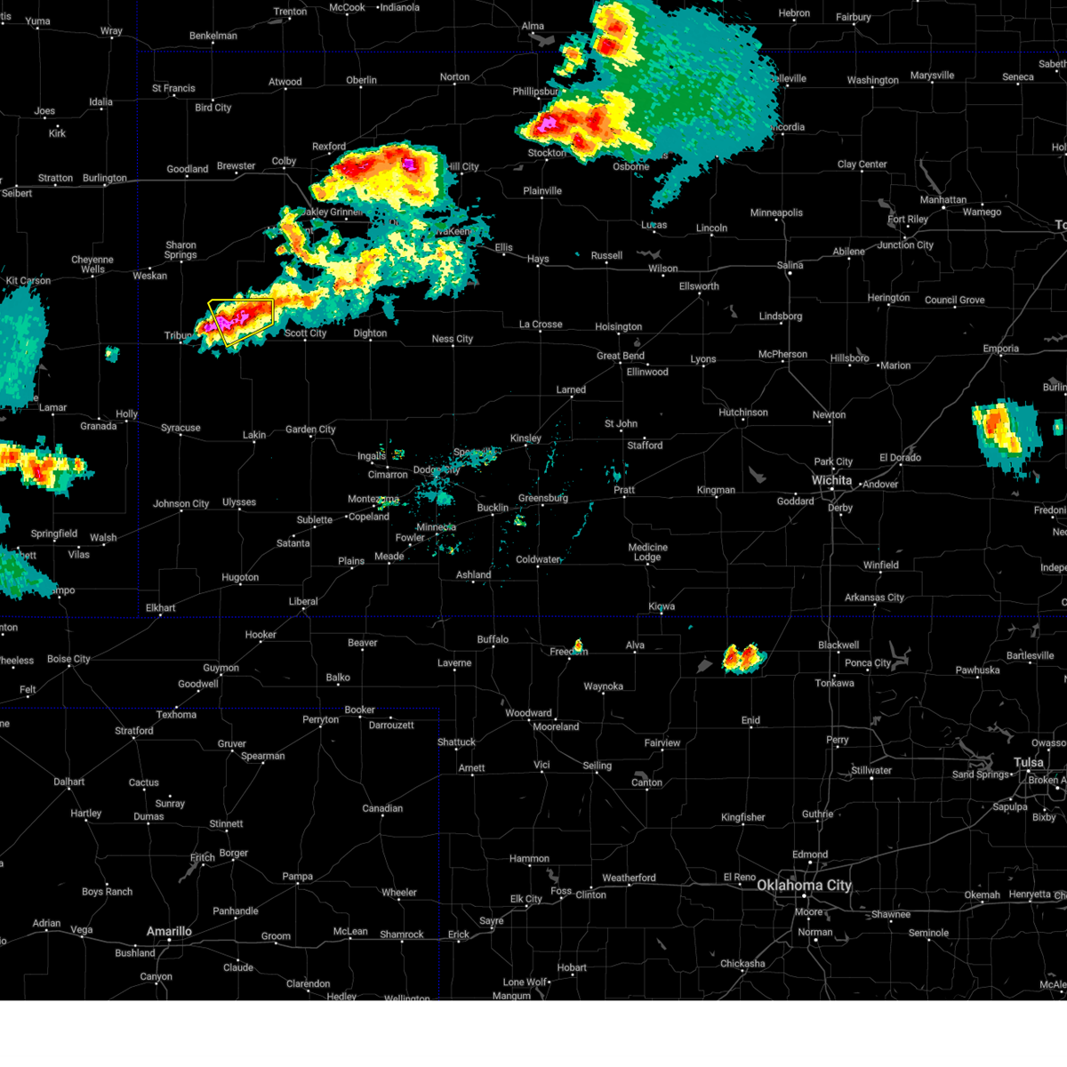 At 557 pm cdt, a severe thunderstorm was located 10 miles north of leoti, moving southeast at 5 mph (public reported quarter size hail 9 miles north of leoti). Hazards include 60 mph wind gusts and half dollar size hail. Hail damage to vehicles is expected. expect wind damage to roofs, siding, and trees. Locations impacted include, leoti. At 557 pm cdt, a severe thunderstorm was located 10 miles north of leoti, moving southeast at 5 mph (public reported quarter size hail 9 miles north of leoti). Hazards include 60 mph wind gusts and half dollar size hail. Hail damage to vehicles is expected. expect wind damage to roofs, siding, and trees. Locations impacted include, leoti.
|
| 7/4/2023 5:30 PM CDT | Quarter sized hail reported 10.4 miles SSE of Leoti, KS |
| 7/4/2023 5:30 PM CDT |
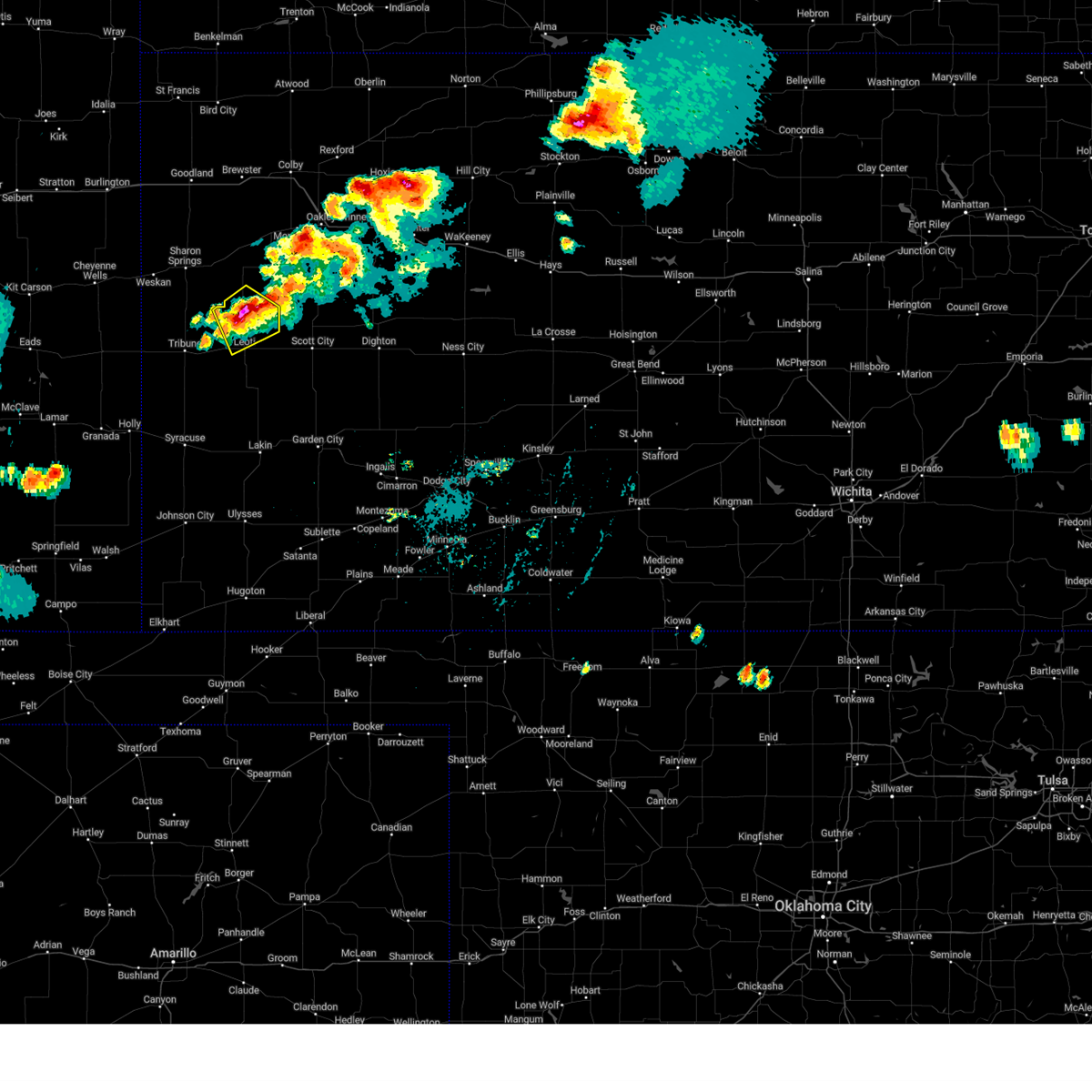 At 530 pm cdt, a severe thunderstorm was located 12 miles north of leoti, moving southeast at 5 mph (radar indicated). Hazards include 60 mph wind gusts and half dollar size hail. Hail damage to vehicles is expected. expect wind damage to roofs, siding, and trees. This severe thunderstorm will remain over mainly rural areas of northern wichita and southwestern logan counties. At 530 pm cdt, a severe thunderstorm was located 12 miles north of leoti, moving southeast at 5 mph (radar indicated). Hazards include 60 mph wind gusts and half dollar size hail. Hail damage to vehicles is expected. expect wind damage to roofs, siding, and trees. This severe thunderstorm will remain over mainly rural areas of northern wichita and southwestern logan counties.
|
| 6/10/2023 11:28 PM CDT |
 The severe thunderstorm warning for wichita, southern logan, greeley and southwestern gove counties will expire at 1030 pm mdt/1130 pm cdt/, the storms which prompted the warning have weakened below severe limits, and no longer pose an immediate threat to life or property. therefore, the warning will be allowed to expire. however gusty winds and heavy rain are still possible with these thunderstorms. to report severe weather, contact your nearest law enforcement agency. they will relay your report to the national weather service goodland. The severe thunderstorm warning for wichita, southern logan, greeley and southwestern gove counties will expire at 1030 pm mdt/1130 pm cdt/, the storms which prompted the warning have weakened below severe limits, and no longer pose an immediate threat to life or property. therefore, the warning will be allowed to expire. however gusty winds and heavy rain are still possible with these thunderstorms. to report severe weather, contact your nearest law enforcement agency. they will relay your report to the national weather service goodland.
|
| 6/10/2023 11:06 PM CDT |
 At 1006 pm mdt/1106 pm cdt/, severe thunderstorms were located along a line extending from 8 miles east of scott state lake to 3 miles south of leoti to 9 miles south of towner, moving southeast at 50 mph (radar indicated). Hazards include 60 mph wind gusts. Expect damage to roofs, siding, and trees. locations impacted include, leoti, tribune, horace, the monument rocks, selkirk, marienthal and lydia. hail threat, radar indicated max hail size, <. 75 in wind threat, radar indicated max wind gust, 60 mph. At 1006 pm mdt/1106 pm cdt/, severe thunderstorms were located along a line extending from 8 miles east of scott state lake to 3 miles south of leoti to 9 miles south of towner, moving southeast at 50 mph (radar indicated). Hazards include 60 mph wind gusts. Expect damage to roofs, siding, and trees. locations impacted include, leoti, tribune, horace, the monument rocks, selkirk, marienthal and lydia. hail threat, radar indicated max hail size, <. 75 in wind threat, radar indicated max wind gust, 60 mph.
|
| 6/10/2023 10:59 PM CDT |
 At 958 pm mdt/1058 pm cdt/, severe thunderstorms were located along a line extending from 10 miles east of scott state lake to near leoti to 10 miles southeast of towner, moving southeast at 65 mph (radar indicated). Hazards include 60 mph wind gusts. Expect damage to roofs, siding, and trees. these severe thunderstorms will remain over mainly rural areas of wichita, southern logan, greeley and southwestern gove counties, including the following locations, lydia, the monument rocks, selkirk and marienthal. hail threat, radar indicated max hail size, <. 75 in wind threat, radar indicated max wind gust, 60 mph. At 958 pm mdt/1058 pm cdt/, severe thunderstorms were located along a line extending from 10 miles east of scott state lake to near leoti to 10 miles southeast of towner, moving southeast at 65 mph (radar indicated). Hazards include 60 mph wind gusts. Expect damage to roofs, siding, and trees. these severe thunderstorms will remain over mainly rural areas of wichita, southern logan, greeley and southwestern gove counties, including the following locations, lydia, the monument rocks, selkirk and marienthal. hail threat, radar indicated max hail size, <. 75 in wind threat, radar indicated max wind gust, 60 mph.
|
| 6/10/2023 10:51 PM CDT |
 At 951 pm mdt/1051 pm cdt/, severe thunderstorms were located along a line extending from 16 miles east of russell springs to 10 miles west of scott state lake to horace, moving east at 45 mph (radar indicated). Hazards include 60 mph wind gusts. Expect damage to roofs, siding, and trees. locations impacted include, leoti. hail threat, radar indicated max hail size, <. 75 in wind threat, radar indicated max wind gust, 60 mph. At 951 pm mdt/1051 pm cdt/, severe thunderstorms were located along a line extending from 16 miles east of russell springs to 10 miles west of scott state lake to horace, moving east at 45 mph (radar indicated). Hazards include 60 mph wind gusts. Expect damage to roofs, siding, and trees. locations impacted include, leoti. hail threat, radar indicated max hail size, <. 75 in wind threat, radar indicated max wind gust, 60 mph.
|
| 6/10/2023 10:21 PM CDT |
 At 920 pm mdt/1020 pm cdt/, severe thunderstorms were located along a line extending from 6 miles west of monument to 9 miles west of russell springs to 9 miles south of weskan, moving southeast at 45 mph (mesonet. a automated weather station 10 miles northeast of wallace reported a 62 mph wind gust. the strongest winds may occur before any rainfall). Hazards include 60 mph wind gusts. Expect damage to roofs, siding, and trees. severe thunderstorms will be near, monument around 1025 pm cdt. other locations in the path of these severe thunderstorms include tribune and horace. hail threat, radar indicated max hail size, <. 75 in wind threat, radar indicated max wind gust, 60 mph. At 920 pm mdt/1020 pm cdt/, severe thunderstorms were located along a line extending from 6 miles west of monument to 9 miles west of russell springs to 9 miles south of weskan, moving southeast at 45 mph (mesonet. a automated weather station 10 miles northeast of wallace reported a 62 mph wind gust. the strongest winds may occur before any rainfall). Hazards include 60 mph wind gusts. Expect damage to roofs, siding, and trees. severe thunderstorms will be near, monument around 1025 pm cdt. other locations in the path of these severe thunderstorms include tribune and horace. hail threat, radar indicated max hail size, <. 75 in wind threat, radar indicated max wind gust, 60 mph.
|
| 4/27/2023 7:52 PM CDT |
 The severe thunderstorm warning for wichita, southeastern wallace, western thomas, logan and eastern greeley counties will expire at 700 pm mdt/800 pm cdt/, the storms which prompted the warning have weakened below severe limits, and no longer pose an immediate threat to life or property. therefore, the warning will be allowed to expire. however gusty winds and heavy rain are still possible with these thunderstorms. The severe thunderstorm warning for wichita, southeastern wallace, western thomas, logan and eastern greeley counties will expire at 700 pm mdt/800 pm cdt/, the storms which prompted the warning have weakened below severe limits, and no longer pose an immediate threat to life or property. therefore, the warning will be allowed to expire. however gusty winds and heavy rain are still possible with these thunderstorms.
|
| 4/27/2023 7:48 PM CDT |
 At 648 pm mdt/748 pm cdt/, severe thunderstorms were located along a line extending from 5 miles southwest of oakley to 8 miles southeast of russell springs to 9 miles northeast of tribune, moving southeast at 50 mph (radar indicated). Hazards include 60 mph wind gusts. Expect damage to roofs, siding, and trees. locations impacted include, oakley and leoti. this includes interstate 70 in kansas between mile markers 48 and 72. hail threat, radar indicated max hail size, <. 75 in wind threat, radar indicated max wind gust, 60 mph. At 648 pm mdt/748 pm cdt/, severe thunderstorms were located along a line extending from 5 miles southwest of oakley to 8 miles southeast of russell springs to 9 miles northeast of tribune, moving southeast at 50 mph (radar indicated). Hazards include 60 mph wind gusts. Expect damage to roofs, siding, and trees. locations impacted include, oakley and leoti. this includes interstate 70 in kansas between mile markers 48 and 72. hail threat, radar indicated max hail size, <. 75 in wind threat, radar indicated max wind gust, 60 mph.
|
| 4/27/2023 7:07 PM CDT |
 At 606 pm mdt/706 pm cdt/, severe thunderstorms were located along a line extending from 6 miles southwest of levant to 10 miles west of winona to 3 miles southwest of weskan, moving south at 45 mph (trained weather spotters). Hazards include 60 mph wind gusts. Expect damage to roofs, siding, and trees. severe thunderstorms will be near, winona around 725 pm cdt. other locations in the path of these severe thunderstorms include monument, russell springs, horace and tribune. this includes interstate 70 in kansas between mile markers 48 and 72. hail threat, radar indicated max hail size, <. 75 in wind threat, radar indicated max wind gust, 60 mph. At 606 pm mdt/706 pm cdt/, severe thunderstorms were located along a line extending from 6 miles southwest of levant to 10 miles west of winona to 3 miles southwest of weskan, moving south at 45 mph (trained weather spotters). Hazards include 60 mph wind gusts. Expect damage to roofs, siding, and trees. severe thunderstorms will be near, winona around 725 pm cdt. other locations in the path of these severe thunderstorms include monument, russell springs, horace and tribune. this includes interstate 70 in kansas between mile markers 48 and 72. hail threat, radar indicated max hail size, <. 75 in wind threat, radar indicated max wind gust, 60 mph.
|
| 7/26/2022 8:55 PM CDT |
 The severe thunderstorm warning for central wichita county will expire at 900 pm cdt, the storm which prompted the warning has weakened below severe limits, and no longer poses an immediate threat to life or property. therefore, the warning will be allowed to expire. however gusty winds and heavy rain are still possible with this thunderstorm. to report severe weather, contact your nearest law enforcement agency. they will relay your report to the national weather service goodland. The severe thunderstorm warning for central wichita county will expire at 900 pm cdt, the storm which prompted the warning has weakened below severe limits, and no longer poses an immediate threat to life or property. therefore, the warning will be allowed to expire. however gusty winds and heavy rain are still possible with this thunderstorm. to report severe weather, contact your nearest law enforcement agency. they will relay your report to the national weather service goodland.
|
| 7/26/2022 8:49 PM CDT |
 At 849 pm cdt, a severe thunderstorm was located near leoti, moving east at 20 mph (radar indicated). Hazards include 60 mph wind gusts and quarter size hail. Hail damage to vehicles is expected. expect wind damage to roofs, siding, and trees. locations impacted include, leoti. hail threat, radar indicated max hail size, 1. 00 in wind threat, radar indicated max wind gust, 60 mph. At 849 pm cdt, a severe thunderstorm was located near leoti, moving east at 20 mph (radar indicated). Hazards include 60 mph wind gusts and quarter size hail. Hail damage to vehicles is expected. expect wind damage to roofs, siding, and trees. locations impacted include, leoti. hail threat, radar indicated max hail size, 1. 00 in wind threat, radar indicated max wind gust, 60 mph.
|
| 7/26/2022 8:37 PM CDT |
 At 837 pm cdt, a severe thunderstorm was located 4 miles south of leoti, moving northeast at 15 mph. another severe thunderstorm was located northwest of leoti (radar indicated). Hazards include 60 mph wind gusts and quarter size hail. Hail damage to vehicles is expected. expect wind damage to roofs, siding, and trees. locations impacted include, leoti. hail threat, radar indicated max hail size, 1. 00 in wind threat, radar indicated max wind gust, 60 mph. At 837 pm cdt, a severe thunderstorm was located 4 miles south of leoti, moving northeast at 15 mph. another severe thunderstorm was located northwest of leoti (radar indicated). Hazards include 60 mph wind gusts and quarter size hail. Hail damage to vehicles is expected. expect wind damage to roofs, siding, and trees. locations impacted include, leoti. hail threat, radar indicated max hail size, 1. 00 in wind threat, radar indicated max wind gust, 60 mph.
|
| 7/26/2022 8:27 PM CDT |
 At 827 pm cdt, a severe thunderstorm was located 4 miles south of leoti, moving northeast at 25 mph (radar indicated). Hazards include 60 mph wind gusts and quarter size hail. Hail damage to vehicles is expected. expect wind damage to roofs, siding, and trees. locations impacted include, leoti and marienthal. hail threat, radar indicated max hail size, 1. 00 in wind threat, radar indicated max wind gust, 60 mph. At 827 pm cdt, a severe thunderstorm was located 4 miles south of leoti, moving northeast at 25 mph (radar indicated). Hazards include 60 mph wind gusts and quarter size hail. Hail damage to vehicles is expected. expect wind damage to roofs, siding, and trees. locations impacted include, leoti and marienthal. hail threat, radar indicated max hail size, 1. 00 in wind threat, radar indicated max wind gust, 60 mph.
|
| 7/26/2022 8:18 PM CDT |
 At 818 pm cdt, a severe thunderstorm was located 8 miles southwest of leoti, moving northeast at 20 mph (radar indicated). Hazards include 60 mph wind gusts and quarter size hail. Hail damage to vehicles is expected. Expect wind damage to roofs, siding, and trees. At 818 pm cdt, a severe thunderstorm was located 8 miles southwest of leoti, moving northeast at 20 mph (radar indicated). Hazards include 60 mph wind gusts and quarter size hail. Hail damage to vehicles is expected. Expect wind damage to roofs, siding, and trees.
|
| 7/22/2022 8:01 PM CDT | Kansas mesonet. 61 mph gust at 10 meter height... 45 mph gust at 2 meter heigh in wichita county KS, 1.5 miles WSW of Leoti, KS |
| 7/22/2022 7:44 PM CDT |
 At 744 pm cdt, a severe thunderstorm was located 6 miles west of modoc, moving southeast at 25 mph (radar indicated). Hazards include ping pong ball size hail and 60 mph wind gusts. People and animals outdoors will be injured. expect hail damage to roofs, siding, windows, and vehicles. expect wind damage to roofs, siding, and trees. This severe thunderstorm will remain over mainly rural areas of southeastern wichita county, including the following locations, marienthal. At 744 pm cdt, a severe thunderstorm was located 6 miles west of modoc, moving southeast at 25 mph (radar indicated). Hazards include ping pong ball size hail and 60 mph wind gusts. People and animals outdoors will be injured. expect hail damage to roofs, siding, windows, and vehicles. expect wind damage to roofs, siding, and trees. This severe thunderstorm will remain over mainly rural areas of southeastern wichita county, including the following locations, marienthal.
|
| 7/22/2022 7:35 PM CDT | Corrects previous tstm wnd gst report from 2 e leoti. kansas mesonet. 61 mph gust at 10 meter height... 45 mph gust at 2 meter heigh in wichita county KS, 1.5 miles WSW of Leoti, KS |
| 7/22/2022 6:28 PM CDT | Storm damage reported in wichita county KS, 15.8 miles SSE of Leoti, KS |
| 6/30/2022 7:10 PM CDT | Via kansas mesonet. 58mph gust measured at 10m height with a 47mph gust measured at 2m heigh in wichita county KS, 1.4 miles W of Leoti, KS |
| 6/12/2022 8:30 PM CDT |
 At 830 pm cdt, a severe thunderstorm was located 4 miles northeast of leoti, moving northeast at 35 mph (radar indicated). Hazards include 60 mph wind gusts and quarter size hail. Hail damage to vehicles is expected. expect wind damage to roofs, siding, and trees. locations impacted include, leoti, marienthal and selkirk. hail threat, radar indicated max hail size, 1. 00 in wind threat, radar indicated max wind gust, 60 mph. At 830 pm cdt, a severe thunderstorm was located 4 miles northeast of leoti, moving northeast at 35 mph (radar indicated). Hazards include 60 mph wind gusts and quarter size hail. Hail damage to vehicles is expected. expect wind damage to roofs, siding, and trees. locations impacted include, leoti, marienthal and selkirk. hail threat, radar indicated max hail size, 1. 00 in wind threat, radar indicated max wind gust, 60 mph.
|
| 6/12/2022 8:18 PM CDT |
 At 818 pm cdt, a severe thunderstorm was located over leoti, moving northeast at 50 mph (radar indicated). Hazards include 60 mph wind gusts and quarter size hail. Hail damage to vehicles is expected. expect wind damage to roofs, siding, and trees. this severe thunderstorm will remain over mainly rural areas of wichita and southwestern logan counties, including the following locations, marienthal and selkirk. hail threat, radar indicated max hail size, 1. 00 in wind threat, radar indicated max wind gust, 60 mph. At 818 pm cdt, a severe thunderstorm was located over leoti, moving northeast at 50 mph (radar indicated). Hazards include 60 mph wind gusts and quarter size hail. Hail damage to vehicles is expected. expect wind damage to roofs, siding, and trees. this severe thunderstorm will remain over mainly rural areas of wichita and southwestern logan counties, including the following locations, marienthal and selkirk. hail threat, radar indicated max hail size, 1. 00 in wind threat, radar indicated max wind gust, 60 mph.
|
| 6/7/2022 8:37 PM CDT |
 At 837 pm cdt, a severe thunderstorm was located 13 miles southeast of wallace, or 18 miles southeast of sharon springs, moving southeast at 35 mph (radar indicated). Hazards include ping pong ball size hail and 60 mph wind gusts. People and animals outdoors will be injured. expect hail damage to roofs, siding, windows, and vehicles. expect wind damage to roofs, siding, and trees. this severe thunderstorm will remain over mainly rural areas of wichita and southwestern logan counties, including the following locations, marienthal. hail threat, radar indicated max hail size, 1. 50 in wind threat, radar indicated max wind gust, 60 mph. At 837 pm cdt, a severe thunderstorm was located 13 miles southeast of wallace, or 18 miles southeast of sharon springs, moving southeast at 35 mph (radar indicated). Hazards include ping pong ball size hail and 60 mph wind gusts. People and animals outdoors will be injured. expect hail damage to roofs, siding, windows, and vehicles. expect wind damage to roofs, siding, and trees. this severe thunderstorm will remain over mainly rural areas of wichita and southwestern logan counties, including the following locations, marienthal. hail threat, radar indicated max hail size, 1. 50 in wind threat, radar indicated max wind gust, 60 mph.
|
| 5/18/2022 8:00 PM CDT | Kansas mesonet sit in wichita county KS, 1.4 miles W of Leoti, KS |
| 4/23/2022 12:51 AM CDT |
 At 1251 am cdt, severe thunderstorms were located along a line extending from 6 miles north of rexford to 9 miles south of leoti, moving east at 25 mph (radar indicated). Hazards include 70 mph wind gusts and half dollar size hail. Hail damage to vehicles is expected. expect considerable tree damage. wind damage is also likely to mobile homes, roofs, and outbuildings. severe thunderstorms will be near, rexford around 1255 am cdt. other locations in the path of these severe thunderstorms include selden. This includes interstate 70 in kansas between mile markers 41 and 100. At 1251 am cdt, severe thunderstorms were located along a line extending from 6 miles north of rexford to 9 miles south of leoti, moving east at 25 mph (radar indicated). Hazards include 70 mph wind gusts and half dollar size hail. Hail damage to vehicles is expected. expect considerable tree damage. wind damage is also likely to mobile homes, roofs, and outbuildings. severe thunderstorms will be near, rexford around 1255 am cdt. other locations in the path of these severe thunderstorms include selden. This includes interstate 70 in kansas between mile markers 41 and 100.
|
| 4/23/2022 12:28 AM CDT |
 At 1128 pm mdt/1228 am cdt/, severe thunderstorms were located along a line extending from 3 miles north of winona to 14 miles south of russell springs to 11 miles southwest of leoti, moving east at 55 mph (radar indicated). Hazards include 70 mph wind gusts and half dollar size hail. Hail damage to vehicles is expected. expect considerable tree damage. wind damage is also likely to mobile homes, roofs, and outbuildings. Locations impacted include, oakley, leoti, tribune, winona, monument, horace and russell springs. At 1128 pm mdt/1228 am cdt/, severe thunderstorms were located along a line extending from 3 miles north of winona to 14 miles south of russell springs to 11 miles southwest of leoti, moving east at 55 mph (radar indicated). Hazards include 70 mph wind gusts and half dollar size hail. Hail damage to vehicles is expected. expect considerable tree damage. wind damage is also likely to mobile homes, roofs, and outbuildings. Locations impacted include, oakley, leoti, tribune, winona, monument, horace and russell springs.
|
| 4/23/2022 12:18 AM CDT |
 At 1118 pm mdt/1218 am cdt/, severe thunderstorms were located along a line extending from 5 miles northwest of winona to 14 miles north of leoti to 13 miles southeast of tribune, moving east at 50 mph (radar indicated). Hazards include 70 mph wind gusts and ping pong ball size hail. People and animals outdoors will be injured. expect hail damage to roofs, siding, windows, and vehicles. expect considerable tree damage. wind damage is also likely to mobile homes, roofs, and outbuildings. Locations impacted include, winona, monument and oakley. At 1118 pm mdt/1218 am cdt/, severe thunderstorms were located along a line extending from 5 miles northwest of winona to 14 miles north of leoti to 13 miles southeast of tribune, moving east at 50 mph (radar indicated). Hazards include 70 mph wind gusts and ping pong ball size hail. People and animals outdoors will be injured. expect hail damage to roofs, siding, windows, and vehicles. expect considerable tree damage. wind damage is also likely to mobile homes, roofs, and outbuildings. Locations impacted include, winona, monument and oakley.
|
| 4/22/2022 11:55 PM CDT |
 At 1055 pm mdt/1155 pm cdt/, severe thunderstorms were located along a line extending from 12 miles north of wallace to 16 miles southeast of sharon springs to 9 miles south of horace, moving east at 65 mph (radar indicated). Hazards include 70 mph wind gusts and ping pong ball size hail. People and animals outdoors will be injured. expect hail damage to roofs, siding, windows, and vehicles. expect considerable tree damage. wind damage is also likely to mobile homes, roofs, and outbuildings. severe thunderstorms will be near, winona around 1215 am cdt. Other locations in the path of these severe thunderstorms include monument and oakley. At 1055 pm mdt/1155 pm cdt/, severe thunderstorms were located along a line extending from 12 miles north of wallace to 16 miles southeast of sharon springs to 9 miles south of horace, moving east at 65 mph (radar indicated). Hazards include 70 mph wind gusts and ping pong ball size hail. People and animals outdoors will be injured. expect hail damage to roofs, siding, windows, and vehicles. expect considerable tree damage. wind damage is also likely to mobile homes, roofs, and outbuildings. severe thunderstorms will be near, winona around 1215 am cdt. Other locations in the path of these severe thunderstorms include monument and oakley.
|
| 4/22/2022 10:19 PM MDT |
 At 1019 pm mdt/1119 pm cdt/, severe thunderstorms were located along a line extending from 12 miles south of weskan to 12 miles west of horace to near towner, moving east at 25 mph (radar indicated). Hazards include 60 mph wind gusts. expect damage to roofs, siding, and trees At 1019 pm mdt/1119 pm cdt/, severe thunderstorms were located along a line extending from 12 miles south of weskan to 12 miles west of horace to near towner, moving east at 25 mph (radar indicated). Hazards include 60 mph wind gusts. expect damage to roofs, siding, and trees
|
| 4/22/2022 7:14 PM CDT | Quarter sized hail reported 14.4 miles NNW of Leoti, KS, mix of nickel to quarter sized hail. |
| 4/22/2022 7:09 PM CDT | Baseball sized hail reported 1.3 miles E of Leoti, KS, found hailstone estimated to be 2.5 to 2.75 inches 1 mile west of leoti. |
| 4/22/2022 7:03 PM CDT | Tennis Ball sized hail reported 0.3 miles NE of Leoti, KS, social media report with picture... follow up report of the larger hail that fell with the storm. |
| 4/22/2022 7:03 PM CDT | Ping Pong Ball sized hail reported 0.3 miles NE of Leoti, KS, social media report of 1.5 inch hail. |
| 4/22/2022 7:02 PM CDT | Golf Ball sized hail reported 0.5 miles SSE of Leoti, KS, social media report of golf ball sized hail in leoti. |
| 4/22/2022 7:00 PM CDT |
 At 700 pm cdt, a severe thunderstorm capable of producing a tornado was located near leoti, moving northeast at 55 mph (radar indicated rotation). Hazards include tornado and hail up to two inches in diameter. Flying debris will be dangerous to those caught without shelter. mobile homes will be damaged or destroyed. damage to roofs, windows, and vehicles will occur. tree damage is likely. This tornadic thunderstorm will remain over mainly rural areas of northeastern wichita and southeastern logan counties, including the following locations, marienthal. At 700 pm cdt, a severe thunderstorm capable of producing a tornado was located near leoti, moving northeast at 55 mph (radar indicated rotation). Hazards include tornado and hail up to two inches in diameter. Flying debris will be dangerous to those caught without shelter. mobile homes will be damaged or destroyed. damage to roofs, windows, and vehicles will occur. tree damage is likely. This tornadic thunderstorm will remain over mainly rural areas of northeastern wichita and southeastern logan counties, including the following locations, marienthal.
|
| 4/22/2022 6:55 PM CDT | Half Dollar sized hail reported 0.5 miles SSE of Leoti, KS, social media report with picture of half dollar sized hail. |
| 4/22/2022 6:46 PM CDT | Half Dollar sized hail reported 0.3 miles NE of Leoti, KS |
| 4/22/2022 6:45 PM CDT |
 At 644 pm cdt, a severe thunderstorm was located 4 miles northeast of leoti, moving northeast at 65 mph (radar indicated). Hazards include two inch hail and 70 mph wind gusts. People and animals outdoors will be injured. expect hail damage to roofs, siding, windows, and vehicles. expect considerable tree damage. wind damage is also likely to mobile homes, roofs, and outbuildings. this severe thunderstorm will remain over mainly rural areas of wichita county, including the following locations, lydia and marienthal. thunderstorm damage threat, considerable hail threat, radar indicated max hail size, 2. 00 in wind threat, radar indicated max wind gust, 70 mph. At 644 pm cdt, a severe thunderstorm was located 4 miles northeast of leoti, moving northeast at 65 mph (radar indicated). Hazards include two inch hail and 70 mph wind gusts. People and animals outdoors will be injured. expect hail damage to roofs, siding, windows, and vehicles. expect considerable tree damage. wind damage is also likely to mobile homes, roofs, and outbuildings. this severe thunderstorm will remain over mainly rural areas of wichita county, including the following locations, lydia and marienthal. thunderstorm damage threat, considerable hail threat, radar indicated max hail size, 2. 00 in wind threat, radar indicated max wind gust, 70 mph.
|
| 4/22/2022 6:40 PM CDT | Golf Ball sized hail reported 0.5 miles SSE of Leoti, KS, emergency manager reported golf ball sized hail in leoti. |
| 4/22/2022 6:35 PM CDT | Half Dollar sized hail reported 0.3 miles NE of Leoti, KS, social media report with picture of half dollar sized hail. |
| 4/22/2022 6:29 PM CDT |
 At 629 pm cdt, a severe thunderstorm was located 13 miles south of leoti, moving northeast at 65 mph (radar indicated). Hazards include 60 mph wind gusts and quarter size hail. Hail damage to vehicles is expected. expect wind damage to roofs, siding, and trees. this severe thunderstorm will be near, leoti around 640 pm cdt. hail threat, radar indicated max hail size, 1. 00 in wind threat, radar indicated max wind gust, 60 mph. At 629 pm cdt, a severe thunderstorm was located 13 miles south of leoti, moving northeast at 65 mph (radar indicated). Hazards include 60 mph wind gusts and quarter size hail. Hail damage to vehicles is expected. expect wind damage to roofs, siding, and trees. this severe thunderstorm will be near, leoti around 640 pm cdt. hail threat, radar indicated max hail size, 1. 00 in wind threat, radar indicated max wind gust, 60 mph.
|
| 8/12/2021 4:53 PM CDT |
 At 453 pm cdt, a severe thunderstorm was located 7 miles west of modoc, moving northwest at 10 mph (public). Hazards include 60 mph wind gusts and penny size hail. expect damage to roofs, siding, and trees At 453 pm cdt, a severe thunderstorm was located 7 miles west of modoc, moving northwest at 10 mph (public). Hazards include 60 mph wind gusts and penny size hail. expect damage to roofs, siding, and trees
|
| 8/12/2021 4:45 PM CDT | Estimated 50-60mph winds between cr 15 and cr 17 east of leoti along with half mile visibility due to heavy rain in wichita county KS, 3.1 miles W of Leoti, KS |
| 8/11/2021 8:40 PM CDT | A power pole was snapped due to high winds. there was also nickel sized hail and near zero visibility due to heavy rain... hail and blowing dust. these conditions were in wichita county KS, 14 miles N of Leoti, KS |
| 8/11/2021 8:18 PM CDT | Corrected time of occurrence. a power pole was snapped due to high winds. there was also nickel sized hail and near zero visibility due to heavy rain... hail and blowin in wichita county KS, 14 miles N of Leoti, KS |
| 8/7/2021 6:30 PM CDT | Hen Egg sized hail reported 10.4 miles NNE of Leoti, KS |
| 8/7/2021 5:56 PM CDT |
 The severe thunderstorm warning for central wichita county will expire at 600 pm cdt, the storm which prompted the warning has weakened below severe limits, and no longer poses an immediate threat to life or property. therefore, the warning will be allowed to expire. however small hail is still possible with this thunderstorm. a severe thunderstorm watch remains in effect until 900 pm cdt for west central kansas. The severe thunderstorm warning for central wichita county will expire at 600 pm cdt, the storm which prompted the warning has weakened below severe limits, and no longer poses an immediate threat to life or property. therefore, the warning will be allowed to expire. however small hail is still possible with this thunderstorm. a severe thunderstorm watch remains in effect until 900 pm cdt for west central kansas.
|
| 8/7/2021 5:43 PM CDT |
 At 543 pm cdt, a severe thunderstorm was located near leoti, moving east at 30 mph (public hail report in leoti). Hazards include ping pong ball size hail and 60 mph wind gusts. People and animals outdoors will be injured. expect hail damage to roofs, siding, windows, and vehicles. expect wind damage to roofs, siding, and trees. locations impacted include, leoti and marienthal. hail threat, observed max hail size, 1. 50 in wind threat, radar indicated max wind gust, 60 mph. At 543 pm cdt, a severe thunderstorm was located near leoti, moving east at 30 mph (public hail report in leoti). Hazards include ping pong ball size hail and 60 mph wind gusts. People and animals outdoors will be injured. expect hail damage to roofs, siding, windows, and vehicles. expect wind damage to roofs, siding, and trees. locations impacted include, leoti and marienthal. hail threat, observed max hail size, 1. 50 in wind threat, radar indicated max wind gust, 60 mph.
|
| 8/7/2021 5:39 PM CDT | Ping Pong Ball sized hail reported 0.3 miles NE of Leoti, KS, report from mping: ping pong ball (1.50 in.). |
| 8/7/2021 5:35 PM CDT |
 At 535 pm cdt, a severe thunderstorm was located near leoti, moving east at 30 mph (public in selkirk). Hazards include golf ball size hail and 60 mph wind gusts. People and animals outdoors will be injured. expect hail damage to roofs, siding, windows, and vehicles. expect wind damage to roofs, siding, and trees. locations impacted include, leoti, marienthal and selkirk. thunderstorm damage threat, considerable hail threat, observed max hail size, 1. 75 in wind threat, radar indicated max wind gust, 60 mph. At 535 pm cdt, a severe thunderstorm was located near leoti, moving east at 30 mph (public in selkirk). Hazards include golf ball size hail and 60 mph wind gusts. People and animals outdoors will be injured. expect hail damage to roofs, siding, windows, and vehicles. expect wind damage to roofs, siding, and trees. locations impacted include, leoti, marienthal and selkirk. thunderstorm damage threat, considerable hail threat, observed max hail size, 1. 75 in wind threat, radar indicated max wind gust, 60 mph.
|
| 8/7/2021 5:27 PM CDT |
 At 527 pm cdt, a severe thunderstorm was located 6 miles west of leoti, moving east at 30 mph (radar indicated). Hazards include ping pong ball size hail and 60 mph wind gusts. People and animals outdoors will be injured. expect hail damage to roofs, siding, windows, and vehicles. expect wind damage to roofs, siding, and trees. locations impacted include, leoti, marienthal and selkirk. hail threat, radar indicated max hail size, 1. 50 in wind threat, radar indicated max wind gust, 60 mph. At 527 pm cdt, a severe thunderstorm was located 6 miles west of leoti, moving east at 30 mph (radar indicated). Hazards include ping pong ball size hail and 60 mph wind gusts. People and animals outdoors will be injured. expect hail damage to roofs, siding, windows, and vehicles. expect wind damage to roofs, siding, and trees. locations impacted include, leoti, marienthal and selkirk. hail threat, radar indicated max hail size, 1. 50 in wind threat, radar indicated max wind gust, 60 mph.
|
| 8/7/2021 5:20 PM CDT | Golf Ball sized hail reported 10 miles E of Leoti, KS, caller reported marble to golf ball sized hail that fell for a duration of 5 minutes. |
| 8/7/2021 5:17 PM CDT |
 At 417 pm mdt/517 pm cdt/, a severe thunderstorm was located 9 miles east of tribune, moving east at 30 mph (radar indicated). Hazards include 60 mph wind gusts and half dollar size hail. Hail damage to vehicles is expected. Expect wind damage to roofs, siding, and trees. At 417 pm mdt/517 pm cdt/, a severe thunderstorm was located 9 miles east of tribune, moving east at 30 mph (radar indicated). Hazards include 60 mph wind gusts and half dollar size hail. Hail damage to vehicles is expected. Expect wind damage to roofs, siding, and trees.
|
| 8/7/2021 4:50 PM CDT | Quarter sized hail reported 15.8 miles NNW of Leoti, KS, caller reported dime to quarter sized hail with the ground covered. fell for a duration of 5 minutes at time of call. |
| 8/7/2021 4:46 PM CDT |
 At 446 pm cdt, a severe thunderstorm was located 9 miles southeast of leoti, moving east at 30 mph (radar indicated). Hazards include two inch hail and 60 mph wind gusts. People and animals outdoors will be injured. expect hail damage to roofs, siding, windows, and vehicles. expect wind damage to roofs, siding, and trees. locations impacted include, leoti and marienthal. thunderstorm damage threat, considerable hail threat, radar indicated max hail size, 2. 00 in wind threat, radar indicated max wind gust, 60 mph. At 446 pm cdt, a severe thunderstorm was located 9 miles southeast of leoti, moving east at 30 mph (radar indicated). Hazards include two inch hail and 60 mph wind gusts. People and animals outdoors will be injured. expect hail damage to roofs, siding, windows, and vehicles. expect wind damage to roofs, siding, and trees. locations impacted include, leoti and marienthal. thunderstorm damage threat, considerable hail threat, radar indicated max hail size, 2. 00 in wind threat, radar indicated max wind gust, 60 mph.
|
| 8/7/2021 4:45 PM CDT | Quarter sized hail reported 7.9 miles NW of Leoti, KS, caller reported dime to quarter sized hail. |
| 8/7/2021 4:39 PM CDT |
 At 438 pm cdt, a severe thunderstorm was located 7 miles southeast of leoti, moving east at 30 mph (radar indicated). Hazards include two inch hail and 60 mph wind gusts. People and animals outdoors will be injured. expect hail damage to roofs, siding, windows, and vehicles. expect wind damage to roofs, siding, and trees. locations impacted include, leoti and marienthal. thunderstorm damage threat, considerable hail threat, radar indicated max hail size, 2. 00 in wind threat, radar indicated max wind gust, 60 mph. At 438 pm cdt, a severe thunderstorm was located 7 miles southeast of leoti, moving east at 30 mph (radar indicated). Hazards include two inch hail and 60 mph wind gusts. People and animals outdoors will be injured. expect hail damage to roofs, siding, windows, and vehicles. expect wind damage to roofs, siding, and trees. locations impacted include, leoti and marienthal. thunderstorm damage threat, considerable hail threat, radar indicated max hail size, 2. 00 in wind threat, radar indicated max wind gust, 60 mph.
|
| 8/7/2021 4:29 PM CDT |
 At 428 pm cdt, a severe thunderstorm was located near leoti, moving east at 35 mph (radar indicated). Hazards include two inch hail and 60 mph wind gusts. People and animals outdoors will be injured. expect hail damage to roofs, siding, windows, and vehicles. expect wind damage to roofs, siding, and trees. this severe thunderstorm will remain over mainly rural areas of wichita county, including the following locations, marienthal and selkirk. thunderstorm damage threat, considerable hail threat, radar indicated max hail size, 2. 00 in wind threat, radar indicated max wind gust, 60 mph. At 428 pm cdt, a severe thunderstorm was located near leoti, moving east at 35 mph (radar indicated). Hazards include two inch hail and 60 mph wind gusts. People and animals outdoors will be injured. expect hail damage to roofs, siding, windows, and vehicles. expect wind damage to roofs, siding, and trees. this severe thunderstorm will remain over mainly rural areas of wichita county, including the following locations, marienthal and selkirk. thunderstorm damage threat, considerable hail threat, radar indicated max hail size, 2. 00 in wind threat, radar indicated max wind gust, 60 mph.
|
| 8/7/2021 4:23 PM CDT |
 At 323 pm mdt/423 pm cdt/, a severe thunderstorm was located 5 miles southwest of leoti, moving east at 45 mph (radar indicated). Hazards include 60 mph wind gusts and half dollar size hail. Hail damage to vehicles is expected. expect wind damage to roofs, siding, and trees. locations impacted include, leoti, lydia, selkirk and marienthal. hail threat, radar indicated max hail size, 1. 25 in wind threat, radar indicated max wind gust, 60 mph. At 323 pm mdt/423 pm cdt/, a severe thunderstorm was located 5 miles southwest of leoti, moving east at 45 mph (radar indicated). Hazards include 60 mph wind gusts and half dollar size hail. Hail damage to vehicles is expected. expect wind damage to roofs, siding, and trees. locations impacted include, leoti, lydia, selkirk and marienthal. hail threat, radar indicated max hail size, 1. 25 in wind threat, radar indicated max wind gust, 60 mph.
|
| 8/7/2021 4:12 PM CDT | Half Dollar sized hail reported 6.7 miles ENE of Leoti, KS, public report via social media of pea to half dollar size hail lasting approximately 13 minutes. |
| 8/7/2021 4:05 PM CDT |
 At 305 pm mdt/405 pm cdt/, a severe thunderstorm was located 7 miles east of tribune, moving east at 30 mph (radar indicated). Hazards include two inch hail and 60 mph wind gusts. People and animals outdoors will be injured. expect hail damage to roofs, siding, windows, and vehicles. expect wind damage to roofs, siding, and trees. locations impacted include, leoti, tribune, horace, lydia, selkirk and marienthal. thunderstorm damage threat, considerable hail threat, radar indicated max hail size, 2. 00 in wind threat, radar indicated max wind gust, 60 mph. At 305 pm mdt/405 pm cdt/, a severe thunderstorm was located 7 miles east of tribune, moving east at 30 mph (radar indicated). Hazards include two inch hail and 60 mph wind gusts. People and animals outdoors will be injured. expect hail damage to roofs, siding, windows, and vehicles. expect wind damage to roofs, siding, and trees. locations impacted include, leoti, tribune, horace, lydia, selkirk and marienthal. thunderstorm damage threat, considerable hail threat, radar indicated max hail size, 2. 00 in wind threat, radar indicated max wind gust, 60 mph.
|
| 8/7/2021 3:52 PM CDT |
 At 252 pm mdt/352 pm cdt/, a severe thunderstorm was located near tribune, moving east at 35 mph (emergency management). Hazards include tennis ball size hail and 60 mph wind gusts. People and animals outdoors will be injured. expect hail damage to roofs, siding, windows, and vehicles. Expect wind damage to roofs, siding, and trees. At 252 pm mdt/352 pm cdt/, a severe thunderstorm was located near tribune, moving east at 35 mph (emergency management). Hazards include tennis ball size hail and 60 mph wind gusts. People and animals outdoors will be injured. expect hail damage to roofs, siding, windows, and vehicles. Expect wind damage to roofs, siding, and trees.
|
| 7/9/2021 10:24 PM MDT |
 At 1023 pm mdt/1123 pm cdt/, severe thunderstorms were located along a line extending from near modoc to 7 miles southeast of towner, moving southeast at 25 mph (radar indicated). Hazards include 70 mph wind gusts. Expect considerable tree damage. damage is likely to mobile homes, roofs, and outbuildings. Locations impacted include, leoti, tribune, horace, lydia, selkirk and marienthal. At 1023 pm mdt/1123 pm cdt/, severe thunderstorms were located along a line extending from near modoc to 7 miles southeast of towner, moving southeast at 25 mph (radar indicated). Hazards include 70 mph wind gusts. Expect considerable tree damage. damage is likely to mobile homes, roofs, and outbuildings. Locations impacted include, leoti, tribune, horace, lydia, selkirk and marienthal.
|
| 7/9/2021 10:10 PM MDT |
 At 1009 pm mdt/1109 pm cdt/, severe thunderstorms were located along a line extending from 7 miles northwest of modoc to near towner, moving southeast at 25 mph (radar indicated). Hazards include 70 mph wind gusts. Expect considerable tree damage. damage is likely to mobile homes, roofs, and outbuildings. These severe thunderstorms will remain over mainly rural areas of wichita and greeley counties, including the following locations, marienthal, lydia and selkirk. At 1009 pm mdt/1109 pm cdt/, severe thunderstorms were located along a line extending from 7 miles northwest of modoc to near towner, moving southeast at 25 mph (radar indicated). Hazards include 70 mph wind gusts. Expect considerable tree damage. damage is likely to mobile homes, roofs, and outbuildings. These severe thunderstorms will remain over mainly rural areas of wichita and greeley counties, including the following locations, marienthal, lydia and selkirk.
|
| 7/9/2021 10:56 PM CDT |
 At 956 pm mdt/1056 pm cdt/, a severe thunderstorm was located 9 miles north of leoti, moving southeast at 30 mph (radar indicated). Hazards include 70 mph wind gusts. Expect considerable tree damage. damage is likely to mobile homes, roofs, and outbuildings. Locations impacted include, leoti. At 956 pm mdt/1056 pm cdt/, a severe thunderstorm was located 9 miles north of leoti, moving southeast at 30 mph (radar indicated). Hazards include 70 mph wind gusts. Expect considerable tree damage. damage is likely to mobile homes, roofs, and outbuildings. Locations impacted include, leoti.
|
| 7/9/2021 10:39 PM CDT |
 At 939 pm mdt/1039 pm cdt/, a severe thunderstorm was located 16 miles north of leoti, moving southeast at 30 mph (radar indicated). Hazards include 70 mph wind gusts. Expect considerable tree damage. Damage is likely to mobile homes, roofs, and outbuildings. At 939 pm mdt/1039 pm cdt/, a severe thunderstorm was located 16 miles north of leoti, moving southeast at 30 mph (radar indicated). Hazards include 70 mph wind gusts. Expect considerable tree damage. Damage is likely to mobile homes, roofs, and outbuildings.
|
| 7/9/2021 10:10 PM CDT | From ksu mesonet sit in wichita county KS, 0.3 miles NE of Leoti, KS |
| 7/4/2021 8:00 PM CDT | Winds estimated to be 50 to 60 mph. lasted about 10 minutes... ending at 7 pm mt. three inch diameter tree branches were broken of in wichita county KS, 14.4 miles NNW of Leoti, KS |
| 6/24/2021 10:32 PM CDT |
 At 932 pm mdt/1032 pm cdt, a severe thunderstorm was located 7 miles west of shallow water, moving east at 55 mph (radar indicated). Hazards include 60 mph wind gusts and quarter size hail. Hail damage to vehicles is expected. expect wind damage to roofs, siding, and trees. Locations impacted include, leoti, tribune, lydia, selkirk and marienthal. At 932 pm mdt/1032 pm cdt, a severe thunderstorm was located 7 miles west of shallow water, moving east at 55 mph (radar indicated). Hazards include 60 mph wind gusts and quarter size hail. Hail damage to vehicles is expected. expect wind damage to roofs, siding, and trees. Locations impacted include, leoti, tribune, lydia, selkirk and marienthal.
|
| 6/24/2021 10:16 PM CDT |
 At 916 pm mdt/1016 pm cdt/, a severe thunderstorm was located 7 miles southeast of leoti, moving east at 55 mph (radar indicated). Hazards include 60 mph wind gusts and quarter size hail. Hail damage to vehicles is expected. expect wind damage to roofs, siding, and trees. This severe thunderstorm will remain over mainly rural areas of wichita and central greeley counties, including the following locations, marienthal, lydia and selkirk. At 916 pm mdt/1016 pm cdt/, a severe thunderstorm was located 7 miles southeast of leoti, moving east at 55 mph (radar indicated). Hazards include 60 mph wind gusts and quarter size hail. Hail damage to vehicles is expected. expect wind damage to roofs, siding, and trees. This severe thunderstorm will remain over mainly rural areas of wichita and central greeley counties, including the following locations, marienthal, lydia and selkirk.
|
| 6/24/2021 10:02 PM CDT |
 At 1002 pm cdt, severe thunderstorms were located along a line extending from 4 miles southwest of russell springs to 11 miles west of scott state lake to 4 miles northeast of leoti, moving east at 40 mph. these are very dangerous storms (radar indicated). Hazards include 80 mph wind gusts and quarter size hail. Flying debris will be dangerous to those caught without shelter. mobile homes will be heavily damaged. expect considerable damage to roofs, windows, and vehicles. extensive tree damage and power outages are likely. Locations impacted include, leoti, russell springs and marienthal. At 1002 pm cdt, severe thunderstorms were located along a line extending from 4 miles southwest of russell springs to 11 miles west of scott state lake to 4 miles northeast of leoti, moving east at 40 mph. these are very dangerous storms (radar indicated). Hazards include 80 mph wind gusts and quarter size hail. Flying debris will be dangerous to those caught without shelter. mobile homes will be heavily damaged. expect considerable damage to roofs, windows, and vehicles. extensive tree damage and power outages are likely. Locations impacted include, leoti, russell springs and marienthal.
|
| 6/24/2021 9:51 PM CDT |
 At 851 pm mdt/951 pm cdt/, a severe thunderstorm was located near tribune, moving east at 55 mph (radar indicated). Hazards include 60 mph wind gusts and quarter size hail. Hail damage to vehicles is expected. expect wind damage to roofs, siding, and trees. This severe thunderstorm will be near, leoti around 1010 pm cdt. At 851 pm mdt/951 pm cdt/, a severe thunderstorm was located near tribune, moving east at 55 mph (radar indicated). Hazards include 60 mph wind gusts and quarter size hail. Hail damage to vehicles is expected. expect wind damage to roofs, siding, and trees. This severe thunderstorm will be near, leoti around 1010 pm cdt.
|
| 6/24/2021 9:32 PM CDT |
 At 932 pm cdt, severe thunderstorms were located along a line extending from near wallace to 18 miles southeast of sharon springs to 10 miles northeast of tribune, moving east at 40 mph. these are very dangerous storms (radar indicated). Hazards include 80 mph wind gusts and quarter size hail. Flying debris will be dangerous to those caught without shelter. mobile homes will be heavily damaged. expect considerable damage to roofs, windows, and vehicles. Extensive tree damage and power outages are likely. At 932 pm cdt, severe thunderstorms were located along a line extending from near wallace to 18 miles southeast of sharon springs to 10 miles northeast of tribune, moving east at 40 mph. these are very dangerous storms (radar indicated). Hazards include 80 mph wind gusts and quarter size hail. Flying debris will be dangerous to those caught without shelter. mobile homes will be heavily damaged. expect considerable damage to roofs, windows, and vehicles. Extensive tree damage and power outages are likely.
|
| 5/26/2021 4:52 PM CDT | Quarter sized hail reported 8.1 miles S of Leoti, KS, report received of quarter sized hail north of leoti. |
| 5/26/2021 4:49 PM CDT | Half Dollar sized hail reported 8.1 miles S of Leoti, KS, report from mping: half dollar (1.25 in.). |
| 5/24/2021 4:47 PM CDT |
 At 447 pm cdt, a severe thunderstorm was located 17 miles north of kendall, moving northeast at 30 mph (radar indicated). Hazards include two inch hail and 60 mph wind gusts. People and animals outdoors will be injured. expect hail damage to roofs, siding, windows, and vehicles. expect wind damage to roofs, siding, and trees. locations impacted include, leoti, lydia and marienthal. A tornado watch remains in effect until 900 pm cdt for west central kansas. At 447 pm cdt, a severe thunderstorm was located 17 miles north of kendall, moving northeast at 30 mph (radar indicated). Hazards include two inch hail and 60 mph wind gusts. People and animals outdoors will be injured. expect hail damage to roofs, siding, windows, and vehicles. expect wind damage to roofs, siding, and trees. locations impacted include, leoti, lydia and marienthal. A tornado watch remains in effect until 900 pm cdt for west central kansas.
|
| 5/24/2021 4:38 PM CDT |
 At 438 pm cdt, a severe thunderstorm was located 18 miles north of kendall, moving northeast at 15 mph (radar indicated). Hazards include two inch hail and 60 mph wind gusts. People and animals outdoors will be injured. expect hail damage to roofs, siding, windows, and vehicles. expect wind damage to roofs, siding, and trees. locations impacted include, leoti, lydia and marienthal. A tornado watch remains in effect until 900 pm cdt for west central kansas. At 438 pm cdt, a severe thunderstorm was located 18 miles north of kendall, moving northeast at 15 mph (radar indicated). Hazards include two inch hail and 60 mph wind gusts. People and animals outdoors will be injured. expect hail damage to roofs, siding, windows, and vehicles. expect wind damage to roofs, siding, and trees. locations impacted include, leoti, lydia and marienthal. A tornado watch remains in effect until 900 pm cdt for west central kansas.
|
| 5/24/2021 4:30 PM CDT |
 At 430 pm cdt, a severe thunderstorm was located 18 miles north of kendall, moving northeast at 20 mph (radar indicated). Hazards include two inch hail and 60 mph wind gusts. People and animals outdoors will be injured. expect hail damage to roofs, siding, windows, and vehicles. expect wind damage to roofs, siding, and trees. this severe thunderstorm will remain over mainly rural areas of southern wichita county, including the following locations, lydia and marienthal. A tornado watch remains in effect until 900 pm cdt for west central kansas. At 430 pm cdt, a severe thunderstorm was located 18 miles north of kendall, moving northeast at 20 mph (radar indicated). Hazards include two inch hail and 60 mph wind gusts. People and animals outdoors will be injured. expect hail damage to roofs, siding, windows, and vehicles. expect wind damage to roofs, siding, and trees. this severe thunderstorm will remain over mainly rural areas of southern wichita county, including the following locations, lydia and marienthal. A tornado watch remains in effect until 900 pm cdt for west central kansas.
|
| 5/15/2021 9:16 PM CDT |
 At 916 pm cdt, a severe thunderstorm was located 6 miles north of leoti, moving east at 10 mph (radar indicated). Hazards include tennis ball size hail and 60 mph wind gusts. People and animals outdoors will be injured. expect hail damage to roofs, siding, windows, and vehicles. expect wind damage to roofs, siding, and trees. Locations impacted include, leoti and marienthal. At 916 pm cdt, a severe thunderstorm was located 6 miles north of leoti, moving east at 10 mph (radar indicated). Hazards include tennis ball size hail and 60 mph wind gusts. People and animals outdoors will be injured. expect hail damage to roofs, siding, windows, and vehicles. expect wind damage to roofs, siding, and trees. Locations impacted include, leoti and marienthal.
|
| 5/15/2021 9:14 PM CDT |
 At 914 pm cdt, a severe thunderstorm was located 6 miles north of leoti, moving east at 10 mph (radar indicated). Hazards include tennis ball size hail and 60 mph wind gusts. People and animals outdoors will be injured. expect hail damage to roofs, siding, windows, and vehicles. expect wind damage to roofs, siding, and trees. Locations impacted include, leoti and marienthal. At 914 pm cdt, a severe thunderstorm was located 6 miles north of leoti, moving east at 10 mph (radar indicated). Hazards include tennis ball size hail and 60 mph wind gusts. People and animals outdoors will be injured. expect hail damage to roofs, siding, windows, and vehicles. expect wind damage to roofs, siding, and trees. Locations impacted include, leoti and marienthal.
|
| 5/15/2021 9:12 PM CDT |
 At 912 pm cdt, a severe thunderstorm was located 6 miles north of leoti, moving east at 10 mph (radar indicated). Hazards include tennis ball size hail and 60 mph wind gusts. People and animals outdoors will be injured. expect hail damage to roofs, siding, windows, and vehicles. expect wind damage to roofs, siding, and trees. Locations impacted include, leoti and marienthal. At 912 pm cdt, a severe thunderstorm was located 6 miles north of leoti, moving east at 10 mph (radar indicated). Hazards include tennis ball size hail and 60 mph wind gusts. People and animals outdoors will be injured. expect hail damage to roofs, siding, windows, and vehicles. expect wind damage to roofs, siding, and trees. Locations impacted include, leoti and marienthal.
|
| 5/15/2021 9:09 PM CDT |
 At 908 pm cdt, a severe thunderstorm was located 6 miles north of leoti, moving east at 10 mph (radar indicated). Hazards include 60 mph wind gusts and half dollar size hail. Hail damage to vehicles is expected. expect wind damage to roofs, siding, and trees. This severe thunderstorm will remain over mainly rural areas of northern wichita county, including the following locations, marienthal. At 908 pm cdt, a severe thunderstorm was located 6 miles north of leoti, moving east at 10 mph (radar indicated). Hazards include 60 mph wind gusts and half dollar size hail. Hail damage to vehicles is expected. expect wind damage to roofs, siding, and trees. This severe thunderstorm will remain over mainly rural areas of northern wichita county, including the following locations, marienthal.
|
| 5/14/2021 9:06 PM CDT |
 At 906 pm cdt, a severe thunderstorm was located 6 miles southeast of leoti, moving east at 15 mph (radar indicated). Hazards include 60 mph wind gusts and half dollar size hail. Hail damage to vehicles is expected. expect wind damage to roofs, siding, and trees. This severe thunderstorm will remain over mainly rural areas of southern wichita county, including the following locations, marienthal and selkirk. At 906 pm cdt, a severe thunderstorm was located 6 miles southeast of leoti, moving east at 15 mph (radar indicated). Hazards include 60 mph wind gusts and half dollar size hail. Hail damage to vehicles is expected. expect wind damage to roofs, siding, and trees. This severe thunderstorm will remain over mainly rural areas of southern wichita county, including the following locations, marienthal and selkirk.
|
| 5/14/2021 8:30 PM CDT |
 At 830 pm cdt, a severe thunderstorm was located 5 miles southwest of leoti, moving east at 15 mph (radar indicated). Hazards include ping pong ball size hail and 60 mph wind gusts. People and animals outdoors will be injured. expect hail damage to roofs, siding, windows, and vehicles. expect wind damage to roofs, siding, and trees. This severe thunderstorm will be near, leoti around 845 pm cdt. At 830 pm cdt, a severe thunderstorm was located 5 miles southwest of leoti, moving east at 15 mph (radar indicated). Hazards include ping pong ball size hail and 60 mph wind gusts. People and animals outdoors will be injured. expect hail damage to roofs, siding, windows, and vehicles. expect wind damage to roofs, siding, and trees. This severe thunderstorm will be near, leoti around 845 pm cdt.
|
| 5/2/2021 7:51 PM CDT | Report via twitter 30-40 miles per hour sustained wind in wichita county KS, 12.3 miles S of Leoti, KS |
| 8/16/2020 8:56 PM CDT |
 At 856 pm cdt, severe thunderstorms were located along a line extending from 12 miles southwest of leoti to 16 miles southwest of modoc to near shallow water, moving south at 45 mph (radar indicated). Hazards include 60 mph wind gusts. Expect damage to roofs, siding, and trees. Locations impacted include, leoti, lydia and marienthal. At 856 pm cdt, severe thunderstorms were located along a line extending from 12 miles southwest of leoti to 16 miles southwest of modoc to near shallow water, moving south at 45 mph (radar indicated). Hazards include 60 mph wind gusts. Expect damage to roofs, siding, and trees. Locations impacted include, leoti, lydia and marienthal.
|
| 8/16/2020 8:42 PM CDT |
 At 841 pm cdt, severe thunderstorms were located along a line extending from 9 miles east of tribune to 7 miles south of leoti to 5 miles southeast of modoc, moving south at 50 mph (radar indicated). Hazards include 60 mph wind gusts. Expect damage to roofs, siding, and trees. Locations impacted include, leoti, lydia, selkirk and marienthal. At 841 pm cdt, severe thunderstorms were located along a line extending from 9 miles east of tribune to 7 miles south of leoti to 5 miles southeast of modoc, moving south at 50 mph (radar indicated). Hazards include 60 mph wind gusts. Expect damage to roofs, siding, and trees. Locations impacted include, leoti, lydia, selkirk and marienthal.
|
| 8/16/2020 8:34 PM CDT | Kksleoti17 reported 61 mph wind gus in wichita county KS, 1.6 miles N of Leoti, KS |
| 8/16/2020 7:33 PM MDT |
 At 732 pm mdt/832 pm cdt/, severe thunderstorms were located along a line extending from 14 miles southeast of weskan to near leoti to 5 miles south of scott state lake, moving south at 40 mph (radar indicated). Hazards include 60 mph wind gusts. Expect damage to roofs, siding, and trees. Locations impacted include, leoti, tribune, horace, lydia, selkirk and marienthal. At 732 pm mdt/832 pm cdt/, severe thunderstorms were located along a line extending from 14 miles southeast of weskan to near leoti to 5 miles south of scott state lake, moving south at 40 mph (radar indicated). Hazards include 60 mph wind gusts. Expect damage to roofs, siding, and trees. Locations impacted include, leoti, tribune, horace, lydia, selkirk and marienthal.
|
| 8/16/2020 7:21 PM MDT |
 At 721 pm mdt/821 pm cdt/, severe thunderstorms were located along a line extending from 5 miles southeast of weskan to 13 miles north of leoti to 5 miles east of scott state lake, moving south at 30 mph (radar indicated). Hazards include 60 mph wind gusts. Expect damage to roofs, siding, and trees. Locations impacted include, leoti, tribune, horace, lydia, selkirk and marienthal. At 721 pm mdt/821 pm cdt/, severe thunderstorms were located along a line extending from 5 miles southeast of weskan to 13 miles north of leoti to 5 miles east of scott state lake, moving south at 30 mph (radar indicated). Hazards include 60 mph wind gusts. Expect damage to roofs, siding, and trees. Locations impacted include, leoti, tribune, horace, lydia, selkirk and marienthal.
|
| 8/16/2020 7:02 PM MDT |
 At 700 pm mdt/800 pm cdt/, severe thunderstorms were located along a line extending from 11 miles south of ruleton to 9 miles west of winona to 5 miles south of oakley, moving south at 25 mph (these storms have a history of producing wind gusts up to 70 mph. an automated weather observation site in st. francis reported a 67 mph wind gust at 535 pm mdt. the national weather service in goodland measured a 62 mph wind gust at 620 pm mdt). Hazards include 70 mph wind gusts. Expect considerable tree damage. Damage is likely to mobile homes, roofs, and outbuildings. At 700 pm mdt/800 pm cdt/, severe thunderstorms were located along a line extending from 11 miles south of ruleton to 9 miles west of winona to 5 miles south of oakley, moving south at 25 mph (these storms have a history of producing wind gusts up to 70 mph. an automated weather observation site in st. francis reported a 67 mph wind gust at 535 pm mdt. the national weather service in goodland measured a 62 mph wind gust at 620 pm mdt). Hazards include 70 mph wind gusts. Expect considerable tree damage. Damage is likely to mobile homes, roofs, and outbuildings.
|
| 8/9/2020 8:32 PM CDT |
 At 831 pm cdt, a severe thunderstorm was located near leoti, moving east at 25 mph (radar indicated). Hazards include wind gusts up to 60 mph. Expect damage to roofs, siding, and trees. Locations impacted include, leoti, lydia and marienthal. At 831 pm cdt, a severe thunderstorm was located near leoti, moving east at 25 mph (radar indicated). Hazards include wind gusts up to 60 mph. Expect damage to roofs, siding, and trees. Locations impacted include, leoti, lydia and marienthal.
|
| 8/9/2020 8:19 PM CDT |
 At 818 pm cdt, a severe thunderstorm was located 4 miles northwest of leoti, moving east at 15 mph (radar indicated). Hazards include 60 mph wind gusts. Expect damage to roofs, siding, and trees. Locations impacted include, leoti, lydia, selkirk and marienthal. At 818 pm cdt, a severe thunderstorm was located 4 miles northwest of leoti, moving east at 15 mph (radar indicated). Hazards include 60 mph wind gusts. Expect damage to roofs, siding, and trees. Locations impacted include, leoti, lydia, selkirk and marienthal.
|
| 8/9/2020 8:06 PM CDT |
 At 706 pm mdt/806 pm cdt/, a severe thunderstorm was located 9 miles west of leoti, moving east at 10 mph (radar indicated). Hazards include 60 mph wind gusts and penny size hail. Expect damage to roofs, siding, and trees. Locations impacted include, leoti, lydia, selkirk and marienthal. At 706 pm mdt/806 pm cdt/, a severe thunderstorm was located 9 miles west of leoti, moving east at 10 mph (radar indicated). Hazards include 60 mph wind gusts and penny size hail. Expect damage to roofs, siding, and trees. Locations impacted include, leoti, lydia, selkirk and marienthal.
|
| 8/9/2020 7:56 PM CDT |
 At 655 pm mdt/755 pm cdt/, a severe thunderstorm was located 11 miles west of leoti, moving east at 5 mph (radar indicated). Hazards include 70 mph wind gusts and quarter size hail. Hail damage to vehicles is expected. expect considerable tree damage. Wind damage is also likely to mobile homes, roofs, and outbuildings. At 655 pm mdt/755 pm cdt/, a severe thunderstorm was located 11 miles west of leoti, moving east at 5 mph (radar indicated). Hazards include 70 mph wind gusts and quarter size hail. Hail damage to vehicles is expected. expect considerable tree damage. Wind damage is also likely to mobile homes, roofs, and outbuildings.
|
| 8/9/2020 6:47 PM MDT |
 At 647 pm mdt/747 pm cdt/, a severe thunderstorm was located 10 miles east of tribune, moving east at 10 mph (radar indicated). Hazards include 70 mph wind gusts and quarter size hail. Hail damage to vehicles is expected. expect considerable tree damage. wind damage is also likely to mobile homes, roofs, and outbuildings. Locations impacted include, leoti, tribune, horace, lydia, selkirk and marienthal. At 647 pm mdt/747 pm cdt/, a severe thunderstorm was located 10 miles east of tribune, moving east at 10 mph (radar indicated). Hazards include 70 mph wind gusts and quarter size hail. Hail damage to vehicles is expected. expect considerable tree damage. wind damage is also likely to mobile homes, roofs, and outbuildings. Locations impacted include, leoti, tribune, horace, lydia, selkirk and marienthal.
|
| 8/9/2020 6:28 PM MDT |
 At 628 pm mdt/728 pm cdt/, a severe thunderstorm was located 8 miles northeast of tribune, moving east at 20 mph (radar indicated). Hazards include 70 mph wind gusts and quarter size hail. Hail damage to vehicles is expected. expect considerable tree damage. wind damage is also likely to mobile homes, roofs, and outbuildings. Locations impacted include, leoti, tribune, horace, lydia, selkirk and marienthal. At 628 pm mdt/728 pm cdt/, a severe thunderstorm was located 8 miles northeast of tribune, moving east at 20 mph (radar indicated). Hazards include 70 mph wind gusts and quarter size hail. Hail damage to vehicles is expected. expect considerable tree damage. wind damage is also likely to mobile homes, roofs, and outbuildings. Locations impacted include, leoti, tribune, horace, lydia, selkirk and marienthal.
|
| 8/9/2020 6:26 PM MDT |
 At 625 pm mdt/725 pm cdt/, a severe thunderstorm was located 7 miles northeast of tribune, moving east at 20 mph (radar indicated). Hazards include 70 mph wind gusts and quarter size hail. Hail damage to vehicles is expected. expect considerable tree damage. wind damage is also likely to mobile homes, roofs, and outbuildings. Locations impacted include, leoti, tribune, horace, lydia, selkirk and marienthal. At 625 pm mdt/725 pm cdt/, a severe thunderstorm was located 7 miles northeast of tribune, moving east at 20 mph (radar indicated). Hazards include 70 mph wind gusts and quarter size hail. Hail damage to vehicles is expected. expect considerable tree damage. wind damage is also likely to mobile homes, roofs, and outbuildings. Locations impacted include, leoti, tribune, horace, lydia, selkirk and marienthal.
|
| 8/9/2020 5:50 PM MDT |
 At 549 pm mdt/649 pm cdt/, a severe thunderstorm was located 14 miles north of horace, or 14 miles north of tribune, moving southeast at 5 mph (this storm produced quarter size hail along highway 27 in southern wallace county at 539 pm mdt). Hazards include 70 mph wind gusts and quarter size hail. Hail damage to vehicles is expected. expect considerable tree damage. wind damage is also likely to mobile homes, roofs, and outbuildings. Locations impacted include, leoti, tribune, horace, lydia, selkirk and marienthal. At 549 pm mdt/649 pm cdt/, a severe thunderstorm was located 14 miles north of horace, or 14 miles north of tribune, moving southeast at 5 mph (this storm produced quarter size hail along highway 27 in southern wallace county at 539 pm mdt). Hazards include 70 mph wind gusts and quarter size hail. Hail damage to vehicles is expected. expect considerable tree damage. wind damage is also likely to mobile homes, roofs, and outbuildings. Locations impacted include, leoti, tribune, horace, lydia, selkirk and marienthal.
|
| 8/9/2020 5:37 PM MDT |
 At 536 pm mdt/636 pm cdt/, a severe thunderstorm was located 12 miles southeast of weskan, or 15 miles southwest of sharon springs, moving east at 10 mph (radar indicated). Hazards include 70 mph wind gusts and quarter size hail. Hail damage to vehicles is expected. expect considerable tree damage. Wind damage is also likely to mobile homes, roofs, and outbuildings. At 536 pm mdt/636 pm cdt/, a severe thunderstorm was located 12 miles southeast of weskan, or 15 miles southwest of sharon springs, moving east at 10 mph (radar indicated). Hazards include 70 mph wind gusts and quarter size hail. Hail damage to vehicles is expected. expect considerable tree damage. Wind damage is also likely to mobile homes, roofs, and outbuildings.
|
| 8/8/2020 5:34 PM MDT |
 At 534 pm mdt/634 pm cdt/, a severe thunderstorm was located 8 miles north of horace, or 9 miles northwest of tribune, moving southeast at 15 mph (radar indicated). Hazards include 70 mph wind gusts and quarter size hail. Hail damage to vehicles is expected. expect considerable tree damage. wind damage is also likely to mobile homes, roofs, and outbuildings. Locations impacted include, leoti, tribune, horace, lydia and selkirk. At 534 pm mdt/634 pm cdt/, a severe thunderstorm was located 8 miles north of horace, or 9 miles northwest of tribune, moving southeast at 15 mph (radar indicated). Hazards include 70 mph wind gusts and quarter size hail. Hail damage to vehicles is expected. expect considerable tree damage. wind damage is also likely to mobile homes, roofs, and outbuildings. Locations impacted include, leoti, tribune, horace, lydia and selkirk.
|
| 8/8/2020 5:15 PM MDT |
 At 514 pm mdt/614 pm cdt/, a severe thunderstorm was located 13 miles south of weskan, or 17 miles northwest of tribune, moving southeast at 5 mph (radar indicated). Hazards include 70 mph wind gusts and quarter size hail. Hail damage to vehicles is expected. expect considerable tree damage. Wind damage is also likely to mobile homes, roofs, and outbuildings. At 514 pm mdt/614 pm cdt/, a severe thunderstorm was located 13 miles south of weskan, or 17 miles northwest of tribune, moving southeast at 5 mph (radar indicated). Hazards include 70 mph wind gusts and quarter size hail. Hail damage to vehicles is expected. expect considerable tree damage. Wind damage is also likely to mobile homes, roofs, and outbuildings.
|
| 7/18/2020 7:15 PM CDT |
 At 714 pm cdt, a severe thunderstorm was located 8 miles southwest of leoti, moving east at 20 mph (radar indicated). Hazards include 60 mph wind gusts and quarter size hail. Hail damage to vehicles is expected. expect wind damage to roofs, siding, and trees. Locations impacted include, leoti, lydia and marienthal. At 714 pm cdt, a severe thunderstorm was located 8 miles southwest of leoti, moving east at 20 mph (radar indicated). Hazards include 60 mph wind gusts and quarter size hail. Hail damage to vehicles is expected. expect wind damage to roofs, siding, and trees. Locations impacted include, leoti, lydia and marienthal.
|
| 7/18/2020 7:04 PM CDT |
 At 703 pm cdt, severe thunderstorms were located along a line extending from 8 miles north of leoti to 15 miles southeast of tribune, moving east at 15 mph (trained weather spotters reported broken power poles in leoti). Hazards include 70 mph wind gusts. Expect considerable tree damage. damage is likely to mobile homes, roofs, and outbuildings. Locations impacted include, leoti, lydia and marienthal. At 703 pm cdt, severe thunderstorms were located along a line extending from 8 miles north of leoti to 15 miles southeast of tribune, moving east at 15 mph (trained weather spotters reported broken power poles in leoti). Hazards include 70 mph wind gusts. Expect considerable tree damage. damage is likely to mobile homes, roofs, and outbuildings. Locations impacted include, leoti, lydia and marienthal.
|
| 7/18/2020 6:51 PM CDT |
 At 651 pm cdt, severe thunderstorms were located along a line extending from 7 miles north of leoti to 18 miles southeast of tribune, moving east at 15 mph (weather instrument in leoti). Hazards include 60 mph wind gusts. Expect damage to roofs, siding, and trees. Locations impacted include, leoti, lydia and marienthal. At 651 pm cdt, severe thunderstorms were located along a line extending from 7 miles north of leoti to 18 miles southeast of tribune, moving east at 15 mph (weather instrument in leoti). Hazards include 60 mph wind gusts. Expect damage to roofs, siding, and trees. Locations impacted include, leoti, lydia and marienthal.
|
| 7/18/2020 6:37 PM CDT |
 At 636 pm cdt, severe thunderstorms were located along a line extending from 7 miles north of leoti to 17 miles southeast of tribune, moving east at 15 mph (wind instrument at leoti). Hazards include 63 mph wind gusts. expect damage to roofs, siding, and trees At 636 pm cdt, severe thunderstorms were located along a line extending from 7 miles north of leoti to 17 miles southeast of tribune, moving east at 15 mph (wind instrument at leoti). Hazards include 63 mph wind gusts. expect damage to roofs, siding, and trees
|
| 7/18/2020 6:25 PM CDT | Kwhk1 in leoti measured a 67 mph wind gust at 5:25 pm md in wichita county KS, 1.5 miles WSW of Leoti, KS |
| 7/18/2020 6:25 PM CDT | Storm damage reported in wichita county KS, 0.3 miles NE of Leoti, KS |
| 7/18/2020 6:23 PM CDT | Report of 5 power poles broke in nw side of tow in wichita county KS, 0.9 miles SE of Leoti, KS |
| 7/1/2020 7:37 PM CDT |
 The severe thunderstorm warning for central wichita county will expire at 745 pm cdt, the storm which prompted the warning has weakened below severe limits, and has exited the warned area. therefore, the warning will be allowed to expire. The severe thunderstorm warning for central wichita county will expire at 745 pm cdt, the storm which prompted the warning has weakened below severe limits, and has exited the warned area. therefore, the warning will be allowed to expire.
|
| 7/1/2020 7:13 PM CDT |
 At 712 pm cdt, a severe thunderstorm was located over leoti, moving north at 15 mph (law enforcement). Hazards include quarter size hail. Damage to vehicles is expected. Locations impacted include, leoti and marienthal. At 712 pm cdt, a severe thunderstorm was located over leoti, moving north at 15 mph (law enforcement). Hazards include quarter size hail. Damage to vehicles is expected. Locations impacted include, leoti and marienthal.
|
| 7/1/2020 7:12 PM CDT | Half Dollar sized hail reported 0.3 miles NE of Leoti, KS, picture of hail from facebook. |
| 7/1/2020 7:05 PM CDT | Quarter sized hail reported 0.5 miles SSE of Leoti, KS, sheriff reported hail up to quarter-sized. |
| 7/1/2020 6:59 PM CDT |
 At 659 pm cdt, a severe thunderstorm was located near leoti, moving north at 15 mph (public). Hazards include golf ball size hail. People and animals outdoors will be injured. expect damage to roofs, siding, windows, and vehicles. Locations impacted include, leoti and marienthal. At 659 pm cdt, a severe thunderstorm was located near leoti, moving north at 15 mph (public). Hazards include golf ball size hail. People and animals outdoors will be injured. expect damage to roofs, siding, windows, and vehicles. Locations impacted include, leoti and marienthal.
|
| 7/1/2020 6:47 PM CDT | Golf Ball sized hail reported 6.5 miles N of Leoti, KS, sheriff dispatch relayed report of golf ball sized hail. |
| 7/1/2020 6:44 PM CDT |
 At 644 pm cdt, a severe thunderstorm was located 9 miles south of leoti, moving north at 10 mph (radar indicated). Hazards include 60 mph wind gusts and quarter size hail. Hail damage to vehicles is expected. Expect wind damage to roofs, siding, and trees. At 644 pm cdt, a severe thunderstorm was located 9 miles south of leoti, moving north at 10 mph (radar indicated). Hazards include 60 mph wind gusts and quarter size hail. Hail damage to vehicles is expected. Expect wind damage to roofs, siding, and trees.
|
| 6/21/2020 3:58 PM CDT |
 At 358 pm cdt, a severe thunderstorm was located 9 miles southeast of leoti, moving south at 10 mph (radar indicated). Hazards include 60 mph wind gusts and quarter size hail. Hail damage to vehicles is expected. expect wind damage to roofs, siding, and trees. Locations impacted include, leoti, lydia and marienthal. At 358 pm cdt, a severe thunderstorm was located 9 miles southeast of leoti, moving south at 10 mph (radar indicated). Hazards include 60 mph wind gusts and quarter size hail. Hail damage to vehicles is expected. expect wind damage to roofs, siding, and trees. Locations impacted include, leoti, lydia and marienthal.
|
| 6/21/2020 3:33 PM CDT |
 At 333 pm cdt, a severe thunderstorm was located 5 miles east of leoti, and is nearly stationary (radar indicated). Hazards include 60 mph wind gusts and half dollar size hail. Hail damage to vehicles is expected. Expect wind damage to roofs, siding, and trees. At 333 pm cdt, a severe thunderstorm was located 5 miles east of leoti, and is nearly stationary (radar indicated). Hazards include 60 mph wind gusts and half dollar size hail. Hail damage to vehicles is expected. Expect wind damage to roofs, siding, and trees.
|
| 6/21/2020 3:25 PM CDT |
 At 224 pm mdt/324 pm cdt/, a severe thunderstorm was located 5 miles west of modoc, moving south at 10 mph (radar indicated). Hazards include 60 mph wind gusts and quarter size hail. Hail damage to vehicles is expected. expect wind damage to roofs, siding, and trees. Locations impacted include, leoti, tribune, selkirk and marienthal. At 224 pm mdt/324 pm cdt/, a severe thunderstorm was located 5 miles west of modoc, moving south at 10 mph (radar indicated). Hazards include 60 mph wind gusts and quarter size hail. Hail damage to vehicles is expected. expect wind damage to roofs, siding, and trees. Locations impacted include, leoti, tribune, selkirk and marienthal.
|
| 6/21/2020 2:37 PM CDT |
 At 137 pm mdt/237 pm cdt/, a severe thunderstorm was located 9 miles northwest of scott state lake, moving south at 15 mph (radar indicated). Hazards include 60 mph wind gusts and quarter size hail. Hail damage to vehicles is expected. expect wind damage to roofs, siding, and trees. Locations impacted include, leoti, tribune, horace, selkirk and marienthal. At 137 pm mdt/237 pm cdt/, a severe thunderstorm was located 9 miles northwest of scott state lake, moving south at 15 mph (radar indicated). Hazards include 60 mph wind gusts and quarter size hail. Hail damage to vehicles is expected. expect wind damage to roofs, siding, and trees. Locations impacted include, leoti, tribune, horace, selkirk and marienthal.
|
| 6/21/2020 2:25 PM CDT |
 At 125 pm mdt/225 pm cdt/, a severe thunderstorm was located 12 miles south of russell springs, or 14 miles west of scott state lake, moving southwest at 10 mph (radar indicated). Hazards include 60 mph wind gusts and quarter size hail. Hail damage to vehicles is expected. Expect wind damage to roofs, siding, and trees. At 125 pm mdt/225 pm cdt/, a severe thunderstorm was located 12 miles south of russell springs, or 14 miles west of scott state lake, moving southwest at 10 mph (radar indicated). Hazards include 60 mph wind gusts and quarter size hail. Hail damage to vehicles is expected. Expect wind damage to roofs, siding, and trees.
|
| 6/14/2020 6:46 PM MDT |
 At 646 pm mdt/746 pm cdt/, a severe thunderstorm was located over horace, or near tribune, moving east at 25 mph (radar indicated). Hazards include 70 mph wind gusts. Expect considerable tree damage. damage is likely to mobile homes, roofs, and outbuildings. Locations impacted include, leoti, tribune, horace, lydia and selkirk. At 646 pm mdt/746 pm cdt/, a severe thunderstorm was located over horace, or near tribune, moving east at 25 mph (radar indicated). Hazards include 70 mph wind gusts. Expect considerable tree damage. damage is likely to mobile homes, roofs, and outbuildings. Locations impacted include, leoti, tribune, horace, lydia and selkirk.
|
| 6/14/2020 6:36 PM MDT |
 At 636 pm mdt/736 pm cdt/, a severe thunderstorm was located 6 miles west of horace, or 8 miles west of tribune, moving east at 25 mph (radar indicated). Hazards include 70 mph wind gusts. Expect considerable tree damage. Damage is likely to mobile homes, roofs, and outbuildings. At 636 pm mdt/736 pm cdt/, a severe thunderstorm was located 6 miles west of horace, or 8 miles west of tribune, moving east at 25 mph (radar indicated). Hazards include 70 mph wind gusts. Expect considerable tree damage. Damage is likely to mobile homes, roofs, and outbuildings.
|
| 6/3/2020 7:41 PM CDT |
 The severe thunderstorm warning for southern wichita county will expire at 745 pm cdt, the storm which prompted the warning has moved out of the area. therefore, the warning will be allowed to expire. to report severe weather, contact your nearest law enforcement agency. they will relay your report to the national weather service goodland. The severe thunderstorm warning for southern wichita county will expire at 745 pm cdt, the storm which prompted the warning has moved out of the area. therefore, the warning will be allowed to expire. to report severe weather, contact your nearest law enforcement agency. they will relay your report to the national weather service goodland.
|
| 6/3/2020 7:19 PM CDT |
 At 719 pm cdt, a severe thunderstorm was located 8 miles southeast of leoti, moving southeast at 45 mph (radar indicated). Hazards include 60 mph wind gusts and half dollar size hail. Hail damage to vehicles is expected. Expect wind damage to roofs, siding, and trees. At 719 pm cdt, a severe thunderstorm was located 8 miles southeast of leoti, moving southeast at 45 mph (radar indicated). Hazards include 60 mph wind gusts and half dollar size hail. Hail damage to vehicles is expected. Expect wind damage to roofs, siding, and trees.
|
| 9/10/2019 6:19 PM CDT |
 At 519 pm mdt/619 pm cdt/, a severe thunderstorm was located 9 miles northwest of leoti, moving north at 20 mph (radar indicated). Hazards include 60 mph wind gusts and quarter size hail. Hail damage to vehicles is expected. expect wind damage to roofs, siding, and trees. Locations impacted include, leoti and selkirk. At 519 pm mdt/619 pm cdt/, a severe thunderstorm was located 9 miles northwest of leoti, moving north at 20 mph (radar indicated). Hazards include 60 mph wind gusts and quarter size hail. Hail damage to vehicles is expected. expect wind damage to roofs, siding, and trees. Locations impacted include, leoti and selkirk.
|
| 9/10/2019 6:04 PM CDT |
 The national weather service in goodland has issued a * severe thunderstorm warning for. northern wichita county in west central kansas. southeastern wallace county in west central kansas. southwestern logan county in west central kansas. Until 600 pm mdt/700 pm cdt/. The national weather service in goodland has issued a * severe thunderstorm warning for. northern wichita county in west central kansas. southeastern wallace county in west central kansas. southwestern logan county in west central kansas. Until 600 pm mdt/700 pm cdt/.
|
| 8/24/2019 8:28 PM CDT | Quarter sized hail reported 14.4 miles NNW of Leoti, KS |
| 8/16/2019 11:48 PM CDT |
 At 1148 pm cdt, a severe thunderstorm was located 9 miles south of leoti, moving east at 30 mph (radar indicated). Hazards include 60 mph wind gusts and quarter size hail. Hail damage to vehicles is expected. expect wind damage to roofs, siding, and trees. Locations impacted include, leoti and marienthal. At 1148 pm cdt, a severe thunderstorm was located 9 miles south of leoti, moving east at 30 mph (radar indicated). Hazards include 60 mph wind gusts and quarter size hail. Hail damage to vehicles is expected. expect wind damage to roofs, siding, and trees. Locations impacted include, leoti and marienthal.
|
| 8/16/2019 11:31 PM CDT |
 At 1131 pm cdt, a severe thunderstorm was located over leoti, moving east at 15 mph (radar indicated). Hazards include 60 mph wind gusts and half dollar size hail. Hail damage to vehicles is expected. Expect wind damage to roofs, siding, and trees. At 1131 pm cdt, a severe thunderstorm was located over leoti, moving east at 15 mph (radar indicated). Hazards include 60 mph wind gusts and half dollar size hail. Hail damage to vehicles is expected. Expect wind damage to roofs, siding, and trees.
|
| 8/13/2019 7:41 PM CDT |
 The severe thunderstorm warning for wichita, logan and gove counties will expire at 745 pm cdt, the storms which prompted the warning have weakened below severe limits, and no longer pose an immediate threat to life or property. therefore, the warning will be allowed to expire. a tornado watch remains in effect until 800 pm cdt for northwestern and west central kansas. The severe thunderstorm warning for wichita, logan and gove counties will expire at 745 pm cdt, the storms which prompted the warning have weakened below severe limits, and no longer pose an immediate threat to life or property. therefore, the warning will be allowed to expire. a tornado watch remains in effect until 800 pm cdt for northwestern and west central kansas.
|
| 8/13/2019 7:30 PM CDT | Delayed report... dispatch reported strong winds in leoti. time estimated based on rada in wichita county KS, 0.3 miles NE of Leoti, KS |
| 8/13/2019 7:00 PM CDT |
 At 700 pm cdt, severe thunderstorms were located along a line extending from 7 miles northwest of leoti to 12 miles north of utica, moving south at 35 mph (trained weather spotters). Hazards include 70 mph wind gusts and quarter size hail. Hail damage to vehicles is expected. expect considerable tree damage. Wind damage is also likely to mobile homes, roofs, and outbuildings. At 700 pm cdt, severe thunderstorms were located along a line extending from 7 miles northwest of leoti to 12 miles north of utica, moving south at 35 mph (trained weather spotters). Hazards include 70 mph wind gusts and quarter size hail. Hail damage to vehicles is expected. expect considerable tree damage. Wind damage is also likely to mobile homes, roofs, and outbuildings.
|
| 8/13/2019 5:16 PM MDT |
 At 515 pm mdt/615 pm cdt/, severe thunderstorms were located along a line extending from russell springs to near towner, moving southeast at 35 mph (trained weather spotters). Hazards include 70 mph wind gusts and quarter size hail. Hail damage to vehicles is expected. expect considerable tree damage. wind damage is also likely to mobile homes, roofs, and outbuildings. locations impacted include, leoti, tribune, horace, lydia, selkirk and marienthal. A tornado watch remains in effect until 700 pm mdt/800 pm cdt/ for east central colorado, and west central kansas. At 515 pm mdt/615 pm cdt/, severe thunderstorms were located along a line extending from russell springs to near towner, moving southeast at 35 mph (trained weather spotters). Hazards include 70 mph wind gusts and quarter size hail. Hail damage to vehicles is expected. expect considerable tree damage. wind damage is also likely to mobile homes, roofs, and outbuildings. locations impacted include, leoti, tribune, horace, lydia, selkirk and marienthal. A tornado watch remains in effect until 700 pm mdt/800 pm cdt/ for east central colorado, and west central kansas.
|
| 8/13/2019 4:52 PM MDT |
 At 451 pm mdt/551 pm cdt/, severe thunderstorms were located along a line extending from near wallace to 12 miles south of weskan, moving southeast at 30 mph (radar indicated). Hazards include 70 mph wind gusts and quarter size hail. Hail damage to vehicles is expected. expect considerable tree damage. Wind damage is also likely to mobile homes, roofs, and outbuildings. At 451 pm mdt/551 pm cdt/, severe thunderstorms were located along a line extending from near wallace to 12 miles south of weskan, moving southeast at 30 mph (radar indicated). Hazards include 70 mph wind gusts and quarter size hail. Hail damage to vehicles is expected. expect considerable tree damage. Wind damage is also likely to mobile homes, roofs, and outbuildings.
|
| 6/14/2019 7:26 PM CDT |
 The severe thunderstorm warning for wichita, southeastern wallace, southern thomas, logan, southeastern sherman and western gove counties will expire at 630 pm mdt/730 pm cdt/, the storms which prompted the warning have weakened below severe limits, and no longer pose an immediate threat to life or property. therefore, the warning will be allowed to expire. however small hail, gusty winds and heavy rain are still possible with these thunderstorms. a severe thunderstorm watch remains in effect until 900 pm mdt/1000 pm cdt/ for northwestern and west central kansas. The severe thunderstorm warning for wichita, southeastern wallace, southern thomas, logan, southeastern sherman and western gove counties will expire at 630 pm mdt/730 pm cdt/, the storms which prompted the warning have weakened below severe limits, and no longer pose an immediate threat to life or property. therefore, the warning will be allowed to expire. however small hail, gusty winds and heavy rain are still possible with these thunderstorms. a severe thunderstorm watch remains in effect until 900 pm mdt/1000 pm cdt/ for northwestern and west central kansas.
|
| 6/14/2019 7:21 PM CDT |
 At 621 pm mdt/721 pm cdt/, severe thunderstorms were located along a line extending from near levant to 9 miles southeast of russell springs to 3 miles northwest of scott city to 13 miles southwest of modoc, moving east at 40 mph (radar indicated). Hazards include 60 mph wind gusts and quarter size hail. Hail damage to vehicles is expected. expect wind damage to roofs, siding, and trees. locations impacted include, oakley, leoti, winona, monument, russell springs, the monument rocks and mingo. This includes interstate 70 in kansas between mile markers 61 and 81. At 621 pm mdt/721 pm cdt/, severe thunderstorms were located along a line extending from near levant to 9 miles southeast of russell springs to 3 miles northwest of scott city to 13 miles southwest of modoc, moving east at 40 mph (radar indicated). Hazards include 60 mph wind gusts and quarter size hail. Hail damage to vehicles is expected. expect wind damage to roofs, siding, and trees. locations impacted include, oakley, leoti, winona, monument, russell springs, the monument rocks and mingo. This includes interstate 70 in kansas between mile markers 61 and 81.
|
| 6/14/2019 7:09 PM CDT |
 At 609 pm mdt/709 pm cdt/, severe thunderstorms were located along a line extending from 3 miles southeast of brewster to 4 miles south of russell springs to near modoc to 12 miles south of leoti, moving east at 40 mph (radar indicated). Hazards include 60 mph wind gusts and half dollar size hail. Hail damage to vehicles is expected. expect wind damage to roofs, siding, and trees. locations impacted include, oakley, leoti, tribune, winona, monument, wallace and russell springs. This includes interstate 70 in kansas between mile markers 61 and 81. At 609 pm mdt/709 pm cdt/, severe thunderstorms were located along a line extending from 3 miles southeast of brewster to 4 miles south of russell springs to near modoc to 12 miles south of leoti, moving east at 40 mph (radar indicated). Hazards include 60 mph wind gusts and half dollar size hail. Hail damage to vehicles is expected. expect wind damage to roofs, siding, and trees. locations impacted include, oakley, leoti, tribune, winona, monument, wallace and russell springs. This includes interstate 70 in kansas between mile markers 61 and 81.
|
| 6/14/2019 6:57 PM CDT |
 At 557 pm mdt/657 pm cdt/, severe thunderstorms were located along a line extending from 12 miles south of bird city to 5 miles southeast of brewster to 11 miles south of russell springs to 3 miles southeast of leoti, moving east at 40 mph (radar indicated). Hazards include 60 mph wind gusts and half dollar size hail. Hail damage to vehicles is expected. expect wind damage to roofs, siding, and trees. locations impacted include, oakley, leoti, sharon springs, tribune, winona, monument and horace. This includes interstate 70 in kansas between mile markers 61 and 81. At 557 pm mdt/657 pm cdt/, severe thunderstorms were located along a line extending from 12 miles south of bird city to 5 miles southeast of brewster to 11 miles south of russell springs to 3 miles southeast of leoti, moving east at 40 mph (radar indicated). Hazards include 60 mph wind gusts and half dollar size hail. Hail damage to vehicles is expected. expect wind damage to roofs, siding, and trees. locations impacted include, oakley, leoti, sharon springs, tribune, winona, monument and horace. This includes interstate 70 in kansas between mile markers 61 and 81.
|
| 6/14/2019 6:44 PM CDT |
 At 543 pm mdt/643 pm cdt/, severe thunderstorms were located along a line extending from 14 miles north of goodland to 8 miles southwest of brewster to 15 miles southeast of wallace to 8 miles southwest of leoti, moving east at 40 mph (radar indicated). Hazards include 60 mph wind gusts and quarter size hail. Hail damage to vehicles is expected. Expect wind damage to roofs, siding, and trees. At 543 pm mdt/643 pm cdt/, severe thunderstorms were located along a line extending from 14 miles north of goodland to 8 miles southwest of brewster to 15 miles southeast of wallace to 8 miles southwest of leoti, moving east at 40 mph (radar indicated). Hazards include 60 mph wind gusts and quarter size hail. Hail damage to vehicles is expected. Expect wind damage to roofs, siding, and trees.
|
| 6/14/2019 5:34 PM MDT |
 At 534 pm mdt/634 pm cdt/, severe thunderstorms were located along a line extending from 14 miles south of st. francis to 7 miles southeast of goodland to 13 miles southeast of wallace to 9 miles east of tribune, moving east at 45 mph (radar indicated). Hazards include 70 mph wind gusts and quarter size hail. Hail damage to vehicles is expected. expect considerable tree damage. wind damage is also likely to mobile homes, roofs, and outbuildings. locations impacted include, goodland, leoti, sharon springs, tribune, brewster, ruleton and weskan. This includes interstate 70 in kansas between mile markers 2 and 39. At 534 pm mdt/634 pm cdt/, severe thunderstorms were located along a line extending from 14 miles south of st. francis to 7 miles southeast of goodland to 13 miles southeast of wallace to 9 miles east of tribune, moving east at 45 mph (radar indicated). Hazards include 70 mph wind gusts and quarter size hail. Hail damage to vehicles is expected. expect considerable tree damage. wind damage is also likely to mobile homes, roofs, and outbuildings. locations impacted include, goodland, leoti, sharon springs, tribune, brewster, ruleton and weskan. This includes interstate 70 in kansas between mile markers 2 and 39.
|
| 6/14/2019 5:18 PM MDT |
 At 517 pm mdt/617 pm cdt/, severe thunderstorms were located along a line extending from 7 miles east of bonny reservoir to 5 miles southeast of ruleton to 6 miles southwest of wallace to 5 miles north of horace, moving east at 45 mph (radar indicated). Hazards include 70 mph wind gusts and quarter size hail. Hail damage to vehicles is expected. expect considerable tree damage. wind damage is also likely to mobile homes, roofs, and outbuildings. locations impacted include, goodland, leoti, sharon springs, tribune, brewster, kanorado and ruleton. this includes the following highways, interstate 70 in kansas between mile markers 0 and 39. interstate 70 in colorado between mile markers 445 and 450. Highway 385 between mile markers 200 and 206, and near mile marker 211. At 517 pm mdt/617 pm cdt/, severe thunderstorms were located along a line extending from 7 miles east of bonny reservoir to 5 miles southeast of ruleton to 6 miles southwest of wallace to 5 miles north of horace, moving east at 45 mph (radar indicated). Hazards include 70 mph wind gusts and quarter size hail. Hail damage to vehicles is expected. expect considerable tree damage. wind damage is also likely to mobile homes, roofs, and outbuildings. locations impacted include, goodland, leoti, sharon springs, tribune, brewster, kanorado and ruleton. this includes the following highways, interstate 70 in kansas between mile markers 0 and 39. interstate 70 in colorado between mile markers 445 and 450. Highway 385 between mile markers 200 and 206, and near mile marker 211.
|
| 6/14/2019 5:11 PM MDT |
 At 510 pm mdt/610 pm cdt/, severe thunderstorms were located along a line extending from near bonny reservoir to 3 miles southwest of ruleton to 4 miles south of sharon springs to 8 miles northwest of horace, moving east at 45 mph (radar indicated). Hazards include 60 mph wind gusts and quarter size hail. Hail damage to vehicles is expected. expect wind damage to roofs, siding, and trees. locations impacted include, goodland, leoti, sharon springs, tribune, brewster, kanorado and ruleton. this includes the following highways, interstate 70 in kansas between mile markers 0 and 39. interstate 70 in colorado between mile markers 445 and 450. Highway 385 between mile markers 200 and 206, and near mile marker 211. At 510 pm mdt/610 pm cdt/, severe thunderstorms were located along a line extending from near bonny reservoir to 3 miles southwest of ruleton to 4 miles south of sharon springs to 8 miles northwest of horace, moving east at 45 mph (radar indicated). Hazards include 60 mph wind gusts and quarter size hail. Hail damage to vehicles is expected. expect wind damage to roofs, siding, and trees. locations impacted include, goodland, leoti, sharon springs, tribune, brewster, kanorado and ruleton. this includes the following highways, interstate 70 in kansas between mile markers 0 and 39. interstate 70 in colorado between mile markers 445 and 450. Highway 385 between mile markers 200 and 206, and near mile marker 211.
|
| 6/14/2019 4:55 PM MDT |
 At 454 pm mdt/554 pm cdt/, severe thunderstorms were located along a line extending from 8 miles west of bonny reservoir to 3 miles southwest of kanorado to near weskan to 12 miles north of towner, moving east at 40 mph (radar indicated). Hazards include 60 mph wind gusts and quarter size hail. Hail damage to vehicles is expected. Expect wind damage to roofs, siding, and trees. At 454 pm mdt/554 pm cdt/, severe thunderstorms were located along a line extending from 8 miles west of bonny reservoir to 3 miles southwest of kanorado to near weskan to 12 miles north of towner, moving east at 40 mph (radar indicated). Hazards include 60 mph wind gusts and quarter size hail. Hail damage to vehicles is expected. Expect wind damage to roofs, siding, and trees.
|
| 6/8/2019 11:27 PM CDT |
 At 1026 pm mdt/1126 pm cdt/, severe thunderstorms were located along a line extending from 11 miles east of russell springs to 13 miles northwest of modoc to 10 miles north of leoti, moving southeast at 35 mph (radar indicated). Hazards include golf ball size hail and 70 mph wind gusts. People and animals outdoors will be injured. expect hail damage to roofs, siding, windows, and vehicles. expect considerable tree damage. wind damage is also likely to mobile homes, roofs, and outbuildings. Locations impacted include, leoti, russell springs and marienthal. At 1026 pm mdt/1126 pm cdt/, severe thunderstorms were located along a line extending from 11 miles east of russell springs to 13 miles northwest of modoc to 10 miles north of leoti, moving southeast at 35 mph (radar indicated). Hazards include golf ball size hail and 70 mph wind gusts. People and animals outdoors will be injured. expect hail damage to roofs, siding, windows, and vehicles. expect considerable tree damage. wind damage is also likely to mobile homes, roofs, and outbuildings. Locations impacted include, leoti, russell springs and marienthal.
|
| 6/8/2019 11:23 PM CDT |
 At 1023 pm mdt/1123 pm cdt/, severe thunderstorms were located along a line extending from 10 miles east of russell springs to 13 miles northwest of modoc to 14 miles northeast of tribune, moving southeast at 20 mph (radar indicated). Hazards include two inch hail and 60 mph wind gusts. People and animals outdoors will be injured. expect hail damage to roofs, siding, windows, and vehicles. expect wind damage to roofs, siding, and trees. Locations impacted include, leoti, russell springs, selkirk and marienthal. At 1023 pm mdt/1123 pm cdt/, severe thunderstorms were located along a line extending from 10 miles east of russell springs to 13 miles northwest of modoc to 14 miles northeast of tribune, moving southeast at 20 mph (radar indicated). Hazards include two inch hail and 60 mph wind gusts. People and animals outdoors will be injured. expect hail damage to roofs, siding, windows, and vehicles. expect wind damage to roofs, siding, and trees. Locations impacted include, leoti, russell springs, selkirk and marienthal.
|
| 6/8/2019 11:05 PM CDT |
 At 1004 pm mdt/1104 pm cdt/, severe thunderstorms were located along a line extending from 5 miles northeast of russell springs to 17 miles north of leoti to 14 miles south of sharon springs, moving southeast at 50 mph (radar indicated). Hazards include tennis ball size hail and 60 mph wind gusts. People and animals outdoors will be injured. expect hail damage to roofs, siding, windows, and vehicles. expect wind damage to roofs, siding, and trees. Locations impacted include, leoti, sharon springs, winona, wallace, russell springs, selkirk and marienthal. At 1004 pm mdt/1104 pm cdt/, severe thunderstorms were located along a line extending from 5 miles northeast of russell springs to 17 miles north of leoti to 14 miles south of sharon springs, moving southeast at 50 mph (radar indicated). Hazards include tennis ball size hail and 60 mph wind gusts. People and animals outdoors will be injured. expect hail damage to roofs, siding, windows, and vehicles. expect wind damage to roofs, siding, and trees. Locations impacted include, leoti, sharon springs, winona, wallace, russell springs, selkirk and marienthal.
|
| 6/8/2019 11:01 PM CDT |
 At 1001 pm mdt/1101 pm cdt/, a severe thunderstorm was located near russell springs, or 21 miles southwest of oakley, moving southeast at 35 mph (radar indicated). Hazards include two inch hail and 60 mph wind gusts. People and animals outdoors will be injured. expect hail damage to roofs, siding, windows, and vehicles. Expect wind damage to roofs, siding, and trees. At 1001 pm mdt/1101 pm cdt/, a severe thunderstorm was located near russell springs, or 21 miles southwest of oakley, moving southeast at 35 mph (radar indicated). Hazards include two inch hail and 60 mph wind gusts. People and animals outdoors will be injured. expect hail damage to roofs, siding, windows, and vehicles. Expect wind damage to roofs, siding, and trees.
|
| 5/23/2019 7:00 PM CDT | Golf Ball sized hail reported 8.1 miles S of Leoti, KS, via facebook. |
| 5/23/2019 6:58 PM CDT |
 The severe thunderstorm warning for southern wichita and southeastern greeley counties will expire at 600 pm mdt/700 pm cdt/, the storm which prompted the warning has moved out of the area. therefore, the warning will be allowed to expire. a severe thunderstorm watch remains in effect until 900 pm mdt/1000 pm cdt/ for west central kansas. remember, a severe thunderstorm warning still remains in effect for northern wichita county until 730 pm cdt. The severe thunderstorm warning for southern wichita and southeastern greeley counties will expire at 600 pm mdt/700 pm cdt/, the storm which prompted the warning has moved out of the area. therefore, the warning will be allowed to expire. a severe thunderstorm watch remains in effect until 900 pm mdt/1000 pm cdt/ for west central kansas. remember, a severe thunderstorm warning still remains in effect for northern wichita county until 730 pm cdt.
|
| 5/23/2019 6:57 PM CDT | Quarter sized hail reported 10.1 miles SSE of Leoti, KS |
| 5/23/2019 6:54 PM CDT |
 At 554 pm mdt/654 pm cdt/, a severe thunderstorm was located 4 miles west of leoti, moving north at 60 mph (radar indicated). Hazards include two inch hail and 60 mph wind gusts. People and animals outdoors will be injured. expect hail damage to roofs, siding, windows, and vehicles. Expect wind damage to roofs, siding, and trees. At 554 pm mdt/654 pm cdt/, a severe thunderstorm was located 4 miles west of leoti, moving north at 60 mph (radar indicated). Hazards include two inch hail and 60 mph wind gusts. People and animals outdoors will be injured. expect hail damage to roofs, siding, windows, and vehicles. Expect wind damage to roofs, siding, and trees.
|
| 5/23/2019 6:48 PM CDT |
 At 547 pm mdt/647 pm cdt/, a severe thunderstorm was located 9 miles southwest of leoti, moving north at 65 mph. this storm has a history of producing hail up to half dollar size (radar indicated). Hazards include two inch hail and 60 mph wind gusts. People and animals outdoors will be injured. expect hail damage to roofs, siding, windows, and vehicles. expect wind damage to roofs, siding, and trees. Locations impacted include, leoti and selkirk. At 547 pm mdt/647 pm cdt/, a severe thunderstorm was located 9 miles southwest of leoti, moving north at 65 mph. this storm has a history of producing hail up to half dollar size (radar indicated). Hazards include two inch hail and 60 mph wind gusts. People and animals outdoors will be injured. expect hail damage to roofs, siding, windows, and vehicles. expect wind damage to roofs, siding, and trees. Locations impacted include, leoti and selkirk.
|
| 5/23/2019 6:45 PM CDT | Quarter sized hail reported 7.5 miles NE of Leoti, KS, pea to quarter sized hail reported. lasted just under 10 minutes. |
| 5/23/2019 6:34 PM CDT |
 At 533 pm mdt/633 pm cdt/, a severe thunderstorm was located 15 miles north of kendall, moving north at 65 mph (radar indicated). Hazards include two inch hail and 60 mph wind gusts. People and animals outdoors will be injured. expect hail damage to roofs, siding, windows, and vehicles. Expect wind damage to roofs, siding, and trees. At 533 pm mdt/633 pm cdt/, a severe thunderstorm was located 15 miles north of kendall, moving north at 65 mph (radar indicated). Hazards include two inch hail and 60 mph wind gusts. People and animals outdoors will be injured. expect hail damage to roofs, siding, windows, and vehicles. Expect wind damage to roofs, siding, and trees.
|
| 5/23/2019 5:55 PM CDT |
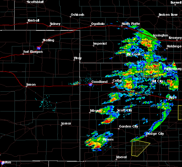 At 555 pm cdt, a severe thunderstorm was located 6 miles northwest of leoti, moving north at 60 mph (radar indicated). Hazards include 60 mph wind gusts and quarter size hail. Hail damage to vehicles is expected. Expect wind damage to roofs, siding, and trees. At 555 pm cdt, a severe thunderstorm was located 6 miles northwest of leoti, moving north at 60 mph (radar indicated). Hazards include 60 mph wind gusts and quarter size hail. Hail damage to vehicles is expected. Expect wind damage to roofs, siding, and trees.
|
| 4/21/2019 5:00 PM CDT |
 At 458 pm cdt, severe thunderstorms were located along a line extending from near winona to 6 miles east of leoti, moving east at 30 mph (a weather station 9 miles south southeast of sharon springs reported a wind gust of 70 mph at 323 pm mdt). Hazards include 70 mph wind gusts and quarter size hail. Hail damage to vehicles is possible. expect considerable tree damage. wind damage is also likely to mobile homes, roofs, and outbuildings. Locations impacted include, leoti, winona, monument, russell springs and marienthal. At 458 pm cdt, severe thunderstorms were located along a line extending from near winona to 6 miles east of leoti, moving east at 30 mph (a weather station 9 miles south southeast of sharon springs reported a wind gust of 70 mph at 323 pm mdt). Hazards include 70 mph wind gusts and quarter size hail. Hail damage to vehicles is possible. expect considerable tree damage. wind damage is also likely to mobile homes, roofs, and outbuildings. Locations impacted include, leoti, winona, monument, russell springs and marienthal.
|
| 4/21/2019 4:49 PM CDT |
 At 347 pm mdt/447 pm cdt/, severe thunderstorms were located along a line extending from 6 miles west of winona to near leoti, moving east at 30 mph (a weather station 9 miles south southeast of sharon springs reported a wind gust of 70 mph at 323 pm mdt). Hazards include 70 mph wind gusts and penny size hail. Expect considerable tree damage. damage is likely to mobile homes, roofs, and outbuildings. Locations impacted include, leoti, winona, monument, wallace, russell springs, selkirk and marienthal. At 347 pm mdt/447 pm cdt/, severe thunderstorms were located along a line extending from 6 miles west of winona to near leoti, moving east at 30 mph (a weather station 9 miles south southeast of sharon springs reported a wind gust of 70 mph at 323 pm mdt). Hazards include 70 mph wind gusts and penny size hail. Expect considerable tree damage. damage is likely to mobile homes, roofs, and outbuildings. Locations impacted include, leoti, winona, monument, wallace, russell springs, selkirk and marienthal.
|
| 4/21/2019 4:29 PM CDT |
 At 326 pm mdt/426 pm cdt/, severe thunderstorms were located along a line extending from 5 miles northeast of wallace to 9 miles west of leoti, moving east at 30 mph (a weather station 9 miles south southeast of sharon springs reported a wind gust of 70 mph at 323 pm mdt). Hazards include wind gusts up to 70 mph and penny size hail. Expect considerable tree damage. damage is likely to mobile homes, roofs, and outbuildings. Locations impacted include, leoti, winona, monument, wallace, russell springs, selkirk and marienthal. At 326 pm mdt/426 pm cdt/, severe thunderstorms were located along a line extending from 5 miles northeast of wallace to 9 miles west of leoti, moving east at 30 mph (a weather station 9 miles south southeast of sharon springs reported a wind gust of 70 mph at 323 pm mdt). Hazards include wind gusts up to 70 mph and penny size hail. Expect considerable tree damage. damage is likely to mobile homes, roofs, and outbuildings. Locations impacted include, leoti, winona, monument, wallace, russell springs, selkirk and marienthal.
|
| 4/21/2019 4:18 PM CDT |
 At 318 pm mdt/418 pm cdt/, severe thunderstorms were located along a line extending from 4 miles north of wallace to 8 miles east of tribune, moving east at 30 mph (radar indicated). Hazards include 60 mph wind gusts and penny size hail. expect damage to roofs, siding, and trees At 318 pm mdt/418 pm cdt/, severe thunderstorms were located along a line extending from 4 miles north of wallace to 8 miles east of tribune, moving east at 30 mph (radar indicated). Hazards include 60 mph wind gusts and penny size hail. expect damage to roofs, siding, and trees
|
| 8/8/2018 2:49 PM CDT |
 At 249 pm cdt, a severe thunderstorm was located 4 miles northeast of leoti, moving southeast at 10 mph (radar indicated). Hazards include 60 mph wind gusts and quarter size hail. Hail damage to vehicles is expected. expect wind damage to roofs, siding, and trees. Locations impacted include, leoti and marienthal. At 249 pm cdt, a severe thunderstorm was located 4 miles northeast of leoti, moving southeast at 10 mph (radar indicated). Hazards include 60 mph wind gusts and quarter size hail. Hail damage to vehicles is expected. expect wind damage to roofs, siding, and trees. Locations impacted include, leoti and marienthal.
|
| 8/8/2018 2:41 PM CDT |
 At 241 pm cdt, a severe thunderstorm was located 4 miles northeast of leoti, moving southeast at 10 mph (radar indicated). Hazards include 60 mph wind gusts and quarter size hail. Hail damage to vehicles is expected. Expect wind damage to roofs, siding, and trees. At 241 pm cdt, a severe thunderstorm was located 4 miles northeast of leoti, moving southeast at 10 mph (radar indicated). Hazards include 60 mph wind gusts and quarter size hail. Hail damage to vehicles is expected. Expect wind damage to roofs, siding, and trees.
|
| 8/5/2018 8:28 PM CDT |
 At 826 pm cdt, severe thunderstorms were located along a line extending from 5 miles south of winona to 14 miles south of russell springs to 9 miles west of leoti, moving south at 60 mph (radar indicated. observation 11 miles nnw of sharon springs reported a 65 mph gust. blowing dust causing brown out conditions in winona). Hazards include 60 mph wind gusts and quarter size hail. Hail damage to vehicles is expected. Expect wind damage to roofs, siding, and trees. At 826 pm cdt, severe thunderstorms were located along a line extending from 5 miles south of winona to 14 miles south of russell springs to 9 miles west of leoti, moving south at 60 mph (radar indicated. observation 11 miles nnw of sharon springs reported a 65 mph gust. blowing dust causing brown out conditions in winona). Hazards include 60 mph wind gusts and quarter size hail. Hail damage to vehicles is expected. Expect wind damage to roofs, siding, and trees.
|
| 8/5/2018 6:45 PM CDT |
 At 645 pm cdt, a severe thunderstorm was located 8 miles southeast of leoti, moving east at 45 mph (radar indicated). Hazards include 60 mph wind gusts and quarter size hail. Hail damage to vehicles is expected. Expect wind damage to roofs, siding, and trees. At 645 pm cdt, a severe thunderstorm was located 8 miles southeast of leoti, moving east at 45 mph (radar indicated). Hazards include 60 mph wind gusts and quarter size hail. Hail damage to vehicles is expected. Expect wind damage to roofs, siding, and trees.
|
| 7/27/2018 8:20 PM MDT |
 At 820 pm mdt/920 pm cdt/, severe thunderstorms were located along a line extending from 16 miles south of leoti to 11 miles southeast of towner, moving south at 25 mph (radar indicated). Hazards include 70 mph wind gusts and quarter size hail. Hail damage to vehicles is expected. expect considerable tree damage. wind damage is also likely to mobile homes, roofs, and outbuildings. locations impacted include, leoti, tribune, horace, lydia, selkirk and marienthal. A tornado watch remains in effect until 900 pm mdt/1000 pm cdt/ for west central kansas. At 820 pm mdt/920 pm cdt/, severe thunderstorms were located along a line extending from 16 miles south of leoti to 11 miles southeast of towner, moving south at 25 mph (radar indicated). Hazards include 70 mph wind gusts and quarter size hail. Hail damage to vehicles is expected. expect considerable tree damage. wind damage is also likely to mobile homes, roofs, and outbuildings. locations impacted include, leoti, tribune, horace, lydia, selkirk and marienthal. A tornado watch remains in effect until 900 pm mdt/1000 pm cdt/ for west central kansas.
|
| 7/27/2018 8:47 PM CDT | Mesonet station f1490... leot in wichita county KS, 0.3 miles NE of Leoti, KS |
| 7/27/2018 7:34 PM MDT |
 At 733 pm mdt/833 pm cdt/, severe thunderstorms were located along a line extending from 6 miles east of leoti to 10 miles northwest of horace, moving south at 25 mph (radar indicated). Hazards include 70 mph wind gusts and quarter size hail. Hail damage to vehicles is expected. expect considerable tree damage. Wind damage is also likely to mobile homes, roofs, and outbuildings. At 733 pm mdt/833 pm cdt/, severe thunderstorms were located along a line extending from 6 miles east of leoti to 10 miles northwest of horace, moving south at 25 mph (radar indicated). Hazards include 70 mph wind gusts and quarter size hail. Hail damage to vehicles is expected. expect considerable tree damage. Wind damage is also likely to mobile homes, roofs, and outbuildings.
|
| 7/27/2018 8:28 PM CDT |
 At 727 pm mdt/827 pm cdt/, a severe thunderstorm was located 11 miles northwest of leoti, moving south at 30 mph (radar indicated). Hazards include 70 mph wind gusts and quarter size hail. Hail damage to vehicles is expected. expect considerable tree damage. wind damage is also likely to mobile homes, roofs, and outbuildings. locations impacted include, leoti and marienthal. A tornado watch remains in effect until 900 pm mdt/1000 pm cdt/ for west central kansas. At 727 pm mdt/827 pm cdt/, a severe thunderstorm was located 11 miles northwest of leoti, moving south at 30 mph (radar indicated). Hazards include 70 mph wind gusts and quarter size hail. Hail damage to vehicles is expected. expect considerable tree damage. wind damage is also likely to mobile homes, roofs, and outbuildings. locations impacted include, leoti and marienthal. A tornado watch remains in effect until 900 pm mdt/1000 pm cdt/ for west central kansas.
|
| 7/27/2018 8:10 PM CDT |
 At 710 pm mdt/810 pm cdt/, a severe thunderstorm was located 14 miles south of wallace, or 17 miles southeast of sharon springs, moving south at 30 mph (radar indicated). Hazards include 70 mph wind gusts and quarter size hail. Hail damage to vehicles is expected. expect considerable tree damage. wind damage is also likely to mobile homes, roofs, and outbuildings. locations impacted include, leoti and marienthal. A tornado watch remains in effect until 900 pm mdt/1000 pm cdt/ for west central kansas. At 710 pm mdt/810 pm cdt/, a severe thunderstorm was located 14 miles south of wallace, or 17 miles southeast of sharon springs, moving south at 30 mph (radar indicated). Hazards include 70 mph wind gusts and quarter size hail. Hail damage to vehicles is expected. expect considerable tree damage. wind damage is also likely to mobile homes, roofs, and outbuildings. locations impacted include, leoti and marienthal. A tornado watch remains in effect until 900 pm mdt/1000 pm cdt/ for west central kansas.
|
| 7/27/2018 6:58 PM MDT |
 At 658 pm mdt/758 pm cdt/, a severe thunderstorm was located 8 miles southeast of wallace, or 14 miles southeast of sharon springs, moving south at 30 mph (radar indicated). Hazards include 70 mph wind gusts and quarter size hail. Hail damage to vehicles is expected. expect considerable tree damage. Wind damage is also likely to mobile homes, roofs, and outbuildings. At 658 pm mdt/758 pm cdt/, a severe thunderstorm was located 8 miles southeast of wallace, or 14 miles southeast of sharon springs, moving south at 30 mph (radar indicated). Hazards include 70 mph wind gusts and quarter size hail. Hail damage to vehicles is expected. expect considerable tree damage. Wind damage is also likely to mobile homes, roofs, and outbuildings.
|
| 1/1/0001 12:00 AM | Storm damage reported in wichita county KS, 0.9 miles NNE of Leoti, KS |
| 7/26/2018 8:37 PM CDT |
 At 737 pm mdt/837 pm cdt/, a severe thunderstorm was located 5 miles west of leoti, moving south at 20 mph (radar indicated). Hazards include 70 mph wind gusts and half dollar size hail. Hail damage to vehicles is expected. expect considerable tree damage. Wind damage is also likely to mobile homes, roofs, and outbuildings. At 737 pm mdt/837 pm cdt/, a severe thunderstorm was located 5 miles west of leoti, moving south at 20 mph (radar indicated). Hazards include 70 mph wind gusts and half dollar size hail. Hail damage to vehicles is expected. expect considerable tree damage. Wind damage is also likely to mobile homes, roofs, and outbuildings.
|
| 6/24/2018 7:54 PM CDT | Storm damage reported in wichita county KS, 0.3 miles NE of Leoti, KS |
| 6/24/2018 6:55 PM CDT |
 The severe thunderstorm warning for wichita, southern wallace, logan, northeastern greeley and southwestern gove counties will expire at 600 pm mdt/700 pm cdt/, the storms which prompted the warning have weakened. therefore, the warning will be allowed to expire. however gusty winds and heavy rain are still possible with these thunderstorms. The severe thunderstorm warning for wichita, southern wallace, logan, northeastern greeley and southwestern gove counties will expire at 600 pm mdt/700 pm cdt/, the storms which prompted the warning have weakened. therefore, the warning will be allowed to expire. however gusty winds and heavy rain are still possible with these thunderstorms.
|
| 6/24/2018 6:34 PM CDT |
 At 534 pm mdt/634 pm cdt/, severe thunderstorms were located along a line extending from 4 miles southeast of winona to 7 miles southwest of russell springs to 15 miles south of wallace, moving southeast at 50 mph (radar indicated). Hazards include 60 mph wind gusts. Expect damage to roofs, siding, and trees. Locations impacted include, leoti, sharon springs, winona, wallace, russell springs, the monument rocks and marienthal. At 534 pm mdt/634 pm cdt/, severe thunderstorms were located along a line extending from 4 miles southeast of winona to 7 miles southwest of russell springs to 15 miles south of wallace, moving southeast at 50 mph (radar indicated). Hazards include 60 mph wind gusts. Expect damage to roofs, siding, and trees. Locations impacted include, leoti, sharon springs, winona, wallace, russell springs, the monument rocks and marienthal.
|
| 6/24/2018 6:16 PM CDT |
 At 516 pm mdt/616 pm cdt/, severe thunderstorms were located along a line extending from 11 miles west of winona to 4 miles northeast of wallace to 6 miles southeast of weskan, moving southeast at 50 mph (radar indicated). Hazards include 60 mph wind gusts. expect damage to roofs, siding, and trees At 516 pm mdt/616 pm cdt/, severe thunderstorms were located along a line extending from 11 miles west of winona to 4 miles northeast of wallace to 6 miles southeast of weskan, moving southeast at 50 mph (radar indicated). Hazards include 60 mph wind gusts. expect damage to roofs, siding, and trees
|
| 6/22/2018 5:36 PM CDT |
 The severe thunderstorm warning for northeastern wichita county will expire at 545 pm cdt, the storm which prompted the warning has weakened below severe limits, and has exited the warned area. therefore, the warning will be allowed to expire. however small hail and gusty winds are still possible with this thunderstorm. a severe thunderstorm watch remains in effect until 900 pm cdt for west central kansas. The severe thunderstorm warning for northeastern wichita county will expire at 545 pm cdt, the storm which prompted the warning has weakened below severe limits, and has exited the warned area. therefore, the warning will be allowed to expire. however small hail and gusty winds are still possible with this thunderstorm. a severe thunderstorm watch remains in effect until 900 pm cdt for west central kansas.
|
| 6/22/2018 5:19 PM CDT |
 At 519 pm cdt, a severe thunderstorm was located 8 miles northwest of modoc, moving east at 40 mph (radar indicated). Hazards include 60 mph wind gusts and quarter size hail. Hail damage to vehicles is expected. expect wind damage to roofs, siding, and trees. Locations impacted include, leoti and marienthal. At 519 pm cdt, a severe thunderstorm was located 8 miles northwest of modoc, moving east at 40 mph (radar indicated). Hazards include 60 mph wind gusts and quarter size hail. Hail damage to vehicles is expected. expect wind damage to roofs, siding, and trees. Locations impacted include, leoti and marienthal.
|
| 6/22/2018 5:05 PM CDT |
 At 504 pm cdt, a severe thunderstorm was located 8 miles north of leoti, moving east at 40 mph (radar indicated). Hazards include 60 mph wind gusts and quarter size hail. Hail damage to vehicles is expected. Expect wind damage to roofs, siding, and trees. At 504 pm cdt, a severe thunderstorm was located 8 miles north of leoti, moving east at 40 mph (radar indicated). Hazards include 60 mph wind gusts and quarter size hail. Hail damage to vehicles is expected. Expect wind damage to roofs, siding, and trees.
|
| 6/19/2018 8:26 PM MDT | At 744 pm mdt/844 pm cdt/, severe thunderstorms were located along a line extending from 6 miles northeast of leoti to 10 miles southeast of tribune to 15 miles north of coolidge, moving south at 35 mph (radar indicated). Hazards include 60 mph wind gusts. expect damage to roofs, siding, and trees |
| 6/19/2018 7:44 PM MDT |
 At 744 pm mdt/844 pm cdt/, severe thunderstorms were located along a line extending from 6 miles northeast of leoti to 10 miles southeast of tribune to 15 miles north of coolidge, moving south at 35 mph (radar indicated). Hazards include 60 mph wind gusts. expect damage to roofs, siding, and trees At 744 pm mdt/844 pm cdt/, severe thunderstorms were located along a line extending from 6 miles northeast of leoti to 10 miles southeast of tribune to 15 miles north of coolidge, moving south at 35 mph (radar indicated). Hazards include 60 mph wind gusts. expect damage to roofs, siding, and trees
|
| 6/19/2018 7:37 PM MDT |
 At 737 pm mdt/837 pm cdt/, severe thunderstorms were located along a line extending from 14 miles north of leoti to 8 miles southeast of tribune to 8 miles northeast of hartman, moving south at 70 mph (radar indicated). Hazards include 60 mph wind gusts and nickel size hail. Expect damage to roofs, siding, and trees. Locations impacted include, leoti, tribune, horace, lydia and selkirk. At 737 pm mdt/837 pm cdt/, severe thunderstorms were located along a line extending from 14 miles north of leoti to 8 miles southeast of tribune to 8 miles northeast of hartman, moving south at 70 mph (radar indicated). Hazards include 60 mph wind gusts and nickel size hail. Expect damage to roofs, siding, and trees. Locations impacted include, leoti, tribune, horace, lydia and selkirk.
|
| 6/19/2018 7:12 PM MDT |
 At 711 pm mdt/811 pm cdt/, severe thunderstorms were located along a line extending from 9 miles southwest of winona to 14 miles north of horace to 5 miles northeast of sheridan lake, moving southeast at 30 mph. this line of storms has produced numerous measured wind gusts between 60 and 65 mph (radar indicated). Hazards include 60 mph wind gusts and nickel size hail. Expect damage to roofs, siding, and trees. locations impacted include, leoti, cheyenne wells, sharon springs, tribune, weskan, horace and wallace. This includes highway 385 between mile markers 136 and 157. At 711 pm mdt/811 pm cdt/, severe thunderstorms were located along a line extending from 9 miles southwest of winona to 14 miles north of horace to 5 miles northeast of sheridan lake, moving southeast at 30 mph. this line of storms has produced numerous measured wind gusts between 60 and 65 mph (radar indicated). Hazards include 60 mph wind gusts and nickel size hail. Expect damage to roofs, siding, and trees. locations impacted include, leoti, cheyenne wells, sharon springs, tribune, weskan, horace and wallace. This includes highway 385 between mile markers 136 and 157.
|
| 6/19/2018 6:56 PM MDT |
 At 655 pm mdt/755 pm cdt/, severe thunderstorms were located along a line extending from 7 miles northeast of wallace to 13 miles southeast of weskan to near sheridan lake, moving south at 75 mph (radar indicated). Hazards include 60 mph wind gusts and nickel size hail. expect damage to roofs, siding, and trees At 655 pm mdt/755 pm cdt/, severe thunderstorms were located along a line extending from 7 miles northeast of wallace to 13 miles southeast of weskan to near sheridan lake, moving south at 75 mph (radar indicated). Hazards include 60 mph wind gusts and nickel size hail. expect damage to roofs, siding, and trees
|
| 6/19/2018 4:33 PM CDT |
 At 433 pm cdt, a severe thunderstorm was located 5 miles west of modoc, moving east at 15 mph (radar indicated). Hazards include ping pong ball size hail and 60 mph wind gusts. People and animals outdoors will be injured. expect hail damage to roofs, siding, windows, and vehicles. expect wind damage to roofs, siding, and trees. Locations impacted include, marienthal. At 433 pm cdt, a severe thunderstorm was located 5 miles west of modoc, moving east at 15 mph (radar indicated). Hazards include ping pong ball size hail and 60 mph wind gusts. People and animals outdoors will be injured. expect hail damage to roofs, siding, windows, and vehicles. expect wind damage to roofs, siding, and trees. Locations impacted include, marienthal.
|
| 6/19/2018 4:09 PM CDT |
 At 409 pm cdt, a severe thunderstorm was located 4 miles west of modoc, moving north at 30 mph (radar indicated). Hazards include ping pong ball size hail and 60 mph wind gusts. People and animals outdoors will be injured. expect hail damage to roofs, siding, windows, and vehicles. Expect wind damage to roofs, siding, and trees. At 409 pm cdt, a severe thunderstorm was located 4 miles west of modoc, moving north at 30 mph (radar indicated). Hazards include ping pong ball size hail and 60 mph wind gusts. People and animals outdoors will be injured. expect hail damage to roofs, siding, windows, and vehicles. Expect wind damage to roofs, siding, and trees.
|
| 5/28/2018 4:28 PM CDT | Golf Ball sized hail reported 15.1 miles SE of Leoti, KS |
| 5/27/2018 5:28 PM CDT | Spotter called in a measured wind report of 62 mp in wichita county KS, 13.3 miles SSE of Leoti, KS |
| 5/24/2018 6:08 PM MDT |
 At 605 pm mdt/705 pm cdt/, severe thunderstorms were located along a line extending from 14 miles south of goodland to 11 miles northeast of wallace to 10 miles southwest of winona to 15 miles southwest of russell springs to 12 miles north of leoti, moving northeast at 40 mph (radar indicated). Hazards include 70 mph wind gusts and quarter size hail. Hail damage to vehicles is expected. expect considerable tree damage. wind damage is also likely to mobile homes, roofs, and outbuildings. Locations impacted include, leoti, sharon springs, tribune, winona, wallace, russell springs and selkirk. At 605 pm mdt/705 pm cdt/, severe thunderstorms were located along a line extending from 14 miles south of goodland to 11 miles northeast of wallace to 10 miles southwest of winona to 15 miles southwest of russell springs to 12 miles north of leoti, moving northeast at 40 mph (radar indicated). Hazards include 70 mph wind gusts and quarter size hail. Hail damage to vehicles is expected. expect considerable tree damage. wind damage is also likely to mobile homes, roofs, and outbuildings. Locations impacted include, leoti, sharon springs, tribune, winona, wallace, russell springs and selkirk.
|
| 5/24/2018 5:39 PM MDT |
 At 539 pm mdt/639 pm cdt/, severe thunderstorms were located along a line extending from 11 miles north of weskan to 4 miles north of sharon springs to 5 miles southwest of wallace to 15 miles northeast of horace to 5 miles northeast of tribune, moving northeast at 45 mph (radar indicated). Hazards include 70 mph wind gusts and quarter size hail. Hail damage to vehicles is expected. expect considerable tree damage. Wind damage is also likely to mobile homes, roofs, and outbuildings. At 539 pm mdt/639 pm cdt/, severe thunderstorms were located along a line extending from 11 miles north of weskan to 4 miles north of sharon springs to 5 miles southwest of wallace to 15 miles northeast of horace to 5 miles northeast of tribune, moving northeast at 45 mph (radar indicated). Hazards include 70 mph wind gusts and quarter size hail. Hail damage to vehicles is expected. expect considerable tree damage. Wind damage is also likely to mobile homes, roofs, and outbuildings.
|
| 10/2/2017 6:47 PM CDT |
 At 547 pm mdt/647 pm cdt/, a severe thunderstorm was located 12 miles northwest of modoc, moving northeast at 45 mph (radar indicated). Hazards include ping pong ball size hail and 60 mph wind gusts. People and animals outdoors will be injured. expect hail damage to roofs, siding, windows, and vehicles. expect wind damage to roofs, siding, and trees. locations impacted include, leoti and marienthal. A tornado watch remains in effect until 1000 pm mdt/1100 pm cdt/ for west central kansas. At 547 pm mdt/647 pm cdt/, a severe thunderstorm was located 12 miles northwest of modoc, moving northeast at 45 mph (radar indicated). Hazards include ping pong ball size hail and 60 mph wind gusts. People and animals outdoors will be injured. expect hail damage to roofs, siding, windows, and vehicles. expect wind damage to roofs, siding, and trees. locations impacted include, leoti and marienthal. A tornado watch remains in effect until 1000 pm mdt/1100 pm cdt/ for west central kansas.
|
| 10/2/2017 6:12 PM CDT |
 At 511 pm mdt/611 pm cdt/, a severe thunderstorm was located 10 miles southeast of tribune, moving northeast at 50 mph (radar indicated). Hazards include two inch hail and 60 mph wind gusts. People and animals outdoors will be injured. expect hail damage to roofs, siding, windows, and vehicles. Expect wind damage to roofs, siding, and trees. At 511 pm mdt/611 pm cdt/, a severe thunderstorm was located 10 miles southeast of tribune, moving northeast at 50 mph (radar indicated). Hazards include two inch hail and 60 mph wind gusts. People and animals outdoors will be injured. expect hail damage to roofs, siding, windows, and vehicles. Expect wind damage to roofs, siding, and trees.
|
| 10/2/2017 5:58 PM CDT |
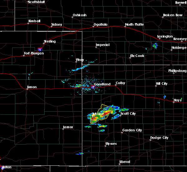 At 457 pm mdt/557 pm cdt/, a severe thunderstorm was located 8 miles northwest of leoti, moving northeast at 45 mph (radar indicated). Hazards include 60 mph wind gusts and quarter size hail. Hail damage to vehicles is expected. expect wind damage to roofs, siding, and trees. locations impacted include, leoti and selkirk. A tornado watch remains in effect until 1000 pm mdt/1100 pm cdt/ for west central kansas. At 457 pm mdt/557 pm cdt/, a severe thunderstorm was located 8 miles northwest of leoti, moving northeast at 45 mph (radar indicated). Hazards include 60 mph wind gusts and quarter size hail. Hail damage to vehicles is expected. expect wind damage to roofs, siding, and trees. locations impacted include, leoti and selkirk. A tornado watch remains in effect until 1000 pm mdt/1100 pm cdt/ for west central kansas.
|
| 10/2/2017 5:28 PM CDT |
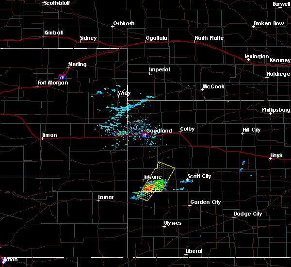 At 428 pm mdt/528 pm cdt/, a severe thunderstorm was located 13 miles southeast of tribune, moving northeast at 40 mph (radar indicated). Hazards include 60 mph wind gusts and quarter size hail. Hail damage to vehicles is expected. Expect wind damage to roofs, siding, and trees. At 428 pm mdt/528 pm cdt/, a severe thunderstorm was located 13 miles southeast of tribune, moving northeast at 40 mph (radar indicated). Hazards include 60 mph wind gusts and quarter size hail. Hail damage to vehicles is expected. Expect wind damage to roofs, siding, and trees.
|
| 10/1/2017 8:08 PM CDT | Ping Pong Ball sized hail reported 10.7 miles SE of Leoti, KS, storm spotter reported 1.5 inch hail and damage done to some windows at her house. |
| 8/17/2017 9:32 PM CDT |
 At 831 pm mdt/931 pm cdt/, a severe thunderstorm was located 9 miles southwest of leoti, moving southeast at 25 mph (trained weather spotters reported the hail south of selkirk and the wind gusts were reported at leoti). Hazards include 60 mph wind gusts and penny size hail. Expect damage to roofs, siding, and trees. Locations impacted include, leoti, lydia and selkirk. At 831 pm mdt/931 pm cdt/, a severe thunderstorm was located 9 miles southwest of leoti, moving southeast at 25 mph (trained weather spotters reported the hail south of selkirk and the wind gusts were reported at leoti). Hazards include 60 mph wind gusts and penny size hail. Expect damage to roofs, siding, and trees. Locations impacted include, leoti, lydia and selkirk.
|
| 8/17/2017 9:21 PM CDT |
 At 821 pm mdt/921 pm cdt/, a severe thunderstorm was located 10 miles southwest of leoti, moving southeast at 25 mph (radar indicated). Hazards include 60 mph wind gusts and quarter size hail. Hail damage to vehicles is expected. expect wind damage to roofs, siding, and trees. Locations impacted include, leoti, lydia and selkirk. At 821 pm mdt/921 pm cdt/, a severe thunderstorm was located 10 miles southwest of leoti, moving southeast at 25 mph (radar indicated). Hazards include 60 mph wind gusts and quarter size hail. Hail damage to vehicles is expected. expect wind damage to roofs, siding, and trees. Locations impacted include, leoti, lydia and selkirk.
|
| 8/17/2017 9:09 PM CDT |
 At 809 pm mdt/909 pm cdt/, a severe thunderstorm was located 9 miles west of leoti, moving southeast at 25 mph (radar indicated). Hazards include 70 mph wind gusts and half dollar size hail. Hail damage to vehicles is expected. expect considerable tree damage. Wind damage is also likely to mobile homes, roofs, and outbuildings. At 809 pm mdt/909 pm cdt/, a severe thunderstorm was located 9 miles west of leoti, moving southeast at 25 mph (radar indicated). Hazards include 70 mph wind gusts and half dollar size hail. Hail damage to vehicles is expected. expect considerable tree damage. Wind damage is also likely to mobile homes, roofs, and outbuildings.
|
| 8/17/2017 9:08 PM CDT | Storm damage reported in wichita county KS, 0.3 miles NE of Leoti, KS |
| 8/17/2017 9:04 PM CDT |
 At 804 pm mdt/904 pm cdt/, severe thunderstorms were located along a line extending from 8 miles northwest of leoti to 9 miles east of tribune, moving east at 25 mph (radar indicated). Hazards include 60 mph wind gusts and quarter size hail. Hail damage to vehicles is expected. expect wind damage to roofs, siding, and trees. Locations impacted include, leoti and selkirk. At 804 pm mdt/904 pm cdt/, severe thunderstorms were located along a line extending from 8 miles northwest of leoti to 9 miles east of tribune, moving east at 25 mph (radar indicated). Hazards include 60 mph wind gusts and quarter size hail. Hail damage to vehicles is expected. expect wind damage to roofs, siding, and trees. Locations impacted include, leoti and selkirk.
|
| 8/17/2017 8:51 PM CDT |
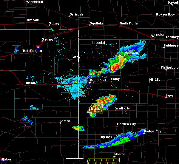 At 751 pm mdt/851 pm cdt/, severe thunderstorms were located along a line extending from 13 miles northwest of leoti to 6 miles east of tribune, moving east at 25 mph (trained weather spotters). Hazards include 60 mph wind gusts and penny size hail. Expect damage to roofs, siding, and trees. Locations impacted include, leoti, tribune and selkirk. At 751 pm mdt/851 pm cdt/, severe thunderstorms were located along a line extending from 13 miles northwest of leoti to 6 miles east of tribune, moving east at 25 mph (trained weather spotters). Hazards include 60 mph wind gusts and penny size hail. Expect damage to roofs, siding, and trees. Locations impacted include, leoti, tribune and selkirk.
|
| 8/17/2017 8:42 PM CDT |
 At 741 pm mdt/841 pm cdt/, severe thunderstorms were located along a line extending from 16 miles south of wallace to 6 miles northeast of tribune, moving east at 30 mph (trained weather spotters 5 north of tribune). Hazards include atleast 60 mph wind gusts along with penny size hail. Expect damage to roofs, siding, and trees. Locations impacted include, leoti, tribune, horace and selkirk. At 741 pm mdt/841 pm cdt/, severe thunderstorms were located along a line extending from 16 miles south of wallace to 6 miles northeast of tribune, moving east at 30 mph (trained weather spotters 5 north of tribune). Hazards include atleast 60 mph wind gusts along with penny size hail. Expect damage to roofs, siding, and trees. Locations impacted include, leoti, tribune, horace and selkirk.
|
| 8/17/2017 7:24 PM MDT |
 At 724 pm mdt/824 pm cdt/, severe thunderstorms were located along a line extending from 14 miles north of tribune to 4 miles north of horace, moving east at 30 mph (radar indicated). Hazards include 60 mph wind gusts and half dollar size hail. Hail damage to vehicles is expected. expect wind damage to roofs, siding, and trees. Locations impacted include, leoti, tribune, horace and selkirk. At 724 pm mdt/824 pm cdt/, severe thunderstorms were located along a line extending from 14 miles north of tribune to 4 miles north of horace, moving east at 30 mph (radar indicated). Hazards include 60 mph wind gusts and half dollar size hail. Hail damage to vehicles is expected. expect wind damage to roofs, siding, and trees. Locations impacted include, leoti, tribune, horace and selkirk.
|
| 8/17/2017 7:12 PM MDT |
 At 712 pm mdt/812 pm cdt/, severe thunderstorms were located along a line extending from 14 miles south of sharon springs to 3 miles west of horace, moving east at 30 mph (radar indicated). Hazards include 60 mph wind gusts and half dollar size hail. Hail damage to vehicles is expected. Expect wind damage to roofs, siding, and trees. At 712 pm mdt/812 pm cdt/, severe thunderstorms were located along a line extending from 14 miles south of sharon springs to 3 miles west of horace, moving east at 30 mph (radar indicated). Hazards include 60 mph wind gusts and half dollar size hail. Hail damage to vehicles is expected. Expect wind damage to roofs, siding, and trees.
|
| 8/1/2017 2:55 PM CDT |
 At 255 pm cdt, a severe thunderstorm was located 7 miles northwest of modoc, moving south at 15 mph (radar indicated). Hazards include 60 mph wind gusts and quarter size hail. Hail damage to vehicles is expected. Expect wind damage to roofs, siding, and trees. At 255 pm cdt, a severe thunderstorm was located 7 miles northwest of modoc, moving south at 15 mph (radar indicated). Hazards include 60 mph wind gusts and quarter size hail. Hail damage to vehicles is expected. Expect wind damage to roofs, siding, and trees.
|
| 7/7/2017 11:01 PM CDT | Storm damage reported in wichita county KS, 0.3 miles NE of Leoti, KS |
| 7/3/2017 10:23 PM CDT |
 The severe thunderstorm warning for wichita, logan and western gove counties will expire at 1030 pm cdt, the storms which prompted the warning have moved out of the warned area. therefore, the warning will be allowed to expire. however small hail, gusty winds and heavy rain are still possible with these thunderstorms. The severe thunderstorm warning for wichita, logan and western gove counties will expire at 1030 pm cdt, the storms which prompted the warning have moved out of the warned area. therefore, the warning will be allowed to expire. however small hail, gusty winds and heavy rain are still possible with these thunderstorms.
|
| 7/3/2017 10:01 PM CDT |
 At 1001 pm cdt, severe thunderstorms were located along a line extending from 4 miles east of winona to 7 miles southeast of leoti, moving southeast at 35 mph (radar indicated). Hazards include 60 mph wind gusts and nickel size hail. Expect damage to roofs, siding, and trees. locations impacted include, oakley, leoti, monument, russell springs, the monument rocks and marienthal. This includes interstate 70 in kansas between mile markers 76 and 81. At 1001 pm cdt, severe thunderstorms were located along a line extending from 4 miles east of winona to 7 miles southeast of leoti, moving southeast at 35 mph (radar indicated). Hazards include 60 mph wind gusts and nickel size hail. Expect damage to roofs, siding, and trees. locations impacted include, oakley, leoti, monument, russell springs, the monument rocks and marienthal. This includes interstate 70 in kansas between mile markers 76 and 81.
|
| 7/3/2017 9:41 PM CDT |
 At 941 pm cdt, severe thunderstorms were located along a line extending from 9 miles northeast of winona to near leoti, moving southeast at 45 mph (radar indicated). Hazards include 60 mph wind gusts and nickel size hail. expect damage to roofs, siding, and trees At 941 pm cdt, severe thunderstorms were located along a line extending from 9 miles northeast of winona to near leoti, moving southeast at 45 mph (radar indicated). Hazards include 60 mph wind gusts and nickel size hail. expect damage to roofs, siding, and trees
|
| 6/28/2017 8:46 PM CDT |
 At 146 am mdt/246 am cdt/, a severe thunderstorm was located 8 miles southeast of wallace, or 15 miles east of sharon springs, moving east at 25 mph (radar indicated). Hazards include 60 mph wind gusts and nickel size hail. expect damage to roofs, siding, and trees At 146 am mdt/246 am cdt/, a severe thunderstorm was located 8 miles southeast of wallace, or 15 miles east of sharon springs, moving east at 25 mph (radar indicated). Hazards include 60 mph wind gusts and nickel size hail. expect damage to roofs, siding, and trees
|
| 6/26/2017 8:16 PM CDT | Golf Ball sized hail reported 3.4 miles E of Leoti, KS |
| 6/22/2017 7:52 PM CDT | Storm damage reported in wichita county KS, 0.3 miles NE of Leoti, KS |
| 5/15/2017 7:58 PM CDT |
 At 757 pm cdt, a severe thunderstorm was located 8 miles southwest of modoc, moving north at 60 mph (trained weather spotters. at 745 pm cdt...ping pong ball size hail was reported in lydia). Hazards include two inch hail and 60 mph wind gusts. People and animals outdoors will be injured. expect hail damage to roofs, siding, windows, and vehicles. expect wind damage to roofs, siding, and trees. Locations impacted include, leoti and marienthal. At 757 pm cdt, a severe thunderstorm was located 8 miles southwest of modoc, moving north at 60 mph (trained weather spotters. at 745 pm cdt...ping pong ball size hail was reported in lydia). Hazards include two inch hail and 60 mph wind gusts. People and animals outdoors will be injured. expect hail damage to roofs, siding, windows, and vehicles. expect wind damage to roofs, siding, and trees. Locations impacted include, leoti and marienthal.
|
| 5/15/2017 7:50 PM CDT |
 At 749 pm cdt, a severe thunderstorm was located 11 miles south of leoti, moving north at 65 mph (trained weather spotters. at 745 pm cdt...ping pong ball size hail was reported in lydia). Hazards include ping pong ball size hail and 60 mph wind gusts. People and animals outdoors will be injured. expect hail damage to roofs, siding, windows, and vehicles. expect wind damage to roofs, siding, and trees. Locations impacted include, leoti, marienthal and lydia. At 749 pm cdt, a severe thunderstorm was located 11 miles south of leoti, moving north at 65 mph (trained weather spotters. at 745 pm cdt...ping pong ball size hail was reported in lydia). Hazards include ping pong ball size hail and 60 mph wind gusts. People and animals outdoors will be injured. expect hail damage to roofs, siding, windows, and vehicles. expect wind damage to roofs, siding, and trees. Locations impacted include, leoti, marienthal and lydia.
|
| 5/15/2017 7:45 PM CDT | Ping Pong Ball sized hail reported 14.4 miles NNW of Leoti, KS, a mix of an inch to 1.50 inches |
| 5/15/2017 7:41 PM CDT |
 At 740 pm cdt, a severe thunderstorm was located 17 miles north of lakin, moving north at 65 mph (radar indicated). Hazards include 60 mph wind gusts and quarter size hail. Hail damage to vehicles is expected. Expect wind damage to roofs, siding, and trees. At 740 pm cdt, a severe thunderstorm was located 17 miles north of lakin, moving north at 65 mph (radar indicated). Hazards include 60 mph wind gusts and quarter size hail. Hail damage to vehicles is expected. Expect wind damage to roofs, siding, and trees.
|
| 9/13/2016 1:52 AM CDT |
 The severe thunderstorm warning for northeastern wichita county will expire at 200 am cdt, the storm which prompted the warning has weakened below severe limits, and has exited the warned area. therefore the warning will be allowed to expire. however gusty winds and heavy rain are still possible with this thunderstorm. The severe thunderstorm warning for northeastern wichita county will expire at 200 am cdt, the storm which prompted the warning has weakened below severe limits, and has exited the warned area. therefore the warning will be allowed to expire. however gusty winds and heavy rain are still possible with this thunderstorm.
|
| 9/13/2016 1:36 AM CDT |
 At 135 am cdt, a severe thunderstorm was located 7 miles west of modoc, moving northeast at 20 mph (radar indicated). Hazards include 60 mph wind gusts and quarter size hail. Hail damage to vehicles is expected. expect wind damage to roofs, siding, and trees. Locations impacted include, leoti and marienthal. At 135 am cdt, a severe thunderstorm was located 7 miles west of modoc, moving northeast at 20 mph (radar indicated). Hazards include 60 mph wind gusts and quarter size hail. Hail damage to vehicles is expected. expect wind damage to roofs, siding, and trees. Locations impacted include, leoti and marienthal.
|
| 9/13/2016 1:16 AM CDT |
 At 116 am cdt, a severe thunderstorm was located 6 miles northwest of leoti, moving northeast at 20 mph (radar indicated). Hazards include 60 mph wind gusts and quarter size hail. Hail damage to vehicles is expected. Expect wind damage to roofs, siding, and trees. At 116 am cdt, a severe thunderstorm was located 6 miles northwest of leoti, moving northeast at 20 mph (radar indicated). Hazards include 60 mph wind gusts and quarter size hail. Hail damage to vehicles is expected. Expect wind damage to roofs, siding, and trees.
|
| 9/4/2016 5:29 PM CDT | Ping Pong Ball sized hail reported 10.9 miles S of Leoti, KS |
| 9/4/2016 5:26 PM CDT | Golf Ball sized hail reported 11.6 miles S of Leoti, KS |
| 9/4/2016 5:17 PM CDT |
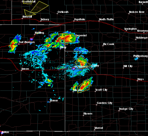 At 517 pm cdt, a severe thunderstorm was located 9 miles north of leoti, moving northeast at 25 mph (radar indicated). Hazards include golf ball size hail and 60 mph wind gusts. People and animals outdoors will be injured. expect hail damage to roofs, siding, windows, and vehicles. expect wind damage to roofs, siding, and trees. Locations impacted include, russell springs and selkirk. At 517 pm cdt, a severe thunderstorm was located 9 miles north of leoti, moving northeast at 25 mph (radar indicated). Hazards include golf ball size hail and 60 mph wind gusts. People and animals outdoors will be injured. expect hail damage to roofs, siding, windows, and vehicles. expect wind damage to roofs, siding, and trees. Locations impacted include, russell springs and selkirk.
|
| 9/4/2016 4:58 PM CDT |
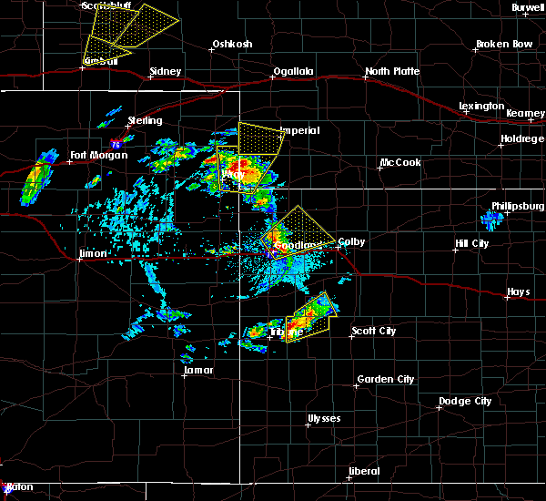 At 457 pm cdt, a severe thunderstorm was located 11 miles northwest of leoti, moving northeast at 30 mph (radar indicated). Hazards include 60 mph wind gusts and quarter size hail. Hail damage to vehicles is expected. Expect wind damage to roofs, siding, and trees. At 457 pm cdt, a severe thunderstorm was located 11 miles northwest of leoti, moving northeast at 30 mph (radar indicated). Hazards include 60 mph wind gusts and quarter size hail. Hail damage to vehicles is expected. Expect wind damage to roofs, siding, and trees.
|
| 9/4/2016 4:32 PM CDT |
 At 331 pm mdt/431 pm cdt/, a severe thunderstorm was located 10 miles northeast of tribune, moving northeast at 20 mph (radar indicated. at 312 pm mdt...a 60 mph wind gust was reported 1 miles east of tribune). Hazards include 60 mph wind gusts and quarter size hail. Hail damage to vehicles is expected. expect wind damage to roofs, siding, and trees. Locations impacted include, leoti, selkirk and marienthal. At 331 pm mdt/431 pm cdt/, a severe thunderstorm was located 10 miles northeast of tribune, moving northeast at 20 mph (radar indicated. at 312 pm mdt...a 60 mph wind gust was reported 1 miles east of tribune). Hazards include 60 mph wind gusts and quarter size hail. Hail damage to vehicles is expected. expect wind damage to roofs, siding, and trees. Locations impacted include, leoti, selkirk and marienthal.
|
| 9/4/2016 4:15 PM CDT |
 At 314 pm mdt/414 pm cdt/, a severe thunderstorm was located 4 miles east of tribune, moving northeast at 25 mph (trained weather spotters. at 312 pm mdt...a 60 mph wind gust was reported 1 miles east of tribune). Hazards include 60 mph wind gusts and quarter size hail. Hail damage to vehicles is expected. Expect wind damage to roofs, siding, and trees. At 314 pm mdt/414 pm cdt/, a severe thunderstorm was located 4 miles east of tribune, moving northeast at 25 mph (trained weather spotters. at 312 pm mdt...a 60 mph wind gust was reported 1 miles east of tribune). Hazards include 60 mph wind gusts and quarter size hail. Hail damage to vehicles is expected. Expect wind damage to roofs, siding, and trees.
|
| 8/27/2016 7:06 PM CDT |
 The severe thunderstorm warning for central wichita county will expire at 715 pm cdt, the storm which prompted the warning has weakened below severe limits, and no longer pose an immediate threat to life or property. therefore the warning will be allowed to expire. however gusty winds are still possible with this thunderstorm. The severe thunderstorm warning for central wichita county will expire at 715 pm cdt, the storm which prompted the warning has weakened below severe limits, and no longer pose an immediate threat to life or property. therefore the warning will be allowed to expire. however gusty winds are still possible with this thunderstorm.
|
| 8/27/2016 6:48 PM CDT | Golf Ball sized hail reported 14.7 miles N of Leoti, KS, estimated 30-40 mph winds. |
| 8/27/2016 6:47 PM CDT |
 At 647 pm cdt, a severe thunderstorm was located 13 miles south of leoti, moving north at 25 mph (radar indicated). Hazards include ping pong ball size hail and 60 mph wind gusts. People and animals outdoors will be injured. expect hail damage to roofs, siding, windows, and vehicles. expect wind damage to roofs, siding, and trees. Locations impacted include, leoti, lydia and marienthal. At 647 pm cdt, a severe thunderstorm was located 13 miles south of leoti, moving north at 25 mph (radar indicated). Hazards include ping pong ball size hail and 60 mph wind gusts. People and animals outdoors will be injured. expect hail damage to roofs, siding, windows, and vehicles. expect wind damage to roofs, siding, and trees. Locations impacted include, leoti, lydia and marienthal.
|
| 8/27/2016 6:35 PM CDT |
 At 635 pm cdt, a severe thunderstorm was located 15 miles south of leoti, moving north at 30 mph (radar indicated). Hazards include 60 mph wind gusts and half dollar size hail. Hail damage to vehicles is expected. Expect wind damage to roofs, siding, and trees. At 635 pm cdt, a severe thunderstorm was located 15 miles south of leoti, moving north at 30 mph (radar indicated). Hazards include 60 mph wind gusts and half dollar size hail. Hail damage to vehicles is expected. Expect wind damage to roofs, siding, and trees.
|
| 7/28/2016 1:20 AM CDT |
 At 1220 am mdt/120 am cdt/, severe thunderstorms were located along a line extending from 5 miles northwest of modoc to 13 miles south of tribune, moving south at 40 mph (radar indicated). Hazards include ping pong ball size hail and 60 mph wind gusts. People and animals outdoors will be injured. expect hail damage to roofs, siding, windows, and vehicles. Expect wind damage to roofs, siding, and trees. At 1220 am mdt/120 am cdt/, severe thunderstorms were located along a line extending from 5 miles northwest of modoc to 13 miles south of tribune, moving south at 40 mph (radar indicated). Hazards include ping pong ball size hail and 60 mph wind gusts. People and animals outdoors will be injured. expect hail damage to roofs, siding, windows, and vehicles. Expect wind damage to roofs, siding, and trees.
|
| 7/27/2016 4:42 PM CDT |
 At 441 pm cdt, a severe thunderstorm was located 4 miles southwest of leoti, and is nearly stationary (radar indicated). Hazards include two inch hail and 60 mph wind gusts. People and animals outdoors will be injured. expect hail damage to roofs, siding, windows, and vehicles. Expect wind damage to roofs, siding, and trees. At 441 pm cdt, a severe thunderstorm was located 4 miles southwest of leoti, and is nearly stationary (radar indicated). Hazards include two inch hail and 60 mph wind gusts. People and animals outdoors will be injured. expect hail damage to roofs, siding, windows, and vehicles. Expect wind damage to roofs, siding, and trees.
|
| 7/27/2016 4:23 PM CDT |
 At 422 pm cdt, a severe thunderstorm was located near leoti, and is nearly stationary (radar indicated). Hazards include two inch hail and 60 mph wind gusts. People and animals outdoors will be injured. expect hail damage to roofs, siding, windows, and vehicles. expect wind damage to roofs, siding, and trees. Locations impacted include, leoti. At 422 pm cdt, a severe thunderstorm was located near leoti, and is nearly stationary (radar indicated). Hazards include two inch hail and 60 mph wind gusts. People and animals outdoors will be injured. expect hail damage to roofs, siding, windows, and vehicles. expect wind damage to roofs, siding, and trees. Locations impacted include, leoti.
|
| 7/27/2016 4:06 PM CDT |
 At 406 pm cdt, a severe thunderstorm was located near leoti, and is nearly stationary (radar indicated). Hazards include two inch hail and 60 mph wind gusts. People and animals outdoors will be injured. expect hail damage to roofs, siding, windows, and vehicles. Expect wind damage to roofs, siding, and trees. At 406 pm cdt, a severe thunderstorm was located near leoti, and is nearly stationary (radar indicated). Hazards include two inch hail and 60 mph wind gusts. People and animals outdoors will be injured. expect hail damage to roofs, siding, windows, and vehicles. Expect wind damage to roofs, siding, and trees.
|
| 7/27/2016 3:15 PM CDT | Golf Ball sized hail reported 7.9 miles NW of Leoti, KS, hail covering ground... torrential rainfall with water running down the road. had been occuring for 10 min before the report. |
| 6/29/2016 12:26 AM MDT |
 At 1225 am mdt/125 am cdt/, a severe thunderstorm was located 16 miles south of tribune, moving south at 50 mph (radar indicated). Hazards include 60 mph wind gusts and penny size hail. Expect damage to roofs. siding. and trees. Locations impacted include, leoti, tribune, horace, selkirk, marienthal and lydia. At 1225 am mdt/125 am cdt/, a severe thunderstorm was located 16 miles south of tribune, moving south at 50 mph (radar indicated). Hazards include 60 mph wind gusts and penny size hail. Expect damage to roofs. siding. and trees. Locations impacted include, leoti, tribune, horace, selkirk, marienthal and lydia.
|
| 6/29/2016 1:07 AM CDT |
 At 1207 am mdt/107 am cdt/, a severe thunderstorm was located 7 miles east of tribune, moving south at 50 mph (radar indicated). Hazards include 60 mph wind gusts and quarter size hail. Hail damage to vehicles is expected. expect wind damage to roofs, siding, and trees. Locations impacted include, leoti, tribune, horace, selkirk, marienthal and lydia. At 1207 am mdt/107 am cdt/, a severe thunderstorm was located 7 miles east of tribune, moving south at 50 mph (radar indicated). Hazards include 60 mph wind gusts and quarter size hail. Hail damage to vehicles is expected. expect wind damage to roofs, siding, and trees. Locations impacted include, leoti, tribune, horace, selkirk, marienthal and lydia.
|
| 6/29/2016 12:53 AM CDT |
 At 1153 pm mdt/1253 am cdt/, a severe thunderstorm was located 14 miles northeast of tribune, moving south at 50 mph (radar indicated). Hazards include 60 mph wind gusts and quarter size hail. Hail damage to vehicles is expected. Expect wind damage to roofs, siding, and trees. At 1153 pm mdt/1253 am cdt/, a severe thunderstorm was located 14 miles northeast of tribune, moving south at 50 mph (radar indicated). Hazards include 60 mph wind gusts and quarter size hail. Hail damage to vehicles is expected. Expect wind damage to roofs, siding, and trees.
|
| 6/29/2016 12:27 AM CDT |
 At 1127 pm mdt/1227 am cdt/, severe thunderstorms were located along a line extending from 7 miles southwest of russell springs to 7 miles south of sharon springs, moving south at 35 mph. these are very dangerous storms (radar indicated). Hazards include 80 mph wind gusts and penny size hail. Flying debris will be dangerous to those caught without shelter. mobile homes will be heavily damaged. expect considerable damage to roofs, windows, and vehicles. extensive tree damage and power outages are likely. Locations impacted include, leoti, tribune, weskan, horace, selkirk and marienthal. At 1127 pm mdt/1227 am cdt/, severe thunderstorms were located along a line extending from 7 miles southwest of russell springs to 7 miles south of sharon springs, moving south at 35 mph. these are very dangerous storms (radar indicated). Hazards include 80 mph wind gusts and penny size hail. Flying debris will be dangerous to those caught without shelter. mobile homes will be heavily damaged. expect considerable damage to roofs, windows, and vehicles. extensive tree damage and power outages are likely. Locations impacted include, leoti, tribune, weskan, horace, selkirk and marienthal.
|
| 6/29/2016 12:15 AM CDT |
 At 1115 pm mdt/1215 am cdt/, severe thunderstorms were located along a line extending from 5 miles northeast of russell springs to 7 miles north of weskan, moving south at 40 mph. these are very dangerous storms (radar indicated). Hazards include 80 mph wind gusts. Flying debris will be dangerous to those caught without shelter. mobile homes will be heavily damaged. expect considerable damage to roofs, windows, and vehicles. extensive tree damage and power outages are likely. Locations impacted include, leoti, tribune, weskan, horace, selkirk and marienthal. At 1115 pm mdt/1215 am cdt/, severe thunderstorms were located along a line extending from 5 miles northeast of russell springs to 7 miles north of weskan, moving south at 40 mph. these are very dangerous storms (radar indicated). Hazards include 80 mph wind gusts. Flying debris will be dangerous to those caught without shelter. mobile homes will be heavily damaged. expect considerable damage to roofs, windows, and vehicles. extensive tree damage and power outages are likely. Locations impacted include, leoti, tribune, weskan, horace, selkirk and marienthal.
|
| 6/29/2016 12:06 AM CDT |
 At 1105 pm mdt/1205 am cdt/, severe thunderstorms were located along a line extending from 4 miles east of winona to 13 miles north of weskan, moving south at 45 mph. these are very dangerous storms (radar indicated). Hazards include 80 mph wind gusts and penny size hail. Flying debris will be dangerous to those caught without shelter. mobile homes will be heavily damaged. expect considerable damage to roofs, windows, and vehicles. Extensive tree damage and power outages are likely. At 1105 pm mdt/1205 am cdt/, severe thunderstorms were located along a line extending from 4 miles east of winona to 13 miles north of weskan, moving south at 45 mph. these are very dangerous storms (radar indicated). Hazards include 80 mph wind gusts and penny size hail. Flying debris will be dangerous to those caught without shelter. mobile homes will be heavily damaged. expect considerable damage to roofs, windows, and vehicles. Extensive tree damage and power outages are likely.
|
| 6/13/2016 1:15 AM CDT |
 At 112 am cdt, severe thunderstorms were located along a line extending from 9 miles east of russell springs to 7 miles north of modoc to 17 miles northwest of deerfield, moving east at 35 mph (radar indicated. at 1158 pm...an automated site 4 miles northwest of marienthal reported a gust to 58 mph). Hazards include 70 mph wind gusts and penny size hail. Expect considerable tree damage. damage is likely to mobile homes, roofs, and outbuildings. Locations impacted include, leoti, russell springs, marienthal, lydia and the monument rocks. At 112 am cdt, severe thunderstorms were located along a line extending from 9 miles east of russell springs to 7 miles north of modoc to 17 miles northwest of deerfield, moving east at 35 mph (radar indicated. at 1158 pm...an automated site 4 miles northwest of marienthal reported a gust to 58 mph). Hazards include 70 mph wind gusts and penny size hail. Expect considerable tree damage. damage is likely to mobile homes, roofs, and outbuildings. Locations impacted include, leoti, russell springs, marienthal, lydia and the monument rocks.
|
| 6/13/2016 12:51 AM CDT |
 At 1250 am cdt, severe thunderstorms were located along a line extending from 4 miles northwest of russell springs to 8 miles northeast of leoti to 19 miles north of kendall, moving east at 35 mph (radar indicated). Hazards include 70 mph wind gusts and penny size hail. Expect considerable tree damage. Damage is likely to mobile homes, roofs, and outbuildings. At 1250 am cdt, severe thunderstorms were located along a line extending from 4 miles northwest of russell springs to 8 miles northeast of leoti to 19 miles north of kendall, moving east at 35 mph (radar indicated). Hazards include 70 mph wind gusts and penny size hail. Expect considerable tree damage. Damage is likely to mobile homes, roofs, and outbuildings.
|
| 5/27/2016 4:57 PM CDT |
 At 356 pm mdt/456 pm cdt/, severe thunderstorms capable of producing a tornado were located along a line extending from 9 miles north of tribune to 6 miles northeast of leoti, moving northwest at 15 mph (radar indicated rotation). Hazards include tornado and quarter size hail. Expect damage to mobile homes. roofs. And vehicles. At 356 pm mdt/456 pm cdt/, severe thunderstorms capable of producing a tornado were located along a line extending from 9 miles north of tribune to 6 miles northeast of leoti, moving northwest at 15 mph (radar indicated rotation). Hazards include tornado and quarter size hail. Expect damage to mobile homes. roofs. And vehicles.
|
| 5/27/2016 4:26 PM CDT |
 At 326 pm mdt/426 pm cdt/, severe thunderstorms capable of producing a tornado were located along a line extending from 9 miles northeast of tribune to 5 miles west of modoc, moving northwest at 15 mph (radar indicated rotation). Hazards include tornado and quarter size hail. Expect damage to mobile homes. roofs. And vehicles. At 326 pm mdt/426 pm cdt/, severe thunderstorms capable of producing a tornado were located along a line extending from 9 miles northeast of tribune to 5 miles west of modoc, moving northwest at 15 mph (radar indicated rotation). Hazards include tornado and quarter size hail. Expect damage to mobile homes. roofs. And vehicles.
|
| 5/26/2016 7:59 PM CDT |
 At 758 pm cdt, a severe thunderstorm was located 8 miles northeast of tribune, moving east at 40 mph (radar indicated). Hazards include 60 mph wind gusts. Expect damage to roofs. siding. And trees. At 758 pm cdt, a severe thunderstorm was located 8 miles northeast of tribune, moving east at 40 mph (radar indicated). Hazards include 60 mph wind gusts. Expect damage to roofs. siding. And trees.
|
| 5/26/2016 7:08 PM CDT |
 At 708 pm cdt, a severe thunderstorm capable of producing a tornado was located near leoti, moving northeast at 35 mph (radar indicated rotation). Hazards include tornado and golf ball size hail. Flying debris will be dangerous to those caught without shelter. mobile homes will be damaged or destroyed. damage to roofs, windows, and vehicles will occur. tree damage is likely. This tornadic thunderstorm will remain over mainly rural areas of south central logan and northeastern wichita counties, including the following locations: marienthal. At 708 pm cdt, a severe thunderstorm capable of producing a tornado was located near leoti, moving northeast at 35 mph (radar indicated rotation). Hazards include tornado and golf ball size hail. Flying debris will be dangerous to those caught without shelter. mobile homes will be damaged or destroyed. damage to roofs, windows, and vehicles will occur. tree damage is likely. This tornadic thunderstorm will remain over mainly rural areas of south central logan and northeastern wichita counties, including the following locations: marienthal.
|
| 5/26/2016 7:04 PM CDT | Golf Ball sized hail reported 2.9 miles E of Leoti, KS |
| 5/22/2016 9:48 PM CDT | Half Dollar sized hail reported 1.3 miles NW of Leoti, KS |
| 5/22/2016 9:44 PM CDT |
 At 943 pm cdt, a severe thunderstorm was located near leoti, moving northeast at 10 mph. this is a very dangerous storm (radar indicated). Hazards include baseball size hail and 60 mph wind gusts. People and animals outdoors will be severely injured. Expect shattered windows, extensive damage to roofs, siding, and vehicles. At 943 pm cdt, a severe thunderstorm was located near leoti, moving northeast at 10 mph. this is a very dangerous storm (radar indicated). Hazards include baseball size hail and 60 mph wind gusts. People and animals outdoors will be severely injured. Expect shattered windows, extensive damage to roofs, siding, and vehicles.
|
| 5/22/2016 8:14 PM CDT | The national weather service in goodland has issued a * severe thunderstorm warning for. southeastern wichita county in west central kansas. until 915 pm cdt * at 814 pm cdt. a severe thunderstorm was located 10 miles southeast of leoti. Moving north at 20 mph. |
| 5/22/2016 7:44 PM CDT |
 At 744 pm cdt, a severe thunderstorm was located 8 miles south of leoti, moving northeast at 10 mph (radar indicated). Hazards include tennis ball size hail and 60 mph wind gusts. People and animals outdoors will be injured. expect hail damage to roofs, siding, windows, and vehicles. expect wind damage to roofs, siding, and trees. Locations impacted include, leoti, lydia and marienthal. At 744 pm cdt, a severe thunderstorm was located 8 miles south of leoti, moving northeast at 10 mph (radar indicated). Hazards include tennis ball size hail and 60 mph wind gusts. People and animals outdoors will be injured. expect hail damage to roofs, siding, windows, and vehicles. expect wind damage to roofs, siding, and trees. Locations impacted include, leoti, lydia and marienthal.
|
| 5/21/2016 9:05 PM CDT | Grapefruit sized hail reported 16.1 miles SSW of Leoti, KS |
| 5/21/2016 8:58 PM CDT | Golf Ball sized hail reported 15 miles S of Leoti, KS |
| 5/21/2016 7:15 PM CDT | Hen Egg sized hail reported 12.9 miles S of Leoti, KS |
| 5/21/2016 7:10 PM CDT | Tennis Ball sized hail reported 10.9 miles SSE of Leoti, KS |
| 5/21/2016 7:00 PM CDT | Hen Egg sized hail reported 10.2 miles S of Leoti, KS |
| 5/21/2016 6:55 PM CDT | Quarter sized hail reported 10.9 miles SSE of Leoti, KS |
| 5/21/2016 6:54 PM CDT | Hen Egg sized hail reported 15.1 miles SE of Leoti, KS, delayed social media report. time estimated from radar... size estimated from picture. |
| 5/21/2016 6:10 PM CDT | Ping Pong Ball sized hail reported 11.6 miles ESE of Leoti, KS |
| 5/21/2016 6:00 PM CDT | Quarter sized hail reported 10.7 miles SE of Leoti, KS |
| 8/16/2015 9:18 PM CDT | Storm damage reported in wichita county KS, 1.4 miles W of Leoti, KS |
| 8/7/2015 7:22 PM CDT | Quarter sized hail reported 11.2 miles SSE of Leoti, KS, a mix of penny and quarter hail...50 mph estimated wind gust and heavy rain |
| 8/7/2015 7:20 PM CDT | Quarter sized hail reported 10.9 miles S of Leoti, KS, blowing dust with near zero visibility |
| 8/7/2015 7:19 PM CDT |
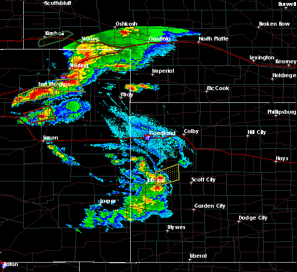 At 719 pm cdt, a severe thunderstorm was located 7 miles northwest of leoti, moving northeast at 15 mph (radar indicated). Hazards include 60 mph wind gusts and quarter size hail. Hail damage to vehicles is expected. Expect wind damage to roofs, siding and trees. At 719 pm cdt, a severe thunderstorm was located 7 miles northwest of leoti, moving northeast at 15 mph (radar indicated). Hazards include 60 mph wind gusts and quarter size hail. Hail damage to vehicles is expected. Expect wind damage to roofs, siding and trees.
|
| 7/26/2015 9:39 PM CDT |
 The severe thunderstorm warning for central wichita county will expire at 945 pm cdt, the storm which prompted the warning has moved out of the area. therefore the warning will be allowed to expire. however gusty winds and heavy rain are still possible with this thunderstorm. a severe thunderstorm watch remains in effect until 1100 pm cdt for west central kansas. to report severe weather, contact your nearest law enforcement agency. they will relay your report to the national weather service goodland. The severe thunderstorm warning for central wichita county will expire at 945 pm cdt, the storm which prompted the warning has moved out of the area. therefore the warning will be allowed to expire. however gusty winds and heavy rain are still possible with this thunderstorm. a severe thunderstorm watch remains in effect until 1100 pm cdt for west central kansas. to report severe weather, contact your nearest law enforcement agency. they will relay your report to the national weather service goodland.
|
| 7/26/2015 9:30 PM CDT |
 At 930 pm cdt, a severe thunderstorm was located 6 miles southeast of leoti, moving northeast at 20 mph (radar indicated). Hazards include 60 mph wind gusts and quarter size hail. Hail damage to vehicles is expected. expect wind damage to roofs, siding and trees. Locations impacted include, leoti and marienthal. At 930 pm cdt, a severe thunderstorm was located 6 miles southeast of leoti, moving northeast at 20 mph (radar indicated). Hazards include 60 mph wind gusts and quarter size hail. Hail damage to vehicles is expected. expect wind damage to roofs, siding and trees. Locations impacted include, leoti and marienthal.
|
| 7/26/2015 9:12 PM CDT |
 At 912 pm cdt, a severe thunderstorm was located 8 miles south of leoti, moving northeast at 30 mph (radar indicated). Hazards include ping pong ball size hail and 60 mph wind gusts. People and animals outdoors will be injured. expect hail damage to roofs, siding, windows and vehicles. Expect wind damage to roofs, siding and trees. At 912 pm cdt, a severe thunderstorm was located 8 miles south of leoti, moving northeast at 30 mph (radar indicated). Hazards include ping pong ball size hail and 60 mph wind gusts. People and animals outdoors will be injured. expect hail damage to roofs, siding, windows and vehicles. Expect wind damage to roofs, siding and trees.
|
| 7/26/2015 8:55 PM CDT |
 The severe thunderstorm warning for eastern greeley and wichita counties will expire at 800 pm mdt, the storms which prompted the warning have weakened below severe limits, and exited the warned area. therefore the warning will be allowed to expire. however gusty winds and heavy rain are still possible with these thunderstorms. a severe thunderstorm watch remains in effect until 1000 pm mdt/1100 pm cdt/ for west central kansas. to report severe weather, contact your nearest law enforcement agency. they will relay your report to the national weather service goodland. The severe thunderstorm warning for eastern greeley and wichita counties will expire at 800 pm mdt, the storms which prompted the warning have weakened below severe limits, and exited the warned area. therefore the warning will be allowed to expire. however gusty winds and heavy rain are still possible with these thunderstorms. a severe thunderstorm watch remains in effect until 1000 pm mdt/1100 pm cdt/ for west central kansas. to report severe weather, contact your nearest law enforcement agency. they will relay your report to the national weather service goodland.
|
| 7/26/2015 8:44 PM CDT |
 At 744 pm mdt /844 pm cdt/, severe thunderstorms were located along a line extending from 16 miles south of wallace to 8 miles west of leoti to 16 miles southeast of tribune, moving east at 25 mph (radar indicated). Hazards include 60 mph wind gusts. Expect damage to roofs. siding and trees. Locations impacted include, leoti, selkirk, marienthal and lydia. At 744 pm mdt /844 pm cdt/, severe thunderstorms were located along a line extending from 16 miles south of wallace to 8 miles west of leoti to 16 miles southeast of tribune, moving east at 25 mph (radar indicated). Hazards include 60 mph wind gusts. Expect damage to roofs. siding and trees. Locations impacted include, leoti, selkirk, marienthal and lydia.
|
| 7/26/2015 8:27 PM CDT |
 At 726 pm mdt /826 pm cdt/, severe thunderstorms were located along a line extending from 13 miles north of horace to 5 miles northeast of tribune, moving east at 35 mph (radar indicated). Hazards include 60 mph wind gusts and half dollar size hail. Hail damage to vehicles is expected. Expect wind damage to roofs, siding and trees. At 726 pm mdt /826 pm cdt/, severe thunderstorms were located along a line extending from 13 miles north of horace to 5 miles northeast of tribune, moving east at 35 mph (radar indicated). Hazards include 60 mph wind gusts and half dollar size hail. Hail damage to vehicles is expected. Expect wind damage to roofs, siding and trees.
|
| 7/19/2015 8:45 PM CDT | Storm damage reported in kearny county KS, 18.1 miles NNW of Leoti, KS |
| 7/19/2015 8:39 PM CDT |
 At 838 pm cdt, severe thunderstorms were located along a line extending from 12 miles north of modoc to 11 miles south of leoti, moving east at 35 mph. these are very dangerous storms (radar indicated). Hazards include 80 mph wind gusts. Flying debris will be dangerous to those caught without shelter. mobile homes will be heavily damaged. expect considerable damage to roofs, windows and vehicles. extensive tree damage and power outages are likely. Locations impacted include, leoti, marienthal and lydia. At 838 pm cdt, severe thunderstorms were located along a line extending from 12 miles north of modoc to 11 miles south of leoti, moving east at 35 mph. these are very dangerous storms (radar indicated). Hazards include 80 mph wind gusts. Flying debris will be dangerous to those caught without shelter. mobile homes will be heavily damaged. expect considerable damage to roofs, windows and vehicles. extensive tree damage and power outages are likely. Locations impacted include, leoti, marienthal and lydia.
|
| 7/19/2015 8:29 PM CDT |
 At 828 pm cdt, severe thunderstorms were located along a line extending from 14 miles northwest of modoc to 11 miles south of leoti, moving east at 35 mph. these are very dangerous storms (radar indicated). Hazards include 80 mph wind gusts. Flying debris will be dangerous to those caught without shelter. mobile homes will be heavily damaged. expect considerable damage to roofs, windows and vehicles. Extensive tree damage and power outages are likely. At 828 pm cdt, severe thunderstorms were located along a line extending from 14 miles northwest of modoc to 11 miles south of leoti, moving east at 35 mph. these are very dangerous storms (radar indicated). Hazards include 80 mph wind gusts. Flying debris will be dangerous to those caught without shelter. mobile homes will be heavily damaged. expect considerable damage to roofs, windows and vehicles. Extensive tree damage and power outages are likely.
|
| 7/19/2015 8:23 PM CDT |
 At 822 pm cdt, a severe thunderstorm was located 8 miles south of leoti, moving east at 40 mph. this is a very dangerous storm (law enforcement). Hazards include 90 mph wind gusts. You are in a life-threatening situation. flying debris may be deadly to those caught without shelter. mobile homes will be heavily damaged or destroyed. homes and businesses will have substantial roof and window damage. expect extensive tree damage and power outages. a new warning may be needed for this storm. Locations impacted include, leoti, selkirk, marienthal and lydia. At 822 pm cdt, a severe thunderstorm was located 8 miles south of leoti, moving east at 40 mph. this is a very dangerous storm (law enforcement). Hazards include 90 mph wind gusts. You are in a life-threatening situation. flying debris may be deadly to those caught without shelter. mobile homes will be heavily damaged or destroyed. homes and businesses will have substantial roof and window damage. expect extensive tree damage and power outages. a new warning may be needed for this storm. Locations impacted include, leoti, selkirk, marienthal and lydia.
|
| 7/19/2015 8:12 PM CDT |
 At 706 pm mdt /806 pm cdt/, severe thunderstorms were located along a line extending from 16 miles south of wallace to 9 miles south of tribune, moving east at 20 mph. these are very dangerous storms (law enforcement reported 90 mph gusts at 9 ssw of tribune and pea size hail). Hazards include 90 mph wind gusts. You are in a life-threatening situation. flying debris may be deadly to those caught without shelter. mobile homes will be heavily damaged or destroyed. homes and businesses will have substantial roof and window damage. expect extensive tree damage and power outages. Locations impacted include, leoti, tribune, horace, selkirk, marienthal and lydia. At 706 pm mdt /806 pm cdt/, severe thunderstorms were located along a line extending from 16 miles south of wallace to 9 miles south of tribune, moving east at 20 mph. these are very dangerous storms (law enforcement reported 90 mph gusts at 9 ssw of tribune and pea size hail). Hazards include 90 mph wind gusts. You are in a life-threatening situation. flying debris may be deadly to those caught without shelter. mobile homes will be heavily damaged or destroyed. homes and businesses will have substantial roof and window damage. expect extensive tree damage and power outages. Locations impacted include, leoti, tribune, horace, selkirk, marienthal and lydia.
|
| 7/19/2015 7:54 PM CDT |
 At 654 pm mdt /754 pm cdt/, severe thunderstorms were located along a line extending from 15 miles south of wallace to 9 miles south of horace, moving east at 20 mph. these are very dangerous storms (radar indicated). Hazards include baseball size hail and 60 mph wind gusts. People and animals outdoors will be severely injured. expect shattered windows, extensive damage to roofs, siding and vehicles. Locations impacted include, leoti, tribune, horace, selkirk, marienthal and lydia. At 654 pm mdt /754 pm cdt/, severe thunderstorms were located along a line extending from 15 miles south of wallace to 9 miles south of horace, moving east at 20 mph. these are very dangerous storms (radar indicated). Hazards include baseball size hail and 60 mph wind gusts. People and animals outdoors will be severely injured. expect shattered windows, extensive damage to roofs, siding and vehicles. Locations impacted include, leoti, tribune, horace, selkirk, marienthal and lydia.
|
| 7/19/2015 7:31 PM CDT |
 At 630 pm mdt /730 pm cdt/, severe thunderstorms were located along a line extending from 13 miles south of sharon springs to 10 miles southeast of towner, moving east at 20 mph. these are very dangerous storms (radar indicated). Hazards include baseball size hail and 60 mph wind gusts. People and animals outdoors will be severely injured. Expect shattered windows, extensive damage to roofs, siding and vehicles. At 630 pm mdt /730 pm cdt/, severe thunderstorms were located along a line extending from 13 miles south of sharon springs to 10 miles southeast of towner, moving east at 20 mph. these are very dangerous storms (radar indicated). Hazards include baseball size hail and 60 mph wind gusts. People and animals outdoors will be severely injured. Expect shattered windows, extensive damage to roofs, siding and vehicles.
|
| 6/26/2015 12:55 AM MDT |
 The severe thunderstorm warning for greeley and southwestern wichita counties will expire at 100 am mdt, the storm which prompted the warning has weakened below severe limits, and no longer pose an immediate threat to life or property. therefore the warning will be allowed to expire. a severe thunderstorm watch remains in effect until 400 am mdt/500 am cdt/ for west central kansas. The severe thunderstorm warning for greeley and southwestern wichita counties will expire at 100 am mdt, the storm which prompted the warning has weakened below severe limits, and no longer pose an immediate threat to life or property. therefore the warning will be allowed to expire. a severe thunderstorm watch remains in effect until 400 am mdt/500 am cdt/ for west central kansas.
|
| 6/26/2015 12:34 AM MDT |
 At 1234 am mdt /134 am cdt/, a severe thunderstorm was located 9 miles southeast of tribune, moving east at 30 mph (radar indicated). Hazards include 60 mph wind gusts and quarter size hail. Hail damage to vehicles is expected. expect wind damage to roofs, siding and trees. Locations impacted include, leoti, tribune, horace, selkirk and lydia. At 1234 am mdt /134 am cdt/, a severe thunderstorm was located 9 miles southeast of tribune, moving east at 30 mph (radar indicated). Hazards include 60 mph wind gusts and quarter size hail. Hail damage to vehicles is expected. expect wind damage to roofs, siding and trees. Locations impacted include, leoti, tribune, horace, selkirk and lydia.
|
| 6/26/2015 12:11 AM MDT |
 At 1210 am mdt /110 am cdt/, a severe thunderstorm was located 12 miles south of horace, or 12 miles southwest of tribune, moving east at 30 mph (radar indicated). Hazards include 60 mph wind gusts and quarter size hail. Hail damage to vehicles is expected. Expect wind damage to roofs, siding and trees. At 1210 am mdt /110 am cdt/, a severe thunderstorm was located 12 miles south of horace, or 12 miles southwest of tribune, moving east at 30 mph (radar indicated). Hazards include 60 mph wind gusts and quarter size hail. Hail damage to vehicles is expected. Expect wind damage to roofs, siding and trees.
|
| 6/26/2015 12:53 AM CDT |
 At 1253 am cdt, a severe thunderstorm was located 6 miles west of modoc, moving south at 45 mph (radar indicated). Hazards include 60 mph wind gusts and quarter size hail. Hail damage to vehicles is expected. Expect wind damage to roofs, siding and trees. At 1253 am cdt, a severe thunderstorm was located 6 miles west of modoc, moving south at 45 mph (radar indicated). Hazards include 60 mph wind gusts and quarter size hail. Hail damage to vehicles is expected. Expect wind damage to roofs, siding and trees.
|
| 6/26/2015 12:39 AM CDT |
 The severe thunderstorm warning for northeastern greeley, southwestern logan, southeastern wallace and northern wichita counties will expire at 1145 pm mdt, the storms which prompted the warning have moved out of the area. therefore the warning will be allowed to expire. a severe thunderstorm watch remains in effect until 400 am mdt/500 am cdt/ for west central kansas. The severe thunderstorm warning for northeastern greeley, southwestern logan, southeastern wallace and northern wichita counties will expire at 1145 pm mdt, the storms which prompted the warning have moved out of the area. therefore the warning will be allowed to expire. a severe thunderstorm watch remains in effect until 400 am mdt/500 am cdt/ for west central kansas.
|
| 6/26/2015 12:15 AM CDT |
 At 1115 pm mdt /1215 am cdt/, severe thunderstorms were located along a line extending from 12 miles southeast of wallace to 11 miles southeast of sharon springs, moving south at 45 mph (radar indicated). Hazards include 60 mph wind gusts and penny size hail. Expect damage to roofs. siding and trees. Locations impacted include, leoti, sharon springs, tribune, horace, wallace, marienthal and selkirk. At 1115 pm mdt /1215 am cdt/, severe thunderstorms were located along a line extending from 12 miles southeast of wallace to 11 miles southeast of sharon springs, moving south at 45 mph (radar indicated). Hazards include 60 mph wind gusts and penny size hail. Expect damage to roofs. siding and trees. Locations impacted include, leoti, sharon springs, tribune, horace, wallace, marienthal and selkirk.
|
| 6/25/2015 10:58 PM MDT |
 At 1058 pm mdt /1158 pm cdt/, severe thunderstorms were located along a line extending from 7 miles east of wallace to 4 miles east of sharon springs, moving south at 45 mph (radar indicated). Hazards include 60 mph wind gusts and penny size hail. Expect damage to roofs. Siding and trees. At 1058 pm mdt /1158 pm cdt/, severe thunderstorms were located along a line extending from 7 miles east of wallace to 4 miles east of sharon springs, moving south at 45 mph (radar indicated). Hazards include 60 mph wind gusts and penny size hail. Expect damage to roofs. Siding and trees.
|
| 5/28/2015 4:05 PM CDT | Quarter sized hail reported 0.3 miles NE of Leoti, KS |
| 5/28/2015 3:55 PM CDT | Quarter sized hail reported 9.3 miles N of Leoti, KS, relayed via spotter network |
| 5/28/2015 3:54 PM CDT | Quarter sized hail reported 8.3 miles E of Leoti, KS, relayed via spotter network |
| 5/27/2015 7:07 PM CDT | At 706 pm cdt, a severe thunderstorm was located 5 miles northeast of leoti, moving northeast at 15 mph (radar indicated). Hazards include 60 mph wind gusts and quarter size hail. Hail damage to vehicles is expected. expect wind damage to roofs, siding and trees. locations impacted include, leoti. A tornado watch remains in effect until 1000 pm cdt for west central kansas. |
| 5/27/2015 6:55 PM CDT | At 655 pm cdt, a severe thunderstorm was located near leoti, moving northeast at 20 mph (radar indicated). Hazards include ping pong ball size hail and 60 mph wind gusts. People and animals outdoors will be injured. expect hail damage to roofs, siding, windows and vehicles. expect wind damage to roofs, siding and trees. locations impacted include, leoti. A tornado watch remains in effect until 1000 pm cdt for west central kansas. |
| 5/27/2015 6:48 PM CDT | At 647 pm cdt, a severe thunderstorm was located 5 miles north of leoti, moving northeast at 15 mph (radar indicated). Hazards include ping pong ball size hail and 60 mph wind gusts. People and animals outdoors will be injured. expect hail damage to roofs, siding, windows and vehicles. expect wind damage to roofs, siding and trees. locations impacted include, leoti. A tornado watch remains in effect until 1000 pm cdt for west central kansas. |
| 5/27/2015 6:38 PM CDT | At 637 pm cdt, a severe thunderstorm was located 4 miles southwest of modoc, moving northeast at 15 mph (radar indicated). Hazards include 60 mph wind gusts and half dollar size hail. Hail damage to vehicles is expected. expect wind damage to roofs, siding and trees. locations impacted include, marienthal. A tornado watch remains in effect until 1000 pm cdt for west central kansas. |
| 5/27/2015 6:37 PM CDT | At 637 pm cdt, a severe thunderstorm was located 5 miles northwest of leoti, moving northeast at 30 mph (radar indicated). Hazards include ping pong ball size hail and 60 mph wind gusts. People and animals outdoors will be injured. expect hail damage to roofs, siding, windows and vehicles. expect wind damage to roofs, siding and trees. locations impacted include, leoti and selkirk. A tornado watch remains in effect until 1000 pm cdt for west central kansas. |
| 5/27/2015 6:28 PM CDT | At 628 pm cdt, a severe thunderstorm was located 6 miles north of leoti, moving northeast at 15 mph (radar indicated). Hazards include 60 mph wind gusts and quarter size hail. Hail damage to vehicles is expected. Expect wind damage to roofs, siding and trees. |
| 5/27/2015 6:16 PM CDT | At 615 pm cdt, a severe thunderstorm was located 9 miles northeast of leoti, moving northeast at 20 mph (radar indicated). Hazards include 60 mph wind gusts and quarter size hail. Hail damage to vehicles is expected. expect wind damage to roofs, siding and trees. locations impacted include, leoti. A tornado watch remains in effect until 1000 pm cdt for west central kansas. |
| 5/27/2015 6:13 PM CDT | At 613 pm cdt, a severe thunderstorm was located 8 miles southwest of modoc, moving northeast at 20 mph (radar indicated). Hazards include ping pong ball size hail and 60 mph wind gusts. People and animals outdoors will be injured. expect hail damage to roofs, siding, windows and vehicles. Expect wind damage to roofs, siding and trees. |
| 5/27/2015 6:07 PM CDT | At 607 pm cdt, a severe thunderstorm was located 6 miles north of leoti, moving northeast at 20 mph (radar indicated). Hazards include 60 mph wind gusts and quarter size hail. Hail damage to vehicles is expected. Expect wind damage to roofs, siding and trees. |
| 4/17/2015 7:13 PM CDT | Quarter sized hail reported 10.9 miles S of Leoti, KS, report of quarter-sized hail 11 miles north of leoti. hail fell for several minutes. |
| 9/23/2014 5:03 PM CDT | Quarter sized hail reported 14.4 miles NNW of Leoti, KS, ground completely covered the ground. hail damage to gutter. time estimated by radar. |
| 9/23/2014 4:50 PM CDT | Half Dollar sized hail reported 11.2 miles N of Leoti, KS, lost electricity for a little while. hail fully covered the ground with mostly smaller hail sizes. |
| 8/25/2014 6:03 PM CDT | Quarter sized hail reported 0.3 miles NE of Leoti, KS, dime to quarter size hail in leoti. |
| 6/22/2014 6:57 PM CDT | Quarter sized hail reported 10.9 miles S of Leoti, KS |
| 6/11/2014 7:38 PM CDT | Sustained 50 mph in logan county KS, 16.2 miles SSE of Leoti, KS |
| 6/22/2013 7:15 PM CDT | Quarter sized hail reported 10.2 miles S of Leoti, KS, quarter size hail off and on for the past 30 minutes. |
| 6/22/2013 6:53 PM CDT | Half Dollar sized hail reported 13.3 miles SE of Leoti, KS, measured quarter size hail and some was larger. estimated to half dollar size. |
| 6/22/2013 6:52 PM CDT | Quarter sized hail reported 10.2 miles S of Leoti, KS, nickel to quarter size hail. started hailing 10 minutes ago. |
| 6/22/2013 6:52 PM CDT | Quarter sized hail reported 0.3 miles NE of Leoti, KS, nickel to quarter size hail. started hailing 10 minutes ago. |
| 6/16/2013 8:25 PM CDT | Wind gust of at least 60 mph estimated with a live tree branch 6 inches in diameter down in wichita county KS, 14 miles N of Leoti, KS |
| 6/4/2013 8:50 PM CDT | Ping Pong Ball sized hail reported 9.6 miles ENE of Leoti, KS |
| 1/1/0001 12:00 AM | Open ended shed destroyed. size of shed unknow in wichita county KS, 13.1 miles NE of Leoti, KS |
| 1/1/0001 12:00 AM | Half Dollar sized hail reported 14.4 miles NNW of Leoti, KS |
| 1/1/0001 12:00 AM | Ping Pong Ball sized hail reported 0.3 miles NE of Leoti, KS |
| 1/1/0001 12:00 AM | Ping Pong Ball sized hail reported 15.1 miles SE of Leoti, KS |
| 1/1/0001 12:00 AM | Quarter sized hail reported 13.3 miles SE of Leoti, KS |
Hail Maps for Leoti, KS
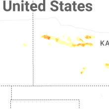
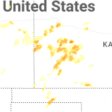


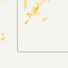


Connect with Interactive Hail Maps