

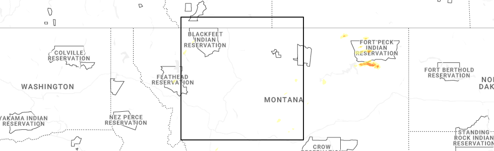
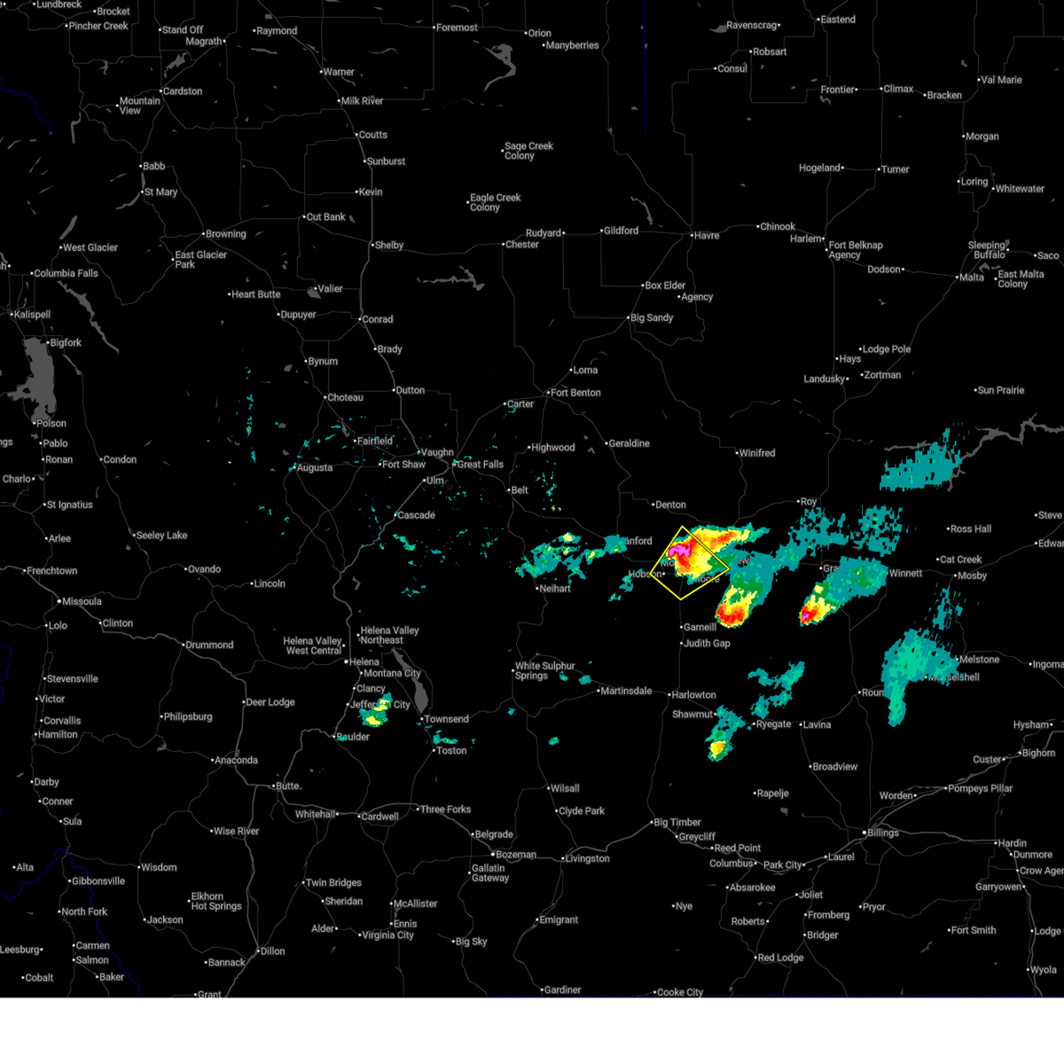
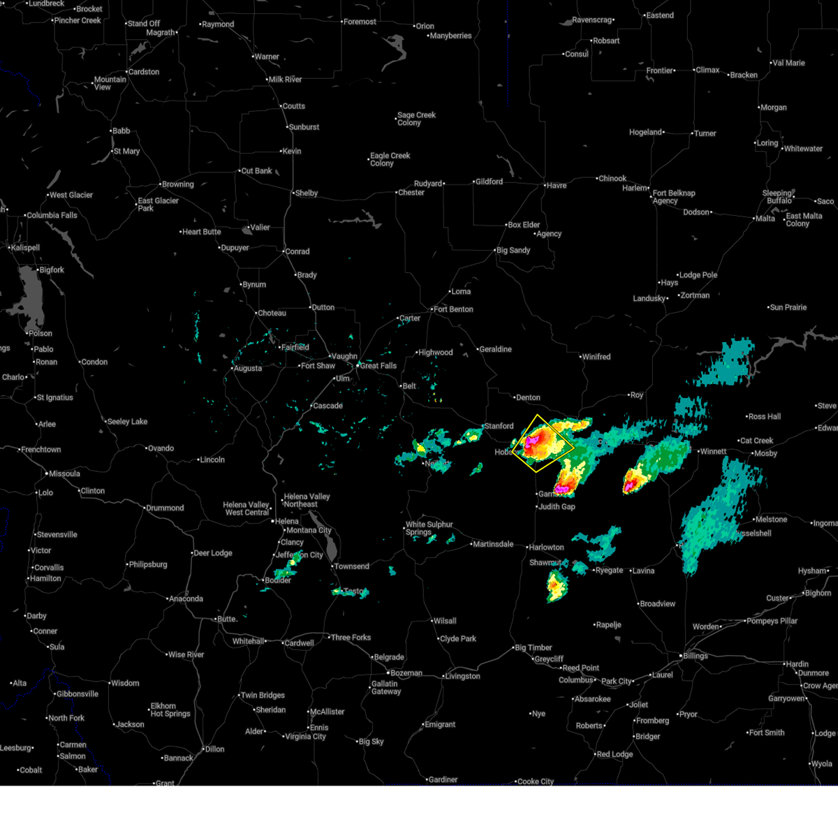
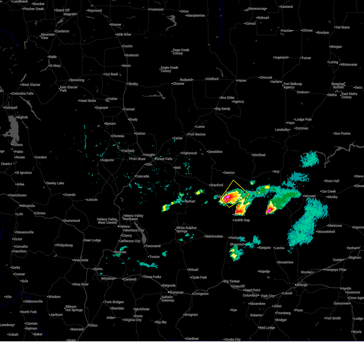
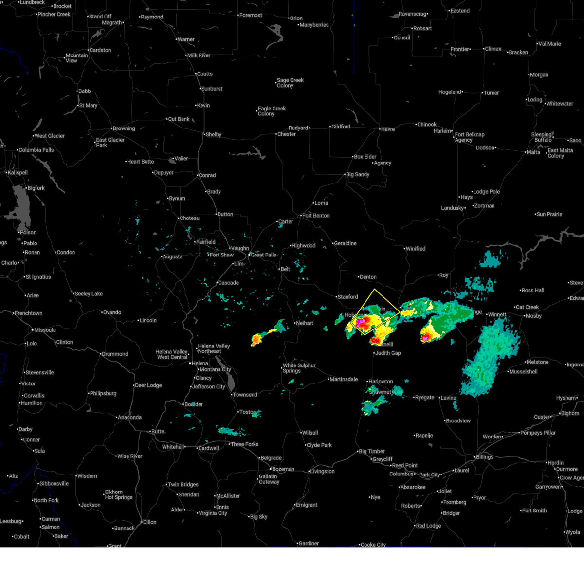
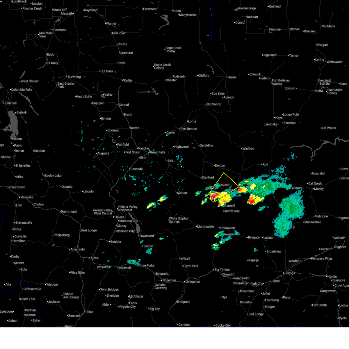
Hail Map for Lewistown, MT
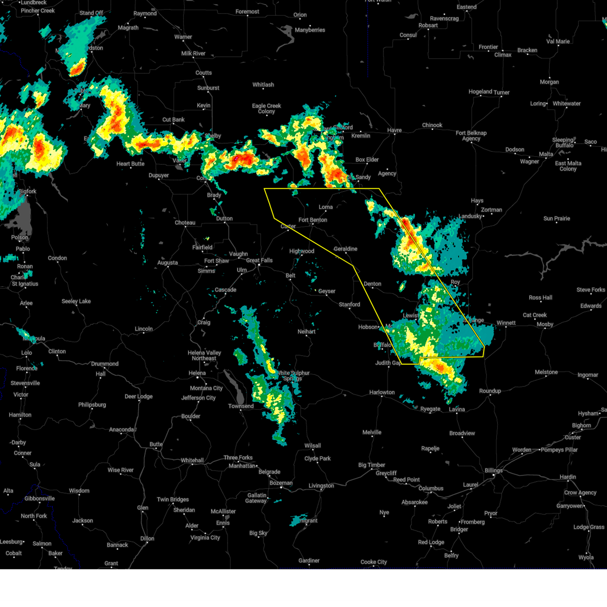
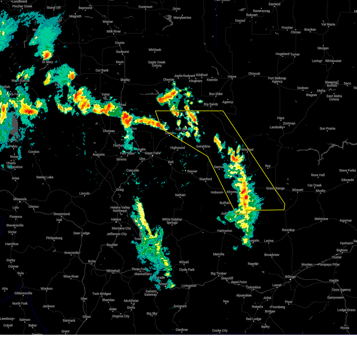
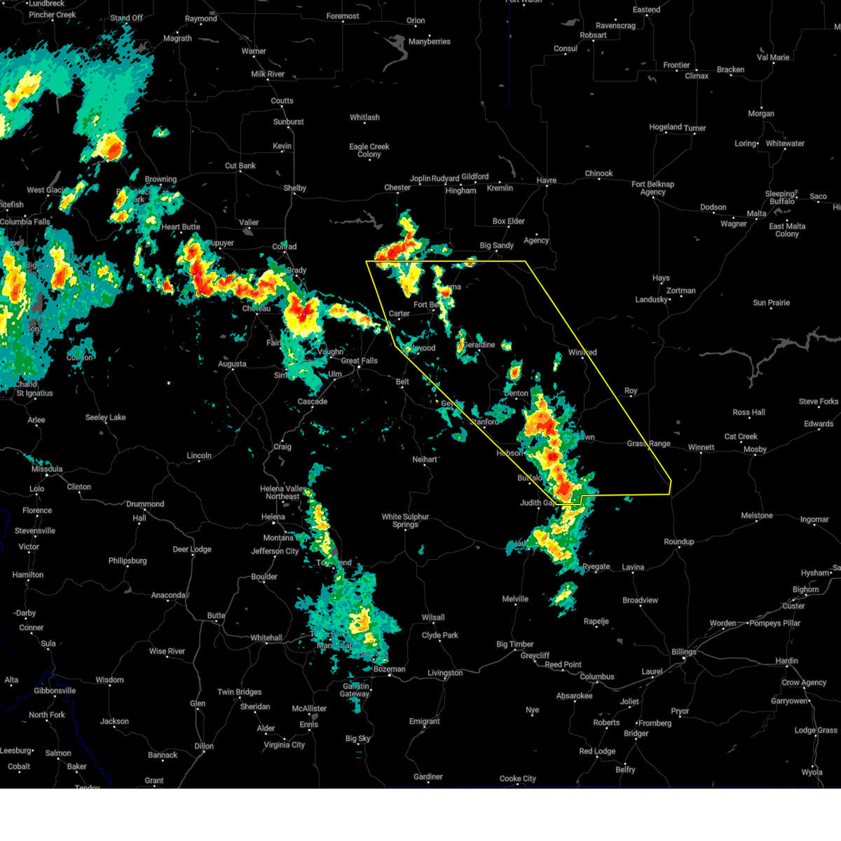
The Lewistown, MT area has had 28 reports of on-the-ground hail by trained spotters, and has been under severe weather warnings 19 times during the past 12 months. Doppler radar has detected hail at or near Lewistown, MT on 33 occasions, including 4 occasions during the past year.
| Name: | Lewistown, MT |
| Where Located: | 93.4 miles ESE of Great Falls, MT |
| Map: | Google Map for Lewistown, MT |
| Population: | 5901 |
| Housing Units: | 3007 |
| More Info: | Search Google for Lewistown, MT |
2
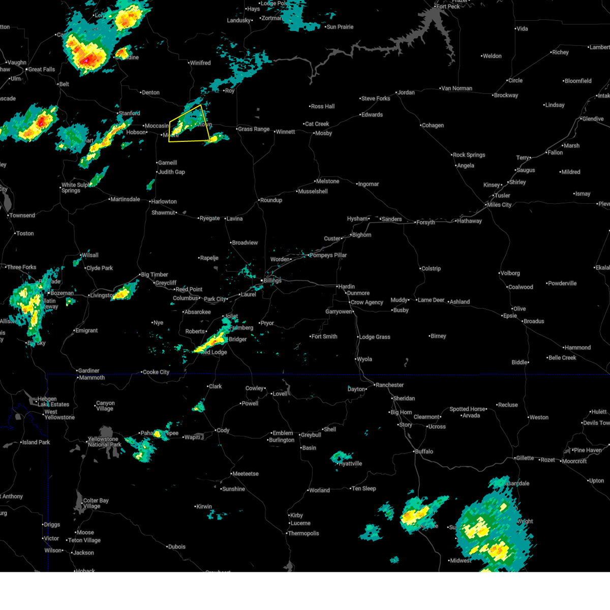
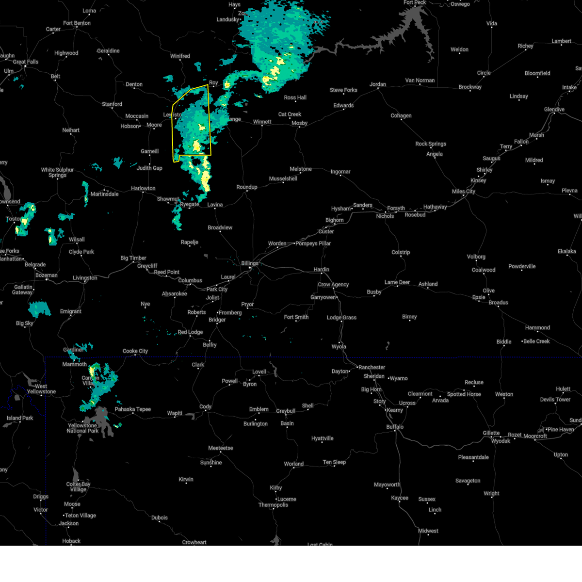
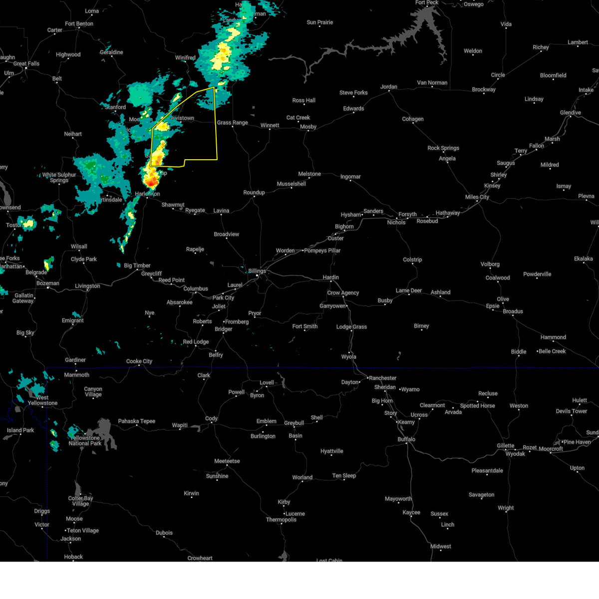
The Top Recent Hail Date for Lewistown, MT is Wednesday, July 2, 2025 (6th out of 33)
Hail and Wind Damage Spotted near Lewistown, MT
| Date / Time | Report Details |
|---|---|
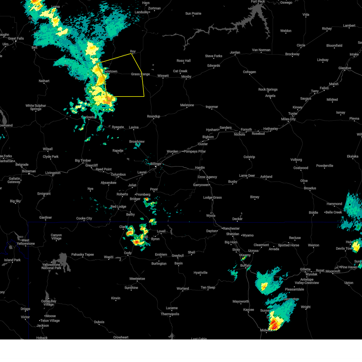
| 7/2/2025 5:15 PM MDT | Corrects previous tstm wnd dmg report from 1 nw lewistown. public reported on social media that an abandoned lumber shop collapsed due to the thunderstorms with photos in fergus county MT, 1.5 miles SE of Lewistown, MT |
| 7/2/2025 5:15 PM MDT | Trees down along the lewistown trail system blocking the trail. time estimated based on rada in fergus county MT, 0.5 miles ENE of Lewistown, MT |
| 7/2/2025 5:10 PM MDT | Public reported on social media that an abandoned lumber shop collapsed due to the thunderstorms with photos of debris across the property. time estimated based on rada in fergus county MT, 1.5 miles SE of Lewistown, MT |
| 6/15/2025 5:25 PM MDT | Golf Ball sized hail reported 17.3 miles WNW of Lewistown, MT, time estimated based on radar. |
| 6/15/2025 4:48 PM MDT | Tennis Ball sized hail reported 2.3 miles NNW of Lewistown, MT, trained spotter reports egg to tennis ball size hail. images were provided. |
| 6/15/2025 4:46 PM MDT |
 the severe thunderstorm warning has been cancelled and is no longer in effect the severe thunderstorm warning has been cancelled and is no longer in effect
|
| 6/15/2025 4:38 PM MDT |
 At 437 pm mdt, a severe thunderstorm was located near lewistown, moving east at 35 mph (radar indicated). Hazards include 60 mph wind gusts and quarter size hail. Hail damage to vehicles is expected. expect wind damage to roofs, siding, and trees. Locations impacted include, lewistown, giltedge, glengarry, and heath. At 437 pm mdt, a severe thunderstorm was located near lewistown, moving east at 35 mph (radar indicated). Hazards include 60 mph wind gusts and quarter size hail. Hail damage to vehicles is expected. expect wind damage to roofs, siding, and trees. Locations impacted include, lewistown, giltedge, glengarry, and heath.
|
| 6/15/2025 4:25 PM MDT |
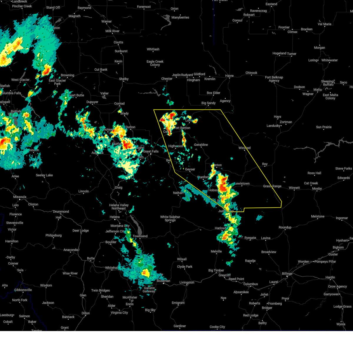
 Svrtfx the national weather service in great falls has issued a * severe thunderstorm warning for, south central fergus county in central montana, * until 500 pm mdt. * at 425 pm mdt, a severe thunderstorm was located near moore, or 7 miles southwest of lewistown, moving east at 40 mph (radar indicated). Hazards include 60 mph wind gusts and quarter size hail. Hail damage to vehicles is expected. Expect wind damage to roofs, siding, and trees. Svrtfx the national weather service in great falls has issued a * severe thunderstorm warning for, south central fergus county in central montana, * until 500 pm mdt. * at 425 pm mdt, a severe thunderstorm was located near moore, or 7 miles southwest of lewistown, moving east at 40 mph (radar indicated). Hazards include 60 mph wind gusts and quarter size hail. Hail damage to vehicles is expected. Expect wind damage to roofs, siding, and trees.
|
| 6/14/2025 7:32 PM MDT | Golf Ball sized hail reported 17.7 miles SE of Lewistown, MT, patrol car traveling along highway 81 received substantial hail damage. location and time estimated based on radar. |
| 6/14/2025 7:22 PM MDT | Golf Ball sized hail reported 17.9 miles SE of Lewistown, MT, report from social media. ground was almost completely covered with hailstones ranging from quarter to golf ball size. time estimated based on radar. |
| 6/14/2025 7:08 PM MDT |
 The storm which prompted the warning has moved out of the area. therefore, the warning will be allowed to expire. a severe thunderstorm watch remains in effect until 100 am mdt for central montana. remember, a severe thunderstorm warning still remains in effect for central fergus county through 8 pm mdt. The storm which prompted the warning has moved out of the area. therefore, the warning will be allowed to expire. a severe thunderstorm watch remains in effect until 100 am mdt for central montana. remember, a severe thunderstorm warning still remains in effect for central fergus county through 8 pm mdt.
|
| 6/14/2025 6:56 PM MDT |
 At 656 pm mdt, a severe thunderstorm was located near hobson, or 17 miles west of lewistown, moving northeast at 25 mph (trained weather spotters). Hazards include two inch hail and 60 mph wind gusts. People and animals outdoors will be injured. expect hail damage to roofs, siding, windows, and vehicles. expect wind damage to roofs, siding, and trees. Locations impacted include, hobson, moore, glengarry, and moccasin. At 656 pm mdt, a severe thunderstorm was located near hobson, or 17 miles west of lewistown, moving northeast at 25 mph (trained weather spotters). Hazards include two inch hail and 60 mph wind gusts. People and animals outdoors will be injured. expect hail damage to roofs, siding, windows, and vehicles. expect wind damage to roofs, siding, and trees. Locations impacted include, hobson, moore, glengarry, and moccasin.
|
| 6/14/2025 6:46 PM MDT |
 At 646 pm mdt, a severe thunderstorm was located near hobson, or 20 miles west of lewistown, moving northeast at 25 mph (radar indicated). Hazards include two inch hail and 60 mph wind gusts. People and animals outdoors will be injured. expect hail damage to roofs, siding, windows, and vehicles. expect wind damage to roofs, siding, and trees. Locations impacted include, hobson, moore, ackley lake state park, glengarry, and moccasin. At 646 pm mdt, a severe thunderstorm was located near hobson, or 20 miles west of lewistown, moving northeast at 25 mph (radar indicated). Hazards include two inch hail and 60 mph wind gusts. People and animals outdoors will be injured. expect hail damage to roofs, siding, windows, and vehicles. expect wind damage to roofs, siding, and trees. Locations impacted include, hobson, moore, ackley lake state park, glengarry, and moccasin.
|
| 6/14/2025 6:37 PM MDT |
 At 637 pm mdt, a severe thunderstorm was located near hobson, or 22 miles southeast of stanford, moving northeast at 25 mph (radar indicated). Hazards include ping pong ball size hail and 60 mph wind gusts. People and animals outdoors will be injured. expect hail damage to roofs, siding, windows, and vehicles. expect wind damage to roofs, siding, and trees. Locations impacted include, hobson, moore, ackley lake state park, glengarry, and moccasin. At 637 pm mdt, a severe thunderstorm was located near hobson, or 22 miles southeast of stanford, moving northeast at 25 mph (radar indicated). Hazards include ping pong ball size hail and 60 mph wind gusts. People and animals outdoors will be injured. expect hail damage to roofs, siding, windows, and vehicles. expect wind damage to roofs, siding, and trees. Locations impacted include, hobson, moore, ackley lake state park, glengarry, and moccasin.
|
| 6/14/2025 6:26 PM MDT |
 Svrtfx the national weather service in great falls has issued a * severe thunderstorm warning for, southeastern judith basin county in central montana, south central fergus county in central montana, * until 715 pm mdt. * at 625 pm mdt, a severe thunderstorm was located 9 miles southwest of hobson, or 22 miles southeast of stanford, moving northeast at 25 mph (radar indicated). Hazards include 60 mph wind gusts and half dollar size hail. Hail damage to vehicles is expected. Expect wind damage to roofs, siding, and trees. Svrtfx the national weather service in great falls has issued a * severe thunderstorm warning for, southeastern judith basin county in central montana, south central fergus county in central montana, * until 715 pm mdt. * at 625 pm mdt, a severe thunderstorm was located 9 miles southwest of hobson, or 22 miles southeast of stanford, moving northeast at 25 mph (radar indicated). Hazards include 60 mph wind gusts and half dollar size hail. Hail damage to vehicles is expected. Expect wind damage to roofs, siding, and trees.
|
| 5/10/2025 7:26 PM MDT |
 The storms which prompted the warning have moved out of the area. therefore, the warning will be allowed to expire. remember, a severe thunderstorm warning still remains in effect for southeastern fergus county in central montana until 745 pm mdt. The storms which prompted the warning have moved out of the area. therefore, the warning will be allowed to expire. remember, a severe thunderstorm warning still remains in effect for southeastern fergus county in central montana until 745 pm mdt.
|
| 5/10/2025 7:10 PM MDT |
 At 709 pm mdt, severe thunderstorms were located along a line extending from near lewistown to 20 miles southeast of moore, moving northeast at 40 mph (radar indicated). Hazards include 60 mph wind gusts. Expect damage to roofs, siding, and trees. Locations impacted include, giltedge, fergus, heath, forestgrove, and lewistown. At 709 pm mdt, severe thunderstorms were located along a line extending from near lewistown to 20 miles southeast of moore, moving northeast at 40 mph (radar indicated). Hazards include 60 mph wind gusts. Expect damage to roofs, siding, and trees. Locations impacted include, giltedge, fergus, heath, forestgrove, and lewistown.
|
| 5/10/2025 7:00 PM MDT | Montana mesonet station forestgrove n (acefores in fergus county MT, 16.4 miles WSW of Lewistown, MT |
| 5/10/2025 7:00 PM MDT |
 the severe thunderstorm warning has been cancelled and is no longer in effect the severe thunderstorm warning has been cancelled and is no longer in effect
|
| 5/10/2025 7:00 PM MDT |
 At 659 pm mdt, severe thunderstorms were located along a line extending from near lewistown to 19 miles southeast of moore, moving northeast at 40 mph (radar indicated). Hazards include 60 mph wind gusts. Expect damage to roofs, siding, and trees. Locations impacted include, giltedge, glengarry, fergus, heath, forestgrove, and lewistown. At 659 pm mdt, severe thunderstorms were located along a line extending from near lewistown to 19 miles southeast of moore, moving northeast at 40 mph (radar indicated). Hazards include 60 mph wind gusts. Expect damage to roofs, siding, and trees. Locations impacted include, giltedge, glengarry, fergus, heath, forestgrove, and lewistown.
|
| 5/10/2025 6:58 PM MDT | Mesonet station jpkm8 judith peak raws. time of gust estimated given station reports once per hou in fergus county MT, 14.7 miles SW of Lewistown, MT |
| 5/10/2025 6:31 PM MDT |
 Svrtfx the national weather service in great falls has issued a * severe thunderstorm warning for, east central judith basin county in central montana, south central fergus county in central montana, * until 730 pm mdt. * at 629 pm mdt, severe thunderstorms were located along a line extending from near moore to 20 miles southeast of hobson, moving east northeast at 40 mph (radar indicated). Hazards include 60 mph wind gusts. expect damage to roofs, siding, and trees Svrtfx the national weather service in great falls has issued a * severe thunderstorm warning for, east central judith basin county in central montana, south central fergus county in central montana, * until 730 pm mdt. * at 629 pm mdt, severe thunderstorms were located along a line extending from near moore to 20 miles southeast of hobson, moving east northeast at 40 mph (radar indicated). Hazards include 60 mph wind gusts. expect damage to roofs, siding, and trees
|
| 10/21/2024 6:38 PM MDT | Wind gust along advancing cold front in conjunction with shower activity. asos station klwt lewistown airpor in fergus county MT, 2.9 miles NE of Lewistown, MT |
| 8/23/2024 6:22 PM MDT |
 The storms which prompted the warning have moved out of the area. therefore, the warning will be allowed to expire. a severe thunderstorm watch remains in effect until 900 pm mdt for central and north central montana. The storms which prompted the warning have moved out of the area. therefore, the warning will be allowed to expire. a severe thunderstorm watch remains in effect until 900 pm mdt for central and north central montana.
|
| 8/23/2024 6:02 PM MDT |
 At 601 pm mdt, severe thunderstorms were located along a line extending from near fort benton to near denton to 25 miles south of lewistown, moving east at 30 mph (radar indicated). Hazards include 70 mph wind gusts. Expect considerable tree damage. damage is likely to mobile homes, roofs, and outbuildings. Locations impacted include, lewistown, fort benton, geraldine, denton, winifred, moore, grass range, forestgrove, glengarry, danvers, loma, suffolk, square butte, giltedge, judith landing, hilger, heath, christina, iliad, and virgelle. At 601 pm mdt, severe thunderstorms were located along a line extending from near fort benton to near denton to 25 miles south of lewistown, moving east at 30 mph (radar indicated). Hazards include 70 mph wind gusts. Expect considerable tree damage. damage is likely to mobile homes, roofs, and outbuildings. Locations impacted include, lewistown, fort benton, geraldine, denton, winifred, moore, grass range, forestgrove, glengarry, danvers, loma, suffolk, square butte, giltedge, judith landing, hilger, heath, christina, iliad, and virgelle.
|
| 8/23/2024 6:02 PM MDT |
 the severe thunderstorm warning has been cancelled and is no longer in effect the severe thunderstorm warning has been cancelled and is no longer in effect
|
| 8/23/2024 5:43 PM MDT |
 At 542 pm mdt, severe thunderstorms were located along a line extending from 7 miles northwest of fort benton to 7 miles west of denton to 20 miles southeast of moore, moving east at 30 mph (radar indicated). Hazards include 70 mph wind gusts. Expect considerable tree damage. damage is likely to mobile homes, roofs, and outbuildings. Locations impacted include, lewistown, fort benton, stanford, geraldine, denton, hobson, winifred, moore, grass range, highwood, carter, floweree, windham, forestgrove, shonkin, danvers, loma, hilger, iliad, and virgelle. At 542 pm mdt, severe thunderstorms were located along a line extending from 7 miles northwest of fort benton to 7 miles west of denton to 20 miles southeast of moore, moving east at 30 mph (radar indicated). Hazards include 70 mph wind gusts. Expect considerable tree damage. damage is likely to mobile homes, roofs, and outbuildings. Locations impacted include, lewistown, fort benton, stanford, geraldine, denton, hobson, winifred, moore, grass range, highwood, carter, floweree, windham, forestgrove, shonkin, danvers, loma, hilger, iliad, and virgelle.
|
| 8/23/2024 5:23 PM MDT |
 Svrtfx the national weather service in great falls has issued a * severe thunderstorm warning for, judith basin county in central montana, fergus county in central montana, southwestern blaine county in north central montana, chouteau county in north central montana, northeastern cascade county in central montana, * until 630 pm mdt. * at 523 pm mdt, severe thunderstorms were located along a line extending from 15 miles southeast of the knees to 8 miles east of geyser to 16 miles south of moore, moving east at 30 mph (radar indicated). Hazards include 70 mph wind gusts. Expect considerable tree damage. Damage is likely to mobile homes, roofs, and outbuildings. Svrtfx the national weather service in great falls has issued a * severe thunderstorm warning for, judith basin county in central montana, fergus county in central montana, southwestern blaine county in north central montana, chouteau county in north central montana, northeastern cascade county in central montana, * until 630 pm mdt. * at 523 pm mdt, severe thunderstorms were located along a line extending from 15 miles southeast of the knees to 8 miles east of geyser to 16 miles south of moore, moving east at 30 mph (radar indicated). Hazards include 70 mph wind gusts. Expect considerable tree damage. Damage is likely to mobile homes, roofs, and outbuildings.
|
| 8/19/2024 8:25 PM MDT | Mesonet station jpkm8 judith peak raws. time estimated via radar given raws reports once per hou in fergus county MT, 14.7 miles SW of Lewistown, MT |
| 8/19/2024 8:12 PM MDT |
 Svrtfx the national weather service in great falls has issued a * severe thunderstorm warning for, south central fergus county in central montana, * until 900 pm mdt. * at 812 pm mdt, severe thunderstorms were located along a line extending from 13 miles northeast of moore to near lewistown to 26 miles north of deadmans basin reservoir, moving east at 30 mph (radar indicated). Hazards include 60 mph wind gusts. expect damage to roofs, siding, and trees Svrtfx the national weather service in great falls has issued a * severe thunderstorm warning for, south central fergus county in central montana, * until 900 pm mdt. * at 812 pm mdt, severe thunderstorms were located along a line extending from 13 miles northeast of moore to near lewistown to 26 miles north of deadmans basin reservoir, moving east at 30 mph (radar indicated). Hazards include 60 mph wind gusts. expect damage to roofs, siding, and trees
|
| 8/19/2024 8:00 PM MDT | Storm damage reported in fergus county MT, 0.5 miles S of Lewistown, MT |
| 7/25/2024 4:52 PM MDT | Awos station k1nm 5 ne forestgrov in fergus county MT, 18.9 miles W of Lewistown, MT |
| 6/21/2024 2:38 PM MDT |
 The storm which prompted the warning has moved out of the area. therefore, the warning will be allowed to expire. a severe thunderstorm watch remains in effect until 800 pm mdt for central montana. remember, a severe thunderstorm warning still remains in effect for southeastern fergus county until 330 pm mdt. The storm which prompted the warning has moved out of the area. therefore, the warning will be allowed to expire. a severe thunderstorm watch remains in effect until 800 pm mdt for central montana. remember, a severe thunderstorm warning still remains in effect for southeastern fergus county until 330 pm mdt.
|
| 6/21/2024 2:21 PM MDT |
 At 220 pm mdt, a severe thunderstorm was located 9 miles east of moore, or 10 miles south of lewistown, moving east at 25 mph (radar indicated). Hazards include ping pong ball size hail and 60 mph wind gusts. People and animals outdoors will be injured. expect hail damage to roofs, siding, windows, and vehicles. expect wind damage to roofs, siding, and trees. Locations impacted include, lewistown and glengarry. At 220 pm mdt, a severe thunderstorm was located 9 miles east of moore, or 10 miles south of lewistown, moving east at 25 mph (radar indicated). Hazards include ping pong ball size hail and 60 mph wind gusts. People and animals outdoors will be injured. expect hail damage to roofs, siding, windows, and vehicles. expect wind damage to roofs, siding, and trees. Locations impacted include, lewistown and glengarry.
|
| 6/21/2024 2:09 PM MDT |
 At 209 pm mdt, a severe thunderstorm was located near moore, or 13 miles southwest of lewistown, moving east at 25 mph (radar indicated). Hazards include golf ball size hail and 60 mph wind gusts. People and animals outdoors will be injured. expect hail damage to roofs, siding, windows, and vehicles. expect wind damage to roofs, siding, and trees. Locations impacted include, lewistown, moore, and glengarry. At 209 pm mdt, a severe thunderstorm was located near moore, or 13 miles southwest of lewistown, moving east at 25 mph (radar indicated). Hazards include golf ball size hail and 60 mph wind gusts. People and animals outdoors will be injured. expect hail damage to roofs, siding, windows, and vehicles. expect wind damage to roofs, siding, and trees. Locations impacted include, lewistown, moore, and glengarry.
|
| 6/21/2024 2:09 PM MDT |
 the severe thunderstorm warning has been cancelled and is no longer in effect the severe thunderstorm warning has been cancelled and is no longer in effect
|
| 6/21/2024 1:53 PM MDT |
 Svrtfx the national weather service in great falls has issued a * severe thunderstorm warning for, east central judith basin county in central montana, south central fergus county in central montana, * until 245 pm mdt. * at 152 pm mdt, a severe thunderstorm was located near moore, or 18 miles southwest of lewistown, moving east at 25 mph (radar indicated). Hazards include golf ball size hail and 60 mph wind gusts. People and animals outdoors will be injured. expect hail damage to roofs, siding, windows, and vehicles. Expect wind damage to roofs, siding, and trees. Svrtfx the national weather service in great falls has issued a * severe thunderstorm warning for, east central judith basin county in central montana, south central fergus county in central montana, * until 245 pm mdt. * at 152 pm mdt, a severe thunderstorm was located near moore, or 18 miles southwest of lewistown, moving east at 25 mph (radar indicated). Hazards include golf ball size hail and 60 mph wind gusts. People and animals outdoors will be injured. expect hail damage to roofs, siding, windows, and vehicles. Expect wind damage to roofs, siding, and trees.
|
| 6/20/2024 3:53 PM MDT |
 The storm which prompted the warning has weakened below severe limits, and no longer poses an immediate threat to life or property. therefore, the warning will be allowed to expire. however, hail, heavy rain, and gusty winds are still possible with this thunderstorm. The storm which prompted the warning has weakened below severe limits, and no longer poses an immediate threat to life or property. therefore, the warning will be allowed to expire. however, hail, heavy rain, and gusty winds are still possible with this thunderstorm.
|
| 6/20/2024 3:47 PM MDT |
 At 346 pm mdt, a severe thunderstorm was located near lewistown, moving east at 15 mph (radar indicated). Hazards include quarter size hail. Damage to vehicles is expected. Locations impacted include, glengarry. At 346 pm mdt, a severe thunderstorm was located near lewistown, moving east at 15 mph (radar indicated). Hazards include quarter size hail. Damage to vehicles is expected. Locations impacted include, glengarry.
|
| 6/20/2024 3:39 PM MDT |
 At 338 pm mdt, a severe thunderstorm was located near moore, or 8 miles west of lewistown, moving east at 15 mph (radar indicated). Hazards include quarter size hail. Damage to vehicles is expected. Locations impacted include, glengarry. At 338 pm mdt, a severe thunderstorm was located near moore, or 8 miles west of lewistown, moving east at 15 mph (radar indicated). Hazards include quarter size hail. Damage to vehicles is expected. Locations impacted include, glengarry.
|
| 6/20/2024 3:39 PM MDT |
 the severe thunderstorm warning has been cancelled and is no longer in effect the severe thunderstorm warning has been cancelled and is no longer in effect
|
| 6/20/2024 3:30 PM MDT |
 At 329 pm mdt, a severe thunderstorm was located near moore, or 11 miles west of lewistown, moving east at 15 mph (radar indicated). Hazards include quarter size hail. Damage to vehicles is expected. Locations impacted include, moore and glengarry. At 329 pm mdt, a severe thunderstorm was located near moore, or 11 miles west of lewistown, moving east at 15 mph (radar indicated). Hazards include quarter size hail. Damage to vehicles is expected. Locations impacted include, moore and glengarry.
|
| 6/20/2024 3:14 PM MDT |
 Svrtfx the national weather service in great falls has issued a * severe thunderstorm warning for, east central judith basin county in central montana, south central fergus county in central montana, * until 400 pm mdt. * at 312 pm mdt, a severe thunderstorm was located near moore, or 16 miles west of lewistown, moving east at 15 mph (radar indicated). Hazards include half dollar size hail. damage to vehicles is expected Svrtfx the national weather service in great falls has issued a * severe thunderstorm warning for, east central judith basin county in central montana, south central fergus county in central montana, * until 400 pm mdt. * at 312 pm mdt, a severe thunderstorm was located near moore, or 16 miles west of lewistown, moving east at 15 mph (radar indicated). Hazards include half dollar size hail. damage to vehicles is expected
|
| 9/3/2023 6:52 PM MDT | Mesonet station jpkm8 judith peak raws. occurred some time within the previous hour. station elevation: 6428 f in fergus county MT, 14.7 miles SW of Lewistown, MT |
| 9/3/2023 6:18 PM MDT |
 At 618 pm mdt, severe thunderstorms were located along a line extending from 17 miles east of denton to near lewistown to 15 miles east of moore, moving east at 40 mph (radar indicated). Hazards include 60 mph wind gusts. expect damage to roofs, siding, and trees At 618 pm mdt, severe thunderstorms were located along a line extending from 17 miles east of denton to near lewistown to 15 miles east of moore, moving east at 40 mph (radar indicated). Hazards include 60 mph wind gusts. expect damage to roofs, siding, and trees
|
| 9/3/2023 6:16 PM MDT | Asos station klwt lewistown airport. secondary peak wind gust from outflow boundar in fergus county MT, 2.9 miles NE of Lewistown, MT |
| 9/3/2023 6:09 PM MDT | Asos station klwt lewistown airport. peak wind gust associated with outflow boundar in fergus county MT, 2.9 miles NE of Lewistown, MT |
| 8/18/2023 5:49 PM MDT | Awos station k1nm novembe in fergus county MT, 17.9 miles W of Lewistown, MT |
| 8/18/2023 5:25 PM MDT |
 The severe thunderstorm warning for northeastern judith basin and western fergus counties will expire at 530 pm mdt, the storms which prompted the warning have weakened below severe limits, and no longer pose an immediate threat to life or property. therefore, the warning will be allowed to expire. however gusty winds are still possible with these thunderstorms. The severe thunderstorm warning for northeastern judith basin and western fergus counties will expire at 530 pm mdt, the storms which prompted the warning have weakened below severe limits, and no longer pose an immediate threat to life or property. therefore, the warning will be allowed to expire. however gusty winds are still possible with these thunderstorms.
|
| 8/18/2023 5:09 PM MDT |
 At 509 pm mdt, severe thunderstorms were located along a line extending from 9 miles southeast of geraldine to near denton to near moore, moving northeast at 35 mph (radar indicated). Hazards include 60 mph wind gusts. Expect damage to roofs, siding, and trees. locations impacted include, lewistown, stanford, denton, hobson, moore, windham, moccasin, ackley lake state park, glengarry, danvers, coffee creek, hilger, heath, buffalo and benchland. hail threat, radar indicated max hail size, <. 75 in wind threat, radar indicated max wind gust, 60 mph. At 509 pm mdt, severe thunderstorms were located along a line extending from 9 miles southeast of geraldine to near denton to near moore, moving northeast at 35 mph (radar indicated). Hazards include 60 mph wind gusts. Expect damage to roofs, siding, and trees. locations impacted include, lewistown, stanford, denton, hobson, moore, windham, moccasin, ackley lake state park, glengarry, danvers, coffee creek, hilger, heath, buffalo and benchland. hail threat, radar indicated max hail size, <. 75 in wind threat, radar indicated max wind gust, 60 mph.
|
| 8/18/2023 4:47 PM MDT |
 At 447 pm mdt, severe thunderstorms were located along a line extending from 10 miles north of geyser to near stanford to 12 miles south of hobson, moving northeast at 45 mph (radar indicated). Hazards include 60 mph wind gusts. expect damage to roofs, siding, and trees At 447 pm mdt, severe thunderstorms were located along a line extending from 10 miles north of geyser to near stanford to 12 miles south of hobson, moving northeast at 45 mph (radar indicated). Hazards include 60 mph wind gusts. expect damage to roofs, siding, and trees
|
| 7/29/2023 9:15 PM MDT |
 At 915 pm mdt, a severe thunderstorm was located over lewistown, moving east at 30 mph (radar indicated). Hazards include 60 mph wind gusts and quarter size hail. Hail damage to vehicles is expected. Expect wind damage to roofs, siding, and trees. At 915 pm mdt, a severe thunderstorm was located over lewistown, moving east at 30 mph (radar indicated). Hazards include 60 mph wind gusts and quarter size hail. Hail damage to vehicles is expected. Expect wind damage to roofs, siding, and trees.
|
| 7/29/2023 9:08 PM MDT |
 At 906 pm mdt, a severe thunderstorm was located near lewistown, moving east at 30 mph (radar indicated). Hazards include 60 mph wind gusts and half dollar size hail. Hail damage to vehicles is expected. expect wind damage to roofs, siding, and trees. locations impacted include, lewistown and glengarry. hail threat, radar indicated max hail size, 1. 25 in wind threat, radar indicated max wind gust, 60 mph. At 906 pm mdt, a severe thunderstorm was located near lewistown, moving east at 30 mph (radar indicated). Hazards include 60 mph wind gusts and half dollar size hail. Hail damage to vehicles is expected. expect wind damage to roofs, siding, and trees. locations impacted include, lewistown and glengarry. hail threat, radar indicated max hail size, 1. 25 in wind threat, radar indicated max wind gust, 60 mph.
|
| 7/29/2023 8:51 PM MDT |
 At 851 pm mdt, a severe thunderstorm was located 8 miles north of moore, or 14 miles west of lewistown, moving east at 30 mph (radar indicated). Hazards include 60 mph wind gusts and half dollar size hail. Hail damage to vehicles is expected. Expect wind damage to roofs, siding, and trees. At 851 pm mdt, a severe thunderstorm was located 8 miles north of moore, or 14 miles west of lewistown, moving east at 30 mph (radar indicated). Hazards include 60 mph wind gusts and half dollar size hail. Hail damage to vehicles is expected. Expect wind damage to roofs, siding, and trees.
|
| 6/1/2023 3:38 PM MDT |
 The severe thunderstorm warning for southwestern fergus county will expire at 345 pm mdt, the storm which prompted the warning has weakened below severe limits, and no longer poses an immediate threat to life or property. therefore, the warning will be allowed to expire. The severe thunderstorm warning for southwestern fergus county will expire at 345 pm mdt, the storm which prompted the warning has weakened below severe limits, and no longer poses an immediate threat to life or property. therefore, the warning will be allowed to expire.
|
| 6/1/2023 3:31 PM MDT |
 At 330 pm mdt, a severe thunderstorm was located near lewistown, moving north at 15 mph (radar indicated). Hazards include 60 mph wind gusts and quarter size hail. Hail damage to vehicles is expected. expect wind damage to roofs, siding, and trees. this severe thunderstorm will remain over mainly rural areas of southwestern fergus county. hail threat, radar indicated max hail size, 1. 00 in wind threat, radar indicated max wind gust, 60 mph. At 330 pm mdt, a severe thunderstorm was located near lewistown, moving north at 15 mph (radar indicated). Hazards include 60 mph wind gusts and quarter size hail. Hail damage to vehicles is expected. expect wind damage to roofs, siding, and trees. this severe thunderstorm will remain over mainly rural areas of southwestern fergus county. hail threat, radar indicated max hail size, 1. 00 in wind threat, radar indicated max wind gust, 60 mph.
|
| 6/1/2023 3:22 PM MDT |
 At 321 pm mdt, a severe thunderstorm was located over lewistown, moving northwest at 10 mph (radar indicated). Hazards include 60 mph wind gusts and quarter size hail. Hail damage to vehicles is expected. expect wind damage to roofs, siding, and trees. locations impacted include, lewistown. hail threat, radar indicated max hail size, 1. 00 in wind threat, radar indicated max wind gust, 60 mph. At 321 pm mdt, a severe thunderstorm was located over lewistown, moving northwest at 10 mph (radar indicated). Hazards include 60 mph wind gusts and quarter size hail. Hail damage to vehicles is expected. expect wind damage to roofs, siding, and trees. locations impacted include, lewistown. hail threat, radar indicated max hail size, 1. 00 in wind threat, radar indicated max wind gust, 60 mph.
|
| 6/1/2023 3:10 PM MDT |
 At 310 pm mdt, a severe thunderstorm was located over lewistown, moving northwest at 10 mph (radar indicated). Hazards include 60 mph wind gusts and quarter size hail. Hail damage to vehicles is expected. expect wind damage to roofs, siding, and trees. locations impacted include, lewistown. hail threat, radar indicated max hail size, 1. 00 in wind threat, radar indicated max wind gust, 60 mph. At 310 pm mdt, a severe thunderstorm was located over lewistown, moving northwest at 10 mph (radar indicated). Hazards include 60 mph wind gusts and quarter size hail. Hail damage to vehicles is expected. expect wind damage to roofs, siding, and trees. locations impacted include, lewistown. hail threat, radar indicated max hail size, 1. 00 in wind threat, radar indicated max wind gust, 60 mph.
|
| 6/1/2023 2:59 PM MDT | Quarter sized hail reported 2.3 miles NNW of Lewistown, MT, quarter size hail reported by spotter along with 0.62 of rain in 21 minutes. |
| 6/1/2023 2:59 PM MDT |
 At 258 pm mdt, a severe thunderstorm was located near lewistown, moving northwest at 10 mph (radar indicated). Hazards include 60 mph wind gusts and quarter size hail. Hail damage to vehicles is expected. Expect wind damage to roofs, siding, and trees. At 258 pm mdt, a severe thunderstorm was located near lewistown, moving northwest at 10 mph (radar indicated). Hazards include 60 mph wind gusts and quarter size hail. Hail damage to vehicles is expected. Expect wind damage to roofs, siding, and trees.
|
| 6/1/2023 2:57 PM MDT |
 The severe thunderstorm warning for central fergus county will expire at 300 pm mdt, this severe thunderstorm warning is expiring and will be replaced by another warning. The severe thunderstorm warning for central fergus county will expire at 300 pm mdt, this severe thunderstorm warning is expiring and will be replaced by another warning.
|
| 6/1/2023 2:54 PM MDT | Ping Pong Ball sized hail reported 2.5 miles NW of Lewistown, MT, spotter reports various sizes of hail fell for nearly 20 minutes. largest was ping pong size. time of report is when largest hail size correlates to radar data. estimat |
| 6/1/2023 2:50 PM MDT |
 At 250 pm mdt, a severe thunderstorm was located near lewistown, moving northwest at 10 mph (radar indicated). Hazards include 60 mph wind gusts and quarter size hail. Hail damage to vehicles is expected. expect wind damage to roofs, siding, and trees. locations impacted include, lewistown. hail threat, radar indicated max hail size, 1. 00 in wind threat, radar indicated max wind gust, 60 mph. At 250 pm mdt, a severe thunderstorm was located near lewistown, moving northwest at 10 mph (radar indicated). Hazards include 60 mph wind gusts and quarter size hail. Hail damage to vehicles is expected. expect wind damage to roofs, siding, and trees. locations impacted include, lewistown. hail threat, radar indicated max hail size, 1. 00 in wind threat, radar indicated max wind gust, 60 mph.
|
| 6/1/2023 2:40 PM MDT |
 At 240 pm mdt, a severe thunderstorm was located 7 miles southeast of lewistown, moving northwest at 10 mph (radar indicated). Hazards include 60 mph wind gusts and quarter size hail. Hail damage to vehicles is expected. expect wind damage to roofs, siding, and trees. locations impacted include, lewistown and heath. hail threat, radar indicated max hail size, 1. 00 in wind threat, radar indicated max wind gust, 60 mph. At 240 pm mdt, a severe thunderstorm was located 7 miles southeast of lewistown, moving northwest at 10 mph (radar indicated). Hazards include 60 mph wind gusts and quarter size hail. Hail damage to vehicles is expected. expect wind damage to roofs, siding, and trees. locations impacted include, lewistown and heath. hail threat, radar indicated max hail size, 1. 00 in wind threat, radar indicated max wind gust, 60 mph.
|
| 6/1/2023 2:34 PM MDT |
 At 234 pm mdt, a severe thunderstorm was located 8 miles southeast of lewistown, moving northwest at 10 mph (radar indicated). Hazards include 60 mph wind gusts and quarter size hail. Hail damage to vehicles is expected. expect wind damage to roofs, siding, and trees. locations impacted include, lewistown, glengarry and heath. hail threat, radar indicated max hail size, 1. 00 in wind threat, radar indicated max wind gust, 60 mph. At 234 pm mdt, a severe thunderstorm was located 8 miles southeast of lewistown, moving northwest at 10 mph (radar indicated). Hazards include 60 mph wind gusts and quarter size hail. Hail damage to vehicles is expected. expect wind damage to roofs, siding, and trees. locations impacted include, lewistown, glengarry and heath. hail threat, radar indicated max hail size, 1. 00 in wind threat, radar indicated max wind gust, 60 mph.
|
| 6/1/2023 2:20 PM MDT |
 At 219 pm mdt, a severe thunderstorm was located 10 miles southeast of lewistown, moving northwest at 5 mph (radar indicated). Hazards include 60 mph wind gusts and quarter size hail. Hail damage to vehicles is expected. Expect wind damage to roofs, siding, and trees. At 219 pm mdt, a severe thunderstorm was located 10 miles southeast of lewistown, moving northwest at 5 mph (radar indicated). Hazards include 60 mph wind gusts and quarter size hail. Hail damage to vehicles is expected. Expect wind damage to roofs, siding, and trees.
|
| 8/4/2022 4:05 PM MDT | At 403 pm mdt, severe thunderstorms were located along a line extending from 15 miles west of hays to 10 miles south of grass range, moving northeast at 60 mph. however, a few additional storms were also moving over northwestern and southwestern fergus county (radar indicated). Hazards include 60 mph wind gusts. Expect damage to roofs, siding, and trees. locations impacted include, lewistown, winifred, grass range, hays, roy, fergus, forestgrove, fred robinson bridge, lodge pole, suffolk, giltedge, judith landing, hilger, heath and christina. hail threat, radar indicated max hail size, <. 75 in wind threat, observed max wind gust, 60 mph. |
| 8/4/2022 3:41 PM MDT | At 340 pm mdt, severe thunderstorms were located along a line extending from 19 miles north of winifred to 24 miles southeast of lewistown, moving northeast at 60 mph (radar indicated). Hazards include 60 mph wind gusts. expect damage to roofs, siding, and trees |
| 8/4/2022 3:32 PM MDT | Asos station klwt lewistown airpor in fergus county MT, 2.9 miles NE of Lewistown, MT |
| 7/15/2022 1:56 PM MDT |
 The severe thunderstorm warning for eastern judith basin, southwestern fergus and south central chouteau counties will expire at 200 pm mdt, the storms which prompted the warning have weakened below severe limits, and no longer pose an immediate threat to life or property. therefore, the warning will be allowed to expire. however gusty winds are still possible with these thunderstorms. a severe thunderstorm watch remains in effect until 700 pm mdt for central and north central montana. The severe thunderstorm warning for eastern judith basin, southwestern fergus and south central chouteau counties will expire at 200 pm mdt, the storms which prompted the warning have weakened below severe limits, and no longer pose an immediate threat to life or property. therefore, the warning will be allowed to expire. however gusty winds are still possible with these thunderstorms. a severe thunderstorm watch remains in effect until 700 pm mdt for central and north central montana.
|
| 7/15/2022 1:46 PM MDT |
 At 146 pm mdt, severe thunderstorms were located along a line extending from 7 miles west of denton to 10 miles south of hobson, moving east at 30 mph (radar indicated). Hazards include 60 mph wind gusts. Expect damage to roofs, siding, and trees. locations impacted include, lewistown, stanford, denton, hobson, moore, windham, moccasin, ackley lake state park, glengarry, utica, garneill, danvers, coffee creek, buffalo and benchland. hail threat, radar indicated max hail size, <. 75 in wind threat, radar indicated max wind gust, 60 mph. At 146 pm mdt, severe thunderstorms were located along a line extending from 7 miles west of denton to 10 miles south of hobson, moving east at 30 mph (radar indicated). Hazards include 60 mph wind gusts. Expect damage to roofs, siding, and trees. locations impacted include, lewistown, stanford, denton, hobson, moore, windham, moccasin, ackley lake state park, glengarry, utica, garneill, danvers, coffee creek, buffalo and benchland. hail threat, radar indicated max hail size, <. 75 in wind threat, radar indicated max wind gust, 60 mph.
|
| 7/15/2022 1:14 PM MDT |
 At 114 pm mdt, severe thunderstorms were located along a line extending from 6 miles southeast of geyser to 16 miles northwest of harlowton, moving northeast at 40 mph (radar indicated). Hazards include 60 mph wind gusts. Expect damage to roofs, siding, and trees. locations impacted include, lewistown, stanford, denton, hobson, moore, windham, moccasin, ackley lake state park, sapphire village, glengarry, utica, garneill, danvers, coffee creek, buffalo and benchland. hail threat, radar indicated max hail size, <. 75 in wind threat, radar indicated max wind gust, 60 mph. At 114 pm mdt, severe thunderstorms were located along a line extending from 6 miles southeast of geyser to 16 miles northwest of harlowton, moving northeast at 40 mph (radar indicated). Hazards include 60 mph wind gusts. Expect damage to roofs, siding, and trees. locations impacted include, lewistown, stanford, denton, hobson, moore, windham, moccasin, ackley lake state park, sapphire village, glengarry, utica, garneill, danvers, coffee creek, buffalo and benchland. hail threat, radar indicated max hail size, <. 75 in wind threat, radar indicated max wind gust, 60 mph.
|
| 7/15/2022 12:54 PM MDT |
 At 1253 pm mdt, severe thunderstorms were located along a line extending from 12 miles southwest of geyser to 25 miles east of white sulphur springs, moving east at 25 mph (radar indicated). Hazards include 60 mph wind gusts. expect damage to roofs, siding, and trees At 1253 pm mdt, severe thunderstorms were located along a line extending from 12 miles southwest of geyser to 25 miles east of white sulphur springs, moving east at 25 mph (radar indicated). Hazards include 60 mph wind gusts. expect damage to roofs, siding, and trees
|
| 7/13/2022 5:27 PM MDT |
 At 428 pm mdt, a severe thunderstorm was located 12 miles southeast of moore, or 16 miles south of lewistown, moving east at 40 mph (radar indicated). Hazards include ping pong ball size hail and 60 mph wind gusts. People and animals outdoors will be injured. expect hail damage to roofs, siding, windows, and vehicles. Expect wind damage to roofs, siding, and trees. At 428 pm mdt, a severe thunderstorm was located 12 miles southeast of moore, or 16 miles south of lewistown, moving east at 40 mph (radar indicated). Hazards include ping pong ball size hail and 60 mph wind gusts. People and animals outdoors will be injured. expect hail damage to roofs, siding, windows, and vehicles. Expect wind damage to roofs, siding, and trees.
|
| 7/13/2022 4:30 PM MDT |
 At 428 pm mdt, a severe thunderstorm was located 12 miles southeast of moore, or 16 miles south of lewistown, moving east at 40 mph (radar indicated). Hazards include ping pong ball size hail and 60 mph wind gusts. People and animals outdoors will be injured. expect hail damage to roofs, siding, windows, and vehicles. Expect wind damage to roofs, siding, and trees. At 428 pm mdt, a severe thunderstorm was located 12 miles southeast of moore, or 16 miles south of lewistown, moving east at 40 mph (radar indicated). Hazards include ping pong ball size hail and 60 mph wind gusts. People and animals outdoors will be injured. expect hail damage to roofs, siding, windows, and vehicles. Expect wind damage to roofs, siding, and trees.
|
| 7/13/2022 4:14 PM MDT |
 At 412 pm mdt, a severe thunderstorm was located near moore, or 20 miles southwest of lewistown, moving east at 35 mph (radar indicated). Hazards include 60 mph wind gusts and quarter size hail. Hail damage to vehicles is expected. expect wind damage to roofs, siding, and trees. locations impacted include, glengarry, buffalo and garneill. hail threat, radar indicated max hail size, 1. 00 in wind threat, radar indicated max wind gust, 60 mph. At 412 pm mdt, a severe thunderstorm was located near moore, or 20 miles southwest of lewistown, moving east at 35 mph (radar indicated). Hazards include 60 mph wind gusts and quarter size hail. Hail damage to vehicles is expected. expect wind damage to roofs, siding, and trees. locations impacted include, glengarry, buffalo and garneill. hail threat, radar indicated max hail size, 1. 00 in wind threat, radar indicated max wind gust, 60 mph.
|
| 7/13/2022 3:46 PM MDT |
 At 346 pm mdt, a severe thunderstorm was located 15 miles southwest of hobson, or 21 miles south of stanford, moving east at 35 mph (radar indicated). Hazards include 60 mph wind gusts and quarter size hail. Hail damage to vehicles is expected. Expect wind damage to roofs, siding, and trees. At 346 pm mdt, a severe thunderstorm was located 15 miles southwest of hobson, or 21 miles south of stanford, moving east at 35 mph (radar indicated). Hazards include 60 mph wind gusts and quarter size hail. Hail damage to vehicles is expected. Expect wind damage to roofs, siding, and trees.
|
| 7/9/2022 7:06 PM MDT |
 At 706 pm mdt, severe thunderstorms were located along a line extending from 21 miles south of st. pierre to stanford, moving east at 45 mph (radar indicated). Hazards include 70 mph wind gusts. Expect considerable tree damage. Damage is likely to mobile homes, roofs, and outbuildings. At 706 pm mdt, severe thunderstorms were located along a line extending from 21 miles south of st. pierre to stanford, moving east at 45 mph (radar indicated). Hazards include 70 mph wind gusts. Expect considerable tree damage. Damage is likely to mobile homes, roofs, and outbuildings.
|
| 7/6/2022 5:58 PM MDT |
 At 558 pm mdt, a severe thunderstorm was located near moore, or 12 miles southwest of lewistown, moving southeast at 10 mph (radar indicated). Hazards include golf ball size hail. People and animals outdoors will be injured. expect damage to roofs, siding, windows, and vehicles. locations impacted include, moore and glengarry. thunderstorm damage threat, considerable hail threat, radar indicated max hail size, 1. 75 in wind threat, radar indicated max wind gust, <50 mph. At 558 pm mdt, a severe thunderstorm was located near moore, or 12 miles southwest of lewistown, moving southeast at 10 mph (radar indicated). Hazards include golf ball size hail. People and animals outdoors will be injured. expect damage to roofs, siding, windows, and vehicles. locations impacted include, moore and glengarry. thunderstorm damage threat, considerable hail threat, radar indicated max hail size, 1. 75 in wind threat, radar indicated max wind gust, <50 mph.
|
| 7/6/2022 5:48 PM MDT |
 At 548 pm mdt, a severe thunderstorm was located over moore, or 12 miles southwest of lewistown, moving east at 10 mph (radar indicated). Hazards include quarter size hail. damage to vehicles is expected At 548 pm mdt, a severe thunderstorm was located over moore, or 12 miles southwest of lewistown, moving east at 10 mph (radar indicated). Hazards include quarter size hail. damage to vehicles is expected
|
| 7/4/2022 6:53 PM MDT |
 The severe thunderstorm warning for southwestern fergus county will expire at 700 pm mdt, the storm which prompted the warning has weakened below severe limits, and has exited the warned area. therefore, the warning will be allowed to expire. a severe thunderstorm watch remains in effect until 1000 pm mdt for central montana. to report severe weather, contact your nearest law enforcement agency. they will relay your report to the national weather service great falls. remember, a separate severe thunderstorm warning still remains in effect for portions of central fergus county until 715pm. The severe thunderstorm warning for southwestern fergus county will expire at 700 pm mdt, the storm which prompted the warning has weakened below severe limits, and has exited the warned area. therefore, the warning will be allowed to expire. a severe thunderstorm watch remains in effect until 1000 pm mdt for central montana. to report severe weather, contact your nearest law enforcement agency. they will relay your report to the national weather service great falls. remember, a separate severe thunderstorm warning still remains in effect for portions of central fergus county until 715pm.
|
| 7/4/2022 6:49 PM MDT |
 At 649 pm mdt, a severe thunderstorm was located 8 miles northwest of lewistown, moving north at 15 mph (radar indicated). Hazards include 60 mph wind gusts. Expect damage to roofs, siding, and trees. locations impacted include, lewistown and glengarry. hail threat, radar indicated max hail size, <. 75 in wind threat, radar indicated max wind gust, 60 mph. At 649 pm mdt, a severe thunderstorm was located 8 miles northwest of lewistown, moving north at 15 mph (radar indicated). Hazards include 60 mph wind gusts. Expect damage to roofs, siding, and trees. locations impacted include, lewistown and glengarry. hail threat, radar indicated max hail size, <. 75 in wind threat, radar indicated max wind gust, 60 mph.
|
| 7/4/2022 6:24 PM MDT |
 At 624 pm mdt, a severe thunderstorm was located near moore, or 9 miles west of lewistown, moving north at 15 mph (radar indicated). Hazards include 60 mph wind gusts and penny size hail. expect damage to roofs, siding, and trees At 624 pm mdt, a severe thunderstorm was located near moore, or 9 miles west of lewistown, moving north at 15 mph (radar indicated). Hazards include 60 mph wind gusts and penny size hail. expect damage to roofs, siding, and trees
|
| 6/28/2022 5:55 PM MDT |
 At 554 pm mdt, severe thunderstorms were located along a line extending from 11 miles east of grass range to 13 miles south of lewistown, moving east at 35 mph (radar indicated). Hazards include 60 mph wind gusts. Expect damage to roofs, siding, and trees. locations impacted include, grass range, heath and forestgrove. hail threat, radar indicated max hail size, <. 75 in wind threat, radar indicated max wind gust, 60 mph. At 554 pm mdt, severe thunderstorms were located along a line extending from 11 miles east of grass range to 13 miles south of lewistown, moving east at 35 mph (radar indicated). Hazards include 60 mph wind gusts. Expect damage to roofs, siding, and trees. locations impacted include, grass range, heath and forestgrove. hail threat, radar indicated max hail size, <. 75 in wind threat, radar indicated max wind gust, 60 mph.
|
| 6/28/2022 5:22 PM MDT |
 At 522 pm mdt, severe thunderstorms were located along a line extending from 8 miles west of grass range to 12 miles south of moore, moving east at 35 mph (radar indicated). Hazards include 60 mph wind gusts. expect damage to roofs, siding, and trees At 522 pm mdt, severe thunderstorms were located along a line extending from 8 miles west of grass range to 12 miles south of moore, moving east at 35 mph (radar indicated). Hazards include 60 mph wind gusts. expect damage to roofs, siding, and trees
|
| 12/23/2021 7:30 PM MST |
 At 728 pm mst, severe thunderstorms were located along a line extending from 24 miles north of winifred to 9 miles south of stanford, moving east at 55 mph (radar indicated). Hazards include 60 mph wind gusts. expect damage to roofs, siding, and trees At 728 pm mst, severe thunderstorms were located along a line extending from 24 miles north of winifred to 9 miles south of stanford, moving east at 55 mph (radar indicated). Hazards include 60 mph wind gusts. expect damage to roofs, siding, and trees
|
| 7/7/2021 6:31 PM MDT |
 At 631 pm mdt, severe thunderstorms were located along a line extending from 8 miles north of lewistown to near hobson, moving east at 25 mph (radar indicated). Hazards include 60 mph wind gusts and penny size hail. Expect damage to roofs, siding, and trees. Locations impacted include, lewistown, hobson, moore, giltedge and glengarry. At 631 pm mdt, severe thunderstorms were located along a line extending from 8 miles north of lewistown to near hobson, moving east at 25 mph (radar indicated). Hazards include 60 mph wind gusts and penny size hail. Expect damage to roofs, siding, and trees. Locations impacted include, lewistown, hobson, moore, giltedge and glengarry.
|
| 7/7/2021 6:10 PM MDT |
 At 608 pm mdt, severe thunderstorms were located along a line extending from 9 miles northwest of lewistown to near hobson, moving east at 25 mph (radar indicated). Hazards include 60 mph wind gusts and quarter size hail. Hail damage to vehicles is expected. Expect wind damage to roofs, siding, and trees. At 608 pm mdt, severe thunderstorms were located along a line extending from 9 miles northwest of lewistown to near hobson, moving east at 25 mph (radar indicated). Hazards include 60 mph wind gusts and quarter size hail. Hail damage to vehicles is expected. Expect wind damage to roofs, siding, and trees.
|
| 7/7/2021 3:08 PM MDT | Spotter reports winds snapping off large tree branches... as well as pea-size hai in fergus county MT, 1.7 miles NNW of Lewistown, MT |
| 7/7/2021 3:08 PM MDT |
 At 308 pm mdt, a severe thunderstorm was located near lewistown, moving east at 35 mph (radar indicated). Hazards include 70 mph wind gusts and half dollar size hail. Hail damage to vehicles is expected. expect considerable tree damage. wind damage is also likely to mobile homes, roofs, and outbuildings. Locations impacted include, giltedge, heath and forestgrove. At 308 pm mdt, a severe thunderstorm was located near lewistown, moving east at 35 mph (radar indicated). Hazards include 70 mph wind gusts and half dollar size hail. Hail damage to vehicles is expected. expect considerable tree damage. wind damage is also likely to mobile homes, roofs, and outbuildings. Locations impacted include, giltedge, heath and forestgrove.
|
| 7/7/2021 3:00 PM MDT |
 At 259 pm mdt, a severe thunderstorm was located over lewistown, moving east at 35 mph. this is a very dangerous storm (radar indicated). Hazards include 80 mph wind gusts and ping pong ball size hail. Flying debris will be dangerous to those caught without shelter. mobile homes will be heavily damaged. expect considerable damage to roofs, windows, and vehicles. extensive tree damage and power outages are likely. Locations impacted include, lewistown, giltedge, heath and forestgrove. At 259 pm mdt, a severe thunderstorm was located over lewistown, moving east at 35 mph. this is a very dangerous storm (radar indicated). Hazards include 80 mph wind gusts and ping pong ball size hail. Flying debris will be dangerous to those caught without shelter. mobile homes will be heavily damaged. expect considerable damage to roofs, windows, and vehicles. extensive tree damage and power outages are likely. Locations impacted include, lewistown, giltedge, heath and forestgrove.
|
| 7/7/2021 2:59 PM MDT | Second severe wind gust measured at klwt aso in fergus county MT, 2.1 miles ENE of Lewistown, MT |
| 7/7/2021 2:58 PM MDT | Power pole down on truck bypass (route 87). 12 foot piece of a roof also damage in fergus county MT, 1.1 miles ESE of Lewistown, MT |
| 7/7/2021 2:55 PM MDT | Quarter sized hail reported 2.3 miles NNW of Lewistown, MT, initial hailstones up to quarter size... tapering to pea size on back edge of storm. measured 0.27in of rain in only 7 minutes. |
| 7/7/2021 2:55 PM MDT | Measured at klw in fergus county MT, 2.1 miles ENE of Lewistown, MT |
| 7/7/2021 2:53 PM MDT |
 At 253 pm mdt, a severe thunderstorm was located over lewistown, moving east at 35 mph (radar indicated). Hazards include ping pong ball size hail and 60 mph wind gusts. People and animals outdoors will be injured. expect hail damage to roofs, siding, windows, and vehicles. expect wind damage to roofs, siding, and trees. Locations impacted include, lewistown, giltedge, glengarry, heath and forestgrove. At 253 pm mdt, a severe thunderstorm was located over lewistown, moving east at 35 mph (radar indicated). Hazards include ping pong ball size hail and 60 mph wind gusts. People and animals outdoors will be injured. expect hail damage to roofs, siding, windows, and vehicles. expect wind damage to roofs, siding, and trees. Locations impacted include, lewistown, giltedge, glengarry, heath and forestgrove.
|
| 7/7/2021 2:46 PM MDT |
 At 246 pm mdt, a severe thunderstorm was located near lewistown, moving east at 35 mph (radar indicated). Hazards include 60 mph wind gusts and quarter size hail. Hail damage to vehicles is expected. Expect wind damage to roofs, siding, and trees. At 246 pm mdt, a severe thunderstorm was located near lewistown, moving east at 35 mph (radar indicated). Hazards include 60 mph wind gusts and quarter size hail. Hail damage to vehicles is expected. Expect wind damage to roofs, siding, and trees.
|
| 8/20/2020 7:52 PM MDT | Mesonet station jpkm8 judith peak raw in fergus county MT, 14.7 miles SW of Lewistown, MT |
| 8/3/2020 6:21 PM MDT |
 The severe thunderstorm warning for south central fergus county will expire at 630 pm mdt, the storm which prompted the warning has weakened below severe limits, and no longer poses an immediate threat to life or property. therefore, the warning will be allowed to expire. The severe thunderstorm warning for south central fergus county will expire at 630 pm mdt, the storm which prompted the warning has weakened below severe limits, and no longer poses an immediate threat to life or property. therefore, the warning will be allowed to expire.
|
| 8/3/2020 6:02 PM MDT |
 At 602 pm mdt, a severe thunderstorm was located near lewistown, moving east at 30 mph (radar indicated). Hazards include 60 mph wind gusts and quarter size hail. Hail damage to vehicles is expected. Expect wind damage to roofs, siding, and trees. At 602 pm mdt, a severe thunderstorm was located near lewistown, moving east at 30 mph (radar indicated). Hazards include 60 mph wind gusts and quarter size hail. Hail damage to vehicles is expected. Expect wind damage to roofs, siding, and trees.
|
| 7/7/2020 3:52 PM MDT | Mesonet station jpkm8 judith peak raw in fergus county MT, 14.7 miles SW of Lewistown, MT |
| 7/7/2020 3:41 PM MDT | Awos station k1nm novembe in fergus county MT, 18.9 miles W of Lewistown, MT |
| 7/7/2020 3:23 PM MDT |
 At 321 pm mdt, a severe thunderstorm was located 13 miles west of crooked creek rec area, or 32 miles north of winnett, moving northeast at 50 mph (radar indicated). Hazards include ping pong ball size hail and 60 mph wind gusts. People and animals outdoors will be injured. expect hail damage to roofs, siding, windows, and vehicles. expect wind damage to roofs, siding, and trees. Locations impacted include, lewistown, winifred, grass range, roy, fergus, suffolk, forestgrove, giltedge, glengarry, heath, hilger and christina. At 321 pm mdt, a severe thunderstorm was located 13 miles west of crooked creek rec area, or 32 miles north of winnett, moving northeast at 50 mph (radar indicated). Hazards include ping pong ball size hail and 60 mph wind gusts. People and animals outdoors will be injured. expect hail damage to roofs, siding, windows, and vehicles. expect wind damage to roofs, siding, and trees. Locations impacted include, lewistown, winifred, grass range, roy, fergus, suffolk, forestgrove, giltedge, glengarry, heath, hilger and christina.
|
| 7/7/2020 3:13 PM MDT |
 At 312 pm mdt, a broken line of severe thunderstorms were located over western and central fergus county, moving east northeast at 50 mph (radar indicated). Hazards include ping pong ball size hail and 60 mph wind gusts. People and animals outdoors will be injured. expect hail damage to roofs, siding, windows, and vehicles. Expect wind damage to roofs, siding, and trees. At 312 pm mdt, a broken line of severe thunderstorms were located over western and central fergus county, moving east northeast at 50 mph (radar indicated). Hazards include ping pong ball size hail and 60 mph wind gusts. People and animals outdoors will be injured. expect hail damage to roofs, siding, windows, and vehicles. Expect wind damage to roofs, siding, and trees.
|
| 7/7/2020 3:10 PM MDT | Ping Pong Ball sized hail reported 15.8 miles S of Lewistown, MT, ping pong size hail... 45 mph wind gusts... and a little over 3/4 inches of heavy rainfall fell. |
| 7/7/2020 3:08 PM MDT |
 At 307 pm mdt, a line severe thunderstorms were located over western fergus county, moving east northeast at 50 mph (radar indicated). Hazards include 60 mph wind gusts and quarter size hail. Hail damage to vehicles is expected. expect wind damage to roofs, siding, and trees. Locations impacted include, lewistown, denton, winifred, moore, glengarry, garneill, danvers, suffolk, giltedge, heath, hilger, christina and buffalo. At 307 pm mdt, a line severe thunderstorms were located over western fergus county, moving east northeast at 50 mph (radar indicated). Hazards include 60 mph wind gusts and quarter size hail. Hail damage to vehicles is expected. expect wind damage to roofs, siding, and trees. Locations impacted include, lewistown, denton, winifred, moore, glengarry, garneill, danvers, suffolk, giltedge, heath, hilger, christina and buffalo.
|
| 7/7/2020 2:43 PM MDT |
 At 241 pm mdt, a line of severe thunderstorms were located along a line from loma to harlowton, moving east northeast at 50 mph (radar indicated). Hazards include 60 mph wind gusts and quarter size hail. Hail damage to vehicles is expected. Expect wind damage to roofs, siding, and trees. At 241 pm mdt, a line of severe thunderstorms were located along a line from loma to harlowton, moving east northeast at 50 mph (radar indicated). Hazards include 60 mph wind gusts and quarter size hail. Hail damage to vehicles is expected. Expect wind damage to roofs, siding, and trees.
|
| 5/19/2020 9:12 PM MDT |
 The severe thunderstorm warning for central fergus county will expire at 915 pm mdt, the storm which prompted the warning has weakened below severe limits, and no longer poses an immediate threat to life or property. therefore, the warning will be allowed to expire. a severe thunderstorm watch remains in effect until 1000 pm mdt for central montana. The severe thunderstorm warning for central fergus county will expire at 915 pm mdt, the storm which prompted the warning has weakened below severe limits, and no longer poses an immediate threat to life or property. therefore, the warning will be allowed to expire. a severe thunderstorm watch remains in effect until 1000 pm mdt for central montana.
|
| 5/19/2020 8:47 PM MDT |
 At 847 pm mdt, a severe thunderstorm was located near lewistown, moving northeast at 30 mph (trained weather spotters). Hazards include 60 mph wind gusts and quarter size hail. Hail damage to vehicles is expected. Expect wind damage to roofs, siding, and trees. At 847 pm mdt, a severe thunderstorm was located near lewistown, moving northeast at 30 mph (trained weather spotters). Hazards include 60 mph wind gusts and quarter size hail. Hail damage to vehicles is expected. Expect wind damage to roofs, siding, and trees.
|
| 5/19/2020 8:35 PM MDT | Quarter sized hail reported 0.2 miles N of Lewistown, MT, spotter reports hail up to quarter size covering the roads. |
| 5/19/2020 8:30 PM MDT | Half Dollar sized hail reported 4 miles NE of Lewistown, MT, hail up to half dollar size. hail a few inches deep in areas. |
| 5/19/2020 8:19 PM MDT |
 At 818 pm mdt, a severe thunderstorm was located near lewistown, moving north at 30 mph (radar indicated). Hazards include 60 mph wind gusts and quarter size hail. Hail damage to vehicles is expected. Expect wind damage to roofs, siding, and trees. At 818 pm mdt, a severe thunderstorm was located near lewistown, moving north at 30 mph (radar indicated). Hazards include 60 mph wind gusts and quarter size hail. Hail damage to vehicles is expected. Expect wind damage to roofs, siding, and trees.
|
| 5/18/2020 7:05 PM MDT | Mesonet station ts705 lewistown port no. 2. time estimated via rada in fergus county MT, 15.9 miles S of Lewistown, MT |
| 9/13/2019 5:08 PM MDT | Lewistown airpor in fergus county MT, 2.1 miles ENE of Lewistown, MT |
| 8/19/2019 8:15 PM MDT | Quarter sized hail reported 10.1 miles WNW of Lewistown, MT, started out as marble-sized... then increased to the size of quarters. hail is covering the ground. |
| 7/14/2019 6:22 PM MDT | Awos station k1nm novembe in fergus county MT, 18.9 miles W of Lewistown, MT |
| 7/14/2019 6:13 PM MDT |
 At 612 pm mdt, severe thunderstorms were located along a line extending from near winifred to 9 miles northwest of roy to 14 miles west of grass range to 23 miles southeast of lewistown, moving east at 55 mph (radar indicated). Hazards include 70 mph wind gusts and nickel size hail. Expect considerable tree damage. damage is likely to mobile homes, roofs, and outbuildings. Locations impacted include, lewistown, winifred, grass range, roy, fergus, suffolk, forestgrove, fred robinson bridge, giltedge, heath, hilger and christina. At 612 pm mdt, severe thunderstorms were located along a line extending from near winifred to 9 miles northwest of roy to 14 miles west of grass range to 23 miles southeast of lewistown, moving east at 55 mph (radar indicated). Hazards include 70 mph wind gusts and nickel size hail. Expect considerable tree damage. damage is likely to mobile homes, roofs, and outbuildings. Locations impacted include, lewistown, winifred, grass range, roy, fergus, suffolk, forestgrove, fred robinson bridge, giltedge, heath, hilger and christina.
|
| 7/14/2019 5:55 PM MDT | Asos station klwt lewistown aso in fergus county MT, 2.9 miles NE of Lewistown, MT |
| 7/14/2019 5:51 PM MDT |
 At 551 pm mdt, severe thunderstorms were located along a line extending from 20 miles northeast of denton to 15 miles south of winifred to near lewistown to 17 miles southeast of moore to 21 miles northeast of harlowton, moving east at 55 mph (radar indicated). Hazards include 60 mph wind gusts and nickel size hail. expect damage to roofs, siding, and trees At 551 pm mdt, severe thunderstorms were located along a line extending from 20 miles northeast of denton to 15 miles south of winifred to near lewistown to 17 miles southeast of moore to 21 miles northeast of harlowton, moving east at 55 mph (radar indicated). Hazards include 60 mph wind gusts and nickel size hail. expect damage to roofs, siding, and trees
|
| 7/13/2019 4:52 PM MDT | Mesonet station jpkm8 judith peak raw in fergus county MT, 14.7 miles SW of Lewistown, MT |
| 7/13/2019 4:46 PM MDT |
 At 443 pm mdt, doppler radar indicated severe thunderstorms located along a line extending from 11 miles east of denton to 20 miles northeast of moore to 9 miles east of lewistown, moving east at 30 mph (surface observations). Hazards include 60 mph wind gusts and nickel size hail. Expect damage to roofs, siding, and trees. Locations impacted include, lewistown, danvers, forestgrove, giltedge, heath, hilger and christina. At 443 pm mdt, doppler radar indicated severe thunderstorms located along a line extending from 11 miles east of denton to 20 miles northeast of moore to 9 miles east of lewistown, moving east at 30 mph (surface observations). Hazards include 60 mph wind gusts and nickel size hail. Expect damage to roofs, siding, and trees. Locations impacted include, lewistown, danvers, forestgrove, giltedge, heath, hilger and christina.
|
| 7/13/2019 4:37 PM MDT | Storm damage reported in fergus county MT, 1.7 miles ENE of Lewistown, MT |
| 7/13/2019 4:34 PM MDT | Quarter sized hail reported 0.7 miles SW of Lewistown, MT |
| 7/13/2019 4:33 PM MDT | Brief heavy rainfall of 0.43 inches in 13 minutes with pea sized hail... 27 mph wind gusts... and lots of lightning. second hand report of branches knocked down - repor in fergus county MT, 2.3 miles N of Lewistown, MT |
| 7/13/2019 4:32 PM MDT |
 At 431 pm mdt, severe thunderstorms were located along a line extending from 9 miles southeast of denton to 15 miles northeast of moore to 6 miles southeast of lewistown, moving east at 30 mph (surface observations and radar indicated). Hazards include 70 mph wind gusts and quarter size hail. Hail damage to vehicles is expected. expect wind damage to roofs, siding, and trees. Locations impacted include, lewistown, danvers, forestgrove, giltedge, heath, hilger and christina. At 431 pm mdt, severe thunderstorms were located along a line extending from 9 miles southeast of denton to 15 miles northeast of moore to 6 miles southeast of lewistown, moving east at 30 mph (surface observations and radar indicated). Hazards include 70 mph wind gusts and quarter size hail. Hail damage to vehicles is expected. expect wind damage to roofs, siding, and trees. Locations impacted include, lewistown, danvers, forestgrove, giltedge, heath, hilger and christina.
|
| 7/13/2019 4:29 PM MDT |
 At 429 pm mdt, severe thunderstorms were located along a line extending from 8 miles southeast of denton to 15 miles northeast of moore to near lewistown, moving northeast at 30 mph (radar indicated). Hazards include 60 mph wind gusts. expect damage to roofs, siding, and trees At 429 pm mdt, severe thunderstorms were located along a line extending from 8 miles southeast of denton to 15 miles northeast of moore to near lewistown, moving northeast at 30 mph (radar indicated). Hazards include 60 mph wind gusts. expect damage to roofs, siding, and trees
|
| 7/13/2019 4:27 PM MDT | Corrects previous tstm wnd gst time report from 2 sw lewistow in fergus county MT, 1.7 miles ENE of Lewistown, MT |
| 7/11/2019 10:29 PM MDT |
 The national weather service in great falls has issued a * severe thunderstorm warning for. south central fergus county in central montana. until 1100 pm mdt. At 1029 pm mdt, a severe thunderstorm was located 9 miles south of lewistown, moving northeast at 30 mph. The national weather service in great falls has issued a * severe thunderstorm warning for. south central fergus county in central montana. until 1100 pm mdt. At 1029 pm mdt, a severe thunderstorm was located 9 miles south of lewistown, moving northeast at 30 mph.
|
| 7/1/2019 2:36 PM MDT | Golf Ball sized hail reported 19.8 miles ESE of Lewistown, MT, public reported golf ball size hail. crops damaged. |
| 7/1/2019 2:34 PM MDT |
 At 233 pm mdt, a severe thunderstorm was located 10 miles southeast of denton, or 19 miles east of stanford, moving east at 25 mph (radar indicated). Hazards include ping pong ball size hail and 60 mph wind gusts. People and animals outdoors will be injured. expect hail damage to roofs, siding, windows, and vehicles. Expect wind damage to roofs, siding, and trees. At 233 pm mdt, a severe thunderstorm was located 10 miles southeast of denton, or 19 miles east of stanford, moving east at 25 mph (radar indicated). Hazards include ping pong ball size hail and 60 mph wind gusts. People and animals outdoors will be injured. expect hail damage to roofs, siding, windows, and vehicles. Expect wind damage to roofs, siding, and trees.
|
| 6/28/2019 7:29 PM MDT |
 At 715 pm mdt, a severe thunderstorm was located over lewistown, moving northeast at 50 mph (trained weather spotters). Hazards include 60 mph wind gusts and quarter size hail. Hail damage to vehicles is expected. Expect wind damage to roofs, siding, and trees. At 715 pm mdt, a severe thunderstorm was located over lewistown, moving northeast at 50 mph (trained weather spotters). Hazards include 60 mph wind gusts and quarter size hail. Hail damage to vehicles is expected. Expect wind damage to roofs, siding, and trees.
|
| 6/28/2019 7:25 PM MDT | Half Dollar sized hail reported 11.3 miles W of Lewistown, MT |
| 6/28/2019 7:21 PM MDT |
 The severe thunderstorm warning for south central fergus county will expire at 730 pm mdt, the storm which prompted the warning has moved out of the area. therefore, the warning will be allowed to expire. a tornado watch remains in effect until midnight mdt for central montana. remember, a severe thunderstorm warning still remains in effect for central fergus county until 800 pm. The severe thunderstorm warning for south central fergus county will expire at 730 pm mdt, the storm which prompted the warning has moved out of the area. therefore, the warning will be allowed to expire. a tornado watch remains in effect until midnight mdt for central montana. remember, a severe thunderstorm warning still remains in effect for central fergus county until 800 pm.
|
| 6/28/2019 7:16 PM MDT |
 At 715 pm mdt, a severe thunderstorm was located over lewistown, moving northeast at 50 mph (trained weather spotters). Hazards include 60 mph wind gusts and quarter size hail. Hail damage to vehicles is expected. Expect wind damage to roofs, siding, and trees. At 715 pm mdt, a severe thunderstorm was located over lewistown, moving northeast at 50 mph (trained weather spotters). Hazards include 60 mph wind gusts and quarter size hail. Hail damage to vehicles is expected. Expect wind damage to roofs, siding, and trees.
|
| 6/28/2019 7:06 PM MDT |
 At 706 pm mdt, a severe thunderstorm was located near lewistown, moving northeast at 40 mph (trained weather spotters). Hazards include 60 mph wind gusts and quarter size hail. Hail damage to vehicles is expected. expect wind damage to roofs, siding, and trees. Locations impacted include, lewistown, moore, glengarry and garneill. At 706 pm mdt, a severe thunderstorm was located near lewistown, moving northeast at 40 mph (trained weather spotters). Hazards include 60 mph wind gusts and quarter size hail. Hail damage to vehicles is expected. expect wind damage to roofs, siding, and trees. Locations impacted include, lewistown, moore, glengarry and garneill.
|
| 6/28/2019 6:53 PM MDT |
 At 653 pm mdt, a severe thunderstorm was located near moore, or 11 miles southwest of lewistown, moving northeast at 50 mph (radar indicated). Hazards include 60 mph wind gusts and quarter size hail. Hail damage to vehicles is expected. expect wind damage to roofs, siding, and trees. Locations impacted include, lewistown, moore, glengarry and garneill. At 653 pm mdt, a severe thunderstorm was located near moore, or 11 miles southwest of lewistown, moving northeast at 50 mph (radar indicated). Hazards include 60 mph wind gusts and quarter size hail. Hail damage to vehicles is expected. expect wind damage to roofs, siding, and trees. Locations impacted include, lewistown, moore, glengarry and garneill.
|
| 6/28/2019 6:43 PM MDT |
 At 643 pm mdt, a severe thunderstorm was located 8 miles southwest of moore, or 21 miles southwest of lewistown, moving northeast at 30 mph (radar indicated). Hazards include 60 mph wind gusts and quarter size hail. Hail damage to vehicles is expected. Expect wind damage to roofs, siding, and trees. At 643 pm mdt, a severe thunderstorm was located 8 miles southwest of moore, or 21 miles southwest of lewistown, moving northeast at 30 mph (radar indicated). Hazards include 60 mph wind gusts and quarter size hail. Hail damage to vehicles is expected. Expect wind damage to roofs, siding, and trees.
|
| 6/27/2019 5:49 PM MDT | Storm damage reported in fergus county MT, 22.1 miles S of Lewistown, MT |
| 6/27/2019 5:43 PM MDT |
 At 543 pm mdt, severe thunderstorms were located along a line extending from 15 miles east of denton to 7 miles west of lewistown, moving east at 45 mph (radar indicated). Hazards include 70 mph wind gusts and quarter size hail. Hail damage to vehicles is expected. expect considerable tree damage. Wind damage is also likely to mobile homes, roofs, and outbuildings. At 543 pm mdt, severe thunderstorms were located along a line extending from 15 miles east of denton to 7 miles west of lewistown, moving east at 45 mph (radar indicated). Hazards include 70 mph wind gusts and quarter size hail. Hail damage to vehicles is expected. expect considerable tree damage. Wind damage is also likely to mobile homes, roofs, and outbuildings.
|
| 6/27/2019 5:35 PM MDT |
 At 535 pm mdt, severe thunderstorms were located along a line extending from 13 miles northeast of fort benton to 8 miles south of denton, moving northeast at 35 mph (radar indicated). Hazards include 70 mph wind gusts and quarter size hail. Hail damage to vehicles is expected. expect considerable tree damage. wind damage is also likely to mobile homes, roofs, and outbuildings. Locations impacted include, lewistown, big sandy, denton, hobson, moore, moccasin, glengarry, danvers, coffee creek, square butte, iliad, virgelle and loma. At 535 pm mdt, severe thunderstorms were located along a line extending from 13 miles northeast of fort benton to 8 miles south of denton, moving northeast at 35 mph (radar indicated). Hazards include 70 mph wind gusts and quarter size hail. Hail damage to vehicles is expected. expect considerable tree damage. wind damage is also likely to mobile homes, roofs, and outbuildings. Locations impacted include, lewistown, big sandy, denton, hobson, moore, moccasin, glengarry, danvers, coffee creek, square butte, iliad, virgelle and loma.
|
| 6/27/2019 5:16 PM MDT |
 At 516 pm mdt, severe thunderstorms were located along a line extending from near fort benton to 9 miles southeast of stanford, moving northeast at 35 mph (radar indicated). Hazards include 70 mph wind gusts and quarter size hail. Hail damage to vehicles is expected. expect considerable tree damage. wind damage is also likely to mobile homes, roofs, and outbuildings. Locations impacted include, lewistown, big sandy, geraldine, denton, hobson, moore, windham, moccasin, ackley lake state park, glengarry, danvers, loma, coffee creek, square butte, iliad, virgelle and benchland. At 516 pm mdt, severe thunderstorms were located along a line extending from near fort benton to 9 miles southeast of stanford, moving northeast at 35 mph (radar indicated). Hazards include 70 mph wind gusts and quarter size hail. Hail damage to vehicles is expected. expect considerable tree damage. wind damage is also likely to mobile homes, roofs, and outbuildings. Locations impacted include, lewistown, big sandy, geraldine, denton, hobson, moore, windham, moccasin, ackley lake state park, glengarry, danvers, loma, coffee creek, square butte, iliad, virgelle and benchland.
|
| 6/27/2019 5:10 PM MDT |
 At 510 pm mdt, severe thunderstorms were located along a line extending from near fort benton to 9 miles southeast of stanford, moving northeast at 35 mph (radar indicated). Hazards include 70 mph wind gusts and quarter size hail. Hail damage to vehicles is expected. expect considerable tree damage. Wind damage is also likely to mobile homes, roofs, and outbuildings. At 510 pm mdt, severe thunderstorms were located along a line extending from near fort benton to 9 miles southeast of stanford, moving northeast at 35 mph (radar indicated). Hazards include 70 mph wind gusts and quarter size hail. Hail damage to vehicles is expected. expect considerable tree damage. Wind damage is also likely to mobile homes, roofs, and outbuildings.
|
| 8/2/2018 6:03 PM MDT | Asos station lwt... lewistown aso in fergus county MT, 2.1 miles ENE of Lewistown, MT |
| 6/28/2018 5:00 PM MDT | Quarter sized hail reported 16.4 miles WNW of Lewistown, MT, hail up to quarter-size. |
| 6/28/2018 4:43 PM MDT | Quarter sized hail reported 10.1 miles WNW of Lewistown, MT, mostly small hail with a few quarter-sized hailstones mixed in. |
| 6/28/2018 4:41 PM MDT |
 The severe thunderstorm warning for south central fergus county will expire at 445 pm mdt, the storm which prompted the warning has weakened below severe limits, and no longer poses an immediate threat to life or property. therefore, the warning will be allowed to expire. however small hail and gusty winds are still possible with this thunderstorm. The severe thunderstorm warning for south central fergus county will expire at 445 pm mdt, the storm which prompted the warning has weakened below severe limits, and no longer poses an immediate threat to life or property. therefore, the warning will be allowed to expire. however small hail and gusty winds are still possible with this thunderstorm.
|
| 6/28/2018 4:23 PM MDT |
 At 422 pm mdt, a severe thunderstorm was located near moore, or 14 miles southwest of lewistown, moving northeast at 40 mph (radar indicated). Hazards include 60 mph wind gusts and half dollar size hail. Hail damage to vehicles is expected. expect wind damage to roofs, siding, and trees. Locations impacted include, lewistown, moore, glengarry and heath. At 422 pm mdt, a severe thunderstorm was located near moore, or 14 miles southwest of lewistown, moving northeast at 40 mph (radar indicated). Hazards include 60 mph wind gusts and half dollar size hail. Hail damage to vehicles is expected. expect wind damage to roofs, siding, and trees. Locations impacted include, lewistown, moore, glengarry and heath.
|
| 6/28/2018 4:08 PM MDT |
 At 407 pm mdt, a severe thunderstorm was located 10 miles south of moore, or 22 miles southwest of lewistown, moving northeast at 50 mph (radar indicated). Hazards include 60 mph wind gusts and half dollar size hail. Hail damage to vehicles is expected. Expect wind damage to roofs, siding, and trees. At 407 pm mdt, a severe thunderstorm was located 10 miles south of moore, or 22 miles southwest of lewistown, moving northeast at 50 mph (radar indicated). Hazards include 60 mph wind gusts and half dollar size hail. Hail damage to vehicles is expected. Expect wind damage to roofs, siding, and trees.
|
| 6/21/2018 5:10 PM MDT | Half Dollar sized hail reported 9.3 miles WNW of Lewistown, MT, half dollar-sized hail. multiple reports of broken windows on north sides of buildings. delayed report...time estimated from radar. |
| 6/21/2018 5:10 PM MDT | Roof ripped off barn. winds estimated at 80 mph or higher. delayed report...time estimated from rada in fergus county MT, 9.3 miles WNW of Lewistown, MT |
| 6/21/2018 5:01 PM MDT | Quarter sized hail reported 10 miles NW of Lewistown, MT, facebook post of a video of a lot of hail... up to a quarter in size... falling 10 miles southeast of lewistown. |
| 6/21/2018 4:52 PM MDT | Quarter sized hail reported 5.7 miles WNW of Lewistown, MT, corrects previous hail report from 6 ese lewistown. quite a bit of pea to quarter sized hail. winds 40 to 50 mph. |
| 6/21/2018 4:17 PM MDT |
 At 417 pm mdt, a severe thunderstorm was located near lewistown, moving east at 25 mph (radar indicated). Hazards include 60 mph wind gusts and quarter size hail. Hail damage to vehicles is expected. expect wind damage to roofs, siding, and trees. this severe thunderstorm will be near, lewistown around 430 pm mdt. Other locations impacted by this severe thunderstorm include giltedge, glengarry, heath and forestgrove. At 417 pm mdt, a severe thunderstorm was located near lewistown, moving east at 25 mph (radar indicated). Hazards include 60 mph wind gusts and quarter size hail. Hail damage to vehicles is expected. expect wind damage to roofs, siding, and trees. this severe thunderstorm will be near, lewistown around 430 pm mdt. Other locations impacted by this severe thunderstorm include giltedge, glengarry, heath and forestgrove.
|
| 6/7/2018 10:30 AM MDT | Quarter sized hail reported 11.1 miles SSE of Lewistown, MT, dime to quarter size hail... lasting for 20 minutes. 2.5 inches of rain with the storm. |
| 6/4/2018 4:57 PM MDT |
 At 456 pm mdt, a severe thunderstorm was located 11 miles southeast of moore, or 12 miles south of lewistown, moving northeast at 35 mph (radar indicated). Hazards include 60 mph wind gusts and half dollar size hail. Hail damage to vehicles is expected. Expect wind damage to roofs, siding, and trees. At 456 pm mdt, a severe thunderstorm was located 11 miles southeast of moore, or 12 miles south of lewistown, moving northeast at 35 mph (radar indicated). Hazards include 60 mph wind gusts and half dollar size hail. Hail damage to vehicles is expected. Expect wind damage to roofs, siding, and trees.
|
| 8/30/2017 6:06 PM MDT | Collapsing rain shower produced a 66 mph gust at the lewistown airport. no lightning detected with activit in fergus county MT, 2.1 miles ENE of Lewistown, MT |
| 7/10/2017 2:52 PM MDT | Judith peak raws reported a maximum wind gust of 68 mph in fergus county MT, 14.7 miles SW of Lewistown, MT |
| 6/12/2017 9:57 PM MDT |
 The severe thunderstorm warning for fergus county will expire at 1000 pm mdt, the storms which prompted the warning have weakened below severe limits, and no longer pose an immediate threat to life or property. therefore the warning will be allowed to expire. however gusty winds and heavy rain are still possible with these thunderstorms. The severe thunderstorm warning for fergus county will expire at 1000 pm mdt, the storms which prompted the warning have weakened below severe limits, and no longer pose an immediate threat to life or property. therefore the warning will be allowed to expire. however gusty winds and heavy rain are still possible with these thunderstorms.
|
| 6/12/2017 9:13 PM MDT |
 At 912 pm mdt, severe thunderstorms were located along a line extending from 12 miles east of denton to near grass range, moving north at 35 mph (wind gusts up to 60 mph were reported at lewistown airport and near grass range as these stormed moved through). Hazards include 60 mph wind gusts and penny size hail. expect damage to roofs, siding, and trees At 912 pm mdt, severe thunderstorms were located along a line extending from 12 miles east of denton to near grass range, moving north at 35 mph (wind gusts up to 60 mph were reported at lewistown airport and near grass range as these stormed moved through). Hazards include 60 mph wind gusts and penny size hail. expect damage to roofs, siding, and trees
|
| 6/12/2017 8:46 PM MDT | Storm damage reported in fergus county MT, 2.1 miles ENE of Lewistown, MT |
| 7/17/2016 9:15 PM MDT |
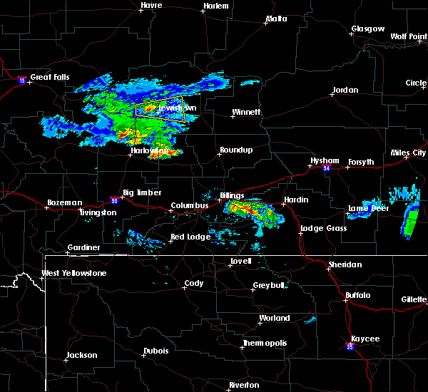 At 915 pm mdt, a severe thunderstorm was located near lewistown, moving east at 25 mph (radar indicated). Hazards include 60 mph wind gusts and quarter size hail. Hail damage to vehicles is expected. expect wind damage to roofs, siding, and trees. Locations impacted include, lewistown, giltedge, heath, forestgrove and glengarry. At 915 pm mdt, a severe thunderstorm was located near lewistown, moving east at 25 mph (radar indicated). Hazards include 60 mph wind gusts and quarter size hail. Hail damage to vehicles is expected. expect wind damage to roofs, siding, and trees. Locations impacted include, lewistown, giltedge, heath, forestgrove and glengarry.
|
| 7/17/2016 8:57 PM MDT |
 At 857 pm mdt, a severe thunderstorm was located 8 miles north of moore, or 12 miles west of lewistown, moving east at 25 mph (radar indicated). Hazards include 60 mph wind gusts and quarter size hail. Hail damage to vehicles is expected. Expect wind damage to roofs, siding, and trees. At 857 pm mdt, a severe thunderstorm was located 8 miles north of moore, or 12 miles west of lewistown, moving east at 25 mph (radar indicated). Hazards include 60 mph wind gusts and quarter size hail. Hail damage to vehicles is expected. Expect wind damage to roofs, siding, and trees.
|
| 6/10/2016 7:36 PM MDT | Quarter sized hail reported 15.8 miles S of Lewistown, MT, hail up to 1 inch in diameter. small tree branches around 1 inch broken off. |
| 6/9/2016 3:14 PM MDT | Ping Pong Ball sized hail reported 30.6 miles WSW of Lewistown, MT |
| 6/9/2016 3:14 PM MDT | Storm damage reported in fergus county MT, 30.6 miles WSW of Lewistown, MT |
| 6/9/2016 3:00 PM MDT | Golf Ball sized hail reported 21.2 miles WSW of Lewistown, MT |
| 10/21/2014 3:22 PM MDT | Storm damage reported in fergus county MT, 2.1 miles ENE of Lewistown, MT |
| 6/3/2014 2:40 PM MDT | Half Dollar sized hail reported 13.4 miles NW of Lewistown, MT |
| 9/6/2013 4:35 PM MDT | Quarter sized hail reported 8.2 miles ESE of Lewistown, MT, hail up to quarter size...along with heavy rain. 1.75 inches of rainfall with this storm. |
| 6/19/2013 8:20 PM MDT | 62 mph thunderstorm wind gust reported at lewistown municipal airport asos at 820 pm md in fergus county MT, 2.1 miles ENE of Lewistown, MT |
| 6/19/2013 7:58 PM MDT | Three inch tree branch broken by estimated 45 mph west win in fergus county MT, 0.2 miles N of Lewistown, MT |
| 6/19/2013 7:54 PM MDT | Asos measured 81 mph thunderstorm wind gust. lewistown sheriff reports numerous trees dow in fergus county MT, 2.1 miles ENE of Lewistown, MT |
| 7/26/2012 6:52 PM MDT | 65 mph thunderstorm wind gust occurred between 552 pm and 652 pm mdt at judith peak raws site. 0.34 inches of rain also fell during this tim in fergus county MT, 11.7 miles SW of Lewistown, MT |
| 6/2/2012 4:36 PM MDT | Quarter sized hail reported 15.5 miles WNW of Lewistown, MT, hail up to quarter size just ending. |
| 6/2/2012 4:34 PM MDT | Quarter sized hail reported 15.5 miles WNW of Lewistown, MT, estimated hail up to quater size. |
| 1/1/0001 12:00 AM | Golf Ball sized hail reported 3.3 miles E of Lewistown, MT, some hail stones up to golf ball sized. heavy rain but not much wind. |
Hail Maps for Lewistown, MT
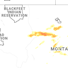
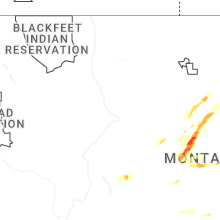


Connect with Interactive Hail Maps