

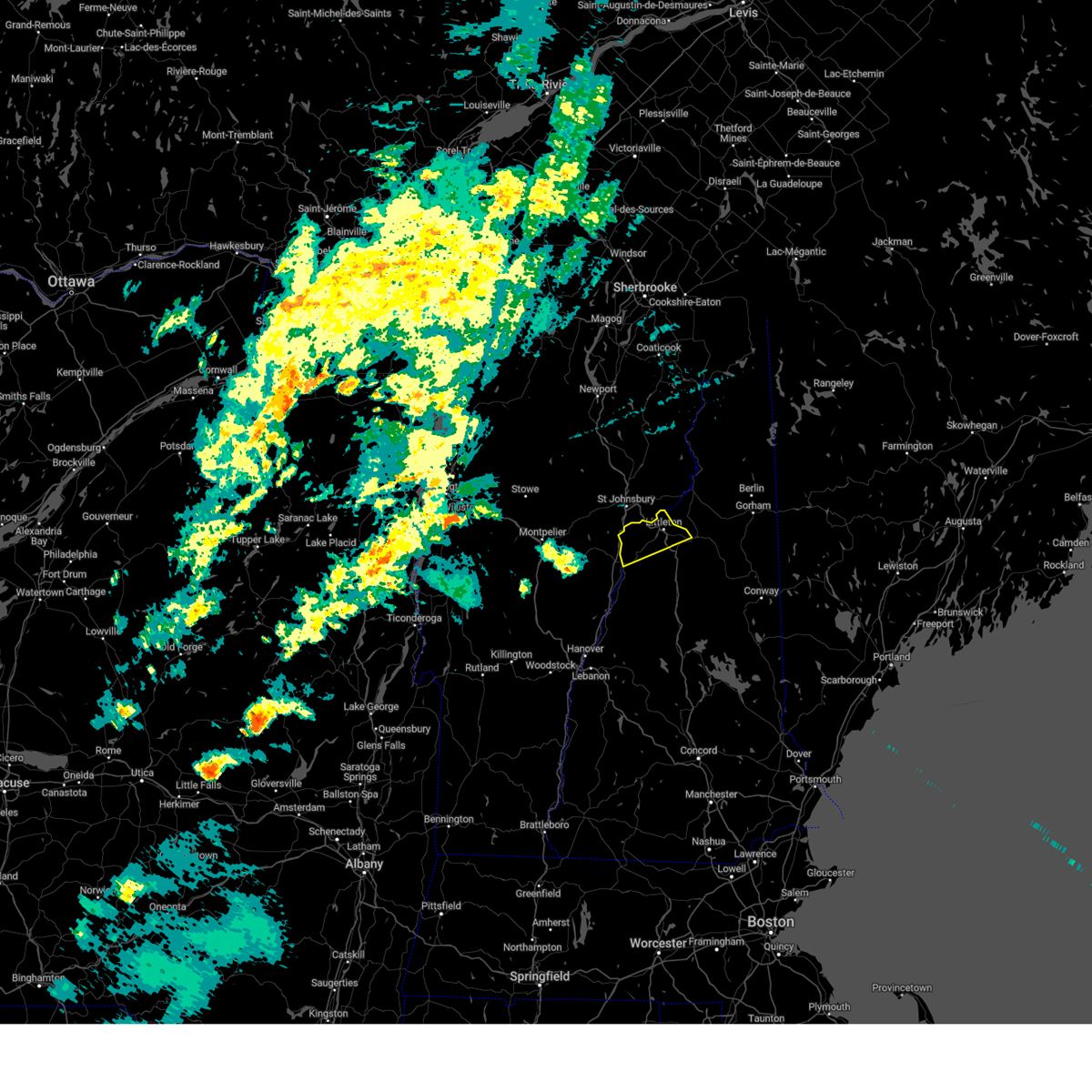
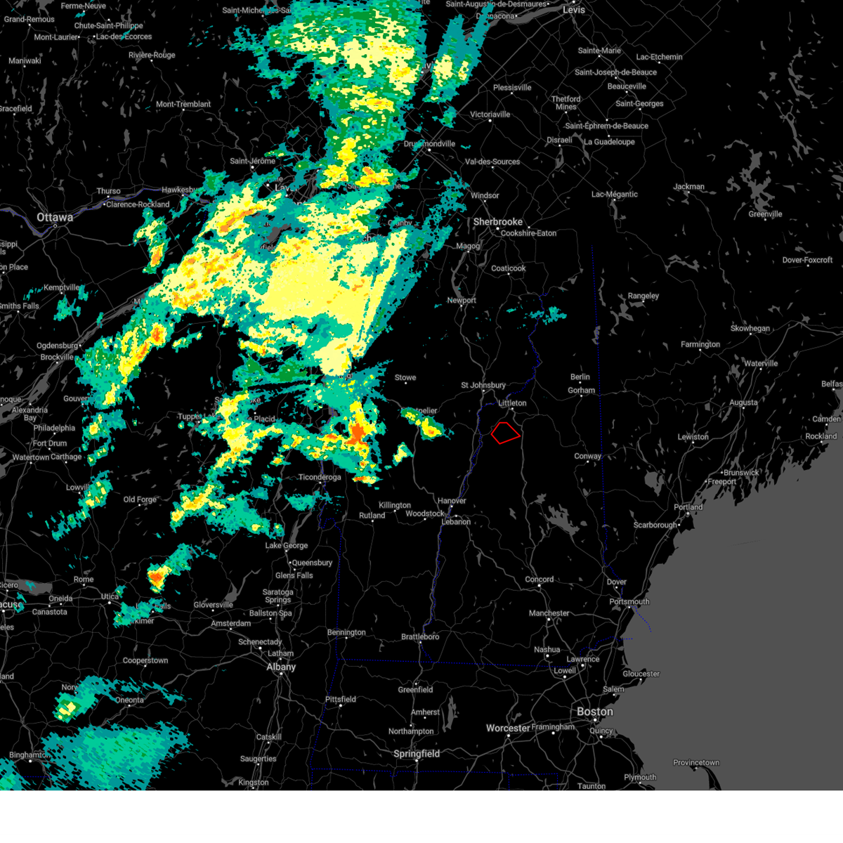
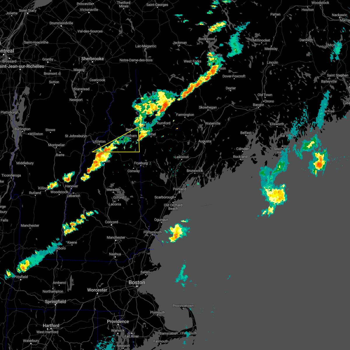
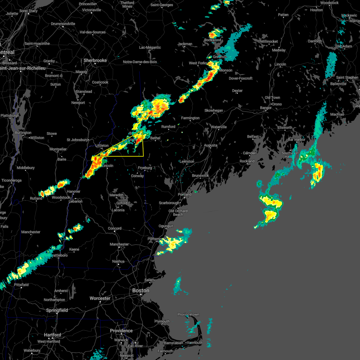
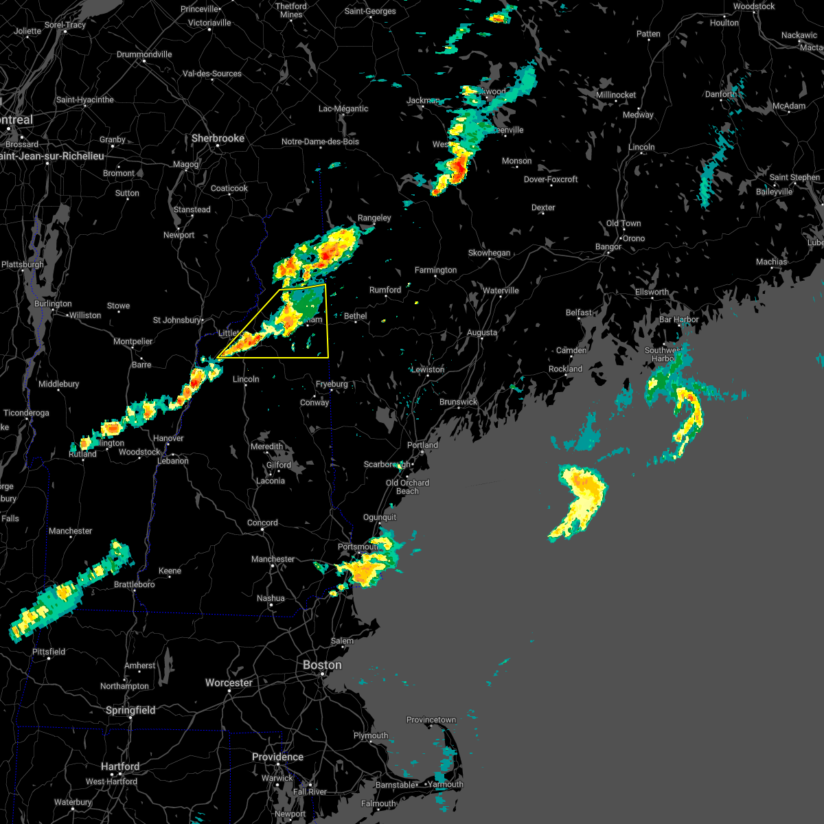
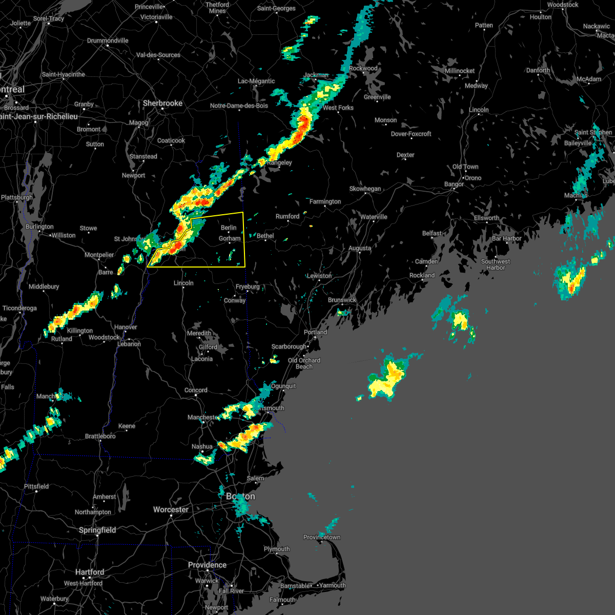
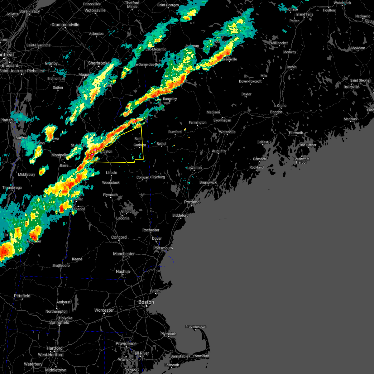
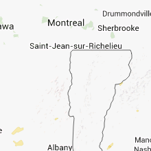
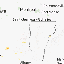
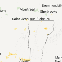
Hail Map for Lisbon, NH
The Lisbon, NH area has had 3 reports of on-the-ground hail by trained spotters, and has been under severe weather warnings 4 times during the past 12 months. Doppler radar has detected hail at or near Lisbon, NH on 16 occasions.
| Name: | Lisbon, NH |
| Where Located: | 67.5 miles ESE of Burlington, VT |
| Map: | Google Map for Lisbon, NH |
| Population: | 980 |
| Housing Units: | 472 |
| More Info: | Search Google for Lisbon, NH |
1
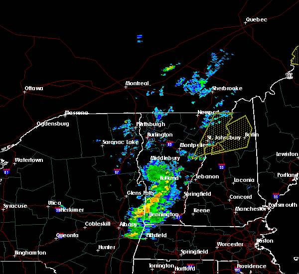
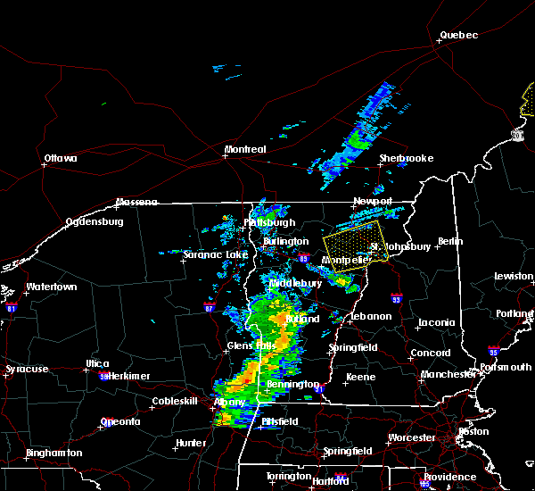
The Top Recent Hail Date for Lisbon, NH is Wednesday, June 19, 2024 (5th out of 16)

Hail and Wind Damage Spotted near Lisbon, NH
| Date / Time | Report Details |
|---|---|
| 8/4/2024 7:26 PM EDT | Large tree fell on a garage on pearl lake rd. numerous reports of downed trees across south lisbo in grafton county NH, 3.5 miles NNW of Lisbon, NH |
| 7/10/2024 7:54 PM EDT |
 Svrgyx the national weather service in gray maine has issued a * severe thunderstorm warning for, north central grafton county in northern new hampshire, * until 845 pm edt. * at 753 pm edt, a severe thunderstorm was located 12 miles northwest of haverhill, or 18 miles southwest of littleton, moving northeast at 30 mph (radar indicated). Hazards include 60 mph wind gusts. expect damage to roofs, siding, and trees Svrgyx the national weather service in gray maine has issued a * severe thunderstorm warning for, north central grafton county in northern new hampshire, * until 845 pm edt. * at 753 pm edt, a severe thunderstorm was located 12 miles northwest of haverhill, or 18 miles southwest of littleton, moving northeast at 30 mph (radar indicated). Hazards include 60 mph wind gusts. expect damage to roofs, siding, and trees
|
| 7/10/2024 7:10 PM EDT |
 The storm which prompted the warning has weakened below severe limits, and has exited the warned area. therefore, the warning will be allowed to expire. however, heavy rain is still possible with this thunderstorm. a tornado watch remains in effect until midnight edt for northern new hampshire. remember, a tornado warning still remains in effect. The storm which prompted the warning has weakened below severe limits, and has exited the warned area. therefore, the warning will be allowed to expire. however, heavy rain is still possible with this thunderstorm. a tornado watch remains in effect until midnight edt for northern new hampshire. remember, a tornado warning still remains in effect.
|
| 7/10/2024 6:54 PM EDT |
 At 653 pm edt, a severe thunderstorm capable of producing a tornado was located 8 miles northeast of haverhill, or 12 miles south of littleton, moving northeast at 35 mph (radar indicated rotation). Hazards include tornado. Flying debris will be dangerous to those caught without shelter. mobile homes will be damaged or destroyed. damage to roofs, windows, and vehicles will occur. tree damage is likely. this dangerous storm will be near, lincoln and franconia around 700 pm edt. Other locations impacted by this tornadic thunderstorm include landaff, easton, sugar hill, lisbon, bath, and benton. At 653 pm edt, a severe thunderstorm capable of producing a tornado was located 8 miles northeast of haverhill, or 12 miles south of littleton, moving northeast at 35 mph (radar indicated rotation). Hazards include tornado. Flying debris will be dangerous to those caught without shelter. mobile homes will be damaged or destroyed. damage to roofs, windows, and vehicles will occur. tree damage is likely. this dangerous storm will be near, lincoln and franconia around 700 pm edt. Other locations impacted by this tornadic thunderstorm include landaff, easton, sugar hill, lisbon, bath, and benton.
|
| 7/10/2024 6:38 PM EDT |
 Torgyx the national weather service in gray maine has issued a * tornado warning for, north central grafton county in northern new hampshire, * until 715 pm edt. * at 637 pm edt, a severe thunderstorm capable of producing a tornado was located over haverhill, or 19 miles southwest of littleton, moving northeast at 35 mph (radar indicated rotation). Hazards include tornado. Flying debris will be dangerous to those caught without shelter. mobile homes will be damaged or destroyed. damage to roofs, windows, and vehicles will occur. tree damage is likely. this dangerous storm will be near, haverhill and franconia around 645 pm edt. lincoln around 650 pm edt. Other locations impacted by this tornadic thunderstorm include easton, landaff, bath, sugar hill, lisbon, benton, and lyman. Torgyx the national weather service in gray maine has issued a * tornado warning for, north central grafton county in northern new hampshire, * until 715 pm edt. * at 637 pm edt, a severe thunderstorm capable of producing a tornado was located over haverhill, or 19 miles southwest of littleton, moving northeast at 35 mph (radar indicated rotation). Hazards include tornado. Flying debris will be dangerous to those caught without shelter. mobile homes will be damaged or destroyed. damage to roofs, windows, and vehicles will occur. tree damage is likely. this dangerous storm will be near, haverhill and franconia around 645 pm edt. lincoln around 650 pm edt. Other locations impacted by this tornadic thunderstorm include easton, landaff, bath, sugar hill, lisbon, benton, and lyman.
|
| 6/30/2024 2:15 PM EDT |
 Svrgyx the national weather service in gray maine has issued a * severe thunderstorm warning for, northeastern grafton county in northern new hampshire, * until 300 pm edt. * at 214 pm edt, a severe thunderstorm was located near haverhill, or 16 miles southwest of littleton, moving east at 40 mph (radar indicated). Hazards include 60 mph wind gusts and quarter size hail. Hail damage to vehicles is expected. Expect wind damage to roofs, siding, and trees. Svrgyx the national weather service in gray maine has issued a * severe thunderstorm warning for, northeastern grafton county in northern new hampshire, * until 300 pm edt. * at 214 pm edt, a severe thunderstorm was located near haverhill, or 16 miles southwest of littleton, moving east at 40 mph (radar indicated). Hazards include 60 mph wind gusts and quarter size hail. Hail damage to vehicles is expected. Expect wind damage to roofs, siding, and trees.
|
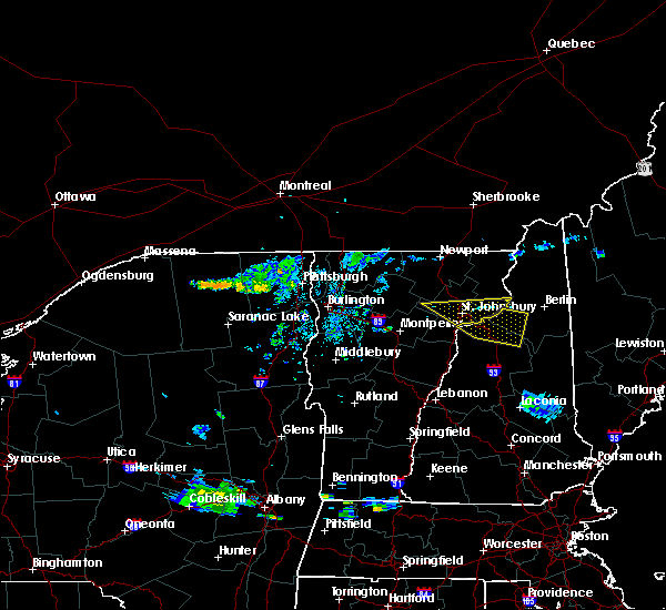
| 6/19/2024 3:55 PM EDT |
 At 355 pm edt, a severe thunderstorm was located near haverhill, or 16 miles west of lincoln, moving southeast at 15 mph (radar indicated). Hazards include 60 mph wind gusts and quarter size hail. Hail damage to vehicles is expected. expect wind damage to roofs, siding, and trees. locations impacted include, bethlehem, lincoln, haverhill, franconia, woodstock, carroll, lisbon, bath, benton, easton, sugar hill, and landaff. this also includes, franconia notch, cannon mountain, north twin mountain, franconia ridge, and mount lafayette. This includes interstate 93 between mile markers 101 and 117. At 355 pm edt, a severe thunderstorm was located near haverhill, or 16 miles west of lincoln, moving southeast at 15 mph (radar indicated). Hazards include 60 mph wind gusts and quarter size hail. Hail damage to vehicles is expected. expect wind damage to roofs, siding, and trees. locations impacted include, bethlehem, lincoln, haverhill, franconia, woodstock, carroll, lisbon, bath, benton, easton, sugar hill, and landaff. this also includes, franconia notch, cannon mountain, north twin mountain, franconia ridge, and mount lafayette. This includes interstate 93 between mile markers 101 and 117.
|
| 6/19/2024 3:45 PM EDT | Multiple trees and wires reported down in sugar hill... n in grafton county NH, 4.9 miles W of Lisbon, NH |
| 6/19/2024 3:33 PM EDT | Ping Pong Ball sized hail reported 1.8 miles SSW of Lisbon, NH, chaser reports period of ping pong sized hail. |
| 6/19/2024 3:24 PM EDT |
 Svrgyx the national weather service in gray maine has issued a * severe thunderstorm warning for, southwestern coos county in northern new hampshire, northeastern grafton county in northern new hampshire, * until 415 pm edt. * at 324 pm edt, a severe thunderstorm was located 7 miles southwest of littleton, moving east at 10 mph (radar indicated). Hazards include 60 mph wind gusts and quarter size hail. Hail damage to vehicles is expected. Expect wind damage to roofs, siding, and trees. Svrgyx the national weather service in gray maine has issued a * severe thunderstorm warning for, southwestern coos county in northern new hampshire, northeastern grafton county in northern new hampshire, * until 415 pm edt. * at 324 pm edt, a severe thunderstorm was located 7 miles southwest of littleton, moving east at 10 mph (radar indicated). Hazards include 60 mph wind gusts and quarter size hail. Hail damage to vehicles is expected. Expect wind damage to roofs, siding, and trees.
|
| 6/19/2024 3:20 PM EDT | Multiple trees and wires reported down in lyman... n in grafton county NH, 5.7 miles S of Lisbon, NH |
| 9/7/2023 10:52 PM EDT |
 At 1051 pm edt, severe thunderstorms were located along a line extending from 20 miles northwest of littleton to 7 miles north of hanover, moving north at 85 mph (radar indicated). Hazards include 60 mph wind gusts and quarter size hail. Expect wind damage to trees and power lines. minor hail damage to vehicles is possible. locations impacted include, franklin, littleton, bethlehem, lincoln, new london, plymouth, grafton, hanover, haverhill, enfield, canaan, bradford, danbury, franconia, groton, woodstock, piermont, newport, walpole and alstead. hail threat, radar indicated max hail size, 1. 00 in wind threat, observed max wind gust, 60 mph. At 1051 pm edt, severe thunderstorms were located along a line extending from 20 miles northwest of littleton to 7 miles north of hanover, moving north at 85 mph (radar indicated). Hazards include 60 mph wind gusts and quarter size hail. Expect wind damage to trees and power lines. minor hail damage to vehicles is possible. locations impacted include, franklin, littleton, bethlehem, lincoln, new london, plymouth, grafton, hanover, haverhill, enfield, canaan, bradford, danbury, franconia, groton, woodstock, piermont, newport, walpole and alstead. hail threat, radar indicated max hail size, 1. 00 in wind threat, observed max wind gust, 60 mph.
|
| 9/7/2023 10:18 PM EDT |
 At 1018 pm edt, severe thunderstorms were located along a line extending from 17 miles northwest of hanover to near charlestown, moving north at 85 mph (radar indicated). Hazards include 60 mph wind gusts and quarter size hail. Expect wind damage to trees and power lines. Minor hail damage to vehicles is possible. At 1018 pm edt, severe thunderstorms were located along a line extending from 17 miles northwest of hanover to near charlestown, moving north at 85 mph (radar indicated). Hazards include 60 mph wind gusts and quarter size hail. Expect wind damage to trees and power lines. Minor hail damage to vehicles is possible.
|
| 7/13/2023 8:02 PM EDT |
 At 802 pm edt, severe thunderstorms were located along a line extending from 11 miles west of littleton to 9 miles southwest of lebanon, moving northeast at 65 mph (radar indicated). Hazards include 60 mph wind gusts. expect damage to roofs, siding, and trees At 802 pm edt, severe thunderstorms were located along a line extending from 11 miles west of littleton to 9 miles southwest of lebanon, moving northeast at 65 mph (radar indicated). Hazards include 60 mph wind gusts. expect damage to roofs, siding, and trees
|
| 7/4/2023 7:11 PM EDT |
 At 711 pm edt, a severe thunderstorm was located over haverhill, or 18 miles southwest of littleton, moving southeast at 20 mph (radar indicated). Hazards include 60 mph wind gusts and penny size hail. expect damage to roofs, siding, and trees At 711 pm edt, a severe thunderstorm was located over haverhill, or 18 miles southwest of littleton, moving southeast at 20 mph (radar indicated). Hazards include 60 mph wind gusts and penny size hail. expect damage to roofs, siding, and trees
|
| 7/25/2022 3:20 PM EDT |
 The severe thunderstorm warning for southeastern coos, northeastern grafton and northeastern carroll counties will expire at 330 pm edt, the storms which prompted the warning have weakened below severe limits, and have exited the warned area. therefore, the warning will be allowed to expire. however gusty winds are still possible with these thunderstorms. a severe thunderstorm watch remains in effect until 800 pm edt for northern new hampshire. The severe thunderstorm warning for southeastern coos, northeastern grafton and northeastern carroll counties will expire at 330 pm edt, the storms which prompted the warning have weakened below severe limits, and have exited the warned area. therefore, the warning will be allowed to expire. however gusty winds are still possible with these thunderstorms. a severe thunderstorm watch remains in effect until 800 pm edt for northern new hampshire.
|
| 7/25/2022 3:12 PM EDT |
 At 311 pm edt, severe thunderstorms were located along a line extending from 7 miles southeast of berlin to 6 miles east of bethlehem, moving east at 35 mph (radar indicated). Hazards include 60 mph wind gusts and quarter size hail. Hail damage to vehicles is expected. expect wind damage to roofs, siding, and trees. locations impacted include, berlin, bethlehem, franconia, pinkham notch, mount washington, carroll, gorham, lisbon, jefferson, jackson, chatham, sugar hill, shelburne, randolph, whitefield and hart`s location. this includes interstate 93 between mile markers 113 and 118. hail threat, radar indicated max hail size, 1. 00 in wind threat, radar indicated max wind gust, 60 mph. At 311 pm edt, severe thunderstorms were located along a line extending from 7 miles southeast of berlin to 6 miles east of bethlehem, moving east at 35 mph (radar indicated). Hazards include 60 mph wind gusts and quarter size hail. Hail damage to vehicles is expected. expect wind damage to roofs, siding, and trees. locations impacted include, berlin, bethlehem, franconia, pinkham notch, mount washington, carroll, gorham, lisbon, jefferson, jackson, chatham, sugar hill, shelburne, randolph, whitefield and hart`s location. this includes interstate 93 between mile markers 113 and 118. hail threat, radar indicated max hail size, 1. 00 in wind threat, radar indicated max wind gust, 60 mph.
|
| 7/25/2022 2:54 PM EDT |
 At 254 pm edt, severe thunderstorms were located along a line extending from 8 miles southwest of berlin to bethlehem, moving east at 25 mph (radar indicated). Hazards include 60 mph wind gusts and quarter size hail. Hail damage to vehicles is expected. expect wind damage to roofs, siding, and trees. locations impacted include, berlin, littleton, lancaster, bethlehem, franconia, pinkham notch, mount washington, carroll, gorham, lisbon, jefferson, dalton, jackson, chatham, whitefield, sugar hill, milan, shelburne, randolph and stark. this includes interstate 93 between mile markers 113 and 122. hail threat, radar indicated max hail size, 1. 00 in wind threat, radar indicated max wind gust, 60 mph. At 254 pm edt, severe thunderstorms were located along a line extending from 8 miles southwest of berlin to bethlehem, moving east at 25 mph (radar indicated). Hazards include 60 mph wind gusts and quarter size hail. Hail damage to vehicles is expected. expect wind damage to roofs, siding, and trees. locations impacted include, berlin, littleton, lancaster, bethlehem, franconia, pinkham notch, mount washington, carroll, gorham, lisbon, jefferson, dalton, jackson, chatham, whitefield, sugar hill, milan, shelburne, randolph and stark. this includes interstate 93 between mile markers 113 and 122. hail threat, radar indicated max hail size, 1. 00 in wind threat, radar indicated max wind gust, 60 mph.
|
| 7/25/2022 2:26 PM EDT |
 At 225 pm edt, a severe thunderstorm was located near bethlehem, moving east at 40 mph (radar indicated). Hazards include 60 mph wind gusts and quarter size hail. Hail damage to vehicles is expected. Expect wind damage to roofs, siding, and trees. At 225 pm edt, a severe thunderstorm was located near bethlehem, moving east at 40 mph (radar indicated). Hazards include 60 mph wind gusts and quarter size hail. Hail damage to vehicles is expected. Expect wind damage to roofs, siding, and trees.
|
| 7/21/2022 2:39 PM EDT |
 The severe thunderstorm warning for northeastern grafton county will expire at 245 pm edt, the storm which prompted the warning has moved out of the area. therefore, the warning will be allowed to expire. however small hail and gusty winds are still possible with this thunderstorm. a severe thunderstorm watch remains in effect until 800 pm edt for northern new hampshire. The severe thunderstorm warning for northeastern grafton county will expire at 245 pm edt, the storm which prompted the warning has moved out of the area. therefore, the warning will be allowed to expire. however small hail and gusty winds are still possible with this thunderstorm. a severe thunderstorm watch remains in effect until 800 pm edt for northern new hampshire.
|
| 7/21/2022 2:31 PM EDT |
 At 231 pm edt, a severe thunderstorm was located 8 miles east of haverhill, or 11 miles west of lincoln, moving northeast at 35 mph (radar indicated). Hazards include 60 mph wind gusts and quarter size hail. Hail damage to vehicles is expected. expect wind damage to roofs, siding, and trees. locations impacted include, bethlehem, lincoln, haverhill, franconia, piermont, woodstock, lisbon, bath, benton, easton, sugar hill and landaff. this includes interstate 93 between mile markers 100 and 121. hail threat, radar indicated max hail size, 1. 00 in wind threat, radar indicated max wind gust, 60 mph. At 231 pm edt, a severe thunderstorm was located 8 miles east of haverhill, or 11 miles west of lincoln, moving northeast at 35 mph (radar indicated). Hazards include 60 mph wind gusts and quarter size hail. Hail damage to vehicles is expected. expect wind damage to roofs, siding, and trees. locations impacted include, bethlehem, lincoln, haverhill, franconia, piermont, woodstock, lisbon, bath, benton, easton, sugar hill and landaff. this includes interstate 93 between mile markers 100 and 121. hail threat, radar indicated max hail size, 1. 00 in wind threat, radar indicated max wind gust, 60 mph.
|
| 7/21/2022 2:20 PM EDT |
 At 220 pm edt, a severe thunderstorm was located over piermont, or 18 miles west of lincoln, moving northeast at 45 mph (radar indicated). Hazards include 60 mph wind gusts and quarter size hail. Hail damage to vehicles is expected. expect wind damage to roofs, siding, and trees. locations impacted include, littleton, bethlehem, lincoln, haverhill, franconia, piermont, woodstock, lisbon, bath, dalton, benton, easton, monroe, landaff, lyman, sugar hill and orford. This includes interstate 93 between mile markers 100 and 131. At 220 pm edt, a severe thunderstorm was located over piermont, or 18 miles west of lincoln, moving northeast at 45 mph (radar indicated). Hazards include 60 mph wind gusts and quarter size hail. Hail damage to vehicles is expected. expect wind damage to roofs, siding, and trees. locations impacted include, littleton, bethlehem, lincoln, haverhill, franconia, piermont, woodstock, lisbon, bath, dalton, benton, easton, monroe, landaff, lyman, sugar hill and orford. This includes interstate 93 between mile markers 100 and 131.
|
| 7/21/2022 1:46 PM EDT |
 At 146 pm edt, a severe thunderstorm was located 7 miles northwest of haverhill, or 22 miles southwest of littleton, moving northeast at 30 mph (radar indicated). Hazards include 60 mph wind gusts and quarter size hail. Hail damage to vehicles is expected. Expect wind damage to roofs, siding, and trees. At 146 pm edt, a severe thunderstorm was located 7 miles northwest of haverhill, or 22 miles southwest of littleton, moving northeast at 30 mph (radar indicated). Hazards include 60 mph wind gusts and quarter size hail. Hail damage to vehicles is expected. Expect wind damage to roofs, siding, and trees.
|
| 9/15/2021 2:31 PM EDT |
 At 231 pm edt, severe thunderstorms were located along a line extending from 8 miles west of littleton to near lebanon, moving east at 30 mph (radar indicated). Hazards include 60 mph wind gusts and nickel size hail. expect damage to roofs, siding, and trees At 231 pm edt, severe thunderstorms were located along a line extending from 8 miles west of littleton to near lebanon, moving east at 30 mph (radar indicated). Hazards include 60 mph wind gusts and nickel size hail. expect damage to roofs, siding, and trees
|
| 9/15/2021 2:18 PM EDT |
 At 218 pm edt, a severe thunderstorm was located 11 miles west of littleton, moving east at 45 mph (radar indicated). Hazards include 60 mph wind gusts and quarter size hail. Hail damage to vehicles is expected. Expect wind damage to roofs, siding, and trees. At 218 pm edt, a severe thunderstorm was located 11 miles west of littleton, moving east at 45 mph (radar indicated). Hazards include 60 mph wind gusts and quarter size hail. Hail damage to vehicles is expected. Expect wind damage to roofs, siding, and trees.
|
| 5/26/2021 4:51 PM EDT |
 At 450 pm edt, a severe thunderstorm was located 21 miles north of haverhill, or 21 miles west of littleton, moving east at 50 mph. this storm has a history of producing wind damage in vermont (radar indicated). Hazards include 60 mph wind gusts and penny size hail. expect damage to roofs, siding, and trees At 450 pm edt, a severe thunderstorm was located 21 miles north of haverhill, or 21 miles west of littleton, moving east at 50 mph. this storm has a history of producing wind damage in vermont (radar indicated). Hazards include 60 mph wind gusts and penny size hail. expect damage to roofs, siding, and trees
|
| 10/10/2020 7:21 PM EDT |
 At 721 pm edt, a severe thunderstorm was located 8 miles southwest of franconia, or 12 miles southwest of littleton, moving east at 50 mph (radar indicated). Hazards include 60 mph wind gusts and penny size hail. expect damage to roofs, siding, and trees At 721 pm edt, a severe thunderstorm was located 8 miles southwest of franconia, or 12 miles southwest of littleton, moving east at 50 mph (radar indicated). Hazards include 60 mph wind gusts and penny size hail. expect damage to roofs, siding, and trees
|
| 7/8/2020 5:19 PM EDT |
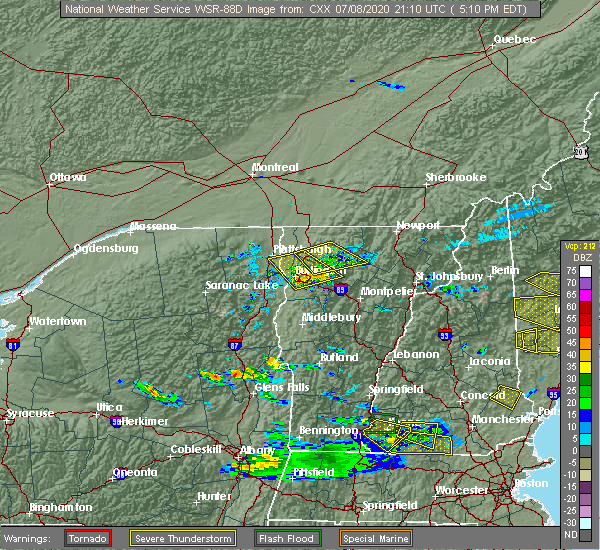 At 519 pm edt, a severe thunderstorm was located near bethlehem, moving east at 20 mph (radar indicated). Hazards include 60 mph wind gusts and quarter size hail. Hail damage to vehicles is expected. Expect wind damage to roofs, siding, and trees. At 519 pm edt, a severe thunderstorm was located near bethlehem, moving east at 20 mph (radar indicated). Hazards include 60 mph wind gusts and quarter size hail. Hail damage to vehicles is expected. Expect wind damage to roofs, siding, and trees.
|
| 5/29/2020 8:30 PM EDT | Trees down on wire in grafton county NH, 5.4 miles W of Lisbon, NH |
| 5/29/2020 8:27 PM EDT | Trees down on wire in grafton county NH, 2.6 miles N of Lisbon, NH |
| 5/29/2020 8:27 PM EDT | Trees down on wire in grafton county NH, 3.6 miles NNE of Lisbon, NH |
| 5/29/2020 8:26 PM EDT |
 At 825 pm edt, severe thunderstorms were located along a line extending from 19 miles northwest of franconia to 6 miles southwest of littleton to 8 miles northwest of lincoln to 7 miles west of woodstock, moving northeast at 45 mph (radar indicated). Hazards include 60 mph wind gusts. expect damage to roofs, siding, and trees At 825 pm edt, severe thunderstorms were located along a line extending from 19 miles northwest of franconia to 6 miles southwest of littleton to 8 miles northwest of lincoln to 7 miles west of woodstock, moving northeast at 45 mph (radar indicated). Hazards include 60 mph wind gusts. expect damage to roofs, siding, and trees
|
| 5/27/2020 3:06 PM EDT | Multiple trees downed on wires along the intersection of center district road and route 117 as well as on birches roa in grafton county NH, 4.4 miles W of Lisbon, NH |
| 7/30/2019 7:15 PM EDT |
 At 714 pm edt, a severe thunderstorm was located over franconia, or near littleton, moving northeast at 20 mph (radar indicated). Hazards include 60 mph wind gusts and quarter size hail. Hail damage to vehicles is expected. expect wind damage to roofs, siding, and trees. locations impacted include, littleton, bethlehem, franconia, lisbon, bath, dalton, sugar hill, landaff and whitefield. This includes interstate 93 between mile markers 117 and 125. At 714 pm edt, a severe thunderstorm was located over franconia, or near littleton, moving northeast at 20 mph (radar indicated). Hazards include 60 mph wind gusts and quarter size hail. Hail damage to vehicles is expected. expect wind damage to roofs, siding, and trees. locations impacted include, littleton, bethlehem, franconia, lisbon, bath, dalton, sugar hill, landaff and whitefield. This includes interstate 93 between mile markers 117 and 125.
|
| 7/30/2019 6:58 PM EDT |
 At 658 pm edt, a severe thunderstorm was located 8 miles west of franconia, or 9 miles southwest of littleton, moving northeast at 25 mph (radar indicated). Hazards include 60 mph wind gusts and quarter size hail. Hail damage to vehicles is expected. Expect wind damage to roofs, siding, and trees. At 658 pm edt, a severe thunderstorm was located 8 miles west of franconia, or 9 miles southwest of littleton, moving northeast at 25 mph (radar indicated). Hazards include 60 mph wind gusts and quarter size hail. Hail damage to vehicles is expected. Expect wind damage to roofs, siding, and trees.
|
| 9/3/2018 7:48 PM EDT |
 At 748 pm edt, a severe thunderstorm was located 9 miles northwest of littleton, or near saint johnsbury vermont, moving east at 30 mph (radar indicated). Hazards include 60 mph wind gusts and penny size hail. expect damage to roofs, siding, and trees At 748 pm edt, a severe thunderstorm was located 9 miles northwest of littleton, or near saint johnsbury vermont, moving east at 30 mph (radar indicated). Hazards include 60 mph wind gusts and penny size hail. expect damage to roofs, siding, and trees
|
| 7/1/2018 1:50 AM EDT |
 At 149 am edt, a severe thunderstorm was located 14 miles west of littleton, moving southeast at 45 mph (radar indicated). Hazards include 60 mph wind gusts and penny size hail. expect damage to roofs, siding, and trees At 149 am edt, a severe thunderstorm was located 14 miles west of littleton, moving southeast at 45 mph (radar indicated). Hazards include 60 mph wind gusts and penny size hail. expect damage to roofs, siding, and trees
|
| 6/18/2018 3:50 PM EDT |
 At 350 pm edt, a severe thunderstorm was located 10 miles north of haverhill, or 18 miles southwest of littleton, moving southeast at 45 mph (radar indicated). Hazards include 60 mph wind gusts and penny size hail. expect damage to roofs, siding, and trees At 350 pm edt, a severe thunderstorm was located 10 miles north of haverhill, or 18 miles southwest of littleton, moving southeast at 45 mph (radar indicated). Hazards include 60 mph wind gusts and penny size hail. expect damage to roofs, siding, and trees
|
| 6/18/2018 3:23 PM EDT | Trees and wires dow in grafton county NH, 7.1 miles NW of Lisbon, NH |
| 6/18/2018 3:23 PM EDT | Trees and wires dow in grafton county NH, 7.1 miles NW of Lisbon, NH |
| 6/18/2018 3:12 PM EDT |
 At 312 pm edt, a severe thunderstorm capable of producing a tornado was located 10 miles northeast of haverhill, or 13 miles southwest of littleton, moving east at 30 mph (radar indicated rotation). Hazards include tornado. Flying debris will be dangerous to those caught without shelter. mobile homes will be damaged or destroyed. damage to roofs, windows, and vehicles will occur. tree damage is likely. this dangerous storm will be near, woodstock around 330 pm edt. other locations impacted by this tornadic thunderstorm include easton, landaff, benton, bath, lisbon, waterville valley, livermore, sugar hill and thornton. this also includes, franconia notch, cannon mountain, franconia ridge, mount lafayette, and amc greenleaf hut. This includes interstate 93 between mile markers 96 and 110. At 312 pm edt, a severe thunderstorm capable of producing a tornado was located 10 miles northeast of haverhill, or 13 miles southwest of littleton, moving east at 30 mph (radar indicated rotation). Hazards include tornado. Flying debris will be dangerous to those caught without shelter. mobile homes will be damaged or destroyed. damage to roofs, windows, and vehicles will occur. tree damage is likely. this dangerous storm will be near, woodstock around 330 pm edt. other locations impacted by this tornadic thunderstorm include easton, landaff, benton, bath, lisbon, waterville valley, livermore, sugar hill and thornton. this also includes, franconia notch, cannon mountain, franconia ridge, mount lafayette, and amc greenleaf hut. This includes interstate 93 between mile markers 96 and 110.
|
| 6/18/2018 3:09 PM EDT |
 At 308 pm edt, a severe thunderstorm was located 10 miles southwest of franconia, or 12 miles southwest of littleton, moving southeast at 30 mph (radar indicated). Hazards include 60 mph wind gusts. expect damage to roofs, siding, and trees At 308 pm edt, a severe thunderstorm was located 10 miles southwest of franconia, or 12 miles southwest of littleton, moving southeast at 30 mph (radar indicated). Hazards include 60 mph wind gusts. expect damage to roofs, siding, and trees
|
| 5/4/2018 9:23 PM EDT |
 At 922 pm edt, severe thunderstorms were located along a line extending from bethlehem to 8 miles west of lincoln to 6 miles southeast of piermont to 6 miles northeast of hanover, moving east at 60 mph (radar indicated). Hazards include 60 mph wind gusts. Expect damage to roofs, siding, and trees. locations impacted include, lebanon, lincoln, plymouth, grafton, hanover, haverhill, enfield, canaan, holderness, ashland, danbury, franconia, groton, woodstock, piermont, sandwich, bristol, grantham, lyme and lisbon. this also includes, franconia notch, mount moosilauke, rumney rocks, cannon mountain, and franconia ridge. this includes the following highways, interstate 89 between mile markers 47 and 60. Interstate 93 between mile markers 75 and 115. At 922 pm edt, severe thunderstorms were located along a line extending from bethlehem to 8 miles west of lincoln to 6 miles southeast of piermont to 6 miles northeast of hanover, moving east at 60 mph (radar indicated). Hazards include 60 mph wind gusts. Expect damage to roofs, siding, and trees. locations impacted include, lebanon, lincoln, plymouth, grafton, hanover, haverhill, enfield, canaan, holderness, ashland, danbury, franconia, groton, woodstock, piermont, sandwich, bristol, grantham, lyme and lisbon. this also includes, franconia notch, mount moosilauke, rumney rocks, cannon mountain, and franconia ridge. this includes the following highways, interstate 89 between mile markers 47 and 60. Interstate 93 between mile markers 75 and 115.
|
| 5/4/2018 9:10 PM EDT |
 At 910 pm edt, severe thunderstorms were located along a line extending from 17 miles south of jackman to 10 miles south of eustis to near berlin to near mount washington, moving east at 50 mph (radar indicated). Hazards include 60 mph wind gusts. Expect damage to roofs, siding, and trees. locations impacted include, berlin, littleton, lancaster, bethlehem, colebrook, franconia, errol, dixville, stratford, pittsburg, carroll, lisbon, jefferson, dalton, columbia, dummer, clarksville, whitefield, northumberland and monroe. this also includes, umbagog lake state park, kilkenny ridge trail, pontook reservoir, dixville notch state park, and percy peaks. This includes interstate 93 between mile markers 112 and 131. At 910 pm edt, severe thunderstorms were located along a line extending from 17 miles south of jackman to 10 miles south of eustis to near berlin to near mount washington, moving east at 50 mph (radar indicated). Hazards include 60 mph wind gusts. Expect damage to roofs, siding, and trees. locations impacted include, berlin, littleton, lancaster, bethlehem, colebrook, franconia, errol, dixville, stratford, pittsburg, carroll, lisbon, jefferson, dalton, columbia, dummer, clarksville, whitefield, northumberland and monroe. this also includes, umbagog lake state park, kilkenny ridge trail, pontook reservoir, dixville notch state park, and percy peaks. This includes interstate 93 between mile markers 112 and 131.
|
| 5/4/2018 8:54 PM EDT |
 At 853 pm edt, severe thunderstorms were located along a line extending from 15 miles northwest of haverhill to 13 miles west of piermont to 14 miles northwest of hanover to 22 miles west of lebanon, moving east at 55 mph (radar indicated). Hazards include 60 mph wind gusts. expect damage to roofs, siding, and trees At 853 pm edt, severe thunderstorms were located along a line extending from 15 miles northwest of haverhill to 13 miles west of piermont to 14 miles northwest of hanover to 22 miles west of lebanon, moving east at 55 mph (radar indicated). Hazards include 60 mph wind gusts. expect damage to roofs, siding, and trees
|
| 5/4/2018 8:37 PM EDT |
 At 837 pm edt, severe thunderstorms were located along a line extending from coburn gore to 16 miles east of pittsburg to near lancaster to 6 miles west of littleton, moving east at 35 mph (radar indicated). Hazards include 60 mph wind gusts and penny size hail. Expect damage to roofs, siding, and trees. locations impacted include, berlin, littleton, lancaster, bethlehem, colebrook, franconia, errol, pittsburg, dixville, stratford, carroll, lisbon, jefferson, dalton, columbia, dummer, clarksville, whitefield, northumberland and monroe. this also includes, umbagog lake state park, first connecticut lake, kilkenny ridge trail, pontook reservoir, and dixville notch state park. This includes interstate 93 between mile markers 112 and 131. At 837 pm edt, severe thunderstorms were located along a line extending from coburn gore to 16 miles east of pittsburg to near lancaster to 6 miles west of littleton, moving east at 35 mph (radar indicated). Hazards include 60 mph wind gusts and penny size hail. Expect damage to roofs, siding, and trees. locations impacted include, berlin, littleton, lancaster, bethlehem, colebrook, franconia, errol, pittsburg, dixville, stratford, carroll, lisbon, jefferson, dalton, columbia, dummer, clarksville, whitefield, northumberland and monroe. this also includes, umbagog lake state park, first connecticut lake, kilkenny ridge trail, pontook reservoir, and dixville notch state park. This includes interstate 93 between mile markers 112 and 131.
|
| 5/4/2018 8:12 PM EDT |
 At 811 pm edt, severe thunderstorms were located along a line extending from 14 miles west of coburn gore to near pittsburg to 17 miles west of lancaster to 20 miles west of littleton, moving east at 50 mph (radar indicated). Hazards include 60 mph wind gusts and nickel size hail. expect damage to roofs, siding, and trees At 811 pm edt, severe thunderstorms were located along a line extending from 14 miles west of coburn gore to near pittsburg to 17 miles west of lancaster to 20 miles west of littleton, moving east at 50 mph (radar indicated). Hazards include 60 mph wind gusts and nickel size hail. expect damage to roofs, siding, and trees
|
| 8/22/2017 7:03 PM EDT |
 At 703 pm edt, severe thunderstorms were located along a line extending from 27 miles west of littleton to 13 miles northwest of haverhill to 17 miles west of piermont, moving east at 55 mph (radar indicated). Hazards include 60 mph wind gusts and penny size hail. expect damage to trees, and power lines At 703 pm edt, severe thunderstorms were located along a line extending from 27 miles west of littleton to 13 miles northwest of haverhill to 17 miles west of piermont, moving east at 55 mph (radar indicated). Hazards include 60 mph wind gusts and penny size hail. expect damage to trees, and power lines
|
| 7/8/2017 3:37 PM EDT |
 At 337 pm edt, a severe thunderstorm was located near franconia, or near bethlehem, moving east at 30 mph (radar indicated). Hazards include 60 mph wind gusts and quarter size hail. Minor hail damage to vehicles is possible. Expect wind damage to roofs, siding, and trees. At 337 pm edt, a severe thunderstorm was located near franconia, or near bethlehem, moving east at 30 mph (radar indicated). Hazards include 60 mph wind gusts and quarter size hail. Minor hail damage to vehicles is possible. Expect wind damage to roofs, siding, and trees.
|
| 7/1/2017 3:43 PM EDT |
 At 343 pm edt, a severe thunderstorm was located 9 miles northeast of haverhill, or 13 miles west of lincoln, moving east at 40 mph (radar indicated). Hazards include 60 mph wind gusts and penny size hail. Expect damage to trees, and power lines. locations impacted include, littleton, bethlehem, lincoln, haverhill, franconia, piermont, woodstock, lisbon, bath, benton, easton, landaff and sugar hill. this also includes, franconia notch, mount moosilauke, cannon mountain, franconia ridge, and mount lafayette. This includes interstate 93 between mile markers 100 and 123. At 343 pm edt, a severe thunderstorm was located 9 miles northeast of haverhill, or 13 miles west of lincoln, moving east at 40 mph (radar indicated). Hazards include 60 mph wind gusts and penny size hail. Expect damage to trees, and power lines. locations impacted include, littleton, bethlehem, lincoln, haverhill, franconia, piermont, woodstock, lisbon, bath, benton, easton, landaff and sugar hill. this also includes, franconia notch, mount moosilauke, cannon mountain, franconia ridge, and mount lafayette. This includes interstate 93 between mile markers 100 and 123.
|
| 7/1/2017 3:40 PM EDT | Trees on wires in grafton county NH, 4.9 miles W of Lisbon, NH |
| 7/1/2017 3:18 PM EDT |
 At 317 pm edt, a severe thunderstorm was located near haverhill, or 25 miles west of lincoln, moving northeast at 25 mph (radar indicated). Hazards include 60 mph wind gusts and penny size hail. expect damage to trees, and power lines At 317 pm edt, a severe thunderstorm was located near haverhill, or 25 miles west of lincoln, moving northeast at 25 mph (radar indicated). Hazards include 60 mph wind gusts and penny size hail. expect damage to trees, and power lines
|
| 5/31/2017 4:58 PM EDT |
 At 457 pm edt, severe thunderstorms were located along a line extending from 6 miles west of stratford to near littleton to near haverhill, moving east at 40 mph (radar indicated). Hazards include 60 mph wind gusts and quarter size hail. Minor hail damage to vehicles is possible. Expect wind damage to roofs, siding, and trees. At 457 pm edt, severe thunderstorms were located along a line extending from 6 miles west of stratford to near littleton to near haverhill, moving east at 40 mph (radar indicated). Hazards include 60 mph wind gusts and quarter size hail. Minor hail damage to vehicles is possible. Expect wind damage to roofs, siding, and trees.
|
| 5/18/2017 8:54 PM EDT | Trees down in grafton county NH, 3.3 miles N of Lisbon, NH |
| 5/18/2017 8:37 PM EDT |
 At 836 pm edt, a severe thunderstorm was located 10 miles east of lincoln, moving east at 40 mph (radar indicated). Hazards include 60 mph wind gusts and penny size hail. Expect damage to trees, and power lines. locations impacted include, bethlehem, lincoln, haverhill, franconia, woodstock, lisbon, bath, benton, easton, livermore, landaff, sugar hill and hart`s location. This includes interstate 93 between mile markers 101 and 115. At 836 pm edt, a severe thunderstorm was located 10 miles east of lincoln, moving east at 40 mph (radar indicated). Hazards include 60 mph wind gusts and penny size hail. Expect damage to trees, and power lines. locations impacted include, bethlehem, lincoln, haverhill, franconia, woodstock, lisbon, bath, benton, easton, livermore, landaff, sugar hill and hart`s location. This includes interstate 93 between mile markers 101 and 115.
|
| 5/18/2017 8:31 PM EDT |
 At 831 pm edt, a severe thunderstorm was located 10 miles north of haverhill, or 14 miles southwest of littleton, moving east at 40 mph (radar indicated). Hazards include 60 mph wind gusts and penny size hail. expect damage to trees, and power lines At 831 pm edt, a severe thunderstorm was located 10 miles north of haverhill, or 14 miles southwest of littleton, moving east at 40 mph (radar indicated). Hazards include 60 mph wind gusts and penny size hail. expect damage to trees, and power lines
|
| 5/18/2017 8:16 PM EDT |
 At 815 pm edt, a severe thunderstorm was located near lincoln, moving east at 40 mph (radar indicated). Hazards include 60 mph wind gusts and nickel size hail. Expect damage to trees, and power lines. locations impacted include, bethlehem, lincoln, haverhill, franconia, woodstock, piermont, lisbon, bath, benton, easton, ellsworth, livermore, landaff, thornton, waterville valley, sugar hill, hart`s location and campton. This includes interstate 93 between mile markers 91 and 115. At 815 pm edt, a severe thunderstorm was located near lincoln, moving east at 40 mph (radar indicated). Hazards include 60 mph wind gusts and nickel size hail. Expect damage to trees, and power lines. locations impacted include, bethlehem, lincoln, haverhill, franconia, woodstock, piermont, lisbon, bath, benton, easton, ellsworth, livermore, landaff, thornton, waterville valley, sugar hill, hart`s location and campton. This includes interstate 93 between mile markers 91 and 115.
|
| 5/18/2017 7:58 PM EDT |
 At 758 pm edt, a severe thunderstorm was located near haverhill, or 16 miles west of lincoln, moving east at 40 mph (radar indicated). Hazards include 60 mph wind gusts and nickel size hail. expect damage to trees, and power lines At 758 pm edt, a severe thunderstorm was located near haverhill, or 16 miles west of lincoln, moving east at 40 mph (radar indicated). Hazards include 60 mph wind gusts and nickel size hail. expect damage to trees, and power lines
|
| 9/11/2016 8:06 AM EDT |
 At 806 am edt, severe thunderstorms were located along a line extending from near littleton to near lebanon, moving northeast at 55 mph (radar indicated). Hazards include 60 mph wind gusts and penny size hail. Expect damage to roofs. siding. And trees. At 806 am edt, severe thunderstorms were located along a line extending from near littleton to near lebanon, moving northeast at 55 mph (radar indicated). Hazards include 60 mph wind gusts and penny size hail. Expect damage to roofs. siding. And trees.
|
| 7/22/2016 11:26 PM EDT |
 At 1126 pm edt, severe thunderstorms were located along a line extending from 9 miles southeast of stratford to 6 miles southeast of bethlehem to haverhill, moving east at 50 mph (radar indicated). Hazards include 60 mph wind gusts. Expect damage to roofs. siding. And trees. At 1126 pm edt, severe thunderstorms were located along a line extending from 9 miles southeast of stratford to 6 miles southeast of bethlehem to haverhill, moving east at 50 mph (radar indicated). Hazards include 60 mph wind gusts. Expect damage to roofs. siding. And trees.
|
| 7/18/2016 3:03 PM EDT |
 At 303 pm edt, a severe thunderstorm was located 8 miles west of lower waterford, or 14 miles west of littleton, moving east at 30 mph (radar indicated). Hazards include 60 mph wind gusts and quarter size hail. Hail damage to vehicles is expected. Expect wind damage to roofs, siding, and trees. At 303 pm edt, a severe thunderstorm was located 8 miles west of lower waterford, or 14 miles west of littleton, moving east at 30 mph (radar indicated). Hazards include 60 mph wind gusts and quarter size hail. Hail damage to vehicles is expected. Expect wind damage to roofs, siding, and trees.
|
| 7/14/2016 5:45 PM EDT | Branches and power lines down causing power outages in grafton county NH, 1.1 miles ESE of Lisbon, NH |
| 7/14/2016 5:20 PM EDT |
 At 520 pm edt, a severe thunderstorm was located 7 miles north of haverhill, or 17 miles southwest of littleton, moving northeast at 20 mph (radar indicated). Hazards include 60 mph wind gusts and quarter size hail. Hail damage to vehicles is expected. Expect wind damage to roofs, siding, and trees. At 520 pm edt, a severe thunderstorm was located 7 miles north of haverhill, or 17 miles southwest of littleton, moving northeast at 20 mph (radar indicated). Hazards include 60 mph wind gusts and quarter size hail. Hail damage to vehicles is expected. Expect wind damage to roofs, siding, and trees.
|
| 7/14/2016 5:07 PM EDT |
 At 506 pm edt, severe thunderstorms were located along a line extending from 10 miles northwest of gilman to near lower waterford to near franconia, moving northeast at 50 mph (radar indicated). Hazards include 60 mph wind gusts and penny size hail. Expect damage to roofs. siding. And trees. At 506 pm edt, severe thunderstorms were located along a line extending from 10 miles northwest of gilman to near lower waterford to near franconia, moving northeast at 50 mph (radar indicated). Hazards include 60 mph wind gusts and penny size hail. Expect damage to roofs. siding. And trees.
|
| 7/14/2016 5:05 PM EDT | Multiple trees and wires down in grafton county NH, 0.7 miles NE of Lisbon, NH |
| 7/14/2016 4:45 PM EDT |
 At 445 pm edt, a severe thunderstorm was located 9 miles east of ricker state park, or 14 miles west of littleton, moving northeast at 35 mph (radar indicated). Hazards include 60 mph wind gusts and penny size hail. Expect damage to roofs. siding. And trees. At 445 pm edt, a severe thunderstorm was located 9 miles east of ricker state park, or 14 miles west of littleton, moving northeast at 35 mph (radar indicated). Hazards include 60 mph wind gusts and penny size hail. Expect damage to roofs. siding. And trees.
|
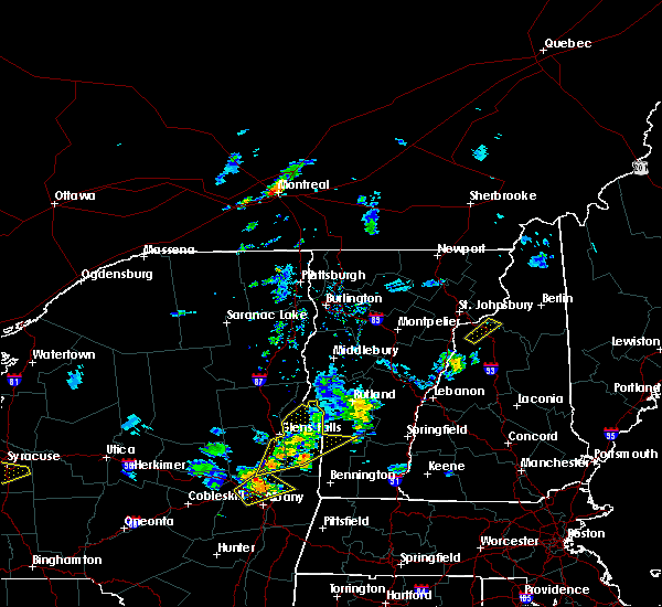
| 8/4/2015 1:44 PM EDT |
 At 144 pm edt, doppler radar indicated a line of severe thunderstorms capable of producing quarter size hail and damaging winds in excess of 60 mph. these storms were located along a line extending from lunenburg to near bethlehem to 7 miles southwest of franconia, moving east at 40 mph. locations impacted include, berlin, littleton, lancaster, bethlehem, lincoln, franconia, mount washington, pinkham notch, franconia notch state park, carroll, gorham, lisbon, jefferson, bath, dalton, dummer, easton, south lunenburg, randolph and sugar hill. At 144 pm edt, doppler radar indicated a line of severe thunderstorms capable of producing quarter size hail and damaging winds in excess of 60 mph. these storms were located along a line extending from lunenburg to near bethlehem to 7 miles southwest of franconia, moving east at 40 mph. locations impacted include, berlin, littleton, lancaster, bethlehem, lincoln, franconia, mount washington, pinkham notch, franconia notch state park, carroll, gorham, lisbon, jefferson, bath, dalton, dummer, easton, south lunenburg, randolph and sugar hill.
|
| 8/4/2015 1:24 PM EDT |
 At 124 pm edt, doppler radar indicated a line of severe thunderstorms capable of producing quarter size hail and damaging winds in excess of 60 mph. these storms were located along a line extending from near granby to 7 miles southeast of barnet, and moving east at 40 mph. At 124 pm edt, doppler radar indicated a line of severe thunderstorms capable of producing quarter size hail and damaging winds in excess of 60 mph. these storms were located along a line extending from near granby to 7 miles southeast of barnet, and moving east at 40 mph.
|
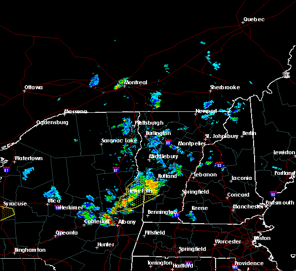
| 8/3/2015 5:18 PM EDT |
 At 518 pm edt, doppler radar indicated a severe thunderstorm capable of producing quarter size hail and damaging winds in excess of 60 mph. this storm was located near franconia notch state park, or 8 miles north of lincoln, moving northeast at 20 mph. locations impacted include, littleton, bethlehem, lincoln, haverhill, franconia, franconia notch state park, woodstock, lisbon, bath, benton, easton, sugar hill and landaff. At 518 pm edt, doppler radar indicated a severe thunderstorm capable of producing quarter size hail and damaging winds in excess of 60 mph. this storm was located near franconia notch state park, or 8 miles north of lincoln, moving northeast at 20 mph. locations impacted include, littleton, bethlehem, lincoln, haverhill, franconia, franconia notch state park, woodstock, lisbon, bath, benton, easton, sugar hill and landaff.
|
| 8/3/2015 4:46 PM EDT |
 At 446 pm edt, doppler radar indicated a severe thunderstorm capable of producing quarter size hail and damaging winds in excess of 60 mph. this storm was located 8 miles east of newbury, or 11 miles west of lincoln, and moving northeast at 30 mph. At 446 pm edt, doppler radar indicated a severe thunderstorm capable of producing quarter size hail and damaging winds in excess of 60 mph. this storm was located 8 miles east of newbury, or 11 miles west of lincoln, and moving northeast at 30 mph.
|
| 7/19/2015 7:09 PM EDT |
 At 709 pm edt, doppler radar indicated a severe thunderstorm capable of producing half dollar size hail and damaging winds in excess of 60 mph. this storm was located near pinkham notch, or 14 miles north of conway, moving southeast at 45 mph. locations impacted include, bethlehem, lincoln, franconia, franconia notch state park, mount washington, pinkham notch, carroll, bartlett, lisbon, jefferson, bath, jackson, albany, easton, sugar hill, hart`s location, crawford notch state park, landaff, livermore and randolph. At 709 pm edt, doppler radar indicated a severe thunderstorm capable of producing half dollar size hail and damaging winds in excess of 60 mph. this storm was located near pinkham notch, or 14 miles north of conway, moving southeast at 45 mph. locations impacted include, bethlehem, lincoln, franconia, franconia notch state park, mount washington, pinkham notch, carroll, bartlett, lisbon, jefferson, bath, jackson, albany, easton, sugar hill, hart`s location, crawford notch state park, landaff, livermore and randolph.
|
| 7/19/2015 6:24 PM EDT |
 At 624 pm edt, doppler radar indicated a severe thunderstorm capable of producing large damaging hail up to golf ball size and damaging winds in excess of 60 mph. this storm was located near concord, or near littleton, and moving southeast at 45 mph. At 624 pm edt, doppler radar indicated a severe thunderstorm capable of producing large damaging hail up to golf ball size and damaging winds in excess of 60 mph. this storm was located near concord, or near littleton, and moving southeast at 45 mph.
|
| 5/30/2015 9:04 PM EDT | At 903 pm edt, doppler radar indicated a severe thunderstorm capable of producing quarter size hail and damaging winds in excess of 60 mph. this storm was located near lower waterford, or 7 miles west of littleton, and moving east at 45 mph. |
| 5/27/2015 5:10 PM EDT | Trees down in lisbon in grafton county NH, 0.7 miles NE of Lisbon, NH |
| 5/27/2015 4:55 PM EDT | At 455 pm edt, doppler radar indicated a line of severe thunderstorms capable of producing damaging winds in excess of 60 mph. these storms were located along a line extending from near barnet to near fairlee to near north hartland, and moving northeast at 55 mph. |
| 5/27/2015 4:34 PM EDT | The national weather service in gray maine has issued a * severe thunderstorm warning for. central grafton county in northern new hampshire. until 500 pm edt * at 434 pm edt. Doppler radar indicated a line of severe thunderstorms capable of producing damaging winds in excess of 60. |
| 9/12/2013 6:00 PM EDT | Trees down in grafton county NH, 3.6 miles NNE of Lisbon, NH |
| 9/12/2013 5:15 PM EDT | Trees down in grafton county NH, 3.6 miles NNE of Lisbon, NH |
| 9/12/2013 5:10 PM EDT | Trees down in grafton county NH, 5.5 miles E of Lisbon, NH |
| 9/11/2013 5:45 PM EDT | Trees down in grafton county NH, 5.7 miles WNW of Lisbon, NH |
| 7/17/2013 8:00 PM EDT | Multiple trees down in sugar hill...time estimated by radar in grafton county NH, 4.9 miles W of Lisbon, NH |
| 7/17/2013 7:52 PM EDT | Multiple trees down throughout lisbon...time estimated by radar in grafton county NH, 0.7 miles NE of Lisbon, NH |
| 8/9/2012 6:18 PM EDT | Three large trees across pearl lake road between lisbon and sugar hill in grafton county NH, 3.4 miles W of Lisbon, NH |
| 7/23/2012 9:05 PM EDT | Tree dow in grafton county NH, 0.7 miles NE of Lisbon, NH |
| 7/23/2012 9:05 PM EDT | Tree down on river road and also on highway 302. time estimated in grafton county NH, 0.7 miles NE of Lisbon, NH |
| 7/17/2012 5:27 PM EDT | Large branches down in grafton county NH, 6.7 miles NW of Lisbon, NH |
| 1/1/0001 12:00 AM | Quarter sized hail reported 0.7 miles NE of Lisbon, NH, lisbon police |
| 1/1/0001 12:00 AM | Quarter sized hail reported 0.7 miles NE of Lisbon, NH, lisbon police |
Hail Maps for Lisbon, NH


Connect with Interactive Hail Maps