

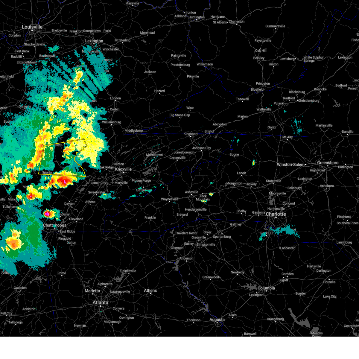
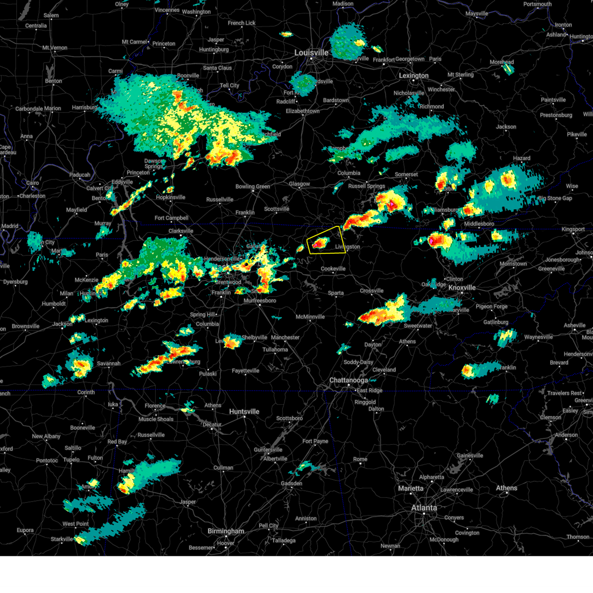
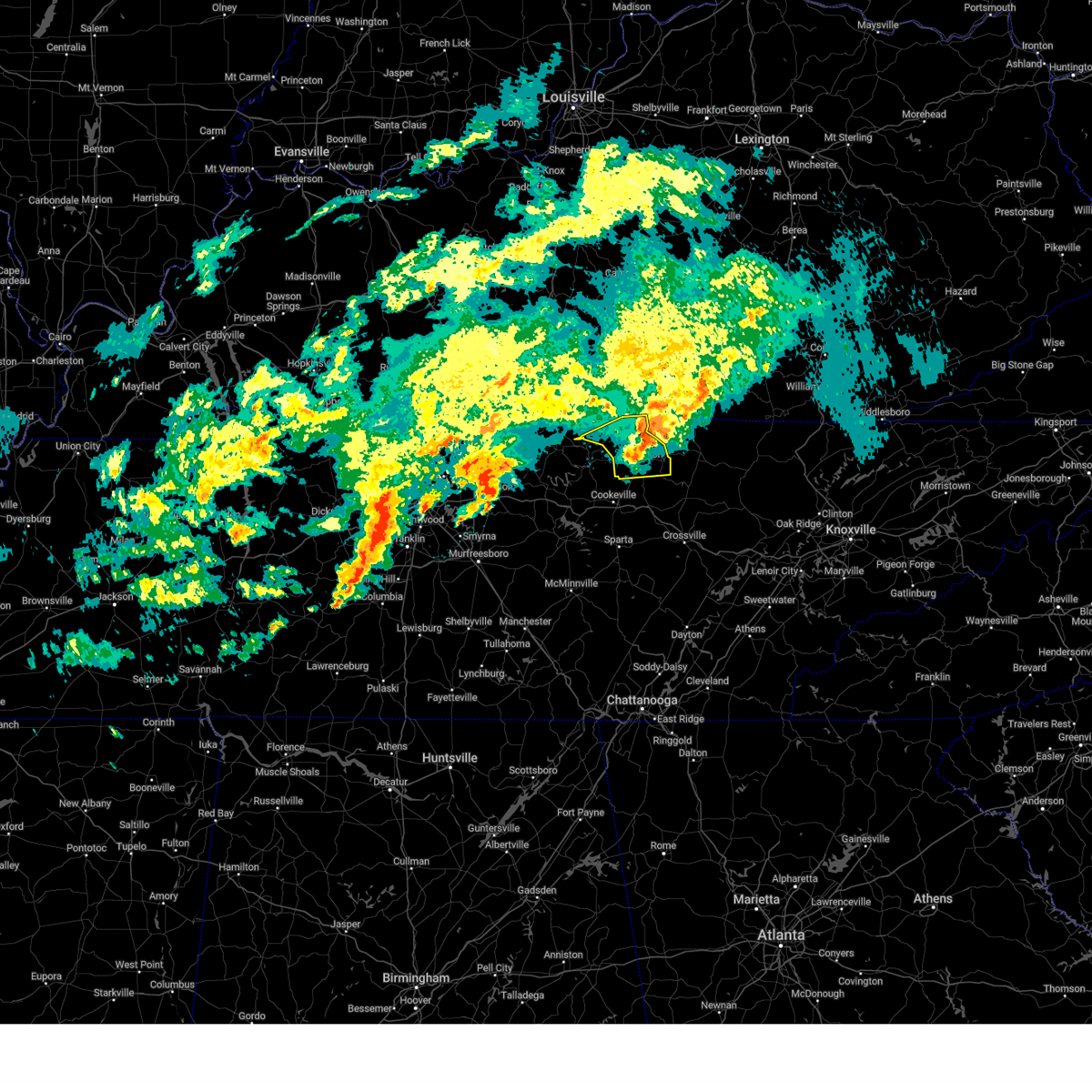
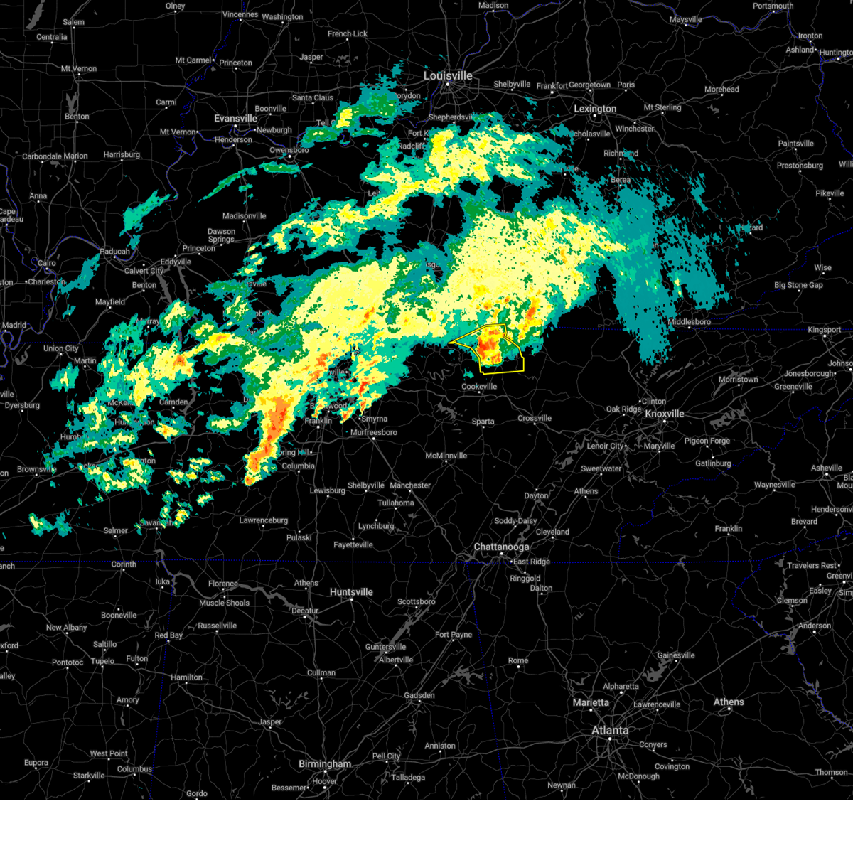
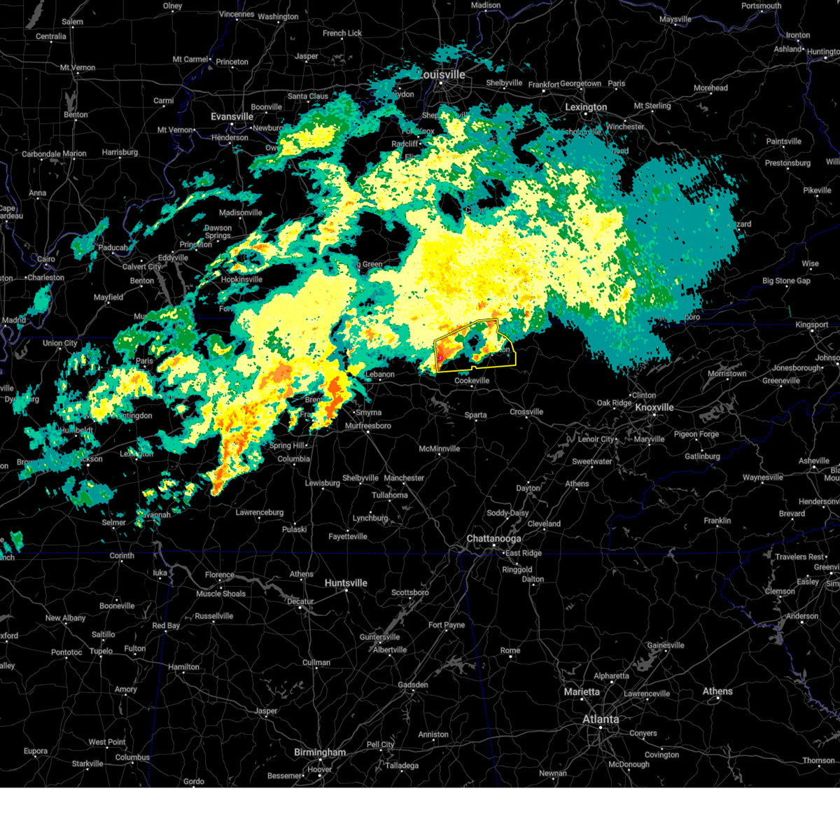
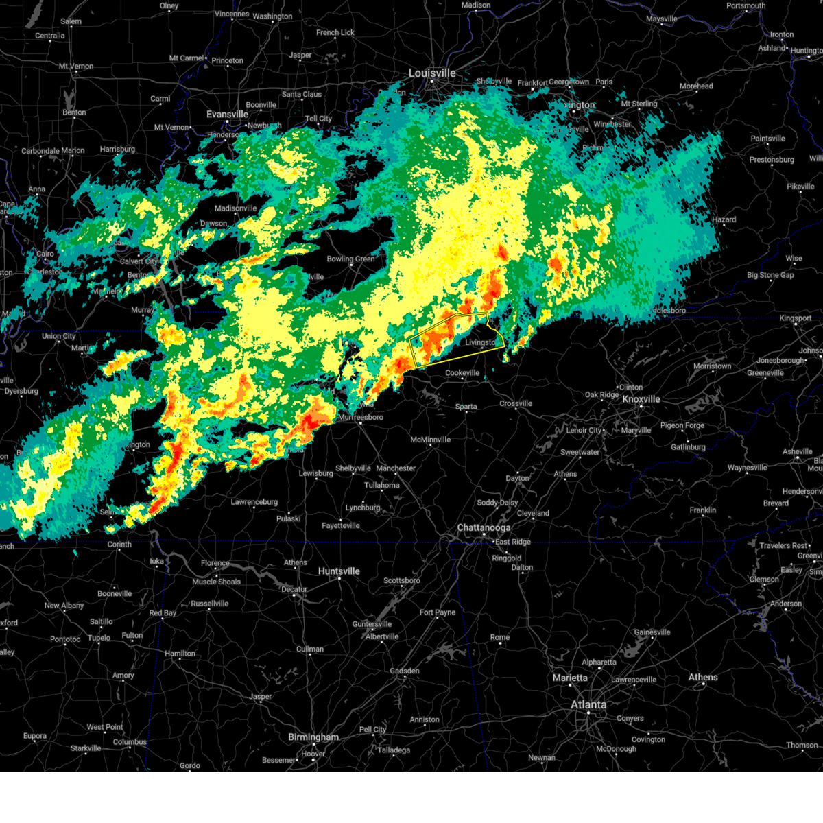
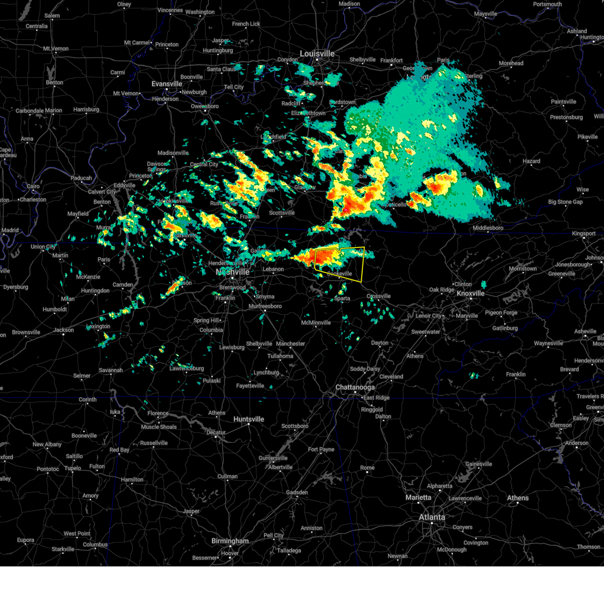
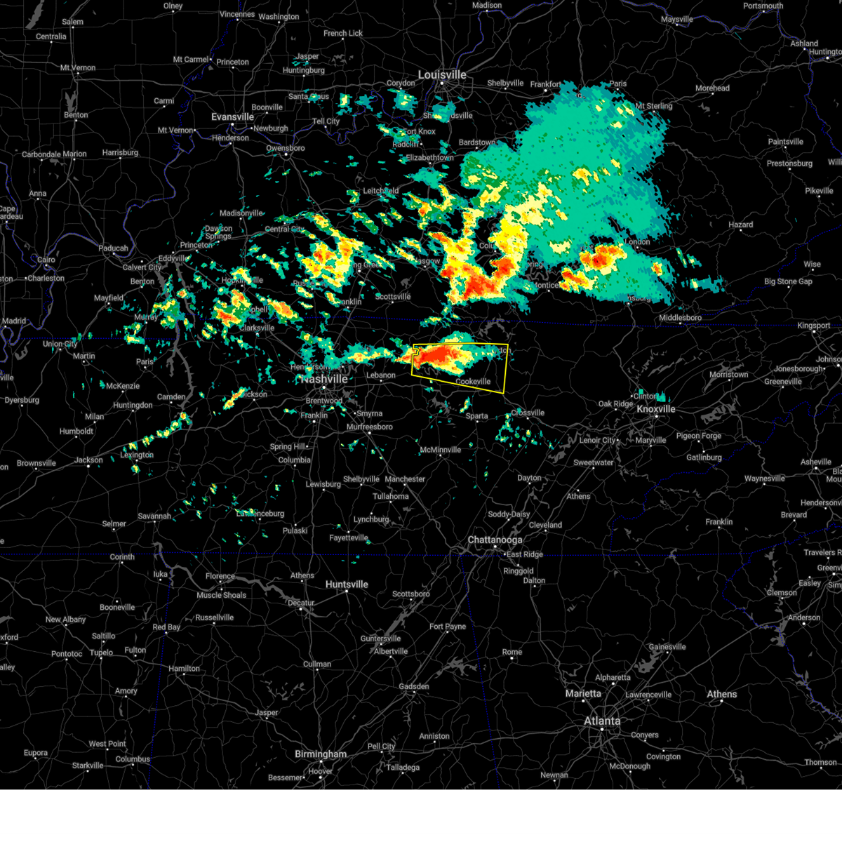
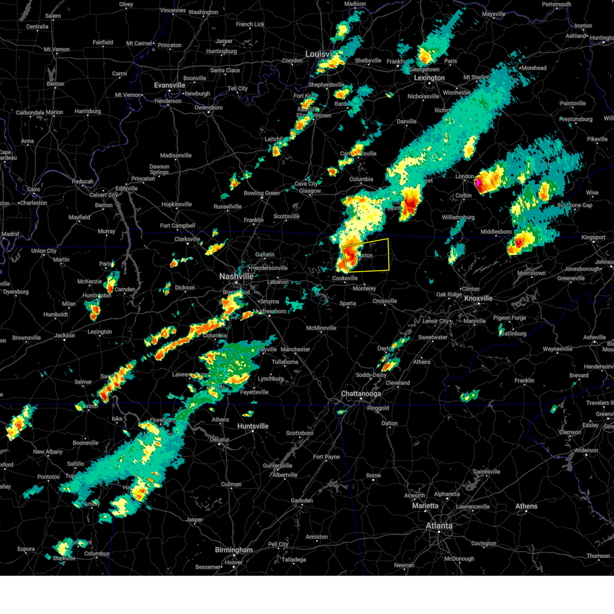
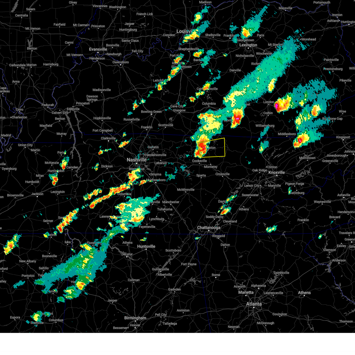
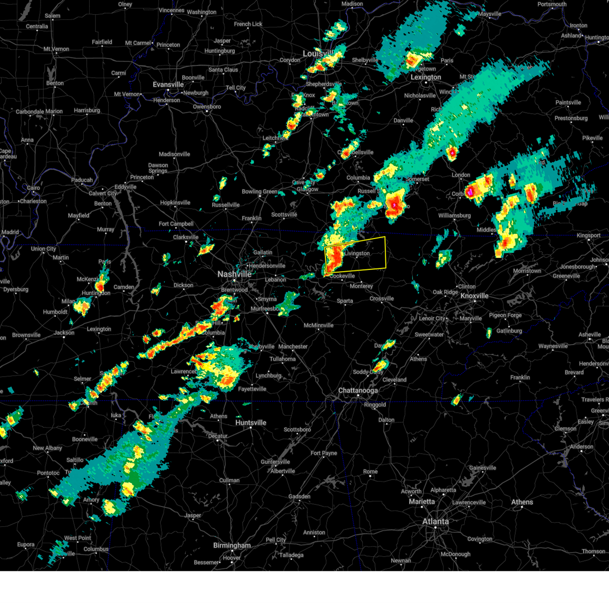
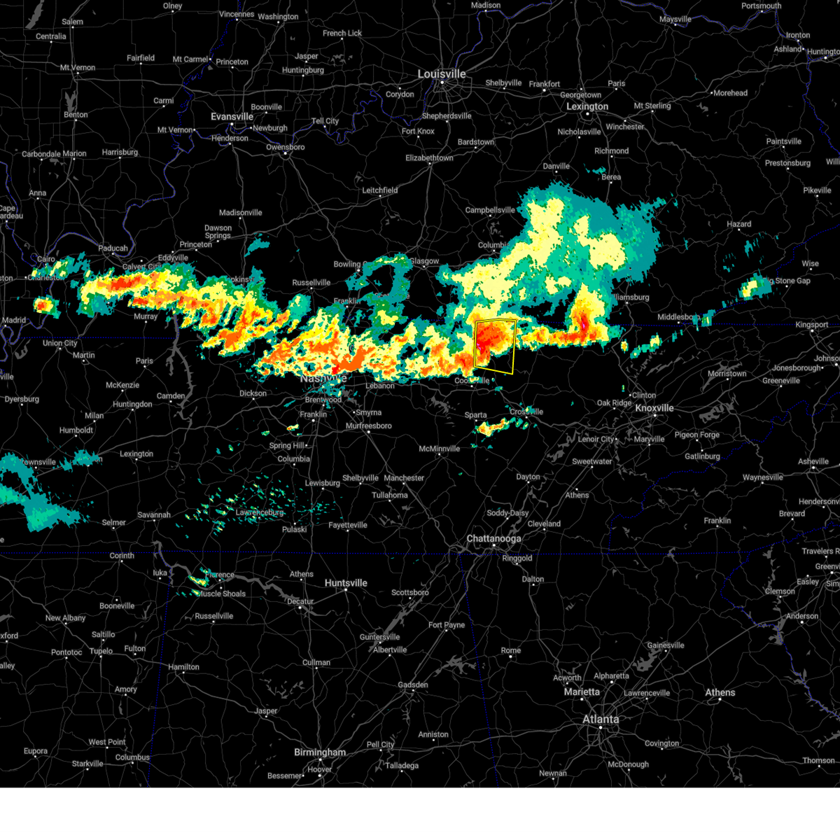
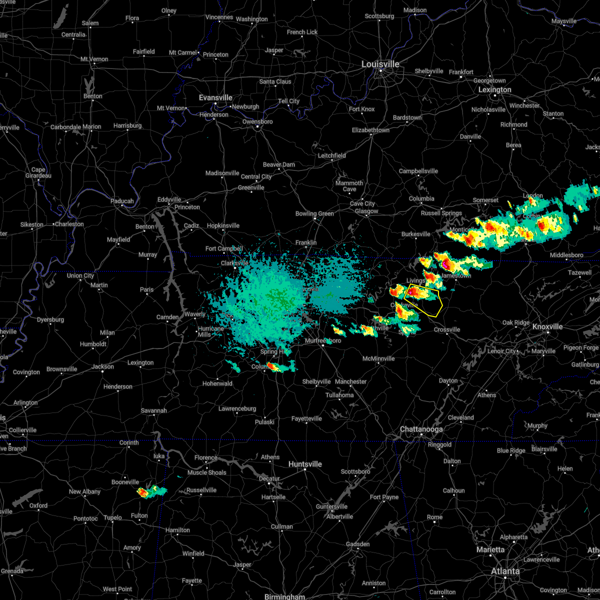
Hail Map for Livingston, TN
The Livingston, TN area has had 12 reports of on-the-ground hail by trained spotters, and has been under severe weather warnings 32 times during the past 12 months. Doppler radar has detected hail at or near Livingston, TN on 56 occasions, including 4 occasions during the past year.
| Name: | Livingston, TN |
| Where Located: | 82.2 miles E of Nashville, TN |
| Map: | Google Map for Livingston, TN |
| Population: | 4058 |
| Housing Units: | 1924 |
| More Info: | Search Google for Livingston, TN |
1
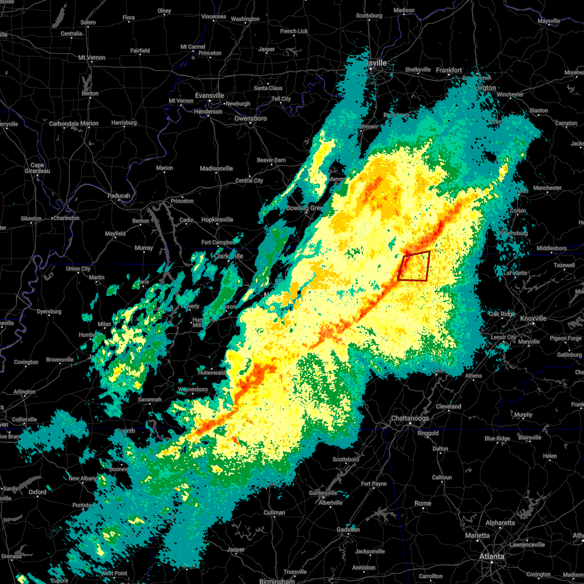
The Top Recent Hail Date for Livingston, TN is Tuesday, September 24, 2024 (14th out of 56)

Hail and Wind Damage Spotted near Livingston, TN
| Date / Time | Report Details |
|---|---|
| 5/20/2025 8:28 PM EDT |
 Svrohx the national weather service in nashville has issued a * severe thunderstorm warning for, overton county in middle tennessee, south central pickett county in middle tennessee, cumberland county in middle tennessee, southeastern jackson county in middle tennessee, northern white county in middle tennessee, putnam county in middle tennessee, fentress county in middle tennessee, * until 830 pm cdt. * at 728 pm cdt, severe thunderstorms were located along a line extending from gainesboro to baxter, moving east at 55 mph (radar indicated). Hazards include 65 mph wind gusts and quarter size hail. Hail damage to vehicles is expected. Expect wind damage to roofs, siding, and trees. Svrohx the national weather service in nashville has issued a * severe thunderstorm warning for, overton county in middle tennessee, south central pickett county in middle tennessee, cumberland county in middle tennessee, southeastern jackson county in middle tennessee, northern white county in middle tennessee, putnam county in middle tennessee, fentress county in middle tennessee, * until 830 pm cdt. * at 728 pm cdt, severe thunderstorms were located along a line extending from gainesboro to baxter, moving east at 55 mph (radar indicated). Hazards include 65 mph wind gusts and quarter size hail. Hail damage to vehicles is expected. Expect wind damage to roofs, siding, and trees.
|
| 5/17/2025 12:04 AM CDT | At 1203 am cdt, severe thunderstorms were located along a line extending from duckrun to 7 miles southeast of gainesboro, moving east at 75 mph (radar indicated). Hazards include 60 mph wind gusts and quarter size hail. Hail damage to vehicles is expected. expect wind damage to roofs, siding, and trees. locations impacted include, grimsley, allardt, hickman, gordonsville, algood, gainesboro, baxter, livingston, rickman, pall mall, carthage, wolf river dock, jamestown, byrdstown, clarkrange, crawford, granville, pickett state park, monterey, and south carthage. This includes interstate 40 between mile markers 252 and 268, and between mile markers 278 and 302. |
| 5/17/2025 12:04 AM CDT | the severe thunderstorm warning has been cancelled and is no longer in effect |
| 5/16/2025 11:28 PM CDT | Svrohx the national weather service in nashville has issued a * severe thunderstorm warning for, overton county in middle tennessee, pickett county in middle tennessee, smith county in middle tennessee, jackson county in middle tennessee, central wilson county in middle tennessee, southeastern clay county in middle tennessee, central putnam county in middle tennessee, fentress county in middle tennessee, * until 1230 am cdt. * at 1128 pm cdt, severe thunderstorms were located along a line extending from near sunnybrook to near lebanon, moving east at 75 mph (radar indicated). Hazards include 60 mph wind gusts and quarter size hail. Hail damage to vehicles is expected. Expect wind damage to roofs, siding, and trees. |
| 5/8/2025 4:41 PM CDT | the severe thunderstorm warning has been cancelled and is no longer in effect |
| 5/8/2025 4:20 PM CDT |
 Svrohx the national weather service in nashville has issued a * severe thunderstorm warning for, northwestern overton county in middle tennessee, northern jackson county in middle tennessee, central clay county in middle tennessee, * until 500 pm cdt. * at 419 pm cdt, a severe thunderstorm was located near gainesboro, moving east at 25 mph (radar indicated). Hazards include 60 mph wind gusts and quarter size hail. Hail damage to vehicles is expected. Expect wind damage to roofs, siding, and trees. Svrohx the national weather service in nashville has issued a * severe thunderstorm warning for, northwestern overton county in middle tennessee, northern jackson county in middle tennessee, central clay county in middle tennessee, * until 500 pm cdt. * at 419 pm cdt, a severe thunderstorm was located near gainesboro, moving east at 25 mph (radar indicated). Hazards include 60 mph wind gusts and quarter size hail. Hail damage to vehicles is expected. Expect wind damage to roofs, siding, and trees.
|
| 4/3/2025 8:26 AM CDT |
 The storm which prompted the warning has weakened below severe limits, and has exited the warned area. therefore, the warning will be allowed to expire. The storm which prompted the warning has weakened below severe limits, and has exited the warned area. therefore, the warning will be allowed to expire.
|
| 4/3/2025 8:11 AM CDT |
 At 811 am cdt, a severe thunderstorm was located near celina, moving east at 50 mph (radar indicated). Hazards include 60 mph wind gusts and quarter size hail. Hail damage to vehicles is expected. expect wind damage to roofs, siding, and trees. Locations impacted include, dale hollow lake, celina, standing stone state park, and livingston. At 811 am cdt, a severe thunderstorm was located near celina, moving east at 50 mph (radar indicated). Hazards include 60 mph wind gusts and quarter size hail. Hail damage to vehicles is expected. expect wind damage to roofs, siding, and trees. Locations impacted include, dale hollow lake, celina, standing stone state park, and livingston.
|
| 4/3/2025 8:11 AM CDT |
 the severe thunderstorm warning has been cancelled and is no longer in effect the severe thunderstorm warning has been cancelled and is no longer in effect
|
| 4/3/2025 7:51 AM CDT |
 Svrohx the national weather service in nashville has issued a * severe thunderstorm warning for, overton county in middle tennessee, jackson county in middle tennessee, clay county in middle tennessee, * until 830 am cdt. * at 751 am cdt, a severe thunderstorm was located near gainesboro, moving east at 50 mph (radar indicated). Hazards include 60 mph wind gusts and quarter size hail. Hail damage to vehicles is expected. Expect wind damage to roofs, siding, and trees. Svrohx the national weather service in nashville has issued a * severe thunderstorm warning for, overton county in middle tennessee, jackson county in middle tennessee, clay county in middle tennessee, * until 830 am cdt. * at 751 am cdt, a severe thunderstorm was located near gainesboro, moving east at 50 mph (radar indicated). Hazards include 60 mph wind gusts and quarter size hail. Hail damage to vehicles is expected. Expect wind damage to roofs, siding, and trees.
|
| 4/3/2025 6:44 AM CDT |
 At 644 am cdt, a severe thunderstorm was located near byrdstown, moving east at 45 mph (radar indicated). Hazards include 60 mph wind gusts and quarter size hail. Hail damage to vehicles is expected. expect wind damage to roofs, siding, and trees. Locations impacted include, grimsley, allardt, jamestown, byrdstown, livingston, crawford, pall mall, and pickett state park. At 644 am cdt, a severe thunderstorm was located near byrdstown, moving east at 45 mph (radar indicated). Hazards include 60 mph wind gusts and quarter size hail. Hail damage to vehicles is expected. expect wind damage to roofs, siding, and trees. Locations impacted include, grimsley, allardt, jamestown, byrdstown, livingston, crawford, pall mall, and pickett state park.
|
| 4/3/2025 6:44 AM CDT |
 the severe thunderstorm warning has been cancelled and is no longer in effect the severe thunderstorm warning has been cancelled and is no longer in effect
|
| 4/3/2025 6:11 AM CDT |
 Svrohx the national weather service in nashville has issued a * severe thunderstorm warning for, overton county in middle tennessee, pickett county in middle tennessee, eastern jackson county in middle tennessee, southeastern clay county in middle tennessee, northwestern putnam county in middle tennessee, fentress county in middle tennessee, * until 715 am cdt. * at 610 am cdt, a severe thunderstorm was located 7 miles east of gainesboro, moving east at 45 mph (radar indicated). Hazards include 60 mph wind gusts and quarter size hail. Hail damage to vehicles is expected. Expect wind damage to roofs, siding, and trees. Svrohx the national weather service in nashville has issued a * severe thunderstorm warning for, overton county in middle tennessee, pickett county in middle tennessee, eastern jackson county in middle tennessee, southeastern clay county in middle tennessee, northwestern putnam county in middle tennessee, fentress county in middle tennessee, * until 715 am cdt. * at 610 am cdt, a severe thunderstorm was located 7 miles east of gainesboro, moving east at 45 mph (radar indicated). Hazards include 60 mph wind gusts and quarter size hail. Hail damage to vehicles is expected. Expect wind damage to roofs, siding, and trees.
|
| 4/3/2025 6:03 AM CDT |
 Svrohx the national weather service in nashville has issued a * severe thunderstorm warning for, northeastern overton county in middle tennessee, pickett county in middle tennessee, northeastern clay county in middle tennessee, northern fentress county in middle tennessee, * until 645 am cdt. * at 602 am cdt, a severe thunderstorm was located near byrdstown, moving east at 60 mph (radar indicated). Hazards include 60 mph wind gusts and penny size hail. expect damage to roofs, siding, and trees Svrohx the national weather service in nashville has issued a * severe thunderstorm warning for, northeastern overton county in middle tennessee, pickett county in middle tennessee, northeastern clay county in middle tennessee, northern fentress county in middle tennessee, * until 645 am cdt. * at 602 am cdt, a severe thunderstorm was located near byrdstown, moving east at 60 mph (radar indicated). Hazards include 60 mph wind gusts and penny size hail. expect damage to roofs, siding, and trees
|
| 4/3/2025 5:31 AM CDT |
 Svrohx the national weather service in nashville has issued a * severe thunderstorm warning for, northern overton county in middle tennessee, northeastern smith county in middle tennessee, jackson county in middle tennessee, clay county in middle tennessee, southeastern macon county in middle tennessee, * until 615 am cdt. * at 531 am cdt, a severe thunderstorm was located 8 miles west of gainesboro, moving northeast at 50 mph (radar indicated). Hazards include 60 mph wind gusts and quarter size hail. Hail damage to vehicles is expected. Expect wind damage to roofs, siding, and trees. Svrohx the national weather service in nashville has issued a * severe thunderstorm warning for, northern overton county in middle tennessee, northeastern smith county in middle tennessee, jackson county in middle tennessee, clay county in middle tennessee, southeastern macon county in middle tennessee, * until 615 am cdt. * at 531 am cdt, a severe thunderstorm was located 8 miles west of gainesboro, moving northeast at 50 mph (radar indicated). Hazards include 60 mph wind gusts and quarter size hail. Hail damage to vehicles is expected. Expect wind damage to roofs, siding, and trees.
|
| 3/23/2025 7:18 PM CDT |
 Svrohx the national weather service in nashville has issued a * severe thunderstorm warning for, northern overton county in middle tennessee, pickett county in middle tennessee, eastern clay county in middle tennessee, northwestern fentress county in middle tennessee, * until 800 pm cdt. * at 718 pm cdt, a severe thunderstorm was located near gainesboro, moving northeast at 60 mph (radar indicated). Hazards include 60 mph wind gusts and quarter size hail. Hail damage to vehicles is expected. Expect wind damage to roofs, siding, and trees. Svrohx the national weather service in nashville has issued a * severe thunderstorm warning for, northern overton county in middle tennessee, pickett county in middle tennessee, eastern clay county in middle tennessee, northwestern fentress county in middle tennessee, * until 800 pm cdt. * at 718 pm cdt, a severe thunderstorm was located near gainesboro, moving northeast at 60 mph (radar indicated). Hazards include 60 mph wind gusts and quarter size hail. Hail damage to vehicles is expected. Expect wind damage to roofs, siding, and trees.
|
| 3/15/2025 5:16 PM CDT | the severe thunderstorm warning has been cancelled and is no longer in effect |
| 3/15/2025 5:16 PM CDT | At 516 pm cdt, severe thunderstorms were located along a line extending from near albany to 6 miles east of monterey to 8 miles east of sparta, moving northeast at 40 mph (radar indicated). Hazards include 60 mph wind gusts and quarter size hail. Hail damage to vehicles is expected. expect wind damage to roofs, siding, and trees. locations impacted include, grimsley, allardt, slate springs, livingston, virgin falls state natural area, pall mall, jamestown, pleasant hill, byrdstown, clarkrange, fairfield glade, crawford, pickett state park, monterey, and crossville. This includes interstate 40 between mile markers 297 and 324. |
| 3/15/2025 5:01 PM CDT | Svrohx the national weather service in nashville has issued a * severe thunderstorm warning for, overton county in middle tennessee, pickett county in middle tennessee, northwestern cumberland county in middle tennessee, northeastern clay county in middle tennessee, eastern white county in middle tennessee, southeastern putnam county in middle tennessee, fentress county in middle tennessee, * until 600 pm cdt. * at 501 pm cdt, severe thunderstorms were located along a line extending from 9 miles west of byrdstown to near monterey to 6 miles north of spencer, moving northeast at 40 mph (radar indicated). Hazards include 60 mph wind gusts and quarter size hail. Hail damage to vehicles is expected. Expect wind damage to roofs, siding, and trees. |
| 2/6/2025 6:39 PM CST |
 the tornado warning has been cancelled and is no longer in effect the tornado warning has been cancelled and is no longer in effect
|
| 2/6/2025 6:39 PM CST |
 At 638 pm cst, a severe thunderstorm capable of producing a tornado was located 7 miles north of monterey, or 9 miles south of livingston, moving east at 40 mph (radar indicated rotation). Hazards include tornado and quarter size hail. Flying debris will be dangerous to those caught without shelter. mobile homes will be damaged or destroyed. damage to roofs, windows, and vehicles will occur. tree damage is likely. this tornadic thunderstorm will remain over mainly rural areas of southern overton and northeastern putnam counties, including the following locations, crawford and rickman. This includes interstate 40 between mile markers 298 and 303. At 638 pm cst, a severe thunderstorm capable of producing a tornado was located 7 miles north of monterey, or 9 miles south of livingston, moving east at 40 mph (radar indicated rotation). Hazards include tornado and quarter size hail. Flying debris will be dangerous to those caught without shelter. mobile homes will be damaged or destroyed. damage to roofs, windows, and vehicles will occur. tree damage is likely. this tornadic thunderstorm will remain over mainly rural areas of southern overton and northeastern putnam counties, including the following locations, crawford and rickman. This includes interstate 40 between mile markers 298 and 303.
|
| 2/6/2025 6:21 PM CST |
 Torohx the national weather service in nashville has issued a * tornado warning for, southern overton county in middle tennessee, southeastern jackson county in middle tennessee, northeastern putnam county in middle tennessee, * until 645 pm cst. * at 621 pm cst, a severe thunderstorm capable of producing a tornado was located near algood, or 8 miles north of cookeville, moving east at 40 mph (radar indicated rotation). Hazards include tornado and quarter size hail. Flying debris will be dangerous to those caught without shelter. mobile homes will be damaged or destroyed. damage to roofs, windows, and vehicles will occur. tree damage is likely. this dangerous storm will be near, algood around 625 pm cst. other locations impacted by this tornadic thunderstorm include crawford, rickman, and cummins falls state park. This includes interstate 40 near mile marker 295, and between mile markers 298 and 303. Torohx the national weather service in nashville has issued a * tornado warning for, southern overton county in middle tennessee, southeastern jackson county in middle tennessee, northeastern putnam county in middle tennessee, * until 645 pm cst. * at 621 pm cst, a severe thunderstorm capable of producing a tornado was located near algood, or 8 miles north of cookeville, moving east at 40 mph (radar indicated rotation). Hazards include tornado and quarter size hail. Flying debris will be dangerous to those caught without shelter. mobile homes will be damaged or destroyed. damage to roofs, windows, and vehicles will occur. tree damage is likely. this dangerous storm will be near, algood around 625 pm cst. other locations impacted by this tornadic thunderstorm include crawford, rickman, and cummins falls state park. This includes interstate 40 near mile marker 295, and between mile markers 298 and 303.
|
| 2/6/2025 6:01 PM CST |
 the severe thunderstorm warning has been cancelled and is no longer in effect the severe thunderstorm warning has been cancelled and is no longer in effect
|
| 2/6/2025 6:01 PM CST |
 At 601 pm cst, a severe thunderstorm was located near gainesboro, moving east at 50 mph (radar indicated). Hazards include 60 mph wind gusts and quarter size hail. Hail damage to vehicles is expected. expect wind damage to roofs, siding, and trees. locations impacted include, cookeville, livingston, gainesboro, algood, monterey, granville, rickman, cummins falls state park, and standing stone state park. This includes interstate 40 between mile markers 299 and 302. At 601 pm cst, a severe thunderstorm was located near gainesboro, moving east at 50 mph (radar indicated). Hazards include 60 mph wind gusts and quarter size hail. Hail damage to vehicles is expected. expect wind damage to roofs, siding, and trees. locations impacted include, cookeville, livingston, gainesboro, algood, monterey, granville, rickman, cummins falls state park, and standing stone state park. This includes interstate 40 between mile markers 299 and 302.
|
| 2/6/2025 5:45 PM CST |
 Svrohx the national weather service in nashville has issued a * severe thunderstorm warning for, western overton county in middle tennessee, northeastern smith county in middle tennessee, jackson county in middle tennessee, south central clay county in middle tennessee, southeastern macon county in middle tennessee, northern putnam county in middle tennessee, * until 630 pm cst. * at 545 pm cst, a severe thunderstorm was located 8 miles northeast of carthage, moving east at 50 mph (radar indicated). Hazards include 60 mph wind gusts and quarter size hail. Hail damage to vehicles is expected. Expect wind damage to roofs, siding, and trees. Svrohx the national weather service in nashville has issued a * severe thunderstorm warning for, western overton county in middle tennessee, northeastern smith county in middle tennessee, jackson county in middle tennessee, south central clay county in middle tennessee, southeastern macon county in middle tennessee, northern putnam county in middle tennessee, * until 630 pm cst. * at 545 pm cst, a severe thunderstorm was located 8 miles northeast of carthage, moving east at 50 mph (radar indicated). Hazards include 60 mph wind gusts and quarter size hail. Hail damage to vehicles is expected. Expect wind damage to roofs, siding, and trees.
|
| 9/24/2024 4:55 PM CDT | Delayed report. tree dow in overton county TN, 3.6 miles SSE of Livingston, TN |
| 9/24/2024 4:55 PM CDT | Tree dow in overton county TN, 6.9 miles SSE of Livingston, TN |
| 9/24/2024 4:52 PM CDT |
 At 451 pm cdt, a severe thunderstorm was located over livingston, moving east at 45 mph (radar indicated). Hazards include 60 mph wind gusts and penny size hail. Expect damage to roofs, siding, and trees. Locations impacted include, livingston, standing stone state park, and rickman. At 451 pm cdt, a severe thunderstorm was located over livingston, moving east at 45 mph (radar indicated). Hazards include 60 mph wind gusts and penny size hail. Expect damage to roofs, siding, and trees. Locations impacted include, livingston, standing stone state park, and rickman.
|
| 9/24/2024 4:52 PM CDT |
 the severe thunderstorm warning has been cancelled and is no longer in effect the severe thunderstorm warning has been cancelled and is no longer in effect
|
| 9/24/2024 4:34 PM CDT |
 Svrohx the national weather service in nashville has issued a * severe thunderstorm warning for, overton county in middle tennessee, western pickett county in middle tennessee, eastern jackson county in middle tennessee, southeastern clay county in middle tennessee, north central putnam county in middle tennessee, northwestern fentress county in middle tennessee, * until 515 pm cdt. * at 434 pm cdt, a severe thunderstorm was located near gainesboro, moving east at 45 mph (radar indicated). Hazards include 60 mph wind gusts and penny size hail. expect damage to roofs, siding, and trees Svrohx the national weather service in nashville has issued a * severe thunderstorm warning for, overton county in middle tennessee, western pickett county in middle tennessee, eastern jackson county in middle tennessee, southeastern clay county in middle tennessee, north central putnam county in middle tennessee, northwestern fentress county in middle tennessee, * until 515 pm cdt. * at 434 pm cdt, a severe thunderstorm was located near gainesboro, moving east at 45 mph (radar indicated). Hazards include 60 mph wind gusts and penny size hail. expect damage to roofs, siding, and trees
|
| 7/30/2024 3:32 PM CDT |
 the severe thunderstorm warning has been cancelled and is no longer in effect the severe thunderstorm warning has been cancelled and is no longer in effect
|
| 7/30/2024 3:32 PM CDT |
 At 332 pm cdt, severe thunderstorms were located along a line extending from near monterey to near baxter, moving southeast at 35 mph (radar indicated). Hazards include 60 mph wind gusts and quarter size hail. Hail damage to vehicles is expected. expect wind damage to roofs, siding, and trees. locations impacted include, cookeville, livingston, gainesboro, algood, monterey, baxter, hamptons crossroads, granville, burgess falls state park, rickman, and cummins falls state park. This includes interstate 40 between mile markers 268 and 300. At 332 pm cdt, severe thunderstorms were located along a line extending from near monterey to near baxter, moving southeast at 35 mph (radar indicated). Hazards include 60 mph wind gusts and quarter size hail. Hail damage to vehicles is expected. expect wind damage to roofs, siding, and trees. locations impacted include, cookeville, livingston, gainesboro, algood, monterey, baxter, hamptons crossroads, granville, burgess falls state park, rickman, and cummins falls state park. This includes interstate 40 between mile markers 268 and 300.
|
| 7/30/2024 3:08 PM CDT |
 Svrohx the national weather service in nashville has issued a * severe thunderstorm warning for, western overton county in middle tennessee, northeastern smith county in middle tennessee, northeastern de kalb county in middle tennessee, jackson county in middle tennessee, central clay county in middle tennessee, southeastern macon county in middle tennessee, northern white county in middle tennessee, putnam county in middle tennessee, * until 400 pm cdt. * at 308 pm cdt, severe thunderstorms were located along a line extending from near livingston to red boiling springs, moving southeast at 30 mph (radar indicated). Hazards include 60 mph wind gusts and quarter size hail. Hail damage to vehicles is expected. Expect wind damage to roofs, siding, and trees. Svrohx the national weather service in nashville has issued a * severe thunderstorm warning for, western overton county in middle tennessee, northeastern smith county in middle tennessee, northeastern de kalb county in middle tennessee, jackson county in middle tennessee, central clay county in middle tennessee, southeastern macon county in middle tennessee, northern white county in middle tennessee, putnam county in middle tennessee, * until 400 pm cdt. * at 308 pm cdt, severe thunderstorms were located along a line extending from near livingston to red boiling springs, moving southeast at 30 mph (radar indicated). Hazards include 60 mph wind gusts and quarter size hail. Hail damage to vehicles is expected. Expect wind damage to roofs, siding, and trees.
|
| 7/30/2024 2:35 PM CDT |
 Svrohx the national weather service in nashville has issued a * severe thunderstorm warning for, northern overton county in middle tennessee, pickett county in middle tennessee, eastern clay county in middle tennessee, fentress county in middle tennessee, * until 315 pm cdt. * at 235 pm cdt, severe thunderstorms were located along a line extending from tompkinsville to near zula, moving southeast at 40 mph (radar indicated). Hazards include 60 mph wind gusts. expect damage to roofs, siding, and trees Svrohx the national weather service in nashville has issued a * severe thunderstorm warning for, northern overton county in middle tennessee, pickett county in middle tennessee, eastern clay county in middle tennessee, fentress county in middle tennessee, * until 315 pm cdt. * at 235 pm cdt, severe thunderstorms were located along a line extending from tompkinsville to near zula, moving southeast at 40 mph (radar indicated). Hazards include 60 mph wind gusts. expect damage to roofs, siding, and trees
|
| 5/27/2024 12:30 AM CDT |
 At 1229 am cdt, a severe thunderstorm was located near great meadows campsites, or 13 miles west of oneida, moving east at 50 mph (radar indicated). Hazards include 60 mph wind gusts. Expect damage to roofs, siding, and trees. Locations impacted include, livingston, jamestown, allardt, pall mall, and pickett state park. At 1229 am cdt, a severe thunderstorm was located near great meadows campsites, or 13 miles west of oneida, moving east at 50 mph (radar indicated). Hazards include 60 mph wind gusts. Expect damage to roofs, siding, and trees. Locations impacted include, livingston, jamestown, allardt, pall mall, and pickett state park.
|
| 5/27/2024 12:11 AM CDT |
 Svrohx the national weather service in nashville has issued a * severe thunderstorm warning for, northeastern overton county in middle tennessee, pickett county in middle tennessee, northern fentress county in middle tennessee, * until 1245 am cdt. * at 1211 am cdt, a severe thunderstorm was located near byrdstown, moving east at 55 mph (radar indicated). Hazards include 60 mph wind gusts. expect damage to roofs, siding, and trees Svrohx the national weather service in nashville has issued a * severe thunderstorm warning for, northeastern overton county in middle tennessee, pickett county in middle tennessee, northern fentress county in middle tennessee, * until 1245 am cdt. * at 1211 am cdt, a severe thunderstorm was located near byrdstown, moving east at 55 mph (radar indicated). Hazards include 60 mph wind gusts. expect damage to roofs, siding, and trees
|
| 5/26/2024 11:39 AM CDT |
 At 1138 am cdt, severe thunderstorms were located along a line extending from near sunnybrook to livingston, moving east at 55 mph (radar indicated). Hazards include 60 mph wind gusts and nickel size hail. Expect damage to roofs, siding, and trees. Locations impacted include, livingston, jamestown, byrdstown, allardt, wolf river dock, pall mall, and pickett state park. At 1138 am cdt, severe thunderstorms were located along a line extending from near sunnybrook to livingston, moving east at 55 mph (radar indicated). Hazards include 60 mph wind gusts and nickel size hail. Expect damage to roofs, siding, and trees. Locations impacted include, livingston, jamestown, byrdstown, allardt, wolf river dock, pall mall, and pickett state park.
|
| 5/26/2024 11:39 AM CDT |
 the severe thunderstorm warning has been cancelled and is no longer in effect the severe thunderstorm warning has been cancelled and is no longer in effect
|
| 5/26/2024 11:26 AM CDT |
 Svrohx the national weather service in nashville has issued a * severe thunderstorm warning for, northern overton county in middle tennessee, pickett county in middle tennessee, eastern clay county in middle tennessee, fentress county in middle tennessee, * until 1230 pm cdt. * at 1126 am cdt, severe thunderstorms were located along a line extending from near albany to near livingston, moving east at 60 mph (radar indicated). Hazards include 60 mph wind gusts and nickel size hail. expect damage to roofs, siding, and trees Svrohx the national weather service in nashville has issued a * severe thunderstorm warning for, northern overton county in middle tennessee, pickett county in middle tennessee, eastern clay county in middle tennessee, fentress county in middle tennessee, * until 1230 pm cdt. * at 1126 am cdt, severe thunderstorms were located along a line extending from near albany to near livingston, moving east at 60 mph (radar indicated). Hazards include 60 mph wind gusts and nickel size hail. expect damage to roofs, siding, and trees
|
| 5/26/2024 11:20 AM CDT | Numerous trees were blown down along heard ridge roa in overton county TN, 7.3 miles ESE of Livingston, TN |
| 5/26/2024 11:07 AM CDT |
 the severe thunderstorm warning has been cancelled and is no longer in effect the severe thunderstorm warning has been cancelled and is no longer in effect
|
| 5/26/2024 11:07 AM CDT |
 At 1106 am cdt, severe thunderstorms were located along a line extending from 8 miles east of tompkinsville to near celina to 6 miles south of red boiling springs, moving east at 60 mph (radar indicated). Hazards include 60 mph wind gusts and nickel size hail. Expect damage to roofs, siding, and trees. Locations impacted include, livingston, celina, gainesboro, byrdstown, whitleyville, moss, dale hollow lake, and standing stone state park. At 1106 am cdt, severe thunderstorms were located along a line extending from 8 miles east of tompkinsville to near celina to 6 miles south of red boiling springs, moving east at 60 mph (radar indicated). Hazards include 60 mph wind gusts and nickel size hail. Expect damage to roofs, siding, and trees. Locations impacted include, livingston, celina, gainesboro, byrdstown, whitleyville, moss, dale hollow lake, and standing stone state park.
|
| 5/26/2024 10:40 AM CDT |
 Svrohx the national weather service in nashville has issued a * severe thunderstorm warning for, northern overton county in middle tennessee, western pickett county in middle tennessee, northeastern smith county in middle tennessee, northern jackson county in middle tennessee, clay county in middle tennessee, macon county in middle tennessee, trousdale county in middle tennessee, * until 1130 am cdt. * at 1039 am cdt, severe thunderstorms were located along a line extending from 10 miles west of tompkinsville to near red boiling springs to near hartsville, moving east at 65 mph (radar indicated). Hazards include 60 mph wind gusts and nickel size hail. expect damage to roofs, siding, and trees Svrohx the national weather service in nashville has issued a * severe thunderstorm warning for, northern overton county in middle tennessee, western pickett county in middle tennessee, northeastern smith county in middle tennessee, northern jackson county in middle tennessee, clay county in middle tennessee, macon county in middle tennessee, trousdale county in middle tennessee, * until 1130 am cdt. * at 1039 am cdt, severe thunderstorms were located along a line extending from 10 miles west of tompkinsville to near red boiling springs to near hartsville, moving east at 65 mph (radar indicated). Hazards include 60 mph wind gusts and nickel size hail. expect damage to roofs, siding, and trees
|
| 5/22/2024 5:56 PM CDT |
 Svrohx the national weather service in nashville has issued a * severe thunderstorm warning for, overton county in middle tennessee, pickett county in middle tennessee, northern cumberland county in middle tennessee, southeastern putnam county in middle tennessee, fentress county in middle tennessee, * until 630 pm cdt. * at 555 pm cdt, severe thunderstorms were located along a line extending from near sunnybrook to 8 miles southwest of jamestown to near monterey, moving east at 55 mph (radar indicated). Hazards include 60 mph wind gusts and nickel size hail. expect damage to roofs, siding, and trees Svrohx the national weather service in nashville has issued a * severe thunderstorm warning for, overton county in middle tennessee, pickett county in middle tennessee, northern cumberland county in middle tennessee, southeastern putnam county in middle tennessee, fentress county in middle tennessee, * until 630 pm cdt. * at 555 pm cdt, severe thunderstorms were located along a line extending from near sunnybrook to 8 miles southwest of jamestown to near monterey, moving east at 55 mph (radar indicated). Hazards include 60 mph wind gusts and nickel size hail. expect damage to roofs, siding, and trees
|
| 5/22/2024 5:38 PM CDT |
 the severe thunderstorm warning has been cancelled and is no longer in effect the severe thunderstorm warning has been cancelled and is no longer in effect
|
| 5/22/2024 5:38 PM CDT |
 At 537 pm cdt, severe thunderstorms were located along a line extending from near albany to near livingston to near algood, moving east at 55 mph (radar indicated). Hazards include 60 mph wind gusts and penny size hail. Expect damage to roofs, siding, and trees. locations impacted include, cookeville, livingston, jamestown, byrdstown, fairfield glade, algood, monterey, allardt, grimsley, slate springs, rickman, pall mall, wolf river dock, clarkrange, crawford, dale hollow lake, pickett state park, and standing stone state park. This includes interstate 40 between mile markers 283 and 315. At 537 pm cdt, severe thunderstorms were located along a line extending from near albany to near livingston to near algood, moving east at 55 mph (radar indicated). Hazards include 60 mph wind gusts and penny size hail. Expect damage to roofs, siding, and trees. locations impacted include, cookeville, livingston, jamestown, byrdstown, fairfield glade, algood, monterey, allardt, grimsley, slate springs, rickman, pall mall, wolf river dock, clarkrange, crawford, dale hollow lake, pickett state park, and standing stone state park. This includes interstate 40 between mile markers 283 and 315.
|
| 5/22/2024 5:29 PM CDT | Multiple trees reported down in the are in overton county TN, 1.2 miles WSW of Livingston, TN |
| 5/22/2024 5:29 PM CDT |
 the severe thunderstorm warning has been cancelled and is no longer in effect the severe thunderstorm warning has been cancelled and is no longer in effect
|
| 5/22/2024 5:29 PM CDT |
 At 528 pm cdt, severe thunderstorms were located along a line extending from 8 miles southeast of burkesville to near livingston to baxter, moving east at 55 mph (radar indicated). Hazards include 60 mph wind gusts and penny size hail. Expect damage to roofs, siding, and trees. locations impacted include, cookeville, livingston, jamestown, celina, gainesboro, byrdstown, fairfield glade, algood, monterey, baxter, allardt, hamptons crossroads, slate springs, clarkrange, cummins falls state park, ashlock, grimsley, burgess falls state park, rickman, and pall mall. This includes interstate 40 between mile markers 270 and 315. At 528 pm cdt, severe thunderstorms were located along a line extending from 8 miles southeast of burkesville to near livingston to baxter, moving east at 55 mph (radar indicated). Hazards include 60 mph wind gusts and penny size hail. Expect damage to roofs, siding, and trees. locations impacted include, cookeville, livingston, jamestown, celina, gainesboro, byrdstown, fairfield glade, algood, monterey, baxter, allardt, hamptons crossroads, slate springs, clarkrange, cummins falls state park, ashlock, grimsley, burgess falls state park, rickman, and pall mall. This includes interstate 40 between mile markers 270 and 315.
|
| 5/22/2024 5:13 PM CDT |
 Svrohx the national weather service in nashville has issued a * severe thunderstorm warning for, overton county in middle tennessee, pickett county in middle tennessee, northern cumberland county in middle tennessee, southeastern smith county in middle tennessee, northern de kalb county in middle tennessee, jackson county in middle tennessee, clay county in middle tennessee, northwestern white county in middle tennessee, putnam county in middle tennessee, fentress county in middle tennessee, * until 600 pm cdt. * at 513 pm cdt, severe thunderstorms were located along a line extending from near celina to gainesboro to near gordonsville, moving east at 55 mph (radar indicated). Hazards include 60 mph wind gusts and penny size hail. expect damage to roofs, siding, and trees Svrohx the national weather service in nashville has issued a * severe thunderstorm warning for, overton county in middle tennessee, pickett county in middle tennessee, northern cumberland county in middle tennessee, southeastern smith county in middle tennessee, northern de kalb county in middle tennessee, jackson county in middle tennessee, clay county in middle tennessee, northwestern white county in middle tennessee, putnam county in middle tennessee, fentress county in middle tennessee, * until 600 pm cdt. * at 513 pm cdt, severe thunderstorms were located along a line extending from near celina to gainesboro to near gordonsville, moving east at 55 mph (radar indicated). Hazards include 60 mph wind gusts and penny size hail. expect damage to roofs, siding, and trees
|
| 5/22/2024 5:04 PM CDT |
 At 504 pm cdt, a severe thunderstorm was located near celina, moving east at 50 mph (radar indicated). Hazards include 60 mph wind gusts and penny size hail. Expect damage to roofs, siding, and trees. Locations impacted include, livingston, celina, gainesboro, whitleyville, moss, dale hollow lake, and standing stone state park. At 504 pm cdt, a severe thunderstorm was located near celina, moving east at 50 mph (radar indicated). Hazards include 60 mph wind gusts and penny size hail. Expect damage to roofs, siding, and trees. Locations impacted include, livingston, celina, gainesboro, whitleyville, moss, dale hollow lake, and standing stone state park.
|
| 5/22/2024 5:04 PM CDT |
 the severe thunderstorm warning has been cancelled and is no longer in effect the severe thunderstorm warning has been cancelled and is no longer in effect
|
| 5/22/2024 4:54 PM CDT |
 the severe thunderstorm warning has been cancelled and is no longer in effect the severe thunderstorm warning has been cancelled and is no longer in effect
|
| 5/22/2024 4:54 PM CDT |
 At 453 pm cdt, a severe thunderstorm was located near red boiling springs, or 10 miles northwest of gainesboro, moving east at 45 mph (radar indicated). Hazards include 60 mph wind gusts and penny size hail. Expect damage to roofs, siding, and trees. Locations impacted include, livingston, carthage, celina, gainesboro, red boiling springs, south carthage, whitleyville, moss, bugtussle, pleasant shade, dale hollow lake, boles, and standing stone state park. At 453 pm cdt, a severe thunderstorm was located near red boiling springs, or 10 miles northwest of gainesboro, moving east at 45 mph (radar indicated). Hazards include 60 mph wind gusts and penny size hail. Expect damage to roofs, siding, and trees. Locations impacted include, livingston, carthage, celina, gainesboro, red boiling springs, south carthage, whitleyville, moss, bugtussle, pleasant shade, dale hollow lake, boles, and standing stone state park.
|
| 5/22/2024 4:45 PM CDT |
 the severe thunderstorm warning has been cancelled and is no longer in effect the severe thunderstorm warning has been cancelled and is no longer in effect
|
| 5/22/2024 4:45 PM CDT |
 At 444 pm cdt, a severe thunderstorm was located near red boiling springs, or 7 miles east of lafayette, moving east at 55 mph (radar indicated). Hazards include 60 mph wind gusts and penny size hail. Expect damage to roofs, siding, and trees. Locations impacted include, lafayette, livingston, carthage, celina, gainesboro, red boiling springs, south carthage, whitleyville, moss, bugtussle, dixon springs, pleasant shade, dale hollow lake, boles, and standing stone state park. At 444 pm cdt, a severe thunderstorm was located near red boiling springs, or 7 miles east of lafayette, moving east at 55 mph (radar indicated). Hazards include 60 mph wind gusts and penny size hail. Expect damage to roofs, siding, and trees. Locations impacted include, lafayette, livingston, carthage, celina, gainesboro, red boiling springs, south carthage, whitleyville, moss, bugtussle, dixon springs, pleasant shade, dale hollow lake, boles, and standing stone state park.
|
| 5/22/2024 4:35 PM CDT |
 Svrohx the national weather service in nashville has issued a * severe thunderstorm warning for, northwestern overton county in middle tennessee, northern smith county in middle tennessee, jackson county in middle tennessee, northeastern wilson county in middle tennessee, clay county in middle tennessee, macon county in middle tennessee, trousdale county in middle tennessee, * until 515 pm cdt. * at 435 pm cdt, a severe thunderstorm was located near lafayette, moving east at 55 mph (radar indicated). Hazards include 60 mph wind gusts and penny size hail. expect damage to roofs, siding, and trees Svrohx the national weather service in nashville has issued a * severe thunderstorm warning for, northwestern overton county in middle tennessee, northern smith county in middle tennessee, jackson county in middle tennessee, northeastern wilson county in middle tennessee, clay county in middle tennessee, macon county in middle tennessee, trousdale county in middle tennessee, * until 515 pm cdt. * at 435 pm cdt, a severe thunderstorm was located near lafayette, moving east at 55 mph (radar indicated). Hazards include 60 mph wind gusts and penny size hail. expect damage to roofs, siding, and trees
|
| 5/8/2024 7:54 AM CDT |
 Svrohx the national weather service in nashville has issued a * severe thunderstorm warning for, overton county in middle tennessee, central pickett county in middle tennessee, fentress county in middle tennessee, * until 845 am cdt. * at 753 am cdt, a severe thunderstorm was located 7 miles east of livingston, moving east at 40 mph (radar indicated). Hazards include 60 mph wind gusts and quarter size hail. Hail damage to vehicles is expected. Expect wind damage to roofs, siding, and trees. Svrohx the national weather service in nashville has issued a * severe thunderstorm warning for, overton county in middle tennessee, central pickett county in middle tennessee, fentress county in middle tennessee, * until 845 am cdt. * at 753 am cdt, a severe thunderstorm was located 7 miles east of livingston, moving east at 40 mph (radar indicated). Hazards include 60 mph wind gusts and quarter size hail. Hail damage to vehicles is expected. Expect wind damage to roofs, siding, and trees.
|
| 5/8/2024 7:45 AM CDT |
 the severe thunderstorm warning has been cancelled and is no longer in effect the severe thunderstorm warning has been cancelled and is no longer in effect
|
| 5/8/2024 7:45 AM CDT |
 At 745 am cdt, a severe thunderstorm was located near livingston, moving east at 45 mph (radar indicated). Hazards include 60 mph wind gusts and quarter size hail. Hail damage to vehicles is expected. expect wind damage to roofs, siding, and trees. Locations impacted include, livingston, byrdstown, crawford, dale hollow lake, standing stone state park, and wolf river dock. At 745 am cdt, a severe thunderstorm was located near livingston, moving east at 45 mph (radar indicated). Hazards include 60 mph wind gusts and quarter size hail. Hail damage to vehicles is expected. expect wind damage to roofs, siding, and trees. Locations impacted include, livingston, byrdstown, crawford, dale hollow lake, standing stone state park, and wolf river dock.
|
| 5/8/2024 7:43 AM CDT | Trees down on west main street in livingsto in overton county TN, 0.2 miles N of Livingston, TN |
| 5/8/2024 7:40 AM CDT | Trees down on walnut grove roa in overton county TN, 1.2 miles ESE of Livingston, TN |
| 5/8/2024 7:39 AM CDT | Golf Ball sized hail reported 6.4 miles ESE of Livingston, TN |
| 5/8/2024 7:38 AM CDT |
 At 738 am cdt, a severe thunderstorm was located near livingston, moving east at 40 mph (radar indicated). Hazards include 60 mph wind gusts and quarter size hail. Hail damage to vehicles is expected. expect wind damage to roofs, siding, and trees. Locations impacted include, livingston, celina, byrdstown, crawford, dale hollow lake, standing stone state park, and wolf river dock. At 738 am cdt, a severe thunderstorm was located near livingston, moving east at 40 mph (radar indicated). Hazards include 60 mph wind gusts and quarter size hail. Hail damage to vehicles is expected. expect wind damage to roofs, siding, and trees. Locations impacted include, livingston, celina, byrdstown, crawford, dale hollow lake, standing stone state park, and wolf river dock.
|
| 5/8/2024 7:37 AM CDT |
 the tornado warning has been cancelled and is no longer in effect the tornado warning has been cancelled and is no longer in effect
|
| 5/8/2024 7:37 AM CDT |
 At 737 am cdt, a severe thunderstorm capable of producing a tornado was located near livingston, moving east at 45 mph (radar indicated rotation). Hazards include tornado and quarter size hail. Flying debris will be dangerous to those caught without shelter. mobile homes will be damaged or destroyed. damage to roofs, windows, and vehicles will occur. tree damage is likely. this dangerous storm will be near, livingston around 740 am cdt. Other locations impacted by this tornadic thunderstorm include standing stone state park. At 737 am cdt, a severe thunderstorm capable of producing a tornado was located near livingston, moving east at 45 mph (radar indicated rotation). Hazards include tornado and quarter size hail. Flying debris will be dangerous to those caught without shelter. mobile homes will be damaged or destroyed. damage to roofs, windows, and vehicles will occur. tree damage is likely. this dangerous storm will be near, livingston around 740 am cdt. Other locations impacted by this tornadic thunderstorm include standing stone state park.
|
| 5/8/2024 7:24 AM CDT |
 the severe thunderstorm warning has been cancelled and is no longer in effect the severe thunderstorm warning has been cancelled and is no longer in effect
|
| 5/8/2024 7:24 AM CDT |
 At 724 am cdt, a severe thunderstorm was located near gainesboro, moving east at 40 mph (radar indicated). Hazards include 60 mph wind gusts and quarter size hail. Hail damage to vehicles is expected. expect wind damage to roofs, siding, and trees. Locations impacted include, livingston, celina, gainesboro, byrdstown, whitleyville, moss, crawford, dale hollow lake, standing stone state park, wolf river dock, and boles. At 724 am cdt, a severe thunderstorm was located near gainesboro, moving east at 40 mph (radar indicated). Hazards include 60 mph wind gusts and quarter size hail. Hail damage to vehicles is expected. expect wind damage to roofs, siding, and trees. Locations impacted include, livingston, celina, gainesboro, byrdstown, whitleyville, moss, crawford, dale hollow lake, standing stone state park, wolf river dock, and boles.
|
| 5/8/2024 7:23 AM CDT |
 Torohx the national weather service in nashville has issued a * tornado warning for, central overton county in middle tennessee, northeastern jackson county in middle tennessee, southeastern clay county in middle tennessee, * until 800 am cdt. * at 723 am cdt, a severe thunderstorm capable of producing a tornado was located 4 miles northeast of gainesboro, moving east at 35 mph (radar indicated rotation). Hazards include tornado. Flying debris will be dangerous to those caught without shelter. mobile homes will be damaged or destroyed. damage to roofs, windows, and vehicles will occur. tree damage is likely. this dangerous storm will be near, livingston around 740 am cdt. Other locations impacted by this tornadic thunderstorm include standing stone state park. Torohx the national weather service in nashville has issued a * tornado warning for, central overton county in middle tennessee, northeastern jackson county in middle tennessee, southeastern clay county in middle tennessee, * until 800 am cdt. * at 723 am cdt, a severe thunderstorm capable of producing a tornado was located 4 miles northeast of gainesboro, moving east at 35 mph (radar indicated rotation). Hazards include tornado. Flying debris will be dangerous to those caught without shelter. mobile homes will be damaged or destroyed. damage to roofs, windows, and vehicles will occur. tree damage is likely. this dangerous storm will be near, livingston around 740 am cdt. Other locations impacted by this tornadic thunderstorm include standing stone state park.
|
| 5/8/2024 7:10 AM CDT |
 Svrohx the national weather service in nashville has issued a * severe thunderstorm warning for, overton county in middle tennessee, western pickett county in middle tennessee, central jackson county in middle tennessee, clay county in middle tennessee, eastern macon county in middle tennessee, * until 800 am cdt. * at 710 am cdt, a severe thunderstorm was located 7 miles southeast of red boiling springs, or 9 miles northwest of gainesboro, moving east at 40 mph (radar indicated). Hazards include 60 mph wind gusts and quarter size hail. Hail damage to vehicles is expected. Expect wind damage to roofs, siding, and trees. Svrohx the national weather service in nashville has issued a * severe thunderstorm warning for, overton county in middle tennessee, western pickett county in middle tennessee, central jackson county in middle tennessee, clay county in middle tennessee, eastern macon county in middle tennessee, * until 800 am cdt. * at 710 am cdt, a severe thunderstorm was located 7 miles southeast of red boiling springs, or 9 miles northwest of gainesboro, moving east at 40 mph (radar indicated). Hazards include 60 mph wind gusts and quarter size hail. Hail damage to vehicles is expected. Expect wind damage to roofs, siding, and trees.
|
| 7/1/2023 3:07 PM CDT |
 At 307 pm cdt, severe thunderstorms were located along a line extending from near livingston to near monterey to 11 miles east of sparta, moving east at 45 mph (radar indicated). Hazards include 60 mph wind gusts. Expect damage to roofs, siding, and trees. locations impacted include, crossville, livingston, monterey, pleasant hill, clarkrange, crawford, virgin falls state natural area and rickman. this includes interstate 40 between mile markers 295 and 316. hail threat, radar indicated max hail size, <. 75 in wind threat, radar indicated max wind gust, 60 mph. At 307 pm cdt, severe thunderstorms were located along a line extending from near livingston to near monterey to 11 miles east of sparta, moving east at 45 mph (radar indicated). Hazards include 60 mph wind gusts. Expect damage to roofs, siding, and trees. locations impacted include, crossville, livingston, monterey, pleasant hill, clarkrange, crawford, virgin falls state natural area and rickman. this includes interstate 40 between mile markers 295 and 316. hail threat, radar indicated max hail size, <. 75 in wind threat, radar indicated max wind gust, 60 mph.
|
| 7/1/2023 2:51 PM CDT |
 At 250 pm cdt, severe thunderstorms were located along a line extending from 7 miles southwest of livingston to near algood to sparta, moving east at 45 mph (radar indicated). Hazards include 60 mph wind gusts. expect damage to roofs, siding, and trees At 250 pm cdt, severe thunderstorms were located along a line extending from 7 miles southwest of livingston to near algood to sparta, moving east at 45 mph (radar indicated). Hazards include 60 mph wind gusts. expect damage to roofs, siding, and trees
|
| 6/26/2023 2:21 AM CDT |
 The severe thunderstorm warning for overton, northern smith, jackson, clay, macon, trousdale and northwestern putnam counties will expire at 230 am cdt, the storm which prompted the warning has weakened below severe limits, and no longer poses an immediate threat to life or property. therefore, the warning will be allowed to expire. however gusty winds and heavy rain are still possible with this thunderstorm. a severe thunderstorm watch remains in effect until 300 am cdt for middle tennessee. The severe thunderstorm warning for overton, northern smith, jackson, clay, macon, trousdale and northwestern putnam counties will expire at 230 am cdt, the storm which prompted the warning has weakened below severe limits, and no longer poses an immediate threat to life or property. therefore, the warning will be allowed to expire. however gusty winds and heavy rain are still possible with this thunderstorm. a severe thunderstorm watch remains in effect until 300 am cdt for middle tennessee.
|
| 6/26/2023 1:44 AM CDT |
 At 144 am cdt, a severe thunderstorm was located near red boiling springs, or 9 miles southeast of lafayette, moving east at 60 mph (radar indicated). Hazards include 60 mph wind gusts and nickel size hail. expect damage to roofs, siding, and trees At 144 am cdt, a severe thunderstorm was located near red boiling springs, or 9 miles southeast of lafayette, moving east at 60 mph (radar indicated). Hazards include 60 mph wind gusts and nickel size hail. expect damage to roofs, siding, and trees
|
| 6/26/2023 1:09 AM CDT |
 The severe thunderstorm warning for overton, northern cumberland, jackson, southwestern clay, putnam and southern fentress counties will expire at 115 am cdt, the storms which prompted the warning have weakened below severe limits, and no longer pose an immediate threat to life or property. therefore, the warning will be allowed to expire. however gusty winds and heavy rain are still possible with these thunderstorms. a severe thunderstorm watch remains in effect until 300 am cdt for middle tennessee. The severe thunderstorm warning for overton, northern cumberland, jackson, southwestern clay, putnam and southern fentress counties will expire at 115 am cdt, the storms which prompted the warning have weakened below severe limits, and no longer pose an immediate threat to life or property. therefore, the warning will be allowed to expire. however gusty winds and heavy rain are still possible with these thunderstorms. a severe thunderstorm watch remains in effect until 300 am cdt for middle tennessee.
|
| 6/26/2023 12:44 AM CDT |
 At 1242 am cdt, severe thunderstorms were located along a line extending from near celina to 8 miles southwest of helenwood, moving southeast at 40 mph (radar indicated). Hazards include 60 mph wind gusts and penny size hail. expect damage to roofs, siding, and trees At 1242 am cdt, severe thunderstorms were located along a line extending from near celina to 8 miles southwest of helenwood, moving southeast at 40 mph (radar indicated). Hazards include 60 mph wind gusts and penny size hail. expect damage to roofs, siding, and trees
|
| 6/26/2023 12:28 AM CDT |
 At 1227 am cdt, severe thunderstorms were located along a line extending from 7 miles east of celina to 7 miles south of mount pisgah to huntsville, moving southeast at 55 mph (radar indicated). Hazards include 60 mph wind gusts and penny size hail. expect damage to roofs, siding, and trees At 1227 am cdt, severe thunderstorms were located along a line extending from 7 miles east of celina to 7 miles south of mount pisgah to huntsville, moving southeast at 55 mph (radar indicated). Hazards include 60 mph wind gusts and penny size hail. expect damage to roofs, siding, and trees
|
| 6/11/2023 4:55 PM CDT | Ping Pong Ball sized hail reported 0.7 miles SW of Livingston, TN, photo received via facebook showing 1.5 inch hail. |
| 6/11/2023 4:52 PM CDT |
 At 452 pm cdt, a severe thunderstorm was located near algood, or near cookeville, moving northeast at 35 mph (radar indicated). Hazards include 60 mph wind gusts and quarter size hail. Hail damage to vehicles is expected. expect wind damage to roofs, siding, and trees. locations impacted include, livingston and rickman. hail threat, radar indicated max hail size, 1. 00 in wind threat, radar indicated max wind gust, 60 mph. At 452 pm cdt, a severe thunderstorm was located near algood, or near cookeville, moving northeast at 35 mph (radar indicated). Hazards include 60 mph wind gusts and quarter size hail. Hail damage to vehicles is expected. expect wind damage to roofs, siding, and trees. locations impacted include, livingston and rickman. hail threat, radar indicated max hail size, 1. 00 in wind threat, radar indicated max wind gust, 60 mph.
|
| 6/11/2023 4:36 PM CDT |
 At 436 pm cdt, a severe thunderstorm was located over baxter, or 8 miles west of cookeville, moving northeast at 35 mph (radar indicated). Hazards include 60 mph wind gusts and quarter size hail. Hail damage to vehicles is expected. Expect wind damage to roofs, siding, and trees. At 436 pm cdt, a severe thunderstorm was located over baxter, or 8 miles west of cookeville, moving northeast at 35 mph (radar indicated). Hazards include 60 mph wind gusts and quarter size hail. Hail damage to vehicles is expected. Expect wind damage to roofs, siding, and trees.
|
| 6/11/2023 3:55 PM CDT |
 At 355 pm cdt, a severe thunderstorm was located 7 miles southeast of livingston, moving east at 35 mph (radar indicated). Hazards include golf ball size hail and 60 mph wind gusts. People and animals outdoors will be injured. expect hail damage to roofs, siding, windows, and vehicles. expect wind damage to roofs, siding, and trees. Locations impacted include, livingston and crawford. At 355 pm cdt, a severe thunderstorm was located 7 miles southeast of livingston, moving east at 35 mph (radar indicated). Hazards include golf ball size hail and 60 mph wind gusts. People and animals outdoors will be injured. expect hail damage to roofs, siding, windows, and vehicles. expect wind damage to roofs, siding, and trees. Locations impacted include, livingston and crawford.
|
| 6/11/2023 3:52 PM CDT | Quarter sized hail reported 4.9 miles NNW of Livingston, TN, 1-inch hail reported via mping. |
| 6/11/2023 3:45 PM CDT |
 At 345 pm cdt, a severe thunderstorm was located near livingston, moving east at 35 mph (radar indicated). Hazards include ping pong ball size hail and 60 mph wind gusts. People and animals outdoors will be injured. expect hail damage to roofs, siding, windows, and vehicles. expect wind damage to roofs, siding, and trees. Locations impacted include, livingston, crawford and rickman. At 345 pm cdt, a severe thunderstorm was located near livingston, moving east at 35 mph (radar indicated). Hazards include ping pong ball size hail and 60 mph wind gusts. People and animals outdoors will be injured. expect hail damage to roofs, siding, windows, and vehicles. expect wind damage to roofs, siding, and trees. Locations impacted include, livingston, crawford and rickman.
|
| 6/11/2023 3:37 PM CDT |
 At 336 pm cdt, a severe thunderstorm was located 7 miles southwest of livingston, moving east at 35 mph (radar indicated). Hazards include ping pong ball size hail and 60 mph wind gusts. People and animals outdoors will be injured. expect hail damage to roofs, siding, windows, and vehicles. Expect wind damage to roofs, siding, and trees. At 336 pm cdt, a severe thunderstorm was located 7 miles southwest of livingston, moving east at 35 mph (radar indicated). Hazards include ping pong ball size hail and 60 mph wind gusts. People and animals outdoors will be injured. expect hail damage to roofs, siding, windows, and vehicles. Expect wind damage to roofs, siding, and trees.
|
| 3/3/2023 1:00 PM CST |
 At 1259 pm cst, a severe thunderstorm was located 9 miles southeast of livingston, moving northeast at 80 mph (radar indicated). Hazards include 70 mph wind gusts. Expect considerable tree damage. Damage is likely to mobile homes, roofs, and outbuildings. At 1259 pm cst, a severe thunderstorm was located 9 miles southeast of livingston, moving northeast at 80 mph (radar indicated). Hazards include 70 mph wind gusts. Expect considerable tree damage. Damage is likely to mobile homes, roofs, and outbuildings.
|
| 9/25/2022 3:47 PM CDT |
 At 347 pm cdt, a severe thunderstorm was located 7 miles north of monterey, or 9 miles south of livingston, moving southeast at 30 mph (radar indicated). Hazards include 60 mph wind gusts and quarter size hail. Hail damage to vehicles is expected. expect wind damage to roofs, siding, and trees. locations impacted include, livingston, monterey, crawford and rickman. this includes interstate 40 between mile markers 301 and 302. hail threat, radar indicated max hail size, 1. 00 in wind threat, radar indicated max wind gust, 60 mph. At 347 pm cdt, a severe thunderstorm was located 7 miles north of monterey, or 9 miles south of livingston, moving southeast at 30 mph (radar indicated). Hazards include 60 mph wind gusts and quarter size hail. Hail damage to vehicles is expected. expect wind damage to roofs, siding, and trees. locations impacted include, livingston, monterey, crawford and rickman. this includes interstate 40 between mile markers 301 and 302. hail threat, radar indicated max hail size, 1. 00 in wind threat, radar indicated max wind gust, 60 mph.
|
| 9/25/2022 3:34 PM CDT |
 At 334 pm cdt, a severe thunderstorm was located near rickman, or 7 miles southwest of livingston, moving southeast at 30 mph (radar indicated). Hazards include 60 mph wind gusts and quarter size hail. Hail damage to vehicles is expected. Expect wind damage to roofs, siding, and trees. At 334 pm cdt, a severe thunderstorm was located near rickman, or 7 miles southwest of livingston, moving southeast at 30 mph (radar indicated). Hazards include 60 mph wind gusts and quarter size hail. Hail damage to vehicles is expected. Expect wind damage to roofs, siding, and trees.
|
| 7/21/2022 3:30 AM CDT |
 At 330 am cdt, severe thunderstorms were located along a line extending from near algood to 6 miles north of smithville, moving east at 35 mph (radar indicated). Hazards include 60 mph wind gusts. expect damage to roofs, siding, and trees At 330 am cdt, severe thunderstorms were located along a line extending from near algood to 6 miles north of smithville, moving east at 35 mph (radar indicated). Hazards include 60 mph wind gusts. expect damage to roofs, siding, and trees
|
| 7/21/2022 2:27 AM CDT |
 At 226 am cdt, severe thunderstorms were located along a line extending from 7 miles northeast of jamestown to near celina, moving southeast at 30 mph (radar indicated). Hazards include 60 mph wind gusts and penny size hail. expect damage to roofs, siding, and trees At 226 am cdt, severe thunderstorms were located along a line extending from 7 miles northeast of jamestown to near celina, moving southeast at 30 mph (radar indicated). Hazards include 60 mph wind gusts and penny size hail. expect damage to roofs, siding, and trees
|
| 7/21/2022 1:56 AM CDT |
 At 155 am cdt, a severe thunderstorm was located near byrdstown, moving southeast at 45 mph (radar indicated). Hazards include 60 mph wind gusts. expect damage to roofs, siding, and trees At 155 am cdt, a severe thunderstorm was located near byrdstown, moving southeast at 45 mph (radar indicated). Hazards include 60 mph wind gusts. expect damage to roofs, siding, and trees
|
| 7/7/2022 3:31 PM CDT |
 At 331 pm cdt, severe thunderstorms were located along a line extending from 7 miles southwest of livingston to cookeville to 9 miles east of smithville, moving east at 25 mph (radar indicated). Hazards include 60 mph wind gusts and penny size hail. Expect damage to roofs, siding, and trees. locations impacted include, cookeville, sparta, livingston, gainesboro, algood, baxter, doyle, hamptons crossroads, bakers crossroads, burgess falls state park, rickman and cummins falls state park. this includes interstate 40 between mile markers 273 and 299. hail threat, radar indicated max hail size, 0. 75 in wind threat, radar indicated max wind gust, 60 mph. At 331 pm cdt, severe thunderstorms were located along a line extending from 7 miles southwest of livingston to cookeville to 9 miles east of smithville, moving east at 25 mph (radar indicated). Hazards include 60 mph wind gusts and penny size hail. Expect damage to roofs, siding, and trees. locations impacted include, cookeville, sparta, livingston, gainesboro, algood, baxter, doyle, hamptons crossroads, bakers crossroads, burgess falls state park, rickman and cummins falls state park. this includes interstate 40 between mile markers 273 and 299. hail threat, radar indicated max hail size, 0. 75 in wind threat, radar indicated max wind gust, 60 mph.
|
| 7/7/2022 3:10 PM CDT |
 At 310 pm cdt, severe thunderstorms were located along a line extending from near gainesboro to near smithville, moving east at 20 mph (radar indicated). Hazards include 60 mph wind gusts and penny size hail. expect damage to roofs, siding, and trees At 310 pm cdt, severe thunderstorms were located along a line extending from near gainesboro to near smithville, moving east at 20 mph (radar indicated). Hazards include 60 mph wind gusts and penny size hail. expect damage to roofs, siding, and trees
|
| 6/25/2022 8:37 PM CDT |
 At 836 pm cdt, a severe thunderstorm was located 7 miles southwest of livingston, moving southwest at 15 mph (public). Hazards include 60 mph wind gusts and quarter size hail. Hail damage to vehicles is expected. Expect wind damage to roofs, siding, and trees. At 836 pm cdt, a severe thunderstorm was located 7 miles southwest of livingston, moving southwest at 15 mph (public). Hazards include 60 mph wind gusts and quarter size hail. Hail damage to vehicles is expected. Expect wind damage to roofs, siding, and trees.
|
| 6/25/2022 8:05 PM CDT | Several trees down in livingston including on buena vista driv in overton county TN, 1.6 miles SW of Livingston, TN |
| 5/6/2022 2:46 PM CDT |
 At 246 pm cdt, a severe thunderstorm was located 7 miles northeast of livingston, moving northeast at 35 mph (radar indicated). Hazards include 60 mph wind gusts and quarter size hail. Hail damage to vehicles is expected. expect wind damage to roofs, siding, and trees. locations impacted include, livingston, jamestown, byrdstown and pall mall. hail threat, radar indicated max hail size, 1. 00 in wind threat, radar indicated max wind gust, 60 mph. At 246 pm cdt, a severe thunderstorm was located 7 miles northeast of livingston, moving northeast at 35 mph (radar indicated). Hazards include 60 mph wind gusts and quarter size hail. Hail damage to vehicles is expected. expect wind damage to roofs, siding, and trees. locations impacted include, livingston, jamestown, byrdstown and pall mall. hail threat, radar indicated max hail size, 1. 00 in wind threat, radar indicated max wind gust, 60 mph.
|
| 5/6/2022 2:28 PM CDT |
 At 228 pm cdt, severe thunderstorms were located along a line extending from 10 miles south of celina to near livingston, moving northeast at 30 mph (radar indicated). Hazards include 60 mph wind gusts and quarter size hail. Hail damage to vehicles is expected. Expect wind damage to roofs, siding, and trees. At 228 pm cdt, severe thunderstorms were located along a line extending from 10 miles south of celina to near livingston, moving northeast at 30 mph (radar indicated). Hazards include 60 mph wind gusts and quarter size hail. Hail damage to vehicles is expected. Expect wind damage to roofs, siding, and trees.
|
| 4/13/2022 9:05 PM CDT | Several trees down countywide along with power lines as wel in overton county TN, 0.4 miles S of Livingston, TN |
| 4/13/2022 8:53 PM CDT |
 At 852 pm cdt, severe thunderstorms were located along a line extending from 7 miles southeast of celina to 7 miles south of baxter, moving east at 60 mph (radar indicated). Hazards include 70 mph wind gusts. Expect considerable tree damage. Damage is likely to mobile homes, roofs, and outbuildings. At 852 pm cdt, severe thunderstorms were located along a line extending from 7 miles southeast of celina to 7 miles south of baxter, moving east at 60 mph (radar indicated). Hazards include 70 mph wind gusts. Expect considerable tree damage. Damage is likely to mobile homes, roofs, and outbuildings.
|
| 4/13/2022 8:50 PM CDT |
 At 850 pm cdt, severe thunderstorms were located along a line extending from 6 miles north of gainesboro to 6 miles north of baxter to 8 miles northeast of smithville, moving east at 60 mph (radar indicated). Hazards include 70 mph wind gusts. Expect considerable tree damage. damage is likely to mobile homes, roofs, and outbuildings. locations impacted include, cookeville, sparta, smithville, livingston, gainesboro, algood, baxter, gordonsville, dowelltown, liberty, hamptons crossroads, bakers crossroads, whitleyville, burgess falls state park, rickman, center hill lake, granville, edgar evans state park, cummins falls state park and standing stone state park. this includes interstate 40 between mile markers 261 and 296. thunderstorm damage threat, considerable hail threat, radar indicated max hail size, <. 75 in wind threat, radar indicated max wind gust, 70 mph. At 850 pm cdt, severe thunderstorms were located along a line extending from 6 miles north of gainesboro to 6 miles north of baxter to 8 miles northeast of smithville, moving east at 60 mph (radar indicated). Hazards include 70 mph wind gusts. Expect considerable tree damage. damage is likely to mobile homes, roofs, and outbuildings. locations impacted include, cookeville, sparta, smithville, livingston, gainesboro, algood, baxter, gordonsville, dowelltown, liberty, hamptons crossroads, bakers crossroads, whitleyville, burgess falls state park, rickman, center hill lake, granville, edgar evans state park, cummins falls state park and standing stone state park. this includes interstate 40 between mile markers 261 and 296. thunderstorm damage threat, considerable hail threat, radar indicated max hail size, <. 75 in wind threat, radar indicated max wind gust, 70 mph.
|
| 4/13/2022 8:24 PM CDT |
 At 824 pm cdt, severe thunderstorms were located along a line extending from 6 miles east of hartsville to 6 miles west of gordonsville to 8 miles south of watertown, moving east at 65 mph (radar indicated). Hazards include 70 mph wind gusts. Expect considerable tree damage. Damage is likely to mobile homes, roofs, and outbuildings. At 824 pm cdt, severe thunderstorms were located along a line extending from 6 miles east of hartsville to 6 miles west of gordonsville to 8 miles south of watertown, moving east at 65 mph (radar indicated). Hazards include 70 mph wind gusts. Expect considerable tree damage. Damage is likely to mobile homes, roofs, and outbuildings.
|
| 12/11/2021 4:45 AM CST | Trees and power lines were blown down in and around livingston and rickma in overton county TN, 0.4 miles S of Livingston, TN |
| 12/6/2021 7:07 AM CST |
 At 706 am cst, severe thunderstorms were located along a line extending from near sunnybrook, kentucky to cookeville, moving east at 50 mph (radar indicated). Hazards include 60 mph wind gusts. Expect damage to roofs, siding, and trees. locations impacted include, cookeville, livingston, jamestown, byrdstown, algood, monterey, crawford, huntersville, rickman, pall mall, pickett state park and static. This includes interstate 40 between mile markers 284 and 303. At 706 am cst, severe thunderstorms were located along a line extending from near sunnybrook, kentucky to cookeville, moving east at 50 mph (radar indicated). Hazards include 60 mph wind gusts. Expect damage to roofs, siding, and trees. locations impacted include, cookeville, livingston, jamestown, byrdstown, algood, monterey, crawford, huntersville, rickman, pall mall, pickett state park and static. This includes interstate 40 between mile markers 284 and 303.
|
| 12/6/2021 7:06 AM CST | Emergency management reported a facebook report of roof damage in independence. time estimated via rada in overton county TN, 6.3 miles SW of Livingston, TN |
| 12/6/2021 7:05 AM CST |
 At 704 am cst, a severe thunderstorm capable of producing a tornado was located 7 miles southwest of byrdstown, or near monroe, moving east at 50 mph (radar indicated rotation). Hazards include tornado. Flying debris will be dangerous to those caught without shelter. mobile homes will be damaged or destroyed. damage to roofs, windows, and vehicles will occur. tree damage is likely. Locations impacted include, livingston and byrdstown. At 704 am cst, a severe thunderstorm capable of producing a tornado was located 7 miles southwest of byrdstown, or near monroe, moving east at 50 mph (radar indicated rotation). Hazards include tornado. Flying debris will be dangerous to those caught without shelter. mobile homes will be damaged or destroyed. damage to roofs, windows, and vehicles will occur. tree damage is likely. Locations impacted include, livingston and byrdstown.
|
| 12/6/2021 6:56 AM CST |
 At 656 am cst, a severe thunderstorm capable of producing a tornado was located 8 miles north of livingston, moving east at 50 mph (radar indicated rotation). Hazards include tornado. Flying debris will be dangerous to those caught without shelter. mobile homes will be damaged or destroyed. damage to roofs, windows, and vehicles will occur. Tree damage is likely. At 656 am cst, a severe thunderstorm capable of producing a tornado was located 8 miles north of livingston, moving east at 50 mph (radar indicated rotation). Hazards include tornado. Flying debris will be dangerous to those caught without shelter. mobile homes will be damaged or destroyed. damage to roofs, windows, and vehicles will occur. Tree damage is likely.
|
| 12/6/2021 6:38 AM CST |
 At 637 am cst, severe thunderstorms were located along a line extending from near celina to near gordonsville, moving east at 50 mph (radar indicated). Hazards include 60 mph wind gusts. expect damage to roofs, siding, and trees At 637 am cst, severe thunderstorms were located along a line extending from near celina to near gordonsville, moving east at 50 mph (radar indicated). Hazards include 60 mph wind gusts. expect damage to roofs, siding, and trees
|
| 7/30/2021 5:34 AM CDT |
 At 533 am cdt, a severe thunderstorm was located 11 miles east of monterey, or 12 miles north of crossville, moving southeast at 45 mph (radar indicated). Hazards include 60 mph wind gusts. Expect damage to roofs, siding, and trees. locations impacted include, livingston, jamestown, monterey, allardt, grimsley, clarkrange, crawford and rickman. This includes interstate 40 between mile markers 295 and 304. At 533 am cdt, a severe thunderstorm was located 11 miles east of monterey, or 12 miles north of crossville, moving southeast at 45 mph (radar indicated). Hazards include 60 mph wind gusts. Expect damage to roofs, siding, and trees. locations impacted include, livingston, jamestown, monterey, allardt, grimsley, clarkrange, crawford and rickman. This includes interstate 40 between mile markers 295 and 304.
|
| 7/30/2021 5:08 AM CDT |
 At 508 am cdt, a severe thunderstorm was located 7 miles east of livingston, moving southeast at 45 mph (radar indicated). Hazards include 60 mph wind gusts. expect damage to roofs, siding, and trees At 508 am cdt, a severe thunderstorm was located 7 miles east of livingston, moving southeast at 45 mph (radar indicated). Hazards include 60 mph wind gusts. expect damage to roofs, siding, and trees
|
| 6/21/2021 3:24 PM CDT |
 At 324 pm cdt, a severe thunderstorm was located near livingston, moving northeast at 35 mph (radar indicated). Hazards include 60 mph wind gusts. Expect damage to roofs, siding, and trees. Locations impacted include, livingston, byrdstown, wolf river dock, dale hollow lake and standing stone state park. At 324 pm cdt, a severe thunderstorm was located near livingston, moving northeast at 35 mph (radar indicated). Hazards include 60 mph wind gusts. Expect damage to roofs, siding, and trees. Locations impacted include, livingston, byrdstown, wolf river dock, dale hollow lake and standing stone state park.
|
| 6/21/2021 3:14 PM CDT | A few trees down in the livingston are in overton county TN, 0.4 miles S of Livingston, TN |
| 6/21/2021 3:13 PM CDT |
 At 312 pm cdt, a severe thunderstorm was located near livingston, moving northeast at 35 mph (radar indicated). Hazards include 60 mph wind gusts. expect damage to roofs, siding, and trees At 312 pm cdt, a severe thunderstorm was located near livingston, moving northeast at 35 mph (radar indicated). Hazards include 60 mph wind gusts. expect damage to roofs, siding, and trees
|
| 6/21/2021 2:52 PM CDT |
 At 252 pm cdt, a severe thunderstorm was located over gainesboro, moving northeast at 45 mph (radar indicated). Hazards include 60 mph wind gusts. Expect damage to roofs, siding, and trees. Locations impacted include, livingston, celina, gainesboro, whitleyville, cummins falls state park and standing stone state park. At 252 pm cdt, a severe thunderstorm was located over gainesboro, moving northeast at 45 mph (radar indicated). Hazards include 60 mph wind gusts. Expect damage to roofs, siding, and trees. Locations impacted include, livingston, celina, gainesboro, whitleyville, cummins falls state park and standing stone state park.
|
| 6/21/2021 2:38 PM CDT |
 At 237 pm cdt, a severe thunderstorm was located 7 miles east of carthage, moving northeast at 45 mph (radar indicated). Hazards include 60 mph wind gusts. expect damage to roofs, siding, and trees At 237 pm cdt, a severe thunderstorm was located 7 miles east of carthage, moving northeast at 45 mph (radar indicated). Hazards include 60 mph wind gusts. expect damage to roofs, siding, and trees
|
| 5/4/2021 7:47 AM CDT | Tree down along windle community rd near puncheon creek in overton county TN, 0.4 miles S of Livingston, TN |
| 5/4/2021 7:29 AM CDT |
 At 729 am cdt, severe thunderstorms were located along a line extending from 8 miles south of tompkinsville to near smithville, moving east at 75 mph (radar indicated). Hazards include 60 mph wind gusts. expect damage to roofs, siding, and trees At 729 am cdt, severe thunderstorms were located along a line extending from 8 miles south of tompkinsville to near smithville, moving east at 75 mph (radar indicated). Hazards include 60 mph wind gusts. expect damage to roofs, siding, and trees
|
| 5/4/2021 1:34 AM CDT |
 At 134 am cdt, a severe thunderstorm was located over celina, moving east at 30 mph (radar indicated). Hazards include quarter size hail. damage to vehicles is expected At 134 am cdt, a severe thunderstorm was located over celina, moving east at 30 mph (radar indicated). Hazards include quarter size hail. damage to vehicles is expected
|
| 3/27/2021 8:55 AM CDT |
 The severe thunderstorm warning for northern overton, western pickett, eastern clay and west central fentress counties will expire at 900 am cdt, the storm which prompted the warning has weakened below severe limits, and no longer poses an immediate threat to life or property. therefore, the warning will be allowed to expire. however heavy rain is still possible with this thunderstorm. The severe thunderstorm warning for northern overton, western pickett, eastern clay and west central fentress counties will expire at 900 am cdt, the storm which prompted the warning has weakened below severe limits, and no longer poses an immediate threat to life or property. therefore, the warning will be allowed to expire. however heavy rain is still possible with this thunderstorm.
|
| 3/27/2021 8:41 AM CDT |
 At 841 am cdt, a severe thunderstorm was located near algood, or 8 miles southwest of livingston, moving east at 30 mph (radar indicated). Hazards include quarter size hail. damage to vehicles is expected At 841 am cdt, a severe thunderstorm was located near algood, or 8 miles southwest of livingston, moving east at 30 mph (radar indicated). Hazards include quarter size hail. damage to vehicles is expected
|
| 3/27/2021 8:26 AM CDT |
 At 825 am cdt, a severe thunderstorm was located near livingston, moving east at 40 mph (radar indicated). Hazards include quarter size hail. damage to vehicles is expected At 825 am cdt, a severe thunderstorm was located near livingston, moving east at 40 mph (radar indicated). Hazards include quarter size hail. damage to vehicles is expected
|
| 2/28/2021 8:30 PM CST | Tree down blocking linder mountain road and power pole and lines down blocking highway 111 near big springs road in overton county TN, 0.4 miles S of Livingston, TN |
| 8/13/2020 1:00 PM CDT | Trees down in livingston around north spring street... medical drive... 1st street... and high stree in overton county TN, 0.4 miles S of Livingston, TN |
| 5/25/2020 12:45 PM CDT | Trees down on joppa road with power outages in the area in overton county TN, 9.6 miles W of Livingston, TN |
| 5/3/2020 5:55 PM CDT | Trees down blocking greenbriar road and hilham highway at standing stone highway. power lines down on carmack stree in overton county TN, 0.4 miles S of Livingston, TN |
| 5/3/2020 5:43 PM CDT |
 At 542 pm cdt, severe thunderstorms were located along a line extending from near red boiling springs to near gainesboro to near baxter, moving east at 50 mph (radar indicated). Hazards include 70 mph wind gusts. Expect considerable tree damage. Damage is likely to mobile homes, roofs, and outbuildings. At 542 pm cdt, severe thunderstorms were located along a line extending from near red boiling springs to near gainesboro to near baxter, moving east at 50 mph (radar indicated). Hazards include 70 mph wind gusts. Expect considerable tree damage. Damage is likely to mobile homes, roofs, and outbuildings.
|
| 3/20/2020 11:29 AM CDT |
 At 1128 am cdt, a severe thunderstorm capable of producing a tornado was located 8 miles southwest of livingston, or near rickman, moving east at 30 mph (radar indicated rotation). Hazards include tornado. Flying debris will be dangerous to those caught without shelter. mobile homes will be damaged or destroyed. damage to roofs, windows, and vehicles will occur. tree damage is likely. This tornadic thunderstorm will remain over mainly rural areas of central overton county. At 1128 am cdt, a severe thunderstorm capable of producing a tornado was located 8 miles southwest of livingston, or near rickman, moving east at 30 mph (radar indicated rotation). Hazards include tornado. Flying debris will be dangerous to those caught without shelter. mobile homes will be damaged or destroyed. damage to roofs, windows, and vehicles will occur. tree damage is likely. This tornadic thunderstorm will remain over mainly rural areas of central overton county.
|
| 3/20/2020 11:24 AM CDT |
 At 1124 am cdt, a severe thunderstorm capable of producing a tornado was located 7 miles north of algood, or 9 miles southwest of livingston, moving east at 30 mph (radar indicated rotation). Hazards include tornado. Flying debris will be dangerous to those caught without shelter. mobile homes will be damaged or destroyed. damage to roofs, windows, and vehicles will occur. tree damage is likely. this dangerous storm will be near, livingston around 1140 am cdt. Other locations impacted by this tornadic thunderstorm include rickman. At 1124 am cdt, a severe thunderstorm capable of producing a tornado was located 7 miles north of algood, or 9 miles southwest of livingston, moving east at 30 mph (radar indicated rotation). Hazards include tornado. Flying debris will be dangerous to those caught without shelter. mobile homes will be damaged or destroyed. damage to roofs, windows, and vehicles will occur. tree damage is likely. this dangerous storm will be near, livingston around 1140 am cdt. Other locations impacted by this tornadic thunderstorm include rickman.
|
| 1/11/2020 11:31 AM CST |
 At 1131 am cst, a severe thunderstorm was located near livingston, moving east at 55 mph (radar indicated). Hazards include 60 mph wind gusts. Expect damage to roofs, siding, and trees. Locations impacted include, livingston and standing stone state park. At 1131 am cst, a severe thunderstorm was located near livingston, moving east at 55 mph (radar indicated). Hazards include 60 mph wind gusts. Expect damage to roofs, siding, and trees. Locations impacted include, livingston and standing stone state park.
|
| 1/11/2020 11:29 AM CST | Tree down across s hwy 52 north of allons. tree was cleared from roa in overton county TN, 6.4 miles SSE of Livingston, TN |
| 1/11/2020 11:11 AM CST |
 At 1110 am cst, a severe thunderstorm was located over gainesboro, moving east at 35 mph (radar indicated). Hazards include 60 mph wind gusts. expect damage to roofs, siding, and trees At 1110 am cst, a severe thunderstorm was located over gainesboro, moving east at 35 mph (radar indicated). Hazards include 60 mph wind gusts. expect damage to roofs, siding, and trees
|
| 12/29/2019 8:57 PM CST |
 The severe thunderstorm warning for eastern overton, southwestern pickett and west central fentress counties will expire at 900 pm cst, the storm which prompted the warning has weakened below severe limits, and no longer poses an immediate threat to life or property. therefore, the warning will be allowed to expire. however gusty winds are still possible with this thunderstorm. The severe thunderstorm warning for eastern overton, southwestern pickett and west central fentress counties will expire at 900 pm cst, the storm which prompted the warning has weakened below severe limits, and no longer poses an immediate threat to life or property. therefore, the warning will be allowed to expire. however gusty winds are still possible with this thunderstorm.
|
| 12/29/2019 8:47 PM CST |
 At 846 pm cst, a severe thunderstorm was located 8 miles north of monterey, or 9 miles southeast of livingston, moving northeast at 55 mph (radar indicated). Hazards include 60 mph wind gusts. Expect damage to roofs, siding, and trees. Locations impacted include, livingston and crawford. At 846 pm cst, a severe thunderstorm was located 8 miles north of monterey, or 9 miles southeast of livingston, moving northeast at 55 mph (radar indicated). Hazards include 60 mph wind gusts. Expect damage to roofs, siding, and trees. Locations impacted include, livingston and crawford.
|
| 12/29/2019 8:34 PM CST |
 At 834 pm cst, a severe thunderstorm was located over algood, or near cookeville, moving northeast at 55 mph (radar indicated). Hazards include 60 mph wind gusts. expect damage to roofs, siding, and trees At 834 pm cst, a severe thunderstorm was located over algood, or near cookeville, moving northeast at 55 mph (radar indicated). Hazards include 60 mph wind gusts. expect damage to roofs, siding, and trees
|
| 6/24/2019 2:21 PM CDT |
 The severe thunderstorm warning for central overton and north central putnam counties will expire at 230 pm cdt, the storm which prompted the warning has weakened below severe limits, and no longer poses an immediate threat to life or property. therefore, the warning will be allowed to expire. a severe thunderstorm watch remains in effect until 800 pm cdt for middle tennessee. The severe thunderstorm warning for central overton and north central putnam counties will expire at 230 pm cdt, the storm which prompted the warning has weakened below severe limits, and no longer poses an immediate threat to life or property. therefore, the warning will be allowed to expire. a severe thunderstorm watch remains in effect until 800 pm cdt for middle tennessee.
|
| 6/24/2019 2:08 PM CDT |
 At 208 pm cdt, a severe thunderstorm was located near livingston, moving east at 40 mph (radar indicated). Hazards include 60 mph wind gusts. Expect damage to roofs, siding, and trees. Locations impacted include, livingston, algood and rickman. At 208 pm cdt, a severe thunderstorm was located near livingston, moving east at 40 mph (radar indicated). Hazards include 60 mph wind gusts. Expect damage to roofs, siding, and trees. Locations impacted include, livingston, algood and rickman.
|
| 6/24/2019 1:43 PM CDT |
 At 143 pm cdt, a severe thunderstorm was located near gainesboro, moving east at 40 mph (radar indicated). Hazards include 60 mph wind gusts. expect damage to roofs, siding, and trees At 143 pm cdt, a severe thunderstorm was located near gainesboro, moving east at 40 mph (radar indicated). Hazards include 60 mph wind gusts. expect damage to roofs, siding, and trees
|
| 6/21/2019 9:02 PM CDT | Power lines down along peach dr and hidden valley lane. tree down along celina hwy and standing stone hwy. power lines down along fletcher d in overton county TN, 0.4 miles S of Livingston, TN |
| 6/21/2019 8:59 PM CDT |
 A severe thunderstorm warning remains in effect until 915 pm cdt for overton. pickett. southeastern jackson. eastern clay. central putnam and fentress counties. At 859 pm cdt, severe thunderstorms were located along a line extending from near sunnybrook to 9 miles south of byrdstown to near algood, moving east at 65 mph. A severe thunderstorm warning remains in effect until 915 pm cdt for overton. pickett. southeastern jackson. eastern clay. central putnam and fentress counties. At 859 pm cdt, severe thunderstorms were located along a line extending from near sunnybrook to 9 miles south of byrdstown to near algood, moving east at 65 mph.
|
| 6/21/2019 8:33 PM CDT |
 At 833 pm cdt, severe thunderstorms were located along a line extending from near celina to near gainesboro to near gordonsville, moving east at 55 mph (radar indicated). Hazards include 70 mph wind gusts and nickel size hail. Expect considerable tree damage. Damage is likely to mobile homes, roofs, and outbuildings. At 833 pm cdt, severe thunderstorms were located along a line extending from near celina to near gainesboro to near gordonsville, moving east at 55 mph (radar indicated). Hazards include 70 mph wind gusts and nickel size hail. Expect considerable tree damage. Damage is likely to mobile homes, roofs, and outbuildings.
|
| 6/19/2019 9:35 PM CDT |
 At 934 pm cdt, a severe thunderstorm was located over livingston, moving east at 35 mph (radar indicated). Hazards include 70 mph wind gusts and penny size hail. Expect considerable tree damage. damage is likely to mobile homes, roofs, and outbuildings. Locations impacted include, livingston, algood, crawford and rickman. At 934 pm cdt, a severe thunderstorm was located over livingston, moving east at 35 mph (radar indicated). Hazards include 70 mph wind gusts and penny size hail. Expect considerable tree damage. damage is likely to mobile homes, roofs, and outbuildings. Locations impacted include, livingston, algood, crawford and rickman.
|
| 6/19/2019 9:30 PM CDT |
 At 930 pm cdt, a severe thunderstorm was located near rickman, moving northeast at 45 mph (radar indicated). Hazards include 70 mph wind gusts and penny size hail. Expect considerable tree damage. damage is likely to mobile homes, roofs, and outbuildings. Locations impacted include, cookeville, livingston, algood, crawford and rickman. At 930 pm cdt, a severe thunderstorm was located near rickman, moving northeast at 45 mph (radar indicated). Hazards include 70 mph wind gusts and penny size hail. Expect considerable tree damage. damage is likely to mobile homes, roofs, and outbuildings. Locations impacted include, cookeville, livingston, algood, crawford and rickman.
|
| 6/19/2019 9:17 PM CDT |
 At 917 pm cdt, a severe thunderstorm was located 7 miles southeast of gainesboro, or near dodsons chapel, moving east at 35 mph (radar indicated). Hazards include 60 mph wind gusts and penny size hail. expect damage to roofs, siding, and trees At 917 pm cdt, a severe thunderstorm was located 7 miles southeast of gainesboro, or near dodsons chapel, moving east at 35 mph (radar indicated). Hazards include 60 mph wind gusts and penny size hail. expect damage to roofs, siding, and trees
|
| 5/2/2019 2:38 PM CDT |
 At 237 pm cdt, a severe thunderstorm was located near gainesboro, moving northeast at 25 mph. other strong to severe thunderstorms were also covering the area (radar indicated). Hazards include 60 mph wind gusts and penny size hail. expect damage to roofs, siding, and trees At 237 pm cdt, a severe thunderstorm was located near gainesboro, moving northeast at 25 mph. other strong to severe thunderstorms were also covering the area (radar indicated). Hazards include 60 mph wind gusts and penny size hail. expect damage to roofs, siding, and trees
|
| 3/9/2019 8:58 PM CDT | Tree down over hilham roa in overton county TN, 6.2 miles E of Livingston, TN |
| 11/6/2018 1:42 AM CST |
 At 141 am cst, a severe thunderstorm was located near livingston, moving northeast at 55 mph (radar indicated). Hazards include 60 mph wind gusts. Expect damage to roofs, siding, and trees. locations impacted include, cookeville, livingston, algood, monterey, crawford and rickman. this includes interstate 40 between mile markers 289 and 303. A tornado watch remains in effect until 600 am cst for middle tennessee. At 141 am cst, a severe thunderstorm was located near livingston, moving northeast at 55 mph (radar indicated). Hazards include 60 mph wind gusts. Expect damage to roofs, siding, and trees. locations impacted include, cookeville, livingston, algood, monterey, crawford and rickman. this includes interstate 40 between mile markers 289 and 303. A tornado watch remains in effect until 600 am cst for middle tennessee.
|
| 11/6/2018 1:23 AM CST |
 At 122 am cst, a severe thunderstorm was located near baxter, moving east at 60 mph (radar indicated). Hazards include 60 mph wind gusts. expect damage to roofs, siding, and trees At 122 am cst, a severe thunderstorm was located near baxter, moving east at 60 mph (radar indicated). Hazards include 60 mph wind gusts. expect damage to roofs, siding, and trees
|
| 7/21/2018 12:02 AM CDT |
 At 1201 am cdt, a severe thunderstorm was located 8 miles southeast of gainesboro, or near dodson`s branch, moving east at 20 mph (radar indicated). Hazards include 60 mph wind gusts and quarter size hail. Hail damage to vehicles is expected. Expect wind damage to roofs, siding, and trees. At 1201 am cdt, a severe thunderstorm was located 8 miles southeast of gainesboro, or near dodson`s branch, moving east at 20 mph (radar indicated). Hazards include 60 mph wind gusts and quarter size hail. Hail damage to vehicles is expected. Expect wind damage to roofs, siding, and trees.
|
| 7/20/2018 8:34 PM CDT | Quarter sized hail reported 0.4 miles S of Livingston, TN |
| 7/20/2018 8:27 PM CDT |
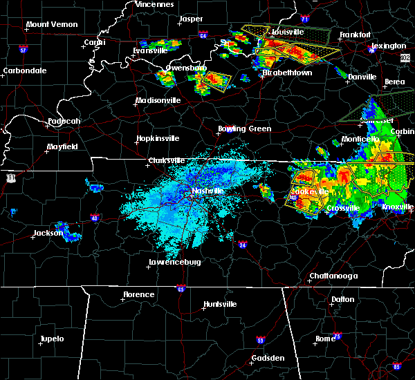 At 826 pm cdt, a severe thunderstorm was located near celina, moving east at 20 mph (radar indicated). Hazards include 60 mph wind gusts and nickel size hail. Expect damage to roofs, siding, and trees. locations impacted include, livingston and standing stone state park. A tornado watch remains in effect until 200 am cdt for middle tennessee. At 826 pm cdt, a severe thunderstorm was located near celina, moving east at 20 mph (radar indicated). Hazards include 60 mph wind gusts and nickel size hail. Expect damage to roofs, siding, and trees. locations impacted include, livingston and standing stone state park. A tornado watch remains in effect until 200 am cdt for middle tennessee.
|
| 7/20/2018 8:25 PM CDT | Numerous trees down in livingston including on preston street...west main street...monterey highway...1972 villa drive...and 900 north church street. power lines also d in overton county TN, 0.4 miles S of Livingston, TN |
| 7/20/2018 8:15 PM CDT |
 At 815 pm cdt, a severe thunderstorm was located over celina, moving east at 20 mph (radar indicated). Hazards include 60 mph wind gusts and nickel size hail. Expect damage to roofs, siding, and trees. locations impacted include, livingston, celina, dale hollow lake and standing stone state park. A tornado watch remains in effect until 200 am cdt for middle tennessee. At 815 pm cdt, a severe thunderstorm was located over celina, moving east at 20 mph (radar indicated). Hazards include 60 mph wind gusts and nickel size hail. Expect damage to roofs, siding, and trees. locations impacted include, livingston, celina, dale hollow lake and standing stone state park. A tornado watch remains in effect until 200 am cdt for middle tennessee.
|
| 7/20/2018 7:56 PM CDT |
 At 756 pm cdt, a severe thunderstorm was located near celina, moving east at 20 mph (radar indicated). Hazards include 60 mph wind gusts and nickel size hail. expect damage to roofs, siding, and trees At 756 pm cdt, a severe thunderstorm was located near celina, moving east at 20 mph (radar indicated). Hazards include 60 mph wind gusts and nickel size hail. expect damage to roofs, siding, and trees
|
| 7/20/2018 7:44 PM CDT | Tree reported down near 170 standing stone park highway near hillham. power outages reported as wel in overton county TN, 6.6 miles ESE of Livingston, TN |
| 7/20/2018 7:29 PM CDT |
 At 728 pm cdt, severe thunderstorms were located along a line extending from sunnybrook to 9 miles west of byrdstown to near livingston, moving east at 30 mph (radar indicated). Hazards include 60 mph wind gusts and quarter size hail. Hail damage to vehicles is expected. expect wind damage to roofs, siding, and trees. locations impacted include, livingston, jamestown, celina, gainesboro, byrdstown, allardt, wolf river dock, dale hollow lake, pall mall, pickett state park, standing stone state park and grimsley. A tornado watch remains in effect until 200 am cdt for middle tennessee. At 728 pm cdt, severe thunderstorms were located along a line extending from sunnybrook to 9 miles west of byrdstown to near livingston, moving east at 30 mph (radar indicated). Hazards include 60 mph wind gusts and quarter size hail. Hail damage to vehicles is expected. expect wind damage to roofs, siding, and trees. locations impacted include, livingston, jamestown, celina, gainesboro, byrdstown, allardt, wolf river dock, dale hollow lake, pall mall, pickett state park, standing stone state park and grimsley. A tornado watch remains in effect until 200 am cdt for middle tennessee.
|
| 7/20/2018 7:12 PM CDT |
 At 711 pm cdt, severe thunderstorms were located along a line extending from near albany to near celina to 7 miles northeast of gainesboro, moving east at 30 mph (radar indicated). Hazards include 60 mph wind gusts and quarter size hail. Hail damage to vehicles is expected. Expect wind damage to roofs, siding, and trees. At 711 pm cdt, severe thunderstorms were located along a line extending from near albany to near celina to 7 miles northeast of gainesboro, moving east at 30 mph (radar indicated). Hazards include 60 mph wind gusts and quarter size hail. Hail damage to vehicles is expected. Expect wind damage to roofs, siding, and trees.
|
| 7/20/2018 7:06 PM CDT |
 At 704 pm cdt, a severe thunderstorm was located near celina, moving east at 35 mph. additional severe thunderstorms were just north of the state line in kentucky. these storms may come southward into tennessee, and all the storms were showing some rotation on radar (radar indicated). Hazards include 60 mph wind gusts and penny size hail. Expect damage to roofs, siding, and trees. locations impacted include, livingston, celina, gainesboro, byrdstown, wolf river dock, moss, whitleyville, dale hollow lake, standing stone state park, static and huntersville. A tornado watch remains in effect until 200 am cdt for middle tennessee. At 704 pm cdt, a severe thunderstorm was located near celina, moving east at 35 mph. additional severe thunderstorms were just north of the state line in kentucky. these storms may come southward into tennessee, and all the storms were showing some rotation on radar (radar indicated). Hazards include 60 mph wind gusts and penny size hail. Expect damage to roofs, siding, and trees. locations impacted include, livingston, celina, gainesboro, byrdstown, wolf river dock, moss, whitleyville, dale hollow lake, standing stone state park, static and huntersville. A tornado watch remains in effect until 200 am cdt for middle tennessee.
|
| 7/20/2018 6:53 PM CDT |
 At 652 pm cdt, a severe thunderstorm was located 7 miles north of gainesboro, moving east at 35 mph. additional thunderstorms were moving east southeast out of kentucky (radar indicated). Hazards include 60 mph wind gusts and penny size hail. expect damage to roofs, siding, and trees At 652 pm cdt, a severe thunderstorm was located 7 miles north of gainesboro, moving east at 35 mph. additional thunderstorms were moving east southeast out of kentucky (radar indicated). Hazards include 60 mph wind gusts and penny size hail. expect damage to roofs, siding, and trees
|
| 6/27/2018 3:18 PM CDT |
 At 317 pm cdt, severe thunderstorms were located along a line extending from near jamestown to 8 miles north of monterey to near gainesboro, moving southeast at 40 mph (emergency management. at 311 pm cdt, several trees and power lines were reportedly blown down across livingston with these storms). Hazards include 60 mph wind gusts. Expect damage to roofs, siding, and trees. Locations impacted include, livingston, jamestown, celina, gainesboro, byrdstown, allardt, grimsley, whitleyville, rickman, pall mall, wolf river dock, clarkrange, crawford, dale hollow lake, pickett state park and standing stone state park. At 317 pm cdt, severe thunderstorms were located along a line extending from near jamestown to 8 miles north of monterey to near gainesboro, moving southeast at 40 mph (emergency management. at 311 pm cdt, several trees and power lines were reportedly blown down across livingston with these storms). Hazards include 60 mph wind gusts. Expect damage to roofs, siding, and trees. Locations impacted include, livingston, jamestown, celina, gainesboro, byrdstown, allardt, grimsley, whitleyville, rickman, pall mall, wolf river dock, clarkrange, crawford, dale hollow lake, pickett state park and standing stone state park.
|
| 6/27/2018 2:58 PM CDT |
 At 257 pm cdt, severe thunderstorms were located along a line extending from near byrdstown to livingston to red boiling springs, moving southeast at 35 mph (radar indicated). Hazards include 60 mph wind gusts and penny size hail. expect damage to roofs, siding, and trees At 257 pm cdt, severe thunderstorms were located along a line extending from near byrdstown to livingston to red boiling springs, moving southeast at 35 mph (radar indicated). Hazards include 60 mph wind gusts and penny size hail. expect damage to roofs, siding, and trees
|
| 6/27/2018 2:52 PM CDT | Trees down 204 west henson street along with power lines down oak and west fourth street in livingsto in overton county TN, 0.4 miles S of Livingston, TN |
| 6/27/2018 2:41 PM CDT |
 At 220 pm cdt, a severe thunderstorm was located near tompkinsville, or 8 miles northwest of celina, moving southeast at 40 mph (radar indicated). Hazards include 60 mph wind gusts and penny size hail. expect damage to roofs, siding, and trees At 220 pm cdt, a severe thunderstorm was located near tompkinsville, or 8 miles northwest of celina, moving southeast at 40 mph (radar indicated). Hazards include 60 mph wind gusts and penny size hail. expect damage to roofs, siding, and trees
|
| 6/27/2018 2:21 PM CDT |
 At 220 pm cdt, a severe thunderstorm was located near tompkinsville, or 8 miles northwest of celina, moving southeast at 40 mph (radar indicated). Hazards include 60 mph wind gusts and penny size hail. expect damage to roofs, siding, and trees At 220 pm cdt, a severe thunderstorm was located near tompkinsville, or 8 miles northwest of celina, moving southeast at 40 mph (radar indicated). Hazards include 60 mph wind gusts and penny size hail. expect damage to roofs, siding, and trees
|
| 6/26/2018 2:54 PM CDT |
 At 253 pm cdt, severe thunderstorms were located along a line extending from near jamestown to near gainesboro, moving east at 30 mph (radar indicated). Hazards include 60 mph wind gusts. Expect damage to roofs, siding, and trees. Locations impacted include, livingston, jamestown, celina, gainesboro, byrdstown, allardt, whitleyville, dale hollow lake, pall mall, pickett state park, standing stone state park and wolf river dock. At 253 pm cdt, severe thunderstorms were located along a line extending from near jamestown to near gainesboro, moving east at 30 mph (radar indicated). Hazards include 60 mph wind gusts. Expect damage to roofs, siding, and trees. Locations impacted include, livingston, jamestown, celina, gainesboro, byrdstown, allardt, whitleyville, dale hollow lake, pall mall, pickett state park, standing stone state park and wolf river dock.
|
| 6/26/2018 2:43 PM CDT |
 At 241 pm cdt, severe thunderstorms were located along a line extending from near byrdstown to gainesboro, moving east at 30 mph (emergency management. at 230 pm cdt, trees were reportedly blown down near byrdstown with these storms). Hazards include 60 mph wind gusts and penny size hail. Expect damage to roofs, siding, and trees. Locations impacted include, livingston, jamestown, celina, gainesboro, byrdstown, allardt, wolf river dock, whitleyville, dale hollow lake, pall mall, pickett state park and standing stone state park. At 241 pm cdt, severe thunderstorms were located along a line extending from near byrdstown to gainesboro, moving east at 30 mph (emergency management. at 230 pm cdt, trees were reportedly blown down near byrdstown with these storms). Hazards include 60 mph wind gusts and penny size hail. Expect damage to roofs, siding, and trees. Locations impacted include, livingston, jamestown, celina, gainesboro, byrdstown, allardt, wolf river dock, whitleyville, dale hollow lake, pall mall, pickett state park and standing stone state park.
|
| 6/26/2018 2:22 PM CDT |
 At 221 pm cdt, severe thunderstorms were located along a line extending from near dale hollow lake to gainesboro, moving east at 30 mph (radar indicated. at 215 pm cdt, trees were reportedly blown down in monroe county, kentucky with this line of storms). Hazards include 60 mph wind gusts and penny size hail. expect damage to roofs, siding, and trees At 221 pm cdt, severe thunderstorms were located along a line extending from near dale hollow lake to gainesboro, moving east at 30 mph (radar indicated. at 215 pm cdt, trees were reportedly blown down in monroe county, kentucky with this line of storms). Hazards include 60 mph wind gusts and penny size hail. expect damage to roofs, siding, and trees
|
| 6/25/2018 5:51 PM CDT |
 At 551 pm cdt, a severe thunderstorm was located near livingston, moving southeast at 20 mph (radar indicated). Hazards include 60 mph wind gusts and quarter size hail. Hail damage to vehicles is expected. Expect wind damage to roofs, siding, and trees. At 551 pm cdt, a severe thunderstorm was located near livingston, moving southeast at 20 mph (radar indicated). Hazards include 60 mph wind gusts and quarter size hail. Hail damage to vehicles is expected. Expect wind damage to roofs, siding, and trees.
|
| 6/25/2018 5:49 PM CDT | Overton sheriff's office reported a tree blown down on highway 85/hilham rd near livingston. dime size hail also reported with the same stor in overton county TN, 3.9 miles E of Livingston, TN |
| 6/24/2018 4:19 PM CDT |
 At 418 pm cdt, a severe thunderstorm was located over livingston, moving northeast at 35 mph (emergency management reported dime-size hail in rickman with this storm). Hazards include 60 mph wind gusts and quarter size hail. Hail damage to vehicles is expected. expect wind damage to roofs, siding, and trees. Locations impacted include, livingston. At 418 pm cdt, a severe thunderstorm was located over livingston, moving northeast at 35 mph (emergency management reported dime-size hail in rickman with this storm). Hazards include 60 mph wind gusts and quarter size hail. Hail damage to vehicles is expected. expect wind damage to roofs, siding, and trees. Locations impacted include, livingston.
|
| 6/24/2018 4:10 PM CDT | Trees down over a carport and two vehicles on rickman r in overton county TN, 4.7 miles NNE of Livingston, TN |
| 6/24/2018 4:04 PM CDT |
 At 403 pm cdt, a severe thunderstorm was located near algood, or 8 miles southwest of livingston, moving northeast at 55 mph (radar indicated). Hazards include 60 mph wind gusts and quarter size hail. Hail damage to vehicles is expected. Expect wind damage to roofs, siding, and trees. At 403 pm cdt, a severe thunderstorm was located near algood, or 8 miles southwest of livingston, moving northeast at 55 mph (radar indicated). Hazards include 60 mph wind gusts and quarter size hail. Hail damage to vehicles is expected. Expect wind damage to roofs, siding, and trees.
|
| 4/3/2018 11:20 PM CDT | Tree down along jamestown hwy in overton county TN, 3.9 miles W of Livingston, TN |
| 4/3/2018 10:23 PM CDT |
 At 1023 pm cdt, severe thunderstorms were located along a line extending from near livingston to cookeville, moving northeast at 75 mph (radar indicated). Hazards include 60 mph wind gusts and quarter size hail. Hail damage to vehicles is expected. Expect wind damage to roofs, siding, and trees. At 1023 pm cdt, severe thunderstorms were located along a line extending from near livingston to cookeville, moving northeast at 75 mph (radar indicated). Hazards include 60 mph wind gusts and quarter size hail. Hail damage to vehicles is expected. Expect wind damage to roofs, siding, and trees.
|
| 11/18/2017 6:21 PM CST |
 The severe thunderstorm warning for central overton, western pickett, western white and central putnam counties will expire at 630 pm cst, the storms which prompted the warning have moved out of the area. therefore the warning will be allowed to expire. however gusty winds are still possible with these thunderstorms. a severe thunderstorm watch remains in effect until 700 pm cst for middle tennessee. The severe thunderstorm warning for central overton, western pickett, western white and central putnam counties will expire at 630 pm cst, the storms which prompted the warning have moved out of the area. therefore the warning will be allowed to expire. however gusty winds are still possible with these thunderstorms. a severe thunderstorm watch remains in effect until 700 pm cst for middle tennessee.
|
| 11/18/2017 6:12 PM CST |
 At 611 pm cst, severe thunderstorms were located along a line extending from byrdstown to near sparta, moving east at 60 mph (radar indicated). Hazards include 60 mph wind gusts. Expect damage to roofs, siding, and trees. Locations impacted include, cookeville, sparta, livingston, byrdstown, algood, doyle, hamptons crossroads, bakers crossroads and rickman. At 611 pm cst, severe thunderstorms were located along a line extending from byrdstown to near sparta, moving east at 60 mph (radar indicated). Hazards include 60 mph wind gusts. Expect damage to roofs, siding, and trees. Locations impacted include, cookeville, sparta, livingston, byrdstown, algood, doyle, hamptons crossroads, bakers crossroads and rickman.
|
| 11/18/2017 6:06 PM CST | Numerous power lines down with power outages across overton county in overton county TN, 0.4 miles S of Livingston, TN |
| 11/18/2017 5:44 PM CST |
 At 544 pm cst, severe thunderstorms were located along a line extending from near celina to 6 miles northwest of smithville, moving east at 45 mph (radar indicated). Hazards include 70 mph wind gusts. Expect considerable tree damage. Damage is likely to mobile homes, roofs, and outbuildings. At 544 pm cst, severe thunderstorms were located along a line extending from near celina to 6 miles northwest of smithville, moving east at 45 mph (radar indicated). Hazards include 70 mph wind gusts. Expect considerable tree damage. Damage is likely to mobile homes, roofs, and outbuildings.
|
| 7/6/2017 5:29 PM CDT | Tree down on wilder hwy southeast of livingston in overton county TN, 6.7 miles NW of Livingston, TN |
| 7/6/2017 5:06 PM CDT | Tree down on cross avenue in livingston in overton county TN, 1.3 miles SSE of Livingston, TN |
| 5/27/2017 9:29 PM EDT |
 At 829 pm cdt, severe thunderstorms were located along a line extending from byrdstown to sparta, moving east at 55 mph. these are very dangerous storms (radar indicated). Hazards include 80 mph wind gusts and quarter size hail. Flying debris will be dangerous to those caught without shelter. mobile homes will be heavily damaged. expect considerable damage to roofs, windows, and vehicles. extensive tree damage and power outages are likely. Locations impacted include, cookeville, livingston, jamestown, byrdstown, fairfield glade, algood, monterey, allardt, grimsley, slate springs, rickman, pall mall, wolf river dock, clarkrange, crawford and pickett state park. At 829 pm cdt, severe thunderstorms were located along a line extending from byrdstown to sparta, moving east at 55 mph. these are very dangerous storms (radar indicated). Hazards include 80 mph wind gusts and quarter size hail. Flying debris will be dangerous to those caught without shelter. mobile homes will be heavily damaged. expect considerable damage to roofs, windows, and vehicles. extensive tree damage and power outages are likely. Locations impacted include, cookeville, livingston, jamestown, byrdstown, fairfield glade, algood, monterey, allardt, grimsley, slate springs, rickman, pall mall, wolf river dock, clarkrange, crawford and pickett state park.
|
| 5/27/2017 8:06 PM CDT |
 At 805 pm cdt, severe thunderstorms were located along a line extending from near celina to 7woodbury, moving east at 45 mph (radar indicated). Hazards include 70 mph wind gusts and quarter size hail. Hail damage to vehicles is expected. expect considerable tree damage. Wind damage is also likely to mobile homes, roofs, and outbuildings. At 805 pm cdt, severe thunderstorms were located along a line extending from near celina to 7woodbury, moving east at 45 mph (radar indicated). Hazards include 70 mph wind gusts and quarter size hail. Hail damage to vehicles is expected. expect considerable tree damage. Wind damage is also likely to mobile homes, roofs, and outbuildings.
|
| 4/30/2017 5:25 PM CDT | Tree down at 315 airport road in overton county TN, 1.3 miles SSW of Livingston, TN |
| 4/30/2017 5:25 PM CDT | Tree down at 637 west 4th street and power line down at 164 goose creek lane in overton county TN, 0.4 miles S of Livingston, TN |
| 4/30/2017 5:23 PM CDT | Tree down at 610 cross avenue in livingston in overton county TN, 0.7 miles SE of Livingston, TN |
| 4/30/2017 5:12 PM CDT |
 At 512 pm cdt, a severe thunderstorm was located 8 miles west of livingston, moving northeast at 45 mph (radar indicated). Hazards include 60 mph wind gusts. Expect damage to roofs, siding, and trees. locations impacted include, livingston and standing stone state park. A tornado watch remains in effect until 700 pm cdt for middle tennessee. At 512 pm cdt, a severe thunderstorm was located 8 miles west of livingston, moving northeast at 45 mph (radar indicated). Hazards include 60 mph wind gusts. Expect damage to roofs, siding, and trees. locations impacted include, livingston and standing stone state park. A tornado watch remains in effect until 700 pm cdt for middle tennessee.
|
| 4/30/2017 4:57 PM CDT |
 At 457 pm cdt, a severe thunderstorm was located near cookeville, moving northeast at 45 mph (radar indicated). Hazards include 60 mph wind gusts. expect damage to roofs, siding, and trees At 457 pm cdt, a severe thunderstorm was located near cookeville, moving northeast at 45 mph (radar indicated). Hazards include 60 mph wind gusts. expect damage to roofs, siding, and trees
|
| 4/5/2017 6:32 PM CDT |
 At 632 pm cdt, a severe thunderstorm was located near livingston, moving northeast at 75 mph (radar indicated). Hazards include 60 mph wind gusts and quarter size hail. Hail damage to vehicles is expected. expect wind damage to roofs, siding, and trees. locations impacted include, livingston and standing stone state park. A tornado watch remains in effect until 900 pm cdt for middle tennessee. At 632 pm cdt, a severe thunderstorm was located near livingston, moving northeast at 75 mph (radar indicated). Hazards include 60 mph wind gusts and quarter size hail. Hail damage to vehicles is expected. expect wind damage to roofs, siding, and trees. locations impacted include, livingston and standing stone state park. A tornado watch remains in effect until 900 pm cdt for middle tennessee.
|
| 4/5/2017 6:25 PM CDT |
 At 624 pm cdt, a severe thunderstorm was located 7 miles southeast of gainesboro, moving northeast at 70 mph (radar indicated). Hazards include 60 mph wind gusts and quarter size hail. Hail damage to vehicles is expected. expect wind damage to roofs, siding, and trees. locations impacted include, cookeville, livingston, algood, baxter, rickman and standing stone state park. A tornado watch remains in effect until 900 pm cdt for middle tennessee. At 624 pm cdt, a severe thunderstorm was located 7 miles southeast of gainesboro, moving northeast at 70 mph (radar indicated). Hazards include 60 mph wind gusts and quarter size hail. Hail damage to vehicles is expected. expect wind damage to roofs, siding, and trees. locations impacted include, cookeville, livingston, algood, baxter, rickman and standing stone state park. A tornado watch remains in effect until 900 pm cdt for middle tennessee.
|
| 4/5/2017 6:12 PM CDT |
 At 611 pm cdt, a severe thunderstorm was located near baxter, or 10 miles northeast of smithville, moving northeast at 60 mph (radar indicated). Hazards include 60 mph wind gusts and quarter size hail. Hail damage to vehicles is expected. Expect wind damage to roofs, siding, and trees. At 611 pm cdt, a severe thunderstorm was located near baxter, or 10 miles northeast of smithville, moving northeast at 60 mph (radar indicated). Hazards include 60 mph wind gusts and quarter size hail. Hail damage to vehicles is expected. Expect wind damage to roofs, siding, and trees.
|
| 3/1/2017 8:35 AM CST |
 At 835 am cst, severe thunderstorms were located along a line extending from sunnybrook to 7 miles southeast of sparta, moving east at 75 mph (radar indicated). Hazards include 70 mph wind gusts and penny size hail. Expect considerable tree damage. damage is likely to mobile homes, roofs, and outbuildings. locations impacted include, cookeville, crossville, sparta, livingston, jamestown, byrdstown, algood, monterey, allardt, pleasant hill, doyle, grimsley, hamptons crossroads, bakers crossroads, virgin falls state natural area, rickman, pall mall, indian rock lake, clarkrange and crawford. A tornado watch remains in effect until 1000 am cst for middle tennessee. At 835 am cst, severe thunderstorms were located along a line extending from sunnybrook to 7 miles southeast of sparta, moving east at 75 mph (radar indicated). Hazards include 70 mph wind gusts and penny size hail. Expect considerable tree damage. damage is likely to mobile homes, roofs, and outbuildings. locations impacted include, cookeville, crossville, sparta, livingston, jamestown, byrdstown, algood, monterey, allardt, pleasant hill, doyle, grimsley, hamptons crossroads, bakers crossroads, virgin falls state natural area, rickman, pall mall, indian rock lake, clarkrange and crawford. A tornado watch remains in effect until 1000 am cst for middle tennessee.
|
| 3/1/2017 8:20 AM CST |
 At 820 am cst, severe thunderstorms were located along a line extending from 9 miles west of byrdstown to 11 miles southeast of smithville, moving east at 65 mph (radar indicated). Hazards include 70 mph wind gusts and penny size hail. Expect considerable tree damage. Damage is likely to mobile homes, roofs, and outbuildings. At 820 am cst, severe thunderstorms were located along a line extending from 9 miles west of byrdstown to 11 miles southeast of smithville, moving east at 65 mph (radar indicated). Hazards include 70 mph wind gusts and penny size hail. Expect considerable tree damage. Damage is likely to mobile homes, roofs, and outbuildings.
|
| 2/24/2017 10:33 PM CST | Quarter sized hail reported 3.9 miles NNE of Livingston, TN, photogrpahic evidence of hail |
| 2/8/2017 3:43 PM CST |
 At 343 pm cst, a severe thunderstorm was located 7 miles southwest of byrdstown, moving northeast at 35 mph (radar indicated). Hazards include 60 mph wind gusts and quarter size hail. Hail damage to vehicles is expected. expect wind damage to roofs, siding, and trees. Locations impacted include, livingston, jamestown, byrdstown, wolf river dock, huntersville and static. At 343 pm cst, a severe thunderstorm was located 7 miles southwest of byrdstown, moving northeast at 35 mph (radar indicated). Hazards include 60 mph wind gusts and quarter size hail. Hail damage to vehicles is expected. expect wind damage to roofs, siding, and trees. Locations impacted include, livingston, jamestown, byrdstown, wolf river dock, huntersville and static.
|
| 2/8/2017 3:28 PM CST |
 At 327 pm cst, a severe thunderstorm was located over livingston, moving northeast at 35 mph (radar indicated). Hazards include 60 mph wind gusts and quarter size hail. Hail damage to vehicles is expected. Expect wind damage to roofs, siding, and trees. At 327 pm cst, a severe thunderstorm was located over livingston, moving northeast at 35 mph (radar indicated). Hazards include 60 mph wind gusts and quarter size hail. Hail damage to vehicles is expected. Expect wind damage to roofs, siding, and trees.
|
| 12/18/2016 12:48 AM CST | Trees down blocking road on hillham highway near flat creek bridge. also report of roof damage in the same area due to trees dow in overton county TN, 3.5 miles ESE of Livingston, TN |
| 12/18/2016 12:48 AM CST |
 At 1247 am cst, a severe thunderstorm was located 7 miles west of byrdstown, moving northeast at 70 mph (radar indicated). Hazards include 60 mph wind gusts. Expect damage to roofs, siding, and trees. Locations impacted include, livingston, celina, byrdstown, wolf river dock, pall mall, dale hollow lake and standing stone state park. At 1247 am cst, a severe thunderstorm was located 7 miles west of byrdstown, moving northeast at 70 mph (radar indicated). Hazards include 60 mph wind gusts. Expect damage to roofs, siding, and trees. Locations impacted include, livingston, celina, byrdstown, wolf river dock, pall mall, dale hollow lake and standing stone state park.
|
| 12/18/2016 12:35 AM CST |
 At 1235 am cst, a severe thunderstorm was located near celina, moving northeast at 70 mph (radar indicated). Hazards include 60 mph wind gusts. expect damage to roofs, siding, and trees At 1235 am cst, a severe thunderstorm was located near celina, moving northeast at 70 mph (radar indicated). Hazards include 60 mph wind gusts. expect damage to roofs, siding, and trees
|
| 7/8/2016 10:32 PM CDT |
 At 1031 pm cdt, severe thunderstorms were located along a line extending from near byrdstown to near monterey, moving east at 50 mph (radar indicated). Hazards include 60 mph wind gusts and penny size hail. Expect damage to roofs. siding. and trees. Locations impacted include, livingston, jamestown, byrdstown, allardt, rickman, wolf river dock, pall mall, grimsley, pickett state park, crawford and clarkrange. At 1031 pm cdt, severe thunderstorms were located along a line extending from near byrdstown to near monterey, moving east at 50 mph (radar indicated). Hazards include 60 mph wind gusts and penny size hail. Expect damage to roofs. siding. and trees. Locations impacted include, livingston, jamestown, byrdstown, allardt, rickman, wolf river dock, pall mall, grimsley, pickett state park, crawford and clarkrange.
|
| 7/8/2016 10:13 PM CDT | Tree down and power outages west of livingston on standing stone highway in overton county TN, 6.2 miles E of Livingston, TN |
| 7/8/2016 9:58 PM CDT |
 At 958 pm cdt, severe thunderstorms were located along a line extending from near celina to near baxter, moving east at 60 mph (radar indicated). Hazards include 70 mph wind gusts and penny size hail. Expect considerable tree damage. damage is likely to mobile homes, roofs, and outbuildings. Locations impacted include, livingston, jamestown, celina, gainesboro, byrdstown, allardt, granville, rickman, wolf river dock, standing stone state park, whitleyville, crawford, moss, pall mall, dale hollow lake, grimsley, pickett state park and clarkrange. At 958 pm cdt, severe thunderstorms were located along a line extending from near celina to near baxter, moving east at 60 mph (radar indicated). Hazards include 70 mph wind gusts and penny size hail. Expect considerable tree damage. damage is likely to mobile homes, roofs, and outbuildings. Locations impacted include, livingston, jamestown, celina, gainesboro, byrdstown, allardt, granville, rickman, wolf river dock, standing stone state park, whitleyville, crawford, moss, pall mall, dale hollow lake, grimsley, pickett state park and clarkrange.
|
| 7/8/2016 9:50 PM CDT |
 At 950 pm cdt, severe thunderstorms were located along a line extending from tompkinsville to baxter, moving east at 50 mph (radar indicated). Hazards include 60 mph wind gusts and penny size hail. Expect damage to roofs. siding. And trees. At 950 pm cdt, severe thunderstorms were located along a line extending from tompkinsville to baxter, moving east at 50 mph (radar indicated). Hazards include 60 mph wind gusts and penny size hail. Expect damage to roofs. siding. And trees.
|
| 7/8/2016 4:27 PM CDT |
 At 427 pm cdt, a severe thunderstorm was located near gainesboro, moving southeast at 30 mph (radar indicated). Hazards include 60 mph wind gusts and quarter size hail. Hail damage to vehicles is expected. Expect wind damage to roofs, siding, and trees. At 427 pm cdt, a severe thunderstorm was located near gainesboro, moving southeast at 30 mph (radar indicated). Hazards include 60 mph wind gusts and quarter size hail. Hail damage to vehicles is expected. Expect wind damage to roofs, siding, and trees.
|
| 7/8/2016 4:10 PM CDT | Large tree across and blocking highway 85 in alpin in overton county TN, 6.1 miles W of Livingston, TN |
| 7/8/2016 4:01 PM CDT |
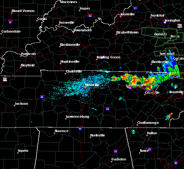 At 400 pm cdt, a severe thunderstorm was located near livingston, moving east at 45 mph. quarter size hail was reported in livingston (radar indicated). Hazards include 60 mph wind gusts and quarter size hail. Hail damage to vehicles is expected. expect wind damage to roofs, siding, and trees. Locations impacted include, livingston, rickman and crawford. At 400 pm cdt, a severe thunderstorm was located near livingston, moving east at 45 mph. quarter size hail was reported in livingston (radar indicated). Hazards include 60 mph wind gusts and quarter size hail. Hail damage to vehicles is expected. expect wind damage to roofs, siding, and trees. Locations impacted include, livingston, rickman and crawford.
|
| 7/8/2016 3:59 PM CDT | Quarter sized hail reported 0.4 miles S of Livingston, TN |
| 7/8/2016 3:57 PM CDT |
 At 356 pm cdt, a severe thunderstorm was located near livingston, moving east at 45 mph (radar indicated). Hazards include 60 mph wind gusts and quarter size hail. Hail damage to vehicles is expected. expect wind damage to roofs, siding, and trees. Locations impacted include, livingston, algood, crawford and rickman. At 356 pm cdt, a severe thunderstorm was located near livingston, moving east at 45 mph (radar indicated). Hazards include 60 mph wind gusts and quarter size hail. Hail damage to vehicles is expected. expect wind damage to roofs, siding, and trees. Locations impacted include, livingston, algood, crawford and rickman.
|
| 7/8/2016 3:46 PM CDT |
 At 346 pm cdt, a severe thunderstorm was located 9 miles southwest of livingston, moving east at 45 mph (radar indicated). Hazards include 60 mph wind gusts and quarter size hail. Hail damage to vehicles is expected. Expect wind damage to roofs, siding, and trees. At 346 pm cdt, a severe thunderstorm was located 9 miles southwest of livingston, moving east at 45 mph (radar indicated). Hazards include 60 mph wind gusts and quarter size hail. Hail damage to vehicles is expected. Expect wind damage to roofs, siding, and trees.
|
| 7/8/2016 3:24 PM CDT |
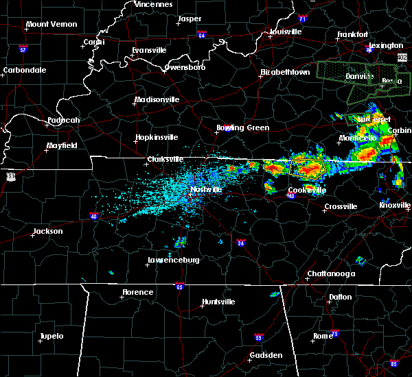 The severe thunderstorm warning for eastern clay, pickett, northwestern fentress and northern overton counties will expire at 330 pm cdt, the storm which prompted the warning has weakened below severe limits, and no longer poses an immediate threat to life or property. therefore the warning will be allowed to expire. a severe thunderstorm watch remains in effect until 800 pm cdt for middle tennessee. The severe thunderstorm warning for eastern clay, pickett, northwestern fentress and northern overton counties will expire at 330 pm cdt, the storm which prompted the warning has weakened below severe limits, and no longer poses an immediate threat to life or property. therefore the warning will be allowed to expire. a severe thunderstorm watch remains in effect until 800 pm cdt for middle tennessee.
|
| 7/8/2016 3:19 PM CDT |
 At 318 pm cdt, a severe thunderstorm was located 7 miles southwest of byrdstown, moving east at 30 mph (radar indicated). Hazards include 60 mph wind gusts and quarter size hail. Hail damage to vehicles is expected. expect wind damage to roofs, siding, and trees. Locations impacted include, byrdstown, standing stone state park, wolf river dock, dale hollow lake and static. At 318 pm cdt, a severe thunderstorm was located 7 miles southwest of byrdstown, moving east at 30 mph (radar indicated). Hazards include 60 mph wind gusts and quarter size hail. Hail damage to vehicles is expected. expect wind damage to roofs, siding, and trees. Locations impacted include, byrdstown, standing stone state park, wolf river dock, dale hollow lake and static.
|
| 7/8/2016 3:05 PM CDT |
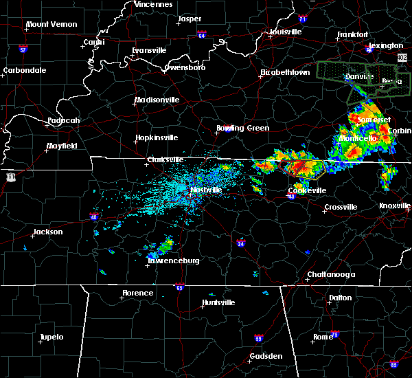 At 305 pm cdt, a severe thunderstorm was located near celina, moving east at 30 mph (radar indicated). Hazards include 60 mph wind gusts and quarter size hail. Hail damage to vehicles is expected. Expect wind damage to roofs, siding, and trees. At 305 pm cdt, a severe thunderstorm was located near celina, moving east at 30 mph (radar indicated). Hazards include 60 mph wind gusts and quarter size hail. Hail damage to vehicles is expected. Expect wind damage to roofs, siding, and trees.
|
| 7/7/2016 4:07 PM CDT | Overton county ema reported numerous trees down across the county and watched 2 trees get blown down from the 911 center. power pole fires reported and power lines down in overton county TN, 0.4 miles S of Livingston, TN |
| 7/7/2016 4:02 PM CDT |
 At 402 pm cdt, a severe thunderstorm was located 8 miles west of byrdstown, moving east at 35 mph (radar indicated). Hazards include 60 mph wind gusts and penny size hail. Expect damage to roofs. siding. And trees. At 402 pm cdt, a severe thunderstorm was located 8 miles west of byrdstown, moving east at 35 mph (radar indicated). Hazards include 60 mph wind gusts and penny size hail. Expect damage to roofs. siding. And trees.
|
| 7/7/2016 4:00 PM CDT | Overton county ema reported numerous trees down across the county and watched 2 trees get blown down from the 911 center. power pole fires reported and power lines down in overton county TN, 0.4 miles S of Livingston, TN |
| 7/7/2016 3:55 PM CDT |
 At 353 pm cdt, a cluster of severe thunderstorms were located alonga line from gainesboro to celina, moving southeast at 55 mph (radar indicated). Hazards include 60 mph wind gusts. Expect damage to roofs. siding. and trees. Locations impacted include, cookeville, livingston, carthage, celina, gainesboro, baxter, granville, dale hollow lake, standing stone state park, dixon springs, pleasant shade, whitleyville and moss. At 353 pm cdt, a cluster of severe thunderstorms were located alonga line from gainesboro to celina, moving southeast at 55 mph (radar indicated). Hazards include 60 mph wind gusts. Expect damage to roofs. siding. and trees. Locations impacted include, cookeville, livingston, carthage, celina, gainesboro, baxter, granville, dale hollow lake, standing stone state park, dixon springs, pleasant shade, whitleyville and moss.
|
| 7/7/2016 3:32 PM CDT |
 At 331 pm cdt, a severe thunderstorm was located 7 miles south of lafayette, moving southeast at 55 mph (radar indicated). Hazards include 60 mph wind gusts. Expect damage to roofs. siding. And trees. At 331 pm cdt, a severe thunderstorm was located 7 miles south of lafayette, moving southeast at 55 mph (radar indicated). Hazards include 60 mph wind gusts. Expect damage to roofs. siding. And trees.
|
| 7/6/2016 5:10 PM CDT |
 At 509 pm cdt, severe thunderstorms were located along a line extending from byrdstown to baxter, moving east at 40 mph (radar indicated). Hazards include 60 mph wind gusts and penny size hail. Expect damage to roofs. siding. and trees. Locations impacted include, cookeville, livingston, jamestown, byrdstown, algood, monterey, baxter, allardt, rickman, pall mall, pickett state park and crawford. At 509 pm cdt, severe thunderstorms were located along a line extending from byrdstown to baxter, moving east at 40 mph (radar indicated). Hazards include 60 mph wind gusts and penny size hail. Expect damage to roofs. siding. and trees. Locations impacted include, cookeville, livingston, jamestown, byrdstown, algood, monterey, baxter, allardt, rickman, pall mall, pickett state park and crawford.
|
| 7/6/2016 4:50 PM CDT |
 At 449 pm cdt, severe thunderstorms were located along a line extending from celina to carthage, moving east at 55 mph (radar indicated). Hazards include 60 mph wind gusts and penny size hail. Expect damage to roofs. siding. And trees. At 449 pm cdt, severe thunderstorms were located along a line extending from celina to carthage, moving east at 55 mph (radar indicated). Hazards include 60 mph wind gusts and penny size hail. Expect damage to roofs. siding. And trees.
|
| 7/4/2016 4:26 PM CDT |
 At 425 pm cdt, severe thunderstorms were located along a line extending from 6 miles southeast of sunnybrook to near livingston, moving east at 50 mph (radar indicated). Hazards include 60 mph wind gusts. Expect damage to roofs. siding. and trees. Locations impacted include, livingston, jamestown, byrdstown, allardt, rickman, wolf river dock, pall mall, pickett state park, crawford and standing stone state park. At 425 pm cdt, severe thunderstorms were located along a line extending from 6 miles southeast of sunnybrook to near livingston, moving east at 50 mph (radar indicated). Hazards include 60 mph wind gusts. Expect damage to roofs. siding. and trees. Locations impacted include, livingston, jamestown, byrdstown, allardt, rickman, wolf river dock, pall mall, pickett state park, crawford and standing stone state park.
|
| 7/4/2016 4:01 PM CDT |
 At 401 pm cdt, severe thunderstorms were located along a line extending from near byrdstown to gainesboro, moving east at 40 mph (radar indicated). Hazards include 60 mph wind gusts. Expect damage to roofs. siding. And trees. At 401 pm cdt, severe thunderstorms were located along a line extending from near byrdstown to gainesboro, moving east at 40 mph (radar indicated). Hazards include 60 mph wind gusts. Expect damage to roofs. siding. And trees.
|
| 4/6/2016 6:51 PM CDT |
 At 651 pm cdt, severe thunderstorms were located along a line extending from 6 miles east of burkesville to near livingston, moving northeast at 60 mph (radar indicated). Hazards include 60 mph wind gusts. Expect damage to roofs. siding. and trees. Locations impacted include, livingston, celina, standing stone state park and dale hollow lake. At 651 pm cdt, severe thunderstorms were located along a line extending from 6 miles east of burkesville to near livingston, moving northeast at 60 mph (radar indicated). Hazards include 60 mph wind gusts. Expect damage to roofs. siding. and trees. Locations impacted include, livingston, celina, standing stone state park and dale hollow lake.
|
| 4/6/2016 6:30 PM CDT |
 At 629 pm cdt, severe thunderstorms were located along a line extending from near tompkinsville to near gainesboro, moving east at 50 mph (radar indicated. this storm does have a history of producing damage, including large trees down and power outages). Hazards include 60 mph wind gusts. Expect damage to roofs. siding. and trees. Locations impacted include, livingston, celina, gainesboro, granville, dale hollow lake, standing stone state park, whitleyville and moss. At 629 pm cdt, severe thunderstorms were located along a line extending from near tompkinsville to near gainesboro, moving east at 50 mph (radar indicated. this storm does have a history of producing damage, including large trees down and power outages). Hazards include 60 mph wind gusts. Expect damage to roofs. siding. and trees. Locations impacted include, livingston, celina, gainesboro, granville, dale hollow lake, standing stone state park, whitleyville and moss.
|
| 4/6/2016 6:10 PM CDT |
 At 609 pm cdt, severe thunderstorms were located along a line extending from 7 miles north of red boiling springs to carthage, moving northeast at 60 mph (radar indicated. this storm does have a history of producing wind damage, including large trees down and power outages). Hazards include 60 mph wind gusts. Expect damage to roofs. siding. And trees. At 609 pm cdt, severe thunderstorms were located along a line extending from 7 miles north of red boiling springs to carthage, moving northeast at 60 mph (radar indicated. this storm does have a history of producing wind damage, including large trees down and power outages). Hazards include 60 mph wind gusts. Expect damage to roofs. siding. And trees.
|
| 3/1/2016 1:20 PM CST |
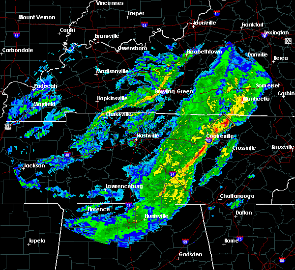 At 119 pm cst, a severe thunderstorm was located over livingston, moving northeast at 45 mph (radar indicated). Hazards include 60 mph wind gusts and quarter size hail. Hail damage to vehicles is expected. Expect wind damage to roofs, siding, and trees. At 119 pm cst, a severe thunderstorm was located over livingston, moving northeast at 45 mph (radar indicated). Hazards include 60 mph wind gusts and quarter size hail. Hail damage to vehicles is expected. Expect wind damage to roofs, siding, and trees.
|
| 12/25/2015 8:10 AM CST |
 At 810 am cst, a severe thunderstorm was located near algood, or 10 miles northeast of cookeville, moving northeast at 45 mph (radar indicated). Hazards include 60 mph wind gusts. Expect damage to roofs. siding and trees. Locations impacted include, cookeville, livingston, algood, monterey and rickman. At 810 am cst, a severe thunderstorm was located near algood, or 10 miles northeast of cookeville, moving northeast at 45 mph (radar indicated). Hazards include 60 mph wind gusts. Expect damage to roofs. siding and trees. Locations impacted include, cookeville, livingston, algood, monterey and rickman.
|
| 12/25/2015 7:58 AM CST |
 At 758 am cst, a severe thunderstorm was located over algood, or near cookeville, moving northeast at 45 mph (radar indicated). Hazards include 60 mph wind gusts and quarter size hail. Hail damage to vehicles is expected. Expect wind damage to roofs, siding and trees. At 758 am cst, a severe thunderstorm was located over algood, or near cookeville, moving northeast at 45 mph (radar indicated). Hazards include 60 mph wind gusts and quarter size hail. Hail damage to vehicles is expected. Expect wind damage to roofs, siding and trees.
|
| 12/23/2015 11:04 PM CST | At 1103 pm cst, a severe thunderstorm was located near byrdstown, moving northeast at 70 mph (radar indicated). Hazards include 60 mph wind gusts and penny size hail. Expect damage to roofs. siding and trees. locations impacted include, livingston, jamestown, byrdstown, huntersville, wolf river dock, dale hollow lake and static. A tornado watch remains in effect until 400 am cst for central tennessee. |
| 12/23/2015 10:54 PM CST | Trees down on powerlines on willow grove highwa in overton county TN, 7.2 miles SSW of Livingston, TN |
| 12/23/2015 10:50 PM CST | At 1050 pm cst, a severe thunderstorm was located near livingston, moving northeast at 65 mph (radar indicated). Hazards include 60 mph wind gusts and penny size hail. Expect damage to roofs. Siding and trees. |
| 7/14/2015 2:18 PM CDT | Multiple power lines down along with power outages and trees down across overton count in overton county TN, 0.4 miles S of Livingston, TN |
| 7/14/2015 2:09 PM CDT |
 At 208 pm cdt, a severe thunderstorm was located 7 miles north of algood, or 9 miles north of cookeville, moving east at 30 mph (radar indicated). Hazards include 60 mph wind gusts and quarter size hail. Hail damage to vehicles is expected. expect wind damage to roofs, siding and trees. This severe thunderstorm will remain over mainly rural areas of north central putnam, southeastern jackson and southwestern overton counties, including the following locations, rickman. At 208 pm cdt, a severe thunderstorm was located 7 miles north of algood, or 9 miles north of cookeville, moving east at 30 mph (radar indicated). Hazards include 60 mph wind gusts and quarter size hail. Hail damage to vehicles is expected. expect wind damage to roofs, siding and trees. This severe thunderstorm will remain over mainly rural areas of north central putnam, southeastern jackson and southwestern overton counties, including the following locations, rickman.
|
| 7/14/2015 1:54 PM CDT |
 At 153 pm cdt, a severe thunderstorm was located over gainesboro, moving east at 30 mph (radar indicated). Hazards include 60 mph wind gusts and quarter size hail. Hail damage to vehicles is expected. expect wind damage to roofs, siding and trees. this severe thunderstorm will be near, algood around 215 pm cdt. livingston around 230 pm cdt. Other locations impacted by this severe thunderstorm include rickman. At 153 pm cdt, a severe thunderstorm was located over gainesboro, moving east at 30 mph (radar indicated). Hazards include 60 mph wind gusts and quarter size hail. Hail damage to vehicles is expected. expect wind damage to roofs, siding and trees. this severe thunderstorm will be near, algood around 215 pm cdt. livingston around 230 pm cdt. Other locations impacted by this severe thunderstorm include rickman.
|
| 7/14/2015 1:26 PM CDT |
 At 126 pm cdt, a severe thunderstorm was located 9 miles southeast of livingston, moving east at 40 mph (radar indicated). Hazards include 60 mph wind gusts and quarter size hail. Hail damage to vehicles is expected. expect wind damage to roofs, siding and trees. This severe thunderstorm will remain over mainly rural areas of central fentress and southeastern overton counties, including the following locations, grimsley, allardt, crawford and clarkrange. At 126 pm cdt, a severe thunderstorm was located 9 miles southeast of livingston, moving east at 40 mph (radar indicated). Hazards include 60 mph wind gusts and quarter size hail. Hail damage to vehicles is expected. expect wind damage to roofs, siding and trees. This severe thunderstorm will remain over mainly rural areas of central fentress and southeastern overton counties, including the following locations, grimsley, allardt, crawford and clarkrange.
|
| 7/13/2015 7:25 PM CDT |
 At 724 pm cdt, a severe thunderstorm was located 7 miles east of celina, moving southeast at 25 mph (radar indicated). Hazards include golf ball size hail and 60 mph wind gusts. People and animals outdoors will be injured. expect hail damage to roofs, siding, windows and vehicles. expect wind damage to roofs, siding and trees. this severe storm will be near, livingston around 750 pm cdt. Other locations impacted by this severe thunderstorm include grimsley, standing stone state park, crawford, rickman and dale hollow lake. At 724 pm cdt, a severe thunderstorm was located 7 miles east of celina, moving southeast at 25 mph (radar indicated). Hazards include golf ball size hail and 60 mph wind gusts. People and animals outdoors will be injured. expect hail damage to roofs, siding, windows and vehicles. expect wind damage to roofs, siding and trees. this severe storm will be near, livingston around 750 pm cdt. Other locations impacted by this severe thunderstorm include grimsley, standing stone state park, crawford, rickman and dale hollow lake.
|
| 7/13/2015 6:57 PM CDT |
 At 655 pm cdt, a severe thunderstorm was located 7 miles south of burkesville, or 10 miles northeast of celina, moving south at 25 mph (radar indicated). Hazards include 60 mph wind gusts and half dollar size hail. Hail damage to vehicles is expected. expect wind damage to roofs, siding and trees. this severe thunderstorm will be near, celina around 715 pm cdt. livingston around 750 pm cdt. Other locations impacted by this severe thunderstorm include grimsley, standing stone state park, crawford, rickman and dale hollow lake. At 655 pm cdt, a severe thunderstorm was located 7 miles south of burkesville, or 10 miles northeast of celina, moving south at 25 mph (radar indicated). Hazards include 60 mph wind gusts and half dollar size hail. Hail damage to vehicles is expected. expect wind damage to roofs, siding and trees. this severe thunderstorm will be near, celina around 715 pm cdt. livingston around 750 pm cdt. Other locations impacted by this severe thunderstorm include grimsley, standing stone state park, crawford, rickman and dale hollow lake.
|
| 7/7/2015 8:10 PM CDT |
 At 809 pm cdt, a severe thunderstorm was located over algood, or near cookeville, moving east at 60 mph (radar indicated). Hazards include 60 mph wind gusts. Expect damage to roofs. siding and trees. this severe storm will be near, monterey around 820 pm cdt. Other locations impacted by this severe thunderstorm include rickman. At 809 pm cdt, a severe thunderstorm was located over algood, or near cookeville, moving east at 60 mph (radar indicated). Hazards include 60 mph wind gusts. Expect damage to roofs. siding and trees. this severe storm will be near, monterey around 820 pm cdt. Other locations impacted by this severe thunderstorm include rickman.
|
| 7/7/2015 7:54 PM CDT |
 At 753 pm cdt, a severe thunderstorm was located near baxter, or 12 miles west of cookeville, moving east at 60 mph (radar indicated). Hazards include 60 mph wind gusts. Expect damage to roofs. siding and trees. this severe thunderstorm will be near, cookeville around 805 pm cdt. algood around 810 pm cdt. monterey around 820 pm cdt. Other locations impacted by this severe thunderstorm include rickman. At 753 pm cdt, a severe thunderstorm was located near baxter, or 12 miles west of cookeville, moving east at 60 mph (radar indicated). Hazards include 60 mph wind gusts. Expect damage to roofs. siding and trees. this severe thunderstorm will be near, cookeville around 805 pm cdt. algood around 810 pm cdt. monterey around 820 pm cdt. Other locations impacted by this severe thunderstorm include rickman.
|
| 6/29/2015 8:20 PM CDT | Several reports of trees downed in northeast overton county and near the overton and fentress county line. time estimated based on rada in overton county TN, 9.2 miles WSW of Livingston, TN |
| 6/29/2015 8:07 PM CDT |
 At 806 pm cdt, a severe thunderstorm was located over jamestown, moving east at 30 mph (radar indicated). Hazards include 60 mph wind gusts and quarter size hail. Hail damage to vehicles is expected. expect wind damage to roofs, siding and trees. This severe thunderstorm will remain over mainly rural areas of fentress, southwestern pickett and central overton counties, including the following locations, grimsley, allardt and crawford. At 806 pm cdt, a severe thunderstorm was located over jamestown, moving east at 30 mph (radar indicated). Hazards include 60 mph wind gusts and quarter size hail. Hail damage to vehicles is expected. expect wind damage to roofs, siding and trees. This severe thunderstorm will remain over mainly rural areas of fentress, southwestern pickett and central overton counties, including the following locations, grimsley, allardt and crawford.
|
| 6/29/2015 7:48 PM CDT |
 At 747 pm cdt, a severe thunderstorm was located 7 miles west of jamestown, moving east at 30 mph (radar indicated). Hazards include 60 mph wind gusts and quarter size hail. Hail damage to vehicles is expected. expect wind damage to roofs, siding and trees. this severe thunderstorm will be near, jamestown around 800 pm cdt. Other locations impacted by this severe thunderstorm include grimsley, allardt, pickett state park, crawford, pall mall and dale hollow lake. At 747 pm cdt, a severe thunderstorm was located 7 miles west of jamestown, moving east at 30 mph (radar indicated). Hazards include 60 mph wind gusts and quarter size hail. Hail damage to vehicles is expected. expect wind damage to roofs, siding and trees. this severe thunderstorm will be near, jamestown around 800 pm cdt. Other locations impacted by this severe thunderstorm include grimsley, allardt, pickett state park, crawford, pall mall and dale hollow lake.
|
| 6/26/2015 6:24 PM CDT | The severe thunderstorm warning for west central fentress, western pickett and northern overton counties will expire at 630 pm cdt, the storm which prompted the warning has moved out of the area. therefore the warning will be allowed to expire. |
| 6/26/2015 6:04 PM CDT | At 603 pm cdt, a severe thunderstorm was located over livingston, moving northeast at 25 mph (radar indicated). Hazards include 60 mph wind gusts and quarter size hail. Hail damage to vehicles is expected. expect wind damage to roofs, siding and trees. This severe thunderstorm will remain over mainly rural areas of west central fentress, western pickett and northern overton counties. |
| 4/20/2015 2:57 AM CDT | The severe thunderstorm warning for eastern jackson, eastern clay, western pickett and northern overton counties will expire at 300 am cdt, the line of storms which prompted the warning have weakened below severe limits, and no longer poses an immediate threat to life or property. however, gusty winds to 50 mph are still possible with these thunderstorms. |
| 4/20/2015 2:50 AM CDT | At 246 am cdt, severe thunderstorms were located along a line extending from 10 miles northeast of celina to rickman, and moving east at 50 mph (radar indicated). Hazards include 60 mph wind gusts. Expect damage to roofs. siding and trees. severe thunderstorms will be near, byrdstown around 300 am cdt. 75in. |
| 4/20/2015 2:39 AM CDT | At 236 am cdt, severe thunderstorms were located along a line extending from celina to 8 miles northwest of algood, and moving east at 50 mph (radar indicated). Hazards include 60 mph wind gusts. Expect damage to roofs. siding and trees. severe thunderstorms will be near, livingston around 250 am cdt. byrdstown around 300 am cdt. other locations in the warning include dale hollow lake and standing stone state park. 75in. |
| 4/20/2015 2:19 AM CDT | At 218 am cdt, severe thunderstorms were located along a line extending from 7 miles south of tompkinsville to 9 miles east of carthage, and moving east at 50 mph (radar indicated). Hazards include 60 mph wind gusts. Expect damage to roofs. siding and trees. severe thunderstorms will be near, gainesboro around 225 am cdt. celina around 235 am cdt. livingston around 250 am cdt. byrdstown around 300 am cdt. other locations in the warning include boles, whitleyville, moss, standing stone state park and dale hollow lake. 75in. |
| 4/10/2015 4:37 AM CDT | The severe thunderstorm warning for southeastern jackson. eastern clay. pickett and northern overton counties will expire at 445 am cdt. the line of storms which prompted the warning has weakened below severe limits. and no longer poses an immediate threat to life or property. however. Gusty winds are still possible with these. |
| 4/10/2015 4:26 AM CDT | A severe thunderstorm warning remains in effect for southeastern jackson. eastern clay. pickett and northern overton counties until 445 am cdt. at 423 am cdt. severe thunderstorms were located along a line extending from 7 miles east of albany to 6 miles southwest of byrdstown to 7 miles southwest of livingston. And moving east at 40. |
| 4/10/2015 4:09 AM CDT | A severe thunderstorm warning remains in effect for jackson. eastern clay. pickett and northern overton counties until 445 am cdt. at 407 am cdt. severe thunderstorms were located along a line extending from 6 miles southwest of albany to 6 miles northwest of livingston to 6 miles south of gainesboro. And moving east at 40. |
| 4/10/2015 3:54 AM CDT | The national weather service in nashville has issued a * severe thunderstorm warning for. eastern clay county in middle tennessee. jackson county in middle tennessee. northern overton county in middle tennessee. Pickett county in middle tennessee. |
| 6/10/2014 1:45 PM CDT | Tspotter report of trees and tree limbs blown down in the hilham area in overton county TN, 6.4 miles ESE of Livingston, TN |
| 5/22/2014 5:15 PM CDT | Trees down blocking both lanes of highway 136 near poplar spring in overton county TN, 5.4 miles NE of Livingston, TN |
| 12/21/2013 11:22 PM CST | Trees and power lines down across the count in overton county TN, 0.4 miles S of Livingston, TN |
| 11/1/2013 12:45 AM CDT | A few trees were downed in livingsto in overton county TN, 0.4 miles S of Livingston, TN |
| 11/1/2013 12:05 AM CDT | A large tree fell on a truck at 4630 new hope roa in overton county TN, 2 miles NE of Livingston, TN |
| 5/21/2013 2:20 PM CDT | Winds estimated at over 50 mph. tree fell on hom in overton county TN, 6.4 miles ESE of Livingston, TN |
| 3/24/2013 3:50 PM CDT | Trees and power lines down a few miles west of livingsto in overton county TN, 2.8 miles E of Livingston, TN |
| 1/30/2013 5:15 AM CST | A few trees and power lines were downed across roadways in the western portion of the count in overton county TN, 0.4 miles S of Livingston, TN |
| 8/1/2012 3:45 PM CDT | Quarter sized hail reported 7.3 miles SE of Livingston, TN |
| 7/8/2012 7:43 PM CDT | Two large trees were downed and blocking windle community road near livingsto in overton county TN, 0.4 miles S of Livingston, TN |
| 3/2/2012 6:00 PM CST | Barn destroyed. neighbors house roof ripped off. near the intersection of hardys chapel road and crawfords chapel roa in overton county TN, 5.4 miles NE of Livingston, TN |
| 1/1/0001 12:00 AM | Quarter sized hail reported 2.3 miles N of Livingston, TN, hail reported near highway 84 and industrial drive |
| 1/1/0001 12:00 AM | Trees down on hwy 42 near rigman road blocked temporarily in overton county TN, 5 miles W of Livingston, TN |
| 1/1/0001 12:00 AM | Trees down across southern portion of count in overton county TN, 7.8 miles N of Livingston, TN |
| 1/1/0001 12:00 AM | Trees were blown down in livingsto in overton county TN, 0.4 miles S of Livingston, TN |
| 1/1/0001 12:00 AM | Golf Ball sized hail reported 0.4 miles S of Livingston, TN, law enforcement rpt golf ball sized hail along hanging limb hwy in overton co. |
| 1/1/0001 12:00 AM | Hen Egg sized hail reported 0.4 miles S of Livingston, TN, spotter rpt of two inch hail in livingston. |
| 1/1/0001 12:00 AM | Golf Ball sized hail reported 0.4 miles S of Livingston, TN, spotter rpts golf ball sized hail. |
| 1/1/0001 12:00 AM | Multiple trees blown down on hwy 8 in overton county TN, 5.5 miles SW of Livingston, TN |
| 1/1/0001 12:00 AM | Quarter sized hail reported 6.4 miles SW of Livingston, TN, quarter sized hail reported near monroe. |
| 1/1/0001 12:00 AM | Structural damage reported by public. no other detail in overton county TN, 4.2 miles SW of Livingston, TN |
Hail Maps for Livingston, TN
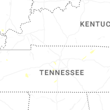


Connect with Interactive Hail Maps