

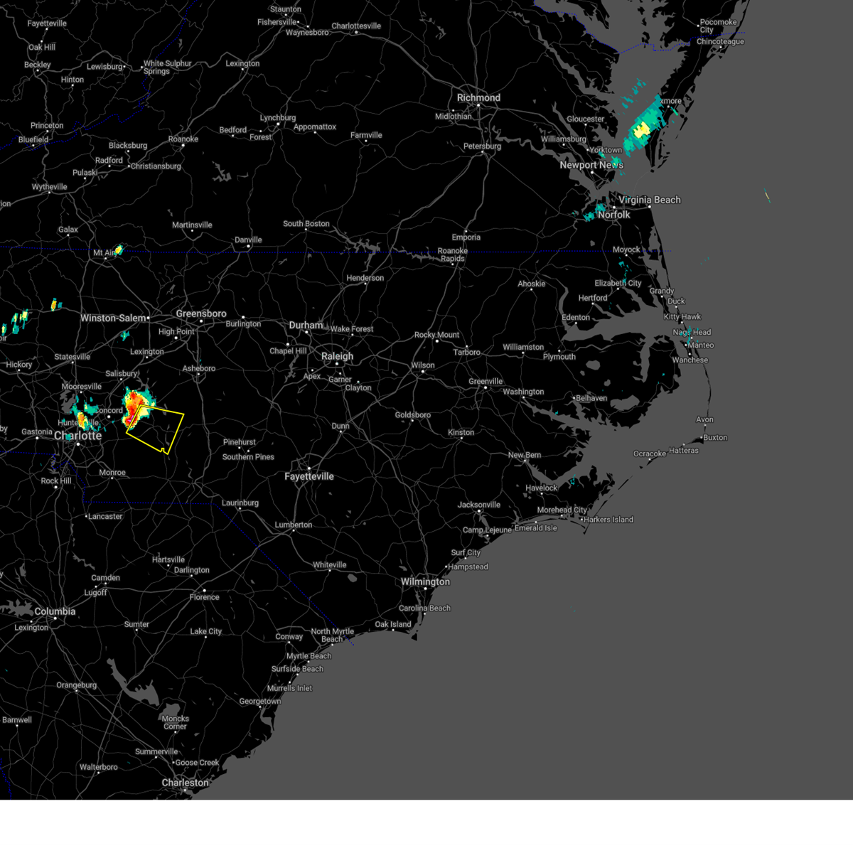
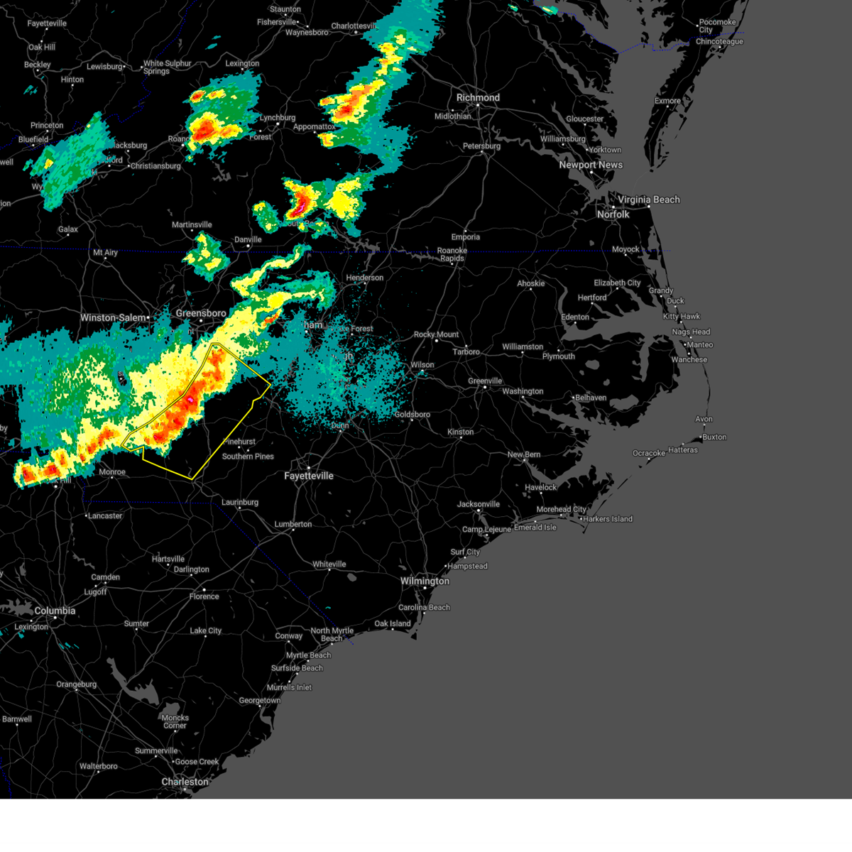
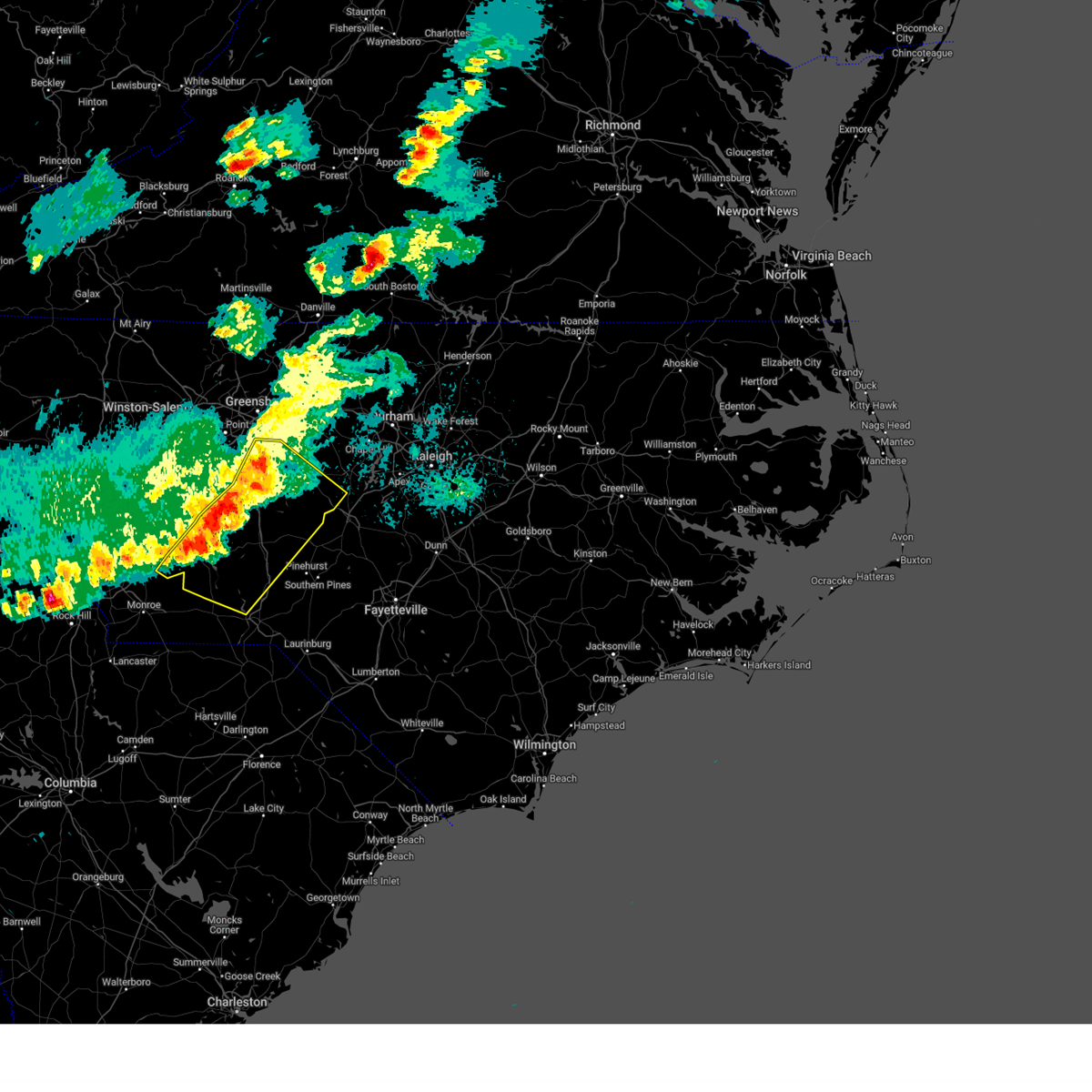
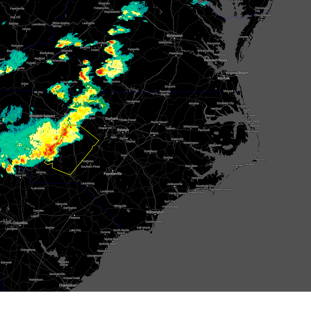
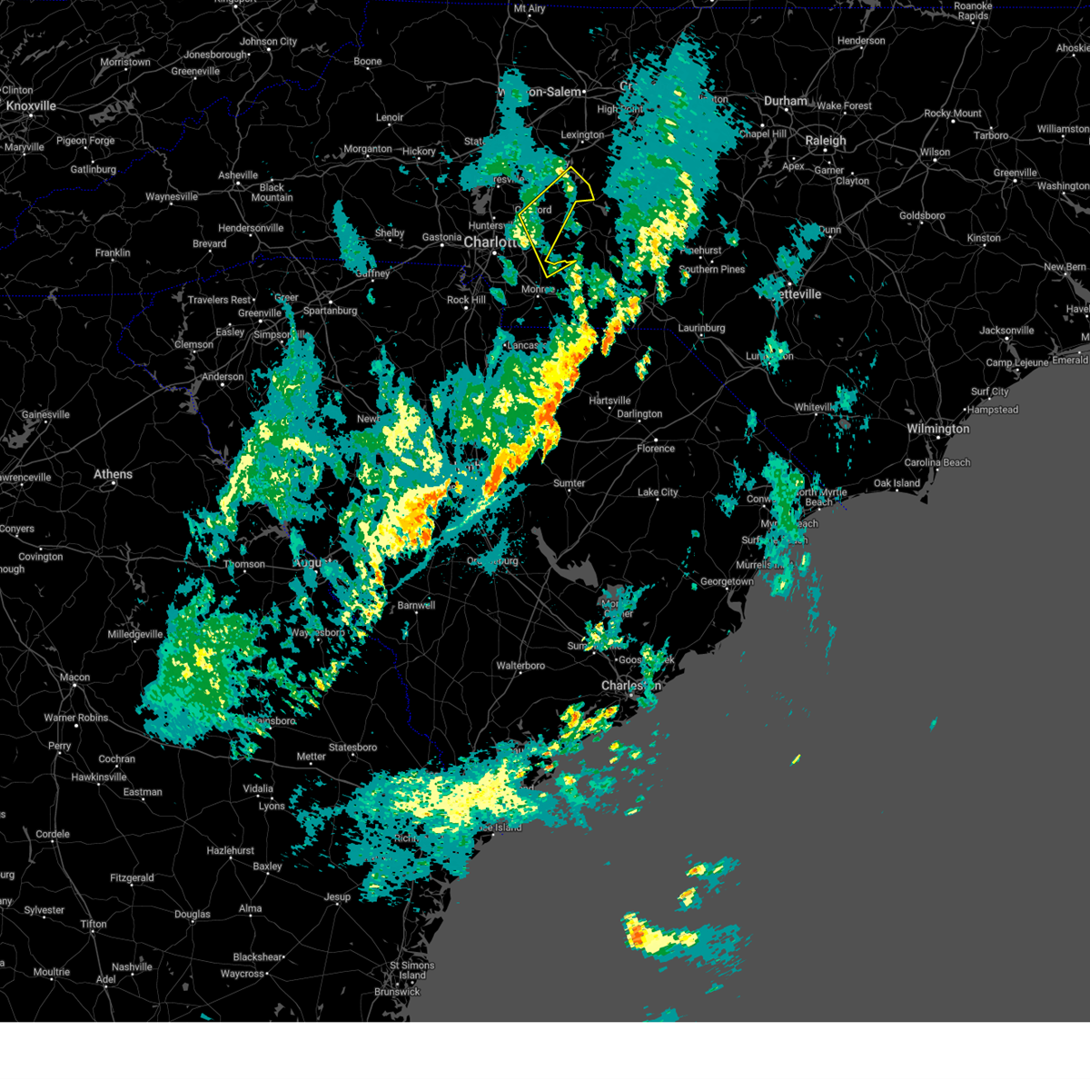
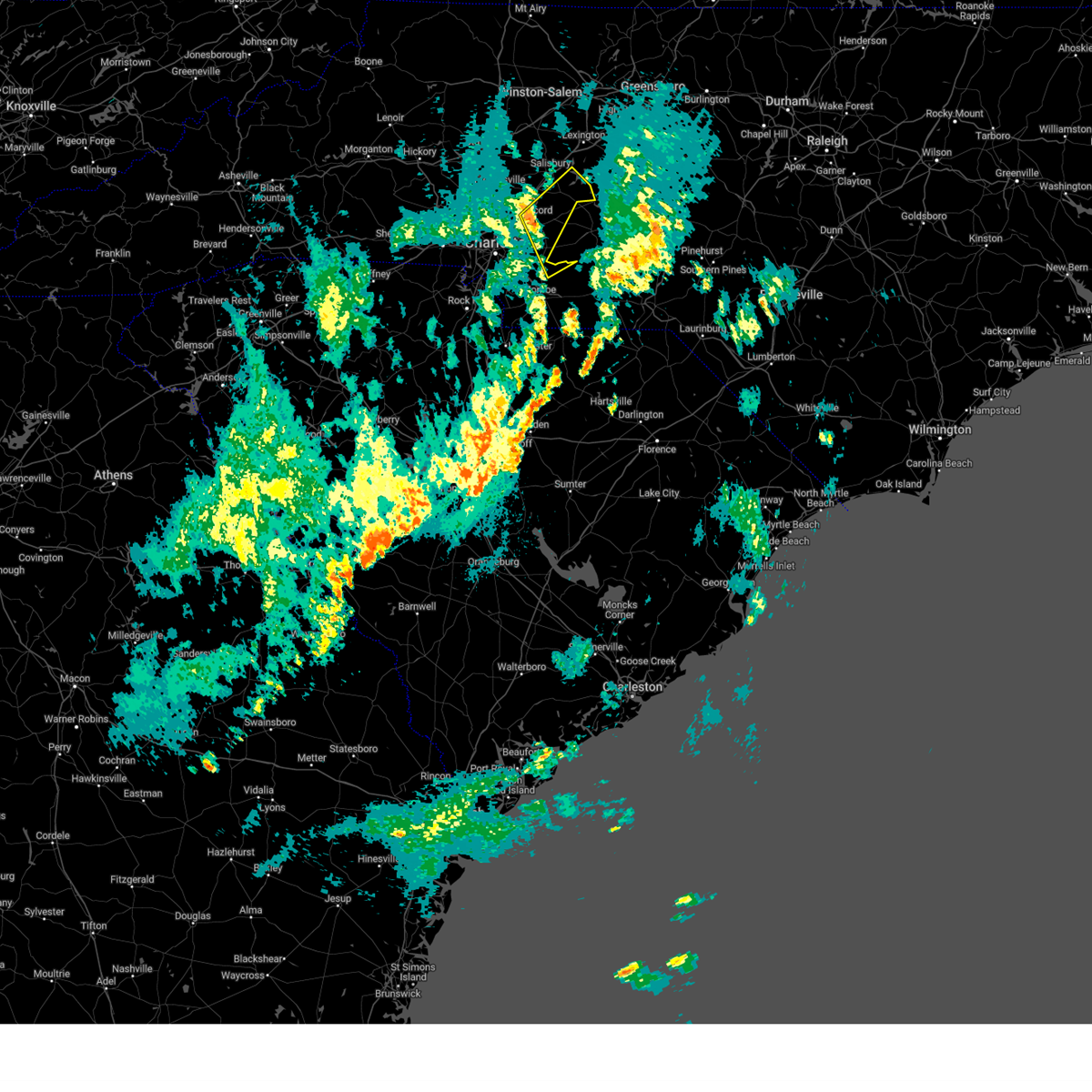
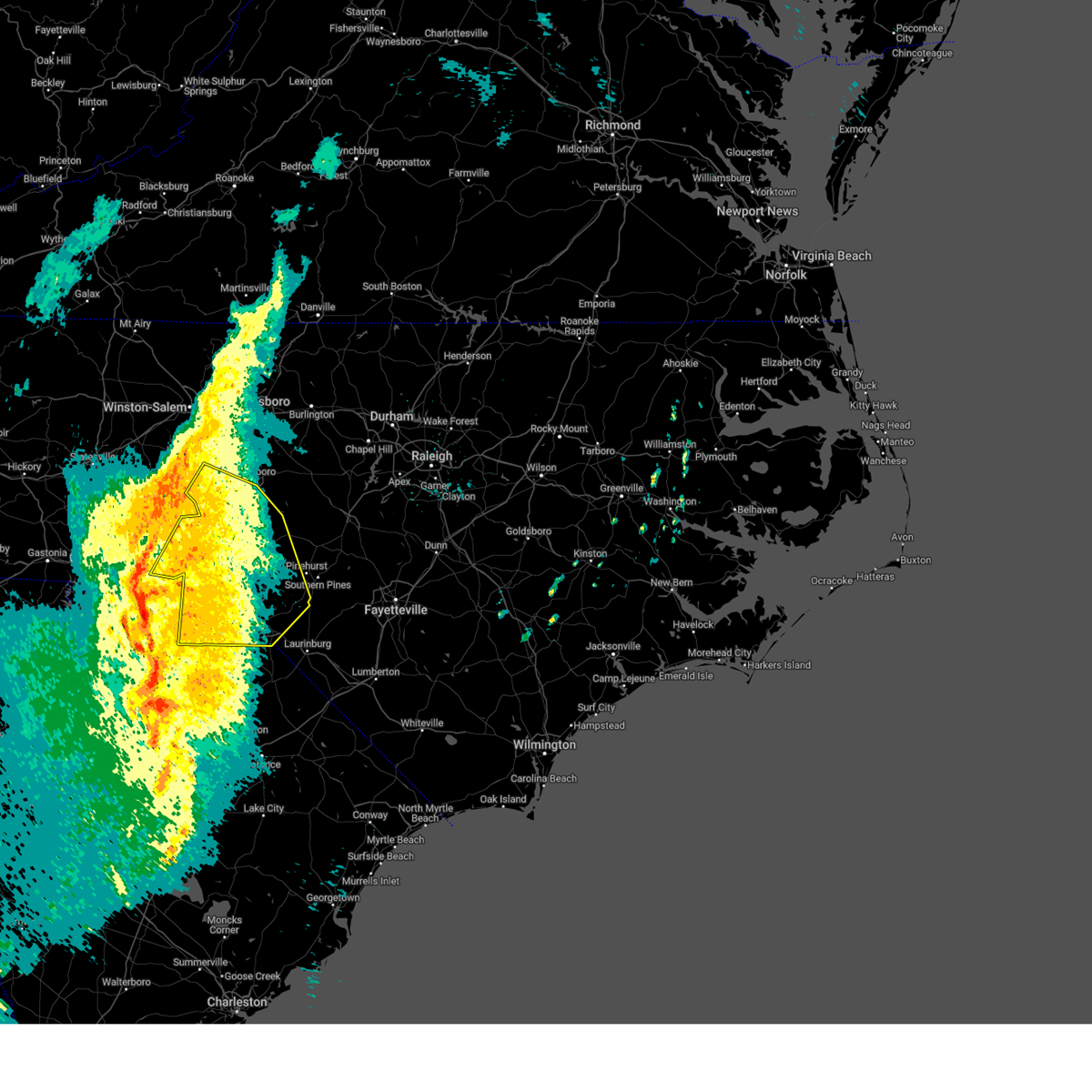
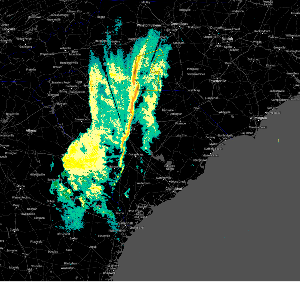
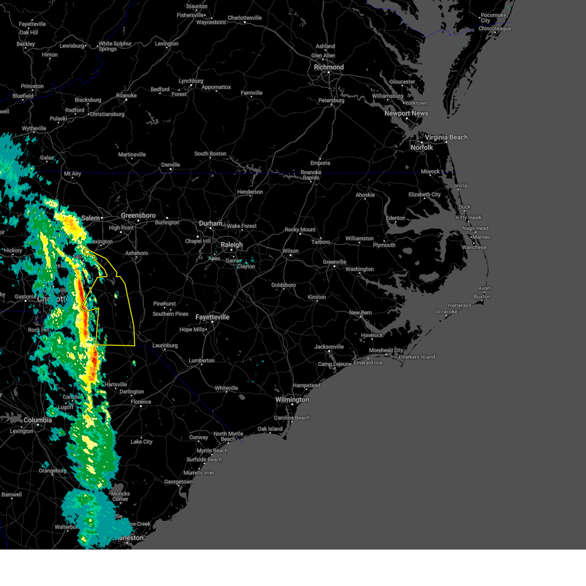
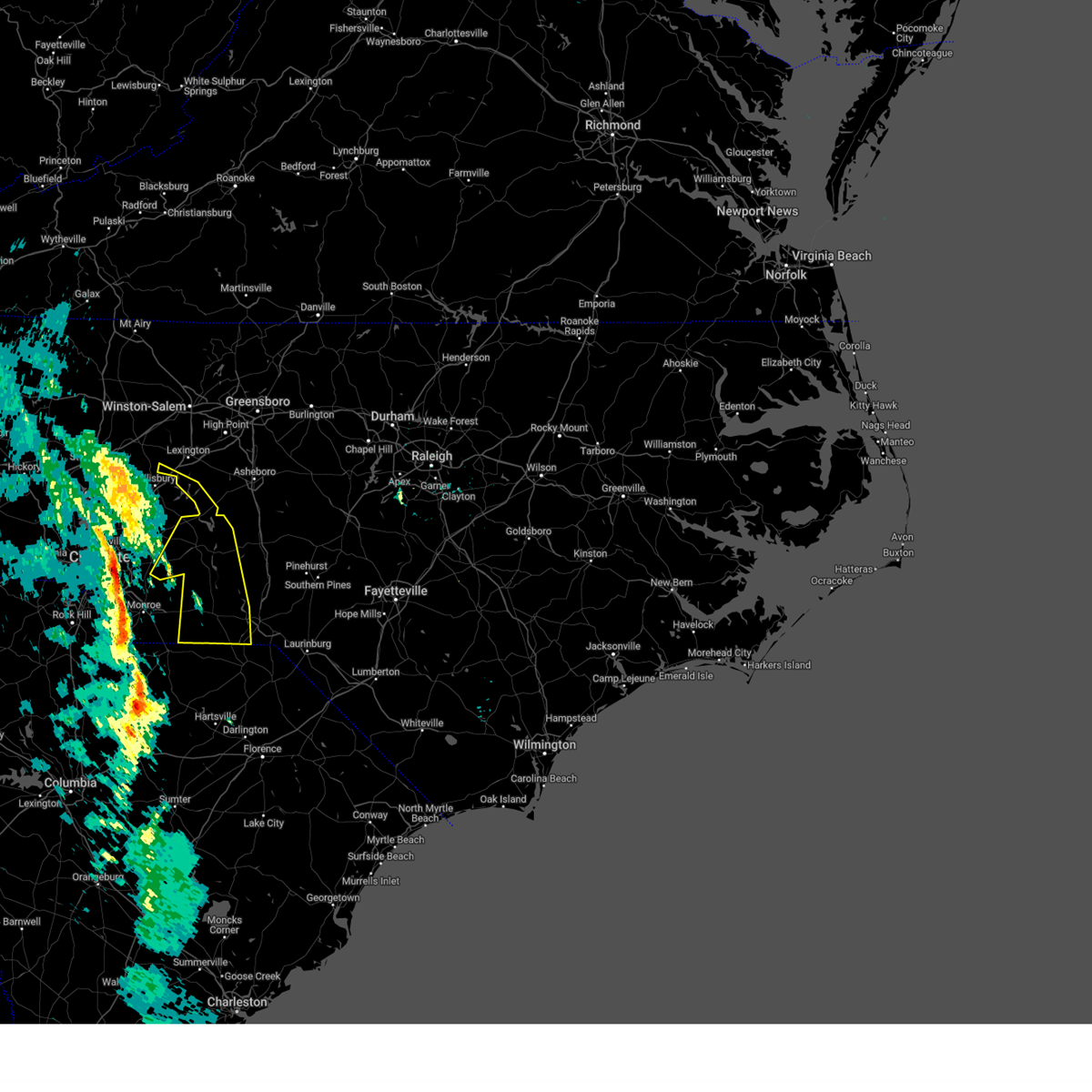
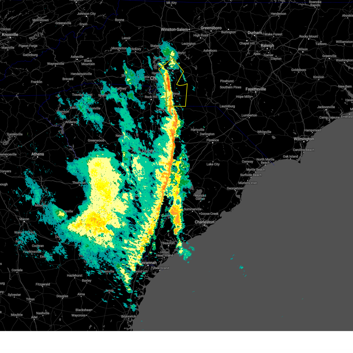
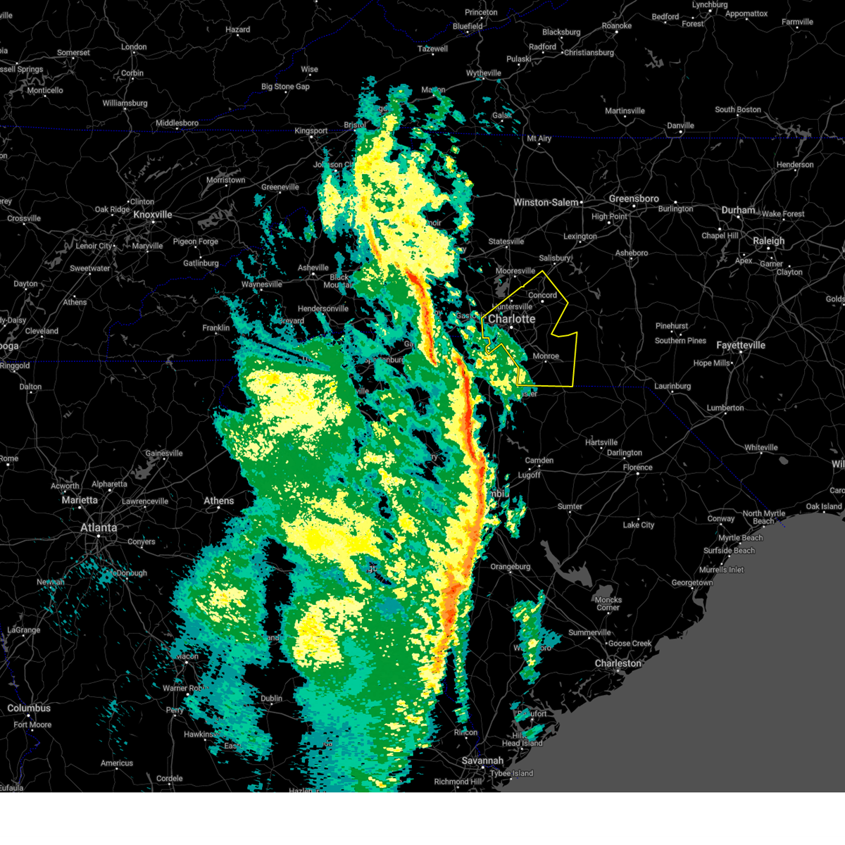
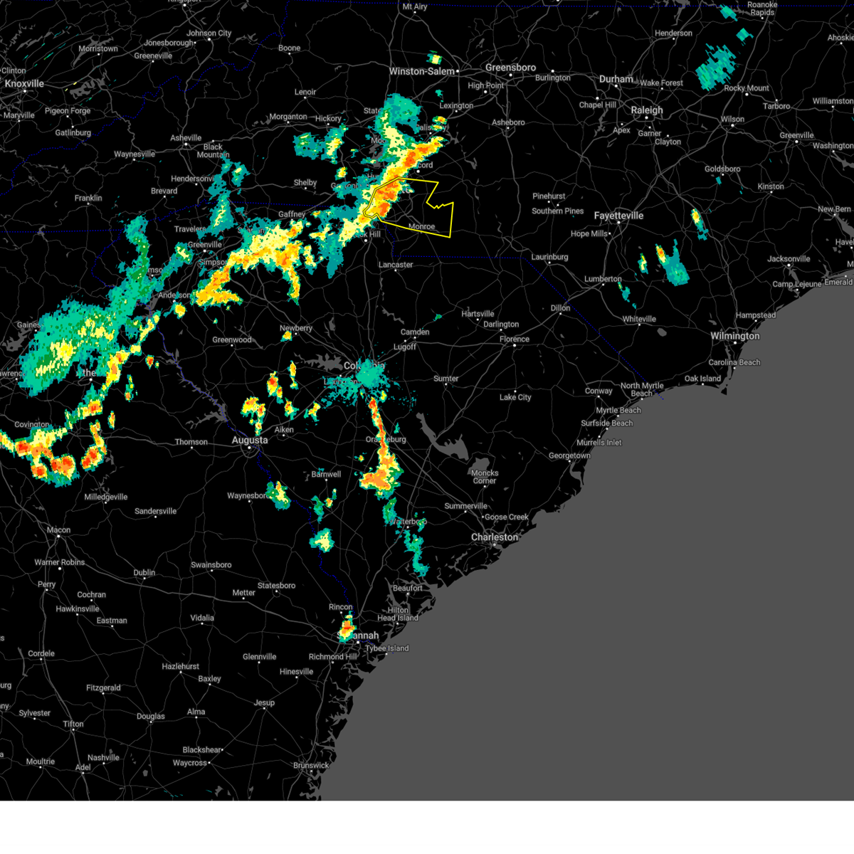
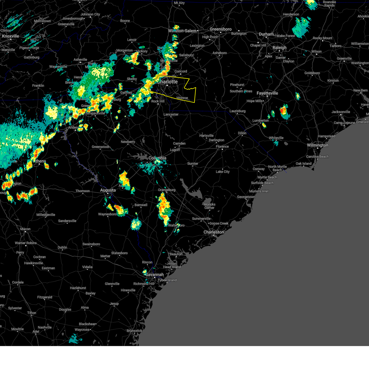
Hail Map for Locust, NC
The Locust, NC area has had 1 report of on-the-ground hail by trained spotters, and has been under severe weather warnings 36 times during the past 12 months. Doppler radar has detected hail at or near Locust, NC on 58 occasions, including 3 occasions during the past year.
| Name: | Locust, NC |
| Where Located: | 23.2 miles E of Charlotte, NC |
| Map: | Google Map for Locust, NC |
| Population: | 2930 |
| Housing Units: | 1271 |
| More Info: | Search Google for Locust, NC |
1
The Top Recent Hail Date for Locust, NC is Saturday, May 3, 2025 (10th out of 58)

Hail and Wind Damage Spotted near Locust, NC
| Date / Time | Report Details |
|---|---|
| 6/10/2025 7:40 PM EDT |
 Svrrah the national weather service in raleigh has issued a * severe thunderstorm warning for, western montgomery county in central north carolina, stanly county in central north carolina, * until 830 pm edt. * at 740 pm edt, a severe thunderstorm was located near mt pleasant, or 9 miles west of albemarle, moving east at 20 mph (radar indicated). Hazards include 60 mph wind gusts and quarter size hail. Hail damage to vehicles is expected. Expect wind damage to roofs, siding, and trees. Svrrah the national weather service in raleigh has issued a * severe thunderstorm warning for, western montgomery county in central north carolina, stanly county in central north carolina, * until 830 pm edt. * at 740 pm edt, a severe thunderstorm was located near mt pleasant, or 9 miles west of albemarle, moving east at 20 mph (radar indicated). Hazards include 60 mph wind gusts and quarter size hail. Hail damage to vehicles is expected. Expect wind damage to roofs, siding, and trees.
|
| 5/13/2025 1:46 PM EDT |
 the severe thunderstorm warning has been cancelled and is no longer in effect the severe thunderstorm warning has been cancelled and is no longer in effect
|
| 5/13/2025 1:33 PM EDT |
 At 133 pm edt, a severe thunderstorm was located 9 miles southeast of downtown concord, or near mt pleasant, moving northeast at 5 mph (radar indicated). Hazards include 60 mph wind gusts and quarter size hail. Minor hail damage to vehicles is expected. expect wind damage to trees and power lines. Locations impacted include, mt pleasant. At 133 pm edt, a severe thunderstorm was located 9 miles southeast of downtown concord, or near mt pleasant, moving northeast at 5 mph (radar indicated). Hazards include 60 mph wind gusts and quarter size hail. Minor hail damage to vehicles is expected. expect wind damage to trees and power lines. Locations impacted include, mt pleasant.
|
| 5/13/2025 1:23 PM EDT |
 Svrgsp the national weather service in greenville-spartanburg has issued a * severe thunderstorm warning for, southeastern cabarrus county in the piedmont of north carolina, * until 200 pm edt. * at 122 pm edt, a severe thunderstorm was located 8 miles southeast of downtown concord, or 4 miles south of mt pleasant, moving northeast at 5 mph (radar indicated). Hazards include 60 mph wind gusts and quarter size hail. Minor hail damage to vehicles is expected. Expect wind damage to trees and power lines. Svrgsp the national weather service in greenville-spartanburg has issued a * severe thunderstorm warning for, southeastern cabarrus county in the piedmont of north carolina, * until 200 pm edt. * at 122 pm edt, a severe thunderstorm was located 8 miles southeast of downtown concord, or 4 miles south of mt pleasant, moving northeast at 5 mph (radar indicated). Hazards include 60 mph wind gusts and quarter size hail. Minor hail damage to vehicles is expected. Expect wind damage to trees and power lines.
|
| 5/8/2025 8:50 PM EDT |
 At 849 pm edt, severe thunderstorms were located along a line extending from 13 miles east of randleman to 8 miles southwest of siler city to near seagrove to 7 miles north of ansonville, moving east at 40 mph (radar indicated). Hazards include 60 mph wind gusts and penny size hail. Expect damage to roofs, siding, and trees. Locations impacted include, asheboro, albemarle, troy, siler city, north carolina zoo, badin lake, biscoe, ansonville, goldston, and seagrove. At 849 pm edt, severe thunderstorms were located along a line extending from 13 miles east of randleman to 8 miles southwest of siler city to near seagrove to 7 miles north of ansonville, moving east at 40 mph (radar indicated). Hazards include 60 mph wind gusts and penny size hail. Expect damage to roofs, siding, and trees. Locations impacted include, asheboro, albemarle, troy, siler city, north carolina zoo, badin lake, biscoe, ansonville, goldston, and seagrove.
|
| 5/8/2025 8:50 PM EDT |
 the severe thunderstorm warning has been cancelled and is no longer in effect the severe thunderstorm warning has been cancelled and is no longer in effect
|
| 5/8/2025 8:35 PM EDT |
 At 835 pm edt, severe thunderstorms were located along a line extending from 6 miles northeast of randleman to near north carolina zoo to 7 miles north of troy to near albemarle, moving east at 45 mph (radar indicated). Hazards include 60 mph wind gusts and penny size hail. Expect damage to roofs, siding, and trees. Locations impacted include, asheboro, albemarle, randleman, troy, siler city, badin lake, north carolina zoo, biscoe, ansonville, and goldston. At 835 pm edt, severe thunderstorms were located along a line extending from 6 miles northeast of randleman to near north carolina zoo to 7 miles north of troy to near albemarle, moving east at 45 mph (radar indicated). Hazards include 60 mph wind gusts and penny size hail. Expect damage to roofs, siding, and trees. Locations impacted include, asheboro, albemarle, randleman, troy, siler city, badin lake, north carolina zoo, biscoe, ansonville, and goldston.
|
| 5/8/2025 8:27 PM EDT | At 827 pm edt, severe thunderstorms were located along a line extending from 8 miles northeast of randleman to 6 miles south of albemarle, moving east at 40 mph (radar indicated). Hazards include 60 mph wind gusts and quarter size hail. Hail damage to vehicles is expected. expect wind damage to roofs, siding, and trees. Locations impacted include, asheboro, albemarle, randleman, troy, siler city, badin lake, north carolina zoo, biscoe, ansonville, and goldston. |
| 5/8/2025 8:14 PM EDT |
 Svrrah the national weather service in raleigh has issued a * severe thunderstorm warning for, northwestern moore county in central north carolina, southeastern davidson county in central north carolina, northern anson county in central north carolina, montgomery county in central north carolina, northwestern richmond county in central north carolina, randolph county in central north carolina, stanly county in central north carolina, southwestern chatham county in central north carolina, * until 900 pm edt. * at 814 pm edt, severe thunderstorms were located along a line extending from 6 miles north of randleman to near plyler, moving southeast at 40 mph (radar indicated). Hazards include 60 mph wind gusts and quarter size hail. Hail damage to vehicles is expected. Expect wind damage to roofs, siding, and trees. Svrrah the national weather service in raleigh has issued a * severe thunderstorm warning for, northwestern moore county in central north carolina, southeastern davidson county in central north carolina, northern anson county in central north carolina, montgomery county in central north carolina, northwestern richmond county in central north carolina, randolph county in central north carolina, stanly county in central north carolina, southwestern chatham county in central north carolina, * until 900 pm edt. * at 814 pm edt, severe thunderstorms were located along a line extending from 6 miles north of randleman to near plyler, moving southeast at 40 mph (radar indicated). Hazards include 60 mph wind gusts and quarter size hail. Hail damage to vehicles is expected. Expect wind damage to roofs, siding, and trees.
|
| 5/4/2025 1:43 AM EDT |
 The storms which prompted the warning have moved out of the area. therefore, the warning will be allowed to expire. to report severe weather to the national weather service greenville-spartanburg, call toll free, 1, 800, 2 6 7, 8 1 0 1, or post on our facebook page, or tweet it using hashtag nwsgsp. your message should describe the event and the specific location where it occurred. The storms which prompted the warning have moved out of the area. therefore, the warning will be allowed to expire. to report severe weather to the national weather service greenville-spartanburg, call toll free, 1, 800, 2 6 7, 8 1 0 1, or post on our facebook page, or tweet it using hashtag nwsgsp. your message should describe the event and the specific location where it occurred.
|
| 5/4/2025 1:19 AM EDT |
 the severe thunderstorm warning has been cancelled and is no longer in effect the severe thunderstorm warning has been cancelled and is no longer in effect
|
| 5/4/2025 1:19 AM EDT |
 At 119 am edt, severe thunderstorms were located along a line extending from near downtown concord to 14 miles north of monroe, moving northeast at 45 mph (radar indicated). Hazards include 60 mph wind gusts. Expect damage to trees and power lines. Locations impacted include, mt pleasant, west concord, gold hill, faith, rockwell, high rock lake, midland, high rock, downtown concord, and granite quarry. At 119 am edt, severe thunderstorms were located along a line extending from near downtown concord to 14 miles north of monroe, moving northeast at 45 mph (radar indicated). Hazards include 60 mph wind gusts. Expect damage to trees and power lines. Locations impacted include, mt pleasant, west concord, gold hill, faith, rockwell, high rock lake, midland, high rock, downtown concord, and granite quarry.
|
| 5/4/2025 1:00 AM EDT |
 Svrgsp the national weather service in greenville-spartanburg has issued a * severe thunderstorm warning for, cabarrus county in the piedmont of north carolina, southeastern mecklenburg county in the piedmont of north carolina, southeastern rowan county in the piedmont of north carolina, northern union county in the piedmont of north carolina, * until 145 am edt. * at 100 am edt, severe thunderstorms were located along a line extending from 8 miles northeast of uptown charlotte to 10 miles northwest of monroe, moving northeast at 45 mph (radar indicated). Hazards include 60 mph wind gusts. expect damage to trees and power lines Svrgsp the national weather service in greenville-spartanburg has issued a * severe thunderstorm warning for, cabarrus county in the piedmont of north carolina, southeastern mecklenburg county in the piedmont of north carolina, southeastern rowan county in the piedmont of north carolina, northern union county in the piedmont of north carolina, * until 145 am edt. * at 100 am edt, severe thunderstorms were located along a line extending from 8 miles northeast of uptown charlotte to 10 miles northwest of monroe, moving northeast at 45 mph (radar indicated). Hazards include 60 mph wind gusts. expect damage to trees and power lines
|
| 3/16/2025 9:38 AM EDT |
 At 938 am edt, a severe thunderstorm capable of producing a tornado was located near albemarle, moving northeast at 50 mph (radar indicated rotation). Hazards include tornado. Flying debris will be dangerous to those caught without shelter. mobile homes will be damaged or destroyed. damage to roofs, windows, and vehicles will occur. tree damage is likely. this dangerous storm will be near, albemarle around 945 am edt. Other locations impacted by this tornadic thunderstorm include new london, morrow mountain state park, oakboro, badin, and richfield. At 938 am edt, a severe thunderstorm capable of producing a tornado was located near albemarle, moving northeast at 50 mph (radar indicated rotation). Hazards include tornado. Flying debris will be dangerous to those caught without shelter. mobile homes will be damaged or destroyed. damage to roofs, windows, and vehicles will occur. tree damage is likely. this dangerous storm will be near, albemarle around 945 am edt. Other locations impacted by this tornadic thunderstorm include new london, morrow mountain state park, oakboro, badin, and richfield.
|
| 3/16/2025 9:34 AM EDT |
 Torrah the national weather service in raleigh has issued a * tornado warning for, central stanly county in central north carolina, * until 1000 am edt. * at 934 am edt, a severe thunderstorm capable of producing a tornado was located 7 miles south of plyler, or 8 miles southwest of albemarle, moving northeast at 50 mph (radar indicated rotation). Hazards include tornado. Flying debris will be dangerous to those caught without shelter. mobile homes will be damaged or destroyed. damage to roofs, windows, and vehicles will occur. tree damage is likely. this dangerous storm will be near, albemarle and plyler around 940 am edt. Other locations impacted by this tornadic thunderstorm include stanfield, morrow mountain state park, oakboro, new london, and badin. Torrah the national weather service in raleigh has issued a * tornado warning for, central stanly county in central north carolina, * until 1000 am edt. * at 934 am edt, a severe thunderstorm capable of producing a tornado was located 7 miles south of plyler, or 8 miles southwest of albemarle, moving northeast at 50 mph (radar indicated rotation). Hazards include tornado. Flying debris will be dangerous to those caught without shelter. mobile homes will be damaged or destroyed. damage to roofs, windows, and vehicles will occur. tree damage is likely. this dangerous storm will be near, albemarle and plyler around 940 am edt. Other locations impacted by this tornadic thunderstorm include stanfield, morrow mountain state park, oakboro, new london, and badin.
|
| 3/16/2025 9:15 AM EDT |
 Svrrah the national weather service in raleigh has issued a * severe thunderstorm warning for, western moore county in central north carolina, north central scotland county in central north carolina, southeastern davidson county in central north carolina, anson county in central north carolina, montgomery county in central north carolina, richmond county in central north carolina, southwestern randolph county in central north carolina, stanly county in central north carolina, * until 1000 am edt. * at 914 am edt, severe thunderstorms were located along a line extending from near fairview in union county to near pageland to 6 miles east of mt pisgah, moving northeast at 60 mph. upper level roation can be seen on radar moving over trinity, in union county nc (radar indicated). Hazards include 60 mph wind gusts and quarter size hail. Hail damage to vehicles is expected. Expect wind damage to roofs, siding, and trees. Svrrah the national weather service in raleigh has issued a * severe thunderstorm warning for, western moore county in central north carolina, north central scotland county in central north carolina, southeastern davidson county in central north carolina, anson county in central north carolina, montgomery county in central north carolina, richmond county in central north carolina, southwestern randolph county in central north carolina, stanly county in central north carolina, * until 1000 am edt. * at 914 am edt, severe thunderstorms were located along a line extending from near fairview in union county to near pageland to 6 miles east of mt pisgah, moving northeast at 60 mph. upper level roation can be seen on radar moving over trinity, in union county nc (radar indicated). Hazards include 60 mph wind gusts and quarter size hail. Hail damage to vehicles is expected. Expect wind damage to roofs, siding, and trees.
|
| 3/5/2025 8:46 AM EST |
 the severe thunderstorm warning has been cancelled and is no longer in effect the severe thunderstorm warning has been cancelled and is no longer in effect
|
| 3/5/2025 8:46 AM EST |
 At 846 am est, severe thunderstorms were located along a line extending from 4 miles southwest of downtown concord to 9 miles west of monroe, moving northeast at 45 mph (radar indicated). Hazards include 60 mph wind gusts. Expect damage to trees and power lines. Locations impacted include, marshville, mt pleasant, trinity, gold hill, monroe, rockwell, wingate, midland, new salem, and high rock. At 846 am est, severe thunderstorms were located along a line extending from 4 miles southwest of downtown concord to 9 miles west of monroe, moving northeast at 45 mph (radar indicated). Hazards include 60 mph wind gusts. Expect damage to trees and power lines. Locations impacted include, marshville, mt pleasant, trinity, gold hill, monroe, rockwell, wingate, midland, new salem, and high rock.
|
| 3/5/2025 8:39 AM EST |
 Svrrah the national weather service in raleigh has issued a * severe thunderstorm warning for, southeastern davidson county in central north carolina, anson county in central north carolina, montgomery county in central north carolina, western richmond county in central north carolina, southwestern randolph county in central north carolina, stanly county in central north carolina, * until 930 am est. * at 838 am est, severe thunderstorms were located along a line extending from near rockwell to 8 miles south of monroe, moving northeast at 70 mph (radar indicated). Hazards include 60 mph wind gusts. expect damage to roofs, siding, and trees Svrrah the national weather service in raleigh has issued a * severe thunderstorm warning for, southeastern davidson county in central north carolina, anson county in central north carolina, montgomery county in central north carolina, western richmond county in central north carolina, southwestern randolph county in central north carolina, stanly county in central north carolina, * until 930 am est. * at 838 am est, severe thunderstorms were located along a line extending from near rockwell to 8 miles south of monroe, moving northeast at 70 mph (radar indicated). Hazards include 60 mph wind gusts. expect damage to roofs, siding, and trees
|
| 3/5/2025 8:08 AM EST |
 Svrgsp the national weather service in greenville-spartanburg has issued a * severe thunderstorm warning for, cabarrus county in the piedmont of north carolina, central mecklenburg county in the piedmont of north carolina, southeastern rowan county in the piedmont of north carolina, union county in the piedmont of north carolina, * until 900 am est. * at 808 am est, severe thunderstorms were located along a line extending from 3 miles east of huntersville to 10 miles southeast of rock hill, moving northeast at 45 mph (radar indicated). Hazards include 60 mph wind gusts. expect damage to trees and power lines Svrgsp the national weather service in greenville-spartanburg has issued a * severe thunderstorm warning for, cabarrus county in the piedmont of north carolina, central mecklenburg county in the piedmont of north carolina, southeastern rowan county in the piedmont of north carolina, union county in the piedmont of north carolina, * until 900 am est. * at 808 am est, severe thunderstorms were located along a line extending from 3 miles east of huntersville to 10 miles southeast of rock hill, moving northeast at 45 mph (radar indicated). Hazards include 60 mph wind gusts. expect damage to trees and power lines
|
| 2/16/2025 7:30 AM EST |
 Svrrah the national weather service in raleigh has issued a * severe thunderstorm warning for, western alamance county in central north carolina, forsyth county in central north carolina, northwestern moore county in central north carolina, davidson county in central north carolina, northwestern montgomery county in central north carolina, randolph county in central north carolina, northern stanly county in central north carolina, guilford county in central north carolina, * until 815 am est. * at 729 am est, severe thunderstorms were located along a line extending from winston-salem to near lexington to near high rock lake, moving northeast at 80 mph (radar indicated). Hazards include 60 mph wind gusts. expect damage to roofs, siding, and trees Svrrah the national weather service in raleigh has issued a * severe thunderstorm warning for, western alamance county in central north carolina, forsyth county in central north carolina, northwestern moore county in central north carolina, davidson county in central north carolina, northwestern montgomery county in central north carolina, randolph county in central north carolina, northern stanly county in central north carolina, guilford county in central north carolina, * until 815 am est. * at 729 am est, severe thunderstorms were located along a line extending from winston-salem to near lexington to near high rock lake, moving northeast at 80 mph (radar indicated). Hazards include 60 mph wind gusts. expect damage to roofs, siding, and trees
|
| 12/29/2024 10:13 AM EST |
 The storms which prompted the warning have moved out of the area. therefore, the warning will be allowed to expire. a tornado watch remains in effect until 100 pm est for the piedmont of north carolina. The storms which prompted the warning have moved out of the area. therefore, the warning will be allowed to expire. a tornado watch remains in effect until 100 pm est for the piedmont of north carolina.
|
| 12/29/2024 10:02 AM EST |
 the severe thunderstorm warning has been cancelled and is no longer in effect the severe thunderstorm warning has been cancelled and is no longer in effect
|
| 12/29/2024 10:02 AM EST |
 At 1001 am est, severe thunderstorms were located along a line extending from 5 miles south of salisbury to 10 miles west of albemarle to 14 miles southeast of monroe, moving northeast at 50 mph (radar indicated). Hazards include 60 mph wind gusts. Expect damage to trees and power lines. Locations impacted include, monroe, unionville, wingate, marshville, mt pleasant, sturdivants, new salem, midland, and fairview in union county. At 1001 am est, severe thunderstorms were located along a line extending from 5 miles south of salisbury to 10 miles west of albemarle to 14 miles southeast of monroe, moving northeast at 50 mph (radar indicated). Hazards include 60 mph wind gusts. Expect damage to trees and power lines. Locations impacted include, monroe, unionville, wingate, marshville, mt pleasant, sturdivants, new salem, midland, and fairview in union county.
|
| 12/29/2024 10:00 AM EST |
 Torrah the national weather service in raleigh has issued a * tornado warning for, west central montgomery county in central north carolina, central stanly county in central north carolina, * until 1030 am est. * at 1000 am est, a severe thunderstorm capable of producing a tornado was located 7 miles east of midland, or 14 miles southwest of albemarle, moving northeast at 60 mph (radar indicated rotation). Hazards include tornado. Flying debris will be dangerous to those caught without shelter. mobile homes will be damaged or destroyed. damage to roofs, windows, and vehicles will occur. tree damage is likely. this dangerous storm will be near, albemarle and plyler around 1005 am est. badin lake around 1015 am est. Other locations impacted by this tornadic thunderstorm include stanfield, badin, morrow mountain state park, oakboro, and lake tillery. Torrah the national weather service in raleigh has issued a * tornado warning for, west central montgomery county in central north carolina, central stanly county in central north carolina, * until 1030 am est. * at 1000 am est, a severe thunderstorm capable of producing a tornado was located 7 miles east of midland, or 14 miles southwest of albemarle, moving northeast at 60 mph (radar indicated rotation). Hazards include tornado. Flying debris will be dangerous to those caught without shelter. mobile homes will be damaged or destroyed. damage to roofs, windows, and vehicles will occur. tree damage is likely. this dangerous storm will be near, albemarle and plyler around 1005 am est. badin lake around 1015 am est. Other locations impacted by this tornadic thunderstorm include stanfield, badin, morrow mountain state park, oakboro, and lake tillery.
|
| 12/29/2024 9:57 AM EST |
 At 957 am est, severe thunderstorms were located along a line extending from near mt pleasant to 6 miles northeast of unionville to near wingate, moving northeast at 55 mph (radar indicated). Hazards include 60 mph wind gusts. Expect damage to roofs, siding, and trees. Locations impacted include, albemarle, wadesboro, badin lake, ansonville, plyler, midland, polkton, locust, norwood, and badin. At 957 am est, severe thunderstorms were located along a line extending from near mt pleasant to 6 miles northeast of unionville to near wingate, moving northeast at 55 mph (radar indicated). Hazards include 60 mph wind gusts. Expect damage to roofs, siding, and trees. Locations impacted include, albemarle, wadesboro, badin lake, ansonville, plyler, midland, polkton, locust, norwood, and badin.
|
| 12/29/2024 9:40 AM EST |
 Svrrah the national weather service in raleigh has issued a * severe thunderstorm warning for, southern davidson county in central north carolina, anson county in central north carolina, western montgomery county in central north carolina, western richmond county in central north carolina, stanly county in central north carolina, * until 1030 am est. * at 940 am est, severe thunderstorms were located along a line extending from charlotte motor speedway to near lake park to 6 miles north of buford, moving northeast at 55 mph (radar indicated). Hazards include 60 mph wind gusts. expect damage to roofs, siding, and trees Svrrah the national weather service in raleigh has issued a * severe thunderstorm warning for, southern davidson county in central north carolina, anson county in central north carolina, western montgomery county in central north carolina, western richmond county in central north carolina, stanly county in central north carolina, * until 1030 am est. * at 940 am est, severe thunderstorms were located along a line extending from charlotte motor speedway to near lake park to 6 miles north of buford, moving northeast at 55 mph (radar indicated). Hazards include 60 mph wind gusts. expect damage to roofs, siding, and trees
|
| 12/29/2024 9:39 AM EST |
 At 938 am est, severe thunderstorms were located along a line extending from 4 miles east of huntersville to 11 miles east of uptown charlotte to 10 miles east of lancaster, moving northeast at 50 mph (radar indicated). Hazards include 60 mph wind gusts. Expect damage to trees and power lines. Locations impacted include, huntersville, kannapolis, downtown concord, monroe, west concord, matthews, mint hill, indian trail, stallings, and unionville. At 938 am est, severe thunderstorms were located along a line extending from 4 miles east of huntersville to 11 miles east of uptown charlotte to 10 miles east of lancaster, moving northeast at 50 mph (radar indicated). Hazards include 60 mph wind gusts. Expect damage to trees and power lines. Locations impacted include, huntersville, kannapolis, downtown concord, monroe, west concord, matthews, mint hill, indian trail, stallings, and unionville.
|
| 12/29/2024 9:39 AM EST |
 the severe thunderstorm warning has been cancelled and is no longer in effect the severe thunderstorm warning has been cancelled and is no longer in effect
|
| 12/29/2024 8:59 AM EST |
 Svrgsp the national weather service in greenville-spartanburg has issued a * severe thunderstorm warning for, cabarrus county in the piedmont of north carolina, mecklenburg county in the piedmont of north carolina, south central rowan county in the piedmont of north carolina, southeastern gaston county in the piedmont of north carolina, union county in the piedmont of north carolina, * until 1015 am est. * at 859 am est, severe thunderstorms were located along a line extending from 8 miles north of york to 5 miles west of rock hill to 3 miles north of winnsboro, moving northeast at 50 mph (radar indicated). Hazards include 60 mph wind gusts. expect damage to trees and power lines Svrgsp the national weather service in greenville-spartanburg has issued a * severe thunderstorm warning for, cabarrus county in the piedmont of north carolina, mecklenburg county in the piedmont of north carolina, south central rowan county in the piedmont of north carolina, southeastern gaston county in the piedmont of north carolina, union county in the piedmont of north carolina, * until 1015 am est. * at 859 am est, severe thunderstorms were located along a line extending from 8 miles north of york to 5 miles west of rock hill to 3 miles north of winnsboro, moving northeast at 50 mph (radar indicated). Hazards include 60 mph wind gusts. expect damage to trees and power lines
|
| 7/30/2024 9:18 PM EDT |
 the severe thunderstorm warning has been cancelled and is no longer in effect the severe thunderstorm warning has been cancelled and is no longer in effect
|
| 7/30/2024 9:18 PM EDT |
 At 918 pm edt, a severe thunderstorm was located 5 miles east of uptown charlotte, or near east charlotte, moving east at 30 mph (radar indicated). Hazards include 60 mph wind gusts. Expect damage to trees and power lines. Locations impacted include, uptown charlotte, central charlotte, south charlotte, northeast charlotte, southwest charlotte, east charlotte, northwest charlotte, matthews, mint hill, and indian trail. At 918 pm edt, a severe thunderstorm was located 5 miles east of uptown charlotte, or near east charlotte, moving east at 30 mph (radar indicated). Hazards include 60 mph wind gusts. Expect damage to trees and power lines. Locations impacted include, uptown charlotte, central charlotte, south charlotte, northeast charlotte, southwest charlotte, east charlotte, northwest charlotte, matthews, mint hill, and indian trail.
|
| 7/30/2024 8:49 PM EDT |
 Svrgsp the national weather service in greenville-spartanburg has issued a * severe thunderstorm warning for, southwestern cabarrus county in the piedmont of north carolina, mecklenburg county in the piedmont of north carolina, eastern gaston county in the piedmont of north carolina, northern union county in the piedmont of north carolina, northeastern york county in upstate south carolina, * until 945 pm edt. * at 849 pm edt, a severe thunderstorm was located 8 miles east of gastonia, or near belmont, moving east at 30 mph (radar indicated). Hazards include 60 mph wind gusts and penny size hail. expect damage to trees and power lines Svrgsp the national weather service in greenville-spartanburg has issued a * severe thunderstorm warning for, southwestern cabarrus county in the piedmont of north carolina, mecklenburg county in the piedmont of north carolina, eastern gaston county in the piedmont of north carolina, northern union county in the piedmont of north carolina, northeastern york county in upstate south carolina, * until 945 pm edt. * at 849 pm edt, a severe thunderstorm was located 8 miles east of gastonia, or near belmont, moving east at 30 mph (radar indicated). Hazards include 60 mph wind gusts and penny size hail. expect damage to trees and power lines
|
| 7/23/2024 3:33 PM EDT |
 At 332 pm edt, a severe thunderstorm was located 9 miles south of downtown concord, or 4 miles northwest of midland, moving northeast at 20 mph (radar indicated). Hazards include 60 mph wind gusts and penny size hail. Expect damage to trees and power lines. Locations impacted include, harrisburg, mt pleasant, midland, charlotte motor speedway, fairview in union county, downtown concord, west concord, and stallings. At 332 pm edt, a severe thunderstorm was located 9 miles south of downtown concord, or 4 miles northwest of midland, moving northeast at 20 mph (radar indicated). Hazards include 60 mph wind gusts and penny size hail. Expect damage to trees and power lines. Locations impacted include, harrisburg, mt pleasant, midland, charlotte motor speedway, fairview in union county, downtown concord, west concord, and stallings.
|
| 7/23/2024 3:33 PM EDT |
 the severe thunderstorm warning has been cancelled and is no longer in effect the severe thunderstorm warning has been cancelled and is no longer in effect
|
| 7/23/2024 3:10 PM EDT |
 Svrgsp the national weather service in greenville-spartanburg has issued a * severe thunderstorm warning for, central cabarrus county in the piedmont of north carolina, southeastern mecklenburg county in the piedmont of north carolina, north central union county in the piedmont of north carolina, * until 345 pm edt. * at 310 pm edt, a severe thunderstorm was located 10 miles east of uptown charlotte, or near reedy creek park, moving northeast at 20 mph (radar indicated). Hazards include 60 mph wind gusts and penny size hail. expect damage to trees and power lines Svrgsp the national weather service in greenville-spartanburg has issued a * severe thunderstorm warning for, central cabarrus county in the piedmont of north carolina, southeastern mecklenburg county in the piedmont of north carolina, north central union county in the piedmont of north carolina, * until 345 pm edt. * at 310 pm edt, a severe thunderstorm was located 10 miles east of uptown charlotte, or near reedy creek park, moving northeast at 20 mph (radar indicated). Hazards include 60 mph wind gusts and penny size hail. expect damage to trees and power lines
|
| 5/8/2024 5:16 PM EDT |
 Svrrah the national weather service in raleigh has issued a * severe thunderstorm warning for, anson county in central north carolina, southern montgomery county in central north carolina, western richmond county in central north carolina, stanly county in central north carolina, * until 600 pm edt. * at 515 pm edt, a severe thunderstorm extending from albemarle to near ansonville to near sturdivants, moving east at 40 mph (radar indicated). Hazards include 70 mph wind gusts and quarter size hail. Hail damage to vehicles is expected. expect considerable tree damage. Wind damage is also likely to mobile homes, roofs, and outbuildings. Svrrah the national weather service in raleigh has issued a * severe thunderstorm warning for, anson county in central north carolina, southern montgomery county in central north carolina, western richmond county in central north carolina, stanly county in central north carolina, * until 600 pm edt. * at 515 pm edt, a severe thunderstorm extending from albemarle to near ansonville to near sturdivants, moving east at 40 mph (radar indicated). Hazards include 70 mph wind gusts and quarter size hail. Hail damage to vehicles is expected. expect considerable tree damage. Wind damage is also likely to mobile homes, roofs, and outbuildings.
|
| 5/8/2024 4:58 PM EDT |
 At 457 pm edt, a severe thunderstorm extending from near mt pleasant to 7 miles west of ansonville to wingate, moving east at 40 mph across stanly and anson counties (radar indicated). Hazards include 70 mph wind gusts and quarter size hail. Hail damage to vehicles is expected. expect considerable tree damage. wind damage is also likely to mobile homes, roofs, and outbuildings. Locations impacted include, albemarle, wadesboro, ansonville, plyler, polkton, norwood, badin, oakboro, mount gilead, and lilesville. At 457 pm edt, a severe thunderstorm extending from near mt pleasant to 7 miles west of ansonville to wingate, moving east at 40 mph across stanly and anson counties (radar indicated). Hazards include 70 mph wind gusts and quarter size hail. Hail damage to vehicles is expected. expect considerable tree damage. wind damage is also likely to mobile homes, roofs, and outbuildings. Locations impacted include, albemarle, wadesboro, ansonville, plyler, polkton, norwood, badin, oakboro, mount gilead, and lilesville.
|
| 5/8/2024 4:57 PM EDT |
 the severe thunderstorm warning has been cancelled and is no longer in effect the severe thunderstorm warning has been cancelled and is no longer in effect
|
| 5/8/2024 4:57 PM EDT |
 At 457 pm edt, a severe thunderstorm was located 4 miles southeast of downtown concord, moving east at 35 mph (radar indicated). Hazards include 70 mph wind gusts and nickel size hail. Expect considerable tree damage. damage is likely to mobile homes, roofs, and outbuildings. Locations impacted include, downtown concord, mt pleasant, midland, and harrisburg. At 457 pm edt, a severe thunderstorm was located 4 miles southeast of downtown concord, moving east at 35 mph (radar indicated). Hazards include 70 mph wind gusts and nickel size hail. Expect considerable tree damage. damage is likely to mobile homes, roofs, and outbuildings. Locations impacted include, downtown concord, mt pleasant, midland, and harrisburg.
|
| 5/8/2024 4:39 PM EDT |
 Svrgsp the national weather service in greenville-spartanburg has issued a * severe thunderstorm warning for, cabarrus county in the piedmont of north carolina, northeastern mecklenburg county in the piedmont of north carolina, * until 515 pm edt. * at 439 pm edt, a severe thunderstorm was located 6 miles south of downtown concord, or 4 miles east of harrisburg, moving east at 35 mph (radar indicated). Hazards include 70 mph wind gusts and quarter size hail. Minor hail damage to vehicles is expected. expect considerable tree damage. Wind damage is also likely to mobile homes, roofs, and outbuildings. Svrgsp the national weather service in greenville-spartanburg has issued a * severe thunderstorm warning for, cabarrus county in the piedmont of north carolina, northeastern mecklenburg county in the piedmont of north carolina, * until 515 pm edt. * at 439 pm edt, a severe thunderstorm was located 6 miles south of downtown concord, or 4 miles east of harrisburg, moving east at 35 mph (radar indicated). Hazards include 70 mph wind gusts and quarter size hail. Minor hail damage to vehicles is expected. expect considerable tree damage. Wind damage is also likely to mobile homes, roofs, and outbuildings.
|
| 5/8/2024 4:31 PM EDT |
 Svrrah the national weather service in raleigh has issued a * severe thunderstorm warning for, anson county in central north carolina, western montgomery county in central north carolina, western richmond county in central north carolina, stanly county in central north carolina, * until 515 pm edt. * at 429 pm edt, a severe thunderstorm extending from coddle creek reservoir to near fairview in union county to weddington, moving east at 55 mph into stanly and anson counties (radar indicated). Hazards include 70 mph wind gusts and quarter size hail. Hail damage to vehicles is expected. expect considerable tree damage. Wind damage is also likely to mobile homes, roofs, and outbuildings. Svrrah the national weather service in raleigh has issued a * severe thunderstorm warning for, anson county in central north carolina, western montgomery county in central north carolina, western richmond county in central north carolina, stanly county in central north carolina, * until 515 pm edt. * at 429 pm edt, a severe thunderstorm extending from coddle creek reservoir to near fairview in union county to weddington, moving east at 55 mph into stanly and anson counties (radar indicated). Hazards include 70 mph wind gusts and quarter size hail. Hail damage to vehicles is expected. expect considerable tree damage. Wind damage is also likely to mobile homes, roofs, and outbuildings.
|
| 5/8/2024 4:29 PM EDT |
 the severe thunderstorm warning has been cancelled and is no longer in effect the severe thunderstorm warning has been cancelled and is no longer in effect
|
| 5/8/2024 4:29 PM EDT |
 At 428 pm edt, a severe thunderstorm was located 9 miles northwest of monroe, or over hemby bridge, moving east at 40 mph (radar indicated). Hazards include 70 mph wind gusts and quarter size hail. Minor hail damage to vehicles is expected. expect considerable tree damage. wind damage is also likely to mobile homes, roofs, and outbuildings. Locations impacted include, uptown charlotte, huntersville, central charlotte, south charlotte, northeast charlotte, southwest charlotte, east charlotte, west concord, matthews, and mint hill. At 428 pm edt, a severe thunderstorm was located 9 miles northwest of monroe, or over hemby bridge, moving east at 40 mph (radar indicated). Hazards include 70 mph wind gusts and quarter size hail. Minor hail damage to vehicles is expected. expect considerable tree damage. wind damage is also likely to mobile homes, roofs, and outbuildings. Locations impacted include, uptown charlotte, huntersville, central charlotte, south charlotte, northeast charlotte, southwest charlotte, east charlotte, west concord, matthews, and mint hill.
|
| 5/8/2024 4:11 PM EDT |
 At 410 pm edt, a severe thunderstorm was located 5 miles south of uptown charlotte, or over southpark mall, moving east at 40 mph (radar indicated). Hazards include 70 mph wind gusts and half dollar size hail. Minor hail damage to vehicles is expected. expect considerable tree damage. wind damage is also likely to mobile homes, roofs, and outbuildings. Locations impacted include, uptown charlotte, huntersville, central charlotte, south charlotte, northeast charlotte, southwest charlotte, east charlotte, northwest charlotte, west concord, and matthews. At 410 pm edt, a severe thunderstorm was located 5 miles south of uptown charlotte, or over southpark mall, moving east at 40 mph (radar indicated). Hazards include 70 mph wind gusts and half dollar size hail. Minor hail damage to vehicles is expected. expect considerable tree damage. wind damage is also likely to mobile homes, roofs, and outbuildings. Locations impacted include, uptown charlotte, huntersville, central charlotte, south charlotte, northeast charlotte, southwest charlotte, east charlotte, northwest charlotte, west concord, and matthews.
|
| 5/8/2024 4:11 PM EDT |
 the severe thunderstorm warning has been cancelled and is no longer in effect the severe thunderstorm warning has been cancelled and is no longer in effect
|
| 5/8/2024 3:48 PM EDT |
 At 348 pm edt, a severe thunderstorm was located 4 miles southeast of gastonia, or near cramerton, moving east at 40 mph (radar indicated). Hazards include 70 mph wind gusts and half dollar size hail. Minor hail damage to vehicles is expected. expect considerable tree damage. wind damage is also likely to mobile homes, roofs, and outbuildings. Locations impacted include, gastonia, uptown charlotte, huntersville, central charlotte, south charlotte, northeast charlotte, southwest charlotte, east charlotte, northwest charlotte, and west concord. At 348 pm edt, a severe thunderstorm was located 4 miles southeast of gastonia, or near cramerton, moving east at 40 mph (radar indicated). Hazards include 70 mph wind gusts and half dollar size hail. Minor hail damage to vehicles is expected. expect considerable tree damage. wind damage is also likely to mobile homes, roofs, and outbuildings. Locations impacted include, gastonia, uptown charlotte, huntersville, central charlotte, south charlotte, northeast charlotte, southwest charlotte, east charlotte, northwest charlotte, and west concord.
|
| 5/8/2024 3:21 PM EDT |
 Svrgsp the national weather service in greenville-spartanburg has issued a * severe thunderstorm warning for, central cabarrus county in the piedmont of north carolina, eastern lincoln county in the piedmont of north carolina, mecklenburg county in the piedmont of north carolina, southeastern cleveland county in the piedmont of north carolina, gaston county in the piedmont of north carolina, northern york county in upstate south carolina, northeastern cherokee county in upstate south carolina, * until 445 pm edt. * at 321 pm edt, a severe thunderstorm was located 5 miles east of shelby, or 5 miles northeast of patterson springs, moving east at 40 mph (radar indicated). Hazards include 70 mph wind gusts and half dollar size hail. Minor hail damage to vehicles is expected. expect considerable tree damage. Wind damage is also likely to mobile homes, roofs, and outbuildings. Svrgsp the national weather service in greenville-spartanburg has issued a * severe thunderstorm warning for, central cabarrus county in the piedmont of north carolina, eastern lincoln county in the piedmont of north carolina, mecklenburg county in the piedmont of north carolina, southeastern cleveland county in the piedmont of north carolina, gaston county in the piedmont of north carolina, northern york county in upstate south carolina, northeastern cherokee county in upstate south carolina, * until 445 pm edt. * at 321 pm edt, a severe thunderstorm was located 5 miles east of shelby, or 5 miles northeast of patterson springs, moving east at 40 mph (radar indicated). Hazards include 70 mph wind gusts and half dollar size hail. Minor hail damage to vehicles is expected. expect considerable tree damage. Wind damage is also likely to mobile homes, roofs, and outbuildings.
|
| 4/11/2024 8:15 PM EDT |
 Svrrah the national weather service in raleigh has issued a * severe thunderstorm warning for, southeastern davidson county in central north carolina, northwestern montgomery county in central north carolina, southwestern randolph county in central north carolina, central stanly county in central north carolina, * until 900 pm edt. * at 815 pm edt, a severe thunderstorm was located over midland, or 14 miles north of monroe, moving northeast at 40 mph (radar indicated). Hazards include 60 mph wind gusts. expect damage to roofs, siding, and trees Svrrah the national weather service in raleigh has issued a * severe thunderstorm warning for, southeastern davidson county in central north carolina, northwestern montgomery county in central north carolina, southwestern randolph county in central north carolina, central stanly county in central north carolina, * until 900 pm edt. * at 815 pm edt, a severe thunderstorm was located over midland, or 14 miles north of monroe, moving northeast at 40 mph (radar indicated). Hazards include 60 mph wind gusts. expect damage to roofs, siding, and trees
|
| 1/9/2024 3:22 PM EST |
 At 322 pm est, severe thunderstorms were located along a line extending from 7 miles east of rockwell to near sturdivants, moving northeast at 70 mph (radar indicated). Hazards include 60 mph wind gusts. expect damage to roofs, siding, and trees At 322 pm est, severe thunderstorms were located along a line extending from 7 miles east of rockwell to near sturdivants, moving northeast at 70 mph (radar indicated). Hazards include 60 mph wind gusts. expect damage to roofs, siding, and trees
|
| 1/9/2024 2:03 PM EST |
 At 203 pm est, severe thunderstorms were located along a line extending from near rockwell to near midland to lake park, moving northeast at 50 mph (radar indicated). Hazards include 60 mph wind gusts. expect damage to roofs, siding, and trees At 203 pm est, severe thunderstorms were located along a line extending from near rockwell to near midland to lake park, moving northeast at 50 mph (radar indicated). Hazards include 60 mph wind gusts. expect damage to roofs, siding, and trees
|
| 1/9/2024 1:51 PM EST |
 At 150 pm est, severe thunderstorms were located along a line extending from 9 miles north of lexington to 9 miles east of downtown concord, moving northeast at 80 mph (radar indicated). Hazards include 70 mph wind gusts. Expect considerable tree damage. damage is likely to mobile homes, roofs, and outbuildings. locations impacted include, downtown concord, east charlotte, mint hill, pineville, harrisburg, spencer, granite quarry, rockwell, mt pleasant, and faith. thunderstorm damage threat, considerable hail threat, radar indicated max hail size, <. 75 in wind threat, radar indicated max wind gust, 70 mph. At 150 pm est, severe thunderstorms were located along a line extending from 9 miles north of lexington to 9 miles east of downtown concord, moving northeast at 80 mph (radar indicated). Hazards include 70 mph wind gusts. Expect considerable tree damage. damage is likely to mobile homes, roofs, and outbuildings. locations impacted include, downtown concord, east charlotte, mint hill, pineville, harrisburg, spencer, granite quarry, rockwell, mt pleasant, and faith. thunderstorm damage threat, considerable hail threat, radar indicated max hail size, <. 75 in wind threat, radar indicated max wind gust, 70 mph.
|
| 1/9/2024 1:37 PM EST |
 At 137 pm est, severe thunderstorms were located along a line extending from 5 miles east of mocksville to 11 miles east of uptown charlotte, moving northeast at 65 mph (radar indicated). Hazards include 70 mph wind gusts. Expect considerable tree damage. damage is likely to mobile homes, roofs, and outbuildings. locations impacted include, kannapolis, downtown concord, salisbury, mocksville, east charlotte, west concord, mint hill, pineville, harrisburg, and china grove. thunderstorm damage threat, considerable hail threat, radar indicated max hail size, <. 75 in wind threat, radar indicated max wind gust, 70 mph. At 137 pm est, severe thunderstorms were located along a line extending from 5 miles east of mocksville to 11 miles east of uptown charlotte, moving northeast at 65 mph (radar indicated). Hazards include 70 mph wind gusts. Expect considerable tree damage. damage is likely to mobile homes, roofs, and outbuildings. locations impacted include, kannapolis, downtown concord, salisbury, mocksville, east charlotte, west concord, mint hill, pineville, harrisburg, and china grove. thunderstorm damage threat, considerable hail threat, radar indicated max hail size, <. 75 in wind threat, radar indicated max wind gust, 70 mph.
|
| 1/9/2024 1:28 PM EST |
 At 128 pm est, severe thunderstorms were located along a line extending from 7 miles northeast of mocksville to 7 miles southeast of uptown charlotte, moving northeast at 85 mph (radar indicated). Hazards include 60 mph wind gusts. Expect damage to trees and power lines. locations impacted include, kannapolis, downtown concord, salisbury, mocksville, northeast charlotte, east charlotte, west concord, mint hill, pineville, and harrisburg. hail threat, radar indicated max hail size, <. 75 in wind threat, radar indicated max wind gust, 60 mph. At 128 pm est, severe thunderstorms were located along a line extending from 7 miles northeast of mocksville to 7 miles southeast of uptown charlotte, moving northeast at 85 mph (radar indicated). Hazards include 60 mph wind gusts. Expect damage to trees and power lines. locations impacted include, kannapolis, downtown concord, salisbury, mocksville, northeast charlotte, east charlotte, west concord, mint hill, pineville, and harrisburg. hail threat, radar indicated max hail size, <. 75 in wind threat, radar indicated max wind gust, 60 mph.
|
| 1/9/2024 1:10 PM EST |
 At 110 pm est, severe thunderstorms were located along a line extending from 8 miles southeast of statesville to 3 miles southwest of rock hill, moving northeast at 85 mph (radar indicated). Hazards include 60 mph wind gusts. expect damage to trees and power lines At 110 pm est, severe thunderstorms were located along a line extending from 8 miles southeast of statesville to 3 miles southwest of rock hill, moving northeast at 85 mph (radar indicated). Hazards include 60 mph wind gusts. expect damage to trees and power lines
|
| 9/7/2023 8:36 PM EDT |
 At 836 pm edt, severe thunderstorms were located along a line extending from mt pleasant to 10 miles south of albemarle to near ansonville, moving east at 25 mph (radar indicated). Hazards include 60 mph wind gusts and quarter size hail. Hail damage to vehicles is expected. expect wind damage to roofs, siding, and trees. locations impacted include, fairview in union county, locust, oakboro, stanfield and finger. hail threat, radar indicated max hail size, 1. 00 in wind threat, radar indicated max wind gust, 60 mph. At 836 pm edt, severe thunderstorms were located along a line extending from mt pleasant to 10 miles south of albemarle to near ansonville, moving east at 25 mph (radar indicated). Hazards include 60 mph wind gusts and quarter size hail. Hail damage to vehicles is expected. expect wind damage to roofs, siding, and trees. locations impacted include, fairview in union county, locust, oakboro, stanfield and finger. hail threat, radar indicated max hail size, 1. 00 in wind threat, radar indicated max wind gust, 60 mph.
|
| 9/7/2023 8:24 PM EDT |
 At 824 pm edt, severe thunderstorms were located along a line extending from near mt pleasant to 11 miles east of midland to near ansonville, moving northeast at 20 mph (radar indicated). Hazards include 60 mph wind gusts and quarter size hail. Hail damage to vehicles is expected. expect wind damage to roofs, siding, and trees. locations impacted include, ansonville, fairview in union county, locust, oakboro, stanfield and finger. hail threat, radar indicated max hail size, 1. 00 in wind threat, radar indicated max wind gust, 60 mph. At 824 pm edt, severe thunderstorms were located along a line extending from near mt pleasant to 11 miles east of midland to near ansonville, moving northeast at 20 mph (radar indicated). Hazards include 60 mph wind gusts and quarter size hail. Hail damage to vehicles is expected. expect wind damage to roofs, siding, and trees. locations impacted include, ansonville, fairview in union county, locust, oakboro, stanfield and finger. hail threat, radar indicated max hail size, 1. 00 in wind threat, radar indicated max wind gust, 60 mph.
|
| 9/7/2023 8:19 PM EDT |
 At 819 pm edt, severe thunderstorms were located along a line extending from near mt pleasant to 8 miles east of unionville to 7 miles north of marshville, moving northeast at 25 mph (radar indicated). Hazards include 60 mph wind gusts and quarter size hail. Hail damage to vehicles is expected. expect wind damage to roofs, siding, and trees. locations impacted include, wadesboro, ansonville, fairview in union county, polkton, locust, oakboro, stanfield, peachland, finger and white store. hail threat, radar indicated max hail size, 1. 00 in wind threat, radar indicated max wind gust, 60 mph. At 819 pm edt, severe thunderstorms were located along a line extending from near mt pleasant to 8 miles east of unionville to 7 miles north of marshville, moving northeast at 25 mph (radar indicated). Hazards include 60 mph wind gusts and quarter size hail. Hail damage to vehicles is expected. expect wind damage to roofs, siding, and trees. locations impacted include, wadesboro, ansonville, fairview in union county, polkton, locust, oakboro, stanfield, peachland, finger and white store. hail threat, radar indicated max hail size, 1. 00 in wind threat, radar indicated max wind gust, 60 mph.
|
| 9/7/2023 8:06 PM EDT |
 At 806 pm edt, severe thunderstorms were located along a line extending from near midland to near wingate to near sturdivants, moving northeast at 15 mph (radar indicated). Hazards include 60 mph wind gusts and quarter size hail. Hail damage to vehicles is expected. expect wind damage to roofs, siding, and trees. locations impacted include, wadesboro, ansonville, fairview in union county, polkton, locust, oakboro, stanfield, morven, peachland and mcfarlan. hail threat, radar indicated max hail size, 1. 00 in wind threat, radar indicated max wind gust, 60 mph. At 806 pm edt, severe thunderstorms were located along a line extending from near midland to near wingate to near sturdivants, moving northeast at 15 mph (radar indicated). Hazards include 60 mph wind gusts and quarter size hail. Hail damage to vehicles is expected. expect wind damage to roofs, siding, and trees. locations impacted include, wadesboro, ansonville, fairview in union county, polkton, locust, oakboro, stanfield, morven, peachland and mcfarlan. hail threat, radar indicated max hail size, 1. 00 in wind threat, radar indicated max wind gust, 60 mph.
|
| 9/7/2023 7:54 PM EDT |
 At 754 pm edt, severe thunderstorms were located along a line extending from near wingate to near pageland to 11 miles south of sturdivants, moving northeast at 25 mph (radar indicated). Hazards include 60 mph wind gusts and quarter size hail. Hail damage to vehicles is expected. Expect wind damage to roofs, siding, and trees. At 754 pm edt, severe thunderstorms were located along a line extending from near wingate to near pageland to 11 miles south of sturdivants, moving northeast at 25 mph (radar indicated). Hazards include 60 mph wind gusts and quarter size hail. Hail damage to vehicles is expected. Expect wind damage to roofs, siding, and trees.
|
| 9/7/2023 7:53 PM EDT |
 At 753 pm edt, a severe thunderstorm was located near midland, or 10 miles southeast of downtown concord, moving northeast at 25 mph (radar indicated). Hazards include 60 mph wind gusts and half dollar size hail. Minor hail damage to vehicles is expected. Expect wind damage to trees and power lines. At 753 pm edt, a severe thunderstorm was located near midland, or 10 miles southeast of downtown concord, moving northeast at 25 mph (radar indicated). Hazards include 60 mph wind gusts and half dollar size hail. Minor hail damage to vehicles is expected. Expect wind damage to trees and power lines.
|
| 8/27/2023 6:52 PM EDT |
 The severe thunderstorm warning for central cabarrus, east central mecklenburg and north central union counties will expire at 700 pm edt, the storm which prompted the warning has weakened below severe limits, and no longer poses an immediate threat to life or property. therefore, the warning will be allowed to expire. however gusty winds and heavy rain are still possible with thunderstorms over the area. The severe thunderstorm warning for central cabarrus, east central mecklenburg and north central union counties will expire at 700 pm edt, the storm which prompted the warning has weakened below severe limits, and no longer poses an immediate threat to life or property. therefore, the warning will be allowed to expire. however gusty winds and heavy rain are still possible with thunderstorms over the area.
|
| 8/27/2023 6:30 PM EDT |
 At 630 pm edt, a severe thunderstorm was located 7 miles south of downtown concord, or 4 miles east of harrisburg, moving south at 10 mph (radar indicated). Hazards include 60 mph wind gusts and penny size hail. Expect damage to trees and power lines. locations impacted include, downtown concord, east charlotte, west concord, mint hill, harrisburg, university city, reedy creek park, charlotte motor speedway, midland and fairview in union county. hail threat, radar indicated max hail size, 0. 75 in wind threat, radar indicated max wind gust, 60 mph. At 630 pm edt, a severe thunderstorm was located 7 miles south of downtown concord, or 4 miles east of harrisburg, moving south at 10 mph (radar indicated). Hazards include 60 mph wind gusts and penny size hail. Expect damage to trees and power lines. locations impacted include, downtown concord, east charlotte, west concord, mint hill, harrisburg, university city, reedy creek park, charlotte motor speedway, midland and fairview in union county. hail threat, radar indicated max hail size, 0. 75 in wind threat, radar indicated max wind gust, 60 mph.
|
| 8/27/2023 6:11 PM EDT |
 At 611 pm edt, a severe thunderstorm was located 4 miles south of downtown concord, or near harrisburg, moving south at 10 mph (radar indicated). Hazards include 60 mph wind gusts and penny size hail. expect damage to trees and power lines At 611 pm edt, a severe thunderstorm was located 4 miles south of downtown concord, or near harrisburg, moving south at 10 mph (radar indicated). Hazards include 60 mph wind gusts and penny size hail. expect damage to trees and power lines
|
| 8/26/2023 10:23 PM EDT |
 At 1022 pm edt, severe thunderstorms were located along a line extending from near downtown concord to near gastonia, moving southeast at 20 mph (radar indicated). Hazards include 60 mph wind gusts and penny size hail. expect damage to trees and power lines At 1022 pm edt, severe thunderstorms were located along a line extending from near downtown concord to near gastonia, moving southeast at 20 mph (radar indicated). Hazards include 60 mph wind gusts and penny size hail. expect damage to trees and power lines
|
| 8/24/2023 8:51 PM EDT |
 At 850 pm edt, a severe thunderstorm was located 9 miles east of downtown concord, or near mt pleasant, moving east at 20 mph (radar indicated). Hazards include 60 mph wind gusts and penny size hail. Expect damage to trees and power lines. locations impacted include, downtown concord and mt pleasant. hail threat, radar indicated max hail size, 0. 75 in wind threat, radar indicated max wind gust, 60 mph. At 850 pm edt, a severe thunderstorm was located 9 miles east of downtown concord, or near mt pleasant, moving east at 20 mph (radar indicated). Hazards include 60 mph wind gusts and penny size hail. Expect damage to trees and power lines. locations impacted include, downtown concord and mt pleasant. hail threat, radar indicated max hail size, 0. 75 in wind threat, radar indicated max wind gust, 60 mph.
|
| 8/24/2023 8:36 PM EDT |
 At 836 pm edt, a severe thunderstorm was located 4 miles east of downtown concord, or 4 miles west of mt pleasant, moving east at 20 mph (radar indicated). Hazards include 60 mph wind gusts and penny size hail. expect damage to trees and power lines At 836 pm edt, a severe thunderstorm was located 4 miles east of downtown concord, or 4 miles west of mt pleasant, moving east at 20 mph (radar indicated). Hazards include 60 mph wind gusts and penny size hail. expect damage to trees and power lines
|
| 8/15/2023 5:01 PM EDT |
 At 500 pm edt, severe thunderstorms were located along a line extending from near rockwell to 8 miles west of ansonville to near buford, moving east at 40 mph (radar indicated). Hazards include 60 mph wind gusts. expect damage to roofs, siding, and trees At 500 pm edt, severe thunderstorms were located along a line extending from near rockwell to 8 miles west of ansonville to near buford, moving east at 40 mph (radar indicated). Hazards include 60 mph wind gusts. expect damage to roofs, siding, and trees
|
| 8/15/2023 5:00 PM EDT |
 At 500 pm edt, a severe thunderstorm was located 8 miles southeast of downtown concord, or 4 miles south of mt pleasant, moving east at 50 mph (radar indicated). Hazards include 60 mph wind gusts and quarter size hail. Minor hail damage to vehicles is expected. expect wind damage to trees and power lines. locations impacted include, harrisburg, mt pleasant, charlotte motor speedway, downtown concord and west concord. hail threat, radar indicated max hail size, 1. 00 in wind threat, radar indicated max wind gust, 60 mph. At 500 pm edt, a severe thunderstorm was located 8 miles southeast of downtown concord, or 4 miles south of mt pleasant, moving east at 50 mph (radar indicated). Hazards include 60 mph wind gusts and quarter size hail. Minor hail damage to vehicles is expected. expect wind damage to trees and power lines. locations impacted include, harrisburg, mt pleasant, charlotte motor speedway, downtown concord and west concord. hail threat, radar indicated max hail size, 1. 00 in wind threat, radar indicated max wind gust, 60 mph.
|
| 8/15/2023 4:44 PM EDT |
 At 444 pm edt, a severe thunderstorm was located 9 miles east of uptown charlotte, or near reedy creek park, moving east at 50 mph (radar indicated). Hazards include 60 mph wind gusts and quarter size hail. Minor hail damage to vehicles is expected. Expect wind damage to trees and power lines. At 444 pm edt, a severe thunderstorm was located 9 miles east of uptown charlotte, or near reedy creek park, moving east at 50 mph (radar indicated). Hazards include 60 mph wind gusts and quarter size hail. Minor hail damage to vehicles is expected. Expect wind damage to trees and power lines.
|
| 8/15/2023 4:23 PM EDT |
 At 422 pm edt, a severe thunderstorm was located 7 miles southeast of downtown concord, or 4 miles southwest of mt pleasant, moving east at 30 mph (radar indicated). Hazards include 60 mph wind gusts and penny size hail. Expect damage to trees and power lines. locations impacted include, mt pleasant and downtown concord. hail threat, radar indicated max hail size, 0. 75 in wind threat, radar indicated max wind gust, 60 mph. At 422 pm edt, a severe thunderstorm was located 7 miles southeast of downtown concord, or 4 miles southwest of mt pleasant, moving east at 30 mph (radar indicated). Hazards include 60 mph wind gusts and penny size hail. Expect damage to trees and power lines. locations impacted include, mt pleasant and downtown concord. hail threat, radar indicated max hail size, 0. 75 in wind threat, radar indicated max wind gust, 60 mph.
|
| 8/15/2023 4:12 PM EDT |
 At 411 pm edt, a severe thunderstorm was located 5 miles south of downtown concord, or near harrisburg, moving east at 30 mph (radar indicated). Hazards include 70 mph wind gusts and quarter size hail. Minor hail damage to vehicles is expected. expect considerable tree damage. wind damage is also likely to mobile homes, roofs, and outbuildings. locations impacted include, downtown concord, northeast charlotte, west concord, harrisburg, mt pleasant, university city, midland, reedy creek park, charlotte motor speedway and hidden valley. thunderstorm damage threat, considerable hail threat, radar indicated max hail size, 1. 00 in wind threat, radar indicated max wind gust, 70 mph. At 411 pm edt, a severe thunderstorm was located 5 miles south of downtown concord, or near harrisburg, moving east at 30 mph (radar indicated). Hazards include 70 mph wind gusts and quarter size hail. Minor hail damage to vehicles is expected. expect considerable tree damage. wind damage is also likely to mobile homes, roofs, and outbuildings. locations impacted include, downtown concord, northeast charlotte, west concord, harrisburg, mt pleasant, university city, midland, reedy creek park, charlotte motor speedway and hidden valley. thunderstorm damage threat, considerable hail threat, radar indicated max hail size, 1. 00 in wind threat, radar indicated max wind gust, 70 mph.
|
| 8/15/2023 3:58 PM EDT |
 At 358 pm edt, a severe thunderstorm was located 9 miles southwest of downtown concord, or near university city, moving east at 30 mph (radar indicated). Hazards include 60 mph wind gusts and quarter size hail. Minor hail damage to vehicles is expected. Expect wind damage to trees and power lines. At 358 pm edt, a severe thunderstorm was located 9 miles southwest of downtown concord, or near university city, moving east at 30 mph (radar indicated). Hazards include 60 mph wind gusts and quarter size hail. Minor hail damage to vehicles is expected. Expect wind damage to trees and power lines.
|
| 8/7/2023 6:13 PM EDT |
 At 613 pm edt, severe thunderstorms were located along a line extending from monroeton to 6 miles south of troy, moving east at 50 mph (radar indicated). Hazards include 70 mph wind gusts. Expect considerable tree damage. damage is likely to mobile homes, roofs, and outbuildings. Locations impacted include, greensboro, high point, asheboro, albemarle, randleman, troy, badin lake, north carolina zoo, thomasville and kernersville. At 613 pm edt, severe thunderstorms were located along a line extending from monroeton to 6 miles south of troy, moving east at 50 mph (radar indicated). Hazards include 70 mph wind gusts. Expect considerable tree damage. damage is likely to mobile homes, roofs, and outbuildings. Locations impacted include, greensboro, high point, asheboro, albemarle, randleman, troy, badin lake, north carolina zoo, thomasville and kernersville.
|
| 8/7/2023 6:01 PM EDT |
 At 600 pm edt, severe thunderstorms were located along a line extending from near bethany to 9 miles southeast of albemarle, moving east at 60 mph (radar indicated). Hazards include 70 mph wind gusts. Expect considerable tree damage. damage is likely to mobile homes, roofs, and outbuildings. Locations impacted include, greensboro, winston-salem, high point, asheboro, lexington, albemarle, randleman, troy, badin lake and north carolina zoo. At 600 pm edt, severe thunderstorms were located along a line extending from near bethany to 9 miles southeast of albemarle, moving east at 60 mph (radar indicated). Hazards include 70 mph wind gusts. Expect considerable tree damage. damage is likely to mobile homes, roofs, and outbuildings. Locations impacted include, greensboro, winston-salem, high point, asheboro, lexington, albemarle, randleman, troy, badin lake and north carolina zoo.
|
| 8/7/2023 5:48 PM EDT |
 At 547 pm edt, severe thunderstorms were located along a line extending from near ellisboro to near plyler, moving east at 50 mph (radar indicated). Hazards include 60 mph wind gusts. Expect damage to roofs, siding, and trees. Locations impacted include, greensboro, winston-salem, high point, asheboro, lexington, albemarle, randleman, troy, badin lake and north carolina zoo. At 547 pm edt, severe thunderstorms were located along a line extending from near ellisboro to near plyler, moving east at 50 mph (radar indicated). Hazards include 60 mph wind gusts. Expect damage to roofs, siding, and trees. Locations impacted include, greensboro, winston-salem, high point, asheboro, lexington, albemarle, randleman, troy, badin lake and north carolina zoo.
|
| 8/7/2023 5:43 PM EDT |
 At 542 pm edt, severe thunderstorms were located along a line extending from 10 miles southwest of winston-salem to 6 miles south of lexington to 10 miles west of albemarle, moving east at 45 mph (radar indicated). Hazards include 70 mph wind gusts and penny size hail. Expect considerable tree damage. damage is likely to mobile homes, roofs, and outbuildings. Locations impacted include, huntersville, kannapolis, downtown concord, salisbury, mocksville, northeast charlotte, west concord, harrisburg, china grove and spencer. At 542 pm edt, severe thunderstorms were located along a line extending from 10 miles southwest of winston-salem to 6 miles south of lexington to 10 miles west of albemarle, moving east at 45 mph (radar indicated). Hazards include 70 mph wind gusts and penny size hail. Expect considerable tree damage. damage is likely to mobile homes, roofs, and outbuildings. Locations impacted include, huntersville, kannapolis, downtown concord, salisbury, mocksville, northeast charlotte, west concord, harrisburg, china grove and spencer.
|
| 8/7/2023 5:43 PM EDT |
 At 543 pm edt, a severe thunderstorm capable of producing a tornado was located over mt pleasant, or 11 miles east of downtown concord, moving east at 50 mph (radar indicated rotation). Hazards include tornado. Flying debris will be dangerous to those caught without shelter. mobile homes will be damaged or destroyed. damage to roofs, windows, and vehicles will occur. tree damage is likely. this dangerous storm will be near, plyler around 550 pm edt. albemarle and badin lake around 600 pm edt. troy around 620 pm edt. biscoe around 625 pm edt. Other locations impacted by this tornadic thunderstorm include uwharrie haven, steeds, eldorado, badin and fish tales marina. At 543 pm edt, a severe thunderstorm capable of producing a tornado was located over mt pleasant, or 11 miles east of downtown concord, moving east at 50 mph (radar indicated rotation). Hazards include tornado. Flying debris will be dangerous to those caught without shelter. mobile homes will be damaged or destroyed. damage to roofs, windows, and vehicles will occur. tree damage is likely. this dangerous storm will be near, plyler around 550 pm edt. albemarle and badin lake around 600 pm edt. troy around 620 pm edt. biscoe around 625 pm edt. Other locations impacted by this tornadic thunderstorm include uwharrie haven, steeds, eldorado, badin and fish tales marina.
|
| 8/7/2023 5:35 PM EDT |
 At 535 pm edt, a severe thunderstorm capable of producing a tornado was located 9 miles south of downtown concord, or 4 miles northwest of midland, moving southeast at 45 mph (radar indicated rotation). Hazards include tornado. Flying debris will be dangerous to those caught without shelter. mobile homes will be damaged or destroyed. damage to roofs, windows, and vehicles will occur. tree damage is likely. This dangerous storm will be near, midland and mt pleasant around 540 pm edt. At 535 pm edt, a severe thunderstorm capable of producing a tornado was located 9 miles south of downtown concord, or 4 miles northwest of midland, moving southeast at 45 mph (radar indicated rotation). Hazards include tornado. Flying debris will be dangerous to those caught without shelter. mobile homes will be damaged or destroyed. damage to roofs, windows, and vehicles will occur. tree damage is likely. This dangerous storm will be near, midland and mt pleasant around 540 pm edt.
|
| 8/7/2023 5:29 PM EDT |
 At 528 pm edt, a severe thunderstorm capable of producing a tornado was located 8 miles southwest of downtown concord, or near harrisburg, moving east at 45 mph (radar indicated rotation). Hazards include tornado. Flying debris will be dangerous to those caught without shelter. mobile homes will be damaged or destroyed. damage to roofs, windows, and vehicles will occur. tree damage is likely. this dangerous storm will be near, downtown concord around 530 pm edt. Midland and mt pleasant around 540 pm edt. At 528 pm edt, a severe thunderstorm capable of producing a tornado was located 8 miles southwest of downtown concord, or near harrisburg, moving east at 45 mph (radar indicated rotation). Hazards include tornado. Flying debris will be dangerous to those caught without shelter. mobile homes will be damaged or destroyed. damage to roofs, windows, and vehicles will occur. tree damage is likely. this dangerous storm will be near, downtown concord around 530 pm edt. Midland and mt pleasant around 540 pm edt.
|
| 8/7/2023 5:27 PM EDT |
 At 526 pm edt, severe thunderstorms were located along a line extending from germanton to near downtown concord, moving east at 50 mph (radar indicated). Hazards include 60 mph wind gusts. expect damage to roofs, siding, and trees At 526 pm edt, severe thunderstorms were located along a line extending from germanton to near downtown concord, moving east at 50 mph (radar indicated). Hazards include 60 mph wind gusts. expect damage to roofs, siding, and trees
|
| 8/7/2023 5:20 PM EDT |
 At 519 pm edt, severe thunderstorms were located along a line extending from 8 miles south of yadkinville to 3 miles south of mocksville to 4 miles west of salisbury to 3 miles south of downtown concord, moving east at 45 mph (radar indicated). Hazards include 70 mph wind gusts and penny size hail. Expect considerable tree damage. Damage is likely to mobile homes, roofs, and outbuildings. At 519 pm edt, severe thunderstorms were located along a line extending from 8 miles south of yadkinville to 3 miles south of mocksville to 4 miles west of salisbury to 3 miles south of downtown concord, moving east at 45 mph (radar indicated). Hazards include 70 mph wind gusts and penny size hail. Expect considerable tree damage. Damage is likely to mobile homes, roofs, and outbuildings.
|
| 8/7/2023 5:18 PM EDT |
 At 518 pm edt, a severe thunderstorm capable of producing a tornado was located 5 miles southeast of huntersville, or over northeast charlotte, moving southeast at 45 mph (radar indicated rotation). Hazards include tornado. Flying debris will be dangerous to those caught without shelter. mobile homes will be damaged or destroyed. damage to roofs, windows, and vehicles will occur. tree damage is likely. this dangerous storm will be near, university city, hidden valley and charlotte motor speedway around 520 pm edt. downtown concord, reedy creek park, harrisburg and west concord around 530 pm edt. midland around 540 pm edt. Other locations impacted by this tornadic thunderstorm include croft. At 518 pm edt, a severe thunderstorm capable of producing a tornado was located 5 miles southeast of huntersville, or over northeast charlotte, moving southeast at 45 mph (radar indicated rotation). Hazards include tornado. Flying debris will be dangerous to those caught without shelter. mobile homes will be damaged or destroyed. damage to roofs, windows, and vehicles will occur. tree damage is likely. this dangerous storm will be near, university city, hidden valley and charlotte motor speedway around 520 pm edt. downtown concord, reedy creek park, harrisburg and west concord around 530 pm edt. midland around 540 pm edt. Other locations impacted by this tornadic thunderstorm include croft.
|
| 8/7/2023 5:08 PM EDT |
 At 508 pm edt, a severe thunderstorm capable of producing a tornado was located near huntersville, moving east at 45 mph (radar indicated rotation). Hazards include tornado. Flying debris will be dangerous to those caught without shelter. mobile homes will be damaged or destroyed. damage to roofs, windows, and vehicles will occur. tree damage is likely. this dangerous storm will be near, huntersville, northwest charlotte and davidson around 510 pm edt. northeast charlotte and university city around 520 pm edt. downtown concord, west concord, harrisburg, charlotte motor speedway and reedy creek park around 530 pm edt. midland and mt pleasant around 540 pm edt. Other locations impacted by this dangerous thunderstorm include croft. At 508 pm edt, a severe thunderstorm capable of producing a tornado was located near huntersville, moving east at 45 mph (radar indicated rotation). Hazards include tornado. Flying debris will be dangerous to those caught without shelter. mobile homes will be damaged or destroyed. damage to roofs, windows, and vehicles will occur. tree damage is likely. this dangerous storm will be near, huntersville, northwest charlotte and davidson around 510 pm edt. northeast charlotte and university city around 520 pm edt. downtown concord, west concord, harrisburg, charlotte motor speedway and reedy creek park around 530 pm edt. midland and mt pleasant around 540 pm edt. Other locations impacted by this dangerous thunderstorm include croft.
|
| 8/6/2023 4:44 PM EDT |
 At 443 pm edt, severe thunderstorms were located along a line extending from 8 miles northwest of thomasville to 8 miles northwest of ansonville, moving east at 30 mph (radar indicated). Hazards include 60 mph wind gusts. Expect damage to roofs, siding, and trees. locations impacted include, greensboro, winston-salem, high point, asheboro, lexington, albemarle, randleman, troy, badin lake and north carolina zoo. hail threat, radar indicated max hail size, <. 75 in wind threat, radar indicated max wind gust, 60 mph. At 443 pm edt, severe thunderstorms were located along a line extending from 8 miles northwest of thomasville to 8 miles northwest of ansonville, moving east at 30 mph (radar indicated). Hazards include 60 mph wind gusts. Expect damage to roofs, siding, and trees. locations impacted include, greensboro, winston-salem, high point, asheboro, lexington, albemarle, randleman, troy, badin lake and north carolina zoo. hail threat, radar indicated max hail size, <. 75 in wind threat, radar indicated max wind gust, 60 mph.
|
| 8/6/2023 4:35 PM EDT |
 At 434 pm edt, severe thunderstorms were located along a line extending from 9 miles south of lexington to 10 miles northwest of albemarle to 10 miles south of downtown concord, moving east at 15 mph (radar indicated). Hazards include 60 mph wind gusts. Expect damage to trees and power lines. locations impacted include, mt pleasant, midland, gold hill, high rock, high rock lake and rockwell. hail threat, radar indicated max hail size, <. 75 in wind threat, radar indicated max wind gust, 60 mph. At 434 pm edt, severe thunderstorms were located along a line extending from 9 miles south of lexington to 10 miles northwest of albemarle to 10 miles south of downtown concord, moving east at 15 mph (radar indicated). Hazards include 60 mph wind gusts. Expect damage to trees and power lines. locations impacted include, mt pleasant, midland, gold hill, high rock, high rock lake and rockwell. hail threat, radar indicated max hail size, <. 75 in wind threat, radar indicated max wind gust, 60 mph.
|
| 8/6/2023 4:24 PM EDT |
 At 424 pm edt, severe thunderstorms were located along a line extending from 7 miles east of salisbury to 12 miles northwest of albemarle to 10 miles south of downtown concord, moving east at 15 mph (radar indicated). Hazards include 60 mph wind gusts and penny size hail. Expect damage to trees and power lines. locations impacted include, east charlotte, granite quarry, rockwell, mt pleasant, faith, midland, gold hill, high rock, reedy creek park and high rock lake. hail threat, radar indicated max hail size, 0. 75 in wind threat, radar indicated max wind gust, 60 mph. At 424 pm edt, severe thunderstorms were located along a line extending from 7 miles east of salisbury to 12 miles northwest of albemarle to 10 miles south of downtown concord, moving east at 15 mph (radar indicated). Hazards include 60 mph wind gusts and penny size hail. Expect damage to trees and power lines. locations impacted include, east charlotte, granite quarry, rockwell, mt pleasant, faith, midland, gold hill, high rock, reedy creek park and high rock lake. hail threat, radar indicated max hail size, 0. 75 in wind threat, radar indicated max wind gust, 60 mph.
|
| 8/6/2023 4:19 PM EDT |
 At 418 pm edt, severe thunderstorms were located along a line extending from near clemmons to near midland, moving southeast at 30 mph (radar indicated). Hazards include 60 mph wind gusts. expect damage to roofs, siding, and trees At 418 pm edt, severe thunderstorms were located along a line extending from near clemmons to near midland, moving southeast at 30 mph (radar indicated). Hazards include 60 mph wind gusts. expect damage to roofs, siding, and trees
|
| 8/6/2023 4:06 PM EDT |
 At 406 pm edt, severe thunderstorms were located along a line extending from 3 miles east of salisbury to 8 miles east of downtown concord to 10 miles east of uptown charlotte, moving east at 20 mph (radar indicated). Hazards include 60 mph wind gusts and penny size hail. expect damage to trees and power lines At 406 pm edt, severe thunderstorms were located along a line extending from 3 miles east of salisbury to 8 miles east of downtown concord to 10 miles east of uptown charlotte, moving east at 20 mph (radar indicated). Hazards include 60 mph wind gusts and penny size hail. expect damage to trees and power lines
|
| 7/29/2023 8:58 PM EDT |
 The severe thunderstorm warning for cabarrus, mecklenburg, southeastern gaston and northeastern york counties will expire at 900 pm edt, the storms which prompted the warning have weakened below severe limits, and no longer pose an immediate threat to life or property. therefore, the warning will be allowed to expire. however gusty winds are still possible with these thunderstorms. to report severe weather to the national weather service greenville-spartanburg, call toll free, 1, 800, 2 6 7, 8 1 0 1, or post on our facebook page, or tweet it using hashtag nwsgsp. your message should describe the event and the specific location where it occurred. The severe thunderstorm warning for cabarrus, mecklenburg, southeastern gaston and northeastern york counties will expire at 900 pm edt, the storms which prompted the warning have weakened below severe limits, and no longer pose an immediate threat to life or property. therefore, the warning will be allowed to expire. however gusty winds are still possible with these thunderstorms. to report severe weather to the national weather service greenville-spartanburg, call toll free, 1, 800, 2 6 7, 8 1 0 1, or post on our facebook page, or tweet it using hashtag nwsgsp. your message should describe the event and the specific location where it occurred.
|
| 7/29/2023 8:47 PM EDT |
 At 846 pm edt, severe thunderstorms were located along a line extending from 5 miles west of downtown concord to 8 miles north of york, moving southeast at 35 mph (trained weather spotters). Hazards include 60 mph wind gusts. Expect damage to trees and power lines. locations impacted include, rock hill, charlotte, and concord. hail threat, radar indicated max hail size, <. 75 in wind threat, radar indicated max wind gust, 60 mph. At 846 pm edt, severe thunderstorms were located along a line extending from 5 miles west of downtown concord to 8 miles north of york, moving southeast at 35 mph (trained weather spotters). Hazards include 60 mph wind gusts. Expect damage to trees and power lines. locations impacted include, rock hill, charlotte, and concord. hail threat, radar indicated max hail size, <. 75 in wind threat, radar indicated max wind gust, 60 mph.
|
| 7/29/2023 8:18 PM EDT |
 At 817 pm edt, severe thunderstorms were located along a line extending from 7 miles northwest of huntersville to 9 miles southeast of shelby, moving southeast at 35 mph (trained weather spotters and doppler radar). Hazards include 60 mph wind gusts and pea to dime size hail. expect damage to trees and power lines At 817 pm edt, severe thunderstorms were located along a line extending from 7 miles northwest of huntersville to 9 miles southeast of shelby, moving southeast at 35 mph (trained weather spotters and doppler radar). Hazards include 60 mph wind gusts and pea to dime size hail. expect damage to trees and power lines
|
| 7/14/2023 5:39 PM EDT |
 At 539 pm edt, a severe thunderstorm was located near midland, or 10 miles southeast of downtown concord, moving east at 10 mph (radar indicated). Hazards include 60 mph wind gusts and penny size hail. expect damage to roofs, siding, and trees At 539 pm edt, a severe thunderstorm was located near midland, or 10 miles southeast of downtown concord, moving east at 10 mph (radar indicated). Hazards include 60 mph wind gusts and penny size hail. expect damage to roofs, siding, and trees
|
| 7/14/2023 5:37 PM EDT |
 At 536 pm edt, a severe thunderstorm was located 10 miles southeast of downtown concord, or 5 miles north of midland, moving northeast at 30 mph (radar indicated). Hazards include 60 mph wind gusts and half dollar size hail. Minor hail damage to vehicles is expected. Expect wind damage to trees and power lines. At 536 pm edt, a severe thunderstorm was located 10 miles southeast of downtown concord, or 5 miles north of midland, moving northeast at 30 mph (radar indicated). Hazards include 60 mph wind gusts and half dollar size hail. Minor hail damage to vehicles is expected. Expect wind damage to trees and power lines.
|
| 6/26/2023 10:16 PM EDT |
 At 1016 pm edt, a severe thunderstorm was located 8 miles south of downtown concord, or 5 miles northwest of midland, moving east at 20 mph (radar indicated). Hazards include 60 mph wind gusts and quarter size hail. Minor hail damage to vehicles is expected. expect wind damage to trees and power lines. locations impacted include, midland, harrisburg, concord and mt pleasant. hail threat, radar indicated max hail size, 1. 00 in wind threat, radar indicated max wind gust, 60 mph. At 1016 pm edt, a severe thunderstorm was located 8 miles south of downtown concord, or 5 miles northwest of midland, moving east at 20 mph (radar indicated). Hazards include 60 mph wind gusts and quarter size hail. Minor hail damage to vehicles is expected. expect wind damage to trees and power lines. locations impacted include, midland, harrisburg, concord and mt pleasant. hail threat, radar indicated max hail size, 1. 00 in wind threat, radar indicated max wind gust, 60 mph.
|
| 6/26/2023 10:14 PM EDT |
 At 1014 pm edt, a severe thunderstorm was located 7 miles south of downtown concord, or 5 miles east of harrisburg, moving east at 20 mph (radar indicated). Hazards include 60 mph wind gusts and quarter size hail. Minor hail damage to vehicles is expected. Expect wind damage to trees and power lines. At 1014 pm edt, a severe thunderstorm was located 7 miles south of downtown concord, or 5 miles east of harrisburg, moving east at 20 mph (radar indicated). Hazards include 60 mph wind gusts and quarter size hail. Minor hail damage to vehicles is expected. Expect wind damage to trees and power lines.
|
| 6/26/2023 9:58 PM EDT |
 At 957 pm edt, a severe thunderstorm was located 7 miles southwest of downtown concord, or over harrisburg, moving east at 20 mph (radar indicated). Hazards include 60 mph wind gusts and quarter size hail. Minor hail damage to vehicles is expected. Expect wind damage to trees and power lines. At 957 pm edt, a severe thunderstorm was located 7 miles southwest of downtown concord, or over harrisburg, moving east at 20 mph (radar indicated). Hazards include 60 mph wind gusts and quarter size hail. Minor hail damage to vehicles is expected. Expect wind damage to trees and power lines.
|
| 6/12/2023 3:59 PM EDT |
 At 358 pm edt, a severe thunderstorm was located 13 miles south of downtown concord, or near midland, moving east at 30 mph (radar indicated). Hazards include 60 mph wind gusts. Expect damage to trees and power lines. locations impacted include, midland. hail threat, radar indicated max hail size, <. 75 in wind threat, radar indicated max wind gust, 60 mph. At 358 pm edt, a severe thunderstorm was located 13 miles south of downtown concord, or near midland, moving east at 30 mph (radar indicated). Hazards include 60 mph wind gusts. Expect damage to trees and power lines. locations impacted include, midland. hail threat, radar indicated max hail size, <. 75 in wind threat, radar indicated max wind gust, 60 mph.
|
| 6/12/2023 3:34 PM EDT |
 At 333 pm edt, a severe thunderstorm was located 7 miles northeast of uptown charlotte, or near reedy creek park, moving east at 30 mph (radar indicated). Hazards include 60 mph wind gusts and quarter size hail. Minor hail damage to vehicles is expected. Expect wind damage to trees and power lines. At 333 pm edt, a severe thunderstorm was located 7 miles northeast of uptown charlotte, or near reedy creek park, moving east at 30 mph (radar indicated). Hazards include 60 mph wind gusts and quarter size hail. Minor hail damage to vehicles is expected. Expect wind damage to trees and power lines.
|
| 5/16/2023 10:23 PM EDT |
 The severe thunderstorm warning for cabarrus and northern mecklenburg counties will expire at 1030 pm edt, the storm which prompted the warning has weakened below severe limits, and no longer poses an immediate threat to life or property. therefore, the warning will be allowed to expire. however gusty winds are still possible with this thunderstorm. a severe thunderstorm watch remains in effect until midnight edt for the piedmont of north carolina. to report severe weather to the national weather service greenville-spartanburg, call toll free, 1, 800, 2 6 7, 8 1 0 1, or post on our facebook page, or tweet it using hashtag nwsgsp. your message should describe the event and the specific location where it occurred. The severe thunderstorm warning for cabarrus and northern mecklenburg counties will expire at 1030 pm edt, the storm which prompted the warning has weakened below severe limits, and no longer poses an immediate threat to life or property. therefore, the warning will be allowed to expire. however gusty winds are still possible with this thunderstorm. a severe thunderstorm watch remains in effect until midnight edt for the piedmont of north carolina. to report severe weather to the national weather service greenville-spartanburg, call toll free, 1, 800, 2 6 7, 8 1 0 1, or post on our facebook page, or tweet it using hashtag nwsgsp. your message should describe the event and the specific location where it occurred.
|
| 5/16/2023 9:36 PM EDT |
 At 936 pm edt, a severe thunderstorm was located 6 miles west of huntersville, or 5 miles southwest of ramsey creek park, moving east at 40 mph (radar indicated). Hazards include 60 mph wind gusts. expect damage to trees and power lines At 936 pm edt, a severe thunderstorm was located 6 miles west of huntersville, or 5 miles southwest of ramsey creek park, moving east at 40 mph (radar indicated). Hazards include 60 mph wind gusts. expect damage to trees and power lines
|
| 3/3/2023 8:36 PM EST |
 At 836 pm est, severe thunderstorms were located along a line extending from 4 miles southwest of kannapolis to near indian land, moving northeast at 70 mph (radar indicated). Hazards include 60 mph wind gusts. Expect damage to trees and power lines. locations impacted include, uptown charlotte, kannapolis, downtown concord, south charlotte, northeast charlotte, east charlotte, west concord, matthews, mint hill and pineville. hail threat, radar indicated max hail size, <. 75 in wind threat, radar indicated max wind gust, 60 mph. At 836 pm est, severe thunderstorms were located along a line extending from 4 miles southwest of kannapolis to near indian land, moving northeast at 70 mph (radar indicated). Hazards include 60 mph wind gusts. Expect damage to trees and power lines. locations impacted include, uptown charlotte, kannapolis, downtown concord, south charlotte, northeast charlotte, east charlotte, west concord, matthews, mint hill and pineville. hail threat, radar indicated max hail size, <. 75 in wind threat, radar indicated max wind gust, 60 mph.
|
| 3/3/2023 8:25 PM EST |
 At 824 pm est, severe thunderstorms were located along a line extending from 7 miles northeast of huntersville to 8 miles northwest of indian land, moving northeast at 75 mph (radar indicated). Hazards include 60 mph wind gusts. Expect damage to trees and power lines. locations impacted include, uptown charlotte, huntersville, kannapolis, downtown concord, central charlotte, south charlotte, northeast charlotte, southwest charlotte, east charlotte and northwest charlotte. hail threat, radar indicated max hail size, <. 75 in wind threat, radar indicated max wind gust, 60 mph. At 824 pm est, severe thunderstorms were located along a line extending from 7 miles northeast of huntersville to 8 miles northwest of indian land, moving northeast at 75 mph (radar indicated). Hazards include 60 mph wind gusts. Expect damage to trees and power lines. locations impacted include, uptown charlotte, huntersville, kannapolis, downtown concord, central charlotte, south charlotte, northeast charlotte, southwest charlotte, east charlotte and northwest charlotte. hail threat, radar indicated max hail size, <. 75 in wind threat, radar indicated max wind gust, 60 mph.
|
| 3/3/2023 8:12 PM EST |
 At 812 pm est, severe thunderstorms were located along a line extending from 9 miles west of huntersville to near york, moving northeast at 75 mph (radar indicated). Hazards include 60 mph wind gusts. expect damage to trees and power lines At 812 pm est, severe thunderstorms were located along a line extending from 9 miles west of huntersville to near york, moving northeast at 75 mph (radar indicated). Hazards include 60 mph wind gusts. expect damage to trees and power lines
|
| 1/12/2023 7:30 PM EST |
 At 729 pm est, severe thunderstorms were located along a line extending from near randleman to 10 miles north of marshville, moving northeast at 65 mph (radar indicated). Hazards include 60 mph wind gusts and penny size hail. Expect damage to roofs, siding, and trees. locations impacted include, asheboro, albemarle, troy, badin lake, north carolina zoo, ansonville, seagrove, plyler, midland and polkton. hail threat, radar indicated max hail size, 0. 75 in wind threat, radar indicated max wind gust, 60 mph. At 729 pm est, severe thunderstorms were located along a line extending from near randleman to 10 miles north of marshville, moving northeast at 65 mph (radar indicated). Hazards include 60 mph wind gusts and penny size hail. Expect damage to roofs, siding, and trees. locations impacted include, asheboro, albemarle, troy, badin lake, north carolina zoo, ansonville, seagrove, plyler, midland and polkton. hail threat, radar indicated max hail size, 0. 75 in wind threat, radar indicated max wind gust, 60 mph.
|
| 1/12/2023 7:23 PM EST |
 The severe thunderstorm warning for eastern cabarrus county will expire at 730 pm est, the storms which prompted the warning have moved out of the area. therefore, the warning will be allowed to expire. a tornado watch remains in effect until 1000 pm est for the piedmont of north carolina. The severe thunderstorm warning for eastern cabarrus county will expire at 730 pm est, the storms which prompted the warning have moved out of the area. therefore, the warning will be allowed to expire. a tornado watch remains in effect until 1000 pm est for the piedmont of north carolina.
|
| 1/12/2023 7:22 PM EST |
 The severe thunderstorm warning for south central cabarrus and southeastern mecklenburg counties will expire at 730 pm est, the storms which prompted the warning have moved out of the area. therefore, the warning will be allowed to expire. a tornado watch remains in effect until 1000 pm est for the piedmont of north carolina. The severe thunderstorm warning for south central cabarrus and southeastern mecklenburg counties will expire at 730 pm est, the storms which prompted the warning have moved out of the area. therefore, the warning will be allowed to expire. a tornado watch remains in effect until 1000 pm est for the piedmont of north carolina.
|
| 1/12/2023 7:10 PM EST |
 At 710 pm est, severe thunderstorms were located along a line extending from 10 miles south of salisbury to 14 miles north of monroe, moving east at 35 mph (radar indicated). Hazards include 60 mph wind gusts. expect damage to trees and power lines At 710 pm est, severe thunderstorms were located along a line extending from 10 miles south of salisbury to 14 miles north of monroe, moving east at 35 mph (radar indicated). Hazards include 60 mph wind gusts. expect damage to trees and power lines
|
| 1/12/2023 7:10 PM EST |
 At 710 pm est, severe thunderstorms were located along a line extending from 6 miles southeast of lexington to wesley chapel, moving east at 65 mph (radar indicated). Hazards include 60 mph wind gusts and penny size hail. expect damage to roofs, siding, and trees At 710 pm est, severe thunderstorms were located along a line extending from 6 miles southeast of lexington to wesley chapel, moving east at 65 mph (radar indicated). Hazards include 60 mph wind gusts and penny size hail. expect damage to roofs, siding, and trees
|
| 1/12/2023 7:07 PM EST |
 At 706 pm est, severe thunderstorms were located along a line extending from 9 miles south of downtown concord to 8 miles east of indian land to 8 miles southeast of rock hill, moving east at 40 mph (radar indicated). Hazards include 60 mph wind gusts. Expect damage to trees and power lines. locations impacted include, south charlotte, matthews, mint hill, midland, the arboretum and east charlotte. hail threat, radar indicated max hail size, <. 75 in wind threat, radar indicated max wind gust, 60 mph. At 706 pm est, severe thunderstorms were located along a line extending from 9 miles south of downtown concord to 8 miles east of indian land to 8 miles southeast of rock hill, moving east at 40 mph (radar indicated). Hazards include 60 mph wind gusts. Expect damage to trees and power lines. locations impacted include, south charlotte, matthews, mint hill, midland, the arboretum and east charlotte. hail threat, radar indicated max hail size, <. 75 in wind threat, radar indicated max wind gust, 60 mph.
|
| 1/12/2023 7:07 PM EST |
 At 707 pm est, severe thunderstorms were located along a line extending from 12 miles southeast of salisbury to 7 miles east of downtown concord to 14 miles east of uptown charlotte, moving east at 55 mph (radar indicated). Hazards include 60 mph wind gusts. Expect damage to trees and power lines. Locations impacted include, downtown concord, mt pleasant, harrisburg and west concord. At 707 pm est, severe thunderstorms were located along a line extending from 12 miles southeast of salisbury to 7 miles east of downtown concord to 14 miles east of uptown charlotte, moving east at 55 mph (radar indicated). Hazards include 60 mph wind gusts. Expect damage to trees and power lines. Locations impacted include, downtown concord, mt pleasant, harrisburg and west concord.
|
| 1/12/2023 6:53 PM EST |
 At 653 pm est, severe thunderstorms were located along a line extending from 4 miles east of kannapolis to 3 miles southwest of downtown concord to 3 miles northeast of uptown charlotte, moving east at 50 mph (radar indicated). Hazards include 60 mph wind gusts. Expect damage to trees and power lines. Locations impacted include, kannapolis, downtown concord, northeast charlotte, west concord, harrisburg, mt pleasant, university city, charlotte motor speedway, coddle creek reservoir and hidden valley. At 653 pm est, severe thunderstorms were located along a line extending from 4 miles east of kannapolis to 3 miles southwest of downtown concord to 3 miles northeast of uptown charlotte, moving east at 50 mph (radar indicated). Hazards include 60 mph wind gusts. Expect damage to trees and power lines. Locations impacted include, kannapolis, downtown concord, northeast charlotte, west concord, harrisburg, mt pleasant, university city, charlotte motor speedway, coddle creek reservoir and hidden valley.
|
| 1/12/2023 6:52 PM EST |
 At 652 pm est, severe thunderstorms were located along a line extending from 4 miles northeast of uptown charlotte to near indian land to 9 miles southwest of rock hill, moving east at 50 mph (radar indicated). Hazards include 60 mph wind gusts. Expect damage to trees and power lines. locations impacted include, rock hill, uptown charlotte, central charlotte, south charlotte, southwest charlotte, east charlotte, matthews, mint hill, fort mill and pineville. hail threat, radar indicated max hail size, <. 75 in wind threat, radar indicated max wind gust, 60 mph. At 652 pm est, severe thunderstorms were located along a line extending from 4 miles northeast of uptown charlotte to near indian land to 9 miles southwest of rock hill, moving east at 50 mph (radar indicated). Hazards include 60 mph wind gusts. Expect damage to trees and power lines. locations impacted include, rock hill, uptown charlotte, central charlotte, south charlotte, southwest charlotte, east charlotte, matthews, mint hill, fort mill and pineville. hail threat, radar indicated max hail size, <. 75 in wind threat, radar indicated max wind gust, 60 mph.
|
| 1/12/2023 6:28 PM EST |
 At 628 pm est, severe thunderstorms were located along a line extending from 9 miles southwest of huntersville to 10 miles southwest of york, moving east at 40 mph (radar indicated). Hazards include 60 mph wind gusts. expect damage to trees and power lines At 628 pm est, severe thunderstorms were located along a line extending from 9 miles southwest of huntersville to 10 miles southwest of york, moving east at 40 mph (radar indicated). Hazards include 60 mph wind gusts. expect damage to trees and power lines
|
| 1/12/2023 6:20 PM EST |
 At 620 pm est, severe thunderstorms were located along a line extending from 16 miles east of lincolnton to 6 miles west of huntersville to 6 miles east of gastonia, moving east at 55 mph (radar indicated). Hazards include 60 mph wind gusts. expect damage to trees and power lines At 620 pm est, severe thunderstorms were located along a line extending from 16 miles east of lincolnton to 6 miles west of huntersville to 6 miles east of gastonia, moving east at 55 mph (radar indicated). Hazards include 60 mph wind gusts. expect damage to trees and power lines
|
| 8/10/2022 5:25 PM EDT |
 The severe thunderstorm warning for stanly county will expire at 530 pm edt, the storms which prompted the warning have moved out of the area. therefore, the warning will be allowed to expire. however gusty winds are still possible with these thunderstorms. The severe thunderstorm warning for stanly county will expire at 530 pm edt, the storms which prompted the warning have moved out of the area. therefore, the warning will be allowed to expire. however gusty winds are still possible with these thunderstorms.
|
| 8/10/2022 4:54 PM EDT |
 At 453 pm edt, severe thunderstorms were located along a line extending from 6 miles southeast of rockwell to near midland, moving northeast at 15 mph (law enforcement. at 443 pm, law enforcement reported trees down near locust). Hazards include 60 mph wind gusts. Expect damage to roofs, siding, and trees. locations impacted include, albemarle, badin lake, plyler, fairview in union county, locust, badin, oakboro, stanfield, richfield and new london. hail threat, radar indicated max hail size, <. 75 in wind threat, observed max wind gust, 60 mph. At 453 pm edt, severe thunderstorms were located along a line extending from 6 miles southeast of rockwell to near midland, moving northeast at 15 mph (law enforcement. at 443 pm, law enforcement reported trees down near locust). Hazards include 60 mph wind gusts. Expect damage to roofs, siding, and trees. locations impacted include, albemarle, badin lake, plyler, fairview in union county, locust, badin, oakboro, stanfield, richfield and new london. hail threat, radar indicated max hail size, <. 75 in wind threat, observed max wind gust, 60 mph.
|
| 8/10/2022 4:43 PM EDT | Reports of trees down near the city of locust... n in stanly county NC, 0.7 miles N of Locust, NC |
| 8/10/2022 4:41 PM EDT |
 At 440 pm edt, severe thunderstorms were located along a line extending from near mt pleasant to midland, moving northeast at 15 mph (radar indicated). Hazards include 60 mph wind gusts. expect damage to roofs, siding, and trees At 440 pm edt, severe thunderstorms were located along a line extending from near mt pleasant to midland, moving northeast at 15 mph (radar indicated). Hazards include 60 mph wind gusts. expect damage to roofs, siding, and trees
|
| 8/10/2022 4:38 PM EDT |
 At 438 pm edt, severe thunderstorms were located along a line extending from 11 miles northwest of albemarle to 10 miles southeast of downtown concord, moving east at 15 mph (radar indicated). Hazards include 60 mph wind gusts and quarter size hail. Minor hail damage to vehicles is expected. Expect wind damage to trees and power lines. At 438 pm edt, severe thunderstorms were located along a line extending from 11 miles northwest of albemarle to 10 miles southeast of downtown concord, moving east at 15 mph (radar indicated). Hazards include 60 mph wind gusts and quarter size hail. Minor hail damage to vehicles is expected. Expect wind damage to trees and power lines.
|
| 7/29/2022 6:43 PM EDT |
 The severe thunderstorm warning for central cabarrus county will expire at 645 pm edt, the storm which prompted the warning has moved out of the area. therefore, the warning will be allowed to expire. however gusty winds and heavy rain are still possible with this thunderstorm. to report severe weather to the national weather service greenville-spartanburg, call toll free, 1, 800, 2 6 7, 8 1 0 1, or post on our facebook page, or tweet it using hashtag nwsgsp. your message should describe the event and the specific location where it occurred. The severe thunderstorm warning for central cabarrus county will expire at 645 pm edt, the storm which prompted the warning has moved out of the area. therefore, the warning will be allowed to expire. however gusty winds and heavy rain are still possible with this thunderstorm. to report severe weather to the national weather service greenville-spartanburg, call toll free, 1, 800, 2 6 7, 8 1 0 1, or post on our facebook page, or tweet it using hashtag nwsgsp. your message should describe the event and the specific location where it occurred.
|
| 7/29/2022 6:34 PM EDT |
 At 633 pm edt, a severe thunderstorm was located near midland, or 9 miles southeast of downtown concord, moving east at 20 mph (radar indicated). Hazards include 60 mph wind gusts. expect damage to roofs, siding, and trees At 633 pm edt, a severe thunderstorm was located near midland, or 9 miles southeast of downtown concord, moving east at 20 mph (radar indicated). Hazards include 60 mph wind gusts. expect damage to roofs, siding, and trees
|
| 7/29/2022 6:29 PM EDT |
 At 629 pm edt, a severe thunderstorm was located 8 miles southeast of downtown concord, or 5 miles north of midland, moving east at 25 mph (radar indicated). Hazards include 60 mph wind gusts. expect damage to trees and power lines At 629 pm edt, a severe thunderstorm was located 8 miles southeast of downtown concord, or 5 miles north of midland, moving east at 25 mph (radar indicated). Hazards include 60 mph wind gusts. expect damage to trees and power lines
|
| 7/16/2022 2:49 PM EDT |
 At 249 pm edt, a severe thunderstorm was located 13 miles southeast of downtown concord, or near midland, moving southeast at 20 mph (radar indicated). Hazards include 60 mph wind gusts and quarter size hail. Minor hail damage to vehicles is expected. expect wind damage to trees and power lines. locations impacted include, midland and mt pleasant. hail threat, radar indicated max hail size, 1. 00 in wind threat, radar indicated max wind gust, 60 mph. At 249 pm edt, a severe thunderstorm was located 13 miles southeast of downtown concord, or near midland, moving southeast at 20 mph (radar indicated). Hazards include 60 mph wind gusts and quarter size hail. Minor hail damage to vehicles is expected. expect wind damage to trees and power lines. locations impacted include, midland and mt pleasant. hail threat, radar indicated max hail size, 1. 00 in wind threat, radar indicated max wind gust, 60 mph.
|
| 7/16/2022 2:37 PM EDT |
 At 237 pm edt, a severe thunderstorm was located 9 miles southeast of downtown concord, or 4 miles north of midland, moving southeast at 20 mph (radar indicated). Hazards include 60 mph wind gusts and quarter size hail. Minor hail damage to vehicles is expected. Expect wind damage to trees and power lines. At 237 pm edt, a severe thunderstorm was located 9 miles southeast of downtown concord, or 4 miles north of midland, moving southeast at 20 mph (radar indicated). Hazards include 60 mph wind gusts and quarter size hail. Minor hail damage to vehicles is expected. Expect wind damage to trees and power lines.
|
| 7/6/2022 8:24 PM EDT |
 At 824 pm edt, severe thunderstorms were located along a line extending from 8 miles northwest of ansonville to 6 miles northeast of sturdivants to near pageland, moving southeast at 20 mph (radar indicated). Hazards include 60 mph wind gusts. Expect damage to roofs, siding, and trees. locations impacted include, ansonville, polkton, locust, norwood, oakboro, stanfield, peachland, white store and lake tillery. hail threat, radar indicated max hail size, <. 75 in wind threat, radar indicated max wind gust, 60 mph. At 824 pm edt, severe thunderstorms were located along a line extending from 8 miles northwest of ansonville to 6 miles northeast of sturdivants to near pageland, moving southeast at 20 mph (radar indicated). Hazards include 60 mph wind gusts. Expect damage to roofs, siding, and trees. locations impacted include, ansonville, polkton, locust, norwood, oakboro, stanfield, peachland, white store and lake tillery. hail threat, radar indicated max hail size, <. 75 in wind threat, radar indicated max wind gust, 60 mph.
|
| 7/6/2022 7:57 PM EDT |
 At 756 pm edt, severe thunderstorms were located along a line extending from near midland to near wingate to near buford, moving southeast at 15 mph (radar indicated). Hazards include 60 mph wind gusts. expect damage to roofs, siding, and trees At 756 pm edt, severe thunderstorms were located along a line extending from near midland to near wingate to near buford, moving southeast at 15 mph (radar indicated). Hazards include 60 mph wind gusts. expect damage to roofs, siding, and trees
|
| 7/5/2022 8:05 PM EDT |
 At 804 pm edt, severe thunderstorms were located along a line extending from near shelby to 9 miles west of albemarle, moving southeast at 35 mph (radar indicated). Hazards include 60 mph wind gusts and penny size hail. expect damage to trees and power lines At 804 pm edt, severe thunderstorms were located along a line extending from near shelby to 9 miles west of albemarle, moving southeast at 35 mph (radar indicated). Hazards include 60 mph wind gusts and penny size hail. expect damage to trees and power lines
|
| 6/16/2022 4:41 PM EDT |
 At 441 pm edt, severe thunderstorms were located along a line extending from 7 miles southeast of downtown concord to 8 miles southeast of uptown charlotte to 8 miles northwest of indian land, moving southeast at 20 mph (radar indicated). Hazards include 60 mph wind gusts and quarter size hail. Minor hail damage to vehicles is expected. Expect wind damage to trees and power lines. At 441 pm edt, severe thunderstorms were located along a line extending from 7 miles southeast of downtown concord to 8 miles southeast of uptown charlotte to 8 miles northwest of indian land, moving southeast at 20 mph (radar indicated). Hazards include 60 mph wind gusts and quarter size hail. Minor hail damage to vehicles is expected. Expect wind damage to trees and power lines.
|
| 6/16/2022 4:27 PM EDT |
 At 425 pm edt, a severe thunderstorm was located near plyler, or near albemarle, and is nearly stationary. a second severe thunderstorm was located northeast of locust (radar indicated). Hazards include 60 mph wind gusts and nickel size hail. expect damage to roofs, siding, and trees At 425 pm edt, a severe thunderstorm was located near plyler, or near albemarle, and is nearly stationary. a second severe thunderstorm was located northeast of locust (radar indicated). Hazards include 60 mph wind gusts and nickel size hail. expect damage to roofs, siding, and trees
|
| 6/16/2022 3:54 PM EDT |
 At 354 pm edt, a severe thunderstorm was located 5 miles west of downtown concord, or near west concord, moving southeast at 5 mph (radar indicated). Hazards include 60 mph wind gusts and quarter size hail. Minor hail damage to vehicles is expected. Expect wind damage to trees and power lines. At 354 pm edt, a severe thunderstorm was located 5 miles west of downtown concord, or near west concord, moving southeast at 5 mph (radar indicated). Hazards include 60 mph wind gusts and quarter size hail. Minor hail damage to vehicles is expected. Expect wind damage to trees and power lines.
|
| 6/14/2022 8:01 AM EDT | At 800 am edt, severe thunderstorms were located along a line extending from 9 miles northeast of shelby to 8 miles east of gastonia to 11 miles south of downtown concord, moving south at 10 mph (radar indicated). Hazards include 60 mph wind gusts and quarter size hail. Minor hail damage to vehicles is expected. expect wind damage to trees and power lines. locations impacted include, charlotte, gastonia, shelby, matthews and mint hill. hail threat, radar indicated max hail size, 1. 00 in wind threat, radar indicated max wind gust, 60 mph. |
| 6/14/2022 7:41 AM EDT |
 At 739 am edt, severe thunderstorms were located along a line extending from 16 miles southeast of morganton to 4 miles southeast of downtown concord, moving south at 20 mph (radar indicated). Hazards include 60 mph wind gusts and quarter size hail. Minor hail damage to vehicles is expected. Expect wind damage to trees and power lines. At 739 am edt, severe thunderstorms were located along a line extending from 16 miles southeast of morganton to 4 miles southeast of downtown concord, moving south at 20 mph (radar indicated). Hazards include 60 mph wind gusts and quarter size hail. Minor hail damage to vehicles is expected. Expect wind damage to trees and power lines.
|
| 5/26/2022 9:41 PM EDT |
 The severe thunderstorm warning for cabarrus, davie, southeastern iredell, mecklenburg, rowan and northeastern york counties will expire at 945 pm edt, the storms which prompted the warning have weakened below severe limits, and no longer pose an immediate threat to life or property. therefore, the warning will be allowed to expire. a severe thunderstorm watch remains in effect until 1000 pm edt for the piedmont of north carolina, and upstate south carolina. The severe thunderstorm warning for cabarrus, davie, southeastern iredell, mecklenburg, rowan and northeastern york counties will expire at 945 pm edt, the storms which prompted the warning have weakened below severe limits, and no longer pose an immediate threat to life or property. therefore, the warning will be allowed to expire. a severe thunderstorm watch remains in effect until 1000 pm edt for the piedmont of north carolina, and upstate south carolina.
|
| 5/26/2022 9:17 PM EDT |
 At 916 pm edt, severe thunderstorms were located along a line extending from near east bend to near mocksville to 8 miles northwest of kannapolis to 10 miles northwest of indian land, moving northeast at 35 mph (radar indicated). Hazards include 60 mph wind gusts and quarter size hail. Minor hail damage to vehicles is expected. expect wind damage to trees and power lines. locations impacted include, uptown charlotte, huntersville, kannapolis, downtown concord, salisbury, mocksville, central charlotte, northeast charlotte, southwest charlotte and east charlotte. hail threat, radar indicated max hail size, 1. 00 in wind threat, radar indicated max wind gust, 60 mph. At 916 pm edt, severe thunderstorms were located along a line extending from near east bend to near mocksville to 8 miles northwest of kannapolis to 10 miles northwest of indian land, moving northeast at 35 mph (radar indicated). Hazards include 60 mph wind gusts and quarter size hail. Minor hail damage to vehicles is expected. expect wind damage to trees and power lines. locations impacted include, uptown charlotte, huntersville, kannapolis, downtown concord, salisbury, mocksville, central charlotte, northeast charlotte, southwest charlotte and east charlotte. hail threat, radar indicated max hail size, 1. 00 in wind threat, radar indicated max wind gust, 60 mph.
|
| 5/26/2022 8:45 PM EDT |
 At 845 pm edt, severe thunderstorms were located along a line extending from 6 miles south of yadkinville to 7 miles west of mocksville to 9 miles north of huntersville to 11 miles southwest of uptown charlotte, moving northeast at 30 mph (radar indicated). Hazards include 60 mph wind gusts and quarter size hail. Minor hail damage to vehicles is expected. Expect wind damage to trees and power lines. At 845 pm edt, severe thunderstorms were located along a line extending from 6 miles south of yadkinville to 7 miles west of mocksville to 9 miles north of huntersville to 11 miles southwest of uptown charlotte, moving northeast at 30 mph (radar indicated). Hazards include 60 mph wind gusts and quarter size hail. Minor hail damage to vehicles is expected. Expect wind damage to trees and power lines.
|
| 5/23/2022 1:44 PM EDT |
 At 144 pm edt, severe thunderstorms were located along a line extending from near midland to near sturdivants, moving northeast at 40 mph (radar indicated). Hazards include 60 mph wind gusts. expect damage to roofs, siding, and trees At 144 pm edt, severe thunderstorms were located along a line extending from near midland to near sturdivants, moving northeast at 40 mph (radar indicated). Hazards include 60 mph wind gusts. expect damage to roofs, siding, and trees
|
| 5/6/2022 7:13 PM EDT |
 At 713 pm edt, a severe thunderstorm was located near ansonville, or 14 miles north of wadesboro, moving northeast at 65 mph (radar indicated). Hazards include quarter size hail. Damage to vehicles is expected. locations impacted include, albemarle, rockingham, wadesboro, hamlet, ansonville, hoffman, polkton, locust, norwood and badin. hail threat, radar indicated max hail size, 1. 00 in wind threat, radar indicated max wind gust, <50 mph. At 713 pm edt, a severe thunderstorm was located near ansonville, or 14 miles north of wadesboro, moving northeast at 65 mph (radar indicated). Hazards include quarter size hail. Damage to vehicles is expected. locations impacted include, albemarle, rockingham, wadesboro, hamlet, ansonville, hoffman, polkton, locust, norwood and badin. hail threat, radar indicated max hail size, 1. 00 in wind threat, radar indicated max wind gust, <50 mph.
|
| 5/6/2022 6:50 PM EDT |
 At 649 pm edt, a severe thunderstorm was located near sturdivants, or 15 miles southeast of monroe, moving east at 55 mph (radar indicated). Hazards include 60 mph wind gusts and quarter size hail. Hail damage to vehicles is expected. Expect wind damage to roofs, siding, and trees. At 649 pm edt, a severe thunderstorm was located near sturdivants, or 15 miles southeast of monroe, moving east at 55 mph (radar indicated). Hazards include 60 mph wind gusts and quarter size hail. Hail damage to vehicles is expected. Expect wind damage to roofs, siding, and trees.
|
| 4/26/2022 1:37 PM EDT |
 At 136 pm edt, severe thunderstorms were located along a line extending from 6 miles southeast of lexington to plyler to near marshville, moving east at 30 mph (radar indicated). Hazards include 60 mph wind gusts and quarter size hail. Hail damage to vehicles is expected. expect wind damage to roofs, siding, and trees. severe thunderstorms will be near, albemarle around 150 pm edt. thomasville around 155 pm edt. wadesboro, badin lake and ansonville around 200 pm edt. asheboro and troy around 220 pm edt. randleman around 225 pm edt. seagrove around 230 pm edt. other locations impacted by these severe thunderstorms include blewett falls lake, trinity, steeds, eldorado and badin. hail threat, radar indicated max hail size, 1. 00 in wind threat, radar indicated max wind gust, 60 mph. At 136 pm edt, severe thunderstorms were located along a line extending from 6 miles southeast of lexington to plyler to near marshville, moving east at 30 mph (radar indicated). Hazards include 60 mph wind gusts and quarter size hail. Hail damage to vehicles is expected. expect wind damage to roofs, siding, and trees. severe thunderstorms will be near, albemarle around 150 pm edt. thomasville around 155 pm edt. wadesboro, badin lake and ansonville around 200 pm edt. asheboro and troy around 220 pm edt. randleman around 225 pm edt. seagrove around 230 pm edt. other locations impacted by these severe thunderstorms include blewett falls lake, trinity, steeds, eldorado and badin. hail threat, radar indicated max hail size, 1. 00 in wind threat, radar indicated max wind gust, 60 mph.
|
| 7/12/2021 6:02 PM EDT |
 At 602 pm edt, a severe thunderstorm was located 4 miles east of uptown charlotte, or over east charlotte, moving northeast at 10 mph (radar indicated). Hazards include 60 mph wind gusts and quarter size hail. Minor hail damage to vehicles is expected. Expect wind damage to trees and power lines. At 602 pm edt, a severe thunderstorm was located 4 miles east of uptown charlotte, or over east charlotte, moving northeast at 10 mph (radar indicated). Hazards include 60 mph wind gusts and quarter size hail. Minor hail damage to vehicles is expected. Expect wind damage to trees and power lines.
|
| 3/27/2021 4:59 PM EDT |
 At 459 pm edt, a severe thunderstorm was located over badin lake, moving east at 40 mph (radar indicated). Hazards include 60 mph wind gusts and quarter size hail. Hail damage to vehicles is expected. expect wind damage to roofs, siding, and trees. Locations impacted include, albemarle, troy, badin lake, plyler, fairview in union county, locust, norwood, badin, oakboro and stanfield. At 459 pm edt, a severe thunderstorm was located over badin lake, moving east at 40 mph (radar indicated). Hazards include 60 mph wind gusts and quarter size hail. Hail damage to vehicles is expected. expect wind damage to roofs, siding, and trees. Locations impacted include, albemarle, troy, badin lake, plyler, fairview in union county, locust, norwood, badin, oakboro and stanfield.
|
| 3/27/2021 4:29 PM EDT |
 At 428 pm edt, a severe thunderstorm was located near mt pleasant, or 7 miles east of downtown concord, moving east at 40 mph. additional storms were located near richfield and mount gilead (radar indicated). Hazards include 60 mph wind gusts and half dollar size hail. Hail damage to vehicles is expected. Expect wind damage to roofs, siding, and trees. At 428 pm edt, a severe thunderstorm was located near mt pleasant, or 7 miles east of downtown concord, moving east at 40 mph. additional storms were located near richfield and mount gilead (radar indicated). Hazards include 60 mph wind gusts and half dollar size hail. Hail damage to vehicles is expected. Expect wind damage to roofs, siding, and trees.
|
| 3/27/2021 4:29 PM EDT |
 At 429 pm edt, a severe thunderstorm was located near downtown concord, moving east at 30 mph (public). Hazards include 60 mph wind gusts and half dollar size hail. Minor hail damage to vehicles is expected. expect wind damage to trees and power lines. Locations impacted include, mt pleasant, gold hill and downtown concord. At 429 pm edt, a severe thunderstorm was located near downtown concord, moving east at 30 mph (public). Hazards include 60 mph wind gusts and half dollar size hail. Minor hail damage to vehicles is expected. expect wind damage to trees and power lines. Locations impacted include, mt pleasant, gold hill and downtown concord.
|
| 3/27/2021 4:17 PM EDT |
 At 417 pm edt, a severe thunderstorm was located near downtown concord, moving east at 30 mph (radar indicated). Hazards include 60 mph wind gusts and quarter size hail. Minor hail damage to vehicles is expected. Expect wind damage to trees and power lines. At 417 pm edt, a severe thunderstorm was located near downtown concord, moving east at 30 mph (radar indicated). Hazards include 60 mph wind gusts and quarter size hail. Minor hail damage to vehicles is expected. Expect wind damage to trees and power lines.
|
| 3/25/2021 6:15 PM EDT |
 At 615 pm edt, a severe thunderstorm capable of producing a tornado was located over midland, or 14 miles north of monroe, moving east at 35 mph (radar indicated rotation). Hazards include tornado. Flying debris will be dangerous to those caught without shelter. mobile homes will be damaged or destroyed. damage to roofs, windows, and vehicles will occur. tree damage is likely. this dangerous storm will be near, albemarle around 650 pm edt. Other locations impacted by this tornadic thunderstorm include norwood, stanfield, locust, morrow mountain state park and oakboro. At 615 pm edt, a severe thunderstorm capable of producing a tornado was located over midland, or 14 miles north of monroe, moving east at 35 mph (radar indicated rotation). Hazards include tornado. Flying debris will be dangerous to those caught without shelter. mobile homes will be damaged or destroyed. damage to roofs, windows, and vehicles will occur. tree damage is likely. this dangerous storm will be near, albemarle around 650 pm edt. Other locations impacted by this tornadic thunderstorm include norwood, stanfield, locust, morrow mountain state park and oakboro.
|
| 3/25/2021 6:13 PM EDT |
 At 613 pm edt, a severe thunderstorm capable of producing a tornado was located 14 miles south of downtown concord, or near midland, moving east at 40 mph (radar indicated rotation). Hazards include tornado and golf ball size hail. Flying debris will be dangerous to those caught without shelter. mobile homes will be damaged or destroyed. damage to roofs, windows, and vehicles will occur. tree damage is likely. This dangerous thunderstorm will remain over mainly rural areas of south central cabarrus and northeastern union counties. At 613 pm edt, a severe thunderstorm capable of producing a tornado was located 14 miles south of downtown concord, or near midland, moving east at 40 mph (radar indicated rotation). Hazards include tornado and golf ball size hail. Flying debris will be dangerous to those caught without shelter. mobile homes will be damaged or destroyed. damage to roofs, windows, and vehicles will occur. tree damage is likely. This dangerous thunderstorm will remain over mainly rural areas of south central cabarrus and northeastern union counties.
|
| 3/18/2021 5:37 PM EDT |
 At 535 pm edt, a severe thunderstorm was located near midland, or 11 miles southeast of downtown concord, moving east at 45 mph (radar indicated). Hazards include 60 mph wind gusts and penny size hail. expect damage to roofs, siding, and trees At 535 pm edt, a severe thunderstorm was located near midland, or 11 miles southeast of downtown concord, moving east at 45 mph (radar indicated). Hazards include 60 mph wind gusts and penny size hail. expect damage to roofs, siding, and trees
|
| 3/18/2021 5:30 PM EDT |
 At 530 pm edt, a severe thunderstorm capable of producing a tornado was located 10 miles southeast of downtown concord, or near midland, moving northeast at 35 mph (radar indicated rotation). Hazards include tornado. Flying debris will be dangerous to those caught without shelter. mobile homes will be damaged or destroyed. damage to roofs, windows, and vehicles will occur. tree damage is likely. This dangerous storm will be near, mt pleasant around 540 pm edt. At 530 pm edt, a severe thunderstorm capable of producing a tornado was located 10 miles southeast of downtown concord, or near midland, moving northeast at 35 mph (radar indicated rotation). Hazards include tornado. Flying debris will be dangerous to those caught without shelter. mobile homes will be damaged or destroyed. damage to roofs, windows, and vehicles will occur. tree damage is likely. This dangerous storm will be near, mt pleasant around 540 pm edt.
|
| 3/18/2021 5:13 PM EDT |
 At 512 pm edt, a severe thunderstorm capable of producing a tornado was located 8 miles east of uptown charlotte, or near mint hill, moving northeast at 35 mph (radar indicated rotation). Hazards include tornado. Flying debris will be dangerous to those caught without shelter. mobile homes will be damaged or destroyed. damage to roofs, windows, and vehicles will occur. tree damage is likely. this dangerous storm will be near, midland around 530 pm edt. Mt pleasant around 540 pm edt. At 512 pm edt, a severe thunderstorm capable of producing a tornado was located 8 miles east of uptown charlotte, or near mint hill, moving northeast at 35 mph (radar indicated rotation). Hazards include tornado. Flying debris will be dangerous to those caught without shelter. mobile homes will be damaged or destroyed. damage to roofs, windows, and vehicles will occur. tree damage is likely. this dangerous storm will be near, midland around 530 pm edt. Mt pleasant around 540 pm edt.
|
| 9/29/2020 4:10 PM EDT |
 The severe thunderstorm warning for montgomery and stanly counties will expire at 415 pm edt, the storm which prompted the warning has weakened below severe limits, and no longer poses an immediate threat to life or property. therefore, the warning will be allowed to expire. however small hail and gusty winds are still possible with this thunderstorm. The severe thunderstorm warning for montgomery and stanly counties will expire at 415 pm edt, the storm which prompted the warning has weakened below severe limits, and no longer poses an immediate threat to life or property. therefore, the warning will be allowed to expire. however small hail and gusty winds are still possible with this thunderstorm.
|
| 9/29/2020 3:40 PM EDT |
 At 340 pm edt, a severe thunderstorm was located near albemarle, moving northeast at 40 mph (radar indicated). Hazards include 60 mph wind gusts and penny size hail. Expect damage to roofs, siding, and trees. Locations impacted include, albemarle, troy, badin lake, biscoe, plyler, midland, locust, norwood, badin and oakboro. At 340 pm edt, a severe thunderstorm was located near albemarle, moving northeast at 40 mph (radar indicated). Hazards include 60 mph wind gusts and penny size hail. Expect damage to roofs, siding, and trees. Locations impacted include, albemarle, troy, badin lake, biscoe, plyler, midland, locust, norwood, badin and oakboro.
|
| 9/29/2020 3:21 PM EDT |
 At 321 pm edt, a severe thunderstorm was located 7 miles east of midland, or 13 miles southwest of albemarle, moving northeast at 55 mph (radar indicated). Hazards include 60 mph wind gusts. expect damage to roofs, siding, and trees At 321 pm edt, a severe thunderstorm was located 7 miles east of midland, or 13 miles southwest of albemarle, moving northeast at 55 mph (radar indicated). Hazards include 60 mph wind gusts. expect damage to roofs, siding, and trees
|
| 8/31/2020 7:42 AM EDT |
 The severe thunderstorm warning for stanly county will expire at 745 am edt, the storm which prompted the warning has weakened below severe limits, and no longer poses an immediate threat to life or property. therefore, the warning will be allowed to expire. however gusty winds and heavy rain are still possible with this thunderstorm. The severe thunderstorm warning for stanly county will expire at 745 am edt, the storm which prompted the warning has weakened below severe limits, and no longer poses an immediate threat to life or property. therefore, the warning will be allowed to expire. however gusty winds and heavy rain are still possible with this thunderstorm.
|
| 8/31/2020 7:21 AM EDT |
 At 655 am edt, a severe thunderstorm was located near midland, or 10 miles southeast of downtown concord, moving east at 15 mph (radar indicated). Hazards include 60 mph wind gusts and penny size hail. expect damage to roofs, siding, and trees At 655 am edt, a severe thunderstorm was located near midland, or 10 miles southeast of downtown concord, moving east at 15 mph (radar indicated). Hazards include 60 mph wind gusts and penny size hail. expect damage to roofs, siding, and trees
|
| 8/31/2020 7:09 AM EDT |
 At 708 am edt, a severe thunderstorm was located 8 miles southeast of downtown concord, or near mt pleasant, moving northeast at 15 mph (radar indicated). Hazards include 60 mph wind gusts and penny size hail. Expect damage to trees and power lines. Locations impacted include, mt pleasant and midland. At 708 am edt, a severe thunderstorm was located 8 miles southeast of downtown concord, or near mt pleasant, moving northeast at 15 mph (radar indicated). Hazards include 60 mph wind gusts and penny size hail. Expect damage to trees and power lines. Locations impacted include, mt pleasant and midland.
|
| 8/31/2020 6:56 AM EDT |
 At 655 am edt, a severe thunderstorm was located near midland, or 10 miles southeast of downtown concord, moving east at 15 mph (radar indicated). Hazards include 60 mph wind gusts and penny size hail. expect damage to roofs, siding, and trees At 655 am edt, a severe thunderstorm was located near midland, or 10 miles southeast of downtown concord, moving east at 15 mph (radar indicated). Hazards include 60 mph wind gusts and penny size hail. expect damage to roofs, siding, and trees
|
| 8/31/2020 6:29 AM EDT |
 At 628 am edt, a severe thunderstorm was located 8 miles south of downtown concord, or 4 miles southeast of harrisburg, moving northeast at 15 mph (radar indicated). Hazards include 60 mph wind gusts and penny size hail. expect damage to trees and power lines At 628 am edt, a severe thunderstorm was located 8 miles south of downtown concord, or 4 miles southeast of harrisburg, moving northeast at 15 mph (radar indicated). Hazards include 60 mph wind gusts and penny size hail. expect damage to trees and power lines
|
| 7/22/2020 10:19 PM EDT |
 At 1019 pm edt, a severe thunderstorm was located 11 miles south of downtown concord, or 4 miles north of mint hill, moving northeast at 20 mph (radar indicated). Hazards include 60 mph wind gusts and quarter size hail. Minor hail damage to vehicles is expected. expect wind damage to trees and power lines. Locations impacted include, kannapolis, downtown concord, west concord, mint hill, harrisburg, midland, reedy creek park, charlotte motor speedway, university city and east charlotte. At 1019 pm edt, a severe thunderstorm was located 11 miles south of downtown concord, or 4 miles north of mint hill, moving northeast at 20 mph (radar indicated). Hazards include 60 mph wind gusts and quarter size hail. Minor hail damage to vehicles is expected. expect wind damage to trees and power lines. Locations impacted include, kannapolis, downtown concord, west concord, mint hill, harrisburg, midland, reedy creek park, charlotte motor speedway, university city and east charlotte.
|
| 7/22/2020 10:01 PM EDT |
 At 1001 pm edt, a severe thunderstorm was located 7 miles east of uptown charlotte, or near east charlotte, moving northeast at 20 mph (radar indicated). Hazards include 60 mph wind gusts and quarter size hail. Minor hail damage to vehicles is expected. Expect wind damage to trees and power lines. At 1001 pm edt, a severe thunderstorm was located 7 miles east of uptown charlotte, or near east charlotte, moving northeast at 20 mph (radar indicated). Hazards include 60 mph wind gusts and quarter size hail. Minor hail damage to vehicles is expected. Expect wind damage to trees and power lines.
|
| 7/21/2020 6:13 PM EDT |
 At 613 pm edt, a new severe thunderstorm was located 7 miles southeast of downtown concord, or near mt pleasant, and is nearly stationary (radar indicated). Hazards include 60 mph wind gusts and quarter size hail. Minor hail damage to vehicles is expected. expect wind damage to trees and power lines. Locations impacted include, mt pleasant and downtown concord. At 613 pm edt, a new severe thunderstorm was located 7 miles southeast of downtown concord, or near mt pleasant, and is nearly stationary (radar indicated). Hazards include 60 mph wind gusts and quarter size hail. Minor hail damage to vehicles is expected. expect wind damage to trees and power lines. Locations impacted include, mt pleasant and downtown concord.
|
| 7/21/2020 5:54 PM EDT |
 At 554 pm edt, a severe thunderstorm was located 6 miles south of downtown concord, or near harrisburg, moving southwest at 5 mph (radar indicated). Hazards include 60 mph wind gusts and quarter size hail. Minor hail damage to vehicles is expected. Expect wind damage to trees and power lines. At 554 pm edt, a severe thunderstorm was located 6 miles south of downtown concord, or near harrisburg, moving southwest at 5 mph (radar indicated). Hazards include 60 mph wind gusts and quarter size hail. Minor hail damage to vehicles is expected. Expect wind damage to trees and power lines.
|
| 7/18/2020 6:36 PM EDT |
 The severe thunderstorm warning for northwestern anson, western montgomery and stanly counties will expire at 645 pm edt, the storms which prompted the warning have weakened below severe limits, and no longer pose an immediate threat to life or property. therefore, the warning will be allowed to expire. however, gusty winds are still possible with these thunderstorms. The severe thunderstorm warning for northwestern anson, western montgomery and stanly counties will expire at 645 pm edt, the storms which prompted the warning have weakened below severe limits, and no longer pose an immediate threat to life or property. therefore, the warning will be allowed to expire. however, gusty winds are still possible with these thunderstorms.
|
| 7/18/2020 6:26 PM EDT |
 The severe thunderstorm warning for cabarrus and southeastern rowan counties will expire at 630 pm edt, the storm which prompted the warning has moved out of the area. therefore the warning will be allowed to expire. however gusty winds and heavy rain are still possible with this thunderstorm. The severe thunderstorm warning for cabarrus and southeastern rowan counties will expire at 630 pm edt, the storm which prompted the warning has moved out of the area. therefore the warning will be allowed to expire. however gusty winds and heavy rain are still possible with this thunderstorm.
|
| 7/18/2020 6:05 PM EDT |
 At 604 pm edt, severe thunderstorms were located along a line extending from 6 miles northeast of mt pleasant to midland, moving southeast at 25 mph (radar indicated). Hazards include 60 mph wind gusts and penny size hail. expect damage to roofs, siding, and trees At 604 pm edt, severe thunderstorms were located along a line extending from 6 miles northeast of mt pleasant to midland, moving southeast at 25 mph (radar indicated). Hazards include 60 mph wind gusts and penny size hail. expect damage to roofs, siding, and trees
|
| 7/18/2020 5:38 PM EDT |
 At 538 pm edt, a severe thunderstorm was located 4 miles northeast of downtown concord, moving southeast at 10 mph (radar indicated). Hazards include 60 mph wind gusts and quarter size hail. Minor hail damage to vehicles is expected. Expect wind damage to trees and power lines. At 538 pm edt, a severe thunderstorm was located 4 miles northeast of downtown concord, moving southeast at 10 mph (radar indicated). Hazards include 60 mph wind gusts and quarter size hail. Minor hail damage to vehicles is expected. Expect wind damage to trees and power lines.
|
| 6/22/2020 7:42 PM EDT |
 At 741 pm edt, a cluster of severe thunderstorms were located along a line extending from near plyler to near midland and stanfield, moving east at 25 mph (radar indicated). Hazards include 60 mph wind gusts. Expect damage to roofs, siding, and trees. Locations impacted include, albemarle, wadesboro, badin lake, ansonville, plyler, midland, polkton, locust, norwood and badin. At 741 pm edt, a cluster of severe thunderstorms were located along a line extending from near plyler to near midland and stanfield, moving east at 25 mph (radar indicated). Hazards include 60 mph wind gusts. Expect damage to roofs, siding, and trees. Locations impacted include, albemarle, wadesboro, badin lake, ansonville, plyler, midland, polkton, locust, norwood and badin.
|
| 6/22/2020 7:30 PM EDT |
 At 729 pm edt, severe thunderstorms were located along a line extending from 4 miles south of salisbury to 10 miles east of downtown concord to 14 miles north of monroe, moving east at 35 mph (radar indicated). Hazards include 60 mph wind gusts and penny size hail. Expect damage to trees and power lines. Locations impacted include, granite quarry, rockwell, mt pleasant, faith, midland, gold hill, high rock lake, china grove and downtown concord. At 729 pm edt, severe thunderstorms were located along a line extending from 4 miles south of salisbury to 10 miles east of downtown concord to 14 miles north of monroe, moving east at 35 mph (radar indicated). Hazards include 60 mph wind gusts and penny size hail. Expect damage to trees and power lines. Locations impacted include, granite quarry, rockwell, mt pleasant, faith, midland, gold hill, high rock lake, china grove and downtown concord.
|
| 6/22/2020 7:20 PM EDT |
 At 719 pm edt, a severe thunderstorm was located over mint hill, or 13 miles north of monroe, moving east at 20 mph (radar indicated). Hazards include 60 mph wind gusts. expect damage to roofs, siding, and trees At 719 pm edt, a severe thunderstorm was located over mint hill, or 13 miles north of monroe, moving east at 20 mph (radar indicated). Hazards include 60 mph wind gusts. expect damage to roofs, siding, and trees
|
| 6/22/2020 7:20 PM EDT |
 At 719 pm edt, severe thunderstorms were located along a line extending from 7 miles southwest of salisbury to 5 miles east of downtown concord to 14 miles east of uptown charlotte, moving east at 35 mph (radar indicated). Hazards include 60 mph wind gusts and penny size hail. Expect damage to trees and power lines. Locations impacted include, kannapolis, downtown concord, salisbury, west concord, mint hill, harrisburg, china grove, spencer, landis and enochville. At 719 pm edt, severe thunderstorms were located along a line extending from 7 miles southwest of salisbury to 5 miles east of downtown concord to 14 miles east of uptown charlotte, moving east at 35 mph (radar indicated). Hazards include 60 mph wind gusts and penny size hail. Expect damage to trees and power lines. Locations impacted include, kannapolis, downtown concord, salisbury, west concord, mint hill, harrisburg, china grove, spencer, landis and enochville.
|
| 6/22/2020 7:07 PM EDT |
 At 706 pm edt, severe thunderstorms were located along a line extending from 6 miles northwest of kannapolis to 3 miles southwest of downtown concord to 8 miles southeast of uptown charlotte, moving east at 35 mph (radar indicated). Hazards include 60 mph wind gusts and quarter size hail. Minor hail damage to vehicles is expected. expect wind damage to trees and power lines. Locations impacted include, kannapolis, downtown concord, salisbury, east charlotte, west concord, mint hill, harrisburg, china grove, spencer and landis. At 706 pm edt, severe thunderstorms were located along a line extending from 6 miles northwest of kannapolis to 3 miles southwest of downtown concord to 8 miles southeast of uptown charlotte, moving east at 35 mph (radar indicated). Hazards include 60 mph wind gusts and quarter size hail. Minor hail damage to vehicles is expected. expect wind damage to trees and power lines. Locations impacted include, kannapolis, downtown concord, salisbury, east charlotte, west concord, mint hill, harrisburg, china grove, spencer and landis.
|
| 6/22/2020 6:48 PM EDT |
 At 647 pm edt, severe thunderstorms were located along a line extending from 14 miles west of kannapolis to 5 miles south of huntersville to 6 miles southwest of uptown charlotte, moving east at 35 mph (radar indicated). Hazards include 60 mph wind gusts and quarter size hail. Minor hail damage to vehicles is expected. Expect wind damage to trees and power lines. At 647 pm edt, severe thunderstorms were located along a line extending from 14 miles west of kannapolis to 5 miles south of huntersville to 6 miles southwest of uptown charlotte, moving east at 35 mph (radar indicated). Hazards include 60 mph wind gusts and quarter size hail. Minor hail damage to vehicles is expected. Expect wind damage to trees and power lines.
|
| 6/11/2020 10:42 PM EDT |
 The severe thunderstorm warning for northern anson, southern montgomery, northwestern richmond and stanly counties will expire at 1045 pm edt, the storms which prompted the warning have weakened below severe limits, and no longer pose an immediate threat to life or property. therefore, the warning will be allowed to expire. however heavy rain is still possible with these thunderstorms. The severe thunderstorm warning for northern anson, southern montgomery, northwestern richmond and stanly counties will expire at 1045 pm edt, the storms which prompted the warning have weakened below severe limits, and no longer pose an immediate threat to life or property. therefore, the warning will be allowed to expire. however heavy rain is still possible with these thunderstorms.
|
| 6/11/2020 10:24 PM EDT |
 At 1024 pm edt, severe thunderstorms were located along a line extending from near biscoe to 6 miles south of albemarle, moving south at 5 mph (radar indicated). Hazards include 60 mph wind gusts. Expect damage to roofs, siding, and trees. Locations impacted include, albemarle, ansonville, locust, norwood, badin, oakboro, stanfield, mount gilead, candor and norman. At 1024 pm edt, severe thunderstorms were located along a line extending from near biscoe to 6 miles south of albemarle, moving south at 5 mph (radar indicated). Hazards include 60 mph wind gusts. Expect damage to roofs, siding, and trees. Locations impacted include, albemarle, ansonville, locust, norwood, badin, oakboro, stanfield, mount gilead, candor and norman.
|
| 6/11/2020 10:09 PM EDT |
 At 1009 pm edt, severe thunderstorms were located along a line extending from near biscoe to near albemarle, moving south at 5 mph (radar indicated). Hazards include 60 mph wind gusts. Expect damage to roofs, siding, and trees. Locations impacted include, albemarle, troy, biscoe, ansonville, plyler, locust, norwood, badin, oakboro and stanfield. At 1009 pm edt, severe thunderstorms were located along a line extending from near biscoe to near albemarle, moving south at 5 mph (radar indicated). Hazards include 60 mph wind gusts. Expect damage to roofs, siding, and trees. Locations impacted include, albemarle, troy, biscoe, ansonville, plyler, locust, norwood, badin, oakboro and stanfield.
|
| 6/11/2020 9:43 PM EDT |
 At 942 pm edt, severe thunderstorms were located along a line extending from near biscoe to near albemarle, moving south at 5 mph (radar indicated). Hazards include 60 mph wind gusts. expect damage to roofs, siding, and trees At 942 pm edt, severe thunderstorms were located along a line extending from near biscoe to near albemarle, moving south at 5 mph (radar indicated). Hazards include 60 mph wind gusts. expect damage to roofs, siding, and trees
|
| 5/29/2020 1:41 PM EDT |
 The severe thunderstorm warning for anson, montgomery, western richmond and stanly counties will expire at 145 pm edt, the storms which prompted the warning has weakened. therefore, the warning will be allowed to expire. however, heavy downpours will continue over the next 30 minutes, resulting in some the threat for some minor flooding. The severe thunderstorm warning for anson, montgomery, western richmond and stanly counties will expire at 145 pm edt, the storms which prompted the warning has weakened. therefore, the warning will be allowed to expire. however, heavy downpours will continue over the next 30 minutes, resulting in some the threat for some minor flooding.
|
| 5/29/2020 1:27 PM EDT |
 At 127 pm edt, severe thunderstorms were located along a line extending from near albemarle to 6 miles northwest of ansonville to 8 miles southwest of wadesboro, moving east at 35 mph (radar indicated). Hazards include 60 mph wind gusts. Expect damage to roofs, siding, and trees. Locations impacted include, albemarle, wadesboro, troy, badin lake, biscoe, ansonville, plyler, midland, polkton and locust. At 127 pm edt, severe thunderstorms were located along a line extending from near albemarle to 6 miles northwest of ansonville to 8 miles southwest of wadesboro, moving east at 35 mph (radar indicated). Hazards include 60 mph wind gusts. Expect damage to roofs, siding, and trees. Locations impacted include, albemarle, wadesboro, troy, badin lake, biscoe, ansonville, plyler, midland, polkton and locust.
|
| 5/29/2020 1:04 PM EDT |
 At 103 pm edt, severe thunderstorms were located along a line extending from near mt pleasant to 8 miles north of marshville to 7 miles northeast of buford, moving east-northeast at 35 mph (radar indicated). Hazards include 60 mph wind gusts. Expect damage to roofs, siding, and trees. Locations impacted include, albemarle, wadesboro, troy, badin lake, biscoe, ansonville, plyler, midland, polkton and locust. At 103 pm edt, severe thunderstorms were located along a line extending from near mt pleasant to 8 miles north of marshville to 7 miles northeast of buford, moving east-northeast at 35 mph (radar indicated). Hazards include 60 mph wind gusts. Expect damage to roofs, siding, and trees. Locations impacted include, albemarle, wadesboro, troy, badin lake, biscoe, ansonville, plyler, midland, polkton and locust.
|
| 5/29/2020 12:50 PM EDT |
 At 1250 pm edt, severe thunderstorms were located along a line extending from near midland to wingate to near buford, moving east at 35 mph (radar indicated). Hazards include 60 mph wind gusts. expect damage to roofs, siding, and trees At 1250 pm edt, severe thunderstorms were located along a line extending from near midland to wingate to near buford, moving east at 35 mph (radar indicated). Hazards include 60 mph wind gusts. expect damage to roofs, siding, and trees
|
| 5/28/2020 4:16 PM EDT |
 At 416 pm edt, a severe thunderstorm was located 8 miles east of midland, or 12 miles southwest of albemarle, moving northeast at 25 mph (radar indicated). Hazards include 60 mph wind gusts. Expect damage to roofs, siding, and trees. Locations impacted include, albemarle, badin lake, plyler, locust, norwood, badin, oakboro, stanfield, new london and uwharrie haven. At 416 pm edt, a severe thunderstorm was located 8 miles east of midland, or 12 miles southwest of albemarle, moving northeast at 25 mph (radar indicated). Hazards include 60 mph wind gusts. Expect damage to roofs, siding, and trees. Locations impacted include, albemarle, badin lake, plyler, locust, norwood, badin, oakboro, stanfield, new london and uwharrie haven.
|
| 5/28/2020 3:54 PM EDT |
 At 354 pm edt, a severe thunderstorm was located near midland, or 15 miles north of monroe, moving northeast at 25 mph (radar indicated). Hazards include 60 mph wind gusts. Expect damage to roofs, siding, and trees. Locations impacted include, albemarle, badin lake, plyler, fairview in union county, locust, norwood, badin, oakboro, stanfield and new london. At 354 pm edt, a severe thunderstorm was located near midland, or 15 miles north of monroe, moving northeast at 25 mph (radar indicated). Hazards include 60 mph wind gusts. Expect damage to roofs, siding, and trees. Locations impacted include, albemarle, badin lake, plyler, fairview in union county, locust, norwood, badin, oakboro, stanfield and new london.
|
| 5/28/2020 3:46 PM EDT |
 At 345 pm edt, a severe thunderstorm was located 11 miles north of monroe, or over fairview in union county, moving northeast at 20 mph (radar indicated). Hazards include 60 mph wind gusts and quarter size hail. Minor hail damage to vehicles is expected. expect wind damage to trees and power lines. Locations impacted include, indian trail, stallings, unionville, lake park, hemby bridge, midland, fairview in union county, new salem, wesley chapel and monroe. At 345 pm edt, a severe thunderstorm was located 11 miles north of monroe, or over fairview in union county, moving northeast at 20 mph (radar indicated). Hazards include 60 mph wind gusts and quarter size hail. Minor hail damage to vehicles is expected. expect wind damage to trees and power lines. Locations impacted include, indian trail, stallings, unionville, lake park, hemby bridge, midland, fairview in union county, new salem, wesley chapel and monroe.
|
| 5/28/2020 3:34 PM EDT |
 At 334 pm edt, a severe thunderstorm was located over fairview in union county, or 12 miles north of monroe, moving northeast at 35 mph (radar indicated). Hazards include 60 mph wind gusts. expect damage to roofs, siding, and trees At 334 pm edt, a severe thunderstorm was located over fairview in union county, or 12 miles north of monroe, moving northeast at 35 mph (radar indicated). Hazards include 60 mph wind gusts. expect damage to roofs, siding, and trees
|
| 5/28/2020 3:30 PM EDT |
 At 329 pm edt, a severe thunderstorm was located 9 miles northwest of monroe, or over hemby bridge, moving northeast at 20 mph (radar indicated). Hazards include 60 mph wind gusts and quarter size hail. Minor hail damage to vehicles is expected. expect wind damage to trees and power lines. Locations impacted include, matthews, mint hill, indian trail, stallings, unionville, lake park, hemby bridge, midland, fairview in union county and new salem. At 329 pm edt, a severe thunderstorm was located 9 miles northwest of monroe, or over hemby bridge, moving northeast at 20 mph (radar indicated). Hazards include 60 mph wind gusts and quarter size hail. Minor hail damage to vehicles is expected. expect wind damage to trees and power lines. Locations impacted include, matthews, mint hill, indian trail, stallings, unionville, lake park, hemby bridge, midland, fairview in union county and new salem.
|
| 5/28/2020 3:09 PM EDT |
 At 309 pm edt, a severe thunderstorm was located 9 miles northeast of indian land, or near stallings, moving northeast at 20 mph (radar indicated). Hazards include 60 mph wind gusts and quarter size hail. Minor hail damage to vehicles is expected. Expect wind damage to trees and power lines. At 309 pm edt, a severe thunderstorm was located 9 miles northeast of indian land, or near stallings, moving northeast at 20 mph (radar indicated). Hazards include 60 mph wind gusts and quarter size hail. Minor hail damage to vehicles is expected. Expect wind damage to trees and power lines.
|
| 5/22/2020 4:32 PM EDT |
 At 432 pm edt, severe thunderstorms were located along a line extending from west concord to fairview in union county to near lancaster, moving northeast at 55 mph (radar indicated). Hazards include 60 mph wind gusts and nickel size hail. expect damage to roofs, siding, and trees At 432 pm edt, severe thunderstorms were located along a line extending from west concord to fairview in union county to near lancaster, moving northeast at 55 mph (radar indicated). Hazards include 60 mph wind gusts and nickel size hail. expect damage to roofs, siding, and trees
|
| 5/22/2020 4:12 PM EDT |
 At 412 pm edt, severe thunderstorms were located along a line extending from 10 miles northeast of gastonia to 5 miles northwest of uptown charlotte to 10 miles northeast of indian land, moving northeast at 45 mph (radar indicated). Hazards include 60 mph wind gusts and nickel size hail. expect damage to trees and power lines At 412 pm edt, severe thunderstorms were located along a line extending from 10 miles northeast of gastonia to 5 miles northwest of uptown charlotte to 10 miles northeast of indian land, moving northeast at 45 mph (radar indicated). Hazards include 60 mph wind gusts and nickel size hail. expect damage to trees and power lines
|
| 5/21/2020 2:54 PM EDT |
 At 253 pm edt, severe thunderstorms were located along a line extending from 6 miles northwest of ansonville to 8 miles west of wadesboro to near pageland, moving north at 20 mph (radar indicated). Hazards include 60 mph wind gusts. Expect damage to roofs, siding, and trees. Locations impacted include, albemarle, wadesboro, troy, badin lake, ansonville, plyler, polkton, locust, norwood and badin. At 253 pm edt, severe thunderstorms were located along a line extending from 6 miles northwest of ansonville to 8 miles west of wadesboro to near pageland, moving north at 20 mph (radar indicated). Hazards include 60 mph wind gusts. Expect damage to roofs, siding, and trees. Locations impacted include, albemarle, wadesboro, troy, badin lake, ansonville, plyler, polkton, locust, norwood and badin.
|
| 5/21/2020 2:27 PM EDT |
 At 227 pm edt, severe thunderstorms were located along a line extending from near ansonville to 6 miles northwest of wadesboro to 6 miles east of pageland, moving north at 20 mph (radar indicated). Hazards include 60 mph wind gusts. Expect damage to roofs, siding, and trees. Locations impacted include, albemarle, wadesboro, troy, badin lake, ansonville, plyler, polkton, locust, norwood and badin. At 227 pm edt, severe thunderstorms were located along a line extending from near ansonville to 6 miles northwest of wadesboro to 6 miles east of pageland, moving north at 20 mph (radar indicated). Hazards include 60 mph wind gusts. Expect damage to roofs, siding, and trees. Locations impacted include, albemarle, wadesboro, troy, badin lake, ansonville, plyler, polkton, locust, norwood and badin.
|
| 5/21/2020 2:19 PM EDT |
 At 219 pm edt, severe thunderstorms were located along a line extending from near badin lake to near ansonville to near pageland, moving north at 10 mph (radar indicated). Hazards include 60 mph wind gusts. expect damage to roofs, siding, and trees At 219 pm edt, severe thunderstorms were located along a line extending from near badin lake to near ansonville to near pageland, moving north at 10 mph (radar indicated). Hazards include 60 mph wind gusts. expect damage to roofs, siding, and trees
|
| 5/21/2020 12:18 PM EDT |
 At 1216 pm edt, two severe thunderstorms were located along a line extending from 9 miles south of plyler to near ansonville, moving east at 15 mph (radar indicated). Hazards include 60 mph wind gusts. expect damage to roofs, siding, and trees At 1216 pm edt, two severe thunderstorms were located along a line extending from 9 miles south of plyler to near ansonville, moving east at 15 mph (radar indicated). Hazards include 60 mph wind gusts. expect damage to roofs, siding, and trees
|
| 4/25/2020 11:53 PM EDT |
 The severe thunderstorm warning for northwestern moore, southeastern davidson, northern anson, montgomery, northwestern richmond, randolph and stanly counties will expire at midnight edt, the storms which prompted the warning have weakened below severe limits, and no longer pose an immediate threat to life or property. therefore, the warning will be allowed to expire. to report severe weather, contact your nearest law enforcement agency. they will relay your report to the national weather service raleigh. The severe thunderstorm warning for northwestern moore, southeastern davidson, northern anson, montgomery, northwestern richmond, randolph and stanly counties will expire at midnight edt, the storms which prompted the warning have weakened below severe limits, and no longer pose an immediate threat to life or property. therefore, the warning will be allowed to expire. to report severe weather, contact your nearest law enforcement agency. they will relay your report to the national weather service raleigh.
|
| 4/25/2020 11:37 PM EDT |
 At 1136 pm edt, severe thunderstorms were located along a line extending from 9 miles east of randleman to 6 miles east of north carolina zoo to 7 miles southeast of albemarle, moving east at 30 mph (radar indicated). Hazards include 60 mph wind gusts and half dollar size hail. Hail damage to vehicles is expected. expect wind damage to roofs, siding, and trees. Locations impacted include, asheboro, albemarle, randleman, troy, badin lake, north carolina zoo, biscoe, ansonville, seagrove and plyler. At 1136 pm edt, severe thunderstorms were located along a line extending from 9 miles east of randleman to 6 miles east of north carolina zoo to 7 miles southeast of albemarle, moving east at 30 mph (radar indicated). Hazards include 60 mph wind gusts and half dollar size hail. Hail damage to vehicles is expected. expect wind damage to roofs, siding, and trees. Locations impacted include, asheboro, albemarle, randleman, troy, badin lake, north carolina zoo, biscoe, ansonville, seagrove and plyler.
|
| 4/25/2020 11:18 PM EDT |
 At 1118 pm edt, severe thunderstorms were located along a line extending from near randleman to near north carolina zoo to 9 miles south of plyler, moving northeast at 55 mph (radar indicated). Hazards include 60 mph wind gusts and half dollar size hail. Hail damage to vehicles is expected. expect wind damage to roofs, siding, and trees. Locations impacted include, asheboro, albemarle, randleman, troy, badin lake, north carolina zoo, biscoe, ansonville, seagrove and plyler. At 1118 pm edt, severe thunderstorms were located along a line extending from near randleman to near north carolina zoo to 9 miles south of plyler, moving northeast at 55 mph (radar indicated). Hazards include 60 mph wind gusts and half dollar size hail. Hail damage to vehicles is expected. expect wind damage to roofs, siding, and trees. Locations impacted include, asheboro, albemarle, randleman, troy, badin lake, north carolina zoo, biscoe, ansonville, seagrove and plyler.
|
| 4/25/2020 11:09 PM EDT |
 The tornado warning for southeastern cabarrus county will expire at 1115 pm edt, the storm which prompted the warning has weakened below severe limits, and has exited the warned area. therefore the warning will be allowed to expire. The tornado warning for southeastern cabarrus county will expire at 1115 pm edt, the storm which prompted the warning has weakened below severe limits, and has exited the warned area. therefore the warning will be allowed to expire.
|
| 4/25/2020 10:57 PM EDT |
 At 1056 pm edt, severe thunderstorms were located along a line extending from 9 miles southeast of lexington to near badin lake to 6 miles southeast of midland, moving east at 30 mph (radar indicated). Hazards include 60 mph wind gusts and quarter size hail. Hail damage to vehicles is expected. Expect wind damage to roofs, siding, and trees. At 1056 pm edt, severe thunderstorms were located along a line extending from 9 miles southeast of lexington to near badin lake to 6 miles southeast of midland, moving east at 30 mph (radar indicated). Hazards include 60 mph wind gusts and quarter size hail. Hail damage to vehicles is expected. Expect wind damage to roofs, siding, and trees.
|
| 4/25/2020 10:57 PM EDT |
 A tornado warning remains in effect until 1115 pm edt for southeastern cabarrus county. at 1057 pm edt, a severe thunderstorm capable of producing a tornado was located 12 miles southeast of downtown concord, or near midland, moving east at 40 mph. hazard. Tornado and quarter size hail. A tornado warning remains in effect until 1115 pm edt for southeastern cabarrus county. at 1057 pm edt, a severe thunderstorm capable of producing a tornado was located 12 miles southeast of downtown concord, or near midland, moving east at 40 mph. hazard. Tornado and quarter size hail.
|
| 4/25/2020 10:57 PM EDT |
 The national weather service in raleigh has issued a * severe thunderstorm warning for. northwestern moore county in central north carolina. southeastern davidson county in central north carolina. northern anson county in central north carolina. Montgomery county in central north carolina. The national weather service in raleigh has issued a * severe thunderstorm warning for. northwestern moore county in central north carolina. southeastern davidson county in central north carolina. northern anson county in central north carolina. Montgomery county in central north carolina.
|
| 4/25/2020 10:43 PM EDT |
 At 1043 pm edt, a severe thunderstorm capable of producing a tornado was located 10 miles east of uptown charlotte, or near mint hill, moving east at 40 mph (radar indicated rotation). Hazards include tornado and quarter size hail. Flying debris will be dangerous to those caught without shelter. mobile homes will be damaged or destroyed. damage to roofs, windows, and vehicles will occur. tree damage is likely. This dangerous storm will be near, midland and mt pleasant around 1100 pm edt. At 1043 pm edt, a severe thunderstorm capable of producing a tornado was located 10 miles east of uptown charlotte, or near mint hill, moving east at 40 mph (radar indicated rotation). Hazards include tornado and quarter size hail. Flying debris will be dangerous to those caught without shelter. mobile homes will be damaged or destroyed. damage to roofs, windows, and vehicles will occur. tree damage is likely. This dangerous storm will be near, midland and mt pleasant around 1100 pm edt.
|
| 4/25/2020 10:29 PM EDT |
 At 1028 pm edt, a severe thunderstorm was located near rockwell, or 12 miles east of kannapolis, moving northeast at 60 mph (radar indicated). Hazards include 60 mph wind gusts and quarter size hail. Hail damage to vehicles is expected. Expect wind damage to roofs, siding, and trees. At 1028 pm edt, a severe thunderstorm was located near rockwell, or 12 miles east of kannapolis, moving northeast at 60 mph (radar indicated). Hazards include 60 mph wind gusts and quarter size hail. Hail damage to vehicles is expected. Expect wind damage to roofs, siding, and trees.
|
| 4/25/2020 10:27 PM EDT |
 At 1026 pm edt, a severe thunderstorm was located 7 miles east of downtown concord, or near mt pleasant, moving east at 45 mph (radar indicated). Hazards include 60 mph wind gusts and quarter size hail. Minor hail damage to vehicles is expected. Expect wind damage to trees and power lines. At 1026 pm edt, a severe thunderstorm was located 7 miles east of downtown concord, or near mt pleasant, moving east at 45 mph (radar indicated). Hazards include 60 mph wind gusts and quarter size hail. Minor hail damage to vehicles is expected. Expect wind damage to trees and power lines.
|
| 4/25/2020 10:13 PM EDT |
 At 1012 pm edt, a severe thunderstorm capable of producing a tornado was located 4 miles southwest of downtown concord, or near harrisburg, moving east at 40 mph. another severe thunderstorm, with a possible tornado, was moving into the southwestern part of mecklenburg county (radar indicated rotation). Hazards include tornado and quarter size hail. Flying debris will be dangerous to those caught without shelter. mobile homes will be damaged or destroyed. damage to roofs, windows, and vehicles will occur. tree damage is likely. this dangerous storm will be near, mt pleasant around 1030 pm edt. Other locations impacted by this dangerous storm include croft. At 1012 pm edt, a severe thunderstorm capable of producing a tornado was located 4 miles southwest of downtown concord, or near harrisburg, moving east at 40 mph. another severe thunderstorm, with a possible tornado, was moving into the southwestern part of mecklenburg county (radar indicated rotation). Hazards include tornado and quarter size hail. Flying debris will be dangerous to those caught without shelter. mobile homes will be damaged or destroyed. damage to roofs, windows, and vehicles will occur. tree damage is likely. this dangerous storm will be near, mt pleasant around 1030 pm edt. Other locations impacted by this dangerous storm include croft.
|
| 4/25/2020 10:03 PM EDT |
 At 1003 pm edt, a severe thunderstorm capable of producing a tornado was located 7 miles southwest of downtown concord, or over harrisburg, moving east at 45 mph (radar indicated rotation). Hazards include tornado and quarter size hail. Flying debris will be dangerous to those caught without shelter. mobile homes will be damaged or destroyed. damage to roofs, windows, and vehicles will occur. tree damage is likely. this dangerous storm will be near, downtown concord around 1010 pm edt. mt pleasant around 1020 pm edt. Other locations impacted by this dangerous storm include croft. At 1003 pm edt, a severe thunderstorm capable of producing a tornado was located 7 miles southwest of downtown concord, or over harrisburg, moving east at 45 mph (radar indicated rotation). Hazards include tornado and quarter size hail. Flying debris will be dangerous to those caught without shelter. mobile homes will be damaged or destroyed. damage to roofs, windows, and vehicles will occur. tree damage is likely. this dangerous storm will be near, downtown concord around 1010 pm edt. mt pleasant around 1020 pm edt. Other locations impacted by this dangerous storm include croft.
|
| 4/25/2020 9:53 PM EDT |
 At 953 pm edt, a severe thunderstorm capable of producing a tornado was located 4 miles northeast of uptown charlotte, or over hidden valley, moving east at 45 mph (radar indicated rotation). Hazards include tornado and quarter size hail. Flying debris will be dangerous to those caught without shelter. mobile homes will be damaged or destroyed. damage to roofs, windows, and vehicles will occur. tree damage is likely. this dangerous storm will be near, harrisburg and charlotte motor speedway around 1000 pm edt. downtown concord and west concord around 1010 pm edt. mt pleasant around 1020 pm edt. Other locations impacted by this dangerous thunderstorm include croft. At 953 pm edt, a severe thunderstorm capable of producing a tornado was located 4 miles northeast of uptown charlotte, or over hidden valley, moving east at 45 mph (radar indicated rotation). Hazards include tornado and quarter size hail. Flying debris will be dangerous to those caught without shelter. mobile homes will be damaged or destroyed. damage to roofs, windows, and vehicles will occur. tree damage is likely. this dangerous storm will be near, harrisburg and charlotte motor speedway around 1000 pm edt. downtown concord and west concord around 1010 pm edt. mt pleasant around 1020 pm edt. Other locations impacted by this dangerous thunderstorm include croft.
|
| 4/13/2020 5:52 AM EDT |
 At 552 am edt, severe thunderstorms were located along a line extending from 8 miles southwest of seagrove to near ansonville to near buford, moving northeast at 55 mph (radar indicated). Hazards include 60 mph wind gusts. expect damage to roofs, siding, and trees At 552 am edt, severe thunderstorms were located along a line extending from 8 miles southwest of seagrove to near ansonville to near buford, moving northeast at 55 mph (radar indicated). Hazards include 60 mph wind gusts. expect damage to roofs, siding, and trees
|
| 4/13/2020 5:51 AM EDT |
 The severe thunderstorm warning for cabarrus, central davie, mecklenburg, rowan, union, chester and southeastern york counties will expire at 600 am edt, the storms which prompted the warning have moved out of the area. therefore the warning will be allowed to expire. a tornado watch remains in effect until 800 am edt for the piedmont of north carolina, and upstate south carolina. if you observed large hail or wind damage, please report it to the national weather service greenville-spartanburg by calling toll free, 1, 800, 2 6 7, 8 1 0 1, or by posting on our facebook page, or tweet it using hashtag nwsgsp. your message should describe the event and the specific location where it occurred. remember, a severe thunderstorm warning still remains in effect for central and eastern union county in north carolina until 630 am edt. The severe thunderstorm warning for cabarrus, central davie, mecklenburg, rowan, union, chester and southeastern york counties will expire at 600 am edt, the storms which prompted the warning have moved out of the area. therefore the warning will be allowed to expire. a tornado watch remains in effect until 800 am edt for the piedmont of north carolina, and upstate south carolina. if you observed large hail or wind damage, please report it to the national weather service greenville-spartanburg by calling toll free, 1, 800, 2 6 7, 8 1 0 1, or by posting on our facebook page, or tweet it using hashtag nwsgsp. your message should describe the event and the specific location where it occurred. remember, a severe thunderstorm warning still remains in effect for central and eastern union county in north carolina until 630 am edt.
|
| 4/13/2020 5:30 AM EDT |
 At 530 am edt, severe thunderstorms were located along a line extending from near badin lake to 9 miles north of marshville, moving northeast at 70 mph (radar indicated). Hazards include 60 mph wind gusts. Expect damage to roofs, siding, and trees. Locations impacted include, albemarle, troy, badin lake, plyler, locust, norwood, badin, oakboro, stanfield and mount gilead. At 530 am edt, severe thunderstorms were located along a line extending from near badin lake to 9 miles north of marshville, moving northeast at 70 mph (radar indicated). Hazards include 60 mph wind gusts. Expect damage to roofs, siding, and trees. Locations impacted include, albemarle, troy, badin lake, plyler, locust, norwood, badin, oakboro, stanfield and mount gilead.
|
| 4/13/2020 5:10 AM EDT |
 At 509 am edt, severe thunderstorms were located along a line extending from 5 miles east of mocksville to 9 miles southeast of chester, moving northeast at 60 mph (radar indicated). Hazards include 60 mph wind gusts. expect damage to trees and power lines At 509 am edt, severe thunderstorms were located along a line extending from 5 miles east of mocksville to 9 miles southeast of chester, moving northeast at 60 mph (radar indicated). Hazards include 60 mph wind gusts. expect damage to trees and power lines
|
| 4/13/2020 5:10 AM EDT |
 At 510 am edt, severe thunderstorms were located along a line extending from 6 miles east of rockwell to fairview in union county, moving northeast at 75 mph (radar indicated). Hazards include 60 mph wind gusts. expect damage to roofs, siding, and trees At 510 am edt, severe thunderstorms were located along a line extending from 6 miles east of rockwell to fairview in union county, moving northeast at 75 mph (radar indicated). Hazards include 60 mph wind gusts. expect damage to roofs, siding, and trees
|
| 4/13/2020 5:10 AM EDT |
 At 509 am edt, severe thunderstorms were located along a line extending from 5 miles east of mocksville to 9 miles southeast of chester, moving northeast at 60 mph (radar indicated). Hazards include 60 mph wind gusts. expect damage to trees and power lines At 509 am edt, severe thunderstorms were located along a line extending from 5 miles east of mocksville to 9 miles southeast of chester, moving northeast at 60 mph (radar indicated). Hazards include 60 mph wind gusts. expect damage to trees and power lines
|
| 2/13/2020 10:08 AM EST |
 At 1007 am est, severe thunderstorms were located along a line extending from near uptown charlotte to 6 miles northwest of indian land to 6 miles southwest of rock hill, moving east at 45 mph (radar indicated). Hazards include 60 mph wind gusts. Expect damage to trees and power lines. Locations impacted include, rock hill, uptown charlotte, downtown concord, central charlotte, south charlotte, northeast charlotte, southwest charlotte, east charlotte, northwest charlotte and west concord. At 1007 am est, severe thunderstorms were located along a line extending from near uptown charlotte to 6 miles northwest of indian land to 6 miles southwest of rock hill, moving east at 45 mph (radar indicated). Hazards include 60 mph wind gusts. Expect damage to trees and power lines. Locations impacted include, rock hill, uptown charlotte, downtown concord, central charlotte, south charlotte, northeast charlotte, southwest charlotte, east charlotte, northwest charlotte and west concord.
|
| 2/13/2020 9:47 AM EST |
 At 947 am est, severe thunderstorms were located along a line extending from 4 miles southeast of gastonia to 4 miles northeast of york to 15 miles northeast of union, moving east at 55 mph (radar indicated). Hazards include 60 mph wind gusts. expect damage to trees and power lines At 947 am est, severe thunderstorms were located along a line extending from 4 miles southeast of gastonia to 4 miles northeast of york to 15 miles northeast of union, moving east at 55 mph (radar indicated). Hazards include 60 mph wind gusts. expect damage to trees and power lines
|
| 2/6/2020 12:41 PM EST |
 At 1240 pm est, a severe thunderstorm capable of producing a tornado was located near plyler, or 9 miles west of albemarle, moving northeast at 75 mph (radar indicated rotation). Hazards include tornado. Flying debris will be dangerous to those caught without shelter. mobile homes will be damaged or destroyed. damage to roofs, windows, and vehicles will occur. tree damage is likely. this dangerous storm will be near, albemarle around 1250 pm est. badin lake around 1255 pm est. Other locations impacted by this tornadic thunderstorm include stanfield, badin, finger, richfield and new london. At 1240 pm est, a severe thunderstorm capable of producing a tornado was located near plyler, or 9 miles west of albemarle, moving northeast at 75 mph (radar indicated rotation). Hazards include tornado. Flying debris will be dangerous to those caught without shelter. mobile homes will be damaged or destroyed. damage to roofs, windows, and vehicles will occur. tree damage is likely. this dangerous storm will be near, albemarle around 1250 pm est. badin lake around 1255 pm est. Other locations impacted by this tornadic thunderstorm include stanfield, badin, finger, richfield and new london.
|
| 2/6/2020 12:35 PM EST |
 At 1234 pm est, severe thunderstorms were located along a line extending from near high rock lake to near hemby bridge to near indian land, moving east at 65 mph (radar indicated). Hazards include 60 mph wind gusts. expect damage to roofs, siding, and trees At 1234 pm est, severe thunderstorms were located along a line extending from near high rock lake to near hemby bridge to near indian land, moving east at 65 mph (radar indicated). Hazards include 60 mph wind gusts. expect damage to roofs, siding, and trees
|
| 2/6/2020 12:34 PM EST |
 At 1234 pm est, a severe thunderstorm capable of producing a tornado was located 13 miles south of downtown concord, or near midland, moving east at 60 mph (radar indicated rotation). Hazards include tornado. Flying debris will be dangerous to those caught without shelter. mobile homes will be damaged or destroyed. damage to roofs, windows, and vehicles will occur. tree damage is likely. This dangerous thunderstorm will remain over mainly rural areas of southeastern cabarrus county. At 1234 pm est, a severe thunderstorm capable of producing a tornado was located 13 miles south of downtown concord, or near midland, moving east at 60 mph (radar indicated rotation). Hazards include tornado. Flying debris will be dangerous to those caught without shelter. mobile homes will be damaged or destroyed. damage to roofs, windows, and vehicles will occur. tree damage is likely. This dangerous thunderstorm will remain over mainly rural areas of southeastern cabarrus county.
|
| 2/6/2020 12:30 PM EST |
 At 1230 pm est, severe thunderstorms were located along a line extending from 3 miles west of downtown concord to 7 miles east of uptown charlotte to 6 miles northwest of indian land, moving east at 70 mph (radar indicated). Hazards include 60 mph wind gusts and quarter size hail. Minor hail damage to vehicles is expected. expect wind damage to trees and power lines. Locations impacted include, rock hill, kannapolis, downtown concord, monroe, south charlotte, east charlotte, west concord, matthews, mint hill and indian trail. At 1230 pm est, severe thunderstorms were located along a line extending from 3 miles west of downtown concord to 7 miles east of uptown charlotte to 6 miles northwest of indian land, moving east at 70 mph (radar indicated). Hazards include 60 mph wind gusts and quarter size hail. Minor hail damage to vehicles is expected. expect wind damage to trees and power lines. Locations impacted include, rock hill, kannapolis, downtown concord, monroe, south charlotte, east charlotte, west concord, matthews, mint hill and indian trail.
|
| 2/6/2020 12:02 PM EST |
 At 1202 pm est, severe thunderstorms were located along a line extending from near gastonia to near york to 15 miles northeast of union, moving east at 70 mph (radar indicated). Hazards include 60 mph wind gusts. expect damage to trees and power lines At 1202 pm est, severe thunderstorms were located along a line extending from near gastonia to near york to 15 miles northeast of union, moving east at 70 mph (radar indicated). Hazards include 60 mph wind gusts. expect damage to trees and power lines
|
| 2/6/2020 11:49 AM EST |
 At 1148 am est, severe thunderstorms were located along a line extending from 6 miles east of linwood to east charlotte, moving east at 35 mph (radar indicated). Hazards include 60 mph wind gusts. expect damage to roofs, siding, and trees At 1148 am est, severe thunderstorms were located along a line extending from 6 miles east of linwood to east charlotte, moving east at 35 mph (radar indicated). Hazards include 60 mph wind gusts. expect damage to roofs, siding, and trees
|
| 2/6/2020 11:33 AM EST |
 At 1131 am est, a severe thunderstorm capable of producing a tornado was located 4 miles northwest of uptown charlotte, or over northwest charlotte, moving east at 45 mph (radar indicated rotation). Hazards include tornado. Flying debris will be dangerous to those caught without shelter. mobile homes will be damaged or destroyed. damage to roofs, windows, and vehicles will occur. tree damage is likely. this dangerous storm will be near, hidden valley, east charlotte and northeast charlotte around 1140 am est. harrisburg, charlotte motor speedway, university city, west concord and reedy creek park around 1150 am est. downtown concord, mt pleasant and midland around 1200 pm est. Other locations impacted by this dangerous storm include croft. At 1131 am est, a severe thunderstorm capable of producing a tornado was located 4 miles northwest of uptown charlotte, or over northwest charlotte, moving east at 45 mph (radar indicated rotation). Hazards include tornado. Flying debris will be dangerous to those caught without shelter. mobile homes will be damaged or destroyed. damage to roofs, windows, and vehicles will occur. tree damage is likely. this dangerous storm will be near, hidden valley, east charlotte and northeast charlotte around 1140 am est. harrisburg, charlotte motor speedway, university city, west concord and reedy creek park around 1150 am est. downtown concord, mt pleasant and midland around 1200 pm est. Other locations impacted by this dangerous storm include croft.
|
| 2/6/2020 11:22 AM EST |
 At 1121 am est, a confirmed dangerous tornado was located 7 miles east of gastonia, or over belmont, moving east at 45 mph. this is a particularly dangerous situation. take cover now! (radar confirmed tornado). Hazards include damaging tornado. You are in a life-threatening situation. flying debris may be deadly to those caught without shelter. mobile homes will be destroyed. considerable damage to homes, businesses, and vehicles is likely and complete destruction is possible. the tornado will be near, uptown charlotte, central charlotte, hidden valley, the plaza and northwest charlotte around 1140 am est. harrisburg, university city, reedy creek park, charlotte motor speedway and east charlotte around 1150 am est. downtown concord, west concord, mt pleasant and midland around 1200 pm est. Other locations impacted by this dangerous thunderstorm include croft. At 1121 am est, a confirmed dangerous tornado was located 7 miles east of gastonia, or over belmont, moving east at 45 mph. this is a particularly dangerous situation. take cover now! (radar confirmed tornado). Hazards include damaging tornado. You are in a life-threatening situation. flying debris may be deadly to those caught without shelter. mobile homes will be destroyed. considerable damage to homes, businesses, and vehicles is likely and complete destruction is possible. the tornado will be near, uptown charlotte, central charlotte, hidden valley, the plaza and northwest charlotte around 1140 am est. harrisburg, university city, reedy creek park, charlotte motor speedway and east charlotte around 1150 am est. downtown concord, west concord, mt pleasant and midland around 1200 pm est. Other locations impacted by this dangerous thunderstorm include croft.
|
| 1/11/2020 10:38 PM EST |
 At 1037 pm est, severe thunderstorms were located along a line extending from 7 miles southeast of midland to 7 miles north of mt pisgah, moving east at 65 mph (radar indicated). Hazards include 60 mph wind gusts. expect damage to roofs, siding, and trees At 1037 pm est, severe thunderstorms were located along a line extending from 7 miles southeast of midland to 7 miles north of mt pisgah, moving east at 65 mph (radar indicated). Hazards include 60 mph wind gusts. expect damage to roofs, siding, and trees
|
| 1/11/2020 10:37 PM EST |
 At 1037 pm est, severe thunderstorms were located along a line extending from near stoneville to near mt pleasant, moving east at 45 mph (radar indicated). Hazards include 60 mph wind gusts. Expect damage to roofs, siding, and trees. Locations impacted include, greensboro, winston-salem, high point, asheboro, lexington, albemarle, randleman, badin lake, thomasville and kernersville. At 1037 pm est, severe thunderstorms were located along a line extending from near stoneville to near mt pleasant, moving east at 45 mph (radar indicated). Hazards include 60 mph wind gusts. Expect damage to roofs, siding, and trees. Locations impacted include, greensboro, winston-salem, high point, asheboro, lexington, albemarle, randleman, badin lake, thomasville and kernersville.
|
| 1/11/2020 10:19 PM EST |
 At 1019 pm est, severe thunderstorms were located along a line extending from 11 miles west of winston-salem to 9 miles east of uptown charlotte, moving northeast at 40 mph (radar indicated). Hazards include 60 mph wind gusts. expect damage to trees and power lines At 1019 pm est, severe thunderstorms were located along a line extending from 11 miles west of winston-salem to 9 miles east of uptown charlotte, moving northeast at 40 mph (radar indicated). Hazards include 60 mph wind gusts. expect damage to trees and power lines
|
| 1/11/2020 10:00 PM EST |
 At 959 pm est, severe thunderstorms were located along a line extending from king to near charlotte, moving northeast at 45 mph (radar indicated). Hazards include 60 mph wind gusts. expect fallen trees and damage to roofs and siding At 959 pm est, severe thunderstorms were located along a line extending from king to near charlotte, moving northeast at 45 mph (radar indicated). Hazards include 60 mph wind gusts. expect fallen trees and damage to roofs and siding
|
| 10/31/2019 6:32 PM EDT |
 At 630 pm edt, severe thunderstorms were located along a line extending from near thomasville to 7 miles north of badin lake to plyler, moving northeast at 50 mph (radar indicated). Hazards include 60 mph wind gusts. Expect damage to roofs, siding, and trees. locations impacted include, asheboro, albemarle, badin lake, plyler, locust, badin, denton, stanfield, richfield and new london. A tornado watch remains in effect until 1100 pm edt for central north carolina. At 630 pm edt, severe thunderstorms were located along a line extending from near thomasville to 7 miles north of badin lake to plyler, moving northeast at 50 mph (radar indicated). Hazards include 60 mph wind gusts. Expect damage to roofs, siding, and trees. locations impacted include, asheboro, albemarle, badin lake, plyler, locust, badin, denton, stanfield, richfield and new london. A tornado watch remains in effect until 1100 pm edt for central north carolina.
|
| 10/31/2019 6:26 PM EDT |
 At 626 pm edt, a severe thunderstorm was located near wingate, or near monroe, moving northeast at 45 mph (radar indicated). Hazards include 60 mph wind gusts. expect damage to roofs, siding, and trees At 626 pm edt, a severe thunderstorm was located near wingate, or near monroe, moving northeast at 45 mph (radar indicated). Hazards include 60 mph wind gusts. expect damage to roofs, siding, and trees
|
| 10/31/2019 6:19 PM EDT |
 At 618 pm edt, severe thunderstorms were located along a line extending from 8 miles southeast of lexington to 6 miles west of badin lake, moving northeast at 50 mph (radar indicated). Hazards include 60 mph wind gusts. Expect damage to roofs, siding, and trees. locations impacted include, asheboro, albemarle, badin lake, plyler, locust, badin, denton, stanfield, richfield and new london. A tornado watch remains in effect until 1100 pm edt for central north carolina. At 618 pm edt, severe thunderstorms were located along a line extending from 8 miles southeast of lexington to 6 miles west of badin lake, moving northeast at 50 mph (radar indicated). Hazards include 60 mph wind gusts. Expect damage to roofs, siding, and trees. locations impacted include, asheboro, albemarle, badin lake, plyler, locust, badin, denton, stanfield, richfield and new london. A tornado watch remains in effect until 1100 pm edt for central north carolina.
|
| 10/31/2019 6:17 PM EDT |
 At 616 pm edt, severe thunderstorms were located along a line extending from 5 miles southeast of downtown concord to 10 miles northeast of lancaster, moving northeast at 45 mph (radar indicated). Hazards include 60 mph wind gusts. Expect damage to trees and power lines. locations impacted include, monroe, unionville, wesley chapel, wingate, waxhaw, marshville, lake park, mineral springs, rockwell and hemby bridge. A tornado watch remains in effect until 1100 pm edt for the piedmont of north carolina. At 616 pm edt, severe thunderstorms were located along a line extending from 5 miles southeast of downtown concord to 10 miles northeast of lancaster, moving northeast at 45 mph (radar indicated). Hazards include 60 mph wind gusts. Expect damage to trees and power lines. locations impacted include, monroe, unionville, wesley chapel, wingate, waxhaw, marshville, lake park, mineral springs, rockwell and hemby bridge. A tornado watch remains in effect until 1100 pm edt for the piedmont of north carolina.
|
| 10/31/2019 5:54 PM EDT |
 At 553 pm edt, severe thunderstorms were located along a line extending from near faith to near midland, moving northeast at 50 mph (radar indicated). Hazards include 60 mph wind gusts. expect damage to roofs, siding, and trees At 553 pm edt, severe thunderstorms were located along a line extending from near faith to near midland, moving northeast at 50 mph (radar indicated). Hazards include 60 mph wind gusts. expect damage to roofs, siding, and trees
|
| 10/31/2019 5:53 PM EDT |
 At 553 pm edt, severe thunderstorms were located along a line extending from 6 miles southeast of uptown charlotte to 7 miles north of lancaster, moving northeast at 55 mph (radar indicated). Hazards include 60 mph wind gusts. expect damage to trees and power lines At 553 pm edt, severe thunderstorms were located along a line extending from 6 miles southeast of uptown charlotte to 7 miles north of lancaster, moving northeast at 55 mph (radar indicated). Hazards include 60 mph wind gusts. expect damage to trees and power lines
|
| 10/31/2019 5:35 PM EDT |
 At 534 pm edt, severe thunderstorms were located along a line extending from 6 miles south of mocksville to 8 miles northeast of uptown charlotte to 7 miles north of indian land, moving northeast at 50 mph (radar indicated). Hazards include 60 mph wind gusts. expect damage to trees and power lines At 534 pm edt, severe thunderstorms were located along a line extending from 6 miles south of mocksville to 8 miles northeast of uptown charlotte to 7 miles north of indian land, moving northeast at 50 mph (radar indicated). Hazards include 60 mph wind gusts. expect damage to trees and power lines
|
| 7/12/2019 6:21 PM EDT |
 The severe thunderstorm warning for stanly county will expire at 630 pm edt, the storm which prompted the warning has weakened below severe limits, and no longer poses an immediate threat to life or property. therefore the warning will be allowed to expire. however gusty winds and heavy rain are still possible with this thunderstorm. to report severe weather, contact your nearest law enforcement agency. they will relay your report to the national weather service raleigh. The severe thunderstorm warning for stanly county will expire at 630 pm edt, the storm which prompted the warning has weakened below severe limits, and no longer poses an immediate threat to life or property. therefore the warning will be allowed to expire. however gusty winds and heavy rain are still possible with this thunderstorm. to report severe weather, contact your nearest law enforcement agency. they will relay your report to the national weather service raleigh.
|
| 7/12/2019 6:14 PM EDT |
 At 614 pm edt, a severe thunderstorm was located 8 miles south of albemarle, moving east at 25 mph (radar indicated). Hazards include 60 mph wind gusts. Expect damage to roofs, siding, and trees. Locations impacted include, albemarle, fairview in union county, locust, norwood, oakboro, stanfield, lake tillery and morrow mountain state park. At 614 pm edt, a severe thunderstorm was located 8 miles south of albemarle, moving east at 25 mph (radar indicated). Hazards include 60 mph wind gusts. Expect damage to roofs, siding, and trees. Locations impacted include, albemarle, fairview in union county, locust, norwood, oakboro, stanfield, lake tillery and morrow mountain state park.
|
| 7/12/2019 5:47 PM EDT |
 At 546 pm edt, a severe thunderstorm was located over locust, moving east at 25 mph (radar indicated). Hazards include 60 mph wind gusts. expect damage to roofs, siding, and trees At 546 pm edt, a severe thunderstorm was located over locust, moving east at 25 mph (radar indicated). Hazards include 60 mph wind gusts. expect damage to roofs, siding, and trees
|
| 6/24/2019 10:03 PM EDT |
 At 1003 pm edt, severe thunderstorms were located along a line extending from 12 miles southwest of winston-salem to 5 miles southeast of mocksville to 12 miles south of lexington to near downtown concord to 16 miles southwest of albemarle to 11 miles southwest of monroe to 13 miles south of lancaster, moving east at 40 mph (radar indicated). Hazards include 60 mph wind gusts. Expect damage to trees and power lines. Locations impacted include, rock hill, kannapolis, downtown concord, monroe, salisbury, mocksville, central charlotte, south charlotte, southwest charlotte and east charlotte. At 1003 pm edt, severe thunderstorms were located along a line extending from 12 miles southwest of winston-salem to 5 miles southeast of mocksville to 12 miles south of lexington to near downtown concord to 16 miles southwest of albemarle to 11 miles southwest of monroe to 13 miles south of lancaster, moving east at 40 mph (radar indicated). Hazards include 60 mph wind gusts. Expect damage to trees and power lines. Locations impacted include, rock hill, kannapolis, downtown concord, monroe, salisbury, mocksville, central charlotte, south charlotte, southwest charlotte and east charlotte.
|
| 6/24/2019 9:48 PM EDT |
 At 948 pm edt, severe thunderstorms were located along a line extending from 7 miles south of yadkinville to 7 miles southwest of mocksville to 4 miles east of salisbury to 6 miles east of huntersville to 14 miles north of monroe to 8 miles south of indian land to 14 miles southwest of lancaster, moving east at 25 mph (radar indicated). Hazards include 60 mph wind gusts. Expect damage to trees and power lines. Locations impacted include, rock hill, uptown charlotte, huntersville, kannapolis, downtown concord, monroe, salisbury, chester, mocksville and central charlotte. At 948 pm edt, severe thunderstorms were located along a line extending from 7 miles south of yadkinville to 7 miles southwest of mocksville to 4 miles east of salisbury to 6 miles east of huntersville to 14 miles north of monroe to 8 miles south of indian land to 14 miles southwest of lancaster, moving east at 25 mph (radar indicated). Hazards include 60 mph wind gusts. Expect damage to trees and power lines. Locations impacted include, rock hill, uptown charlotte, huntersville, kannapolis, downtown concord, monroe, salisbury, chester, mocksville and central charlotte.
|
| 6/24/2019 9:27 PM EDT |
 At 927 pm edt, severe thunderstorms were located along a line extending from 6 miles south of yadkinville to 4 miles north of statesville to 8 miles north of kannapolis to near huntersville to 7 miles northeast of indian land to 4 miles southwest of rock hill to 11 miles north of winnsboro, moving east at 40 mph (radar indicated). Hazards include 70 mph wind gusts. Expect considerable tree damage. Damage is likely to mobile homes, roofs, and outbuildings. At 927 pm edt, severe thunderstorms were located along a line extending from 6 miles south of yadkinville to 4 miles north of statesville to 8 miles north of kannapolis to near huntersville to 7 miles northeast of indian land to 4 miles southwest of rock hill to 11 miles north of winnsboro, moving east at 40 mph (radar indicated). Hazards include 70 mph wind gusts. Expect considerable tree damage. Damage is likely to mobile homes, roofs, and outbuildings.
|
| 6/22/2019 5:08 PM EDT |
 The severe thunderstorm warning for south central cabarrus and union counties will expire at 515 pm edt, the storms which prompted the warning have moved out of the area. therefore the warning will be allowed to expire. however gusty winds and heavy rain are still possible with these thunderstorms. a severe thunderstorm watch remains in effect until 900 pm edt for the piedmont of north carolina. if you observed large hail or wind damage, please report it to the national weather service greenville-spartanburg by calling toll free, 1, 800, 2 6 7, 8 1 0 1, or by posting on our facebook page, or tweet it using hashtag nwsgsp. your message should describe the event and the specific location where it occurred. The severe thunderstorm warning for south central cabarrus and union counties will expire at 515 pm edt, the storms which prompted the warning have moved out of the area. therefore the warning will be allowed to expire. however gusty winds and heavy rain are still possible with these thunderstorms. a severe thunderstorm watch remains in effect until 900 pm edt for the piedmont of north carolina. if you observed large hail or wind damage, please report it to the national weather service greenville-spartanburg by calling toll free, 1, 800, 2 6 7, 8 1 0 1, or by posting on our facebook page, or tweet it using hashtag nwsgsp. your message should describe the event and the specific location where it occurred.
|
| 6/22/2019 4:48 PM EDT |
 At 448 pm edt, severe thunderstorms were located along a line extending from 11 miles southwest of albemarle to 8 miles southeast of monroe, moving east at 45 mph (radar indicated). Hazards include 60 mph wind gusts and penny size hail. Expect damage to trees and power lines. Locations impacted include, monroe, unionville, wingate, marshville, midland, fairview in union county, sturdivants, trinity and new salem. At 448 pm edt, severe thunderstorms were located along a line extending from 11 miles southwest of albemarle to 8 miles southeast of monroe, moving east at 45 mph (radar indicated). Hazards include 60 mph wind gusts and penny size hail. Expect damage to trees and power lines. Locations impacted include, monroe, unionville, wingate, marshville, midland, fairview in union county, sturdivants, trinity and new salem.
|
| 6/22/2019 4:41 PM EDT |
 The national weather service in raleigh has issued a * severe thunderstorm warning for. anson county in central north carolina. southwestern montgomery county in central north carolina. richmond county in central north carolina. Southern stanly county in central north carolina. The national weather service in raleigh has issued a * severe thunderstorm warning for. anson county in central north carolina. southwestern montgomery county in central north carolina. richmond county in central north carolina. Southern stanly county in central north carolina.
|
| 6/22/2019 4:26 PM EDT |
 At 426 pm edt, severe thunderstorms were located along a line extending from 6 miles southeast of downtown concord to 5 miles east of indian land, moving east at 50 mph (radar indicated). Hazards include 60 mph wind gusts and quarter size hail. Minor hail damage to vehicles is expected. Expect wind damage to trees and power lines. At 426 pm edt, severe thunderstorms were located along a line extending from 6 miles southeast of downtown concord to 5 miles east of indian land, moving east at 50 mph (radar indicated). Hazards include 60 mph wind gusts and quarter size hail. Minor hail damage to vehicles is expected. Expect wind damage to trees and power lines.
|
| 6/20/2019 5:42 PM EDT |
 The severe thunderstorm warning for northwestern montgomery, southwestern randolph and stanly counties will expire at 545 pm edt, the storm which prompted the warning has moved out of the area. therefore the warning will be allowed to expire. a severe thunderstorm watch remains in effect until 1000 pm edt for central north carolina. The severe thunderstorm warning for northwestern montgomery, southwestern randolph and stanly counties will expire at 545 pm edt, the storm which prompted the warning has moved out of the area. therefore the warning will be allowed to expire. a severe thunderstorm watch remains in effect until 1000 pm edt for central north carolina.
|
| 6/20/2019 5:29 PM EDT |
 At 529 pm edt, a severe thunderstorm was located near seagrove, or 7 miles southwest of north carolina zoo, moving east at 60 mph (radar indicated). Hazards include 60 mph wind gusts. Expect damage to roofs, siding, and trees. Locations impacted include, asheboro, albemarle, troy, north carolina zoo, badin lake, seagrove, plyler, fairview in union county, locust and badin. At 529 pm edt, a severe thunderstorm was located near seagrove, or 7 miles southwest of north carolina zoo, moving east at 60 mph (radar indicated). Hazards include 60 mph wind gusts. Expect damage to roofs, siding, and trees. Locations impacted include, asheboro, albemarle, troy, north carolina zoo, badin lake, seagrove, plyler, fairview in union county, locust and badin.
|
| 6/20/2019 5:20 PM EDT |
 At 520 pm edt, a severe thunderstorm was located near badin lake, moving east at 45 mph (radar indicated). Hazards include 60 mph wind gusts. Expect damage to roofs, siding, and trees. Locations impacted include, asheboro, albemarle, troy, badin lake, north carolina zoo, seagrove, plyler, fairview in union county, locust and badin. At 520 pm edt, a severe thunderstorm was located near badin lake, moving east at 45 mph (radar indicated). Hazards include 60 mph wind gusts. Expect damage to roofs, siding, and trees. Locations impacted include, asheboro, albemarle, troy, badin lake, north carolina zoo, seagrove, plyler, fairview in union county, locust and badin.
|
| 6/20/2019 5:13 PM EDT |
 The severe thunderstorm warning for cabarrus, central mecklenburg and southeastern rowan counties will expire at 515 pm edt, the storms which prompted the warning have weakened below severe limits, and no longer pose an immediate threat to life or property. therefore the warning will be allowed to expire. however gusty winds and heavy rain are still possible with these thunderstorms. a severe thunderstorm watch remains in effect until 1000 pm edt for the piedmont of north carolina. if you observed large hail or wind damage, please report it to the national weather service greenville-spartanburg by calling toll free, 1, 800, 2 6 7, 8 1 0 1, or by posting on our facebook page, or tweet it using hashtag nwsgsp. your message should describe the event and the specific location where it occurred. The severe thunderstorm warning for cabarrus, central mecklenburg and southeastern rowan counties will expire at 515 pm edt, the storms which prompted the warning have weakened below severe limits, and no longer pose an immediate threat to life or property. therefore the warning will be allowed to expire. however gusty winds and heavy rain are still possible with these thunderstorms. a severe thunderstorm watch remains in effect until 1000 pm edt for the piedmont of north carolina. if you observed large hail or wind damage, please report it to the national weather service greenville-spartanburg by calling toll free, 1, 800, 2 6 7, 8 1 0 1, or by posting on our facebook page, or tweet it using hashtag nwsgsp. your message should describe the event and the specific location where it occurred.
|
| 6/20/2019 5:01 PM EDT |
 At 500 pm edt, severe thunderstorms were located along a line extending from 12 miles northwest of badin lake to 3 miles southwest of uptown charlotte, moving east at 40 mph (radar indicated). Hazards include 60 mph wind gusts. Expect damage to trees and power lines. Locations impacted include, uptown charlotte, downtown concord, central charlotte, east charlotte, harrisburg, rockwell, mt pleasant, freedom park, university city and reedy creek park. At 500 pm edt, severe thunderstorms were located along a line extending from 12 miles northwest of badin lake to 3 miles southwest of uptown charlotte, moving east at 40 mph (radar indicated). Hazards include 60 mph wind gusts. Expect damage to trees and power lines. Locations impacted include, uptown charlotte, downtown concord, central charlotte, east charlotte, harrisburg, rockwell, mt pleasant, freedom park, university city and reedy creek park.
|
| 6/20/2019 5:01 PM EDT |
 At 500 pm edt, a severe thunderstorm was located near rockwell, or 11 miles northwest of albemarle, moving east at 45 mph (radar indicated). Hazards include 60 mph wind gusts and penny size hail. expect damage to roofs, siding, and trees At 500 pm edt, a severe thunderstorm was located near rockwell, or 11 miles northwest of albemarle, moving east at 45 mph (radar indicated). Hazards include 60 mph wind gusts and penny size hail. expect damage to roofs, siding, and trees
|
| 6/20/2019 4:43 PM EDT |
 At 443 pm edt, severe thunderstorms were located along a line extending from 8 miles south of salisbury to 6 miles west of uptown charlotte, moving east at 40 mph (radar indicated). Hazards include 60 mph wind gusts. expect damage to trees and power lines At 443 pm edt, severe thunderstorms were located along a line extending from 8 miles south of salisbury to 6 miles west of uptown charlotte, moving east at 40 mph (radar indicated). Hazards include 60 mph wind gusts. expect damage to trees and power lines
|
| 6/20/2019 4:15 PM EDT |
 At 415 pm edt, a severe thunderstorm was located 5 miles southwest of huntersville, moving east at 40 mph (radar indicated). Hazards include 60 mph wind gusts. expect damage to trees and power lines At 415 pm edt, a severe thunderstorm was located 5 miles southwest of huntersville, moving east at 40 mph (radar indicated). Hazards include 60 mph wind gusts. expect damage to trees and power lines
|
| 5/11/2019 4:12 PM EDT |
 At 412 pm edt, a severe thunderstorm was located near midland, or 12 miles southeast of downtown concord, moving east at 30 mph (radar indicated). Hazards include 60 mph wind gusts and quarter size hail. Hail damage to vehicles is expected. expect wind damage to roofs, siding, and trees. Locations impacted include, albemarle, badin lake, plyler, locust, norwood, badin, oakboro, stanfield, uwharrie haven and eldorado. At 412 pm edt, a severe thunderstorm was located near midland, or 12 miles southeast of downtown concord, moving east at 30 mph (radar indicated). Hazards include 60 mph wind gusts and quarter size hail. Hail damage to vehicles is expected. expect wind damage to roofs, siding, and trees. Locations impacted include, albemarle, badin lake, plyler, locust, norwood, badin, oakboro, stanfield, uwharrie haven and eldorado.
|
| 5/11/2019 3:55 PM EDT |
 At 355 pm edt, a severe thunderstorm was located near harrisburg, or 7 miles south of downtown concord, moving east at 30 mph (radar indicated). Hazards include 60 mph wind gusts and quarter size hail. Hail damage to vehicles is expected. Expect wind damage to roofs, siding, and trees. At 355 pm edt, a severe thunderstorm was located near harrisburg, or 7 miles south of downtown concord, moving east at 30 mph (radar indicated). Hazards include 60 mph wind gusts and quarter size hail. Hail damage to vehicles is expected. Expect wind damage to roofs, siding, and trees.
|
| 5/11/2019 3:50 PM EDT |
 At 349 pm edt, a severe thunderstorm was located 8 miles south of downtown concord, or 5 miles northwest of midland, moving east at 30 mph (radar indicated). Hazards include 60 mph wind gusts and quarter size hail. Minor hail damage to vehicles is expected. Expect wind damage to trees and power lines. At 349 pm edt, a severe thunderstorm was located 8 miles south of downtown concord, or 5 miles northwest of midland, moving east at 30 mph (radar indicated). Hazards include 60 mph wind gusts and quarter size hail. Minor hail damage to vehicles is expected. Expect wind damage to trees and power lines.
|
| 5/4/2019 5:51 PM EDT |
 The severe thunderstorm warning for central cabarrus county will expire at 600 pm edt, the storm which prompted the warning has weakened below severe limits, and no longer poses an immediate threat to life or property. therefore the warning will be allowed to expire. however gusty winds and heavy rain are still possible with multiple thunderstorms impacting cabarrus county. The severe thunderstorm warning for central cabarrus county will expire at 600 pm edt, the storm which prompted the warning has weakened below severe limits, and no longer poses an immediate threat to life or property. therefore the warning will be allowed to expire. however gusty winds and heavy rain are still possible with multiple thunderstorms impacting cabarrus county.
|
| 5/4/2019 5:15 PM EDT |
 The national weather service in raleigh has issued a * severe thunderstorm warning for. southeastern davidson county in central north carolina. northwestern montgomery county in central north carolina. northern stanly county in central north carolina. Until 600 pm edt. The national weather service in raleigh has issued a * severe thunderstorm warning for. southeastern davidson county in central north carolina. northwestern montgomery county in central north carolina. northern stanly county in central north carolina. Until 600 pm edt.
|
| 5/4/2019 5:12 PM EDT |
 At 512 pm edt, a severe thunderstorm was located 4 miles southeast of downtown concord, moving east at 20 mph (radar indicated). Hazards include 60 mph wind gusts and quarter size hail. Minor hail damage to vehicles is expected. Expect wind damage to trees and power lines. At 512 pm edt, a severe thunderstorm was located 4 miles southeast of downtown concord, moving east at 20 mph (radar indicated). Hazards include 60 mph wind gusts and quarter size hail. Minor hail damage to vehicles is expected. Expect wind damage to trees and power lines.
|
| 4/19/2019 3:17 PM EDT |
 At 314 pm edt, a line of severe thunderstorms were moving northeast at 55 mph into anson and stanly counties. the storms extended from near ansonville to 10 miles west of albemarle. these storms are moving quickly (radar indicated). Hazards include 60 mph wind gusts. expect damage to roofs, siding, and trees At 314 pm edt, a line of severe thunderstorms were moving northeast at 55 mph into anson and stanly counties. the storms extended from near ansonville to 10 miles west of albemarle. these storms are moving quickly (radar indicated). Hazards include 60 mph wind gusts. expect damage to roofs, siding, and trees
|
| 2/12/2019 5:55 PM EST |
 The severe thunderstorm warning for northeastern cabarrus and eastern union counties will expire at 600 pm est, the storms which prompted the warning have moved out of the area. therefore the warning will be allowed to expire. if you observed large hail or wind damage, please report it to the national weather service greenville-spartanburg by calling toll free, 1, 800, 2 6 7, 8 1 0 1, or by posting on our facebook page, or tweet it using hashtag nwsgsp. your message should describe the event and the specific location where it occurred. The severe thunderstorm warning for northeastern cabarrus and eastern union counties will expire at 600 pm est, the storms which prompted the warning have moved out of the area. therefore the warning will be allowed to expire. if you observed large hail or wind damage, please report it to the national weather service greenville-spartanburg by calling toll free, 1, 800, 2 6 7, 8 1 0 1, or by posting on our facebook page, or tweet it using hashtag nwsgsp. your message should describe the event and the specific location where it occurred.
|
| 2/12/2019 5:49 PM EST |
 At 548 pm est, rain showers capable of producing damaging winds were located along a line extending from 12 miles northeast of downtown concord to 14 miles southwest of albemarle to 12 miles southeast of monroe, moving east at 45 mph (radar indicated). Hazards include 60 mph wind gusts. Expect damage to trees and power lines. Locations impacted include, wingate, marshville, mt pleasant, sturdivants, locust, stanfield and new salem. At 548 pm est, rain showers capable of producing damaging winds were located along a line extending from 12 miles northeast of downtown concord to 14 miles southwest of albemarle to 12 miles southeast of monroe, moving east at 45 mph (radar indicated). Hazards include 60 mph wind gusts. Expect damage to trees and power lines. Locations impacted include, wingate, marshville, mt pleasant, sturdivants, locust, stanfield and new salem.
|
| 2/12/2019 5:31 PM EST |
 At 530 pm est, rain showers capable of producing damaging winds were located along a line extending from 3 miles northeast of downtown concord to near monroe, moving east at 50 mph (radar indicated). Hazards include 60 mph wind gusts. expect damage to trees and power lines At 530 pm est, rain showers capable of producing damaging winds were located along a line extending from 3 miles northeast of downtown concord to near monroe, moving east at 50 mph (radar indicated). Hazards include 60 mph wind gusts. expect damage to trees and power lines
|
| 9/27/2018 9:50 PM EDT |
 At 949 pm edt, severe thunderstorms were located along a line extending from near salisbury to 9 miles southeast of downtown concord to 5 miles southwest of monroe, moving northeast at 45 mph (law enforcement reported widespread tree damage as these storms crossed the north carolina piedmont). Hazards include 60 mph wind gusts. Expect damage to trees and power lines. Locations impacted include, monroe, salisbury, unionville, wingate, spencer, marshville, granite quarry, rockwell, mt pleasant and faith. At 949 pm edt, severe thunderstorms were located along a line extending from near salisbury to 9 miles southeast of downtown concord to 5 miles southwest of monroe, moving northeast at 45 mph (law enforcement reported widespread tree damage as these storms crossed the north carolina piedmont). Hazards include 60 mph wind gusts. Expect damage to trees and power lines. Locations impacted include, monroe, salisbury, unionville, wingate, spencer, marshville, granite quarry, rockwell, mt pleasant and faith.
|
| 9/27/2018 9:41 PM EDT |
 At 939 pm edt, severe thunderstorms were located along a line extending from near china grove to fairview in union county to near heath springs, moving northeast at 60 mph (radar indicated). Hazards include 60 mph wind gusts. expect damage to roofs, siding, and trees At 939 pm edt, severe thunderstorms were located along a line extending from near china grove to fairview in union county to near heath springs, moving northeast at 60 mph (radar indicated). Hazards include 60 mph wind gusts. expect damage to roofs, siding, and trees
|
| 9/27/2018 9:27 PM EDT |
 At 925 pm edt, severe thunderstorms were located along a line extending from 9 miles north of kannapolis to 7 miles northwest of lancaster, moving east at 40 mph (law enforcement reported widespread wind damage as this line of storms moved through the western parts of the charlotte metropolitan area). Hazards include 60 mph wind gusts. expect damage to trees and power lines At 925 pm edt, severe thunderstorms were located along a line extending from 9 miles north of kannapolis to 7 miles northwest of lancaster, moving east at 40 mph (law enforcement reported widespread wind damage as this line of storms moved through the western parts of the charlotte metropolitan area). Hazards include 60 mph wind gusts. expect damage to trees and power lines
|
| 9/10/2018 4:36 PM EDT |
 At 436 pm edt, a severe thunderstorm was located near ansonville, or 8 miles north of wadesboro, moving northeast at 15 mph (radar indicated). Hazards include 60 mph wind gusts. Expect damage to roofs, siding, and trees. Locations impacted include, ansonville, locust, norwood, oakboro, stanfield, mount gilead, lilesville, uwharrie haven, blewett falls lake and lake tillery. At 436 pm edt, a severe thunderstorm was located near ansonville, or 8 miles north of wadesboro, moving northeast at 15 mph (radar indicated). Hazards include 60 mph wind gusts. Expect damage to roofs, siding, and trees. Locations impacted include, ansonville, locust, norwood, oakboro, stanfield, mount gilead, lilesville, uwharrie haven, blewett falls lake and lake tillery.
|
| 9/10/2018 4:10 PM EDT |
 At 410 pm edt, a severe thunderstorm was located over wadesboro, moving northeast at 15 mph (radar indicated). Hazards include 60 mph wind gusts and penny size hail. Expect damage to roofs, siding, and trees. Locations impacted include, wadesboro, ansonville, polkton, locust, norwood, oakboro, stanfield, mount gilead, lilesville and peachland. At 410 pm edt, a severe thunderstorm was located over wadesboro, moving northeast at 15 mph (radar indicated). Hazards include 60 mph wind gusts and penny size hail. Expect damage to roofs, siding, and trees. Locations impacted include, wadesboro, ansonville, polkton, locust, norwood, oakboro, stanfield, mount gilead, lilesville and peachland.
|
| 9/10/2018 3:50 PM EDT |
 At 350 pm edt, a severe thunderstorm was located near wadesboro, moving north at 20 mph (radar indicated). Hazards include 60 mph wind gusts and quarter size hail. Hail damage to vehicles is expected. Expect wind damage to roofs, siding, and trees. At 350 pm edt, a severe thunderstorm was located near wadesboro, moving north at 20 mph (radar indicated). Hazards include 60 mph wind gusts and quarter size hail. Hail damage to vehicles is expected. Expect wind damage to roofs, siding, and trees.
|
| 8/30/2018 5:41 PM EDT |
 At 541 pm edt, a severe thunderstorm was located 11 miles north of monroe, or near fairview in union county, and is nearly stationary (radar indicated). Hazards include 60 mph wind gusts and quarter size hail. Minor hail damage to vehicles is expected. expect wind damage to trees and power lines. Locations impacted include, mint hill, unionville, hemby bridge, midland, fairview in union county, indian trail and stallings. At 541 pm edt, a severe thunderstorm was located 11 miles north of monroe, or near fairview in union county, and is nearly stationary (radar indicated). Hazards include 60 mph wind gusts and quarter size hail. Minor hail damage to vehicles is expected. expect wind damage to trees and power lines. Locations impacted include, mint hill, unionville, hemby bridge, midland, fairview in union county, indian trail and stallings.
|
| 8/30/2018 5:28 PM EDT |
 At 527 pm edt, a severe thunderstorm was located 10 miles north of monroe, or near fairview in union county, and is nearly stationary (radar indicated). Hazards include 60 mph wind gusts and quarter size hail. Minor hail damage to vehicles is expected. Expect wind damage to trees and power lines. At 527 pm edt, a severe thunderstorm was located 10 miles north of monroe, or near fairview in union county, and is nearly stationary (radar indicated). Hazards include 60 mph wind gusts and quarter size hail. Minor hail damage to vehicles is expected. Expect wind damage to trees and power lines.
|
| 8/8/2018 6:57 PM EDT |
 A severe thunderstorm warning remains in effect until 715 pm edt for eastern cabarrus and southeastern rowan counties. At 656 pm edt, severe thunderstorms were located along a line extending from 4 miles east of salisbury to 11 miles northwest of albemarle to 15 miles southeast of downtown concord, moving east at 35 mph. A severe thunderstorm warning remains in effect until 715 pm edt for eastern cabarrus and southeastern rowan counties. At 656 pm edt, severe thunderstorms were located along a line extending from 4 miles east of salisbury to 11 miles northwest of albemarle to 15 miles southeast of downtown concord, moving east at 35 mph.
|
| 8/8/2018 6:39 PM EDT |
 At 639 pm edt, severe thunderstorms were located along a line extending from clemmons to salisbury to near midland, moving east at 30 mph (radar indicated). Hazards include 60 mph wind gusts. expect damage to roofs, siding, and trees At 639 pm edt, severe thunderstorms were located along a line extending from clemmons to salisbury to near midland, moving east at 30 mph (radar indicated). Hazards include 60 mph wind gusts. expect damage to roofs, siding, and trees
|
| 8/8/2018 6:30 PM EDT |
 At 629 pm edt, severe thunderstorms were located along a line extending from 12 miles southeast of statesville to 3 miles southwest of kannapolis to 6 miles east of uptown charlotte, moving east at 45 mph (radar indicated). Hazards include 60 mph wind gusts and penny size hail. expect damage to trees and power lines At 629 pm edt, severe thunderstorms were located along a line extending from 12 miles southeast of statesville to 3 miles southwest of kannapolis to 6 miles east of uptown charlotte, moving east at 45 mph (radar indicated). Hazards include 60 mph wind gusts and penny size hail. expect damage to trees and power lines
|
| 8/7/2018 10:10 PM EDT |
 At 1010 pm edt, severe thunderstorms were located along a line extending from 10 miles southeast of downtown concord to 12 miles northwest of monroe, moving east at 20 mph (radar indicated). Hazards include 60 mph wind gusts and quarter size hail. Minor hail damage to vehicles is expected. expect wind damage to trees and power lines. Locations impacted include, downtown concord, east charlotte, matthews, mint hill, unionville, harrisburg, hemby bridge, mt pleasant, reedy creek park and midland. At 1010 pm edt, severe thunderstorms were located along a line extending from 10 miles southeast of downtown concord to 12 miles northwest of monroe, moving east at 20 mph (radar indicated). Hazards include 60 mph wind gusts and quarter size hail. Minor hail damage to vehicles is expected. expect wind damage to trees and power lines. Locations impacted include, downtown concord, east charlotte, matthews, mint hill, unionville, harrisburg, hemby bridge, mt pleasant, reedy creek park and midland.
|
| 8/7/2018 9:53 PM EDT |
 At 953 pm edt, severe thunderstorms were located along a line extending from 6 miles east of downtown concord to 7 miles southeast of uptown charlotte, moving east at 25 mph (radar indicated). Hazards include 60 mph wind gusts and quarter size hail. Minor hail damage to vehicles is expected. Expect wind damage to trees and power lines. At 953 pm edt, severe thunderstorms were located along a line extending from 6 miles east of downtown concord to 7 miles southeast of uptown charlotte, moving east at 25 mph (radar indicated). Hazards include 60 mph wind gusts and quarter size hail. Minor hail damage to vehicles is expected. Expect wind damage to trees and power lines.
|
| 7/22/2018 8:37 PM EDT |
 At 837 pm edt, severe thunderstorms were located along a line extending from near plyler to 11 miles east of midland, moving northeast at 15 mph (radar indicated). Hazards include 60 mph wind gusts. Expect damage to roofs, siding, and trees. Locations impacted include, albemarle, badin lake, ansonville, plyler, locust, norwood, badin, oakboro, stanfield and richfield. At 837 pm edt, severe thunderstorms were located along a line extending from near plyler to 11 miles east of midland, moving northeast at 15 mph (radar indicated). Hazards include 60 mph wind gusts. Expect damage to roofs, siding, and trees. Locations impacted include, albemarle, badin lake, ansonville, plyler, locust, norwood, badin, oakboro, stanfield and richfield.
|
| 7/22/2018 8:09 PM EDT |
 At 809 pm edt, severe thunderstorms were located along a line extending from near mt pleasant to near fairview in union county to 7 miles south of wingate, moving northeast at 25 mph (radar indicated). Hazards include 60 mph wind gusts. expect damage to roofs, siding, and trees At 809 pm edt, severe thunderstorms were located along a line extending from near mt pleasant to near fairview in union county to 7 miles south of wingate, moving northeast at 25 mph (radar indicated). Hazards include 60 mph wind gusts. expect damage to roofs, siding, and trees
|
| 6/25/2018 7:17 PM EDT |
 At 716 pm edt, a line of severe thunderstorms was moving southeast at 40 to 50 mph into the warning area (radar indicated). Hazards include 60 mph wind gusts. expect damage to trees and crops At 716 pm edt, a line of severe thunderstorms was moving southeast at 40 to 50 mph into the warning area (radar indicated). Hazards include 60 mph wind gusts. expect damage to trees and crops
|
| 6/11/2018 2:34 PM EDT |
 At 233 pm edt, a severe thunderstorm was located over ansonville, or 10 miles north of wadesboro, moving southeast at 10 mph (radar indicated). Hazards include 60 mph wind gusts and quarter size hail. Hail damage to vehicles is expected. expect wind damage to roofs, siding, and trees. Locations impacted include, wadesboro, ansonville, polkton, locust, norwood, oakboro, stanfield, mount gilead, lilesville and uwharrie haven. At 233 pm edt, a severe thunderstorm was located over ansonville, or 10 miles north of wadesboro, moving southeast at 10 mph (radar indicated). Hazards include 60 mph wind gusts and quarter size hail. Hail damage to vehicles is expected. expect wind damage to roofs, siding, and trees. Locations impacted include, wadesboro, ansonville, polkton, locust, norwood, oakboro, stanfield, mount gilead, lilesville and uwharrie haven.
|
| 6/11/2018 2:05 PM EDT |
 The national weather service in raleigh has issued a * severe thunderstorm warning for. central anson county in central north carolina. southern montgomery county in central north carolina. northwestern richmond county in central north carolina. Southern stanly county in central north carolina. The national weather service in raleigh has issued a * severe thunderstorm warning for. central anson county in central north carolina. southern montgomery county in central north carolina. northwestern richmond county in central north carolina. Southern stanly county in central north carolina.
|
| 6/3/2018 9:17 PM EDT |
 At 917 pm edt, a severe thunderstorm was located near badin lake, moving southeast at 30 mph (radar indicated). Hazards include 60 mph wind gusts and quarter size hail. Hail damage to vehicles is expected. expect wind damage to roofs, siding, and trees. Locations impacted include, albemarle, badin lake, plyler, norwood, badin, oakboro, mount gilead, new london, uwharrie haven and morrow mountain state park. At 917 pm edt, a severe thunderstorm was located near badin lake, moving southeast at 30 mph (radar indicated). Hazards include 60 mph wind gusts and quarter size hail. Hail damage to vehicles is expected. expect wind damage to roofs, siding, and trees. Locations impacted include, albemarle, badin lake, plyler, norwood, badin, oakboro, mount gilead, new london, uwharrie haven and morrow mountain state park.
|
| 6/3/2018 8:55 PM EDT |
 At 855 pm edt, a severe thunderstorm was located near mt pleasant, or 11 miles northwest of albemarle, moving southeast at 30 mph (radar indicated). Hazards include 60 mph wind gusts and quarter size hail. Hail damage to vehicles is expected. Expect wind damage to roofs, siding, and trees. At 855 pm edt, a severe thunderstorm was located near mt pleasant, or 11 miles northwest of albemarle, moving southeast at 30 mph (radar indicated). Hazards include 60 mph wind gusts and quarter size hail. Hail damage to vehicles is expected. Expect wind damage to roofs, siding, and trees.
|
| 6/3/2018 8:53 PM EDT |
 At 853 pm edt, a severe thunderstorm was located 12 miles east of downtown concord, or 4 miles northeast of mt pleasant, moving southeast at 30 mph (radar indicated). Hazards include 60 mph wind gusts and quarter size hail. Minor hail damage to vehicles is expected. expect wind damage to trees and power lines. Locations impacted include, kannapolis, downtown concord, salisbury, west concord, china grove, landis, enochville, granite quarry, rockwell and mt pleasant. At 853 pm edt, a severe thunderstorm was located 12 miles east of downtown concord, or 4 miles northeast of mt pleasant, moving southeast at 30 mph (radar indicated). Hazards include 60 mph wind gusts and quarter size hail. Minor hail damage to vehicles is expected. expect wind damage to trees and power lines. Locations impacted include, kannapolis, downtown concord, salisbury, west concord, china grove, landis, enochville, granite quarry, rockwell and mt pleasant.
|
| 6/3/2018 8:39 PM EDT |
 At 839 pm edt, a severe thunderstorm was located 7 miles south of salisbury, or near faith, moving southeast at 30 mph (radar indicated). Hazards include 60 mph wind gusts and quarter size hail. Minor hail damage to vehicles is expected. expect wind damage to trees and power lines. Locations impacted include, kannapolis, downtown concord, salisbury, west concord, mooresville, davidson, harrisburg, china grove, landis and enochville. At 839 pm edt, a severe thunderstorm was located 7 miles south of salisbury, or near faith, moving southeast at 30 mph (radar indicated). Hazards include 60 mph wind gusts and quarter size hail. Minor hail damage to vehicles is expected. expect wind damage to trees and power lines. Locations impacted include, kannapolis, downtown concord, salisbury, west concord, mooresville, davidson, harrisburg, china grove, landis and enochville.
|
| 6/3/2018 8:25 PM EDT |
 At 825 pm edt, a severe thunderstorm was located 12 miles southeast of statesville, or near mooresville, moving southeast at 25 mph (radar indicated). Hazards include 60 mph wind gusts and quarter size hail. Minor hail damage to vehicles is expected. Expect wind damage to trees and power lines. At 825 pm edt, a severe thunderstorm was located 12 miles southeast of statesville, or near mooresville, moving southeast at 25 mph (radar indicated). Hazards include 60 mph wind gusts and quarter size hail. Minor hail damage to vehicles is expected. Expect wind damage to trees and power lines.
|
| 4/24/2018 6:37 PM EDT |
 At 635 pm edt, a severe thunderstorm was located over mt pleasant, or 9 miles east of downtown concord, moving east at 25 mph (trained weather spotters). Hazards include 60 mph wind gusts and quarter size hail. Hail damage to vehicles is expected. Expect wind damage to roofs, siding, and trees. At 635 pm edt, a severe thunderstorm was located over mt pleasant, or 9 miles east of downtown concord, moving east at 25 mph (trained weather spotters). Hazards include 60 mph wind gusts and quarter size hail. Hail damage to vehicles is expected. Expect wind damage to roofs, siding, and trees.
|
| 4/15/2018 4:24 PM EDT |
 The severe thunderstorm warning for western anson and stanly counties will expire at 430 pm edt, the storm which prompted the warning has moved out of the area. therefore the warning will be allowed to expire. however gusty winds and heavy rain are still possible with this thunderstorm. a tornado watch remains in effect until 1100 pm edt for central north carolina. to report severe weather, contact your nearest law enforcement agency. they will relay your report to the national weather service raleigh. The severe thunderstorm warning for western anson and stanly counties will expire at 430 pm edt, the storm which prompted the warning has moved out of the area. therefore the warning will be allowed to expire. however gusty winds and heavy rain are still possible with this thunderstorm. a tornado watch remains in effect until 1100 pm edt for central north carolina. to report severe weather, contact your nearest law enforcement agency. they will relay your report to the national weather service raleigh.
|
| 4/15/2018 4:00 PM EDT |
 At 359 pm edt, a severe thunderstorm was located over plyler, or near albemarle, moving northeast at 55 mph (radar indicated). Hazards include 70 mph wind gusts and quarter size hail. Hail damage to vehicles is expected. expect considerable tree damage. wind damage is also likely to mobile homes, roofs, and outbuildings. locations impacted include, albemarle, badin lake, ansonville, plyler, midland, polkton, locust, norwood, badin and oakboro. A tornado watch remains in effect until 1100 pm edt for central north carolina. At 359 pm edt, a severe thunderstorm was located over plyler, or near albemarle, moving northeast at 55 mph (radar indicated). Hazards include 70 mph wind gusts and quarter size hail. Hail damage to vehicles is expected. expect considerable tree damage. wind damage is also likely to mobile homes, roofs, and outbuildings. locations impacted include, albemarle, badin lake, ansonville, plyler, midland, polkton, locust, norwood, badin and oakboro. A tornado watch remains in effect until 1100 pm edt for central north carolina.
|
| 4/15/2018 3:58 PM EDT |
 At 357 pm edt, severe thunderstorms were located along a line extending from 4 miles west of downtown concord to 11 miles west of albemarle, moving northeast at 55 mph (radar indicated). Hazards include 60 mph wind gusts and quarter size hail. Minor hail damage to vehicles is expected. expect wind damage to trees and power lines. locations impacted include, downtown concord, west concord, wingate, marshville, granite quarry and rockwell. A tornado watch remains in effect until 700 pm edt for the piedmont of north carolina. At 357 pm edt, severe thunderstorms were located along a line extending from 4 miles west of downtown concord to 11 miles west of albemarle, moving northeast at 55 mph (radar indicated). Hazards include 60 mph wind gusts and quarter size hail. Minor hail damage to vehicles is expected. expect wind damage to trees and power lines. locations impacted include, downtown concord, west concord, wingate, marshville, granite quarry and rockwell. A tornado watch remains in effect until 700 pm edt for the piedmont of north carolina.
|
| 4/15/2018 3:45 PM EDT |
 At 344 pm edt, a severe thunderstorm was located near midland, or 14 miles north of monroe, moving northeast at 50 mph (radar indicated). Hazards include 70 mph wind gusts and quarter size hail. Hail damage to vehicles is expected. expect considerable tree damage. Wind damage is also likely to mobile homes, roofs, and outbuildings. At 344 pm edt, a severe thunderstorm was located near midland, or 14 miles north of monroe, moving northeast at 50 mph (radar indicated). Hazards include 70 mph wind gusts and quarter size hail. Hail damage to vehicles is expected. expect considerable tree damage. Wind damage is also likely to mobile homes, roofs, and outbuildings.
|
| 4/15/2018 3:41 PM EDT |
 At 340 pm edt, severe thunderstorms were located along a line extending from 4 miles southeast of uptown charlotte to 17 miles south of downtown concord to 9 miles east of monroe, moving northeast at 55 mph (radar indicated). Hazards include 60 mph wind gusts and quarter size hail. Minor hail damage to vehicles is expected. Expect wind damage to trees and power lines. At 340 pm edt, severe thunderstorms were located along a line extending from 4 miles southeast of uptown charlotte to 17 miles south of downtown concord to 9 miles east of monroe, moving northeast at 55 mph (radar indicated). Hazards include 60 mph wind gusts and quarter size hail. Minor hail damage to vehicles is expected. Expect wind damage to trees and power lines.
|
| 10/23/2017 5:55 PM EDT |
 At 554 pm edt, severe thunderstorms were located along a line extending from 11 miles north of badin lake to 6 miles east of albemarle to 15 miles north of wadesboro, moving northeast at 40 mph (radar indicated). Hazards include 60 mph wind gusts. Expect damage to trees and power lines. locations impacted include, kannapolis, downtown concord, monroe, west concord, unionville, harrisburg, wesley chapel, wingate, waxhaw and lake park. A tornado watch remains in effect until 900 pm edt for the piedmont of north carolina. At 554 pm edt, severe thunderstorms were located along a line extending from 11 miles north of badin lake to 6 miles east of albemarle to 15 miles north of wadesboro, moving northeast at 40 mph (radar indicated). Hazards include 60 mph wind gusts. Expect damage to trees and power lines. locations impacted include, kannapolis, downtown concord, monroe, west concord, unionville, harrisburg, wesley chapel, wingate, waxhaw and lake park. A tornado watch remains in effect until 900 pm edt for the piedmont of north carolina.
|
| 10/23/2017 5:26 PM EDT |
 At 526 pm edt, severe thunderstorms were located along a line extending from 5 miles southeast of huntersville to 9 miles southeast of uptown charlotte to 13 miles east of rock hill, moving northeast at 40 mph (radar indicated). Hazards include 60 mph wind gusts. expect damage to trees and power lines At 526 pm edt, severe thunderstorms were located along a line extending from 5 miles southeast of huntersville to 9 miles southeast of uptown charlotte to 13 miles east of rock hill, moving northeast at 40 mph (radar indicated). Hazards include 60 mph wind gusts. expect damage to trees and power lines
|
| 7/28/2017 5:59 PM EDT |
 At 556 pm edt, a severe thunderstorm was located 9 miles southeast of sturdivants, or 11 miles southwest of wadesboro, moving east at 20 mph (radar indicated). Hazards include 60 mph wind gusts. Expect damage to trees and crops. Locations impacted include, albemarle, wadesboro, badin lake, ansonville, plyler, midland, polkton, locust, norwood and badin. At 556 pm edt, a severe thunderstorm was located 9 miles southeast of sturdivants, or 11 miles southwest of wadesboro, moving east at 20 mph (radar indicated). Hazards include 60 mph wind gusts. Expect damage to trees and crops. Locations impacted include, albemarle, wadesboro, badin lake, ansonville, plyler, midland, polkton, locust, norwood and badin.
|
| 7/28/2017 5:54 PM EDT |
 The severe thunderstorm warning for eastern cabarrus and eastern union counties will expire at 600 pm edt, the storms which prompted the warning have moved out of the area. therefore the warning will be allowed to expire. however gusty winds are still possible with these thunderstorms. The severe thunderstorm warning for eastern cabarrus and eastern union counties will expire at 600 pm edt, the storms which prompted the warning have moved out of the area. therefore the warning will be allowed to expire. however gusty winds are still possible with these thunderstorms.
|
| 7/28/2017 5:44 PM EDT |
 At 543 pm edt, severe thunderstorms were located along a line extending from 12 miles northwest of albemarle to 15 miles northeast of monroe to 16 miles southwest of wadesboro, moving east at 40 mph (radar indicated). Hazards include 60 mph wind gusts. Expect damage to trees and power lines. Locations impacted include, wingate, marshville, mt pleasant, midland, sturdivants, trinity, new salem, unionville, fairview in union county and monroe. At 543 pm edt, severe thunderstorms were located along a line extending from 12 miles northwest of albemarle to 15 miles northeast of monroe to 16 miles southwest of wadesboro, moving east at 40 mph (radar indicated). Hazards include 60 mph wind gusts. Expect damage to trees and power lines. Locations impacted include, wingate, marshville, mt pleasant, midland, sturdivants, trinity, new salem, unionville, fairview in union county and monroe.
|
| 7/28/2017 5:30 PM EDT |
 At 530 pm edt, severe thunderstorms were located along a line extending from 9 miles northeast of downtown concord to 10 miles northeast of monroe to 19 miles southwest of wadesboro, moving east at 45 mph (radar indicated). Hazards include 60 mph wind gusts. expect damage to trees and power lines At 530 pm edt, severe thunderstorms were located along a line extending from 9 miles northeast of downtown concord to 10 miles northeast of monroe to 19 miles southwest of wadesboro, moving east at 45 mph (radar indicated). Hazards include 60 mph wind gusts. expect damage to trees and power lines
|
| 7/28/2017 5:26 PM EDT |
 At 524 pm edt, a line of severe thunderstorms were located from near monroe to concord, moving moving northeast at 25 mph (radar indicated). Hazards include 60 mph wind gusts. expect damage to trees and crops At 524 pm edt, a line of severe thunderstorms were located from near monroe to concord, moving moving northeast at 25 mph (radar indicated). Hazards include 60 mph wind gusts. expect damage to trees and crops
|
| 7/28/2017 5:01 PM EDT |
 At 501 pm edt, severe thunderstorms were located along a line extending from 6 miles northeast of huntersville to 4 miles southeast of uptown charlotte to 11 miles northeast of lancaster, moving east at 30 mph (radar indicated). Hazards include 70 mph wind gusts. Expect considerable tree damage. damage is likely to mobile homes, roofs, and outbuildings. Locations impacted include, uptown charlotte, huntersville, kannapolis, downtown concord, monroe, central charlotte, south charlotte, northeast charlotte, southwest charlotte and east charlotte. At 501 pm edt, severe thunderstorms were located along a line extending from 6 miles northeast of huntersville to 4 miles southeast of uptown charlotte to 11 miles northeast of lancaster, moving east at 30 mph (radar indicated). Hazards include 70 mph wind gusts. Expect considerable tree damage. damage is likely to mobile homes, roofs, and outbuildings. Locations impacted include, uptown charlotte, huntersville, kannapolis, downtown concord, monroe, central charlotte, south charlotte, northeast charlotte, southwest charlotte and east charlotte.
|
| 7/28/2017 4:47 PM EDT |
 At 447 pm edt, severe thunderstorms were located along a line extending from 5 miles northwest of huntersville to 3 miles southwest of uptown charlotte to 6 miles northeast of lancaster, moving east at 30 mph (radar indicated). Hazards include 70 mph wind gusts. Expect considerable tree damage. damage is likely to mobile homes, roofs, and outbuildings. Locations impacted include, rock hill, uptown charlotte, huntersville, kannapolis, downtown concord, monroe, central charlotte, south charlotte, northeast charlotte and southwest charlotte. At 447 pm edt, severe thunderstorms were located along a line extending from 5 miles northwest of huntersville to 3 miles southwest of uptown charlotte to 6 miles northeast of lancaster, moving east at 30 mph (radar indicated). Hazards include 70 mph wind gusts. Expect considerable tree damage. damage is likely to mobile homes, roofs, and outbuildings. Locations impacted include, rock hill, uptown charlotte, huntersville, kannapolis, downtown concord, monroe, central charlotte, south charlotte, northeast charlotte and southwest charlotte.
|
| 7/28/2017 4:22 PM EDT |
 At 422 pm edt, severe thunderstorms were located along a line extending from 10 miles northeast of lincolnton to 9 miles southeast of gastonia to 8 miles south of rock hill, moving east at 30 mph (radar indicated). Hazards include 60 mph wind gusts. expect damage to trees and power lines At 422 pm edt, severe thunderstorms were located along a line extending from 10 miles northeast of lincolnton to 9 miles southeast of gastonia to 8 miles south of rock hill, moving east at 30 mph (radar indicated). Hazards include 60 mph wind gusts. expect damage to trees and power lines
|
| 7/18/2017 7:43 PM EDT |
 At 742 pm edt, severe thunderstorms were located along a line extending from near biscoe to 9 miles south of plyler, moving south at 10 mph (radar indicated). Hazards include 60 mph wind gusts. Expect damage to roofs, siding, and trees. Locations impacted include, albemarle, troy, biscoe, locust, norwood, oakboro, stanfield, mount gilead, star and candor. At 742 pm edt, severe thunderstorms were located along a line extending from near biscoe to 9 miles south of plyler, moving south at 10 mph (radar indicated). Hazards include 60 mph wind gusts. Expect damage to roofs, siding, and trees. Locations impacted include, albemarle, troy, biscoe, locust, norwood, oakboro, stanfield, mount gilead, star and candor.
|
| 7/18/2017 7:11 PM EDT |
 At 711 pm edt, severe thunderstorms were located along a line extending from near troy to albemarle, moving south at 20 mph (radar indicated). Hazards include 60 mph wind gusts. Expect damage to roofs, siding, and trees. Locations impacted include, albemarle, troy, badin lake, biscoe, plyler, locust, norwood, badin, oakboro and stanfield. At 711 pm edt, severe thunderstorms were located along a line extending from near troy to albemarle, moving south at 20 mph (radar indicated). Hazards include 60 mph wind gusts. Expect damage to roofs, siding, and trees. Locations impacted include, albemarle, troy, badin lake, biscoe, plyler, locust, norwood, badin, oakboro and stanfield.
|
| 7/18/2017 6:48 PM EDT |
 At 648 pm edt, severe thunderstorms were located along a line extending from 9 miles north of troy to near mt pleasant, moving south at 10 mph (radar indicated). Hazards include 60 mph wind gusts. expect damage to roofs, siding, and trees At 648 pm edt, severe thunderstorms were located along a line extending from 9 miles north of troy to near mt pleasant, moving south at 10 mph (radar indicated). Hazards include 60 mph wind gusts. expect damage to roofs, siding, and trees
|
| 7/6/2017 5:53 PM EDT |
 At 553 pm edt, a severe thunderstorm was located near downtown concord, or near west concord, moving east at 25 mph (radar indicated). Hazards include 60 mph wind gusts and penny size hail. Expect damage to trees and power lines. Locations impacted include, kannapolis, downtown concord, west concord, harrisburg, mt pleasant, coddle creek reservoir, charlotte motor speedway, unc charlotte, enochville and northeast charlotte. At 553 pm edt, a severe thunderstorm was located near downtown concord, or near west concord, moving east at 25 mph (radar indicated). Hazards include 60 mph wind gusts and penny size hail. Expect damage to trees and power lines. Locations impacted include, kannapolis, downtown concord, west concord, harrisburg, mt pleasant, coddle creek reservoir, charlotte motor speedway, unc charlotte, enochville and northeast charlotte.
|
| 7/6/2017 5:28 PM EDT |
 At 528 pm edt, a severe thunderstorm was located near huntersville, moving east at 25 mph (radar indicated). Hazards include 60 mph wind gusts and quarter size hail. Minor hail damage to vehicles is expected. Expect wind damage to trees and power lines. At 528 pm edt, a severe thunderstorm was located near huntersville, moving east at 25 mph (radar indicated). Hazards include 60 mph wind gusts and quarter size hail. Minor hail damage to vehicles is expected. Expect wind damage to trees and power lines.
|
| 7/5/2017 6:44 PM EDT |
 At 643 pm edt, a severe thunderstorm was located 10 miles east of midland, or 13 miles southwest of albemarle, moving east at 20 mph (radar indicated). Hazards include 60 mph wind gusts. Expect damage to roofs, siding, and trees. Locations impacted include, ansonville, norwood, oakboro, stanfield and mount gilead. At 643 pm edt, a severe thunderstorm was located 10 miles east of midland, or 13 miles southwest of albemarle, moving east at 20 mph (radar indicated). Hazards include 60 mph wind gusts. Expect damage to roofs, siding, and trees. Locations impacted include, ansonville, norwood, oakboro, stanfield and mount gilead.
|
| 7/5/2017 6:21 PM EDT |
 At 620 pm edt, severe thunderstorms were located along a line extending from near plyler to near midland, moving east at 35 mph (radar indicated). Hazards include 60 mph wind gusts. expect damage to roofs, siding, and trees At 620 pm edt, severe thunderstorms were located along a line extending from near plyler to near midland, moving east at 35 mph (radar indicated). Hazards include 60 mph wind gusts. expect damage to roofs, siding, and trees
|
| 6/24/2017 2:03 AM EDT |
 At 202 am edt, severe thunderstorms were located along a line extending from 7 miles south of jericho to 9 miles northwest of siler city to 9 miles south of plyler, moving northeast at 60 mph (radar indicated). Hazards include 60 mph wind gusts. Expect damage to roofs, siding, and trees. Locations impacted include, burlington, asheboro, albemarle, graham, hillsborough, randleman, pittsboro, troy, carthage and siler city. At 202 am edt, severe thunderstorms were located along a line extending from 7 miles south of jericho to 9 miles northwest of siler city to 9 miles south of plyler, moving northeast at 60 mph (radar indicated). Hazards include 60 mph wind gusts. Expect damage to roofs, siding, and trees. Locations impacted include, burlington, asheboro, albemarle, graham, hillsborough, randleman, pittsboro, troy, carthage and siler city.
|
| 6/24/2017 1:46 AM EDT |
 At 146 am edt, severe thunderstorms were located along a line extending from near mcleansville to near asheboro to 9 miles south of plyler, moving northeast at 60 mph (radar indicated). Hazards include 60 mph wind gusts. expect damage to roofs, siding, and trees At 146 am edt, severe thunderstorms were located along a line extending from near mcleansville to near asheboro to 9 miles south of plyler, moving northeast at 60 mph (radar indicated). Hazards include 60 mph wind gusts. expect damage to roofs, siding, and trees
|
| 6/13/2017 6:17 PM EDT |
 At 616 pm edt, a severe thunderstorm was located near uptown charlotte, or near northwest charlotte, moving east at 10 mph. other severe storms were developing over southern mecklenburg county to the west of matthews and west of mint hill (radar indicated). Hazards include 60 mph wind gusts and quarter size hail. Minor hail damage to vehicles is expected. Expect wind damage to trees and power lines. At 616 pm edt, a severe thunderstorm was located near uptown charlotte, or near northwest charlotte, moving east at 10 mph. other severe storms were developing over southern mecklenburg county to the west of matthews and west of mint hill (radar indicated). Hazards include 60 mph wind gusts and quarter size hail. Minor hail damage to vehicles is expected. Expect wind damage to trees and power lines.
|
| 6/13/2017 5:38 PM EDT |
 At 537 pm edt, a severe thunderstorm was located 12 miles northwest of albemarle, or 5 miles south of rockwell, moving southeast at 15 mph. another severe storm was located between concord and mount pleasant (radar indicated). Hazards include 60 mph wind gusts and quarter size hail. Minor hail damage to vehicles is expected. expect wind damage to trees and power lines. Locations impacted include, kannapolis, downtown concord, salisbury, china grove, spencer, landis, granite quarry, rockwell, mt pleasant and faith. At 537 pm edt, a severe thunderstorm was located 12 miles northwest of albemarle, or 5 miles south of rockwell, moving southeast at 15 mph. another severe storm was located between concord and mount pleasant (radar indicated). Hazards include 60 mph wind gusts and quarter size hail. Minor hail damage to vehicles is expected. expect wind damage to trees and power lines. Locations impacted include, kannapolis, downtown concord, salisbury, china grove, spencer, landis, granite quarry, rockwell, mt pleasant and faith.
|
| 6/13/2017 5:16 PM EDT |
 At 515 pm edt, a severe thunderstorm was located 8 miles northeast of downtown concord, or 4 miles north of mt pleasant, moving southeast at 10 mph. other storms will likely develop into eastern rowan county (radar indicated). Hazards include 60 mph wind gusts and quarter size hail. Minor hail damage to vehicles is expected. Expect wind damage to trees and power lines. At 515 pm edt, a severe thunderstorm was located 8 miles northeast of downtown concord, or 4 miles north of mt pleasant, moving southeast at 10 mph. other storms will likely develop into eastern rowan county (radar indicated). Hazards include 60 mph wind gusts and quarter size hail. Minor hail damage to vehicles is expected. Expect wind damage to trees and power lines.
|
| 6/4/2017 4:58 PM EDT |
 At 457 pm edt, severe thunderstorms were located along a line extending from near statesville to 7 miles southeast of huntersville, moving northeast at 25 mph (radar indicated). Hazards include 60 mph wind gusts and nickel size hail. Expect damage to trees and power lines. Locations impacted include, huntersville, kannapolis, downtown concord, statesville, northeast charlotte, west concord, cornelius, mooresville, davidson and harrisburg. At 457 pm edt, severe thunderstorms were located along a line extending from near statesville to 7 miles southeast of huntersville, moving northeast at 25 mph (radar indicated). Hazards include 60 mph wind gusts and nickel size hail. Expect damage to trees and power lines. Locations impacted include, huntersville, kannapolis, downtown concord, statesville, northeast charlotte, west concord, cornelius, mooresville, davidson and harrisburg.
|
| 6/4/2017 4:30 PM EDT |
 At 430 pm edt, severe thunderstorms were located along a line extending from 8 miles southwest of statesville to 4 miles northwest of uptown charlotte, moving northeast at 25 mph (radar indicated). Hazards include 60 mph wind gusts and nickel size hail. expect damage to trees and power lines At 430 pm edt, severe thunderstorms were located along a line extending from 8 miles southwest of statesville to 4 miles northwest of uptown charlotte, moving northeast at 25 mph (radar indicated). Hazards include 60 mph wind gusts and nickel size hail. expect damage to trees and power lines
|
| 6/4/2017 2:51 PM EDT |
 At 251 pm edt, a severe thunderstorm was located 4 miles southwest of plyler, or 7 miles southwest of albemarle, moving east at 15 mph (radar indicated). Hazards include 60 mph wind gusts. Expect damage to roofs, siding, and trees. Locations impacted include, albemarle, plyler, locust, norwood, badin, oakboro, morrow mountain state park, finger and lake tillery. At 251 pm edt, a severe thunderstorm was located 4 miles southwest of plyler, or 7 miles southwest of albemarle, moving east at 15 mph (radar indicated). Hazards include 60 mph wind gusts. Expect damage to roofs, siding, and trees. Locations impacted include, albemarle, plyler, locust, norwood, badin, oakboro, morrow mountain state park, finger and lake tillery.
|
| 6/4/2017 2:41 PM EDT |
 At 241 pm edt, a severe thunderstorm was located 6 miles southeast of mt pleasant, or 11 miles west of albemarle, moving east at 25 mph (radar indicated). Hazards include 60 mph wind gusts and quarter size hail. Hail damage to vehicles is expected. Expect wind damage to roofs, siding, and trees. At 241 pm edt, a severe thunderstorm was located 6 miles southeast of mt pleasant, or 11 miles west of albemarle, moving east at 25 mph (radar indicated). Hazards include 60 mph wind gusts and quarter size hail. Hail damage to vehicles is expected. Expect wind damage to roofs, siding, and trees.
|
| 5/31/2017 5:21 PM EDT |
 At 521 pm edt, severe thunderstorms were located along a line extending from 7 miles south of downtown concord to 3 miles west of uptown charlotte, moving southeast at 20 mph (radar indicated). Hazards include 60 mph wind gusts. expect damage to trees and power lines At 521 pm edt, severe thunderstorms were located along a line extending from 7 miles south of downtown concord to 3 miles west of uptown charlotte, moving southeast at 20 mph (radar indicated). Hazards include 60 mph wind gusts. expect damage to trees and power lines
|
| 5/28/2017 2:38 AM EDT |
 At 238 am edt, severe thunderstorms were located along a line extending from 6 miles south of yadkinville to 6 miles southwest of uptown charlotte, moving east at 40 mph (radar indicated). Hazards include 60 mph wind gusts. Expect damage to trees and power lines. Locations impacted include, kannapolis, downtown concord, salisbury, mocksville, west concord, harrisburg, china grove, spencer, landis and enochville. At 238 am edt, severe thunderstorms were located along a line extending from 6 miles south of yadkinville to 6 miles southwest of uptown charlotte, moving east at 40 mph (radar indicated). Hazards include 60 mph wind gusts. Expect damage to trees and power lines. Locations impacted include, kannapolis, downtown concord, salisbury, mocksville, west concord, harrisburg, china grove, spencer, landis and enochville.
|
| 5/28/2017 2:38 AM EDT |
 At 237 am edt, severe thunderstorms were located along a line extending from near mocksville to near harrisburg, moving east at 45 mph (radar indicated). Hazards include 60 mph wind gusts. expect damage to roofs, siding, and trees At 237 am edt, severe thunderstorms were located along a line extending from near mocksville to near harrisburg, moving east at 45 mph (radar indicated). Hazards include 60 mph wind gusts. expect damage to roofs, siding, and trees
|
| 5/28/2017 2:05 AM EDT |
 At 204 am edt, severe thunderstorms were located along a line extending from 10 miles southeast of wilkesboro to 9 miles southwest of gastonia, moving east at 40 mph (radar indicated). Hazards include 60 mph wind gusts. expect damage to trees and power lines At 204 am edt, severe thunderstorms were located along a line extending from 10 miles southeast of wilkesboro to 9 miles southwest of gastonia, moving east at 40 mph (radar indicated). Hazards include 60 mph wind gusts. expect damage to trees and power lines
|
| 5/5/2017 2:08 AM EDT |
 At 207 am edt, a severe thunderstorm was located 10 miles southeast of midland, or 15 miles southwest of albemarle, moving northeast at 45 mph (radar indicated). Hazards include 60 mph wind gusts. expect damage to roofs, siding, and trees At 207 am edt, a severe thunderstorm was located 10 miles southeast of midland, or 15 miles southwest of albemarle, moving northeast at 45 mph (radar indicated). Hazards include 60 mph wind gusts. expect damage to roofs, siding, and trees
|
| 4/6/2017 4:57 AM EDT |
 At 457 am edt, a severe thunderstorm was located 8 miles east of unionville, or 13 miles northeast of monroe, moving northeast at 65 mph (radar indicated). Hazards include quarter size hail. damage to vehicles is possible At 457 am edt, a severe thunderstorm was located 8 miles east of unionville, or 13 miles northeast of monroe, moving northeast at 65 mph (radar indicated). Hazards include quarter size hail. damage to vehicles is possible
|
| 3/21/2017 9:15 PM EDT |
 At 911 pm edt, a severe thunderstorm was located 8 miles west of richfield, moving east at 30 mph. the other storm near oakboro has weakened to below severe limits, though wind gusts as high as 45 mph will remain possible with that storm (radar indicated). Hazards include quarter size hail. Damage to vehicles is expected. Locations impacted include, richfield, plyer, and new london. At 911 pm edt, a severe thunderstorm was located 8 miles west of richfield, moving east at 30 mph. the other storm near oakboro has weakened to below severe limits, though wind gusts as high as 45 mph will remain possible with that storm (radar indicated). Hazards include quarter size hail. Damage to vehicles is expected. Locations impacted include, richfield, plyer, and new london.
|
| 3/21/2017 9:07 PM EDT |
 At 907 pm edt, a severe thunderstorm was located 10 miles east of downtown concord, or 4 miles north of mt pleasant, moving east at 30 mph (radar indicated). Hazards include 60 mph wind gusts and quarter size hail. Hail damage to vehicles is expected. expect wind damage to roofs, siding and trees. Locations impacted include, kannapolis, landis, enochville, rockwell, mt pleasant, gold hill, china grove and downtown concord. At 907 pm edt, a severe thunderstorm was located 10 miles east of downtown concord, or 4 miles north of mt pleasant, moving east at 30 mph (radar indicated). Hazards include 60 mph wind gusts and quarter size hail. Hail damage to vehicles is expected. expect wind damage to roofs, siding and trees. Locations impacted include, kannapolis, landis, enochville, rockwell, mt pleasant, gold hill, china grove and downtown concord.
|
| 3/21/2017 8:59 PM EDT |
 At 858 pm edt, a pair of severe thunderstorms were located along a line extending from 2 miles east of concord to near stanfield and locust, moving east at 25 mph (radar indicated). Hazards include quarter size hail. Damage to vehicles is expected. Locations impacted include, albemarle, badin lake, plyler, locust, norwood, badin, oakboro, stanfield, richfield and new london. At 858 pm edt, a pair of severe thunderstorms were located along a line extending from 2 miles east of concord to near stanfield and locust, moving east at 25 mph (radar indicated). Hazards include quarter size hail. Damage to vehicles is expected. Locations impacted include, albemarle, badin lake, plyler, locust, norwood, badin, oakboro, stanfield, richfield and new london.
|
| 3/21/2017 8:39 PM EDT |
 At 839 pm edt, a severe thunderstorm was located near kannapolis, moving east at 30 mph (radar indicated). Hazards include 60 mph wind gusts and half dollar size hail. Hail damage to vehicles is expected. Expect wind damage to roofs, siding and trees. At 839 pm edt, a severe thunderstorm was located near kannapolis, moving east at 30 mph (radar indicated). Hazards include 60 mph wind gusts and half dollar size hail. Hail damage to vehicles is expected. Expect wind damage to roofs, siding and trees.
|
| 3/1/2017 8:21 PM EST |
 At 820 pm est, severe thunderstorms were located along a line extending from 9 miles east of uptown charlotte to 3 miles south of rock hill to 16 miles southwest of chester, moving east at 60 mph. several of these storms have already produced damaging winds and large hail (indicated by radar and public reports). Hazards include 60 mph wind gusts and quarter size hail. Hail damage to vehicles is expected. expect wind damage to roofs, siding and trees. Locations impacted include, rock hill, uptown charlotte, monroe, chester, central charlotte, south charlotte, southwest charlotte, east charlotte, matthews and mint hill. At 820 pm est, severe thunderstorms were located along a line extending from 9 miles east of uptown charlotte to 3 miles south of rock hill to 16 miles southwest of chester, moving east at 60 mph. several of these storms have already produced damaging winds and large hail (indicated by radar and public reports). Hazards include 60 mph wind gusts and quarter size hail. Hail damage to vehicles is expected. expect wind damage to roofs, siding and trees. Locations impacted include, rock hill, uptown charlotte, monroe, chester, central charlotte, south charlotte, southwest charlotte, east charlotte, matthews and mint hill.
|
| 3/1/2017 7:57 PM EST |
 At 756 pm est, a severe thunderstorm was located 8 miles east of midland, or 11 miles southwest of albemarle, moving east at 60 mph (radar indicated). Hazards include 60 mph wind gusts and quarter size hail. Hail damage to vehicles is expected. Expect wind damage to roofs, siding, and trees. At 756 pm est, a severe thunderstorm was located 8 miles east of midland, or 11 miles southwest of albemarle, moving east at 60 mph (radar indicated). Hazards include 60 mph wind gusts and quarter size hail. Hail damage to vehicles is expected. Expect wind damage to roofs, siding, and trees.
|
| 3/1/2017 7:45 PM EST |
 At 745 pm est, severe thunderstorms were located along a line extending from 11 miles northwest of york to 10 miles northeast of union to 18 miles northeast of newberry, moving east at 55 mph (radar indicated). Hazards include 60 mph wind gusts and quarter size hail. Hail damage to vehicles is expected. Expect wind damage to roofs, siding and trees. At 745 pm est, severe thunderstorms were located along a line extending from 11 miles northwest of york to 10 miles northeast of union to 18 miles northeast of newberry, moving east at 55 mph (radar indicated). Hazards include 60 mph wind gusts and quarter size hail. Hail damage to vehicles is expected. Expect wind damage to roofs, siding and trees.
|
| 3/1/2017 7:41 PM EST |
 At 740 pm est, a severe thunderstorm was located 11 miles east of uptown charlotte, or near mint hill, moving east at 60 mph (radar indicated). Hazards include quarter size hail. Damage to vehicles is expected. Locations impacted include, mint hill, midland, reedy creek park, fairview in union county, matthews, east charlotte, stallings and mt pleasant. At 740 pm est, a severe thunderstorm was located 11 miles east of uptown charlotte, or near mint hill, moving east at 60 mph (radar indicated). Hazards include quarter size hail. Damage to vehicles is expected. Locations impacted include, mint hill, midland, reedy creek park, fairview in union county, matthews, east charlotte, stallings and mt pleasant.
|
| 3/1/2017 7:27 PM EST |
 At 726 pm est, a severe thunderstorm was located 4 miles southwest of uptown charlotte, moving east at 60 mph (radar indicated wind. public report of hail). Hazards include 60 mph wind gusts and penny size hail. Expect damage to roofs. siding and trees. Locations impacted include, uptown charlotte, central charlotte, southwest charlotte, east charlotte, matthews, mint hill, freedom park, reedy creek park, the plaza and charlotte douglas airport. At 726 pm est, a severe thunderstorm was located 4 miles southwest of uptown charlotte, moving east at 60 mph (radar indicated wind. public report of hail). Hazards include 60 mph wind gusts and penny size hail. Expect damage to roofs. siding and trees. Locations impacted include, uptown charlotte, central charlotte, southwest charlotte, east charlotte, matthews, mint hill, freedom park, reedy creek park, the plaza and charlotte douglas airport.
|
| 3/1/2017 7:12 PM EST |
 At 712 pm est, a severe thunderstorm was located 9 miles south of gastonia, or 4 miles west of town of lake wylie, moving east at 55 mph (radar indicated). Hazards include 60 mph wind gusts and quarter size hail. Hail damage to vehicles is expected. Expect wind damage to roofs, siding and trees. At 712 pm est, a severe thunderstorm was located 9 miles south of gastonia, or 4 miles west of town of lake wylie, moving east at 55 mph (radar indicated). Hazards include 60 mph wind gusts and quarter size hail. Hail damage to vehicles is expected. Expect wind damage to roofs, siding and trees.
|
| 3/1/2017 6:40 PM EST |
 At 639 pm est, a severe thunderstorm was located over huntersville, moving east at 55 mph (radar indicated). Hazards include 60 mph wind gusts and quarter size hail. Hail damage to vehicles is expected. expect wind damage to roofs, siding and trees. Locations impacted include, huntersville, kannapolis, downtown concord, west concord, cornelius, davidson, landis, enochville, rockwell and mt pleasant. At 639 pm est, a severe thunderstorm was located over huntersville, moving east at 55 mph (radar indicated). Hazards include 60 mph wind gusts and quarter size hail. Hail damage to vehicles is expected. expect wind damage to roofs, siding and trees. Locations impacted include, huntersville, kannapolis, downtown concord, west concord, cornelius, davidson, landis, enochville, rockwell and mt pleasant.
|
| 3/1/2017 6:19 PM EST |
 At 618 pm est, a severe thunderstorm was located 7 miles southeast of lincolnton, or near high shoals, moving east at 50 mph (public). Hazards include 60 mph wind gusts and quarter size hail. Hail damage to vehicles is expected. Expect wind damage to roofs, siding and trees. At 618 pm est, a severe thunderstorm was located 7 miles southeast of lincolnton, or near high shoals, moving east at 50 mph (public). Hazards include 60 mph wind gusts and quarter size hail. Hail damage to vehicles is expected. Expect wind damage to roofs, siding and trees.
|
| 11/30/2016 7:25 PM EST |
 The severe thunderstorm warning for rowan, union, eastern cabarrus and davie counties will expire at 730 pm est, the storms which prompted the warning have moved out of the area. therefore the warning will be allowed to expire. The severe thunderstorm warning for rowan, union, eastern cabarrus and davie counties will expire at 730 pm est, the storms which prompted the warning have moved out of the area. therefore the warning will be allowed to expire.
|
| 11/30/2016 7:25 PM EST |
 At 724 pm est, severe thunderstorms were located along a line extending from near badin lake to near wadesboro to 9 miles east of kershaw, moving northeast at 60 mph (radar indicated). Hazards include 60 mph wind gusts. Expect damage to roofs. siding. and trees. Locations impacted include, albemarle, rockingham, wadesboro, troy, badin lake, hamlet, biscoe, ansonville andhoffman. At 724 pm est, severe thunderstorms were located along a line extending from near badin lake to near wadesboro to 9 miles east of kershaw, moving northeast at 60 mph (radar indicated). Hazards include 60 mph wind gusts. Expect damage to roofs. siding. and trees. Locations impacted include, albemarle, rockingham, wadesboro, troy, badin lake, hamlet, biscoe, ansonville andhoffman.
|
| 11/30/2016 7:11 PM EST |
 At 711 pm est, severe thunderstorms were located along a line extending from 9 miles northeast of mocksville to 9 miles southeast of monroe, moving northeast at 30 mph (radar indicated). Hazards include 60 mph wind gusts. Expect damage to roofs. siding and trees. Locations impacted include, monroe, salisbury, mocksville, unionville, wingate, spencer, marshville, granite quarry, rockwell and mt pleasant. At 711 pm est, severe thunderstorms were located along a line extending from 9 miles northeast of mocksville to 9 miles southeast of monroe, moving northeast at 30 mph (radar indicated). Hazards include 60 mph wind gusts. Expect damage to roofs. siding and trees. Locations impacted include, monroe, salisbury, mocksville, unionville, wingate, spencer, marshville, granite quarry, rockwell and mt pleasant.
|
| 11/30/2016 6:57 PM EST |
 The tornado warning for southeastern mecklenburg. northern union and central cabarrus counties will expire at 700 pm est. the storm which prompted the warning has weakened below severe limits. and no longer appears capable of producing a tornado. therefore the warning will be allowed to expire. However strong and gusty winds are still possible with this thunderstorm. The tornado warning for southeastern mecklenburg. northern union and central cabarrus counties will expire at 700 pm est. the storm which prompted the warning has weakened below severe limits. and no longer appears capable of producing a tornado. therefore the warning will be allowed to expire. However strong and gusty winds are still possible with this thunderstorm.
|
| 11/30/2016 6:56 PM EST |
 At 656 pm est, severe thunderstorms were located along a line extending from 5 miles northeast of mocksville to 12 miles south of monroe, moving northeast at 60 mph (radar indicated). Hazards include 60 mph wind gusts. Expect damage to roofs. Siding and trees. At 656 pm est, severe thunderstorms were located along a line extending from 5 miles northeast of mocksville to 12 miles south of monroe, moving northeast at 60 mph (radar indicated). Hazards include 60 mph wind gusts. Expect damage to roofs. Siding and trees.
|
| 11/30/2016 6:54 PM EST |
 At 650 pm est, severe thunderstorms were located along a line extending from just east of charlotte to 7 miles south of mineral springs to 12 miles south of great falls, moving northeast at 55 mph (radar indicated). Hazards include 60 mph wind gusts. Expect damage to roofs. siding. And trees. At 650 pm est, severe thunderstorms were located along a line extending from just east of charlotte to 7 miles south of mineral springs to 12 miles south of great falls, moving northeast at 55 mph (radar indicated). Hazards include 60 mph wind gusts. Expect damage to roofs. siding. And trees.
|
| 11/30/2016 6:46 PM EST |
 At 646 pm est, a severe thunderstorm capable of producing a tornado was located 6 miles east of uptown charlotte, or near east charlotte, moving northeast at 45 mph (radar indicated rotation). Hazards include tornado. Flying debris will be dangerous to those caught without shelter. mobile homes will be damaged or destroyed. damage to roofs, windows and vehicles will occur. tree damage is likely. This dangerous storm will be near, downtown concord, midland, harrisburg and mt pleasant around 700 pm est. At 646 pm est, a severe thunderstorm capable of producing a tornado was located 6 miles east of uptown charlotte, or near east charlotte, moving northeast at 45 mph (radar indicated rotation). Hazards include tornado. Flying debris will be dangerous to those caught without shelter. mobile homes will be damaged or destroyed. damage to roofs, windows and vehicles will occur. tree damage is likely. This dangerous storm will be near, downtown concord, midland, harrisburg and mt pleasant around 700 pm est.
|
| 11/30/2016 6:40 PM EST |
 At 639 pm est, severe thunderstorms were located along a line extending from 9 miles southeast of yadkinville to 7 miles southeast of statesville to 10 miles north of huntersville to 10 miles southeast of uptown charlotte to 13 miles south of lancaster, moving east at 25 mph (radar indicated). Hazards include 60 mph wind gusts. Expect damage to roofs. siding and trees. Locations impacted include, uptown charlotte, huntersville, kannapolis, downtown concord, monroe, salisbury, statesville, mocksville, central charlotte and south charlotte. At 639 pm est, severe thunderstorms were located along a line extending from 9 miles southeast of yadkinville to 7 miles southeast of statesville to 10 miles north of huntersville to 10 miles southeast of uptown charlotte to 13 miles south of lancaster, moving east at 25 mph (radar indicated). Hazards include 60 mph wind gusts. Expect damage to roofs. siding and trees. Locations impacted include, uptown charlotte, huntersville, kannapolis, downtown concord, monroe, salisbury, statesville, mocksville, central charlotte and south charlotte.
|
| 11/30/2016 6:35 PM EST |
 At 635 pm est, a severe thunderstorm capable of producing a tornado was located 5 miles south of uptown charlotte, or over southpark mall, moving east at 50 mph (radar indicated rotation). Hazards include tornado. Flying debris will be dangerous to those caught without shelter. mobile homes will be damaged or destroyed. damage to roofs, windows and vehicles will occur. tree damage is likely. this dangerous storm will be near, matthews and east charlotte around 640 pm est. mint hill, stallings, hemby bridge, indian trail and fairview in union county around 650 pm est. Midland and mt pleasant around 700 pm est. At 635 pm est, a severe thunderstorm capable of producing a tornado was located 5 miles south of uptown charlotte, or over southpark mall, moving east at 50 mph (radar indicated rotation). Hazards include tornado. Flying debris will be dangerous to those caught without shelter. mobile homes will be damaged or destroyed. damage to roofs, windows and vehicles will occur. tree damage is likely. this dangerous storm will be near, matthews and east charlotte around 640 pm est. mint hill, stallings, hemby bridge, indian trail and fairview in union county around 650 pm est. Midland and mt pleasant around 700 pm est.
|
| 11/30/2016 6:26 PM EST |
 At 626 pm est, a severe thunderstorm capable of producing a tornado was located 8 miles southwest of uptown charlotte, or near carowinds, moving east at 55 mph (radar indicated rotation). Hazards include tornado. Flying debris will be dangerous to those caught without shelter. mobile homes will be damaged or destroyed. damage to roofs, windows and vehicles will occur. tree damage is likely. this dangerous storm will be near, uptown charlotte, southpark mall, the arboretum and freedom park around 630 pm est. matthews, south charlotte, east charlotte, the plaza and reedy creek park around 640 pm est. downtown concord, mint hill, midland and stallings around 650 pm est. Mt pleasant around 700 pm est. At 626 pm est, a severe thunderstorm capable of producing a tornado was located 8 miles southwest of uptown charlotte, or near carowinds, moving east at 55 mph (radar indicated rotation). Hazards include tornado. Flying debris will be dangerous to those caught without shelter. mobile homes will be damaged or destroyed. damage to roofs, windows and vehicles will occur. tree damage is likely. this dangerous storm will be near, uptown charlotte, southpark mall, the arboretum and freedom park around 630 pm est. matthews, south charlotte, east charlotte, the plaza and reedy creek park around 640 pm est. downtown concord, mint hill, midland and stallings around 650 pm est. Mt pleasant around 700 pm est.
|
| 11/30/2016 6:13 PM EST |
 At 613 pm est, severe thunderstorms were located along a line extending from 6 miles north of mocksville to 9 miles southwest of statesville to 10 miles northeast of lincolnton to 9 miles north of winnsboro, moving east at 35 mph (radar indicated). Hazards include 60 mph wind gusts. Expect damage to roofs. Siding and trees. At 613 pm est, severe thunderstorms were located along a line extending from 6 miles north of mocksville to 9 miles southwest of statesville to 10 miles northeast of lincolnton to 9 miles north of winnsboro, moving east at 35 mph (radar indicated). Hazards include 60 mph wind gusts. Expect damage to roofs. Siding and trees.
|
| 9/28/2016 6:41 PM EDT |
 At 640 pm edt, a severe thunderstorm was located 11 miles south of downtown concord, or 5 miles northeast of mint hill, moving northeast at 25 mph (radar indicated). Hazards include 60 mph wind gusts and quarter size hail. Hail damage to vehicles is expected. expect wind damage to roofs, siding and trees. Locations impacted include, downtown concord, harrisburg, midland, charlotte motor speedway, west concord and mt pleasant. At 640 pm edt, a severe thunderstorm was located 11 miles south of downtown concord, or 5 miles northeast of mint hill, moving northeast at 25 mph (radar indicated). Hazards include 60 mph wind gusts and quarter size hail. Hail damage to vehicles is expected. expect wind damage to roofs, siding and trees. Locations impacted include, downtown concord, harrisburg, midland, charlotte motor speedway, west concord and mt pleasant.
|
| 9/28/2016 6:20 PM EDT |
 At 620 pm edt, a severe thunderstorm was located 8 miles east of uptown charlotte, or near mint hill, moving northeast at 25 mph (radar indicated). Hazards include 60 mph wind gusts and quarter size hail. Hail damage to vehicles is expected. Expect wind damage to roofs, siding and trees. At 620 pm edt, a severe thunderstorm was located 8 miles east of uptown charlotte, or near mint hill, moving northeast at 25 mph (radar indicated). Hazards include 60 mph wind gusts and quarter size hail. Hail damage to vehicles is expected. Expect wind damage to roofs, siding and trees.
|
| 8/27/2016 5:41 PM EDT |
 At 540 pm edt, severe thunderstorms were located along a line extending from wadesboro to 7 miles south of albemarle, moving west at 30 mph (radar indicated). Hazards include 60 mph wind gusts. Expect damage to roofs. siding. and trees. Locations impacted include, wadesboro, ansonville, fairview in union county, polkton, locust, oakboro, stanfield, lilesville, morven and peachland. At 540 pm edt, severe thunderstorms were located along a line extending from wadesboro to 7 miles south of albemarle, moving west at 30 mph (radar indicated). Hazards include 60 mph wind gusts. Expect damage to roofs. siding. and trees. Locations impacted include, wadesboro, ansonville, fairview in union county, polkton, locust, oakboro, stanfield, lilesville, morven and peachland.
|
| 8/27/2016 5:13 PM EDT |
 At 512 pm edt, severe thunderstorms were located along a line extending from 8 miles east of wadesboro to near badin lake, moving southwest at 30 mph (radar indicated). Hazards include 60 mph wind gusts. Expect damage to roofs. siding. And trees. At 512 pm edt, severe thunderstorms were located along a line extending from 8 miles east of wadesboro to near badin lake, moving southwest at 30 mph (radar indicated). Hazards include 60 mph wind gusts. Expect damage to roofs. siding. And trees.
|
| 7/26/2016 5:58 PM EDT | The severe thunderstorm warning for northeastern mecklenburg and cabarrus counties will expire at 600 pm edt, the storm which prompted the warning has weakened below severe limits, and no longer poses an immediate threat to life or property. therefore the warning will be allowed to expire. however gusty winds are still possible with this thunderstorm. |
| 7/26/2016 5:41 PM EDT |
 At 541 pm edt, a severe thunderstorm was located 8 miles northeast of uptown charlotte, or near unc-charlotte, moving east at 10 mph (radar indicated). Hazards include 60 mph wind gusts. Expect damage to roofs. siding and trees. Locations impacted include, downtown concord, west concord, harrisburg, mt pleasant, charlotte motor speedway, coddle creek reservoir, reedy creek park, unc-charlotte, northeast charlotte and midland. At 541 pm edt, a severe thunderstorm was located 8 miles northeast of uptown charlotte, or near unc-charlotte, moving east at 10 mph (radar indicated). Hazards include 60 mph wind gusts. Expect damage to roofs. siding and trees. Locations impacted include, downtown concord, west concord, harrisburg, mt pleasant, charlotte motor speedway, coddle creek reservoir, reedy creek park, unc-charlotte, northeast charlotte and midland.
|
| 7/26/2016 5:29 PM EDT |
 At 529 pm edt, a severe thunderstorm was located 6 miles west of downtown concord, or near coddle creek reservoir, and is nearly stationary (radar indicated). Hazards include 60 mph wind gusts. Expect damage to roofs. siding and trees. Locations impacted include, downtown concord, west concord, harrisburg, mt pleasant, charlotte motor speedway, coddle creek reservoir, reedy creek park, unc-charlotte, northeast charlotte and midland. At 529 pm edt, a severe thunderstorm was located 6 miles west of downtown concord, or near coddle creek reservoir, and is nearly stationary (radar indicated). Hazards include 60 mph wind gusts. Expect damage to roofs. siding and trees. Locations impacted include, downtown concord, west concord, harrisburg, mt pleasant, charlotte motor speedway, coddle creek reservoir, reedy creek park, unc-charlotte, northeast charlotte and midland.
|
| 7/26/2016 5:14 PM EDT |
 At 514 pm edt, a severe thunderstorm was located 5 miles west of downtown concord, or near west concord, moving southeast at 10 mph (radar indicated). Hazards include 60 mph wind gusts. Expect damage to roofs. Siding and trees. At 514 pm edt, a severe thunderstorm was located 5 miles west of downtown concord, or near west concord, moving southeast at 10 mph (radar indicated). Hazards include 60 mph wind gusts. Expect damage to roofs. Siding and trees.
|
| 7/19/2016 11:35 PM EDT |
 At 1135 pm edt, a severe thunderstorm was located 9 miles south of downtown concord, or 4 miles northwest of midland, moving south at 15 mph (radar indicated). Hazards include 60 mph wind gusts. Expect damage to roofs. siding and trees. Locations impacted include, downtown concord, west concord, mint hill, harrisburg, charlotte motor speedway, reedy creek park, midland, unc-charlotte, matthews and east charlotte. At 1135 pm edt, a severe thunderstorm was located 9 miles south of downtown concord, or 4 miles northwest of midland, moving south at 15 mph (radar indicated). Hazards include 60 mph wind gusts. Expect damage to roofs. siding and trees. Locations impacted include, downtown concord, west concord, mint hill, harrisburg, charlotte motor speedway, reedy creek park, midland, unc-charlotte, matthews and east charlotte.
|
| 7/19/2016 11:19 PM EDT |
 At 1119 pm edt, a severe thunderstorm was located 5 miles south of downtown concord, or 5 miles east of harrisburg, moving south at 25 mph (radar indicated). Hazards include 60 mph wind gusts and penny size hail. Expect damage to roofs. siding and trees. Locations impacted include, downtown concord, west concord, mint hill, harrisburg, charlotte motor speedway, reedy creek park, midland, unc-charlotte, matthews and east charlotte. At 1119 pm edt, a severe thunderstorm was located 5 miles south of downtown concord, or 5 miles east of harrisburg, moving south at 25 mph (radar indicated). Hazards include 60 mph wind gusts and penny size hail. Expect damage to roofs. siding and trees. Locations impacted include, downtown concord, west concord, mint hill, harrisburg, charlotte motor speedway, reedy creek park, midland, unc-charlotte, matthews and east charlotte.
|
| 7/19/2016 10:59 PM EDT |
 At 1059 pm edt, a severe thunderstorm was located 10 miles south of downtown concord, or 5 miles southeast of harrisburg, moving south at 15 mph (radar indicated). Hazards include 60 mph wind gusts and penny size hail. Expect damage to roofs. siding and trees. Locations impacted include, downtown concord, west concord, mint hill, harrisburg, charlotte motor speedway, reedy creek park, midland, unc-charlotte, matthews and east charlotte. At 1059 pm edt, a severe thunderstorm was located 10 miles south of downtown concord, or 5 miles southeast of harrisburg, moving south at 15 mph (radar indicated). Hazards include 60 mph wind gusts and penny size hail. Expect damage to roofs. siding and trees. Locations impacted include, downtown concord, west concord, mint hill, harrisburg, charlotte motor speedway, reedy creek park, midland, unc-charlotte, matthews and east charlotte.
|
| 7/19/2016 10:38 PM EDT |
 At 1037 pm edt, a severe thunderstorm was located 5 miles southwest of downtown concord, or near harrisburg, moving south at 15 mph (radar indicated). Hazards include 60 mph wind gusts and penny size hail. Expect damage to roofs. Siding and trees. At 1037 pm edt, a severe thunderstorm was located 5 miles southwest of downtown concord, or near harrisburg, moving south at 15 mph (radar indicated). Hazards include 60 mph wind gusts and penny size hail. Expect damage to roofs. Siding and trees.
|
| 7/16/2016 6:40 PM EDT |
 At 640 pm edt, severe thunderstorms were located along a line extending from near plyler to 12 miles northwest of ansonville to near wingate, moving east at 30 mph (radar indicated). Hazards include 60 mph wind gusts. Expect damage to roofs. siding. And trees. At 640 pm edt, severe thunderstorms were located along a line extending from near plyler to 12 miles northwest of ansonville to near wingate, moving east at 30 mph (radar indicated). Hazards include 60 mph wind gusts. Expect damage to roofs. siding. And trees.
|
| 7/16/2016 6:28 PM EDT | The severe thunderstorm warning for southeastern rowan and northeastern cabarrus counties will expire at 630 pm edt. the storms which prompted the warning have weakened and were moving out of the area. Therefore the warning will be allowed to expire. |
| 7/16/2016 6:02 PM EDT |
 At 602 pm edt, severe thunderstorms were located along a line extending from 5 miles east of kannapolis to 5 miles east of downtown concord, moving east at 20 mph (radar indicated). Hazards include 60 mph wind gusts and penny size hail. Expect damage to roofs. siding and trees. Locations impacted include, kannapolis, downtown concord, mt pleasant, gold hill and west concord. At 602 pm edt, severe thunderstorms were located along a line extending from 5 miles east of kannapolis to 5 miles east of downtown concord, moving east at 20 mph (radar indicated). Hazards include 60 mph wind gusts and penny size hail. Expect damage to roofs. siding and trees. Locations impacted include, kannapolis, downtown concord, mt pleasant, gold hill and west concord.
|
| 7/16/2016 5:43 PM EDT |
 At 542 pm edt, a severe thunderstorm was located over downtown concord, moving east at 25 mph (radar indicated). Hazards include 60 mph wind gusts and nickel size hail. Expect damage to roofs. Siding and trees. At 542 pm edt, a severe thunderstorm was located over downtown concord, moving east at 25 mph (radar indicated). Hazards include 60 mph wind gusts and nickel size hail. Expect damage to roofs. Siding and trees.
|
| 7/11/2016 6:47 PM EDT |
 At 646 pm edt, a severe thunderstorm was located near badin lake, moving east at 25 mph (radar indicated). Hazards include 60 mph wind gusts and quarter size hail. Hail damage to vehicles is expected. expect wind damage to roofs, siding, and trees. Locations impacted include, asheboro, albemarle, troy, badin lake, north carolina zoo, biscoe, seagrove, plyler, badin and denton. At 646 pm edt, a severe thunderstorm was located near badin lake, moving east at 25 mph (radar indicated). Hazards include 60 mph wind gusts and quarter size hail. Hail damage to vehicles is expected. expect wind damage to roofs, siding, and trees. Locations impacted include, asheboro, albemarle, troy, badin lake, north carolina zoo, biscoe, seagrove, plyler, badin and denton.
|
| 7/11/2016 6:31 PM EDT |
 At 631 pm edt, a severe thunderstorm was located near plyler, or 7 miles northwest of albemarle, moving east at 25 mph (radar indicated). Hazards include 60 mph wind gusts and quarter size hail. Hail damage to vehicles is expected. Expect wind damage to roofs, siding, and trees. At 631 pm edt, a severe thunderstorm was located near plyler, or 7 miles northwest of albemarle, moving east at 25 mph (radar indicated). Hazards include 60 mph wind gusts and quarter size hail. Hail damage to vehicles is expected. Expect wind damage to roofs, siding, and trees.
|
| 7/11/2016 6:27 PM EDT | The severe thunderstorm warning for stanly and northwestern anson counties will expire at 630 pm edt, the storms which prompted the warning have weakened below severe limits, and no longer pose an immediate threat to life or property. therefore the warning will be allowed to expire. however small hail, gusty winds and heavy rain are still possible with these thunderstorms. |
| 7/11/2016 6:16 PM EDT |
 At 615 pm edt, a severe thunderstorm was located 13 miles southeast of downtown concord, or near midland, moving east at 15 mph (radar indicated). Hazards include 60 mph wind gusts and quarter size hail. Hail damage to vehicles is expected. expect wind damage to roofs, siding and trees. Locations impacted include, mt pleasant, fairview in union county, midland, new salem and harrisburg. At 615 pm edt, a severe thunderstorm was located 13 miles southeast of downtown concord, or near midland, moving east at 15 mph (radar indicated). Hazards include 60 mph wind gusts and quarter size hail. Hail damage to vehicles is expected. expect wind damage to roofs, siding and trees. Locations impacted include, mt pleasant, fairview in union county, midland, new salem and harrisburg.
|
| 7/11/2016 6:16 PM EDT |
 At 616 pm edt, severe thunderstorms were located along a line extending from near midland to 7 miles east of sturdivants, moving east at 25 mph (radar indicated). Hazards include 60 mph wind gusts and quarter size hail. Hail damage to vehicles is expected. expect wind damage to roofs, siding, and trees. Locations impacted include, albemarle, badin lake, ansonville, plyler, locust, norwood, badin, oakboro, stanfield and richfield. At 616 pm edt, severe thunderstorms were located along a line extending from near midland to 7 miles east of sturdivants, moving east at 25 mph (radar indicated). Hazards include 60 mph wind gusts and quarter size hail. Hail damage to vehicles is expected. expect wind damage to roofs, siding, and trees. Locations impacted include, albemarle, badin lake, ansonville, plyler, locust, norwood, badin, oakboro, stanfield and richfield.
|
| 7/11/2016 6:06 PM EDT |
 At 606 pm edt, severe thunderstorms were located along a line extending from near midland to near sturdivants, moving east at 25 mph (radar indicated). Hazards include 60 mph wind gusts and quarter size hail. Hail damage to vehicles is expected. expect wind damage to roofs, siding, and trees. Locations impacted include, albemarle, wadesboro, badin lake, ansonville, plyler, midland, polkton, locust, norwood and badin. At 606 pm edt, severe thunderstorms were located along a line extending from near midland to near sturdivants, moving east at 25 mph (radar indicated). Hazards include 60 mph wind gusts and quarter size hail. Hail damage to vehicles is expected. expect wind damage to roofs, siding, and trees. Locations impacted include, albemarle, wadesboro, badin lake, ansonville, plyler, midland, polkton, locust, norwood and badin.
|
| 7/11/2016 5:49 PM EDT |
 At 548 pm edt, severe thunderstorms were located along a line extending from near reedy creek park to near sturdivants, moving east at 25 mph (radar indicated). Hazards include 60 mph wind gusts and quarter size hail. Hail damage to vehicles is expected. Expect wind damage to roofs, siding, and trees. At 548 pm edt, severe thunderstorms were located along a line extending from near reedy creek park to near sturdivants, moving east at 25 mph (radar indicated). Hazards include 60 mph wind gusts and quarter size hail. Hail damage to vehicles is expected. Expect wind damage to roofs, siding, and trees.
|
| 7/11/2016 5:43 PM EDT |
 At 543 pm edt, a severe thunderstorm was located 12 miles east of uptown charlotte, or near mint hill, moving east at 15 mph (radar indicated). Hazards include 60 mph wind gusts and quarter size hail. Hail damage to vehicles is expected. Expect wind damage to roofs, siding and trees. At 543 pm edt, a severe thunderstorm was located 12 miles east of uptown charlotte, or near mint hill, moving east at 15 mph (radar indicated). Hazards include 60 mph wind gusts and quarter size hail. Hail damage to vehicles is expected. Expect wind damage to roofs, siding and trees.
|
| 7/8/2016 9:30 PM EDT |
 At 930 pm edt, severe thunderstorms were located along a line extending from 10 miles west of goldston to 9 miles southwest of troy, moving southeast at 35 mph (radar indicated). Hazards include 60 mph wind gusts and quarter size hail. Hail damage to vehicles is expected. expect wind damage to roofs, siding, and trees. locations impacted include, albemarle, troy, siler city, badin lake, biscoe, goldston, plyler, locust, norwood and badin. A severe thunderstorm watch remains in effect until midnight edt for central north carolina. At 930 pm edt, severe thunderstorms were located along a line extending from 10 miles west of goldston to 9 miles southwest of troy, moving southeast at 35 mph (radar indicated). Hazards include 60 mph wind gusts and quarter size hail. Hail damage to vehicles is expected. expect wind damage to roofs, siding, and trees. locations impacted include, albemarle, troy, siler city, badin lake, biscoe, goldston, plyler, locust, norwood and badin. A severe thunderstorm watch remains in effect until midnight edt for central north carolina.
|
| 7/8/2016 9:06 PM EDT |
 At 906 pm edt, severe thunderstorms were located along a line extending from 4 miles northwest of albemarle to 11 miles west of monroe, moving southeast at 45 mph (radar indicated). Hazards include 60 mph wind gusts. Expect damage to roofs. Siding and trees. At 906 pm edt, severe thunderstorms were located along a line extending from 4 miles northwest of albemarle to 11 miles west of monroe, moving southeast at 45 mph (radar indicated). Hazards include 60 mph wind gusts. Expect damage to roofs. Siding and trees.
|
| 7/8/2016 8:49 PM EDT |
 At 848 pm edt, severe thunderstorms were located along a line extending from 4 miles east of kannapolis to 5 miles east of uptown charlotte to 13 miles northeast of rock hill, moving east at 40 mph (radar indicated). Hazards include 60 mph wind gusts and quarter size hail. Hail damage to vehicles is expected. expect wind damage to roofs, siding and trees. Locations impacted include, uptown charlotte, huntersville, kannapolis, downtown concord, central charlotte, south charlotte, east charlotte, southwest charlotte, northeast charlotte and northwest charlotte. At 848 pm edt, severe thunderstorms were located along a line extending from 4 miles east of kannapolis to 5 miles east of uptown charlotte to 13 miles northeast of rock hill, moving east at 40 mph (radar indicated). Hazards include 60 mph wind gusts and quarter size hail. Hail damage to vehicles is expected. expect wind damage to roofs, siding and trees. Locations impacted include, uptown charlotte, huntersville, kannapolis, downtown concord, central charlotte, south charlotte, east charlotte, southwest charlotte, northeast charlotte and northwest charlotte.
|
| 7/8/2016 8:39 PM EDT |
 At 838 pm edt, severe thunderstorms were located along a line extending from near randleman to 6 miles southeast of high rock lake, moving southeast at 55 mph (radar indicated). Hazards include 60 mph wind gusts and quarter size hail. Hail damage to vehicles is expected. Expect wind damage to roofs, siding, and trees. At 838 pm edt, severe thunderstorms were located along a line extending from near randleman to 6 miles southeast of high rock lake, moving southeast at 55 mph (radar indicated). Hazards include 60 mph wind gusts and quarter size hail. Hail damage to vehicles is expected. Expect wind damage to roofs, siding, and trees.
|
| 7/8/2016 8:30 PM EDT |
 At 829 pm edt, severe thunderstorms were located along a line extending from 9 miles west of kannapolis to 4 miles south of huntersville to 8 miles southeast of gastonia, moving east at 45 mph (radar indicated). Hazards include 60 mph wind gusts and quarter size hail. Hail damage to vehicles is expected. Expect wind damage to roofs, siding and trees. At 829 pm edt, severe thunderstorms were located along a line extending from 9 miles west of kannapolis to 4 miles south of huntersville to 8 miles southeast of gastonia, moving east at 45 mph (radar indicated). Hazards include 60 mph wind gusts and quarter size hail. Hail damage to vehicles is expected. Expect wind damage to roofs, siding and trees.
|
| 7/5/2016 4:18 PM EDT |
 At 417 pm edt, severe thunderstorms were located along a line extending from 5 miles north of uptown charlotte to 6 miles south of gastonia to 4 miles southwest of gaffney, moving east at 30 mph (law enforcement). Hazards include damaging 60 mph wind gusts. Expect damage to roofs. Siding and trees. At 417 pm edt, severe thunderstorms were located along a line extending from 5 miles north of uptown charlotte to 6 miles south of gastonia to 4 miles southwest of gaffney, moving east at 30 mph (law enforcement). Hazards include damaging 60 mph wind gusts. Expect damage to roofs. Siding and trees.
|
| 6/22/2016 5:51 PM EDT |
 The severe thunderstorm warning for southwestern stanly county will expire at 600 pm edt, the storm which prompted the warning has weakened below severe limits, and no longer poses an immediate threat to life or property. therefore the warning will be allowed to expire. to report severe weather, contact your nearest law enforcement agency. they will relay your report to the national weather service raleigh. The severe thunderstorm warning for southwestern stanly county will expire at 600 pm edt, the storm which prompted the warning has weakened below severe limits, and no longer poses an immediate threat to life or property. therefore the warning will be allowed to expire. to report severe weather, contact your nearest law enforcement agency. they will relay your report to the national weather service raleigh.
|
| 6/22/2016 5:34 PM EDT |
 At 533 pm edt, a severe thunderstorm was located near midland, or 10 miles southeast of downtown concord, moving southeast at 20 mph (radar indicated). Hazards include 60 mph wind gusts and penny size hail. Expect minor damage to roofs. siding. and a few downed trees. This storm has downed trees and powerlines in cabarrus county. At 533 pm edt, a severe thunderstorm was located near midland, or 10 miles southeast of downtown concord, moving southeast at 20 mph (radar indicated). Hazards include 60 mph wind gusts and penny size hail. Expect minor damage to roofs. siding. and a few downed trees. This storm has downed trees and powerlines in cabarrus county.
|
| 6/22/2016 5:27 PM EDT |
 At 527 pm edt, a severe thunderstorm was located 9 miles southeast of downtown concord, or 4 miles north of midland, moving east at 20 mph (radar indicated). Hazards include 60 mph wind gusts and quarter size hail. Hail damage to vehicles is expected. expect wind damage to roofs, siding and trees. Locations impacted include, midland, harrisburg, mt pleasant and downtown concord. At 527 pm edt, a severe thunderstorm was located 9 miles southeast of downtown concord, or 4 miles north of midland, moving east at 20 mph (radar indicated). Hazards include 60 mph wind gusts and quarter size hail. Hail damage to vehicles is expected. expect wind damage to roofs, siding and trees. Locations impacted include, midland, harrisburg, mt pleasant and downtown concord.
|
| 6/22/2016 5:13 PM EDT |
 At 513 pm edt, a severe thunderstorm was located 5 miles south of downtown concord, moving southeast at 20 mph (radar indicated). Hazards include 60 mph wind gusts and quarter size hail. Hail damage to vehicles is expected. Expect wind damage to roofs, siding and trees. At 513 pm edt, a severe thunderstorm was located 5 miles south of downtown concord, moving southeast at 20 mph (radar indicated). Hazards include 60 mph wind gusts and quarter size hail. Hail damage to vehicles is expected. Expect wind damage to roofs, siding and trees.
|
| 5/2/2016 2:54 PM EDT |
 At 254 pm edt, a severe thunderstorm was located 7 miles southeast of downtown concord, or 6 miles southwest of mt pleasant, moving north at 15 mph (radar indicated). Hazards include 60 mph wind gusts and quarter size hail. Hail damage to vehicles is expected. expect wind damage to roofs, siding and trees. Locations impacted include, downtown concord, mt pleasant, midland, harrisburg, kannapolis and west concord. At 254 pm edt, a severe thunderstorm was located 7 miles southeast of downtown concord, or 6 miles southwest of mt pleasant, moving north at 15 mph (radar indicated). Hazards include 60 mph wind gusts and quarter size hail. Hail damage to vehicles is expected. expect wind damage to roofs, siding and trees. Locations impacted include, downtown concord, mt pleasant, midland, harrisburg, kannapolis and west concord.
|
| 5/2/2016 2:39 PM EDT |
 At 239 pm edt, a severe thunderstorm was located 9 miles south of downtown concord, or near midland, moving north at 15 mph (radar indicated). Hazards include 60 mph wind gusts and quarter size hail. Hail damage to vehicles is expected. Expect wind damage to roofs, siding and trees. At 239 pm edt, a severe thunderstorm was located 9 miles south of downtown concord, or near midland, moving north at 15 mph (radar indicated). Hazards include 60 mph wind gusts and quarter size hail. Hail damage to vehicles is expected. Expect wind damage to roofs, siding and trees.
|
| 2/24/2016 2:02 PM EST |
 At 202 pm est, doppler radar continued to indicate a line of severe thunderstorms capable of producing damaging winds in excess of 58 mph. these storms were located along a line extending from near badin lake to 6 miles southeast of sturdivants, moving northeast at 20 mph. locations impacted include, albemarle, wadesboro, troy, badin lake, biscoe, ansonville, plyler, midland, polkton and locust. a tornado watch remains in effect until 700 pm est for central north carolina. At 202 pm est, doppler radar continued to indicate a line of severe thunderstorms capable of producing damaging winds in excess of 58 mph. these storms were located along a line extending from near badin lake to 6 miles southeast of sturdivants, moving northeast at 20 mph. locations impacted include, albemarle, wadesboro, troy, badin lake, biscoe, ansonville, plyler, midland, polkton and locust. a tornado watch remains in effect until 700 pm est for central north carolina.
|
| 2/24/2016 1:43 PM EST |
 At 143 pm est, doppler radar indicated a line of severe thunderstorms capable of producing damaging winds in excess of 58 mph. these storms were located along a line extending from 8 miles east of high rock lake to 6 miles south of wingate, and moving northeast at 105 mph. At 143 pm est, doppler radar indicated a line of severe thunderstorms capable of producing damaging winds in excess of 58 mph. these storms were located along a line extending from 8 miles east of high rock lake to 6 miles south of wingate, and moving northeast at 105 mph.
|
| 2/24/2016 1:35 PM EST |
 At 134 pm est, doppler radar indicated a line of severe thunderstorms with a history of producing damaging winds in excess of 60 mph, along with numerous downed trees. these storms were located along a line extending from 8 miles southwest of lexington to 9 miles south of salisbury to 10 miles northeast of lancaster, moving northeast at 50 mph. locations impacted include, kannapolis, downtown concord, monroe, salisbury, west concord, matthews, mint hill, indian trail, weddington and stallings. a tornado watch remains in effect until 700 pm est for central north carolina. At 134 pm est, doppler radar indicated a line of severe thunderstorms with a history of producing damaging winds in excess of 60 mph, along with numerous downed trees. these storms were located along a line extending from 8 miles southwest of lexington to 9 miles south of salisbury to 10 miles northeast of lancaster, moving northeast at 50 mph. locations impacted include, kannapolis, downtown concord, monroe, salisbury, west concord, matthews, mint hill, indian trail, weddington and stallings. a tornado watch remains in effect until 700 pm est for central north carolina.
|
| 2/24/2016 1:14 PM EST |
 At 113 pm est, doppler radar indicated a line of severe thunderstorms with a history of producing hurricane force winds in excess of 70 mph, along with numerous downed trees. these storms were located along a line extending from 8 miles northeast of mocksville to 5 miles southeast of salisbury to near downtown concord to 6 miles north of lancaster, and moving northeast at 80 mph. * locations in the warning include, kannapolis, downtown concord, monroe, salisbury, mocksville, west concord, matthews, mint hill, indian trail and weddington. At 113 pm est, doppler radar indicated a line of severe thunderstorms with a history of producing hurricane force winds in excess of 70 mph, along with numerous downed trees. these storms were located along a line extending from 8 miles northeast of mocksville to 5 miles southeast of salisbury to near downtown concord to 6 miles north of lancaster, and moving northeast at 80 mph. * locations in the warning include, kannapolis, downtown concord, monroe, salisbury, mocksville, west concord, matthews, mint hill, indian trail and weddington.
|
| 2/24/2016 1:03 PM EST |
 At 102 pm est, doppler radar indicated a line of severe thunderstorms with a history of producing hurricane force winds in excess of 70 mph, along with downing numerous trees. these storms were located along a line extending from 8 miles northeast of mocksville to 6 miles northeast of kannapolis to 11 miles east of rock hill, moving northeast at 85 mph. locations impacted include, uptown charlotte, huntersville, kannapolis, downtown concord, monroe, salisbury, mocksville, central charlotte, south charlotte and southwest charlotte. a tornado watch remains in effect until 700 pm est for central north carolina and central south carolina. At 102 pm est, doppler radar indicated a line of severe thunderstorms with a history of producing hurricane force winds in excess of 70 mph, along with downing numerous trees. these storms were located along a line extending from 8 miles northeast of mocksville to 6 miles northeast of kannapolis to 11 miles east of rock hill, moving northeast at 85 mph. locations impacted include, uptown charlotte, huntersville, kannapolis, downtown concord, monroe, salisbury, mocksville, central charlotte, south charlotte and southwest charlotte. a tornado watch remains in effect until 700 pm est for central north carolina and central south carolina.
|
| 2/24/2016 12:55 PM EST |
 At 1255 pm est, doppler radar indicated a line of severe thunderstorms capable of producing damaging winds in excess of 60 mph. these storms were located along a line extending from 4 miles southeast of mocksville to near downtown concord to 7 miles southeast of rock hill, moving northeast at 70 mph. locations impacted include, rock hill, uptown charlotte, huntersville, kannapolis, downtown concord, monroe, salisbury, york, chester and mocksville. a tornado watch remains in effect until 700 pm est for central north carolina and central south carolina. At 1255 pm est, doppler radar indicated a line of severe thunderstorms capable of producing damaging winds in excess of 60 mph. these storms were located along a line extending from 4 miles southeast of mocksville to near downtown concord to 7 miles southeast of rock hill, moving northeast at 70 mph. locations impacted include, rock hill, uptown charlotte, huntersville, kannapolis, downtown concord, monroe, salisbury, york, chester and mocksville. a tornado watch remains in effect until 700 pm est for central north carolina and central south carolina.
|
| 2/24/2016 12:13 PM EST |
 At 1212 pm est, doppler radar indicated a line of severe thunderstorms capable of producing damaging winds in excess of 60 mph. these storms were located along a line extending from 8 miles east of gastonia to 15 miles west of winnsboro, and moving northeast at 85 mph. * locations in the warning include, rock hill, uptown charlotte, huntersville, kannapolis, downtown concord, monroe, salisbury, york, chester and mocksville. At 1212 pm est, doppler radar indicated a line of severe thunderstorms capable of producing damaging winds in excess of 60 mph. these storms were located along a line extending from 8 miles east of gastonia to 15 miles west of winnsboro, and moving northeast at 85 mph. * locations in the warning include, rock hill, uptown charlotte, huntersville, kannapolis, downtown concord, monroe, salisbury, york, chester and mocksville.
|
| 2/3/2016 12:45 PM EST |
 At 1245 pm est, doppler radar indicated a line of severe thunderstorms capable of producing damaging winds in excess of 60 mph. these storms were located along a line extending from 13 miles southeast of salisbury to 12 miles south of downtown concord, and moving northeast at 60 mph. * locations in the warning include, mint hill, mt pleasant, midland and gold hill. At 1245 pm est, doppler radar indicated a line of severe thunderstorms capable of producing damaging winds in excess of 60 mph. these storms were located along a line extending from 13 miles southeast of salisbury to 12 miles south of downtown concord, and moving northeast at 60 mph. * locations in the warning include, mint hill, mt pleasant, midland and gold hill.
|
| 2/3/2016 12:35 PM EST |
 At 1235 pm est, doppler radar indicated a line of severe thunderstorms capable of producing damaging winds in excess of 60 mph. these storms were located along a line extending from 6 miles northeast of downtown concord to 15 miles southeast of huntersville to 10 miles south of uptown charlotte, moving east at 40 mph. locations impacted include, downtown concord, south charlotte, east charlotte, matthews, mint hill, indian trail, weddington, fort mill, stallings and pineville. At 1235 pm est, doppler radar indicated a line of severe thunderstorms capable of producing damaging winds in excess of 60 mph. these storms were located along a line extending from 6 miles northeast of downtown concord to 15 miles southeast of huntersville to 10 miles south of uptown charlotte, moving east at 40 mph. locations impacted include, downtown concord, south charlotte, east charlotte, matthews, mint hill, indian trail, weddington, fort mill, stallings and pineville.
|
| 2/3/2016 12:21 PM EST |
 At 1220 pm est, doppler radar indicated a line of severe thunderstorms capable of producing damaging winds in excess of 60 mph. these storms were located along a line extending from 5 miles west of downtown concord to 4 miles east of uptown charlotte to 7 miles northeast of rock hill, and moving east at 45 mph. * locations in the warning include, downtown concord, south charlotte, southwest charlotte, east charlotte, west concord, matthews, mint hill, indian trail, weddington and fort mill. At 1220 pm est, doppler radar indicated a line of severe thunderstorms capable of producing damaging winds in excess of 60 mph. these storms were located along a line extending from 5 miles west of downtown concord to 4 miles east of uptown charlotte to 7 miles northeast of rock hill, and moving east at 45 mph. * locations in the warning include, downtown concord, south charlotte, southwest charlotte, east charlotte, west concord, matthews, mint hill, indian trail, weddington and fort mill.
|
| 9/10/2015 7:09 PM EDT |
 At 708 pm edt, doppler radar indicated a severe thunderstorm capable of producing damaging winds in excess of 60 mph. this storm was located 14 miles north of monroe, or 4 miles northwest of fairview in union county, moving east at 20 mph. locations impacted include, matthews, mint hill, unionville, fairview in union county, midland, hemby bridge, southpark mall, east charlotte, south charlotte and stallings. At 708 pm edt, doppler radar indicated a severe thunderstorm capable of producing damaging winds in excess of 60 mph. this storm was located 14 miles north of monroe, or 4 miles northwest of fairview in union county, moving east at 20 mph. locations impacted include, matthews, mint hill, unionville, fairview in union county, midland, hemby bridge, southpark mall, east charlotte, south charlotte and stallings.
|
| 9/10/2015 6:56 PM EDT |
 At 656 pm edt, doppler radar indicated a severe thunderstorm capable of producing damaging winds in excess of 60 mph. this storm was located 11 miles east of uptown charlotte, or near mint hill, and moving east at 20 mph. * locations in the warning include, matthews, mint hill, unionville, east charlotte, fairview in union county, reedy creek park, midland, hemby bridge, southpark mall and harrisburg. At 656 pm edt, doppler radar indicated a severe thunderstorm capable of producing damaging winds in excess of 60 mph. this storm was located 11 miles east of uptown charlotte, or near mint hill, and moving east at 20 mph. * locations in the warning include, matthews, mint hill, unionville, east charlotte, fairview in union county, reedy creek park, midland, hemby bridge, southpark mall and harrisburg.
|
| 9/10/2015 6:25 PM EDT |
 At 625 pm edt, doppler radar indicated a severe thunderstorm capable of producing damaging winds in excess of 60 mph. this storm was located 10 miles east of east concord, or near mt pleasant, moving east at 25 mph. locations impacted include, mt pleasant and east concord. At 625 pm edt, doppler radar indicated a severe thunderstorm capable of producing damaging winds in excess of 60 mph. this storm was located 10 miles east of east concord, or near mt pleasant, moving east at 25 mph. locations impacted include, mt pleasant and east concord.
|
| 9/10/2015 6:19 PM EDT |
 At 619 pm edt, doppler radar indicated a severe thunderstorm capable of producing quarter size hail and damaging winds in excess of 60 mph. this storm was located 8 miles east of east concord, or near mt pleasant, and moving east at 25 mph. * locations in the warning include, mt pleasant and east concord. At 619 pm edt, doppler radar indicated a severe thunderstorm capable of producing quarter size hail and damaging winds in excess of 60 mph. this storm was located 8 miles east of east concord, or near mt pleasant, and moving east at 25 mph. * locations in the warning include, mt pleasant and east concord.
|
| 9/4/2015 7:30 PM EDT |
 At 728 pm edt, doppler radar and public reports continued to indicate a severe thunderstorm capable of producing quarter size hail and damaging winds in excess of 58 mph. this storm was located near midland, or 15 miles southwest of albemarle, moving southwest at 15 mph. this storm has a history of knocking down trees and power lines around albemarle. locations impacted include, locust, oakboro and stanfield. At 728 pm edt, doppler radar and public reports continued to indicate a severe thunderstorm capable of producing quarter size hail and damaging winds in excess of 58 mph. this storm was located near midland, or 15 miles southwest of albemarle, moving southwest at 15 mph. this storm has a history of knocking down trees and power lines around albemarle. locations impacted include, locust, oakboro and stanfield.
|
| 9/4/2015 7:18 PM EDT |
 At 717 pm edt, doppler radar continued to indicate a severe thunderstorm capable of producing quarter size hail and damaging winds in excess of 58 mph. this storm was located 7 miles east of midland, or 12 miles southwest of albemarle, moving southwest at 15 mph. locations impacted include, locust, oakboro and stanfield. At 717 pm edt, doppler radar continued to indicate a severe thunderstorm capable of producing quarter size hail and damaging winds in excess of 58 mph. this storm was located 7 miles east of midland, or 12 miles southwest of albemarle, moving southwest at 15 mph. locations impacted include, locust, oakboro and stanfield.
|
| 9/4/2015 7:06 PM EDT |
 At 706 pm edt, doppler radar continued to indicate a severe thunderstorm capable of producing quarter size hail and damaging winds in excess of 58 mph. this storm was located near plyler, or 9 miles southwest of albemarle, moving southwest at 15 mph. locations impacted include, albemarle, plyler, locust, oakboro and stanfield. At 706 pm edt, doppler radar continued to indicate a severe thunderstorm capable of producing quarter size hail and damaging winds in excess of 58 mph. this storm was located near plyler, or 9 miles southwest of albemarle, moving southwest at 15 mph. locations impacted include, albemarle, plyler, locust, oakboro and stanfield.
|
| 9/4/2015 6:51 PM EDT |
 At 651 pm edt, doppler radar continued to indicate a severe thunderstorm capable of producing quarter size hail and damaging winds in excess of 58 mph. this storm was located near plyler, or 7 miles southwest of albemarle, moving southwest at 20 mph. locations impacted include, albemarle, plyler, locust, oakboro, stanfield and lake tillery. At 651 pm edt, doppler radar continued to indicate a severe thunderstorm capable of producing quarter size hail and damaging winds in excess of 58 mph. this storm was located near plyler, or 7 miles southwest of albemarle, moving southwest at 20 mph. locations impacted include, albemarle, plyler, locust, oakboro, stanfield and lake tillery.
|
| 9/4/2015 6:38 PM EDT |
 At 637 pm edt, doppler radar indicated a severe thunderstorm capable of producing quarter size hail and damaging winds in excess of 58 mph. this storm was located near albemarle, and moving southwest at 15 mph. At 637 pm edt, doppler radar indicated a severe thunderstorm capable of producing quarter size hail and damaging winds in excess of 58 mph. this storm was located near albemarle, and moving southwest at 15 mph.
|
| 8/11/2015 9:20 PM EDT |
 At 920 pm edt, doppler radar indicated a severe thunderstorm capable of producing damaging winds in excess of 60 mph. this storm was located 9 miles east of uptown charlotte, or near mint hill, moving southeast at 25 mph. locations impacted include, uptown charlotte, matthews, mint hill, indian trail, weddington, stallings, harrisburg, wesley chapel, lake park and hemby bridge. At 920 pm edt, doppler radar indicated a severe thunderstorm capable of producing damaging winds in excess of 60 mph. this storm was located 9 miles east of uptown charlotte, or near mint hill, moving southeast at 25 mph. locations impacted include, uptown charlotte, matthews, mint hill, indian trail, weddington, stallings, harrisburg, wesley chapel, lake park and hemby bridge.
|
| 8/11/2015 9:06 PM EDT |
 At 906 pm edt, doppler radar indicated a severe thunderstorm capable of producing damaging winds in excess of 60 mph. this storm was located 5 miles northeast of uptown charlotte, or near hidden valley, and moving southeast at 25 mph. * locations in the warning include, uptown charlotte, matthews, mint hill, indian trail, weddington, stallings, harrisburg, wesley chapel, lake park and hemby bridge. At 906 pm edt, doppler radar indicated a severe thunderstorm capable of producing damaging winds in excess of 60 mph. this storm was located 5 miles northeast of uptown charlotte, or near hidden valley, and moving southeast at 25 mph. * locations in the warning include, uptown charlotte, matthews, mint hill, indian trail, weddington, stallings, harrisburg, wesley chapel, lake park and hemby bridge.
|
| 7/23/2015 6:09 PM EDT |
 The severe thunderstorm warning for east central cabarrus county will expire at 615 pm edt, the storm which prompted the warning has weakened below severe limits and exited the warned area. therefore the warning will be allowed to expire. however gusty winds are still possible with this thunderstorm. The severe thunderstorm warning for east central cabarrus county will expire at 615 pm edt, the storm which prompted the warning has weakened below severe limits and exited the warned area. therefore the warning will be allowed to expire. however gusty winds are still possible with this thunderstorm.
|
| 7/23/2015 6:01 PM EDT |
 At 559 pm edt, doppler radar continued to indicate a severe thunderstorm capable of producing quarter size hail and damaging winds in excess of 58 mph. this storm was located near mt pleasant, or 11 miles west of albemarle, moving northeast at 15 mph. locations impacted include, finger, badin lake, plyler, badin, richfield and new london. At 559 pm edt, doppler radar continued to indicate a severe thunderstorm capable of producing quarter size hail and damaging winds in excess of 58 mph. this storm was located near mt pleasant, or 11 miles west of albemarle, moving northeast at 15 mph. locations impacted include, finger, badin lake, plyler, badin, richfield and new london.
|
| 7/23/2015 5:54 PM EDT |
 At 554 pm edt, doppler radar indicated a severe thunderstorm capable of producing quarter size hail and damaging winds in excess of 60 mph. this storm was located 11 miles southeast of east concord, or 4 miles south of mt pleasant, moving northeast at 10 mph. locations impacted include, mt pleasant. At 554 pm edt, doppler radar indicated a severe thunderstorm capable of producing quarter size hail and damaging winds in excess of 60 mph. this storm was located 11 miles southeast of east concord, or 4 miles south of mt pleasant, moving northeast at 10 mph. locations impacted include, mt pleasant.
|
| 7/23/2015 5:45 PM EDT | Quarter sized hail reported 3 miles SSW of Locust, NC, hail up to the size of quarters... was ending at the time of the call. |
| 7/23/2015 5:41 PM EDT |
 At 540 pm edt, doppler radar indicated a severe thunderstorm capable of producing quarter size hail and damaging winds in excess of 58 mph. this storm was located near midland, or 12 miles southeast of downtown concord, and moving northeast at 15 mph. At 540 pm edt, doppler radar indicated a severe thunderstorm capable of producing quarter size hail and damaging winds in excess of 58 mph. this storm was located near midland, or 12 miles southeast of downtown concord, and moving northeast at 15 mph.
|
| 7/23/2015 5:38 PM EDT |
 At 538 pm edt, doppler radar indicated a severe thunderstorm capable of producing quarter size hail and damaging winds in excess of 60 mph. this storm was located 12 miles southeast of east concord, or 5 miles northeast of midland, and moving east at 30 mph. * locations in the warning include, midland and mt pleasant. At 538 pm edt, doppler radar indicated a severe thunderstorm capable of producing quarter size hail and damaging winds in excess of 60 mph. this storm was located 12 miles southeast of east concord, or 5 miles northeast of midland, and moving east at 30 mph. * locations in the warning include, midland and mt pleasant.
|
| 7/23/2015 5:26 PM EDT |
 At 526 pm edt, doppler radar continued to indicate a severe thunderstorm capable of producing quarter size hail and damaging winds in excess of 58 mph. this storm was located near midland, or 16 miles northeast of monroe, moving northeast at 15 mph. locations impacted include, albemarle, plyler, fairview in union county, locust, oakboro, stanfield and finger. At 526 pm edt, doppler radar continued to indicate a severe thunderstorm capable of producing quarter size hail and damaging winds in excess of 58 mph. this storm was located near midland, or 16 miles northeast of monroe, moving northeast at 15 mph. locations impacted include, albemarle, plyler, fairview in union county, locust, oakboro, stanfield and finger.
|
| 7/23/2015 5:03 PM EDT |
 At 503 pm edt, doppler radar indicated a severe thunderstorm capable of producing quarter size hail and damaging winds in excess of 58 mph. this storm was located over fairview in union county, or 12 miles north of monroe, and moving northeast at 15 mph. At 503 pm edt, doppler radar indicated a severe thunderstorm capable of producing quarter size hail and damaging winds in excess of 58 mph. this storm was located over fairview in union county, or 12 miles north of monroe, and moving northeast at 15 mph.
|
| 7/20/2015 9:16 PM EDT | Tree down across power lines on carol ave in locust in stanly county NC, 0.9 miles SW of Locust, NC |
| 7/20/2015 9:16 PM EDT |
 At 916 pm edt, doppler radar indicated a severe thunderstorm capable of producing damaging winds in excess of 58 mph. this storm was located near mt pleasant, or 10 miles southeast of downtown concord, and moving east at 20 mph. At 916 pm edt, doppler radar indicated a severe thunderstorm capable of producing damaging winds in excess of 58 mph. this storm was located near mt pleasant, or 10 miles southeast of downtown concord, and moving east at 20 mph.
|
| 7/13/2015 9:08 PM EDT |
 At 908 pm edt, doppler radar indicated a line of severe thunderstorms capable of producing quarter size hail and damaging winds in excess of 58 mph. these storms were located along a line extending from faith to 6 miles north of plyler to midland, and moving east at 20 mph. At 908 pm edt, doppler radar indicated a line of severe thunderstorms capable of producing quarter size hail and damaging winds in excess of 58 mph. these storms were located along a line extending from faith to 6 miles north of plyler to midland, and moving east at 20 mph.
|
| 7/13/2015 8:58 PM EDT |
 At 858 pm edt, doppler radar indicated a line of severe thunderstorms capable of producing damaging winds in excess of 60 mph. these storms were located along a line extending from 7 miles south of mocksville to 7 miles south of salisbury to 12 miles southeast of east concord, and moving east at 30 mph. At 858 pm edt, doppler radar indicated a line of severe thunderstorms capable of producing damaging winds in excess of 60 mph. these storms were located along a line extending from 7 miles south of mocksville to 7 miles south of salisbury to 12 miles southeast of east concord, and moving east at 30 mph.
|
| 6/22/2015 7:12 PM EDT | The severe thunderstorm warning for cabarrus county will expire at 715 pm edt, the storm which prompted the warning has weakened below severe limits, and no longer poses an immediate threat to life or property. therefore the warning will be allowed to expire. however gusty winds and frequent lightning are still possible with this thunderstorm. |
| 6/22/2015 6:46 PM EDT |
 At 645 pm edt, doppler radar indicated a severe thunderstorm capable of producing quarter size hail and damaging winds in excess of 60 mph. this storm was located near downtown concord, moving east at 15 mph. locations impacted include, downtown concord, harrisburg, mt pleasant, charlotte motor speedway, west concord, midland and kannapolis. At 645 pm edt, doppler radar indicated a severe thunderstorm capable of producing quarter size hail and damaging winds in excess of 60 mph. this storm was located near downtown concord, moving east at 15 mph. locations impacted include, downtown concord, harrisburg, mt pleasant, charlotte motor speedway, west concord, midland and kannapolis.
|
| 6/22/2015 6:25 PM EDT |
 At 625 pm edt, doppler radar indicated a severe thunderstorm capable of producing quarter size hail and damaging winds in excess of 60 mph. this storm was located 6 miles southwest of downtown concord, or near charlotte motor speedway, and moving east at 15 mph. At 625 pm edt, doppler radar indicated a severe thunderstorm capable of producing quarter size hail and damaging winds in excess of 60 mph. this storm was located 6 miles southwest of downtown concord, or near charlotte motor speedway, and moving east at 15 mph.
|
| 6/19/2015 6:12 PM EDT | The severe thunderstorm warning for southeastern mecklenburg, northeastern union and cabarrus counties will expire at 615 pm edt, the severe thunderstorm which prompted the warning has weakened. therefore the warning will be allowed to expire. |
| 6/19/2015 5:48 PM EDT |
 At 548 pm edt, doppler radar indicated a severe thunderstorm capable of producing quarter size hail and damaging winds in excess of 60 mph. this storm was located 10 miles east of uptown charlotte, or near mint hill, moving east at 25 mph. locations impacted include, downtown concord, mint hill, harrisburg, mt pleasant, fairview in union county, west concord, midland, new salem, hemby bridge and matthews. At 548 pm edt, doppler radar indicated a severe thunderstorm capable of producing quarter size hail and damaging winds in excess of 60 mph. this storm was located 10 miles east of uptown charlotte, or near mint hill, moving east at 25 mph. locations impacted include, downtown concord, mint hill, harrisburg, mt pleasant, fairview in union county, west concord, midland, new salem, hemby bridge and matthews.
|
| 6/19/2015 5:29 PM EDT |
 At 529 pm edt, doppler radar indicated a severe thunderstorm capable of producing quarter size hail and damaging winds in excess of 60 mph. this storm was located 9 miles southeast of northeast charlotte, or near reedy creek park, and moving east at 35 mph. At 529 pm edt, doppler radar indicated a severe thunderstorm capable of producing quarter size hail and damaging winds in excess of 60 mph. this storm was located 9 miles southeast of northeast charlotte, or near reedy creek park, and moving east at 35 mph.
|
| 6/18/2015 7:22 PM EDT | A severe thunderstorm warning remains in effect until 800 pm edt for northeastern cabarrus county. at 721 pm edt. doppler radar indicated a severe thunderstorm capable of producing quarter size hail and damaging winds in excess of 60 mph. this storm was located 10 miles west of albemarle. or near mt pleasant. Moving east at 15 mph. |
| 6/18/2015 7:09 PM EDT | At 709 pm edt, doppler radar indicated a severe thunderstorm capable of producing quarter size hail and damaging winds in excess of 60 mph. this storm was located 10 miles east of downtown concord, or near mt pleasant, and moving east at 15 mph. |
| 6/2/2015 3:06 PM EDT | The severe thunderstorm warning for southeastern mecklenburg, northern union and south central cabarrus counties will expire at 315 pm edt, the storm which prompted the warning is weakening below severe limits, and no longer poses an immediate threat to life or property. therefore the warning will be allowed to expire. |
| 6/2/2015 2:59 PM EDT | At 259 pm edt, doppler radar indicated a severe thunderstorm capable of producing quarter size hail and damaging winds in excess of 60 mph. this storm was located 11 miles south of uptown charlotte, or over the arboretum, moving northeast at 15 mph. locations impacted include, matthews, mint hill, indian trail, weddington, stallings, unionville, wesley chapel, lake park, hemby bridge and south charlotte. |
| 6/2/2015 2:36 PM EDT | At 235 pm edt, doppler radar indicated a severe thunderstorm capable of producing quarter size hail and damaging winds in excess of 60 mph. this storm was located 10 miles southeast of uptown charlotte, or over the arboretum, and moving northeast at 25 mph. |
| 4/20/2015 6:39 PM EDT | At 638 pm edt, national weather service doppler radar indicated a severe thunderstorm capable of producing quarter size hail, and damaging winds in excess of 60 mph. this storm was located near harrisburg, or near concord, and moving east at 55 mph. * the severe thunderstorm will be near, mount pleasant by 650 pm edt,. |
| 4/20/2015 5:58 PM EDT | At 557 pm edt, doppler radar indicated a line of severe thunderstorms capable of producing quarter size hail and damaging winds in excess of 58 mph. these storms were located along a line extending from near rockwell to 6 miles southeast of mt pleasant to near midland, and moving northeast at 50 mph. |
| 4/20/2015 5:40 PM EDT | At 531 pm edt, the public reported a severe thunderstorm capable of producing quarter size hail. this storm was located near harrisburg, or near concord, moving east at 45 mph. other locations in the warning include but are not limited to mount pleasant. |
| 4/20/2015 5:20 PM EDT | At 511 pm edt, the public reported a severe thunderstorm capable of producing quarter size hail. this storm was located near paw creek, or near center city charlo, and moving east at 45 mph. * the severe thunderstorm will be near, unc charlotte by 525 pm edt, harrisburg by 530 pm edt, concord and 8 miles south of kannapolis by 535 pm edt, mount pleasant by 550 pm edt,. |
| 4/20/2015 10:35 AM EDT | At 1034 am edt, doppler radar indicated a severe thunderstorm capable of producing damaging winds in excess of 60 mph. this storm was located 6 miles east of downtown concord, or over mt pleasant, and moving east at 40 mph. |
| 6/28/2013 8:55 PM EDT | Trees and powerlines down on highway 24 near the cabarrus county borde in stanly county NC, 1.5 miles NNE of Locust, NC |
| 3/24/2012 6:20 PM EDT | Two trees down in locust in stanly county NC, 0.7 miles N of Locust, NC |
| 1/1/0001 12:00 AM | Numeous tress down in stanly county NC, 0.7 miles N of Locust, NC |
Hail Maps for Locust, NC
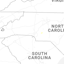
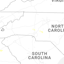
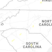


Connect with Interactive Hail Maps