

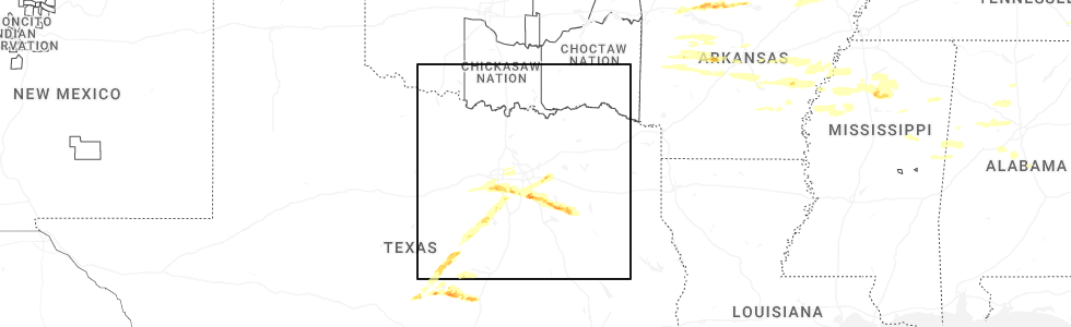
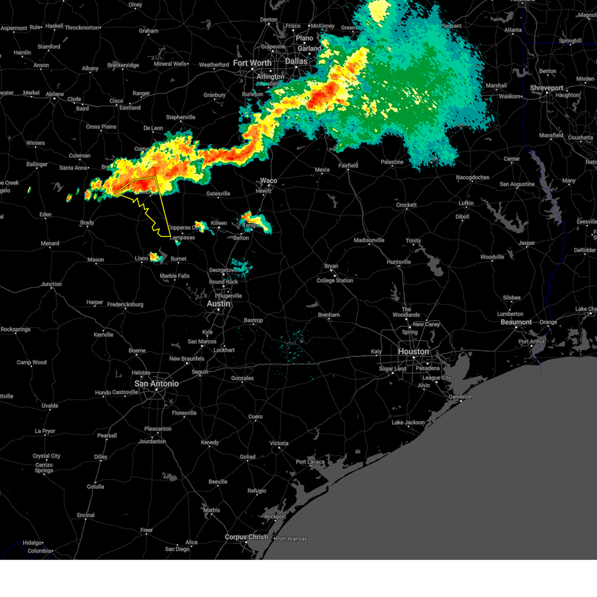
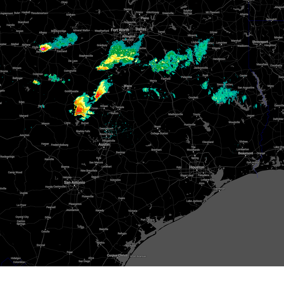
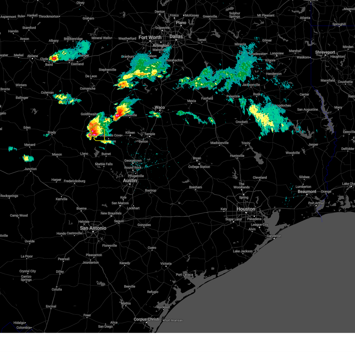
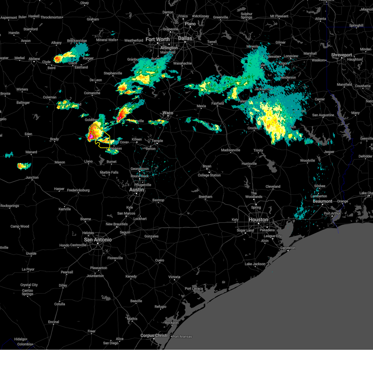
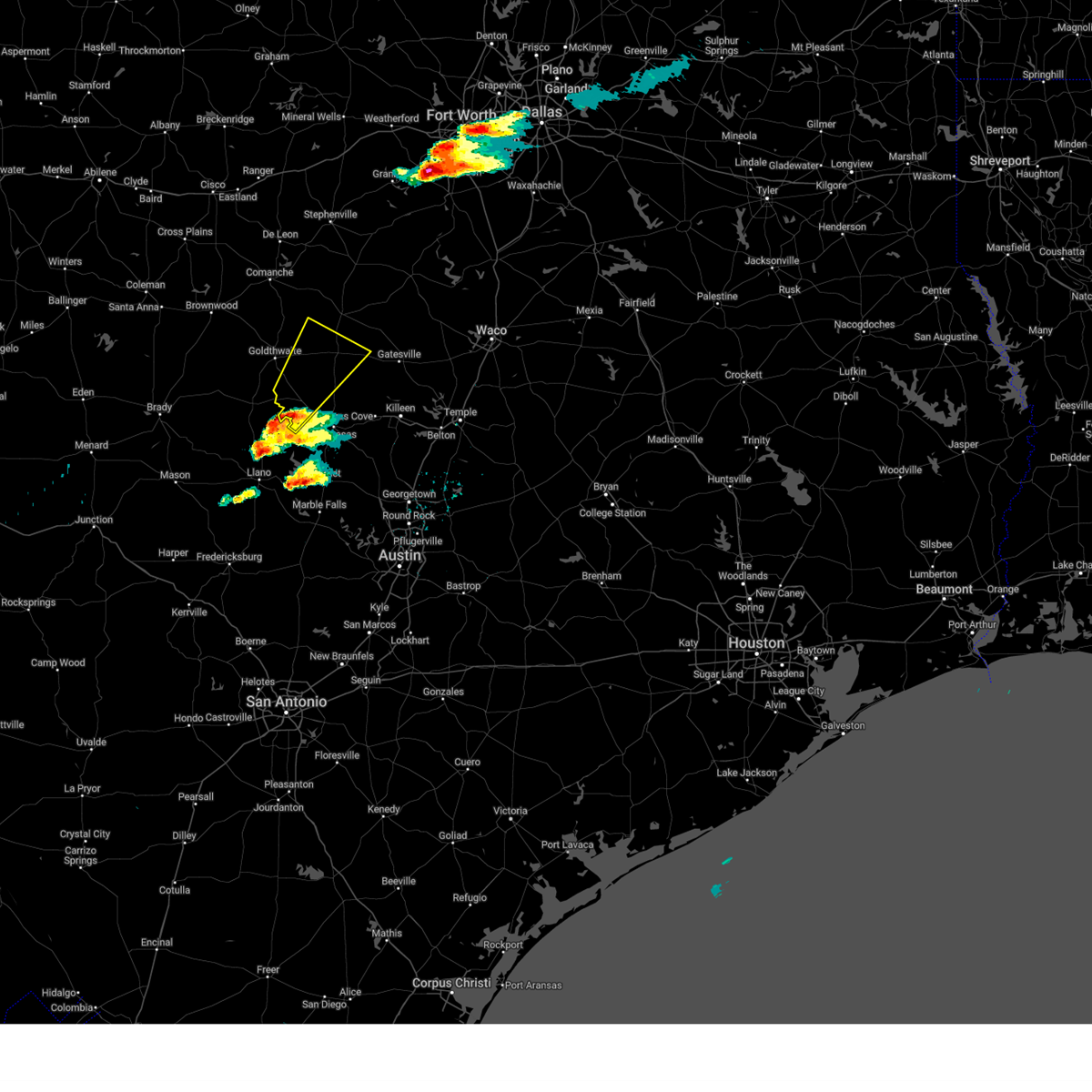
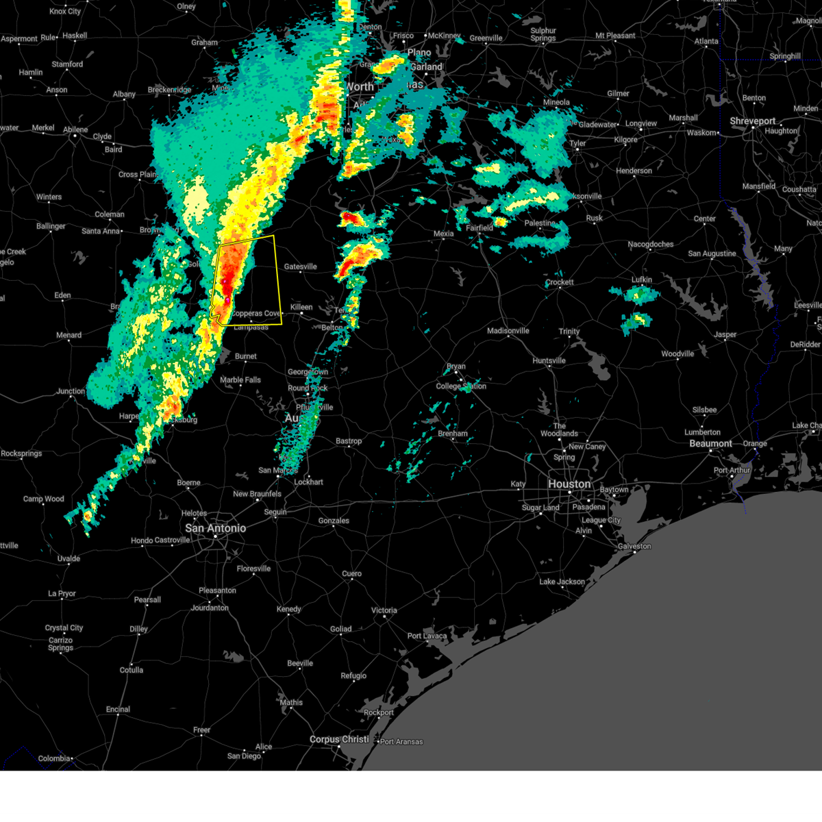
Hail Map for Lometa, TX
The Lometa, TX area has had 8 reports of on-the-ground hail by trained spotters, and has been under severe weather warnings 20 times during the past 12 months. Doppler radar has detected hail at or near Lometa, TX on 58 occasions, including 4 occasions during the past year.
| Name: | Lometa, TX |
| Where Located: | 40 miles W of Killeen, TX |
| Map: | Google Map for Lometa, TX |
| Population: | 856 |
| Housing Units: | 352 |
| More Info: | Search Google for Lometa, TX |
2
The Top Recent Hail Date for Lometa, TX is Friday, May 16, 2025 (4th out of 58)
Hail and Wind Damage Spotted near Lometa, TX
| Date / Time | Report Details |
|---|---|
| 6/4/2025 1:57 AM CDT |
 The storms which prompted the warning have weakened below severe limits. therefore the warning will be allowed to expire. however gusty winds and heavy rain are still possible with these thunderstorms. a severe thunderstorm watch remains in effect until 200 am cdt for central texas. The storms which prompted the warning have weakened below severe limits. therefore the warning will be allowed to expire. however gusty winds and heavy rain are still possible with these thunderstorms. a severe thunderstorm watch remains in effect until 200 am cdt for central texas.
|
| 6/4/2025 1:36 AM CDT |
 At 135 am cdt, severe thunderstorms were located along a line extending from bend to san saba, moving south at 30 mph (radar indicated). Hazards include 60 mph wind gusts and quarter size hail. Hail damage to vehicles is expected. expect wind damage to roofs, siding, and trees. Locations impacted include, nix, bend, lometa, us-190 near the san saba- lampasas county line, and colorado bend state park. At 135 am cdt, severe thunderstorms were located along a line extending from bend to san saba, moving south at 30 mph (radar indicated). Hazards include 60 mph wind gusts and quarter size hail. Hail damage to vehicles is expected. expect wind damage to roofs, siding, and trees. Locations impacted include, nix, bend, lometa, us-190 near the san saba- lampasas county line, and colorado bend state park.
|
| 6/4/2025 1:05 AM CDT |
 At 104 am cdt, severe thunderstorms were located along a line extending from goldthwaite to near algerita, moving southeast at 30 mph (radar indicated). Hazards include 70 mph wind gusts and quarter size hail. Hail damage to vehicles is expected. expect considerable tree damage. wind damage is also likely to mobile homes, roofs, and outbuildings. Locations impacted include, goldthwaite, nix, bend, lometa, us-190 near the san saba- lampasas county line, and colorado bend state park. At 104 am cdt, severe thunderstorms were located along a line extending from goldthwaite to near algerita, moving southeast at 30 mph (radar indicated). Hazards include 70 mph wind gusts and quarter size hail. Hail damage to vehicles is expected. expect considerable tree damage. wind damage is also likely to mobile homes, roofs, and outbuildings. Locations impacted include, goldthwaite, nix, bend, lometa, us-190 near the san saba- lampasas county line, and colorado bend state park.
|
| 6/4/2025 12:40 AM CDT |
 Svrfwd the national weather service in fort worth has issued a * severe thunderstorm warning for, southwestern lampasas county in central texas, mills county in central texas, * until 200 am cdt. * at 1240 am cdt, severe thunderstorms were located along a line extending from near goldthwaite to near elm grove, moving south at 30 mph (radar indicated). Hazards include 60 mph wind gusts and quarter size hail. Hail damage to vehicles is expected. Expect wind damage to roofs, siding, and trees. Svrfwd the national weather service in fort worth has issued a * severe thunderstorm warning for, southwestern lampasas county in central texas, mills county in central texas, * until 200 am cdt. * at 1240 am cdt, severe thunderstorms were located along a line extending from near goldthwaite to near elm grove, moving south at 30 mph (radar indicated). Hazards include 60 mph wind gusts and quarter size hail. Hail damage to vehicles is expected. Expect wind damage to roofs, siding, and trees.
|
| 5/28/2025 4:32 PM CDT |
 At 432 pm cdt, a severe thunderstorm was located near colorado bend state park, or 12 miles west of lampasas, moving southeast at 15 mph (radar indicated). Hazards include 65 mph wind gusts and half dollar size hail. Hail damage to vehicles is expected. expect wind damage to roofs, siding, and trees. Locations impacted include, nix, lometa, and colorado bend state park. At 432 pm cdt, a severe thunderstorm was located near colorado bend state park, or 12 miles west of lampasas, moving southeast at 15 mph (radar indicated). Hazards include 65 mph wind gusts and half dollar size hail. Hail damage to vehicles is expected. expect wind damage to roofs, siding, and trees. Locations impacted include, nix, lometa, and colorado bend state park.
|
| 5/28/2025 4:24 PM CDT | Ping Pong Ball sized hail reported 12.8 miles NNE of Lometa, TX, ping pong ball size hail at colorado bend state park. |
| 5/28/2025 4:13 PM CDT |
 At 413 pm cdt, a severe thunderstorm was located near bend, or 15 miles east of san saba, moving southeast at 15 mph (radar indicated). Hazards include golf ball size hail and 65 mph wind gusts. People and animals outdoors will be injured. expect hail damage to roofs, siding, windows, and vehicles. expect wind damage to roofs, siding, and trees. Locations impacted include, nix, lometa, and colorado bend state park. At 413 pm cdt, a severe thunderstorm was located near bend, or 15 miles east of san saba, moving southeast at 15 mph (radar indicated). Hazards include golf ball size hail and 65 mph wind gusts. People and animals outdoors will be injured. expect hail damage to roofs, siding, windows, and vehicles. expect wind damage to roofs, siding, and trees. Locations impacted include, nix, lometa, and colorado bend state park.
|
| 5/28/2025 4:13 PM CDT |
 the severe thunderstorm warning has been cancelled and is no longer in effect the severe thunderstorm warning has been cancelled and is no longer in effect
|
| 5/28/2025 3:55 PM CDT |
 Svrfwd the national weather service in fort worth has issued a * severe thunderstorm warning for, southwestern lampasas county in central texas, south central mills county in central texas, * until 500 pm cdt. * at 355 pm cdt, a severe thunderstorm was located 10 miles north of bend, or 10 miles east of san saba, moving southeast at 15 mph (radar indicated). Hazards include tennis ball size hail and 65 mph wind gusts. People and animals outdoors will be injured. expect hail damage to roofs, siding, windows, and vehicles. expect wind damage to roofs, siding, and trees. This severe thunderstorm will remain over mainly rural areas of southwestern lampasas and south central mills counties, including the following locations, nix and lometa. Svrfwd the national weather service in fort worth has issued a * severe thunderstorm warning for, southwestern lampasas county in central texas, south central mills county in central texas, * until 500 pm cdt. * at 355 pm cdt, a severe thunderstorm was located 10 miles north of bend, or 10 miles east of san saba, moving southeast at 15 mph (radar indicated). Hazards include tennis ball size hail and 65 mph wind gusts. People and animals outdoors will be injured. expect hail damage to roofs, siding, windows, and vehicles. expect wind damage to roofs, siding, and trees. This severe thunderstorm will remain over mainly rural areas of southwestern lampasas and south central mills counties, including the following locations, nix and lometa.
|
| 5/23/2025 12:27 AM CDT |
 The storms which prompted the warning have weakened below severe limits. therefore the warning will be allowed to expire. however gusty winds and heavy rain are still possible with these thunderstorms. a severe thunderstorm watch remains in effect until 100 am cdt for central texas. The storms which prompted the warning have weakened below severe limits. therefore the warning will be allowed to expire. however gusty winds and heavy rain are still possible with these thunderstorms. a severe thunderstorm watch remains in effect until 100 am cdt for central texas.
|
| 5/23/2025 12:13 AM CDT |
 At 1212 am cdt, severe thunderstorms were located along a line extending from 10 miles east of goldthwaite to near bend, moving southeast at 25 mph (radar indicated). Hazards include 60 mph wind gusts and quarter size hail. Hail damage to vehicles is expected. expect wind damage to roofs, siding, and trees. these severe storms will be near, colorado bend state park around 1220 am cdt. lampasas around 1240 am cdt. Other locations impacted by these severe thunderstorms include moline, center city, nix, and lometa. At 1212 am cdt, severe thunderstorms were located along a line extending from 10 miles east of goldthwaite to near bend, moving southeast at 25 mph (radar indicated). Hazards include 60 mph wind gusts and quarter size hail. Hail damage to vehicles is expected. expect wind damage to roofs, siding, and trees. these severe storms will be near, colorado bend state park around 1220 am cdt. lampasas around 1240 am cdt. Other locations impacted by these severe thunderstorms include moline, center city, nix, and lometa.
|
| 5/22/2025 11:29 PM CDT |
 Svrfwd the national weather service in fort worth has issued a * severe thunderstorm warning for, lampasas county in central texas, mills county in central texas, * until 1230 am cdt. * at 1129 pm cdt, severe thunderstorms were located along a line extending from 12 miles northeast of mullin to near chappel to near valley spring, moving southeast at 25 mph (radar indicated). Hazards include 60 mph wind gusts and quarter size hail. Hail damage to vehicles is expected. expect wind damage to roofs, siding, and trees. severe thunderstorms will be near, goldthwaite around 1135 pm cdt. colorado bend state park around 1145 pm cdt. Other locations impacted by these severe thunderstorms include moline, center city, democrat, lometa, bozar, priddy, nix, caradan, ridge, and regency. Svrfwd the national weather service in fort worth has issued a * severe thunderstorm warning for, lampasas county in central texas, mills county in central texas, * until 1230 am cdt. * at 1129 pm cdt, severe thunderstorms were located along a line extending from 12 miles northeast of mullin to near chappel to near valley spring, moving southeast at 25 mph (radar indicated). Hazards include 60 mph wind gusts and quarter size hail. Hail damage to vehicles is expected. expect wind damage to roofs, siding, and trees. severe thunderstorms will be near, goldthwaite around 1135 pm cdt. colorado bend state park around 1145 pm cdt. Other locations impacted by these severe thunderstorms include moline, center city, democrat, lometa, bozar, priddy, nix, caradan, ridge, and regency.
|
| 5/22/2025 11:06 PM CDT |
 Svrfwd the national weather service in fort worth has issued a * severe thunderstorm warning for, western lampasas county in central texas, eastern mills county in central texas, * until 1130 pm cdt. * at 1105 pm cdt, a severe thunderstorm was located near san saba, moving east at 40 mph (radar indicated). Hazards include 60 mph wind gusts and quarter size hail. Hail damage to vehicles is expected. expect wind damage to roofs, siding, and trees. This severe thunderstorm will remain over mainly rural areas of western lampasas and eastern mills counties, including the following locations, center city, star, lometa, bozar, nix, caradan, moline, and pecan wells. Svrfwd the national weather service in fort worth has issued a * severe thunderstorm warning for, western lampasas county in central texas, eastern mills county in central texas, * until 1130 pm cdt. * at 1105 pm cdt, a severe thunderstorm was located near san saba, moving east at 40 mph (radar indicated). Hazards include 60 mph wind gusts and quarter size hail. Hail damage to vehicles is expected. expect wind damage to roofs, siding, and trees. This severe thunderstorm will remain over mainly rural areas of western lampasas and eastern mills counties, including the following locations, center city, star, lometa, bozar, nix, caradan, moline, and pecan wells.
|
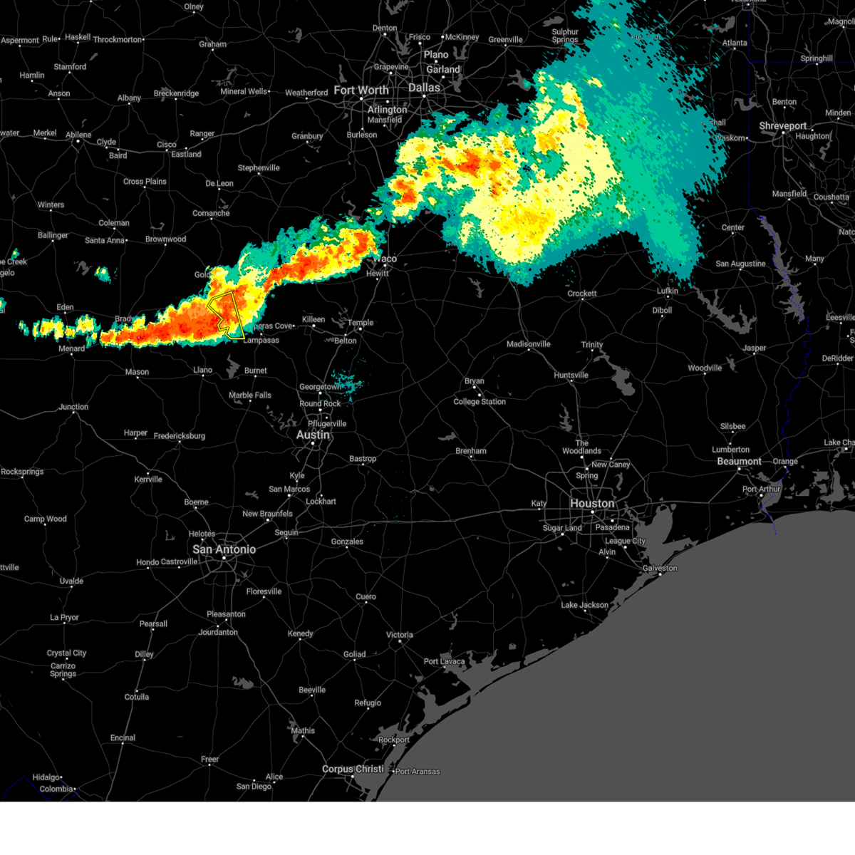
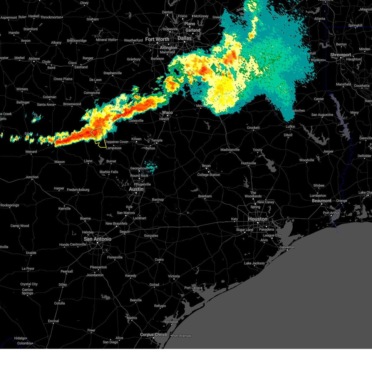
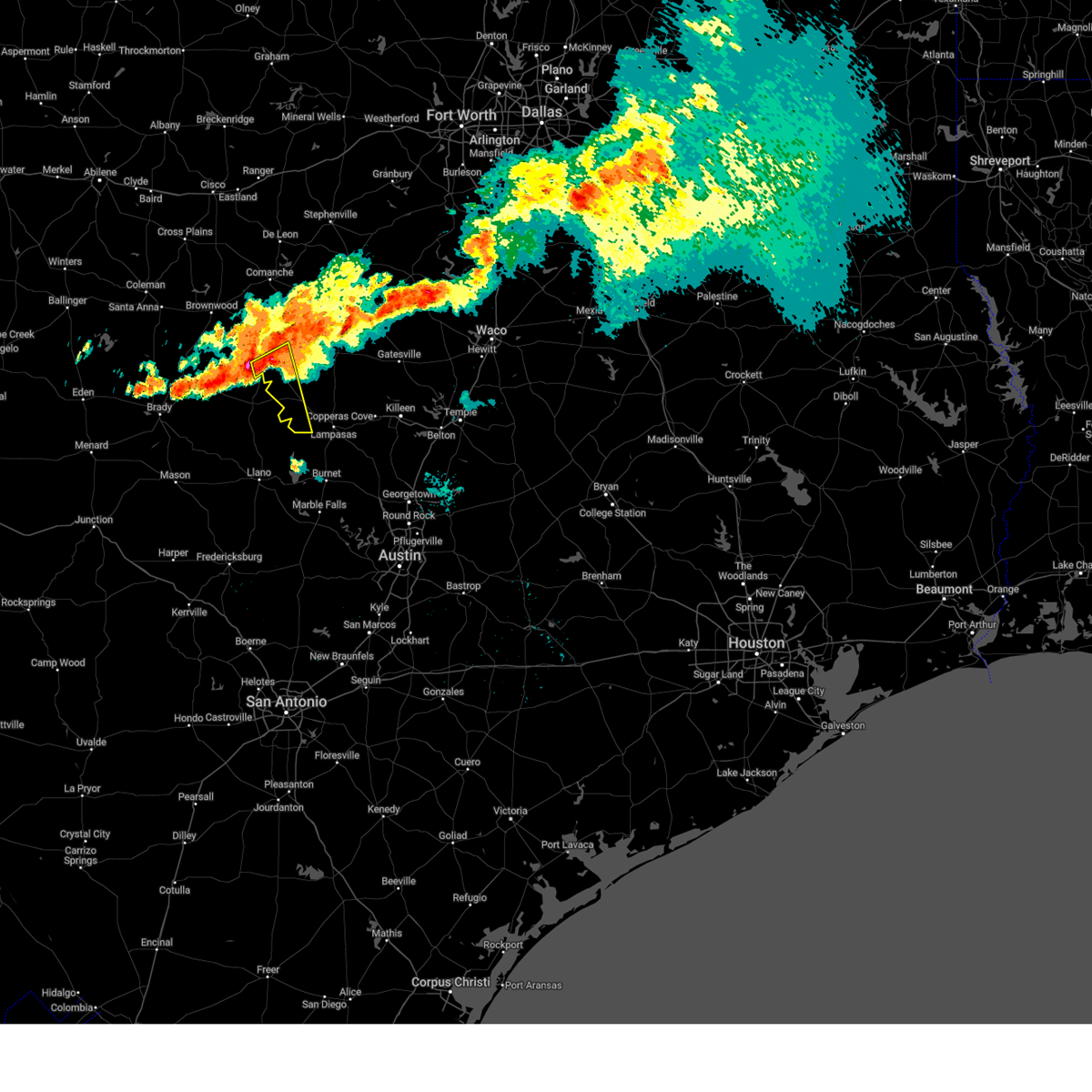
| 5/16/2025 6:37 PM CDT | At 637 pm cdt, a severe thunderstorm was located near lometa, or 17 miles northwest of lampasas, moving northeast at 35 mph (radar indicated). Hazards include ping pong ball size hail and 60 mph wind gusts. People and animals outdoors will be injured. expect hail damage to roofs, siding, windows, and vehicles. expect wind damage to roofs, siding, and trees. Locations impacted include, shive, moline, purmela, adamsville, pearl, center city, south purmela, bee house, evant, star, lometa, pecan wells, and pottsville. |
| 5/16/2025 6:30 PM CDT | Golf Ball sized hail reported 2.8 miles E of Lometa, TX, facebook photo showed spiky hail of at least 2 inches in diameter. |
| 5/16/2025 6:17 PM CDT |
 At 616 pm cdt, a severe thunderstorm was located over bend, or 13 miles east of san saba, moving northeast at 40 mph (radar indicated). Hazards include golf ball size hail and 60 mph wind gusts. People and animals outdoors will be injured. expect hail damage to roofs, siding, windows, and vehicles. expect wind damage to roofs, siding, and trees. Locations impacted include, shive, moline, purmela, adamsville, pearl, center city, south purmela, bee house, evant, star, lometa, nix, pecan wells, pottsville, and colorado bend state park. At 616 pm cdt, a severe thunderstorm was located over bend, or 13 miles east of san saba, moving northeast at 40 mph (radar indicated). Hazards include golf ball size hail and 60 mph wind gusts. People and animals outdoors will be injured. expect hail damage to roofs, siding, windows, and vehicles. expect wind damage to roofs, siding, and trees. Locations impacted include, shive, moline, purmela, adamsville, pearl, center city, south purmela, bee house, evant, star, lometa, nix, pecan wells, pottsville, and colorado bend state park.
|
| 5/16/2025 6:11 PM CDT | Svrfwd the national weather service in fort worth has issued a * severe thunderstorm warning for, southwestern hamilton county in central texas, west central coryell county in central texas, western lampasas county in central texas, southeastern mills county in central texas, * until 715 pm cdt. * at 610 pm cdt, a severe thunderstorm was located over chappel, or 12 miles southeast of san saba, moving northeast at 40 mph (radar indicated). Hazards include 60 mph wind gusts and half dollar size hail. Hail damage to vehicles is expected. Expect wind damage to roofs, siding, and trees. |
| 5/1/2025 8:44 PM CDT |
 Svrfwd the national weather service in fort worth has issued a * severe thunderstorm warning for, lampasas county in central texas, * until 945 pm cdt. * at 844 pm cdt, a severe thunderstorm was located 7 miles northeast of colorado bend state park, or 12 miles west of lampasas, moving east at 25 mph (radar indicated). Hazards include 60 mph wind gusts and half dollar size hail. Hail damage to vehicles is expected. expect wind damage to roofs, siding, and trees. this severe thunderstorm will be near, lampasas around 900 pm cdt. kempner around 935 pm cdt. Other locations impacted by this severe thunderstorm include adamsville, nix, izoro, lometa, and rumley. Svrfwd the national weather service in fort worth has issued a * severe thunderstorm warning for, lampasas county in central texas, * until 945 pm cdt. * at 844 pm cdt, a severe thunderstorm was located 7 miles northeast of colorado bend state park, or 12 miles west of lampasas, moving east at 25 mph (radar indicated). Hazards include 60 mph wind gusts and half dollar size hail. Hail damage to vehicles is expected. expect wind damage to roofs, siding, and trees. this severe thunderstorm will be near, lampasas around 900 pm cdt. kempner around 935 pm cdt. Other locations impacted by this severe thunderstorm include adamsville, nix, izoro, lometa, and rumley.
|
| 3/30/2025 6:01 AM CDT |
 Svrfwd the national weather service in fort worth has issued a * severe thunderstorm warning for, southeastern hamilton county in central texas, northern coryell county in central texas, northwestern lampasas county in central texas, southeastern mills county in central texas, * until 700 am cdt. * at 600 am cdt, severe thunderstorms were located along a line extending from near evant to san saba, moving east at 40 mph (radar indicated). Hazards include quarter size hail. Damage to vehicles is possible. severe thunderstorms will be near, evant around 605 am cdt. Other locations impacted by these severe thunderstorms include pancake, moline, coryell city, purmela, adamsville, whiteway, aleman, arnett, levita, and hurst springs. Svrfwd the national weather service in fort worth has issued a * severe thunderstorm warning for, southeastern hamilton county in central texas, northern coryell county in central texas, northwestern lampasas county in central texas, southeastern mills county in central texas, * until 700 am cdt. * at 600 am cdt, severe thunderstorms were located along a line extending from near evant to san saba, moving east at 40 mph (radar indicated). Hazards include quarter size hail. Damage to vehicles is possible. severe thunderstorms will be near, evant around 605 am cdt. Other locations impacted by these severe thunderstorms include pancake, moline, coryell city, purmela, adamsville, whiteway, aleman, arnett, levita, and hurst springs.
|
| 3/4/2025 5:42 AM CST |
 The storms which prompted the warning have weakened below severe limits, and have exited the warned area. therefore the warning will be allowed to expire. a tornado watch remains in effect until 1100 am cst for central texas. The storms which prompted the warning have weakened below severe limits, and have exited the warned area. therefore the warning will be allowed to expire. a tornado watch remains in effect until 1100 am cst for central texas.
|
| 3/4/2025 5:06 AM CST |
 At 505 am cst, severe thunderstorms were located along a line extending from 14 miles northwest of evant to 11 miles northeast of bend to near colorado bend state park, moving east at 55 mph (radar indicated). Hazards include 60 mph wind gusts and quarter size hail. Hail damage to vehicles is expected. expect wind damage to roofs, siding, and trees. these severe storms will be near, lampasas and evant around 515 am cst. hamilton around 520 am cst. copperas cove and kempner around 530 am cst. Other locations impacted by these severe thunderstorms include shive, moline, izoro, rumley, purmela, adamsville, whiteway, aleman, pearl, and center city. At 505 am cst, severe thunderstorms were located along a line extending from 14 miles northwest of evant to 11 miles northeast of bend to near colorado bend state park, moving east at 55 mph (radar indicated). Hazards include 60 mph wind gusts and quarter size hail. Hail damage to vehicles is expected. expect wind damage to roofs, siding, and trees. these severe storms will be near, lampasas and evant around 515 am cst. hamilton around 520 am cst. copperas cove and kempner around 530 am cst. Other locations impacted by these severe thunderstorms include shive, moline, izoro, rumley, purmela, adamsville, whiteway, aleman, pearl, and center city.
|
| 3/4/2025 4:38 AM CST |
 Svrfwd the national weather service in fort worth has issued a * severe thunderstorm warning for, southwestern hamilton county in central texas, western coryell county in central texas, lampasas county in central texas, mills county in central texas, * until 545 am cst. * at 438 am cst, severe thunderstorms were located along a line extending from 8 miles southwest of mullin to near cherokee, moving east at 50 mph (radar indicated). Hazards include 60 mph wind gusts and quarter size hail. Hail damage to vehicles is expected. expect wind damage to roofs, siding, and trees. severe thunderstorms will be near, goldthwaite around 445 am cst. bend around 450 am cst. colorado bend state park around 455 am cst. lampasas and evant around 515 am cst. copperas cove and kempner around 530 am cst. Other locations impacted by these severe thunderstorms include regency, shive, moline, izoro, rumley, bozar, purmela, adamsville, whiteway, and aleman. Svrfwd the national weather service in fort worth has issued a * severe thunderstorm warning for, southwestern hamilton county in central texas, western coryell county in central texas, lampasas county in central texas, mills county in central texas, * until 545 am cst. * at 438 am cst, severe thunderstorms were located along a line extending from 8 miles southwest of mullin to near cherokee, moving east at 50 mph (radar indicated). Hazards include 60 mph wind gusts and quarter size hail. Hail damage to vehicles is expected. expect wind damage to roofs, siding, and trees. severe thunderstorms will be near, goldthwaite around 445 am cst. bend around 450 am cst. colorado bend state park around 455 am cst. lampasas and evant around 515 am cst. copperas cove and kempner around 530 am cst. Other locations impacted by these severe thunderstorms include regency, shive, moline, izoro, rumley, bozar, purmela, adamsville, whiteway, and aleman.
|
| 5/31/2024 2:46 AM CDT |
 Svrfwd the national weather service in fort worth has issued a * severe thunderstorm warning for, eastern hamilton county in central texas, western mclennan county in central texas, coryell county in central texas, lampasas county in central texas, bosque county in central texas, bell county in central texas, southwestern hill county in central texas, southeastern mills county in central texas, * until 330 am cdt. * at 245 am cdt, severe thunderstorms were located along a line extending from 6 miles northeast of hico to near evant to 7 miles east of san saba, moving southeast at 50 mph (radar indicated). Hazards include 65 mph wind gusts and nickel size hail. Expect damage to roofs, siding, and trees. severe thunderstorms will be near, iredell around 250 am cdt. cranfills gap around 255 am cdt. gatesville, lampasas, meridian, and meridian state park around 300 am cdt. fort gates around 305 am cdt. copperas cove, clifton, fort cavazos, and kempner around 310 am cdt. killeen, valley mills, and belton lake around 315 am cdt. harker heights, mcgregor, laguna park, crawford, and mother neff state park around 320 am cdt. nolanville and morgan's point resort around 325 am cdt. other locations impacted by these severe thunderstorms include pancake, moline, whitson, rock creek, moffat, oglesby, adamsville, whiteway, levita, and meadow grove. This includes interstate 35 between mile markers 285 and 312, and between mile markers 315 and 321. Svrfwd the national weather service in fort worth has issued a * severe thunderstorm warning for, eastern hamilton county in central texas, western mclennan county in central texas, coryell county in central texas, lampasas county in central texas, bosque county in central texas, bell county in central texas, southwestern hill county in central texas, southeastern mills county in central texas, * until 330 am cdt. * at 245 am cdt, severe thunderstorms were located along a line extending from 6 miles northeast of hico to near evant to 7 miles east of san saba, moving southeast at 50 mph (radar indicated). Hazards include 65 mph wind gusts and nickel size hail. Expect damage to roofs, siding, and trees. severe thunderstorms will be near, iredell around 250 am cdt. cranfills gap around 255 am cdt. gatesville, lampasas, meridian, and meridian state park around 300 am cdt. fort gates around 305 am cdt. copperas cove, clifton, fort cavazos, and kempner around 310 am cdt. killeen, valley mills, and belton lake around 315 am cdt. harker heights, mcgregor, laguna park, crawford, and mother neff state park around 320 am cdt. nolanville and morgan's point resort around 325 am cdt. other locations impacted by these severe thunderstorms include pancake, moline, whitson, rock creek, moffat, oglesby, adamsville, whiteway, levita, and meadow grove. This includes interstate 35 between mile markers 285 and 312, and between mile markers 315 and 321.
|
| 5/31/2024 2:42 AM CDT |
 the severe thunderstorm warning has been cancelled and is no longer in effect the severe thunderstorm warning has been cancelled and is no longer in effect
|
| 5/31/2024 2:42 AM CDT |
 At 241 am cdt, severe thunderstorms were located along a line extending from 11 miles east of stephenville to near evant to 7 miles north of san saba, moving east at 50 mph (radar indicated). Hazards include 60 mph wind gusts and nickel size hail. Expect damage to roofs, siding, and trees. these severe storms will be near, hamilton, hico, and evant around 245 am cdt. iredell around 250 am cdt. Other locations impacted by these severe thunderstorms include shive, alexander, moline, clairette, izoro, olin, adamsville, whiteway, duffau, and center city. At 241 am cdt, severe thunderstorms were located along a line extending from 11 miles east of stephenville to near evant to 7 miles north of san saba, moving east at 50 mph (radar indicated). Hazards include 60 mph wind gusts and nickel size hail. Expect damage to roofs, siding, and trees. these severe storms will be near, hamilton, hico, and evant around 245 am cdt. iredell around 250 am cdt. Other locations impacted by these severe thunderstorms include shive, alexander, moline, clairette, izoro, olin, adamsville, whiteway, duffau, and center city.
|
| 5/31/2024 2:18 AM CDT |
 Svrfwd the national weather service in fort worth has issued a * severe thunderstorm warning for, hamilton county in central texas, southern erath county in north central texas, northwestern coryell county in central texas, central lampasas county in central texas, northwestern bosque county in central texas, mills county in central texas, southeastern comanche county in central texas, * until 300 am cdt. * at 218 am cdt, severe thunderstorms were located along a line extending from near stephenville to near goldthwaite to near mercury, moving southeast at 35 mph (radar indicated). Hazards include 60 mph wind gusts and nickel size hail. Expect damage to roofs, siding, and trees. severe thunderstorms will be near, goldthwaite around 225 am cdt. hico around 240 am cdt. hamilton around 245 am cdt. Other locations impacted by these severe thunderstorms include shive, alexander, moline, clairette, izoro, olin, harbin, bozar, adamsville, and whiteway. Svrfwd the national weather service in fort worth has issued a * severe thunderstorm warning for, hamilton county in central texas, southern erath county in north central texas, northwestern coryell county in central texas, central lampasas county in central texas, northwestern bosque county in central texas, mills county in central texas, southeastern comanche county in central texas, * until 300 am cdt. * at 218 am cdt, severe thunderstorms were located along a line extending from near stephenville to near goldthwaite to near mercury, moving southeast at 35 mph (radar indicated). Hazards include 60 mph wind gusts and nickel size hail. Expect damage to roofs, siding, and trees. severe thunderstorms will be near, goldthwaite around 225 am cdt. hico around 240 am cdt. hamilton around 245 am cdt. Other locations impacted by these severe thunderstorms include shive, alexander, moline, clairette, izoro, olin, harbin, bozar, adamsville, and whiteway.
|
| 5/26/2024 8:03 AM CDT |
 the severe thunderstorm warning has been cancelled and is no longer in effect the severe thunderstorm warning has been cancelled and is no longer in effect
|
| 5/26/2024 7:50 AM CDT |
 the severe thunderstorm warning has been cancelled and is no longer in effect the severe thunderstorm warning has been cancelled and is no longer in effect
|
| 5/26/2024 7:50 AM CDT |
 At 749 am cdt, a severe thunderstorm was located 14 miles northeast of bend, or 17 miles northwest of lampasas, moving east at 40 mph (radar indicated). Hazards include 60 mph wind gusts and quarter size hail. Hail damage to vehicles is expected. expect wind damage to roofs, siding, and trees. This severe thunderstorm will remain over mainly rural areas of lampasas county, including the following locations, adamsville, izoro, lometa, and rumley. At 749 am cdt, a severe thunderstorm was located 14 miles northeast of bend, or 17 miles northwest of lampasas, moving east at 40 mph (radar indicated). Hazards include 60 mph wind gusts and quarter size hail. Hail damage to vehicles is expected. expect wind damage to roofs, siding, and trees. This severe thunderstorm will remain over mainly rural areas of lampasas county, including the following locations, adamsville, izoro, lometa, and rumley.
|
| 5/26/2024 7:30 AM CDT |
 Svrfwd the national weather service in fort worth has issued a * severe thunderstorm warning for, lampasas county in central texas, southeastern mills county in central texas, * until 830 am cdt. * at 730 am cdt, a severe thunderstorm was located 10 miles northeast of san saba, moving east at 40 mph (radar indicated). Hazards include 60 mph wind gusts and quarter size hail. Hail damage to vehicles is expected. expect wind damage to roofs, siding, and trees. This severe thunderstorm will remain over mainly rural areas of lampasas and southeastern mills counties, including the following locations, adamsville, moline, izoro, lometa, and rumley. Svrfwd the national weather service in fort worth has issued a * severe thunderstorm warning for, lampasas county in central texas, southeastern mills county in central texas, * until 830 am cdt. * at 730 am cdt, a severe thunderstorm was located 10 miles northeast of san saba, moving east at 40 mph (radar indicated). Hazards include 60 mph wind gusts and quarter size hail. Hail damage to vehicles is expected. expect wind damage to roofs, siding, and trees. This severe thunderstorm will remain over mainly rural areas of lampasas and southeastern mills counties, including the following locations, adamsville, moline, izoro, lometa, and rumley.
|
| 5/22/2024 5:19 PM CDT |
 At 518 pm cdt, a severe thunderstorm was located near evant, or 20 miles west of gatesville, moving east at 45 mph (radar indicated). Hazards include two inch hail and 70 mph wind gusts. People and animals outdoors will be injured. expect hail damage to roofs, siding, windows, and vehicles. expect considerable tree damage. wind damage is also likely to mobile homes, roofs, and outbuildings. this severe storm will be near, gatesville around 545 pm cdt. Other locations impacted by this severe thunderstorm include pancake, shive, moline, izoro, adamsville, whiteway, levita, center city, south purmela, and king. At 518 pm cdt, a severe thunderstorm was located near evant, or 20 miles west of gatesville, moving east at 45 mph (radar indicated). Hazards include two inch hail and 70 mph wind gusts. People and animals outdoors will be injured. expect hail damage to roofs, siding, windows, and vehicles. expect considerable tree damage. wind damage is also likely to mobile homes, roofs, and outbuildings. this severe storm will be near, gatesville around 545 pm cdt. Other locations impacted by this severe thunderstorm include pancake, shive, moline, izoro, adamsville, whiteway, levita, center city, south purmela, and king.
|
| 5/22/2024 5:02 PM CDT |
 Svrfwd the national weather service in fort worth has issued a * severe thunderstorm warning for, southern hamilton county in central texas, coryell county in central texas, lampasas county in central texas, mills county in central texas, * until 600 pm cdt. * at 501 pm cdt, a severe thunderstorm was located near evant, or 12 miles south of hamilton, moving east at 35 mph (radar indicated). Hazards include ping pong ball size hail and 60 mph wind gusts. People and animals outdoors will be injured. expect hail damage to roofs, siding, windows, and vehicles. expect wind damage to roofs, siding, and trees. this severe thunderstorm will be near, evant around 505 pm cdt. gatesville around 540 pm cdt. Other locations impacted by this severe thunderstorm include pancake, shive, moline, izoro, bozar, adamsville, whiteway, levita, center city, and south purmela. Svrfwd the national weather service in fort worth has issued a * severe thunderstorm warning for, southern hamilton county in central texas, coryell county in central texas, lampasas county in central texas, mills county in central texas, * until 600 pm cdt. * at 501 pm cdt, a severe thunderstorm was located near evant, or 12 miles south of hamilton, moving east at 35 mph (radar indicated). Hazards include ping pong ball size hail and 60 mph wind gusts. People and animals outdoors will be injured. expect hail damage to roofs, siding, windows, and vehicles. expect wind damage to roofs, siding, and trees. this severe thunderstorm will be near, evant around 505 pm cdt. gatesville around 540 pm cdt. Other locations impacted by this severe thunderstorm include pancake, shive, moline, izoro, bozar, adamsville, whiteway, levita, center city, and south purmela.
|
| 5/16/2024 12:52 PM CDT |
 At 1251 pm cdt, severe thunderstorms were located along a line extending from 7 miles northwest of evant to 20 miles east of goldthwaite to 8 miles northwest of lampasas, moving east at 35 mph (radar indicated). Hazards include 60 mph wind gusts and quarter size hail. Hail damage to vehicles is expected. expect wind damage to roofs, siding, and trees. Locations impacted include, lampasas, evant, lometa, pearl, moline, center city, bee house, star, izoro, rumley, adamsville, and pecan wells. At 1251 pm cdt, severe thunderstorms were located along a line extending from 7 miles northwest of evant to 20 miles east of goldthwaite to 8 miles northwest of lampasas, moving east at 35 mph (radar indicated). Hazards include 60 mph wind gusts and quarter size hail. Hail damage to vehicles is expected. expect wind damage to roofs, siding, and trees. Locations impacted include, lampasas, evant, lometa, pearl, moline, center city, bee house, star, izoro, rumley, adamsville, and pecan wells.
|
| 5/16/2024 12:28 PM CDT |
 Svrfwd the national weather service in fort worth has issued a * severe thunderstorm warning for, southwestern hamilton county in central texas, west central coryell county in central texas, lampasas county in central texas, eastern mills county in central texas, * until 115 pm cdt. * at 1228 pm cdt, severe thunderstorms were located along a line extending from 10 miles east of mullin to 7 miles southeast of goldthwaite to 6 miles north of bend, moving east at 35 mph (radar indicated). Hazards include 60 mph wind gusts and quarter size hail. Hail damage to vehicles is expected. Expect wind damage to roofs, siding, and trees. Svrfwd the national weather service in fort worth has issued a * severe thunderstorm warning for, southwestern hamilton county in central texas, west central coryell county in central texas, lampasas county in central texas, eastern mills county in central texas, * until 115 pm cdt. * at 1228 pm cdt, severe thunderstorms were located along a line extending from 10 miles east of mullin to 7 miles southeast of goldthwaite to 6 miles north of bend, moving east at 35 mph (radar indicated). Hazards include 60 mph wind gusts and quarter size hail. Hail damage to vehicles is expected. Expect wind damage to roofs, siding, and trees.
|
| 5/16/2024 12:18 PM CDT |
 At 1218 pm cdt, severe thunderstorms were located along a line extending from 8 miles northeast of mullin to goldthwaite to 6 miles east of san saba, moving east at 40 mph (radar indicated). Hazards include 60 mph wind gusts and quarter size hail. Hail damage to vehicles is expected. expect wind damage to roofs, siding, and trees. Locations impacted include, goldthwaite, mullin, lometa, moline, center city, star, bozar, pecan wells, and caradan. At 1218 pm cdt, severe thunderstorms were located along a line extending from 8 miles northeast of mullin to goldthwaite to 6 miles east of san saba, moving east at 40 mph (radar indicated). Hazards include 60 mph wind gusts and quarter size hail. Hail damage to vehicles is expected. expect wind damage to roofs, siding, and trees. Locations impacted include, goldthwaite, mullin, lometa, moline, center city, star, bozar, pecan wells, and caradan.
|
| 5/16/2024 11:59 AM CDT |
 At 1158 am cdt, severe thunderstorms were located along a line extending from near mullin to 8 miles west of goldthwaite to near algerita, moving east at 35 mph (radar indicated). Hazards include 60 mph wind gusts and quarter size hail. Hail damage to vehicles is expected. expect wind damage to roofs, siding, and trees. Locations impacted include, goldthwaite, mullin, lometa, ridge, democrat, moline, bozar, priddy, indian gap, center city, star, pottsville, pecan wells, caradan, and regency. At 1158 am cdt, severe thunderstorms were located along a line extending from near mullin to 8 miles west of goldthwaite to near algerita, moving east at 35 mph (radar indicated). Hazards include 60 mph wind gusts and quarter size hail. Hail damage to vehicles is expected. expect wind damage to roofs, siding, and trees. Locations impacted include, goldthwaite, mullin, lometa, ridge, democrat, moline, bozar, priddy, indian gap, center city, star, pottsville, pecan wells, caradan, and regency.
|
| 5/16/2024 11:59 AM CDT |
 the severe thunderstorm warning has been cancelled and is no longer in effect the severe thunderstorm warning has been cancelled and is no longer in effect
|
| 5/16/2024 11:29 AM CDT |
 Svrfwd the national weather service in fort worth has issued a * severe thunderstorm warning for, southwestern hamilton county in central texas, northwestern lampasas county in central texas, mills county in central texas, southern comanche county in central texas, * until 1230 pm cdt. * at 1128 am cdt, severe thunderstorms were located along a line extending from near lake brownwood state park to near elm grove to rochelle, moving east at 40 mph (radar indicated). Hazards include 60 mph wind gusts and quarter size hail. Hail damage to vehicles is expected. Expect wind damage to roofs, siding, and trees. Svrfwd the national weather service in fort worth has issued a * severe thunderstorm warning for, southwestern hamilton county in central texas, northwestern lampasas county in central texas, mills county in central texas, southern comanche county in central texas, * until 1230 pm cdt. * at 1128 am cdt, severe thunderstorms were located along a line extending from near lake brownwood state park to near elm grove to rochelle, moving east at 40 mph (radar indicated). Hazards include 60 mph wind gusts and quarter size hail. Hail damage to vehicles is expected. Expect wind damage to roofs, siding, and trees.
|
| 5/2/2024 10:58 PM CDT |
 At 1058 pm cdt, a severe thunderstorm was located near lampasas, moving east at 40 mph (radar indicated). Hazards include 65 mph wind gusts and nickel size hail. Expect damage to roofs, siding, and trees. this severe storm will be near, kempner around 1105 pm cdt. copperas cove around 1110 pm cdt. Other locations impacted by this severe thunderstorm include nix, lometa, and rumley. At 1058 pm cdt, a severe thunderstorm was located near lampasas, moving east at 40 mph (radar indicated). Hazards include 65 mph wind gusts and nickel size hail. Expect damage to roofs, siding, and trees. this severe storm will be near, kempner around 1105 pm cdt. copperas cove around 1110 pm cdt. Other locations impacted by this severe thunderstorm include nix, lometa, and rumley.
|
| 5/2/2024 10:32 PM CDT |
 Svrfwd the national weather service in fort worth has issued a * severe thunderstorm warning for, lampasas county in central texas, * until 1115 pm cdt. * at 1032 pm cdt, a severe thunderstorm was located 9 miles northeast of bend, or 16 miles northwest of lampasas, moving east at 35 mph (radar indicated). Hazards include 60 mph wind gusts and nickel size hail. Expect damage to roofs, siding, and trees. this severe thunderstorm will be near, copperas cove around 1115 pm cdt. Other locations impacted by this severe thunderstorm include adamsville, nix, izoro, lometa, and rumley. Svrfwd the national weather service in fort worth has issued a * severe thunderstorm warning for, lampasas county in central texas, * until 1115 pm cdt. * at 1032 pm cdt, a severe thunderstorm was located 9 miles northeast of bend, or 16 miles northwest of lampasas, moving east at 35 mph (radar indicated). Hazards include 60 mph wind gusts and nickel size hail. Expect damage to roofs, siding, and trees. this severe thunderstorm will be near, copperas cove around 1115 pm cdt. Other locations impacted by this severe thunderstorm include adamsville, nix, izoro, lometa, and rumley.
|
| 4/26/2024 10:04 AM CDT |
 Svrfwd the national weather service in fort worth has issued a * severe thunderstorm warning for, lampasas county in central texas, * until 1045 am cdt. * at 1004 am cdt, a severe thunderstorm was located near colorado bend state park, or 12 miles west of lampasas, moving northeast at 40 mph (radar indicated). Hazards include 60 mph wind gusts and half dollar size hail. Hail damage to vehicles is expected. expect wind damage to roofs, siding, and trees. this severe thunderstorm will be near, lampasas around 1015 am cdt. Other locations impacted by this severe thunderstorm include adamsville, nix, izoro, lometa, and rumley. Svrfwd the national weather service in fort worth has issued a * severe thunderstorm warning for, lampasas county in central texas, * until 1045 am cdt. * at 1004 am cdt, a severe thunderstorm was located near colorado bend state park, or 12 miles west of lampasas, moving northeast at 40 mph (radar indicated). Hazards include 60 mph wind gusts and half dollar size hail. Hail damage to vehicles is expected. expect wind damage to roofs, siding, and trees. this severe thunderstorm will be near, lampasas around 1015 am cdt. Other locations impacted by this severe thunderstorm include adamsville, nix, izoro, lometa, and rumley.
|
| 4/18/2024 7:19 PM CDT |
 the severe thunderstorm warning has been cancelled and is no longer in effect the severe thunderstorm warning has been cancelled and is no longer in effect
|
| 4/18/2024 6:57 PM CDT |
 Svrfwd the national weather service in fort worth has issued a * severe thunderstorm warning for, lampasas county in central texas, * until 745 pm cdt. * at 656 pm cdt, a severe thunderstorm was located 10 miles northwest of lampasas, moving southeast at 20 mph (radar indicated). Hazards include 70 mph wind gusts and half dollar size hail. Hail damage to vehicles is expected. expect considerable tree damage. wind damage is also likely to mobile homes, roofs, and outbuildings. this severe thunderstorm will be near, lampasas around 705 pm cdt. Other locations impacted by this severe thunderstorm include nix, rumley, and lometa. Svrfwd the national weather service in fort worth has issued a * severe thunderstorm warning for, lampasas county in central texas, * until 745 pm cdt. * at 656 pm cdt, a severe thunderstorm was located 10 miles northwest of lampasas, moving southeast at 20 mph (radar indicated). Hazards include 70 mph wind gusts and half dollar size hail. Hail damage to vehicles is expected. expect considerable tree damage. wind damage is also likely to mobile homes, roofs, and outbuildings. this severe thunderstorm will be near, lampasas around 705 pm cdt. Other locations impacted by this severe thunderstorm include nix, rumley, and lometa.
|
| 4/18/2024 6:38 PM CDT |
 At 637 pm cdt, a severe thunderstorm was located 13 miles northwest of lampasas, moving south at 20 mph (radar indicated). Hazards include 65 mph wind gusts and half dollar size hail. Hail damage to vehicles is expected. expect wind damage to roofs, siding, and trees. Locations impacted include, lampasas, colorado bend state park, lometa, and nix. At 637 pm cdt, a severe thunderstorm was located 13 miles northwest of lampasas, moving south at 20 mph (radar indicated). Hazards include 65 mph wind gusts and half dollar size hail. Hail damage to vehicles is expected. expect wind damage to roofs, siding, and trees. Locations impacted include, lampasas, colorado bend state park, lometa, and nix.
|
| 4/18/2024 6:38 PM CDT |
 the severe thunderstorm warning has been cancelled and is no longer in effect the severe thunderstorm warning has been cancelled and is no longer in effect
|
| 4/18/2024 6:30 PM CDT |
 At 629 pm cdt, a severe thunderstorm capable of producing a tornado was located 2 miles northwest of lometa, or 15 miles northwest of lampasas, moving southeast at 10 mph (radar indicated rotation). Hazards include tornado and golf ball size hail. Flying debris will be dangerous to those caught without shelter. mobile homes will be damaged or destroyed. damage to roofs, windows, and vehicles will occur. tree damage is likely. Locations impacted include, lometa and nix. At 629 pm cdt, a severe thunderstorm capable of producing a tornado was located 2 miles northwest of lometa, or 15 miles northwest of lampasas, moving southeast at 10 mph (radar indicated rotation). Hazards include tornado and golf ball size hail. Flying debris will be dangerous to those caught without shelter. mobile homes will be damaged or destroyed. damage to roofs, windows, and vehicles will occur. tree damage is likely. Locations impacted include, lometa and nix.
|
| 4/18/2024 6:26 PM CDT |
 At 625 pm cdt, a severe thunderstorm was located 17 miles northwest of lampasas, moving south at 20 mph (radar indicated). Hazards include golf ball size hail and 65 mph wind gusts. People and animals outdoors will be injured. expect hail damage to roofs, siding, windows, and vehicles. expect wind damage to roofs, siding, and trees. Locations impacted include, lampasas, colorado bend state park, lometa, moline, nix, and us- 190 near the san saba-lampasas county line. At 625 pm cdt, a severe thunderstorm was located 17 miles northwest of lampasas, moving south at 20 mph (radar indicated). Hazards include golf ball size hail and 65 mph wind gusts. People and animals outdoors will be injured. expect hail damage to roofs, siding, windows, and vehicles. expect wind damage to roofs, siding, and trees. Locations impacted include, lampasas, colorado bend state park, lometa, moline, nix, and us- 190 near the san saba-lampasas county line.
|
| 4/18/2024 6:19 PM CDT |
 Torfwd the national weather service in fort worth has issued a * tornado warning for, southwestern lampasas county in central texas, * until 700 pm cdt. * at 618 pm cdt, a severe thunderstorm capable of producing a tornado was located 20 miles northwest of lampasas, moving southeast at 10 mph (radar indicated rotation). Hazards include tornado and golf ball size hail. Flying debris will be dangerous to those caught without shelter. mobile homes will be damaged or destroyed. damage to roofs, windows, and vehicles will occur. tree damage is likely. This tornadic thunderstorm will remain over mainly rural areas of southwestern lampasas county, including the following locations, lometa and nix. Torfwd the national weather service in fort worth has issued a * tornado warning for, southwestern lampasas county in central texas, * until 700 pm cdt. * at 618 pm cdt, a severe thunderstorm capable of producing a tornado was located 20 miles northwest of lampasas, moving southeast at 10 mph (radar indicated rotation). Hazards include tornado and golf ball size hail. Flying debris will be dangerous to those caught without shelter. mobile homes will be damaged or destroyed. damage to roofs, windows, and vehicles will occur. tree damage is likely. This tornadic thunderstorm will remain over mainly rural areas of southwestern lampasas county, including the following locations, lometa and nix.
|
| 4/18/2024 6:05 PM CDT |
 At 605 pm cdt, a severe thunderstorm was located 10 miles southeast of goldthwaite, moving southeast at 20 mph (radar indicated). Hazards include golf ball size hail and 70 mph wind gusts. People and animals outdoors will be injured. expect hail damage to roofs, siding, windows, and vehicles. expect considerable tree damage. wind damage is also likely to mobile homes, roofs, and outbuildings. Locations impacted include, lampasas, goldthwaite, colorado bend state park, lometa, moline, center city, star, nix, and us-190 near the san saba- lampasas county line. At 605 pm cdt, a severe thunderstorm was located 10 miles southeast of goldthwaite, moving southeast at 20 mph (radar indicated). Hazards include golf ball size hail and 70 mph wind gusts. People and animals outdoors will be injured. expect hail damage to roofs, siding, windows, and vehicles. expect considerable tree damage. wind damage is also likely to mobile homes, roofs, and outbuildings. Locations impacted include, lampasas, goldthwaite, colorado bend state park, lometa, moline, center city, star, nix, and us-190 near the san saba- lampasas county line.
|
| 4/18/2024 5:55 PM CDT |
 Svrfwd the national weather service in fort worth has issued a * severe thunderstorm warning for, lampasas county in central texas, southeastern mills county in central texas, * until 700 pm cdt. * at 554 pm cdt, a severe thunderstorm was located 12 miles east of goldthwaite, or 25 miles northeast of san saba, moving south at 20 mph (radar indicated). Hazards include golf ball size hail and 65 mph wind gusts. People and animals outdoors will be injured. expect hail damage to roofs, siding, windows, and vehicles. expect wind damage to roofs, siding, and trees. This severe thunderstorm will remain over mainly rural areas of lampasas and southeastern mills counties, including the following locations, moline, center city, nix, star, and lometa. Svrfwd the national weather service in fort worth has issued a * severe thunderstorm warning for, lampasas county in central texas, southeastern mills county in central texas, * until 700 pm cdt. * at 554 pm cdt, a severe thunderstorm was located 12 miles east of goldthwaite, or 25 miles northeast of san saba, moving south at 20 mph (radar indicated). Hazards include golf ball size hail and 65 mph wind gusts. People and animals outdoors will be injured. expect hail damage to roofs, siding, windows, and vehicles. expect wind damage to roofs, siding, and trees. This severe thunderstorm will remain over mainly rural areas of lampasas and southeastern mills counties, including the following locations, moline, center city, nix, star, and lometa.
|
| 6/23/2023 11:21 PM CDT |
 The severe thunderstorm warning for western hamilton, northwestern lampasas, mills and southeastern comanche counties will expire at 1130 pm cdt, the storm which prompted the warning has weakened below severe limits. therefore the warning will be allowed to expire. however gusty winds and heavy rain are still possible with this thunderstorm. The severe thunderstorm warning for western hamilton, northwestern lampasas, mills and southeastern comanche counties will expire at 1130 pm cdt, the storm which prompted the warning has weakened below severe limits. therefore the warning will be allowed to expire. however gusty winds and heavy rain are still possible with this thunderstorm.
|
| 6/23/2023 11:04 PM CDT |
 At 1104 pm cdt, a severe thunderstorm was located 10 miles northeast of mullin, or 18 miles south of comanche, moving east at 35 mph (radar indicated). Hazards include quarter size hail. Damage to vehicles is possible. locations impacted include, goldthwaite, gustine, mullin, lometa, ridge, democrat, lamkin, moline, bozar, priddy, us-190 near the san saba- lampasas county line, indian gap, newburg, center city, energy, star, pottsville, gentrys mill, pecan wells and caradan. hail threat, radar indicated max hail size, 1. 00 in wind threat, radar indicated max wind gust, <50 mph. At 1104 pm cdt, a severe thunderstorm was located 10 miles northeast of mullin, or 18 miles south of comanche, moving east at 35 mph (radar indicated). Hazards include quarter size hail. Damage to vehicles is possible. locations impacted include, goldthwaite, gustine, mullin, lometa, ridge, democrat, lamkin, moline, bozar, priddy, us-190 near the san saba- lampasas county line, indian gap, newburg, center city, energy, star, pottsville, gentrys mill, pecan wells and caradan. hail threat, radar indicated max hail size, 1. 00 in wind threat, radar indicated max wind gust, <50 mph.
|
| 6/23/2023 10:47 PM CDT |
 At 1047 pm cdt, a severe thunderstorm was located near goldthwaite, or 17 miles north of san saba, moving east at 40 mph (radar indicated). Hazards include quarter size hail. damage to vehicles is possible At 1047 pm cdt, a severe thunderstorm was located near goldthwaite, or 17 miles north of san saba, moving east at 40 mph (radar indicated). Hazards include quarter size hail. damage to vehicles is possible
|
| 6/17/2023 11:01 PM CDT |
 At 1101 pm cdt, a severe thunderstorm capable of producing a tornado was located near goldthwaite, or 16 miles northeast of san saba, moving southeast at 25 mph (radar indicated rotation). Hazards include tornado and ping pong ball size hail. Flying debris will be dangerous to those caught without shelter. mobile homes will be damaged or destroyed. damage to roofs, windows, and vehicles will occur. tree damage is likely. This tornadic thunderstorm will remain over mainly rural areas of northwestern lampasas and southeastern mills counties, including the following locations, moline and lometa. At 1101 pm cdt, a severe thunderstorm capable of producing a tornado was located near goldthwaite, or 16 miles northeast of san saba, moving southeast at 25 mph (radar indicated rotation). Hazards include tornado and ping pong ball size hail. Flying debris will be dangerous to those caught without shelter. mobile homes will be damaged or destroyed. damage to roofs, windows, and vehicles will occur. tree damage is likely. This tornadic thunderstorm will remain over mainly rural areas of northwestern lampasas and southeastern mills counties, including the following locations, moline and lometa.
|
| 6/12/2023 10:12 PM CDT |
 At 1012 pm cdt, a severe thunderstorm was located 15 miles southwest of evant, or 20 miles northwest of lampasas, moving southeast at 25 mph (radar indicated). Hazards include ping pong ball size hail and 60 mph wind gusts. People and animals outdoors will be injured. expect hail damage to roofs, siding, windows, and vehicles. expect wind damage to roofs, siding, and trees. locations impacted include, lometa, moline and star. hail threat, radar indicated max hail size, 1. 50 in wind threat, radar indicated max wind gust, 60 mph. At 1012 pm cdt, a severe thunderstorm was located 15 miles southwest of evant, or 20 miles northwest of lampasas, moving southeast at 25 mph (radar indicated). Hazards include ping pong ball size hail and 60 mph wind gusts. People and animals outdoors will be injured. expect hail damage to roofs, siding, windows, and vehicles. expect wind damage to roofs, siding, and trees. locations impacted include, lometa, moline and star. hail threat, radar indicated max hail size, 1. 50 in wind threat, radar indicated max wind gust, 60 mph.
|
| 6/12/2023 10:08 PM CDT |
 At 1008 pm cdt, a severe thunderstorm was located 14 miles southeast of goldthwaite, or 21 miles northwest of lampasas, moving southeast at 30 mph (radar indicated). Hazards include ping pong ball size hail and 60 mph wind gusts. People and animals outdoors will be injured. expect hail damage to roofs, siding, windows, and vehicles. expect wind damage to roofs, siding, and trees. locations impacted include, lometa, moline, center city and star. hail threat, radar indicated max hail size, 1. 50 in wind threat, radar indicated max wind gust, 60 mph. At 1008 pm cdt, a severe thunderstorm was located 14 miles southeast of goldthwaite, or 21 miles northwest of lampasas, moving southeast at 30 mph (radar indicated). Hazards include ping pong ball size hail and 60 mph wind gusts. People and animals outdoors will be injured. expect hail damage to roofs, siding, windows, and vehicles. expect wind damage to roofs, siding, and trees. locations impacted include, lometa, moline, center city and star. hail threat, radar indicated max hail size, 1. 50 in wind threat, radar indicated max wind gust, 60 mph.
|
| 6/12/2023 9:55 PM CDT |
 At 955 pm cdt, a severe thunderstorm was located 11 miles southeast of goldthwaite, or 23 miles northeast of san saba, moving southeast at 25 mph (radar indicated). Hazards include golf ball size hail and 60 mph wind gusts. People and animals outdoors will be injured. expect hail damage to roofs, siding, windows, and vehicles. expect wind damage to roofs, siding, and trees. locations impacted include, lometa, moline, center city and star. thunderstorm damage threat, considerable hail threat, radar indicated max hail size, 1. 75 in wind threat, radar indicated max wind gust, 60 mph. At 955 pm cdt, a severe thunderstorm was located 11 miles southeast of goldthwaite, or 23 miles northeast of san saba, moving southeast at 25 mph (radar indicated). Hazards include golf ball size hail and 60 mph wind gusts. People and animals outdoors will be injured. expect hail damage to roofs, siding, windows, and vehicles. expect wind damage to roofs, siding, and trees. locations impacted include, lometa, moline, center city and star. thunderstorm damage threat, considerable hail threat, radar indicated max hail size, 1. 75 in wind threat, radar indicated max wind gust, 60 mph.
|
| 6/12/2023 9:40 PM CDT |
 At 939 pm cdt, a severe thunderstorm was located near goldthwaite, or 21 miles northeast of san saba, moving southeast at 25 mph (radar indicated). Hazards include golf ball size hail and 60 mph wind gusts. People and animals outdoors will be injured. expect hail damage to roofs, siding, windows, and vehicles. expect wind damage to roofs, siding, and trees. locations impacted include, goldthwaite, lometa, moline, center city, star, pecan wells, us- 190 near the san saba-lampasas county line and caradan. thunderstorm damage threat, considerable hail threat, radar indicated max hail size, 1. 75 in wind threat, radar indicated max wind gust, 60 mph. At 939 pm cdt, a severe thunderstorm was located near goldthwaite, or 21 miles northeast of san saba, moving southeast at 25 mph (radar indicated). Hazards include golf ball size hail and 60 mph wind gusts. People and animals outdoors will be injured. expect hail damage to roofs, siding, windows, and vehicles. expect wind damage to roofs, siding, and trees. locations impacted include, goldthwaite, lometa, moline, center city, star, pecan wells, us- 190 near the san saba-lampasas county line and caradan. thunderstorm damage threat, considerable hail threat, radar indicated max hail size, 1. 75 in wind threat, radar indicated max wind gust, 60 mph.
|
| 6/12/2023 9:34 PM CDT |
 At 934 pm cdt, a severe thunderstorm was located near goldthwaite, or 21 miles northeast of san saba, moving southeast at 25 mph (radar indicated). Hazards include golf ball size hail and 60 mph wind gusts. People and animals outdoors will be injured. expect hail damage to roofs, siding, windows, and vehicles. expect wind damage to roofs, siding, and trees. locations impacted include, goldthwaite, lometa, moline, center city, star, bozar, pecan wells, us-190 near the san saba-lampasas county line and caradan. thunderstorm damage threat, considerable hail threat, radar indicated max hail size, 1. 75 in wind threat, radar indicated max wind gust, 60 mph. At 934 pm cdt, a severe thunderstorm was located near goldthwaite, or 21 miles northeast of san saba, moving southeast at 25 mph (radar indicated). Hazards include golf ball size hail and 60 mph wind gusts. People and animals outdoors will be injured. expect hail damage to roofs, siding, windows, and vehicles. expect wind damage to roofs, siding, and trees. locations impacted include, goldthwaite, lometa, moline, center city, star, bozar, pecan wells, us-190 near the san saba-lampasas county line and caradan. thunderstorm damage threat, considerable hail threat, radar indicated max hail size, 1. 75 in wind threat, radar indicated max wind gust, 60 mph.
|
| 6/12/2023 9:27 PM CDT |
 At 926 pm cdt, a severe thunderstorm was located over goldthwaite, or 21 miles northeast of san saba, moving southeast at 25 mph (radar indicated). Hazards include ping pong ball size hail and 60 mph wind gusts. People and animals outdoors will be injured. expect hail damage to roofs, siding, windows, and vehicles. Expect wind damage to roofs, siding, and trees. At 926 pm cdt, a severe thunderstorm was located over goldthwaite, or 21 miles northeast of san saba, moving southeast at 25 mph (radar indicated). Hazards include ping pong ball size hail and 60 mph wind gusts. People and animals outdoors will be injured. expect hail damage to roofs, siding, windows, and vehicles. Expect wind damage to roofs, siding, and trees.
|
| 4/20/2023 4:42 PM CDT |
 At 440 pm cdt, a severe thunderstorm was located near the colorado bend state park, moving east at 20 mph (radar indicated). Hazards include half dollar size hail. damage to vehicles is possible At 440 pm cdt, a severe thunderstorm was located near the colorado bend state park, moving east at 20 mph (radar indicated). Hazards include half dollar size hail. damage to vehicles is possible
|
| 3/2/2023 5:56 PM CST |
 At 556 pm cst, severe thunderstorms were located along a line extending from near goldthwaite to near cherokee, moving east at 45 mph (radar indicated). Hazards include 60 mph wind gusts and penny size hail. expect damage to roofs, siding, and trees At 556 pm cst, severe thunderstorms were located along a line extending from near goldthwaite to near cherokee, moving east at 45 mph (radar indicated). Hazards include 60 mph wind gusts and penny size hail. expect damage to roofs, siding, and trees
|
| 2/8/2023 8:30 AM CST | Ping Pong Ball sized hail reported 9.7 miles W of Lometa, TX, photo of ping pong ball hail nw of lampasas on social media. |
| 5/23/2022 6:12 PM CDT |
 The tornado warning for central lampasas and southeastern mills counties will expire at 615 pm cdt, the rotation associated with the storm that prompted the tornado warning has weakened, and no longer appears capable of producing a tornado. therefore the tornado warning will be allowed to expire. the storm may still contain small hail and gusty winds. The tornado warning for central lampasas and southeastern mills counties will expire at 615 pm cdt, the rotation associated with the storm that prompted the tornado warning has weakened, and no longer appears capable of producing a tornado. therefore the tornado warning will be allowed to expire. the storm may still contain small hail and gusty winds.
|
| 5/23/2022 5:46 PM CDT |
 At 546 pm cdt, a severe thunderstorm capable of producing a tornado was located 16 miles northeast of bend, or 18 miles northwest of lampasas, moving northeast at 30 mph (radar indicated rotation). Hazards include tornado and quarter size hail. Flying debris will be dangerous to those caught without shelter. mobile homes will be damaged or destroyed. damage to roofs, windows, and vehicles will occur. tree damage is likely. Locations impacted include, lometa. At 546 pm cdt, a severe thunderstorm capable of producing a tornado was located 16 miles northeast of bend, or 18 miles northwest of lampasas, moving northeast at 30 mph (radar indicated rotation). Hazards include tornado and quarter size hail. Flying debris will be dangerous to those caught without shelter. mobile homes will be damaged or destroyed. damage to roofs, windows, and vehicles will occur. tree damage is likely. Locations impacted include, lometa.
|
| 5/23/2022 5:24 PM CDT |
 At 524 pm cdt, a severe thunderstorm capable of producing a tornado was located 8 miles north of bend, or 13 miles east of san saba, moving northeast at 30 mph (radar indicated rotation). Hazards include tornado and quarter size hail. Flying debris will be dangerous to those caught without shelter. mobile homes will be damaged or destroyed. damage to roofs, windows, and vehicles will occur. tree damage is likely. This tornadic thunderstorm will remain over mainly rural areas of northwestern lampasas and southeastern mills counties, including the following locations, lometa. At 524 pm cdt, a severe thunderstorm capable of producing a tornado was located 8 miles north of bend, or 13 miles east of san saba, moving northeast at 30 mph (radar indicated rotation). Hazards include tornado and quarter size hail. Flying debris will be dangerous to those caught without shelter. mobile homes will be damaged or destroyed. damage to roofs, windows, and vehicles will occur. tree damage is likely. This tornadic thunderstorm will remain over mainly rural areas of northwestern lampasas and southeastern mills counties, including the following locations, lometa.
|
| 5/17/2021 11:25 AM CDT |
 At 1124 am cdt, a severe thunderstorm was located 5 miles south of lometa, or 13 miles west of lampasas, moving east at 20 mph (radar indicated). Hazards include golf ball size hail. People and animals outdoors will be injured. expect damage to roofs, siding, windows, and vehicles. Locations impacted include, lampasas, ogles and lometa. At 1124 am cdt, a severe thunderstorm was located 5 miles south of lometa, or 13 miles west of lampasas, moving east at 20 mph (radar indicated). Hazards include golf ball size hail. People and animals outdoors will be injured. expect damage to roofs, siding, windows, and vehicles. Locations impacted include, lampasas, ogles and lometa.
|
| 5/17/2021 10:59 AM CDT |
 At 1057 am cdt, a severe thunderstorm was located over bend, or 13 miles southeast of san saba, moving east at 20 mph (radar indicated). Hazards include half dollar size hail. damage to vehicles is possible At 1057 am cdt, a severe thunderstorm was located over bend, or 13 miles southeast of san saba, moving east at 20 mph (radar indicated). Hazards include half dollar size hail. damage to vehicles is possible
|
| 4/23/2021 5:52 PM CDT |
 At 552 pm cdt, a severe thunderstorm was located 9 miles east of bend, or 12 miles northwest of lampasas, moving east at 35 mph (radar indicated). Hazards include 60 mph wind gusts and half dollar size hail. Hail damage to vehicles is expected. expect wind damage to roofs, siding, and trees. Locations impacted include, copperas cove, lampasas, kempner and lometa. At 552 pm cdt, a severe thunderstorm was located 9 miles east of bend, or 12 miles northwest of lampasas, moving east at 35 mph (radar indicated). Hazards include 60 mph wind gusts and half dollar size hail. Hail damage to vehicles is expected. expect wind damage to roofs, siding, and trees. Locations impacted include, copperas cove, lampasas, kempner and lometa.
|
| 4/23/2021 5:33 PM CDT |
 At 533 pm cdt, a severe thunderstorm was located over bend, or 14 miles east of san saba, moving east at 25 mph (radar indicated). Hazards include 60 mph wind gusts and half dollar size hail. Hail damage to vehicles is expected. Expect wind damage to roofs, siding, and trees. At 533 pm cdt, a severe thunderstorm was located over bend, or 14 miles east of san saba, moving east at 25 mph (radar indicated). Hazards include 60 mph wind gusts and half dollar size hail. Hail damage to vehicles is expected. Expect wind damage to roofs, siding, and trees.
|
| 4/15/2021 2:22 PM CDT |
 At 221 pm cdt, a severe thunderstorm was located 8 miles north of san saba, moving east at 40 mph (radar indicated). Hazards include ping pong ball size hail. People and animals outdoors will be injured. Expect damage to roofs, siding, windows, and vehicles. At 221 pm cdt, a severe thunderstorm was located 8 miles north of san saba, moving east at 40 mph (radar indicated). Hazards include ping pong ball size hail. People and animals outdoors will be injured. Expect damage to roofs, siding, windows, and vehicles.
|
| 3/22/2021 7:22 PM CDT |
 At 721 pm cdt, a severe thunderstorm was located 12 miles northwest of lampasas, moving east at 45 mph (radar indicated). Hazards include 60 mph wind gusts and half dollar size hail. Hail damage to vehicles is expected. expect wind damage to roofs, siding, and trees. Locations impacted include, lampasas and lometa. At 721 pm cdt, a severe thunderstorm was located 12 miles northwest of lampasas, moving east at 45 mph (radar indicated). Hazards include 60 mph wind gusts and half dollar size hail. Hail damage to vehicles is expected. expect wind damage to roofs, siding, and trees. Locations impacted include, lampasas and lometa.
|
| 3/22/2021 6:48 PM CDT |
 At 647 pm cdt, a severe thunderstorm was located near san saba, moving northeast at 50 mph (radar indicated). Hazards include 60 mph wind gusts and half dollar size hail. Hail damage to vehicles is expected. Expect wind damage to roofs, siding, and trees. At 647 pm cdt, a severe thunderstorm was located near san saba, moving northeast at 50 mph (radar indicated). Hazards include 60 mph wind gusts and half dollar size hail. Hail damage to vehicles is expected. Expect wind damage to roofs, siding, and trees.
|
| 4/29/2020 4:38 AM CDT |
 The severe thunderstorm warning for lampasas county will expire at 445 am cdt, the storms which prompted the warning have moved out of the area. therefore the warning will be allowed to expire. a severe thunderstorm watch remains in effect until 600 am cdt for central texas. The severe thunderstorm warning for lampasas county will expire at 445 am cdt, the storms which prompted the warning have moved out of the area. therefore the warning will be allowed to expire. a severe thunderstorm watch remains in effect until 600 am cdt for central texas.
|
| 4/29/2020 4:26 AM CDT |
 At 425 am cdt, severe thunderstorms were located along a line extending from kempner to near bend, moving southeast at 35 mph (radar indicated). Hazards include 60 mph wind gusts and quarter size hail. Hail damage to vehicles is expected. expect wind damage to roofs, siding, and trees. Locations impacted include, copperas cove, lampasas, kempner and lometa. At 425 am cdt, severe thunderstorms were located along a line extending from kempner to near bend, moving southeast at 35 mph (radar indicated). Hazards include 60 mph wind gusts and quarter size hail. Hail damage to vehicles is expected. expect wind damage to roofs, siding, and trees. Locations impacted include, copperas cove, lampasas, kempner and lometa.
|
| 4/29/2020 3:58 AM CDT |
 At 356 am cdt, severe thunderstorms were located along a line extending from adamsville to scallon, moving south at 30 mph (radar indicated). Hazards include 60 mph wind gusts and quarter size hail. Hail damage to vehicles is expected. expect wind damage to roofs, siding, and trees. Locations impacted include, copperas cove, lampasas, goldthwaite, kempner, bend and lometa. At 356 am cdt, severe thunderstorms were located along a line extending from adamsville to scallon, moving south at 30 mph (radar indicated). Hazards include 60 mph wind gusts and quarter size hail. Hail damage to vehicles is expected. expect wind damage to roofs, siding, and trees. Locations impacted include, copperas cove, lampasas, goldthwaite, kempner, bend and lometa.
|
| 4/29/2020 3:34 AM CDT |
 At 334 am cdt, severe thunderstorms were located along a line extending from near evant to near mullin, moving south at 30 mph (radar indicated). Hazards include 60 mph wind gusts and quarter size hail. Hail damage to vehicles is expected. Expect wind damage to roofs, siding, and trees. At 334 am cdt, severe thunderstorms were located along a line extending from near evant to near mullin, moving south at 30 mph (radar indicated). Hazards include 60 mph wind gusts and quarter size hail. Hail damage to vehicles is expected. Expect wind damage to roofs, siding, and trees.
|
| 4/12/2020 3:52 AM CDT |
 At 351 am cdt, a severe thunderstorm was located 8 miles northwest of lampasas or near ogles, moving northeast at 40 mph (radar indicated). Hazards include 65 mph wind gusts and quarter size hail. Hail damage to vehicles is expected. expect wind damage to roofs, siding, and trees. locations impacted include, adamsville, copperas cove, lampasas, ogles, kempner and lometa. A tornado watch remains in effect until 800 am cdt for central texas. At 351 am cdt, a severe thunderstorm was located 8 miles northwest of lampasas or near ogles, moving northeast at 40 mph (radar indicated). Hazards include 65 mph wind gusts and quarter size hail. Hail damage to vehicles is expected. expect wind damage to roofs, siding, and trees. locations impacted include, adamsville, copperas cove, lampasas, ogles, kempner and lometa. A tornado watch remains in effect until 800 am cdt for central texas.
|
| 4/12/2020 3:36 AM CDT |
 At 335 am cdt, a severe thunderstorm was located near bend, or 16 miles west of lampasas, moving northeast at 40 mph (radar indicated). Hazards include 65 mph wind gusts and quarter size hail. Hail damage to vehicles is expected. Expect wind damage to roofs, siding, and trees. At 335 am cdt, a severe thunderstorm was located near bend, or 16 miles west of lampasas, moving northeast at 40 mph (radar indicated). Hazards include 65 mph wind gusts and quarter size hail. Hail damage to vehicles is expected. Expect wind damage to roofs, siding, and trees.
|
| 1/10/2020 5:11 PM CST |
 At 509 pm cst, multiple severe thunderstorms were ongoing. one was between in hamilton county, between hico and cranfills gap. another was near evant. and a third was in western lampasas county. all of the storms were moving northeast at 30 mph (radar indicated). Hazards include 60 mph wind gusts and half dollar size hail. Hail damage to vehicles is expected. expect wind damage to roofs, siding, and trees. A tornado watch remains in effect until 9 pm. At 509 pm cst, multiple severe thunderstorms were ongoing. one was between in hamilton county, between hico and cranfills gap. another was near evant. and a third was in western lampasas county. all of the storms were moving northeast at 30 mph (radar indicated). Hazards include 60 mph wind gusts and half dollar size hail. Hail damage to vehicles is expected. expect wind damage to roofs, siding, and trees. A tornado watch remains in effect until 9 pm.
|
| 1/10/2020 4:45 PM CST |
 At 445 pm cst, severe thunderstorms were located along a line extending from 8 miles southeast of hico to 6 miles southwest of evant, moving east at 10 mph (radar indicated). Hazards include 60 mph wind gusts and quarter size hail. Hail damage to vehicles is expected. Expect wind damage to roofs, siding, and trees. At 445 pm cst, severe thunderstorms were located along a line extending from 8 miles southeast of hico to 6 miles southwest of evant, moving east at 10 mph (radar indicated). Hazards include 60 mph wind gusts and quarter size hail. Hail damage to vehicles is expected. Expect wind damage to roofs, siding, and trees.
|
| 1/10/2020 4:06 PM CST |
 At 405 pm cst, a severe thunderstorm was located 10 miles southeast of goldthwaite, or 22 miles northeast of san saba, moving northeast at 45 mph (radar indicated). Hazards include 60 mph wind gusts and quarter size hail. Hail damage to vehicles is expected. Expect wind damage to roofs, siding, and trees. At 405 pm cst, a severe thunderstorm was located 10 miles southeast of goldthwaite, or 22 miles northeast of san saba, moving northeast at 45 mph (radar indicated). Hazards include 60 mph wind gusts and quarter size hail. Hail damage to vehicles is expected. Expect wind damage to roofs, siding, and trees.
|
| 6/19/2019 10:24 PM CDT |
 At 1022 pm cdt, severe thunderstorms were located along a line extending from near copperas cove to near malone, moving southeast at 40 mph (trained weather spotters). Hazards include 65 mph wind gusts. Expect damage to roofs, siding, and trees. locations impacted include, killeen, waco, temple, copperas cove, harker heights, belton, gatesville, hewitt, robinson, bellmead, woodway, lampasas, lacy-lakeview, marlin, mcgregor, groesbeck, fort hood, nolanville, morgan`s point resort and west. A tornado watch remains in effect until midnight cdt for central and north central texas. At 1022 pm cdt, severe thunderstorms were located along a line extending from near copperas cove to near malone, moving southeast at 40 mph (trained weather spotters). Hazards include 65 mph wind gusts. Expect damage to roofs, siding, and trees. locations impacted include, killeen, waco, temple, copperas cove, harker heights, belton, gatesville, hewitt, robinson, bellmead, woodway, lampasas, lacy-lakeview, marlin, mcgregor, groesbeck, fort hood, nolanville, morgan`s point resort and west. A tornado watch remains in effect until midnight cdt for central and north central texas.
|
| 6/19/2019 10:03 PM CDT |
 At 1003 pm cdt, severe thunderstorms were located along a line extending from near west to 13 miles north of lampasas, moving southeast at 30 mph (radar indicated). Hazards include 65 mph wind gusts. expect damage to roofs, siding, and trees At 1003 pm cdt, severe thunderstorms were located along a line extending from near west to 13 miles north of lampasas, moving southeast at 30 mph (radar indicated). Hazards include 65 mph wind gusts. expect damage to roofs, siding, and trees
|
| 6/16/2019 10:04 PM CDT |
 At 1000 pm cdt, a severe thunderstorm was located near kempner in lampasas county. another severe storm was near harker heights in bell county. both storms were moving east at 20 mph (radar indicated). Hazards include quarter size hail. Damage to vehicles is possible. Other storms in bell, coryell, and lampasas counties will be capable of small hail and gusty winds. At 1000 pm cdt, a severe thunderstorm was located near kempner in lampasas county. another severe storm was near harker heights in bell county. both storms were moving east at 20 mph (radar indicated). Hazards include quarter size hail. Damage to vehicles is possible. Other storms in bell, coryell, and lampasas counties will be capable of small hail and gusty winds.
|
| 6/16/2019 9:32 PM CDT |
 At 930 pm cdt, a severe thunderstorm was located near kempner, or 7 miles northwest of copperas cove, moving east at 15 mph (radar indicated). Hazards include 60 mph wind gusts and half dollar size hail. Hail damage to vehicles is expected. expect wind damage to roofs, siding, and trees. this severe thunderstorm will be near, kempner around 935 pm cdt. copperas cove around 950 pm cdt. fort hood around 1015 pm cdt. killeen, harker heights, and nolanville around 1030 pm cdt. Other storms in lampasas, coryell, and bell counties will also be capable of hail and gusty winds. At 930 pm cdt, a severe thunderstorm was located near kempner, or 7 miles northwest of copperas cove, moving east at 15 mph (radar indicated). Hazards include 60 mph wind gusts and half dollar size hail. Hail damage to vehicles is expected. expect wind damage to roofs, siding, and trees. this severe thunderstorm will be near, kempner around 935 pm cdt. copperas cove around 950 pm cdt. fort hood around 1015 pm cdt. killeen, harker heights, and nolanville around 1030 pm cdt. Other storms in lampasas, coryell, and bell counties will also be capable of hail and gusty winds.
|
| 6/6/2019 1:08 AM CDT |
 At 108 am cdt, a severe thunderstorm was located 9 miles northwest of lampasas, moving east at 35 mph (radar indicated). Hazards include 60 mph wind gusts and penny size hail. expect damage to roofs, siding, and trees At 108 am cdt, a severe thunderstorm was located 9 miles northwest of lampasas, moving east at 35 mph (radar indicated). Hazards include 60 mph wind gusts and penny size hail. expect damage to roofs, siding, and trees
|
| 5/8/2019 10:15 AM CDT |
 At 1014 am cdt, severe thunderstorms were located along a line extending from 7 miles northeast of goldthwaite to 15 miles northeast of bend to near chappel, moving east at 35 mph (radar indicated). Hazards include 60 mph wind gusts. expect damage to roofs, siding, and trees At 1014 am cdt, severe thunderstorms were located along a line extending from 7 miles northeast of goldthwaite to 15 miles northeast of bend to near chappel, moving east at 35 mph (radar indicated). Hazards include 60 mph wind gusts. expect damage to roofs, siding, and trees
|
| 4/17/2019 10:54 PM CDT |
 At 1053 pm cdt, a severe thunderstorm was located 9 miles south of evant, or 18 miles north of lampasas, moving east at 45 mph (radar indicated). Hazards include 60 mph wind gusts and quarter size hail. Hail damage to vehicles is expected. expect wind damage to roofs, siding, and trees. Locations impacted include, copperas cove, lampasas, kempner, evant and lometa. At 1053 pm cdt, a severe thunderstorm was located 9 miles south of evant, or 18 miles north of lampasas, moving east at 45 mph (radar indicated). Hazards include 60 mph wind gusts and quarter size hail. Hail damage to vehicles is expected. expect wind damage to roofs, siding, and trees. Locations impacted include, copperas cove, lampasas, kempner, evant and lometa.
|
| 4/17/2019 10:09 PM CDT |
 At 1009 pm cdt, a severe thunderstorm was located near san saba, moving east at 45 mph (radar indicated). Hazards include 60 mph wind gusts and quarter size hail. Hail damage to vehicles is expected. Expect wind damage to roofs, siding, and trees. At 1009 pm cdt, a severe thunderstorm was located near san saba, moving east at 45 mph (radar indicated). Hazards include 60 mph wind gusts and quarter size hail. Hail damage to vehicles is expected. Expect wind damage to roofs, siding, and trees.
|
| 4/13/2018 6:22 PM CDT |
 At 621 pm cdt, severe thunderstorms were located along a line extending from near meridian state park to 10 miles northeast of evant to 16 miles southeast of goldthwaite, moving east at 20 mph (radar indicated). Hazards include 70 mph wind gusts and quarter size hail. Hail damage to vehicles is expected. expect considerable tree damage. wind damage is also likely to mobile homes, roofs, and outbuildings. locations impacted include, hamilton, meridian, evant, iredell, cranfills gap, meridian state park, lometa and walnut springs. A tornado watch remains in effect until 1000 pm cdt for central texas. At 621 pm cdt, severe thunderstorms were located along a line extending from near meridian state park to 10 miles northeast of evant to 16 miles southeast of goldthwaite, moving east at 20 mph (radar indicated). Hazards include 70 mph wind gusts and quarter size hail. Hail damage to vehicles is expected. expect considerable tree damage. wind damage is also likely to mobile homes, roofs, and outbuildings. locations impacted include, hamilton, meridian, evant, iredell, cranfills gap, meridian state park, lometa and walnut springs. A tornado watch remains in effect until 1000 pm cdt for central texas.
|
| 4/13/2018 6:08 PM CDT |
 At 605 pm cdt, severe thunderstorms were located along a line extending from near cranfills gap to 6 miles northeast of evant to 12 miles southeast of goldthwaite, moving east at 20 mph (trained weather spotters reported quarter size hail just south of hamilton). Hazards include 65 mph wind gusts and quarter size hail. Hail damage to vehicles is expected. expect wind damage to roofs, siding, and trees. locations impacted include, hamilton, meridian, hico, evant, iredell, cranfills gap, meridian state park, lometa and walnut springs. A tornado watch remains in effect until 1000 pm cdt for central texas. At 605 pm cdt, severe thunderstorms were located along a line extending from near cranfills gap to 6 miles northeast of evant to 12 miles southeast of goldthwaite, moving east at 20 mph (trained weather spotters reported quarter size hail just south of hamilton). Hazards include 65 mph wind gusts and quarter size hail. Hail damage to vehicles is expected. expect wind damage to roofs, siding, and trees. locations impacted include, hamilton, meridian, hico, evant, iredell, cranfills gap, meridian state park, lometa and walnut springs. A tornado watch remains in effect until 1000 pm cdt for central texas.
|
| 4/13/2018 5:46 PM CDT |
 At 545 pm cdt, severe thunderstorms were located along a line extending from 9 miles southeast of hico to 6 miles northwest of evant to 6 miles south of goldthwaite, moving east at 20 mph (radar indicated). Hazards include 65 mph wind gusts and quarter size hail. Hail damage to vehicles is expected. Expect wind damage to roofs, siding, and trees. At 545 pm cdt, severe thunderstorms were located along a line extending from 9 miles southeast of hico to 6 miles northwest of evant to 6 miles south of goldthwaite, moving east at 20 mph (radar indicated). Hazards include 65 mph wind gusts and quarter size hail. Hail damage to vehicles is expected. Expect wind damage to roofs, siding, and trees.
|
| 4/6/2018 7:02 PM CDT |
 At 701 pm cdt, a severe thunderstorm was located 9 miles northwest of lampasas, moving east at 15 mph (radar indicated). Hazards include 60 mph wind gusts and quarter size hail. Hail damage to vehicles is expected. expect wind damage to roofs, siding, and trees. The hail core may impact the city of lampasas. At 701 pm cdt, a severe thunderstorm was located 9 miles northwest of lampasas, moving east at 15 mph (radar indicated). Hazards include 60 mph wind gusts and quarter size hail. Hail damage to vehicles is expected. expect wind damage to roofs, siding, and trees. The hail core may impact the city of lampasas.
|
| 4/6/2018 6:49 PM CDT |
 At 648 pm cdt, severe thunderstorms were located 12 miles northwest of lampasas, 9 miles northwest of kempner, and 9 miles southwest of fort gates. the storms were generally moving east at 20 mph (radar indicated). Hazards include 60 mph wind gusts and quarter size hail. Hail damage to vehicles is expected. Expect wind damage to roofs, siding, and trees. At 648 pm cdt, severe thunderstorms were located 12 miles northwest of lampasas, 9 miles northwest of kempner, and 9 miles southwest of fort gates. the storms were generally moving east at 20 mph (radar indicated). Hazards include 60 mph wind gusts and quarter size hail. Hail damage to vehicles is expected. Expect wind damage to roofs, siding, and trees.
|
| 4/6/2018 6:15 PM CDT |
 At 615 pm cdt, a severe thunderstorm was located 12 miles north of lampasas, moving east at 25 mph (radar indicated). Hazards include 60 mph wind gusts and quarter size hail. Hail damage to vehicles is expected. Expect wind damage to roofs, siding, and trees. At 615 pm cdt, a severe thunderstorm was located 12 miles north of lampasas, moving east at 25 mph (radar indicated). Hazards include 60 mph wind gusts and quarter size hail. Hail damage to vehicles is expected. Expect wind damage to roofs, siding, and trees.
|
| 4/3/2018 11:41 AM CDT |
 The severe thunderstorm warning for lampasas county will expire at 1145 am cdt, the storms which prompted the warning have moved out of the area. therefore the warning will be allowed to expire. a severe thunderstorm watch remains in effect until 600 pm cdt for central texas. The severe thunderstorm warning for lampasas county will expire at 1145 am cdt, the storms which prompted the warning have moved out of the area. therefore the warning will be allowed to expire. a severe thunderstorm watch remains in effect until 600 pm cdt for central texas.
|
| 4/3/2018 11:03 AM CDT |
 At 1102 am cdt, two severe thunderstorms were located along a line extending from near chappel to near tow, moving northeast at 45 mph (trained weather spotters). Hazards include 60 mph wind gusts and quarter size hail. Hail damage to vehicles is expected. Expect wind damage to roofs, siding, and trees. At 1102 am cdt, two severe thunderstorms were located along a line extending from near chappel to near tow, moving northeast at 45 mph (trained weather spotters). Hazards include 60 mph wind gusts and quarter size hail. Hail damage to vehicles is expected. Expect wind damage to roofs, siding, and trees.
|
| 2/28/2018 11:43 PM CST |
 At 1128 pm cst, a severe thunderstorm was located 8 miles north of bend, or 14 miles east of san saba, moving east at 45 mph (radar indicated). Hazards include quarter size hail. Damage to vehicles is possible. This severe thunderstorm will remain over mainly rural areas of lampasas county, including the following locations: lometa. At 1128 pm cst, a severe thunderstorm was located 8 miles north of bend, or 14 miles east of san saba, moving east at 45 mph (radar indicated). Hazards include quarter size hail. Damage to vehicles is possible. This severe thunderstorm will remain over mainly rural areas of lampasas county, including the following locations: lometa.
|
| 2/28/2018 11:28 PM CST |
 At 1128 pm cst, a severe thunderstorm was located 8 miles north of bend, or 14 miles east of san saba, moving east at 45 mph (radar indicated). Hazards include quarter size hail. Damage to vehicles is possible. This severe thunderstorm will remain over mainly rural areas of lampasas county, including the following locations: lometa. At 1128 pm cst, a severe thunderstorm was located 8 miles north of bend, or 14 miles east of san saba, moving east at 45 mph (radar indicated). Hazards include quarter size hail. Damage to vehicles is possible. This severe thunderstorm will remain over mainly rural areas of lampasas county, including the following locations: lometa.
|
| 5/28/2017 7:23 PM CDT |
 The severe thunderstorm warning for lampasas county will expire at 730 pm cdt, the storm which prompted the warning has weakened below severe limits, and has exited the warned area. therefore, the warning will be allowed to expire. a severe thunderstorm watch remains in effect until 1000 pm cdt for central texas. The severe thunderstorm warning for lampasas county will expire at 730 pm cdt, the storm which prompted the warning has weakened below severe limits, and has exited the warned area. therefore, the warning will be allowed to expire. a severe thunderstorm watch remains in effect until 1000 pm cdt for central texas.
|
| 5/28/2017 6:42 PM CDT |
 At 641 pm cdt, a severe thunderstorm was located 7 miles north of bend, or 14 miles east of san saba, moving east at 10 mph (radar indicated). Hazards include 60 mph wind gusts and half dollar size hail. Hail damage to vehicles is expected. expect wind damage to roofs, siding, and trees. Locations impacted include, lometa. At 641 pm cdt, a severe thunderstorm was located 7 miles north of bend, or 14 miles east of san saba, moving east at 10 mph (radar indicated). Hazards include 60 mph wind gusts and half dollar size hail. Hail damage to vehicles is expected. expect wind damage to roofs, siding, and trees. Locations impacted include, lometa.
|
| 5/28/2017 6:33 PM CDT |
 At 633 pm cdt, a severe thunderstorm was located 9 miles north of bend, or 14 miles east of san saba, moving east at 15 mph (radar indicated). Hazards include 60 mph wind gusts and quarter size hail. Hail damage to vehicles is expected. Expect wind damage to roofs, siding, and trees. At 633 pm cdt, a severe thunderstorm was located 9 miles north of bend, or 14 miles east of san saba, moving east at 15 mph (radar indicated). Hazards include 60 mph wind gusts and quarter size hail. Hail damage to vehicles is expected. Expect wind damage to roofs, siding, and trees.
|
| 5/19/2017 11:40 PM CDT |
 The severe thunderstorm warning for lampasas and southeastern mills counties will expire at 1145 pm cdt, the storm which prompted the warning has weakened below severe limits. therefore the warning will be allowed to expire. however gusty winds and heavy rain are still possible with this thunderstorm. a tornado watch remains in effect until 200 am cdt for central texas. The severe thunderstorm warning for lampasas and southeastern mills counties will expire at 1145 pm cdt, the storm which prompted the warning has weakened below severe limits. therefore the warning will be allowed to expire. however gusty winds and heavy rain are still possible with this thunderstorm. a tornado watch remains in effect until 200 am cdt for central texas.
|
| 5/19/2017 10:53 PM CDT |
 At 1052 pm cdt, a severe thunderstorm was located 7 miles north of bend, or 10 miles east of san saba, moving east at 40 mph (radar indicated). Hazards include 60 mph wind gusts and half dollar size hail. Hail damage to vehicles is expected. Expect wind damage to roofs, siding, and trees. At 1052 pm cdt, a severe thunderstorm was located 7 miles north of bend, or 10 miles east of san saba, moving east at 40 mph (radar indicated). Hazards include 60 mph wind gusts and half dollar size hail. Hail damage to vehicles is expected. Expect wind damage to roofs, siding, and trees.
|
| 5/10/2016 8:39 PM CDT |
 At 838 pm cdt, a severe thunderstorm was located near lampasas, moving southeast at 15 mph (radar indicated). Hazards include 60 mph wind gusts and quarter size hail. Hail damage to vehicles is possible. wind damage to roofs, siding, and trees is possible. Locations impacted include, lampasas, kempner. At 838 pm cdt, a severe thunderstorm was located near lampasas, moving southeast at 15 mph (radar indicated). Hazards include 60 mph wind gusts and quarter size hail. Hail damage to vehicles is possible. wind damage to roofs, siding, and trees is possible. Locations impacted include, lampasas, kempner.
|
| 5/10/2016 8:08 PM CDT |
 At 807 pm cdt, a severe thunderstorm was located 10 miles northwest of lampasas or near lometa, moving east at 30 mph (radar indicated). Hazards include 60 mph wind gusts and quarter size hail. Hail damage to vehicles is expected. Expect wind damage to roofs, siding, and trees. At 807 pm cdt, a severe thunderstorm was located 10 miles northwest of lampasas or near lometa, moving east at 30 mph (radar indicated). Hazards include 60 mph wind gusts and quarter size hail. Hail damage to vehicles is expected. Expect wind damage to roofs, siding, and trees.
|
| 5/10/2016 7:26 PM CDT |
 The severe thunderstorm warning for central lampasas and central coryell counties will expire at 730 pm cdt, the storms which prompted the warning have weakened below severe limits. therefore the warning will be allowed to expire. however gusty winds are still possible with these thunderstorms. a severe thunderstorm watch remains in effect until 1000 pm cdt for central texas. The severe thunderstorm warning for central lampasas and central coryell counties will expire at 730 pm cdt, the storms which prompted the warning have weakened below severe limits. therefore the warning will be allowed to expire. however gusty winds are still possible with these thunderstorms. a severe thunderstorm watch remains in effect until 1000 pm cdt for central texas.
|
| 5/10/2016 6:45 PM CDT |
 At 644 pm cdt, severe thunderstorms were located along a line extending from 12 miles southeast of hamilton to 8 miles southwest of evant, moving east at 25 mph (radar indicated). Hazards include 60 mph wind gusts and quarter size hail. Hail damage to vehicles is expected. expect wind damage to roofs, siding, and trees. Locations impacted include, gatesville, evant, fort gates, lometa and south mountain. At 644 pm cdt, severe thunderstorms were located along a line extending from 12 miles southeast of hamilton to 8 miles southwest of evant, moving east at 25 mph (radar indicated). Hazards include 60 mph wind gusts and quarter size hail. Hail damage to vehicles is expected. expect wind damage to roofs, siding, and trees. Locations impacted include, gatesville, evant, fort gates, lometa and south mountain.
|
| 5/10/2016 6:27 PM CDT |
 At 626 pm cdt, a severe thunderstorm was located over evant, or 15 miles south of hamilton, moving east at 20 mph (radar indicated). Hazards include 60 mph wind gusts and half dollar size hail. Hail damage to vehicles is expected. Expect wind damage to roofs, siding, and trees. At 626 pm cdt, a severe thunderstorm was located over evant, or 15 miles south of hamilton, moving east at 20 mph (radar indicated). Hazards include 60 mph wind gusts and half dollar size hail. Hail damage to vehicles is expected. Expect wind damage to roofs, siding, and trees.
|
| 4/29/2016 9:14 PM CDT |
 At 914 pm cdt, a severe thunderstorm was located near lampasas, moving east at 20 mph (radar indicated). Hazards include 60 mph wind gusts and half dollar size hail. Hail damage to vehicles is expected. expect wind damage to roofs, siding, and trees. this severe thunderstorm will be near, lampasas around 925 pm cdt. kempner around 955 pm cdt. copperas cove around 1010 pm cdt. other locations impacted by this severe thunderstorm include lometa. A tornado watch remains in effect until 1000 pm cdt for central texas. At 914 pm cdt, a severe thunderstorm was located near lampasas, moving east at 20 mph (radar indicated). Hazards include 60 mph wind gusts and half dollar size hail. Hail damage to vehicles is expected. expect wind damage to roofs, siding, and trees. this severe thunderstorm will be near, lampasas around 925 pm cdt. kempner around 955 pm cdt. copperas cove around 1010 pm cdt. other locations impacted by this severe thunderstorm include lometa. A tornado watch remains in effect until 1000 pm cdt for central texas.
|
| 4/29/2016 7:42 PM CDT |
 At 742 pm cdt, a severe thunderstorm was located 7 miles west of lampasas, moving northeast at 15 mph (radar indicated). Hazards include golf ball size hail and 60 mph wind gusts. People and animals outdoors will be injured. expect hail damage to roofs, siding, windows, and vehicles. expect wind damage to roofs, siding, and trees. this severe storm will be near, lampasas around 810 pm cdt. other locations impacted by this severe thunderstorm include lometa. A tornado watch remains in effect until 1000 pm cdt for central texas. At 742 pm cdt, a severe thunderstorm was located 7 miles west of lampasas, moving northeast at 15 mph (radar indicated). Hazards include golf ball size hail and 60 mph wind gusts. People and animals outdoors will be injured. expect hail damage to roofs, siding, windows, and vehicles. expect wind damage to roofs, siding, and trees. this severe storm will be near, lampasas around 810 pm cdt. other locations impacted by this severe thunderstorm include lometa. A tornado watch remains in effect until 1000 pm cdt for central texas.
|
| 4/29/2016 7:11 PM CDT |
 At 710 pm cdt, a severe thunderstorm was located 9 miles northeast of tow, or 12 miles west of lampasas, moving northeast at 40 mph (radar indicated). Hazards include 60 mph wind gusts and half dollar size hail. Hail damage to vehicles is expected. expect wind damage to roofs, siding, and trees. this severe thunderstorm will be near, lampasas around 730 pm cdt. other locations impacted by this severe thunderstorm include lometa. A tornado watch remains in effect until 1000 pm cdt for central texas. At 710 pm cdt, a severe thunderstorm was located 9 miles northeast of tow, or 12 miles west of lampasas, moving northeast at 40 mph (radar indicated). Hazards include 60 mph wind gusts and half dollar size hail. Hail damage to vehicles is expected. expect wind damage to roofs, siding, and trees. this severe thunderstorm will be near, lampasas around 730 pm cdt. other locations impacted by this severe thunderstorm include lometa. A tornado watch remains in effect until 1000 pm cdt for central texas.
|
| 4/29/2016 6:41 PM CDT | Quarter sized hail reported 2 miles WNW of Lometa, TX |
| 4/29/2016 6:38 PM CDT |
 At 636 pm cdt, a severe thunderstorm was located 14 miles north of lampasas, moving northeast at 35 mph (radar indicated. a spotter reported quarter size hail in lometa). Hazards include 60 mph wind gusts and half dollar size hail. Hail damage to vehicles is expected. expect wind damage to roofs, siding, and trees. locations impacted include, adamsville precautionary/preparedness actions, remain alert for a possible tornado. tornadoes can develop quickly from severe thunderstorms. if you spot a tornado go at once into a small central room in a sturdy structure. A tornado watch remains in effect until 1000 pm cdt for central texas. At 636 pm cdt, a severe thunderstorm was located 14 miles north of lampasas, moving northeast at 35 mph (radar indicated. a spotter reported quarter size hail in lometa). Hazards include 60 mph wind gusts and half dollar size hail. Hail damage to vehicles is expected. expect wind damage to roofs, siding, and trees. locations impacted include, adamsville precautionary/preparedness actions, remain alert for a possible tornado. tornadoes can develop quickly from severe thunderstorms. if you spot a tornado go at once into a small central room in a sturdy structure. A tornado watch remains in effect until 1000 pm cdt for central texas.
|
| 4/29/2016 6:32 PM CDT | Quarter sized hail reported 2.7 miles WSW of Lometa, TX |
| 4/29/2016 6:21 PM CDT |
 At 620 pm cdt, severe thunderstorms were located from lometa to bend, moving northeast at 35 mph (radar indicated). Hazards include 60 mph wind gusts and half dollar size hail. Hail damage to vehicles is expected. expect wind damage to roofs, siding, and trees. locations impacted include, lometa and bend. A tornado watch remains in effect until 1000 pm cdt for central texas. At 620 pm cdt, severe thunderstorms were located from lometa to bend, moving northeast at 35 mph (radar indicated). Hazards include 60 mph wind gusts and half dollar size hail. Hail damage to vehicles is expected. expect wind damage to roofs, siding, and trees. locations impacted include, lometa and bend. A tornado watch remains in effect until 1000 pm cdt for central texas.
|
| 4/29/2016 5:54 PM CDT |
 At 553 pm cdt, a severe thunderstorm was located over bend, or 11 miles southeast of san saba, moving northeast at 25 mph (radar indicated). Hazards include 60 mph wind gusts and quarter size hail. Hail damage to vehicles is expected. expect wind damage to roofs, siding, and trees. this severe thunderstorm will remain over mainly rural areas of lampasas county, including the following locations: lometa. A tornado watch remains in effect until 1000 pm cdt for central texas. At 553 pm cdt, a severe thunderstorm was located over bend, or 11 miles southeast of san saba, moving northeast at 25 mph (radar indicated). Hazards include 60 mph wind gusts and quarter size hail. Hail damage to vehicles is expected. expect wind damage to roofs, siding, and trees. this severe thunderstorm will remain over mainly rural areas of lampasas county, including the following locations: lometa. A tornado watch remains in effect until 1000 pm cdt for central texas.
|
| 4/26/2016 11:37 PM CDT |
 At 1136 pm cdt, a severe thunderstorm was located 11 miles northeast of bend, or 13 miles northwest of lampasas or near lometa, moving southeast at 30 mph (radar indicated). Hazards include 65 mph wind gusts. Expect damage to roofs. siding. and trees. locations impacted include, lometa. A tornado watch remains in effect until midnight cdt for central texas. At 1136 pm cdt, a severe thunderstorm was located 11 miles northeast of bend, or 13 miles northwest of lampasas or near lometa, moving southeast at 30 mph (radar indicated). Hazards include 65 mph wind gusts. Expect damage to roofs. siding. and trees. locations impacted include, lometa. A tornado watch remains in effect until midnight cdt for central texas.
|
| 4/26/2016 11:07 PM CDT |
 At 1105 pm cdt, a cluster of severe thunderstorms was located from near priddy to goldthwaite to san saba, moving east at 40 mph (radar indicated). Hazards include 65 mph wind gusts. Expect damage to roofs. siding. and trees. locations impacted include, goldthwaite, mullin, lometa and us-190 near the san saba- lampasses county line. A tornado watch remains in effect until midnight cdt for central texas. At 1105 pm cdt, a cluster of severe thunderstorms was located from near priddy to goldthwaite to san saba, moving east at 40 mph (radar indicated). Hazards include 65 mph wind gusts. Expect damage to roofs. siding. and trees. locations impacted include, goldthwaite, mullin, lometa and us-190 near the san saba- lampasses county line. A tornado watch remains in effect until midnight cdt for central texas.
|
| 4/26/2016 10:51 PM CDT |
 At 1051 pm cdt, a cluster of severe thunderstorms was located over goldthwaite, or 20 miles northeast of san saba, moving east at 40 mph (radar indicated). Hazards include 65 mph wind gusts. Expect damage to roofs. siding. And trees. At 1051 pm cdt, a cluster of severe thunderstorms was located over goldthwaite, or 20 miles northeast of san saba, moving east at 40 mph (radar indicated). Hazards include 65 mph wind gusts. Expect damage to roofs. siding. And trees.
|
| 4/17/2016 7:41 AM CDT |
 At 739 am cdt, a severe thunderstorm capable of producing a tornado was located 13 miles north of bend, or 18 miles east of san saba, moving north at 30 mph (radar indicated rotation). Hazards include tornado. Flying debris will be dangerous to those caught without shelter. mobile homes will be damaged or destroyed. damage to roofs, windows, and vehicles will occur. tree damage is likely. Locations impacted include, lometa. At 739 am cdt, a severe thunderstorm capable of producing a tornado was located 13 miles north of bend, or 18 miles east of san saba, moving north at 30 mph (radar indicated rotation). Hazards include tornado. Flying debris will be dangerous to those caught without shelter. mobile homes will be damaged or destroyed. damage to roofs, windows, and vehicles will occur. tree damage is likely. Locations impacted include, lometa.
|
| 4/17/2016 7:27 AM CDT |
 At 727 am cdt, a severe thunderstorm capable of producing a tornado was located 7 miles northeast of bend, or 16 miles east of san saba, moving northeast at 25 mph (radar indicated rotation). Hazards include tornado. Flying debris will be dangerous to those caught without shelter. mobile homes will be damaged or destroyed. damage to roofs, windows, and vehicles will occur. tree damage is likely. This tornadic thunderstorm will remain over mainly rural areas of western lampasas, south central hamilton, west central coryell and southeastern mills counties, including the following locations: lometa. At 727 am cdt, a severe thunderstorm capable of producing a tornado was located 7 miles northeast of bend, or 16 miles east of san saba, moving northeast at 25 mph (radar indicated rotation). Hazards include tornado. Flying debris will be dangerous to those caught without shelter. mobile homes will be damaged or destroyed. damage to roofs, windows, and vehicles will occur. tree damage is likely. This tornadic thunderstorm will remain over mainly rural areas of western lampasas, south central hamilton, west central coryell and southeastern mills counties, including the following locations: lometa.
|
| 3/23/2016 11:39 PM CDT |
 The severe thunderstorm warning for central lampasas county will expire at 1145 pm cdt, the storm which prompted the warning has weakened below severe limits, and has exited the warned area. therefore the warning will be allowed to expire. however gusty winds are still possible with this thunderstorm. a severe thunderstorm watch remains in effect until 400 am cdt for central texas. The severe thunderstorm warning for central lampasas county will expire at 1145 pm cdt, the storm which prompted the warning has weakened below severe limits, and has exited the warned area. therefore the warning will be allowed to expire. however gusty winds are still possible with this thunderstorm. a severe thunderstorm watch remains in effect until 400 am cdt for central texas.
|
| 3/23/2016 11:21 PM CDT |
 At 1121 pm cdt, a severe thunderstorm was located 14 miles southwest of evant, or 17 miles north of lampasas, moving east at 35 mph (radar indicated). Hazards include 60 mph wind gusts and quarter size hail. Hail damage to vehicles is expected. expect wind damage to roofs, siding, and trees. Locations impacted include, lometa. At 1121 pm cdt, a severe thunderstorm was located 14 miles southwest of evant, or 17 miles north of lampasas, moving east at 35 mph (radar indicated). Hazards include 60 mph wind gusts and quarter size hail. Hail damage to vehicles is expected. expect wind damage to roofs, siding, and trees. Locations impacted include, lometa.
|
| 3/23/2016 10:46 PM CDT |
 At 1045 pm cdt, a severe thunderstorm was located near san saba, moving east at 45 mph (radar indicated). Hazards include 60 mph wind gusts and quarter size hail. Hail damage to vehicles is expected. Expect wind damage to roofs, siding, and trees. At 1045 pm cdt, a severe thunderstorm was located near san saba, moving east at 45 mph (radar indicated). Hazards include 60 mph wind gusts and quarter size hail. Hail damage to vehicles is expected. Expect wind damage to roofs, siding, and trees.
|
| 3/8/2016 9:49 PM CST |
 At 948 pm cst, severe thunderstorms were located along a line extending from near goldthwaite to 14 miles southwest of evant to 7 miles north of tow, moving north at 30 mph (radar indicated). Hazards include 60 mph wind gusts and half dollar size hail. Hail damage to vehicles is expected. expect wind damage to roofs, siding, and trees. Locations impacted include, goldthwaite, mullin and lometa. At 948 pm cst, severe thunderstorms were located along a line extending from near goldthwaite to 14 miles southwest of evant to 7 miles north of tow, moving north at 30 mph (radar indicated). Hazards include 60 mph wind gusts and half dollar size hail. Hail damage to vehicles is expected. expect wind damage to roofs, siding, and trees. Locations impacted include, goldthwaite, mullin and lometa.
|
| 3/8/2016 9:08 PM CST |
 At 908 pm cst, severe thunderstorms were located along a line extending from 10 miles southwest of goldthwaite to 7 miles north of bend to near baby head, moving northeast at 30 mph (radar indicated). Hazards include 60 mph wind gusts and half dollar size hail. Hail damage to vehicles is expected. Expect wind damage to roofs, siding, and trees. At 908 pm cst, severe thunderstorms were located along a line extending from 10 miles southwest of goldthwaite to 7 miles north of bend to near baby head, moving northeast at 30 mph (radar indicated). Hazards include 60 mph wind gusts and half dollar size hail. Hail damage to vehicles is expected. Expect wind damage to roofs, siding, and trees.
|
| 3/8/2016 5:02 PM CST |
 At 502 pm cst, a severe thunderstorm was located near evant, or 19 miles south of hamilton, moving northeast at 25 mph (radar indicated). Hazards include ping pong ball size hail and 60 mph wind gusts. People and animals outdoors will be injured. expect hail damage to roofs, siding, windows, and vehicles. expect wind damage to roofs, siding, and trees. Locations impacted include, adamsville. At 502 pm cst, a severe thunderstorm was located near evant, or 19 miles south of hamilton, moving northeast at 25 mph (radar indicated). Hazards include ping pong ball size hail and 60 mph wind gusts. People and animals outdoors will be injured. expect hail damage to roofs, siding, windows, and vehicles. expect wind damage to roofs, siding, and trees. Locations impacted include, adamsville.
|
| 3/8/2016 4:42 PM CST |
 At 441 pm cst, a severe thunderstorm was located 13 miles southwest of evant, or 20 miles north of lampasas, moving northeast at 25 mph (radar indicated). Hazards include golf ball size hail and 60 mph wind gusts. People and animals outdoors will be injured. expect hail damage to roofs, siding, windows, and vehicles. expect wind damage to roofs, siding, and trees. Locations impacted include, lometa, fm 581, fm 1047. At 441 pm cst, a severe thunderstorm was located 13 miles southwest of evant, or 20 miles north of lampasas, moving northeast at 25 mph (radar indicated). Hazards include golf ball size hail and 60 mph wind gusts. People and animals outdoors will be injured. expect hail damage to roofs, siding, windows, and vehicles. expect wind damage to roofs, siding, and trees. Locations impacted include, lometa, fm 581, fm 1047.
|
| 3/8/2016 4:32 PM CST |
 At 431 pm cst, a severe thunderstorm was located near lometa, moving northeast at 30 mph (radar indicated). Hazards include 60 mph wind gusts and half dollar size hail. Hail damage to vehicles is expected. expect wind damage to roofs, siding, and trees. This severe thunderstorm will remain over mainly rural areas of central lampasas, south central hamilton and southeastern mills counties, including the following locations: lometa. At 431 pm cst, a severe thunderstorm was located near lometa, moving northeast at 30 mph (radar indicated). Hazards include 60 mph wind gusts and half dollar size hail. Hail damage to vehicles is expected. expect wind damage to roofs, siding, and trees. This severe thunderstorm will remain over mainly rural areas of central lampasas, south central hamilton and southeastern mills counties, including the following locations: lometa.
|
| 3/8/2016 7:43 AM CST |
 At 742 am cst, a severe thunderstorm was located 9 miles northeast of tow, or 13 miles west of lampasas, moving northeast at 20 mph (radar indicated). Hazards include golf ball size hail and 60 mph wind gusts. People and animals outdoors will be injured. expect hail damage to roofs, siding, windows, and vehicles. Expect wind damage to roofs, siding, and trees. At 742 am cst, a severe thunderstorm was located 9 miles northeast of tow, or 13 miles west of lampasas, moving northeast at 20 mph (radar indicated). Hazards include golf ball size hail and 60 mph wind gusts. People and animals outdoors will be injured. expect hail damage to roofs, siding, windows, and vehicles. Expect wind damage to roofs, siding, and trees.
|
| 12/13/2015 12:52 AM CST |
 At 1251 am cst, a severe thunderstorm was located 8 miles west of lampasas, moving northeast at 60 mph (radar indicated). Hazards include 60 mph wind gusts. Expect damage to roofs. Siding and trees. At 1251 am cst, a severe thunderstorm was located 8 miles west of lampasas, moving northeast at 60 mph (radar indicated). Hazards include 60 mph wind gusts. Expect damage to roofs. Siding and trees.
|
| 5/28/2015 10:35 PM CDT | At 1035 pm cdt, a severe thunderstorm was located near goldthwaite, or 16 miles north of san saba, moving east at 50 mph (radar indicated). Hazards include 60 mph wind gusts and penny size hail. Expect damage to roofs. Siding and trees. |
| 4/18/2015 6:09 PM CDT | 60 - 70 mph wind gust 3 miles west of lometa in lampasas county TX, 2.4 miles ESE of Lometa, TX |
| 4/18/2015 6:00 PM CDT | At 600 pm cdt, a severe thunderstorm was located 9 miles north of bend, or 15 miles east of san saba, moving east at 20 mph (radar indicated). Hazards include 60 mph wind gusts and quarter size hail. Hail damage to vehicles is expected. Expect wind damage to roofs, siding and trees. |
| 4/16/2015 1:50 PM CDT | The national weather service in fort worth has issued a * severe thunderstorm warning for. southwestern hamilton county in north central texas. central lampasas county in north central texas. eastern mills county in north central texas. West central coryell county in north central texas. |
| 4/16/2015 7:50 AM CDT | At 148 pm cdt, a severe thunderstorm was located 14 miles southwest of evant, or 18 miles north of lampasas, moving northeast at 40 mph. another severe thunderstorm as located 13 miles to the east of lometa and was also moving northeast at 40 mph (radar indicated). Hazards include 60 mph wind gusts and half dollar size hail. Hail damage to vehicles is expected. Expect wind damage to roofs, siding and trees. |
| 4/13/2014 7:25 PM CDT | Ping Pong Ball sized hail reported 9.1 miles W of Lometa, TX |
| 3/28/2014 1:21 PM CDT | Golf Ball sized hail reported 1.3 miles SW of Lometa, TX, golf ball sized hail in lometa |
| 3/19/2013 6:52 PM CDT | West of nix one half mile east of river 60 to 70 mp in lampasas county TX, 8.7 miles N of Lometa, TX |
| 5/6/2012 5:13 PM CDT | Quarter sized hail reported 3.2 miles NNW of Lometa, TX, few qua |
Hail Maps for Lometa, TX
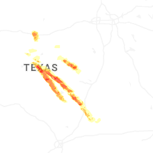

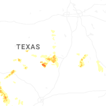
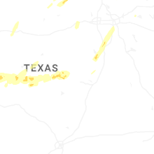


Connect with Interactive Hail Maps