

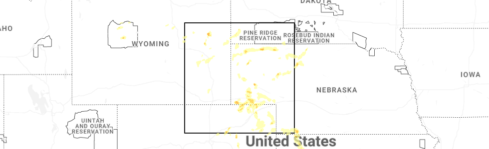
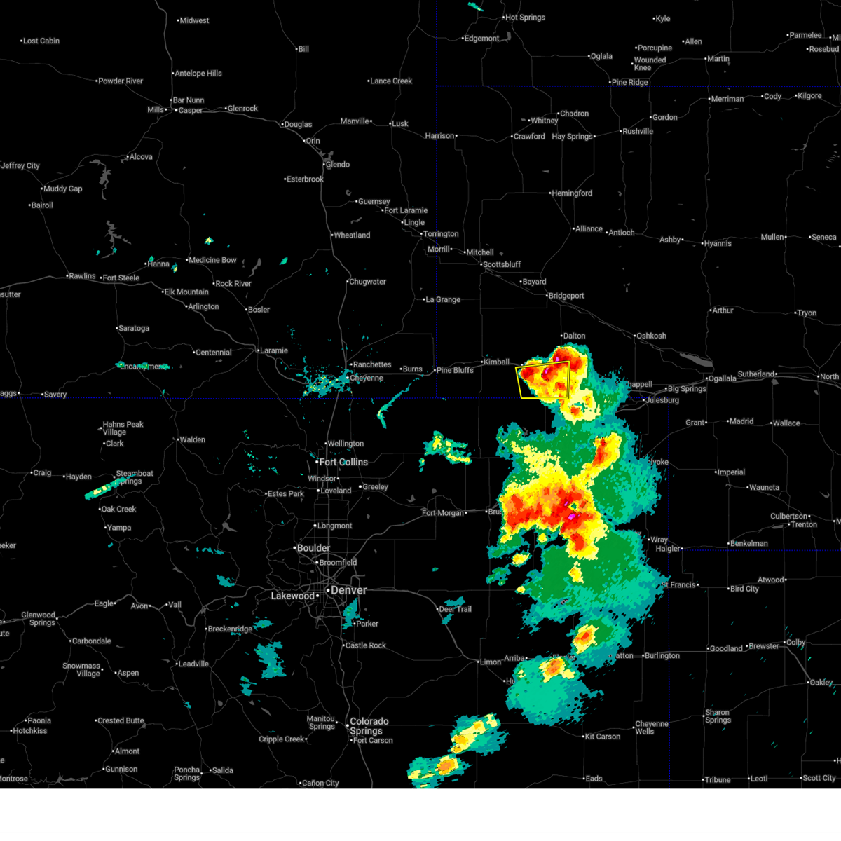
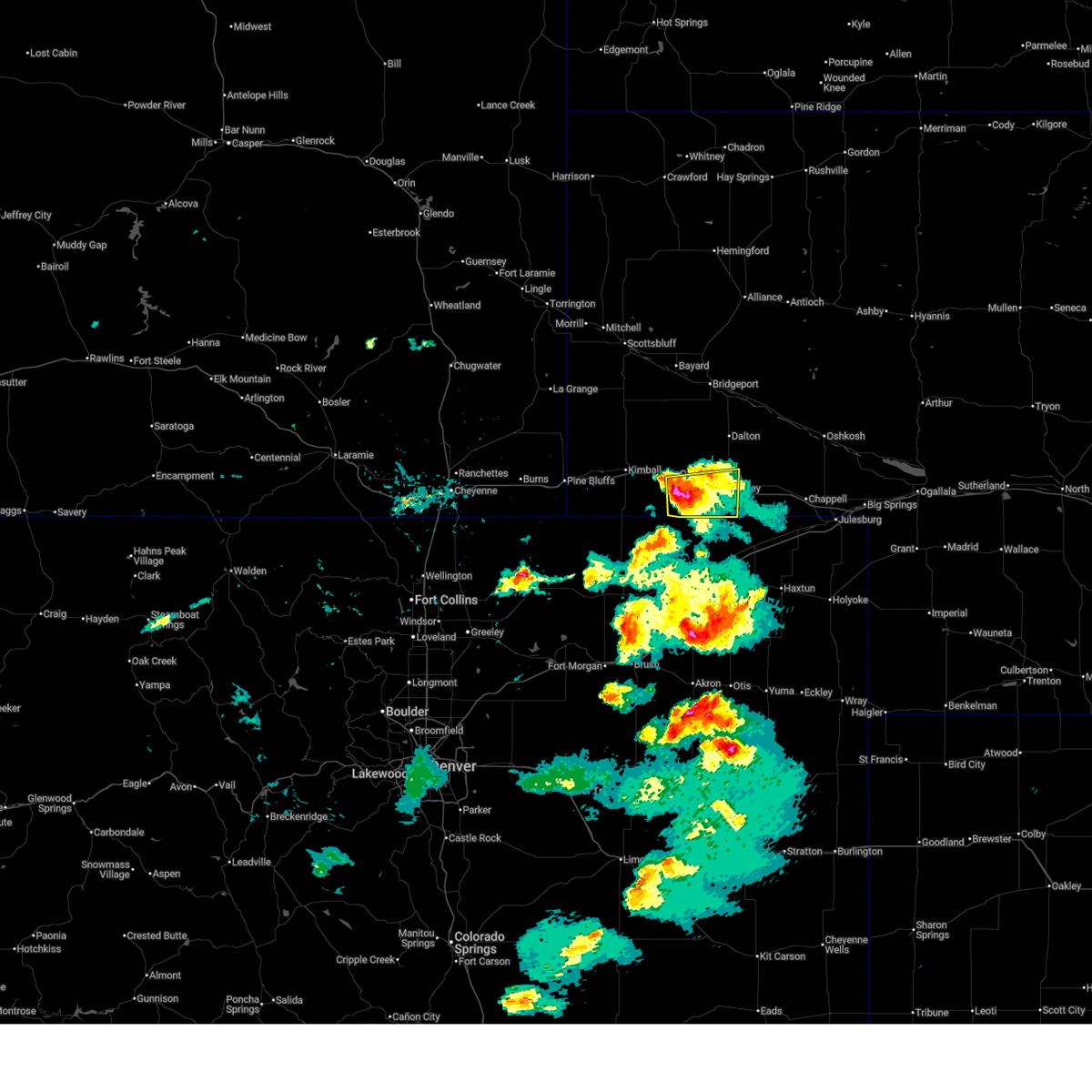
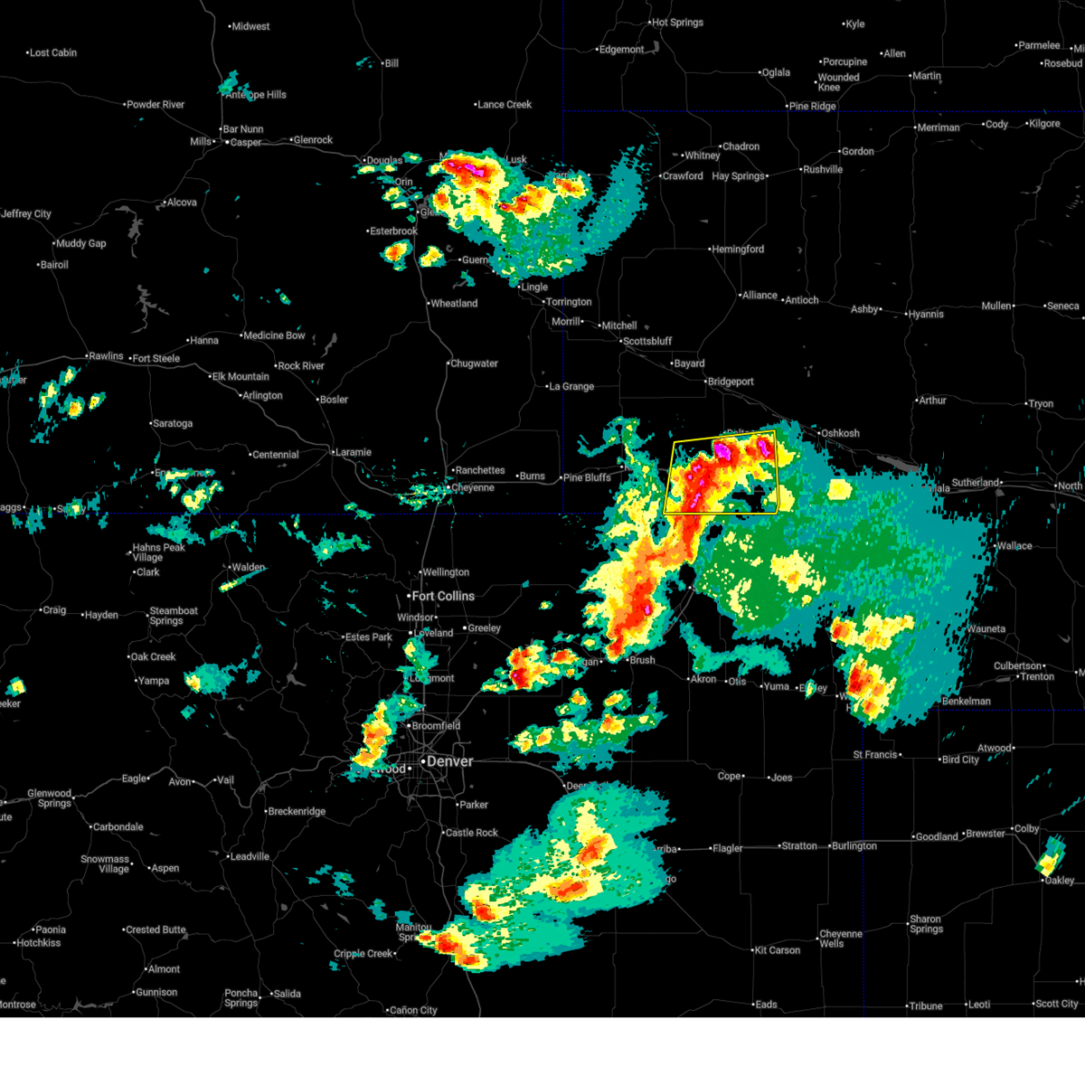
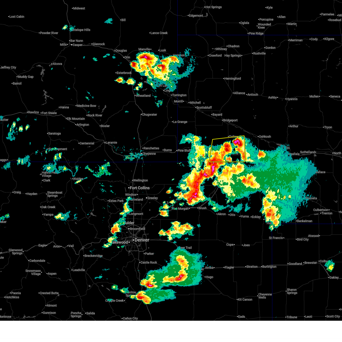
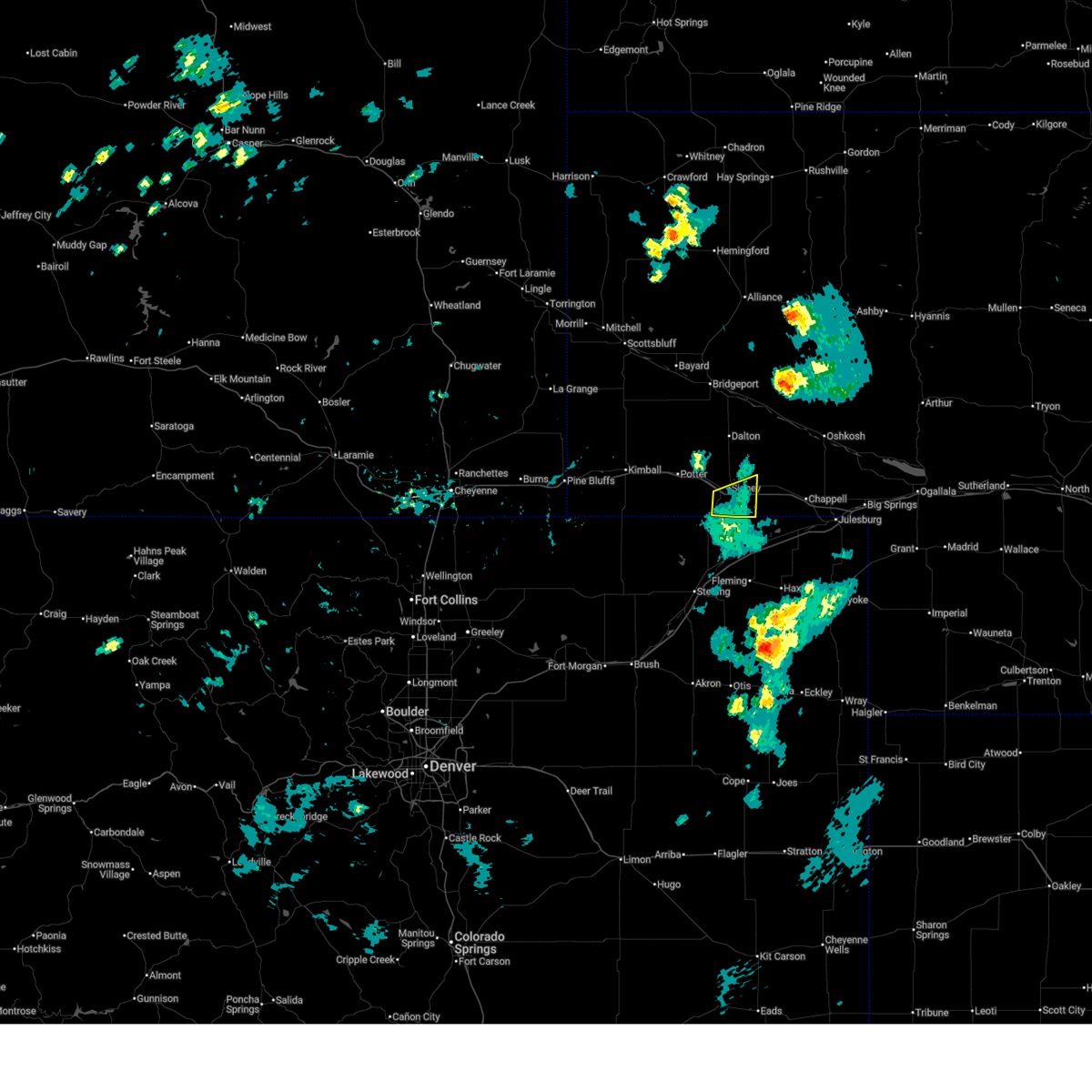
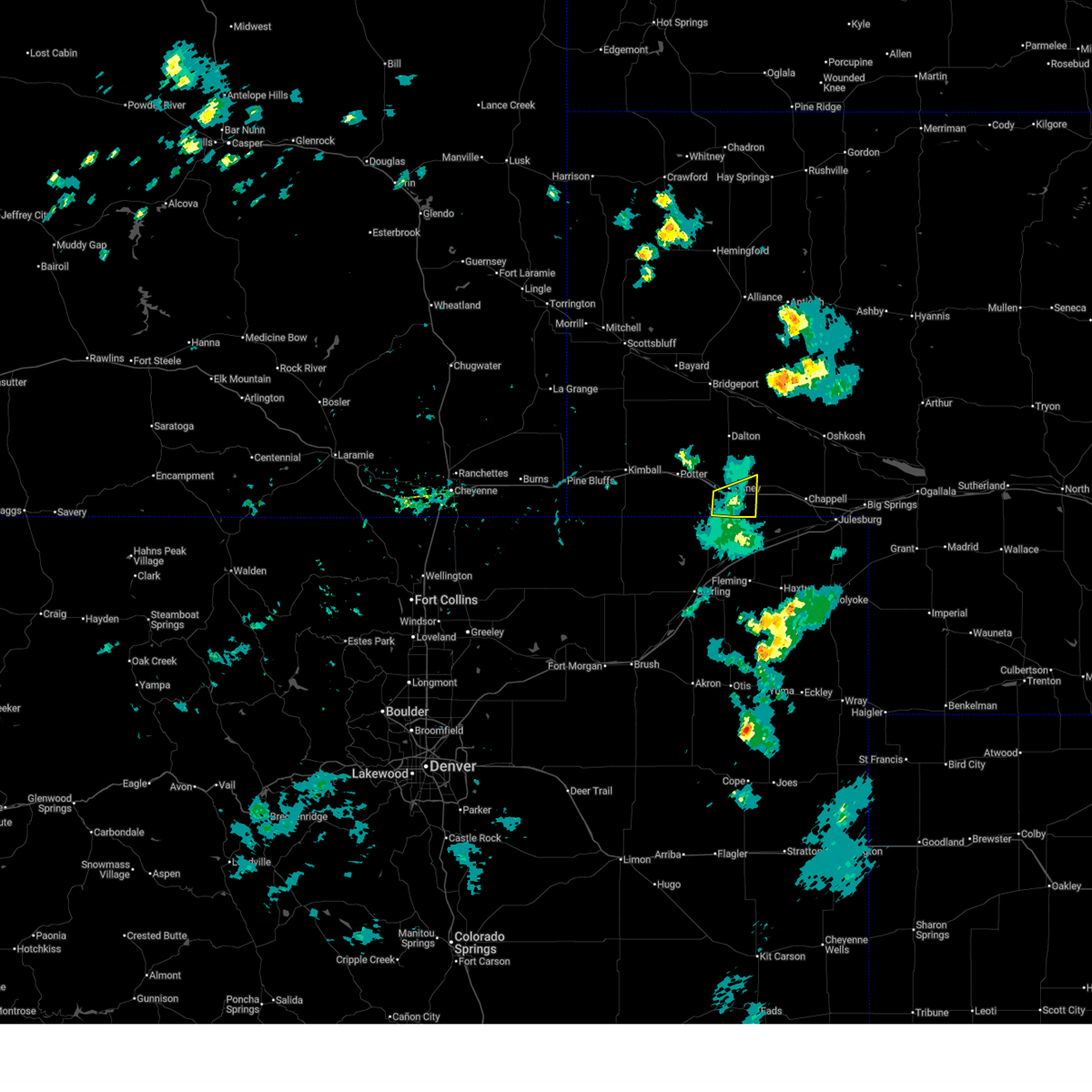
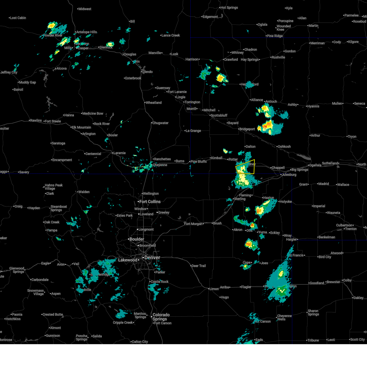
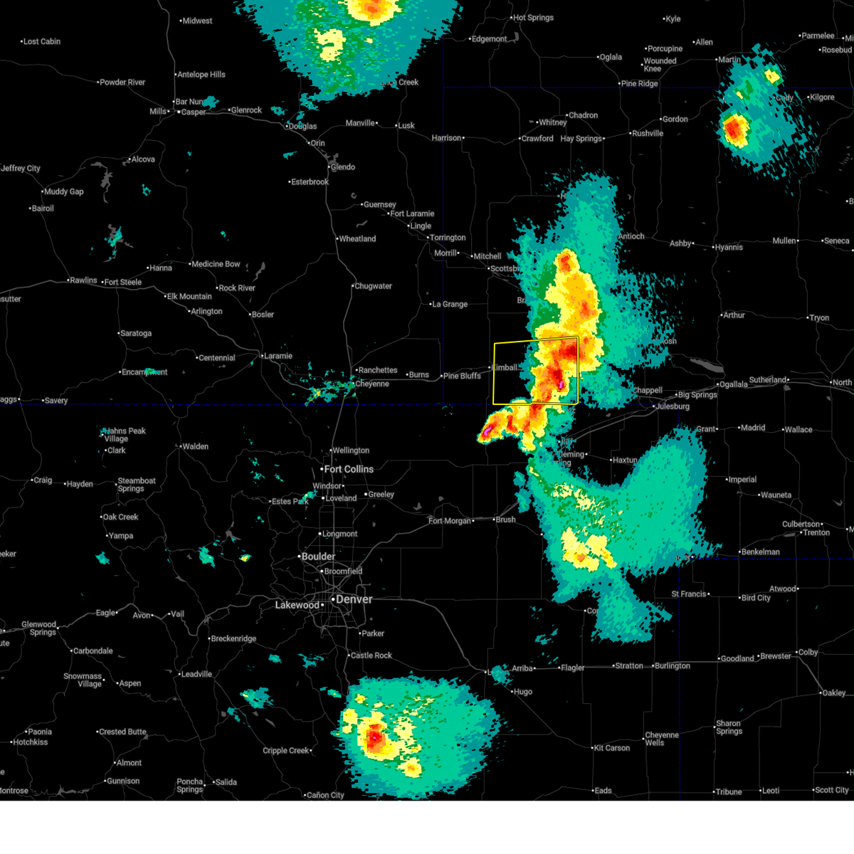
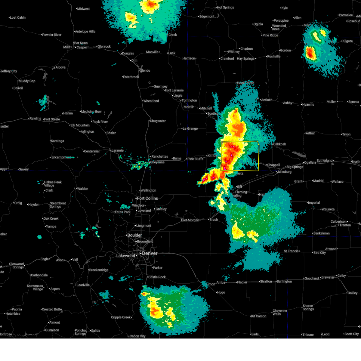
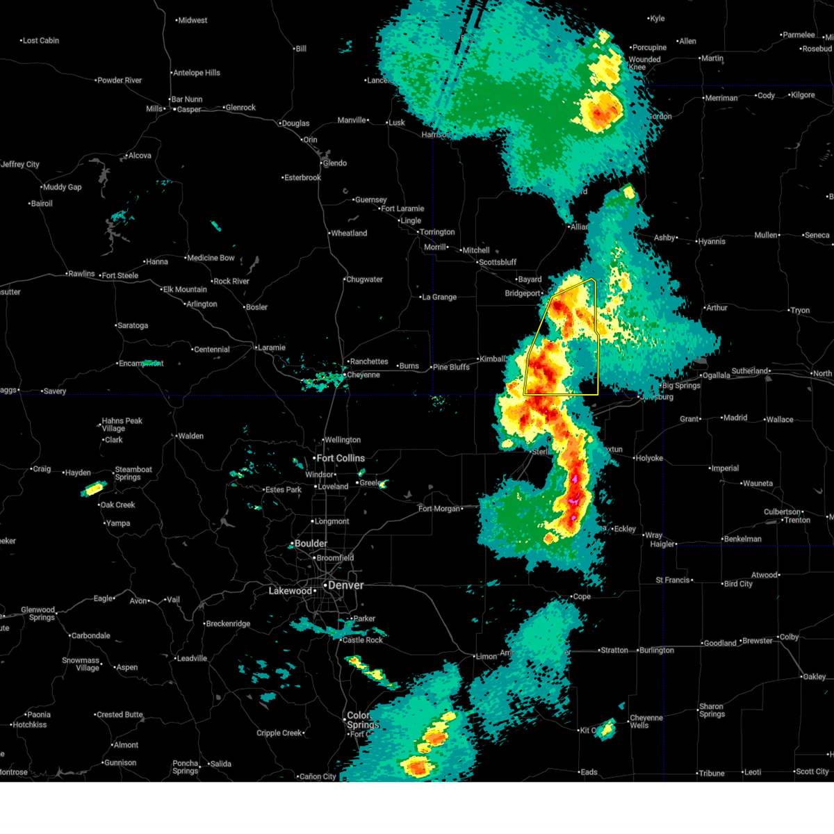
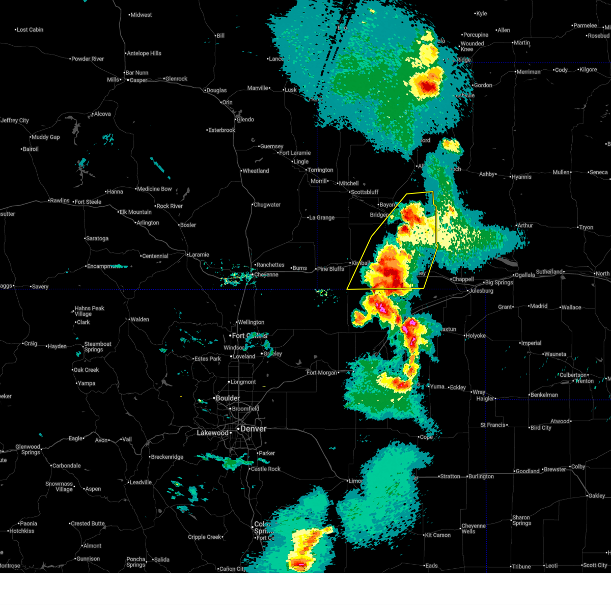
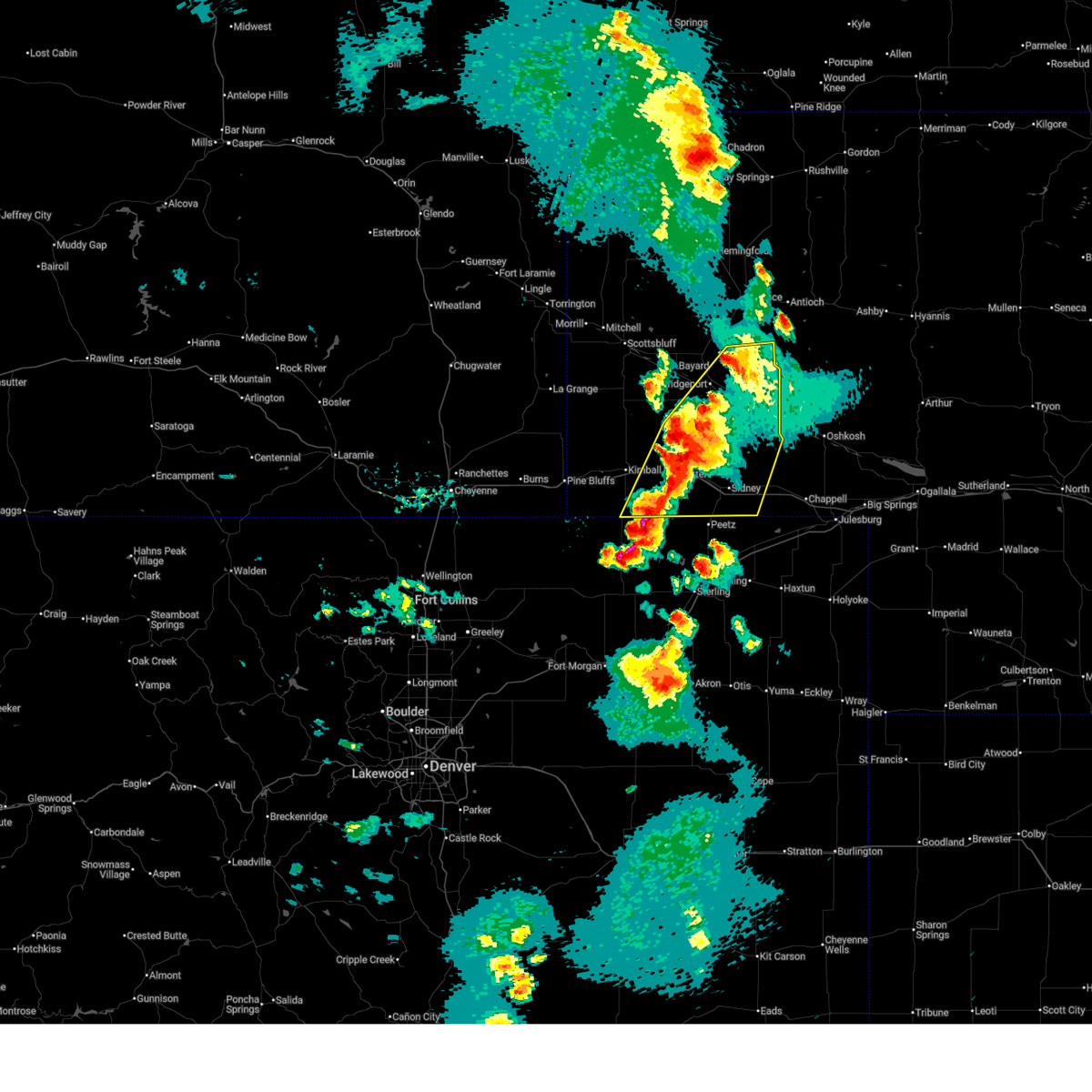
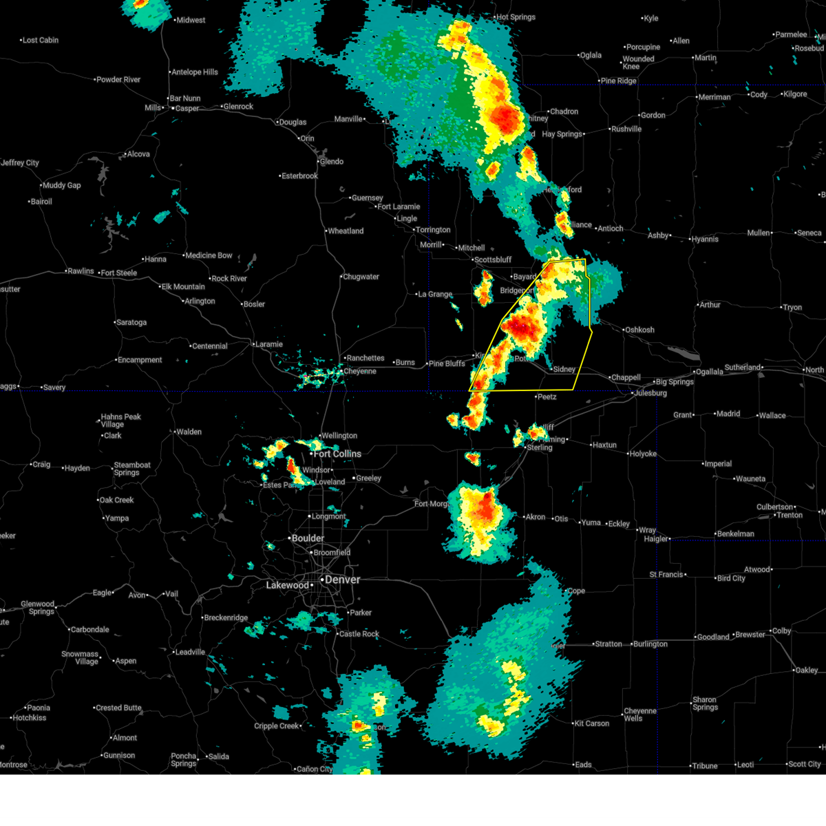
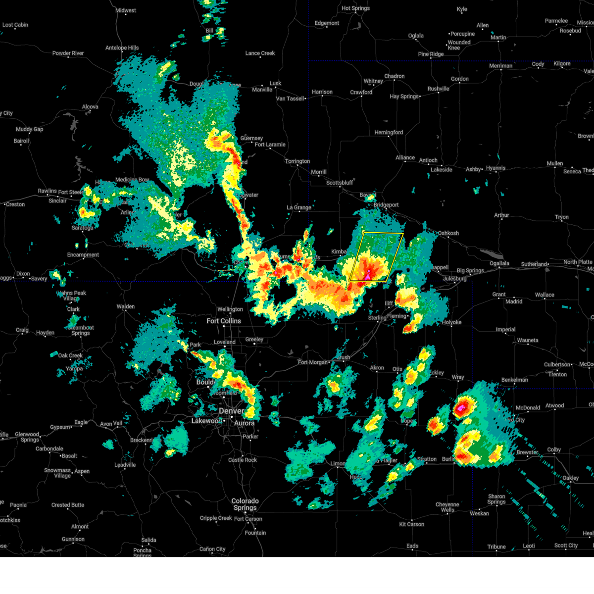
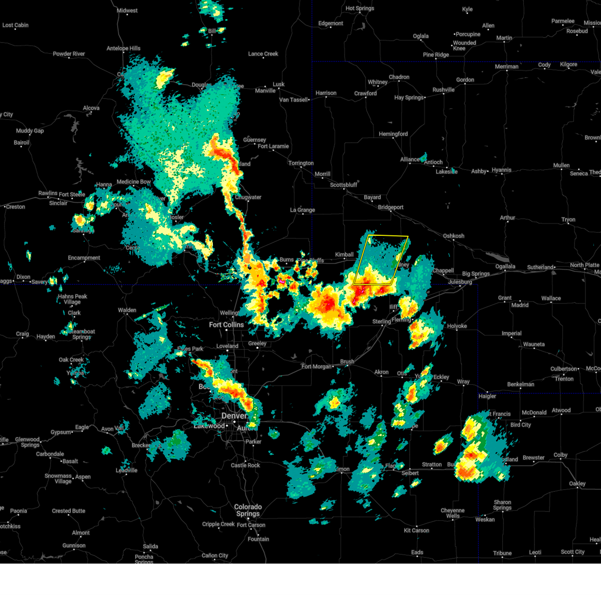
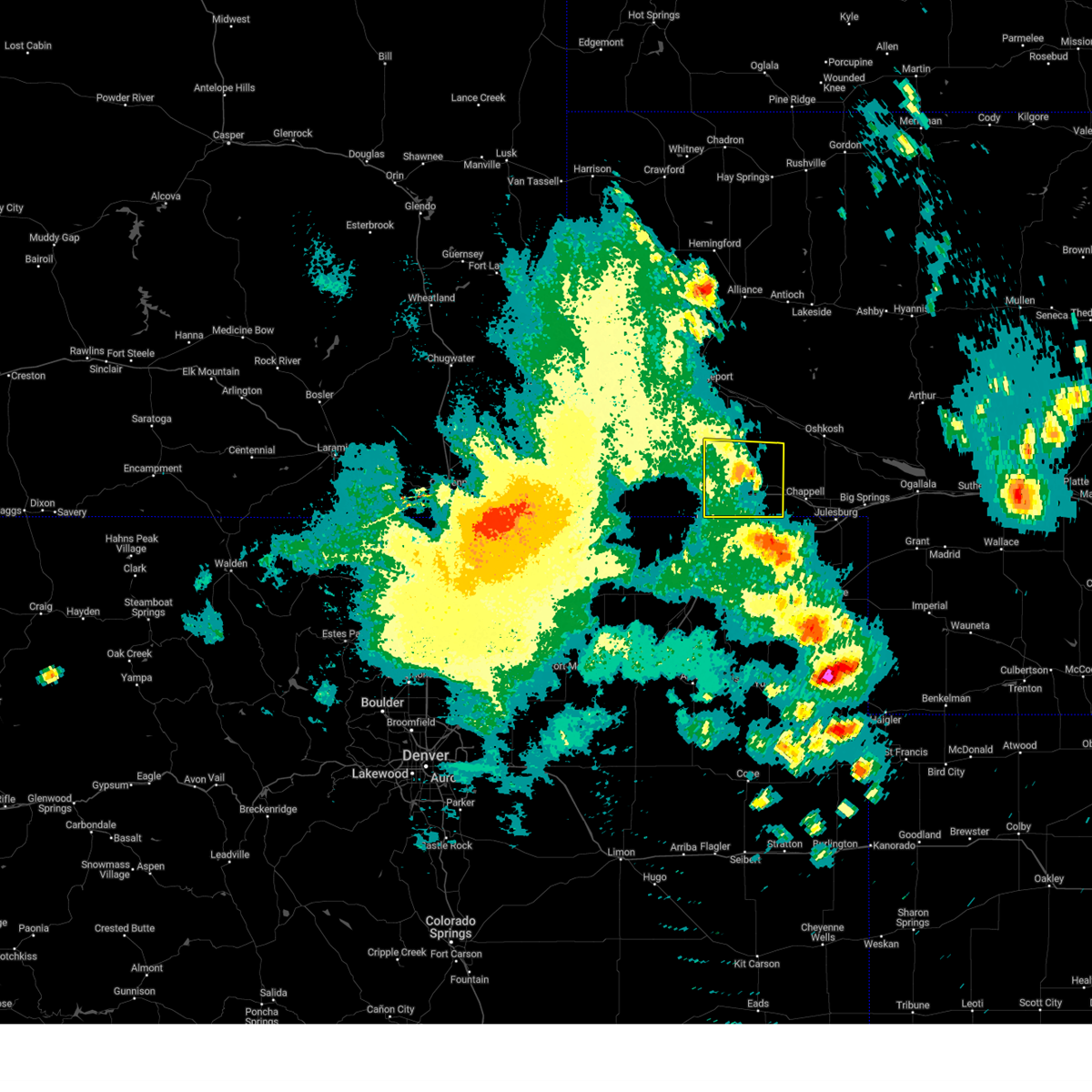
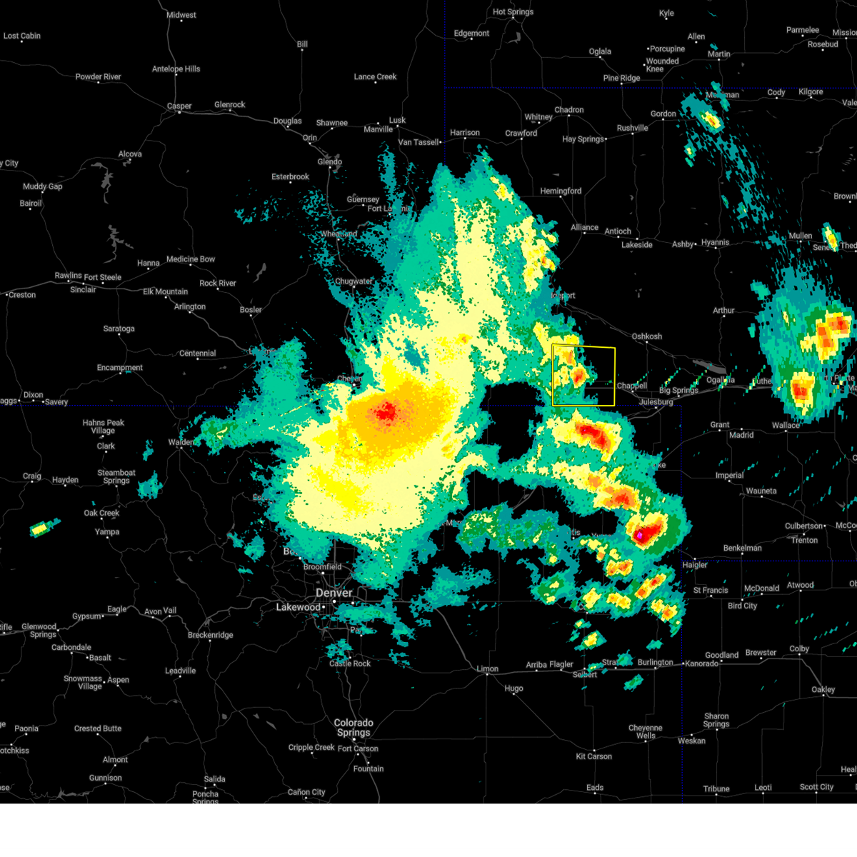
Hail Map for Lorenzo, NE
The Lorenzo, NE area has had 0 reports of on-the-ground hail by trained spotters, and has been under severe weather warnings 51 times during the past 12 months. Doppler radar has detected hail at or near Lorenzo, NE on 93 occasions, including 13 occasions during the past year.
| Name: | Lorenzo, NE |
| Where Located: | 63.1 miles SSE of Scottsbluff, NE |
| Map: | Google Map for Lorenzo, NE |
| Population: | 58 |
| Housing Units: | 25 |
| More Info: | Search Google for Lorenzo, NE |
3
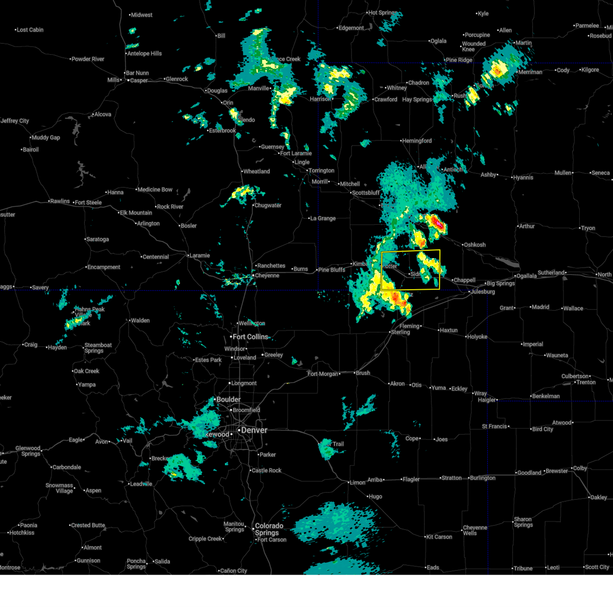
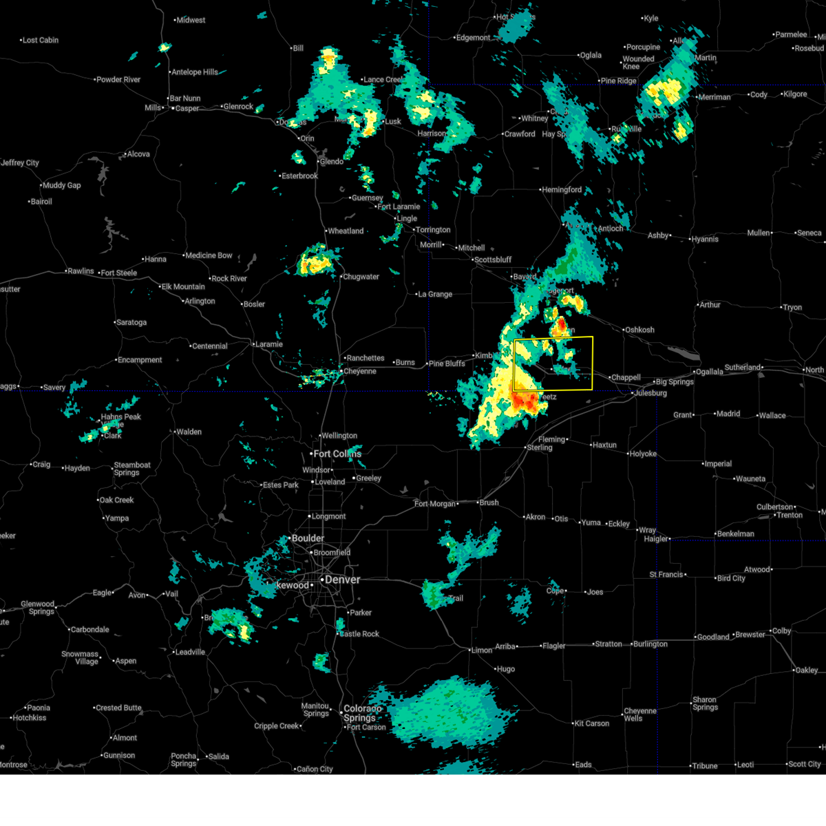
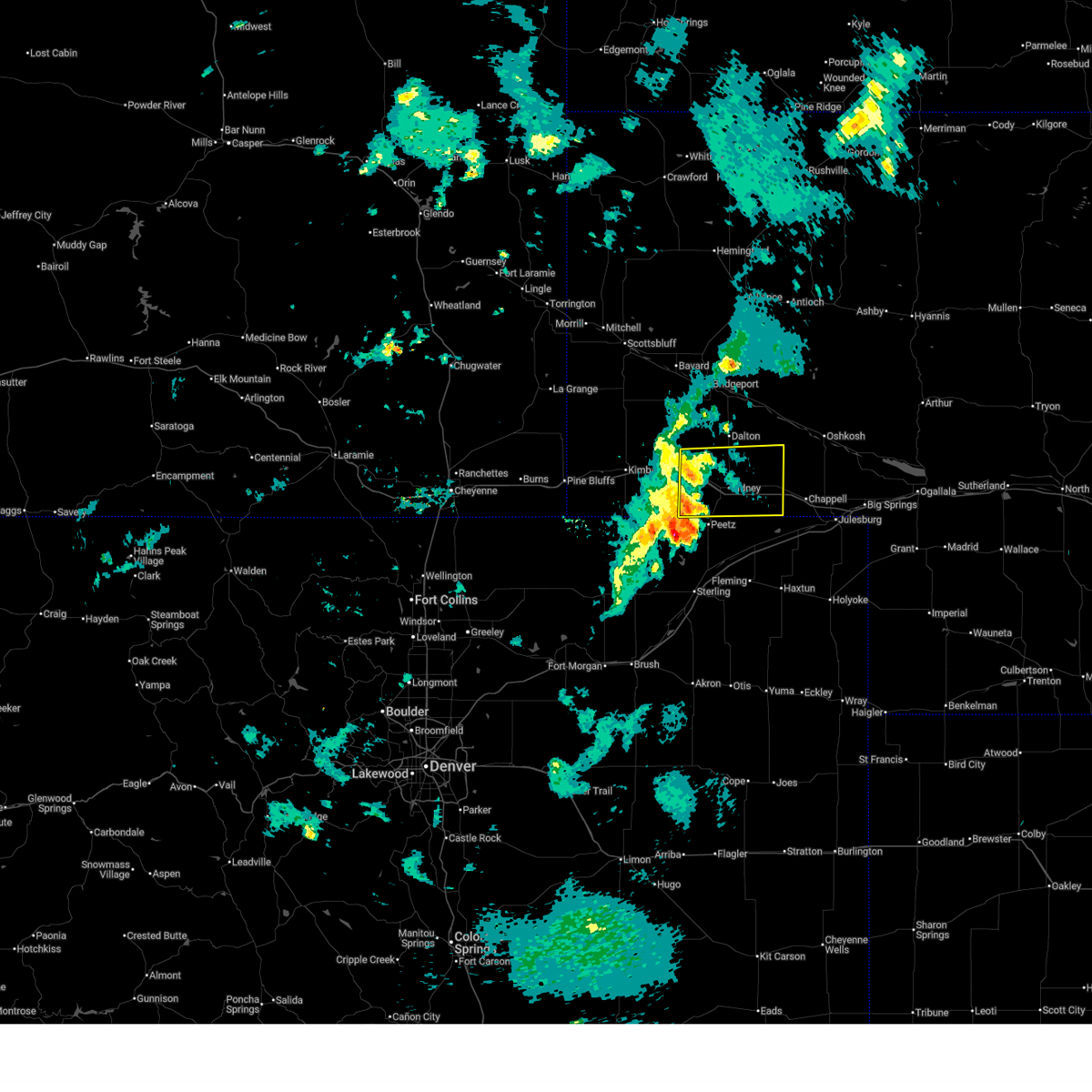
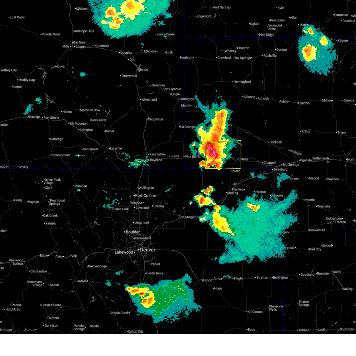
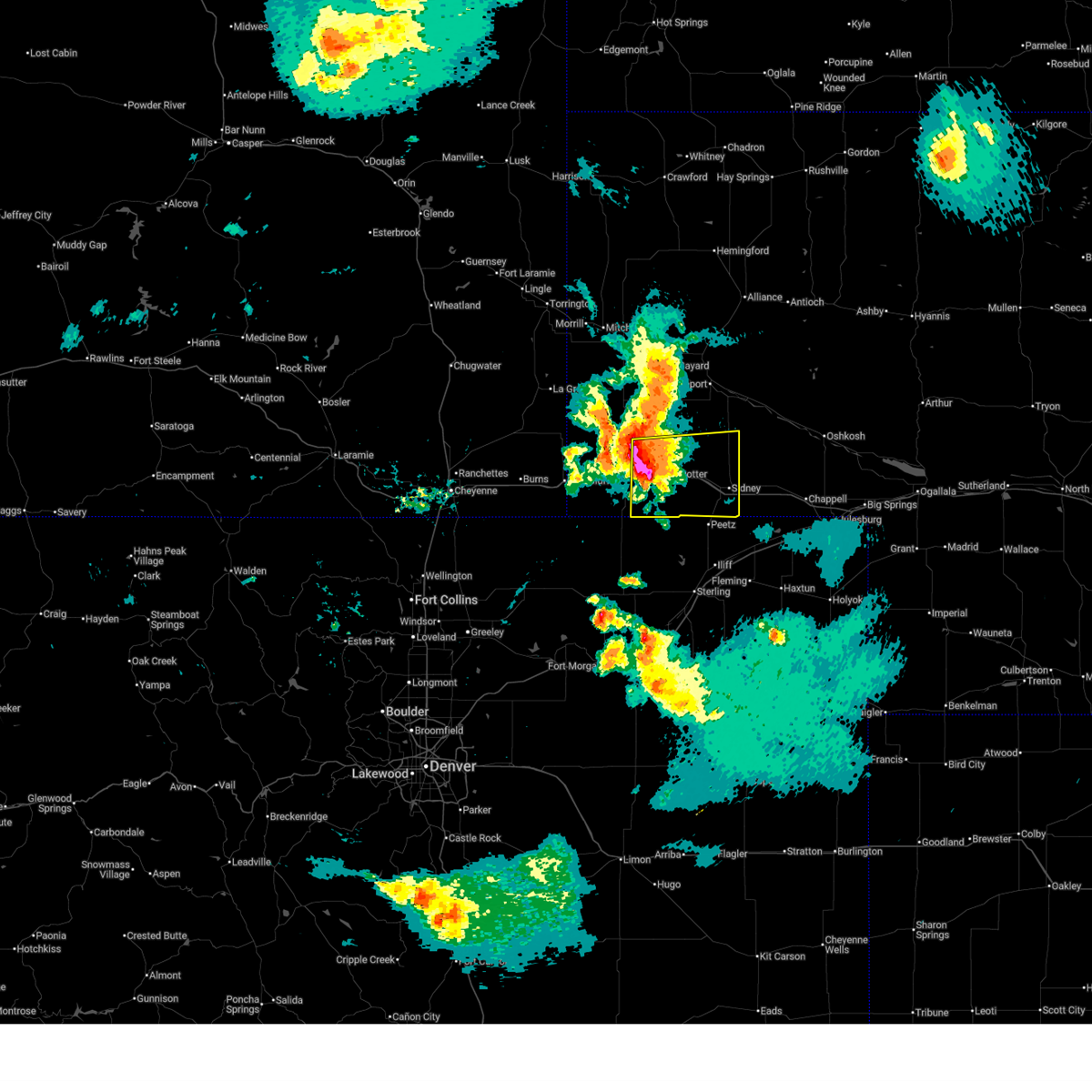
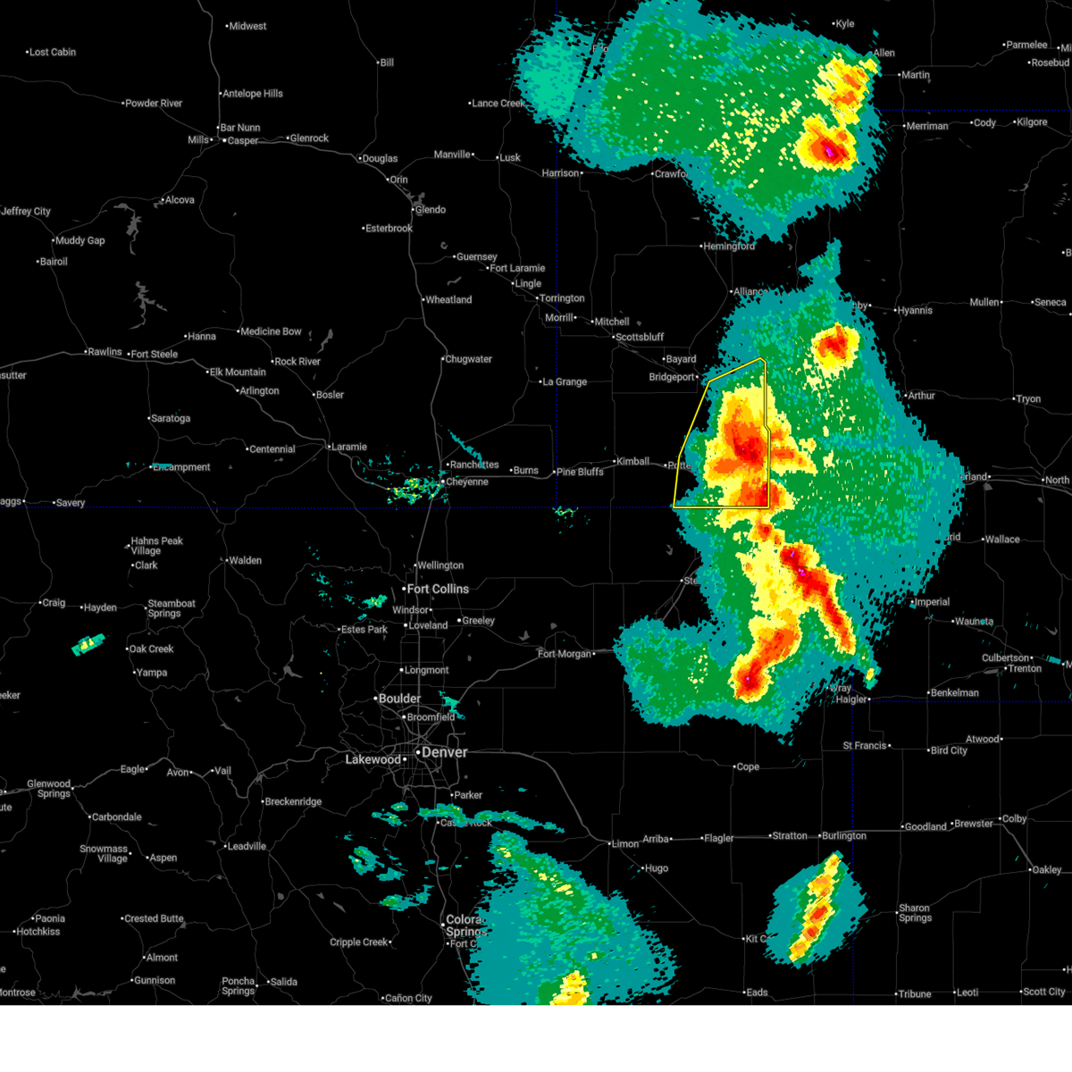
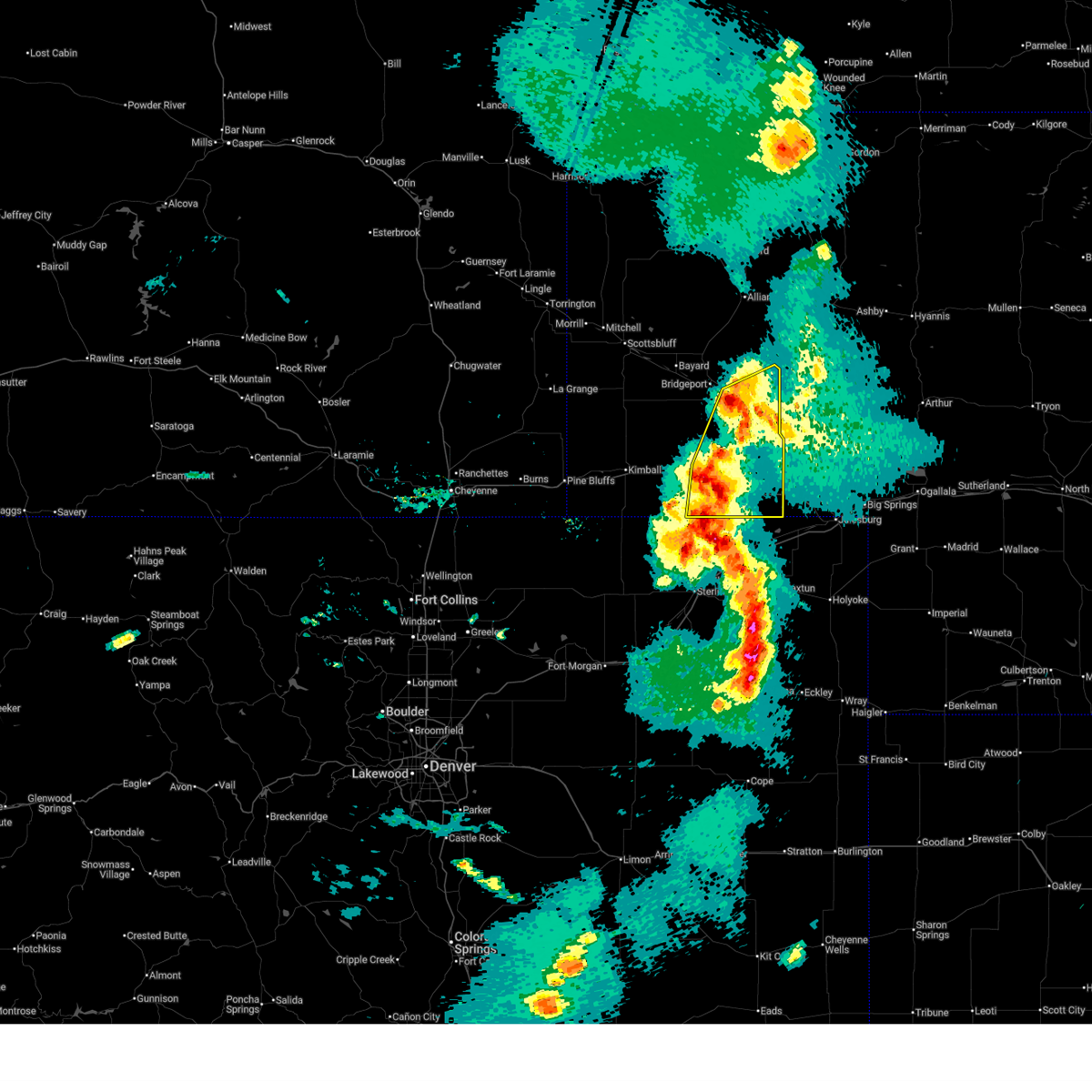
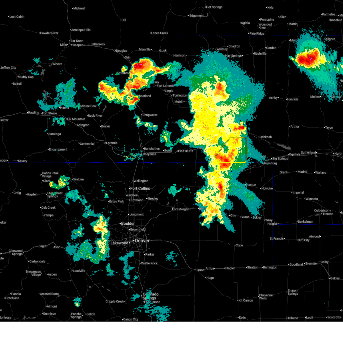
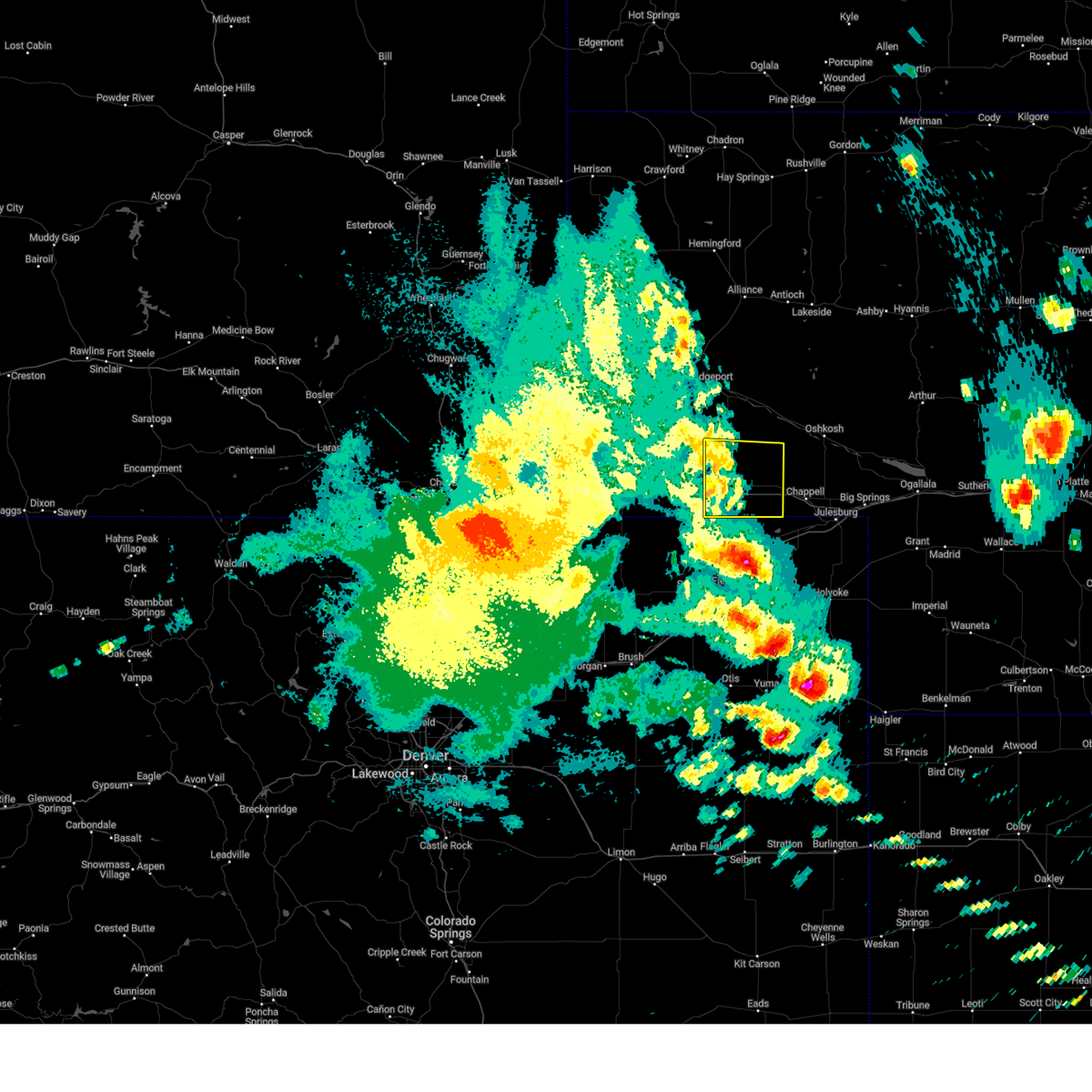
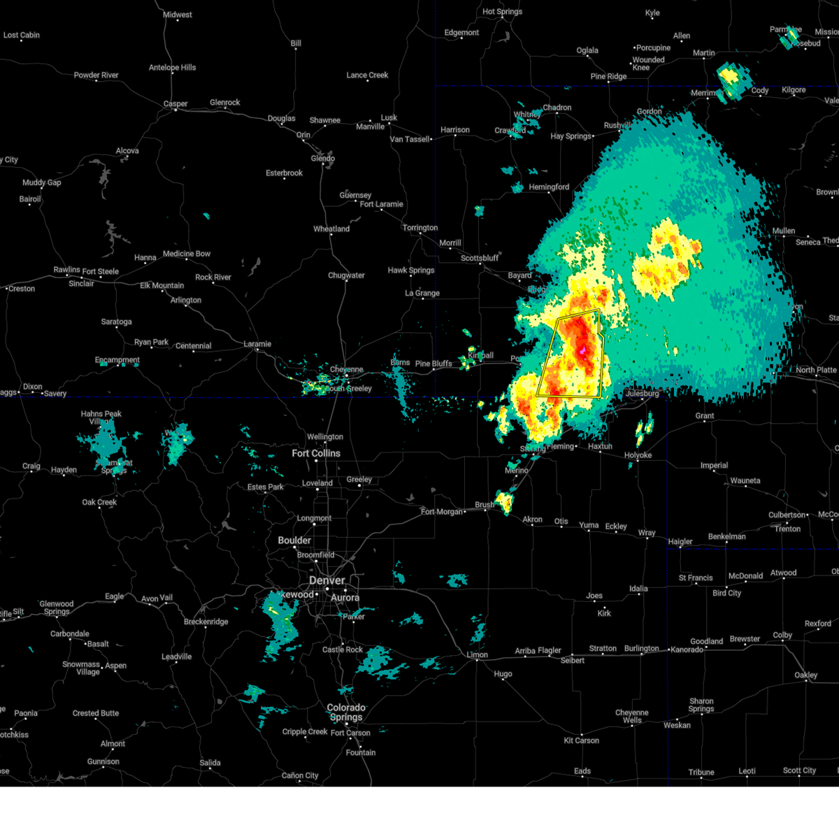
The Top Recent Hail Date for Lorenzo, NE is Friday, June 13, 2025 (6th out of 93)
Hail and Wind Damage Spotted near Lorenzo, NE
| Date / Time | Report Details |
|---|---|
| 7/14/2025 8:31 PM MDT |
 the severe thunderstorm warning has been cancelled and is no longer in effect the severe thunderstorm warning has been cancelled and is no longer in effect
|
| 7/14/2025 8:12 PM MDT |
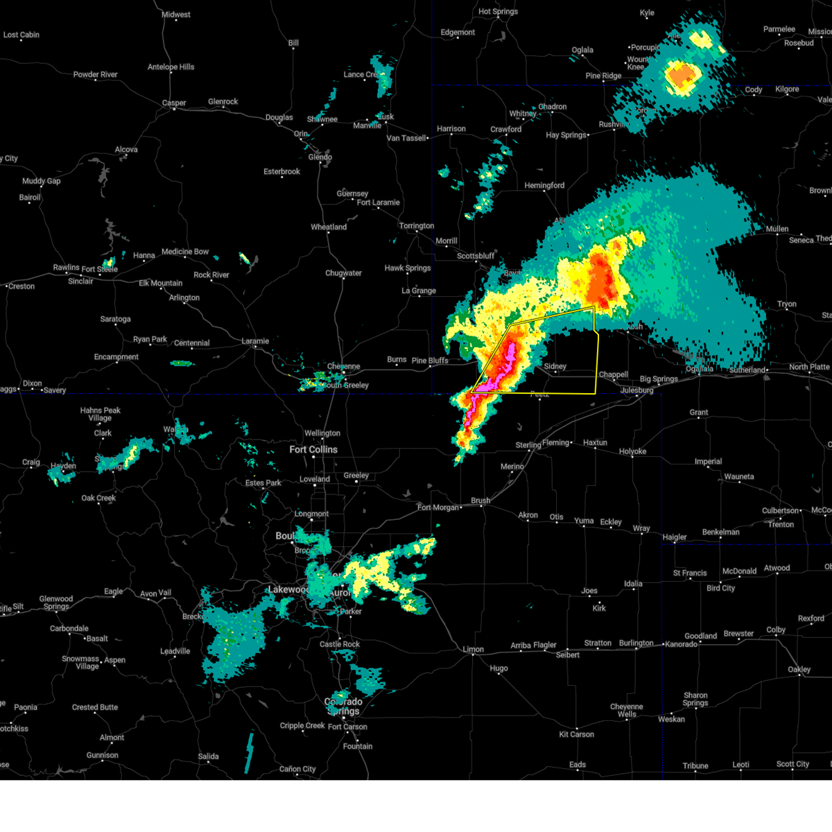
 At 811 pm mdt, a severe thunderstorm was located near sidney, moving east at 20 mph. wind gusts over 60 mph have been observed with this storm (radar indicated). Hazards include 60 mph wind gusts and penny size hail. Expect damage to roofs, siding, and trees. Locations impacted include, sidney, lodgepole, gurley, colton, sunol, brownson, lorenzo, sidney municipal airport, and cheyenne county fairgrounds. At 811 pm mdt, a severe thunderstorm was located near sidney, moving east at 20 mph. wind gusts over 60 mph have been observed with this storm (radar indicated). Hazards include 60 mph wind gusts and penny size hail. Expect damage to roofs, siding, and trees. Locations impacted include, sidney, lodgepole, gurley, colton, sunol, brownson, lorenzo, sidney municipal airport, and cheyenne county fairgrounds.
|
| 7/14/2025 8:00 PM MDT |
 Svrcys the national weather service in cheyenne has issued a * severe thunderstorm warning for, cheyenne county in the panhandle of nebraska, * until 845 pm mdt. * at 759 pm mdt, a severe thunderstorm was located near brownson and sidney, moving east at 20 mph (radar indicated). Hazards include 60 mph wind gusts and penny size hail. expect damage to roofs, siding, and trees Svrcys the national weather service in cheyenne has issued a * severe thunderstorm warning for, cheyenne county in the panhandle of nebraska, * until 845 pm mdt. * at 759 pm mdt, a severe thunderstorm was located near brownson and sidney, moving east at 20 mph (radar indicated). Hazards include 60 mph wind gusts and penny size hail. expect damage to roofs, siding, and trees
|
| 7/7/2025 4:36 PM MDT |
 The storm which prompted the warning has moved out of the area. therefore, the warning will be allowed to expire. a severe thunderstorm watch remains in effect until 900 pm mdt for the panhandle of nebraska. a severe thunderstorm warning still remains in effect for cheyenne county until 500 pm mdt. The storm which prompted the warning has moved out of the area. therefore, the warning will be allowed to expire. a severe thunderstorm watch remains in effect until 900 pm mdt for the panhandle of nebraska. a severe thunderstorm warning still remains in effect for cheyenne county until 500 pm mdt.
|
| 7/7/2025 4:24 PM MDT |
 the severe thunderstorm warning has been cancelled and is no longer in effect the severe thunderstorm warning has been cancelled and is no longer in effect
|
| 7/7/2025 4:24 PM MDT |
 At 424 pm mdt, a severe thunderstorm was located near brownson, or 11 miles west of sidney, moving east at 15 mph (radar indicated). Hazards include 60 mph wind gusts and quarter size hail. Hail damage to vehicles is expected. expect wind damage to roofs, siding, and trees. Locations impacted include, sidney, brownson, sidney municipal airport, lorenzo, and cheyenne county fairgrounds. At 424 pm mdt, a severe thunderstorm was located near brownson, or 11 miles west of sidney, moving east at 15 mph (radar indicated). Hazards include 60 mph wind gusts and quarter size hail. Hail damage to vehicles is expected. expect wind damage to roofs, siding, and trees. Locations impacted include, sidney, brownson, sidney municipal airport, lorenzo, and cheyenne county fairgrounds.
|
| 7/7/2025 4:19 PM MDT |
 At 419 pm mdt, a severe thunderstorm was located 7 miles southwest of brownson, or 12 miles west of sidney, moving east at 15 mph (radar indicated). Hazards include ping pong ball size hail and 60 mph wind gusts. People and animals outdoors will be injured. expect hail damage to roofs, siding, windows, and vehicles. expect wind damage to roofs, siding, and trees. Locations impacted include, sidney, brownson, sidney municipal airport, lorenzo, and cheyenne county fairgrounds. At 419 pm mdt, a severe thunderstorm was located 7 miles southwest of brownson, or 12 miles west of sidney, moving east at 15 mph (radar indicated). Hazards include ping pong ball size hail and 60 mph wind gusts. People and animals outdoors will be injured. expect hail damage to roofs, siding, windows, and vehicles. expect wind damage to roofs, siding, and trees. Locations impacted include, sidney, brownson, sidney municipal airport, lorenzo, and cheyenne county fairgrounds.
|
| 7/7/2025 4:14 PM MDT |
 At 414 pm mdt, a severe thunderstorm was located 8 miles southwest of brownson, or 13 miles west of sidney, moving east at 15 mph (radar indicated). Hazards include golf ball size hail and 60 mph wind gusts. People and animals outdoors will be injured. expect hail damage to roofs, siding, windows, and vehicles. expect wind damage to roofs, siding, and trees. Locations impacted include, sidney, brownson, sidney municipal airport, lorenzo, and cheyenne county fairgrounds. At 414 pm mdt, a severe thunderstorm was located 8 miles southwest of brownson, or 13 miles west of sidney, moving east at 15 mph (radar indicated). Hazards include golf ball size hail and 60 mph wind gusts. People and animals outdoors will be injured. expect hail damage to roofs, siding, windows, and vehicles. expect wind damage to roofs, siding, and trees. Locations impacted include, sidney, brownson, sidney municipal airport, lorenzo, and cheyenne county fairgrounds.
|
| 7/7/2025 4:03 PM MDT |
 At 403 pm mdt, a severe thunderstorm was located 7 miles south of potter, or 15 miles west of sidney, moving east at 10 mph (radar indicated). Hazards include golf ball size hail and 60 mph wind gusts. People and animals outdoors will be injured. expect hail damage to roofs, siding, windows, and vehicles. expect wind damage to roofs, siding, and trees. Locations impacted include, sidney, brownson, sidney municipal airport, lorenzo, and cheyenne county fairgrounds. At 403 pm mdt, a severe thunderstorm was located 7 miles south of potter, or 15 miles west of sidney, moving east at 10 mph (radar indicated). Hazards include golf ball size hail and 60 mph wind gusts. People and animals outdoors will be injured. expect hail damage to roofs, siding, windows, and vehicles. expect wind damage to roofs, siding, and trees. Locations impacted include, sidney, brownson, sidney municipal airport, lorenzo, and cheyenne county fairgrounds.
|
| 7/7/2025 3:59 PM MDT | Svrcys the national weather service in cheyenne has issued a * severe thunderstorm warning for, southwestern cheyenne county in the panhandle of nebraska, eastern kimball county in the panhandle of nebraska, * until 445 pm mdt. * at 358 pm mdt, a severe thunderstorm was located 8 miles south of potter, or 15 miles west of sidney, moving east at 15 mph (radar indicated). Hazards include 60 mph wind gusts and quarter size hail. Hail damage to vehicles is expected. Expect wind damage to roofs, siding, and trees. |
| 7/6/2025 5:58 PM MDT |
 At 556 pm mdt, a severe thunderstorm was located 12 miles north of sunol, or 18 miles west of oshkosh, moving east at 25 mph (radar indicated). Hazards include golf ball size hail, and 60 mph wind gusts and landspout tornadoes. People and animals outdoors will be injured, especially in northern portions of cheyenne county. expect hail damage to roofs, siding, windows, and vehicles. expect wind damage to roofs, siding, and trees. Locations impacted include, sidney, potter, lodgepole, gurley, colton, sunol, brownson, lorenzo, sidney municipal airport, and cheyenne county fairgrounds. At 556 pm mdt, a severe thunderstorm was located 12 miles north of sunol, or 18 miles west of oshkosh, moving east at 25 mph (radar indicated). Hazards include golf ball size hail, and 60 mph wind gusts and landspout tornadoes. People and animals outdoors will be injured, especially in northern portions of cheyenne county. expect hail damage to roofs, siding, windows, and vehicles. expect wind damage to roofs, siding, and trees. Locations impacted include, sidney, potter, lodgepole, gurley, colton, sunol, brownson, lorenzo, sidney municipal airport, and cheyenne county fairgrounds.
|
| 7/6/2025 5:43 PM MDT |
 Svrcys the national weather service in cheyenne has issued a * severe thunderstorm warning for, cheyenne county in the panhandle of nebraska, * until 630 pm mdt. * at 541 pm mdt, a severe thunderstorm was located 9 miles east of gurley, or 14 miles northeast of sidney, moving east at 25 mph (radar indicated). Hazards include 60 mph wind gusts, half dollar size hail and landspout tornadoes. Hail damage to vehicles is expected. Expect wind damage to roofs, siding, and trees. Svrcys the national weather service in cheyenne has issued a * severe thunderstorm warning for, cheyenne county in the panhandle of nebraska, * until 630 pm mdt. * at 541 pm mdt, a severe thunderstorm was located 9 miles east of gurley, or 14 miles northeast of sidney, moving east at 25 mph (radar indicated). Hazards include 60 mph wind gusts, half dollar size hail and landspout tornadoes. Hail damage to vehicles is expected. Expect wind damage to roofs, siding, and trees.
|
| 6/28/2025 4:53 PM MDT |
 The storm which prompted the warning has weakened below severe limits, and no longer poses an immediate threat to life or property. therefore, the warning will be allowed to expire. however, gusty winds are still possible with this thunderstorm. The storm which prompted the warning has weakened below severe limits, and no longer poses an immediate threat to life or property. therefore, the warning will be allowed to expire. however, gusty winds are still possible with this thunderstorm.
|
| 6/28/2025 4:41 PM MDT |
 At 441 pm mdt, a severe thunderstorm was located near sidney municipal airport, or near sidney, moving east at 15 mph (radar indicated). Hazards include 60 mph wind gusts. Expect damage to roofs, siding, and trees. Locations impacted include, sidney, colton, sidney municipal airport, lorenzo, and cheyenne county fairgrounds. At 441 pm mdt, a severe thunderstorm was located near sidney municipal airport, or near sidney, moving east at 15 mph (radar indicated). Hazards include 60 mph wind gusts. Expect damage to roofs, siding, and trees. Locations impacted include, sidney, colton, sidney municipal airport, lorenzo, and cheyenne county fairgrounds.
|
| 6/28/2025 4:23 PM MDT |
 Svrcys the national weather service in cheyenne has issued a * severe thunderstorm warning for, south central cheyenne county in the panhandle of nebraska, * until 500 pm mdt. * at 423 pm mdt, a severe thunderstorm was located over lorenzo, or 7 miles southwest of sidney, moving east at 15 mph (radar indicated). Hazards include 70 mph wind gusts. Expect considerable tree damage. Damage is likely to mobile homes, roofs, and outbuildings. Svrcys the national weather service in cheyenne has issued a * severe thunderstorm warning for, south central cheyenne county in the panhandle of nebraska, * until 500 pm mdt. * at 423 pm mdt, a severe thunderstorm was located over lorenzo, or 7 miles southwest of sidney, moving east at 15 mph (radar indicated). Hazards include 70 mph wind gusts. Expect considerable tree damage. Damage is likely to mobile homes, roofs, and outbuildings.
|
| 6/15/2025 6:52 PM MDT |
 The storm which prompted the warning has moved out of kimball and banner county. however, gusty winds are still possible with this thunderstorm. a severe thunderstorm warning is still in effect for cheyenne county. a severe thunderstorm watch remains in effect until 1100 pm mdt for the panhandle of nebraska. The storm which prompted the warning has moved out of kimball and banner county. however, gusty winds are still possible with this thunderstorm. a severe thunderstorm warning is still in effect for cheyenne county. a severe thunderstorm watch remains in effect until 1100 pm mdt for the panhandle of nebraska.
|
| 6/15/2025 6:46 PM MDT |
 Svrcys the national weather service in cheyenne has issued a * severe thunderstorm warning for, cheyenne county in the panhandle of nebraska, southeastern morrill county in the panhandle of nebraska, * until 745 pm mdt. * at 646 pm mdt, a severe thunderstorm was located near brownson, or 11 miles northwest of sidney, moving east at 35 mph (radar indicated). Hazards include ping pong ball size hail and 60 mph wind gusts. People and animals outdoors will be injured. expect hail damage to roofs, siding, windows, and vehicles. Expect wind damage to roofs, siding, and trees. Svrcys the national weather service in cheyenne has issued a * severe thunderstorm warning for, cheyenne county in the panhandle of nebraska, southeastern morrill county in the panhandle of nebraska, * until 745 pm mdt. * at 646 pm mdt, a severe thunderstorm was located near brownson, or 11 miles northwest of sidney, moving east at 35 mph (radar indicated). Hazards include ping pong ball size hail and 60 mph wind gusts. People and animals outdoors will be injured. expect hail damage to roofs, siding, windows, and vehicles. Expect wind damage to roofs, siding, and trees.
|
| 6/15/2025 6:15 PM MDT |
 At 615 pm mdt, a severe thunderstorm was located over dix, or 11 miles east of kimball, and is nearly stationary (radar indicated). Hazards include golf ball size hail and 70 mph wind gusts. People and animals outdoors will be injured. expect hail damage to roofs, siding, windows, and vehicles. expect considerable tree damage. wind damage is also likely to mobile homes, roofs, and outbuildings. Locations impacted include, sidney, potter, dalton, dix, gurley, brownson, lorenzo, sidney municipal airport, and cheyenne county fairgrounds. At 615 pm mdt, a severe thunderstorm was located over dix, or 11 miles east of kimball, and is nearly stationary (radar indicated). Hazards include golf ball size hail and 70 mph wind gusts. People and animals outdoors will be injured. expect hail damage to roofs, siding, windows, and vehicles. expect considerable tree damage. wind damage is also likely to mobile homes, roofs, and outbuildings. Locations impacted include, sidney, potter, dalton, dix, gurley, brownson, lorenzo, sidney municipal airport, and cheyenne county fairgrounds.
|
| 6/15/2025 6:04 PM MDT |
 Svrcys the national weather service in cheyenne has issued a * severe thunderstorm warning for, western cheyenne county in the panhandle of nebraska, eastern kimball county in the panhandle of nebraska, southeastern banner county in the panhandle of nebraska, * until 700 pm mdt. * at 604 pm mdt, a severe thunderstorm was located over dix, or near kimball, moving east at 30 mph (radar indicated). Hazards include golf ball size hail and 60 mph wind gusts. People and animals outdoors will be injured. expect hail damage to roofs, siding, windows, and vehicles. Expect wind damage to roofs, siding, and trees. Svrcys the national weather service in cheyenne has issued a * severe thunderstorm warning for, western cheyenne county in the panhandle of nebraska, eastern kimball county in the panhandle of nebraska, southeastern banner county in the panhandle of nebraska, * until 700 pm mdt. * at 604 pm mdt, a severe thunderstorm was located over dix, or near kimball, moving east at 30 mph (radar indicated). Hazards include golf ball size hail and 60 mph wind gusts. People and animals outdoors will be injured. expect hail damage to roofs, siding, windows, and vehicles. Expect wind damage to roofs, siding, and trees.
|
| 6/13/2025 8:44 PM MDT |
 The severe thunderstorm warning has been re-issued for eastern cheyenne county and far southeastern morrill county until 930 pm. a severe thunderstorm watch remains in effect until 1000 pm mdt for the panhandle of nebraska. The severe thunderstorm warning has been re-issued for eastern cheyenne county and far southeastern morrill county until 930 pm. a severe thunderstorm watch remains in effect until 1000 pm mdt for the panhandle of nebraska.
|
| 6/13/2025 8:03 PM MDT |
 the severe thunderstorm warning has been cancelled and is no longer in effect the severe thunderstorm warning has been cancelled and is no longer in effect
|
| 6/13/2025 8:03 PM MDT |
 At 803 pm mdt, severe thunderstorms were located along a line extending from broadwater to sidney municipal airport, moving east at 25 mph (radar indicated). Hazards include 60 mph wind gusts and half dollar size hail. Hail damage to vehicles is expected. expect wind damage to roofs, siding, and trees. Locations impacted include, sidney, lodgepole, dalton, gurley, broadwater, colton, sunol, brownson, lorenzo, sidney municipal airport, the intersection of highway 385 and 92, and cheyenne county fairgrounds. At 803 pm mdt, severe thunderstorms were located along a line extending from broadwater to sidney municipal airport, moving east at 25 mph (radar indicated). Hazards include 60 mph wind gusts and half dollar size hail. Hail damage to vehicles is expected. expect wind damage to roofs, siding, and trees. Locations impacted include, sidney, lodgepole, dalton, gurley, broadwater, colton, sunol, brownson, lorenzo, sidney municipal airport, the intersection of highway 385 and 92, and cheyenne county fairgrounds.
|
| 6/13/2025 7:46 PM MDT |
 The severe thunderstorm warning has been re-issued for cheyenne county and southeastern morrill county until 845 pm. a severe thunderstorm watch remains in effect until 1000 pm mdt for the panhandle of nebraska. The severe thunderstorm warning has been re-issued for cheyenne county and southeastern morrill county until 845 pm. a severe thunderstorm watch remains in effect until 1000 pm mdt for the panhandle of nebraska.
|
| 6/13/2025 7:38 PM MDT |
 Svrcys the national weather service in cheyenne has issued a * severe thunderstorm warning for, cheyenne county in the panhandle of nebraska, southeastern kimball county in the panhandle of nebraska, southeastern morrill county in the panhandle of nebraska, * until 845 pm mdt. * at 738 pm mdt, severe thunderstorms were located along a line extending from near broadwater to 9 miles northwest of peetz, moving east at 35 mph (radar indicated). Hazards include 60 mph wind gusts and half dollar size hail. Hail damage to vehicles is expected. Expect wind damage to roofs, siding, and trees. Svrcys the national weather service in cheyenne has issued a * severe thunderstorm warning for, cheyenne county in the panhandle of nebraska, southeastern kimball county in the panhandle of nebraska, southeastern morrill county in the panhandle of nebraska, * until 845 pm mdt. * at 738 pm mdt, severe thunderstorms were located along a line extending from near broadwater to 9 miles northwest of peetz, moving east at 35 mph (radar indicated). Hazards include 60 mph wind gusts and half dollar size hail. Hail damage to vehicles is expected. Expect wind damage to roofs, siding, and trees.
|
| 6/13/2025 6:58 PM MDT |
 At 657 pm mdt, severe thunderstorms were located along a line extending from 12 miles east of angora to 11 miles south of dix, moving east at 20 mph (radar indicated). Hazards include 60 mph wind gusts and half dollar size hail. Hail damage to vehicles is expected. expect wind damage to roofs, siding, and trees. Locations impacted include, sidney, bridgeport, potter, dalton, dix, gurley, broadwater, sunol, brownson, northport, bridgeport state recreation area, sidney municipal airport, morrill county fairgrounds, colton, lorenzo, courthouse and jail rock, redington, the intersection of highway 385 and 92, and cheyenne county fairgrounds. At 657 pm mdt, severe thunderstorms were located along a line extending from 12 miles east of angora to 11 miles south of dix, moving east at 20 mph (radar indicated). Hazards include 60 mph wind gusts and half dollar size hail. Hail damage to vehicles is expected. expect wind damage to roofs, siding, and trees. Locations impacted include, sidney, bridgeport, potter, dalton, dix, gurley, broadwater, sunol, brownson, northport, bridgeport state recreation area, sidney municipal airport, morrill county fairgrounds, colton, lorenzo, courthouse and jail rock, redington, the intersection of highway 385 and 92, and cheyenne county fairgrounds.
|
| 6/13/2025 6:40 PM MDT |
 Svrcys the national weather service in cheyenne has issued a * severe thunderstorm warning for, cheyenne county in the panhandle of nebraska, eastern kimball county in the panhandle of nebraska, southern morrill county in the panhandle of nebraska, southeastern banner county in the panhandle of nebraska, * until 745 pm mdt. * at 640 pm mdt, severe thunderstorms were located along a line extending from 8 miles southeast of angora to 9 miles southeast of kimball municipal airport, moving east at 20 mph (radar indicated). Hazards include 60 mph wind gusts and half dollar size hail. Hail damage to vehicles is expected. Expect wind damage to roofs, siding, and trees. Svrcys the national weather service in cheyenne has issued a * severe thunderstorm warning for, cheyenne county in the panhandle of nebraska, eastern kimball county in the panhandle of nebraska, southern morrill county in the panhandle of nebraska, southeastern banner county in the panhandle of nebraska, * until 745 pm mdt. * at 640 pm mdt, severe thunderstorms were located along a line extending from 8 miles southeast of angora to 9 miles southeast of kimball municipal airport, moving east at 20 mph (radar indicated). Hazards include 60 mph wind gusts and half dollar size hail. Hail damage to vehicles is expected. Expect wind damage to roofs, siding, and trees.
|
| 6/12/2025 6:32 PM MDT |
 Svrcys the national weather service in cheyenne has issued a * severe thunderstorm warning for, cheyenne county in the panhandle of nebraska, * until 715 pm mdt. * at 631 pm mdt, a severe thunderstorm was located over lorenzo, or 7 miles southwest of sidney, moving northeast at 40 mph (radar indicated). Hazards include 60 mph wind gusts and quarter size hail. Hail damage to vehicles is expected. Expect wind damage to roofs, siding, and trees. Svrcys the national weather service in cheyenne has issued a * severe thunderstorm warning for, cheyenne county in the panhandle of nebraska, * until 715 pm mdt. * at 631 pm mdt, a severe thunderstorm was located over lorenzo, or 7 miles southwest of sidney, moving northeast at 40 mph (radar indicated). Hazards include 60 mph wind gusts and quarter size hail. Hail damage to vehicles is expected. Expect wind damage to roofs, siding, and trees.
|
| 5/18/2025 5:35 PM MDT |
 The storm which prompted the warning has moved out of the area. therefore, the warning will be allowed to expire. a tornado watch remains in effect until 800 pm mdt for the panhandle of nebraska. The storm which prompted the warning has moved out of the area. therefore, the warning will be allowed to expire. a tornado watch remains in effect until 800 pm mdt for the panhandle of nebraska.
|
| 5/18/2025 5:32 PM MDT |
 At 532 pm mdt, a severe thunderstorm was located over sunol, or 12 miles east of sidney, moving northeast at 25 mph (radar indicated). Hazards include golf ball size hail and 60 mph wind gusts. People and animals outdoors will be injured. expect hail damage to roofs, siding, windows, and vehicles. expect wind damage to roofs, siding, and trees. Locations impacted include, sidney, lodgepole, dalton, gurley, colton, sunol, brownson, lorenzo, sidney municipal airport, and cheyenne county fairgrounds. At 532 pm mdt, a severe thunderstorm was located over sunol, or 12 miles east of sidney, moving northeast at 25 mph (radar indicated). Hazards include golf ball size hail and 60 mph wind gusts. People and animals outdoors will be injured. expect hail damage to roofs, siding, windows, and vehicles. expect wind damage to roofs, siding, and trees. Locations impacted include, sidney, lodgepole, dalton, gurley, colton, sunol, brownson, lorenzo, sidney municipal airport, and cheyenne county fairgrounds.
|
| 5/18/2025 5:21 PM MDT |
 At 521 pm mdt, a severe thunderstorm was located over sunol, or 10 miles east of sidney, moving north at 45 mph (radar indicated). Hazards include ping pong ball size hail and 60 mph wind gusts. People and animals outdoors will be injured. expect hail damage to roofs, siding, windows, and vehicles. expect wind damage to roofs, siding, and trees. Locations impacted include, sidney, lodgepole, dalton, gurley, colton, sunol, brownson, lorenzo, sidney municipal airport, and cheyenne county fairgrounds. At 521 pm mdt, a severe thunderstorm was located over sunol, or 10 miles east of sidney, moving north at 45 mph (radar indicated). Hazards include ping pong ball size hail and 60 mph wind gusts. People and animals outdoors will be injured. expect hail damage to roofs, siding, windows, and vehicles. expect wind damage to roofs, siding, and trees. Locations impacted include, sidney, lodgepole, dalton, gurley, colton, sunol, brownson, lorenzo, sidney municipal airport, and cheyenne county fairgrounds.
|
| 5/18/2025 5:07 PM MDT |
 At 507 pm mdt, a severe thunderstorm was located over sidney municipal airport, or over sidney, moving north at 35 mph (radar indicated). Hazards include ping pong ball size hail and 60 mph wind gusts. People and animals outdoors will be injured. expect hail damage to roofs, siding, windows, and vehicles. expect wind damage to roofs, siding, and trees. Locations impacted include, sidney, lodgepole, dalton, gurley, colton, sunol, brownson, lorenzo, sidney municipal airport, and cheyenne county fairgrounds. At 507 pm mdt, a severe thunderstorm was located over sidney municipal airport, or over sidney, moving north at 35 mph (radar indicated). Hazards include ping pong ball size hail and 60 mph wind gusts. People and animals outdoors will be injured. expect hail damage to roofs, siding, windows, and vehicles. expect wind damage to roofs, siding, and trees. Locations impacted include, sidney, lodgepole, dalton, gurley, colton, sunol, brownson, lorenzo, sidney municipal airport, and cheyenne county fairgrounds.
|
| 5/18/2025 4:55 PM MDT | Svrcys the national weather service in cheyenne has issued a * severe thunderstorm warning for, cheyenne county in the panhandle of nebraska, southern morrill county in the panhandle of nebraska, * until 545 pm mdt. * at 455 pm mdt, a severe thunderstorm was located over lorenzo, or 8 miles south of sidney, moving north at 35 mph (radar indicated). Hazards include 60 mph wind gusts and half dollar size hail. Hail damage to vehicles is expected. Expect wind damage to roofs, siding, and trees. |
| 5/18/2025 4:27 PM MDT | The storm which prompted the warning has moved out of the area. therefore, the warning will be allowed to expire. however, small hail and gusty winds are still possible with this thunderstorm. a tornado watch remains in effect until 800 pm mdt for the panhandle of nebraska. |
| 5/18/2025 4:26 PM MDT | Svrcys the national weather service in cheyenne has issued a * severe thunderstorm warning for, western cheyenne county in the panhandle of nebraska, eastern kimball county in the panhandle of nebraska, southwestern morrill county in the panhandle of nebraska, southeastern banner county in the panhandle of nebraska, * until 515 pm mdt. * at 426 pm mdt, a severe thunderstorm was located 9 miles northwest of peetz, or 16 miles west of sidney, moving north at 35 mph (radar indicated). Hazards include 70 mph wind gusts and ping pong ball size hail. People and animals outdoors will be injured. expect hail damage to roofs, siding, windows, and vehicles. expect considerable tree damage. Wind damage is also likely to mobile homes, roofs, and outbuildings. |
| 5/18/2025 4:18 PM MDT | At 418 pm mdt, a severe thunderstorm was located over potter, or 18 miles northwest of sidney, moving north at 35 mph (radar indicated). Hazards include 70 mph wind gusts and ping pong ball size hail. People and animals outdoors will be injured. expect hail damage to roofs, siding, windows, and vehicles. expect considerable tree damage. wind damage is also likely to mobile homes, roofs, and outbuildings. Locations impacted include, potter, dalton, gurley, and brownson. |
| 5/18/2025 4:01 PM MDT |
 At 401 pm mdt, a severe thunderstorm was located 7 miles south of potter, or 18 miles southeast of kimball, moving north at 40 mph (radar indicated). Hazards include 70 mph wind gusts and ping pong ball size hail. People and animals outdoors will be injured. expect hail damage to roofs, siding, windows, and vehicles. expect considerable tree damage. wind damage is also likely to mobile homes, roofs, and outbuildings. Locations impacted include, potter, dalton, gurley, and brownson. At 401 pm mdt, a severe thunderstorm was located 7 miles south of potter, or 18 miles southeast of kimball, moving north at 40 mph (radar indicated). Hazards include 70 mph wind gusts and ping pong ball size hail. People and animals outdoors will be injured. expect hail damage to roofs, siding, windows, and vehicles. expect considerable tree damage. wind damage is also likely to mobile homes, roofs, and outbuildings. Locations impacted include, potter, dalton, gurley, and brownson.
|
| 5/18/2025 3:46 PM MDT |
 Svrcys the national weather service in cheyenne has issued a * severe thunderstorm warning for, western cheyenne county in the panhandle of nebraska, eastern kimball county in the panhandle of nebraska, south central morrill county in the panhandle of nebraska, southeastern banner county in the panhandle of nebraska, * until 430 pm mdt. * at 345 pm mdt, a severe thunderstorm was located 10 miles west of peetz, or 19 miles southwest of sidney, moving north at 35 mph (radar indicated). Hazards include 70 mph wind gusts and ping pong ball size hail. People and animals outdoors will be injured. expect hail damage to roofs, siding, windows, and vehicles. expect considerable tree damage. Wind damage is also likely to mobile homes, roofs, and outbuildings. Svrcys the national weather service in cheyenne has issued a * severe thunderstorm warning for, western cheyenne county in the panhandle of nebraska, eastern kimball county in the panhandle of nebraska, south central morrill county in the panhandle of nebraska, southeastern banner county in the panhandle of nebraska, * until 430 pm mdt. * at 345 pm mdt, a severe thunderstorm was located 10 miles west of peetz, or 19 miles southwest of sidney, moving north at 35 mph (radar indicated). Hazards include 70 mph wind gusts and ping pong ball size hail. People and animals outdoors will be injured. expect hail damage to roofs, siding, windows, and vehicles. expect considerable tree damage. Wind damage is also likely to mobile homes, roofs, and outbuildings.
|
| 5/14/2025 6:30 PM MDT |
 The storm which prompted the warning has weakened and the strongest wind gusts have reached the eastern county line. while wind gusts of 45 to 55 mph are still possible until 7 pm, the gusts are expected to remain below severe limits. the storm no longer poses an immediate threat to life or property. therefore, the warning will be allowed to expire. a severe thunderstorm watch remains in effect until 1000 pm mdt for the panhandle of nebraska. The storm which prompted the warning has weakened and the strongest wind gusts have reached the eastern county line. while wind gusts of 45 to 55 mph are still possible until 7 pm, the gusts are expected to remain below severe limits. the storm no longer poses an immediate threat to life or property. therefore, the warning will be allowed to expire. a severe thunderstorm watch remains in effect until 1000 pm mdt for the panhandle of nebraska.
|
| 5/14/2025 6:16 PM MDT |
 At 615 pm mdt, a severe thunderstorm was located over sunol, which is 11 miles east of sidney, moving east at 35 mph (wind gusts of 60 to 63 mph have been reported between sidney and sunol). Hazards include 60 mph wind gusts. Expect damage to roofs, siding, and trees. Locations impacted include, sidney, lodgepole, gurley, colton, sunol, brownson, lorenzo, sidney municipal airport, and cheyenne county fairgrounds. At 615 pm mdt, a severe thunderstorm was located over sunol, which is 11 miles east of sidney, moving east at 35 mph (wind gusts of 60 to 63 mph have been reported between sidney and sunol). Hazards include 60 mph wind gusts. Expect damage to roofs, siding, and trees. Locations impacted include, sidney, lodgepole, gurley, colton, sunol, brownson, lorenzo, sidney municipal airport, and cheyenne county fairgrounds.
|
| 5/14/2025 6:10 PM MDT |
 At 609 pm mdt, a severe thunderstorm was located over colton, which is 7 miles northeast of sidney, moving east at 30 mph (an automated station at the sidney airport reported a 62 mph wind gust at 551 pm). Hazards include 60 mph wind gusts. Expect damage to roofs, siding, and trees. Locations impacted include, sunol and lodgepole. At 609 pm mdt, a severe thunderstorm was located over colton, which is 7 miles northeast of sidney, moving east at 30 mph (an automated station at the sidney airport reported a 62 mph wind gust at 551 pm). Hazards include 60 mph wind gusts. Expect damage to roofs, siding, and trees. Locations impacted include, sunol and lodgepole.
|
| 5/14/2025 5:54 PM MDT |
 Svrcys the national weather service in cheyenne has issued a * severe thunderstorm warning for, eastern cheyenne county in the panhandle of nebraska, * until 630 pm mdt. * at 554 pm mdt, a severe thunderstorm was located near sidney, moving east at 35 mph (radar indicated). Hazards include 60 mph wind gusts. Expect damage to roofs, siding, and trees. this severe thunderstorm will be near, sidney and colton around 600 pm mdt. sunol around 610 pm mdt. Other locations in the path of this severe thunderstorm include lodgepole. Svrcys the national weather service in cheyenne has issued a * severe thunderstorm warning for, eastern cheyenne county in the panhandle of nebraska, * until 630 pm mdt. * at 554 pm mdt, a severe thunderstorm was located near sidney, moving east at 35 mph (radar indicated). Hazards include 60 mph wind gusts. Expect damage to roofs, siding, and trees. this severe thunderstorm will be near, sidney and colton around 600 pm mdt. sunol around 610 pm mdt. Other locations in the path of this severe thunderstorm include lodgepole.
|
| 8/21/2024 9:06 PM MDT |
 The storms which prompted the warning have weakened below severe limits, and no longer pose an immediate threat to life or property. therefore, the warning will be allowed to expire. however, small hail, gusty winds and heavy rain are still possible with these thunderstorms. to report severe weather, contact your nearest law enforcement agency. they will relay your report to the national weather service cheyenne. The storms which prompted the warning have weakened below severe limits, and no longer pose an immediate threat to life or property. therefore, the warning will be allowed to expire. however, small hail, gusty winds and heavy rain are still possible with these thunderstorms. to report severe weather, contact your nearest law enforcement agency. they will relay your report to the national weather service cheyenne.
|
| 8/21/2024 8:53 PM MDT |
 the severe thunderstorm warning has been cancelled and is no longer in effect the severe thunderstorm warning has been cancelled and is no longer in effect
|
| 8/21/2024 8:53 PM MDT |
 At 853 pm mdt, severe thunderstorms were located along a line extending from near northport to 10 miles north of sunol, moving northeast at 45 mph (radar indicated). Hazards include 60 mph wind gusts and nickel size hail. Expect damage to roofs, siding, and trees. Locations impacted include, sidney, lodgepole, dalton, gurley, colton, sunol, brownson, lorenzo, sidney municipal airport, and cheyenne county fairgrounds. At 853 pm mdt, severe thunderstorms were located along a line extending from near northport to 10 miles north of sunol, moving northeast at 45 mph (radar indicated). Hazards include 60 mph wind gusts and nickel size hail. Expect damage to roofs, siding, and trees. Locations impacted include, sidney, lodgepole, dalton, gurley, colton, sunol, brownson, lorenzo, sidney municipal airport, and cheyenne county fairgrounds.
|
| 8/21/2024 8:14 PM MDT |
 Svrcys the national weather service in cheyenne has issued a * severe thunderstorm warning for, cheyenne county in the panhandle of nebraska, eastern kimball county in the panhandle of nebraska, southeastern morrill county in the panhandle of nebraska, southeastern banner county in the panhandle of nebraska, * until 915 pm mdt. * at 812 pm mdt, severe thunderstorms were located along a line extending from 11 miles southwest of redington to 7 miles southwest of brownson, moving northeast at 25 mph (radar indicated). Hazards include 60 mph wind gusts and quarter size hail. Hail damage to vehicles is expected. Expect wind damage to roofs, siding, and trees. Svrcys the national weather service in cheyenne has issued a * severe thunderstorm warning for, cheyenne county in the panhandle of nebraska, eastern kimball county in the panhandle of nebraska, southeastern morrill county in the panhandle of nebraska, southeastern banner county in the panhandle of nebraska, * until 915 pm mdt. * at 812 pm mdt, severe thunderstorms were located along a line extending from 11 miles southwest of redington to 7 miles southwest of brownson, moving northeast at 25 mph (radar indicated). Hazards include 60 mph wind gusts and quarter size hail. Hail damage to vehicles is expected. Expect wind damage to roofs, siding, and trees.
|
| 7/27/2024 6:29 PM MDT |
 The severe thunderstorm warning has been re-issued for southern cheyenne county. the new warning is in effect until 730pm. see warning text for severe thunderstorm warning #140 for more details. The severe thunderstorm warning has been re-issued for southern cheyenne county. the new warning is in effect until 730pm. see warning text for severe thunderstorm warning #140 for more details.
|
| 7/27/2024 6:28 PM MDT |
 Svrcys the national weather service in cheyenne has issued a * severe thunderstorm warning for, southeastern cheyenne county in the panhandle of nebraska, * until 730 pm mdt. * at 628 pm mdt, a severe thunderstorm was located near lorenzo, or near sidney, moving east at 15 mph (radar indicated). Hazards include 60 mph wind gusts and half dollar size hail. Hail damage to vehicles is expected. Expect wind damage to roofs, siding, and trees. Svrcys the national weather service in cheyenne has issued a * severe thunderstorm warning for, southeastern cheyenne county in the panhandle of nebraska, * until 730 pm mdt. * at 628 pm mdt, a severe thunderstorm was located near lorenzo, or near sidney, moving east at 15 mph (radar indicated). Hazards include 60 mph wind gusts and half dollar size hail. Hail damage to vehicles is expected. Expect wind damage to roofs, siding, and trees.
|
| 7/27/2024 5:26 PM MDT |
 Svrcys the national weather service in cheyenne has issued a * severe thunderstorm warning for, southern cheyenne county in the panhandle of nebraska, * until 630 pm mdt. * at 526 pm mdt, a severe thunderstorm was located near brownson, or 7 miles west of sidney, moving east at 20 mph (radar indicated). Hazards include 60 mph wind gusts and quarter size hail. Hail damage to vehicles is expected. Expect wind damage to roofs, siding, and trees. Svrcys the national weather service in cheyenne has issued a * severe thunderstorm warning for, southern cheyenne county in the panhandle of nebraska, * until 630 pm mdt. * at 526 pm mdt, a severe thunderstorm was located near brownson, or 7 miles west of sidney, moving east at 20 mph (radar indicated). Hazards include 60 mph wind gusts and quarter size hail. Hail damage to vehicles is expected. Expect wind damage to roofs, siding, and trees.
|
| 7/17/2024 5:31 PM MDT |
 The storms which prompted the warning have weakened below severe limits, and no longer pose an immediate threat to life or property. therefore, the warning has been allowed to expire. however, small hail and gusty winds up to 55 mph are still possible with these thunderstorms. The storms which prompted the warning have weakened below severe limits, and no longer pose an immediate threat to life or property. therefore, the warning has been allowed to expire. however, small hail and gusty winds up to 55 mph are still possible with these thunderstorms.
|
| 7/17/2024 5:19 PM MDT | At 518 pm mdt, severe thunderstorms were located along a line extending from near chappell to near brownson, and are nearly stationary (radar indicated. at 511 pm, a wind gust of 60 mph was reported at sidney airport). Hazards include 70 mph wind gusts and quarter size hail. Hail damage to vehicles is expected. expect considerable tree damage. wind damage is also likely to mobile homes, roofs, and outbuildings. Locations impacted include, sidney, lodgepole, colton, sunol, brownson, lorenzo, sidney municipal airport, and cheyenne county fairgrounds. |
| 7/17/2024 5:01 PM MDT |
 Svrcys the national weather service in cheyenne has issued a * severe thunderstorm warning for, southern cheyenne county in the panhandle of nebraska, * until 530 pm mdt. * at 501 pm mdt, severe thunderstorms were located along a line extending from near lodgepole to near potter, moving southeast at 35 mph (radar indicated and observed wind gust). Hazards include 70 mph wind gusts and quarter size hail. Hail damage to vehicles is expected. expect considerable tree damage. Wind damage is also likely to mobile homes, roofs, and outbuildings. Svrcys the national weather service in cheyenne has issued a * severe thunderstorm warning for, southern cheyenne county in the panhandle of nebraska, * until 530 pm mdt. * at 501 pm mdt, severe thunderstorms were located along a line extending from near lodgepole to near potter, moving southeast at 35 mph (radar indicated and observed wind gust). Hazards include 70 mph wind gusts and quarter size hail. Hail damage to vehicles is expected. expect considerable tree damage. Wind damage is also likely to mobile homes, roofs, and outbuildings.
|
| 5/19/2024 2:29 PM MDT |
 The storms which prompted the warning have weakened below severe limits. therefore, the warning will be allowed to expire. however, gusty winds are still possible with these thunderstorms. a severe thunderstorm watch remains in effect until 800 pm mdt for the panhandle of nebraska. The storms which prompted the warning have weakened below severe limits. therefore, the warning will be allowed to expire. however, gusty winds are still possible with these thunderstorms. a severe thunderstorm watch remains in effect until 800 pm mdt for the panhandle of nebraska.
|
| 5/19/2024 2:12 PM MDT |
 At 212 pm mdt, severe thunderstorms were located along a line extending from near brownson to near peetz, moving east at 20 mph (radar indicated). Hazards include 60 mph wind gusts and quarter size hail. Hail damage to vehicles is expected. expect wind damage to roofs, siding, and trees. Locations impacted include, sidney, colton, brownson, sidney municipal airport, lorenzo, and cheyenne county fairgrounds. At 212 pm mdt, severe thunderstorms were located along a line extending from near brownson to near peetz, moving east at 20 mph (radar indicated). Hazards include 60 mph wind gusts and quarter size hail. Hail damage to vehicles is expected. expect wind damage to roofs, siding, and trees. Locations impacted include, sidney, colton, brownson, sidney municipal airport, lorenzo, and cheyenne county fairgrounds.
|
| 5/19/2024 1:51 PM MDT |
 Svrcys the national weather service in cheyenne has issued a * severe thunderstorm warning for, southern cheyenne county in the panhandle of nebraska, * until 230 pm mdt. * at 150 pm mdt, severe thunderstorms were located along a line extending from 6 miles northwest of brownson to 11 miles northwest of peetz, moving east at 20 mph (radar indicated). Hazards include 60 mph wind gusts and half dollar size hail. Hail damage to vehicles is expected. Expect wind damage to roofs, siding, and trees. Svrcys the national weather service in cheyenne has issued a * severe thunderstorm warning for, southern cheyenne county in the panhandle of nebraska, * until 230 pm mdt. * at 150 pm mdt, severe thunderstorms were located along a line extending from 6 miles northwest of brownson to 11 miles northwest of peetz, moving east at 20 mph (radar indicated). Hazards include 60 mph wind gusts and half dollar size hail. Hail damage to vehicles is expected. Expect wind damage to roofs, siding, and trees.
|
| 5/19/2024 1:22 PM MDT |
 Svrcys the national weather service in cheyenne has issued a * severe thunderstorm warning for, southwestern cheyenne county in the panhandle of nebraska, southeastern kimball county in the panhandle of nebraska, * until 200 pm mdt. * at 121 pm mdt, a severe thunderstorm was located near dix, or 11 miles southeast of kimball, moving east at 30 mph (radar indicated). Hazards include 60 mph wind gusts and quarter size hail. Hail damage to vehicles is expected. Expect wind damage to roofs, siding, and trees. Svrcys the national weather service in cheyenne has issued a * severe thunderstorm warning for, southwestern cheyenne county in the panhandle of nebraska, southeastern kimball county in the panhandle of nebraska, * until 200 pm mdt. * at 121 pm mdt, a severe thunderstorm was located near dix, or 11 miles southeast of kimball, moving east at 30 mph (radar indicated). Hazards include 60 mph wind gusts and quarter size hail. Hail damage to vehicles is expected. Expect wind damage to roofs, siding, and trees.
|
| 10/2/2023 6:09 PM MDT |
 At 609 pm mdt, severe thunderstorms were located along a line extending from near bridgeport state recreation area to near court house and jail rocks to near peetz, moving north at 45 mph (radar indicated). Hazards include 60 mph wind gusts and quarter size hail. Hail damage to vehicles is expected. expect wind damage to roofs, siding, and trees. locations impacted include, bridgeport, potter, dalton, gurley, brownson, northport, the intersection of highway 385 and 92, court house and jail rocks, bridgeport state recreation area and broadwater. this includes interstate 80 in nebraska between mile markers 40 and 54. hail threat, radar indicated max hail size, 1. 00 in wind threat, radar indicated max wind gust, 60 mph. At 609 pm mdt, severe thunderstorms were located along a line extending from near bridgeport state recreation area to near court house and jail rocks to near peetz, moving north at 45 mph (radar indicated). Hazards include 60 mph wind gusts and quarter size hail. Hail damage to vehicles is expected. expect wind damage to roofs, siding, and trees. locations impacted include, bridgeport, potter, dalton, gurley, brownson, northport, the intersection of highway 385 and 92, court house and jail rocks, bridgeport state recreation area and broadwater. this includes interstate 80 in nebraska between mile markers 40 and 54. hail threat, radar indicated max hail size, 1. 00 in wind threat, radar indicated max wind gust, 60 mph.
|
| 10/2/2023 5:49 PM MDT |
 At 548 pm mdt, severe thunderstorms were located along a line extending from 6 miles south of redington to 10 miles west of gurley to 8 miles northwest of peetz, moving north at 45 mph (radar indicated). Hazards include 60 mph wind gusts and quarter size hail. Hail damage to vehicles is expected. Expect wind damage to roofs, siding, and trees. At 548 pm mdt, severe thunderstorms were located along a line extending from 6 miles south of redington to 10 miles west of gurley to 8 miles northwest of peetz, moving north at 45 mph (radar indicated). Hazards include 60 mph wind gusts and quarter size hail. Hail damage to vehicles is expected. Expect wind damage to roofs, siding, and trees.
|
| 8/27/2023 9:08 PM MDT |
 At 908 pm mdt, a severe thunderstorm was located near sunol, or 10 miles northeast of sidney, moving southeast at 20 mph (radar indicated). Hazards include 60 mph wind gusts and quarter size hail. Hail damage to vehicles is expected. Expect wind damage to roofs, siding, and trees. At 908 pm mdt, a severe thunderstorm was located near sunol, or 10 miles northeast of sidney, moving southeast at 20 mph (radar indicated). Hazards include 60 mph wind gusts and quarter size hail. Hail damage to vehicles is expected. Expect wind damage to roofs, siding, and trees.
|
| 8/10/2023 4:37 PM MDT |
 At 437 pm mdt, a severe thunderstorm was located over sidney airport, or over sidney, moving east at 30 mph (radar indicated). Hazards include ping pong ball size hail and 60 mph wind gusts. People and animals outdoors will be injured. expect hail damage to roofs, siding, windows, and vehicles. expect wind damage to roofs, siding, and trees. locations impacted include, sidney, brownson, sidney airport and lorenzo. this includes interstate 80 in nebraska between mile markers 52 and 61. hail threat, observed max hail size, 1. 50 in wind threat, radar indicated max wind gust, 60 mph. At 437 pm mdt, a severe thunderstorm was located over sidney airport, or over sidney, moving east at 30 mph (radar indicated). Hazards include ping pong ball size hail and 60 mph wind gusts. People and animals outdoors will be injured. expect hail damage to roofs, siding, windows, and vehicles. expect wind damage to roofs, siding, and trees. locations impacted include, sidney, brownson, sidney airport and lorenzo. this includes interstate 80 in nebraska between mile markers 52 and 61. hail threat, observed max hail size, 1. 50 in wind threat, radar indicated max wind gust, 60 mph.
|
| 8/10/2023 4:27 PM MDT |
 At 427 pm mdt, a severe thunderstorm was located near brownson, or 7 miles west of sidney, moving east at 30 mph (radar indicated). Hazards include ping pong ball size hail and 60 mph wind gusts. People and animals outdoors will be injured. expect hail damage to roofs, siding, windows, and vehicles. expect wind damage to roofs, siding, and trees. locations impacted include, sidney, brownson, sidney airport and lorenzo. this includes interstate 80 in nebraska between mile markers 44 and 61. hail threat, radar indicated max hail size, 1. 50 in wind threat, radar indicated max wind gust, 60 mph. At 427 pm mdt, a severe thunderstorm was located near brownson, or 7 miles west of sidney, moving east at 30 mph (radar indicated). Hazards include ping pong ball size hail and 60 mph wind gusts. People and animals outdoors will be injured. expect hail damage to roofs, siding, windows, and vehicles. expect wind damage to roofs, siding, and trees. locations impacted include, sidney, brownson, sidney airport and lorenzo. this includes interstate 80 in nebraska between mile markers 44 and 61. hail threat, radar indicated max hail size, 1. 50 in wind threat, radar indicated max wind gust, 60 mph.
|
| 8/10/2023 4:07 PM MDT |
 At 407 pm mdt, a severe thunderstorm was located 7 miles south of potter, or 18 miles west of sidney, moving east at 35 mph (radar indicated). Hazards include 60 mph wind gusts and half dollar size hail. Hail damage to vehicles is expected. Expect wind damage to roofs, siding, and trees. At 407 pm mdt, a severe thunderstorm was located 7 miles south of potter, or 18 miles west of sidney, moving east at 35 mph (radar indicated). Hazards include 60 mph wind gusts and half dollar size hail. Hail damage to vehicles is expected. Expect wind damage to roofs, siding, and trees.
|
| 8/4/2023 3:43 PM MDT |
 The severe thunderstorm warning for western cheyenne and east central kimball counties will expire at 345 pm mdt, the storm which prompted the warning has weakened below severe limits, and no longer poses an immediate threat to life or property. therefore, the warning will be allowed to expire. however small hail and gusty winds up to 55 mph are still possible with this thunderstorm. The severe thunderstorm warning for western cheyenne and east central kimball counties will expire at 345 pm mdt, the storm which prompted the warning has weakened below severe limits, and no longer poses an immediate threat to life or property. therefore, the warning will be allowed to expire. however small hail and gusty winds up to 55 mph are still possible with this thunderstorm.
|
| 8/4/2023 3:12 PM MDT |
 At 312 pm mdt, a severe thunderstorm was located over potter, or 16 miles west of sidney, moving east at 25 mph (radar indicated). Hazards include 60 mph wind gusts and quarter size hail. Hail damage to vehicles is expected. Expect wind damage to roofs, siding, and trees. At 312 pm mdt, a severe thunderstorm was located over potter, or 16 miles west of sidney, moving east at 25 mph (radar indicated). Hazards include 60 mph wind gusts and quarter size hail. Hail damage to vehicles is expected. Expect wind damage to roofs, siding, and trees.
|
| 7/5/2023 9:16 PM MDT |
 At 916 pm mdt, a severe thunderstorm was located over lorenzo, or near sidney, moving east at 30 mph (radar indicated). Hazards include half dollar size hail. Damage to vehicles is expected. locations impacted include, lorenzo. hail threat, radar indicated max hail size, 1. 25 in wind threat, radar indicated max wind gust, <50 mph. At 916 pm mdt, a severe thunderstorm was located over lorenzo, or near sidney, moving east at 30 mph (radar indicated). Hazards include half dollar size hail. Damage to vehicles is expected. locations impacted include, lorenzo. hail threat, radar indicated max hail size, 1. 25 in wind threat, radar indicated max wind gust, <50 mph.
|
| 7/5/2023 8:58 PM MDT |
 At 858 pm mdt, a severe thunderstorm was located near peetz, or 15 miles southwest of sidney, moving east at 30 mph (radar indicated). Hazards include quarter size hail. damage to vehicles is expected At 858 pm mdt, a severe thunderstorm was located near peetz, or 15 miles southwest of sidney, moving east at 30 mph (radar indicated). Hazards include quarter size hail. damage to vehicles is expected
|
| 6/28/2023 7:40 PM MDT |
 At 739 pm mdt, a severe thunderstorm was located 9 miles south of potter, or 19 miles southeast of kimball, moving east at 35 mph (radar indicated). Hazards include golf ball size hail and 60 mph wind gusts. People and animals outdoors will be injured. expect hail damage to roofs, siding, windows, and vehicles. Expect wind damage to roofs, siding, and trees. At 739 pm mdt, a severe thunderstorm was located 9 miles south of potter, or 19 miles southeast of kimball, moving east at 35 mph (radar indicated). Hazards include golf ball size hail and 60 mph wind gusts. People and animals outdoors will be injured. expect hail damage to roofs, siding, windows, and vehicles. Expect wind damage to roofs, siding, and trees.
|
| 6/26/2023 10:25 PM MDT |
 At 1025 pm mdt, a severe thunderstorm was located near brownson, or near sidney, moving east at 25 mph. this is a destructive storm for sidney (radar indicated). Hazards include baseball size hail and 60 mph wind gusts. People and animals outdoors will be severely injured. expect shattered windows, extensive damage to roofs, siding, and vehicles. locations impacted include, sidney, lodgepole, colton, sunol, brownson and sidney airport. this includes interstate 80 in nebraska between mile markers 47 and 77. thunderstorm damage threat, destructive hail threat, radar indicated max hail size, 2. 75 in wind threat, radar indicated max wind gust, 60 mph. At 1025 pm mdt, a severe thunderstorm was located near brownson, or near sidney, moving east at 25 mph. this is a destructive storm for sidney (radar indicated). Hazards include baseball size hail and 60 mph wind gusts. People and animals outdoors will be severely injured. expect shattered windows, extensive damage to roofs, siding, and vehicles. locations impacted include, sidney, lodgepole, colton, sunol, brownson and sidney airport. this includes interstate 80 in nebraska between mile markers 47 and 77. thunderstorm damage threat, destructive hail threat, radar indicated max hail size, 2. 75 in wind threat, radar indicated max wind gust, 60 mph.
|
| 6/26/2023 10:18 PM MDT |
 At 1017 pm mdt, a severe thunderstorm was located over brownson, or near sidney, moving east at 25 mph (radar indicated). Hazards include ping pong ball size hail and 60 mph wind gusts. People and animals outdoors will be injured. expect hail damage to roofs, siding, windows, and vehicles. Expect wind damage to roofs, siding, and trees. At 1017 pm mdt, a severe thunderstorm was located over brownson, or near sidney, moving east at 25 mph (radar indicated). Hazards include ping pong ball size hail and 60 mph wind gusts. People and animals outdoors will be injured. expect hail damage to roofs, siding, windows, and vehicles. Expect wind damage to roofs, siding, and trees.
|
| 6/26/2023 9:28 PM MDT |
 The severe thunderstorm warning for southwestern cheyenne county will expire at 930 pm mdt, the storm which prompted the warning has weakened below severe limits, and no longer poses an immediate threat to life or property. therefore, the warning will be allowed to expire. however small hail, gusty winds and heavy rain are still possible with this thunderstorm. a severe thunderstorm watch remains in effect until midnight mdt for the panhandle of nebraska. to report severe weather, contact your nearest law enforcement agency. they will relay your report to the national weather service cheyenne. The severe thunderstorm warning for southwestern cheyenne county will expire at 930 pm mdt, the storm which prompted the warning has weakened below severe limits, and no longer poses an immediate threat to life or property. therefore, the warning will be allowed to expire. however small hail, gusty winds and heavy rain are still possible with this thunderstorm. a severe thunderstorm watch remains in effect until midnight mdt for the panhandle of nebraska. to report severe weather, contact your nearest law enforcement agency. they will relay your report to the national weather service cheyenne.
|
| 6/26/2023 9:27 PM MDT |
 At 926 pm mdt, severe thunderstorms were located along a line extending from brownson to near lorenzo, moving east at 40 mph (radar indicated). Hazards include ping pong ball size hail and 60 mph wind gusts. People and animals outdoors will be injured. expect hail damage to roofs, siding, windows, and vehicles. Expect wind damage to roofs, siding, and trees. At 926 pm mdt, severe thunderstorms were located along a line extending from brownson to near lorenzo, moving east at 40 mph (radar indicated). Hazards include ping pong ball size hail and 60 mph wind gusts. People and animals outdoors will be injured. expect hail damage to roofs, siding, windows, and vehicles. Expect wind damage to roofs, siding, and trees.
|
| 6/26/2023 9:14 PM MDT |
 At 913 pm mdt, a severe thunderstorm was located 10 miles south of potter, or 15 miles west of sidney, moving southeast at 25 mph (radar indicated). Hazards include tennis ball size hail and 60 mph wind gusts. People and animals outdoors will be injured. expect hail damage to roofs, siding, windows, and vehicles. expect wind damage to roofs, siding, and trees. locations impacted include, potter and brownson. this includes interstate 80 in nebraska between mile markers 39 and 53. thunderstorm damage threat, considerable hail threat, observed max hail size, 2. 50 in wind threat, radar indicated max wind gust, 60 mph. At 913 pm mdt, a severe thunderstorm was located 10 miles south of potter, or 15 miles west of sidney, moving southeast at 25 mph (radar indicated). Hazards include tennis ball size hail and 60 mph wind gusts. People and animals outdoors will be injured. expect hail damage to roofs, siding, windows, and vehicles. expect wind damage to roofs, siding, and trees. locations impacted include, potter and brownson. this includes interstate 80 in nebraska between mile markers 39 and 53. thunderstorm damage threat, considerable hail threat, observed max hail size, 2. 50 in wind threat, radar indicated max wind gust, 60 mph.
|
| 6/26/2023 9:01 PM MDT |
 At 901 pm mdt, a severe thunderstorm was located 8 miles south of potter, or 17 miles west of sidney, moving east at 25 mph (radar indicated). Hazards include tennis ball size hail and 70 mph wind gusts. People and animals outdoors will be injured. expect hail damage to roofs, siding, windows, and vehicles. expect considerable tree damage. wind damage is also likely to mobile homes, roofs, and outbuildings. locations impacted include, potter and brownson. this includes interstate 80 in nebraska between mile markers 32 and 53. thunderstorm damage threat, considerable hail threat, observed max hail size, 2. 50 in wind threat, radar indicated max wind gust, 70 mph. At 901 pm mdt, a severe thunderstorm was located 8 miles south of potter, or 17 miles west of sidney, moving east at 25 mph (radar indicated). Hazards include tennis ball size hail and 70 mph wind gusts. People and animals outdoors will be injured. expect hail damage to roofs, siding, windows, and vehicles. expect considerable tree damage. wind damage is also likely to mobile homes, roofs, and outbuildings. locations impacted include, potter and brownson. this includes interstate 80 in nebraska between mile markers 32 and 53. thunderstorm damage threat, considerable hail threat, observed max hail size, 2. 50 in wind threat, radar indicated max wind gust, 70 mph.
|
| 6/26/2023 8:41 PM MDT |
 At 840 pm mdt, a severe thunderstorm was located near dix, or 12 miles southeast of kimball, moving southeast at 25 mph. this is a destructive storm for southeast kimball county and southwest cheyenne county (radar indicated. at 835 pm, baseball sized hail was reported 12 miles southeast of kimball). Hazards include baseball size hail and 70 mph wind gusts. People and animals outdoors will be severely injured. Expect shattered windows, extensive damage to roofs, siding, and vehicles. At 840 pm mdt, a severe thunderstorm was located near dix, or 12 miles southeast of kimball, moving southeast at 25 mph. this is a destructive storm for southeast kimball county and southwest cheyenne county (radar indicated. at 835 pm, baseball sized hail was reported 12 miles southeast of kimball). Hazards include baseball size hail and 70 mph wind gusts. People and animals outdoors will be severely injured. Expect shattered windows, extensive damage to roofs, siding, and vehicles.
|
| 6/23/2023 9:15 PM MDT |
 At 915 pm mdt, a severe thunderstorm was located near sunol, or 11 miles east of sidney, moving east at 35 mph (radar indicated). Hazards include golf ball size hail and 70 mph wind gusts. People and animals outdoors will be injured. expect hail damage to roofs, siding, windows, and vehicles. expect considerable tree damage. Wind damage is also likely to mobile homes, roofs, and outbuildings. At 915 pm mdt, a severe thunderstorm was located near sunol, or 11 miles east of sidney, moving east at 35 mph (radar indicated). Hazards include golf ball size hail and 70 mph wind gusts. People and animals outdoors will be injured. expect hail damage to roofs, siding, windows, and vehicles. expect considerable tree damage. Wind damage is also likely to mobile homes, roofs, and outbuildings.
|
| 6/23/2023 8:18 PM MDT |
 At 817 pm mdt, a severe thunderstorm was located over lorenzo, or 7 miles south of sidney, moving northeast at 25 mph (radar indicated). Hazards include golf ball size hail and 60 mph wind gusts. People and animals outdoors will be injured. expect hail damage to roofs, siding, windows, and vehicles. Expect wind damage to roofs, siding, and trees. At 817 pm mdt, a severe thunderstorm was located over lorenzo, or 7 miles south of sidney, moving northeast at 25 mph (radar indicated). Hazards include golf ball size hail and 60 mph wind gusts. People and animals outdoors will be injured. expect hail damage to roofs, siding, windows, and vehicles. Expect wind damage to roofs, siding, and trees.
|
| 6/21/2023 2:00 PM MDT |
 At 159 pm mdt, a severe thunderstorm was located over sidney airport, or near sidney, and is nearly stationary. numeous additional strong to severe thunderstorms are occurring over western cheyenne county (radar indicated). Hazards include 60 mph wind gusts and quarter size hail. Hail damage to vehicles is expected. Expect wind damage to roofs, siding, and trees. At 159 pm mdt, a severe thunderstorm was located over sidney airport, or near sidney, and is nearly stationary. numeous additional strong to severe thunderstorms are occurring over western cheyenne county (radar indicated). Hazards include 60 mph wind gusts and quarter size hail. Hail damage to vehicles is expected. Expect wind damage to roofs, siding, and trees.
|
| 6/21/2023 1:43 PM MDT |
 At 143 pm mdt, a severe thunderstorm capable of producing a tornado was located over sidney airport, or near sidney, and is nearly stationary (radar indicated rotation). Hazards include tornado and two inch hail. Flying debris will be dangerous to those caught without shelter. mobile homes will be damaged or destroyed. damage to roofs, windows, and vehicles will occur. tree damage is likely. locations impacted include, lorenzo. This includes interstate 80 in nebraska between mile markers 55 and 59. At 143 pm mdt, a severe thunderstorm capable of producing a tornado was located over sidney airport, or near sidney, and is nearly stationary (radar indicated rotation). Hazards include tornado and two inch hail. Flying debris will be dangerous to those caught without shelter. mobile homes will be damaged or destroyed. damage to roofs, windows, and vehicles will occur. tree damage is likely. locations impacted include, lorenzo. This includes interstate 80 in nebraska between mile markers 55 and 59.
|
| 6/21/2023 1:24 PM MDT |
 At 124 pm mdt, a severe thunderstorm capable of producing a tornado was located over sidney airport, or near sidney, moving southwest at 15 mph (radar indicated rotation). Hazards include tornado and hail up to two inches in diameter. Flying debris will be dangerous to those caught without shelter. mobile homes will be damaged or destroyed. damage to roofs, windows, and vehicles will occur. tree damage is likely. this dangerous storm will be near, lorenzo around 140 pm mdt. This includes interstate 80 in nebraska between mile markers 55 and 59. At 124 pm mdt, a severe thunderstorm capable of producing a tornado was located over sidney airport, or near sidney, moving southwest at 15 mph (radar indicated rotation). Hazards include tornado and hail up to two inches in diameter. Flying debris will be dangerous to those caught without shelter. mobile homes will be damaged or destroyed. damage to roofs, windows, and vehicles will occur. tree damage is likely. this dangerous storm will be near, lorenzo around 140 pm mdt. This includes interstate 80 in nebraska between mile markers 55 and 59.
|
| 6/21/2023 1:08 PM MDT |
 At 107 pm mdt, a severe thunderstorm was located over sidney, moving southwest at 10 mph (radar indicated). Hazards include ping pong ball size hail. People and animals outdoors will be injured. Expect damage to roofs, siding, windows, and vehicles. At 107 pm mdt, a severe thunderstorm was located over sidney, moving southwest at 10 mph (radar indicated). Hazards include ping pong ball size hail. People and animals outdoors will be injured. Expect damage to roofs, siding, windows, and vehicles.
|
| 5/10/2023 7:12 PM MDT |
 At 711 pm mdt, a severe thunderstorm was located near brownson, or 9 miles west of sidney, moving northwest at 35 mph (radar indicated. social media reports of quarter sized hail has observed in this thunderstorm). Hazards include 60 mph wind gusts and half dollar size hail. Hail damage to vehicles is expected. expect wind damage to roofs, siding, and trees. locations impacted include, sidney, kimball, potter, dix, gurley, oliver campground, brownson, lorenzo, oliver reservoir and kimball airport. this includes interstate 80 in nebraska between mile markers 11 and 57. hail threat, observed max hail size, 1. 25 in wind threat, radar indicated max wind gust, 60 mph. At 711 pm mdt, a severe thunderstorm was located near brownson, or 9 miles west of sidney, moving northwest at 35 mph (radar indicated. social media reports of quarter sized hail has observed in this thunderstorm). Hazards include 60 mph wind gusts and half dollar size hail. Hail damage to vehicles is expected. expect wind damage to roofs, siding, and trees. locations impacted include, sidney, kimball, potter, dix, gurley, oliver campground, brownson, lorenzo, oliver reservoir and kimball airport. this includes interstate 80 in nebraska between mile markers 11 and 57. hail threat, observed max hail size, 1. 25 in wind threat, radar indicated max wind gust, 60 mph.
|
| 5/10/2023 6:33 PM MDT |
 At 633 pm mdt, a severe thunderstorm was located over proctor, or 17 miles northeast of sterling, moving northwest at 35 mph (radar indicated). Hazards include 60 mph wind gusts and half dollar size hail. Hail damage to vehicles is expected. Expect wind damage to roofs, siding, and trees. At 633 pm mdt, a severe thunderstorm was located over proctor, or 17 miles northeast of sterling, moving northwest at 35 mph (radar indicated). Hazards include 60 mph wind gusts and half dollar size hail. Hail damage to vehicles is expected. Expect wind damage to roofs, siding, and trees.
|
| 5/10/2023 3:45 AM MDT |
 At 343 am mdt, severe thunderstorms were located along a line extending from 12 miles north of potter to near brownson to near sidney airport to 6 miles southeast of lorenzo, moving northeast at 45 mph (trained weather spotters. a wind gust to 64 mph was observed at an automated sensor southwest of sidney at 330 am mdt). Hazards include 70 mph wind gusts. Expect considerable tree damage. damage is likely to mobile homes, roofs, and outbuildings. locations impacted include, sidney, potter, lodgepole, dalton, dix, gurley, colton, sunol, brownson, lorenzo and sidney airport. this includes interstate 80 in nebraska between mile markers 24 and 77. thunderstorm damage threat, considerable hail threat, radar indicated max hail size, <. 75 in wind threat, radar indicated max wind gust, 70 mph. At 343 am mdt, severe thunderstorms were located along a line extending from 12 miles north of potter to near brownson to near sidney airport to 6 miles southeast of lorenzo, moving northeast at 45 mph (trained weather spotters. a wind gust to 64 mph was observed at an automated sensor southwest of sidney at 330 am mdt). Hazards include 70 mph wind gusts. Expect considerable tree damage. damage is likely to mobile homes, roofs, and outbuildings. locations impacted include, sidney, potter, lodgepole, dalton, dix, gurley, colton, sunol, brownson, lorenzo and sidney airport. this includes interstate 80 in nebraska between mile markers 24 and 77. thunderstorm damage threat, considerable hail threat, radar indicated max hail size, <. 75 in wind threat, radar indicated max wind gust, 70 mph.
|
| 5/10/2023 3:17 AM MDT |
 At 317 am mdt, severe thunderstorms were located along a line extending from near kimball to 9 miles south of potter to 8 miles west of peetz to near north sterling reservoir, moving northeast at 45 mph (radar indicated). Hazards include 70 mph wind gusts. Expect considerable tree damage. Damage is likely to mobile homes, roofs, and outbuildings. At 317 am mdt, severe thunderstorms were located along a line extending from near kimball to 9 miles south of potter to 8 miles west of peetz to near north sterling reservoir, moving northeast at 45 mph (radar indicated). Hazards include 70 mph wind gusts. Expect considerable tree damage. Damage is likely to mobile homes, roofs, and outbuildings.
|
| 7/5/2022 5:05 PM MDT |
 The severe thunderstorm warning for cheyenne and southeastern morrill counties will expire at 515 pm mdt, the storms which prompted the warning have weakened below severe limits. therefore, the warning will be allowed to expire. The severe thunderstorm warning for cheyenne and southeastern morrill counties will expire at 515 pm mdt, the storms which prompted the warning have weakened below severe limits. therefore, the warning will be allowed to expire.
|
| 7/5/2022 4:44 PM MDT |
 At 443 pm mdt, severe thunderstorms were located along a line extending from near the intersection of highway 385 and 92 to near gurley to near lorenzo, moving northeast at 15 mph (radar indicated). Hazards include 70 mph wind gusts and quarter size hail. Hail damage to vehicles is expected. expect considerable tree damage. Wind damage is also likely to mobile homes, roofs, and outbuildings. At 443 pm mdt, severe thunderstorms were located along a line extending from near the intersection of highway 385 and 92 to near gurley to near lorenzo, moving northeast at 15 mph (radar indicated). Hazards include 70 mph wind gusts and quarter size hail. Hail damage to vehicles is expected. expect considerable tree damage. Wind damage is also likely to mobile homes, roofs, and outbuildings.
|
| 7/5/2022 4:26 PM MDT |
 At 425 pm mdt, severe thunderstorms were located along a line extending from 7 miles northeast of potter to near gurley to near lodgepole, moving north at 10 mph (radar indicated). Hazards include 60 mph wind gusts and half dollar size hail. Hail damage to vehicles is expected. expect wind damage to roofs, siding, and trees. locations impacted include, sidney, lodgepole, dalton, gurley, colton, sunol, brownson, lorenzo and sidney airport. This includes interstate 80 in nebraska between mile markers 43 and 77. At 425 pm mdt, severe thunderstorms were located along a line extending from 7 miles northeast of potter to near gurley to near lodgepole, moving north at 10 mph (radar indicated). Hazards include 60 mph wind gusts and half dollar size hail. Hail damage to vehicles is expected. expect wind damage to roofs, siding, and trees. locations impacted include, sidney, lodgepole, dalton, gurley, colton, sunol, brownson, lorenzo and sidney airport. This includes interstate 80 in nebraska between mile markers 43 and 77.
|
| 7/5/2022 4:07 PM MDT |
 At 406 pm mdt, severe thunderstorms were located along a line extending from potter to near colton to near lodgepole, moving north at 10 mph (radar indicated). Hazards include ping pong ball size hail and 60 mph wind gusts. People and animals outdoors will be injured. expect hail damage to roofs, siding, windows, and vehicles. Expect wind damage to roofs, siding, and trees. At 406 pm mdt, severe thunderstorms were located along a line extending from potter to near colton to near lodgepole, moving north at 10 mph (radar indicated). Hazards include ping pong ball size hail and 60 mph wind gusts. People and animals outdoors will be injured. expect hail damage to roofs, siding, windows, and vehicles. Expect wind damage to roofs, siding, and trees.
|
| 6/7/2022 4:22 PM MDT |
 At 422 pm mdt, a severe thunderstorm was located near colton, or near sidney, moving southeast at 40 mph (radar indicated). Hazards include 60 mph wind gusts and half dollar size hail. Hail damage to vehicles is expected. Expect wind damage to roofs, siding, and trees. At 422 pm mdt, a severe thunderstorm was located near colton, or near sidney, moving southeast at 40 mph (radar indicated). Hazards include 60 mph wind gusts and half dollar size hail. Hail damage to vehicles is expected. Expect wind damage to roofs, siding, and trees.
|
| 6/7/2022 4:13 PM MDT |
 At 412 pm mdt, a severe thunderstorm was located over sidney, moving southeast at 45 mph (public. at 413 pm mdt quarter size hail was reported at sidney). Hazards include 60 mph wind gusts and half dollar size hail. Hail damage to vehicles is expected. expect wind damage to roofs, siding, and trees. locations impacted include, sidney, potter, gurley, colton, brownson, sidney airport and lorenzo. this includes interstate 80 in nebraska between mile markers 37 and 65. hail threat, radar indicated max hail size, 1. 25 in wind threat, radar indicated max wind gust, 60 mph. At 412 pm mdt, a severe thunderstorm was located over sidney, moving southeast at 45 mph (public. at 413 pm mdt quarter size hail was reported at sidney). Hazards include 60 mph wind gusts and half dollar size hail. Hail damage to vehicles is expected. expect wind damage to roofs, siding, and trees. locations impacted include, sidney, potter, gurley, colton, brownson, sidney airport and lorenzo. this includes interstate 80 in nebraska between mile markers 37 and 65. hail threat, radar indicated max hail size, 1. 25 in wind threat, radar indicated max wind gust, 60 mph.
|
| 6/7/2022 3:55 PM MDT |
 At 355 pm mdt, a severe thunderstorm was located near brownson, or 12 miles northwest of sidney, moving east at 40 mph (radar indicated). Hazards include 60 mph wind gusts and half dollar size hail. Hail damage to vehicles is expected. Expect wind damage to roofs, siding, and trees. At 355 pm mdt, a severe thunderstorm was located near brownson, or 12 miles northwest of sidney, moving east at 40 mph (radar indicated). Hazards include 60 mph wind gusts and half dollar size hail. Hail damage to vehicles is expected. Expect wind damage to roofs, siding, and trees.
|
| 5/29/2022 4:48 PM MDT |
 At 447 pm mdt, a severe thunderstorm was located near lodgepole, or 12 miles northwest of chappell, moving northeast at 20 mph (radar indicated). Hazards include 60 mph wind gusts and penny size hail. Expect damage to roofs, siding, and trees. locations impacted include, sidney, lodgepole, colton, sunol, brownson, lorenzo and sidney airport. this includes interstate 80 in nebraska between mile markers 43 and 77. hail threat, radar indicated max hail size, 0. 75 in wind threat, radar indicated max wind gust, 60 mph. At 447 pm mdt, a severe thunderstorm was located near lodgepole, or 12 miles northwest of chappell, moving northeast at 20 mph (radar indicated). Hazards include 60 mph wind gusts and penny size hail. Expect damage to roofs, siding, and trees. locations impacted include, sidney, lodgepole, colton, sunol, brownson, lorenzo and sidney airport. this includes interstate 80 in nebraska between mile markers 43 and 77. hail threat, radar indicated max hail size, 0. 75 in wind threat, radar indicated max wind gust, 60 mph.
|
| 5/29/2022 4:28 PM MDT |
 At 428 pm mdt, a severe thunderstorm was located near sunol, or 12 miles east of sidney, moving northeast at 20 mph (radar indicated). Hazards include 60 mph wind gusts and penny size hail. expect damage to roofs, siding, and trees At 428 pm mdt, a severe thunderstorm was located near sunol, or 12 miles east of sidney, moving northeast at 20 mph (radar indicated). Hazards include 60 mph wind gusts and penny size hail. expect damage to roofs, siding, and trees
|
| 9/11/2021 7:54 PM MDT |
 The severe thunderstorm warning for southern cheyenne county will expire at 800 pm mdt, the storm which prompted the warning has weakened below severe limits, and no longer poses an immediate threat to life or property. therefore, the warning will be allowed to expire. however gusty winds up to 50 mph are still possible with this thunderstorm. The severe thunderstorm warning for southern cheyenne county will expire at 800 pm mdt, the storm which prompted the warning has weakened below severe limits, and no longer poses an immediate threat to life or property. therefore, the warning will be allowed to expire. however gusty winds up to 50 mph are still possible with this thunderstorm.
|
| 9/11/2021 7:43 PM MDT |
 At 742 pm mdt, a severe thunderstorm was located over sidney, moving northeast at 30 mph (radar indicated). Hazards include 60 mph wind gusts. Expect damage to roofs, siding, and trees. locations impacted include, sidney, colton, sunol, brownson, sidney airport and lorenzo. this includes interstate 80 in nebraska between mile markers 46 and 71. hail threat, radar indicated max hail size, <. 75 in wind threat, radar indicated max wind gust, 60 mph. At 742 pm mdt, a severe thunderstorm was located over sidney, moving northeast at 30 mph (radar indicated). Hazards include 60 mph wind gusts. Expect damage to roofs, siding, and trees. locations impacted include, sidney, colton, sunol, brownson, sidney airport and lorenzo. this includes interstate 80 in nebraska between mile markers 46 and 71. hail threat, radar indicated max hail size, <. 75 in wind threat, radar indicated max wind gust, 60 mph.
|
| 9/11/2021 7:25 PM MDT |
 At 724 pm mdt, a severe thunderstorm was located near lorenzo, or 11 miles southwest of sidney, moving northeast at 30 mph (radar indicated). Hazards include 60 mph wind gusts. Expect damage to roofs, siding, and trees. locations impacted include, sidney, colton, sunol, brownson, sidney airport and lorenzo. this includes interstate 80 in nebraska between mile markers 43 and 71. hail threat, radar indicated max hail size, <. 75 in wind threat, radar indicated max wind gust, 60 mph. At 724 pm mdt, a severe thunderstorm was located near lorenzo, or 11 miles southwest of sidney, moving northeast at 30 mph (radar indicated). Hazards include 60 mph wind gusts. Expect damage to roofs, siding, and trees. locations impacted include, sidney, colton, sunol, brownson, sidney airport and lorenzo. this includes interstate 80 in nebraska between mile markers 43 and 71. hail threat, radar indicated max hail size, <. 75 in wind threat, radar indicated max wind gust, 60 mph.
|
| 9/11/2021 7:11 PM MDT |
 At 709 pm mdt, a severe thunderstorm was located 10 miles west of peetz, or 19 miles southwest of sidney, moving northeast at 30 mph (radar indicated). Hazards include 60 mph wind gusts. Expect damage to roofs, siding, and trees. Lightweight and high profile vehicles are also at risk for potential blowover. At 709 pm mdt, a severe thunderstorm was located 10 miles west of peetz, or 19 miles southwest of sidney, moving northeast at 30 mph (radar indicated). Hazards include 60 mph wind gusts. Expect damage to roofs, siding, and trees. Lightweight and high profile vehicles are also at risk for potential blowover.
|
| 8/14/2021 8:11 PM MDT |
 The severe thunderstorm warning for cheyenne, southeastern kimball and southeastern morrill counties will expire at 815 pm mdt, the storms which prompted the warning have weakened or moved out of moved out of the area. therefore, the warning will be allowed to expire. a severe thunderstorm watch remains in effect until 1100 pm mdt for the panhandle of nebraska. to report severe weather, contact your nearest law enforcement agency. they will relay your report to the national weather service cheyenne. The severe thunderstorm warning for cheyenne, southeastern kimball and southeastern morrill counties will expire at 815 pm mdt, the storms which prompted the warning have weakened or moved out of moved out of the area. therefore, the warning will be allowed to expire. a severe thunderstorm watch remains in effect until 1100 pm mdt for the panhandle of nebraska. to report severe weather, contact your nearest law enforcement agency. they will relay your report to the national weather service cheyenne.
|
| 8/14/2021 8:02 PM MDT |
 At 801 pm mdt, severe thunderstorms were located along a line extending from 6 miles northeast of the intersection of highway 385 and 92 to 10 miles north of sunol to near peetz, moving southeast at 30 mph (radar indicated). Hazards include 60 mph wind gusts and quarter size hail. Hail damage to vehicles is expected. expect wind damage to roofs, siding, and trees. locations impacted include, sidney, lodgepole, dalton, gurley, colton, sunol, brownson, lorenzo, the intersection of highway 385 and 92, sidney airport and broadwater. this includes interstate 80 in nebraska between mile markers 40 and 77. hail threat, radar indicated max hail size, 1. 00 in wind threat, radar indicated max wind gust, 60 mph. At 801 pm mdt, severe thunderstorms were located along a line extending from 6 miles northeast of the intersection of highway 385 and 92 to 10 miles north of sunol to near peetz, moving southeast at 30 mph (radar indicated). Hazards include 60 mph wind gusts and quarter size hail. Hail damage to vehicles is expected. expect wind damage to roofs, siding, and trees. locations impacted include, sidney, lodgepole, dalton, gurley, colton, sunol, brownson, lorenzo, the intersection of highway 385 and 92, sidney airport and broadwater. this includes interstate 80 in nebraska between mile markers 40 and 77. hail threat, radar indicated max hail size, 1. 00 in wind threat, radar indicated max wind gust, 60 mph.
|
| 8/14/2021 7:34 PM MDT |
 At 734 pm mdt, severe thunderstorms were located along a line extending from 9 miles northeast of northport to near dalton to 7 miles south of potter, moving southeast at 35 mph (radar indicated). Hazards include golf ball size hail and 60 mph wind gusts. People and animals outdoors will be injured. expect hail damage to roofs, siding, windows, and vehicles. Expect wind damage to roofs, siding, and trees. At 734 pm mdt, severe thunderstorms were located along a line extending from 9 miles northeast of northport to near dalton to 7 miles south of potter, moving southeast at 35 mph (radar indicated). Hazards include golf ball size hail and 60 mph wind gusts. People and animals outdoors will be injured. expect hail damage to roofs, siding, windows, and vehicles. Expect wind damage to roofs, siding, and trees.
|
| 7/9/2021 4:04 PM MDT |
 At 404 pm mdt, severe thunderstorms were located along a line extending from 8 miles northeast of potter to 8 miles north of westplains, moving southeast at 40 mph (radar indicated). Hazards include 60 mph wind gusts and quarter size hail. Hail damage to vehicles is expected. expect wind damage to roofs, siding, and trees. locations impacted include, potter and brownson. This includes interstate 80 in nebraska between mile markers 34 and 53. At 404 pm mdt, severe thunderstorms were located along a line extending from 8 miles northeast of potter to 8 miles north of westplains, moving southeast at 40 mph (radar indicated). Hazards include 60 mph wind gusts and quarter size hail. Hail damage to vehicles is expected. expect wind damage to roofs, siding, and trees. locations impacted include, potter and brownson. This includes interstate 80 in nebraska between mile markers 34 and 53.
|
| 7/9/2021 3:51 PM MDT |
 At 350 pm mdt, severe thunderstorms were located along a line extending from 7 miles northwest of potter to 11 miles south of kimball airport, moving southeast at 40 mph (trained weather spotters. this storm has a history of producing up to golf ball sized hail). Hazards include ping pong ball size hail and 60 mph wind gusts. People and animals outdoors will be injured. expect hail damage to roofs, siding, windows, and vehicles. expect wind damage to roofs, siding, and trees. locations impacted include, kimball, potter, dix and brownson. This includes interstate 80 in nebraska between mile markers 22 and 53. At 350 pm mdt, severe thunderstorms were located along a line extending from 7 miles northwest of potter to 11 miles south of kimball airport, moving southeast at 40 mph (trained weather spotters. this storm has a history of producing up to golf ball sized hail). Hazards include ping pong ball size hail and 60 mph wind gusts. People and animals outdoors will be injured. expect hail damage to roofs, siding, windows, and vehicles. expect wind damage to roofs, siding, and trees. locations impacted include, kimball, potter, dix and brownson. This includes interstate 80 in nebraska between mile markers 22 and 53.
|
| 7/9/2021 3:37 PM MDT |
 At 337 pm mdt, severe thunderstorms were located along a line extending from 10 miles north of dix to 9 miles south of oliver reservoir, moving southeast at 40 mph (radar indicated). Hazards include 60 mph wind gusts and half dollar size hail. Hail damage to vehicles is expected. Expect wind damage to roofs, siding, and trees. At 337 pm mdt, severe thunderstorms were located along a line extending from 10 miles north of dix to 9 miles south of oliver reservoir, moving southeast at 40 mph (radar indicated). Hazards include 60 mph wind gusts and half dollar size hail. Hail damage to vehicles is expected. Expect wind damage to roofs, siding, and trees.
|
| 6/19/2021 4:24 PM MDT |
 The severe thunderstorm warning for eastern cheyenne county will expire at 430 pm mdt, the storms which prompted the warning have weakened below severe limits, and have exited the warned area. therefore, the warning will be allowed to expire. however gusty winds are still possible with these thunderstorms. a severe thunderstorm watch remains in effect until 900 pm mdt for the panhandle of nebraska. The severe thunderstorm warning for eastern cheyenne county will expire at 430 pm mdt, the storms which prompted the warning have weakened below severe limits, and have exited the warned area. therefore, the warning will be allowed to expire. however gusty winds are still possible with these thunderstorms. a severe thunderstorm watch remains in effect until 900 pm mdt for the panhandle of nebraska.
|
| 6/19/2021 4:06 PM MDT |
 At 405 pm mdt, severe thunderstorms were located along a line extending from 11 miles southwest of lisco to near lodgepole to 6 miles southeast of lorenzo, moving east at 30 mph (radar indicated). Hazards include 60 mph wind gusts and quarter size hail. Hail damage to vehicles is expected. expect wind damage to roofs, siding, and trees. locations impacted include, sidney, lodgepole, colton, sunol, sidney airport and lorenzo. This includes interstate 80 in nebraska between mile markers 56 and 77. At 405 pm mdt, severe thunderstorms were located along a line extending from 11 miles southwest of lisco to near lodgepole to 6 miles southeast of lorenzo, moving east at 30 mph (radar indicated). Hazards include 60 mph wind gusts and quarter size hail. Hail damage to vehicles is expected. expect wind damage to roofs, siding, and trees. locations impacted include, sidney, lodgepole, colton, sunol, sidney airport and lorenzo. This includes interstate 80 in nebraska between mile markers 56 and 77.
|
| 6/19/2021 3:52 PM MDT |
 At 351 pm mdt, severe thunderstorms were located along a line extending from 8 miles east of dalton to near colton to lorenzo, moving east at 30 mph (radar indicated). Hazards include 60 mph wind gusts and quarter size hail. Hail damage to vehicles is expected. expect wind damage to roofs, siding, and trees. locations impacted include, sidney, lodgepole, colton, sunol, brownson, lorenzo and sidney airport. This includes interstate 80 in nebraska between mile markers 50 and 77. At 351 pm mdt, severe thunderstorms were located along a line extending from 8 miles east of dalton to near colton to lorenzo, moving east at 30 mph (radar indicated). Hazards include 60 mph wind gusts and quarter size hail. Hail damage to vehicles is expected. expect wind damage to roofs, siding, and trees. locations impacted include, sidney, lodgepole, colton, sunol, brownson, lorenzo and sidney airport. This includes interstate 80 in nebraska between mile markers 50 and 77.
|
| 6/19/2021 3:31 PM MDT |
 At 330 pm mdt, severe thunderstorms were located along a line extending from dalton to near sidney to 7 miles northwest of peetz, moving east at 25 mph (radar indicated). Hazards include 60 mph wind gusts and half dollar size hail. Hail damage to vehicles is expected. Expect wind damage to roofs, siding, and trees. At 330 pm mdt, severe thunderstorms were located along a line extending from dalton to near sidney to 7 miles northwest of peetz, moving east at 25 mph (radar indicated). Hazards include 60 mph wind gusts and half dollar size hail. Hail damage to vehicles is expected. Expect wind damage to roofs, siding, and trees.
|
| 6/8/2021 10:51 PM MDT |
 At 1050 pm mdt, severe thunderstorms were located along a line extending from near the intersection of highway 385 and 92 to 6 miles west of gurley to near dix to 7 miles south of oliver reservoir, moving east at 30 mph (radar indicated). Hazards include 60 mph wind gusts and quarter size hail. Hail damage to vehicles is expected. expect wind damage to roofs, siding, and trees. these severe storms will be near, the intersection of highway 385 and 92 and court house and jail rocks around 1055 pm mdt. dalton around 1100 pm mdt. kimball around 1105 pm mdt. brownson around 1125 pm mdt. other locations impacted by these severe thunderstorms include bushnell. this includes the following highways, interstate 80 in wyoming between mile markers 385 and 402. Interstate 80 in nebraska between mile markers 1 and 55. At 1050 pm mdt, severe thunderstorms were located along a line extending from near the intersection of highway 385 and 92 to 6 miles west of gurley to near dix to 7 miles south of oliver reservoir, moving east at 30 mph (radar indicated). Hazards include 60 mph wind gusts and quarter size hail. Hail damage to vehicles is expected. expect wind damage to roofs, siding, and trees. these severe storms will be near, the intersection of highway 385 and 92 and court house and jail rocks around 1055 pm mdt. dalton around 1100 pm mdt. kimball around 1105 pm mdt. brownson around 1125 pm mdt. other locations impacted by these severe thunderstorms include bushnell. this includes the following highways, interstate 80 in wyoming between mile markers 385 and 402. Interstate 80 in nebraska between mile markers 1 and 55.
|
| 6/8/2021 10:26 PM MDT |
 At 1025 pm mdt, severe thunderstorms were located along a line extending from near redington to 6 miles north of potter to kimball airport to near pine bluffs, moving east at 30 mph. a second severe thunderstorm was located near burns wyoming, also moving east at 30 mph (radar indicated). Hazards include 60 mph wind gusts and quarter size hail. Hail damage to vehicles is expected. Expect wind damage to roofs, siding, and trees. At 1025 pm mdt, severe thunderstorms were located along a line extending from near redington to 6 miles north of potter to kimball airport to near pine bluffs, moving east at 30 mph. a second severe thunderstorm was located near burns wyoming, also moving east at 30 mph (radar indicated). Hazards include 60 mph wind gusts and quarter size hail. Hail damage to vehicles is expected. Expect wind damage to roofs, siding, and trees.
|
| 8/12/2020 7:06 PM MDT |
 The severe thunderstorm warning for southwestern cheyenne county will expire at 715 pm mdt, the storm which prompted the warning has moved out of the area. therefore, the warning will be allowed to expire. The severe thunderstorm warning for southwestern cheyenne county will expire at 715 pm mdt, the storm which prompted the warning has moved out of the area. therefore, the warning will be allowed to expire.
|
| 8/12/2020 6:46 PM MDT |
 At 645 pm mdt, a severe thunderstorm was located near lorenzo, or 10 miles southwest of sidney, moving southeast at 25 mph (radar indicated). Hazards include 60 mph wind gusts and quarter size hail. Hail damage to vehicles is expected. expect wind damage to roofs, siding, and trees. This severe storm will be near, lorenzo around 650 pm mdt. At 645 pm mdt, a severe thunderstorm was located near lorenzo, or 10 miles southwest of sidney, moving southeast at 25 mph (radar indicated). Hazards include 60 mph wind gusts and quarter size hail. Hail damage to vehicles is expected. expect wind damage to roofs, siding, and trees. This severe storm will be near, lorenzo around 650 pm mdt.
|
| 8/12/2020 6:32 PM MDT |
 At 632 pm mdt, a severe thunderstorm was located 7 miles northwest of lorenzo, or 11 miles west of sidney, moving east at 20 mph (radar indicated). Hazards include 60 mph wind gusts and quarter size hail. Hail damage to vehicles is expected. expect wind damage to roofs, siding, and trees. this severe thunderstorm will be near, lorenzo around 650 pm mdt. sidney around 710 pm mdt. This includes interstate 80 in nebraska between mile markers 52 and 58. At 632 pm mdt, a severe thunderstorm was located 7 miles northwest of lorenzo, or 11 miles west of sidney, moving east at 20 mph (radar indicated). Hazards include 60 mph wind gusts and quarter size hail. Hail damage to vehicles is expected. expect wind damage to roofs, siding, and trees. this severe thunderstorm will be near, lorenzo around 650 pm mdt. sidney around 710 pm mdt. This includes interstate 80 in nebraska between mile markers 52 and 58.
|
| 7/13/2020 3:54 PM MDT |
 The severe thunderstorm warning for southwestern cheyenne and southeastern kimball counties will expire at 400 pm mdt, the storm which prompted the warning has weakened below severe limits, and has exited the warned area. therefore, the warning will be allowed to expire. however gusty winds are still possible with this thunderstorm. a severe thunderstorm watch remains in effect until 1100 pm mdt for the panhandle of nebraska. The severe thunderstorm warning for southwestern cheyenne and southeastern kimball counties will expire at 400 pm mdt, the storm which prompted the warning has weakened below severe limits, and has exited the warned area. therefore, the warning will be allowed to expire. however gusty winds are still possible with this thunderstorm. a severe thunderstorm watch remains in effect until 1100 pm mdt for the panhandle of nebraska.
|
| 7/13/2020 3:42 PM MDT |
 At 342 pm mdt, a severe thunderstorm was located near westplains, or 21 miles south of kimball, moving east at 20 mph (radar indicated). Hazards include 60 mph wind gusts. Expect damage to roofs, siding, and trees. locations impacted include, kimball, potter, dix, brownson, lorenzo and kimball airport. This includes interstate 80 in nebraska between mile markers 18 and 56. At 342 pm mdt, a severe thunderstorm was located near westplains, or 21 miles south of kimball, moving east at 20 mph (radar indicated). Hazards include 60 mph wind gusts. Expect damage to roofs, siding, and trees. locations impacted include, kimball, potter, dix, brownson, lorenzo and kimball airport. This includes interstate 80 in nebraska between mile markers 18 and 56.
|
| 7/13/2020 3:18 PM MDT |
 At 318 pm mdt, a severe thunderstorm was located 11 miles northwest of westplains, or 18 miles south of kimball, moving east at 30 mph (radar indicated). Hazards include 60 mph wind gusts. expect damage to roofs, siding, and trees At 318 pm mdt, a severe thunderstorm was located 11 miles northwest of westplains, or 18 miles south of kimball, moving east at 30 mph (radar indicated). Hazards include 60 mph wind gusts. expect damage to roofs, siding, and trees
|
| 7/8/2020 5:46 PM MDT |
 At 546 pm mdt, severe thunderstorms were located along a line extending from 11 miles south of lisco to near crook, moving southeast at 20 mph (radar indicated). Hazards include 70 mph wind gusts. Expect considerable tree damage. damage is likely to mobile homes, roofs, and outbuildings. locations impacted include, sidney, lodgepole, gurley, colton, sunol, lorenzo and sidney airport. This includes interstate 80 in nebraska between mile markers 55 and 76. At 546 pm mdt, severe thunderstorms were located along a line extending from 11 miles south of lisco to near crook, moving southeast at 20 mph (radar indicated). Hazards include 70 mph wind gusts. Expect considerable tree damage. damage is likely to mobile homes, roofs, and outbuildings. locations impacted include, sidney, lodgepole, gurley, colton, sunol, lorenzo and sidney airport. This includes interstate 80 in nebraska between mile markers 55 and 76.
|
| 7/8/2020 5:19 PM MDT |
 At 518 pm mdt, severe thunderstorms were located along a line extending from near dalton to near proctor, moving southeast at 20 mph. these are very dangerous storms (radar indicated). Hazards include 80 mph wind gusts. Flying debris will be dangerous to those caught without shelter. mobile homes will be heavily damaged. expect considerable damage to roofs, windows, and vehicles. Extensive tree damage and power outages are likely. At 518 pm mdt, severe thunderstorms were located along a line extending from near dalton to near proctor, moving southeast at 20 mph. these are very dangerous storms (radar indicated). Hazards include 80 mph wind gusts. Flying debris will be dangerous to those caught without shelter. mobile homes will be heavily damaged. expect considerable damage to roofs, windows, and vehicles. Extensive tree damage and power outages are likely.
|
| 7/6/2020 7:05 PM MDT |
 At 705 pm mdt, severe thunderstorms were located along a line extending from 8 miles southeast of the intersection of highway 385 and 92 to 9 miles southwest of lisco to near sunol to near lorenzo, moving east at 25 mph (radar indicated). Hazards include 60 mph wind gusts. Expect damage to roofs, siding, and trees. locations impacted include, sidney, lodgepole, colton, sunol, lorenzo, sidney airport and broadwater. This includes interstate 80 in nebraska between mile markers 55 and 77. At 705 pm mdt, severe thunderstorms were located along a line extending from 8 miles southeast of the intersection of highway 385 and 92 to 9 miles southwest of lisco to near sunol to near lorenzo, moving east at 25 mph (radar indicated). Hazards include 60 mph wind gusts. Expect damage to roofs, siding, and trees. locations impacted include, sidney, lodgepole, colton, sunol, lorenzo, sidney airport and broadwater. This includes interstate 80 in nebraska between mile markers 55 and 77.
|
| 7/6/2020 6:50 PM MDT |
 At 650 pm mdt, severe thunderstorms were located along a line extending from 7 miles southeast of the intersection of highway 385 and 92 to near colton to near peetz, moving east at 25 mph (radar indicated). Hazards include 60 mph wind gusts and penny size hail. Expect damage to roofs, siding, and trees. locations impacted include, sidney, lodgepole, dalton, gurley, colton, sunol, brownson, lorenzo, sidney airport and broadwater. This includes interstate 80 in nebraska between mile markers 47 and 77. At 650 pm mdt, severe thunderstorms were located along a line extending from 7 miles southeast of the intersection of highway 385 and 92 to near colton to near peetz, moving east at 25 mph (radar indicated). Hazards include 60 mph wind gusts and penny size hail. Expect damage to roofs, siding, and trees. locations impacted include, sidney, lodgepole, dalton, gurley, colton, sunol, brownson, lorenzo, sidney airport and broadwater. This includes interstate 80 in nebraska between mile markers 47 and 77.
|
| 7/6/2020 6:24 PM MDT |
 At 624 pm mdt, severe thunderstorms were located along a line extending from 7 miles west of dalton to near brownson to 9 miles northeast of westplains, moving east at 25 mph (radar indicated). Hazards include 60 mph wind gusts and nickel size hail. expect damage to roofs, siding, and trees At 624 pm mdt, severe thunderstorms were located along a line extending from 7 miles west of dalton to near brownson to 9 miles northeast of westplains, moving east at 25 mph (radar indicated). Hazards include 60 mph wind gusts and nickel size hail. expect damage to roofs, siding, and trees
|
| 7/2/2020 3:40 PM MDT |
 At 339 pm mdt, a severe thunderstorm was located near sidney airport, or near sidney, moving northeast at 40 mph (trained weather spotters. ping pong ball sized hail was reported in lorenzo around 335 pm mdt). Hazards include 70 mph wind gusts and ping pong ball size hail. People and animals outdoors will be injured. expect hail damage to roofs, siding, windows, and vehicles. expect considerable tree damage. wind damage is also likely to mobile homes, roofs, and outbuildings. locations impacted include, sidney, dalton, gurley, colton, brownson, lorenzo and sidney airport. This includes interstate 80 in nebraska between mile markers 43 and 64. At 339 pm mdt, a severe thunderstorm was located near sidney airport, or near sidney, moving northeast at 40 mph (trained weather spotters. ping pong ball sized hail was reported in lorenzo around 335 pm mdt). Hazards include 70 mph wind gusts and ping pong ball size hail. People and animals outdoors will be injured. expect hail damage to roofs, siding, windows, and vehicles. expect considerable tree damage. wind damage is also likely to mobile homes, roofs, and outbuildings. locations impacted include, sidney, dalton, gurley, colton, brownson, lorenzo and sidney airport. This includes interstate 80 in nebraska between mile markers 43 and 64.
|
| 7/2/2020 3:29 PM MDT |
 At 328 pm mdt, a severe thunderstorm was located over lorenzo, or 9 miles southwest of sidney, moving northeast at 40 mph (radar indicated). Hazards include 70 mph wind gusts and quarter size hail. Hail damage to vehicles is expected. expect considerable tree damage. Wind damage is also likely to mobile homes, roofs, and outbuildings. At 328 pm mdt, a severe thunderstorm was located over lorenzo, or 9 miles southwest of sidney, moving northeast at 40 mph (radar indicated). Hazards include 70 mph wind gusts and quarter size hail. Hail damage to vehicles is expected. expect considerable tree damage. Wind damage is also likely to mobile homes, roofs, and outbuildings.
|
| 6/6/2020 7:30 PM MDT |
 At 729 pm mdt, severe thunderstorms were located along a line extending from 7 miles north of whitney lake to near sunol, moving east at 50 mph (radar indicated). Hazards include 70 mph wind gusts. Expect considerable tree damage. Damage is likely to mobile homes, roofs, and outbuildings. At 729 pm mdt, severe thunderstorms were located along a line extending from 7 miles north of whitney lake to near sunol, moving east at 50 mph (radar indicated). Hazards include 70 mph wind gusts. Expect considerable tree damage. Damage is likely to mobile homes, roofs, and outbuildings.
|
| 6/6/2020 6:19 PM MDT |
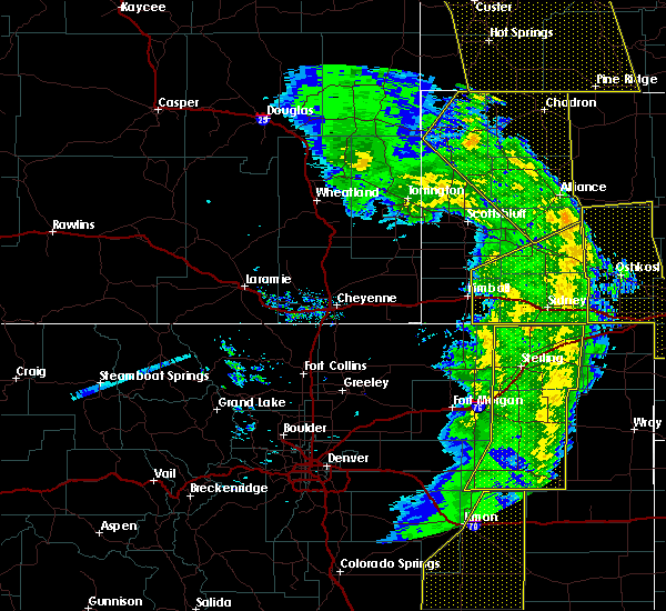 At 617 pm mdt, severe thunderstorms were located along a line extending from 13 miles northeast of the intersection of highway 385 and 92 to near sunol, moving northeast at 55 mph. at 608 pm mdt, sidney municipal airport asos reported 64 mph wind gust (mesonet station). Hazards include 70 mph wind gusts. Expect considerable tree damage. damage is likely to mobile homes, roofs, and outbuildings. locations impacted include, sidney, bridgeport, potter, lodgepole, dalton, dix, gurley, sunol, brownson, northport, bridgeport state recreation area, colton, lorenzo, the intersection of highway 385 and 92, court house and jail rocks, sidney airport, redington and broadwater. This includes interstate 80 in nebraska between mile markers 24 and 77. At 617 pm mdt, severe thunderstorms were located along a line extending from 13 miles northeast of the intersection of highway 385 and 92 to near sunol, moving northeast at 55 mph. at 608 pm mdt, sidney municipal airport asos reported 64 mph wind gust (mesonet station). Hazards include 70 mph wind gusts. Expect considerable tree damage. damage is likely to mobile homes, roofs, and outbuildings. locations impacted include, sidney, bridgeport, potter, lodgepole, dalton, dix, gurley, sunol, brownson, northport, bridgeport state recreation area, colton, lorenzo, the intersection of highway 385 and 92, court house and jail rocks, sidney airport, redington and broadwater. This includes interstate 80 in nebraska between mile markers 24 and 77.
|
| 6/6/2020 5:28 PM MDT |
 At 528 pm mdt, severe thunderstorms were located along a line extending from near kimball to near westplains, moving northeast at 65 mph (radar indicated). Hazards include 70 mph wind gusts. Expect considerable tree damage. Damage is likely to mobile homes, roofs, and outbuildings. At 528 pm mdt, severe thunderstorms were located along a line extending from near kimball to near westplains, moving northeast at 65 mph (radar indicated). Hazards include 70 mph wind gusts. Expect considerable tree damage. Damage is likely to mobile homes, roofs, and outbuildings.
|
| 5/23/2020 6:39 PM MDT |
 At 638 pm mdt, severe thunderstorms were located along a line extending from near colton to near peetz, moving east at 30 mph (radar indicated. a wind gust to 67 mph was reported at the sidney airport at 633 pm mdt). Hazards include golf ball size hail and 70 mph wind gusts. People and animals outdoors will be injured. expect hail damage to roofs, siding, windows, and vehicles. expect considerable tree damage. wind damage is also likely to mobile homes, roofs, and outbuildings. locations impacted include, sidney, lodgepole, gurley, colton, sunol, brownson, lorenzo and sidney airport. This includes interstate 80 in nebraska between mile markers 50 and 76. At 638 pm mdt, severe thunderstorms were located along a line extending from near colton to near peetz, moving east at 30 mph (radar indicated. a wind gust to 67 mph was reported at the sidney airport at 633 pm mdt). Hazards include golf ball size hail and 70 mph wind gusts. People and animals outdoors will be injured. expect hail damage to roofs, siding, windows, and vehicles. expect considerable tree damage. wind damage is also likely to mobile homes, roofs, and outbuildings. locations impacted include, sidney, lodgepole, gurley, colton, sunol, brownson, lorenzo and sidney airport. This includes interstate 80 in nebraska between mile markers 50 and 76.
|
| 5/23/2020 6:33 PM MDT |
 At 633 pm mdt, severe thunderstorms were located along a line extending from near gurley to near peetz, moving east at 20 mph (radar indicated). Hazards include golf ball size hail and 60 mph wind gusts. People and animals outdoors will be injured. expect hail damage to roofs, siding, windows, and vehicles. expect wind damage to roofs, siding, and trees. locations impacted include, sidney, lodgepole, gurley, colton, sunol, brownson, lorenzo and sidney airport. This includes interstate 80 in nebraska between mile markers 48 and 76. At 633 pm mdt, severe thunderstorms were located along a line extending from near gurley to near peetz, moving east at 20 mph (radar indicated). Hazards include golf ball size hail and 60 mph wind gusts. People and animals outdoors will be injured. expect hail damage to roofs, siding, windows, and vehicles. expect wind damage to roofs, siding, and trees. locations impacted include, sidney, lodgepole, gurley, colton, sunol, brownson, lorenzo and sidney airport. This includes interstate 80 in nebraska between mile markers 48 and 76.
|
| 5/23/2020 6:13 PM MDT |
 At 613 pm mdt, severe thunderstorms were located along a line extending from near gurley to near brownson to 12 miles west of peetz, moving east at 30 mph (radar indicated). Hazards include golf ball size hail and 70 mph wind gusts. People and animals outdoors will be injured. expect hail damage to roofs, siding, windows, and vehicles. expect considerable tree damage. wind damage is also likely to mobile homes, roofs, and outbuildings. locations impacted include, sidney, potter, lodgepole, gurley, colton, sunol, brownson, lorenzo and sidney airport. This includes interstate 80 in nebraska between mile markers 38 and 76. At 613 pm mdt, severe thunderstorms were located along a line extending from near gurley to near brownson to 12 miles west of peetz, moving east at 30 mph (radar indicated). Hazards include golf ball size hail and 70 mph wind gusts. People and animals outdoors will be injured. expect hail damage to roofs, siding, windows, and vehicles. expect considerable tree damage. wind damage is also likely to mobile homes, roofs, and outbuildings. locations impacted include, sidney, potter, lodgepole, gurley, colton, sunol, brownson, lorenzo and sidney airport. This includes interstate 80 in nebraska between mile markers 38 and 76.
|
| 5/23/2020 6:04 PM MDT |
 At 604 pm mdt, severe thunderstorms were located along a line extending from 8 miles northeast of potter to 6 miles southwest of brownson to 11 miles northeast of westplains, moving east at 25 mph (radar indicated). Hazards include 60 mph wind gusts and quarter size hail. Hail damage to vehicles is expected. Expect wind damage to roofs, siding, and trees. At 604 pm mdt, severe thunderstorms were located along a line extending from 8 miles northeast of potter to 6 miles southwest of brownson to 11 miles northeast of westplains, moving east at 25 mph (radar indicated). Hazards include 60 mph wind gusts and quarter size hail. Hail damage to vehicles is expected. Expect wind damage to roofs, siding, and trees.
|
| 8/23/2019 9:43 PM MDT |
 The severe thunderstorm warning for cheyenne county will expire at 945 pm mdt, the storms which prompted the warning have weakened below severe limits, and have exited the warned area. therefore, the warning will be allowed to expire. however gusty winds and heavy rain are still possible with these thunderstorms. a severe thunderstorm watch remains in effect until 1000 pm mdt for the panhandle of nebraska. The severe thunderstorm warning for cheyenne county will expire at 945 pm mdt, the storms which prompted the warning have weakened below severe limits, and have exited the warned area. therefore, the warning will be allowed to expire. however gusty winds and heavy rain are still possible with these thunderstorms. a severe thunderstorm watch remains in effect until 1000 pm mdt for the panhandle of nebraska.
|
| 8/23/2019 9:05 PM MDT |
 At 904 pm mdt, severe thunderstorms were located along a line extending from dalton to 6 miles northwest of peetz, moving east at 30 mph. a 58 mph wind gust was recorded in potter with this storm (radar indicated). Hazards include 60 mph wind gusts and nickel size hail. Expect damage to roofs, siding, and trees. locations impacted include, sidney, potter, lodgepole, dalton, gurley, colton, sunol, brownson, lorenzo and sidney airport. This includes interstate 80 in nebraska between mile markers 36 and 77. At 904 pm mdt, severe thunderstorms were located along a line extending from dalton to 6 miles northwest of peetz, moving east at 30 mph. a 58 mph wind gust was recorded in potter with this storm (radar indicated). Hazards include 60 mph wind gusts and nickel size hail. Expect damage to roofs, siding, and trees. locations impacted include, sidney, potter, lodgepole, dalton, gurley, colton, sunol, brownson, lorenzo and sidney airport. This includes interstate 80 in nebraska between mile markers 36 and 77.
|
| 8/23/2019 8:27 PM MDT |
 At 827 pm mdt, severe thunderstorms were located along a line extending from potter to 10 miles north of westplains, moving east at 25 mph (radar indicated). Hazards include 60 mph wind gusts and nickel size hail. expect damage to roofs, siding, and trees At 827 pm mdt, severe thunderstorms were located along a line extending from potter to 10 miles north of westplains, moving east at 25 mph (radar indicated). Hazards include 60 mph wind gusts and nickel size hail. expect damage to roofs, siding, and trees
|
| 8/21/2019 12:51 AM MDT |
 The severe thunderstorm warning for southeastern box butte, eastern cheyenne and eastern morrill counties will expire at 100 am mdt, the storms which prompted the warning have moved out of the area. therefore, the warning will be allowed to expire. however gusty winds are still possible with these thunderstorms. a severe thunderstorm watch remains in effect until 500 am mdt for the panhandle of nebraska. The severe thunderstorm warning for southeastern box butte, eastern cheyenne and eastern morrill counties will expire at 100 am mdt, the storms which prompted the warning have moved out of the area. therefore, the warning will be allowed to expire. however gusty winds are still possible with these thunderstorms. a severe thunderstorm watch remains in effect until 500 am mdt for the panhandle of nebraska.
|
| 8/21/2019 12:32 AM MDT |
 At 1232 am mdt, severe thunderstorms were located along a line extending from 7 miles east of ellsworth to north sterling reservoir, moving east at 35 mph. these are very dangerous storms (radar indicated). Hazards include 80 mph wind gusts and quarter size hail. Flying debris will be dangerous to those caught without shelter. mobile homes will be heavily damaged. expect considerable damage to roofs, windows, and vehicles. Extensive tree damage and power outages are likely. At 1232 am mdt, severe thunderstorms were located along a line extending from 7 miles east of ellsworth to north sterling reservoir, moving east at 35 mph. these are very dangerous storms (radar indicated). Hazards include 80 mph wind gusts and quarter size hail. Flying debris will be dangerous to those caught without shelter. mobile homes will be heavily damaged. expect considerable damage to roofs, windows, and vehicles. Extensive tree damage and power outages are likely.
|
| 8/21/2019 12:23 AM MDT |
 At 1223 am mdt, severe thunderstorms were located along a line extending from near ellsworth to near north sterling reservoir, moving east at 35 mph. these are very dangerous storms (radar indicated). Hazards include 80 mph wind gusts and quarter size hail. Flying debris will be dangerous to those caught without shelter. mobile homes will be heavily damaged. expect considerable damage to roofs, windows, and vehicles. extensive tree damage and power outages are likely. locations impacted include, alliance, sidney, potter, lodgepole, dalton, gurley, sunol, brownson, alliance airport, colton, lorenzo, sidney airport and broadwater. This includes interstate 80 in nebraska between mile markers 37 and 76. At 1223 am mdt, severe thunderstorms were located along a line extending from near ellsworth to near north sterling reservoir, moving east at 35 mph. these are very dangerous storms (radar indicated). Hazards include 80 mph wind gusts and quarter size hail. Flying debris will be dangerous to those caught without shelter. mobile homes will be heavily damaged. expect considerable damage to roofs, windows, and vehicles. extensive tree damage and power outages are likely. locations impacted include, alliance, sidney, potter, lodgepole, dalton, gurley, sunol, brownson, alliance airport, colton, lorenzo, sidney airport and broadwater. This includes interstate 80 in nebraska between mile markers 37 and 76.
|
| 8/21/2019 12:11 AM MDT |
 A severe thunderstorm warning remains in effect until 1245 am mdt for southeastern box butte. cheyenne. eastern kimball. morrill and southeastern banner counties. at 1210 am mdt, severe thunderstorms were located along a line extending from near ellsworth to westplains, moving east at 35 mph. These are very dangerous storms. A severe thunderstorm warning remains in effect until 1245 am mdt for southeastern box butte. cheyenne. eastern kimball. morrill and southeastern banner counties. at 1210 am mdt, severe thunderstorms were located along a line extending from near ellsworth to westplains, moving east at 35 mph. These are very dangerous storms.
|
| 8/20/2019 11:39 PM MDT |
 At 1138 pm mdt, severe thunderstorms were located along a line extending from 8 miles east of wild horse butte to 12 miles east of panorama point, moving east at 35 mph. these are very dangerous storms (radar indicated). Hazards include 80 mph wind gusts and quarter size hail. Flying debris will be dangerous to those caught without shelter. mobile homes will be heavily damaged. expect considerable damage to roofs, windows, and vehicles. Extensive tree damage and power outages are likely. At 1138 pm mdt, severe thunderstorms were located along a line extending from 8 miles east of wild horse butte to 12 miles east of panorama point, moving east at 35 mph. these are very dangerous storms (radar indicated). Hazards include 80 mph wind gusts and quarter size hail. Flying debris will be dangerous to those caught without shelter. mobile homes will be heavily damaged. expect considerable damage to roofs, windows, and vehicles. Extensive tree damage and power outages are likely.
|
| 8/11/2019 5:42 PM MDT |
 At 522 pm mdt, a severe thunderstorm was located 8 miles west of peetz, or 17 miles southwest of sidney, moving north at 30 mph. at 5:23 pm members of the public reported golfball sized hail west of peetz colorado. this is a dangerous storm producing large hail. seek shelter now (public). Hazards include tennis ball size hail and 60 mph wind gusts. People and animals outdoors will be injured. expect hail damage to roofs, siding, windows, and vehicles. expect wind damage to roofs, siding, and trees. locations impacted include, potter and brownson. This includes interstate 80 in nebraska between mile markers 37 and 55. At 522 pm mdt, a severe thunderstorm was located 8 miles west of peetz, or 17 miles southwest of sidney, moving north at 30 mph. at 5:23 pm members of the public reported golfball sized hail west of peetz colorado. this is a dangerous storm producing large hail. seek shelter now (public). Hazards include tennis ball size hail and 60 mph wind gusts. People and animals outdoors will be injured. expect hail damage to roofs, siding, windows, and vehicles. expect wind damage to roofs, siding, and trees. locations impacted include, potter and brownson. This includes interstate 80 in nebraska between mile markers 37 and 55.
|
| 8/11/2019 5:24 PM MDT |
 At 522 pm mdt, a severe thunderstorm was located 8 miles west of peetz, or 17 miles southwest of sidney, moving north at 30 mph. at 5:23 pm members of the public reported golfball sized hail west of peetz colorado. this is a dangerous storm producing large hail. seek shelter now (public). Hazards include tennis ball size hail and 60 mph wind gusts. People and animals outdoors will be injured. expect hail damage to roofs, siding, windows, and vehicles. expect wind damage to roofs, siding, and trees. locations impacted include, potter and brownson. This includes interstate 80 in nebraska between mile markers 37 and 55. At 522 pm mdt, a severe thunderstorm was located 8 miles west of peetz, or 17 miles southwest of sidney, moving north at 30 mph. at 5:23 pm members of the public reported golfball sized hail west of peetz colorado. this is a dangerous storm producing large hail. seek shelter now (public). Hazards include tennis ball size hail and 60 mph wind gusts. People and animals outdoors will be injured. expect hail damage to roofs, siding, windows, and vehicles. expect wind damage to roofs, siding, and trees. locations impacted include, potter and brownson. This includes interstate 80 in nebraska between mile markers 37 and 55.
|
| 8/11/2019 5:08 PM MDT |
 At 507 pm mdt, a severe thunderstorm was located 8 miles north of north sterling reservoir, or 18 miles north of sterling, moving north at 30 mph (radar indicated). Hazards include two inch hail and 60 mph wind gusts. People and animals outdoors will be injured. expect hail damage to roofs, siding, windows, and vehicles. Expect wind damage to roofs, siding, and trees. At 507 pm mdt, a severe thunderstorm was located 8 miles north of north sterling reservoir, or 18 miles north of sterling, moving north at 30 mph (radar indicated). Hazards include two inch hail and 60 mph wind gusts. People and animals outdoors will be injured. expect hail damage to roofs, siding, windows, and vehicles. Expect wind damage to roofs, siding, and trees.
|
| 7/8/2019 5:27 PM MDT |
 The severe thunderstorm warning for cheyenne county will expire at 530 pm mdt, the storms which prompted the warning have weakened below severe limits, and no longer pose an immediate threat to life or property. therefore, the warning will be allowed to expire. however gusty winds are still possible with these thunderstorms. a severe thunderstorm watch remains in effect until 1000 pm mdt for the panhandle of nebraska. The severe thunderstorm warning for cheyenne county will expire at 530 pm mdt, the storms which prompted the warning have weakened below severe limits, and no longer pose an immediate threat to life or property. therefore, the warning will be allowed to expire. however gusty winds are still possible with these thunderstorms. a severe thunderstorm watch remains in effect until 1000 pm mdt for the panhandle of nebraska.
|
| 7/8/2019 5:05 PM MDT |
 At 505 pm mdt, severe thunderstorms were located along a line extending from near dalton to near sidney airport, moving northeast at 30 mph (radar indicated). Hazards include 60 mph wind gusts and penny size hail. Expect damage to roofs, siding, and trees. locations impacted include, sidney, dalton, gurley, colton, sunol, brownson, lorenzo and sidney airport. This includes interstate 80 in nebraska between mile markers 43 and 73. At 505 pm mdt, severe thunderstorms were located along a line extending from near dalton to near sidney airport, moving northeast at 30 mph (radar indicated). Hazards include 60 mph wind gusts and penny size hail. Expect damage to roofs, siding, and trees. locations impacted include, sidney, dalton, gurley, colton, sunol, brownson, lorenzo and sidney airport. This includes interstate 80 in nebraska between mile markers 43 and 73.
|
| 7/8/2019 4:40 PM MDT |
 At 439 pm mdt, severe thunderstorms were located along a line extending from 7 miles northeast of potter to near peetz, moving northeast at 30 mph (radar indicated). Hazards include 60 mph wind gusts and penny size hail. expect damage to roofs, siding, and trees At 439 pm mdt, severe thunderstorms were located along a line extending from 7 miles northeast of potter to near peetz, moving northeast at 30 mph (radar indicated). Hazards include 60 mph wind gusts and penny size hail. expect damage to roofs, siding, and trees
|
| 7/6/2019 10:55 PM MDT |
 The severe thunderstorm warning for cheyenne and southeastern kimball counties will expire at 1100 pm mdt, the storms which prompted the warning have weakened below severe limits, and have exited the warned area. therefore, the warning will be allowed to expire. however gusty winds and heavy rain are still possible with these thunderstorms. to report severe weather, contact your nearest law enforcement agency. they will relay your report to the national weather service cheyenne. The severe thunderstorm warning for cheyenne and southeastern kimball counties will expire at 1100 pm mdt, the storms which prompted the warning have weakened below severe limits, and have exited the warned area. therefore, the warning will be allowed to expire. however gusty winds and heavy rain are still possible with these thunderstorms. to report severe weather, contact your nearest law enforcement agency. they will relay your report to the national weather service cheyenne.
|
| 7/6/2019 10:47 PM MDT |
 At 1046 pm mdt, severe thunderstorms were located along a line extending from 19 miles south of antioch to 8 miles south of crescent lake national wildlife refuge to oshkosh to near lodgepole to 6 miles northwest of peetz, moving east at 45 mph (trained weather spotters). Hazards include 70 mph wind gusts. Expect considerable tree damage. damage is likely to mobile homes, roofs, and outbuildings. locations impacted include, sidney, potter, lodgepole, dix, colton, sunol, brownson, lorenzo and sidney airport. This includes interstate 80 in nebraska between mile markers 28 and 77. At 1046 pm mdt, severe thunderstorms were located along a line extending from 19 miles south of antioch to 8 miles south of crescent lake national wildlife refuge to oshkosh to near lodgepole to 6 miles northwest of peetz, moving east at 45 mph (trained weather spotters). Hazards include 70 mph wind gusts. Expect considerable tree damage. damage is likely to mobile homes, roofs, and outbuildings. locations impacted include, sidney, potter, lodgepole, dix, colton, sunol, brownson, lorenzo and sidney airport. This includes interstate 80 in nebraska between mile markers 28 and 77.
|
| 7/6/2019 10:32 PM MDT |
 At 1032 pm mdt, severe thunderstorms were located along a line extending from 14 miles south of alliance airport to 9 miles southwest of crescent lake national wildlife refuge to near lisco to near colton to 9 miles south of potter, moving east at 45 mph (trained weather spotters). Hazards include 70 mph wind gusts. Expect considerable tree damage. damage is likely to mobile homes, roofs, and outbuildings. locations impacted include, sidney, potter, lodgepole, dalton, dix, gurley, colton, sunol, brownson, lorenzo, sidney airport and broadwater. This includes interstate 80 in nebraska between mile markers 28 and 77. At 1032 pm mdt, severe thunderstorms were located along a line extending from 14 miles south of alliance airport to 9 miles southwest of crescent lake national wildlife refuge to near lisco to near colton to 9 miles south of potter, moving east at 45 mph (trained weather spotters). Hazards include 70 mph wind gusts. Expect considerable tree damage. damage is likely to mobile homes, roofs, and outbuildings. locations impacted include, sidney, potter, lodgepole, dalton, dix, gurley, colton, sunol, brownson, lorenzo, sidney airport and broadwater. This includes interstate 80 in nebraska between mile markers 28 and 77.
|
| 7/6/2019 10:10 PM MDT |
 At 1009 pm mdt, severe thunderstorms were located along a line extending from near angora to 7 miles northeast of the intersection of highway 385 and 92 to 6 miles northeast of dalton to near brownson to 9 miles south of dix, moving east at 45 mph (trained weather spotters. these storms have a history of producing very strong winds in excess of 70 mph). Hazards include 70 mph wind gusts. Expect considerable tree damage. Damage is likely to mobile homes, roofs, and outbuildings. At 1009 pm mdt, severe thunderstorms were located along a line extending from near angora to 7 miles northeast of the intersection of highway 385 and 92 to 6 miles northeast of dalton to near brownson to 9 miles south of dix, moving east at 45 mph (trained weather spotters. these storms have a history of producing very strong winds in excess of 70 mph). Hazards include 70 mph wind gusts. Expect considerable tree damage. Damage is likely to mobile homes, roofs, and outbuildings.
|
| 5/17/2019 5:18 PM MDT |
 At 515 pm mdt, public reported quarter size hail in sidney. a severe thunderstorm was located over brownson, or near sidney, moving northeast at 35 mph (trained weather spotters). Hazards include 60 mph wind gusts and quarter size hail. Hail damage to vehicles is expected. Expect wind damage to roofs, siding, and trees. At 515 pm mdt, public reported quarter size hail in sidney. a severe thunderstorm was located over brownson, or near sidney, moving northeast at 35 mph (trained weather spotters). Hazards include 60 mph wind gusts and quarter size hail. Hail damage to vehicles is expected. Expect wind damage to roofs, siding, and trees.
|
| 8/5/2018 3:35 PM MDT |
 At 335 pm mdt, a severe thunderstorm was located 7 miles southeast of lorenzo, or 11 miles south of sidney, moving east at 45 mph (radar indicated). Hazards include 60 mph wind gusts and half dollar size hail. Hail damage to vehicles is expected. expect wind damage to roofs, siding, and trees. Locations impacted include, lorenzo. At 335 pm mdt, a severe thunderstorm was located 7 miles southeast of lorenzo, or 11 miles south of sidney, moving east at 45 mph (radar indicated). Hazards include 60 mph wind gusts and half dollar size hail. Hail damage to vehicles is expected. expect wind damage to roofs, siding, and trees. Locations impacted include, lorenzo.
|
| 8/5/2018 3:19 PM MDT |
 At 318 pm mdt, a severe thunderstorm was located near peetz, or 12 miles southwest of sidney, moving east at 45 mph (radar indicated). Hazards include 60 mph wind gusts and half dollar size hail. Hail damage to vehicles is expected. Expect wind damage to roofs, siding, and trees. At 318 pm mdt, a severe thunderstorm was located near peetz, or 12 miles southwest of sidney, moving east at 45 mph (radar indicated). Hazards include 60 mph wind gusts and half dollar size hail. Hail damage to vehicles is expected. Expect wind damage to roofs, siding, and trees.
|
| 7/27/2018 1:08 PM MDT |
 At 108 pm mdt, a severe thunderstorm was located over sidney, moving southeast at 50 mph (radar indicated). Hazards include quarter size hail. damage to vehicles is expected At 108 pm mdt, a severe thunderstorm was located over sidney, moving southeast at 50 mph (radar indicated). Hazards include quarter size hail. damage to vehicles is expected
|
| 7/27/2018 10:06 AM MDT |
 The severe thunderstorm warning for cheyenne, northeastern kimball, southern morrill and southeastern banner counties will expire at 1015 am mdt, the storm which prompted the warning has weakened below severe limits, and no longer poses an immediate threat to life or property. therefore, the warning will be allowed to expire. however heavy rain is still possible with this thunderstorm. to report severe weather, contact your nearest law enforcement agency. they will relay your report to the national weather service cheyenne. The severe thunderstorm warning for cheyenne, northeastern kimball, southern morrill and southeastern banner counties will expire at 1015 am mdt, the storm which prompted the warning has weakened below severe limits, and no longer poses an immediate threat to life or property. therefore, the warning will be allowed to expire. however heavy rain is still possible with this thunderstorm. to report severe weather, contact your nearest law enforcement agency. they will relay your report to the national weather service cheyenne.
|
| 7/27/2018 9:58 AM MDT |
 At 957 am mdt, a severe thunderstorm was located 10 miles north of potter, or 21 miles northwest of sidney, moving southeast at 35 mph (radar indicated). Hazards include quarter size hail. Damage to vehicles is expected. locations impacted include, sidney, potter, dalton, dix, gurley, brownson, lorenzo and sidney airport. This includes interstate 80 in nebraska between mile markers 31 and 59. At 957 am mdt, a severe thunderstorm was located 10 miles north of potter, or 21 miles northwest of sidney, moving southeast at 35 mph (radar indicated). Hazards include quarter size hail. Damage to vehicles is expected. locations impacted include, sidney, potter, dalton, dix, gurley, brownson, lorenzo and sidney airport. This includes interstate 80 in nebraska between mile markers 31 and 59.
|
| 7/27/2018 9:42 AM MDT |
 At 941 am mdt, a severe thunderstorm was located 9 miles north of potter, or 21 miles northeast of kimball, moving east at 35 mph (radar indicated). Hazards include quarter size hail. damage to vehicles is expected At 941 am mdt, a severe thunderstorm was located 9 miles north of potter, or 21 miles northeast of kimball, moving east at 35 mph (radar indicated). Hazards include quarter size hail. damage to vehicles is expected
|
| 7/26/2018 2:30 PM MDT |
 At 230 pm mdt, a severe thunderstorm was located near potter, or 13 miles east of kimball, moving southeast at 30 mph (radar indicated). Hazards include 60 mph wind gusts and quarter size hail. Hail damage to vehicles is expected. expect wind damage to roofs, siding, and trees. locations impacted include, potter, lorenzo and sidney airport. This includes interstate 80 in nebraska between mile markers 38 and 45. At 230 pm mdt, a severe thunderstorm was located near potter, or 13 miles east of kimball, moving southeast at 30 mph (radar indicated). Hazards include 60 mph wind gusts and quarter size hail. Hail damage to vehicles is expected. expect wind damage to roofs, siding, and trees. locations impacted include, potter, lorenzo and sidney airport. This includes interstate 80 in nebraska between mile markers 38 and 45.
|
| 7/26/2018 2:14 PM MDT |
 At 214 pm mdt, a severe thunderstorm was located over dix, or 7 miles east of kimball, moving southeast at 30 mph (radar indicated). Hazards include 60 mph wind gusts and quarter size hail. Hail damage to vehicles is expected. Expect wind damage to roofs, siding, and trees. At 214 pm mdt, a severe thunderstorm was located over dix, or 7 miles east of kimball, moving southeast at 30 mph (radar indicated). Hazards include 60 mph wind gusts and quarter size hail. Hail damage to vehicles is expected. Expect wind damage to roofs, siding, and trees.
|
| 6/30/2018 4:10 PM MDT |
 At 409 pm mdt, severe thunderstorms were located along a line extending from 11 miles west of dalton to near brownson to 10 miles south of potter, moving east at 40 mph (radar indicated). Hazards include 60 mph wind gusts and nickel size hail. Expect damage to roofs, siding, and trees. locations impacted include, potter and brownson. This includes interstate 80 in nebraska between mile markers 37 and 53. At 409 pm mdt, severe thunderstorms were located along a line extending from 11 miles west of dalton to near brownson to 10 miles south of potter, moving east at 40 mph (radar indicated). Hazards include 60 mph wind gusts and nickel size hail. Expect damage to roofs, siding, and trees. locations impacted include, potter and brownson. This includes interstate 80 in nebraska between mile markers 37 and 53.
|
| 6/30/2018 4:09 PM MDT |
 The national weather service in cheyenne has issued a * severe thunderstorm warning for. cheyenne county in the panhandle of nebraska. southeastern morrill county in the panhandle of nebraska. until 515 pm mdt. At 408 pm mdt, severe thunderstorms were located along a line. The national weather service in cheyenne has issued a * severe thunderstorm warning for. cheyenne county in the panhandle of nebraska. southeastern morrill county in the panhandle of nebraska. until 515 pm mdt. At 408 pm mdt, severe thunderstorms were located along a line.
|
| 6/30/2018 3:39 PM MDT |
 At 339 pm mdt, severe thunderstorms were located along a line extending from 13 miles northeast of kimball to near dix to 10 miles south of kimball airport, moving east at 35 mph (radar indicated). Hazards include 60 mph wind gusts and nickel size hail. expect damage to roofs, siding, and trees At 339 pm mdt, severe thunderstorms were located along a line extending from 13 miles northeast of kimball to near dix to 10 miles south of kimball airport, moving east at 35 mph (radar indicated). Hazards include 60 mph wind gusts and nickel size hail. expect damage to roofs, siding, and trees
|
| 6/6/2018 7:42 PM MDT |
 The severe thunderstorm warning for southern cheyenne county will expire at 745 pm mdt, the storms which prompted the warning have weakened below severe limits, and no longer pose an immediate threat to life or property. therefore the warning will be allowed to expire. however small hail and gusty winds are still possible with these thunderstorms. a severe thunderstorm watch remains in effect until 100 am mdt for the panhandle of nebraska. The severe thunderstorm warning for southern cheyenne county will expire at 745 pm mdt, the storms which prompted the warning have weakened below severe limits, and no longer pose an immediate threat to life or property. therefore the warning will be allowed to expire. however small hail and gusty winds are still possible with these thunderstorms. a severe thunderstorm watch remains in effect until 100 am mdt for the panhandle of nebraska.
|
| 6/6/2018 7:18 PM MDT |
 At 717 pm mdt, severe thunderstorms were located along a line extending from near lodgepole to 8 miles north of north sterling reservoir, and are nearly stationary (radar indicated). Hazards include 60 mph wind gusts and half dollar size hail. Hail damage to vehicles is expected. expect wind damage to roofs, siding, and trees. locations impacted include, sidney, lodgepole, colton, sunol, brownson, lorenzo and sidney airport. This includes interstate 80 in nebraska between mile markers 49 and 77. At 717 pm mdt, severe thunderstorms were located along a line extending from near lodgepole to 8 miles north of north sterling reservoir, and are nearly stationary (radar indicated). Hazards include 60 mph wind gusts and half dollar size hail. Hail damage to vehicles is expected. expect wind damage to roofs, siding, and trees. locations impacted include, sidney, lodgepole, colton, sunol, brownson, lorenzo and sidney airport. This includes interstate 80 in nebraska between mile markers 49 and 77.
|
| 6/6/2018 6:58 PM MDT |
 At 658 pm mdt, severe thunderstorms were located along a line extending from 7 miles north of twin buttes to near peetz, and are nearly stationary (radar indicated). Hazards include 60 mph wind gusts and half dollar size hail. Hail damage to vehicles is expected. expect wind damage to roofs, siding, and trees. locations impacted include, sidney, lodgepole, colton, sunol, brownson, lorenzo and sidney airport. This includes interstate 80 in nebraska between mile markers 49 and 77. At 658 pm mdt, severe thunderstorms were located along a line extending from 7 miles north of twin buttes to near peetz, and are nearly stationary (radar indicated). Hazards include 60 mph wind gusts and half dollar size hail. Hail damage to vehicles is expected. expect wind damage to roofs, siding, and trees. locations impacted include, sidney, lodgepole, colton, sunol, brownson, lorenzo and sidney airport. This includes interstate 80 in nebraska between mile markers 49 and 77.
|
| 6/6/2018 6:57 PM MDT |
 At 658 pm mdt, severe thunderstorms were located along a line extending from 7 miles north of twin buttes to near peetz, and are nearly stationary (radar indicated). Hazards include 60 mph wind gusts and half dollar size hail. Hail damage to vehicles is expected. expect wind damage to roofs, siding, and trees. locations impacted include, sidney, lodgepole, colton, sunol, brownson, lorenzo and sidney airport. This includes interstate 80 in nebraska between mile markers 49 and 77. At 658 pm mdt, severe thunderstorms were located along a line extending from 7 miles north of twin buttes to near peetz, and are nearly stationary (radar indicated). Hazards include 60 mph wind gusts and half dollar size hail. Hail damage to vehicles is expected. expect wind damage to roofs, siding, and trees. locations impacted include, sidney, lodgepole, colton, sunol, brownson, lorenzo and sidney airport. This includes interstate 80 in nebraska between mile markers 49 and 77.
|
| 6/6/2018 6:13 PM MDT |
 At 612 pm mdt, a severe thunderstorm was located over colton, or near sidney, and is nearly stationary. additional severe thunderstorms were located along interstate 80 east of sidney to lodgepole, and were also nearly stationary (radar indicated). Hazards include golf ball size hail and 60 mph wind gusts. People and animals outdoors will be injured. expect hail damage to roofs, siding, windows, and vehicles. Expect wind damage to roofs, siding, and trees. At 612 pm mdt, a severe thunderstorm was located over colton, or near sidney, and is nearly stationary. additional severe thunderstorms were located along interstate 80 east of sidney to lodgepole, and were also nearly stationary (radar indicated). Hazards include golf ball size hail and 60 mph wind gusts. People and animals outdoors will be injured. expect hail damage to roofs, siding, windows, and vehicles. Expect wind damage to roofs, siding, and trees.
|
| 5/27/2018 6:58 PM MDT |
 The severe thunderstorm warning for cheyenne. eastern kimball. southeastern morrill and southeastern banner counties will expire at 700 pm mdt. the storms which prompted the warning have weakened below severe limits, and no longer pose an immediate threat to life or property. Therefore the warning will be allowed to expire. The severe thunderstorm warning for cheyenne. eastern kimball. southeastern morrill and southeastern banner counties will expire at 700 pm mdt. the storms which prompted the warning have weakened below severe limits, and no longer pose an immediate threat to life or property. Therefore the warning will be allowed to expire.
|
| 5/27/2018 6:22 PM MDT |
 At 621 pm mdt, severe thunderstorms were located along a line extending from near dix to 7 miles northwest of dalton to near gurley to lodgepole to julesburg, moving northeast at 35 mph (radar indicated). Hazards include 70 mph wind gusts and quarter size hail. Hail damage to vehicles is expected. expect considerable tree damage. Wind damage is also likely to mobile homes, roofs, and outbuildings. At 621 pm mdt, severe thunderstorms were located along a line extending from near dix to 7 miles northwest of dalton to near gurley to lodgepole to julesburg, moving northeast at 35 mph (radar indicated). Hazards include 70 mph wind gusts and quarter size hail. Hail damage to vehicles is expected. expect considerable tree damage. Wind damage is also likely to mobile homes, roofs, and outbuildings.
|
| 5/27/2018 6:07 PM MDT |
 At 606 pm mdt, severe thunderstorms were located along a line extending from 11 miles southeast of kimball airport to near potter to near brownson to near twin buttes to near paoli, moving northeast at 35 mph (radar indicated). Hazards include 60 mph wind gusts and quarter size hail. Hail damage to vehicles is expected. expect wind damage to roofs, siding, and trees. locations impacted include, sidney, potter, lodgepole, gurley, colton, sunol, brownson, lorenzo and sidney airport. This includes interstate 80 in nebraska between mile markers 33 and 77. At 606 pm mdt, severe thunderstorms were located along a line extending from 11 miles southeast of kimball airport to near potter to near brownson to near twin buttes to near paoli, moving northeast at 35 mph (radar indicated). Hazards include 60 mph wind gusts and quarter size hail. Hail damage to vehicles is expected. expect wind damage to roofs, siding, and trees. locations impacted include, sidney, potter, lodgepole, gurley, colton, sunol, brownson, lorenzo and sidney airport. This includes interstate 80 in nebraska between mile markers 33 and 77.
|
| 5/27/2018 5:51 PM MDT |
 At 550 pm mdt, severe thunderstorms were located along a line extending from 8 miles northwest of westplains to 11 miles southwest of potter to near peetz to crook to near highland center, moving northeast at 35 mph (radar indicated). Hazards include 60 mph wind gusts and quarter size hail. Hail damage to vehicles is expected. Expect wind damage to roofs, siding, and trees. At 550 pm mdt, severe thunderstorms were located along a line extending from 8 miles northwest of westplains to 11 miles southwest of potter to near peetz to crook to near highland center, moving northeast at 35 mph (radar indicated). Hazards include 60 mph wind gusts and quarter size hail. Hail damage to vehicles is expected. Expect wind damage to roofs, siding, and trees.
|
| 9/16/2017 12:15 AM MDT |
 At 1214 am mdt, a severe thunderstorm was located over brownson, or near sidney, moving northeast at 30 mph (radar indicated). Hazards include 60 mph wind gusts and half dollar size hail. Hail damage to vehicles is expected. expect wind damage to roofs, siding, and trees. locations impacted include, sidney, gurley, colton, sunol, brownson and sidney airport. This includes interstate 80 in nebraska between mile markers 46 and 71. At 1214 am mdt, a severe thunderstorm was located over brownson, or near sidney, moving northeast at 30 mph (radar indicated). Hazards include 60 mph wind gusts and half dollar size hail. Hail damage to vehicles is expected. expect wind damage to roofs, siding, and trees. locations impacted include, sidney, gurley, colton, sunol, brownson and sidney airport. This includes interstate 80 in nebraska between mile markers 46 and 71.
|
| 9/15/2017 11:55 PM MDT |
 At 1155 pm mdt, a severe thunderstorm was located 8 miles northwest of lorenzo, or 12 miles west of sidney, moving northeast at 30 mph (radar indicated). Hazards include 60 mph wind gusts and half dollar size hail. Hail damage to vehicles is expected. Expect wind damage to roofs, siding, and trees. At 1155 pm mdt, a severe thunderstorm was located 8 miles northwest of lorenzo, or 12 miles west of sidney, moving northeast at 30 mph (radar indicated). Hazards include 60 mph wind gusts and half dollar size hail. Hail damage to vehicles is expected. Expect wind damage to roofs, siding, and trees.
|
| 9/15/2017 11:36 PM MDT |
 At 1135 pm mdt, a severe thunderstorm was located 11 miles north of westplains, or 17 miles southeast of kimball, moving northeast at 30 mph (radar indicated). Hazards include 60 mph wind gusts and half dollar size hail. Hail damage to vehicles is expected. Expect wind damage to roofs, siding, and trees. At 1135 pm mdt, a severe thunderstorm was located 11 miles north of westplains, or 17 miles southeast of kimball, moving northeast at 30 mph (radar indicated). Hazards include 60 mph wind gusts and half dollar size hail. Hail damage to vehicles is expected. Expect wind damage to roofs, siding, and trees.
|
| 6/7/2017 3:45 PM MDT |
 At 345 pm mdt, severe thunderstorms were located along a line extending from 10 miles northwest of mount vernon to 6 miles southwest of gurley to near potter, moving south at 25 mph (radar indicated). Hazards include 60 mph wind gusts and quarter size hail. Hail damage to vehicles is expected. expect wind damage to roofs, siding, and trees. these severe storms will be near, sidney, potter and brownson around 400 pm mdt. lodgepole and sidney airport around 410 pm mdt. sunol and lorenzo around 415 pm mdt. This includes interstate 80 in nebraska between mile markers 37 and 77. At 345 pm mdt, severe thunderstorms were located along a line extending from 10 miles northwest of mount vernon to 6 miles southwest of gurley to near potter, moving south at 25 mph (radar indicated). Hazards include 60 mph wind gusts and quarter size hail. Hail damage to vehicles is expected. expect wind damage to roofs, siding, and trees. these severe storms will be near, sidney, potter and brownson around 400 pm mdt. lodgepole and sidney airport around 410 pm mdt. sunol and lorenzo around 415 pm mdt. This includes interstate 80 in nebraska between mile markers 37 and 77.
|
| 6/7/2017 3:15 PM MDT |
 At 314 pm mdt, severe thunderstorms were located along a line extending from 7 miles southwest of lisco to dalton to 10 miles northeast of potter, moving south at 25 mph (radar indicated). Hazards include 60 mph wind gusts and half dollar size hail. Hail damage to vehicles is expected. expect wind damage to roofs, siding, and trees. severe thunderstorms will be near, gurley around 330 pm mdt. potter around 340 pm mdt. sidney, lodgepole, brownson and sunol around 400 pm mdt. colton around 405 pm mdt. sidney airport around 410 pm mdt. lorenzo around 415 pm mdt. This includes interstate 80 in nebraska between mile markers 37 and 77. At 314 pm mdt, severe thunderstorms were located along a line extending from 7 miles southwest of lisco to dalton to 10 miles northeast of potter, moving south at 25 mph (radar indicated). Hazards include 60 mph wind gusts and half dollar size hail. Hail damage to vehicles is expected. expect wind damage to roofs, siding, and trees. severe thunderstorms will be near, gurley around 330 pm mdt. potter around 340 pm mdt. sidney, lodgepole, brownson and sunol around 400 pm mdt. colton around 405 pm mdt. sidney airport around 410 pm mdt. lorenzo around 415 pm mdt. This includes interstate 80 in nebraska between mile markers 37 and 77.
|
| 8/8/2016 6:57 PM MDT |
 The severe thunderstorm warning for south central cheyenne county will expire at 700 pm mdt, the storm which prompted the warning has weakened below severe limits, and no longer pose an immediate threat to life or property. therefore, the warning will be allowed to expire. The severe thunderstorm warning for south central cheyenne county will expire at 700 pm mdt, the storm which prompted the warning has weakened below severe limits, and no longer pose an immediate threat to life or property. therefore, the warning will be allowed to expire.
|
| 8/8/2016 6:36 PM MDT |
 At 636 pm mdt, a severe thunderstorm was located over lorenzo, or near sidney, moving south at 10 mph (radar indicated). Hazards include 60 mph wind gusts and quarter size hail. Hail damage to vehicles is expected. expect wind damage to roofs, siding, and trees. This severe storm will be near, lorenzo around 655 pm mdt. At 636 pm mdt, a severe thunderstorm was located over lorenzo, or near sidney, moving south at 10 mph (radar indicated). Hazards include 60 mph wind gusts and quarter size hail. Hail damage to vehicles is expected. expect wind damage to roofs, siding, and trees. This severe storm will be near, lorenzo around 655 pm mdt.
|
| 8/8/2016 6:19 PM MDT |
 At 619 pm mdt, a severe thunderstorm was located near sidney, moving southeast at 15 mph (radar indicated). Hazards include 60 mph wind gusts and quarter size hail. Hail damage to vehicles is expected. expect wind damage to roofs, siding, and trees. this severe storm will be near, sidney around 625 pm mdt. sidney airport around 630 pm mdt. This includes interstate 80 in nebraska between mile markers 48 and 67. At 619 pm mdt, a severe thunderstorm was located near sidney, moving southeast at 15 mph (radar indicated). Hazards include 60 mph wind gusts and quarter size hail. Hail damage to vehicles is expected. expect wind damage to roofs, siding, and trees. this severe storm will be near, sidney around 625 pm mdt. sidney airport around 630 pm mdt. This includes interstate 80 in nebraska between mile markers 48 and 67.
|
| 8/8/2016 6:03 PM MDT |
 At 602 pm mdt, a severe thunderstorm was located over brownson, or near sidney, moving southeast at 25 mph (radar indicated). Hazards include 60 mph wind gusts and quarter size hail. Hail damage to vehicles is expected. expect wind damage to roofs, siding, and trees. this severe thunderstorm will be near, sidney around 610 pm mdt. sidney airport around 620 pm mdt. lorenzo around 625 pm mdt. This includes interstate 80 in nebraska between mile markers 48 and 67. At 602 pm mdt, a severe thunderstorm was located over brownson, or near sidney, moving southeast at 25 mph (radar indicated). Hazards include 60 mph wind gusts and quarter size hail. Hail damage to vehicles is expected. expect wind damage to roofs, siding, and trees. this severe thunderstorm will be near, sidney around 610 pm mdt. sidney airport around 620 pm mdt. lorenzo around 625 pm mdt. This includes interstate 80 in nebraska between mile markers 48 and 67.
|
| 7/27/2016 7:36 PM MDT |
 The severe thunderstorm warning for south central cheyenne county will expire at 745 pm mdt, the storm which prompted the warning has moved out of the area. therefore the warning will be allowed to expire. to report severe weather, contact your nearest law enforcement agency. they will relay your report to the national weather service cheyenne. The severe thunderstorm warning for south central cheyenne county will expire at 745 pm mdt, the storm which prompted the warning has moved out of the area. therefore the warning will be allowed to expire. to report severe weather, contact your nearest law enforcement agency. they will relay your report to the national weather service cheyenne.
|
| 7/27/2016 7:28 PM MDT |
 At 727 pm mdt, a severe thunderstorm was located 8 miles east of lorenzo, or 10 miles south of sidney, moving east at 40 mph (radar indicated). Hazards include 60 mph wind gusts and quarter size hail. Hail damage to vehicles is expected. expect wind damage to roofs, siding, and trees. Locations impacted include, lorenzo. At 727 pm mdt, a severe thunderstorm was located 8 miles east of lorenzo, or 10 miles south of sidney, moving east at 40 mph (radar indicated). Hazards include 60 mph wind gusts and quarter size hail. Hail damage to vehicles is expected. expect wind damage to roofs, siding, and trees. Locations impacted include, lorenzo.
|
| 7/27/2016 7:11 PM MDT | The tornado warning for southwestern cheyenne county will expire at 715 pm mdt, the tornado threat has diminished, therefore the tornado warning has been cancelled. however, large hail and damaging winds remain likely and a severe thunderstorm warning remains in effect for the area. however small hail is still possible with this thunderstorm. to report severe weather, contact your nearest law enforcement agency. they will relay your report to the national weather service cheyenne. remember, a severe thunderstorm warning still remains in effect for southern and southwestern cheyenne county. |
| 7/27/2016 7:09 PM MDT |
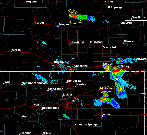 At 709 pm mdt, a severe thunderstorm was located over lorenzo, or 9 miles southwest of sidney, moving southeast at 40 mph (radar indicated). Hazards include 60 mph wind gusts and half dollar size hail. Hail damage to vehicles is expected. Expect wind damage to roofs, siding, and trees. At 709 pm mdt, a severe thunderstorm was located over lorenzo, or 9 miles southwest of sidney, moving southeast at 40 mph (radar indicated). Hazards include 60 mph wind gusts and half dollar size hail. Hail damage to vehicles is expected. Expect wind damage to roofs, siding, and trees.
|
| 7/27/2016 6:58 PM MDT | The severe thunderstorm warning for southwestern cheyenne and east central kimball counties will expire at 700 pm mdt. the storm which prompted the warning has moved out of kimball county and has been replaced by a tornado warning for western cheyenne county. to report severe weather. Contact your nearest law enforcement. |
| 7/27/2016 6:55 PM MDT |
 At 653 pm mdt, a severe thunderstorm capable of producing a tornado was located 9 miles southwest of brownson, or 13 miles west of sidney, moving east at 35 mph (radar indicated rotation). Hazards include tornado and golf ball size hail. Flying debris will be dangerous to those caught without shelter. mobile homes will be damaged or destroyed. damage to roofs, windows, and vehicles will occur. tree damage is likely. this dangerous storm will be near, brownson around 705 pm mdt. lorenzo around 710 pm mdt. This includes interstate 80 in nebraska between mile markers 46 and 56. At 653 pm mdt, a severe thunderstorm capable of producing a tornado was located 9 miles southwest of brownson, or 13 miles west of sidney, moving east at 35 mph (radar indicated rotation). Hazards include tornado and golf ball size hail. Flying debris will be dangerous to those caught without shelter. mobile homes will be damaged or destroyed. damage to roofs, windows, and vehicles will occur. tree damage is likely. this dangerous storm will be near, brownson around 705 pm mdt. lorenzo around 710 pm mdt. This includes interstate 80 in nebraska between mile markers 46 and 56.
|
| 7/27/2016 6:42 PM MDT |
 At 642 pm mdt, a severe thunderstorm capable of producing a tornado was located 7 miles south of potter, or 18 miles southeast of kimball, moving east at 35 mph (radar indicated rotation). Hazards include tornado and golf ball size hail. Flying debris will be dangerous to those caught without shelter. mobile homes will be damaged or destroyed. damage to roofs, windows, and vehicles will occur. tree damage is likely. this dangerous storm will be near, brownson and lorenzo around 705 pm mdt. This includes interstate 80 in nebraska between mile markers 43 and 56. At 642 pm mdt, a severe thunderstorm capable of producing a tornado was located 7 miles south of potter, or 18 miles southeast of kimball, moving east at 35 mph (radar indicated rotation). Hazards include tornado and golf ball size hail. Flying debris will be dangerous to those caught without shelter. mobile homes will be damaged or destroyed. damage to roofs, windows, and vehicles will occur. tree damage is likely. this dangerous storm will be near, brownson and lorenzo around 705 pm mdt. This includes interstate 80 in nebraska between mile markers 43 and 56.
|
| 7/27/2016 6:32 PM MDT |
 At 632 pm mdt, a severe thunderstorm was located near potter, or 14 miles east of kimball, moving east at 30 mph (radar indicated). Hazards include ping pong ball size hail and 60 mph wind gusts. People and animals outdoors will be injured. expect hail damage to roofs, siding, windows, and vehicles. expect wind damage to roofs, siding, and trees. locations impacted include, potter and dix. This includes interstate 80 in nebraska between mile markers 26 and 49. At 632 pm mdt, a severe thunderstorm was located near potter, or 14 miles east of kimball, moving east at 30 mph (radar indicated). Hazards include ping pong ball size hail and 60 mph wind gusts. People and animals outdoors will be injured. expect hail damage to roofs, siding, windows, and vehicles. expect wind damage to roofs, siding, and trees. locations impacted include, potter and dix. This includes interstate 80 in nebraska between mile markers 26 and 49.
|
| 7/27/2016 6:10 PM MDT |
 At 608 pm mdt, a severe thunderstorm was located over kimball, moving east at 35 mph (radar indicated). Hazards include golf ball size hail and 60 mph wind gusts. This severe thunderstorm is travelling along interstate 80 and will produce broken windshields to vehicles on the interstate. people and animals outdoors will be injured. expect hail damage to roofs, siding, windows, and vehicles. Expect wind damage to roofs, siding, and trees. At 608 pm mdt, a severe thunderstorm was located over kimball, moving east at 35 mph (radar indicated). Hazards include golf ball size hail and 60 mph wind gusts. This severe thunderstorm is travelling along interstate 80 and will produce broken windshields to vehicles on the interstate. people and animals outdoors will be injured. expect hail damage to roofs, siding, windows, and vehicles. Expect wind damage to roofs, siding, and trees.
|
| 7/7/2016 3:56 PM MDT | The tornado warning for southeastern cheyenne county will expire at 400 pm mdt, the storm which prompted the warning has weakened below severe limits, and no longer appears capable of producing a tornado. therefore the warning will be allowed to expire. |
| 7/7/2016 3:41 PM MDT |
 At 340 pm mdt, a confirmed landspout tornado was located over lorenzo, or 8 miles southwest of sidney, moving east at 10 mph (weather spotters confirmed landspout tornado). Hazards include tornado. Expect damage to mobile homes. roofs. and vehicles. This tornado will be near, lorenzo around 345 pm mdt. At 340 pm mdt, a confirmed landspout tornado was located over lorenzo, or 8 miles southwest of sidney, moving east at 10 mph (weather spotters confirmed landspout tornado). Hazards include tornado. Expect damage to mobile homes. roofs. and vehicles. This tornado will be near, lorenzo around 345 pm mdt.
|
| 7/7/2016 3:27 PM MDT |
 At 327 pm mdt, a confirmed tornado was located over lorenzo, or 9 miles southwest of sidney, moving east at 25 mph (weather spotters confirmed tornado). Hazards include tornado. Expect damage to mobile homes. roofs. and vehicles. This tornadic thunderstorm will remain over mainly rural areas of southern cheyenne county. At 327 pm mdt, a confirmed tornado was located over lorenzo, or 9 miles southwest of sidney, moving east at 25 mph (weather spotters confirmed tornado). Hazards include tornado. Expect damage to mobile homes. roofs. and vehicles. This tornadic thunderstorm will remain over mainly rural areas of southern cheyenne county.
|
| 6/29/2016 7:11 PM MDT |
 The severe thunderstorm warning for southeastern cheyenne county will expire at 715 pm mdt, the storms which prompted the warning have weakened below severe limits, and no longer pose an immediate threat to life or property. therefore the warning will be allowed to expire. to report severe weather, contact your nearest law enforcement agency. they will relay your report to the national weather service cheyenne. The severe thunderstorm warning for southeastern cheyenne county will expire at 715 pm mdt, the storms which prompted the warning have weakened below severe limits, and no longer pose an immediate threat to life or property. therefore the warning will be allowed to expire. to report severe weather, contact your nearest law enforcement agency. they will relay your report to the national weather service cheyenne.
|
| 6/29/2016 7:03 PM MDT |
 At 703 pm mdt, severe thunderstorms were located along a line extending from near brownson to 7 miles east of lorenzo, moving east at 25 mph (radar indicated). Hazards include 60 mph wind gusts. Expect damage to roofs. siding. and trees. locations impacted include, sidney, lorenzo, sidney airport, colton, brownson and sunol. This includes interstate 80 in nebraska between mile markers 48 and 71. At 703 pm mdt, severe thunderstorms were located along a line extending from near brownson to 7 miles east of lorenzo, moving east at 25 mph (radar indicated). Hazards include 60 mph wind gusts. Expect damage to roofs. siding. and trees. locations impacted include, sidney, lorenzo, sidney airport, colton, brownson and sunol. This includes interstate 80 in nebraska between mile markers 48 and 71.
|
| 6/29/2016 6:35 PM MDT |
 At 633 pm mdt, a severe thunderstorm was located 14 miles southwest of sidney, moving east at 30 mph. a second severe thunderstorm was located near potter, also moving east at 30 mph (radar indicated). Hazards include 60 mph wind gusts and quarter size hail. Hail damage to vehicles is expected. Expect wind damage to roofs, siding, and trees. At 633 pm mdt, a severe thunderstorm was located 14 miles southwest of sidney, moving east at 30 mph. a second severe thunderstorm was located near potter, also moving east at 30 mph (radar indicated). Hazards include 60 mph wind gusts and quarter size hail. Hail damage to vehicles is expected. Expect wind damage to roofs, siding, and trees.
|
| 6/28/2016 7:56 PM MDT | The severe thunderstorm warning for southwestern cheyenne county will expire at 800 pm mdt, the storm which prompted the warning has weakened below severe limits, and no longer pose an immediate threat to life or property. therefore the warning will be allowed to expire. however small. |
| 6/28/2016 7:41 PM MDT |
 At 740 pm mdt, a severe thunderstorm was located near brownson, or near sidney, moving southeast at 30 mph (trained weather spotters). Hazards include 60 mph wind gusts and quarter size hail. Hail damage to vehicles is expected. expect wind damage to roofs, siding, and trees. this severe storm will be near, sidney airport around 745 pm mdt. lorenzo around 755 pm mdt. This includes interstate 80 in nebraska between mile markers 41 and 62. At 740 pm mdt, a severe thunderstorm was located near brownson, or near sidney, moving southeast at 30 mph (trained weather spotters). Hazards include 60 mph wind gusts and quarter size hail. Hail damage to vehicles is expected. expect wind damage to roofs, siding, and trees. this severe storm will be near, sidney airport around 745 pm mdt. lorenzo around 755 pm mdt. This includes interstate 80 in nebraska between mile markers 41 and 62.
|
| 6/28/2016 7:20 PM MDT |
 At 718 pm mdt, a severe thunderstorm was located near brownson, or 11 miles northwest of sidney, moving southeast at 30 mph (radar indicated). Hazards include 60 mph wind gusts and half dollar size hail. Hail damage to vehicles is expected. expect wind damage to roofs, siding, and trees. this severe thunderstorm will be near, brownson around 730 pm mdt. sidney around 735 pm mdt. sidney airport around 740 pm mdt. lorenzo around 745 pm mdt. This includes interstate 80 in nebraska between mile markers 38 and 62. At 718 pm mdt, a severe thunderstorm was located near brownson, or 11 miles northwest of sidney, moving southeast at 30 mph (radar indicated). Hazards include 60 mph wind gusts and half dollar size hail. Hail damage to vehicles is expected. expect wind damage to roofs, siding, and trees. this severe thunderstorm will be near, brownson around 730 pm mdt. sidney around 735 pm mdt. sidney airport around 740 pm mdt. lorenzo around 745 pm mdt. This includes interstate 80 in nebraska between mile markers 38 and 62.
|
| 6/23/2016 5:25 PM MDT |
 The severe thunderstorm warning for southwestern cheyenne and southeastern kimball counties will expire at 530 pm mdt, the storms which prompted the warning have weakened below severe limits, and no longer pose an immediate threat to life or property. therefore the warning will be allowed to expire. however small hail is still possible with these thunderstorms. The severe thunderstorm warning for southwestern cheyenne and southeastern kimball counties will expire at 530 pm mdt, the storms which prompted the warning have weakened below severe limits, and no longer pose an immediate threat to life or property. therefore the warning will be allowed to expire. however small hail is still possible with these thunderstorms.
|
| 6/23/2016 5:18 PM MDT |
 At 517 pm mdt, severe thunderstorms were located along a line extending from near potter to 8 miles north of westplains, moving east at 20 mph (radar indicated). Hazards include 60 mph wind gusts and quarter size hail. Hail damage to vehicles is expected. expect wind damage to roofs, siding, and trees. these severe storms will be near, potter around 525 pm mdt. This includes interstate 80 in nebraska between mile markers 34 and 53. At 517 pm mdt, severe thunderstorms were located along a line extending from near potter to 8 miles north of westplains, moving east at 20 mph (radar indicated). Hazards include 60 mph wind gusts and quarter size hail. Hail damage to vehicles is expected. expect wind damage to roofs, siding, and trees. these severe storms will be near, potter around 525 pm mdt. This includes interstate 80 in nebraska between mile markers 34 and 53.
|
| 6/23/2016 4:52 PM MDT |
 At 451 pm mdt, severe thunderstorms were located along a line extending from near dix to 10 miles northwest of westplains, moving east at 20 mph (radar indicated). Hazards include 60 mph wind gusts and half dollar size hail. Hail damage to vehicles is expected. expect wind damage to roofs, siding, and trees. severe thunderstorms will be near, dix around 500 pm mdt. potter around 525 pm mdt. This includes interstate 80 in nebraska between mile markers 27 and 53. At 451 pm mdt, severe thunderstorms were located along a line extending from near dix to 10 miles northwest of westplains, moving east at 20 mph (radar indicated). Hazards include 60 mph wind gusts and half dollar size hail. Hail damage to vehicles is expected. expect wind damage to roofs, siding, and trees. severe thunderstorms will be near, dix around 500 pm mdt. potter around 525 pm mdt. This includes interstate 80 in nebraska between mile markers 27 and 53.
|
| 6/13/2016 7:33 PM MDT |
 At 732 pm mdt, severe thunderstorms were located along a line extending from 7 miles southeast of court house and jail rocks to near lorenzo, moving northeast at 30 mph (trained weather spotters. wind gusts in excess of 60 mph occurred in potter with these storms). Hazards include 60 mph wind gusts. small hail is also possible. Expect damage to roofs. siding. and trees. locations impacted include, sidney, lodgepole, dalton, gurley, sidney airport, the intersection of highway 385 and 92, sunol, lorenzo, colton and brownson. This includes interstate 80 in nebraska between mile markers 44 and 77. At 732 pm mdt, severe thunderstorms were located along a line extending from 7 miles southeast of court house and jail rocks to near lorenzo, moving northeast at 30 mph (trained weather spotters. wind gusts in excess of 60 mph occurred in potter with these storms). Hazards include 60 mph wind gusts. small hail is also possible. Expect damage to roofs. siding. and trees. locations impacted include, sidney, lodgepole, dalton, gurley, sidney airport, the intersection of highway 385 and 92, sunol, lorenzo, colton and brownson. This includes interstate 80 in nebraska between mile markers 44 and 77.
|
| 6/13/2016 7:12 PM MDT |
 At 711 pm mdt, severe thunderstorms were located along a line extending from near potter to 6 miles west of brownson to 8 miles northwest of lorenzo, moving northeast at 35 mph (radar indicated). Hazards include 60 mph wind gusts. small hail is also possible. Expect damage to roofs. siding. And trees. At 711 pm mdt, severe thunderstorms were located along a line extending from near potter to 6 miles west of brownson to 8 miles northwest of lorenzo, moving northeast at 35 mph (radar indicated). Hazards include 60 mph wind gusts. small hail is also possible. Expect damage to roofs. siding. And trees.
|
| 6/12/2016 9:43 PM MDT |
 At 942 pm mdt, severe thunderstorms were located along a line extending from near alliance to 12 miles east of angora to near richardson lake to 9 miles south of lisco to 7 miles south of colton, and are nearly stationary (radar indicated). Hazards include 60 mph wind gusts and penny size hail. Expect damage to roofs. siding. and trees. locations impacted include, alliance, sidney, bridgeport, lodgepole, dalton, gurley, the intersection of highway 385 and 92, bridgeport state recreation area, angora, lorenzo, northport, colton, sidney airport, alliance airport, sunol, brownson and broadwater. This includes interstate 80 in nebraska between mile markers 51 and 77. At 942 pm mdt, severe thunderstorms were located along a line extending from near alliance to 12 miles east of angora to near richardson lake to 9 miles south of lisco to 7 miles south of colton, and are nearly stationary (radar indicated). Hazards include 60 mph wind gusts and penny size hail. Expect damage to roofs. siding. and trees. locations impacted include, alliance, sidney, bridgeport, lodgepole, dalton, gurley, the intersection of highway 385 and 92, bridgeport state recreation area, angora, lorenzo, northport, colton, sidney airport, alliance airport, sunol, brownson and broadwater. This includes interstate 80 in nebraska between mile markers 51 and 77.
|
| 6/12/2016 9:24 PM MDT |
 At 923 pm mdt, severe thunderstorms were located along a line extending from near alliance to near angora to near richardson lake to 10 miles east of gurley to near lorenzo, moving east at 45 mph (radar indicated). Hazards include 60 mph wind gusts and penny size hail. Expect damage to roofs. siding. And trees. At 923 pm mdt, severe thunderstorms were located along a line extending from near alliance to near angora to near richardson lake to 10 miles east of gurley to near lorenzo, moving east at 45 mph (radar indicated). Hazards include 60 mph wind gusts and penny size hail. Expect damage to roofs. siding. And trees.
|
| 5/24/2016 6:18 PM MDT | The national weather service in cheyenne has issued a * severe thunderstorm warning for. cheyenne county in the panhandle of nebraska. morrill county in the panhandle of nebraska. southern box butte county in the panhandle of nebraska. Until 700 pm mdt. |
| 7/4/2015 8:15 PM MDT |
 At 815 pm mdt, a severe thunderstorm was located near potter, or 14 miles west of sidney, moving south at 30 mph (radar indicated). Hazards include quarter size hail and 60 mph wind gusts. Hail damage to vehicles is expected. expect wind damage to roofs, siding and trees. locations impacted include, potter and lorenzo. This includes interstate 80 in nebraska between mile markers 38 and 50. At 815 pm mdt, a severe thunderstorm was located near potter, or 14 miles west of sidney, moving south at 30 mph (radar indicated). Hazards include quarter size hail and 60 mph wind gusts. Hail damage to vehicles is expected. expect wind damage to roofs, siding and trees. locations impacted include, potter and lorenzo. This includes interstate 80 in nebraska between mile markers 38 and 50.
|
| 7/4/2015 7:57 PM MDT |
 At 756 pm mdt, a severe thunderstorm was located near potter, or 17 miles northwest of sidney, moving south at 30 mph (trained weather spotters). Hazards include quarter size hail and 60 mph wind gusts. Hail damage to vehicles is expected. Expect wind damage to roofs, siding and trees. At 756 pm mdt, a severe thunderstorm was located near potter, or 17 miles northwest of sidney, moving south at 30 mph (trained weather spotters). Hazards include quarter size hail and 60 mph wind gusts. Hail damage to vehicles is expected. Expect wind damage to roofs, siding and trees.
|
| 6/25/2015 7:01 PM MDT |
 At 701 pm mdt, severe thunderstorms were located along a line extending from 7 miles east of gurley to near sunol to near lorenzo, moving southeast at 50 mph (radar indicated). Hazards include 60 mph wind gusts and penny size hail. Expect damage to roofs. Siding and trees. At 701 pm mdt, severe thunderstorms were located along a line extending from 7 miles east of gurley to near sunol to near lorenzo, moving southeast at 50 mph (radar indicated). Hazards include 60 mph wind gusts and penny size hail. Expect damage to roofs. Siding and trees.
|
| 6/1/2015 6:56 PM MDT | The severe thunderstorm warning for southeastern cheyenne county will expire at 700 pm mdt, the storm which prompted the warning has moved out of the area. therefore the warning will be allowed to expire. however gusty winds are still possible with this thunderstorm. |
| 6/1/2015 6:51 PM MDT | At 650 pm mdt, a severe thunderstorm was located over lorenzo, or 7 miles south of sidney, moving east at 15 mph (radar indicated). Hazards include quarter size hail and 60 mph wind gusts. Hail damage to vehicles is expected. expect wind damage to roofs, siding and trees. locations impacted include, sidney, lorenzo, sidney airport and colton. This includes interstate 80 in nebraska between mile markers 55 and 66. |
| 6/1/2015 6:41 PM MDT | At 639 pm mdt, a severe thunderstorm was located over sidney airport and over sidney, moving east at 20 mph. at 633 pm mdt, trained storm spotters reported 1 inch sized hail 7 miles south of sidney (radar indicated). Hazards include quarter size hail. Damage to vehicles is expected. locations impacted include, sidney, lorenzo, sidney airport, colton and brownson. This includes interstate 80 in nebraska between mile markers 44 and 66. |
| 6/1/2015 6:32 PM MDT | At 632 pm mdt, a severe thunderstorm was located over sidney, moving north at 25 mph (radar indicated). Hazards include half dollar size hail. Damage to vehicles is expected. locations impacted include, sidney, lorenzo, sidney airport, colton and brownson. This includes interstate 80 in nebraska between mile markers 44 and 66. |
| 6/1/2015 6:25 PM MDT | At 625 pm mdt, a severe thunderstorm was located over sidney airport, or near sidney, moving north at 20 mph (radar indicated). Hazards include quarter size hail. damage to vehicles is expected |
| 5/15/2015 4:38 PM MDT | At 438 pm mdt, a severe thunderstorm was located near brownson, or near sidney, moving north at 30 mph (radar indicated). Hazards include quarter size hail and 60 mph wind gusts. Hail damage to vehicles is expected. expect wind damage to roofs, siding and trees. this severe thunderstorm will be near, brownson around 445 pm mdt. gurley around 510 pm mdt. dalton around 520 pm mdt. this includes interstate 80 in nebraska between mile markers 46 and 57. a tornado watch remains in effect until 800 pm mdt for central nebraska. 1. 00in. |
| 4/15/2015 5:56 PM MDT | The severe thunderstorm warning for eastern kimball and western cheyenne counties will expire at 600 pm mdt. the line of storms which prompted the warning have weakened below severe limits. and no longer pose an immediate threat to life or property. Therefore the warning will be allowed to expire. |
| 4/15/2015 5:34 PM MDT | A severe thunderstorm warning remains in effect until 600 pm mdt for eastern kimball and western cheyenne counties. at 534 pm mdt. severe thunderstorms were located along a line extending from 11 miles southeast of harrisburg to 7 miles northwest of potter to 12 miles northwest of peetz. Moving northeast at 40 mph. |
| 4/15/2015 5:09 PM MDT | The national weather service in cheyenne has issued a * severe thunderstorm warning for. kimball county in the panhandle of nebraska. western cheyenne county in the panhandle of nebraska. until 600 pm mdt * at 509 pm mdt. Severe thunderstorms were located along a line. |
Hail Maps for Lorenzo, NE
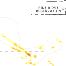
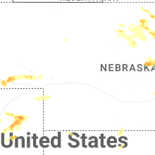

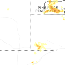
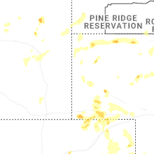
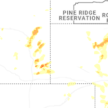
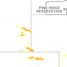

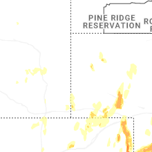


Connect with Interactive Hail Maps