

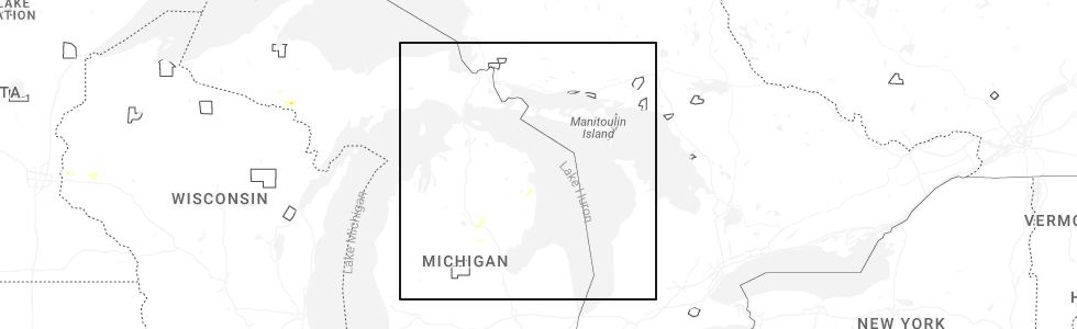
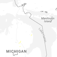
Hail Map for Lost Lake Woods, MI
The Lost Lake Woods, MI area has had 1 report of on-the-ground hail by trained spotters, and has been under severe weather warnings 0 times during the past 12 months. Doppler radar has detected hail at or near Lost Lake Woods, MI on 21 occasions, including 1 occasion during the past year.
| Name: | Lost Lake Woods, MI |
| Where Located: | 19 miles S of Alpena, MI |
| Map: | Google Map for Lost Lake Woods, MI |
| Population: | 312 |
| Housing Units: | 530 |
| More Info: | Search Google for Lost Lake Woods, MI |
2
The Top Recent Hail Date for Lost Lake Woods, MI is Monday, June 30, 2025 (4th out of 21)
Hail and Wind Damage Spotted near Lost Lake Woods, MI
| Date / Time | Report Details |
|---|---|
| 5/20/2024 9:57 PM EDT |
 the severe thunderstorm warning has been cancelled and is no longer in effect the severe thunderstorm warning has been cancelled and is no longer in effect
|
| 5/20/2024 9:41 PM EDT |
 Svrapx the national weather service in gaylord has issued a * severe thunderstorm warning for, southwestern alpena county in northern michigan, alcona county in northern michigan, southeastern montmorency county in northern michigan, northeastern oscoda county in northern michigan, northeastern iosco county in northern michigan, * until 1030 pm edt. * at 941 pm edt, severe thunderstorms were located along a line extending from near comins to near barton city to 8 miles northeast of plainfield township, moving northeast at 40 mph (radar indicated). Hazards include 60 mph wind gusts. Expect damage to roofs, siding, and trees. severe thunderstorms will be near, barton city around 945 pm edt. mikado and hubbard lake around 950 pm edt. lincoln, lost lake woods, and ossineke township around 955 pm edt. harrisville, the town of hubbard lake, spruce, and spratt around 1000 pm edt. ossineke and harrisville state park around 1005 pm edt. black river and negwegon state park around 1010 pm edt. Other locations impacted by these severe thunderstorms include devils lake, milen township, mitchell township, and sid town. Svrapx the national weather service in gaylord has issued a * severe thunderstorm warning for, southwestern alpena county in northern michigan, alcona county in northern michigan, southeastern montmorency county in northern michigan, northeastern oscoda county in northern michigan, northeastern iosco county in northern michigan, * until 1030 pm edt. * at 941 pm edt, severe thunderstorms were located along a line extending from near comins to near barton city to 8 miles northeast of plainfield township, moving northeast at 40 mph (radar indicated). Hazards include 60 mph wind gusts. Expect damage to roofs, siding, and trees. severe thunderstorms will be near, barton city around 945 pm edt. mikado and hubbard lake around 950 pm edt. lincoln, lost lake woods, and ossineke township around 955 pm edt. harrisville, the town of hubbard lake, spruce, and spratt around 1000 pm edt. ossineke and harrisville state park around 1005 pm edt. black river and negwegon state park around 1010 pm edt. Other locations impacted by these severe thunderstorms include devils lake, milen township, mitchell township, and sid town.
|
| 5/17/2024 2:21 PM EDT |
 The storm which prompted the warning has weakened below severe limits, and no longer poses an immediate threat to life or property. therefore, the warning will be allowed to expire. The storm which prompted the warning has weakened below severe limits, and no longer poses an immediate threat to life or property. therefore, the warning will be allowed to expire.
|
| 5/17/2024 2:14 PM EDT |
 At 214 pm edt, a severe thunderstorm was located over spruce, or near ossineke, moving east at 20 mph (radar indicated). Hazards include quarter size hail. Damage to vehicles is expected. This severe storm will be near, ossineke, black river, negwegon state park, and lost lake woods around 220 pm edt. At 214 pm edt, a severe thunderstorm was located over spruce, or near ossineke, moving east at 20 mph (radar indicated). Hazards include quarter size hail. Damage to vehicles is expected. This severe storm will be near, ossineke, black river, negwegon state park, and lost lake woods around 220 pm edt.
|
| 5/17/2024 1:53 PM EDT |
 Svrapx the national weather service in gaylord has issued a * severe thunderstorm warning for, south central alpena county in northern michigan, northeastern alcona county in northern michigan, * until 230 pm edt. * at 153 pm edt, a severe thunderstorm was located over hubbard lake, or near the town of hubbard lake, moving east at 20 mph (radar indicated). Hazards include quarter size hail. Damage to vehicles is expected. This severe thunderstorm will be near, ossineke, the town of hubbard lake, spruce, lost lake woods, and hubbard lake around 200 pm edt. Svrapx the national weather service in gaylord has issued a * severe thunderstorm warning for, south central alpena county in northern michigan, northeastern alcona county in northern michigan, * until 230 pm edt. * at 153 pm edt, a severe thunderstorm was located over hubbard lake, or near the town of hubbard lake, moving east at 20 mph (radar indicated). Hazards include quarter size hail. Damage to vehicles is expected. This severe thunderstorm will be near, ossineke, the town of hubbard lake, spruce, lost lake woods, and hubbard lake around 200 pm edt.
|
| 8/3/2022 12:07 PM EDT |
 At 1207 pm edt, a severe thunderstorm was located near mikado, or 10 miles northwest of oscoda, moving east at 65 mph (radar indicated. this storm has a history of producing tree and powerline damage). Hazards include 60 mph wind gusts and quarter size hail. Hail damage to vehicles is expected. expect wind damage to roofs, siding, and trees. locations impacted include, oscoda, east tawas, tawas city, harrisville, au sable, glennie, south branch, mikado, whittemore, lincoln, tawas point state park, curran, plainfield township, national city, black river, wurtsmith airfield, barton city, curtisville, hale and harrisville state park. hail threat, radar indicated max hail size, 1. 00 in wind threat, observed max wind gust, 60 mph. At 1207 pm edt, a severe thunderstorm was located near mikado, or 10 miles northwest of oscoda, moving east at 65 mph (radar indicated. this storm has a history of producing tree and powerline damage). Hazards include 60 mph wind gusts and quarter size hail. Hail damage to vehicles is expected. expect wind damage to roofs, siding, and trees. locations impacted include, oscoda, east tawas, tawas city, harrisville, au sable, glennie, south branch, mikado, whittemore, lincoln, tawas point state park, curran, plainfield township, national city, black river, wurtsmith airfield, barton city, curtisville, hale and harrisville state park. hail threat, radar indicated max hail size, 1. 00 in wind threat, observed max wind gust, 60 mph.
|
| 8/3/2022 11:56 AM EDT |
 At 1155 am edt, a severe thunderstorm was located near glennie, moving east at 70 mph (radar indicated. this storm has a history of producing tree and powerline damage). Hazards include 60 mph wind gusts and quarter size hail. Hail damage to vehicles is expected. expect wind damage to roofs, siding, and trees. locations impacted include, oscoda, au sable, mikado, wurtsmith airfield and harrisville state park. hail threat, radar indicated max hail size, 1. 00 in wind threat, observed max wind gust, 60 mph. At 1155 am edt, a severe thunderstorm was located near glennie, moving east at 70 mph (radar indicated. this storm has a history of producing tree and powerline damage). Hazards include 60 mph wind gusts and quarter size hail. Hail damage to vehicles is expected. expect wind damage to roofs, siding, and trees. locations impacted include, oscoda, au sable, mikado, wurtsmith airfield and harrisville state park. hail threat, radar indicated max hail size, 1. 00 in wind threat, observed max wind gust, 60 mph.
|
| 8/3/2022 11:41 AM EDT |
 At 1140 am edt, a severe thunderstorm was located over rose city, or 12 miles northeast of west branch, moving east at 60 mph (radar indicated. this storm has a history of producing tree and powerline damage across wexford and missaukee counties). Hazards include 60 mph wind gusts. Expect damage to roofs, siding, and trees. this severe thunderstorm will be near, long lake, south branch, hale and curtisville around 1150 am edt. glennie around 1200 pm edt. other locations in the path of this severe thunderstorm include au sable, mikado, wurtsmith airfield, oscoda and harrisville state park. hail threat, radar indicated max hail size, <. 75 in wind threat, observed max wind gust, 60 mph. At 1140 am edt, a severe thunderstorm was located over rose city, or 12 miles northeast of west branch, moving east at 60 mph (radar indicated. this storm has a history of producing tree and powerline damage across wexford and missaukee counties). Hazards include 60 mph wind gusts. Expect damage to roofs, siding, and trees. this severe thunderstorm will be near, long lake, south branch, hale and curtisville around 1150 am edt. glennie around 1200 pm edt. other locations in the path of this severe thunderstorm include au sable, mikado, wurtsmith airfield, oscoda and harrisville state park. hail threat, radar indicated max hail size, <. 75 in wind threat, observed max wind gust, 60 mph.
|
| 7/23/2022 9:57 PM EDT |
 At 957 pm edt, a severe thunderstorm was located near curran, or 8 miles north of glennie, moving east at 15 mph (radar indicated). Hazards include 60 mph wind gusts and quarter size hail. Hail damage to vehicles is expected. expect wind damage to roofs, siding, and trees. locations impacted include, barton city, mikado and lincoln. hail threat, radar indicated max hail size, 1. 00 in wind threat, radar indicated max wind gust, 60 mph. At 957 pm edt, a severe thunderstorm was located near curran, or 8 miles north of glennie, moving east at 15 mph (radar indicated). Hazards include 60 mph wind gusts and quarter size hail. Hail damage to vehicles is expected. expect wind damage to roofs, siding, and trees. locations impacted include, barton city, mikado and lincoln. hail threat, radar indicated max hail size, 1. 00 in wind threat, radar indicated max wind gust, 60 mph.
|
| 7/23/2022 9:37 PM EDT |
 At 936 pm edt, a severe thunderstorm was located over curran, or 10 miles northwest of glennie, moving east at 15 mph (radar indicated). Hazards include ping pong ball size hail and 60 mph wind gusts. People and animals outdoors will be injured. expect hail damage to roofs, siding, windows, and vehicles. Expect wind damage to roofs, siding, and trees. At 936 pm edt, a severe thunderstorm was located over curran, or 10 miles northwest of glennie, moving east at 15 mph (radar indicated). Hazards include ping pong ball size hail and 60 mph wind gusts. People and animals outdoors will be injured. expect hail damage to roofs, siding, windows, and vehicles. Expect wind damage to roofs, siding, and trees.
|
| 9/7/2021 2:05 PM EDT |
 The severe thunderstorm warning for eastern alcona and northeastern iosco counties will expire at 215 pm edt, the storms which prompted the warning have moved out of the area. therefore, the warning will be allowed to expire. however heavy rain is still possible with these thunderstorms. a severe thunderstorm watch remains in effect until 700 pm edt for northern michigan. The severe thunderstorm warning for eastern alcona and northeastern iosco counties will expire at 215 pm edt, the storms which prompted the warning have moved out of the area. therefore, the warning will be allowed to expire. however heavy rain is still possible with these thunderstorms. a severe thunderstorm watch remains in effect until 700 pm edt for northern michigan.
|
| 9/7/2021 1:51 PM EDT |
 At 151 pm edt, severe thunderstorms were located along a line extending from near negwegon state park to 6 miles southeast of glennie, moving east at 35 mph (radar indicated). Hazards include 60 mph wind gusts and quarter size hail. Hail damage to vehicles is expected. expect wind damage to roofs, siding, and trees. these severe storms will be near, negwegon state park and black river around 155 pm edt. other locations in the path of these severe thunderstorms include harrisville and harrisville state park. hail threat, radar indicated max hail size, 1. 00 in wind threat, radar indicated max wind gust, 60 mph. At 151 pm edt, severe thunderstorms were located along a line extending from near negwegon state park to 6 miles southeast of glennie, moving east at 35 mph (radar indicated). Hazards include 60 mph wind gusts and quarter size hail. Hail damage to vehicles is expected. expect wind damage to roofs, siding, and trees. these severe storms will be near, negwegon state park and black river around 155 pm edt. other locations in the path of these severe thunderstorms include harrisville and harrisville state park. hail threat, radar indicated max hail size, 1. 00 in wind threat, radar indicated max wind gust, 60 mph.
|
| 9/7/2021 1:37 PM EDT |
 At 137 pm edt, severe thunderstorms were located along a line extending from spruce to near glennie, moving east at 35 mph (radar indicated). Hazards include 60 mph wind gusts and quarter size hail. Hail damage to vehicles is expected. expect wind damage to roofs, siding, and trees. severe thunderstorms will be near, ossineke, lost lake woods and spruce around 145 pm edt. negwegon state park and black river around 150 pm edt. other locations in the path of these severe thunderstorms include mikado, harrisville and harrisville state park. hail threat, radar indicated max hail size, 1. 00 in wind threat, radar indicated max wind gust, 60 mph. At 137 pm edt, severe thunderstorms were located along a line extending from spruce to near glennie, moving east at 35 mph (radar indicated). Hazards include 60 mph wind gusts and quarter size hail. Hail damage to vehicles is expected. expect wind damage to roofs, siding, and trees. severe thunderstorms will be near, ossineke, lost lake woods and spruce around 145 pm edt. negwegon state park and black river around 150 pm edt. other locations in the path of these severe thunderstorms include mikado, harrisville and harrisville state park. hail threat, radar indicated max hail size, 1. 00 in wind threat, radar indicated max wind gust, 60 mph.
|
| 8/11/2021 1:04 AM EDT |
 At 104 am edt, severe thunderstorms were located along a line extending from near lachine to near barton city, moving east at 35 mph (radar indicated). Hazards include 60 mph wind gusts. Expect damage to roofs, siding, and trees. locations impacted include, alpena, ossineke, the town of hubbard lake, spruce, ossineke township, hubbard lake, spratt, negwegon state park, cathro, lakewood, black river, lost lake woods and devils lake. hail threat, radar indicated max hail size, <. 75 in wind threat, radar indicated max wind gust, 60 mph. At 104 am edt, severe thunderstorms were located along a line extending from near lachine to near barton city, moving east at 35 mph (radar indicated). Hazards include 60 mph wind gusts. Expect damage to roofs, siding, and trees. locations impacted include, alpena, ossineke, the town of hubbard lake, spruce, ossineke township, hubbard lake, spratt, negwegon state park, cathro, lakewood, black river, lost lake woods and devils lake. hail threat, radar indicated max hail size, <. 75 in wind threat, radar indicated max wind gust, 60 mph.
|
| 8/11/2021 12:50 AM EDT |
 At 1250 am edt, severe thunderstorms were located along a line extending from near hillman to near curran, moving northeast at 40 mph (radar indicated). Hazards include 60 mph wind gusts and penny size hail. Expect damage to roofs, siding, and trees. locations impacted include, lachine, the town of hubbard lake, long rapids, hubbard lake, lost lake woods, spruce, ossineke, posen, cathro, negwegon state park, black river, lakewood, thompsons harbor state park, presque isle light and presque isle. hail threat, radar indicated max hail size, 0. 75 in wind threat, radar indicated max wind gust, 60 mph. At 1250 am edt, severe thunderstorms were located along a line extending from near hillman to near curran, moving northeast at 40 mph (radar indicated). Hazards include 60 mph wind gusts and penny size hail. Expect damage to roofs, siding, and trees. locations impacted include, lachine, the town of hubbard lake, long rapids, hubbard lake, lost lake woods, spruce, ossineke, posen, cathro, negwegon state park, black river, lakewood, thompsons harbor state park, presque isle light and presque isle. hail threat, radar indicated max hail size, 0. 75 in wind threat, radar indicated max wind gust, 60 mph.
|
| 8/11/2021 12:31 AM EDT |
 At 1231 am edt, severe thunderstorms were located along a line extending from near atlanta to near mckinley, moving northeast at 40 mph (radar indicated). Hazards include 60 mph wind gusts and penny size hail. Expect damage to roofs, siding, and trees. severe thunderstorms will be near, curran around 1240 am edt. hillman around 1250 am edt. other locations in the path of these severe thunderstorms include royston, bisma township, ossineke township, hubbard lake, the town of hubbard lake, metz, spruce, posen, hagensville, ossineke and thompsons harbor state park. hail threat, radar indicated max hail size, 0. 75 in wind threat, radar indicated max wind gust, 60 mph. At 1231 am edt, severe thunderstorms were located along a line extending from near atlanta to near mckinley, moving northeast at 40 mph (radar indicated). Hazards include 60 mph wind gusts and penny size hail. Expect damage to roofs, siding, and trees. severe thunderstorms will be near, curran around 1240 am edt. hillman around 1250 am edt. other locations in the path of these severe thunderstorms include royston, bisma township, ossineke township, hubbard lake, the town of hubbard lake, metz, spruce, posen, hagensville, ossineke and thompsons harbor state park. hail threat, radar indicated max hail size, 0. 75 in wind threat, radar indicated max wind gust, 60 mph.
|
| 7/5/2021 8:57 PM EDT |
 The severe thunderstorm warning for northeastern alcona county will expire at 900 pm edt, the storm which prompted the warning has weakened below severe limits, and has exited the warned area. therefore, the warning will be allowed to expire. however gusty winds and heavy rain are still possible with this thunderstorm. to report severe weather, contact your nearest law enforcement agency. they will relay your report to the national weather service gaylord. The severe thunderstorm warning for northeastern alcona county will expire at 900 pm edt, the storm which prompted the warning has weakened below severe limits, and has exited the warned area. therefore, the warning will be allowed to expire. however gusty winds and heavy rain are still possible with this thunderstorm. to report severe weather, contact your nearest law enforcement agency. they will relay your report to the national weather service gaylord.
|
| 7/5/2021 8:35 PM EDT | At least five 12-18 size trees are down on the property due to strong winds. minor damage to one building as one tree fell against i in alcona county MI, 5.2 miles W of Lost Lake Woods, MI |
| 7/5/2021 8:34 PM EDT |
 At 834 pm edt, a severe thunderstorm was located over black river, or 9 miles southeast of ossineke, moving east at 30 mph (radar indicated). Hazards include 60 mph wind gusts and quarter size hail. Hail damage to vehicles is expected. expect wind damage to roofs, siding, and trees. This severe thunderstorm will be near, black river around 840 pm edt. At 834 pm edt, a severe thunderstorm was located over black river, or 9 miles southeast of ossineke, moving east at 30 mph (radar indicated). Hazards include 60 mph wind gusts and quarter size hail. Hail damage to vehicles is expected. expect wind damage to roofs, siding, and trees. This severe thunderstorm will be near, black river around 840 pm edt.
|
| 6/12/2021 7:58 PM EDT |
 At 758 pm edt, a severe thunderstorm was located over lost lake woods, or 9 miles south of ossineke, moving east at 25 mph (radar indicated). Hazards include 60 mph wind gusts and quarter size hail. Hail damage to vehicles is expected. expect wind damage to roofs, siding, and trees. Locations impacted include, black river and negwegon state park. At 758 pm edt, a severe thunderstorm was located over lost lake woods, or 9 miles south of ossineke, moving east at 25 mph (radar indicated). Hazards include 60 mph wind gusts and quarter size hail. Hail damage to vehicles is expected. expect wind damage to roofs, siding, and trees. Locations impacted include, black river and negwegon state park.
|
| 6/12/2021 7:39 PM EDT |
 At 738 pm edt, a severe thunderstorm was located 9 miles south of the town of hubbard lake, moving east at 25 mph (radar indicated). Hazards include 60 mph wind gusts and quarter size hail. Hail damage to vehicles is expected. expect wind damage to roofs, siding, and trees. Locations impacted include, spruce, lost lake woods, lincoln, black river, negwegon state park, harrisville and harrisville state park. At 738 pm edt, a severe thunderstorm was located 9 miles south of the town of hubbard lake, moving east at 25 mph (radar indicated). Hazards include 60 mph wind gusts and quarter size hail. Hail damage to vehicles is expected. expect wind damage to roofs, siding, and trees. Locations impacted include, spruce, lost lake woods, lincoln, black river, negwegon state park, harrisville and harrisville state park.
|
| 6/12/2021 7:24 PM EDT |
 At 724 pm edt, a severe thunderstorm was located near curran, or 11 miles southwest of the town of hubbard lake, moving east at 25 mph (radar indicated). Hazards include golf ball size hail and 60 mph wind gusts. People and animals outdoors will be injured. expect hail damage to roofs, siding, windows, and vehicles. expect wind damage to roofs, siding, and trees. this severe thunderstorm will be near, barton city around 740 pm edt. Other locations in the path of this severe thunderstorm include hubbard lake, spruce, lost lake woods, lincoln, harrisville, black river, negwegon state park and harrisville state park. At 724 pm edt, a severe thunderstorm was located near curran, or 11 miles southwest of the town of hubbard lake, moving east at 25 mph (radar indicated). Hazards include golf ball size hail and 60 mph wind gusts. People and animals outdoors will be injured. expect hail damage to roofs, siding, windows, and vehicles. expect wind damage to roofs, siding, and trees. this severe thunderstorm will be near, barton city around 740 pm edt. Other locations in the path of this severe thunderstorm include hubbard lake, spruce, lost lake woods, lincoln, harrisville, black river, negwegon state park and harrisville state park.
|
| 7/18/2020 1:57 PM EDT |
 The severe thunderstorm warning for northeastern alcona county will expire at 200 pm edt, the storm which prompted the warning has moved out of the area. therefore, the warning will be allowed to expire. The severe thunderstorm warning for northeastern alcona county will expire at 200 pm edt, the storm which prompted the warning has moved out of the area. therefore, the warning will be allowed to expire.
|
| 7/18/2020 1:33 PM EDT |
 At 133 pm edt, a severe thunderstorm was located over lincoln, or 7 miles northwest of harrisville, moving east at 35 mph (radar indicated). Hazards include 60 mph wind gusts and quarter size hail. Hail damage to vehicles is expected. expect wind damage to roofs, siding, and trees. Locations impacted include, harrisville, lincoln, spruce, black river, harrisville state park, lost lake woods, hubbard lake, barton city and negwegon state park. At 133 pm edt, a severe thunderstorm was located over lincoln, or 7 miles northwest of harrisville, moving east at 35 mph (radar indicated). Hazards include 60 mph wind gusts and quarter size hail. Hail damage to vehicles is expected. expect wind damage to roofs, siding, and trees. Locations impacted include, harrisville, lincoln, spruce, black river, harrisville state park, lost lake woods, hubbard lake, barton city and negwegon state park.
|
| 7/18/2020 1:18 PM EDT |
 At 117 pm edt, a severe thunderstorm was located over barton city, or 11 miles south of the town of hubbard lake, moving east at 40 mph (radar indicated). Hazards include 60 mph wind gusts and quarter size hail. Hail damage to vehicles is expected. Expect wind damage to roofs, siding, and trees. At 117 pm edt, a severe thunderstorm was located over barton city, or 11 miles south of the town of hubbard lake, moving east at 40 mph (radar indicated). Hazards include 60 mph wind gusts and quarter size hail. Hail damage to vehicles is expected. Expect wind damage to roofs, siding, and trees.
|
| 8/5/2019 8:11 PM EDT |
 At 811 pm edt, severe thunderstorms were located along a line extending from near lost lake woods to near mikado, moving east at 30 mph (radar indicated). Hazards include 60 mph wind gusts and penny size hail. expect damage to roofs, siding, and trees At 811 pm edt, severe thunderstorms were located along a line extending from near lost lake woods to near mikado, moving east at 30 mph (radar indicated). Hazards include 60 mph wind gusts and penny size hail. expect damage to roofs, siding, and trees
|
| 10/4/2018 2:52 AM EDT |
 At 252 am edt, severe thunderstorms were located along a line extending from near alpena to near the town of hubbard lake to near ossineke township, moving east at 60 mph (radar indicated). Hazards include 60 mph wind gusts. expect damage to roofs, siding, and trees At 252 am edt, severe thunderstorms were located along a line extending from near alpena to near the town of hubbard lake to near ossineke township, moving east at 60 mph (radar indicated). Hazards include 60 mph wind gusts. expect damage to roofs, siding, and trees
|
| 10/17/2016 10:57 AM EDT |
 The severe thunderstorm warning for southeastern alcona and northeastern iosco counties will expire at 1100 am edt, the storm which prompted the warning is moving out into lake huron. therefore the warning will be allowed to expire. The severe thunderstorm warning for southeastern alcona and northeastern iosco counties will expire at 1100 am edt, the storm which prompted the warning is moving out into lake huron. therefore the warning will be allowed to expire.
|
| 10/17/2016 10:40 AM EDT |
 At 1039 am edt, a severe thunderstorm was located 7 miles west of mikado, or 8 miles east of glennie, moving east at 50 mph (radar indicated). Hazards include quarter size hail. Damage to vehicles is expected. Locations impacted include, harrisville, mikado, lincoln, barton city, harrisville state park, lost lake woods and sid town. At 1039 am edt, a severe thunderstorm was located 7 miles west of mikado, or 8 miles east of glennie, moving east at 50 mph (radar indicated). Hazards include quarter size hail. Damage to vehicles is expected. Locations impacted include, harrisville, mikado, lincoln, barton city, harrisville state park, lost lake woods and sid town.
|
| 10/17/2016 10:25 AM EDT |
 At 1025 am edt, a severe thunderstorm was located near south branch, or near glennie, moving east at 50 mph (radar indicated). Hazards include ping pong ball size hail. People and animals outdoors will be injured. expect damage to roofs, siding, windows, and vehicles. Locations impacted include, harrisville, glennie, south branch, mikado, lincoln, curtisville, barton city, harrisville state park, sid town and milen township. At 1025 am edt, a severe thunderstorm was located near south branch, or near glennie, moving east at 50 mph (radar indicated). Hazards include ping pong ball size hail. People and animals outdoors will be injured. expect damage to roofs, siding, windows, and vehicles. Locations impacted include, harrisville, glennie, south branch, mikado, lincoln, curtisville, barton city, harrisville state park, sid town and milen township.
|
| 10/17/2016 10:10 AM EDT |
 At 1009 am edt, a severe thunderstorm was located over lupton, or 14 miles northeast of west branch, moving northeast at 50 mph (radar indicated). Hazards include ping pong ball size hail. People and animals outdoors will be injured. Expect damage to roofs, siding, windows, and vehicles. At 1009 am edt, a severe thunderstorm was located over lupton, or 14 miles northeast of west branch, moving northeast at 50 mph (radar indicated). Hazards include ping pong ball size hail. People and animals outdoors will be injured. Expect damage to roofs, siding, windows, and vehicles.
|
| 9/10/2016 4:24 PM EDT |
 The severe thunderstorm warning for alcona, oscoda, iosco and northeastern ogemaw counties will expire at 430 pm edt, the line of showers producing gusty winds which prompted the warning have weakened moved out of the area. therefore, the warning will be allowed to expire. The severe thunderstorm warning for alcona, oscoda, iosco and northeastern ogemaw counties will expire at 430 pm edt, the line of showers producing gusty winds which prompted the warning have weakened moved out of the area. therefore, the warning will be allowed to expire.
|
| 9/10/2016 3:37 PM EDT |
 At 335 pm edt, a line of showers with embedded thunder was producing severe winds along a line extending from near red oak to near rifle river state park, moving northeast at 45 mph (radar indicated). Hazards include 60 mph wind gusts. Expect damage to roofs. siding. And trees. At 335 pm edt, a line of showers with embedded thunder was producing severe winds along a line extending from near red oak to near rifle river state park, moving northeast at 45 mph (radar indicated). Hazards include 60 mph wind gusts. Expect damage to roofs. siding. And trees.
|
| 7/8/2016 2:55 PM EDT |
 At 254 pm edt, severe thunderstorms were located along a line extending from near cathro to near hubbard lake to near mckinley, moving east at 40 mph (radar indicated). Hazards include two inch hail and 60 mph wind gusts. People and animals outdoors will be injured. expect hail damage to roofs, siding, windows, and vehicles. expect wind damage to roofs, siding, and trees. Locations impacted include, alpena, ossineke, harrisville, the town of hubbard lake, lachine, mckinley, long rapids, lincoln, fletcher pond, curran, lost lake woods, black river, lakewood, spruce, cathro, harrisville state park, hubbard lake, ossineke township, spratt and barton city. At 254 pm edt, severe thunderstorms were located along a line extending from near cathro to near hubbard lake to near mckinley, moving east at 40 mph (radar indicated). Hazards include two inch hail and 60 mph wind gusts. People and animals outdoors will be injured. expect hail damage to roofs, siding, windows, and vehicles. expect wind damage to roofs, siding, and trees. Locations impacted include, alpena, ossineke, harrisville, the town of hubbard lake, lachine, mckinley, long rapids, lincoln, fletcher pond, curran, lost lake woods, black river, lakewood, spruce, cathro, harrisville state park, hubbard lake, ossineke township, spratt and barton city.
|
| 7/8/2016 2:17 PM EDT |
 At 217 pm edt, a severe thunderstorm was located near atlanta, moving east at 35 mph (radar indicated). Hazards include two inch hail and 60 mph wind gusts. People and animals outdoors will be injured. expect hail damage to roofs, siding, windows, and vehicles. Expect wind damage to roofs, siding, and trees. At 217 pm edt, a severe thunderstorm was located near atlanta, moving east at 35 mph (radar indicated). Hazards include two inch hail and 60 mph wind gusts. People and animals outdoors will be injured. expect hail damage to roofs, siding, windows, and vehicles. Expect wind damage to roofs, siding, and trees.
|
| 7/8/2016 1:56 PM EDT |
 At 153 pm edt, a severe thunderstorm was located near spratt, or 8 miles northwest of the town of hubbard lake, moving east at 30 mph (radar indicated. at 144 pm edt...ping pong ball size hail was reported 5 miles south of hillman). Hazards include two inch hail and 60 mph wind gusts. People and animals outdoors will be injured. expect hail damage to roofs, siding, windows, and vehicles. expect wind damage to roofs, siding, and trees. Locations impacted include, alpena, ossineke, the town of hubbard lake, lachine, hubbard lake, ossineke township, lost lake woods, spratt, lakewood, spruce, cathro and devils lake. At 153 pm edt, a severe thunderstorm was located near spratt, or 8 miles northwest of the town of hubbard lake, moving east at 30 mph (radar indicated. at 144 pm edt...ping pong ball size hail was reported 5 miles south of hillman). Hazards include two inch hail and 60 mph wind gusts. People and animals outdoors will be injured. expect hail damage to roofs, siding, windows, and vehicles. expect wind damage to roofs, siding, and trees. Locations impacted include, alpena, ossineke, the town of hubbard lake, lachine, hubbard lake, ossineke township, lost lake woods, spratt, lakewood, spruce, cathro and devils lake.
|
| 7/8/2016 1:28 PM EDT |
 At 127 pm edt, a severe thunderstorm was located near lockwood lake, or near atlanta, moving east at 25 mph (radar indicated). Hazards include two inch hail and 70 mph wind gusts. People and animals outdoors will be injured. expect hail damage to roofs, siding, windows, and vehicles. expect considerable tree damage. Wind damage is also likely to mobile homes, roofs, and outbuildings. At 127 pm edt, a severe thunderstorm was located near lockwood lake, or near atlanta, moving east at 25 mph (radar indicated). Hazards include two inch hail and 70 mph wind gusts. People and animals outdoors will be injured. expect hail damage to roofs, siding, windows, and vehicles. expect considerable tree damage. Wind damage is also likely to mobile homes, roofs, and outbuildings.
|
| 6/20/2016 11:14 AM EDT |
 At 1114 am edt, severe thunderstorms were located along a line extending from near negwegon state park to near barton city, moving east at 55 mph (radar indicated). Hazards include 60 mph wind gusts and quarter size hail. Hail damage to vehicles is expected. expect wind damage to roofs, siding, and trees. Locations impacted include, ossineke, harrisville, lincoln, lost lake woods, black river, barton city, spruce, harrisville state park, negwegon state park and hubbard lake. At 1114 am edt, severe thunderstorms were located along a line extending from near negwegon state park to near barton city, moving east at 55 mph (radar indicated). Hazards include 60 mph wind gusts and quarter size hail. Hail damage to vehicles is expected. expect wind damage to roofs, siding, and trees. Locations impacted include, ossineke, harrisville, lincoln, lost lake woods, black river, barton city, spruce, harrisville state park, negwegon state park and hubbard lake.
|
| 6/20/2016 10:57 AM EDT |
 At 1057 am edt, a severe thunderstorm was located near hubbard lake, or near the town of hubbard lake, moving east at 50 mph (radar indicated). Hazards include ping pong ball size hail and 60 mph wind gusts. People and animals outdoors will be injured. expect hail damage to roofs, siding, windows, and vehicles. expect wind damage to roofs, siding, and trees. Locations impacted include, ossineke, harrisville, the town of hubbard lake, lincoln, curran, lost lake woods, black river, spruce, harrisville state park, hubbard lake, ossineke township, barton city, negwegon state park, devils lake, mitchell township and milen township. At 1057 am edt, a severe thunderstorm was located near hubbard lake, or near the town of hubbard lake, moving east at 50 mph (radar indicated). Hazards include ping pong ball size hail and 60 mph wind gusts. People and animals outdoors will be injured. expect hail damage to roofs, siding, windows, and vehicles. expect wind damage to roofs, siding, and trees. Locations impacted include, ossineke, harrisville, the town of hubbard lake, lincoln, curran, lost lake woods, black river, spruce, harrisville state park, hubbard lake, ossineke township, barton city, negwegon state park, devils lake, mitchell township and milen township.
|
| 6/20/2016 10:43 AM EDT |
 At 1042 am edt, severe thunderstorms were located along a line extending from near ossineke township to near fairview, moving east at 60 mph (radar indicated). Hazards include ping pong ball size hail and 60 mph wind gusts. People and animals outdoors will be injured. expect hail damage to roofs, siding, windows, and vehicles. Expect wind damage to roofs, siding, and trees. At 1042 am edt, severe thunderstorms were located along a line extending from near ossineke township to near fairview, moving east at 60 mph (radar indicated). Hazards include ping pong ball size hail and 60 mph wind gusts. People and animals outdoors will be injured. expect hail damage to roofs, siding, windows, and vehicles. Expect wind damage to roofs, siding, and trees.
|
| 5/26/2016 5:56 PM EDT | The severe thunderstorm warning for eastern alcona and northeastern iosco counties will expire at 600 pm edt, the storm which prompted the warning has weakened below severe limits, and no longer poses an immediate threat to life or property. therefore, the warning will be allowed to expire. however heavy rain is still possible with this thunderstorm. |
| 5/26/2016 5:42 PM EDT |
 At 542 pm edt, a severe thunderstorm was located near mikado, or 7 miles north of oscoda, moving east at 40 mph (radar indicated). Hazards include 60 mph wind gusts and quarter size hail. Hail damage to vehicles is expected. expect wind damage to roofs, siding, and trees. Locations impacted include, oscoda, harrisville, au sable, mikado, lincoln, lost lake woods, wurtsmith airfield, black river, barton city, harrisville state park, negwegon state park, plainfield township and sid town. At 542 pm edt, a severe thunderstorm was located near mikado, or 7 miles north of oscoda, moving east at 40 mph (radar indicated). Hazards include 60 mph wind gusts and quarter size hail. Hail damage to vehicles is expected. expect wind damage to roofs, siding, and trees. Locations impacted include, oscoda, harrisville, au sable, mikado, lincoln, lost lake woods, wurtsmith airfield, black river, barton city, harrisville state park, negwegon state park, plainfield township and sid town.
|
| 5/26/2016 5:17 PM EDT |
 At 516 pm edt, a severe thunderstorm was located near hale, or 7 miles south of glennie, moving east at 40 mph (radar indicated). Hazards include 60 mph wind gusts and quarter size hail. Hail damage to vehicles is expected. Expect wind damage to roofs, siding, and trees. At 516 pm edt, a severe thunderstorm was located near hale, or 7 miles south of glennie, moving east at 40 mph (radar indicated). Hazards include 60 mph wind gusts and quarter size hail. Hail damage to vehicles is expected. Expect wind damage to roofs, siding, and trees.
|
| 9/8/2015 4:02 PM EDT |
 At 402 pm edt, a severe thunderstorm was located over south branch, or 10 miles southwest of glennie, moving northeast at 45 mph (radar indicated). Hazards include 60 mph wind gusts. Expect damage to roofs. Siding and trees. At 402 pm edt, a severe thunderstorm was located over south branch, or 10 miles southwest of glennie, moving northeast at 45 mph (radar indicated). Hazards include 60 mph wind gusts. Expect damage to roofs. Siding and trees.
|
| 8/17/2015 7:22 PM EDT |
 At 722 pm edt, a severe thunderstorm was located over black river, or 7 miles southeast of ossineke, moving northeast at 20 mph (radar indicated). Hazards include 60 mph wind gusts and nickel size hail. Expect damage to roofs. siding and trees. Locations impacted include, ossineke, black river, negwegon state park and lost lake woods. At 722 pm edt, a severe thunderstorm was located over black river, or 7 miles southeast of ossineke, moving northeast at 20 mph (radar indicated). Hazards include 60 mph wind gusts and nickel size hail. Expect damage to roofs. siding and trees. Locations impacted include, ossineke, black river, negwegon state park and lost lake woods.
|
| 8/17/2015 7:13 PM EDT |
 At 712 pm edt, a severe thunderstorm was located over lost lake woods, or 8 miles south of ossineke, moving northeast at 10 mph (radar indicated). Hazards include 60 mph wind gusts and nickel size hail. Expect damage to roofs. Siding and trees. At 712 pm edt, a severe thunderstorm was located over lost lake woods, or 8 miles south of ossineke, moving northeast at 10 mph (radar indicated). Hazards include 60 mph wind gusts and nickel size hail. Expect damage to roofs. Siding and trees.
|
| 8/14/2015 3:12 PM EDT |
 At 312 pm edt, a severe thunderstorm was located near barton city, or 10 miles west of harrisville, moving southeast at 15 mph (radar indicated). Hazards include ping pong ball size hail and 60 mph wind gusts. People and animals outdoors will be injured. expect hail damage to roofs, siding, windows and vehicles. Expect wind damage to roofs, siding and trees. At 312 pm edt, a severe thunderstorm was located near barton city, or 10 miles west of harrisville, moving southeast at 15 mph (radar indicated). Hazards include ping pong ball size hail and 60 mph wind gusts. People and animals outdoors will be injured. expect hail damage to roofs, siding, windows and vehicles. Expect wind damage to roofs, siding and trees.
|
| 8/2/2015 6:51 PM EDT |
 The severe thunderstorm warning for iosco, alcona and arenac counties will expire at 700 pm edt, the storms which prompted the warning have moved out of the area. therefore the warning will be allowed to expire. however gusty winds are still possible with these thunderstorms. a severe thunderstorm watch remains in effect until 1100 pm edt for northern michigan. The severe thunderstorm warning for iosco, alcona and arenac counties will expire at 700 pm edt, the storms which prompted the warning have moved out of the area. therefore the warning will be allowed to expire. however gusty winds are still possible with these thunderstorms. a severe thunderstorm watch remains in effect until 1100 pm edt for northern michigan.
|
| 8/2/2015 6:36 PM EDT |
 At 635 pm edt, severe thunderstorms were located along a line extending from near lincoln to 7 miles south of tawas point state park to 8 miles northeast of pinconning, and are nearly stationary (radar indicated). Hazards include 70 mph wind gusts and quarter size hail. Hail damage to vehicles is expected. expect considerable tree damage. wind damage is also likely to mobile homes, roofs and outbuildings. Locations impacted include, alger, oscoda, east tawas, tawas city, standish, au gres, sterling, harrisville, au sable, glennie, maple ridge, mikado, whittemore, lincoln, omer, twining, turner, curtisville, black river and plainfield township. At 635 pm edt, severe thunderstorms were located along a line extending from near lincoln to 7 miles south of tawas point state park to 8 miles northeast of pinconning, and are nearly stationary (radar indicated). Hazards include 70 mph wind gusts and quarter size hail. Hail damage to vehicles is expected. expect considerable tree damage. wind damage is also likely to mobile homes, roofs and outbuildings. Locations impacted include, alger, oscoda, east tawas, tawas city, standish, au gres, sterling, harrisville, au sable, glennie, maple ridge, mikado, whittemore, lincoln, omer, twining, turner, curtisville, black river and plainfield township.
|
| 8/2/2015 6:17 PM EDT |
 At 617 pm edt, severe thunderstorms were located along a line extending from near lincoln to 7 miles south of tawas point state park to 7 miles northeast of pinconning, moving east at 70 mph (radar indicated). Hazards include 70 mph wind gusts and quarter size hail. Hail damage to vehicles is expected. expect considerable tree damage. wind damage is also likely to mobile homes, roofs and outbuildings. Locations impacted include, alger, oscoda, east tawas, tawas city, standish, au gres, sterling, harrisville, au sable, glennie, maple ridge, mikado, whittemore, lincoln, omer, twining, turner, curtisville, black river and plainfield township. At 617 pm edt, severe thunderstorms were located along a line extending from near lincoln to 7 miles south of tawas point state park to 7 miles northeast of pinconning, moving east at 70 mph (radar indicated). Hazards include 70 mph wind gusts and quarter size hail. Hail damage to vehicles is expected. expect considerable tree damage. wind damage is also likely to mobile homes, roofs and outbuildings. Locations impacted include, alger, oscoda, east tawas, tawas city, standish, au gres, sterling, harrisville, au sable, glennie, maple ridge, mikado, whittemore, lincoln, omer, twining, turner, curtisville, black river and plainfield township.
|
| 8/2/2015 5:56 PM EDT |
 At 554 pm edt, severe thunderstorms were located along a line extending from 7 miles southeast of lockwood lake to near whittemore to near wooden shoe village, moving east at 70 mph (radar indicated. widespread tree damage in ogemaw county). Hazards include 70 mph wind gusts and quarter size hail. Hail damage to vehicles is expected. expect considerable tree damage. Wind damage is also likely to mobile homes, roofs and outbuildings. At 554 pm edt, severe thunderstorms were located along a line extending from 7 miles southeast of lockwood lake to near whittemore to near wooden shoe village, moving east at 70 mph (radar indicated. widespread tree damage in ogemaw county). Hazards include 70 mph wind gusts and quarter size hail. Hail damage to vehicles is expected. expect considerable tree damage. Wind damage is also likely to mobile homes, roofs and outbuildings.
|
| 8/2/2015 2:11 PM EDT | The severe thunderstorm warning for northeastern alcona county will expire at 215 pm edt, the storm which prompted the warning has moved out of the area. therefore the warning will be allowed to expire. a severe thunderstorm watch remains in effect until 500 pm edt for northern michigan. |
| 8/2/2015 2:00 PM EDT |
 At 200 pm edt, a severe thunderstorm was located near lost lake woods, or 7 miles northwest of harrisville, moving east at 60 mph (radar indicated). Hazards include 60 mph wind gusts and quarter size hail. Hail damage to vehicles is expected. expect wind damage to roofs, siding and trees. Locations impacted include, harrisville, lincoln, black river, spruce and lost lake woods. At 200 pm edt, a severe thunderstorm was located near lost lake woods, or 7 miles northwest of harrisville, moving east at 60 mph (radar indicated). Hazards include 60 mph wind gusts and quarter size hail. Hail damage to vehicles is expected. expect wind damage to roofs, siding and trees. Locations impacted include, harrisville, lincoln, black river, spruce and lost lake woods.
|
| 8/2/2015 1:45 PM EDT | Quarter sized hail reported 3.5 miles SSE of Lost Lake Woods, MI, public reported one inch hail. time estimated. |
| 8/2/2015 1:19 PM EDT |
 At 119 pm edt, severe thunderstorms were located along a line extending from bisma township to near fletcher pond to near fairview, moving east at 55 mph (radar indicated). Hazards include 60 mph wind gusts and quarter size hail. Hail damage to vehicles is expected. Expect wind damage to roofs, siding and trees. At 119 pm edt, severe thunderstorms were located along a line extending from bisma township to near fletcher pond to near fairview, moving east at 55 mph (radar indicated). Hazards include 60 mph wind gusts and quarter size hail. Hail damage to vehicles is expected. Expect wind damage to roofs, siding and trees.
|
Hail Maps for Lost Lake Woods, MI


Connect with Interactive Hail Maps