

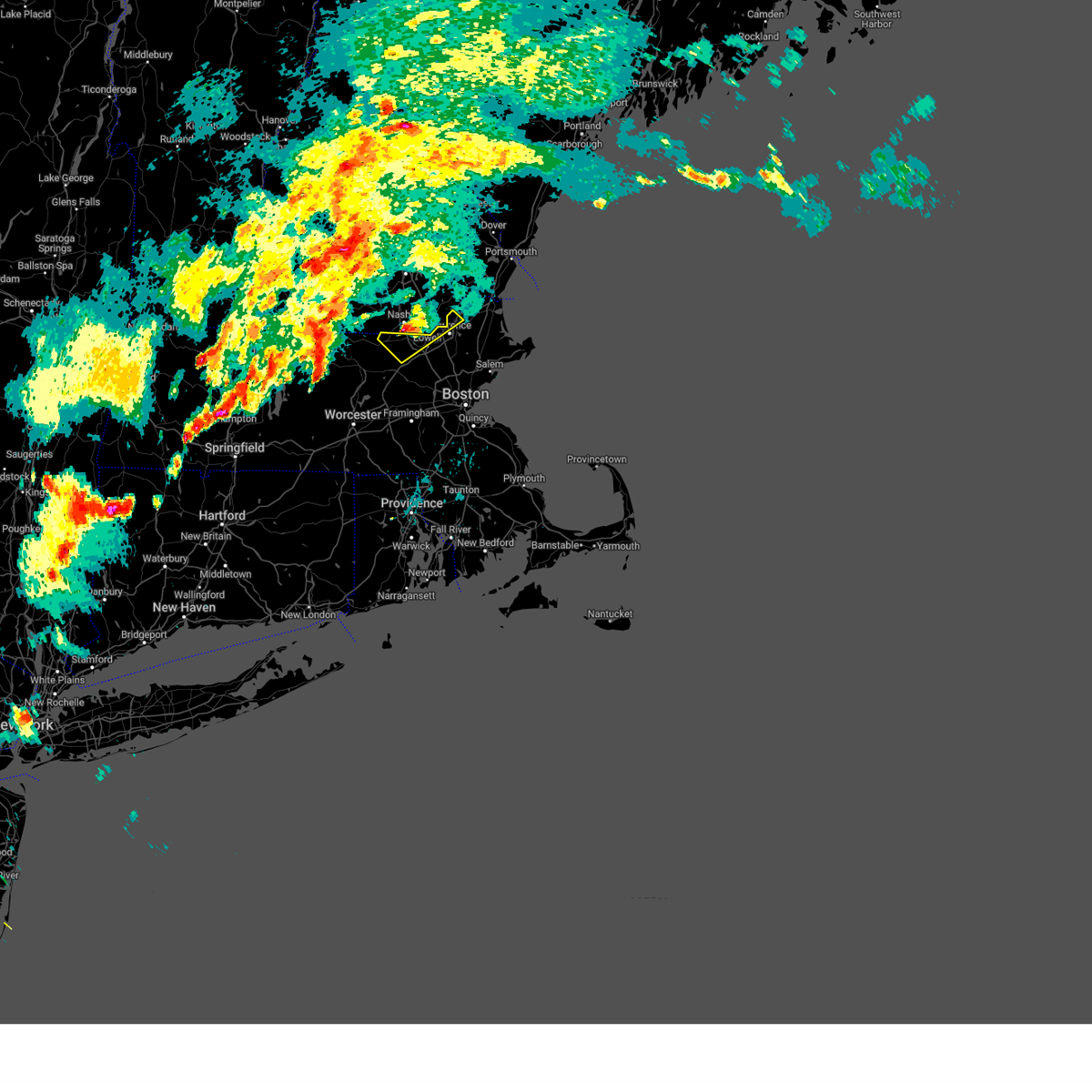
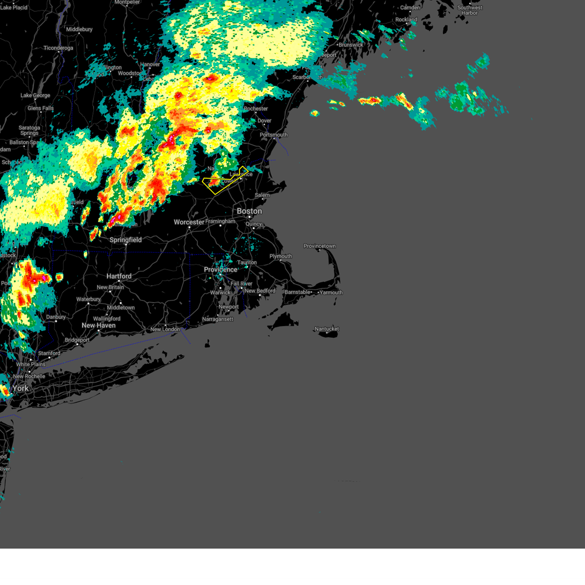
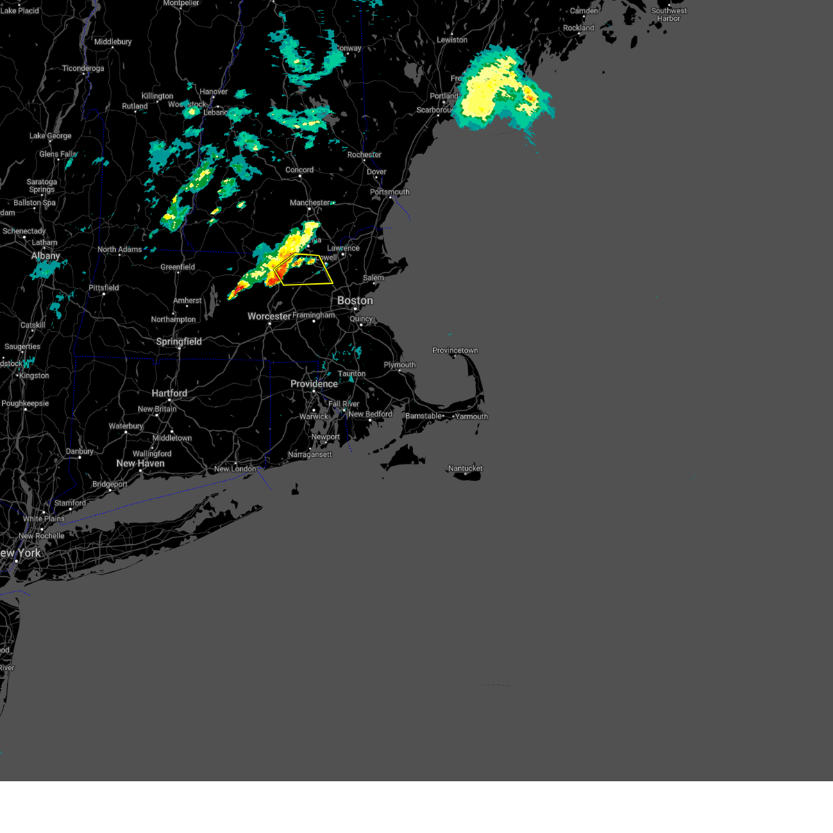
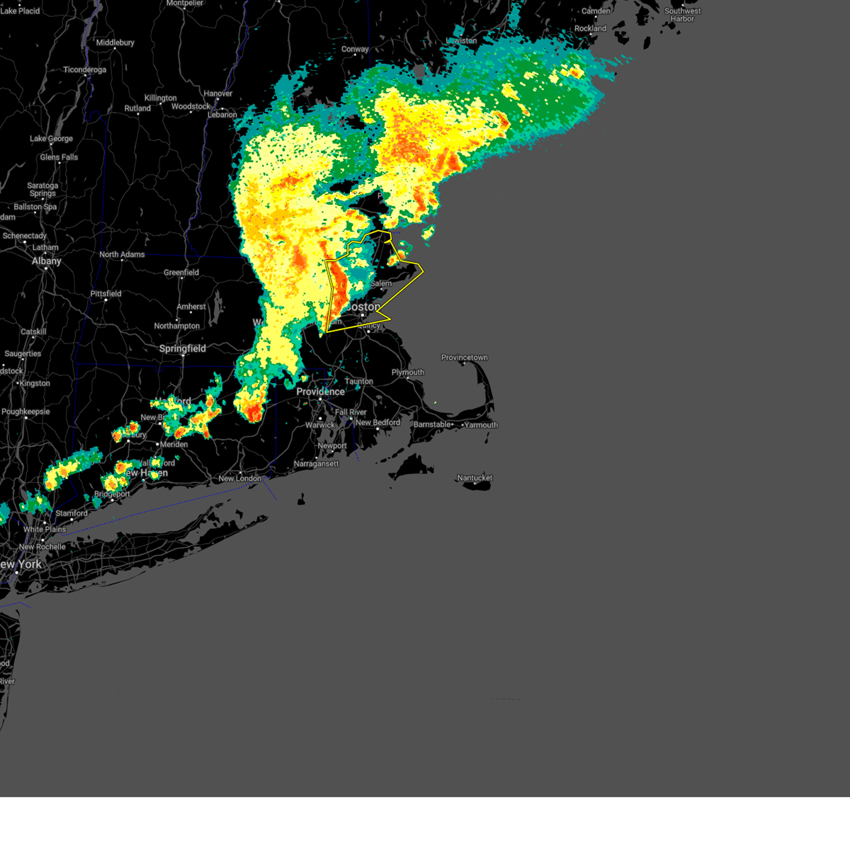
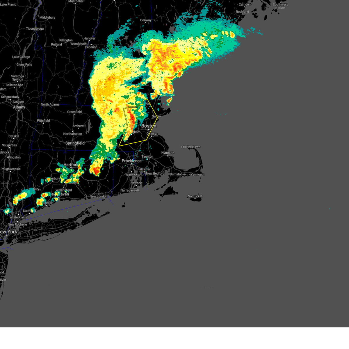
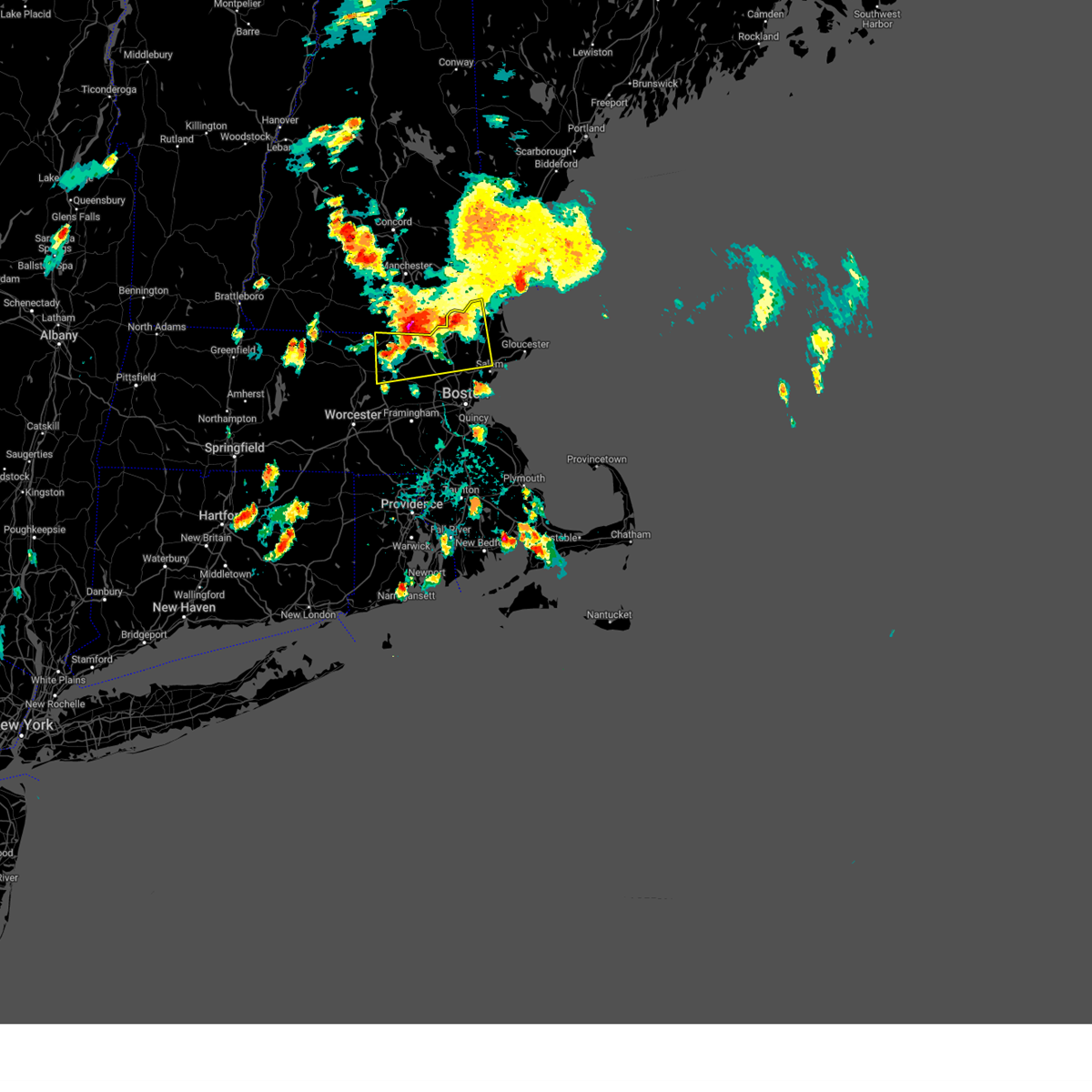
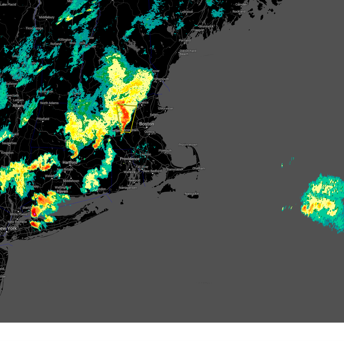
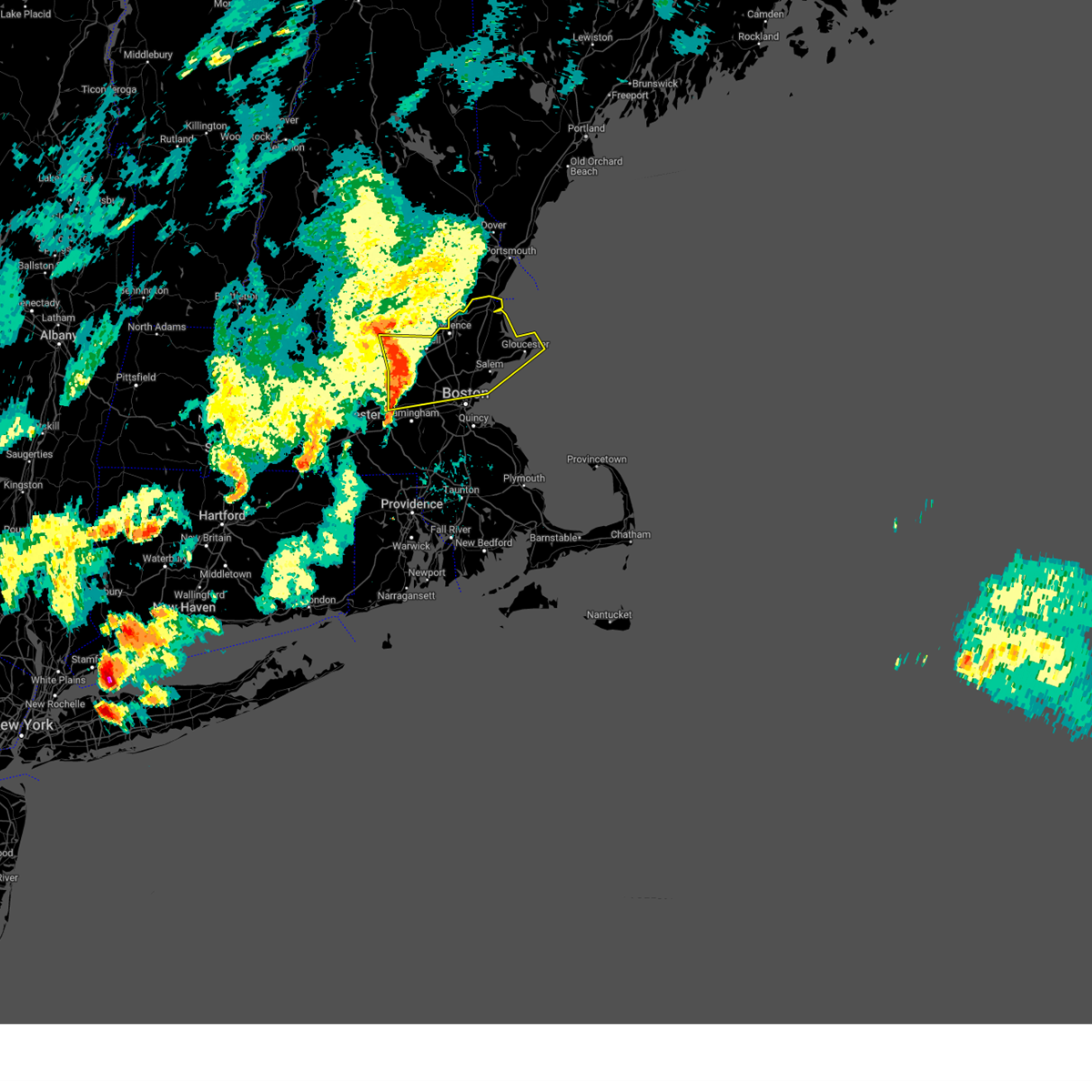
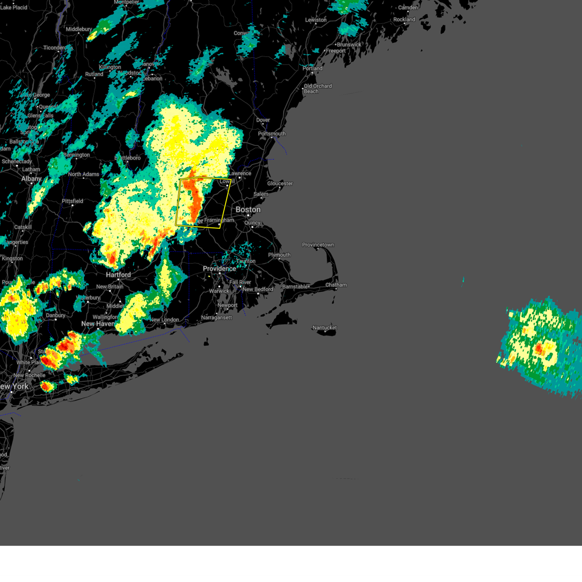
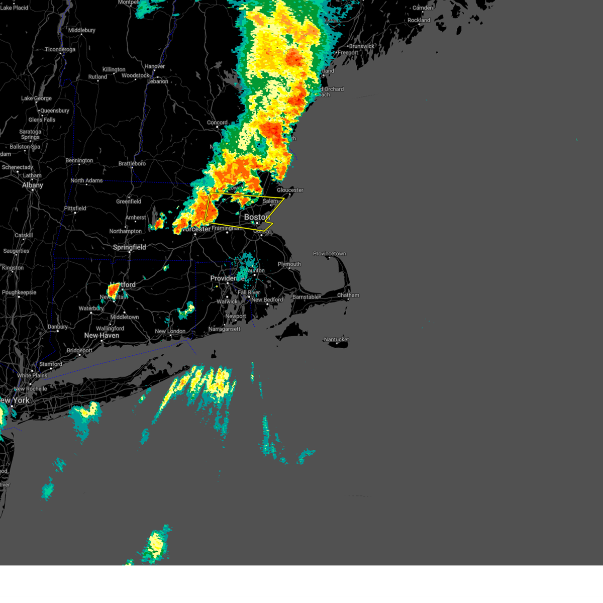
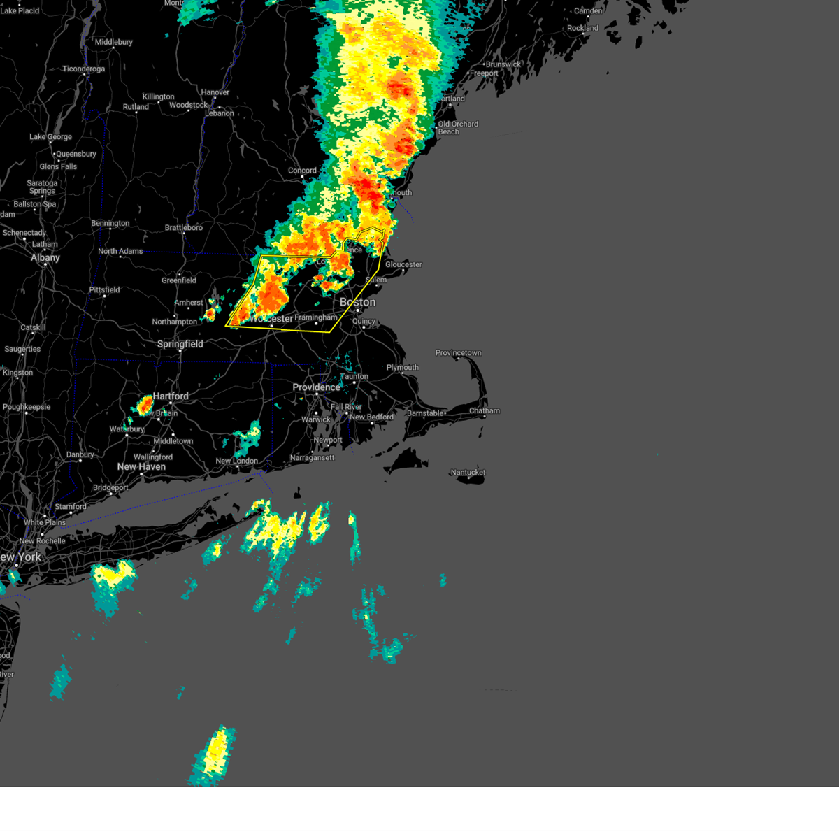
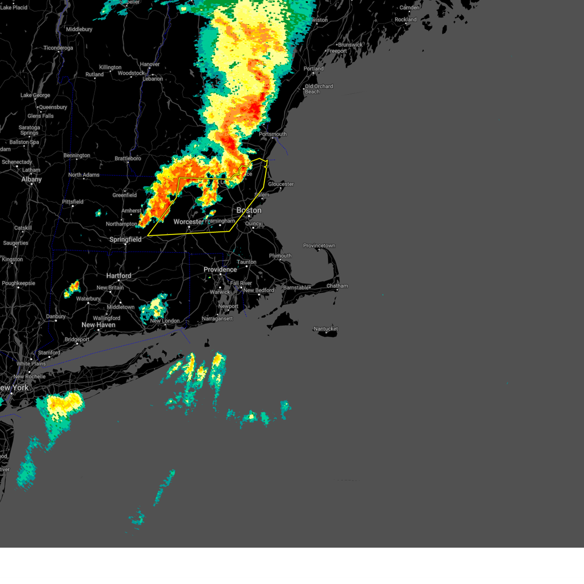
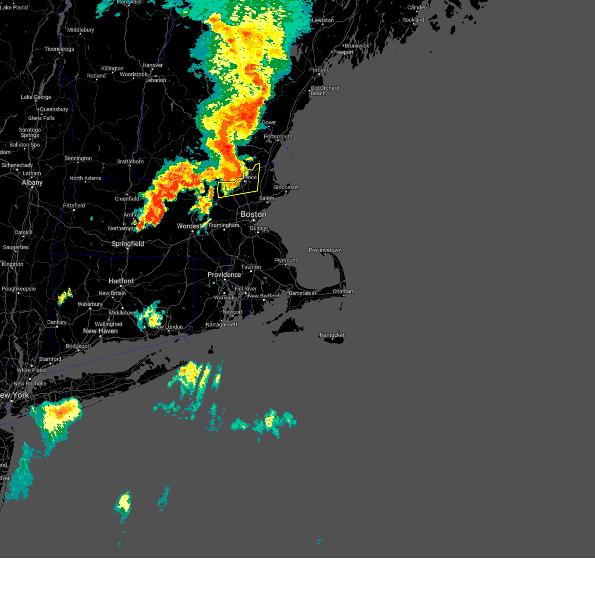
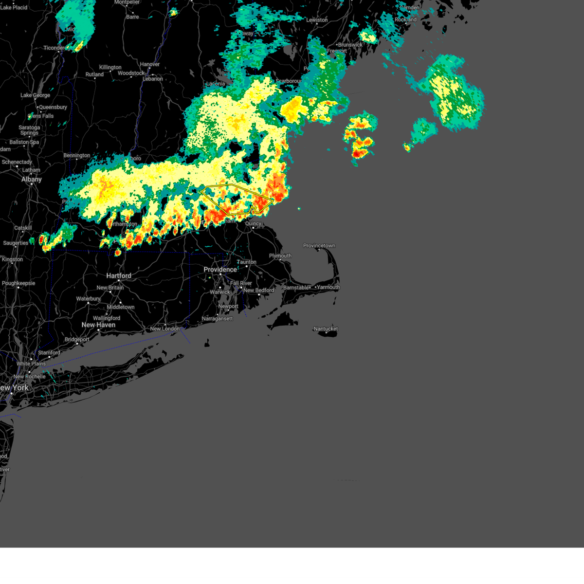
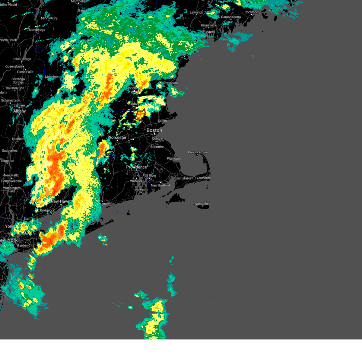
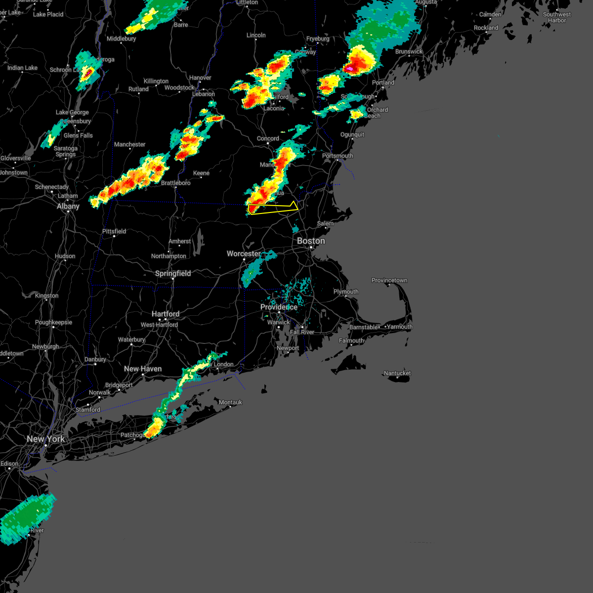
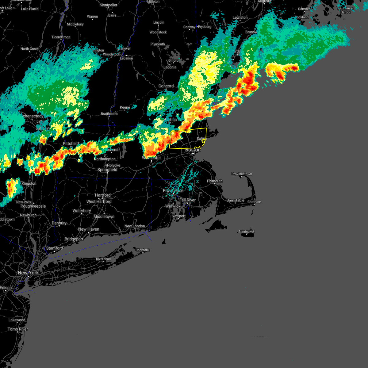
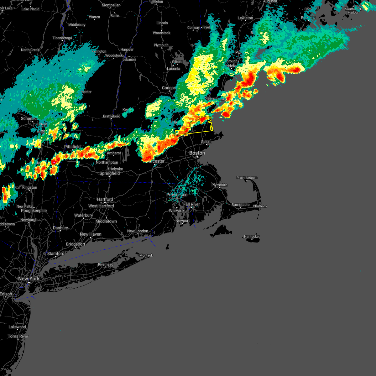
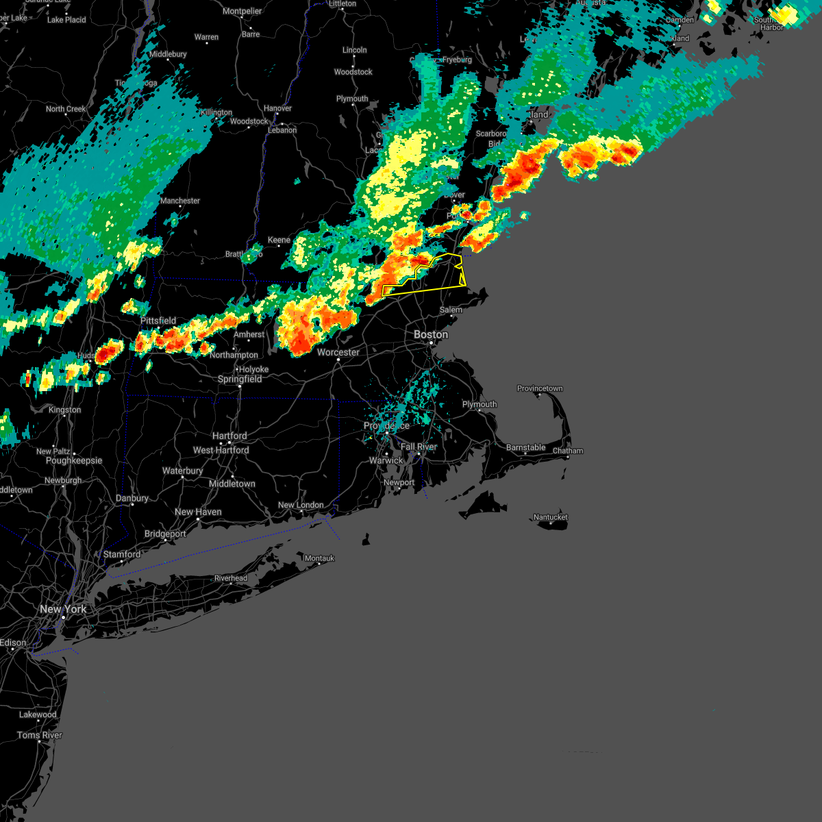
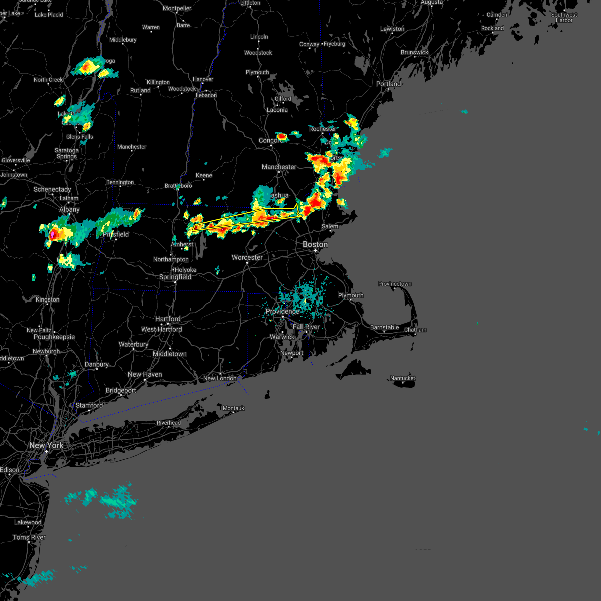
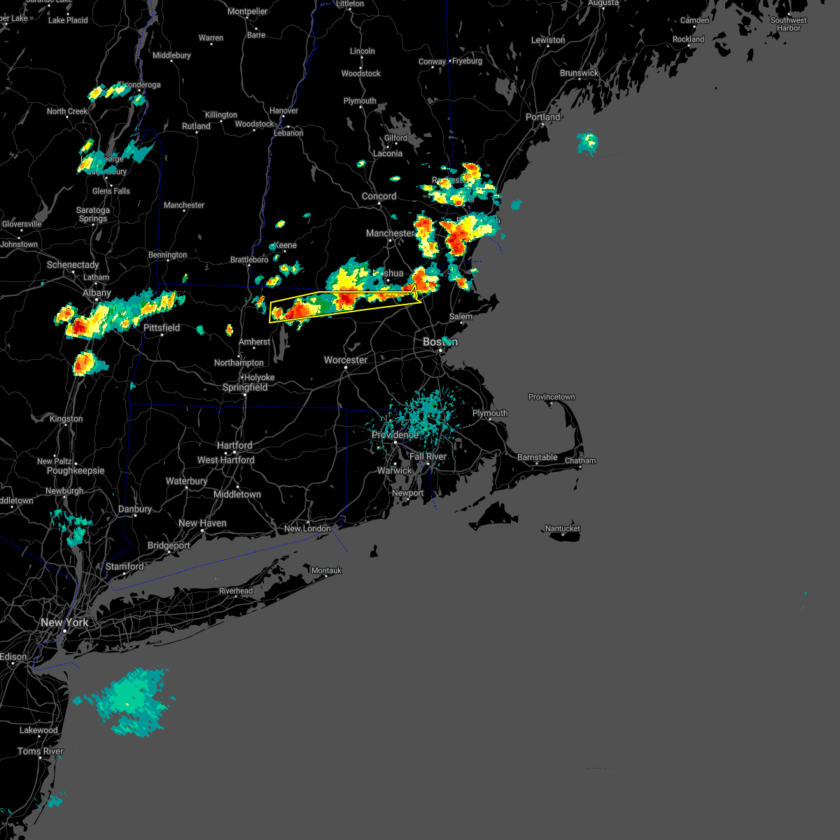
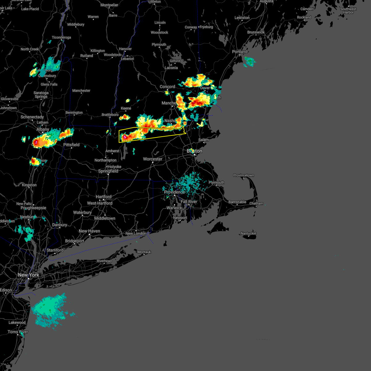
Hail Map for Lowell, MA
The Lowell, MA area has had 3 reports of on-the-ground hail by trained spotters, and has been under severe weather warnings 29 times during the past 12 months. Doppler radar has detected hail at or near Lowell, MA on 19 occasions, including 1 occasion during the past year.
| Name: | Lowell, MA |
| Where Located: | 56.3 miles N of Providence, RI |
| Map: | Google Map for Lowell, MA |
| Population: | 106519 |
| Housing Units: | 41431 |
| More Info: | Search Google for Lowell, MA |
4
The Top Recent Hail Date for Lowell, MA is Thursday, August 15, 2024 (2nd out of 19)

Hail and Wind Damage Spotted near Lowell, MA
| Date / Time | Report Details |
|---|---|
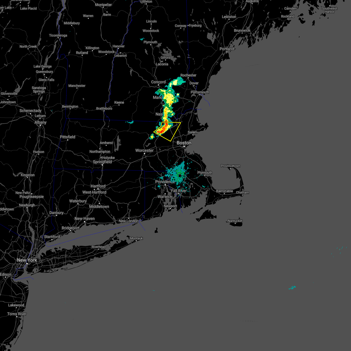
| 6/6/2025 5:45 PM EDT |
 the severe thunderstorm warning has been cancelled and is no longer in effect the severe thunderstorm warning has been cancelled and is no longer in effect
|
| 6/6/2025 5:32 PM EDT |
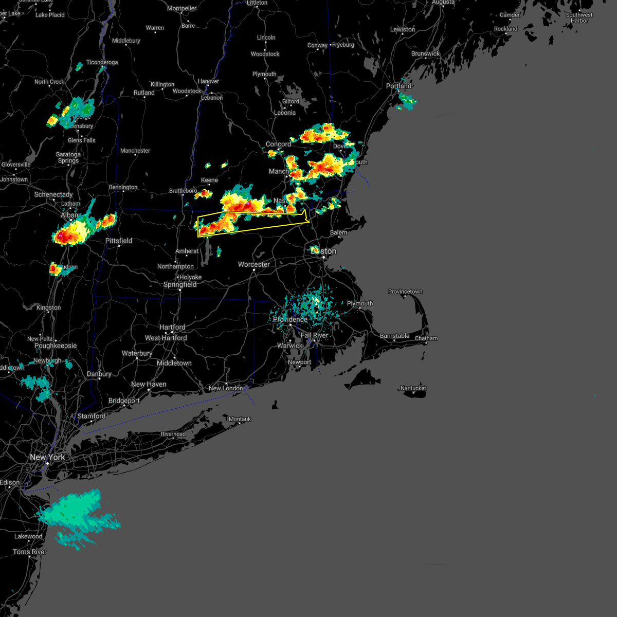
 Svrbox the national weather service in boston/norton has issued a * severe thunderstorm warning for, northwestern essex county in northeastern massachusetts, north central middlesex county in northeastern massachusetts, * until 615 pm edt. * at 532 pm edt, a severe thunderstorm was located over dunstable, or near nashua, moving northeast at 20 mph (radar indicated). Hazards include 60 mph wind gusts and quarter size hail. Hail damage to vehicles is expected. Expect wind damage to trees and power lines. Svrbox the national weather service in boston/norton has issued a * severe thunderstorm warning for, northwestern essex county in northeastern massachusetts, north central middlesex county in northeastern massachusetts, * until 615 pm edt. * at 532 pm edt, a severe thunderstorm was located over dunstable, or near nashua, moving northeast at 20 mph (radar indicated). Hazards include 60 mph wind gusts and quarter size hail. Hail damage to vehicles is expected. Expect wind damage to trees and power lines.
|
| 6/6/2025 6:52 AM EDT |
 Svrbox the national weather service in boston/norton has issued a * severe thunderstorm warning for, northeastern worcester county in central massachusetts, north central middlesex county in northeastern massachusetts, * until 745 am edt. * at 652 am edt, a severe thunderstorm was located over shirley, or near leominster, moving east at 20 mph (radar indicated). Hazards include 60 mph wind gusts and quarter size hail. Hail damage to vehicles is expected. Expect wind damage to trees and power lines. Svrbox the national weather service in boston/norton has issued a * severe thunderstorm warning for, northeastern worcester county in central massachusetts, north central middlesex county in northeastern massachusetts, * until 745 am edt. * at 652 am edt, a severe thunderstorm was located over shirley, or near leominster, moving east at 20 mph (radar indicated). Hazards include 60 mph wind gusts and quarter size hail. Hail damage to vehicles is expected. Expect wind damage to trees and power lines.
|
| 5/3/2025 5:43 PM EDT |
 Svrbox the national weather service in boston/norton has issued a * severe thunderstorm warning for, essex county in northeastern massachusetts, suffolk county in eastern massachusetts, north central norfolk county in eastern massachusetts, eastern middlesex county in northeastern massachusetts, * until 630 pm edt. * at 541 pm edt, severe thunderstorms were located along a line extending from near methuen to wilmington to newton, moving east at 45 mph (automated weather station reported. at 535 pm edt, a wind gust of 52 mph was reported at bedford hanscom field airport). Hazards include 60 mph wind gusts. expect damage to trees and power lines Svrbox the national weather service in boston/norton has issued a * severe thunderstorm warning for, essex county in northeastern massachusetts, suffolk county in eastern massachusetts, north central norfolk county in eastern massachusetts, eastern middlesex county in northeastern massachusetts, * until 630 pm edt. * at 541 pm edt, severe thunderstorms were located along a line extending from near methuen to wilmington to newton, moving east at 45 mph (automated weather station reported. at 535 pm edt, a wind gust of 52 mph was reported at bedford hanscom field airport). Hazards include 60 mph wind gusts. expect damage to trees and power lines
|
| 5/3/2025 5:29 PM EDT |
 the severe thunderstorm warning has been cancelled and is no longer in effect the severe thunderstorm warning has been cancelled and is no longer in effect
|
| 5/3/2025 5:29 PM EDT |
 At 528 pm edt, severe thunderstorms were located along a line extending from tyngsborough to near concord to hopedale, moving east at 40 mph (automated weather station reported. at 455 pm edt, a wind gust of 61 mph was reported at worcester airport). Hazards include 60 mph wind gusts. Expect damage to trees and power lines. Locations impacted include, sudbury, woburn, belmont, lynn, dunstable, everett, carlisle, cambridge, lexington, waltham, dracut, acton, north reading, dedham, hopedale, chelsea, wilmington, lincoln, arlington, and methuen. At 528 pm edt, severe thunderstorms were located along a line extending from tyngsborough to near concord to hopedale, moving east at 40 mph (automated weather station reported. at 455 pm edt, a wind gust of 61 mph was reported at worcester airport). Hazards include 60 mph wind gusts. Expect damage to trees and power lines. Locations impacted include, sudbury, woburn, belmont, lynn, dunstable, everett, carlisle, cambridge, lexington, waltham, dracut, acton, north reading, dedham, hopedale, chelsea, wilmington, lincoln, arlington, and methuen.
|
| 5/3/2025 5:06 PM EDT | Svrbox the national weather service in boston/norton has issued a * severe thunderstorm warning for, northeastern windham county in northern connecticut, western essex county in northeastern massachusetts, suffolk county in eastern massachusetts, eastern worcester county in central massachusetts, central norfolk county in eastern massachusetts, middlesex county in northeastern massachusetts, * until 545 pm edt. * at 505 pm edt, severe thunderstorms were located along a line extending from fitchburg to near berlin to webster, moving east at 40 mph (automated weather station reported. at 455 pm edt, a wind gust of 61 mph was reported at worcester airport). Hazards include 60 mph wind gusts. expect damage to trees and power lines |
| 8/15/2024 3:55 PM EDT | In chelmsford... tree reported down on house on gail st. relayed via amateur radi in middlesex county MA, 3.2 miles N of Lowell, MA |
| 8/15/2024 3:51 PM EDT | Called dispatch in chelmsford... ma; phones ringing off the hooks with reports of trees down and power lines down within the last 20 minute in middlesex county MA, 3.4 miles NE of Lowell, MA |
| 8/15/2024 3:51 PM EDT |
 At 351 pm edt, a severe thunderstorm was located over carlisle, or near billerica, moving south at 20 mph (radar indicated). Hazards include 60 mph wind gusts and penny size hail. Expect damage to trees and power lines. Locations impacted include, lowell, billerica, woburn, chelmsford, andover, tewksbury, reading, burlington, wilmington, westford, acton, concord, north reading, bedford, lynnfield, littleton, ayer, harvard, boxborough, and carlisle. At 351 pm edt, a severe thunderstorm was located over carlisle, or near billerica, moving south at 20 mph (radar indicated). Hazards include 60 mph wind gusts and penny size hail. Expect damage to trees and power lines. Locations impacted include, lowell, billerica, woburn, chelmsford, andover, tewksbury, reading, burlington, wilmington, westford, acton, concord, north reading, bedford, lynnfield, littleton, ayer, harvard, boxborough, and carlisle.
|
| 8/15/2024 3:47 PM EDT | On the lowell-chelmsford town line... telephone poles reported down at princeton and broulette. relayed via amateur radi in middlesex county MA, 1.9 miles ENE of Lowell, MA |
| 8/15/2024 3:42 PM EDT |
 Svrbox the national weather service in boston/norton has issued a * severe thunderstorm warning for, southwestern essex county in northeastern massachusetts, east central worcester county in central massachusetts, northern norfolk county in eastern massachusetts, suffolk county in eastern massachusetts, eastern middlesex county in northeastern massachusetts, northern plymouth county in southeastern massachusetts, * until 430 pm edt. * at 340 pm edt, a severe thunderstorm was located over carlisle, or over billerica, moving southeast at 30 mph (law enforcement. this storm has a history of producing strong winds capable of minor tree damage). Hazards include 60 mph wind gusts and nickel size hail. expect damage to trees and power lines Svrbox the national weather service in boston/norton has issued a * severe thunderstorm warning for, southwestern essex county in northeastern massachusetts, east central worcester county in central massachusetts, northern norfolk county in eastern massachusetts, suffolk county in eastern massachusetts, eastern middlesex county in northeastern massachusetts, northern plymouth county in southeastern massachusetts, * until 430 pm edt. * at 340 pm edt, a severe thunderstorm was located over carlisle, or over billerica, moving southeast at 30 mph (law enforcement. this storm has a history of producing strong winds capable of minor tree damage). Hazards include 60 mph wind gusts and nickel size hail. expect damage to trees and power lines
|
| 8/15/2024 3:36 PM EDT |
 At 336 pm edt, a severe thunderstorm was located over chelmsford, moving southeast at 40 mph (radar indicated). Hazards include 60 mph wind gusts and quarter size hail. Hail damage to vehicles is expected. expect wind damage to trees and power lines. Locations impacted include, lowell, lawrence, methuen, billerica, woburn, chelmsford, andover, dracut, tewksbury, wakefield, reading, burlington, wilmington, westford, acton, concord, north reading, bedford, lynnfield, and pepperell. At 336 pm edt, a severe thunderstorm was located over chelmsford, moving southeast at 40 mph (radar indicated). Hazards include 60 mph wind gusts and quarter size hail. Hail damage to vehicles is expected. expect wind damage to trees and power lines. Locations impacted include, lowell, lawrence, methuen, billerica, woburn, chelmsford, andover, dracut, tewksbury, wakefield, reading, burlington, wilmington, westford, acton, concord, north reading, bedford, lynnfield, and pepperell.
|
| 8/15/2024 3:35 PM EDT | In chelmsford... wires down on hitchinpost road. relayed via amateur radio. time estimated via rada in middlesex county MA, 4.6 miles ENE of Lowell, MA |
| 8/15/2024 3:20 PM EDT |
 At 319 pm edt, a severe thunderstorm was located over pelham, or near dracut, moving south at 20 mph (radar indicated). Hazards include 60 mph wind gusts and quarter size hail. Hail damage to vehicles is expected. expect wind damage to trees and power lines. Locations impacted include, lowell, lawrence, haverhill, peabody, methuen, billerica, beverly, woburn, chelmsford, andover, dracut, tewksbury, north andover, danvers, reading, burlington, wilmington, westford, acton, and concord. At 319 pm edt, a severe thunderstorm was located over pelham, or near dracut, moving south at 20 mph (radar indicated). Hazards include 60 mph wind gusts and quarter size hail. Hail damage to vehicles is expected. expect wind damage to trees and power lines. Locations impacted include, lowell, lawrence, haverhill, peabody, methuen, billerica, beverly, woburn, chelmsford, andover, dracut, tewksbury, north andover, danvers, reading, burlington, wilmington, westford, acton, and concord.
|
| 8/15/2024 3:11 PM EDT |
 Svrbox the national weather service in boston/norton has issued a * severe thunderstorm warning for, northwestern essex county in northeastern massachusetts, east central worcester county in central massachusetts, northeastern middlesex county in northeastern massachusetts, * until 415 pm edt. * at 311 pm edt, a severe thunderstorm was located near hudson, or near salem, moving south at 20 mph (radar indicated). Hazards include 60 mph wind gusts and quarter size hail. Hail damage to vehicles is expected. Expect wind damage to trees and power lines. Svrbox the national weather service in boston/norton has issued a * severe thunderstorm warning for, northwestern essex county in northeastern massachusetts, east central worcester county in central massachusetts, northeastern middlesex county in northeastern massachusetts, * until 415 pm edt. * at 311 pm edt, a severe thunderstorm was located near hudson, or near salem, moving south at 20 mph (radar indicated). Hazards include 60 mph wind gusts and quarter size hail. Hail damage to vehicles is expected. Expect wind damage to trees and power lines.
|
| 7/17/2024 7:35 PM EDT |
 the severe thunderstorm warning has been cancelled and is no longer in effect the severe thunderstorm warning has been cancelled and is no longer in effect
|
| 7/17/2024 7:32 PM EDT |
 At 731 pm edt, severe thunderstorms were located along a line extending from near dracut to near wilmington to near weston, moving east at 35 mph (radar indicated). Hazards include 60 mph wind gusts. Expect damage to roofs, siding, and trees. Locations impacted include, lowell, lynn, lawrence, haverhill, waltham, malden, medford, revere, peabody, methuen, arlington, salem, billerica, beverly, woburn, chelmsford, andover, lexington, dracut, and tewksbury. At 731 pm edt, severe thunderstorms were located along a line extending from near dracut to near wilmington to near weston, moving east at 35 mph (radar indicated). Hazards include 60 mph wind gusts. Expect damage to roofs, siding, and trees. Locations impacted include, lowell, lynn, lawrence, haverhill, waltham, malden, medford, revere, peabody, methuen, arlington, salem, billerica, beverly, woburn, chelmsford, andover, lexington, dracut, and tewksbury.
|
| 7/17/2024 7:32 PM EDT |
 the severe thunderstorm warning has been cancelled and is no longer in effect the severe thunderstorm warning has been cancelled and is no longer in effect
|
| 7/17/2024 7:14 PM EDT | In north chelmsford trees reported down on wires. time estimated via rada in middlesex county MA, 3.4 miles E of Lowell, MA |
| 7/17/2024 7:13 PM EDT |
 At 712 pm edt, severe thunderstorms were located along a line extending from tyngsborough to southborough to near webster, moving east at 35 mph (radar indicated). Hazards include 60 mph wind gusts. Expect damage to roofs, siding, and trees. Locations impacted include, lowell, framingham, billerica, marlborough, chelmsford, natick, dracut, westford, acton, hudson, westborough, concord, sudbury, ashland, northborough, wayland, pepperell, tyngsborough, groton, and maynard. At 712 pm edt, severe thunderstorms were located along a line extending from tyngsborough to southborough to near webster, moving east at 35 mph (radar indicated). Hazards include 60 mph wind gusts. Expect damage to roofs, siding, and trees. Locations impacted include, lowell, framingham, billerica, marlborough, chelmsford, natick, dracut, westford, acton, hudson, westborough, concord, sudbury, ashland, northborough, wayland, pepperell, tyngsborough, groton, and maynard.
|
| 7/17/2024 7:12 PM EDT |
 Svrbox the national weather service in boston/norton has issued a * severe thunderstorm warning for, essex county in northeastern massachusetts, east central worcester county in central massachusetts, north central suffolk county in eastern massachusetts, middlesex county in northeastern massachusetts, * until 815 pm edt. * at 711 pm edt, severe thunderstorms were located along a line extending from dunstable to near acton to marlborough, moving east at 35 mph (radar indicated). Hazards include 60 mph wind gusts. expect damage to roofs, siding, and trees Svrbox the national weather service in boston/norton has issued a * severe thunderstorm warning for, essex county in northeastern massachusetts, east central worcester county in central massachusetts, north central suffolk county in eastern massachusetts, middlesex county in northeastern massachusetts, * until 815 pm edt. * at 711 pm edt, severe thunderstorms were located along a line extending from dunstable to near acton to marlborough, moving east at 35 mph (radar indicated). Hazards include 60 mph wind gusts. expect damage to roofs, siding, and trees
|
| 7/17/2024 7:00 PM EDT | At 700 pm edt, severe thunderstorms were located along a line extending from near groton to westborough to near dudley, moving east at 30 mph (radar indicated). Hazards include 60 mph wind gusts and penny size hail. Expect damage to roofs, siding, and trees. Locations impacted include, worcester, lowell, framingham, leominster, fitchburg, billerica, marlborough, shrewsbury, chelmsford, natick, dracut, westford, acton, hudson, westborough, concord, sudbury, ashland, hopkinton, and northborough. |
| 7/17/2024 6:49 PM EDT |
 At 648 pm edt, severe thunderstorms were located along a line extending from near groton to shrewsbury to southbridge, moving east at 60 mph (radar indicated). Hazards include 60 mph wind gusts and penny size hail. Expect damage to roofs, siding, and trees. Locations impacted include, worcester, lowell, framingham, leominster, fitchburg, billerica, marlborough, shrewsbury, chelmsford, natick, dracut, westford, acton, hudson, westborough, concord, sudbury, holden, ashland, and hopkinton. At 648 pm edt, severe thunderstorms were located along a line extending from near groton to shrewsbury to southbridge, moving east at 60 mph (radar indicated). Hazards include 60 mph wind gusts and penny size hail. Expect damage to roofs, siding, and trees. Locations impacted include, worcester, lowell, framingham, leominster, fitchburg, billerica, marlborough, shrewsbury, chelmsford, natick, dracut, westford, acton, hudson, westborough, concord, sudbury, holden, ashland, and hopkinton.
|
| 7/17/2024 6:49 PM EDT |
 the severe thunderstorm warning has been cancelled and is no longer in effect the severe thunderstorm warning has been cancelled and is no longer in effect
|
| 7/17/2024 6:23 PM EDT | Svrbox the national weather service in boston/norton has issued a * severe thunderstorm warning for, worcester county in central massachusetts, central middlesex county in northeastern massachusetts, southeastern hampden county in western massachusetts, * until 730 pm edt. * at 622 pm edt, severe thunderstorms were located along a line extending from near ashburnham to spencer to near monson, moving east at 30 mph (radar indicated). Hazards include 60 mph wind gusts and penny size hail. expect damage to roofs, siding, and trees |
| 7/16/2024 9:25 PM EDT | the severe thunderstorm warning has been cancelled and is no longer in effect |
| 7/16/2024 9:10 PM EDT |
 Svrbox the national weather service in boston/norton has issued a * severe thunderstorm warning for, southern essex county in northeastern massachusetts, east central worcester county in central massachusetts, north central norfolk county in eastern massachusetts, suffolk county in eastern massachusetts, middlesex county in northeastern massachusetts, * until 1015 pm edt. * at 910 pm edt, severe thunderstorms were located along a line extending from chelmsford to near lincoln to westborough, moving east at 45 mph (radar indicated). Hazards include 60 mph wind gusts. expect damage to roofs, siding, and trees Svrbox the national weather service in boston/norton has issued a * severe thunderstorm warning for, southern essex county in northeastern massachusetts, east central worcester county in central massachusetts, north central norfolk county in eastern massachusetts, suffolk county in eastern massachusetts, middlesex county in northeastern massachusetts, * until 1015 pm edt. * at 910 pm edt, severe thunderstorms were located along a line extending from chelmsford to near lincoln to westborough, moving east at 45 mph (radar indicated). Hazards include 60 mph wind gusts. expect damage to roofs, siding, and trees
|
| 7/16/2024 8:51 PM EDT |
 At 851 pm edt, severe thunderstorms were located along a line extending from near nashua to ayer to near worcester, moving east at 55 mph (radar indicated). Hazards include 60 mph wind gusts. Expect damage to roofs, siding, and trees. Locations impacted include, boston, worcester, lowell, cambridge, lynn, newton, lawrence, somerville, framingham, haverhill, waltham, malden, medford, peabody, methuen, arlington, leominster, fitchburg, billerica, and marlborough. At 851 pm edt, severe thunderstorms were located along a line extending from near nashua to ayer to near worcester, moving east at 55 mph (radar indicated). Hazards include 60 mph wind gusts. Expect damage to roofs, siding, and trees. Locations impacted include, boston, worcester, lowell, cambridge, lynn, newton, lawrence, somerville, framingham, haverhill, waltham, malden, medford, peabody, methuen, arlington, leominster, fitchburg, billerica, and marlborough.
|
| 7/16/2024 8:51 PM EDT |
 the severe thunderstorm warning has been cancelled and is no longer in effect the severe thunderstorm warning has been cancelled and is no longer in effect
|
| 7/16/2024 8:32 PM EDT |
 Svrbox the national weather service in boston/norton has issued a * severe thunderstorm warning for, essex county in northeastern massachusetts, central worcester county in central massachusetts, north central norfolk county in eastern massachusetts, northwestern suffolk county in eastern massachusetts, eastern hampshire county in western massachusetts, middlesex county in northeastern massachusetts, northeastern hampden county in western massachusetts, * until 915 pm edt. * at 830 pm edt, severe thunderstorms were located along a line extending from greenville to westminster to west brookfield, moving east at 45 mph (radar indicated). Hazards include 60 mph wind gusts. expect damage to roofs, siding, and trees Svrbox the national weather service in boston/norton has issued a * severe thunderstorm warning for, essex county in northeastern massachusetts, central worcester county in central massachusetts, north central norfolk county in eastern massachusetts, northwestern suffolk county in eastern massachusetts, eastern hampshire county in western massachusetts, middlesex county in northeastern massachusetts, northeastern hampden county in western massachusetts, * until 915 pm edt. * at 830 pm edt, severe thunderstorms were located along a line extending from greenville to westminster to west brookfield, moving east at 45 mph (radar indicated). Hazards include 60 mph wind gusts. expect damage to roofs, siding, and trees
|
| 7/16/2024 8:21 PM EDT |
 the severe thunderstorm warning has been cancelled and is no longer in effect the severe thunderstorm warning has been cancelled and is no longer in effect
|
| 7/16/2024 8:21 PM EDT |
 At 821 pm edt, severe thunderstorms were located along a line extending from salem to lowell to westford, moving east at 55 mph (trained weather spotters). Hazards include 60 mph wind gusts. Expect damage to roofs, siding, and trees. Locations impacted include, lowell, lawrence, haverhill, methuen, billerica, chelmsford, andover, dracut, tewksbury, north andover, wilmington, westford, amesbury, tyngsborough, groton, middleton, littleton, georgetown, boxford, and groveland. At 821 pm edt, severe thunderstorms were located along a line extending from salem to lowell to westford, moving east at 55 mph (trained weather spotters). Hazards include 60 mph wind gusts. Expect damage to roofs, siding, and trees. Locations impacted include, lowell, lawrence, haverhill, methuen, billerica, chelmsford, andover, dracut, tewksbury, north andover, wilmington, westford, amesbury, tyngsborough, groton, middleton, littleton, georgetown, boxford, and groveland.
|
| 7/16/2024 8:11 PM EDT | Svrbox the national weather service in boston/norton has issued a * severe thunderstorm warning for, northwestern essex county in northeastern massachusetts, east central worcester county in central massachusetts, northeastern middlesex county in northeastern massachusetts, * until 845 pm edt. * at 810 pm edt, severe thunderstorms were located along a line extending from hudson to near groton to shirley, moving east at 45 mph (trained weather spotters). Hazards include 60 mph wind gusts. expect damage to roofs, siding, and trees |
| 6/20/2024 8:50 PM EDT |
 The storms which prompted the warning have weakened below severe limits, and no longer pose an immediate threat to life or property. therefore, the warning will be allowed to expire. however gusty winds and heavy rain are still possible with these thunderstorms. a severe thunderstorm watch remains in effect until 1100 pm edt for eastern, central and northeastern massachusetts. The storms which prompted the warning have weakened below severe limits, and no longer pose an immediate threat to life or property. therefore, the warning will be allowed to expire. however gusty winds and heavy rain are still possible with these thunderstorms. a severe thunderstorm watch remains in effect until 1100 pm edt for eastern, central and northeastern massachusetts.
|
| 6/20/2024 8:22 PM EDT |
 At 822 pm edt, severe thunderstorms were located along a line extending from middleton to carlisle to harvard, moving southeast at 25 mph (radar indicated). Hazards include 60 mph wind gusts. Expect damage to roofs, siding, and trees. Locations impacted include, lowell, cambridge, lynn, somerville, waltham, malden, medford, revere, peabody, arlington, everett, salem, billerica, woburn, chelmsford, andover, watertown, lexington, tewksbury, and melrose. At 822 pm edt, severe thunderstorms were located along a line extending from middleton to carlisle to harvard, moving southeast at 25 mph (radar indicated). Hazards include 60 mph wind gusts. Expect damage to roofs, siding, and trees. Locations impacted include, lowell, cambridge, lynn, somerville, waltham, malden, medford, revere, peabody, arlington, everett, salem, billerica, woburn, chelmsford, andover, watertown, lexington, tewksbury, and melrose.
|
| 6/20/2024 8:13 PM EDT |
 At 813 pm edt, severe thunderstorms were located along a line extending from newburyport to boxford to near north reading, moving east at 30 mph (radar indicated). Hazards include 60 mph wind gusts. Expect damage to roofs, siding, and trees. Locations impacted include, lowell, lawrence, haverhill, methuen, salem, beverly, andover, dracut, tewksbury, gloucester, north andover, danvers, newburyport, amesbury, north reading, ipswich, middleton, salisbury, georgetown, and boxford. At 813 pm edt, severe thunderstorms were located along a line extending from newburyport to boxford to near north reading, moving east at 30 mph (radar indicated). Hazards include 60 mph wind gusts. Expect damage to roofs, siding, and trees. Locations impacted include, lowell, lawrence, haverhill, methuen, salem, beverly, andover, dracut, tewksbury, gloucester, north andover, danvers, newburyport, amesbury, north reading, ipswich, middleton, salisbury, georgetown, and boxford.
|
| 6/20/2024 8:05 PM EDT |
 Svrbox the national weather service in boston/norton has issued a * severe thunderstorm warning for, southwestern essex county in northeastern massachusetts, northeastern worcester county in central massachusetts, northeastern middlesex county in northeastern massachusetts, * until 900 pm edt. * at 804 pm edt, severe thunderstorms were located along a line extending from andover to near westford to near lunenburg, moving east at 25 mph (radar indicated). Hazards include 60 mph wind gusts. expect damage to roofs, siding, and trees Svrbox the national weather service in boston/norton has issued a * severe thunderstorm warning for, southwestern essex county in northeastern massachusetts, northeastern worcester county in central massachusetts, northeastern middlesex county in northeastern massachusetts, * until 900 pm edt. * at 804 pm edt, severe thunderstorms were located along a line extending from andover to near westford to near lunenburg, moving east at 25 mph (radar indicated). Hazards include 60 mph wind gusts. expect damage to roofs, siding, and trees
|
| 6/20/2024 8:00 PM EDT | Tree and wires down at andover street at trull lane and chelmsford st at manufacturers st. relayed by amateur radi in middlesex county MA, 0.3 miles SW of Lowell, MA |
| 6/20/2024 7:42 PM EDT |
 Svrbox the national weather service in boston/norton has issued a * severe thunderstorm warning for, essex county in northeastern massachusetts, northeastern middlesex county in northeastern massachusetts, * until 845 pm edt. * at 742 pm edt, severe thunderstorms were located along a line extending from near merrimac to near salem to dracut, moving east at 20 mph (radar indicated). Hazards include 60 mph wind gusts. expect damage to roofs, siding, and trees Svrbox the national weather service in boston/norton has issued a * severe thunderstorm warning for, essex county in northeastern massachusetts, northeastern middlesex county in northeastern massachusetts, * until 845 pm edt. * at 742 pm edt, severe thunderstorms were located along a line extending from near merrimac to near salem to dracut, moving east at 20 mph (radar indicated). Hazards include 60 mph wind gusts. expect damage to roofs, siding, and trees
|
| 9/8/2023 7:19 PM EDT |
 At 719 pm edt, a severe thunderstorm was located over sterling, or near leominster, moving northeast at 45 mph (radar indicated). Hazards include 60 mph wind gusts and quarter size hail. Hail damage to vehicles is expected. expect wind damage to roofs, siding, and trees. locations impacted include, lowell, leominster, fitchburg, marlborough, shrewsbury, chelmsford, dracut, westford, acton, hudson, westborough, holden, northborough, clinton, pepperell, tyngsborough, groton, lunenburg, townsend, and littleton. hail threat, radar indicated max hail size, 1. 00 in wind threat, radar indicated max wind gust, 60 mph. At 719 pm edt, a severe thunderstorm was located over sterling, or near leominster, moving northeast at 45 mph (radar indicated). Hazards include 60 mph wind gusts and quarter size hail. Hail damage to vehicles is expected. expect wind damage to roofs, siding, and trees. locations impacted include, lowell, leominster, fitchburg, marlborough, shrewsbury, chelmsford, dracut, westford, acton, hudson, westborough, holden, northborough, clinton, pepperell, tyngsborough, groton, lunenburg, townsend, and littleton. hail threat, radar indicated max hail size, 1. 00 in wind threat, radar indicated max wind gust, 60 mph.
|
| 9/8/2023 7:10 PM EDT |
 At 710 pm edt, a severe thunderstorm was located over princeton, or near leominster, moving northeast at 50 mph (radar indicated). Hazards include 60 mph wind gusts and quarter size hail. Hail damage to vehicles is expected. Expect wind damage to roofs, siding, and trees. At 710 pm edt, a severe thunderstorm was located over princeton, or near leominster, moving northeast at 50 mph (radar indicated). Hazards include 60 mph wind gusts and quarter size hail. Hail damage to vehicles is expected. Expect wind damage to roofs, siding, and trees.
|
| 9/8/2023 3:10 PM EDT |
 At 310 pm edt, severe thunderstorms were located along a line extending from near pelham to north andover to near weston, moving northeast at 45 mph (trained weather spotters reported several trees downed in chelmsford and westford ma between 240 pm and 245 pm). Hazards include 60 mph wind gusts and quarter size hail. Hail damage to vehicles is expected. expect wind damage to roofs, siding, and trees. locations impacted include, boston, lowell, cambridge, quincy, lynn, newton, lawrence, somerville, haverhill, waltham, malden, brookline, medford, revere, peabody, methuen, arlington, everett, salem, and billerica. hail threat, radar indicated max hail size, 1. 00 in wind threat, radar indicated max wind gust, 60 mph. At 310 pm edt, severe thunderstorms were located along a line extending from near pelham to north andover to near weston, moving northeast at 45 mph (trained weather spotters reported several trees downed in chelmsford and westford ma between 240 pm and 245 pm). Hazards include 60 mph wind gusts and quarter size hail. Hail damage to vehicles is expected. expect wind damage to roofs, siding, and trees. locations impacted include, boston, lowell, cambridge, quincy, lynn, newton, lawrence, somerville, haverhill, waltham, malden, brookline, medford, revere, peabody, methuen, arlington, everett, salem, and billerica. hail threat, radar indicated max hail size, 1. 00 in wind threat, radar indicated max wind gust, 60 mph.
|
| 9/8/2023 3:00 PM EDT | In lowell... there were wires down on monadnock av in middlesex county MA, 1.4 miles ENE of Lowell, MA |
| 9/8/2023 2:56 PM EDT |
 At 256 pm edt, severe thunderstorms were located along a line extending from near tyngsborough to tewksbury to natick, moving northeast at 35 mph (radar indicated). Hazards include 60 mph wind gusts and quarter size hail. Hail damage to vehicles is expected. expect wind damage to roofs, siding, and trees. locations impacted include, lowell, lawrence, methuen, billerica, chelmsford, andover, dracut, tewksbury, north andover, wilmington, westford, acton, concord, north reading, bedford, pepperell, tyngsborough, groton, littleton, and ayer. hail threat, radar indicated max hail size, 1. 00 in wind threat, radar indicated max wind gust, 60 mph. At 256 pm edt, severe thunderstorms were located along a line extending from near tyngsborough to tewksbury to natick, moving northeast at 35 mph (radar indicated). Hazards include 60 mph wind gusts and quarter size hail. Hail damage to vehicles is expected. expect wind damage to roofs, siding, and trees. locations impacted include, lowell, lawrence, methuen, billerica, chelmsford, andover, dracut, tewksbury, north andover, wilmington, westford, acton, concord, north reading, bedford, pepperell, tyngsborough, groton, littleton, and ayer. hail threat, radar indicated max hail size, 1. 00 in wind threat, radar indicated max wind gust, 60 mph.
|
| 9/8/2023 2:53 PM EDT | In lowell wires were down on rodgers s in middlesex county MA, 1.3 miles W of Lowell, MA |
| 9/8/2023 2:52 PM EDT |
 At 252 pm edt, severe thunderstorms were located along a line extending from pepperell to carlisle to sherborn, moving northeast at 40 mph (radar indicated). Hazards include 60 mph wind gusts and quarter size hail. Hail damage to vehicles is expected. Expect wind damage to roofs, siding, and trees. At 252 pm edt, severe thunderstorms were located along a line extending from pepperell to carlisle to sherborn, moving northeast at 40 mph (radar indicated). Hazards include 60 mph wind gusts and quarter size hail. Hail damage to vehicles is expected. Expect wind damage to roofs, siding, and trees.
|
| 9/8/2023 2:45 PM EDT | Tree down on wires on porter road. trees down on house and through the window of a home on frederick stree in middlesex county MA, 3.4 miles NE of Lowell, MA |
| 9/8/2023 2:40 PM EDT | Numerous trees down and snapped. straight line sw to ne after the heavy rainfal in middlesex county MA, 3.4 miles NE of Lowell, MA |
| 9/8/2023 2:40 PM EDT |
 At 240 pm edt, severe thunderstorms were located along a line extending from pepperell to near chelmsford to sudbury, moving northeast at 40 mph (radar indicated). Hazards include 60 mph wind gusts and quarter size hail. Hail damage to vehicles is expected. expect wind damage to roofs, siding, and trees. locations impacted include, lowell, lawrence, methuen, billerica, marlborough, chelmsford, andover, dracut, tewksbury, north andover, wilmington, westford, acton, hudson, concord, north reading, bedford, pepperell, tyngsborough, and groton. hail threat, radar indicated max hail size, 1. 00 in wind threat, radar indicated max wind gust, 60 mph. At 240 pm edt, severe thunderstorms were located along a line extending from pepperell to near chelmsford to sudbury, moving northeast at 40 mph (radar indicated). Hazards include 60 mph wind gusts and quarter size hail. Hail damage to vehicles is expected. expect wind damage to roofs, siding, and trees. locations impacted include, lowell, lawrence, methuen, billerica, marlborough, chelmsford, andover, dracut, tewksbury, north andover, wilmington, westford, acton, hudson, concord, north reading, bedford, pepperell, tyngsborough, and groton. hail threat, radar indicated max hail size, 1. 00 in wind threat, radar indicated max wind gust, 60 mph.
|
| 9/8/2023 2:25 PM EDT |
 At 225 pm edt, severe thunderstorms were located along a line extending from shirley to boxborough to northborough, moving northeast at 45 mph (radar indicated). Hazards include 60 mph wind gusts and quarter size hail. Hail damage to vehicles is expected. Expect wind damage to roofs, siding, and trees. At 225 pm edt, severe thunderstorms were located along a line extending from shirley to boxborough to northborough, moving northeast at 45 mph (radar indicated). Hazards include 60 mph wind gusts and quarter size hail. Hail damage to vehicles is expected. Expect wind damage to roofs, siding, and trees.
|
| 7/16/2023 8:43 AM EDT |
 At 843 am edt, a severe thunderstorm capable of producing a tornado was located over chelmsford, moving northeast at 30 mph (radar indicated rotation). Hazards include tornado. Flying debris will be dangerous to those caught without shelter. mobile homes will be damaged or destroyed. damage to roofs, windows, and vehicles will occur. tree damage is likely. This dangerous storm will be near, lowell, dracut, tewksbury and tyngsborough around 850 am edt. At 843 am edt, a severe thunderstorm capable of producing a tornado was located over chelmsford, moving northeast at 30 mph (radar indicated rotation). Hazards include tornado. Flying debris will be dangerous to those caught without shelter. mobile homes will be damaged or destroyed. damage to roofs, windows, and vehicles will occur. tree damage is likely. This dangerous storm will be near, lowell, dracut, tewksbury and tyngsborough around 850 am edt.
|
| 7/16/2023 8:35 AM EDT | Tree down on old stage rd - relayed by amateur radi in middlesex county MA, 3.4 miles NE of Lowell, MA |
| 7/16/2023 8:32 AM EDT |
 At 832 am edt, a severe thunderstorm capable of producing a tornado was located over carlisle, or near chelmsford, moving northeast at 30 mph (radar indicated rotation). Hazards include tornado. Flying debris will be dangerous to those caught without shelter. mobile homes will be damaged or destroyed. damage to roofs, windows, and vehicles will occur. tree damage is likely. this dangerous storm will be near, lowell, methuen, billerica, chelmsford, andover, dracut, tewksbury, westford, tyngsborough and carlisle around 835 am edt. Lawrence around 840 am edt. At 832 am edt, a severe thunderstorm capable of producing a tornado was located over carlisle, or near chelmsford, moving northeast at 30 mph (radar indicated rotation). Hazards include tornado. Flying debris will be dangerous to those caught without shelter. mobile homes will be damaged or destroyed. damage to roofs, windows, and vehicles will occur. tree damage is likely. this dangerous storm will be near, lowell, methuen, billerica, chelmsford, andover, dracut, tewksbury, westford, tyngsborough and carlisle around 835 am edt. Lawrence around 840 am edt.
|
| 7/16/2023 8:17 AM EDT |
 At 817 am edt, a severe thunderstorm capable of producing a tornado was located over maynard, or 9 miles northeast of marlborough, moving northeast at 30 mph (radar indicated rotation). Hazards include tornado. Flying debris will be dangerous to those caught without shelter. mobile homes will be damaged or destroyed. damage to roofs, windows, and vehicles will occur. tree damage is likely. this dangerous storm will be near, lowell, billerica, chelmsford, westford, acton, concord, bedford, groton, littleton and carlisle around 825 am edt. Tyngsborough around 830 am edt. At 817 am edt, a severe thunderstorm capable of producing a tornado was located over maynard, or 9 miles northeast of marlborough, moving northeast at 30 mph (radar indicated rotation). Hazards include tornado. Flying debris will be dangerous to those caught without shelter. mobile homes will be damaged or destroyed. damage to roofs, windows, and vehicles will occur. tree damage is likely. this dangerous storm will be near, lowell, billerica, chelmsford, westford, acton, concord, bedford, groton, littleton and carlisle around 825 am edt. Tyngsborough around 830 am edt.
|
| 7/16/2023 8:15 AM EDT |
 At 814 am edt, a severe thunderstorm was located over maynard, or near marlborough, moving northeast at 30 mph (radar indicated). Hazards include 60 mph wind gusts. expect damage to trees and power lines At 814 am edt, a severe thunderstorm was located over maynard, or near marlborough, moving northeast at 30 mph (radar indicated). Hazards include 60 mph wind gusts. expect damage to trees and power lines
|
| 12/23/2022 5:00 PM EST | In north billerica... tree down resulting in deck and fence damage of private propert in middlesex county MA, 4.5 miles NNW of Lowell, MA |
| 10/17/2022 11:28 PM EDT |
 At 1127 pm edt, a severe thunderstorm was located over billerica, moving northeast at 20 mph (radar indicated). Hazards include 60 mph wind gusts and penny size hail. expect damage to trees and power lines At 1127 pm edt, a severe thunderstorm was located over billerica, moving northeast at 20 mph (radar indicated). Hazards include 60 mph wind gusts and penny size hail. expect damage to trees and power lines
|
| 8/26/2022 3:03 PM EDT | At 302 pm edt, a severe thunderstorm was located over princeton, or near leominster, moving east at 25 mph (radar indicated). Hazards include 60 mph wind gusts and quarter size hail. Expect wind damage to trees and power lines. Minor hail damage to vehicles is possible. |
| 8/5/2022 2:55 PM EDT | Large branch... estimated 1 foot in diameter down across hildreth street. relayed my amateur radi in middlesex county MA, 2.3 miles S of Lowell, MA |
| 8/5/2022 2:55 PM EDT | Large tree down blocking portion of merrimack ave per p.d. relayed my amateur radi in middlesex county MA, 3.7 miles WSW of Lowell, MA |
| 8/5/2022 2:53 PM EDT | Tree down on high tension wires on billings street... lowell. relayed by amateur radi in middlesex county MA, 1.8 miles SSW of Lowell, MA |
| 7/28/2022 7:39 PM EDT |
 At 739 pm edt, severe thunderstorms were located along a line extending from brookline to near ashburnham, moving east at 55 mph (radar indicated). Hazards include 60 mph wind gusts. Expect damage to trees and power lines. these severe storms will be near, shirley around 750 pm edt. ayer and harvard around 755 pm edt. pepperell, groton and littleton around 800 pm edt. chelmsford and dunstable around 805 pm edt. lowell and tyngsborough around 810 pm edt. dracut around 815 pm edt. hail threat, radar indicated max hail size, <. 75 in wind threat, radar indicated max wind gust, 60 mph. At 739 pm edt, severe thunderstorms were located along a line extending from brookline to near ashburnham, moving east at 55 mph (radar indicated). Hazards include 60 mph wind gusts. Expect damage to trees and power lines. these severe storms will be near, shirley around 750 pm edt. ayer and harvard around 755 pm edt. pepperell, groton and littleton around 800 pm edt. chelmsford and dunstable around 805 pm edt. lowell and tyngsborough around 810 pm edt. dracut around 815 pm edt. hail threat, radar indicated max hail size, <. 75 in wind threat, radar indicated max wind gust, 60 mph.
|
| 7/28/2022 7:19 PM EDT |
 At 719 pm edt, severe thunderstorms were located along a line extending from near rindge to athol, moving east at 55 mph (radar indicated). Hazards include 60 mph wind gusts. Expect damage to trees and power lines. severe thunderstorms will be near, ashburnham around 725 pm edt. gardner and ashby around 735 pm edt. westminster and princeton around 740 pm edt. leominster and fitchburg around 745 pm edt. lunenburg, townsend and shirley around 750 pm edt. pepperell, groton, ayer and harvard around 755 pm edt. dracut, littleton and dunstable around 800 pm edt. chelmsford and tyngsborough around 805 pm edt. hail threat, radar indicated max hail size, <. 75 in wind threat, radar indicated max wind gust, 60 mph. At 719 pm edt, severe thunderstorms were located along a line extending from near rindge to athol, moving east at 55 mph (radar indicated). Hazards include 60 mph wind gusts. Expect damage to trees and power lines. severe thunderstorms will be near, ashburnham around 725 pm edt. gardner and ashby around 735 pm edt. westminster and princeton around 740 pm edt. leominster and fitchburg around 745 pm edt. lunenburg, townsend and shirley around 750 pm edt. pepperell, groton, ayer and harvard around 755 pm edt. dracut, littleton and dunstable around 800 pm edt. chelmsford and tyngsborough around 805 pm edt. hail threat, radar indicated max hail size, <. 75 in wind threat, radar indicated max wind gust, 60 mph.
|
| 7/21/2022 4:28 PM EDT |
 At 427 pm edt, a severe thunderstorm was located over townsend, or 9 miles southwest of nashua, moving east at 25 mph (radar indicated). Hazards include 60 mph wind gusts and penny size hail. Expect damage to trees and power lines. locations impacted include, lowell, methuen, andover, dracut, pepperell, tyngsborough, groton, townsend and dunstable. hail threat, radar indicated max hail size, 0. 75 in wind threat, radar indicated max wind gust, 60 mph. At 427 pm edt, a severe thunderstorm was located over townsend, or 9 miles southwest of nashua, moving east at 25 mph (radar indicated). Hazards include 60 mph wind gusts and penny size hail. Expect damage to trees and power lines. locations impacted include, lowell, methuen, andover, dracut, pepperell, tyngsborough, groton, townsend and dunstable. hail threat, radar indicated max hail size, 0. 75 in wind threat, radar indicated max wind gust, 60 mph.
|
| 7/21/2022 4:14 PM EDT |
 At 414 pm edt, a severe thunderstorm was located over ashby, or 7 miles north of fitchburg, moving east at 35 mph (radar indicated). Hazards include 60 mph wind gusts and penny size hail. expect damage to trees and power lines At 414 pm edt, a severe thunderstorm was located over ashby, or 7 miles north of fitchburg, moving east at 35 mph (radar indicated). Hazards include 60 mph wind gusts and penny size hail. expect damage to trees and power lines
|
| 3/7/2022 10:30 PM EST | Large treen branch down on a house on knollwood roa in middlesex county MA, 5 miles WNW of Lowell, MA |
| 3/7/2022 10:27 PM EST | Large tree down blocking road on b stree in middlesex county MA, 2.6 miles SSW of Lowell, MA |
| 3/7/2022 10:26 PM EST | Tree down on house on warwick stree in middlesex county MA, 0.3 miles SW of Lowell, MA |
| 3/7/2022 10:16 PM EST |
 At 1015 pm est, severe thunderstorms were located along a line extending from near haverhill to near southbridge, moving east at 70 mph (radar indicated). Hazards include 60 mph wind gusts. expect damage to trees and power lines At 1015 pm est, severe thunderstorms were located along a line extending from near haverhill to near southbridge, moving east at 70 mph (radar indicated). Hazards include 60 mph wind gusts. expect damage to trees and power lines
|
| 9/13/2021 5:49 AM EDT |
 At 549 am edt, a severe thunderstorm was located over middleton, or near danvers, moving east at 65 mph (radar indicated). Hazards include 60 mph wind gusts and quarter size hail. Expect wind damage to trees and power lines. minor hail damage to vehicles is possible. locations impacted include, lowell, lynn, lawrence, peabody, methuen, salem, billerica, beverly, woburn, chelmsford, andover, dracut, tewksbury, gloucester, north andover, saugus, danvers, wakefield, reading and burlington. hail threat, radar indicated max hail size, 1. 00 in wind threat, radar indicated max wind gust, 60 mph. At 549 am edt, a severe thunderstorm was located over middleton, or near danvers, moving east at 65 mph (radar indicated). Hazards include 60 mph wind gusts and quarter size hail. Expect wind damage to trees and power lines. minor hail damage to vehicles is possible. locations impacted include, lowell, lynn, lawrence, peabody, methuen, salem, billerica, beverly, woburn, chelmsford, andover, dracut, tewksbury, gloucester, north andover, saugus, danvers, wakefield, reading and burlington. hail threat, radar indicated max hail size, 1. 00 in wind threat, radar indicated max wind gust, 60 mph.
|
| 9/13/2021 5:34 AM EDT |
 At 534 am edt, a severe thunderstorm was located over chelmsford, moving east at 50 mph (radar indicated). Hazards include 60 mph wind gusts and quarter size hail. Expect wind damage to trees and power lines. Minor hail damage to vehicles is possible. At 534 am edt, a severe thunderstorm was located over chelmsford, moving east at 50 mph (radar indicated). Hazards include 60 mph wind gusts and quarter size hail. Expect wind damage to trees and power lines. Minor hail damage to vehicles is possible.
|
| 8/19/2021 2:37 PM EDT |
 At 237 pm edt, a severe thunderstorm was located over pelham, or near dracut, moving northeast at 20 mph (radar indicated). Hazards include 60 mph wind gusts and penny size hail. Expect damage to trees and power lines. Locations impacted include, lowell, dracut and tyngsborough. At 237 pm edt, a severe thunderstorm was located over pelham, or near dracut, moving northeast at 20 mph (radar indicated). Hazards include 60 mph wind gusts and penny size hail. Expect damage to trees and power lines. Locations impacted include, lowell, dracut and tyngsborough.
|
| 8/19/2021 2:23 PM EDT |
 At 223 pm edt, a severe thunderstorm was located over tyngsborough, or near dracut, moving northeast at 20 mph (radar indicated). Hazards include 60 mph wind gusts and penny size hail. expect damage to trees and power lines At 223 pm edt, a severe thunderstorm was located over tyngsborough, or near dracut, moving northeast at 20 mph (radar indicated). Hazards include 60 mph wind gusts and penny size hail. expect damage to trees and power lines
|
| 7/27/2021 7:14 PM EDT |
 At 713 pm edt, severe thunderstorms were located along a line extending from littleton to near sutton, moving east at 40 mph (trained weather spotters. multiple trees and powerlines have been downed in worcester and westborough from these severe thunderstorms). Hazards include 60 mph wind gusts and nickel size hail. Expect damage to trees and power lines. Locations impacted include, boston, worcester, cambridge, brockton, quincy, newton, somerville, framingham, waltham, malden, brookline, medford, weymouth, revere, arlington, everett, billerica, marlborough, woburn and braintree. At 713 pm edt, severe thunderstorms were located along a line extending from littleton to near sutton, moving east at 40 mph (trained weather spotters. multiple trees and powerlines have been downed in worcester and westborough from these severe thunderstorms). Hazards include 60 mph wind gusts and nickel size hail. Expect damage to trees and power lines. Locations impacted include, boston, worcester, cambridge, brockton, quincy, newton, somerville, framingham, waltham, malden, brookline, medford, weymouth, revere, arlington, everett, billerica, marlborough, woburn and braintree.
|
| 7/27/2021 6:57 PM EDT |
 At 656 pm edt, severe thunderstorms were located along a line extending from ayer to auburn, moving east at 35 mph (trained weather spotters. multiple trees and powerlines been downed in worcester from these severe thunderstorms. in addition, a 52 mph wind gust was reported at worcester airport at 633 pm). Hazards include 60 mph wind gusts and quarter size hail. Expect wind damage to trees and power lines. minor hail damage to vehicles is possible. Locations impacted include, boston, worcester, cambridge, brockton, quincy, newton, somerville, framingham, waltham, malden, brookline, medford, weymouth, revere, arlington, everett, leominster, fitchburg, billerica and marlborough. At 656 pm edt, severe thunderstorms were located along a line extending from ayer to auburn, moving east at 35 mph (trained weather spotters. multiple trees and powerlines been downed in worcester from these severe thunderstorms. in addition, a 52 mph wind gust was reported at worcester airport at 633 pm). Hazards include 60 mph wind gusts and quarter size hail. Expect wind damage to trees and power lines. minor hail damage to vehicles is possible. Locations impacted include, boston, worcester, cambridge, brockton, quincy, newton, somerville, framingham, waltham, malden, brookline, medford, weymouth, revere, arlington, everett, leominster, fitchburg, billerica and marlborough.
|
| 7/27/2021 6:33 PM EDT |
 At 632 pm edt, severe thunderstorms were located along a line extending from near fitchburg to leicester, moving east at 40 mph (radar indicated). Hazards include 60 mph wind gusts and nickel size hail. expect damage to trees and power lines At 632 pm edt, severe thunderstorms were located along a line extending from near fitchburg to leicester, moving east at 40 mph (radar indicated). Hazards include 60 mph wind gusts and nickel size hail. expect damage to trees and power lines
|
| 7/17/2021 5:29 PM EDT |
 At 528 pm edt, a severe thunderstorm was located over lancaster, or 7 miles east of leominster, moving northeast at 25 mph (radar indicated. at 522 pm, half dollar size hail reported in berlin, ma per amateur radio). Hazards include 60 mph wind gusts and half dollar size hail. Expect wind damage to trees and power lines. minor hail damage to vehicles is possible. Locations impacted include, lowell, leominster, chelmsford, dracut, westford, acton, hudson, clinton, pepperell, tyngsborough, groton, lunenburg, townsend, littleton, lancaster, sterling, ayer, shirley, stow and harvard. At 528 pm edt, a severe thunderstorm was located over lancaster, or 7 miles east of leominster, moving northeast at 25 mph (radar indicated. at 522 pm, half dollar size hail reported in berlin, ma per amateur radio). Hazards include 60 mph wind gusts and half dollar size hail. Expect wind damage to trees and power lines. minor hail damage to vehicles is possible. Locations impacted include, lowell, leominster, chelmsford, dracut, westford, acton, hudson, clinton, pepperell, tyngsborough, groton, lunenburg, townsend, littleton, lancaster, sterling, ayer, shirley, stow and harvard.
|
| 7/17/2021 5:10 PM EDT |
 At 509 pm edt, a severe thunderstorm was located over clinton, or 7 miles north of shrewsbury, moving northeast at 25 mph (radar indicated). Hazards include 60 mph wind gusts and half dollar size hail. Expect wind damage to trees and power lines. Minor hail damage to vehicles is possible. At 509 pm edt, a severe thunderstorm was located over clinton, or 7 miles north of shrewsbury, moving northeast at 25 mph (radar indicated). Hazards include 60 mph wind gusts and half dollar size hail. Expect wind damage to trees and power lines. Minor hail damage to vehicles is possible.
|
| 7/7/2021 4:47 PM EDT | Tree and wires down on spring road and on tyler stree in middlesex county MA, 2.6 miles SSW of Lowell, MA |
| 7/7/2021 4:45 PM EDT | Downed trees highway 3 in hillsborough county NH, 5.1 miles S of Lowell, MA |
| 6/30/2021 5:45 PM EDT | Large tree down on longpond drive in middlesex county MA, 4.5 miles SSW of Lowell, MA |
| 6/30/2021 5:43 PM EDT |
 At 543 pm edt, a severe thunderstorm was located over carlisle, or over chelmsford, moving east at 25 mph (radar indicated). Hazards include 60 mph wind gusts and penny size hail. expect damage to trees and power lines At 543 pm edt, a severe thunderstorm was located over carlisle, or over chelmsford, moving east at 25 mph (radar indicated). Hazards include 60 mph wind gusts and penny size hail. expect damage to trees and power lines
|
| 6/30/2021 5:39 PM EDT |
 At 538 pm edt, a severe thunderstorm was located near dracut, moving east at 30 mph (radar indicated). Hazards include 60 mph wind gusts and penny size hail. Expect damage to trees and power lines. Locations impacted include, lowell, lawrence, haverhill, methuen, chelmsford, andover, dracut, north andover, westford, newburyport, amesbury, ipswich, tyngsborough, salisbury, georgetown, boxford, newbury, groveland, merrimac and rowley. At 538 pm edt, a severe thunderstorm was located near dracut, moving east at 30 mph (radar indicated). Hazards include 60 mph wind gusts and penny size hail. Expect damage to trees and power lines. Locations impacted include, lowell, lawrence, haverhill, methuen, chelmsford, andover, dracut, north andover, westford, newburyport, amesbury, ipswich, tyngsborough, salisbury, georgetown, boxford, newbury, groveland, merrimac and rowley.
|
| 6/30/2021 5:37 PM EDT | Tree dwon on acton road at high street in middlesex county MA, 3.4 miles NE of Lowell, MA |
| 6/30/2021 5:25 PM EDT |
 At 525 pm edt, a severe thunderstorm was located near haverhill, moving east at 25 mph (radar indicated). Hazards include 60 mph wind gusts and quarter size hail. Expect wind damage to trees and power lines. Minor hail damage to vehicles is possible. At 525 pm edt, a severe thunderstorm was located near haverhill, moving east at 25 mph (radar indicated). Hazards include 60 mph wind gusts and quarter size hail. Expect wind damage to trees and power lines. Minor hail damage to vehicles is possible.
|
| 11/15/2020 10:48 PM EST |
 At 1047 pm est, severe thunderstorms were located along a line extending from litchfield to near littleton to near mendon, moving east at 50 mph (radar indicated). Hazards include 60 mph wind gusts. Expect damage to trees and power lines. Locations impacted include, boston, lowell, cambridge, brockton, quincy, lynn, newton, lawrence, somerville, framingham, haverhill, waltham, malden, brookline, medford, weymouth, revere, peabody, methuen and arlington. At 1047 pm est, severe thunderstorms were located along a line extending from litchfield to near littleton to near mendon, moving east at 50 mph (radar indicated). Hazards include 60 mph wind gusts. Expect damage to trees and power lines. Locations impacted include, boston, lowell, cambridge, brockton, quincy, lynn, newton, lawrence, somerville, framingham, haverhill, waltham, malden, brookline, medford, weymouth, revere, peabody, methuen and arlington.
|
| 11/15/2020 10:22 PM EST |
 At 1022 pm est, severe thunderstorms were located along a line extending from new ipswich to princeton to near woodstock, moving east at 50 mph (radar indicated). Hazards include 60 mph wind gusts. expect damage to trees and power lines At 1022 pm est, severe thunderstorms were located along a line extending from new ipswich to princeton to near woodstock, moving east at 50 mph (radar indicated). Hazards include 60 mph wind gusts. expect damage to trees and power lines
|
| 10/7/2020 6:08 PM EDT |
 The severe thunderstorm warning for suffolk, northeastern norfolk, essex, southeastern worcester and eastern middlesex counties will expire at 615 pm edt, the storms which prompted the warning will move to east of the area. therefore, the warning will be allowed to expire. The severe thunderstorm warning for suffolk, northeastern norfolk, essex, southeastern worcester and eastern middlesex counties will expire at 615 pm edt, the storms which prompted the warning will move to east of the area. therefore, the warning will be allowed to expire.
|
| 10/7/2020 5:50 PM EDT |
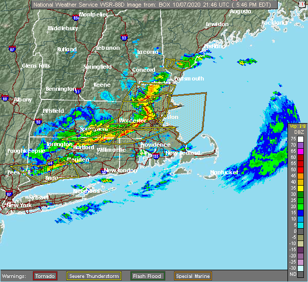 At 549 pm edt, severe thunderstorms were located along a line extending from methuen to lexington to southborough, moving east at 70 mph. these storms are prodcing widespread wind damage (radar indicated). Hazards include 70 mph wind gusts. Expect considerable damage to trees and power lines. damage is likely to mobile homes and outbuildings. Locations impacted include, boston, lowell, cambridge, quincy, lynn, newton, lawrence, somerville, framingham, haverhill, waltham, malden, brookline, medford, revere, peabody, methuen, arlington, everett and salem. At 549 pm edt, severe thunderstorms were located along a line extending from methuen to lexington to southborough, moving east at 70 mph. these storms are prodcing widespread wind damage (radar indicated). Hazards include 70 mph wind gusts. Expect considerable damage to trees and power lines. damage is likely to mobile homes and outbuildings. Locations impacted include, boston, lowell, cambridge, quincy, lynn, newton, lawrence, somerville, framingham, haverhill, waltham, malden, brookline, medford, revere, peabody, methuen, arlington, everett and salem.
|
| 10/7/2020 5:27 PM EDT |
 At 526 pm edt, severe thunderstorms were located along a line extending from brookline to near sterling to near spencer, moving east at 70 mph (radar indicated). Hazards include 70 mph wind gusts. Expect considerable damage to trees and power lines. Damage is likely to mobile homes and outbuildings. At 526 pm edt, severe thunderstorms were located along a line extending from brookline to near sterling to near spencer, moving east at 70 mph (radar indicated). Hazards include 70 mph wind gusts. Expect considerable damage to trees and power lines. Damage is likely to mobile homes and outbuildings.
|
| 8/23/2020 4:02 PM EDT |
 At 400 pm edt, a severe thunderstorm was located over north andover, moving east at 20 mph (radar indicated. this storm has a history of producing wind damage in orange, athol and fitchburg. currently, the biggest concern is in the lawrence, andover, and topfield areas in essex county). Hazards include 60 mph wind gusts and quarter size hail. Expect wind damage to trees and power lines. minor hail damage to vehicles is possible. Locations impacted include, lowell, lawrence, haverhill, peabody, methuen, leominster, fitchburg, billerica, beverly, woburn, chelmsford, andover, dracut, tewksbury, gloucester, north andover, danvers, orange, reading and burlington. At 400 pm edt, a severe thunderstorm was located over north andover, moving east at 20 mph (radar indicated. this storm has a history of producing wind damage in orange, athol and fitchburg. currently, the biggest concern is in the lawrence, andover, and topfield areas in essex county). Hazards include 60 mph wind gusts and quarter size hail. Expect wind damage to trees and power lines. minor hail damage to vehicles is possible. Locations impacted include, lowell, lawrence, haverhill, peabody, methuen, leominster, fitchburg, billerica, beverly, woburn, chelmsford, andover, dracut, tewksbury, gloucester, north andover, danvers, orange, reading and burlington.
|
| 8/23/2020 3:54 PM EDT |
 At 352 pm edt, a severe thunderstorm was located over templeton, or 9 miles east of orange, moving east at 15 mph (radar indicated. numerous reports of wind damage and downed trees have occurred were still occurring across orange, athol, fitchburg, and lunenburg with these storms. this storm has a history of wind damage, seek an indoor shelter!). Hazards include 60 mph wind gusts and quarter size hail. Expect wind damage to trees and power lines. minor hail damage to vehicles is possible. Locations impacted include, lowell, fitchburg, chelmsford, andover, dracut, tewksbury, orange, westford, gardner, athol, pepperell, tyngsborough, groton, winchendon, lunenburg, townsend, templeton, westminster, shirley and ashburnham. At 352 pm edt, a severe thunderstorm was located over templeton, or 9 miles east of orange, moving east at 15 mph (radar indicated. numerous reports of wind damage and downed trees have occurred were still occurring across orange, athol, fitchburg, and lunenburg with these storms. this storm has a history of wind damage, seek an indoor shelter!). Hazards include 60 mph wind gusts and quarter size hail. Expect wind damage to trees and power lines. minor hail damage to vehicles is possible. Locations impacted include, lowell, fitchburg, chelmsford, andover, dracut, tewksbury, orange, westford, gardner, athol, pepperell, tyngsborough, groton, winchendon, lunenburg, townsend, templeton, westminster, shirley and ashburnham.
|
| 8/23/2020 3:47 PM EDT |
 At 346 pm edt, a severe thunderstorm was located over phillipston, or 9 miles southeast of orange, moving east at 15 mph. there are also several other storms stretching into northeast ma that may result in pockets of wind damage (radar indicated). Hazards include 60 mph wind gusts and quarter size hail. Expect wind damage to trees and power lines. Minor hail damage to vehicles is possible. At 346 pm edt, a severe thunderstorm was located over phillipston, or 9 miles southeast of orange, moving east at 15 mph. there are also several other storms stretching into northeast ma that may result in pockets of wind damage (radar indicated). Hazards include 60 mph wind gusts and quarter size hail. Expect wind damage to trees and power lines. Minor hail damage to vehicles is possible.
|
| 8/23/2020 3:35 PM EDT |
 At 333 pm edt, a severe thunderstorm was located over athol, or near orange, moving east at 15 mph (radar indicated two main areas of concern. the first is near and east of orange, where we have received reports of multiple trees down. the second area is in the ashby, townsend, and pepperell areas where the radar indicated strong winds). Hazards include 60 mph wind gusts and quarter size hail. Expect wind damage to trees and power lines. minor hail damage to vehicles is possible. Locations impacted include, lowell, fitchburg, chelmsford, andover, dracut, tewksbury, orange, westford, gardner, athol, pepperell, tyngsborough, groton, winchendon, lunenburg, townsend, templeton, westminster, shirley and ashburnham. At 333 pm edt, a severe thunderstorm was located over athol, or near orange, moving east at 15 mph (radar indicated two main areas of concern. the first is near and east of orange, where we have received reports of multiple trees down. the second area is in the ashby, townsend, and pepperell areas where the radar indicated strong winds). Hazards include 60 mph wind gusts and quarter size hail. Expect wind damage to trees and power lines. minor hail damage to vehicles is possible. Locations impacted include, lowell, fitchburg, chelmsford, andover, dracut, tewksbury, orange, westford, gardner, athol, pepperell, tyngsborough, groton, winchendon, lunenburg, townsend, templeton, westminster, shirley and ashburnham.
|
| 8/23/2020 3:21 PM EDT |
 At 319 pm edt, a severe thunderstorm was located over orange, moving east at 15 mph (radar indicated two areas of concern. the first over orange where multiple trees have been knocked down beginning at 256 pm. in addition, a strong wind signature was evident in the ashburnham to ashby area). Hazards include 60 mph wind gusts and quarter size hail. Expect wind damage to trees and power lines. minor hail damage to vehicles is possible. Locations impacted include, lowell, fitchburg, chelmsford, andover, dracut, tewksbury, orange, westford, gardner, athol, pepperell, tyngsborough, groton, winchendon, lunenburg, townsend, templeton, westminster, shirley and ashburnham. At 319 pm edt, a severe thunderstorm was located over orange, moving east at 15 mph (radar indicated two areas of concern. the first over orange where multiple trees have been knocked down beginning at 256 pm. in addition, a strong wind signature was evident in the ashburnham to ashby area). Hazards include 60 mph wind gusts and quarter size hail. Expect wind damage to trees and power lines. minor hail damage to vehicles is possible. Locations impacted include, lowell, fitchburg, chelmsford, andover, dracut, tewksbury, orange, westford, gardner, athol, pepperell, tyngsborough, groton, winchendon, lunenburg, townsend, templeton, westminster, shirley and ashburnham.
|
| 8/23/2020 3:14 PM EDT |
 At 313 pm edt, a severe thunderstorm was located over athol, or near orange, moving east at 15 mph (radar indicated). Hazards include 60 mph wind gusts and quarter size hail. Expect wind damage to trees and power lines. Minor hail damage to vehicles is possible. At 313 pm edt, a severe thunderstorm was located over athol, or near orange, moving east at 15 mph (radar indicated). Hazards include 60 mph wind gusts and quarter size hail. Expect wind damage to trees and power lines. Minor hail damage to vehicles is possible.
|
| 8/22/2020 10:55 AM EDT |
 At 1053 am edt, a severe thunderstorm was located over chelmsford, moving east at 40 mph (trained weather spotters report multiple trees down in townsend and pepperell). Hazards include 60 mph wind gusts and quarter size hail. Expect wind damage to trees and power lines. minor hail damage to vehicles is possible. Locations impacted include, lowell, lawrence, methuen, billerica, chelmsford, andover, dracut, tewksbury, north andover, wilmington, westford, acton, concord, bedford, tyngsborough, groton, littleton, ayer, shirley and harvard. At 1053 am edt, a severe thunderstorm was located over chelmsford, moving east at 40 mph (trained weather spotters report multiple trees down in townsend and pepperell). Hazards include 60 mph wind gusts and quarter size hail. Expect wind damage to trees and power lines. minor hail damage to vehicles is possible. Locations impacted include, lowell, lawrence, methuen, billerica, chelmsford, andover, dracut, tewksbury, north andover, wilmington, westford, acton, concord, bedford, tyngsborough, groton, littleton, ayer, shirley and harvard.
|
| 8/22/2020 10:38 AM EDT |
 At 1038 am edt, a severe thunderstorm was located over pepperell, or 8 miles southwest of nashua, moving east at 40 mph (radar indicated). Hazards include 60 mph wind gusts and quarter size hail. Expect wind damage to trees and power lines. Minor hail damage to vehicles is possible. At 1038 am edt, a severe thunderstorm was located over pepperell, or 8 miles southwest of nashua, moving east at 40 mph (radar indicated). Hazards include 60 mph wind gusts and quarter size hail. Expect wind damage to trees and power lines. Minor hail damage to vehicles is possible.
|
| 7/30/2020 6:07 PM EDT |
 At 607 pm edt, a severe thunderstorm was located over wilmington, or near billerica, moving east at 30 mph (radar indicated). Hazards include 60 mph wind gusts and quarter size hail. Expect wind damage to trees and power lines. minor hail damage to vehicles is possible. Locations impacted include, lowell, lynn, peabody, billerica, woburn, chelmsford, andover, tewksbury, north andover, saugus, danvers, wakefield, reading, burlington, wilmington, westford, stoneham, north reading, bedford and lynnfield. At 607 pm edt, a severe thunderstorm was located over wilmington, or near billerica, moving east at 30 mph (radar indicated). Hazards include 60 mph wind gusts and quarter size hail. Expect wind damage to trees and power lines. minor hail damage to vehicles is possible. Locations impacted include, lowell, lynn, peabody, billerica, woburn, chelmsford, andover, tewksbury, north andover, saugus, danvers, wakefield, reading, burlington, wilmington, westford, stoneham, north reading, bedford and lynnfield.
|
| 7/30/2020 6:05 PM EDT |
 At 605 pm edt, a severe thunderstorm was located over carlisle, or near billerica, moving east at 30 mph (radar indicated). Hazards include 60 mph wind gusts and quarter size hail. Expect wind damage to trees and power lines. Minor hail damage to vehicles is possible. At 605 pm edt, a severe thunderstorm was located over carlisle, or near billerica, moving east at 30 mph (radar indicated). Hazards include 60 mph wind gusts and quarter size hail. Expect wind damage to trees and power lines. Minor hail damage to vehicles is possible.
|
| 7/30/2020 5:56 PM EDT |
 At 556 pm edt, a severe thunderstorm was located over billerica, moving east at 30 mph (radar indicated). Hazards include 60 mph wind gusts and quarter size hail. Expect wind damage to trees and power lines. minor hail damage to vehicles is possible. Locations impacted include, lowell, lynn, peabody, billerica, woburn, chelmsford, andover, tewksbury, north andover, saugus, danvers, wakefield, reading, burlington, wilmington, westford, stoneham, north reading, bedford and lynnfield. At 556 pm edt, a severe thunderstorm was located over billerica, moving east at 30 mph (radar indicated). Hazards include 60 mph wind gusts and quarter size hail. Expect wind damage to trees and power lines. minor hail damage to vehicles is possible. Locations impacted include, lowell, lynn, peabody, billerica, woburn, chelmsford, andover, tewksbury, north andover, saugus, danvers, wakefield, reading, burlington, wilmington, westford, stoneham, north reading, bedford and lynnfield.
|
| 7/30/2020 5:55 PM EDT | Trees and wires down on robin hill rd in middlesex county MA, 3.4 miles NE of Lowell, MA |
| 7/30/2020 5:41 PM EDT |
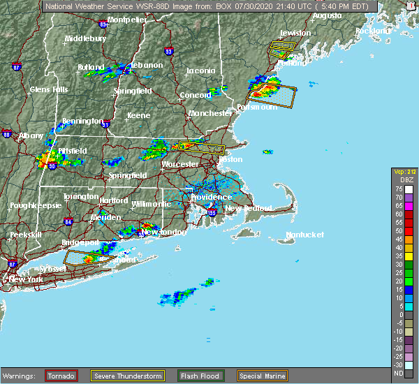 At 541 pm edt, a severe thunderstorm was located over westford, or near chelmsford, moving east at 30 mph (radar indicated). Hazards include 60 mph wind gusts and half dollar size hail. Expect wind damage to trees and power lines. minor hail damage to vehicles is possible. Locations impacted include, lowell, lynn, peabody, billerica, woburn, chelmsford, andover, tewksbury, north andover, saugus, danvers, wakefield, reading, burlington, wilmington, westford, stoneham, north reading, bedford and lynnfield. At 541 pm edt, a severe thunderstorm was located over westford, or near chelmsford, moving east at 30 mph (radar indicated). Hazards include 60 mph wind gusts and half dollar size hail. Expect wind damage to trees and power lines. minor hail damage to vehicles is possible. Locations impacted include, lowell, lynn, peabody, billerica, woburn, chelmsford, andover, tewksbury, north andover, saugus, danvers, wakefield, reading, burlington, wilmington, westford, stoneham, north reading, bedford and lynnfield.
|
| 7/30/2020 5:35 PM EDT |
 At 535 pm edt, a severe thunderstorm was located near westford, or near chelmsford, moving east at 30 mph (radar indicated). Hazards include 60 mph wind gusts and penny size hail. expect damage to trees and power lines At 535 pm edt, a severe thunderstorm was located near westford, or near chelmsford, moving east at 30 mph (radar indicated). Hazards include 60 mph wind gusts and penny size hail. expect damage to trees and power lines
|
| 7/23/2020 2:33 PM EDT |
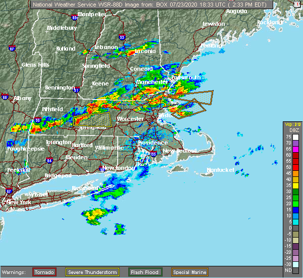 At 233 pm edt, a severe thunderstorm was located near fitchburg, moving northeast at 15 mph (radar indicated). Hazards include 60 mph wind gusts and penny size hail. expect damage to trees and power lines At 233 pm edt, a severe thunderstorm was located near fitchburg, moving northeast at 15 mph (radar indicated). Hazards include 60 mph wind gusts and penny size hail. expect damage to trees and power lines
|
| 5/15/2020 10:15 PM EDT | Trees down at umass lowell in middlesex county MA, 0.3 miles SW of Lowell, MA |
| 5/15/2020 9:00 PM EDT | Trees down on ferry rd in middlesex county MA, 0.3 miles SW of Lowell, MA |
| 5/15/2020 8:51 PM EDT |
 At 850 pm edt, a severe thunderstorm was located over reading, or near woburn, moving east at 45 mph (radar indicated. at 837 pm, two trees were downed in north chelmsford from these storms). Hazards include 60 mph wind gusts. Expect damage to trees and power lines. Locations impacted include, lowell, newton, lawrence, framingham, haverhill, waltham, methuen, arlington, billerica, marlborough, woburn, chelmsford, andover, lexington, dracut, tewksbury, north andover, wellesley, reading and belmont. At 850 pm edt, a severe thunderstorm was located over reading, or near woburn, moving east at 45 mph (radar indicated. at 837 pm, two trees were downed in north chelmsford from these storms). Hazards include 60 mph wind gusts. Expect damage to trees and power lines. Locations impacted include, lowell, newton, lawrence, framingham, haverhill, waltham, methuen, arlington, billerica, marlborough, woburn, chelmsford, andover, lexington, dracut, tewksbury, north andover, wellesley, reading and belmont.
|
| 5/15/2020 8:48 PM EDT |
 At 847 pm edt, severe thunderstorms were located along a line extending from near derry to lexington, moving east at 55 mph (radar indicated. at 837 pm, two trees were downed in north chelmsford from these storms). Hazards include 60 mph wind gusts. expect damage to trees and power lines At 847 pm edt, severe thunderstorms were located along a line extending from near derry to lexington, moving east at 55 mph (radar indicated. at 837 pm, two trees were downed in north chelmsford from these storms). Hazards include 60 mph wind gusts. expect damage to trees and power lines
|
| 5/15/2020 8:40 PM EDT | Tree down on route 3 in middlesex county MA, 3.4 miles NE of Lowell, MA |
| 5/15/2020 8:40 PM EDT | Tree down on the southbound side of route 3 in chelsmfor in middlesex county MA, 2.1 miles ENE of Lowell, MA |
| 5/15/2020 8:08 PM EDT |
 At 808 pm edt, a severe thunderstorm was located over townsend, or near fitchburg, moving east at 45 mph (radar indicated). Hazards include 60 mph wind gusts and quarter size hail. Expect wind damage to trees and power lines. Minor hail damage to vehicles is possible. At 808 pm edt, a severe thunderstorm was located over townsend, or near fitchburg, moving east at 45 mph (radar indicated). Hazards include 60 mph wind gusts and quarter size hail. Expect wind damage to trees and power lines. Minor hail damage to vehicles is possible.
|
| 8/21/2019 2:03 PM EDT |
 At 202 pm edt, a severe thunderstorm was located over tyngsborough, or near lowell, moving northeast at 20 mph (radar indicated). Hazards include 60 mph wind gusts and quarter size hail. Expect wind damage to trees and power lines. minor hail damage to vehicles is possible. this severe thunderstorm will be near, lowell around 215 pm edt. pelham around 220 pm edt. Dracut around 230 pm edt. At 202 pm edt, a severe thunderstorm was located over tyngsborough, or near lowell, moving northeast at 20 mph (radar indicated). Hazards include 60 mph wind gusts and quarter size hail. Expect wind damage to trees and power lines. minor hail damage to vehicles is possible. this severe thunderstorm will be near, lowell around 215 pm edt. pelham around 220 pm edt. Dracut around 230 pm edt.
|
| 7/6/2019 4:07 PM EDT |
 At 405 pm edt, severe thunderstorms were located along a line extending from shirley to near new braintree, moving east at 10 mph. these storms downed two trees in gardner (radar indicated). Hazards include 60 mph wind gusts. expect damage to trees and power lines At 405 pm edt, severe thunderstorms were located along a line extending from shirley to near new braintree, moving east at 10 mph. these storms downed two trees in gardner (radar indicated). Hazards include 60 mph wind gusts. expect damage to trees and power lines
|
| 6/29/2019 3:40 PM EDT |
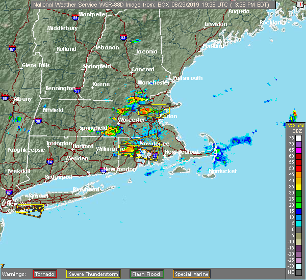 At 339 pm edt, a severe thunderstorm was located over burlington, or over woburn, moving east at 15 mph (radar indicated). Hazards include 60 mph wind gusts and penny size hail. Expect damage to trees and power lines. Locations impacted include, boston, lowell, lynn, somerville, malden, medford, revere, peabody, arlington, everett, salem, billerica, beverly, woburn, chelsea, chelmsford, andover, lexington, tewksbury and north andover. At 339 pm edt, a severe thunderstorm was located over burlington, or over woburn, moving east at 15 mph (radar indicated). Hazards include 60 mph wind gusts and penny size hail. Expect damage to trees and power lines. Locations impacted include, boston, lowell, lynn, somerville, malden, medford, revere, peabody, arlington, everett, salem, billerica, beverly, woburn, chelsea, chelmsford, andover, lexington, tewksbury and north andover.
|
| 6/29/2019 3:17 PM EDT |
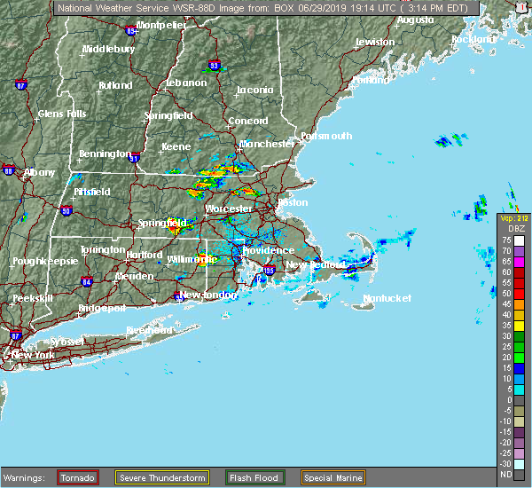 At 317 pm edt, a severe thunderstorm was located over bedford, or near billerica, moving east at 20 mph (radar indicated). Hazards include 60 mph wind gusts and penny size hail. expect damage to trees and power lines At 317 pm edt, a severe thunderstorm was located over bedford, or near billerica, moving east at 20 mph (radar indicated). Hazards include 60 mph wind gusts and penny size hail. expect damage to trees and power lines
|
| 8/17/2018 4:10 PM EDT | Tree down on bridge street blocking half the road in middlesex county MA, 3.4 miles NE of Lowell, MA |
| 8/17/2018 4:10 PM EDT | Tree down on bridge street blocking half the road in middlesex county MA, 3.4 miles NE of Lowell, MA |
| 8/17/2018 3:43 PM EDT |
 At 343 pm edt, a severe thunderstorm was located over acton, or near chelmsford, moving northeast at 30 mph (radar indicated). Hazards include 60 mph wind gusts and quarter size hail. Hail damage to vehicles is possible. Expect damage to trees and power lines. At 343 pm edt, a severe thunderstorm was located over acton, or near chelmsford, moving northeast at 30 mph (radar indicated). Hazards include 60 mph wind gusts and quarter size hail. Hail damage to vehicles is possible. Expect damage to trees and power lines.
|
| 7/17/2018 1:41 PM EDT |
 The severe thunderstorm warning for northeastern worcester and central middlesex counties will expire at 145 pm edt, the storm which prompted the warning has moved out of the area. therefore, the warning will be allowed to expire. a severe thunderstorm watch remains in effect until 700 pm edt for central and northeastern massachusetts. The severe thunderstorm warning for northeastern worcester and central middlesex counties will expire at 145 pm edt, the storm which prompted the warning has moved out of the area. therefore, the warning will be allowed to expire. a severe thunderstorm watch remains in effect until 700 pm edt for central and northeastern massachusetts.
|
| 7/17/2018 1:33 PM EDT |
 At 133 pm edt, severe thunderstorms were located along a line extending from georgetown to acton, moving east at 35 mph (radar indicated). Hazards include 60 mph wind gusts. expect damage to trees and power lines At 133 pm edt, severe thunderstorms were located along a line extending from georgetown to acton, moving east at 35 mph (radar indicated). Hazards include 60 mph wind gusts. expect damage to trees and power lines
|
| 7/17/2018 12:57 PM EDT |
 The national weather service in boston/norton has issued a * severe thunderstorm warning for. northeastern worcester county in central massachusetts. central middlesex county in northeastern massachusetts. until 145 pm edt. At 1257 pm edt, a severe thunderstorm was located over leominster,. The national weather service in boston/norton has issued a * severe thunderstorm warning for. northeastern worcester county in central massachusetts. central middlesex county in northeastern massachusetts. until 145 pm edt. At 1257 pm edt, a severe thunderstorm was located over leominster,.
|
| 6/18/2018 6:50 PM EDT | Tree down on acton street in middlesex county MA, 3.4 miles NE of Lowell, MA |
| 8/2/2017 3:42 PM EDT |
 At 341 pm edt, a severe thunderstorm was located over acton, or 8 miles northeast of marlborough, moving east at 10 mph (radar indicated). Hazards include 60 mph wind gusts and quarter size hail. Hail damage to vehicles is possible. expect damage to trees and power lines. Locations impacted include, lowell, waltham, billerica, marlborough, chelmsford, lexington, burlington, westford, acton, hudson, concord, sudbury, bedford, wayland, tyngsborough, groton, maynard, littleton, lancaster and ayer. At 341 pm edt, a severe thunderstorm was located over acton, or 8 miles northeast of marlborough, moving east at 10 mph (radar indicated). Hazards include 60 mph wind gusts and quarter size hail. Hail damage to vehicles is possible. expect damage to trees and power lines. Locations impacted include, lowell, waltham, billerica, marlborough, chelmsford, lexington, burlington, westford, acton, hudson, concord, sudbury, bedford, wayland, tyngsborough, groton, maynard, littleton, lancaster and ayer.
|
| 8/2/2017 3:29 PM EDT |
 At 329 pm edt, a severe thunderstorm was located over acton, or 8 miles northeast of marlborough, and is nearly stationary (radar indicated). Hazards include 60 mph wind gusts and quarter size hail. Hail damage to vehicles is possible. Expect damage to trees and power lines. At 329 pm edt, a severe thunderstorm was located over acton, or 8 miles northeast of marlborough, and is nearly stationary (radar indicated). Hazards include 60 mph wind gusts and quarter size hail. Hail damage to vehicles is possible. Expect damage to trees and power lines.
|
| 6/27/2017 4:45 PM EDT | Quarter sized hail reported 5 miles WNW of Lowell, MA |
| 6/23/2017 1:56 PM EDT |
 At 156 pm edt, severe thunderstorms were located along a line extending from bedford to somerville, moving northeast at 45 mph (radar indicated). Hazards include 60 mph wind gusts. expect damage to trees and power lines At 156 pm edt, severe thunderstorms were located along a line extending from bedford to somerville, moving northeast at 45 mph (radar indicated). Hazards include 60 mph wind gusts. expect damage to trees and power lines
|
| 5/18/2017 10:43 PM EDT | Tree down on pike stree in middlesex county MA, 5 miles WNW of Lowell, MA |
| 5/18/2017 10:42 PM EDT | Tree down on pleasant stree in middlesex county MA, 0.3 miles SW of Lowell, MA |
| 5/18/2017 9:43 PM EDT |
 At 942 pm edt, a severe thunderstorm was located near templeton, or 10 miles east of orange, moving east at 55 mph (radar indicated). Hazards include 60 mph wind gusts. expect damage to trees and power lines At 942 pm edt, a severe thunderstorm was located near templeton, or 10 miles east of orange, moving east at 55 mph (radar indicated). Hazards include 60 mph wind gusts. expect damage to trees and power lines
|
| 9/11/2016 10:10 AM EDT |
 The severe thunderstorm warning for northwestern essex, southeastern hampshire, southeastern hampden, worcester and middlesex counties will expire at 1015 am edt, the storms which prompted the warning have moved out of the area. therefore, the warning will be allowed to expire. The severe thunderstorm warning for northwestern essex, southeastern hampshire, southeastern hampden, worcester and middlesex counties will expire at 1015 am edt, the storms which prompted the warning have moved out of the area. therefore, the warning will be allowed to expire.
|
| 9/11/2016 9:55 AM EDT | Trees down on chelmsford street with other large limbs down in town in middlesex county MA, 3.4 miles NE of Lowell, MA |
| 9/11/2016 9:53 AM EDT |
 At 952 am edt, severe thunderstorms were located along a line extending from tyngsborough to near oxford, moving east at 45 mph (radar indicated). Hazards include 60 mph wind gusts. Expect damage to roofs. siding. And trees. At 952 am edt, severe thunderstorms were located along a line extending from tyngsborough to near oxford, moving east at 45 mph (radar indicated). Hazards include 60 mph wind gusts. Expect damage to roofs. siding. And trees.
|
| 9/11/2016 9:23 AM EDT |
 At 922 am edt, severe thunderstorms were located along a line extending from near new boston to near westminster to north brookfield to west hartford, moving east at 45 mph (radar indicated). Hazards include 60 mph wind gusts. Expect damage to roofs. siding. And trees. At 922 am edt, severe thunderstorms were located along a line extending from near new boston to near westminster to north brookfield to west hartford, moving east at 45 mph (radar indicated). Hazards include 60 mph wind gusts. Expect damage to roofs. siding. And trees.
|
| 7/23/2016 7:29 PM EDT |
 At 728 pm edt, a cluster of strong thunderstorms was affecting northern massachusetts producing damaging wind gusts (radar indicated and spotters have reported wind damage with these storms). Hazards include 60 mph wind gusts. Expect damage to roofs. siding. And trees. At 728 pm edt, a cluster of strong thunderstorms was affecting northern massachusetts producing damaging wind gusts (radar indicated and spotters have reported wind damage with these storms). Hazards include 60 mph wind gusts. Expect damage to roofs. siding. And trees.
|
| 7/23/2016 7:06 PM EDT |
 At 704 pm edt, a cluster of severe thunderstorms was dropping south from far northern new hampshire. however, damaging wind gusts were occurring out of ahead the actual thunderstorms (trained weather spotters have reported wind damage in north central and northeast massachusetts). Hazards include 60 mph wind gusts. Expect damage to roofs. siding. And trees. At 704 pm edt, a cluster of severe thunderstorms was dropping south from far northern new hampshire. however, damaging wind gusts were occurring out of ahead the actual thunderstorms (trained weather spotters have reported wind damage in north central and northeast massachusetts). Hazards include 60 mph wind gusts. Expect damage to roofs. siding. And trees.
|
| 7/23/2016 7:00 PM EDT | Power lines and a tree down on jonathan lan in middlesex county MA, 3.4 miles NE of Lowell, MA |
| 7/23/2016 7:00 PM EDT | Power lines and a tree down on jonathan lan in middlesex county MA, 3.4 miles NE of Lowell, MA |
| 7/23/2016 6:52 PM EDT | Numerous trees down throughout town...including a tree down onto a car. wires down on steven street and fairmont street. large tree down on wires on greendale avenue. w in middlesex county MA, 0.3 miles SW of Lowell, MA |
| 7/23/2016 6:38 PM EDT |
 At 636 pm edt, a line of severe thunderstorms in southern new hampshire will be dropping southeast into north central and northeast massachusetts through 730 pm (spotter reporting numerous reports of wind damage in southern new hampshire). Hazards include 60 mph wind gusts. Expect damage to roofs. siding. And trees. At 636 pm edt, a line of severe thunderstorms in southern new hampshire will be dropping southeast into north central and northeast massachusetts through 730 pm (spotter reporting numerous reports of wind damage in southern new hampshire). Hazards include 60 mph wind gusts. Expect damage to roofs. siding. And trees.
|
| 3/17/2016 3:58 PM EDT | Tree down across old westford r in middlesex county MA, 2.8 miles E of Lowell, MA |
| 2/25/2016 3:21 AM EST |
 The severe thunderstorm warning for northwestern bristol, west central essex, western norfolk, southeastern worcester and middlesex counties will expire at 330 am est, the storm which prompted the warning has weakened below severe limits although strong winds may linger. The severe thunderstorm warning for northwestern bristol, west central essex, western norfolk, southeastern worcester and middlesex counties will expire at 330 am est, the storm which prompted the warning has weakened below severe limits although strong winds may linger.
|
| 2/25/2016 2:40 AM EST |
 At 239 am est, doppler radar indicated a severe thunderstorm capable of producing destructive winds in excess of 70 mph. this storm was located over upton, or near milford, and was moving northeast at 115 mph. At 239 am est, doppler radar indicated a severe thunderstorm capable of producing destructive winds in excess of 70 mph. this storm was located over upton, or near milford, and was moving northeast at 115 mph.
|
| 2/25/2016 2:36 AM EST | 2 large trees down on warren avenu in middlesex county MA, 3.4 miles NE of Lowell, MA |
| 2/25/2016 1:42 AM EST | Storm damage reported in middlesex county MA, 2.6 miles SSW of Lowell, MA |
| 2/25/2016 1:38 AM EST | Tree down on wires on shore driv in middlesex county MA, 2.6 miles SSW of Lowell, MA |
| 8/4/2015 2:49 PM EDT |
 At 248 pm edt, doppler radar indicated a severe thunderstorm capable of producing half dollar size hail and damaging winds in excess of 60 mph. this storm was located over billerica, and was moving east at 40 mph. * some locations impacted include, lowell, lynn, peabody, salem, billerica, beverly, woburn, chelmsford, andover, lexington, tewksbury, gloucester, north andover, melrose, saugus, danvers, wakefield, reading, burlington and wilmington. At 248 pm edt, doppler radar indicated a severe thunderstorm capable of producing half dollar size hail and damaging winds in excess of 60 mph. this storm was located over billerica, and was moving east at 40 mph. * some locations impacted include, lowell, lynn, peabody, salem, billerica, beverly, woburn, chelmsford, andover, lexington, tewksbury, gloucester, north andover, melrose, saugus, danvers, wakefield, reading, burlington and wilmington.
|
| 8/4/2015 2:28 PM EDT |
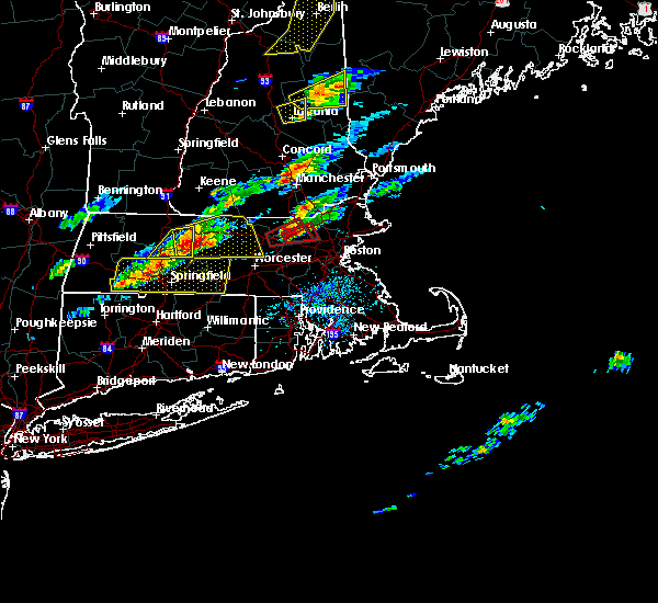 At 228 pm edt, doppler radar indicated a severe thunderstorm capable of producing a tornado. this dangerous storm was located over littleton, or near chelmsford, and was moving east at 35 mph. * some locations impacted include, lowell, billerica, chelmsford, tewksbury, burlington, westford, acton, concord, bedford, littleton, ayer, boxborough and carlisle. At 228 pm edt, doppler radar indicated a severe thunderstorm capable of producing a tornado. this dangerous storm was located over littleton, or near chelmsford, and was moving east at 35 mph. * some locations impacted include, lowell, billerica, chelmsford, tewksbury, burlington, westford, acton, concord, bedford, littleton, ayer, boxborough and carlisle.
|
| 8/4/2015 2:20 PM EDT |
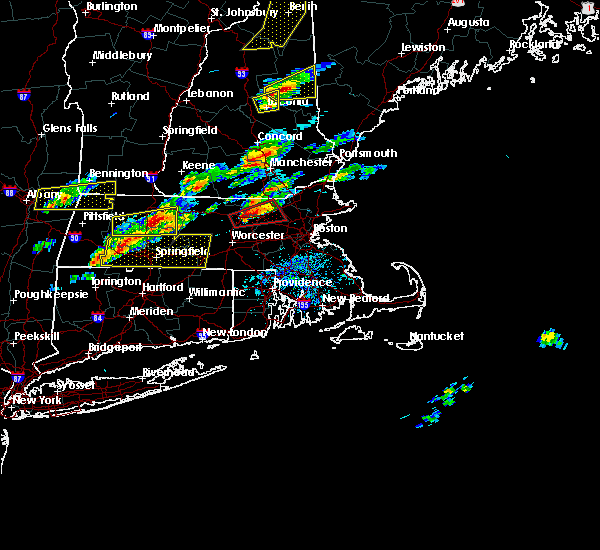 At 220 pm edt, doppler radar indicated a severe thunderstorm capable of producing a tornado. this dangerous storm was located over littleton, or 7 miles southwest of chelmsford, moving east at 50 mph. locations impacted include, lowell, billerica, chelmsford, westford, acton, concord, bedford, tyngsborough, groton, lunenburg, littleton, lancaster, ayer, shirley, stow, harvard, boxborough, bolton, carlisle and dunstable. At 220 pm edt, doppler radar indicated a severe thunderstorm capable of producing a tornado. this dangerous storm was located over littleton, or 7 miles southwest of chelmsford, moving east at 50 mph. locations impacted include, lowell, billerica, chelmsford, westford, acton, concord, bedford, tyngsborough, groton, lunenburg, littleton, lancaster, ayer, shirley, stow, harvard, boxborough, bolton, carlisle and dunstable.
|
| 8/4/2015 2:07 PM EDT |
 At 206 pm edt, doppler radar indicated a severe thunderstorm capable of producing a tornado. this dangerous storm was located over leominster, and was moving east at 35 mph. * some locations impacted include, lowell, leominster, fitchburg, billerica, chelmsford, westford, acton, concord, clinton, bedford, tyngsborough, groton, lunenburg, littleton, lancaster, sterling, ayer, shirley, stow and harvard. At 206 pm edt, doppler radar indicated a severe thunderstorm capable of producing a tornado. this dangerous storm was located over leominster, and was moving east at 35 mph. * some locations impacted include, lowell, leominster, fitchburg, billerica, chelmsford, westford, acton, concord, clinton, bedford, tyngsborough, groton, lunenburg, littleton, lancaster, sterling, ayer, shirley, stow and harvard.
|
| 8/4/2015 1:52 PM EDT |
 At 151 pm edt, doppler radar indicated a severe thunderstorm capable of producing large damaging hail up to golf ball size and damaging winds in excess of 60 mph. this storm was located over fitchburg, moving east at 40 mph. golf ball sized hail has been reported with this storm as it moved through gardner. locations impacted include, lowell, nashua, leominster, fitchburg, billerica, chelmsford, dracut, tewksbury, hudson, westford, acton, gardner, pelham, pepperell, tyngsborough, groton, winchendon, lunenburg, townsend and littleton. At 151 pm edt, doppler radar indicated a severe thunderstorm capable of producing large damaging hail up to golf ball size and damaging winds in excess of 60 mph. this storm was located over fitchburg, moving east at 40 mph. golf ball sized hail has been reported with this storm as it moved through gardner. locations impacted include, lowell, nashua, leominster, fitchburg, billerica, chelmsford, dracut, tewksbury, hudson, westford, acton, gardner, pelham, pepperell, tyngsborough, groton, winchendon, lunenburg, townsend and littleton.
|
| 8/4/2015 1:35 PM EDT |
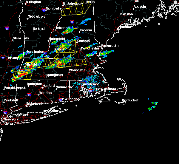 At 135 pm edt, doppler radar indicated a severe thunderstorm capable of producing large hail up to ping pong ball size and damaging winds in excess of 60 mph. this storm was located near templeton, or 12 miles southeast of orange, and was moving east at 50 mph. * some locations impacted include, lowell, nashua, leominster, fitchburg, billerica, chelmsford, dracut, tewksbury, hudson, westford, acton, gardner, pelham, athol, pepperell, tyngsborough, groton, winchendon, lunenburg and townsend. At 135 pm edt, doppler radar indicated a severe thunderstorm capable of producing large hail up to ping pong ball size and damaging winds in excess of 60 mph. this storm was located near templeton, or 12 miles southeast of orange, and was moving east at 50 mph. * some locations impacted include, lowell, nashua, leominster, fitchburg, billerica, chelmsford, dracut, tewksbury, hudson, westford, acton, gardner, pelham, athol, pepperell, tyngsborough, groton, winchendon, lunenburg and townsend.
|
| 7/24/2015 4:04 PM EDT |
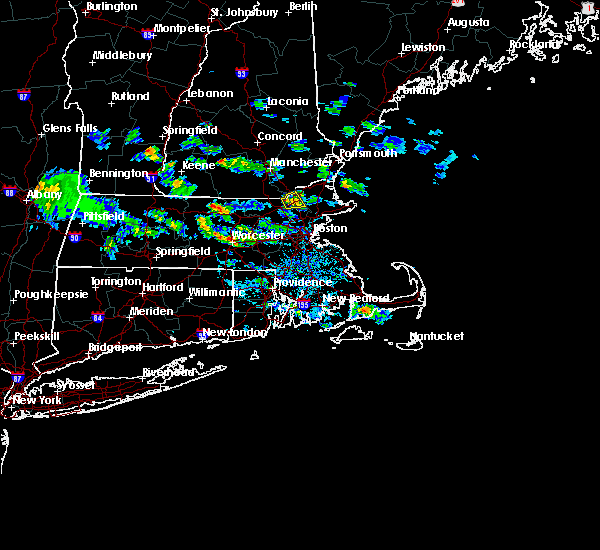 At 403 pm edt, doppler radar indicated a severe thunderstorm capable of producing quarter size hail. this storm was located over wilmington, or near billerica, moving southeast at 30 mph. locations impacted include, lowell, lawrence, methuen, andover, dracut, tewksbury, north andover and pelham. At 403 pm edt, doppler radar indicated a severe thunderstorm capable of producing quarter size hail. this storm was located over wilmington, or near billerica, moving southeast at 30 mph. locations impacted include, lowell, lawrence, methuen, andover, dracut, tewksbury, north andover and pelham.
|
| 7/24/2015 3:37 PM EDT |
 At 337 pm edt, doppler radar indicated a severe thunderstorm capable of producing quarter size hail. this storm was located over pelham, or near dracut, and was moving southeast at 30 mph. * some locations impacted include, lowell, lawrence, peabody, methuen, billerica, woburn, chelmsford, andover, dracut, tewksbury, north andover, reading, burlington, wilmington, north reading, bedford, pelham, lynnfield, tyngsborough and carlisle. At 337 pm edt, doppler radar indicated a severe thunderstorm capable of producing quarter size hail. this storm was located over pelham, or near dracut, and was moving southeast at 30 mph. * some locations impacted include, lowell, lawrence, peabody, methuen, billerica, woburn, chelmsford, andover, dracut, tewksbury, north andover, reading, burlington, wilmington, north reading, bedford, pelham, lynnfield, tyngsborough and carlisle.
|
| 5/28/2015 4:45 PM EDT | At 445 pm edt, doppler radar indicated a line of severe thunderstorms capable of producing quarter size hail and damaging winds in excess of 60 mph. these storms were located along a line extending from near salem to tyngsborough, and was moving east at 45 mph. * some locations impacted include, lowell, lawrence, haverhill, methuen, chelmsford, andover, dracut, tewksbury, north andover, newburyport, amesbury, ipswich, pelham, tyngsborough, salisbury, georgetown, boxford, newbury, groveland and merrimac. |
| 9/6/2014 5:03 PM EDT | Tree and wires down on bridge street in middlesex county MA, 2.6 miles SSW of Lowell, MA |
| 9/6/2014 4:58 PM EDT | Tree and power lines down on harlem street in middlesex county MA, 2.6 miles SSW of Lowell, MA |
| 9/6/2014 4:57 PM EDT | Tree down on person... injuring leg on the vfw parkway at aiken street in the beaver brook area in middlesex county MA, 0.3 miles SW of Lowell, MA |
| 7/28/2014 6:02 PM EDT | Trees and wires down on proctor road. 3 trees down on a house on judith roa in middlesex county MA, 3.4 miles NE of Lowell, MA |
| 7/28/2014 6:00 PM EDT | Trees and wires down on donna road and on park road in middlesex county MA, 3.4 miles NE of Lowell, MA |
| 7/28/2014 6:00 PM EDT | Tree down next to rogers street and fort hill park in middlesex county MA, 0.3 miles SW of Lowell, MA |
| 7/15/2014 4:40 PM EDT | Tree down on house on whipple road. no damage to hom in middlesex county MA, 5 miles WNW of Lowell, MA |
| 7/15/2014 4:40 PM EDT | Tree down on house on whipple road. no damage to hom in middlesex county MA, 5 miles WNW of Lowell, MA |
| 7/15/2014 4:35 PM EDT | Trees down on wellman avenue with one tree down on multiple houses and cars in middlesex county MA, 2.8 miles E of Lowell, MA |
| 7/15/2014 4:35 PM EDT | Intersection of mammoth rd and mill st...tree snapped in half bringing wires dow in middlesex county MA, 2.6 miles SSW of Lowell, MA |
| 7/15/2014 4:27 PM EDT | Intersection of mammoth rd and mill st...tree snapped in half bringing wires down. tree down on lake view av in middlesex county MA, 2.6 miles SSW of Lowell, MA |
| 7/15/2014 4:25 PM EDT | Tree and wires down on pawtucket blvd. trees down on hudy stree in middlesex county MA, 0.3 miles SW of Lowell, MA |
| 7/3/2014 5:35 PM EDT | Large limbs down on amesbury s in middlesex county MA, 2.6 miles SSW of Lowell, MA |
| 7/3/2014 5:20 PM EDT | Quarter sized hail reported 2.6 miles SSW of Lowell, MA |
| 7/3/2014 5:15 PM EDT | Trees down on kensington street and larg limb down on route 11 in middlesex county MA, 2.6 miles SSW of Lowell, MA |
| 7/23/2013 4:06 PM EDT | Rte 38 closed due to power lines down in middlesex county MA, 5 miles WNW of Lowell, MA |
| 7/18/2012 1:23 PM EDT | Quarter sized hail reported 2.6 miles SSW of Lowell, MA |
| 1/1/0001 12:00 AM | Several trees down in middlesex county MA, 3.4 miles NE of Lowell, MA |
| 1/1/0001 12:00 AM | Trees and wires down on dunbar street in middlesex county MA, 0.3 miles SW of Lowell, MA |
Hail Maps for Lowell, MA


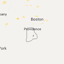


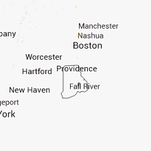

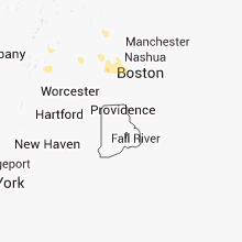


Connect with Interactive Hail Maps