

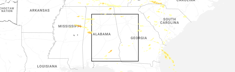
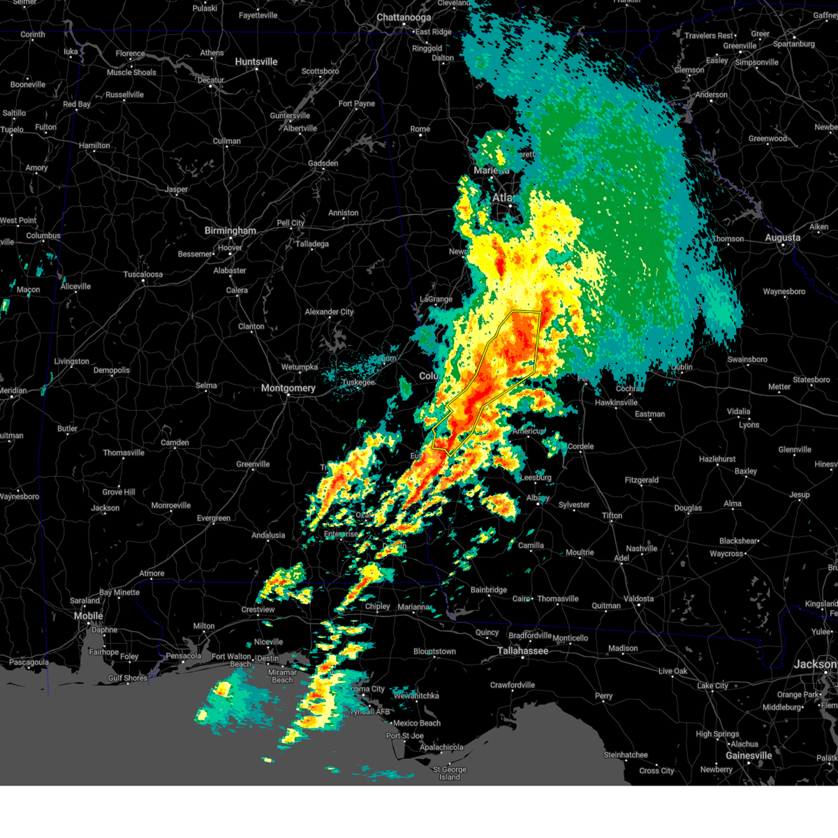
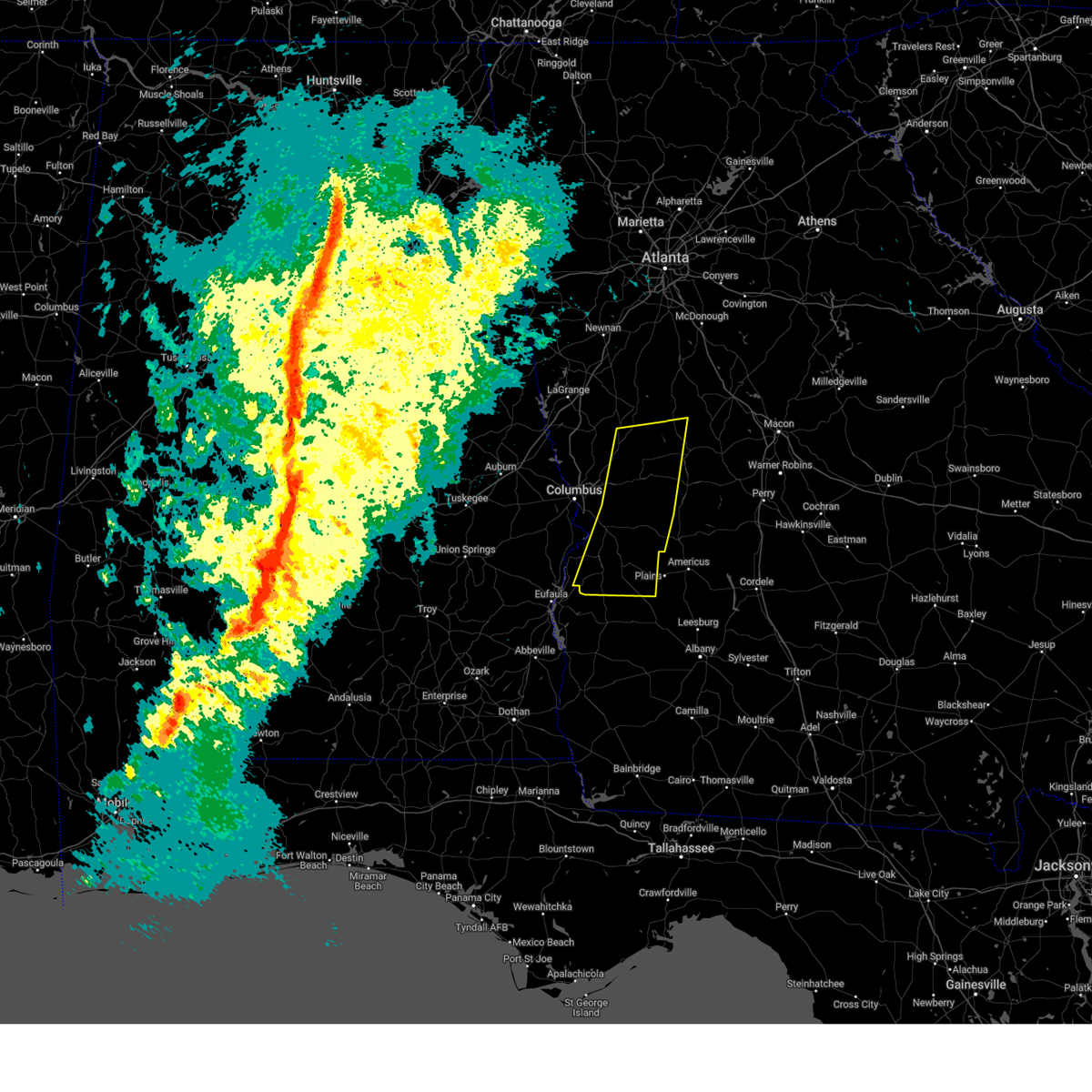
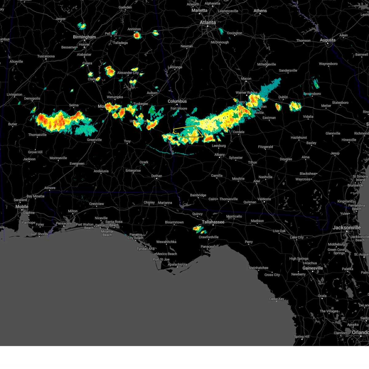
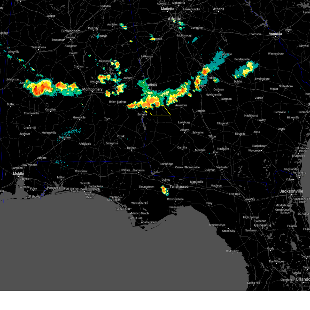
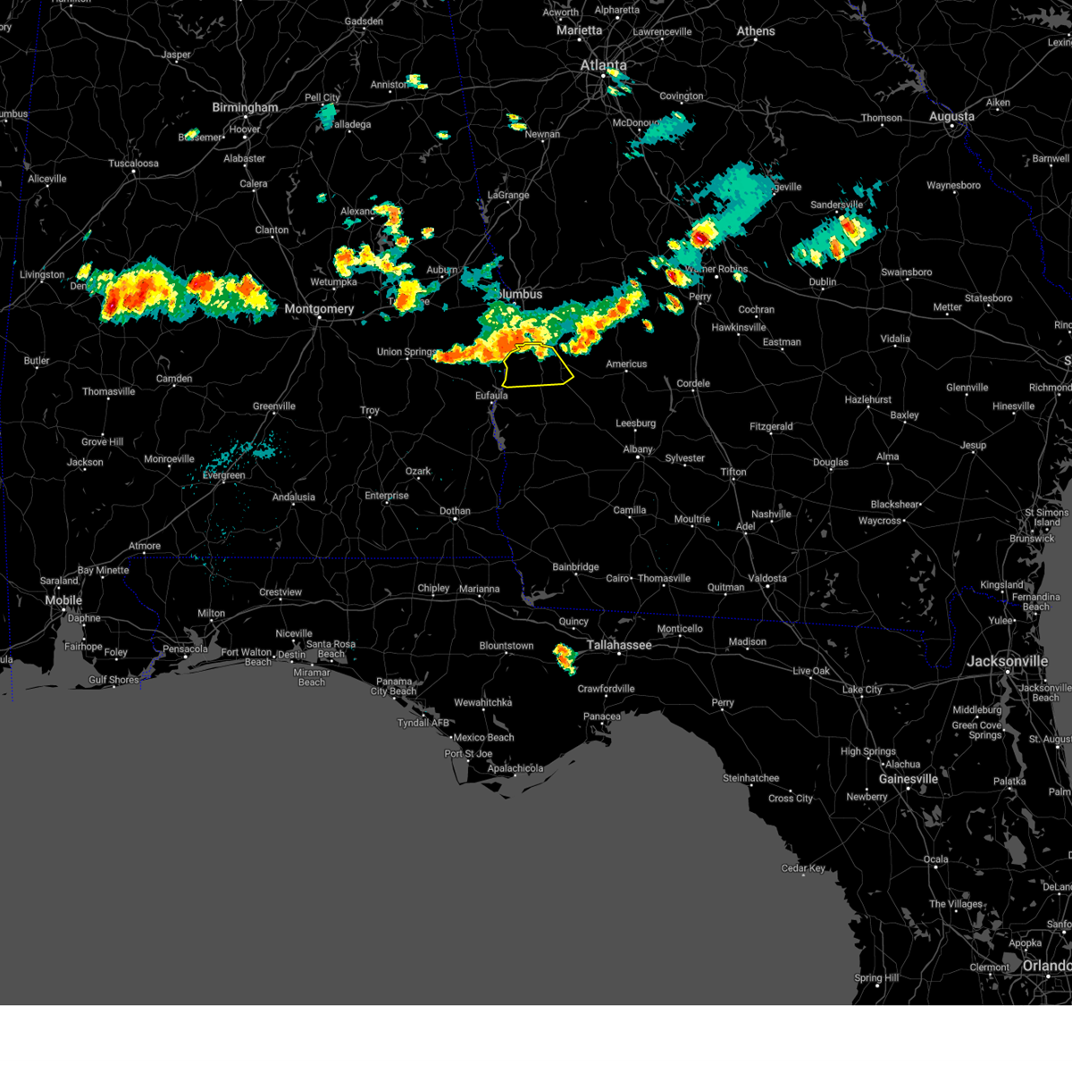
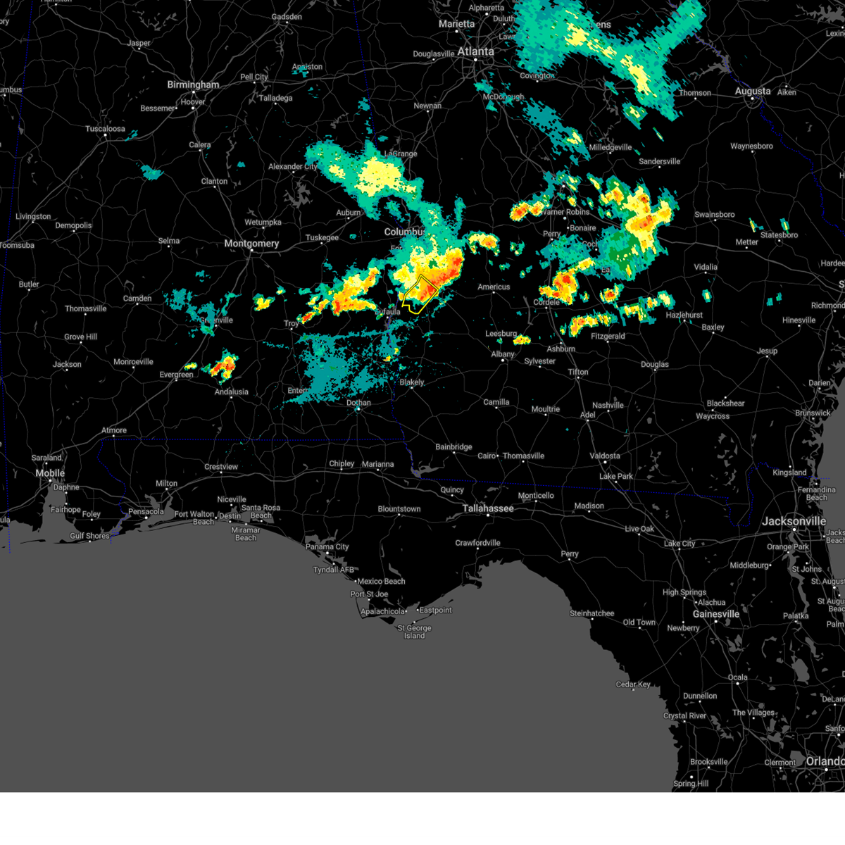
Hail Map for Lumpkin, GA
The Lumpkin, GA area has had 1 report of on-the-ground hail by trained spotters, and has been under severe weather warnings 19 times during the past 12 months. Doppler radar has detected hail at or near Lumpkin, GA on 51 occasions, including 3 occasions during the past year.
| Name: | Lumpkin, GA |
| Where Located: | 55.7 miles SE of Auburn, AL |
| Map: | Google Map for Lumpkin, GA |
| Population: | 2741 |
| Housing Units: | 571 |
| More Info: | Search Google for Lumpkin, GA |
4
The Top Recent Hail Date for Lumpkin, GA is Thursday, May 8, 2025 (2nd out of 51)
Hail and Wind Damage Spotted near Lumpkin, GA
| Date / Time | Report Details |
|---|---|
| 6/21/2025 3:05 PM EDT |
 The storm which prompted the warning has weakened below severe limits, and no longer poses an immediate threat to life or property. therefore, the warning will be allowed to expire. The storm which prompted the warning has weakened below severe limits, and no longer poses an immediate threat to life or property. therefore, the warning will be allowed to expire.
|
| 6/21/2025 2:46 PM EDT |
 Svrffc the national weather service in peachtree city has issued a * severe thunderstorm warning for, northeastern stewart county in west central georgia, * until 315 pm edt. * at 246 pm edt, a severe thunderstorm was located over charles, or near lumpkin, and is nearly stationary (radar indicated). Hazards include 60 mph wind gusts. expect damage to roofs, siding, and trees Svrffc the national weather service in peachtree city has issued a * severe thunderstorm warning for, northeastern stewart county in west central georgia, * until 315 pm edt. * at 246 pm edt, a severe thunderstorm was located over charles, or near lumpkin, and is nearly stationary (radar indicated). Hazards include 60 mph wind gusts. expect damage to roofs, siding, and trees
|
| 3/16/2025 2:46 AM EDT |
 Svrffc the national weather service in peachtree city has issued a * severe thunderstorm warning for, marion county in west central georgia, southeastern chattahoochee county in west central georgia, stewart county in west central georgia, webster county in west central georgia, western schley county in west central georgia, southwestern taylor county in west central georgia, * until 330 am edt. * at 246 am edt, severe thunderstorms were located along a line extending from near zellobee to near sanford, moving northeast at 60 mph (radar indicated). Hazards include 60 mph wind gusts. expect damage to roofs, siding, and trees Svrffc the national weather service in peachtree city has issued a * severe thunderstorm warning for, marion county in west central georgia, southeastern chattahoochee county in west central georgia, stewart county in west central georgia, webster county in west central georgia, western schley county in west central georgia, southwestern taylor county in west central georgia, * until 330 am edt. * at 246 am edt, severe thunderstorms were located along a line extending from near zellobee to near sanford, moving northeast at 60 mph (radar indicated). Hazards include 60 mph wind gusts. expect damage to roofs, siding, and trees
|
| 3/16/2025 2:41 AM EDT |
 The storms which prompted the warning have weakened below severe limits, and no longer pose an immediate threat to life or property. therefore, the warning will be allowed to expire. a tornado watch remains in effect until 400 am edt for west central georgia. a tornado watch also remains in effect until 1000 am edt for central and west central georgia. The storms which prompted the warning have weakened below severe limits, and no longer pose an immediate threat to life or property. therefore, the warning will be allowed to expire. a tornado watch remains in effect until 400 am edt for west central georgia. a tornado watch also remains in effect until 1000 am edt for central and west central georgia.
|
| 3/16/2025 2:26 AM EDT |
 At 226 am edt, severe thunderstorms were located along a line extending from near the rock to marion estates to near florence marina state park, moving northeast at 45 mph (radar indicated). Hazards include 60 mph wind gusts. Expect damage to roofs, siding, and trees. Locations impacted include, sunset village, juniper, atwater, geneva, brooklyn, renfroe, oakland, manta, zellobee, omaha, sprewell bluff state park, cusseta, sanford, logtown, howard, sunnyside, jamestown/south fort benning, eelbeck/west fort benning, brantley, and yatesville. At 226 am edt, severe thunderstorms were located along a line extending from near the rock to marion estates to near florence marina state park, moving northeast at 45 mph (radar indicated). Hazards include 60 mph wind gusts. Expect damage to roofs, siding, and trees. Locations impacted include, sunset village, juniper, atwater, geneva, brooklyn, renfroe, oakland, manta, zellobee, omaha, sprewell bluff state park, cusseta, sanford, logtown, howard, sunnyside, jamestown/south fort benning, eelbeck/west fort benning, brantley, and yatesville.
|
| 3/16/2025 2:26 AM EDT |
 the severe thunderstorm warning has been cancelled and is no longer in effect the severe thunderstorm warning has been cancelled and is no longer in effect
|
| 3/16/2025 1:59 AM EDT |
 Svrffc the national weather service in peachtree city has issued a * severe thunderstorm warning for, marion county in west central georgia, southeastern meriwether county in west central georgia, muscogee county in west central georgia, chattahoochee county in west central georgia, stewart county in west central georgia, upson county in west central georgia, northwestern webster county in west central georgia, west central crawford county in central georgia, western schley county in west central georgia, talbot county in west central georgia, taylor county in west central georgia, southeastern harris county in west central georgia, * until 245 am edt. * at 159 am edt, severe thunderstorms were located along a line extending from raleigh to near eelbeck/west fort benning to lakepoint resort state park, moving east at 40 mph (radar indicated). Hazards include 60 mph wind gusts. expect damage to roofs, siding, and trees Svrffc the national weather service in peachtree city has issued a * severe thunderstorm warning for, marion county in west central georgia, southeastern meriwether county in west central georgia, muscogee county in west central georgia, chattahoochee county in west central georgia, stewart county in west central georgia, upson county in west central georgia, northwestern webster county in west central georgia, west central crawford county in central georgia, western schley county in west central georgia, talbot county in west central georgia, taylor county in west central georgia, southeastern harris county in west central georgia, * until 245 am edt. * at 159 am edt, severe thunderstorms were located along a line extending from raleigh to near eelbeck/west fort benning to lakepoint resort state park, moving east at 40 mph (radar indicated). Hazards include 60 mph wind gusts. expect damage to roofs, siding, and trees
|
| 3/5/2025 2:41 AM EST |
 The storms which prompted the warning have weakened below severe limits, and have exited the warned area. therefore, the warning will be allowed to expire. a severe thunderstorm watch remains in effect until 400 am est for west central georgia. The storms which prompted the warning have weakened below severe limits, and have exited the warned area. therefore, the warning will be allowed to expire. a severe thunderstorm watch remains in effect until 400 am est for west central georgia.
|
| 3/5/2025 2:03 AM EST |
 The storms which prompted the warning have moved out of the area. therefore, the warning has been allowed to expire. a severe thunderstorm watch remains in effect until 400 am est for west central georgia. The storms which prompted the warning have moved out of the area. therefore, the warning has been allowed to expire. a severe thunderstorm watch remains in effect until 400 am est for west central georgia.
|
| 3/5/2025 2:00 AM EST |
 Svrffc the national weather service in peachtree city has issued a * severe thunderstorm warning for, marion county in west central georgia, southeastern meriwether county in west central georgia, eastern muscogee county in west central georgia, chattahoochee county in west central georgia, stewart county in west central georgia, central upson county in west central georgia, webster county in west central georgia, western schley county in west central georgia, talbot county in west central georgia, western taylor county in west central georgia, southeastern harris county in west central georgia, * until 245 am est. * at 200 am est, severe thunderstorms were located along a line extending from flint hill to eelbeck/west fort moore to near sanford, moving east at 20 mph (radar indicated). Hazards include 60 mph wind gusts. expect damage to roofs, siding, and trees Svrffc the national weather service in peachtree city has issued a * severe thunderstorm warning for, marion county in west central georgia, southeastern meriwether county in west central georgia, eastern muscogee county in west central georgia, chattahoochee county in west central georgia, stewart county in west central georgia, central upson county in west central georgia, webster county in west central georgia, western schley county in west central georgia, talbot county in west central georgia, western taylor county in west central georgia, southeastern harris county in west central georgia, * until 245 am est. * at 200 am est, severe thunderstorms were located along a line extending from flint hill to eelbeck/west fort moore to near sanford, moving east at 20 mph (radar indicated). Hazards include 60 mph wind gusts. expect damage to roofs, siding, and trees
|
| 3/5/2025 1:20 AM EST |
 Svrffc the national weather service in peachtree city has issued a * severe thunderstorm warning for, northwestern marion county in west central georgia, muscogee county in west central georgia, chattahoochee county in west central georgia, stewart county in west central georgia, western talbot county in west central georgia, eastern harris county in west central georgia, * until 200 am est. * at 120 am est, severe thunderstorms were located along a line extending from near stovall to near green island hills to 7 miles east of rutherford, moving northeast at 45 mph (radar indicated). Hazards include 60 mph wind gusts. expect damage to roofs, siding, and trees Svrffc the national weather service in peachtree city has issued a * severe thunderstorm warning for, northwestern marion county in west central georgia, muscogee county in west central georgia, chattahoochee county in west central georgia, stewart county in west central georgia, western talbot county in west central georgia, eastern harris county in west central georgia, * until 200 am est. * at 120 am est, severe thunderstorms were located along a line extending from near stovall to near green island hills to 7 miles east of rutherford, moving northeast at 45 mph (radar indicated). Hazards include 60 mph wind gusts. expect damage to roofs, siding, and trees
|
| 2/16/2025 5:07 AM EST |
 Svrffc the national weather service in peachtree city has issued a * severe thunderstorm warning for, southern stewart county in west central georgia, southern webster county in west central georgia, * until 600 am est. * at 507 am est, a severe thunderstorm was located near florence marina state park, or 10 miles west of lumpkin, moving southeast at 45 mph (radar indicated). Hazards include 60 mph wind gusts. expect damage to roofs, siding, and trees Svrffc the national weather service in peachtree city has issued a * severe thunderstorm warning for, southern stewart county in west central georgia, southern webster county in west central georgia, * until 600 am est. * at 507 am est, a severe thunderstorm was located near florence marina state park, or 10 miles west of lumpkin, moving southeast at 45 mph (radar indicated). Hazards include 60 mph wind gusts. expect damage to roofs, siding, and trees
|
| 12/29/2024 3:58 AM EST |
 At 357 am est, severe thunderstorms were located along a line extending from near box springs to near sand hill to near lakepoint resort state park, moving east at 35 mph (radar indicated). Hazards include 60 mph wind gusts. Expect damage to roofs, siding, and trees. Locations impacted include, lumpkin, buena vista, talbotton, cusseta, richland, junction city, geneva, fort moore, north fort moore, upatoi, brantley, seminole, florence marina state park, westville, juniper, vista terrace, brooklyn, renfroe, oakland, and manta. At 357 am est, severe thunderstorms were located along a line extending from near box springs to near sand hill to near lakepoint resort state park, moving east at 35 mph (radar indicated). Hazards include 60 mph wind gusts. Expect damage to roofs, siding, and trees. Locations impacted include, lumpkin, buena vista, talbotton, cusseta, richland, junction city, geneva, fort moore, north fort moore, upatoi, brantley, seminole, florence marina state park, westville, juniper, vista terrace, brooklyn, renfroe, oakland, and manta.
|
| 12/29/2024 3:25 AM EST |
 Svrffc the national weather service in peachtree city has issued a * severe thunderstorm warning for, marion county in west central georgia, central muscogee county in west central georgia, chattahoochee county in west central georgia, stewart county in west central georgia, northwestern webster county in west central georgia, southwestern talbot county in west central georgia, southwestern taylor county in west central georgia, * until 430 am est. * at 325 am est, severe thunderstorms were located along a line extending from ladonia sports complex to near russell county sports complex to white oak, moving east at 45 mph (radar indicated). Hazards include 60 mph wind gusts. expect damage to roofs, siding, and trees Svrffc the national weather service in peachtree city has issued a * severe thunderstorm warning for, marion county in west central georgia, central muscogee county in west central georgia, chattahoochee county in west central georgia, stewart county in west central georgia, northwestern webster county in west central georgia, southwestern talbot county in west central georgia, southwestern taylor county in west central georgia, * until 430 am est. * at 325 am est, severe thunderstorms were located along a line extending from ladonia sports complex to near russell county sports complex to white oak, moving east at 45 mph (radar indicated). Hazards include 60 mph wind gusts. expect damage to roofs, siding, and trees
|
| 8/18/2024 7:49 PM EDT |
 the severe thunderstorm warning has been cancelled and is no longer in effect the severe thunderstorm warning has been cancelled and is no longer in effect
|
| 8/18/2024 7:15 PM EDT |
 Svrffc the national weather service in peachtree city has issued a * severe thunderstorm warning for, southern stewart county in west central georgia, southwestern webster county in west central georgia, * until 800 pm edt. * at 715 pm edt, severe thunderstorms were located along a line extending from near sanford to near richland, moving south at 30 mph (radar indicated). Hazards include 60 mph wind gusts and penny size hail. expect damage to roofs, siding, and trees Svrffc the national weather service in peachtree city has issued a * severe thunderstorm warning for, southern stewart county in west central georgia, southwestern webster county in west central georgia, * until 800 pm edt. * at 715 pm edt, severe thunderstorms were located along a line extending from near sanford to near richland, moving south at 30 mph (radar indicated). Hazards include 60 mph wind gusts and penny size hail. expect damage to roofs, siding, and trees
|
| 8/18/2024 7:10 PM EDT |
 At 710 pm edt, severe thunderstorms were located along a line extending from church hill to near florence marina state park, moving southeast at 30 mph (radar indicated). Hazards include 60 mph wind gusts. Expect damage to roofs, siding, and trees. Locations impacted include, lumpkin, richland, omaha, charles, westville, brooklyn, louvale, and providence canyon state park. At 710 pm edt, severe thunderstorms were located along a line extending from church hill to near florence marina state park, moving southeast at 30 mph (radar indicated). Hazards include 60 mph wind gusts. Expect damage to roofs, siding, and trees. Locations impacted include, lumpkin, richland, omaha, charles, westville, brooklyn, louvale, and providence canyon state park.
|
| 8/18/2024 7:10 PM EDT |
 the severe thunderstorm warning has been cancelled and is no longer in effect the severe thunderstorm warning has been cancelled and is no longer in effect
|
| 8/18/2024 6:46 PM EDT | Svrffc the national weather service in peachtree city has issued a * severe thunderstorm warning for, southwestern marion county in west central georgia, chattahoochee county in west central georgia, stewart county in west central georgia, northern webster county in west central georgia, * until 730 pm edt. * at 646 pm edt, severe thunderstorms were located along a line extending from near zellobee to 6 miles southeast of seale, moving southeast at 30 mph (radar indicated). Hazards include 60 mph wind gusts. expect damage to roofs, siding, and trees |
| 5/27/2024 3:28 PM EDT |
 Svrffc the national weather service in peachtree city has issued a * severe thunderstorm warning for, west central marion county in west central georgia, southern chattahoochee county in west central georgia, northern stewart county in west central georgia, northwestern webster county in west central georgia, * until 415 pm edt. * at 327 pm edt, a severe thunderstorm was located near fort mitchell activity center, or 13 miles south of phenix city, moving east at 30 mph (radar indicated). Hazards include 60 mph wind gusts and quarter size hail. Hail damage to vehicles is expected. Expect wind damage to roofs, siding, and trees. Svrffc the national weather service in peachtree city has issued a * severe thunderstorm warning for, west central marion county in west central georgia, southern chattahoochee county in west central georgia, northern stewart county in west central georgia, northwestern webster county in west central georgia, * until 415 pm edt. * at 327 pm edt, a severe thunderstorm was located near fort mitchell activity center, or 13 miles south of phenix city, moving east at 30 mph (radar indicated). Hazards include 60 mph wind gusts and quarter size hail. Hail damage to vehicles is expected. Expect wind damage to roofs, siding, and trees.
|
| 5/10/2024 5:22 AM EDT |
 The storms which prompted the warning have weakened below severe limits, and no longer pose an immediate threat to life or property. therefore, the warning will be allowed to expire. however, gusty winds are still possible with these thunderstorms. a severe thunderstorm watch remains in effect until 600 am edt for west central georgia. The storms which prompted the warning have weakened below severe limits, and no longer pose an immediate threat to life or property. therefore, the warning will be allowed to expire. however, gusty winds are still possible with these thunderstorms. a severe thunderstorm watch remains in effect until 600 am edt for west central georgia.
|
| 5/10/2024 4:49 AM EDT |
 Svrffc the national weather service in peachtree city has issued a * severe thunderstorm warning for, southern stewart county in west central georgia, southwestern webster county in west central georgia, * until 530 am edt. * at 448 am edt, severe thunderstorms were located along a line extending from near spring hill to near hawkinsville to near eufaula to graball, moving east at 60 mph (radar indicated). Hazards include 60 mph wind gusts and penny size hail. expect damage to roofs, siding, and trees Svrffc the national weather service in peachtree city has issued a * severe thunderstorm warning for, southern stewart county in west central georgia, southwestern webster county in west central georgia, * until 530 am edt. * at 448 am edt, severe thunderstorms were located along a line extending from near spring hill to near hawkinsville to near eufaula to graball, moving east at 60 mph (radar indicated). Hazards include 60 mph wind gusts and penny size hail. expect damage to roofs, siding, and trees
|
| 5/10/2024 12:37 AM EDT |
 At 1235 am edt, severe thunderstorms were located along a line extending from near friendship to morris, moving east at 60 mph (radar indicated). Hazards include 60 mph wind gusts and quarter size hail. Hail damage to vehicles is expected. expect wind damage to roofs, siding, and trees. Locations impacted include, americus, lumpkin, ellaville, preston, richland, plains, andersonville, weston, seminole, westville, la crosse, brooklyn, renfroe, leveretts, troutman, omaha, friendship, sanford, bumphead, and walls crossing. At 1235 am edt, severe thunderstorms were located along a line extending from near friendship to morris, moving east at 60 mph (radar indicated). Hazards include 60 mph wind gusts and quarter size hail. Hail damage to vehicles is expected. expect wind damage to roofs, siding, and trees. Locations impacted include, americus, lumpkin, ellaville, preston, richland, plains, andersonville, weston, seminole, westville, la crosse, brooklyn, renfroe, leveretts, troutman, omaha, friendship, sanford, bumphead, and walls crossing.
|
| 5/10/2024 12:04 AM EDT |
 Svrffc the national weather service in peachtree city has issued a * severe thunderstorm warning for, southern marion county in west central georgia, southeastern chattahoochee county in west central georgia, stewart county in west central georgia, webster county in west central georgia, southern schley county in west central georgia, northwestern sumter county in west central georgia, * until 1245 am edt. * at 1202 am edt, severe thunderstorms were located along a line extending from near fort mitchell activity center to near clayton municipal airport in east-central alabama, moving east at 60 mph (radar indicated). Hazards include 60 mph wind gusts and quarter size hail. Hail damage to vehicles is expected. Expect wind damage to roofs, siding, and trees. Svrffc the national weather service in peachtree city has issued a * severe thunderstorm warning for, southern marion county in west central georgia, southeastern chattahoochee county in west central georgia, stewart county in west central georgia, webster county in west central georgia, southern schley county in west central georgia, northwestern sumter county in west central georgia, * until 1245 am edt. * at 1202 am edt, severe thunderstorms were located along a line extending from near fort mitchell activity center to near clayton municipal airport in east-central alabama, moving east at 60 mph (radar indicated). Hazards include 60 mph wind gusts and quarter size hail. Hail damage to vehicles is expected. Expect wind damage to roofs, siding, and trees.
|
| 5/9/2024 3:06 PM EDT |
 The storms which prompted the warning have weakened below severe limits, and no longer pose an immediate threat to life or property. therefore, the warning will be allowed to expire. however, gusty winds are still possible with these thunderstorms. a tornado watch remains in effect until 500 pm edt for central and west central georgia. The storms which prompted the warning have weakened below severe limits, and no longer pose an immediate threat to life or property. therefore, the warning will be allowed to expire. however, gusty winds are still possible with these thunderstorms. a tornado watch remains in effect until 500 pm edt for central and west central georgia.
|
| 5/9/2024 2:28 PM EDT |
 Svrffc the national weather service in peachtree city has issued a * severe thunderstorm warning for, southern stewart county in west central georgia, webster county in west central georgia, southern sumter county in west central georgia, * until 315 pm edt. * at 227 pm edt, severe thunderstorms were located along a line extending from preston to near troutman to near sanford, moving east at 50 mph (radar indicated). Hazards include 60 mph wind gusts and quarter size hail. Hail damage to vehicles is expected. Expect wind damage to roofs, siding, and trees. Svrffc the national weather service in peachtree city has issued a * severe thunderstorm warning for, southern stewart county in west central georgia, webster county in west central georgia, southern sumter county in west central georgia, * until 315 pm edt. * at 227 pm edt, severe thunderstorms were located along a line extending from preston to near troutman to near sanford, moving east at 50 mph (radar indicated). Hazards include 60 mph wind gusts and quarter size hail. Hail damage to vehicles is expected. Expect wind damage to roofs, siding, and trees.
|
| 1/9/2024 9:03 AM EST |
 At 903 am est, severe thunderstorms were located along a line extending from louvale to lumpkin to near springvale, moving northeast at 80 mph (radar indicated). Hazards include 60 mph wind gusts. expect damage to roofs, siding, and trees At 903 am est, severe thunderstorms were located along a line extending from louvale to lumpkin to near springvale, moving northeast at 80 mph (radar indicated). Hazards include 60 mph wind gusts. expect damage to roofs, siding, and trees
|
| 12/9/2023 10:06 PM EST |
 The severe thunderstorm warning for southwestern marion, southeastern chattahoochee, northeastern stewart and northwestern webster counties will expire at 1015 pm est, the storm which prompted the warning has weakened below severe limits, and no longer poses an immediate threat to life or property. therefore, the warning will be allowed to expire. &&. The severe thunderstorm warning for southwestern marion, southeastern chattahoochee, northeastern stewart and northwestern webster counties will expire at 1015 pm est, the storm which prompted the warning has weakened below severe limits, and no longer poses an immediate threat to life or property. therefore, the warning will be allowed to expire. &&.
|
| 12/9/2023 9:45 PM EST |
 At 944 pm est, a severe thunderstorm was located near lumpkin, moving northeast at 35 mph (radar indicated). Hazards include 60 mph wind gusts and quarter size hail. Hail damage to vehicles is expected. Expect wind damage to roofs, siding, and trees. At 944 pm est, a severe thunderstorm was located near lumpkin, moving northeast at 35 mph (radar indicated). Hazards include 60 mph wind gusts and quarter size hail. Hail damage to vehicles is expected. Expect wind damage to roofs, siding, and trees.
|
| 8/11/2023 3:26 PM EDT |
 At 325 pm edt, a severe thunderstorm was located near seale, or 15 miles south of phenix city, moving southeast at 25 mph (radar indicated). Hazards include 60 mph wind gusts and penny size hail. expect damage to roofs, siding, and trees At 325 pm edt, a severe thunderstorm was located near seale, or 15 miles south of phenix city, moving southeast at 25 mph (radar indicated). Hazards include 60 mph wind gusts and penny size hail. expect damage to roofs, siding, and trees
|
| 8/8/2023 4:45 PM EDT |
 At 444 pm edt, severe thunderstorms were located along a line extending from jamestown/south fort moore to near richland to benevolence, moving east at 40 mph (radar indicated). Hazards include 60 mph wind gusts and penny size hail. Expect damage to roofs, siding, and trees. locations impacted include, lumpkin, cusseta, richland, charles, christopher, kimbrough, westville, brooklyn, renfroe, manta, troutman, jamestown/south fort moore, and louvale. hail threat, radar indicated max hail size, 0. 75 in wind threat, radar indicated max wind gust, 60 mph. At 444 pm edt, severe thunderstorms were located along a line extending from jamestown/south fort moore to near richland to benevolence, moving east at 40 mph (radar indicated). Hazards include 60 mph wind gusts and penny size hail. Expect damage to roofs, siding, and trees. locations impacted include, lumpkin, cusseta, richland, charles, christopher, kimbrough, westville, brooklyn, renfroe, manta, troutman, jamestown/south fort moore, and louvale. hail threat, radar indicated max hail size, 0. 75 in wind threat, radar indicated max wind gust, 60 mph.
|
| 8/8/2023 4:15 PM EDT |
 At 414 pm edt, severe thunderstorms were located along a line extending from near seale to near omaha to near lakepoint resort state park in alabama, moving east at 30 mph (radar indicated). Hazards include 60 mph wind gusts and quarter size hail. Hail damage to vehicles is expected. Expect wind damage to roofs, siding, and trees. At 414 pm edt, severe thunderstorms were located along a line extending from near seale to near omaha to near lakepoint resort state park in alabama, moving east at 30 mph (radar indicated). Hazards include 60 mph wind gusts and quarter size hail. Hail damage to vehicles is expected. Expect wind damage to roofs, siding, and trees.
|
| 8/6/2023 8:23 PM EDT |
 At 823 pm edt, severe thunderstorms were located along a line extending from near providence canyon state park to near eufaula, moving southeast at 35 mph (radar indicated). Hazards include 60 mph wind gusts and penny size hail. expect damage to roofs, siding, and trees At 823 pm edt, severe thunderstorms were located along a line extending from near providence canyon state park to near eufaula, moving southeast at 35 mph (radar indicated). Hazards include 60 mph wind gusts and penny size hail. expect damage to roofs, siding, and trees
|
| 7/30/2023 4:05 PM EDT |
 At 405 pm edt, severe thunderstorms were located along a line extending from near seminole to near lakepoint resort state park, moving southeast at 15 mph (radar indicated). Hazards include 60 mph wind gusts. Expect damage to roofs, siding, and trees. locations impacted include, lumpkin, richland, seminole, troutman, omaha, charles, kimbrough, sanford, westville, brooklyn, louvale, and providence canyon state park. hail threat, radar indicated max hail size, <. 75 in wind threat, radar indicated max wind gust, 60 mph. At 405 pm edt, severe thunderstorms were located along a line extending from near seminole to near lakepoint resort state park, moving southeast at 15 mph (radar indicated). Hazards include 60 mph wind gusts. Expect damage to roofs, siding, and trees. locations impacted include, lumpkin, richland, seminole, troutman, omaha, charles, kimbrough, sanford, westville, brooklyn, louvale, and providence canyon state park. hail threat, radar indicated max hail size, <. 75 in wind threat, radar indicated max wind gust, 60 mph.
|
| 7/30/2023 3:42 PM EDT |
 At 342 pm edt, severe thunderstorms were located along a line extending from renfroe to lakepoint resort state park, moving southeast at 15 mph (radar indicated). Hazards include 60 mph wind gusts and quarter size hail. Hail damage to vehicles is expected. Expect wind damage to roofs, siding, and trees. At 342 pm edt, severe thunderstorms were located along a line extending from renfroe to lakepoint resort state park, moving southeast at 15 mph (radar indicated). Hazards include 60 mph wind gusts and quarter size hail. Hail damage to vehicles is expected. Expect wind damage to roofs, siding, and trees.
|
| 7/21/2023 10:18 PM EDT |
 At 1018 pm edt, a severe thunderstorm was located over lumpkin, moving southeast at 30 mph (radar indicated). Hazards include 60 mph wind gusts. Expect damage to roofs, siding, and trees. locations impacted include, lumpkin, richland, charles, sanford, westville, louvale and providence canyon state park. hail threat, radar indicated max hail size, <. 75 in wind threat, radar indicated max wind gust, 60 mph. At 1018 pm edt, a severe thunderstorm was located over lumpkin, moving southeast at 30 mph (radar indicated). Hazards include 60 mph wind gusts. Expect damage to roofs, siding, and trees. locations impacted include, lumpkin, richland, charles, sanford, westville, louvale and providence canyon state park. hail threat, radar indicated max hail size, <. 75 in wind threat, radar indicated max wind gust, 60 mph.
|
| 7/21/2023 9:57 PM EDT |
 At 957 pm edt, a severe thunderstorm was located near omaha, or 13 miles southwest of cusseta, moving southeast at 10 mph (radar indicated). Hazards include 60 mph wind gusts. expect damage to roofs, siding, and trees At 957 pm edt, a severe thunderstorm was located near omaha, or 13 miles southwest of cusseta, moving southeast at 10 mph (radar indicated). Hazards include 60 mph wind gusts. expect damage to roofs, siding, and trees
|
| 6/30/2023 5:21 PM EDT |
 At 521 pm edt, severe thunderstorms were located along a line extending from sanford to near westville to near church hill, moving south at 40 mph (radar indicated). Hazards include 60 mph wind gusts and penny size hail. Expect damage to roofs, siding, and trees. locations impacted include, lumpkin, preston, richland, weston, seminole, charles, kimbrough, florence marina state park, westville, brooklyn, leveretts, troutman, omaha, sanford, centerpoint, dumas, louvale and providence canyon state park. hail threat, radar indicated max hail size, 0. 75 in wind threat, radar indicated max wind gust, 60 mph. At 521 pm edt, severe thunderstorms were located along a line extending from sanford to near westville to near church hill, moving south at 40 mph (radar indicated). Hazards include 60 mph wind gusts and penny size hail. Expect damage to roofs, siding, and trees. locations impacted include, lumpkin, preston, richland, weston, seminole, charles, kimbrough, florence marina state park, westville, brooklyn, leveretts, troutman, omaha, sanford, centerpoint, dumas, louvale and providence canyon state park. hail threat, radar indicated max hail size, 0. 75 in wind threat, radar indicated max wind gust, 60 mph.
|
| 6/30/2023 4:59 PM EDT |
 At 459 pm edt, severe thunderstorms were located along a line extending from near omaha to near brooklyn to buena vista, moving south at 40 mph (radar indicated). Hazards include 60 mph wind gusts and penny size hail. expect damage to roofs, siding, and trees At 459 pm edt, severe thunderstorms were located along a line extending from near omaha to near brooklyn to buena vista, moving south at 40 mph (radar indicated). Hazards include 60 mph wind gusts and penny size hail. expect damage to roofs, siding, and trees
|
| 6/25/2023 9:31 PM EDT |
 At 930 pm edt, severe thunderstorms were located along a line extending from near huntington to near richland to florence marina state park, moving south at 30 mph (radar indicated). Hazards include 60 mph wind gusts. Expect damage to roofs, siding, and trees. locations impacted include, americus, lumpkin, preston, richland, plains, leslie, de soto, weston, desoto, cobb, sumter, lamar, kimbrough, florence marina state park, westville, croxton crossroads, huntington, leveretts, troutman and sanford. hail threat, radar indicated max hail size, <. 75 in wind threat, radar indicated max wind gust, 60 mph. At 930 pm edt, severe thunderstorms were located along a line extending from near huntington to near richland to florence marina state park, moving south at 30 mph (radar indicated). Hazards include 60 mph wind gusts. Expect damage to roofs, siding, and trees. locations impacted include, americus, lumpkin, preston, richland, plains, leslie, de soto, weston, desoto, cobb, sumter, lamar, kimbrough, florence marina state park, westville, croxton crossroads, huntington, leveretts, troutman and sanford. hail threat, radar indicated max hail size, <. 75 in wind threat, radar indicated max wind gust, 60 mph.
|
| 6/25/2023 9:21 PM EDT |
 At 920 pm edt, severe thunderstorms were located along a line extending from new era to near richland to near omaha, moving south at 30 mph (radar indicated). Hazards include 60 mph wind gusts. Expect damage to roofs, siding, and trees. locations impacted include, americus, lumpkin, ellaville, cusseta, preston, richland, plains, leslie, andersonville, de soto, fort moore, desoto, weston, cobb, sumter, lamar, seminole, new era, la crosse and pennington. hail threat, radar indicated max hail size, <. 75 in wind threat, radar indicated max wind gust, 60 mph. At 920 pm edt, severe thunderstorms were located along a line extending from new era to near richland to near omaha, moving south at 30 mph (radar indicated). Hazards include 60 mph wind gusts. Expect damage to roofs, siding, and trees. locations impacted include, americus, lumpkin, ellaville, cusseta, preston, richland, plains, leslie, andersonville, de soto, fort moore, desoto, weston, cobb, sumter, lamar, seminole, new era, la crosse and pennington. hail threat, radar indicated max hail size, <. 75 in wind threat, radar indicated max wind gust, 60 mph.
|
| 6/25/2023 8:53 PM EDT |
 At 853 pm edt, severe thunderstorms were located along a line extending from fountainville to zellobee to fort mitchell, moving south at 30 mph (radar indicated). Hazards include 60 mph wind gusts. expect damage to roofs, siding, and trees At 853 pm edt, severe thunderstorms were located along a line extending from fountainville to zellobee to fort mitchell, moving south at 30 mph (radar indicated). Hazards include 60 mph wind gusts. expect damage to roofs, siding, and trees
|
| 4/1/2023 12:29 PM EDT |
 At 1229 pm edt, a severe thunderstorm was located near brooklyn, or near lumpkin, moving east at 50 mph (radar indicated). Hazards include 60 mph wind gusts and quarter size hail. Hail damage to vehicles is expected. Expect wind damage to roofs, siding, and trees. At 1229 pm edt, a severe thunderstorm was located near brooklyn, or near lumpkin, moving east at 50 mph (radar indicated). Hazards include 60 mph wind gusts and quarter size hail. Hail damage to vehicles is expected. Expect wind damage to roofs, siding, and trees.
|
| 3/26/2023 5:39 PM EDT |
 At 539 pm edt, a severe thunderstorm was located near lumpkin, moving east at 25 mph (radar indicated). Hazards include golf ball size hail and 60 mph wind gusts. People and animals outdoors will be injured. expect hail damage to roofs, siding, windows, and vehicles. Expect wind damage to roofs, siding, and trees. At 539 pm edt, a severe thunderstorm was located near lumpkin, moving east at 25 mph (radar indicated). Hazards include golf ball size hail and 60 mph wind gusts. People and animals outdoors will be injured. expect hail damage to roofs, siding, windows, and vehicles. Expect wind damage to roofs, siding, and trees.
|
| 3/26/2023 5:25 PM EDT |
 At 524 pm edt, a severe thunderstorm was located over providence canyon state park, or near lumpkin, moving east at 30 mph (radar indicated). Hazards include golf ball size hail and 60 mph wind gusts. People and animals outdoors will be injured. expect hail damage to roofs, siding, windows, and vehicles. expect wind damage to roofs, siding, and trees. locations impacted include, lumpkin, preston, richland, weston, seminole, charles, kimbrough, westville and providence canyon state park. thunderstorm damage threat, considerable hail threat, radar indicated max hail size, 1. 75 in wind threat, radar indicated max wind gust, 60 mph. At 524 pm edt, a severe thunderstorm was located over providence canyon state park, or near lumpkin, moving east at 30 mph (radar indicated). Hazards include golf ball size hail and 60 mph wind gusts. People and animals outdoors will be injured. expect hail damage to roofs, siding, windows, and vehicles. expect wind damage to roofs, siding, and trees. locations impacted include, lumpkin, preston, richland, weston, seminole, charles, kimbrough, westville and providence canyon state park. thunderstorm damage threat, considerable hail threat, radar indicated max hail size, 1. 75 in wind threat, radar indicated max wind gust, 60 mph.
|
| 3/26/2023 5:00 PM EDT |
 At 500 pm edt, a severe thunderstorm was located over florence marina state park, or 14 miles north of georgetown, moving east at 45 mph (radar indicated). Hazards include golf ball size hail and 60 mph wind gusts. People and animals outdoors will be injured. expect hail damage to roofs, siding, windows, and vehicles. Expect wind damage to roofs, siding, and trees. At 500 pm edt, a severe thunderstorm was located over florence marina state park, or 14 miles north of georgetown, moving east at 45 mph (radar indicated). Hazards include golf ball size hail and 60 mph wind gusts. People and animals outdoors will be injured. expect hail damage to roofs, siding, windows, and vehicles. Expect wind damage to roofs, siding, and trees.
|
| 6/15/2022 5:19 PM EDT |
 At 519 pm edt, a severe thunderstorm was located over charles, or near lumpkin, moving southwest at 10 mph (radar indicated). Hazards include 60 mph wind gusts and quarter size hail. Hail damage to vehicles is expected. Expect wind damage to roofs, siding, and trees. At 519 pm edt, a severe thunderstorm was located over charles, or near lumpkin, moving southwest at 10 mph (radar indicated). Hazards include 60 mph wind gusts and quarter size hail. Hail damage to vehicles is expected. Expect wind damage to roofs, siding, and trees.
|
| 4/5/2022 2:28 PM EDT | The severe thunderstorm warning for marion, southeastern muscogee, chattahoochee, stewart and webster counties will expire at 230 pm edt, the storms which prompted the warning have moved out of the area. therefore, the warning will be allowed to expire. a tornado watch remains in effect until 700 pm edt for west central georgia. |
| 4/5/2022 2:13 PM EDT |
 The tornado warning for central stewart county will expire at 215 pm edt, the storm which prompted the warning has weakened below severe limits, and no longer appears capable of producing a tornado. therefore, the warning will be allowed to expire. a tornado watch remains in effect until 700 pm edt for west central georgia. The tornado warning for central stewart county will expire at 215 pm edt, the storm which prompted the warning has weakened below severe limits, and no longer appears capable of producing a tornado. therefore, the warning will be allowed to expire. a tornado watch remains in effect until 700 pm edt for west central georgia.
|
| 4/5/2022 2:11 PM EDT |
 At 211 pm edt, severe thunderstorms were located along a line extending from near juniper to louvale to near benevolence, moving east at 45 mph (radar indicated). Hazards include 60 mph wind gusts and quarter size hail. Hail damage to vehicles is expected. expect wind damage to roofs, siding, and trees. Locations impacted include, lumpkin, buena vista, preston, cusseta, richland, north fort benning, weston, upatoi, brantley, seminole, westville, jamestown/south fort benning, brooklyn, renfroe, oakland, manta, zellobee, leveretts, troutman and tazewell. At 211 pm edt, severe thunderstorms were located along a line extending from near juniper to louvale to near benevolence, moving east at 45 mph (radar indicated). Hazards include 60 mph wind gusts and quarter size hail. Hail damage to vehicles is expected. expect wind damage to roofs, siding, and trees. Locations impacted include, lumpkin, buena vista, preston, cusseta, richland, north fort benning, weston, upatoi, brantley, seminole, westville, jamestown/south fort benning, brooklyn, renfroe, oakland, manta, zellobee, leveretts, troutman and tazewell.
|
| 4/5/2022 2:08 PM EDT | Tornado possibl in stewart county GA, 2.4 miles E of Lumpkin, GA |
| 4/5/2022 2:06 PM EDT |
 At 206 pm edt, a severe thunderstorm capable of producing a tornado was located over providence canyon state park, or near lumpkin, moving northeast at 40 mph (radar indicated rotation). Hazards include tornado and quarter size hail. Flying debris will be dangerous to those caught without shelter. mobile homes will be damaged or destroyed. damage to roofs, windows, and vehicles will occur. tree damage is likely. Locations impacted include, lumpkin, charles, westville and providence canyon state park. At 206 pm edt, a severe thunderstorm capable of producing a tornado was located over providence canyon state park, or near lumpkin, moving northeast at 40 mph (radar indicated rotation). Hazards include tornado and quarter size hail. Flying debris will be dangerous to those caught without shelter. mobile homes will be damaged or destroyed. damage to roofs, windows, and vehicles will occur. tree damage is likely. Locations impacted include, lumpkin, charles, westville and providence canyon state park.
|
| 4/5/2022 1:54 PM EDT |
 At 154 pm edt, severe thunderstorms were located along a line extending from near north fort benning to omaha to near crossroads, moving east at 45 mph (radar indicated). Hazards include 60 mph wind gusts and quarter size hail. Hail damage to vehicles is expected. expect wind damage to roofs, siding, and trees. Locations impacted include, lumpkin, buena vista, cusseta, preston, richland, fort benning/lawson army air fld, north fort benning, weston, upatoi, bibb city, brantley, seminole, columbus metropolitan airport, oakland, troutman, sanford, benning hills, benning park, edgewood and charles. At 154 pm edt, severe thunderstorms were located along a line extending from near north fort benning to omaha to near crossroads, moving east at 45 mph (radar indicated). Hazards include 60 mph wind gusts and quarter size hail. Hail damage to vehicles is expected. expect wind damage to roofs, siding, and trees. Locations impacted include, lumpkin, buena vista, cusseta, preston, richland, fort benning/lawson army air fld, north fort benning, weston, upatoi, bibb city, brantley, seminole, columbus metropolitan airport, oakland, troutman, sanford, benning hills, benning park, edgewood and charles.
|
| 4/5/2022 1:52 PM EDT |
 At 152 pm edt, a severe thunderstorm capable of producing a tornado was located near lakepoint resort state park, or 8 miles northeast of georgetown, moving northeast at 40 mph (radar indicated rotation). Hazards include tornado and quarter size hail. Flying debris will be dangerous to those caught without shelter. mobile homes will be damaged or destroyed. damage to roofs, windows, and vehicles will occur. tree damage is likely. Locations impacted include, lumpkin, charles, sanford, westville and providence canyon state park. At 152 pm edt, a severe thunderstorm capable of producing a tornado was located near lakepoint resort state park, or 8 miles northeast of georgetown, moving northeast at 40 mph (radar indicated rotation). Hazards include tornado and quarter size hail. Flying debris will be dangerous to those caught without shelter. mobile homes will be damaged or destroyed. damage to roofs, windows, and vehicles will occur. tree damage is likely. Locations impacted include, lumpkin, charles, sanford, westville and providence canyon state park.
|
| 4/5/2022 1:39 PM EDT |
 At 139 pm edt, a severe thunderstorm capable of producing a tornado was located over eufaula, moving east at 40 mph (radar indicated rotation). Hazards include tornado and quarter size hail. Flying debris will be dangerous to those caught without shelter. mobile homes will be damaged or destroyed. damage to roofs, windows, and vehicles will occur. Tree damage is likely. At 139 pm edt, a severe thunderstorm capable of producing a tornado was located over eufaula, moving east at 40 mph (radar indicated rotation). Hazards include tornado and quarter size hail. Flying debris will be dangerous to those caught without shelter. mobile homes will be damaged or destroyed. damage to roofs, windows, and vehicles will occur. Tree damage is likely.
|
| 4/5/2022 1:37 PM EDT |
 At 137 pm edt, severe thunderstorms were located along a line extending from phenix city to 6 miles north of hawkinsville to near osco, moving east at 45 mph (radar indicated). Hazards include 60 mph wind gusts and quarter size hail. Hail damage to vehicles is expected. Expect wind damage to roofs, siding, and trees. At 137 pm edt, severe thunderstorms were located along a line extending from phenix city to 6 miles north of hawkinsville to near osco, moving east at 45 mph (radar indicated). Hazards include 60 mph wind gusts and quarter size hail. Hail damage to vehicles is expected. Expect wind damage to roofs, siding, and trees.
|
| 3/9/2022 6:51 AM EST |
 At 650 am est, a confirmed tornado was located near providence canyon state park, or 9 miles west of lumpkin, moving northeast at 35 mph (radar confirmed tornado). Hazards include damaging tornado. Flying debris will be dangerous to those caught without shelter. mobile homes will be damaged or destroyed. damage to roofs, windows, and vehicles will occur. tree damage is likely. Locations impacted include, lumpkin, richland, charles, brooklyn, louvale and providence canyon state park. At 650 am est, a confirmed tornado was located near providence canyon state park, or 9 miles west of lumpkin, moving northeast at 35 mph (radar confirmed tornado). Hazards include damaging tornado. Flying debris will be dangerous to those caught without shelter. mobile homes will be damaged or destroyed. damage to roofs, windows, and vehicles will occur. tree damage is likely. Locations impacted include, lumpkin, richland, charles, brooklyn, louvale and providence canyon state park.
|
| 3/9/2022 6:49 AM EST |
 At 649 am est, a severe thunderstorm capable of producing a tornado was located near florence marina state park, or 10 miles west of lumpkin, moving northeast at 35 mph (radar indicated rotation). Hazards include tornado. Flying debris will be dangerous to those caught without shelter. mobile homes will be damaged or destroyed. damage to roofs, windows, and vehicles will occur. Tree damage is likely. At 649 am est, a severe thunderstorm capable of producing a tornado was located near florence marina state park, or 10 miles west of lumpkin, moving northeast at 35 mph (radar indicated rotation). Hazards include tornado. Flying debris will be dangerous to those caught without shelter. mobile homes will be damaged or destroyed. damage to roofs, windows, and vehicles will occur. Tree damage is likely.
|
| 3/9/2022 6:32 AM EST |
 At 630 am est, a severe thunderstorm was located over lakepoint resort state park, or near eufaula, moving northeast at 35 mph (radar indicated). Hazards include 60 mph wind gusts. expect damage to roofs, siding, and trees At 630 am est, a severe thunderstorm was located over lakepoint resort state park, or near eufaula, moving northeast at 35 mph (radar indicated). Hazards include 60 mph wind gusts. expect damage to roofs, siding, and trees
|
| 6/19/2021 2:44 PM EDT |
 At 243 pm edt, a severe thunderstorm was located over white house, or near cuthbert, moving north at 30 mph (radar indicated). Hazards include 60 mph wind gusts. expect damage to roofs, siding, and trees At 243 pm edt, a severe thunderstorm was located over white house, or near cuthbert, moving north at 30 mph (radar indicated). Hazards include 60 mph wind gusts. expect damage to roofs, siding, and trees
|
| 5/4/2021 9:15 PM EDT |
 At 914 pm edt, severe thunderstorms were located along a line extending from near manchester to near junction city to buena vista to near lumpkin, moving east at 60 mph (radar indicated). Hazards include 60 mph wind gusts and quarter size hail. Hail damage to vehicles is expected. Expect wind damage to roofs, siding, and trees. At 914 pm edt, severe thunderstorms were located along a line extending from near manchester to near junction city to buena vista to near lumpkin, moving east at 60 mph (radar indicated). Hazards include 60 mph wind gusts and quarter size hail. Hail damage to vehicles is expected. Expect wind damage to roofs, siding, and trees.
|
| 5/4/2021 8:46 PM EDT |
 At 845 pm edt, a severe thunderstorm was located near seale, or 16 miles east of hurtsboro, moving east at 50 mph (radar indicated). Hazards include 70 mph wind gusts and quarter size hail. Hail damage to vehicles is expected. expect considerable tree damage. Wind damage is also likely to mobile homes, roofs, and outbuildings. At 845 pm edt, a severe thunderstorm was located near seale, or 16 miles east of hurtsboro, moving east at 50 mph (radar indicated). Hazards include 70 mph wind gusts and quarter size hail. Hail damage to vehicles is expected. expect considerable tree damage. Wind damage is also likely to mobile homes, roofs, and outbuildings.
|
| 7/3/2020 7:01 PM EDT |
 At 701 pm edt, severe thunderstorms were located along a line extending from near renfroe to near westville, moving northwest at 10 mph (radar indicated). Hazards include 60 mph wind gusts and quarter size hail. Hail damage to vehicles is expected. Expect wind damage to roofs, siding, and trees. At 701 pm edt, severe thunderstorms were located along a line extending from near renfroe to near westville, moving northwest at 10 mph (radar indicated). Hazards include 60 mph wind gusts and quarter size hail. Hail damage to vehicles is expected. Expect wind damage to roofs, siding, and trees.
|
| 7/3/2020 7:01 PM EDT |
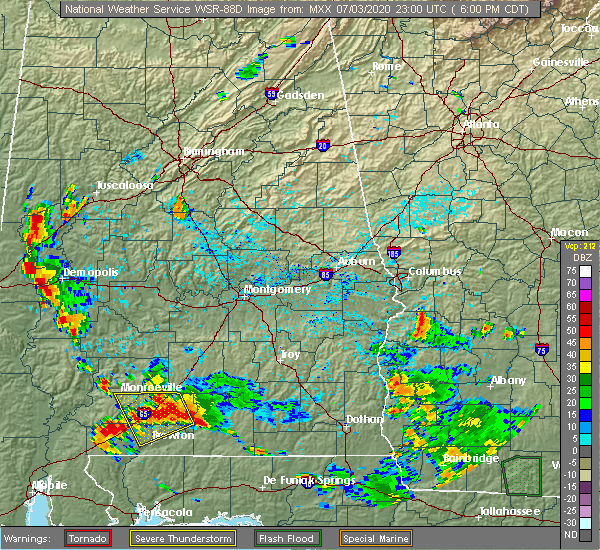 The national weather service in peachtree city has issued a * severe thunderstorm warning for. south central chattahoochee county in west central georgia. northeastern stewart county in west central georgia. until 745 pm edt. At 701 pm edt, severe thunderstorms were located along a line. The national weather service in peachtree city has issued a * severe thunderstorm warning for. south central chattahoochee county in west central georgia. northeastern stewart county in west central georgia. until 745 pm edt. At 701 pm edt, severe thunderstorms were located along a line.
|
| 6/30/2020 5:06 PM EDT |
 At 506 pm edt, severe thunderstorms were extending from near cusseta to near louvale to lumpkin, moving east at 30 mph (radar indicated). Hazards include 60 mph wind gusts and quarter size hail. Hail damage to vehicles is expected. Expect wind damage to roofs, siding, and trees. At 506 pm edt, severe thunderstorms were extending from near cusseta to near louvale to lumpkin, moving east at 30 mph (radar indicated). Hazards include 60 mph wind gusts and quarter size hail. Hail damage to vehicles is expected. Expect wind damage to roofs, siding, and trees.
|
| 6/28/2020 8:35 PM EDT |
 At 835 pm edt, severe thunderstorms were located along a line extending from near richland to near union, moving east at 30 mph (radar indicated). Hazards include 60 mph wind gusts and penny size hail. expect damage to roofs, siding, and trees At 835 pm edt, severe thunderstorms were located along a line extending from near richland to near union, moving east at 30 mph (radar indicated). Hazards include 60 mph wind gusts and penny size hail. expect damage to roofs, siding, and trees
|
| 6/28/2020 8:25 PM EDT | Tree reported down near the intersection of humber ave and mathis av in stewart county GA, 0.3 miles S of Lumpkin, GA |
| 6/28/2020 7:56 PM EDT |
 At 756 pm edt, a severe thunderstorm was located over lakepoint resort state park, or near georgetown, moving east at 45 mph (radar indicated). Hazards include 60 mph wind gusts and penny size hail. expect damage to roofs, siding, and trees At 756 pm edt, a severe thunderstorm was located over lakepoint resort state park, or near georgetown, moving east at 45 mph (radar indicated). Hazards include 60 mph wind gusts and penny size hail. expect damage to roofs, siding, and trees
|
| 6/24/2020 4:27 PM EDT |
 The severe thunderstorm warning for southeastern stewart county will expire at 430 pm edt, the storm which prompted the warning has weakened below severe limits, and no longer poses an immediate threat to life or property. therefore, the warning will be allowed to expire. however gusty winds and heavy rain are still possible with this thunderstorm. a severe thunderstorm watch remains in effect until 1000 pm edt for west central georgia. The severe thunderstorm warning for southeastern stewart county will expire at 430 pm edt, the storm which prompted the warning has weakened below severe limits, and no longer poses an immediate threat to life or property. therefore, the warning will be allowed to expire. however gusty winds and heavy rain are still possible with this thunderstorm. a severe thunderstorm watch remains in effect until 1000 pm edt for west central georgia.
|
| 6/24/2020 4:18 PM EDT |
 At 417 pm edt, a severe thunderstorm was located near westville, or near lumpkin, moving northeast at 25 mph (radar indicated). Hazards include 60 mph wind gusts and quarter size hail. Hail damage to vehicles is expected. expect wind damage to roofs, siding, and trees. Locations impacted include, lumpkin, richland, troutman, charles and westville. At 417 pm edt, a severe thunderstorm was located near westville, or near lumpkin, moving northeast at 25 mph (radar indicated). Hazards include 60 mph wind gusts and quarter size hail. Hail damage to vehicles is expected. expect wind damage to roofs, siding, and trees. Locations impacted include, lumpkin, richland, troutman, charles and westville.
|
| 6/24/2020 3:51 PM EDT |
 At 350 pm edt, a severe thunderstorm was located near union, or 10 miles northwest of cuthbert, moving northeast at 25 mph (radar indicated). Hazards include golf ball size hail and 60 mph wind gusts. People and animals outdoors will be injured. expect hail damage to roofs, siding, windows, and vehicles. expect wind damage to roofs, siding, and trees. Locations impacted include, lumpkin, richland, troutman, charles and westville. At 350 pm edt, a severe thunderstorm was located near union, or 10 miles northwest of cuthbert, moving northeast at 25 mph (radar indicated). Hazards include golf ball size hail and 60 mph wind gusts. People and animals outdoors will be injured. expect hail damage to roofs, siding, windows, and vehicles. expect wind damage to roofs, siding, and trees. Locations impacted include, lumpkin, richland, troutman, charles and westville.
|
| 6/24/2020 3:41 PM EDT |
 At 340 pm edt, a severe thunderstorm was located over union, or 9 miles northwest of cuthbert, moving northeast at 25 mph (radar indicated). Hazards include 60 mph wind gusts and half dollar size hail. Hail damage to vehicles is expected. Expect wind damage to roofs, siding, and trees. At 340 pm edt, a severe thunderstorm was located over union, or 9 miles northwest of cuthbert, moving northeast at 25 mph (radar indicated). Hazards include 60 mph wind gusts and half dollar size hail. Hail damage to vehicles is expected. Expect wind damage to roofs, siding, and trees.
|
| 5/22/2020 6:43 PM EDT |
 The severe thunderstorm warning for southern marion, southeastern chattahoochee, eastern stewart and webster counties will expire at 645 pm edt, the storms which prompted the warning have moved out of the area. therefore, the warning will be allowed to expire. The severe thunderstorm warning for southern marion, southeastern chattahoochee, eastern stewart and webster counties will expire at 645 pm edt, the storms which prompted the warning have moved out of the area. therefore, the warning will be allowed to expire.
|
| 5/22/2020 5:53 PM EDT |
 At 552 pm edt, severe thunderstorms were located along a line extending from near jamestown, south fort benning, to near richland to near troutman, moving northeast at 30 mph (radar indicated). Hazards include 60 mph wind gusts and quarter size hail. Hail damage to vehicles is expected. Expect wind damage to roofs, siding, and trees. At 552 pm edt, severe thunderstorms were located along a line extending from near jamestown, south fort benning, to near richland to near troutman, moving northeast at 30 mph (radar indicated). Hazards include 60 mph wind gusts and quarter size hail. Hail damage to vehicles is expected. Expect wind damage to roofs, siding, and trees.
|
| 5/22/2020 5:49 PM EDT | Multiple trees down along valley road in lumpkin in stewart county GA, 1.2 miles SSW of Lumpkin, GA |
| 5/22/2020 5:49 PM EDT | City of lumpkin - multiple trees down along valley road... powerlines down on liberty street... tree down on outbuilding on broad street in stewart county GA, 0.3 miles S of Lumpkin, GA |
| 5/22/2020 5:26 PM EDT |
 At 526 pm edt, severe thunderstorms were located along a line extending from near spring hill to near twin springs to near lakepoint resort state park to hatcher, moving northeast at 15 mph (radar indicated). Hazards include 60 mph wind gusts and quarter size hail. Hail damage to vehicles is expected. Expect wind damage to roofs, siding, and trees. At 526 pm edt, severe thunderstorms were located along a line extending from near spring hill to near twin springs to near lakepoint resort state park to hatcher, moving northeast at 15 mph (radar indicated). Hazards include 60 mph wind gusts and quarter size hail. Hail damage to vehicles is expected. Expect wind damage to roofs, siding, and trees.
|
| 4/20/2020 1:00 AM EDT |
 At 100 am edt, a severe thunderstorm was located near union, or near georgetown, moving east at 65 mph (radar indicated). Hazards include 60 mph wind gusts and penny size hail. expect damage to roofs, siding, and trees At 100 am edt, a severe thunderstorm was located near union, or near georgetown, moving east at 65 mph (radar indicated). Hazards include 60 mph wind gusts and penny size hail. expect damage to roofs, siding, and trees
|
| 4/13/2020 2:18 AM EDT |
 At 218 am edt, severe thunderstorms were located along a line extending from junction city to near florence marina state park, moving east at 50 mph (radar indicated). Hazards include 60 mph wind gusts. expect damage to roofs, siding, and trees At 218 am edt, severe thunderstorms were located along a line extending from junction city to near florence marina state park, moving east at 50 mph (radar indicated). Hazards include 60 mph wind gusts. expect damage to roofs, siding, and trees
|
| 2/6/2020 12:34 PM EST |
 At 1233 pm est, severe thunderstorms were located along a line extending from near jamestown/south fort benning to lugo, moving east at 55 mph (radar indicated). Hazards include 60 mph wind gusts. expect damage to roofs, siding, and trees At 1233 pm est, severe thunderstorms were located along a line extending from near jamestown/south fort benning to lugo, moving east at 55 mph (radar indicated). Hazards include 60 mph wind gusts. expect damage to roofs, siding, and trees
|
| 1/11/2020 5:57 PM EST |
 At 557 pm est, a severe thunderstorm was located over sanford, or 9 miles northeast of georgetown, moving northeast at 60 mph (radar indicated). Hazards include 60 mph wind gusts. expect damage to roofs, siding, and trees At 557 pm est, a severe thunderstorm was located over sanford, or 9 miles northeast of georgetown, moving northeast at 60 mph (radar indicated). Hazards include 60 mph wind gusts. expect damage to roofs, siding, and trees
|
| 1/11/2020 5:34 PM EST |
 At 533 pm est, severe thunderstorms were located along a line extending from olive branch to eelbeck/west fort benning to fort benning/lawson army air fld to near lakepoint resort state park, moving northeast at 55 mph (radar indicated). Hazards include 60 mph wind gusts. expect damage to roofs, siding, and trees At 533 pm est, severe thunderstorms were located along a line extending from olive branch to eelbeck/west fort benning to fort benning/lawson army air fld to near lakepoint resort state park, moving northeast at 55 mph (radar indicated). Hazards include 60 mph wind gusts. expect damage to roofs, siding, and trees
|
| 9/9/2019 3:17 PM EDT |
 At 316 pm edt, a severe thunderstorm was located near richland, or near preston, and is nearly stationary (radar indicated). Hazards include 60 mph wind gusts and nickel size hail. expect damage to roofs, siding, and trees At 316 pm edt, a severe thunderstorm was located near richland, or near preston, and is nearly stationary (radar indicated). Hazards include 60 mph wind gusts and nickel size hail. expect damage to roofs, siding, and trees
|
| 8/7/2019 9:54 PM EDT |
 At 954 pm edt, a severe thunderstorm was located over providence canyon state park, or just west of lumpkin, moving south at 15 mph (radar indicated). Hazards include 60 mph wind gusts and quarter size hail. Hail damage to vehicles is expected. Expect wind damage to roofs, siding, and trees. At 954 pm edt, a severe thunderstorm was located over providence canyon state park, or just west of lumpkin, moving south at 15 mph (radar indicated). Hazards include 60 mph wind gusts and quarter size hail. Hail damage to vehicles is expected. Expect wind damage to roofs, siding, and trees.
|
| 6/20/2019 4:51 PM EDT | Tree down on powerline on ga hwy 39... just west of the intersection of hwy 27 in stewart county GA, 7.5 miles SSE of Lumpkin, GA |
| 6/20/2019 4:51 PM EDT | Tree down on ga hwy 27 at mm 10 near the intersection of canyon r in stewart county GA, 1 miles S of Lumpkin, GA |
| 5/9/2019 7:05 PM EDT |
 The severe thunderstorm warning for stewart county will expire at 715 pm edt, the storm which prompted the warning has weakened below severe limits, and no longer poses an immediate threat to life or property. therefore, the warning will be allowed to expire. however small hail, gusty winds and heavy rain are still possible with this thunderstorm. The severe thunderstorm warning for stewart county will expire at 715 pm edt, the storm which prompted the warning has weakened below severe limits, and no longer poses an immediate threat to life or property. therefore, the warning will be allowed to expire. however small hail, gusty winds and heavy rain are still possible with this thunderstorm.
|
| 5/9/2019 6:39 PM EDT |
 At 639 pm edt, a severe thunderstorm was located over twin springs, or 10 miles north of georgetown, moving east at 25 mph (radar indicated). Hazards include 60 mph wind gusts and quarter size hail. Hail damage to vehicles is expected. Expect wind damage to roofs, siding, and trees. At 639 pm edt, a severe thunderstorm was located over twin springs, or 10 miles north of georgetown, moving east at 25 mph (radar indicated). Hazards include 60 mph wind gusts and quarter size hail. Hail damage to vehicles is expected. Expect wind damage to roofs, siding, and trees.
|
| 3/3/2019 5:16 PM EST |
 At 516 pm est, a confirmed large and extremely dangerous tornado was located near sanford, or 7 miles southwest of lumpkin, moving east at 60 mph. this is a particularly dangerous situation. take cover now! (radar confirmed tornado). Hazards include damaging tornado. You are in a life-threatening situation. flying debris may be deadly to those caught without shelter. mobile homes will be destroyed. Considerable damage to homes, businesses, and vehicles is likely and complete destruction is possible. At 516 pm est, a confirmed large and extremely dangerous tornado was located near sanford, or 7 miles southwest of lumpkin, moving east at 60 mph. this is a particularly dangerous situation. take cover now! (radar confirmed tornado). Hazards include damaging tornado. You are in a life-threatening situation. flying debris may be deadly to those caught without shelter. mobile homes will be destroyed. Considerable damage to homes, businesses, and vehicles is likely and complete destruction is possible.
|
| 3/3/2019 4:55 PM EST |
 At 455 pm est, a severe thunderstorm capable of producing a tornado was located over lugo, or near eufaula, moving east at 45 mph (radar indicated rotation). Hazards include tornado. Flying debris will be dangerous to those caught without shelter. mobile homes will be damaged or destroyed. damage to roofs, windows, and vehicles will occur. Tree damage is likely. At 455 pm est, a severe thunderstorm capable of producing a tornado was located over lugo, or near eufaula, moving east at 45 mph (radar indicated rotation). Hazards include tornado. Flying debris will be dangerous to those caught without shelter. mobile homes will be damaged or destroyed. damage to roofs, windows, and vehicles will occur. Tree damage is likely.
|
| 12/2/2018 6:35 AM EST |
 At 634 am est, a severe thunderstorm was located just southwest of lumpkin, moving northeast at 55 mph (radar indicated). Hazards include 60 mph wind gusts and quarter size hail. Hail damage to vehicles is expected. Expect wind damage to roofs, siding, and trees. At 634 am est, a severe thunderstorm was located just southwest of lumpkin, moving northeast at 55 mph (radar indicated). Hazards include 60 mph wind gusts and quarter size hail. Hail damage to vehicles is expected. Expect wind damage to roofs, siding, and trees.
|
| 7/3/2018 9:56 PM EDT |
 At 956 pm edt, a severe thunderstorm was located near louvale, or 9 miles southwest of cusseta, moving west at 25 mph (radar indicated). Hazards include 60 mph wind gusts and quarter size hail. Hail damage to vehicles is expected. expect wind damage to roofs, siding, and trees. Locations impacted include, lumpkin, cusseta, omaha, charles, westville, jamestown/south fort benning, louvale and providence canyon state park. At 956 pm edt, a severe thunderstorm was located near louvale, or 9 miles southwest of cusseta, moving west at 25 mph (radar indicated). Hazards include 60 mph wind gusts and quarter size hail. Hail damage to vehicles is expected. expect wind damage to roofs, siding, and trees. Locations impacted include, lumpkin, cusseta, omaha, charles, westville, jamestown/south fort benning, louvale and providence canyon state park.
|
| 7/3/2018 9:39 PM EDT |
 At 938 pm edt, a severe thunderstorm was located over renfroe, or near cusseta, moving west at 25 mph (radar indicated). Hazards include 60 mph wind gusts and quarter size hail. Hail damage to vehicles is expected. Expect wind damage to roofs, siding, and trees. At 938 pm edt, a severe thunderstorm was located over renfroe, or near cusseta, moving west at 25 mph (radar indicated). Hazards include 60 mph wind gusts and quarter size hail. Hail damage to vehicles is expected. Expect wind damage to roofs, siding, and trees.
|
| 6/28/2018 4:15 PM EDT |
 At 414 pm edt, the leading edge of a line of severe thunderstorms was located along a line extending from near twin springs to near sanford to parrott, moving south at 35 mph (radar indicated). Hazards include 60 mph wind gusts. Expect damage to roofs, siding, and trees. Locations impacted include, lumpkin, preston, richland, weston, seminole, charles, kimbrough, westville, brooklyn, leveretts, troutman, omaha, sanford, centerpoint, dumas, louvale and providence canyon state park. At 414 pm edt, the leading edge of a line of severe thunderstorms was located along a line extending from near twin springs to near sanford to parrott, moving south at 35 mph (radar indicated). Hazards include 60 mph wind gusts. Expect damage to roofs, siding, and trees. Locations impacted include, lumpkin, preston, richland, weston, seminole, charles, kimbrough, westville, brooklyn, leveretts, troutman, omaha, sanford, centerpoint, dumas, louvale and providence canyon state park.
|
| 6/28/2018 3:43 PM EDT |
 The national weather service in peachtree city has issued a * severe thunderstorm warning for. southern marion county in west central georgia. southwestern muscogee county in west central georgia. chattahoochee county in west central georgia. Stewart county in west central georgia. The national weather service in peachtree city has issued a * severe thunderstorm warning for. southern marion county in west central georgia. southwestern muscogee county in west central georgia. chattahoochee county in west central georgia. Stewart county in west central georgia.
|
| 6/28/2018 3:00 PM EDT |
 At 259 pm edt, the leading edge of a line of severe thunderstorms was located along a line extending from columbus metropolitan airport to near buena vista to near ellaville, moving southwest at 30 mph (radar indicated). Hazards include 60 mph wind gusts. expect damage to roofs, siding, and trees At 259 pm edt, the leading edge of a line of severe thunderstorms was located along a line extending from columbus metropolitan airport to near buena vista to near ellaville, moving southwest at 30 mph (radar indicated). Hazards include 60 mph wind gusts. expect damage to roofs, siding, and trees
|
| 6/9/2018 3:33 PM EDT |
 At 333 pm edt, a severe thunderstorm was located over lumpkin, and is nearly stationary (radar indicated). Hazards include 60 mph wind gusts and quarter size hail. Hail damage to vehicles is expected. Expect wind damage to roofs, siding, and trees. At 333 pm edt, a severe thunderstorm was located over lumpkin, and is nearly stationary (radar indicated). Hazards include 60 mph wind gusts and quarter size hail. Hail damage to vehicles is expected. Expect wind damage to roofs, siding, and trees.
|
| 6/3/2018 8:02 PM EDT |
 At 801 pm edt, a severe thunderstorm was located over fort mitchell activity center, or 10 miles south of phenix city, moving southeast at 30 mph (radar indicated). Hazards include 60 mph wind gusts and quarter size hail. Hail damage to vehicles is expected. Expect wind damage to roofs, siding, and trees. At 801 pm edt, a severe thunderstorm was located over fort mitchell activity center, or 10 miles south of phenix city, moving southeast at 30 mph (radar indicated). Hazards include 60 mph wind gusts and quarter size hail. Hail damage to vehicles is expected. Expect wind damage to roofs, siding, and trees.
|
| 5/29/2017 3:49 PM EDT |
 At 349 pm edt, a severe thunderstorm was located over lumpkin, moving northeast at 30 mph (radar indicated). Hazards include 60 mph wind gusts and quarter size hail. Hail damage to vehicles is expected. Expect wind damage to roofs, siding, and trees. At 349 pm edt, a severe thunderstorm was located over lumpkin, moving northeast at 30 mph (radar indicated). Hazards include 60 mph wind gusts and quarter size hail. Hail damage to vehicles is expected. Expect wind damage to roofs, siding, and trees.
|
| 5/20/2017 2:56 PM EDT |
 At 256 pm edt, severe thunderstorms were located along a line extending from near twin springs to near friendship, moving north at 25 mph (radar indicated). Hazards include 60 mph wind gusts and quarter size hail. Hail damage to vehicles is expected. Expect wind damage to roofs, siding, and trees. At 256 pm edt, severe thunderstorms were located along a line extending from near twin springs to near friendship, moving north at 25 mph (radar indicated). Hazards include 60 mph wind gusts and quarter size hail. Hail damage to vehicles is expected. Expect wind damage to roofs, siding, and trees.
|
| 4/5/2017 12:33 PM EDT |
 At 1232 pm edt, a confirmed large and destructive tornado was located near benevolence, or 7 miles south of lumpkin, moving northeast at 35 mph. tornado emergency for southern stewart county and webster county. this is a particularly dangerous situation. take cover now! (emergency management confirmed tornado). Hazards include deadly tornado. You are in a life-threatening situation. flying debris may be deadly to those caught without shelter. mobile homes will be destroyed. considerable damage to homes, businesses, and vehicles is likely and complete destruction is possible. Locations impacted include, lumpkin, preston, richland, weston, seminole, kimbrough, westville, leveretts, troutman, church hill, centerpoint, dumas and chambliss. At 1232 pm edt, a confirmed large and destructive tornado was located near benevolence, or 7 miles south of lumpkin, moving northeast at 35 mph. tornado emergency for southern stewart county and webster county. this is a particularly dangerous situation. take cover now! (emergency management confirmed tornado). Hazards include deadly tornado. You are in a life-threatening situation. flying debris may be deadly to those caught without shelter. mobile homes will be destroyed. considerable damage to homes, businesses, and vehicles is likely and complete destruction is possible. Locations impacted include, lumpkin, preston, richland, weston, seminole, kimbrough, westville, leveretts, troutman, church hill, centerpoint, dumas and chambliss.
|
| 4/5/2017 12:09 PM EDT |
 At 1208 pm edt, a severe thunderstorm capable of producing a tornado was located over crossroads, or near georgetown, moving northeast at 35 mph (radar indicated rotation). Hazards include tornado and ping pong ball size hail. Flying debris will be dangerous to those caught without shelter. mobile homes will be damaged or destroyed. damage to roofs, windows, and vehicles will occur. Tree damage is likely. At 1208 pm edt, a severe thunderstorm capable of producing a tornado was located over crossroads, or near georgetown, moving northeast at 35 mph (radar indicated rotation). Hazards include tornado and ping pong ball size hail. Flying debris will be dangerous to those caught without shelter. mobile homes will be damaged or destroyed. damage to roofs, windows, and vehicles will occur. Tree damage is likely.
|
| 4/5/2017 11:38 AM EDT |
 At 1137 am edt, a severe thunderstorm was located near osco, or near eufaula, moving northeast at 55 mph (radar indicated). Hazards include ping pong ball size hail and 60 mph wind gusts. People and animals outdoors will be injured. expect hail damage to roofs, siding, windows, and vehicles. Expect wind damage to roofs, siding, and trees. At 1137 am edt, a severe thunderstorm was located near osco, or near eufaula, moving northeast at 55 mph (radar indicated). Hazards include ping pong ball size hail and 60 mph wind gusts. People and animals outdoors will be injured. expect hail damage to roofs, siding, windows, and vehicles. Expect wind damage to roofs, siding, and trees.
|
| 4/5/2017 3:53 AM EDT |
 The severe thunderstorm warning for stewart and northern webster counties will expire at 400 am edt, the severe thunderstorm which prompted the warning has weakened. therefore, the warning will be allowed to expire. however small hail and gusty winds are still possible with this thunderstorm. a severe thunderstorm watch remains in effect until 900 am edt for west central georgia. The severe thunderstorm warning for stewart and northern webster counties will expire at 400 am edt, the severe thunderstorm which prompted the warning has weakened. therefore, the warning will be allowed to expire. however small hail and gusty winds are still possible with this thunderstorm. a severe thunderstorm watch remains in effect until 900 am edt for west central georgia.
|
| 4/5/2017 3:08 AM EDT |
 At 307 am edt, a severe thunderstorm was located over texasville, or 13 miles east of clio, moving northeast at 55 mph (radar indicated). Hazards include 60 mph wind gusts and half dollar size hail. Hail damage to vehicles is expected. Expect wind damage to roofs, siding, and trees. At 307 am edt, a severe thunderstorm was located over texasville, or 13 miles east of clio, moving northeast at 55 mph (radar indicated). Hazards include 60 mph wind gusts and half dollar size hail. Hail damage to vehicles is expected. Expect wind damage to roofs, siding, and trees.
|
| 4/3/2017 12:22 PM EDT |
 The severe thunderstorm warning for stewart and webster counties will expire at 1230 pm edt, a severe thunderstorm watch remains in effect until 500 pm edt for west central georgia. remember, a tornado warning still remains in effect for stewart and webster counties. The severe thunderstorm warning for stewart and webster counties will expire at 1230 pm edt, a severe thunderstorm watch remains in effect until 500 pm edt for west central georgia. remember, a tornado warning still remains in effect for stewart and webster counties.
|
| 4/3/2017 12:13 PM EDT | Tree reported down at intersection of rockwell street and hardwick lan in stewart county GA, 0.6 miles WSW of Lumpkin, GA |
| 4/3/2017 12:10 PM EDT | Several trees down and shingle damage on home on old chestnut road in stewart county GA, 1.6 miles NE of Lumpkin, GA |
| 4/3/2017 12:07 PM EDT |
 At 1207 pm edt, severe thunderstorms capable of producing both tornadoes and extensive straight line wind damage were located near lumpkin, moving east at 50 mph (radar indicated rotation). Hazards include tornado. Flying debris will be dangerous to those caught without shelter. mobile homes will be damaged or destroyed. damage to roofs, windows, and vehicles will occur. Tree damage is likely. At 1207 pm edt, severe thunderstorms capable of producing both tornadoes and extensive straight line wind damage were located near lumpkin, moving east at 50 mph (radar indicated rotation). Hazards include tornado. Flying debris will be dangerous to those caught without shelter. mobile homes will be damaged or destroyed. damage to roofs, windows, and vehicles will occur. Tree damage is likely.
|
| 4/3/2017 11:56 AM EDT |
 At 1153 am edt, a severe thunderstorm was located over sanford, or 8 miles northeast of georgetown, moving northeast at 55 mph (radar indicated). Hazards include 60 mph wind gusts. expect damage to roofs, siding, and trees At 1153 am edt, a severe thunderstorm was located over sanford, or 8 miles northeast of georgetown, moving northeast at 55 mph (radar indicated). Hazards include 60 mph wind gusts. expect damage to roofs, siding, and trees
|
| 1/2/2017 5:37 PM EST |
 At 537 pm est, a tornado producing storm was located near benevolence, or 9 miles north of cuthbert, moving east at 40 mph (radar confirmed tornado). Hazards include damaging tornado and quarter size hail. Flying debris will be dangerous to those caught without shelter. mobile homes will be damaged or destroyed. damage to roofs, windows, and vehicles will occur. Tree damage is likely. At 537 pm est, a tornado producing storm was located near benevolence, or 9 miles north of cuthbert, moving east at 40 mph (radar confirmed tornado). Hazards include damaging tornado and quarter size hail. Flying debris will be dangerous to those caught without shelter. mobile homes will be damaged or destroyed. damage to roofs, windows, and vehicles will occur. Tree damage is likely.
|
| 7/6/2016 2:22 PM EDT |
 At 222 pm edt, a severe thunderstorm was located 8 miles northeast of hawkinsville, or 15 miles southeast of hurtsboro, moving east at 35 mph (radar indicated). Hazards include 60 mph wind gusts and penny size hail. Expect damage to roofs. siding. and trees. Other locations in the warning include but are not limited to lumpkin, richland, omaha, renfroe, louvale, providence canyon state park, westville, brooklyn and charles. At 222 pm edt, a severe thunderstorm was located 8 miles northeast of hawkinsville, or 15 miles southeast of hurtsboro, moving east at 35 mph (radar indicated). Hazards include 60 mph wind gusts and penny size hail. Expect damage to roofs. siding. and trees. Other locations in the warning include but are not limited to lumpkin, richland, omaha, renfroe, louvale, providence canyon state park, westville, brooklyn and charles.
|
| 6/25/2016 4:57 PM EDT |
 At 457 pm edt, a severe thunderstorm was located near preston, moving south at 15 mph (radar indicated). Hazards include 60 mph wind gusts and quarter size hail. Hail damage to vehicles is expected. expect wind damage to roofs, siding, and trees. Other locations in the warning include but are not limited to preston, richland, weston, seminole, church hill, brooklyn, troutman, kimbrough, centerpoint, leveretts, dumas and westville. At 457 pm edt, a severe thunderstorm was located near preston, moving south at 15 mph (radar indicated). Hazards include 60 mph wind gusts and quarter size hail. Hail damage to vehicles is expected. expect wind damage to roofs, siding, and trees. Other locations in the warning include but are not limited to preston, richland, weston, seminole, church hill, brooklyn, troutman, kimbrough, centerpoint, leveretts, dumas and westville.
|
| 6/25/2016 4:39 PM EDT |
 At 439 pm edt, a severe thunderstorm was located near richland, or near preston, moving south at 15 mph (radar indicated). Hazards include 60 mph wind gusts and quarter size hail. Hail damage to vehicles is expected. expect wind damage to roofs, siding, and trees. Other locations in the warning include but are not limited to preston, richland, weston, seminole, church hill, brooklyn, troutman, kimbrough, centerpoint, leveretts, dumas and westville. At 439 pm edt, a severe thunderstorm was located near richland, or near preston, moving south at 15 mph (radar indicated). Hazards include 60 mph wind gusts and quarter size hail. Hail damage to vehicles is expected. expect wind damage to roofs, siding, and trees. Other locations in the warning include but are not limited to preston, richland, weston, seminole, church hill, brooklyn, troutman, kimbrough, centerpoint, leveretts, dumas and westville.
|
| 6/17/2016 7:27 PM EDT |
 At 727 pm edt, a severe thunderstorm was located near lumpkin, moving south at 25 mph (radar indicated). Hazards include 60 mph wind gusts and quarter size hail. Hail damage to vehicles is expected. expect wind damage to roofs, siding, and trees. Other locations in the warning include but are not limited to lumpkin, richland, weston, sanford, louvale, providence canyon state park, westville, brooklyn, troutman, kimbrough and charles. At 727 pm edt, a severe thunderstorm was located near lumpkin, moving south at 25 mph (radar indicated). Hazards include 60 mph wind gusts and quarter size hail. Hail damage to vehicles is expected. expect wind damage to roofs, siding, and trees. Other locations in the warning include but are not limited to lumpkin, richland, weston, sanford, louvale, providence canyon state park, westville, brooklyn, troutman, kimbrough and charles.
|
| 4/7/2016 2:04 AM EDT |
 At 204 am edt, a confirmed tornado was located over lumpkin, moving east at 40 mph (radar confirmed tornado). Hazards include damaging tornado. Flying debris will be dangerous to those caught without shelter. mobile homes will be damaged or destroyed. damage to roofs, windows, and vehicles will occur. tree damage is likely. Other locations in the warning include but are not limited to lumpkin, preston, richland, seminole, church hill, louvale, westville, brooklyn, kimbrough, charles and dumas. At 204 am edt, a confirmed tornado was located over lumpkin, moving east at 40 mph (radar confirmed tornado). Hazards include damaging tornado. Flying debris will be dangerous to those caught without shelter. mobile homes will be damaged or destroyed. damage to roofs, windows, and vehicles will occur. tree damage is likely. Other locations in the warning include but are not limited to lumpkin, preston, richland, seminole, church hill, louvale, westville, brooklyn, kimbrough, charles and dumas.
|
| 4/7/2016 1:49 AM EDT |
 At 148 am edt, a severe thunderstorm capable of producing a tornado was located 9 miles west of lumpkin, moving east at 40 mph (radar indicated rotation). Hazards include tornado. Flying debris will be dangerous to those caught without shelter. mobile homes will be damaged or destroyed. damage to roofs, windows, and vehicles will occur. Tree damage is likely. At 148 am edt, a severe thunderstorm capable of producing a tornado was located 9 miles west of lumpkin, moving east at 40 mph (radar indicated rotation). Hazards include tornado. Flying debris will be dangerous to those caught without shelter. mobile homes will be damaged or destroyed. damage to roofs, windows, and vehicles will occur. Tree damage is likely.
|
| 2/15/2016 7:08 PM CST |
 At 806 pm est, a line of severe thunderstorms were located near opelika through central russell county to clayton in alabama, moving northeast at 60 mph (radar indicated). Hazards include 60 mph wind gusts. Expect damage to roofs. siding and trees. Other locations in the warning include but are not limited to lumpkin, hamilton, cusseta, richland, waverly hall, upatoi, fort benning/lawson army air fld, bibb city, north fort benning, edgewood, sanford, eelbeck/west fort benning, kenwood, mountain hill, bartletts ferry dam, fortson, rose hill, lake harding, avondale and benning park. At 806 pm est, a line of severe thunderstorms were located near opelika through central russell county to clayton in alabama, moving northeast at 60 mph (radar indicated). Hazards include 60 mph wind gusts. Expect damage to roofs. siding and trees. Other locations in the warning include but are not limited to lumpkin, hamilton, cusseta, richland, waverly hall, upatoi, fort benning/lawson army air fld, bibb city, north fort benning, edgewood, sanford, eelbeck/west fort benning, kenwood, mountain hill, bartletts ferry dam, fortson, rose hill, lake harding, avondale and benning park.
|
| 12/24/2015 3:48 AM EST | At 346 am est, a severe thunderstorm was located near georgetown or about 15 miles west-southwest of lumpkin, moving northeast at 35 mph. weak rotation has been detected in this storm (radar indicated). Hazards include 60 mph wind gusts. Expect damage to roofs. siding and trees. Other locations in the warning include but are not limited to lumpkin, richland, sanford, louvale, providence canyon state park, westville and charles. |
| 6/9/2015 2:55 PM EDT |
 The severe thunderstorm warning for southern marion, stewart and webster counties will expire at 300 pm edt, the storms which prompted the warning have weakened below severe limits, and no longer pose an immediate threat to life or property. therefore the warning will be allowed to expire. however heavy rain is still possible with these thunderstorms. minor flooding may become an issue if storms continue to cluster in this area. motorists should remember to turn around don`t drown if encountering water on roadways. The severe thunderstorm warning for southern marion, stewart and webster counties will expire at 300 pm edt, the storms which prompted the warning have weakened below severe limits, and no longer pose an immediate threat to life or property. therefore the warning will be allowed to expire. however heavy rain is still possible with these thunderstorms. minor flooding may become an issue if storms continue to cluster in this area. motorists should remember to turn around don`t drown if encountering water on roadways.
|
| 6/9/2015 2:18 PM EDT |
 At 217 pm edt, severe thunderstorms were located along a line extending from 8 miles southeast of cusseta to 8 miles southwest of lumpkin, moving east at 30 mph (radar indicated). Hazards include 60 mph wind gusts and quarter size hail. Hail damage to vehicles is expected. expect wind damage to roofs, siding and trees. Other locations in the warning include but are not limited to lumpkin, preston, richland, weston, seminole, omaha, sanford, florence marina state park, brooklyn, troutman, charles, draneville, church hill, louvale, providence canyon state park, westville, kimbrough, centerpoint, leveretts and dumas. At 217 pm edt, severe thunderstorms were located along a line extending from 8 miles southeast of cusseta to 8 miles southwest of lumpkin, moving east at 30 mph (radar indicated). Hazards include 60 mph wind gusts and quarter size hail. Hail damage to vehicles is expected. expect wind damage to roofs, siding and trees. Other locations in the warning include but are not limited to lumpkin, preston, richland, weston, seminole, omaha, sanford, florence marina state park, brooklyn, troutman, charles, draneville, church hill, louvale, providence canyon state park, westville, kimbrough, centerpoint, leveretts and dumas.
|
| 4/19/2015 11:05 AM EDT | At 1105 am edt, a severe thunderstorm was located 9 miles southwest of weston, or 9 miles north of cuthbert, moving northeast at 45 mph (radar indicated). Hazards include 60 mph wind gusts. Expect damage to roofs. siding and trees. other locations in the warning include but are not limited to preston, richland, plains, weston, seminole, brooklyn, troutman, draneville, friendship, church hill, kimbrough, centerpoint, leveretts and dumas. a tornado watch remains in effect until 300 pm edt for west central georgia. Possible. |
| 1/30/2013 4:10 PM EST | Several trees were blown down across the southern portion of the count in stewart county GA, 4.5 miles N of Lumpkin, GA |
| 6/14/2012 5:22 PM EDT | Stewart county sheriffs office relayed a report of a downed tree in lumpkin. radar estimated time of 1722 ed in stewart county GA, 0.6 miles WSW of Lumpkin, GA |
| 6/14/2012 5:22 PM EDT | A county official reported a tree down on troatman roa in stewart county GA, 2 miles WNW of Lumpkin, GA |
| 6/14/2012 5:22 PM EDT | County official reported a tree down on holder roa in stewart county GA, 4.2 miles WNW of Lumpkin, GA |
| 3/27/2011 1:50 PM EDT | Quarter sized hail reported 9.7 miles SE of Lumpkin, GA |
| 1/1/0001 12:00 AM | Stewart county sheriff reported a possible tornado with trees down on canyon roa in stewart county GA, 4.8 miles ESE of Lumpkin, GA |
Hail Maps for Lumpkin, GA

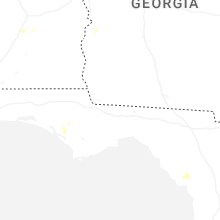
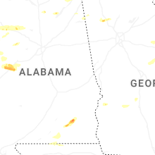


Connect with Interactive Hail Maps