

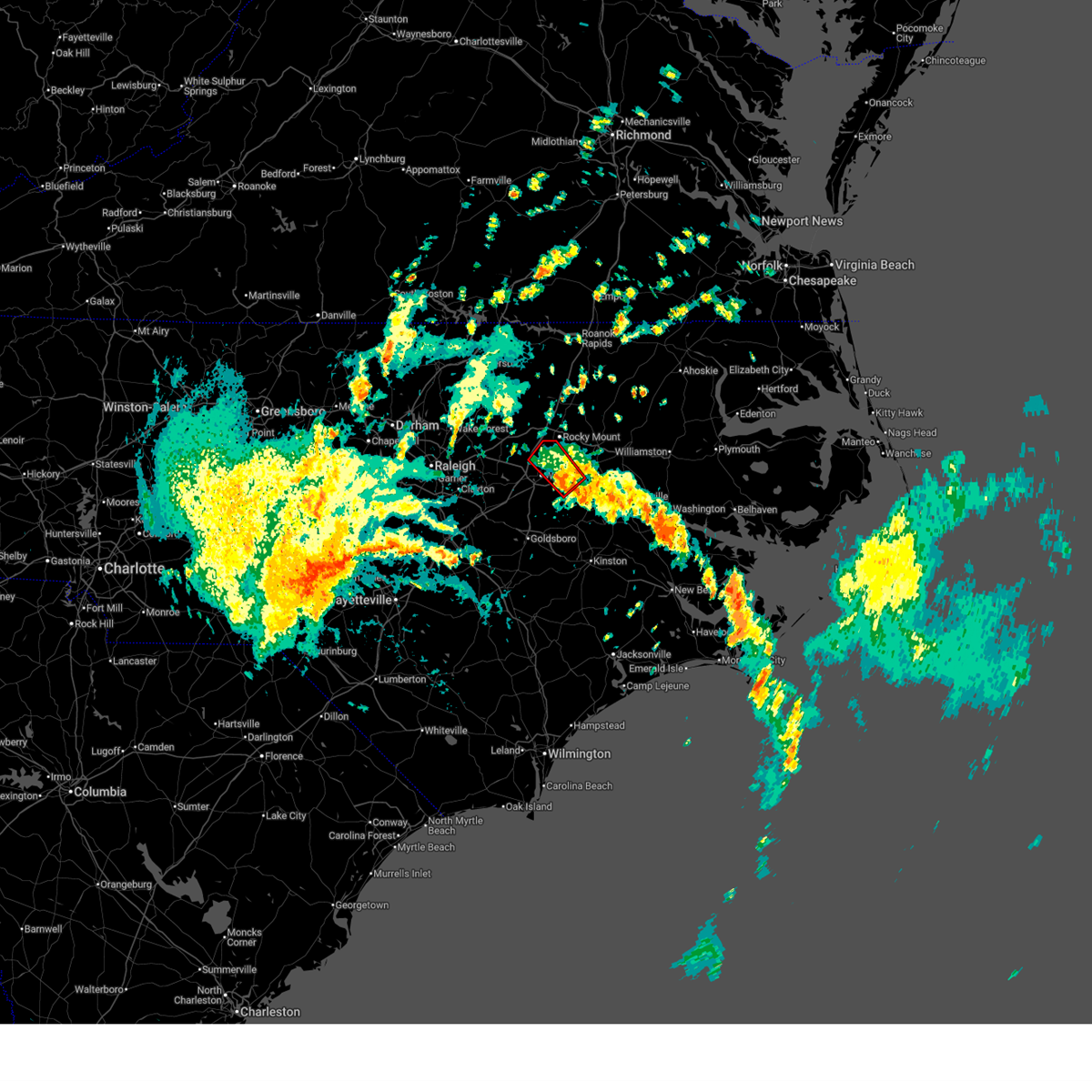
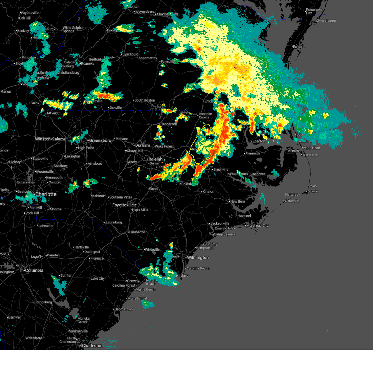
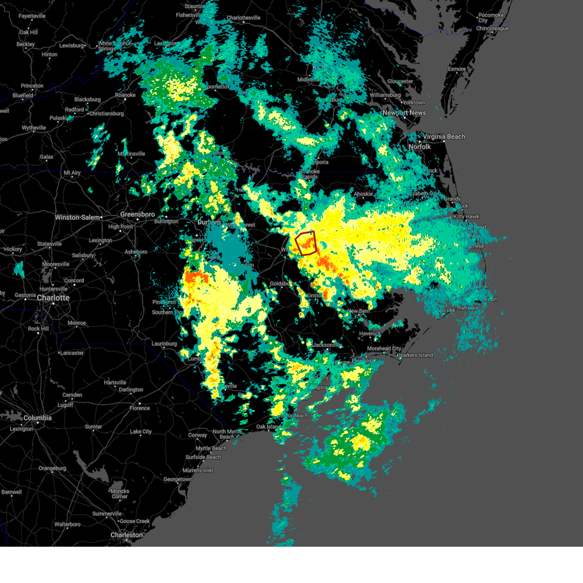
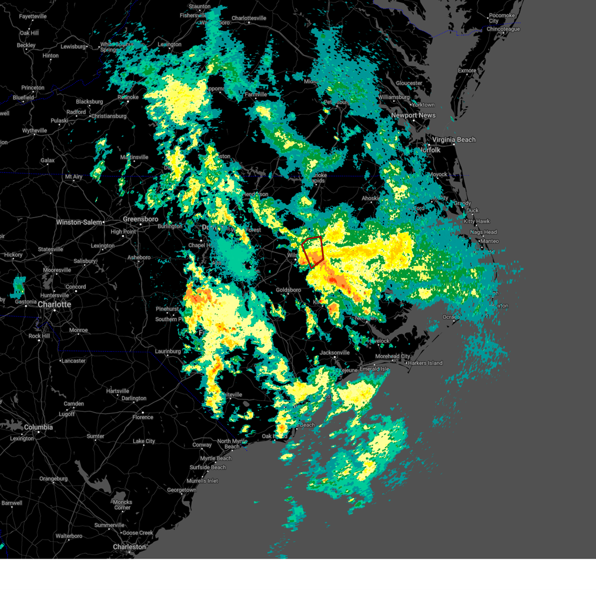
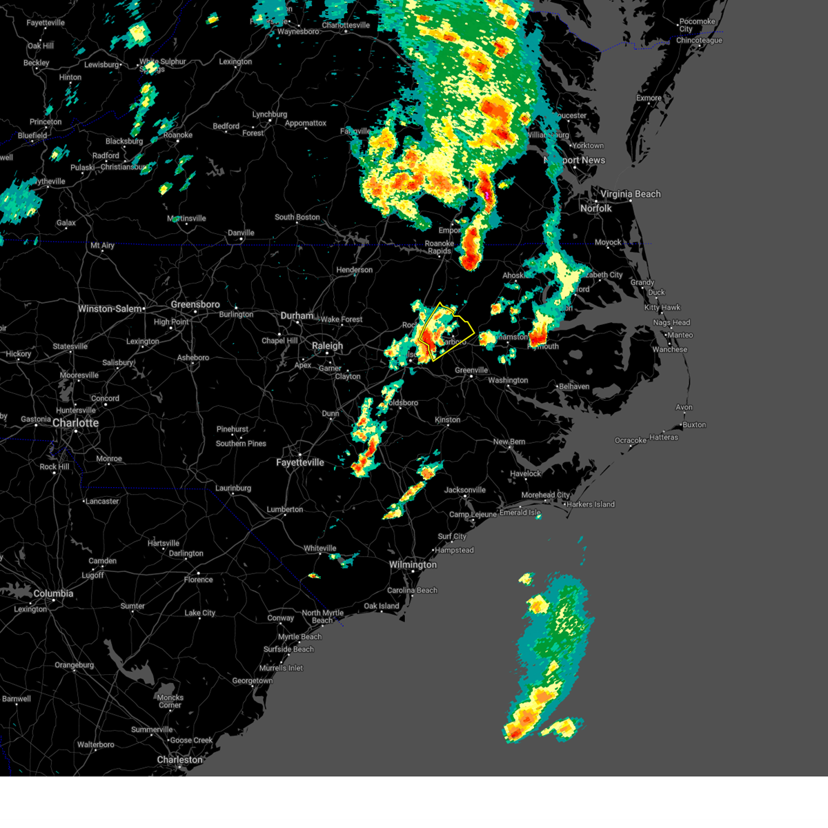
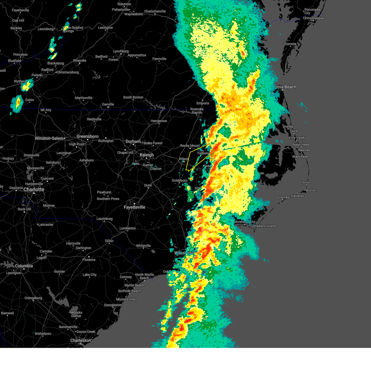
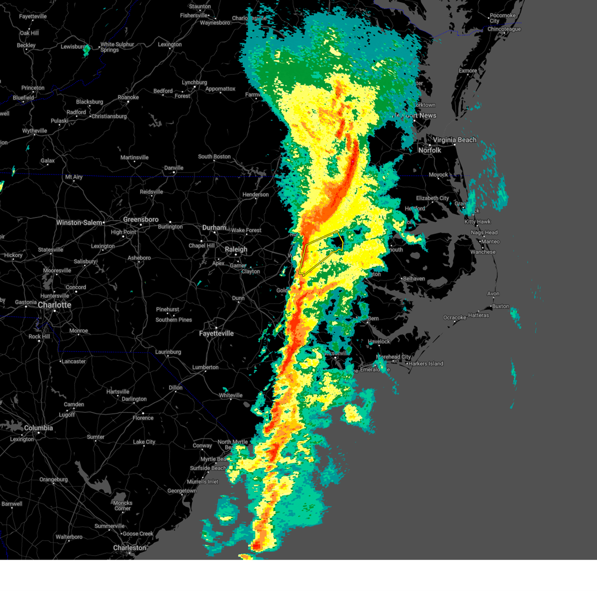
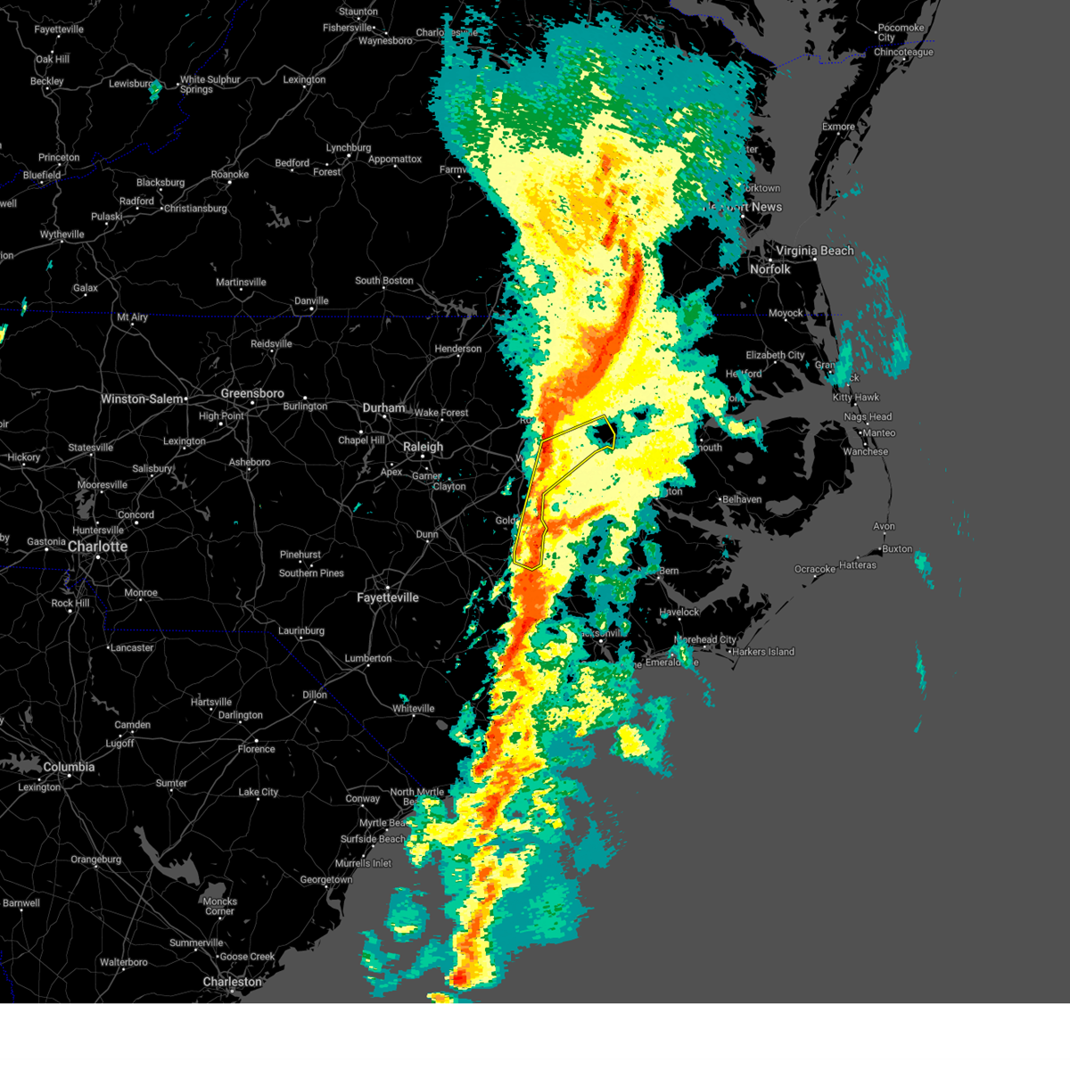
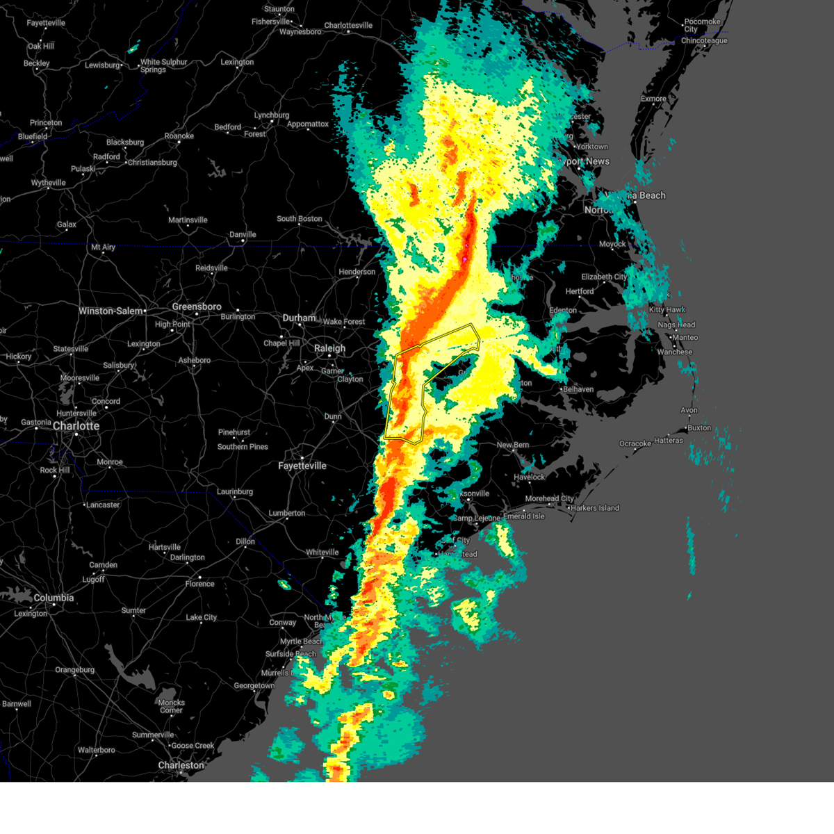
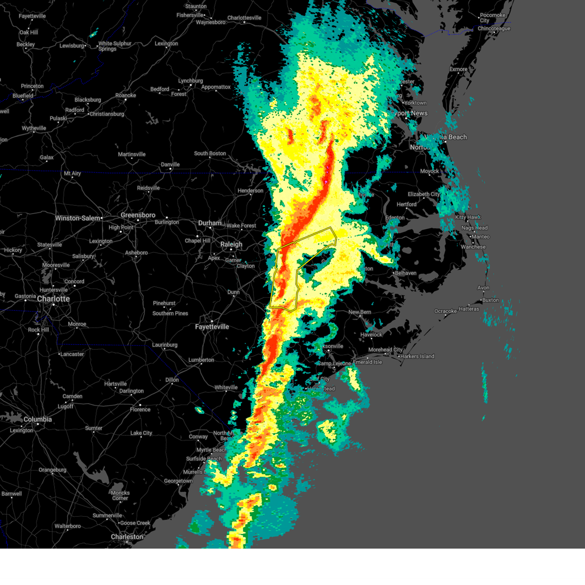
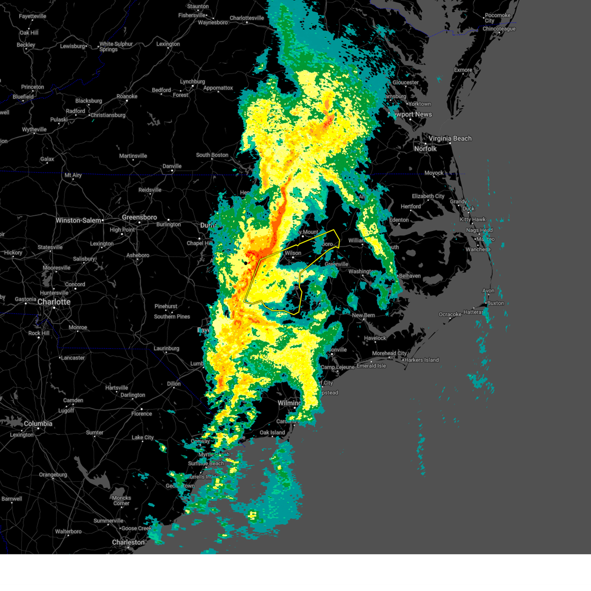
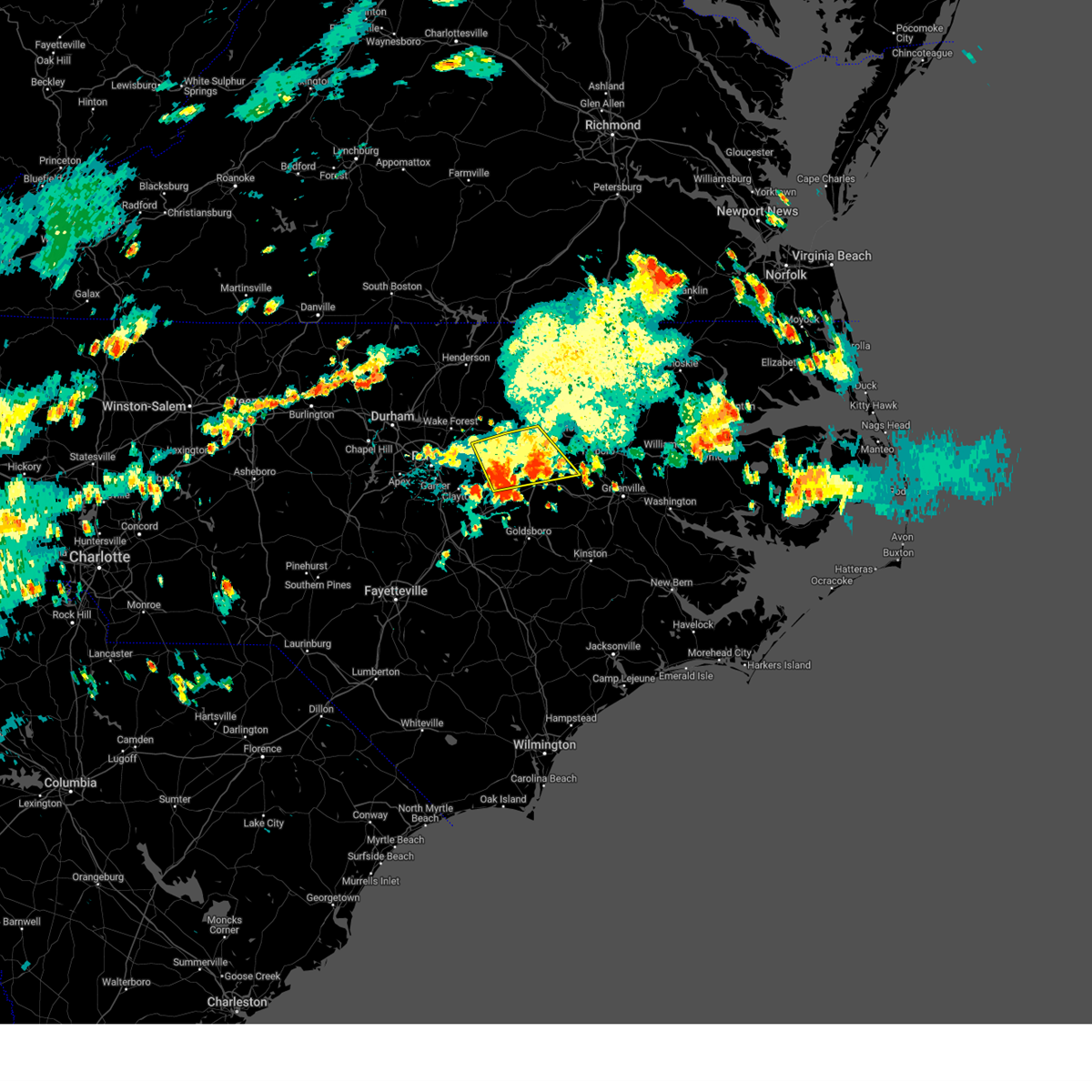
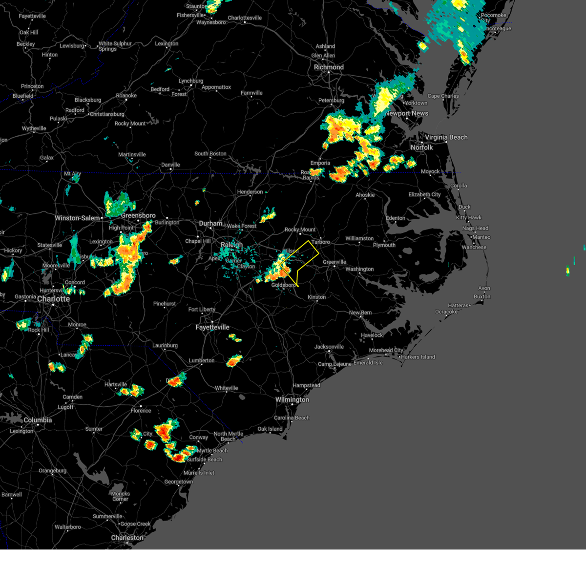
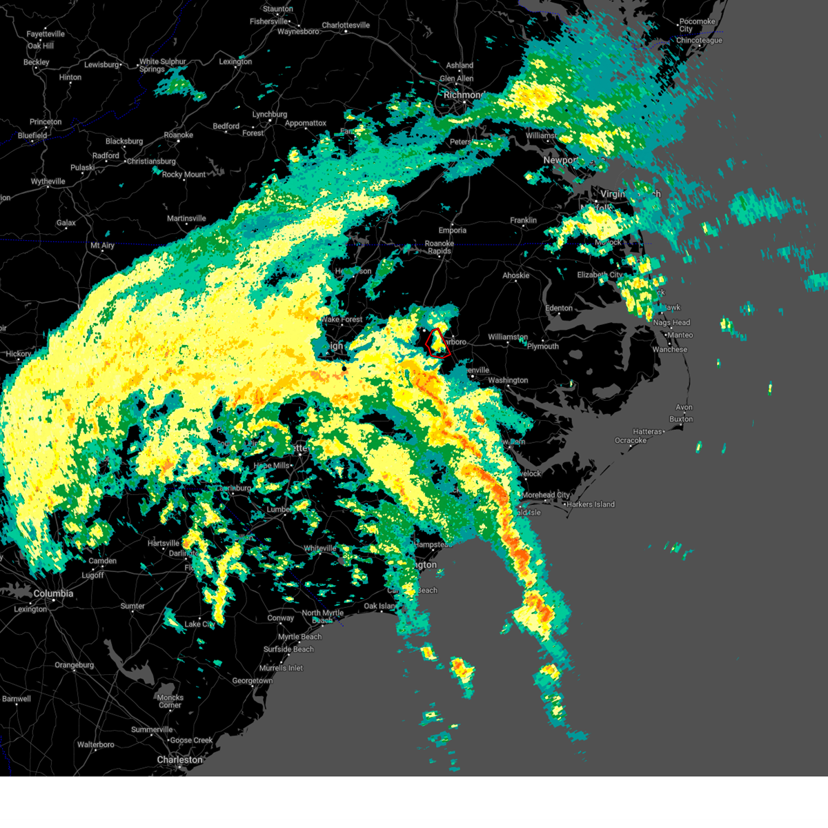
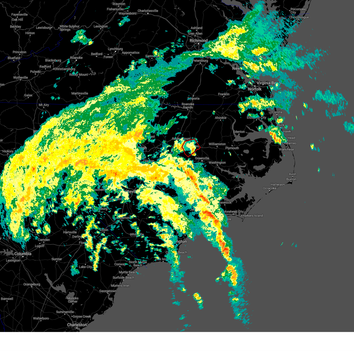
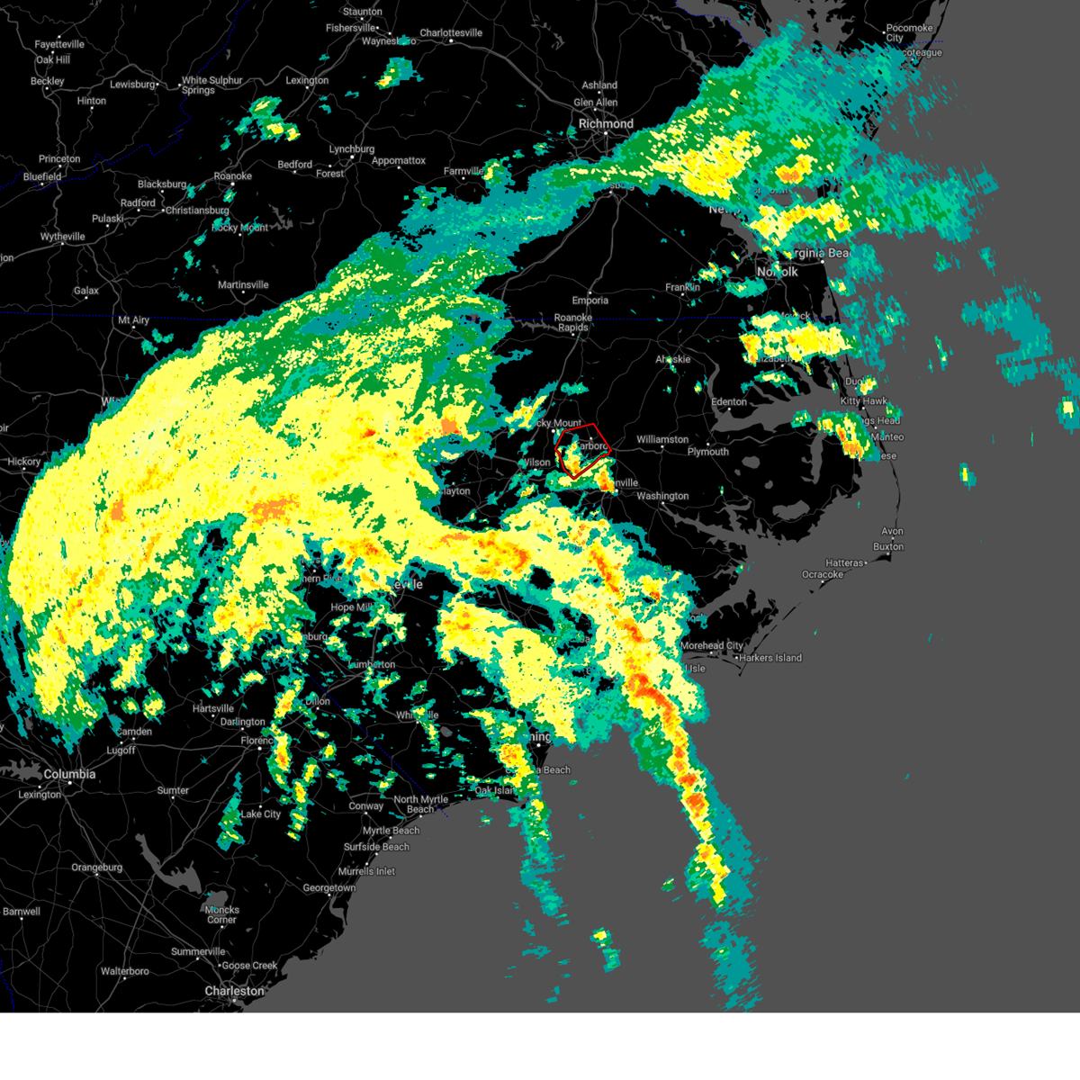
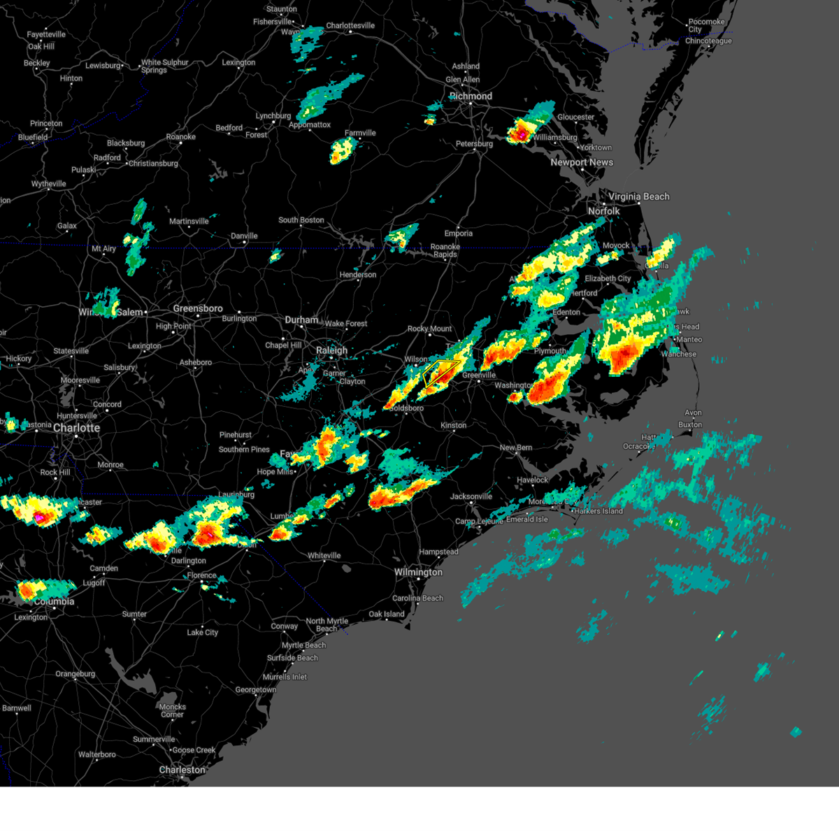
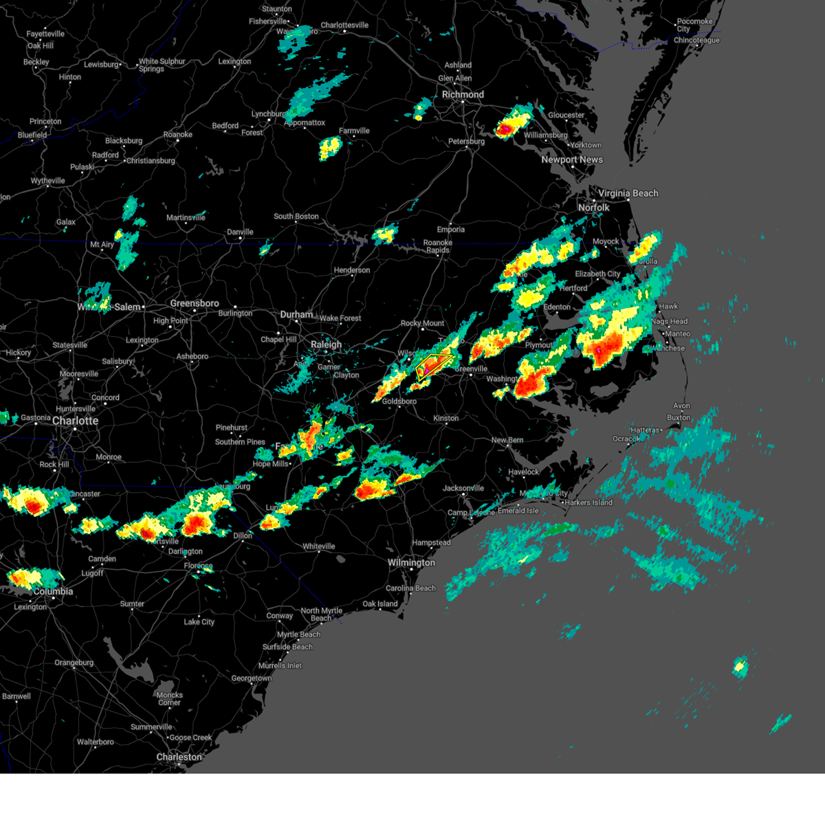
Hail Map for Macclesfield, NC
The Macclesfield, NC area has had 2 reports of on-the-ground hail by trained spotters, and has been under severe weather warnings 45 times during the past 12 months. Doppler radar has detected hail at or near Macclesfield, NC on 42 occasions, including 1 occasion during the past year.
| Name: | Macclesfield, NC |
| Where Located: | 54.7 miles E of Raleigh, NC |
| Map: | Google Map for Macclesfield, NC |
| Population: | 471 |
| Housing Units: | 256 |
| More Info: | Search Google for Macclesfield, NC |
0
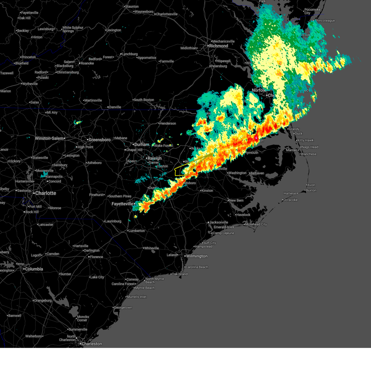
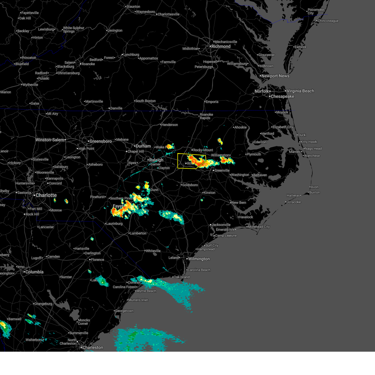
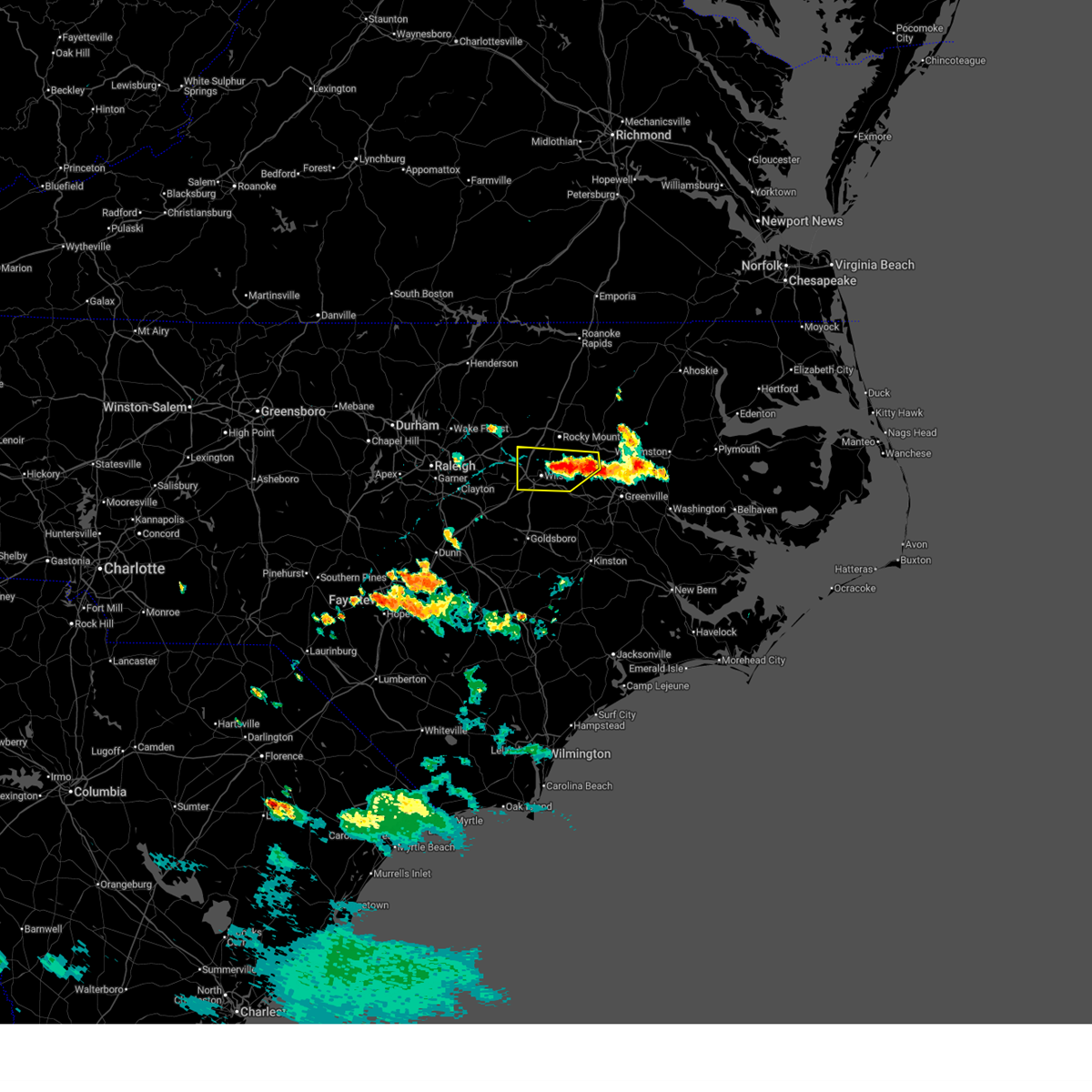
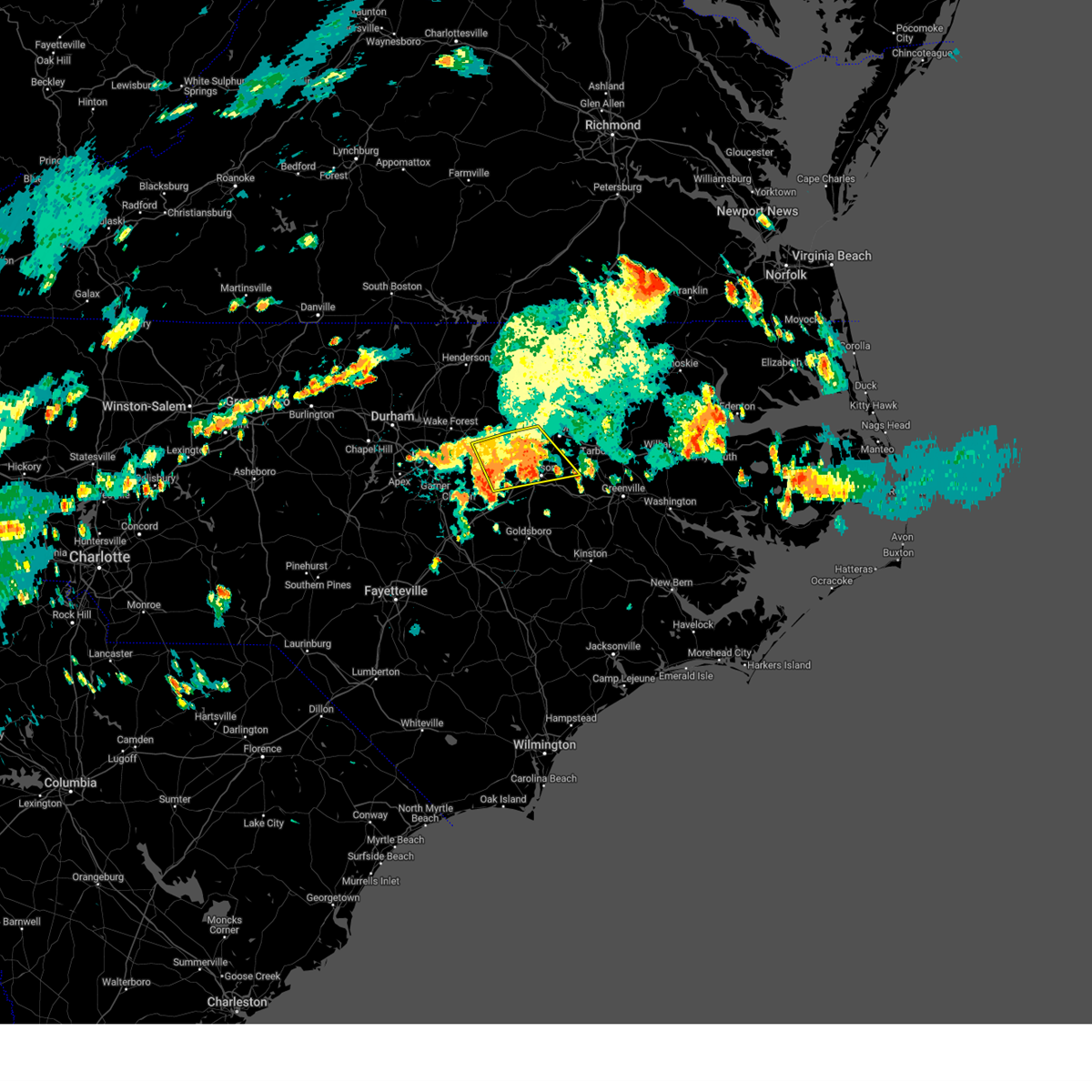
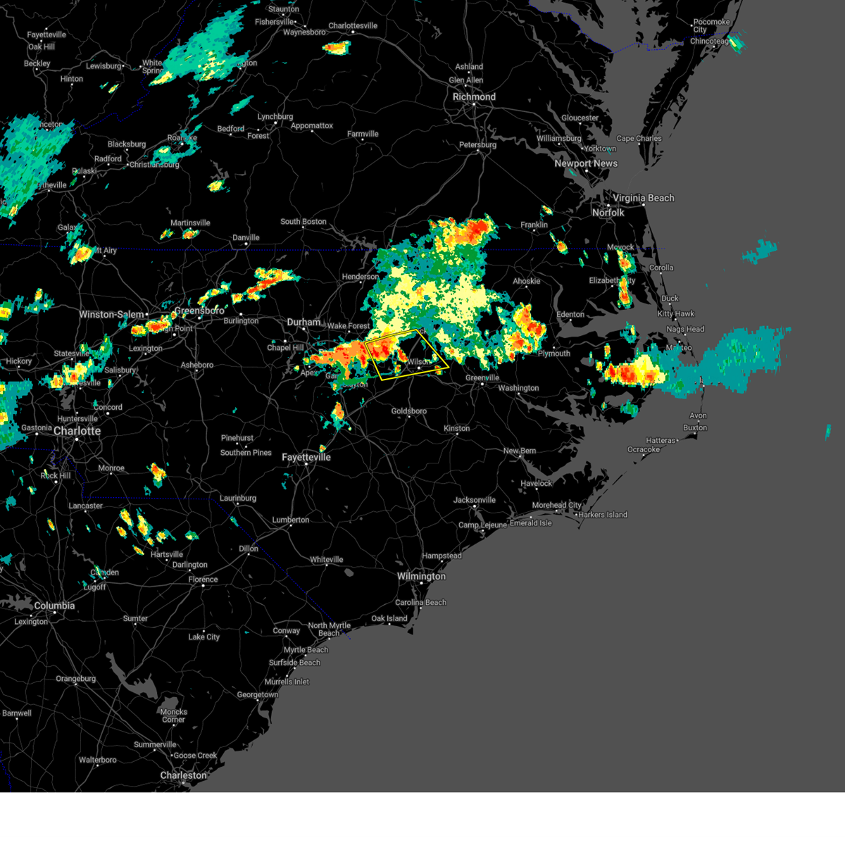
The Top Recent Hail Date for Macclesfield, NC is Monday, May 5, 2025 (42nd out of 42)

Hail and Wind Damage Spotted near Macclesfield, NC
| Date / Time | Report Details |
|---|---|
| 7/6/2025 1:30 PM EDT |
 Torrah the national weather service in raleigh has issued a * tornado warning for, southeastern nash county in central north carolina, southwestern edgecombe county in central north carolina, eastern wilson county in central north carolina, * until 215 pm edt. * at 129 pm edt, a severe thunderstorm capable of producing a tornado was located near farmville, moving northwest at 25 mph (radar indicated rotation). Hazards include tornado. Flying debris will be dangerous to those caught without shelter. mobile homes will be damaged or destroyed. damage to roofs, windows, and vehicles will occur. tree damage is likely. this dangerous storm will be near, wilson and elm city around 145 pm edt. Other locations impacted by this tornadic thunderstorm include macclesfield, saratoga, willbanks, new hope, and tar river reservoir. Torrah the national weather service in raleigh has issued a * tornado warning for, southeastern nash county in central north carolina, southwestern edgecombe county in central north carolina, eastern wilson county in central north carolina, * until 215 pm edt. * at 129 pm edt, a severe thunderstorm capable of producing a tornado was located near farmville, moving northwest at 25 mph (radar indicated rotation). Hazards include tornado. Flying debris will be dangerous to those caught without shelter. mobile homes will be damaged or destroyed. damage to roofs, windows, and vehicles will occur. tree damage is likely. this dangerous storm will be near, wilson and elm city around 145 pm edt. Other locations impacted by this tornadic thunderstorm include macclesfield, saratoga, willbanks, new hope, and tar river reservoir.
|
| 6/19/2025 10:51 PM EDT |
 The storm which prompted the warning has moved out of the area. therefore, the warning will be allowed to expire. The storm which prompted the warning has moved out of the area. therefore, the warning will be allowed to expire.
|
| 6/19/2025 10:32 PM EDT |
 At 1031 pm edt, a severe thunderstorm was located 8 miles east of fremont, or 12 miles west of farmville, moving east at 50 mph (radar indicated). Hazards include 60 mph wind gusts. Expect damage to roofs, siding, and trees. Locations impacted include, fremont, lucama, stantonsburg, black creek, macclesfield, saratoga, conetoe, eureka, and nahunta. At 1031 pm edt, a severe thunderstorm was located 8 miles east of fremont, or 12 miles west of farmville, moving east at 50 mph (radar indicated). Hazards include 60 mph wind gusts. Expect damage to roofs, siding, and trees. Locations impacted include, fremont, lucama, stantonsburg, black creek, macclesfield, saratoga, conetoe, eureka, and nahunta.
|
| 6/19/2025 10:32 PM EDT |
 the severe thunderstorm warning has been cancelled and is no longer in effect the severe thunderstorm warning has been cancelled and is no longer in effect
|
| 6/19/2025 10:15 PM EDT |
 Svrrah the national weather service in raleigh has issued a * severe thunderstorm warning for, northeastern wayne county in central north carolina, southern edgecombe county in central north carolina, wilson county in central north carolina, east central johnston county in central north carolina, * until 1100 pm edt. * at 1014 pm edt, a severe thunderstorm was located 8 miles southeast of wilson, or 14 miles west of farmville, moving east at 45 mph (radar indicated). Hazards include 60 mph wind gusts. expect damage to roofs, siding, and trees Svrrah the national weather service in raleigh has issued a * severe thunderstorm warning for, northeastern wayne county in central north carolina, southern edgecombe county in central north carolina, wilson county in central north carolina, east central johnston county in central north carolina, * until 1100 pm edt. * at 1014 pm edt, a severe thunderstorm was located 8 miles southeast of wilson, or 14 miles west of farmville, moving east at 45 mph (radar indicated). Hazards include 60 mph wind gusts. expect damage to roofs, siding, and trees
|
| 6/19/2025 9:28 PM EDT | Svrrah the national weather service in raleigh has issued a * severe thunderstorm warning for, northeastern wayne county in central north carolina, eastern nash county in central north carolina, edgecombe county in central north carolina, wilson county in central north carolina, east central johnston county in central north carolina, * until 1015 pm edt. * at 927 pm edt, a severe thunderstorm was located 11 miles south of bailey, or 12 miles northeast of smithfield, moving east at 50 mph (radar indicated). Hazards include 60 mph wind gusts. expect damage to roofs, siding, and trees |
| 6/15/2025 8:23 PM EDT |
 The storm which prompted the warning has weakened below severe limits, and has exited the warned area. therefore, the warning will be allowed to expire. to report severe weather, contact your nearest law enforcement agency. they will relay your report to the national weather service raleigh. The storm which prompted the warning has weakened below severe limits, and has exited the warned area. therefore, the warning will be allowed to expire. to report severe weather, contact your nearest law enforcement agency. they will relay your report to the national weather service raleigh.
|
| 6/15/2025 7:44 PM EDT | Svrrah the national weather service in raleigh has issued a * severe thunderstorm warning for, edgecombe county in central north carolina, southeastern halifax county in central north carolina, * until 830 pm edt. * at 743 pm edt, a severe thunderstorm was located near scotland neck, or 7 miles southwest of rich square, moving northeast at 35 mph (radar indicated). Hazards include 60 mph wind gusts and quarter size hail. Hail damage to vehicles is expected. Expect wind damage to roofs, siding, and trees. |
| 6/15/2025 6:57 PM EDT | Svrrah the national weather service in raleigh has issued a * severe thunderstorm warning for, east central nash county in central north carolina, edgecombe county in central north carolina, south central halifax county in central north carolina, northeastern wilson county in central north carolina, * until 745 pm edt. * at 657 pm edt, a severe thunderstorm was located 7 miles west of tarboro, moving northeast at 30 mph (radar indicated). Hazards include 60 mph wind gusts and quarter size hail. Hail damage to vehicles is expected. Expect wind damage to roofs, siding, and trees. |
| 6/11/2025 7:36 PM EDT |
 The storm which prompted the warning has weakened below severe limits, and no longer poses an immediate threat to life or property. therefore, the warning will be allowed to expire. however, heavy rain is still possible with this thunderstorm. to report severe weather, contact your nearest law enforcement agency. they will relay your report to the national weather service raleigh. The storm which prompted the warning has weakened below severe limits, and no longer poses an immediate threat to life or property. therefore, the warning will be allowed to expire. however, heavy rain is still possible with this thunderstorm. to report severe weather, contact your nearest law enforcement agency. they will relay your report to the national weather service raleigh.
|
| 6/11/2025 7:05 PM EDT |
 Svrrah the national weather service in raleigh has issued a * severe thunderstorm warning for, south central nash county in central north carolina, southwestern edgecombe county in central north carolina, wilson county in central north carolina, * until 745 pm edt. * at 704 pm edt, a severe thunderstorm was located near elm city, or 13 miles south of rocky mount, moving southwest at 10 mph (radar indicated). Hazards include 60 mph wind gusts and quarter size hail. Hail damage to vehicles is expected. Expect wind damage to roofs, siding, and trees. Svrrah the national weather service in raleigh has issued a * severe thunderstorm warning for, south central nash county in central north carolina, southwestern edgecombe county in central north carolina, wilson county in central north carolina, * until 745 pm edt. * at 704 pm edt, a severe thunderstorm was located near elm city, or 13 miles south of rocky mount, moving southwest at 10 mph (radar indicated). Hazards include 60 mph wind gusts and quarter size hail. Hail damage to vehicles is expected. Expect wind damage to roofs, siding, and trees.
|
| 5/13/2025 3:54 AM EDT |
 The storm which prompted the warning has weakened below severe limits, and no longer appears capable of producing a tornado. therefore, the warning will be allowed to expire. The storm which prompted the warning has weakened below severe limits, and no longer appears capable of producing a tornado. therefore, the warning will be allowed to expire.
|
| 5/13/2025 3:45 AM EDT |
 At 344 am edt, a confirmed tornado was located near pinetops, or about 8 miles southwest of tarboro, moving north at 30 mph (radar confirmed tornado). Hazards include damaging tornado. Flying debris will be dangerous to those caught without shelter. mobile homes will be damaged or destroyed. damage to roofs, windows, and vehicles will occur. tree damage is likely. Locations impacted include, sharpsburg, pinetops, macclesfield, kingsboro, and willbanks. At 344 am edt, a confirmed tornado was located near pinetops, or about 8 miles southwest of tarboro, moving north at 30 mph (radar confirmed tornado). Hazards include damaging tornado. Flying debris will be dangerous to those caught without shelter. mobile homes will be damaged or destroyed. damage to roofs, windows, and vehicles will occur. tree damage is likely. Locations impacted include, sharpsburg, pinetops, macclesfield, kingsboro, and willbanks.
|
| 5/13/2025 3:41 AM EDT |
 At 339 am edt, a severe thunderstorm capable of producing a tornado was located 11 miles southwest of tarboro, moving north at 30 mph (radar indicated rotation). Hazards include tornado. Flying debris will be dangerous to those caught without shelter. mobile homes will be damaged or destroyed. damage to roofs, windows, and vehicles will occur. tree damage is likely. Locations impacted include, sharpsburg, pinetops, macclesfield, kingsboro, and willbanks. At 339 am edt, a severe thunderstorm capable of producing a tornado was located 11 miles southwest of tarboro, moving north at 30 mph (radar indicated rotation). Hazards include tornado. Flying debris will be dangerous to those caught without shelter. mobile homes will be damaged or destroyed. damage to roofs, windows, and vehicles will occur. tree damage is likely. Locations impacted include, sharpsburg, pinetops, macclesfield, kingsboro, and willbanks.
|
| 5/13/2025 3:25 AM EDT |
 Torrah the national weather service in raleigh has issued a * tornado warning for, southwestern edgecombe county in central north carolina, northeastern wilson county in central north carolina, * until 400 am edt. * at 325 am edt, a severe thunderstorm capable of producing a tornado was located over farmville, moving north at 25 mph (radar indicated rotation). Hazards include tornado. Flying debris will be dangerous to those caught without shelter. mobile homes will be damaged or destroyed. damage to roofs, windows, and vehicles will occur. tree damage is likely. This tornadic thunderstorm will remain over mainly rural areas of southwestern edgecombe and northeastern wilson counties, including the following locations, macclesfield, willbanks, pinetops, kingsboro, and sharpsburg. Torrah the national weather service in raleigh has issued a * tornado warning for, southwestern edgecombe county in central north carolina, northeastern wilson county in central north carolina, * until 400 am edt. * at 325 am edt, a severe thunderstorm capable of producing a tornado was located over farmville, moving north at 25 mph (radar indicated rotation). Hazards include tornado. Flying debris will be dangerous to those caught without shelter. mobile homes will be damaged or destroyed. damage to roofs, windows, and vehicles will occur. tree damage is likely. This tornadic thunderstorm will remain over mainly rural areas of southwestern edgecombe and northeastern wilson counties, including the following locations, macclesfield, willbanks, pinetops, kingsboro, and sharpsburg.
|
| 5/5/2025 5:41 PM EDT |
 the severe thunderstorm warning has been cancelled and is no longer in effect the severe thunderstorm warning has been cancelled and is no longer in effect
|
| 5/5/2025 5:41 PM EDT |
 At 540 pm edt, a severe thunderstorm was located 7 miles northeast of elm city, or 7 miles southeast of rocky mount, moving northeast at 20 mph (radar indicated). Hazards include 60 mph wind gusts and quarter size hail. Hail damage to vehicles is expected. expect wind damage to roofs, siding, and trees. Locations impacted include, rocky mount, tarboro, princeville, sharpsburg, pinetops, macclesfield, speed, leggett, and kingsboro. At 540 pm edt, a severe thunderstorm was located 7 miles northeast of elm city, or 7 miles southeast of rocky mount, moving northeast at 20 mph (radar indicated). Hazards include 60 mph wind gusts and quarter size hail. Hail damage to vehicles is expected. expect wind damage to roofs, siding, and trees. Locations impacted include, rocky mount, tarboro, princeville, sharpsburg, pinetops, macclesfield, speed, leggett, and kingsboro.
|
| 5/5/2025 5:26 PM EDT | Svrrah the national weather service in raleigh has issued a * severe thunderstorm warning for, southeastern nash county in central north carolina, edgecombe county in central north carolina, northeastern wilson county in central north carolina, * until 630 pm edt. * at 526 pm edt, a severe thunderstorm was located over elm city, or 10 miles south of rocky mount, moving northeast at 20 mph (radar indicated). Hazards include 60 mph wind gusts and quarter size hail. Hail damage to vehicles is expected. Expect wind damage to roofs, siding, and trees. |
| 3/5/2025 3:37 PM EST |
 The storms which prompted the warning have weakened below severe limits, and have exited the warned area. therefore, the warning will be allowed to expire. a tornado watch remains in effect until 800 pm est for central north carolina. The storms which prompted the warning have weakened below severe limits, and have exited the warned area. therefore, the warning will be allowed to expire. a tornado watch remains in effect until 800 pm est for central north carolina.
|
| 3/5/2025 2:55 PM EST |
 The storms which prompted the warning have moved out of the area. new severe thunderstorm warnings have been issued for edgecombe and wilson counties. a tornado watch remains in effect until 800 pm est for central north carolina. The storms which prompted the warning have moved out of the area. new severe thunderstorm warnings have been issued for edgecombe and wilson counties. a tornado watch remains in effect until 800 pm est for central north carolina.
|
| 3/5/2025 2:54 PM EST |
 Svrrah the national weather service in raleigh has issued a * severe thunderstorm warning for, southern edgecombe county in central north carolina, eastern wilson county in central north carolina, * until 345 pm est. * at 253 pm est, severe thunderstorms were located along a line extending from 6 miles southeast of rocky mount to 10 miles west of farmville, moving northeast at 40 mph (radar indicated). Hazards include 60 mph wind gusts. expect damage to roofs, siding, and trees Svrrah the national weather service in raleigh has issued a * severe thunderstorm warning for, southern edgecombe county in central north carolina, eastern wilson county in central north carolina, * until 345 pm est. * at 253 pm est, severe thunderstorms were located along a line extending from 6 miles southeast of rocky mount to 10 miles west of farmville, moving northeast at 40 mph (radar indicated). Hazards include 60 mph wind gusts. expect damage to roofs, siding, and trees
|
| 3/5/2025 2:48 PM EST |
 At 248 pm est, severe thunderstorms were located along a line extending from 7 miles west of tarboro to near goldsboro, moving east at 25 mph (radar indicated). Hazards include 60 mph wind gusts. Expect damage to roofs, siding, and trees. Locations impacted include, macclesfield, walnut creek, saratoga, speed, cliffs of the neuse state park, pinetops, tarboro, elroy, seven springs, and conetoe. At 248 pm est, severe thunderstorms were located along a line extending from 7 miles west of tarboro to near goldsboro, moving east at 25 mph (radar indicated). Hazards include 60 mph wind gusts. Expect damage to roofs, siding, and trees. Locations impacted include, macclesfield, walnut creek, saratoga, speed, cliffs of the neuse state park, pinetops, tarboro, elroy, seven springs, and conetoe.
|
| 3/5/2025 2:33 PM EST |
 At 233 pm est, severe thunderstorms were located along a line extending from near elm city to near mount olive, moving east at 65 mph (radar indicated). Hazards include 60 mph wind gusts. Expect damage to roofs, siding, and trees. Locations impacted include, mar-mac, pinetops, tarboro, elroy, seven springs, conetoe, elm city, lucama, princeville, and goldsboro. At 233 pm est, severe thunderstorms were located along a line extending from near elm city to near mount olive, moving east at 65 mph (radar indicated). Hazards include 60 mph wind gusts. Expect damage to roofs, siding, and trees. Locations impacted include, mar-mac, pinetops, tarboro, elroy, seven springs, conetoe, elm city, lucama, princeville, and goldsboro.
|
| 3/5/2025 2:33 PM EST |
 the severe thunderstorm warning has been cancelled and is no longer in effect the severe thunderstorm warning has been cancelled and is no longer in effect
|
| 3/5/2025 1:48 PM EST |
 Svrrah the national weather service in raleigh has issued a * severe thunderstorm warning for, wayne county in central north carolina, southern edgecombe county in central north carolina, wilson county in central north carolina, eastern johnston county in central north carolina, * until 300 pm est. * at 147 pm est, severe thunderstorms were located along a line extending from 8 miles south of zebulon to 10 miles southeast of godwin, moving northeast at 25 mph (radar indicated). Hazards include 60 mph wind gusts. expect damage to roofs, siding, and trees Svrrah the national weather service in raleigh has issued a * severe thunderstorm warning for, wayne county in central north carolina, southern edgecombe county in central north carolina, wilson county in central north carolina, eastern johnston county in central north carolina, * until 300 pm est. * at 147 pm est, severe thunderstorms were located along a line extending from 8 miles south of zebulon to 10 miles southeast of godwin, moving northeast at 25 mph (radar indicated). Hazards include 60 mph wind gusts. expect damage to roofs, siding, and trees
|
| 2/16/2025 9:11 AM EST |
 Svrrah the national weather service in raleigh has issued a * severe thunderstorm warning for, wayne county in central north carolina, southwestern nash county in central north carolina, sampson county in central north carolina, harnett county in central north carolina, southwestern edgecombe county in central north carolina, cumberland county in central north carolina, southern wake county in central north carolina, wilson county in central north carolina, johnston county in central north carolina, southeastern hoke county in central north carolina, * until 1015 am est. * at 911 am est, severe thunderstorms were located along a line extending from near cary to 6 miles northwest of rex to near mccoll, moving northeast at 60 mph (radar indicated). Hazards include 60 mph wind gusts. expect damage to roofs, siding, and trees Svrrah the national weather service in raleigh has issued a * severe thunderstorm warning for, wayne county in central north carolina, southwestern nash county in central north carolina, sampson county in central north carolina, harnett county in central north carolina, southwestern edgecombe county in central north carolina, cumberland county in central north carolina, southern wake county in central north carolina, wilson county in central north carolina, johnston county in central north carolina, southeastern hoke county in central north carolina, * until 1015 am est. * at 911 am est, severe thunderstorms were located along a line extending from near cary to 6 miles northwest of rex to near mccoll, moving northeast at 60 mph (radar indicated). Hazards include 60 mph wind gusts. expect damage to roofs, siding, and trees
|
| 9/27/2024 1:46 PM EDT |
 At 145 pm edt, severe thunderstorms were located along a line extending from 11 miles southwest of halifax to 9 miles southwest of scotland neck to 6 miles east of tarboro, moving northeast at 50 mph (radar indicated). Hazards include 60 mph wind gusts. Expect damage to roofs, siding, and trees. Locations impacted include, rocky mount, tarboro, halifax, scotland neck, dortches, red oak, enfield, princeville, sharpsburg, and weldon. At 145 pm edt, severe thunderstorms were located along a line extending from 11 miles southwest of halifax to 9 miles southwest of scotland neck to 6 miles east of tarboro, moving northeast at 50 mph (radar indicated). Hazards include 60 mph wind gusts. Expect damage to roofs, siding, and trees. Locations impacted include, rocky mount, tarboro, halifax, scotland neck, dortches, red oak, enfield, princeville, sharpsburg, and weldon.
|
| 9/27/2024 1:46 PM EDT |
 the severe thunderstorm warning has been cancelled and is no longer in effect the severe thunderstorm warning has been cancelled and is no longer in effect
|
| 9/27/2024 1:27 PM EDT |
 At 126 pm edt, severe thunderstorms were located along a line extending from near dortches to 7 miles southeast of rocky mount to 9 miles northwest of farmville, moving northeast at 40 mph (radar indicated). Hazards include 60 mph wind gusts. Expect damage to roofs, siding, and trees. Locations impacted include, rocky mount, tarboro, nashville, halifax, wilson, scotland neck, elm city, dortches, red oak, and enfield. At 126 pm edt, severe thunderstorms were located along a line extending from near dortches to 7 miles southeast of rocky mount to 9 miles northwest of farmville, moving northeast at 40 mph (radar indicated). Hazards include 60 mph wind gusts. Expect damage to roofs, siding, and trees. Locations impacted include, rocky mount, tarboro, nashville, halifax, wilson, scotland neck, elm city, dortches, red oak, and enfield.
|
| 9/27/2024 1:07 PM EDT |
 Svrrah the national weather service in raleigh has issued a * severe thunderstorm warning for, northeastern wayne county in central north carolina, eastern nash county in central north carolina, edgecombe county in central north carolina, southeastern halifax county in central north carolina, wilson county in central north carolina, * until 215 pm edt. * at 107 pm edt, severe thunderstorms were located along a line extending from 6 miles south of nashville to near wilson to 7 miles northeast of fremont, moving northeast at 45 mph (radar indicated). Hazards include 60 mph wind gusts. expect damage to roofs, siding, and trees Svrrah the national weather service in raleigh has issued a * severe thunderstorm warning for, northeastern wayne county in central north carolina, eastern nash county in central north carolina, edgecombe county in central north carolina, southeastern halifax county in central north carolina, wilson county in central north carolina, * until 215 pm edt. * at 107 pm edt, severe thunderstorms were located along a line extending from 6 miles south of nashville to near wilson to 7 miles northeast of fremont, moving northeast at 45 mph (radar indicated). Hazards include 60 mph wind gusts. expect damage to roofs, siding, and trees
|
| 9/1/2024 5:01 PM EDT |
 The storm which prompted the warning has weakened below severe limits, and no longer poses an immediate threat to life or property. therefore, the warning has been allowed to expire. however, heavy rain is still possible with this thunderstorm. The storm which prompted the warning has weakened below severe limits, and no longer poses an immediate threat to life or property. therefore, the warning has been allowed to expire. however, heavy rain is still possible with this thunderstorm.
|
| 9/1/2024 4:48 PM EDT |
 At 447 pm edt, a severe thunderstorm was located near bailey, or 12 miles southwest of nashville, moving northeast at 15 mph (radar indicated). Hazards include 60 mph wind gusts. Expect damage to roofs, siding, and trees. Locations impacted include, nashville, wilson, zebulon, elm city, bailey, sharpsburg, spring hope, middlesex, macclesfield, and sims. At 447 pm edt, a severe thunderstorm was located near bailey, or 12 miles southwest of nashville, moving northeast at 15 mph (radar indicated). Hazards include 60 mph wind gusts. Expect damage to roofs, siding, and trees. Locations impacted include, nashville, wilson, zebulon, elm city, bailey, sharpsburg, spring hope, middlesex, macclesfield, and sims.
|
| 9/1/2024 4:21 PM EDT |
 Svrrah the national weather service in raleigh has issued a * severe thunderstorm warning for, southern nash county in central north carolina, southwestern edgecombe county in central north carolina, eastern wake county in central north carolina, central wilson county in central north carolina, northeastern johnston county in central north carolina, south central franklin county in central north carolina, * until 500 pm edt. * at 420 pm edt, a severe thunderstorm was located near zebulon, or 19 miles southwest of nashville, moving northeast at 15 mph (radar indicated). Hazards include 60 mph wind gusts. expect damage to roofs, siding, and trees Svrrah the national weather service in raleigh has issued a * severe thunderstorm warning for, southern nash county in central north carolina, southwestern edgecombe county in central north carolina, eastern wake county in central north carolina, central wilson county in central north carolina, northeastern johnston county in central north carolina, south central franklin county in central north carolina, * until 500 pm edt. * at 420 pm edt, a severe thunderstorm was located near zebulon, or 19 miles southwest of nashville, moving northeast at 15 mph (radar indicated). Hazards include 60 mph wind gusts. expect damage to roofs, siding, and trees
|
| 8/18/2024 8:06 PM EDT |
 the severe thunderstorm warning has been cancelled and is no longer in effect the severe thunderstorm warning has been cancelled and is no longer in effect
|
| 8/18/2024 7:41 PM EDT |
 Svrrah the national weather service in raleigh has issued a * severe thunderstorm warning for, northeastern wayne county in central north carolina, southwestern edgecombe county in central north carolina, eastern wilson county in central north carolina, * until 830 pm edt. * at 741 pm edt, a severe thunderstorm was located near fremont, or 16 miles north of goldsboro, moving northeast at 20 mph (radar indicated). Hazards include 60 mph wind gusts and quarter size hail. Hail damage to vehicles is expected. Expect wind damage to roofs, siding, and trees. Svrrah the national weather service in raleigh has issued a * severe thunderstorm warning for, northeastern wayne county in central north carolina, southwestern edgecombe county in central north carolina, eastern wilson county in central north carolina, * until 830 pm edt. * at 741 pm edt, a severe thunderstorm was located near fremont, or 16 miles north of goldsboro, moving northeast at 20 mph (radar indicated). Hazards include 60 mph wind gusts and quarter size hail. Hail damage to vehicles is expected. Expect wind damage to roofs, siding, and trees.
|
| 8/8/2024 4:22 PM EDT |
 At 422 pm edt, a severe thunderstorm capable of producing a tornado was located near elm city, or 11 miles south of rocky mount, moving north at 35 mph (radar indicated rotation). Hazards include tornado. Flying debris will be dangerous to those caught without shelter. mobile homes will be damaged or destroyed. damage to roofs, windows, and vehicles will occur. tree damage is likely. this dangerous storm will be near, rocky mount and elm city around 425 pm edt. Other locations impacted by this tornadic thunderstorm include willbanks, tar river reservoir, sharpsburg, and macclesfield. At 422 pm edt, a severe thunderstorm capable of producing a tornado was located near elm city, or 11 miles south of rocky mount, moving north at 35 mph (radar indicated rotation). Hazards include tornado. Flying debris will be dangerous to those caught without shelter. mobile homes will be damaged or destroyed. damage to roofs, windows, and vehicles will occur. tree damage is likely. this dangerous storm will be near, rocky mount and elm city around 425 pm edt. Other locations impacted by this tornadic thunderstorm include willbanks, tar river reservoir, sharpsburg, and macclesfield.
|
| 8/8/2024 4:12 PM EDT |
 Torrah the national weather service in raleigh has issued a * tornado warning for, east central nash county in central north carolina, southwestern edgecombe county in central north carolina, eastern wilson county in central north carolina, * until 445 pm edt. * at 412 pm edt, a severe thunderstorm capable of producing a tornado was located 7 miles southeast of elm city, or 12 miles northwest of farmville, moving north at 30 mph (radar indicated rotation). Hazards include tornado. Flying debris will be dangerous to those caught without shelter. mobile homes will be damaged or destroyed. damage to roofs, windows, and vehicles will occur. tree damage is likely. this dangerous storm will be near, elm city around 420 pm edt. rocky mount around 425 pm edt. Other locations impacted by this tornadic thunderstorm include willbanks, saratoga, tar river reservoir, sharpsburg, and macclesfield. Torrah the national weather service in raleigh has issued a * tornado warning for, east central nash county in central north carolina, southwestern edgecombe county in central north carolina, eastern wilson county in central north carolina, * until 445 pm edt. * at 412 pm edt, a severe thunderstorm capable of producing a tornado was located 7 miles southeast of elm city, or 12 miles northwest of farmville, moving north at 30 mph (radar indicated rotation). Hazards include tornado. Flying debris will be dangerous to those caught without shelter. mobile homes will be damaged or destroyed. damage to roofs, windows, and vehicles will occur. tree damage is likely. this dangerous storm will be near, elm city around 420 pm edt. rocky mount around 425 pm edt. Other locations impacted by this tornadic thunderstorm include willbanks, saratoga, tar river reservoir, sharpsburg, and macclesfield.
|
| 8/8/2024 5:38 AM EDT |
 The storm which prompted the warning has weakened below severe limits, and no longer appears capable of producing a tornado. therefore, the warning will be allowed to expire. however, gusty winds and heavy rain are still possible with this thunderstorm. a tornado watch remains in effect until 100 pm edt for central north carolina. The storm which prompted the warning has weakened below severe limits, and no longer appears capable of producing a tornado. therefore, the warning will be allowed to expire. however, gusty winds and heavy rain are still possible with this thunderstorm. a tornado watch remains in effect until 100 pm edt for central north carolina.
|
| 8/8/2024 5:27 AM EDT |
 At 526 am edt, a severe thunderstorm capable of producing a tornado was located 9 miles southwest of tarboro, moving northwest at 35 mph (radar indicated rotation). Hazards include tornado. Flying debris will be dangerous to those caught without shelter. mobile homes will be damaged or destroyed. damage to roofs, windows, and vehicles will occur. tree damage is likely. This tornadic thunderstorm will remain over mainly rural areas of southwestern edgecombe county, including the following locations, macclesfield, pinetops, and kingsboro. At 526 am edt, a severe thunderstorm capable of producing a tornado was located 9 miles southwest of tarboro, moving northwest at 35 mph (radar indicated rotation). Hazards include tornado. Flying debris will be dangerous to those caught without shelter. mobile homes will be damaged or destroyed. damage to roofs, windows, and vehicles will occur. tree damage is likely. This tornadic thunderstorm will remain over mainly rural areas of southwestern edgecombe county, including the following locations, macclesfield, pinetops, and kingsboro.
|
| 8/8/2024 5:16 AM EDT |
 At 515 am edt, a confirmed tornado was located along nc highway 43 between falkland and pinetops, or 10 miles south of tarboro, moving northwest at 35 mph (radar confirmed tornado). Hazards include damaging tornado. Flying debris will be dangerous to those caught without shelter. mobile homes will be damaged or destroyed. damage to roofs, windows, and vehicles will occur. tree damage is likely. this tornado will be near, tarboro around 520 am edt. Other locations impacted by this tornadic thunderstorm include princeville, macclesfield, pinetops, kingsboro, and conetoe. At 515 am edt, a confirmed tornado was located along nc highway 43 between falkland and pinetops, or 10 miles south of tarboro, moving northwest at 35 mph (radar confirmed tornado). Hazards include damaging tornado. Flying debris will be dangerous to those caught without shelter. mobile homes will be damaged or destroyed. damage to roofs, windows, and vehicles will occur. tree damage is likely. this tornado will be near, tarboro around 520 am edt. Other locations impacted by this tornadic thunderstorm include princeville, macclesfield, pinetops, kingsboro, and conetoe.
|
| 8/8/2024 5:10 AM EDT |
 At 510 am edt, a confirmed tornado was located near falkland, or 10 miles northeast of farmville, moving northwest at 35 mph (radar confirmed tornado). Hazards include damaging tornado. Flying debris will be dangerous to those caught without shelter. mobile homes will be damaged or destroyed. damage to roofs, windows, and vehicles will occur. tree damage is likely. this tornado will be near, tarboro around 515 am edt. Other locations impacted by this tornadic thunderstorm include princeville, macclesfield, pinetops, kingsboro, and conetoe. At 510 am edt, a confirmed tornado was located near falkland, or 10 miles northeast of farmville, moving northwest at 35 mph (radar confirmed tornado). Hazards include damaging tornado. Flying debris will be dangerous to those caught without shelter. mobile homes will be damaged or destroyed. damage to roofs, windows, and vehicles will occur. tree damage is likely. this tornado will be near, tarboro around 515 am edt. Other locations impacted by this tornadic thunderstorm include princeville, macclesfield, pinetops, kingsboro, and conetoe.
|
| 8/8/2024 5:04 AM EDT |
 Torrah the national weather service in raleigh has issued a * tornado warning for, southern edgecombe county in central north carolina, * until 545 am edt. * at 504 am edt, a severe thunderstorm capable of producing a tornado was located over bruce, or 7 miles northwest of greenville, moving northwest at 30 mph (radar indicated rotation). Hazards include tornado. Flying debris will be dangerous to those caught without shelter. mobile homes will be damaged or destroyed. damage to roofs, windows, and vehicles will occur. tree damage is likely. this dangerous storm will be near, tarboro around 520 am edt. Other locations impacted by this tornadic thunderstorm include princeville, macclesfield, pinetops, kingsboro, and conetoe. Torrah the national weather service in raleigh has issued a * tornado warning for, southern edgecombe county in central north carolina, * until 545 am edt. * at 504 am edt, a severe thunderstorm capable of producing a tornado was located over bruce, or 7 miles northwest of greenville, moving northwest at 30 mph (radar indicated rotation). Hazards include tornado. Flying debris will be dangerous to those caught without shelter. mobile homes will be damaged or destroyed. damage to roofs, windows, and vehicles will occur. tree damage is likely. this dangerous storm will be near, tarboro around 520 am edt. Other locations impacted by this tornadic thunderstorm include princeville, macclesfield, pinetops, kingsboro, and conetoe.
|
| 7/18/2024 4:25 PM EDT |
 The storm which prompted the warning has weakened below severe limits, and no longer poses an immediate threat to life or property. therefore, the warning will be allowed to expire. however, gusty winds are still possible with this thunderstorm. a severe thunderstorm watch remains in effect until 900 pm edt for central north carolina. The storm which prompted the warning has weakened below severe limits, and no longer poses an immediate threat to life or property. therefore, the warning will be allowed to expire. however, gusty winds are still possible with this thunderstorm. a severe thunderstorm watch remains in effect until 900 pm edt for central north carolina.
|
| 7/18/2024 4:00 PM EDT |
 At 400 pm edt, a severe thunderstorm was located near nashville, moving east at 25 mph (radar indicated). Hazards include 60 mph wind gusts and penny size hail. Expect damage to roofs, siding, and trees. Locations impacted include, rocky mount, roanoke rapids, tarboro, nashville, halifax, wilson, elm city, dortches, bailey, and red oak. At 400 pm edt, a severe thunderstorm was located near nashville, moving east at 25 mph (radar indicated). Hazards include 60 mph wind gusts and penny size hail. Expect damage to roofs, siding, and trees. Locations impacted include, rocky mount, roanoke rapids, tarboro, nashville, halifax, wilson, elm city, dortches, bailey, and red oak.
|
| 7/18/2024 3:44 PM EDT |
 Svrrah the national weather service in raleigh has issued a * severe thunderstorm warning for, nash county in central north carolina, edgecombe county in central north carolina, halifax county in central north carolina, wilson county in central north carolina, * until 430 pm edt. * at 344 pm edt, a severe thunderstorm was located 7 miles southwest of nashville, moving east at 25 mph (radar indicated). Hazards include 60 mph wind gusts and penny size hail. expect damage to roofs, siding, and trees Svrrah the national weather service in raleigh has issued a * severe thunderstorm warning for, nash county in central north carolina, edgecombe county in central north carolina, halifax county in central north carolina, wilson county in central north carolina, * until 430 pm edt. * at 344 pm edt, a severe thunderstorm was located 7 miles southwest of nashville, moving east at 25 mph (radar indicated). Hazards include 60 mph wind gusts and penny size hail. expect damage to roofs, siding, and trees
|
| 5/10/2024 4:39 PM EDT |
 The storm which prompted the warning has moved out of the area. therefore, the warning will be allowed to expire. however, gusty winds are still possible with this thunderstorm. a severe thunderstorm watch remains in effect until 900 pm edt for central north carolina. The storm which prompted the warning has moved out of the area. therefore, the warning will be allowed to expire. however, gusty winds are still possible with this thunderstorm. a severe thunderstorm watch remains in effect until 900 pm edt for central north carolina.
|
| 5/10/2024 4:31 PM EDT |
 At 431 pm edt, a severe thunderstorm was located 7 miles west of farmville, moving east at 25 mph (radar indicated). Hazards include 60 mph wind gusts and half dollar size hail. Hail damage to vehicles is expected. expect wind damage to roofs, siding, and trees. Locations impacted include, stantonsburg, macclesfield, and saratoga. At 431 pm edt, a severe thunderstorm was located 7 miles west of farmville, moving east at 25 mph (radar indicated). Hazards include 60 mph wind gusts and half dollar size hail. Hail damage to vehicles is expected. expect wind damage to roofs, siding, and trees. Locations impacted include, stantonsburg, macclesfield, and saratoga.
|
| 5/10/2024 4:22 PM EDT |
 At 421 pm edt, a severe thunderstorm was located 9 miles southeast of wilson, or 11 miles west of farmville, moving east at 25 mph (radar indicated). Hazards include 60 mph wind gusts and half dollar size hail. Hail damage to vehicles is expected. expect wind damage to roofs, siding, and trees. Locations impacted include, stantonsburg, black creek, macclesfield, saratoga, and willbanks. At 421 pm edt, a severe thunderstorm was located 9 miles southeast of wilson, or 11 miles west of farmville, moving east at 25 mph (radar indicated). Hazards include 60 mph wind gusts and half dollar size hail. Hail damage to vehicles is expected. expect wind damage to roofs, siding, and trees. Locations impacted include, stantonsburg, black creek, macclesfield, saratoga, and willbanks.
|
| 5/10/2024 4:09 PM EDT |
 Svrrah the national weather service in raleigh has issued a * severe thunderstorm warning for, southwestern edgecombe county in central north carolina, southeastern wilson county in central north carolina, * until 445 pm edt. * at 409 pm edt, a severe thunderstorm was located near wilson, or 16 miles west of farmville, moving east at 25 mph (radar indicated). Hazards include 60 mph wind gusts and half dollar size hail. Hail damage to vehicles is expected. Expect wind damage to roofs, siding, and trees. Svrrah the national weather service in raleigh has issued a * severe thunderstorm warning for, southwestern edgecombe county in central north carolina, southeastern wilson county in central north carolina, * until 445 pm edt. * at 409 pm edt, a severe thunderstorm was located near wilson, or 16 miles west of farmville, moving east at 25 mph (radar indicated). Hazards include 60 mph wind gusts and half dollar size hail. Hail damage to vehicles is expected. Expect wind damage to roofs, siding, and trees.
|
| 1/9/2024 7:24 PM EST |
 At 723 pm est, severe thunderstorms were located along a line extending from near littleton to 9 miles southwest of roanoke rapids to near rocky mount to near fremont, moving northeast at 70 mph (radar indicated). Hazards include 60 mph wind gusts. expect damage to roofs, siding, and trees At 723 pm est, severe thunderstorms were located along a line extending from near littleton to 9 miles southwest of roanoke rapids to near rocky mount to near fremont, moving northeast at 70 mph (radar indicated). Hazards include 60 mph wind gusts. expect damage to roofs, siding, and trees
|
| 1/9/2024 4:37 PM EST |
 At 436 pm est, a severe thunderstorm was located near fremont, or 17 miles north of goldsboro, moving northeast at 50 mph (radar indicated). Hazards include 60 mph wind gusts. expect damage to roofs, siding, and trees At 436 pm est, a severe thunderstorm was located near fremont, or 17 miles north of goldsboro, moving northeast at 50 mph (radar indicated). Hazards include 60 mph wind gusts. expect damage to roofs, siding, and trees
|
| 9/8/2023 5:02 PM EDT |
 At 502 pm edt, severe thunderstorms were located along a line extending from 8 miles east of bunn to near elm city to 8 miles west of tarboro, moving north at 20 mph (radar indicated). Hazards include 60 mph wind gusts and quarter size hail. Hail damage to vehicles is expected. expect wind damage to roofs, siding, and trees. locations impacted include, rocky mount, tarboro, nashville, elm city, bunn, sharpsburg, pinetops, spring hope, macclesfield and tar river reservoir. hail threat, radar indicated max hail size, 1. 00 in wind threat, radar indicated max wind gust, 60 mph. At 502 pm edt, severe thunderstorms were located along a line extending from 8 miles east of bunn to near elm city to 8 miles west of tarboro, moving north at 20 mph (radar indicated). Hazards include 60 mph wind gusts and quarter size hail. Hail damage to vehicles is expected. expect wind damage to roofs, siding, and trees. locations impacted include, rocky mount, tarboro, nashville, elm city, bunn, sharpsburg, pinetops, spring hope, macclesfield and tar river reservoir. hail threat, radar indicated max hail size, 1. 00 in wind threat, radar indicated max wind gust, 60 mph.
|
| 9/8/2023 4:54 PM EDT |
 At 454 pm edt, severe thunderstorms were located along a line extending from 8 miles east of bunn to elm city to 10 miles southwest of tarboro, moving northeast at 15 mph (radar indicated). Hazards include 60 mph wind gusts and quarter size hail. Hail damage to vehicles is expected. expect wind damage to roofs, siding, and trees. locations impacted include, rocky mount, tarboro, nashville, wilson, elm city, bunn, sharpsburg, pinetops, spring hope and macclesfield. hail threat, radar indicated max hail size, 1. 00 in wind threat, radar indicated max wind gust, 60 mph. At 454 pm edt, severe thunderstorms were located along a line extending from 8 miles east of bunn to elm city to 10 miles southwest of tarboro, moving northeast at 15 mph (radar indicated). Hazards include 60 mph wind gusts and quarter size hail. Hail damage to vehicles is expected. expect wind damage to roofs, siding, and trees. locations impacted include, rocky mount, tarboro, nashville, wilson, elm city, bunn, sharpsburg, pinetops, spring hope and macclesfield. hail threat, radar indicated max hail size, 1. 00 in wind threat, radar indicated max wind gust, 60 mph.
|
| 9/8/2023 4:47 PM EDT |
 At 447 pm edt, severe thunderstorms were located along a line extending from 7 miles southeast of bunn to near elm city to 10 miles east of wilson, moving north at 20 mph (radar indicated). Hazards include 60 mph wind gusts and quarter size hail. Hail damage to vehicles is expected. expect wind damage to roofs, siding, and trees. locations impacted include, rocky mount, tarboro, nashville, wilson, elm city, bailey, sharpsburg, pinetops, spring hope and middlesex. hail threat, radar indicated max hail size, 1. 00 in wind threat, radar indicated max wind gust, 60 mph. At 447 pm edt, severe thunderstorms were located along a line extending from 7 miles southeast of bunn to near elm city to 10 miles east of wilson, moving north at 20 mph (radar indicated). Hazards include 60 mph wind gusts and quarter size hail. Hail damage to vehicles is expected. expect wind damage to roofs, siding, and trees. locations impacted include, rocky mount, tarboro, nashville, wilson, elm city, bailey, sharpsburg, pinetops, spring hope and middlesex. hail threat, radar indicated max hail size, 1. 00 in wind threat, radar indicated max wind gust, 60 mph.
|
| 9/8/2023 4:35 PM EDT |
 At 434 pm edt, severe thunderstorms were located along a line extending from near bailey to wilson to 7 miles southeast of elm city, moving north at 20 mph (radar indicated). Hazards include 60 mph wind gusts and quarter size hail. Hail damage to vehicles is expected. expect wind damage to roofs, siding, and trees. locations impacted include, rocky mount, tarboro, nashville, wilson, zebulon, elm city, bailey, sharpsburg, pinetops and spring hope. hail threat, radar indicated max hail size, 1. 00 in wind threat, radar indicated max wind gust, 60 mph. At 434 pm edt, severe thunderstorms were located along a line extending from near bailey to wilson to 7 miles southeast of elm city, moving north at 20 mph (radar indicated). Hazards include 60 mph wind gusts and quarter size hail. Hail damage to vehicles is expected. expect wind damage to roofs, siding, and trees. locations impacted include, rocky mount, tarboro, nashville, wilson, zebulon, elm city, bailey, sharpsburg, pinetops and spring hope. hail threat, radar indicated max hail size, 1. 00 in wind threat, radar indicated max wind gust, 60 mph.
|
| 9/8/2023 4:25 PM EDT |
 At 425 pm edt, severe thunderstorms were located along a line extending from near zebulon to near wilson to 9 miles northeast of fremont, moving north at 20 mph (radar indicated). Hazards include 60 mph wind gusts and quarter size hail. Hail damage to vehicles is expected. Expect wind damage to roofs, siding, and trees. At 425 pm edt, severe thunderstorms were located along a line extending from near zebulon to near wilson to 9 miles northeast of fremont, moving north at 20 mph (radar indicated). Hazards include 60 mph wind gusts and quarter size hail. Hail damage to vehicles is expected. Expect wind damage to roofs, siding, and trees.
|
| 8/15/2023 6:01 PM EDT |
 At 600 pm edt, severe thunderstorms were located along a line extending from near tarboro to 8 miles west of bethel, moving east at 45 mph (emergency management). Hazards include 70 mph wind gusts. Expect considerable tree damage. damage is likely to mobile homes, roofs, and outbuildings. locations impacted include, tarboro, halifax, scotland neck, enfield, princeville, weldon, pinetops, macclesfield, hobgood and conetoe. thunderstorm damage threat, considerable hail threat, radar indicated max hail size, <. 75 in wind threat, observed max wind gust, 70 mph. At 600 pm edt, severe thunderstorms were located along a line extending from near tarboro to 8 miles west of bethel, moving east at 45 mph (emergency management). Hazards include 70 mph wind gusts. Expect considerable tree damage. damage is likely to mobile homes, roofs, and outbuildings. locations impacted include, tarboro, halifax, scotland neck, enfield, princeville, weldon, pinetops, macclesfield, hobgood and conetoe. thunderstorm damage threat, considerable hail threat, radar indicated max hail size, <. 75 in wind threat, observed max wind gust, 70 mph.
|
| 8/15/2023 5:46 PM EDT |
 At 545 pm edt, severe thunderstorms were located along a line extending from 7 miles west of halifax to 6 miles southwest of scotland neck to 8 miles southwest of tarboro, moving east at 50 mph (emergency management). Hazards include 70 mph wind gusts. Expect considerable tree damage. damage is likely to mobile homes, roofs, and outbuildings. locations impacted include, rocky mount, tarboro, halifax, scotland neck, elm city, enfield, princeville, sharpsburg, weldon and pinetops. thunderstorm damage threat, considerable hail threat, radar indicated max hail size, <. 75 in wind threat, observed max wind gust, 70 mph. At 545 pm edt, severe thunderstorms were located along a line extending from 7 miles west of halifax to 6 miles southwest of scotland neck to 8 miles southwest of tarboro, moving east at 50 mph (emergency management). Hazards include 70 mph wind gusts. Expect considerable tree damage. damage is likely to mobile homes, roofs, and outbuildings. locations impacted include, rocky mount, tarboro, halifax, scotland neck, elm city, enfield, princeville, sharpsburg, weldon and pinetops. thunderstorm damage threat, considerable hail threat, radar indicated max hail size, <. 75 in wind threat, observed max wind gust, 70 mph.
|
| 8/15/2023 5:25 PM EDT |
 At 523 pm edt, severe thunderstorms were located along a line extending from 7 miles southeast of warrenton to 8 miles northeast of dortches to nashville to near bailey, moving east at 45 mph (radar indicated). Hazards include 70 mph wind gusts. Expect considerable tree damage. Damage is likely to mobile homes, roofs, and outbuildings. At 523 pm edt, severe thunderstorms were located along a line extending from 7 miles southeast of warrenton to 8 miles northeast of dortches to nashville to near bailey, moving east at 45 mph (radar indicated). Hazards include 70 mph wind gusts. Expect considerable tree damage. Damage is likely to mobile homes, roofs, and outbuildings.
|
| 8/15/2023 3:36 PM EDT |
 At 336 pm edt, severe thunderstorms were located along a line extending from near dortches to near nashville to near wilson, moving east at 35 mph (radar indicated). Hazards include 60 mph wind gusts and quarter size hail. Hail damage to vehicles is expected. Expect wind damage to roofs, siding, and trees. At 336 pm edt, severe thunderstorms were located along a line extending from near dortches to near nashville to near wilson, moving east at 35 mph (radar indicated). Hazards include 60 mph wind gusts and quarter size hail. Hail damage to vehicles is expected. Expect wind damage to roofs, siding, and trees.
|
| 8/7/2023 9:14 PM EDT |
 The severe thunderstorm warning for edgecombe and eastern halifax counties will expire at 915 pm edt, the storms which prompted the warning have weakened below severe limits, and no longer pose an immediate threat to life or property. therefore, the warning will be allowed to expire. however gusty winds to near 50 mph are still possible with these thunderstorms. a severe thunderstorm watch remains in effect until midnight edt for central north carolina. The severe thunderstorm warning for edgecombe and eastern halifax counties will expire at 915 pm edt, the storms which prompted the warning have weakened below severe limits, and no longer pose an immediate threat to life or property. therefore, the warning will be allowed to expire. however gusty winds to near 50 mph are still possible with these thunderstorms. a severe thunderstorm watch remains in effect until midnight edt for central north carolina.
|
| 8/7/2023 8:57 PM EDT |
 At 857 pm edt, severe thunderstorms were located along a line extending from 8 miles south of halifax to 6 miles south of scotland neck to near bruce, moving northeast at 45 mph (radar indicated). Hazards include 60 mph wind gusts. expect damage to roofs, siding, and trees At 857 pm edt, severe thunderstorms were located along a line extending from 8 miles south of halifax to 6 miles south of scotland neck to near bruce, moving northeast at 45 mph (radar indicated). Hazards include 60 mph wind gusts. expect damage to roofs, siding, and trees
|
| 8/7/2023 8:43 PM EDT |
 At 843 pm edt, severe thunderstorms were located along a line extending from 12 miles north of dortches to 7 miles northwest of tarboro to 8 miles northwest of farmville to walnut creek, moving east at 50 mph (radar indicated). Hazards include 70 mph wind gusts. Expect considerable tree damage. damage is likely to mobile homes, roofs, and outbuildings. Locations impacted include, rocky mount, goldsboro, tarboro, nashville, wilson, mount olive, scotland neck, elm city, fremont and dortches. At 843 pm edt, severe thunderstorms were located along a line extending from 12 miles north of dortches to 7 miles northwest of tarboro to 8 miles northwest of farmville to walnut creek, moving east at 50 mph (radar indicated). Hazards include 70 mph wind gusts. Expect considerable tree damage. damage is likely to mobile homes, roofs, and outbuildings. Locations impacted include, rocky mount, goldsboro, tarboro, nashville, wilson, mount olive, scotland neck, elm city, fremont and dortches.
|
| 8/7/2023 8:29 PM EDT |
 At 829 pm edt, severe thunderstorms were located along a line extending from 13 miles northwest of dortches to near rocky mount to 6 miles south of wilson to 6 miles northeast of mount olive, moving east at 50 mph (radar indicated). Hazards include 70 mph wind gusts. Expect considerable tree damage. damage is likely to mobile homes, roofs, and outbuildings. Locations impacted include, rocky mount, goldsboro, tarboro, nashville, wilson, mount olive, scotland neck, elm city, fremont and dortches. At 829 pm edt, severe thunderstorms were located along a line extending from 13 miles northwest of dortches to near rocky mount to 6 miles south of wilson to 6 miles northeast of mount olive, moving east at 50 mph (radar indicated). Hazards include 70 mph wind gusts. Expect considerable tree damage. damage is likely to mobile homes, roofs, and outbuildings. Locations impacted include, rocky mount, goldsboro, tarboro, nashville, wilson, mount olive, scotland neck, elm city, fremont and dortches.
|
| 8/7/2023 8:26 PM EDT |
 At 826 pm edt, severe thunderstorms were located along a line extending from 13 miles northwest of dortches to rocky mount to 6 miles south of wilson to near mount olive, moving east at 50 mph (radar indicated). Hazards include 60 mph wind gusts. Expect damage to roofs, siding, and trees. Locations impacted include, rocky mount, goldsboro, tarboro, nashville, wilson, mount olive, scotland neck, elm city, fremont and dortches. At 826 pm edt, severe thunderstorms were located along a line extending from 13 miles northwest of dortches to rocky mount to 6 miles south of wilson to near mount olive, moving east at 50 mph (radar indicated). Hazards include 60 mph wind gusts. Expect damage to roofs, siding, and trees. Locations impacted include, rocky mount, goldsboro, tarboro, nashville, wilson, mount olive, scotland neck, elm city, fremont and dortches.
|
| 8/7/2023 8:14 PM EDT |
 At 813 pm edt, severe thunderstorms were located along a line extending from 7 miles northeast of louisburg to nashville to 8 miles northwest of fremont to 8 miles northwest of mount olive, moving east at 65 mph (radar indicated). Hazards include 60 mph wind gusts. Expect damage to roofs, siding, and trees. Locations impacted include, rocky mount, goldsboro, tarboro, smithfield, nashville, louisburg, wilson, mount olive, zebulon and scotland neck. At 813 pm edt, severe thunderstorms were located along a line extending from 7 miles northeast of louisburg to nashville to 8 miles northwest of fremont to 8 miles northwest of mount olive, moving east at 65 mph (radar indicated). Hazards include 60 mph wind gusts. Expect damage to roofs, siding, and trees. Locations impacted include, rocky mount, goldsboro, tarboro, smithfield, nashville, louisburg, wilson, mount olive, zebulon and scotland neck.
|
| 8/7/2023 7:53 PM EDT |
 At 752 pm edt, severe thunderstorms were located along a line extending from creedmoor to 7 miles southwest of zebulon to 6 miles southeast of dunn, moving east at 50 mph (radar indicated). Hazards include 60 mph wind gusts. expect damage to roofs, siding, and trees At 752 pm edt, severe thunderstorms were located along a line extending from creedmoor to 7 miles southwest of zebulon to 6 miles southeast of dunn, moving east at 50 mph (radar indicated). Hazards include 60 mph wind gusts. expect damage to roofs, siding, and trees
|
| 7/9/2023 3:33 PM EDT |
 At 332 pm edt, severe thunderstorms were located along a line extending from 9 miles southwest of halifax to near bruce to 7 miles northwest of harrells, moving east at 50 mph (radar indicated. goldsboro recently measured a wind gust of 52 mph. the line also has a history of producing extensive wind damage). Hazards include 60 mph wind gusts and penny size hail. Expect damage to roofs, siding, and trees. locations impacted include, goldsboro, tarboro, clinton, mount olive, walnut creek, harrells, princeville, pinetops, stantonsburg and pikeville. hail threat, radar indicated max hail size, 0. 75 in wind threat, observed max wind gust, 60 mph. At 332 pm edt, severe thunderstorms were located along a line extending from 9 miles southwest of halifax to near bruce to 7 miles northwest of harrells, moving east at 50 mph (radar indicated. goldsboro recently measured a wind gust of 52 mph. the line also has a history of producing extensive wind damage). Hazards include 60 mph wind gusts and penny size hail. Expect damage to roofs, siding, and trees. locations impacted include, goldsboro, tarboro, clinton, mount olive, walnut creek, harrells, princeville, pinetops, stantonsburg and pikeville. hail threat, radar indicated max hail size, 0. 75 in wind threat, observed max wind gust, 60 mph.
|
| 7/9/2023 3:25 PM EDT |
 At 323 pm edt, severe thunderstorms were located along a line extending from 13 miles southwest of halifax to 8 miles northwest of farmville to 11 miles south of clinton, moving east at 50 mph (radar indicated. goldsboro recently measured a wind gust of 52 mph. the line also has a history of producing extensive wind damage). Hazards include 60 mph wind gusts and penny size hail. Expect damage to roofs, siding, and trees. locations impacted include, rocky mount, goldsboro, roanoke rapids, tarboro, clinton, halifax, wilson, mount olive, scotland neck and elm city. hail threat, radar indicated max hail size, 0. 75 in wind threat, observed max wind gust, 60 mph. At 323 pm edt, severe thunderstorms were located along a line extending from 13 miles southwest of halifax to 8 miles northwest of farmville to 11 miles south of clinton, moving east at 50 mph (radar indicated. goldsboro recently measured a wind gust of 52 mph. the line also has a history of producing extensive wind damage). Hazards include 60 mph wind gusts and penny size hail. Expect damage to roofs, siding, and trees. locations impacted include, rocky mount, goldsboro, roanoke rapids, tarboro, clinton, halifax, wilson, mount olive, scotland neck and elm city. hail threat, radar indicated max hail size, 0. 75 in wind threat, observed max wind gust, 60 mph.
|
| 7/9/2023 3:00 PM EDT |
 At 258 pm edt, severe thunderstorms were located along a line extending from 8 miles south of warrenton to near wilson to near jerome, moving east at 50 mph (radar indicated. the line also has a history of producing extensive wind damage). Hazards include 60 mph wind gusts and penny size hail. expect damage to roofs, siding, and trees At 258 pm edt, severe thunderstorms were located along a line extending from 8 miles south of warrenton to near wilson to near jerome, moving east at 50 mph (radar indicated. the line also has a history of producing extensive wind damage). Hazards include 60 mph wind gusts and penny size hail. expect damage to roofs, siding, and trees
|
| 5/16/2023 11:58 PM EDT | At 1157 pm edt, severe thunderstorms were located along a line extending from near scotland neck to 7 miles southeast of wilson to near smithfield, moving east at 45 mph (radar indicated). Hazards include 60 mph wind gusts. Expect damage to roofs, siding, and trees. locations impacted include, rocky mount, tarboro, smithfield, wilson, scotland neck, elm city, fremont, micro, selma and enfield. hail threat, radar indicated max hail size, <. 75 in wind threat, radar indicated max wind gust, 60 mph. |
| 5/16/2023 11:58 PM EDT | At 1157 pm edt, severe thunderstorms were located along a line extending from near scotland neck to 7 miles southeast of wilson to near smithfield, moving east at 45 mph (radar indicated). Hazards include 60 mph wind gusts. Expect damage to roofs, siding, and trees. locations impacted include, rocky mount, tarboro, smithfield, wilson, scotland neck, elm city, fremont, micro, selma and enfield. hail threat, radar indicated max hail size, <. 75 in wind threat, radar indicated max wind gust, 60 mph. |
| 5/16/2023 11:42 PM EDT |
 At 1142 pm edt, severe thunderstorms were located along a line extending from 10 miles northeast of dortches to 7 miles southwest of wilson to near smithfield, moving east at 55 mph (radar indicated). Hazards include 60 mph wind gusts. expect damage to roofs, siding, and trees At 1142 pm edt, severe thunderstorms were located along a line extending from 10 miles northeast of dortches to 7 miles southwest of wilson to near smithfield, moving east at 55 mph (radar indicated). Hazards include 60 mph wind gusts. expect damage to roofs, siding, and trees
|
| 5/9/2023 7:07 PM EDT |
 At 706 pm edt, a severe thunderstorm was located near tarboro, moving southeast at 35 mph. this storm has a history of producing large hail and wind damage. seek shelter immediately if you are in the path of this storm (law enforcement). Hazards include 60 mph wind gusts and quarter size hail. Hail damage to vehicles is expected. expect wind damage to roofs, siding, and trees. locations impacted include, rocky mount, roanoke rapids, tarboro, halifax, scotland neck, elm city, dortches, littleton, red oak and enfield. hail threat, radar indicated max hail size, 1. 00 in wind threat, radar indicated max wind gust, 60 mph. At 706 pm edt, a severe thunderstorm was located near tarboro, moving southeast at 35 mph. this storm has a history of producing large hail and wind damage. seek shelter immediately if you are in the path of this storm (law enforcement). Hazards include 60 mph wind gusts and quarter size hail. Hail damage to vehicles is expected. expect wind damage to roofs, siding, and trees. locations impacted include, rocky mount, roanoke rapids, tarboro, halifax, scotland neck, elm city, dortches, littleton, red oak and enfield. hail threat, radar indicated max hail size, 1. 00 in wind threat, radar indicated max wind gust, 60 mph.
|
| 5/9/2023 6:45 PM EDT | Quarter sized hail reported 4.5 miles E of Macclesfield, NC, located at nc 42 and bridgersville rd. |
| 5/9/2023 6:40 PM EDT |
 At 639 pm edt, a severe thunderstorm was located 9 miles north of dortches, or 13 miles north of rocky mount, moving southeast at 40 mph (law enforcement). Hazards include 60 mph wind gusts and quarter size hail. Hail damage to vehicles is expected. expect wind damage to roofs, siding, and trees. locations impacted include, rocky mount, roanoke rapids, tarboro, nashville, halifax, wilson, scotland neck, elm city, dortches and littleton. hail threat, radar indicated max hail size, 1. 00 in wind threat, radar indicated max wind gust, 60 mph. At 639 pm edt, a severe thunderstorm was located 9 miles north of dortches, or 13 miles north of rocky mount, moving southeast at 40 mph (law enforcement). Hazards include 60 mph wind gusts and quarter size hail. Hail damage to vehicles is expected. expect wind damage to roofs, siding, and trees. locations impacted include, rocky mount, roanoke rapids, tarboro, nashville, halifax, wilson, scotland neck, elm city, dortches and littleton. hail threat, radar indicated max hail size, 1. 00 in wind threat, radar indicated max wind gust, 60 mph.
|
| 5/9/2023 6:30 PM EDT |
 At 629 pm edt, a severe thunderstorm was located 14 miles north of dortches, or 17 miles north of nashville, moving southeast at 40 mph (radar indicated). Hazards include 60 mph wind gusts and quarter size hail. Hail damage to vehicles is expected. Expect wind damage to roofs, siding, and trees. At 629 pm edt, a severe thunderstorm was located 14 miles north of dortches, or 17 miles north of nashville, moving southeast at 40 mph (radar indicated). Hazards include 60 mph wind gusts and quarter size hail. Hail damage to vehicles is expected. Expect wind damage to roofs, siding, and trees.
|
| 5/9/2023 6:11 PM EDT |
 At 608 pm edt, a severe thunderstorm was located over rocky mount, moving southeast at 20 mph (trained weather spotters. the nws raleigh received a report of nickel-size hail covering the ground near the intersection of i-95 and highway 64). Hazards include 60 mph wind gusts and quarter size hail. Hail damage to vehicles is expected. expect wind damage to roofs, siding, and trees. locations impacted include, rocky mount, tarboro, nashville, elm city, dortches, red oak, princeville, sharpsburg, pinetops and whitakers. hail threat, radar indicated max hail size, 1. 00 in wind threat, radar indicated max wind gust, 60 mph. At 608 pm edt, a severe thunderstorm was located over rocky mount, moving southeast at 20 mph (trained weather spotters. the nws raleigh received a report of nickel-size hail covering the ground near the intersection of i-95 and highway 64). Hazards include 60 mph wind gusts and quarter size hail. Hail damage to vehicles is expected. expect wind damage to roofs, siding, and trees. locations impacted include, rocky mount, tarboro, nashville, elm city, dortches, red oak, princeville, sharpsburg, pinetops and whitakers. hail threat, radar indicated max hail size, 1. 00 in wind threat, radar indicated max wind gust, 60 mph.
|
| 5/9/2023 5:49 PM EDT |
 At 549 pm edt, a severe thunderstorm was located near dortches, or near nashville, moving southeast at 20 mph (radar indicated). Hazards include 60 mph wind gusts and quarter size hail. Hail damage to vehicles is expected. Expect wind damage to roofs, siding, and trees. At 549 pm edt, a severe thunderstorm was located near dortches, or near nashville, moving southeast at 20 mph (radar indicated). Hazards include 60 mph wind gusts and quarter size hail. Hail damage to vehicles is expected. Expect wind damage to roofs, siding, and trees.
|
| 5/9/2023 3:53 PM EDT |
 The severe thunderstorm warning for southwestern edgecombe and northeastern wilson counties will expire at 400 pm edt, the storm which prompted the warning has moved out of the area. therefore, the warning will be allowed to expire. however heavy rain is still possible with this thunderstorm. a severe thunderstorm watch remains in effect until 1000 pm edt for central north carolina. The severe thunderstorm warning for southwestern edgecombe and northeastern wilson counties will expire at 400 pm edt, the storm which prompted the warning has moved out of the area. therefore, the warning will be allowed to expire. however heavy rain is still possible with this thunderstorm. a severe thunderstorm watch remains in effect until 1000 pm edt for central north carolina.
|
| 5/9/2023 3:49 PM EDT |
 At 349 pm edt, a severe thunderstorm was located near farmville, moving southeast at 40 mph (radar indicated). Hazards include 60 mph wind gusts and quarter size hail. Hail damage to vehicles is expected. expect wind damage to roofs, siding, and trees. locations impacted include, pinetops, macclesfield and willbanks. hail threat, radar indicated max hail size, 1. 00 in wind threat, radar indicated max wind gust, 60 mph. At 349 pm edt, a severe thunderstorm was located near farmville, moving southeast at 40 mph (radar indicated). Hazards include 60 mph wind gusts and quarter size hail. Hail damage to vehicles is expected. expect wind damage to roofs, siding, and trees. locations impacted include, pinetops, macclesfield and willbanks. hail threat, radar indicated max hail size, 1. 00 in wind threat, radar indicated max wind gust, 60 mph.
|
| 5/9/2023 3:28 PM EDT |
 At 327 pm edt, a severe thunderstorm was located near rocky mount and just east of sharpsburg moving southeast at 30 mph (radar indicated). Hazards include 60 mph wind gusts and quarter size hail. Hail damage to vehicles is expected. expect wind damage to roofs, siding, and trees. locations impacted include, rocky mount, tarboro, nashville, wilson, elm city, dortches, princeville, sharpsburg, pinetops and macclesfield. hail threat, radar indicated max hail size, 1. 00 in wind threat, radar indicated max wind gust, 60 mph. At 327 pm edt, a severe thunderstorm was located near rocky mount and just east of sharpsburg moving southeast at 30 mph (radar indicated). Hazards include 60 mph wind gusts and quarter size hail. Hail damage to vehicles is expected. expect wind damage to roofs, siding, and trees. locations impacted include, rocky mount, tarboro, nashville, wilson, elm city, dortches, princeville, sharpsburg, pinetops and macclesfield. hail threat, radar indicated max hail size, 1. 00 in wind threat, radar indicated max wind gust, 60 mph.
|
| 5/9/2023 3:14 PM EDT |
 At 312 pm edt, severe thunderstorms were located near nashville, and elm city, moving southeast at 30 mph (radar indicated). Hazards include 60 mph wind gusts and quarter size hail. Hail damage to vehicles is expected. Expect wind damage to roofs, siding, and trees. At 312 pm edt, severe thunderstorms were located near nashville, and elm city, moving southeast at 30 mph (radar indicated). Hazards include 60 mph wind gusts and quarter size hail. Hail damage to vehicles is expected. Expect wind damage to roofs, siding, and trees.
|
| 4/30/2023 3:22 PM EDT | Tree on car in macclesfield... nc no injurie in edgecombe county NC, 0.1 miles NNW of Macclesfield, NC |
| 4/30/2023 3:18 PM EDT |
 At 318 pm edt, severe thunderstorms were located along a line extending from near elm city to 7 miles east of wilson to 8 miles west of farmville, moving northeast at 45 mph (radar indicated). Hazards include 60 mph wind gusts and nickel size hail. expect damage to roofs, siding, and trees At 318 pm edt, severe thunderstorms were located along a line extending from near elm city to 7 miles east of wilson to 8 miles west of farmville, moving northeast at 45 mph (radar indicated). Hazards include 60 mph wind gusts and nickel size hail. expect damage to roofs, siding, and trees
|
| 7/6/2022 9:03 PM EDT |
 At 903 pm edt, severe thunderstorms were located along a line extending from near rocky mount to 9 miles northwest of bruce, moving northeast at 10 mph (radar indicated). Hazards include 60 mph wind gusts. Expect damage to roofs, siding, and trees. locations impacted include, rocky mount, tarboro, nashville, dortches, red oak, princeville, sharpsburg, pinetops, spring hope and macclesfield. hail threat, radar indicated max hail size, <. 75 in wind threat, radar indicated max wind gust, 60 mph. At 903 pm edt, severe thunderstorms were located along a line extending from near rocky mount to 9 miles northwest of bruce, moving northeast at 10 mph (radar indicated). Hazards include 60 mph wind gusts. Expect damage to roofs, siding, and trees. locations impacted include, rocky mount, tarboro, nashville, dortches, red oak, princeville, sharpsburg, pinetops, spring hope and macclesfield. hail threat, radar indicated max hail size, <. 75 in wind threat, radar indicated max wind gust, 60 mph.
|
| 7/6/2022 8:49 PM EDT |
 At 848 pm edt, severe thunderstorms were located in a cluster from near nashville to pinetops to macclesfield, moving southeast at 20 mph (radar indicated). Hazards include 60 mph wind gusts. Expect damage to roofs, siding, and trees. locations impacted include, rocky mount, tarboro, nashville, wilson, elm city, dortches, red oak, princeville, sharpsburg and pinetops. hail threat, radar indicated max hail size, <. 75 in wind threat, radar indicated max wind gust, 60 mph. At 848 pm edt, severe thunderstorms were located in a cluster from near nashville to pinetops to macclesfield, moving southeast at 20 mph (radar indicated). Hazards include 60 mph wind gusts. Expect damage to roofs, siding, and trees. locations impacted include, rocky mount, tarboro, nashville, wilson, elm city, dortches, red oak, princeville, sharpsburg and pinetops. hail threat, radar indicated max hail size, <. 75 in wind threat, radar indicated max wind gust, 60 mph.
|
| 7/6/2022 8:31 PM EDT |
 At 831 pm edt, severe thunderstorms were located along a line extending from near nashville to 6 miles east of elm city, moving northeast at 10 mph (radar indicated). Hazards include 60 mph wind gusts. expect damage to roofs, siding, and trees At 831 pm edt, severe thunderstorms were located along a line extending from near nashville to 6 miles east of elm city, moving northeast at 10 mph (radar indicated). Hazards include 60 mph wind gusts. expect damage to roofs, siding, and trees
|
| 7/6/2022 6:59 PM EDT |
 At 659 pm edt, a severe thunderstorm was located 9 miles northwest of farmville, moving east at 10 mph (radar indicated). Hazards include 60 mph wind gusts and penny size hail. expect damage to roofs, siding, and trees At 659 pm edt, a severe thunderstorm was located 9 miles northwest of farmville, moving east at 10 mph (radar indicated). Hazards include 60 mph wind gusts and penny size hail. expect damage to roofs, siding, and trees
|
| 6/17/2022 7:21 PM EDT |
 At 721 pm edt, severe thunderstorms were located along a line extending from garysburg to 9 miles west of scotland neck to 9 miles east of elm city, moving east at 30 mph (radar indicated). Hazards include 70 mph wind gusts. Expect considerable tree damage. damage is likely to mobile homes, roofs, and outbuildings. locations impacted include, rocky mount, roanoke rapids, tarboro, nashville, halifax, scotland neck, elm city, dortches, red oak and enfield. thunderstorm damage threat, considerable hail threat, radar indicated max hail size, <. 75 in wind threat, radar indicated max wind gust, 70 mph. At 721 pm edt, severe thunderstorms were located along a line extending from garysburg to 9 miles west of scotland neck to 9 miles east of elm city, moving east at 30 mph (radar indicated). Hazards include 70 mph wind gusts. Expect considerable tree damage. damage is likely to mobile homes, roofs, and outbuildings. locations impacted include, rocky mount, roanoke rapids, tarboro, nashville, halifax, scotland neck, elm city, dortches, red oak and enfield. thunderstorm damage threat, considerable hail threat, radar indicated max hail size, <. 75 in wind threat, radar indicated max wind gust, 70 mph.
|
| 6/17/2022 7:05 PM EDT |
 At 704 pm edt, severe thunderstorms were located along a line extending from 9 miles south of warrenton to 9 miles northwest of dortches to near nashville, moving east at 40 mph (radar indicated). Hazards include 70 mph wind gusts. Expect considerable tree damage. damage is likely to mobile homes, roofs, and outbuildings. locations impacted include, rocky mount, roanoke rapids, tarboro, nashville, louisburg, warrenton, halifax, scotland neck, elm city and dortches. thunderstorm damage threat, considerable hail threat, radar indicated max hail size, <. 75 in wind threat, radar indicated max wind gust, 70 mph. At 704 pm edt, severe thunderstorms were located along a line extending from 9 miles south of warrenton to 9 miles northwest of dortches to near nashville, moving east at 40 mph (radar indicated). Hazards include 70 mph wind gusts. Expect considerable tree damage. damage is likely to mobile homes, roofs, and outbuildings. locations impacted include, rocky mount, roanoke rapids, tarboro, nashville, louisburg, warrenton, halifax, scotland neck, elm city and dortches. thunderstorm damage threat, considerable hail threat, radar indicated max hail size, <. 75 in wind threat, radar indicated max wind gust, 70 mph.
|
| 6/17/2022 6:48 PM EDT |
 At 647 pm edt, severe thunderstorms were located along a line extending from near henderson to 14 miles north of bunn to 6 miles east of louisburg, moving east at 70 mph (radar indicated). Hazards include 70 mph wind gusts. Expect considerable tree damage. Damage is likely to mobile homes, roofs, and outbuildings. At 647 pm edt, severe thunderstorms were located along a line extending from near henderson to 14 miles north of bunn to 6 miles east of louisburg, moving east at 70 mph (radar indicated). Hazards include 70 mph wind gusts. Expect considerable tree damage. Damage is likely to mobile homes, roofs, and outbuildings.
|
| 5/21/2022 4:35 PM EDT |
 At 434 pm edt, a severe thunderstorm was located 7 miles southeast of wilson, or 14 miles west of farmville, moving northeast at 20 mph (radar indicated). Hazards include 60 mph wind gusts and quarter size hail. Hail damage to vehicles is expected. expect wind damage to roofs, siding, and trees. locations impacted include, wilson, elm city, sharpsburg, pinetops, stantonsburg, black creek, macclesfield, saratoga and willbanks. hail threat, radar indicated max hail size, 1. 00 in wind threat, radar indicated max wind gust, 60 mph. At 434 pm edt, a severe thunderstorm was located 7 miles southeast of wilson, or 14 miles west of farmville, moving northeast at 20 mph (radar indicated). Hazards include 60 mph wind gusts and quarter size hail. Hail damage to vehicles is expected. expect wind damage to roofs, siding, and trees. locations impacted include, wilson, elm city, sharpsburg, pinetops, stantonsburg, black creek, macclesfield, saratoga and willbanks. hail threat, radar indicated max hail size, 1. 00 in wind threat, radar indicated max wind gust, 60 mph.
|
| 5/21/2022 4:20 PM EDT |
 At 420 pm edt, a severe thunderstorm was located near fremont, or 14 miles north of goldsboro, moving northeast at 20 mph (radar indicated). Hazards include 60 mph wind gusts and quarter size hail. Hail damage to vehicles is expected. Expect wind damage to roofs, siding, and trees. At 420 pm edt, a severe thunderstorm was located near fremont, or 14 miles north of goldsboro, moving northeast at 20 mph (radar indicated). Hazards include 60 mph wind gusts and quarter size hail. Hail damage to vehicles is expected. Expect wind damage to roofs, siding, and trees.
|
| 5/20/2022 2:08 AM EDT |
 The severe thunderstorm warning for southern edgecombe county will expire at 215 am edt, the storm which prompted the warning has weakened below severe limits, and has exited the warned area. therefore, the warning will be allowed to expire. to report severe weather, contact your nearest law enforcement agency. they will relay your report to the national weather service raleigh. The severe thunderstorm warning for southern edgecombe county will expire at 215 am edt, the storm which prompted the warning has weakened below severe limits, and has exited the warned area. therefore, the warning will be allowed to expire. to report severe weather, contact your nearest law enforcement agency. they will relay your report to the national weather service raleigh.
|
| 5/20/2022 2:02 AM EDT |
 At 201 am edt, a severe thunderstorm was located near macclesfield, moving east at 35 mph (radar indicated). Hazards include 60 mph wind gusts. Expect damage to roofs, siding, and trees. locations impacted include, tarboro, princeville, pinetops, macclesfield and conetoe. hail threat, radar indicated max hail size, 0. 75 in wind threat, radar indicated max wind gust, 60 mph. At 201 am edt, a severe thunderstorm was located near macclesfield, moving east at 35 mph (radar indicated). Hazards include 60 mph wind gusts. Expect damage to roofs, siding, and trees. locations impacted include, tarboro, princeville, pinetops, macclesfield and conetoe. hail threat, radar indicated max hail size, 0. 75 in wind threat, radar indicated max wind gust, 60 mph.
|
| 5/20/2022 1:53 AM EDT |
 At 153 am edt, a severe thunderstorm was located 7 miles northwest of farmville, moving east at 35 mph (radar indicated). Hazards include 60 mph wind gusts and penny size hail. Expect damage to roofs, siding, and trees. locations impacted include, tarboro, princeville, pinetops, macclesfield, conetoe and willbanks. hail threat, radar indicated max hail size, 0. 75 in wind threat, radar indicated max wind gust, 60 mph. At 153 am edt, a severe thunderstorm was located 7 miles northwest of farmville, moving east at 35 mph (radar indicated). Hazards include 60 mph wind gusts and penny size hail. Expect damage to roofs, siding, and trees. locations impacted include, tarboro, princeville, pinetops, macclesfield, conetoe and willbanks. hail threat, radar indicated max hail size, 0. 75 in wind threat, radar indicated max wind gust, 60 mph.
|
| 5/20/2022 1:43 AM EDT |
 At 142 am edt, a severe thunderstorm was located 7 miles southeast of elm city, or 13 miles northwest of farmville, moving east at 40 mph (radar indicated). Hazards include 70 mph wind gusts and penny size hail. Expect considerable tree damage. damage is likely to mobile homes, roofs, and outbuildings. locations impacted include, tarboro, wilson, elm city, princeville, sharpsburg, pinetops, macclesfield, saratoga, conetoe and speed. thunderstorm damage threat, considerable hail threat, radar indicated max hail size, 0. 75 in wind threat, radar indicated max wind gust, 70 mph. At 142 am edt, a severe thunderstorm was located 7 miles southeast of elm city, or 13 miles northwest of farmville, moving east at 40 mph (radar indicated). Hazards include 70 mph wind gusts and penny size hail. Expect considerable tree damage. damage is likely to mobile homes, roofs, and outbuildings. locations impacted include, tarboro, wilson, elm city, princeville, sharpsburg, pinetops, macclesfield, saratoga, conetoe and speed. thunderstorm damage threat, considerable hail threat, radar indicated max hail size, 0. 75 in wind threat, radar indicated max wind gust, 70 mph.
|
| 5/20/2022 1:32 AM EDT |
 At 130 am edt, a severe thunderstorm was located near wilson, or 14 miles south of rocky mount, moving east at 45 mph. this is a destructive storm for wilson, elm city, willbanks, pinetops, and conetoe in northern wilson and edgecombe county (radar indicated). Hazards include 80 mph wind gusts and quarter size hail. Flying debris will be dangerous to those caught without shelter. mobile homes will be heavily damaged. expect considerable damage to roofs, windows, and vehicles. extensive tree damage and power outages are likely. locations impacted include, tarboro, wilson, elm city, bailey, princeville, sharpsburg, pinetops, macclesfield, conetoe and sims. thunderstorm damage threat, destructive hail threat, radar indicated max hail size, 1. 00 in wind threat, radar indicated max wind gust, 80 mph. At 130 am edt, a severe thunderstorm was located near wilson, or 14 miles south of rocky mount, moving east at 45 mph. this is a destructive storm for wilson, elm city, willbanks, pinetops, and conetoe in northern wilson and edgecombe county (radar indicated). Hazards include 80 mph wind gusts and quarter size hail. Flying debris will be dangerous to those caught without shelter. mobile homes will be heavily damaged. expect considerable damage to roofs, windows, and vehicles. extensive tree damage and power outages are likely. locations impacted include, tarboro, wilson, elm city, bailey, princeville, sharpsburg, pinetops, macclesfield, conetoe and sims. thunderstorm damage threat, destructive hail threat, radar indicated max hail size, 1. 00 in wind threat, radar indicated max wind gust, 80 mph.
|
| 5/20/2022 1:16 AM EDT |
 At 116 am edt, a severe thunderstorm was located near bailey, or 17 miles south of nashville, moving east at 45 mph (radar indicated). Hazards include 70 mph wind gusts and quarter size hail. Hail damage to vehicles is expected. expect considerable tree damage. Wind damage is also likely to mobile homes, roofs, and outbuildings. At 116 am edt, a severe thunderstorm was located near bailey, or 17 miles south of nashville, moving east at 45 mph (radar indicated). Hazards include 70 mph wind gusts and quarter size hail. Hail damage to vehicles is expected. expect considerable tree damage. Wind damage is also likely to mobile homes, roofs, and outbuildings.
|
| 5/16/2022 6:02 PM EDT |
 At 602 pm edt, severe thunderstorms were located along a line extending from near bunn to near zebulon to 9 miles north of clayton, moving east at 35 mph (radar indicated). Hazards include 60 mph wind gusts and quarter size hail. Hail damage to vehicles is expected. Expect wind damage to roofs, siding, and trees. At 602 pm edt, severe thunderstorms were located along a line extending from near bunn to near zebulon to 9 miles north of clayton, moving east at 35 mph (radar indicated). Hazards include 60 mph wind gusts and quarter size hail. Hail damage to vehicles is expected. Expect wind damage to roofs, siding, and trees.
|
| 5/6/2022 9:39 PM EDT |
 At 938 pm edt, a severe thunderstorm was located near scotland neck, or 12 miles north of tarboro, moving east at 60 mph (radar indicated). Hazards include 60 mph wind gusts. Expect damage to roofs, siding, and trees. locations impacted include, rocky mount, roanoke rapids, tarboro, warrenton, halifax, scotland neck, norlina, littleton, enfield and princeville. hail threat, radar indicated max hail size, <. 75 in wind threat, radar indicated max wind gust, 60 mph. At 938 pm edt, a severe thunderstorm was located near scotland neck, or 12 miles north of tarboro, moving east at 60 mph (radar indicated). Hazards include 60 mph wind gusts. Expect damage to roofs, siding, and trees. locations impacted include, rocky mount, roanoke rapids, tarboro, warrenton, halifax, scotland neck, norlina, littleton, enfield and princeville. hail threat, radar indicated max hail size, <. 75 in wind threat, radar indicated max wind gust, 60 mph.
|
| 5/6/2022 9:14 PM EDT |
 At 913 pm edt, a severe thunderstorm was located 8 miles northeast of dortches, or 11 miles north of rocky mount, moving northeast at 55 mph (radar indicated). Hazards include 60 mph wind gusts. expect damage to roofs, siding, and trees At 913 pm edt, a severe thunderstorm was located 8 miles northeast of dortches, or 11 miles north of rocky mount, moving northeast at 55 mph (radar indicated). Hazards include 60 mph wind gusts. expect damage to roofs, siding, and trees
|
| 5/6/2022 7:00 PM EDT |
 At 659 pm edt, a severe thunderstorm was located 7 miles north of farmville, moving northeast at 40 mph (radar indicated). Hazards include 60 mph wind gusts and quarter size hail. Hail damage to vehicles is expected. expect wind damage to roofs, siding, and trees. locations impacted include, princeville, pinetops, macclesfield and conetoe. hail threat, radar indicated max hail size, 1. 00 in wind threat, radar indicated max wind gust, 60 mph. At 659 pm edt, a severe thunderstorm was located 7 miles north of farmville, moving northeast at 40 mph (radar indicated). Hazards include 60 mph wind gusts and quarter size hail. Hail damage to vehicles is expected. expect wind damage to roofs, siding, and trees. locations impacted include, princeville, pinetops, macclesfield and conetoe. hail threat, radar indicated max hail size, 1. 00 in wind threat, radar indicated max wind gust, 60 mph.
|
| 5/6/2022 6:49 PM EDT |
 At 649 pm edt, a severe thunderstorm was located 7 miles northwest of farmville, moving northeast at 25 mph (radar indicated). Hazards include 60 mph wind gusts and quarter size hail. Hail damage to vehicles is expected. Expect wind damage to roofs, siding, and trees. At 649 pm edt, a severe thunderstorm was located 7 miles northwest of farmville, moving northeast at 25 mph (radar indicated). Hazards include 60 mph wind gusts and quarter size hail. Hail damage to vehicles is expected. Expect wind damage to roofs, siding, and trees.
|
| 4/26/2022 5:35 PM EDT |
 At 534 pm edt, severe thunderstorms were located along a line extending from seaboard to 9 miles east of fremont to 6 miles northeast of ammon, moving east at 35 mph (radar indicated). Hazards include 60 mph wind gusts and quarter size hail. Hail damage to vehicles is expected. expect wind damage to roofs, siding, and trees. locations impacted include, rocky mount, goldsboro, tarboro, clinton, halifax, wilson, mount olive, scotland neck, elm city and fremont. hail threat, radar indicated max hail size, 1. 00 in wind threat, radar indicated max wind gust, 60 mph. At 534 pm edt, severe thunderstorms were located along a line extending from seaboard to 9 miles east of fremont to 6 miles northeast of ammon, moving east at 35 mph (radar indicated). Hazards include 60 mph wind gusts and quarter size hail. Hail damage to vehicles is expected. expect wind damage to roofs, siding, and trees. locations impacted include, rocky mount, goldsboro, tarboro, clinton, halifax, wilson, mount olive, scotland neck, elm city and fremont. hail threat, radar indicated max hail size, 1. 00 in wind threat, radar indicated max wind gust, 60 mph.
|
| 4/26/2022 5:27 PM EDT |
 At 526 pm edt, severe thunderstorms were located along a line extending from near seaboard to 6 miles east of fremont to near ammon, moving east at 35 mph (radar indicated). Hazards include 60 mph wind gusts and quarter size hail. Hail damage to vehicles is expected. expect wind damage to roofs, siding, and trees. these severe thunderstorms will remain over wayne, eastern nash, sampson, edgecombe, southeastern cumberland, central halifax, wilson and southeastern johnston counties, including the following locations, enfield, mar-mac, leggett, salemburg and fountain. hail threat, radar indicated max hail size, 1. 00 in wind threat, radar indicated max wind gust, 60 mph. At 526 pm edt, severe thunderstorms were located along a line extending from near seaboard to 6 miles east of fremont to near ammon, moving east at 35 mph (radar indicated). Hazards include 60 mph wind gusts and quarter size hail. Hail damage to vehicles is expected. expect wind damage to roofs, siding, and trees. these severe thunderstorms will remain over wayne, eastern nash, sampson, edgecombe, southeastern cumberland, central halifax, wilson and southeastern johnston counties, including the following locations, enfield, mar-mac, leggett, salemburg and fountain. hail threat, radar indicated max hail size, 1. 00 in wind threat, radar indicated max wind gust, 60 mph.
|
| 4/26/2022 5:05 PM EDT |
 At 505 pm edt, severe thunderstorms were located along a line extending from near gaston to near fremont to near jerome, moving east at 35 mph (radar indicated). Hazards include 60 mph wind gusts and quarter size hail. Hail damage to vehicles is expected. expect wind damage to roofs, siding, and trees. these severe storms will be near, roanoke rapids around 510 pm edt. fremont around 515 pm edt. other locations impacted by these severe thunderstorms include mar-mac, salemburg, whitakers, medoc mountain state park and pinetops. hail threat, radar indicated max hail size, 1. 00 in wind threat, radar indicated max wind gust, 60 mph. At 505 pm edt, severe thunderstorms were located along a line extending from near gaston to near fremont to near jerome, moving east at 35 mph (radar indicated). Hazards include 60 mph wind gusts and quarter size hail. Hail damage to vehicles is expected. expect wind damage to roofs, siding, and trees. these severe storms will be near, roanoke rapids around 510 pm edt. fremont around 515 pm edt. other locations impacted by these severe thunderstorms include mar-mac, salemburg, whitakers, medoc mountain state park and pinetops. hail threat, radar indicated max hail size, 1. 00 in wind threat, radar indicated max wind gust, 60 mph.
|
| 4/26/2022 4:44 PM EDT |
 At 442 pm edt, severe thunderstorms were located along a line extending from near gasburg to near smithfield to near rex, moving east at 35 mph (radar indicated). Hazards include 60 mph wind gusts and quarter size hail. Hail damage is expected. expect wind damage to trees and subsequent damage to homes and businesses from falling trees. severe thunderstorms will be near, littleton around 450 pm edt. jerome around 505 pm edt. roanoke rapids and fremont around 510 pm edt. other locations impacted by these severe thunderstorms include pilot, mar-mac, salemburg, whitakers and medoc mountain state park. hail threat, radar indicated max hail size, 1. 00 in wind threat, radar indicated max wind gust, 60 mph. At 442 pm edt, severe thunderstorms were located along a line extending from near gasburg to near smithfield to near rex, moving east at 35 mph (radar indicated). Hazards include 60 mph wind gusts and quarter size hail. Hail damage is expected. expect wind damage to trees and subsequent damage to homes and businesses from falling trees. severe thunderstorms will be near, littleton around 450 pm edt. jerome around 505 pm edt. roanoke rapids and fremont around 510 pm edt. other locations impacted by these severe thunderstorms include pilot, mar-mac, salemburg, whitakers and medoc mountain state park. hail threat, radar indicated max hail size, 1. 00 in wind threat, radar indicated max wind gust, 60 mph.
|
| 4/7/2022 6:55 PM EDT |
 The severe thunderstorm warning for edgecombe and wilson counties will expire at 700 pm edt, the storm which prompted the warning has weakened below severe limits, and no longer poses an immediate threat to life or property. therefore, the warning will be allowed to expire. a tornado watch remains in effect until 900 pm edt for central north carolina. to report severe weather, contact your nearest law enforcement agency. they will relay your report to the national weather service raleigh. The severe thunderstorm warning for edgecombe and wilson counties will expire at 700 pm edt, the storm which prompted the warning has weakened below severe limits, and no longer poses an immediate threat to life or property. therefore, the warning will be allowed to expire. a tornado watch remains in effect until 900 pm edt for central north carolina. to report severe weather, contact your nearest law enforcement agency. they will relay your report to the national weather service raleigh.
|
| 4/7/2022 6:33 PM EDT |
 At 632 pm edt, a severe thunderstorm was located 5 miles east of wilson, moving northeast at 50 mph (radar indicated). Hazards include 60 mph wind gusts and quarter size hail. Hail damage to vehicles is expected. expect wind damage to roofs, siding, and trees. locations impacted include, rocky mount, tarboro, wilson, elm city, princeville, sharpsburg, pinetops, lucama, black creek and macclesfield. hail threat, radar indicated max hail size, 1. 00 in wind threat, radar indicated max wind gust, 60 mph. At 632 pm edt, a severe thunderstorm was located 5 miles east of wilson, moving northeast at 50 mph (radar indicated). Hazards include 60 mph wind gusts and quarter size hail. Hail damage to vehicles is expected. expect wind damage to roofs, siding, and trees. locations impacted include, rocky mount, tarboro, wilson, elm city, princeville, sharpsburg, pinetops, lucama, black creek and macclesfield. hail threat, radar indicated max hail size, 1. 00 in wind threat, radar indicated max wind gust, 60 mph.
|
| 4/7/2022 5:57 PM EDT |
 At 557 pm edt, a severe thunderstorm was located near smithfield, moving northeast at 50 mph (radar indicated). Hazards include 60 mph wind gusts and quarter size hail. Hail damage to vehicles is expected. Expect wind damage to roofs, siding, and trees. At 557 pm edt, a severe thunderstorm was located near smithfield, moving northeast at 50 mph (radar indicated). Hazards include 60 mph wind gusts and quarter size hail. Hail damage to vehicles is expected. Expect wind damage to roofs, siding, and trees.
|
| 4/7/2022 4:56 PM EDT |
 At 455 pm edt, a severe thunderstorm was located near elm city, or 8 miles south of nashville, moving east at 55 mph (radar indicated). Hazards include ping pong ball size hail and 60 mph wind gusts. People and animals outdoors will be injured. expect hail damage to roofs, siding, windows, and vehicles. expect wind damage to roofs, siding, and trees. locations impacted include, rocky mount, tarboro, nashville, wilson, elm city, dortches, princeville, sharpsburg, pinetops and macclesfield. hail threat, observed max hail size, 1. 50 in wind threat, radar indicated max wind gust, 60 mph. At 455 pm edt, a severe thunderstorm was located near elm city, or 8 miles south of nashville, moving east at 55 mph (radar indicated). Hazards include ping pong ball size hail and 60 mph wind gusts. People and animals outdoors will be injured. expect hail damage to roofs, siding, windows, and vehicles. expect wind damage to roofs, siding, and trees. locations impacted include, rocky mount, tarboro, nashville, wilson, elm city, dortches, princeville, sharpsburg, pinetops and macclesfield. hail threat, observed max hail size, 1. 50 in wind threat, radar indicated max wind gust, 60 mph.
|
| 4/7/2022 4:37 PM EDT |
 At 437 pm edt, a severe thunderstorm was located 7 miles southwest of bailey, or 16 miles northeast of smithfield, moving east at 45 mph (radar indicated). Hazards include 60 mph wind gusts and quarter size hail. Hail damage to vehicles is expected. Expect wind damage to roofs, siding, and trees. At 437 pm edt, a severe thunderstorm was located 7 miles southwest of bailey, or 16 miles northeast of smithfield, moving east at 45 mph (radar indicated). Hazards include 60 mph wind gusts and quarter size hail. Hail damage to vehicles is expected. Expect wind damage to roofs, siding, and trees.
|
| 1/3/2022 8:49 AM EST |
 At 849 am est, severe thunderstorms were located along a line extending from near dortches to 7 miles southeast of rocky mount to near farmville, moving east at 40 mph (radar indicated). Hazards include 60 mph wind gusts. Expect damage to roofs, siding, and trees. locations impacted include, rocky mount, tarboro, nashville, dortches, red oak, princeville, sharpsburg, pinetops, whitakers and macclesfield. hail threat, radar indicated max hail size, <. 75 in wind threat, radar indicated max wind gust, 60 mph. At 849 am est, severe thunderstorms were located along a line extending from near dortches to 7 miles southeast of rocky mount to near farmville, moving east at 40 mph (radar indicated). Hazards include 60 mph wind gusts. Expect damage to roofs, siding, and trees. locations impacted include, rocky mount, tarboro, nashville, dortches, red oak, princeville, sharpsburg, pinetops, whitakers and macclesfield. hail threat, radar indicated max hail size, <. 75 in wind threat, radar indicated max wind gust, 60 mph.
|
| 1/3/2022 8:31 AM EST |
 At 830 am est, severe thunderstorms were located along a line extending from 8 miles east of bunn to near wilson to 8 miles northwest of snow hill, moving east at 40 mph (radar indicated). Hazards include 60 mph wind gusts. Expect damage to roofs, siding, and trees. locations impacted include, rocky mount, tarboro, nashville, wilson, elm city, dortches, red oak, princeville, sharpsburg and pinetops. hail threat, radar indicated max hail size, <. 75 in wind threat, radar indicated max wind gust, 60 mph. At 830 am est, severe thunderstorms were located along a line extending from 8 miles east of bunn to near wilson to 8 miles northwest of snow hill, moving east at 40 mph (radar indicated). Hazards include 60 mph wind gusts. Expect damage to roofs, siding, and trees. locations impacted include, rocky mount, tarboro, nashville, wilson, elm city, dortches, red oak, princeville, sharpsburg and pinetops. hail threat, radar indicated max hail size, <. 75 in wind threat, radar indicated max wind gust, 60 mph.
|
| 1/3/2022 8:14 AM EST |
 At 813 am est, severe thunderstorms were located along a line extending from near zebulon to near bailey to near goldsboro, moving east at 40 mph (radar indicated). Hazards include 60 mph wind gusts. expect damage to roofs, siding, and trees At 813 am est, severe thunderstorms were located along a line extending from near zebulon to near bailey to near goldsboro, moving east at 40 mph (radar indicated). Hazards include 60 mph wind gusts. expect damage to roofs, siding, and trees
|
| 8/1/2021 1:47 PM EDT |
 At 147 pm edt, severe thunderstorms were located along a line extending from 11 miles east of elm city to 8 miles north of benson, moving east at 30 mph (radar indicated). Hazards include 60 mph wind gusts and penny size hail. Expect damage to roofs, siding, and trees. Locations impacted include, tarboro, smithfield, wilson, fremont, micro, selma, princeville, four oaks, pine level and pinetops. At 147 pm edt, severe thunderstorms were located along a line extending from 11 miles east of elm city to 8 miles north of benson, moving east at 30 mph (radar indicated). Hazards include 60 mph wind gusts and penny size hail. Expect damage to roofs, siding, and trees. Locations impacted include, tarboro, smithfield, wilson, fremont, micro, selma, princeville, four oaks, pine level and pinetops.
|
| 8/1/2021 1:22 PM EDT |
 At 121 pm edt, severe thunderstorms were located along a line extending from elm city to near angier, moving east at 30 mph (radar indicated). Hazards include 60 mph wind gusts and penny size hail. expect damage to roofs, siding, and trees At 121 pm edt, severe thunderstorms were located along a line extending from elm city to near angier, moving east at 30 mph (radar indicated). Hazards include 60 mph wind gusts and penny size hail. expect damage to roofs, siding, and trees
|
| 7/28/2021 6:10 PM EDT |
 At 608 pm edt, a severe thunderstorm was located near farmville, moving south at 20 mph (law enforcement reported multiple trees down near pinetops, tarboro, and kingsboro in edgecombe county). Hazards include 60 mph wind gusts and nickel size hail. Expect damage to roofs, siding, and trees. Locations impacted include, wilson, elm city, sharpsburg, pinetops, macclesfield, saratoga and willbanks. At 608 pm edt, a severe thunderstorm was located near farmville, moving south at 20 mph (law enforcement reported multiple trees down near pinetops, tarboro, and kingsboro in edgecombe county). Hazards include 60 mph wind gusts and nickel size hail. Expect damage to roofs, siding, and trees. Locations impacted include, wilson, elm city, sharpsburg, pinetops, macclesfield, saratoga and willbanks.
|
| 7/28/2021 5:43 PM EDT |
 At 541 pm edt, a severe thunderstorm was located 10 miles east of elm city, or 12 miles northwest of farmville, moving south at 20 mph. this storm has frequent lightning associated with it (radar indicated). Hazards include 60 mph wind gusts and nickel size hail. expect damage to roofs, siding, and trees At 541 pm edt, a severe thunderstorm was located 10 miles east of elm city, or 12 miles northwest of farmville, moving south at 20 mph. this storm has frequent lightning associated with it (radar indicated). Hazards include 60 mph wind gusts and nickel size hail. expect damage to roofs, siding, and trees
|
| 7/8/2021 12:41 PM EDT |
 At 1240 pm edt, a confirmed tornado was located 10 miles southeast of elm city, or 11 miles northwest of farmville, moving north at 35 mph (radar confirmed tornado). Hazards include damaging tornado. Flying debris will be dangerous to those caught without shelter. mobile homes will be damaged or destroyed. damage to roofs, windows, and vehicles will occur. tree damage is likely. Locations impacted include, pinetops and macclesfield. At 1240 pm edt, a confirmed tornado was located 10 miles southeast of elm city, or 11 miles northwest of farmville, moving north at 35 mph (radar confirmed tornado). Hazards include damaging tornado. Flying debris will be dangerous to those caught without shelter. mobile homes will be damaged or destroyed. damage to roofs, windows, and vehicles will occur. tree damage is likely. Locations impacted include, pinetops and macclesfield.
|
| 7/8/2021 12:31 PM EDT |
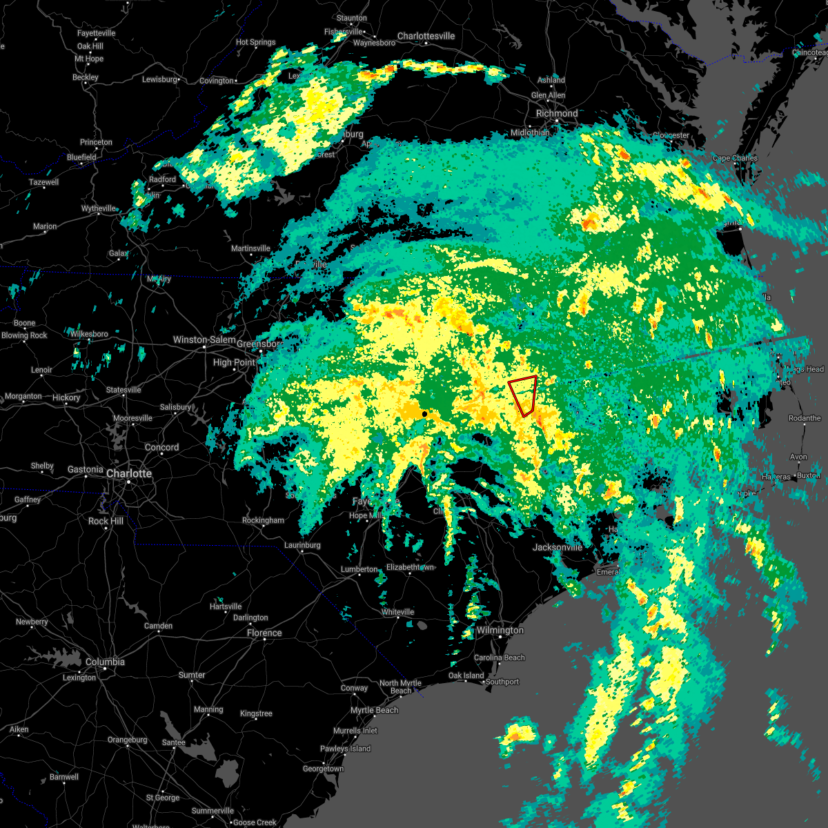 At 1231 pm edt, a tornado producing storm was located near farmville, moving north at 35 mph (radar confirmed tornado). Hazards include damaging tornado. Flying debris will be dangerous to those caught without shelter. mobile homes will be damaged or destroyed. damage to roofs, windows, and vehicles will occur. tree damage is likely. This tornadic thunderstorm will remain over mainly rural areas of southwestern edgecombe and northeastern wilson counties, including the following locations, macclesfield and pinetops. At 1231 pm edt, a tornado producing storm was located near farmville, moving north at 35 mph (radar confirmed tornado). Hazards include damaging tornado. Flying debris will be dangerous to those caught without shelter. mobile homes will be damaged or destroyed. damage to roofs, windows, and vehicles will occur. tree damage is likely. This tornadic thunderstorm will remain over mainly rural areas of southwestern edgecombe and northeastern wilson counties, including the following locations, macclesfield and pinetops.
|
| 5/29/2021 6:21 PM EDT |
 At 621 pm edt, a severe thunderstorm was located near fremont, or 16 miles west of farmville, moving east at 20 mph (radar indicated). Hazards include 60 mph wind gusts and quarter size hail. Hail damage to vehicles is expected. expect wind damage to roofs, siding, and trees. Locations impacted include, wilson, pinetops, stantonsburg, macclesfield, saratoga, eureka and willbanks. At 621 pm edt, a severe thunderstorm was located near fremont, or 16 miles west of farmville, moving east at 20 mph (radar indicated). Hazards include 60 mph wind gusts and quarter size hail. Hail damage to vehicles is expected. expect wind damage to roofs, siding, and trees. Locations impacted include, wilson, pinetops, stantonsburg, macclesfield, saratoga, eureka and willbanks.
|
| 5/29/2021 5:51 PM EDT |
 At 550 pm edt, a severe thunderstorm was located near fremont, or 14 miles north of goldsboro, moving east at 25 mph (radar indicated). Hazards include 60 mph wind gusts and quarter size hail. Hail damage to vehicles is expected. Expect wind damage to roofs, siding, and trees. At 550 pm edt, a severe thunderstorm was located near fremont, or 14 miles north of goldsboro, moving east at 25 mph (radar indicated). Hazards include 60 mph wind gusts and quarter size hail. Hail damage to vehicles is expected. Expect wind damage to roofs, siding, and trees.
|
| 3/28/2021 4:26 PM EDT |
 The severe thunderstorm warning for southeastern edgecombe county will expire at 430 pm edt, the storm which prompted the warning has moved out of the area. therefore, the warning will be allowed to expire. a severe thunderstorm watch remains in effect until 900 pm edt for central north carolina. to report severe weather, contact your nearest law enforcement agency. they will relay your report to the national weather service raleigh. The severe thunderstorm warning for southeastern edgecombe county will expire at 430 pm edt, the storm which prompted the warning has moved out of the area. therefore, the warning will be allowed to expire. a severe thunderstorm watch remains in effect until 900 pm edt for central north carolina. to report severe weather, contact your nearest law enforcement agency. they will relay your report to the national weather service raleigh.
|
| 3/28/2021 4:15 PM EDT |
 At 415 pm edt, a severe thunderstorm was located near bethel, or 8 miles east of tarboro, moving east at 30 mph (radar indicated). Hazards include 60 mph wind gusts. Expect damage to roofs, siding, and trees. Locations impacted include, tarboro, princeville, pinetops, macclesfield and conetoe. At 415 pm edt, a severe thunderstorm was located near bethel, or 8 miles east of tarboro, moving east at 30 mph (radar indicated). Hazards include 60 mph wind gusts. Expect damage to roofs, siding, and trees. Locations impacted include, tarboro, princeville, pinetops, macclesfield and conetoe.
|
| 3/28/2021 4:05 PM EDT |
 At 404 pm edt, a severe thunderstorm was located 8 miles northwest of farmville, moving east at 55 mph (radar indicated). Hazards include 60 mph wind gusts. Expect damage to roofs, siding, and trees. Locations impacted include, rocky mount, tarboro, princeville, sharpsburg, pinetops, stantonsburg, macclesfield, and conetoe. At 404 pm edt, a severe thunderstorm was located 8 miles northwest of farmville, moving east at 55 mph (radar indicated). Hazards include 60 mph wind gusts. Expect damage to roofs, siding, and trees. Locations impacted include, rocky mount, tarboro, princeville, sharpsburg, pinetops, stantonsburg, macclesfield, and conetoe.
|
| 3/28/2021 3:50 PM EDT |
 At 350 pm edt, a severe thunderstorm was located near wilson, or 18 miles west of farmville, moving east at 55 mph (radar indicated). Hazards include 60 mph wind gusts. expect damage to roofs, siding, and trees At 350 pm edt, a severe thunderstorm was located near wilson, or 18 miles west of farmville, moving east at 55 mph (radar indicated). Hazards include 60 mph wind gusts. expect damage to roofs, siding, and trees
|
| 3/27/2021 6:30 PM EDT |
 At 630 pm edt, a severe thunderstorm was located near wilson, or 14 miles northwest of farmville, moving east at 25 mph (radar indicated). Hazards include 60 mph wind gusts and quarter size hail. Hail damage to vehicles is expected. expect wind damage to roofs, siding, and trees. Locations impacted include, wilson, elm city, pinetops, black creek, macclesfield, saratoga and willbanks. At 630 pm edt, a severe thunderstorm was located near wilson, or 14 miles northwest of farmville, moving east at 25 mph (radar indicated). Hazards include 60 mph wind gusts and quarter size hail. Hail damage to vehicles is expected. expect wind damage to roofs, siding, and trees. Locations impacted include, wilson, elm city, pinetops, black creek, macclesfield, saratoga and willbanks.
|
| 3/27/2021 6:17 PM EDT |
 At 616 pm edt, a severe thunderstorm was located over wilson, or 15 miles south of nashville, moving east at 30 mph (radar indicated). Hazards include 60 mph wind gusts and quarter size hail. Hail damage to vehicles is expected. expect wind damage to roofs, siding, and trees. Locations impacted include, wilson, elm city, pinetops, lucama, black creek, macclesfield, saratoga, sims, willbanks and new hope. At 616 pm edt, a severe thunderstorm was located over wilson, or 15 miles south of nashville, moving east at 30 mph (radar indicated). Hazards include 60 mph wind gusts and quarter size hail. Hail damage to vehicles is expected. expect wind damage to roofs, siding, and trees. Locations impacted include, wilson, elm city, pinetops, lucama, black creek, macclesfield, saratoga, sims, willbanks and new hope.
|
| 3/27/2021 6:00 PM EDT |
 At 600 pm edt, a severe thunderstorm was located near bailey, or 15 miles south of nashville, moving east at 30 mph (radar indicated). Hazards include 60 mph wind gusts. expect damage to roofs, siding, and trees At 600 pm edt, a severe thunderstorm was located near bailey, or 15 miles south of nashville, moving east at 30 mph (radar indicated). Hazards include 60 mph wind gusts. expect damage to roofs, siding, and trees
|
| 2/22/2021 2:52 PM EST |
 At 249 pm est, severe thunderstorms were located along a line extending from near roxobel to near tarboro to near wilson, moving east at 50 mph. this storm recently downed trees on interstate 95, near both highway one thirty seven and at mile marker 162 (radar indicated). Hazards include 60 mph wind gusts. Expect damage to roofs, siding, and trees. Locations impacted include, tarboro, wilson, scotland neck, elm city, princeville, pinetops, stantonsburg, black creek, macclesfield and saratoga. At 249 pm est, severe thunderstorms were located along a line extending from near roxobel to near tarboro to near wilson, moving east at 50 mph. this storm recently downed trees on interstate 95, near both highway one thirty seven and at mile marker 162 (radar indicated). Hazards include 60 mph wind gusts. Expect damage to roofs, siding, and trees. Locations impacted include, tarboro, wilson, scotland neck, elm city, princeville, pinetops, stantonsburg, black creek, macclesfield and saratoga.
|
| 2/22/2021 2:29 PM EST |
 At 228 pm est, severe thunderstorms were located along a line extending from 7 miles west of rich square to near bailey, moving east at 40 mph (radar indicated). Hazards include 60 mph wind gusts. expect damage to roofs, siding, and trees At 228 pm est, severe thunderstorms were located along a line extending from 7 miles west of rich square to near bailey, moving east at 40 mph (radar indicated). Hazards include 60 mph wind gusts. expect damage to roofs, siding, and trees
|
| 12/24/2020 10:51 PM EST |
 The severe thunderstorm warning for edgecombe, halifax and northeastern wilson counties will expire at 1100 pm est, the storms which prompted the warning have moved out of the area. therefore, the warning will be allowed to expire. a tornado watch remains in effect until 1100 pm est for central north carolina. to report severe weather, contact your nearest law enforcement agency. they will relay your report to the national weather service raleigh. The severe thunderstorm warning for edgecombe, halifax and northeastern wilson counties will expire at 1100 pm est, the storms which prompted the warning have moved out of the area. therefore, the warning will be allowed to expire. a tornado watch remains in effect until 1100 pm est for central north carolina. to report severe weather, contact your nearest law enforcement agency. they will relay your report to the national weather service raleigh.
|
| 12/24/2020 10:24 PM EST |
 At 1023 pm est, severe thunderstorms were located along a line extending from near dahlia to 7 miles west of scotland neck to near farmville, moving northeast at 60 mph (radar indicated). Hazards include 60 mph wind gusts. Expect damage to roofs, siding, and trees. Locations impacted include, roanoke rapids, tarboro, halifax, scotland neck, enfield, princeville, weldon, pinetops, whitakers and macclesfield. At 1023 pm est, severe thunderstorms were located along a line extending from near dahlia to 7 miles west of scotland neck to near farmville, moving northeast at 60 mph (radar indicated). Hazards include 60 mph wind gusts. Expect damage to roofs, siding, and trees. Locations impacted include, roanoke rapids, tarboro, halifax, scotland neck, enfield, princeville, weldon, pinetops, whitakers and macclesfield.
|
| 12/24/2020 9:46 PM EST |
 At 945 pm est, severe thunderstorms were located along a line extending from near gasburg to near bailey to near bowdens, moving east at 35 mph (radar indicated). Hazards include 60 mph wind gusts. expect damage to roofs, siding, and trees At 945 pm est, severe thunderstorms were located along a line extending from near gasburg to near bailey to near bowdens, moving east at 35 mph (radar indicated). Hazards include 60 mph wind gusts. expect damage to roofs, siding, and trees
|
| 8/1/2020 1:35 AM EDT |
 The severe thunderstorm warning for southern nash, southern edgecombe, east central wake, wilson, northeastern johnston and south central franklin counties will expire at 145 am edt, the storms which prompted the warning have weakened below severe limits, and have exited the warned area. therefore, the warning will be allowed to expire. however gusty winds and heavy rain are still possible with these thunderstorms. to report severe weather, contact your nearest law enforcement agency. they will relay your report to the national weather service raleigh. The severe thunderstorm warning for southern nash, southern edgecombe, east central wake, wilson, northeastern johnston and south central franklin counties will expire at 145 am edt, the storms which prompted the warning have weakened below severe limits, and have exited the warned area. therefore, the warning will be allowed to expire. however gusty winds and heavy rain are still possible with these thunderstorms. to report severe weather, contact your nearest law enforcement agency. they will relay your report to the national weather service raleigh.
|
| 8/1/2020 1:26 AM EDT |
 At 126 am edt, severe thunderstorms were located along a line extending from 6 miles west of bethel to zebulon, moving east at 15 mph (radar indicated). Hazards include 60 mph wind gusts. Expect damage to roofs, siding, and trees. Locations impacted include, rocky mount, tarboro, wilson, zebulon, elm city, bailey, wendell, princeville, sharpsburg and pinetops. At 126 am edt, severe thunderstorms were located along a line extending from 6 miles west of bethel to zebulon, moving east at 15 mph (radar indicated). Hazards include 60 mph wind gusts. Expect damage to roofs, siding, and trees. Locations impacted include, rocky mount, tarboro, wilson, zebulon, elm city, bailey, wendell, princeville, sharpsburg and pinetops.
|
| 8/1/2020 1:00 AM EDT |
 At 100 am edt, severe thunderstorms were located along a line extending from near tarboro to zebulon, moving east at 25 mph (radar indicated). Hazards include 60 mph wind gusts. Expect damage to roofs, siding, and trees. Locations impacted include, rocky mount, tarboro, wilson, zebulon, elm city, bailey, wendell, princeville, sharpsburg and pinetops. At 100 am edt, severe thunderstorms were located along a line extending from near tarboro to zebulon, moving east at 25 mph (radar indicated). Hazards include 60 mph wind gusts. Expect damage to roofs, siding, and trees. Locations impacted include, rocky mount, tarboro, wilson, zebulon, elm city, bailey, wendell, princeville, sharpsburg and pinetops.
|
| 8/1/2020 12:51 AM EDT |
 At 1250 am edt, a severe thunderstorm was located over zebulon, or 17 miles east of raleigh, moving east at 20 mph (radar indicated). Hazards include 60 mph wind gusts. expect damage to roofs, siding, and trees At 1250 am edt, a severe thunderstorm was located over zebulon, or 17 miles east of raleigh, moving east at 20 mph (radar indicated). Hazards include 60 mph wind gusts. expect damage to roofs, siding, and trees
|
| 4/13/2020 9:03 AM EDT |
 At 903 am edt, severe thunderstorms were located along a line extending from 10 miles south of scotland neck to near tarboro to 8 miles east of wilson, moving northeast at 50 mph (radar indicated). Hazards include 60 mph wind gusts and penny size hail. Expect damage to roofs, siding, and trees. Locations impacted include, rocky mount, tarboro, wilson, elm city, princeville, sharpsburg, pinetops, kenly, lucama and stantonsburg. At 903 am edt, severe thunderstorms were located along a line extending from 10 miles south of scotland neck to near tarboro to 8 miles east of wilson, moving northeast at 50 mph (radar indicated). Hazards include 60 mph wind gusts and penny size hail. Expect damage to roofs, siding, and trees. Locations impacted include, rocky mount, tarboro, wilson, elm city, princeville, sharpsburg, pinetops, kenly, lucama and stantonsburg.
|
| 4/13/2020 8:24 AM EDT |
 At 823 am edt, severe thunderstorms were located along a line extending from 9 miles northeast of dortches through 7 miles west of nashville to 9 miles south of zebulon, moving northeast at 50 mph (radar indicated). Hazards include 60 mph wind gusts and penny size hail. expect damage to roofs, siding, and trees At 823 am edt, severe thunderstorms were located along a line extending from 9 miles northeast of dortches through 7 miles west of nashville to 9 miles south of zebulon, moving northeast at 50 mph (radar indicated). Hazards include 60 mph wind gusts and penny size hail. expect damage to roofs, siding, and trees
|
| 4/8/2020 8:08 PM EDT |
 The severe thunderstorm warning for northeastern wayne, southern edgecombe and eastern wilson counties will expire at 815 pm edt, the storms which prompted the warning have moved out of the area. therefore, the warning will be allowed to expire. to report severe weather, contact your nearest law enforcement agency. they will relay your report to the national weather service raleigh. The severe thunderstorm warning for northeastern wayne, southern edgecombe and eastern wilson counties will expire at 815 pm edt, the storms which prompted the warning have moved out of the area. therefore, the warning will be allowed to expire. to report severe weather, contact your nearest law enforcement agency. they will relay your report to the national weather service raleigh.
|
| 4/8/2020 7:58 PM EDT |
 At 757 pm edt, severe thunderstorms were located along a line extending from 7 miles southwest of tarboro to 6 miles northwest of snow hill to 7 miles southeast of fremont, moving southeast at 40 mph (radar indicated). Hazards include 60 mph wind gusts and quarter size hail. Hail damage to vehicles is expected. expect wind damage to roofs, siding, and trees. Locations impacted include, goldsboro, tarboro, walnut creek, princeville, pinetops, stantonsburg, macclesfield, saratoga, conetoe and eureka. At 757 pm edt, severe thunderstorms were located along a line extending from 7 miles southwest of tarboro to 6 miles northwest of snow hill to 7 miles southeast of fremont, moving southeast at 40 mph (radar indicated). Hazards include 60 mph wind gusts and quarter size hail. Hail damage to vehicles is expected. expect wind damage to roofs, siding, and trees. Locations impacted include, goldsboro, tarboro, walnut creek, princeville, pinetops, stantonsburg, macclesfield, saratoga, conetoe and eureka.
|
| 4/8/2020 7:44 PM EDT |
 At 744 pm edt, severe thunderstorms were located along a line extending from near rocky mount to 6 miles east of fremont to 11 miles east of smithfield, moving southeast at 40 mph (radar indicated). Hazards include 60 mph wind gusts and quarter size hail. Hail damage to vehicles is expected. expect wind damage to roofs, siding, and trees. Locations impacted include, rocky mount, goldsboro, tarboro, wilson, elm city, fremont, walnut creek, micro, selma and princeville. At 744 pm edt, severe thunderstorms were located along a line extending from near rocky mount to 6 miles east of fremont to 11 miles east of smithfield, moving southeast at 40 mph (radar indicated). Hazards include 60 mph wind gusts and quarter size hail. Hail damage to vehicles is expected. expect wind damage to roofs, siding, and trees. Locations impacted include, rocky mount, goldsboro, tarboro, wilson, elm city, fremont, walnut creek, micro, selma and princeville.
|
| 4/8/2020 7:21 PM EDT |
 At 721 pm edt, severe thunderstorms were located along a line extending from near dortches to 6 miles southeast of bailey to 7 miles east of clayton, moving southeast at 40 mph (radar indicated). Hazards include 60 mph wind gusts and quarter size hail. Hail damage to vehicles is expected. Expect wind damage to roofs, siding, and trees. At 721 pm edt, severe thunderstorms were located along a line extending from near dortches to 6 miles southeast of bailey to 7 miles east of clayton, moving southeast at 40 mph (radar indicated). Hazards include 60 mph wind gusts and quarter size hail. Hail damage to vehicles is expected. Expect wind damage to roofs, siding, and trees.
|
| 3/11/2020 9:19 PM EDT |
 At 918 pm edt, a severe thunderstorm was located near elm city, or 8 miles south of nashville, moving east at 30 mph (radar indicated. at 9pm, nickel sized hail was reported covering the ground 3 miles north of bailey in nash county). Hazards include 60 mph wind gusts and quarter size hail. Hail damage to vehicles is expected. expect wind damage to roofs, siding, and trees. Locations impacted include, rocky mount, elm city, sharpsburg, pinetops, macclesfield, tar river reservoir and new hope. At 918 pm edt, a severe thunderstorm was located near elm city, or 8 miles south of nashville, moving east at 30 mph (radar indicated. at 9pm, nickel sized hail was reported covering the ground 3 miles north of bailey in nash county). Hazards include 60 mph wind gusts and quarter size hail. Hail damage to vehicles is expected. expect wind damage to roofs, siding, and trees. Locations impacted include, rocky mount, elm city, sharpsburg, pinetops, macclesfield, tar river reservoir and new hope.
|
| 3/11/2020 9:01 PM EDT |
 At 843 pm edt, a severe thunderstorm was located over bailey, or 17 miles southwest of nashville, moving east at 30 mph (radar indicated). Hazards include 60 mph wind gusts and quarter size hail. Hail damage to vehicles is expected. Expect wind damage to roofs, siding, and trees. At 843 pm edt, a severe thunderstorm was located over bailey, or 17 miles southwest of nashville, moving east at 30 mph (radar indicated). Hazards include 60 mph wind gusts and quarter size hail. Hail damage to vehicles is expected. Expect wind damage to roofs, siding, and trees.
|
| 3/11/2020 8:44 PM EDT |
 At 843 pm edt, a severe thunderstorm was located over bailey, or 17 miles southwest of nashville, moving east at 30 mph (radar indicated). Hazards include 60 mph wind gusts and quarter size hail. Hail damage to vehicles is expected. Expect wind damage to roofs, siding, and trees. At 843 pm edt, a severe thunderstorm was located over bailey, or 17 miles southwest of nashville, moving east at 30 mph (radar indicated). Hazards include 60 mph wind gusts and quarter size hail. Hail damage to vehicles is expected. Expect wind damage to roofs, siding, and trees.
|
| 2/6/2020 3:28 PM EST |
 At 327 pm est, severe thunderstorms were located along a line extending from near isle of wight to near windsor to near whaleyville to 6 miles south of chowan university, moving northeast at 100 mph (radar indicated). Hazards include 60 mph wind gusts. Expect damage to roofs, siding, and trees. Locations impacted include, rocky mount, tarboro, wilson, scotland neck, elm city, bailey, princeville, sharpsburg, pinetops and lucama. At 327 pm est, severe thunderstorms were located along a line extending from near isle of wight to near windsor to near whaleyville to 6 miles south of chowan university, moving northeast at 100 mph (radar indicated). Hazards include 60 mph wind gusts. Expect damage to roofs, siding, and trees. Locations impacted include, rocky mount, tarboro, wilson, scotland neck, elm city, bailey, princeville, sharpsburg, pinetops and lucama.
|
| 2/6/2020 2:48 PM EST |
 At 247 pm est, severe thunderstorms were located along a line extending from 6 miles west of roanoke rapids to 6 miles west of halifax to 9 miles northeast of dortches to 7 miles southwest of nashville, moving northeast at 100 mph (radar indicated). Hazards include 60 mph wind gusts and penny size hail. expect damage to roofs, siding, and trees At 247 pm est, severe thunderstorms were located along a line extending from 6 miles west of roanoke rapids to 6 miles west of halifax to 9 miles northeast of dortches to 7 miles southwest of nashville, moving northeast at 100 mph (radar indicated). Hazards include 60 mph wind gusts and penny size hail. expect damage to roofs, siding, and trees
|
| 1/12/2020 1:53 AM EST |
 At 153 am est, severe thunderstorms were located along a line extending from near bruce to mount olive to ammon, moving northeast at 45 mph (radar indicated). Hazards include 60 mph wind gusts. Expect damage to roofs, siding, and trees. Locations impacted include, goldsboro, clinton, mount olive, walnut creek, princeville, pinetops, roseboro, stantonsburg, pikeville and garland. At 153 am est, severe thunderstorms were located along a line extending from near bruce to mount olive to ammon, moving northeast at 45 mph (radar indicated). Hazards include 60 mph wind gusts. Expect damage to roofs, siding, and trees. Locations impacted include, goldsboro, clinton, mount olive, walnut creek, princeville, pinetops, roseboro, stantonsburg, pikeville and garland.
|
| 1/12/2020 1:38 AM EST |
 At 138 am est, severe thunderstorms were located along a line extending from 10 miles west of farmville to near walnut creek to near white oak, moving northeast at 70 mph (radar indicated). Hazards include 60 mph wind gusts. Expect damage to roofs, siding, and trees. Locations impacted include, goldsboro, clinton, wilson, mount olive, fremont, walnut creek, pinetops, roseboro, stantonsburg and black creek. At 138 am est, severe thunderstorms were located along a line extending from 10 miles west of farmville to near walnut creek to near white oak, moving northeast at 70 mph (radar indicated). Hazards include 60 mph wind gusts. Expect damage to roofs, siding, and trees. Locations impacted include, goldsboro, clinton, wilson, mount olive, fremont, walnut creek, pinetops, roseboro, stantonsburg and black creek.
|
| 1/12/2020 1:22 AM EST |
 At 121 am est, severe thunderstorms were located along a line extending from 7 miles east of fremont to 9 miles west of mount olive to duart, moving northeast at 40 mph (radar indicated). Hazards include 60 mph wind gusts. Expect damage to roofs, siding, and trees. Locations impacted include, goldsboro, tarboro, clinton, wilson, mount olive, fremont, walnut creek, jerome, princeville and pinetops. At 121 am est, severe thunderstorms were located along a line extending from 7 miles east of fremont to 9 miles west of mount olive to duart, moving northeast at 40 mph (radar indicated). Hazards include 60 mph wind gusts. Expect damage to roofs, siding, and trees. Locations impacted include, goldsboro, tarboro, clinton, wilson, mount olive, fremont, walnut creek, jerome, princeville and pinetops.
|
| 1/12/2020 12:57 AM EST |
 At 1256 am est, severe thunderstorms were located along a line extending from 7 miles southeast of littleton to 11 miles north of clinton to near st. pauls, moving northeast at 60 mph (radar indicated). Hazards include 60 mph wind gusts. expect damage to roofs, siding, and trees At 1256 am est, severe thunderstorms were located along a line extending from 7 miles southeast of littleton to 11 miles north of clinton to near st. pauls, moving northeast at 60 mph (radar indicated). Hazards include 60 mph wind gusts. expect damage to roofs, siding, and trees
|
| 9/9/2019 8:25 PM EDT |
 At 824 pm edt, a severe thunderstorm was located near elm city, or near rocky mount, moving south at 20 mph (radar indicated). Hazards include 60 mph wind gusts and quarter size hail. Hail damage to vehicles is expected. Expect wind damage to roofs, siding, and trees. At 824 pm edt, a severe thunderstorm was located near elm city, or near rocky mount, moving south at 20 mph (radar indicated). Hazards include 60 mph wind gusts and quarter size hail. Hail damage to vehicles is expected. Expect wind damage to roofs, siding, and trees.
|
| 8/22/2019 9:20 PM EDT |
 The severe thunderstorm warning for edgecombe and southeastern halifax counties will expire at 930 pm edt, the storms which prompted the warning have moved out of the area. therefore the warning will be allowed to expire. however gusty winds and heavy rain are still possible with these thunderstorms. to report severe weather, contact your nearest law enforcement agency. they will relay your report to the national weather service raleigh. The severe thunderstorm warning for edgecombe and southeastern halifax counties will expire at 930 pm edt, the storms which prompted the warning have moved out of the area. therefore the warning will be allowed to expire. however gusty winds and heavy rain are still possible with these thunderstorms. to report severe weather, contact your nearest law enforcement agency. they will relay your report to the national weather service raleigh.
|
| 8/22/2019 9:04 PM EDT |
 At 904 pm edt, severe thunderstorms were located along a line extending from 8 miles south of scotland neck to near bethel to 10 miles southeast of elm city, moving east at 30 mph (radar indicated). Hazards include 60 mph wind gusts. Expect damage to roofs, siding, and trees. Locations impacted include, tarboro, princeville, pinetops, macclesfield, hobgood, conetoe, speed and leggett. At 904 pm edt, severe thunderstorms were located along a line extending from 8 miles south of scotland neck to near bethel to 10 miles southeast of elm city, moving east at 30 mph (radar indicated). Hazards include 60 mph wind gusts. Expect damage to roofs, siding, and trees. Locations impacted include, tarboro, princeville, pinetops, macclesfield, hobgood, conetoe, speed and leggett.
|
| 8/22/2019 8:47 PM EDT |
 At 847 pm edt, severe thunderstorms were located along a line extending from 12 miles east of rocky mount to near tarboro to near wilson, moving east at 30 mph (radar indicated). Hazards include 60 mph wind gusts. expect damage to roofs, siding, and trees At 847 pm edt, severe thunderstorms were located along a line extending from 12 miles east of rocky mount to near tarboro to near wilson, moving east at 30 mph (radar indicated). Hazards include 60 mph wind gusts. expect damage to roofs, siding, and trees
|
| 8/19/2019 4:25 PM EDT |
 At 425 pm edt, a severe thunderstorm was located near wilson, or 18 miles south of nashville, moving southwest at 10 mph (radar indicated). Hazards include 60 mph wind gusts and quarter size hail. Hail damage to vehicles is expected. Expect wind damage to roofs, siding, and trees. At 425 pm edt, a severe thunderstorm was located near wilson, or 18 miles south of nashville, moving southwest at 10 mph (radar indicated). Hazards include 60 mph wind gusts and quarter size hail. Hail damage to vehicles is expected. Expect wind damage to roofs, siding, and trees.
|
| 8/13/2019 6:42 PM EDT |
 At 619 pm edt, severe thunderstorms were located along a line extending from 8 miles northeast of rocky mount to 7 miles east of elm city to near bailey, moving southeast at 30 mph (radar indicated). Hazards include 60 mph wind gusts. Expect damage to roofs, siding, and trees. Locations impacted include, rocky mount, tarboro, wilson, elm city, princeville, sharpsburg, pinetops, lucama, stantonsburg and black creek. At 619 pm edt, severe thunderstorms were located along a line extending from 8 miles northeast of rocky mount to 7 miles east of elm city to near bailey, moving southeast at 30 mph (radar indicated). Hazards include 60 mph wind gusts. Expect damage to roofs, siding, and trees. Locations impacted include, rocky mount, tarboro, wilson, elm city, princeville, sharpsburg, pinetops, lucama, stantonsburg and black creek.
|
| 8/13/2019 6:19 PM EDT |
 At 619 pm edt, severe thunderstorms were located along a line extending from 8 miles northeast of rocky mount to 7 miles east of elm city to near bailey, moving southeast at 30 mph (radar indicated). Hazards include 60 mph wind gusts. Expect damage to roofs, siding, and trees. Locations impacted include, rocky mount, tarboro, wilson, elm city, princeville, sharpsburg, pinetops, lucama, stantonsburg and black creek. At 619 pm edt, severe thunderstorms were located along a line extending from 8 miles northeast of rocky mount to 7 miles east of elm city to near bailey, moving southeast at 30 mph (radar indicated). Hazards include 60 mph wind gusts. Expect damage to roofs, siding, and trees. Locations impacted include, rocky mount, tarboro, wilson, elm city, princeville, sharpsburg, pinetops, lucama, stantonsburg and black creek.
|
| 8/13/2019 5:48 PM EDT |
 At 547 pm edt, severe thunderstorms were located along a line extending from 7 miles north of dortches to near nashville to near bailey, moving southeast at 30 mph (radar indicated). Hazards include 60 mph wind gusts. expect damage to roofs, siding, and trees At 547 pm edt, severe thunderstorms were located along a line extending from 7 miles north of dortches to near nashville to near bailey, moving southeast at 30 mph (radar indicated). Hazards include 60 mph wind gusts. expect damage to roofs, siding, and trees
|
| 7/11/2019 8:51 PM EDT |
 The severe thunderstorm warning for southwestern edgecombe and wilson counties will expire at 900 pm edt, the storm which prompted the warning has moved out of the area. therefore the warning will be allowed to expire. however gusty winds and heavy rain are still possible with this thunderstorm. The severe thunderstorm warning for southwestern edgecombe and wilson counties will expire at 900 pm edt, the storm which prompted the warning has moved out of the area. therefore the warning will be allowed to expire. however gusty winds and heavy rain are still possible with this thunderstorm.
|
| 7/11/2019 8:17 PM EDT |
 At 816 pm edt, a severe thunderstorm was located 7 miles southeast of elm city, or 13 miles northwest of farmville, moving northeast at 45 mph (radar indicated). Hazards include 60 mph wind gusts. Expect damage to roofs, siding, and trees. Locations impacted include, tarboro, wilson, elm city, sharpsburg, pinetops, lucama, stantonsburg, black creek, macclesfield and saratoga. At 816 pm edt, a severe thunderstorm was located 7 miles southeast of elm city, or 13 miles northwest of farmville, moving northeast at 45 mph (radar indicated). Hazards include 60 mph wind gusts. Expect damage to roofs, siding, and trees. Locations impacted include, tarboro, wilson, elm city, sharpsburg, pinetops, lucama, stantonsburg, black creek, macclesfield and saratoga.
|
| 7/11/2019 8:07 PM EDT |
 At 807 pm edt, a severe thunderstorm was located near wilson, or 18 miles west of farmville, moving northeast at 45 mph (radar indicated). Hazards include 60 mph wind gusts. expect damage to roofs, siding, and trees At 807 pm edt, a severe thunderstorm was located near wilson, or 18 miles west of farmville, moving northeast at 45 mph (radar indicated). Hazards include 60 mph wind gusts. expect damage to roofs, siding, and trees
|
| 6/5/2019 5:53 PM EDT |
 At 552 pm edt, severe thunderstorms were located along a line extending from near bethel to near dowdy ficklen stadium to kinston, moving east at 55 mph (radar indicated). Hazards include 60 mph wind gusts and nickel size hail. Expect damage to roofs, siding, and trees. Locations impacted include, tarboro, princeville, pinetops, macclesfield, saratoga, conetoe, speed and willbanks. At 552 pm edt, severe thunderstorms were located along a line extending from near bethel to near dowdy ficklen stadium to kinston, moving east at 55 mph (radar indicated). Hazards include 60 mph wind gusts and nickel size hail. Expect damage to roofs, siding, and trees. Locations impacted include, tarboro, princeville, pinetops, macclesfield, saratoga, conetoe, speed and willbanks.
|
| 6/5/2019 5:23 PM EDT |
 At 523 pm edt, severe thunderstorms were located along a line extending from near elm city to 9 miles northwest of snow hill to near mount olive, moving east at 55 mph (radar indicated). Hazards include 60 mph wind gusts and nickel size hail. Expect damage to roofs, siding, and trees. Locations impacted include, tarboro, wilson, elm city, fremont, princeville, sharpsburg, pinetops, lucama, stantonsburg and black creek. At 523 pm edt, severe thunderstorms were located along a line extending from near elm city to 9 miles northwest of snow hill to near mount olive, moving east at 55 mph (radar indicated). Hazards include 60 mph wind gusts and nickel size hail. Expect damage to roofs, siding, and trees. Locations impacted include, tarboro, wilson, elm city, fremont, princeville, sharpsburg, pinetops, lucama, stantonsburg and black creek.
|
| 6/5/2019 5:13 PM EDT |
 At 513 pm edt, severe thunderstorms were located along a line extending from near bailey to near fremont to 7 miles northwest of mount olive, moving east at 55 mph (radar indicated). Hazards include 60 mph wind gusts and nickel size hail. expect damage to roofs, siding, and trees At 513 pm edt, severe thunderstorms were located along a line extending from near bailey to near fremont to 7 miles northwest of mount olive, moving east at 55 mph (radar indicated). Hazards include 60 mph wind gusts and nickel size hail. expect damage to roofs, siding, and trees
|
| 5/31/2019 7:06 PM EDT |
 At 705 pm edt, a severe thunderstorm was located near elm city, or 8 miles south of nashville, moving east at 45 mph (radar indicated). Hazards include quarter size hail. damage to vehicles is expected At 705 pm edt, a severe thunderstorm was located near elm city, or 8 miles south of nashville, moving east at 45 mph (radar indicated). Hazards include quarter size hail. damage to vehicles is expected
|
| 5/31/2019 5:09 PM EDT |
 At 508 pm edt, a severe thunderstorm was located 9 miles northwest of bruce, or 10 miles south of tarboro, moving northeast at 25 mph (radar indicated). Hazards include 60 mph wind gusts and quarter size hail. Hail damage to vehicles is expected. expect wind damage to roofs, siding, and trees. Locations impacted include, tarboro, princeville, pinetops, macclesfield, conetoe, speed and leggett. At 508 pm edt, a severe thunderstorm was located 9 miles northwest of bruce, or 10 miles south of tarboro, moving northeast at 25 mph (radar indicated). Hazards include 60 mph wind gusts and quarter size hail. Hail damage to vehicles is expected. expect wind damage to roofs, siding, and trees. Locations impacted include, tarboro, princeville, pinetops, macclesfield, conetoe, speed and leggett.
|
| 5/31/2019 4:56 PM EDT |
 At 455 pm edt, a severe thunderstorm was located 9 miles northwest of farmville, moving northeast at 25 mph (radar indicated). Hazards include 60 mph wind gusts and quarter size hail. Hail damage to vehicles is expected. Expect wind damage to roofs, siding, and trees. At 455 pm edt, a severe thunderstorm was located 9 miles northwest of farmville, moving northeast at 25 mph (radar indicated). Hazards include 60 mph wind gusts and quarter size hail. Hail damage to vehicles is expected. Expect wind damage to roofs, siding, and trees.
|
| 5/13/2019 12:09 PM EDT |
 At 1204 pm edt, a severe thunderstorm was located 8 miles northwest of bruce, or 10 miles north of farmville, moving east at 45 mph (radar indicated). Hazards include 60 mph wind gusts and quarter size hail. Some hail damage to vehicles is expected. expect minor wind damage to roofs, siding, and trees. Locations impacted include, pinetops, macclesfield and conetoe. At 1204 pm edt, a severe thunderstorm was located 8 miles northwest of bruce, or 10 miles north of farmville, moving east at 45 mph (radar indicated). Hazards include 60 mph wind gusts and quarter size hail. Some hail damage to vehicles is expected. expect minor wind damage to roofs, siding, and trees. Locations impacted include, pinetops, macclesfield and conetoe.
|
| 5/13/2019 12:05 PM EDT |
 At 1204 pm edt, a severe thunderstorm was located 8 miles northwest of bruce, or 10 miles north of farmville, moving east at 45 mph (radar indicated). Hazards include 60 mph wind gusts and quarter size hail. Some hail damage to vehicles is expected. expect minor wind damage to roofs, siding, and trees. Locations impacted include, pinetops, macclesfield and conetoe. At 1204 pm edt, a severe thunderstorm was located 8 miles northwest of bruce, or 10 miles north of farmville, moving east at 45 mph (radar indicated). Hazards include 60 mph wind gusts and quarter size hail. Some hail damage to vehicles is expected. expect minor wind damage to roofs, siding, and trees. Locations impacted include, pinetops, macclesfield and conetoe.
|
| 5/13/2019 11:49 AM EDT |
 A severe thunderstorm warning remains in effect until 1215 pm edt for southern edgecombe and eastern wilson counties. at 1148 am edt, a severe thunderstorm was located near elm city, or 13 miles south of rocky mount, moving east at 45 mph. hazard. 60 mph wind gusts and quarter size hail. source. Radar indicated. A severe thunderstorm warning remains in effect until 1215 pm edt for southern edgecombe and eastern wilson counties. at 1148 am edt, a severe thunderstorm was located near elm city, or 13 miles south of rocky mount, moving east at 45 mph. hazard. 60 mph wind gusts and quarter size hail. source. Radar indicated.
|
| 5/13/2019 11:31 AM EDT |
 At 1131 am edt, a severe thunderstorm was located near bailey, or 15 miles south of nashville, moving east at 45 mph (radar indicated). Hazards include 60 mph wind gusts and quarter size hail. Hail damage to vehicles is expected. Expect wind damage to roofs, siding, and trees. At 1131 am edt, a severe thunderstorm was located near bailey, or 15 miles south of nashville, moving east at 45 mph (radar indicated). Hazards include 60 mph wind gusts and quarter size hail. Hail damage to vehicles is expected. Expect wind damage to roofs, siding, and trees.
|
| 4/19/2019 7:13 PM EDT |
 The severe thunderstorm warning for nash, warren, edgecombe, halifax and northeastern franklin counties will expire at 715 pm edt, the storms which prompted the warning have moved out of the area. therefore the warning will be allowed to expire. a tornado watch remains in effect until 800 pm edt for central north carolina. a tornado watch also remains in effect until midnight edt for central north carolina. The severe thunderstorm warning for nash, warren, edgecombe, halifax and northeastern franklin counties will expire at 715 pm edt, the storms which prompted the warning have moved out of the area. therefore the warning will be allowed to expire. a tornado watch remains in effect until 800 pm edt for central north carolina. a tornado watch also remains in effect until midnight edt for central north carolina.
|
| 4/19/2019 6:00 PM EDT |
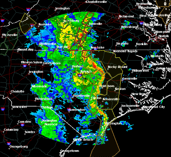 At 559 pm edt, a line of severe thunderstorms was moving through the area, located from henderson to louisburg to rocky mount, moving northeast at 50 mph (radar indicated). Hazards include 70 mph wind gusts. Expect considerable tree damage. Damage is likely to mobile homes, roofs, and outbuildings. At 559 pm edt, a line of severe thunderstorms was moving through the area, located from henderson to louisburg to rocky mount, moving northeast at 50 mph (radar indicated). Hazards include 70 mph wind gusts. Expect considerable tree damage. Damage is likely to mobile homes, roofs, and outbuildings.
|
| 4/19/2019 4:23 PM EDT |
 At 422 pm edt, a severe thunderstorm capable of producing a tornado was located 7 miles southeast of elm city, or 14 miles northwest of farmville, moving northeast at 45 mph (radar indicated rotation). Hazards include tornado and quarter size hail. Flying debris will be dangerous to those caught without shelter. mobile homes will be damaged or destroyed. damage to roofs, windows, and vehicles will occur. tree damage is likely. Locations impacted include, rocky mount, tarboro, nashville, wilson, elm city, dortches, red oak, princeville, sharpsburg and pinetops. At 422 pm edt, a severe thunderstorm capable of producing a tornado was located 7 miles southeast of elm city, or 14 miles northwest of farmville, moving northeast at 45 mph (radar indicated rotation). Hazards include tornado and quarter size hail. Flying debris will be dangerous to those caught without shelter. mobile homes will be damaged or destroyed. damage to roofs, windows, and vehicles will occur. tree damage is likely. Locations impacted include, rocky mount, tarboro, nashville, wilson, elm city, dortches, red oak, princeville, sharpsburg and pinetops.
|
| 4/19/2019 4:12 PM EDT |
 At 412 pm edt, a severe thunderstorm capable of producing a tornado was located 8 miles southeast of wilson, or 15 miles west of farmville, moving northeast at 45 mph (radar indicated rotation). Hazards include tornado and quarter size hail. Flying debris will be dangerous to those caught without shelter. mobile homes will be damaged or destroyed. damage to roofs, windows, and vehicles will occur. Tree damage is likely. At 412 pm edt, a severe thunderstorm capable of producing a tornado was located 8 miles southeast of wilson, or 15 miles west of farmville, moving northeast at 45 mph (radar indicated rotation). Hazards include tornado and quarter size hail. Flying debris will be dangerous to those caught without shelter. mobile homes will be damaged or destroyed. damage to roofs, windows, and vehicles will occur. Tree damage is likely.
|
| 4/8/2019 6:40 PM EDT |
 At 640 pm edt, a severe thunderstorm was located near elm city, or near rocky mount, moving northeast at 45 mph (radar indicated). Hazards include 60 mph wind gusts and nickel size hail. expect damage to roofs, siding, and trees At 640 pm edt, a severe thunderstorm was located near elm city, or near rocky mount, moving northeast at 45 mph (radar indicated). Hazards include 60 mph wind gusts and nickel size hail. expect damage to roofs, siding, and trees
|
| 10/11/2018 6:41 PM EDT |
 The severe thunderstorm warning for warren, nash, edgecombe, halifax and central franklin counties will expire at 645 pm edt, the gusty winds which prompted the warning have begun to subside. therefore the warning will be allowed to expire. however, gusty winds are still going to cause an issue across the area as tropical storm michael pushes northeast into virginia. The severe thunderstorm warning for warren, nash, edgecombe, halifax and central franklin counties will expire at 645 pm edt, the gusty winds which prompted the warning have begun to subside. therefore the warning will be allowed to expire. however, gusty winds are still going to cause an issue across the area as tropical storm michael pushes northeast into virginia.
|
| 10/11/2018 5:22 PM EDT |
 At 520 pm edt, a line of damaging winds mixing south along the western side of michael were located along a line extending from 6 miles southeast of hitesburg through creedmoor to near fuquay- varina, moving east at 25 mph. this line of wind gusts have produced extensive wind damage, and the high wind gusts could last for up to 30 minutes. an isolated spin up tornado is also not out of the question (radar indicated). Hazards include 60 mph wind gusts. expect damage to roofs, siding, and trees At 520 pm edt, a line of damaging winds mixing south along the western side of michael were located along a line extending from 6 miles southeast of hitesburg through creedmoor to near fuquay- varina, moving east at 25 mph. this line of wind gusts have produced extensive wind damage, and the high wind gusts could last for up to 30 minutes. an isolated spin up tornado is also not out of the question (radar indicated). Hazards include 60 mph wind gusts. expect damage to roofs, siding, and trees
|
| 8/5/2018 3:03 PM EDT |
 At 302 pm edt, a severe thunderstorm was located near elm city, or 10 miles south of rocky mount, moving southeast at 15 mph.rocky mount- wilson regional airport also gusted to 52 mph (radar indicated). Hazards include 60 mph wind gusts. Expect damage to roofs, siding, and trees. Locations impacted include, rocky mount, wilson, elm city, sharpsburg, pinetops, stantonsburg, macclesfield, saratoga, tar river reservoir and willbanks. At 302 pm edt, a severe thunderstorm was located near elm city, or 10 miles south of rocky mount, moving southeast at 15 mph.rocky mount- wilson regional airport also gusted to 52 mph (radar indicated). Hazards include 60 mph wind gusts. Expect damage to roofs, siding, and trees. Locations impacted include, rocky mount, wilson, elm city, sharpsburg, pinetops, stantonsburg, macclesfield, saratoga, tar river reservoir and willbanks.
|
| 8/5/2018 2:56 PM EDT |
 At 253 pm edt, a severe thunderstorm was located near elm city, or 8 miles south of rocky mount, moving southeast at 15 mph. rocky mount- wilson regional airport also gusted to 52 mph (radar indicated). Hazards include 60 mph wind gusts. Expect damage to roofs, siding, and trees. Locations impacted include, rocky mount, wilson, elm city, sharpsburg, pinetops, stantonsburg, macclesfield, saratoga, tar river reservoir and willbanks. At 253 pm edt, a severe thunderstorm was located near elm city, or 8 miles south of rocky mount, moving southeast at 15 mph. rocky mount- wilson regional airport also gusted to 52 mph (radar indicated). Hazards include 60 mph wind gusts. Expect damage to roofs, siding, and trees. Locations impacted include, rocky mount, wilson, elm city, sharpsburg, pinetops, stantonsburg, macclesfield, saratoga, tar river reservoir and willbanks.
|
| 8/5/2018 2:36 PM EDT |
 At 235 pm edt, a severe thunderstorm was located near elm city, or near rocky mount, moving southeast at 15 mph (radar indicated). Hazards include 60 mph wind gusts. expect damage to roofs, siding, and trees At 235 pm edt, a severe thunderstorm was located near elm city, or near rocky mount, moving southeast at 15 mph (radar indicated). Hazards include 60 mph wind gusts. expect damage to roofs, siding, and trees
|
| 7/31/2018 8:20 PM EDT |
 The severe thunderstorm warning for central edgecombe county will expire at 830 pm edt, the storm which prompted the warning has weakened below severe limits, and no longer poses an immediate threat to life or property. therefore the warning will be allowed to expire. however heavy rain is still possible with this thunderstorm. to report severe weather, contact your nearest law enforcement agency. they will relay your report to the national weather service raleigh. The severe thunderstorm warning for central edgecombe county will expire at 830 pm edt, the storm which prompted the warning has weakened below severe limits, and no longer poses an immediate threat to life or property. therefore the warning will be allowed to expire. however heavy rain is still possible with this thunderstorm. to report severe weather, contact your nearest law enforcement agency. they will relay your report to the national weather service raleigh.
|
| 7/31/2018 8:02 PM EDT |
 At 802 pm edt, a severe thunderstorm was located 7 miles east of elm city, or 9 miles south of rocky mount, moving northeast at 15 mph (radar indicated). Hazards include 60 mph wind gusts and nickel size hail. Expect damage to roofs, siding, and trees. Locations impacted include, tarboro, princeville, pinetops, speed, leggett and kingsboro. At 802 pm edt, a severe thunderstorm was located 7 miles east of elm city, or 9 miles south of rocky mount, moving northeast at 15 mph (radar indicated). Hazards include 60 mph wind gusts and nickel size hail. Expect damage to roofs, siding, and trees. Locations impacted include, tarboro, princeville, pinetops, speed, leggett and kingsboro.
|
| 7/31/2018 7:27 PM EDT |
 At 726 pm edt, a severe thunderstorm exhibiting signs of rotation was located near elm city, or 8 miles south of rocky mount, moving northeast at 20 mph (radar indicated). Hazards include 60 mph wind gusts and nickel size hail. expect damage to roofs, siding, and trees At 726 pm edt, a severe thunderstorm exhibiting signs of rotation was located near elm city, or 8 miles south of rocky mount, moving northeast at 20 mph (radar indicated). Hazards include 60 mph wind gusts and nickel size hail. expect damage to roofs, siding, and trees
|
| 7/23/2018 1:55 AM EDT |
 At 155 am edt, severe thunderstorms were located along a line extending from near tarboro to near bruce to 10 miles north of robersonville, moving north at 35 mph (radar indicated). Hazards include 60 mph wind gusts. Expect damage to roofs, siding, and trees. Locations impacted include, rocky mount, roanoke rapids, tarboro, halifax, scotland neck, dortches, red oak, enfield, princeville and sharpsburg. At 155 am edt, severe thunderstorms were located along a line extending from near tarboro to near bruce to 10 miles north of robersonville, moving north at 35 mph (radar indicated). Hazards include 60 mph wind gusts. Expect damage to roofs, siding, and trees. Locations impacted include, rocky mount, roanoke rapids, tarboro, halifax, scotland neck, dortches, red oak, enfield, princeville and sharpsburg.
|
| 7/23/2018 1:39 AM EDT |
 At 139 am edt, severe thunderstorms were located along a line extending from 7 miles west of farmville to 6 miles northwest of bruce to near shelmerdine, moving north at 50 mph (radar indicated). Hazards include 60 mph wind gusts. expect damage to roofs, siding, and trees At 139 am edt, severe thunderstorms were located along a line extending from 7 miles west of farmville to 6 miles northwest of bruce to near shelmerdine, moving north at 50 mph (radar indicated). Hazards include 60 mph wind gusts. expect damage to roofs, siding, and trees
|
| 6/20/2018 6:52 PM EDT |
 The severe thunderstorm warning for southern edgecombe county will expire at 700 pm edt, the storm which prompted the warning has weakened below severe limits, and no longer poses an immediate threat to life or property. therefore the warning will be allowed to expire. to report severe weather, contact your nearest law enforcement agency. they will relay your report to the national weather service raleigh. remember, a severe thunderstorm warning still remains in effect for north portions of edgecombe county until 730 pm. The severe thunderstorm warning for southern edgecombe county will expire at 700 pm edt, the storm which prompted the warning has weakened below severe limits, and no longer poses an immediate threat to life or property. therefore the warning will be allowed to expire. to report severe weather, contact your nearest law enforcement agency. they will relay your report to the national weather service raleigh. remember, a severe thunderstorm warning still remains in effect for north portions of edgecombe county until 730 pm.
|
| 6/20/2018 6:40 PM EDT |
 At 639 pm edt, a severe thunderstorm was located 9 miles northwest of bruce, or 11 miles north of farmville, moving east at 10 mph (radar indicated). Hazards include 60 mph wind gusts. Expect damage to roofs, siding, and trees. Locations impacted include, pinetops, macclesfield and conetoe. At 639 pm edt, a severe thunderstorm was located 9 miles northwest of bruce, or 11 miles north of farmville, moving east at 10 mph (radar indicated). Hazards include 60 mph wind gusts. Expect damage to roofs, siding, and trees. Locations impacted include, pinetops, macclesfield and conetoe.
|
| 6/20/2018 6:33 PM EDT | One power line down on fifth st in macclesfiel in edgecombe county NC, 0.1 miles NNW of Macclesfield, NC |
| 6/20/2018 6:11 PM EDT |
 At 611 pm edt, a severe thunderstorm was located 11 miles east of elm city, or 11 miles northwest of farmville, moving east at 20 mph (radar indicated). Hazards include 60 mph wind gusts and quarter size hail. Hail damage to vehicles is expected. Expect wind damage to roofs, siding, and trees. At 611 pm edt, a severe thunderstorm was located 11 miles east of elm city, or 11 miles northwest of farmville, moving east at 20 mph (radar indicated). Hazards include 60 mph wind gusts and quarter size hail. Hail damage to vehicles is expected. Expect wind damage to roofs, siding, and trees.
|
| 6/2/2018 6:29 PM EDT |
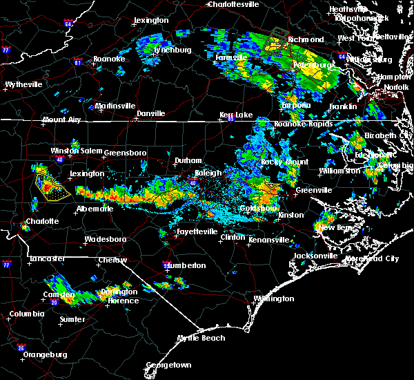 At 629 pm edt, a severe thunderstorm was located 7 miles north of farmville, moving east at 20 mph (radar indicated). Hazards include 60 mph wind gusts. Expect damage to roofs, siding, and trees. Locations impacted include, macclesfield. At 629 pm edt, a severe thunderstorm was located 7 miles north of farmville, moving east at 20 mph (radar indicated). Hazards include 60 mph wind gusts. Expect damage to roofs, siding, and trees. Locations impacted include, macclesfield.
|
| 6/2/2018 6:24 PM EDT |
 A severe thunderstorm warning remains in effect until 645 pm edt for southwestern edgecombe and east central wilson counties. at 623 pm edt, a severe thunderstorm was located 7 miles northwest of farmville, moving east at 40 mph. hazard. 60 mph wind gusts. source. Radar indicated. A severe thunderstorm warning remains in effect until 645 pm edt for southwestern edgecombe and east central wilson counties. at 623 pm edt, a severe thunderstorm was located 7 miles northwest of farmville, moving east at 40 mph. hazard. 60 mph wind gusts. source. Radar indicated.
|
| 6/2/2018 6:18 PM EDT |
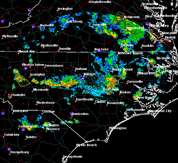 At 617 pm edt, severe thunderstorms were located along a line extending from 8 miles southeast of wilson to 7 miles southeast of fremont, moving east at 30 mph (radar indicated). Hazards include 60 mph wind gusts. Expect damage to roofs, siding, and trees. Locations impacted include, goldsboro, pinetops, stantonsburg, macclesfield and saratoga. At 617 pm edt, severe thunderstorms were located along a line extending from 8 miles southeast of wilson to 7 miles southeast of fremont, moving east at 30 mph (radar indicated). Hazards include 60 mph wind gusts. Expect damage to roofs, siding, and trees. Locations impacted include, goldsboro, pinetops, stantonsburg, macclesfield and saratoga.
|
| 6/2/2018 6:11 PM EDT |
 At 611 pm edt, severe thunderstorms were located along a line extending from near wilson to near fremont, moving east at 30 mph (radar indicated). Hazards include 60 mph wind gusts. Expect damage to roofs, siding, and trees. Locations impacted include, goldsboro, wilson, elm city, fremont, sharpsburg, pinetops, stantonsburg, pikeville, macclesfield and saratoga. At 611 pm edt, severe thunderstorms were located along a line extending from near wilson to near fremont, moving east at 30 mph (radar indicated). Hazards include 60 mph wind gusts. Expect damage to roofs, siding, and trees. Locations impacted include, goldsboro, wilson, elm city, fremont, sharpsburg, pinetops, stantonsburg, pikeville, macclesfield and saratoga.
|
| 6/2/2018 6:02 PM EDT |
 At 602 pm edt, severe thunderstorms were located along a line extending from near wilson to fremont, moving east at 40 mph (radar indicated). Hazards include 60 mph wind gusts. Expect damage to roofs, siding, and trees. Locations impacted include, goldsboro, wilson, elm city, fremont, sharpsburg, pinetops, stantonsburg, black creek, pikeville and macclesfield. At 602 pm edt, severe thunderstorms were located along a line extending from near wilson to fremont, moving east at 40 mph (radar indicated). Hazards include 60 mph wind gusts. Expect damage to roofs, siding, and trees. Locations impacted include, goldsboro, wilson, elm city, fremont, sharpsburg, pinetops, stantonsburg, black creek, pikeville and macclesfield.
|
| 6/2/2018 5:48 PM EDT |
 At 548 pm edt, severe thunderstorms were located along a line extending from near bailey to 7 miles west of fremont, moving southeast at 20 mph (radar indicated). Hazards include 60 mph wind gusts and nickel size hail. expect damage to roofs, siding, and trees At 548 pm edt, severe thunderstorms were located along a line extending from near bailey to 7 miles west of fremont, moving southeast at 20 mph (radar indicated). Hazards include 60 mph wind gusts and nickel size hail. expect damage to roofs, siding, and trees
|
| 5/10/2018 8:38 PM EDT |
 At 838 pm edt, severe thunderstorms were located along a line extending from 9 miles east of tarboro to bethel to 7 miles northwest of farmville, moving east at 30 mph (trained weather spotters). Hazards include 60 mph wind gusts and quarter size hail. Hail damage to vehicles is expected. expect wind damage to roofs, siding, and trees. Locations impacted include, princeville, pinetops, macclesfield and conetoe. At 838 pm edt, severe thunderstorms were located along a line extending from 9 miles east of tarboro to bethel to 7 miles northwest of farmville, moving east at 30 mph (trained weather spotters). Hazards include 60 mph wind gusts and quarter size hail. Hail damage to vehicles is expected. expect wind damage to roofs, siding, and trees. Locations impacted include, princeville, pinetops, macclesfield and conetoe.
|
| 5/10/2018 8:10 PM EDT |
 At 808 pm edt, severe thunderstorms were located along a line extending from 10 miles east of rocky mount to near tarboro to near wilson, moving east at 30 mph (trained weather spotters reported quarter sized hail between tarboro and rocky mount). Hazards include 60 mph wind gusts and quarter size hail. Hail up to the size of quarters have caused damage to vehicles. expect wind damage to roofs, siding, and trees. Locations impacted include, rocky mount, tarboro, wilson, elm city, princeville, sharpsburg, pinetops, macclesfield, conetoe and speed. At 808 pm edt, severe thunderstorms were located along a line extending from 10 miles east of rocky mount to near tarboro to near wilson, moving east at 30 mph (trained weather spotters reported quarter sized hail between tarboro and rocky mount). Hazards include 60 mph wind gusts and quarter size hail. Hail up to the size of quarters have caused damage to vehicles. expect wind damage to roofs, siding, and trees. Locations impacted include, rocky mount, tarboro, wilson, elm city, princeville, sharpsburg, pinetops, macclesfield, conetoe and speed.
|
| 5/10/2018 7:49 PM EDT |
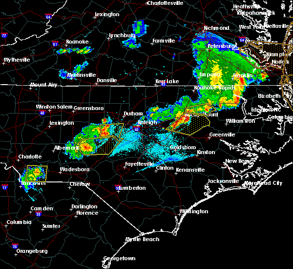 At 748 pm edt, a bowing line of severe thunderstorms were extended from 6 miles northeast of dortches to near rocky mount to near bailey, moving east at 30 mph (radar indicated). Hazards include 60 mph wind gusts and nickel size hail. Expect damage to roofs, siding, and trees. Locations impacted include, rocky mount, tarboro, wilson, elm city, dortches, bailey, princeville, sharpsburg, pinetops and macclesfield. At 748 pm edt, a bowing line of severe thunderstorms were extended from 6 miles northeast of dortches to near rocky mount to near bailey, moving east at 30 mph (radar indicated). Hazards include 60 mph wind gusts and nickel size hail. Expect damage to roofs, siding, and trees. Locations impacted include, rocky mount, tarboro, wilson, elm city, dortches, bailey, princeville, sharpsburg, pinetops and macclesfield.
|
| 5/10/2018 7:35 PM EDT |
 At 735 pm edt, severe thunderstorms were located along a line extending from near dortches to near nashville to near bailey, moving east at 30 mph (radar indicated). Hazards include 60 mph wind gusts and nickel size hail. expect damage to roofs, siding, and trees At 735 pm edt, severe thunderstorms were located along a line extending from near dortches to near nashville to near bailey, moving east at 30 mph (radar indicated). Hazards include 60 mph wind gusts and nickel size hail. expect damage to roofs, siding, and trees
|
| 3/18/2018 12:54 AM EDT |
 At 1254 am edt, severe thunderstorms were located along a line extending from 9 miles west of scotland neck to tarboro to 7 miles southeast of elm city, moving east at 50 mph (radar indicated). Hazards include 60 mph wind gusts and quarter size hail. Hail damage to vehicles is expected. Expect wind damage to roofs, siding, and trees. At 1254 am edt, severe thunderstorms were located along a line extending from 9 miles west of scotland neck to tarboro to 7 miles southeast of elm city, moving east at 50 mph (radar indicated). Hazards include 60 mph wind gusts and quarter size hail. Hail damage to vehicles is expected. Expect wind damage to roofs, siding, and trees.
|
| 3/18/2018 12:40 AM EDT |
 At 1240 am edt, severe thunderstorms were located along a line extending from 14 miles north of rocky mount to 7 miles east of dortches to near wilson, moving east at 55 mph (radar indicated). Hazards include 60 mph wind gusts and quarter size hail. Hail damage to vehicles is expected. expect wind damage to roofs, siding, and trees. Locations impacted include, rocky mount, nashville, wilson, elm city, dortches, red oak, enfield, sharpsburg, whitakers and sims. At 1240 am edt, severe thunderstorms were located along a line extending from 14 miles north of rocky mount to 7 miles east of dortches to near wilson, moving east at 55 mph (radar indicated). Hazards include 60 mph wind gusts and quarter size hail. Hail damage to vehicles is expected. expect wind damage to roofs, siding, and trees. Locations impacted include, rocky mount, nashville, wilson, elm city, dortches, red oak, enfield, sharpsburg, whitakers and sims.
|
| 3/18/2018 12:29 AM EDT |
 At 1227 am edt, severe thunderstorms were located along a line extending from 14 miles northwest of dortches to 6 miles north of nashville to near bailey, moving east at 50 mph (radar indicated). Hazards include 60 mph wind gusts and quarter size hail. Hail damage to vehicles is expected. expect wind damage to roofs, siding, and trees. Locations impacted include, rocky mount, nashville, halifax, wilson, elm city, dortches, bailey, red oak, enfield and sharpsburg. At 1227 am edt, severe thunderstorms were located along a line extending from 14 miles northwest of dortches to 6 miles north of nashville to near bailey, moving east at 50 mph (radar indicated). Hazards include 60 mph wind gusts and quarter size hail. Hail damage to vehicles is expected. expect wind damage to roofs, siding, and trees. Locations impacted include, rocky mount, nashville, halifax, wilson, elm city, dortches, bailey, red oak, enfield and sharpsburg.
|
| 3/18/2018 12:10 AM EDT |
 At 1209 am edt, severe thunderstorms were located along a line extending from 7 miles east of henderson to near louisburg to near bunn, moving east at 50 mph (radar indicated). Hazards include 60 mph wind gusts and quarter size hail. Hail damage to vehicles is expected. Expect wind damage to roofs, siding, and trees. At 1209 am edt, severe thunderstorms were located along a line extending from 7 miles east of henderson to near louisburg to near bunn, moving east at 50 mph (radar indicated). Hazards include 60 mph wind gusts and quarter size hail. Hail damage to vehicles is expected. Expect wind damage to roofs, siding, and trees.
|
| 8/12/2017 5:25 PM EDT |
 The severe thunderstorm warning for southern edgecombe and eastern wilson counties will expire at 530 pm edt, the storm which prompted the warning has weakened below severe limits, and no longer poses an immediate threat to life or property. therefore the warning will be allowed to expire. however gusty winds and heavy rain are still possible with this thunderstorm. The severe thunderstorm warning for southern edgecombe and eastern wilson counties will expire at 530 pm edt, the storm which prompted the warning has weakened below severe limits, and no longer poses an immediate threat to life or property. therefore the warning will be allowed to expire. however gusty winds and heavy rain are still possible with this thunderstorm.
|
| 8/12/2017 5:14 PM EDT |
 At 514 pm edt, a severe thunderstorm was located 7 miles east of wilson, or 13 miles northwest of farmville, moving southeast at 15 mph (radar indicated). Hazards include 60 mph wind gusts and penny size hail. Expect damage to roofs, siding, and trees. Locations impacted include, wilson, pinetops, stantonsburg, macclesfield, saratoga, conetoe and willbanks. At 514 pm edt, a severe thunderstorm was located 7 miles east of wilson, or 13 miles northwest of farmville, moving southeast at 15 mph (radar indicated). Hazards include 60 mph wind gusts and penny size hail. Expect damage to roofs, siding, and trees. Locations impacted include, wilson, pinetops, stantonsburg, macclesfield, saratoga, conetoe and willbanks.
|
| 8/12/2017 4:55 PM EDT |
 At 454 pm edt, a severe thunderstorm was located over elm city, or 12 miles southwest of rocky mount, moving east at 15 mph (radar indicated). Hazards include 60 mph wind gusts and penny size hail. Expect damage to roofs, siding, and trees. Locations impacted include, tarboro, wilson, elm city, princeville, sharpsburg, pinetops, stantonsburg, macclesfield, saratoga and conetoe. At 454 pm edt, a severe thunderstorm was located over elm city, or 12 miles southwest of rocky mount, moving east at 15 mph (radar indicated). Hazards include 60 mph wind gusts and penny size hail. Expect damage to roofs, siding, and trees. Locations impacted include, tarboro, wilson, elm city, princeville, sharpsburg, pinetops, stantonsburg, macclesfield, saratoga and conetoe.
|
| 8/12/2017 4:36 PM EDT |
 At 435 pm edt, a severe thunderstorm was located 7 miles northwest of wilson, or 10 miles south of nashville, moving east at 20 mph (radar indicated). Hazards include 60 mph wind gusts and quarter size hail. Hail damage to vehicles is expected. Expect wind damage to roofs, siding, and trees. At 435 pm edt, a severe thunderstorm was located 7 miles northwest of wilson, or 10 miles south of nashville, moving east at 20 mph (radar indicated). Hazards include 60 mph wind gusts and quarter size hail. Hail damage to vehicles is expected. Expect wind damage to roofs, siding, and trees.
|
| 7/23/2017 8:32 PM EDT |
 At 831 pm edt, severe thunderstorms were located along a line extending from 11 miles northwest of robersonville to 9 miles southeast of tarboro to near wilson, moving southeast at 15 mph (radar indicated). Hazards include 60 mph wind gusts. Expect damage to roofs, siding, and trees. Locations impacted include, tarboro, wilson, princeville, pinetops, stantonsburg, macclesfield, saratoga, conetoe and willbanks. At 831 pm edt, severe thunderstorms were located along a line extending from 11 miles northwest of robersonville to 9 miles southeast of tarboro to near wilson, moving southeast at 15 mph (radar indicated). Hazards include 60 mph wind gusts. Expect damage to roofs, siding, and trees. Locations impacted include, tarboro, wilson, princeville, pinetops, stantonsburg, macclesfield, saratoga, conetoe and willbanks.
|
| 7/23/2017 8:25 PM EDT |
 At 825 pm edt, severe thunderstorms were located along a line extending from 12 miles south of scotland neck to 7 miles southeast of tarboro to near wilson, moving southeast at 15 mph (radar indicated). Hazards include 60 mph wind gusts. Expect damage to roofs, siding, and trees. Locations impacted include, rocky mount, tarboro, wilson, elm city, princeville, sharpsburg, pinetops, kenly, lucama and stantonsburg. At 825 pm edt, severe thunderstorms were located along a line extending from 12 miles south of scotland neck to 7 miles southeast of tarboro to near wilson, moving southeast at 15 mph (radar indicated). Hazards include 60 mph wind gusts. Expect damage to roofs, siding, and trees. Locations impacted include, rocky mount, tarboro, wilson, elm city, princeville, sharpsburg, pinetops, kenly, lucama and stantonsburg.
|
| 7/23/2017 8:10 PM EDT |
 At 809 pm edt, severe thunderstorms were located along a line extending from near lewiston woodville to near tarboro to bailey, moving southeast at 15 mph (radar indicated). Hazards include 60 mph wind gusts. Expect damage to roofs, siding, and trees. Locations impacted include, rocky mount, tarboro, nashville, wilson, scotland neck, elm city, dortches, bailey, red oak and princeville. At 809 pm edt, severe thunderstorms were located along a line extending from near lewiston woodville to near tarboro to bailey, moving southeast at 15 mph (radar indicated). Hazards include 60 mph wind gusts. Expect damage to roofs, siding, and trees. Locations impacted include, rocky mount, tarboro, nashville, wilson, scotland neck, elm city, dortches, bailey, red oak and princeville.
|
| 7/23/2017 7:43 PM EDT |
 At 742 pm edt, severe thunderstorms were located along a line extending from near scotland neck to 7 miles south of tarboro to near bailey, moving southeast at 20 mph (radar indicated). Hazards include 60 mph wind gusts. Expect damage to roofs, siding, and trees. Locations impacted include, rocky mount, tarboro, nashville, wilson, clayton, scotland neck, elm city, dortches, bailey and red oak. At 742 pm edt, severe thunderstorms were located along a line extending from near scotland neck to 7 miles south of tarboro to near bailey, moving southeast at 20 mph (radar indicated). Hazards include 60 mph wind gusts. Expect damage to roofs, siding, and trees. Locations impacted include, rocky mount, tarboro, nashville, wilson, clayton, scotland neck, elm city, dortches, bailey and red oak.
|
| 7/23/2017 7:24 PM EDT |
 At 723 pm edt, severe thunderstorms were located along a line extending from near scotland neck to near rocky mount to near zebulon, moving southeast at 15 mph (radar indicated). Hazards include 60 mph wind gusts and penny size hail. expect damage to roofs, siding, and trees At 723 pm edt, severe thunderstorms were located along a line extending from near scotland neck to near rocky mount to near zebulon, moving southeast at 15 mph (radar indicated). Hazards include 60 mph wind gusts and penny size hail. expect damage to roofs, siding, and trees
|
| 7/8/2017 7:44 PM EDT |
 At 743 pm edt, severe thunderstorms were located along a line extending from near elm city to near bailey, moving east at 15 mph (radar indicated). Hazards include 60 mph wind gusts and quarter size hail. Hail damage to vehicles is expected. expect wind damage to roofs, siding, and trees. Locations impacted include, rocky mount, tarboro, nashville, wilson, elm city, dortches, bailey, red oak and sharpsburg. At 743 pm edt, severe thunderstorms were located along a line extending from near elm city to near bailey, moving east at 15 mph (radar indicated). Hazards include 60 mph wind gusts and quarter size hail. Hail damage to vehicles is expected. expect wind damage to roofs, siding, and trees. Locations impacted include, rocky mount, tarboro, nashville, wilson, elm city, dortches, bailey, red oak and sharpsburg.
|
| 7/8/2017 7:25 PM EDT |
 At 723 pm edt, severe thunderstorms were located along a line extending from near elm city to zebulon, moving east at 15 mph (radar indicated). Hazards include 60 mph wind gusts and quarter size hail. Hail damage to vehicles is expected. expect wind damage to roofs, siding, and trees. Locations impacted include, nashville, wendell, zebulon, sims, elm city, dortches, bailey and bunn. At 723 pm edt, severe thunderstorms were located along a line extending from near elm city to zebulon, moving east at 15 mph (radar indicated). Hazards include 60 mph wind gusts and quarter size hail. Hail damage to vehicles is expected. expect wind damage to roofs, siding, and trees. Locations impacted include, nashville, wendell, zebulon, sims, elm city, dortches, bailey and bunn.
|
| 7/8/2017 6:58 PM EDT |
 At 657 pm edt, severe thunderstorms were located along a line extending from 6 miles northeast of bailey to near zebulon, moving east at 20 mph (radar indicated). Hazards include 60 mph wind gusts and penny size hail. expect damage to roofs, siding, and trees At 657 pm edt, severe thunderstorms were located along a line extending from 6 miles northeast of bailey to near zebulon, moving east at 20 mph (radar indicated). Hazards include 60 mph wind gusts and penny size hail. expect damage to roofs, siding, and trees
|
| 5/25/2017 4:42 PM EDT |
 At 442 pm edt, a severe thunderstorm was located near elm city, or 8 miles south of nashville, moving east at 30 mph (radar indicated). Hazards include 60 mph wind gusts and quarter size hail. Hail damage to vehicles is expected. Expect wind damage to roofs, siding, and trees. At 442 pm edt, a severe thunderstorm was located near elm city, or 8 miles south of nashville, moving east at 30 mph (radar indicated). Hazards include 60 mph wind gusts and quarter size hail. Hail damage to vehicles is expected. Expect wind damage to roofs, siding, and trees.
|
| 5/24/2017 6:51 PM EDT |
 At 651 pm edt, a severe thunderstorm was located 8 miles south of tarboro, moving northeast at 25 mph (radar indicated). Hazards include 60 mph wind gusts. expect damage to roofs, siding, and trees At 651 pm edt, a severe thunderstorm was located 8 miles south of tarboro, moving northeast at 25 mph (radar indicated). Hazards include 60 mph wind gusts. expect damage to roofs, siding, and trees
|
| 5/5/2017 6:52 AM EDT |
 At 652 am edt, severe thunderstorms were located along a line extending from near halifax to near tarboro, moving northeast at 70 mph (radar indicated). Hazards include 60 mph wind gusts. Expect damage to roofs, siding, and trees. locations impacted include, tarboro, halifax, scotland neck, princeville, pinetops, macclesfield, hobgood, conetoe, speed and leggett. A tornado watch remains in effect until 900 am edt for central north carolina. At 652 am edt, severe thunderstorms were located along a line extending from near halifax to near tarboro, moving northeast at 70 mph (radar indicated). Hazards include 60 mph wind gusts. Expect damage to roofs, siding, and trees. locations impacted include, tarboro, halifax, scotland neck, princeville, pinetops, macclesfield, hobgood, conetoe, speed and leggett. A tornado watch remains in effect until 900 am edt for central north carolina.
|
| 5/5/2017 6:39 AM EDT |
 At 639 am edt, severe thunderstorms were located along a line extending from 8 miles southwest of halifax to 8 miles southwest of tarboro, moving northeast at 60 mph (radar indicated). Hazards include 60 mph wind gusts. Expect damage to roofs, siding, and trees. locations impacted include, tarboro, halifax, scotland neck, enfield, princeville, pinetops, whitakers, macclesfield, hobgood and conetoe. A tornado watch remains in effect until 900 am edt for central north carolina. At 639 am edt, severe thunderstorms were located along a line extending from 8 miles southwest of halifax to 8 miles southwest of tarboro, moving northeast at 60 mph (radar indicated). Hazards include 60 mph wind gusts. Expect damage to roofs, siding, and trees. locations impacted include, tarboro, halifax, scotland neck, enfield, princeville, pinetops, whitakers, macclesfield, hobgood and conetoe. A tornado watch remains in effect until 900 am edt for central north carolina.
|
| 5/5/2017 6:21 AM EDT |
 At 621 am edt, severe thunderstorms were located along a line extending from dortches to 8 miles east of fremont, moving northeast at 50 mph (radar indicated). Hazards include 60 mph wind gusts. expect damage to roofs, siding, and trees At 621 am edt, severe thunderstorms were located along a line extending from dortches to 8 miles east of fremont, moving northeast at 50 mph (radar indicated). Hazards include 60 mph wind gusts. expect damage to roofs, siding, and trees
|
| 3/31/2017 10:53 AM EDT |
 The severe thunderstorm warning for wayne, edgecombe and wilson counties will expire at 1100 am edt, the storms which prompted the warning have weakened below severe limits, and have mostly exited the warned area. therefore the warning will be allowed to expire. however heavy rain is still possible with thunderstorms this morning. to report severe weather, contact your nearest law enforcement agency. they will relay your report to the national weather service raleigh. The severe thunderstorm warning for wayne, edgecombe and wilson counties will expire at 1100 am edt, the storms which prompted the warning have weakened below severe limits, and have mostly exited the warned area. therefore the warning will be allowed to expire. however heavy rain is still possible with thunderstorms this morning. to report severe weather, contact your nearest law enforcement agency. they will relay your report to the national weather service raleigh.
|
| 3/31/2017 10:31 AM EDT |
 At 1029 am edt, severe thunderstorms were located along a line extending from near scotland neck to 8 miles north of farmville to near walnut creek, moving northeast at 35 mph (radar indicated). Hazards include 60 mph wind gusts. Expect downed trees. Locations impacted include, rocky mount, goldsboro, tarboro, wilson, mount olive, elm city, fremont, walnut creek, princeville and sharpsburg. At 1029 am edt, severe thunderstorms were located along a line extending from near scotland neck to 8 miles north of farmville to near walnut creek, moving northeast at 35 mph (radar indicated). Hazards include 60 mph wind gusts. Expect downed trees. Locations impacted include, rocky mount, goldsboro, tarboro, wilson, mount olive, elm city, fremont, walnut creek, princeville and sharpsburg.
|
| 3/31/2017 9:55 AM EDT |
 At 954 am edt, severe thunderstorms were located along a line extending from near rocky mount to 6 miles northeast of fremont to 6 miles southwest of mount olive, moving northeast at 35 mph (radar indicated). Hazards include 60 mph wind gusts. expect downed trees At 954 am edt, severe thunderstorms were located along a line extending from near rocky mount to 6 miles northeast of fremont to 6 miles southwest of mount olive, moving northeast at 35 mph (radar indicated). Hazards include 60 mph wind gusts. expect downed trees
|
| 7/16/2016 6:00 PM EDT |
 At 559 pm edt, severe thunderstorms were located along a line extending from 6 miles south of tarboro to 11 miles southwest of scotland neck to near dortches, moving northeast at 15 mph (radar indicated). Hazards include 60 mph wind gusts. Expect damage to roofs. siding. And trees. At 559 pm edt, severe thunderstorms were located along a line extending from 6 miles south of tarboro to 11 miles southwest of scotland neck to near dortches, moving northeast at 15 mph (radar indicated). Hazards include 60 mph wind gusts. Expect damage to roofs. siding. And trees.
|
| 7/15/2016 7:05 PM EDT |
 At 704 pm edt, severe thunderstorms were located along a line extending from near roxobel to tarboro to 9 miles east of elm city, moving east at 40 mph (radar indicated). Hazards include 60 mph wind gusts. Expect damage to roofs. siding. and trees. Locations impacted include, tarboro, scotland neck, princeville, pinetops, macclesfield, hobgood, conetoe, speed, leggett and kingsboro. At 704 pm edt, severe thunderstorms were located along a line extending from near roxobel to tarboro to 9 miles east of elm city, moving east at 40 mph (radar indicated). Hazards include 60 mph wind gusts. Expect damage to roofs. siding. and trees. Locations impacted include, tarboro, scotland neck, princeville, pinetops, macclesfield, hobgood, conetoe, speed, leggett and kingsboro.
|
| 7/15/2016 6:53 PM EDT |
 At 652 pm edt, severe thunderstorms were located along a line extending from near scotland neck to near elm city to near bailey, moving east at 20 mph (radar indicated). Hazards include 60 mph wind gusts and penny size hail. Expect damage to roofs. siding. and trees. Locations impacted include, rocky mount, tarboro, nashville, wilson, scotland neck, elm city, dortches, bailey, enfield and princeville. At 652 pm edt, severe thunderstorms were located along a line extending from near scotland neck to near elm city to near bailey, moving east at 20 mph (radar indicated). Hazards include 60 mph wind gusts and penny size hail. Expect damage to roofs. siding. and trees. Locations impacted include, rocky mount, tarboro, nashville, wilson, scotland neck, elm city, dortches, bailey, enfield and princeville.
|
| 7/15/2016 6:31 PM EDT |
 At 631 pm edt, severe thunderstorms were located along a line extending from 11 miles west of scotland neck to near rocky mount to bailey, moving east at 25 mph (radar indicated). Hazards include 60 mph wind gusts and penny size hail. Expect damage to roofs. siding. and trees. Locations impacted include, rocky mount, tarboro, nashville, wilson, zebulon, scotland neck, elm city, dortches, bailey and wendell. At 631 pm edt, severe thunderstorms were located along a line extending from 11 miles west of scotland neck to near rocky mount to bailey, moving east at 25 mph (radar indicated). Hazards include 60 mph wind gusts and penny size hail. Expect damage to roofs. siding. and trees. Locations impacted include, rocky mount, tarboro, nashville, wilson, zebulon, scotland neck, elm city, dortches, bailey and wendell.
|
| 7/15/2016 6:13 PM EDT |
 At 612 pm edt, severe thunderstorms were located along a line extending from 12 miles southwest of halifax to near nashville to near zebulon, moving east at 20 mph (radar indicated). Hazards include 60 mph wind gusts and quarter size hail. Hail damage to vehicles is expected. Expect wind damage to roofs, siding, and trees. At 612 pm edt, severe thunderstorms were located along a line extending from 12 miles southwest of halifax to near nashville to near zebulon, moving east at 20 mph (radar indicated). Hazards include 60 mph wind gusts and quarter size hail. Hail damage to vehicles is expected. Expect wind damage to roofs, siding, and trees.
|
| 7/8/2016 8:49 PM EDT |
 At 846 pm edt, severe thunderstorms were located along a line extending from 7 miles southeast of aulander to 7 miles northwest of farmville to near garner, moving southeast at 60 mph (radar indicated). Hazards include 60 mph wind gusts. Expect damage to roofs. siding. and trees. locations impacted include, rocky mount, goldsboro, tarboro, smithfield, wilson, clayton, scotland neck, elm city, fremont and bailey. A severe thunderstorm watch remains in effect until midnight edt for central north carolina. At 846 pm edt, severe thunderstorms were located along a line extending from 7 miles southeast of aulander to 7 miles northwest of farmville to near garner, moving southeast at 60 mph (radar indicated). Hazards include 60 mph wind gusts. Expect damage to roofs. siding. and trees. locations impacted include, rocky mount, goldsboro, tarboro, smithfield, wilson, clayton, scotland neck, elm city, fremont and bailey. A severe thunderstorm watch remains in effect until midnight edt for central north carolina.
|
| 7/8/2016 8:34 PM EDT |
 At 833 pm edt, severe thunderstorms were located along a line extending from near roxobel to wilson to rdu international, moving east at 45 mph (radar indicated). Hazards include 60 mph wind gusts. Expect damage to roofs. siding. and trees. locations impacted include, raleigh, durham, cary, rocky mount, chapel hill, goldsboro, tarboro, smithfield, nashville and wilson. A severe thunderstorm watch remains in effect until midnight edt for central north carolina. At 833 pm edt, severe thunderstorms were located along a line extending from near roxobel to wilson to rdu international, moving east at 45 mph (radar indicated). Hazards include 60 mph wind gusts. Expect damage to roofs. siding. and trees. locations impacted include, raleigh, durham, cary, rocky mount, chapel hill, goldsboro, tarboro, smithfield, nashville and wilson. A severe thunderstorm watch remains in effect until midnight edt for central north carolina.
|
| 7/8/2016 8:03 PM EDT |
 At 803 pm edt, severe thunderstorms were located along a line extending from 6 miles northwest of rich square to near nashville to near durham, moving southeast at 60 mph (radar indicated). Hazards include 60 mph wind gusts. Expect damage to roofs. siding. And trees. At 803 pm edt, severe thunderstorms were located along a line extending from 6 miles northwest of rich square to near nashville to near durham, moving southeast at 60 mph (radar indicated). Hazards include 60 mph wind gusts. Expect damage to roofs. siding. And trees.
|
| 7/7/2016 6:09 PM EDT |
 The severe thunderstorm warning for wayne, southeastern wilson and south central edgecombe counties will expire at 615 pm edt, the storm which prompted the warning has moved out of the area. therefore the warning will be allowed to expire. a severe thunderstorm watch remains in effect until 1100 pm edt for central north carolina. The severe thunderstorm warning for wayne, southeastern wilson and south central edgecombe counties will expire at 615 pm edt, the storm which prompted the warning has moved out of the area. therefore the warning will be allowed to expire. a severe thunderstorm watch remains in effect until 1100 pm edt for central north carolina.
|
| 7/7/2016 5:49 PM EDT |
 At 548 pm edt, a severe thunderstorm was located 10 miles northwest of farmville, moving east at 40 mph (trained weather spotters). Hazards include 60 mph wind gusts. Expect damage to roofs. siding. and trees. locations impacted include, goldsboro, wilson, mount olive, fremont, walnut creek, lucama, stantonsburg, black creek, pikeville and macclesfield. A severe thunderstorm watch remains in effect until 1100 pm edt for central north carolina. At 548 pm edt, a severe thunderstorm was located 10 miles northwest of farmville, moving east at 40 mph (trained weather spotters). Hazards include 60 mph wind gusts. Expect damage to roofs. siding. and trees. locations impacted include, goldsboro, wilson, mount olive, fremont, walnut creek, lucama, stantonsburg, black creek, pikeville and macclesfield. A severe thunderstorm watch remains in effect until 1100 pm edt for central north carolina.
|
| 7/7/2016 5:34 PM EDT |
 At 534 pm edt, a severe thunderstorm was located near wilson, or 18 miles west of farmville, moving east at 40 mph (trained weather spotters). Hazards include 60 mph wind gusts. Expect damage to roofs. siding. and trees. locations impacted include, goldsboro, tarboro, wilson, mount olive, elm city, fremont, walnut creek, princeville, pinetops and lucama. A severe thunderstorm watch remains in effect until 1100 pm edt for central north carolina. At 534 pm edt, a severe thunderstorm was located near wilson, or 18 miles west of farmville, moving east at 40 mph (trained weather spotters). Hazards include 60 mph wind gusts. Expect damage to roofs. siding. and trees. locations impacted include, goldsboro, tarboro, wilson, mount olive, elm city, fremont, walnut creek, princeville, pinetops and lucama. A severe thunderstorm watch remains in effect until 1100 pm edt for central north carolina.
|
| 7/7/2016 5:17 PM EDT |
 At 516 pm edt, a severe thunderstorm was located 8 miles northwest of fremont, or 16 miles northeast of smithfield, moving east at 40 mph (trained spotters reported). Hazards include 60 mph wind gusts. Expect damage to roofs. siding. And trees. At 516 pm edt, a severe thunderstorm was located 8 miles northwest of fremont, or 16 miles northeast of smithfield, moving east at 40 mph (trained spotters reported). Hazards include 60 mph wind gusts. Expect damage to roofs. siding. And trees.
|
| 7/5/2016 6:55 PM EDT |
 The severe thunderstorm warning for wilson and southwestern edgecombe counties will expire at 700 pm edt, the storm which prompted the warning has weakened below severe limits, and no longer poses an immediate threat to life or property. therefore the warning will be allowed to expire. a severe thunderstorm watch remains in effect until 1000 pm edt for central north carolina. The severe thunderstorm warning for wilson and southwestern edgecombe counties will expire at 700 pm edt, the storm which prompted the warning has weakened below severe limits, and no longer poses an immediate threat to life or property. therefore the warning will be allowed to expire. a severe thunderstorm watch remains in effect until 1000 pm edt for central north carolina.
|
| 7/5/2016 6:44 PM EDT |
 At 643 pm edt, a severe thunderstorm was located 9 miles southeast of elm city, or 11 miles northwest of farmville, moving east at 25 mph (radar indicated). Hazards include 60 mph wind gusts. Expect damage to roofs. siding. and trees. locations impacted include, tarboro, wilson, elm city, princeville, sharpsburg, pinetops, stantonsburg, black creek, macclesfield and saratoga. A severe thunderstorm watch remains in effect until 1000 pm edt for central north carolina. At 643 pm edt, a severe thunderstorm was located 9 miles southeast of elm city, or 11 miles northwest of farmville, moving east at 25 mph (radar indicated). Hazards include 60 mph wind gusts. Expect damage to roofs. siding. and trees. locations impacted include, tarboro, wilson, elm city, princeville, sharpsburg, pinetops, stantonsburg, black creek, macclesfield and saratoga. A severe thunderstorm watch remains in effect until 1000 pm edt for central north carolina.
|
| 7/5/2016 6:18 PM EDT |
 At 618 pm edt, a severe thunderstorm was located near wilson, or 15 miles south of rocky mount, moving east at 30 mph (radar indicated). Hazards include 70 mph wind gusts and quarter size hail. Hail damage to vehicles is expected. expect considerable tree damage. wind damage is also likely to mobile homes, roofs, and outbuildings. locations impacted include, tarboro, wilson, elm city, princeville, sharpsburg, pinetops, stantonsburg, black creek, macclesfield and saratoga. A severe thunderstorm watch remains in effect until 1000 pm edt for central north carolina. At 618 pm edt, a severe thunderstorm was located near wilson, or 15 miles south of rocky mount, moving east at 30 mph (radar indicated). Hazards include 70 mph wind gusts and quarter size hail. Hail damage to vehicles is expected. expect considerable tree damage. wind damage is also likely to mobile homes, roofs, and outbuildings. locations impacted include, tarboro, wilson, elm city, princeville, sharpsburg, pinetops, stantonsburg, black creek, macclesfield and saratoga. A severe thunderstorm watch remains in effect until 1000 pm edt for central north carolina.
|
| 7/5/2016 6:11 PM EDT |
 At 611 pm edt, a severe thunderstorm was located over wilson, or 17 miles southwest of rocky mount, moving east at 30 mph (radar indicated). Hazards include 60 mph wind gusts. Expect damage to roofs. siding. And trees. At 611 pm edt, a severe thunderstorm was located over wilson, or 17 miles southwest of rocky mount, moving east at 30 mph (radar indicated). Hazards include 60 mph wind gusts. Expect damage to roofs. siding. And trees.
|
| 6/22/2016 10:44 PM EDT |
 At 1043 pm edt, a severe thunderstorm was located near rocky mount, moving southeast at 25 mph (radar indicated). Hazards include 60 mph wind gusts and quarter size hail. Hail damage to vehicles may occur. expect minor wind damage to roofs, siding, and a few downed trees. Locations impacted include, rocky mount, tarboro, princeville, pinetops, stantonsburg, macclesfield, saratoga, conetoe, speed and leggett. At 1043 pm edt, a severe thunderstorm was located near rocky mount, moving southeast at 25 mph (radar indicated). Hazards include 60 mph wind gusts and quarter size hail. Hail damage to vehicles may occur. expect minor wind damage to roofs, siding, and a few downed trees. Locations impacted include, rocky mount, tarboro, princeville, pinetops, stantonsburg, macclesfield, saratoga, conetoe, speed and leggett.
|
| 6/22/2016 10:31 PM EDT |
 At 1030 pm edt, a severe thunderstorm was located over rocky mount, moving southeast at 20 mph (radar indicated). Hazards include 60 mph wind gusts and quarter size hail. Some hail damage to vehicles is expected. expect minor wind damage to roofs, siding, and trees. Locations impacted include, rocky mount, tarboro, elm city, dortches, princeville, sharpsburg, pinetops, stantonsburg, macclesfield and saratoga. At 1030 pm edt, a severe thunderstorm was located over rocky mount, moving southeast at 20 mph (radar indicated). Hazards include 60 mph wind gusts and quarter size hail. Some hail damage to vehicles is expected. expect minor wind damage to roofs, siding, and trees. Locations impacted include, rocky mount, tarboro, elm city, dortches, princeville, sharpsburg, pinetops, stantonsburg, macclesfield and saratoga.
|
| 6/22/2016 10:13 PM EDT |
 At 1012 pm edt, a severe thunderstorm was located near dortches, or 7 miles north of rocky mount, moving southeast at 25 mph (radar indicated). Hazards include 60 mph wind gusts and quarter size hail. Hail damage to vehicles is possible. Expect possible wind damage to roofs, siding, and trees. At 1012 pm edt, a severe thunderstorm was located near dortches, or 7 miles north of rocky mount, moving southeast at 25 mph (radar indicated). Hazards include 60 mph wind gusts and quarter size hail. Hail damage to vehicles is possible. Expect possible wind damage to roofs, siding, and trees.
|
| 4/23/2016 5:54 PM EDT |
 The severe thunderstorm warning for southeastern wilson and south central edgecombe counties will expire at 600 pm edt, the storm which prompted the warning has weakened below severe limits, and no longer poses an immediate threat to life or property. therefore the warning will be allowed to expire. The severe thunderstorm warning for southeastern wilson and south central edgecombe counties will expire at 600 pm edt, the storm which prompted the warning has weakened below severe limits, and no longer poses an immediate threat to life or property. therefore the warning will be allowed to expire.
|
| 4/23/2016 5:45 PM EDT |
 At 545 pm edt, a severe thunderstorm was located 9 miles southeast of elm city, or 11 miles northwest of farmville, moving south at 25 mph (radar indicated). Hazards include 60 mph wind gusts and quarter size hail. Hail damage to vehicles is expected. expect wind damage to roofs, siding, and trees. Locations impacted include, stantonsburg, macclesfield and saratoga. At 545 pm edt, a severe thunderstorm was located 9 miles southeast of elm city, or 11 miles northwest of farmville, moving south at 25 mph (radar indicated). Hazards include 60 mph wind gusts and quarter size hail. Hail damage to vehicles is expected. expect wind damage to roofs, siding, and trees. Locations impacted include, stantonsburg, macclesfield and saratoga.
|
| 4/23/2016 5:30 PM EDT |
 At 529 pm edt, a severe thunderstorm was located 7 miles east of elm city, or 9 miles south of rocky mount, moving south at 35 mph (radar indicated). Hazards include 60 mph wind gusts and quarter size hail. Hail damage to vehicles is expected. Expect wind damage to roofs, siding, and trees. At 529 pm edt, a severe thunderstorm was located 7 miles east of elm city, or 9 miles south of rocky mount, moving south at 35 mph (radar indicated). Hazards include 60 mph wind gusts and quarter size hail. Hail damage to vehicles is expected. Expect wind damage to roofs, siding, and trees.
|
| 2/24/2016 6:50 PM EST |
 At 648 pm est, doppler radar indicated a severe thunderstorm capable of producing dime to quarter size hail and damaging winds upto 60 mph. this storm was located near scotland neck, or 15 miles south of rich square, moving northeast at 55 mph. locations impacted include, tarboro, wilson, elm city, fremont, princeville, pinetops, lucama, stantonsburg, black creek and pikeville. a separate severe thunderstorm was located in eastern wilson county, moving northeast at 55 mph. At 648 pm est, doppler radar indicated a severe thunderstorm capable of producing dime to quarter size hail and damaging winds upto 60 mph. this storm was located near scotland neck, or 15 miles south of rich square, moving northeast at 55 mph. locations impacted include, tarboro, wilson, elm city, fremont, princeville, pinetops, lucama, stantonsburg, black creek and pikeville. a separate severe thunderstorm was located in eastern wilson county, moving northeast at 55 mph.
|
| 2/24/2016 6:25 PM EST |
 At 625 pm est, doppler radar indicated a severe thunderstorm capable of producing quarter size haila nd damaging winds up to 60 mph. this storm was located near fremont, or 15 miles north of goldsboro, and moving northeast at 45 mph. At 625 pm est, doppler radar indicated a severe thunderstorm capable of producing quarter size haila nd damaging winds up to 60 mph. this storm was located near fremont, or 15 miles north of goldsboro, and moving northeast at 45 mph.
|
| 2/24/2016 1:41 PM EST |
 At 141 pm est, doppler radar continued to indicate a severe thunderstorm capable of producing destructive winds in excess of 70 mph. this storm was located 8 miles north of farmville, moving northeast at 65 mph. locations impacted include, tarboro, princeville, pinetops, macclesfield, conetoe and speed. a tornado watch remains in effect until 700 pm est for central north carolina. At 141 pm est, doppler radar continued to indicate a severe thunderstorm capable of producing destructive winds in excess of 70 mph. this storm was located 8 miles north of farmville, moving northeast at 65 mph. locations impacted include, tarboro, princeville, pinetops, macclesfield, conetoe and speed. a tornado watch remains in effect until 700 pm est for central north carolina.
|
| 2/24/2016 1:32 PM EST |
 At 131 pm est, doppler radar indicated a severe thunderstorm capable of producing quarter size hail and destructive winds in excess of 70 mph. this storm was located near farmville, and moving northeast at 50 mph. At 131 pm est, doppler radar indicated a severe thunderstorm capable of producing quarter size hail and destructive winds in excess of 70 mph. this storm was located near farmville, and moving northeast at 50 mph.
|
| 9/10/2015 8:14 PM EDT |
 At 813 pm edt, doppler radar indicated a severe thunderstorm capable of producing damaging winds in excess of 58 mph. this storm was located over tarboro, and moving east at 45 mph. At 813 pm edt, doppler radar indicated a severe thunderstorm capable of producing damaging winds in excess of 58 mph. this storm was located over tarboro, and moving east at 45 mph.
|
| 9/10/2015 8:01 PM EDT |
 At 800 pm edt, doppler radar continued to indicate a severe thunderstorm capable of producing damaging winds in excess of 58 mph. this storm was located 7 miles northeast of rocky mount, moving east at 30 mph. locations impacted include, rocky mount, tarboro, wilson, elm city, princeville, sharpsburg, pinetops, whitakers, macclesfield, conetoe, speed, leggett, willbanks, kingsboro and battleboro. At 800 pm edt, doppler radar continued to indicate a severe thunderstorm capable of producing damaging winds in excess of 58 mph. this storm was located 7 miles northeast of rocky mount, moving east at 30 mph. locations impacted include, rocky mount, tarboro, wilson, elm city, princeville, sharpsburg, pinetops, whitakers, macclesfield, conetoe, speed, leggett, willbanks, kingsboro and battleboro.
|
| 9/10/2015 7:36 PM EDT |
 At 735 pm edt, doppler radar indicated a severe thunderstorm capable of producing damaging winds in excess of 58 mph. this storm was located near nashville, and moving east at 30 mph. At 735 pm edt, doppler radar indicated a severe thunderstorm capable of producing damaging winds in excess of 58 mph. this storm was located near nashville, and moving east at 30 mph.
|
| 9/4/2015 6:15 PM EDT |
 At 615 pm edt, doppler radar indicated a severe thunderstorm capable of producing quarter size hail and damaging winds in excess of 58 mph. this storm was located 7 miles southeast of rocky mount, and moving southwest at 10 mph. At 615 pm edt, doppler radar indicated a severe thunderstorm capable of producing quarter size hail and damaging winds in excess of 58 mph. this storm was located 7 miles southeast of rocky mount, and moving southwest at 10 mph.
|
| 7/19/2015 7:22 PM EDT |
 The severe thunderstorm warning for southern edgecombe county will expire at 730 pm edt, the storm which prompted the warning has weakened below severe limits, and no longer poses an immediate threat to life or property. therefore the warning will be allowed to expire. however heavy rain is still possible with this thunderstorm. to report severe weather, please contact your nearest law enforcement agency. they will relay your report to the national weather service raleigh. The severe thunderstorm warning for southern edgecombe county will expire at 730 pm edt, the storm which prompted the warning has weakened below severe limits, and no longer poses an immediate threat to life or property. therefore the warning will be allowed to expire. however heavy rain is still possible with this thunderstorm. to report severe weather, please contact your nearest law enforcement agency. they will relay your report to the national weather service raleigh.
|
| 7/19/2015 7:18 PM EDT |
 At 718 pm edt, doppler radar continued to indicate a severe thunderstorm capable of producing damaging winds in excess of 58 mph. this storm was located 8 miles west of bethel, or 8 miles south of tarboro, moving east at 10 mph. locations impacted include, tarboro, princeville, pinetops, macclesfield, conetoe, speed and kingsboro. At 718 pm edt, doppler radar continued to indicate a severe thunderstorm capable of producing damaging winds in excess of 58 mph. this storm was located 8 miles west of bethel, or 8 miles south of tarboro, moving east at 10 mph. locations impacted include, tarboro, princeville, pinetops, macclesfield, conetoe, speed and kingsboro.
|
| 7/19/2015 7:07 PM EDT |
 At 706 pm edt, doppler radar continued to indicate a severe thunderstorm capable of producing damaging winds in excess of 58 mph. this storm was located near bethel, or 7 miles southeast of tarboro, moving east at 20 mph. locations impacted include, tarboro, princeville, pinetops, macclesfield, conetoe, speed and kingsboro. At 706 pm edt, doppler radar continued to indicate a severe thunderstorm capable of producing damaging winds in excess of 58 mph. this storm was located near bethel, or 7 miles southeast of tarboro, moving east at 20 mph. locations impacted include, tarboro, princeville, pinetops, macclesfield, conetoe, speed and kingsboro.
|
| 7/19/2015 6:55 PM EDT |
 At 654 pm edt, doppler radar continued to indicate a severe thunderstorm capable of producing quarter size hail and damaging winds in excess of 58 mph. this dangerous storm was located between pinetops and tarboro, moving east at 15 mph. locations impacted include, tarboro, princeville, pinetops, macclesfield, conetoe, speed, leggett and kingsboro. At 654 pm edt, doppler radar continued to indicate a severe thunderstorm capable of producing quarter size hail and damaging winds in excess of 58 mph. this dangerous storm was located between pinetops and tarboro, moving east at 15 mph. locations impacted include, tarboro, princeville, pinetops, macclesfield, conetoe, speed, leggett and kingsboro.
|
| 7/19/2015 6:46 PM EDT |
 At 643 pm edt, doppler radar continued to indicate a severe thunderstorm capable of producing quarter size hail and damaging winds in excess of 58 mph. this storm was located near tarboro, moving east at 25 mph. locations impacted include, tarboro, princeville, pinetops, macclesfield, conetoe, speed, leggett and kingsboro. At 643 pm edt, doppler radar continued to indicate a severe thunderstorm capable of producing quarter size hail and damaging winds in excess of 58 mph. this storm was located near tarboro, moving east at 25 mph. locations impacted include, tarboro, princeville, pinetops, macclesfield, conetoe, speed, leggett and kingsboro.
|
| 7/19/2015 6:30 PM EDT |
 At 629 pm edt, doppler radar indicated a severe thunderstorm capable of producing damaging winds in excess of 58 mph. this storm was located over tarboro, and moving southeast at 15 mph. At 629 pm edt, doppler radar indicated a severe thunderstorm capable of producing damaging winds in excess of 58 mph. this storm was located over tarboro, and moving southeast at 15 mph.
|
| 7/18/2015 4:24 PM EDT |
 The severe thunderstorm warning for edgecombe and wilson counties will expire at 430 pm edt, the line of storms which prompted the warning have weakened below severe limits, and exited the warned area. therefore the warning will be allowed to expire. The severe thunderstorm warning for edgecombe and wilson counties will expire at 430 pm edt, the line of storms which prompted the warning have weakened below severe limits, and exited the warned area. therefore the warning will be allowed to expire.
|
| 7/18/2015 4:03 PM EDT |
 At 401 pm edt, local law enforcement reported a line of severe thunderstorms producing damaging winds in excess of 58 mph. these storms were located along a line extending from 9 miles east of elm city to near fremont, moving southeast at 20 mph. locations impacted include, rocky mount, tarboro, wilson, elm city, princeville, sharpsburg, pinetops, kenly, lucama and stantonsburg. At 401 pm edt, local law enforcement reported a line of severe thunderstorms producing damaging winds in excess of 58 mph. these storms were located along a line extending from 9 miles east of elm city to near fremont, moving southeast at 20 mph. locations impacted include, rocky mount, tarboro, wilson, elm city, princeville, sharpsburg, pinetops, kenly, lucama and stantonsburg.
|
| 7/18/2015 3:51 PM EDT |
 At 350 pm edt, doppler radar continued to indicate a line of severe thunderstorms capable of producing damaging winds in excess of 58 mph. these storms were located along a line extending from near rocky mount to 7 miles southwest of wilson, moving southeast at 20 mph. locations impacted include, rocky mount, tarboro, wilson, elm city, dortches, princeville, sharpsburg, pinetops, kenly and lucama. At 350 pm edt, doppler radar continued to indicate a line of severe thunderstorms capable of producing damaging winds in excess of 58 mph. these storms were located along a line extending from near rocky mount to 7 miles southwest of wilson, moving southeast at 20 mph. locations impacted include, rocky mount, tarboro, wilson, elm city, dortches, princeville, sharpsburg, pinetops, kenly and lucama.
|
| 7/18/2015 3:25 PM EDT |
 At 325 pm edt, emergency management reported a line of severe thunderstorms producing damaging winds in excess of 58 mph. these storms were located along a line extending from near rocky mount to near bailey, and moving southeast at 20 mph. At 325 pm edt, emergency management reported a line of severe thunderstorms producing damaging winds in excess of 58 mph. these storms were located along a line extending from near rocky mount to near bailey, and moving southeast at 20 mph.
|
| 6/27/2015 9:03 PM EDT |
 At 903 pm edt, doppler radar continued to indicate a line of severe thunderstorms capable of producing damaging winds in excess of 58 mph. these storms were located along a line extending from near wilson to 6 miles southeast of fremont to near mount olive, moving east at 35 mph. locations impacted include, rocky mount, goldsboro, tarboro, nashville, wilson, elm city, fremont, dortches, princeville and sharpsburg. At 903 pm edt, doppler radar continued to indicate a line of severe thunderstorms capable of producing damaging winds in excess of 58 mph. these storms were located along a line extending from near wilson to 6 miles southeast of fremont to near mount olive, moving east at 35 mph. locations impacted include, rocky mount, goldsboro, tarboro, nashville, wilson, elm city, fremont, dortches, princeville and sharpsburg.
|
| 6/27/2015 8:37 PM EDT |
 At 836 pm edt, doppler radar continued to indicate a line of severe thunderstorms capable of producing damaging winds in excess of 58 mph. these storms were located along a line extending from bailey to near fremont to 6 miles southwest of goldsboro, moving northeast at 35 mph. locations impacted include, rocky mount, goldsboro, tarboro, nashville, wilson, elm city, fremont, dortches, bailey and princeville. At 836 pm edt, doppler radar continued to indicate a line of severe thunderstorms capable of producing damaging winds in excess of 58 mph. these storms were located along a line extending from bailey to near fremont to 6 miles southwest of goldsboro, moving northeast at 35 mph. locations impacted include, rocky mount, goldsboro, tarboro, nashville, wilson, elm city, fremont, dortches, bailey and princeville.
|
| 6/27/2015 8:20 PM EDT |
 At 819 pm edt, doppler radar indicated a line of severe thunderstorms capable of producing damaging winds in excess of 58 mph. these storms were located along a line extending from 8 miles south of zebulon to near smithfield to 16 miles southeast of clayton, and moving east at 45 mph. At 819 pm edt, doppler radar indicated a line of severe thunderstorms capable of producing damaging winds in excess of 58 mph. these storms were located along a line extending from 8 miles south of zebulon to near smithfield to 16 miles southeast of clayton, and moving east at 45 mph.
|
| 7/24/2012 4:38 PM EDT | One tree down in edgecombe county NC, 0.1 miles NNW of Macclesfield, NC |
| 8/29/2011 6:43 PM EDT | Quarter sized hail reported 2.9 miles SE of Macclesfield, NC |
| 1/1/0001 12:00 AM | Edgecombe co 911 received report of tree down on rd on nc 42 near wilson and edgecombe co line in wilson county NC, 3.6 miles ESE of Macclesfield, NC |
| 1/1/0001 12:00 AM | Trained skywarn spotter measured 65 mph wind gust in wilson county in wilson county NC, 4.5 miles E of Macclesfield, NC |
Hail Maps for Macclesfield, NC


Connect with Interactive Hail Maps