

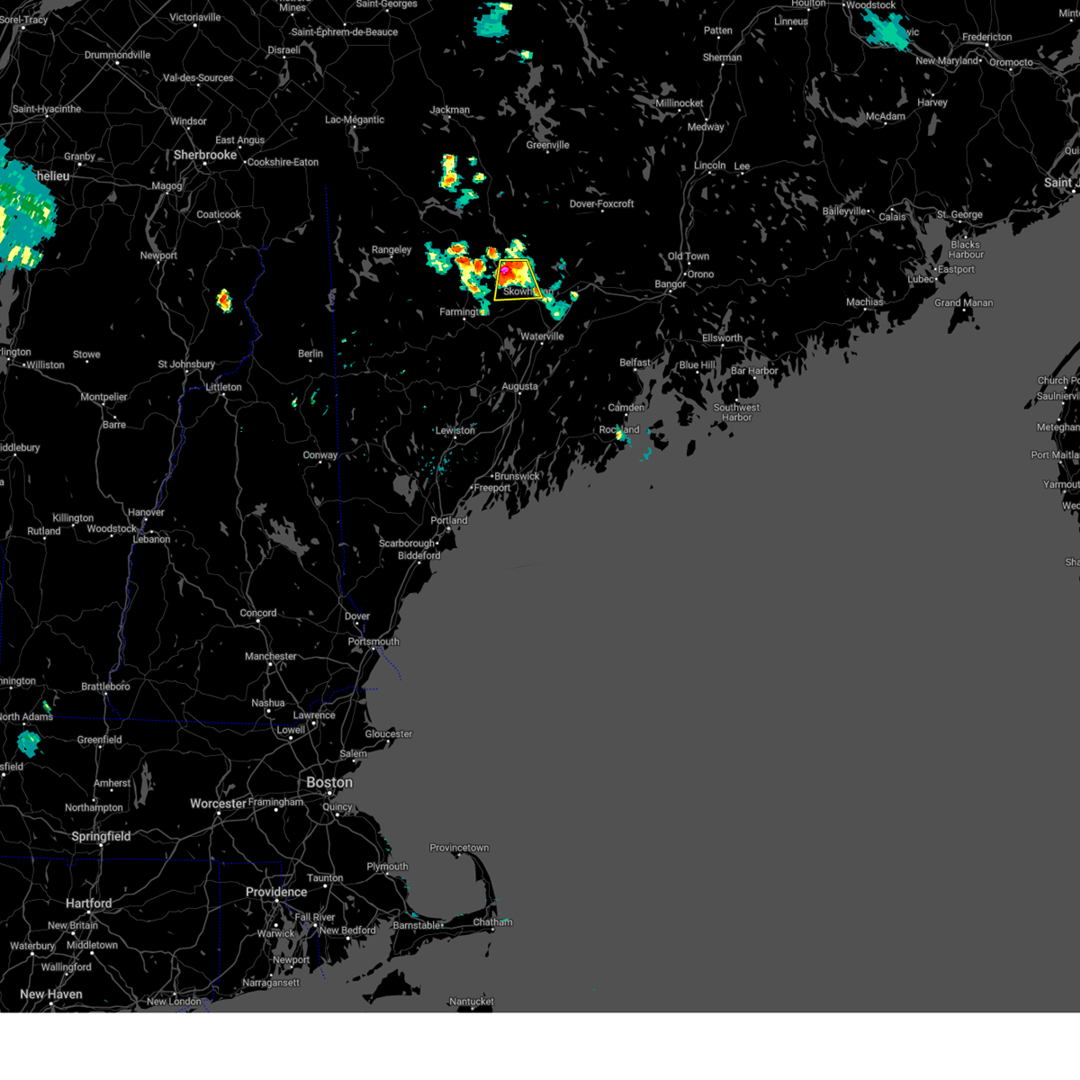
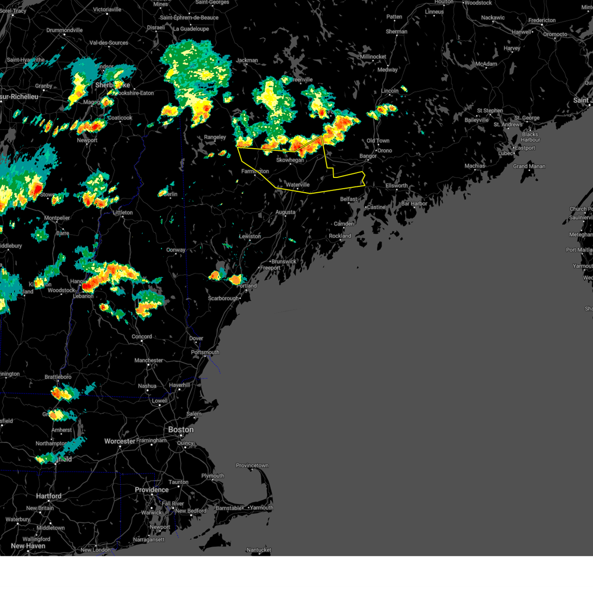
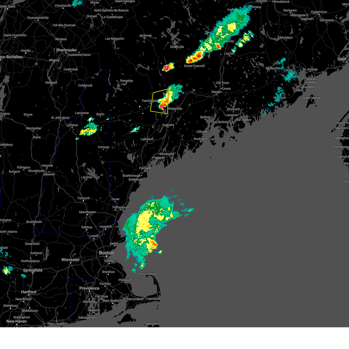
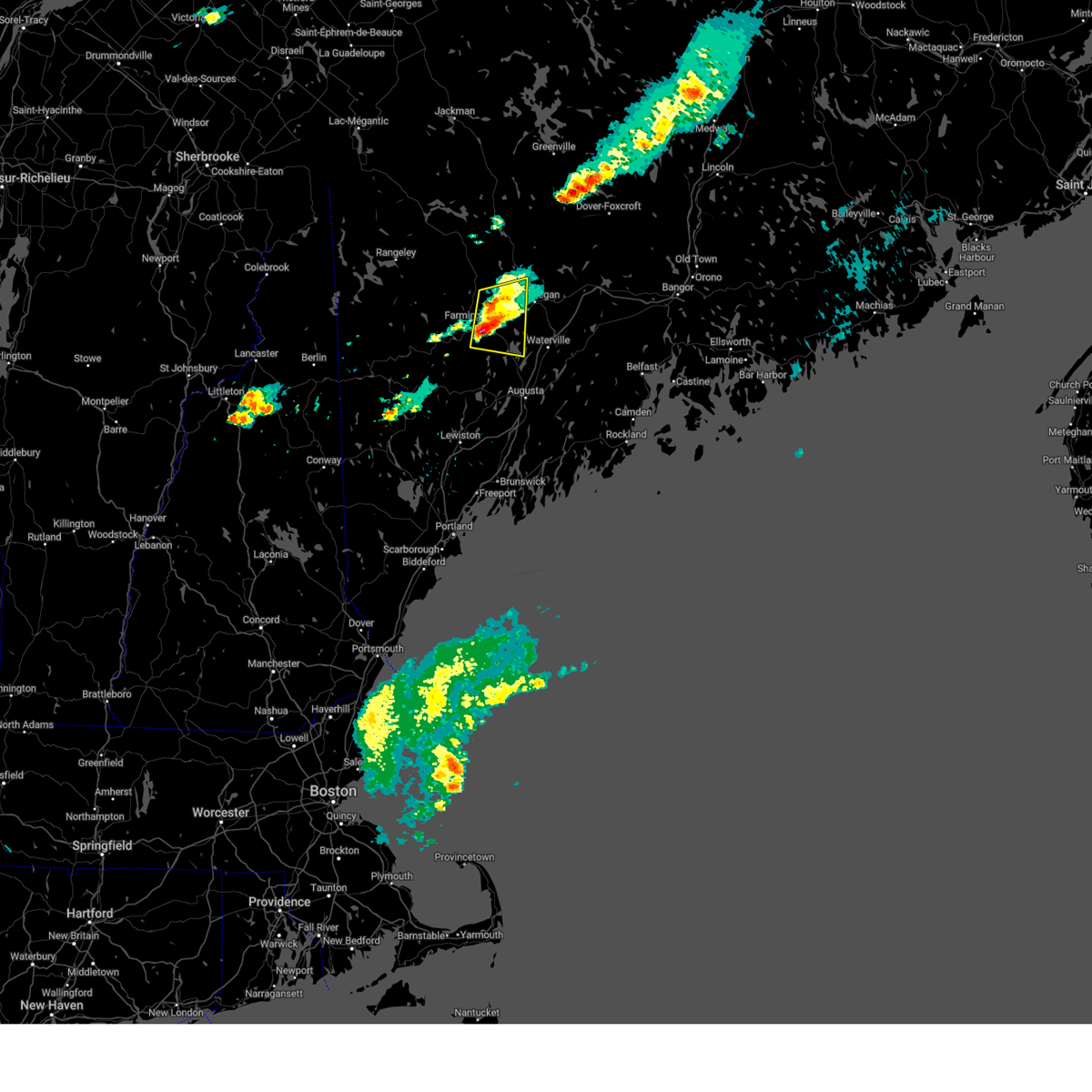
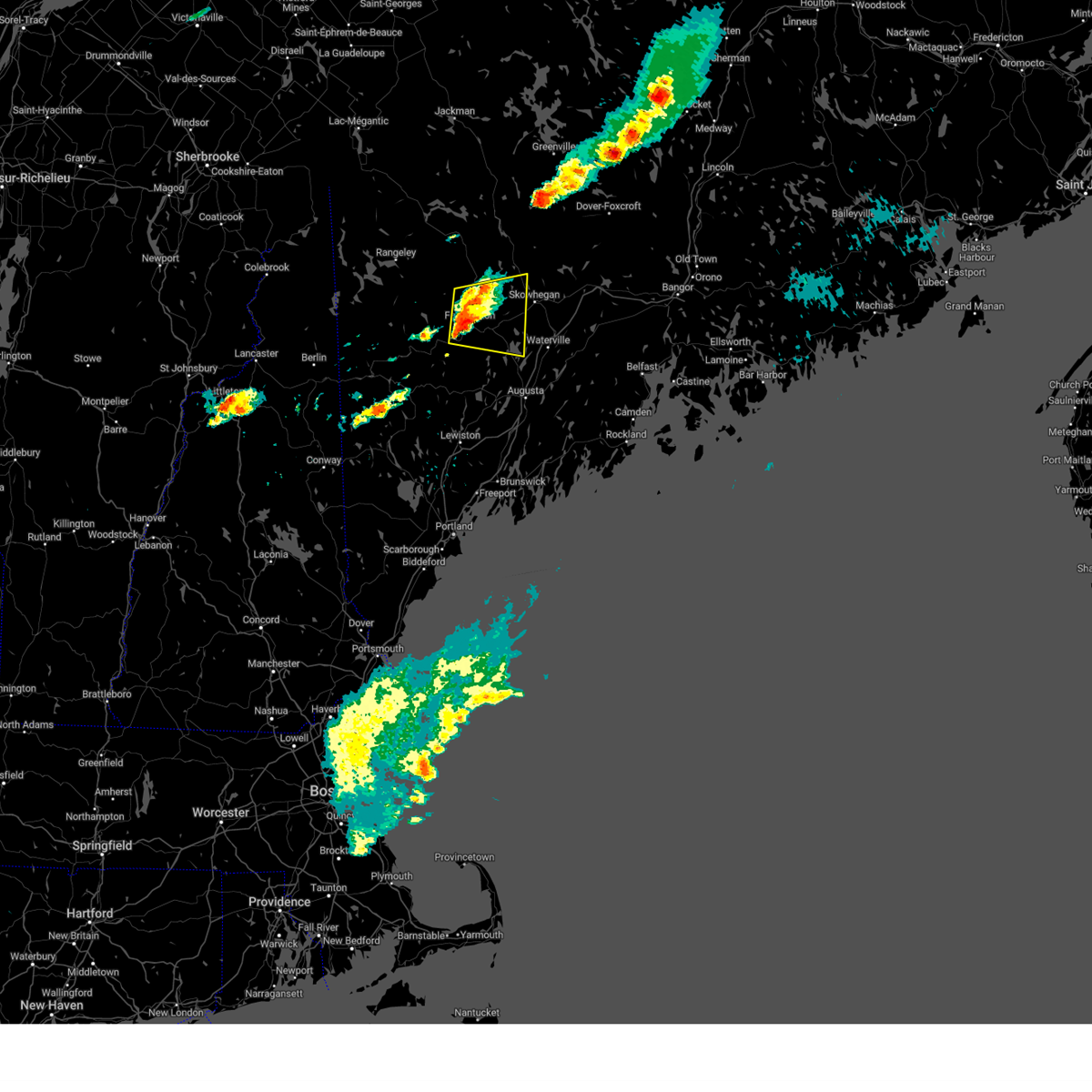
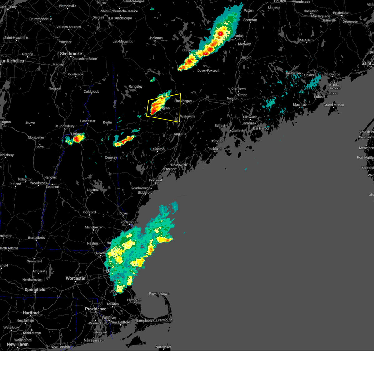
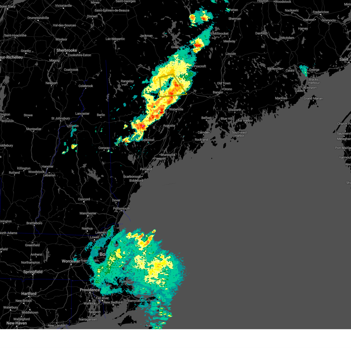
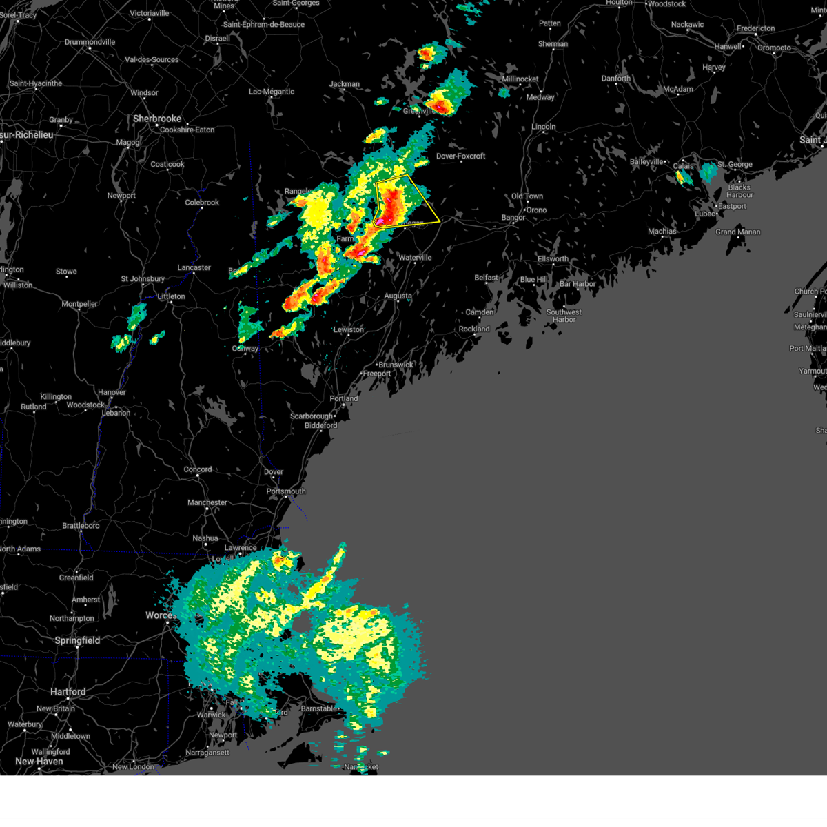
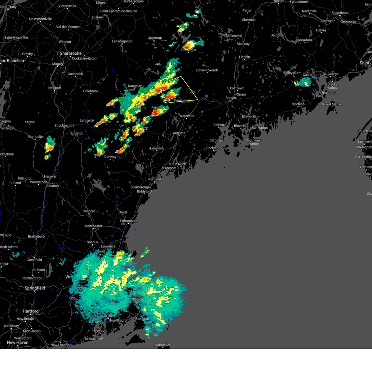
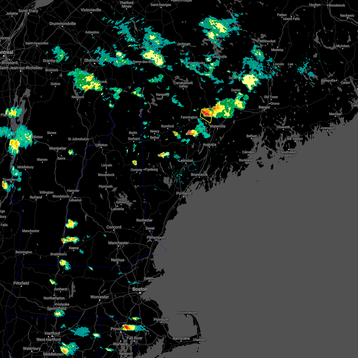
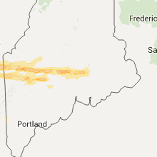
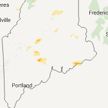
Hail Map for Madison, ME
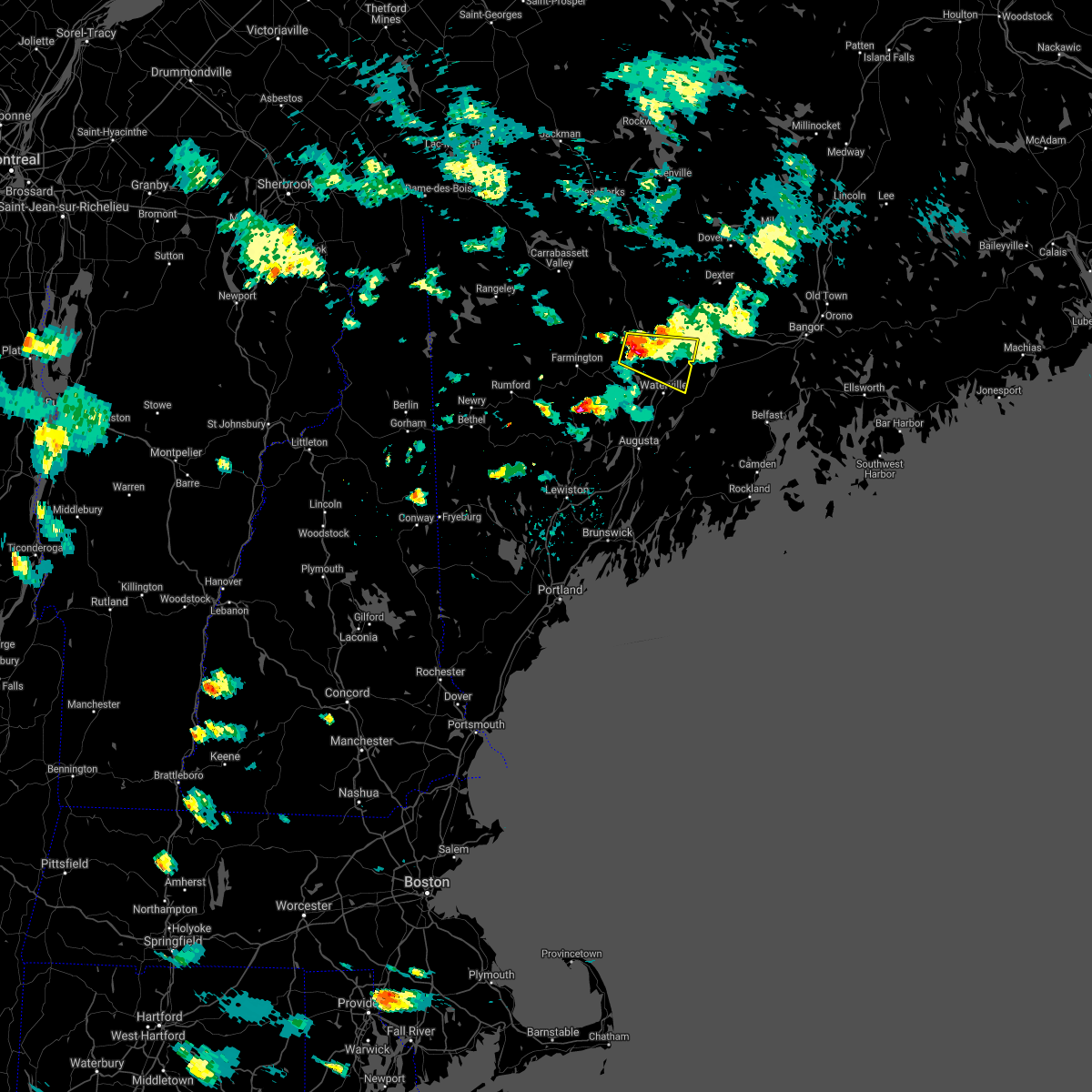
The Madison, ME area has had 1 report of on-the-ground hail by trained spotters, and has been under severe weather warnings 4 times during the past 12 months. Doppler radar has detected hail at or near Madison, ME on 17 occasions, including 1 occasion during the past year.
| Name: | Madison, ME |
| Where Located: | 54.2 miles W of Bangor, ME |
| Map: | Google Map for Madison, ME |
| Population: | 2630 |
| Housing Units: | 1243 |
| More Info: | Search Google for Madison, ME |
2
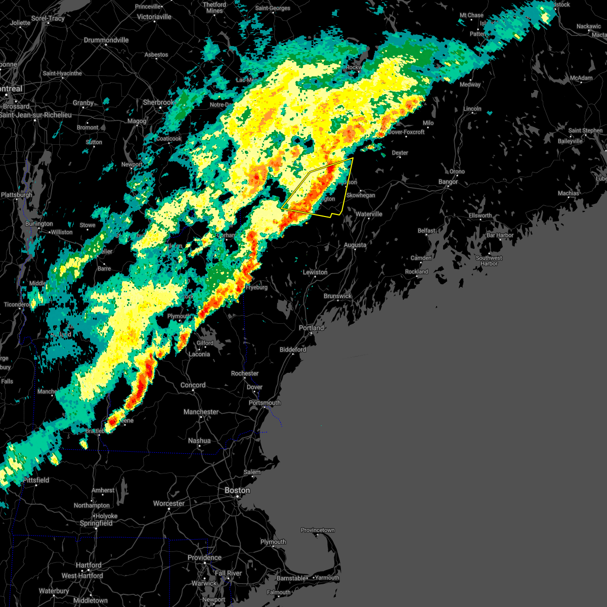
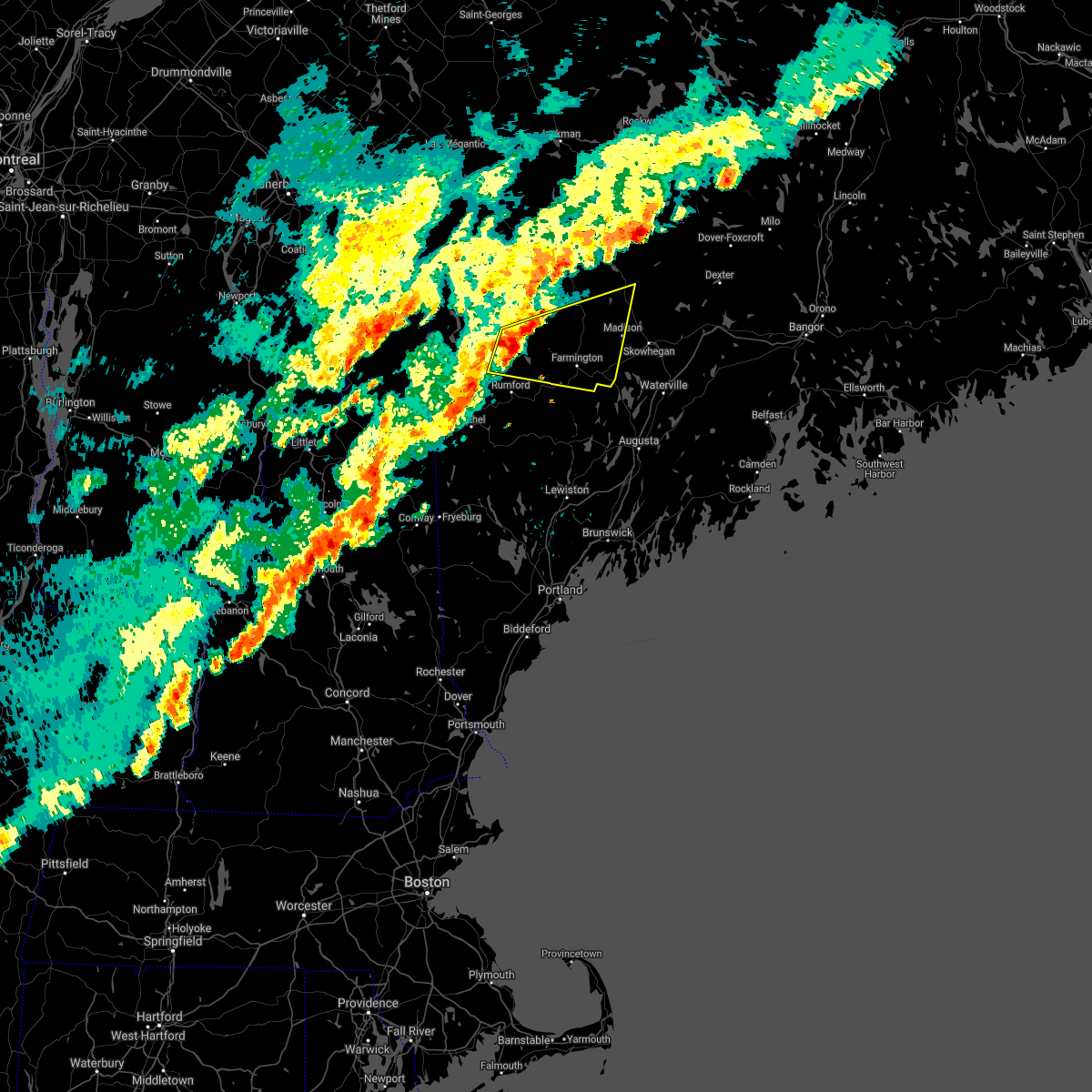
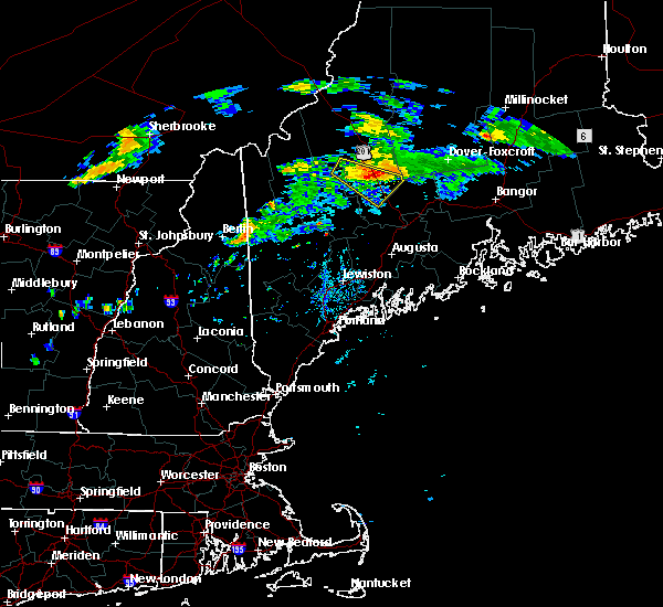
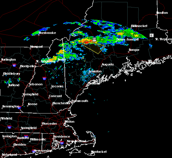
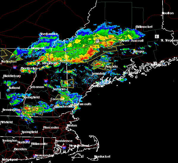
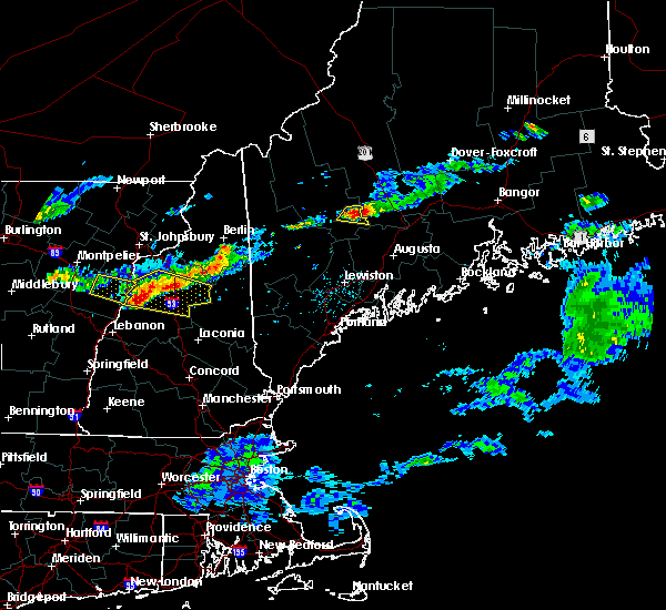
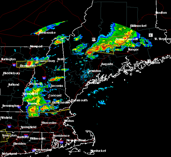
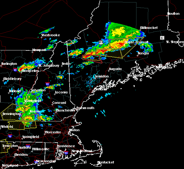
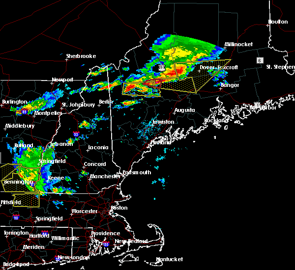
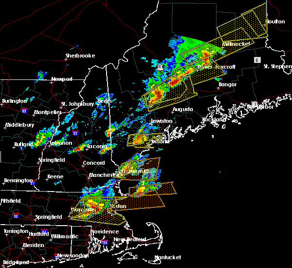
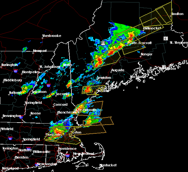
The Top Recent Hail Date for Madison, ME is Wednesday, August 14, 2024 (3rd out of 17)

Hail and Wind Damage Spotted near Madison, ME
| Date / Time | Report Details |
|---|---|
| 8/14/2024 6:59 PM EDT |
 The storm which prompted the warning has moved out of the area. therefore, the warning will be allowed to expire. The storm which prompted the warning has moved out of the area. therefore, the warning will be allowed to expire.
|
| 8/14/2024 6:45 PM EDT | Anson fire reported a tree down completely blocking river rd. time estimated by rada in somerset county ME, 1.2 miles SE of Madison, ME |
| 8/14/2024 6:41 PM EDT |
 Svrgyx the national weather service in gray maine has issued a * severe thunderstorm warning for, south central somerset county in west central maine, southeastern franklin county in western maine, * until 730 pm edt. * at 641 pm edt, a severe thunderstorm was located near madison, or 13 miles west of skowhegan, moving south at 20 mph (radar indicated). Hazards include 60 mph wind gusts and quarter size hail. Hail damage to vehicles is expected. Expect wind damage to roofs, siding, and trees. Svrgyx the national weather service in gray maine has issued a * severe thunderstorm warning for, south central somerset county in west central maine, southeastern franklin county in western maine, * until 730 pm edt. * at 641 pm edt, a severe thunderstorm was located near madison, or 13 miles west of skowhegan, moving south at 20 mph (radar indicated). Hazards include 60 mph wind gusts and quarter size hail. Hail damage to vehicles is expected. Expect wind damage to roofs, siding, and trees.
|
| 8/14/2024 6:35 PM EDT | Anson fire reported tree down partially blocking embden pond rd. time estimated by rada in somerset county ME, 4.7 miles SSE of Madison, ME |
| 8/14/2024 6:30 PM EDT |
 At 629 pm edt, a severe thunderstorm was located near madison, or 12 miles northwest of skowhegan, moving south at 20 mph (radar indicated). Hazards include 60 mph wind gusts and quarter size hail. Hail damage to vehicles is expected. expect wind damage to roofs, siding, and trees. Locations impacted include, skowhegan, madison, norridgewock, anson, cornville, athens, embden, solon, and starks. At 629 pm edt, a severe thunderstorm was located near madison, or 12 miles northwest of skowhegan, moving south at 20 mph (radar indicated). Hazards include 60 mph wind gusts and quarter size hail. Hail damage to vehicles is expected. expect wind damage to roofs, siding, and trees. Locations impacted include, skowhegan, madison, norridgewock, anson, cornville, athens, embden, solon, and starks.
|
| 8/14/2024 6:12 PM EDT |
 Svrgyx the national weather service in gray maine has issued a * severe thunderstorm warning for, south central somerset county in west central maine, * until 700 pm edt. * at 611 pm edt, a severe thunderstorm was located near bingham, or 18 miles northwest of skowhegan, moving south at 20 mph (radar indicated). Hazards include 60 mph wind gusts and quarter size hail. Hail damage to vehicles is expected. Expect wind damage to roofs, siding, and trees. Svrgyx the national weather service in gray maine has issued a * severe thunderstorm warning for, south central somerset county in west central maine, * until 700 pm edt. * at 611 pm edt, a severe thunderstorm was located near bingham, or 18 miles northwest of skowhegan, moving south at 20 mph (radar indicated). Hazards include 60 mph wind gusts and quarter size hail. Hail damage to vehicles is expected. Expect wind damage to roofs, siding, and trees.
|
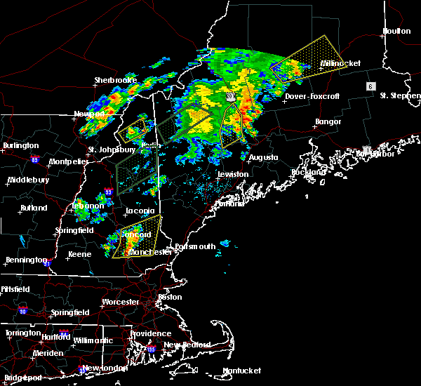
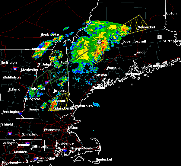
| 6/20/2024 3:29 PM EDT |
 Svrgyx the national weather service in gray maine has issued a * severe thunderstorm warning for, northeastern kennebec county in south central maine, northern waldo county in south central maine, southeastern somerset county in west central maine, southeastern franklin county in western maine, * until 430 pm edt. * at 328 pm edt, severe thunderstorms were located along a line extending from 15 miles northeast of pittsfield to 6 miles northeast of skowhegan to near phillips, moving southeast at 20 mph (radar indicated). Hazards include 60 mph wind gusts and penny size hail. expect damage to roofs, siding, and trees Svrgyx the national weather service in gray maine has issued a * severe thunderstorm warning for, northeastern kennebec county in south central maine, northern waldo county in south central maine, southeastern somerset county in west central maine, southeastern franklin county in western maine, * until 430 pm edt. * at 328 pm edt, severe thunderstorms were located along a line extending from 15 miles northeast of pittsfield to 6 miles northeast of skowhegan to near phillips, moving southeast at 20 mph (radar indicated). Hazards include 60 mph wind gusts and penny size hail. expect damage to roofs, siding, and trees
|
| 6/14/2024 2:58 PM EDT |
 The storm which prompted the warning has weakened below severe limits, and no longer poses an immediate threat to life or property. therefore, the warning will be allowed to expire. however, small hail and gusty winds are still possible with this thunderstorm. The storm which prompted the warning has weakened below severe limits, and no longer poses an immediate threat to life or property. therefore, the warning will be allowed to expire. however, small hail and gusty winds are still possible with this thunderstorm.
|
| 6/14/2024 2:44 PM EDT |
 At 242 pm edt, a severe thunderstorm was located near new sharon, moving east at 20 mph (radar indicated). Hazards include 60 mph wind gusts and quarter size hail. Hail damage to vehicles is expected. expect wind damage to roofs, siding, and trees. Locations impacted include, new sharon, mercer, madison, starks, norridgewock, anson, chesterville, industry, smithfield, rome, vienna, and new vineyard. At 242 pm edt, a severe thunderstorm was located near new sharon, moving east at 20 mph (radar indicated). Hazards include 60 mph wind gusts and quarter size hail. Hail damage to vehicles is expected. expect wind damage to roofs, siding, and trees. Locations impacted include, new sharon, mercer, madison, starks, norridgewock, anson, chesterville, industry, smithfield, rome, vienna, and new vineyard.
|
| 6/14/2024 2:25 PM EDT |
 At 225 pm edt, a severe thunderstorm was located over farmington, moving east at 30 mph (radar indicated). Hazards include 60 mph wind gusts and quarter size hail. Hail damage to vehicles is expected. expect wind damage to roofs, siding, and trees. Locations impacted include, farmington, oakland, madison, jay, belgrade, wilton, norridgewock, anson, chesterville, avon, starks, strong, industry, smithfield, rome, new vineyard, new sharon, vienna, mercer, and temple. At 225 pm edt, a severe thunderstorm was located over farmington, moving east at 30 mph (radar indicated). Hazards include 60 mph wind gusts and quarter size hail. Hail damage to vehicles is expected. expect wind damage to roofs, siding, and trees. Locations impacted include, farmington, oakland, madison, jay, belgrade, wilton, norridgewock, anson, chesterville, avon, starks, strong, industry, smithfield, rome, new vineyard, new sharon, vienna, mercer, and temple.
|
| 6/14/2024 2:14 PM EDT |
 Svrgyx the national weather service in gray maine has issued a * severe thunderstorm warning for, northwestern kennebec county in south central maine, south central somerset county in west central maine, southeastern franklin county in western maine, * until 300 pm edt. * at 213 pm edt, a severe thunderstorm was located near wilton, or 7 miles west of farmington, moving east at 30 mph (radar indicated). Hazards include 60 mph wind gusts and quarter size hail. Hail damage to vehicles is expected. Expect wind damage to roofs, siding, and trees. Svrgyx the national weather service in gray maine has issued a * severe thunderstorm warning for, northwestern kennebec county in south central maine, south central somerset county in west central maine, southeastern franklin county in western maine, * until 300 pm edt. * at 213 pm edt, a severe thunderstorm was located near wilton, or 7 miles west of farmington, moving east at 30 mph (radar indicated). Hazards include 60 mph wind gusts and quarter size hail. Hail damage to vehicles is expected. Expect wind damage to roofs, siding, and trees.
|
| 5/23/2024 1:57 PM EDT |
 The storms which prompted the warning have weakened below severe limits, and no longer pose an immediate threat to life or property. therefore, the warning will be allowed to expire. however, small hail, gusty winds and heavy rain are still possible with these thunderstorms. a severe thunderstorm watch remains in effect until 700 pm edt for west central maine. The storms which prompted the warning have weakened below severe limits, and no longer pose an immediate threat to life or property. therefore, the warning will be allowed to expire. however, small hail, gusty winds and heavy rain are still possible with these thunderstorms. a severe thunderstorm watch remains in effect until 700 pm edt for west central maine.
|
| 5/23/2024 1:28 PM EDT |
 At 128 pm edt, severe thunderstorms were located along a line extending from near bingham to near madison, moving east at 25 mph (radar indicated). Hazards include 60 mph wind gusts and half dollar size hail. Hail damage to vehicles is expected. expect wind damage to roofs, siding, and trees. Locations impacted include, skowhegan, pittsfield, madison, bingham, anson, canaan, hartland, cornville, athens, embden, harmony, brighton plantation, concord, solon, starks, mayfield, and palmyra. At 128 pm edt, severe thunderstorms were located along a line extending from near bingham to near madison, moving east at 25 mph (radar indicated). Hazards include 60 mph wind gusts and half dollar size hail. Hail damage to vehicles is expected. expect wind damage to roofs, siding, and trees. Locations impacted include, skowhegan, pittsfield, madison, bingham, anson, canaan, hartland, cornville, athens, embden, harmony, brighton plantation, concord, solon, starks, mayfield, and palmyra.
|
| 5/23/2024 1:26 PM EDT | Madison fire units reported trees down on thurston hill rd in madison. time estimated by radar and time reporte in somerset county ME, 0.2 miles SW of Madison, ME |
| 5/23/2024 1:08 PM EDT |
 Svrgyx the national weather service in gray maine has issued a * severe thunderstorm warning for, southeastern somerset county in west central maine, * until 200 pm edt. * at 108 pm edt, severe thunderstorms were located along a line extending from near kingfield to 6 miles west of madison, moving east at 35 mph (radar indicated). Hazards include 60 mph wind gusts and half dollar size hail. Hail damage to vehicles is expected. Expect wind damage to roofs, siding, and trees. Svrgyx the national weather service in gray maine has issued a * severe thunderstorm warning for, southeastern somerset county in west central maine, * until 200 pm edt. * at 108 pm edt, severe thunderstorms were located along a line extending from near kingfield to 6 miles west of madison, moving east at 35 mph (radar indicated). Hazards include 60 mph wind gusts and half dollar size hail. Hail damage to vehicles is expected. Expect wind damage to roofs, siding, and trees.
|
| 9/7/2023 8:50 PM EDT | Tree down across route 201a on the embden -north anson town line. time estimated by rada in somerset county ME, 6.4 miles S of Madison, ME |
| 9/7/2023 8:50 PM EDT | Trees and powerlines down on fahi pond rd. time estimated by rada in somerset county ME, 7.3 miles SSE of Madison, ME |
| 6/2/2023 2:47 PM EDT | Tree blocking roa in somerset county ME, 5 miles SW of Madison, ME |
| 9/15/2021 4:17 PM EDT |
 At 417 pm edt, a severe thunderstorm was located near madison, or 14 miles northwest of skowhegan, moving east at 40 mph (radar indicated). Hazards include 60 mph wind gusts and penny size hail. Expect damage to roofs, siding, and trees. locations impacted include, farmington, madison, jay, bingham, phillips, wilton, weld, norridgewock, anson, chesterville, embden, carthage, avon, solon, strong, industry, town of washington, salem, perkins and starks. hail threat, radar indicated max hail size, 0. 75 in wind threat, radar indicated max wind gust, 60 mph. At 417 pm edt, a severe thunderstorm was located near madison, or 14 miles northwest of skowhegan, moving east at 40 mph (radar indicated). Hazards include 60 mph wind gusts and penny size hail. Expect damage to roofs, siding, and trees. locations impacted include, farmington, madison, jay, bingham, phillips, wilton, weld, norridgewock, anson, chesterville, embden, carthage, avon, solon, strong, industry, town of washington, salem, perkins and starks. hail threat, radar indicated max hail size, 0. 75 in wind threat, radar indicated max wind gust, 60 mph.
|
| 9/15/2021 3:41 PM EDT |
 At 341 pm edt, a severe thunderstorm was located near weld, or 14 miles north of rumford, moving east at 40 mph (radar indicated). Hazards include 60 mph wind gusts and quarter size hail. Hail damage to vehicles is expected. Expect wind damage to roofs, siding, and trees. At 341 pm edt, a severe thunderstorm was located near weld, or 14 miles north of rumford, moving east at 40 mph (radar indicated). Hazards include 60 mph wind gusts and quarter size hail. Hail damage to vehicles is expected. Expect wind damage to roofs, siding, and trees.
|
| 8/24/2020 2:16 PM EDT |
 At 216 pm edt, a severe thunderstorm was located over norridgewock, or near skowhegan, moving east at 25 mph (radar indicated). Hazards include 60 mph wind gusts and half dollar size hail. Hail damage to vehicles is expected. Expect wind damage to roofs, siding, and trees. At 216 pm edt, a severe thunderstorm was located over norridgewock, or near skowhegan, moving east at 25 mph (radar indicated). Hazards include 60 mph wind gusts and half dollar size hail. Hail damage to vehicles is expected. Expect wind damage to roofs, siding, and trees.
|
| 8/24/2020 2:07 PM EDT |
 At 207 pm edt, a severe thunderstorm was located near madison, or near skowhegan, moving east at 15 mph (radar indicated). Hazards include 60 mph wind gusts and quarter size hail. Hail damage to vehicles is expected. expect wind damage to roofs, siding, and trees. Locations impacted include, fairfield, skowhegan, madison, norridgewock, anson, cornville, starks, smithfield and mercer. At 207 pm edt, a severe thunderstorm was located near madison, or near skowhegan, moving east at 15 mph (radar indicated). Hazards include 60 mph wind gusts and quarter size hail. Hail damage to vehicles is expected. expect wind damage to roofs, siding, and trees. Locations impacted include, fairfield, skowhegan, madison, norridgewock, anson, cornville, starks, smithfield and mercer.
|
| 8/24/2020 1:45 PM EDT |
 At 144 pm edt, a severe thunderstorm was located near madison, or 10 miles northeast of farmington, moving east at 15 mph (radar indicated). Hazards include 60 mph wind gusts and quarter size hail. Hail damage to vehicles is expected. Expect wind damage to roofs, siding, and trees. At 144 pm edt, a severe thunderstorm was located near madison, or 10 miles northeast of farmington, moving east at 15 mph (radar indicated). Hazards include 60 mph wind gusts and quarter size hail. Hail damage to vehicles is expected. Expect wind damage to roofs, siding, and trees.
|
| 8/24/2020 1:27 PM EDT | Trees dow in somerset county ME, 8.5 miles S of Madison, ME |
| 8/24/2020 1:27 PM EDT |
 At 127 pm edt, a severe thunderstorm was located 8 miles northwest of madison, or 15 miles northwest of skowhegan, moving east at 25 mph (radar indicated). Hazards include 60 mph wind gusts and quarter size hail. Hail damage to vehicles is expected. Expect wind damage to roofs, siding, and trees. At 127 pm edt, a severe thunderstorm was located 8 miles northwest of madison, or 15 miles northwest of skowhegan, moving east at 25 mph (radar indicated). Hazards include 60 mph wind gusts and quarter size hail. Hail damage to vehicles is expected. Expect wind damage to roofs, siding, and trees.
|
| 7/27/2020 5:54 PM EDT |
 The severe thunderstorm warning for south central somerset and east central franklin counties will expire at 600 pm edt, the storm which prompted the warning has weakened below severe limits, and no longer poses an immediate threat to life or property. therefore, the warning will be allowed to expire. however gusty winds are still possible with this thunderstorm. The severe thunderstorm warning for south central somerset and east central franklin counties will expire at 600 pm edt, the storm which prompted the warning has weakened below severe limits, and no longer poses an immediate threat to life or property. therefore, the warning will be allowed to expire. however gusty winds are still possible with this thunderstorm.
|
| 7/27/2020 5:41 PM EDT |
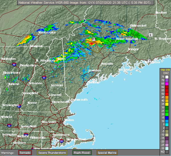 At 541 pm edt, a severe thunderstorm was located near carrabassett valley, or 22 miles southeast of eustis, moving southeast at 30 mph (radar indicated). Hazards include 60 mph wind gusts. Expect damage to roofs, siding, and trees. locations impacted include, madison, kingfield, bingham, carrabassett valley, anson, cornville, athens, embden, brighton plantation, concord, solon, moscow, lexington, pleasant ridge plantation, highland plantation, carrying place, dead river, mayfield and new portland. This also includes, west carry pond and middle carry pond. At 541 pm edt, a severe thunderstorm was located near carrabassett valley, or 22 miles southeast of eustis, moving southeast at 30 mph (radar indicated). Hazards include 60 mph wind gusts. Expect damage to roofs, siding, and trees. locations impacted include, madison, kingfield, bingham, carrabassett valley, anson, cornville, athens, embden, brighton plantation, concord, solon, moscow, lexington, pleasant ridge plantation, highland plantation, carrying place, dead river, mayfield and new portland. This also includes, west carry pond and middle carry pond.
|
| 7/27/2020 5:15 PM EDT |
 At 515 pm edt, a severe thunderstorm was located near carrabassett valley, or 12 miles southeast of eustis, moving southeast at 35 mph (radar indicated). Hazards include 60 mph wind gusts. expect damage to roofs, siding, and trees At 515 pm edt, a severe thunderstorm was located near carrabassett valley, or 12 miles southeast of eustis, moving southeast at 35 mph (radar indicated). Hazards include 60 mph wind gusts. expect damage to roofs, siding, and trees
|
| 7/8/2020 5:27 PM EDT |
 At 527 pm edt, severe thunderstorms were located along a line extending from 16 miles northeast of pittsfield to near skowhegan to 10 miles west of oakland to near belgrade to near winthrop to near turner to 10 miles southwest of canton, moving east at 40 mph (radar indicated). Hazards include 60 mph wind gusts and quarter size hail. Hail damage to vehicles is expected. expect wind damage to roofs, siding, and trees. locations impacted include, augusta, waterville, farmington, fairfield, oakland, skowhegan, pittsfield, turner, madison, china, clinton, belgrade, livermore falls, manchester, hallowell, bingham, norridgewock, winthrop, unity and benton. This includes interstate 95 between mile markers 110 and 155. At 527 pm edt, severe thunderstorms were located along a line extending from 16 miles northeast of pittsfield to near skowhegan to 10 miles west of oakland to near belgrade to near winthrop to near turner to 10 miles southwest of canton, moving east at 40 mph (radar indicated). Hazards include 60 mph wind gusts and quarter size hail. Hail damage to vehicles is expected. expect wind damage to roofs, siding, and trees. locations impacted include, augusta, waterville, farmington, fairfield, oakland, skowhegan, pittsfield, turner, madison, china, clinton, belgrade, livermore falls, manchester, hallowell, bingham, norridgewock, winthrop, unity and benton. This includes interstate 95 between mile markers 110 and 155.
|
| 7/8/2020 4:54 PM EDT |
 At 454 pm edt, severe thunderstorms were located along a line extending from 10 miles east of bingham to 7 miles east of kingfield to 8 miles west of madison to near farmington to near wilton to dixfield to 6 miles southeast of andover, moving east at 55 mph (radar indicated). Hazards include 60 mph wind gusts and quarter size hail. Hail damage to vehicles is expected. Expect wind damage to roofs, siding, and trees. At 454 pm edt, severe thunderstorms were located along a line extending from 10 miles east of bingham to 7 miles east of kingfield to 8 miles west of madison to near farmington to near wilton to dixfield to 6 miles southeast of andover, moving east at 55 mph (radar indicated). Hazards include 60 mph wind gusts and quarter size hail. Hail damage to vehicles is expected. Expect wind damage to roofs, siding, and trees.
|
| 7/8/2020 4:42 PM EDT |
 At 442 pm edt, severe thunderstorms were located along a line extending from 17 miles east of bingham to kingfield to near phillips to near weld to 8 miles east of stratford, moving southeast at 40 mph (radar indicated). Hazards include 60 mph wind gusts and quarter size hail. Hail damage to vehicles is expected. expect wind damage to roofs, siding, and trees. locations impacted include, farmington, rumford, madison, dixfield, kingfield, bingham, andover, carrabassett valley, errol, grafton, phillips, weld, stratford, mexico, wilton, anson, hartland, cornville, athens and harmony. This also includes, umbagog lake state park, kilkenny ridge trail, old speck mountain, sugarloaf mountain, and mount abraham. At 442 pm edt, severe thunderstorms were located along a line extending from 17 miles east of bingham to kingfield to near phillips to near weld to 8 miles east of stratford, moving southeast at 40 mph (radar indicated). Hazards include 60 mph wind gusts and quarter size hail. Hail damage to vehicles is expected. expect wind damage to roofs, siding, and trees. locations impacted include, farmington, rumford, madison, dixfield, kingfield, bingham, andover, carrabassett valley, errol, grafton, phillips, weld, stratford, mexico, wilton, anson, hartland, cornville, athens and harmony. This also includes, umbagog lake state park, kilkenny ridge trail, old speck mountain, sugarloaf mountain, and mount abraham.
|
| 7/8/2020 4:10 PM EDT |
 At 409 pm edt, severe thunderstorms were located along a line extending from 15 miles north of bingham to 8 miles west of carrabassett valley to 6 miles southeast of rangeley to 12 miles east of errol to colebrook, moving southeast at 40 mph (radar indicated). Hazards include 60 mph wind gusts and quarter size hail. Hail damage to vehicles is expected. Expect wind damage to roofs, siding, and trees. At 409 pm edt, severe thunderstorms were located along a line extending from 15 miles north of bingham to 8 miles west of carrabassett valley to 6 miles southeast of rangeley to 12 miles east of errol to colebrook, moving southeast at 40 mph (radar indicated). Hazards include 60 mph wind gusts and quarter size hail. Hail damage to vehicles is expected. Expect wind damage to roofs, siding, and trees.
|
| 7/2/2020 4:53 PM EDT |
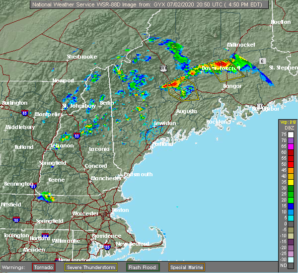 At 452 pm edt, a severe thunderstorm was located 10 miles southeast of bingham, or 12 miles north of skowhegan, moving south at 25 mph (radar indicated). Hazards include 60 mph wind gusts and quarter size hail. Hail damage to vehicles is expected. expect wind damage to roofs, siding, and trees. locations impacted include, fairfield, skowhegan, pittsfield, madison, clinton, bingham, norridgewock, unity, benton, anson, canaan, hartland, cornville, burnham, athens, harmony, embden, detroit, brighton plantation and solon. This includes interstate 95 between mile markers 136 and 155. At 452 pm edt, a severe thunderstorm was located 10 miles southeast of bingham, or 12 miles north of skowhegan, moving south at 25 mph (radar indicated). Hazards include 60 mph wind gusts and quarter size hail. Hail damage to vehicles is expected. expect wind damage to roofs, siding, and trees. locations impacted include, fairfield, skowhegan, pittsfield, madison, clinton, bingham, norridgewock, unity, benton, anson, canaan, hartland, cornville, burnham, athens, harmony, embden, detroit, brighton plantation and solon. This includes interstate 95 between mile markers 136 and 155.
|
| 7/2/2020 4:34 PM EDT |
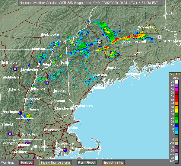 At 434 pm edt, a severe thunderstorm was located near bingham, or 19 miles north of skowhegan, moving south at 20 mph (radar indicated). Hazards include 60 mph wind gusts and quarter size hail. Hail damage to vehicles is expected. Expect wind damage to roofs, siding, and trees. At 434 pm edt, a severe thunderstorm was located near bingham, or 19 miles north of skowhegan, moving south at 20 mph (radar indicated). Hazards include 60 mph wind gusts and quarter size hail. Hail damage to vehicles is expected. Expect wind damage to roofs, siding, and trees.
|
| 7/28/2019 4:58 PM EDT |
 At 458 pm edt, a severe thunderstorm was located near bingham, or 18 miles north of skowhegan, moving east at 30 mph (radar indicated). Hazards include 60 mph wind gusts and quarter size hail. Hail damage to vehicles is expected. Expect wind damage to roofs, siding, and trees. At 458 pm edt, a severe thunderstorm was located near bingham, or 18 miles north of skowhegan, moving east at 30 mph (radar indicated). Hazards include 60 mph wind gusts and quarter size hail. Hail damage to vehicles is expected. Expect wind damage to roofs, siding, and trees.
|
| 7/27/2018 4:06 PM EDT |
 At 406 pm edt, a severe thunderstorm was located 9 miles west of madison, or 10 miles north of farmington, moving east at 30 mph (radar indicated). Hazards include 60 mph wind gusts. Expect damage to roofs, siding, and trees. Locations impacted include, farmington, skowhegan, madison, bingham, norridgewock, anson, cornville, embden, avon, solon, strong, industry, new portland, new vineyard, freeman, concord, starks, temple and lexington. At 406 pm edt, a severe thunderstorm was located 9 miles west of madison, or 10 miles north of farmington, moving east at 30 mph (radar indicated). Hazards include 60 mph wind gusts. Expect damage to roofs, siding, and trees. Locations impacted include, farmington, skowhegan, madison, bingham, norridgewock, anson, cornville, embden, avon, solon, strong, industry, new portland, new vineyard, freeman, concord, starks, temple and lexington.
|
| 7/27/2018 3:48 PM EDT |
 At 348 pm edt, a severe thunderstorm was located near phillips, or 8 miles northwest of farmington, moving east at 30 mph (radar indicated). Hazards include 60 mph wind gusts and nickel size hail. expect damage to roofs, siding, and trees At 348 pm edt, a severe thunderstorm was located near phillips, or 8 miles northwest of farmington, moving east at 30 mph (radar indicated). Hazards include 60 mph wind gusts and nickel size hail. expect damage to roofs, siding, and trees
|
| 7/8/2017 1:16 PM EDT |
 At 116 pm edt, severe thunderstorms were located along a line extending from 10 miles northeast of seboomook to near turner, moving east at 30 mph (radar indicated). Hazards include 60 mph wind gusts and penny size hail. Expect damage to trees, and power lines. locations impacted include, farmington, skowhegan, madison, jay, livermore falls, bingham, blanchard, norridgewock, wilton, seboomook, kingsbury plantation, anson, livermore, chesterville, cornville, fayette, athens, embden, brighton plantation and caratunk plantation. This also includes, pleasant pond mountain and moxie bald mountain. At 116 pm edt, severe thunderstorms were located along a line extending from 10 miles northeast of seboomook to near turner, moving east at 30 mph (radar indicated). Hazards include 60 mph wind gusts and penny size hail. Expect damage to trees, and power lines. locations impacted include, farmington, skowhegan, madison, jay, livermore falls, bingham, blanchard, norridgewock, wilton, seboomook, kingsbury plantation, anson, livermore, chesterville, cornville, fayette, athens, embden, brighton plantation and caratunk plantation. This also includes, pleasant pond mountain and moxie bald mountain.
|
| 7/8/2017 1:02 PM EDT |
 A severe thunderstorm warning remains in effect until 145 pm edt for central somerset and southeastern franklin counties. at 101 pm edt, severe thunderstorms were located along a line extending from near seboomook to 7 miles north of mechanic falls, moving east at 30 mph. hazard. 60 mph wind gusts and penny size hail. A severe thunderstorm warning remains in effect until 145 pm edt for central somerset and southeastern franklin counties. at 101 pm edt, severe thunderstorms were located along a line extending from near seboomook to 7 miles north of mechanic falls, moving east at 30 mph. hazard. 60 mph wind gusts and penny size hail.
|
| 7/8/2017 12:51 PM EDT |
 At 1249 pm edt, severe thunderstorms were located along a line extending from near seboomook to 8 miles east of waterford, moving east at 30 mph (radar indicated). Hazards include 60 mph wind gusts and penny size hail. expect damage to trees, and power lines At 1249 pm edt, severe thunderstorms were located along a line extending from near seboomook to 8 miles east of waterford, moving east at 30 mph (radar indicated). Hazards include 60 mph wind gusts and penny size hail. expect damage to trees, and power lines
|
| 7/18/2016 6:48 PM EDT |
 At 647 pm edt, a severe thunderstorm was located near farmington, moving east at 30 mph (spotters reported quarter sized hail in temple). Hazards include ping pong ball size hail and 60 mph wind gusts. People and animals outdoors will be injured. expect hail damage to roofs, siding, windows, and vehicles. Expect wind damage to roofs, siding, and trees. At 647 pm edt, a severe thunderstorm was located near farmington, moving east at 30 mph (spotters reported quarter sized hail in temple). Hazards include ping pong ball size hail and 60 mph wind gusts. People and animals outdoors will be injured. expect hail damage to roofs, siding, windows, and vehicles. Expect wind damage to roofs, siding, and trees.
|
| 7/18/2016 2:52 PM EDT |
 At 252 pm edt, a severe thunderstorm was located 10 miles west of madison, or 10 miles northeast of farmington, moving east at 50 mph (radar indicated). Hazards include golf ball size hail and 60 mph wind gusts. People and animals outdoors will be injured. expect hail damage to roofs, siding, windows, and vehicles. Expect wind damage to roofs, siding, and trees. At 252 pm edt, a severe thunderstorm was located 10 miles west of madison, or 10 miles northeast of farmington, moving east at 50 mph (radar indicated). Hazards include golf ball size hail and 60 mph wind gusts. People and animals outdoors will be injured. expect hail damage to roofs, siding, windows, and vehicles. Expect wind damage to roofs, siding, and trees.
|
| 7/18/2016 2:41 PM EDT |
 At 241 pm edt, a severe thunderstorm was located 11 miles north of skowhegan, or near athens, moving east at 35 mph (radar indicated). Hazards include golf ball size hail and 60 mph wind gusts. People and animals outdoors will be injured. expect hail damage to roofs, siding, windows, and vehicles. expect wind damage to roofs, siding, and trees. Locations impacted include, pittsfield, skowhegan, madison, bingham, anson, canaan, hartland, plymouth, cornville, athens, harmony, embden, detroit, brighton plantation, palmyra, new portland, saint albans, ripley, solon and new vineyard. At 241 pm edt, a severe thunderstorm was located 11 miles north of skowhegan, or near athens, moving east at 35 mph (radar indicated). Hazards include golf ball size hail and 60 mph wind gusts. People and animals outdoors will be injured. expect hail damage to roofs, siding, windows, and vehicles. expect wind damage to roofs, siding, and trees. Locations impacted include, pittsfield, skowhegan, madison, bingham, anson, canaan, hartland, plymouth, cornville, athens, harmony, embden, detroit, brighton plantation, palmyra, new portland, saint albans, ripley, solon and new vineyard.
|
| 7/18/2016 2:31 PM EDT |
 At 230 pm edt, a severe thunderstorm was located near solon, or 13 miles northwest of skowhegan, moving east at 35 mph (radar indicated). Hazards include golf ball size hail and 60 mph wind gusts. People and animals outdoors will be injured. expect hail damage to roofs, siding, windows, and vehicles. expect wind damage to roofs, siding, and trees. Locations impacted include, pittsfield, skowhegan, madison, bingham, anson, canaan, hartland, plymouth, cornville, athens, harmony, embden, detroit, brighton plantation, lexington, concord, palmyra, new portland, saint albans and ripley. At 230 pm edt, a severe thunderstorm was located near solon, or 13 miles northwest of skowhegan, moving east at 35 mph (radar indicated). Hazards include golf ball size hail and 60 mph wind gusts. People and animals outdoors will be injured. expect hail damage to roofs, siding, windows, and vehicles. expect wind damage to roofs, siding, and trees. Locations impacted include, pittsfield, skowhegan, madison, bingham, anson, canaan, hartland, plymouth, cornville, athens, harmony, embden, detroit, brighton plantation, lexington, concord, palmyra, new portland, saint albans and ripley.
|
| 7/18/2016 2:20 PM EDT | Trees down in somerset county ME, 8.5 miles S of Madison, ME |
| 7/18/2016 2:12 PM EDT |
 At 211 pm edt, a severe thunderstorm was located near kingfield, or 19 miles northwest of skowhegan, moving east at 30 mph (radar indicated). Hazards include 60 mph wind gusts and half dollar size hail. Hail damage to vehicles is expected. Expect wind damage to roofs, siding, and trees. At 211 pm edt, a severe thunderstorm was located near kingfield, or 19 miles northwest of skowhegan, moving east at 30 mph (radar indicated). Hazards include 60 mph wind gusts and half dollar size hail. Hail damage to vehicles is expected. Expect wind damage to roofs, siding, and trees.
|
| 8/4/2015 4:14 PM EDT |
 At 413 pm edt, doppler radar indicated a severe thunderstorm capable of producing large hail up to ping pong ball size and damaging winds in excess of 60 mph. this storm was located over skowhegan, moving east at 50 mph. locations impacted include, northern waterville, fairfield, pittsfield, skowhegan, oakland, madison, clinton, belgrade, norridgewock, benton, anson, canaan, hartland, cornville, burnham, athens, harmony, detroit, brighton plantation and palmyra. At 413 pm edt, doppler radar indicated a severe thunderstorm capable of producing large hail up to ping pong ball size and damaging winds in excess of 60 mph. this storm was located over skowhegan, moving east at 50 mph. locations impacted include, northern waterville, fairfield, pittsfield, skowhegan, oakland, madison, clinton, belgrade, norridgewock, benton, anson, canaan, hartland, cornville, burnham, athens, harmony, detroit, brighton plantation and palmyra.
|
| 8/4/2015 3:55 PM EDT |
 At 355 pm edt, doppler radar indicated a line of severe thunderstorms capable of producing half dollar size hail and damaging winds in excess of 60 mph. these storms were located along a line extending from 11 miles north of skowhegan to jay, and moving east at 25 mph. At 355 pm edt, doppler radar indicated a line of severe thunderstorms capable of producing half dollar size hail and damaging winds in excess of 60 mph. these storms were located along a line extending from 11 miles north of skowhegan to jay, and moving east at 25 mph.
|
| 8/4/2015 3:49 PM EDT |
 At 349 pm edt, doppler radar indicated a line of severe thunderstorms capable of producing half dollar size hail and damaging winds in excess of 60 mph. these storms were located along a line extending from 11 miles southeast of bingham to near wilton, moving east at 40 mph. locations impacted include, farmington, fairfield, skowhegan, pittsfield, oakland, madison, jay, clinton, belgrade, livermore falls, dixfield, canton, bingham, wilton, norridgewock, anson, canaan, hartland, chesterville and cornville. At 349 pm edt, doppler radar indicated a line of severe thunderstorms capable of producing half dollar size hail and damaging winds in excess of 60 mph. these storms were located along a line extending from 11 miles southeast of bingham to near wilton, moving east at 40 mph. locations impacted include, farmington, fairfield, skowhegan, pittsfield, oakland, madison, jay, clinton, belgrade, livermore falls, dixfield, canton, bingham, wilton, norridgewock, anson, canaan, hartland, chesterville and cornville.
|
| 8/4/2015 3:38 PM EDT |
 At 338 pm edt, doppler radar indicated a line of severe thunderstorms capable of producing half dollar size hail and damaging winds in excess of 60 mph. these storms were located along a line extending from 9 miles southeast of bingham to jay, moving east at 35 mph. locations impacted include, farmington, fairfield, skowhegan, eastern rumford, pittsfield, oakland, madison, jay, clinton, belgrade, livermore falls, dixfield, canton, bingham, wilton, norridgewock, mexico, anson, canaan and livermore. At 338 pm edt, doppler radar indicated a line of severe thunderstorms capable of producing half dollar size hail and damaging winds in excess of 60 mph. these storms were located along a line extending from 9 miles southeast of bingham to jay, moving east at 35 mph. locations impacted include, farmington, fairfield, skowhegan, eastern rumford, pittsfield, oakland, madison, jay, clinton, belgrade, livermore falls, dixfield, canton, bingham, wilton, norridgewock, mexico, anson, canaan and livermore.
|
| 8/4/2015 3:34 PM EDT | Trees on wires in somerset county ME, 8.5 miles S of Madison, ME |
| 8/4/2015 3:30 PM EDT | Quarter sized hail reported 8.5 miles S of Madison, ME |
| 8/4/2015 3:16 PM EDT |
 At 316 pm edt, doppler radar indicated a line of severe thunderstorms capable of producing quarter size hail and damaging winds in excess of 60 mph. these storms were located along a line extending from near kingfield to rumford, and moving east at 40 mph. At 316 pm edt, doppler radar indicated a line of severe thunderstorms capable of producing quarter size hail and damaging winds in excess of 60 mph. these storms were located along a line extending from near kingfield to rumford, and moving east at 40 mph.
|
| 8/3/2015 8:38 PM EDT |
 The severe thunderstorm warning for south central somerset, northwestern kennebec and southeastern franklin counties will expire at 845 pm edt, the storms which prompted the warning have weakened below severe limits, and no longer poses an immediate threat to life or property. therefore the warning will be allowed to expire. The severe thunderstorm warning for south central somerset, northwestern kennebec and southeastern franklin counties will expire at 845 pm edt, the storms which prompted the warning have weakened below severe limits, and no longer poses an immediate threat to life or property. therefore the warning will be allowed to expire.
|
| 8/3/2015 8:28 PM EDT |
 At 827 pm edt, doppler radar indicated a line of severe thunderstorms capable of producing damaging winds in excess of 60 mph. these storms were located along a line extending from near bingham to 8 miles west of madison to 6 miles southeast of farmington, moving northeast at 55 mph. locations impacted include, eastern farmington, madison, bingham, norridgewock, anson, chesterville, embden, solon, moscow, concord, mercer, industry, pleasant ridge plantation, lexington, starks, new sharon, new portland, new vineyard, highland plantation and smithfield. At 827 pm edt, doppler radar indicated a line of severe thunderstorms capable of producing damaging winds in excess of 60 mph. these storms were located along a line extending from near bingham to 8 miles west of madison to 6 miles southeast of farmington, moving northeast at 55 mph. locations impacted include, eastern farmington, madison, bingham, norridgewock, anson, chesterville, embden, solon, moscow, concord, mercer, industry, pleasant ridge plantation, lexington, starks, new sharon, new portland, new vineyard, highland plantation and smithfield.
|
| 8/3/2015 8:06 PM EDT |
 At 806 pm edt, doppler radar indicated a line of severe thunderstorms capable of producing damaging winds in excess of 60 mph. these storms were located along a line extending from near kingfield to near wilton to turner, moving northeast at 40 mph. locations impacted include, farmington, turner, madison, jay, belgrade, livermore falls, dixfield, kingfield, canton, bingham, carrabassett valley, wilton, norridgewock, phillips, anson, leeds, livermore, buckfield, chesterville and hartford. At 806 pm edt, doppler radar indicated a line of severe thunderstorms capable of producing damaging winds in excess of 60 mph. these storms were located along a line extending from near kingfield to near wilton to turner, moving northeast at 40 mph. locations impacted include, farmington, turner, madison, jay, belgrade, livermore falls, dixfield, kingfield, canton, bingham, carrabassett valley, wilton, norridgewock, phillips, anson, leeds, livermore, buckfield, chesterville and hartford.
|
| 8/3/2015 7:40 PM EDT |
 At 740 pm edt, doppler radar indicated a line of severe thunderstorms capable of producing damaging winds in excess of 60 mph. these storms were located along a line extending from near phillips to rumford to 6 miles west of mechanic falls, and moving northeast at 55 mph. At 740 pm edt, doppler radar indicated a line of severe thunderstorms capable of producing damaging winds in excess of 60 mph. these storms were located along a line extending from near phillips to rumford to 6 miles west of mechanic falls, and moving northeast at 55 mph.
|
| 7/19/2015 8:18 PM EDT |
 At 817 pm edt, doppler radar indicated a severe thunderstorm capable of producing damaging winds in excess of 60 mph. this storm was located near phillips, or 12 miles northwest of farmington, and moving east at 30 mph. At 817 pm edt, doppler radar indicated a severe thunderstorm capable of producing damaging winds in excess of 60 mph. this storm was located near phillips, or 12 miles northwest of farmington, and moving east at 30 mph.
|
| 5/28/2015 4:37 PM EDT | At 437 pm edt, doppler radar indicated a line of severe thunderstorms capable of producing damaging winds in excess of 60 mph. these storms were located along a line extending from 12 miles east of bingham to 9 miles north of skowhegan to norridgewock to 8 miles east of livermore falls, and moving east at 30 mph. |
| 5/28/2015 4:37 PM EDT | At 437 pm edt, doppler radar indicated a line of severe thunderstorms capable of producing damaging winds in excess of 60 mph. these storms were located along a line extending from 12 miles east of bingham to 9 miles north of skowhegan to norridgewock to 8 miles east of livermore falls, and moving east at 30 mph. |
| 7/15/2014 6:27 PM EDT | Trees down on golf course road in somerset county ME, 0.4 miles ESE of Madison, ME |
| 10/7/2013 8:19 PM EDT | Trees and wires down in embden in somerset county ME, 8.5 miles S of Madison, ME |
| 7/19/2013 9:55 PM EDT | Multiple trees down in madison reported by sheriifs office in somerset county ME, 0.4 miles ESE of Madison, ME |
| 7/19/2013 9:35 PM EDT | Multiple trees down in madison reported by sheriifs office in somerset county ME, 0.4 miles ESE of Madison, ME |
| 6/29/2013 6:00 PM EDT | Trees down in the embden and solon area. time estimate in somerset county ME, 8.5 miles S of Madison, ME |
| 6/29/2013 5:55 PM EDT | Tree down in madison. time estmiate in somerset county ME, 0.4 miles ESE of Madison, ME |
| 6/2/2013 5:35 PM EDT | East madison road is closed with many trees down in somerset county ME, 0.4 miles ESE of Madison, ME |
| 6/2/2013 5:30 PM EDT | Jones st in madison trees and wires on vehicle in somerset county ME, 0.4 miles ESE of Madison, ME |
| 6/2/2013 5:30 PM EDT | Tree on wire on east madison rd in somerset county ME, 0.4 miles ESE of Madison, ME |
| 6/2/2013 5:30 PM EDT | Hole in the wall road has a tree blocking it in somerset county ME, 3.9 miles SSE of Madison, ME |
| 6/2/2013 5:25 PM EDT | Dunbar hill road and crosstown road has trees down in somerset county ME, 8.5 miles S of Madison, ME |
| 1/1/0001 12:00 AM | Fahi pond road to cross town road blocked trees down... power lines down in somerset county ME, 8.5 miles S of Madison, ME |
| 1/1/0001 12:00 AM | Multiple roads blocked trees down... power lines down in somerset county ME, 8.5 miles S of Madison, ME |
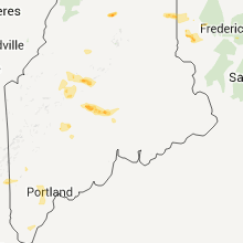
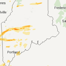
Hail Maps for Madison, ME


Connect with Interactive Hail Maps