

Hail Map for Madison, MO
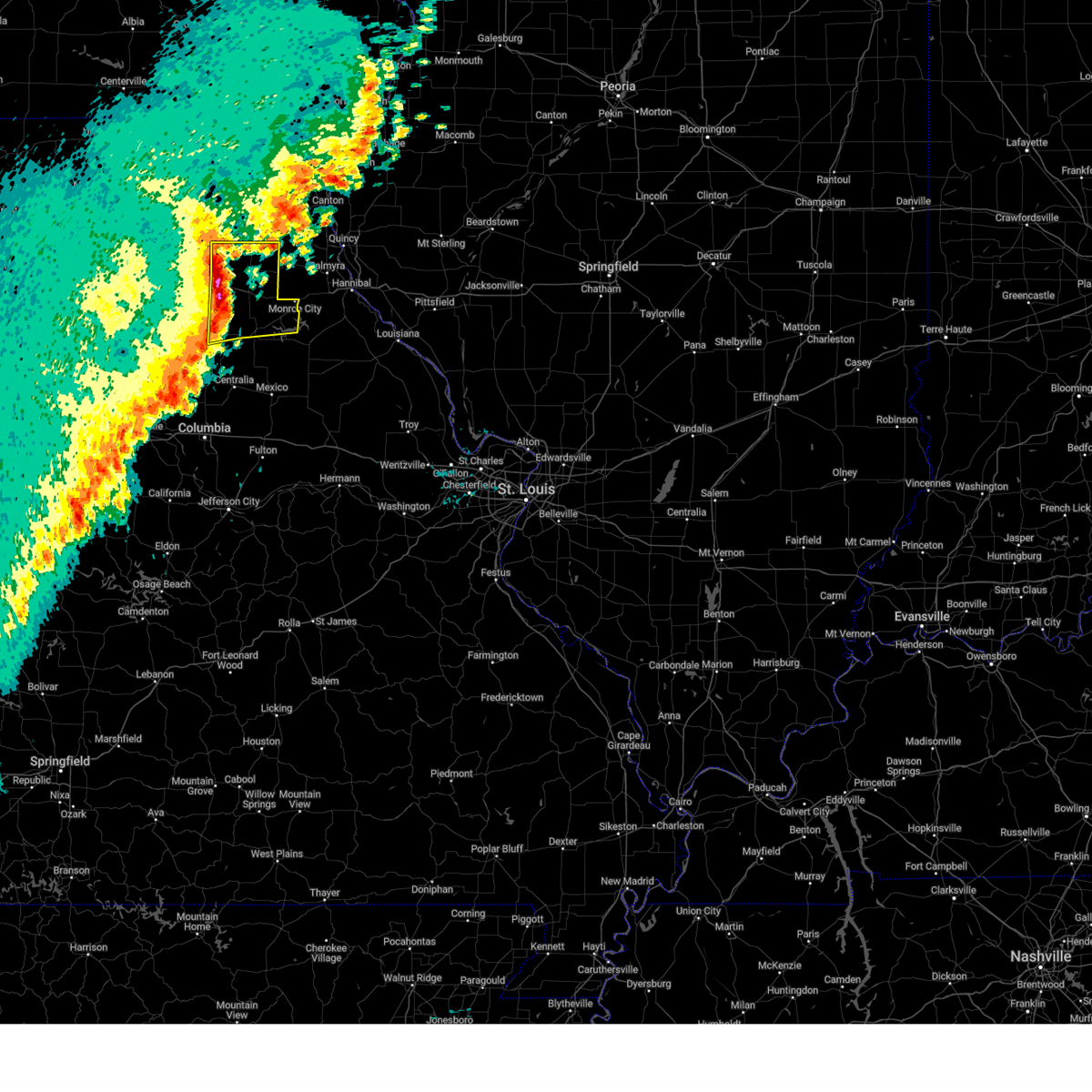
The Madison, MO area has had 8 reports of on-the-ground hail by trained spotters, and has been under severe weather warnings 12 times during the past 12 months. Doppler radar has detected hail at or near Madison, MO on 45 occasions, including 3 occasions during the past year.
| Name: | Madison, MO |
| Where Located: | 36.6 miles N of Columbia, MO |
| Map: | Google Map for Madison, MO |
| Population: | 554 |
| Housing Units: | 281 |
| More Info: | Search Google for Madison, MO |
0
The Top Recent Hail Date for Madison, MO is Tuesday, August 27, 2024 (45th out of 45)

Hail and Wind Damage Spotted near Madison, MO
| Date / Time | Report Details |
|---|---|
| 6/3/2025 4:51 PM CDT |
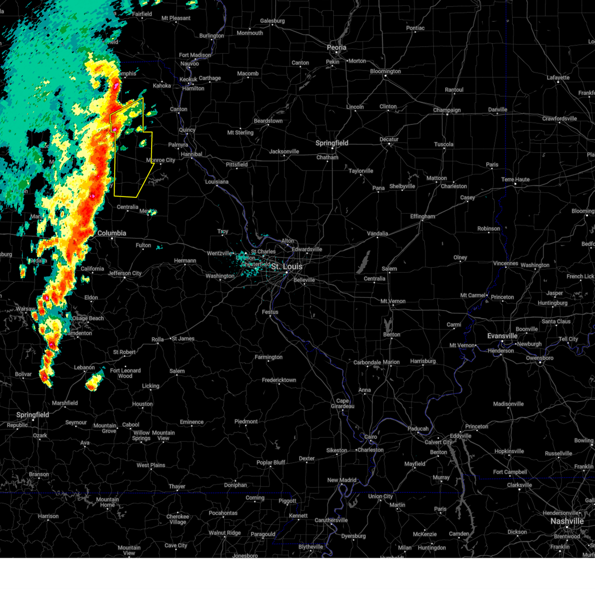 Svrlsx the national weather service in st louis has issued a * severe thunderstorm warning for, knox county in northeastern missouri, monroe county in northeastern missouri, shelby county in northeastern missouri, * until 530 pm cdt. * at 451 pm cdt, severe thunderstorms were located along a line from 6 miles south of edina to 11 miles west of sturgeon, or along a line from 6 miles south of edina to 19 miles west of centralia, moving northeast at 60 mph (radar indicated). Hazards include 60 mph wind gusts and quarter size hail. Hail damage to vehicles is expected. expect wind damage to roofs, siding, and trees. this severe thunderstorm will be near, clarence and edina around 455 pm cdt. plevna, woodlawn and maud around 505 pm cdt. other locations impacted by the severe thunderstorm include novelty, leonard, duncans bridge, bethel, newark, holliday and hunnewell. This includes the following state parks, union covered bridge historic site. Svrlsx the national weather service in st louis has issued a * severe thunderstorm warning for, knox county in northeastern missouri, monroe county in northeastern missouri, shelby county in northeastern missouri, * until 530 pm cdt. * at 451 pm cdt, severe thunderstorms were located along a line from 6 miles south of edina to 11 miles west of sturgeon, or along a line from 6 miles south of edina to 19 miles west of centralia, moving northeast at 60 mph (radar indicated). Hazards include 60 mph wind gusts and quarter size hail. Hail damage to vehicles is expected. expect wind damage to roofs, siding, and trees. this severe thunderstorm will be near, clarence and edina around 455 pm cdt. plevna, woodlawn and maud around 505 pm cdt. other locations impacted by the severe thunderstorm include novelty, leonard, duncans bridge, bethel, newark, holliday and hunnewell. This includes the following state parks, union covered bridge historic site.
|
| 4/20/2025 5:48 PM CDT |
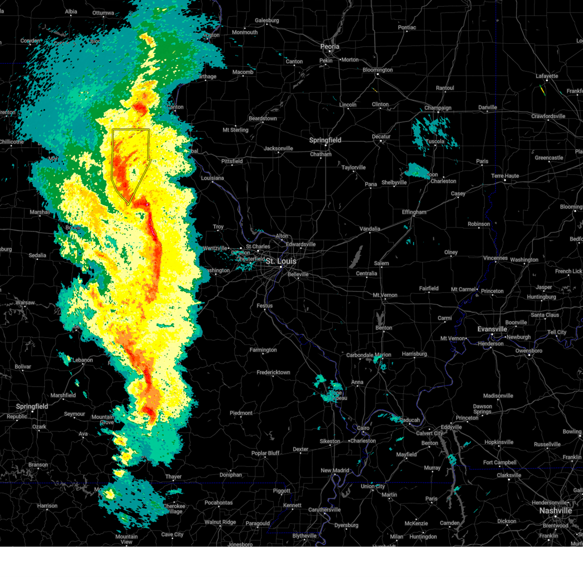 At 548 pm cdt, severe thunderstorms were located along a line from over clarence to 6 miles northeast of centralia, or along a line from 15 miles west of shelbina to 6 miles northeast of centralia, moving east at 30 mph (radar indicated). Hazards include 60 mph wind gusts and small hail. Expect damage to roofs, siding, and trees. this severe thunderstorm will be near, madison around 535 pm cdt. woodlawn around 540 pm cdt. other locations impacted by the severe thunderstorm include duncans bridge, holliday, leonard, hunnewell and bethel. This includes the following state parks, union covered bridge historic site. At 548 pm cdt, severe thunderstorms were located along a line from over clarence to 6 miles northeast of centralia, or along a line from 15 miles west of shelbina to 6 miles northeast of centralia, moving east at 30 mph (radar indicated). Hazards include 60 mph wind gusts and small hail. Expect damage to roofs, siding, and trees. this severe thunderstorm will be near, madison around 535 pm cdt. woodlawn around 540 pm cdt. other locations impacted by the severe thunderstorm include duncans bridge, holliday, leonard, hunnewell and bethel. This includes the following state parks, union covered bridge historic site.
|
| 4/20/2025 5:34 PM CDT | Svrlsx the national weather service in st louis has issued a * severe thunderstorm warning for, northwestern audrain county in central missouri, monroe county in northeastern missouri, shelby county in northeastern missouri, * until 615 pm cdt. * at 534 pm cdt, severe thunderstorms were located along a line from 9 miles west of clarence to near sturgeon, or along a line from 21 miles west of shelbina to 10 miles west of centralia, moving east at 30 mph (radar indicated). Hazards include 60 mph wind gusts and small hail. Expect damage to roofs, siding, and trees. this severe thunderstorm will be near, madison around 545 pm cdt. other locations impacted by the severe thunderstorm include duncans bridge, holliday and bethel. This includes the following state parks, union covered bridge historic site. |
| 3/14/2025 6:38 PM CDT |
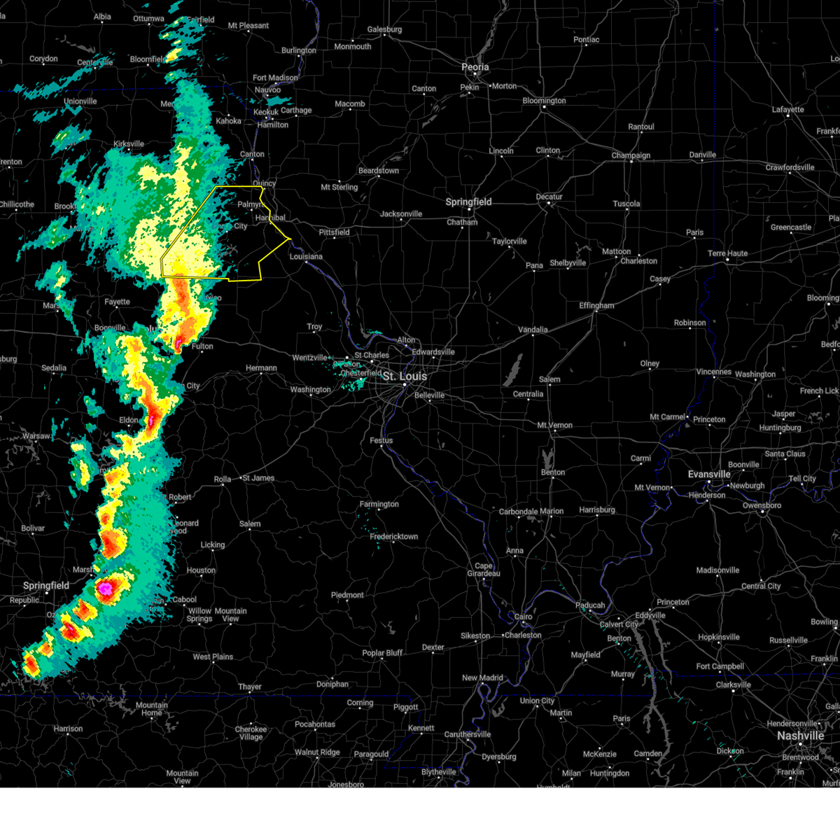 Svrlsx the national weather service in st louis has issued a * severe thunderstorm warning for, marion county in northeastern missouri, monroe county in northeastern missouri, ralls county in northeastern missouri, southeastern shelby county in northeastern missouri, * until 745 pm cdt. * at 638 pm cdt, severe thunderstorms were located along a line from 7 miles southeast of madison to 5 miles northeast of murry, or along a line from 8 miles southwest of paris to 9 miles south of centralia, moving northeast at 70 mph (radar indicated). Hazards include 70 mph wind gusts and small hail. Expect considerable tree damage. damage is likely to mobile homes, roofs, and outbuildings. this severe thunderstorm will be near, madison around 640 pm cdt. paris and granville around 645 pm cdt. other locations impacted by the severe thunderstorm include holliday, stoutsville, indian creek, florida, hunnewell, the landing and taylor. This includes the following state parks, union covered bridge historic site and mark twain lake recreational area. Svrlsx the national weather service in st louis has issued a * severe thunderstorm warning for, marion county in northeastern missouri, monroe county in northeastern missouri, ralls county in northeastern missouri, southeastern shelby county in northeastern missouri, * until 745 pm cdt. * at 638 pm cdt, severe thunderstorms were located along a line from 7 miles southeast of madison to 5 miles northeast of murry, or along a line from 8 miles southwest of paris to 9 miles south of centralia, moving northeast at 70 mph (radar indicated). Hazards include 70 mph wind gusts and small hail. Expect considerable tree damage. damage is likely to mobile homes, roofs, and outbuildings. this severe thunderstorm will be near, madison around 640 pm cdt. paris and granville around 645 pm cdt. other locations impacted by the severe thunderstorm include holliday, stoutsville, indian creek, florida, hunnewell, the landing and taylor. This includes the following state parks, union covered bridge historic site and mark twain lake recreational area.
|
| 10/30/2024 10:53 PM CDT |
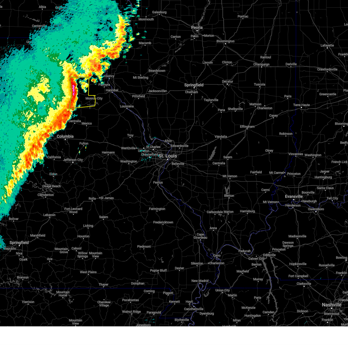 At 1053 pm cdt, severe thunderstorms were located along a line from 6 miles south of plevna to 5 miles south of granville, or along a line from 14 miles north of shelbina to 6 miles west of paris, moving east at 55 mph (trained spotters reported a 72 mph wind gust in granville). Hazards include 70 mph wind gusts and small hail. Expect considerable tree damage. damage is likely to mobile homes, roofs, and outbuildings. locations impacted include, monroe city, shelbina, paris, madison, shelbyville, granville, emden, maud, woodlawn, hunnewell, holliday, bethel, leonard, stoutsville, indian creek and florida. This includes the following state parks, mark twain lake recreational area. At 1053 pm cdt, severe thunderstorms were located along a line from 6 miles south of plevna to 5 miles south of granville, or along a line from 14 miles north of shelbina to 6 miles west of paris, moving east at 55 mph (trained spotters reported a 72 mph wind gust in granville). Hazards include 70 mph wind gusts and small hail. Expect considerable tree damage. damage is likely to mobile homes, roofs, and outbuildings. locations impacted include, monroe city, shelbina, paris, madison, shelbyville, granville, emden, maud, woodlawn, hunnewell, holliday, bethel, leonard, stoutsville, indian creek and florida. This includes the following state parks, mark twain lake recreational area.
|
| 10/30/2024 10:47 PM CDT |
 At 1047 pm cdt, severe thunderstorms were located along a line from 8 miles north of clarence to over madison, or along a line from 15 miles northwest of shelbina to 12 miles west of paris, moving east at 55 mph (radar indicated). Hazards include 60 mph wind gusts and small hail. Expect damage to roofs, siding, and trees. locations impacted include, monroe city, shelbina, paris, clarence, madison, shelbyville, granville, maud, woodlawn, emden, hunnewell, holliday, bethel, leonard, stoutsville, duncans bridge, indian creek and florida. This includes the following state parks, mark twain lake recreational area. At 1047 pm cdt, severe thunderstorms were located along a line from 8 miles north of clarence to over madison, or along a line from 15 miles northwest of shelbina to 12 miles west of paris, moving east at 55 mph (radar indicated). Hazards include 60 mph wind gusts and small hail. Expect damage to roofs, siding, and trees. locations impacted include, monroe city, shelbina, paris, clarence, madison, shelbyville, granville, maud, woodlawn, emden, hunnewell, holliday, bethel, leonard, stoutsville, duncans bridge, indian creek and florida. This includes the following state parks, mark twain lake recreational area.
|
| 10/30/2024 10:32 PM CDT |
 Svrlsx the national weather service in st louis has issued a * severe thunderstorm warning for, monroe county in northeastern missouri, shelby county in northeastern missouri, * until 1115 pm cdt. * at 1032 pm cdt, severe thunderstorms were located along a line from 12 miles west of clarence to 13 miles northwest of sturgeon, or along a line from 24 miles west of shelbina to 20 miles northwest of centralia, moving east at 55 mph (radar indicated). Hazards include 60 mph wind gusts and small hail. expect damage to roofs, siding, and trees Svrlsx the national weather service in st louis has issued a * severe thunderstorm warning for, monroe county in northeastern missouri, shelby county in northeastern missouri, * until 1115 pm cdt. * at 1032 pm cdt, severe thunderstorms were located along a line from 12 miles west of clarence to 13 miles northwest of sturgeon, or along a line from 24 miles west of shelbina to 20 miles northwest of centralia, moving east at 55 mph (radar indicated). Hazards include 60 mph wind gusts and small hail. expect damage to roofs, siding, and trees
|
| 8/27/2024 6:14 PM CDT |
 Svrlsx the national weather service in st louis has issued a * severe thunderstorm warning for, northwestern monroe county in northeastern missouri, southern shelby county in northeastern missouri, * until 700 pm cdt. * at 614 pm cdt, a severe thunderstorm was located over granville, or 8 miles northwest of paris, moving north at 10 mph (radar indicated). Hazards include 60 mph wind gusts and small hail. expect damage to roofs, siding, and trees Svrlsx the national weather service in st louis has issued a * severe thunderstorm warning for, northwestern monroe county in northeastern missouri, southern shelby county in northeastern missouri, * until 700 pm cdt. * at 614 pm cdt, a severe thunderstorm was located over granville, or 8 miles northwest of paris, moving north at 10 mph (radar indicated). Hazards include 60 mph wind gusts and small hail. expect damage to roofs, siding, and trees
|
| 8/27/2024 5:05 PM CDT |
 At 505 pm cdt, a severe thunderstorm was located near maud, or 6 miles west of shelbina, moving northeast at 10 mph (radar indicated). Hazards include 60 mph wind gusts and small hail. Expect damage to roofs, siding, and trees. Locations impacted include, shelbina, madison, granville, maud, woodlawn, hunnewell and holliday. At 505 pm cdt, a severe thunderstorm was located near maud, or 6 miles west of shelbina, moving northeast at 10 mph (radar indicated). Hazards include 60 mph wind gusts and small hail. Expect damage to roofs, siding, and trees. Locations impacted include, shelbina, madison, granville, maud, woodlawn, hunnewell and holliday.
|
| 8/27/2024 4:42 PM CDT |
 Svrlsx the national weather service in st louis has issued a * severe thunderstorm warning for, northwestern monroe county in northeastern missouri, southern shelby county in northeastern missouri, * until 530 pm cdt. * at 442 pm cdt, a severe thunderstorm was located over shelbina, moving southeast at 10 mph (radar indicated). Hazards include 60 mph wind gusts and small hail. expect damage to roofs, siding, and trees Svrlsx the national weather service in st louis has issued a * severe thunderstorm warning for, northwestern monroe county in northeastern missouri, southern shelby county in northeastern missouri, * until 530 pm cdt. * at 442 pm cdt, a severe thunderstorm was located over shelbina, moving southeast at 10 mph (radar indicated). Hazards include 60 mph wind gusts and small hail. expect damage to roofs, siding, and trees
|
| 7/16/2024 9:43 AM CDT |
 At 943 am cdt, a severe thunderstorm was located 6 miles northeast of paris, moving east at 35 mph (radar indicated). Hazards include 60 mph wind gusts and quarter size hail. Hail damage to vehicles is expected. expect wind damage to roofs, siding, and trees. locations impacted include, monroe city, shelbina, paris, santa fe, madison, granville, woodlawn, maud, hunnewell, holliday, stoutsville, florida, indian creek and duncans bridge. This includes the following state parks, union covered bridge historic site and mark twain lake recreational area. At 943 am cdt, a severe thunderstorm was located 6 miles northeast of paris, moving east at 35 mph (radar indicated). Hazards include 60 mph wind gusts and quarter size hail. Hail damage to vehicles is expected. expect wind damage to roofs, siding, and trees. locations impacted include, monroe city, shelbina, paris, santa fe, madison, granville, woodlawn, maud, hunnewell, holliday, stoutsville, florida, indian creek and duncans bridge. This includes the following state parks, union covered bridge historic site and mark twain lake recreational area.
|
| 7/16/2024 9:14 AM CDT |
 Svrlsx the national weather service in st louis has issued a * severe thunderstorm warning for, northwestern audrain county in central missouri, monroe county in northeastern missouri, southern shelby county in northeastern missouri, * until 1015 am cdt. * at 914 am cdt, a cluster of severe thunderstorms were located across western monroe county moving east at 50 mph (radar indicated). Hazards include 60 mph wind gusts and quarter size hail. Hail damage to vehicles is expected. Expect wind damage to roofs, siding, and trees. Svrlsx the national weather service in st louis has issued a * severe thunderstorm warning for, northwestern audrain county in central missouri, monroe county in northeastern missouri, southern shelby county in northeastern missouri, * until 1015 am cdt. * at 914 am cdt, a cluster of severe thunderstorms were located across western monroe county moving east at 50 mph (radar indicated). Hazards include 60 mph wind gusts and quarter size hail. Hail damage to vehicles is expected. Expect wind damage to roofs, siding, and trees.
|
| 7/2/2024 11:52 PM CDT |
 The storm which prompted the warning has weakened below severe limits, and no longer poses an immediate threat to life or property. therefore, the warning will be allowed to expire. a severe thunderstorm watch remains in effect until midnight cdt for northeastern missouri. The storm which prompted the warning has weakened below severe limits, and no longer poses an immediate threat to life or property. therefore, the warning will be allowed to expire. a severe thunderstorm watch remains in effect until midnight cdt for northeastern missouri.
|
| 7/2/2024 11:32 PM CDT |
 At 1131 pm cdt, a severe thunderstorm was located near 2 miles south of madison , moving east at 35 mph (radar indicated). Hazards include 60 mph wind gusts and penny size hail. Expect damage to roofs, siding, and trees. locations impacted include, paris, madison, and holliday. This also includes union covered bridge historic site. At 1131 pm cdt, a severe thunderstorm was located near 2 miles south of madison , moving east at 35 mph (radar indicated). Hazards include 60 mph wind gusts and penny size hail. Expect damage to roofs, siding, and trees. locations impacted include, paris, madison, and holliday. This also includes union covered bridge historic site.
|
| 7/2/2024 10:58 PM CDT |
 Svrlsx the national weather service in st louis has issued a * severe thunderstorm warning for, western monroe county in northeastern missouri, * until midnight cdt. * at 1056 pm cdt, a severe thunderstorm was located near cairo, moving east at 35 mph (radar indicated). Hazards include 60 mph wind gusts and nickel size hail. expect damage to roofs, siding, and trees Svrlsx the national weather service in st louis has issued a * severe thunderstorm warning for, western monroe county in northeastern missouri, * until midnight cdt. * at 1056 pm cdt, a severe thunderstorm was located near cairo, moving east at 35 mph (radar indicated). Hazards include 60 mph wind gusts and nickel size hail. expect damage to roofs, siding, and trees
|
| 5/26/2024 11:30 PM CDT |
 At 1129 pm cdt, a severe thunderstorm was located near paris, moving southeast at 30 mph (radar indicated). Hazards include 60 mph wind gusts and quarter size hail. Hail damage to vehicles is expected. expect wind damage to roofs, siding, and trees. locations impacted include, paris. This also includes union covered bridge historic site. At 1129 pm cdt, a severe thunderstorm was located near paris, moving southeast at 30 mph (radar indicated). Hazards include 60 mph wind gusts and quarter size hail. Hail damage to vehicles is expected. expect wind damage to roofs, siding, and trees. locations impacted include, paris. This also includes union covered bridge historic site.
|
| 5/26/2024 11:13 PM CDT |
 Svrlsx the national weather service in st louis has issued a * severe thunderstorm warning for, northwestern audrain county in central missouri, monroe county in northeastern missouri, * until midnight cdt. * at 1113 pm cdt, a severe thunderstorm was located near woodlawn, moving southeast at 30 mph (radar indicated). Hazards include ping pong ball size hail and 60 mph wind gusts. People and animals outdoors will be injured. expect hail damage to roofs, siding, windows, and vehicles. expect wind damage to roofs, siding, and trees. this severe thunderstorm will be near, paris around 1125 pm cdt. This also includes union covered bridge historic site and mark twain lake recreational area. Svrlsx the national weather service in st louis has issued a * severe thunderstorm warning for, northwestern audrain county in central missouri, monroe county in northeastern missouri, * until midnight cdt. * at 1113 pm cdt, a severe thunderstorm was located near woodlawn, moving southeast at 30 mph (radar indicated). Hazards include ping pong ball size hail and 60 mph wind gusts. People and animals outdoors will be injured. expect hail damage to roofs, siding, windows, and vehicles. expect wind damage to roofs, siding, and trees. this severe thunderstorm will be near, paris around 1125 pm cdt. This also includes union covered bridge historic site and mark twain lake recreational area.
|
| 5/26/2024 10:43 PM CDT |
 At 1043 pm cdt, a severe thunderstorm was located near clarence, moving southeast at 30 mph (radar indicated). Hazards include golf ball size hail and 60 mph wind gusts. People and animals outdoors will be injured. expect hail damage to roofs, siding, windows, and vehicles. expect wind damage to roofs, siding, and trees. Locations impacted include, woodlawn, maud, madison and paris. At 1043 pm cdt, a severe thunderstorm was located near clarence, moving southeast at 30 mph (radar indicated). Hazards include golf ball size hail and 60 mph wind gusts. People and animals outdoors will be injured. expect hail damage to roofs, siding, windows, and vehicles. expect wind damage to roofs, siding, and trees. Locations impacted include, woodlawn, maud, madison and paris.
|
| 5/26/2024 10:32 PM CDT |
 Svrlsx the national weather service in st louis has issued a * severe thunderstorm warning for, shelby county in northeastern missouri, northwestern monroe county in northeastern missouri, * until 1130 pm cdt. * at 1032 pm cdt, a severe thunderstorm was located near macon, moving southeast at 25 mph (radar indicated). Hazards include 60 mph wind gusts and half dollar size hail. Hail damage to vehicles is expected. Expect wind damage to roofs, siding, and trees. Svrlsx the national weather service in st louis has issued a * severe thunderstorm warning for, shelby county in northeastern missouri, northwestern monroe county in northeastern missouri, * until 1130 pm cdt. * at 1032 pm cdt, a severe thunderstorm was located near macon, moving southeast at 25 mph (radar indicated). Hazards include 60 mph wind gusts and half dollar size hail. Hail damage to vehicles is expected. Expect wind damage to roofs, siding, and trees.
|
| 5/7/2024 2:53 AM CDT |
 The storm which prompted the warning has weakened below severe limits, and has exited the warned area. therefore, the warning will be allowed to expire. however, gusty winds and heavy rain are still possible with this thunderstorm. a tornado watch remains in effect until 800 am cdt for central and northeastern missouri. The storm which prompted the warning has weakened below severe limits, and has exited the warned area. therefore, the warning will be allowed to expire. however, gusty winds and heavy rain are still possible with this thunderstorm. a tornado watch remains in effect until 800 am cdt for central and northeastern missouri.
|
| 5/7/2024 2:29 AM CDT |
 At 229 am cdt, severe thunderstorms were located along a line extending from near granville to 9 miles southwest of santa fe to near auxvasse to near taos, moving east at 35 mph (radar indicated). Hazards include 60 mph wind gusts. Expect damage to roofs, siding, and trees. locations impacted include, columbia, jefferson city, fulton, centralia, ashland, holts summit, columbia regional airport, hallsville, sturgeon, new bloomfield, madison, lake mykee town, murry, woodlawn, lake mykee, granville, holliday, kingdom city, hartsburg, and hatton. this also includes rock bridge state park and union covered bridge historic site. This includes interstate 70 in missouri between exits 128 and 148. At 229 am cdt, severe thunderstorms were located along a line extending from near granville to 9 miles southwest of santa fe to near auxvasse to near taos, moving east at 35 mph (radar indicated). Hazards include 60 mph wind gusts. Expect damage to roofs, siding, and trees. locations impacted include, columbia, jefferson city, fulton, centralia, ashland, holts summit, columbia regional airport, hallsville, sturgeon, new bloomfield, madison, lake mykee town, murry, woodlawn, lake mykee, granville, holliday, kingdom city, hartsburg, and hatton. this also includes rock bridge state park and union covered bridge historic site. This includes interstate 70 in missouri between exits 128 and 148.
|
| 5/7/2024 2:19 AM CDT |
 Svrlsx the national weather service in st louis has issued a * severe thunderstorm warning for, monroe county in northeastern missouri, * until 300 am cdt. * at 219 am cdt, a severe thunderstorm was located over paris, moving east at 45 mph (radar indicated). Hazards include 60 mph wind gusts. expect damage to roofs, siding, and trees Svrlsx the national weather service in st louis has issued a * severe thunderstorm warning for, monroe county in northeastern missouri, * until 300 am cdt. * at 219 am cdt, a severe thunderstorm was located over paris, moving east at 45 mph (radar indicated). Hazards include 60 mph wind gusts. expect damage to roofs, siding, and trees
|
| 5/7/2024 1:57 AM CDT |
 At 156 am cdt, severe thunderstorms were located along a line extending from near cairo to clark to columbia to near russellville, moving east at 45 mph (radar indicated). Hazards include 60 mph wind gusts. Expect damage to roofs, siding, and trees. locations impacted include, columbia, jefferson city, fulton, centralia, ashland, holts summit, columbia regional airport, hallsville, sturgeon, new bloomfield, madison, lake mykee town, rocheport, easley, murry, midway, woodlawn, lake mykee, granville, and harrisburg. this also includes rock bridge state park, finger lakes state park, union covered bridge historic site, and jewell cemetery historic site. This includes interstate 70 in missouri between exits 115 and 148. At 156 am cdt, severe thunderstorms were located along a line extending from near cairo to clark to columbia to near russellville, moving east at 45 mph (radar indicated). Hazards include 60 mph wind gusts. Expect damage to roofs, siding, and trees. locations impacted include, columbia, jefferson city, fulton, centralia, ashland, holts summit, columbia regional airport, hallsville, sturgeon, new bloomfield, madison, lake mykee town, rocheport, easley, murry, midway, woodlawn, lake mykee, granville, and harrisburg. this also includes rock bridge state park, finger lakes state park, union covered bridge historic site, and jewell cemetery historic site. This includes interstate 70 in missouri between exits 115 and 148.
|
| 5/7/2024 1:25 AM CDT |
 Svrlsx the national weather service in st louis has issued a * severe thunderstorm warning for, boone county in central missouri, western audrain county in central missouri, western callaway county in central missouri, western monroe county in northeastern missouri, * until 245 am cdt. * at 124 am cdt, severe thunderstorms were located along a line extending from near brookfield to 6 miles north of glasgow to new franklin to near tipton, moving east at 45 mph (radar indicated). Hazards include 60 mph wind gusts. expect damage to roofs, siding, and trees Svrlsx the national weather service in st louis has issued a * severe thunderstorm warning for, boone county in central missouri, western audrain county in central missouri, western callaway county in central missouri, western monroe county in northeastern missouri, * until 245 am cdt. * at 124 am cdt, severe thunderstorms were located along a line extending from near brookfield to 6 miles north of glasgow to new franklin to near tipton, moving east at 45 mph (radar indicated). Hazards include 60 mph wind gusts. expect damage to roofs, siding, and trees
|
| 3/14/2024 2:59 AM CDT |
 The storms which prompted the warning have moved out of the area. therefore, the warning will be allowed to expire. a severe thunderstorm watch remains in effect until 600 am cdt for northeastern missouri. to report severe weather, contact your nearest law enforcement agency. they will relay your report to the national weather service st louis. The storms which prompted the warning have moved out of the area. therefore, the warning will be allowed to expire. a severe thunderstorm watch remains in effect until 600 am cdt for northeastern missouri. to report severe weather, contact your nearest law enforcement agency. they will relay your report to the national weather service st louis.
|
| 3/14/2024 2:42 AM CDT |
 At 242 am cdt, severe thunderstorms were located along a line extending from near luray to near steffenville to near paris, moving east at 60 mph (radar indicated). Hazards include 60 mph wind gusts. Expect damage to roofs, siding, and trees. Locations impacted include, monroe city, shelbina, paris, warren, la belle, madison, shelbyville, lewistown, ewing, knox city, steffenville, granville, colony, emden, philadelphia, hunnewell, holliday, monticello, newark, and stoutsville. At 242 am cdt, severe thunderstorms were located along a line extending from near luray to near steffenville to near paris, moving east at 60 mph (radar indicated). Hazards include 60 mph wind gusts. Expect damage to roofs, siding, and trees. Locations impacted include, monroe city, shelbina, paris, warren, la belle, madison, shelbyville, lewistown, ewing, knox city, steffenville, granville, colony, emden, philadelphia, hunnewell, holliday, monticello, newark, and stoutsville.
|
| 3/14/2024 2:22 AM CDT |
 Svrlsx the national weather service in st louis has issued a * severe thunderstorm warning for, knox county in northeastern missouri, shelby county in northeastern missouri, western marion county in northeastern missouri, western lewis county in northeastern missouri, monroe county in northeastern missouri, * until 300 am cdt. * at 220 am cdt, severe thunderstorms were located along a line extending from 7 miles southwest of memphis to 8 miles southwest of plevna to near moberly, moving east at 55 mph (radar indicated. at 215 am, 63 mph wind gusts were measured at kirksville and moberly by automated weather stations). Hazards include 60 mph wind gusts. expect damage to roofs, siding, and trees Svrlsx the national weather service in st louis has issued a * severe thunderstorm warning for, knox county in northeastern missouri, shelby county in northeastern missouri, western marion county in northeastern missouri, western lewis county in northeastern missouri, monroe county in northeastern missouri, * until 300 am cdt. * at 220 am cdt, severe thunderstorms were located along a line extending from 7 miles southwest of memphis to 8 miles southwest of plevna to near moberly, moving east at 55 mph (radar indicated. at 215 am, 63 mph wind gusts were measured at kirksville and moberly by automated weather stations). Hazards include 60 mph wind gusts. expect damage to roofs, siding, and trees
|
| 8/12/2023 2:56 AM CDT |
 At 256 am cdt, severe thunderstorms were located along a line extending from 7 miles south of paris to near centralia to near murry to near midway, moving southeast at 40 mph (radar indicated). Hazards include 60 mph wind gusts and quarter size hail. Hail damage to vehicles is expected. expect wind damage to roofs, siding, and trees. locations impacted include, columbia, mexico, centralia, paris, hallsville, sturgeon, madison, murry, woodlawn, granville, midway, harrisburg, holliday, hatton, duncans bridge, and thompson. this also includes rock bridge state park, finger lakes state park, union covered bridge historic site, and jewell cemetery historic site. this includes interstate 70 in missouri between exits 115 and 144. hail threat, radar indicated max hail size, 1. 00 in wind threat, radar indicated max wind gust, 60 mph. At 256 am cdt, severe thunderstorms were located along a line extending from 7 miles south of paris to near centralia to near murry to near midway, moving southeast at 40 mph (radar indicated). Hazards include 60 mph wind gusts and quarter size hail. Hail damage to vehicles is expected. expect wind damage to roofs, siding, and trees. locations impacted include, columbia, mexico, centralia, paris, hallsville, sturgeon, madison, murry, woodlawn, granville, midway, harrisburg, holliday, hatton, duncans bridge, and thompson. this also includes rock bridge state park, finger lakes state park, union covered bridge historic site, and jewell cemetery historic site. this includes interstate 70 in missouri between exits 115 and 144. hail threat, radar indicated max hail size, 1. 00 in wind threat, radar indicated max wind gust, 60 mph.
|
| 8/12/2023 2:41 AM CDT |
 At 241 am cdt, severe thunderstorms were located along a line extending from madison to near centralia to 6 miles southwest of sturgeon to 9 miles east of fayette, moving southeast at 40 mph (radar indicated). Hazards include 60 mph wind gusts and quarter size hail. Hail damage to vehicles is expected. expect wind damage to roofs, siding, and trees. locations impacted include, columbia, mexico, centralia, paris, hallsville, sturgeon, madison, murry, woodlawn, granville, midway, harrisburg, holliday, hatton, duncans bridge, and thompson. this also includes rock bridge state park, finger lakes state park, union covered bridge historic site, and jewell cemetery historic site. this includes interstate 70 in missouri between exits 115 and 144. hail threat, radar indicated max hail size, 1. 00 in wind threat, radar indicated max wind gust, 60 mph. At 241 am cdt, severe thunderstorms were located along a line extending from madison to near centralia to 6 miles southwest of sturgeon to 9 miles east of fayette, moving southeast at 40 mph (radar indicated). Hazards include 60 mph wind gusts and quarter size hail. Hail damage to vehicles is expected. expect wind damage to roofs, siding, and trees. locations impacted include, columbia, mexico, centralia, paris, hallsville, sturgeon, madison, murry, woodlawn, granville, midway, harrisburg, holliday, hatton, duncans bridge, and thompson. this also includes rock bridge state park, finger lakes state park, union covered bridge historic site, and jewell cemetery historic site. this includes interstate 70 in missouri between exits 115 and 144. hail threat, radar indicated max hail size, 1. 00 in wind threat, radar indicated max wind gust, 60 mph.
|
| 8/12/2023 2:17 AM CDT |
 At 217 am cdt, severe thunderstorms were located along a line extending from 6 miles north of cairo to moberly to higbee to near glasgow, moving southeast at 40 mph (radar indicated). Hazards include 60 mph wind gusts. expect damage to roofs, siding, and trees At 217 am cdt, severe thunderstorms were located along a line extending from 6 miles north of cairo to moberly to higbee to near glasgow, moving southeast at 40 mph (radar indicated). Hazards include 60 mph wind gusts. expect damage to roofs, siding, and trees
|
| 7/29/2023 2:25 PM CDT |
 The severe thunderstorm warning for western ralls, shelby, western marion and monroe counties will expire at 230 pm cdt, the storms which prompted the warning have weakened below severe limits, and no longer pose an immediate threat to life or property. therefore, the warning will be allowed to expire. however, gusty winds are still possible with these thunderstorms. a severe thunderstorm watch remains in effect until 700 pm cdt for central and northeastern missouri. The severe thunderstorm warning for western ralls, shelby, western marion and monroe counties will expire at 230 pm cdt, the storms which prompted the warning have weakened below severe limits, and no longer pose an immediate threat to life or property. therefore, the warning will be allowed to expire. however, gusty winds are still possible with these thunderstorms. a severe thunderstorm watch remains in effect until 700 pm cdt for central and northeastern missouri.
|
| 7/29/2023 2:08 PM CDT |
 At 207 pm cdt, severe thunderstorms were located along a line extending from near atlanta to near santa fe, moving east at 30 mph (radar indicated). Hazards include 60 mph wind gusts. Expect damage to roofs, siding, and trees. locations impacted include, shelbina, paris, santa fe and shelbyville. this also includes union covered bridge historic site and mark twain lake recreational area. hail threat, radar indicated max hail size, <. 75 in wind threat, radar indicated max wind gust, 60 mph. At 207 pm cdt, severe thunderstorms were located along a line extending from near atlanta to near santa fe, moving east at 30 mph (radar indicated). Hazards include 60 mph wind gusts. Expect damage to roofs, siding, and trees. locations impacted include, shelbina, paris, santa fe and shelbyville. this also includes union covered bridge historic site and mark twain lake recreational area. hail threat, radar indicated max hail size, <. 75 in wind threat, radar indicated max wind gust, 60 mph.
|
| 7/29/2023 1:46 PM CDT |
 At 145 pm cdt, severe thunderstorms were located along a line extending from 6 miles northwest of atlanta to 9 miles southwest of paris, moving east at 30 mph (radar indicated). Hazards include 60 mph wind gusts. Expect damage to roofs, siding, and trees. severe thunderstorms will be near, clarence, woodlawn, and maud around 150 pm cdt. paris and granville around 155 pm cdt. other locations in the path of these severe thunderstorms include santa fe and shelbina. this also includes union covered bridge historic site and mark twain lake recreational area. hail threat, radar indicated max hail size, <. 75 in wind threat, radar indicated max wind gust, 60 mph. At 145 pm cdt, severe thunderstorms were located along a line extending from 6 miles northwest of atlanta to 9 miles southwest of paris, moving east at 30 mph (radar indicated). Hazards include 60 mph wind gusts. Expect damage to roofs, siding, and trees. severe thunderstorms will be near, clarence, woodlawn, and maud around 150 pm cdt. paris and granville around 155 pm cdt. other locations in the path of these severe thunderstorms include santa fe and shelbina. this also includes union covered bridge historic site and mark twain lake recreational area. hail threat, radar indicated max hail size, <. 75 in wind threat, radar indicated max wind gust, 60 mph.
|
| 7/29/2023 1:15 PM CDT |
 At 113 pm cdt, severe thunderstorms were located along a line extending from cairo to near rocheport, moving east at 45 mph (radar indicated. this complex has a history of producing 60 to 70 mph winds along with downed trees). Hazards include 70 mph wind gusts. Expect considerable tree damage. damage is likely to mobile homes, roofs, and outbuildings. locations impacted include, columbia, sturgeon, midway, hallsville, madison, centralia, murry, paris, mexico and auxvasse. this also includes rock bridge state park, finger lakes state park, union covered bridge historic site, and jewell cemetery historic site. this includes interstate 70 in missouri between exits 115 and 148. thunderstorm damage threat, considerable hail threat, radar indicated max hail size, <. 75 in wind threat, radar indicated max wind gust, 70 mph. At 113 pm cdt, severe thunderstorms were located along a line extending from cairo to near rocheport, moving east at 45 mph (radar indicated. this complex has a history of producing 60 to 70 mph winds along with downed trees). Hazards include 70 mph wind gusts. Expect considerable tree damage. damage is likely to mobile homes, roofs, and outbuildings. locations impacted include, columbia, sturgeon, midway, hallsville, madison, centralia, murry, paris, mexico and auxvasse. this also includes rock bridge state park, finger lakes state park, union covered bridge historic site, and jewell cemetery historic site. this includes interstate 70 in missouri between exits 115 and 148. thunderstorm damage threat, considerable hail threat, radar indicated max hail size, <. 75 in wind threat, radar indicated max wind gust, 70 mph.
|
| 7/29/2023 12:46 PM CDT |
 At 1246 pm cdt, severe thunderstorms were located along a line extending from 9 miles north of salisbury to 7 miles west of new franklin, moving east at 45 mph (radar indicated). Hazards include 60 mph wind gusts. Expect damage to roofs, siding, and trees. severe thunderstorms will be near, rocheport around 105 pm cdt. other locations in the path of these severe thunderstorms include midway, columbia, sturgeon, madison, hallsville, centralia and murry. this includes interstate 70 in missouri between exits 115 and 148. this also includes rock bridge state park, finger lakes state park, union covered bridge historic site, and jewell cemetery historic site. hail threat, radar indicated max hail size, <. 75 in wind threat, radar indicated max wind gust, 60 mph. At 1246 pm cdt, severe thunderstorms were located along a line extending from 9 miles north of salisbury to 7 miles west of new franklin, moving east at 45 mph (radar indicated). Hazards include 60 mph wind gusts. Expect damage to roofs, siding, and trees. severe thunderstorms will be near, rocheport around 105 pm cdt. other locations in the path of these severe thunderstorms include midway, columbia, sturgeon, madison, hallsville, centralia and murry. this includes interstate 70 in missouri between exits 115 and 148. this also includes rock bridge state park, finger lakes state park, union covered bridge historic site, and jewell cemetery historic site. hail threat, radar indicated max hail size, <. 75 in wind threat, radar indicated max wind gust, 60 mph.
|
| 6/29/2023 10:20 AM CDT |
 At 1019 am cdt, severe thunderstorms were located along a line extending from near la plata to near macon to 9 miles northwest of cairo, moving east at 55 mph (radar indicated). Hazards include 60 mph wind gusts and quarter size hail. Hail damage to vehicles is expected. expect wind damage to roofs, siding, and trees. severe thunderstorms will be near, clarence around 1025 am cdt. woodlawn, maud, and plevna around 1035 am cdt. other locations in the path of these severe thunderstorms include shelbina, madison, shelbyville, granville, steffenville, paris, emden, monroe city, warren and philadelphia. this also includes union covered bridge historic site and mark twain lake recreational area. hail threat, radar indicated max hail size, 1. 00 in wind threat, radar indicated max wind gust, 60 mph. At 1019 am cdt, severe thunderstorms were located along a line extending from near la plata to near macon to 9 miles northwest of cairo, moving east at 55 mph (radar indicated). Hazards include 60 mph wind gusts and quarter size hail. Hail damage to vehicles is expected. expect wind damage to roofs, siding, and trees. severe thunderstorms will be near, clarence around 1025 am cdt. woodlawn, maud, and plevna around 1035 am cdt. other locations in the path of these severe thunderstorms include shelbina, madison, shelbyville, granville, steffenville, paris, emden, monroe city, warren and philadelphia. this also includes union covered bridge historic site and mark twain lake recreational area. hail threat, radar indicated max hail size, 1. 00 in wind threat, radar indicated max wind gust, 60 mph.
|
| 5/14/2023 4:21 PM CDT |
 The severe thunderstorm warning for north central audrain and southern monroe counties will expire at 430 pm cdt, the storm which prompted the warning has weakened below severe limits, and has exited the warned area. therefore, the warning will be allowed to expire. a severe thunderstorm watch remains in effect until 1000 pm cdt for central and northeastern missouri. The severe thunderstorm warning for north central audrain and southern monroe counties will expire at 430 pm cdt, the storm which prompted the warning has weakened below severe limits, and has exited the warned area. therefore, the warning will be allowed to expire. a severe thunderstorm watch remains in effect until 1000 pm cdt for central and northeastern missouri.
|
| 5/14/2023 4:07 PM CDT |
 At 406 pm cdt, a severe thunderstorm was located near santa fe, moving east at 15 mph (radar indicated). Hazards include 60 mph wind gusts and quarter size hail. Hail damage to vehicles is expected. expect wind damage to roofs, siding, and trees. locations impacted include, paris, madison, and holliday. this also includes union covered bridge historic site. hail threat, radar indicated max hail size, 1. 00 in wind threat, radar indicated max wind gust, 60 mph. At 406 pm cdt, a severe thunderstorm was located near santa fe, moving east at 15 mph (radar indicated). Hazards include 60 mph wind gusts and quarter size hail. Hail damage to vehicles is expected. expect wind damage to roofs, siding, and trees. locations impacted include, paris, madison, and holliday. this also includes union covered bridge historic site. hail threat, radar indicated max hail size, 1. 00 in wind threat, radar indicated max wind gust, 60 mph.
|
| 5/14/2023 3:47 PM CDT |
 At 347 pm cdt, a severe thunderstorm was located 9 miles northeast of centralia, moving east at 15 mph (radar indicated). Hazards include 60 mph wind gusts and quarter size hail. Hail damage to vehicles is expected. Expect wind damage to roofs, siding, and trees. At 347 pm cdt, a severe thunderstorm was located 9 miles northeast of centralia, moving east at 15 mph (radar indicated). Hazards include 60 mph wind gusts and quarter size hail. Hail damage to vehicles is expected. Expect wind damage to roofs, siding, and trees.
|
| 5/6/2023 9:05 AM CDT |
 At 904 am cdt, a severe thunderstorm was located near madison, moving east at 35 mph (radar indicated). Hazards include quarter size hail. damage to vehicles is expected At 904 am cdt, a severe thunderstorm was located near madison, moving east at 35 mph (radar indicated). Hazards include quarter size hail. damage to vehicles is expected
|
| 4/5/2023 3:17 AM CDT |
 At 316 am cdt, a severe thunderstorm was located near madison, moving northeast at 65 mph (radar indicated). Hazards include 60 mph wind gusts and half dollar size hail. Hail damage to vehicles is expected. expect wind damage to roofs, siding, and trees. locations impacted include, paris and granville. this also includes union covered bridge historic site and mark twain lake recreational area. hail threat, radar indicated max hail size, 1. 25 in wind threat, radar indicated max wind gust, 60 mph. At 316 am cdt, a severe thunderstorm was located near madison, moving northeast at 65 mph (radar indicated). Hazards include 60 mph wind gusts and half dollar size hail. Hail damage to vehicles is expected. expect wind damage to roofs, siding, and trees. locations impacted include, paris and granville. this also includes union covered bridge historic site and mark twain lake recreational area. hail threat, radar indicated max hail size, 1. 25 in wind threat, radar indicated max wind gust, 60 mph.
|
| 4/5/2023 3:02 AM CDT |
 At 301 am cdt, a severe thunderstorm was located near higbee, moving northeast at 65 mph (radar indicated). Hazards include 60 mph wind gusts and half dollar size hail. Hail damage to vehicles is expected. expect wind damage to roofs, siding, and trees. this severe thunderstorm will be near, sturgeon around 310 am cdt. madison around 320 am cdt. other locations in the path of this severe thunderstorm include paris and granville. this also includes union covered bridge historic site and mark twain lake recreational area. hail threat, radar indicated max hail size, 1. 25 in wind threat, radar indicated max wind gust, 60 mph. At 301 am cdt, a severe thunderstorm was located near higbee, moving northeast at 65 mph (radar indicated). Hazards include 60 mph wind gusts and half dollar size hail. Hail damage to vehicles is expected. expect wind damage to roofs, siding, and trees. this severe thunderstorm will be near, sturgeon around 310 am cdt. madison around 320 am cdt. other locations in the path of this severe thunderstorm include paris and granville. this also includes union covered bridge historic site and mark twain lake recreational area. hail threat, radar indicated max hail size, 1. 25 in wind threat, radar indicated max wind gust, 60 mph.
|
| 3/31/2023 3:20 PM CDT | Quarter sized hail reported 5.8 miles N of Madison, MO, delayed report. |
| 6/17/2022 3:21 AM CDT |
 At 321 am cdt, severe thunderstorms were located along a line extending from 8 miles southwest of monroe city to near paris to near clark, moving east at 45 mph (radar indicated). Hazards include 60 mph wind gusts and nickel size hail. Expect damage to roofs, siding, and trees. locations impacted include, paris, monroe city, santa fe, perry, center, rensselaer, spaulding, mexico and vandalia. this also includes union covered bridge historic site and mark twain lake recreational area. hail threat, radar indicated max hail size, 0. 88 in wind threat, radar indicated max wind gust, 60 mph. At 321 am cdt, severe thunderstorms were located along a line extending from 8 miles southwest of monroe city to near paris to near clark, moving east at 45 mph (radar indicated). Hazards include 60 mph wind gusts and nickel size hail. Expect damage to roofs, siding, and trees. locations impacted include, paris, monroe city, santa fe, perry, center, rensselaer, spaulding, mexico and vandalia. this also includes union covered bridge historic site and mark twain lake recreational area. hail threat, radar indicated max hail size, 0. 88 in wind threat, radar indicated max wind gust, 60 mph.
|
| 6/17/2022 3:02 AM CDT |
 At 301 am cdt, severe thunderstorms were located along a line extending from near shelbina to near madison to near higbee, moving southeast at 45 mph (the moberly asos reported a 58 mph wind gust). Hazards include 60 mph wind gusts and penny size hail. Expect damage to roofs, siding, and trees. severe thunderstorms will be near, shelbina, madison, woodlawn and maud around 305 am cdt. granville around 310 am cdt. paris around 320 am cdt. other locations in the path of these severe thunderstorms include santa fe, mexico, perry, laddonia and center. this also includes union covered bridge historic site and mark twain lake recreational area. hail threat, radar indicated max hail size, 0. 75 in wind threat, radar indicated max wind gust, 60 mph. At 301 am cdt, severe thunderstorms were located along a line extending from near shelbina to near madison to near higbee, moving southeast at 45 mph (the moberly asos reported a 58 mph wind gust). Hazards include 60 mph wind gusts and penny size hail. Expect damage to roofs, siding, and trees. severe thunderstorms will be near, shelbina, madison, woodlawn and maud around 305 am cdt. granville around 310 am cdt. paris around 320 am cdt. other locations in the path of these severe thunderstorms include santa fe, mexico, perry, laddonia and center. this also includes union covered bridge historic site and mark twain lake recreational area. hail threat, radar indicated max hail size, 0. 75 in wind threat, radar indicated max wind gust, 60 mph.
|
| 6/8/2022 4:02 AM CDT |
 At 401 am cdt, severe thunderstorms were located along a line extending from 8 miles southeast of madison to 6 miles northwest of auxvasse, moving northeast at 60 mph (radar indicated). Hazards include 60 mph wind gusts. Expect damage to roofs, siding, and trees. locations impacted include, mexico, paris, santa fe, perry, laddonia, farber, vandalia and center. This also includes union covered bridge historic site and mark twain lake recreational area. At 401 am cdt, severe thunderstorms were located along a line extending from 8 miles southeast of madison to 6 miles northwest of auxvasse, moving northeast at 60 mph (radar indicated). Hazards include 60 mph wind gusts. Expect damage to roofs, siding, and trees. locations impacted include, mexico, paris, santa fe, perry, laddonia, farber, vandalia and center. This also includes union covered bridge historic site and mark twain lake recreational area.
|
| 6/8/2022 3:47 AM CDT |
 At 347 am cdt, severe thunderstorms were located along a line extending from clark to near murry, moving northeast at 60 mph (radar indicated). Hazards include 60 mph wind gusts. Expect damage to roofs, siding, and trees. severe thunderstorms will be near, madison around 400 am cdt. other locations in the path of these severe thunderstorms include mexico, paris, laddonia, farber, vandalia and monroe city. this includes interstate 70 in missouri between exits 133 and 137. This also includes union covered bridge historic site and mark twain lake recreational area. At 347 am cdt, severe thunderstorms were located along a line extending from clark to near murry, moving northeast at 60 mph (radar indicated). Hazards include 60 mph wind gusts. Expect damage to roofs, siding, and trees. severe thunderstorms will be near, madison around 400 am cdt. other locations in the path of these severe thunderstorms include mexico, paris, laddonia, farber, vandalia and monroe city. this includes interstate 70 in missouri between exits 133 and 137. This also includes union covered bridge historic site and mark twain lake recreational area.
|
| 9/20/2021 9:56 PM CDT |
 At 956 pm cdt, severe thunderstorms were located along a line extending from near madison to 10 miles south of paris to near centralia, moving east at 50 mph (radar indicated). Hazards include 60 mph wind gusts and penny size hail. Expect damage to roofs, siding, and trees. severe thunderstorms will be near, paris and santa fe around 1010 pm cdt. other locations in the path of these severe thunderstorms include perry, farber, vandalia and center. this also includes union covered bridge historic site and mark twain lake recreational area. hail threat, radar indicated max hail size, 0. 75 in wind threat, radar indicated max wind gust, 60 mph. At 956 pm cdt, severe thunderstorms were located along a line extending from near madison to 10 miles south of paris to near centralia, moving east at 50 mph (radar indicated). Hazards include 60 mph wind gusts and penny size hail. Expect damage to roofs, siding, and trees. severe thunderstorms will be near, paris and santa fe around 1010 pm cdt. other locations in the path of these severe thunderstorms include perry, farber, vandalia and center. this also includes union covered bridge historic site and mark twain lake recreational area. hail threat, radar indicated max hail size, 0. 75 in wind threat, radar indicated max wind gust, 60 mph.
|
| 8/12/2021 4:11 PM CDT |
 A severe thunderstorm warning remains in effect until 500 pm cdt for northeastern boone. central audrain. southern shelby and monroe counties. at 410 pm cdt, a severe thunderstorm was located over madison, moving east at 30 mph. hazard. 60 mph wind gusts and penny size hail. A severe thunderstorm warning remains in effect until 500 pm cdt for northeastern boone. central audrain. southern shelby and monroe counties. at 410 pm cdt, a severe thunderstorm was located over madison, moving east at 30 mph. hazard. 60 mph wind gusts and penny size hail.
|
| 8/12/2021 3:58 PM CDT |
 At 358 pm cdt, a severe thunderstorm was located near cairo, moving east at 30 mph (radar indicated). Hazards include 60 mph wind gusts and penny size hail. Expect damage to roofs, siding, and trees. this severe thunderstorm will be near, woodlawn around 410 pm cdt. madison around 415 pm cdt. other locations in the path of this severe thunderstorm include granville, paris and santa fe. this also includes union covered bridge historic site and mark twain lake recreational area. hail threat, radar indicated max hail size, 0. 75 in wind threat, radar indicated max wind gust, 60 mph. At 358 pm cdt, a severe thunderstorm was located near cairo, moving east at 30 mph (radar indicated). Hazards include 60 mph wind gusts and penny size hail. Expect damage to roofs, siding, and trees. this severe thunderstorm will be near, woodlawn around 410 pm cdt. madison around 415 pm cdt. other locations in the path of this severe thunderstorm include granville, paris and santa fe. this also includes union covered bridge historic site and mark twain lake recreational area. hail threat, radar indicated max hail size, 0. 75 in wind threat, radar indicated max wind gust, 60 mph.
|
| 7/9/2021 10:47 PM CDT |
 At 1047 pm cdt, a severe thunderstorm was located near granville, moving southeast at 25 mph (radar indicated). Hazards include 60 mph wind gusts and quarter size hail. Hail damage to vehicles is expected. expect wind damage to roofs, siding, and trees. locations impacted include, granville and paris. This also includes union covered bridge historic site. At 1047 pm cdt, a severe thunderstorm was located near granville, moving southeast at 25 mph (radar indicated). Hazards include 60 mph wind gusts and quarter size hail. Hail damage to vehicles is expected. expect wind damage to roofs, siding, and trees. locations impacted include, granville and paris. This also includes union covered bridge historic site.
|
| 7/9/2021 10:32 PM CDT |
 At 1032 pm cdt, a severe thunderstorm was located over maud, moving southeast at 25 mph (radar indicated). Hazards include 60 mph wind gusts and quarter size hail. Hail damage to vehicles is expected. expect wind damage to roofs, siding, and trees. this severe thunderstorm will be near, maud around 1035 pm cdt. woodlawn around 1040 pm cdt. shelbina around 1045 pm cdt. other locations in the path of this severe thunderstorm include granville and paris. This also includes union covered bridge historic site. At 1032 pm cdt, a severe thunderstorm was located over maud, moving southeast at 25 mph (radar indicated). Hazards include 60 mph wind gusts and quarter size hail. Hail damage to vehicles is expected. expect wind damage to roofs, siding, and trees. this severe thunderstorm will be near, maud around 1035 pm cdt. woodlawn around 1040 pm cdt. shelbina around 1045 pm cdt. other locations in the path of this severe thunderstorm include granville and paris. This also includes union covered bridge historic site.
|
| 6/24/2021 11:25 PM CDT |
 At 1125 pm cdt, severe thunderstorms were located along a line extending from near steffenville to near shelbina to 7 miles south of madison, moving east at 55 mph (radar indicated). Hazards include 60 mph wind gusts. Expect damage to roofs, siding, and trees. locations impacted include, emden and paris. This also includes union covered bridge historic site. At 1125 pm cdt, severe thunderstorms were located along a line extending from near steffenville to near shelbina to 7 miles south of madison, moving east at 55 mph (radar indicated). Hazards include 60 mph wind gusts. Expect damage to roofs, siding, and trees. locations impacted include, emden and paris. This also includes union covered bridge historic site.
|
| 6/24/2021 10:57 PM CDT |
 At 1056 pm cdt, severe thunderstorms were located along a line extending from 9 miles east of la plata to near macon to near armstrong, moving east at 45 mph (radar indicated). Hazards include 60 mph wind gusts. Expect damage to roofs, siding, and trees. severe thunderstorms will be near, clarence and maud around 1115 pm cdt. other locations in the path of these severe thunderstorms include shelbina, shelbyville, madison, paris and emden. This also includes union covered bridge historic site. At 1056 pm cdt, severe thunderstorms were located along a line extending from 9 miles east of la plata to near macon to near armstrong, moving east at 45 mph (radar indicated). Hazards include 60 mph wind gusts. Expect damage to roofs, siding, and trees. severe thunderstorms will be near, clarence and maud around 1115 pm cdt. other locations in the path of these severe thunderstorms include shelbina, shelbyville, madison, paris and emden. This also includes union covered bridge historic site.
|
| 6/20/2021 9:47 PM CDT |
 At 946 pm cdt, severe thunderstorms were located along a line extending from rensselaer to paris, moving east at 50 mph (radar indicated). Hazards include 70 mph wind gusts and quarter size hail. Hail damage to vehicles is expected. expect considerable tree damage. wind damage is also likely to mobile homes, roofs, and outbuildings. locations impacted include, hannibal, palmyra, monroe city, shelbina, paris, warren, perry, madison, center, rensselaer, spaulding, maud, woodlawn, granville, philadelphia, hunnewell, holliday, stoutsville, the landing and florida. This also includes mark twain lake recreational area. At 946 pm cdt, severe thunderstorms were located along a line extending from rensselaer to paris, moving east at 50 mph (radar indicated). Hazards include 70 mph wind gusts and quarter size hail. Hail damage to vehicles is expected. expect considerable tree damage. wind damage is also likely to mobile homes, roofs, and outbuildings. locations impacted include, hannibal, palmyra, monroe city, shelbina, paris, warren, perry, madison, center, rensselaer, spaulding, maud, woodlawn, granville, philadelphia, hunnewell, holliday, stoutsville, the landing and florida. This also includes mark twain lake recreational area.
|
| 6/20/2021 9:42 PM CDT |
 At 942 pm cdt, severe thunderstorms were located along a line extending from near paris to near higbee, moving southeast at 45 mph (radar indicated). Hazards include 70 mph wind gusts and quarter size hail. Hail damage to vehicles is expected. expect considerable tree damage. wind damage is also likely to mobile homes, roofs, and outbuildings. severe thunderstorms will be near, sturgeon around 1000 pm cdt. other locations in the path of these severe thunderstorms include santa fe, hallsville and centralia. This also includes union covered bridge historic site. At 942 pm cdt, severe thunderstorms were located along a line extending from near paris to near higbee, moving southeast at 45 mph (radar indicated). Hazards include 70 mph wind gusts and quarter size hail. Hail damage to vehicles is expected. expect considerable tree damage. wind damage is also likely to mobile homes, roofs, and outbuildings. severe thunderstorms will be near, sturgeon around 1000 pm cdt. other locations in the path of these severe thunderstorms include santa fe, hallsville and centralia. This also includes union covered bridge historic site.
|
| 6/20/2021 9:35 PM CDT |
 At 934 pm cdt, severe thunderstorms were located along a line extending from near monroe city to madison, moving east at 30 mph (radar indicated). Hazards include 70 mph wind gusts and quarter size hail. Hail damage to vehicles is expected. expect considerable tree damage. wind damage is also likely to mobile homes, roofs, and outbuildings. locations impacted include, monroe city, rensselaer, spaulding and hannibal. This also includes mark twain lake recreational area. At 934 pm cdt, severe thunderstorms were located along a line extending from near monroe city to madison, moving east at 30 mph (radar indicated). Hazards include 70 mph wind gusts and quarter size hail. Hail damage to vehicles is expected. expect considerable tree damage. wind damage is also likely to mobile homes, roofs, and outbuildings. locations impacted include, monroe city, rensselaer, spaulding and hannibal. This also includes mark twain lake recreational area.
|
| 6/20/2021 9:17 PM CDT |
 At 917 pm cdt, severe thunderstorms were located along a line extending from near ewing to near paris, moving east at 50 mph (radar indicated). Hazards include 70 mph wind gusts and quarter size hail. Hail damage to vehicles is expected. expect considerable tree damage. wind damage is also likely to mobile homes, roofs, and outbuildings. severe thunderstorms will be near, lewistown and ewing around 920 pm cdt. maywood around 930 pm cdt. la grange around 935 pm cdt. other locations in the path of these severe thunderstorms include quincy, perry and center. this includes interstate 172 between exits 10 and 19. This also includes wakonda state park and mark twain lake recreational area. At 917 pm cdt, severe thunderstorms were located along a line extending from near ewing to near paris, moving east at 50 mph (radar indicated). Hazards include 70 mph wind gusts and quarter size hail. Hail damage to vehicles is expected. expect considerable tree damage. wind damage is also likely to mobile homes, roofs, and outbuildings. severe thunderstorms will be near, lewistown and ewing around 920 pm cdt. maywood around 930 pm cdt. la grange around 935 pm cdt. other locations in the path of these severe thunderstorms include quincy, perry and center. this includes interstate 172 between exits 10 and 19. This also includes wakonda state park and mark twain lake recreational area.
|
| 11/10/2020 12:41 PM CST |
 At 1241 pm cst, severe thunderstorms were located along a line extending from near emden to near columbia, moving northeast at 55 mph (radar indicated). Hazards include 60 mph wind gusts. expect damage to roofs, siding, and trees At 1241 pm cst, severe thunderstorms were located along a line extending from near emden to near columbia, moving northeast at 55 mph (radar indicated). Hazards include 60 mph wind gusts. expect damage to roofs, siding, and trees
|
| 11/10/2020 12:16 PM CST |
 At 1215 pm cst, severe thunderstorms were located along a line extending from 7 miles north of clarence to 6 miles north of midway, moving northeast at 65 mph (trained weather spotters estimate 60 mph winds in renick). Hazards include 60 mph wind gusts. Expect damage to roofs, siding, and trees. locations impacted include, columbia, mexico, centralia, shelbina, paris, hallsville, auxvasse, sturgeon, clarence, madison, shelbyville, rocheport, murry, midway, maud, woodlawn, granville, emden, harrisburg and hunnewell. this also includes finger lakes state park, union covered bridge historic site, and jewell cemetery historic site. This includes interstate 70 in missouri between exits 115 and 148. At 1215 pm cst, severe thunderstorms were located along a line extending from 7 miles north of clarence to 6 miles north of midway, moving northeast at 65 mph (trained weather spotters estimate 60 mph winds in renick). Hazards include 60 mph wind gusts. Expect damage to roofs, siding, and trees. locations impacted include, columbia, mexico, centralia, shelbina, paris, hallsville, auxvasse, sturgeon, clarence, madison, shelbyville, rocheport, murry, midway, maud, woodlawn, granville, emden, harrisburg and hunnewell. this also includes finger lakes state park, union covered bridge historic site, and jewell cemetery historic site. This includes interstate 70 in missouri between exits 115 and 148.
|
| 11/10/2020 11:55 AM CST |
 At 1155 am cst, severe thunderstorms were located along a line extending from 8 miles south of macon to near bunceton, moving northeast at 65 mph (radar indicated). Hazards include 60 mph wind gusts. expect damage to roofs, siding, and trees At 1155 am cst, severe thunderstorms were located along a line extending from 8 miles south of macon to near bunceton, moving northeast at 65 mph (radar indicated). Hazards include 60 mph wind gusts. expect damage to roofs, siding, and trees
|
| 8/29/2019 3:25 PM CDT |
 At 325 pm cdt, a severe thunderstorm was located near sturgeon, moving southeast at 25 mph (radar indicated). Hazards include 60 mph wind gusts and quarter size hail. Hail damage to vehicles is expected. expect wind damage to roofs, siding, and trees. locations impacted include, centralia, hallsville, sturgeon, madison and holliday. This also includes finger lakes state park and union covered bridge historic site. At 325 pm cdt, a severe thunderstorm was located near sturgeon, moving southeast at 25 mph (radar indicated). Hazards include 60 mph wind gusts and quarter size hail. Hail damage to vehicles is expected. expect wind damage to roofs, siding, and trees. locations impacted include, centralia, hallsville, sturgeon, madison and holliday. This also includes finger lakes state park and union covered bridge historic site.
|
| 8/29/2019 2:57 PM CDT |
 At 257 pm cdt, a severe thunderstorm was located near madison, moving southeast at 25 mph (radar indicated). Hazards include 60 mph wind gusts and quarter size hail. Hail damage to vehicles is expected. Expect wind damage to roofs, siding, and trees. At 257 pm cdt, a severe thunderstorm was located near madison, moving southeast at 25 mph (radar indicated). Hazards include 60 mph wind gusts and quarter size hail. Hail damage to vehicles is expected. Expect wind damage to roofs, siding, and trees.
|
| 8/29/2019 2:47 PM CDT |
 At 247 pm cdt, a severe thunderstorm was located over madison, moving southeast at 30 mph (radar indicated). Hazards include 60 mph wind gusts and quarter size hail. Hail damage to vehicles is expected. expect wind damage to roofs, siding, and trees. Locations impacted include, madison, granville, woodlawn, holliday and duncans bridge. At 247 pm cdt, a severe thunderstorm was located over madison, moving southeast at 30 mph (radar indicated). Hazards include 60 mph wind gusts and quarter size hail. Hail damage to vehicles is expected. expect wind damage to roofs, siding, and trees. Locations impacted include, madison, granville, woodlawn, holliday and duncans bridge.
|
| 8/29/2019 2:23 PM CDT |
 At 222 pm cdt, a severe thunderstorm was located 7 miles north of cairo, moving southeast at 30 mph (radar indicated). Hazards include 60 mph wind gusts and quarter size hail. Hail damage to vehicles is expected. Expect wind damage to roofs, siding, and trees. At 222 pm cdt, a severe thunderstorm was located 7 miles north of cairo, moving southeast at 30 mph (radar indicated). Hazards include 60 mph wind gusts and quarter size hail. Hail damage to vehicles is expected. Expect wind damage to roofs, siding, and trees.
|
| 6/21/2019 9:25 AM CDT |
 At 924 am cdt, severe thunderstorms were located along a line extending from 7 miles east of la plata to near midway, moving east at 45 mph (radar indicated hail up to the size of half dollars in western monroe and audrain counties and spotters continue to report wind gusts of 60 mph with the severe line of the thunderstorms). Hazards include 60 mph wind gusts and half dollar size hail. Hail damage to vehicles is expected. expect wind damage to roofs, siding, and trees. locations impacted include, columbia, fulton, mexico, centralia, monroe city, shelbina, paris, edina, santa fe, warren, hallsville, auxvasse, sturgeon, clarence, la belle, madison, shelbyville, lewistown, knox city and murry. this also includes finger lakes state park, union covered bridge historic site, jewell cemetery historic site, and mark twain lake recreational area. This includes interstate 70 in missouri between exits 117 and 148. At 924 am cdt, severe thunderstorms were located along a line extending from 7 miles east of la plata to near midway, moving east at 45 mph (radar indicated hail up to the size of half dollars in western monroe and audrain counties and spotters continue to report wind gusts of 60 mph with the severe line of the thunderstorms). Hazards include 60 mph wind gusts and half dollar size hail. Hail damage to vehicles is expected. expect wind damage to roofs, siding, and trees. locations impacted include, columbia, fulton, mexico, centralia, monroe city, shelbina, paris, edina, santa fe, warren, hallsville, auxvasse, sturgeon, clarence, la belle, madison, shelbyville, lewistown, knox city and murry. this also includes finger lakes state park, union covered bridge historic site, jewell cemetery historic site, and mark twain lake recreational area. This includes interstate 70 in missouri between exits 117 and 148.
|
| 6/21/2019 9:20 AM CDT |
 At 919 am cdt, severe thunderstorms were located along a line extending from near la plata to near rocheport, moving east at 55 mph (spotters in randolph county have estimated wind gusts of 60 mph with this line of thunderstorms). Hazards include 60 mph wind gusts. Expect damage to roofs, siding, and trees. locations impacted include, columbia, fulton, mexico, centralia, monroe city, shelbina, paris, edina, santa fe, warren, hallsville, auxvasse, sturgeon, clarence, la belle, madison, shelbyville, lewistown, knox city and murry. this also includes finger lakes state park, union covered bridge historic site, jewell cemetery historic site, and mark twain lake recreational area. This includes interstate 70 in missouri between exits 117 and 148. At 919 am cdt, severe thunderstorms were located along a line extending from near la plata to near rocheport, moving east at 55 mph (spotters in randolph county have estimated wind gusts of 60 mph with this line of thunderstorms). Hazards include 60 mph wind gusts. Expect damage to roofs, siding, and trees. locations impacted include, columbia, fulton, mexico, centralia, monroe city, shelbina, paris, edina, santa fe, warren, hallsville, auxvasse, sturgeon, clarence, la belle, madison, shelbyville, lewistown, knox city and murry. this also includes finger lakes state park, union covered bridge historic site, jewell cemetery historic site, and mark twain lake recreational area. This includes interstate 70 in missouri between exits 117 and 148.
|
| 6/21/2019 8:51 AM CDT |
 At 850 am cdt, severe thunderstorms were located along a line extending from near kirksville to moberly to marshall, moving east at 55 mph (radar indicated). Hazards include 60 mph wind gusts. expect damage to roofs, siding, and trees At 850 am cdt, severe thunderstorms were located along a line extending from near kirksville to moberly to marshall, moving east at 55 mph (radar indicated). Hazards include 60 mph wind gusts. expect damage to roofs, siding, and trees
|
| 6/5/2019 5:54 PM CDT |
 At 554 pm cdt, severe thunderstorms were located along a line extending from 6 miles south of madison to near santa fe to near perry, moving southeast at 35 mph (radar indicated). Hazards include 60 mph wind gusts and penny size hail. Expect damage to roofs, siding, and trees. locations impacted include, mexico, bowling green, vandalia, paris, santa fe, perry, madison, laddonia, center, farber, curryville, spencerburg, new hartford, rush hill, holliday, stoutsville, st. clement, the landing, florida and ashley. This also includes union covered bridge historic site and mark twain lake recreational area. At 554 pm cdt, severe thunderstorms were located along a line extending from 6 miles south of madison to near santa fe to near perry, moving southeast at 35 mph (radar indicated). Hazards include 60 mph wind gusts and penny size hail. Expect damage to roofs, siding, and trees. locations impacted include, mexico, bowling green, vandalia, paris, santa fe, perry, madison, laddonia, center, farber, curryville, spencerburg, new hartford, rush hill, holliday, stoutsville, st. clement, the landing, florida and ashley. This also includes union covered bridge historic site and mark twain lake recreational area.
|
| 6/5/2019 5:33 PM CDT |
 At 532 pm cdt, severe thunderstorms were located along a line extending from near woodlawn to 8 miles northeast of paris to spaulding, moving southeast at 40 mph (radar indicated). Hazards include 60 mph wind gusts and penny size hail. expect damage to roofs, siding, and trees At 532 pm cdt, severe thunderstorms were located along a line extending from near woodlawn to 8 miles northeast of paris to spaulding, moving southeast at 40 mph (radar indicated). Hazards include 60 mph wind gusts and penny size hail. expect damage to roofs, siding, and trees
|
| 5/22/2019 8:50 PM CDT | Quarter sized hail reported 6.1 miles NNE of Madison, MO |
| 5/22/2019 8:32 PM CDT |
 At 832 pm cdt, a severe thunderstorm was located over higbee, moving east at 40 mph (radar indicated). Hazards include golf ball size hail and 60 mph wind gusts. People and animals outdoors will be injured. expect hail damage to roofs, siding, windows, and vehicles. Expect wind damage to roofs, siding, and trees. At 832 pm cdt, a severe thunderstorm was located over higbee, moving east at 40 mph (radar indicated). Hazards include golf ball size hail and 60 mph wind gusts. People and animals outdoors will be injured. expect hail damage to roofs, siding, windows, and vehicles. Expect wind damage to roofs, siding, and trees.
|
| 8/16/2018 8:40 PM CDT |
 At 839 pm cdt, a severe thunderstorm was located near madison, moving east at 30 mph (emergency management in randolph county reported half dollar sized hail and 70 mph wind gusts with this storm). Hazards include 60 mph wind gusts and quarter size hail. Hail damage to vehicles is expected. expect wind damage to roofs, siding, and trees. locations impacted include, paris and madison. This also includes union covered bridge historic site. At 839 pm cdt, a severe thunderstorm was located near madison, moving east at 30 mph (emergency management in randolph county reported half dollar sized hail and 70 mph wind gusts with this storm). Hazards include 60 mph wind gusts and quarter size hail. Hail damage to vehicles is expected. expect wind damage to roofs, siding, and trees. locations impacted include, paris and madison. This also includes union covered bridge historic site.
|
| 8/16/2018 8:24 PM CDT |
 At 824 pm cdt, a severe thunderstorm was located near moberly, moving east at 40 mph (radar indicated). Hazards include golf ball size hail and 60 mph wind gusts. People and animals outdoors will be injured. expect hail damage to roofs, siding, windows, and vehicles. Expect wind damage to roofs, siding, and trees. At 824 pm cdt, a severe thunderstorm was located near moberly, moving east at 40 mph (radar indicated). Hazards include golf ball size hail and 60 mph wind gusts. People and animals outdoors will be injured. expect hail damage to roofs, siding, windows, and vehicles. Expect wind damage to roofs, siding, and trees.
|
| 8/7/2018 12:13 AM CDT |
 At 1213 am cdt, a severe thunderstorm was located 7 miles east of centralia, moving east at 55 mph (radar indicated). Hazards include 60 mph wind gusts and quarter size hail. Hail damage to vehicles is expected. expect wind damage to roofs, siding, and trees. locations impacted include, mexico, centralia, paris, santa fe, sturgeon, madison, holliday, vandiver, stoutsville, florida and thompson. This also includes union covered bridge historic site. At 1213 am cdt, a severe thunderstorm was located 7 miles east of centralia, moving east at 55 mph (radar indicated). Hazards include 60 mph wind gusts and quarter size hail. Hail damage to vehicles is expected. expect wind damage to roofs, siding, and trees. locations impacted include, mexico, centralia, paris, santa fe, sturgeon, madison, holliday, vandiver, stoutsville, florida and thompson. This also includes union covered bridge historic site.
|
| 8/6/2018 11:41 PM CDT |
 At 1141 pm cdt, a severe thunderstorm was located near moberly, moving east at 30 mph (radar indicated). Hazards include 60 mph wind gusts and quarter size hail. Hail damage to vehicles is expected. Expect wind damage to roofs, siding, and trees. At 1141 pm cdt, a severe thunderstorm was located near moberly, moving east at 30 mph (radar indicated). Hazards include 60 mph wind gusts and quarter size hail. Hail damage to vehicles is expected. Expect wind damage to roofs, siding, and trees.
|
| 6/28/2018 3:21 PM CDT |
 The national weather service in st louis has issued a * severe thunderstorm warning for. pike county in west central illinois. adams county in west central illinois. brown county in west central illinois. Ralls county in northeastern missouri. The national weather service in st louis has issued a * severe thunderstorm warning for. pike county in west central illinois. adams county in west central illinois. brown county in west central illinois. Ralls county in northeastern missouri.
|
| 6/28/2018 3:21 PM CDT |
 At 320 pm cdt, severe thunderstorms were located along a line extending from near colmar to 6 miles south of camp point to 9 miles north of clarence, moving southeast at 55 mph (trained weather spotters. a 57 mph wind gust was reported at the quincy airport at 308 pm cdt). Hazards include 60 mph wind gusts and nickel size hail. expect damage to roofs, siding, and trees At 320 pm cdt, severe thunderstorms were located along a line extending from near colmar to 6 miles south of camp point to 9 miles north of clarence, moving southeast at 55 mph (trained weather spotters. a 57 mph wind gust was reported at the quincy airport at 308 pm cdt). Hazards include 60 mph wind gusts and nickel size hail. expect damage to roofs, siding, and trees
|
| 6/2/2018 7:45 AM CDT |
 At 745 am cdt, a severe thunderstorm was located near paris, moving southeast at 25 mph (radar indicated). Hazards include 60 mph wind gusts and quarter size hail. Hail damage to vehicles is expected. expect wind damage to roofs, siding, and trees. locations impacted include, paris, madison, granville, holliday and stoutsville. This also includes union covered bridge historic site. At 745 am cdt, a severe thunderstorm was located near paris, moving southeast at 25 mph (radar indicated). Hazards include 60 mph wind gusts and quarter size hail. Hail damage to vehicles is expected. expect wind damage to roofs, siding, and trees. locations impacted include, paris, madison, granville, holliday and stoutsville. This also includes union covered bridge historic site.
|
| 6/2/2018 7:33 AM CDT |
 At 733 am cdt, a cluster of severe thunderstorms was located over granville, moving southeast at 35 mph (radar indicated). Hazards include 60 mph wind gusts and quarter size hail. Hail damage to vehicles is expected. expect wind damage to roofs, siding, and trees. locations impacted include, shelbina, paris, clarence, madison, maud, granville, woodlawn, hunnewell, holliday, stoutsville and duncans bridge. This also includes union covered bridge historic site. At 733 am cdt, a cluster of severe thunderstorms was located over granville, moving southeast at 35 mph (radar indicated). Hazards include 60 mph wind gusts and quarter size hail. Hail damage to vehicles is expected. expect wind damage to roofs, siding, and trees. locations impacted include, shelbina, paris, clarence, madison, maud, granville, woodlawn, hunnewell, holliday, stoutsville and duncans bridge. This also includes union covered bridge historic site.
|
| 6/2/2018 7:12 AM CDT |
 At 712 am cdt, a severe thunderstorm was located near maud, moving southeast at 25 mph (radar indicated). Hazards include 60 mph wind gusts and quarter size hail. Hail damage to vehicles is expected. Expect wind damage to roofs, siding, and trees. At 712 am cdt, a severe thunderstorm was located near maud, moving southeast at 25 mph (radar indicated). Hazards include 60 mph wind gusts and quarter size hail. Hail damage to vehicles is expected. Expect wind damage to roofs, siding, and trees.
|
| 5/14/2018 3:19 PM CDT |
 The national weather service in st louis has issued a * severe thunderstorm warning for. northwestern audrain county in central missouri. southwestern monroe county in northeastern missouri. until 400 pm cdt. At 318 pm cdt, a severe thunderstorm was located near madison,. The national weather service in st louis has issued a * severe thunderstorm warning for. northwestern audrain county in central missouri. southwestern monroe county in northeastern missouri. until 400 pm cdt. At 318 pm cdt, a severe thunderstorm was located near madison,.
|
| 12/4/2017 5:17 PM CST |
 At 517 pm cst, a severe thunderstorm was located near madison, moving east at 45 mph (radar indicated). Hazards include 60 mph wind gusts. Expect damage to roofs, siding, and trees. locations impacted include, monroe city, paris, santa fe, madison, granville, holliday, stoutsville, florida and indian creek. This also includes union covered bridge historic site and mark twain lake recreational area. At 517 pm cst, a severe thunderstorm was located near madison, moving east at 45 mph (radar indicated). Hazards include 60 mph wind gusts. Expect damage to roofs, siding, and trees. locations impacted include, monroe city, paris, santa fe, madison, granville, holliday, stoutsville, florida and indian creek. This also includes union covered bridge historic site and mark twain lake recreational area.
|
| 12/4/2017 5:02 PM CST |
 At 502 pm cst, a severe thunderstorm was located near clark, moving east at 60 mph (radar indicated). Hazards include 60 mph wind gusts. expect damage to roofs, siding, and trees At 502 pm cst, a severe thunderstorm was located near clark, moving east at 60 mph (radar indicated). Hazards include 60 mph wind gusts. expect damage to roofs, siding, and trees
|
| 10/14/2017 8:15 PM CDT |
 At 814 pm cdt, a severe thunderstorm was located near madison, moving east at 60 mph (radar indicated). Hazards include 60 mph wind gusts and quarter size hail. Hail damage to vehicles is expected. Expect wind damage to roofs, siding, and trees. At 814 pm cdt, a severe thunderstorm was located near madison, moving east at 60 mph (radar indicated). Hazards include 60 mph wind gusts and quarter size hail. Hail damage to vehicles is expected. Expect wind damage to roofs, siding, and trees.
|
| 7/23/2017 1:39 AM CDT |
 At 139 am cdt, severe thunderstorms were located along a line extending from near shelbina to near santa fe to near auxvasse, moving east at 40 mph (radar indicated). Hazards include 60 mph wind gusts and quarter size hail. Hail damage to vehicles is expected. expect wind damage to roofs, siding, and trees. locations impacted include, columbia, mexico, centralia, monroe city, shelbina, paris, santa fe, hallsville, auxvasse, sturgeon, madison, murry, maud, woodlawn, granville, hunnewell, holliday, vandiver, stoutsville and florida. this also includes union covered bridge historic site and mark twain lake recreational area. This includes interstate 70 in missouri between exits 128 and 133. At 139 am cdt, severe thunderstorms were located along a line extending from near shelbina to near santa fe to near auxvasse, moving east at 40 mph (radar indicated). Hazards include 60 mph wind gusts and quarter size hail. Hail damage to vehicles is expected. expect wind damage to roofs, siding, and trees. locations impacted include, columbia, mexico, centralia, monroe city, shelbina, paris, santa fe, hallsville, auxvasse, sturgeon, madison, murry, maud, woodlawn, granville, hunnewell, holliday, vandiver, stoutsville and florida. this also includes union covered bridge historic site and mark twain lake recreational area. This includes interstate 70 in missouri between exits 128 and 133.
|
| 7/23/2017 1:08 AM CDT |
 At 107 am cdt, severe thunderstorms were located along a line extending from 7 miles northwest of cairo to 6 miles east of moberly to near midway, moving east at 40 mph (radar indicated). Hazards include 60 mph wind gusts and quarter size hail. Hail damage to vehicles is expected. Expect wind damage to roofs, siding, and trees. At 107 am cdt, severe thunderstorms were located along a line extending from 7 miles northwest of cairo to 6 miles east of moberly to near midway, moving east at 40 mph (radar indicated). Hazards include 60 mph wind gusts and quarter size hail. Hail damage to vehicles is expected. Expect wind damage to roofs, siding, and trees.
|
| 3/6/2017 10:06 PM CST |
 At 1005 pm cst, severe thunderstorms were located along a line extending from near kahoka to near granville, moving east at 55 mph (trained weather spotters. trained spotters reported winds near 60 mph near the knox and shelby county line). Hazards include 60 mph wind gusts and quarter size hail. Hail damage to vehicles is expected. expect wind damage to roofs, siding, and trees. locations impacted include, hannibal, palmyra, monroe city, canton, shelbina, paris, santa fe, warren, new london, la grange, perry, la belle, madison, shelbyville, lewistown, center, ewing, rensselaer, maywood and spaulding. this also includes wakonda state park, union covered bridge historic site, and mark twain lake recreational area. A tornado watch remains in effect until 400 am cst for west central illinois, and central and northeastern missouri. At 1005 pm cst, severe thunderstorms were located along a line extending from near kahoka to near granville, moving east at 55 mph (trained weather spotters. trained spotters reported winds near 60 mph near the knox and shelby county line). Hazards include 60 mph wind gusts and quarter size hail. Hail damage to vehicles is expected. expect wind damage to roofs, siding, and trees. locations impacted include, hannibal, palmyra, monroe city, canton, shelbina, paris, santa fe, warren, new london, la grange, perry, la belle, madison, shelbyville, lewistown, center, ewing, rensselaer, maywood and spaulding. this also includes wakonda state park, union covered bridge historic site, and mark twain lake recreational area. A tornado watch remains in effect until 400 am cst for west central illinois, and central and northeastern missouri.
|
| 3/6/2017 9:33 PM CST |
 At 932 pm cst, severe thunderstorms were located along a line extending from near memphis to 9 miles northwest of huntsville, moving east at 55 mph (radar indicated). Hazards include 60 mph wind gusts and quarter size hail. Hail damage to vehicles is expected. Expect wind damage to roofs, siding, and trees. At 932 pm cst, severe thunderstorms were located along a line extending from near memphis to 9 miles northwest of huntsville, moving east at 55 mph (radar indicated). Hazards include 60 mph wind gusts and quarter size hail. Hail damage to vehicles is expected. Expect wind damage to roofs, siding, and trees.
|
| 2/28/2017 7:57 PM CST |
 At 756 pm cst, a severe thunderstorm was located near woodlawn, moving northeast at 55 mph (trained weather spotters). Hazards include 60 mph wind gusts and half dollar size hail. Hail damage to vehicles is expected. Expect wind damage to roofs, siding, and trees. At 756 pm cst, a severe thunderstorm was located near woodlawn, moving northeast at 55 mph (trained weather spotters). Hazards include 60 mph wind gusts and half dollar size hail. Hail damage to vehicles is expected. Expect wind damage to roofs, siding, and trees.
|
| 7/13/2016 1:18 PM CDT |
 At 118 pm cdt, severe thunderstorms were located along a line extending from paris to russellville, moving east at 45 mph (radar indicated). Hazards include 60 mph wind gusts and penny size hail. Expect damage to roofs. siding. and trees. locations impacted include, columbia, jefferson city, fulton, mexico, california, centralia, ashland, tipton, holts summit, linn, paris, santa fe, belle, wardsville, hallsville, st. martins, auxvasse, taos, sturgeon and russellville. this also includes rock bridge state park, finger lakes state park, clarks hill/norton historic site, union covered bridge historic site, jewell cemetery historic site, jefferson landing historic site, and mark twain lake recreational area. This includes interstate 70 in missouri between exits 115 and 161. At 118 pm cdt, severe thunderstorms were located along a line extending from paris to russellville, moving east at 45 mph (radar indicated). Hazards include 60 mph wind gusts and penny size hail. Expect damage to roofs. siding. and trees. locations impacted include, columbia, jefferson city, fulton, mexico, california, centralia, ashland, tipton, holts summit, linn, paris, santa fe, belle, wardsville, hallsville, st. martins, auxvasse, taos, sturgeon and russellville. this also includes rock bridge state park, finger lakes state park, clarks hill/norton historic site, union covered bridge historic site, jewell cemetery historic site, jefferson landing historic site, and mark twain lake recreational area. This includes interstate 70 in missouri between exits 115 and 161.
|
| 7/7/2016 7:08 AM CDT |
 The severe thunderstorm warning for cole, monroe, western callaway, southern shelby, audrain, moniteau and boone counties will expire at 715 am cdt, the storms which prompted the warning have moved out of the area. therefore the warning will be allowed to expire. a severe thunderstorm watch remains in effect until 100 pm cdt for northeastern missouri. The severe thunderstorm warning for cole, monroe, western callaway, southern shelby, audrain, moniteau and boone counties will expire at 715 am cdt, the storms which prompted the warning have moved out of the area. therefore the warning will be allowed to expire. a severe thunderstorm watch remains in effect until 100 pm cdt for northeastern missouri.
|
| 7/7/2016 6:09 AM CDT |
 At 609 am cdt, severe thunderstorms were located along a line extending from near keytesville to green ridge, moving southeast at 60 mph (radar indicated). Hazards include 60 mph wind gusts. Expect damage to roofs. siding. And trees. At 609 am cdt, severe thunderstorms were located along a line extending from near keytesville to green ridge, moving southeast at 60 mph (radar indicated). Hazards include 60 mph wind gusts. Expect damage to roofs. siding. And trees.
|
| 4/27/2016 7:18 PM CDT |
 At 718 pm cdt, a severe thunderstorm was located near woodlawn, moving northeast at 30 mph (radar indicated). Hazards include 60 mph wind gusts and quarter size hail. Hail damage to vehicles is expected. expect wind damage to roofs, siding, and trees. locations impacted include, shelbina, madison, granville, maud, woodlawn, holliday and duncans bridge. A tornado watch remains in effect until 900 pm cdt for northeastern missouri. At 718 pm cdt, a severe thunderstorm was located near woodlawn, moving northeast at 30 mph (radar indicated). Hazards include 60 mph wind gusts and quarter size hail. Hail damage to vehicles is expected. expect wind damage to roofs, siding, and trees. locations impacted include, shelbina, madison, granville, maud, woodlawn, holliday and duncans bridge. A tornado watch remains in effect until 900 pm cdt for northeastern missouri.
|
| 4/27/2016 7:12 PM CDT | Quarter sized hail reported 1.8 miles S of Madison, MO, on highway 151. |
| 4/27/2016 7:07 PM CDT | Quarter sized hail reported 3.1 miles E of Madison, MO |
| 4/27/2016 6:58 PM CDT |
 At 658 pm cdt, a severe thunderstorm was located near madison, moving northeast at 35 mph (radar indicated). Hazards include 60 mph wind gusts and quarter size hail. Hail damage to vehicles is expected. Expect wind damage to roofs, siding, and trees. At 658 pm cdt, a severe thunderstorm was located near madison, moving northeast at 35 mph (radar indicated). Hazards include 60 mph wind gusts and quarter size hail. Hail damage to vehicles is expected. Expect wind damage to roofs, siding, and trees.
|
| 4/26/2016 11:23 AM CDT |
 At 1123 am cdt, a severe thunderstorm was located over sturgeon, moving east at 35 mph (radar indicated). Hazards include 60 mph wind gusts. Expect damage to roofs. siding. And trees. At 1123 am cdt, a severe thunderstorm was located over sturgeon, moving east at 35 mph (radar indicated). Hazards include 60 mph wind gusts. Expect damage to roofs. siding. And trees.
|
| 6/25/2015 7:26 PM CDT |
 At 722 pm cdt, a severe thunderstorm was located near madison, and moving east at 40 mph (radar indicated). Hazards include 70 mph wind gusts and penny size hail. Expect considerable tree damage. damage is likely to mobile homes, roofs and outbuildings. locations impacted include, paris, granville and holliday. This warning includes union covered bridge historic site. At 722 pm cdt, a severe thunderstorm was located near madison, and moving east at 40 mph (radar indicated). Hazards include 70 mph wind gusts and penny size hail. Expect considerable tree damage. damage is likely to mobile homes, roofs and outbuildings. locations impacted include, paris, granville and holliday. This warning includes union covered bridge historic site.
|
| 6/25/2015 7:22 PM CDT | Large branches down in monroe county MO, 0.3 miles NNW of Madison, MO |
| 6/25/2015 7:09 PM CDT |
 At 705 pm cdt, a severe thunderstorm was located 5 miles northeast of cairo, and moving east at 30 mph (radar indicated. surface reports also indicate wind gusts of around 70 mph). Hazards include 70 mph wind gusts and half dollar size hail. Hail damage to vehicles is expected. expect considerable tree damage. Wind damage is also likely to mobile homes, roofs and outbuildings. At 705 pm cdt, a severe thunderstorm was located 5 miles northeast of cairo, and moving east at 30 mph (radar indicated. surface reports also indicate wind gusts of around 70 mph). Hazards include 70 mph wind gusts and half dollar size hail. Hail damage to vehicles is expected. expect considerable tree damage. Wind damage is also likely to mobile homes, roofs and outbuildings.
|
| 6/7/2015 10:15 PM CDT | At 1013 pm cdt, severe thunderstorms were located along a line extending from madison to glasgow, and moving southeast at 35 mph (radar indicated). Hazards include 60 mph wind gusts and nickel size hail. Expect damage to roofs. Siding and trees. |
| 4/8/2015 7:37 PM CDT | The severe thunderstorm warning for northwestern audrain. south central shelby and monroe counties will expire at 745 pm cdt. the line of storms which prompted the warning has weakened below severe limits. And no longer poses an immediate threat to life or property. |
| 4/8/2015 7:23 PM CDT | A severe thunderstorm warning remains in effect for northwestern audrain. south central shelby and monroe counties until 745 pm cdt. at 721 pm cdt. severe thunderstorms were located along a line extending from 7 miles northeast of cairo to sturgeon. And moving northeast at 45 mph. |
| 4/8/2015 6:56 PM CDT | The national weather service in st louis has issued a * severe thunderstorm warning for. western audrain county in central missouri. northern boone county in central missouri. monroe county in northeast missouri. Southwestern shelby county in northeast missouri. |
| 4/8/2015 6:52 PM CDT | A severe thunderstorm warning remains in effect for western audrain. western monroe. northeastern moniteau. northern callaway and boone counties until 700 pm cdt. at 650 pm cdt. severe thunderstorms were located along a line extending from higbee to 6 miles north of easley. and moving east at 35 mph. The greatest threat of high winds and hail will be over. |
| 4/8/2015 6:27 PM CDT | The national weather service in st louis has issued a * severe thunderstorm warning for. western audrain county in central missouri. boone county in central missouri. northern callaway county in central missouri. Northern moniteau county in central missouri. |
| 5/20/2013 6:18 PM CDT | Quarter sized hail reported 0.3 miles NNW of Madison, MO |
| 5/20/2013 6:08 PM CDT | Quarter sized hail reported 0.3 miles NNW of Madison, MO, 1.0 inch hail reported by trained spotter |
| 1/1/0001 12:00 AM | Quarter sized hail reported 3.7 miles N of Madison, MO, public report relayed by media. report was shooter marble sized hail. |
| 1/1/0001 12:00 AM | Quarter sized hail reported 3.7 miles N of Madison, MO, public report relayed by media. report was shooter marble sized hail. |
Hail Maps for Madison, MO


Connect with Interactive Hail Maps