

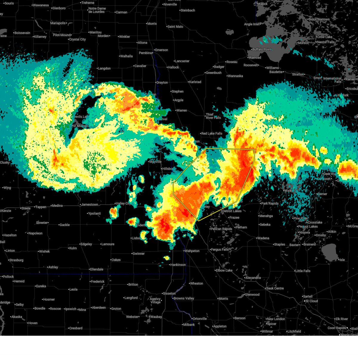
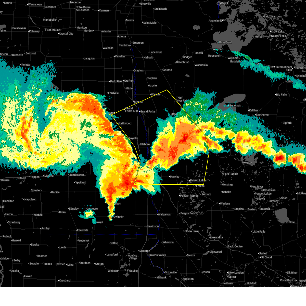
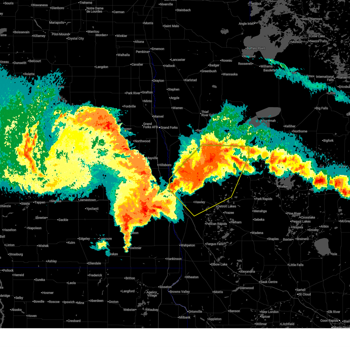
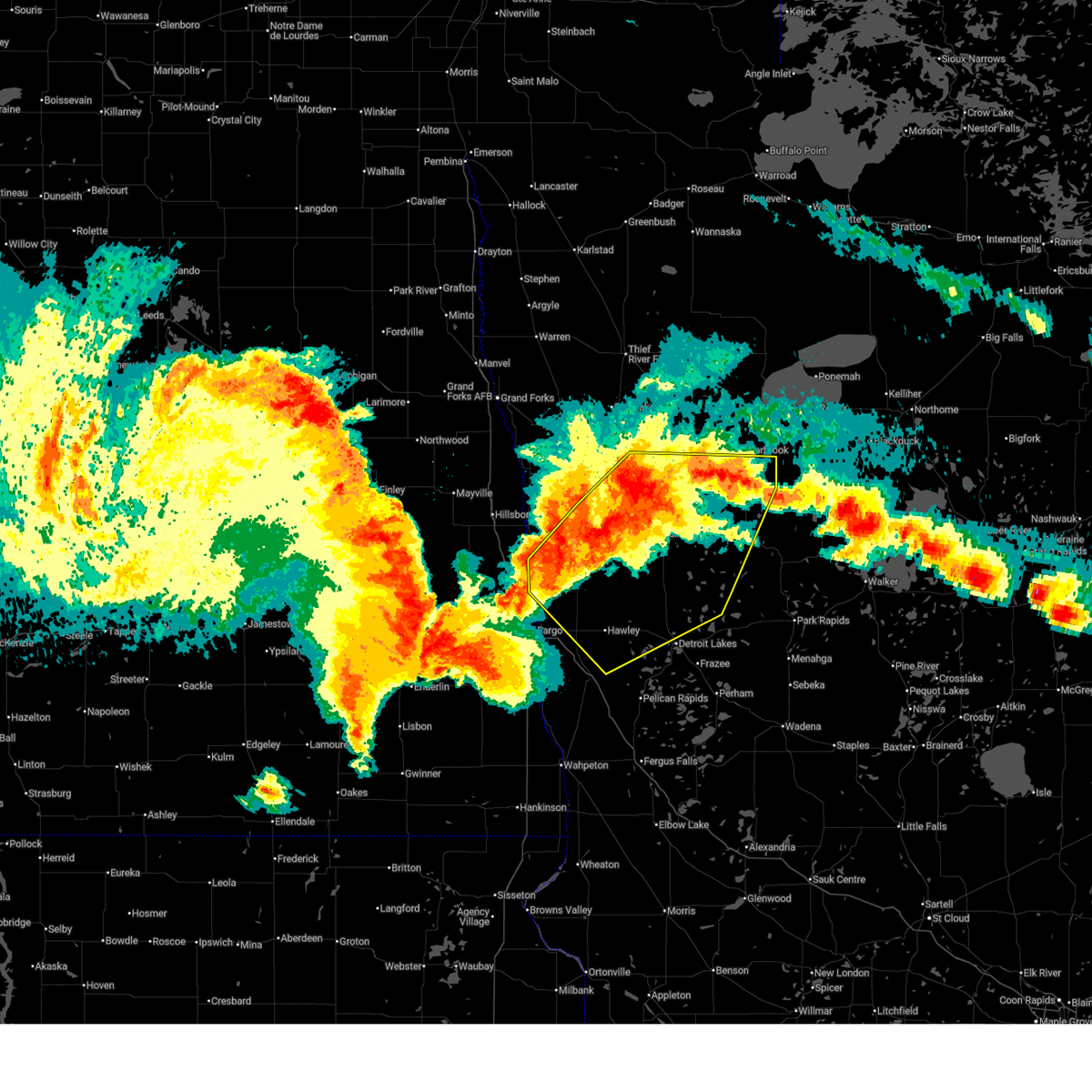
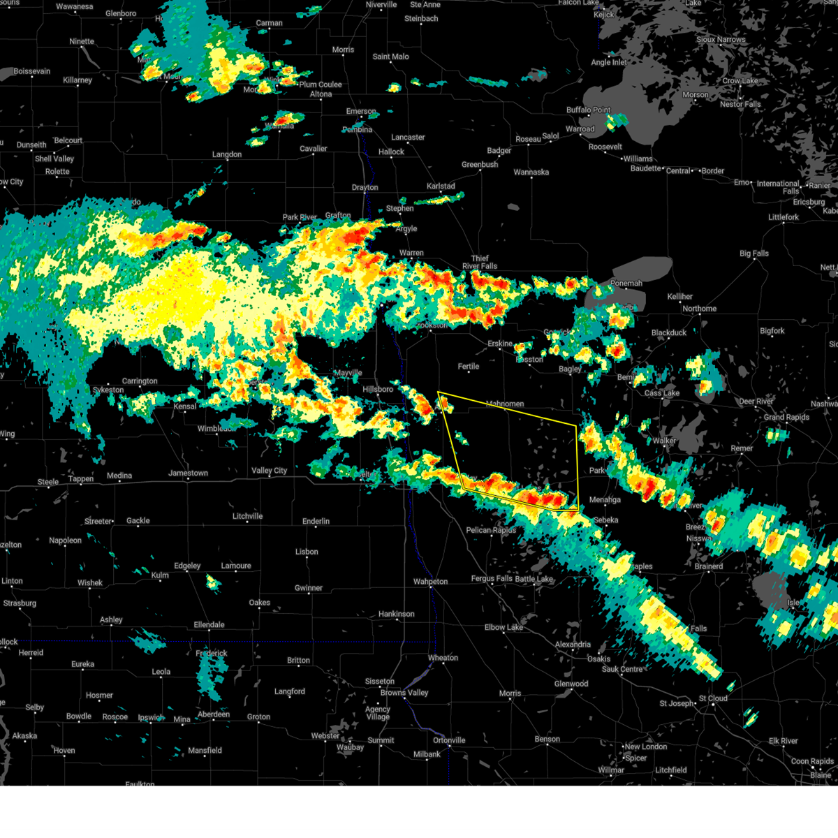
Hail Map for Mahnomen, MN
The Mahnomen, MN area has had 6 reports of on-the-ground hail by trained spotters, and has been under severe weather warnings 44 times during the past 12 months. Doppler radar has detected hail at or near Mahnomen, MN on 72 occasions, including 3 occasions during the past year.
| Name: | Mahnomen, MN |
| Where Located: | 48.9 miles NE of Fargo, ND |
| Map: | Google Map for Mahnomen, MN |
| Population: | 1214 |
| Housing Units: | 582 |
| More Info: | Search Google for Mahnomen, MN |
1
The Top Recent Hail Date for Mahnomen, MN is Thursday, September 19, 2024 (22nd out of 72)

Hail and Wind Damage Spotted near Mahnomen, MN
| Date / Time | Report Details |
|---|---|
| 6/23/2025 3:45 AM CDT |
 the severe thunderstorm warning has been cancelled and is no longer in effect the severe thunderstorm warning has been cancelled and is no longer in effect
|
| 6/23/2025 3:45 AM CDT |
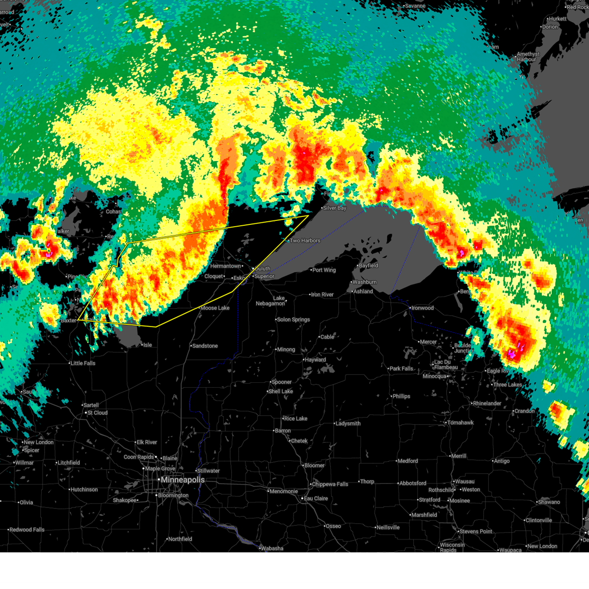
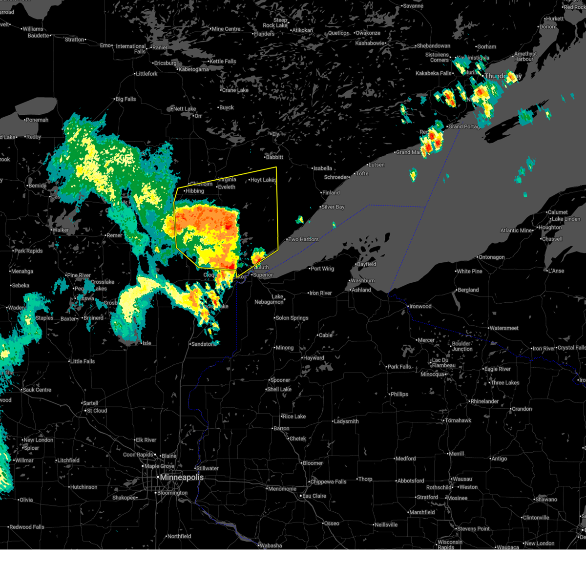 At 344 am cdt, severe thunderstorms were located along a line extending from near cherry to 9 miles southeast of eveleth to 6 miles south of whiteface reservoir to hermantown, moving northeast at 65 mph (radar indicated). Hazards include 60 mph wind gusts and quarter size hail. Hail damage to vehicles is expected. expect wind damage to roofs, siding, and trees. Locations impacted include, duluth, hibbing, hermantown, virginia, chisholm, eveleth, proctor, mountain iron, hoyt lakes, gilbert, aurora, babbitt, buhl, biwabik, cherry, floodwood, cotton, toivola, brookston, and meadowlands. At 344 am cdt, severe thunderstorms were located along a line extending from near cherry to 9 miles southeast of eveleth to 6 miles south of whiteface reservoir to hermantown, moving northeast at 65 mph (radar indicated). Hazards include 60 mph wind gusts and quarter size hail. Hail damage to vehicles is expected. expect wind damage to roofs, siding, and trees. Locations impacted include, duluth, hibbing, hermantown, virginia, chisholm, eveleth, proctor, mountain iron, hoyt lakes, gilbert, aurora, babbitt, buhl, biwabik, cherry, floodwood, cotton, toivola, brookston, and meadowlands.
|
| 6/23/2025 3:30 AM CDT |
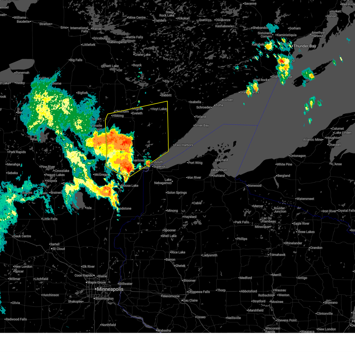 At 330 am cdt, severe thunderstorms were located along a line extending from 12 miles northeast of swan river to near toivola to near canyon to near mahtowa, moving northeast at 65 mph (radar indicated). Hazards include 60 mph wind gusts and nickel size hail. Expect damage to roofs, siding, and trees. Locations impacted include, hibbing, cloquet, hermantown, scanlon, carlton, cotton, thomson, pike lake near duluth, saginaw, fond du lac band cloquet area, island lake, boulder lake, duluth, proctor, cherry, whiteface reservoir, city of rice lake, eveleth, mountain iron, gilbert, virginia, hoyt lakes, fairbanks, wolf lake, aurora, babbitt, biwabik, brimson, mcquade harbor and french river. At 330 am cdt, severe thunderstorms were located along a line extending from 12 miles northeast of swan river to near toivola to near canyon to near mahtowa, moving northeast at 65 mph (radar indicated). Hazards include 60 mph wind gusts and nickel size hail. Expect damage to roofs, siding, and trees. Locations impacted include, hibbing, cloquet, hermantown, scanlon, carlton, cotton, thomson, pike lake near duluth, saginaw, fond du lac band cloquet area, island lake, boulder lake, duluth, proctor, cherry, whiteface reservoir, city of rice lake, eveleth, mountain iron, gilbert, virginia, hoyt lakes, fairbanks, wolf lake, aurora, babbitt, biwabik, brimson, mcquade harbor and french river.
|
| 6/23/2025 3:30 AM CDT |
 the severe thunderstorm warning has been cancelled and is no longer in effect the severe thunderstorm warning has been cancelled and is no longer in effect
|
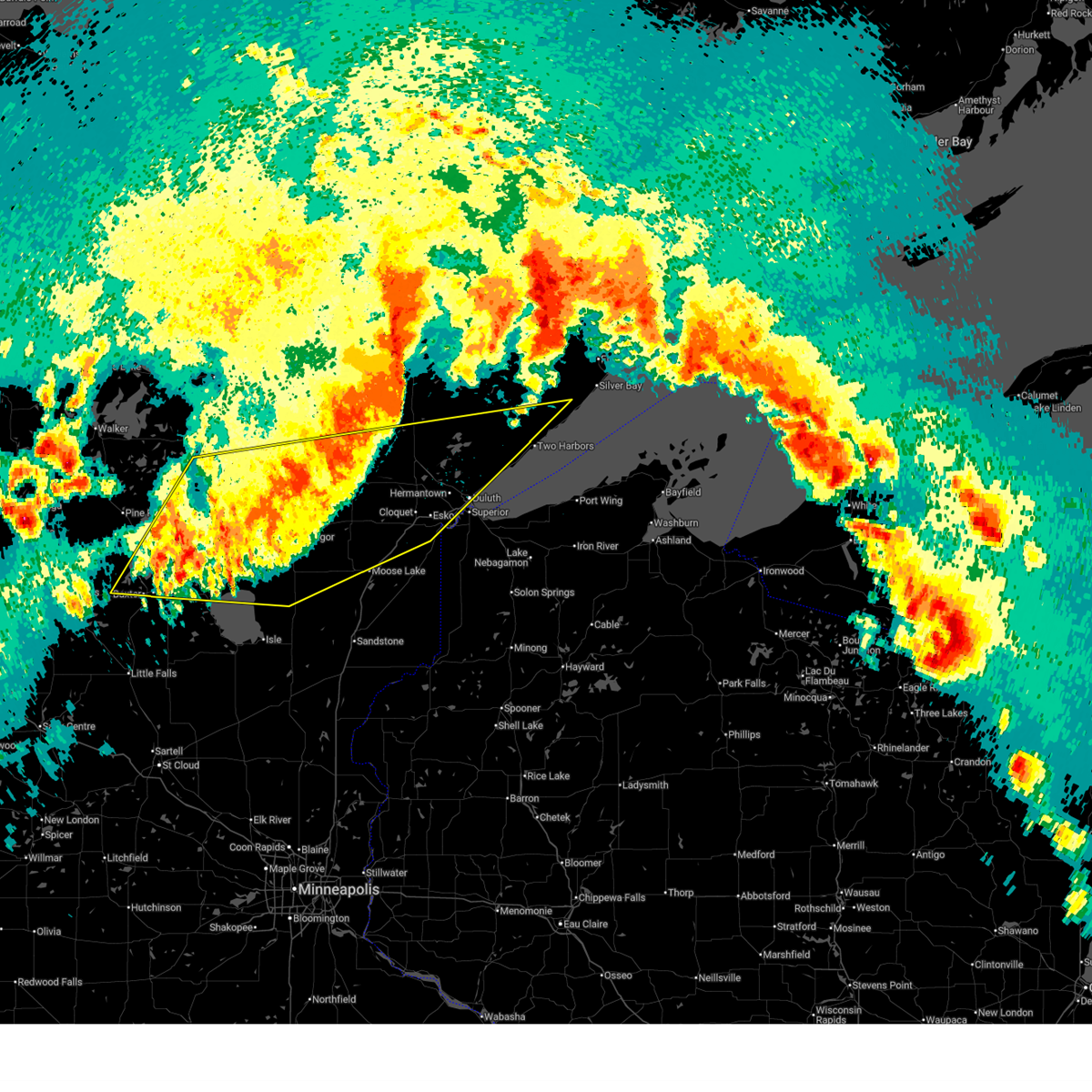
| 6/23/2025 3:02 AM CDT |
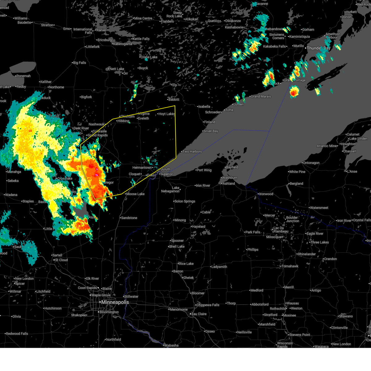 Svrdlh the national weather service in duluth mn has issued a * severe thunderstorm warning for, southeastern itasca county in north central minnesota, northeastern aitkin county in east central minnesota, southern st. louis county in northeastern minnesota, carlton county in northeastern minnesota, * until 400 am cdt. * at 301 am cdt, severe thunderstorms were located along a line extending from near hill city to jacobson to near cromwell to 8 miles west of kettle river, moving northeast at 55 mph (radar indicated. wind gusts to 62 mph have been observerd with this storm in aitkin county). Hazards include 70 mph wind gusts and quarter size hail. Hail damage to vehicles is expected. expect considerable tree damage. wind damage is also likely to mobile homes, roofs, and outbuildings. severe thunderstorms will be near, swan river, cromwell, kettle river, jacobson, and savanna portage state park around 305 am cdt. floodwood, warba, fond du lac band sawyer area, and fond du lac band brookston area around 310 am cdt. cloquet, mahtowa, brookston, meadowlands, and fond du lac band cloquet area around 320 am cdt. Other locations in the path of these severe thunderstorms include toivola, scanlon, carlton, saginaw, hibbing, hermantown, thomson, canyon, pike lake near duluth, jay cooke state park, proctor, cotton, island lake, duluth, city of rice lake and boulder lake. Svrdlh the national weather service in duluth mn has issued a * severe thunderstorm warning for, southeastern itasca county in north central minnesota, northeastern aitkin county in east central minnesota, southern st. louis county in northeastern minnesota, carlton county in northeastern minnesota, * until 400 am cdt. * at 301 am cdt, severe thunderstorms were located along a line extending from near hill city to jacobson to near cromwell to 8 miles west of kettle river, moving northeast at 55 mph (radar indicated. wind gusts to 62 mph have been observerd with this storm in aitkin county). Hazards include 70 mph wind gusts and quarter size hail. Hail damage to vehicles is expected. expect considerable tree damage. wind damage is also likely to mobile homes, roofs, and outbuildings. severe thunderstorms will be near, swan river, cromwell, kettle river, jacobson, and savanna portage state park around 305 am cdt. floodwood, warba, fond du lac band sawyer area, and fond du lac band brookston area around 310 am cdt. cloquet, mahtowa, brookston, meadowlands, and fond du lac band cloquet area around 320 am cdt. Other locations in the path of these severe thunderstorms include toivola, scanlon, carlton, saginaw, hibbing, hermantown, thomson, canyon, pike lake near duluth, jay cooke state park, proctor, cotton, island lake, duluth, city of rice lake and boulder lake.
|
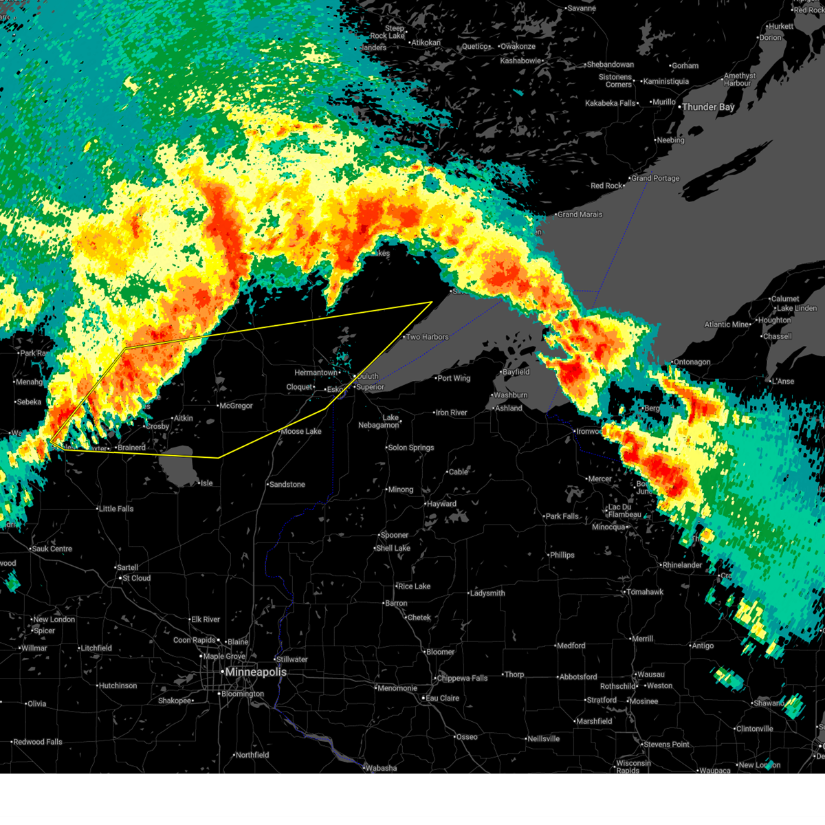
| 6/21/2025 3:07 AM CDT |
 At 306 am cdt, severe thunderstorms were located along a line extending from near babbitt to near brimson to near french river to superior, moving east at 60 mph (radar indicated). Hazards include 60 mph wind gusts. Expect damage to roofs, siding, and trees. these severe storms will be near, duluth, superior, two harbors, babbitt, thomas lake near brimson, highland lake, wisconsin point, knife river, larsmont, and french river around 310 am cdt. Other locations in the path of these severe thunderstorms include castle danger, whyte, gooseberry falls state park, split rock lighthouse state park, split rock lighthouse, silver bay, beaver bay, isabella, finland, tettegouche state park, port wing, herbster, dumbbell lake, illgen city, little marais, cornucopia, george manitou state park, clear lake, sand island, apostle island sea caves, sand bay, temperance river state park, taconite harbor, sugar loaf cove and york island. At 306 am cdt, severe thunderstorms were located along a line extending from near babbitt to near brimson to near french river to superior, moving east at 60 mph (radar indicated). Hazards include 60 mph wind gusts. Expect damage to roofs, siding, and trees. these severe storms will be near, duluth, superior, two harbors, babbitt, thomas lake near brimson, highland lake, wisconsin point, knife river, larsmont, and french river around 310 am cdt. Other locations in the path of these severe thunderstorms include castle danger, whyte, gooseberry falls state park, split rock lighthouse state park, split rock lighthouse, silver bay, beaver bay, isabella, finland, tettegouche state park, port wing, herbster, dumbbell lake, illgen city, little marais, cornucopia, george manitou state park, clear lake, sand island, apostle island sea caves, sand bay, temperance river state park, taconite harbor, sugar loaf cove and york island.
|
| 6/21/2025 2:53 AM CDT |
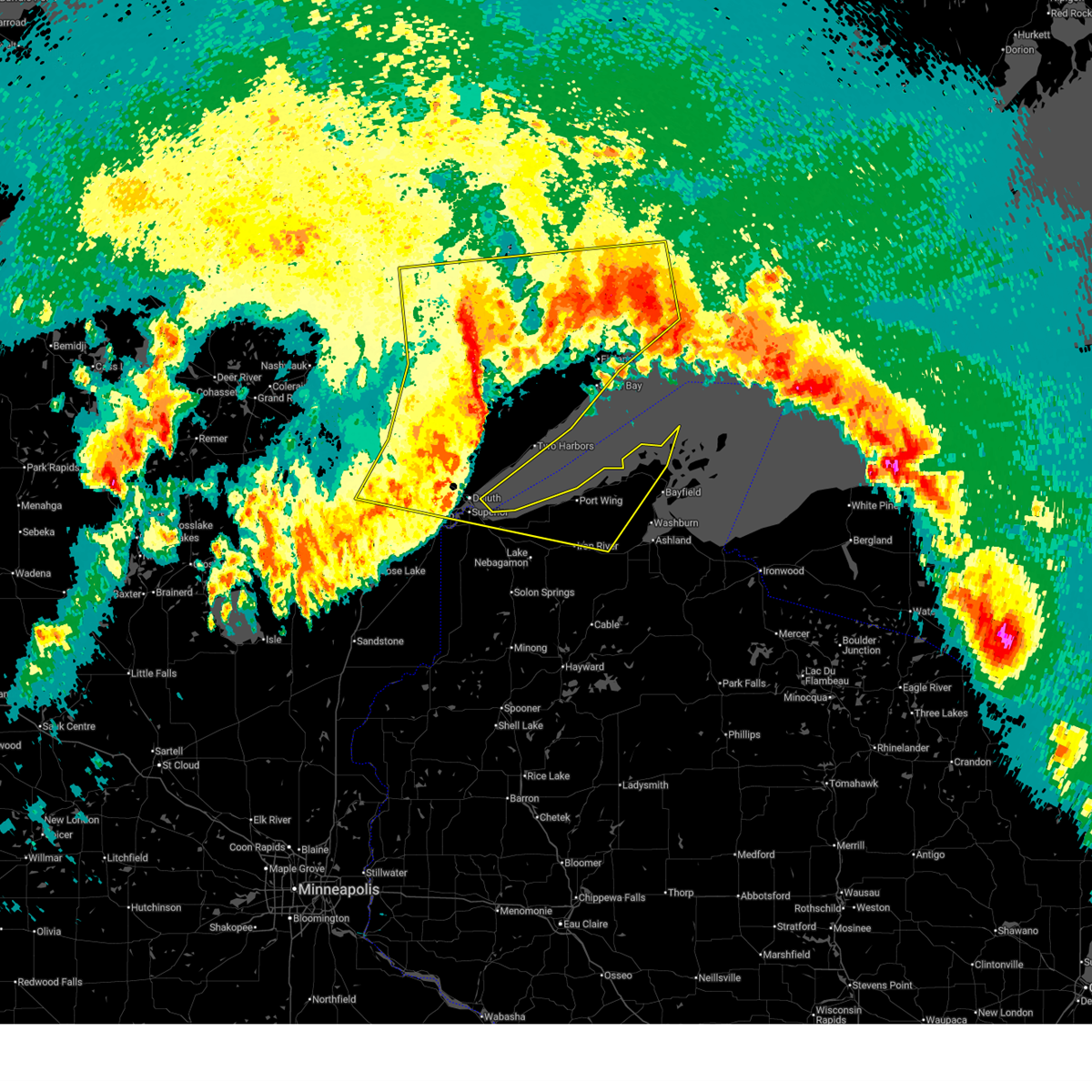 Svrdlh the national weather service in duluth mn has issued a * severe thunderstorm warning for, southwestern cook county in northeastern minnesota, southeastern st. louis county in northeastern minnesota, northeastern carlton county in northeastern minnesota, lake county in northeastern minnesota, northern bayfield county in northwestern wisconsin, northeastern douglas county in northwestern wisconsin, * until 400 am cdt. * at 252 am cdt, severe thunderstorms were located along a line extending from near embarrass to near whiteface reservoir to island lake to near cloquet, moving east at 50 mph (radar indicated). Hazards include 60 mph wind gusts. Expect damage to roofs, siding, and trees. severe thunderstorms will be near, duluth, hermantown, proctor, hoyt lakes, babbitt, fairbanks, wolf lake, city of rice lake, and island lake around 300 am cdt. superior, brimson, and birch lake around 305 am cdt. highland lake, knife river, french river, mcquade harbor, and stoney point around 310 am cdt. Other locations in the path of these severe thunderstorms include two harbors, thomas lake near brimson, wisconsin point, larsmont, whyte, castle danger, gooseberry falls state park, split rock lighthouse state park, split rock lighthouse, silver bay, beaver bay, isabella, finland and tettegouche state park. Svrdlh the national weather service in duluth mn has issued a * severe thunderstorm warning for, southwestern cook county in northeastern minnesota, southeastern st. louis county in northeastern minnesota, northeastern carlton county in northeastern minnesota, lake county in northeastern minnesota, northern bayfield county in northwestern wisconsin, northeastern douglas county in northwestern wisconsin, * until 400 am cdt. * at 252 am cdt, severe thunderstorms were located along a line extending from near embarrass to near whiteface reservoir to island lake to near cloquet, moving east at 50 mph (radar indicated). Hazards include 60 mph wind gusts. Expect damage to roofs, siding, and trees. severe thunderstorms will be near, duluth, hermantown, proctor, hoyt lakes, babbitt, fairbanks, wolf lake, city of rice lake, and island lake around 300 am cdt. superior, brimson, and birch lake around 305 am cdt. highland lake, knife river, french river, mcquade harbor, and stoney point around 310 am cdt. Other locations in the path of these severe thunderstorms include two harbors, thomas lake near brimson, wisconsin point, larsmont, whyte, castle danger, gooseberry falls state park, split rock lighthouse state park, split rock lighthouse, silver bay, beaver bay, isabella, finland and tettegouche state park.
|
| 6/21/2025 2:40 AM CDT |
 At 240 am cdt, severe thunderstorms were located along a line extending from cotton to near cromwell to near upper south long lake, moving east at 55 mph (radar indicated). Hazards include 70 mph wind gusts and penny size hail. Expect considerable tree damage. damage is likely to mobile homes, roofs, and outbuildings. Locations impacted include, duluth, superior, brainerd, cloquet, big sandy lake, mille lacs lake, hermantown, baxter, proctor, crosby, aitkin, scanlon, carlton, hill city, mahtowa, barnum, ironton, deerwood, floodwood, and wrenshall. At 240 am cdt, severe thunderstorms were located along a line extending from cotton to near cromwell to near upper south long lake, moving east at 55 mph (radar indicated). Hazards include 70 mph wind gusts and penny size hail. Expect considerable tree damage. damage is likely to mobile homes, roofs, and outbuildings. Locations impacted include, duluth, superior, brainerd, cloquet, big sandy lake, mille lacs lake, hermantown, baxter, proctor, crosby, aitkin, scanlon, carlton, hill city, mahtowa, barnum, ironton, deerwood, floodwood, and wrenshall.
|
| 6/21/2025 2:40 AM CDT |
 the severe thunderstorm warning has been cancelled and is no longer in effect the severe thunderstorm warning has been cancelled and is no longer in effect
|
| 6/21/2025 2:30 AM CDT |
 At 230 am cdt, severe thunderstorms were located along a line extending from 6 miles west of cotton to near tamarack to near brainerd, moving east at 55 mph (radar indicated). Hazards include 70 mph wind gusts and penny size hail. Expect considerable tree damage. damage is likely to mobile homes, roofs, and outbuildings. Locations impacted include, mille lacs lake, mcgregor, tamarack, mille lacs band east lake area, fond du lac band brookston area, cromwell, brookston, canyon, fond du lac band sawyer area, malmo, cloquet, saginaw, fond du lac band cloquet area, island lake, boulder lake, hermantown, mahtowa, kettle river, pike lake near duluth, duluth, scanlon, carlton, barnum, thomson, city of rice lake, jay cooke state park, proctor, moose lake, wrenshall and superior. At 230 am cdt, severe thunderstorms were located along a line extending from 6 miles west of cotton to near tamarack to near brainerd, moving east at 55 mph (radar indicated). Hazards include 70 mph wind gusts and penny size hail. Expect considerable tree damage. damage is likely to mobile homes, roofs, and outbuildings. Locations impacted include, mille lacs lake, mcgregor, tamarack, mille lacs band east lake area, fond du lac band brookston area, cromwell, brookston, canyon, fond du lac band sawyer area, malmo, cloquet, saginaw, fond du lac band cloquet area, island lake, boulder lake, hermantown, mahtowa, kettle river, pike lake near duluth, duluth, scanlon, carlton, barnum, thomson, city of rice lake, jay cooke state park, proctor, moose lake, wrenshall and superior.
|
| 6/21/2025 1:59 AM CDT |
 Svrdlh the national weather service in duluth mn has issued a * severe thunderstorm warning for, southeastern itasca county in north central minnesota, aitkin county in east central minnesota, southern cass county in north central minnesota, northern pine county in east central minnesota, southern st. louis county in northeastern minnesota, carlton county in northeastern minnesota, crow wing county in east central minnesota, southwestern lake county in northeastern minnesota, * until 300 am cdt. * at 159 am cdt, severe thunderstorms were located along a line extending from near pengilly to 6 miles south of swatara to near staples airport, moving east at 55 mph (radar indicated). Hazards include 70 mph wind gusts and penny size hail. Expect considerable tree damage. damage is likely to mobile homes, roofs, and outbuildings. severe thunderstorms will be near, breezy point, pequot lakes, crosslake, nisswa, gull lake, jacobson, and merrifield around 205 am cdt. brainerd, baxter, crosby, ironton, cuyuna, palisade, and cuyuna country state park around 210 am cdt. big sandy lake, deerwood, libby, and savanna portage state park around 215 am cdt. Other locations in the path of these severe thunderstorms include aitkin, floodwood, mcgregor, meadowlands, upper south long lake, tamarack, mille lacs lake, garrison, mille lacs band east lake area, fond du lac band brookston area, cromwell, brookston, canyon and fond du lac band sawyer area. Svrdlh the national weather service in duluth mn has issued a * severe thunderstorm warning for, southeastern itasca county in north central minnesota, aitkin county in east central minnesota, southern cass county in north central minnesota, northern pine county in east central minnesota, southern st. louis county in northeastern minnesota, carlton county in northeastern minnesota, crow wing county in east central minnesota, southwestern lake county in northeastern minnesota, * until 300 am cdt. * at 159 am cdt, severe thunderstorms were located along a line extending from near pengilly to 6 miles south of swatara to near staples airport, moving east at 55 mph (radar indicated). Hazards include 70 mph wind gusts and penny size hail. Expect considerable tree damage. damage is likely to mobile homes, roofs, and outbuildings. severe thunderstorms will be near, breezy point, pequot lakes, crosslake, nisswa, gull lake, jacobson, and merrifield around 205 am cdt. brainerd, baxter, crosby, ironton, cuyuna, palisade, and cuyuna country state park around 210 am cdt. big sandy lake, deerwood, libby, and savanna portage state park around 215 am cdt. Other locations in the path of these severe thunderstorms include aitkin, floodwood, mcgregor, meadowlands, upper south long lake, tamarack, mille lacs lake, garrison, mille lacs band east lake area, fond du lac band brookston area, cromwell, brookston, canyon and fond du lac band sawyer area.
|
| 6/21/2025 12:48 AM CDT |
 The storms which prompted the warning have weakened below severe limits, and have exited the warned area. therefore, the warning has been allowed to expire. however, gusty winds are still possible with these thunderstorms. there is another area of extremely strong winds that will likely move into the central red river valley. be prepared to shelter and prepare for these winds in the next hour or two. a tornado watch remains in effect until 300 am cdt for northwestern minnesota, and southeastern and northeastern north dakota. a severe thunderstorm watch remains in effect until 700 am cdt for northwestern minnesota. The storms which prompted the warning have weakened below severe limits, and have exited the warned area. therefore, the warning has been allowed to expire. however, gusty winds are still possible with these thunderstorms. there is another area of extremely strong winds that will likely move into the central red river valley. be prepared to shelter and prepare for these winds in the next hour or two. a tornado watch remains in effect until 300 am cdt for northwestern minnesota, and southeastern and northeastern north dakota. a severe thunderstorm watch remains in effect until 700 am cdt for northwestern minnesota.
|
| 6/21/2025 12:26 AM CDT |
 The storms which prompted the warning have moved out of the area. therefore, the warning will be allowed to expire. however, gusty winds are still possible with these thunderstorms. a tornado watch remains in effect until 300 am cdt for northwestern minnesota, and southeastern north dakota. a severe thunderstorm watch remains in effect until 700 am cdt for north central and northwestern minnesota. The storms which prompted the warning have moved out of the area. therefore, the warning will be allowed to expire. however, gusty winds are still possible with these thunderstorms. a tornado watch remains in effect until 300 am cdt for northwestern minnesota, and southeastern north dakota. a severe thunderstorm watch remains in effect until 700 am cdt for north central and northwestern minnesota.
|
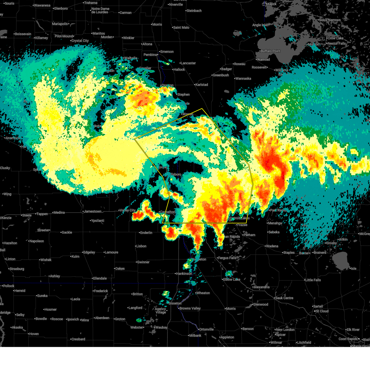
| 6/20/2025 11:49 PM CDT |
 Svrfgf the national weather service in grand forks has issued a * severe thunderstorm warning for, south central marshall county in northwestern minnesota, red lake county in northwestern minnesota, clay county in northwestern minnesota, norman county in northwestern minnesota, polk county in northwestern minnesota, mahnomen county in northwestern minnesota, becker county in northwestern minnesota, western pennington county in northwestern minnesota, southwestern clearwater county in northwestern minnesota, southern grand forks county in northeastern north dakota, eastern cass county in southeastern north dakota, traill county in southeastern north dakota, * until 1245 am cdt. * at 1149 pm cdt, severe thunderstorms were located along a line extending from near kempton to near hillsboro to near gardner to near mapleton, moving east at 80 mph. these are destructive storms for eastern north dakota and northwest minnesota (public). Hazards include 80 mph wind gusts. Flying debris will be dangerous to those caught without shelter. mobile homes will be heavily damaged. expect considerable damage to roofs, windows, and vehicles. extensive tree damage and power outages are likely. severe thunderstorms will be near, fargo, west fargo, and hillsboro around 1150 pm cdt. moorhead, dilworth, and halstad around 1155 pm cdt. glyndon, thompson, and climax around 1200 am cdt. grand forks, east grand forks, and ada around 1205 am cdt. hawley, twin valley, and ulen around 1210 am cdt. other locations impacted by these severe thunderstorms include thief river falls airport, american crystal sugar, grand forks airport, moorhead airport, and west argusville. this includes the following highways, interstate 29 between mile markers 57 and 149. interstate 94 in north dakota between mile markers 337 and 15. Interstate 94 in minnesota between mile markers 337 and 15. Svrfgf the national weather service in grand forks has issued a * severe thunderstorm warning for, south central marshall county in northwestern minnesota, red lake county in northwestern minnesota, clay county in northwestern minnesota, norman county in northwestern minnesota, polk county in northwestern minnesota, mahnomen county in northwestern minnesota, becker county in northwestern minnesota, western pennington county in northwestern minnesota, southwestern clearwater county in northwestern minnesota, southern grand forks county in northeastern north dakota, eastern cass county in southeastern north dakota, traill county in southeastern north dakota, * until 1245 am cdt. * at 1149 pm cdt, severe thunderstorms were located along a line extending from near kempton to near hillsboro to near gardner to near mapleton, moving east at 80 mph. these are destructive storms for eastern north dakota and northwest minnesota (public). Hazards include 80 mph wind gusts. Flying debris will be dangerous to those caught without shelter. mobile homes will be heavily damaged. expect considerable damage to roofs, windows, and vehicles. extensive tree damage and power outages are likely. severe thunderstorms will be near, fargo, west fargo, and hillsboro around 1150 pm cdt. moorhead, dilworth, and halstad around 1155 pm cdt. glyndon, thompson, and climax around 1200 am cdt. grand forks, east grand forks, and ada around 1205 am cdt. hawley, twin valley, and ulen around 1210 am cdt. other locations impacted by these severe thunderstorms include thief river falls airport, american crystal sugar, grand forks airport, moorhead airport, and west argusville. this includes the following highways, interstate 29 between mile markers 57 and 149. interstate 94 in north dakota between mile markers 337 and 15. Interstate 94 in minnesota between mile markers 337 and 15.
|
| 6/20/2025 11:45 PM CDT |
 At 1144 pm cdt, severe thunderstorms were located along a line extending from white earth nation to near flom to near kragnes, moving southeast at 25 mph. weather sensor measured 81 mph near ada. these are destructive storms (radar indicated). Hazards include 80 mph wind gusts and quarter size hail. Flying debris will be dangerous to those caught without shelter. mobile homes will be heavily damaged. expect considerable damage to roofs, windows, and vehicles. extensive tree damage and power outages are likely. Locations impacted include, hawley, ada, fosston, glyndon, bagley, mahnomen, and fertile. At 1144 pm cdt, severe thunderstorms were located along a line extending from white earth nation to near flom to near kragnes, moving southeast at 25 mph. weather sensor measured 81 mph near ada. these are destructive storms (radar indicated). Hazards include 80 mph wind gusts and quarter size hail. Flying debris will be dangerous to those caught without shelter. mobile homes will be heavily damaged. expect considerable damage to roofs, windows, and vehicles. extensive tree damage and power outages are likely. Locations impacted include, hawley, ada, fosston, glyndon, bagley, mahnomen, and fertile.
|
| 6/20/2025 11:30 PM CDT |
 Svrfgf the national weather service in grand forks has issued a * severe thunderstorm warning for, clay county in northwestern minnesota, norman county in northwestern minnesota, southeastern polk county in northwestern minnesota, mahnomen county in northwestern minnesota, western becker county in northwestern minnesota, southern clearwater county in northwestern minnesota, * until 1230 am cdt. * at 1130 pm cdt, severe thunderstorms were located along a line extending from near winger to near twin valley to near kragnes, moving southeast at 25 mph (radar indicated). Hazards include 70 mph wind gusts and quarter size hail. Hail damage to vehicles is expected. expect considerable tree damage. Wind damage is also likely to mobile homes, roofs, and outbuildings. Svrfgf the national weather service in grand forks has issued a * severe thunderstorm warning for, clay county in northwestern minnesota, norman county in northwestern minnesota, southeastern polk county in northwestern minnesota, mahnomen county in northwestern minnesota, western becker county in northwestern minnesota, southern clearwater county in northwestern minnesota, * until 1230 am cdt. * at 1130 pm cdt, severe thunderstorms were located along a line extending from near winger to near twin valley to near kragnes, moving southeast at 25 mph (radar indicated). Hazards include 70 mph wind gusts and quarter size hail. Hail damage to vehicles is expected. expect considerable tree damage. Wind damage is also likely to mobile homes, roofs, and outbuildings.
|
| 6/16/2025 7:05 PM CDT | the severe thunderstorm warning has been cancelled and is no longer in effect |
| 6/16/2025 6:50 PM CDT | At 649 pm cdt, severe thunderstorms were located along a line extending from near fond du lac band sawyer area to near fond du lac band cloquet area to near holyoke, moving northeast at 50 mph (radar indicated). Hazards include 60 mph wind gusts. Expect damage to roofs, siding, and trees. Locations impacted include, duluth, superior, cloquet, hermantown, proctor, scanlon, carlton, mahtowa, wrenshall, oliver, thomson, brookston, jay cooke state park, saginaw, fond du lac band brookston area, fond du lac band cloquet area, pike lake near duluth, fond du lac band sawyer area, city of rice lake, and island lake. |
| 6/16/2025 6:50 PM CDT | the severe thunderstorm warning has been cancelled and is no longer in effect |
| 6/16/2025 6:28 PM CDT | Svrdlh the national weather service in duluth mn has issued a * severe thunderstorm warning for, east central aitkin county in east central minnesota, southwestern st. louis county in northeastern minnesota, carlton county in northeastern minnesota, northwestern douglas county in northwestern wisconsin, * until 715 pm cdt. * at 628 pm cdt, severe thunderstorms were located along a line extending from near tamarack to 6 miles south of cromwell to near kettle river, moving northeast at 50 mph (radar indicated). Hazards include 60 mph wind gusts and quarter size hail. Hail damage to vehicles is expected. Expect wind damage to roofs, siding, and trees. |
| 6/7/2025 6:50 PM CDT |
 The storms which prompted the warning have weakened below severe limits, and no longer pose an immediate threat to life or property. therefore, the warning will be allowed to expire. however, gusty winds are still possible with these thunderstorms. The storms which prompted the warning have weakened below severe limits, and no longer pose an immediate threat to life or property. therefore, the warning will be allowed to expire. however, gusty winds are still possible with these thunderstorms.
|
| 6/7/2025 6:20 PM CDT |
 Svrfgf the national weather service in grand forks has issued a * severe thunderstorm warning for, eastern norman county in northwestern minnesota, southeastern polk county in northwestern minnesota, western mahnomen county in northwestern minnesota, * until 700 pm cdt. * at 620 pm cdt, severe thunderstorms were located along a line extending from near melvin to near ada, moving east at 30 mph (radar indicated). Hazards include 60 mph wind gusts. expect damage to roofs, siding, and trees Svrfgf the national weather service in grand forks has issued a * severe thunderstorm warning for, eastern norman county in northwestern minnesota, southeastern polk county in northwestern minnesota, western mahnomen county in northwestern minnesota, * until 700 pm cdt. * at 620 pm cdt, severe thunderstorms were located along a line extending from near melvin to near ada, moving east at 30 mph (radar indicated). Hazards include 60 mph wind gusts. expect damage to roofs, siding, and trees
|
| 5/15/2025 4:36 PM CDT |
 At 436 pm cdt, severe thunderstorms were located along a line extending from near beltrami to white earth nation, moving north at 55 mph (radar indicated). Hazards include 60 mph wind gusts and penny size hail. Expect damage to roofs, siding, and trees. Locations impacted include, crookston, ada, fosston, bagley, mahnomen, fertile, and twin valley. At 436 pm cdt, severe thunderstorms were located along a line extending from near beltrami to white earth nation, moving north at 55 mph (radar indicated). Hazards include 60 mph wind gusts and penny size hail. Expect damage to roofs, siding, and trees. Locations impacted include, crookston, ada, fosston, bagley, mahnomen, fertile, and twin valley.
|
| 5/15/2025 4:36 PM CDT |
 the severe thunderstorm warning has been cancelled and is no longer in effect the severe thunderstorm warning has been cancelled and is no longer in effect
|
| 5/15/2025 4:26 PM CDT |
 The storms which prompted the warning have moved out of the warned area. therefore, the warning will be allowed to expire. however, gusty winds are still possible with these thunderstorms. remember, a severe thunderstorm warning still remains in effect for portions of clay and mahnomen counties. The storms which prompted the warning have moved out of the warned area. therefore, the warning will be allowed to expire. however, gusty winds are still possible with these thunderstorms. remember, a severe thunderstorm warning still remains in effect for portions of clay and mahnomen counties.
|
| 5/15/2025 4:25 PM CDT |
 Svrfgf the national weather service in grand forks has issued a * severe thunderstorm warning for, northeastern clay county in northwestern minnesota, norman county in northwestern minnesota, southern polk county in northwestern minnesota, mahnomen county in northwestern minnesota, northern becker county in northwestern minnesota, southwestern clearwater county in northwestern minnesota, * until 515 pm cdt. * at 424 pm cdt, severe thunderstorms were located along a line extending from hadler to white earth nation, moving north at 55 mph (radar indicated). Hazards include 60 mph wind gusts and penny size hail. expect damage to roofs, siding, and trees Svrfgf the national weather service in grand forks has issued a * severe thunderstorm warning for, northeastern clay county in northwestern minnesota, norman county in northwestern minnesota, southern polk county in northwestern minnesota, mahnomen county in northwestern minnesota, northern becker county in northwestern minnesota, southwestern clearwater county in northwestern minnesota, * until 515 pm cdt. * at 424 pm cdt, severe thunderstorms were located along a line extending from hadler to white earth nation, moving north at 55 mph (radar indicated). Hazards include 60 mph wind gusts and penny size hail. expect damage to roofs, siding, and trees
|
| 5/15/2025 4:13 PM CDT | At 413 pm cdt, severe thunderstorms were located along a line extending from ulen to near pine point, moving north at 50 mph (public). Hazards include 60 mph wind gusts and quarter size hail. Hail damage to vehicles is expected. expect wind damage to roofs, siding, and trees. Locations impacted include, ada, mahnomen, twin valley, ulen, toad lake, bad medicine lake, and waubun. |
| 5/15/2025 3:55 PM CDT |
 Svrfgf the national weather service in grand forks has issued a * severe thunderstorm warning for, northeastern clay county in northwestern minnesota, southeastern norman county in northwestern minnesota, southern mahnomen county in northwestern minnesota, becker county in northwestern minnesota, southwestern clearwater county in northwestern minnesota, * until 430 pm cdt. * at 354 pm cdt, severe thunderstorms were located along a line extending from dale to evergreen, moving north at 50 mph (radar indicated). Hazards include 60 mph wind gusts and quarter size hail. Hail damage to vehicles is expected. Expect wind damage to roofs, siding, and trees. Svrfgf the national weather service in grand forks has issued a * severe thunderstorm warning for, northeastern clay county in northwestern minnesota, southeastern norman county in northwestern minnesota, southern mahnomen county in northwestern minnesota, becker county in northwestern minnesota, southwestern clearwater county in northwestern minnesota, * until 430 pm cdt. * at 354 pm cdt, severe thunderstorms were located along a line extending from dale to evergreen, moving north at 50 mph (radar indicated). Hazards include 60 mph wind gusts and quarter size hail. Hail damage to vehicles is expected. Expect wind damage to roofs, siding, and trees.
|
| 4/28/2025 9:10 PM CDT |
 The storms which prompted the warning have weakened below severe limits, and no longer pose an immediate threat to life or property. therefore, the warning will be allowed to expire. however, small hail and gusty winds are still possible with these thunderstorms. The storms which prompted the warning have weakened below severe limits, and no longer pose an immediate threat to life or property. therefore, the warning will be allowed to expire. however, small hail and gusty winds are still possible with these thunderstorms.
|
| 4/28/2025 9:05 PM CDT |
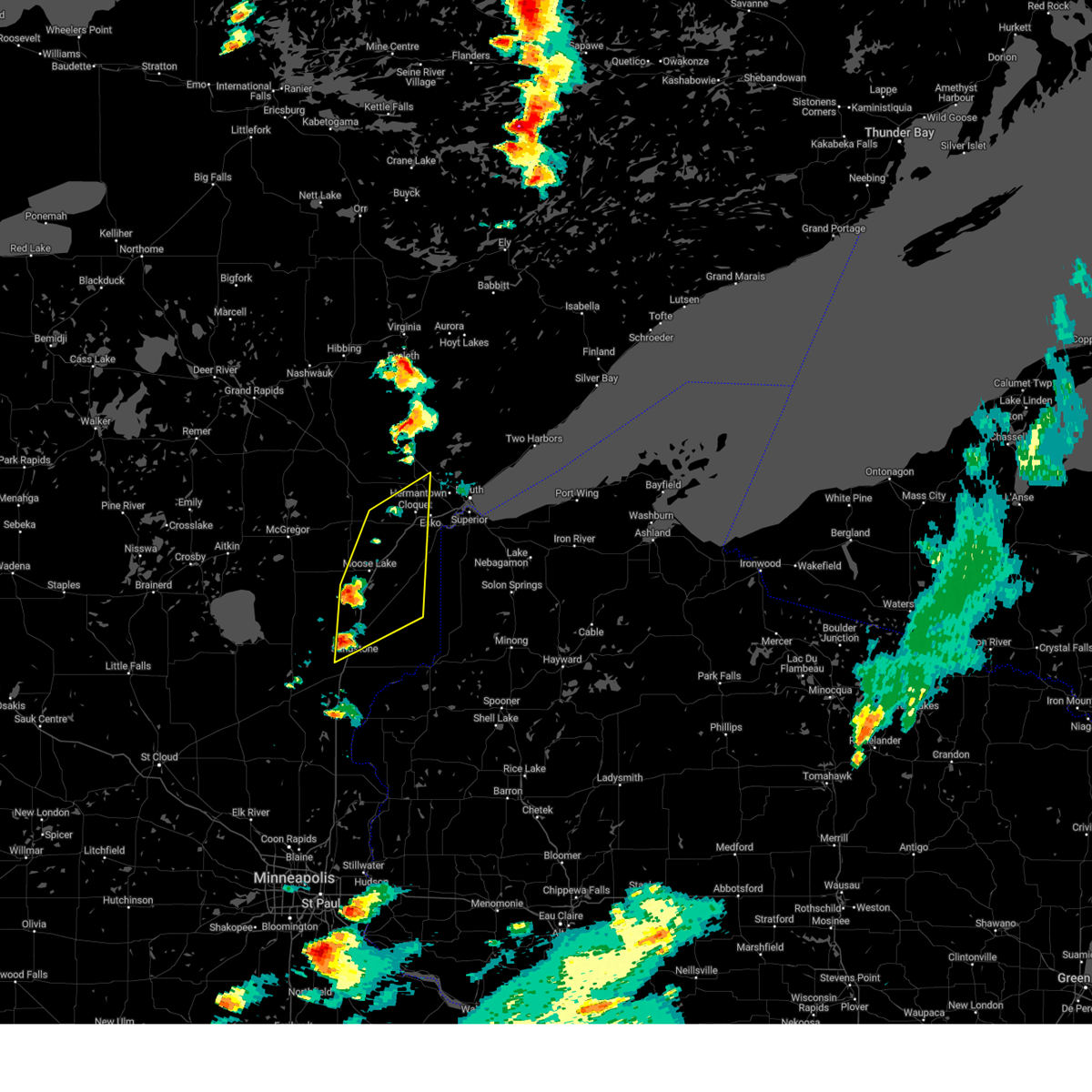
 At 905 pm cdt, severe thunderstorms were located along a line extending from near canyon to brookston, moving east at 45 mph (radar indicated). Hazards include 60 mph wind gusts and nickel size hail. Expect damage to roofs, siding, and trees. these severe thunderstorms will remain over mainly rural areas of south central st. Louis county, including the following locations, mahnomen, culver, burnett, and alborn. At 905 pm cdt, severe thunderstorms were located along a line extending from near canyon to brookston, moving east at 45 mph (radar indicated). Hazards include 60 mph wind gusts and nickel size hail. Expect damage to roofs, siding, and trees. these severe thunderstorms will remain over mainly rural areas of south central st. Louis county, including the following locations, mahnomen, culver, burnett, and alborn.
|
| 4/28/2025 9:05 PM CDT |
 the severe thunderstorm warning has been cancelled and is no longer in effect the severe thunderstorm warning has been cancelled and is no longer in effect
|
| 4/28/2025 8:50 PM CDT |
 the severe thunderstorm warning has been cancelled and is no longer in effect the severe thunderstorm warning has been cancelled and is no longer in effect
|
| 4/28/2025 8:50 PM CDT |
 At 849 pm cdt, severe thunderstorms were located along a line extending from 6 miles north of brookston to 7 miles northwest of fond du lac band brookston area, moving east at 45 mph (radar indicated). Hazards include 60 mph wind gusts and quarter size hail. Hail damage to vehicles is expected. expect wind damage to roofs, siding, and trees. These severe storms will be near, brookston and fond du lac band brookston area around 855 pm cdt. At 849 pm cdt, severe thunderstorms were located along a line extending from 6 miles north of brookston to 7 miles northwest of fond du lac band brookston area, moving east at 45 mph (radar indicated). Hazards include 60 mph wind gusts and quarter size hail. Hail damage to vehicles is expected. expect wind damage to roofs, siding, and trees. These severe storms will be near, brookston and fond du lac band brookston area around 855 pm cdt.
|
| 4/28/2025 8:39 PM CDT |
 At 837 pm cdt, severe thunderstorms were located along a line extending from 7 miles east of floodwood to 7 miles east of savanna portage state park, moving east at 45 mph (a trained weather spotter reported a wall cloud with visible rotation approximately 5 miles north of tamarack). Hazards include 60 mph wind gusts and half dollar size hail. Hail damage to vehicles is expected. expect wind damage to roofs, siding, and trees. these severe storms will be near, fond du lac band brookston area around 845 pm cdt. Other locations in the path of these severe thunderstorms include brookston. At 837 pm cdt, severe thunderstorms were located along a line extending from 7 miles east of floodwood to 7 miles east of savanna portage state park, moving east at 45 mph (a trained weather spotter reported a wall cloud with visible rotation approximately 5 miles north of tamarack). Hazards include 60 mph wind gusts and half dollar size hail. Hail damage to vehicles is expected. expect wind damage to roofs, siding, and trees. these severe storms will be near, fond du lac band brookston area around 845 pm cdt. Other locations in the path of these severe thunderstorms include brookston.
|
| 4/28/2025 8:29 PM CDT |
 Svrdlh the national weather service in duluth mn has issued a * severe thunderstorm warning for, east central aitkin county in east central minnesota, southwestern st. louis county in northeastern minnesota, northwestern carlton county in northeastern minnesota, * until 915 pm cdt. * at 828 pm cdt, severe thunderstorms were located along a line extending from near floodwood to near savanna portage state park, moving east at 45 mph (radar indicated). Hazards include 60 mph wind gusts and half dollar size hail. Hail damage to vehicles is expected. expect wind damage to roofs, siding, and trees. severe thunderstorms will be near, fond du lac band brookston area around 835 pm cdt. Other locations in the path of these severe thunderstorms include brookston. Svrdlh the national weather service in duluth mn has issued a * severe thunderstorm warning for, east central aitkin county in east central minnesota, southwestern st. louis county in northeastern minnesota, northwestern carlton county in northeastern minnesota, * until 915 pm cdt. * at 828 pm cdt, severe thunderstorms were located along a line extending from near floodwood to near savanna portage state park, moving east at 45 mph (radar indicated). Hazards include 60 mph wind gusts and half dollar size hail. Hail damage to vehicles is expected. expect wind damage to roofs, siding, and trees. severe thunderstorms will be near, fond du lac band brookston area around 835 pm cdt. Other locations in the path of these severe thunderstorms include brookston.
|
| 3/28/2025 3:35 PM CDT |
 Svrdlh the national weather service in duluth mn has issued a * severe thunderstorm warning for, northeastern pine county in east central minnesota, south central st. louis county in northeastern minnesota, carlton county in northeastern minnesota, northwestern douglas county in northwestern wisconsin, * until 430 pm cdt. * at 334 pm cdt, a severe thunderstorm was located over tamarack, or 12 miles southeast of big sandy lake, moving east at 55 mph (radar indicated). Hazards include half dollar size hail. Damage to vehicles is expected. this severe thunderstorm will be near, mahtowa and fond du lac band sawyer area around 355 pm cdt. fond du lac band cloquet area around 400 pm cdt. wrenshall and carlton around 405 pm cdt. jay cooke state park and thomson around 410 pm cdt. duluth around 415 pm cdt. oliver around 420 pm cdt. Other locations impacted by this severe thunderstorm include cody, park point, billings park, gary new duluth, morgan park, wright, amnicon lake, sawyer, spirit valley, and automba. Svrdlh the national weather service in duluth mn has issued a * severe thunderstorm warning for, northeastern pine county in east central minnesota, south central st. louis county in northeastern minnesota, carlton county in northeastern minnesota, northwestern douglas county in northwestern wisconsin, * until 430 pm cdt. * at 334 pm cdt, a severe thunderstorm was located over tamarack, or 12 miles southeast of big sandy lake, moving east at 55 mph (radar indicated). Hazards include half dollar size hail. Damage to vehicles is expected. this severe thunderstorm will be near, mahtowa and fond du lac band sawyer area around 355 pm cdt. fond du lac band cloquet area around 400 pm cdt. wrenshall and carlton around 405 pm cdt. jay cooke state park and thomson around 410 pm cdt. duluth around 415 pm cdt. oliver around 420 pm cdt. Other locations impacted by this severe thunderstorm include cody, park point, billings park, gary new duluth, morgan park, wright, amnicon lake, sawyer, spirit valley, and automba.
|
| 9/19/2024 6:27 PM CDT |
 Some of the storms which prompted the warning have weakened below severe limits. tornado warnings remain in effect for portions of south central st. louis county and northeast pine county. a tornado watch remains in effect until 1100 pm cdt for northeastern and east central minnesota, and northwestern wisconsin. Some of the storms which prompted the warning have weakened below severe limits. tornado warnings remain in effect for portions of south central st. louis county and northeast pine county. a tornado watch remains in effect until 1100 pm cdt for northeastern and east central minnesota, and northwestern wisconsin.
|
| 9/19/2024 6:11 PM CDT |
 At 610 pm cdt, a severe thunderstorm capable of producing a tornado was located over saginaw, or 8 miles north of cloquet, moving northeast at 30 mph (radar indicated rotation). Hazards include tornado and ping pong ball size hail. a wall cloud has been observed with this storm west of hermantown. Flying debris will be dangerous to those caught without shelter. mobile homes will be damaged or destroyed. damage to roofs, windows, and vehicles will occur. tree damage is likely. Locations impacted include, brookston, pike lake near duluth, saginaw, island lake, city of rice lake, fond du lac band brookston area, grand lake, fredenberg, mahnomen, culver, twig, burnett, fish lake, and taft. At 610 pm cdt, a severe thunderstorm capable of producing a tornado was located over saginaw, or 8 miles north of cloquet, moving northeast at 30 mph (radar indicated rotation). Hazards include tornado and ping pong ball size hail. a wall cloud has been observed with this storm west of hermantown. Flying debris will be dangerous to those caught without shelter. mobile homes will be damaged or destroyed. damage to roofs, windows, and vehicles will occur. tree damage is likely. Locations impacted include, brookston, pike lake near duluth, saginaw, island lake, city of rice lake, fond du lac band brookston area, grand lake, fredenberg, mahnomen, culver, twig, burnett, fish lake, and taft.
|
| 9/19/2024 6:08 PM CDT |
 Tordlh the national weather service in duluth mn has issued a * tornado warning for, south central st. louis county in northeastern minnesota, * until 645 pm cdt. * at 608 pm cdt, a severe thunderstorm capable of producing a tornado was located near brookston, or 8 miles north of cloquet, moving northeast at 30 mph (radar indicated rotation). Hazards include tornado and ping pong ball size hail. Flying debris will be dangerous to those caught without shelter. mobile homes will be damaged or destroyed. damage to roofs, windows, and vehicles will occur. Tree damage is likely. Tordlh the national weather service in duluth mn has issued a * tornado warning for, south central st. louis county in northeastern minnesota, * until 645 pm cdt. * at 608 pm cdt, a severe thunderstorm capable of producing a tornado was located near brookston, or 8 miles north of cloquet, moving northeast at 30 mph (radar indicated rotation). Hazards include tornado and ping pong ball size hail. Flying debris will be dangerous to those caught without shelter. mobile homes will be damaged or destroyed. damage to roofs, windows, and vehicles will occur. Tree damage is likely.
|
| 9/19/2024 6:02 PM CDT |
 At 602 pm cdt, severe thunderstorms were located along a line extending from near saginaw to near thomson to near holyoke to 6 miles northwest of duxbury, moving northeast at 30 mph (radar indicated). Hazards include ping pong ball size hail and 60 mph wind gusts. People and animals outdoors will be injured. expect hail damage to roofs, siding, windows, and vehicles. expect wind damage to roofs, siding, and trees. Locations impacted include, duluth, superior, cloquet, hermantown, proctor, scanlon, carlton, wrenshall, oliver, holyoke, thomson, brookston, jay cooke state park, pike lake near duluth, city of rice lake, saginaw, foxboro, island lake, fond du lac band cloquet area, and boulder lake. At 602 pm cdt, severe thunderstorms were located along a line extending from near saginaw to near thomson to near holyoke to 6 miles northwest of duxbury, moving northeast at 30 mph (radar indicated). Hazards include ping pong ball size hail and 60 mph wind gusts. People and animals outdoors will be injured. expect hail damage to roofs, siding, windows, and vehicles. expect wind damage to roofs, siding, and trees. Locations impacted include, duluth, superior, cloquet, hermantown, proctor, scanlon, carlton, wrenshall, oliver, holyoke, thomson, brookston, jay cooke state park, pike lake near duluth, city of rice lake, saginaw, foxboro, island lake, fond du lac band cloquet area, and boulder lake.
|
| 9/19/2024 5:43 PM CDT |
 Svrdlh the national weather service in duluth mn has issued a * severe thunderstorm warning for, northeastern pine county in east central minnesota, south central st. louis county in northeastern minnesota, eastern carlton county in northeastern minnesota, northwestern douglas county in northwestern wisconsin, * until 630 pm cdt. * at 543 pm cdt, severe thunderstorms were located along a line extending from near fond du lac band cloquet area to near wrenshall to 6 miles south of nemadji to bruno to near askov, moving northeast at 30 mph (radar indicated). Hazards include ping pong ball size hail and 60 mph wind gusts. People and animals outdoors will be injured. expect hail damage to roofs, siding, windows, and vehicles. Expect wind damage to roofs, siding, and trees. Svrdlh the national weather service in duluth mn has issued a * severe thunderstorm warning for, northeastern pine county in east central minnesota, south central st. louis county in northeastern minnesota, eastern carlton county in northeastern minnesota, northwestern douglas county in northwestern wisconsin, * until 630 pm cdt. * at 543 pm cdt, severe thunderstorms were located along a line extending from near fond du lac band cloquet area to near wrenshall to 6 miles south of nemadji to bruno to near askov, moving northeast at 30 mph (radar indicated). Hazards include ping pong ball size hail and 60 mph wind gusts. People and animals outdoors will be injured. expect hail damage to roofs, siding, windows, and vehicles. Expect wind damage to roofs, siding, and trees.
|
| 9/19/2024 5:29 PM CDT |
 At 529 pm cdt, severe thunderstorms were located along a line extending from mahtowa to near bruno, moving northeast at 35 mph (radar indicated). Hazards include ping pong ball size hail and 60 mph wind gusts. People and animals outdoors will be injured. expect hail damage to roofs, siding, windows, and vehicles. expect wind damage to roofs, siding, and trees. Locations impacted include, cloquet, scanlon, carlton, mahtowa, barnum, willow river, wrenshall, thomson, bruno, moose lake state park, fond du lac band cloquet area, nemadji, fond du lac band sawyer area, jay cooke state park, fond du lac band brookston area, grand lake, mahnomen, sturgeon lake, nickerson, and kerrick. At 529 pm cdt, severe thunderstorms were located along a line extending from mahtowa to near bruno, moving northeast at 35 mph (radar indicated). Hazards include ping pong ball size hail and 60 mph wind gusts. People and animals outdoors will be injured. expect hail damage to roofs, siding, windows, and vehicles. expect wind damage to roofs, siding, and trees. Locations impacted include, cloquet, scanlon, carlton, mahtowa, barnum, willow river, wrenshall, thomson, bruno, moose lake state park, fond du lac band cloquet area, nemadji, fond du lac band sawyer area, jay cooke state park, fond du lac band brookston area, grand lake, mahnomen, sturgeon lake, nickerson, and kerrick.
|
| 9/19/2024 5:14 PM CDT |
 At 513 pm cdt, severe thunderstorms were located along a line extending from moose lake state park to near askov, moving east at 35 mph (radar indicated). Hazards include ping pong ball size hail and 60 mph wind gusts. People and animals outdoors will be injured. expect hail damage to roofs, siding, windows, and vehicles. expect wind damage to roofs, siding, and trees. Locations impacted include, bruno and nemadji. At 513 pm cdt, severe thunderstorms were located along a line extending from moose lake state park to near askov, moving east at 35 mph (radar indicated). Hazards include ping pong ball size hail and 60 mph wind gusts. People and animals outdoors will be injured. expect hail damage to roofs, siding, windows, and vehicles. expect wind damage to roofs, siding, and trees. Locations impacted include, bruno and nemadji.
|
| 9/19/2024 4:59 PM CDT |
 Svrdlh the national weather service in duluth mn has issued a * severe thunderstorm warning for, northern pine county in east central minnesota, south central st. louis county in northeastern minnesota, carlton county in northeastern minnesota, * until 545 pm cdt. * at 459 pm cdt, severe thunderstorms were located along a line extending from near willow river to banning state park, moving northeast at 35 mph (radar indicated). Hazards include 60 mph wind gusts and half dollar size hail. Hail damage to vehicles is expected. expect wind damage to roofs, siding, and trees. severe thunderstorms will be near, moose lake, willow river, askov, rutledge, banning state park, and moose lake state park around 505 pm cdt. barnum around 510 pm cdt. mahtowa and bruno around 515 pm cdt. Other locations in the path of these severe thunderstorms include nemadji. Svrdlh the national weather service in duluth mn has issued a * severe thunderstorm warning for, northern pine county in east central minnesota, south central st. louis county in northeastern minnesota, carlton county in northeastern minnesota, * until 545 pm cdt. * at 459 pm cdt, severe thunderstorms were located along a line extending from near willow river to banning state park, moving northeast at 35 mph (radar indicated). Hazards include 60 mph wind gusts and half dollar size hail. Hail damage to vehicles is expected. expect wind damage to roofs, siding, and trees. severe thunderstorms will be near, moose lake, willow river, askov, rutledge, banning state park, and moose lake state park around 505 pm cdt. barnum around 510 pm cdt. mahtowa and bruno around 515 pm cdt. Other locations in the path of these severe thunderstorms include nemadji.
|
| 6/28/2024 10:38 PM CDT |
 At 1037 pm cdt, severe thunderstorms were located along a line extending from winger to white earth nation, moving east at 50 mph (law enforcement). Hazards include two inch hail and 70 mph wind gusts. People and animals outdoors will be injured. expect hail damage to roofs, siding, windows, and vehicles. expect considerable tree damage. wind damage is also likely to mobile homes, roofs, and outbuildings. Locations impacted include, fosston, mahnomen, mcintosh, island lake in mahnomen county, naytahwaush, winger, and bejou. At 1037 pm cdt, severe thunderstorms were located along a line extending from winger to white earth nation, moving east at 50 mph (law enforcement). Hazards include two inch hail and 70 mph wind gusts. People and animals outdoors will be injured. expect hail damage to roofs, siding, windows, and vehicles. expect considerable tree damage. wind damage is also likely to mobile homes, roofs, and outbuildings. Locations impacted include, fosston, mahnomen, mcintosh, island lake in mahnomen county, naytahwaush, winger, and bejou.
|
| 6/28/2024 10:38 PM CDT |
 the severe thunderstorm warning has been cancelled and is no longer in effect the severe thunderstorm warning has been cancelled and is no longer in effect
|
| 6/28/2024 10:20 PM CDT |
 At 1019 pm cdt, a severe thunderstorm capable of producing a tornado was located over ranum, or 44 miles north of detroit lakes, moving east at 50 mph (radar indicated rotation). Hazards include tornado and two inch hail. Flying debris will be dangerous to those caught without shelter. mobile homes will be damaged or destroyed. damage to roofs, windows, and vehicles will occur. tree damage is likely. Locations impacted include, mahnomen, fertile, winger, gary, bejou, faith, and rindal. At 1019 pm cdt, a severe thunderstorm capable of producing a tornado was located over ranum, or 44 miles north of detroit lakes, moving east at 50 mph (radar indicated rotation). Hazards include tornado and two inch hail. Flying debris will be dangerous to those caught without shelter. mobile homes will be damaged or destroyed. damage to roofs, windows, and vehicles will occur. tree damage is likely. Locations impacted include, mahnomen, fertile, winger, gary, bejou, faith, and rindal.
|
| 6/28/2024 10:15 PM CDT |
 Svrfgf the national weather service in grand forks has issued a * severe thunderstorm warning for, eastern norman county in northwestern minnesota, southeastern polk county in northwestern minnesota, mahnomen county in northwestern minnesota, west central clearwater county in northwestern minnesota, * until 1100 pm cdt. * at 1014 pm cdt, severe thunderstorms were located along a line extending from near fertile to near twin valley, moving east at 50 mph (law enforcement). Hazards include two inch hail and 70 mph wind gusts. People and animals outdoors will be injured. expect hail damage to roofs, siding, windows, and vehicles. expect considerable tree damage. Wind damage is also likely to mobile homes, roofs, and outbuildings. Svrfgf the national weather service in grand forks has issued a * severe thunderstorm warning for, eastern norman county in northwestern minnesota, southeastern polk county in northwestern minnesota, mahnomen county in northwestern minnesota, west central clearwater county in northwestern minnesota, * until 1100 pm cdt. * at 1014 pm cdt, severe thunderstorms were located along a line extending from near fertile to near twin valley, moving east at 50 mph (law enforcement). Hazards include two inch hail and 70 mph wind gusts. People and animals outdoors will be injured. expect hail damage to roofs, siding, windows, and vehicles. expect considerable tree damage. Wind damage is also likely to mobile homes, roofs, and outbuildings.
|
| 6/28/2024 10:03 PM CDT |
 Torfgf the national weather service in grand forks has issued a * tornado warning for, northeastern norman county in northwestern minnesota, south central polk county in northwestern minnesota, northwestern mahnomen county in northwestern minnesota, * until 1030 pm cdt. * at 1003 pm cdt, a severe thunderstorm capable of producing a tornado was located near lockhart, or 41 miles southeast of grand forks, moving east at 50 mph (radar indicated rotation). Hazards include tornado and hail up to two inches in diameter. Flying debris will be dangerous to those caught without shelter. mobile homes will be damaged or destroyed. damage to roofs, windows, and vehicles will occur. Tree damage is likely. Torfgf the national weather service in grand forks has issued a * tornado warning for, northeastern norman county in northwestern minnesota, south central polk county in northwestern minnesota, northwestern mahnomen county in northwestern minnesota, * until 1030 pm cdt. * at 1003 pm cdt, a severe thunderstorm capable of producing a tornado was located near lockhart, or 41 miles southeast of grand forks, moving east at 50 mph (radar indicated rotation). Hazards include tornado and hail up to two inches in diameter. Flying debris will be dangerous to those caught without shelter. mobile homes will be damaged or destroyed. damage to roofs, windows, and vehicles will occur. Tree damage is likely.
|
| 6/18/2024 4:20 AM CDT |
 Svrfgf the national weather service in grand forks has issued a * severe thunderstorm warning for, east central clay county in northwestern minnesota, wadena county in central minnesota, hubbard county in north central minnesota, southeastern polk county in northwestern minnesota, northeastern otter tail county in west central minnesota, southern beltrami county in north central minnesota, mahnomen county in northwestern minnesota, becker county in northwestern minnesota, clearwater county in northwestern minnesota, * until 515 am cdt. * at 419 am cdt, severe thunderstorms were located along a line extending from red lake nation to white earth nation to near pelican rapids, moving east at 55 mph (radar indicated). Hazards include 70 mph wind gusts. Expect considerable tree damage. Damage is likely to mobile homes, roofs, and outbuildings. Svrfgf the national weather service in grand forks has issued a * severe thunderstorm warning for, east central clay county in northwestern minnesota, wadena county in central minnesota, hubbard county in north central minnesota, southeastern polk county in northwestern minnesota, northeastern otter tail county in west central minnesota, southern beltrami county in north central minnesota, mahnomen county in northwestern minnesota, becker county in northwestern minnesota, clearwater county in northwestern minnesota, * until 515 am cdt. * at 419 am cdt, severe thunderstorms were located along a line extending from red lake nation to white earth nation to near pelican rapids, moving east at 55 mph (radar indicated). Hazards include 70 mph wind gusts. Expect considerable tree damage. Damage is likely to mobile homes, roofs, and outbuildings.
|
| 6/18/2024 4:02 AM CDT |
 the severe thunderstorm warning has been cancelled and is no longer in effect the severe thunderstorm warning has been cancelled and is no longer in effect
|
| 6/18/2024 4:02 AM CDT |
 At 402 am cdt, severe thunderstorms were located along a line extending from near bagley to white earth nation to near pelican rapids, moving east at 45 mph (radar indicated). Hazards include 70 mph wind gusts. Expect considerable tree damage. damage is likely to mobile homes, roofs, and outbuildings. locations impacted include, eastern fargo, detroit lakes, moorhead, dilworth, barnesville, pelican rapids, and hawley. This includes interstate 94 in minnesota between mile markers 1 and 31. At 402 am cdt, severe thunderstorms were located along a line extending from near bagley to white earth nation to near pelican rapids, moving east at 45 mph (radar indicated). Hazards include 70 mph wind gusts. Expect considerable tree damage. damage is likely to mobile homes, roofs, and outbuildings. locations impacted include, eastern fargo, detroit lakes, moorhead, dilworth, barnesville, pelican rapids, and hawley. This includes interstate 94 in minnesota between mile markers 1 and 31.
|
| 6/18/2024 3:24 AM CDT |
 Svrfgf the national weather service in grand forks has issued a * severe thunderstorm warning for, clay county in northwestern minnesota, norman county in northwestern minnesota, southeastern polk county in northwestern minnesota, northwestern otter tail county in west central minnesota, northern wilkin county in west central minnesota, mahnomen county in northwestern minnesota, western becker county in northwestern minnesota, southern clearwater county in northwestern minnesota, eastern cass county in southeastern north dakota, * until 430 am cdt. * at 324 am cdt, severe thunderstorms were located along a line extending from erskine to near syre to comstock, moving east at 45 mph (radar indicated). Hazards include 70 mph wind gusts. Expect considerable tree damage. Damage is likely to mobile homes, roofs, and outbuildings. Svrfgf the national weather service in grand forks has issued a * severe thunderstorm warning for, clay county in northwestern minnesota, norman county in northwestern minnesota, southeastern polk county in northwestern minnesota, northwestern otter tail county in west central minnesota, northern wilkin county in west central minnesota, mahnomen county in northwestern minnesota, western becker county in northwestern minnesota, southern clearwater county in northwestern minnesota, eastern cass county in southeastern north dakota, * until 430 am cdt. * at 324 am cdt, severe thunderstorms were located along a line extending from erskine to near syre to comstock, moving east at 45 mph (radar indicated). Hazards include 70 mph wind gusts. Expect considerable tree damage. Damage is likely to mobile homes, roofs, and outbuildings.
|
| 6/18/2024 3:08 AM CDT |
 At 308 am cdt, severe thunderstorms were located along a line extending from near maple bay to dilworth to near forman, moving east at 40 mph (radar indicated). Hazards include 70 mph wind gusts. Expect considerable tree damage. damage is likely to mobile homes, roofs, and outbuildings. locations impacted include, fargo, moorhead, west fargo, dilworth, barnesville, horace, and casselton. this includes the following highways, interstate 29 between mile markers 13 and 114. interstate 94 in north dakota between mile markers 305 and 352. Interstate 94 in minnesota between mile markers 1 and 26. At 308 am cdt, severe thunderstorms were located along a line extending from near maple bay to dilworth to near forman, moving east at 40 mph (radar indicated). Hazards include 70 mph wind gusts. Expect considerable tree damage. damage is likely to mobile homes, roofs, and outbuildings. locations impacted include, fargo, moorhead, west fargo, dilworth, barnesville, horace, and casselton. this includes the following highways, interstate 29 between mile markers 13 and 114. interstate 94 in north dakota between mile markers 305 and 352. Interstate 94 in minnesota between mile markers 1 and 26.
|
| 6/18/2024 2:50 AM CDT |
 Svrfgf the national weather service in grand forks has issued a * severe thunderstorm warning for, clay county in northwestern minnesota, norman county in northwestern minnesota, southern polk county in northwestern minnesota, northwestern wilkin county in west central minnesota, western mahnomen county in northwestern minnesota, northwestern becker county in northwestern minnesota, ransom county in southeastern north dakota, cass county in southeastern north dakota, southeastern traill county in southeastern north dakota, southeastern barnes county in southeastern north dakota, richland county in southeastern north dakota, sargent county in southeastern north dakota, * until 330 am cdt. * at 250 am cdt, severe thunderstorms were located along a line extending from melvin to west fargo to straubville, moving east at 40 mph (radar indicated). Hazards include 60 mph wind gusts. expect damage to roofs, siding, and trees Svrfgf the national weather service in grand forks has issued a * severe thunderstorm warning for, clay county in northwestern minnesota, norman county in northwestern minnesota, southern polk county in northwestern minnesota, northwestern wilkin county in west central minnesota, western mahnomen county in northwestern minnesota, northwestern becker county in northwestern minnesota, ransom county in southeastern north dakota, cass county in southeastern north dakota, southeastern traill county in southeastern north dakota, southeastern barnes county in southeastern north dakota, richland county in southeastern north dakota, sargent county in southeastern north dakota, * until 330 am cdt. * at 250 am cdt, severe thunderstorms were located along a line extending from melvin to west fargo to straubville, moving east at 40 mph (radar indicated). Hazards include 60 mph wind gusts. expect damage to roofs, siding, and trees
|
| 6/12/2024 7:11 PM CDT |
 At 710 pm cdt, a severe thunderstorm was located near cromwell, or 14 miles west of cloquet, moving southeast at 30 mph (radar indicated). Hazards include golf ball size hail and 70 mph wind gusts. People and animals outdoors will be injured. expect hail damage to roofs, siding, windows, and vehicles. expect considerable tree damage. wind damage is also likely to mobile homes, roofs, and outbuildings. this severe storm will be near, fond du lac band sawyer area around 715 pm cdt. mahtowa and fond du lac band cloquet area around 725 pm cdt. Other locations impacted by this severe thunderstorm include mahnomen, grand lake, esko, pleasant valley, munger, scotts corner, wright, kettle lake, sawyer, and twig. At 710 pm cdt, a severe thunderstorm was located near cromwell, or 14 miles west of cloquet, moving southeast at 30 mph (radar indicated). Hazards include golf ball size hail and 70 mph wind gusts. People and animals outdoors will be injured. expect hail damage to roofs, siding, windows, and vehicles. expect considerable tree damage. wind damage is also likely to mobile homes, roofs, and outbuildings. this severe storm will be near, fond du lac band sawyer area around 715 pm cdt. mahtowa and fond du lac band cloquet area around 725 pm cdt. Other locations impacted by this severe thunderstorm include mahnomen, grand lake, esko, pleasant valley, munger, scotts corner, wright, kettle lake, sawyer, and twig.
|
| 6/12/2024 6:59 PM CDT |
 At 658 pm cdt, a severe thunderstorm was located near cromwell, or 17 miles east of big sandy lake, moving east at 35 mph (radar indicated). Hazards include two inch hail and 70 mph wind gusts. People and animals outdoors will be injured. expect hail damage to roofs, siding, windows, and vehicles. expect considerable tree damage. wind damage is also likely to mobile homes, roofs, and outbuildings. Locations impacted include, cromwell, fond du lac band sawyer area, fond du lac band cloquet area, cloquet, mahtowa, carlton, wrenshall and jay cooke state park. At 658 pm cdt, a severe thunderstorm was located near cromwell, or 17 miles east of big sandy lake, moving east at 35 mph (radar indicated). Hazards include two inch hail and 70 mph wind gusts. People and animals outdoors will be injured. expect hail damage to roofs, siding, windows, and vehicles. expect considerable tree damage. wind damage is also likely to mobile homes, roofs, and outbuildings. Locations impacted include, cromwell, fond du lac band sawyer area, fond du lac band cloquet area, cloquet, mahtowa, carlton, wrenshall and jay cooke state park.
|
| 6/12/2024 6:59 PM CDT |
 the severe thunderstorm warning has been cancelled and is no longer in effect the severe thunderstorm warning has been cancelled and is no longer in effect
|
| 6/12/2024 6:59 PM CDT |
 At 659 pm cdt, a severe thunderstorm was located near cromwell, or 18 miles east of big sandy lake, moving southeast at 35 mph (radar indicated). Hazards include two inch hail and 70 mph wind gusts. People and animals outdoors will be injured. expect hail damage to roofs, siding, windows, and vehicles. expect considerable tree damage. wind damage is also likely to mobile homes, roofs, and outbuildings. this severe storm will be near, cromwell and fond du lac band sawyer area around 705 pm cdt. fond du lac band cloquet area around 720 pm cdt. cloquet and mahtowa around 725 pm cdt. carlton around 735 pm cdt. wrenshall and jay cooke state park around 740 pm cdt. Other locations impacted by this severe thunderstorm include gowan, grand lake, pleasant valley, twig, munger, sheshebee, wright, burnett, sawyer, and automba. At 659 pm cdt, a severe thunderstorm was located near cromwell, or 18 miles east of big sandy lake, moving southeast at 35 mph (radar indicated). Hazards include two inch hail and 70 mph wind gusts. People and animals outdoors will be injured. expect hail damage to roofs, siding, windows, and vehicles. expect considerable tree damage. wind damage is also likely to mobile homes, roofs, and outbuildings. this severe storm will be near, cromwell and fond du lac band sawyer area around 705 pm cdt. fond du lac band cloquet area around 720 pm cdt. cloquet and mahtowa around 725 pm cdt. carlton around 735 pm cdt. wrenshall and jay cooke state park around 740 pm cdt. Other locations impacted by this severe thunderstorm include gowan, grand lake, pleasant valley, twig, munger, sheshebee, wright, burnett, sawyer, and automba.
|
| 6/12/2024 6:42 PM CDT |
 Svrdlh the national weather service in duluth mn has issued a * severe thunderstorm warning for, northeastern aitkin county in east central minnesota, southwestern st. louis county in northeastern minnesota, carlton county in northeastern minnesota, * until 745 pm cdt. * at 642 pm cdt, a severe thunderstorm was located near savanna portage state park, or 9 miles east of big sandy lake, moving east at 35 mph (radar indicated). Hazards include two inch hail and 70 mph wind gusts. People and animals outdoors will be injured. expect hail damage to roofs, siding, windows, and vehicles. expect considerable tree damage. wind damage is also likely to mobile homes, roofs, and outbuildings. this severe thunderstorm will be near, cromwell around 655 pm cdt. Other locations in the path of this severe thunderstorm include fond du lac band sawyer area, fond du lac band cloquet area, cloquet, mahtowa, carlton, wrenshall and jay cooke state park. Svrdlh the national weather service in duluth mn has issued a * severe thunderstorm warning for, northeastern aitkin county in east central minnesota, southwestern st. louis county in northeastern minnesota, carlton county in northeastern minnesota, * until 745 pm cdt. * at 642 pm cdt, a severe thunderstorm was located near savanna portage state park, or 9 miles east of big sandy lake, moving east at 35 mph (radar indicated). Hazards include two inch hail and 70 mph wind gusts. People and animals outdoors will be injured. expect hail damage to roofs, siding, windows, and vehicles. expect considerable tree damage. wind damage is also likely to mobile homes, roofs, and outbuildings. this severe thunderstorm will be near, cromwell around 655 pm cdt. Other locations in the path of this severe thunderstorm include fond du lac band sawyer area, fond du lac band cloquet area, cloquet, mahtowa, carlton, wrenshall and jay cooke state park.
|
| 6/12/2024 6:03 PM CDT |
 Svrdlh the national weather service in duluth mn has issued a * severe thunderstorm warning for, southeastern itasca county in north central minnesota, northeastern aitkin county in east central minnesota, southern st. louis county in northeastern minnesota, northern carlton county in northeastern minnesota, * until 645 pm cdt. * at 602 pm cdt, severe thunderstorms were located along a line extending from near hibbing to near floodwood to near big sandy lake, moving east at 70 mph (radar indicated). Hazards include ping pong ball size hail and 60 mph wind gusts. People and animals outdoors will be injured. expect hail damage to roofs, siding, windows, and vehicles. expect wind damage to roofs, siding, and trees. severe thunderstorms will be near, floodwood, meadowlands, and fond du lac band brookston area around 610 pm cdt. cotton, brookston, and canyon around 615 pm cdt. fond du lac band sawyer area around 620 pm cdt. Other locations in the path of these severe thunderstorms include cloquet, pike lake near duluth, saginaw, boulder lake, island lake, whiteface reservoir, fond du lac band cloquet area, duluth, hermantown, scanlon, city of rice lake, proctor and wolf lake. Svrdlh the national weather service in duluth mn has issued a * severe thunderstorm warning for, southeastern itasca county in north central minnesota, northeastern aitkin county in east central minnesota, southern st. louis county in northeastern minnesota, northern carlton county in northeastern minnesota, * until 645 pm cdt. * at 602 pm cdt, severe thunderstorms were located along a line extending from near hibbing to near floodwood to near big sandy lake, moving east at 70 mph (radar indicated). Hazards include ping pong ball size hail and 60 mph wind gusts. People and animals outdoors will be injured. expect hail damage to roofs, siding, windows, and vehicles. expect wind damage to roofs, siding, and trees. severe thunderstorms will be near, floodwood, meadowlands, and fond du lac band brookston area around 610 pm cdt. cotton, brookston, and canyon around 615 pm cdt. fond du lac band sawyer area around 620 pm cdt. Other locations in the path of these severe thunderstorms include cloquet, pike lake near duluth, saginaw, boulder lake, island lake, whiteface reservoir, fond du lac band cloquet area, duluth, hermantown, scanlon, city of rice lake, proctor and wolf lake.
|
| 6/12/2024 4:05 PM CDT |
 Svrfgf the national weather service in grand forks has issued a * severe thunderstorm warning for, southern mahnomen county in northwestern minnesota, northern becker county in northwestern minnesota, southern clearwater county in northwestern minnesota, * until 500 pm cdt. * at 405 pm cdt, a severe thunderstorm was located over southwestern white earth nation, or 25 miles north of detroit lakes, moving east at 40 mph (radar indicated). Hazards include ping pong ball size hail and 60 mph wind gusts. People and animals outdoors will be injured. expect hail damage to roofs, siding, windows, and vehicles. Expect wind damage to roofs, siding, and trees. Svrfgf the national weather service in grand forks has issued a * severe thunderstorm warning for, southern mahnomen county in northwestern minnesota, northern becker county in northwestern minnesota, southern clearwater county in northwestern minnesota, * until 500 pm cdt. * at 405 pm cdt, a severe thunderstorm was located over southwestern white earth nation, or 25 miles north of detroit lakes, moving east at 40 mph (radar indicated). Hazards include ping pong ball size hail and 60 mph wind gusts. People and animals outdoors will be injured. expect hail damage to roofs, siding, windows, and vehicles. Expect wind damage to roofs, siding, and trees.
|
| 9/29/2023 8:42 AM CDT |
 At 842 am cdt, a severe thunderstorm was located over richwood, or 9 miles north of detroit lakes, moving northeast at 70 mph (radar indicated). Hazards include 60 mph wind gusts and half dollar size hail. Hail damage to vehicles is expected. expect wind damage to roofs, siding, and trees. locations impacted include, mahnomen, bad medicine lake, waubun, naytahwaush, callaway, tulaby lake and ogema. hail threat, radar indicated max hail size, 1. 25 in wind threat, radar indicated max wind gust, 60 mph. At 842 am cdt, a severe thunderstorm was located over richwood, or 9 miles north of detroit lakes, moving northeast at 70 mph (radar indicated). Hazards include 60 mph wind gusts and half dollar size hail. Hail damage to vehicles is expected. expect wind damage to roofs, siding, and trees. locations impacted include, mahnomen, bad medicine lake, waubun, naytahwaush, callaway, tulaby lake and ogema. hail threat, radar indicated max hail size, 1. 25 in wind threat, radar indicated max wind gust, 60 mph.
|
| 9/29/2023 8:24 AM CDT |
 At 824 am cdt, a severe thunderstorm was located near rollag, or 16 miles west of detroit lakes, moving northeast at 70 mph (public). Hazards include golf ball size hail and 60 mph wind gusts. People and animals outdoors will be injured. expect hail damage to roofs, siding, windows, and vehicles. Expect wind damage to roofs, siding, and trees. At 824 am cdt, a severe thunderstorm was located near rollag, or 16 miles west of detroit lakes, moving northeast at 70 mph (public). Hazards include golf ball size hail and 60 mph wind gusts. People and animals outdoors will be injured. expect hail damage to roofs, siding, windows, and vehicles. Expect wind damage to roofs, siding, and trees.
|
| 9/29/2023 8:22 AM CDT |
 At 822 am cdt, a severe thunderstorm was located near rollag, or 16 miles west of detroit lakes, moving northeast at 70 mph (radar indicated). Hazards include golf ball size hail and 60 mph wind gusts. People and animals outdoors will be injured. expect hail damage to roofs, siding, windows, and vehicles. Expect wind damage to roofs, siding, and trees. At 822 am cdt, a severe thunderstorm was located near rollag, or 16 miles west of detroit lakes, moving northeast at 70 mph (radar indicated). Hazards include golf ball size hail and 60 mph wind gusts. People and animals outdoors will be injured. expect hail damage to roofs, siding, windows, and vehicles. Expect wind damage to roofs, siding, and trees.
|
| 8/8/2023 3:38 PM CDT |
 At 338 pm cdt, a severe thunderstorm was located near bejou, or 40 miles north of detroit lakes, moving east at 40 mph (radar indicated). Hazards include quarter size hail. damage to vehicles is expected At 338 pm cdt, a severe thunderstorm was located near bejou, or 40 miles north of detroit lakes, moving east at 40 mph (radar indicated). Hazards include quarter size hail. damage to vehicles is expected
|
| 6/24/2023 4:37 PM CDT | Quarter sized hail reported 166 miles ESE of Mahnomen, MN, s. ebertowski from valley reports quarter size hail in mahnomen. |
| 6/24/2023 4:18 PM CDT |
 At 417 pm cdt, a confirmed tornado was located near mahnomen, or 30 miles north of detroit lakes, moving north at 20 mph (weather spotters confirmed tornado). Hazards include damaging tornado and quarter size hail. Flying debris will be dangerous to those caught without shelter. mobile homes will be damaged or destroyed. damage to roofs, windows, and vehicles will occur. tree damage is likely. Locations impacted include, mahnomen and beaulieu. At 417 pm cdt, a confirmed tornado was located near mahnomen, or 30 miles north of detroit lakes, moving north at 20 mph (weather spotters confirmed tornado). Hazards include damaging tornado and quarter size hail. Flying debris will be dangerous to those caught without shelter. mobile homes will be damaged or destroyed. damage to roofs, windows, and vehicles will occur. tree damage is likely. Locations impacted include, mahnomen and beaulieu.
|
| 6/24/2023 3:58 PM CDT |
 At 358 pm cdt, a confirmed tornado was located near flom, or 27 miles north of detroit lakes, moving north at 20 mph (weather spotters confirmed tornado). Hazards include damaging tornado and quarter size hail. Flying debris will be dangerous to those caught without shelter. mobile homes will be damaged or destroyed. damage to roofs, windows, and vehicles will occur. Tree damage is likely. At 358 pm cdt, a confirmed tornado was located near flom, or 27 miles north of detroit lakes, moving north at 20 mph (weather spotters confirmed tornado). Hazards include damaging tornado and quarter size hail. Flying debris will be dangerous to those caught without shelter. mobile homes will be damaged or destroyed. damage to roofs, windows, and vehicles will occur. Tree damage is likely.
|
| 8/5/2022 8:25 PM CDT | A number of 4 to 6 inch branches broken down. wind gusted for about 5 minute in mahnomen county MN, 161.6 miles ESE of Mahnomen, MN |
| 8/5/2022 8:19 PM CDT |
 At 818 pm cdt, a severe thunderstorm was located over western white earth nation, or 31 miles north of detroit lakes, moving northeast at 45 mph (radar indicated). Hazards include 60 mph wind gusts and half dollar size hail. Hail damage to vehicles is expected. expect wind damage to roofs, siding, and trees. this severe thunderstorm will be near, beaulieu around 830 pm cdt. naytahwaush around 835 pm cdt. other locations in the path of this severe thunderstorm include mahkonce, island lake in mahnomen county, roy lake, pine bend, lower rice lake, rice lake and ebro. hail threat, radar indicated max hail size, 1. 25 in wind threat, radar indicated max wind gust, 60 mph. At 818 pm cdt, a severe thunderstorm was located over western white earth nation, or 31 miles north of detroit lakes, moving northeast at 45 mph (radar indicated). Hazards include 60 mph wind gusts and half dollar size hail. Hail damage to vehicles is expected. expect wind damage to roofs, siding, and trees. this severe thunderstorm will be near, beaulieu around 830 pm cdt. naytahwaush around 835 pm cdt. other locations in the path of this severe thunderstorm include mahkonce, island lake in mahnomen county, roy lake, pine bend, lower rice lake, rice lake and ebro. hail threat, radar indicated max hail size, 1. 25 in wind threat, radar indicated max wind gust, 60 mph.
|
| 7/23/2022 2:13 AM CDT |
 At 210 am cdt, severe thunderstorms were located along a line extending from near espelie to gonvick to white earth nation, moving east at 55 mph (radar indicated). Hazards include 60 mph wind gusts and quarter size hail. Hail damage to vehicles is expected. expect wind damage to roofs, siding, and trees. locations impacted include, gonvick, clearbrook, berner, mahkonce, leonard, roy lake, long lost lake, lower rice lake, debs, zerkel and bad medicine lake. hail threat, radar indicated max hail size, 1. 00 in wind threat, radar indicated max wind gust, 60 mph. At 210 am cdt, severe thunderstorms were located along a line extending from near espelie to gonvick to white earth nation, moving east at 55 mph (radar indicated). Hazards include 60 mph wind gusts and quarter size hail. Hail damage to vehicles is expected. expect wind damage to roofs, siding, and trees. locations impacted include, gonvick, clearbrook, berner, mahkonce, leonard, roy lake, long lost lake, lower rice lake, debs, zerkel and bad medicine lake. hail threat, radar indicated max hail size, 1. 00 in wind threat, radar indicated max wind gust, 60 mph.
|
| 7/23/2022 1:40 AM CDT |
 At 139 am cdt, severe thunderstorms were located along a line extending from dakota junction to near mentor to near twin valley, moving east at 55 mph (radar indicated). Hazards include 70 mph wind gusts and quarter size hail. Hail damage to vehicles is expected. expect considerable tree damage. wind damage is also likely to mobile homes, roofs, and outbuildings. severe thunderstorms will be near, thief river falls, mentor and terrebonne around 140 am cdt. erskine and brooks around 145 am cdt. faith, mcintosh and oklee around 150 am cdt. mavie around 155 am cdt. Other locations in the path of these severe thunderstorms include goodridge, waubun and trail. At 139 am cdt, severe thunderstorms were located along a line extending from dakota junction to near mentor to near twin valley, moving east at 55 mph (radar indicated). Hazards include 70 mph wind gusts and quarter size hail. Hail damage to vehicles is expected. expect considerable tree damage. wind damage is also likely to mobile homes, roofs, and outbuildings. severe thunderstorms will be near, thief river falls, mentor and terrebonne around 140 am cdt. erskine and brooks around 145 am cdt. faith, mcintosh and oklee around 150 am cdt. mavie around 155 am cdt. Other locations in the path of these severe thunderstorms include goodridge, waubun and trail.
|
| 7/23/2022 1:18 AM CDT |
 At 117 am cdt, severe thunderstorms were located along a line extending from near hazel to maple bay to 7 miles southwest of hadler, moving east at 85 mph (radar indicated). Hazards include 70 mph wind gusts and quarter size hail. Hail damage to vehicles is expected. expect considerable tree damage. wind damage is also likely to mobile homes, roofs, and outbuildings. locations impacted include, mentor, maple bay, hazel, erskine, high landing, winger, mcintosh, twin valley, gary, red lake nation, olga, faith, weme, mahnomen and gonvick. This includes interstate 29 between mile markers 94 and 159. At 117 am cdt, severe thunderstorms were located along a line extending from near hazel to maple bay to 7 miles southwest of hadler, moving east at 85 mph (radar indicated). Hazards include 70 mph wind gusts and quarter size hail. Hail damage to vehicles is expected. expect considerable tree damage. wind damage is also likely to mobile homes, roofs, and outbuildings. locations impacted include, mentor, maple bay, hazel, erskine, high landing, winger, mcintosh, twin valley, gary, red lake nation, olga, faith, weme, mahnomen and gonvick. This includes interstate 29 between mile markers 94 and 159.
|
| 7/23/2022 12:43 AM CDT |
 At 1243 am cdt, severe thunderstorms were located along a line extending from 6 miles south of alvarado to near reynolds to 6 miles northeast of hope, moving east at 85 mph. these are destructive storms (radar indicated). Hazards include 80 mph wind gusts and quarter size hail. Flying debris will be dangerous to those caught without shelter. mobile homes will be heavily damaged. expect considerable damage to roofs, windows, and vehicles. extensive tree damage and power outages are likely. severe thunderstorms will be near, reynolds, buxton and thompson around 1245 am cdt. tabor, sherack and roseville around 1250 am cdt. eldred, angus and blanchard around 1255 am cdt. hillsboro around 100 am cdt. other locations in the path of these severe thunderstorms include harold, kelso and greenview. This includes interstate 29 between mile markers 94 and 159. At 1243 am cdt, severe thunderstorms were located along a line extending from 6 miles south of alvarado to near reynolds to 6 miles northeast of hope, moving east at 85 mph. these are destructive storms (radar indicated). Hazards include 80 mph wind gusts and quarter size hail. Flying debris will be dangerous to those caught without shelter. mobile homes will be heavily damaged. expect considerable damage to roofs, windows, and vehicles. extensive tree damage and power outages are likely. severe thunderstorms will be near, reynolds, buxton and thompson around 1245 am cdt. tabor, sherack and roseville around 1250 am cdt. eldred, angus and blanchard around 1255 am cdt. hillsboro around 100 am cdt. other locations in the path of these severe thunderstorms include harold, kelso and greenview. This includes interstate 29 between mile markers 94 and 159.
|
| 7/10/2022 9:17 AM CDT |
 At 916 am cdt, severe thunderstorms were located along a line extending from 6 miles east of winger to white earth nation to near pelican rapids, moving east at 55 mph (radar indicated). Hazards include 60 mph wind gusts and quarter size hail. Hail damage to vehicles is expected. expect wind damage to roofs, siding, and trees. locations impacted include, detroit lakes, pelican rapids, hawley, bagley, frazee, lake lida and mahnomen. this includes interstate 94 in minnesota between mile markers 27 and 35. hail threat, radar indicated max hail size, 1. 00 in wind threat, radar indicated max wind gust, 60 mph. At 916 am cdt, severe thunderstorms were located along a line extending from 6 miles east of winger to white earth nation to near pelican rapids, moving east at 55 mph (radar indicated). Hazards include 60 mph wind gusts and quarter size hail. Hail damage to vehicles is expected. expect wind damage to roofs, siding, and trees. locations impacted include, detroit lakes, pelican rapids, hawley, bagley, frazee, lake lida and mahnomen. this includes interstate 94 in minnesota between mile markers 27 and 35. hail threat, radar indicated max hail size, 1. 00 in wind threat, radar indicated max wind gust, 60 mph.
|
| 7/10/2022 9:06 AM CDT |
 At 905 am cdt, severe thunderstorms were located along a line extending from near rindal to 8 miles east of ulen to near barnesville, moving east at 55 mph (radar indicated). Hazards include 60 mph wind gusts and quarter size hail. Hail damage to vehicles is expected. expect wind damage to roofs, siding, and trees. locations impacted include, winger, white earth nation, bejou, callaway, ogema, dunvilla, pelican rapids, richwood, island lake in mahnomen county, lake lida, lengby, pine bend and tulaby lake. this includes interstate 94 in minnesota between mile markers 5 and 35. hail threat, radar indicated max hail size, 1. 00 in wind threat, radar indicated max wind gust, 60 mph. At 905 am cdt, severe thunderstorms were located along a line extending from near rindal to 8 miles east of ulen to near barnesville, moving east at 55 mph (radar indicated). Hazards include 60 mph wind gusts and quarter size hail. Hail damage to vehicles is expected. expect wind damage to roofs, siding, and trees. locations impacted include, winger, white earth nation, bejou, callaway, ogema, dunvilla, pelican rapids, richwood, island lake in mahnomen county, lake lida, lengby, pine bend and tulaby lake. this includes interstate 94 in minnesota between mile markers 5 and 35. hail threat, radar indicated max hail size, 1. 00 in wind threat, radar indicated max wind gust, 60 mph.
|
| 7/10/2022 8:33 AM CDT |
 At 833 am cdt, severe thunderstorms were located along a line extending from near shelly to near kragnes to near kindred, moving east at 55 mph (radar indicated). Hazards include 60 mph wind gusts and quarter size hail. Hail damage to vehicles is expected. expect wind damage to roofs, siding, and trees. severe thunderstorms will be near, lockhart and averill around 840 am cdt. comstock, wolverton and felton around 845 am cdt. other locations in the path of these severe thunderstorms include flaming, fertile, hitterdal, rindal, barnesville, ranum, white earth nation and lawndale. this includes the following highways, interstate 29 between mile markers 42 and 68. interstate 94 in north dakota between mile markers 348 and 352. interstate 94 in minnesota between mile markers 1 and 35. hail threat, radar indicated max hail size, 1. 00 in wind threat, radar indicated max wind gust, 60 mph. At 833 am cdt, severe thunderstorms were located along a line extending from near shelly to near kragnes to near kindred, moving east at 55 mph (radar indicated). Hazards include 60 mph wind gusts and quarter size hail. Hail damage to vehicles is expected. expect wind damage to roofs, siding, and trees. severe thunderstorms will be near, lockhart and averill around 840 am cdt. comstock, wolverton and felton around 845 am cdt. other locations in the path of these severe thunderstorms include flaming, fertile, hitterdal, rindal, barnesville, ranum, white earth nation and lawndale. this includes the following highways, interstate 29 between mile markers 42 and 68. interstate 94 in north dakota between mile markers 348 and 352. interstate 94 in minnesota between mile markers 1 and 35. hail threat, radar indicated max hail size, 1. 00 in wind threat, radar indicated max wind gust, 60 mph.
|
| 6/25/2022 12:51 AM CDT |
 The severe thunderstorm warning for east central aitkin, southern st. louis and northern carlton counties will expire at 100 am cdt, the storms which prompted the warning have weakened below severe limits, and no longer pose an immediate threat to life or property. therefore, the warning will be allowed to expire. however gusty winds to 40 mph are still possible with these thunderstorms. a severe thunderstorm watch remains in effect until 300 am cdt for northeastern and east central minnesota. The severe thunderstorm warning for east central aitkin, southern st. louis and northern carlton counties will expire at 100 am cdt, the storms which prompted the warning have weakened below severe limits, and no longer pose an immediate threat to life or property. therefore, the warning will be allowed to expire. however gusty winds to 40 mph are still possible with these thunderstorms. a severe thunderstorm watch remains in effect until 300 am cdt for northeastern and east central minnesota.
|
| 6/25/2022 12:42 AM CDT |
 At 1241 am cdt, severe thunderstorms were located along a line extending from 6 miles northwest of mountain iron, to 9 miles northwest of cotton, to near meadowlands, to near floodwood, to near tamarack, moving east at 45 mph (radar indicated). Hazards include 60 mph wind gusts. Expect damage to roofs, siding, and trees. these severe storms will be near, mountain iron around 1245 am cdt. virginia, eveleth and cotton around 1250 am cdt. gilbert and canyon around 1255 am cdt. brookston and fond du lac band sawyer area around 100 am cdt. biwabik and fond du lac band brookston area around 105 am cdt. cloquet, aurora, mahtowa, embarrass, saginaw and whiteface reservoir around 110 am cdt. hoyt lakes, fond du lac band cloquet area, island lake and boulder lake around 115 am cdt. scanlon, carlton and pike lake near duluth around 120 am cdt. other locations impacted by these severe thunderstorms include comstock lake, franklin, gowan, iron junction, grand lake, kinney, fredenberg, kelsey, wright and fish lake. hail threat, radar indicated max hail size, <. 75 in wind threat, radar indicated max wind gust, 60 mph. At 1241 am cdt, severe thunderstorms were located along a line extending from 6 miles northwest of mountain iron, to 9 miles northwest of cotton, to near meadowlands, to near floodwood, to near tamarack, moving east at 45 mph (radar indicated). Hazards include 60 mph wind gusts. Expect damage to roofs, siding, and trees. these severe storms will be near, mountain iron around 1245 am cdt. virginia, eveleth and cotton around 1250 am cdt. gilbert and canyon around 1255 am cdt. brookston and fond du lac band sawyer area around 100 am cdt. biwabik and fond du lac band brookston area around 105 am cdt. cloquet, aurora, mahtowa, embarrass, saginaw and whiteface reservoir around 110 am cdt. hoyt lakes, fond du lac band cloquet area, island lake and boulder lake around 115 am cdt. scanlon, carlton and pike lake near duluth around 120 am cdt. other locations impacted by these severe thunderstorms include comstock lake, franklin, gowan, iron junction, grand lake, kinney, fredenberg, kelsey, wright and fish lake. hail threat, radar indicated max hail size, <. 75 in wind threat, radar indicated max wind gust, 60 mph.
|
| 6/25/2022 12:25 AM CDT |
 At 1225 am cdt, severe thunderstorms were located along a line extending from 10 miles north of chisholm, to 8 miles southeast of hibbing, to 9 miles southwest of toivola, to 9 miles northeast of libby, to near big sandy lake, moving east at 50 mph (radar indicated). Hazards include 60 mph wind gusts and penny size hail. Expect damage to roofs, siding, and trees. these severe storms will be near, toivola around 1230 am cdt. meadowlands around 1235 am cdt. buhl and floodwood around 1240 am cdt. mountain iron around 1245 am cdt. virginia, eveleth, cotton and cromwell around 1250 am cdt. gilbert, brookston and canyon around 1255 am cdt. biwabik, fond du lac band brookston area and fond du lac band sawyer area around 100 am cdt. cloquet, aurora, mahtowa, saginaw and pike lake near duluth around 105 am cdt. other locations impacted by these severe thunderstorms include franklin, buck lake, side lake, kinney, swan lake, fish lake, silica, little swan, leonidas and west two rivers reservoir. hail threat, radar indicated max hail size, 0. 75 in wind threat, radar indicated max wind gust, 60 mph. At 1225 am cdt, severe thunderstorms were located along a line extending from 10 miles north of chisholm, to 8 miles southeast of hibbing, to 9 miles southwest of toivola, to 9 miles northeast of libby, to near big sandy lake, moving east at 50 mph (radar indicated). Hazards include 60 mph wind gusts and penny size hail. Expect damage to roofs, siding, and trees. these severe storms will be near, toivola around 1230 am cdt. meadowlands around 1235 am cdt. buhl and floodwood around 1240 am cdt. mountain iron around 1245 am cdt. virginia, eveleth, cotton and cromwell around 1250 am cdt. gilbert, brookston and canyon around 1255 am cdt. biwabik, fond du lac band brookston area and fond du lac band sawyer area around 100 am cdt. cloquet, aurora, mahtowa, saginaw and pike lake near duluth around 105 am cdt. other locations impacted by these severe thunderstorms include franklin, buck lake, side lake, kinney, swan lake, fish lake, silica, little swan, leonidas and west two rivers reservoir. hail threat, radar indicated max hail size, 0. 75 in wind threat, radar indicated max wind gust, 60 mph.
|
| 6/25/2022 12:12 AM CDT |
 At 1212 am cdt, severe thunderstorms were located along a line extending from 10 miles south of togo, to near pengilly, to near swan river, to 6 miles south of jacobson, to 6 miles north of palisade, moving east at 50 mph (radar indicated). Hazards include 70 mph wind gusts and quarter size hail. Hail damage to vehicles is expected. expect considerable tree damage. wind damage is also likely to mobile homes, roofs, and outbuildings. these severe storms will be near, hibbing around 1220 am cdt. Other locations in the path of these severe thunderstorms include floodwood, toivola, tamarack, buhl, meadowlands, mountain iron, virginia, eveleth, cotton, cromwell, gilbert, brookston, canyon, fond du lac band brookston area, cloquet, fond du lac band sawyer area, biwabik and saginaw. At 1212 am cdt, severe thunderstorms were located along a line extending from 10 miles south of togo, to near pengilly, to near swan river, to 6 miles south of jacobson, to 6 miles north of palisade, moving east at 50 mph (radar indicated). Hazards include 70 mph wind gusts and quarter size hail. Hail damage to vehicles is expected. expect considerable tree damage. wind damage is also likely to mobile homes, roofs, and outbuildings. these severe storms will be near, hibbing around 1220 am cdt. Other locations in the path of these severe thunderstorms include floodwood, toivola, tamarack, buhl, meadowlands, mountain iron, virginia, eveleth, cotton, cromwell, gilbert, brookston, canyon, fond du lac band brookston area, cloquet, fond du lac band sawyer area, biwabik and saginaw.
|
| 6/25/2022 12:02 AM CDT |
 At 1202 am cdt, severe thunderstorms were located along a line extending from 12 miles southwest of togo, to pengilly, to near warba, to 7 miles southeast of hill city, to near swatara, moving east at 50 mph (radar indicated). Hazards include 70 mph wind gusts and quarter size hail. Hail damage to vehicles is expected. expect considerable tree damage. wind damage is also likely to mobile homes, roofs, and outbuildings. severe thunderstorms will be near, pengilly around 1205 am cdt. keewatin, nashwauk, swan river, warba and jacobson around 1210 am cdt. hibbing and libby around 1220 am cdt. Other locations in the path of these severe thunderstorms include big sandy lake, toivola, floodwood, tamarack, buhl, meadowlands and mountain iron. At 1202 am cdt, severe thunderstorms were located along a line extending from 12 miles southwest of togo, to pengilly, to near warba, to 7 miles southeast of hill city, to near swatara, moving east at 50 mph (radar indicated). Hazards include 70 mph wind gusts and quarter size hail. Hail damage to vehicles is expected. expect considerable tree damage. wind damage is also likely to mobile homes, roofs, and outbuildings. severe thunderstorms will be near, pengilly around 1205 am cdt. keewatin, nashwauk, swan river, warba and jacobson around 1210 am cdt. hibbing and libby around 1220 am cdt. Other locations in the path of these severe thunderstorms include big sandy lake, toivola, floodwood, tamarack, buhl, meadowlands and mountain iron.
|
| 6/24/2022 9:16 PM CDT |
 At 915 pm cdt, severe thunderstorms were located along a line extending from 6 miles southwest of carmel to near clearbrook to white earth nation, moving east at 30 mph (radar indicated). Hazards include 70 mph wind gusts and quarter size hail. Hail damage to vehicles is expected. expect considerable tree damage. wind damage is also likely to mobile homes, roofs, and outbuildings. Locations impacted include, leonard, jelle, zerkel, fourtown, malcolm, thorhult, upper rice lake, debs and alida. At 915 pm cdt, severe thunderstorms were located along a line extending from 6 miles southwest of carmel to near clearbrook to white earth nation, moving east at 30 mph (radar indicated). Hazards include 70 mph wind gusts and quarter size hail. Hail damage to vehicles is expected. expect considerable tree damage. wind damage is also likely to mobile homes, roofs, and outbuildings. Locations impacted include, leonard, jelle, zerkel, fourtown, malcolm, thorhult, upper rice lake, debs and alida.
|
| 6/24/2022 9:13 PM CDT |
 At 912 pm cdt, severe thunderstorms were located along a line extending from near hadler to near muskoda to near barrie, moving southeast at 50 mph (broadcast media reported 60 to 70 mph winds with this storm). Hazards include 70 mph wind gusts and quarter size hail. Hail damage to vehicles is expected. expect considerable tree damage. wind damage is also likely to mobile homes, roofs, and outbuildings. locations impacted include, fargo, wahpeton, moorhead, west fargo, dilworth, breckenridge and barnesville. this includes the following highways, interstate 29 between mile markers 28 and 83. interstate 94 in north dakota between mile markers 322 and 352. interstate 94 in minnesota between mile markers 1 and 38. thunderstorm damage threat, considerable hail threat, radar indicated max hail size, 1. 00 in wind threat, radar indicated max wind gust, 70 mph. At 912 pm cdt, severe thunderstorms were located along a line extending from near hadler to near muskoda to near barrie, moving southeast at 50 mph (broadcast media reported 60 to 70 mph winds with this storm). Hazards include 70 mph wind gusts and quarter size hail. Hail damage to vehicles is expected. expect considerable tree damage. wind damage is also likely to mobile homes, roofs, and outbuildings. locations impacted include, fargo, wahpeton, moorhead, west fargo, dilworth, breckenridge and barnesville. this includes the following highways, interstate 29 between mile markers 28 and 83. interstate 94 in north dakota between mile markers 322 and 352. interstate 94 in minnesota between mile markers 1 and 38. thunderstorm damage threat, considerable hail threat, radar indicated max hail size, 1. 00 in wind threat, radar indicated max wind gust, 70 mph.
|
| 6/24/2022 9:01 PM CDT | Peak wind measured at the mndot rwis on highway 5 in mahnomen county MN, 163.9 miles ESE of Mahnomen, MN |
| 6/24/2022 9:00 PM CDT |
 At 900 pm cdt, a severe thunderstorm capable of producing a tornado was located over northwestern white earth nation, or 35 miles north of detroit lakes, moving east at 30 mph (radar indicated rotation). Hazards include tornado. Flying debris will be dangerous to those caught without shelter. mobile homes will be damaged or destroyed. damage to roofs, windows, and vehicles will occur. tree damage is likely. this dangerous storm will be near, beaulieu around 905 pm cdt. naytahwaush and island lake in mahnomen county around 920 pm cdt. Other locations in the path of this tornadic thunderstorm include mahkonce, pine bend and roy lake. At 900 pm cdt, a severe thunderstorm capable of producing a tornado was located over northwestern white earth nation, or 35 miles north of detroit lakes, moving east at 30 mph (radar indicated rotation). Hazards include tornado. Flying debris will be dangerous to those caught without shelter. mobile homes will be damaged or destroyed. damage to roofs, windows, and vehicles will occur. tree damage is likely. this dangerous storm will be near, beaulieu around 905 pm cdt. naytahwaush and island lake in mahnomen county around 920 pm cdt. Other locations in the path of this tornadic thunderstorm include mahkonce, pine bend and roy lake.
|
| 6/24/2022 8:52 PM CDT |
 At 852 pm cdt, severe thunderstorms were located along a line extending from near hendrum to near leonard, moving southeast at 60 mph (radar indicated). Hazards include 70 mph wind gusts and quarter size hail. Hail damage to vehicles is expected. expect considerable tree damage. wind damage is also likely to mobile homes, roofs, and outbuildings. locations impacted include, barrie, ada, borup, kindred, felton, walcott, ulen, christine, wolverton, abercrombie, hitterdal and flom. this includes the following highways, interstate 29 between mile markers 28 and 108. interstate 94 in north dakota between mile markers 311 and 352. interstate 94 in minnesota between mile markers 1 and 38. thunderstorm damage threat, considerable hail threat, radar indicated max hail size, 1. 00 in wind threat, radar indicated max wind gust, 70 mph. At 852 pm cdt, severe thunderstorms were located along a line extending from near hendrum to near leonard, moving southeast at 60 mph (radar indicated). Hazards include 70 mph wind gusts and quarter size hail. Hail damage to vehicles is expected. expect considerable tree damage. wind damage is also likely to mobile homes, roofs, and outbuildings. locations impacted include, barrie, ada, borup, kindred, felton, walcott, ulen, christine, wolverton, abercrombie, hitterdal and flom. this includes the following highways, interstate 29 between mile markers 28 and 108. interstate 94 in north dakota between mile markers 311 and 352. interstate 94 in minnesota between mile markers 1 and 38. thunderstorm damage threat, considerable hail threat, radar indicated max hail size, 1. 00 in wind threat, radar indicated max wind gust, 70 mph.
|
| 6/24/2022 8:43 PM CDT |
 At 842 pm cdt, severe thunderstorms were located along a line extending from 6 miles north of mavie to near trail to white earth nation, moving east at 30 mph (radar indicated). Hazards include 70 mph wind gusts and quarter size hail. Hail damage to vehicles is expected. expect considerable tree damage. wind damage is also likely to mobile homes, roofs, and outbuildings. severe thunderstorms will be near, trail, olga and beaulieu around 850 pm cdt. gully around 855 pm cdt. espelie and weme around 900 pm cdt. Other locations in the path of these severe thunderstorms include gonvick, island lake in mahnomen county, grygla, clearbrook, pine bend and mahkonce. At 842 pm cdt, severe thunderstorms were located along a line extending from 6 miles north of mavie to near trail to white earth nation, moving east at 30 mph (radar indicated). Hazards include 70 mph wind gusts and quarter size hail. Hail damage to vehicles is expected. expect considerable tree damage. wind damage is also likely to mobile homes, roofs, and outbuildings. severe thunderstorms will be near, trail, olga and beaulieu around 850 pm cdt. gully around 855 pm cdt. espelie and weme around 900 pm cdt. Other locations in the path of these severe thunderstorms include gonvick, island lake in mahnomen county, grygla, clearbrook, pine bend and mahkonce.
|
| 6/24/2022 8:36 PM CDT |
 At 836 pm cdt, severe thunderstorms were located along a line extending from near kelso to near embden, moving southeast at 60 mph (radar indicated). Hazards include 60 mph wind gusts and quarter size hail. Hail damage to vehicles is expected. expect wind damage to roofs, siding, and trees. severe thunderstorms will be near, halstad around 840 pm cdt. hendrum around 845 pm cdt. leonard and perley around 850 pm cdt. davenport and ada around 855 pm cdt. other locations in the path of these severe thunderstorms include borup, kindred and barrie. this includes the following highways, interstate 29 between mile markers 28 and 109. interstate 94 in north dakota between mile markers 308 and 352. interstate 94 in minnesota between mile markers 1 and 38. hail threat, radar indicated max hail size, 1. 00 in wind threat, radar indicated max wind gust, 60 mph. At 836 pm cdt, severe thunderstorms were located along a line extending from near kelso to near embden, moving southeast at 60 mph (radar indicated). Hazards include 60 mph wind gusts and quarter size hail. Hail damage to vehicles is expected. expect wind damage to roofs, siding, and trees. severe thunderstorms will be near, halstad around 840 pm cdt. hendrum around 845 pm cdt. leonard and perley around 850 pm cdt. davenport and ada around 855 pm cdt. other locations in the path of these severe thunderstorms include borup, kindred and barrie. this includes the following highways, interstate 29 between mile markers 28 and 109. interstate 94 in north dakota between mile markers 308 and 352. interstate 94 in minnesota between mile markers 1 and 38. hail threat, radar indicated max hail size, 1. 00 in wind threat, radar indicated max wind gust, 60 mph.
|
| 6/23/2022 8:57 PM CDT |
 At 857 pm cdt, a severe thunderstorm was located near saginaw, or near cloquet, moving east at 45 mph (radar indicated). Hazards include 60 mph wind gusts and half dollar size hail. Hail damage to vehicles is expected. expect wind damage to roofs, siding, and trees. this severe storm will be near, pike lake near duluth around 910 pm cdt. other locations in the path of this severe thunderstorm include hermantown and proctor. hail threat, radar indicated max hail size, 1. 25 in wind threat, radar indicated max wind gust, 60 mph. At 857 pm cdt, a severe thunderstorm was located near saginaw, or near cloquet, moving east at 45 mph (radar indicated). Hazards include 60 mph wind gusts and half dollar size hail. Hail damage to vehicles is expected. expect wind damage to roofs, siding, and trees. this severe storm will be near, pike lake near duluth around 910 pm cdt. other locations in the path of this severe thunderstorm include hermantown and proctor. hail threat, radar indicated max hail size, 1. 25 in wind threat, radar indicated max wind gust, 60 mph.
|
| 6/23/2022 8:51 PM CDT |
 At 851 pm cdt, a severe thunderstorm was located near fond du lac band cloquet area, or near cloquet, moving east at 45 mph (radar indicated). Hazards include 60 mph wind gusts and quarter size hail. Hail damage to vehicles is expected. expect wind damage to roofs, siding, and trees. this severe storm will be near, cloquet around 855 pm cdt. scanlon around 900 pm cdt. other locations in the path of this severe thunderstorm include saginaw, proctor, pike lake near duluth and hermantown. hail threat, radar indicated max hail size, 1. 00 in wind threat, radar indicated max wind gust, 60 mph. At 851 pm cdt, a severe thunderstorm was located near fond du lac band cloquet area, or near cloquet, moving east at 45 mph (radar indicated). Hazards include 60 mph wind gusts and quarter size hail. Hail damage to vehicles is expected. expect wind damage to roofs, siding, and trees. this severe storm will be near, cloquet around 855 pm cdt. scanlon around 900 pm cdt. other locations in the path of this severe thunderstorm include saginaw, proctor, pike lake near duluth and hermantown. hail threat, radar indicated max hail size, 1. 00 in wind threat, radar indicated max wind gust, 60 mph.
|
| 6/23/2022 8:41 PM CDT |
 At 840 pm cdt, a severe thunderstorm was located over fond du lac band brookston area, or 12 miles west of cloquet, moving east at 45 mph (radar indicated). Hazards include 60 mph wind gusts and quarter size hail. Hail damage to vehicles is expected. expect wind damage to roofs, siding, and trees. this severe thunderstorm will be near, fond du lac band sawyer area around 845 pm cdt. brookston around 855 pm cdt. cloquet and scanlon around 900 pm cdt. other locations in the path of this severe thunderstorm include saginaw, proctor, pike lake near duluth and hermantown. hail threat, radar indicated max hail size, 1. 00 in wind threat, radar indicated max wind gust, 60 mph. At 840 pm cdt, a severe thunderstorm was located over fond du lac band brookston area, or 12 miles west of cloquet, moving east at 45 mph (radar indicated). Hazards include 60 mph wind gusts and quarter size hail. Hail damage to vehicles is expected. expect wind damage to roofs, siding, and trees. this severe thunderstorm will be near, fond du lac band sawyer area around 845 pm cdt. brookston around 855 pm cdt. cloquet and scanlon around 900 pm cdt. other locations in the path of this severe thunderstorm include saginaw, proctor, pike lake near duluth and hermantown. hail threat, radar indicated max hail size, 1. 00 in wind threat, radar indicated max wind gust, 60 mph.
|
| 6/23/2022 8:25 PM CDT |
 At 824 pm cdt, a severe thunderstorm was located over carlton, or near cloquet, moving east at 45 mph (radar indicated). Hazards include 60 mph wind gusts and quarter size hail. Hail damage to vehicles is expected. expect wind damage to roofs, siding, and trees. locations impacted include, oliver. hail threat, radar indicated max hail size, 1. 00 in wind threat, radar indicated max wind gust, 60 mph. At 824 pm cdt, a severe thunderstorm was located over carlton, or near cloquet, moving east at 45 mph (radar indicated). Hazards include 60 mph wind gusts and quarter size hail. Hail damage to vehicles is expected. expect wind damage to roofs, siding, and trees. locations impacted include, oliver. hail threat, radar indicated max hail size, 1. 00 in wind threat, radar indicated max wind gust, 60 mph.
|
| 6/23/2022 8:00 PM CDT |
 At 800 pm cdt, a severe thunderstorm was located 7 miles northeast of kettle river, or 18 miles southwest of cloquet, moving east at 45 mph (radar indicated). Hazards include 60 mph wind gusts and half dollar size hail. Hail damage to vehicles is expected. expect wind damage to roofs, siding, and trees. this severe thunderstorm will be near, barnum and fond du lac band sawyer area around 805 pm cdt. mahtowa around 815 pm cdt. other locations in the path of this severe thunderstorm include fond du lac band cloquet area, scanlon, carlton, wrenshall, thomson and oliver. hail threat, radar indicated max hail size, 1. 25 in wind threat, radar indicated max wind gust, 60 mph. At 800 pm cdt, a severe thunderstorm was located 7 miles northeast of kettle river, or 18 miles southwest of cloquet, moving east at 45 mph (radar indicated). Hazards include 60 mph wind gusts and half dollar size hail. Hail damage to vehicles is expected. expect wind damage to roofs, siding, and trees. this severe thunderstorm will be near, barnum and fond du lac band sawyer area around 805 pm cdt. mahtowa around 815 pm cdt. other locations in the path of this severe thunderstorm include fond du lac band cloquet area, scanlon, carlton, wrenshall, thomson and oliver. hail threat, radar indicated max hail size, 1. 25 in wind threat, radar indicated max wind gust, 60 mph.
|
| 6/20/2022 7:41 PM CDT |
 At 740 pm cdt, severe thunderstorms were located along a line extending from 6 miles east of winger to white earth nation to near sebeka, moving east at 55 mph (law enforcement has reported a roof blown off near lake park minnesota). Hazards include 70 mph wind gusts and quarter size hail. Hail damage to vehicles is expected. expect considerable tree damage. wind damage is also likely to mobile homes, roofs, and outbuildings. these severe storms will be near, nimrod around 745 pm cdt. Other locations in the path of these severe thunderstorms include huntersville, long lost lake, bad medicine lake, ebro, weme, zerkel, lake itasca, bagley and clearbrook. At 740 pm cdt, severe thunderstorms were located along a line extending from 6 miles east of winger to white earth nation to near sebeka, moving east at 55 mph (law enforcement has reported a roof blown off near lake park minnesota). Hazards include 70 mph wind gusts and quarter size hail. Hail damage to vehicles is expected. expect considerable tree damage. wind damage is also likely to mobile homes, roofs, and outbuildings. these severe storms will be near, nimrod around 745 pm cdt. Other locations in the path of these severe thunderstorms include huntersville, long lost lake, bad medicine lake, ebro, weme, zerkel, lake itasca, bagley and clearbrook.
|
| 6/20/2022 7:29 PM CDT |
 At 729 pm cdt, severe thunderstorms were located along a line extending from white earth nation to white earth to near sebeka, moving east at 55 mph (radar indicated). Hazards include 70 mph wind gusts and quarter size hail. Hail damage to vehicles is expected. expect considerable tree damage. wind damage is also likely to mobile homes, roofs, and outbuildings. these severe storms will be near, white earth nation and hillview around 730 pm cdt. Other locations in the path of these severe thunderstorms include sebeka, menahga, tulaby lake, fosston, nimrod, lengby, long lost lake, bad medicine lake and weme. At 729 pm cdt, severe thunderstorms were located along a line extending from white earth nation to white earth to near sebeka, moving east at 55 mph (radar indicated). Hazards include 70 mph wind gusts and quarter size hail. Hail damage to vehicles is expected. expect considerable tree damage. wind damage is also likely to mobile homes, roofs, and outbuildings. these severe storms will be near, white earth nation and hillview around 730 pm cdt. Other locations in the path of these severe thunderstorms include sebeka, menahga, tulaby lake, fosston, nimrod, lengby, long lost lake, bad medicine lake and weme.
|
| 6/20/2022 7:28 PM CDT |
 At 728 pm cdt, a severe thunderstorm capable of producing a tornado was located over western white earth nation, or 32 miles north of detroit lakes, moving northeast at 40 mph (radar indicated rotation). Hazards include tornado and quarter size hail. Flying debris will be dangerous to those caught without shelter. mobile homes will be damaged or destroyed. damage to roofs, windows, and vehicles will occur. tree damage is likely. this dangerous storm will be near, mahnomen and waubun around 735 pm cdt. Other locations in the path of this tornadic thunderstorm include beaulieu. At 728 pm cdt, a severe thunderstorm capable of producing a tornado was located over western white earth nation, or 32 miles north of detroit lakes, moving northeast at 40 mph (radar indicated rotation). Hazards include tornado and quarter size hail. Flying debris will be dangerous to those caught without shelter. mobile homes will be damaged or destroyed. damage to roofs, windows, and vehicles will occur. tree damage is likely. this dangerous storm will be near, mahnomen and waubun around 735 pm cdt. Other locations in the path of this tornadic thunderstorm include beaulieu.
|
| 6/20/2022 7:15 PM CDT |
 At 714 pm cdt, a severe thunderstorm capable of producing a tornado was located over syre, or 32 miles northwest of detroit lakes, moving east at 40 mph (radar indicated rotation). Hazards include tornado and quarter size hail. Flying debris will be dangerous to those caught without shelter. mobile homes will be damaged or destroyed. damage to roofs, windows, and vehicles will occur. tree damage is likely. this dangerous storm will be near, flom around 720 pm cdt. faith around 730 pm cdt. Other locations in the path of this tornadic thunderstorm include mahnomen, waubun and beaulieu. At 714 pm cdt, a severe thunderstorm capable of producing a tornado was located over syre, or 32 miles northwest of detroit lakes, moving east at 40 mph (radar indicated rotation). Hazards include tornado and quarter size hail. Flying debris will be dangerous to those caught without shelter. mobile homes will be damaged or destroyed. damage to roofs, windows, and vehicles will occur. tree damage is likely. this dangerous storm will be near, flom around 720 pm cdt. faith around 730 pm cdt. Other locations in the path of this tornadic thunderstorm include mahnomen, waubun and beaulieu.
|
| 6/20/2022 7:10 PM CDT |
 At 709 pm cdt, severe thunderstorms were located along a line extending from near gary to hitterdal to near perham, moving east at 55 mph (radar indicated). Hazards include 70 mph wind gusts and quarter size hail. Hail damage to vehicles is expected. expect considerable tree damage. wind damage is also likely to mobile homes, roofs, and outbuildings. public these severe storms will be near, ranum around 720 pm cdt. Other locations in the path of these severe thunderstorms include callaway, westbury, faith, richwood, mahnomen, bejou, sebeka and beaulieu. At 709 pm cdt, severe thunderstorms were located along a line extending from near gary to hitterdal to near perham, moving east at 55 mph (radar indicated). Hazards include 70 mph wind gusts and quarter size hail. Hail damage to vehicles is expected. expect considerable tree damage. wind damage is also likely to mobile homes, roofs, and outbuildings. public these severe storms will be near, ranum around 720 pm cdt. Other locations in the path of these severe thunderstorms include callaway, westbury, faith, richwood, mahnomen, bejou, sebeka and beaulieu.
|
| 6/20/2022 7:04 PM CDT |
 At 703 pm cdt, severe thunderstorms were located along a line extending from near gary to near hitterdal to near perham, moving east at 55 mph (radar indicated). Hazards include 70 mph wind gusts and quarter size hail. Hail damage to vehicles is expected. expect considerable tree damage. wind damage is also likely to mobile homes, roofs, and outbuildings. severe thunderstorms will be near, perham and richville around 705 pm cdt. ranum, waukon and rindal around 715 pm cdt. white earth nation, ogema and hillview around 720 pm cdt. other locations in the path of these severe thunderstorms include sebeka, white earth, bejou and menahga. thunderstorm damage threat, considerable hail threat, radar indicated max hail size, 1. 00 in wind threat, radar indicated max wind gust, 70 mph. At 703 pm cdt, severe thunderstorms were located along a line extending from near gary to near hitterdal to near perham, moving east at 55 mph (radar indicated). Hazards include 70 mph wind gusts and quarter size hail. Hail damage to vehicles is expected. expect considerable tree damage. wind damage is also likely to mobile homes, roofs, and outbuildings. severe thunderstorms will be near, perham and richville around 705 pm cdt. ranum, waukon and rindal around 715 pm cdt. white earth nation, ogema and hillview around 720 pm cdt. other locations in the path of these severe thunderstorms include sebeka, white earth, bejou and menahga. thunderstorm damage threat, considerable hail threat, radar indicated max hail size, 1. 00 in wind threat, radar indicated max wind gust, 70 mph.
|
| 5/30/2022 8:33 PM CDT |
 At 833 pm cdt, severe thunderstorms were located along a line extending from near fond du lac band cloquet area, to holyoke, to 8 miles north of cloverton, moving northeast at 55 mph (law enforcement). Hazards include 70 mph wind gusts and penny size hail. Expect considerable tree damage. damage is likely to mobile homes, roofs, and outbuildings. Locations impacted include, superior, cloquet, hermantown, proctor, scanlon, carlton, mahtowa, wrenshall, oliver, dairyland, holyoke, thomson, cloverton, wisconsin point, nemadji, south range, duxbury, saginaw, foxboro, and fond du lac band cloquet area. At 833 pm cdt, severe thunderstorms were located along a line extending from near fond du lac band cloquet area, to holyoke, to 8 miles north of cloverton, moving northeast at 55 mph (law enforcement). Hazards include 70 mph wind gusts and penny size hail. Expect considerable tree damage. damage is likely to mobile homes, roofs, and outbuildings. Locations impacted include, superior, cloquet, hermantown, proctor, scanlon, carlton, mahtowa, wrenshall, oliver, dairyland, holyoke, thomson, cloverton, wisconsin point, nemadji, south range, duxbury, saginaw, foxboro, and fond du lac band cloquet area.
|
| 5/30/2022 8:17 PM CDT |
 At 817 pm cdt, severe thunderstorms were located along a line extending from near barnum, to 7 miles northeast of bruno, to duxbury, moving northeast at 65 mph (law enforcement). Hazards include 70 mph wind gusts and quarter size hail. Hail damage to vehicles is expected. expect considerable tree damage. wind damage is also likely to mobile homes, roofs, and outbuildings. This storm has a history of producing wind damage. At 817 pm cdt, severe thunderstorms were located along a line extending from near barnum, to 7 miles northeast of bruno, to duxbury, moving northeast at 65 mph (law enforcement). Hazards include 70 mph wind gusts and quarter size hail. Hail damage to vehicles is expected. expect considerable tree damage. wind damage is also likely to mobile homes, roofs, and outbuildings. This storm has a history of producing wind damage.
|
| 5/30/2022 6:20 AM CDT |
 At 620 am cdt, severe thunderstorms were located along a line extending from near warba, to 6 miles southeast of floodwood, to 9 miles northwest of dairyland, moving east at 55 mph (radar indicated). Hazards include 60 mph wind gusts and penny size hail. Expect damage to roofs, siding, and trees. locations impacted include, superior, hibbing, cloquet, hermantown, proctor, coleraine, hawthorne, keewatin, scanlon, nashwauk, carlton, swan river, mahtowa, poplar, floodwood, cotton, wrenshall, oliver, taconite, and cromwell. hail threat, radar indicated max hail size, 0. 75 in wind threat, radar indicated max wind gust, 60 mph. At 620 am cdt, severe thunderstorms were located along a line extending from near warba, to 6 miles southeast of floodwood, to 9 miles northwest of dairyland, moving east at 55 mph (radar indicated). Hazards include 60 mph wind gusts and penny size hail. Expect damage to roofs, siding, and trees. locations impacted include, superior, hibbing, cloquet, hermantown, proctor, coleraine, hawthorne, keewatin, scanlon, nashwauk, carlton, swan river, mahtowa, poplar, floodwood, cotton, wrenshall, oliver, taconite, and cromwell. hail threat, radar indicated max hail size, 0. 75 in wind threat, radar indicated max wind gust, 60 mph.
|
| 5/30/2022 6:03 AM CDT |
 At 603 am cdt, severe thunderstorms were located along a line extending from near hill city, to 6 miles northwest of cromwell, to near duxbury, moving east at 55 mph (radar indicated). Hazards include 60 mph wind gusts and penny size hail. Expect damage to roofs, siding, and trees. locations impacted include, fond du lac band sawyer area, swan river, fond du lac band brookston area, cloquet, fond du lac band cloquet area, scanlon, carlton, floodwood, wrenshall, thomson, superior, proctor, oliver and meadowlands. hail threat, radar indicated max hail size, 0. 75 in wind threat, radar indicated max wind gust, 60 mph. At 603 am cdt, severe thunderstorms were located along a line extending from near hill city, to 6 miles northwest of cromwell, to near duxbury, moving east at 55 mph (radar indicated). Hazards include 60 mph wind gusts and penny size hail. Expect damage to roofs, siding, and trees. locations impacted include, fond du lac band sawyer area, swan river, fond du lac band brookston area, cloquet, fond du lac band cloquet area, scanlon, carlton, floodwood, wrenshall, thomson, superior, proctor, oliver and meadowlands. hail threat, radar indicated max hail size, 0. 75 in wind threat, radar indicated max wind gust, 60 mph.
|
| 5/30/2022 5:49 AM CDT |
 At 548 am cdt, severe thunderstorms were located along a line extending from swatara, to near tamarack, to 6 miles west of mille lacs band lena lake area, moving northeast at 55 mph (radar indicated). Hazards include 60 mph wind gusts and penny size hail. Expect damage to roofs, siding, and trees. severe thunderstorms will be near, tamarack around 555 am cdt. duxbury around 600 am cdt. cromwell and cloverton around 605 am cdt. other locations in the path of these severe thunderstorms include floodwood, warba, gunn, taconite, foxboro, keewatin, nashwauk, meadowlands and pengilly. hail threat, radar indicated max hail size, 0. 75 in wind threat, radar indicated max wind gust, 60 mph. At 548 am cdt, severe thunderstorms were located along a line extending from swatara, to near tamarack, to 6 miles west of mille lacs band lena lake area, moving northeast at 55 mph (radar indicated). Hazards include 60 mph wind gusts and penny size hail. Expect damage to roofs, siding, and trees. severe thunderstorms will be near, tamarack around 555 am cdt. duxbury around 600 am cdt. cromwell and cloverton around 605 am cdt. other locations in the path of these severe thunderstorms include floodwood, warba, gunn, taconite, foxboro, keewatin, nashwauk, meadowlands and pengilly. hail threat, radar indicated max hail size, 0. 75 in wind threat, radar indicated max wind gust, 60 mph.
|
| 5/30/2022 4:47 AM CDT |
 At 446 am cdt, a severe thunderstorm was located over cloquet, moving northeast at 50 mph (radar indicated). Hazards include ping pong ball size hail and 60 mph wind gusts. People and animals outdoors will be injured. expect hail damage to roofs, siding, windows, and vehicles. expect wind damage to roofs, siding, and trees. locations impacted include, cloquet, hermantown, proctor, scanlon, carlton, mahtowa, thomson, brookston, fond du lac band cloquet area, pike lake near duluth, fond du lac band sawyer area, saginaw, fond du lac band brookston area, grand lake, mahnomen, culver, twig, munger, burnett, and sawyer. hail threat, radar indicated max hail size, 1. 50 in wind threat, radar indicated max wind gust, 60 mph. At 446 am cdt, a severe thunderstorm was located over cloquet, moving northeast at 50 mph (radar indicated). Hazards include ping pong ball size hail and 60 mph wind gusts. People and animals outdoors will be injured. expect hail damage to roofs, siding, windows, and vehicles. expect wind damage to roofs, siding, and trees. locations impacted include, cloquet, hermantown, proctor, scanlon, carlton, mahtowa, thomson, brookston, fond du lac band cloquet area, pike lake near duluth, fond du lac band sawyer area, saginaw, fond du lac band brookston area, grand lake, mahnomen, culver, twig, munger, burnett, and sawyer. hail threat, radar indicated max hail size, 1. 50 in wind threat, radar indicated max wind gust, 60 mph.
|
| 5/30/2022 4:31 AM CDT |
 At 430 am cdt, a severe thunderstorm was located near mahtowa, or 13 miles southwest of cloquet, moving northeast at 50 mph (public reports of hail up to one and a half inches in moose lake). Hazards include ping pong ball size hail and 60 mph wind gusts. People and animals outdoors will be injured. expect hail damage to roofs, siding, windows, and vehicles. expect wind damage to roofs, siding, and trees. locations impacted include, fond du lac band sawyer area, scanlon, carlton, fond du lac band brookston area, fond du lac band cloquet area, cloquet, saginaw, hermantown and pike lake near duluth. hail threat, radar indicated max hail size, 1. 50 in wind threat, radar indicated max wind gust, 60 mph. At 430 am cdt, a severe thunderstorm was located near mahtowa, or 13 miles southwest of cloquet, moving northeast at 50 mph (public reports of hail up to one and a half inches in moose lake). Hazards include ping pong ball size hail and 60 mph wind gusts. People and animals outdoors will be injured. expect hail damage to roofs, siding, windows, and vehicles. expect wind damage to roofs, siding, and trees. locations impacted include, fond du lac band sawyer area, scanlon, carlton, fond du lac band brookston area, fond du lac band cloquet area, cloquet, saginaw, hermantown and pike lake near duluth. hail threat, radar indicated max hail size, 1. 50 in wind threat, radar indicated max wind gust, 60 mph.
|
| 5/30/2022 4:12 AM CDT |
 At 412 am cdt, a severe thunderstorm was located near kettle river, or 26 miles southwest of cloquet, moving northeast at 50 mph (radar indicated). Hazards include 60 mph wind gusts and quarter size hail. Hail damage to vehicles is expected. expect wind damage to roofs, siding, and trees. this severe thunderstorm will be near, moose lake around 415 am cdt. barnum around 425 am cdt. mahtowa and fond du lac band sawyer area around 430 am cdt. other locations in the path of this severe thunderstorm include fond du lac band brookston area, fond du lac band cloquet area, cloquet, scanlon, brookston, saginaw, hermantown and pike lake near duluth. hail threat, radar indicated max hail size, 1. 00 in wind threat, radar indicated max wind gust, 60 mph. At 412 am cdt, a severe thunderstorm was located near kettle river, or 26 miles southwest of cloquet, moving northeast at 50 mph (radar indicated). Hazards include 60 mph wind gusts and quarter size hail. Hail damage to vehicles is expected. expect wind damage to roofs, siding, and trees. this severe thunderstorm will be near, moose lake around 415 am cdt. barnum around 425 am cdt. mahtowa and fond du lac band sawyer area around 430 am cdt. other locations in the path of this severe thunderstorm include fond du lac band brookston area, fond du lac band cloquet area, cloquet, scanlon, brookston, saginaw, hermantown and pike lake near duluth. hail threat, radar indicated max hail size, 1. 00 in wind threat, radar indicated max wind gust, 60 mph.
|
| 5/29/2022 6:50 AM CDT |
 At 649 am cdt, severe thunderstorms were located along a line extending from 6 miles west of high landing to white earth nation, moving northeast at 45 mph (radar indicated). Hazards include 60 mph wind gusts and quarter size hail. Hail damage to vehicles is expected. expect wind damage to roofs, siding, and trees. severe thunderstorms will be near, high landing and mavie around 655 am cdt. goodridge around 700 am cdt. island lake in mahnomen county and pine bend around 705 am cdt. other locations in the path of these severe thunderstorms include espelie, lengby, fosston and grygla. hail threat, radar indicated max hail size, 1. 00 in wind threat, radar indicated max wind gust, 60 mph. At 649 am cdt, severe thunderstorms were located along a line extending from 6 miles west of high landing to white earth nation, moving northeast at 45 mph (radar indicated). Hazards include 60 mph wind gusts and quarter size hail. Hail damage to vehicles is expected. expect wind damage to roofs, siding, and trees. severe thunderstorms will be near, high landing and mavie around 655 am cdt. goodridge around 700 am cdt. island lake in mahnomen county and pine bend around 705 am cdt. other locations in the path of these severe thunderstorms include espelie, lengby, fosston and grygla. hail threat, radar indicated max hail size, 1. 00 in wind threat, radar indicated max wind gust, 60 mph.
|
| 5/29/2022 6:40 AM CDT |
 At 639 am cdt, severe thunderstorms were located along a line extending from near marcoux to 6 miles southeast of ulen, moving east at 40 mph (radar indicated). Hazards include 60 mph wind gusts and quarter size hail. Hail damage to vehicles is expected. expect wind damage to roofs, siding, and trees. locations impacted include, mentor, brooks, erskine, oklee and mcintosh. hail threat, radar indicated max hail size, 1. 00 in wind threat, radar indicated max wind gust, 60 mph. At 639 am cdt, severe thunderstorms were located along a line extending from near marcoux to 6 miles southeast of ulen, moving east at 40 mph (radar indicated). Hazards include 60 mph wind gusts and quarter size hail. Hail damage to vehicles is expected. expect wind damage to roofs, siding, and trees. locations impacted include, mentor, brooks, erskine, oklee and mcintosh. hail threat, radar indicated max hail size, 1. 00 in wind threat, radar indicated max wind gust, 60 mph.
|
| 5/29/2022 6:19 AM CDT |
 At 618 am cdt, severe thunderstorms were located along a line extending from near maple bay to dale, moving northeast at 40 mph (radar indicated). Hazards include 60 mph wind gusts and quarter size hail. Hail damage to vehicles is expected. expect wind damage to roofs, siding, and trees. severe thunderstorms will be near, maple bay around 620 am cdt. mentor around 625 am cdt. other locations in the path of these severe thunderstorms include flom, brooks, waubun and faith. hail threat, radar indicated max hail size, 1. 00 in wind threat, radar indicated max wind gust, 60 mph. At 618 am cdt, severe thunderstorms were located along a line extending from near maple bay to dale, moving northeast at 40 mph (radar indicated). Hazards include 60 mph wind gusts and quarter size hail. Hail damage to vehicles is expected. expect wind damage to roofs, siding, and trees. severe thunderstorms will be near, maple bay around 620 am cdt. mentor around 625 am cdt. other locations in the path of these severe thunderstorms include flom, brooks, waubun and faith. hail threat, radar indicated max hail size, 1. 00 in wind threat, radar indicated max wind gust, 60 mph.
|
| 5/29/2022 5:59 AM CDT |
 At 558 am cdt, a severe thunderstorm was located over syre, or 30 miles northwest of detroit lakes, moving northeast at 40 mph (radar indicated). Hazards include quarter size hail. Damage to vehicles is expected. this severe thunderstorm will be near, flom around 605 am cdt. twin valley around 610 am cdt. faith around 615 am cdt. other locations in the path of this severe thunderstorm include waukon, mahnomen, bejou, ranum and northwestern white earth nation. hail threat, radar indicated max hail size, 1. 00 in wind threat, radar indicated max wind gust, <50 mph. At 558 am cdt, a severe thunderstorm was located over syre, or 30 miles northwest of detroit lakes, moving northeast at 40 mph (radar indicated). Hazards include quarter size hail. Damage to vehicles is expected. this severe thunderstorm will be near, flom around 605 am cdt. twin valley around 610 am cdt. faith around 615 am cdt. other locations in the path of this severe thunderstorm include waukon, mahnomen, bejou, ranum and northwestern white earth nation. hail threat, radar indicated max hail size, 1. 00 in wind threat, radar indicated max wind gust, <50 mph.
|
| 5/18/2022 4:10 PM CDT |
 At 409 pm cdt, severe thunderstorms were located along a line extending from 7 miles south of whiteface reservoir, to near pike lake near duluth, to near barnum, moving east at 50 mph (radar indicated). Hazards include 70 mph wind gusts and nickel size hail. Expect considerable tree damage. damage is likely to mobile homes, roofs, and outbuildings. severe thunderstorms will be near, hermantown around 415 pm cdt. superior and city of rice lake around 420 pm cdt. other locations in the path of these severe thunderstorms include holyoke, highland lake, french river, thomas lake near brimson, stoney point, foxboro, knife river, castle danger, split rock lighthouse, hawthorne, solon springs, port wing and herbster. thunderstorm damage threat, considerable hail threat, radar indicated max hail size, 0. 88 in wind threat, radar indicated max wind gust, 70 mph. At 409 pm cdt, severe thunderstorms were located along a line extending from 7 miles south of whiteface reservoir, to near pike lake near duluth, to near barnum, moving east at 50 mph (radar indicated). Hazards include 70 mph wind gusts and nickel size hail. Expect considerable tree damage. damage is likely to mobile homes, roofs, and outbuildings. severe thunderstorms will be near, hermantown around 415 pm cdt. superior and city of rice lake around 420 pm cdt. other locations in the path of these severe thunderstorms include holyoke, highland lake, french river, thomas lake near brimson, stoney point, foxboro, knife river, castle danger, split rock lighthouse, hawthorne, solon springs, port wing and herbster. thunderstorm damage threat, considerable hail threat, radar indicated max hail size, 0. 88 in wind threat, radar indicated max wind gust, 70 mph.
|
| 5/18/2022 4:01 PM CDT |
 At 401 pm cdt, severe thunderstorms were located along a line extending from 6 miles southeast of cotton, to saginaw, to fond du lac band sawyer area, moving east at 55 mph (radar indicated). Hazards include 70 mph wind gusts and quarter size hail. Hail damage to vehicles is expected. expect considerable tree damage. wind damage is also likely to mobile homes, roofs, and outbuildings. locations impacted include, pike lake near duluth, boulder lake, hermantown, carlton, wrenshall, thomson, island lake, city of rice lake and proctor. thunderstorm damage threat, considerable hail threat, radar indicated max hail size, 1. 00 in wind threat, radar indicated max wind gust, 70 mph. At 401 pm cdt, severe thunderstorms were located along a line extending from 6 miles southeast of cotton, to saginaw, to fond du lac band sawyer area, moving east at 55 mph (radar indicated). Hazards include 70 mph wind gusts and quarter size hail. Hail damage to vehicles is expected. expect considerable tree damage. wind damage is also likely to mobile homes, roofs, and outbuildings. locations impacted include, pike lake near duluth, boulder lake, hermantown, carlton, wrenshall, thomson, island lake, city of rice lake and proctor. thunderstorm damage threat, considerable hail threat, radar indicated max hail size, 1. 00 in wind threat, radar indicated max wind gust, 70 mph.
|
| 5/18/2022 3:39 PM CDT |
 At 339 pm cdt, severe thunderstorms were located along a line extending from near meadowlands, to 6 miles southeast of floodwood, to 7 miles northeast of tamarack, moving east at 55 mph (radar indicated). Hazards include 70 mph wind gusts and quarter size hail. Hail damage to vehicles is expected. expect considerable tree damage. wind damage is also likely to mobile homes, roofs, and outbuildings. severe thunderstorms will be near, meadowlands around 345 pm cdt. brookston around 350 pm cdt. cotton, fond du lac band sawyer area and canyon around 355 pm cdt. other locations in the path of these severe thunderstorms include saginaw, fond du lac band brookston area, cloquet, hermantown, scanlon, carlton, boulder lake, pike lake near duluth, fond du lac band cloquet area, proctor, wrenshall, thomson, city of rice lake and island lake. thunderstorm damage threat, considerable hail threat, radar indicated max hail size, 1. 00 in wind threat, radar indicated max wind gust, 70 mph. At 339 pm cdt, severe thunderstorms were located along a line extending from near meadowlands, to 6 miles southeast of floodwood, to 7 miles northeast of tamarack, moving east at 55 mph (radar indicated). Hazards include 70 mph wind gusts and quarter size hail. Hail damage to vehicles is expected. expect considerable tree damage. wind damage is also likely to mobile homes, roofs, and outbuildings. severe thunderstorms will be near, meadowlands around 345 pm cdt. brookston around 350 pm cdt. cotton, fond du lac band sawyer area and canyon around 355 pm cdt. other locations in the path of these severe thunderstorms include saginaw, fond du lac band brookston area, cloquet, hermantown, scanlon, carlton, boulder lake, pike lake near duluth, fond du lac band cloquet area, proctor, wrenshall, thomson, city of rice lake and island lake. thunderstorm damage threat, considerable hail threat, radar indicated max hail size, 1. 00 in wind threat, radar indicated max wind gust, 70 mph.
|
| 5/18/2022 3:27 PM CDT |
 At 326 pm cdt, a severe thunderstorm was located over northeastern white earth nation, or 33 miles west of bemidji, moving east at 60 mph. at 315 pm cdt, a wind gust to 59 mph was reported at fosston (radar indicated). Hazards include 60 mph wind gusts and quarter size hail. Hail damage to vehicles is expected. Expect wind damage to roofs, siding, and trees. At 326 pm cdt, a severe thunderstorm was located over northeastern white earth nation, or 33 miles west of bemidji, moving east at 60 mph. at 315 pm cdt, a wind gust to 59 mph was reported at fosston (radar indicated). Hazards include 60 mph wind gusts and quarter size hail. Hail damage to vehicles is expected. Expect wind damage to roofs, siding, and trees.
|
| 5/18/2022 3:27 PM CDT |
 At 327 pm cdt, a severe thunderstorm was located over northeastern white earth nation, or 32 miles west of bemidji, moving east at 60 mph (radar indicated). Hazards include 60 mph wind gusts and quarter size hail. Hail damage to vehicles is expected. Expect wind damage to roofs, siding, and trees. At 327 pm cdt, a severe thunderstorm was located over northeastern white earth nation, or 32 miles west of bemidji, moving east at 60 mph (radar indicated). Hazards include 60 mph wind gusts and quarter size hail. Hail damage to vehicles is expected. Expect wind damage to roofs, siding, and trees.
|
| 5/18/2022 3:21 PM CDT |
 At 321 pm cdt, a severe thunderstorm was located near zerkel, or 23 miles southwest of bemidji, moving east at 40 mph. 59 mph wind gust was observed at fosston at 3:15 cdt (radar indicated). Hazards include 60 mph wind gusts and quarter size hail. Hail damage to vehicles is expected. expect wind damage to roofs, siding, and trees. locations impacted include, fosston, bagley, mahnomen, mcintosh, bad medicine lake, island lake in mahnomen county and waubun. hail threat, radar indicated max hail size, 1. 00 in wind threat, observed max wind gust, 60 mph. At 321 pm cdt, a severe thunderstorm was located near zerkel, or 23 miles southwest of bemidji, moving east at 40 mph. 59 mph wind gust was observed at fosston at 3:15 cdt (radar indicated). Hazards include 60 mph wind gusts and quarter size hail. Hail damage to vehicles is expected. expect wind damage to roofs, siding, and trees. locations impacted include, fosston, bagley, mahnomen, mcintosh, bad medicine lake, island lake in mahnomen county and waubun. hail threat, radar indicated max hail size, 1. 00 in wind threat, observed max wind gust, 60 mph.
|
| 5/18/2022 2:49 PM CDT |
 At 248 pm cdt, a severe thunderstorm was located over northwestern white earth nation, or 37 miles north of detroit lakes, moving east at 40 mph (radar indicated). Hazards include 60 mph wind gusts and quarter size hail. Hail damage to vehicles is expected. Expect wind damage to roofs, siding, and trees. At 248 pm cdt, a severe thunderstorm was located over northwestern white earth nation, or 37 miles north of detroit lakes, moving east at 40 mph (radar indicated). Hazards include 60 mph wind gusts and quarter size hail. Hail damage to vehicles is expected. Expect wind damage to roofs, siding, and trees.
|
| 5/9/2022 11:12 AM CDT |
 At 1112 am cdt, a severe thunderstorm was located near saginaw, or 7 miles northeast of cloquet, moving northeast at 60 mph (radar indicated). Hazards include quarter size hail. Damage to vehicles is expected. this severe thunderstorm will be near, hermantown and pike lake near duluth around 1120 am cdt. island lake around 1130 am cdt. other locations in the path of this severe thunderstorm include boulder lake, wolf lake, brimson and fairbanks. hail threat, radar indicated max hail size, 1. 00 in wind threat, radar indicated max wind gust, <50 mph. At 1112 am cdt, a severe thunderstorm was located near saginaw, or 7 miles northeast of cloquet, moving northeast at 60 mph (radar indicated). Hazards include quarter size hail. Damage to vehicles is expected. this severe thunderstorm will be near, hermantown and pike lake near duluth around 1120 am cdt. island lake around 1130 am cdt. other locations in the path of this severe thunderstorm include boulder lake, wolf lake, brimson and fairbanks. hail threat, radar indicated max hail size, 1. 00 in wind threat, radar indicated max wind gust, <50 mph.
|
| 10/8/2021 8:59 PM CDT |
 At 859 pm cdt, a severe thunderstorm was located over northwestern white earth nation, or 39 miles north of detroit lakes, moving east at 25 mph (radar indicated). Hazards include 60 mph wind gusts and quarter size hail. Hail damage to vehicles is expected. expect wind damage to roofs, siding, and trees. locations impacted include, mahnomen, island lake in mahnomen county, bejou, beaulieu, mahkonce, lengby and northern white earth nation. hail threat, radar indicated max hail size, 1. 00 in wind threat, radar indicated max wind gust, 60 mph. At 859 pm cdt, a severe thunderstorm was located over northwestern white earth nation, or 39 miles north of detroit lakes, moving east at 25 mph (radar indicated). Hazards include 60 mph wind gusts and quarter size hail. Hail damage to vehicles is expected. expect wind damage to roofs, siding, and trees. locations impacted include, mahnomen, island lake in mahnomen county, bejou, beaulieu, mahkonce, lengby and northern white earth nation. hail threat, radar indicated max hail size, 1. 00 in wind threat, radar indicated max wind gust, 60 mph.
|
| 10/8/2021 8:45 PM CDT |
 At 844 pm cdt, a severe thunderstorm was located over northwestern white earth nation, or 39 miles north of detroit lakes, moving east at 25 mph (radar indicated). Hazards include 60 mph wind gusts and half dollar size hail. Hail damage to vehicles is expected. Expect wind damage to roofs, siding, and trees. At 844 pm cdt, a severe thunderstorm was located over northwestern white earth nation, or 39 miles north of detroit lakes, moving east at 25 mph (radar indicated). Hazards include 60 mph wind gusts and half dollar size hail. Hail damage to vehicles is expected. Expect wind damage to roofs, siding, and trees.
|
| 9/16/2021 11:58 PM CDT |
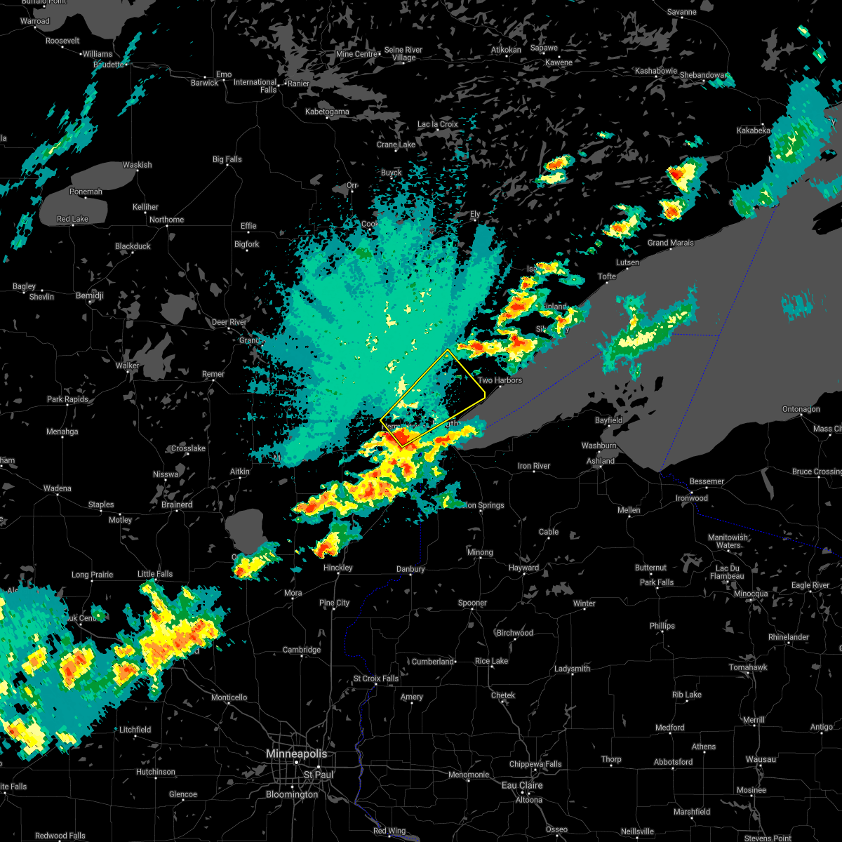 At 1158 pm cdt, a severe thunderstorm was located over saginaw, or 7 miles north of cloquet, moving northeast at 50 mph (radar indicated). Hazards include quarter size hail. Damage to vehicles is expected. this severe thunderstorm will be near, pike lake near duluth around 1205 am cdt. hermantown around 1210 am cdt. island lake and boulder lake around 1225 am cdt. other locations impacted by this severe thunderstorm include grand lake, wild rice lake, fredenberg, twig, munger, burnett, fish lake, kenwood, duluth heights and lakewood twp. hail threat, radar indicated max hail size, 1. 00 in wind threat, radar indicated max wind gust, <50 mph. At 1158 pm cdt, a severe thunderstorm was located over saginaw, or 7 miles north of cloquet, moving northeast at 50 mph (radar indicated). Hazards include quarter size hail. Damage to vehicles is expected. this severe thunderstorm will be near, pike lake near duluth around 1205 am cdt. hermantown around 1210 am cdt. island lake and boulder lake around 1225 am cdt. other locations impacted by this severe thunderstorm include grand lake, wild rice lake, fredenberg, twig, munger, burnett, fish lake, kenwood, duluth heights and lakewood twp. hail threat, radar indicated max hail size, 1. 00 in wind threat, radar indicated max wind gust, <50 mph.
|
| 9/6/2021 9:50 PM CDT |
 At 949 pm cdt, a severe thunderstorm was located near gary, or 40 miles northeast of fargo, moving east at 45 mph (radar indicated). Hazards include quarter size hail. Damage to vehicles is expected. this severe thunderstorm will be near, gary around 955 pm cdt. waukon and faith around 1005 pm cdt. other locations in the path of this severe thunderstorm include mahnomen, bejou, beaulieu, island lake in mahnomen county, pine bend and mahkonce. hail threat, radar indicated max hail size, 1. 00 in wind threat, radar indicated max wind gust, <50 mph. At 949 pm cdt, a severe thunderstorm was located near gary, or 40 miles northeast of fargo, moving east at 45 mph (radar indicated). Hazards include quarter size hail. Damage to vehicles is expected. this severe thunderstorm will be near, gary around 955 pm cdt. waukon and faith around 1005 pm cdt. other locations in the path of this severe thunderstorm include mahnomen, bejou, beaulieu, island lake in mahnomen county, pine bend and mahkonce. hail threat, radar indicated max hail size, 1. 00 in wind threat, radar indicated max wind gust, <50 mph.
|
| 6/11/2021 9:50 AM CDT | Quarter sized hail reported 6.5 miles SSW of Mahnomen, MN, mping report on highway 2 just west of highway 33. |
| 6/11/2021 9:44 AM CDT | Quarter sized hail reported 6.5 miles SSW of Mahnomen, MN, cocorahs observer mn-sl-82. |
| 6/11/2021 6:08 AM CDT |
 The severe thunderstorm warning for northern clay, norman, western pennington, western marshall, red lake, polk, western mahnomen, northwestern becker, grand forks, southeastern walsh, northeastern nelson, northeastern cass, traill and northeastern steele counties will expire at 615 am cdt, the storms which prompted the warning have weakened below severe limits, and no longer pose an immediate threat to life or property. therefore, the warning will be allowed to expire. however small hail and gusty winds are still possible with these thunderstorms. a severe thunderstorm watch remains in effect until 700 am cdt for northwestern minnesota, and southeastern and northeastern north dakota. The severe thunderstorm warning for northern clay, norman, western pennington, western marshall, red lake, polk, western mahnomen, northwestern becker, grand forks, southeastern walsh, northeastern nelson, northeastern cass, traill and northeastern steele counties will expire at 615 am cdt, the storms which prompted the warning have weakened below severe limits, and no longer pose an immediate threat to life or property. therefore, the warning will be allowed to expire. however small hail and gusty winds are still possible with these thunderstorms. a severe thunderstorm watch remains in effect until 700 am cdt for northwestern minnesota, and southeastern and northeastern north dakota.
|
| 6/11/2021 5:41 AM CDT |
 At 541 am cdt, severe thunderstorms were located along a line extending from near big woods to ada, moving east at 40 mph (radar indicated). Hazards include 60 mph wind gusts and quarter size hail. Hail damage to vehicles is expected. expect wind damage to roofs, siding, and trees. Locations impacted include, grand forks, east grand forks, crookston, grand forks afb, mayville, ada and hillsboro. At 541 am cdt, severe thunderstorms were located along a line extending from near big woods to ada, moving east at 40 mph (radar indicated). Hazards include 60 mph wind gusts and quarter size hail. Hail damage to vehicles is expected. expect wind damage to roofs, siding, and trees. Locations impacted include, grand forks, east grand forks, crookston, grand forks afb, mayville, ada and hillsboro.
|
| 6/11/2021 5:18 AM CDT |
 At 518 am cdt, severe thunderstorms were located along a line extending from near ardoch to near hendrum, moving east at 40 mph (radar indicated). Hazards include 70 mph wind gusts and quarter size hail. Hail damage to vehicles is expected. expect considerable tree damage. wind damage is also likely to mobile homes, roofs, and outbuildings. Locations impacted include, grand forks, east grand forks, crookston, grand forks afb, mayville, ada and hillsboro. At 518 am cdt, severe thunderstorms were located along a line extending from near ardoch to near hendrum, moving east at 40 mph (radar indicated). Hazards include 70 mph wind gusts and quarter size hail. Hail damage to vehicles is expected. expect considerable tree damage. wind damage is also likely to mobile homes, roofs, and outbuildings. Locations impacted include, grand forks, east grand forks, crookston, grand forks afb, mayville, ada and hillsboro.
|
| 6/11/2021 5:07 AM CDT |
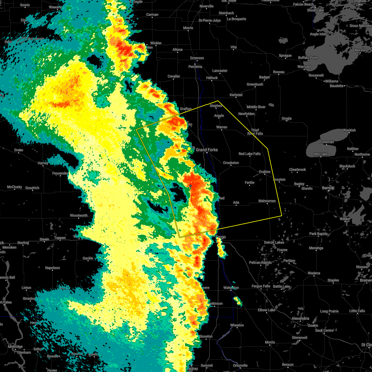 At 507 am cdt, severe thunderstorms were located along a line extending from forest river to near gardner, moving east at 40 mph (radar indicated). Hazards include 70 mph wind gusts. Expect considerable tree damage. damage is likely to mobile homes, roofs, and outbuildings. severe thunderstorms will be near, gardner and grandin around 510 am cdt. perley, poland and hendrum around 520 am cdt. warsaw around 525 am cdt. Other locations in the path of these severe thunderstorms include oslo, big woods and alvarado. At 507 am cdt, severe thunderstorms were located along a line extending from forest river to near gardner, moving east at 40 mph (radar indicated). Hazards include 70 mph wind gusts. Expect considerable tree damage. damage is likely to mobile homes, roofs, and outbuildings. severe thunderstorms will be near, gardner and grandin around 510 am cdt. perley, poland and hendrum around 520 am cdt. warsaw around 525 am cdt. Other locations in the path of these severe thunderstorms include oslo, big woods and alvarado.
|
| 10/11/2020 7:40 PM CDT |
 At 740 pm cdt, a severe thunderstorm was located near beaulieu, or 37 miles north of detroit lakes, moving northeast at 35 mph (radar indicated. asos at mahnomen recorded a 58 mph wind gust). Hazards include 60 mph wind gusts. expect damage to roofs, siding, and trees At 740 pm cdt, a severe thunderstorm was located near beaulieu, or 37 miles north of detroit lakes, moving northeast at 35 mph (radar indicated. asos at mahnomen recorded a 58 mph wind gust). Hazards include 60 mph wind gusts. expect damage to roofs, siding, and trees
|
| 10/11/2020 7:35 PM CDT | Mahnomen asos reports 51kt or 58.7mph wind gus in mahnomen county MN, 165.5 miles ESE of Mahnomen, MN |
| 9/2/2020 10:13 PM CDT |
 At 1013 pm cdt, severe thunderstorms were located along a line extending from 7 miles west of little rock to 7 miles west of callaway, moving east at 55 mph (radar indicated). Hazards include 60 mph wind gusts and quarter size hail. Hail damage to vehicles is expected. expect wind damage to roofs, siding, and trees. Locations impacted include, fosston, bagley, mahnomen, clearbrook, island lake in mahnomen county, waubun and naytahwaush. At 1013 pm cdt, severe thunderstorms were located along a line extending from 7 miles west of little rock to 7 miles west of callaway, moving east at 55 mph (radar indicated). Hazards include 60 mph wind gusts and quarter size hail. Hail damage to vehicles is expected. expect wind damage to roofs, siding, and trees. Locations impacted include, fosston, bagley, mahnomen, clearbrook, island lake in mahnomen county, waubun and naytahwaush.
|
| 9/2/2020 9:50 PM CDT |
 At 950 pm cdt, severe thunderstorms were located along a line extending from near roland to near felton, moving east at 55 mph (radar indicated). Hazards include 60 mph wind gusts and nickel size hail. Expect damage to roofs, siding, and trees. Locations impacted include, fosston, bagley, mahnomen, twin valley, mcintosh, ulen and clearbrook. At 950 pm cdt, severe thunderstorms were located along a line extending from near roland to near felton, moving east at 55 mph (radar indicated). Hazards include 60 mph wind gusts and nickel size hail. Expect damage to roofs, siding, and trees. Locations impacted include, fosston, bagley, mahnomen, twin valley, mcintosh, ulen and clearbrook.
|
| 9/2/2020 9:30 PM CDT |
 At 930 pm cdt, severe thunderstorms were located along a line extending from near plummer to near georgetown, moving east at 55 mph (radar indicated). Hazards include 60 mph wind gusts. expect damage to roofs, siding, and trees At 930 pm cdt, severe thunderstorms were located along a line extending from near plummer to near georgetown, moving east at 55 mph (radar indicated). Hazards include 60 mph wind gusts. expect damage to roofs, siding, and trees
|
| 8/14/2020 7:57 PM CDT |
 At 756 pm cdt, severe thunderstorms were located along a line extending from fond du lac reservation, to near hermantown, to wisconsin point, to near south range, moving northeast at 45 mph (radar indicated). Hazards include 60 mph wind gusts. Expect damage to roofs, siding, and trees. Locations impacted include, duluth, superior, cloquet, hermantown, proctor, scanlon, oliver, brookston, wisconsin point, pike lake near duluth, city of rice lake, french river, south range, saginaw, fond du lac reservation, island lake, knife river, grand lake, fredenberg, and mahnomen. At 756 pm cdt, severe thunderstorms were located along a line extending from fond du lac reservation, to near hermantown, to wisconsin point, to near south range, moving northeast at 45 mph (radar indicated). Hazards include 60 mph wind gusts. Expect damage to roofs, siding, and trees. Locations impacted include, duluth, superior, cloquet, hermantown, proctor, scanlon, oliver, brookston, wisconsin point, pike lake near duluth, city of rice lake, french river, south range, saginaw, fond du lac reservation, island lake, knife river, grand lake, fredenberg, and mahnomen.
|
| 8/14/2020 7:42 PM CDT |
 At 742 pm cdt, severe thunderstorms were located along a line extending from 6 miles southwest of fond du lac reservation, to near carlton, to near wrenshall, to near foxboro, moving northeast at 45 mph (radar indicated). Hazards include 70 mph wind gusts. Expect considerable tree damage. damage is likely to mobile homes, roofs, and outbuildings. Locations impacted include, duluth, superior, cloquet, hermantown, proctor, hawthorne, lake nebagamon, scanlon, carlton, maple, mahtowa, poplar, wrenshall, oliver, thomson, brookston, wisconsin point, pike lake near duluth, city of rice lake, and french river. At 742 pm cdt, severe thunderstorms were located along a line extending from 6 miles southwest of fond du lac reservation, to near carlton, to near wrenshall, to near foxboro, moving northeast at 45 mph (radar indicated). Hazards include 70 mph wind gusts. Expect considerable tree damage. damage is likely to mobile homes, roofs, and outbuildings. Locations impacted include, duluth, superior, cloquet, hermantown, proctor, hawthorne, lake nebagamon, scanlon, carlton, maple, mahtowa, poplar, wrenshall, oliver, thomson, brookston, wisconsin point, pike lake near duluth, city of rice lake, and french river.
|
| 8/14/2020 7:41 PM CDT |
 At 741 pm cdt, severe thunderstorms were located along a line extending from 6 miles southwest of fond du lac reservation, to near carlton, to near wrenshall, to near foxboro, moving northeast at 50 mph (radar indicated). Hazards include 70 mph wind gusts. Expect considerable tree damage. Damage is likely to mobile homes, roofs, and outbuildings. At 741 pm cdt, severe thunderstorms were located along a line extending from 6 miles southwest of fond du lac reservation, to near carlton, to near wrenshall, to near foxboro, moving northeast at 50 mph (radar indicated). Hazards include 70 mph wind gusts. Expect considerable tree damage. Damage is likely to mobile homes, roofs, and outbuildings.
|
| 8/14/2020 10:45 AM CDT |
 At 1044 am cdt, severe thunderstorms were located along a line extending from island lake in mahnomen county to near tulaby lake to richwood to near cormorant, moving east at 55 mph (radar indicated). Hazards include 60 mph wind gusts and penny size hail. Expect damage to roofs, siding, and trees. these severe storms will be near, pine bend, island lake in mahnomen county and tulaby lake around 1050 am cdt. long lost lake and rice lake around 1055 am cdt. many point lake, bad medicine lake and detroit lakes around 1100 am cdt. frazee, pine point and ponsford around 1105 am cdt. itasca state park around 1110 am cdt. Other locations impacted by these severe thunderstorms include many point scout camp. At 1044 am cdt, severe thunderstorms were located along a line extending from island lake in mahnomen county to near tulaby lake to richwood to near cormorant, moving east at 55 mph (radar indicated). Hazards include 60 mph wind gusts and penny size hail. Expect damage to roofs, siding, and trees. these severe storms will be near, pine bend, island lake in mahnomen county and tulaby lake around 1050 am cdt. long lost lake and rice lake around 1055 am cdt. many point lake, bad medicine lake and detroit lakes around 1100 am cdt. frazee, pine point and ponsford around 1105 am cdt. itasca state park around 1110 am cdt. Other locations impacted by these severe thunderstorms include many point scout camp.
|
| 8/14/2020 10:30 AM CDT |
 At 1029 am cdt, severe thunderstorms were located along a line extending from near ranum to waubun to 7 miles north of lake park to near barnesville, moving east at 50 mph (radar indicated). Hazards include 60 mph wind gusts and penny size hail. Expect damage to roofs, siding, and trees. these severe storms will be near, bejou, waubun and white earth around 1035 am cdt. callaway and westbury around 1040 am cdt. richwood, cormorant and beaulieu around 1045 am cdt. island lake in mahnomen county, tulaby lake and dunvilla around 1050 am cdt. pine bend, shoreham and mahkonce around 1055 am cdt. other locations impacted by these severe thunderstorms include many point scout camp. This includes interstate 94 in minnesota between mile markers 8 and 27. At 1029 am cdt, severe thunderstorms were located along a line extending from near ranum to waubun to 7 miles north of lake park to near barnesville, moving east at 50 mph (radar indicated). Hazards include 60 mph wind gusts and penny size hail. Expect damage to roofs, siding, and trees. these severe storms will be near, bejou, waubun and white earth around 1035 am cdt. callaway and westbury around 1040 am cdt. richwood, cormorant and beaulieu around 1045 am cdt. island lake in mahnomen county, tulaby lake and dunvilla around 1050 am cdt. pine bend, shoreham and mahkonce around 1055 am cdt. other locations impacted by these severe thunderstorms include many point scout camp. This includes interstate 94 in minnesota between mile markers 8 and 27.
|
| 8/14/2020 10:14 AM CDT |
 At 1014 am cdt, severe thunderstorms were located along a line extending from 6 miles west of flaming to syre to near hitterdal to near baker, moving east at 55 mph (radar indicated). Hazards include 60 mph wind gusts and penny size hail. Expect damage to roofs, siding, and trees. severe thunderstorms will be near, syre, hawley and twin valley around 1015 am cdt. flaming, hitterdal and flom around 1020 am cdt. barnesville, lake park and faith around 1025 am cdt. waubun, ranum and waukon around 1030 am cdt. bejou, callaway and westbury around 1035 am cdt. other locations impacted by these severe thunderstorms include many point scout camp and moorhead airport. This includes interstate 94 in minnesota between mile markers 7 and 27. At 1014 am cdt, severe thunderstorms were located along a line extending from 6 miles west of flaming to syre to near hitterdal to near baker, moving east at 55 mph (radar indicated). Hazards include 60 mph wind gusts and penny size hail. Expect damage to roofs, siding, and trees. severe thunderstorms will be near, syre, hawley and twin valley around 1015 am cdt. flaming, hitterdal and flom around 1020 am cdt. barnesville, lake park and faith around 1025 am cdt. waubun, ranum and waukon around 1030 am cdt. bejou, callaway and westbury around 1035 am cdt. other locations impacted by these severe thunderstorms include many point scout camp and moorhead airport. This includes interstate 94 in minnesota between mile markers 7 and 27.
|
| 8/13/2020 11:11 PM CDT |
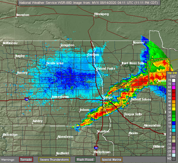 The severe thunderstorm warning for northeastern norman and northwestern mahnomen counties will expire at 1115 pm cdt, the storms which prompted the warning have moved out of the area. therefore, the warning will be allowed to expire. however small hail, gusty winds and heavy rain are still possible with these thunderstorms. a severe thunderstorm watch remains in effect until 200 am cdt for northwestern minnesota. The severe thunderstorm warning for northeastern norman and northwestern mahnomen counties will expire at 1115 pm cdt, the storms which prompted the warning have moved out of the area. therefore, the warning will be allowed to expire. however small hail, gusty winds and heavy rain are still possible with these thunderstorms. a severe thunderstorm watch remains in effect until 200 am cdt for northwestern minnesota.
|
| 8/13/2020 10:52 PM CDT |
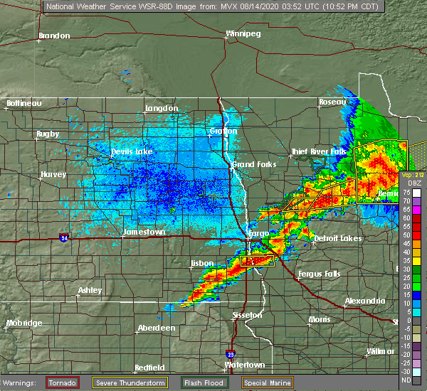 At 1051 pm cdt, severe thunderstorms were located along a line extending from near bejou to near gary, moving east at 20 mph (radar indicated). Hazards include 60 mph wind gusts and nickel size hail. Expect damage to roofs, siding, and trees. these severe storms will be near, ranum around 1115 pm cdt. mahnomen around 1125 pm cdt. Bejou around 1135 pm cdt. At 1051 pm cdt, severe thunderstorms were located along a line extending from near bejou to near gary, moving east at 20 mph (radar indicated). Hazards include 60 mph wind gusts and nickel size hail. Expect damage to roofs, siding, and trees. these severe storms will be near, ranum around 1115 pm cdt. mahnomen around 1125 pm cdt. Bejou around 1135 pm cdt.
|
| 8/13/2020 10:38 PM CDT |
 At 1038 pm cdt, severe thunderstorms were located along a line extending from near fosston to near faith, moving east at 30 mph (radar indicated). Hazards include 60 mph wind gusts and nickel size hail. Expect damage to roofs, siding, and trees. These severe storms will be near, fosston around 1040 pm cdt. At 1038 pm cdt, severe thunderstorms were located along a line extending from near fosston to near faith, moving east at 30 mph (radar indicated). Hazards include 60 mph wind gusts and nickel size hail. Expect damage to roofs, siding, and trees. These severe storms will be near, fosston around 1040 pm cdt.
|
| 8/13/2020 10:13 PM CDT |
 At 1013 pm cdt, severe thunderstorms were located along a line extending from winger to near borup, moving northeast at 20 mph (radar indicated). Hazards include 60 mph wind gusts and quarter size hail. Hail damage to vehicles is expected. expect wind damage to roofs, siding, and trees. severe thunderstorms will be near, winger and bejou around 1015 pm cdt. twin valley around 1035 pm cdt. fosston around 1040 pm cdt. flom around 1045 pm cdt. Faith and waukon around 1100 pm cdt. At 1013 pm cdt, severe thunderstorms were located along a line extending from winger to near borup, moving northeast at 20 mph (radar indicated). Hazards include 60 mph wind gusts and quarter size hail. Hail damage to vehicles is expected. expect wind damage to roofs, siding, and trees. severe thunderstorms will be near, winger and bejou around 1015 pm cdt. twin valley around 1035 pm cdt. fosston around 1040 pm cdt. flom around 1045 pm cdt. Faith and waukon around 1100 pm cdt.
|
| 8/13/2020 8:16 PM CDT |
 At 816 pm cdt, severe thunderstorms were located along a line extending from flaming to near faith, moving northeast at 20 mph (radar indicated). Hazards include 60 mph wind gusts and half dollar size hail. Hail damage to vehicles is expected. expect wind damage to roofs, siding, and trees. these severe storms will be near, waukon around 825 pm cdt. mahnomen, ranum and fertile around 830 pm cdt. rindal around 835 pm cdt. bejou and maple bay around 850 pm cdt. Winger around 855 pm cdt. At 816 pm cdt, severe thunderstorms were located along a line extending from flaming to near faith, moving northeast at 20 mph (radar indicated). Hazards include 60 mph wind gusts and half dollar size hail. Hail damage to vehicles is expected. expect wind damage to roofs, siding, and trees. these severe storms will be near, waukon around 825 pm cdt. mahnomen, ranum and fertile around 830 pm cdt. rindal around 835 pm cdt. bejou and maple bay around 850 pm cdt. Winger around 855 pm cdt.
|
| 8/13/2020 8:00 PM CDT |
 At 759 pm cdt, severe thunderstorms were located along a line extending from gary to flom, moving northeast at 30 mph (radar indicated). Hazards include 60 mph wind gusts and quarter size hail. Hail damage to vehicles is expected. expect wind damage to roofs, siding, and trees. these severe storms will be near, waukon, faith and fertile around 810 pm cdt. waubun around 815 pm cdt. ranum and rindal around 820 pm cdt. mahnomen around 825 pm cdt. Bejou around 830 pm cdt. At 759 pm cdt, severe thunderstorms were located along a line extending from gary to flom, moving northeast at 30 mph (radar indicated). Hazards include 60 mph wind gusts and quarter size hail. Hail damage to vehicles is expected. expect wind damage to roofs, siding, and trees. these severe storms will be near, waukon, faith and fertile around 810 pm cdt. waubun around 815 pm cdt. ranum and rindal around 820 pm cdt. mahnomen around 825 pm cdt. Bejou around 830 pm cdt.
|
| 8/13/2020 7:53 PM CDT |
 At 752 pm cdt, severe thunderstorms were located along a line extending from near gary to flom, moving northeast at 30 mph (radar indicated). Hazards include 60 mph wind gusts and quarter size hail. Hail damage to vehicles is expected. expect wind damage to roofs, siding, and trees. severe thunderstorms will be near, flom around 755 pm cdt. gary around 800 pm cdt. flaming and faith around 805 pm cdt. waubun, waukon and fertile around 810 pm cdt. Ranum around 815 pm cdt. At 752 pm cdt, severe thunderstorms were located along a line extending from near gary to flom, moving northeast at 30 mph (radar indicated). Hazards include 60 mph wind gusts and quarter size hail. Hail damage to vehicles is expected. expect wind damage to roofs, siding, and trees. severe thunderstorms will be near, flom around 755 pm cdt. gary around 800 pm cdt. flaming and faith around 805 pm cdt. waubun, waukon and fertile around 810 pm cdt. Ranum around 815 pm cdt.
|
| 8/13/2020 7:27 PM CDT |
 The severe thunderstorm warning for northeastern clay, southeastern norman, southwestern mahnomen and northwestern becker counties will expire at 730 pm cdt, the storms which prompted the warning have weakened below severe limits, and no longer poses an immediate threat to life or property. therefore, the warning will be allowed to expire. a severe thunderstorm watch remains in effect until 200 am cdt for northwestern minnesota. The severe thunderstorm warning for northeastern clay, southeastern norman, southwestern mahnomen and northwestern becker counties will expire at 730 pm cdt, the storms which prompted the warning have weakened below severe limits, and no longer poses an immediate threat to life or property. therefore, the warning will be allowed to expire. a severe thunderstorm watch remains in effect until 200 am cdt for northwestern minnesota.
|
| 8/13/2020 7:12 PM CDT |
 At 711 pm cdt, severe thunderstorms were located along a line extending from near faith to near ulen, moving northeast at 45 mph (radar indicated). Hazards include 60 mph wind gusts and half dollar size hail. Hail damage to vehicles is expected. expect wind damage to roofs, siding, and trees. these severe storms will be near, faith and twin valley around 715 pm cdt. mahnomen around 725 pm cdt. Flom around 730 pm cdt. At 711 pm cdt, severe thunderstorms were located along a line extending from near faith to near ulen, moving northeast at 45 mph (radar indicated). Hazards include 60 mph wind gusts and half dollar size hail. Hail damage to vehicles is expected. expect wind damage to roofs, siding, and trees. these severe storms will be near, faith and twin valley around 715 pm cdt. mahnomen around 725 pm cdt. Flom around 730 pm cdt.
|
| 8/13/2020 6:51 PM CDT |
 At 651 pm cdt, severe thunderstorms were located along a line extending from near bejou to near ulen, moving northeast at 20 mph (radar indicated). Hazards include 60 mph wind gusts and half dollar size hail. Hail damage to vehicles is expected. expect wind damage to roofs, siding, and trees. these severe storms will be near, bejou and ranum around 655 pm cdt. twin valley around 715 pm cdt. flom around 720 pm cdt. faith around 740 pm cdt. Mahnomen around 800 pm cdt. At 651 pm cdt, severe thunderstorms were located along a line extending from near bejou to near ulen, moving northeast at 20 mph (radar indicated). Hazards include 60 mph wind gusts and half dollar size hail. Hail damage to vehicles is expected. expect wind damage to roofs, siding, and trees. these severe storms will be near, bejou and ranum around 655 pm cdt. twin valley around 715 pm cdt. flom around 720 pm cdt. faith around 740 pm cdt. Mahnomen around 800 pm cdt.
|
| 8/13/2020 6:24 PM CDT |
 At 624 pm cdt, severe thunderstorms were located along a line extending from near waukon to near felton, moving northeast at 20 mph (radar indicated). Hazards include 60 mph wind gusts and half dollar size hail. Hail damage to vehicles is expected. expect wind damage to roofs, siding, and trees. severe thunderstorms will be near, waukon and gary around 625 pm cdt. ranum around 635 pm cdt. bejou and ulen around 655 pm cdt. syre around 705 pm cdt. Twin valley around 715 pm cdt. At 624 pm cdt, severe thunderstorms were located along a line extending from near waukon to near felton, moving northeast at 20 mph (radar indicated). Hazards include 60 mph wind gusts and half dollar size hail. Hail damage to vehicles is expected. expect wind damage to roofs, siding, and trees. severe thunderstorms will be near, waukon and gary around 625 pm cdt. ranum around 635 pm cdt. bejou and ulen around 655 pm cdt. syre around 705 pm cdt. Twin valley around 715 pm cdt.
|
| 8/9/2020 4:55 PM CDT |
 At 454 pm cdt, severe thunderstorms were located along a line extending from near hines to near rosby to near lake george, moving east at 45 mph. there are additional storms that will move through this area capable of severe wind gusts (trained weather spotters reported trees blown over). Hazards include 70 mph wind gusts and penny size hail. Expect considerable tree damage. damage is likely to mobile homes, roofs, and outbuildings. these severe storms will be near, tenstrike around 455 pm cdt. blackduck and hines around 500 pm cdt. kabekona around 505 pm cdt. laporte around 510 pm cdt. benedict around 515 pm cdt. Other locations impacted by these severe thunderstorms include camp thunderbird east and camp thunderbird west. At 454 pm cdt, severe thunderstorms were located along a line extending from near hines to near rosby to near lake george, moving east at 45 mph. there are additional storms that will move through this area capable of severe wind gusts (trained weather spotters reported trees blown over). Hazards include 70 mph wind gusts and penny size hail. Expect considerable tree damage. damage is likely to mobile homes, roofs, and outbuildings. these severe storms will be near, tenstrike around 455 pm cdt. blackduck and hines around 500 pm cdt. kabekona around 505 pm cdt. laporte around 510 pm cdt. benedict around 515 pm cdt. Other locations impacted by these severe thunderstorms include camp thunderbird east and camp thunderbird west.
|
| 8/9/2020 4:38 PM CDT |
 At 435 pm cdt, severe thunderstorms were located along a line extending from near nebish to near plantagenet lake to itasca state park, moving southeast at 50 mph (trained weather spotters report mature trees blown down 4 miles south of solway). Hazards include 70 mph wind gusts and penny size hail. Expect considerable tree damage. damage is likely to mobile homes, roofs, and outbuildings. severe thunderstorms will be near, plantagenet lake and bemidji around 440 pm cdt. nary and rosby around 445 pm cdt. tenstrike, guthrie and lake george around 450 pm cdt. camp wilderness, emmaville and hines around 455 pm cdt. akeley around 510 pm cdt. other locations impacted by these severe thunderstorms include camp thunderbird east and camp thunderbird west. There will be an additional thunderstorm capable of winds up to 70 mph moving through the area. At 435 pm cdt, severe thunderstorms were located along a line extending from near nebish to near plantagenet lake to itasca state park, moving southeast at 50 mph (trained weather spotters report mature trees blown down 4 miles south of solway). Hazards include 70 mph wind gusts and penny size hail. Expect considerable tree damage. damage is likely to mobile homes, roofs, and outbuildings. severe thunderstorms will be near, plantagenet lake and bemidji around 440 pm cdt. nary and rosby around 445 pm cdt. tenstrike, guthrie and lake george around 450 pm cdt. camp wilderness, emmaville and hines around 455 pm cdt. akeley around 510 pm cdt. other locations impacted by these severe thunderstorms include camp thunderbird east and camp thunderbird west. There will be an additional thunderstorm capable of winds up to 70 mph moving through the area.
|
| 8/9/2020 4:10 PM CDT |
 At 409 pm cdt, severe thunderstorms were located along a line extending from near debs to near bagley to mahnomen, moving east at 40 mph (radar indicated). Hazards include 70 mph wind gusts and penny size hail. Expect considerable tree damage. damage is likely to mobile homes, roofs, and outbuildings. these severe storms will be near, bagley and rice lake around 415 pm cdt. debs, upper rice lake and shevlin around 420 pm cdt. alida around 425 pm cdt. mahkonce and solway around 430 pm cdt. puposky, naytahwaush and roy lake around 435 pm cdt. Other locations impacted by these severe thunderstorms include camp thunderbird east and camp thunderbird west. At 409 pm cdt, severe thunderstorms were located along a line extending from near debs to near bagley to mahnomen, moving east at 40 mph (radar indicated). Hazards include 70 mph wind gusts and penny size hail. Expect considerable tree damage. damage is likely to mobile homes, roofs, and outbuildings. these severe storms will be near, bagley and rice lake around 415 pm cdt. debs, upper rice lake and shevlin around 420 pm cdt. alida around 425 pm cdt. mahkonce and solway around 430 pm cdt. puposky, naytahwaush and roy lake around 435 pm cdt. Other locations impacted by these severe thunderstorms include camp thunderbird east and camp thunderbird west.
|
| 8/9/2020 3:41 PM CDT |
 At 340 pm cdt, severe thunderstorms were located along a line extending from 6 miles southeast of roland to near mcintosh to near flaming, moving east at 50 mph (radar indicated). Hazards include 70 mph wind gusts and penny size hail. Expect considerable tree damage. damage is likely to mobile homes, roofs, and outbuildings. severe thunderstorms will be near, fosston and gully around 345 pm cdt. berner and rindal around 350 pm cdt. lengby around 355 pm cdt. ebro, bejou and weme around 400 pm cdt. mahnomen around 405 pm cdt. Other locations impacted by these severe thunderstorms include camp thunderbird east and camp thunderbird west. At 340 pm cdt, severe thunderstorms were located along a line extending from 6 miles southeast of roland to near mcintosh to near flaming, moving east at 50 mph (radar indicated). Hazards include 70 mph wind gusts and penny size hail. Expect considerable tree damage. damage is likely to mobile homes, roofs, and outbuildings. severe thunderstorms will be near, fosston and gully around 345 pm cdt. berner and rindal around 350 pm cdt. lengby around 355 pm cdt. ebro, bejou and weme around 400 pm cdt. mahnomen around 405 pm cdt. Other locations impacted by these severe thunderstorms include camp thunderbird east and camp thunderbird west.
|
| 8/7/2020 4:27 PM CDT |
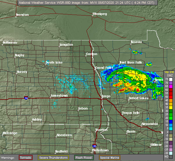 At 427 pm cdt, a severe thunderstorm was located over flom, or 27 miles northwest of detroit lakes, moving east at 25 mph (radar indicated). Hazards include 70 mph wind gusts and ping pong ball size hail. People and animals outdoors will be injured. expect hail damage to roofs, siding, windows, and vehicles. expect considerable tree damage. wind damage is also likely to mobile homes, roofs, and outbuildings. this severe storm will be near, faith around 435 pm cdt. Waubun around 445 pm cdt. At 427 pm cdt, a severe thunderstorm was located over flom, or 27 miles northwest of detroit lakes, moving east at 25 mph (radar indicated). Hazards include 70 mph wind gusts and ping pong ball size hail. People and animals outdoors will be injured. expect hail damage to roofs, siding, windows, and vehicles. expect considerable tree damage. wind damage is also likely to mobile homes, roofs, and outbuildings. this severe storm will be near, faith around 435 pm cdt. Waubun around 445 pm cdt.
|
| 8/7/2020 4:17 PM CDT |
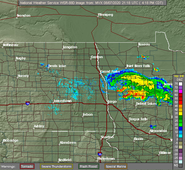 At 417 pm cdt, a severe thunderstorm was located near syre, or 28 miles northwest of detroit lakes, moving northeast at 20 mph (radar indicated). Hazards include 60 mph wind gusts and quarter size hail. Hail damage to vehicles is expected. expect wind damage to roofs, siding, and trees. this severe thunderstorm will be near, flom around 430 pm cdt. faith around 445 pm cdt. waubun around 455 pm cdt. Mahnomen around 505 pm cdt. At 417 pm cdt, a severe thunderstorm was located near syre, or 28 miles northwest of detroit lakes, moving northeast at 20 mph (radar indicated). Hazards include 60 mph wind gusts and quarter size hail. Hail damage to vehicles is expected. expect wind damage to roofs, siding, and trees. this severe thunderstorm will be near, flom around 430 pm cdt. faith around 445 pm cdt. waubun around 455 pm cdt. Mahnomen around 505 pm cdt.
|
| 7/25/2020 3:07 AM CDT |
 The severe thunderstorm warning for southeastern polk, northern mahnomen and central clearwater counties will expire at 315 am cdt, the severe thunderstorm which prompted the warning has weakened. therefore, the warning will be allow to expire. however gusty winds are still possible with this thunderstorm. The severe thunderstorm warning for southeastern polk, northern mahnomen and central clearwater counties will expire at 315 am cdt, the severe thunderstorm which prompted the warning has weakened. therefore, the warning will be allow to expire. however gusty winds are still possible with this thunderstorm.
|
| 7/25/2020 2:31 AM CDT |
 At 230 am cdt, a severe thunderstorm was located near beaulieu, or 38 miles north of detroit lakes, moving east at 40 mph (radar indicated). Hazards include 70 mph wind gusts. Expect considerable tree damage. Damage is likely to mobile homes, roofs, and outbuildings. At 230 am cdt, a severe thunderstorm was located near beaulieu, or 38 miles north of detroit lakes, moving east at 40 mph (radar indicated). Hazards include 70 mph wind gusts. Expect considerable tree damage. Damage is likely to mobile homes, roofs, and outbuildings.
|
| 7/17/2020 6:17 PM CDT |
 At 616 pm cdt, severe thunderstorms were located along a line extending from near mahnomen to near borup to 7 miles east of perley, moving southeast at 45 mph (radar indicated). Hazards include 70 mph wind gusts and quarter size hail. Hail damage to vehicles is expected. expect considerable tree damage. wind damage is also likely to mobile homes, roofs, and outbuildings. these severe storms will be near, mahnomen and beaulieu around 620 pm cdt. syre around 625 pm cdt. ulen and waubun around 630 pm cdt. averill around 635 pm cdt. hitterdal, white earth and glyndon around 640 pm cdt. other locations impacted by these severe thunderstorms include moorhead airport and many point scout camp. This includes interstate 94 in minnesota between mile markers 4 and 16. At 616 pm cdt, severe thunderstorms were located along a line extending from near mahnomen to near borup to 7 miles east of perley, moving southeast at 45 mph (radar indicated). Hazards include 70 mph wind gusts and quarter size hail. Hail damage to vehicles is expected. expect considerable tree damage. wind damage is also likely to mobile homes, roofs, and outbuildings. these severe storms will be near, mahnomen and beaulieu around 620 pm cdt. syre around 625 pm cdt. ulen and waubun around 630 pm cdt. averill around 635 pm cdt. hitterdal, white earth and glyndon around 640 pm cdt. other locations impacted by these severe thunderstorms include moorhead airport and many point scout camp. This includes interstate 94 in minnesota between mile markers 4 and 16.
|
| 7/17/2020 5:54 PM CDT |
 At 553 pm cdt, severe thunderstorms were located along a line extending from rindal to near hadler to near hunter, moving southeast at 45 mph (radar indicated). Hazards include 70 mph wind gusts and quarter size hail. Hail damage to vehicles is expected. expect considerable tree damage. wind damage is also likely to mobile homes, roofs, and outbuildings. severe thunderstorms will be near, rindal and lockhart around 555 pm cdt. ranum, hadler and winger around 600 pm cdt. bejou, ada and waukon around 605 pm cdt. arthur around 610 pm cdt. mahnomen, borup and gardner around 615 pm cdt. other locations impacted by these severe thunderstorms include casselton airport, moorhead airport, west argusville and many point scout camp. this includes the following highways, interstate 29 between mile markers 54 and 101. interstate 94 in north dakota between mile markers 325 and 352. Interstate 94 in minnesota between mile markers 1 and 16. At 553 pm cdt, severe thunderstorms were located along a line extending from rindal to near hadler to near hunter, moving southeast at 45 mph (radar indicated). Hazards include 70 mph wind gusts and quarter size hail. Hail damage to vehicles is expected. expect considerable tree damage. wind damage is also likely to mobile homes, roofs, and outbuildings. severe thunderstorms will be near, rindal and lockhart around 555 pm cdt. ranum, hadler and winger around 600 pm cdt. bejou, ada and waukon around 605 pm cdt. arthur around 610 pm cdt. mahnomen, borup and gardner around 615 pm cdt. other locations impacted by these severe thunderstorms include casselton airport, moorhead airport, west argusville and many point scout camp. this includes the following highways, interstate 29 between mile markers 54 and 101. interstate 94 in north dakota between mile markers 325 and 352. Interstate 94 in minnesota between mile markers 1 and 16.
|
| 7/13/2020 11:57 PM CDT |
 At 1157 pm cdt, severe thunderstorms were located along a line extending from near fairbanks, to near boulder lake, to 8 miles west of fond du lac reservation, moving southeast at 45 mph (radar indicated). Hazards include 60 mph wind gusts and quarter size hail. Hail damage to vehicles is expected. expect wind damage to roofs, siding, and trees. severe thunderstorms will be near, fairbanks and boulder lake around 1205 am cdt. island lake around 1210 am cdt. cloquet, fond du lac reservation and saginaw around 1215 am cdt. duluth, scanlon and french river around 1225 am cdt. proctor, knife river and larsmont around 1230 am cdt. Other locations impacted by these severe thunderstorms include grand lake, cody, fredenberg, wales, palmers, fish lake, lakeside-lester park, spirit valley, central hillside and norton park. At 1157 pm cdt, severe thunderstorms were located along a line extending from near fairbanks, to near boulder lake, to 8 miles west of fond du lac reservation, moving southeast at 45 mph (radar indicated). Hazards include 60 mph wind gusts and quarter size hail. Hail damage to vehicles is expected. expect wind damage to roofs, siding, and trees. severe thunderstorms will be near, fairbanks and boulder lake around 1205 am cdt. island lake around 1210 am cdt. cloquet, fond du lac reservation and saginaw around 1215 am cdt. duluth, scanlon and french river around 1225 am cdt. proctor, knife river and larsmont around 1230 am cdt. Other locations impacted by these severe thunderstorms include grand lake, cody, fredenberg, wales, palmers, fish lake, lakeside-lester park, spirit valley, central hillside and norton park.
|
| 7/9/2020 12:00 AM CDT |
 At 1200 am cdt, a severe thunderstorm was located near barnum, or 17 miles southwest of cloquet, moving northeast at 30 mph (radar indicated). Hazards include 60 mph wind gusts and quarter size hail. Hail damage to vehicles is expected. Expect wind damage to roofs, siding, and trees. At 1200 am cdt, a severe thunderstorm was located near barnum, or 17 miles southwest of cloquet, moving northeast at 30 mph (radar indicated). Hazards include 60 mph wind gusts and quarter size hail. Hail damage to vehicles is expected. Expect wind damage to roofs, siding, and trees.
|
| 6/8/2020 12:45 AM CDT |
 At 1244 am cdt, a severe thunderstorm was located over faith, or 37 miles north of detroit lakes, moving east at 50 mph (radar indicated). Hazards include 70 mph wind gusts. Expect considerable tree damage. Damage is likely to mobile homes, roofs, and outbuildings. At 1244 am cdt, a severe thunderstorm was located over faith, or 37 miles north of detroit lakes, moving east at 50 mph (radar indicated). Hazards include 70 mph wind gusts. Expect considerable tree damage. Damage is likely to mobile homes, roofs, and outbuildings.
|
| 6/7/2020 11:15 PM CDT |
 At 1114 pm cdt, severe thunderstorms were located along a line extending from near goodridge to near fosston to 6 miles southwest of tulaby lake, moving northeast at 45 mph (radar indicated). Hazards include 60 mph wind gusts. Expect damage to roofs, siding, and trees. severe thunderstorms will be near, weme and naytahwaush around 1125 pm cdt. clearbrook and gonvick around 1130 pm cdt. long lost lake and bad medicine lake around 1135 pm cdt. leonard around 1140 pm cdt. zerkel around 1145 pm cdt. Other locations impacted by these severe thunderstorms include camp thunderbird east, camp thunderbird west and many point scout camp. At 1114 pm cdt, severe thunderstorms were located along a line extending from near goodridge to near fosston to 6 miles southwest of tulaby lake, moving northeast at 45 mph (radar indicated). Hazards include 60 mph wind gusts. Expect damage to roofs, siding, and trees. severe thunderstorms will be near, weme and naytahwaush around 1125 pm cdt. clearbrook and gonvick around 1130 pm cdt. long lost lake and bad medicine lake around 1135 pm cdt. leonard around 1140 pm cdt. zerkel around 1145 pm cdt. Other locations impacted by these severe thunderstorms include camp thunderbird east, camp thunderbird west and many point scout camp.
|
| 6/7/2020 11:08 PM CDT |
 At 1107 pm cdt, severe thunderstorms were located along a line extending from near roland to near lengby to near white earth, moving east at 35 mph (radar indicated). Hazards include 60 mph wind gusts. Expect damage to roofs, siding, and trees. these severe storms will be near, fosston and high landing around 1110 pm cdt. lengby, roland and island lake in mahnomen county around 1115 pm cdt. pine bend around 1120 pm cdt. ebro, tulaby lake and weme around 1125 pm cdt. many point lake around 1130 pm cdt. Other locations impacted by these severe thunderstorms include many point scout camp. At 1107 pm cdt, severe thunderstorms were located along a line extending from near roland to near lengby to near white earth, moving east at 35 mph (radar indicated). Hazards include 60 mph wind gusts. Expect damage to roofs, siding, and trees. these severe storms will be near, fosston and high landing around 1110 pm cdt. lengby, roland and island lake in mahnomen county around 1115 pm cdt. pine bend around 1120 pm cdt. ebro, tulaby lake and weme around 1125 pm cdt. many point lake around 1130 pm cdt. Other locations impacted by these severe thunderstorms include many point scout camp.
|
| 6/7/2020 10:55 PM CDT |
 At 1055 pm cdt, severe thunderstorms were located along a line extending from near roland to near fosston to near white earth, moving east at 40 mph (radar indicated). Hazards include 60 mph wind gusts. Expect damage to roofs, siding, and trees. these severe storms will be near, roland, island lake in mahnomen county and fosston around 1100 pm cdt. lengby and pine bend around 1105 pm cdt. ebro around 1110 pm cdt. tulaby lake around 1115 pm cdt. bagley and many point lake around 1120 pm cdt. other locations impacted by these severe thunderstorms include thief river falls airport and many point scout camp. This includes interstate 94 in minnesota between mile markers 11 and 24. At 1055 pm cdt, severe thunderstorms were located along a line extending from near roland to near fosston to near white earth, moving east at 40 mph (radar indicated). Hazards include 60 mph wind gusts. Expect damage to roofs, siding, and trees. these severe storms will be near, roland, island lake in mahnomen county and fosston around 1100 pm cdt. lengby and pine bend around 1105 pm cdt. ebro around 1110 pm cdt. tulaby lake around 1115 pm cdt. bagley and many point lake around 1120 pm cdt. other locations impacted by these severe thunderstorms include thief river falls airport and many point scout camp. This includes interstate 94 in minnesota between mile markers 11 and 24.
|
| 6/7/2020 10:14 PM CDT |
 At 1012 pm cdt, severe thunderstorms were located along a line extending from wylie to near fertile to near ulen, moving east at 40 mph (radar indicated). Hazards include 60 mph wind gusts and penny size hail. wind gusts of 58 mph were reported in crookston and wind gusts of 64 mph were reported in fargo. Expect damage to roofs, siding, and trees. severe thunderstorms will be near, rindal, ranum and red lake falls around 1020 pm cdt. st. hilaire around 1025 pm cdt. winger, hazel and bejou around 1030 pm cdt. plummer around 1035 pm cdt. ogema and callaway around 1045 pm cdt. other locations impacted by these severe thunderstorms include thief river falls airport and many point scout camp. This includes interstate 94 in minnesota between mile markers 11 and 24. At 1012 pm cdt, severe thunderstorms were located along a line extending from wylie to near fertile to near ulen, moving east at 40 mph (radar indicated). Hazards include 60 mph wind gusts and penny size hail. wind gusts of 58 mph were reported in crookston and wind gusts of 64 mph were reported in fargo. Expect damage to roofs, siding, and trees. severe thunderstorms will be near, rindal, ranum and red lake falls around 1020 pm cdt. st. hilaire around 1025 pm cdt. winger, hazel and bejou around 1030 pm cdt. plummer around 1035 pm cdt. ogema and callaway around 1045 pm cdt. other locations impacted by these severe thunderstorms include thief river falls airport and many point scout camp. This includes interstate 94 in minnesota between mile markers 11 and 24.
|
| 9/21/2019 6:43 PM CDT |
 At 643 pm cdt, a severe thunderstorm was located near mahnomen, or 31 miles north of detroit lakes, moving northeast at 45 mph (radar indicated). Hazards include tennis ball size hail and 70 mph wind gusts. People and animals outdoors will be injured. expect hail damage to roofs, siding, windows, and vehicles. expect considerable tree damage. wind damage is also likely to mobile homes, roofs, and outbuildings. this severe storm will be near, beaulieu around 650 pm cdt. Naytahwaush around 700 pm cdt. At 643 pm cdt, a severe thunderstorm was located near mahnomen, or 31 miles north of detroit lakes, moving northeast at 45 mph (radar indicated). Hazards include tennis ball size hail and 70 mph wind gusts. People and animals outdoors will be injured. expect hail damage to roofs, siding, windows, and vehicles. expect considerable tree damage. wind damage is also likely to mobile homes, roofs, and outbuildings. this severe storm will be near, beaulieu around 650 pm cdt. Naytahwaush around 700 pm cdt.
|
| 9/21/2019 6:22 PM CDT |
 At 622 pm cdt, a severe thunderstorm was located over flom, or 29 miles northwest of detroit lakes, moving northeast at 45 mph (radar indicated). Hazards include two inch hail and 60 mph wind gusts. People and animals outdoors will be injured. expect hail damage to roofs, siding, windows, and vehicles. expect wind damage to roofs, siding, and trees. this severe storm will be near, flom around 625 pm cdt. faith around 630 pm cdt. waubun around 635 pm cdt. mahnomen around 640 pm cdt. Beaulieu around 650 pm cdt. At 622 pm cdt, a severe thunderstorm was located over flom, or 29 miles northwest of detroit lakes, moving northeast at 45 mph (radar indicated). Hazards include two inch hail and 60 mph wind gusts. People and animals outdoors will be injured. expect hail damage to roofs, siding, windows, and vehicles. expect wind damage to roofs, siding, and trees. this severe storm will be near, flom around 625 pm cdt. faith around 630 pm cdt. waubun around 635 pm cdt. mahnomen around 640 pm cdt. Beaulieu around 650 pm cdt.
|
| 9/21/2019 5:58 PM CDT |
 At 558 pm cdt, a severe thunderstorm was located over felton, or 19 miles northeast of fargo, moving northeast at 45 mph (radar indicated). Hazards include 60 mph wind gusts and half dollar size hail. Hail damage to vehicles is expected. expect wind damage to roofs, siding, and trees. this severe thunderstorm will be near, borup around 605 pm cdt. ulen around 615 pm cdt. syre around 620 pm cdt. flom around 625 pm cdt. Faith around 635 pm cdt. At 558 pm cdt, a severe thunderstorm was located over felton, or 19 miles northeast of fargo, moving northeast at 45 mph (radar indicated). Hazards include 60 mph wind gusts and half dollar size hail. Hail damage to vehicles is expected. expect wind damage to roofs, siding, and trees. this severe thunderstorm will be near, borup around 605 pm cdt. ulen around 615 pm cdt. syre around 620 pm cdt. flom around 625 pm cdt. Faith around 635 pm cdt.
|
| 8/20/2019 4:56 AM CDT |
 A severe thunderstorm warning remains in effect until 530 am cdt for northeastern clay. southeastern norman. mahnomen. northwestern becker and southwestern clearwater counties. At 455 am cdt, severe thunderstorms were located along a line extending from near felton to near ogema to 6 miles east of waubun, moving east at 45 mph. A severe thunderstorm warning remains in effect until 530 am cdt for northeastern clay. southeastern norman. mahnomen. northwestern becker and southwestern clearwater counties. At 455 am cdt, severe thunderstorms were located along a line extending from near felton to near ogema to 6 miles east of waubun, moving east at 45 mph.
|
| 8/20/2019 4:43 AM CDT |
 At 442 am cdt, severe thunderstorms were located along a line extending from 6 miles west of borup to near syre to near waubun, moving east at 35 mph (radar indicated). Hazards include golf ball size hail and 60 mph wind gusts. People and animals outdoors will be injured. expect hail damage to roofs, siding, windows, and vehicles. expect wind damage to roofs, siding, and trees. Locations impacted include, ada, mahnomen, twin valley, ulen, waubun, naytahwaush and callaway. At 442 am cdt, severe thunderstorms were located along a line extending from 6 miles west of borup to near syre to near waubun, moving east at 35 mph (radar indicated). Hazards include golf ball size hail and 60 mph wind gusts. People and animals outdoors will be injured. expect hail damage to roofs, siding, windows, and vehicles. expect wind damage to roofs, siding, and trees. Locations impacted include, ada, mahnomen, twin valley, ulen, waubun, naytahwaush and callaway.
|
| 8/20/2019 4:25 AM CDT |
 At 425 am cdt, severe thunderstorms were located along a line extending from hendrum to near borup to near twin valley, moving east at 35 mph (radar indicated). Hazards include golf ball size hail and 60 mph wind gusts. People and animals outdoors will be injured. expect hail damage to roofs, siding, windows, and vehicles. Expect wind damage to roofs, siding, and trees. At 425 am cdt, severe thunderstorms were located along a line extending from hendrum to near borup to near twin valley, moving east at 35 mph (radar indicated). Hazards include golf ball size hail and 60 mph wind gusts. People and animals outdoors will be injured. expect hail damage to roofs, siding, windows, and vehicles. Expect wind damage to roofs, siding, and trees.
|
| 8/20/2019 4:25 AM CDT |
 The national weather service in grand forks has issued a * severe thunderstorm warning for. northeastern clay county in northwestern minnesota. norman county in northwestern minnesota. mahnomen county in northwestern minnesota. Northwestern becker county in northwestern minnesota. The national weather service in grand forks has issued a * severe thunderstorm warning for. northeastern clay county in northwestern minnesota. norman county in northwestern minnesota. mahnomen county in northwestern minnesota. Northwestern becker county in northwestern minnesota.
|
| 8/5/2019 9:08 AM CDT |
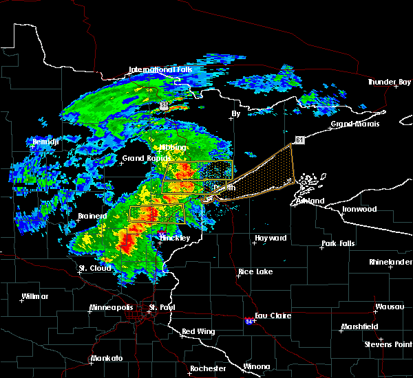 At 908 am cdt, a severe thunderstorm was located near saginaw, or 9 miles north of cloquet, moving east at 40 mph. this is a very dangerous storm (radar indicated). Hazards include 90 mph wind gusts and half dollar size hail. You are in a life-threatening situation. flying debris may be deadly to those caught without shelter. mobile homes will be heavily damaged or destroyed. homes and businesses will have substantial roof and window damage. expect extensive tree damage and power outages. Locations impacted include, duluth, hermantown, proctor, brookston, saginaw, fond du lac reservation, pike lake near duluth, city of rice lake, island lake, grand lake, fredenberg, mahnomen, alborn, culver, fish lake, lakeside-lester park, central hillside, piedmont heights, duluth heights, and wild rice lake. At 908 am cdt, a severe thunderstorm was located near saginaw, or 9 miles north of cloquet, moving east at 40 mph. this is a very dangerous storm (radar indicated). Hazards include 90 mph wind gusts and half dollar size hail. You are in a life-threatening situation. flying debris may be deadly to those caught without shelter. mobile homes will be heavily damaged or destroyed. homes and businesses will have substantial roof and window damage. expect extensive tree damage and power outages. Locations impacted include, duluth, hermantown, proctor, brookston, saginaw, fond du lac reservation, pike lake near duluth, city of rice lake, island lake, grand lake, fredenberg, mahnomen, alborn, culver, fish lake, lakeside-lester park, central hillside, piedmont heights, duluth heights, and wild rice lake.
|
| 8/5/2019 8:54 AM CDT |
 At 854 am cdt, a severe thunderstorm was located near brookston, or 14 miles northwest of cloquet, moving east at 40 mph. this is a very dangerous storm (radar indicated). Hazards include 80 mph wind gusts and ping pong ball size hail. Flying debris will be dangerous to those caught without shelter. mobile homes will be heavily damaged. expect considerable damage to roofs, windows, and vehicles. Extensive tree damage and power outages are likely. At 854 am cdt, a severe thunderstorm was located near brookston, or 14 miles northwest of cloquet, moving east at 40 mph. this is a very dangerous storm (radar indicated). Hazards include 80 mph wind gusts and ping pong ball size hail. Flying debris will be dangerous to those caught without shelter. mobile homes will be heavily damaged. expect considerable damage to roofs, windows, and vehicles. Extensive tree damage and power outages are likely.
|
| 8/5/2019 8:29 AM CDT |
 At 829 am cdt, a severe thunderstorm was located 10 miles southwest of floodwood, or 11 miles northeast of big sandy lake, moving east at 50 mph (radar indicated). Hazards include 70 mph wind gusts and ping pong ball size hail. People and animals outdoors will be injured. expect hail damage to roofs, siding, windows, and vehicles. expect considerable tree damage. wind damage is also likely to mobile homes, roofs, and outbuildings. Locations impacted include, big sandy lake, floodwood, brookston, fond du lac reservation, mahnomen, alborn, culver, balsam, gowan, burnett, savanna portage state park, and prosit. At 829 am cdt, a severe thunderstorm was located 10 miles southwest of floodwood, or 11 miles northeast of big sandy lake, moving east at 50 mph (radar indicated). Hazards include 70 mph wind gusts and ping pong ball size hail. People and animals outdoors will be injured. expect hail damage to roofs, siding, windows, and vehicles. expect considerable tree damage. wind damage is also likely to mobile homes, roofs, and outbuildings. Locations impacted include, big sandy lake, floodwood, brookston, fond du lac reservation, mahnomen, alborn, culver, balsam, gowan, burnett, savanna portage state park, and prosit.
|
| 8/5/2019 8:20 AM CDT |
 At 819 am cdt, a severe thunderstorm was located near big sandy lake, moving east at 40 mph (radar indicated). Hazards include 70 mph wind gusts and quarter size hail. Hail damage to vehicles is expected. expect considerable tree damage. Wind damage is also likely to mobile homes, roofs, and outbuildings. At 819 am cdt, a severe thunderstorm was located near big sandy lake, moving east at 40 mph (radar indicated). Hazards include 70 mph wind gusts and quarter size hail. Hail damage to vehicles is expected. expect considerable tree damage. Wind damage is also likely to mobile homes, roofs, and outbuildings.
|
| 7/8/2019 9:14 PM CDT |
 At 913 pm cdt, severe thunderstorms were located along a line extending from near mcintosh to faith to near averill, moving east at 35 mph (radar indicated). Hazards include 60 mph wind gusts. Expect damage to roofs, siding, and trees. locations impacted include, fargo, moorhead, west fargo, dilworth, barnesville, casselton and hawley. this includes the following highways, interstate 29 between mile markers 57 and 83. interstate 94 in north dakota between mile markers 327 and 352. Interstate 94 in minnesota between mile markers 1 and 26. At 913 pm cdt, severe thunderstorms were located along a line extending from near mcintosh to faith to near averill, moving east at 35 mph (radar indicated). Hazards include 60 mph wind gusts. Expect damage to roofs, siding, and trees. locations impacted include, fargo, moorhead, west fargo, dilworth, barnesville, casselton and hawley. this includes the following highways, interstate 29 between mile markers 57 and 83. interstate 94 in north dakota between mile markers 327 and 352. Interstate 94 in minnesota between mile markers 1 and 26.
|
| 7/8/2019 8:43 PM CDT |
 At 843 pm cdt, severe thunderstorms were located along a line extending from near dugdale to 6 miles northeast of ada to near harwood, moving east at 35 mph (radar indicated). Hazards include 60 mph wind gusts. expect damage to roofs, siding, and trees At 843 pm cdt, severe thunderstorms were located along a line extending from near dugdale to 6 miles northeast of ada to near harwood, moving east at 35 mph (radar indicated). Hazards include 60 mph wind gusts. expect damage to roofs, siding, and trees
|
| 7/8/2019 8:43 PM CDT |
 The national weather service in grand forks has issued a * severe thunderstorm warning for. clay county in northwestern minnesota. norman county in northwestern minnesota. southeastern polk county in northwestern minnesota. Mahnomen county in northwestern minnesota. The national weather service in grand forks has issued a * severe thunderstorm warning for. clay county in northwestern minnesota. norman county in northwestern minnesota. southeastern polk county in northwestern minnesota. Mahnomen county in northwestern minnesota.
|
| 6/8/2019 3:40 PM CDT | A gustnado developed on two convergent thunderstorm outflow boundaries and slowly moved across a field. a persistent rotating dust plume was evident on vide in mahnomen county MN, 165.7 miles ESE of Mahnomen, MN |
| 6/8/2019 3:40 PM CDT | A gustnado developed on two convergent thunderstorm outflow boundaries and slowly moved across a field. a persistent rotating dust plume was evident on video posted via in mahnomen county MN, 165.7 miles ESE of Mahnomen, MN |
| 6/8/2019 3:37 PM CDT |
 At 336 pm cdt, severe thunderstorms were located along a line extending from fertile to near syre to near barnesville, moving northeast at 30 mph (radar indicated). Hazards include 60 mph wind gusts and quarter size hail. Hail damage to vehicles is expected. expect wind damage to roofs, siding, and trees. locations impacted include, barnesville, hawley, ada, mahnomen, fertile, twin valley and lake park. This includes interstate 94 in minnesota between mile markers 15 and 27. At 336 pm cdt, severe thunderstorms were located along a line extending from fertile to near syre to near barnesville, moving northeast at 30 mph (radar indicated). Hazards include 60 mph wind gusts and quarter size hail. Hail damage to vehicles is expected. expect wind damage to roofs, siding, and trees. locations impacted include, barnesville, hawley, ada, mahnomen, fertile, twin valley and lake park. This includes interstate 94 in minnesota between mile markers 15 and 27.
|
| 6/8/2019 3:13 PM CDT |
 At 312 pm cdt, severe thunderstorms were located along a line extending from lockhart to near felton to near baker, moving north northeast at 30 mph (radar indicated). Hazards include 60 mph wind gusts and quarter size hail. Hail damage to vehicles is expected. Expect wind damage to roofs, siding, and trees. At 312 pm cdt, severe thunderstorms were located along a line extending from lockhart to near felton to near baker, moving north northeast at 30 mph (radar indicated). Hazards include 60 mph wind gusts and quarter size hail. Hail damage to vehicles is expected. Expect wind damage to roofs, siding, and trees.
|
| 6/8/2019 2:55 PM CDT |
 At 255 pm cdt, severe thunderstorms were located along a line extending from near flaming to near waukon to near ulen, moving east at 35 mph (radar indicated). Hazards include 60 mph wind gusts and quarter size hail. Hail damage to vehicles is expected. expect wind damage to roofs, siding, and trees. Locations impacted include, ada, mahnomen, fertile, twin valley, mcintosh, ulen and waubun. At 255 pm cdt, severe thunderstorms were located along a line extending from near flaming to near waukon to near ulen, moving east at 35 mph (radar indicated). Hazards include 60 mph wind gusts and quarter size hail. Hail damage to vehicles is expected. expect wind damage to roofs, siding, and trees. Locations impacted include, ada, mahnomen, fertile, twin valley, mcintosh, ulen and waubun.
|
| 6/8/2019 2:36 PM CDT |
 At 235 pm cdt, severe thunderstorms were located along a line extending from near lockhart to near ada to 6 miles southeast of felton, moving east at 35 mph. these are very dangerous storms (public). Hazards include 80 mph wind gusts and quarter size hail. Flying debris will be dangerous to those caught without shelter. mobile homes will be heavily damaged. expect considerable damage to roofs, windows, and vehicles. extensive tree damage and power outages are likely. Locations impacted include, ada, mahnomen, fertile, twin valley, mcintosh, halstad and ulen. At 235 pm cdt, severe thunderstorms were located along a line extending from near lockhart to near ada to 6 miles southeast of felton, moving east at 35 mph. these are very dangerous storms (public). Hazards include 80 mph wind gusts and quarter size hail. Flying debris will be dangerous to those caught without shelter. mobile homes will be heavily damaged. expect considerable damage to roofs, windows, and vehicles. extensive tree damage and power outages are likely. Locations impacted include, ada, mahnomen, fertile, twin valley, mcintosh, halstad and ulen.
|
| 6/8/2019 2:17 PM CDT |
 At 216 pm cdt, severe thunderstorms were located along a line extending from near halstad to near ada to near averill, moving east at 35 mph. fargo asos reported a 75 mph wind gusts associated with this line of storms. these are very dangerous storms (radar indicated). Hazards include 80 mph wind gusts and quarter size hail. Flying debris will be dangerous to those caught without shelter. mobile homes will be heavily damaged. expect considerable damage to roofs, windows, and vehicles. extensive tree damage and power outages are likely. locations impacted include, ada, mahnomen, fertile, twin valley, harwood, mcintosh and halstad. This includes interstate 29 between mile markers 67 and 76. At 216 pm cdt, severe thunderstorms were located along a line extending from near halstad to near ada to near averill, moving east at 35 mph. fargo asos reported a 75 mph wind gusts associated with this line of storms. these are very dangerous storms (radar indicated). Hazards include 80 mph wind gusts and quarter size hail. Flying debris will be dangerous to those caught without shelter. mobile homes will be heavily damaged. expect considerable damage to roofs, windows, and vehicles. extensive tree damage and power outages are likely. locations impacted include, ada, mahnomen, fertile, twin valley, harwood, mcintosh and halstad. This includes interstate 29 between mile markers 67 and 76.
|
| 6/8/2019 2:12 PM CDT |
 At 212 pm cdt, severe thunderstorms were located along a line extending from near halstad to 7 miles east of hendrum to near dilworth, moving east at 35 mph (radar indicated). Hazards include 60 mph wind gusts and quarter size hail. Hail damage to vehicles is expected. Expect wind damage to roofs, siding, and trees. At 212 pm cdt, severe thunderstorms were located along a line extending from near halstad to 7 miles east of hendrum to near dilworth, moving east at 35 mph (radar indicated). Hazards include 60 mph wind gusts and quarter size hail. Hail damage to vehicles is expected. Expect wind damage to roofs, siding, and trees.
|
| 6/4/2019 5:27 PM CDT |
 The severe thunderstorm warning for south central st. louis and northeastern carlton counties will expire at 530 pm cdt, the storm which prompted the warning has weakened below severe limits, and no longer poses an immediate threat to life or property. therefore, the warning will be allowed to expire. however heavy rain is still expected with this thunderstorm. a severe thunderstorm watch remains in effect until 800 pm cdt for northeastern minnesota, and northwestern wisconsin. The severe thunderstorm warning for south central st. louis and northeastern carlton counties will expire at 530 pm cdt, the storm which prompted the warning has weakened below severe limits, and no longer poses an immediate threat to life or property. therefore, the warning will be allowed to expire. however heavy rain is still expected with this thunderstorm. a severe thunderstorm watch remains in effect until 800 pm cdt for northeastern minnesota, and northwestern wisconsin.
|
| 6/4/2019 5:11 PM CDT |
 At 511 pm cdt, a severe thunderstorm was located near cloquet, moving east at 10 mph (radar indicated). Hazards include 60 mph wind gusts and quarter size hail. Hail damage to vehicles is expected. expect wind damage to roofs, siding, and trees. Locations impacted include, duluth, cloquet, hermantown, scanlon, carlton, mahtowa, wrenshall, thomson, fond du lac reservation, mahnomen, munger, sawyer, jay cooke state park, esko, and scotts corner. At 511 pm cdt, a severe thunderstorm was located near cloquet, moving east at 10 mph (radar indicated). Hazards include 60 mph wind gusts and quarter size hail. Hail damage to vehicles is expected. expect wind damage to roofs, siding, and trees. Locations impacted include, duluth, cloquet, hermantown, scanlon, carlton, mahtowa, wrenshall, thomson, fond du lac reservation, mahnomen, munger, sawyer, jay cooke state park, esko, and scotts corner.
|
| 6/4/2019 4:59 PM CDT |
 At 458 pm cdt, a severe thunderstorm was located near cloquet, moving east at 15 mph (radar indicated). Hazards include 60 mph wind gusts and half dollar size hail. Hail damage to vehicles is expected. Expect wind damage to roofs, siding, and trees. At 458 pm cdt, a severe thunderstorm was located near cloquet, moving east at 15 mph (radar indicated). Hazards include 60 mph wind gusts and half dollar size hail. Hail damage to vehicles is expected. Expect wind damage to roofs, siding, and trees.
|
| 6/4/2019 4:46 PM CDT |
 At 446 pm cdt, severe thunderstorms were located along a line extending from near island lake, to 7 miles north of mahtowa, moving east at 20 mph (radar indicated). Hazards include ping pong ball size hail and 60 mph wind gusts. the largest hail will occur on the southern part of the line near sawyer and moving toward cloquet. People and animals outdoors will be injured. expect hail damage to roofs, siding, windows, and vehicles. expect wind damage to roofs, siding, and trees. Locations impacted include, duluth, cloquet, hermantown, proctor, scanlon, carlton, thomson, brookston, boulder lake, saginaw, fond du lac reservation, island lake, pike lake near duluth, city of rice lake, grand lake, fredenberg, mahnomen, alborn, culver, and fish lake. At 446 pm cdt, severe thunderstorms were located along a line extending from near island lake, to 7 miles north of mahtowa, moving east at 20 mph (radar indicated). Hazards include ping pong ball size hail and 60 mph wind gusts. the largest hail will occur on the southern part of the line near sawyer and moving toward cloquet. People and animals outdoors will be injured. expect hail damage to roofs, siding, windows, and vehicles. expect wind damage to roofs, siding, and trees. Locations impacted include, duluth, cloquet, hermantown, proctor, scanlon, carlton, thomson, brookston, boulder lake, saginaw, fond du lac reservation, island lake, pike lake near duluth, city of rice lake, grand lake, fredenberg, mahnomen, alborn, culver, and fish lake.
|
| 6/4/2019 4:40 PM CDT |
 At 439 pm cdt, severe thunderstorms were located along a line extending from near canyon, to 6 miles north of mahtowa, moving east to northeast at 20 mph (radar indicated). Hazards include 60 mph wind gusts and quarter size hail. Hail damage to vehicles is expected. expect wind damage to roofs, siding, and trees. Locations impacted include, duluth, cloquet, hermantown, proctor, scanlon, carlton, thomson, brookston, boulder lake, saginaw, fond du lac reservation, island lake, pike lake near duluth, city of rice lake, grand lake, fredenberg, mahnomen, alborn, culver, and fish lake. At 439 pm cdt, severe thunderstorms were located along a line extending from near canyon, to 6 miles north of mahtowa, moving east to northeast at 20 mph (radar indicated). Hazards include 60 mph wind gusts and quarter size hail. Hail damage to vehicles is expected. expect wind damage to roofs, siding, and trees. Locations impacted include, duluth, cloquet, hermantown, proctor, scanlon, carlton, thomson, brookston, boulder lake, saginaw, fond du lac reservation, island lake, pike lake near duluth, city of rice lake, grand lake, fredenberg, mahnomen, alborn, culver, and fish lake.
|
| 6/4/2019 4:30 PM CDT |
 At 429 pm cdt, severe thunderstorms were located along a line extending from brookston, to 6 miles east of cromwell, moving northeast at 20 mph (radar indicated). Hazards include 60 mph wind gusts and quarter size hail. Hail damage to vehicles is expected. Expect wind damage to roofs, siding, and trees. At 429 pm cdt, severe thunderstorms were located along a line extending from brookston, to 6 miles east of cromwell, moving northeast at 20 mph (radar indicated). Hazards include 60 mph wind gusts and quarter size hail. Hail damage to vehicles is expected. Expect wind damage to roofs, siding, and trees.
|
| 6/4/2019 4:09 PM CDT |
 At 409 pm cdt, a severe thunderstorm was located over cromwell, or 17 miles west of cloquet, moving east at 15 mph (radar indicated). Hazards include 60 mph wind gusts and quarter size hail. Hail damage to vehicles is expected. expect wind damage to roofs, siding, and trees. Locations impacted include, cloquet, mahtowa, cromwell, fond du lac reservation, mahnomen, kettle lake, and sawyer. At 409 pm cdt, a severe thunderstorm was located over cromwell, or 17 miles west of cloquet, moving east at 15 mph (radar indicated). Hazards include 60 mph wind gusts and quarter size hail. Hail damage to vehicles is expected. expect wind damage to roofs, siding, and trees. Locations impacted include, cloquet, mahtowa, cromwell, fond du lac reservation, mahnomen, kettle lake, and sawyer.
|
| 6/4/2019 4:02 PM CDT |
 At 402 pm cdt, a severe thunderstorm was located over cromwell, or 18 miles west of cloquet, moving east at 25 mph (radar indicated). Hazards include 60 mph wind gusts and quarter size hail. Hail damage to vehicles is expected. Expect wind damage to roofs, siding, and trees. At 402 pm cdt, a severe thunderstorm was located over cromwell, or 18 miles west of cloquet, moving east at 25 mph (radar indicated). Hazards include 60 mph wind gusts and quarter size hail. Hail damage to vehicles is expected. Expect wind damage to roofs, siding, and trees.
|
| 5/24/2019 7:36 PM CDT | Awos reported 73 mph wind gust associated with a passing thunderstor in mahnomen county MN, 163.9 miles ESE of Mahnomen, MN |
| 5/15/2019 10:35 PM CDT |
 At 1034 pm cdt, a severe thunderstorm was located near beaulieu, or 30 miles north of detroit lakes, moving east at 50 mph (radar indicated). Hazards include 60 mph wind gusts and penny size hail. Expect damage to roofs, siding, and trees. Locations impacted include, mahnomen, waubun, ogema, white earth, bejou, flom and beaulieu. At 1034 pm cdt, a severe thunderstorm was located near beaulieu, or 30 miles north of detroit lakes, moving east at 50 mph (radar indicated). Hazards include 60 mph wind gusts and penny size hail. Expect damage to roofs, siding, and trees. Locations impacted include, mahnomen, waubun, ogema, white earth, bejou, flom and beaulieu.
|
| 5/15/2019 10:06 PM CDT |
 At 1005 pm cdt, a severe thunderstorm was located near twin valley, or 37 miles northeast of fargo, moving east at 50 mph (60 to 65 mph winds observed via mesonet). Hazards include 60 mph wind gusts and nickel size hail. expect damage to roofs, siding, and trees At 1005 pm cdt, a severe thunderstorm was located near twin valley, or 37 miles northeast of fargo, moving east at 50 mph (60 to 65 mph winds observed via mesonet). Hazards include 60 mph wind gusts and nickel size hail. expect damage to roofs, siding, and trees
|
| 9/15/2018 1:44 AM CDT |
 At 144 am cdt, severe thunderstorms were located along a line extending from 7 miles northeast of canyon, to pike lake near duluth, to near fond du lac reservation, moving east at 30 mph (radar indicated). Hazards include 70 mph wind gusts and nickel size hail. Expect considerable tree damage. Damage is likely to mobile homes, roofs, and outbuildings. At 144 am cdt, severe thunderstorms were located along a line extending from 7 miles northeast of canyon, to pike lake near duluth, to near fond du lac reservation, moving east at 30 mph (radar indicated). Hazards include 70 mph wind gusts and nickel size hail. Expect considerable tree damage. Damage is likely to mobile homes, roofs, and outbuildings.
|
| 9/15/2018 1:31 AM CDT |
 At 131 am cdt, severe thunderstorms were located along a line extending from near cotton, to near canyon, to near brookston, moving east at 40 mph (radar indicated). Hazards include 70 mph wind gusts and quarter size hail. Hail damage to vehicles is expected. expect considerable tree damage. wind damage is also likely to mobile homes, roofs, and outbuildings. Locations impacted include, cloquet, hermantown, scanlon, carlton, cotton, brookston, boulder lake, saginaw, fond du lac reservation, island lake, pike lake near duluth, canyon, city of rice lake, grand lake, fredenberg, mahnomen, alborn, culver, fish lake, and shaw. At 131 am cdt, severe thunderstorms were located along a line extending from near cotton, to near canyon, to near brookston, moving east at 40 mph (radar indicated). Hazards include 70 mph wind gusts and quarter size hail. Hail damage to vehicles is expected. expect considerable tree damage. wind damage is also likely to mobile homes, roofs, and outbuildings. Locations impacted include, cloquet, hermantown, scanlon, carlton, cotton, brookston, boulder lake, saginaw, fond du lac reservation, island lake, pike lake near duluth, canyon, city of rice lake, grand lake, fredenberg, mahnomen, alborn, culver, fish lake, and shaw.
|
| 9/15/2018 1:18 AM CDT |
 At 118 am cdt, severe thunderstorms were located along a line extending from near cotton, to near canyon, to 8 miles southeast of floodwood, moving east at 40 mph (radar indicated). Hazards include 70 mph wind gusts and quarter size hail. Hail damage to vehicles is expected. expect considerable tree damage. wind damage is also likely to mobile homes, roofs, and outbuildings. Locations impacted include, cloquet, hermantown, scanlon, carlton, cotton, brookston, boulder lake, saginaw, fond du lac reservation, island lake, pike lake near duluth, canyon, city of rice lake, grand lake, fredenberg, mahnomen, alborn, culver, kelsey, and gowan. At 118 am cdt, severe thunderstorms were located along a line extending from near cotton, to near canyon, to 8 miles southeast of floodwood, moving east at 40 mph (radar indicated). Hazards include 70 mph wind gusts and quarter size hail. Hail damage to vehicles is expected. expect considerable tree damage. wind damage is also likely to mobile homes, roofs, and outbuildings. Locations impacted include, cloquet, hermantown, scanlon, carlton, cotton, brookston, boulder lake, saginaw, fond du lac reservation, island lake, pike lake near duluth, canyon, city of rice lake, grand lake, fredenberg, mahnomen, alborn, culver, kelsey, and gowan.
|
| 9/15/2018 1:01 AM CDT |
 At 101 am cdt, severe thunderstorms were located along a line extending from near toivola, to near meadowlands, to 6 miles south of floodwood, moving east at 40 mph (radar indicated). Hazards include 70 mph wind gusts and quarter size hail. Hail damage to vehicles is expected. expect considerable tree damage. Wind damage is also likely to mobile homes, roofs, and outbuildings. At 101 am cdt, severe thunderstorms were located along a line extending from near toivola, to near meadowlands, to 6 miles south of floodwood, moving east at 40 mph (radar indicated). Hazards include 70 mph wind gusts and quarter size hail. Hail damage to vehicles is expected. expect considerable tree damage. Wind damage is also likely to mobile homes, roofs, and outbuildings.
|
| 9/14/2018 9:28 PM CDT |
 At 928 pm cdt, a severe thunderstorm was located over twin valley, or 36 miles northeast of fargo, moving east at 30 mph (radar indicated). Hazards include quarter size hail. Damage to vehicles is expected. this severe storm will be near, twin valley and syre around 930 pm cdt. gary around 935 pm cdt. faith and waukon around 950 pm cdt. Mahnomen and bejou around 1000 pm cdt. At 928 pm cdt, a severe thunderstorm was located over twin valley, or 36 miles northeast of fargo, moving east at 30 mph (radar indicated). Hazards include quarter size hail. Damage to vehicles is expected. this severe storm will be near, twin valley and syre around 930 pm cdt. gary around 935 pm cdt. faith and waukon around 950 pm cdt. Mahnomen and bejou around 1000 pm cdt.
|
| 9/14/2018 9:11 PM CDT |
 The national weather service in grand forks has issued a * severe thunderstorm warning for. southeastern norman county in northwestern minnesota. western mahnomen county in northwestern minnesota. until 1000 pm cdt. At 910 pm cdt, a severe thunderstorm was located near ada, or 30. The national weather service in grand forks has issued a * severe thunderstorm warning for. southeastern norman county in northwestern minnesota. western mahnomen county in northwestern minnesota. until 1000 pm cdt. At 910 pm cdt, a severe thunderstorm was located near ada, or 30.
|
| 9/14/2018 8:43 PM CDT |
 At 842 pm cdt, a severe thunderstorm was located near waubun, or 28 miles north of detroit lakes, moving east at 40 mph (radar indicated). Hazards include quarter size hail. Damage to vehicles is expected. this severe thunderstorm will be near, beaulieu around 855 pm cdt. naytahwaush, mahkonce and tulaby lake around 905 pm cdt. roy lake around 910 pm cdt. rice lake around 915 pm cdt. Lower rice lake and long lost lake around 920 pm cdt. At 842 pm cdt, a severe thunderstorm was located near waubun, or 28 miles north of detroit lakes, moving east at 40 mph (radar indicated). Hazards include quarter size hail. Damage to vehicles is expected. this severe thunderstorm will be near, beaulieu around 855 pm cdt. naytahwaush, mahkonce and tulaby lake around 905 pm cdt. roy lake around 910 pm cdt. rice lake around 915 pm cdt. Lower rice lake and long lost lake around 920 pm cdt.
|
| 9/12/2018 1:05 PM CDT |
 At 105 pm cdt, a severe thunderstorm was located near bejou, or 41 miles north of detroit lakes, moving northeast at 55 mph (radar indicated). Hazards include quarter size hail. Damage to vehicles is expected. this severe storm will be near, winger around 115 pm cdt. lengby, fosston and island lake in mahnomen county around 125 pm cdt. Ebro around 130 pm cdt. At 105 pm cdt, a severe thunderstorm was located near bejou, or 41 miles north of detroit lakes, moving northeast at 55 mph (radar indicated). Hazards include quarter size hail. Damage to vehicles is expected. this severe storm will be near, winger around 115 pm cdt. lengby, fosston and island lake in mahnomen county around 125 pm cdt. Ebro around 130 pm cdt.
|
| 9/12/2018 12:45 PM CDT |
 At 1245 pm cdt, a severe thunderstorm was located near twin valley, or 33 miles northeast of fargo, moving northeast at 55 mph (radar indicated). Hazards include half dollar size hail. Damage to vehicles is expected. this severe thunderstorm will be near, twin valley around 1250 pm cdt. gary around 1255 pm cdt. waukon and faith around 100 pm cdt. ranum and mahnomen around 105 pm cdt. Bejou around 110 pm cdt. At 1245 pm cdt, a severe thunderstorm was located near twin valley, or 33 miles northeast of fargo, moving northeast at 55 mph (radar indicated). Hazards include half dollar size hail. Damage to vehicles is expected. this severe thunderstorm will be near, twin valley around 1250 pm cdt. gary around 1255 pm cdt. waukon and faith around 100 pm cdt. ranum and mahnomen around 105 pm cdt. Bejou around 110 pm cdt.
|
| 8/31/2018 10:07 PM CDT |
 The severe thunderstorm warning for southern st. louis and north central carlton counties will expire at 1015 pm cdt, the storm which prompted the warning has moved out of the area. therefore, the warning will be allowed to expire. however some hail is still possible with this thunderstorm. a severe thunderstorm watch remains in effect until midnight cdt for northeastern minnesota. remember, a severe thunderstorm warning still remains in effect for northeast carlton and southeast st. louis counties. The severe thunderstorm warning for southern st. louis and north central carlton counties will expire at 1015 pm cdt, the storm which prompted the warning has moved out of the area. therefore, the warning will be allowed to expire. however some hail is still possible with this thunderstorm. a severe thunderstorm watch remains in effect until midnight cdt for northeastern minnesota. remember, a severe thunderstorm warning still remains in effect for northeast carlton and southeast st. louis counties.
|
| 8/31/2018 9:57 PM CDT |
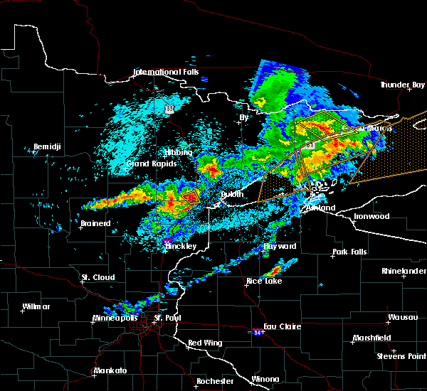 At 957 pm cdt, a severe thunderstorm was located near saginaw, or 7 miles north of cloquet, moving east at 50 mph (radar indicated). Hazards include 70 mph wind gusts and quarter size hail. Hail damage to vehicles is expected. expect considerable tree damage. wind damage is also likely to mobile homes, roofs, and outbuildings. Locations impacted include, cloquet, brookston, fond du lac reservation, and mahnomen. At 957 pm cdt, a severe thunderstorm was located near saginaw, or 7 miles north of cloquet, moving east at 50 mph (radar indicated). Hazards include 70 mph wind gusts and quarter size hail. Hail damage to vehicles is expected. expect considerable tree damage. wind damage is also likely to mobile homes, roofs, and outbuildings. Locations impacted include, cloquet, brookston, fond du lac reservation, and mahnomen.
|
| 8/31/2018 9:51 PM CDT |
 At 951 pm cdt, a severe thunderstorm was located over fond du lac reservation, or 7 miles northwest of cloquet, moving east at 50 mph (radar indicated). Hazards include 70 mph wind gusts and quarter size hail. Hail damage to vehicles is expected. expect considerable tree damage. wind damage is also likely to mobile homes, roofs, and outbuildings. Locations impacted include, cloquet, brookston, fond du lac reservation, and mahnomen. At 951 pm cdt, a severe thunderstorm was located over fond du lac reservation, or 7 miles northwest of cloquet, moving east at 50 mph (radar indicated). Hazards include 70 mph wind gusts and quarter size hail. Hail damage to vehicles is expected. expect considerable tree damage. wind damage is also likely to mobile homes, roofs, and outbuildings. Locations impacted include, cloquet, brookston, fond du lac reservation, and mahnomen.
|
| 8/31/2018 9:41 PM CDT |
 The national weather service in duluth mn has issued a * severe thunderstorm warning for. south central st. louis county in northeastern minnesota. north central carlton county in northeastern minnesota. Until 1015 pm cdt * at 940 pm cdt, a severe thunderstorm was located 7 miles northeast. The national weather service in duluth mn has issued a * severe thunderstorm warning for. south central st. louis county in northeastern minnesota. north central carlton county in northeastern minnesota. Until 1015 pm cdt * at 940 pm cdt, a severe thunderstorm was located 7 miles northeast.
|
| 8/31/2018 8:13 PM CDT |
 At 812 pm cdt, severe thunderstorms were located along a line extending from 6 miles north of cotton, to near canyon, to near scanlon, moving east at 55 mph. these storms have weakened in the past 15 minutes, but still remain capable of producing widespread damaging winds (radar indicated). Hazards include 70 mph wind gusts and penny size hail. Expect considerable tree damage. damage is likely to mobile homes, roofs, and outbuildings. Locations impacted include, duluth, superior, cloquet, hermantown, two harbors, proctor, scanlon, carlton, cotton, thomson, brookston, fairbanks, wolf lake, boulder lake, brimson, pike lake near duluth, city of rice lake, thomas lake near brimson, whiteface reservoir, and canyon. At 812 pm cdt, severe thunderstorms were located along a line extending from 6 miles north of cotton, to near canyon, to near scanlon, moving east at 55 mph. these storms have weakened in the past 15 minutes, but still remain capable of producing widespread damaging winds (radar indicated). Hazards include 70 mph wind gusts and penny size hail. Expect considerable tree damage. damage is likely to mobile homes, roofs, and outbuildings. Locations impacted include, duluth, superior, cloquet, hermantown, two harbors, proctor, scanlon, carlton, cotton, thomson, brookston, fairbanks, wolf lake, boulder lake, brimson, pike lake near duluth, city of rice lake, thomas lake near brimson, whiteface reservoir, and canyon.
|
| 8/31/2018 8:13 PM CDT |
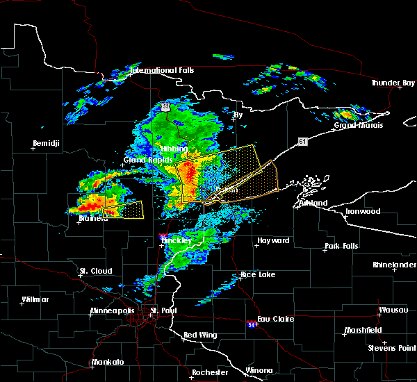 At 812 pm cdt, severe thunderstorms were located along a line extending from 6 miles north of cotton, to near canyon, to near scanlon, moving east at 55 mph. these storms have weakened in the past 15 minutes, but still remain capable of producing widespread damaging winds (radar indicated). Hazards include 70 mph wind gusts and penny size hail. Expect considerable tree damage. damage is likely to mobile homes, roofs, and outbuildings. Locations impacted include, duluth, superior, cloquet, hermantown, two harbors, proctor, scanlon, carlton, cotton, thomson, brookston, fairbanks, wolf lake, boulder lake, brimson, pike lake near duluth, city of rice lake, thomas lake near brimson, whiteface reservoir, and canyon. At 812 pm cdt, severe thunderstorms were located along a line extending from 6 miles north of cotton, to near canyon, to near scanlon, moving east at 55 mph. these storms have weakened in the past 15 minutes, but still remain capable of producing widespread damaging winds (radar indicated). Hazards include 70 mph wind gusts and penny size hail. Expect considerable tree damage. damage is likely to mobile homes, roofs, and outbuildings. Locations impacted include, duluth, superior, cloquet, hermantown, two harbors, proctor, scanlon, carlton, cotton, thomson, brookston, fairbanks, wolf lake, boulder lake, brimson, pike lake near duluth, city of rice lake, thomas lake near brimson, whiteface reservoir, and canyon.
|
| 8/31/2018 8:02 PM CDT |
 At 802 pm cdt, dangerous severe thunderstorms were located along a line extending from near toivola, to near brookston, to 7 miles southwest of cloquet, moving east-northeast at 60 mph. these are very dangerous storms with a history of producing widespread wind damage across aitkin county between 7 and 8 pm (radar indicated). Hazards include 90 mph wind gusts and penny size hail. You are in a life-threatening situation. flying debris may be deadly to those caught without shelter. mobile homes will be heavily damaged or destroyed. homes and businesses will have substantial roof and window damage. Expect extensive tree damage and power outages. At 802 pm cdt, dangerous severe thunderstorms were located along a line extending from near toivola, to near brookston, to 7 miles southwest of cloquet, moving east-northeast at 60 mph. these are very dangerous storms with a history of producing widespread wind damage across aitkin county between 7 and 8 pm (radar indicated). Hazards include 90 mph wind gusts and penny size hail. You are in a life-threatening situation. flying debris may be deadly to those caught without shelter. mobile homes will be heavily damaged or destroyed. homes and businesses will have substantial roof and window damage. Expect extensive tree damage and power outages.
|
| 8/31/2018 7:52 PM CDT |
 At 752 pm cdt, dangerous severe thunderstorms were located along a line extending from near floodwood, to near cromwell, moving east at 55 mph. these are very dangerous storms (radar indicated. widespread and severe wind damage reports have been received from aitkin county with these storms within the past 30 minutes). Hazards include 90 mph wind gusts and penny size hail. You are in a life-threatening situation. flying debris may be deadly to those caught without shelter. mobile homes will be heavily damaged or destroyed. homes and businesses will have substantial roof and window damage. expect extensive tree damage and power outages. locations impacted include, cloquet, scanlon, carlton, floodwood, cromwell, thomson, brookston, saginaw, fond du lac reservation, canyon, grand lake, mahnomen, alborn, culver, gowan, sawyer, prosit, esko, twig, and munger. People in brookston, independence, alborn, and along highway 33 between independence and cloquet should seek shelter immediately!!. At 752 pm cdt, dangerous severe thunderstorms were located along a line extending from near floodwood, to near cromwell, moving east at 55 mph. these are very dangerous storms (radar indicated. widespread and severe wind damage reports have been received from aitkin county with these storms within the past 30 minutes). Hazards include 90 mph wind gusts and penny size hail. You are in a life-threatening situation. flying debris may be deadly to those caught without shelter. mobile homes will be heavily damaged or destroyed. homes and businesses will have substantial roof and window damage. expect extensive tree damage and power outages. locations impacted include, cloquet, scanlon, carlton, floodwood, cromwell, thomson, brookston, saginaw, fond du lac reservation, canyon, grand lake, mahnomen, alborn, culver, gowan, sawyer, prosit, esko, twig, and munger. People in brookston, independence, alborn, and along highway 33 between independence and cloquet should seek shelter immediately!!.
|
| 8/31/2018 7:39 PM CDT |
 At 739 pm cdt, dangerous severe thunderstorms were located along a line extending from 7 miles east of jacobson, to near tamarack, moving east at 65 mph. these are very dangerous storms (radar indicated). Hazards include 90 mph wind gusts and penny size hail. You are in a life-threatening situation. flying debris may be deadly to those caught without shelter. mobile homes will be heavily damaged or destroyed. homes and businesses will have substantial roof and window damage. expect extensive tree damage and power outages. locations impacted include, cloquet, big sandy lake, scanlon, carlton, mahtowa, floodwood, wrenshall, cromwell, thomson, brookston, tamarack, saginaw, fond du lac reservation, canyon, grand lake, mahnomen, alborn, culver, ball bluff, and wright. people in the savanna portage state park, floodwood, and gowan areas will be impacted by the strongest winds. Seek shelter now!. At 739 pm cdt, dangerous severe thunderstorms were located along a line extending from 7 miles east of jacobson, to near tamarack, moving east at 65 mph. these are very dangerous storms (radar indicated). Hazards include 90 mph wind gusts and penny size hail. You are in a life-threatening situation. flying debris may be deadly to those caught without shelter. mobile homes will be heavily damaged or destroyed. homes and businesses will have substantial roof and window damage. expect extensive tree damage and power outages. locations impacted include, cloquet, big sandy lake, scanlon, carlton, mahtowa, floodwood, wrenshall, cromwell, thomson, brookston, tamarack, saginaw, fond du lac reservation, canyon, grand lake, mahnomen, alborn, culver, ball bluff, and wright. people in the savanna portage state park, floodwood, and gowan areas will be impacted by the strongest winds. Seek shelter now!.
|
| 8/31/2018 7:28 PM CDT |
 The national weather service in duluth mn has issued a * severe thunderstorm warning for. northeastern aitkin county in east central minnesota. southwestern st. louis county in northeastern minnesota. northern carlton county in northeastern minnesota. Until 815 pm cdt. The national weather service in duluth mn has issued a * severe thunderstorm warning for. northeastern aitkin county in east central minnesota. southwestern st. louis county in northeastern minnesota. northern carlton county in northeastern minnesota. Until 815 pm cdt.
|
| 8/26/2018 11:45 PM CDT |
 At 1145 pm cdt, severe thunderstorms were located along a line extending from near oklee to near faith, moving northeast at 65 mph (radar indicated). Hazards include 70 mph wind gusts and quarter size hail. Hail damage to vehicles is expected. expect considerable tree damage. wind damage is also likely to mobile homes, roofs, and outbuildings. these severe storms will be near, trail and gully around 1150 pm cdt. beaulieu around 1155 pm cdt. A tornado watch remains in effect until 200 am cdt for northwestern minnesota. At 1145 pm cdt, severe thunderstorms were located along a line extending from near oklee to near faith, moving northeast at 65 mph (radar indicated). Hazards include 70 mph wind gusts and quarter size hail. Hail damage to vehicles is expected. expect considerable tree damage. wind damage is also likely to mobile homes, roofs, and outbuildings. these severe storms will be near, trail and gully around 1150 pm cdt. beaulieu around 1155 pm cdt. A tornado watch remains in effect until 200 am cdt for northwestern minnesota.
|
| 8/26/2018 11:30 PM CDT |
 At 1129 pm cdt, severe thunderstorms were located along a line extending from near mentor to near syre, moving northeast at 65 mph (radar indicated). Hazards include 70 mph wind gusts and quarter size hail. Hail damage to vehicles is expected. expect considerable tree damage. wind damage is also likely to mobile homes, roofs, and outbuildings. these severe storms will be near, erskine and mcintosh around 1135 pm cdt. gary around 1140 pm cdt. faith and waukon around 1145 pm cdt. mahnomen, trail and gully around 1150 pm cdt. bejou and beaulieu around 1155 pm cdt. A tornado watch remains in effect until 200 am cdt for northwestern minnesota. At 1129 pm cdt, severe thunderstorms were located along a line extending from near mentor to near syre, moving northeast at 65 mph (radar indicated). Hazards include 70 mph wind gusts and quarter size hail. Hail damage to vehicles is expected. expect considerable tree damage. wind damage is also likely to mobile homes, roofs, and outbuildings. these severe storms will be near, erskine and mcintosh around 1135 pm cdt. gary around 1140 pm cdt. faith and waukon around 1145 pm cdt. mahnomen, trail and gully around 1150 pm cdt. bejou and beaulieu around 1155 pm cdt. A tornado watch remains in effect until 200 am cdt for northwestern minnesota.
|
| 8/26/2018 11:12 PM CDT |
 At 1112 pm cdt, severe thunderstorms were located along a line extending from near fertile to near kragnes, moving northeast at 65 mph (radar indicated). Hazards include 60 mph wind gusts and quarter size hail. Hail damage to vehicles is expected. expect wind damage to roofs, siding, and trees. severe thunderstorms will be near, flaming around 1115 pm cdt. fertile around 1120 pm cdt. borup around 1125 pm cdt. erskine around 1130 pm cdt. twin valley, syre and mcintosh around 1135 pm cdt. A tornado watch remains in effect until 200 am cdt for northwestern minnesota. At 1112 pm cdt, severe thunderstorms were located along a line extending from near fertile to near kragnes, moving northeast at 65 mph (radar indicated). Hazards include 60 mph wind gusts and quarter size hail. Hail damage to vehicles is expected. expect wind damage to roofs, siding, and trees. severe thunderstorms will be near, flaming around 1115 pm cdt. fertile around 1120 pm cdt. borup around 1125 pm cdt. erskine around 1130 pm cdt. twin valley, syre and mcintosh around 1135 pm cdt. A tornado watch remains in effect until 200 am cdt for northwestern minnesota.
|
| 8/26/2018 4:36 PM CDT |
 At 436 pm cdt, a severe thunderstorm was located near fond du lac reservation, or 8 miles west of cloquet, moving northeast at 35 mph (radar indicated). Hazards include 60 mph wind gusts and penny size hail. Expect damage to roofs, siding, and trees. Locations impacted include, cloquet, scanlon, mahtowa, fond du lac reservation, mahnomen, and sawyer. At 436 pm cdt, a severe thunderstorm was located near fond du lac reservation, or 8 miles west of cloquet, moving northeast at 35 mph (radar indicated). Hazards include 60 mph wind gusts and penny size hail. Expect damage to roofs, siding, and trees. Locations impacted include, cloquet, scanlon, mahtowa, fond du lac reservation, mahnomen, and sawyer.
|
| 8/26/2018 4:22 PM CDT |
 At 422 pm cdt, a severe thunderstorm was located near mahtowa, or 14 miles southwest of cloquet, moving northeast at 35 mph (radar indicated). Hazards include 60 mph wind gusts and penny size hail. expect damage to roofs, siding, and trees At 422 pm cdt, a severe thunderstorm was located near mahtowa, or 14 miles southwest of cloquet, moving northeast at 35 mph (radar indicated). Hazards include 60 mph wind gusts and penny size hail. expect damage to roofs, siding, and trees
|
| 6/30/2018 3:28 AM CDT |
 At 327 am cdt, severe thunderstorms were located along a line extending from 7 miles west of boulder lake, to near proctor, to 6 miles north of duxbury, moving east at 45 mph (radar indicated). Hazards include 60 mph wind gusts and quarter size hail. Hail damage to vehicles is expected. expect wind damage to roofs, siding, and trees. these severe storms will be near, hermantown, proctor and oliver around 335 am cdt. duluth, boulder lake and island lake around 340 am cdt. superior, dairyland, wisconsin point and south range around 345 am cdt. Other locations impacted by these severe thunderstorms include cody, billings park, gary new duluth, duquette, fish lake, moose junction, amnicon lake, banning state park, spirit valley, and jay cooke state park. At 327 am cdt, severe thunderstorms were located along a line extending from 7 miles west of boulder lake, to near proctor, to 6 miles north of duxbury, moving east at 45 mph (radar indicated). Hazards include 60 mph wind gusts and quarter size hail. Hail damage to vehicles is expected. expect wind damage to roofs, siding, and trees. these severe storms will be near, hermantown, proctor and oliver around 335 am cdt. duluth, boulder lake and island lake around 340 am cdt. superior, dairyland, wisconsin point and south range around 345 am cdt. Other locations impacted by these severe thunderstorms include cody, billings park, gary new duluth, duquette, fish lake, moose junction, amnicon lake, banning state park, spirit valley, and jay cooke state park.
|
| 6/30/2018 3:16 AM CDT |
 At 315 am cdt, severe thunderstorms were located along a line extending from near canyon, to scanlon, to near bruno, moving east at 45 mph (radar indicated). Hazards include 60 mph wind gusts and quarter size hail. Hail damage to vehicles is expected. expect wind damage to roofs, siding, and trees. these severe storms will be near, carlton, wrenshall and thomson around 320 am cdt. hermantown and proctor around 330 am cdt. oliver, boulder lake and cloverton around 335 am cdt. superior and island lake around 340 am cdt. dairyland, wisconsin point and south range around 345 am cdt. Other locations impacted by these severe thunderstorms include cody, billings park, gary new duluth, duquette, fish lake, moose junction, amnicon lake, banning state park, spirit valley, and jay cooke state park. At 315 am cdt, severe thunderstorms were located along a line extending from near canyon, to scanlon, to near bruno, moving east at 45 mph (radar indicated). Hazards include 60 mph wind gusts and quarter size hail. Hail damage to vehicles is expected. expect wind damage to roofs, siding, and trees. these severe storms will be near, carlton, wrenshall and thomson around 320 am cdt. hermantown and proctor around 330 am cdt. oliver, boulder lake and cloverton around 335 am cdt. superior and island lake around 340 am cdt. dairyland, wisconsin point and south range around 345 am cdt. Other locations impacted by these severe thunderstorms include cody, billings park, gary new duluth, duquette, fish lake, moose junction, amnicon lake, banning state park, spirit valley, and jay cooke state park.
|
| 6/30/2018 3:00 AM CDT |
 At 259 am cdt, severe thunderstorms were located along a line extending from near meadowlands, to 6 miles southwest of fond du lac reservation, to near askov, moving east at 45 mph (radar indicated). Hazards include 60 mph wind gusts and quarter size hail. Hail damage to vehicles is expected. expect wind damage to roofs, siding, and trees. severe thunderstorms will be near, cloquet around 310 am cdt. scanlon, fond du lac reservation and canyon around 315 am cdt. carlton, wrenshall and thomson around 320 am cdt. hermantown, proctor and oliver around 330 am cdt. boulder lake, cloverton and island lake around 335 am cdt. duluth and superior around 340 am cdt. dairyland, wisconsin point and south range around 345 am cdt. Other locations impacted by these severe thunderstorms include cody, billings park, gary new duluth, duquette, fish lake, moose junction, amnicon lake, banning state park, spirit valley, and jay cooke state park. At 259 am cdt, severe thunderstorms were located along a line extending from near meadowlands, to 6 miles southwest of fond du lac reservation, to near askov, moving east at 45 mph (radar indicated). Hazards include 60 mph wind gusts and quarter size hail. Hail damage to vehicles is expected. expect wind damage to roofs, siding, and trees. severe thunderstorms will be near, cloquet around 310 am cdt. scanlon, fond du lac reservation and canyon around 315 am cdt. carlton, wrenshall and thomson around 320 am cdt. hermantown, proctor and oliver around 330 am cdt. boulder lake, cloverton and island lake around 335 am cdt. duluth and superior around 340 am cdt. dairyland, wisconsin point and south range around 345 am cdt. Other locations impacted by these severe thunderstorms include cody, billings park, gary new duluth, duquette, fish lake, moose junction, amnicon lake, banning state park, spirit valley, and jay cooke state park.
|
| 6/29/2018 5:19 AM CDT |
 At 441 am cdt, severe thunderstorms were located along a line extending from near fertile to near borup to near averill, moving east at 55 mph. these are very dangerous storms (public). Hazards include 80 mph wind gusts and penny size hail. Flying debris will be dangerous to those caught without shelter. mobile homes will be heavily damaged. expect considerable damage to roofs, windows, and vehicles. extensive tree damage and power outages are likely. severe thunderstorms will be near, flaming and twin valley around 445 am cdt. rindal, ranum and syre around 450 am cdt. flom and faith around 455 am cdt. hitterdal, bejou and mahnomen around 500 am cdt. waubun and ogema around 505 am cdt. other locations impacted by these severe thunderstorms include many point scout camp. This storm has a history of producing wind speeds in excess of 80 mph. At 441 am cdt, severe thunderstorms were located along a line extending from near fertile to near borup to near averill, moving east at 55 mph. these are very dangerous storms (public). Hazards include 80 mph wind gusts and penny size hail. Flying debris will be dangerous to those caught without shelter. mobile homes will be heavily damaged. expect considerable damage to roofs, windows, and vehicles. extensive tree damage and power outages are likely. severe thunderstorms will be near, flaming and twin valley around 445 am cdt. rindal, ranum and syre around 450 am cdt. flom and faith around 455 am cdt. hitterdal, bejou and mahnomen around 500 am cdt. waubun and ogema around 505 am cdt. other locations impacted by these severe thunderstorms include many point scout camp. This storm has a history of producing wind speeds in excess of 80 mph.
|
| 6/29/2018 4:42 AM CDT |
 At 441 am cdt, severe thunderstorms were located along a line extending from near fertile to near borup to near averill, moving east at 55 mph. these are very dangerous storms (public). Hazards include 80 mph wind gusts and penny size hail. Flying debris will be dangerous to those caught without shelter. mobile homes will be heavily damaged. expect considerable damage to roofs, windows, and vehicles. extensive tree damage and power outages are likely. severe thunderstorms will be near, flaming and twin valley around 445 am cdt. rindal, ranum and syre around 450 am cdt. flom and faith around 455 am cdt. hitterdal, bejou and mahnomen around 500 am cdt. waubun and ogema around 505 am cdt. other locations impacted by these severe thunderstorms include many point scout camp. This storm has a history of producing wind speeds in excess of 80 mph. At 441 am cdt, severe thunderstorms were located along a line extending from near fertile to near borup to near averill, moving east at 55 mph. these are very dangerous storms (public). Hazards include 80 mph wind gusts and penny size hail. Flying debris will be dangerous to those caught without shelter. mobile homes will be heavily damaged. expect considerable damage to roofs, windows, and vehicles. extensive tree damage and power outages are likely. severe thunderstorms will be near, flaming and twin valley around 445 am cdt. rindal, ranum and syre around 450 am cdt. flom and faith around 455 am cdt. hitterdal, bejou and mahnomen around 500 am cdt. waubun and ogema around 505 am cdt. other locations impacted by these severe thunderstorms include many point scout camp. This storm has a history of producing wind speeds in excess of 80 mph.
|
| 6/28/2018 3:10 PM CDT |
 The tornado warning for northeastern norman, southeastern polk and western mahnomen counties will expire at 315 pm cdt, the storm which prompted the warning has weakened below severe limits, and no longer appears capable of producing a tornado. therefore, the warning will be allowed to expire. however small hail, gusty winds and heavy rain are still possible with this thunderstorm. a severe thunderstorm watch remains in effect until 900 pm cdt for northwestern minnesota. The tornado warning for northeastern norman, southeastern polk and western mahnomen counties will expire at 315 pm cdt, the storm which prompted the warning has weakened below severe limits, and no longer appears capable of producing a tornado. therefore, the warning will be allowed to expire. however small hail, gusty winds and heavy rain are still possible with this thunderstorm. a severe thunderstorm watch remains in effect until 900 pm cdt for northwestern minnesota.
|
| 6/28/2018 2:48 PM CDT |
 At 247 pm cdt, a severe thunderstorm capable of producing a tornado was located over rindal, or 43 miles south of thief river falls, moving southeast at 25 mph (radar indicated rotation). Hazards include tornado and quarter size hail. Expect damage to mobile homes, roofs, and vehicles. this dangerous storm will be near, ranum around 250 pm cdt. winger around 300 pm cdt. bejou around 310 pm cdt. Mahnomen around 315 pm cdt. At 247 pm cdt, a severe thunderstorm capable of producing a tornado was located over rindal, or 43 miles south of thief river falls, moving southeast at 25 mph (radar indicated rotation). Hazards include tornado and quarter size hail. Expect damage to mobile homes, roofs, and vehicles. this dangerous storm will be near, ranum around 250 pm cdt. winger around 300 pm cdt. bejou around 310 pm cdt. Mahnomen around 315 pm cdt.
|
| 6/28/2018 2:42 PM CDT |
 At 242 pm cdt, severe thunderstorms were located along a line extending from 6 miles north of mcintosh to near winger to flaming to lockhart, moving east at 10 mph (radar indicated). Hazards include 60 mph wind gusts and quarter size hail. Hail damage to vehicles is expected. expect wind damage to roofs, siding, and trees. Locations impacted include, fosston, mahnomen, fertile, mcintosh, erskine, island lake in mahnomen county and winger. At 242 pm cdt, severe thunderstorms were located along a line extending from 6 miles north of mcintosh to near winger to flaming to lockhart, moving east at 10 mph (radar indicated). Hazards include 60 mph wind gusts and quarter size hail. Hail damage to vehicles is expected. expect wind damage to roofs, siding, and trees. Locations impacted include, fosston, mahnomen, fertile, mcintosh, erskine, island lake in mahnomen county and winger.
|
| 6/28/2018 2:25 PM CDT |
 At 225 pm cdt, severe thunderstorms were located along a line extending from near brooks to near winger to near flaming to near shelly, moving southeast at 25 mph (radar indicated). Hazards include 60 mph wind gusts and quarter size hail. Hail damage to vehicles is expected. expect wind damage to roofs, siding, and trees. Locations impacted include, ada, fosston, mahnomen, fertile, mcintosh, erskine and oklee. At 225 pm cdt, severe thunderstorms were located along a line extending from near brooks to near winger to near flaming to near shelly, moving southeast at 25 mph (radar indicated). Hazards include 60 mph wind gusts and quarter size hail. Hail damage to vehicles is expected. expect wind damage to roofs, siding, and trees. Locations impacted include, ada, fosston, mahnomen, fertile, mcintosh, erskine and oklee.
|
| 6/28/2018 2:13 PM CDT |
 At 213 pm cdt, severe thunderstorms were located along a line extending from near brooks to near rindal to 6 miles east of lockhart to caledonia, moving southeast at 25 mph (radar indicated). Hazards include 60 mph wind gusts and quarter size hail. Hail damage to vehicles is expected. Expect wind damage to roofs, siding, and trees. At 213 pm cdt, severe thunderstorms were located along a line extending from near brooks to near rindal to 6 miles east of lockhart to caledonia, moving southeast at 25 mph (radar indicated). Hazards include 60 mph wind gusts and quarter size hail. Hail damage to vehicles is expected. Expect wind damage to roofs, siding, and trees.
|
| 6/17/2018 2:53 PM CDT |
 The severe thunderstorm warning for south central st. louis and northeastern carlton counties will expire at 300 pm cdt, the storm which prompted the warning has weakened below severe limits, and no longer poses an immediate threat to life or property. therefore, the warning will be allowed to expire. however gusty winds are still possible with this thunderstorm. a tornado watch remains in effect until 900 pm cdt for northeastern minnesota. The severe thunderstorm warning for south central st. louis and northeastern carlton counties will expire at 300 pm cdt, the storm which prompted the warning has weakened below severe limits, and no longer poses an immediate threat to life or property. therefore, the warning will be allowed to expire. however gusty winds are still possible with this thunderstorm. a tornado watch remains in effect until 900 pm cdt for northeastern minnesota.
|
| 6/17/2018 2:49 PM CDT |
 At 248 pm cdt, a severe thunderstorm was located near hermantown, or 7 miles northeast of cloquet, moving northeast at 45 mph (radar indicated). Hazards include 70 mph wind gusts and quarter size hail. Hail damage to vehicles is expected. expect considerable tree damage. wind damage is also likely to mobile homes, roofs, and outbuildings. locations impacted include, cloquet, scanlon, carlton, wrenshall, thomson, brookston, saginaw, fond du lac reservation, mahnomen, culver, burnett, jay cooke state park, and esko. A tornado watch remains in effect until 900 pm cdt for northeastern minnesota. At 248 pm cdt, a severe thunderstorm was located near hermantown, or 7 miles northeast of cloquet, moving northeast at 45 mph (radar indicated). Hazards include 70 mph wind gusts and quarter size hail. Hail damage to vehicles is expected. expect considerable tree damage. wind damage is also likely to mobile homes, roofs, and outbuildings. locations impacted include, cloquet, scanlon, carlton, wrenshall, thomson, brookston, saginaw, fond du lac reservation, mahnomen, culver, burnett, jay cooke state park, and esko. A tornado watch remains in effect until 900 pm cdt for northeastern minnesota.
|
| 6/17/2018 2:34 PM CDT |
 At 234 pm cdt, a severe thunderstorm was located near cloquet, moving east at 45 mph (radar indicated). Hazards include 70 mph wind gusts and quarter size hail. Hail damage to vehicles is expected. expect considerable tree damage. wind damage is also likely to mobile homes, roofs, and outbuildings. locations impacted include, cloquet, scanlon, carlton, mahtowa, wrenshall, thomson, brookston, saginaw, fond du lac reservation, mahnomen, culver, burnett, sawyer, jay cooke state park, and esko. A tornado watch remains in effect until 900 pm cdt for northeastern minnesota. At 234 pm cdt, a severe thunderstorm was located near cloquet, moving east at 45 mph (radar indicated). Hazards include 70 mph wind gusts and quarter size hail. Hail damage to vehicles is expected. expect considerable tree damage. wind damage is also likely to mobile homes, roofs, and outbuildings. locations impacted include, cloquet, scanlon, carlton, mahtowa, wrenshall, thomson, brookston, saginaw, fond du lac reservation, mahnomen, culver, burnett, sawyer, jay cooke state park, and esko. A tornado watch remains in effect until 900 pm cdt for northeastern minnesota.
|
| 6/17/2018 2:25 PM CDT |
 At 225 pm cdt, a severe thunderstorm was located near cromwell, or 13 miles west of cloquet, moving northeast at 50 mph (radar indicated). Hazards include 70 mph wind gusts and quarter size hail. Hail damage to vehicles is expected. expect considerable tree damage. Wind damage is also likely to mobile homes, roofs, and outbuildings. At 225 pm cdt, a severe thunderstorm was located near cromwell, or 13 miles west of cloquet, moving northeast at 50 mph (radar indicated). Hazards include 70 mph wind gusts and quarter size hail. Hail damage to vehicles is expected. expect considerable tree damage. Wind damage is also likely to mobile homes, roofs, and outbuildings.
|
| 6/17/2018 2:01 PM CDT |
 At 200 pm cdt, a severe thunderstorm was located over cloquet, moving east at 30 mph (radar indicated). Hazards include 70 mph wind gusts and half dollar size hail. Hail damage to vehicles is expected. expect considerable tree damage. wind damage is also likely to mobile homes, roofs, and outbuildings. locations impacted include, cloquet, scanlon, carlton, wrenshall, thomson, saginaw, fond du lac reservation, mahnomen, esko, sawyer, and jay cooke state park. A tornado watch remains in effect until 900 pm cdt for northeastern minnesota. At 200 pm cdt, a severe thunderstorm was located over cloquet, moving east at 30 mph (radar indicated). Hazards include 70 mph wind gusts and half dollar size hail. Hail damage to vehicles is expected. expect considerable tree damage. wind damage is also likely to mobile homes, roofs, and outbuildings. locations impacted include, cloquet, scanlon, carlton, wrenshall, thomson, saginaw, fond du lac reservation, mahnomen, esko, sawyer, and jay cooke state park. A tornado watch remains in effect until 900 pm cdt for northeastern minnesota.
|
| 6/17/2018 1:50 PM CDT |
 At 149 pm cdt, a severe thunderstorm was located near fond du lac reservation, just west of cloquet, moving east at 30 mph (radar indicated). Hazards include 70 mph wind gusts and half dollar size hail. Hail damage to vehicles is expected. expect considerable tree damage. wind damage is also likely to mobile homes, roofs, and outbuildings. locations impacted include, cloquet, scanlon, carlton, wrenshall, cromwell, thomson, saginaw, fond du lac reservation, mahnomen, sawyer, esko, kettle lake, and jay cooke state park. A tornado watch remains in effect until 900 pm cdt for northeastern minnesota. At 149 pm cdt, a severe thunderstorm was located near fond du lac reservation, just west of cloquet, moving east at 30 mph (radar indicated). Hazards include 70 mph wind gusts and half dollar size hail. Hail damage to vehicles is expected. expect considerable tree damage. wind damage is also likely to mobile homes, roofs, and outbuildings. locations impacted include, cloquet, scanlon, carlton, wrenshall, cromwell, thomson, saginaw, fond du lac reservation, mahnomen, sawyer, esko, kettle lake, and jay cooke state park. A tornado watch remains in effect until 900 pm cdt for northeastern minnesota.
|
| 6/17/2018 1:32 PM CDT |
 At 132 pm cdt, a severe thunderstorm was located near cromwell, or 16 miles west of cloquet, moving east at 30 mph (radar indicated). Hazards include 70 mph wind gusts and half dollar size hail. Hail damage to vehicles is expected. expect considerable tree damage. Wind damage is also likely to mobile homes, roofs, and outbuildings. At 132 pm cdt, a severe thunderstorm was located near cromwell, or 16 miles west of cloquet, moving east at 30 mph (radar indicated). Hazards include 70 mph wind gusts and half dollar size hail. Hail damage to vehicles is expected. expect considerable tree damage. Wind damage is also likely to mobile homes, roofs, and outbuildings.
|
| 6/15/2018 12:31 PM CDT |
 At 1231 pm cdt, severe thunderstorms were located along a line extending from 6 miles east of canyon, to near saginaw, to cloquet, moving east at 50 mph (radar indicated). Hazards include 60 mph wind gusts and penny size hail. expect damage to roofs, siding, and trees At 1231 pm cdt, severe thunderstorms were located along a line extending from 6 miles east of canyon, to near saginaw, to cloquet, moving east at 50 mph (radar indicated). Hazards include 60 mph wind gusts and penny size hail. expect damage to roofs, siding, and trees
|
| 6/8/2018 7:29 PM CDT |
 The national weather service in grand forks has issued a * severe thunderstorm warning for. northeastern norman county in northwestern minnesota. western mahnomen county in northwestern minnesota. until 815 pm cdt. At 729 pm cdt, a severe thunderstorm was located over waukon, or 41. The national weather service in grand forks has issued a * severe thunderstorm warning for. northeastern norman county in northwestern minnesota. western mahnomen county in northwestern minnesota. until 815 pm cdt. At 729 pm cdt, a severe thunderstorm was located over waukon, or 41.
|
| 9/22/2017 6:49 AM CDT |
 At 649 am cdt, a severe thunderstorm was located near hermantown, or 8 miles northeast of cloquet, moving northeast at 50 mph (radar indicated). Hazards include 60 mph wind gusts and quarter size hail. Hail damage to vehicles is expected. expect wind damage to roofs, siding, and trees. Locations impacted include, duluth, superior, cloquet, hermantown, proctor, scanlon, carlton, mahtowa, wrenshall, oliver, thomson, pike lake near duluth, saginaw, island lake, boulder lake, grand lake, fredenberg, mahnomen, irving, and cody. At 649 am cdt, a severe thunderstorm was located near hermantown, or 8 miles northeast of cloquet, moving northeast at 50 mph (radar indicated). Hazards include 60 mph wind gusts and quarter size hail. Hail damage to vehicles is expected. expect wind damage to roofs, siding, and trees. Locations impacted include, duluth, superior, cloquet, hermantown, proctor, scanlon, carlton, mahtowa, wrenshall, oliver, thomson, pike lake near duluth, saginaw, island lake, boulder lake, grand lake, fredenberg, mahnomen, irving, and cody.
|
| 9/22/2017 6:41 AM CDT |
 At 641 am cdt, a severe thunderstorm was located over cloquet, moving northeast at 45 mph (radar indicated). Hazards include 60 mph wind gusts and quarter size hail. Hail damage to vehicles is expected. Expect wind damage to roofs, siding, and trees. At 641 am cdt, a severe thunderstorm was located over cloquet, moving northeast at 45 mph (radar indicated). Hazards include 60 mph wind gusts and quarter size hail. Hail damage to vehicles is expected. Expect wind damage to roofs, siding, and trees.
|
| 7/21/2017 8:32 PM CDT |
 At 832 pm cdt, a severe thunderstorm was located over wrenshall, or 9 miles southeast of cloquet, moving east at 35 mph (radar indicated). Hazards include 60 mph wind gusts and penny size hail. Expect damage to roofs, siding, and trees. this severe storm will be near, foxboro around 845 pm cdt. Other locations impacted by this severe thunderstorm include pleasant valley, gary new duluth, munger, morgan park, sawyer, fond du lac, mahnomen, jay cooke state park, norton park, and esko. At 832 pm cdt, a severe thunderstorm was located over wrenshall, or 9 miles southeast of cloquet, moving east at 35 mph (radar indicated). Hazards include 60 mph wind gusts and penny size hail. Expect damage to roofs, siding, and trees. this severe storm will be near, foxboro around 845 pm cdt. Other locations impacted by this severe thunderstorm include pleasant valley, gary new duluth, munger, morgan park, sawyer, fond du lac, mahnomen, jay cooke state park, norton park, and esko.
|
| 7/21/2017 8:20 PM CDT |
 At 820 pm cdt, a severe thunderstorm was located near carlton, or near cloquet, moving east at 30 mph (radar indicated). Hazards include 60 mph wind gusts and penny size hail. Expect damage to roofs, siding, and trees. this severe storm will be near, scanlon around 825 pm cdt. carlton around 830 pm cdt. wrenshall and thomson around 835 pm cdt. oliver and foxboro around 845 pm cdt. Other locations impacted by this severe thunderstorm include gowan, cody, grand lake, pleasant valley, gary new duluth, munger, morgan park, sawyer, spirit valley, and fond du lac. At 820 pm cdt, a severe thunderstorm was located near carlton, or near cloquet, moving east at 30 mph (radar indicated). Hazards include 60 mph wind gusts and penny size hail. Expect damage to roofs, siding, and trees. this severe storm will be near, scanlon around 825 pm cdt. carlton around 830 pm cdt. wrenshall and thomson around 835 pm cdt. oliver and foxboro around 845 pm cdt. Other locations impacted by this severe thunderstorm include gowan, cody, grand lake, pleasant valley, gary new duluth, munger, morgan park, sawyer, spirit valley, and fond du lac.
|
| 7/21/2017 7:59 PM CDT |
 At 757 pm cdt, a severe thunderstorm was located near cromwell, or 12 miles west of cloquet, moving east at 35 mph (radar indicated). Hazards include 60 mph wind gusts and nickel size hail. Expect damage to roofs, siding, and trees. this severe thunderstorm will be near, mahtowa and barnum around 810 pm cdt. scanlon around 820 pm cdt. carlton, wrenshall and thomson around 825 pm cdt. holyoke around 830 pm cdt. oliver and foxboro around 840 pm cdt. Other locations impacted by this severe thunderstorm include gowan, cody, grand lake, gary new duluth, morgan park, wright, sawyer, spirit valley, jay cooke state park, and norton park. At 757 pm cdt, a severe thunderstorm was located near cromwell, or 12 miles west of cloquet, moving east at 35 mph (radar indicated). Hazards include 60 mph wind gusts and nickel size hail. Expect damage to roofs, siding, and trees. this severe thunderstorm will be near, mahtowa and barnum around 810 pm cdt. scanlon around 820 pm cdt. carlton, wrenshall and thomson around 825 pm cdt. holyoke around 830 pm cdt. oliver and foxboro around 840 pm cdt. Other locations impacted by this severe thunderstorm include gowan, cody, grand lake, gary new duluth, morgan park, wright, sawyer, spirit valley, jay cooke state park, and norton park.
|
| 7/21/2017 7:38 PM CDT |
 At 737 pm cdt, a severe thunderstorm was located 7 miles northwest of cromwell, or 16 miles east of big sandy lake, moving east at 40 mph (radar indicated). Hazards include 70 mph wind gusts and quarter size hail. Hail damage to vehicles is expected. expect considerable tree damage. wind damage is also likely to mobile homes, roofs, and outbuildings. this severe storm will be near, cloquet around 800 pm cdt. Other locations impacted by this severe thunderstorm include gowan, grand lake, ball bluff, sheshebee, wright, savanna portage state park, burnett, wawina, sawyer, and island. At 737 pm cdt, a severe thunderstorm was located 7 miles northwest of cromwell, or 16 miles east of big sandy lake, moving east at 40 mph (radar indicated). Hazards include 70 mph wind gusts and quarter size hail. Hail damage to vehicles is expected. expect considerable tree damage. wind damage is also likely to mobile homes, roofs, and outbuildings. this severe storm will be near, cloquet around 800 pm cdt. Other locations impacted by this severe thunderstorm include gowan, grand lake, ball bluff, sheshebee, wright, savanna portage state park, burnett, wawina, sawyer, and island.
|
| 7/21/2017 7:14 PM CDT |
 At 714 pm cdt, a severe thunderstorm was located near libby, or near big sandy lake, moving east at 50 mph (radar indicated). Hazards include 70 mph wind gusts and quarter size hail. Hail damage to vehicles is expected. expect considerable tree damage. wind damage is also likely to mobile homes, roofs, and outbuildings. this severe thunderstorm will be near, tamarack around 725 pm cdt. cromwell around 740 pm cdt. cloquet and mahtowa around 755 pm cdt. Other locations impacted by this severe thunderstorm include gowan, grand lake, ball bluff, sheshebee, wright, savanna portage state park, burnett, wawina, sawyer, and island. At 714 pm cdt, a severe thunderstorm was located near libby, or near big sandy lake, moving east at 50 mph (radar indicated). Hazards include 70 mph wind gusts and quarter size hail. Hail damage to vehicles is expected. expect considerable tree damage. wind damage is also likely to mobile homes, roofs, and outbuildings. this severe thunderstorm will be near, tamarack around 725 pm cdt. cromwell around 740 pm cdt. cloquet and mahtowa around 755 pm cdt. Other locations impacted by this severe thunderstorm include gowan, grand lake, ball bluff, sheshebee, wright, savanna portage state park, burnett, wawina, sawyer, and island.
|
| 7/17/2017 7:09 PM CDT |
 At 657 pm cdt, severe thunderstorms were located along a line extending from 9 miles southwest of brookston, to 6 miles west of sandstone, moving east at 40 mph (radar indicated). Hazards include 60 mph wind gusts and quarter size hail. Hail damage to vehicles is expected. expect wind damage to roofs, siding, and trees. these severe storms will be near, cloquet and askov around 715 pm cdt. bruno around 720 pm cdt. Other locations impacted by these severe thunderstorms include finlayson, arthyde, moose lake state park, wright, dads corner, denham, sawyer, banning state park, automba, and mahnomen. At 657 pm cdt, severe thunderstorms were located along a line extending from 9 miles southwest of brookston, to 6 miles west of sandstone, moving east at 40 mph (radar indicated). Hazards include 60 mph wind gusts and quarter size hail. Hail damage to vehicles is expected. expect wind damage to roofs, siding, and trees. these severe storms will be near, cloquet and askov around 715 pm cdt. bruno around 720 pm cdt. Other locations impacted by these severe thunderstorms include finlayson, arthyde, moose lake state park, wright, dads corner, denham, sawyer, banning state park, automba, and mahnomen.
|
| 7/17/2017 6:58 PM CDT |
 At 657 pm cdt, severe thunderstorms were located along a line extending from 9 miles southwest of brookston, to 6 miles west of sandstone, moving east at 40 mph (radar indicated). Hazards include 60 mph wind gusts and quarter size hail. Hail damage to vehicles is expected. expect wind damage to roofs, siding, and trees. these severe storms will be near, cloquet and askov around 715 pm cdt. bruno around 720 pm cdt. Other locations impacted by these severe thunderstorms include finlayson, arthyde, moose lake state park, wright, dads corner, denham, sawyer, banning state park, automba, and mahnomen. At 657 pm cdt, severe thunderstorms were located along a line extending from 9 miles southwest of brookston, to 6 miles west of sandstone, moving east at 40 mph (radar indicated). Hazards include 60 mph wind gusts and quarter size hail. Hail damage to vehicles is expected. expect wind damage to roofs, siding, and trees. these severe storms will be near, cloquet and askov around 715 pm cdt. bruno around 720 pm cdt. Other locations impacted by these severe thunderstorms include finlayson, arthyde, moose lake state park, wright, dads corner, denham, sawyer, banning state park, automba, and mahnomen.
|
| 7/17/2017 6:43 PM CDT |
 At 643 pm cdt, severe thunderstorms were located along a line extending from 10 miles southwest of floodwood, to 6 miles south of mcgrath, moving east at 25 mph (radar indicated). Hazards include 60 mph wind gusts and quarter size hail. Hail damage to vehicles is expected. expect wind damage to roofs, siding, and trees. severe thunderstorms will be near, rutledge around 725 pm cdt. askov around 735 pm cdt. cloquet around 740 pm cdt. bruno around 745 pm cdt. Other locations impacted by these severe thunderstorms include finlayson, arthyde, moose lake state park, sheshebee, wright, lawler, dads corner, denham, sawyer, and banning state park. At 643 pm cdt, severe thunderstorms were located along a line extending from 10 miles southwest of floodwood, to 6 miles south of mcgrath, moving east at 25 mph (radar indicated). Hazards include 60 mph wind gusts and quarter size hail. Hail damage to vehicles is expected. expect wind damage to roofs, siding, and trees. severe thunderstorms will be near, rutledge around 725 pm cdt. askov around 735 pm cdt. cloquet around 740 pm cdt. bruno around 745 pm cdt. Other locations impacted by these severe thunderstorms include finlayson, arthyde, moose lake state park, sheshebee, wright, lawler, dads corner, denham, sawyer, and banning state park.
|
| 7/6/2017 5:31 AM CDT |
 At 531 am cdt, severe thunderstorms were located along a line extending from 6 miles northeast of cotton, to near hermantown, to 8 miles south of holyoke, moving east at 55 mph (radar indicated). Hazards include 60 mph wind gusts and penny size hail. expect damage to roofs, siding, and trees At 531 am cdt, severe thunderstorms were located along a line extending from 6 miles northeast of cotton, to near hermantown, to 8 miles south of holyoke, moving east at 55 mph (radar indicated). Hazards include 60 mph wind gusts and penny size hail. expect damage to roofs, siding, and trees
|
| 7/6/2017 5:31 AM CDT |
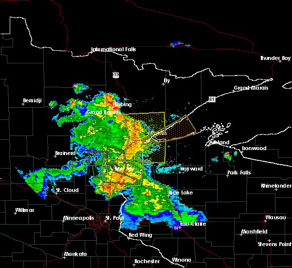 At 531 am cdt, severe thunderstorms were located along a line extending from 6 miles northeast of cotton, to near hermantown, to 8 miles south of holyoke, moving east at 55 mph (radar indicated). Hazards include 60 mph wind gusts and penny size hail. expect damage to roofs, siding, and trees At 531 am cdt, severe thunderstorms were located along a line extending from 6 miles northeast of cotton, to near hermantown, to 8 miles south of holyoke, moving east at 55 mph (radar indicated). Hazards include 60 mph wind gusts and penny size hail. expect damage to roofs, siding, and trees
|
| 7/6/2017 5:17 AM CDT |
 At 515 am cdt, severe thunderstorms were located along a line extending from near toivola, to near cloquet, to near bruno, moving east at 50 mph (radar indicated). Hazards include 70 mph wind gusts and quarter size hail. Hail damage to vehicles is expected. expect considerable tree damage. wind damage is also likely to mobile homes, roofs, and outbuildings. Locations impacted include, duluth, superior, cloquet, hermantown, proctor, scanlon, carlton, mahtowa, barnum, floodwood, cotton, willow river, wrenshall, oliver, cromwell, holyoke, kettle river, toivola, thomson, and brookston. At 515 am cdt, severe thunderstorms were located along a line extending from near toivola, to near cloquet, to near bruno, moving east at 50 mph (radar indicated). Hazards include 70 mph wind gusts and quarter size hail. Hail damage to vehicles is expected. expect considerable tree damage. wind damage is also likely to mobile homes, roofs, and outbuildings. Locations impacted include, duluth, superior, cloquet, hermantown, proctor, scanlon, carlton, mahtowa, barnum, floodwood, cotton, willow river, wrenshall, oliver, cromwell, holyoke, kettle river, toivola, thomson, and brookston.
|
| 7/6/2017 5:02 AM CDT |
 At 502 am cdt, severe thunderstorms were located along a line extending from 8 miles west of toivola, to 6 miles north of cromwell, to 6 miles west of willow river, moving east at 50 mph (radar indicated). Hazards include 70 mph wind gusts and quarter size hail. Hail damage to vehicles is expected. expect considerable tree damage. wind damage is also likely to mobile homes, roofs, and outbuildings. locations impacted include, duluth, superior, cloquet, hermantown, proctor, scanlon, carlton, swan river, mahtowa, barnum, floodwood, cotton, willow river, wrenshall, oliver, cromwell, holyoke, warba, kettle river, and toivola. This also includes interstate 35 between barnum and duluth and state highway 61 between duluth and two harbors. At 502 am cdt, severe thunderstorms were located along a line extending from 8 miles west of toivola, to 6 miles north of cromwell, to 6 miles west of willow river, moving east at 50 mph (radar indicated). Hazards include 70 mph wind gusts and quarter size hail. Hail damage to vehicles is expected. expect considerable tree damage. wind damage is also likely to mobile homes, roofs, and outbuildings. locations impacted include, duluth, superior, cloquet, hermantown, proctor, scanlon, carlton, swan river, mahtowa, barnum, floodwood, cotton, willow river, wrenshall, oliver, cromwell, holyoke, warba, kettle river, and toivola. This also includes interstate 35 between barnum and duluth and state highway 61 between duluth and two harbors.
|
| 7/6/2017 4:44 AM CDT |
 At 443 am cdt, severe thunderstorms were located along a line extending from near warba, to 6 miles north of tamarack, to 6 miles north of mcgrath, moving east at 50 mph (radar indicated). Hazards include 70 mph wind gusts and quarter size hail. Hail damage to vehicles is expected. expect considerable tree damage. Wind damage is also likely to mobile homes, roofs, and outbuildings. At 443 am cdt, severe thunderstorms were located along a line extending from near warba, to 6 miles north of tamarack, to 6 miles north of mcgrath, moving east at 50 mph (radar indicated). Hazards include 70 mph wind gusts and quarter size hail. Hail damage to vehicles is expected. expect considerable tree damage. Wind damage is also likely to mobile homes, roofs, and outbuildings.
|
| 6/21/2017 7:27 PM CDT | Half Dollar sized hail reported 150.9 miles ESE of Mahnomen, MN |
| 6/21/2017 7:08 PM CDT | A couple of trees were split and broken down across power lines resulting in local power outages. time estimated based on radar and nearby wind observation in mahnomen county MN, 166.7 miles ESE of Mahnomen, MN |
| 6/13/2017 10:01 PM CDT |
 A severe thunderstorm warning remains in effect until 1030 pm cdt for eastern norman. southwestern wadena. eastern otter tail. mahnomen. becker and southern clearwater counties. At 1000 pm cdt, severe thunderstorms were located along a line extending from hitterdal to near perham to near urbank, and are nearly stationary. A severe thunderstorm warning remains in effect until 1030 pm cdt for eastern norman. southwestern wadena. eastern otter tail. mahnomen. becker and southern clearwater counties. At 1000 pm cdt, severe thunderstorms were located along a line extending from hitterdal to near perham to near urbank, and are nearly stationary.
|
| 6/13/2017 9:37 PM CDT |
 At 936 pm cdt, severe thunderstorms were located along a line extending from hitterdal to near perham to near urbank, and are nearly stationary (public. this storm has a history of producing damaging winds). Hazards include 60 mph wind gusts and penny size hail. Expect damage to roofs, siding, and trees. severe thunderstorms will be near, vergas and dale around 940 pm cdt. hitterdal around 955 pm cdt. perham around 1000 pm cdt. Frazee, ulen and almora around 1030 pm cdt. At 936 pm cdt, severe thunderstorms were located along a line extending from hitterdal to near perham to near urbank, and are nearly stationary (public. this storm has a history of producing damaging winds). Hazards include 60 mph wind gusts and penny size hail. Expect damage to roofs, siding, and trees. severe thunderstorms will be near, vergas and dale around 940 pm cdt. hitterdal around 955 pm cdt. perham around 1000 pm cdt. Frazee, ulen and almora around 1030 pm cdt.
|
| 6/13/2017 3:41 PM CDT |
 At 341 pm cdt, a severe thunderstorm was located over waukon, or 41 miles north of detroit lakes, moving northeast at 45 mph (radar indicated). Hazards include 60 mph wind gusts and quarter size hail. Hail damage to vehicles is expected. expect wind damage to roofs, siding, and trees. this severe storm will be near, ranum around 345 pm cdt. rindal and bejou around 350 pm cdt. winger around 400 pm cdt. erskine around 405 pm cdt. Mcintosh around 410 pm cdt. At 341 pm cdt, a severe thunderstorm was located over waukon, or 41 miles north of detroit lakes, moving northeast at 45 mph (radar indicated). Hazards include 60 mph wind gusts and quarter size hail. Hail damage to vehicles is expected. expect wind damage to roofs, siding, and trees. this severe storm will be near, ranum around 345 pm cdt. rindal and bejou around 350 pm cdt. winger around 400 pm cdt. erskine around 405 pm cdt. Mcintosh around 410 pm cdt.
|
| 6/13/2017 3:35 PM CDT | Quarter sized hail reported 154.7 miles ESE of Mahnomen, MN, very heavy rain and dime to quarter sized hail. |
| 6/13/2017 3:27 PM CDT |
 At 326 pm cdt, a severe thunderstorm was located over twin valley, or 34 miles northwest of detroit lakes, moving northeast at 45 mph (radar indicated). Hazards include 60 mph wind gusts and quarter size hail. Hail damage to vehicles is expected. expect wind damage to roofs, siding, and trees. this severe storm will be near, faith around 335 pm cdt. gary and waukon around 340 pm cdt. ranum, rindal and bejou around 350 pm cdt. winger around 400 pm cdt. Mcintosh and erskine around 410 pm cdt. At 326 pm cdt, a severe thunderstorm was located over twin valley, or 34 miles northwest of detroit lakes, moving northeast at 45 mph (radar indicated). Hazards include 60 mph wind gusts and quarter size hail. Hail damage to vehicles is expected. expect wind damage to roofs, siding, and trees. this severe storm will be near, faith around 335 pm cdt. gary and waukon around 340 pm cdt. ranum, rindal and bejou around 350 pm cdt. winger around 400 pm cdt. Mcintosh and erskine around 410 pm cdt.
|
| 6/13/2017 3:07 PM CDT |
 At 307 pm cdt, a severe thunderstorm was located near felton, or 22 miles northeast of fargo, moving northeast at 45 mph (radar indicated). Hazards include 60 mph wind gusts and quarter size hail. Hail damage to vehicles is expected. expect wind damage to roofs, siding, and trees. this severe thunderstorm will be near, ulen around 315 pm cdt. syre and flom around 325 pm cdt. twin valley around 330 pm cdt. faith around 335 pm cdt. Gary and waukon around 340 pm cdt. At 307 pm cdt, a severe thunderstorm was located near felton, or 22 miles northeast of fargo, moving northeast at 45 mph (radar indicated). Hazards include 60 mph wind gusts and quarter size hail. Hail damage to vehicles is expected. expect wind damage to roofs, siding, and trees. this severe thunderstorm will be near, ulen around 315 pm cdt. syre and flom around 325 pm cdt. twin valley around 330 pm cdt. faith around 335 pm cdt. Gary and waukon around 340 pm cdt.
|
| 8/28/2016 11:59 PM CDT |
 At 1159 pm cdt, a severe thunderstorm was located over richwood, or 8 miles north of detroit lakes, moving southeast at 30 mph (radar indicated). Hazards include 60 mph wind gusts and quarter size hail. Hail damage to vehicles is expected. expect wind damage to roofs, siding, and trees. This severe thunderstorm will remain over mainly rural areas of western becker, southwestern clearwater, southern mahnomen, southeastern norman and northeastern clay counties. At 1159 pm cdt, a severe thunderstorm was located over richwood, or 8 miles north of detroit lakes, moving southeast at 30 mph (radar indicated). Hazards include 60 mph wind gusts and quarter size hail. Hail damage to vehicles is expected. expect wind damage to roofs, siding, and trees. This severe thunderstorm will remain over mainly rural areas of western becker, southwestern clearwater, southern mahnomen, southeastern norman and northeastern clay counties.
|
| 8/28/2016 11:31 PM CDT |
 At 1130 pm cdt, a severe thunderstorm was located near flom, or 23 miles northwest of detroit lakes, moving southeast at 10 mph (radar indicated). Hazards include 60 mph wind gusts and quarter size hail. Hail damage to vehicles is expected. expect wind damage to roofs, siding, and trees. this severe thunderstorm will be near, waubun around 1150 pm cdt. ogema around 1205 am cdt. Callaway, white earth and richwood around 1230 am cdt. At 1130 pm cdt, a severe thunderstorm was located near flom, or 23 miles northwest of detroit lakes, moving southeast at 10 mph (radar indicated). Hazards include 60 mph wind gusts and quarter size hail. Hail damage to vehicles is expected. expect wind damage to roofs, siding, and trees. this severe thunderstorm will be near, waubun around 1150 pm cdt. ogema around 1205 am cdt. Callaway, white earth and richwood around 1230 am cdt.
|
| 8/28/2016 11:18 PM CDT |
 At 1117 pm cdt, a severe thunderstorm capable of producing a tornado was located near waubun, or 29 miles north of detroit lakes, moving southeast at 10 mph (radar indicated rotation). Hazards include tornado and quarter size hail. Expect damage to mobile homes. roofs. and vehicles. This dangerous storm will be near, waubun and ogema around 1130 pm cdt. At 1117 pm cdt, a severe thunderstorm capable of producing a tornado was located near waubun, or 29 miles north of detroit lakes, moving southeast at 10 mph (radar indicated rotation). Hazards include tornado and quarter size hail. Expect damage to mobile homes. roofs. and vehicles. This dangerous storm will be near, waubun and ogema around 1130 pm cdt.
|
| 8/28/2016 10:41 PM CDT |
 At 1040 pm cdt, a severe thunderstorm capable of producing a tornado was located near waukon, or 38 miles north of detroit lakes, moving southeast at 20 mph (radar indicated rotation). Hazards include tornado and quarter size hail. Expect damage to mobile homes. roofs. and vehicles. this dangerous storm will be near, mahnomen around 1050 pm cdt. waubun around 1055 pm cdt. ogema around 1100 pm cdt. white earth around 1105 pm cdt. Tulaby lake around 1110 pm cdt. At 1040 pm cdt, a severe thunderstorm capable of producing a tornado was located near waukon, or 38 miles north of detroit lakes, moving southeast at 20 mph (radar indicated rotation). Hazards include tornado and quarter size hail. Expect damage to mobile homes. roofs. and vehicles. this dangerous storm will be near, mahnomen around 1050 pm cdt. waubun around 1055 pm cdt. ogema around 1100 pm cdt. white earth around 1105 pm cdt. Tulaby lake around 1110 pm cdt.
|
| 8/4/2016 4:37 AM CDT |
 At 434 am cdt, severe thunderstorms were located along a line extending from boulder lake, to near oliver, moving east at 50 mph (radar indicated). Hazards include 70 mph wind gusts and penny size hail. Expect considerable tree damage. damage is likely to mobile homes, roofs, and outbuildings. these severe storms will be near, south range and wisconsin point around 445 am cdt. hawthorne around 450 am cdt. poplar in douglas county around 455 am cdt. two harbors, lake nebagamon and maple around 500 am cdt. Other locations impacted by these severe thunderstorms include prosit, billings park, lakewood twp, pattison state park, chester park, wentworth, morley hts/parkview, alborn, patzau and waino. At 434 am cdt, severe thunderstorms were located along a line extending from boulder lake, to near oliver, moving east at 50 mph (radar indicated). Hazards include 70 mph wind gusts and penny size hail. Expect considerable tree damage. damage is likely to mobile homes, roofs, and outbuildings. these severe storms will be near, south range and wisconsin point around 445 am cdt. hawthorne around 450 am cdt. poplar in douglas county around 455 am cdt. two harbors, lake nebagamon and maple around 500 am cdt. Other locations impacted by these severe thunderstorms include prosit, billings park, lakewood twp, pattison state park, chester park, wentworth, morley hts/parkview, alborn, patzau and waino.
|
| 8/4/2016 4:15 AM CDT |
 At 414 am cdt, severe thunderstorms were located along a line extending from canyon, to near nemadji, moving east at 50 mph (radar indicated). Hazards include 70 mph wind gusts and penny size hail. Expect considerable tree damage. damage is likely to mobile homes, roofs, and outbuildings. severe thunderstorms will be near, foxboro around 425 am cdt. duluth and boulder lake around 430 am cdt. superior around 440 am cdt. hawthorne around 450 am cdt. poplar in douglas county around 455 am cdt. two harbors, lake nebagamon, maple and brule around 500 am cdt. Other locations impacted by these severe thunderstorms include prosit, billings park, lakewood twp, pattison state park, chester park, wentworth, morley hts/parkview, alborn, patzau and waino. At 414 am cdt, severe thunderstorms were located along a line extending from canyon, to near nemadji, moving east at 50 mph (radar indicated). Hazards include 70 mph wind gusts and penny size hail. Expect considerable tree damage. damage is likely to mobile homes, roofs, and outbuildings. severe thunderstorms will be near, foxboro around 425 am cdt. duluth and boulder lake around 430 am cdt. superior around 440 am cdt. hawthorne around 450 am cdt. poplar in douglas county around 455 am cdt. two harbors, lake nebagamon, maple and brule around 500 am cdt. Other locations impacted by these severe thunderstorms include prosit, billings park, lakewood twp, pattison state park, chester park, wentworth, morley hts/parkview, alborn, patzau and waino.
|
| 7/21/2016 3:35 AM CDT |
 At 335 am cdt, severe thunderstorms were located along a line extending from near whiteface reservoir, to near oliver, moving east at 45 mph. these are very dangerous storms (trained weather spotters). Hazards include 80 mph wind gusts and half dollar size hail. Flying debris will be dangerous to those caught without shelter. mobile homes will be heavily damaged. expect considerable damage to roofs, windows, and vehicles. extensive tree damage and power outages are likely. these severe storms will be near, superior, fairbanks and wolf lake around 345 am cdt. south range, brimson and wisconsin point around 350 am cdt. Other locations impacted by these severe thunderstorms include prosit, billings park, lakewood twp, chester park, morley hts/parkview, alborn, east hillside, taft, congdon park and twig. At 335 am cdt, severe thunderstorms were located along a line extending from near whiteface reservoir, to near oliver, moving east at 45 mph. these are very dangerous storms (trained weather spotters). Hazards include 80 mph wind gusts and half dollar size hail. Flying debris will be dangerous to those caught without shelter. mobile homes will be heavily damaged. expect considerable damage to roofs, windows, and vehicles. extensive tree damage and power outages are likely. these severe storms will be near, superior, fairbanks and wolf lake around 345 am cdt. south range, brimson and wisconsin point around 350 am cdt. Other locations impacted by these severe thunderstorms include prosit, billings park, lakewood twp, chester park, morley hts/parkview, alborn, east hillside, taft, congdon park and twig.
|
| 7/21/2016 3:21 AM CDT |
 At 319 am cdt, severe thunderstorms were located along a line extending from 6 miles west of whiteface reservoir, to near wrenshall, moving east at 55 mph (radar indicated). Hazards include 70 mph wind gusts and half dollar size hail. Hail damage to vehicles is expected. expect considerable tree damage. wind damage is also likely to mobile homes, roofs, and outbuildings. these severe storms will be near, whiteface reservoir around 330 am cdt. oliver and duluth around 335 am cdt. fairbanks, wolf lake and wisconsin point around 340 am cdt. superior, south range and brimson around 345 am cdt. Other locations impacted by these severe thunderstorms include prosit, billings park, lakewood twp, chester park, morley hts/parkview, alborn, east hillside, gowan, taft and congdon park. At 319 am cdt, severe thunderstorms were located along a line extending from 6 miles west of whiteface reservoir, to near wrenshall, moving east at 55 mph (radar indicated). Hazards include 70 mph wind gusts and half dollar size hail. Hail damage to vehicles is expected. expect considerable tree damage. wind damage is also likely to mobile homes, roofs, and outbuildings. these severe storms will be near, whiteface reservoir around 330 am cdt. oliver and duluth around 335 am cdt. fairbanks, wolf lake and wisconsin point around 340 am cdt. superior, south range and brimson around 345 am cdt. Other locations impacted by these severe thunderstorms include prosit, billings park, lakewood twp, chester park, morley hts/parkview, alborn, east hillside, gowan, taft and congdon park.
|
| 7/21/2016 3:00 AM CDT |
 At 257 am cdt, severe thunderstorms were located along a line extending from near cherry, to near cromwell, moving east at 45 mph (radar indicated). Hazards include 60 mph wind gusts. Expect damage to roofs. siding. and trees. severe thunderstorms will be near, eveleth around 315 am cdt. cloquet around 325 am cdt. scanlon and carlton around 330 am cdt. wrenshall and thomson around 335 am cdt. whiteface reservoir around 340 am cdt. duluth, proctor and oliver around 345 am cdt. superior and wolf lake around 350 am cdt. Other locations impacted by these severe thunderstorms include prosit, billings park, lakewood twp, chester park, morley hts/parkview, alborn, east hillside, gowan, taft and congdon park. At 257 am cdt, severe thunderstorms were located along a line extending from near cherry, to near cromwell, moving east at 45 mph (radar indicated). Hazards include 60 mph wind gusts. Expect damage to roofs. siding. and trees. severe thunderstorms will be near, eveleth around 315 am cdt. cloquet around 325 am cdt. scanlon and carlton around 330 am cdt. wrenshall and thomson around 335 am cdt. whiteface reservoir around 340 am cdt. duluth, proctor and oliver around 345 am cdt. superior and wolf lake around 350 am cdt. Other locations impacted by these severe thunderstorms include prosit, billings park, lakewood twp, chester park, morley hts/parkview, alborn, east hillside, gowan, taft and congdon park.
|
| 7/21/2016 12:31 AM CDT |
 At 1230 am cdt, severe thunderstorms were located along a line extending from near gonvick to near long lost lake to near richwood, moving southeast at 70 mph. these are very dangerous storms (radar indicated). Hazards include 80 mph wind gusts. Flying debris will be dangerous to those caught without shelter. mobile homes will be heavily damaged. expect considerable damage to roofs, windows, and vehicles. extensive tree damage and power outages are likely. these severe storms will be near, bad medicine lake, long lost lake and zerkel around 1235 am cdt. height of land lake, bagley and lake itasca around 1240 am cdt. toad lake, shevlin and pine point around 1245 am cdt. Wilton, snellman and wolf lake around 1250 am cdt. At 1230 am cdt, severe thunderstorms were located along a line extending from near gonvick to near long lost lake to near richwood, moving southeast at 70 mph. these are very dangerous storms (radar indicated). Hazards include 80 mph wind gusts. Flying debris will be dangerous to those caught without shelter. mobile homes will be heavily damaged. expect considerable damage to roofs, windows, and vehicles. extensive tree damage and power outages are likely. these severe storms will be near, bad medicine lake, long lost lake and zerkel around 1235 am cdt. height of land lake, bagley and lake itasca around 1240 am cdt. toad lake, shevlin and pine point around 1245 am cdt. Wilton, snellman and wolf lake around 1250 am cdt.
|
| 7/21/2016 12:16 AM CDT |
 At 1215 am cdt, severe thunderstorms were located along a line extending from near olga to flom, moving east at 60 mph. these are very dangerous storms (radar indicated. measured wind gust of 71 mph in mahnomen). Hazards include 80 mph wind gusts. Flying debris will be dangerous to those caught without shelter. mobile homes will be heavily damaged. expect considerable damage to roofs, windows, and vehicles. extensive tree damage and power outages are likely. these severe storms will be near, olga around 1220 am cdt. weme around 1225 am cdt. white earth, clearbrook and richwood around 1230 am cdt. bagley, tulaby lake and leonard around 1235 am cdt. Many point lake and shevlin around 1240 am cdt. At 1215 am cdt, severe thunderstorms were located along a line extending from near olga to flom, moving east at 60 mph. these are very dangerous storms (radar indicated. measured wind gust of 71 mph in mahnomen). Hazards include 80 mph wind gusts. Flying debris will be dangerous to those caught without shelter. mobile homes will be heavily damaged. expect considerable damage to roofs, windows, and vehicles. extensive tree damage and power outages are likely. these severe storms will be near, olga around 1220 am cdt. weme around 1225 am cdt. white earth, clearbrook and richwood around 1230 am cdt. bagley, tulaby lake and leonard around 1235 am cdt. Many point lake and shevlin around 1240 am cdt.
|
| 7/21/2016 12:11 AM CDT | Peak winds measured at the rwis along hwy 5 in mahnomen county MN, 165.3 miles ESE of Mahnomen, MN |
| 7/21/2016 12:10 AM CDT |
 At 1210 am cdt, severe thunderstorms were located along a line extending from 6 miles northeast of mcintosh to near syre, moving east at 60 mph (radar indicated). Hazards include 70 mph wind gusts. Expect considerable tree damage. damage is likely to mobile homes, roofs, and outbuildings. these severe storms will be near, waubun and olga around 1220 am cdt. ogema and weme around 1225 am cdt. white earth and clearbrook around 1230 am cdt. bagley and leonard around 1235 am cdt. Tulaby lake and shevlin around 1240 am cdt. At 1210 am cdt, severe thunderstorms were located along a line extending from 6 miles northeast of mcintosh to near syre, moving east at 60 mph (radar indicated). Hazards include 70 mph wind gusts. Expect considerable tree damage. damage is likely to mobile homes, roofs, and outbuildings. these severe storms will be near, waubun and olga around 1220 am cdt. ogema and weme around 1225 am cdt. white earth and clearbrook around 1230 am cdt. bagley and leonard around 1235 am cdt. Tulaby lake and shevlin around 1240 am cdt.
|
| 7/21/2016 12:03 AM CDT |
 At 1203 am cdt, severe thunderstorms were located along a line extending from 6 miles southwest of trail to near felton, moving east at 60 mph (radar indicated). Hazards include 60 mph wind gusts. Expect damage to roofs. siding. and trees. severe thunderstorms will be near, mcintosh around 1205 am cdt. olga and syre around 1210 am cdt. weme around 1215 am cdt. clearbrook around 1220 am cdt. Bagley around 1225 am cdt. At 1203 am cdt, severe thunderstorms were located along a line extending from 6 miles southwest of trail to near felton, moving east at 60 mph (radar indicated). Hazards include 60 mph wind gusts. Expect damage to roofs. siding. and trees. severe thunderstorms will be near, mcintosh around 1205 am cdt. olga and syre around 1210 am cdt. weme around 1215 am cdt. clearbrook around 1220 am cdt. Bagley around 1225 am cdt.
|
| 7/11/2016 1:33 AM CDT |
 At 133 am cdt, severe thunderstorms were located along a line extending from near crookston to gary, moving east at 55 mph (radar indicated). Hazards include 60 mph wind gusts. Expect damage to roofs. siding. and trees. these severe storms will be near, gary, twin valley and flaming around 135 am cdt. waukon, faith and ranum around 140 am cdt. mahnomen around 145 am cdt. bejou and dugdale around 150 am cdt. Mentor and beaulieu around 155 am cdt. At 133 am cdt, severe thunderstorms were located along a line extending from near crookston to gary, moving east at 55 mph (radar indicated). Hazards include 60 mph wind gusts. Expect damage to roofs. siding. and trees. these severe storms will be near, gary, twin valley and flaming around 135 am cdt. waukon, faith and ranum around 140 am cdt. mahnomen around 145 am cdt. bejou and dugdale around 150 am cdt. Mentor and beaulieu around 155 am cdt.
|
| 7/11/2016 1:06 AM CDT |
 At 105 am cdt, severe thunderstorms were located along a line extending from near reynolds to near hendrum, moving east at 55 mph (radar indicated). Hazards include 70 mph wind gusts. Expect considerable tree damage. damage is likely to mobile homes, roofs, and outbuildings. severe thunderstorms will be near, hendrum and halstad around 110 am cdt. ada, climax and hadler around 120 am cdt. gary and twin valley around 130 am cdt. harold and flaming around 135 am cdt. Waukon, faith and ranum around 140 am cdt. At 105 am cdt, severe thunderstorms were located along a line extending from near reynolds to near hendrum, moving east at 55 mph (radar indicated). Hazards include 70 mph wind gusts. Expect considerable tree damage. damage is likely to mobile homes, roofs, and outbuildings. severe thunderstorms will be near, hendrum and halstad around 110 am cdt. ada, climax and hadler around 120 am cdt. gary and twin valley around 130 am cdt. harold and flaming around 135 am cdt. Waukon, faith and ranum around 140 am cdt.
|
| 6/25/2016 4:52 PM CDT |
 At 451 pm cdt, a severe thunderstorm was located over proctor, or 7 miles west of superior, moving east at 40 mph (radar indicated. this storm has a history of producing wind damage in the cromwell and cloquet areas). Hazards include 70 mph wind gusts and quarter size hail. Hail damage to vehicles is expected. expect considerable tree damage. wind damage is also likely to mobile homes, roofs, and outbuildings. locations impacted include, duluth, superior, cloquet, hermantown, two harbors, proctor, hawthorne, lake nebagamon, scanlon, carlton, maple, brule, barnum, mahtowa, poplar in douglas county, wrenshall, oliver, holyoke, thomson and brookston. A tornado watch remains in effect until 900 pm cdt for northeastern minnesota, and northwestern wisconsin. At 451 pm cdt, a severe thunderstorm was located over proctor, or 7 miles west of superior, moving east at 40 mph (radar indicated. this storm has a history of producing wind damage in the cromwell and cloquet areas). Hazards include 70 mph wind gusts and quarter size hail. Hail damage to vehicles is expected. expect considerable tree damage. wind damage is also likely to mobile homes, roofs, and outbuildings. locations impacted include, duluth, superior, cloquet, hermantown, two harbors, proctor, hawthorne, lake nebagamon, scanlon, carlton, maple, brule, barnum, mahtowa, poplar in douglas county, wrenshall, oliver, holyoke, thomson and brookston. A tornado watch remains in effect until 900 pm cdt for northeastern minnesota, and northwestern wisconsin.
|
| 6/25/2016 4:46 PM CDT |
 At 445 pm cdt, severe thunderstorms were located along a line extending from near kettle river to 8 miles south of mcgrath, moving east at 55 mph (radar indicated). Hazards include 70 mph wind gusts and nickel size hail. Expect considerable tree damage. damage is likely to mobile homes, roofs, and outbuildings. locations impacted include, cloquet, mille lacs lake, hermantown, sandstone, scanlon, carlton, barnum, mahtowa, willow river, wrenshall, askov, malmo, cromwell, rutledge, kettle river, thomson, bruno, tamarack, mcgrath and nemadji. A tornado watch remains in effect until 900 pm cdt for northeastern minnesota. At 445 pm cdt, severe thunderstorms were located along a line extending from near kettle river to 8 miles south of mcgrath, moving east at 55 mph (radar indicated). Hazards include 70 mph wind gusts and nickel size hail. Expect considerable tree damage. damage is likely to mobile homes, roofs, and outbuildings. locations impacted include, cloquet, mille lacs lake, hermantown, sandstone, scanlon, carlton, barnum, mahtowa, willow river, wrenshall, askov, malmo, cromwell, rutledge, kettle river, thomson, bruno, tamarack, mcgrath and nemadji. A tornado watch remains in effect until 900 pm cdt for northeastern minnesota.
|
| 6/25/2016 4:36 PM CDT |
 At 435 pm cdt, a severe thunderstorm was located near carlton, or near cloquet, moving east at 50 mph. this is a very dangerous storm (radar indicated). Hazards include 80 mph wind gusts and quarter size hail. Flying debris will be dangerous to those caught without shelter. mobile homes will be heavily damaged. expect considerable damage to roofs, windows, and vehicles. Extensive tree damage and power outages are likely. At 435 pm cdt, a severe thunderstorm was located near carlton, or near cloquet, moving east at 50 mph. this is a very dangerous storm (radar indicated). Hazards include 80 mph wind gusts and quarter size hail. Flying debris will be dangerous to those caught without shelter. mobile homes will be heavily damaged. expect considerable damage to roofs, windows, and vehicles. Extensive tree damage and power outages are likely.
|
| 6/25/2016 4:28 PM CDT |
 At 426 pm cdt, dangerous severe thunderstorms were located along a line extending from near brookston to near mahtowa to 7 miles northwest of rutledge, moving east at 50 mph (radar indicated). Hazards include 80 mph wind gusts and nickel size hail. Flying debris will be dangerous to those caught without shelter. mobile homes will be heavily damaged. expect considerable damage to roofs, windows, and vehicles. extensive tree damage and power outages are likely. locations impacted include, cloquet, mille lacs lake, hermantown, sandstone, scanlon, carlton, barnum, mahtowa, willow river, wrenshall, mcgregor, askov, malmo, cromwell, rutledge, kettle river, thomson, brookston, bruno and tamarack. A tornado watch remains in effect until 900 pm cdt for northeastern minnesota. At 426 pm cdt, dangerous severe thunderstorms were located along a line extending from near brookston to near mahtowa to 7 miles northwest of rutledge, moving east at 50 mph (radar indicated). Hazards include 80 mph wind gusts and nickel size hail. Flying debris will be dangerous to those caught without shelter. mobile homes will be heavily damaged. expect considerable damage to roofs, windows, and vehicles. extensive tree damage and power outages are likely. locations impacted include, cloquet, mille lacs lake, hermantown, sandstone, scanlon, carlton, barnum, mahtowa, willow river, wrenshall, mcgregor, askov, malmo, cromwell, rutledge, kettle river, thomson, brookston, bruno and tamarack. A tornado watch remains in effect until 900 pm cdt for northeastern minnesota.
|
| 6/25/2016 4:21 PM CDT |
 At 419 pm cdt, severe thunderstorms were located along a line extending from 7 miles northeast of cromwell to 7 miles west of mahtowa to 6 miles east of mcgrath, moving east at 65 mph. these are very dangerous storms. radar indicates that a narrow corridor of very strong winds, perhaps up to 80 mph will affect areas along the highway 210 corridor from cromwell to cloquet (radar indicated). Hazards include 80 mph wind gusts and quarter size hail. Flying debris will be dangerous to those caught without shelter. mobile homes will be heavily damaged. expect considerable damage to roofs, windows, and vehicles. extensive tree damage and power outages are likely. locations impacted include, cloquet, mille lacs lake, hermantown, sandstone, scanlon, carlton, barnum, mahtowa, willow river, wrenshall, mcgregor, askov, malmo, cromwell, rutledge, kettle river, thomson, brookston, bruno and tamarack. A tornado watch remains in effect until 900 pm cdt for northeastern minnesota. At 419 pm cdt, severe thunderstorms were located along a line extending from 7 miles northeast of cromwell to 7 miles west of mahtowa to 6 miles east of mcgrath, moving east at 65 mph. these are very dangerous storms. radar indicates that a narrow corridor of very strong winds, perhaps up to 80 mph will affect areas along the highway 210 corridor from cromwell to cloquet (radar indicated). Hazards include 80 mph wind gusts and quarter size hail. Flying debris will be dangerous to those caught without shelter. mobile homes will be heavily damaged. expect considerable damage to roofs, windows, and vehicles. extensive tree damage and power outages are likely. locations impacted include, cloquet, mille lacs lake, hermantown, sandstone, scanlon, carlton, barnum, mahtowa, willow river, wrenshall, mcgregor, askov, malmo, cromwell, rutledge, kettle river, thomson, brookston, bruno and tamarack. A tornado watch remains in effect until 900 pm cdt for northeastern minnesota.
|
| 6/25/2016 4:07 PM CDT |
 At 406 pm cdt, severe thunderstorms were located along a line extending from 7 miles north of cromwell to 6 miles northwest of kettle river to 6 miles north of isle, moving east at 50 mph (radar indicated). Hazards include 70 mph wind gusts and quarter size hail. Hail damage to vehicles is expected. expect considerable tree damage. Wind damage is also likely to mobile homes, roofs, and outbuildings. At 406 pm cdt, severe thunderstorms were located along a line extending from 7 miles north of cromwell to 6 miles northwest of kettle river to 6 miles north of isle, moving east at 50 mph (radar indicated). Hazards include 70 mph wind gusts and quarter size hail. Hail damage to vehicles is expected. expect considerable tree damage. Wind damage is also likely to mobile homes, roofs, and outbuildings.
|
| 6/17/2016 9:05 AM CDT |
 At 904 am cdt, severe thunderstorms were located along a line extending from near trail to lengby to near beaulieu, moving east at 25 mph (radar indicated). Hazards include 60 mph wind gusts and quarter size hail. Hail damage to vehicles is expected. expect wind damage to roofs, siding, and trees. severe thunderstorms will be near, lengby, olga and pine bend around 910 am cdt. gully and ebro around 915 am cdt. gonvick, mahkonce and weme around 925 am cdt. bagley around 930 am cdt. Clearbrook and roy lake around 935 am cdt. At 904 am cdt, severe thunderstorms were located along a line extending from near trail to lengby to near beaulieu, moving east at 25 mph (radar indicated). Hazards include 60 mph wind gusts and quarter size hail. Hail damage to vehicles is expected. expect wind damage to roofs, siding, and trees. severe thunderstorms will be near, lengby, olga and pine bend around 910 am cdt. gully and ebro around 915 am cdt. gonvick, mahkonce and weme around 925 am cdt. bagley around 930 am cdt. Clearbrook and roy lake around 935 am cdt.
|
| 8/12/2015 11:10 PM CDT |
 At 1107 pm cdt, severe thunderstorms were located along a line extending from solway to near ebro to near beaulieu, moving south at 30 mph. in addition, a severe storm with over inch sized hail has developed out ahead of the line near lake itasca (radar indicated). Hazards include 70 mph wind gusts and half dollar size hail. Hail damage to vehicles is expected. expect considerable tree damage. wind damage is also likely to mobile homes, roofs and outbuildings. these severe storms will be near, rice lake around 1115 pm cdt. beaulieu, alida and upper rice lake around 1120 pm cdt. lower rice lake, roy lake and mahkonce around 1125 pm cdt. becida and zerkel around 1130 pm cdt. Waubun around 1135 pm cdt. At 1107 pm cdt, severe thunderstorms were located along a line extending from solway to near ebro to near beaulieu, moving south at 30 mph. in addition, a severe storm with over inch sized hail has developed out ahead of the line near lake itasca (radar indicated). Hazards include 70 mph wind gusts and half dollar size hail. Hail damage to vehicles is expected. expect considerable tree damage. wind damage is also likely to mobile homes, roofs and outbuildings. these severe storms will be near, rice lake around 1115 pm cdt. beaulieu, alida and upper rice lake around 1120 pm cdt. lower rice lake, roy lake and mahkonce around 1125 pm cdt. becida and zerkel around 1130 pm cdt. Waubun around 1135 pm cdt.
|
| 8/12/2015 11:00 PM CDT | Golf Ball sized hail reported 162.2 miles ESE of Mahnomen, MN, report and photo posted via social media. time estimated based on radar. |
| 8/12/2015 10:42 PM CDT |
 At 1042 pm cdt, severe thunderstorms were located along a line extending from near pinewood to near bagley to near fosston, moving southeast at 35 mph (radar indicated). Hazards include 70 mph wind gusts and half dollar size hail. Hail damage to vehicles is expected. expect considerable tree damage. wind damage is also likely to mobile homes, roofs and outbuildings. severe thunderstorms will be near, leonard and ebro around 1045 pm cdt. bagley and pinewood around 1050 pm cdt. shevlin and solway around 1055 pm cdt. pine bend around 1100 pm cdt. Wilton and upper rice lake around 1105 pm cdt. At 1042 pm cdt, severe thunderstorms were located along a line extending from near pinewood to near bagley to near fosston, moving southeast at 35 mph (radar indicated). Hazards include 70 mph wind gusts and half dollar size hail. Hail damage to vehicles is expected. expect considerable tree damage. wind damage is also likely to mobile homes, roofs and outbuildings. severe thunderstorms will be near, leonard and ebro around 1045 pm cdt. bagley and pinewood around 1050 pm cdt. shevlin and solway around 1055 pm cdt. pine bend around 1100 pm cdt. Wilton and upper rice lake around 1105 pm cdt.
|
| 8/2/2015 6:36 AM CDT |
 The severe thunderstorm warning for northeastern norman, south central polk and mahnomen counties will expire at 645 am cdt, the storm which prompted the warning has weakened below severe limits, and no longer pose an immediate threat to life or property. therefore the warning will be allowed to expire. however there is a severe storm impact southeastern norman into southwestern mahnomen and parts of northern becker county and that warning will remain in place. The severe thunderstorm warning for northeastern norman, south central polk and mahnomen counties will expire at 645 am cdt, the storm which prompted the warning has weakened below severe limits, and no longer pose an immediate threat to life or property. therefore the warning will be allowed to expire. however there is a severe storm impact southeastern norman into southwestern mahnomen and parts of northern becker county and that warning will remain in place.
|
| 8/2/2015 6:01 AM CDT |
 At 601 am cdt, a severe thunderstorm was located over fertile, or 38 miles south of thief river falls, moving southeast at 50 mph (radar indicated). Hazards include ping pong ball size hail and 60 mph wind gusts. People and animals outdoors will be injured. expect hail damage to roofs, siding, windows and vehicles. expect wind damage to roofs, siding and trees. this severe thunderstorm will be near, rindal and ranum around 610 am cdt. winger around 615 am cdt. bejou around 620 am cdt. mahnomen around 625 am cdt. Island lake in mahnomen county and beaulieu around 635 am cdt. At 601 am cdt, a severe thunderstorm was located over fertile, or 38 miles south of thief river falls, moving southeast at 50 mph (radar indicated). Hazards include ping pong ball size hail and 60 mph wind gusts. People and animals outdoors will be injured. expect hail damage to roofs, siding, windows and vehicles. expect wind damage to roofs, siding and trees. this severe thunderstorm will be near, rindal and ranum around 610 am cdt. winger around 615 am cdt. bejou around 620 am cdt. mahnomen around 625 am cdt. Island lake in mahnomen county and beaulieu around 635 am cdt.
|
| 7/24/2015 1:24 AM CDT |
 At 123 am cdt, severe thunderstorms were located along a line extending from near leonard to near bad medicine lake to near cormorant, moving east at 55 mph (radar indicated). Hazards include 70 mph wind gusts and penny size hail. Expect considerable tree damage. damage is likely to mobile homes, roofs and outbuildings. severe thunderstorms will be near, bad medicine lake, clearbrook, many point lake, leonard and long lost lake around 125 am cdt. debs around 130 am cdt. detroit lakes, pinewood and two inlets around 135 am cdt. frazee, vergas and rochert around 140 am cdt. Lake george, height of land lake, puposky and nebish around 145 am cdt. At 123 am cdt, severe thunderstorms were located along a line extending from near leonard to near bad medicine lake to near cormorant, moving east at 55 mph (radar indicated). Hazards include 70 mph wind gusts and penny size hail. Expect considerable tree damage. damage is likely to mobile homes, roofs and outbuildings. severe thunderstorms will be near, bad medicine lake, clearbrook, many point lake, leonard and long lost lake around 125 am cdt. debs around 130 am cdt. detroit lakes, pinewood and two inlets around 135 am cdt. frazee, vergas and rochert around 140 am cdt. Lake george, height of land lake, puposky and nebish around 145 am cdt.
|
| 7/24/2015 1:17 AM CDT |
 At 116 am cdt, severe thunderstorms were located along a line extending from near gonvick to near naytahwaush to near rollag, moving east at 50 mph. these are very dangerous storms (radar indicated). Hazards include 80 mph wind gusts and penny size hail. Flying debris will be dangerous to those caught without shelter. mobile homes will be heavily damaged. expect considerable damage to roofs, windows and vehicles. extensive tree damage and power outages are likely. these severe storms will be near, clearbrook, naytahwaush, tulaby lake, gonvick, berner and roy lake around 120 am cdt. Detroit lakes, shoreham, bad medicine lake, long lost lake, leonard and zerkel around 130 am cdt. At 116 am cdt, severe thunderstorms were located along a line extending from near gonvick to near naytahwaush to near rollag, moving east at 50 mph. these are very dangerous storms (radar indicated). Hazards include 80 mph wind gusts and penny size hail. Flying debris will be dangerous to those caught without shelter. mobile homes will be heavily damaged. expect considerable damage to roofs, windows and vehicles. extensive tree damage and power outages are likely. these severe storms will be near, clearbrook, naytahwaush, tulaby lake, gonvick, berner and roy lake around 120 am cdt. Detroit lakes, shoreham, bad medicine lake, long lost lake, leonard and zerkel around 130 am cdt.
|
| 7/24/2015 1:05 AM CDT |
 At 104 am cdt, severe thunderstorms were located along a line extending from trail to near waubun to near muskoda, moving east at 55 mph. these are very dangerous storms (radar indicated). Hazards include 80 mph wind gusts and penny size hail. Flying debris will be dangerous to those caught without shelter. mobile homes will be heavily damaged. expect considerable damage to roofs, windows and vehicles. extensive tree damage and power outages are likely. these severe storms will be near, gully, trail, olga and beaulieu around 110 am cdt. gonvick and berner around 115 am cdt. naytahwaush, clearbrook, tulaby lake, lake park, mahkonce and roy lake around 120 am cdt. lower rice lake around 125 am cdt. Detroit lakes, shoreham, bad medicine lake, long lost lake, leonard and zerkel around 130 am cdt. At 104 am cdt, severe thunderstorms were located along a line extending from trail to near waubun to near muskoda, moving east at 55 mph. these are very dangerous storms (radar indicated). Hazards include 80 mph wind gusts and penny size hail. Flying debris will be dangerous to those caught without shelter. mobile homes will be heavily damaged. expect considerable damage to roofs, windows and vehicles. extensive tree damage and power outages are likely. these severe storms will be near, gully, trail, olga and beaulieu around 110 am cdt. gonvick and berner around 115 am cdt. naytahwaush, clearbrook, tulaby lake, lake park, mahkonce and roy lake around 120 am cdt. lower rice lake around 125 am cdt. Detroit lakes, shoreham, bad medicine lake, long lost lake, leonard and zerkel around 130 am cdt.
|
| 7/24/2015 12:46 AM CDT | 2 power lines down. trees dow in mahnomen county MN, 0.3 miles NNE of Mahnomen, MN |
| 7/24/2015 12:34 AM CDT |
 At 1233 am cdt, severe thunderstorms were located along a line extending from gentilly to near ada to durbin, moving east at 50 mph. these are very dangerous storms (radar indicated). Hazards include 80 mph wind gusts and penny size hail. Flying debris will be dangerous to those caught without shelter. mobile homes will be heavily damaged. expect considerable damage to roofs, windows and vehicles. extensive tree damage and power outages are likely. severe thunderstorms will be near, ada, gentilly, huot and harold around 1235 am cdt. borup, marcoux and perault around 1240 am cdt. horace and dugdale around 1245 am cdt. frontier, twin valley, mentor, prairie rose, briarwood, syre, wild rice and terrebonne around 1250 am cdt. brooks, dilworth, erskine, moorhead and rustad around 1255 am cdt. Also includes interstate 29 between mile markers 56 and 76. At 1233 am cdt, severe thunderstorms were located along a line extending from gentilly to near ada to durbin, moving east at 50 mph. these are very dangerous storms (radar indicated). Hazards include 80 mph wind gusts and penny size hail. Flying debris will be dangerous to those caught without shelter. mobile homes will be heavily damaged. expect considerable damage to roofs, windows and vehicles. extensive tree damage and power outages are likely. severe thunderstorms will be near, ada, gentilly, huot and harold around 1235 am cdt. borup, marcoux and perault around 1240 am cdt. horace and dugdale around 1245 am cdt. frontier, twin valley, mentor, prairie rose, briarwood, syre, wild rice and terrebonne around 1250 am cdt. brooks, dilworth, erskine, moorhead and rustad around 1255 am cdt. Also includes interstate 29 between mile markers 56 and 76.
|
| 6/22/2015 2:00 AM CDT | Strong wind gust tipped over a semi truck and caused damage to casino buildin in mahnomen county MN, 0.3 miles NNE of Mahnomen, MN |
| 6/7/2015 4:54 PM CDT | At 454 pm cdt, a severe thunderstorm was located near beaulieu, or 37 miles north of detroit lakes, moving southeast at 25 mph (radar indicated). Hazards include quarter size hail. Damage to vehicles is expected. this severe storm will be near, beaulieu around 500 pm cdt. Naytahwaush around 525 pm cdt. |
| 6/7/2015 4:38 PM CDT | At 438 pm cdt, a severe thunderstorm was located over bejou, or 42 miles north of detroit lakes, moving southeast at 25 mph (radar indicated). Hazards include quarter size hail. Damage to vehicles is expected. this severe thunderstorm will be near, mahnomen around 450 pm cdt. beaulieu around 500 pm cdt. Naytahwaush around 525 pm cdt. |
Hail Maps for Mahnomen, MN


Connect with Interactive Hail Maps