

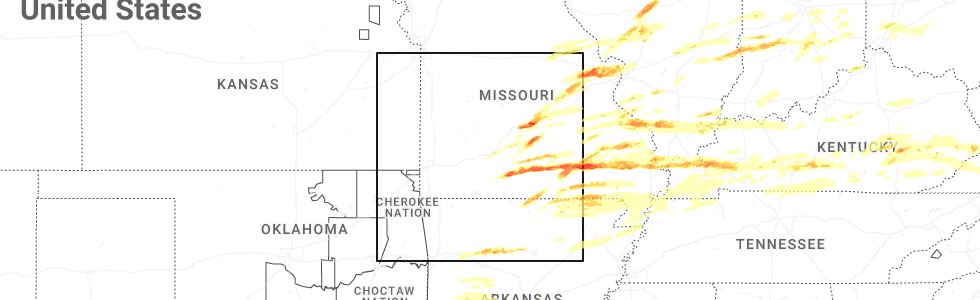
Hail Map for Mammoth Spring, MO
The Mammoth Spring, MO area has had 2 reports of on-the-ground hail by trained spotters, and has been under severe weather warnings 18 times during the past 12 months. Doppler radar has detected hail at or near Mammoth Spring, MO on 72 occasions, including 5 occasions during the past year.
| Name: | Mammoth Spring, MO |
| Where Located: | 79.1 miles S of Salem, MO |
| Map: | Google Map for Mammoth Spring, MO |
| Population: | 977 |
| Housing Units: | 595 |
| More Info: | Search Google for Mammoth Spring, MO |
1
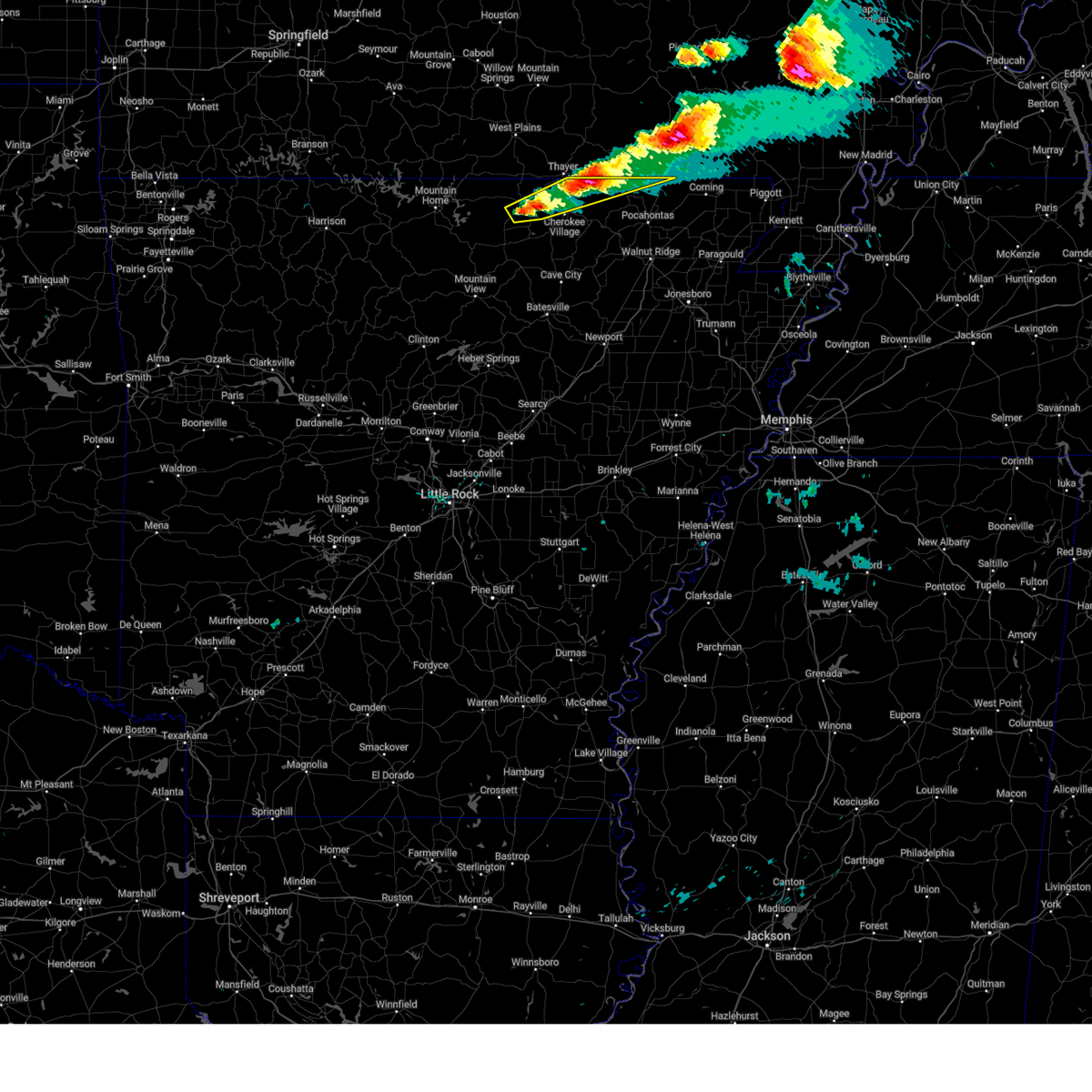
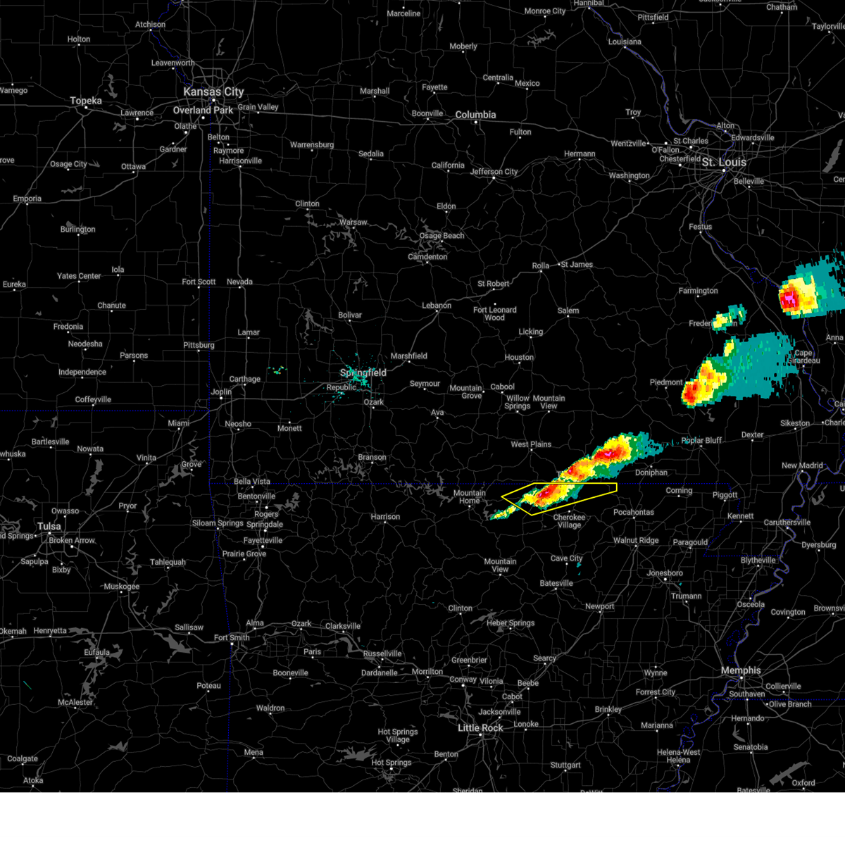
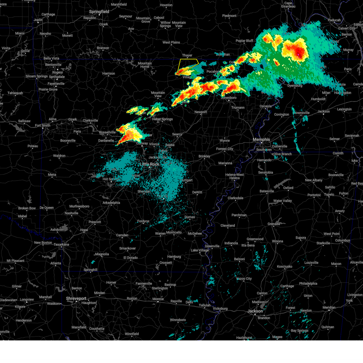
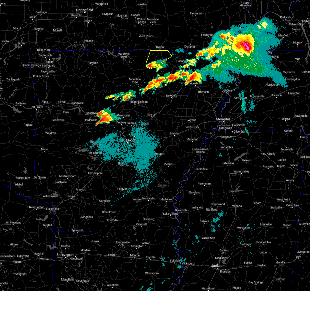
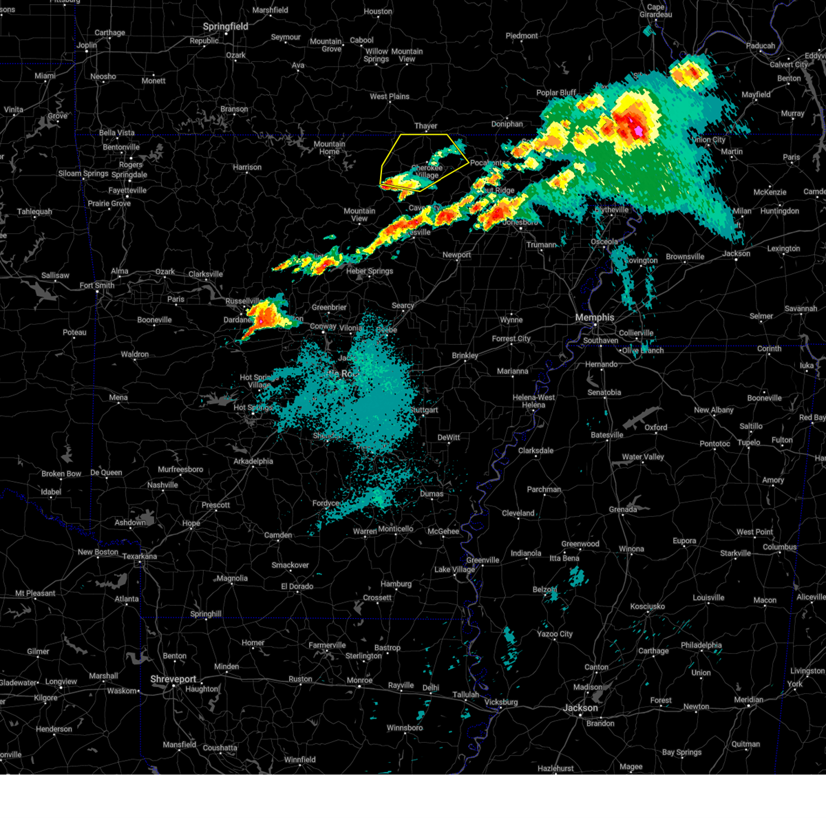
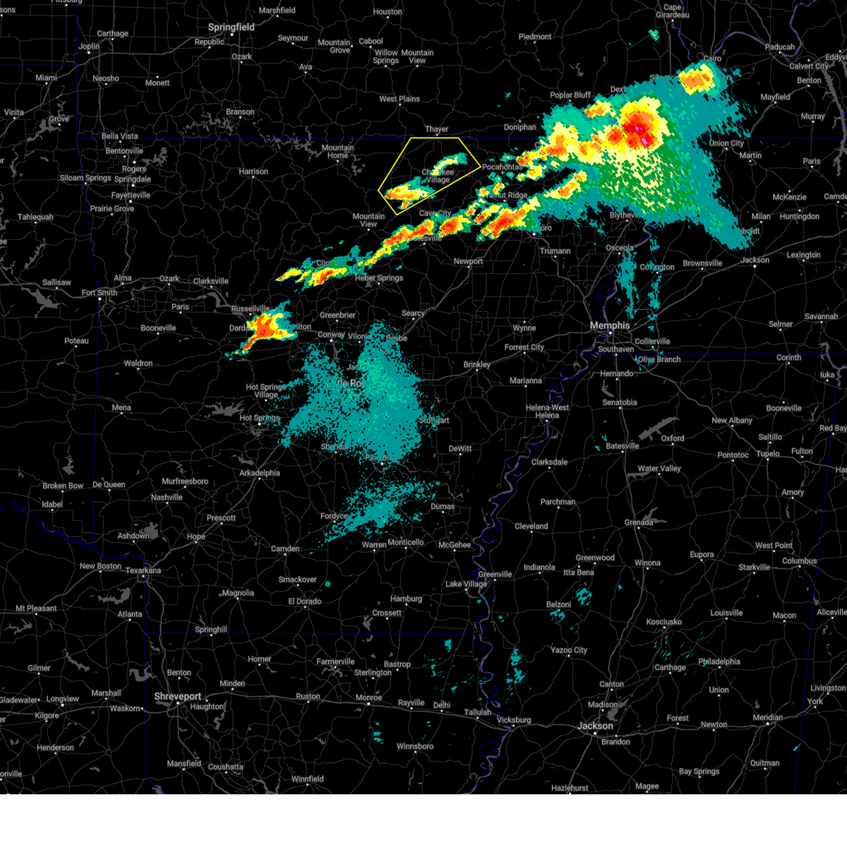
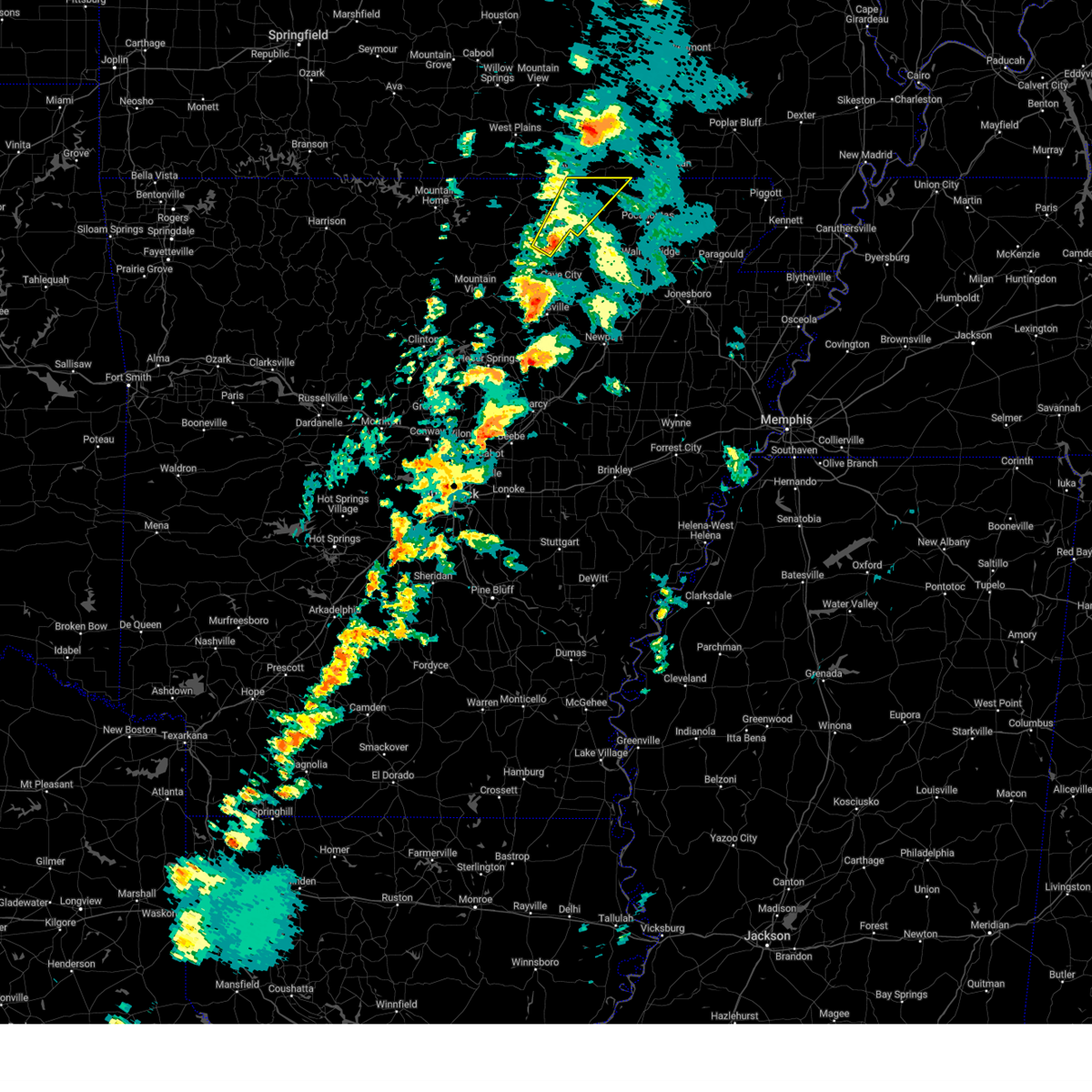
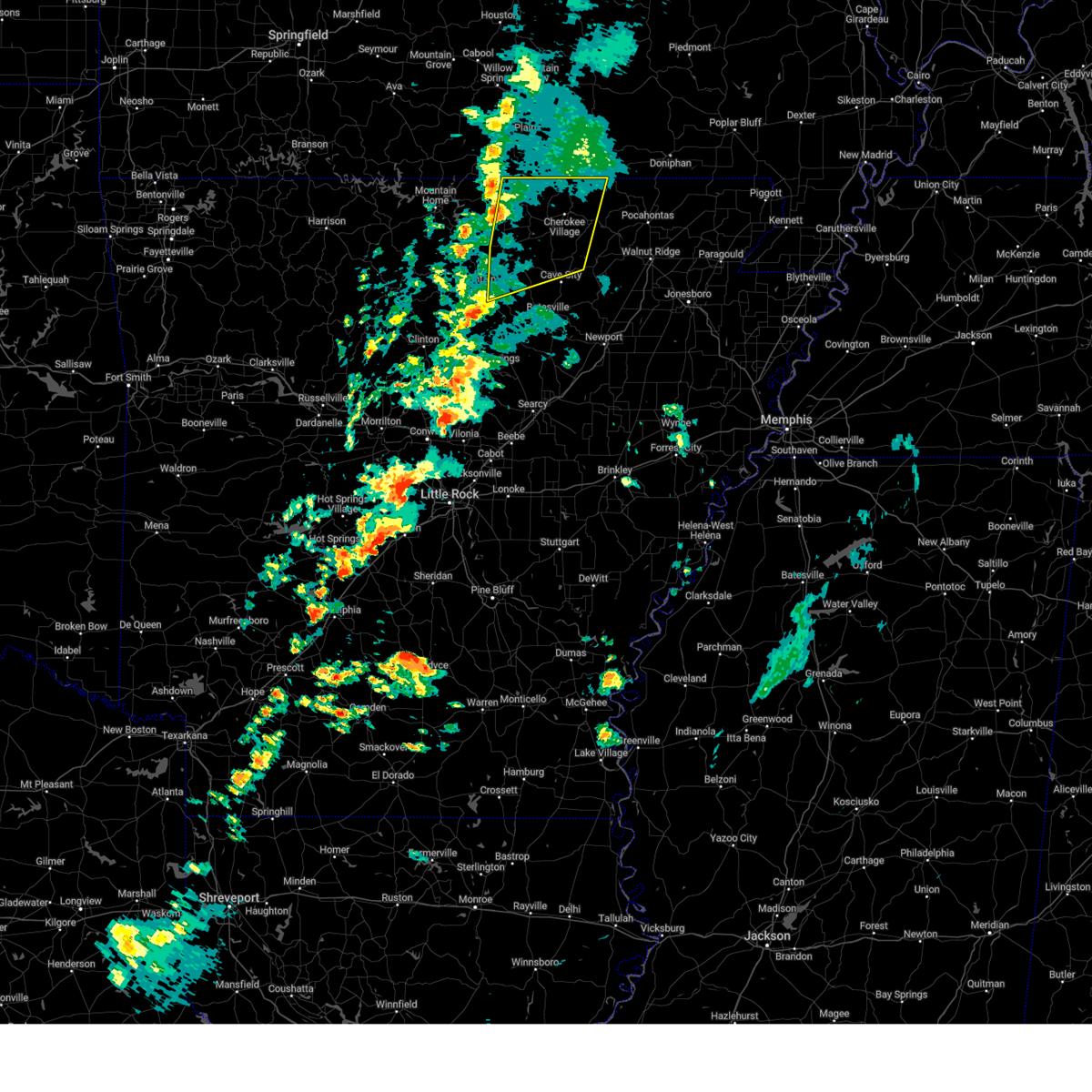
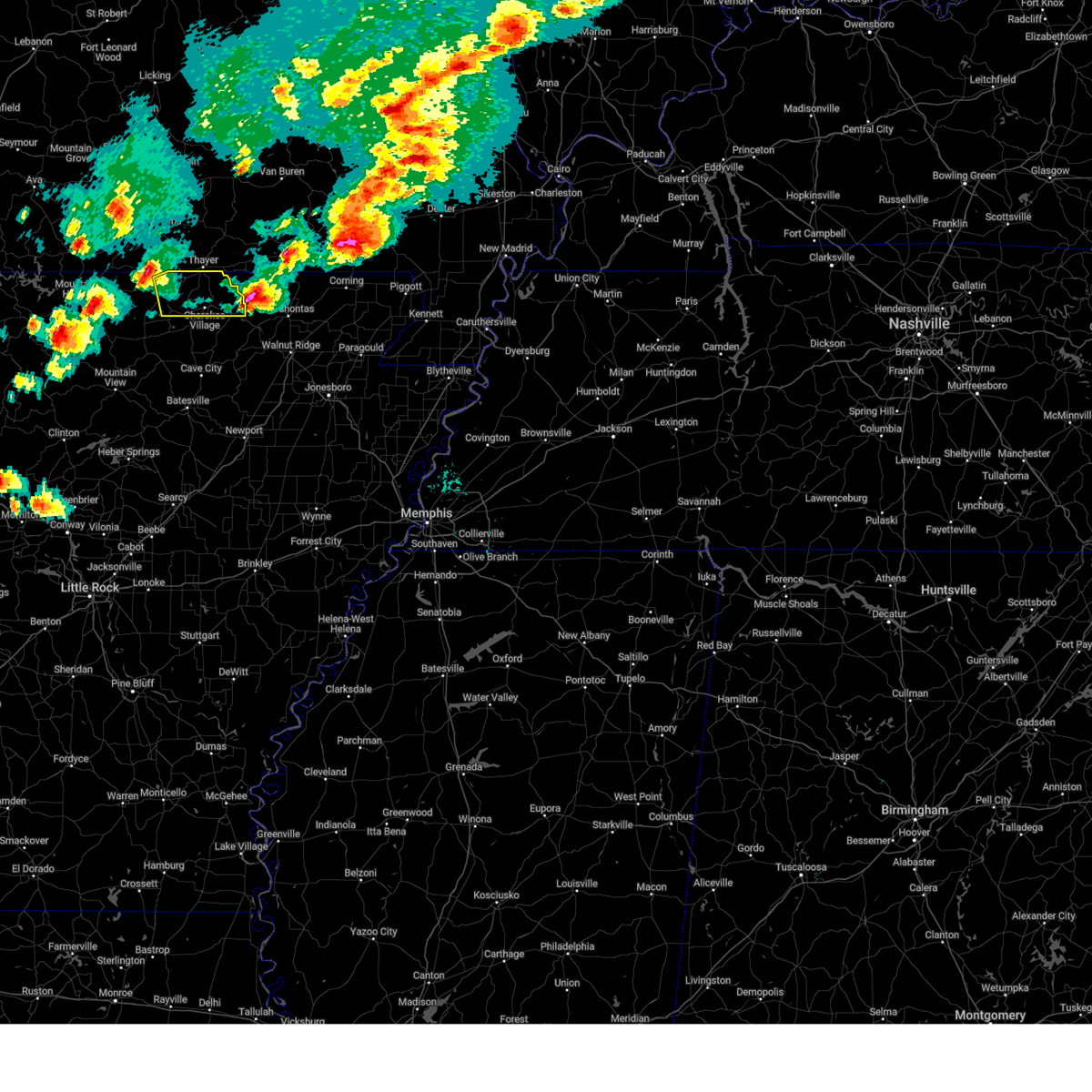
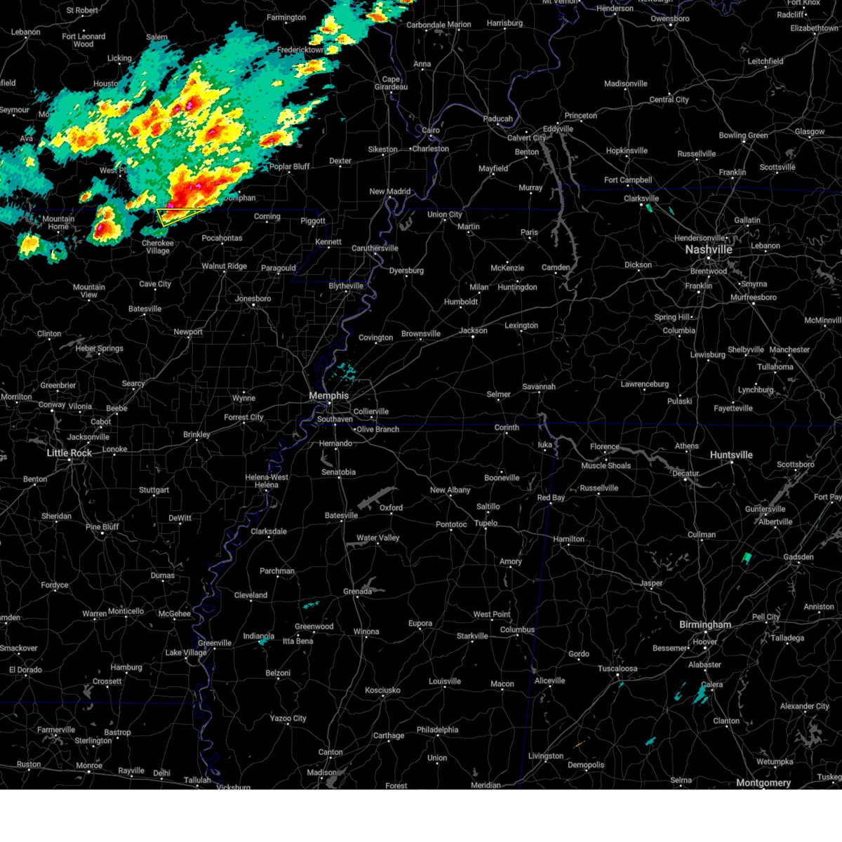
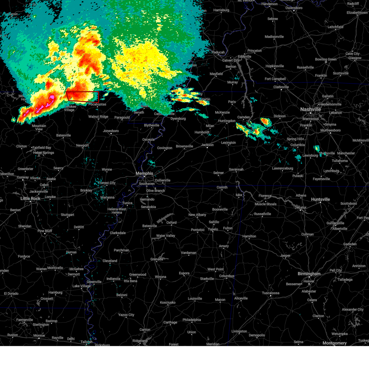
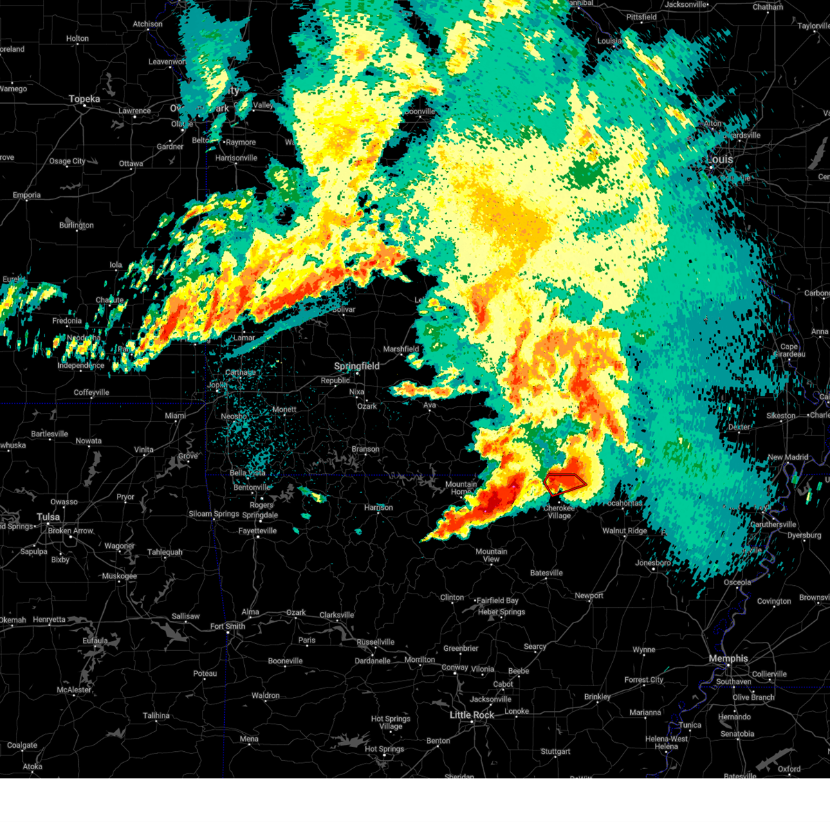
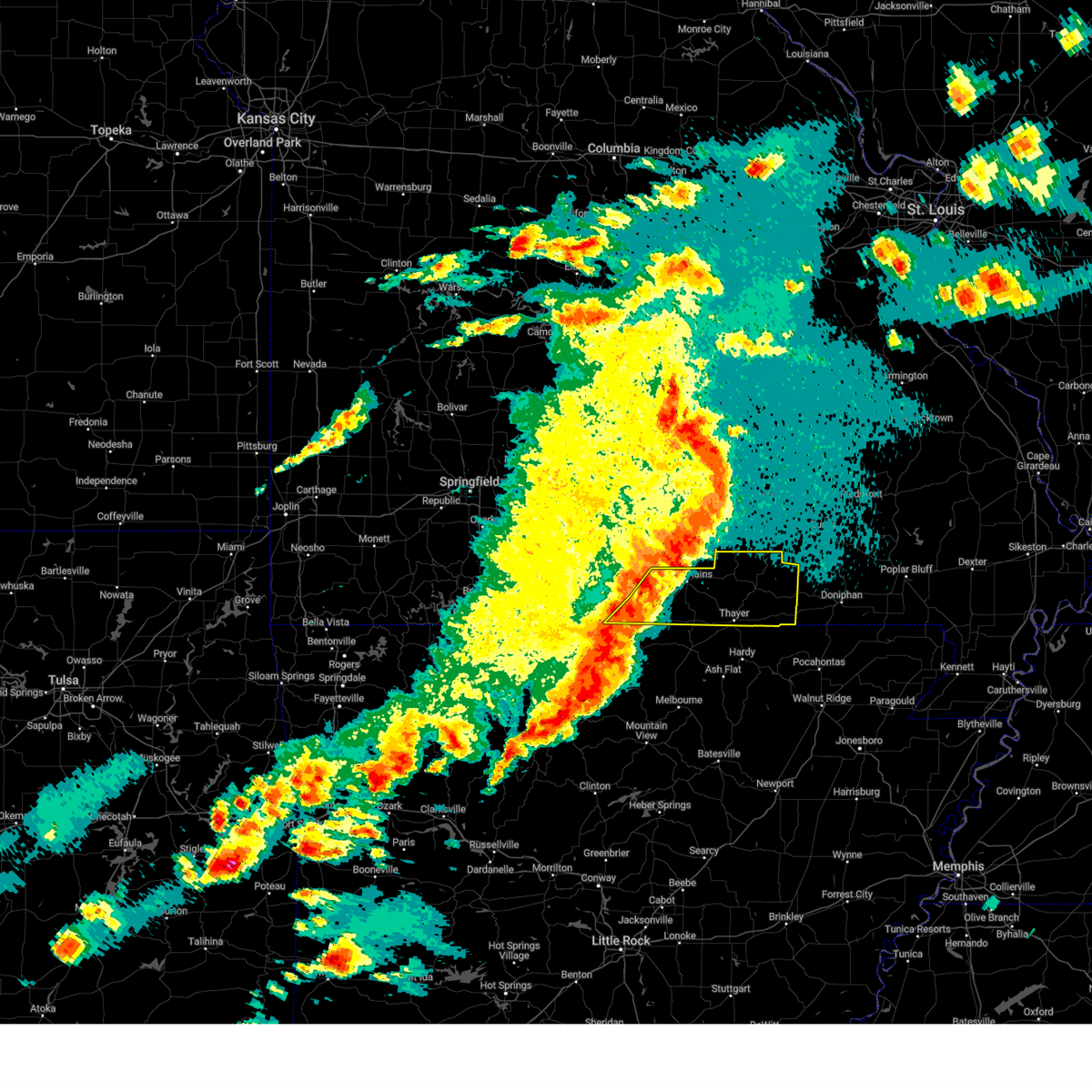
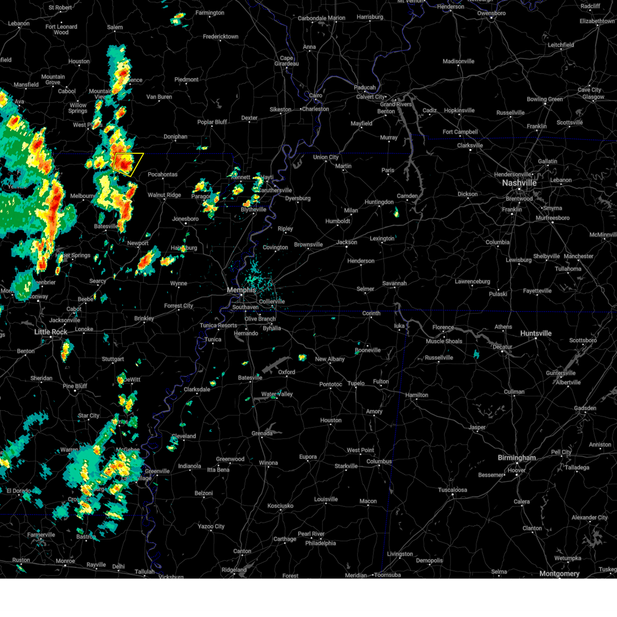
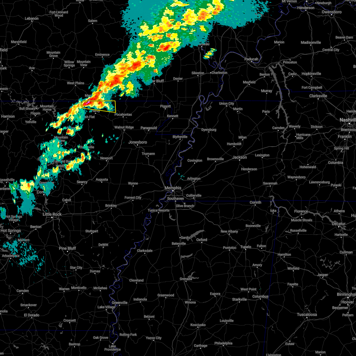
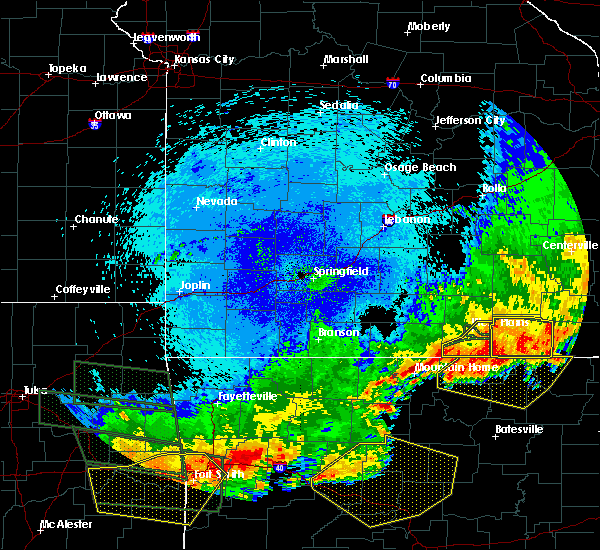
The Top Recent Hail Date for Mammoth Spring, MO is Friday, May 16, 2025 (5th out of 72)
Hail and Wind Damage Spotted near Mammoth Spring, MO
| Date / Time | Report Details |
|---|---|
| 5/16/2025 6:08 PM CDT |
 Svrlzk the national weather service in little rock has issued a * severe thunderstorm warning for, northwestern randolph county in eastern arkansas, eastern fulton county in north central arkansas, northeastern sharp county in north central arkansas, * until 645 pm cdt. * at 608 pm cdt, a severe thunderstorm was located 7 miles east of mammoth spring state park, or 7 miles east of mammoth spring, moving east at 60 mph (radar indicated). Hazards include 60 mph wind gusts and half dollar size hail. Hail damage to vehicles is expected. Expect wind damage to roofs, siding, and trees. Svrlzk the national weather service in little rock has issued a * severe thunderstorm warning for, northwestern randolph county in eastern arkansas, eastern fulton county in north central arkansas, northeastern sharp county in north central arkansas, * until 645 pm cdt. * at 608 pm cdt, a severe thunderstorm was located 7 miles east of mammoth spring state park, or 7 miles east of mammoth spring, moving east at 60 mph (radar indicated). Hazards include 60 mph wind gusts and half dollar size hail. Hail damage to vehicles is expected. Expect wind damage to roofs, siding, and trees.
|
| 5/16/2025 6:00 PM CDT | At 600 pm cdt, a severe thunderstorm was located over salem in fulton county, moving east at 55 mph (radar indicated). Hazards include golf ball size hail and 60 mph wind gusts. People and animals outdoors will be injured. expect hail damage to roofs, siding, windows, and vehicles. expect wind damage to roofs, siding, and trees. Locations impacted include, heart, mammoth spring, fryatt, flint springs, saddler falls, wheeling, wirth, saddle, salem in fulton county, mammoth spring state park, salem airport, elm store, camp, glencoe,. |
| 5/16/2025 5:51 PM CDT | At 551 pm cdt, a severe thunderstorm was located over mammoth spring, moving northeast at 55 mph (radar indicated). Hazards include golf ball size hail and 60 mph wind gusts. People and animals outdoors will be injured. expect hail damage to roofs, siding, windows, and vehicles. expect wind damage to roofs, siding, and trees. Locations impacted include, heart, moko, mammoth spring, fryatt, flint springs, saddler falls, wheeling, wirth, saddle, salem in fulton county, sturkie, mammoth spring state park, salem airport, elm store, viola, camp,. |
| 5/16/2025 5:39 PM CDT |
 Svrlzk the national weather service in little rock has issued a * severe thunderstorm warning for, northwestern randolph county in eastern arkansas, central fulton county in north central arkansas, northeastern sharp county in north central arkansas, * until 615 pm cdt. * at 539 pm cdt, a severe thunderstorm was located 7 miles northeast of salem in fulton county, moving northeast at 55 mph (radar indicated). Hazards include 60 mph wind gusts and quarter size hail. Hail damage to vehicles is expected. Expect wind damage to roofs, siding, and trees. Svrlzk the national weather service in little rock has issued a * severe thunderstorm warning for, northwestern randolph county in eastern arkansas, central fulton county in north central arkansas, northeastern sharp county in north central arkansas, * until 615 pm cdt. * at 539 pm cdt, a severe thunderstorm was located 7 miles northeast of salem in fulton county, moving northeast at 55 mph (radar indicated). Hazards include 60 mph wind gusts and quarter size hail. Hail damage to vehicles is expected. Expect wind damage to roofs, siding, and trees.
|
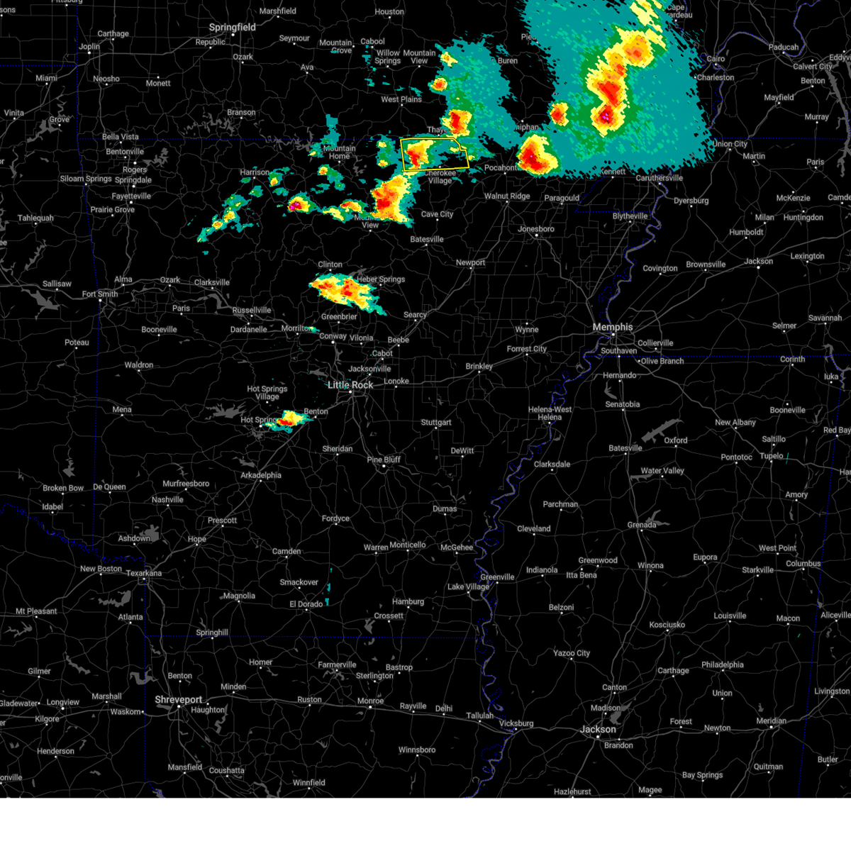
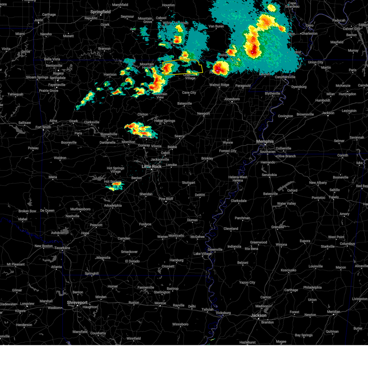
| 5/16/2025 5:42 AM CDT |
 At 542 am cdt, a severe thunderstorm was located near cherokee village, moving northeast at 40 mph (radar indicated). Hazards include quarter size hail. Damage to vehicles is expected. Locations impacted include, heart, mammoth spring, mammoth spring state park, fryatt, agnos, saddler falls, wirth, saddle, cherokee village,. At 542 am cdt, a severe thunderstorm was located near cherokee village, moving northeast at 40 mph (radar indicated). Hazards include quarter size hail. Damage to vehicles is expected. Locations impacted include, heart, mammoth spring, mammoth spring state park, fryatt, agnos, saddler falls, wirth, saddle, cherokee village,.
|
| 5/16/2025 5:42 AM CDT |
 the severe thunderstorm warning has been cancelled and is no longer in effect the severe thunderstorm warning has been cancelled and is no longer in effect
|
| 5/16/2025 5:29 AM CDT |
 the severe thunderstorm warning has been cancelled and is no longer in effect the severe thunderstorm warning has been cancelled and is no longer in effect
|
| 5/16/2025 5:29 AM CDT |
 At 529 am cdt, a severe thunderstorm was located over horseshoe bend, or near ash flat, moving northeast at 45 mph (radar indicated). Hazards include quarter size hail. Damage to vehicles is expected. Locations impacted include, heart, franklin, mammoth spring, morriston, glencoe, fryatt, agnos, hardy, highland in sharp county, saddler falls, kittle, wirth, saddle, myron, ballard, armstrong, mammoth spring state park, cherokee village, ash flat, horseshoe bend,. At 529 am cdt, a severe thunderstorm was located over horseshoe bend, or near ash flat, moving northeast at 45 mph (radar indicated). Hazards include quarter size hail. Damage to vehicles is expected. Locations impacted include, heart, franklin, mammoth spring, morriston, glencoe, fryatt, agnos, hardy, highland in sharp county, saddler falls, kittle, wirth, saddle, myron, ballard, armstrong, mammoth spring state park, cherokee village, ash flat, horseshoe bend,.
|
| 5/16/2025 5:22 AM CDT |
 At 522 am cdt, a severe thunderstorm was located over franklin, or 10 miles northeast of melbourne, moving northeast at 45 mph (radar indicated). Hazards include quarter size hail. Damage to vehicles is expected. Locations impacted include, heart, franklin, fryatt, agnos, violet hill, kittle, union, wirth, saddle, ballard, armstrong, salem in fulton county, salem airport, ravenden springs, cherokee village, ash flat, sitka, horseshoe bend, oxford, center,. At 522 am cdt, a severe thunderstorm was located over franklin, or 10 miles northeast of melbourne, moving northeast at 45 mph (radar indicated). Hazards include quarter size hail. Damage to vehicles is expected. Locations impacted include, heart, franklin, fryatt, agnos, violet hill, kittle, union, wirth, saddle, ballard, armstrong, salem in fulton county, salem airport, ravenden springs, cherokee village, ash flat, sitka, horseshoe bend, oxford, center,.
|
| 5/16/2025 5:13 AM CDT |
 Svrlzk the national weather service in little rock has issued a * severe thunderstorm warning for, northwestern randolph county in eastern arkansas, northeastern izard county in north central arkansas, eastern fulton county in north central arkansas, northwestern lawrence county in eastern arkansas, central sharp county in north central arkansas, * until 600 am cdt. * at 513 am cdt, a severe thunderstorm was located near lacrosse, or near melbourne, moving northeast at 45 mph (radar indicated). Hazards include quarter size hail. damage to vehicles is expected Svrlzk the national weather service in little rock has issued a * severe thunderstorm warning for, northwestern randolph county in eastern arkansas, northeastern izard county in north central arkansas, eastern fulton county in north central arkansas, northwestern lawrence county in eastern arkansas, central sharp county in north central arkansas, * until 600 am cdt. * at 513 am cdt, a severe thunderstorm was located near lacrosse, or near melbourne, moving northeast at 45 mph (radar indicated). Hazards include quarter size hail. damage to vehicles is expected
|
| 4/20/2025 7:09 PM CDT |
 Svrlzk the national weather service in little rock has issued a * severe thunderstorm warning for, northwestern randolph county in eastern arkansas, east central izard county in north central arkansas, eastern fulton county in north central arkansas, northern sharp county in north central arkansas, * until 800 pm cdt. * at 708 pm cdt, a severe thunderstorm was located near ash flat, moving northeast at 35 mph (radar indicated). Hazards include 60 mph wind gusts and quarter size hail. Hail damage to vehicles is expected. Expect wind damage to roofs, siding, and trees. Svrlzk the national weather service in little rock has issued a * severe thunderstorm warning for, northwestern randolph county in eastern arkansas, east central izard county in north central arkansas, eastern fulton county in north central arkansas, northern sharp county in north central arkansas, * until 800 pm cdt. * at 708 pm cdt, a severe thunderstorm was located near ash flat, moving northeast at 35 mph (radar indicated). Hazards include 60 mph wind gusts and quarter size hail. Hail damage to vehicles is expected. Expect wind damage to roofs, siding, and trees.
|
| 4/20/2025 6:16 PM CDT |
 Svrlzk the national weather service in little rock has issued a * severe thunderstorm warning for, east central stone county in north central arkansas, northern independence county in north central arkansas, northwestern randolph county in eastern arkansas, izard county in north central arkansas, fulton county in north central arkansas, northwestern lawrence county in eastern arkansas, sharp county in north central arkansas, * until 700 pm cdt. * at 615 pm cdt, severe thunderstorms were located along a line extending from sturkie to near oxford to near mountain view, moving northeast at 55 mph (radar indicated). Hazards include 60 mph wind gusts and penny size hail. expect damage to roofs, siding, and trees Svrlzk the national weather service in little rock has issued a * severe thunderstorm warning for, east central stone county in north central arkansas, northern independence county in north central arkansas, northwestern randolph county in eastern arkansas, izard county in north central arkansas, fulton county in north central arkansas, northwestern lawrence county in eastern arkansas, sharp county in north central arkansas, * until 700 pm cdt. * at 615 pm cdt, severe thunderstorms were located along a line extending from sturkie to near oxford to near mountain view, moving northeast at 55 mph (radar indicated). Hazards include 60 mph wind gusts and penny size hail. expect damage to roofs, siding, and trees
|
| 3/30/2025 5:43 PM CDT |
 At 542 pm cdt, a severe thunderstorm was located near salem in fulton county, moving east at 60 mph (radar indicated). Hazards include 60 mph wind gusts and quarter size hail. Hail damage to vehicles is expected. expect wind damage to roofs, siding, and trees. Locations impacted include, heart, moko, mammoth spring, glencoe, fryatt, hardy, saddler falls, wirth, saddle, armstrong, salem in fulton county, ozark acres, mammoth spring state park, salem airport, cherokee village, camp, highland in sharp county,. At 542 pm cdt, a severe thunderstorm was located near salem in fulton county, moving east at 60 mph (radar indicated). Hazards include 60 mph wind gusts and quarter size hail. Hail damage to vehicles is expected. expect wind damage to roofs, siding, and trees. Locations impacted include, heart, moko, mammoth spring, glencoe, fryatt, hardy, saddler falls, wirth, saddle, armstrong, salem in fulton county, ozark acres, mammoth spring state park, salem airport, cherokee village, camp, highland in sharp county,.
|
| 3/30/2025 5:32 PM CDT |
 Svrlzk the national weather service in little rock has issued a * severe thunderstorm warning for, fulton county in north central arkansas, northeastern sharp county in north central arkansas, * until 615 pm cdt. * at 532 pm cdt, a severe thunderstorm was located near flint springs, or near salem in fulton county, moving east at 60 mph (radar indicated). Hazards include 60 mph wind gusts and quarter size hail. Hail damage to vehicles is expected. Expect wind damage to roofs, siding, and trees. Svrlzk the national weather service in little rock has issued a * severe thunderstorm warning for, fulton county in north central arkansas, northeastern sharp county in north central arkansas, * until 615 pm cdt. * at 532 pm cdt, a severe thunderstorm was located near flint springs, or near salem in fulton county, moving east at 60 mph (radar indicated). Hazards include 60 mph wind gusts and quarter size hail. Hail damage to vehicles is expected. Expect wind damage to roofs, siding, and trees.
|
| 3/30/2025 5:11 PM CDT |
 The storm which prompted the warning has moved out of the area. therefore, the warning will be allowed to expire. a tornado watch remains in effect until 1100 pm cdt for eastern and north central arkansas. The storm which prompted the warning has moved out of the area. therefore, the warning will be allowed to expire. a tornado watch remains in effect until 1100 pm cdt for eastern and north central arkansas.
|
| 3/30/2025 4:36 PM CDT | At 436 pm cdt, a severe thunderstorm was located near salem in fulton county, moving east at 50 mph (radar indicated). Hazards include 60 mph wind gusts and quarter size hail. Hail damage to vehicles is expected. expect wind damage to roofs, siding, and trees. Locations impacted include, heart, moko, mammoth spring, morriston, glencoe, fryatt, agnos, hardy, highland in sharp county, saddler falls, eleven point, kittle, wirth, saddle, armstrong, salem in fulton county, ozark acres, mammoth spring state park, salem airport, cherokee village,. |
| 3/30/2025 4:25 PM CDT | Svrlzk the national weather service in little rock has issued a * severe thunderstorm warning for, fulton county in north central arkansas, northeastern sharp county in north central arkansas, * until 515 pm cdt. * at 424 pm cdt, a severe thunderstorm was located over flint springs, or near salem in fulton county, moving east at 45 mph. this storm has a history of producing golf ball sized hail near gepp in fulton county (radar indicated). Hazards include golf ball size hail and 60 mph wind gusts. People and animals outdoors will be injured. expect hail damage to roofs, siding, windows, and vehicles. Expect wind damage to roofs, siding, and trees. |
| 3/30/2025 4:17 PM CDT |
 Svrlzk the national weather service in little rock has issued a * severe thunderstorm warning for, northwestern randolph county in eastern arkansas, northeastern fulton county in north central arkansas, north central sharp county in north central arkansas, * until 430 pm cdt. * at 417 pm cdt, a severe thunderstorm was located near mammoth spring state park, or near mammoth spring, moving northeast at 30 mph (radar indicated). Hazards include 60 mph wind gusts and quarter size hail. Hail damage to vehicles is expected. Expect wind damage to roofs, siding, and trees. Svrlzk the national weather service in little rock has issued a * severe thunderstorm warning for, northwestern randolph county in eastern arkansas, northeastern fulton county in north central arkansas, north central sharp county in north central arkansas, * until 430 pm cdt. * at 417 pm cdt, a severe thunderstorm was located near mammoth spring state park, or near mammoth spring, moving northeast at 30 mph (radar indicated). Hazards include 60 mph wind gusts and quarter size hail. Hail damage to vehicles is expected. Expect wind damage to roofs, siding, and trees.
|
| 5/26/2024 5:49 AM CDT |
 Svrlzk the national weather service in little rock has issued a * severe thunderstorm warning for, randolph county in eastern arkansas, northeastern izard county in north central arkansas, eastern fulton county in north central arkansas, central lawrence county in eastern arkansas, central sharp county in north central arkansas, * until 645 am cdt. * at 549 am cdt, severe thunderstorms were located along a line extending from near mammoth spring state park to cherokee village to ballard to near franklin, moving east at 60 mph (radar indicated). Hazards include 60 mph wind gusts and quarter size hail. Hail damage to vehicles is expected. Expect wind damage to roofs, siding, and trees. Svrlzk the national weather service in little rock has issued a * severe thunderstorm warning for, randolph county in eastern arkansas, northeastern izard county in north central arkansas, eastern fulton county in north central arkansas, central lawrence county in eastern arkansas, central sharp county in north central arkansas, * until 645 am cdt. * at 549 am cdt, severe thunderstorms were located along a line extending from near mammoth spring state park to cherokee village to ballard to near franklin, moving east at 60 mph (radar indicated). Hazards include 60 mph wind gusts and quarter size hail. Hail damage to vehicles is expected. Expect wind damage to roofs, siding, and trees.
|
| 5/26/2024 5:41 AM CDT |
 Torlzk the national weather service in little rock has issued a * tornado warning for, northwestern randolph county in eastern arkansas, eastern fulton county in north central arkansas, north central sharp county in north central arkansas, * until 615 am cdt. * at 541 am cdt, a severe thunderstorm capable of producing a tornado was located near salem in fulton county, moving east at 60 mph (radar indicated rotation). Hazards include tornado. Flying debris will be dangerous to those caught without shelter. mobile homes will be damaged or destroyed. damage to roofs, windows, and vehicles will occur. Tree damage is likely. Torlzk the national weather service in little rock has issued a * tornado warning for, northwestern randolph county in eastern arkansas, eastern fulton county in north central arkansas, north central sharp county in north central arkansas, * until 615 am cdt. * at 541 am cdt, a severe thunderstorm capable of producing a tornado was located near salem in fulton county, moving east at 60 mph (radar indicated rotation). Hazards include tornado. Flying debris will be dangerous to those caught without shelter. mobile homes will be damaged or destroyed. damage to roofs, windows, and vehicles will occur. Tree damage is likely.
|
| 5/26/2024 5:38 AM CDT |
 Torlzk the national weather service in little rock has issued a * tornado warning for, northwestern randolph county in eastern arkansas, northeastern fulton county in north central arkansas, northeastern sharp county in north central arkansas, * until 630 am cdt. * at 537 am cdt, a severe thunderstorm capable of producing a tornado was located near mammoth spring state park, or near mammoth spring, moving east at 35 mph (radar indicated rotation). Hazards include tornado and quarter size hail. Flying debris will be dangerous to those caught without shelter. mobile homes will be damaged or destroyed. damage to roofs, windows, and vehicles will occur. Tree damage is likely. Torlzk the national weather service in little rock has issued a * tornado warning for, northwestern randolph county in eastern arkansas, northeastern fulton county in north central arkansas, northeastern sharp county in north central arkansas, * until 630 am cdt. * at 537 am cdt, a severe thunderstorm capable of producing a tornado was located near mammoth spring state park, or near mammoth spring, moving east at 35 mph (radar indicated rotation). Hazards include tornado and quarter size hail. Flying debris will be dangerous to those caught without shelter. mobile homes will be damaged or destroyed. damage to roofs, windows, and vehicles will occur. Tree damage is likely.
|
| 5/26/2024 5:36 AM CDT |
 At 536 am cdt, a severe thunderstorm capable of producing a tornado was located over mammoth spring state park, or over mammoth spring, moving northeast at 40 mph (radar indicated rotation). Hazards include tornado and quarter size hail. Flying debris will be dangerous to those caught without shelter. mobile homes will be damaged or destroyed. damage to roofs, windows, and vehicles will occur. tree damage is likely. Locations impacted include, mammoth spring, mammoth spring state park, saddler falls, wirth,. At 536 am cdt, a severe thunderstorm capable of producing a tornado was located over mammoth spring state park, or over mammoth spring, moving northeast at 40 mph (radar indicated rotation). Hazards include tornado and quarter size hail. Flying debris will be dangerous to those caught without shelter. mobile homes will be damaged or destroyed. damage to roofs, windows, and vehicles will occur. tree damage is likely. Locations impacted include, mammoth spring, mammoth spring state park, saddler falls, wirth,.
|
| 5/26/2024 5:31 AM CDT |
 Svrlzk the national weather service in little rock has issued a * severe thunderstorm warning for, north central stone county in north central arkansas, izard county in north central arkansas, fulton county in north central arkansas, southeastern baxter county in north central arkansas, west central sharp county in north central arkansas, * until 615 am cdt. * at 531 am cdt, severe thunderstorms were located along a line extending from sturkie to bexar to near pineville to 7 miles southeast of maumee, moving east at 55 mph (radar indicated). Hazards include 60 mph wind gusts and quarter size hail. Hail damage to vehicles is expected. Expect wind damage to roofs, siding, and trees. Svrlzk the national weather service in little rock has issued a * severe thunderstorm warning for, north central stone county in north central arkansas, izard county in north central arkansas, fulton county in north central arkansas, southeastern baxter county in north central arkansas, west central sharp county in north central arkansas, * until 615 am cdt. * at 531 am cdt, severe thunderstorms were located along a line extending from sturkie to bexar to near pineville to 7 miles southeast of maumee, moving east at 55 mph (radar indicated). Hazards include 60 mph wind gusts and quarter size hail. Hail damage to vehicles is expected. Expect wind damage to roofs, siding, and trees.
|
| 5/26/2024 5:21 AM CDT |
 At 521 am cdt, a severe thunderstorm capable of producing a tornado was located 7 miles southwest of mammoth spring, moving northeast at 40 mph (radar indicated rotation). Hazards include tornado and quarter size hail. Flying debris will be dangerous to those caught without shelter. mobile homes will be damaged or destroyed. damage to roofs, windows, and vehicles will occur. tree damage is likely. Locations impacted include, mammoth spring, mammoth spring state park, heart, fryatt, saddler falls, camp, wirth, saddle,. At 521 am cdt, a severe thunderstorm capable of producing a tornado was located 7 miles southwest of mammoth spring, moving northeast at 40 mph (radar indicated rotation). Hazards include tornado and quarter size hail. Flying debris will be dangerous to those caught without shelter. mobile homes will be damaged or destroyed. damage to roofs, windows, and vehicles will occur. tree damage is likely. Locations impacted include, mammoth spring, mammoth spring state park, heart, fryatt, saddler falls, camp, wirth, saddle,.
|
| 5/26/2024 5:08 AM CDT |
 Torlzk the national weather service in little rock has issued a * tornado warning for, western randolph county in eastern arkansas, eastern fulton county in north central arkansas, north central sharp county in north central arkansas, * until 600 am cdt. * at 508 am cdt, a severe thunderstorm capable of producing a tornado was located over salem in fulton county, moving northeast at 40 mph (radar indicated rotation). Hazards include tornado and quarter size hail. Flying debris will be dangerous to those caught without shelter. mobile homes will be damaged or destroyed. damage to roofs, windows, and vehicles will occur. Tree damage is likely. Torlzk the national weather service in little rock has issued a * tornado warning for, western randolph county in eastern arkansas, eastern fulton county in north central arkansas, north central sharp county in north central arkansas, * until 600 am cdt. * at 508 am cdt, a severe thunderstorm capable of producing a tornado was located over salem in fulton county, moving northeast at 40 mph (radar indicated rotation). Hazards include tornado and quarter size hail. Flying debris will be dangerous to those caught without shelter. mobile homes will be damaged or destroyed. damage to roofs, windows, and vehicles will occur. Tree damage is likely.
|
| 5/8/2024 10:01 PM CDT |
 the severe thunderstorm warning has been cancelled and is no longer in effect the severe thunderstorm warning has been cancelled and is no longer in effect
|
| 5/8/2024 9:55 PM CDT |
 At 955 pm cdt, a severe thunderstorm was located near cherokee village, moving east at 40 mph (radar indicated). Hazards include 60 mph wind gusts and penny size hail. Expect damage to roofs, siding, and trees. Locations impacted include, cherokee village, salem in fulton county, ash flat, horseshoe bend, highland in sharp county, mammoth spring, hardy, ballard, mammoth spring state park, agnos, heart, morriston, glencoe, fryatt, saddler falls, kittle, saddle, camp,. At 955 pm cdt, a severe thunderstorm was located near cherokee village, moving east at 40 mph (radar indicated). Hazards include 60 mph wind gusts and penny size hail. Expect damage to roofs, siding, and trees. Locations impacted include, cherokee village, salem in fulton county, ash flat, horseshoe bend, highland in sharp county, mammoth spring, hardy, ballard, mammoth spring state park, agnos, heart, morriston, glencoe, fryatt, saddler falls, kittle, saddle, camp,.
|
| 5/8/2024 9:45 PM CDT |
 At 945 pm cdt, a severe thunderstorm was located over salem in fulton county, moving east at 25 mph (radar indicated). Hazards include 60 mph wind gusts and penny size hail. Expect damage to roofs, siding, and trees. Locations impacted include, cherokee village, salem in fulton county, ash flat, horseshoe bend, highland in sharp county, mammoth spring, hardy, oxford, franklin, ballard, myron, mammoth spring state park, agnos, heart, fryatt, violet hill, kittle, union, saddle, salem airport,. At 945 pm cdt, a severe thunderstorm was located over salem in fulton county, moving east at 25 mph (radar indicated). Hazards include 60 mph wind gusts and penny size hail. Expect damage to roofs, siding, and trees. Locations impacted include, cherokee village, salem in fulton county, ash flat, horseshoe bend, highland in sharp county, mammoth spring, hardy, oxford, franklin, ballard, myron, mammoth spring state park, agnos, heart, fryatt, violet hill, kittle, union, saddle, salem airport,.
|
| 5/8/2024 9:30 PM CDT |
 Svrlzk the national weather service in little rock has issued a * severe thunderstorm warning for, northern izard county in north central arkansas, fulton county in north central arkansas, central sharp county in north central arkansas, * until 1015 pm cdt. * at 930 pm cdt, a severe thunderstorm was located over byron, or near salem in fulton county, moving east at 25 mph (radar indicated). Hazards include 60 mph wind gusts and quarter size hail. Hail damage to vehicles is expected. Expect wind damage to roofs, siding, and trees. Svrlzk the national weather service in little rock has issued a * severe thunderstorm warning for, northern izard county in north central arkansas, fulton county in north central arkansas, central sharp county in north central arkansas, * until 1015 pm cdt. * at 930 pm cdt, a severe thunderstorm was located over byron, or near salem in fulton county, moving east at 25 mph (radar indicated). Hazards include 60 mph wind gusts and quarter size hail. Hail damage to vehicles is expected. Expect wind damage to roofs, siding, and trees.
|
| 3/14/2024 6:23 PM CDT |
 Svrlzk the national weather service in little rock has issued a * severe thunderstorm warning for, randolph county in eastern arkansas, eastern fulton county in north central arkansas, northern lawrence county in eastern arkansas, sharp county in north central arkansas, * until 715 pm cdt. * at 622 pm cdt, severe thunderstorms were located along a line extending from mammoth spring to hardy to near myron, moving east at 45 mph (radar indicated). Hazards include 60 mph wind gusts and penny size hail. expect damage to roofs, siding, and trees Svrlzk the national weather service in little rock has issued a * severe thunderstorm warning for, randolph county in eastern arkansas, eastern fulton county in north central arkansas, northern lawrence county in eastern arkansas, sharp county in north central arkansas, * until 715 pm cdt. * at 622 pm cdt, severe thunderstorms were located along a line extending from mammoth spring to hardy to near myron, moving east at 45 mph (radar indicated). Hazards include 60 mph wind gusts and penny size hail. expect damage to roofs, siding, and trees
|
| 3/14/2024 5:59 PM CDT |
 At 559 pm cdt, severe thunderstorms were located along a line extending from near sturkie to near oxford, moving east at 40 mph (radar indicated). Hazards include 60 mph wind gusts and penny size hail. Expect damage to roofs, siding, and trees. Locations impacted include, cherokee village, salem in fulton county, ash flat, horseshoe bend, highland in sharp county, mammoth spring, oxford, franklin, ballard, myron, mammoth spring state park, agnos, heart, moko, fryatt, kittle, saddle, salem airport, morriston, glencoe,. At 559 pm cdt, severe thunderstorms were located along a line extending from near sturkie to near oxford, moving east at 40 mph (radar indicated). Hazards include 60 mph wind gusts and penny size hail. Expect damage to roofs, siding, and trees. Locations impacted include, cherokee village, salem in fulton county, ash flat, horseshoe bend, highland in sharp county, mammoth spring, oxford, franklin, ballard, myron, mammoth spring state park, agnos, heart, moko, fryatt, kittle, saddle, salem airport, morriston, glencoe,.
|
| 3/14/2024 5:49 PM CDT |
 At 548 pm cdt, severe thunderstorms were located along a line extending from near sturkie to near oxford, moving east at 40 mph (radar indicated). Hazards include 60 mph wind gusts and penny size hail. Expect damage to roofs, siding, and trees. Locations impacted include, cherokee village, salem in fulton county, ash flat, horseshoe bend, highland in sharp county, mammoth spring, oxford, viola, franklin, ballard, bexar, flint springs, sturkie, wideman, byron, myron, mammoth spring state park, agnos, heart, moko,. At 548 pm cdt, severe thunderstorms were located along a line extending from near sturkie to near oxford, moving east at 40 mph (radar indicated). Hazards include 60 mph wind gusts and penny size hail. Expect damage to roofs, siding, and trees. Locations impacted include, cherokee village, salem in fulton county, ash flat, horseshoe bend, highland in sharp county, mammoth spring, oxford, viola, franklin, ballard, bexar, flint springs, sturkie, wideman, byron, myron, mammoth spring state park, agnos, heart, moko,.
|
| 3/14/2024 5:49 PM CDT |
 the severe thunderstorm warning has been cancelled and is no longer in effect the severe thunderstorm warning has been cancelled and is no longer in effect
|
| 3/14/2024 5:33 PM CDT |
 Svrlzk the national weather service in little rock has issued a * severe thunderstorm warning for, northern izard county in north central arkansas, fulton county in north central arkansas, northeastern baxter county in north central arkansas, west central sharp county in north central arkansas, * until 630 pm cdt. * at 533 pm cdt, severe thunderstorms were located along a line extending from near gamaliel to near norfork, moving east at 40 mph (radar indicated). Hazards include 60 mph wind gusts and penny size hail. expect damage to roofs, siding, and trees Svrlzk the national weather service in little rock has issued a * severe thunderstorm warning for, northern izard county in north central arkansas, fulton county in north central arkansas, northeastern baxter county in north central arkansas, west central sharp county in north central arkansas, * until 630 pm cdt. * at 533 pm cdt, severe thunderstorms were located along a line extending from near gamaliel to near norfork, moving east at 40 mph (radar indicated). Hazards include 60 mph wind gusts and penny size hail. expect damage to roofs, siding, and trees
|
| 3/14/2024 5:26 PM CDT |
 Svrsgf the national weather service in springfield has issued a * severe thunderstorm warning for, southeastern ozark county in southwestern missouri, southern howell county in south central missouri, oregon county in south central missouri, * until 630 pm cdt. * at 525 pm cdt, severe thunderstorms were located along a line extending from 6 miles northeast of west plains to 12 miles north of sturkie to ott, moving east at 50 mph (public. quarter size hail was reported near mountain home, arkansas). Hazards include 60 mph wind gusts and quarter size hail. Hail damage to vehicles is expected. Expect wind damage to roofs, siding, and trees. Svrsgf the national weather service in springfield has issued a * severe thunderstorm warning for, southeastern ozark county in southwestern missouri, southern howell county in south central missouri, oregon county in south central missouri, * until 630 pm cdt. * at 525 pm cdt, severe thunderstorms were located along a line extending from 6 miles northeast of west plains to 12 miles north of sturkie to ott, moving east at 50 mph (public. quarter size hail was reported near mountain home, arkansas). Hazards include 60 mph wind gusts and quarter size hail. Hail damage to vehicles is expected. Expect wind damage to roofs, siding, and trees.
|
| 9/4/2023 2:57 PM CDT |
 At 257 pm cdt, a severe thunderstorm was located near hardy, or 8 miles southeast of mammoth spring, moving north at 15 mph (radar indicated). Hazards include 60 mph wind gusts and quarter size hail. Hail damage to vehicles is expected. Expect wind damage to roofs, siding, and trees. At 257 pm cdt, a severe thunderstorm was located near hardy, or 8 miles southeast of mammoth spring, moving north at 15 mph (radar indicated). Hazards include 60 mph wind gusts and quarter size hail. Hail damage to vehicles is expected. Expect wind damage to roofs, siding, and trees.
|
| 8/9/2023 8:44 PM CDT |
 At 843 pm cdt, severe thunderstorms were located along a line extending from 9 miles east of mammoth spring to near zion, moving east at 40 mph (radar indicated). Hazards include ping pong ball size hail and 60 mph wind gusts. People and animals outdoors could be injured. expect hail damage to roofs, siding, windows, and vehicles. expect wind damage to roofs, siding, and trees. this storm has had a history of producing wind damage and the storm core has intensified and may be producing larger hail. locations impacted include, cherokee village, salem in fulton county, ash flat, horseshoe bend, highland in sharp county, mammoth spring, hardy, imboden, oxford, ravenden, maynard, franklin, ravenden springs, ballard, bexar, annieville, dalton, wideman, byron, attica, hail threat, radar indicated max hail size, 1. 50 in wind threat, radar indicated max wind gust, 60 mph. At 843 pm cdt, severe thunderstorms were located along a line extending from 9 miles east of mammoth spring to near zion, moving east at 40 mph (radar indicated). Hazards include ping pong ball size hail and 60 mph wind gusts. People and animals outdoors could be injured. expect hail damage to roofs, siding, windows, and vehicles. expect wind damage to roofs, siding, and trees. this storm has had a history of producing wind damage and the storm core has intensified and may be producing larger hail. locations impacted include, cherokee village, salem in fulton county, ash flat, horseshoe bend, highland in sharp county, mammoth spring, hardy, imboden, oxford, ravenden, maynard, franklin, ravenden springs, ballard, bexar, annieville, dalton, wideman, byron, attica, hail threat, radar indicated max hail size, 1. 50 in wind threat, radar indicated max wind gust, 60 mph.
|
| 8/9/2023 8:30 PM CDT |
 At 829 pm cdt, severe thunderstorms were located along a line extending from mammoth spring to near melbourne, moving east at 40 mph (radar indicated). Hazards include 60 mph wind gusts and quarter size hail. Hail damage to vehicles is possible. Expect wind damage to roofs, siding, and trees. At 829 pm cdt, severe thunderstorms were located along a line extending from mammoth spring to near melbourne, moving east at 40 mph (radar indicated). Hazards include 60 mph wind gusts and quarter size hail. Hail damage to vehicles is possible. Expect wind damage to roofs, siding, and trees.
|
| 8/9/2023 8:05 PM CDT |
 At 805 pm cdt, a severe thunderstorm was located near diamond bay, or 12 miles east of mountain home, moving southeast at 50 mph (radar indicated). Hazards include 70 mph wind gusts and quarter size hail. Hail damage to vehicles is expected. expect considerable tree damage. Wind damage is also likely to mobile homes, roofs, and outbuildings. At 805 pm cdt, a severe thunderstorm was located near diamond bay, or 12 miles east of mountain home, moving southeast at 50 mph (radar indicated). Hazards include 70 mph wind gusts and quarter size hail. Hail damage to vehicles is expected. expect considerable tree damage. Wind damage is also likely to mobile homes, roofs, and outbuildings.
|
| 7/13/2023 6:59 PM CDT |
 At 659 pm cdt, a severe thunderstorm was located 8 miles northwest of dalton, or 15 miles east of mammoth spring, moving southeast at 30 mph (radar indicated). Hazards include 60 mph wind gusts and quarter size hail. Hail damage to vehicles is expected. Expect wind damage to roofs, siding, and trees. At 659 pm cdt, a severe thunderstorm was located 8 miles northwest of dalton, or 15 miles east of mammoth spring, moving southeast at 30 mph (radar indicated). Hazards include 60 mph wind gusts and quarter size hail. Hail damage to vehicles is expected. Expect wind damage to roofs, siding, and trees.
|
| 6/16/2023 2:19 PM CDT |
 At 218 pm cdt, a severe thunderstorm was located near mammoth spring, moving northeast at 10 mph (radar indicated). Hazards include 60 mph wind gusts and quarter size hail. Hail damage to vehicles is expected. Expect wind damage to roofs, siding, and trees. At 218 pm cdt, a severe thunderstorm was located near mammoth spring, moving northeast at 10 mph (radar indicated). Hazards include 60 mph wind gusts and quarter size hail. Hail damage to vehicles is expected. Expect wind damage to roofs, siding, and trees.
|
| 2/16/2023 4:00 AM CST |
 At 400 am cst, a severe thunderstorm was located near mammoth spring, moving east at 40 mph (radar indicated). Hazards include 60 mph wind gusts and nickel size hail. Expect damage to roofs, siding, and trees. Locations impacted include, cherokee village, mammoth spring, hardy, mammoth spring state park, heart, glencoe, saddler falls, saddle,. At 400 am cst, a severe thunderstorm was located near mammoth spring, moving east at 40 mph (radar indicated). Hazards include 60 mph wind gusts and nickel size hail. Expect damage to roofs, siding, and trees. Locations impacted include, cherokee village, mammoth spring, hardy, mammoth spring state park, heart, glencoe, saddler falls, saddle,.
|
| 2/16/2023 3:27 AM CST |
 At 327 am cst, a severe thunderstorm was located near byron, or near salem in fulton county, moving east at 40 mph (radar indicated). Hazards include 60 mph wind gusts and half dollar size hail. Hail damage to vehicles is expected. Expect wind damage to roofs, siding, and trees. At 327 am cst, a severe thunderstorm was located near byron, or near salem in fulton county, moving east at 40 mph (radar indicated). Hazards include 60 mph wind gusts and half dollar size hail. Hail damage to vehicles is expected. Expect wind damage to roofs, siding, and trees.
|
| 10/15/2022 10:12 PM CDT |
 At 1011 pm cdt, a severe thunderstorm was located near mammoth spring, moving east at 35 mph (radar indicated). Hazards include quarter size hail. Damage to vehicles is expected. locations impacted include, cherokee village, highland in sharp county, mammoth spring, hardy, ravenden springs, mammoth spring state park, williford, armstrong, heart, fryatt, saddler falls, eleven point, saddle, wirth, ozark acres, camp, hail threat, radar indicated max hail size, 1. 00 in wind threat, radar indicated max wind gust, <50 mph. At 1011 pm cdt, a severe thunderstorm was located near mammoth spring, moving east at 35 mph (radar indicated). Hazards include quarter size hail. Damage to vehicles is expected. locations impacted include, cherokee village, highland in sharp county, mammoth spring, hardy, ravenden springs, mammoth spring state park, williford, armstrong, heart, fryatt, saddler falls, eleven point, saddle, wirth, ozark acres, camp, hail threat, radar indicated max hail size, 1. 00 in wind threat, radar indicated max wind gust, <50 mph.
|
| 10/15/2022 9:55 PM CDT |
 At 954 pm cdt, a severe thunderstorm was located near salem in fulton county, moving east at 30 mph (radar indicated). Hazards include 60 mph wind gusts and quarter size hail. Hail damage to vehicles is expected. Expect wind damage to roofs, siding, and trees. At 954 pm cdt, a severe thunderstorm was located near salem in fulton county, moving east at 30 mph (radar indicated). Hazards include 60 mph wind gusts and quarter size hail. Hail damage to vehicles is expected. Expect wind damage to roofs, siding, and trees.
|
| 7/17/2022 7:16 PM CDT |
 At 715 pm cdt, severe thunderstorms were located along a line extending from 6 miles south of handy to 6 miles northwest of sturkie, moving southeast at 35 mph (public. power line was reported down in west plains). Hazards include 60 mph wind gusts and penny size hail. Expect damage to roofs, siding, and trees. locations impacted include, grand gulf state park, thayer, mammoth spring, alton, south fork, koshkonong, brandsville, thomasville, mammoth spring state park, lanton, myrtle, wilderness, couch, rover, greer, hail threat, radar indicated max hail size, 0. 75 in wind threat, observed max wind gust, 60 mph. At 715 pm cdt, severe thunderstorms were located along a line extending from 6 miles south of handy to 6 miles northwest of sturkie, moving southeast at 35 mph (public. power line was reported down in west plains). Hazards include 60 mph wind gusts and penny size hail. Expect damage to roofs, siding, and trees. locations impacted include, grand gulf state park, thayer, mammoth spring, alton, south fork, koshkonong, brandsville, thomasville, mammoth spring state park, lanton, myrtle, wilderness, couch, rover, greer, hail threat, radar indicated max hail size, 0. 75 in wind threat, observed max wind gust, 60 mph.
|
| 7/17/2022 6:44 PM CDT |
 At 644 pm cdt, severe thunderstorms were located along a line extending from near fremont to near west plains, moving southeast at 30 mph (radar indicated). Hazards include 60 mph wind gusts and penny size hail. expect damage to roofs, siding, and trees At 644 pm cdt, severe thunderstorms were located along a line extending from near fremont to near west plains, moving southeast at 30 mph (radar indicated). Hazards include 60 mph wind gusts and penny size hail. expect damage to roofs, siding, and trees
|
| 7/17/2022 2:45 PM CDT | Several limbs and small trees down across county roads parallel to highway 63... south of the highway 63/highway 9 intersectio in fulton county AR, 0.6 miles W of Mammoth Spring, MO |
| 7/17/2022 2:38 PM CDT |
 At 237 pm cdt, a severe thunderstorm was located near mammoth spring, moving east at 25 mph (radar indicated). Hazards include 60 mph wind gusts and quarter size hail. Hail damage to vehicles is expected. Expect wind damage to roofs, siding, and trees. At 237 pm cdt, a severe thunderstorm was located near mammoth spring, moving east at 25 mph (radar indicated). Hazards include 60 mph wind gusts and quarter size hail. Hail damage to vehicles is expected. Expect wind damage to roofs, siding, and trees.
|
| 5/21/2022 5:44 PM CDT |
 At 544 pm cdt, severe thunderstorms were located along a line extending from near thayer to 8 miles southeast of highland in sharp county to near cave city, moving east at 45 mph (radar indicated). Hazards include 70 mph wind gusts and quarter size hail. Hail damage to vehicles is expected. expect considerable tree damage. Wind damage is also likely to mobile homes, roofs, and outbuildings. At 544 pm cdt, severe thunderstorms were located along a line extending from near thayer to 8 miles southeast of highland in sharp county to near cave city, moving east at 45 mph (radar indicated). Hazards include 70 mph wind gusts and quarter size hail. Hail damage to vehicles is expected. expect considerable tree damage. Wind damage is also likely to mobile homes, roofs, and outbuildings.
|
| 5/21/2022 5:33 PM CDT |
 At 532 pm cdt, severe thunderstorms were located along a line extending from 6 miles west of mammoth spring to 6 miles south of ash flat to near cushman, moving east at 55 mph (radar indicated). Hazards include 70 mph wind gusts and quarter size hail. Hail damage to vehicles is expected. expect considerable tree damage. wind damage is also likely to mobile homes, roofs, and outbuildings. locations impacted include, batesville, cherokee village, mountain view, melbourne, salem in fulton county, ash flat, horseshoe bend, cave city, highland in sharp county, mammoth spring, hardy, oxford, cushman, mount pleasant, viola, franklin, sidney, ballard, flint springs, sturkie, thunderstorm damage threat, considerable hail threat, radar indicated max hail size, 1. 00 in wind threat, radar indicated max wind gust, 70 mph. At 532 pm cdt, severe thunderstorms were located along a line extending from 6 miles west of mammoth spring to 6 miles south of ash flat to near cushman, moving east at 55 mph (radar indicated). Hazards include 70 mph wind gusts and quarter size hail. Hail damage to vehicles is expected. expect considerable tree damage. wind damage is also likely to mobile homes, roofs, and outbuildings. locations impacted include, batesville, cherokee village, mountain view, melbourne, salem in fulton county, ash flat, horseshoe bend, cave city, highland in sharp county, mammoth spring, hardy, oxford, cushman, mount pleasant, viola, franklin, sidney, ballard, flint springs, sturkie, thunderstorm damage threat, considerable hail threat, radar indicated max hail size, 1. 00 in wind threat, radar indicated max wind gust, 70 mph.
|
| 5/21/2022 5:09 PM CDT |
 At 508 pm cdt, a severe thunderstorm was located near mountain view, moving east at 40 mph (radar indicated). Hazards include 60 mph wind gusts and quarter size hail. Hail damage to vehicles is expected. Expect wind damage to roofs, siding, and trees. At 508 pm cdt, a severe thunderstorm was located near mountain view, moving east at 40 mph (radar indicated). Hazards include 60 mph wind gusts and quarter size hail. Hail damage to vehicles is expected. Expect wind damage to roofs, siding, and trees.
|
| 4/15/2022 7:35 PM CDT |
 At 734 pm cdt, a confirmed large and destructive tornado was located near hardy, or 9 miles east of cherokee village, moving east at 50 mph. tornado emergency for hardy, highland and williford. this is a particularly dangerous situation. take cover now! (weather spotters confirmed tornado). Hazards include deadly tornado. You are in a life-threatening situation. flying debris may be deadly to those caught without shelter. mobile homes will be destroyed. considerable damage to homes, businesses, and vehicles is likely and complete destruction is possible. Locations impacted include, cherokee village, ash flat, horseshoe bend, highland in sharp county, mammoth spring, hardy, imboden, ravenden, ravenden springs, ballard, annieville, mammoth spring state park, smithville, williford, agnos, armstrong, heart, kittle, wirth, saddle,. At 734 pm cdt, a confirmed large and destructive tornado was located near hardy, or 9 miles east of cherokee village, moving east at 50 mph. tornado emergency for hardy, highland and williford. this is a particularly dangerous situation. take cover now! (weather spotters confirmed tornado). Hazards include deadly tornado. You are in a life-threatening situation. flying debris may be deadly to those caught without shelter. mobile homes will be destroyed. considerable damage to homes, businesses, and vehicles is likely and complete destruction is possible. Locations impacted include, cherokee village, ash flat, horseshoe bend, highland in sharp county, mammoth spring, hardy, imboden, ravenden, ravenden springs, ballard, annieville, mammoth spring state park, smithville, williford, agnos, armstrong, heart, kittle, wirth, saddle,.
|
| 4/15/2022 7:27 PM CDT |
 At 726 pm cdt, a confirmed large and extremely dangerous tornado was located over hardy, or over cherokee village, moving east at 50 mph. this is a particularly dangerous situation. take cover now! (emergency management confirmed tornado). Hazards include damaging tornado and softball size hail. You are in a life-threatening situation. flying debris may be deadly to those caught without shelter. mobile homes will be destroyed. considerable damage to homes, businesses, and vehicles is likely and complete destruction is possible. Locations impacted include, cherokee village, ash flat, horseshoe bend, highland in sharp county, mammoth spring, hardy, imboden, ravenden, ravenden springs, ballard, annieville, mammoth spring state park, smithville, williford, agnos, armstrong, heart, kittle, wirth, saddle,. At 726 pm cdt, a confirmed large and extremely dangerous tornado was located over hardy, or over cherokee village, moving east at 50 mph. this is a particularly dangerous situation. take cover now! (emergency management confirmed tornado). Hazards include damaging tornado and softball size hail. You are in a life-threatening situation. flying debris may be deadly to those caught without shelter. mobile homes will be destroyed. considerable damage to homes, businesses, and vehicles is likely and complete destruction is possible. Locations impacted include, cherokee village, ash flat, horseshoe bend, highland in sharp county, mammoth spring, hardy, imboden, ravenden, ravenden springs, ballard, annieville, mammoth spring state park, smithville, williford, agnos, armstrong, heart, kittle, wirth, saddle,.
|
| 4/15/2022 7:18 PM CDT |
 At 717 pm cdt, a confirmed large and extremely dangerous tornado was located 7 miles northwest of cherokee village, moving east at 50 mph. this is a particularly dangerous situation. take cover now! (emergency management confirmed tornado). Hazards include damaging tornado and very large hail. You are in a life-threatening situation. flying debris may be deadly to those caught without shelter. mobile homes will be destroyed. considerable damage to homes, businesses, and vehicles is likely and complete destruction is possible. Locations impacted include, cherokee village, salem in fulton county, ash flat, horseshoe bend, highland in sharp county, mammoth spring, hardy, imboden, ravenden, ravenden springs, ballard, annieville, mammoth spring state park, smithville, williford, agnos, armstrong, heart, moko, fryatt,. At 717 pm cdt, a confirmed large and extremely dangerous tornado was located 7 miles northwest of cherokee village, moving east at 50 mph. this is a particularly dangerous situation. take cover now! (emergency management confirmed tornado). Hazards include damaging tornado and very large hail. You are in a life-threatening situation. flying debris may be deadly to those caught without shelter. mobile homes will be destroyed. considerable damage to homes, businesses, and vehicles is likely and complete destruction is possible. Locations impacted include, cherokee village, salem in fulton county, ash flat, horseshoe bend, highland in sharp county, mammoth spring, hardy, imboden, ravenden, ravenden springs, ballard, annieville, mammoth spring state park, smithville, williford, agnos, armstrong, heart, moko, fryatt,.
|
| 4/15/2022 7:09 PM CDT |
 At 708 pm cdt, a severe thunderstorm capable of producing a tornado was located over salem in fulton county, moving east at 50 mph (radar indicated rotation). Hazards include tornado and softball size hail. Flying debris will be dangerous to those caught without shelter. mobile homes will be damaged or destroyed. damage to roofs, windows, and vehicles will occur. Tree damage is likely. At 708 pm cdt, a severe thunderstorm capable of producing a tornado was located over salem in fulton county, moving east at 50 mph (radar indicated rotation). Hazards include tornado and softball size hail. Flying debris will be dangerous to those caught without shelter. mobile homes will be damaged or destroyed. damage to roofs, windows, and vehicles will occur. Tree damage is likely.
|
| 4/15/2022 7:02 PM CDT |
 At 702 pm cdt, a severe thunderstorm was located near flint springs, or near salem in fulton county, moving east at 60 mph (radar indicated). Hazards include golf ball size hail and 60 mph wind gusts. People and animals outdoors will be injured. expect hail damage to roofs, siding, windows, and vehicles. expect wind damage to roofs, siding, and trees. Locations impacted include, cherokee village, salem in fulton county, ash flat, horseshoe bend, mammoth spring, viola, ballard, flint springs, sturkie, byron, myron, mammoth spring state park, agnos, heart, moko, fryatt, kittle, saddle, salem airport, mitchell,. At 702 pm cdt, a severe thunderstorm was located near flint springs, or near salem in fulton county, moving east at 60 mph (radar indicated). Hazards include golf ball size hail and 60 mph wind gusts. People and animals outdoors will be injured. expect hail damage to roofs, siding, windows, and vehicles. expect wind damage to roofs, siding, and trees. Locations impacted include, cherokee village, salem in fulton county, ash flat, horseshoe bend, mammoth spring, viola, ballard, flint springs, sturkie, byron, myron, mammoth spring state park, agnos, heart, moko, fryatt, kittle, saddle, salem airport, mitchell,.
|
| 4/15/2022 6:51 PM CDT |
 At 651 pm cdt, a severe thunderstorm was located near ott, or 14 miles west of salem in fulton county, moving east at 60 mph (radar indicated). Hazards include 60 mph wind gusts and half dollar size hail. Hail damage to vehicles is expected. expect wind damage to roofs, siding, and trees. Locations impacted include, cherokee village, salem in fulton county, ash flat, horseshoe bend, mammoth spring, oxford, viola, franklin, ballard, bexar, flint springs, ott, gamaliel landing, sturkie, byron, myron, mammoth spring state park, agnos, heart, moko,. At 651 pm cdt, a severe thunderstorm was located near ott, or 14 miles west of salem in fulton county, moving east at 60 mph (radar indicated). Hazards include 60 mph wind gusts and half dollar size hail. Hail damage to vehicles is expected. expect wind damage to roofs, siding, and trees. Locations impacted include, cherokee village, salem in fulton county, ash flat, horseshoe bend, mammoth spring, oxford, viola, franklin, ballard, bexar, flint springs, ott, gamaliel landing, sturkie, byron, myron, mammoth spring state park, agnos, heart, moko,.
|
| 4/15/2022 6:37 PM CDT |
 At 636 pm cdt, a severe thunderstorm was located near fawn park, or 8 miles north of mountain home, moving east at 50 mph (radar indicated). Hazards include 60 mph wind gusts and half dollar size hail. Hail damage to vehicles is expected. expect wind damage to roofs, siding, and trees. locations impacted include, mountain home, cherokee village, bull shoals, salem in fulton county, ash flat, horseshoe bend, mammoth spring, lakeview in baxter county, oxford, viola, franklin, ballard, arkawana, bexar, flint springs, ott, sturkie, byron, diamond bay, ozark regional airport, hail threat, radar indicated max hail size, 1. 25 in wind threat, radar indicated max wind gust, 60 mph. At 636 pm cdt, a severe thunderstorm was located near fawn park, or 8 miles north of mountain home, moving east at 50 mph (radar indicated). Hazards include 60 mph wind gusts and half dollar size hail. Hail damage to vehicles is expected. expect wind damage to roofs, siding, and trees. locations impacted include, mountain home, cherokee village, bull shoals, salem in fulton county, ash flat, horseshoe bend, mammoth spring, lakeview in baxter county, oxford, viola, franklin, ballard, arkawana, bexar, flint springs, ott, sturkie, byron, diamond bay, ozark regional airport, hail threat, radar indicated max hail size, 1. 25 in wind threat, radar indicated max wind gust, 60 mph.
|
| 4/15/2022 6:25 PM CDT |
 At 624 pm cdt, a severe thunderstorm was located near arkawana, or 9 miles north of mountain home, moving east at 60 mph (radar indicated). Hazards include 60 mph wind gusts and quarter size hail. Hail damage to vehicles is expected. Expect wind damage to roofs, siding, and trees. At 624 pm cdt, a severe thunderstorm was located near arkawana, or 9 miles north of mountain home, moving east at 60 mph (radar indicated). Hazards include 60 mph wind gusts and quarter size hail. Hail damage to vehicles is expected. Expect wind damage to roofs, siding, and trees.
|
| 4/13/2022 12:43 PM CDT | The severe thunderstorm warning for stone, northwestern randolph, izard, northeastern van buren, northwestern cleburne, eastern fulton and central sharp counties will expire at 1245 pm cdt, the storm which prompted the warning has weakened below severe limits, and no longer poses an immediate threat to life or property. therefore, the warning will be allowed to expire. however heavy rain is still possible with this thunderstorm. a tornado watch remains in effect until 500 pm cdt for eastern and north central arkansas. |
| 4/13/2022 12:07 PM CDT |
 At 1206 pm cdt, a severe thunderstorm was located over oxford, or 8 miles north of melbourne, moving northeast at 65 mph (radar indicated). Hazards include 60 mph wind gusts and penny size hail. expect damage to roofs, siding, and trees At 1206 pm cdt, a severe thunderstorm was located over oxford, or 8 miles north of melbourne, moving northeast at 65 mph (radar indicated). Hazards include 60 mph wind gusts and penny size hail. expect damage to roofs, siding, and trees
|
| 4/13/2022 11:45 AM CDT |
 At 1145 am cdt, a severe thunderstorm was located over herron, or 14 miles south of mountain home, moving northeast at 60 mph (radar indicated). Hazards include 60 mph wind gusts and penny size hail. expect damage to roofs, siding, and trees At 1145 am cdt, a severe thunderstorm was located over herron, or 14 miles south of mountain home, moving northeast at 60 mph (radar indicated). Hazards include 60 mph wind gusts and penny size hail. expect damage to roofs, siding, and trees
|
| 10/24/2021 10:47 PM CDT |
 At 1046 pm cdt, a severe thunderstorm was located over mammoth spring, moving east at 50 mph (radar indicated). Hazards include golf ball size hail and 70 mph wind gusts. People and animals outdoors will be injured. expect hail damage to roofs, siding, windows, and vehicles. expect considerable tree damage. wind damage is also likely to mobile homes, roofs, and outbuildings. locations impacted include, mammoth spring, mammoth spring state park, dalton, armstrong, elm store, saddler falls, wirth, thunderstorm damage threat, considerable hail threat, radar indicated max hail size, 1. 75 in wind threat, radar indicated max wind gust, 70 mph. At 1046 pm cdt, a severe thunderstorm was located over mammoth spring, moving east at 50 mph (radar indicated). Hazards include golf ball size hail and 70 mph wind gusts. People and animals outdoors will be injured. expect hail damage to roofs, siding, windows, and vehicles. expect considerable tree damage. wind damage is also likely to mobile homes, roofs, and outbuildings. locations impacted include, mammoth spring, mammoth spring state park, dalton, armstrong, elm store, saddler falls, wirth, thunderstorm damage threat, considerable hail threat, radar indicated max hail size, 1. 75 in wind threat, radar indicated max wind gust, 70 mph.
|
| 10/24/2021 10:41 PM CDT |
 At 1041 pm cdt, a severe thunderstorm was located over sturkie, or 7 miles north of salem in fulton county, moving east at 35 mph (radar indicated). Hazards include 60 mph wind gusts and half dollar size hail. Hail damage to vehicles is expected. expect wind damage to roofs, siding, and trees. locations impacted include, mammoth spring, mammoth spring state park, dalton, armstrong, fryatt, elm store, saddler falls, wirth, camp, hail threat, radar indicated max hail size, 1. 25 in wind threat, radar indicated max wind gust, 60 mph. At 1041 pm cdt, a severe thunderstorm was located over sturkie, or 7 miles north of salem in fulton county, moving east at 35 mph (radar indicated). Hazards include 60 mph wind gusts and half dollar size hail. Hail damage to vehicles is expected. expect wind damage to roofs, siding, and trees. locations impacted include, mammoth spring, mammoth spring state park, dalton, armstrong, fryatt, elm store, saddler falls, wirth, camp, hail threat, radar indicated max hail size, 1. 25 in wind threat, radar indicated max wind gust, 60 mph.
|
| 10/24/2021 10:31 PM CDT |
 At 1030 pm cdt, a severe thunderstorm was located near sturkie, or 10 miles northwest of salem in fulton county, moving east at 35 mph. this storm has a history of producing winds of 60 to 70 mph! (radar indicated). Hazards include 60 mph wind gusts and quarter size hail. Hail damage to vehicles is expected. Expect wind damage to roofs, siding, and trees. At 1030 pm cdt, a severe thunderstorm was located near sturkie, or 10 miles northwest of salem in fulton county, moving east at 35 mph. this storm has a history of producing winds of 60 to 70 mph! (radar indicated). Hazards include 60 mph wind gusts and quarter size hail. Hail damage to vehicles is expected. Expect wind damage to roofs, siding, and trees.
|
| 4/9/2021 4:02 PM CDT | A tree was blown dow in fulton county AR, 0.1 miles WNW of Mammoth Spring, MO |
| 4/9/2021 3:57 PM CDT | Quarter sized hail reported 1.4 miles N of Mammoth Spring, MO |
| 4/9/2021 3:57 PM CDT | A tree was blown dow in fulton county AR, 0.1 miles WNW of Mammoth Spring, MO |
| 4/9/2021 3:45 PM CDT |
 At 344 pm cdt, a severe thunderstorm was located near ballard, or near cherokee village, moving northeast at 40 mph (radar indicated). Hazards include ping pong ball size hail and 60 mph wind gusts. People and animals outdoors will be injured. expect hail damage to roofs, siding, windows, and vehicles. expect wind damage to roofs, siding, and trees. Locations impacted include, cherokee village, salem in fulton county, ash flat, horseshoe bend, highland in sharp county, mammoth spring, hardy, ballard, mammoth spring state park, agnos, heart, glencoe, morriston, fryatt, saddler falls, wheeling, kittle, wirth, saddle, salem airport,. At 344 pm cdt, a severe thunderstorm was located near ballard, or near cherokee village, moving northeast at 40 mph (radar indicated). Hazards include ping pong ball size hail and 60 mph wind gusts. People and animals outdoors will be injured. expect hail damage to roofs, siding, windows, and vehicles. expect wind damage to roofs, siding, and trees. Locations impacted include, cherokee village, salem in fulton county, ash flat, horseshoe bend, highland in sharp county, mammoth spring, hardy, ballard, mammoth spring state park, agnos, heart, glencoe, morriston, fryatt, saddler falls, wheeling, kittle, wirth, saddle, salem airport,.
|
| 4/9/2021 3:33 PM CDT |
 At 332 pm cdt, a severe thunderstorm was located over myron, or near ash flat, moving northeast at 40 mph (radar indicated). Hazards include ping pong ball size hail and 60 mph wind gusts. People and animals outdoors will be injured. expect hail damage to roofs, siding, windows, and vehicles. expect wind damage to roofs, siding, and trees. Locations impacted include, cherokee village, salem in fulton county, ash flat, horseshoe bend, highland in sharp county, mammoth spring, hardy, oxford, franklin, ballard, myron, mammoth spring state park, agnos, heart, fryatt, violet hill, union, kittle, wirth, saddle,. At 332 pm cdt, a severe thunderstorm was located over myron, or near ash flat, moving northeast at 40 mph (radar indicated). Hazards include ping pong ball size hail and 60 mph wind gusts. People and animals outdoors will be injured. expect hail damage to roofs, siding, windows, and vehicles. expect wind damage to roofs, siding, and trees. Locations impacted include, cherokee village, salem in fulton county, ash flat, horseshoe bend, highland in sharp county, mammoth spring, hardy, oxford, franklin, ballard, myron, mammoth spring state park, agnos, heart, fryatt, violet hill, union, kittle, wirth, saddle,.
|
| 4/9/2021 3:17 PM CDT |
 At 317 pm cdt, a severe thunderstorm was located over lacrosse, or near melbourne, moving northeast at 40 mph (radar indicated). Hazards include 60 mph wind gusts and half dollar size hail. Hail damage to vehicles is expected. Expect wind damage to roofs, siding, and trees. At 317 pm cdt, a severe thunderstorm was located over lacrosse, or near melbourne, moving northeast at 40 mph (radar indicated). Hazards include 60 mph wind gusts and half dollar size hail. Hail damage to vehicles is expected. Expect wind damage to roofs, siding, and trees.
|
| 11/14/2020 11:23 PM CST |
 At 1123 pm cst, severe thunderstorms were located along a line extending from 9 miles southeast of alton to 10 miles east of mammoth spring, moving east at 65 mph (radar indicated). Hazards include 70 mph wind gusts and ping pong ball size hail. People and animals outdoors will be injured. expect hail damage to roofs, siding, windows, and vehicles. expect considerable tree damage. Wind damage is also likely to mobile homes, roofs, and outbuildings. At 1123 pm cst, severe thunderstorms were located along a line extending from 9 miles southeast of alton to 10 miles east of mammoth spring, moving east at 65 mph (radar indicated). Hazards include 70 mph wind gusts and ping pong ball size hail. People and animals outdoors will be injured. expect hail damage to roofs, siding, windows, and vehicles. expect considerable tree damage. Wind damage is also likely to mobile homes, roofs, and outbuildings.
|
| 11/14/2020 10:59 PM CST |
 At 1059 pm cst, severe thunderstorms were located along a line extending from near sturkie to near bexar, moving east at 45 mph (radar indicated). Hazards include 60 mph wind gusts and nickel size hail. Expect damage to roofs, siding, and trees. Locations impacted include, cherokee village, salem in fulton county, mammoth spring, oxford, viola, bexar, flint springs, sturkie, byron, rodney, agnos, heart, moko, fryatt, union, kittle, saddle, salem airport, mitchell, wild cherry,. At 1059 pm cst, severe thunderstorms were located along a line extending from near sturkie to near bexar, moving east at 45 mph (radar indicated). Hazards include 60 mph wind gusts and nickel size hail. Expect damage to roofs, siding, and trees. Locations impacted include, cherokee village, salem in fulton county, mammoth spring, oxford, viola, bexar, flint springs, sturkie, byron, rodney, agnos, heart, moko, fryatt, union, kittle, saddle, salem airport, mitchell, wild cherry,.
|
| 11/14/2020 10:48 PM CST |
 At 1047 pm cst, severe thunderstorms were located along a line extending from near ott to near diamond bay, moving east at 45 mph (radar indicated). Hazards include 60 mph wind gusts and nickel size hail. expect damage to roofs, siding, and trees At 1047 pm cst, severe thunderstorms were located along a line extending from near ott to near diamond bay, moving east at 45 mph (radar indicated). Hazards include 60 mph wind gusts and nickel size hail. expect damage to roofs, siding, and trees
|
| 4/28/2020 9:30 PM CDT |
 At 930 pm cdt, a severe thunderstorm was located near mammoth spring, moving east at 45 mph (radar indicated). Hazards include 60 mph wind gusts and quarter size hail. Hail damage to vehicles is expected. expect wind damage to roofs, siding, and trees. Locations impacted include, cherokee village, salem in fulton county, ash flat, highland in sharp county, mammoth spring, hardy, ravenden springs, sturkie, byron, mammoth spring state park, williford, agnos, armstrong, heart, moko, fryatt, kittle, wirth, saddle, salem airport,. At 930 pm cdt, a severe thunderstorm was located near mammoth spring, moving east at 45 mph (radar indicated). Hazards include 60 mph wind gusts and quarter size hail. Hail damage to vehicles is expected. expect wind damage to roofs, siding, and trees. Locations impacted include, cherokee village, salem in fulton county, ash flat, highland in sharp county, mammoth spring, hardy, ravenden springs, sturkie, byron, mammoth spring state park, williford, agnos, armstrong, heart, moko, fryatt, kittle, wirth, saddle, salem airport,.
|
| 4/28/2020 9:07 PM CDT |
 At 906 pm cdt, a severe thunderstorm was located over sturkie, or 7 miles northwest of salem in fulton county, moving east at 45 mph (radar indicated). Hazards include 60 mph wind gusts and quarter size hail. Hail damage to vehicles is expected. Expect wind damage to roofs, siding, and trees. At 906 pm cdt, a severe thunderstorm was located over sturkie, or 7 miles northwest of salem in fulton county, moving east at 45 mph (radar indicated). Hazards include 60 mph wind gusts and quarter size hail. Hail damage to vehicles is expected. Expect wind damage to roofs, siding, and trees.
|
| 4/20/2020 5:11 PM CDT |
 At 509 pm cdt, a severe thunderstorm was located 2 miles southeast of mammoth spring, moving southeast at 35 mph. hail covered the ground and some roadways at mammoth spring (radar indicated). Hazards include half dollar size hail. Damage to vehicles is expected. Locations impacted include, cherokee village, highland in sharp county, mammoth spring, hardy, mammoth spring state park, armstrong, fryatt, saddler falls, wirth, ozark acres,. At 509 pm cdt, a severe thunderstorm was located 2 miles southeast of mammoth spring, moving southeast at 35 mph. hail covered the ground and some roadways at mammoth spring (radar indicated). Hazards include half dollar size hail. Damage to vehicles is expected. Locations impacted include, cherokee village, highland in sharp county, mammoth spring, hardy, mammoth spring state park, armstrong, fryatt, saddler falls, wirth, ozark acres,.
|
| 4/20/2020 5:05 PM CDT | Quarter sized hail reported 1.4 miles WNW of Mammoth Spring, MO, up to quarter sized hail covered the ground. |
| 4/20/2020 4:57 PM CDT |
 At 456 pm cdt, a severe thunderstorm was located 3 miles northwest of mammoth spring, moving southeast at 35 mph (radar indicated). Hazards include quarter size hail. Damage to vehicles is expected. Locations impacted include, cherokee village, highland in sharp county, mammoth spring, hardy, mammoth spring state park, armstrong, fryatt, saddler falls, wirth, ozark acres,. At 456 pm cdt, a severe thunderstorm was located 3 miles northwest of mammoth spring, moving southeast at 35 mph (radar indicated). Hazards include quarter size hail. Damage to vehicles is expected. Locations impacted include, cherokee village, highland in sharp county, mammoth spring, hardy, mammoth spring state park, armstrong, fryatt, saddler falls, wirth, ozark acres,.
|
| 4/20/2020 4:52 PM CDT |
 At 451 pm cdt, a severe thunderstorm was located 8 miles southeast of west plains, moving southeast at 45 mph (radar indicated). Hazards include quarter size hail. damage to vehicles is expected At 451 pm cdt, a severe thunderstorm was located 8 miles southeast of west plains, moving southeast at 45 mph (radar indicated). Hazards include quarter size hail. damage to vehicles is expected
|
| 3/19/2020 9:25 PM CDT |
 At 925 pm cdt, a severe thunderstorm was located near bexar, or 13 miles west of salem in fulton county, moving northeast at 45 mph (radar indicated). Hazards include 60 mph wind gusts and quarter size hail. Hail damage to vehicles is expected. Expect wind damage to roofs, siding, and trees. At 925 pm cdt, a severe thunderstorm was located near bexar, or 13 miles west of salem in fulton county, moving northeast at 45 mph (radar indicated). Hazards include 60 mph wind gusts and quarter size hail. Hail damage to vehicles is expected. Expect wind damage to roofs, siding, and trees.
|
| 3/2/2020 8:23 PM CST |
 At 823 pm cst, a severe thunderstorm was located near sturkie, or 5 miles north of salem in fulton county, moving east at 30 mph (radar indicated). Hazards include 60 mph wind gusts and nickel size hail. Expect damage to roofs, siding, and trees. Locations impacted include, mammoth spring, sturkie, mammoth spring state park, moko, fryatt, saddler falls, camp,. At 823 pm cst, a severe thunderstorm was located near sturkie, or 5 miles north of salem in fulton county, moving east at 30 mph (radar indicated). Hazards include 60 mph wind gusts and nickel size hail. Expect damage to roofs, siding, and trees. Locations impacted include, mammoth spring, sturkie, mammoth spring state park, moko, fryatt, saddler falls, camp,.
|
| 3/2/2020 8:07 PM CST |
 At 806 pm cst, a severe thunderstorm was located 4 miles north of viola, or 9 miles northwest of salem in fulton county, moving east at 35 mph (radar indicated). Hazards include 60 mph wind gusts and quarter size hail. Hail damage to vehicles is expected. Expect wind damage to roofs, siding, and trees. At 806 pm cst, a severe thunderstorm was located 4 miles north of viola, or 9 miles northwest of salem in fulton county, moving east at 35 mph (radar indicated). Hazards include 60 mph wind gusts and quarter size hail. Hail damage to vehicles is expected. Expect wind damage to roofs, siding, and trees.
|
| 1/10/2020 10:29 PM CST |
 At 1029 pm cst, severe thunderstorms were located along a line extending from near sturkie to near oxford to herpel to near fairfield bay, moving east at 45 mph (radar indicated). Hazards include 60 mph wind gusts. expect damage to roofs, siding, and trees At 1029 pm cst, severe thunderstorms were located along a line extending from near sturkie to near oxford to herpel to near fairfield bay, moving east at 45 mph (radar indicated). Hazards include 60 mph wind gusts. expect damage to roofs, siding, and trees
|
| 8/27/2019 1:35 AM CDT |
 At 135 am cdt, severe thunderstorms were located along a line extending from near mammoth spring to near cherokee village to near ballard, moving east at 45 mph (radar indicated). Hazards include 60 mph wind gusts and penny size hail. Expect damage to roofs, siding, and trees. Locations impacted include, cherokee village, salem in fulton county, ash flat, horseshoe bend, highland in sharp county, mammoth spring, hardy, imboden, oxford, ravenden, viola, franklin, ravenden springs, ballard, bexar, flint springs, sturkie, dalton, wideman, byron,. At 135 am cdt, severe thunderstorms were located along a line extending from near mammoth spring to near cherokee village to near ballard, moving east at 45 mph (radar indicated). Hazards include 60 mph wind gusts and penny size hail. Expect damage to roofs, siding, and trees. Locations impacted include, cherokee village, salem in fulton county, ash flat, horseshoe bend, highland in sharp county, mammoth spring, hardy, imboden, oxford, ravenden, viola, franklin, ravenden springs, ballard, bexar, flint springs, sturkie, dalton, wideman, byron,.
|
| 8/27/2019 1:34 AM CDT |
 At 134 am cdt, severe thunderstorms were located along a line extending from near alton to near thayer to near mammoth spring, moving east at 50 mph (radar indicated). Hazards include 60 mph wind gusts and penny size hail. Expect damage to roofs, siding, and trees. Locations impacted include, grand gulf state park, thayer, mammoth spring, alton, koshkonong, mammoth spring state park, myrtle, wilderness, couch,. At 134 am cdt, severe thunderstorms were located along a line extending from near alton to near thayer to near mammoth spring, moving east at 50 mph (radar indicated). Hazards include 60 mph wind gusts and penny size hail. Expect damage to roofs, siding, and trees. Locations impacted include, grand gulf state park, thayer, mammoth spring, alton, koshkonong, mammoth spring state park, myrtle, wilderness, couch,.
|
| 8/27/2019 1:21 AM CDT |
 At 121 am cdt, severe thunderstorms were located along a line extending from 12 miles east of west plains to 6 miles northwest of thayer to 7 miles west of mammoth spring, moving east at 40 mph (radar indicated). Hazards include 60 mph wind gusts and penny size hail. Expect damage to roofs, siding, and trees. Locations impacted include, grand gulf state park, thayer, mammoth spring, alton, koshkonong, thomasville, mammoth spring state park, rover, myrtle, wilderness, couch, greer,. At 121 am cdt, severe thunderstorms were located along a line extending from 12 miles east of west plains to 6 miles northwest of thayer to 7 miles west of mammoth spring, moving east at 40 mph (radar indicated). Hazards include 60 mph wind gusts and penny size hail. Expect damage to roofs, siding, and trees. Locations impacted include, grand gulf state park, thayer, mammoth spring, alton, koshkonong, thomasville, mammoth spring state park, rover, myrtle, wilderness, couch, greer,.
|
| 8/27/2019 1:10 AM CDT |
 At 110 am cdt, severe thunderstorms were located along a line extending from 10 miles north of salem in fulton county to sturkie to near viola, moving east at 45 mph (radar indicated). Hazards include 60 mph wind gusts and penny size hail. expect damage to roofs, siding, and trees At 110 am cdt, severe thunderstorms were located along a line extending from 10 miles north of salem in fulton county to sturkie to near viola, moving east at 45 mph (radar indicated). Hazards include 60 mph wind gusts and penny size hail. expect damage to roofs, siding, and trees
|
| 8/27/2019 1:02 AM CDT |
 At 102 am cdt, severe thunderstorms were located along a line extending from near west plains to near sturkie to near ott, moving east at 55 mph (radar indicated). Hazards include 60 mph wind gusts and penny size hail. expect damage to roofs, siding, and trees At 102 am cdt, severe thunderstorms were located along a line extending from near west plains to near sturkie to near ott, moving east at 55 mph (radar indicated). Hazards include 60 mph wind gusts and penny size hail. expect damage to roofs, siding, and trees
|
| 8/27/2019 12:53 AM CDT |
 At 1253 am cdt, severe thunderstorms were located along a line extending from 11 miles northwest of sturkie to near ott to near bakersfield, moving east at 55 mph (radar indicated). Hazards include 60 mph wind gusts and quarter size hail. Hail damage to vehicles is expected. expect wind damage to roofs, siding, and trees. Locations impacted include, salem in fulton county, mammoth spring, viola, bexar, diamond bay, flint springs, ott, gamaliel landing, fawn park, sturkie, byron, heart, moko, fryatt, gamaliel, union, saddle, salem airport, mitchell, three brothers,. At 1253 am cdt, severe thunderstorms were located along a line extending from 11 miles northwest of sturkie to near ott to near bakersfield, moving east at 55 mph (radar indicated). Hazards include 60 mph wind gusts and quarter size hail. Hail damage to vehicles is expected. expect wind damage to roofs, siding, and trees. Locations impacted include, salem in fulton county, mammoth spring, viola, bexar, diamond bay, flint springs, ott, gamaliel landing, fawn park, sturkie, byron, heart, moko, fryatt, gamaliel, union, saddle, salem airport, mitchell, three brothers,.
|
| 8/27/2019 12:37 AM CDT |
 At 1236 am cdt, severe thunderstorms were located along a line extending from 11 miles northwest of bakersfield to near gainesville, moving east at 45 mph (radar indicated). Hazards include 60 mph wind gusts and quarter size hail. Hail damage to vehicles is expected. Expect wind damage to roofs, siding, and trees. At 1236 am cdt, severe thunderstorms were located along a line extending from 11 miles northwest of bakersfield to near gainesville, moving east at 45 mph (radar indicated). Hazards include 60 mph wind gusts and quarter size hail. Hail damage to vehicles is expected. Expect wind damage to roofs, siding, and trees.
|
| 8/18/2019 6:50 PM CDT |
 At 650 pm cdt, a severe thunderstorm was located near mammoth spring, moving southeast at 10 mph (radar indicated). Hazards include 60 mph wind gusts and quarter size hail. Hail damage to vehicles is expected. expect wind damage to roofs, siding, and trees. Locations impacted include, mammoth spring, saddler falls,. At 650 pm cdt, a severe thunderstorm was located near mammoth spring, moving southeast at 10 mph (radar indicated). Hazards include 60 mph wind gusts and quarter size hail. Hail damage to vehicles is expected. expect wind damage to roofs, siding, and trees. Locations impacted include, mammoth spring, saddler falls,.
|
| 8/18/2019 6:42 PM CDT |
 The national weather service in little rock has issued a * severe thunderstorm warning for. northeastern fulton county in north central arkansas. until 715 pm cdt. At 642 pm cdt, a severe thunderstorm was located near mammoth spring, moving southeast at 10 mph. The national weather service in little rock has issued a * severe thunderstorm warning for. northeastern fulton county in north central arkansas. until 715 pm cdt. At 642 pm cdt, a severe thunderstorm was located near mammoth spring, moving southeast at 10 mph.
|
| 6/26/2019 4:08 PM CDT |
 At 407 pm cdt, severe thunderstorms were located along a line extending from 8 miles northwest of cherokee village to near sturkie, moving east at 15 mph (radar indicated). Hazards include 60 mph wind gusts and quarter size hail. Hail damage to vehicles is expected. expect wind damage to roofs, siding, and trees. Locations impacted include, cherokee village, salem in fulton county, highland in sharp county, mammoth spring, hardy, sturkie, mammoth spring state park, heart, moko, fryatt, saddler falls, wirth, saddle, salem airport, camp, glencoe, ozark acres,. At 407 pm cdt, severe thunderstorms were located along a line extending from 8 miles northwest of cherokee village to near sturkie, moving east at 15 mph (radar indicated). Hazards include 60 mph wind gusts and quarter size hail. Hail damage to vehicles is expected. expect wind damage to roofs, siding, and trees. Locations impacted include, cherokee village, salem in fulton county, highland in sharp county, mammoth spring, hardy, sturkie, mammoth spring state park, heart, moko, fryatt, saddler falls, wirth, saddle, salem airport, camp, glencoe, ozark acres,.
|
| 6/26/2019 3:43 PM CDT |
 At 343 pm cdt, severe thunderstorms were located along a line extending from mammoth spring to near flint springs, moving east at 15 mph (radar indicated). Hazards include 60 mph wind gusts and quarter size hail. Hail damage to vehicles is expected. Expect wind damage to roofs, siding, and trees. At 343 pm cdt, severe thunderstorms were located along a line extending from mammoth spring to near flint springs, moving east at 15 mph (radar indicated). Hazards include 60 mph wind gusts and quarter size hail. Hail damage to vehicles is expected. Expect wind damage to roofs, siding, and trees.
|
| 6/26/2019 3:24 PM CDT |
 At 324 pm cdt, severe thunderstorms were located along a line extending from near sturkie to 6 miles northeast of salem in fulton county to mammoth spring, moving northeast at 15 mph (radar indicated). Hazards include 60 mph wind gusts and quarter size hail. Hail damage to vehicles is expected. expect wind damage to roofs, siding, and trees. Locations impacted include, salem in fulton county, mammoth spring, sturkie, moko, fryatt, saddler falls, camp, saddle,. At 324 pm cdt, severe thunderstorms were located along a line extending from near sturkie to 6 miles northeast of salem in fulton county to mammoth spring, moving northeast at 15 mph (radar indicated). Hazards include 60 mph wind gusts and quarter size hail. Hail damage to vehicles is expected. expect wind damage to roofs, siding, and trees. Locations impacted include, salem in fulton county, mammoth spring, sturkie, moko, fryatt, saddler falls, camp, saddle,.
|
| 6/26/2019 3:09 PM CDT |
 At 309 pm cdt, a severe thunderstorm was located 7 miles northeast of salem in fulton county, moving north at 10 mph (radar indicated). Hazards include 60 mph wind gusts and quarter size hail. Hail damage to vehicles is expected. Expect wind damage to roofs, siding, and trees. At 309 pm cdt, a severe thunderstorm was located 7 miles northeast of salem in fulton county, moving north at 10 mph (radar indicated). Hazards include 60 mph wind gusts and quarter size hail. Hail damage to vehicles is expected. Expect wind damage to roofs, siding, and trees.
|
| 6/23/2019 1:15 PM CDT |
 At 115 pm cdt, a severe thunderstorm was located 7 miles southwest of mammoth spring, moving east at 30 mph (radar indicated). Hazards include 60 mph wind gusts and penny size hail. expect damage to roofs, siding, and trees At 115 pm cdt, a severe thunderstorm was located 7 miles southwest of mammoth spring, moving east at 30 mph (radar indicated). Hazards include 60 mph wind gusts and penny size hail. expect damage to roofs, siding, and trees
|
| 12/1/2018 1:26 AM CST |
 At 126 am cst, severe thunderstorms were located along a line extending from near bakersfield to near bexar to brandenberg to 8 miles north of greers ferry, moving east at 55 mph (radar indicated). Hazards include 60 mph wind gusts. expect damage to roofs, siding, and trees At 126 am cst, severe thunderstorms were located along a line extending from near bakersfield to near bexar to brandenberg to 8 miles north of greers ferry, moving east at 55 mph (radar indicated). Hazards include 60 mph wind gusts. expect damage to roofs, siding, and trees
|
| 6/14/2018 4:54 PM CDT |
 At 454 pm cdt, severe thunderstorms were located along a line extending from near mammoth spring to 7 miles north of cherokee village to near salem in fulton county, and are nearly stationary (radar indicated). Hazards include 60 mph wind gusts and quarter size hail. Hail damage to vehicles is expected. Expect wind damage to roofs, siding, and trees. At 454 pm cdt, severe thunderstorms were located along a line extending from near mammoth spring to 7 miles north of cherokee village to near salem in fulton county, and are nearly stationary (radar indicated). Hazards include 60 mph wind gusts and quarter size hail. Hail damage to vehicles is expected. Expect wind damage to roofs, siding, and trees.
|
| 6/14/2018 4:36 PM CDT |
 At 435 pm cdt, a severe thunderstorm was located over thayer, moving south at 25 mph (radar indicated). Hazards include 60 mph wind gusts and quarter size hail. Hail damage to vehicles is expected. Expect wind damage to roofs, siding, and trees. At 435 pm cdt, a severe thunderstorm was located over thayer, moving south at 25 mph (radar indicated). Hazards include 60 mph wind gusts and quarter size hail. Hail damage to vehicles is expected. Expect wind damage to roofs, siding, and trees.
|
| 5/31/2018 10:57 PM CDT |
 At 1042 pm cdt, severe thunderstorms were located along a line extending from near salem in fulton county to near bexar, moving southeast at 40 mph (radar indicated). Hazards include 60 mph wind gusts and quarter size hail. Hail damage to vehicles is expected. Expect wind damage to roofs, siding, and trees. At 1042 pm cdt, severe thunderstorms were located along a line extending from near salem in fulton county to near bexar, moving southeast at 40 mph (radar indicated). Hazards include 60 mph wind gusts and quarter size hail. Hail damage to vehicles is expected. Expect wind damage to roofs, siding, and trees.
|
| 5/31/2018 10:43 PM CDT |
 At 1042 pm cdt, severe thunderstorms were located along a line extending from near salem in fulton county to near bexar, moving southeast at 40 mph (radar indicated). Hazards include 60 mph wind gusts and quarter size hail. Hail damage to vehicles is expected. Expect wind damage to roofs, siding, and trees. At 1042 pm cdt, severe thunderstorms were located along a line extending from near salem in fulton county to near bexar, moving southeast at 40 mph (radar indicated). Hazards include 60 mph wind gusts and quarter size hail. Hail damage to vehicles is expected. Expect wind damage to roofs, siding, and trees.
|
| 5/31/2018 9:42 PM CDT |
 At 942 pm cdt, a severe thunderstorm was located near cherokee village, moving east at 40 mph (radar indicated). Hazards include ping pong ball size hail and 60 mph wind gusts. People and animals outdoors will be injured. expect hail damage to roofs, siding, windows, and vehicles. expect wind damage to roofs, siding, and trees. Locations impacted include, cherokee village, ash flat, mammoth spring, highland in sharp county, hardy, agnos, heart, fryatt, saddler falls, kittle, saddle, wirth, ozark acres, sitka, camp,. At 942 pm cdt, a severe thunderstorm was located near cherokee village, moving east at 40 mph (radar indicated). Hazards include ping pong ball size hail and 60 mph wind gusts. People and animals outdoors will be injured. expect hail damage to roofs, siding, windows, and vehicles. expect wind damage to roofs, siding, and trees. Locations impacted include, cherokee village, ash flat, mammoth spring, highland in sharp county, hardy, agnos, heart, fryatt, saddler falls, kittle, saddle, wirth, ozark acres, sitka, camp,.
|
| 5/31/2018 9:31 PM CDT |
 At 930 pm cdt, a severe thunderstorm was located near salem in fulton county, moving east at 35 mph (radar indicated). Hazards include 60 mph wind gusts and half dollar size hail. Hail damage to vehicles is expected. expect wind damage to roofs, siding, and trees. Locations impacted include, cherokee village, salem in fulton county, ash flat, highland in sharp county, mammoth spring, hardy, mammoth spring state park, agnos, heart, glencoe, fryatt, saddler falls, kittle, wheeling, saddle, wirth, ozark acres, salem airport, sitka, camp,. At 930 pm cdt, a severe thunderstorm was located near salem in fulton county, moving east at 35 mph (radar indicated). Hazards include 60 mph wind gusts and half dollar size hail. Hail damage to vehicles is expected. expect wind damage to roofs, siding, and trees. Locations impacted include, cherokee village, salem in fulton county, ash flat, highland in sharp county, mammoth spring, hardy, mammoth spring state park, agnos, heart, glencoe, fryatt, saddler falls, kittle, wheeling, saddle, wirth, ozark acres, salem airport, sitka, camp,.
|
| 5/31/2018 9:14 PM CDT |
 At 913 pm cdt, a severe thunderstorm was located over salem in fulton county, moving east at 40 mph (radar indicated). Hazards include 60 mph wind gusts and quarter size hail. Hail damage to vehicles is expected. Expect wind damage to roofs, siding, and trees. At 913 pm cdt, a severe thunderstorm was located over salem in fulton county, moving east at 40 mph (radar indicated). Hazards include 60 mph wind gusts and quarter size hail. Hail damage to vehicles is expected. Expect wind damage to roofs, siding, and trees.
|
| 5/31/2018 5:55 PM CDT |
 At 555 pm cdt, a severe thunderstorm was located 7 miles east of mammoth spring, moving east at 30 mph (radar indicated). Hazards include 60 mph wind gusts and quarter size hail. Hail damage to vehicles is expected. expect wind damage to roofs, siding, and trees. Locations impacted include, mammoth spring, mammoth spring state park, wirth,. At 555 pm cdt, a severe thunderstorm was located 7 miles east of mammoth spring, moving east at 30 mph (radar indicated). Hazards include 60 mph wind gusts and quarter size hail. Hail damage to vehicles is expected. expect wind damage to roofs, siding, and trees. Locations impacted include, mammoth spring, mammoth spring state park, wirth,.
|
| 5/31/2018 5:45 PM CDT |
 At 545 pm cdt, a severe thunderstorm was located near thayer, moving east at 25 mph (radar indicated). Hazards include 60 mph wind gusts and quarter size hail. Hail damage to vehicles is expected. Expect wind damage to roofs, siding, and trees. At 545 pm cdt, a severe thunderstorm was located near thayer, moving east at 25 mph (radar indicated). Hazards include 60 mph wind gusts and quarter size hail. Hail damage to vehicles is expected. Expect wind damage to roofs, siding, and trees.
|
| 5/31/2018 5:37 PM CDT |
 At 536 pm cdt, a severe thunderstorm was located over thayer, moving east at 45 mph (radar indicated). Hazards include 60 mph wind gusts and quarter size hail. Hail damage to vehicles is expected. Expect wind damage to roofs, siding, and trees. At 536 pm cdt, a severe thunderstorm was located over thayer, moving east at 45 mph (radar indicated). Hazards include 60 mph wind gusts and quarter size hail. Hail damage to vehicles is expected. Expect wind damage to roofs, siding, and trees.
|
| 5/3/2018 3:50 AM CDT |
 At 349 am cdt, severe thunderstorms were located along a line extending from near viola to near gorby, moving east at 45 mph (radar indicated). Hazards include 60 mph wind gusts and nickel size hail. Expect damage to roofs, siding, and trees. Locations impacted include, cherokee village, melbourne, salem in fulton county, ash flat, horseshoe bend, calico rock, mammoth spring, oxford, viola, pineville, franklin, bexar, flint springs, ott, sturkie, wideman, gorby, byron, myron, lacrosse,. At 349 am cdt, severe thunderstorms were located along a line extending from near viola to near gorby, moving east at 45 mph (radar indicated). Hazards include 60 mph wind gusts and nickel size hail. Expect damage to roofs, siding, and trees. Locations impacted include, cherokee village, melbourne, salem in fulton county, ash flat, horseshoe bend, calico rock, mammoth spring, oxford, viola, pineville, franklin, bexar, flint springs, ott, sturkie, wideman, gorby, byron, myron, lacrosse,.
|
| 5/3/2018 3:27 AM CDT |
 At 326 am cdt, severe thunderstorms were located along a line extending from near gamaliel landing to near advance, moving east at 55 mph (radar indicated). Hazards include 60 mph wind gusts and nickel size hail. expect damage to roofs, siding, and trees At 326 am cdt, severe thunderstorms were located along a line extending from near gamaliel landing to near advance, moving east at 55 mph (radar indicated). Hazards include 60 mph wind gusts and nickel size hail. expect damage to roofs, siding, and trees
|
| 4/13/2018 10:09 PM CDT |
 At 1008 pm cdt, severe thunderstorms were located along a line extending from ash flat to near sidney to near concord to 6 miles west of pangburn, moving east at 35 mph (radar indicated). Hazards include 60 mph wind gusts. expect damage to roofs, siding, and trees At 1008 pm cdt, severe thunderstorms were located along a line extending from ash flat to near sidney to near concord to 6 miles west of pangburn, moving east at 35 mph (radar indicated). Hazards include 60 mph wind gusts. expect damage to roofs, siding, and trees
|
| 4/13/2018 9:32 PM CDT |
 At 932 pm cdt, severe thunderstorms were located along a line extending from near salem in fulton county to near brandenberg to near fairfield bay to fairbanks, moving east at 40 mph (radar indicated). Hazards include 60 mph wind gusts and penny size hail. expect damage to roofs, siding, and trees At 932 pm cdt, severe thunderstorms were located along a line extending from near salem in fulton county to near brandenberg to near fairfield bay to fairbanks, moving east at 40 mph (radar indicated). Hazards include 60 mph wind gusts and penny size hail. expect damage to roofs, siding, and trees
|
| 2/24/2018 3:21 PM CST |
 At 321 pm cst, severe thunderstorms were located along a line extending from near salem in fulton county to near melbourne to near brandenberg to 8 miles northeast of old lexington, moving east at 30 mph (radar indicated). Hazards include 60 mph wind gusts. Expect damage to roofs, siding, and trees. Locations impacted include, cherokee village, mountain view, melbourne, salem in fulton county, ash flat, horseshoe bend, cave city, highland in sharp county, mammoth spring, hardy, oxford, cushman, mount pleasant, franklin, sidney, ballard, lone star, wideman, gid, herpel, a tornado watch remains in effect until 600 pm cst for north central arkansas. At 321 pm cst, severe thunderstorms were located along a line extending from near salem in fulton county to near melbourne to near brandenberg to 8 miles northeast of old lexington, moving east at 30 mph (radar indicated). Hazards include 60 mph wind gusts. Expect damage to roofs, siding, and trees. Locations impacted include, cherokee village, mountain view, melbourne, salem in fulton county, ash flat, horseshoe bend, cave city, highland in sharp county, mammoth spring, hardy, oxford, cushman, mount pleasant, franklin, sidney, ballard, lone star, wideman, gid, herpel, a tornado watch remains in effect until 600 pm cst for north central arkansas.
|
| 2/24/2018 3:05 PM CST |
 At 304 pm cst, severe thunderstorms were located along a line extending from near sturkie to near byron, moving east at 60 mph (radar indicated). Hazards include 60 mph wind gusts. Expect damage to roofs, siding, and trees. Locations impacted include, salem in fulton county, mammoth spring, sturkie, mammoth spring state park, flint springs, moko, fryatt, camp,. At 304 pm cst, severe thunderstorms were located along a line extending from near sturkie to near byron, moving east at 60 mph (radar indicated). Hazards include 60 mph wind gusts. Expect damage to roofs, siding, and trees. Locations impacted include, salem in fulton county, mammoth spring, sturkie, mammoth spring state park, flint springs, moko, fryatt, camp,.
|
| 2/24/2018 2:56 PM CST |
 At 256 pm cst, severe thunderstorms were located along a line extending from near rodney to near culp to 6 miles east of thola to elba, moving northeast at 65 mph (radar indicated). Hazards include 60 mph wind gusts. expect damage to roofs, siding, and trees At 256 pm cst, severe thunderstorms were located along a line extending from near rodney to near culp to 6 miles east of thola to elba, moving northeast at 65 mph (radar indicated). Hazards include 60 mph wind gusts. expect damage to roofs, siding, and trees
|
| 2/24/2018 2:48 PM CST |
 At 248 pm cst, severe thunderstorms were located along a line extending from 7 miles southwest of bakersfield to near gamaliel landing to near rodney, moving northeast at 70 mph (radar indicated). Hazards include 60 mph wind gusts. Expect damage to roofs, siding, and trees. Locations impacted include, salem in fulton county, mammoth spring, norfork, salesville, viola, briarcliff, bexar, norfork dam, diamond bay, flint springs, ott, gamaliel landing, sturkie, byron, rodney, mammoth spring state park, moko, fryatt, gamaliel, salem airport, a tornado watch remains in effect until 600 pm cst for north central arkansas. At 248 pm cst, severe thunderstorms were located along a line extending from 7 miles southwest of bakersfield to near gamaliel landing to near rodney, moving northeast at 70 mph (radar indicated). Hazards include 60 mph wind gusts. Expect damage to roofs, siding, and trees. Locations impacted include, salem in fulton county, mammoth spring, norfork, salesville, viola, briarcliff, bexar, norfork dam, diamond bay, flint springs, ott, gamaliel landing, sturkie, byron, rodney, mammoth spring state park, moko, fryatt, gamaliel, salem airport, a tornado watch remains in effect until 600 pm cst for north central arkansas.
|
| 2/24/2018 2:37 PM CST |
 At 236 pm cst, severe thunderstorms were located along a line extending from ozark regional airport to near mountain home to advance, moving northeast at 80 mph (radar indicated). Hazards include 60 mph wind gusts. expect damage to roofs, siding, and trees At 236 pm cst, severe thunderstorms were located along a line extending from ozark regional airport to near mountain home to advance, moving northeast at 80 mph (radar indicated). Hazards include 60 mph wind gusts. expect damage to roofs, siding, and trees
|
| 6/23/2017 3:00 PM CDT |
 At 300 pm cdt, a severe thunderstorm was located near cherokee village, moving east at 25 mph (radar indicated). Hazards include 60 mph wind gusts and quarter size hail. Hail damage to vehicles is expected. Expect wind damage to roofs, siding, and trees. At 300 pm cdt, a severe thunderstorm was located near cherokee village, moving east at 25 mph (radar indicated). Hazards include 60 mph wind gusts and quarter size hail. Hail damage to vehicles is expected. Expect wind damage to roofs, siding, and trees.
|
| 5/27/2017 9:21 PM CDT |
 The severe thunderstorm warning for eastern fulton and northern sharp counties will expire at 930 pm cdt, the storms which prompted the warning have moved into randolph and lawrence counties. therefore the warning will be allowed to expire. a tornado watch remains in effect until 200 am cdt for north central arkansas. The severe thunderstorm warning for eastern fulton and northern sharp counties will expire at 930 pm cdt, the storms which prompted the warning have moved into randolph and lawrence counties. therefore the warning will be allowed to expire. a tornado watch remains in effect until 200 am cdt for north central arkansas.
|
| 5/27/2017 8:52 PM CDT |
 At 851 pm cdt, severe thunderstorms were located along a line extending from near gatewood to hardy to 6 miles southwest of cherokk village, moving southeast at 50 mph (radar indicated). Hazards include golf ball size hail and 70 mph wind gusts. People and animals outdoors will be injured. expect hail damage to roofs, siding, windows, and vehicles. expect considerable tree damage. wind damage is also likely to mobile homes, roofs, and outbuildings. Locations impacted include, cherokee village, salem in fulton county, mammoth spring, mammoth spring state park, agnos, heart, morriston, glencoe, fryatt, saddler falls, wheeling, saddle, salem airport, camp, a tornado watch remains in effect until 200 am cdt for north central arkansas. At 851 pm cdt, severe thunderstorms were located along a line extending from near gatewood to hardy to 6 miles southwest of cherokk village, moving southeast at 50 mph (radar indicated). Hazards include golf ball size hail and 70 mph wind gusts. People and animals outdoors will be injured. expect hail damage to roofs, siding, windows, and vehicles. expect considerable tree damage. wind damage is also likely to mobile homes, roofs, and outbuildings. Locations impacted include, cherokee village, salem in fulton county, mammoth spring, mammoth spring state park, agnos, heart, morriston, glencoe, fryatt, saddler falls, wheeling, saddle, salem airport, camp, a tornado watch remains in effect until 200 am cdt for north central arkansas.
|
| 5/27/2017 8:45 PM CDT |
 At 844 pm cdt, severe thunderstorms were located along a line extending from 5 miles southeast of alton to 3 miles northwest of hardy to near ballard, moving southeast at 50 mph (radar indicated). Hazards include golf ball size hail and 70 mph wind gusts. People and animals outdoors will be injured. expect hail damage to roofs, siding, windows, and vehicles. expect considerable tree damage. wind damage is also likely to mobile homes, roofs, and outbuildings. Locations impacted include, cherokee village, ash flat, horseshoe bend, highland in sharp county, mammoth spring, hardy, ballard, mammoth spring state park, williford, agnos, armstrong, saddler falls, kittle, wirth, ozark acres, sitka, morriston, a tornado watch remains in effect until 200 am cdt for north central arkansas. At 844 pm cdt, severe thunderstorms were located along a line extending from 5 miles southeast of alton to 3 miles northwest of hardy to near ballard, moving southeast at 50 mph (radar indicated). Hazards include golf ball size hail and 70 mph wind gusts. People and animals outdoors will be injured. expect hail damage to roofs, siding, windows, and vehicles. expect considerable tree damage. wind damage is also likely to mobile homes, roofs, and outbuildings. Locations impacted include, cherokee village, ash flat, horseshoe bend, highland in sharp county, mammoth spring, hardy, ballard, mammoth spring state park, williford, agnos, armstrong, saddler falls, kittle, wirth, ozark acres, sitka, morriston, a tornado watch remains in effect until 200 am cdt for north central arkansas.
|
| 5/27/2017 8:39 PM CDT |
 At 839 pm cdt, severe thunderstorms were located along a line extending from alton to mammoth spring to 5 miles southeast of viola, moving southeast at 45 mph (radar indicated). Hazards include two inch hail and 70 mph wind gusts. People and animals outdoors will be injured. expect hail damage to roofs, siding, windows, and vehicles. expect considerable tree damage. wind damage is also likely to mobile homes, roofs, and outbuildings. Locations impacted include, cherokee village, salem in fulton county, mammoth spring, viola, bexar, flint springs, gamaliel landing, sturkie, byron, mammoth spring state park, agnos, heart, moko, fryatt, gamaliel, union, saddle, salem airport, mitchell, gepp, a tornado watch remains in effect until 200 am cdt for north central arkansas. At 839 pm cdt, severe thunderstorms were located along a line extending from alton to mammoth spring to 5 miles southeast of viola, moving southeast at 45 mph (radar indicated). Hazards include two inch hail and 70 mph wind gusts. People and animals outdoors will be injured. expect hail damage to roofs, siding, windows, and vehicles. expect considerable tree damage. wind damage is also likely to mobile homes, roofs, and outbuildings. Locations impacted include, cherokee village, salem in fulton county, mammoth spring, viola, bexar, flint springs, gamaliel landing, sturkie, byron, mammoth spring state park, agnos, heart, moko, fryatt, gamaliel, union, saddle, salem airport, mitchell, gepp, a tornado watch remains in effect until 200 am cdt for north central arkansas.
|
| 5/27/2017 8:37 PM CDT |
 At 835 pm cdt, severe thunderstorms were located along a line extending from alton to mammoth spring to 5 miles southeast of viola, moving southeast at 40 mph (radar indicated). Hazards include 70 mph wind gusts and quarter size hail. Hail damage to vehicles is expected. expect considerable tree damage. wind damage is also likely to mobile homes, roofs, and outbuildings. Locations impacted include, cherokee village, salem in fulton county, mammoth spring, viola, bexar, flint springs, gamaliel landing, sturkie, byron, mammoth spring state park, agnos, heart, moko, fryatt, gamaliel, union, saddle, salem airport, mitchell, gepp, a tornado watch remains in effect until 200 am cdt for north central arkansas. At 835 pm cdt, severe thunderstorms were located along a line extending from alton to mammoth spring to 5 miles southeast of viola, moving southeast at 40 mph (radar indicated). Hazards include 70 mph wind gusts and quarter size hail. Hail damage to vehicles is expected. expect considerable tree damage. wind damage is also likely to mobile homes, roofs, and outbuildings. Locations impacted include, cherokee village, salem in fulton county, mammoth spring, viola, bexar, flint springs, gamaliel landing, sturkie, byron, mammoth spring state park, agnos, heart, moko, fryatt, gamaliel, union, saddle, salem airport, mitchell, gepp, a tornado watch remains in effect until 200 am cdt for north central arkansas.
|
| 5/27/2017 8:27 PM CDT |
 At 826 pm cdt, severe thunderstorms were located along a line extending from near thayer to 8 miles east of sturkie to near flint springs, moving east at 40 mph (radar indicated). Hazards include 60 mph wind gusts and quarter size hail. Hail damage to vehicles is expected. Expect wind damage to roofs, siding, and trees. At 826 pm cdt, severe thunderstorms were located along a line extending from near thayer to 8 miles east of sturkie to near flint springs, moving east at 40 mph (radar indicated). Hazards include 60 mph wind gusts and quarter size hail. Hail damage to vehicles is expected. Expect wind damage to roofs, siding, and trees.
|
| 5/27/2017 8:09 PM CDT |
 At 809 pm cdt, severe thunderstorms were located along a line extending from 6 miles east of price place to bakersfield to 8 miles north of sturkie, moving southeast at 35 mph (radar indicated). Hazards include 60 mph wind gusts and quarter size hail. Hail damage to vehicles is expected. Expect wind damage to roofs, siding, and trees. At 809 pm cdt, severe thunderstorms were located along a line extending from 6 miles east of price place to bakersfield to 8 miles north of sturkie, moving southeast at 35 mph (radar indicated). Hazards include 60 mph wind gusts and quarter size hail. Hail damage to vehicles is expected. Expect wind damage to roofs, siding, and trees.
|
| 5/27/2017 4:17 AM CDT |
 At 416 am cdt, a severe thunderstorm was located near highland in sharp county, or near ash flat, moving east at 35 mph (radar indicated). Hazards include 60 mph wind gusts and half dollar size hail. Hail damage to vehicles is expected. expect wind damage to roofs, siding, and trees. Locations impacted include, cherokee village, ash flat, horseshoe bend, highland in sharp county, mammoth spring, hardy, franklin, ballard, myron, mammoth spring state park, evening shade, williford, agnos, armstrong, center, zion, fryatt, saddler falls, kittle, saddle,. At 416 am cdt, a severe thunderstorm was located near highland in sharp county, or near ash flat, moving east at 35 mph (radar indicated). Hazards include 60 mph wind gusts and half dollar size hail. Hail damage to vehicles is expected. expect wind damage to roofs, siding, and trees. Locations impacted include, cherokee village, ash flat, horseshoe bend, highland in sharp county, mammoth spring, hardy, franklin, ballard, myron, mammoth spring state park, evening shade, williford, agnos, armstrong, center, zion, fryatt, saddler falls, kittle, saddle,.
|
| 5/27/2017 4:01 AM CDT |
 At 400 am cdt, a severe thunderstorm was located over horseshoe bend, or 7 miles northwest of ash flat, moving east at 45 mph (radar indicated). Hazards include 60 mph wind gusts and half dollar size hail. Hail damage to vehicles is expected. expect wind damage to roofs, siding, and trees. Locations impacted include, cherokee village, melbourne, salem in fulton county, ash flat, horseshoe bend, calico rock, highland in sharp county, mammoth spring, hardy, oxford, norfork, salesville, pineville, franklin, ballard, wideman, rodney, gorby, myron, mammoth spring state park,. At 400 am cdt, a severe thunderstorm was located over horseshoe bend, or 7 miles northwest of ash flat, moving east at 45 mph (radar indicated). Hazards include 60 mph wind gusts and half dollar size hail. Hail damage to vehicles is expected. expect wind damage to roofs, siding, and trees. Locations impacted include, cherokee village, melbourne, salem in fulton county, ash flat, horseshoe bend, calico rock, highland in sharp county, mammoth spring, hardy, oxford, norfork, salesville, pineville, franklin, ballard, wideman, rodney, gorby, myron, mammoth spring state park,.
|
| 5/27/2017 3:38 AM CDT |
 At 338 am cdt, severe thunderstorms were located along a line extending from byron to rodney, moving east at 30 mph (radar indicated). Hazards include ping pong ball size hail and 60 mph wind gusts. People and animals outdoors will be injured. expect hail damage to roofs, siding, windows, and vehicles. Expect wind damage to roofs, siding, and trees. At 338 am cdt, severe thunderstorms were located along a line extending from byron to rodney, moving east at 30 mph (radar indicated). Hazards include ping pong ball size hail and 60 mph wind gusts. People and animals outdoors will be injured. expect hail damage to roofs, siding, windows, and vehicles. Expect wind damage to roofs, siding, and trees.
|
| 5/27/2017 3:25 AM CDT |
 At 324 am cdt, severe thunderstorms were located along a line extending from near viola to near diamond bay to near shipp, moving east at 30 mph (radar indicated). Hazards include ping pong ball size hail and 60 mph wind gusts. People and animals outdoors will be injured. expect hail damage to roofs, siding, windows, and vehicles. expect wind damage to roofs, siding, and trees. Locations impacted include, mountain home, cherokee village, salem in fulton county, ash flat, horseshoe bend, calico rock, highland in sharp county, mammoth spring, hardy, oxford, norfork, salesville, viola, pineville, briarcliff, franklin, ballard, bexar, flint springs, ott,. At 324 am cdt, severe thunderstorms were located along a line extending from near viola to near diamond bay to near shipp, moving east at 30 mph (radar indicated). Hazards include ping pong ball size hail and 60 mph wind gusts. People and animals outdoors will be injured. expect hail damage to roofs, siding, windows, and vehicles. expect wind damage to roofs, siding, and trees. Locations impacted include, mountain home, cherokee village, salem in fulton county, ash flat, horseshoe bend, calico rock, highland in sharp county, mammoth spring, hardy, oxford, norfork, salesville, viola, pineville, briarcliff, franklin, ballard, bexar, flint springs, ott,.
|
| 5/27/2017 3:07 AM CDT |
 At 306 am cdt, severe thunderstorms were located along a line extending from near viola to near diamond bay to near flippin, moving east at 40 mph (radar indicated). Hazards include ping pong ball size hail and 60 mph wind gusts. People and animals outdoors will be injured. expect hail damage to roofs, siding, windows, and vehicles. Expect wind damage to roofs, siding, and trees. At 306 am cdt, severe thunderstorms were located along a line extending from near viola to near diamond bay to near flippin, moving east at 40 mph (radar indicated). Hazards include ping pong ball size hail and 60 mph wind gusts. People and animals outdoors will be injured. expect hail damage to roofs, siding, windows, and vehicles. Expect wind damage to roofs, siding, and trees.
|
| 5/19/2017 6:22 PM CDT |
 At 622 pm cdt, a severe thunderstorm was located near horseshoe bend, or 10 miles south of salem in fulton county, moving north at 25 mph (radar indicated). Hazards include 60 mph wind gusts and quarter size hail. Hail damage to vehicles is expected. Expect wind damage to roofs, siding, and trees. At 622 pm cdt, a severe thunderstorm was located near horseshoe bend, or 10 miles south of salem in fulton county, moving north at 25 mph (radar indicated). Hazards include 60 mph wind gusts and quarter size hail. Hail damage to vehicles is expected. Expect wind damage to roofs, siding, and trees.
|
| 4/26/2017 11:51 AM CDT |
 At 1150 am cdt, a severe thunderstorm was located over stella, or near melbourne, moving northeast at 50 mph (radar indicated). Hazards include 60 mph wind gusts and quarter size hail. Hail damage to vehicles is expected. Expect wind damage to roofs, siding, and trees. At 1150 am cdt, a severe thunderstorm was located over stella, or near melbourne, moving northeast at 50 mph (radar indicated). Hazards include 60 mph wind gusts and quarter size hail. Hail damage to vehicles is expected. Expect wind damage to roofs, siding, and trees.
|
| 3/30/2017 12:50 AM CDT |
 At 1249 am cdt, a severe thunderstorm was located over mammoth spring state park, or near thayer, moving northeast at 45 mph (radar indicated). Hazards include 60 mph wind gusts and quarter size hail. Hail damage to vehicles is expected. expect wind damage to roofs, siding, and trees. Locations impacted include, mammoth spring, mammoth spring state park, wirth,. At 1249 am cdt, a severe thunderstorm was located over mammoth spring state park, or near thayer, moving northeast at 45 mph (radar indicated). Hazards include 60 mph wind gusts and quarter size hail. Hail damage to vehicles is expected. expect wind damage to roofs, siding, and trees. Locations impacted include, mammoth spring, mammoth spring state park, wirth,.
|
| 3/30/2017 12:43 AM CDT |
 At 1242 am cdt, a severe thunderstorm was located near mammoth spring, or 7 miles south of thayer, moving northeast at 45 mph (radar indicated). Hazards include 60 mph wind gusts and quarter size hail. Hail damage to vehicles is expected. Expect wind damage to roofs, siding, and trees. At 1242 am cdt, a severe thunderstorm was located near mammoth spring, or 7 miles south of thayer, moving northeast at 45 mph (radar indicated). Hazards include 60 mph wind gusts and quarter size hail. Hail damage to vehicles is expected. Expect wind damage to roofs, siding, and trees.
|
| 3/30/2017 12:35 AM CDT |
 At 1234 am cdt, a severe thunderstorm was located near cherokee village, moving northeast at 45 mph (radar indicated). Hazards include 60 mph wind gusts and nickel size hail. Expect damage to roofs, siding, and trees. Locations impacted include, cherokee village, ash flat, highland in sharp county, mammoth spring, hardy, mammoth spring state park, fryatt, saddler falls, saddle, wirth,. At 1234 am cdt, a severe thunderstorm was located near cherokee village, moving northeast at 45 mph (radar indicated). Hazards include 60 mph wind gusts and nickel size hail. Expect damage to roofs, siding, and trees. Locations impacted include, cherokee village, ash flat, highland in sharp county, mammoth spring, hardy, mammoth spring state park, fryatt, saddler falls, saddle, wirth,.
|
| 3/30/2017 12:15 AM CDT |
 At 1215 am cdt, a severe thunderstorm was located over horseshoe bend, or 9 miles west of ash flat, moving northeast at 45 mph (radar indicated). Hazards include 60 mph wind gusts and quarter size hail. Hail damage to vehicles is expected. expect wind damage to roofs, siding, and trees. Locations impacted include, cherokee village, salem in fulton county, ash flat, horseshoe bend, highland in sharp county, mammoth spring, hardy, oxford, franklin, ballard, myron, mammoth spring state park, agnos, heart, morriston, glencoe, fryatt, saddler falls, kittle, saddle,. At 1215 am cdt, a severe thunderstorm was located over horseshoe bend, or 9 miles west of ash flat, moving northeast at 45 mph (radar indicated). Hazards include 60 mph wind gusts and quarter size hail. Hail damage to vehicles is expected. expect wind damage to roofs, siding, and trees. Locations impacted include, cherokee village, salem in fulton county, ash flat, horseshoe bend, highland in sharp county, mammoth spring, hardy, oxford, franklin, ballard, myron, mammoth spring state park, agnos, heart, morriston, glencoe, fryatt, saddler falls, kittle, saddle,.
|
| 3/30/2017 12:04 AM CDT |
 At 1204 am cdt, a severe thunderstorm was located over lacrosse, or near melbourne, moving northeast at 50 mph (radar indicated). Hazards include 60 mph wind gusts and quarter size hail. Hail damage to vehicles is expected. Expect wind damage to roofs, siding, and trees. At 1204 am cdt, a severe thunderstorm was located over lacrosse, or near melbourne, moving northeast at 50 mph (radar indicated). Hazards include 60 mph wind gusts and quarter size hail. Hail damage to vehicles is expected. Expect wind damage to roofs, siding, and trees.
|
| 3/9/2017 7:26 PM CST |
 At 726 pm cst, a severe thunderstorm was located over west plains, moving southeast at 35 mph (radar indicated). Hazards include 60 mph wind gusts and quarter size hail. Hail damage to vehicles is expected. expect wind damage to roofs, siding, and trees. Locations impacted include, west plains, grand gulf state park, thayer, mammoth spring, koshkonong, brandsville, mammoth spring state park, lanton, myrtle, couch,. At 726 pm cst, a severe thunderstorm was located over west plains, moving southeast at 35 mph (radar indicated). Hazards include 60 mph wind gusts and quarter size hail. Hail damage to vehicles is expected. expect wind damage to roofs, siding, and trees. Locations impacted include, west plains, grand gulf state park, thayer, mammoth spring, koshkonong, brandsville, mammoth spring state park, lanton, myrtle, couch,.
|
| 3/9/2017 7:12 PM CST |
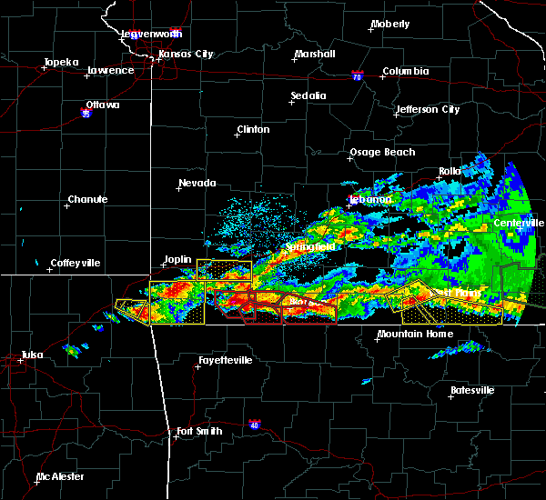 At 711 pm cst, a severe thunderstorm was located near west plains, moving southeast at 30 mph (radar indicated). Hazards include 60 mph wind gusts and quarter size hail. Hail damage to vehicles is expected. expect wind damage to roofs, siding, and trees. Locations impacted include, west plains, grand gulf state park, thayer, mammoth spring, alton, koshkonong, brandsville, mammoth spring state park, lanton, myrtle, couch, rover,. At 711 pm cst, a severe thunderstorm was located near west plains, moving southeast at 30 mph (radar indicated). Hazards include 60 mph wind gusts and quarter size hail. Hail damage to vehicles is expected. expect wind damage to roofs, siding, and trees. Locations impacted include, west plains, grand gulf state park, thayer, mammoth spring, alton, koshkonong, brandsville, mammoth spring state park, lanton, myrtle, couch, rover,.
|
| 3/9/2017 6:53 PM CST |
 At 653 pm cst, a severe thunderstorm was located over west plains, moving east at 55 mph (radar indicated). Hazards include 60 mph wind gusts and half dollar size hail. Hail damage to vehicles is expected. Expect wind damage to roofs, siding, and trees. At 653 pm cst, a severe thunderstorm was located over west plains, moving east at 55 mph (radar indicated). Hazards include 60 mph wind gusts and half dollar size hail. Hail damage to vehicles is expected. Expect wind damage to roofs, siding, and trees.
|
| 3/7/2017 1:54 AM CST |
 At 154 am cst, a severe thunderstorm capable of producing a tornado was located near cherokee village, moving east at 45 mph (radar indicated rotation). Hazards include tornado and half dollar size hail. Flying debris will be dangerous to those caught without shelter. mobile homes will be damaged or destroyed. damage to roofs, windows, and vehicles will occur. Tree damage is likely. At 154 am cst, a severe thunderstorm capable of producing a tornado was located near cherokee village, moving east at 45 mph (radar indicated rotation). Hazards include tornado and half dollar size hail. Flying debris will be dangerous to those caught without shelter. mobile homes will be damaged or destroyed. damage to roofs, windows, and vehicles will occur. Tree damage is likely.
|
| 3/1/2017 2:58 AM CST |
 At 257 am cst, severe thunderstorms were located along a line extending from near sturkie to near horseshoe bend, moving east at 80 mph (radar indicated). Hazards include 60 mph wind gusts. Expect damage to roofs, siding, and trees. Locations impacted include, cherokee village, salem in fulton county, ash flat, horseshoe bend, highland in sharp county, mammoth spring, hardy, oxford, viola, ballard, bexar, flint springs, ott, sturkie, byron, mammoth spring state park, williford, agnos, armstrong, heart, a tornado watch remains in effect until 600 am cst for north central arkansas. At 257 am cst, severe thunderstorms were located along a line extending from near sturkie to near horseshoe bend, moving east at 80 mph (radar indicated). Hazards include 60 mph wind gusts. Expect damage to roofs, siding, and trees. Locations impacted include, cherokee village, salem in fulton county, ash flat, horseshoe bend, highland in sharp county, mammoth spring, hardy, oxford, viola, ballard, bexar, flint springs, ott, sturkie, byron, mammoth spring state park, williford, agnos, armstrong, heart, a tornado watch remains in effect until 600 am cst for north central arkansas.
|
| 3/1/2017 2:43 AM CST |
 At 243 am cst, severe thunderstorms were located along a line extending from near bakersfield to rodney, moving east at 65 mph (radar indicated). Hazards include 60 mph wind gusts. expect damage to roofs, siding, and trees At 243 am cst, severe thunderstorms were located along a line extending from near bakersfield to rodney, moving east at 65 mph (radar indicated). Hazards include 60 mph wind gusts. expect damage to roofs, siding, and trees
|
| 2/7/2017 1:55 AM CST |
 At 154 am cst, severe thunderstorms were located along a line extending from near mammoth spring to 5 miles northwest of salem to 3 miles northeast of norfork, moving east at 40 mph (radar indicated). Hazards include 60 mph wind gusts and quarter size hail. Hail damage to vehicles is expected. expect wind damage to roofs, siding, and trees. Locations impacted include, cherokee village, salem in fulton county, horseshoe bend, mammoth spring, oxford, norfork, salesville, viola, bexar, norfork dam, flint springs, sturkie, byron, rodney, mammoth spring state park, agnos, heart, moko, fryatt, union,. At 154 am cst, severe thunderstorms were located along a line extending from near mammoth spring to 5 miles northwest of salem to 3 miles northeast of norfork, moving east at 40 mph (radar indicated). Hazards include 60 mph wind gusts and quarter size hail. Hail damage to vehicles is expected. expect wind damage to roofs, siding, and trees. Locations impacted include, cherokee village, salem in fulton county, horseshoe bend, mammoth spring, oxford, norfork, salesville, viola, bexar, norfork dam, flint springs, sturkie, byron, rodney, mammoth spring state park, agnos, heart, moko, fryatt, union,.
|
| 2/7/2017 1:26 AM CST |
 At 125 am cst, severe thunderstorms were located along a line extending from just east of viola to rodney, moving east at 40 mph (radar indicated). Hazards include 60 mph wind gusts and quarter size hail. Hail damage to vehicles is expected. Expect wind damage to roofs, siding, and trees. At 125 am cst, severe thunderstorms were located along a line extending from just east of viola to rodney, moving east at 40 mph (radar indicated). Hazards include 60 mph wind gusts and quarter size hail. Hail damage to vehicles is expected. Expect wind damage to roofs, siding, and trees.
|
| 9/16/2016 7:52 PM CDT |
 At 751 pm cdt, a severe thunderstorm was located 8 miles east of sturkie, or 9 miles northeast of salem in fulton county, moving north at 30 mph (radar indicated). Hazards include 60 mph wind gusts and quarter size hail. Hail damage to vehicles is expected. expect wind damage to roofs, siding, and trees. Locations impacted include, salem in fulton county, mammoth spring, mammoth spring state park, sturkie, agnos, heart, wheeling, fryatt, morriston, salem airport, saddle, camp, moko, glencoe,. At 751 pm cdt, a severe thunderstorm was located 8 miles east of sturkie, or 9 miles northeast of salem in fulton county, moving north at 30 mph (radar indicated). Hazards include 60 mph wind gusts and quarter size hail. Hail damage to vehicles is expected. expect wind damage to roofs, siding, and trees. Locations impacted include, salem in fulton county, mammoth spring, mammoth spring state park, sturkie, agnos, heart, wheeling, fryatt, morriston, salem airport, saddle, camp, moko, glencoe,.
|
| 9/16/2016 7:30 PM CDT |
 At 730 pm cdt, a severe thunderstorm was located over salem in fulton county, moving north at 35 mph (radar indicated). Hazards include 60 mph wind gusts and quarter size hail. Hail damage to vehicles is expected. Expect wind damage to roofs, siding, and trees. At 730 pm cdt, a severe thunderstorm was located over salem in fulton county, moving north at 35 mph (radar indicated). Hazards include 60 mph wind gusts and quarter size hail. Hail damage to vehicles is expected. Expect wind damage to roofs, siding, and trees.
|
| 7/2/2016 3:28 PM CDT |
 At 327 pm cdt, a severe thunderstorm was located over gamaliel landing, or 9 miles east of mountain home, moving east at 40 mph (radar indicated). Hazards include 60 mph wind gusts and quarter size hail. Hail damage to vehicles is expected. Expect wind damage to roofs, siding, and trees. At 327 pm cdt, a severe thunderstorm was located over gamaliel landing, or 9 miles east of mountain home, moving east at 40 mph (radar indicated). Hazards include 60 mph wind gusts and quarter size hail. Hail damage to vehicles is expected. Expect wind damage to roofs, siding, and trees.
|
| 6/15/2016 3:47 PM CDT |
 At 346 pm cdt, a severe thunderstorm was located over salem in fulton county, moving east at 30 mph (radar indicated). Hazards include 60 mph wind gusts. Expect damage to roofs. siding. and trees. Locations impacted include, cherokee village, salem in fulton county, highland in sharp county, mammoth spring, hardy, viola, flint springs, byron, sturkie, heart, wheeling, ozark acres, saddler falls, fryatt, salem airport, saddle, camp, mitchell, moko, glencoe,. At 346 pm cdt, a severe thunderstorm was located over salem in fulton county, moving east at 30 mph (radar indicated). Hazards include 60 mph wind gusts. Expect damage to roofs. siding. and trees. Locations impacted include, cherokee village, salem in fulton county, highland in sharp county, mammoth spring, hardy, viola, flint springs, byron, sturkie, heart, wheeling, ozark acres, saddler falls, fryatt, salem airport, saddle, camp, mitchell, moko, glencoe,.
|
| 6/15/2016 3:25 PM CDT |
 At 324 pm cdt, a severe thunderstorm was located over viola, or 10 miles west of salem in fulton county, moving east at 40 mph (radar indicated). Hazards include 60 mph wind gusts. Expect damage to roofs. siding. And trees. At 324 pm cdt, a severe thunderstorm was located over viola, or 10 miles west of salem in fulton county, moving east at 40 mph (radar indicated). Hazards include 60 mph wind gusts. Expect damage to roofs. siding. And trees.
|
| 5/9/2016 8:00 PM CDT |
 At 759 pm cdt, a severe thunderstorm was located 7 miles southeast of mammoth spring state park, or 8 miles southeast of thayer, moving east at 60 mph (radar indicated). Hazards include 70 mph wind gusts and quarter size hail. Hail damage to vehicles is expected. expect considerable tree damage. wind damage is also likely to mobile homes, roofs, and outbuildings. Locations impacted include, cherokee village, salem in fulton coun, ash flat, horseshoe bend, highland in sharp co, mammoth spring, hardy, viola, ballard, bexar, mammoth spring state, byron, flint springs, sturkie, williford, agnos, armstrong, ozark acres, fryatt, morriston, a tornado watch remains in effect until 200 am cdt for north central arkansas. At 759 pm cdt, a severe thunderstorm was located 7 miles southeast of mammoth spring state park, or 8 miles southeast of thayer, moving east at 60 mph (radar indicated). Hazards include 70 mph wind gusts and quarter size hail. Hail damage to vehicles is expected. expect considerable tree damage. wind damage is also likely to mobile homes, roofs, and outbuildings. Locations impacted include, cherokee village, salem in fulton coun, ash flat, horseshoe bend, highland in sharp co, mammoth spring, hardy, viola, ballard, bexar, mammoth spring state, byron, flint springs, sturkie, williford, agnos, armstrong, ozark acres, fryatt, morriston, a tornado watch remains in effect until 200 am cdt for north central arkansas.
|
| 5/9/2016 7:45 PM CDT |
 At 745 pm cdt, a severe thunderstorm was located 7 miles east of salem in fulton county, moving northeast at 55 mph (radar indicated). Hazards include 60 mph wind gusts and quarter size hail. Hail damage to vehicles is expected. expect wind damage to roofs, siding, and trees. Locations impacted include, cherokee village, melbourne, salem in fulton coun, ash flat, horseshoe bend, highland in sharp co, mammoth spring, hardy, oxford, viola, franklin, ballard, bexar, mammoth spring state, byron, flint springs, lacrosse, myron, wideman, sturkie, a tornado watch remains in effect until 200 am cdt for north central arkansas. At 745 pm cdt, a severe thunderstorm was located 7 miles east of salem in fulton county, moving northeast at 55 mph (radar indicated). Hazards include 60 mph wind gusts and quarter size hail. Hail damage to vehicles is expected. expect wind damage to roofs, siding, and trees. Locations impacted include, cherokee village, melbourne, salem in fulton coun, ash flat, horseshoe bend, highland in sharp co, mammoth spring, hardy, oxford, viola, franklin, ballard, bexar, mammoth spring state, byron, flint springs, lacrosse, myron, wideman, sturkie, a tornado watch remains in effect until 200 am cdt for north central arkansas.
|
| 5/9/2016 7:27 PM CDT |
 At 727 pm cdt, a severe thunderstorm was located over bexar, or 10 miles southwest of salem in fulton county, moving northeast at 55 mph (radar indicated). Hazards include 60 mph wind gusts and quarter size hail. Hail damage to vehicles is expected. Expect wind damage to roofs, siding, and trees. At 727 pm cdt, a severe thunderstorm was located over bexar, or 10 miles southwest of salem in fulton county, moving northeast at 55 mph (radar indicated). Hazards include 60 mph wind gusts and quarter size hail. Hail damage to vehicles is expected. Expect wind damage to roofs, siding, and trees.
|
| 12/23/2015 9:05 AM CST | At 905 am cst, severe thunderstorms were located along a line extending from 7 miles south of mammoth spring to near batesville to 6 miles west of pangburn, moving northeast at 45 mph (radar indicated). Hazards include 60 mph wind gusts. Expect damage to roofs. siding. and trees. locations impacted include, batesville, cherokee village, ash flat, horseshoe bend, cave city, highland in sharp county, mammoth spring, hardy, pangburn, mount pleasant, pleasant plains, concord, magness, sidney, moorefield, ballard, mammoth spring state park, southside in independence county, myron and salado. A tornado watch remains in effect until 100 pm cst for northeastern arkansas. |
| 12/23/2015 8:37 AM CST | At 837 am cst, severe thunderstorms were located along a line extending from near byron to 10 miles west of concord to woolly hollow state park, moving northeast at 50 mph (radar indicated). Hazards include 60 mph wind gusts. Expect damage to roofs. siding. And trees. |
| 12/23/2015 7:24 AM CST | At 723 am cst, a severe thunderstorm capable of producing a tornado was located near salem in fulton county, moving northeast at 50 mph (radar indicated rotation). Hazards include tornado. Flying debris will be dangerous to those caught without shelter. mobile homes will be damaged or destroyed. damage to roofs, windows, and vehicles will occur. tree damage is likely. Locations impacted include, cherokee village, salem in fulton county, mammoth spring, mammoth spring state park, agnos, heart, wirth, fryatt, saddler falls, salem airport, saddle, camp and glencoe. |
| 12/23/2015 7:11 AM CST | At 710 am cst, a severe thunderstorm capable of producing a tornado was located over oxford, or 10 miles southwest of salem in fulton county, moving northeast at 50 mph (radar indicated rotation). Hazards include tornado. Flying debris will be dangerous to those caught without shelter. mobile homes will be damaged or destroyed. damage to roofs, windows, and vehicles will occur. tree damage is likely. Locations impacted include, cherokee village, salem in fulton county, horseshoe bend, mammoth spring, oxford, mammoth spring state park, byron, agnos, heart, wheeling, union, wirth, saddler falls, fryatt, morriston, brockwell, salem airport, saddle, camp and moko. |
| 12/23/2015 6:57 AM CST | At 657 am cst, a severe thunderstorm capable of producing a tornado was located over gorby, or 9 miles northwest of melbourne, moving northeast at 50 mph (radar indicated rotation). Hazards include tornado. Flying debris will be dangerous to those caught without shelter. mobile homes will be damaged or destroyed. damage to roofs, windows, and vehicles will occur. tree damage is likely. this dangerous storm will be near, oxford and bexar around 710 am cst. horseshoe bend and byron around 715 am cst. salem in fulton county around 725 am cst. mammoth spring and mammoth spring state park around 745 am cst. Other locations impacted by this tornadic thunderstorm include heart, wheeling, union, wirth, saddler falls, fryatt, agnos, morriston, brockwell and salem airport. |
| 7/20/2015 8:29 PM CDT |
 At 829 pm cdt, severe thunderstorms were located along a line extending from 8 miles northwest of dalton to salem in fulton county to near viola, moving southeast at 30 mph (law enforcement). Hazards include 60 mph wind gusts. Expect damage to roofs. Siding and trees. At 829 pm cdt, severe thunderstorms were located along a line extending from 8 miles northwest of dalton to salem in fulton county to near viola, moving southeast at 30 mph (law enforcement). Hazards include 60 mph wind gusts. Expect damage to roofs. Siding and trees.
|
| 7/20/2015 8:21 PM CDT |
 At 821 pm cdt, severe thunderstorms were located along a line extending from 7 miles northwest of gatewood to viola to 7 miles east of gamaliel landing, moving southeast at 25 mph (radar indicated). Hazards include 60 mph wind gusts and nickel size hail. Expect damage to roofs. siding and trees. Locations impacted include, salem in fulton county, mammoth spring, viola, flint springs, byron, sturkie, gepp, fryatt, vidette, salem airport, camp, mitchell, elizabeth and saddler falls. At 821 pm cdt, severe thunderstorms were located along a line extending from 7 miles northwest of gatewood to viola to 7 miles east of gamaliel landing, moving southeast at 25 mph (radar indicated). Hazards include 60 mph wind gusts and nickel size hail. Expect damage to roofs. siding and trees. Locations impacted include, salem in fulton county, mammoth spring, viola, flint springs, byron, sturkie, gepp, fryatt, vidette, salem airport, camp, mitchell, elizabeth and saddler falls.
|
| 7/20/2015 8:06 PM CDT |
 At 802 pm cdt, severe thunderstorms were located along a line extending from 19 miles east of alton to 13 miles southwest of bakersfield, and moving southeast at 25 mph (law enforcement. a tree was reported down near thomasville at 740 pm). Hazards include 60 mph wind gusts. Expect damage to roofs. siding and trees. locations impacted include, alton, bakersfield, brandsville, caulfield, couch, greer, koshkonong, lanton, moody, myrtle, rover, south fork, thayer, thomasville and wilderness. This warning also includes grand gulf state park. At 802 pm cdt, severe thunderstorms were located along a line extending from 19 miles east of alton to 13 miles southwest of bakersfield, and moving southeast at 25 mph (law enforcement. a tree was reported down near thomasville at 740 pm). Hazards include 60 mph wind gusts. Expect damage to roofs. siding and trees. locations impacted include, alton, bakersfield, brandsville, caulfield, couch, greer, koshkonong, lanton, moody, myrtle, rover, south fork, thayer, thomasville and wilderness. This warning also includes grand gulf state park.
|
| 7/20/2015 8:04 PM CDT |
 At 803 pm cdt, severe thunderstorms were located along a line extending from near alton to gamaliel landing, moving east at 30 mph (radar indicated). Hazards include 60 mph wind gusts and penny size hail. Expect damage to roofs. Siding and trees. At 803 pm cdt, severe thunderstorms were located along a line extending from near alton to gamaliel landing, moving east at 30 mph (radar indicated). Hazards include 60 mph wind gusts and penny size hail. Expect damage to roofs. Siding and trees.
|
| 7/20/2015 7:38 PM CDT |
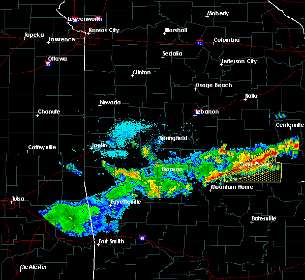 At 737 pm cdt, severe thunderstorms were located along a line extending from 18 miles northeast of alton to 11 miles west of bakersfield, and moving southeast at 25 mph (radar indicated). Hazards include 60 mph wind gusts. Expect damage to roofs. Siding and trees. At 737 pm cdt, severe thunderstorms were located along a line extending from 18 miles northeast of alton to 11 miles west of bakersfield, and moving southeast at 25 mph (radar indicated). Hazards include 60 mph wind gusts. Expect damage to roofs. Siding and trees.
|
| 7/14/2015 1:55 PM CDT |
 At 152 pm cdt, severe thunderstorms were located along a line extending from 3 miles west of gatewood missouri to near hardy to 5 miles north of viola, moving southeast at 40 mph (radar indicated). Hazards include 60 mph wind gusts and nickel size hail. Expect damage to roofs. siding and trees. Locations impacted include, cherokee village, salem in fulton county, ash flat, highland in sharp county, mammoth spring, hardy, mammoth spring state park, flint springs, sturkie, williford, agnos, armstrong, heart, ozark acres, kittle, sitka, wirth, saddler falls, fryatt and salem airport. At 152 pm cdt, severe thunderstorms were located along a line extending from 3 miles west of gatewood missouri to near hardy to 5 miles north of viola, moving southeast at 40 mph (radar indicated). Hazards include 60 mph wind gusts and nickel size hail. Expect damage to roofs. siding and trees. Locations impacted include, cherokee village, salem in fulton county, ash flat, highland in sharp county, mammoth spring, hardy, mammoth spring state park, flint springs, sturkie, williford, agnos, armstrong, heart, ozark acres, kittle, sitka, wirth, saddler falls, fryatt and salem airport.
|
| 7/14/2015 1:48 PM CDT | A tree fell across three cars in the mammoth spring state park area. no injuries were reported in fulton county AR, 0.1 miles WNW of Mammoth Spring, MO |
| 7/14/2015 1:32 PM CDT |
 At 129 pm cdt, a cluster of severe thunderstorms was located from west plains to 3 miles north of bakersfield, and moving southeast at 40 mph. another storm was 5 miles south of mammoth spring, and may become severe (radar indicated). Hazards include 60 mph wind gusts and nickel size hail. Expect damage to roofs. Siding and trees. At 129 pm cdt, a cluster of severe thunderstorms was located from west plains to 3 miles north of bakersfield, and moving southeast at 40 mph. another storm was 5 miles south of mammoth spring, and may become severe (radar indicated). Hazards include 60 mph wind gusts and nickel size hail. Expect damage to roofs. Siding and trees.
|
| 7/14/2015 1:32 PM CDT |
 At 130 pm cdt, severe thunderstorms were located along a line extending from 8 miles northwest of alton to west plains to 17 miles southwest of west plains, and moving southeast at 45 mph (trained weather spotters. large trees have been reported down in white church). Hazards include 60 mph wind gusts. Expect damage to roofs. siding and trees. locations impacted include, alton, brandsville, couch, greer, koshkonong, lanton, moody, myrtle, rover, south fork, thayer, thomasville, west plains, white church and wilderness. this warning also includes grand gulf state park. A severe thunderstorm watch remains in effect until 700 pm cdt tuesday evening for southwestern missouri. At 130 pm cdt, severe thunderstorms were located along a line extending from 8 miles northwest of alton to west plains to 17 miles southwest of west plains, and moving southeast at 45 mph (trained weather spotters. large trees have been reported down in white church). Hazards include 60 mph wind gusts. Expect damage to roofs. siding and trees. locations impacted include, alton, brandsville, couch, greer, koshkonong, lanton, moody, myrtle, rover, south fork, thayer, thomasville, west plains, white church and wilderness. this warning also includes grand gulf state park. A severe thunderstorm watch remains in effect until 700 pm cdt tuesday evening for southwestern missouri.
|
| 7/14/2015 1:25 PM CDT |
 At 122 pm cdt, severe thunderstorms were located along a line extending from 14 miles northwest of alton to 6 miles north of west plains to 16 miles southwest of west plains, and moving southeast at 45 mph (radar indicated. these storms have a history of producing widespread wind damage). Hazards include 60 mph wind gusts. Expect damage to roofs. Siding and trees. At 122 pm cdt, severe thunderstorms were located along a line extending from 14 miles northwest of alton to 6 miles north of west plains to 16 miles southwest of west plains, and moving southeast at 45 mph (radar indicated. these storms have a history of producing widespread wind damage). Hazards include 60 mph wind gusts. Expect damage to roofs. Siding and trees.
|
| 5/24/2015 6:32 PM CDT | At 630 pm cdt, severe thunderstorms were located along a line extending from lake thunderbird to 6 miles southeast of hardy to 5 miles northwest of lynn, and moving north at 55 mph (radar indicated). Hazards include 60 mph wind gusts. Expect damage to roofs. Siding and trees. |
| 5/24/2015 6:28 PM CDT | At 626 pm cdt, severe thunderstorms were located along a line extending from 6 miles east of ava to 9 miles southwest of west plains, and moving northeast at 60 mph (radar indicated). Hazards include 60 mph wind gusts. Expect damage to roofs. Siding and trees. |
| 5/24/2015 6:24 PM CDT | At 621 pm cdt, severe thunderstorms were located along a line extending from ash flat to 11 miles northwest of strawberry to grubbs, and moving northeast at 40 mph (radar indicated). Hazards include 60 mph wind gusts. Expect damage to roofs. Siding and trees. |
| 5/24/2015 6:20 PM CDT | At 619 pm cdt, severe thunderstorms were located along a line extending from sturkie to 7 miles northwest of lake omaha, and moving northeast at 65 mph (radar indicated). Hazards include 60 mph wind gusts. Expect damage to roofs. Siding and trees. |
| 5/24/2015 6:12 PM CDT | The tornado warning for north central sharp and northeastern fulton counties will expire at 615 pm cdt, the storm which prompted the warning has moved out of the warned area. additional strong thunderstorms are still possible, and a tornado watch remains in effect until 7 pm. |
| 5/24/2015 6:11 PM CDT | At 608 pm cdt, severe thunderstorms were located along a line extending from myron to 6 miles northeast of cave city to algoa, and moving northeast at 70 mph (radar indicated). Hazards include 60 mph wind gusts. Expect damage to roofs. Siding and trees. |
| 5/24/2015 6:03 PM CDT | At 601 pm cdt, severe thunderstorms were located along a line extending from morriston to sidney to cave city to oil trough, and moving north at 45 mph (radar indicated). Hazards include 60 mph wind gusts. Expect damage to roofs. Siding and trees. |
| 5/24/2015 6:01 PM CDT | At 559 pm cdt, a severe thunderstorm capable of producing a tornado was located 6 miles southeast of mammoth spring state park, and moving north at 25 mph (radar indicated rotation). Hazards include tornado and quarter size hail. Flying debris will be dangerous to those caught without shelter. mobile homes will be damaged or destroyed. damage to roofs, windows and vehicles will occur. Tree damage is likely. |
| 5/24/2015 5:59 PM CDT | At 556 pm cdt, severe thunderstorms were located along a line extending from gamaliel landing to franklin, and moving northeast at 60 mph (radar indicated). Hazards include 60 mph wind gusts. Expect damage to roofs. Siding and trees. |
| 5/24/2015 5:54 PM CDT | At 551 pm cdt, a severe thunderstorm capable of producing a tornado was located near hardy, and moving northeast at 40 mph (radar indicated rotation). Hazards include tornado and quarter size hail. Flying debris will be dangerous to those caught without shelter. mobile homes will be damaged or destroyed. damage to roofs, windows and vehicles will occur. tree damage is likely. Locations in the path of this dangerous storm include, hardy, wirth, saddler falls,. |
| 5/24/2015 5:53 PM CDT | At 550 pm cdt, a severe thunderstorm was located 7 miles southeast of thayer, and moving north at 50 mph (radar indicated). Hazards include 60 mph wind gusts and quarter size hail. Hail damage to vehicles is expected. Expect wind damage to roofs, siding and trees. |
| 5/24/2015 5:37 PM CDT | At 536 pm cdt, severe thunderstorms were located along a line extending from lone star to 7 miles southwest of cushman to 7 miles northwest of pleasant plains to bald knob, and moving northeast at 50 mph (radar indicated). Hazards include 60 mph wind gusts. Expect damage to roofs. Siding and trees. |
| 5/24/2015 3:29 PM CDT | At 326 pm cdt, a severe thunderstorm was located near ash flat, and moving north at 50 mph. another storm was near evening shade, and may become severe as it heads to the north (radar indicated). Hazards include 60 mph wind gusts. Expect damage to roofs. Siding and trees. |
| 5/24/2015 3:12 PM CDT | At 311 pm cdt, a severe thunderstorm was located 6 miles south of myron, and moving north at 45 mph (radar indicated). Hazards include 60 mph wind gusts and quarter size hail. Hail damage to vehicles is expected. Expect wind damage to roofs, siding and trees. |
| 4/9/2015 6:57 PM CDT | The national weather service in little rock has issued a * severe thunderstorm warning for. northeastern fulton county in north central arkansas. northeastern sharp county in north central arkansas. until 715 pm cdt * at 654 pm cdt. A severe thunderstorm was located 5 miles north of. |
| 4/9/2015 6:51 PM CDT | A severe thunderstorm warning remains in effect for northeastern sharp and northeastern fulton counties until 700 pm cdt. at 648 pm cdt. a severe thunderstorm was located near lake thunderbird. and moving northeast at 45 mph. hazard. 60 mph wind gusts and half dollar size hail. source. Radar indicated. |
| 4/9/2015 6:27 PM CDT | The national weather service in little rock has issued a * severe thunderstorm warning for. eastern fulton county in north central arkansas. northeastern izard county in north central arkansas. northern sharp county in north central arkansas. Until 700 pm cdt. |
| 4/3/2015 6:15 AM CDT | A severe thunderstorm warning remains in effect for fulton county until 630 am cdt. at 613 am cdt. a severe thunderstorm was located near salem. and moving east at 45 mph. hazard. 60 mph wind gusts and quarter size hail. source. Radar indicated. |
| 4/3/2015 5:43 AM CDT | The national weather service in little rock has issued a * severe thunderstorm warning for. northern baxter county in north central arkansas. fulton county in north central arkansas. northeastern izard county in north central arkansas. Until 630 am cdt. |
| 4/1/2015 4:28 PM CDT | A severe thunderstorm warning remains in effect for north central sharp and northeastern fulton counties until 500 pm cdt. at 426 pm cdt. a severe thunderstorm was located 6 miles south of mammoth spring. and moving northeast at 20 mph. Another severe storm is located 2 miles southwest of wirth and also moving northeast at 20 mph. |
| 4/1/2015 4:09 PM CDT | The national weather service in little rock has issued a * severe thunderstorm warning for. eastern fulton county in north central arkansas. north central sharp county in north central arkansas. until 500 pm cdt * at 407 pm cdt. A severe thunderstorm was located near lake. |
| 3/25/2015 8:52 PM CDT | The national weather service in little rock has issued a * severe thunderstorm warning for. fulton county in north central arkansas. northeastern sharp county in north central arkansas. until 930 pm cdt * at 849 pm cdt. National weather service meteorologists were. |
| 3/25/2015 8:21 PM CDT | The national weather service in little rock has issued a * severe thunderstorm warning for. fulton county in north central arkansas. north central sharp county in north central arkansas. until 900 pm cdt * at 819 pm cdt. National weather service doppler radar indicated a. |
| 1/1/0001 12:00 AM | Large tree down across highway 9. this occurred 3 miles southwest of mammoth spring or 2 miles northeast of fryat in fulton county AR, 5 miles E of Mammoth Spring, MO |
Hail Maps for Mammoth Spring, MO

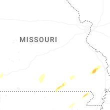


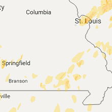


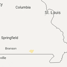


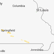

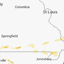


Connect with Interactive Hail Maps