

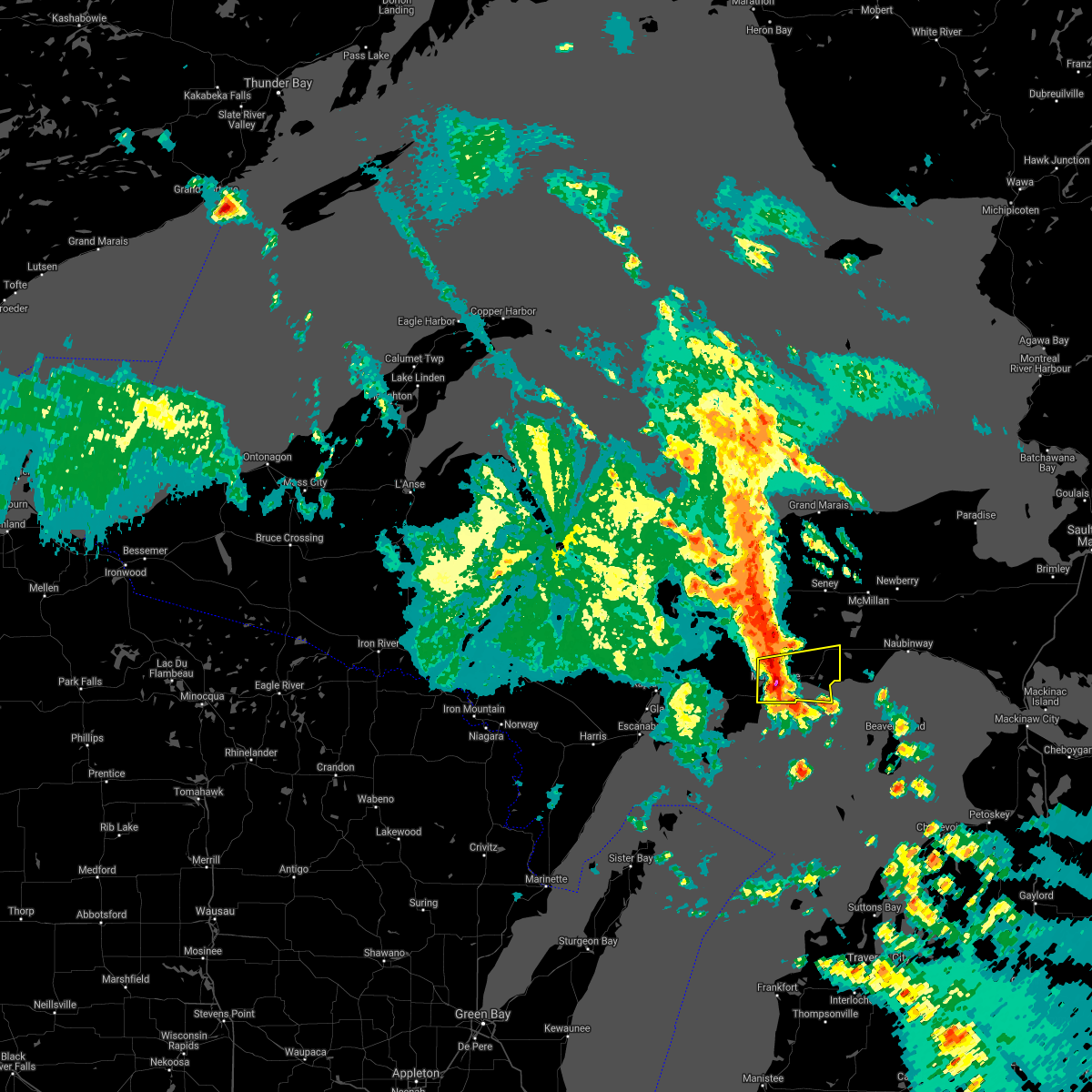
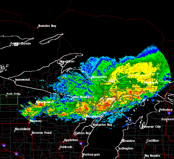
Hail Map for Manistique, MI
The Manistique, MI area has had 3 reports of on-the-ground hail by trained spotters, and has been under severe weather warnings 1 time during the past 12 months. Doppler radar has detected hail at or near Manistique, MI on 19 occasions, including 2 occasions during the past year.
| Name: | Manistique, MI |
| Where Located: | 69.4 miles SE of Marquette, MI |
| Map: | Google Map for Manistique, MI |
| Population: | 3097 |
| Housing Units: | 1617 |
| More Info: | Search Google for Manistique, MI |
5
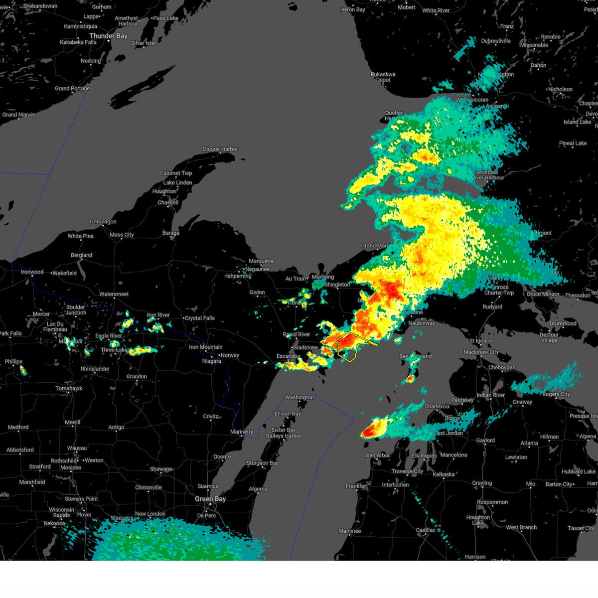
The Top Recent Hail Date for Manistique, MI is Saturday, June 21, 2025 (2nd out of 19)
Hail and Wind Damage Spotted near Manistique, MI
| Date / Time | Report Details |
|---|---|
| 6/30/2025 5:10 PM EDT | Tree blocking southside rd half mile north of m-94. time approximated by reporte in schoolcraft county MI, 13 miles S of Manistique, MI |
| 7/15/2024 9:11 PM EDT |
 Svrmqt the national weather service in marquette has issued a * severe thunderstorm warning for, southwestern schoolcraft county in east central upper michigan, * until 930 pm edt. * at 910 pm edt, a severe thunderstorm was located near manistique, moving southeast at 20 mph (radar indicated). Hazards include 60 mph wind gusts. expect damage to roofs, siding, and trees Svrmqt the national weather service in marquette has issued a * severe thunderstorm warning for, southwestern schoolcraft county in east central upper michigan, * until 930 pm edt. * at 910 pm edt, a severe thunderstorm was located near manistique, moving southeast at 20 mph (radar indicated). Hazards include 60 mph wind gusts. expect damage to roofs, siding, and trees
|
| 6/29/2024 3:20 PM EDT |
 The storms which prompted the warning have weakened below severe limits, and no longer pose an immediate threat to life or property. therefore, the warning will be allowed to expire. however, small hail and gusty winds are still possible with these thunderstorms. The storms which prompted the warning have weakened below severe limits, and no longer pose an immediate threat to life or property. therefore, the warning will be allowed to expire. however, small hail and gusty winds are still possible with these thunderstorms.
|
| 6/29/2024 2:57 PM EDT |
 Svrmqt the national weather service in marquette has issued a * severe thunderstorm warning for, central schoolcraft county in east central upper michigan, * until 330 pm edt. * at 257 pm edt, severe thunderstorms were located along a line extending from near germfask to 6 miles southwest of blaney park to near manistique, moving east at 20 mph (radar indicated). Hazards include 60 mph wind gusts and quarter size hail. Hail damage to vehicles is expected. Expect wind damage to roofs, siding, and trees. Svrmqt the national weather service in marquette has issued a * severe thunderstorm warning for, central schoolcraft county in east central upper michigan, * until 330 pm edt. * at 257 pm edt, severe thunderstorms were located along a line extending from near germfask to 6 miles southwest of blaney park to near manistique, moving east at 20 mph (radar indicated). Hazards include 60 mph wind gusts and quarter size hail. Hail damage to vehicles is expected. Expect wind damage to roofs, siding, and trees.
|
| 6/17/2024 2:29 PM EDT | Mesonet station mc039 manistique mdo in schoolcraft county MI, 2.3 miles WSW of Manistique, MI |
| 6/17/2024 2:25 PM EDT | Eight 12 inch diameter trees were snapped and uprooted by thunderstorm outflow winds from decaying cluster of thunderstorms to the wes in schoolcraft county MI, 11.2 miles WSW of Manistique, MI |
| 6/13/2024 2:04 PM EDT |
 At 204 pm edt, a severe thunderstorm was located over m-94 between steuben and manistique, or 11 miles north of manistique, moving east at 45 mph (radar indicated). Hazards include golf ball size hail and 60 mph wind gusts. People and animals outdoors will be injured. expect hail damage to roofs, siding, windows, and vehicles. expect wind damage to roofs, siding, and trees. Locations impacted include, manistique and m-94 between steuben and manistique. At 204 pm edt, a severe thunderstorm was located over m-94 between steuben and manistique, or 11 miles north of manistique, moving east at 45 mph (radar indicated). Hazards include golf ball size hail and 60 mph wind gusts. People and animals outdoors will be injured. expect hail damage to roofs, siding, windows, and vehicles. expect wind damage to roofs, siding, and trees. Locations impacted include, manistique and m-94 between steuben and manistique.
|
| 6/13/2024 2:04 PM EDT |
 the severe thunderstorm warning has been cancelled and is no longer in effect the severe thunderstorm warning has been cancelled and is no longer in effect
|
| 6/13/2024 1:55 PM EDT |
 the severe thunderstorm warning has been cancelled and is no longer in effect the severe thunderstorm warning has been cancelled and is no longer in effect
|
| 6/13/2024 1:55 PM EDT |
 At 154 pm edt, a severe thunderstorm was located over steuben, or 17 miles northwest of manistique, moving east at 45 mph (radar indicated). Hazards include golf ball size hail and 60 mph wind gusts. People and animals outdoors will be injured. expect hail damage to roofs, siding, windows, and vehicles. expect wind damage to roofs, siding, and trees. Locations impacted include, manistique, steuben, and m-94 between steuben and manistique. At 154 pm edt, a severe thunderstorm was located over steuben, or 17 miles northwest of manistique, moving east at 45 mph (radar indicated). Hazards include golf ball size hail and 60 mph wind gusts. People and animals outdoors will be injured. expect hail damage to roofs, siding, windows, and vehicles. expect wind damage to roofs, siding, and trees. Locations impacted include, manistique, steuben, and m-94 between steuben and manistique.
|
| 6/13/2024 1:43 PM EDT |
 Svrmqt the national weather service in marquette has issued a * severe thunderstorm warning for, northeastern delta county in south central upper michigan, west central schoolcraft county in east central upper michigan, south central alger county in north central upper michigan, * until 215 pm edt. * at 143 pm edt, a severe thunderstorm was located 7 miles west of steuben, or 13 miles south of munising, moving east at 45 mph (radar indicated). Hazards include golf ball size hail and 60 mph wind gusts. People and animals outdoors will be injured. expect hail damage to roofs, siding, windows, and vehicles. Expect wind damage to roofs, siding, and trees. Svrmqt the national weather service in marquette has issued a * severe thunderstorm warning for, northeastern delta county in south central upper michigan, west central schoolcraft county in east central upper michigan, south central alger county in north central upper michigan, * until 215 pm edt. * at 143 pm edt, a severe thunderstorm was located 7 miles west of steuben, or 13 miles south of munising, moving east at 45 mph (radar indicated). Hazards include golf ball size hail and 60 mph wind gusts. People and animals outdoors will be injured. expect hail damage to roofs, siding, windows, and vehicles. Expect wind damage to roofs, siding, and trees.
|
| 7/11/2022 6:58 PM EDT |
 At 658 pm edt, a severe thunderstorm was located 7 miles east of garden corners, or 10 miles southwest of manistique, moving east at 25 mph (radar indicated). Hazards include quarter size hail. damage to vehicles is expected At 658 pm edt, a severe thunderstorm was located 7 miles east of garden corners, or 10 miles southwest of manistique, moving east at 25 mph (radar indicated). Hazards include quarter size hail. damage to vehicles is expected
|
| 7/14/2021 3:00 PM EDT | Campground host of indian river campground reports 400-500 foot area of trees uprooted... many 3 feet or more in diameter. the campground is inaccessible. no injuries r in schoolcraft county MI, 15.5 miles SSE of Manistique, MI |
| 8/26/2020 9:27 AM EDT |
 At 927 am edt, a severe thunderstorm was located over manistique, moving east at 45 mph (radar indicated). Hazards include quarter size hail. damage to vehicles is expected At 927 am edt, a severe thunderstorm was located over manistique, moving east at 45 mph (radar indicated). Hazards include quarter size hail. damage to vehicles is expected
|
| 7/19/2020 4:23 AM EDT |
 The severe thunderstorm warning for central delta, central menominee and central schoolcraft counties will expire at 430 am edt/330 am cdt/, the storms which prompted the warning have moved out of the area. therefore, the warning will be allowed to expire. a severe thunderstorm watch remains in effect until 600 am edt/500 am cdt/ for east central upper and south central upper michigan. to report severe weather, contact your nearest law enforcement agency. they will relay your report to the national weather service marquette. remember, a severe thunderstorm warning still remains in effect for southern menominee county until 445 am edt. The severe thunderstorm warning for central delta, central menominee and central schoolcraft counties will expire at 430 am edt/330 am cdt/, the storms which prompted the warning have moved out of the area. therefore, the warning will be allowed to expire. a severe thunderstorm watch remains in effect until 600 am edt/500 am cdt/ for east central upper and south central upper michigan. to report severe weather, contact your nearest law enforcement agency. they will relay your report to the national weather service marquette. remember, a severe thunderstorm warning still remains in effect for southern menominee county until 445 am edt.
|
| 7/19/2020 3:42 AM EDT |
 At 342 am edt/242 am cdt/, severe thunderstorms were located along a line extending from 10 miles southwest of steuben to near escanaba to 9 miles south of pembine, moving east at 55 mph (radar indicated). Hazards include 60 mph wind gusts and nickel size hail. expect damage to roofs, siding, and trees At 342 am edt/242 am cdt/, severe thunderstorms were located along a line extending from 10 miles southwest of steuben to near escanaba to 9 miles south of pembine, moving east at 55 mph (radar indicated). Hazards include 60 mph wind gusts and nickel size hail. expect damage to roofs, siding, and trees
|
| 7/6/2020 5:47 PM EDT |
 At 547 pm edt, a severe thunderstorm was located 7 miles northwest of garden corners, or 17 miles west of manistique, moving east at 40 mph (radar indicated). Hazards include 60 mph wind gusts. Expect damage to roofs, siding, and trees. Locations impacted include, manistique, m-94 between steuben and manistique, garden corners, isabella, thompson, chicago lake, indian lake state park, nahma junction and cooks. At 547 pm edt, a severe thunderstorm was located 7 miles northwest of garden corners, or 17 miles west of manistique, moving east at 40 mph (radar indicated). Hazards include 60 mph wind gusts. Expect damage to roofs, siding, and trees. Locations impacted include, manistique, m-94 between steuben and manistique, garden corners, isabella, thompson, chicago lake, indian lake state park, nahma junction and cooks.
|
| 7/6/2020 5:27 PM EDT |
 At 527 pm edt, a severe thunderstorm was located 7 miles east of rapid river, or 18 miles northeast of escanaba, moving east at 40 mph (law enforcement reports numerous trees down in and around escanaba). Hazards include 60 mph wind gusts and quarter size hail. Hail damage to vehicles is expected. Expect wind damage to roofs, siding, and trees. At 527 pm edt, a severe thunderstorm was located 7 miles east of rapid river, or 18 miles northeast of escanaba, moving east at 40 mph (law enforcement reports numerous trees down in and around escanaba). Hazards include 60 mph wind gusts and quarter size hail. Hail damage to vehicles is expected. Expect wind damage to roofs, siding, and trees.
|
| 8/7/2019 4:32 PM EDT |
 At 432 pm edt, a severe thunderstorm was located near manistique, moving east at 20 mph (radar indicated). Hazards include quarter size hail. Damage to vehicles is expected. Locations impacted include, manistique and indian lake state park. At 432 pm edt, a severe thunderstorm was located near manistique, moving east at 20 mph (radar indicated). Hazards include quarter size hail. Damage to vehicles is expected. Locations impacted include, manistique and indian lake state park.
|
| 8/7/2019 4:19 PM EDT |
 At 417 pm edt, a severe thunderstorm was located 8 miles northwest of manistique, moving east at 25 mph (radar indicated). Hazards include quarter size hail. damage to vehicles is expected At 417 pm edt, a severe thunderstorm was located 8 miles northwest of manistique, moving east at 25 mph (radar indicated). Hazards include quarter size hail. damage to vehicles is expected
|
| 8/1/2018 4:58 PM EDT |
 At 456 pm edt, a severe thunderstorm was located 10 miles east of manistique, moving east at 30 mph (radar indicated). Hazards include 60 mph wind gusts and penny size hail. Expect damage to roofs, siding, and trees. Locations impacted include, gulliver. At 456 pm edt, a severe thunderstorm was located 10 miles east of manistique, moving east at 30 mph (radar indicated). Hazards include 60 mph wind gusts and penny size hail. Expect damage to roofs, siding, and trees. Locations impacted include, gulliver.
|
| 8/1/2018 4:41 PM EDT |
 The national weather service in marquette has issued a * severe thunderstorm warning for. southeastern schoolcraft county in east central upper michigan. until 515 pm edt. At 440 pm edt, a severe thunderstorm was located just north of manistique, moving east at 30 mph. The national weather service in marquette has issued a * severe thunderstorm warning for. southeastern schoolcraft county in east central upper michigan. until 515 pm edt. At 440 pm edt, a severe thunderstorm was located just north of manistique, moving east at 30 mph.
|
| 7/1/2018 5:56 PM EDT |
 At 556 pm edt, a severe thunderstorm was located near manistique, moving northeast at 50 mph (radar indicated). Hazards include 60 mph wind gusts and quarter size hail. Hail damage to vehicles is expected. Expect wind damage to roofs, siding, and trees. At 556 pm edt, a severe thunderstorm was located near manistique, moving northeast at 50 mph (radar indicated). Hazards include 60 mph wind gusts and quarter size hail. Hail damage to vehicles is expected. Expect wind damage to roofs, siding, and trees.
|
| 7/18/2017 6:52 PM EDT |
 At 652 pm edt, severe thunderstorms were located along a line extending from 9 miles southwest of blaney park to 9 miles east of manistique to 19 miles east of garden corners to 11 miles east of garden to near point detour, moving east at 35 mph (radar indicated). Hazards include 60 mph wind gusts. Expect damage to roofs, siding, and trees. Locations impacted include, manistique and gulliver. At 652 pm edt, severe thunderstorms were located along a line extending from 9 miles southwest of blaney park to 9 miles east of manistique to 19 miles east of garden corners to 11 miles east of garden to near point detour, moving east at 35 mph (radar indicated). Hazards include 60 mph wind gusts. Expect damage to roofs, siding, and trees. Locations impacted include, manistique and gulliver.
|
| 7/18/2017 6:24 PM EDT |
 At 624 pm edt, severe thunderstorms were located along a line extending from near manistique to near nahma to 7 miles southeast of gladstone, moving southeast at 30 mph (radar indicated). Hazards include 60 mph wind gusts. Expect damage to roofs, siding, and trees. Locations impacted include, manistique, nahma, garden, garden corners, point detour, isabella, fayette, thompson, indian lake state park, cooks, fairport and gulliver. At 624 pm edt, severe thunderstorms were located along a line extending from near manistique to near nahma to 7 miles southeast of gladstone, moving southeast at 30 mph (radar indicated). Hazards include 60 mph wind gusts. Expect damage to roofs, siding, and trees. Locations impacted include, manistique, nahma, garden, garden corners, point detour, isabella, fayette, thompson, indian lake state park, cooks, fairport and gulliver.
|
| 7/18/2017 6:09 PM EDT |
 The national weather service in marquette has issued a * severe thunderstorm warning for. delta county in south central upper michigan. southern schoolcraft county in east central upper michigan. Until 700 pm edt * at 609 pm edt, severe thunderstorms were located along a line. The national weather service in marquette has issued a * severe thunderstorm warning for. delta county in south central upper michigan. southern schoolcraft county in east central upper michigan. Until 700 pm edt * at 609 pm edt, severe thunderstorms were located along a line.
|
| 6/15/2017 7:55 PM EDT | Quarter sized hail reported 23.2 miles SSE of Manistique, MI, hail from dime size to quarter size fell for approximately 5 minutes. |
| 6/12/2017 12:22 AM EDT |
 The severe thunderstorm warning for southeastern schoolcraft county will expire at 1230 am edt, the storms which prompted the warning have moved out of the area. therefore the warning will be allowed to expire. a severe thunderstorm watch remains in effect until 400 am edt for south central upper michigan. The severe thunderstorm warning for southeastern schoolcraft county will expire at 1230 am edt, the storms which prompted the warning have moved out of the area. therefore the warning will be allowed to expire. a severe thunderstorm watch remains in effect until 400 am edt for south central upper michigan.
|
| 6/12/2017 12:06 AM EDT |
 At 1206 am edt, severe thunderstorms were located along a line extending from 10 miles southeast of m-94 between steuben and manistique to 7 miles southeast of manistique to 13 miles east of garden, moving east at 65 mph (radar indicated). Hazards include 60 mph wind gusts and penny size hail. Expect damage to roofs, siding, and trees. Locations impacted include, manistique, m-94 between steuben and manistique, blaney park, thompson, gulliver and point aux barques. At 1206 am edt, severe thunderstorms were located along a line extending from 10 miles southeast of m-94 between steuben and manistique to 7 miles southeast of manistique to 13 miles east of garden, moving east at 65 mph (radar indicated). Hazards include 60 mph wind gusts and penny size hail. Expect damage to roofs, siding, and trees. Locations impacted include, manistique, m-94 between steuben and manistique, blaney park, thompson, gulliver and point aux barques.
|
| 6/11/2017 11:43 PM EDT |
 At 1143 pm edt, severe thunderstorms were located along a line extending from 11 miles west of manistique to near garden corners to near garden, moving east at 65 mph (radar indicated). Hazards include 60 mph wind gusts and penny size hail. expect damage to roofs, siding, and trees At 1143 pm edt, severe thunderstorms were located along a line extending from 11 miles west of manistique to near garden corners to near garden, moving east at 65 mph (radar indicated). Hazards include 60 mph wind gusts and penny size hail. expect damage to roofs, siding, and trees
|
| 6/11/2017 10:37 PM EDT | Trees down blocking road along forest highway 13 between roads 442 and 440. source is delta county sherif in delta county MI, 20.7 miles ESE of Manistique, MI |
| 6/11/2017 3:37 PM EDT |
 At 336 pm edt, severe thunderstorms were located along a line extending from 7 miles north of m-94 between steuben and manistique to near manistique, moving east at 65 mph (radar indicated). Hazards include 60 mph wind gusts and penny size hail. Expect damage to roofs, siding, and trees. Locations impacted include, manistique, germfask, seney, m-94 between steuben and manistique, blaney park, m-28 between shingleton and seney, thompson, gulliver, point aux barques and indian lake state park. At 336 pm edt, severe thunderstorms were located along a line extending from 7 miles north of m-94 between steuben and manistique to near manistique, moving east at 65 mph (radar indicated). Hazards include 60 mph wind gusts and penny size hail. Expect damage to roofs, siding, and trees. Locations impacted include, manistique, germfask, seney, m-94 between steuben and manistique, blaney park, m-28 between shingleton and seney, thompson, gulliver, point aux barques and indian lake state park.
|
| 6/11/2017 3:12 PM EDT |
 At 312 pm edt, severe thunderstorms were located along a line extending from 10 miles east of trenary to 8 miles west of nahma, moving east at 65 mph (radar indicated). Hazards include 60 mph wind gusts and penny size hail. expect damage to roofs, siding, and trees At 312 pm edt, severe thunderstorms were located along a line extending from 10 miles east of trenary to 8 miles west of nahma, moving east at 65 mph (radar indicated). Hazards include 60 mph wind gusts and penny size hail. expect damage to roofs, siding, and trees
|
| 7/8/2016 4:00 PM EDT | Three fruit trees of aprox. 6 inch diameter were uprooted this afternoon. estimated time close to 4:00 p.m. edt. delayed report in schoolcraft county MI, 4.3 miles SSE of Manistique, MI |
| 7/8/2016 11:06 AM EDT | Quarter sized hail reported 7.8 miles ESE of Manistique, MI, at least 1 inch hail estimated. observer arrived on site around 30 minutes after hail was estimated to have fallen...based on radar...and found nickel size hail coverin |
| 7/8/2016 10:58 AM EDT |
 At 1058 am edt, severe thunderstorms were located along a line extending from 8 miles northwest of steuben to 7 miles northeast of garden corners, moving northeast at 35 mph (radar indicated). Hazards include quarter size hail and 60 mph wind gusts. Hail damage to vehicles is expected. Expect wind damage to roofs, siding and trees. At 1058 am edt, severe thunderstorms were located along a line extending from 8 miles northwest of steuben to 7 miles northeast of garden corners, moving northeast at 35 mph (radar indicated). Hazards include quarter size hail and 60 mph wind gusts. Hail damage to vehicles is expected. Expect wind damage to roofs, siding and trees.
|
| 8/2/2015 8:50 AM EDT |
 At 849 am edt, severe thunderstorms were located along a line extending from 8 miles southwest of germfask to near garden corners, moving east at 45 mph (radar indicated). Hazards include 60 mph wind gusts and quarter size hail. Hail damage to vehicles is expected. expect wind damage to roofs, siding and trees. these severe storms will be near, manistique around 900 am edt. Other locations impacted by these severe thunderstorms include indian lake state park, isabella, cooks and nahma junction. At 849 am edt, severe thunderstorms were located along a line extending from 8 miles southwest of germfask to near garden corners, moving east at 45 mph (radar indicated). Hazards include 60 mph wind gusts and quarter size hail. Hail damage to vehicles is expected. expect wind damage to roofs, siding and trees. these severe storms will be near, manistique around 900 am edt. Other locations impacted by these severe thunderstorms include indian lake state park, isabella, cooks and nahma junction.
|
| 8/2/2015 8:41 AM EDT |
 At 839 am edt, severe thunderstorms were located along a line extending from near steuben to near nahma, moving east at 45 mph (radar indicated. at 817 am edt...1 inch hail was reported by a spotter in perkins). Hazards include 60 mph wind gusts and quarter size hail. Hail damage to vehicles is expected. expect wind damage to roofs, siding and trees. these severe storms will be near, m-94 between steuben and manistique around 845 am edt. Other locations impacted by these severe thunderstorms include indian lake state park, isabella, cooks, ensign, nahma junction and chicago lake. At 839 am edt, severe thunderstorms were located along a line extending from near steuben to near nahma, moving east at 45 mph (radar indicated. at 817 am edt...1 inch hail was reported by a spotter in perkins). Hazards include 60 mph wind gusts and quarter size hail. Hail damage to vehicles is expected. expect wind damage to roofs, siding and trees. these severe storms will be near, m-94 between steuben and manistique around 845 am edt. Other locations impacted by these severe thunderstorms include indian lake state park, isabella, cooks, ensign, nahma junction and chicago lake.
|
| 8/2/2015 8:30 AM EDT |
 At 828 am edt, severe thunderstorms were located along a line extending from near steuben to 6 miles east of rapid river, moving east at 45 mph (radar indicated. at 817 am edt...1 inch hail was reported in perkins). Hazards include 60 mph wind gusts and quarter size hail. Hail damage to vehicles is expected. expect wind damage to roofs, siding and trees. these severe storms will be near, steuben around 835 am edt. m-94 between steuben and manistique around 840 am edt. garden around 845 am edt. garden corners around 850 am edt. Other locations impacted by these severe thunderstorms include indian lake state park, fish lake, perkins, chicago lake, maplewood, cooks, brampton, nahma junction, isabella and wetmore. At 828 am edt, severe thunderstorms were located along a line extending from near steuben to 6 miles east of rapid river, moving east at 45 mph (radar indicated. at 817 am edt...1 inch hail was reported in perkins). Hazards include 60 mph wind gusts and quarter size hail. Hail damage to vehicles is expected. expect wind damage to roofs, siding and trees. these severe storms will be near, steuben around 835 am edt. m-94 between steuben and manistique around 840 am edt. garden around 845 am edt. garden corners around 850 am edt. Other locations impacted by these severe thunderstorms include indian lake state park, fish lake, perkins, chicago lake, maplewood, cooks, brampton, nahma junction, isabella and wetmore.
|
| 8/2/2015 8:23 AM EDT |
 At 822 am edt, severe thunderstorms were located along a line extending from near steuben to near rapid river, moving east at 50 mph (radar indicated). Hazards include 60 mph wind gusts and quarter size hail. Hail damage to vehicles is expected. expect wind damage to roofs, siding and trees. these severe storms will be near, steuben around 830 am edt. m-94 between steuben and manistique around 840 am edt. garden and garden corners around 845 am edt. manistique around 900 am edt. Other locations impacted by these severe thunderstorms include indian lake state park, fish lake, perkins, chicago lake, maplewood, cooks, brampton, nahma junction, isabella and wetmore. At 822 am edt, severe thunderstorms were located along a line extending from near steuben to near rapid river, moving east at 50 mph (radar indicated). Hazards include 60 mph wind gusts and quarter size hail. Hail damage to vehicles is expected. expect wind damage to roofs, siding and trees. these severe storms will be near, steuben around 830 am edt. m-94 between steuben and manistique around 840 am edt. garden and garden corners around 845 am edt. manistique around 900 am edt. Other locations impacted by these severe thunderstorms include indian lake state park, fish lake, perkins, chicago lake, maplewood, cooks, brampton, nahma junction, isabella and wetmore.
|
| 8/2/2015 8:13 AM EDT |
 At 812 am edt, severe thunderstorms were located along a line extending from 9 miles east of trenary to 7 miles northwest of gladstone, moving east at 45 mph (radar indicated). Hazards include quarter size hail and 60 mph wind gusts. Hail damage to vehicles is expected. expect wind damage to roofs, siding and trees. severe thunderstorms will be near, steuben around 835 am edt. m-94 between steuben and manistique around 845 am edt. garden around 850 am edt. garden corners around 855 am edt. Other locations impacted by these severe thunderstorms include indian lake state park, fish lake, perkins, chicago lake, maplewood, cooks, brampton, nahma junction, isabella and wetmore. At 812 am edt, severe thunderstorms were located along a line extending from 9 miles east of trenary to 7 miles northwest of gladstone, moving east at 45 mph (radar indicated). Hazards include quarter size hail and 60 mph wind gusts. Hail damage to vehicles is expected. expect wind damage to roofs, siding and trees. severe thunderstorms will be near, steuben around 835 am edt. m-94 between steuben and manistique around 845 am edt. garden around 850 am edt. garden corners around 855 am edt. Other locations impacted by these severe thunderstorms include indian lake state park, fish lake, perkins, chicago lake, maplewood, cooks, brampton, nahma junction, isabella and wetmore.
|
| 6/18/2012 2:29 PM EDT | Ping Pong Ball sized hail reported 15.7 miles W of Manistique, MI, 1.5 inch hail measured at seul choix point lighthouse. |
Hail Maps for Manistique, MI


Connect with Interactive Hail Maps