

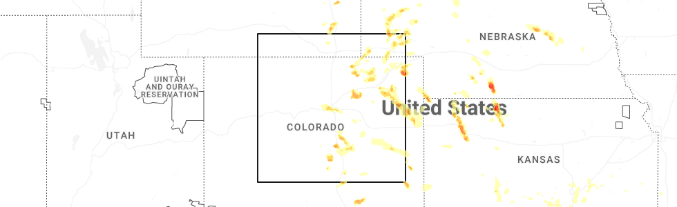
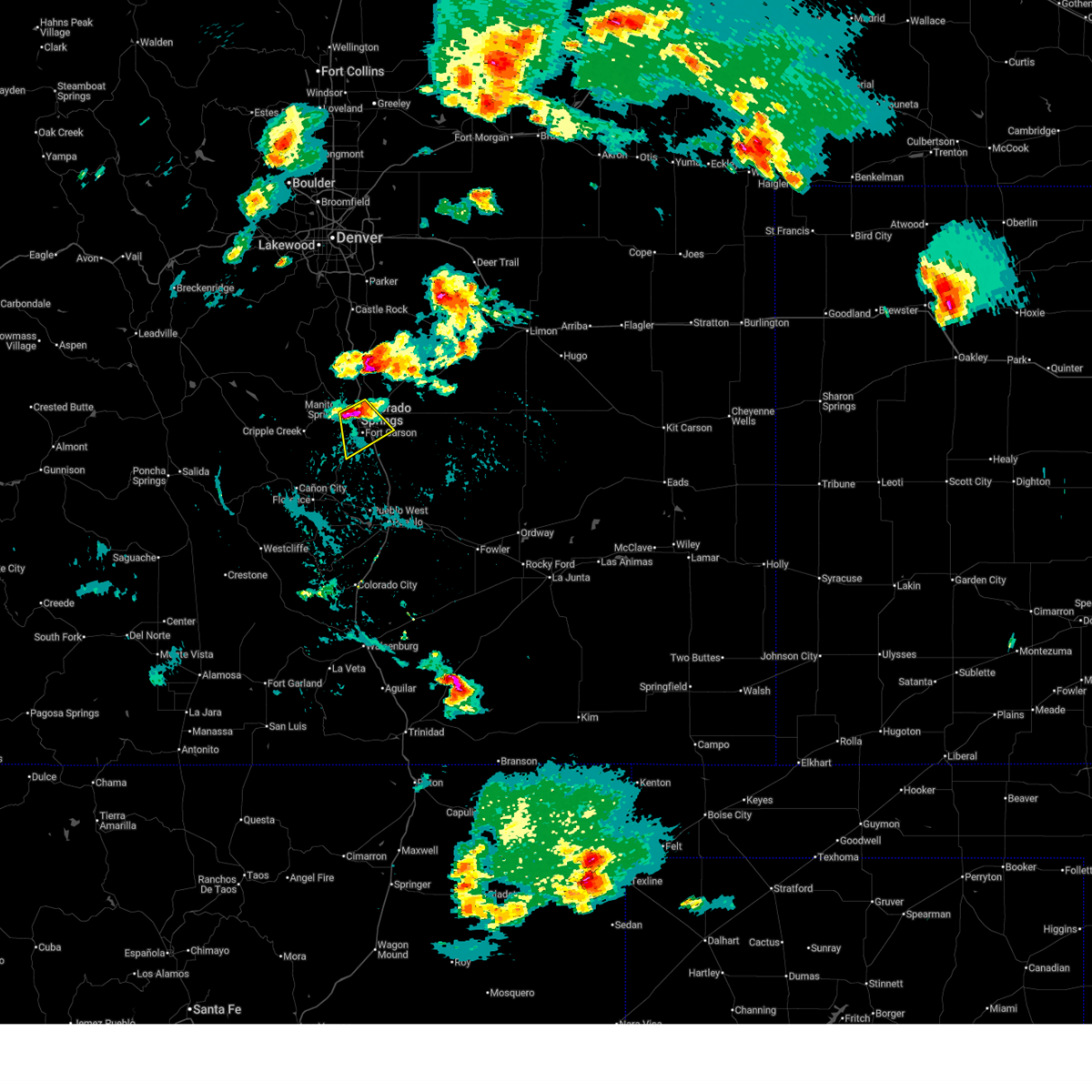
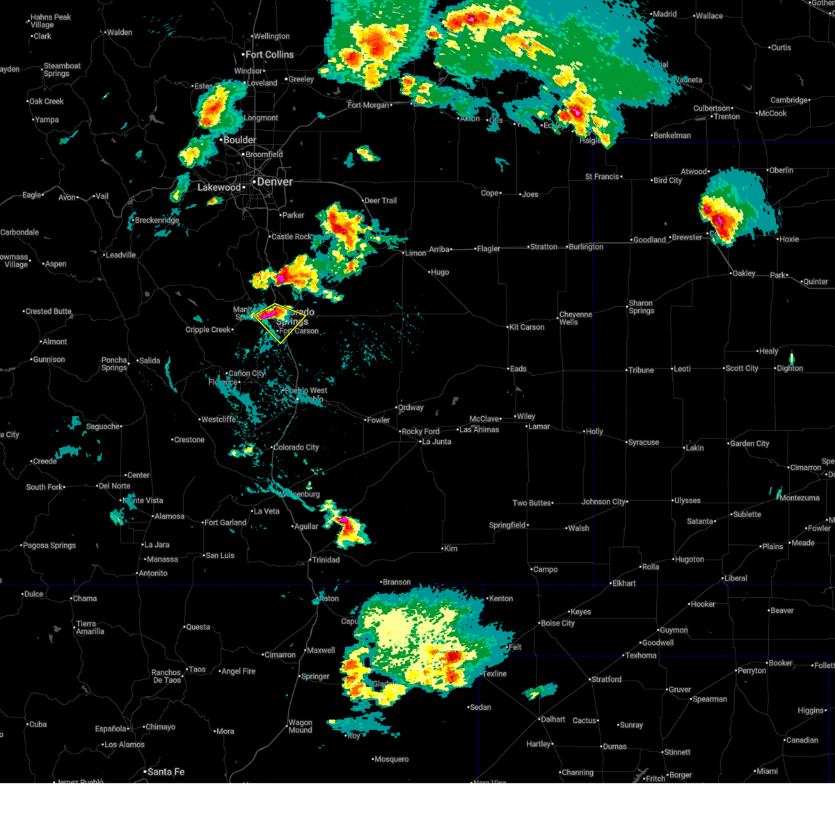
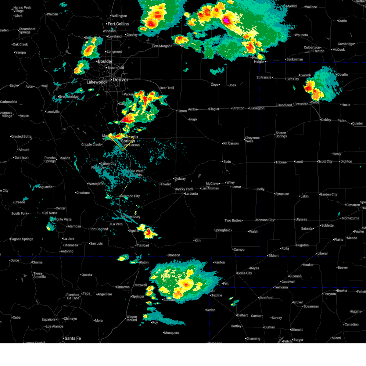
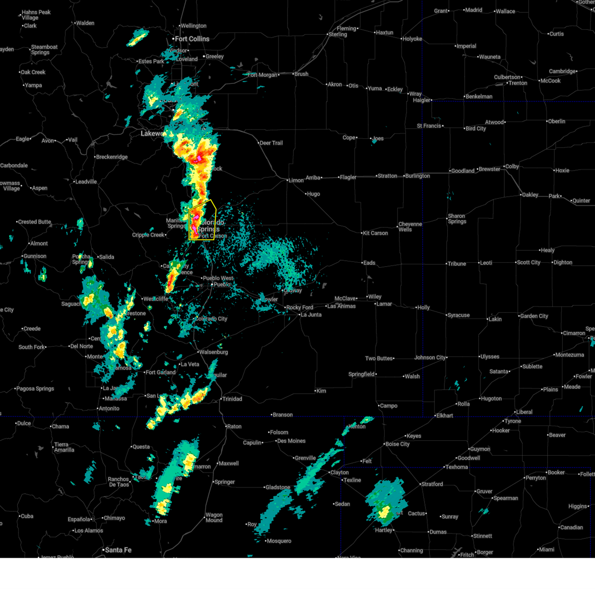
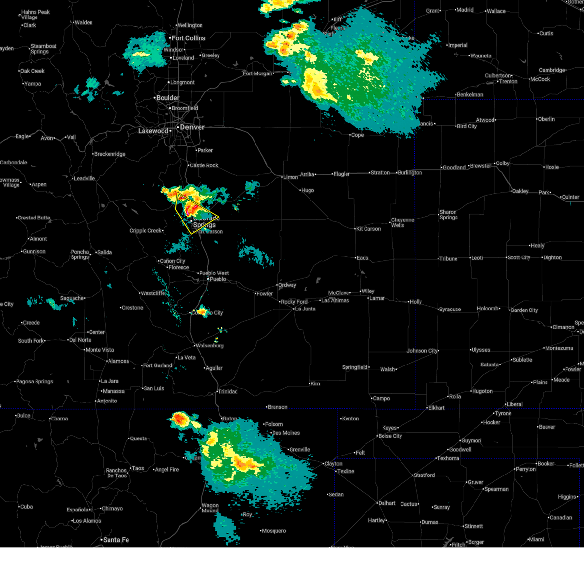
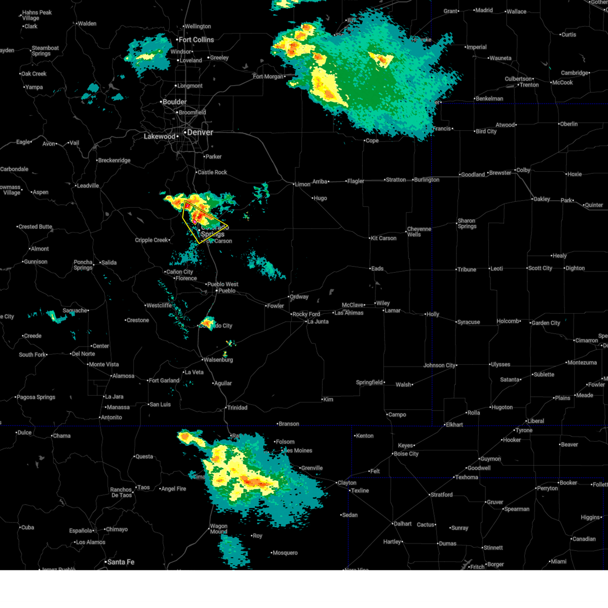
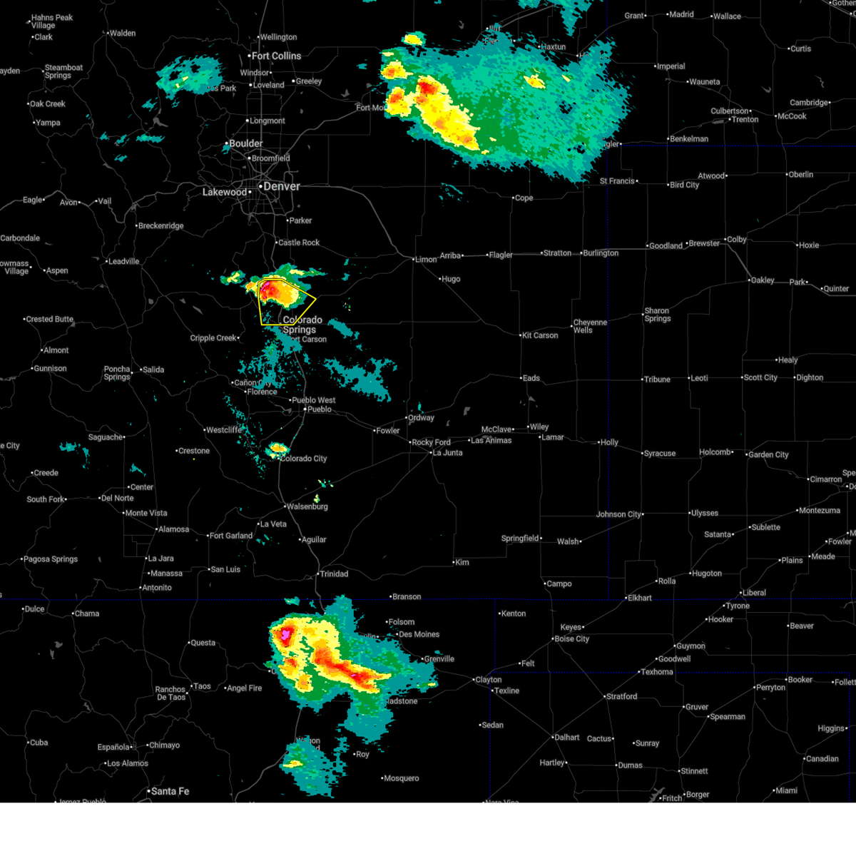
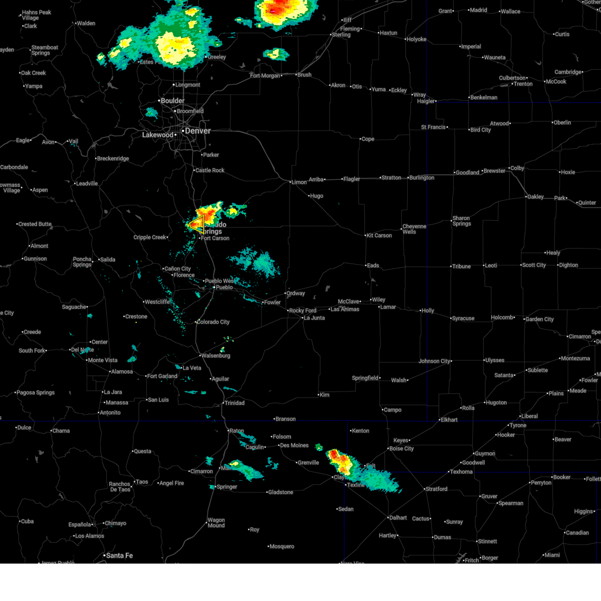
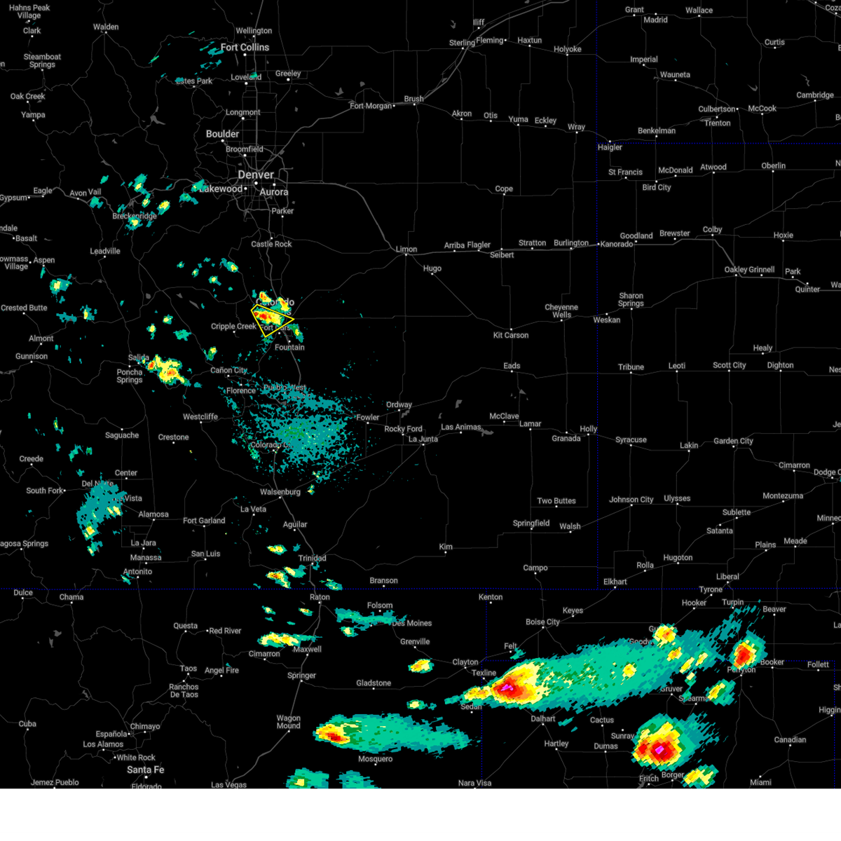
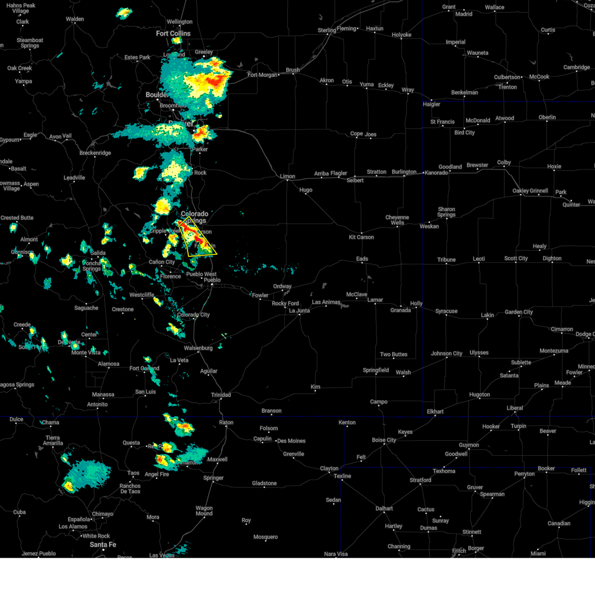
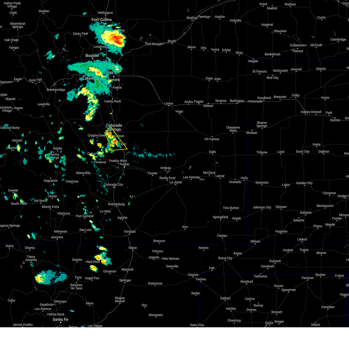
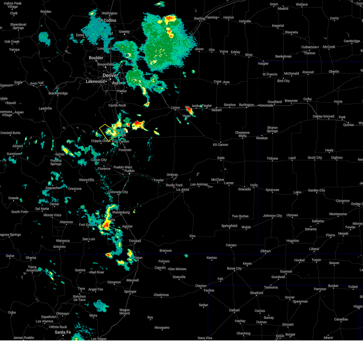
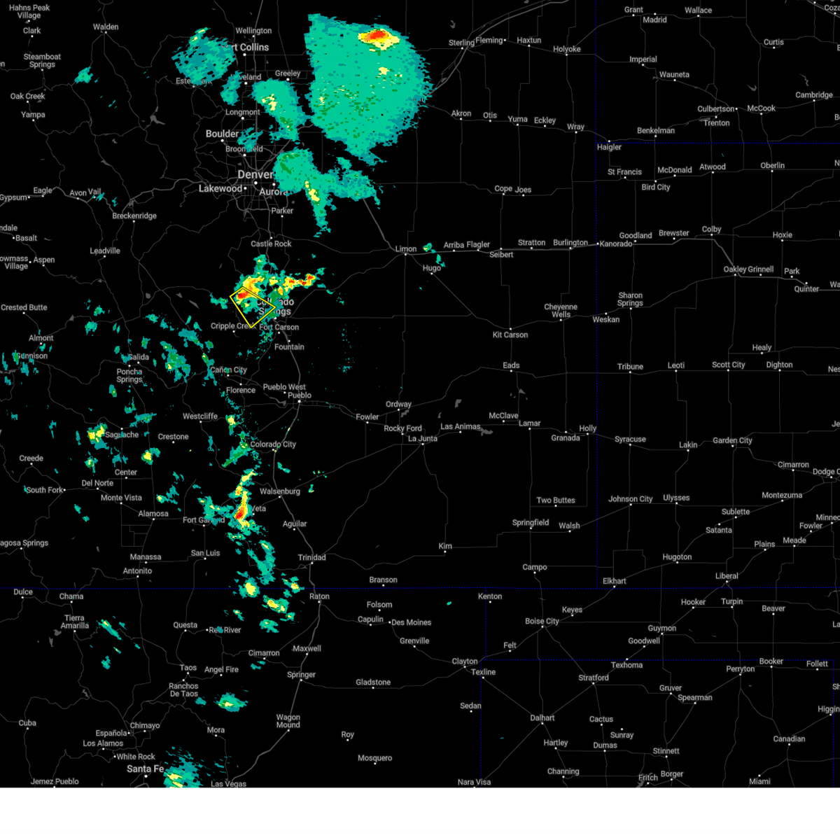
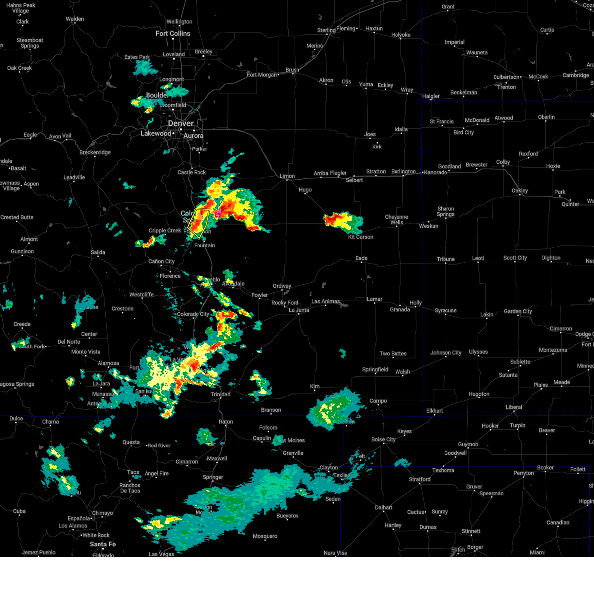
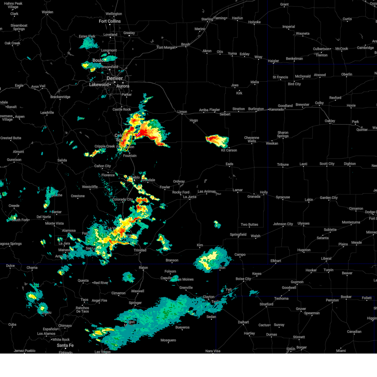
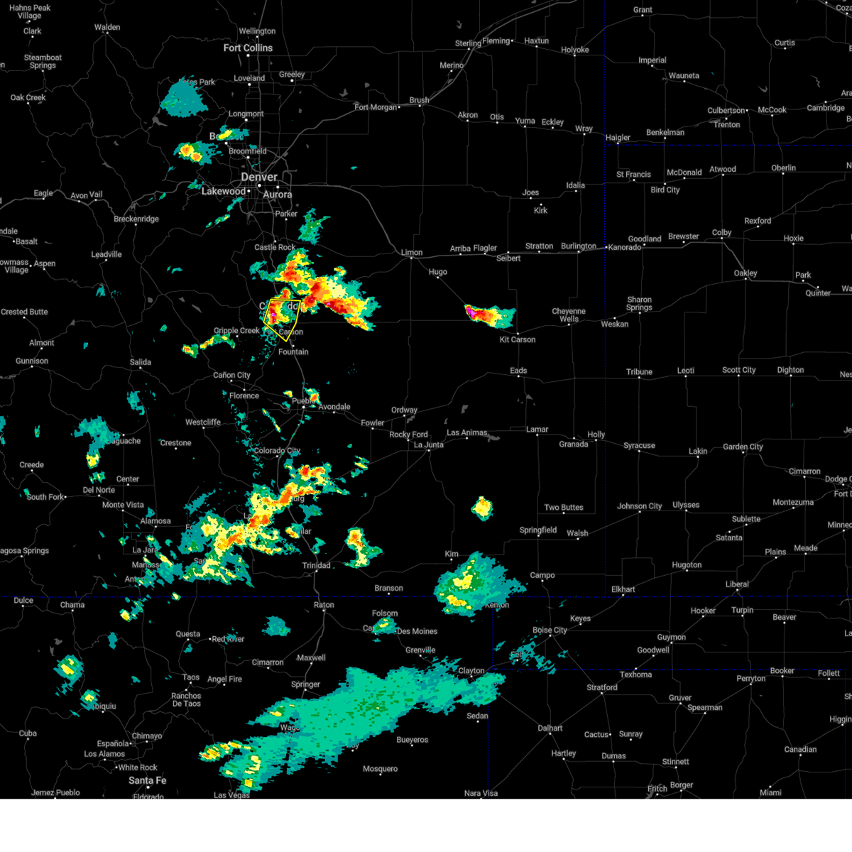
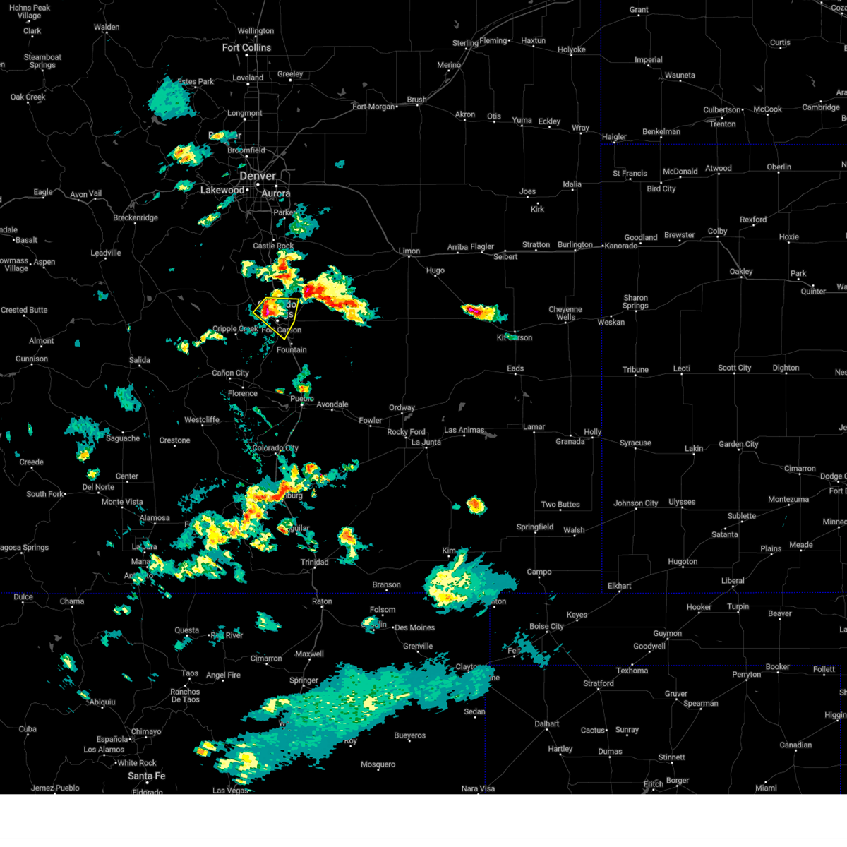
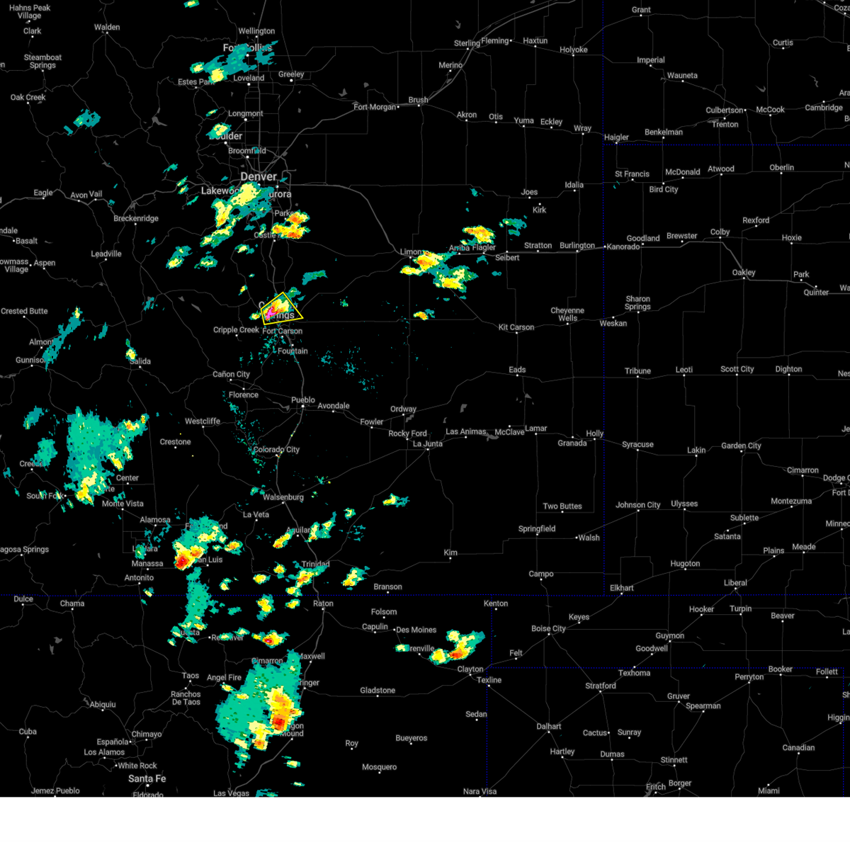
Hail Map for Manitou Springs, CO
The Manitou Springs, CO area has had 11 reports of on-the-ground hail by trained spotters, and has been under severe weather warnings 34 times during the past 12 months. Doppler radar has detected hail at or near Manitou Springs, CO on 74 occasions, including 12 occasions during the past year.
| Name: | Manitou Springs, CO |
| Where Located: | 43.8 miles NNW of Pueblo, CO |
| Map: | Google Map for Manitou Springs, CO |
| Population: | 4992 |
| Housing Units: | 2796 |
| More Info: | Search Google for Manitou Springs, CO |
1
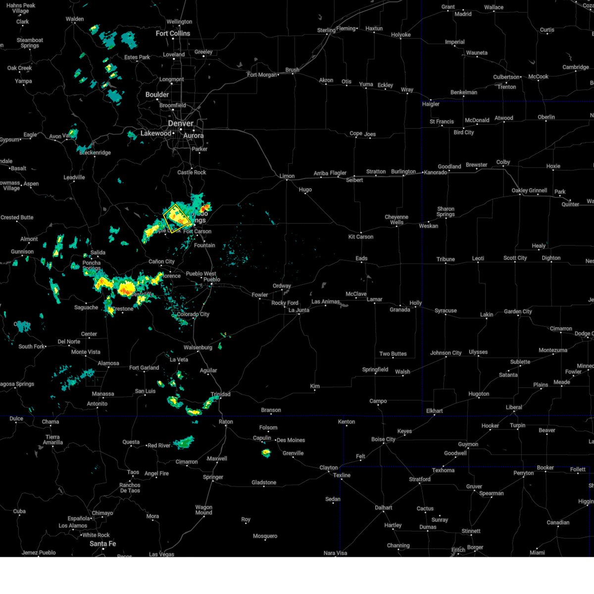
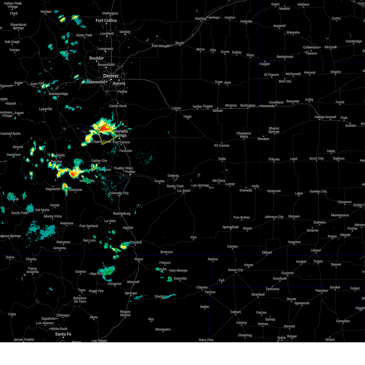
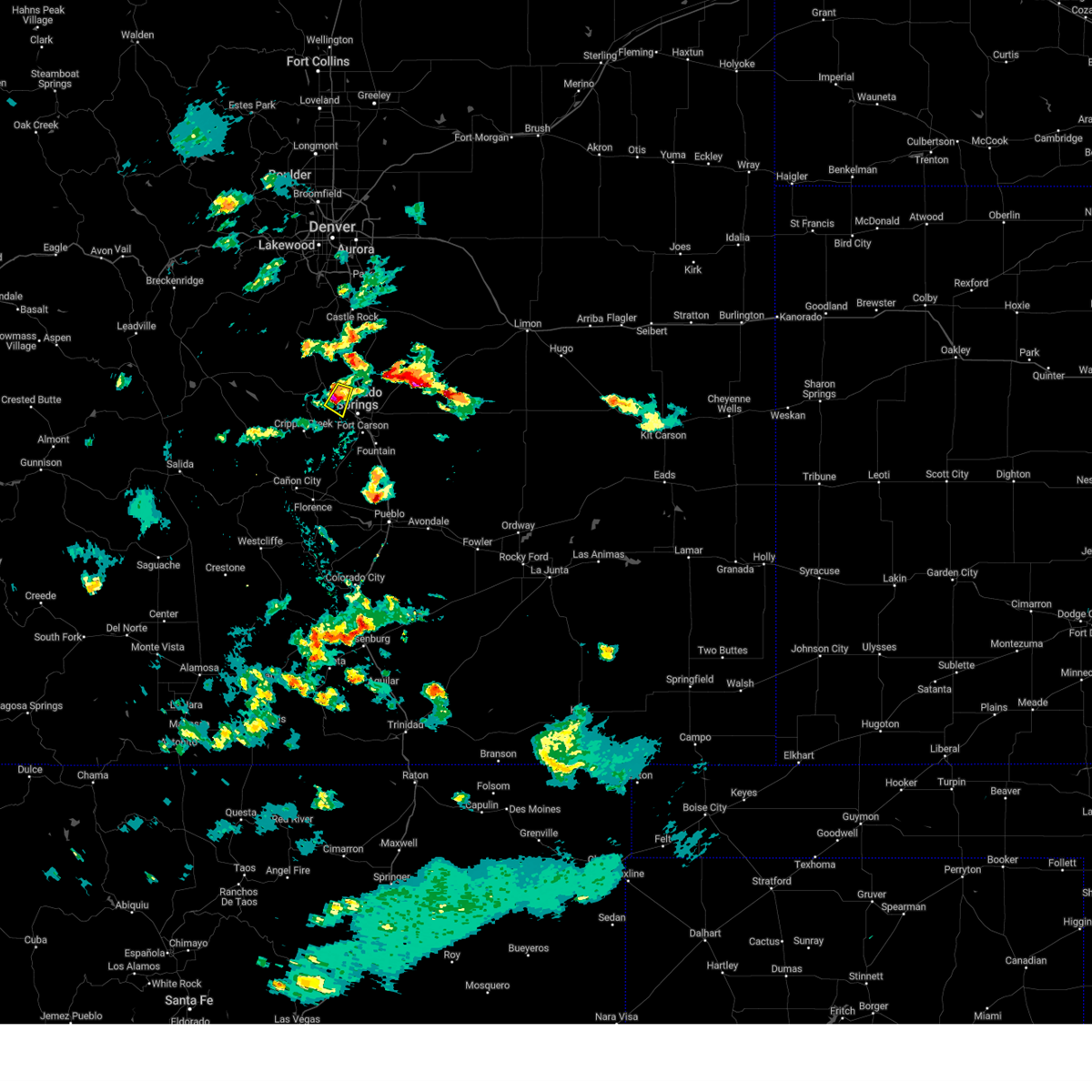
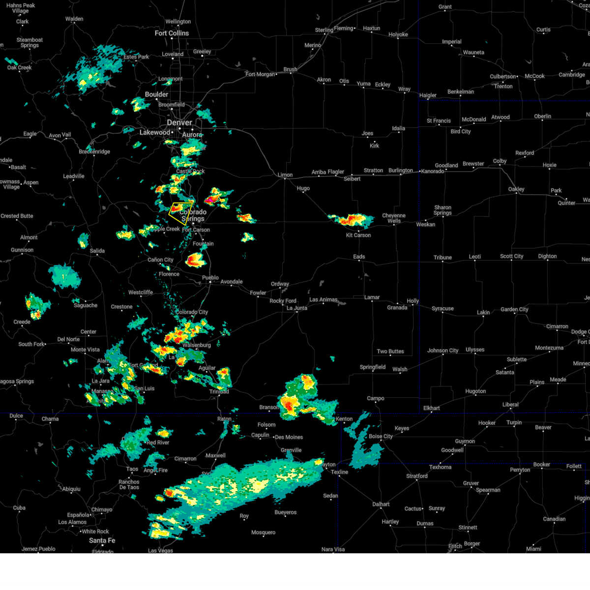
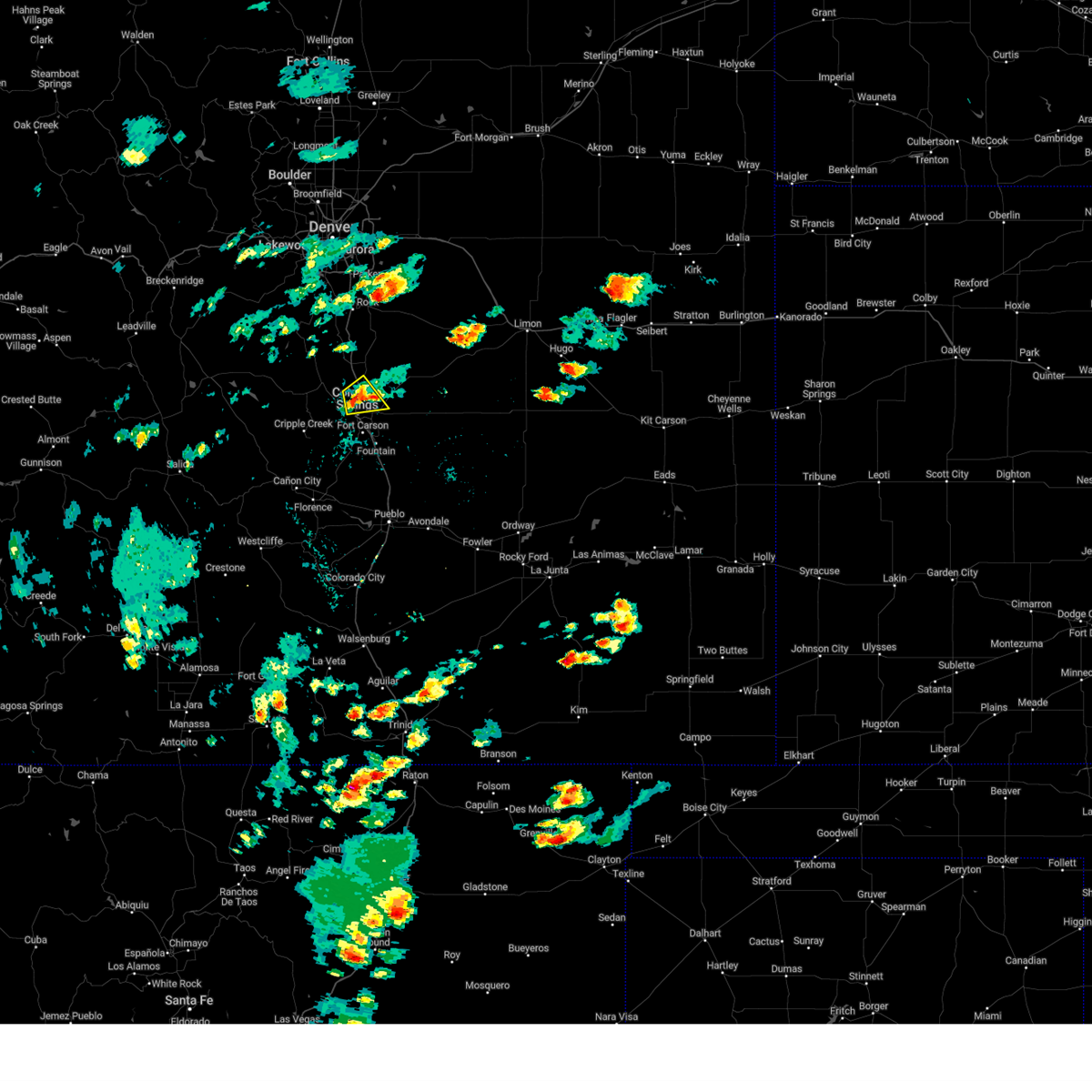
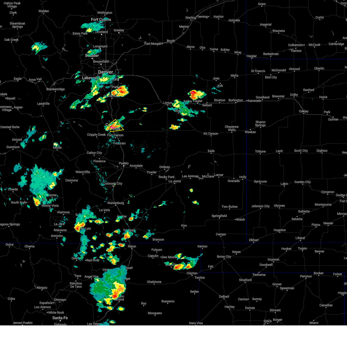
The Top Recent Hail Date for Manitou Springs, CO is Sunday, July 6, 2025 (8th out of 74)
Hail and Wind Damage Spotted near Manitou Springs, CO
| Date / Time | Report Details |
|---|---|
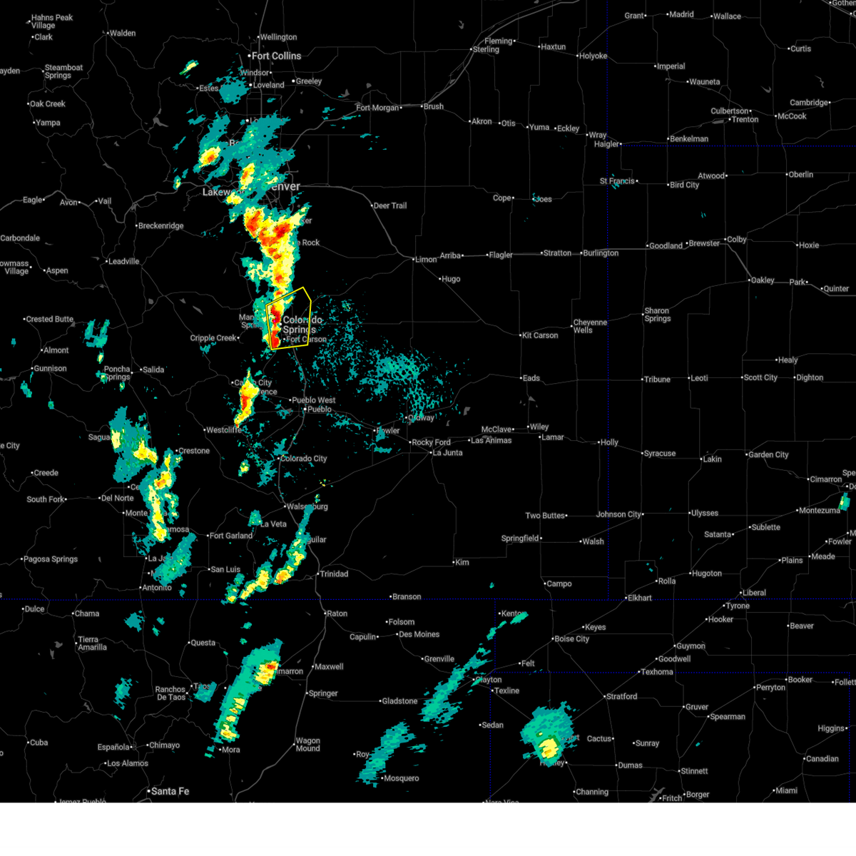
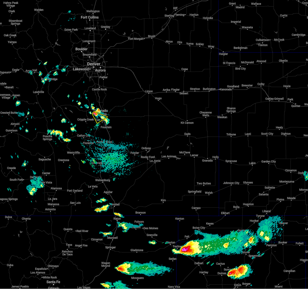
| 7/6/2025 5:43 PM MDT |
 At 542 pm mdt, a severe thunderstorm was located over southwestern colorado springs, moving south at 10 mph (reported by ham radio operators). Hazards include two inch hail. People and animals outdoors will be injured. expect damage to roofs, siding, windows, and vehicles. Locations impacted include, colorado springs, fountain, manitou springs, stratmoor, fort carson, security, security-widefield, peterson space force base, and cimarron hills. At 542 pm mdt, a severe thunderstorm was located over southwestern colorado springs, moving south at 10 mph (reported by ham radio operators). Hazards include two inch hail. People and animals outdoors will be injured. expect damage to roofs, siding, windows, and vehicles. Locations impacted include, colorado springs, fountain, manitou springs, stratmoor, fort carson, security, security-widefield, peterson space force base, and cimarron hills.
|
| 7/6/2025 5:23 PM MDT |
 Svrpub the national weather service in pueblo has issued a * severe thunderstorm warning for, southwestern el paso county in east central colorado, * until 615 pm mdt. * at 522 pm mdt, a severe thunderstorm was located over southwestern colorado springs, moving south at 10 mph (radar indicated). Hazards include ping pong ball size hail and 60 mph wind gusts. People and animals outdoors will be injured. expect hail damage to roofs, siding, windows, and vehicles. Expect wind damage to roofs, siding, and trees. Svrpub the national weather service in pueblo has issued a * severe thunderstorm warning for, southwestern el paso county in east central colorado, * until 615 pm mdt. * at 522 pm mdt, a severe thunderstorm was located over southwestern colorado springs, moving south at 10 mph (radar indicated). Hazards include ping pong ball size hail and 60 mph wind gusts. People and animals outdoors will be injured. expect hail damage to roofs, siding, windows, and vehicles. Expect wind damage to roofs, siding, and trees.
|
| 7/6/2025 5:13 PM MDT |
 At 512 pm mdt, a severe thunderstorm was located over southwestern colorado springs, moving southeast at 10 mph (radar indicated). Hazards include ping pong ball size hail and 60 mph wind gusts. People and animals outdoors will be injured. expect hail damage to roofs, siding, windows, and vehicles. expect wind damage to roofs, siding, and trees. 1 inch size hail has been reported with this storm. Locations impacted include, colorado springs, fountain, manitou springs, stratmoor, fort carson, security, security-widefield, cimarron hills, and peterson space force base. At 512 pm mdt, a severe thunderstorm was located over southwestern colorado springs, moving southeast at 10 mph (radar indicated). Hazards include ping pong ball size hail and 60 mph wind gusts. People and animals outdoors will be injured. expect hail damage to roofs, siding, windows, and vehicles. expect wind damage to roofs, siding, and trees. 1 inch size hail has been reported with this storm. Locations impacted include, colorado springs, fountain, manitou springs, stratmoor, fort carson, security, security-widefield, cimarron hills, and peterson space force base.
|
| 7/6/2025 5:06 PM MDT | Quarter sized hail reported 0.6 miles NW of Manitou Springs, CO |
| 7/6/2025 5:04 PM MDT |
 Svrpub the national weather service in pueblo has issued a * severe thunderstorm warning for, southwestern el paso county in east central colorado, * until 530 pm mdt. * at 504 pm mdt, a severe thunderstorm was located over western colorado springs, moving southeast at 10 mph (radar indicated). Hazards include 60 mph wind gusts and quarter size hail. Hail damage to vehicles is expected. Expect wind damage to roofs, siding, and trees. Svrpub the national weather service in pueblo has issued a * severe thunderstorm warning for, southwestern el paso county in east central colorado, * until 530 pm mdt. * at 504 pm mdt, a severe thunderstorm was located over western colorado springs, moving southeast at 10 mph (radar indicated). Hazards include 60 mph wind gusts and quarter size hail. Hail damage to vehicles is expected. Expect wind damage to roofs, siding, and trees.
|
| 6/24/2025 1:45 PM MDT |
 At 144 pm mdt, a severe thunderstorm was located over northwestern colorado springs, moving northeast at 15 mph (trained weather spotters). Hazards include 60 mph wind gusts and quarter size hail. Hail damage to vehicles is expected. expect wind damage to roofs, siding, and trees. Locations impacted include, colorado springs, fountain, air force academy, manitou springs, black forest, stratmoor, fort carson, security, security-widefield, falcon, cimarron hills, and peterson space force base. At 144 pm mdt, a severe thunderstorm was located over northwestern colorado springs, moving northeast at 15 mph (trained weather spotters). Hazards include 60 mph wind gusts and quarter size hail. Hail damage to vehicles is expected. expect wind damage to roofs, siding, and trees. Locations impacted include, colorado springs, fountain, air force academy, manitou springs, black forest, stratmoor, fort carson, security, security-widefield, falcon, cimarron hills, and peterson space force base.
|
| 6/24/2025 1:35 PM MDT |
 Svrpub the national weather service in pueblo has issued a * severe thunderstorm warning for, northwestern el paso county in east central colorado, * until 200 pm mdt. * at 135 pm mdt, a severe thunderstorm was located over western colorado springs, moving northeast at 15 mph (radar indicated). Hazards include 60 mph wind gusts and quarter size hail. Hail damage to vehicles is expected. Expect wind damage to roofs, siding, and trees. Svrpub the national weather service in pueblo has issued a * severe thunderstorm warning for, northwestern el paso county in east central colorado, * until 200 pm mdt. * at 135 pm mdt, a severe thunderstorm was located over western colorado springs, moving northeast at 15 mph (radar indicated). Hazards include 60 mph wind gusts and quarter size hail. Hail damage to vehicles is expected. Expect wind damage to roofs, siding, and trees.
|
| 6/17/2025 4:35 PM MDT | Svrpub the national weather service in pueblo has issued a * severe thunderstorm warning for, central teller county in central colorado, west central el paso county in east central colorado, * until 515 pm mdt. * at 435 pm mdt, a severe thunderstorm was located near divide, or 15 miles west of colorado springs, moving southeast at 15 mph (radar indicated). Hazards include 60 mph wind gusts and quarter size hail. Hail damage to vehicles is expected. Expect wind damage to roofs, siding, and trees. |
| 6/17/2025 1:54 PM MDT | Quarter sized hail reported 1.1 miles WNW of Manitou Springs, CO, report from mping: quarter (1.00 in.). |
| 6/15/2025 6:34 PM MDT |
 At 633 pm mdt, a severe thunderstorm was located over eastern colorado springs, moving southeast at 30 mph (trained weather spotters). Hazards include golf ball size hail. this report occurred at academy and dublin. People and animals outdoors will be injured. expect damage to roofs, siding, windows, and vehicles. Locations impacted include, colorado springs, monument, air force academy, manitou springs, crystola, security, falcon, stratmoor, fort carson, cimarron hills, peterson space force base, cascade, chipita park, gleneagle, and security-widefield. At 633 pm mdt, a severe thunderstorm was located over eastern colorado springs, moving southeast at 30 mph (trained weather spotters). Hazards include golf ball size hail. this report occurred at academy and dublin. People and animals outdoors will be injured. expect damage to roofs, siding, windows, and vehicles. Locations impacted include, colorado springs, monument, air force academy, manitou springs, crystola, security, falcon, stratmoor, fort carson, cimarron hills, peterson space force base, cascade, chipita park, gleneagle, and security-widefield.
|
| 6/15/2025 6:28 PM MDT |
 At 628 pm mdt, a severe thunderstorm was located over central colorado springs, moving southeast at 20 mph (trained weather spotters). Hazards include quarter size hail. Damage to vehicles is expected. Locations impacted include, colorado springs, monument, air force academy, manitou springs, crystola, security, falcon, stratmoor, fort carson, cimarron hills, peterson space force base, cascade, chipita park, gleneagle, and security-widefield. At 628 pm mdt, a severe thunderstorm was located over central colorado springs, moving southeast at 20 mph (trained weather spotters). Hazards include quarter size hail. Damage to vehicles is expected. Locations impacted include, colorado springs, monument, air force academy, manitou springs, crystola, security, falcon, stratmoor, fort carson, cimarron hills, peterson space force base, cascade, chipita park, gleneagle, and security-widefield.
|
| 6/15/2025 6:20 PM MDT |
 At 619 pm mdt, a severe thunderstorm was located over southeastern colorado springs, moving southeast at 30 mph (trained weather spotters). Hazards include quarter size hail was reported by a trained spotter at 6:18 pm in colorado springs. Damage to vehicles is expected. Locations impacted include, colorado springs, monument, air force academy, manitou springs, crystola, security, falcon, stratmoor, fort carson, cimarron hills, peterson space force base, cascade, chipita park, gleneagle, and security-widefield. At 619 pm mdt, a severe thunderstorm was located over southeastern colorado springs, moving southeast at 30 mph (trained weather spotters). Hazards include quarter size hail was reported by a trained spotter at 6:18 pm in colorado springs. Damage to vehicles is expected. Locations impacted include, colorado springs, monument, air force academy, manitou springs, crystola, security, falcon, stratmoor, fort carson, cimarron hills, peterson space force base, cascade, chipita park, gleneagle, and security-widefield.
|
| 6/15/2025 6:13 PM MDT |
 At 612 pm mdt, a severe thunderstorm was located over northwestern colorado springs, moving southeast at 30 mph (radar indicated). Hazards include 60 mph wind gusts and half dollar size hail. Hail damage to vehicles is expected. expect wind damage to roofs, siding, and trees. video from social media showed strong rotation at cloud base with this storm. Locations impacted include, colorado springs, monument, air force academy, manitou springs, crystola, security, falcon, stratmoor, fort carson, cimarron hills, peterson space force base, cascade, chipita park, gleneagle, and security-widefield. At 612 pm mdt, a severe thunderstorm was located over northwestern colorado springs, moving southeast at 30 mph (radar indicated). Hazards include 60 mph wind gusts and half dollar size hail. Hail damage to vehicles is expected. expect wind damage to roofs, siding, and trees. video from social media showed strong rotation at cloud base with this storm. Locations impacted include, colorado springs, monument, air force academy, manitou springs, crystola, security, falcon, stratmoor, fort carson, cimarron hills, peterson space force base, cascade, chipita park, gleneagle, and security-widefield.
|
| 6/15/2025 6:09 PM MDT |
 Svrpub the national weather service in pueblo has issued a * severe thunderstorm warning for, northwestern el paso county in east central colorado, * until 645 pm mdt. * at 608 pm mdt, a severe thunderstorm was located over northwestern colorado springs, moving southeast at 30 mph (radar indicated). Hazards include 60 mph wind gusts and half dollar size hail. Hail damage to vehicles is expected. Expect wind damage to roofs, siding, and trees. Svrpub the national weather service in pueblo has issued a * severe thunderstorm warning for, northwestern el paso county in east central colorado, * until 645 pm mdt. * at 608 pm mdt, a severe thunderstorm was located over northwestern colorado springs, moving southeast at 30 mph (radar indicated). Hazards include 60 mph wind gusts and half dollar size hail. Hail damage to vehicles is expected. Expect wind damage to roofs, siding, and trees.
|
| 6/15/2025 5:51 PM MDT |
 Svrpub the national weather service in pueblo has issued a * severe thunderstorm warning for, northwestern el paso county in east central colorado, * until 615 pm mdt. * at 551 pm mdt, a severe thunderstorm was located over gleneagle, or 14 miles north of colorado springs, moving southeast at 25 mph (trained weather spotters). Hazards include 60 mph wind gusts and half dollar size hail. Hail damage to vehicles is expected. Expect wind damage to roofs, siding, and trees. Svrpub the national weather service in pueblo has issued a * severe thunderstorm warning for, northwestern el paso county in east central colorado, * until 615 pm mdt. * at 551 pm mdt, a severe thunderstorm was located over gleneagle, or 14 miles north of colorado springs, moving southeast at 25 mph (trained weather spotters). Hazards include 60 mph wind gusts and half dollar size hail. Hail damage to vehicles is expected. Expect wind damage to roofs, siding, and trees.
|
| 6/14/2025 6:00 PM MDT | Quarter sized hail reported 0.6 miles NW of Manitou Springs, CO |
| 6/14/2025 5:58 PM MDT |
 Svrpub the national weather service in pueblo has issued a * severe thunderstorm warning for, west central el paso county in east central colorado, * until 630 pm mdt. * at 558 pm mdt, a severe thunderstorm was located over western colorado springs, moving east at 5 mph (trained weather spotters). Hazards include 60 mph wind gusts and quarter size hail. Hail damage to vehicles is expected. Expect wind damage to roofs, siding, and trees. Svrpub the national weather service in pueblo has issued a * severe thunderstorm warning for, west central el paso county in east central colorado, * until 630 pm mdt. * at 558 pm mdt, a severe thunderstorm was located over western colorado springs, moving east at 5 mph (trained weather spotters). Hazards include 60 mph wind gusts and quarter size hail. Hail damage to vehicles is expected. Expect wind damage to roofs, siding, and trees.
|
| 6/8/2025 3:03 PM MDT |
 the severe thunderstorm warning has been cancelled and is no longer in effect the severe thunderstorm warning has been cancelled and is no longer in effect
|
| 6/8/2025 2:42 PM MDT |
 Svrpub the national weather service in pueblo has issued a * severe thunderstorm warning for, southeastern teller county in central colorado, west central el paso county in east central colorado, * until 315 pm mdt. * at 241 pm mdt, a severe thunderstorm was located over cascade, or 8 miles northwest of colorado springs, moving southeast at 25 mph (radar indicated). Hazards include 60 mph wind gusts and quarter size hail. Hail damage to vehicles is expected. Expect wind damage to roofs, siding, and trees. Svrpub the national weather service in pueblo has issued a * severe thunderstorm warning for, southeastern teller county in central colorado, west central el paso county in east central colorado, * until 315 pm mdt. * at 241 pm mdt, a severe thunderstorm was located over cascade, or 8 miles northwest of colorado springs, moving southeast at 25 mph (radar indicated). Hazards include 60 mph wind gusts and quarter size hail. Hail damage to vehicles is expected. Expect wind damage to roofs, siding, and trees.
|
| 5/31/2025 5:34 PM MDT |
 the severe thunderstorm warning has been cancelled and is no longer in effect the severe thunderstorm warning has been cancelled and is no longer in effect
|
| 5/31/2025 5:28 PM MDT |
 At 527 pm mdt, a severe thunderstorm was located near divide, or 15 miles west of colorado springs, moving southeast at 20 mph (radar indicated). Hazards include 60 mph wind gusts and quarter size hail. Hail damage to vehicles is expected. expect wind damage to roofs, siding, and trees. Locations impacted include, pikes peak, manitou springs, crystola, chipita park, green mountain falls, and cascade. At 527 pm mdt, a severe thunderstorm was located near divide, or 15 miles west of colorado springs, moving southeast at 20 mph (radar indicated). Hazards include 60 mph wind gusts and quarter size hail. Hail damage to vehicles is expected. expect wind damage to roofs, siding, and trees. Locations impacted include, pikes peak, manitou springs, crystola, chipita park, green mountain falls, and cascade.
|
| 5/31/2025 5:13 PM MDT |
 Svrpub the national weather service in pueblo has issued a * severe thunderstorm warning for, central teller county in central colorado, west central el paso county in east central colorado, * until 600 pm mdt. * at 513 pm mdt, a severe thunderstorm was located over divide, or 18 miles northwest of colorado springs, moving southeast at 20 mph (radar indicated). Hazards include 60 mph wind gusts and quarter size hail. Hail damage to vehicles is expected. Expect wind damage to roofs, siding, and trees. Svrpub the national weather service in pueblo has issued a * severe thunderstorm warning for, central teller county in central colorado, west central el paso county in east central colorado, * until 600 pm mdt. * at 513 pm mdt, a severe thunderstorm was located over divide, or 18 miles northwest of colorado springs, moving southeast at 20 mph (radar indicated). Hazards include 60 mph wind gusts and quarter size hail. Hail damage to vehicles is expected. Expect wind damage to roofs, siding, and trees.
|
| 5/30/2025 5:28 PM MDT |
 At 527 pm mdt, a severe thunderstorm was located over fountain, or 10 miles south of colorado springs, moving east at 10 mph (radar indicated). Hazards include 60 mph wind gusts and quarter size hail. Hail damage to vehicles is expected. expect wind damage to roofs, siding, and trees. Locations impacted include, manitou springs, stratmoor, fountain, fort carson, security, colorado springs, and security-widefield. At 527 pm mdt, a severe thunderstorm was located over fountain, or 10 miles south of colorado springs, moving east at 10 mph (radar indicated). Hazards include 60 mph wind gusts and quarter size hail. Hail damage to vehicles is expected. expect wind damage to roofs, siding, and trees. Locations impacted include, manitou springs, stratmoor, fountain, fort carson, security, colorado springs, and security-widefield.
|
| 5/30/2025 4:55 PM MDT |
 Svrpub the national weather service in pueblo has issued a * severe thunderstorm warning for, southeastern teller county in central colorado, southwestern el paso county in east central colorado, * until 545 pm mdt. * at 455 pm mdt, a severe thunderstorm was located near fountain, or 11 miles south of colorado springs, moving southeast at 25 mph (radar indicated). Hazards include 60 mph wind gusts and quarter size hail. Hail damage to vehicles is expected. Expect wind damage to roofs, siding, and trees. Svrpub the national weather service in pueblo has issued a * severe thunderstorm warning for, southeastern teller county in central colorado, southwestern el paso county in east central colorado, * until 545 pm mdt. * at 455 pm mdt, a severe thunderstorm was located near fountain, or 11 miles south of colorado springs, moving southeast at 25 mph (radar indicated). Hazards include 60 mph wind gusts and quarter size hail. Hail damage to vehicles is expected. Expect wind damage to roofs, siding, and trees.
|
| 5/27/2025 4:51 PM MDT |
 the severe thunderstorm warning has been cancelled and is no longer in effect the severe thunderstorm warning has been cancelled and is no longer in effect
|
| 5/27/2025 4:31 PM MDT |
 Svrpub the national weather service in pueblo has issued a * severe thunderstorm warning for, central teller county in central colorado, west central el paso county in east central colorado, * until 500 pm mdt. * at 430 pm mdt, a severe thunderstorm was located near divide, or 17 miles northwest of colorado springs, moving southeast at 20 mph (radar indicated). Hazards include 60 mph wind gusts and quarter size hail. Hail damage to vehicles is expected. Expect wind damage to roofs, siding, and trees. Svrpub the national weather service in pueblo has issued a * severe thunderstorm warning for, central teller county in central colorado, west central el paso county in east central colorado, * until 500 pm mdt. * at 430 pm mdt, a severe thunderstorm was located near divide, or 17 miles northwest of colorado springs, moving southeast at 20 mph (radar indicated). Hazards include 60 mph wind gusts and quarter size hail. Hail damage to vehicles is expected. Expect wind damage to roofs, siding, and trees.
|
| 8/20/2024 6:42 PM MDT |
 the severe thunderstorm warning has been cancelled and is no longer in effect the severe thunderstorm warning has been cancelled and is no longer in effect
|
| 8/20/2024 6:36 PM MDT |
 At 636 pm mdt, a severe thunderstorm was located over southwestern colorado springs, moving east at 10 mph (radar indicated). Hazards include 60 mph wind gusts and quarter size hail. Hail damage to vehicles is expected. expect wind damage to roofs, siding, and trees. Locations impacted include, colorado springs, fountain, stratmoor, fort carson, security, cimarron hills, peterson space force base, and security-widefield. At 636 pm mdt, a severe thunderstorm was located over southwestern colorado springs, moving east at 10 mph (radar indicated). Hazards include 60 mph wind gusts and quarter size hail. Hail damage to vehicles is expected. expect wind damage to roofs, siding, and trees. Locations impacted include, colorado springs, fountain, stratmoor, fort carson, security, cimarron hills, peterson space force base, and security-widefield.
|
| 8/20/2024 6:24 PM MDT |
 At 624 pm mdt, a severe thunderstorm was located over western colorado springs, moving east at 10 mph (radar indicated). Hazards include ping pong ball size hail and 60 mph wind gusts. People and animals outdoors will be injured. expect hail damage to roofs, siding, windows, and vehicles. expect wind damage to roofs, siding, and trees. Locations impacted include, colorado springs, fountain, air force academy, manitou springs, stratmoor, fort carson, security, cimarron hills, peterson space force base, and security-widefield. At 624 pm mdt, a severe thunderstorm was located over western colorado springs, moving east at 10 mph (radar indicated). Hazards include ping pong ball size hail and 60 mph wind gusts. People and animals outdoors will be injured. expect hail damage to roofs, siding, windows, and vehicles. expect wind damage to roofs, siding, and trees. Locations impacted include, colorado springs, fountain, air force academy, manitou springs, stratmoor, fort carson, security, cimarron hills, peterson space force base, and security-widefield.
|
| 8/20/2024 6:24 PM MDT |
 the severe thunderstorm warning has been cancelled and is no longer in effect the severe thunderstorm warning has been cancelled and is no longer in effect
|
| 8/20/2024 6:12 PM MDT |
 Svrpub the national weather service in pueblo has issued a * severe thunderstorm warning for, eastern teller county in central colorado, west central el paso county in east central colorado, * until 700 pm mdt. * at 611 pm mdt, a severe thunderstorm was located over western colorado springs, moving east at 10 mph (radar indicated). Hazards include ping pong ball size hail and 60 mph wind gusts. People and animals outdoors will be injured. expect hail damage to roofs, siding, windows, and vehicles. Expect wind damage to roofs, siding, and trees. Svrpub the national weather service in pueblo has issued a * severe thunderstorm warning for, eastern teller county in central colorado, west central el paso county in east central colorado, * until 700 pm mdt. * at 611 pm mdt, a severe thunderstorm was located over western colorado springs, moving east at 10 mph (radar indicated). Hazards include ping pong ball size hail and 60 mph wind gusts. People and animals outdoors will be injured. expect hail damage to roofs, siding, windows, and vehicles. Expect wind damage to roofs, siding, and trees.
|
| 8/20/2024 6:04 PM MDT |
 At 604 pm mdt, a severe thunderstorm was located over cascade, or 7 miles northwest of colorado springs, moving east at 10 mph (radar indicated). Hazards include 60 mph wind gusts and half dollar size hail. Hail damage to vehicles is expected. expect wind damage to roofs, siding, and trees. Locations impacted include, western colorado springs, manitou springs, chipita park, and cascade. At 604 pm mdt, a severe thunderstorm was located over cascade, or 7 miles northwest of colorado springs, moving east at 10 mph (radar indicated). Hazards include 60 mph wind gusts and half dollar size hail. Hail damage to vehicles is expected. expect wind damage to roofs, siding, and trees. Locations impacted include, western colorado springs, manitou springs, chipita park, and cascade.
|
| 8/20/2024 5:52 PM MDT |
 At 552 pm mdt, a severe thunderstorm was located over chipita park, or 10 miles northwest of colorado springs, moving east at 10 mph (radar indicated). Hazards include 60 mph wind gusts and half dollar size hail. Hail damage to vehicles is expected. expect wind damage to roofs, siding, and trees. Locations impacted include, western colorado springs, air force academy, manitou springs, green mountain falls, crystola, chipita park, and cascade. At 552 pm mdt, a severe thunderstorm was located over chipita park, or 10 miles northwest of colorado springs, moving east at 10 mph (radar indicated). Hazards include 60 mph wind gusts and half dollar size hail. Hail damage to vehicles is expected. expect wind damage to roofs, siding, and trees. Locations impacted include, western colorado springs, air force academy, manitou springs, green mountain falls, crystola, chipita park, and cascade.
|
| 8/20/2024 5:39 PM MDT |
 Svrpub the national weather service in pueblo has issued a * severe thunderstorm warning for, northeastern teller county in central colorado, northwestern el paso county in east central colorado, * until 615 pm mdt. * at 539 pm mdt, a severe thunderstorm was located over crystola, or 14 miles northwest of colorado springs, moving east at 10 mph (radar indicated). Hazards include 60 mph wind gusts and quarter size hail. Hail damage to vehicles is expected. Expect wind damage to roofs, siding, and trees. Svrpub the national weather service in pueblo has issued a * severe thunderstorm warning for, northeastern teller county in central colorado, northwestern el paso county in east central colorado, * until 615 pm mdt. * at 539 pm mdt, a severe thunderstorm was located over crystola, or 14 miles northwest of colorado springs, moving east at 10 mph (radar indicated). Hazards include 60 mph wind gusts and quarter size hail. Hail damage to vehicles is expected. Expect wind damage to roofs, siding, and trees.
|
| 8/12/2024 3:11 PM MDT |
 The storm which prompted the warning has weakened below severe limits, and no longer poses an immediate threat to life or property. therefore, the warning will be allowed to expire. however, gusty winds and heavy rain are still possible with this thunderstorm. The storm which prompted the warning has weakened below severe limits, and no longer poses an immediate threat to life or property. therefore, the warning will be allowed to expire. however, gusty winds and heavy rain are still possible with this thunderstorm.
|
| 8/12/2024 2:55 PM MDT |
 At 255 pm mdt, a severe thunderstorm was located over northwestern colorado springs, moving northeast at 15 mph (radar indicated). Hazards include 60 mph wind gusts and quarter size hail. Hail damage to vehicles is expected. expect wind damage to roofs, siding, and trees. Locations impacted include, colorado springs, air force academy, manitou springs, and cimarron hills. At 255 pm mdt, a severe thunderstorm was located over northwestern colorado springs, moving northeast at 15 mph (radar indicated). Hazards include 60 mph wind gusts and quarter size hail. Hail damage to vehicles is expected. expect wind damage to roofs, siding, and trees. Locations impacted include, colorado springs, air force academy, manitou springs, and cimarron hills.
|
| 8/12/2024 2:39 PM MDT |
 Svrpub the national weather service in pueblo has issued a * severe thunderstorm warning for, northwestern el paso county in east central colorado, * until 315 pm mdt. * at 238 pm mdt, a severe thunderstorm was located over western colorado springs, moving northeast at 15 mph (radar indicated). Hazards include 60 mph wind gusts and quarter size hail. Hail damage to vehicles is expected. Expect wind damage to roofs, siding, and trees. Svrpub the national weather service in pueblo has issued a * severe thunderstorm warning for, northwestern el paso county in east central colorado, * until 315 pm mdt. * at 238 pm mdt, a severe thunderstorm was located over western colorado springs, moving northeast at 15 mph (radar indicated). Hazards include 60 mph wind gusts and quarter size hail. Hail damage to vehicles is expected. Expect wind damage to roofs, siding, and trees.
|
| 8/5/2023 2:56 PM MDT |
 The severe thunderstorm warning for east central teller and west central el paso counties will expire at 300 pm mdt, the storm which prompted the warning has weakened below severe limits, and no longer poses an immediate threat to life or property. therefore, the warning will be allowed to expire. however small hail, gusty winds and heavy rain are still possible with this thunderstorm. a severe thunderstorm watch remains in effect until 1000 pm mdt for central and east central colorado. The severe thunderstorm warning for east central teller and west central el paso counties will expire at 300 pm mdt, the storm which prompted the warning has weakened below severe limits, and no longer poses an immediate threat to life or property. therefore, the warning will be allowed to expire. however small hail, gusty winds and heavy rain are still possible with this thunderstorm. a severe thunderstorm watch remains in effect until 1000 pm mdt for central and east central colorado.
|
| 8/5/2023 2:30 PM MDT |
 At 230 pm mdt, a severe thunderstorm was located over crystola, or 14 miles northwest of colorado springs, moving southeast at 15 mph (radar indicated). Hazards include 60 mph wind gusts and half dollar size hail. Hail damage to vehicles is expected. expect wind damage to roofs, siding, and trees. this severe thunderstorm will be near, green mountain falls and crystola around 235 pm mdt. pikes peak around 245 pm mdt. cascade and chipita park around 250 pm mdt. Other locations in the path of this severe thunderstorm include manitou springs. At 230 pm mdt, a severe thunderstorm was located over crystola, or 14 miles northwest of colorado springs, moving southeast at 15 mph (radar indicated). Hazards include 60 mph wind gusts and half dollar size hail. Hail damage to vehicles is expected. expect wind damage to roofs, siding, and trees. this severe thunderstorm will be near, green mountain falls and crystola around 235 pm mdt. pikes peak around 245 pm mdt. cascade and chipita park around 250 pm mdt. Other locations in the path of this severe thunderstorm include manitou springs.
|
| 8/2/2023 8:14 PM MDT |
 At 813 pm mdt, a severe thunderstorm was located near schriever space force base, or 12 miles east of colorado springs, moving northeast at 30 mph (wind gust of 62 mph was measured at the colorado springs airport at 807 pm). Hazards include 70 mph wind gusts and nickel size hail. Expect considerable tree damage. damage is likely to mobile homes, roofs, and outbuildings. locations impacted include, colorado springs, fountain, air force academy, manitou springs, hanover, ellicott, security, security-widefield, falcon, stratmoor, fort carson, schriever space force base, cimarron hills and peterson space force base. thunderstorm damage threat, considerable hail threat, radar indicated max hail size, 0. 88 in wind threat, radar indicated max wind gust, 70 mph. At 813 pm mdt, a severe thunderstorm was located near schriever space force base, or 12 miles east of colorado springs, moving northeast at 30 mph (wind gust of 62 mph was measured at the colorado springs airport at 807 pm). Hazards include 70 mph wind gusts and nickel size hail. Expect considerable tree damage. damage is likely to mobile homes, roofs, and outbuildings. locations impacted include, colorado springs, fountain, air force academy, manitou springs, hanover, ellicott, security, security-widefield, falcon, stratmoor, fort carson, schriever space force base, cimarron hills and peterson space force base. thunderstorm damage threat, considerable hail threat, radar indicated max hail size, 0. 88 in wind threat, radar indicated max wind gust, 70 mph.
|
| 8/2/2023 7:51 PM MDT |
 At 751 pm mdt, a severe thunderstorm was located over fountain, or 11 miles southeast of colorado springs, moving northeast at 30 mph (radar indicated). Hazards include 60 mph wind gusts and nickel size hail. Expect damage to roofs, siding, and trees. this severe thunderstorm will be near, peterson space force base around 805 pm mdt. schriever space force base and cimarron hills around 810 pm mdt. other locations in the path of this severe thunderstorm include falcon and ellicott. hail threat, radar indicated max hail size, 0. 88 in wind threat, radar indicated max wind gust, 60 mph. At 751 pm mdt, a severe thunderstorm was located over fountain, or 11 miles southeast of colorado springs, moving northeast at 30 mph (radar indicated). Hazards include 60 mph wind gusts and nickel size hail. Expect damage to roofs, siding, and trees. this severe thunderstorm will be near, peterson space force base around 805 pm mdt. schriever space force base and cimarron hills around 810 pm mdt. other locations in the path of this severe thunderstorm include falcon and ellicott. hail threat, radar indicated max hail size, 0. 88 in wind threat, radar indicated max wind gust, 60 mph.
|
| 7/31/2023 9:00 PM MDT |
 At 900 pm mdt, a severe thunderstorm was located over northwestern colorado springs, moving north at 10 mph (trained weather spotters). Hazards include 60 mph wind gusts and quarter size hail. Hail damage to vehicles is expected. expect wind damage to roofs, siding, and trees. locations impacted include, colorado springs, air force academy, manitou springs, black forest, gleneagle and cimarron hills. hail threat, observed max hail size, 1. 00 in wind threat, radar indicated max wind gust, 60 mph. At 900 pm mdt, a severe thunderstorm was located over northwestern colorado springs, moving north at 10 mph (trained weather spotters). Hazards include 60 mph wind gusts and quarter size hail. Hail damage to vehicles is expected. expect wind damage to roofs, siding, and trees. locations impacted include, colorado springs, air force academy, manitou springs, black forest, gleneagle and cimarron hills. hail threat, observed max hail size, 1. 00 in wind threat, radar indicated max wind gust, 60 mph.
|
| 7/31/2023 8:49 PM MDT | Quarter sized hail reported 1.1 miles WNW of Manitou Springs, CO, report from mping: quarter (1.00 in.). |
| 7/31/2023 8:45 PM MDT | Quarter sized hail reported 0.6 miles NW of Manitou Springs, CO |
| 7/31/2023 8:41 PM MDT |
 At 840 pm mdt, a severe thunderstorm was located over northwestern colorado springs, moving north at 10 mph (trained weather spotters). Hazards include 60 mph wind gusts and half dollar size hail. Hail damage to vehicles is expected. Expect wind damage to roofs, siding, and trees. At 840 pm mdt, a severe thunderstorm was located over northwestern colorado springs, moving north at 10 mph (trained weather spotters). Hazards include 60 mph wind gusts and half dollar size hail. Hail damage to vehicles is expected. Expect wind damage to roofs, siding, and trees.
|
| 7/31/2023 8:22 PM MDT |
 At 821 pm mdt, a severe thunderstorm was located over air force academy, or 10 miles north of colorado springs, moving north at 20 mph (trained weather spotters. numerous hail reports have been noted between 1 and 1.5 inches in diameter). Hazards include ping pong ball size hail and 60 mph wind gusts. People and animals outdoors will be injured. expect hail damage to roofs, siding, windows, and vehicles. expect wind damage to roofs, siding, and trees. locations impacted include, colorado springs, woodland park, monument, air force academy, manitou springs, palmer lake, green mountain falls, black forest, crystola, chipita park, gleneagle, cimarron hills, peterson space force base and cascade. hail threat, observed max hail size, 1. 50 in wind threat, radar indicated max wind gust, 60 mph. At 821 pm mdt, a severe thunderstorm was located over air force academy, or 10 miles north of colorado springs, moving north at 20 mph (trained weather spotters. numerous hail reports have been noted between 1 and 1.5 inches in diameter). Hazards include ping pong ball size hail and 60 mph wind gusts. People and animals outdoors will be injured. expect hail damage to roofs, siding, windows, and vehicles. expect wind damage to roofs, siding, and trees. locations impacted include, colorado springs, woodland park, monument, air force academy, manitou springs, palmer lake, green mountain falls, black forest, crystola, chipita park, gleneagle, cimarron hills, peterson space force base and cascade. hail threat, observed max hail size, 1. 50 in wind threat, radar indicated max wind gust, 60 mph.
|
| 7/31/2023 8:15 PM MDT |
 At 815 pm mdt, a severe thunderstorm was located over air force academy, or 8 miles north of colorado springs, moving north at 20 mph (trained weather spotters). Hazards include 60 mph wind gusts and half dollar size hail. Hail damage to vehicles is expected. expect wind damage to roofs, siding, and trees. locations impacted include, colorado springs, woodland park, monument, air force academy, manitou springs, palmer lake, green mountain falls, black forest, crystola, chipita park, gleneagle, cimarron hills, peterson space force base and cascade. hail threat, observed max hail size, 1. 25 in wind threat, radar indicated max wind gust, 60 mph. At 815 pm mdt, a severe thunderstorm was located over air force academy, or 8 miles north of colorado springs, moving north at 20 mph (trained weather spotters). Hazards include 60 mph wind gusts and half dollar size hail. Hail damage to vehicles is expected. expect wind damage to roofs, siding, and trees. locations impacted include, colorado springs, woodland park, monument, air force academy, manitou springs, palmer lake, green mountain falls, black forest, crystola, chipita park, gleneagle, cimarron hills, peterson space force base and cascade. hail threat, observed max hail size, 1. 25 in wind threat, radar indicated max wind gust, 60 mph.
|
| 7/31/2023 8:09 PM MDT |
 At 809 pm mdt, a severe thunderstorm was located over northwestern colorado springs, moving north at 20 mph (trained weather spotters). Hazards include 60 mph wind gusts and quarter size hail. Hail damage to vehicles is expected. Expect wind damage to roofs, siding, and trees. At 809 pm mdt, a severe thunderstorm was located over northwestern colorado springs, moving north at 20 mph (trained weather spotters). Hazards include 60 mph wind gusts and quarter size hail. Hail damage to vehicles is expected. Expect wind damage to roofs, siding, and trees.
|
| 7/31/2023 6:44 PM MDT |
 At 644 pm mdt, a severe thunderstorm was located over stratmoor, or near colorado springs, moving north at 10 mph (radar indicated). Hazards include 60 mph wind gusts and quarter size hail. Hail damage to vehicles is expected. Expect wind damage to roofs, siding, and trees. At 644 pm mdt, a severe thunderstorm was located over stratmoor, or near colorado springs, moving north at 10 mph (radar indicated). Hazards include 60 mph wind gusts and quarter size hail. Hail damage to vehicles is expected. Expect wind damage to roofs, siding, and trees.
|
| 7/28/2023 3:25 PM MDT |
 The severe thunderstorm warning for west central el paso county will expire at 330 pm mdt, the storm which prompted the warning has weakened below severe limits, and has exited the warned area. therefore, the warning will be allowed to expire. The severe thunderstorm warning for west central el paso county will expire at 330 pm mdt, the storm which prompted the warning has weakened below severe limits, and has exited the warned area. therefore, the warning will be allowed to expire.
|
| 7/28/2023 3:09 PM MDT |
 At 308 pm mdt, a severe thunderstorm was located over chipita park, or 10 miles northwest of colorado springs, moving southeast at 10 mph (radar indicated). Hazards include 60 mph wind gusts and quarter size hail. Hail damage to vehicles is expected. expect wind damage to roofs, siding, and trees. locations impacted include, western colorado springs, manitou springs and cascade. hail threat, radar indicated max hail size, 1. 00 in wind threat, radar indicated max wind gust, 60 mph. At 308 pm mdt, a severe thunderstorm was located over chipita park, or 10 miles northwest of colorado springs, moving southeast at 10 mph (radar indicated). Hazards include 60 mph wind gusts and quarter size hail. Hail damage to vehicles is expected. expect wind damage to roofs, siding, and trees. locations impacted include, western colorado springs, manitou springs and cascade. hail threat, radar indicated max hail size, 1. 00 in wind threat, radar indicated max wind gust, 60 mph.
|
| 7/28/2023 3:02 PM MDT |
 At 302 pm mdt, a severe thunderstorm was located over chipita park, or 11 miles northwest of colorado springs, moving southeast at 10 mph (radar indicated). Hazards include 60 mph wind gusts and quarter size hail. Hail damage to vehicles is expected. expect wind damage to roofs, siding, and trees. this severe storm will be near, cascade around 310 pm mdt. other locations in the path of this severe thunderstorm include manitou springs. hail threat, radar indicated max hail size, 1. 00 in wind threat, radar indicated max wind gust, 60 mph. At 302 pm mdt, a severe thunderstorm was located over chipita park, or 11 miles northwest of colorado springs, moving southeast at 10 mph (radar indicated). Hazards include 60 mph wind gusts and quarter size hail. Hail damage to vehicles is expected. expect wind damage to roofs, siding, and trees. this severe storm will be near, cascade around 310 pm mdt. other locations in the path of this severe thunderstorm include manitou springs. hail threat, radar indicated max hail size, 1. 00 in wind threat, radar indicated max wind gust, 60 mph.
|
| 7/28/2023 2:52 PM MDT |
 At 252 pm mdt, a severe thunderstorm was located over crystola, or 13 miles northwest of colorado springs, moving southeast at 10 mph (radar indicated). Hazards include 60 mph wind gusts and quarter size hail. Hail damage to vehicles is expected. expect wind damage to roofs, siding, and trees. this severe storm will be near, green mountain falls around 255 pm mdt. other locations in the path of this severe thunderstorm include chipita park, cascade and manitou springs. hail threat, radar indicated max hail size, 1. 00 in wind threat, radar indicated max wind gust, 60 mph. At 252 pm mdt, a severe thunderstorm was located over crystola, or 13 miles northwest of colorado springs, moving southeast at 10 mph (radar indicated). Hazards include 60 mph wind gusts and quarter size hail. Hail damage to vehicles is expected. expect wind damage to roofs, siding, and trees. this severe storm will be near, green mountain falls around 255 pm mdt. other locations in the path of this severe thunderstorm include chipita park, cascade and manitou springs. hail threat, radar indicated max hail size, 1. 00 in wind threat, radar indicated max wind gust, 60 mph.
|
| 7/28/2023 2:39 PM MDT |
 At 239 pm mdt, a severe thunderstorm was located over woodland park, or 16 miles northwest of colorado springs, moving southeast at 10 mph (radar indicated). Hazards include ping pong ball size hail and 60 mph wind gusts. People and animals outdoors will be injured. expect hail damage to roofs, siding, windows, and vehicles. expect wind damage to roofs, siding, and trees. this severe thunderstorm will be near, green mountain falls and crystola around 255 pm mdt. other locations in the path of this severe thunderstorm include chipita park, cascade, pikes peak and manitou springs. hail threat, radar indicated max hail size, 1. 50 in wind threat, radar indicated max wind gust, 60 mph. At 239 pm mdt, a severe thunderstorm was located over woodland park, or 16 miles northwest of colorado springs, moving southeast at 10 mph (radar indicated). Hazards include ping pong ball size hail and 60 mph wind gusts. People and animals outdoors will be injured. expect hail damage to roofs, siding, windows, and vehicles. expect wind damage to roofs, siding, and trees. this severe thunderstorm will be near, green mountain falls and crystola around 255 pm mdt. other locations in the path of this severe thunderstorm include chipita park, cascade, pikes peak and manitou springs. hail threat, radar indicated max hail size, 1. 50 in wind threat, radar indicated max wind gust, 60 mph.
|
| 7/20/2023 3:33 PM MDT |
 At 333 pm mdt, a severe thunderstorm was located over southwestern colorado springs, moving east at 15 mph (radar indicated). Hazards include 60 mph wind gusts and quarter size hail. Hail damage to vehicles is expected. expect wind damage to roofs, siding, and trees. locations impacted include, colorado springs, manitou springs, cimarron hills and peterson space force base. hail threat, radar indicated max hail size, 1. 00 in wind threat, radar indicated max wind gust, 60 mph. At 333 pm mdt, a severe thunderstorm was located over southwestern colorado springs, moving east at 15 mph (radar indicated). Hazards include 60 mph wind gusts and quarter size hail. Hail damage to vehicles is expected. expect wind damage to roofs, siding, and trees. locations impacted include, colorado springs, manitou springs, cimarron hills and peterson space force base. hail threat, radar indicated max hail size, 1. 00 in wind threat, radar indicated max wind gust, 60 mph.
|
| 7/20/2023 3:24 PM MDT |
 At 324 pm mdt, a severe thunderstorm was located over western colorado springs, moving east at 15 mph (radar indicated). Hazards include ping pong ball size hail and 60 mph wind gusts. People and animals outdoors will be injured. expect hail damage to roofs, siding, windows, and vehicles. Expect wind damage to roofs, siding, and trees. At 324 pm mdt, a severe thunderstorm was located over western colorado springs, moving east at 15 mph (radar indicated). Hazards include ping pong ball size hail and 60 mph wind gusts. People and animals outdoors will be injured. expect hail damage to roofs, siding, windows, and vehicles. Expect wind damage to roofs, siding, and trees.
|
| 7/20/2023 2:29 PM MDT |
 At 229 pm mdt, a severe thunderstorm was located over southeastern colorado springs, moving east at 45 mph (trained weather spotters). Hazards include tennis ball size hail and 60 mph wind gusts. People and animals outdoors will be injured. expect hail damage to roofs, siding, windows, and vehicles. expect wind damage to roofs, siding, and trees. locations impacted include, colorado springs, manitou springs, schriever space force base, falcon, cimarron hills, peterson space force base, stratmoor and security-widefield. thunderstorm damage threat, considerable hail threat, radar indicated max hail size, 2. 50 in wind threat, radar indicated max wind gust, 60 mph. At 229 pm mdt, a severe thunderstorm was located over southeastern colorado springs, moving east at 45 mph (trained weather spotters). Hazards include tennis ball size hail and 60 mph wind gusts. People and animals outdoors will be injured. expect hail damage to roofs, siding, windows, and vehicles. expect wind damage to roofs, siding, and trees. locations impacted include, colorado springs, manitou springs, schriever space force base, falcon, cimarron hills, peterson space force base, stratmoor and security-widefield. thunderstorm damage threat, considerable hail threat, radar indicated max hail size, 2. 50 in wind threat, radar indicated max wind gust, 60 mph.
|
| 7/20/2023 2:21 PM MDT |
 At 221 pm mdt, a severe thunderstorm was located over northwestern colorado springs, moving east at 45 mph (trained weather spotters). Hazards include ping pong ball size hail and 60 mph wind gusts. People and animals outdoors will be injured. expect hail damage to roofs, siding, windows, and vehicles. expect wind damage to roofs, siding, and trees. locations impacted include, colorado springs, air force academy, manitou springs, schriever space force base, falcon, cimarron hills, peterson space force base, stratmoor and security-widefield. hail threat, radar indicated max hail size, 1. 50 in wind threat, radar indicated max wind gust, 60 mph. At 221 pm mdt, a severe thunderstorm was located over northwestern colorado springs, moving east at 45 mph (trained weather spotters). Hazards include ping pong ball size hail and 60 mph wind gusts. People and animals outdoors will be injured. expect hail damage to roofs, siding, windows, and vehicles. expect wind damage to roofs, siding, and trees. locations impacted include, colorado springs, air force academy, manitou springs, schriever space force base, falcon, cimarron hills, peterson space force base, stratmoor and security-widefield. hail threat, radar indicated max hail size, 1. 50 in wind threat, radar indicated max wind gust, 60 mph.
|
| 7/20/2023 2:19 PM MDT | Ping Pong Ball sized hail reported 1.2 miles SSE of Manitou Springs, CO |
| 7/20/2023 2:14 PM MDT |
 At 214 pm mdt, a severe thunderstorm was located over northwestern colorado springs, moving east at 45 mph (radar indicated). Hazards include 60 mph wind gusts and half dollar size hail. Hail damage to vehicles is expected. Expect wind damage to roofs, siding, and trees. At 214 pm mdt, a severe thunderstorm was located over northwestern colorado springs, moving east at 45 mph (radar indicated). Hazards include 60 mph wind gusts and half dollar size hail. Hail damage to vehicles is expected. Expect wind damage to roofs, siding, and trees.
|
| 7/20/2023 2:02 PM MDT |
 At 202 pm mdt, a severe thunderstorm was located over manitou springs, or near colorado springs, moving southeast at 35 mph (radar indicated). Hazards include 60 mph wind gusts and quarter size hail. Hail damage to vehicles is expected. expect wind damage to roofs, siding, and trees. Locations impacted include, colorado springs, woodland park, air force academy, manitou springs, green mountain falls, pikes peak, crystola, chipita park, cascade and cimarron hills. At 202 pm mdt, a severe thunderstorm was located over manitou springs, or near colorado springs, moving southeast at 35 mph (radar indicated). Hazards include 60 mph wind gusts and quarter size hail. Hail damage to vehicles is expected. expect wind damage to roofs, siding, and trees. Locations impacted include, colorado springs, woodland park, air force academy, manitou springs, green mountain falls, pikes peak, crystola, chipita park, cascade and cimarron hills.
|
| 7/20/2023 1:58 PM MDT |
 At 158 pm mdt, a severe thunderstorm capable of producing a tornado was located near green mountain falls, or 13 miles west of colorado springs, moving southeast at 25 mph (radar indicated rotation). Hazards include tornado and quarter size hail. Flying debris will be dangerous to those caught without shelter. mobile homes will be damaged or destroyed. damage to roofs, windows, and vehicles will occur. Tree damage is likely. At 158 pm mdt, a severe thunderstorm capable of producing a tornado was located near green mountain falls, or 13 miles west of colorado springs, moving southeast at 25 mph (radar indicated rotation). Hazards include tornado and quarter size hail. Flying debris will be dangerous to those caught without shelter. mobile homes will be damaged or destroyed. damage to roofs, windows, and vehicles will occur. Tree damage is likely.
|
| 7/20/2023 1:54 PM MDT |
 At 154 pm mdt, a severe thunderstorm was located over chipita park, or 11 miles northwest of colorado springs, moving southeast at 35 mph (radar indicated). Hazards include 60 mph wind gusts and quarter size hail. Hail damage to vehicles is expected. expect wind damage to roofs, siding, and trees. Locations impacted include, colorado springs, woodland park, air force academy, manitou springs, green mountain falls, divide, pikes peak, crystola, chipita park, cascade and cimarron hills. At 154 pm mdt, a severe thunderstorm was located over chipita park, or 11 miles northwest of colorado springs, moving southeast at 35 mph (radar indicated). Hazards include 60 mph wind gusts and quarter size hail. Hail damage to vehicles is expected. expect wind damage to roofs, siding, and trees. Locations impacted include, colorado springs, woodland park, air force academy, manitou springs, green mountain falls, divide, pikes peak, crystola, chipita park, cascade and cimarron hills.
|
| 7/20/2023 1:47 PM MDT |
 At 147 pm mdt, a severe thunderstorm was located over green mountain falls, or 14 miles northwest of colorado springs, moving southeast at 35 mph (radar indicated). Hazards include 60 mph wind gusts and quarter size hail. Hail damage to vehicles is expected. Expect wind damage to roofs, siding, and trees. At 147 pm mdt, a severe thunderstorm was located over green mountain falls, or 14 miles northwest of colorado springs, moving southeast at 35 mph (radar indicated). Hazards include 60 mph wind gusts and quarter size hail. Hail damage to vehicles is expected. Expect wind damage to roofs, siding, and trees.
|
| 7/14/2023 6:35 PM MDT |
 The severe thunderstorm warning for east central teller and southwestern el paso counties will expire at 645 pm mdt, the storms which prompted the warning has weakened below severe limits, and no longer pose an immediate threat to life or property. therefore, the warning will be allowed to expire. however small hail and heavy rain are still possible with these thunderstorm. The severe thunderstorm warning for east central teller and southwestern el paso counties will expire at 645 pm mdt, the storms which prompted the warning has weakened below severe limits, and no longer pose an immediate threat to life or property. therefore, the warning will be allowed to expire. however small hail and heavy rain are still possible with these thunderstorm.
|
| 7/14/2023 6:10 PM MDT |
 At 609 pm mdt, a severe thunderstorm was located over southwestern colorado springs, moving southeast at 20 mph. another severe storm was located over cascade also moving southeast at 20 mph (radar indicated). Hazards include quarter size hail. Damage to vehicles is expected. locations impacted include, colorado springs, fountain, manitou springs, stratmoor, fort carson, security, peterson afb, security-widefield, cimarron hills, cascade and chipita park. hail threat, radar indicated max hail size, 1. 00 in wind threat, radar indicated max wind gust, <50 mph. At 609 pm mdt, a severe thunderstorm was located over southwestern colorado springs, moving southeast at 20 mph. another severe storm was located over cascade also moving southeast at 20 mph (radar indicated). Hazards include quarter size hail. Damage to vehicles is expected. locations impacted include, colorado springs, fountain, manitou springs, stratmoor, fort carson, security, peterson afb, security-widefield, cimarron hills, cascade and chipita park. hail threat, radar indicated max hail size, 1. 00 in wind threat, radar indicated max wind gust, <50 mph.
|
| 7/14/2023 5:53 PM MDT |
 At 553 pm mdt, a severe thunderstorm was located over manitou springs, or near colorado springs, moving southeast at 25 mph (radar indicated). Hazards include quarter size hail. damage to vehicles is expected At 553 pm mdt, a severe thunderstorm was located over manitou springs, or near colorado springs, moving southeast at 25 mph (radar indicated). Hazards include quarter size hail. damage to vehicles is expected
|
| 7/8/2023 5:43 PM MDT |
 At 543 pm mdt, a severe thunderstorm was located over southern colorado springs, moving south at 10 mph (radar indicated). Hazards include 60 mph wind gusts and half dollar size hail. Hail damage to vehicles is expected. expect wind damage to roofs, siding, and trees. this severe thunderstorm will be near, stratmoor around 550 pm mdt. fort carson around 555 pm mdt. other locations in the path of this severe thunderstorm include security, fountain and security-widefield. hail threat, radar indicated max hail size, 1. 25 in wind threat, radar indicated max wind gust, 60 mph. At 543 pm mdt, a severe thunderstorm was located over southern colorado springs, moving south at 10 mph (radar indicated). Hazards include 60 mph wind gusts and half dollar size hail. Hail damage to vehicles is expected. expect wind damage to roofs, siding, and trees. this severe thunderstorm will be near, stratmoor around 550 pm mdt. fort carson around 555 pm mdt. other locations in the path of this severe thunderstorm include security, fountain and security-widefield. hail threat, radar indicated max hail size, 1. 25 in wind threat, radar indicated max wind gust, 60 mph.
|
| 7/7/2023 4:47 PM MDT |
 At 447 pm mdt, a severe thunderstorm was located over manitou springs, or over colorado springs, moving east at 15 mph (radar indicated). Hazards include 60 mph wind gusts and quarter size hail. Hail damage to vehicles is expected. expect wind damage to roofs, siding, and trees. locations impacted include, colorado springs, fountain, manitou springs, stratmoor, fort carson, security, peterson afb, cimarron hills and security-widefield. hail threat, radar indicated max hail size, 1. 00 in wind threat, radar indicated max wind gust, 60 mph. At 447 pm mdt, a severe thunderstorm was located over manitou springs, or over colorado springs, moving east at 15 mph (radar indicated). Hazards include 60 mph wind gusts and quarter size hail. Hail damage to vehicles is expected. expect wind damage to roofs, siding, and trees. locations impacted include, colorado springs, fountain, manitou springs, stratmoor, fort carson, security, peterson afb, cimarron hills and security-widefield. hail threat, radar indicated max hail size, 1. 00 in wind threat, radar indicated max wind gust, 60 mph.
|
| 7/7/2023 4:38 PM MDT |
 At 437 pm mdt, a severe thunderstorm was located over manitou springs, or near colorado springs, moving east at 15 mph (radar indicated). Hazards include 60 mph wind gusts and half dollar size hail. Hail damage to vehicles is expected. Expect wind damage to roofs, siding, and trees. At 437 pm mdt, a severe thunderstorm was located over manitou springs, or near colorado springs, moving east at 15 mph (radar indicated). Hazards include 60 mph wind gusts and half dollar size hail. Hail damage to vehicles is expected. Expect wind damage to roofs, siding, and trees.
|
| 7/4/2023 6:52 PM MDT |
 At 651 pm mdt, a severe thunderstorm was located over southwestern colorado springs, moving east at 25 mph (public). Hazards include 60 mph wind gusts and quarter size hail. Hail damage to vehicles is expected. expect wind damage to roofs, siding, and trees. locations impacted include, colorado springs, fountain, manitou springs, stratmoor, schriever afb, fort carson, security, peterson afb, security-widefield, falcon and cimarron hills. hail threat, observed max hail size, 1. 00 in wind threat, radar indicated max wind gust, 60 mph. At 651 pm mdt, a severe thunderstorm was located over southwestern colorado springs, moving east at 25 mph (public). Hazards include 60 mph wind gusts and quarter size hail. Hail damage to vehicles is expected. expect wind damage to roofs, siding, and trees. locations impacted include, colorado springs, fountain, manitou springs, stratmoor, schriever afb, fort carson, security, peterson afb, security-widefield, falcon and cimarron hills. hail threat, observed max hail size, 1. 00 in wind threat, radar indicated max wind gust, 60 mph.
|
| 7/4/2023 6:44 PM MDT |
 At 644 pm mdt, a severe thunderstorm was located over southwestern colorado springs, moving east at 25 mph (radar indicated). Hazards include 60 mph wind gusts and half dollar size hail. Hail damage to vehicles is expected. Expect wind damage to roofs, siding, and trees. At 644 pm mdt, a severe thunderstorm was located over southwestern colorado springs, moving east at 25 mph (radar indicated). Hazards include 60 mph wind gusts and half dollar size hail. Hail damage to vehicles is expected. Expect wind damage to roofs, siding, and trees.
|
| 7/4/2023 4:40 PM MDT | Quarter sized hail reported 0.3 miles SSE of Manitou Springs, CO |
| 7/4/2023 4:36 PM MDT |
 At 435 pm mdt, a severe thunderstorm was located near air force academy, or 8 miles northwest of colorado springs, moving east at 15 mph (radar indicated). Hazards include 60 mph wind gusts and quarter size hail. Hail damage to vehicles is expected. expect wind damage to roofs, siding, and trees. locations impacted include, western colorado springs, air force academy, manitou springs, green mountain falls, chipita park and cascade. hail threat, radar indicated max hail size, 1. 00 in wind threat, radar indicated max wind gust, 60 mph. At 435 pm mdt, a severe thunderstorm was located near air force academy, or 8 miles northwest of colorado springs, moving east at 15 mph (radar indicated). Hazards include 60 mph wind gusts and quarter size hail. Hail damage to vehicles is expected. expect wind damage to roofs, siding, and trees. locations impacted include, western colorado springs, air force academy, manitou springs, green mountain falls, chipita park and cascade. hail threat, radar indicated max hail size, 1. 00 in wind threat, radar indicated max wind gust, 60 mph.
|
| 7/4/2023 4:23 PM MDT |
 At 423 pm mdt, a severe thunderstorm was located over chipita park, or 10 miles northwest of colorado springs, moving east at 15 mph (radar indicated). Hazards include half dollar size hail. Damage to vehicles is expected. locations impacted include, western colorado springs, air force academy, manitou springs, green mountain falls, pikes peak, crystola, chipita park and cascade. hail threat, radar indicated max hail size, 1. 25 in wind threat, radar indicated max wind gust, <50 mph. At 423 pm mdt, a severe thunderstorm was located over chipita park, or 10 miles northwest of colorado springs, moving east at 15 mph (radar indicated). Hazards include half dollar size hail. Damage to vehicles is expected. locations impacted include, western colorado springs, air force academy, manitou springs, green mountain falls, pikes peak, crystola, chipita park and cascade. hail threat, radar indicated max hail size, 1. 25 in wind threat, radar indicated max wind gust, <50 mph.
|
| 7/4/2023 4:08 PM MDT |
 At 408 pm mdt, a severe thunderstorm was located over green mountain falls, or 14 miles northwest of colorado springs, moving east at 20 mph (radar indicated). Hazards include ping pong ball size hail. People and animals outdoors will be injured. Expect damage to roofs, siding, windows, and vehicles. At 408 pm mdt, a severe thunderstorm was located over green mountain falls, or 14 miles northwest of colorado springs, moving east at 20 mph (radar indicated). Hazards include ping pong ball size hail. People and animals outdoors will be injured. Expect damage to roofs, siding, windows, and vehicles.
|
| 5/26/2023 3:42 PM MDT |
 At 341 pm mdt, a severe thunderstorm was located near cimarron hills, or near colorado springs, moving north at 15 mph (radar indicated). Hazards include 60 mph wind gusts and quarter size hail. Hail damage to vehicles is expected. expect wind damage to roofs, siding, and trees. several reports of 0. 5 inch to 1. 0 inch hail has been reported in the colorado springs metro area. very intense rain is occurring with these storms. locations impacted include, colorado springs, fountain, monument, air force academy, manitou springs, black forest, peyton, security, security-widefield, falcon, stratmoor, gleneagle, fort carson, peterson afb and cimarron hills. hail threat, radar indicated max hail size, 1. 00 in wind threat, radar indicated max wind gust, 60 mph. At 341 pm mdt, a severe thunderstorm was located near cimarron hills, or near colorado springs, moving north at 15 mph (radar indicated). Hazards include 60 mph wind gusts and quarter size hail. Hail damage to vehicles is expected. expect wind damage to roofs, siding, and trees. several reports of 0. 5 inch to 1. 0 inch hail has been reported in the colorado springs metro area. very intense rain is occurring with these storms. locations impacted include, colorado springs, fountain, monument, air force academy, manitou springs, black forest, peyton, security, security-widefield, falcon, stratmoor, gleneagle, fort carson, peterson afb and cimarron hills. hail threat, radar indicated max hail size, 1. 00 in wind threat, radar indicated max wind gust, 60 mph.
|
| 5/10/2023 4:13 PM MDT |
 At 413 pm mdt, a severe thunderstorm was located over cascade, or 8 miles northwest of colorado springs, moving north at 45 mph (radar indicated). Hazards include 60 mph wind gusts and quarter size hail. Hail damage to vehicles is expected. Expect wind damage to roofs, siding, and trees. At 413 pm mdt, a severe thunderstorm was located over cascade, or 8 miles northwest of colorado springs, moving north at 45 mph (radar indicated). Hazards include 60 mph wind gusts and quarter size hail. Hail damage to vehicles is expected. Expect wind damage to roofs, siding, and trees.
|
| 7/6/2022 4:10 PM MDT |
 At 409 pm mdt, severe thunderstorms were developing along a line extending from gleneagle to near air force academy, moving northeast at 15 mph (radar indicated). Hazards include 60 mph wind gusts and quarter size hail. Hail damage to vehicles is expected. Expect wind damage to roofs, siding, and trees. At 409 pm mdt, severe thunderstorms were developing along a line extending from gleneagle to near air force academy, moving northeast at 15 mph (radar indicated). Hazards include 60 mph wind gusts and quarter size hail. Hail damage to vehicles is expected. Expect wind damage to roofs, siding, and trees.
|
| 6/6/2022 7:56 PM MDT |
 At 756 pm mdt, a severe thunderstorm was located over southeastern colorado springs, moving east at 30 mph (public). Hazards include golf ball size hail was reported at fort carson. People and animals outdoors will be injured. expect damage to roofs, siding, windows, and vehicles. locations impacted include, schriever afb. thunderstorm damage threat, considerable hail threat, radar indicated max hail size, 1. 75 in wind threat, radar indicated max wind gust, <50 mph. At 756 pm mdt, a severe thunderstorm was located over southeastern colorado springs, moving east at 30 mph (public). Hazards include golf ball size hail was reported at fort carson. People and animals outdoors will be injured. expect damage to roofs, siding, windows, and vehicles. locations impacted include, schriever afb. thunderstorm damage threat, considerable hail threat, radar indicated max hail size, 1. 75 in wind threat, radar indicated max wind gust, <50 mph.
|
| 6/6/2022 7:46 PM MDT |
 At 745 pm mdt, a severe thunderstorm was located over southwestern colorado springs, moving east at 30 mph (radar indicated). Hazards include 60 mph wind gusts and quarter size hail. Hail damage to vehicles is expected. expect wind damage to roofs, siding, and trees. this severe thunderstorm will be near, fort carson around 750 pm mdt. security, security-widefield and peterson afb around 755 pm mdt. fountain and cimarron hills around 800 pm mdt. other locations in the path of this severe thunderstorm include schriever afb. hail threat, radar indicated max hail size, 1. 00 in wind threat, radar indicated max wind gust, 60 mph. At 745 pm mdt, a severe thunderstorm was located over southwestern colorado springs, moving east at 30 mph (radar indicated). Hazards include 60 mph wind gusts and quarter size hail. Hail damage to vehicles is expected. expect wind damage to roofs, siding, and trees. this severe thunderstorm will be near, fort carson around 750 pm mdt. security, security-widefield and peterson afb around 755 pm mdt. fountain and cimarron hills around 800 pm mdt. other locations in the path of this severe thunderstorm include schriever afb. hail threat, radar indicated max hail size, 1. 00 in wind threat, radar indicated max wind gust, 60 mph.
|
| 6/19/2021 2:36 PM MDT |
 At 236 pm mdt, severe thunderstorms were located along a line extending from near manitou springs to near peyton, moving east at 35 mph (radar indicated). Hazards include 60 mph wind gusts and quarter size hail. Hail damage to vehicles is expected. Expect wind damage to roofs, siding, and trees. At 236 pm mdt, severe thunderstorms were located along a line extending from near manitou springs to near peyton, moving east at 35 mph (radar indicated). Hazards include 60 mph wind gusts and quarter size hail. Hail damage to vehicles is expected. Expect wind damage to roofs, siding, and trees.
|
| 6/13/2021 7:19 PM MDT |
 At 719 pm mdt, a severe thunderstorm was located over crystola, or 14 miles northwest of colorado springs, moving southeast at 30 mph (trained weather spotters). Hazards include half dollar size hail. damage to vehicles is expected At 719 pm mdt, a severe thunderstorm was located over crystola, or 14 miles northwest of colorado springs, moving southeast at 30 mph (trained weather spotters). Hazards include half dollar size hail. damage to vehicles is expected
|
| 5/29/2021 7:26 PM MDT |
 The severe thunderstorm warning for central el paso county will expire at 730 pm mdt, the storm which prompted the warning has weakened below severe limits, and no longer poses an immediate threat to life or property. therefore, the warning will be allowed to expire. however heavy rain is still possible with this thunderstorm. The severe thunderstorm warning for central el paso county will expire at 730 pm mdt, the storm which prompted the warning has weakened below severe limits, and no longer poses an immediate threat to life or property. therefore, the warning will be allowed to expire. however heavy rain is still possible with this thunderstorm.
|
| 5/29/2021 6:53 PM MDT |
 At 653 pm mdt, a severe thunderstorm was located over southwestern colorado springs, moving northeast at 15 mph (public). Hazards include quarter size hail. damage to vehicles is expected At 653 pm mdt, a severe thunderstorm was located over southwestern colorado springs, moving northeast at 15 mph (public). Hazards include quarter size hail. damage to vehicles is expected
|
| 5/29/2021 6:50 PM MDT | Quarter sized hail reported 0.6 miles NW of Manitou Springs, CO |
| 5/22/2021 1:42 PM MDT |
 The severe thunderstorm warning for northwestern el paso county will expire at 145 pm mdt, the storm which prompted the warning has weakened below severe limits, and no longer poses an immediate threat to life or property. therefore, the warning will be allowed to expire. however small hail, gusty winds and heavy rain are still possible with this thunderstorm. a tornado watch remains in effect until 800 pm mdt for east central colorado. The severe thunderstorm warning for northwestern el paso county will expire at 145 pm mdt, the storm which prompted the warning has weakened below severe limits, and no longer poses an immediate threat to life or property. therefore, the warning will be allowed to expire. however small hail, gusty winds and heavy rain are still possible with this thunderstorm. a tornado watch remains in effect until 800 pm mdt for east central colorado.
|
| 5/22/2021 1:36 PM MDT |
 At 136 pm mdt, a severe thunderstorm was located over northwestern colorado springs, moving north at 30 mph (radar indicated). Hazards include 60 mph wind gusts and penny size hail. Expect damage to roofs, siding, and trees. Locations impacted include, colorado springs, monument, air force academy, manitou springs, palmer lake, black forest, stratmoor, gleneagle, fort carson, cimarron hills and security-widefield. At 136 pm mdt, a severe thunderstorm was located over northwestern colorado springs, moving north at 30 mph (radar indicated). Hazards include 60 mph wind gusts and penny size hail. Expect damage to roofs, siding, and trees. Locations impacted include, colorado springs, monument, air force academy, manitou springs, palmer lake, black forest, stratmoor, gleneagle, fort carson, cimarron hills and security-widefield.
|
| 5/22/2021 1:21 PM MDT |
 At 121 pm mdt, a severe thunderstorm was located near air force academy, or 8 miles north of colorado springs, moving north at 40 mph (radar indicated). Hazards include 60 mph wind gusts and quarter size hail. Hail damage to vehicles is expected. expect wind damage to roofs, siding, and trees. Locations impacted include, colorado springs, monument, air force academy, manitou springs, palmer lake, black forest, stratmoor, gleneagle, peterson afb, cimarron hills, security, security-widefield and fort carson. At 121 pm mdt, a severe thunderstorm was located near air force academy, or 8 miles north of colorado springs, moving north at 40 mph (radar indicated). Hazards include 60 mph wind gusts and quarter size hail. Hail damage to vehicles is expected. expect wind damage to roofs, siding, and trees. Locations impacted include, colorado springs, monument, air force academy, manitou springs, palmer lake, black forest, stratmoor, gleneagle, peterson afb, cimarron hills, security, security-widefield and fort carson.
|
| 5/22/2021 1:08 PM MDT |
 At 108 pm mdt, a severe thunderstorm was located over northwestern colorado springs, moving north at 25 mph (radar indicated). Hazards include 60 mph wind gusts and half dollar size hail. Hail damage to vehicles is expected. Expect wind damage to roofs, siding, and trees. At 108 pm mdt, a severe thunderstorm was located over northwestern colorado springs, moving north at 25 mph (radar indicated). Hazards include 60 mph wind gusts and half dollar size hail. Hail damage to vehicles is expected. Expect wind damage to roofs, siding, and trees.
|
| 8/5/2020 8:12 PM MDT |
 The severe thunderstorm warning for west central el paso county will expire at 815 pm mdt, the storm which prompted the warning has weakened below severe limits, and no longer poses an immediate threat to life or property. therefore, the warning will be allowed to expire. a severe thunderstorm watch remains in effect until 900 pm mdt for east central colorado. The severe thunderstorm warning for west central el paso county will expire at 815 pm mdt, the storm which prompted the warning has weakened below severe limits, and no longer poses an immediate threat to life or property. therefore, the warning will be allowed to expire. a severe thunderstorm watch remains in effect until 900 pm mdt for east central colorado.
|
| 8/5/2020 8:00 PM MDT |
 At 800 pm mdt, a severe thunderstorm was located over manitou springs, or near colorado springs, moving east at 5 mph (radar indicated). Hazards include quarter size hail. Damage to vehicles is expected. Locations impacted include, western colorado springs and manitou springs. At 800 pm mdt, a severe thunderstorm was located over manitou springs, or near colorado springs, moving east at 5 mph (radar indicated). Hazards include quarter size hail. Damage to vehicles is expected. Locations impacted include, western colorado springs and manitou springs.
|
| 8/5/2020 7:44 PM MDT |
 At 744 pm mdt, a severe thunderstorm was located near cascade, or 8 miles west of colorado springs, moving east at 5 mph (radar indicated). Hazards include half dollar size hail. damage to vehicles is expected At 744 pm mdt, a severe thunderstorm was located near cascade, or 8 miles west of colorado springs, moving east at 5 mph (radar indicated). Hazards include half dollar size hail. damage to vehicles is expected
|
| 8/5/2020 7:32 PM MDT |
 A severe thunderstorm warning remains in effect until 745 pm mdt for western el paso county. at 732 pm mdt, a severe thunderstorm was located over cascade, or 9 miles west of colorado springs, moving east at 5 mph. hazard. half dollar size hail. source. Radar indicated. A severe thunderstorm warning remains in effect until 745 pm mdt for western el paso county. at 732 pm mdt, a severe thunderstorm was located over cascade, or 9 miles west of colorado springs, moving east at 5 mph. hazard. half dollar size hail. source. Radar indicated.
|
| 8/5/2020 7:13 PM MDT |
 At 713 pm mdt, a severe thunderstorm was located over pikes peak, or 11 miles west of colorado springs, moving east at 5 mph (radar indicated). Hazards include quarter size hail. damage to vehicles is expected At 713 pm mdt, a severe thunderstorm was located over pikes peak, or 11 miles west of colorado springs, moving east at 5 mph (radar indicated). Hazards include quarter size hail. damage to vehicles is expected
|
| 8/5/2020 4:58 PM MDT |
 At 445 pm mdt, a severe thunderstorm was located over western colorado springs, moving east at 40 mph (radar indicated). Hazards include 60 mph wind gusts and half dollar size hail. Hail damage to vehicles is expected. Expect wind damage to roofs, siding, and trees. At 445 pm mdt, a severe thunderstorm was located over western colorado springs, moving east at 40 mph (radar indicated). Hazards include 60 mph wind gusts and half dollar size hail. Hail damage to vehicles is expected. Expect wind damage to roofs, siding, and trees.
|
| 8/5/2020 4:46 PM MDT |
 At 445 pm mdt, a severe thunderstorm was located over western colorado springs, moving east at 40 mph (radar indicated). Hazards include 60 mph wind gusts and half dollar size hail. Hail damage to vehicles is expected. Expect wind damage to roofs, siding, and trees. At 445 pm mdt, a severe thunderstorm was located over western colorado springs, moving east at 40 mph (radar indicated). Hazards include 60 mph wind gusts and half dollar size hail. Hail damage to vehicles is expected. Expect wind damage to roofs, siding, and trees.
|
| 8/5/2020 3:48 PM MDT |
 At 348 pm mdt, a severe thunderstorm was located over manitou springs, or near colorado springs, moving southeast at 15 mph (radar indicated). Hazards include 60 mph wind gusts and half dollar size hail. Hail damage to vehicles is expected. Expect wind damage to roofs, siding, and trees. At 348 pm mdt, a severe thunderstorm was located over manitou springs, or near colorado springs, moving southeast at 15 mph (radar indicated). Hazards include 60 mph wind gusts and half dollar size hail. Hail damage to vehicles is expected. Expect wind damage to roofs, siding, and trees.
|
| 7/21/2020 3:38 PM MDT | Quarter sized hail reported 0.6 miles NW of Manitou Springs, CO |
| 7/21/2020 3:05 PM MDT |
 At 305 pm mdt, a severe thunderstorm was located over woodland park, or 15 miles northwest of colorado springs, moving southeast at 25 mph (radar indicated). Hazards include 60 mph wind gusts and quarter size hail. Hail damage to vehicles is expected. expect wind damage to roofs, siding, and trees. Locations impacted include, northwestern colorado springs, woodland park, monument, air force academy, manitou springs, green mountain falls, pikes peak, black forest, crystola, divide, chipita park, gleneagle and cascade. At 305 pm mdt, a severe thunderstorm was located over woodland park, or 15 miles northwest of colorado springs, moving southeast at 25 mph (radar indicated). Hazards include 60 mph wind gusts and quarter size hail. Hail damage to vehicles is expected. expect wind damage to roofs, siding, and trees. Locations impacted include, northwestern colorado springs, woodland park, monument, air force academy, manitou springs, green mountain falls, pikes peak, black forest, crystola, divide, chipita park, gleneagle and cascade.
|
| 7/21/2020 2:54 PM MDT |
 At 253 pm mdt, a severe thunderstorm was located near woodland park, or 20 miles northwest of colorado springs, moving southeast at 25 mph (radar indicated). Hazards include 60 mph wind gusts and quarter size hail. Hail damage to vehicles is expected. Expect wind damage to roofs, siding, and trees. At 253 pm mdt, a severe thunderstorm was located near woodland park, or 20 miles northwest of colorado springs, moving southeast at 25 mph (radar indicated). Hazards include 60 mph wind gusts and quarter size hail. Hail damage to vehicles is expected. Expect wind damage to roofs, siding, and trees.
|
| 7/15/2020 2:38 PM MDT |
 The severe thunderstorm warning for central teller and northwestern el paso counties will expire at 245 pm mdt, the storm which prompted the warning has weakened below severe limits, and no longer poses an immediate threat to life or property. therefore, the warning will be allowed to expire. however small hail and gusty winds are still possible with this thunderstorm. a severe thunderstorm watch remains in effect until 900 pm mdt for central and east central colorado. The severe thunderstorm warning for central teller and northwestern el paso counties will expire at 245 pm mdt, the storm which prompted the warning has weakened below severe limits, and no longer poses an immediate threat to life or property. therefore, the warning will be allowed to expire. however small hail and gusty winds are still possible with this thunderstorm. a severe thunderstorm watch remains in effect until 900 pm mdt for central and east central colorado.
|
| 7/15/2020 2:24 PM MDT |
 At 224 pm mdt, a severe thunderstorm was located over green mountain falls, or 13 miles northwest of colorado springs, moving east at 10 mph (radar indicated). Hazards include 60 mph wind gusts and quarter size hail. Hail damage to vehicles is expected. expect wind damage to roofs, siding, and trees. Locations impacted include, woodland park, air force academy, manitou springs, green mountain falls, divide, pikes peak, crystola, chipita park and cascade. At 224 pm mdt, a severe thunderstorm was located over green mountain falls, or 13 miles northwest of colorado springs, moving east at 10 mph (radar indicated). Hazards include 60 mph wind gusts and quarter size hail. Hail damage to vehicles is expected. expect wind damage to roofs, siding, and trees. Locations impacted include, woodland park, air force academy, manitou springs, green mountain falls, divide, pikes peak, crystola, chipita park and cascade.
|
| 7/15/2020 2:10 PM MDT |
 At 210 pm mdt, a severe thunderstorm was located near green mountain falls, or 15 miles northwest of colorado springs, moving east at 10 mph (radar indicated). Hazards include 60 mph wind gusts and quarter size hail. Hail damage to vehicles is expected. Expect wind damage to roofs, siding, and trees. At 210 pm mdt, a severe thunderstorm was located near green mountain falls, or 15 miles northwest of colorado springs, moving east at 10 mph (radar indicated). Hazards include 60 mph wind gusts and quarter size hail. Hail damage to vehicles is expected. Expect wind damage to roofs, siding, and trees.
|
| 6/26/2020 5:41 PM MDT |
 The severe thunderstorm warning for northwestern el paso county will expire at 545 pm mdt, the storm which prompted the warning has weakened below severe limits, and no longer poses an immediate threat to life or property. therefore, the warning will be allowed to expire. however small hail, gusty winds and heavy rain are still possible with this thunderstorm. a severe thunderstorm watch remains in effect until 900 pm mdt for east central colorado. The severe thunderstorm warning for northwestern el paso county will expire at 545 pm mdt, the storm which prompted the warning has weakened below severe limits, and no longer poses an immediate threat to life or property. therefore, the warning will be allowed to expire. however small hail, gusty winds and heavy rain are still possible with this thunderstorm. a severe thunderstorm watch remains in effect until 900 pm mdt for east central colorado.
|
| 6/26/2020 5:28 PM MDT |
 At 528 pm mdt, a severe thunderstorm was located over cimarron hills, or near colorado springs, moving east at 15 mph (radar indicated). Hazards include 60 mph wind gusts and quarter size hail. Hail damage to vehicles is expected. expect wind damage to roofs, siding, and trees. Locations impacted include, colorado springs, fountain, air force academy, manitou springs, stratmoor, fort carson, security, peterson afb, cimarron hills and security-widefield. At 528 pm mdt, a severe thunderstorm was located over cimarron hills, or near colorado springs, moving east at 15 mph (radar indicated). Hazards include 60 mph wind gusts and quarter size hail. Hail damage to vehicles is expected. expect wind damage to roofs, siding, and trees. Locations impacted include, colorado springs, fountain, air force academy, manitou springs, stratmoor, fort carson, security, peterson afb, cimarron hills and security-widefield.
|
| 6/26/2020 5:13 PM MDT |
 At 512 pm mdt, a severe thunderstorm was located over southwestern colorado springs, moving southeast at 25 mph (radar indicated). Hazards include 60 mph wind gusts and quarter size hail. Hail damage to vehicles is expected. expect wind damage to roofs, siding, and trees. Locations impacted include, colorado springs, fountain, air force academy, manitou springs, stratmoor, chipita park, fort carson, security, peterson afb, cimarron hills, cascade and security-widefield. At 512 pm mdt, a severe thunderstorm was located over southwestern colorado springs, moving southeast at 25 mph (radar indicated). Hazards include 60 mph wind gusts and quarter size hail. Hail damage to vehicles is expected. expect wind damage to roofs, siding, and trees. Locations impacted include, colorado springs, fountain, air force academy, manitou springs, stratmoor, chipita park, fort carson, security, peterson afb, cimarron hills, cascade and security-widefield.
|
| 6/26/2020 4:58 PM MDT |
 At 458 pm mdt, a severe thunderstorm was located over cascade, or 8 miles northwest of colorado springs, moving southeast at 20 mph (radar indicated). Hazards include 60 mph wind gusts and quarter size hail. Hail damage to vehicles is expected. Expect wind damage to roofs, siding, and trees. At 458 pm mdt, a severe thunderstorm was located over cascade, or 8 miles northwest of colorado springs, moving southeast at 20 mph (radar indicated). Hazards include 60 mph wind gusts and quarter size hail. Hail damage to vehicles is expected. Expect wind damage to roofs, siding, and trees.
|
| 6/6/2020 4:14 PM MDT |
 At 414 pm mdt, a severe thunderstorm was located near monument, or 15 miles north of colorado springs, moving northeast at 20 mph (radar indicated). Hazards include 70 mph wind gusts and penny size hail. Expect considerable tree damage. damage is likely to mobile homes, roofs, and outbuildings. Locations impacted include, colorado springs, woodland park, monument, air force academy, manitou springs, palmer lake, calhan, green mountain falls, ramah, yoder, peyton, security, falcon, stratmoor, chipita park, gleneagle, cimarron hills, cascade, rush and black forest. At 414 pm mdt, a severe thunderstorm was located near monument, or 15 miles north of colorado springs, moving northeast at 20 mph (radar indicated). Hazards include 70 mph wind gusts and penny size hail. Expect considerable tree damage. damage is likely to mobile homes, roofs, and outbuildings. Locations impacted include, colorado springs, woodland park, monument, air force academy, manitou springs, palmer lake, calhan, green mountain falls, ramah, yoder, peyton, security, falcon, stratmoor, chipita park, gleneagle, cimarron hills, cascade, rush and black forest.
|
| 6/6/2020 4:01 PM MDT |
 At 401 pm mdt, a severe thunderstorm was located near woodland park, or 14 miles northwest of colorado springs, moving east at 40 mph (radar indicated). Hazards include 70 mph wind gusts and penny size hail. Expect considerable tree damage. Damage is likely to mobile homes, roofs, and outbuildings. At 401 pm mdt, a severe thunderstorm was located near woodland park, or 14 miles northwest of colorado springs, moving east at 40 mph (radar indicated). Hazards include 70 mph wind gusts and penny size hail. Expect considerable tree damage. Damage is likely to mobile homes, roofs, and outbuildings.
|
| 6/6/2020 3:41 PM MDT |
 The severe thunderstorm warning for southeastern teller and southwestern el paso counties will expire at 345 pm mdt, the storm which prompted the warning has weakened below severe limits, and no longer poses an immediate threat to life or property. therefore, the warning will be allowed to expire. however gusty winds are still possible with this thunderstorm. a severe thunderstorm watch remains in effect until 800 pm mdt for central and east central colorado. The severe thunderstorm warning for southeastern teller and southwestern el paso counties will expire at 345 pm mdt, the storm which prompted the warning has weakened below severe limits, and no longer poses an immediate threat to life or property. therefore, the warning will be allowed to expire. however gusty winds are still possible with this thunderstorm. a severe thunderstorm watch remains in effect until 800 pm mdt for central and east central colorado.
|
| 6/6/2020 3:32 PM MDT |
 At 331 pm mdt, a severe thunderstorm was located over southwestern colorado springs, moving north at 70 mph (radar indicated). Hazards include 70 mph wind gusts and quarter size hail. Hail damage to vehicles is expected. expect considerable tree damage. wind damage is also likely to mobile homes, roofs, and outbuildings. Locations impacted include, colorado springs, fountain, manitou springs, stratmoor, fort carson, security, peterson afb, security-widefield, cimarron hills and cascade. At 331 pm mdt, a severe thunderstorm was located over southwestern colorado springs, moving north at 70 mph (radar indicated). Hazards include 70 mph wind gusts and quarter size hail. Hail damage to vehicles is expected. expect considerable tree damage. wind damage is also likely to mobile homes, roofs, and outbuildings. Locations impacted include, colorado springs, fountain, manitou springs, stratmoor, fort carson, security, peterson afb, security-widefield, cimarron hills and cascade.
|
| 6/6/2020 3:27 PM MDT |
 At 326 pm mdt, a severe thunderstorm was located 7 miles southwest of fort carson, or 10 miles southwest of colorado springs, moving north at 65 mph (radar indicated). Hazards include 70 mph wind gusts and quarter size hail. Hail damage to vehicles is expected. expect considerable tree damage. wind damage is also likely to mobile homes, roofs, and outbuildings. Locations impacted include, colorado springs, fountain, manitou springs, stratmoor, fort carson, security, peterson afb, security-widefield, cimarron hills and cascade. At 326 pm mdt, a severe thunderstorm was located 7 miles southwest of fort carson, or 10 miles southwest of colorado springs, moving north at 65 mph (radar indicated). Hazards include 70 mph wind gusts and quarter size hail. Hail damage to vehicles is expected. expect considerable tree damage. wind damage is also likely to mobile homes, roofs, and outbuildings. Locations impacted include, colorado springs, fountain, manitou springs, stratmoor, fort carson, security, peterson afb, security-widefield, cimarron hills and cascade.
|
| 6/6/2020 3:20 PM MDT |
 At 320 pm mdt, a severe thunderstorm was located 12 miles southwest of fort carson, or 16 miles south of colorado springs, moving north at 70 mph (radar indicated). Hazards include 70 mph wind gusts and quarter size hail. Hail damage to vehicles is expected. expect considerable tree damage. wind damage is also likely to mobile homes, roofs, and outbuildings. Locations impacted include, colorado springs, fountain, manitou springs, stratmoor, fort carson, security, peterson afb, security-widefield, cimarron hills and cascade. At 320 pm mdt, a severe thunderstorm was located 12 miles southwest of fort carson, or 16 miles south of colorado springs, moving north at 70 mph (radar indicated). Hazards include 70 mph wind gusts and quarter size hail. Hail damage to vehicles is expected. expect considerable tree damage. wind damage is also likely to mobile homes, roofs, and outbuildings. Locations impacted include, colorado springs, fountain, manitou springs, stratmoor, fort carson, security, peterson afb, security-widefield, cimarron hills and cascade.
|
| 6/6/2020 3:15 PM MDT |
 At 315 pm mdt, a severe thunderstorm was located 7 miles north of penrose, or 22 miles south of colorado springs, moving north at 65 mph (radar indicated). Hazards include 60 mph wind gusts and quarter size hail. Hail damage to vehicles is expected. Expect wind damage to roofs, siding, and trees. At 315 pm mdt, a severe thunderstorm was located 7 miles north of penrose, or 22 miles south of colorado springs, moving north at 65 mph (radar indicated). Hazards include 60 mph wind gusts and quarter size hail. Hail damage to vehicles is expected. Expect wind damage to roofs, siding, and trees.
|
| 8/8/2019 4:35 PM MDT |
 At 434 pm mdt, severe thunderstorms were located along a line extending from black forest to colorado springs to near manitou springs, moving southeast at 20 mph (radar indicated). Hazards include 60 mph wind gusts and quarter size hail. Hail damage to vehicles is expected. expect wind damage to roofs, siding, and trees. Locations impacted include, colorado springs, air force academy, manitou springs, black forest, peyton, peterson afb, security-widefield, falcon, cimarron hills, security and stratmoor. At 434 pm mdt, severe thunderstorms were located along a line extending from black forest to colorado springs to near manitou springs, moving southeast at 20 mph (radar indicated). Hazards include 60 mph wind gusts and quarter size hail. Hail damage to vehicles is expected. expect wind damage to roofs, siding, and trees. Locations impacted include, colorado springs, air force academy, manitou springs, black forest, peyton, peterson afb, security-widefield, falcon, cimarron hills, security and stratmoor.
|
| 8/8/2019 4:17 PM MDT |
 At 417 pm mdt, severe thunderstorms were located along a line extending from gleneagle to air force academy to near cascade, moving southeast at 20 mph (radar indicated). Hazards include 60 mph wind gusts and quarter size hail. Hail damage to vehicles is expected. Expect wind damage to roofs, siding, and trees. At 417 pm mdt, severe thunderstorms were located along a line extending from gleneagle to air force academy to near cascade, moving southeast at 20 mph (radar indicated). Hazards include 60 mph wind gusts and quarter size hail. Hail damage to vehicles is expected. Expect wind damage to roofs, siding, and trees.
|
| 7/29/2019 4:43 PM MDT |
 At 442 pm mdt, a severe thunderstorm was located over northeastern colorado springs, moving southeast at 15 mph (radar indicated. this storm has a history of producing 1 inch size hail). Hazards include 60 mph wind gusts and quarter size hail. Hail damage to vehicles is expected. Expect wind damage to roofs, siding, and trees. At 442 pm mdt, a severe thunderstorm was located over northeastern colorado springs, moving southeast at 15 mph (radar indicated. this storm has a history of producing 1 inch size hail). Hazards include 60 mph wind gusts and quarter size hail. Hail damage to vehicles is expected. Expect wind damage to roofs, siding, and trees.
|
| 7/21/2019 8:39 PM MDT |
 At 836 pm mdt, several severe thunderstorms were located along and east of the i-25 corridor in western el paso county. the most intense cells were located over fort carson. other intense cells were over cimarron hills. very heavy rain was also occuring with these storms (radar indicated). Hazards include 60 mph wind gusts and quarter size hail. Hail damage to vehicles is expected. expect wind damage to roofs, siding, and trees. Locations impacted include, colorado springs, fountain, monument, air force academy, manitou springs, black forest, security, falcon, security-widefield, stratmoor, gleneagle, fort carson, peterson afb and cimarron hills. At 836 pm mdt, several severe thunderstorms were located along and east of the i-25 corridor in western el paso county. the most intense cells were located over fort carson. other intense cells were over cimarron hills. very heavy rain was also occuring with these storms (radar indicated). Hazards include 60 mph wind gusts and quarter size hail. Hail damage to vehicles is expected. expect wind damage to roofs, siding, and trees. Locations impacted include, colorado springs, fountain, monument, air force academy, manitou springs, black forest, security, falcon, security-widefield, stratmoor, gleneagle, fort carson, peterson afb and cimarron hills.
|
| 7/21/2019 8:25 PM MDT |
 At 824 pm mdt, a severe thunderstorm was located over southwestern colorado springs, moving northeast at 25 mph (radar indicated). Hazards include 60 mph wind gusts and quarter size hail. Hail damage to vehicles is expected. Expect wind damage to roofs, siding, and trees. At 824 pm mdt, a severe thunderstorm was located over southwestern colorado springs, moving northeast at 25 mph (radar indicated). Hazards include 60 mph wind gusts and quarter size hail. Hail damage to vehicles is expected. Expect wind damage to roofs, siding, and trees.
|
| 7/20/2019 5:01 PM MDT |
 At 455 pm mdt, a severe thunderstorm was located over southeastern colorado springs, moving southeast at 25 mph (radar indicated). Hazards include 70 mph wind gusts and half dollar size hail. this storm has a long history of producing damaging winds and large hail. Hail damage to vehicles is expected. expect considerable tree damage. Wind damage is also likely to mobile homes, roofs, and outbuildings. At 455 pm mdt, a severe thunderstorm was located over southeastern colorado springs, moving southeast at 25 mph (radar indicated). Hazards include 70 mph wind gusts and half dollar size hail. this storm has a long history of producing damaging winds and large hail. Hail damage to vehicles is expected. expect considerable tree damage. Wind damage is also likely to mobile homes, roofs, and outbuildings.
|
| 7/20/2019 4:56 PM MDT |
 At 455 pm mdt, a severe thunderstorm was located over southeastern colorado springs, moving southeast at 25 mph (radar indicated). Hazards include 70 mph wind gusts and half dollar size hail. this storm has a long history of producing damaging winds and large hail. Hail damage to vehicles is expected. expect considerable tree damage. Wind damage is also likely to mobile homes, roofs, and outbuildings. At 455 pm mdt, a severe thunderstorm was located over southeastern colorado springs, moving southeast at 25 mph (radar indicated). Hazards include 70 mph wind gusts and half dollar size hail. this storm has a long history of producing damaging winds and large hail. Hail damage to vehicles is expected. expect considerable tree damage. Wind damage is also likely to mobile homes, roofs, and outbuildings.
|
| 7/20/2019 4:49 PM MDT |
 At 448 pm mdt, a severe thunderstorm was located near black forest, or 13 miles northeast of colorado springs, moving northeast at 25 mph (public). Hazards include quarter size hail on the south side of pueblo. intense rainfall was also occurring with this storm. Damage to vehicles is expected. Locations impacted include, colorado springs, air force academy, manitou springs, black forest, peyton, gleneagle, falcon and cimarron hills. At 448 pm mdt, a severe thunderstorm was located near black forest, or 13 miles northeast of colorado springs, moving northeast at 25 mph (public). Hazards include quarter size hail on the south side of pueblo. intense rainfall was also occurring with this storm. Damage to vehicles is expected. Locations impacted include, colorado springs, air force academy, manitou springs, black forest, peyton, gleneagle, falcon and cimarron hills.
|
| 7/20/2019 4:45 PM MDT |
 At 444 pm mdt, a severe thunderstorm was located over southeastern colorado springs, moving southeast at 20 mph (the colorado springs airport weather sensor measured 70 mph at 4:37 pm). Hazards include 70 mph wind gusts and quarter size hail. Hail damage to vehicles is expected. expect considerable tree damage. wind damage is also likely to mobile homes, roofs, and outbuildings. Locations impacted include, colorado springs, fountain, air force academy, manitou springs, ellicott, schriever afb, security, falcon, security-widefield, stratmoor, fort carson, peterson afb, cimarron hills and hanover. At 444 pm mdt, a severe thunderstorm was located over southeastern colorado springs, moving southeast at 20 mph (the colorado springs airport weather sensor measured 70 mph at 4:37 pm). Hazards include 70 mph wind gusts and quarter size hail. Hail damage to vehicles is expected. expect considerable tree damage. wind damage is also likely to mobile homes, roofs, and outbuildings. Locations impacted include, colorado springs, fountain, air force academy, manitou springs, ellicott, schriever afb, security, falcon, security-widefield, stratmoor, fort carson, peterson afb, cimarron hills and hanover.
|
| 7/20/2019 4:44 PM MDT |
 At 443 pm mdt, a severe thunderstorm was located over southeastern colorado springs, moving southeast at 20 mph (radar indicated). Hazards include 70 mph wind gusts and quarter size hail. Hail damage to vehicles is expected. expect considerable tree damage. wind damage is also likely to mobile homes, roofs, and outbuildings. this storm has a history of producing damaging winds and hail up to the size of quarters. very intense rain is also occurring with this storm. Locations impacted include, colorado springs, fountain, air force academy, manitou springs, ellicott, schriever afb, security, falcon, security-widefield, stratmoor, fort carson, peterson afb, cimarron hills and hanover. At 443 pm mdt, a severe thunderstorm was located over southeastern colorado springs, moving southeast at 20 mph (radar indicated). Hazards include 70 mph wind gusts and quarter size hail. Hail damage to vehicles is expected. expect considerable tree damage. wind damage is also likely to mobile homes, roofs, and outbuildings. this storm has a history of producing damaging winds and hail up to the size of quarters. very intense rain is also occurring with this storm. Locations impacted include, colorado springs, fountain, air force academy, manitou springs, ellicott, schriever afb, security, falcon, security-widefield, stratmoor, fort carson, peterson afb, cimarron hills and hanover.
|
| 7/20/2019 4:37 PM MDT |
 At 437 pm mdt, a severe thunderstorm was located over southern colorado springs, moving southeast at 20 mph (radar indicated). Hazards include 70 mph wind gusts and quarter size hail. Hail damage to vehicles is expected. expect considerable tree damage. Wind damage is also likely to mobile homes, roofs, and outbuildings. At 437 pm mdt, a severe thunderstorm was located over southern colorado springs, moving southeast at 20 mph (radar indicated). Hazards include 70 mph wind gusts and quarter size hail. Hail damage to vehicles is expected. expect considerable tree damage. Wind damage is also likely to mobile homes, roofs, and outbuildings.
|
| 7/20/2019 4:34 PM MDT |
 At 432 pm mdt, a severe thunderstorm was located over northern colorado springs, moving northeast at 25 mph (airport weather station). Hazards include a 60 mph wind gusts was reported at the colorado springs airport at 4:30 pm. Expect damage to roofs, siding, and trees. Locations impacted include, colorado springs, air force academy, manitou springs, black forest, peyton, gleneagle, falcon and cimarron hills. At 432 pm mdt, a severe thunderstorm was located over northern colorado springs, moving northeast at 25 mph (airport weather station). Hazards include a 60 mph wind gusts was reported at the colorado springs airport at 4:30 pm. Expect damage to roofs, siding, and trees. Locations impacted include, colorado springs, air force academy, manitou springs, black forest, peyton, gleneagle, falcon and cimarron hills.
|
| 7/20/2019 4:30 PM MDT |
 At 429 pm mdt, a severe thunderstorm was located over northwestern colorado springs, moving northeast at 25 mph (trained weather spotters). Hazards include 70 mph wind gusts. ham radio spotters are reporting wind damage to homes, and trees down in colorado springs. hail up to one inch is also being reported. Expect considerable tree damage. damage is likely to mobile homes, roofs, and outbuildings. Locations impacted include, colorado springs, air force academy, manitou springs, black forest, peyton, gleneagle, falcon and cimarron hills. At 429 pm mdt, a severe thunderstorm was located over northwestern colorado springs, moving northeast at 25 mph (trained weather spotters). Hazards include 70 mph wind gusts. ham radio spotters are reporting wind damage to homes, and trees down in colorado springs. hail up to one inch is also being reported. Expect considerable tree damage. damage is likely to mobile homes, roofs, and outbuildings. Locations impacted include, colorado springs, air force academy, manitou springs, black forest, peyton, gleneagle, falcon and cimarron hills.
|
| 7/20/2019 4:28 PM MDT |
 At 427 pm mdt, a severe thunderstorm was located over northwestern colorado springs, moving northeast at 25 mph (trained weather spotters). Hazards include 70 mph wind gusts. ham radio spotters were reporting large branches down in colorado springs. Expect considerable tree damage. damage is likely to mobile homes, roofs, and outbuildings. Locations impacted include, colorado springs, air force academy, manitou springs, black forest, peyton, gleneagle, falcon and cimarron hills. At 427 pm mdt, a severe thunderstorm was located over northwestern colorado springs, moving northeast at 25 mph (trained weather spotters). Hazards include 70 mph wind gusts. ham radio spotters were reporting large branches down in colorado springs. Expect considerable tree damage. damage is likely to mobile homes, roofs, and outbuildings. Locations impacted include, colorado springs, air force academy, manitou springs, black forest, peyton, gleneagle, falcon and cimarron hills.
|
| 7/20/2019 4:24 PM MDT |
 At 424 pm mdt, a severe thunderstorm was located over northwestern colorado springs, moving northeast at 25 mph (radar indicated). Hazards include 70 mph wind gusts and quarter size hail. Hail damage to vehicles is expected. expect considerable tree damage. Wind damage is also likely to mobile homes, roofs, and outbuildings. At 424 pm mdt, a severe thunderstorm was located over northwestern colorado springs, moving northeast at 25 mph (radar indicated). Hazards include 70 mph wind gusts and quarter size hail. Hail damage to vehicles is expected. expect considerable tree damage. Wind damage is also likely to mobile homes, roofs, and outbuildings.
|
| 7/4/2019 3:53 PM MDT |
 At 342 pm mdt, a severe thunderstorm was located near falcon, or 15 miles east of colorado springs, moving east at 10 mph (trained weather spotters). Hazards include half dollar size hail. Damage to vehicles is expected. additional severe storms were located near monument, and this storm was also producing ping pong size hail. Locations impacted include, colorado springs, fountain, monument, air force academy, manitou springs, palmer lake, calhan, ramah, yoder, black forest, ellicott, peyton, schriever afb, security, falcon, security-widefield, stratmoor, gleneagle, fort carson and peterson afb. At 342 pm mdt, a severe thunderstorm was located near falcon, or 15 miles east of colorado springs, moving east at 10 mph (trained weather spotters). Hazards include half dollar size hail. Damage to vehicles is expected. additional severe storms were located near monument, and this storm was also producing ping pong size hail. Locations impacted include, colorado springs, fountain, monument, air force academy, manitou springs, palmer lake, calhan, ramah, yoder, black forest, ellicott, peyton, schriever afb, security, falcon, security-widefield, stratmoor, gleneagle, fort carson and peterson afb.
|
| 7/4/2019 3:43 PM MDT |
 At 342 pm mdt, a severe thunderstorm was located near falcon, or 15 miles east of colorado springs, moving east at 10 mph (trained weather spotters). Hazards include half dollar size hail. Damage to vehicles is expected. additional severe storms were located near monument, and this storm was also producing ping pong size hail. Locations impacted include, colorado springs, fountain, monument, air force academy, manitou springs, palmer lake, calhan, ramah, yoder, black forest, ellicott, peyton, schriever afb, security, falcon, security-widefield, stratmoor, gleneagle, fort carson and peterson afb. At 342 pm mdt, a severe thunderstorm was located near falcon, or 15 miles east of colorado springs, moving east at 10 mph (trained weather spotters). Hazards include half dollar size hail. Damage to vehicles is expected. additional severe storms were located near monument, and this storm was also producing ping pong size hail. Locations impacted include, colorado springs, fountain, monument, air force academy, manitou springs, palmer lake, calhan, ramah, yoder, black forest, ellicott, peyton, schriever afb, security, falcon, security-widefield, stratmoor, gleneagle, fort carson and peterson afb.
|
| 7/4/2019 3:35 PM MDT |
 At 333 pm mdt, a severe thunderstorm was located over falcon, or 14 miles northeast of colorado springs, moving northeast at 20 mph. other strong to severe storms were located near monument moving north at 30 mph. additional storms were noted over southern colorado springs (radar indicated). Hazards include 70 mph wind gusts and ping pong ball size hail. People and animals outdoors will be injured. expect hail damage to roofs, siding, windows, and vehicles. expect considerable tree damage. wind damage is also likely to mobile homes, roofs, and outbuildings. Locations impacted include, colorado springs, fountain, monument, air force academy, manitou springs, palmer lake, calhan, ramah, yoder, black forest, ellicott, peyton, schriever afb, security, falcon, security-widefield, stratmoor, gleneagle, fort carson and peterson afb. At 333 pm mdt, a severe thunderstorm was located over falcon, or 14 miles northeast of colorado springs, moving northeast at 20 mph. other strong to severe storms were located near monument moving north at 30 mph. additional storms were noted over southern colorado springs (radar indicated). Hazards include 70 mph wind gusts and ping pong ball size hail. People and animals outdoors will be injured. expect hail damage to roofs, siding, windows, and vehicles. expect considerable tree damage. wind damage is also likely to mobile homes, roofs, and outbuildings. Locations impacted include, colorado springs, fountain, monument, air force academy, manitou springs, palmer lake, calhan, ramah, yoder, black forest, ellicott, peyton, schriever afb, security, falcon, security-widefield, stratmoor, gleneagle, fort carson and peterson afb.
|
| 7/4/2019 3:25 PM MDT |
 At 324 pm mdt, a severe thunderstorm was located over northeastern colorado springs, moving northeast at 20 mph (radar indicated). Hazards include 60 mph wind gusts and quarter size hail. Hail damage to vehicles is expected. Expect wind damage to roofs, siding, and trees. At 324 pm mdt, a severe thunderstorm was located over northeastern colorado springs, moving northeast at 20 mph (radar indicated). Hazards include 60 mph wind gusts and quarter size hail. Hail damage to vehicles is expected. Expect wind damage to roofs, siding, and trees.
|
| 6/16/2019 3:27 PM MDT |
 The severe thunderstorm warning for west central el paso county will expire at 330 pm mdt, the storm which prompted the warning has weakened below severe limits, and no longer poses an immediate threat to life or property. therefore, the warning will be allowed to expire. however small hail is still possible with this thunderstorm. The severe thunderstorm warning for west central el paso county will expire at 330 pm mdt, the storm which prompted the warning has weakened below severe limits, and no longer poses an immediate threat to life or property. therefore, the warning will be allowed to expire. however small hail is still possible with this thunderstorm.
|
| 6/16/2019 3:23 PM MDT |
 At 314 pm mdt, a severe thunderstorm was located over northwestern colorado springs, moving southeast at 15 mph. 1 inch hail has been reported 5 miles northeast of manitou springs by a trained spotter (trained weather spotters). Hazards include 60 mph wind gusts and quarter size hail. Hail damage to vehicles is expected. expect wind damage to roofs, siding, and trees. Locations impacted include, northwestern colorado springs, air force academy and manitou springs. At 314 pm mdt, a severe thunderstorm was located over northwestern colorado springs, moving southeast at 15 mph. 1 inch hail has been reported 5 miles northeast of manitou springs by a trained spotter (trained weather spotters). Hazards include 60 mph wind gusts and quarter size hail. Hail damage to vehicles is expected. expect wind damage to roofs, siding, and trees. Locations impacted include, northwestern colorado springs, air force academy and manitou springs.
|
| 6/16/2019 3:15 PM MDT |
 At 314 pm mdt, a severe thunderstorm was located over northwestern colorado springs, moving southeast at 15 mph. 1 inch hail has been reported 5 miles northeast of manitou springs by a trained spotter (trained weather spotters). Hazards include 60 mph wind gusts and quarter size hail. Hail damage to vehicles is expected. expect wind damage to roofs, siding, and trees. Locations impacted include, northwestern colorado springs, air force academy and manitou springs. At 314 pm mdt, a severe thunderstorm was located over northwestern colorado springs, moving southeast at 15 mph. 1 inch hail has been reported 5 miles northeast of manitou springs by a trained spotter (trained weather spotters). Hazards include 60 mph wind gusts and quarter size hail. Hail damage to vehicles is expected. expect wind damage to roofs, siding, and trees. Locations impacted include, northwestern colorado springs, air force academy and manitou springs.
|
| 6/16/2019 3:05 PM MDT |
 At 305 pm mdt, a severe thunderstorm was located over northwestern colorado springs, moving southeast at 10 mph (radar indicated). Hazards include 60 mph wind gusts and quarter size hail. Hail damage to vehicles is expected. expect wind damage to roofs, siding, and trees. Locations impacted include, northwestern colorado springs, air force academy and manitou springs. At 305 pm mdt, a severe thunderstorm was located over northwestern colorado springs, moving southeast at 10 mph (radar indicated). Hazards include 60 mph wind gusts and quarter size hail. Hail damage to vehicles is expected. expect wind damage to roofs, siding, and trees. Locations impacted include, northwestern colorado springs, air force academy and manitou springs.
|
| 6/16/2019 2:53 PM MDT |
 At 253 pm mdt, a severe thunderstorm was located over air force academy, or 9 miles north of colorado springs, moving southeast at 15 mph (radar indicated). Hazards include 60 mph wind gusts and quarter size hail. Hail damage to vehicles is expected. Expect wind damage to roofs, siding, and trees. At 253 pm mdt, a severe thunderstorm was located over air force academy, or 9 miles north of colorado springs, moving southeast at 15 mph (radar indicated). Hazards include 60 mph wind gusts and quarter size hail. Hail damage to vehicles is expected. Expect wind damage to roofs, siding, and trees.
|
| 8/17/2018 3:34 PM MDT |
 At 334 pm mdt, a severe thunderstorm was located over southwestern colorado springs, moving southeast at 10 mph (radar indicated). Hazards include quarter size hail. Damage to vehicles is expected. Locations impacted include, colorado springs, manitou springs, stratmoor, fort carson, peterson afb, cimarron hills, security and security-widefield. At 334 pm mdt, a severe thunderstorm was located over southwestern colorado springs, moving southeast at 10 mph (radar indicated). Hazards include quarter size hail. Damage to vehicles is expected. Locations impacted include, colorado springs, manitou springs, stratmoor, fort carson, peterson afb, cimarron hills, security and security-widefield.
|
| 8/17/2018 3:22 PM MDT |
 At 321 pm mdt, a severe thunderstorm was located over western colorado springs, moving southeast at 15 mph (trained weather spotters). Hazards include ping pong ball size hail. People and animals outdoors will be injured. expect damage to roofs, siding, windows, and vehicles. spotters report golfball size hail in manitou springs. Locations impacted include, colorado springs, air force academy, manitou springs, stratmoor, fort carson, security, peterson afb, cimarron hills and security-widefield. At 321 pm mdt, a severe thunderstorm was located over western colorado springs, moving southeast at 15 mph (trained weather spotters). Hazards include ping pong ball size hail. People and animals outdoors will be injured. expect damage to roofs, siding, windows, and vehicles. spotters report golfball size hail in manitou springs. Locations impacted include, colorado springs, air force academy, manitou springs, stratmoor, fort carson, security, peterson afb, cimarron hills and security-widefield.
|
| 8/17/2018 3:21 PM MDT | Golf Ball sized hail reported 0.3 miles SSE of Manitou Springs, CO, reported at memorial park and briarhurst... manitou springs. |
| 8/17/2018 3:19 PM MDT | Ping Pong Ball sized hail reported 0.3 miles SSE of Manitou Springs, CO, reported at memorial park and briarhurst... manitou springs. |
| 8/17/2018 3:10 PM MDT |
 The national weather service in pueblo has issued a * severe thunderstorm warning for. east central teller county in central colorado. northwestern el paso county in east central colorado. until 345 pm mdt. At 310 pm mdt, a severe thunderstorm was located over western. The national weather service in pueblo has issued a * severe thunderstorm warning for. east central teller county in central colorado. northwestern el paso county in east central colorado. until 345 pm mdt. At 310 pm mdt, a severe thunderstorm was located over western.
|
| 8/7/2018 4:06 PM MDT |
 At 405 pm mdt, a severe thunderstorm was located over manitou springs, or near colorado springs, moving southeast at 15 mph (radar indicated). Hazards include ping pong ball size hail and 60 mph wind gusts. People and animals outdoors will be injured. expect hail damage to roofs, siding, windows, and vehicles. expect wind damage to roofs, siding, and trees. Locations impacted include, colorado springs, manitou springs, stratmoor, fort carson, security, peterson afb, cimarron hills and security-widefield. At 405 pm mdt, a severe thunderstorm was located over manitou springs, or near colorado springs, moving southeast at 15 mph (radar indicated). Hazards include ping pong ball size hail and 60 mph wind gusts. People and animals outdoors will be injured. expect hail damage to roofs, siding, windows, and vehicles. expect wind damage to roofs, siding, and trees. Locations impacted include, colorado springs, manitou springs, stratmoor, fort carson, security, peterson afb, cimarron hills and security-widefield.
|
| 8/7/2018 3:57 PM MDT |
 At 357 pm mdt, a severe thunderstorm was located over manitou springs, or near colorado springs, moving southeast at 20 mph (radar indicated). Hazards include 60 mph wind gusts and quarter size hail. Hail damage to vehicles is expected. expect wind damage to roofs, siding, and trees. Locations impacted include, colorado springs, manitou springs, pikes peak, stratmoor, fort carson, security, peterson afb, cimarron hills, cascade, chipita park and security-widefield. At 357 pm mdt, a severe thunderstorm was located over manitou springs, or near colorado springs, moving southeast at 20 mph (radar indicated). Hazards include 60 mph wind gusts and quarter size hail. Hail damage to vehicles is expected. expect wind damage to roofs, siding, and trees. Locations impacted include, colorado springs, manitou springs, pikes peak, stratmoor, fort carson, security, peterson afb, cimarron hills, cascade, chipita park and security-widefield.
|
| 8/7/2018 3:43 PM MDT |
 At 343 pm mdt, a severe thunderstorm was located over chipita park, or 10 miles northwest of colorado springs, moving southeast at 20 mph (radar indicated). Hazards include 60 mph wind gusts and quarter size hail. Hail damage to vehicles is expected. Expect wind damage to roofs, siding, and trees. At 343 pm mdt, a severe thunderstorm was located over chipita park, or 10 miles northwest of colorado springs, moving southeast at 20 mph (radar indicated). Hazards include 60 mph wind gusts and quarter size hail. Hail damage to vehicles is expected. Expect wind damage to roofs, siding, and trees.
|
| 8/7/2018 3:37 PM MDT |
 At 337 pm mdt, a severe thunderstorm was located over pikes peak, or 12 miles west of colorado springs, moving southeast at 25 mph (trained weather spotters). Hazards include 60 mph wind gusts and quarter size hail. Hail damage to vehicles is expected. expect wind damage to roofs, siding, and trees. Locations impacted include, southwestern colorado springs, woodland park, air force academy, manitou springs, green mountain falls, pikes peak, crystola, chipita park and cascade. At 337 pm mdt, a severe thunderstorm was located over pikes peak, or 12 miles west of colorado springs, moving southeast at 25 mph (trained weather spotters). Hazards include 60 mph wind gusts and quarter size hail. Hail damage to vehicles is expected. expect wind damage to roofs, siding, and trees. Locations impacted include, southwestern colorado springs, woodland park, air force academy, manitou springs, green mountain falls, pikes peak, crystola, chipita park and cascade.
|
| 8/7/2018 3:20 PM MDT |
 At 320 pm mdt, a severe thunderstorm was located over divide, or 19 miles northwest of colorado springs, moving east at 15 mph (trained weather spotters). Hazards include ping pong ball size hail and 60 mph wind gusts. People and animals outdoors will be injured. expect hail damage to roofs, siding, windows, and vehicles. expect wind damage to roofs, siding, and trees. Locations impacted include, southwestern colorado springs, woodland park, air force academy, manitou springs, green mountain falls, divide, crystola, chipita park and cascade. At 320 pm mdt, a severe thunderstorm was located over divide, or 19 miles northwest of colorado springs, moving east at 15 mph (trained weather spotters). Hazards include ping pong ball size hail and 60 mph wind gusts. People and animals outdoors will be injured. expect hail damage to roofs, siding, windows, and vehicles. expect wind damage to roofs, siding, and trees. Locations impacted include, southwestern colorado springs, woodland park, air force academy, manitou springs, green mountain falls, divide, crystola, chipita park and cascade.
|
| 8/7/2018 3:14 PM MDT |
 At 313 pm mdt, a severe thunderstorm was located over divide, or 19 miles northwest of colorado springs, moving southeast at 30 mph (radar indicated). Hazards include 60 mph wind gusts and quarter size hail. Hail damage to vehicles is expected. Expect wind damage to roofs, siding, and trees. At 313 pm mdt, a severe thunderstorm was located over divide, or 19 miles northwest of colorado springs, moving southeast at 30 mph (radar indicated). Hazards include 60 mph wind gusts and quarter size hail. Hail damage to vehicles is expected. Expect wind damage to roofs, siding, and trees.
|
| 8/6/2018 2:17 PM MDT |
 At 217 pm mdt, a severe thunderstorm was located over southwestern colorado springs, moving southeast at 25 mph (radar indicated). Hazards include golf ball size hail and 60 mph wind gusts. People and animals outdoors will be injured. expect hail damage to roofs, siding, windows, and vehicles. expect wind damage to roofs, siding, and trees. Locations impacted include, colorado springs, fountain, manitou springs, stratmoor, fort carson, security, peterson afb, security-widefield and cimarron hills. At 217 pm mdt, a severe thunderstorm was located over southwestern colorado springs, moving southeast at 25 mph (radar indicated). Hazards include golf ball size hail and 60 mph wind gusts. People and animals outdoors will be injured. expect hail damage to roofs, siding, windows, and vehicles. expect wind damage to roofs, siding, and trees. Locations impacted include, colorado springs, fountain, manitou springs, stratmoor, fort carson, security, peterson afb, security-widefield and cimarron hills.
|
| 8/6/2018 2:02 PM MDT |
 At 201 pm mdt, a severe thunderstorm was located over western colorado springs, moving east at 30 mph (trained weather spotters). Hazards include golf ball size hail and 60 mph wind gusts. People and animals outdoors will be injured. expect hail damage to roofs, siding, windows, and vehicles. expect wind damage to roofs, siding, and trees. Locations impacted include, colorado springs, fountain, air force academy, manitou springs, green mountain falls, pikes peak, security, falcon, security-widefield, stratmoor, chipita park, fort carson, peterson afb, cimarron hills and cascade. At 201 pm mdt, a severe thunderstorm was located over western colorado springs, moving east at 30 mph (trained weather spotters). Hazards include golf ball size hail and 60 mph wind gusts. People and animals outdoors will be injured. expect hail damage to roofs, siding, windows, and vehicles. expect wind damage to roofs, siding, and trees. Locations impacted include, colorado springs, fountain, air force academy, manitou springs, green mountain falls, pikes peak, security, falcon, security-widefield, stratmoor, chipita park, fort carson, peterson afb, cimarron hills and cascade.
|
| 8/6/2018 1:45 PM MDT |
 At 144 pm mdt, a severe thunderstorm was located over green mountain falls, or 12 miles northwest of colorado springs, moving east at 30 mph (trained weather spotters). Hazards include 60 mph wind gusts and quarter size hail. Hail damage to vehicles is expected. Expect wind damage to roofs, siding, and trees. At 144 pm mdt, a severe thunderstorm was located over green mountain falls, or 12 miles northwest of colorado springs, moving east at 30 mph (trained weather spotters). Hazards include 60 mph wind gusts and quarter size hail. Hail damage to vehicles is expected. Expect wind damage to roofs, siding, and trees.
|
| 8/6/2018 1:33 PM MDT |
 At 132 pm mdt, a severe thunderstorm was located over divide, or 17 miles northwest of colorado springs, moving southeast at 30 mph (radar indicated). Hazards include 60 mph wind gusts and quarter size hail. Hail damage to vehicles is expected. expect wind damage to roofs, siding, and trees. Locations impacted include, western colorado springs, woodland park, air force academy, manitou springs, green mountain falls, pikes peak, divide, crystola, chipita park and cascade. At 132 pm mdt, a severe thunderstorm was located over divide, or 17 miles northwest of colorado springs, moving southeast at 30 mph (radar indicated). Hazards include 60 mph wind gusts and quarter size hail. Hail damage to vehicles is expected. expect wind damage to roofs, siding, and trees. Locations impacted include, western colorado springs, woodland park, air force academy, manitou springs, green mountain falls, pikes peak, divide, crystola, chipita park and cascade.
|
| 8/6/2018 1:19 PM MDT |
 At 118 pm mdt, a severe thunderstorm was located near florissant, or 24 miles northwest of colorado springs, moving east at 30 mph (trained weather spotters). Hazards include 60 mph wind gusts and quarter size hail. Hail damage to vehicles is expected. Expect wind damage to roofs, siding, and trees. At 118 pm mdt, a severe thunderstorm was located near florissant, or 24 miles northwest of colorado springs, moving east at 30 mph (trained weather spotters). Hazards include 60 mph wind gusts and quarter size hail. Hail damage to vehicles is expected. Expect wind damage to roofs, siding, and trees.
|
| 7/26/2018 3:43 PM MDT |
 The severe thunderstorm warning for central teller and west central el paso counties will expire at 345 pm mdt, the storm which prompted the warning has weakened below severe limits, and no longer poses an immediate threat to life or property. therefore, the warning will be allowed to expire. a severe thunderstorm watch remains in effect until 900 pm mdt for central and east central colorado. The severe thunderstorm warning for central teller and west central el paso counties will expire at 345 pm mdt, the storm which prompted the warning has weakened below severe limits, and no longer poses an immediate threat to life or property. therefore, the warning will be allowed to expire. a severe thunderstorm watch remains in effect until 900 pm mdt for central and east central colorado.
|
| 7/26/2018 3:32 PM MDT |
 At 328 pm mdt, a severe thunderstorm was located over green mountain falls, or 14 miles northwest of colorado springs, moving southeast at 30 mph (radar indicated. at 3:17 pm mdt...trained weather spotters reported 1 inch diameter hail 1 mile northwest of woodland park and also 1 mile northeast of woodland park). Hazards include 60 mph wind gusts and half dollar size hail. Hail damage to vehicles is expected. expect wind damage to roofs, siding, and trees. Locations impacted include, western colorado springs, woodland park, manitou springs, green mountain falls, pikes peak, divide, crystola, chipita park and cascade. At 328 pm mdt, a severe thunderstorm was located over green mountain falls, or 14 miles northwest of colorado springs, moving southeast at 30 mph (radar indicated. at 3:17 pm mdt...trained weather spotters reported 1 inch diameter hail 1 mile northwest of woodland park and also 1 mile northeast of woodland park). Hazards include 60 mph wind gusts and half dollar size hail. Hail damage to vehicles is expected. expect wind damage to roofs, siding, and trees. Locations impacted include, western colorado springs, woodland park, manitou springs, green mountain falls, pikes peak, divide, crystola, chipita park and cascade.
|
| 7/26/2018 3:26 PM MDT |
 At 325 pm mdt, a severe thunderstorm was located over crystola, or 15 miles northwest of colorado springs, moving southeast at 30 mph (trained weather spotters). Hazards include 60 mph wind gusts and half dollar size hail. Hail damage to vehicles is expected. expect wind damage to roofs, siding, and trees. Locations impacted include, western colorado springs, woodland park, air force academy, manitou springs, green mountain falls, pikes peak, divide, crystola, chipita park and cascade. At 325 pm mdt, a severe thunderstorm was located over crystola, or 15 miles northwest of colorado springs, moving southeast at 30 mph (trained weather spotters). Hazards include 60 mph wind gusts and half dollar size hail. Hail damage to vehicles is expected. expect wind damage to roofs, siding, and trees. Locations impacted include, western colorado springs, woodland park, air force academy, manitou springs, green mountain falls, pikes peak, divide, crystola, chipita park and cascade.
|
| 7/26/2018 3:08 PM MDT |
 At 307 pm mdt, a severe thunderstorm was located near westcreek, or 23 miles northwest of colorado springs, moving southeast at 30 mph (radar indicated). Hazards include 60 mph wind gusts and half dollar size hail. Hail damage to vehicles is expected. Expect wind damage to roofs, siding, and trees. At 307 pm mdt, a severe thunderstorm was located near westcreek, or 23 miles northwest of colorado springs, moving southeast at 30 mph (radar indicated). Hazards include 60 mph wind gusts and half dollar size hail. Hail damage to vehicles is expected. Expect wind damage to roofs, siding, and trees.
|
| 7/23/2018 4:34 PM MDT |
 At 434 pm mdt, a severe thunderstorm was located over southwestern colorado springs, moving southeast at 20 mph (radar indicated). Hazards include golf ball size hail and 70 mph wind gusts. People and animals outdoors will be injured. expect hail damage to roofs, siding, windows, and vehicles. expect considerable tree damage. Wind damage is also likely to mobile homes, roofs, and outbuildings. At 434 pm mdt, a severe thunderstorm was located over southwestern colorado springs, moving southeast at 20 mph (radar indicated). Hazards include golf ball size hail and 70 mph wind gusts. People and animals outdoors will be injured. expect hail damage to roofs, siding, windows, and vehicles. expect considerable tree damage. Wind damage is also likely to mobile homes, roofs, and outbuildings.
|
| 7/23/2018 4:25 PM MDT |
 At 425 pm mdt, a severe thunderstorm was located over manitou springs, or near colorado springs, moving southeast at 20 mph (radar indicated). Hazards include 70 mph wind gusts and half dollar size hail. Hail damage to vehicles is expected. expect considerable tree damage. wind damage is also likely to mobile homes, roofs, and outbuildings. Locations impacted include, colorado springs, manitou springs, pikes peak, chipita park, peterson afb, cimarron hills, cascade and stratmoor. At 425 pm mdt, a severe thunderstorm was located over manitou springs, or near colorado springs, moving southeast at 20 mph (radar indicated). Hazards include 70 mph wind gusts and half dollar size hail. Hail damage to vehicles is expected. expect considerable tree damage. wind damage is also likely to mobile homes, roofs, and outbuildings. Locations impacted include, colorado springs, manitou springs, pikes peak, chipita park, peterson afb, cimarron hills, cascade and stratmoor.
|
| 7/23/2018 4:14 PM MDT |
 At 412 pm mdt, a severe thunderstorm was located over cascade, or 7 miles northwest of colorado springs, moving southeast at 20 mph (radar indicated). Hazards include 70 mph wind gusts and half dollar size hail. Hail damage to vehicles is expected. expect considerable tree damage. wind damage is also likely to mobile homes, roofs, and outbuildings. This severe thunderstorm warning replaces the tornado warning that was in effect for area. At 412 pm mdt, a severe thunderstorm was located over cascade, or 7 miles northwest of colorado springs, moving southeast at 20 mph (radar indicated). Hazards include 70 mph wind gusts and half dollar size hail. Hail damage to vehicles is expected. expect considerable tree damage. wind damage is also likely to mobile homes, roofs, and outbuildings. This severe thunderstorm warning replaces the tornado warning that was in effect for area.
|
| 7/23/2018 3:54 PM MDT |
 At 353 pm mdt, a severe thunderstorm capable of producing a tornado was located over chipita park, or 11 miles northwest of colorado springs, moving southeast at 20 mph (radar indicated rotation). Hazards include tornado and ping pong ball size hail. Flying debris will be dangerous to those caught without shelter. mobile homes will be damaged or destroyed. damage to roofs, windows, and vehicles will occur. tree damage is likely. funnel were observed with this storm by weather spotters. this dangerous storm will be near, cascade around 400 pm mdt. manitou springs around 410 pm mdt. Western colorado springs around 415 pm mdt. At 353 pm mdt, a severe thunderstorm capable of producing a tornado was located over chipita park, or 11 miles northwest of colorado springs, moving southeast at 20 mph (radar indicated rotation). Hazards include tornado and ping pong ball size hail. Flying debris will be dangerous to those caught without shelter. mobile homes will be damaged or destroyed. damage to roofs, windows, and vehicles will occur. tree damage is likely. funnel were observed with this storm by weather spotters. this dangerous storm will be near, cascade around 400 pm mdt. manitou springs around 410 pm mdt. Western colorado springs around 415 pm mdt.
|
| 7/23/2018 3:48 PM MDT |
 At 348 pm mdt, a severe thunderstorm capable of producing a tornado was located over chipita park, or 11 miles northwest of colorado springs, moving southeast at 25 mph (radar indicated rotation). Hazards include tornado. Flying debris will be dangerous to those caught without shelter. mobile homes will be damaged or destroyed. damage to roofs, windows, and vehicles will occur. tree damage is likely. this dangerous storm will be near, manitou springs around 405 pm mdt. Colorado springs around 415 pm mdt. At 348 pm mdt, a severe thunderstorm capable of producing a tornado was located over chipita park, or 11 miles northwest of colorado springs, moving southeast at 25 mph (radar indicated rotation). Hazards include tornado. Flying debris will be dangerous to those caught without shelter. mobile homes will be damaged or destroyed. damage to roofs, windows, and vehicles will occur. tree damage is likely. this dangerous storm will be near, manitou springs around 405 pm mdt. Colorado springs around 415 pm mdt.
|
| 7/23/2018 3:44 PM MDT |
 At 344 pm mdt, a severe thunderstorm was located over green mountain falls, or 12 miles northwest of colorado springs, moving southeast at 20 mph (radar indicated). Hazards include 70 mph wind gusts and ping pong ball size hail. People and animals outdoors will be injured. expect hail damage to roofs, siding, windows, and vehicles. expect considerable tree damage. wind damage is also likely to mobile homes, roofs, and outbuildings. Locations impacted include, colorado springs, woodland park, air force academy, manitou springs, green mountain falls, divide, crystola, chipita park and cascade. At 344 pm mdt, a severe thunderstorm was located over green mountain falls, or 12 miles northwest of colorado springs, moving southeast at 20 mph (radar indicated). Hazards include 70 mph wind gusts and ping pong ball size hail. People and animals outdoors will be injured. expect hail damage to roofs, siding, windows, and vehicles. expect considerable tree damage. wind damage is also likely to mobile homes, roofs, and outbuildings. Locations impacted include, colorado springs, woodland park, air force academy, manitou springs, green mountain falls, divide, crystola, chipita park and cascade.
|
| 7/23/2018 3:33 PM MDT |
 At 333 pm mdt, a severe thunderstorm was located over woodland park, or 15 miles northwest of colorado springs, moving southeast at 20 mph (trained weather spotters). Hazards include quarter size hail. Damage to vehicles is expected. Locations impacted include, colorado springs, woodland park, air force academy, manitou springs, green mountain falls, divide, crystola, chipita park and cascade. At 333 pm mdt, a severe thunderstorm was located over woodland park, or 15 miles northwest of colorado springs, moving southeast at 20 mph (trained weather spotters). Hazards include quarter size hail. Damage to vehicles is expected. Locations impacted include, colorado springs, woodland park, air force academy, manitou springs, green mountain falls, divide, crystola, chipita park and cascade.
|
| 7/23/2018 3:24 PM MDT |
 At 323 pm mdt, a severe thunderstorm was located over woodland park, or 18 miles northwest of colorado springs, moving southeast at 25 mph (radar indicated). Hazards include golf ball size hail and 70 mph wind gusts. People and animals outdoors will be injured. expect hail damage to roofs, siding, windows, and vehicles. expect considerable tree damage. Wind damage is also likely to mobile homes, roofs, and outbuildings. At 323 pm mdt, a severe thunderstorm was located over woodland park, or 18 miles northwest of colorado springs, moving southeast at 25 mph (radar indicated). Hazards include golf ball size hail and 70 mph wind gusts. People and animals outdoors will be injured. expect hail damage to roofs, siding, windows, and vehicles. expect considerable tree damage. Wind damage is also likely to mobile homes, roofs, and outbuildings.
|
| 7/23/2018 3:19 PM MDT |
 At 319 pm mdt, a severe thunderstorm was located over woodland park, or 17 miles northwest of colorado springs, moving southeast at 25 mph (radar indicated). Hazards include 70 mph wind gusts and ping pong ball size hail. People and animals outdoors will be injured. expect hail damage to roofs, siding, windows, and vehicles. expect considerable tree damage. wind damage is also likely to mobile homes, roofs, and outbuildings. Locations impacted include, colorado springs, fountain, woodland park, monument, air force academy, manitou springs, palmer lake, green mountain falls, pikes peak, black forest, crystola, security, divide, stratmoor, chipita park, florissant, gleneagle, fort carson, peterson afb and cimarron hills. At 319 pm mdt, a severe thunderstorm was located over woodland park, or 17 miles northwest of colorado springs, moving southeast at 25 mph (radar indicated). Hazards include 70 mph wind gusts and ping pong ball size hail. People and animals outdoors will be injured. expect hail damage to roofs, siding, windows, and vehicles. expect considerable tree damage. wind damage is also likely to mobile homes, roofs, and outbuildings. Locations impacted include, colorado springs, fountain, woodland park, monument, air force academy, manitou springs, palmer lake, green mountain falls, pikes peak, black forest, crystola, security, divide, stratmoor, chipita park, florissant, gleneagle, fort carson, peterson afb and cimarron hills.
|
| 7/23/2018 3:13 PM MDT |
 At 312 pm mdt, a severe thunderstorm was located near woodland park, or 21 miles northwest of colorado springs, moving southeast at 20 mph (radar indicated). Hazards include 60 mph wind gusts and half dollar size hail. Hail damage to vehicles is expected. expect wind damage to roofs, siding, and trees. Locations impacted include, colorado springs, fountain, woodland park, monument, air force academy, manitou springs, palmer lake, green mountain falls, pikes peak, black forest, crystola, security, divide, stratmoor, chipita park, florissant, gleneagle, fort carson, peterson afb and cimarron hills. At 312 pm mdt, a severe thunderstorm was located near woodland park, or 21 miles northwest of colorado springs, moving southeast at 20 mph (radar indicated). Hazards include 60 mph wind gusts and half dollar size hail. Hail damage to vehicles is expected. expect wind damage to roofs, siding, and trees. Locations impacted include, colorado springs, fountain, woodland park, monument, air force academy, manitou springs, palmer lake, green mountain falls, pikes peak, black forest, crystola, security, divide, stratmoor, chipita park, florissant, gleneagle, fort carson, peterson afb and cimarron hills.
|
| 7/23/2018 2:58 PM MDT |
 At 258 pm mdt, a severe thunderstorm was located near westcreek, or 25 miles northwest of colorado springs, moving southeast at 20 mph (radar indicated). Hazards include 60 mph wind gusts and half dollar size hail. Hail damage to vehicles is expected. expect wind damage to roofs, siding, and trees. Locations impacted include, colorado springs, fountain, woodland park, monument, air force academy, manitou springs, palmer lake, green mountain falls, pikes peak, black forest, crystola, security, divide, stratmoor, chipita park, florissant, gleneagle, fort carson, peterson afb and cimarron hills. At 258 pm mdt, a severe thunderstorm was located near westcreek, or 25 miles northwest of colorado springs, moving southeast at 20 mph (radar indicated). Hazards include 60 mph wind gusts and half dollar size hail. Hail damage to vehicles is expected. expect wind damage to roofs, siding, and trees. Locations impacted include, colorado springs, fountain, woodland park, monument, air force academy, manitou springs, palmer lake, green mountain falls, pikes peak, black forest, crystola, security, divide, stratmoor, chipita park, florissant, gleneagle, fort carson, peterson afb and cimarron hills.
|
| 7/23/2018 2:42 PM MDT |
 At 241 pm mdt, a severe thunderstorm was located near westcreek, or 25 miles northwest of colorado springs, moving southeast at 30 mph (radar indicated). Hazards include golf ball size hail and 70 mph wind gusts. People and animals outdoors will be injured. expect hail damage to roofs, siding, windows, and vehicles. expect considerable tree damage. wind damage is also likely to mobile homes, roofs, and outbuildings. Locations impacted include, colorado springs, fountain, woodland park, monument, air force academy, manitou springs, palmer lake, green mountain falls, pikes peak, black forest, crystola, security, divide, stratmoor, chipita park, florissant, gleneagle, fort carson, peterson afb and cimarron hills. At 241 pm mdt, a severe thunderstorm was located near westcreek, or 25 miles northwest of colorado springs, moving southeast at 30 mph (radar indicated). Hazards include golf ball size hail and 70 mph wind gusts. People and animals outdoors will be injured. expect hail damage to roofs, siding, windows, and vehicles. expect considerable tree damage. wind damage is also likely to mobile homes, roofs, and outbuildings. Locations impacted include, colorado springs, fountain, woodland park, monument, air force academy, manitou springs, palmer lake, green mountain falls, pikes peak, black forest, crystola, security, divide, stratmoor, chipita park, florissant, gleneagle, fort carson, peterson afb and cimarron hills.
|
| 7/23/2018 2:38 PM MDT |
 At 238 pm mdt, a severe thunderstorm was located over westcreek, or 26 miles northwest of colorado springs, moving southeast at 30 mph (radar indicated). Hazards include 60 mph wind gusts and half dollar size hail. Hail damage to vehicles is expected. Expect wind damage to roofs, siding, and trees. At 238 pm mdt, a severe thunderstorm was located over westcreek, or 26 miles northwest of colorado springs, moving southeast at 30 mph (radar indicated). Hazards include 60 mph wind gusts and half dollar size hail. Hail damage to vehicles is expected. Expect wind damage to roofs, siding, and trees.
|
| 6/30/2018 5:39 PM MDT |
 At 539 pm mdt, a severe thunderstorm was located over western colorado springs, moving east at 25 mph (radar indicated). Hazards include quarter size hail. damage to vehicles is expected At 539 pm mdt, a severe thunderstorm was located over western colorado springs, moving east at 25 mph (radar indicated). Hazards include quarter size hail. damage to vehicles is expected
|
| 6/30/2018 4:47 PM MDT |
 At 447 pm mdt, a severe thunderstorm was located over western colorado springs, moving east at 35 mph. mulitple reports of hail greater than 1 inch just north of colorado springs (trained weather spotters). Hazards include quarter size hail. Damage to vehicles is expected. Locations impacted include, northern colorado springs, monument, air force academy, manitou springs, gleneagle, cascade, falcon, chipita park and cimarron hills. At 447 pm mdt, a severe thunderstorm was located over western colorado springs, moving east at 35 mph. mulitple reports of hail greater than 1 inch just north of colorado springs (trained weather spotters). Hazards include quarter size hail. Damage to vehicles is expected. Locations impacted include, northern colorado springs, monument, air force academy, manitou springs, gleneagle, cascade, falcon, chipita park and cimarron hills.
|
| 6/30/2018 4:38 PM MDT |
 At 437 pm mdt, a severe thunderstorm was located over northwestern colorado springs, moving northeast at 15 mph. 1 inch hail was reported 3 miles north of downtown colorado springs (trained weather spotters). Hazards include quarter size hail. Damage to vehicles is expected. Locations impacted include, northern colorado springs, monument, air force academy, manitou springs, gleneagle, cascade, falcon, chipita park and cimarron hills. At 437 pm mdt, a severe thunderstorm was located over northwestern colorado springs, moving northeast at 15 mph. 1 inch hail was reported 3 miles north of downtown colorado springs (trained weather spotters). Hazards include quarter size hail. Damage to vehicles is expected. Locations impacted include, northern colorado springs, monument, air force academy, manitou springs, gleneagle, cascade, falcon, chipita park and cimarron hills.
|
| 6/30/2018 4:30 PM MDT |
 At 429 pm mdt, a severe thunderstorm was located over northwestern colorado springs, moving northeast at 10 mph (radar indicated). Hazards include quarter size hail. damage to vehicles is expected At 429 pm mdt, a severe thunderstorm was located over northwestern colorado springs, moving northeast at 10 mph (radar indicated). Hazards include quarter size hail. damage to vehicles is expected
|
| 6/30/2018 3:40 PM MDT |
 At 340 pm mdt, a severe thunderstorm was located over southern colorado springs, moving southeast at 15 mph (radar indicated). Hazards include ping pong ball size hail and 60 mph wind gusts. People and animals outdoors will be injured. expect hail damage to roofs, siding, windows, and vehicles. Expect wind damage to roofs, siding, and trees. At 340 pm mdt, a severe thunderstorm was located over southern colorado springs, moving southeast at 15 mph (radar indicated). Hazards include ping pong ball size hail and 60 mph wind gusts. People and animals outdoors will be injured. expect hail damage to roofs, siding, windows, and vehicles. Expect wind damage to roofs, siding, and trees.
|
| 6/24/2018 3:06 PM MDT |
 At 305 pm mdt, a severe thunderstorm was located over southeastern colorado springs, moving east at 40 mph (trained weather spotters). Hazards include quarter size hail. Damage to vehicles is expected. Locations impacted include, colorado springs, fountain, air force academy, manitou springs, stratmoor, fort carson, security, peterson afb, falcon, security-widefield, cimarron hills and cascade. At 305 pm mdt, a severe thunderstorm was located over southeastern colorado springs, moving east at 40 mph (trained weather spotters). Hazards include quarter size hail. Damage to vehicles is expected. Locations impacted include, colorado springs, fountain, air force academy, manitou springs, stratmoor, fort carson, security, peterson afb, falcon, security-widefield, cimarron hills and cascade.
|
| 6/24/2018 2:55 PM MDT |
 At 255 pm mdt, a severe thunderstorm was located over western colorado springs, moving east at 35 mph (trained weather spotters). Hazards include golf ball size hail. People and animals outdoors will be injured. expect damage to roofs, siding, windows, and vehicles. Locations impacted include, colorado springs, fountain, air force academy, manitou springs, stratmoor, fort carson, security, peterson afb, falcon, security-widefield, cimarron hills and cascade. At 255 pm mdt, a severe thunderstorm was located over western colorado springs, moving east at 35 mph (trained weather spotters). Hazards include golf ball size hail. People and animals outdoors will be injured. expect damage to roofs, siding, windows, and vehicles. Locations impacted include, colorado springs, fountain, air force academy, manitou springs, stratmoor, fort carson, security, peterson afb, falcon, security-widefield, cimarron hills and cascade.
|
| 6/24/2018 2:48 PM MDT |
 At 247 pm mdt, a severe thunderstorm was located over western colorado springs, moving east at 40 mph (radar indicated). Hazards include half dollar size hail. damage to vehicles is expected At 247 pm mdt, a severe thunderstorm was located over western colorado springs, moving east at 40 mph (radar indicated). Hazards include half dollar size hail. damage to vehicles is expected
|
| 6/13/2018 12:35 AM MDT |
 At 1235 am mdt, a severe thunderstorm was located over northern colorado springs, moving north at 30 mph (trained weather spotters). Hazards include ping pong ball size hail. People and animals outdoors will be injured. expect damage to roofs, siding, windows, and vehicles. Locations impacted include, colorado springs, monument, air force academy, manitou springs, black forest, gleneagle, peterson afb and cimarron hills. At 1235 am mdt, a severe thunderstorm was located over northern colorado springs, moving north at 30 mph (trained weather spotters). Hazards include ping pong ball size hail. People and animals outdoors will be injured. expect damage to roofs, siding, windows, and vehicles. Locations impacted include, colorado springs, monument, air force academy, manitou springs, black forest, gleneagle, peterson afb and cimarron hills.
|
| 6/13/2018 12:29 AM MDT |
 At 1228 am mdt, a severe thunderstorm was located over northwestern colorado springs, moving north at 25 mph (radar indicated). Hazards include 60 mph wind gusts and quarter size hail. Hail damage to vehicles is expected. Expect wind damage to roofs, siding, and trees. At 1228 am mdt, a severe thunderstorm was located over northwestern colorado springs, moving north at 25 mph (radar indicated). Hazards include 60 mph wind gusts and quarter size hail. Hail damage to vehicles is expected. Expect wind damage to roofs, siding, and trees.
|
| 5/18/2018 3:54 PM MDT |
 At 354 pm mdt, a severe thunderstorm was located over southwestern colorado springs, moving east at 5 mph (radar indicated). Hazards include 60 mph wind gusts and quarter size hail. Hail damage to vehicles is expected. Expect wind damage to roofs, siding, and trees. At 354 pm mdt, a severe thunderstorm was located over southwestern colorado springs, moving east at 5 mph (radar indicated). Hazards include 60 mph wind gusts and quarter size hail. Hail damage to vehicles is expected. Expect wind damage to roofs, siding, and trees.
|
| 5/18/2018 3:33 PM MDT |
 At 332 pm mdt, a severe thunderstorm was located over northwestern colorado springs, moving northeast at 5 mph (trained weather spotters). Hazards include ping pong ball size hail and 60 mph wind gusts. People and animals outdoors will be injured. expect hail damage to roofs, siding, windows, and vehicles. expect wind damage to roofs, siding, and trees. Locations impacted include, colorado springs, monument, air force academy, manitou springs, black forest, gleneagle and cascade. At 332 pm mdt, a severe thunderstorm was located over northwestern colorado springs, moving northeast at 5 mph (trained weather spotters). Hazards include ping pong ball size hail and 60 mph wind gusts. People and animals outdoors will be injured. expect hail damage to roofs, siding, windows, and vehicles. expect wind damage to roofs, siding, and trees. Locations impacted include, colorado springs, monument, air force academy, manitou springs, black forest, gleneagle and cascade.
|
| 5/18/2018 3:12 PM MDT |
 At 310 pm mdt, a severe thunderstorm was located over northwestern colorado springs, moving northeast at 10 mph (trained weather spotters. at 306 pm, ping pong ball size hail was reported 5 miles northeast of manitou springs). Hazards include ping pong ball size hail and 60 mph wind gusts. People and animals outdoors will be injured. expect hail damage to roofs, siding, windows, and vehicles. Expect wind damage to roofs, siding, and trees. At 310 pm mdt, a severe thunderstorm was located over northwestern colorado springs, moving northeast at 10 mph (trained weather spotters. at 306 pm, ping pong ball size hail was reported 5 miles northeast of manitou springs). Hazards include ping pong ball size hail and 60 mph wind gusts. People and animals outdoors will be injured. expect hail damage to roofs, siding, windows, and vehicles. Expect wind damage to roofs, siding, and trees.
|
| 5/18/2018 3:02 PM MDT |
 At 302 pm mdt, a severe thunderstorm was located over northwestern colorado springs, moving northeast at 10 mph (radar indicated). Hazards include 60 mph wind gusts and quarter size hail. Hail damage to vehicles is expected. expect wind damage to roofs, siding, and trees. Locations impacted include, colorado springs, air force academy, manitou springs, black forest and cimarron hills. At 302 pm mdt, a severe thunderstorm was located over northwestern colorado springs, moving northeast at 10 mph (radar indicated). Hazards include 60 mph wind gusts and quarter size hail. Hail damage to vehicles is expected. expect wind damage to roofs, siding, and trees. Locations impacted include, colorado springs, air force academy, manitou springs, black forest and cimarron hills.
|
| 5/18/2018 2:51 PM MDT |
 At 251 pm mdt, a severe thunderstorm was located over western colorado springs, moving northeast at 10 mph (radar indicated). Hazards include 60 mph wind gusts and quarter size hail. Hail damage to vehicles is expected. expect wind damage to roofs, siding, and trees. Locations impacted include, colorado springs, air force academy, manitou springs and black forest. At 251 pm mdt, a severe thunderstorm was located over western colorado springs, moving northeast at 10 mph (radar indicated). Hazards include 60 mph wind gusts and quarter size hail. Hail damage to vehicles is expected. expect wind damage to roofs, siding, and trees. Locations impacted include, colorado springs, air force academy, manitou springs and black forest.
|
| 5/18/2018 2:40 PM MDT |
 At 240 pm mdt, a severe thunderstorm was located over western colorado springs, moving northeast at 10 mph (radar indicated). Hazards include 60 mph wind gusts and quarter size hail. Hail damage to vehicles is expected. Expect wind damage to roofs, siding, and trees. At 240 pm mdt, a severe thunderstorm was located over western colorado springs, moving northeast at 10 mph (radar indicated). Hazards include 60 mph wind gusts and quarter size hail. Hail damage to vehicles is expected. Expect wind damage to roofs, siding, and trees.
|
| 7/26/2017 3:22 PM MDT |
 At 322 pm mdt, a severe thunderstorm was located over northern colorado springs, moving east at 10 mph (radar indicated). Hazards include 60 mph wind gusts and quarter size hail. Hail damage to vehicles is expected. expect wind damage to roofs, siding, and trees. very heavy rain is also occurring with this storm. Locations impacted include, colorado springs, air force academy, yoder, ellicott, schriever afb, peterson afb, falcon, cimarron hills and security-widefield. At 322 pm mdt, a severe thunderstorm was located over northern colorado springs, moving east at 10 mph (radar indicated). Hazards include 60 mph wind gusts and quarter size hail. Hail damage to vehicles is expected. expect wind damage to roofs, siding, and trees. very heavy rain is also occurring with this storm. Locations impacted include, colorado springs, air force academy, yoder, ellicott, schriever afb, peterson afb, falcon, cimarron hills and security-widefield.
|
| 7/26/2017 3:08 PM MDT |
 At 308 pm mdt, a severe thunderstorm was located over northwestern colorado springs, moving east at 15 mph (radar indicated). Hazards include 60 mph wind gusts and quarter size hail. Hail damage to vehicles is expected. Expect wind damage to roofs, siding, and trees. At 308 pm mdt, a severe thunderstorm was located over northwestern colorado springs, moving east at 15 mph (radar indicated). Hazards include 60 mph wind gusts and quarter size hail. Hail damage to vehicles is expected. Expect wind damage to roofs, siding, and trees.
|
| 6/6/2017 3:24 PM MDT |
 At 323 pm mdt, a severe thunderstorm was located over northwestern colorado springs, moving southeast at 15 mph (radar indicated). Hazards include 60 mph wind gusts and quarter size hail. Hail damage to vehicles is expected. Expect wind damage to roofs, siding, and trees. At 323 pm mdt, a severe thunderstorm was located over northwestern colorado springs, moving southeast at 15 mph (radar indicated). Hazards include 60 mph wind gusts and quarter size hail. Hail damage to vehicles is expected. Expect wind damage to roofs, siding, and trees.
|
| 8/29/2016 1:57 PM MDT |
 The severe thunderstorm warning for eastern teller and northwestern el paso counties will expire at 200 pm mdt, the storm which prompted the warning has weakened below severe limits, and no longer pose an immediate threat to life or property. therefore the warning will be allowed to expire. however small hail and heavy rain are still possible with this thunderstorm. The severe thunderstorm warning for eastern teller and northwestern el paso counties will expire at 200 pm mdt, the storm which prompted the warning has weakened below severe limits, and no longer pose an immediate threat to life or property. therefore the warning will be allowed to expire. however small hail and heavy rain are still possible with this thunderstorm.
|
| 8/29/2016 1:50 PM MDT |
 At 148 pm mdt, a severe thunderstorm was located over northwestern colorado springs, moving northwest at 10 mph (radar indicated). Hazards include quarter size hail and heavy rain. Hail damage to vehicles is expected. expect wind damage to roofs, siding, and trees. Locations impacted include, colorado springs, air force academy, manitou springs, cimarron hills, cascade, gleneagle, stratmoor, peterson afb, fort carson, chipita park and security-widefield. At 148 pm mdt, a severe thunderstorm was located over northwestern colorado springs, moving northwest at 10 mph (radar indicated). Hazards include quarter size hail and heavy rain. Hail damage to vehicles is expected. expect wind damage to roofs, siding, and trees. Locations impacted include, colorado springs, air force academy, manitou springs, cimarron hills, cascade, gleneagle, stratmoor, peterson afb, fort carson, chipita park and security-widefield.
|
| 8/29/2016 1:37 PM MDT |
 At 136 pm mdt, a severe thunderstorm was located over western colorado springs, moving northwest at 10 mph (radar indicated). Hazards include 60 mph wind gusts and quarter size hail. Hail damage to vehicles is expected. expect wind damage to roofs, siding, and trees. Locations impacted include, colorado springs, air force academy, manitou springs, cimarron hills, cascade, gleneagle, stratmoor, peterson afb, fort carson, chipita park and security-widefield. At 136 pm mdt, a severe thunderstorm was located over western colorado springs, moving northwest at 10 mph (radar indicated). Hazards include 60 mph wind gusts and quarter size hail. Hail damage to vehicles is expected. expect wind damage to roofs, siding, and trees. Locations impacted include, colorado springs, air force academy, manitou springs, cimarron hills, cascade, gleneagle, stratmoor, peterson afb, fort carson, chipita park and security-widefield.
|
| 8/29/2016 1:25 PM MDT |
 At 124 pm mdt, a severe thunderstorm was located over southwestern colorado springs, moving northwest at 10 mph (radar indicated). Hazards include quarter size hail. damage to vehicles is expected At 124 pm mdt, a severe thunderstorm was located over southwestern colorado springs, moving northwest at 10 mph (radar indicated). Hazards include quarter size hail. damage to vehicles is expected
|
| 8/16/2016 4:45 PM MDT |
 At 443 pm mdt, a severe thunderstorm was located 8 miles southwest of fort carson, or 11 miles southwest of colorado springs, and is nearly stationary (radar indicated). Hazards include 60 mph wind gusts...quarter size hail...very heavy rain and lightning. Hail damage to vehicles is expected. expect wind damage to roofs, siding, and trees. Locations impacted include, southwestern colorado springs, fountain, manitou springs, security, fort carson, stratmoor and security-widefield. At 443 pm mdt, a severe thunderstorm was located 8 miles southwest of fort carson, or 11 miles southwest of colorado springs, and is nearly stationary (radar indicated). Hazards include 60 mph wind gusts...quarter size hail...very heavy rain and lightning. Hail damage to vehicles is expected. expect wind damage to roofs, siding, and trees. Locations impacted include, southwestern colorado springs, fountain, manitou springs, security, fort carson, stratmoor and security-widefield.
|
| 8/16/2016 4:32 PM MDT |
 At 431 pm mdt, a severe thunderstorm was located near stratmoor, or near colorado springs, moving north at 20 mph (radar indicated). Hazards include 60 mph wind gusts...quarter size hail...very heavy rain and lightning. Hail damage to vehicles is expected. expect wind damage to roofs, siding, and trees. Locations impacted include, southwestern colorado springs, fountain, manitou springs, security, fort carson, stratmoor and security-widefield. At 431 pm mdt, a severe thunderstorm was located near stratmoor, or near colorado springs, moving north at 20 mph (radar indicated). Hazards include 60 mph wind gusts...quarter size hail...very heavy rain and lightning. Hail damage to vehicles is expected. expect wind damage to roofs, siding, and trees. Locations impacted include, southwestern colorado springs, fountain, manitou springs, security, fort carson, stratmoor and security-widefield.
|
| 8/16/2016 4:15 PM MDT |
 At 413 pm mdt, a severe thunderstorm was located 10 miles southwest of fort carson, or 13 miles southwest of colorado springs, moving north at 20 mph (radar indicated). Hazards include 60 mph wind gusts and quarter size hail. Hail damage to vehicles is expected. Expect wind damage to roofs, siding, and trees. At 413 pm mdt, a severe thunderstorm was located 10 miles southwest of fort carson, or 13 miles southwest of colorado springs, moving north at 20 mph (radar indicated). Hazards include 60 mph wind gusts and quarter size hail. Hail damage to vehicles is expected. Expect wind damage to roofs, siding, and trees.
|
| 8/7/2016 11:32 PM MDT |
 At 1131 pm mdt, a severe thunderstorm was located near fort carson, or 9 miles southwest of colorado springs, moving northeast at 5 mph (radar indicated). Hazards include 60 mph wind gusts...torrential rainfall and half dollar size hail. Hail damage to vehicles is expected. expect wind damage to roofs, siding, and trees. Locations impacted include, colorado springs, fountain, manitou springs, security, falcon, fort carson, cimarron hills, security-widefield, stratmoor and peterson afb. At 1131 pm mdt, a severe thunderstorm was located near fort carson, or 9 miles southwest of colorado springs, moving northeast at 5 mph (radar indicated). Hazards include 60 mph wind gusts...torrential rainfall and half dollar size hail. Hail damage to vehicles is expected. expect wind damage to roofs, siding, and trees. Locations impacted include, colorado springs, fountain, manitou springs, security, falcon, fort carson, cimarron hills, security-widefield, stratmoor and peterson afb.
|
| 8/7/2016 11:25 PM MDT |
 At 1124 pm mdt, a severe thunderstorm was located near fort carson, or 9 miles southwest of colorado springs, moving northeast at 10 mph (radar indicated). Hazards include ping pong ball size hail and 60 mph wind gusts. People and animals outdoors will be injured. expect hail damage to roofs, siding, windows, and vehicles. expect wind damage to roofs, siding, and trees. Locations impacted include, colorado springs, fountain, manitou springs, security, falcon, fort carson, cimarron hills, security-widefield, stratmoor and peterson afb. At 1124 pm mdt, a severe thunderstorm was located near fort carson, or 9 miles southwest of colorado springs, moving northeast at 10 mph (radar indicated). Hazards include ping pong ball size hail and 60 mph wind gusts. People and animals outdoors will be injured. expect hail damage to roofs, siding, windows, and vehicles. expect wind damage to roofs, siding, and trees. Locations impacted include, colorado springs, fountain, manitou springs, security, falcon, fort carson, cimarron hills, security-widefield, stratmoor and peterson afb.
|
| 8/7/2016 11:14 PM MDT |
 At 1113 pm mdt, a severe thunderstorm was located near fort carson, or near colorado springs, moving northeast at 10 mph (radar indicated). Hazards include ping pong ball size hail and 60 mph wind gusts. People and animals outdoors will be injured. expect hail damage to roofs, siding, windows, and vehicles. expect wind damage to roofs, siding, and trees. Locations impacted include, colorado springs, fountain, manitou springs, security, falcon, fort carson, cimarron hills, security-widefield, stratmoor and peterson afb. At 1113 pm mdt, a severe thunderstorm was located near fort carson, or near colorado springs, moving northeast at 10 mph (radar indicated). Hazards include ping pong ball size hail and 60 mph wind gusts. People and animals outdoors will be injured. expect hail damage to roofs, siding, windows, and vehicles. expect wind damage to roofs, siding, and trees. Locations impacted include, colorado springs, fountain, manitou springs, security, falcon, fort carson, cimarron hills, security-widefield, stratmoor and peterson afb.
|
| 8/7/2016 11:04 PM MDT |
 At 1102 pm mdt, a severe thunderstorm was located over southwestern colorado springs, moving northeast at 10 mph. another severe thunderstorm was 3 miles to the northwest of falcon, moving northeast at 10 mph (radar indicated). Hazards include ping pong ball size hail and 60 mph wind gusts. People and animals outdoors will be injured. expect hail damage to roofs, siding, windows, and vehicles. expect wind damage to roofs, siding, and trees. Locations impacted include, colorado springs, fountain, manitou springs, security, falcon, fort carson, cimarron hills, security-widefield, stratmoor and peterson afb. At 1102 pm mdt, a severe thunderstorm was located over southwestern colorado springs, moving northeast at 10 mph. another severe thunderstorm was 3 miles to the northwest of falcon, moving northeast at 10 mph (radar indicated). Hazards include ping pong ball size hail and 60 mph wind gusts. People and animals outdoors will be injured. expect hail damage to roofs, siding, windows, and vehicles. expect wind damage to roofs, siding, and trees. Locations impacted include, colorado springs, fountain, manitou springs, security, falcon, fort carson, cimarron hills, security-widefield, stratmoor and peterson afb.
|
| 8/7/2016 10:51 PM MDT |
 At 1049 pm mdt, a severe thunderstorm was located near colorado springs, moving northeast at 10 mph (trained weather spotters). Hazards include quarter size hail. damage to vehicles is possible locations impacted include, colorado springs, fountain, manitou springs, security, falcon, fort carson, cimarron hills, security-widefield, stratmoor and peterson afb At 1049 pm mdt, a severe thunderstorm was located near colorado springs, moving northeast at 10 mph (trained weather spotters). Hazards include quarter size hail. damage to vehicles is possible locations impacted include, colorado springs, fountain, manitou springs, security, falcon, fort carson, cimarron hills, security-widefield, stratmoor and peterson afb
|
| 8/7/2016 10:41 PM MDT |
 At 1041 pm mdt, a severe thunderstorm was located over southwestern colorado springs, moving northeast at 10 mph (radar indicated). Hazards include 60 mph wind gusts and quarter size hail. Hail damage to vehicles is expected. Expect wind damage to roofs, siding, and trees. At 1041 pm mdt, a severe thunderstorm was located over southwestern colorado springs, moving northeast at 10 mph (radar indicated). Hazards include 60 mph wind gusts and quarter size hail. Hail damage to vehicles is expected. Expect wind damage to roofs, siding, and trees.
|
| 7/28/2016 5:55 PM MDT |
 At 555 pm mdt, a severe thunderstorm was located near manitou springs, or near colorado springs, moving northeast at 20 mph (radar indicated). Hazards include 60 mph wind gusts and quarter size hail. Hail damage to vehicles is expected. Expect wind damage to roofs, siding, and trees. At 555 pm mdt, a severe thunderstorm was located near manitou springs, or near colorado springs, moving northeast at 20 mph (radar indicated). Hazards include 60 mph wind gusts and quarter size hail. Hail damage to vehicles is expected. Expect wind damage to roofs, siding, and trees.
|
| 7/14/2016 4:53 PM MDT |
 At 453 pm mdt, a severe thunderstorm was located over western colorado springs, moving northeast at 10 mph (radar indicated). Hazards include 60 mph wind gusts and quarter size hail. Hail damage to vehicles is expected. expect wind damage to roofs, siding, and trees. Locations impacted include, colorado springs, air force academy and manitou springs. At 453 pm mdt, a severe thunderstorm was located over western colorado springs, moving northeast at 10 mph (radar indicated). Hazards include 60 mph wind gusts and quarter size hail. Hail damage to vehicles is expected. expect wind damage to roofs, siding, and trees. Locations impacted include, colorado springs, air force academy and manitou springs.
|
| 7/14/2016 4:49 PM MDT |
 At 449 pm mdt, a severe thunderstorm was located over western colorado springs, moving northeast at 10 mph (radar indicated). Hazards include 60 mph wind gusts and quarter size hail. Hail damage to vehicles is expected. Expect wind damage to roofs, siding, and trees. At 449 pm mdt, a severe thunderstorm was located over western colorado springs, moving northeast at 10 mph (radar indicated). Hazards include 60 mph wind gusts and quarter size hail. Hail damage to vehicles is expected. Expect wind damage to roofs, siding, and trees.
|
| 7/14/2016 4:09 PM MDT |
 At 409 pm mdt, a severe thunderstorm was located over southwestern colorado springs, moving east at 15 mph (radar indicated). Hazards include 60 mph wind gusts and quarter size hail. Hail damage to vehicles is expected. Expect wind damage to roofs, siding, and trees. At 409 pm mdt, a severe thunderstorm was located over southwestern colorado springs, moving east at 15 mph (radar indicated). Hazards include 60 mph wind gusts and quarter size hail. Hail damage to vehicles is expected. Expect wind damage to roofs, siding, and trees.
|
| 6/13/2016 9:27 PM MDT |
 At 927 pm mdt, a severe thunderstorm was located over southern colorado springs, moving east at 30 mph (radar indicated). Hazards include 60 mph wind gusts and quarter size hail. Hail damage to vehicles is expected. Expect wind damage to roofs, siding, and trees. At 927 pm mdt, a severe thunderstorm was located over southern colorado springs, moving east at 30 mph (radar indicated). Hazards include 60 mph wind gusts and quarter size hail. Hail damage to vehicles is expected. Expect wind damage to roofs, siding, and trees.
|
| 6/7/2016 4:21 PM MDT |
 At 420 pm mdt, a severe thunderstorm was located over southwestern colorado springs, moving southeast at 10 mph (trained weather spotters). Hazards include golf ball size hail and 60 mph wind gusts. People and animals outdoors will be injured. expect hail damage to roofs, siding, windows, and vehicles. expect wind damage to roofs, siding, and trees. Locations impacted include, southern colorado springs, fountain, manitou springs, security, fort carson, stratmoor, peterson afb, security-widefield and cimarron hills. At 420 pm mdt, a severe thunderstorm was located over southwestern colorado springs, moving southeast at 10 mph (trained weather spotters). Hazards include golf ball size hail and 60 mph wind gusts. People and animals outdoors will be injured. expect hail damage to roofs, siding, windows, and vehicles. expect wind damage to roofs, siding, and trees. Locations impacted include, southern colorado springs, fountain, manitou springs, security, fort carson, stratmoor, peterson afb, security-widefield and cimarron hills.
|
| 6/7/2016 4:13 PM MDT |
 At 412 pm mdt, a severe thunderstorm was located over southwestern colorado springs, moving southeast at 15 mph (trained weather spotters). Hazards include golf ball size hail and 60 mph wind gusts. People and animals outdoors will be injured. expect hail damage to roofs, siding, windows, and vehicles. expect wind damage to roofs, siding, and trees. Locations impacted include, southern colorado springs, fountain, manitou springs, security, fort carson, stratmoor, peterson afb, security-widefield and cimarron hills. At 412 pm mdt, a severe thunderstorm was located over southwestern colorado springs, moving southeast at 15 mph (trained weather spotters). Hazards include golf ball size hail and 60 mph wind gusts. People and animals outdoors will be injured. expect hail damage to roofs, siding, windows, and vehicles. expect wind damage to roofs, siding, and trees. Locations impacted include, southern colorado springs, fountain, manitou springs, security, fort carson, stratmoor, peterson afb, security-widefield and cimarron hills.
|
| 8/10/2015 12:40 PM MDT |
 The severe thunderstorm warning for northwestern el paso county will expire at 1245 pm mdt, the storm which prompted the warning has weakened below severe limits and exited the warned area. therefore the warning will be allowed to expire. however heavy rain and small hail are still possible with this thunderstorm. The severe thunderstorm warning for northwestern el paso county will expire at 1245 pm mdt, the storm which prompted the warning has weakened below severe limits and exited the warned area. therefore the warning will be allowed to expire. however heavy rain and small hail are still possible with this thunderstorm.
|
| 8/10/2015 12:24 PM MDT |
 At 1223 pm mdt, doppler radar indicated a severe thunderstorm capable of producing quarter size hail and damaging winds in excess of 60 mph. this storm was located over northwestern colorado springs, moving east at 15 mph. locations impacted include, colorado springs and manitou springs. At 1223 pm mdt, doppler radar indicated a severe thunderstorm capable of producing quarter size hail and damaging winds in excess of 60 mph. this storm was located over northwestern colorado springs, moving east at 15 mph. locations impacted include, colorado springs and manitou springs.
|
| 8/10/2015 12:11 PM MDT |
 At 1211 pm mdt, doppler radar indicated a severe thunderstorm capable of producing quarter size hail and damaging winds in excess of 60 mph. this storm was located over western colorado springs, and moving east at 15 mph. At 1211 pm mdt, doppler radar indicated a severe thunderstorm capable of producing quarter size hail and damaging winds in excess of 60 mph. this storm was located over western colorado springs, and moving east at 15 mph.
|
| 6/28/2015 7:33 PM MDT |
 At 732 pm mdt, a severe thunderstorm was located over northwestern colorado springs, moving south at 15 mph (radar indicated. at 725 pm mdt penny size hail was reported in the mountain shadows area). Hazards include quarter size hail. Damage to vehicles is expected. Locations impacted include, colorado springs, air force academy, manitou springs, peterson afb, stratmoor, cimarron hills, fort carson and security-widefield. At 732 pm mdt, a severe thunderstorm was located over northwestern colorado springs, moving south at 15 mph (radar indicated. at 725 pm mdt penny size hail was reported in the mountain shadows area). Hazards include quarter size hail. Damage to vehicles is expected. Locations impacted include, colorado springs, air force academy, manitou springs, peterson afb, stratmoor, cimarron hills, fort carson and security-widefield.
|
| 6/28/2015 7:24 PM MDT |
 At 723 pm mdt, a severe thunderstorm was located over northwestern colorado springs, moving south at 15 mph (radar indicated). Hazards include quarter size hail. damage to vehicles is expected At 723 pm mdt, a severe thunderstorm was located over northwestern colorado springs, moving south at 15 mph (radar indicated). Hazards include quarter size hail. damage to vehicles is expected
|
| 6/5/2015 12:05 AM MDT | At 1205 am mdt, a severe thunderstorm was located over fort carson, or near colorado springs, moving northeast at 15 mph (radar indicated). Hazards include quarter size hail. Damage to vehicles is expected. Locations impacted include, colorado springs, fountain, monument, air force academy, manitou springs, black forest, fort carson, cimarron hills, stratmoor, peterson afb, gleneagle, security and security-widefield. |
| 6/4/2015 11:55 PM MDT | At 1154 pm mdt, a severe thunderstorm was located over gleneagle, or 14 miles north of colorado springs, moving north at 25 mph. another severe thunderstorm was located 8 miles south southeast of manitou springs (radar indicated). Hazards include quarter size hail. Damage to vehicles is expected. Locations impacted include, colorado springs, fountain, monument, air force academy, manitou springs, black forest, fort carson, cimarron hills, stratmoor, peterson afb, gleneagle, security and security-widefield. |
| 6/4/2015 11:44 PM MDT | At 1143 pm mdt, a severe thunderstorm was located over western colorado springs, moving north at 10 mph. another severe thunderstorm was located 9 miles south southeast of manitou springs and was moving north at 10 mph (radar indicated). Hazards include half dollar size hail. Damage to vehicles is expected. Locations impacted include, colorado springs, fountain, monument, air force academy, manitou springs, black forest, fort carson, cimarron hills, stratmoor, peterson afb, gleneagle, security and security-widefield. |
| 6/4/2015 11:31 PM MDT | At 1130 pm mdt, a severe thunderstorm was located over western colorado springs, moving north at 15 mph (radar indicated. at 1129 pm...hail 1 inch in diameter was reported 2 miles west northwest of colorado springs). Hazards include half dollar size hail. Damage to vehicles is expected. Locations impacted include, colorado springs, fountain, monument, air force academy, manitou springs, black forest, fort carson, cimarron hills, stratmoor, peterson afb, gleneagle, security and security-widefield. |
| 6/4/2015 11:23 PM MDT | At 1122 pm mdt, a severe thunderstorm was located over southwestern colorado springs, moving north at 20 mph (radar indicated). Hazards include half dollar size hail. damage to vehicles is expected |
| 5/7/2015 1:33 PM MDT | At 132 pm mdt, a severe thunderstorm was located over northwestern colorado springs, moving northeast at 15 mph (trained weather spotters). Hazards include golf ball size hail. People and animals outdoors will be injured. Expect damage to roofs, siding, windows and vehicles. |
Hail Maps for Manitou Springs, CO

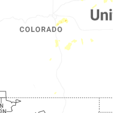

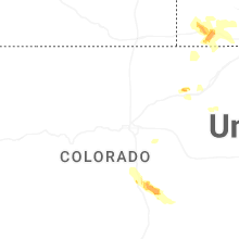
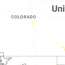
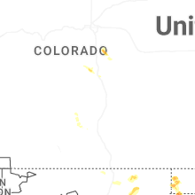
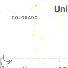

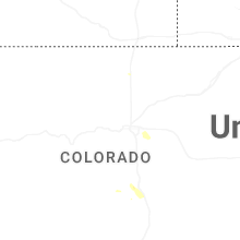


Connect with Interactive Hail Maps