

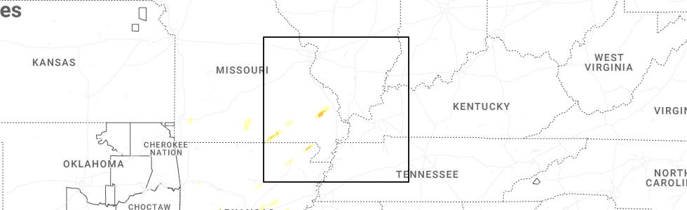
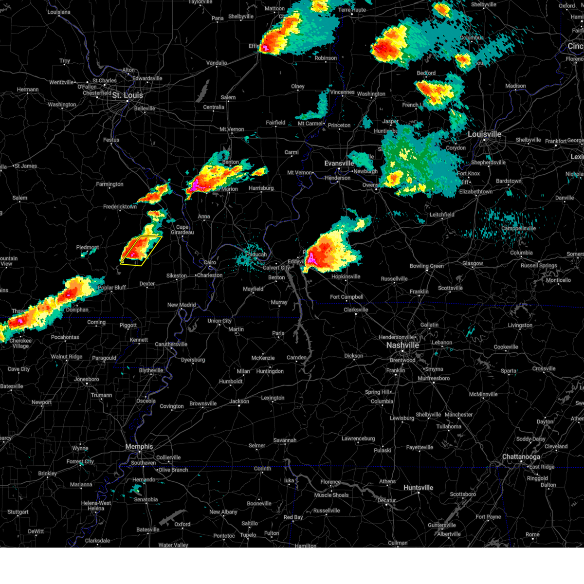
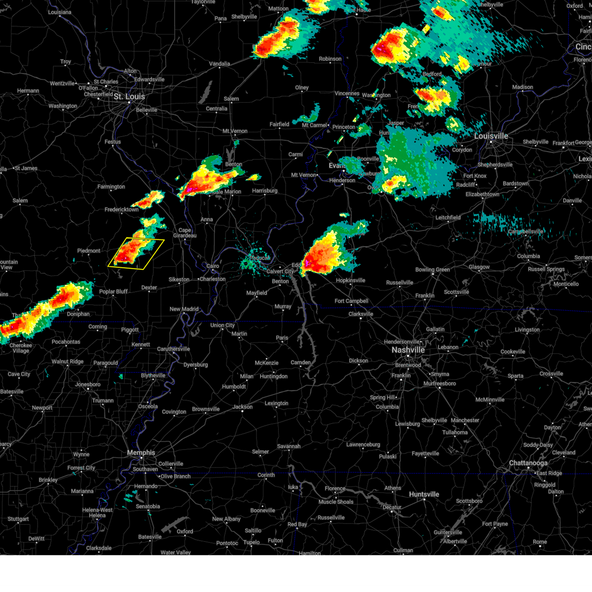
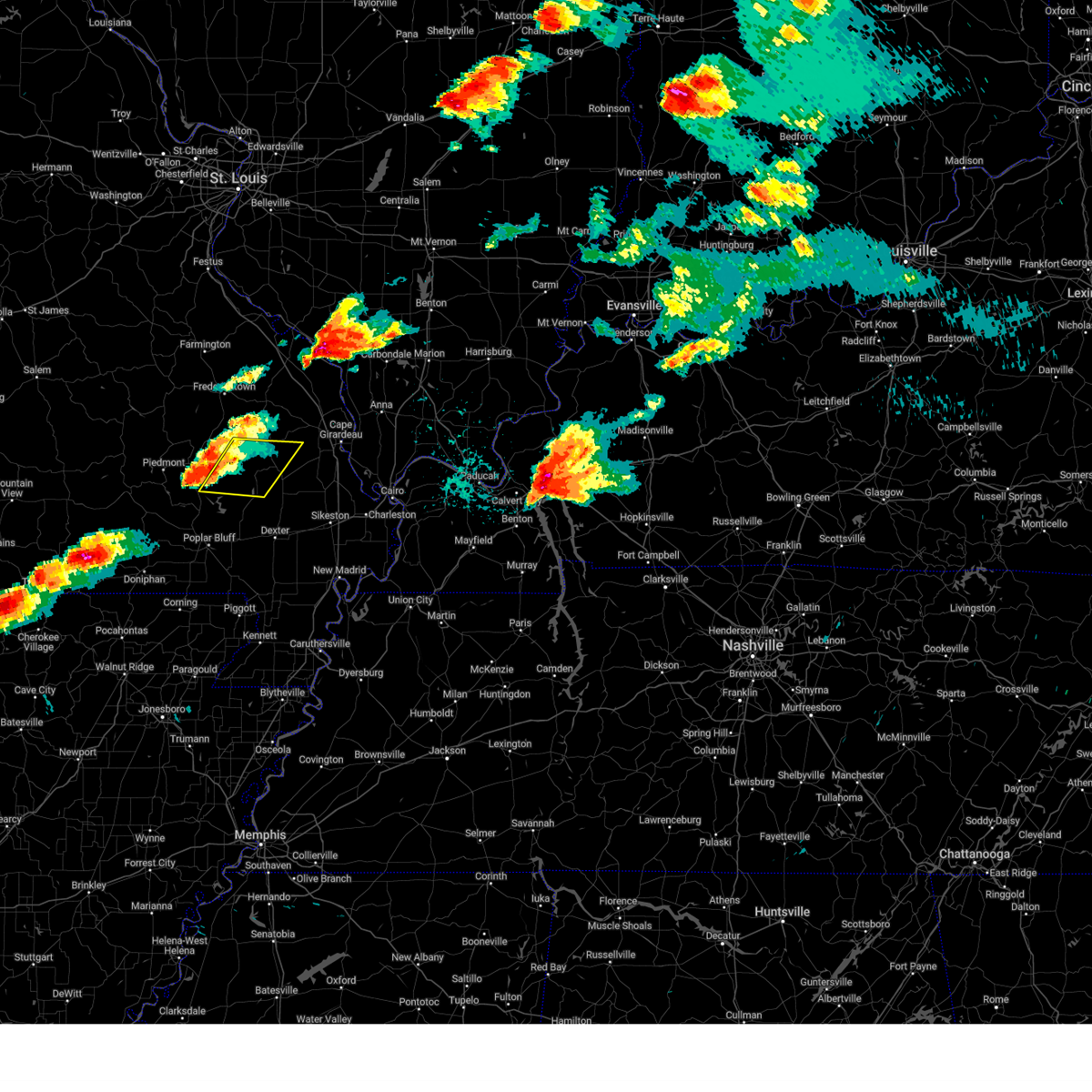
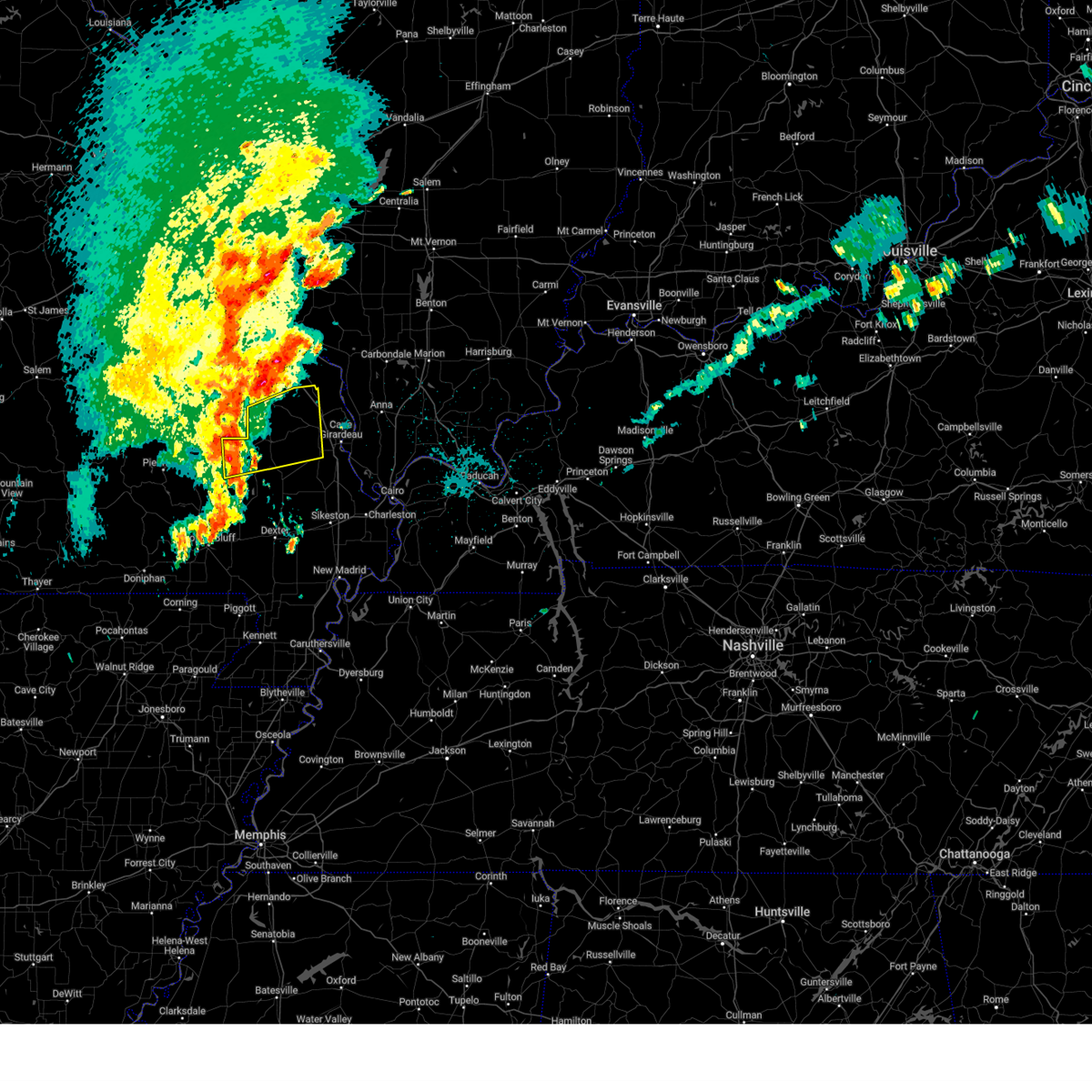
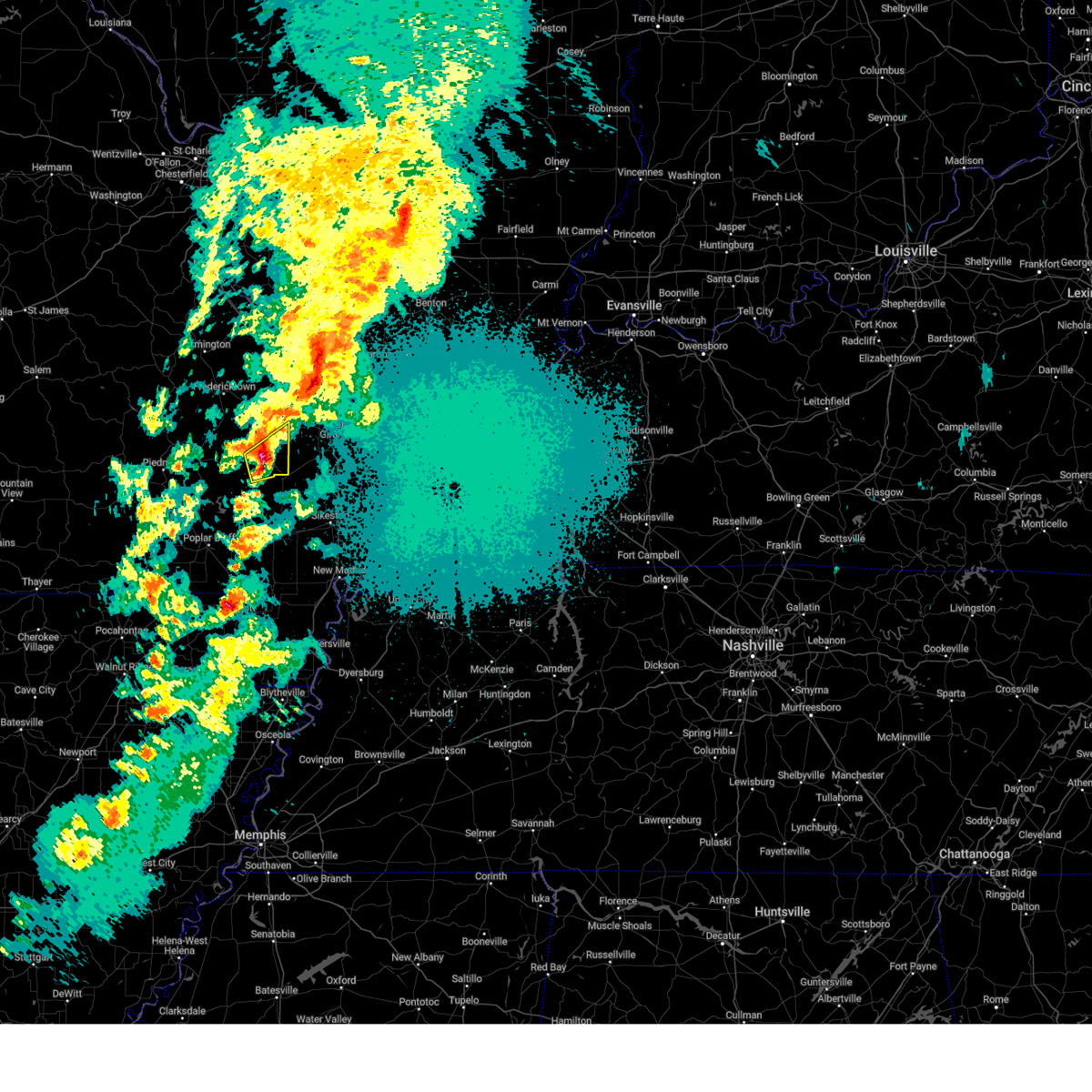
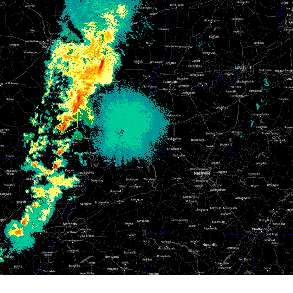
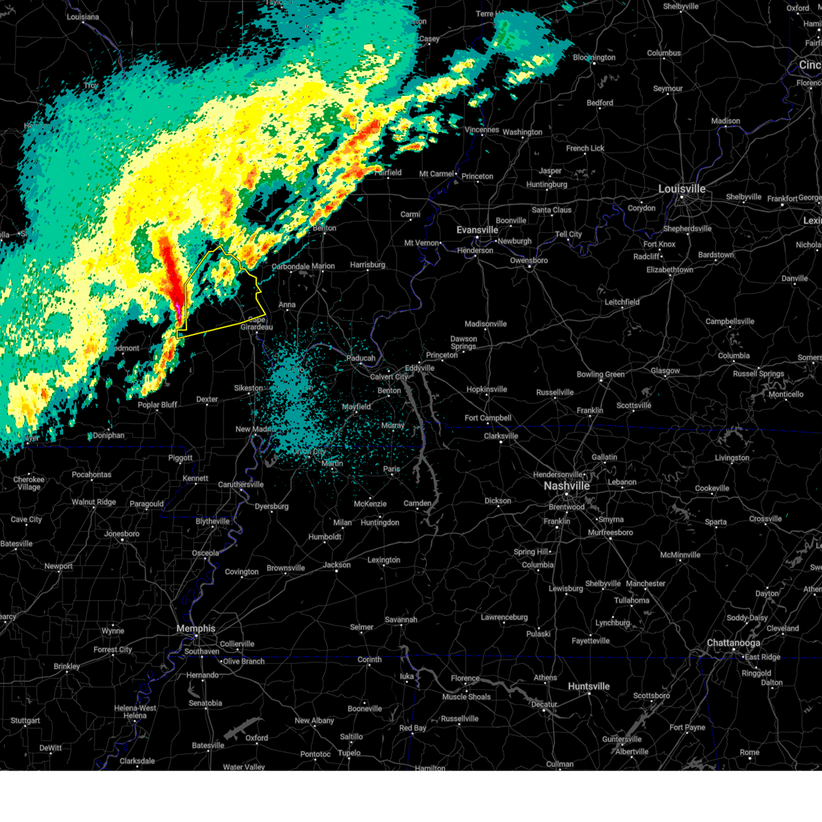
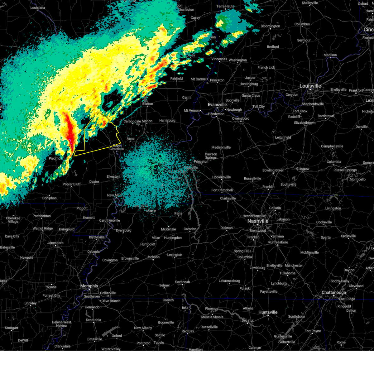
Hail Map for Marble Hill, MO
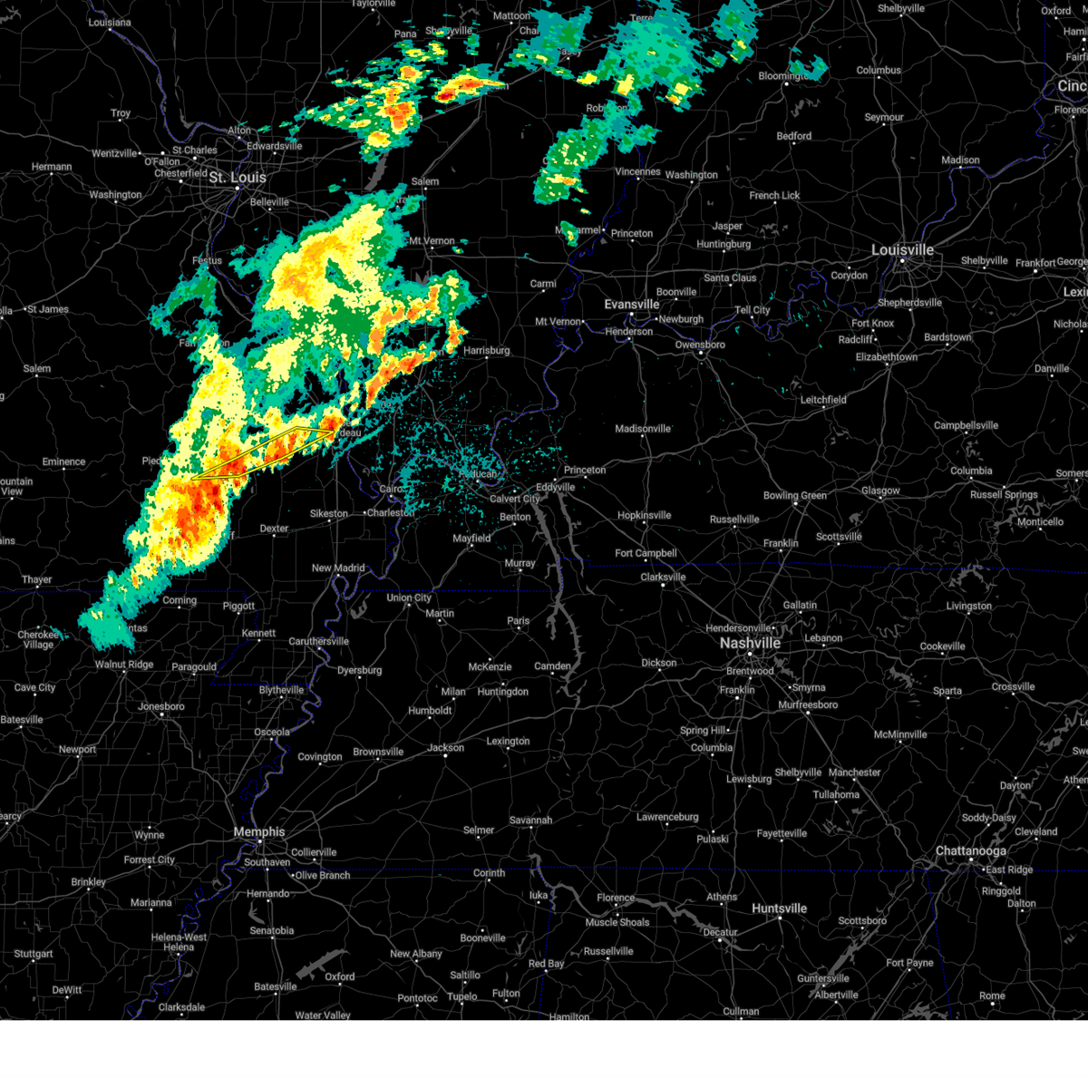
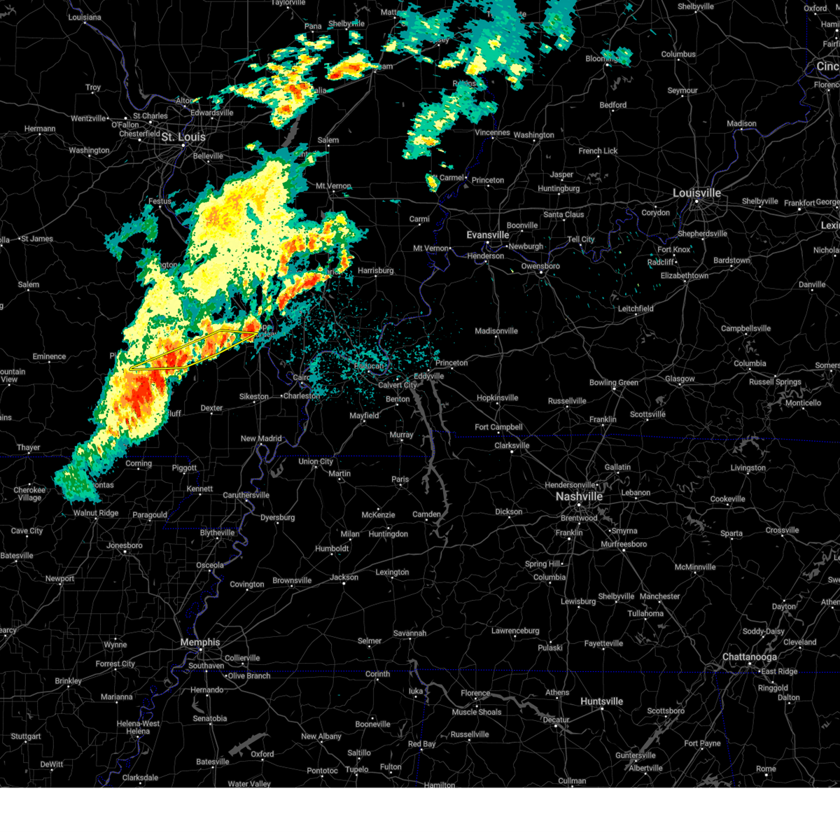
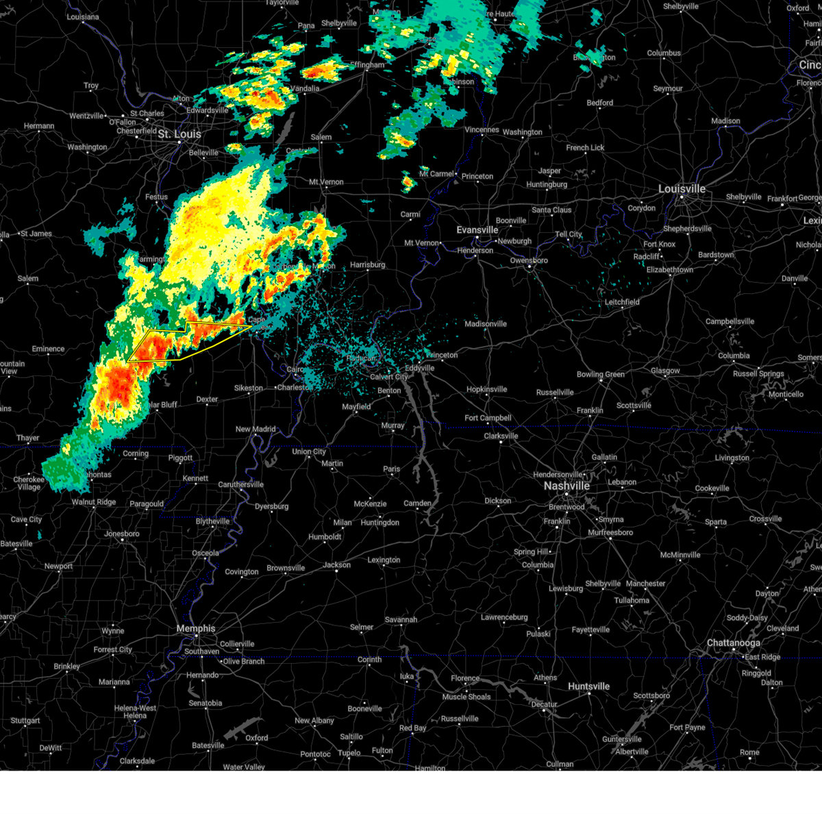
The Marble Hill, MO area has had 8 reports of on-the-ground hail by trained spotters, and has been under severe weather warnings 36 times during the past 12 months. Doppler radar has detected hail at or near Marble Hill, MO on 72 occasions, including 6 occasions during the past year.
| Name: | Marble Hill, MO |
| Where Located: | 23.9 miles W of Cape Girardeau, MO |
| Map: | Google Map for Marble Hill, MO |
| Population: | 1477 |
| Housing Units: | 705 |
| More Info: | Search Google for Marble Hill, MO |
3
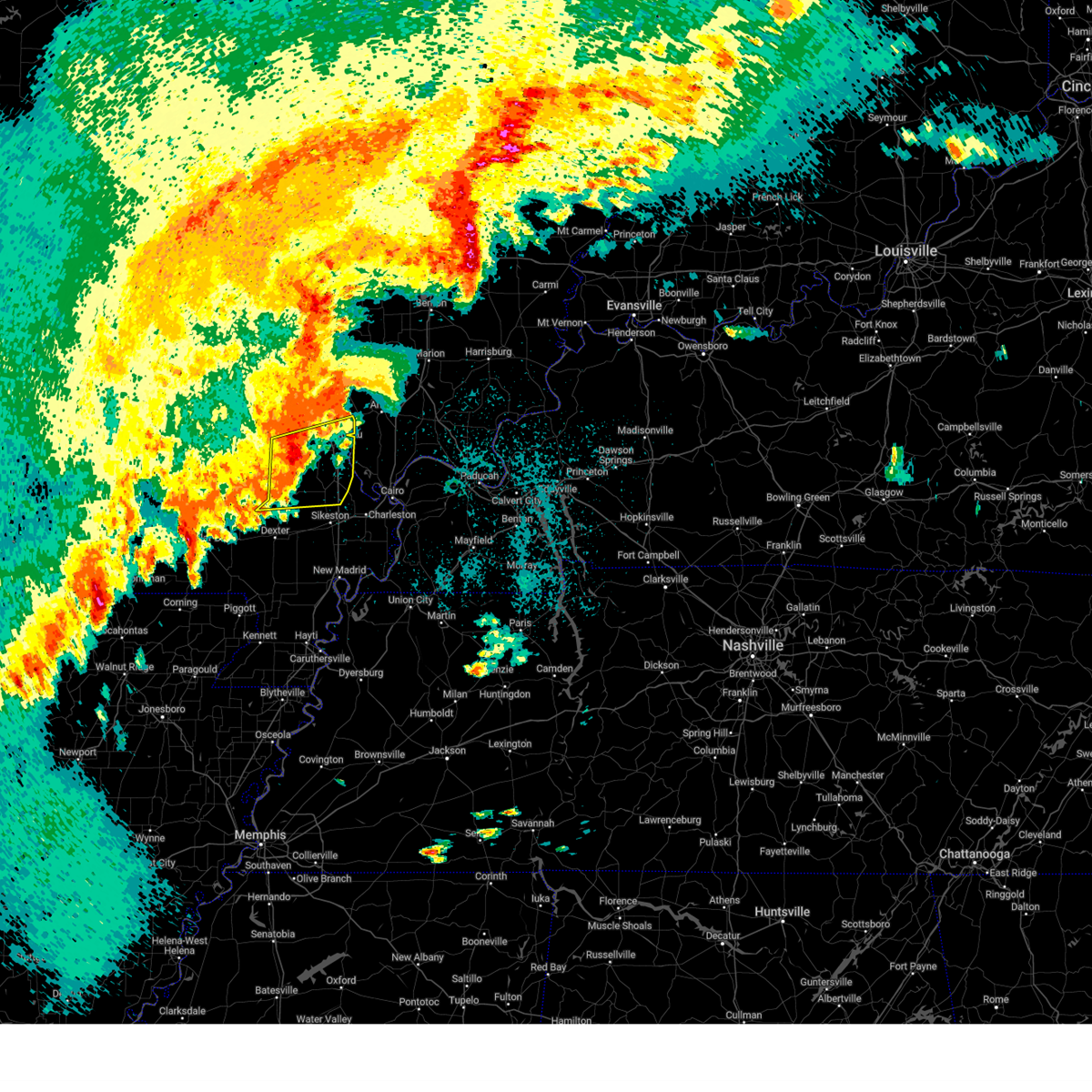
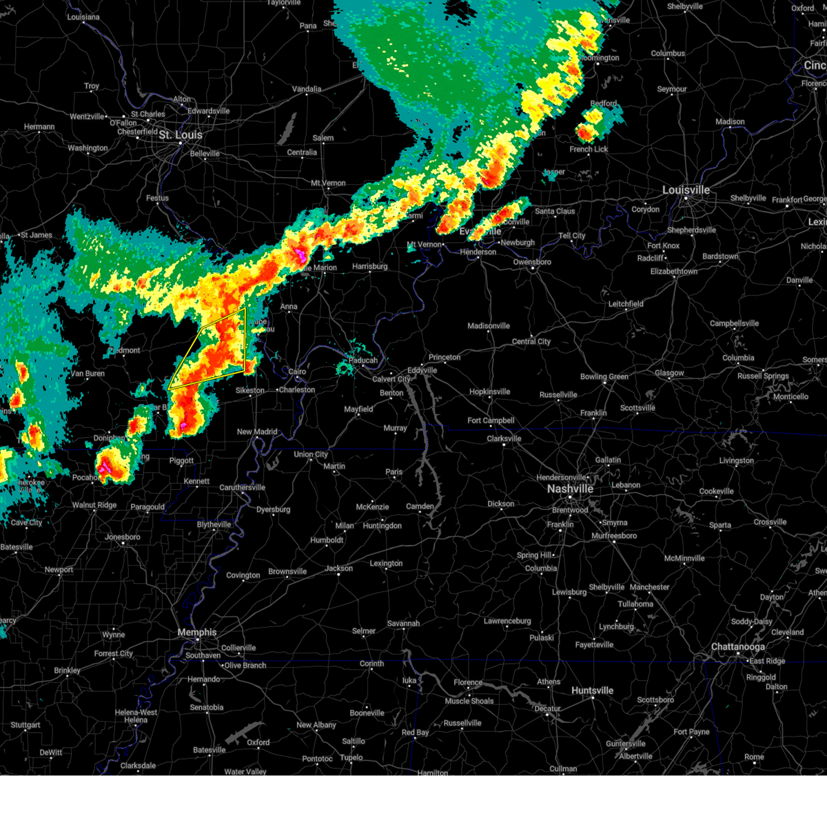
The Top Recent Hail Date for Marble Hill, MO is Sunday, April 20, 2025 (8th out of 72)
Hail and Wind Damage Spotted near Marble Hill, MO
| Date / Time | Report Details |
|---|---|
| 6/9/2025 12:47 AM CDT |
 the severe thunderstorm warning has been cancelled and is no longer in effect the severe thunderstorm warning has been cancelled and is no longer in effect
|
| 6/9/2025 12:41 AM CDT |
 At 1241 am cdt, severe thunderstorms were located along a line extending from near burfordville to near grassy to near greenville, moving east at 40 mph (radar indicated). Hazards include 60 mph wind gusts. Expect damage to roofs, siding, and trees. locations impacted include, cape girardeau, jackson, marble hill, bollinger mill state historic site, gordonville, burfordville, and leopold. This includes interstate 55 between mile markers 99 and 100. At 1241 am cdt, severe thunderstorms were located along a line extending from near burfordville to near grassy to near greenville, moving east at 40 mph (radar indicated). Hazards include 60 mph wind gusts. Expect damage to roofs, siding, and trees. locations impacted include, cape girardeau, jackson, marble hill, bollinger mill state historic site, gordonville, burfordville, and leopold. This includes interstate 55 between mile markers 99 and 100.
|
| 6/9/2025 12:37 AM CDT |
 At 1237 am cdt, severe thunderstorms were located along a line extending from near burfordville to near grassy to greenville, moving east at 40 mph (radar indicated). Hazards include 60 mph wind gusts and quarter size hail. Hail damage to vehicles is expected. expect wind damage to roofs, siding, and trees. locations impacted include, cape girardeau, jackson, marble hill, greenville, gordonville, leopold, grassy, and glenallen. This includes interstate 55 between mile markers 99 and 100. At 1237 am cdt, severe thunderstorms were located along a line extending from near burfordville to near grassy to greenville, moving east at 40 mph (radar indicated). Hazards include 60 mph wind gusts and quarter size hail. Hail damage to vehicles is expected. expect wind damage to roofs, siding, and trees. locations impacted include, cape girardeau, jackson, marble hill, greenville, gordonville, leopold, grassy, and glenallen. This includes interstate 55 between mile markers 99 and 100.
|
| 6/9/2025 12:25 AM CDT |
 At 1225 am cdt, severe thunderstorms were located along a line extending from marble hill to near cascade to 6 miles west of greenville, moving east at 40 mph (radar indicated). Hazards include 60 mph wind gusts and quarter size hail. Hail damage to vehicles is expected. expect wind damage to roofs, siding, and trees. locations impacted include, cape girardeau, jackson, marble hill, greenville, gordonville, lodi, cascade, leopold, grassy, and glenallen. This includes interstate 55 near mile marker 99. At 1225 am cdt, severe thunderstorms were located along a line extending from marble hill to near cascade to 6 miles west of greenville, moving east at 40 mph (radar indicated). Hazards include 60 mph wind gusts and quarter size hail. Hail damage to vehicles is expected. expect wind damage to roofs, siding, and trees. locations impacted include, cape girardeau, jackson, marble hill, greenville, gordonville, lodi, cascade, leopold, grassy, and glenallen. This includes interstate 55 near mile marker 99.
|
| 6/9/2025 12:12 AM CDT | Svrpah the national weather service in paducah has issued a * severe thunderstorm warning for, central bollinger county in southeastern missouri, northern wayne county in southeastern missouri, west central cape girardeau county in southeastern missouri, * until 100 am cdt. * at 1212 am cdt, severe thunderstorms were located along a line extending from near grassy to near lodi to near piedmont, moving east at 40 mph (radar indicated). Hazards include 60 mph wind gusts and quarter size hail. Hail damage to vehicles is expected. Expect wind damage to roofs, siding, and trees. |
| 5/16/2025 6:03 PM CDT |
 At 603 pm cdt, severe thunderstorms were located along a line extending from marble hill to near shook, moving east at 30 mph (radar indicated). Hazards include two inch hail and 60 mph wind gusts. People and animals outdoors will be injured. expect hail damage to roofs, siding, windows, and vehicles. expect wind damage to roofs, siding, and trees. Locations impacted include, marble hill, leopold, and zalma. At 603 pm cdt, severe thunderstorms were located along a line extending from marble hill to near shook, moving east at 30 mph (radar indicated). Hazards include two inch hail and 60 mph wind gusts. People and animals outdoors will be injured. expect hail damage to roofs, siding, windows, and vehicles. expect wind damage to roofs, siding, and trees. Locations impacted include, marble hill, leopold, and zalma.
|
| 5/16/2025 5:54 PM CDT |
 At 554 pm cdt, severe thunderstorms were located along a line extending from near grassy to shook, moving east at 30 mph (radar indicated). Hazards include two inch hail and 60 mph wind gusts. People and animals outdoors will be injured. expect hail damage to roofs, siding, windows, and vehicles. expect wind damage to roofs, siding, and trees. Locations impacted include, marble hill, shook, cascade, leopold, grassy, and zalma. At 554 pm cdt, severe thunderstorms were located along a line extending from near grassy to shook, moving east at 30 mph (radar indicated). Hazards include two inch hail and 60 mph wind gusts. People and animals outdoors will be injured. expect hail damage to roofs, siding, windows, and vehicles. expect wind damage to roofs, siding, and trees. Locations impacted include, marble hill, shook, cascade, leopold, grassy, and zalma.
|
| 5/16/2025 5:45 PM CDT |
 Svrpah the national weather service in paducah has issued a * severe thunderstorm warning for, southern bollinger county in southeastern missouri, northeastern wayne county in southeastern missouri, southwestern cape girardeau county in southeastern missouri, northwestern stoddard county in southeastern missouri, * until 630 pm cdt. * at 545 pm cdt, severe thunderstorms were located along a line extending from near grassy to near shook, moving east at 30 mph (radar indicated). Hazards include 60 mph wind gusts and quarter size hail. Hail damage to vehicles is expected. Expect wind damage to roofs, siding, and trees. Svrpah the national weather service in paducah has issued a * severe thunderstorm warning for, southern bollinger county in southeastern missouri, northeastern wayne county in southeastern missouri, southwestern cape girardeau county in southeastern missouri, northwestern stoddard county in southeastern missouri, * until 630 pm cdt. * at 545 pm cdt, severe thunderstorms were located along a line extending from near grassy to near shook, moving east at 30 mph (radar indicated). Hazards include 60 mph wind gusts and quarter size hail. Hail damage to vehicles is expected. Expect wind damage to roofs, siding, and trees.
|
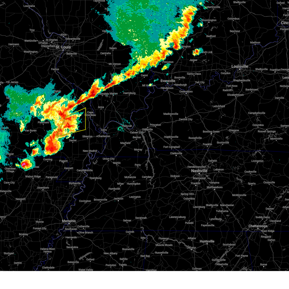
| 5/16/2025 3:42 PM CDT | Quarter sized hail reported 11.3 miles SSE of Marble Hill, MO |
| 4/29/2025 1:23 PM CDT | the severe thunderstorm warning has been cancelled and is no longer in effect |
| 4/29/2025 1:23 PM CDT | At 123 pm cdt, severe thunderstorms were located along a line extending from near patton to 6 miles southwest of leopold, moving east at 50 mph (radar indicated). Hazards include 60 mph wind gusts and penny size hail. Expect damage to roofs, siding, and trees. locations impacted include, old appleton, patton, millersville, whitewater, marble hill, leopold, burfordville, glenallen, bollinger mill state historic site, dutchtown, gordonville, allenville, daisy, sedgewickville, oak ridge, grassy, jackson, and delta. This includes interstate 55 between mile markers 109 and 119. |
| 4/29/2025 1:10 PM CDT |
 Svrpah the national weather service in paducah has issued a * severe thunderstorm warning for, bollinger county in southeastern missouri, northeastern wayne county in southeastern missouri, western cape girardeau county in southeastern missouri, * until 145 pm cdt. * at 110 pm cdt, severe thunderstorms were located along a line extending from marquand to 7 miles south of grassy, moving east at 50 mph (radar indicated). Hazards include 60 mph wind gusts and penny size hail. expect damage to roofs, siding, and trees Svrpah the national weather service in paducah has issued a * severe thunderstorm warning for, bollinger county in southeastern missouri, northeastern wayne county in southeastern missouri, western cape girardeau county in southeastern missouri, * until 145 pm cdt. * at 110 pm cdt, severe thunderstorms were located along a line extending from marquand to 7 miles south of grassy, moving east at 50 mph (radar indicated). Hazards include 60 mph wind gusts and penny size hail. expect damage to roofs, siding, and trees
|
| 4/20/2025 9:27 PM CDT |
 the severe thunderstorm warning has been cancelled and is no longer in effect the severe thunderstorm warning has been cancelled and is no longer in effect
|
| 4/20/2025 9:27 PM CDT |
 At 926 pm cdt, a severe thunderstorm was located near grassy, or 7 miles south of marble hill, moving northeast at 50 mph (radar indicated). Hazards include 60 mph wind gusts and nickel size hail. Expect damage to roofs, siding, and trees. Locations impacted include, zalma, marble hill, leopold, grassy, and glenallen. At 926 pm cdt, a severe thunderstorm was located near grassy, or 7 miles south of marble hill, moving northeast at 50 mph (radar indicated). Hazards include 60 mph wind gusts and nickel size hail. Expect damage to roofs, siding, and trees. Locations impacted include, zalma, marble hill, leopold, grassy, and glenallen.
|
| 4/20/2025 9:12 PM CDT |
 Svrpah the national weather service in paducah has issued a * severe thunderstorm warning for, southern bollinger county in southeastern missouri, southeastern wayne county in southeastern missouri, north central stoddard county in southeastern missouri, * until 945 pm cdt. * at 911 pm cdt, a severe thunderstorm was located near shook, or 12 miles northeast of lake wappapello state park, moving northeast at 55 mph (radar indicated). Hazards include 60 mph wind gusts. expect damage to roofs, siding, and trees Svrpah the national weather service in paducah has issued a * severe thunderstorm warning for, southern bollinger county in southeastern missouri, southeastern wayne county in southeastern missouri, north central stoddard county in southeastern missouri, * until 945 pm cdt. * at 911 pm cdt, a severe thunderstorm was located near shook, or 12 miles northeast of lake wappapello state park, moving northeast at 55 mph (radar indicated). Hazards include 60 mph wind gusts. expect damage to roofs, siding, and trees
|
| 4/19/2025 6:02 AM CDT |
 At 602 am cdt, severe thunderstorms were located along a line extending from near womac to near grassy, moving east at 60 mph (radar indicated). Hazards include 60 mph wind gusts and quarter size hail. Hail damage to vehicles is expected. expect wind damage to roofs, siding, and trees. locations impacted include, old appleton, patton, pocahontas, perryville, millersville, lithium, jackson, longtown, burfordville, glenallen, silver lake, bollinger mill state historic site, frohna, trail of tears state park, daisy, alliance, altenburg, sedgewickville, oak ridge, and marble hill. This includes interstate 55 between mile markers 103 and 139. At 602 am cdt, severe thunderstorms were located along a line extending from near womac to near grassy, moving east at 60 mph (radar indicated). Hazards include 60 mph wind gusts and quarter size hail. Hail damage to vehicles is expected. expect wind damage to roofs, siding, and trees. locations impacted include, old appleton, patton, pocahontas, perryville, millersville, lithium, jackson, longtown, burfordville, glenallen, silver lake, bollinger mill state historic site, frohna, trail of tears state park, daisy, alliance, altenburg, sedgewickville, oak ridge, and marble hill. This includes interstate 55 between mile markers 103 and 139.
|
| 4/19/2025 6:02 AM CDT |
 the severe thunderstorm warning has been cancelled and is no longer in effect the severe thunderstorm warning has been cancelled and is no longer in effect
|
| 4/19/2025 5:50 AM CDT |
 Svrpah the national weather service in paducah has issued a * severe thunderstorm warning for, northern bollinger county in southeastern missouri, perry county in southeastern missouri, northeastern wayne county in southeastern missouri, northern cape girardeau county in southeastern missouri, * until 645 am cdt. * at 550 am cdt, severe thunderstorms were located along a line extending from near knob lick to near buckhorn, moving east at 60 mph (radar indicated). Hazards include 60 mph wind gusts and quarter size hail. Hail damage to vehicles is expected. Expect wind damage to roofs, siding, and trees. Svrpah the national weather service in paducah has issued a * severe thunderstorm warning for, northern bollinger county in southeastern missouri, perry county in southeastern missouri, northeastern wayne county in southeastern missouri, northern cape girardeau county in southeastern missouri, * until 645 am cdt. * at 550 am cdt, severe thunderstorms were located along a line extending from near knob lick to near buckhorn, moving east at 60 mph (radar indicated). Hazards include 60 mph wind gusts and quarter size hail. Hail damage to vehicles is expected. Expect wind damage to roofs, siding, and trees.
|
| 4/4/2025 8:14 PM CDT |
 At 813 pm cdt, severe thunderstorms were located along a line extending from near burfordville to near bell city to 7 miles northwest of bloomfield, moving east at 50 mph (radar indicated). Hazards include 60 mph wind gusts and quarter size hail. Hail damage to vehicles is expected. expect wind damage to roofs, siding, and trees. locations impacted include, vanduser, cape girardeau, morley, commerce, jackson, cape girardeau airport, dutchtown, oran, allenville, blodgett, hay-wood city, chaffee, scott city, kelso, thebes, bell city, advance, benton, whitewater, and marble hill. This includes interstate 55 between mile markers 73 and 103. At 813 pm cdt, severe thunderstorms were located along a line extending from near burfordville to near bell city to 7 miles northwest of bloomfield, moving east at 50 mph (radar indicated). Hazards include 60 mph wind gusts and quarter size hail. Hail damage to vehicles is expected. expect wind damage to roofs, siding, and trees. locations impacted include, vanduser, cape girardeau, morley, commerce, jackson, cape girardeau airport, dutchtown, oran, allenville, blodgett, hay-wood city, chaffee, scott city, kelso, thebes, bell city, advance, benton, whitewater, and marble hill. This includes interstate 55 between mile markers 73 and 103.
|
| 4/4/2025 8:04 PM CDT |
 Svrpah the national weather service in paducah has issued a * severe thunderstorm warning for, northwestern alexander county in southern illinois, southeastern bollinger county in southeastern missouri, scott county in southeastern missouri, southern cape girardeau county in southeastern missouri, northern stoddard county in southeastern missouri, * until 845 pm cdt. * at 803 pm cdt, severe thunderstorms were located along a line extending from leopold to 6 miles south of advance to near dudley, moving east at 45 mph (radar indicated). Hazards include 60 mph wind gusts and quarter size hail. Hail damage to vehicles is expected. Expect wind damage to roofs, siding, and trees. Svrpah the national weather service in paducah has issued a * severe thunderstorm warning for, northwestern alexander county in southern illinois, southeastern bollinger county in southeastern missouri, scott county in southeastern missouri, southern cape girardeau county in southeastern missouri, northern stoddard county in southeastern missouri, * until 845 pm cdt. * at 803 pm cdt, severe thunderstorms were located along a line extending from leopold to 6 miles south of advance to near dudley, moving east at 45 mph (radar indicated). Hazards include 60 mph wind gusts and quarter size hail. Hail damage to vehicles is expected. Expect wind damage to roofs, siding, and trees.
|
| 4/4/2025 7:21 PM CDT |
 At 720 pm cdt, a confirmed tornado was located over advance, moving northeast at 40 mph (weather spotters confirmed tornado along highway 91 in advance). Hazards include damaging tornado and baseball size hail. Flying debris will be dangerous to those caught without shelter. mobile homes will be damaged or destroyed. damage to roofs, windows, and vehicles will occur. tree damage is likely. this tornado will be near, delta and leopold around 725 pm cdt. chaffee around 730 pm cdt. gordonville and dutchtown around 735 pm cdt. jackson around 740 pm cdt. Other locations impacted by this tornadic thunderstorm include allenville and whitewater. At 720 pm cdt, a confirmed tornado was located over advance, moving northeast at 40 mph (weather spotters confirmed tornado along highway 91 in advance). Hazards include damaging tornado and baseball size hail. Flying debris will be dangerous to those caught without shelter. mobile homes will be damaged or destroyed. damage to roofs, windows, and vehicles will occur. tree damage is likely. this tornado will be near, delta and leopold around 725 pm cdt. chaffee around 730 pm cdt. gordonville and dutchtown around 735 pm cdt. jackson around 740 pm cdt. Other locations impacted by this tornadic thunderstorm include allenville and whitewater.
|
| 4/4/2025 7:21 PM CDT |
 the tornado warning has been cancelled and is no longer in effect the tornado warning has been cancelled and is no longer in effect
|
| 4/4/2025 7:09 PM CDT |
 Torpah the national weather service in paducah has issued a * tornado warning for, southern bollinger county in southeastern missouri, northwestern scott county in southeastern missouri, east central wayne county in southeastern missouri, southwestern cape girardeau county in southeastern missouri, north central stoddard county in southeastern missouri, * until 800 pm cdt. * at 709 pm cdt, a severe thunderstorm capable of producing a tornado was located 7 miles west of advance, moving northeast at 40 mph (radar indicated rotation). Hazards include tornado and baseball size hail. Flying debris will be dangerous to those caught without shelter. mobile homes will be damaged or destroyed. damage to roofs, windows, and vehicles will occur. tree damage is likely. this dangerous storm will be near, advance and leopold around 715 pm cdt. delta around 725 pm cdt. bollinger mill state historic site, gordonville, burfordville, and dutchtown around 735 pm cdt. jackson around 740 pm cdt. Other locations impacted by this tornadic thunderstorm include zalma, allenville, and whitewater. Torpah the national weather service in paducah has issued a * tornado warning for, southern bollinger county in southeastern missouri, northwestern scott county in southeastern missouri, east central wayne county in southeastern missouri, southwestern cape girardeau county in southeastern missouri, north central stoddard county in southeastern missouri, * until 800 pm cdt. * at 709 pm cdt, a severe thunderstorm capable of producing a tornado was located 7 miles west of advance, moving northeast at 40 mph (radar indicated rotation). Hazards include tornado and baseball size hail. Flying debris will be dangerous to those caught without shelter. mobile homes will be damaged or destroyed. damage to roofs, windows, and vehicles will occur. tree damage is likely. this dangerous storm will be near, advance and leopold around 715 pm cdt. delta around 725 pm cdt. bollinger mill state historic site, gordonville, burfordville, and dutchtown around 735 pm cdt. jackson around 740 pm cdt. Other locations impacted by this tornadic thunderstorm include zalma, allenville, and whitewater.
|
| 4/2/2025 6:43 PM CDT | At 643 pm cdt, severe thunderstorms were located along a line extending from willisville to 6 miles north of grand tower to near delta, moving northeast at 65 mph (radar indicated). Hazards include 60 mph wind gusts and quarter size hail. Hail damage to vehicles is expected. expect wind damage to roofs, siding, and trees. locations impacted include, cape girardeau, pocahontas, millersville, jackson, cutler, alto pass, bollinger mill state historic site, gorham, dutchtown, jonesboro, frohna, allenville, elkville, grand tower, murphysboro, pinckneyville, oak ridge, anna, old appleton, and dowell. This includes interstate 55 between mile markers 93 and 124. |
| 4/2/2025 6:31 PM CDT | At 631 pm cdt, a confirmed tornado was located over advance, moving east at 50 mph (radar confirmed tornado). Hazards include damaging tornado and quarter size hail. Flying debris will be dangerous to those caught without shelter. mobile homes will be damaged or destroyed. damage to roofs, windows, and vehicles will occur. tree damage is likely. this tornado will be near, bell city and delta around 635 pm cdt. chaffee and oran around 640 pm cdt. benton, scott city, morley, dutchtown, kelso, and cape girardeau airport around 645 pm cdt. cape girardeau around 650 pm cdt. other locations impacted by this tornadic thunderstorm include lambert, glenallen, commerce, whitewater, and allenville. This includes interstate 55 between mile markers 78 and 103. |
| 4/2/2025 6:31 PM CDT | the tornado warning has been cancelled and is no longer in effect |
| 4/2/2025 6:20 PM CDT | At 620 pm cdt, a confirmed large and extremely dangerous tornado was located 9 miles west of advance, moving east at 50 mph. this is a particularly dangerous situation. take cover now! (radar confirmed tornado). Hazards include damaging tornado. You are in a life-threatening situation. flying debris may be deadly to those caught without shelter. mobile homes will be destroyed. considerable damage to homes, businesses, and vehicles is likely and complete destruction is possible. the tornado will be near, advance around 625 pm cdt. leopold around 630 pm cdt. delta around 635 pm cdt. chaffee and dutchtown around 640 pm cdt. gordonville, cape girardeau, scott city, kelso, oran, and cape girardeau airport around 645 pm cdt. jackson around 655 pm cdt. other locations impacted by this tornadic thunderstorm include zalma, lambert, glenallen, commerce, whitewater, and allenville. This includes interstate 55 between mile markers 78 and 103. |
| 4/2/2025 6:15 PM CDT | Torpah the national weather service in paducah has issued a * tornado warning for, southern bollinger county in southeastern missouri, northern scott county in southeastern missouri, eastern wayne county in southeastern missouri, southern cape girardeau county in southeastern missouri, northern stoddard county in southeastern missouri, * until 700 pm cdt. * at 615 pm cdt, a severe thunderstorm capable of producing a tornado was located over puxico, or 10 miles east of lake wappapello state park, moving east at 50 mph (radar indicated rotation). Hazards include tornado and quarter size hail. Flying debris will be dangerous to those caught without shelter. mobile homes will be damaged or destroyed. damage to roofs, windows, and vehicles will occur. tree damage is likely. this dangerous storm will be near, advance around 625 pm cdt. bell city around 630 pm cdt. morley and oran around 640 pm cdt. benton around 645 pm cdt. chaffee around 650 pm cdt. other locations impacted by this tornadic thunderstorm include zalma, lambert, glenallen, commerce, whitewater, and allenville. This includes interstate 55 between mile markers 78 and 103. |
| 4/2/2025 6:01 PM CDT | Svrpah the national weather service in paducah has issued a * severe thunderstorm warning for, perry county in south central illinois, union county in southern illinois, jackson county in southern illinois, bollinger county in southeastern missouri, perry county in southeastern missouri, eastern wayne county in southeastern missouri, cape girardeau county in southeastern missouri, * until 700 pm cdt. * at 601 pm cdt, severe thunderstorms were located along a line extending from near womac to marquand to hendrickson, moving northeast at 65 mph (radar indicated). Hazards include 60 mph wind gusts and quarter size hail. Hail damage to vehicles is expected. Expect wind damage to roofs, siding, and trees. |
| 3/30/2025 5:36 PM CDT |
 At 536 pm cdt, severe thunderstorms were located along a line extending from bollinger mill state historic site to advance, moving northeast at 60 mph (radar indicated). Hazards include 60 mph wind gusts and half dollar size hail. Hail damage to vehicles is expected. expect wind damage to roofs, siding, and trees. locations impacted include, bell city, wappapello, advance, jackson, whitewater, marble hill, puxico, leopold, burfordville, glenallen, bollinger mill state historic site, dutchtown, gordonville, delta, oran, allenville, zalma, and chaffee. This includes interstate 55 between mile markers 105 and 109. At 536 pm cdt, severe thunderstorms were located along a line extending from bollinger mill state historic site to advance, moving northeast at 60 mph (radar indicated). Hazards include 60 mph wind gusts and half dollar size hail. Hail damage to vehicles is expected. expect wind damage to roofs, siding, and trees. locations impacted include, bell city, wappapello, advance, jackson, whitewater, marble hill, puxico, leopold, burfordville, glenallen, bollinger mill state historic site, dutchtown, gordonville, delta, oran, allenville, zalma, and chaffee. This includes interstate 55 between mile markers 105 and 109.
|
| 3/30/2025 5:15 PM CDT |
 Svrpah the national weather service in paducah has issued a * severe thunderstorm warning for, southern bollinger county in southeastern missouri, northwestern scott county in southeastern missouri, southeastern wayne county in southeastern missouri, southwestern cape girardeau county in southeastern missouri, northern stoddard county in southeastern missouri, * until 600 pm cdt. * at 514 pm cdt, severe thunderstorms were located along a line extending from grassy to near puxico, moving northeast at 55 mph (radar indicated). Hazards include 60 mph wind gusts and half dollar size hail. Hail damage to vehicles is expected. Expect wind damage to roofs, siding, and trees. Svrpah the national weather service in paducah has issued a * severe thunderstorm warning for, southern bollinger county in southeastern missouri, northwestern scott county in southeastern missouri, southeastern wayne county in southeastern missouri, southwestern cape girardeau county in southeastern missouri, northern stoddard county in southeastern missouri, * until 600 pm cdt. * at 514 pm cdt, severe thunderstorms were located along a line extending from grassy to near puxico, moving northeast at 55 mph (radar indicated). Hazards include 60 mph wind gusts and half dollar size hail. Hail damage to vehicles is expected. Expect wind damage to roofs, siding, and trees.
|
| 3/14/2025 11:47 PM CDT | the tornado warning has been cancelled and is no longer in effect |
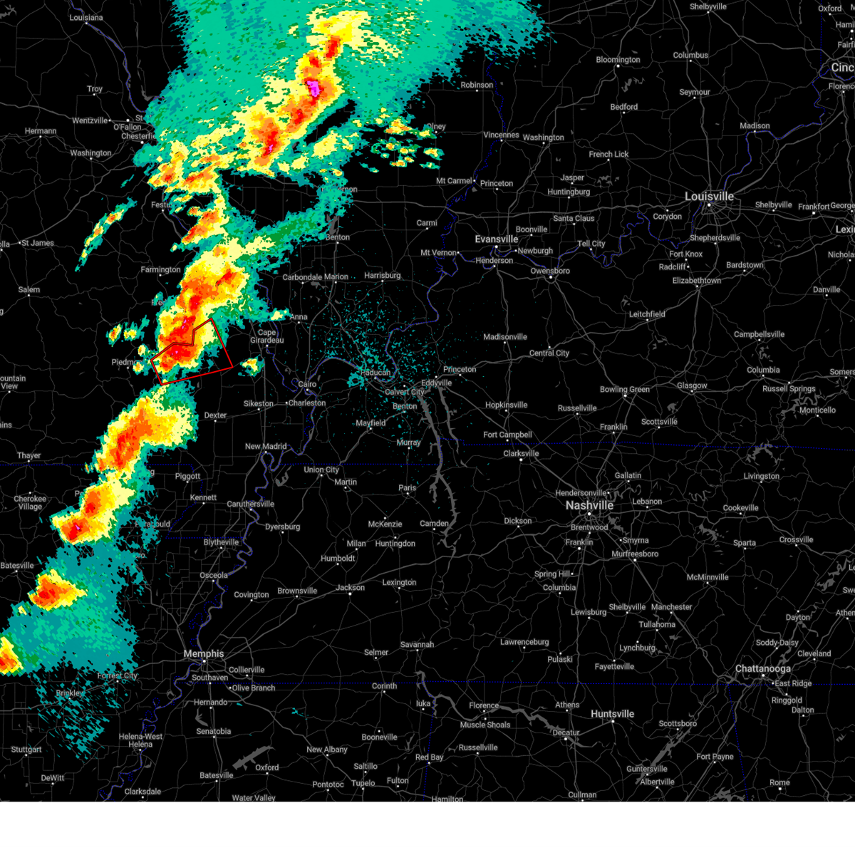
| 3/14/2025 11:38 PM CDT |
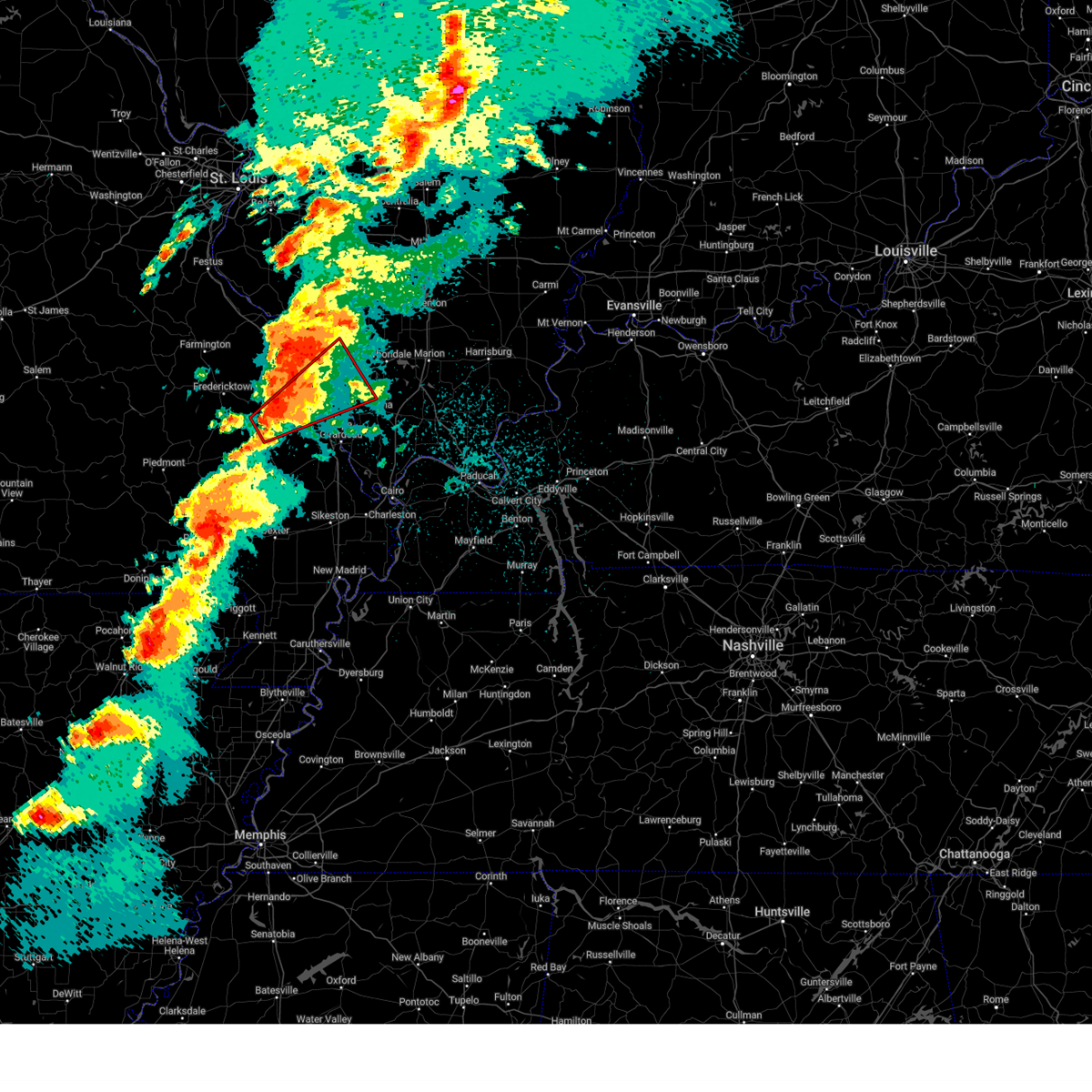 Torpah the national weather service in paducah has issued a * tornado warning for, northwestern union county in southern illinois, southwestern jackson county in southern illinois, northeastern bollinger county in southeastern missouri, southeastern perry county in southeastern missouri, northern cape girardeau county in southeastern missouri, * until 1230 am cdt. * at 1138 pm cdt, a confirmed large and extremely dangerous tornado was located near marble hill, moving northeast at 55 mph. this is a particularly dangerous situation. take cover now! (radar confirmed tornado). Hazards include damaging tornado. You are in a life-threatening situation. flying debris may be deadly to those caught without shelter. mobile homes will be destroyed. considerable damage to homes, businesses, and vehicles is likely and complete destruction is possible. the tornado will be near, daisy, patton, and millersville around 1145 pm cdt. altenburg around 1200 am cdt. grand tower around 1205 am cdt. other locations impacted by this tornadic thunderstorm include old appleton, glenallen, gorham, pocahontas, frohna, longtown, sedgewickville, oak ridge, and alto pass. This includes interstate 55 between mile markers 106 and 123. Torpah the national weather service in paducah has issued a * tornado warning for, northwestern union county in southern illinois, southwestern jackson county in southern illinois, northeastern bollinger county in southeastern missouri, southeastern perry county in southeastern missouri, northern cape girardeau county in southeastern missouri, * until 1230 am cdt. * at 1138 pm cdt, a confirmed large and extremely dangerous tornado was located near marble hill, moving northeast at 55 mph. this is a particularly dangerous situation. take cover now! (radar confirmed tornado). Hazards include damaging tornado. You are in a life-threatening situation. flying debris may be deadly to those caught without shelter. mobile homes will be destroyed. considerable damage to homes, businesses, and vehicles is likely and complete destruction is possible. the tornado will be near, daisy, patton, and millersville around 1145 pm cdt. altenburg around 1200 am cdt. grand tower around 1205 am cdt. other locations impacted by this tornadic thunderstorm include old appleton, glenallen, gorham, pocahontas, frohna, longtown, sedgewickville, oak ridge, and alto pass. This includes interstate 55 between mile markers 106 and 123.
|
| 3/14/2025 11:28 PM CDT | At 1128 pm cdt, a confirmed large and extremely dangerous tornado was located near grassy, or 10 miles west of marble hill, moving northeast at 60 mph. this is a particularly dangerous situation. take cover now! (radar confirmed tornado). Hazards include damaging tornado. You are in a life-threatening situation. flying debris may be deadly to those caught without shelter. mobile homes will be destroyed. considerable damage to homes, businesses, and vehicles is likely and complete destruction is possible. the tornado will be near, marble hill around 1135 pm cdt. Other locations impacted by this tornadic thunderstorm include glenallen. |
| 3/14/2025 11:28 PM CDT | the tornado warning has been cancelled and is no longer in effect |
| 3/14/2025 11:14 PM CDT |
 At 1113 pm cdt, a large and extremely dangerous tornado was located over greenville, moving northeast at 45 mph. this is a particularly dangerous situation. take cover now! (radar indicated rotation). Hazards include damaging tornado. You are in a life-threatening situation. flying debris may be deadly to those caught without shelter. mobile homes will be destroyed. considerable damage to homes, businesses, and vehicles is likely and complete destruction is possible. the tornado will be near, cascade around 1125 pm cdt. grassy around 1130 pm cdt. marble hill around 1140 pm cdt. leopold around 1145 pm cdt. Other locations impacted by this tornadic thunderstorm include zalma and glenallen. At 1113 pm cdt, a large and extremely dangerous tornado was located over greenville, moving northeast at 45 mph. this is a particularly dangerous situation. take cover now! (radar indicated rotation). Hazards include damaging tornado. You are in a life-threatening situation. flying debris may be deadly to those caught without shelter. mobile homes will be destroyed. considerable damage to homes, businesses, and vehicles is likely and complete destruction is possible. the tornado will be near, cascade around 1125 pm cdt. grassy around 1130 pm cdt. marble hill around 1140 pm cdt. leopold around 1145 pm cdt. Other locations impacted by this tornadic thunderstorm include zalma and glenallen.
|
| 3/14/2025 11:09 PM CDT | Torpah the national weather service in paducah has issued a * tornado warning for, bollinger county in southeastern missouri, central wayne county in southeastern missouri, southwestern cape girardeau county in southeastern missouri, * until midnight cdt. * at 1109 pm cdt, a severe thunderstorm capable of producing a tornado was located over greenville, moving northeast at 45 mph (radar indicated rotation). Hazards include tornado and ping pong ball size hail. Flying debris will be dangerous to those caught without shelter. mobile homes will be damaged or destroyed. damage to roofs, windows, and vehicles will occur. tree damage is likely. this dangerous storm will be near, greenville around 1115 pm cdt. cascade around 1125 pm cdt. grassy around 1130 pm cdt. marble hill around 1140 pm cdt. leopold around 1145 pm cdt. Other locations impacted by this tornadic thunderstorm include zalma and glenallen. |
| 7/5/2024 2:16 AM CDT |
 At 216 am cdt, a severe thunderstorm was located 8 miles southeast of grassy, or 8 miles northwest of advance, moving east at 40 mph (radar indicated). Hazards include 60 mph wind gusts. Expect damage to roofs, siding, and trees. Locations impacted include, marble hill, leopold, grassy, and zalma. At 216 am cdt, a severe thunderstorm was located 8 miles southeast of grassy, or 8 miles northwest of advance, moving east at 40 mph (radar indicated). Hazards include 60 mph wind gusts. Expect damage to roofs, siding, and trees. Locations impacted include, marble hill, leopold, grassy, and zalma.
|
| 7/5/2024 1:59 AM CDT |
 Svrpah the national weather service in paducah has issued a * severe thunderstorm warning for, southern bollinger county in southeastern missouri, * until 230 am cdt. * at 159 am cdt, a severe thunderstorm was located near cascade, or 12 miles northeast of greenville, moving east at 65 mph (radar indicated). Hazards include 60 mph wind gusts. expect damage to roofs, siding, and trees Svrpah the national weather service in paducah has issued a * severe thunderstorm warning for, southern bollinger county in southeastern missouri, * until 230 am cdt. * at 159 am cdt, a severe thunderstorm was located near cascade, or 12 miles northeast of greenville, moving east at 65 mph (radar indicated). Hazards include 60 mph wind gusts. expect damage to roofs, siding, and trees
|
| 7/3/2024 5:12 PM CDT | Svrpah the national weather service in paducah has issued a * severe thunderstorm warning for, western union county in southern illinois, southwestern jackson county in southern illinois, northeastern bollinger county in southeastern missouri, southeastern perry county in southeastern missouri, cape girardeau county in southeastern missouri, * until 600 pm cdt. * at 511 pm cdt, severe thunderstorms were located along a line extending from 6 miles south of altenburg to near daisy to 6 miles west of millersville to near marble hill, moving east at 35 mph (radar indicated). Hazards include 60 mph wind gusts and penny size hail. expect damage to roofs, siding, and trees |
| 6/25/2024 10:10 PM CDT |
 The storms which prompted the warning have weakened below severe limits, and have exited the warned area. therefore, the warning will be allowed to expire. The storms which prompted the warning have weakened below severe limits, and have exited the warned area. therefore, the warning will be allowed to expire.
|
| 6/25/2024 9:53 PM CDT |
 At 952 pm cdt, severe thunderstorms were located along a line extending from near burfordville to 8 miles south of grassy, moving east at 20 mph (radar indicated). Hazards include 60 mph wind gusts and penny size hail. Expect damage to roofs, siding, and trees. Locations impacted include, jackson, marble hill, advance, bollinger mill state historic site, burfordville, leopold, whitewater, zalma, and glenallen. At 952 pm cdt, severe thunderstorms were located along a line extending from near burfordville to 8 miles south of grassy, moving east at 20 mph (radar indicated). Hazards include 60 mph wind gusts and penny size hail. Expect damage to roofs, siding, and trees. Locations impacted include, jackson, marble hill, advance, bollinger mill state historic site, burfordville, leopold, whitewater, zalma, and glenallen.
|
| 6/25/2024 9:53 PM CDT |
 the severe thunderstorm warning has been cancelled and is no longer in effect the severe thunderstorm warning has been cancelled and is no longer in effect
|
| 6/25/2024 9:36 PM CDT |
 Svrpah the national weather service in paducah has issued a * severe thunderstorm warning for, bollinger county in southeastern missouri, east central wayne county in southeastern missouri, west central cape girardeau county in southeastern missouri, northern stoddard county in southeastern missouri, * until 1015 pm cdt. * at 936 pm cdt, severe thunderstorms were located along a line extending from 6 miles southeast of marquand to 7 miles northeast of shook, moving east at 25 mph (radar indicated). Hazards include 60 mph wind gusts. expect damage to roofs, siding, and trees Svrpah the national weather service in paducah has issued a * severe thunderstorm warning for, bollinger county in southeastern missouri, east central wayne county in southeastern missouri, west central cape girardeau county in southeastern missouri, northern stoddard county in southeastern missouri, * until 1015 pm cdt. * at 936 pm cdt, severe thunderstorms were located along a line extending from 6 miles southeast of marquand to 7 miles northeast of shook, moving east at 25 mph (radar indicated). Hazards include 60 mph wind gusts. expect damage to roofs, siding, and trees
|
| 5/26/2024 8:10 PM CDT |
 the severe thunderstorm warning has been cancelled and is no longer in effect the severe thunderstorm warning has been cancelled and is no longer in effect
|
| 5/26/2024 8:10 PM CDT |
 At 809 pm cdt, severe thunderstorms were located along a line extending from near cascade to near budapest, moving southeast at 40 mph (radar indicated). Hazards include 60 mph wind gusts and quarter size hail. Hail damage to vehicles is expected. expect wind damage to roofs, siding, and trees. Locations impacted include, poplar bluff, marble hill, advance, lake wappapello state park, puxico, delta, gordonville, fisk, hendrickson, wappapello, leopold, harviell, budapest, milltown, shook, fairdealing, whitewater, zalma, allenville, and rombauer. At 809 pm cdt, severe thunderstorms were located along a line extending from near cascade to near budapest, moving southeast at 40 mph (radar indicated). Hazards include 60 mph wind gusts and quarter size hail. Hail damage to vehicles is expected. expect wind damage to roofs, siding, and trees. Locations impacted include, poplar bluff, marble hill, advance, lake wappapello state park, puxico, delta, gordonville, fisk, hendrickson, wappapello, leopold, harviell, budapest, milltown, shook, fairdealing, whitewater, zalma, allenville, and rombauer.
|
| 5/26/2024 7:48 PM CDT |
 Svrpah the national weather service in paducah has issued a * severe thunderstorm warning for, southern bollinger county in southeastern missouri, southeastern carter county in southeastern missouri, northeastern ripley county in southeastern missouri, wayne county in southeastern missouri, butler county in southeastern missouri, southwestern cape girardeau county in southeastern missouri, northwestern stoddard county in southeastern missouri, * until 845 pm cdt. * at 748 pm cdt, severe thunderstorms were located along a line extending from cascade to 6 miles northwest of budapest, moving southeast at 25 mph (radar indicated). Hazards include 70 mph wind gusts and quarter size hail. Hail damage to vehicles is expected. expect considerable tree damage. Wind damage is also likely to mobile homes, roofs, and outbuildings. Svrpah the national weather service in paducah has issued a * severe thunderstorm warning for, southern bollinger county in southeastern missouri, southeastern carter county in southeastern missouri, northeastern ripley county in southeastern missouri, wayne county in southeastern missouri, butler county in southeastern missouri, southwestern cape girardeau county in southeastern missouri, northwestern stoddard county in southeastern missouri, * until 845 pm cdt. * at 748 pm cdt, severe thunderstorms were located along a line extending from cascade to 6 miles northwest of budapest, moving southeast at 25 mph (radar indicated). Hazards include 70 mph wind gusts and quarter size hail. Hail damage to vehicles is expected. expect considerable tree damage. Wind damage is also likely to mobile homes, roofs, and outbuildings.
|
| 5/26/2024 7:48 PM CDT |
 At 748 pm cdt, severe thunderstorms were located along a line extending from 9 miles north of altenburg to near daisy to near marble hill, moving east at 30 mph (radar indicated). Hazards include 70 mph wind gusts and quarter size hail. Hail damage to vehicles is expected. expect considerable tree damage. wind damage is also likely to mobile homes, roofs, and outbuildings. locations impacted include, carbondale, perryville, murphysboro, marble hill, bollinger mill state historic site, de soto, grand tower, altenburg, patton, millersville, burfordville, daisy, frohna, oak ridge, gorham, sedgewickville, pocahontas, longtown, old appleton, and glenallen. This includes interstate 55 between mile markers 107 and 128. At 748 pm cdt, severe thunderstorms were located along a line extending from 9 miles north of altenburg to near daisy to near marble hill, moving east at 30 mph (radar indicated). Hazards include 70 mph wind gusts and quarter size hail. Hail damage to vehicles is expected. expect considerable tree damage. wind damage is also likely to mobile homes, roofs, and outbuildings. locations impacted include, carbondale, perryville, murphysboro, marble hill, bollinger mill state historic site, de soto, grand tower, altenburg, patton, millersville, burfordville, daisy, frohna, oak ridge, gorham, sedgewickville, pocahontas, longtown, old appleton, and glenallen. This includes interstate 55 between mile markers 107 and 128.
|
| 5/26/2024 7:30 PM CDT | Trees down on 2 separate homes near the intersection of county road 840 and highway 0 in bollinger county MO, 8.2 miles SE of Marble Hill, MO |
| 5/26/2024 7:29 PM CDT |
 At 729 pm cdt, severe thunderstorms were located along a line extending from 6 miles northeast of perryville to near alliance to near grassy, moving east at 45 mph (radar indicated). Hazards include 70 mph wind gusts and quarter size hail. Hail damage to vehicles is expected. expect considerable tree damage. wind damage is also likely to mobile homes, roofs, and outbuildings. locations impacted include, carbondale, perryville, murphysboro, marble hill, bollinger mill state historic site, de soto, grand tower, altenburg, patton, millersville, burfordville, daisy, alliance, frohna, oak ridge, gorham, sedgewickville, pocahontas, longtown, and old appleton. This includes interstate 55 between mile markers 107 and 139. At 729 pm cdt, severe thunderstorms were located along a line extending from 6 miles northeast of perryville to near alliance to near grassy, moving east at 45 mph (radar indicated). Hazards include 70 mph wind gusts and quarter size hail. Hail damage to vehicles is expected. expect considerable tree damage. wind damage is also likely to mobile homes, roofs, and outbuildings. locations impacted include, carbondale, perryville, murphysboro, marble hill, bollinger mill state historic site, de soto, grand tower, altenburg, patton, millersville, burfordville, daisy, alliance, frohna, oak ridge, gorham, sedgewickville, pocahontas, longtown, and old appleton. This includes interstate 55 between mile markers 107 and 139.
|
| 5/26/2024 7:26 PM CDT |
 Svrpah the national weather service in paducah has issued a * severe thunderstorm warning for, central jackson county in southern illinois, northern bollinger county in southeastern missouri, perry county in southeastern missouri, northwestern cape girardeau county in southeastern missouri, * until 830 pm cdt. * at 726 pm cdt, severe thunderstorms were located along a line extending from 6 miles southwest of st. mary to buckhorn, moving east at 25 mph (radar indicated). Hazards include 60 mph wind gusts and quarter size hail. Hail damage to vehicles is expected. Expect wind damage to roofs, siding, and trees. Svrpah the national weather service in paducah has issued a * severe thunderstorm warning for, central jackson county in southern illinois, northern bollinger county in southeastern missouri, perry county in southeastern missouri, northwestern cape girardeau county in southeastern missouri, * until 830 pm cdt. * at 726 pm cdt, severe thunderstorms were located along a line extending from 6 miles southwest of st. mary to buckhorn, moving east at 25 mph (radar indicated). Hazards include 60 mph wind gusts and quarter size hail. Hail damage to vehicles is expected. Expect wind damage to roofs, siding, and trees.
|
| 5/26/2024 6:43 AM CDT |
 the severe thunderstorm warning has been cancelled and is no longer in effect the severe thunderstorm warning has been cancelled and is no longer in effect
|
| 5/26/2024 6:43 AM CDT |
 At 642 am cdt, severe thunderstorms were located along a line extending from near buckhorn to 6 miles northeast of shook to near hendrickson, moving east at 50 mph (radar indicated). Hazards include 60 mph wind gusts and penny size hail. Expect damage to roofs, siding, and trees. Locations impacted include, poplar bluff, marble hill, advance, lake wappapello state park, puxico, patton, hendrickson, wappapello, leopold, milltown, shook, alliance, cascade, grassy, sedgewickville, zalma, glenallen, and rombauer. At 642 am cdt, severe thunderstorms were located along a line extending from near buckhorn to 6 miles northeast of shook to near hendrickson, moving east at 50 mph (radar indicated). Hazards include 60 mph wind gusts and penny size hail. Expect damage to roofs, siding, and trees. Locations impacted include, poplar bluff, marble hill, advance, lake wappapello state park, puxico, patton, hendrickson, wappapello, leopold, milltown, shook, alliance, cascade, grassy, sedgewickville, zalma, glenallen, and rombauer.
|
| 5/26/2024 6:22 AM CDT |
 Svrpah the national weather service in paducah has issued a * severe thunderstorm warning for, bollinger county in southeastern missouri, southeastern carter county in southeastern missouri, northeastern ripley county in southeastern missouri, wayne county in southeastern missouri, northern butler county in southeastern missouri, northwestern stoddard county in southeastern missouri, * until 700 am cdt. * at 622 am cdt, severe thunderstorms were located along a line extending from sam a. baker state park to near williamsville to near budapest, moving east at 50 mph (radar indicated). Hazards include 60 mph wind gusts. expect damage to roofs, siding, and trees Svrpah the national weather service in paducah has issued a * severe thunderstorm warning for, bollinger county in southeastern missouri, southeastern carter county in southeastern missouri, northeastern ripley county in southeastern missouri, wayne county in southeastern missouri, northern butler county in southeastern missouri, northwestern stoddard county in southeastern missouri, * until 700 am cdt. * at 622 am cdt, severe thunderstorms were located along a line extending from sam a. baker state park to near williamsville to near budapest, moving east at 50 mph (radar indicated). Hazards include 60 mph wind gusts. expect damage to roofs, siding, and trees
|
| 5/25/2024 1:07 AM CDT |
 The storms which prompted the warning have weakened below severe limits, and no longer pose an immediate threat to life or property. therefore, the warning will be allowed to expire. however, small hail, gusty winds and heavy rain are still possible with these thunderstorms. The storms which prompted the warning have weakened below severe limits, and no longer pose an immediate threat to life or property. therefore, the warning will be allowed to expire. however, small hail, gusty winds and heavy rain are still possible with these thunderstorms.
|
| 5/25/2024 12:46 AM CDT |
 At 1246 am cdt, severe thunderstorms were located along a line extending from near patton to near cascade, moving southeast at 30 mph (radar indicated). Hazards include 60 mph wind gusts and quarter size hail. Hail damage to vehicles is expected. expect wind damage to roofs, siding, and trees. Locations impacted include, marble hill, patton, cascade, leopold, grassy, and glenallen. At 1246 am cdt, severe thunderstorms were located along a line extending from near patton to near cascade, moving southeast at 30 mph (radar indicated). Hazards include 60 mph wind gusts and quarter size hail. Hail damage to vehicles is expected. expect wind damage to roofs, siding, and trees. Locations impacted include, marble hill, patton, cascade, leopold, grassy, and glenallen.
|
| 5/25/2024 12:20 AM CDT |
 Svrpah the national weather service in paducah has issued a * severe thunderstorm warning for, bollinger county in southeastern missouri, northeastern wayne county in southeastern missouri, * until 115 am cdt. * at 1220 am cdt, severe thunderstorms were located along a line extending from cobalt to near lodi, moving southeast at 35 mph (radar indicated). Hazards include 60 mph wind gusts and quarter size hail. Hail damage to vehicles is expected. expect wind damage to roofs, siding, and trees. severe thunderstorms will be near, cascade around 1225 am cdt. patton and grassy around 1240 am cdt. marble hill around 1250 am cdt. leopold around 1255 am cdt. Other locations impacted by these severe thunderstorms include zalma and glenallen. Svrpah the national weather service in paducah has issued a * severe thunderstorm warning for, bollinger county in southeastern missouri, northeastern wayne county in southeastern missouri, * until 115 am cdt. * at 1220 am cdt, severe thunderstorms were located along a line extending from cobalt to near lodi, moving southeast at 35 mph (radar indicated). Hazards include 60 mph wind gusts and quarter size hail. Hail damage to vehicles is expected. expect wind damage to roofs, siding, and trees. severe thunderstorms will be near, cascade around 1225 am cdt. patton and grassy around 1240 am cdt. marble hill around 1250 am cdt. leopold around 1255 am cdt. Other locations impacted by these severe thunderstorms include zalma and glenallen.
|
| 5/8/2024 9:52 PM CDT |
 At 952 pm cdt, severe thunderstorms were located along a line extending from 9 miles east of perryville to near jackson, moving east at 55 mph (radar indicated). Hazards include 60 mph wind gusts. Expect damage to roofs, siding, and trees. locations impacted include, carbondale, jackson, perryville, murphysboro, anna, jonesboro, marble hill, bollinger mill state historic site, trail of tears state park, de soto, cobden, elkville, hurst, ava, grand tower, altenburg, millersville, alliance, patton, and burfordville. this includes the following highways, interstate 57 in illinois between mile markers 33 and 39. Interstate 55 between mile markers 102 and 134. At 952 pm cdt, severe thunderstorms were located along a line extending from 9 miles east of perryville to near jackson, moving east at 55 mph (radar indicated). Hazards include 60 mph wind gusts. Expect damage to roofs, siding, and trees. locations impacted include, carbondale, jackson, perryville, murphysboro, anna, jonesboro, marble hill, bollinger mill state historic site, trail of tears state park, de soto, cobden, elkville, hurst, ava, grand tower, altenburg, millersville, alliance, patton, and burfordville. this includes the following highways, interstate 57 in illinois between mile markers 33 and 39. Interstate 55 between mile markers 102 and 134.
|
| 5/8/2024 9:44 PM CDT |
 Svrpah the national weather service in paducah has issued a * severe thunderstorm warning for, southeastern bollinger county in southeastern missouri, scott county in southeastern missouri, southeastern wayne county in southeastern missouri, southern cape girardeau county in southeastern missouri, northern stoddard county in southeastern missouri, * until 1030 pm cdt. * at 944 pm cdt, severe thunderstorms were located along a line extending from near marble hill to 9 miles north of puxico, moving east at 50 mph (radar indicated). Hazards include 60 mph wind gusts. expect damage to roofs, siding, and trees Svrpah the national weather service in paducah has issued a * severe thunderstorm warning for, southeastern bollinger county in southeastern missouri, scott county in southeastern missouri, southeastern wayne county in southeastern missouri, southern cape girardeau county in southeastern missouri, northern stoddard county in southeastern missouri, * until 1030 pm cdt. * at 944 pm cdt, severe thunderstorms were located along a line extending from near marble hill to 9 miles north of puxico, moving east at 50 mph (radar indicated). Hazards include 60 mph wind gusts. expect damage to roofs, siding, and trees
|
| 5/8/2024 9:33 PM CDT |
 Svrpah the national weather service in paducah has issued a * severe thunderstorm warning for, northern union county in southern illinois, jackson county in southern illinois, northeastern bollinger county in southeastern missouri, perry county in southeastern missouri, northern cape girardeau county in southeastern missouri, * until 1030 pm cdt. * at 933 pm cdt, severe thunderstorms were located along a line extending from 7 miles north of alliance to near marble hill, moving east at 50 mph (radar indicated). Hazards include 70 mph wind gusts. Expect considerable tree damage. Damage is likely to mobile homes, roofs, and outbuildings. Svrpah the national weather service in paducah has issued a * severe thunderstorm warning for, northern union county in southern illinois, jackson county in southern illinois, northeastern bollinger county in southeastern missouri, perry county in southeastern missouri, northern cape girardeau county in southeastern missouri, * until 1030 pm cdt. * at 933 pm cdt, severe thunderstorms were located along a line extending from 7 miles north of alliance to near marble hill, moving east at 50 mph (radar indicated). Hazards include 70 mph wind gusts. Expect considerable tree damage. Damage is likely to mobile homes, roofs, and outbuildings.
|
| 5/8/2024 9:26 PM CDT |
 At 925 pm cdt, severe thunderstorms were located along a line extending from near womac to near marquand, moving east at 60 mph (law enforcement. numerous reports of damage have been recieved). Hazards include 70 mph wind gusts. Expect considerable tree damage. damage is likely to mobile homes, roofs, and outbuildings. locations impacted include, cape girardeau, jackson, perryville, marble hill, bollinger mill state historic site, altenburg, patton, millersville, burfordville, daisy, alliance, frohna, oak ridge, sedgewickville, pocahontas, longtown, old appleton, lithium, glenallen, and silver lake. This includes interstate 55 between mile markers 100 and 139. At 925 pm cdt, severe thunderstorms were located along a line extending from near womac to near marquand, moving east at 60 mph (law enforcement. numerous reports of damage have been recieved). Hazards include 70 mph wind gusts. Expect considerable tree damage. damage is likely to mobile homes, roofs, and outbuildings. locations impacted include, cape girardeau, jackson, perryville, marble hill, bollinger mill state historic site, altenburg, patton, millersville, burfordville, daisy, alliance, frohna, oak ridge, sedgewickville, pocahontas, longtown, old appleton, lithium, glenallen, and silver lake. This includes interstate 55 between mile markers 100 and 139.
|
| 5/8/2024 9:26 PM CDT |
 the severe thunderstorm warning has been cancelled and is no longer in effect the severe thunderstorm warning has been cancelled and is no longer in effect
|
| 5/8/2024 9:04 PM CDT |
 Svrpah the national weather service in paducah has issued a * severe thunderstorm warning for, northern bollinger county in southeastern missouri, perry county in southeastern missouri, northeastern wayne county in southeastern missouri, northern cape girardeau county in southeastern missouri, * until 945 pm cdt. * at 904 pm cdt, severe thunderstorms were located along a line extending from near roselle to near lodi, moving east at 60 mph (law enforcement). Hazards include 70 mph wind gusts. Expect considerable tree damage. Damage is likely to mobile homes, roofs, and outbuildings. Svrpah the national weather service in paducah has issued a * severe thunderstorm warning for, northern bollinger county in southeastern missouri, perry county in southeastern missouri, northeastern wayne county in southeastern missouri, northern cape girardeau county in southeastern missouri, * until 945 pm cdt. * at 904 pm cdt, severe thunderstorms were located along a line extending from near roselle to near lodi, moving east at 60 mph (law enforcement). Hazards include 70 mph wind gusts. Expect considerable tree damage. Damage is likely to mobile homes, roofs, and outbuildings.
|
| 4/18/2024 9:00 PM CDT |
 At 900 pm cdt, a severe thunderstorm capable of producing a tornado was located near grassy, or near marble hill, moving southeast at 25 mph (radar indicated rotation). Hazards include tornado. Flying debris will be dangerous to those caught without shelter. mobile homes will be damaged or destroyed. damage to roofs, windows, and vehicles will occur. tree damage is likely. this dangerous storm will be near, marble hill and leopold around 905 pm cdt. Other locations impacted by this tornadic thunderstorm include glenallen. At 900 pm cdt, a severe thunderstorm capable of producing a tornado was located near grassy, or near marble hill, moving southeast at 25 mph (radar indicated rotation). Hazards include tornado. Flying debris will be dangerous to those caught without shelter. mobile homes will be damaged or destroyed. damage to roofs, windows, and vehicles will occur. tree damage is likely. this dangerous storm will be near, marble hill and leopold around 905 pm cdt. Other locations impacted by this tornadic thunderstorm include glenallen.
|
| 4/18/2024 8:47 PM CDT |
 At 846 pm cdt, a severe thunderstorm capable of producing a tornado was located near marquand, or 10 miles west of marble hill, moving east at 20 mph (radar indicated rotation). Hazards include tornado. Flying debris will be dangerous to those caught without shelter. mobile homes will be damaged or destroyed. damage to roofs, windows, and vehicles will occur. tree damage is likely. this dangerous storm will be near, marble hill and grassy around 850 pm cdt. leopold around 905 pm cdt. Other locations impacted by this tornadic thunderstorm include glenallen. At 846 pm cdt, a severe thunderstorm capable of producing a tornado was located near marquand, or 10 miles west of marble hill, moving east at 20 mph (radar indicated rotation). Hazards include tornado. Flying debris will be dangerous to those caught without shelter. mobile homes will be damaged or destroyed. damage to roofs, windows, and vehicles will occur. tree damage is likely. this dangerous storm will be near, marble hill and grassy around 850 pm cdt. leopold around 905 pm cdt. Other locations impacted by this tornadic thunderstorm include glenallen.
|
| 4/18/2024 8:47 PM CDT |
 the tornado warning has been cancelled and is no longer in effect the tornado warning has been cancelled and is no longer in effect
|
| 4/18/2024 8:30 PM CDT |
 Torpah the national weather service in paducah has issued a * tornado warning for, central bollinger county in southeastern missouri, northeastern wayne county in southeastern missouri, * until 930 pm cdt. * at 829 pm cdt, a severe thunderstorm capable of producing a tornado was located near buckhorn, or 13 miles south of fredericktown, moving east at 20 mph (radar indicated rotation). Hazards include tornado. Flying debris will be dangerous to those caught without shelter. mobile homes will be damaged or destroyed. damage to roofs, windows, and vehicles will occur. tree damage is likely. this dangerous storm will be near, cascade around 835 pm cdt. grassy around 840 pm cdt. marble hill around 855 pm cdt. Other locations impacted by this tornadic thunderstorm include glenallen. Torpah the national weather service in paducah has issued a * tornado warning for, central bollinger county in southeastern missouri, northeastern wayne county in southeastern missouri, * until 930 pm cdt. * at 829 pm cdt, a severe thunderstorm capable of producing a tornado was located near buckhorn, or 13 miles south of fredericktown, moving east at 20 mph (radar indicated rotation). Hazards include tornado. Flying debris will be dangerous to those caught without shelter. mobile homes will be damaged or destroyed. damage to roofs, windows, and vehicles will occur. tree damage is likely. this dangerous storm will be near, cascade around 835 pm cdt. grassy around 840 pm cdt. marble hill around 855 pm cdt. Other locations impacted by this tornadic thunderstorm include glenallen.
|
| 4/18/2024 8:07 PM CDT |
 Svrpah the national weather service in paducah has issued a * severe thunderstorm warning for, central bollinger county in southeastern missouri, * until 900 pm cdt. * at 807 pm cdt, a severe thunderstorm was located near buckhorn, or 9 miles south of fredericktown, moving east at 30 mph (radar indicated). Hazards include 60 mph wind gusts and half dollar size hail. Hail damage to vehicles is expected. Expect wind damage to roofs, siding, and trees. Svrpah the national weather service in paducah has issued a * severe thunderstorm warning for, central bollinger county in southeastern missouri, * until 900 pm cdt. * at 807 pm cdt, a severe thunderstorm was located near buckhorn, or 9 miles south of fredericktown, moving east at 30 mph (radar indicated). Hazards include 60 mph wind gusts and half dollar size hail. Hail damage to vehicles is expected. Expect wind damage to roofs, siding, and trees.
|
| 4/2/2024 4:04 AM CDT |
 the severe thunderstorm warning has been cancelled and is no longer in effect the severe thunderstorm warning has been cancelled and is no longer in effect
|
| 4/2/2024 4:04 AM CDT |
 At 404 am cdt, a severe thunderstorm was located over marble hill, moving east at 55 mph (radar indicated). Hazards include 70 mph wind gusts. Expect considerable tree damage. damage is likely to mobile homes, roofs, and outbuildings. Locations impacted include, marble hill, leopold, grassy, zalma, and glenallen. At 404 am cdt, a severe thunderstorm was located over marble hill, moving east at 55 mph (radar indicated). Hazards include 70 mph wind gusts. Expect considerable tree damage. damage is likely to mobile homes, roofs, and outbuildings. Locations impacted include, marble hill, leopold, grassy, zalma, and glenallen.
|
| 4/2/2024 3:59 AM CDT |
 Svrpah the national weather service in paducah has issued a * severe thunderstorm warning for, union county in southern illinois, pulaski county in southern illinois, western johnson county in southern illinois, alexander county in southern illinois, eastern bollinger county in southeastern missouri, northern scott county in southeastern missouri, south central perry county in southeastern missouri, cape girardeau county in southeastern missouri, north central stoddard county in southeastern missouri, * until 445 am cdt. * at 358 am cdt, severe thunderstorms were located along a line extending from near perryville to near leopold, moving east at 65 mph (radar indicated). Hazards include 70 mph wind gusts. Expect considerable tree damage. Damage is likely to mobile homes, roofs, and outbuildings. Svrpah the national weather service in paducah has issued a * severe thunderstorm warning for, union county in southern illinois, pulaski county in southern illinois, western johnson county in southern illinois, alexander county in southern illinois, eastern bollinger county in southeastern missouri, northern scott county in southeastern missouri, south central perry county in southeastern missouri, cape girardeau county in southeastern missouri, north central stoddard county in southeastern missouri, * until 445 am cdt. * at 358 am cdt, severe thunderstorms were located along a line extending from near perryville to near leopold, moving east at 65 mph (radar indicated). Hazards include 70 mph wind gusts. Expect considerable tree damage. Damage is likely to mobile homes, roofs, and outbuildings.
|
| 4/2/2024 3:46 AM CDT |
 Svrpah the national weather service in paducah has issued a * severe thunderstorm warning for, northern bollinger county in southeastern missouri, perry county in southeastern missouri, northern wayne county in southeastern missouri, cape girardeau county in southeastern missouri, * until 430 am cdt. * at 345 am cdt, severe thunderstorms were located along a line extending from 7 miles southwest of st. mary to near buckhorn, moving east at 60 mph (radar indicated). Hazards include 60 mph wind gusts. expect damage to roofs, siding, and trees Svrpah the national weather service in paducah has issued a * severe thunderstorm warning for, northern bollinger county in southeastern missouri, perry county in southeastern missouri, northern wayne county in southeastern missouri, cape girardeau county in southeastern missouri, * until 430 am cdt. * at 345 am cdt, severe thunderstorms were located along a line extending from 7 miles southwest of st. mary to near buckhorn, moving east at 60 mph (radar indicated). Hazards include 60 mph wind gusts. expect damage to roofs, siding, and trees
|
| 4/2/2024 3:44 AM CDT |
 At 344 am cdt, a severe thunderstorm was located near cascade, or 9 miles northeast of greenville, moving east at 55 mph (radar indicated). Hazards include 60 mph wind gusts. Expect damage to roofs, siding, and trees. locations impacted include, marble hill, greenville, sam a. Baker state park, shook, lodi, cascade, leopold, grassy, zalma, and glenallen. At 344 am cdt, a severe thunderstorm was located near cascade, or 9 miles northeast of greenville, moving east at 55 mph (radar indicated). Hazards include 60 mph wind gusts. Expect damage to roofs, siding, and trees. locations impacted include, marble hill, greenville, sam a. Baker state park, shook, lodi, cascade, leopold, grassy, zalma, and glenallen.
|
| 4/2/2024 3:25 AM CDT |
 Svrpah the national weather service in paducah has issued a * severe thunderstorm warning for, southern bollinger county in southeastern missouri, wayne county in southeastern missouri, * until 415 am cdt. * at 325 am cdt, a severe thunderstorm was located near piedmont, moving east at 50 mph (radar indicated). Hazards include 60 mph wind gusts. expect damage to roofs, siding, and trees Svrpah the national weather service in paducah has issued a * severe thunderstorm warning for, southern bollinger county in southeastern missouri, wayne county in southeastern missouri, * until 415 am cdt. * at 325 am cdt, a severe thunderstorm was located near piedmont, moving east at 50 mph (radar indicated). Hazards include 60 mph wind gusts. expect damage to roofs, siding, and trees
|
| 3/14/2024 7:29 PM CDT |
 Svrpah the national weather service in paducah has issued a * severe thunderstorm warning for, alexander county in southern illinois, southeastern bollinger county in southeastern missouri, scott county in southeastern missouri, north central new madrid county in southeastern missouri, northeastern butler county in southeastern missouri, southern cape girardeau county in southeastern missouri, stoddard county in southeastern missouri, * until 815 pm cdt. * at 729 pm cdt, severe thunderstorms were located along a line extending from near bollinger mill state historic site to advance to dudley, moving east at 55 mph (radar indicated). Hazards include 60 mph wind gusts and penny size hail. expect damage to roofs, siding, and trees Svrpah the national weather service in paducah has issued a * severe thunderstorm warning for, alexander county in southern illinois, southeastern bollinger county in southeastern missouri, scott county in southeastern missouri, north central new madrid county in southeastern missouri, northeastern butler county in southeastern missouri, southern cape girardeau county in southeastern missouri, stoddard county in southeastern missouri, * until 815 pm cdt. * at 729 pm cdt, severe thunderstorms were located along a line extending from near bollinger mill state historic site to advance to dudley, moving east at 55 mph (radar indicated). Hazards include 60 mph wind gusts and penny size hail. expect damage to roofs, siding, and trees
|
| 2/22/2024 4:01 PM CST | Quarter sized hail reported 7.4 miles SSW of Marble Hill, MO, time estimated. |
| 8/4/2023 4:52 AM CDT |
 The severe thunderstorm warning for southern bollinger, west central scott, northeastern wayne, southwestern cape girardeau and northeastern stoddard counties will expire at 500 am cdt, the storms which prompted the warning have weakened below severe limits, and have exited the warned area. therefore, the warning will be allowed to expire. however heavy rain is still possible with these thunderstorms. The severe thunderstorm warning for southern bollinger, west central scott, northeastern wayne, southwestern cape girardeau and northeastern stoddard counties will expire at 500 am cdt, the storms which prompted the warning have weakened below severe limits, and have exited the warned area. therefore, the warning will be allowed to expire. however heavy rain is still possible with these thunderstorms.
|
| 8/4/2023 4:41 AM CDT |
 At 440 am cdt, severe thunderstorms were located along a line extending from near sam a. baker state park to oran, moving southeast at 35 mph (radar indicated). Hazards include 60 mph wind gusts and quarter size hail. Hail damage to vehicles is expected. expect wind damage to roofs, siding, and trees. locations impacted include, marble hill, advance, greenville, sam a. baker state park, delta, lodi, cascade, leopold, grassy, whitewater, zalma and glenallen. hail threat, radar indicated max hail size, 1. 00 in wind threat, radar indicated max wind gust, 60 mph. At 440 am cdt, severe thunderstorms were located along a line extending from near sam a. baker state park to oran, moving southeast at 35 mph (radar indicated). Hazards include 60 mph wind gusts and quarter size hail. Hail damage to vehicles is expected. expect wind damage to roofs, siding, and trees. locations impacted include, marble hill, advance, greenville, sam a. baker state park, delta, lodi, cascade, leopold, grassy, whitewater, zalma and glenallen. hail threat, radar indicated max hail size, 1. 00 in wind threat, radar indicated max wind gust, 60 mph.
|
| 8/4/2023 4:13 AM CDT |
 At 412 am cdt, severe thunderstorms were located along a line extending from near annapolis to near leopold, moving southeast at 35 mph (radar indicated). Hazards include 60 mph wind gusts and quarter size hail. Hail damage to vehicles is expected. Expect wind damage to roofs, siding, and trees. At 412 am cdt, severe thunderstorms were located along a line extending from near annapolis to near leopold, moving southeast at 35 mph (radar indicated). Hazards include 60 mph wind gusts and quarter size hail. Hail damage to vehicles is expected. Expect wind damage to roofs, siding, and trees.
|
| 8/3/2023 6:53 AM CDT |
 The severe thunderstorm warning for east central bollinger and southern cape girardeau counties will expire at 700 am cdt, the storms which prompted the warning have weakened below severe limits, and no longer pose an immediate threat to life or property. therefore, the warning will be allowed to expire. however gusty winds and heavy rain are still possible with these thunderstorms. The severe thunderstorm warning for east central bollinger and southern cape girardeau counties will expire at 700 am cdt, the storms which prompted the warning have weakened below severe limits, and no longer pose an immediate threat to life or property. therefore, the warning will be allowed to expire. however gusty winds and heavy rain are still possible with these thunderstorms.
|
| 8/3/2023 6:44 AM CDT |
 At 643 am cdt, severe thunderstorms were located along a line extending from near jackson to near gordonville to near leopold, moving southeast at 60 mph (radar indicated). Hazards include 60 mph wind gusts. Expect damage to roofs, siding, and trees. locations impacted include, cape girardeau, jackson, scott city, delta, gordonville, dutchtown, leopold, whitewater and allenville. this includes interstate 55 between mile markers 92 and 106. hail threat, radar indicated max hail size, <. 75 in wind threat, radar indicated max wind gust, 60 mph. At 643 am cdt, severe thunderstorms were located along a line extending from near jackson to near gordonville to near leopold, moving southeast at 60 mph (radar indicated). Hazards include 60 mph wind gusts. Expect damage to roofs, siding, and trees. locations impacted include, cape girardeau, jackson, scott city, delta, gordonville, dutchtown, leopold, whitewater and allenville. this includes interstate 55 between mile markers 92 and 106. hail threat, radar indicated max hail size, <. 75 in wind threat, radar indicated max wind gust, 60 mph.
|
| 8/3/2023 6:28 AM CDT |
 At 628 am cdt, severe thunderstorms were located along a line extending from near daisy to near patton, moving southeast at 55 mph (radar indicated). Hazards include 60 mph wind gusts and penny size hail. Expect damage to roofs, siding, and trees. locations impacted include, cape girardeau, jackson, scott city, marble hill, bollinger mill state historic site, delta, gordonville, dutchtown, patton, millersville, leopold, burfordville, alliance, daisy, oak ridge, sedgewickville, whitewater, allenville, pocahontas and glenallen. this includes interstate 55 between mile markers 92 and 115. hail threat, radar indicated max hail size, 0. 75 in wind threat, radar indicated max wind gust, 60 mph. At 628 am cdt, severe thunderstorms were located along a line extending from near daisy to near patton, moving southeast at 55 mph (radar indicated). Hazards include 60 mph wind gusts and penny size hail. Expect damage to roofs, siding, and trees. locations impacted include, cape girardeau, jackson, scott city, marble hill, bollinger mill state historic site, delta, gordonville, dutchtown, patton, millersville, leopold, burfordville, alliance, daisy, oak ridge, sedgewickville, whitewater, allenville, pocahontas and glenallen. this includes interstate 55 between mile markers 92 and 115. hail threat, radar indicated max hail size, 0. 75 in wind threat, radar indicated max wind gust, 60 mph.
|
| 8/3/2023 6:13 AM CDT |
 At 612 am cdt, severe thunderstorms were located along a line extending from 7 miles east of womac to near cobalt, moving southeast at 50 mph (radar indicated). Hazards include 60 mph wind gusts and quarter size hail. Hail damage to vehicles is expected. Expect wind damage to roofs, siding, and trees. At 612 am cdt, severe thunderstorms were located along a line extending from 7 miles east of womac to near cobalt, moving southeast at 50 mph (radar indicated). Hazards include 60 mph wind gusts and quarter size hail. Hail damage to vehicles is expected. Expect wind damage to roofs, siding, and trees.
|
| 8/3/2023 12:11 AM CDT |
 At 1210 am cdt, severe thunderstorms were located along a line extending from 6 miles west of murphysboro to near ware to near delta, moving east at 50 mph (radar indicated). Hazards include 70 mph wind gusts. Expect considerable tree damage. damage is likely to mobile homes, roofs, and outbuildings. locations impacted include, cape girardeau, carbondale, jackson, murphysboro, carterville, scott city, anna, chaffee, jonesboro, marble hill, benton, bollinger mill state historic site, trail of tears state park, cobden, goreville, dongola, tamms, grand tower, kelso and delta. this includes the following highways, interstate 24 in illinois between mile markers 1 and 2. interstate 57 in illinois between mile markers 16 and 51. Interstate 55 between mile markers 82 and 117. At 1210 am cdt, severe thunderstorms were located along a line extending from 6 miles west of murphysboro to near ware to near delta, moving east at 50 mph (radar indicated). Hazards include 70 mph wind gusts. Expect considerable tree damage. damage is likely to mobile homes, roofs, and outbuildings. locations impacted include, cape girardeau, carbondale, jackson, murphysboro, carterville, scott city, anna, chaffee, jonesboro, marble hill, benton, bollinger mill state historic site, trail of tears state park, cobden, goreville, dongola, tamms, grand tower, kelso and delta. this includes the following highways, interstate 24 in illinois between mile markers 1 and 2. interstate 57 in illinois between mile markers 16 and 51. Interstate 55 between mile markers 82 and 117.
|
| 8/2/2023 11:53 PM CDT |
 At 1153 pm cdt, severe thunderstorms were located along a line extending from 7 miles southwest of ava to near jackson to near marquand, moving east at 50 mph (radar indicated). Hazards include 70 mph wind gusts and penny size hail. Expect considerable tree damage. Damage is likely to mobile homes, roofs, and outbuildings. At 1153 pm cdt, severe thunderstorms were located along a line extending from 7 miles southwest of ava to near jackson to near marquand, moving east at 50 mph (radar indicated). Hazards include 70 mph wind gusts and penny size hail. Expect considerable tree damage. Damage is likely to mobile homes, roofs, and outbuildings.
|
| 8/2/2023 11:45 PM CDT |
 At 1145 pm cdt, a severe thunderstorm was located 7 miles south of patton, or 7 miles northwest of marble hill, moving southeast at 45 mph (radar indicated). Hazards include 60 mph wind gusts and penny size hail. expect damage to roofs, siding, and trees At 1145 pm cdt, a severe thunderstorm was located 7 miles south of patton, or 7 miles northwest of marble hill, moving southeast at 45 mph (radar indicated). Hazards include 60 mph wind gusts and penny size hail. expect damage to roofs, siding, and trees
|
| 7/18/2023 11:39 AM CDT |
 At 1139 am cdt, severe thunderstorms were located along a line extending from near perryville to near grassy to near greenville, moving east at 55 mph (radar indicated). Hazards include 60 mph wind gusts and nickel size hail. Expect damage to roofs, siding, and trees. locations impacted include, perryville, piedmont, marble hill, sam a. baker state park, bollinger mill state historic site, greenville, lake wappapello state park, williamsville, wappapello, millersville, lodi, alliance, cascade, patton, leopold, burfordville, shook, daisy, grassy and oak ridge. this includes interstate 55 between mile markers 114 and 139. hail threat, radar indicated max hail size, 0. 88 in wind threat, radar indicated max wind gust, 60 mph. At 1139 am cdt, severe thunderstorms were located along a line extending from near perryville to near grassy to near greenville, moving east at 55 mph (radar indicated). Hazards include 60 mph wind gusts and nickel size hail. Expect damage to roofs, siding, and trees. locations impacted include, perryville, piedmont, marble hill, sam a. baker state park, bollinger mill state historic site, greenville, lake wappapello state park, williamsville, wappapello, millersville, lodi, alliance, cascade, patton, leopold, burfordville, shook, daisy, grassy and oak ridge. this includes interstate 55 between mile markers 114 and 139. hail threat, radar indicated max hail size, 0. 88 in wind threat, radar indicated max wind gust, 60 mph.
|
| 7/18/2023 11:17 AM CDT |
 At 1116 am cdt, severe thunderstorms were located along a line extending from near coffman to 6 miles northeast of saco to near piedmont, moving southeast at 60 mph (radar indicated). Hazards include 60 mph wind gusts and nickel size hail. expect damage to roofs, siding, and trees At 1116 am cdt, severe thunderstorms were located along a line extending from near coffman to 6 miles northeast of saco to near piedmont, moving southeast at 60 mph (radar indicated). Hazards include 60 mph wind gusts and nickel size hail. expect damage to roofs, siding, and trees
|
| 7/17/2023 6:40 PM CDT |
 At 639 pm cdt, severe thunderstorms were located along a line extending from leopold to near advance to near bloomfield, moving east at 30 mph (radar indicated). Hazards include 60 mph wind gusts and nickel size hail. expect damage to roofs, siding, and trees At 639 pm cdt, severe thunderstorms were located along a line extending from leopold to near advance to near bloomfield, moving east at 30 mph (radar indicated). Hazards include 60 mph wind gusts and nickel size hail. expect damage to roofs, siding, and trees
|
| 7/12/2023 10:33 PM CDT |
 At 1032 pm cdt, severe thunderstorms were located along a line extending from near daisy to near grassy, moving southeast at 35 mph (radar indicated). Hazards include 60 mph wind gusts and penny size hail. Expect damage to roofs, siding, and trees. locations impacted include, jackson, marble hill, grassy, oak ridge, whitewater, zalma, pocahontas and glenallen. this includes interstate 55 between mile markers 100 and 116. hail threat, radar indicated max hail size, 0. 75 in wind threat, radar indicated max wind gust, 60 mph. At 1032 pm cdt, severe thunderstorms were located along a line extending from near daisy to near grassy, moving southeast at 35 mph (radar indicated). Hazards include 60 mph wind gusts and penny size hail. Expect damage to roofs, siding, and trees. locations impacted include, jackson, marble hill, grassy, oak ridge, whitewater, zalma, pocahontas and glenallen. this includes interstate 55 between mile markers 100 and 116. hail threat, radar indicated max hail size, 0. 75 in wind threat, radar indicated max wind gust, 60 mph.
|
| 7/12/2023 10:05 PM CDT |
 At 1004 pm cdt, severe thunderstorms were located along a line extending from near perryville to near cobalt, moving southeast at 35 mph (radar indicated). Hazards include 60 mph wind gusts and penny size hail. expect damage to roofs, siding, and trees At 1004 pm cdt, severe thunderstorms were located along a line extending from near perryville to near cobalt, moving southeast at 35 mph (radar indicated). Hazards include 60 mph wind gusts and penny size hail. expect damage to roofs, siding, and trees
|
| 5/16/2023 12:03 AM CDT |
 At 1203 am cdt, a severe thunderstorm was located near leopold, or near marble hill, moving east at 35 mph (radar indicated). Hazards include 60 mph wind gusts and penny size hail. Expect damage to roofs, siding, and trees. locations impacted include, marble hill, delta, gordonville, leopold, whitewater, allenville and glenallen. hail threat, radar indicated max hail size, 0. 75 in wind threat, radar indicated max wind gust, 60 mph. At 1203 am cdt, a severe thunderstorm was located near leopold, or near marble hill, moving east at 35 mph (radar indicated). Hazards include 60 mph wind gusts and penny size hail. Expect damage to roofs, siding, and trees. locations impacted include, marble hill, delta, gordonville, leopold, whitewater, allenville and glenallen. hail threat, radar indicated max hail size, 0. 75 in wind threat, radar indicated max wind gust, 60 mph.
|
| 5/15/2023 11:55 PM CDT |
 At 1154 pm cdt, a severe thunderstorm was located over marble hill, moving east at 35 mph (radar indicated). Hazards include 60 mph wind gusts and nickel size hail. Expect damage to roofs, siding, and trees. Locations impacted include, marble hill, delta, gordonville, leopold, grassy, whitewater, allenville and glenallen. At 1154 pm cdt, a severe thunderstorm was located over marble hill, moving east at 35 mph (radar indicated). Hazards include 60 mph wind gusts and nickel size hail. Expect damage to roofs, siding, and trees. Locations impacted include, marble hill, delta, gordonville, leopold, grassy, whitewater, allenville and glenallen.
|
| 5/15/2023 11:40 PM CDT |
 At 1140 pm cdt, a severe thunderstorm was located over grassy, or 7 miles west of marble hill, moving east at 35 mph (radar indicated). Hazards include 60 mph wind gusts and nickel size hail. expect damage to roofs, siding, and trees At 1140 pm cdt, a severe thunderstorm was located over grassy, or 7 miles west of marble hill, moving east at 35 mph (radar indicated). Hazards include 60 mph wind gusts and nickel size hail. expect damage to roofs, siding, and trees
|
| 5/8/2023 9:57 PM CDT |
 At 955 pm cdt, a severe thunderstorm was located near leopold, or near advance, moving east at 25 mph. additional severe storms were across northeast wayne county, moving east at 25 mph (radar indicated. numerous trees were reported down across wayne county from these storms). Hazards include 60 mph wind gusts and quarter size hail. Hail damage to vehicles is expected. Expect wind damage to roofs, siding, and trees. At 955 pm cdt, a severe thunderstorm was located near leopold, or near advance, moving east at 25 mph. additional severe storms were across northeast wayne county, moving east at 25 mph (radar indicated. numerous trees were reported down across wayne county from these storms). Hazards include 60 mph wind gusts and quarter size hail. Hail damage to vehicles is expected. Expect wind damage to roofs, siding, and trees.
|
| 5/8/2023 9:49 PM CDT | Several trees down and reports of at least quarter sized hai in bollinger county MO, 7.8 miles N of Marble Hill, MO |
| 5/8/2023 9:21 PM CDT |
 At 917 pm cdt, a severe thunderstorm was located over grassy, or 10 miles southwest of marble hill, moving east at 15 mph (radar indicated. at 910 pm cdt, quarter size hail was reported covering the ground in cascade). Hazards include 60 mph wind gusts and quarter size hail. Hail damage to vehicles is expected. expect wind damage to roofs, siding, and trees. locations impacted include, marble hill, leopold, grassy and zalma. hail threat, observed max hail size, 1. 00 in wind threat, radar indicated max wind gust, 60 mph. At 917 pm cdt, a severe thunderstorm was located over grassy, or 10 miles southwest of marble hill, moving east at 15 mph (radar indicated. at 910 pm cdt, quarter size hail was reported covering the ground in cascade). Hazards include 60 mph wind gusts and quarter size hail. Hail damage to vehicles is expected. expect wind damage to roofs, siding, and trees. locations impacted include, marble hill, leopold, grassy and zalma. hail threat, observed max hail size, 1. 00 in wind threat, radar indicated max wind gust, 60 mph.
|
| 5/8/2023 8:48 PM CDT |
 At 848 pm cdt, a severe thunderstorm was located over cascade, or 13 miles northeast of greenville, moving southeast at 20 mph (radar indicated). Hazards include 60 mph wind gusts and half dollar size hail. Hail damage to vehicles is expected. Expect wind damage to roofs, siding, and trees. At 848 pm cdt, a severe thunderstorm was located over cascade, or 13 miles northeast of greenville, moving southeast at 20 mph (radar indicated). Hazards include 60 mph wind gusts and half dollar size hail. Hail damage to vehicles is expected. Expect wind damage to roofs, siding, and trees.
|
| 4/15/2023 8:20 PM CDT |
 At 819 pm cdt, severe thunderstorms were located along a line extending from near burfordville to near bloomfield to malden, moving east at 35 mph (radar indicated). Hazards include 60 mph wind gusts and penny size hail. Expect damage to roofs, siding, and trees. locations impacted include, dexter, bernie, bloomfield, marble hill, advance, bollinger mill state historic site, essex, qulin, bell city, dudley, millersville, leopold, burfordville, whitewater, zalma, allenville, penermon and glenallen. hail threat, radar indicated max hail size, 0. 75 in wind threat, radar indicated max wind gust, 60 mph. At 819 pm cdt, severe thunderstorms were located along a line extending from near burfordville to near bloomfield to malden, moving east at 35 mph (radar indicated). Hazards include 60 mph wind gusts and penny size hail. Expect damage to roofs, siding, and trees. locations impacted include, dexter, bernie, bloomfield, marble hill, advance, bollinger mill state historic site, essex, qulin, bell city, dudley, millersville, leopold, burfordville, whitewater, zalma, allenville, penermon and glenallen. hail threat, radar indicated max hail size, 0. 75 in wind threat, radar indicated max wind gust, 60 mph.
|
| 4/15/2023 8:08 PM CDT |
 At 808 pm cdt, severe thunderstorms were located along a line extending from near marble hill to near bloomfield to near campbell, moving east at 45 mph (radar indicated). Hazards include 60 mph wind gusts and penny size hail. Expect damage to roofs, siding, and trees. locations impacted include, dexter, bernie, bloomfield, marble hill, advance, bollinger mill state historic site, puxico, essex, qulin, bell city, fisk, dudley, millersville, leopold, burfordville, grassy, whitewater, zalma, allenville and penermon. hail threat, radar indicated max hail size, 0. 75 in wind threat, radar indicated max wind gust, 60 mph. At 808 pm cdt, severe thunderstorms were located along a line extending from near marble hill to near bloomfield to near campbell, moving east at 45 mph (radar indicated). Hazards include 60 mph wind gusts and penny size hail. Expect damage to roofs, siding, and trees. locations impacted include, dexter, bernie, bloomfield, marble hill, advance, bollinger mill state historic site, puxico, essex, qulin, bell city, fisk, dudley, millersville, leopold, burfordville, grassy, whitewater, zalma, allenville and penermon. hail threat, radar indicated max hail size, 0. 75 in wind threat, radar indicated max wind gust, 60 mph.
|
| 4/15/2023 7:53 PM CDT |
 At 752 pm cdt, severe thunderstorms were located over mainly rural areas of rombauer, puxico, and zalma, moving east at 40 mph (radar indicated). Hazards include 60 mph wind gusts and penny size hail. Expect damage to roofs, siding, and trees. locations impacted include, dexter, bernie, bloomfield, marble hill, advance, bollinger mill state historic site, puxico, essex, qulin, bell city, fisk, dudley, millersville, leopold, burfordville, grassy, whitewater, zalma, allenville and penermon. hail threat, radar indicated max hail size, 0. 75 in wind threat, radar indicated max wind gust, 60 mph. At 752 pm cdt, severe thunderstorms were located over mainly rural areas of rombauer, puxico, and zalma, moving east at 40 mph (radar indicated). Hazards include 60 mph wind gusts and penny size hail. Expect damage to roofs, siding, and trees. locations impacted include, dexter, bernie, bloomfield, marble hill, advance, bollinger mill state historic site, puxico, essex, qulin, bell city, fisk, dudley, millersville, leopold, burfordville, grassy, whitewater, zalma, allenville and penermon. hail threat, radar indicated max hail size, 0. 75 in wind threat, radar indicated max wind gust, 60 mph.
|
| 4/15/2023 7:39 PM CDT |
 At 739 pm cdt, severe thunderstorms were located from near greenville to just west of poplar bluff, moving east at 40 mph (radar indicated). Hazards include 60 mph wind gusts and penny size hail. expect damage to roofs, siding, and trees At 739 pm cdt, severe thunderstorms were located from near greenville to just west of poplar bluff, moving east at 40 mph (radar indicated). Hazards include 60 mph wind gusts and penny size hail. expect damage to roofs, siding, and trees
|
| 4/5/2023 4:30 AM CDT |
 At 429 am cdt, a severe thunderstorm was located 7 miles south of marble hill , moving northeast at 70 mph (radar indicated). Hazards include 60 to 70 mph wind gusts. expect damage to roofs, siding, and trees At 429 am cdt, a severe thunderstorm was located 7 miles south of marble hill , moving northeast at 70 mph (radar indicated). Hazards include 60 to 70 mph wind gusts. expect damage to roofs, siding, and trees
|
| 4/5/2023 3:57 AM CDT |
 The tornado warning for central bollinger county will expire at 400 am cdt, the storm which prompted the warning has moved out of the area. therefore, the warning will be allowed to expire. a tornado watch remains in effect until 900 am cdt for southeastern missouri. The tornado warning for central bollinger county will expire at 400 am cdt, the storm which prompted the warning has moved out of the area. therefore, the warning will be allowed to expire. a tornado watch remains in effect until 900 am cdt for southeastern missouri.
|
| 4/5/2023 3:48 AM CDT |
 At 348 am cdt, a confirmed large and extremely dangerous tornado was located near marble hill, moving northeast at 40 mph. homes have been damaged in bollinger county. this is a particularly dangerous situation. take cover now! (radar confirmed tornado). Hazards include damaging tornado. You are in a life-threatening situation. flying debris may be deadly to those caught without shelter. mobile homes will be destroyed. considerable damage to homes, businesses, and vehicles is likely and complete destruction is possible. the tornado will be near, bollinger mill state historic site and burfordville around 400 am cdt. other locations in the path of this tornadic thunderstorm include millersville and daisy. This includes interstate 55 between mile markers 102 and 116. At 348 am cdt, a confirmed large and extremely dangerous tornado was located near marble hill, moving northeast at 40 mph. homes have been damaged in bollinger county. this is a particularly dangerous situation. take cover now! (radar confirmed tornado). Hazards include damaging tornado. You are in a life-threatening situation. flying debris may be deadly to those caught without shelter. mobile homes will be destroyed. considerable damage to homes, businesses, and vehicles is likely and complete destruction is possible. the tornado will be near, bollinger mill state historic site and burfordville around 400 am cdt. other locations in the path of this tornadic thunderstorm include millersville and daisy. This includes interstate 55 between mile markers 102 and 116.
|
| 4/5/2023 3:44 AM CDT |
 At 344 am cdt, a confirmed large and extremely dangerous tornado was located near glenallen, moving northeast at 45 mph. this is a particularly dangerous situation. take cover now! (radar confirmed tornado). Hazards include damaging tornado. You are in a life-threatening situation. flying debris may be deadly to those caught without shelter. mobile homes will be destroyed. considerable damage to homes, businesses, and vehicles is likely and complete destruction is possible. the tornado will be near, bollinger mill state historic site, millersville and burfordville around 400 am cdt. other locations in the path of this tornadic thunderstorm include daisy and trail of tears state park. This includes interstate 55 between mile markers 102 and 116. At 344 am cdt, a confirmed large and extremely dangerous tornado was located near glenallen, moving northeast at 45 mph. this is a particularly dangerous situation. take cover now! (radar confirmed tornado). Hazards include damaging tornado. You are in a life-threatening situation. flying debris may be deadly to those caught without shelter. mobile homes will be destroyed. considerable damage to homes, businesses, and vehicles is likely and complete destruction is possible. the tornado will be near, bollinger mill state historic site, millersville and burfordville around 400 am cdt. other locations in the path of this tornadic thunderstorm include daisy and trail of tears state park. This includes interstate 55 between mile markers 102 and 116.
|
| 4/5/2023 3:42 AM CDT |
 At 342 am cdt, a confirmed large and extremely dangerous tornado was located near glenallen , moving northeast at 45 mph. this is a particularly dangerous situation. take cover now! (radar confirmed tornado). Hazards include damaging tornado. You are in a life-threatening situation. flying debris may be deadly to those caught without shelter. mobile homes will be destroyed. considerable damage to homes, businesses, and vehicles is likely and complete destruction is possible. Locations impacted include, marble hill, leopold, grassy, sedgewickville and glenallen. At 342 am cdt, a confirmed large and extremely dangerous tornado was located near glenallen , moving northeast at 45 mph. this is a particularly dangerous situation. take cover now! (radar confirmed tornado). Hazards include damaging tornado. You are in a life-threatening situation. flying debris may be deadly to those caught without shelter. mobile homes will be destroyed. considerable damage to homes, businesses, and vehicles is likely and complete destruction is possible. Locations impacted include, marble hill, leopold, grassy, sedgewickville and glenallen.
|
| 4/5/2023 3:40 AM CDT |
 At 340 am cdt, a confirmed large and extremely dangerous tornado was located 4 miles southwest of marble hill , moving northeast at 45 mph. marble hill needs to take cover immediately. this is a particularly dangerous situation. take cover now! (radar confirmed tornado). Hazards include damaging tornado. You are in a life-threatening situation. flying debris may be deadly to those caught without shelter. mobile homes will be destroyed. considerable damage to homes, businesses, and vehicles is likely and complete destruction is possible. Locations impacted include, marble hill, leopold, grassy, sedgewickville and glenallen. At 340 am cdt, a confirmed large and extremely dangerous tornado was located 4 miles southwest of marble hill , moving northeast at 45 mph. marble hill needs to take cover immediately. this is a particularly dangerous situation. take cover now! (radar confirmed tornado). Hazards include damaging tornado. You are in a life-threatening situation. flying debris may be deadly to those caught without shelter. mobile homes will be destroyed. considerable damage to homes, businesses, and vehicles is likely and complete destruction is possible. Locations impacted include, marble hill, leopold, grassy, sedgewickville and glenallen.
|
| 4/5/2023 3:38 AM CDT |
 At 338 am cdt, a confirmed tornado was located 5 miles southwest of marble hill , moving east at 45 mph (radar confirmed tornado). Hazards include damaging tornado and quarter size hail. Flying debris will be dangerous to those caught without shelter. mobile homes will be damaged or destroyed. damage to roofs, windows, and vehicles will occur. tree damage is likely. Locations impacted include, marble hill, leopold, grassy, sedgewickville and glenallen. At 338 am cdt, a confirmed tornado was located 5 miles southwest of marble hill , moving east at 45 mph (radar confirmed tornado). Hazards include damaging tornado and quarter size hail. Flying debris will be dangerous to those caught without shelter. mobile homes will be damaged or destroyed. damage to roofs, windows, and vehicles will occur. tree damage is likely. Locations impacted include, marble hill, leopold, grassy, sedgewickville and glenallen.
|
| 4/5/2023 3:31 AM CDT |
 At 331 am cdt, a severe thunderstorm capable of producing a tornado about 8 miles southwest of marble hill, moving northeast at 50 mph (radar indicated rotation). Hazards include tornado and quarter size hail. Flying debris will be dangerous to those caught without shelter. mobile homes will be damaged or destroyed. damage to roofs, windows, and vehicles will occur. tree damage is likely. Locations impacted include, marble hill, leopold, grassy, sedgewickville and glenallen. At 331 am cdt, a severe thunderstorm capable of producing a tornado about 8 miles southwest of marble hill, moving northeast at 50 mph (radar indicated rotation). Hazards include tornado and quarter size hail. Flying debris will be dangerous to those caught without shelter. mobile homes will be damaged or destroyed. damage to roofs, windows, and vehicles will occur. tree damage is likely. Locations impacted include, marble hill, leopold, grassy, sedgewickville and glenallen.
|
| 4/5/2023 3:20 AM CDT |
 At 320 am cdt, a severe thunderstorm capable of producing a tornado was located 7 miles northeast of greenville, moving northeast at 40 mph. rotation is strengthening with this storm. straight line wind gusts of 70-80 mph will also be possible (radar indicated rotation). Hazards include tornado and half dollar size hail. Flying debris will be dangerous to those caught without shelter. mobile homes will be damaged or destroyed. damage to roofs, windows, and vehicles will occur. tree damage is likely. Locations impacted include, marble hill, cascade, leopold, grassy, sedgewickville and glenallen. At 320 am cdt, a severe thunderstorm capable of producing a tornado was located 7 miles northeast of greenville, moving northeast at 40 mph. rotation is strengthening with this storm. straight line wind gusts of 70-80 mph will also be possible (radar indicated rotation). Hazards include tornado and half dollar size hail. Flying debris will be dangerous to those caught without shelter. mobile homes will be damaged or destroyed. damage to roofs, windows, and vehicles will occur. tree damage is likely. Locations impacted include, marble hill, cascade, leopold, grassy, sedgewickville and glenallen.
|
| 4/5/2023 3:09 AM CDT |
 At 309 am cdt, a severe thunderstorm capable of producing a tornado was located over greenville, moving east at 45 mph (radar indicated rotation). Hazards include tornado and half dollar size hail. Flying debris will be dangerous to those caught without shelter. mobile homes will be damaged or destroyed. damage to roofs, windows, and vehicles will occur. Tree damage is likely. At 309 am cdt, a severe thunderstorm capable of producing a tornado was located over greenville, moving east at 45 mph (radar indicated rotation). Hazards include tornado and half dollar size hail. Flying debris will be dangerous to those caught without shelter. mobile homes will be damaged or destroyed. damage to roofs, windows, and vehicles will occur. Tree damage is likely.
|
| 4/5/2023 2:59 AM CDT |
 At 258 am cdt, severe thunderstorms were located along a line extending from near alliance to patton to 6 miles north of marble hill, moving northeast at 60 mph (radar indicated). Hazards include 60 mph wind gusts. Expect damage to roofs, siding, and trees. locations impacted include, marble hill, patton, alliance, daisy, millersville, oak ridge, sedgewickville and glenallen. this includes interstate 55 between mile markers 116 and 126. hail threat, radar indicated max hail size, <. 75 in wind threat, radar indicated max wind gust, 60 mph. At 258 am cdt, severe thunderstorms were located along a line extending from near alliance to patton to 6 miles north of marble hill, moving northeast at 60 mph (radar indicated). Hazards include 60 mph wind gusts. Expect damage to roofs, siding, and trees. locations impacted include, marble hill, patton, alliance, daisy, millersville, oak ridge, sedgewickville and glenallen. this includes interstate 55 between mile markers 116 and 126. hail threat, radar indicated max hail size, <. 75 in wind threat, radar indicated max wind gust, 60 mph.
|
| 4/5/2023 2:43 AM CDT |
 At 242 am cdt, severe thunderstorms were located along a line extending from near marquand to near buckhorn to near grassy, moving northeast at 55 mph (radar indicated). Hazards include 60 mph wind gusts. expect damage to roofs, siding, and trees At 242 am cdt, severe thunderstorms were located along a line extending from near marquand to near buckhorn to near grassy, moving northeast at 55 mph (radar indicated). Hazards include 60 mph wind gusts. expect damage to roofs, siding, and trees
|
| 8/8/2022 4:00 PM CDT |
 At 359 pm cdt, a severe thunderstorm was located near marquand, or 8 miles west of marble hill, moving southeast at 30 mph. there have been reports that this storm resulted in power outages as it moved through the nearby town of fredericktown recently (radar indicated). Hazards include 60 mph wind gusts and quarter size hail. Hail damage to vehicles is expected. expect wind damage to roofs, siding, and trees. this severe thunderstorm will be near, grassy around 410 pm cdt. marble hill around 415 pm cdt. hail threat, radar indicated max hail size, 1. 00 in wind threat, radar indicated max wind gust, 60 mph. At 359 pm cdt, a severe thunderstorm was located near marquand, or 8 miles west of marble hill, moving southeast at 30 mph. there have been reports that this storm resulted in power outages as it moved through the nearby town of fredericktown recently (radar indicated). Hazards include 60 mph wind gusts and quarter size hail. Hail damage to vehicles is expected. expect wind damage to roofs, siding, and trees. this severe thunderstorm will be near, grassy around 410 pm cdt. marble hill around 415 pm cdt. hail threat, radar indicated max hail size, 1. 00 in wind threat, radar indicated max wind gust, 60 mph.
|
| 7/17/2022 8:38 PM CDT |
 At 838 pm cdt, severe thunderstorms were located along a line extending from near altenburg to near daisy to near bollinger mill state historic site to near advance to near puxico, moving east at 25 mph (radar indicated). Hazards include 60 mph wind gusts and penny size hail. Expect damage to roofs, siding, and trees. locations impacted include, jackson, marble hill, advance, bollinger mill state historic site, altenburg, millersville, leopold, burfordville, daisy, frohna, oak ridge, whitewater, zalma, pocahontas and old appleton. this includes interstate 55 between mile markers 106 and 121. hail threat, radar indicated max hail size, 0. 75 in wind threat, radar indicated max wind gust, 60 mph. At 838 pm cdt, severe thunderstorms were located along a line extending from near altenburg to near daisy to near bollinger mill state historic site to near advance to near puxico, moving east at 25 mph (radar indicated). Hazards include 60 mph wind gusts and penny size hail. Expect damage to roofs, siding, and trees. locations impacted include, jackson, marble hill, advance, bollinger mill state historic site, altenburg, millersville, leopold, burfordville, daisy, frohna, oak ridge, whitewater, zalma, pocahontas and old appleton. this includes interstate 55 between mile markers 106 and 121. hail threat, radar indicated max hail size, 0. 75 in wind threat, radar indicated max wind gust, 60 mph.
|
| 7/17/2022 8:29 PM CDT |
 At 828 pm cdt, severe thunderstorms were located along a line extending from 6 miles west of altenburg to near alliance to near bollinger mill state historic site to near grassy to puxico, moving east at 35 mph (radar indicated). Hazards include 70 mph wind gusts and penny size hail. Expect considerable tree damage. damage is likely to mobile homes, roofs, and outbuildings. locations impacted include, bollinger mill state historic site, burfordville, altenburg, daisy, millersville and jackson. this includes interstate 55 between mile markers 106 and 123. thunderstorm damage threat, considerable hail threat, radar indicated max hail size, 0. 75 in wind threat, radar indicated max wind gust, 70 mph. At 828 pm cdt, severe thunderstorms were located along a line extending from 6 miles west of altenburg to near alliance to near bollinger mill state historic site to near grassy to puxico, moving east at 35 mph (radar indicated). Hazards include 70 mph wind gusts and penny size hail. Expect considerable tree damage. damage is likely to mobile homes, roofs, and outbuildings. locations impacted include, bollinger mill state historic site, burfordville, altenburg, daisy, millersville and jackson. this includes interstate 55 between mile markers 106 and 123. thunderstorm damage threat, considerable hail threat, radar indicated max hail size, 0. 75 in wind threat, radar indicated max wind gust, 70 mph.
|
| 7/17/2022 8:14 PM CDT |
 At 814 pm cdt, severe thunderstorms were located along a line extending from near perryville to alliance to near patton to near grassy to near shook, moving east at 30 mph (radar indicated). Hazards include 60 mph wind gusts and penny size hail. Expect damage to roofs, siding, and trees. these severe storms will be near, alliance and patton around 820 pm cdt. other locations in the path of these severe thunderstorms include marble hill, daisy, altenburg, leopold, burfordville, bollinger mill state historic site, millersville, jackson and advance. this includes interstate 55 between mile markers 106 and 123. hail threat, radar indicated max hail size, 0. 75 in wind threat, radar indicated max wind gust, 60 mph. At 814 pm cdt, severe thunderstorms were located along a line extending from near perryville to alliance to near patton to near grassy to near shook, moving east at 30 mph (radar indicated). Hazards include 60 mph wind gusts and penny size hail. Expect damage to roofs, siding, and trees. these severe storms will be near, alliance and patton around 820 pm cdt. other locations in the path of these severe thunderstorms include marble hill, daisy, altenburg, leopold, burfordville, bollinger mill state historic site, millersville, jackson and advance. this includes interstate 55 between mile markers 106 and 123. hail threat, radar indicated max hail size, 0. 75 in wind threat, radar indicated max wind gust, 60 mph.
|
| 7/17/2022 8:00 PM CDT |
 At 759 pm cdt, severe thunderstorms were located along a line extending from 6 miles northeast of alliance to near buckhorn to near cascade to near greenville, moving east at 25 mph (radar indicated). Hazards include 60 mph wind gusts and penny size hail. Expect damage to roofs, siding, and trees. severe thunderstorms will be near, alliance around 805 pm cdt. other locations in the path of these severe thunderstorms include grassy, daisy, marble hill, patton, altenburg and leopold. this includes interstate 55 between mile markers 106 and 123. hail threat, radar indicated max hail size, 0. 75 in wind threat, radar indicated max wind gust, 60 mph. At 759 pm cdt, severe thunderstorms were located along a line extending from 6 miles northeast of alliance to near buckhorn to near cascade to near greenville, moving east at 25 mph (radar indicated). Hazards include 60 mph wind gusts and penny size hail. Expect damage to roofs, siding, and trees. severe thunderstorms will be near, alliance around 805 pm cdt. other locations in the path of these severe thunderstorms include grassy, daisy, marble hill, patton, altenburg and leopold. this includes interstate 55 between mile markers 106 and 123. hail threat, radar indicated max hail size, 0. 75 in wind threat, radar indicated max wind gust, 60 mph.
|
| 7/16/2022 10:17 PM CDT | Canopy blown awa in bollinger county MO, 4 miles NW of Marble Hill, MO |
| 7/16/2022 10:14 PM CDT |
 At 1014 pm cdt, a severe thunderstorm was located over leopold, or near marble hill, moving east at 30 mph (radar indicated). Hazards include 60 mph wind gusts and quarter size hail. Hail damage to vehicles is expected. expect wind damage to roofs, siding, and trees. this severe thunderstorm will remain over mainly rural areas of southeastern bollinger county, including the following locations, zalma. hail threat, radar indicated max hail size, 1. 00 in wind threat, radar indicated max wind gust, 60 mph. At 1014 pm cdt, a severe thunderstorm was located over leopold, or near marble hill, moving east at 30 mph (radar indicated). Hazards include 60 mph wind gusts and quarter size hail. Hail damage to vehicles is expected. expect wind damage to roofs, siding, and trees. this severe thunderstorm will remain over mainly rural areas of southeastern bollinger county, including the following locations, zalma. hail threat, radar indicated max hail size, 1. 00 in wind threat, radar indicated max wind gust, 60 mph.
|
| 7/16/2022 9:54 PM CDT |
 At 954 pm cdt, a severe thunderstorm was located over grassy, or 8 miles southwest of marble hill, moving east at 25 mph (radar indicated). Hazards include 60 mph wind gusts and quarter size hail. Hail damage to vehicles is expected. expect wind damage to roofs, siding, and trees. this severe thunderstorm will be near, marble hill around 1005 pm cdt. other locations in the path of this severe thunderstorm include leopold. hail threat, radar indicated max hail size, 1. 00 in wind threat, radar indicated max wind gust, 60 mph. At 954 pm cdt, a severe thunderstorm was located over grassy, or 8 miles southwest of marble hill, moving east at 25 mph (radar indicated). Hazards include 60 mph wind gusts and quarter size hail. Hail damage to vehicles is expected. expect wind damage to roofs, siding, and trees. this severe thunderstorm will be near, marble hill around 1005 pm cdt. other locations in the path of this severe thunderstorm include leopold. hail threat, radar indicated max hail size, 1. 00 in wind threat, radar indicated max wind gust, 60 mph.
|
| 7/7/2022 4:24 PM CDT |
 At 424 pm cdt, a severe thunderstorm was located near marble hill, moving northeast at 10 mph (radar indicated). Hazards include 60 mph wind gusts and nickel size hail. expect damage to roofs, siding, and trees At 424 pm cdt, a severe thunderstorm was located near marble hill, moving northeast at 10 mph (radar indicated). Hazards include 60 mph wind gusts and nickel size hail. expect damage to roofs, siding, and trees
|
| 5/15/2022 4:25 PM CDT |
 The severe thunderstorm warning for southeastern bollinger and western cape girardeau counties will expire at 430 pm cdt, the storms which prompted the warning have weakened below severe limits, and no longer pose an immediate threat to life or property. therefore, the warning will be allowed to expire. a severe thunderstorm watch remains in effect until 800 pm cdt for southeastern missouri. The severe thunderstorm warning for southeastern bollinger and western cape girardeau counties will expire at 430 pm cdt, the storms which prompted the warning have weakened below severe limits, and no longer pose an immediate threat to life or property. therefore, the warning will be allowed to expire. a severe thunderstorm watch remains in effect until 800 pm cdt for southeastern missouri.
|
| 5/15/2022 4:15 PM CDT |
 At 414 pm cdt, severe thunderstorms were located along a line extending from near millersville to near leopold, moving east at 25 mph (radar indicated). Hazards include 60 mph wind gusts and quarter size hail. Hail damage to vehicles is expected. expect wind damage to roofs, siding, and trees. locations impacted include, bollinger mill state historic site, millersville, daisy, burfordville and jackson. this includes interstate 55 between mile markers 104 and 114. hail threat, radar indicated max hail size, 1. 00 in wind threat, radar indicated max wind gust, 60 mph. At 414 pm cdt, severe thunderstorms were located along a line extending from near millersville to near leopold, moving east at 25 mph (radar indicated). Hazards include 60 mph wind gusts and quarter size hail. Hail damage to vehicles is expected. expect wind damage to roofs, siding, and trees. locations impacted include, bollinger mill state historic site, millersville, daisy, burfordville and jackson. this includes interstate 55 between mile markers 104 and 114. hail threat, radar indicated max hail size, 1. 00 in wind threat, radar indicated max wind gust, 60 mph.
|
| 5/15/2022 3:55 PM CDT |
 At 355 pm cdt, severe thunderstorms were located along a line extending from 7 miles southwest of daisy to near grassy, moving east at 25 mph (radar indicated). Hazards include 60 mph wind gusts and quarter size hail. Hail damage to vehicles is expected. expect wind damage to roofs, siding, and trees. severe thunderstorms will be near, bollinger mill state historic site, millersville, daisy and burfordville around 410 pm cdt. leopold around 415 pm cdt. other locations in the path of these severe thunderstorms include jackson. this includes interstate 55 between mile markers 104 and 114. hail threat, radar indicated max hail size, 1. 00 in wind threat, radar indicated max wind gust, 60 mph. At 355 pm cdt, severe thunderstorms were located along a line extending from 7 miles southwest of daisy to near grassy, moving east at 25 mph (radar indicated). Hazards include 60 mph wind gusts and quarter size hail. Hail damage to vehicles is expected. expect wind damage to roofs, siding, and trees. severe thunderstorms will be near, bollinger mill state historic site, millersville, daisy and burfordville around 410 pm cdt. leopold around 415 pm cdt. other locations in the path of these severe thunderstorms include jackson. this includes interstate 55 between mile markers 104 and 114. hail threat, radar indicated max hail size, 1. 00 in wind threat, radar indicated max wind gust, 60 mph.
|
| 2/22/2022 4:23 AM CST |
 At 423 am cst, a severe thunderstorm was located over leopold, or near marble hill, moving northeast at 70 mph (radar indicated). Hazards include 60 mph wind gusts and penny size hail. Expect damage to roofs, siding, and trees. locations impacted include, marble hill, advance, leopold and zalma. hail threat, radar indicated max hail size, 0. 75 in wind threat, radar indicated max wind gust, 60 mph. At 423 am cst, a severe thunderstorm was located over leopold, or near marble hill, moving northeast at 70 mph (radar indicated). Hazards include 60 mph wind gusts and penny size hail. Expect damage to roofs, siding, and trees. locations impacted include, marble hill, advance, leopold and zalma. hail threat, radar indicated max hail size, 0. 75 in wind threat, radar indicated max wind gust, 60 mph.
|
| 2/22/2022 4:14 AM CST |
 At 413 am cst, a severe thunderstorm was located 8 miles south of grassy, or 9 miles west of advance, moving northeast at 70 mph (radar indicated). Hazards include 60 mph wind gusts and nickel size hail. Expect damage to roofs, siding, and trees. Locations impacted include, marble hill, advance, puxico, wappapello, leopold and zalma. At 413 am cst, a severe thunderstorm was located 8 miles south of grassy, or 9 miles west of advance, moving northeast at 70 mph (radar indicated). Hazards include 60 mph wind gusts and nickel size hail. Expect damage to roofs, siding, and trees. Locations impacted include, marble hill, advance, puxico, wappapello, leopold and zalma.
|
| 2/22/2022 3:59 AM CST |
 At 358 am cst, a severe thunderstorm was located over shook, or near lake wappapello state park, moving northeast at 70 mph (radar indicated). Hazards include 60 mph wind gusts and nickel size hail. expect damage to roofs, siding, and trees At 358 am cst, a severe thunderstorm was located over shook, or near lake wappapello state park, moving northeast at 70 mph (radar indicated). Hazards include 60 mph wind gusts and nickel size hail. expect damage to roofs, siding, and trees
|
| 10/24/2021 10:54 PM CDT |
 At 1054 pm cdt, a severe thunderstorm was located near marble hill, moving east at 40 mph (radar indicated). Hazards include 60 mph wind gusts. Expect damage to roofs, siding, and trees. this severe thunderstorm will be near, bollinger mill state historic site and burfordville around 1110 pm cdt. other locations in the path of this severe thunderstorm include millersville, jackson and trail of tears state park. This includes interstate 55 between mile markers 99 and 115. At 1054 pm cdt, a severe thunderstorm was located near marble hill, moving east at 40 mph (radar indicated). Hazards include 60 mph wind gusts. Expect damage to roofs, siding, and trees. this severe thunderstorm will be near, bollinger mill state historic site and burfordville around 1110 pm cdt. other locations in the path of this severe thunderstorm include millersville, jackson and trail of tears state park. This includes interstate 55 between mile markers 99 and 115.
|
| 7/9/2021 6:24 PM CDT |
 At 623 pm cdt, severe thunderstorms were located along a line extending from near grassy to near leopold to near advance, moving east at 15 mph (radar indicated). Hazards include 60 mph wind gusts and quarter size hail. Hail damage to vehicles is expected. expect wind damage to roofs, siding, and trees. Locations impacted include, marble hill, leopold, grassy, zalma and glenallen. At 623 pm cdt, severe thunderstorms were located along a line extending from near grassy to near leopold to near advance, moving east at 15 mph (radar indicated). Hazards include 60 mph wind gusts and quarter size hail. Hail damage to vehicles is expected. expect wind damage to roofs, siding, and trees. Locations impacted include, marble hill, leopold, grassy, zalma and glenallen.
|
| 7/9/2021 6:08 PM CDT |
 At 608 pm cdt, severe thunderstorms were located along a line extending from near grassy to 9 miles southwest of leopold to 7 miles west of advance, moving east at 15 mph (radar indicated). Hazards include 60 mph wind gusts and quarter size hail. Hail damage to vehicles is expected. Expect wind damage to roofs, siding, and trees. At 608 pm cdt, severe thunderstorms were located along a line extending from near grassy to 9 miles southwest of leopold to 7 miles west of advance, moving east at 15 mph (radar indicated). Hazards include 60 mph wind gusts and quarter size hail. Hail damage to vehicles is expected. Expect wind damage to roofs, siding, and trees.
|
| 6/30/2021 6:45 PM CDT | County road 840 near highway oo. several large trees down... some blocking the roadwa in bollinger county MO, 8.2 miles SE of Marble Hill, MO |
| 6/30/2021 6:09 PM CDT |
 At 609 pm cdt, a severe thunderstorm was located near grassy, or near marble hill, moving east at 10 mph (radar indicated). Hazards include 60 mph wind gusts and quarter size hail. Hail damage to vehicles is expected. Expect wind damage to roofs, siding, and trees. At 609 pm cdt, a severe thunderstorm was located near grassy, or near marble hill, moving east at 10 mph (radar indicated). Hazards include 60 mph wind gusts and quarter size hail. Hail damage to vehicles is expected. Expect wind damage to roofs, siding, and trees.
|
| 4/28/2021 3:00 PM CDT | Shop roof blown off in bollinger county MO, 6.7 miles S of Marble Hill, MO |
| 4/28/2021 2:15 PM CDT |
 At 214 pm cdt, severe thunderstorms were located along a line extending from buckhorn to near grassy to near shook, moving northeast at 45 mph (radar indicated). Hazards include 60 mph wind gusts and penny size hail. expect damage to roofs, siding, and trees At 214 pm cdt, severe thunderstorms were located along a line extending from buckhorn to near grassy to near shook, moving northeast at 45 mph (radar indicated). Hazards include 60 mph wind gusts and penny size hail. expect damage to roofs, siding, and trees
|
| 4/9/2021 6:20 PM CDT | Carport blown over fenc in bollinger county MO, 0.2 miles NNE of Marble Hill, MO |
| 7/1/2020 12:50 PM CDT |
 The severe thunderstorm warning for northeastern bollinger, south central perry and northwestern cape girardeau counties will expire at 100 pm cdt, the storm which prompted the warning has weakened below severe limits, and no longer poses an immediate threat to life or property. therefore, the warning will be allowed to expire. however gusty winds are still possible with this thunderstorm. The severe thunderstorm warning for northeastern bollinger, south central perry and northwestern cape girardeau counties will expire at 100 pm cdt, the storm which prompted the warning has weakened below severe limits, and no longer poses an immediate threat to life or property. therefore, the warning will be allowed to expire. however gusty winds are still possible with this thunderstorm.
|
| 7/1/2020 12:43 PM CDT |
 At 1242 pm cdt, a severe thunderstorm was located near daisy, or 9 miles northwest of bollinger mill state historic site, moving southeast at 25 mph (radar indicated). Hazards include 60 mph wind gusts and quarter size hail. Hail damage to vehicles is expected. expect wind damage to roofs, siding, and trees. Locations impacted include, perryville, marble hill, patton, alliance, daisy, sedgewickville and old appleton. At 1242 pm cdt, a severe thunderstorm was located near daisy, or 9 miles northwest of bollinger mill state historic site, moving southeast at 25 mph (radar indicated). Hazards include 60 mph wind gusts and quarter size hail. Hail damage to vehicles is expected. expect wind damage to roofs, siding, and trees. Locations impacted include, perryville, marble hill, patton, alliance, daisy, sedgewickville and old appleton.
|
| 7/1/2020 12:15 PM CDT |
 At 1215 pm cdt, a severe thunderstorm was located near alliance, or 13 miles east of fredericktown, moving southeast at 25 mph (radar indicated). Hazards include 60 mph wind gusts and quarter size hail. Hail damage to vehicles is expected. Expect wind damage to roofs, siding, and trees. At 1215 pm cdt, a severe thunderstorm was located near alliance, or 13 miles east of fredericktown, moving southeast at 25 mph (radar indicated). Hazards include 60 mph wind gusts and quarter size hail. Hail damage to vehicles is expected. Expect wind damage to roofs, siding, and trees.
|
| 4/28/2020 10:45 PM CDT |
 At 1045 pm cdt, severe thunderstorms were located along a line extending from near patton to near leopold to 8 miles north of puxico, moving east at 40 mph (radar indicated). Hazards include 60 mph wind gusts. Expect damage to roofs, siding, and trees. Locations impacted include, marble hill, lake wappapello state park, patton, wappapello, shook, alliance, leopold, grassy, sedgewickville, zalma and glenallen. At 1045 pm cdt, severe thunderstorms were located along a line extending from near patton to near leopold to 8 miles north of puxico, moving east at 40 mph (radar indicated). Hazards include 60 mph wind gusts. Expect damage to roofs, siding, and trees. Locations impacted include, marble hill, lake wappapello state park, patton, wappapello, shook, alliance, leopold, grassy, sedgewickville, zalma and glenallen.
|
| 4/28/2020 10:25 PM CDT |
 At 1025 pm cdt, severe thunderstorms were located along a line extending from near marquand to near cascade to near greenville, moving east at 55 mph (radar indicated). Hazards include 60 mph wind gusts. expect damage to roofs, siding, and trees At 1025 pm cdt, severe thunderstorms were located along a line extending from near marquand to near cascade to near greenville, moving east at 55 mph (radar indicated). Hazards include 60 mph wind gusts. expect damage to roofs, siding, and trees
|
| 4/8/2020 6:04 PM CDT |
 At 603 pm cdt, a severe thunderstorm was located near advance, moving east at 30 mph (trained weather spotters). Hazards include golf ball size hail and 60 mph wind gusts. People and animals outdoors will be injured. expect hail damage to roofs, siding, windows, and vehicles. Expect wind damage to roofs, siding, and trees. At 603 pm cdt, a severe thunderstorm was located near advance, moving east at 30 mph (trained weather spotters). Hazards include golf ball size hail and 60 mph wind gusts. People and animals outdoors will be injured. expect hail damage to roofs, siding, windows, and vehicles. Expect wind damage to roofs, siding, and trees.
|
| 4/8/2020 5:59 PM CDT |
 At 558 pm cdt, a severe thunderstorm was located near leopold, or near advance, moving east southeast at 30 mph (trained weather spotters). Hazards include golf ball size hail and 60 mph wind gusts. People and animals outdoors will be injured. expect hail damage to roofs, siding, windows, and vehicles. expect wind damage to roofs, siding, and trees. Locations impacted include, marble hill, leopold, zalma and glenallen. At 558 pm cdt, a severe thunderstorm was located near leopold, or near advance, moving east southeast at 30 mph (trained weather spotters). Hazards include golf ball size hail and 60 mph wind gusts. People and animals outdoors will be injured. expect hail damage to roofs, siding, windows, and vehicles. expect wind damage to roofs, siding, and trees. Locations impacted include, marble hill, leopold, zalma and glenallen.
|
| 4/8/2020 5:49 PM CDT |
 At 549 pm cdt, a severe thunderstorm was located near grassy, or 8 miles southwest of marble hill, moving east at 30 mph (radar indicated). Hazards include golf ball size hail and 60 mph wind gusts. People and animals outdoors will be injured. expect hail damage to roofs, siding, windows, and vehicles. expect wind damage to roofs, siding, and trees. Locations impacted include, marble hill, leopold, grassy, zalma and glenallen. At 549 pm cdt, a severe thunderstorm was located near grassy, or 8 miles southwest of marble hill, moving east at 30 mph (radar indicated). Hazards include golf ball size hail and 60 mph wind gusts. People and animals outdoors will be injured. expect hail damage to roofs, siding, windows, and vehicles. expect wind damage to roofs, siding, and trees. Locations impacted include, marble hill, leopold, grassy, zalma and glenallen.
|
| 4/8/2020 5:42 PM CDT |
 At 541 pm cdt, a severe thunderstorm was located over grassy, or 11 miles southwest of marble hill, moving east at 30 mph (radar indicated). Hazards include golf ball size hail and 60 mph wind gusts. People and animals outdoors will be injured. expect hail damage to roofs, siding, windows, and vehicles. expect wind damage to roofs, siding, and trees. Locations impacted include, marble hill, leopold, grassy, zalma and glenallen. At 541 pm cdt, a severe thunderstorm was located over grassy, or 11 miles southwest of marble hill, moving east at 30 mph (radar indicated). Hazards include golf ball size hail and 60 mph wind gusts. People and animals outdoors will be injured. expect hail damage to roofs, siding, windows, and vehicles. expect wind damage to roofs, siding, and trees. Locations impacted include, marble hill, leopold, grassy, zalma and glenallen.
|
| 4/8/2020 5:28 PM CDT |
 At 528 pm cdt, a severe thunderstorm was located over cascade, or 13 miles northeast of greenville, moving east southeast at 30 mph (radar indicated). Hazards include 60 mph wind gusts and quarter size hail. Hail damage to vehicles is expected. Expect wind damage to roofs, siding, and trees. At 528 pm cdt, a severe thunderstorm was located over cascade, or 13 miles northeast of greenville, moving east southeast at 30 mph (radar indicated). Hazards include 60 mph wind gusts and quarter size hail. Hail damage to vehicles is expected. Expect wind damage to roofs, siding, and trees.
|
| 10/21/2019 4:34 AM CDT |
 At 434 am cdt, severe thunderstorms were located along a line extending from near perryville to near daisy to dudley, moving northeast at 50 mph (radar indicated). Hazards include 60 mph wind gusts. Expect damage to roofs, siding, and trees. locations impacted include, perryville, dexter, bloomfield, marble hill, advance, bollinger mill state historic site, puxico, st. Mary, dudley, millersville, alliance, patton, leopold, burfordville, daisy, grassy, oak ridge, sedgewickville, whitewater and zalma. At 434 am cdt, severe thunderstorms were located along a line extending from near perryville to near daisy to dudley, moving northeast at 50 mph (radar indicated). Hazards include 60 mph wind gusts. Expect damage to roofs, siding, and trees. locations impacted include, perryville, dexter, bloomfield, marble hill, advance, bollinger mill state historic site, puxico, st. Mary, dudley, millersville, alliance, patton, leopold, burfordville, daisy, grassy, oak ridge, sedgewickville, whitewater and zalma.
|
| 10/21/2019 4:00 AM CDT |
 At 400 am cdt, severe thunderstorms were located along a line extending from weingarten to near marquand to poplar bluff, moving northeast at 55 mph (radar indicated). Hazards include 60 mph wind gusts. expect damage to roofs, siding, and trees At 400 am cdt, severe thunderstorms were located along a line extending from weingarten to near marquand to poplar bluff, moving northeast at 55 mph (radar indicated). Hazards include 60 mph wind gusts. expect damage to roofs, siding, and trees
|
| 8/21/2019 4:31 PM CDT |
 At 431 pm cdt, a severe thunderstorm was located near grassy, or 8 miles southwest of marble hill, moving southeast at 15 mph (radar indicated). Hazards include 60 mph wind gusts and quarter size hail. Hail damage to vehicles is expected. expect wind damage to roofs, siding, and trees. Locations impacted include, marble hill, zalma and glenallen. At 431 pm cdt, a severe thunderstorm was located near grassy, or 8 miles southwest of marble hill, moving southeast at 15 mph (radar indicated). Hazards include 60 mph wind gusts and quarter size hail. Hail damage to vehicles is expected. expect wind damage to roofs, siding, and trees. Locations impacted include, marble hill, zalma and glenallen.
|
| 8/21/2019 4:18 PM CDT |
 At 418 pm cdt, a severe thunderstorm was located over grassy, or 8 miles southwest of marble hill, moving southeast at 15 mph (radar indicated). Hazards include 60 mph wind gusts and quarter size hail. Hail damage to vehicles is expected. expect wind damage to roofs, siding, and trees. Locations impacted include, marble hill, grassy, zalma and glenallen. At 418 pm cdt, a severe thunderstorm was located over grassy, or 8 miles southwest of marble hill, moving southeast at 15 mph (radar indicated). Hazards include 60 mph wind gusts and quarter size hail. Hail damage to vehicles is expected. expect wind damage to roofs, siding, and trees. Locations impacted include, marble hill, grassy, zalma and glenallen.
|
| 8/21/2019 4:05 PM CDT |
 The national weather service in paducah has issued a * severe thunderstorm warning for. southern bollinger county in southeastern missouri. northeastern wayne county in southeastern missouri. until 445 pm cdt. At 405 pm cdt, a severe thunderstorm was located over grassy, or 10. The national weather service in paducah has issued a * severe thunderstorm warning for. southern bollinger county in southeastern missouri. northeastern wayne county in southeastern missouri. until 445 pm cdt. At 405 pm cdt, a severe thunderstorm was located over grassy, or 10.
|
| 8/20/2019 3:11 PM CDT |
 At 311 pm cdt, severe thunderstorms were located along a line extending from 8 miles east of cape girardeau to near dutchtown to leopold to 6 miles north of grassy, moving south at 25 mph (radar indicated). Hazards include 60 mph wind gusts. expect damage to roofs, siding, and trees At 311 pm cdt, severe thunderstorms were located along a line extending from 8 miles east of cape girardeau to near dutchtown to leopold to 6 miles north of grassy, moving south at 25 mph (radar indicated). Hazards include 60 mph wind gusts. expect damage to roofs, siding, and trees
|
| 7/17/2019 5:49 PM CDT |
 At 549 pm cdt, a severe thunderstorm was located near marble hill, moving east at 35 mph (radar indicated). Hazards include 60 mph wind gusts and penny size hail. Expect damage to roofs, siding, and trees. Locations impacted include, marble hill, patton, leopold, grassy and glenallen. At 549 pm cdt, a severe thunderstorm was located near marble hill, moving east at 35 mph (radar indicated). Hazards include 60 mph wind gusts and penny size hail. Expect damage to roofs, siding, and trees. Locations impacted include, marble hill, patton, leopold, grassy and glenallen.
|
| 7/17/2019 5:41 PM CDT | Large limbs down on highway 51. time estimate in bollinger county MO, 3.4 miles SSE of Marble Hill, MO |
| 7/17/2019 5:25 PM CDT |
 At 525 pm cdt, a severe thunderstorm was located near marquand, or 8 miles west of marble hill, moving east at 40 mph (radar indicated). Hazards include 60 mph wind gusts and penny size hail. expect damage to roofs, siding, and trees At 525 pm cdt, a severe thunderstorm was located near marquand, or 8 miles west of marble hill, moving east at 40 mph (radar indicated). Hazards include 60 mph wind gusts and penny size hail. expect damage to roofs, siding, and trees
|
| 6/23/2019 3:18 PM CDT |
 At 317 pm cdt, severe thunderstorms were located along a line extending from near burfordville to 6 miles west of canalou, moving east at 40 mph (radar indicated). Hazards include 60 mph wind gusts. Expect damage to roofs, siding, and trees. Locations impacted include, cape girardeau, sikeston, jackson, dexter, scott city, chaffee, bloomfield, marble hill, advance, oran, miner, benton, bollinger mill state historic site, trail of tears state park, morehouse, morley, matthews, kelso, essex and bell city. At 317 pm cdt, severe thunderstorms were located along a line extending from near burfordville to 6 miles west of canalou, moving east at 40 mph (radar indicated). Hazards include 60 mph wind gusts. Expect damage to roofs, siding, and trees. Locations impacted include, cape girardeau, sikeston, jackson, dexter, scott city, chaffee, bloomfield, marble hill, advance, oran, miner, benton, bollinger mill state historic site, trail of tears state park, morehouse, morley, matthews, kelso, essex and bell city.
|
| 6/23/2019 2:56 PM CDT |
 At 255 pm cdt, severe thunderstorms were located along a line extending from near marble hill to near bernie, moving east at 55 mph (radar indicated. this storm has a history of producing signicant tree and power line damamage in the poplar bluff area). Hazards include 70 mph wind gusts. Expect considerable tree damage. damage is likely to mobile homes, roofs, and outbuildings. Locations impacted include, cape girardeau, sikeston, jackson, dexter, scott city, chaffee, bloomfield, marble hill, advance, oran, miner, benton, bollinger mill state historic site, trail of tears state park, morehouse, puxico, morley, matthews, kelso and essex. At 255 pm cdt, severe thunderstorms were located along a line extending from near marble hill to near bernie, moving east at 55 mph (radar indicated. this storm has a history of producing signicant tree and power line damamage in the poplar bluff area). Hazards include 70 mph wind gusts. Expect considerable tree damage. damage is likely to mobile homes, roofs, and outbuildings. Locations impacted include, cape girardeau, sikeston, jackson, dexter, scott city, chaffee, bloomfield, marble hill, advance, oran, miner, benton, bollinger mill state historic site, trail of tears state park, morehouse, puxico, morley, matthews, kelso and essex.
|
| 6/23/2019 2:42 PM CDT |
 At 241 pm cdt, severe thunderstorms were located along a line extending from near cascade to near qulin, moving east at 50 mph (radar indicated. at 2:30 pm tree and powerline damage was reported four miles south of poplar bluff by emergency management). Hazards include 70 mph wind gusts. Expect considerable tree damage. damage is likely to mobile homes, roofs, and outbuildings. Locations impacted include, cape girardeau, poplar bluff, sikeston, jackson, dexter, scott city, chaffee, bloomfield, marble hill, advance, oran, miner, benton, bollinger mill state historic site, greenville, trail of tears state park, lake wappapello state park, morehouse, puxico and morley. At 241 pm cdt, severe thunderstorms were located along a line extending from near cascade to near qulin, moving east at 50 mph (radar indicated. at 2:30 pm tree and powerline damage was reported four miles south of poplar bluff by emergency management). Hazards include 70 mph wind gusts. Expect considerable tree damage. damage is likely to mobile homes, roofs, and outbuildings. Locations impacted include, cape girardeau, poplar bluff, sikeston, jackson, dexter, scott city, chaffee, bloomfield, marble hill, advance, oran, miner, benton, bollinger mill state historic site, greenville, trail of tears state park, lake wappapello state park, morehouse, puxico and morley.
|
| 6/23/2019 2:27 PM CDT |
 At 226 pm cdt, severe thunderstorms were located along a line extending from near saco to near harviell, moving east at 60 mph (radar indicated). Hazards include 60 mph wind gusts. expect damage to roofs, siding, and trees At 226 pm cdt, severe thunderstorms were located along a line extending from near saco to near harviell, moving east at 60 mph (radar indicated). Hazards include 60 mph wind gusts. expect damage to roofs, siding, and trees
|
| 6/21/2019 4:10 PM CDT | Relayed by broadcast media. 2 trees down in scopu in bollinger county MO, 7.4 miles SSW of Marble Hill, MO |
| 6/21/2019 4:10 PM CDT | Numerous trees and power lines down around the county. time estimate in bollinger county MO, 0.6 miles SW of Marble Hill, MO |
| 6/21/2019 4:06 PM CDT | Trees snapped and damage to the porch on a house. time estimate in bollinger county MO, 10.5 miles SSE of Marble Hill, MO |
| 6/21/2019 4:04 PM CDT |
 At 404 pm cdt, severe thunderstorms were located along a line extending from near daisy to near marble hill to near williamsville, moving east at 55 mph (radar indicated). Hazards include 60 mph wind gusts and quarter size hail. Hail damage to vehicles is expected. Expect wind damage to roofs, siding, and trees. At 404 pm cdt, severe thunderstorms were located along a line extending from near daisy to near marble hill to near williamsville, moving east at 55 mph (radar indicated). Hazards include 60 mph wind gusts and quarter size hail. Hail damage to vehicles is expected. Expect wind damage to roofs, siding, and trees.
|
| 6/2/2019 12:45 AM CDT |
 At 1245 am cdt, severe thunderstorms were located along a line extending from 6 miles west of millersville to marble hill to near grassy, moving southeast at 40 mph (radar indicated). Hazards include 60 mph wind gusts. Expect damage to roofs, siding, and trees. Locations impacted include, marble hill, patton, alliance, leopold, grassy, sedgewickville and glenallen. At 1245 am cdt, severe thunderstorms were located along a line extending from 6 miles west of millersville to marble hill to near grassy, moving southeast at 40 mph (radar indicated). Hazards include 60 mph wind gusts. Expect damage to roofs, siding, and trees. Locations impacted include, marble hill, patton, alliance, leopold, grassy, sedgewickville and glenallen.
|
| 6/2/2019 12:28 AM CDT |
 At 1228 am cdt, severe thunderstorms were located along a line extending from near alliance to near marquand to near cascade, moving southeast at 40 mph (radar indicated). Hazards include 60 mph wind gusts. expect damage to roofs, siding, and trees At 1228 am cdt, severe thunderstorms were located along a line extending from near alliance to near marquand to near cascade, moving southeast at 40 mph (radar indicated). Hazards include 60 mph wind gusts. expect damage to roofs, siding, and trees
|
| 5/21/2019 2:53 PM CDT |
 At 753 pm cdt, a severe thunderstorm was located near grassy, or 7 miles west of marble hill, moving northeast at 45 mph (radar indicated). Hazards include 60 mph wind gusts and quarter size hail. Hail damage to vehicles is expected. Expect wind damage to roofs, siding, and trees. At 753 pm cdt, a severe thunderstorm was located near grassy, or 7 miles west of marble hill, moving northeast at 45 mph (radar indicated). Hazards include 60 mph wind gusts and quarter size hail. Hail damage to vehicles is expected. Expect wind damage to roofs, siding, and trees.
|
| 3/24/2019 9:02 PM CDT | A mobile home was rolled approximately 150 yards from its original locatio in bollinger county MO, 8.8 miles S of Marble Hill, MO |
| 3/24/2019 9:00 PM CDT | A roof was torn off of a barn... and a couple of portable buildings were tossed. tops of several trees reported as twiste in bollinger county MO, 10 miles SSE of Marble Hill, MO |
| 8/7/2018 3:12 PM CDT |
 At 312 pm cdt, a severe thunderstorm was located near leopold, or near marble hill, moving east at 40 mph (radar indicated). Hazards include 60 mph wind gusts and nickel size hail. expect damage to roofs, siding, and trees At 312 pm cdt, a severe thunderstorm was located near leopold, or near marble hill, moving east at 40 mph (radar indicated). Hazards include 60 mph wind gusts and nickel size hail. expect damage to roofs, siding, and trees
|
| 6/28/2018 7:43 PM CDT |
 At 743 pm cdt, severe thunderstorms were located along a line extending from 6 miles south of st. mary to near trail of tears state park, moving south at 55 mph (radar indicated). Hazards include 60 mph wind gusts and quarter size hail. Hail damage to vehicles is expected. Expect wind damage to roofs, siding, and trees. At 743 pm cdt, severe thunderstorms were located along a line extending from 6 miles south of st. mary to near trail of tears state park, moving south at 55 mph (radar indicated). Hazards include 60 mph wind gusts and quarter size hail. Hail damage to vehicles is expected. Expect wind damage to roofs, siding, and trees.
|
| 6/28/2018 9:49 AM CDT |
 At 948 am cdt, a severe thunderstorm was located over bollinger mill state historic site, moving southeast at 40 mph. tree damage was reported north of marble hill in northern bollinger county (law enforcement). Hazards include 60 mph wind gusts and quarter size hail. Hail damage to vehicles is expected. expect wind damage to roofs, siding, and trees. Locations impacted include, cape girardeau, jackson, marble hill, bollinger mill state historic site, delta, gordonville, dutchtown, millersville, leopold, burfordville, grassy, whitewater, allenville and glenallen. At 948 am cdt, a severe thunderstorm was located over bollinger mill state historic site, moving southeast at 40 mph. tree damage was reported north of marble hill in northern bollinger county (law enforcement). Hazards include 60 mph wind gusts and quarter size hail. Hail damage to vehicles is expected. expect wind damage to roofs, siding, and trees. Locations impacted include, cape girardeau, jackson, marble hill, bollinger mill state historic site, delta, gordonville, dutchtown, millersville, leopold, burfordville, grassy, whitewater, allenville and glenallen.
|
| 6/28/2018 9:40 AM CDT | Tree down and hail... size of hail unknown in bollinger county MO, 8.1 miles S of Marble Hill, MO |
| 6/28/2018 9:25 AM CDT |
 At 925 am cdt, a severe thunderstorm was located near patton, or 12 miles north of marble hill, moving southeast at 40 mph (radar indicated). Hazards include 60 mph wind gusts and quarter size hail. Hail damage to vehicles is expected. Expect wind damage to roofs, siding, and trees. At 925 am cdt, a severe thunderstorm was located near patton, or 12 miles north of marble hill, moving southeast at 40 mph (radar indicated). Hazards include 60 mph wind gusts and quarter size hail. Hail damage to vehicles is expected. Expect wind damage to roofs, siding, and trees.
|
| 4/3/2018 4:53 PM CDT |
 At 452 pm cdt, a severe thunderstorm capable of producing a tornado was located over leopold, or near marble hill, moving east at 45 mph (radar indicated rotation). Hazards include tornado and half dollar size hail. Flying debris will be dangerous to those caught without shelter. mobile homes will be damaged or destroyed. damage to roofs, windows, and vehicles will occur. Tree damage is likely. At 452 pm cdt, a severe thunderstorm capable of producing a tornado was located over leopold, or near marble hill, moving east at 45 mph (radar indicated rotation). Hazards include tornado and half dollar size hail. Flying debris will be dangerous to those caught without shelter. mobile homes will be damaged or destroyed. damage to roofs, windows, and vehicles will occur. Tree damage is likely.
|
| 4/3/2018 4:49 PM CDT |
 At 448 pm cdt, a severe thunderstorm was located near leopold, or near marble hill, moving east at 40 mph (radar indicated). Hazards include 60 mph wind gusts and quarter size hail. Hail damage to vehicles is expected. expect wind damage to roofs, siding, and trees. locations impacted include, marble hill, leopold and glenallen. A tornado watch remains in effect until 800 pm cdt for southeastern missouri. At 448 pm cdt, a severe thunderstorm was located near leopold, or near marble hill, moving east at 40 mph (radar indicated). Hazards include 60 mph wind gusts and quarter size hail. Hail damage to vehicles is expected. expect wind damage to roofs, siding, and trees. locations impacted include, marble hill, leopold and glenallen. A tornado watch remains in effect until 800 pm cdt for southeastern missouri.
|
| 4/3/2018 4:21 PM CDT |
 At 421 pm cdt, severe thunderstorms were located along a line extending from near alliance to near lodi, moving east at 45 mph (radar indicated). Hazards include 60 mph wind gusts and quarter size hail. Hail damage to vehicles is expected. expect wind damage to roofs, siding, and trees. locations impacted include, marble hill, patton, alliance, cascade, leopold, grassy, sedgewickville and glenallen. A tornado watch remains in effect until 800 pm cdt for southeastern missouri. At 421 pm cdt, severe thunderstorms were located along a line extending from near alliance to near lodi, moving east at 45 mph (radar indicated). Hazards include 60 mph wind gusts and quarter size hail. Hail damage to vehicles is expected. expect wind damage to roofs, siding, and trees. locations impacted include, marble hill, patton, alliance, cascade, leopold, grassy, sedgewickville and glenallen. A tornado watch remains in effect until 800 pm cdt for southeastern missouri.
|
| 4/3/2018 4:12 PM CDT |
 At 412 pm cdt, severe thunderstorms were located along a line extending from near alliance to sam a. baker state park, moving east at 55 mph (radar indicated). Hazards include 60 mph wind gusts and quarter size hail. Hail damage to vehicles is expected. expect wind damage to roofs, siding, and trees. locations impacted include, marble hill, sam a. baker state park, patton, alliance, lodi, cascade, leopold, grassy, sedgewickville and glenallen. A tornado watch remains in effect until 800 pm cdt for southeastern missouri. At 412 pm cdt, severe thunderstorms were located along a line extending from near alliance to sam a. baker state park, moving east at 55 mph (radar indicated). Hazards include 60 mph wind gusts and quarter size hail. Hail damage to vehicles is expected. expect wind damage to roofs, siding, and trees. locations impacted include, marble hill, sam a. baker state park, patton, alliance, lodi, cascade, leopold, grassy, sedgewickville and glenallen. A tornado watch remains in effect until 800 pm cdt for southeastern missouri.
|
| 4/3/2018 3:55 PM CDT |
 At 355 pm cdt, severe thunderstorms were located along a line extending from near junction city to 8 miles southwest of annapolis, moving east at 45 mph (radar indicated). Hazards include 60 mph wind gusts and quarter size hail. Hail damage to vehicles is expected. Expect wind damage to roofs, siding, and trees. At 355 pm cdt, severe thunderstorms were located along a line extending from near junction city to 8 miles southwest of annapolis, moving east at 45 mph (radar indicated). Hazards include 60 mph wind gusts and quarter size hail. Hail damage to vehicles is expected. Expect wind damage to roofs, siding, and trees.
|
| 3/24/2018 4:10 PM CDT | Quarter sized hail reported 11 miles S of Marble Hill, MO, long stretch of quarter size hail along highway 72 between patton to sedwickville. highway completely covered. motorcycle accident reported. |
| 3/24/2018 4:04 PM CDT | Quarter sized hail reported 10 miles SSE of Marble Hill, MO, large amount of quarter size hail throughout the community. |
| 5/27/2017 5:50 PM CDT | Damage to roof shingles. measured winds of 53 mph as storm passed in bollinger county MO, 2.3 miles N of Marble Hill, MO |
| 5/27/2017 5:50 PM CDT |
 At 548 pm cdt, severe thunderstorms were located along a line extending from 7 miles south of grand tower to near scott city to bell city, moving east at 60 mph (trained weather spotters. 60 mph wind gusts were reported in perryville missouri as these storms moved through). Hazards include 60 mph wind gusts and quarter size hail. Hail damage to vehicles is expected. expect wind damage to roofs, siding, and trees. locations impacted include, cape girardeau, jackson, perryville, scott city, chaffee, marble hill, advance, oran, benton, grand tower, kelso, bell city, delta, gordonville, altenburg, dutchtown, glen allen, millersville, biehle and alliance. A tornado watch remains in effect until 700 pm cdt for southeastern missouri. At 548 pm cdt, severe thunderstorms were located along a line extending from 7 miles south of grand tower to near scott city to bell city, moving east at 60 mph (trained weather spotters. 60 mph wind gusts were reported in perryville missouri as these storms moved through). Hazards include 60 mph wind gusts and quarter size hail. Hail damage to vehicles is expected. expect wind damage to roofs, siding, and trees. locations impacted include, cape girardeau, jackson, perryville, scott city, chaffee, marble hill, advance, oran, benton, grand tower, kelso, bell city, delta, gordonville, altenburg, dutchtown, glen allen, millersville, biehle and alliance. A tornado watch remains in effect until 700 pm cdt for southeastern missouri.
|
| 5/27/2017 5:27 PM CDT |
 At 525 pm cdt, severe thunderstorms were located along a line extending from near biehle to near leopold to near shook, moving east at 80 mph. these are very dangerous storms (radar indicated. no reports have been received by the nws so far). Hazards include 80 mph wind gusts and quarter size hail. Flying debris will be dangerous to those caught without shelter. mobile homes will be heavily damaged. expect considerable damage to roofs, windows, and vehicles. extensive tree damage and power outages are likely. locations impacted include, cape girardeau, jackson, perryville, scott city, chaffee, marble hill, advance, oran, benton, grand tower, kelso, bell city, delta, gordonville, altenburg, dutchtown, glen allen, millersville, biehle and alliance. A tornado watch remains in effect until 700 pm cdt for southeastern missouri. At 525 pm cdt, severe thunderstorms were located along a line extending from near biehle to near leopold to near shook, moving east at 80 mph. these are very dangerous storms (radar indicated. no reports have been received by the nws so far). Hazards include 80 mph wind gusts and quarter size hail. Flying debris will be dangerous to those caught without shelter. mobile homes will be heavily damaged. expect considerable damage to roofs, windows, and vehicles. extensive tree damage and power outages are likely. locations impacted include, cape girardeau, jackson, perryville, scott city, chaffee, marble hill, advance, oran, benton, grand tower, kelso, bell city, delta, gordonville, altenburg, dutchtown, glen allen, millersville, biehle and alliance. A tornado watch remains in effect until 700 pm cdt for southeastern missouri.
|
| 5/27/2017 5:10 PM CDT |
 At 509 pm cdt, severe thunderstorms were located along a line extending from near womac to cascade to near greenville, moving east at 60 mph. these are very dangerous storms (radar indicated. numerous trees have been reported downed by this line of storms). Hazards include 80 mph wind gusts and quarter size hail. Flying debris will be dangerous to those caught without shelter. mobile homes will be heavily damaged. expect considerable damage to roofs, windows, and vehicles. Extensive tree damage and power outages are likely. At 509 pm cdt, severe thunderstorms were located along a line extending from near womac to cascade to near greenville, moving east at 60 mph. these are very dangerous storms (radar indicated. numerous trees have been reported downed by this line of storms). Hazards include 80 mph wind gusts and quarter size hail. Flying debris will be dangerous to those caught without shelter. mobile homes will be heavily damaged. expect considerable damage to roofs, windows, and vehicles. Extensive tree damage and power outages are likely.
|
| 5/27/2017 5:00 PM CDT | Quarter sized hail reported 3.2 miles S of Marble Hill, MO |
| 5/27/2017 5:00 PM CDT |
 At 459 pm cdt, a severe thunderstorm was located over glen allen, or near marble hill, moving southeast at 15 mph (radar indicated. although this storm is weakening, a much more significant band of storms will move through within the hour). Hazards include 60 mph wind gusts and nickel size hail. Expect damage to roofs, siding, and trees. locations impacted include, marble hill, glen allen, patton, leopold, cascade, grassy and glenallen. A tornado watch remains in effect until 700 pm cdt for southeastern missouri. At 459 pm cdt, a severe thunderstorm was located over glen allen, or near marble hill, moving southeast at 15 mph (radar indicated. although this storm is weakening, a much more significant band of storms will move through within the hour). Hazards include 60 mph wind gusts and nickel size hail. Expect damage to roofs, siding, and trees. locations impacted include, marble hill, glen allen, patton, leopold, cascade, grassy and glenallen. A tornado watch remains in effect until 700 pm cdt for southeastern missouri.
|
| 5/27/2017 4:27 PM CDT |
 At 426 pm cdt, a severe thunderstorm was located near cascade, or 13 miles west of marble hill, moving east at 30 mph (radar indicated). Hazards include golf ball size hail and 60 mph wind gusts. People and animals outdoors will be injured. expect hail damage to roofs, siding, windows, and vehicles. Expect wind damage to roofs, siding, and trees. At 426 pm cdt, a severe thunderstorm was located near cascade, or 13 miles west of marble hill, moving east at 30 mph (radar indicated). Hazards include golf ball size hail and 60 mph wind gusts. People and animals outdoors will be injured. expect hail damage to roofs, siding, windows, and vehicles. Expect wind damage to roofs, siding, and trees.
|
| 4/28/2017 10:54 PM CDT |
 At 1053 pm cdt, a severe thunderstorm capable of producing a tornado was located near grassy, or 7 miles southwest of marble hill, moving east at 40 mph (radar indicated rotation). Hazards include tornado and quarter size hail. Flying debris will be dangerous to those caught without shelter. mobile homes will be damaged or destroyed. damage to roofs, windows, and vehicles will occur. tree damage is likely. This dangerous storm will be near, marble hill and leopold around 1105 pm cdt. At 1053 pm cdt, a severe thunderstorm capable of producing a tornado was located near grassy, or 7 miles southwest of marble hill, moving east at 40 mph (radar indicated rotation). Hazards include tornado and quarter size hail. Flying debris will be dangerous to those caught without shelter. mobile homes will be damaged or destroyed. damage to roofs, windows, and vehicles will occur. tree damage is likely. This dangerous storm will be near, marble hill and leopold around 1105 pm cdt.
|
| 4/28/2017 10:52 PM CDT |
 At 1052 pm cdt, a severe thunderstorm was located over grassy, or 7 miles west of marble hill, moving east at 35 mph (radar indicated). Hazards include 60 mph wind gusts and quarter size hail. Hail damage to vehicles is expected. expect wind damage to roofs, siding, and trees. Locations impacted include, marble hill, glen allen, leopold, grassy, zalma and glenallen. At 1052 pm cdt, a severe thunderstorm was located over grassy, or 7 miles west of marble hill, moving east at 35 mph (radar indicated). Hazards include 60 mph wind gusts and quarter size hail. Hail damage to vehicles is expected. expect wind damage to roofs, siding, and trees. Locations impacted include, marble hill, glen allen, leopold, grassy, zalma and glenallen.
|
| 4/28/2017 10:44 PM CDT |
 At 1044 pm cdt, a severe thunderstorm capable of producing a tornado was located near grassy, or 14 miles southwest of marble hill, moving east at 40 mph (radar indicated rotation). Hazards include tornado and quarter size hail. Flying debris will be dangerous to those caught without shelter. mobile homes will be damaged or destroyed. damage to roofs, windows, and vehicles will occur. tree damage is likely. This dangerous storm will be near, marble hill and leopold around 1105 pm cdt. At 1044 pm cdt, a severe thunderstorm capable of producing a tornado was located near grassy, or 14 miles southwest of marble hill, moving east at 40 mph (radar indicated rotation). Hazards include tornado and quarter size hail. Flying debris will be dangerous to those caught without shelter. mobile homes will be damaged or destroyed. damage to roofs, windows, and vehicles will occur. tree damage is likely. This dangerous storm will be near, marble hill and leopold around 1105 pm cdt.
|
| 4/28/2017 10:41 PM CDT |
 At 1040 pm cdt, a severe thunderstorm was located near cascade, or 14 miles northeast of greenville, moving east at 35 mph (radar indicated). Hazards include 60 mph wind gusts and quarter size hail. Hail damage to vehicles is expected. Expect wind damage to roofs, siding, and trees. At 1040 pm cdt, a severe thunderstorm was located near cascade, or 14 miles northeast of greenville, moving east at 35 mph (radar indicated). Hazards include 60 mph wind gusts and quarter size hail. Hail damage to vehicles is expected. Expect wind damage to roofs, siding, and trees.
|
| 4/26/2017 1:47 PM CDT |
 At 145 pm cdt, a severe thunderstorm was located near patton, or 12 miles north of marble hill, moving northeast at 55 mph. so far, this storm was producing gusty winds and reports of small limbs being downed were commonplace (radar indicated). Hazards include 60 mph wind gusts and quarter size hail. Hail damage to vehicles is expected. expect wind damage to roofs, siding, and trees. Locations impacted include, marble hill, glen allen, patton, alliance, grassy, sedgewickville and glenallen. At 145 pm cdt, a severe thunderstorm was located near patton, or 12 miles north of marble hill, moving northeast at 55 mph. so far, this storm was producing gusty winds and reports of small limbs being downed were commonplace (radar indicated). Hazards include 60 mph wind gusts and quarter size hail. Hail damage to vehicles is expected. expect wind damage to roofs, siding, and trees. Locations impacted include, marble hill, glen allen, patton, alliance, grassy, sedgewickville and glenallen.
|
| 4/26/2017 1:17 PM CDT |
 At 117 pm cdt, a severe thunderstorm was located near cascade, or 11 miles northeast of greenville, moving east at 90 mph (radar indicated). Hazards include 60 mph wind gusts and quarter size hail. Hail damage to vehicles is expected. Expect wind damage to roofs, siding, and trees. At 117 pm cdt, a severe thunderstorm was located near cascade, or 11 miles northeast of greenville, moving east at 90 mph (radar indicated). Hazards include 60 mph wind gusts and quarter size hail. Hail damage to vehicles is expected. Expect wind damage to roofs, siding, and trees.
|
| 3/1/2017 4:01 AM CST |
 At 401 am cst, severe thunderstorms were located along a line extending from alliance to near marble hill to grassy, moving east at 85 mph (radar indicated). Hazards include 60 mph wind gusts and quarter size hail. Hail damage to vehicles is expected. Expect wind damage to roofs, siding, and trees. At 401 am cst, severe thunderstorms were located along a line extending from alliance to near marble hill to grassy, moving east at 85 mph (radar indicated). Hazards include 60 mph wind gusts and quarter size hail. Hail damage to vehicles is expected. Expect wind damage to roofs, siding, and trees.
|
| 7/15/2016 4:15 PM CDT | Quarter sized hail reported 5.1 miles N of Marble Hill, MO |
| 7/15/2016 4:06 PM CDT |
 At 406 pm cdt, a severe thunderstorm was located 7 miles southeast of grassy, or 9 miles northwest of advance, moving east at 10 to 20 mph (radar indicated). Hazards include 60 mph wind gusts and quarter size hail. Hail damage to vehicles is expected. Expect wind damage to roofs, siding, and trees. At 406 pm cdt, a severe thunderstorm was located 7 miles southeast of grassy, or 9 miles northwest of advance, moving east at 10 to 20 mph (radar indicated). Hazards include 60 mph wind gusts and quarter size hail. Hail damage to vehicles is expected. Expect wind damage to roofs, siding, and trees.
|
| 7/7/2016 11:34 AM CDT |
 At 1133 am cdt, a severe thunderstorm was located over leopold, or just south of marble hill, moving east at 40 mph (radar indicated). Hazards include 60 mph wind gusts. Expect damage to roofs. siding. and trees. Locations impacted include, marble hill, glen allen, grassy, leopold, zalma and glenallen. At 1133 am cdt, a severe thunderstorm was located over leopold, or just south of marble hill, moving east at 40 mph (radar indicated). Hazards include 60 mph wind gusts. Expect damage to roofs. siding. and trees. Locations impacted include, marble hill, glen allen, grassy, leopold, zalma and glenallen.
|
| 7/7/2016 11:16 AM CDT |
 At 1115 am cdt, a severe thunderstorm was located over grassy, or 12 miles west of marble hill, moving east at 40 mph (radar indicated). Hazards include 60 mph wind gusts. Expect damage to roofs. siding. And trees. At 1115 am cdt, a severe thunderstorm was located over grassy, or 12 miles west of marble hill, moving east at 40 mph (radar indicated). Hazards include 60 mph wind gusts. Expect damage to roofs. siding. And trees.
|
| 7/6/2016 12:30 PM CDT |
 At 1229 pm cdt, severe thunderstorms were located along a line extending from near alliance to near advance to near glennonville, moving east at 50 mph (radar indicated). Hazards include 70 mph wind gusts and penny size hail. Expect considerable tree damage. damage is likely to mobile homes, roofs, and outbuildings. Locations impacted include, cape girardeau, sikeston, jackson, perryville, dexter, scott city, chaffee, bernie, bloomfield, marble hill, advance, oran, miner, benton, morehouse, morley, matthews, grand tower, kelso and essex. At 1229 pm cdt, severe thunderstorms were located along a line extending from near alliance to near advance to near glennonville, moving east at 50 mph (radar indicated). Hazards include 70 mph wind gusts and penny size hail. Expect considerable tree damage. damage is likely to mobile homes, roofs, and outbuildings. Locations impacted include, cape girardeau, sikeston, jackson, perryville, dexter, scott city, chaffee, bernie, bloomfield, marble hill, advance, oran, miner, benton, morehouse, morley, matthews, grand tower, kelso and essex.
|
| 7/6/2016 12:03 PM CDT |
 At 1202 pm cdt, severe thunderstorms were located along a line extending from near junction city to near cascade to near poplar bluff, moving east at 45 mph (radar indicated). Hazards include 60 mph wind gusts and penny size hail. Expect damage to roofs. siding. And trees. At 1202 pm cdt, severe thunderstorms were located along a line extending from near junction city to near cascade to near poplar bluff, moving east at 45 mph (radar indicated). Hazards include 60 mph wind gusts and penny size hail. Expect damage to roofs. siding. And trees.
|
| 5/9/2016 9:57 PM CDT |
 At 955 pm cdt, severe thunderstorms were located along a line extending from near leopold to near bloomfield to near morehouse to risco, moving east at 60 mph (law enforcement. there are many reports of trees down in butler county and power lines down in dexter). Hazards include 60 mph wind gusts. Expect damage to roofs. siding. and trees. Locations impacted include, dexter, portageville, bloomfield, marble hill, advance, clarkton, gideon, morehouse, parma, essex, bell city, risco, glen allen, leopold, baker, tallapoosa, catron, penermon and glenallen. At 955 pm cdt, severe thunderstorms were located along a line extending from near leopold to near bloomfield to near morehouse to risco, moving east at 60 mph (law enforcement. there are many reports of trees down in butler county and power lines down in dexter). Hazards include 60 mph wind gusts. Expect damage to roofs. siding. and trees. Locations impacted include, dexter, portageville, bloomfield, marble hill, advance, clarkton, gideon, morehouse, parma, essex, bell city, risco, glen allen, leopold, baker, tallapoosa, catron, penermon and glenallen.
|
| 5/9/2016 9:43 PM CDT |
 At 941 pm cdt, severe thunderstorms were located along a line extending from near grassy to near puxico to near bernie to near campbell, moving east at 55 mph (law enforcement. these storms produced damage to the west and south of poplar bluff). Hazards include 60 mph wind gusts. Expect damage to roofs. siding. and trees. Locations impacted include, dexter, portageville, bernie, bloomfield, marble hill, advance, clarkton, gideon, morehouse, puxico, parma, essex, bell city, risco, dudley, glen allen, leopold, grassy, baker and tallapoosa. At 941 pm cdt, severe thunderstorms were located along a line extending from near grassy to near puxico to near bernie to near campbell, moving east at 55 mph (law enforcement. these storms produced damage to the west and south of poplar bluff). Hazards include 60 mph wind gusts. Expect damage to roofs. siding. and trees. Locations impacted include, dexter, portageville, bernie, bloomfield, marble hill, advance, clarkton, gideon, morehouse, puxico, parma, essex, bell city, risco, dudley, glen allen, leopold, grassy, baker and tallapoosa.
|
| 5/9/2016 9:27 PM CDT |
 At 925 pm cdt, severe thunderstorms were located along a line extending from near lodi to near glennonville to near chalk bluff natural area, moving east at 60 mph (law enforcement). Hazards include 60 mph wind gusts. a tree and power lines were reported down south of poplar bluff as these storms moved through. Expect damage to roofs. siding. And trees. At 925 pm cdt, severe thunderstorms were located along a line extending from near lodi to near glennonville to near chalk bluff natural area, moving east at 60 mph (law enforcement). Hazards include 60 mph wind gusts. a tree and power lines were reported down south of poplar bluff as these storms moved through. Expect damage to roofs. siding. And trees.
|
| 12/23/2015 10:51 AM CST | At 1051 am cst, severe thunderstorms were located along a line extending from near daisy to near delta to dexter, moving northeast at 70 mph (radar indicated). Hazards include 60 mph wind gusts. Expect damage to roofs. siding and trees. locations impacted include, dexter, marble hill, advance, dudley, leopold and sedgewickville. A tornado watch remains in effect until 500 pm cst for southeastern missouri. |
| 12/23/2015 10:40 AM CST | Power outages reported throughout the county. tree down along hwy 51 just north of hwy cc. carport roof blown off 10 miles north on hwy m. barn collapsed along hwy 306 in bollinger county MO, 0.2 miles NNE of Marble Hill, MO |
| 12/23/2015 10:24 AM CST | At 1024 am cst, severe thunderstorms were located along a line extending from near cascade to wappapello lake area to near neelyville, moving northeast at 75 mph (radar indicated). Hazards include 70 mph wind gusts and nickel size hail. Expect considerable tree damage. Damage is likely to mobile homes, roofs and outbuildings. |
| 7/20/2015 6:46 PM CDT |
 At 645 pm cdt, a severe thunderstorm was located near greenville, moving east at 25 mph (radar indicated). Hazards include 60 mph wind gusts and quarter size hail. Hail damage to vehicles is expected. Expect wind damage to roofs, siding and trees. At 645 pm cdt, a severe thunderstorm was located near greenville, moving east at 25 mph (radar indicated). Hazards include 60 mph wind gusts and quarter size hail. Hail damage to vehicles is expected. Expect wind damage to roofs, siding and trees.
|
| 7/20/2015 6:21 PM CDT |
 At 620 pm cdt, a cluster of severe thunderstorms was located near cascade, or 11 miles east of greenville, moving southeast at 25 mph (radar indicated). Hazards include 60 mph wind gusts and quarter size hail. Hail damage to vehicles is expected. expect wind damage to roofs, siding and trees. Locations impacted include, marble hill, glen allen, cascade, grassy, leopold, zalma and glenallen. At 620 pm cdt, a cluster of severe thunderstorms was located near cascade, or 11 miles east of greenville, moving southeast at 25 mph (radar indicated). Hazards include 60 mph wind gusts and quarter size hail. Hail damage to vehicles is expected. expect wind damage to roofs, siding and trees. Locations impacted include, marble hill, glen allen, cascade, grassy, leopold, zalma and glenallen.
|
| 7/20/2015 5:56 PM CDT |
 At 556 pm cdt, a severe thunderstorm was located over cascade, or 14 miles northeast of greenville, moving east at 35 mph (radar indicated). Hazards include 60 mph wind gusts and quarter size hail. Hail damage to vehicles is expected. Expect wind damage to roofs, siding and trees. At 556 pm cdt, a severe thunderstorm was located over cascade, or 14 miles northeast of greenville, moving east at 35 mph (radar indicated). Hazards include 60 mph wind gusts and quarter size hail. Hail damage to vehicles is expected. Expect wind damage to roofs, siding and trees.
|
| 7/8/2015 7:34 PM CDT |
 At 733 pm cdt, a severe thunderstorm was located near grassy, or 13 miles west of marble hill, moving northeast at 50 mph (radar indicated). Hazards include 60 mph wind gusts and quarter size hail. Hail damage to vehicles is expected. expect wind damage to roofs, siding and trees. locations impacted include, marble hill, greenville, glen allen, patton, cascade, grassy, lodi, zalma and glenallen. A tornado watch remains in effect until 100 am cdt for southeastern missouri. At 733 pm cdt, a severe thunderstorm was located near grassy, or 13 miles west of marble hill, moving northeast at 50 mph (radar indicated). Hazards include 60 mph wind gusts and quarter size hail. Hail damage to vehicles is expected. expect wind damage to roofs, siding and trees. locations impacted include, marble hill, greenville, glen allen, patton, cascade, grassy, lodi, zalma and glenallen. A tornado watch remains in effect until 100 am cdt for southeastern missouri.
|
| 7/8/2015 7:15 PM CDT |
 At 715 pm cdt, a severe thunderstorm was located near greenville, moving northeast at 55 mph (radar indicated). Hazards include 60 mph wind gusts and quarter size hail. Hail damage to vehicles is expected. Expect wind damage to roofs, siding and trees. At 715 pm cdt, a severe thunderstorm was located near greenville, moving northeast at 55 mph (radar indicated). Hazards include 60 mph wind gusts and quarter size hail. Hail damage to vehicles is expected. Expect wind damage to roofs, siding and trees.
|
| 4/9/2015 9:28 PM CDT | A severe thunderstorm warning remains in effect until 1000 pm cdt for northwestern union. southeastern jackson. cape girardeau. southeastern perry and east central bollinger counties. at 927 pm cdt. severe thunderstorms were located along a line extending from near daisy to 8 miles southeast of grassy. Moving east at 25 mph. |
| 4/9/2015 9:28 PM CDT | A severe thunderstorm warning remains in effect until 1000 pm cdt for northwestern union. southeastern jackson. cape girardeau. southeastern perry and east central bollinger counties. at 927 pm cdt. severe thunderstorms were located along a line extending from near daisy to 8 miles southeast of grassy. Moving east at 25 mph. |
| 4/9/2015 9:11 PM CDT | The national weather service in paducah has issued a * severe thunderstorm warning for. northwestern union county in southern illinois. southeastern jackson county in southern illinois. cape girardeau county in southeastern missouri. Southeastern perry county in southeastern missouri. |
| 4/9/2015 9:11 PM CDT | The national weather service in paducah has issued a * severe thunderstorm warning for. northwestern union county in southern illinois. southeastern jackson county in southern illinois. cape girardeau county in southeastern missouri. Southeastern perry county in southeastern missouri. |
| 4/9/2015 8:44 PM CDT | The national weather service in paducah has issued a * severe thunderstorm warning for. northwestern cape girardeau county in southeastern missouri. east central bollinger county in southeastern missouri. until 915 pm cdt * at 844 pm cdt. A severe thunderstorm was located near glen. |
| 3/25/2015 8:20 PM CST | Trees and power lines down in marble hill in bollinger county MO, 0.2 miles NNE of Marble Hill, MO |
| 3/25/2015 8:15 PM CST | Small trees down across the county in bollinger county MO, 2.3 miles N of Marble Hill, MO |
| 3/25/2015 9:13 PM CDT | The national weather service in paducah has issued a * tornado warning for. southeastern bollinger county in southeastern missouri. until 930 pm cdt * at 913 pm cdt. a severe thunderstorm capable of producing a tornado was located over marble hill. Moving east at 40 mph. |
| 3/25/2015 9:04 PM CDT | A severe thunderstorm warning remains in effect until 930 pm cdt for bollinger county. at 903 pm cdt. a severe thunderstorm was located over grassy. or 8 miles southwest of marble hill. moving east at 40 mph. hazard. 60 mph wind gusts and nickel size hail. source. Radar indicated. |
| 3/25/2015 8:43 PM CDT | The national weather service in paducah has issued a * severe thunderstorm warning for. northeastern wayne county in southeastern missouri. bollinger county in southeastern missouri. until 930 pm cdt * at 842 pm cdt. a severe thunderstorm was located near cascade. Or. |
| 10/13/2014 2:20 PM CDT | Late report...trees down along hwy 34 east of marble hil in bollinger county MO, 2.7 miles W of Marble Hill, MO |
| 8/19/2014 2:45 PM CDT | Baseball sized hail reported 7.4 miles SSW of Marble Hill, MO, baseball size hail reported in the community. near the intersection of hwys b and m. |
| 2/20/2014 4:23 PM CST | Quarter sized hail reported 5.1 miles N of Marble Hill, MO, quarter size hail reported. |
| 10/31/2013 6:54 PM CDT | Trees reported down in the community. em also reports widespread trees down county wide with some blocking roadway in bollinger county MO, 4 miles NW of Marble Hill, MO |
| 9/6/2012 5:10 PM CDT | Numerous trees down in and around the city limits in bollinger county MO, 0.2 miles NNE of Marble Hill, MO |
| 7/11/2012 5:32 PM CDT | Large storage building damaged. roof damage to downtown business. large 2 foot diameter tree on residence. follow up to earlier downburst repor in bollinger county MO, 0.2 miles NNE of Marble Hill, MO |
| 7/11/2012 5:32 PM CDT | Power outages with trees down in marble hill. estimated winds 30 to 40 mph sustained with gusts of 50 to 60 mph in thunderstorm downburst. pea size hail as wel in bollinger county MO, 0.2 miles NNE of Marble Hill, MO |
| 1/1/0001 12:00 AM | Winds estimated 70 to 80 mph countywide. trees reported down on several roadways. one tree on home along hwy 72. marble size hail reported throughout the count in bollinger county MO, 0.2 miles NNE of Marble Hill, MO |
| 1/1/0001 12:00 AM | Also a report of a possible tornado touchdown at hwy 34 and hwy dd in bollinger county MO, 2.3 miles N of Marble Hill, MO |
| 1/1/0001 12:00 AM | Winds estimated 70 to 75 mph. widespread damage reported by em west and north of marble hill. majority of damage apprears to be straight line winds. some homes have roo in bollinger county MO, 0.2 miles NNE of Marble Hill, MO |
Hail Maps for Marble Hill, MO
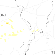

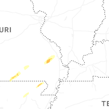

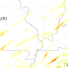


Connect with Interactive Hail Maps