

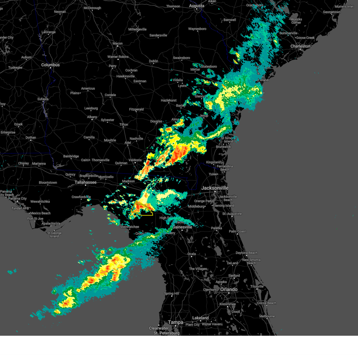
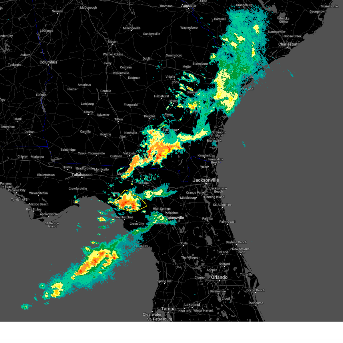
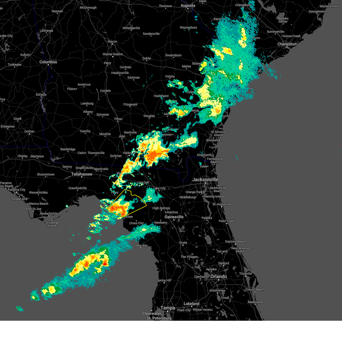
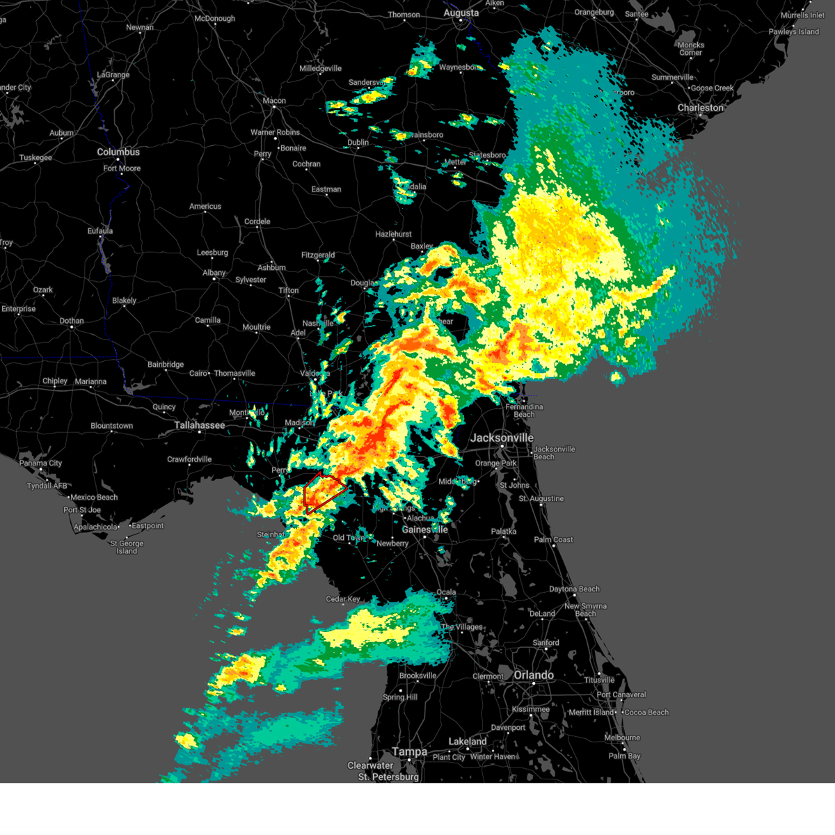
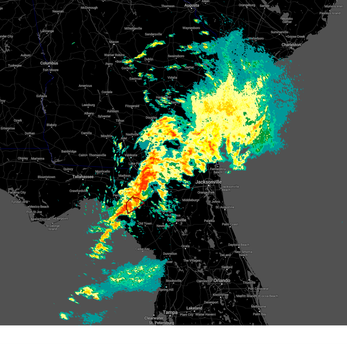
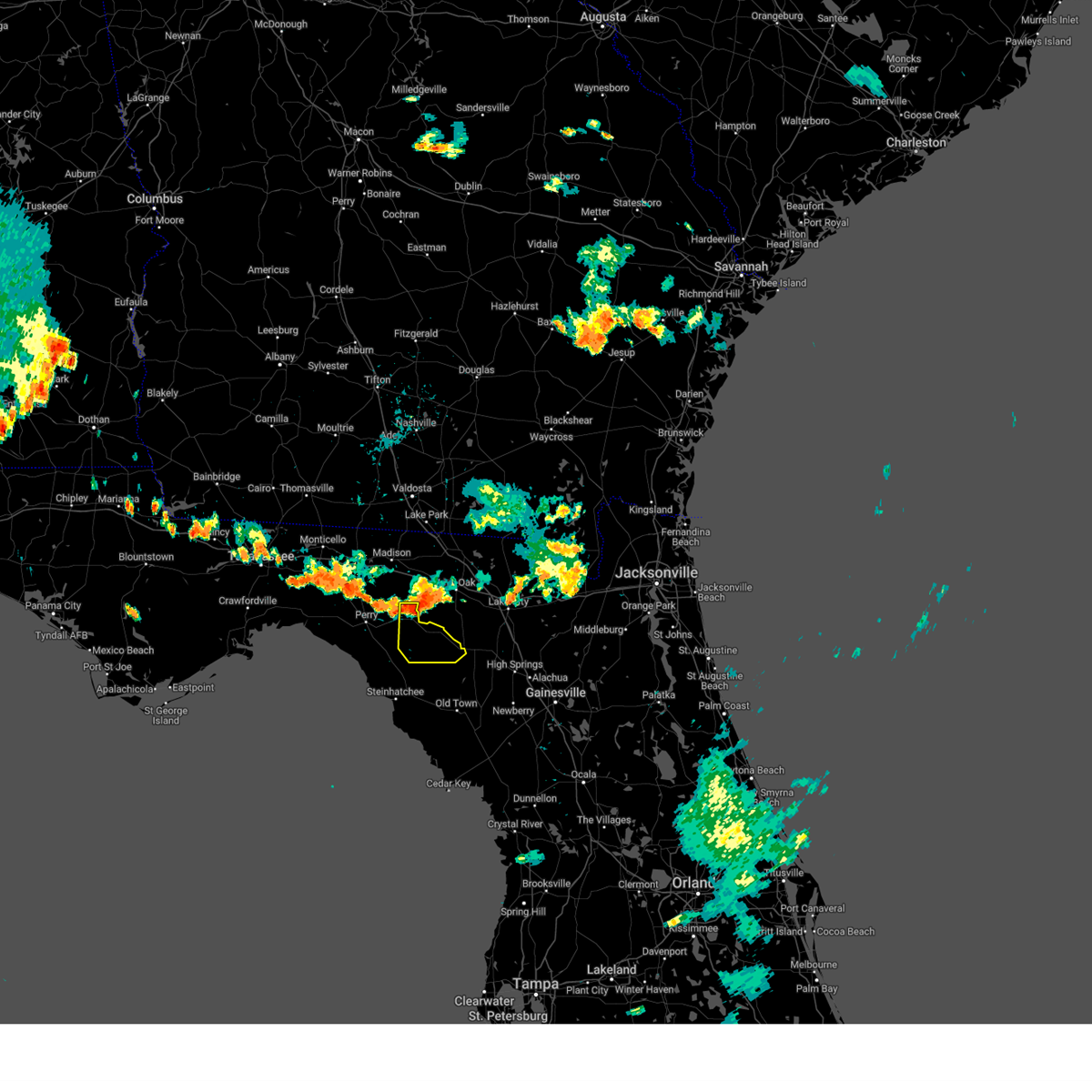
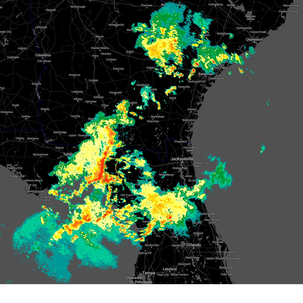
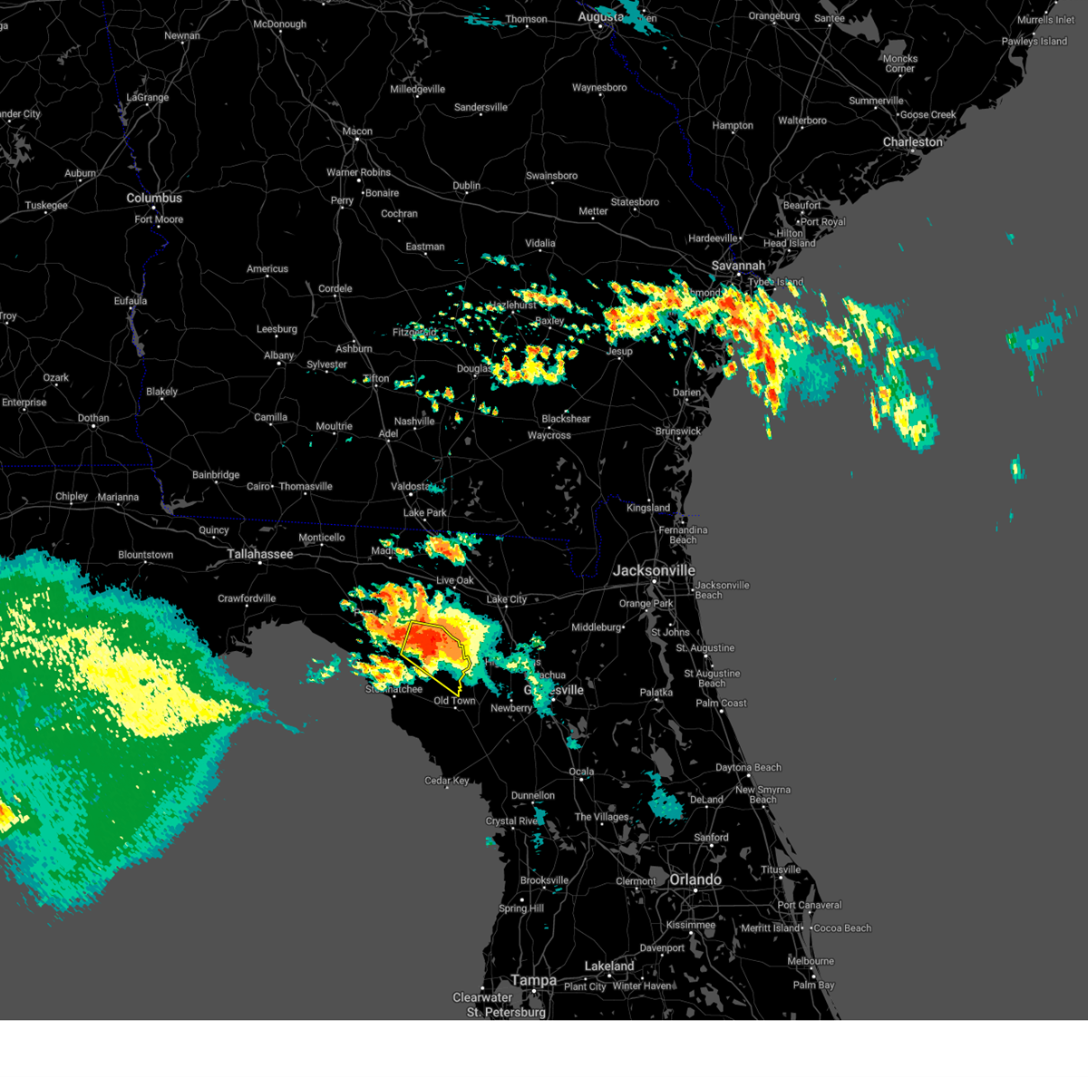
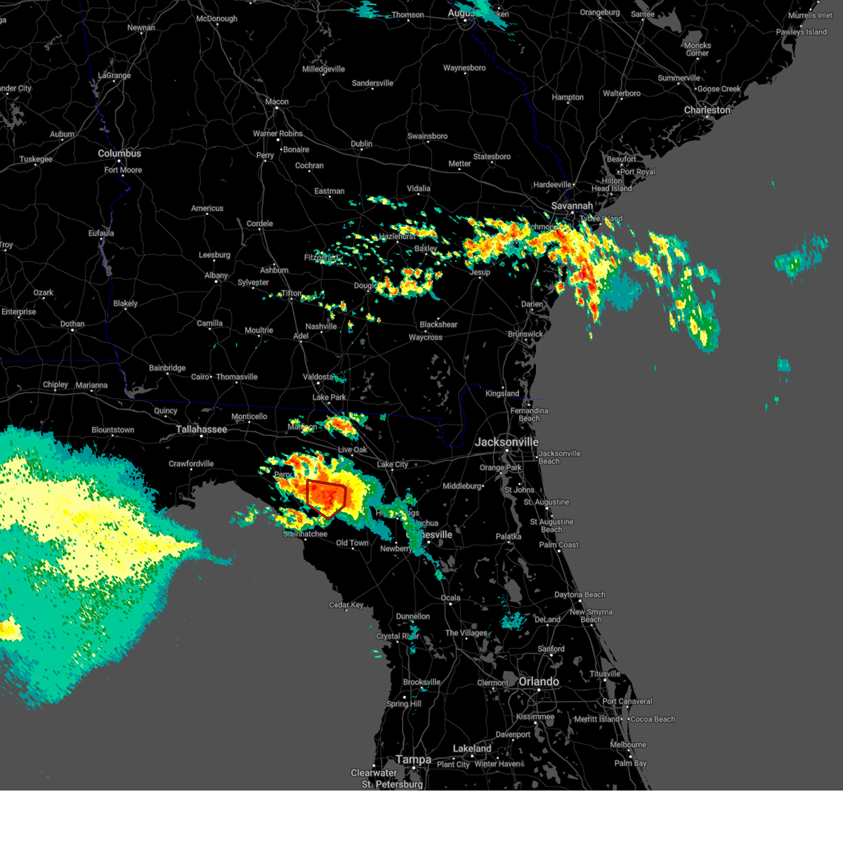
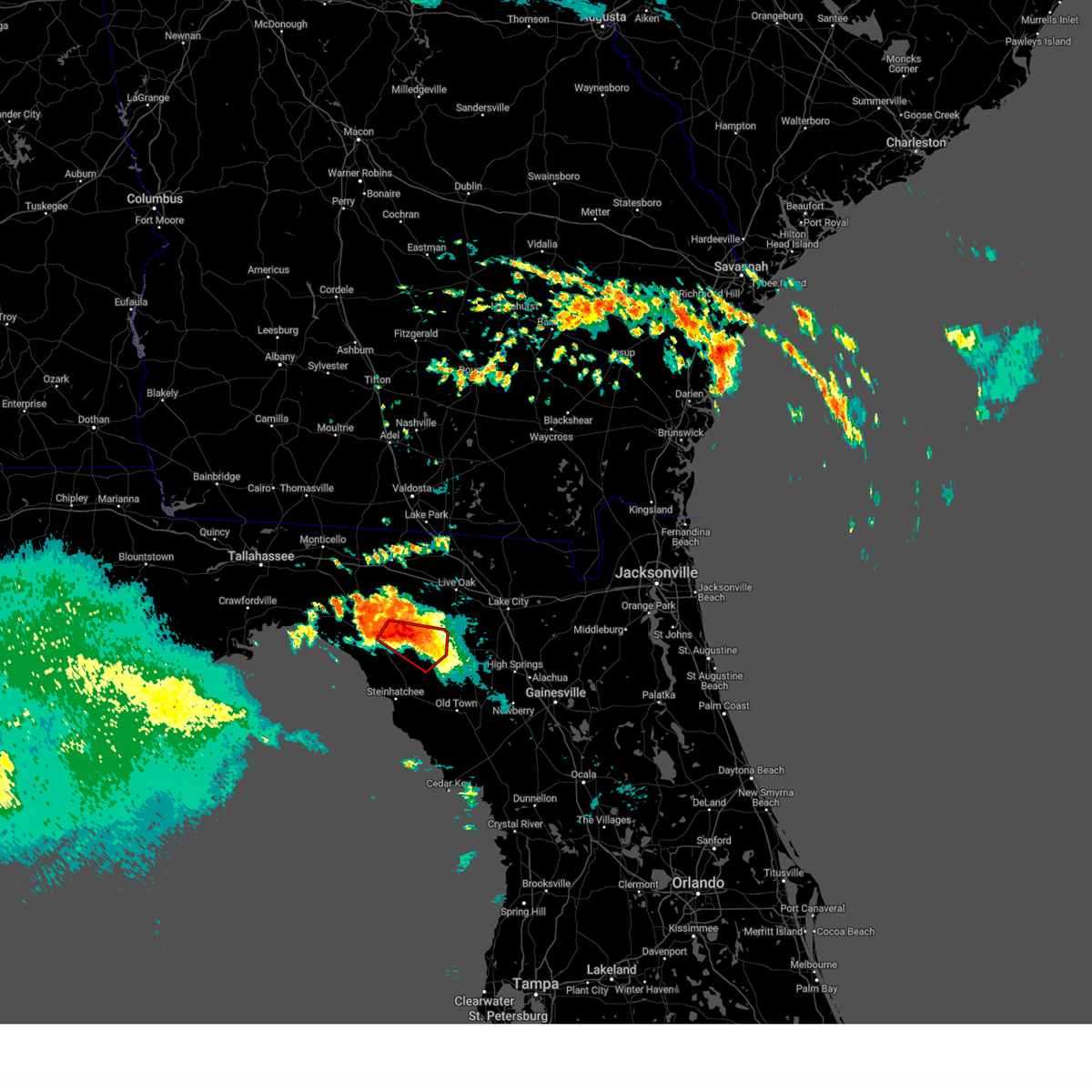
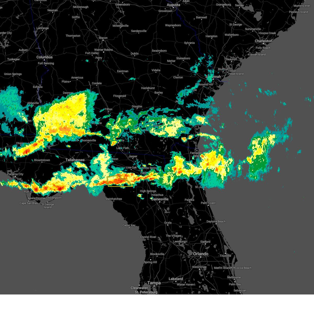
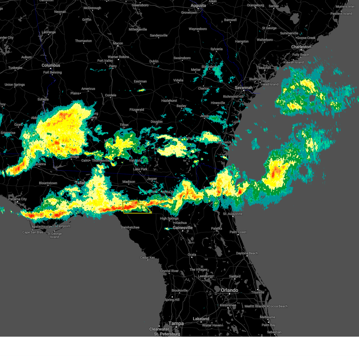
Hail Map for Mayo, FL
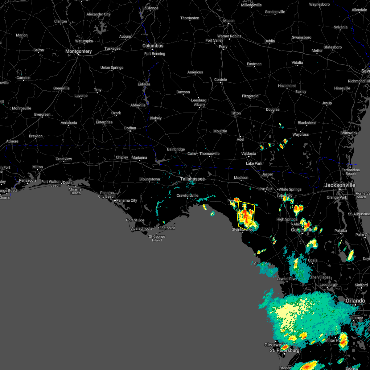
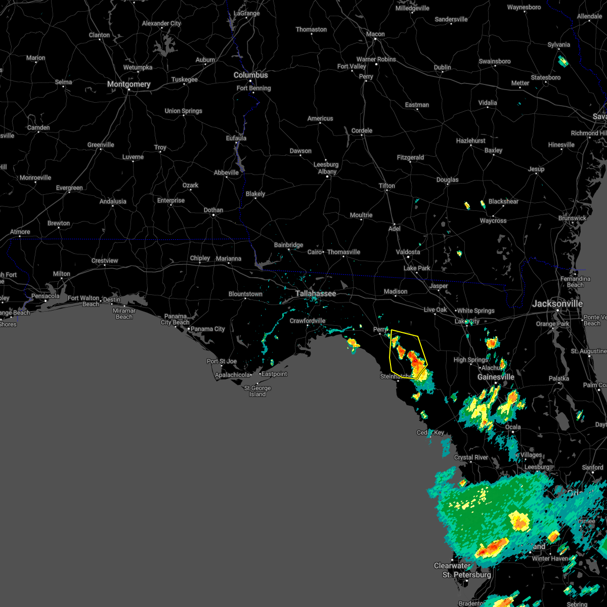
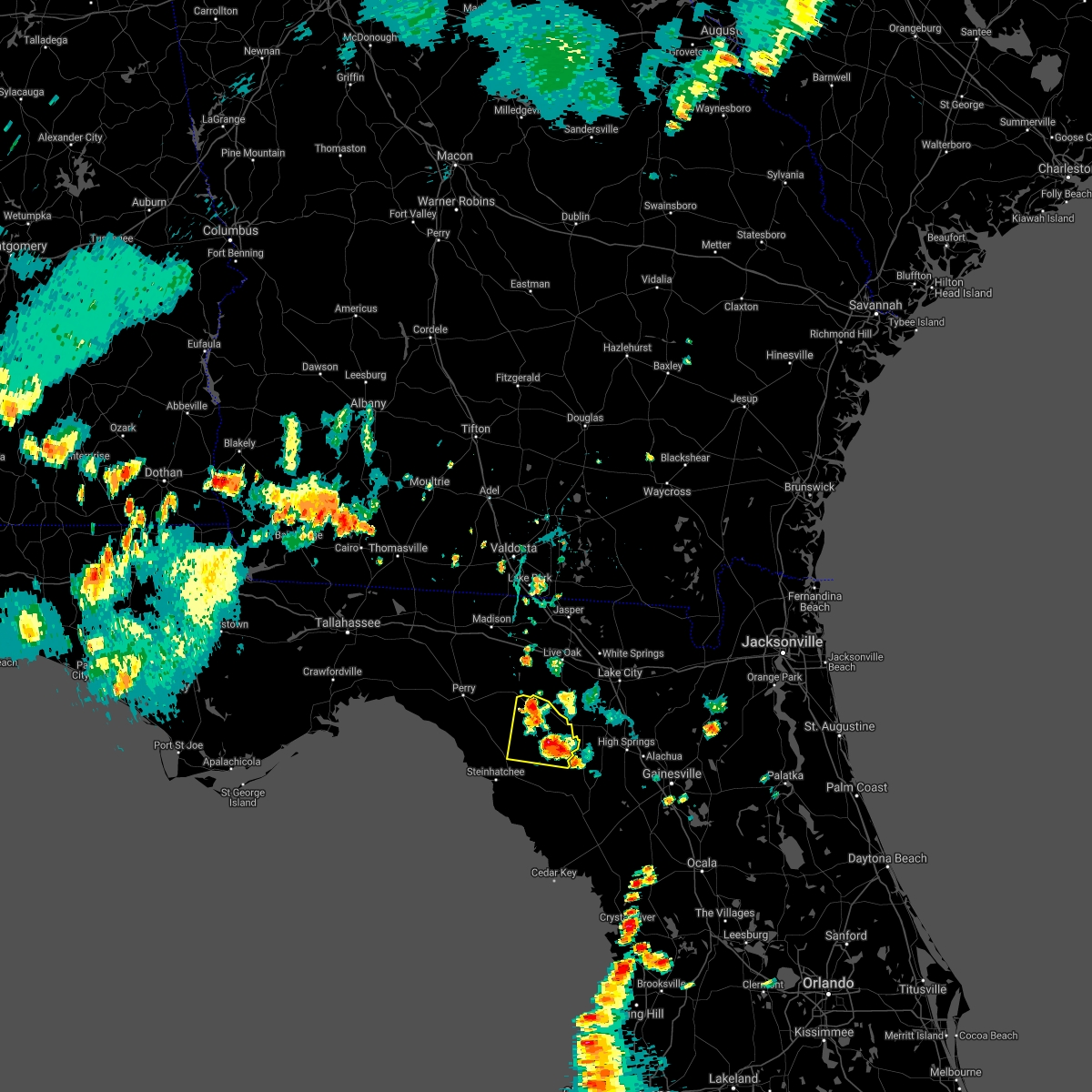
The Mayo, FL area has had 1 report of on-the-ground hail by trained spotters, and has been under severe weather warnings 6 times during the past 12 months. Doppler radar has detected hail at or near Mayo, FL on 40 occasions, including 2 occasions during the past year.
| Name: | Mayo, FL |
| Where Located: | 71.4 miles ESE of Tallahassee, FL |
| Map: | Google Map for Mayo, FL |
| Population: | 1237 |
| Housing Units: | 488 |
| More Info: | Search Google for Mayo, FL |
0
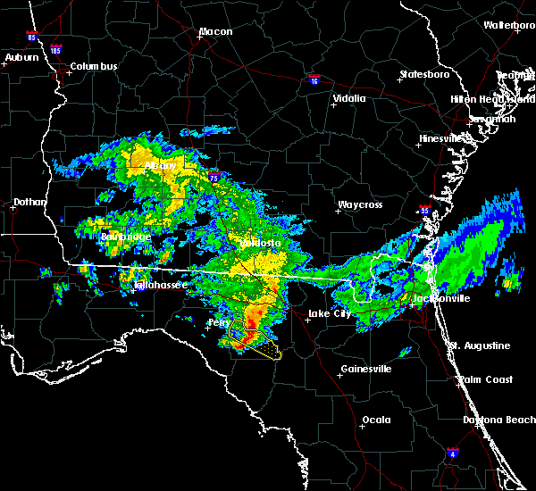
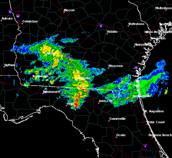
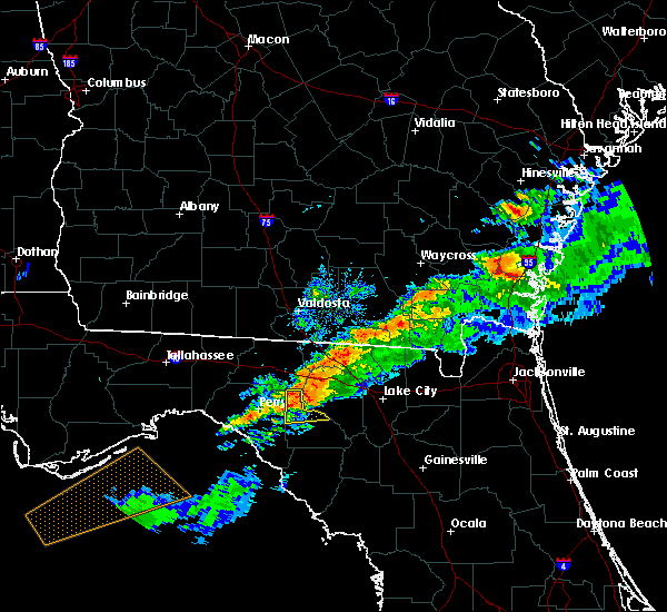
The Top Recent Hail Date for Mayo, FL is Thursday, June 26, 2025 (31st out of 40)

Hail and Wind Damage Spotted near Mayo, FL
| Date / Time | Report Details |
|---|---|
| 3/16/2025 10:35 AM EDT |
 At 1035 am edt, severe thunderstorms were located along a line extending from near mayo to 10 miles east of perry, moving east at 50 mph (radar indicated). Hazards include 60 mph wind gusts and penny size hail. Expect damage to roofs, siding, and trees. Locations impacted include, san pedro junction, grady, alton, and mayo. At 1035 am edt, severe thunderstorms were located along a line extending from near mayo to 10 miles east of perry, moving east at 50 mph (radar indicated). Hazards include 60 mph wind gusts and penny size hail. Expect damage to roofs, siding, and trees. Locations impacted include, san pedro junction, grady, alton, and mayo.
|
| 3/16/2025 10:35 AM EDT |
 the severe thunderstorm warning has been cancelled and is no longer in effect the severe thunderstorm warning has been cancelled and is no longer in effect
|
| 3/16/2025 10:20 AM EDT |
 the severe thunderstorm warning has been cancelled and is no longer in effect the severe thunderstorm warning has been cancelled and is no longer in effect
|
| 3/16/2025 10:20 AM EDT |
 At 1019 am edt, severe thunderstorms were located along a line extending from 12 miles southwest of mayo to 9 miles south of perry, moving northeast at 50 mph (radar indicated). Hazards include 60 mph wind gusts and penny size hail. Expect damage to roofs, siding, and trees. Locations impacted include, pinland, cooks hammock, smith, buckville, carbur, alton, mayo, townsend, grady, salem, athena, san pedro junction, and fenholloway. At 1019 am edt, severe thunderstorms were located along a line extending from 12 miles southwest of mayo to 9 miles south of perry, moving northeast at 50 mph (radar indicated). Hazards include 60 mph wind gusts and penny size hail. Expect damage to roofs, siding, and trees. Locations impacted include, pinland, cooks hammock, smith, buckville, carbur, alton, mayo, townsend, grady, salem, athena, san pedro junction, and fenholloway.
|
| 3/16/2025 10:10 AM EDT |
 At 1009 am edt, severe thunderstorms were located along a line extending from 11 miles north of steinhatchee to 14 miles south of perry, and are nearly stationary (radar indicated). Hazards include 60 mph wind gusts and penny size hail. Expect damage to roofs, siding, and trees. Locations impacted include, pinland, tennille, jug island, clara, buckville, dekle beach, jack lee island, grady, salem, san pedro junction, cedar island, fish creek, cooks hammock, howell place, smith, carbur, alton, mayo, adams beach, and townsend. At 1009 am edt, severe thunderstorms were located along a line extending from 11 miles north of steinhatchee to 14 miles south of perry, and are nearly stationary (radar indicated). Hazards include 60 mph wind gusts and penny size hail. Expect damage to roofs, siding, and trees. Locations impacted include, pinland, tennille, jug island, clara, buckville, dekle beach, jack lee island, grady, salem, san pedro junction, cedar island, fish creek, cooks hammock, howell place, smith, carbur, alton, mayo, adams beach, and townsend.
|
| 3/16/2025 9:58 AM EDT |
 Svrtae the national weather service in tallahassee has issued a * severe thunderstorm warning for, lafayette county in big bend florida, northwestern dixie county in big bend florida, southeastern taylor county in big bend florida, * until 1045 am edt. * at 958 am edt, severe thunderstorms were located along a line extending from 11 miles north of steinhatchee to 14 miles south of perry, moving northeast at 50 mph (radar indicated). Hazards include 60 mph wind gusts and penny size hail. expect damage to roofs, siding, and trees Svrtae the national weather service in tallahassee has issued a * severe thunderstorm warning for, lafayette county in big bend florida, northwestern dixie county in big bend florida, southeastern taylor county in big bend florida, * until 1045 am edt. * at 958 am edt, severe thunderstorms were located along a line extending from 11 miles north of steinhatchee to 14 miles south of perry, moving northeast at 50 mph (radar indicated). Hazards include 60 mph wind gusts and penny size hail. expect damage to roofs, siding, and trees
|
| 5/10/2024 8:10 AM EDT | Several trees down across lafayette count in lafayette county FL, 0.4 miles E of Mayo, FL |
| 5/10/2024 8:09 AM EDT | the tornado warning has been cancelled and is no longer in effect |
| 5/10/2024 7:41 AM EDT | Tortae the national weather service in tallahassee has issued a * tornado warning for, lafayette county in big bend florida, taylor county in big bend florida, * until 845 am edt. * at 740 am edt, severe thunderstorms capable of producing a tornado were located along a line extending from 12 miles north of perry to 30 miles northwest of steinhatchee, moving east at 70 mph (radar indicated rotation). Hazards include tornado. Flying debris will be dangerous to those caught without shelter. mobile homes will be damaged or destroyed. damage to roofs, windows, and vehicles will occur. tree damage is likely. these dangerous storms will be near, perry around 745 am edt. mayo around 805 am edt. Other locations impacted by these tornadic storms include pinland, jug island, buckville, dekle beach, jack lee island, grady, hatch bend, foley, salem, and perry-foley airport. |
| 5/10/2024 7:30 AM EDT | Svrtae the national weather service in tallahassee has issued a * severe thunderstorm warning for, lafayette county in big bend florida, dixie county in big bend florida, eastern taylor county in big bend florida, * until 900 am edt. * at 730 am edt, severe thunderstorms were located along a line extending from near monticello to 13 miles southeast of st. marks, moving east at 65 mph (radar indicated). Hazards include 60 mph wind gusts. expect damage to roofs, siding, and trees |
| 4/11/2024 8:26 AM EDT |
 The storm which prompted the warning has weakened below severe limits, and no longer poses an immediate threat to life or property. therefore, the warning will be allowed to expire. a tornado watch remains in effect until 300 pm edt for big bend florida. The storm which prompted the warning has weakened below severe limits, and no longer poses an immediate threat to life or property. therefore, the warning will be allowed to expire. a tornado watch remains in effect until 300 pm edt for big bend florida.
|
| 4/11/2024 8:09 AM EDT |
 The storm which prompted the warning has weakened below severe limits, and no longer appears capable of producing a tornado. therefore, the warning will be allowed to expire. a tornado watch remains in effect until 300 pm edt for big bend florida. The storm which prompted the warning has weakened below severe limits, and no longer appears capable of producing a tornado. therefore, the warning will be allowed to expire. a tornado watch remains in effect until 300 pm edt for big bend florida.
|
| 4/11/2024 7:43 AM EDT |
 Tortae the national weather service in tallahassee has issued a * tornado warning for, southwestern lafayette county in big bend florida, * until 815 am edt. * at 743 am edt, a severe thunderstorm capable of producing a tornado was located 12 miles southwest of mayo, moving northeast at 50 mph (radar indicated rotation). Hazards include tornado. Flying debris will be dangerous to those caught without shelter. mobile homes will be damaged or destroyed. damage to roofs, windows, and vehicles will occur. tree damage is likely. this dangerous storm will be near, mayo around 755 am edt. Other locations impacted by this tornadic thunderstorm include san pedro junction, alton, and cooks hammock. Tortae the national weather service in tallahassee has issued a * tornado warning for, southwestern lafayette county in big bend florida, * until 815 am edt. * at 743 am edt, a severe thunderstorm capable of producing a tornado was located 12 miles southwest of mayo, moving northeast at 50 mph (radar indicated rotation). Hazards include tornado. Flying debris will be dangerous to those caught without shelter. mobile homes will be damaged or destroyed. damage to roofs, windows, and vehicles will occur. tree damage is likely. this dangerous storm will be near, mayo around 755 am edt. Other locations impacted by this tornadic thunderstorm include san pedro junction, alton, and cooks hammock.
|
| 4/11/2024 7:39 AM EDT |
 Svrtae the national weather service in tallahassee has issued a * severe thunderstorm warning for, lafayette county in big bend florida, northwestern dixie county in big bend florida, southeastern taylor county in big bend florida, * until 830 am edt. * at 739 am edt, a severe thunderstorm was located 15 miles northwest of steinhatchee, moving northeast at 50 mph (radar indicated). Hazards include 60 mph wind gusts. expect damage to roofs, siding, and trees Svrtae the national weather service in tallahassee has issued a * severe thunderstorm warning for, lafayette county in big bend florida, northwestern dixie county in big bend florida, southeastern taylor county in big bend florida, * until 830 am edt. * at 739 am edt, a severe thunderstorm was located 15 miles northwest of steinhatchee, moving northeast at 50 mph (radar indicated). Hazards include 60 mph wind gusts. expect damage to roofs, siding, and trees
|
| 1/9/2024 1:19 PM EST |
 At 119 pm est, severe thunderstorms were located along a line extending from 6 miles west of obrien to 14 miles south of horseshoe point, moving northeast at 65 mph (radar indicated). Hazards include 70 mph wind gusts. Expect considerable tree damage. Damage is likely to mobile homes, roofs, and outbuildings. At 119 pm est, severe thunderstorms were located along a line extending from 6 miles west of obrien to 14 miles south of horseshoe point, moving northeast at 65 mph (radar indicated). Hazards include 70 mph wind gusts. Expect considerable tree damage. Damage is likely to mobile homes, roofs, and outbuildings.
|
| 1/9/2024 1:03 PM EST |
 At 103 pm est, severe thunderstorms were located along a line extending from 9 miles northwest of needmore to 9 miles south of mayo, moving east at 45 mph (radar indicated). Hazards include 70 mph wind gusts and penny size hail. Expect considerable tree damage. damage is likely to mobile homes, roofs, and outbuildings. Locations impacted include, mayo, cross city, steinhatchee, horseshoe point, suwannee, horseshoe beach, tennille, shamrock, clara, cross city airport, shired island, old town, jonesboro, hatch bend, salem, san pedro junction, cooks hammock, howell place, guaranto springs, and carbur. At 103 pm est, severe thunderstorms were located along a line extending from 9 miles northwest of needmore to 9 miles south of mayo, moving east at 45 mph (radar indicated). Hazards include 70 mph wind gusts and penny size hail. Expect considerable tree damage. damage is likely to mobile homes, roofs, and outbuildings. Locations impacted include, mayo, cross city, steinhatchee, horseshoe point, suwannee, horseshoe beach, tennille, shamrock, clara, cross city airport, shired island, old town, jonesboro, hatch bend, salem, san pedro junction, cooks hammock, howell place, guaranto springs, and carbur.
|
| 1/9/2024 11:58 AM EST |
 At 1158 am est, severe thunderstorms were located along a line extending from 10 miles south of quitman to 32 miles southwest of perry, moving east at 45 mph (radar indicated). Hazards include 70 mph wind gusts and penny size hail. Expect considerable tree damage. Damage is likely to mobile homes, roofs, and outbuildings. At 1158 am est, severe thunderstorms were located along a line extending from 10 miles south of quitman to 32 miles southwest of perry, moving east at 45 mph (radar indicated). Hazards include 70 mph wind gusts and penny size hail. Expect considerable tree damage. Damage is likely to mobile homes, roofs, and outbuildings.
|
| 1/6/2024 5:23 AM EST |
 At 523 am est, severe thunderstorms were located along a line extending from 7 miles west of luraville to 19 miles west of steinhatchee, moving east at 40 mph. there are reports of trees and power lines down in the perry area with these storms (radar indicated). Hazards include 60 mph wind gusts. expect damage to roofs, siding, and trees At 523 am est, severe thunderstorms were located along a line extending from 7 miles west of luraville to 19 miles west of steinhatchee, moving east at 40 mph. there are reports of trees and power lines down in the perry area with these storms (radar indicated). Hazards include 60 mph wind gusts. expect damage to roofs, siding, and trees
|
| 1/6/2024 4:55 AM EST |
 At 455 am est, severe thunderstorms were located along a line extending from 7 miles northwest of blue springs to 37 miles west of steinhatchee, moving east at 30 mph (radar indicated). Hazards include 60 mph wind gusts. Expect damage to roofs, siding, and trees. locations impacted include, mayo, madison, perry, steinhatchee, lee, pinland, jug island, ebb, buckville, dekle beach, jack lee island, foley, salem, hanson, perry-foley airport, san pedro junction, hampton springs, sirmans, shady grove, and cedar island. hail threat, radar indicated max hail size, <. 75 in wind threat, radar indicated max wind gust, 60 mph. At 455 am est, severe thunderstorms were located along a line extending from 7 miles northwest of blue springs to 37 miles west of steinhatchee, moving east at 30 mph (radar indicated). Hazards include 60 mph wind gusts. Expect damage to roofs, siding, and trees. locations impacted include, mayo, madison, perry, steinhatchee, lee, pinland, jug island, ebb, buckville, dekle beach, jack lee island, foley, salem, hanson, perry-foley airport, san pedro junction, hampton springs, sirmans, shady grove, and cedar island. hail threat, radar indicated max hail size, <. 75 in wind threat, radar indicated max wind gust, 60 mph.
|
| 1/6/2024 4:29 AM EST |
 At 429 am est, severe thunderstorms were located along a line extending from 10 miles north of madison to 32 miles southeast of carrabelle, moving east at 40 mph (radar indicated). Hazards include 60 mph wind gusts. Expect damage to roofs, siding, and trees. locations impacted include, mayo, perry, steinhatchee, madison, greenville, lee, pinland, jug island, pinetta, scanlon, foley, hanson, perry-foley airport, san pedro junction, hampton springs, iddo, moseley hall, secotan, boyd, and smith. hail threat, radar indicated max hail size, <. 75 in wind threat, radar indicated max wind gust, 60 mph. At 429 am est, severe thunderstorms were located along a line extending from 10 miles north of madison to 32 miles southeast of carrabelle, moving east at 40 mph (radar indicated). Hazards include 60 mph wind gusts. Expect damage to roofs, siding, and trees. locations impacted include, mayo, perry, steinhatchee, madison, greenville, lee, pinland, jug island, pinetta, scanlon, foley, hanson, perry-foley airport, san pedro junction, hampton springs, iddo, moseley hall, secotan, boyd, and smith. hail threat, radar indicated max hail size, <. 75 in wind threat, radar indicated max wind gust, 60 mph.
|
| 1/6/2024 4:07 AM EST |
 At 407 am est, severe thunderstorms were located along a line extending from 6 miles east of monticello to 33 miles southeast of st george island, moving east at 30 mph (radar indicated). Hazards include 60 mph wind gusts. expect damage to roofs, siding, and trees At 407 am est, severe thunderstorms were located along a line extending from 6 miles east of monticello to 33 miles southeast of st george island, moving east at 30 mph (radar indicated). Hazards include 60 mph wind gusts. expect damage to roofs, siding, and trees
|
| 8/4/2023 7:15 PM EDT | Tree and power line reported down. time estimated by rada in lafayette county FL, 5.4 miles WSW of Mayo, FL |
| 8/4/2023 6:53 PM EDT |
 At 653 pm edt, severe thunderstorms were located along a line extending from near live oak to near luraville to 11 miles east of perry, moving southeast at 15 mph (radar indicated). Hazards include 60 mph wind gusts. expect damage to roofs, siding, and trees At 653 pm edt, severe thunderstorms were located along a line extending from near live oak to near luraville to 11 miles east of perry, moving southeast at 15 mph (radar indicated). Hazards include 60 mph wind gusts. expect damage to roofs, siding, and trees
|
| 7/16/2023 2:39 PM EDT |
 At 238 pm edt, a severe thunderstorm was located 7 miles northeast of perry, moving east at 25 mph (radar indicated). Hazards include 60 mph wind gusts. Expect damage to roofs, siding, and trees. locations impacted include, mayo, perry, chancey, boyd, smith, hopewell, buckville, mayo junction, townsend, foley, perry-foley airport, bucell junction, day and fenholloway. hail threat, radar indicated max hail size, <. 75 in wind threat, radar indicated max wind gust, 60 mph. At 238 pm edt, a severe thunderstorm was located 7 miles northeast of perry, moving east at 25 mph (radar indicated). Hazards include 60 mph wind gusts. Expect damage to roofs, siding, and trees. locations impacted include, mayo, perry, chancey, boyd, smith, hopewell, buckville, mayo junction, townsend, foley, perry-foley airport, bucell junction, day and fenholloway. hail threat, radar indicated max hail size, <. 75 in wind threat, radar indicated max wind gust, 60 mph.
|
| 7/16/2023 1:54 PM EDT |
 At 154 pm edt, a severe thunderstorm was located 17 miles northwest of perry, moving east at 15 mph (radar indicated). Hazards include 60 mph wind gusts. expect damage to roofs, siding, and trees At 154 pm edt, a severe thunderstorm was located 17 miles northwest of perry, moving east at 15 mph (radar indicated). Hazards include 60 mph wind gusts. expect damage to roofs, siding, and trees
|
| 7/10/2023 11:36 AM EDT |
 At 1135 am edt, severe thunderstorms were located along a line extending from luraville to 7 miles northwest of steinhatchee, moving east at 35 mph (radar indicated). Hazards include 60 mph wind gusts. expect damage to roofs, siding, and trees At 1135 am edt, severe thunderstorms were located along a line extending from luraville to 7 miles northwest of steinhatchee, moving east at 35 mph (radar indicated). Hazards include 60 mph wind gusts. expect damage to roofs, siding, and trees
|
| 7/7/2023 5:32 PM EDT | Power line down along county road 25 in lafayette county FL, 12.4 miles SSE of Mayo, FL |
| 6/23/2023 2:20 AM EDT |
 At 220 am edt, severe thunderstorms were located along a line extending from 11 miles south of madison to near perry to 23 miles west of mayo to 23 miles northwest of steinhatchee, moving east at 40 mph (radar indicated). Hazards include 60 mph wind gusts. expect damage to roofs, siding, and trees At 220 am edt, severe thunderstorms were located along a line extending from 11 miles south of madison to near perry to 23 miles west of mayo to 23 miles northwest of steinhatchee, moving east at 40 mph (radar indicated). Hazards include 60 mph wind gusts. expect damage to roofs, siding, and trees
|
| 6/23/2023 2:20 AM EDT |
 At 220 am edt, severe thunderstorms were located along a line extending from 11 miles south of madison to near perry to 24 miles west of mayo to 24 miles northwest of steinhatchee, moving east at 40 mph (radar indicated). Hazards include 60 mph wind gusts. Expect damage to roofs, siding, and trees. Locations impacted include, townsend, cooks hammock, chancey, smith, salem, buckville, carbur, athena, san pedro junction, day, fenholloway and mayo junction. At 220 am edt, severe thunderstorms were located along a line extending from 11 miles south of madison to near perry to 24 miles west of mayo to 24 miles northwest of steinhatchee, moving east at 40 mph (radar indicated). Hazards include 60 mph wind gusts. Expect damage to roofs, siding, and trees. Locations impacted include, townsend, cooks hammock, chancey, smith, salem, buckville, carbur, athena, san pedro junction, day, fenholloway and mayo junction.
|
| 6/17/2023 7:16 PM EDT |
 At 716 pm edt, a severe thunderstorm was located 11 miles west of dowling park, or 11 miles northeast of perry, moving southeast at 35 mph (radar indicated). Hazards include 60 mph wind gusts. Expect damage to roofs, siding, and trees. locations impacted include, mayo, madison, perry, lee, pinland, hamburg, buckville, pinetta, foley, salem, hanson, perry-foley airport, san pedro junction, hampton springs, shady grove, cooks hammock, moseley hall, chancey, secotan and boyd. hail threat, radar indicated max hail size, <. 75 in wind threat, radar indicated max wind gust, 60 mph. At 716 pm edt, a severe thunderstorm was located 11 miles west of dowling park, or 11 miles northeast of perry, moving southeast at 35 mph (radar indicated). Hazards include 60 mph wind gusts. Expect damage to roofs, siding, and trees. locations impacted include, mayo, madison, perry, lee, pinland, hamburg, buckville, pinetta, foley, salem, hanson, perry-foley airport, san pedro junction, hampton springs, shady grove, cooks hammock, moseley hall, chancey, secotan and boyd. hail threat, radar indicated max hail size, <. 75 in wind threat, radar indicated max wind gust, 60 mph.
|
| 6/17/2023 6:53 PM EDT |
 At 653 pm edt, a severe thunderstorm was located 14 miles southwest of madison, moving southeast at 40 mph (radar indicated). Hazards include 60 mph wind gusts and nickel size hail. Expect damage to roofs, siding, and trees. locations impacted include, mayo, madison, perry, greenville, lee, pinland, ebb, hamburg, buckville, pinetta, eridu, cabbage grove, lovett, foley, salem, hanson, perry-foley airport, san pedro junction, hampton springs and sirmans. hail threat, radar indicated max hail size, 0. 88 in wind threat, radar indicated max wind gust, 60 mph. At 653 pm edt, a severe thunderstorm was located 14 miles southwest of madison, moving southeast at 40 mph (radar indicated). Hazards include 60 mph wind gusts and nickel size hail. Expect damage to roofs, siding, and trees. locations impacted include, mayo, madison, perry, greenville, lee, pinland, ebb, hamburg, buckville, pinetta, eridu, cabbage grove, lovett, foley, salem, hanson, perry-foley airport, san pedro junction, hampton springs and sirmans. hail threat, radar indicated max hail size, 0. 88 in wind threat, radar indicated max wind gust, 60 mph.
|
| 6/17/2023 6:15 PM EDT |
 At 615 pm edt, a severe thunderstorm was located 10 miles west of monticello, moving southeast at 35 mph (radar indicated). Hazards include 60 mph wind gusts and quarter size hail. Hail damage to vehicles is expected. Expect wind damage to roofs, siding, and trees. At 615 pm edt, a severe thunderstorm was located 10 miles west of monticello, moving southeast at 35 mph (radar indicated). Hazards include 60 mph wind gusts and quarter size hail. Hail damage to vehicles is expected. Expect wind damage to roofs, siding, and trees.
|
| 6/16/2023 2:12 PM EDT |
 The severe thunderstorm warning for lafayette and dixie counties will expire at 215 pm edt, the storms which prompted the warning have weakened below severe limits, and have exited the warned area. therefore, the warning will be allowed to expire. however residual wind gusts of 40 to 50 mph will continue through about 4 pm edt. a severe thunderstorm watch remains in effect until 300 pm edt for big bend of florida. The severe thunderstorm warning for lafayette and dixie counties will expire at 215 pm edt, the storms which prompted the warning have weakened below severe limits, and have exited the warned area. therefore, the warning will be allowed to expire. however residual wind gusts of 40 to 50 mph will continue through about 4 pm edt. a severe thunderstorm watch remains in effect until 300 pm edt for big bend of florida.
|
| 6/16/2023 1:22 PM EDT |
 At 122 pm edt, severe thunderstorms were located along a line extending from 12 miles south of madison to 16 miles southwest of mayo to near steinhatchee to 17 miles west of horseshoe point, moving east at 65 mph (radar indicated). Hazards include 60 mph wind gusts. expect damage to roofs, siding, and trees At 122 pm edt, severe thunderstorms were located along a line extending from 12 miles south of madison to 16 miles southwest of mayo to near steinhatchee to 17 miles west of horseshoe point, moving east at 65 mph (radar indicated). Hazards include 60 mph wind gusts. expect damage to roofs, siding, and trees
|
| 6/16/2023 5:13 AM EDT |
 At 513 am edt, a severe thunderstorm was located near mayo, moving southeast at 15 mph (radar indicated). Hazards include 60 mph wind gusts. expect damage to roofs, siding, and trees At 513 am edt, a severe thunderstorm was located near mayo, moving southeast at 15 mph (radar indicated). Hazards include 60 mph wind gusts. expect damage to roofs, siding, and trees
|
| 6/16/2023 5:07 AM EDT |
 At 506 am edt, a severe thunderstorm capable of producing a tornado was located near mayo, moving east at 25 mph (radar indicated rotation). Hazards include tornado. Flying debris will be dangerous to those caught without shelter. mobile homes will be damaged or destroyed. damage to roofs, windows, and vehicles will occur. tree damage is likely. This tornadic thunderstorm will remain over mainly rural areas of southwestern lafayette county, including the following locations, san pedro junction, alton and cooks hammock. At 506 am edt, a severe thunderstorm capable of producing a tornado was located near mayo, moving east at 25 mph (radar indicated rotation). Hazards include tornado. Flying debris will be dangerous to those caught without shelter. mobile homes will be damaged or destroyed. damage to roofs, windows, and vehicles will occur. tree damage is likely. This tornadic thunderstorm will remain over mainly rural areas of southwestern lafayette county, including the following locations, san pedro junction, alton and cooks hammock.
|
| 6/16/2023 4:33 AM EDT |
 At 433 am edt, a severe thunderstorm capable of producing a tornado was located 11 miles west of mayo, moving east at 25 mph (radar indicated rotation). Hazards include tornado. Flying debris will be dangerous to those caught without shelter. mobile homes will be damaged or destroyed. damage to roofs, windows, and vehicles will occur. tree damage is likely. this dangerous storm will be near, mayo around 500 am edt. Other locations impacted by this tornadic thunderstorm include san pedro junction, alton and cooks hammock. At 433 am edt, a severe thunderstorm capable of producing a tornado was located 11 miles west of mayo, moving east at 25 mph (radar indicated rotation). Hazards include tornado. Flying debris will be dangerous to those caught without shelter. mobile homes will be damaged or destroyed. damage to roofs, windows, and vehicles will occur. tree damage is likely. this dangerous storm will be near, mayo around 500 am edt. Other locations impacted by this tornadic thunderstorm include san pedro junction, alton and cooks hammock.
|
| 6/16/2023 4:01 AM EDT |
 At 401 am edt, a severe thunderstorm capable of producing a tornado was located near perry, moving east at 20 mph (radar indicated rotation). Hazards include tornado. Flying debris will be dangerous to those caught without shelter. mobile homes will be damaged or destroyed. damage to roofs, windows, and vehicles will occur. tree damage is likely. This tornadic thunderstorm will remain over mainly rural areas of southwestern lafayette and northeastern taylor counties, including the following locations, pinland, townsend, cooks hammock, smith, foley, buckville, bucell junction, athena, san pedro junction and alton. At 401 am edt, a severe thunderstorm capable of producing a tornado was located near perry, moving east at 20 mph (radar indicated rotation). Hazards include tornado. Flying debris will be dangerous to those caught without shelter. mobile homes will be damaged or destroyed. damage to roofs, windows, and vehicles will occur. tree damage is likely. This tornadic thunderstorm will remain over mainly rural areas of southwestern lafayette and northeastern taylor counties, including the following locations, pinland, townsend, cooks hammock, smith, foley, buckville, bucell junction, athena, san pedro junction and alton.
|
| 6/15/2023 4:44 PM EDT |
 At 444 pm edt, a severe thunderstorm was located 16 miles west of perry, moving east at 30 mph (radar indicated). Hazards include 60 mph wind gusts. expect damage to roofs, siding, and trees At 444 pm edt, a severe thunderstorm was located 16 miles west of perry, moving east at 30 mph (radar indicated). Hazards include 60 mph wind gusts. expect damage to roofs, siding, and trees
|
| 6/14/2023 9:46 PM EDT |
 At 946 pm edt, severe thunderstorms were located along a line extending from 6 miles west of madison to 18 miles east of st. marks to 12 miles south of crawfordville, moving southeast at 60 mph (radar indicated). Hazards include 60 mph wind gusts and quarter size hail. Hail damage to vehicles is expected. Expect wind damage to roofs, siding, and trees. At 946 pm edt, severe thunderstorms were located along a line extending from 6 miles west of madison to 18 miles east of st. marks to 12 miles south of crawfordville, moving southeast at 60 mph (radar indicated). Hazards include 60 mph wind gusts and quarter size hail. Hail damage to vehicles is expected. Expect wind damage to roofs, siding, and trees.
|
| 4/27/2023 8:20 PM EDT |
 The severe thunderstorm warning for lafayette, dixie and southeastern taylor counties will expire at 830 pm edt, the storms which prompted the warning have moved out of the area. therefore, the warning will be allowed to expire. a severe thunderstorm watch remains in effect until 900 pm edt for big bend of florida. to report severe weather, contact your nearest law enforcement agency. they will relay your report to the national weather service tallahassee. The severe thunderstorm warning for lafayette, dixie and southeastern taylor counties will expire at 830 pm edt, the storms which prompted the warning have moved out of the area. therefore, the warning will be allowed to expire. a severe thunderstorm watch remains in effect until 900 pm edt for big bend of florida. to report severe weather, contact your nearest law enforcement agency. they will relay your report to the national weather service tallahassee.
|
| 4/27/2023 7:04 PM EDT |
 At 704 pm edt, severe thunderstorms were located along a line extending from 10 miles southwest of dowling park to 47 miles southwest of horseshoe point, moving east at 60 mph (radar indicated). Hazards include 60 mph wind gusts. expect damage to roofs, siding, and trees At 704 pm edt, severe thunderstorms were located along a line extending from 10 miles southwest of dowling park to 47 miles southwest of horseshoe point, moving east at 60 mph (radar indicated). Hazards include 60 mph wind gusts. expect damage to roofs, siding, and trees
|
| 4/15/2023 10:17 PM EDT |
 At 1017 pm edt, severe thunderstorms were located along a line extending from 13 miles northeast of perry to 19 miles west of horseshoe point, moving east at 35 mph (radar indicated). Hazards include 60 mph wind gusts. expect damage to roofs, siding, and trees At 1017 pm edt, severe thunderstorms were located along a line extending from 13 miles northeast of perry to 19 miles west of horseshoe point, moving east at 35 mph (radar indicated). Hazards include 60 mph wind gusts. expect damage to roofs, siding, and trees
|
| 3/12/2023 8:30 PM EDT | Lafayette co 911 reports a tree on a power line on e us 27 near county road 41 in lafayette county FL, 6.9 miles WNW of Mayo, FL |
| 3/12/2023 8:27 PM EDT |
 The severe thunderstorm warning for northern lafayette and east central taylor counties will expire at 830 pm edt, the storm which prompted the warning has weakened below severe limits, and no longer poses an immediate threat to life or property. therefore, the warning will be allowed to expire. however gusty winds and heavy rain are still possible with this thunderstorm. The severe thunderstorm warning for northern lafayette and east central taylor counties will expire at 830 pm edt, the storm which prompted the warning has weakened below severe limits, and no longer poses an immediate threat to life or property. therefore, the warning will be allowed to expire. however gusty winds and heavy rain are still possible with this thunderstorm.
|
| 3/12/2023 8:04 PM EDT |
 At 804 pm edt, a severe thunderstorm was located 7 miles west of mayo, moving east at 40 mph. at 735 pm edt, the perry-foley airport reported a wind gust of 54 mph (radar indicated). Hazards include 60 mph wind gusts. Expect damage to roofs, siding, and trees. locations impacted include, mayo, townsend, smith, buckville, athena, san pedro junction, alton and fenholloway. hail threat, radar indicated max hail size, <. 75 in wind threat, observed max wind gust, 60 mph. At 804 pm edt, a severe thunderstorm was located 7 miles west of mayo, moving east at 40 mph. at 735 pm edt, the perry-foley airport reported a wind gust of 54 mph (radar indicated). Hazards include 60 mph wind gusts. Expect damage to roofs, siding, and trees. locations impacted include, mayo, townsend, smith, buckville, athena, san pedro junction, alton and fenholloway. hail threat, radar indicated max hail size, <. 75 in wind threat, observed max wind gust, 60 mph.
|
| 3/12/2023 7:49 PM EDT |
 At 749 pm edt, a severe thunderstorm was located 7 miles east of perry, moving east at 40 mph (radar indicated). Hazards include 60 mph wind gusts. expect damage to roofs, siding, and trees At 749 pm edt, a severe thunderstorm was located 7 miles east of perry, moving east at 40 mph (radar indicated). Hazards include 60 mph wind gusts. expect damage to roofs, siding, and trees
|
| 3/10/2023 5:34 PM EST |
 At 533 pm est, severe thunderstorms were located along a line extending from 6 miles west of dowling park to near perry, moving southeast at 35 mph (radar indicated). Hazards include 60 mph wind gusts and quarter size hail. Hail damage to vehicles is expected. Expect wind damage to roofs, siding, and trees. At 533 pm est, severe thunderstorms were located along a line extending from 6 miles west of dowling park to near perry, moving southeast at 35 mph (radar indicated). Hazards include 60 mph wind gusts and quarter size hail. Hail damage to vehicles is expected. Expect wind damage to roofs, siding, and trees.
|
| 8/8/2022 6:10 PM EDT | Tree down on county road 36 in lafayette county FL, 3 miles NNE of Mayo, FL |
| 8/8/2022 6:09 PM EDT |
 At 609 pm edt, severe thunderstorms were located along a line extending from near luraville to near steinhatchee, moving northwest at 15 mph (radar indicated). Hazards include 60 mph wind gusts. expect damage to roofs, siding, and trees At 609 pm edt, severe thunderstorms were located along a line extending from near luraville to near steinhatchee, moving northwest at 15 mph (radar indicated). Hazards include 60 mph wind gusts. expect damage to roofs, siding, and trees
|
| 8/8/2022 5:48 PM EDT |
 At 547 pm edt, severe thunderstorms were located along a line extending from near steinhatchee to near mayo, moving northwest at 20 mph (radar indicated). Hazards include 60 mph wind gusts. Expect damage to roofs, siding, and trees. locations impacted include, mayo, cross city, steinhatchee, tennille, cooks hammock, shamrock, clara, cross city airport, carbur, jena, alton, hines, jonesboro, salem, eugene and san pedro junction. hail threat, radar indicated max hail size, <. 75 in wind threat, radar indicated max wind gust, 60 mph. At 547 pm edt, severe thunderstorms were located along a line extending from near steinhatchee to near mayo, moving northwest at 20 mph (radar indicated). Hazards include 60 mph wind gusts. Expect damage to roofs, siding, and trees. locations impacted include, mayo, cross city, steinhatchee, tennille, cooks hammock, shamrock, clara, cross city airport, carbur, jena, alton, hines, jonesboro, salem, eugene and san pedro junction. hail threat, radar indicated max hail size, <. 75 in wind threat, radar indicated max wind gust, 60 mph.
|
| 8/8/2022 5:16 PM EDT |
 At 516 pm edt, a severe thunderstorm was located near manattee road, or 8 miles southeast of cross city, moving northwest at 15 mph (radar indicated). Hazards include 60 mph wind gusts. expect damage to roofs, siding, and trees At 516 pm edt, a severe thunderstorm was located near manattee road, or 8 miles southeast of cross city, moving northwest at 15 mph (radar indicated). Hazards include 60 mph wind gusts. expect damage to roofs, siding, and trees
|
| 6/19/2022 4:54 PM EDT |
 At 454 pm edt, a severe thunderstorm was located 12 miles southwest of mayo, moving northwest at 20 mph (radar indicated). Hazards include 60 mph wind gusts and quarter size hail. Hail damage to vehicles is expected. expect wind damage to roofs, siding, and trees. locations impacted include, mayo, tennille, cooks hammock, clara, smith, salem, carbur and san pedro junction. hail threat, radar indicated max hail size, 1. 00 in wind threat, radar indicated max wind gust, 60 mph. At 454 pm edt, a severe thunderstorm was located 12 miles southwest of mayo, moving northwest at 20 mph (radar indicated). Hazards include 60 mph wind gusts and quarter size hail. Hail damage to vehicles is expected. expect wind damage to roofs, siding, and trees. locations impacted include, mayo, tennille, cooks hammock, clara, smith, salem, carbur and san pedro junction. hail threat, radar indicated max hail size, 1. 00 in wind threat, radar indicated max wind gust, 60 mph.
|
| 6/19/2022 4:30 PM EDT |
 At 430 pm edt, a severe thunderstorm was located 14 miles south of mayo, moving northwest at 15 mph (radar indicated). Hazards include 60 mph wind gusts and quarter size hail. Hail damage to vehicles is expected. expect wind damage to roofs, siding, and trees. locations impacted include, mayo, tennille, cooks hammock, hines, jonesboro, clara, smith, salem, carbur and san pedro junction. hail threat, radar indicated max hail size, 1. 00 in wind threat, radar indicated max wind gust, 60 mph. At 430 pm edt, a severe thunderstorm was located 14 miles south of mayo, moving northwest at 15 mph (radar indicated). Hazards include 60 mph wind gusts and quarter size hail. Hail damage to vehicles is expected. expect wind damage to roofs, siding, and trees. locations impacted include, mayo, tennille, cooks hammock, hines, jonesboro, clara, smith, salem, carbur and san pedro junction. hail threat, radar indicated max hail size, 1. 00 in wind threat, radar indicated max wind gust, 60 mph.
|
| 6/19/2022 4:00 PM EDT |
 At 359 pm edt, doppler radar indicated a severe thunderstorm capable of producing quarter size hail and damaging winds in excess of 60 mph. this storm was located 13 miles north of cross city, and moving northwest at 15 mph. At 359 pm edt, doppler radar indicated a severe thunderstorm capable of producing quarter size hail and damaging winds in excess of 60 mph. this storm was located 13 miles north of cross city, and moving northwest at 15 mph.
|
| 6/14/2022 5:44 PM EDT |
 At 544 pm edt, severe thunderstorms were located along a line extending from 11 miles west of monticello to near dowling park, moving south at 30 mph (radar indicated). Hazards include 60 mph wind gusts. expect damage to roofs, siding, and trees At 544 pm edt, severe thunderstorms were located along a line extending from 11 miles west of monticello to near dowling park, moving south at 30 mph (radar indicated). Hazards include 60 mph wind gusts. expect damage to roofs, siding, and trees
|
| 3/12/2022 5:00 AM EST | Report of a tree down on se county road 37 in lafayette county FL, 3.8 miles W of Mayo, FL |
| 3/12/2022 4:35 AM EST |
 At 435 am est, severe thunderstorms were located along a line extending from 8 miles west of luraville to 68 miles south of st george island, moving northeast at 60 mph (radar indicated). Hazards include 60 mph wind gusts. expect damage to roofs, siding, and trees At 435 am est, severe thunderstorms were located along a line extending from 8 miles west of luraville to 68 miles south of st george island, moving northeast at 60 mph (radar indicated). Hazards include 60 mph wind gusts. expect damage to roofs, siding, and trees
|
| 3/12/2022 3:33 AM EST |
 At 333 am est, a severe thunderstorm was located near perry, moving northeast at 45 mph (radar indicated). Hazards include 60 mph wind gusts. expect damage to roofs, siding, and trees At 333 am est, a severe thunderstorm was located near perry, moving northeast at 45 mph (radar indicated). Hazards include 60 mph wind gusts. expect damage to roofs, siding, and trees
|
| 8/10/2021 6:48 PM EDT | Trees down in may in lafayette county FL, 0.4 miles E of Mayo, FL |
| 8/10/2021 6:46 PM EDT |
 At 645 pm edt, a severe thunderstorm was located over mayo, moving south at 5 mph (radar indicated). Hazards include 60 mph wind gusts. expect damage to roofs, siding, and trees At 645 pm edt, a severe thunderstorm was located over mayo, moving south at 5 mph (radar indicated). Hazards include 60 mph wind gusts. expect damage to roofs, siding, and trees
|
| 6/29/2021 3:15 PM EDT | 911 call center reported a tree down along south state road 5 in lafayette county FL, 10.5 miles NE of Mayo, FL |
| 6/29/2021 3:11 PM EDT |
 At 311 pm edt, severe thunderstorms were located along a line extending from near mayo to 8 miles northwest of horseshoe point, moving northwest at 30 mph (radar indicated). Hazards include 60 mph wind gusts. expect damage to roofs, siding, and trees At 311 pm edt, severe thunderstorms were located along a line extending from near mayo to 8 miles northwest of horseshoe point, moving northwest at 30 mph (radar indicated). Hazards include 60 mph wind gusts. expect damage to roofs, siding, and trees
|
| 6/15/2021 6:34 PM EDT |
 At 634 pm edt, a severe thunderstorm was located near mayo, moving south at 35 mph (radar indicated). Hazards include 60 mph wind gusts. expect damage to roofs, siding, and trees At 634 pm edt, a severe thunderstorm was located near mayo, moving south at 35 mph (radar indicated). Hazards include 60 mph wind gusts. expect damage to roofs, siding, and trees
|
| 6/15/2021 3:10 PM EDT | 911 call center reported a tree down near the intersection of 164th rd and 161st rd. time estimate based on rada in suwannee county FL, 8.8 miles SW of Mayo, FL |
| 2/15/2021 7:07 PM EST |
 At 707 pm est, severe thunderstorms were located along a line extending from 7 miles southeast of mayo to 6 miles west of fowlers bluff, moving northeast at 60 mph (radar indicated). Hazards include 60 mph wind gusts and quarter size hail. Hail damage to vehicles is expected. Expect wind damage to roofs, siding, and trees. At 707 pm est, severe thunderstorms were located along a line extending from 7 miles southeast of mayo to 6 miles west of fowlers bluff, moving northeast at 60 mph (radar indicated). Hazards include 60 mph wind gusts and quarter size hail. Hail damage to vehicles is expected. Expect wind damage to roofs, siding, and trees.
|
| 2/15/2021 5:53 PM EST |
 At 553 pm est, severe thunderstorms were located along a line extending from 8 miles west of madison to 11 miles south of perry, moving northeast at 55 mph (radar indicated). Hazards include 60 mph wind gusts and quarter size hail. Hail damage to vehicles is expected. Expect wind damage to roofs, siding, and trees. At 553 pm est, severe thunderstorms were located along a line extending from 8 miles west of madison to 11 miles south of perry, moving northeast at 55 mph (radar indicated). Hazards include 60 mph wind gusts and quarter size hail. Hail damage to vehicles is expected. Expect wind damage to roofs, siding, and trees.
|
| 2/15/2021 2:43 PM EST |
 At 243 pm est, a severe thunderstorm was located 17 miles west of steinhatchee, moving north at 55 mph (radar indicated). Hazards include 60 mph wind gusts and quarter size hail. Hail damage to vehicles is expected. Expect wind damage to roofs, siding, and trees. At 243 pm est, a severe thunderstorm was located 17 miles west of steinhatchee, moving north at 55 mph (radar indicated). Hazards include 60 mph wind gusts and quarter size hail. Hail damage to vehicles is expected. Expect wind damage to roofs, siding, and trees.
|
| 12/24/2020 5:05 PM EST | Fallen trees and limbs resulted in a power outage along highway 27 via duke energy outage ma in lafayette county FL, 5.6 miles W of Mayo, FL |
| 12/24/2020 5:00 PM EST | Multiple trees down across lafayette count in lafayette county FL, 0.4 miles E of Mayo, FL |
| 12/24/2020 4:41 PM EST |
 At 440 pm est, severe thunderstorms were located along a line extending from near suwannee river state park to 23 miles southwest of steinhatchee, moving east at 45 mph (radar indicated). Hazards include 60 mph wind gusts. Expect damage to roofs, siding, and trees. Locations impacted include, mayo, steinhatchee, cooks hammock, howell place, chancey, smith, buckville, carbur, alton, mayo junction, townsend, grady, hatch bend, salem, san pedro junction and day. At 440 pm est, severe thunderstorms were located along a line extending from near suwannee river state park to 23 miles southwest of steinhatchee, moving east at 45 mph (radar indicated). Hazards include 60 mph wind gusts. Expect damage to roofs, siding, and trees. Locations impacted include, mayo, steinhatchee, cooks hammock, howell place, chancey, smith, buckville, carbur, alton, mayo junction, townsend, grady, hatch bend, salem, san pedro junction and day.
|
| 12/24/2020 4:10 PM EST |
 At 409 pm est, severe thunderstorms were located along a line extending from 12 miles south of madison to 46 miles southwest of steinhatchee, moving east at 45 mph (radar indicated). Hazards include 60 mph wind gusts. expect damage to roofs, siding, and trees At 409 pm est, severe thunderstorms were located along a line extending from 12 miles south of madison to 46 miles southwest of steinhatchee, moving east at 45 mph (radar indicated). Hazards include 60 mph wind gusts. expect damage to roofs, siding, and trees
|
| 7/22/2020 3:09 PM EDT | Tree down in mayo... f in lafayette county FL, 0.4 miles E of Mayo, FL |
| 7/22/2020 3:06 PM EDT |
 At 306 pm edt, severe thunderstorms were located along a line extending from near luraville to 9 miles northeast of steinhatchee, moving west at 40 mph (radar indicated). Hazards include 60 mph wind gusts. expect damage to roofs, siding, and trees At 306 pm edt, severe thunderstorms were located along a line extending from near luraville to 9 miles northeast of steinhatchee, moving west at 40 mph (radar indicated). Hazards include 60 mph wind gusts. expect damage to roofs, siding, and trees
|
| 7/21/2020 5:18 PM EDT |
 The national weather service in tallahassee has issued a * severe thunderstorm warning for. lafayette county in big bend of florida. taylor county in big bend of florida. until 645 pm edt. At 518 pm edt, a severe thunderstorm was located 8 miles northwest. The national weather service in tallahassee has issued a * severe thunderstorm warning for. lafayette county in big bend of florida. taylor county in big bend of florida. until 645 pm edt. At 518 pm edt, a severe thunderstorm was located 8 miles northwest.
|
| 4/24/2020 2:22 AM EDT |
 At 221 am edt, severe thunderstorms were located along a line extending from near dowling park to 6 miles northwest of fowlers bluff, moving east at 50 mph (radar indicated). Hazards include 60 mph wind gusts. Expect damage to roofs, siding, and trees. Locations impacted include, mayo, cross city, horseshoe point, suwannee, horseshoe beach, shamrock, cross city airport, shired island, old town, chancey, buckville, guaranto springs, alton, mayo junction, hines, hatch bend, eugene, fletcher, yellow jacket and san pedro junction. At 221 am edt, severe thunderstorms were located along a line extending from near dowling park to 6 miles northwest of fowlers bluff, moving east at 50 mph (radar indicated). Hazards include 60 mph wind gusts. Expect damage to roofs, siding, and trees. Locations impacted include, mayo, cross city, horseshoe point, suwannee, horseshoe beach, shamrock, cross city airport, shired island, old town, chancey, buckville, guaranto springs, alton, mayo junction, hines, hatch bend, eugene, fletcher, yellow jacket and san pedro junction.
|
| 4/24/2020 2:04 AM EDT |
 At 204 am edt, severe thunderstorms were located along a line extending from 6 miles east of perry to near horseshoe point, moving east at 60 mph (radar indicated). Hazards include 60 mph wind gusts. Expect damage to roofs, siding, and trees. Locations impacted include, mayo, perry, cross city, steinhatchee, horseshoe point, suwannee, horseshoe beach, pinland, tennille, shamrock, jug island, clara, cross city airport, shired island, old town, buckville, dekle beach, jonesboro, jack lee island and hatch bend. At 204 am edt, severe thunderstorms were located along a line extending from 6 miles east of perry to near horseshoe point, moving east at 60 mph (radar indicated). Hazards include 60 mph wind gusts. Expect damage to roofs, siding, and trees. Locations impacted include, mayo, perry, cross city, steinhatchee, horseshoe point, suwannee, horseshoe beach, pinland, tennille, shamrock, jug island, clara, cross city airport, shired island, old town, buckville, dekle beach, jonesboro, jack lee island and hatch bend.
|
| 4/24/2020 1:25 AM EDT |
 At 125 am edt, severe thunderstorms were located along a line extending from 17 miles southeast of st. marks to 53 miles southwest of horseshoe point, moving east at 50 mph (radar indicated). Hazards include 60 mph wind gusts. expect damage to roofs, siding, and trees At 125 am edt, severe thunderstorms were located along a line extending from 17 miles southeast of st. marks to 53 miles southwest of horseshoe point, moving east at 50 mph (radar indicated). Hazards include 60 mph wind gusts. expect damage to roofs, siding, and trees
|
| 4/23/2020 8:50 PM EDT | Trees and power lines down in the count in lafayette county FL, 4.7 miles NW of Mayo, FL |
| 4/23/2020 8:48 PM EDT |
 At 848 pm edt, a severe thunderstorm capable of producing a tornado was located 8 miles southeast of mayo, moving east at 35 mph (radar indicated rotation). Hazards include tornado. Flying debris will be dangerous to those caught without shelter. mobile homes will be damaged or destroyed. damage to roofs, windows, and vehicles will occur. tree damage is likely. This tornadic thunderstorm will remain over mainly rural areas of southeastern lafayette county, including the following locations, san pedro junction, alton and grady. At 848 pm edt, a severe thunderstorm capable of producing a tornado was located 8 miles southeast of mayo, moving east at 35 mph (radar indicated rotation). Hazards include tornado. Flying debris will be dangerous to those caught without shelter. mobile homes will be damaged or destroyed. damage to roofs, windows, and vehicles will occur. tree damage is likely. This tornadic thunderstorm will remain over mainly rural areas of southeastern lafayette county, including the following locations, san pedro junction, alton and grady.
|
| 4/23/2020 8:45 PM EDT |
 At 845 pm edt, severe thunderstorms were located along a line extending from near live oak to 8 miles north of horseshoe point, moving east at 35 mph (radar indicated). Hazards include 60 mph wind gusts. Expect damage to roofs, siding, and trees. Locations impacted include, mayo, cross city, cooks hammock, shamrock, clara, cross city airport, old town, guaranto springs, alton, hines, jonesboro, grady, hatch bend, eugene, fletcher, yellow jacket, san pedro junction and fanning springs. At 845 pm edt, severe thunderstorms were located along a line extending from near live oak to 8 miles north of horseshoe point, moving east at 35 mph (radar indicated). Hazards include 60 mph wind gusts. Expect damage to roofs, siding, and trees. Locations impacted include, mayo, cross city, cooks hammock, shamrock, clara, cross city airport, old town, guaranto springs, alton, hines, jonesboro, grady, hatch bend, eugene, fletcher, yellow jacket, san pedro junction and fanning springs.
|
| 4/23/2020 8:31 PM EDT |
 At 831 pm edt, severe thunderstorms were located along a line extending from near suwannee river state park to near steinhatchee, moving east at 35 mph (radar indicated). Hazards include 60 mph wind gusts. Expect damage to roofs, siding, and trees. Locations impacted include, mayo, cross city, steinhatchee, lee, tennille, shamrock, clara, cross city airport, old town, buckville, jonesboro, grady, hatch bend, salem, san pedro junction, cooks hammock, chancey, guaranto springs, carbur and jena. At 831 pm edt, severe thunderstorms were located along a line extending from near suwannee river state park to near steinhatchee, moving east at 35 mph (radar indicated). Hazards include 60 mph wind gusts. Expect damage to roofs, siding, and trees. Locations impacted include, mayo, cross city, steinhatchee, lee, tennille, shamrock, clara, cross city airport, old town, buckville, jonesboro, grady, hatch bend, salem, san pedro junction, cooks hammock, chancey, guaranto springs, carbur and jena.
|
| 4/23/2020 8:27 PM EDT |
 At 827 pm edt, a severe thunderstorm capable of producing a tornado was located 12 miles southwest of mayo, moving east at 35 mph (radar indicated rotation). Hazards include tornado. Flying debris will be dangerous to those caught without shelter. mobile homes will be damaged or destroyed. damage to roofs, windows, and vehicles will occur. tree damage is likely. this dangerous storm will be near, mayo around 845 pm edt. Other locations impacted by this tornadic thunderstorm include cooks hammock, san pedro junction, alton and grady. At 827 pm edt, a severe thunderstorm capable of producing a tornado was located 12 miles southwest of mayo, moving east at 35 mph (radar indicated rotation). Hazards include tornado. Flying debris will be dangerous to those caught without shelter. mobile homes will be damaged or destroyed. damage to roofs, windows, and vehicles will occur. tree damage is likely. this dangerous storm will be near, mayo around 845 pm edt. Other locations impacted by this tornadic thunderstorm include cooks hammock, san pedro junction, alton and grady.
|
| 4/23/2020 8:21 PM EDT |
 At 821 pm edt, a severe thunderstorm capable of producing a tornado was located 15 miles southwest of mayo, moving east at 35 mph (radar indicated rotation). Hazards include tornado. Flying debris will be dangerous to those caught without shelter. mobile homes will be damaged or destroyed. damage to roofs, windows, and vehicles will occur. tree damage is likely. this dangerous storm will be near, mayo around 845 pm edt. Other locations impacted by this tornadic thunderstorm include salem, carbur, cooks hammock, san pedro junction, alton and grady. At 821 pm edt, a severe thunderstorm capable of producing a tornado was located 15 miles southwest of mayo, moving east at 35 mph (radar indicated rotation). Hazards include tornado. Flying debris will be dangerous to those caught without shelter. mobile homes will be damaged or destroyed. damage to roofs, windows, and vehicles will occur. tree damage is likely. this dangerous storm will be near, mayo around 845 pm edt. Other locations impacted by this tornadic thunderstorm include salem, carbur, cooks hammock, san pedro junction, alton and grady.
|
| 4/23/2020 8:08 PM EDT |
 At 808 pm edt, severe thunderstorms were located along a line extending from 11 miles south of madison to 18 miles west of steinhatchee, moving east at 30 mph (radar indicated). Hazards include 60 mph wind gusts. expect damage to roofs, siding, and trees At 808 pm edt, severe thunderstorms were located along a line extending from 11 miles south of madison to 18 miles west of steinhatchee, moving east at 30 mph (radar indicated). Hazards include 60 mph wind gusts. expect damage to roofs, siding, and trees
|
| 4/20/2020 7:09 AM EDT |
 At 642 am edt, a severe thunderstorm was located near mayo, moving east at 60 mph (radar indicated). Hazards include 60 mph wind gusts and penny size hail. Expect damage to roofs, siding, and trees. Locations impacted include, mayo, steinhatchee, tennille, jug island, clara, buckville, dekle beach, jonesboro, jack lee island, grady, hatch bend, salem, san pedro junction, cedar island, fish creek, cooks hammock, howell place, guaranto springs, carbur and jena. At 642 am edt, a severe thunderstorm was located near mayo, moving east at 60 mph (radar indicated). Hazards include 60 mph wind gusts and penny size hail. Expect damage to roofs, siding, and trees. Locations impacted include, mayo, steinhatchee, tennille, jug island, clara, buckville, dekle beach, jonesboro, jack lee island, grady, hatch bend, salem, san pedro junction, cedar island, fish creek, cooks hammock, howell place, guaranto springs, carbur and jena.
|
| 4/20/2020 6:42 AM EDT |
 At 642 am edt, a severe thunderstorm was located near mayo, moving east at 60 mph (radar indicated). Hazards include 60 mph wind gusts and penny size hail. Expect damage to roofs, siding, and trees. Locations impacted include, mayo, steinhatchee, tennille, jug island, clara, buckville, dekle beach, jonesboro, jack lee island, grady, hatch bend, salem, san pedro junction, cedar island, fish creek, cooks hammock, howell place, guaranto springs, carbur and jena. At 642 am edt, a severe thunderstorm was located near mayo, moving east at 60 mph (radar indicated). Hazards include 60 mph wind gusts and penny size hail. Expect damage to roofs, siding, and trees. Locations impacted include, mayo, steinhatchee, tennille, jug island, clara, buckville, dekle beach, jonesboro, jack lee island, grady, hatch bend, salem, san pedro junction, cedar island, fish creek, cooks hammock, howell place, guaranto springs, carbur and jena.
|
| 4/20/2020 6:30 AM EDT | One tree down near n. county road 53 and nw county road 34 in lafayette county FL, 10.8 miles SE of Mayo, FL |
| 4/20/2020 6:13 AM EDT |
 At 613 am edt, a severe thunderstorm was located 9 miles south of perry, moving east at 60 mph (radar indicated). Hazards include 60 mph wind gusts and penny size hail. expect damage to roofs, siding, and trees At 613 am edt, a severe thunderstorm was located 9 miles south of perry, moving east at 60 mph (radar indicated). Hazards include 60 mph wind gusts and penny size hail. expect damage to roofs, siding, and trees
|
| 4/15/2020 2:13 AM EDT |
 At 213 am edt, a severe thunderstorm was located near mayo, moving east at 40 mph (radar indicated). Hazards include 60 mph wind gusts and nickel size hail. expect damage to roofs, siding, and trees At 213 am edt, a severe thunderstorm was located near mayo, moving east at 40 mph (radar indicated). Hazards include 60 mph wind gusts and nickel size hail. expect damage to roofs, siding, and trees
|
| 2/6/2020 7:54 PM EST |
 At 753 pm est, doppler radar indicated a line of severe thunderstorms capable of producing damaging winds in excess of 60 mph. these storms were located along a line extending from near luraville to 70 miles southwest of horseshoe point, and moving northeast at 70 mph. At 753 pm est, doppler radar indicated a line of severe thunderstorms capable of producing damaging winds in excess of 60 mph. these storms were located along a line extending from near luraville to 70 miles southwest of horseshoe point, and moving northeast at 70 mph.
|
| 2/6/2020 7:15 PM EST |
 At 715 pm est, severe thunderstorms were located along a line extending from jennings to 7 miles northeast of perry to 20 miles northwest of steinhatchee to 61 miles southeast of st george island, moving northeast at 60 mph (radar indicated). Hazards include 60 mph wind gusts. Expect damage to roofs, siding, and trees. Locations impacted include, mayo, madison, perry, lee, pinland, jug island, clara, buckville, pinetta, dekle beach, jack lee island, foley, salem, hanson, perry-foley airport, san pedro junction, hampton springs, cedar island, fish creek and cooks hammock. At 715 pm est, severe thunderstorms were located along a line extending from jennings to 7 miles northeast of perry to 20 miles northwest of steinhatchee to 61 miles southeast of st george island, moving northeast at 60 mph (radar indicated). Hazards include 60 mph wind gusts. Expect damage to roofs, siding, and trees. Locations impacted include, mayo, madison, perry, lee, pinland, jug island, clara, buckville, pinetta, dekle beach, jack lee island, foley, salem, hanson, perry-foley airport, san pedro junction, hampton springs, cedar island, fish creek and cooks hammock.
|
| 2/6/2020 6:53 PM EST |
 At 653 pm est, severe thunderstorms were located along a line extending from near madison to 14 miles southwest of perry to 26 miles west of steinhatchee to 66 miles south of st george island, moving northeast at 60 mph (radar indicated). Hazards include 60 mph wind gusts. expect damage to roofs, siding, and trees At 653 pm est, severe thunderstorms were located along a line extending from near madison to 14 miles southwest of perry to 26 miles west of steinhatchee to 66 miles south of st george island, moving northeast at 60 mph (radar indicated). Hazards include 60 mph wind gusts. expect damage to roofs, siding, and trees
|
| 9/18/2019 4:11 PM EDT | A few trees down near nw cr 25 in lafayette county FL, 9.9 miles SE of Mayo, FL |
| 4/19/2019 10:20 AM EDT | A few power lines down in the mayo are in lafayette county FL, 0.4 miles E of Mayo, FL |
| 4/19/2019 10:19 AM EDT |
 At 1019 am edt, severe thunderstorms were located along a line extending from 6 miles west of obrien to 17 miles south of horseshoe point, moving northeast at 45 mph (radar indicated). Hazards include 60 mph wind gusts. Expect damage to roofs, siding, and trees. locations impacted include, mayo, cross city, horseshoe point, suwannee, horseshoe beach, shamrock, cross city airport, shired island, old town, guaranto springs, alton, hines, grady, hatch bend, eugene, fletcher, yellow jacket, san pedro junction and fanning springs. A tornado watch remains in effect until 1100 am edt for big bend of florida. At 1019 am edt, severe thunderstorms were located along a line extending from 6 miles west of obrien to 17 miles south of horseshoe point, moving northeast at 45 mph (radar indicated). Hazards include 60 mph wind gusts. Expect damage to roofs, siding, and trees. locations impacted include, mayo, cross city, horseshoe point, suwannee, horseshoe beach, shamrock, cross city airport, shired island, old town, guaranto springs, alton, hines, grady, hatch bend, eugene, fletcher, yellow jacket, san pedro junction and fanning springs. A tornado watch remains in effect until 1100 am edt for big bend of florida.
|
| 4/19/2019 9:47 AM EDT |
 At 947 am edt, severe thunderstorms were located along a line extending from 11 miles north of steinhatchee to 39 miles southwest of horseshoe point, moving northeast at 45 mph (radar indicated). Hazards include 60 mph wind gusts. expect damage to roofs, siding, and trees At 947 am edt, severe thunderstorms were located along a line extending from 11 miles north of steinhatchee to 39 miles southwest of horseshoe point, moving northeast at 45 mph (radar indicated). Hazards include 60 mph wind gusts. expect damage to roofs, siding, and trees
|
| 3/27/2019 2:25 AM EDT |
 At 225 am edt, a severe thunderstorm was located over mayo, moving southeast at 20 mph (radar indicated). Hazards include quarter size hail. Damage to vehicles is expected. Locations impacted include, mayo, hatch bend, san pedro junction, alton, fletcher springs and grady. At 225 am edt, a severe thunderstorm was located over mayo, moving southeast at 20 mph (radar indicated). Hazards include quarter size hail. Damage to vehicles is expected. Locations impacted include, mayo, hatch bend, san pedro junction, alton, fletcher springs and grady.
|
| 3/27/2019 2:00 AM EDT |
 At 200 am edt, a severe thunderstorm was located near luraville, or near mayo, moving southeast at 25 mph (radar indicated). Hazards include quarter size hail. damage to vehicles is expected At 200 am edt, a severe thunderstorm was located near luraville, or near mayo, moving southeast at 25 mph (radar indicated). Hazards include quarter size hail. damage to vehicles is expected
|
| 3/3/2019 9:09 PM EST |
 At 909 pm est, severe thunderstorms were located along a line extending from near crossroads to 17 miles southwest of perry to near st george island, moving east at 65 mph (radar indicated). Hazards include 60 mph wind gusts. Expect damage to roofs, siding, and trees. locations impacted include, carrabelle, mayo, perry, eastpoint, apalachicola, madison, st george island, franklin, greenville, lee, pinland, jug island, royal bluff, st george island st pk, scanlon, foley, hanson, perry-foley airport, san pedro junction and hampton springs. A tornado watch remains in effect until 1000 pm est for big bend of florida. At 909 pm est, severe thunderstorms were located along a line extending from near crossroads to 17 miles southwest of perry to near st george island, moving east at 65 mph (radar indicated). Hazards include 60 mph wind gusts. Expect damage to roofs, siding, and trees. locations impacted include, carrabelle, mayo, perry, eastpoint, apalachicola, madison, st george island, franklin, greenville, lee, pinland, jug island, royal bluff, st george island st pk, scanlon, foley, hanson, perry-foley airport, san pedro junction and hampton springs. A tornado watch remains in effect until 1000 pm est for big bend of florida.
|
| 3/3/2019 8:43 PM EST |
 At 842 pm est/742 pm cst/, severe thunderstorms were located along a line extending from 14 miles northwest of madison to 12 miles south of st. marks to 11 miles south of port st. joe, moving east at 65 mph (radar indicated). Hazards include 60 mph wind gusts. expect damage to roofs, siding, and trees At 842 pm est/742 pm cst/, severe thunderstorms were located along a line extending from 14 miles northwest of madison to 12 miles south of st. marks to 11 miles south of port st. joe, moving east at 65 mph (radar indicated). Hazards include 60 mph wind gusts. expect damage to roofs, siding, and trees
|
| 12/3/2018 7:57 AM EST |
 The severe thunderstorm warning for southern lafayette and east central taylor counties will expire at 800 am est, the storm which prompted the warning has weakened below severe limits, and no longer poses an immediate threat to life or property. therefore, the warning will be allowed to expire. however gusty winds are still possible with this thunderstorm. The severe thunderstorm warning for southern lafayette and east central taylor counties will expire at 800 am est, the storm which prompted the warning has weakened below severe limits, and no longer poses an immediate threat to life or property. therefore, the warning will be allowed to expire. however gusty winds are still possible with this thunderstorm.
|
| 12/3/2018 7:09 AM EST |
 At 709 am est, a severe thunderstorm was located 10 miles southwest of mayo, moving northeast at 45 mph (radar indicated). Hazards include 60 mph wind gusts. expect damage to roofs, siding, and trees At 709 am est, a severe thunderstorm was located 10 miles southwest of mayo, moving northeast at 45 mph (radar indicated). Hazards include 60 mph wind gusts. expect damage to roofs, siding, and trees
|
| 11/26/2018 7:21 AM EST |
 At 721 am est, a severe thunderstorm was located near dowling park, or 12 miles northwest of mayo, moving northeast at 60 mph (radar indicated). Hazards include 60 mph wind gusts. Expect damage to roofs, siding, and trees. Locations impacted include, mayo, townsend, chancey, buckville, day, alton and mayo junction. At 721 am est, a severe thunderstorm was located near dowling park, or 12 miles northwest of mayo, moving northeast at 60 mph (radar indicated). Hazards include 60 mph wind gusts. Expect damage to roofs, siding, and trees. Locations impacted include, mayo, townsend, chancey, buckville, day, alton and mayo junction.
|
| 11/26/2018 7:06 AM EST |
 At 706 am est, a severe thunderstorm was located over perry, moving northeast at 55 mph (radar indicated). Hazards include 60 mph wind gusts. expect damage to roofs, siding, and trees At 706 am est, a severe thunderstorm was located over perry, moving northeast at 55 mph (radar indicated). Hazards include 60 mph wind gusts. expect damage to roofs, siding, and trees
|
| 8/31/2018 2:45 PM EDT |
 At 245 pm edt, a severe thunderstorm was located over mayo, moving northwest at 30 mph (radar indicated). Hazards include 60 mph wind gusts. Expect damage to roofs, siding, and trees. Locations impacted include, mayo, cooks hammock, chancey, smith, buckville, carbur, alton, mayo junction, townsend, salem, san pedro junction, day and clara. At 245 pm edt, a severe thunderstorm was located over mayo, moving northwest at 30 mph (radar indicated). Hazards include 60 mph wind gusts. Expect damage to roofs, siding, and trees. Locations impacted include, mayo, cooks hammock, chancey, smith, buckville, carbur, alton, mayo junction, townsend, salem, san pedro junction, day and clara.
|
| 8/31/2018 2:36 PM EDT |
 At 236 pm edt, a severe thunderstorm was located near mayo, moving northwest at 30 mph (radar indicated). Hazards include 60 mph wind gusts. Expect damage to roofs, siding, and trees. Locations impacted include, mayo, cooks hammock, clara, chancey, smith, buckville, carbur, alton, mayo junction, townsend, salem, san pedro junction and day. At 236 pm edt, a severe thunderstorm was located near mayo, moving northwest at 30 mph (radar indicated). Hazards include 60 mph wind gusts. Expect damage to roofs, siding, and trees. Locations impacted include, mayo, cooks hammock, clara, chancey, smith, buckville, carbur, alton, mayo junction, townsend, salem, san pedro junction and day.
|
| 8/31/2018 2:35 PM EDT | Tree down on gwd roa in lafayette county FL, 4.9 miles N of Mayo, FL |
| 8/31/2018 2:19 PM EDT |
 At 219 pm edt, a severe thunderstorm was located 10 miles southwest of obrien, or 11 miles southeast of mayo, moving northwest at 30 mph (radar indicated). Hazards include 60 mph wind gusts. expect damage to roofs, siding, and trees At 219 pm edt, a severe thunderstorm was located 10 miles southwest of obrien, or 11 miles southeast of mayo, moving northwest at 30 mph (radar indicated). Hazards include 60 mph wind gusts. expect damage to roofs, siding, and trees
|
| 8/28/2018 5:00 PM EDT | Suwannee county 911/dispatch reports trees and debris downed near the intersection of county road 349 north and 208th street. time of damage based on radar data in suwannee county FL, 6.9 miles W of Mayo, FL |
| 7/22/2018 7:29 PM EDT |
 At 729 pm edt, a severe thunderstorm was located near mayo, moving east at 50 mph (radar indicated). Hazards include 60 mph wind gusts and penny size hail. expect damage to roofs, siding, and trees At 729 pm edt, a severe thunderstorm was located near mayo, moving east at 50 mph (radar indicated). Hazards include 60 mph wind gusts and penny size hail. expect damage to roofs, siding, and trees
|
| 7/22/2018 6:26 PM EDT |
 At 626 pm edt, doppler radar indicated a severe thunderstorm capable of producing damaging winds in excess of 60 mph. this storm was located 11 miles southeast of perry, and moving east at 20 mph. nickel size hail may also accompany the damaging winds. At 626 pm edt, doppler radar indicated a severe thunderstorm capable of producing damaging winds in excess of 60 mph. this storm was located 11 miles southeast of perry, and moving east at 20 mph. nickel size hail may also accompany the damaging winds.
|
| 7/22/2018 6:15 PM EDT |
 At 615 pm edt, severe thunderstorms were located along a line extending from 8 miles southwest of ichetucknee spring to 10 miles southeast of perry, moving east at 20 mph (radar indicated). Hazards include 60 mph wind gusts and penny size hail. Expect damage to roofs, siding, and trees. Locations impacted include, mayo, cross city, perry, pinland, tennille, clara, old town, buckville, grady, hatch bend, foley, salem, perry-foley airport, san pedro junction, cooks hammock, smith, guaranto springs, carbur, alton and townsend. At 615 pm edt, severe thunderstorms were located along a line extending from 8 miles southwest of ichetucknee spring to 10 miles southeast of perry, moving east at 20 mph (radar indicated). Hazards include 60 mph wind gusts and penny size hail. Expect damage to roofs, siding, and trees. Locations impacted include, mayo, cross city, perry, pinland, tennille, clara, old town, buckville, grady, hatch bend, foley, salem, perry-foley airport, san pedro junction, cooks hammock, smith, guaranto springs, carbur, alton and townsend.
|
| 7/22/2018 5:30 PM EDT | Roadway blocked by fallen trees reported via fhp websit in lafayette county FL, 10.5 miles NE of Mayo, FL |
| 7/22/2018 5:26 PM EDT |
 At 525 pm edt, severe thunderstorms were located along a line extending from 7 miles southwest of obrien to 12 miles west of perry, moving southeast at 10 mph (radar indicated). Hazards include 60 mph wind gusts and penny size hail. expect damage to roofs, siding, and trees At 525 pm edt, severe thunderstorms were located along a line extending from 7 miles southwest of obrien to 12 miles west of perry, moving southeast at 10 mph (radar indicated). Hazards include 60 mph wind gusts and penny size hail. expect damage to roofs, siding, and trees
|
| 7/22/2018 4:30 PM EDT | Corrects time of previous tstm wnd dmg report from cooks hammock. roadway blocked by fallen trees reported via fhp websit in lafayette county FL, 10.5 miles NE of Mayo, FL |
| 7/22/2018 3:42 PM EDT |
 At 340 pm edt, a severe thunderstorm was located near mayo, moving east at 35 mph (emergency management. 911 call center reported numerous downed trees and powerlines). Hazards include 60 mph wind gusts and quarter size hail. Hail damage to vehicles is expected. Expect wind damage to roofs, siding, and trees. At 340 pm edt, a severe thunderstorm was located near mayo, moving east at 35 mph (emergency management. 911 call center reported numerous downed trees and powerlines). Hazards include 60 mph wind gusts and quarter size hail. Hail damage to vehicles is expected. Expect wind damage to roofs, siding, and trees.
|
| 7/22/2018 3:12 PM EDT | Reports of numerous trees and power lines down across lafayette count in lafayette county FL, 0.9 miles NNE of Mayo, FL |
| 7/22/2018 2:54 PM EDT |
 At 254 pm edt, a severe thunderstorm was located over mayo, moving east at 20 mph (radar indicated). Hazards include 60 mph wind gusts and quarter size hail. Hail damage to vehicles is expected. Expect wind damage to roofs, siding, and trees. At 254 pm edt, a severe thunderstorm was located over mayo, moving east at 20 mph (radar indicated). Hazards include 60 mph wind gusts and quarter size hail. Hail damage to vehicles is expected. Expect wind damage to roofs, siding, and trees.
|
| 7/21/2018 2:39 PM EDT |
 At 238 pm edt, a severe thunderstorm was located 15 miles north of steinhatchee, moving southeast at 40 mph (radar indicated). Hazards include 60 mph wind gusts and nickel size hail. expect damage to roofs, siding, and trees At 238 pm edt, a severe thunderstorm was located 15 miles north of steinhatchee, moving southeast at 40 mph (radar indicated). Hazards include 60 mph wind gusts and nickel size hail. expect damage to roofs, siding, and trees
|
| 6/28/2018 8:08 PM EDT |
 At 808 pm edt, a severe thunderstorm was located 10 miles west of dowling park, or 14 miles south of madison, moving southeast at 30 mph (radar indicated). Hazards include 60 mph wind gusts. expect damage to roofs, siding, and trees At 808 pm edt, a severe thunderstorm was located 10 miles west of dowling park, or 14 miles south of madison, moving southeast at 30 mph (radar indicated). Hazards include 60 mph wind gusts. expect damage to roofs, siding, and trees
|
| 6/20/2018 8:23 PM EDT |
 At 823 pm edt, a severe thunderstorm was located 7 miles southwest of obrien, or 8 miles southeast of mayo, moving south at 20 mph (radar indicated). Hazards include 60 mph wind gusts. Expect damage to roofs, siding, and trees. Locations impacted include, mayo, cooks hammock, grady, hatch bend, san pedro junction, alton and fletcher springs. At 823 pm edt, a severe thunderstorm was located 7 miles southwest of obrien, or 8 miles southeast of mayo, moving south at 20 mph (radar indicated). Hazards include 60 mph wind gusts. Expect damage to roofs, siding, and trees. Locations impacted include, mayo, cooks hammock, grady, hatch bend, san pedro junction, alton and fletcher springs.
|
| 6/20/2018 7:59 PM EDT |
 The national weather service in tallahassee has issued a * severe thunderstorm warning for. lafayette county in big bend of florida. until 845 pm edt. At 758 pm edt, a severe thunderstorm was located near luraville, or 7 miles northeast of mayo, moving south at 20 mph. The national weather service in tallahassee has issued a * severe thunderstorm warning for. lafayette county in big bend of florida. until 845 pm edt. At 758 pm edt, a severe thunderstorm was located near luraville, or 7 miles northeast of mayo, moving south at 20 mph.
|
| 6/3/2018 5:19 PM EDT |
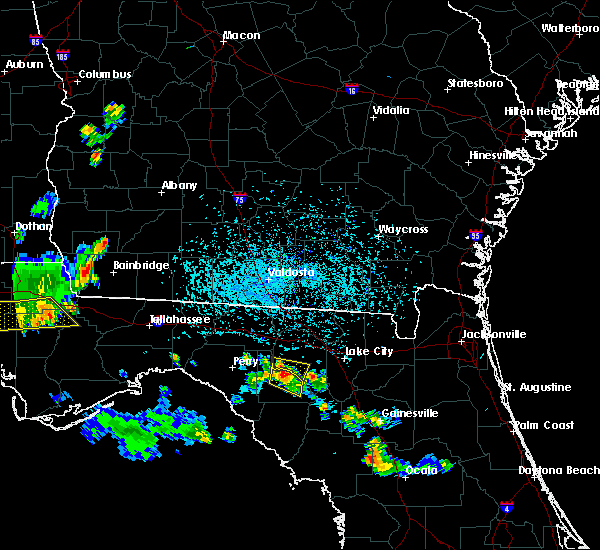 At 518 pm edt, a severe thunderstorm was located over mayo, moving southeast at 15 mph (radar indicated). Hazards include 60 mph wind gusts and quarter size hail. Hail damage to vehicles is expected. Expect wind damage to roofs, siding, and trees. At 518 pm edt, a severe thunderstorm was located over mayo, moving southeast at 15 mph (radar indicated). Hazards include 60 mph wind gusts and quarter size hail. Hail damage to vehicles is expected. Expect wind damage to roofs, siding, and trees.
|
| 6/2/2018 4:21 PM EDT |
 At 421 pm edt, a severe thunderstorm was located over perry, moving southeast at 35 mph (radar indicated). Hazards include 60 mph wind gusts. expect damage to roofs, siding, and trees At 421 pm edt, a severe thunderstorm was located over perry, moving southeast at 35 mph (radar indicated). Hazards include 60 mph wind gusts. expect damage to roofs, siding, and trees
|
| 4/15/2018 10:58 AM EDT |
 The national weather service in tallahassee has issued a * severe thunderstorm warning for. southern lafayette county in big bend of florida. dixie county in big bend of florida. until 1145 am edt. At 1058 am edt, severe thunderstorms were located along a line. The national weather service in tallahassee has issued a * severe thunderstorm warning for. southern lafayette county in big bend of florida. dixie county in big bend of florida. until 1145 am edt. At 1058 am edt, severe thunderstorms were located along a line.
|
| 4/15/2018 10:11 AM EDT |
 At 1011 am edt, severe thunderstorms were located along a line extending from near enigma to near blue springs, moving east at 30 mph (radar indicated). Hazards include 60 mph wind gusts. expect damage to roofs, siding, and trees At 1011 am edt, severe thunderstorms were located along a line extending from near enigma to near blue springs, moving east at 30 mph (radar indicated). Hazards include 60 mph wind gusts. expect damage to roofs, siding, and trees
|
| 4/7/2018 3:35 PM EDT |
 At 334 pm edt, a severe thunderstorm was located 9 miles north of steinhatchee, moving east at 35 mph (radar indicated). Hazards include 60 mph wind gusts. expect damage to roofs, siding, and trees At 334 pm edt, a severe thunderstorm was located 9 miles north of steinhatchee, moving east at 35 mph (radar indicated). Hazards include 60 mph wind gusts. expect damage to roofs, siding, and trees
|
| 3/19/2018 5:27 AM EDT |
 At 527 am edt, a severe thunderstorm was located 9 miles southeast of perry, moving southeast at 55 mph (radar indicated). Hazards include 60 mph wind gusts. expect damage to roofs, siding, and trees At 527 am edt, a severe thunderstorm was located 9 miles southeast of perry, moving southeast at 55 mph (radar indicated). Hazards include 60 mph wind gusts. expect damage to roofs, siding, and trees
|
| 7/13/2017 3:40 PM EDT | Public works reported a tree down across 180th stree in suwannee county FL, 4.8 miles S of Mayo, FL |
| 7/5/2017 5:05 PM EDT |
 The severe thunderstorm warning for lafayette county will expire at 515 pm edt, the storm which prompted the warning has weakened below severe limits, and no longer poses an immediate threat to life or property. therefore the warning will be allowed to expire. to report severe weather, contact your nearest law enforcement agency. they will relay your report to the national weather service tallahassee. The severe thunderstorm warning for lafayette county will expire at 515 pm edt, the storm which prompted the warning has weakened below severe limits, and no longer poses an immediate threat to life or property. therefore the warning will be allowed to expire. to report severe weather, contact your nearest law enforcement agency. they will relay your report to the national weather service tallahassee.
|
| 7/5/2017 5:00 PM EDT | County dispatch reported a couple trees and power lines down along hwy 5 in lafayette county FL, 8.9 miles SE of Mayo, FL |
| 7/5/2017 4:43 PM EDT |
 At 442 pm edt, a severe thunderstorm was located near luraville, or near mayo, moving north at 15 mph (radar indicated). Hazards include 60 mph wind gusts. Expect damage to roofs, siding, and trees. Locations impacted include, mayo, townsend, buckville, san pedro junction, day, alton and mayo junction. At 442 pm edt, a severe thunderstorm was located near luraville, or near mayo, moving north at 15 mph (radar indicated). Hazards include 60 mph wind gusts. Expect damage to roofs, siding, and trees. Locations impacted include, mayo, townsend, buckville, san pedro junction, day, alton and mayo junction.
|
| 7/5/2017 4:30 PM EDT |
 At 430 pm edt, a severe thunderstorm was located over mayo, moving north at 10 mph (radar indicated). Hazards include 60 mph wind gusts and quarter size hail. Hail damage to vehicles is expected. Expect wind damage to roofs, siding, and trees. At 430 pm edt, a severe thunderstorm was located over mayo, moving north at 10 mph (radar indicated). Hazards include 60 mph wind gusts and quarter size hail. Hail damage to vehicles is expected. Expect wind damage to roofs, siding, and trees.
|
| 5/24/2017 10:56 AM EDT |
 At 1056 am edt, a severe thunderstorm was located 8 miles southwest of mayo, moving northeast at 40 mph (radar indicated). Hazards include 60 mph wind gusts. Expect damage to roofs, siding, and trees. locations impacted include, mayo, townsend, buckville, day and alton. A tornado watch remains in effect until 300 pm edt for big bend of florida. At 1056 am edt, a severe thunderstorm was located 8 miles southwest of mayo, moving northeast at 40 mph (radar indicated). Hazards include 60 mph wind gusts. Expect damage to roofs, siding, and trees. locations impacted include, mayo, townsend, buckville, day and alton. A tornado watch remains in effect until 300 pm edt for big bend of florida.
|
| 5/24/2017 10:54 AM EDT | Fallen trees or limbs resulted in a power outage on the southeast side of may in lafayette county FL, 0.2 miles WNW of Mayo, FL |
| 5/24/2017 10:36 AM EDT |
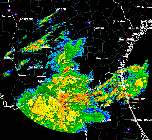 At 1036 am edt, a severe thunderstorm was located 11 miles north of steinhatchee, moving northeast at 40 mph (radar indicated). Hazards include 60 mph wind gusts. expect damage to roofs, siding, and trees At 1036 am edt, a severe thunderstorm was located 11 miles north of steinhatchee, moving northeast at 40 mph (radar indicated). Hazards include 60 mph wind gusts. expect damage to roofs, siding, and trees
|
| 5/4/2017 4:30 PM EDT |
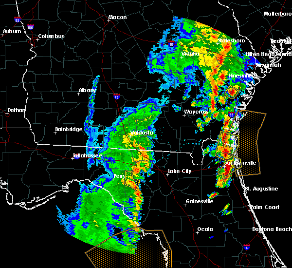 At 429 pm edt, a severe thunderstorm was located over mayo, moving northeast at 55 mph (radar indicated). Hazards include 60 mph wind gusts. Expect damage to roofs, siding, and trees. Locations impacted include, mayo, townsend, chancey, buckville, san pedro junction, day, alton and mayo junction. At 429 pm edt, a severe thunderstorm was located over mayo, moving northeast at 55 mph (radar indicated). Hazards include 60 mph wind gusts. Expect damage to roofs, siding, and trees. Locations impacted include, mayo, townsend, chancey, buckville, san pedro junction, day, alton and mayo junction.
|
| 5/4/2017 4:23 PM EDT |
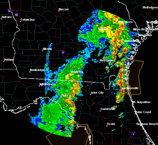 At 422 pm edt, a severe thunderstorm was located about 5 miles southwest of mayo, moving northeast at 55 mph (radar indicated). Hazards include 60 mph wind gusts. Expect damage to roofs, siding, and trees. Locations impacted include, mayo, townsend, cooks hammock, chancey, smith, buckville, san pedro junction, day, alton and mayo junction. At 422 pm edt, a severe thunderstorm was located about 5 miles southwest of mayo, moving northeast at 55 mph (radar indicated). Hazards include 60 mph wind gusts. Expect damage to roofs, siding, and trees. Locations impacted include, mayo, townsend, cooks hammock, chancey, smith, buckville, san pedro junction, day, alton and mayo junction.
|
| 5/4/2017 4:12 PM EDT |
 At 412 pm edt, a severe thunderstorm was located 14 miles southwest of mayo, moving northeast at 55 mph (radar indicated). Hazards include 60 mph wind gusts. expect damage to roofs, siding, and trees At 412 pm edt, a severe thunderstorm was located 14 miles southwest of mayo, moving northeast at 55 mph (radar indicated). Hazards include 60 mph wind gusts. expect damage to roofs, siding, and trees
|
| 4/4/2017 12:55 AM EDT | Tree down near highway 27 and southwest oak street in mayo in lafayette county FL, 0.4 miles E of Mayo, FL |
| 4/4/2017 12:55 AM EDT |
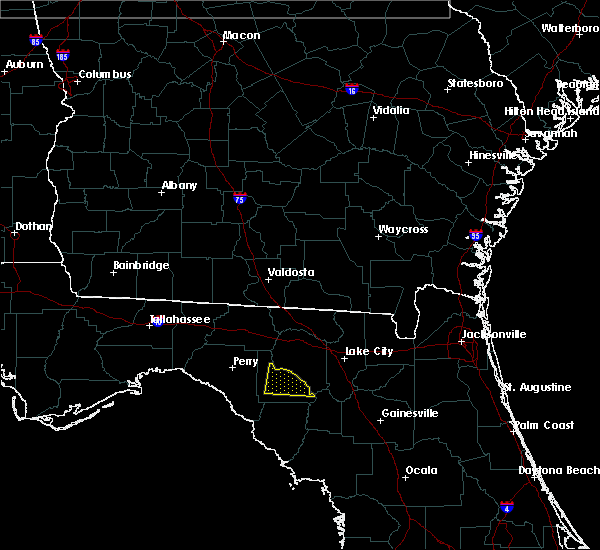 At 1255 am edt, a severe thunderstorm was located near mayo, moving east at 55 mph (radar indicated). Hazards include 60 mph wind gusts. expect damage to roofs, siding, and trees At 1255 am edt, a severe thunderstorm was located near mayo, moving east at 55 mph (radar indicated). Hazards include 60 mph wind gusts. expect damage to roofs, siding, and trees
|
| 2/7/2017 8:39 PM EST |
 At 839 pm est, a severe thunderstorm was located near mayo, moving east at 45 mph (radar indicated). Hazards include 60 mph wind gusts. Expect damage to roofs, siding, and trees. Locations impacted include, mayo, cross city, steinhatchee, horseshoe point, suwannee, horseshoe beach, old town, howell place, yellow jacket, townsend, jena, tennille, keaton beach, blue springs, jack lee island, hatch bend, salem, day, clara and fish creek. At 839 pm est, a severe thunderstorm was located near mayo, moving east at 45 mph (radar indicated). Hazards include 60 mph wind gusts. Expect damage to roofs, siding, and trees. Locations impacted include, mayo, cross city, steinhatchee, horseshoe point, suwannee, horseshoe beach, old town, howell place, yellow jacket, townsend, jena, tennille, keaton beach, blue springs, jack lee island, hatch bend, salem, day, clara and fish creek.
|
| 2/7/2017 8:27 PM EST |
 At 826 pm est, severe thunderstorms were located 11 miles southeast of perry, moving east at 45 mph (radar indicated). Hazards include 60 mph wind gusts. expect damage to roofs, siding, and trees At 826 pm est, severe thunderstorms were located 11 miles southeast of perry, moving east at 45 mph (radar indicated). Hazards include 60 mph wind gusts. expect damage to roofs, siding, and trees
|
| 2/7/2017 8:14 PM EST |
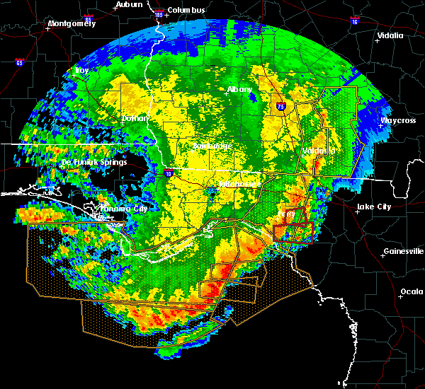 At 814 pm est, a severe thunderstorm capable of producing a tornado was located 11 miles south of perry, moving east at 45 mph (radar indicated rotation). Hazards include tornado. Flying debris will be dangerous to those caught without shelter. mobile homes will be damaged or destroyed. damage to roofs, windows, and vehicles will occur. tree damage is likely. this dangerous storm will be near, mayo around 840 pm est. Other locations impacted by this tornadic thunderstorm include san pedro junction, cooks hammock, athena, salem, pinland and carbur. At 814 pm est, a severe thunderstorm capable of producing a tornado was located 11 miles south of perry, moving east at 45 mph (radar indicated rotation). Hazards include tornado. Flying debris will be dangerous to those caught without shelter. mobile homes will be damaged or destroyed. damage to roofs, windows, and vehicles will occur. tree damage is likely. this dangerous storm will be near, mayo around 840 pm est. Other locations impacted by this tornadic thunderstorm include san pedro junction, cooks hammock, athena, salem, pinland and carbur.
|
| 9/1/2016 11:33 PM EDT |
 At 1133 pm edt, a severe thunderstorm capable of producing a tornado was located near jasper, moving north at 80 mph (radar indicated rotation). Hazards include tornado. Flying debris will be dangerous to those caught without shelter. mobile homes will be damaged or destroyed. damage to roofs, windows, and vehicles will occur. tree damage is likely. Locations impacted include, mayo, branford, san pedro junction, alton and grady. At 1133 pm edt, a severe thunderstorm capable of producing a tornado was located near jasper, moving north at 80 mph (radar indicated rotation). Hazards include tornado. Flying debris will be dangerous to those caught without shelter. mobile homes will be damaged or destroyed. damage to roofs, windows, and vehicles will occur. tree damage is likely. Locations impacted include, mayo, branford, san pedro junction, alton and grady.
|
| 9/1/2016 11:23 PM EDT |
 At 1123 pm edt, a severe thunderstorm capable of producing a tornado was located near live oak, moving north at 80 mph (radar indicated rotation). Hazards include tornado. Flying debris will be dangerous to those caught without shelter. mobile homes will be damaged or destroyed. damage to roofs, windows, and vehicles will occur. tree damage is likely. Locations impacted include, mayo, branford, alton, fletcher, san pedro junction, hines and grady. At 1123 pm edt, a severe thunderstorm capable of producing a tornado was located near live oak, moving north at 80 mph (radar indicated rotation). Hazards include tornado. Flying debris will be dangerous to those caught without shelter. mobile homes will be damaged or destroyed. damage to roofs, windows, and vehicles will occur. tree damage is likely. Locations impacted include, mayo, branford, alton, fletcher, san pedro junction, hines and grady.
|
| 9/1/2016 11:16 PM EDT |
 At 1116 pm edt, a severe thunderstorm capable of producing a tornado was located near cross city, moving north at 50 mph (radar indicated rotation). Hazards include tornado. Flying debris will be dangerous to those caught without shelter. mobile homes will be damaged or destroyed. damage to roofs, windows, and vehicles will occur. tree damage is likely. Locations impacted include, mayo, cross city, branford, alton, fletcher, cross city airport, san pedro junction, eugene, hines, shamrock and grady. At 1116 pm edt, a severe thunderstorm capable of producing a tornado was located near cross city, moving north at 50 mph (radar indicated rotation). Hazards include tornado. Flying debris will be dangerous to those caught without shelter. mobile homes will be damaged or destroyed. damage to roofs, windows, and vehicles will occur. tree damage is likely. Locations impacted include, mayo, cross city, branford, alton, fletcher, cross city airport, san pedro junction, eugene, hines, shamrock and grady.
|
| 9/1/2016 11:12 PM EDT |
 At 1112 pm edt, a severe thunderstorm capable of producing a tornado was located over cross city, moving north at 80 mph (radar indicated rotation). Hazards include tornado. Flying debris will be dangerous to those caught without shelter. mobile homes will be damaged or destroyed. damage to roofs, windows, and vehicles will occur. tree damage is likely. This tornadic thunderstorm will remain over mainly rural areas of northeastern dixie and southeastern lafayette counties, including the following locations: alton, fletcher, cross city airport, san pedro junction, eugene, hines, shamrock, grady and branford. At 1112 pm edt, a severe thunderstorm capable of producing a tornado was located over cross city, moving north at 80 mph (radar indicated rotation). Hazards include tornado. Flying debris will be dangerous to those caught without shelter. mobile homes will be damaged or destroyed. damage to roofs, windows, and vehicles will occur. tree damage is likely. This tornadic thunderstorm will remain over mainly rural areas of northeastern dixie and southeastern lafayette counties, including the following locations: alton, fletcher, cross city airport, san pedro junction, eugene, hines, shamrock, grady and branford.
|
| 9/1/2016 9:58 PM EDT |
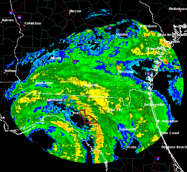 At 957 pm edt, a severe thunderstorm capable of producing a tornado was located near mayo, moving north at 40 mph (radar indicated rotation). Hazards include tornado. Flying debris will be dangerous to those caught without shelter. mobile homes will be damaged or destroyed. damage to roofs, windows, and vehicles will occur. tree damage is likely. This tornadic thunderstorm will remain over mainly rural areas of western lafayette county, including the following locations: alton, townsend, chancey, buckville, san pedro junction, day and mayo junction. At 957 pm edt, a severe thunderstorm capable of producing a tornado was located near mayo, moving north at 40 mph (radar indicated rotation). Hazards include tornado. Flying debris will be dangerous to those caught without shelter. mobile homes will be damaged or destroyed. damage to roofs, windows, and vehicles will occur. tree damage is likely. This tornadic thunderstorm will remain over mainly rural areas of western lafayette county, including the following locations: alton, townsend, chancey, buckville, san pedro junction, day and mayo junction.
|
| 9/1/2016 9:52 PM EDT |
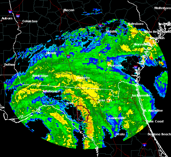 At 951 pm edt, a severe thunderstorm capable of producing a tornado was located 8 miles southwest of obrien, or 9 miles southeast of mayo, moving north at 50 mph (radar indicated rotation). Hazards include tornado. Flying debris will be dangerous to those caught without shelter. mobile homes will be damaged or destroyed. damage to roofs, windows, and vehicles will occur. tree damage is likely. this dangerous storm will be near, mayo around 1000 pm edt. Other locations impacted by this tornadic thunderstorm include alton and san pedro junction. At 951 pm edt, a severe thunderstorm capable of producing a tornado was located 8 miles southwest of obrien, or 9 miles southeast of mayo, moving north at 50 mph (radar indicated rotation). Hazards include tornado. Flying debris will be dangerous to those caught without shelter. mobile homes will be damaged or destroyed. damage to roofs, windows, and vehicles will occur. tree damage is likely. this dangerous storm will be near, mayo around 1000 pm edt. Other locations impacted by this tornadic thunderstorm include alton and san pedro junction.
|
| 9/1/2016 9:19 PM EDT |
 At 918 pm edt, a severe thunderstorm capable of producing a tornado was located near cross city, moving north at 50 mph (radar indicated rotation). Hazards include tornado. Flying debris will be dangerous to those caught without shelter. mobile homes will be damaged or destroyed. damage to roofs, windows, and vehicles will occur. tree damage is likely. this dangerous storm will be near, mayo around 1000 pm edt. Other locations impacted by this tornadic thunderstorm include fletcher springs, guaranto springs, alton, fletcher, hatch bend, san pedro junction, hines and grady. At 918 pm edt, a severe thunderstorm capable of producing a tornado was located near cross city, moving north at 50 mph (radar indicated rotation). Hazards include tornado. Flying debris will be dangerous to those caught without shelter. mobile homes will be damaged or destroyed. damage to roofs, windows, and vehicles will occur. tree damage is likely. this dangerous storm will be near, mayo around 1000 pm edt. Other locations impacted by this tornadic thunderstorm include fletcher springs, guaranto springs, alton, fletcher, hatch bend, san pedro junction, hines and grady.
|
| 9/1/2016 9:07 PM EDT |
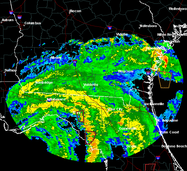 At 907 pm edt, a severe thunderstorm capable of producing a tornado was located 13 miles south of mayo, moving north at 50 mph (radar indicated rotation). Hazards include tornado. Flying debris will be dangerous to those caught without shelter. mobile homes will be damaged or destroyed. damage to roofs, windows, and vehicles will occur. tree damage is likely. this dangerous storm will be near, mayo around 925 pm edt. Other locations impacted by this tornadic thunderstorm include buckville, san pedro junction, cooks hammock, alton and townsend. At 907 pm edt, a severe thunderstorm capable of producing a tornado was located 13 miles south of mayo, moving north at 50 mph (radar indicated rotation). Hazards include tornado. Flying debris will be dangerous to those caught without shelter. mobile homes will be damaged or destroyed. damage to roofs, windows, and vehicles will occur. tree damage is likely. this dangerous storm will be near, mayo around 925 pm edt. Other locations impacted by this tornadic thunderstorm include buckville, san pedro junction, cooks hammock, alton and townsend.
|
| 8/14/2016 6:21 PM EDT |
 At 621 pm edt, a severe thunderstorm was located near mayo, moving northwest at 35 mph (radar indicated). Hazards include 60 mph wind gusts. Expect damage to roofs. siding. and trees. Locations impacted include, mayo, branford, alton, townsend, chancey, buckville, san pedro junction, cooks hammock, day, mayo junction and grady. At 621 pm edt, a severe thunderstorm was located near mayo, moving northwest at 35 mph (radar indicated). Hazards include 60 mph wind gusts. Expect damage to roofs. siding. and trees. Locations impacted include, mayo, branford, alton, townsend, chancey, buckville, san pedro junction, cooks hammock, day, mayo junction and grady.
|
| 8/14/2016 6:20 PM EDT | Tree down in lafayette county FL, 4.8 miles SE of Mayo, FL |
| 8/14/2016 6:00 PM EDT |
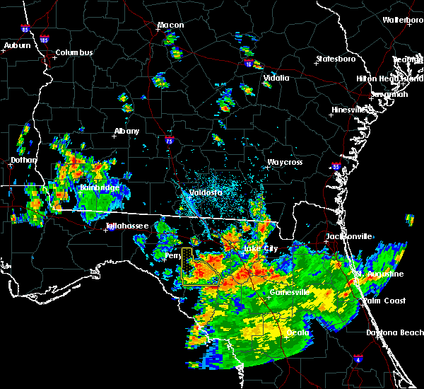 At 600 pm edt, a severe thunderstorm was located 7 miles southeast of mayo, moving northwest at 35 mph (radar indicated). Hazards include 60 mph wind gusts. Expect damage to roofs. siding. And trees. At 600 pm edt, a severe thunderstorm was located 7 miles southeast of mayo, moving northwest at 35 mph (radar indicated). Hazards include 60 mph wind gusts. Expect damage to roofs. siding. And trees.
|
| 5/20/2016 10:30 AM EDT | Fallen trees or limbs resulting in power outages along highway 27 east of mayo. reported on duke energy outage websit in lafayette county FL, 9.8 miles WNW of Mayo, FL |
| 5/20/2016 10:25 AM EDT | Downed tree resulted in a broken power pole near the airline baptist church. reported on the suwannee valley electric cooperative facebook pag in lafayette county FL, 4.4 miles W of Mayo, FL |
| 5/20/2016 10:20 AM EDT | Several trees and power lines down in lafayette count in lafayette county FL, 12.4 miles SSE of Mayo, FL |
| 5/20/2016 10:20 AM EDT | Several trees and power lines down in lafayette county. corrected location in lafayette county FL, 0.4 miles E of Mayo, FL |
| 5/20/2016 9:39 AM EDT |
 At 939 am edt, severe thunderstorms were located along a line extending from 9 miles north of perry to 19 miles west of steinhatchee, moving southeast at 25 mph (radar indicated). Hazards include 60 mph wind gusts. Expect damage to roofs. siding. And trees. At 939 am edt, severe thunderstorms were located along a line extending from 9 miles north of perry to 19 miles west of steinhatchee, moving southeast at 25 mph (radar indicated). Hazards include 60 mph wind gusts. Expect damage to roofs. siding. And trees.
|
| 3/4/2016 12:30 AM EST |
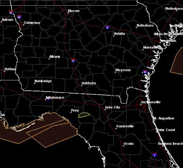 At 1230 am est, a severe thunderstorm was located near mayo, moving east at 45 mph (radar indicated). Hazards include 60 mph wind gusts. Expect damage to roofs. siding. and trees. Locations impacted include, mayo, alton and san pedro junction. At 1230 am est, a severe thunderstorm was located near mayo, moving east at 45 mph (radar indicated). Hazards include 60 mph wind gusts. Expect damage to roofs. siding. and trees. Locations impacted include, mayo, alton and san pedro junction.
|
| 3/4/2016 12:17 AM EST |
 At 1217 am est, severe thunderstorms were located along a line extending from near dowling park to 18 miles southwest of perry, moving east at 40 mph (radar indicated). Hazards include 60 mph wind gusts. Expect damage to roofs. siding. and trees. Locations impacted include, mayo, perry, smith, perry-foley airport, townsend, fenholloway, pinland, day, athena, alton, foley, chancey, buckville, san pedro junction, bucell junction and mayo junction. At 1217 am est, severe thunderstorms were located along a line extending from near dowling park to 18 miles southwest of perry, moving east at 40 mph (radar indicated). Hazards include 60 mph wind gusts. Expect damage to roofs. siding. and trees. Locations impacted include, mayo, perry, smith, perry-foley airport, townsend, fenholloway, pinland, day, athena, alton, foley, chancey, buckville, san pedro junction, bucell junction and mayo junction.
|
| 3/4/2016 12:05 AM EST |
 At 1205 am est, severe thunderstorms were located along a line extending from near suwannee river state park to 19 miles southeast of st. marks, moving southeast at 30 mph (radar indicated). Hazards include 60 mph wind gusts. Expect damage to roofs. siding. and trees. Locations impacted include, mayo, perry, hampton springs, smith, perry-foley airport, townsend, fenholloway, pinland, day, athena, alton, foley, chancey, buckville, san pedro junction, bucell junction, secotan, mayo junction and boyd. At 1205 am est, severe thunderstorms were located along a line extending from near suwannee river state park to 19 miles southeast of st. marks, moving southeast at 30 mph (radar indicated). Hazards include 60 mph wind gusts. Expect damage to roofs. siding. and trees. Locations impacted include, mayo, perry, hampton springs, smith, perry-foley airport, townsend, fenholloway, pinland, day, athena, alton, foley, chancey, buckville, san pedro junction, bucell junction, secotan, mayo junction and boyd.
|
| 3/3/2016 11:43 PM EST |
 At 1143 pm est, severe thunderstorms were located along a line extending from near blue springs to 10 miles southeast of st. marks, moving east at 55 mph (radar indicated). Hazards include 60 mph wind gusts. Expect damage to roofs. siding. And trees. At 1143 pm est, severe thunderstorms were located along a line extending from near blue springs to 10 miles southeast of st. marks, moving east at 55 mph (radar indicated). Hazards include 60 mph wind gusts. Expect damage to roofs. siding. And trees.
|
| 8/7/2015 8:42 PM EDT | Tree down on county road 412 in lafayette county FL, 6.9 miles WNW of Mayo, FL |
| 8/7/2015 8:26 PM EDT |
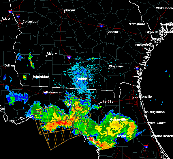 At 826 pm edt, the national weather service has detected a severe thunderstorm capable of producing damaging winds in excess of 60 mph. this storm was located near mayo, and moving southeast at 35 mph. At 826 pm edt, the national weather service has detected a severe thunderstorm capable of producing damaging winds in excess of 60 mph. this storm was located near mayo, and moving southeast at 35 mph.
|
| 8/7/2015 8:13 PM EDT |
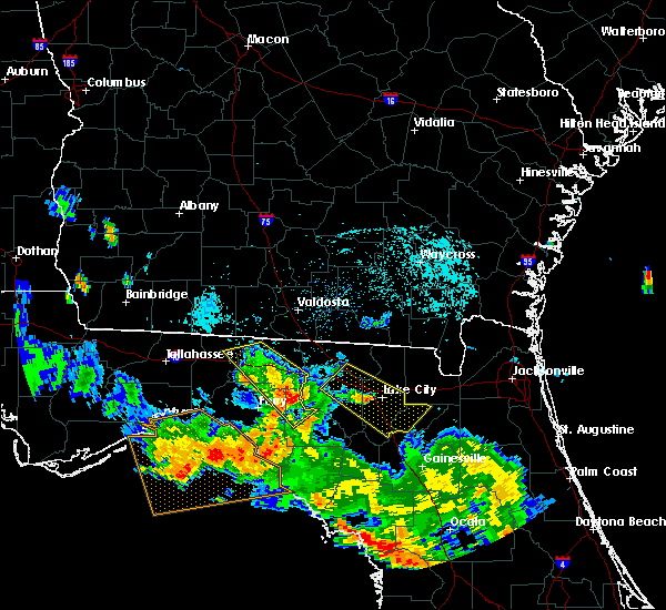 At 812 pm edt, doppler radar indicated a severe thunderstorm capable of producing damaging winds in excess of 60 mph. this storm was located near dowling park, or 14 miles southwest of suwannee river state park, moving southeast at 40 mph. locations impacted include, mayo, buckville, day, townsend, mayo junction and chancey. At 812 pm edt, doppler radar indicated a severe thunderstorm capable of producing damaging winds in excess of 60 mph. this storm was located near dowling park, or 14 miles southwest of suwannee river state park, moving southeast at 40 mph. locations impacted include, mayo, buckville, day, townsend, mayo junction and chancey.
|
| 8/7/2015 7:55 PM EDT |
 At 755 pm edt, the national weather service has detected a severe thunderstorm capable of producing damaging winds in excess of 60 mph. this storm was located 7 miles southwest of madison, and moving southeast at 40 mph. At 755 pm edt, the national weather service has detected a severe thunderstorm capable of producing damaging winds in excess of 60 mph. this storm was located 7 miles southwest of madison, and moving southeast at 40 mph.
|
| 7/19/2015 5:36 PM EDT |
 The severe thunderstorm warning for southwestern lafayette county will expire at 545 pm edt, the storm which prompted the warning has weakened below severe limits, and no longer poses an immediate threat to life or property. therefore the warning will be allowed to expire. to report severe weather, contact your nearest law enforcement agency. they will relay your report to the national weather service tallahassee. The severe thunderstorm warning for southwestern lafayette county will expire at 545 pm edt, the storm which prompted the warning has weakened below severe limits, and no longer poses an immediate threat to life or property. therefore the warning will be allowed to expire. to report severe weather, contact your nearest law enforcement agency. they will relay your report to the national weather service tallahassee.
|
| 7/19/2015 5:15 PM EDT | Powerline down on dees cour in lafayette county FL, 0.2 miles WNW of Mayo, FL |
| 7/19/2015 5:13 PM EDT |
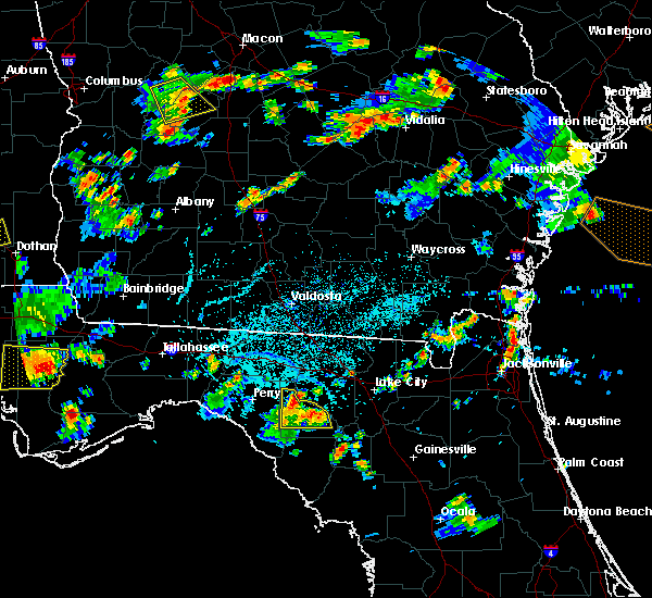 At 513 pm edt, the national weather service has detected a severe thunderstorm capable of producing damaging winds in excess of 60 mph. this storm was located over mayo. this storm was nearly stationary. At 513 pm edt, the national weather service has detected a severe thunderstorm capable of producing damaging winds in excess of 60 mph. this storm was located over mayo. this storm was nearly stationary.
|
| 7/2/2015 2:56 PM EDT |
 At 255 pm edt, doppler radar indicated a severe thunderstorm capable of producing damaging winds in excess of 60 mph. this storm was located 9 miles southeast of perry, moving east at 45 mph. locations impacted include, mayo, perry, smith, perry-foley airport, townsend, fenholloway, pinland, day, carbur, athena, foley, buckville, san pedro junction, cooks hammock, bucell junction and mayo junction. At 255 pm edt, doppler radar indicated a severe thunderstorm capable of producing damaging winds in excess of 60 mph. this storm was located 9 miles southeast of perry, moving east at 45 mph. locations impacted include, mayo, perry, smith, perry-foley airport, townsend, fenholloway, pinland, day, carbur, athena, foley, buckville, san pedro junction, cooks hammock, bucell junction and mayo junction.
|
| 7/2/2015 2:33 PM EDT |
 At 233 pm edt, the national weather service has detected a severe thunderstorm capable of producing damaging winds in excess of 60 mph. this storm was located 8 miles west of perry, and moving east at 45 mph. At 233 pm edt, the national weather service has detected a severe thunderstorm capable of producing damaging winds in excess of 60 mph. this storm was located 8 miles west of perry, and moving east at 45 mph.
|
| 6/30/2015 7:29 PM EDT |
 At 728 pm edt, doppler radar indicated a line of severe thunderstorms capable of producing damaging winds in excess of 60 mph. these storms were located along a line extending from 8 miles southwest of lake park to 14 miles southwest of mayo, moving east at 55 mph. locations impacted include, mayo, madison, lake park, branford, lee, smith, townsend, i-75 at exit 5, pinetta, hatch bend, salem, day, carbur, grady, hopewell, hanson, alton, cherry lake, chancey and buckville. At 728 pm edt, doppler radar indicated a line of severe thunderstorms capable of producing damaging winds in excess of 60 mph. these storms were located along a line extending from 8 miles southwest of lake park to 14 miles southwest of mayo, moving east at 55 mph. locations impacted include, mayo, madison, lake park, branford, lee, smith, townsend, i-75 at exit 5, pinetta, hatch bend, salem, day, carbur, grady, hopewell, hanson, alton, cherry lake, chancey and buckville.
|
| 6/30/2015 6:50 PM EDT |
 At 649 pm edt, the national weather service has detected a line of severe thunderstorms capable of producing damaging winds in excess of 60 mph. these storms were located along a line extending from near boston to 16 miles west of perry, and moving east at 60 mph. these storms have a history of producing widespread wind damage. At 649 pm edt, the national weather service has detected a line of severe thunderstorms capable of producing damaging winds in excess of 60 mph. these storms were located along a line extending from near boston to 16 miles west of perry, and moving east at 60 mph. these storms have a history of producing widespread wind damage.
|
| 6/30/2015 3:36 PM EDT |
 At 336 pm edt, the national weather service has detected a severe thunderstorm capable of producing damaging winds in excess of 60 mph. this storm was located 9 miles northeast of perry, and moving east at 25 mph. At 336 pm edt, the national weather service has detected a severe thunderstorm capable of producing damaging winds in excess of 60 mph. this storm was located 9 miles northeast of perry, and moving east at 25 mph.
|
| 4/19/2015 3:29 PM EDT | At 328 pm edt, local law enforcement reported a line of severe thunderstorms producing damaging winds in excess of 60 mph. several trees have been blown down along highway 19 in taylor county near bill howell road. these storms were located along a line extending from near suwannee river state park to 16 miles south of horseshoe point, moving east at 35 mph. locations impacted include, mayo, cross city, suwannee, old town, yellow jacket, townsend, jena, hatch bend, tennille, day, clara, shired island, jonesboro, buckville, cooks hammock, guaranto springs, cross city airport, shamrock, alton and fletcher. |
| 4/19/2015 3:23 PM EDT | Multiple trees downed around the mayo area including along county roads 351 and 354. initially reported by 911 center...also reported by the public and relayed by wctv- in lafayette county FL, 0.4 miles E of Mayo, FL |
| 4/19/2015 3:20 PM EDT | Resident reported a possible tornado. large live oak down and numerous power lines down on 209th road near county road 25 in suwannee county FL, 5.5 miles S of Mayo, FL |
| 4/19/2015 2:56 PM EDT | this alert has expired |
| 2/26/2015 12:30 AM EST | Several trees down across lafayette county in lafayette county FL, 0.4 miles E of Mayo, FL |
| 5/14/2014 5:24 PM EDT | Large tree down on south state road 51 in lafayette county FL, 12 miles NE of Mayo, FL |
| 9/20/2012 3:15 PM EDT | Public reports a large tree downed near 180th street in luraville. time of damage based on radar dat in suwannee county FL, 5 miles SSW of Mayo, FL |
| 1/1/0001 12:00 AM | Power lines down around the count in lafayette county FL, 10.5 miles NE of Mayo, FL |
| 1/1/0001 12:00 AM | 6 trees down around the county...including county road 357. time estimated by rada in lafayette county FL, 13.1 miles NNE of Mayo, FL |
| 1/1/0001 12:00 AM | Law enforcement reported trees and power lines down between dowling park and luravill in suwannee county FL, 7.6 miles S of Mayo, FL |
| 1/1/0001 12:00 AM | Law enforcement reported trees and power lines down at county road 349 and 208th stree in suwannee county FL, 6.9 miles W of Mayo, FL |
| 1/1/0001 12:00 AM | Quarter sized hail reported 15.1 miles SSE of Mayo, FL, spotter reported quarter sized hail |
| 1/1/0001 12:00 AM | Trees and power lines down with power outages and debris in the road. utility company and law enforcement investigating with details to follo in lafayette county FL, 10.5 miles NE of Mayo, FL |
Hail Maps for Mayo, FL
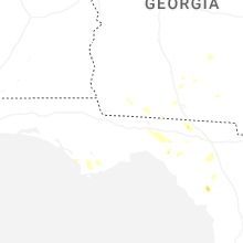
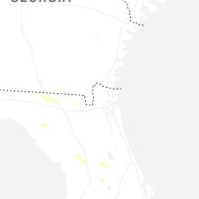


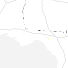


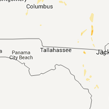


Connect with Interactive Hail Maps