

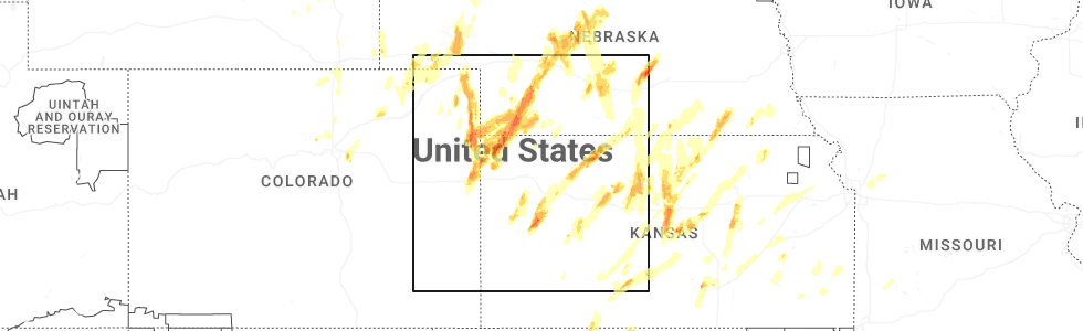
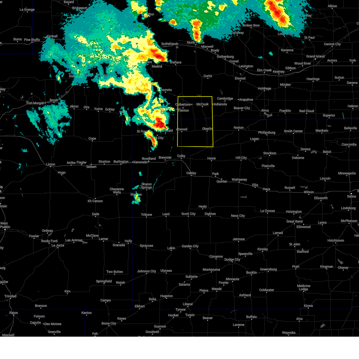
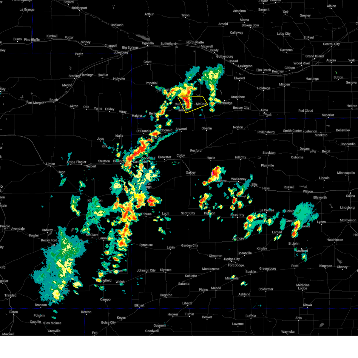
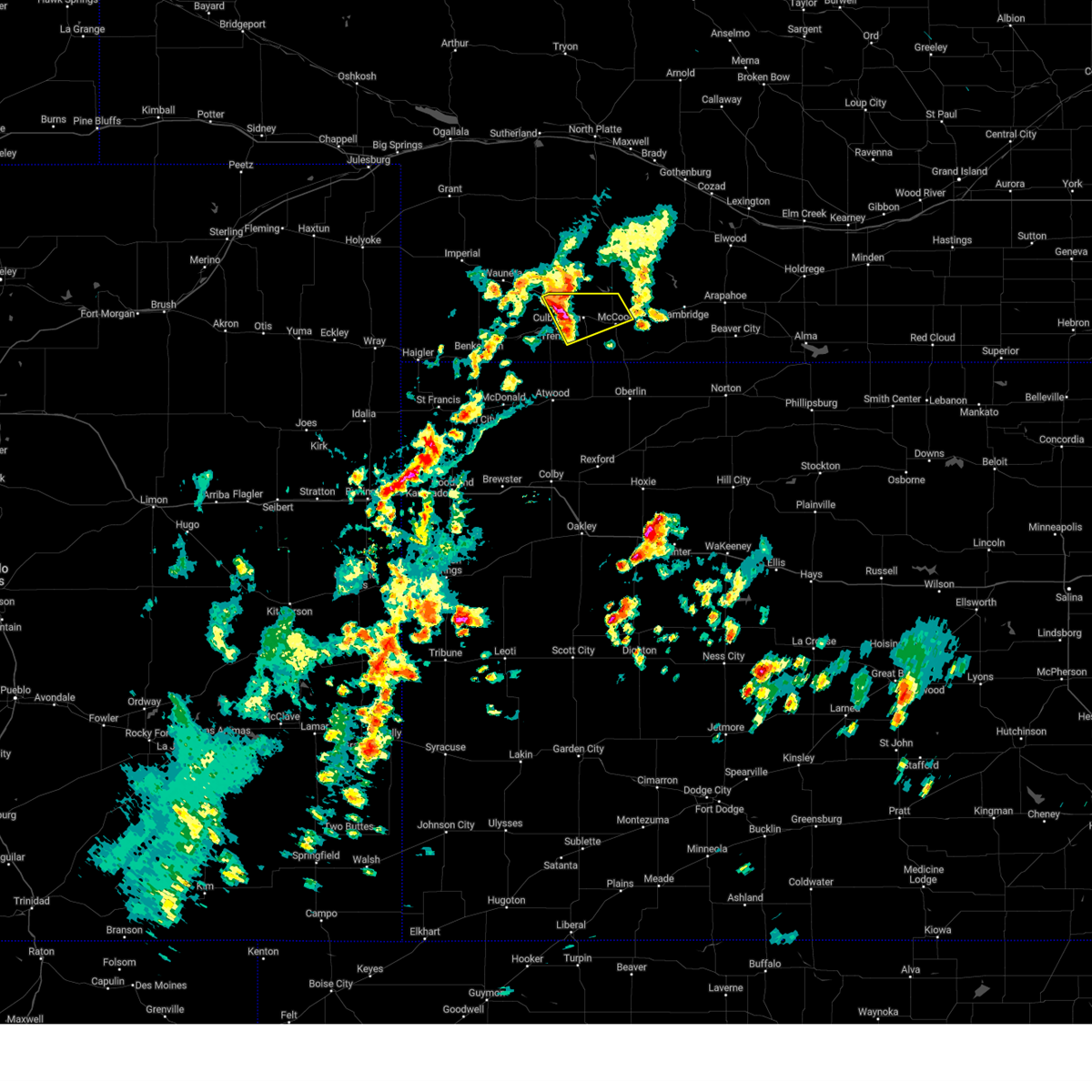
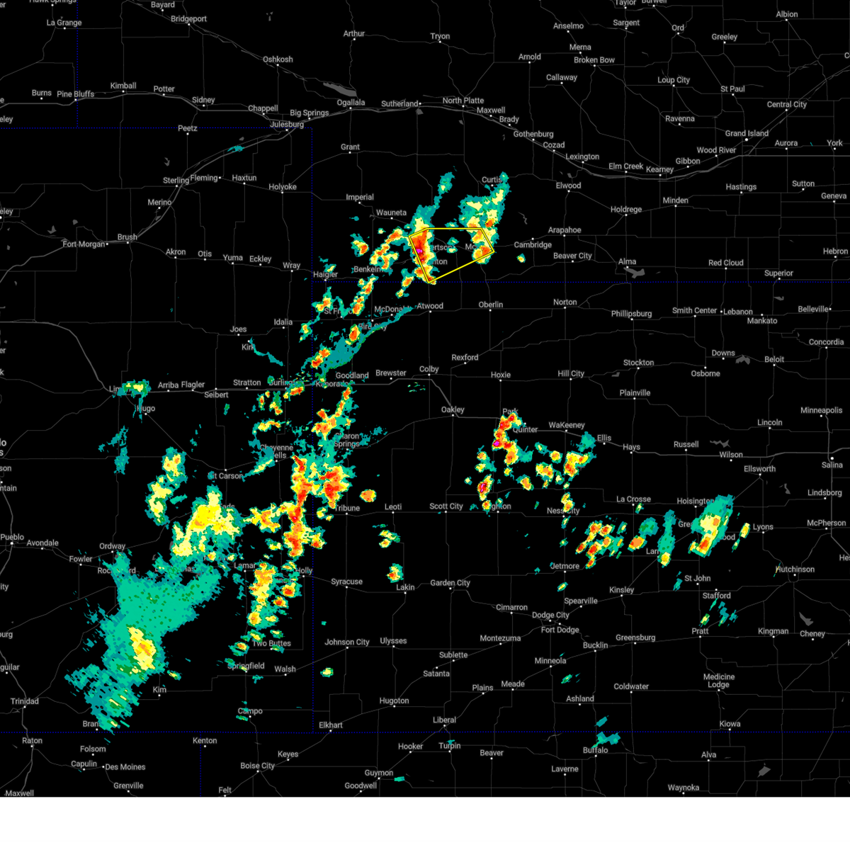
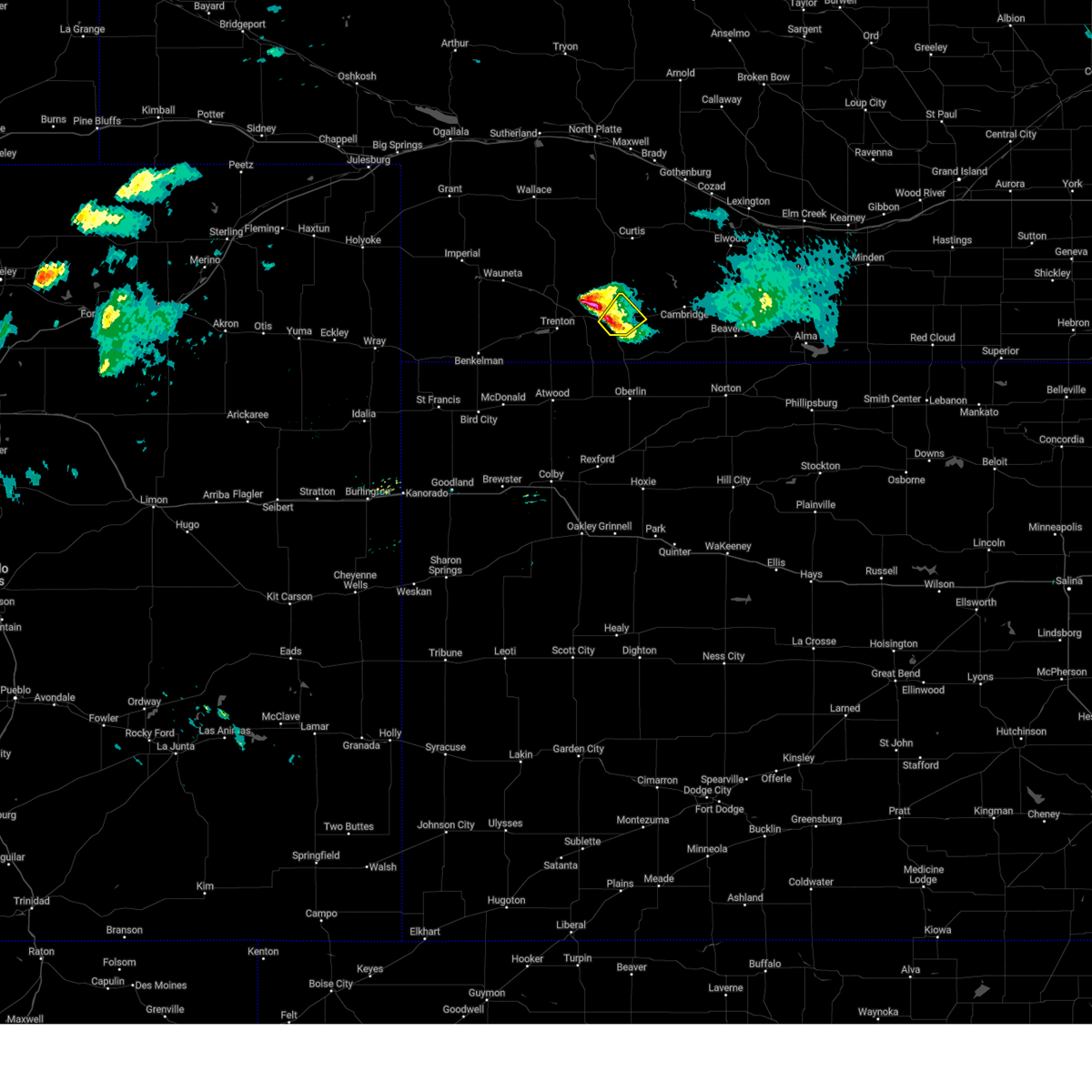
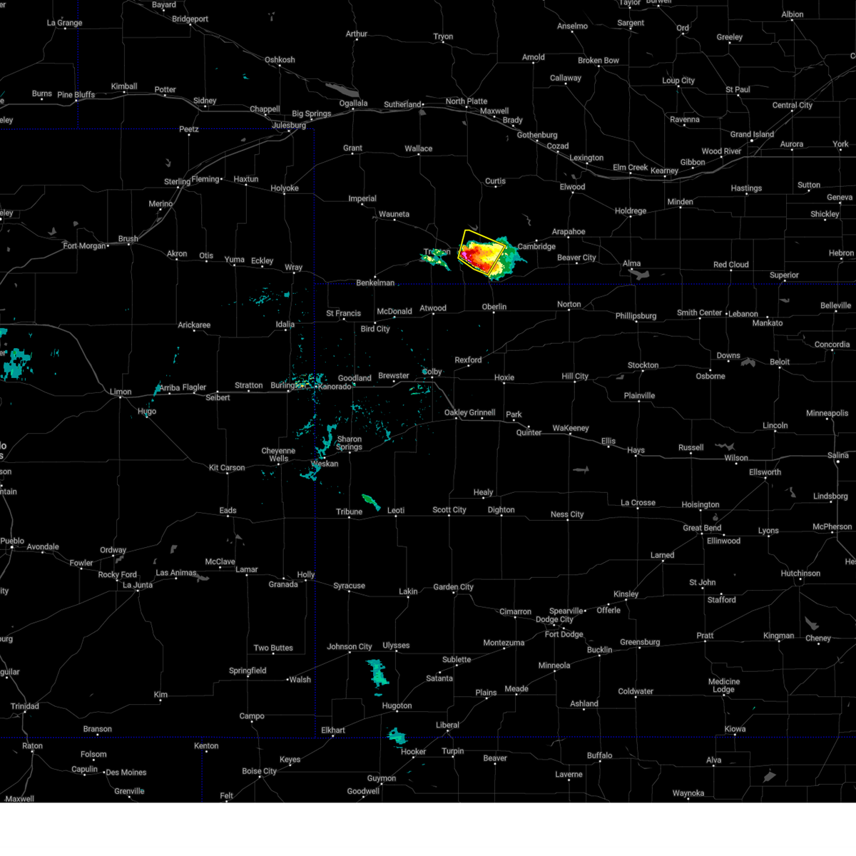
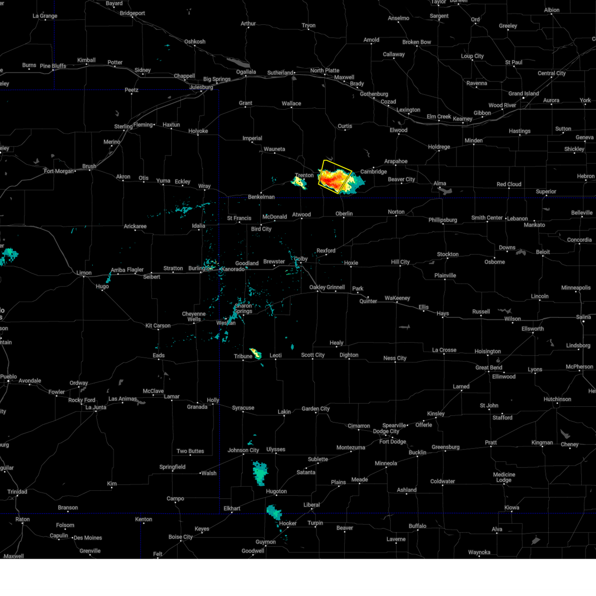
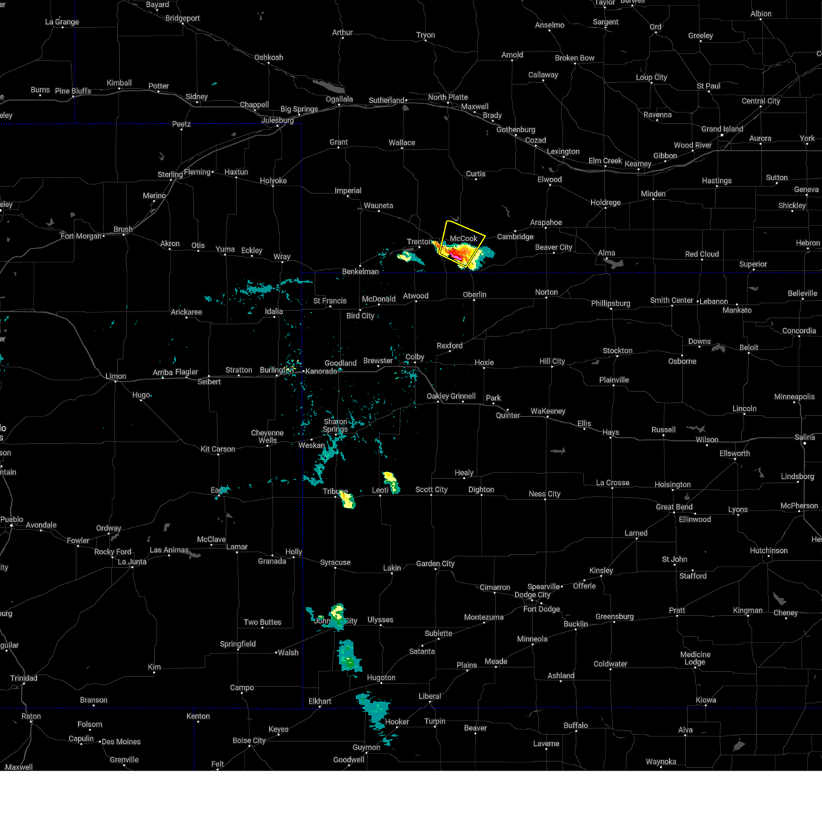
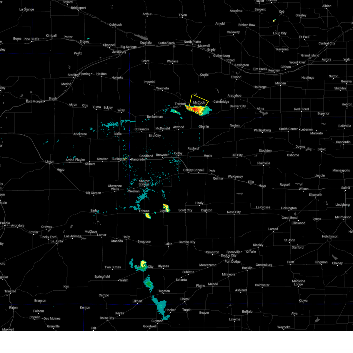
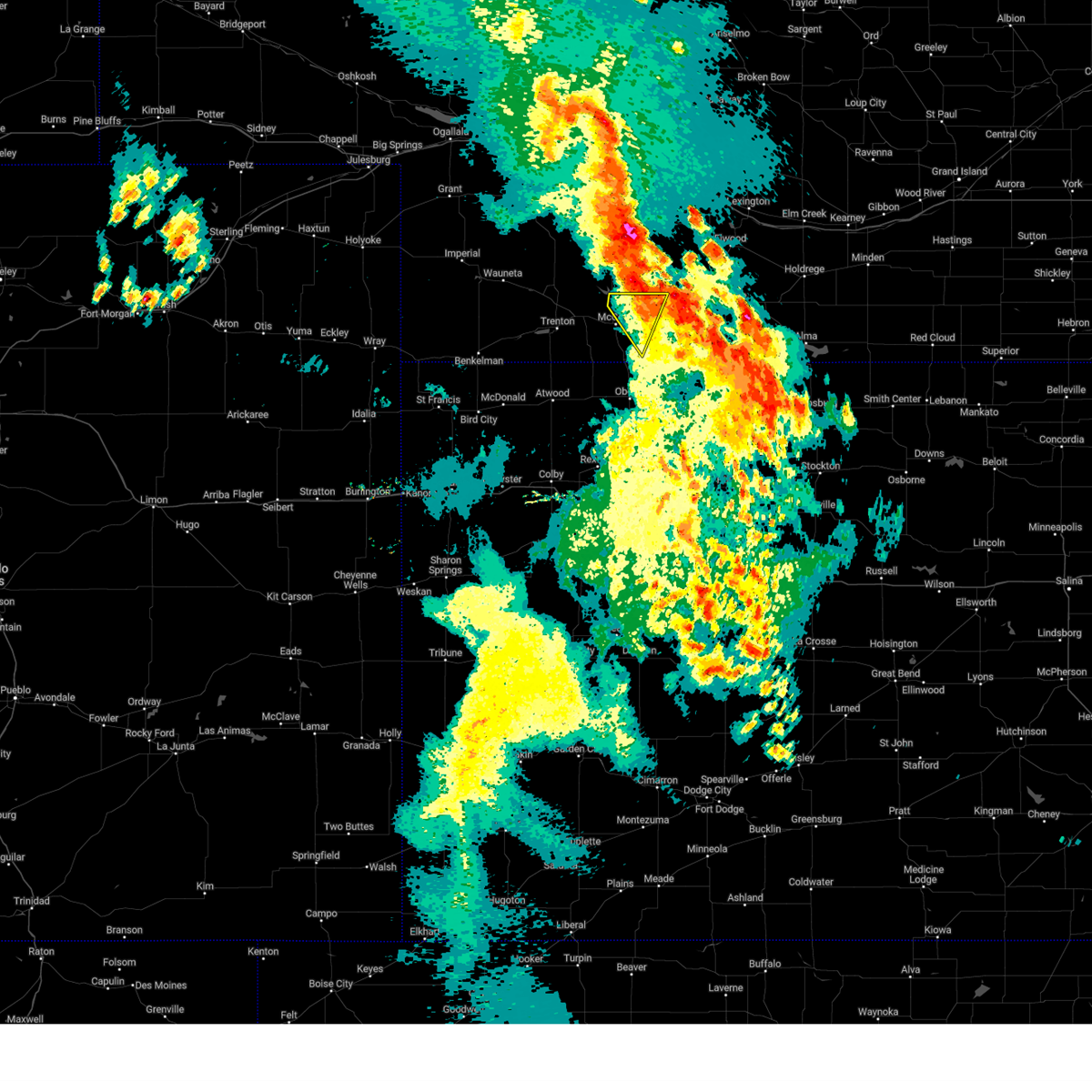
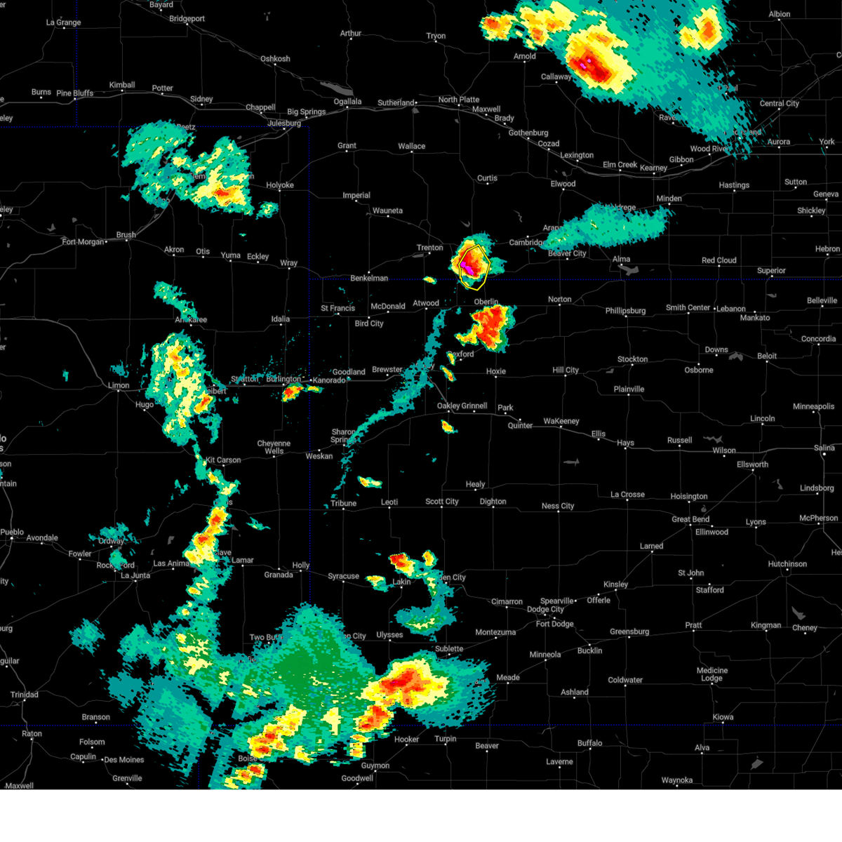
Hail Map for McCook, NE
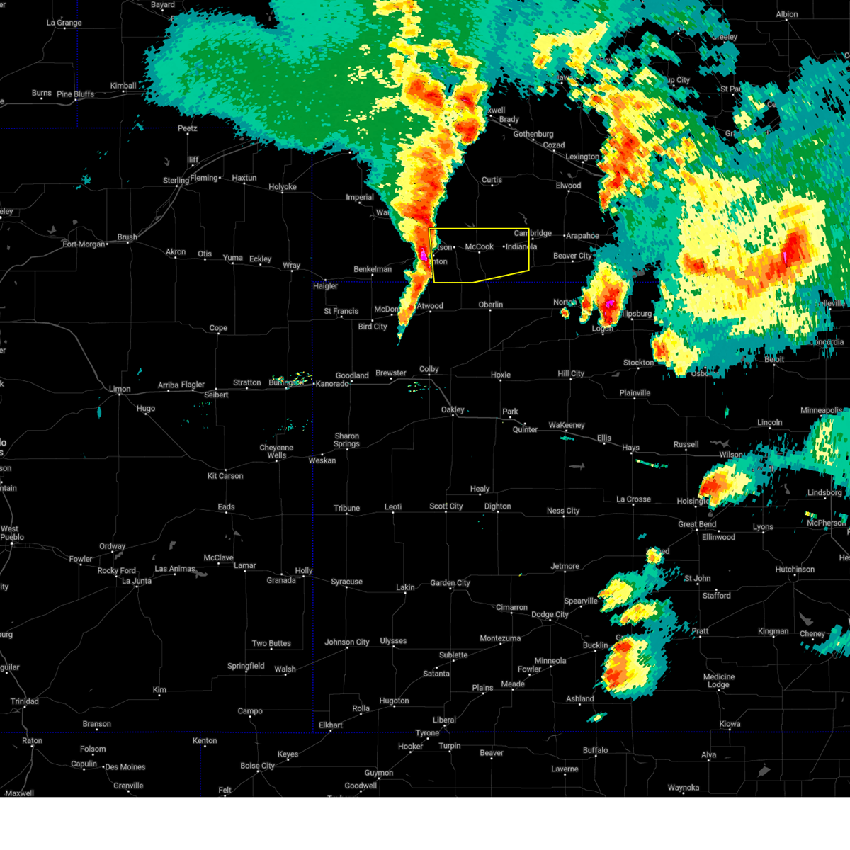
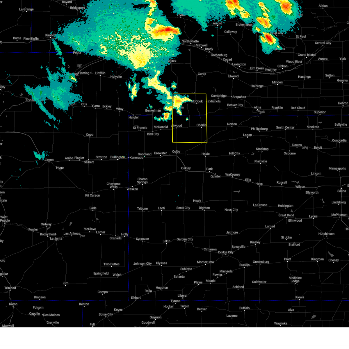
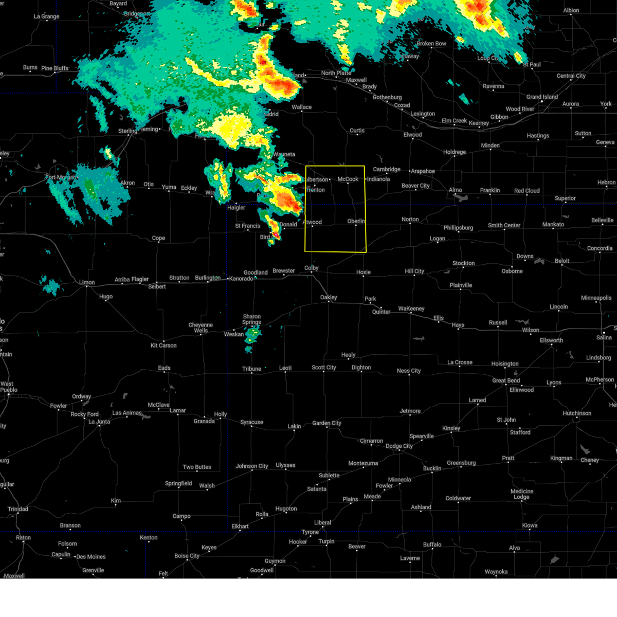
The McCook, NE area has had 66 reports of on-the-ground hail by trained spotters, and has been under severe weather warnings 29 times during the past 12 months. Doppler radar has detected hail at or near McCook, NE on 97 occasions, including 6 occasions during the past year.
| Name: | McCook, NE |
| Where Located: | 60.1 miles NNE of Colby, KS |
| Map: | Google Map for McCook, NE |
| Population: | 7698 |
| Housing Units: | 3717 |
| More Info: | Search Google for McCook, NE |
1
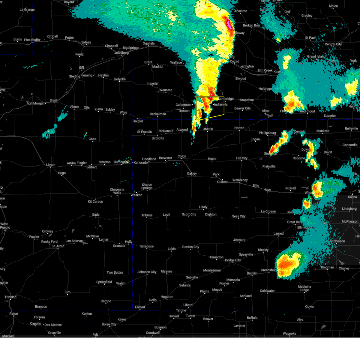
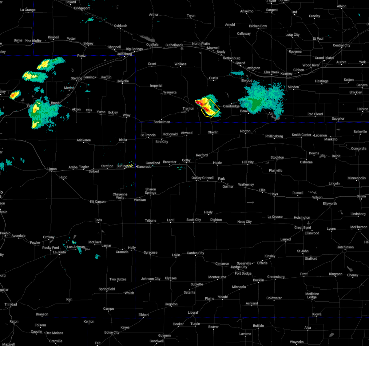
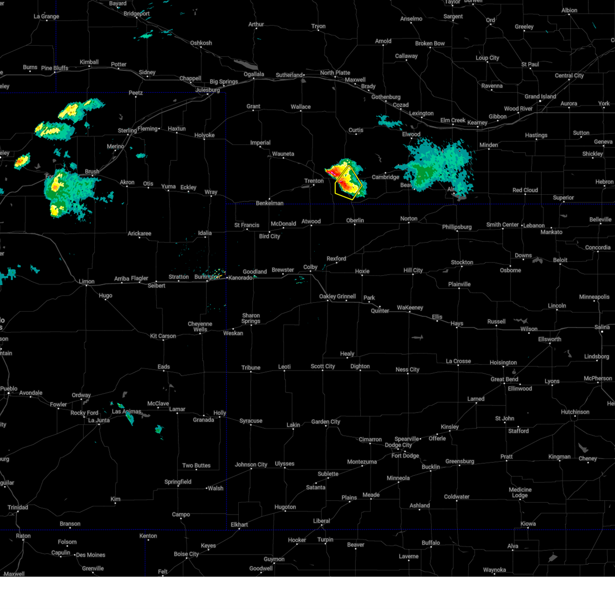
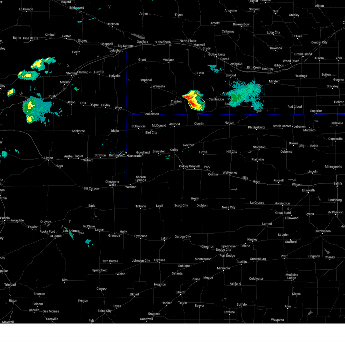
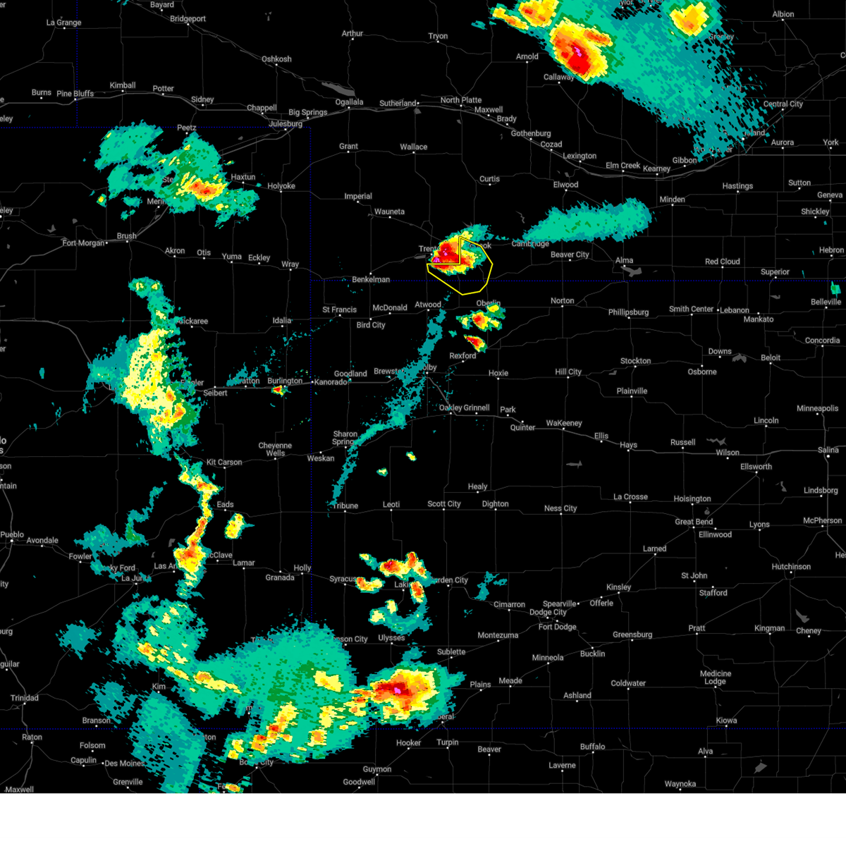
The Top Recent Hail Date for McCook, NE is Sunday, May 18, 2025 (29th out of 97)
Hail and Wind Damage Spotted near McCook, NE
| Date / Time | Report Details |
|---|---|
| 6/16/2025 10:48 PM CDT |
 Svrgld the national weather service in goodland has issued a * severe thunderstorm warning for, norton county in northwestern kansas, decatur county in northwestern kansas, red willow county in southwestern nebraska, * until 1145 pm cdt. * at 1048 pm cdt, severe thunderstorms were located along a line extending from 7 miles south of oberlin to 7 miles east of norcatur to near prairie view, moving northeast at 25 mph (radar indicated). Hazards include 60 mph wind gusts. Expect damage to roofs, siding, and trees. Severe thunderstorms will be near, norton, oberlin, almena, and norcatur around 1055 pm cdt. Svrgld the national weather service in goodland has issued a * severe thunderstorm warning for, norton county in northwestern kansas, decatur county in northwestern kansas, red willow county in southwestern nebraska, * until 1145 pm cdt. * at 1048 pm cdt, severe thunderstorms were located along a line extending from 7 miles south of oberlin to 7 miles east of norcatur to near prairie view, moving northeast at 25 mph (radar indicated). Hazards include 60 mph wind gusts. Expect damage to roofs, siding, and trees. Severe thunderstorms will be near, norton, oberlin, almena, and norcatur around 1055 pm cdt.
|
| 6/12/2025 11:43 PM CDT | Asos station kmck mccook airport measures 58 mph wind gust with storm in red willow county NE, 2.4 miles W of McCook, NE |
| 6/2/2025 9:21 PM CDT |
 The storm which prompted the warning has weakened below severe limits, and no longer poses an immediate threat to life or property. therefore, the warning will be allowed to expire. a severe thunderstorm watch remains in effect until 1000 pm cdt for northwestern kansas, and southwestern nebraska. to report severe weather, contact your nearest law enforcement agency. they will relay your report to the national weather service goodland. The storm which prompted the warning has weakened below severe limits, and no longer poses an immediate threat to life or property. therefore, the warning will be allowed to expire. a severe thunderstorm watch remains in effect until 1000 pm cdt for northwestern kansas, and southwestern nebraska. to report severe weather, contact your nearest law enforcement agency. they will relay your report to the national weather service goodland.
|
| 6/2/2025 9:03 PM CDT |
 the severe thunderstorm warning has been cancelled and is no longer in effect the severe thunderstorm warning has been cancelled and is no longer in effect
|
| 6/2/2025 9:03 PM CDT |
 At 903 pm cdt, a severe thunderstorm was located near mccook, moving northeast at 40 mph (radar indicated). Hazards include 60 mph wind gusts. Expect damage to roofs, siding, and trees. Locations impacted include, mccook, indianola, bartley, danbury, and lebanon. At 903 pm cdt, a severe thunderstorm was located near mccook, moving northeast at 40 mph (radar indicated). Hazards include 60 mph wind gusts. Expect damage to roofs, siding, and trees. Locations impacted include, mccook, indianola, bartley, danbury, and lebanon.
|
| 6/2/2025 8:57 PM CDT |
 the severe thunderstorm warning has been cancelled and is no longer in effect the severe thunderstorm warning has been cancelled and is no longer in effect
|
| 6/2/2025 8:57 PM CDT |
 At 857 pm cdt, a severe thunderstorm was located near mccook, moving northeast at 40 mph (radar indicated). Hazards include 60 mph wind gusts. Expect damage to roofs, siding, and trees. This severe thunderstorm will remain over mainly rural areas of red willow and southeastern hitchcock counties. At 857 pm cdt, a severe thunderstorm was located near mccook, moving northeast at 40 mph (radar indicated). Hazards include 60 mph wind gusts. Expect damage to roofs, siding, and trees. This severe thunderstorm will remain over mainly rural areas of red willow and southeastern hitchcock counties.
|
| 6/2/2025 8:56 PM CDT |
 the severe thunderstorm warning has been cancelled and is no longer in effect the severe thunderstorm warning has been cancelled and is no longer in effect
|
| 6/2/2025 8:56 PM CDT |
 At 856 pm cdt, a severe thunderstorm was located near mccook, moving northeast at 30 mph (radar indicated). Hazards include 60 mph wind gusts. Expect damage to roofs, siding, and trees. This severe storm will be near, mccook around 900 pm cdt. At 856 pm cdt, a severe thunderstorm was located near mccook, moving northeast at 30 mph (radar indicated). Hazards include 60 mph wind gusts. Expect damage to roofs, siding, and trees. This severe storm will be near, mccook around 900 pm cdt.
|
| 6/2/2025 8:32 PM CDT | Svrgld the national weather service in goodland has issued a * severe thunderstorm warning for, northeastern rawlins county in northwestern kansas, northwestern decatur county in northwestern kansas, red willow county in southwestern nebraska, southeastern hitchcock county in southwestern nebraska, * until 930 pm cdt. * at 832 pm cdt, a severe thunderstorm was located 10 miles southwest of mccook, moving northeast at 40 mph (radar indicated). Hazards include 60 mph wind gusts. Expect damage to roofs, siding, and trees. This severe thunderstorm will be near, mccook around 840 pm cdt. |
| 5/18/2025 10:29 PM CDT |
 the severe thunderstorm warning has been cancelled and is no longer in effect the severe thunderstorm warning has been cancelled and is no longer in effect
|
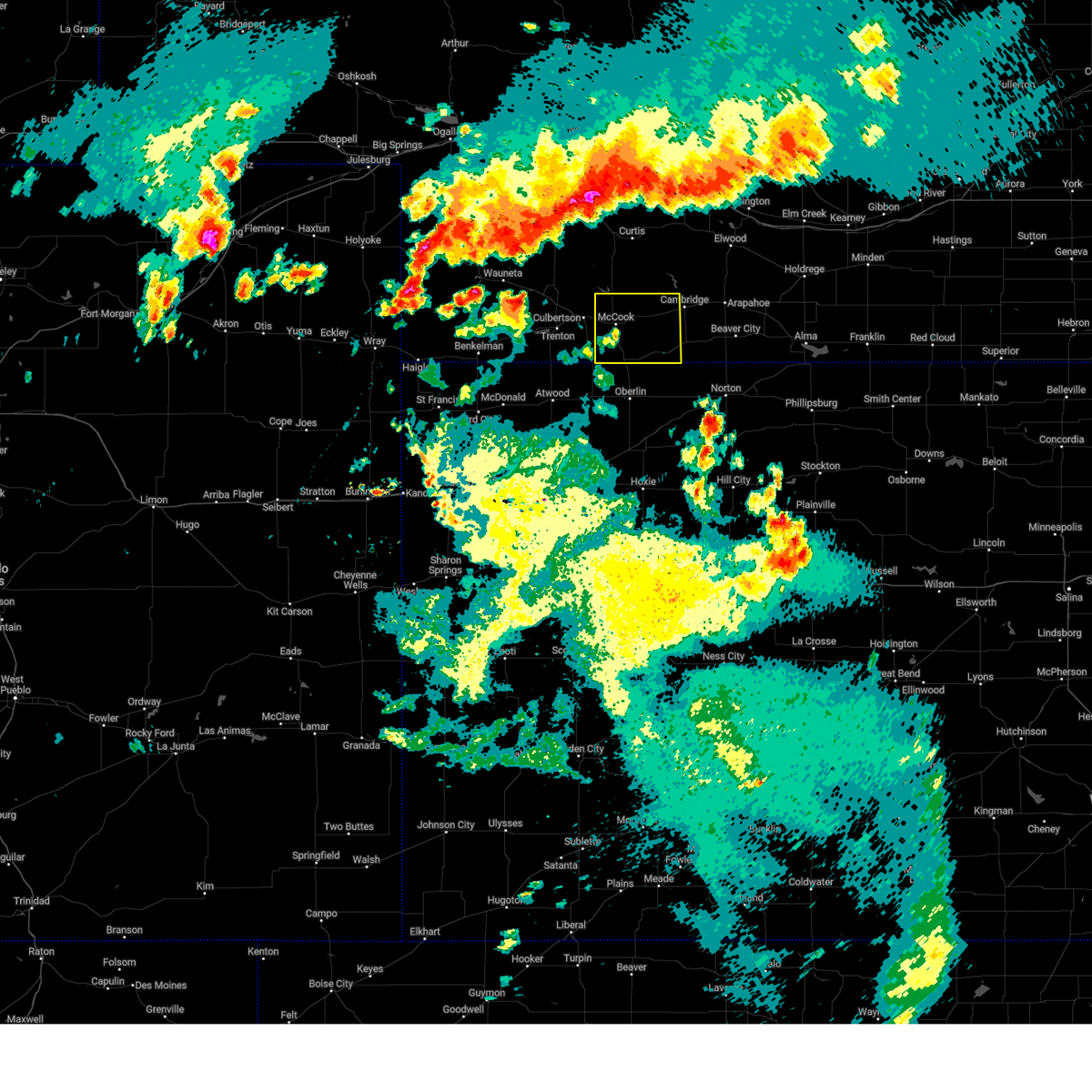
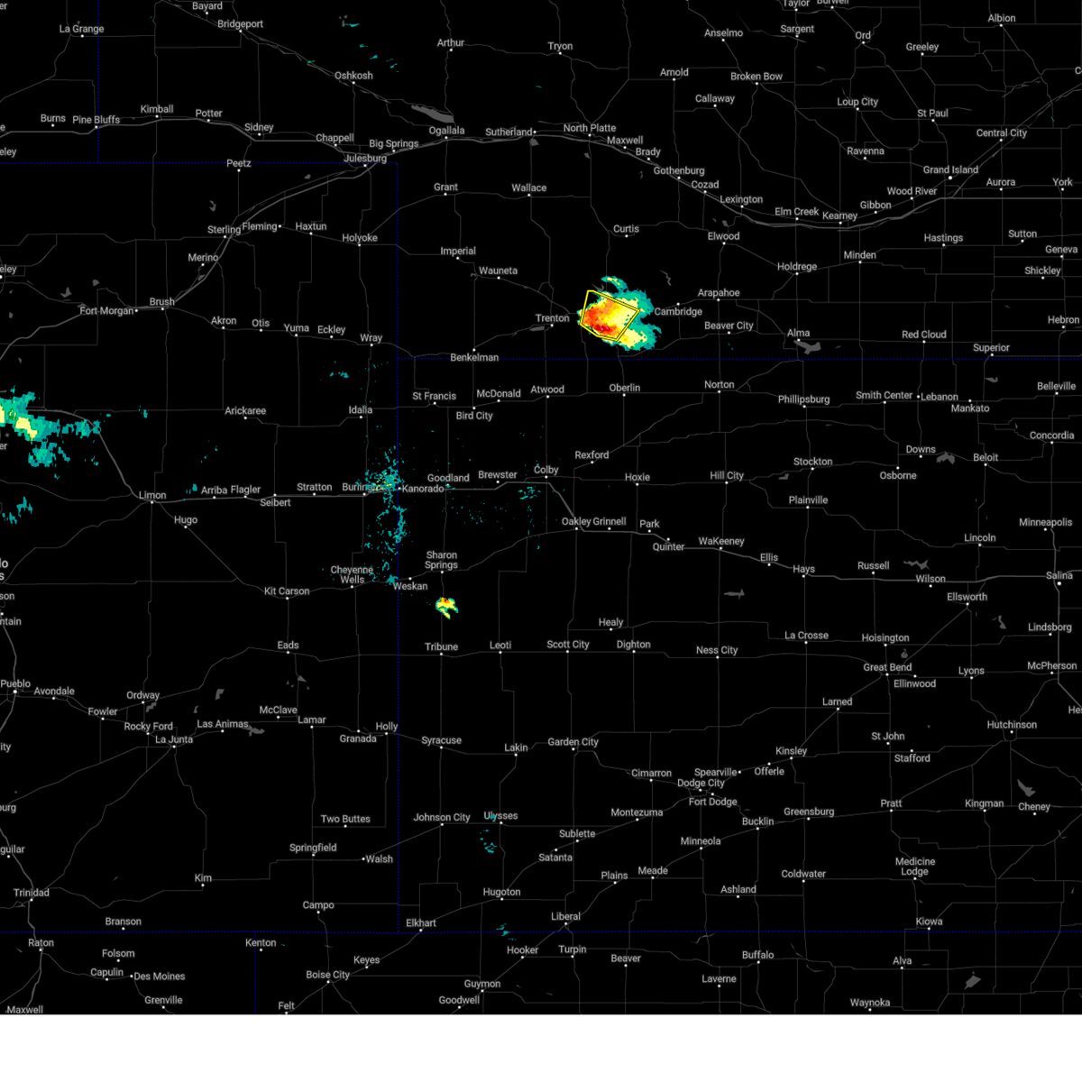
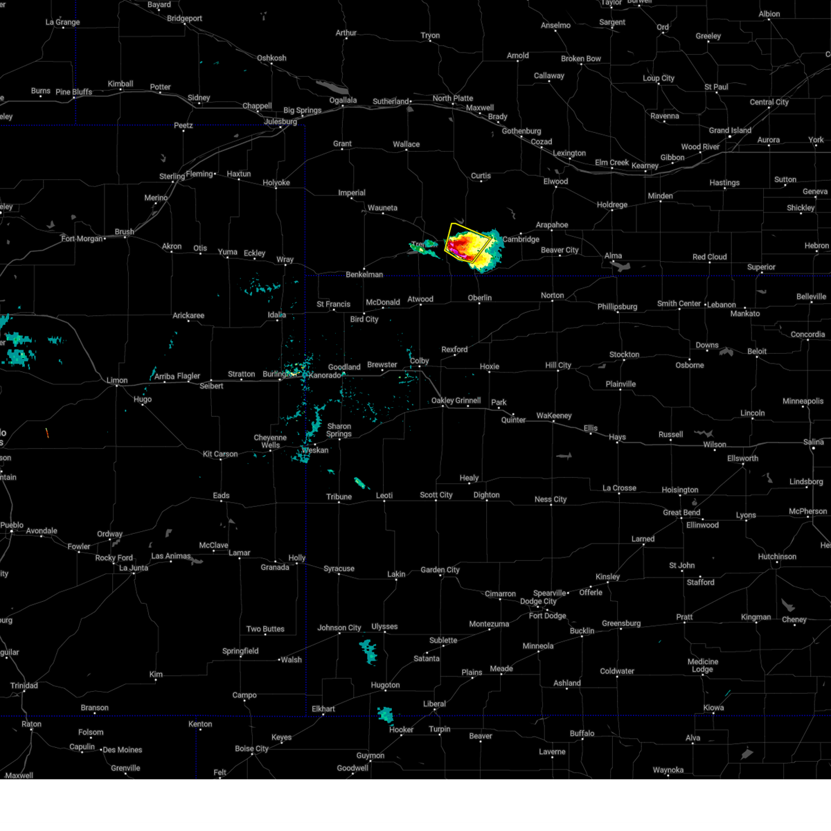
| 5/18/2025 10:08 PM CDT | At 1007 pm cdt, a severe thunderstorm was located 5 miles west of mccook, moving northeast at 25 mph (radar indicated). Hazards include 60 mph wind gusts and quarter size hail. Hail damage to vehicles is expected. expect wind damage to roofs, siding, and trees. This severe storm will be near, mccook around 1015 pm cdt. |
| 5/18/2025 10:08 PM CDT | the severe thunderstorm warning has been cancelled and is no longer in effect |
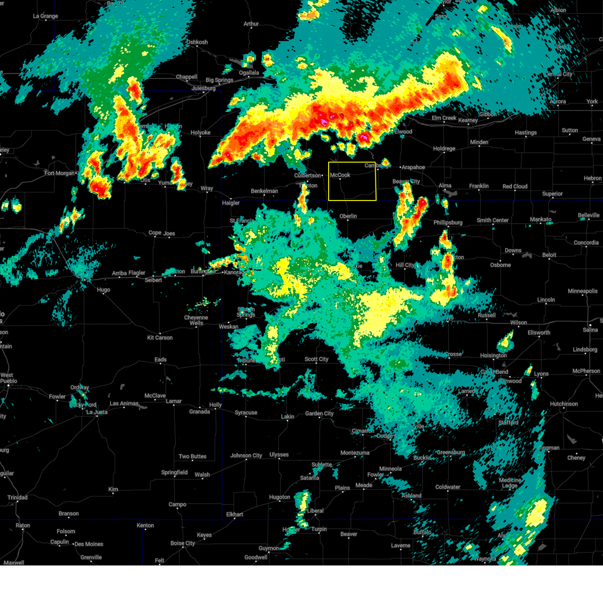
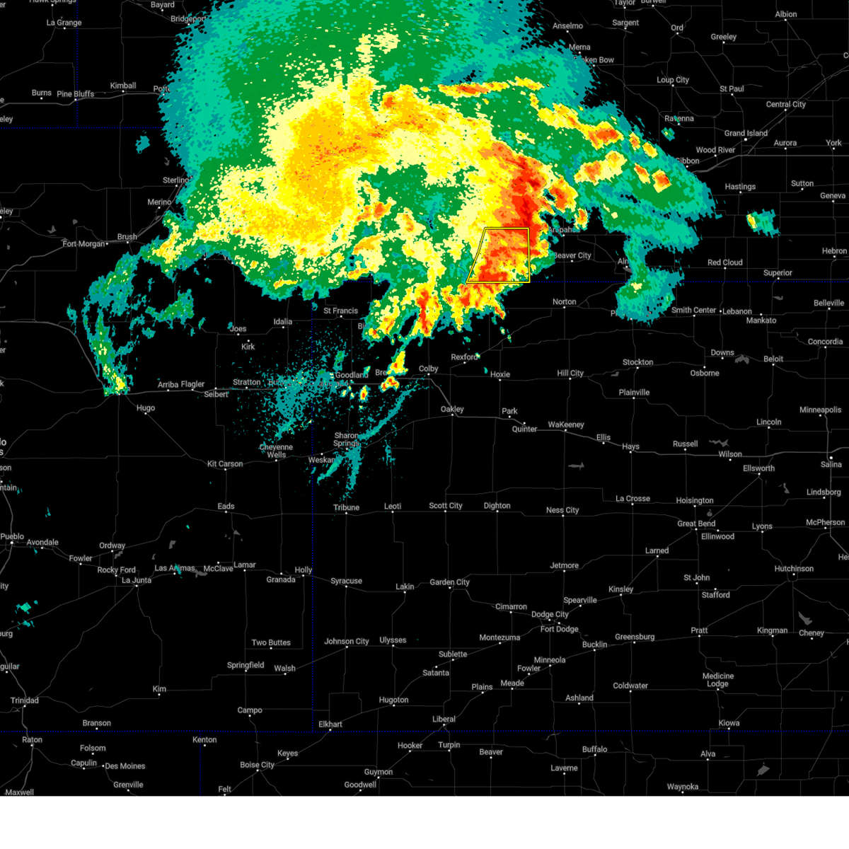
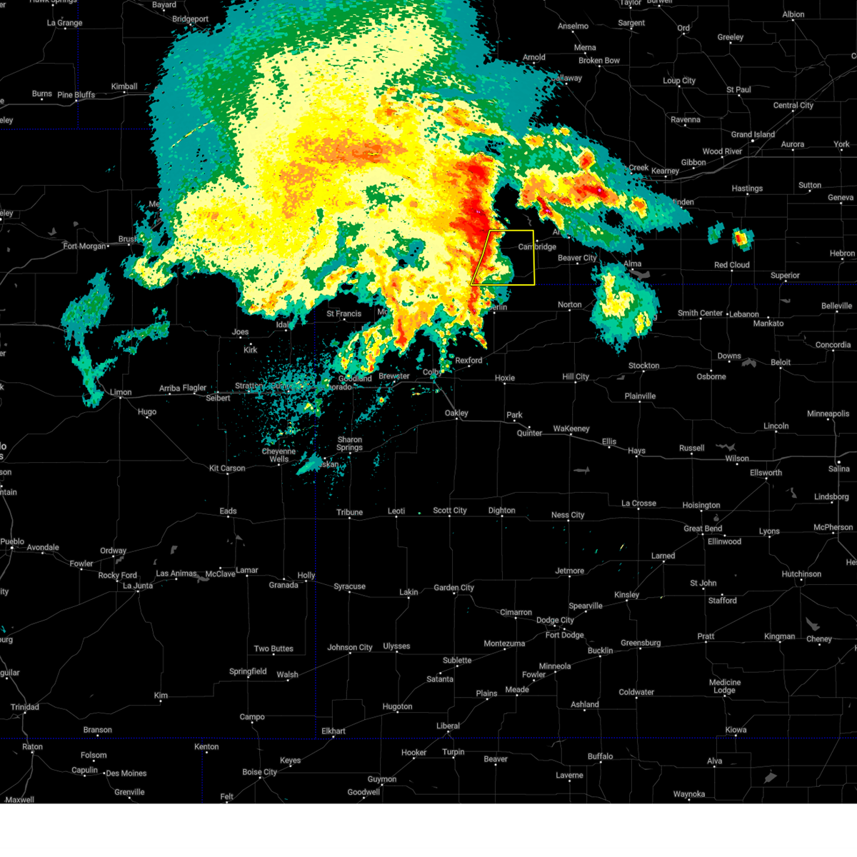
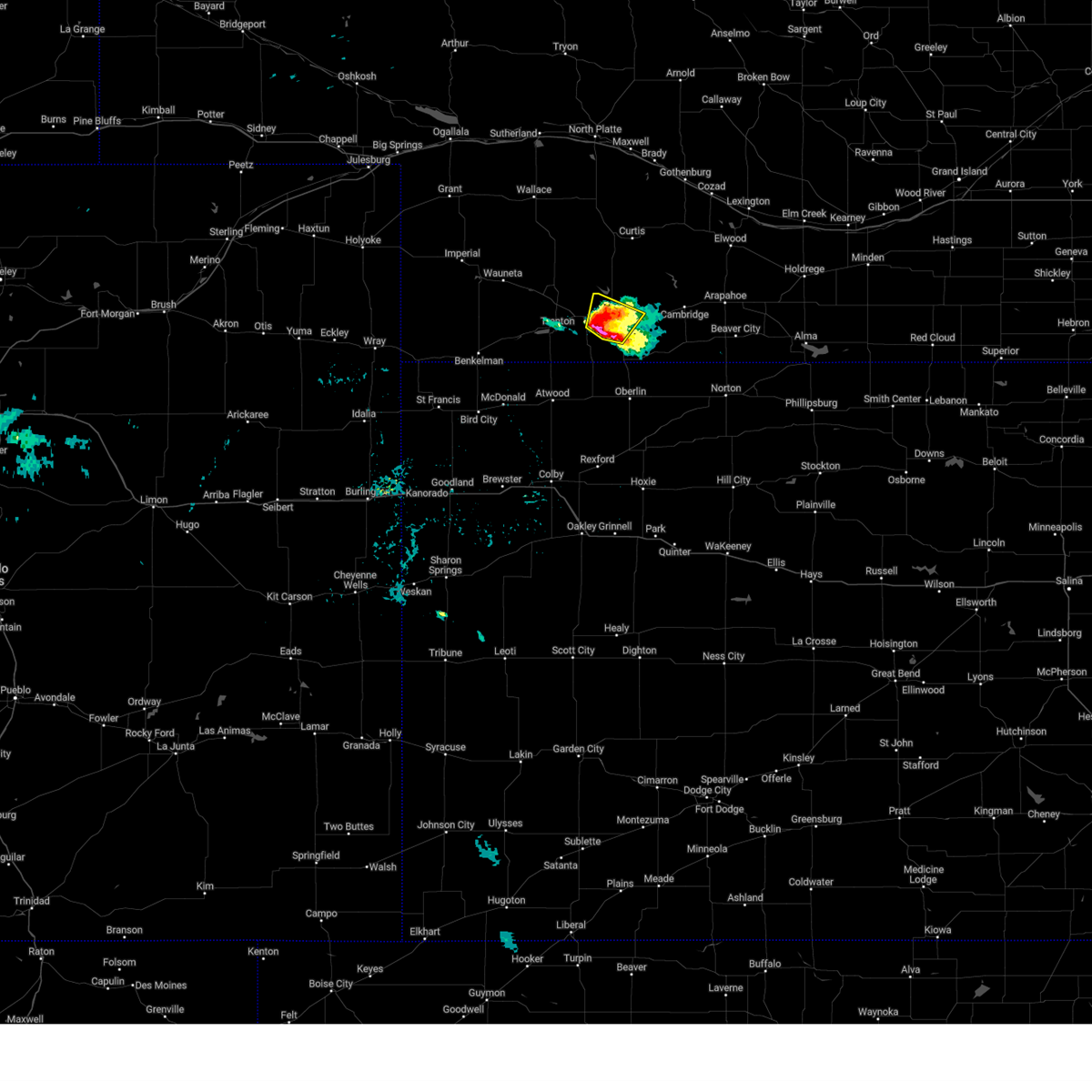
| 5/18/2025 9:58 PM CDT | At 957 pm cdt, severe thunderstorms were located along a line extending from 11 miles east of hayes center to 4 miles northeast of culbertson to 8 miles southwest of mccook, moving northeast at 30 mph (radar indicated). Hazards include 60 mph wind gusts and quarter size hail. Hail damage to vehicles is expected. expect wind damage to roofs, siding, and trees. these severe storms will be near, mccook around 1005 pm cdt. indianola around 1025 pm cdt. Bartley around 1040 pm cdt. |
| 5/18/2025 9:42 PM CDT | At 942 pm cdt, severe thunderstorms were located along a line extending from 5 miles southeast of hayes center to 3 miles west of culbertson to 9 miles southeast of trenton, moving east at 30 mph (radar indicated. accumulating dime size hail was reported in trenton). Hazards include 60 mph wind gusts and quarter size hail. Hail damage to vehicles is expected. expect wind damage to roofs, siding, and trees. these severe storms will be near, culbertson around 945 pm cdt. mccook around 1000 pm cdt. indianola around 1020 pm cdt. Bartley around 1035 pm cdt. |
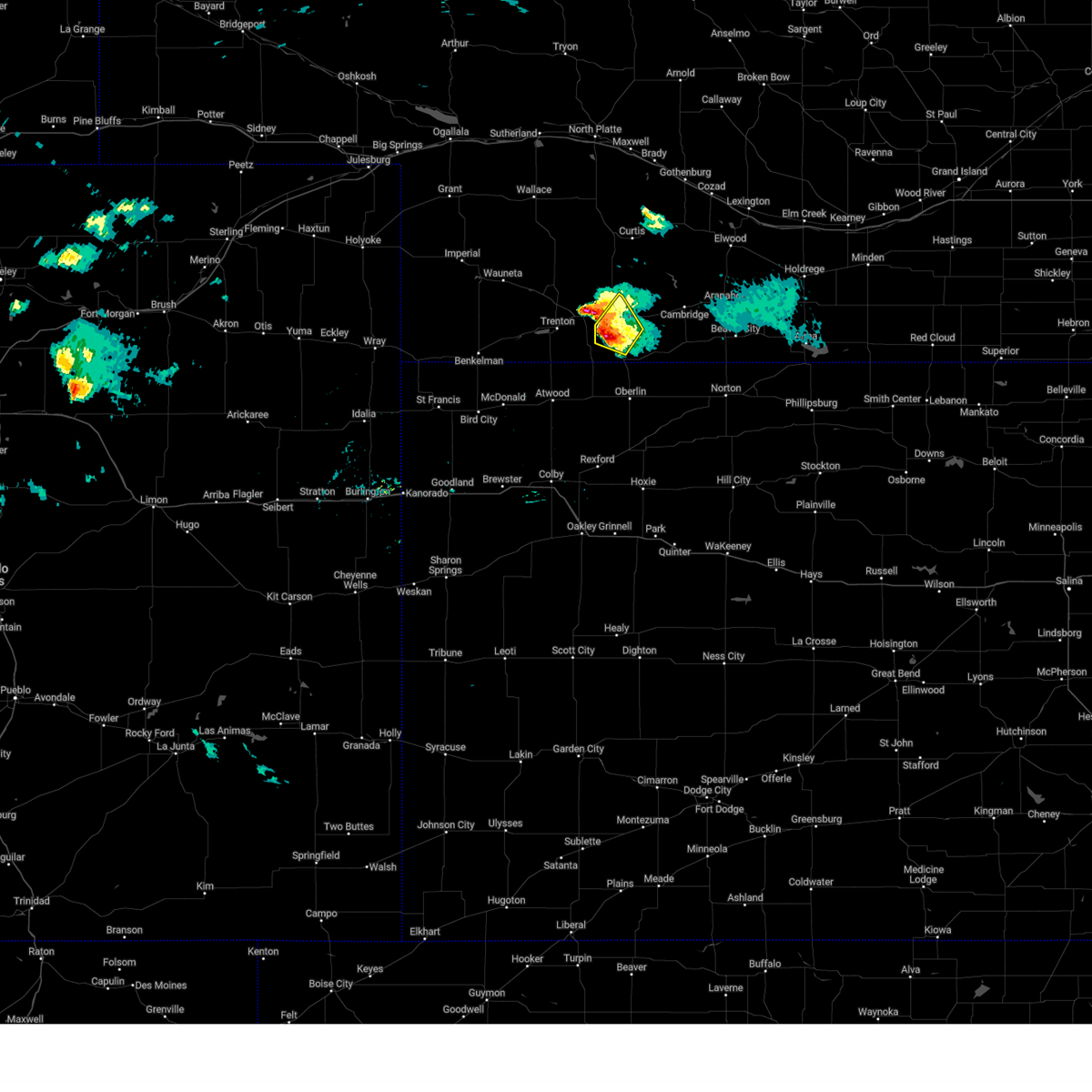
| 5/18/2025 9:22 PM CDT |
 Svrgld the national weather service in goodland has issued a * severe thunderstorm warning for, red willow county in southwestern nebraska, eastern hitchcock county in southwestern nebraska, * until 1045 pm cdt. * at 922 pm cdt, severe thunderstorms were located along a line extending from 5 miles north of palisade to near trenton to 13 miles southeast of stratton, moving northeast at 30 mph (radar indicated). Hazards include 60 mph wind gusts and quarter size hail. Hail damage to vehicles is expected. expect wind damage to roofs, siding, and trees. severe thunderstorms will be near, trenton around 930 pm cdt. culbertson around 940 pm cdt. Other locations in the path of these severe thunderstorms include mccook and indianola. Svrgld the national weather service in goodland has issued a * severe thunderstorm warning for, red willow county in southwestern nebraska, eastern hitchcock county in southwestern nebraska, * until 1045 pm cdt. * at 922 pm cdt, severe thunderstorms were located along a line extending from 5 miles north of palisade to near trenton to 13 miles southeast of stratton, moving northeast at 30 mph (radar indicated). Hazards include 60 mph wind gusts and quarter size hail. Hail damage to vehicles is expected. expect wind damage to roofs, siding, and trees. severe thunderstorms will be near, trenton around 930 pm cdt. culbertson around 940 pm cdt. Other locations in the path of these severe thunderstorms include mccook and indianola.
|
| 5/14/2025 9:27 PM CDT | Asos station kmck mccook airport. visibility down to 1/2 mile due to dus in red willow county NE, 2.4 miles W of McCook, NE |
| 5/14/2025 9:26 PM CDT |
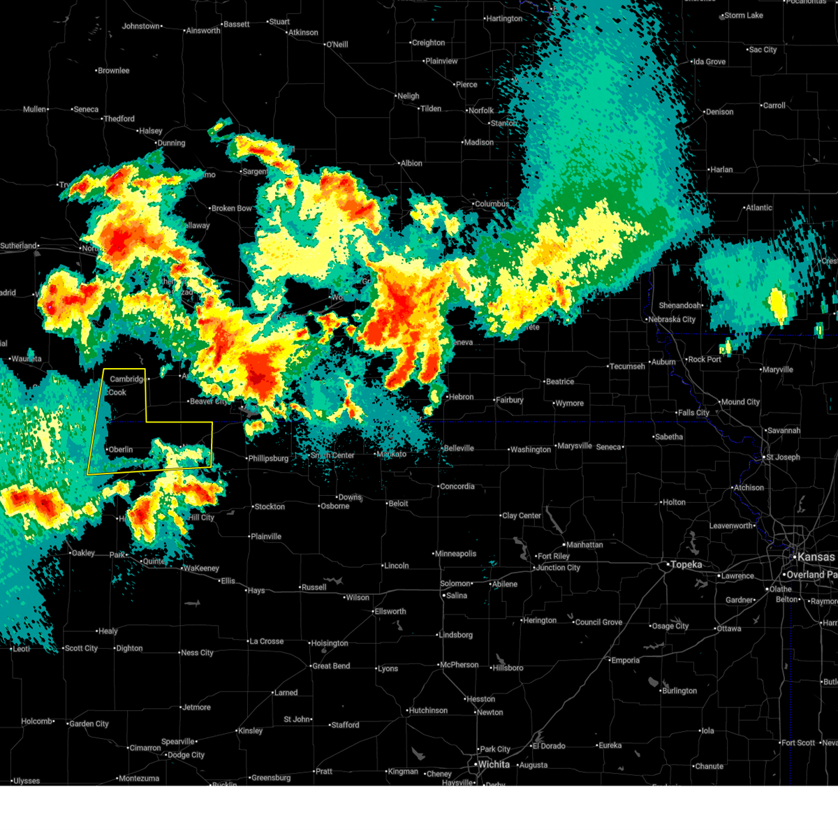
 Svrgld the national weather service in goodland has issued a * severe thunderstorm warning for, norton county in northwestern kansas, decatur county in northwestern kansas, red willow county in southwestern nebraska, * until 1030 pm cdt. * at 923 pm cdt, severe thunderstorms were located along a line extending from 5 miles northeast of mccook to near oberlin to selden, moving east at 55 mph. winds are occurring well in advance of any storms as an outflow boundary rapidly moves across the area (public). Hazards include 70 mph wind gusts. Expect considerable tree damage. damage is likely to mobile homes, roofs, and outbuildings. severe thunderstorms will be near, indianola, danbury, and dresden around 930 pm cdt. bartley, jennings, and lebanon around 935 pm cdt. norcatur and clayton around 940 pm cdt. lenora around 950 pm cdt. norton around 955 pm cdt. edmond around 1000 pm cdt. almena around 1005 pm cdt. Other locations impacted by these severe thunderstorms include leoville, new almelo, densmore, cedar bluffs, kanona, reager, and calvert. Svrgld the national weather service in goodland has issued a * severe thunderstorm warning for, norton county in northwestern kansas, decatur county in northwestern kansas, red willow county in southwestern nebraska, * until 1030 pm cdt. * at 923 pm cdt, severe thunderstorms were located along a line extending from 5 miles northeast of mccook to near oberlin to selden, moving east at 55 mph. winds are occurring well in advance of any storms as an outflow boundary rapidly moves across the area (public). Hazards include 70 mph wind gusts. Expect considerable tree damage. damage is likely to mobile homes, roofs, and outbuildings. severe thunderstorms will be near, indianola, danbury, and dresden around 930 pm cdt. bartley, jennings, and lebanon around 935 pm cdt. norcatur and clayton around 940 pm cdt. lenora around 950 pm cdt. norton around 955 pm cdt. edmond around 1000 pm cdt. almena around 1005 pm cdt. Other locations impacted by these severe thunderstorms include leoville, new almelo, densmore, cedar bluffs, kanona, reager, and calvert.
|
| 5/14/2025 9:20 PM CDT |
 At 918 pm cdt, severe thunderstorms were located along a line extending from 4 miles north of mccook to 3 miles northwest of oberlin to near selden, moving east at 55 mph (public). Hazards include 70 mph wind gusts. numerous reports of 60 to 70 mph wind gusts with rapidly advancing outflow boundary. widespread near zero visibility due to blowing dust has been observed. Expect considerable tree damage. damage is likely to mobile homes, roofs, and outbuildings. these severe storms will be near, indianola and dresden around 925 pm cdt. Other locations impacted by these severe thunderstorms include blakeman, cedar bluffs, leoville, and traer. At 918 pm cdt, severe thunderstorms were located along a line extending from 4 miles north of mccook to 3 miles northwest of oberlin to near selden, moving east at 55 mph (public). Hazards include 70 mph wind gusts. numerous reports of 60 to 70 mph wind gusts with rapidly advancing outflow boundary. widespread near zero visibility due to blowing dust has been observed. Expect considerable tree damage. damage is likely to mobile homes, roofs, and outbuildings. these severe storms will be near, indianola and dresden around 925 pm cdt. Other locations impacted by these severe thunderstorms include blakeman, cedar bluffs, leoville, and traer.
|
| 5/14/2025 9:02 PM CDT |
 At 900 pm cdt, severe thunderstorms were located along a line extending from 7 miles northwest of culbertson to 4 miles east of ludell to 9 miles north of gem, moving east at 55 mph (public). Hazards include 70 mph wind gusts and penny size hail. this storm has a history of producing widespread 60 mph wind gusts with pockets of winds approaching 70 mph. blowing dust and near zero visibilities will also accompany the winds. Expect considerable tree damage. damage is likely to mobile homes, roofs, and outbuildings. these severe storms will be near, culbertson and herndon around 905 pm cdt. mccook around 910 pm cdt. oberlin around 915 pm cdt. indianola and dresden around 925 pm cdt. Other locations impacted by these severe thunderstorms include blakeman, cedar bluffs, leoville, and traer. At 900 pm cdt, severe thunderstorms were located along a line extending from 7 miles northwest of culbertson to 4 miles east of ludell to 9 miles north of gem, moving east at 55 mph (public). Hazards include 70 mph wind gusts and penny size hail. this storm has a history of producing widespread 60 mph wind gusts with pockets of winds approaching 70 mph. blowing dust and near zero visibilities will also accompany the winds. Expect considerable tree damage. damage is likely to mobile homes, roofs, and outbuildings. these severe storms will be near, culbertson and herndon around 905 pm cdt. mccook around 910 pm cdt. oberlin around 915 pm cdt. indianola and dresden around 925 pm cdt. Other locations impacted by these severe thunderstorms include blakeman, cedar bluffs, leoville, and traer.
|
| 5/14/2025 8:38 PM CDT |
 Svrgld the national weather service in goodland has issued a * severe thunderstorm warning for, eastern rawlins county in northwestern kansas, western decatur county in northwestern kansas, western red willow county in southwestern nebraska, hitchcock county in southwestern nebraska, * until 930 pm cdt. * at 836 pm cdt, severe thunderstorms were located along a line extending from 8 miles south of wauneta to 9 miles northeast of mcdonald to 14 miles northwest of levant, moving east at 55 mph (radar indicated. widespread wind gusts to 60 mph have been observed as this line of storms moves through. near zero visibility due to blowing dust may also accompany the winds). Hazards include 60 mph wind gusts and quarter size hail. Hail damage to vehicles is expected. expect wind damage to roofs, siding, and trees. severe thunderstorms will be near, atwood around 845 pm cdt. trenton and ludell around 850 pm cdt. Other locations in the path of these severe thunderstorms include culbertson, herndon, mccook, oberlin, indianola and dresden. Svrgld the national weather service in goodland has issued a * severe thunderstorm warning for, eastern rawlins county in northwestern kansas, western decatur county in northwestern kansas, western red willow county in southwestern nebraska, hitchcock county in southwestern nebraska, * until 930 pm cdt. * at 836 pm cdt, severe thunderstorms were located along a line extending from 8 miles south of wauneta to 9 miles northeast of mcdonald to 14 miles northwest of levant, moving east at 55 mph (radar indicated. widespread wind gusts to 60 mph have been observed as this line of storms moves through. near zero visibility due to blowing dust may also accompany the winds). Hazards include 60 mph wind gusts and quarter size hail. Hail damage to vehicles is expected. expect wind damage to roofs, siding, and trees. severe thunderstorms will be near, atwood around 845 pm cdt. trenton and ludell around 850 pm cdt. Other locations in the path of these severe thunderstorms include culbertson, herndon, mccook, oberlin, indianola and dresden.
|
| 11/13/2024 5:31 AM CST | The asos in mccook (kmck) measured sustained winds at 43 mph gusting to 58 mph at 4:31 am mst (1131 utc). observation was reporting thunder and light rain at the tim in red willow county NE, 2.4 miles W of McCook, NE |
| 8/26/2024 6:10 PM CDT |
 The storm which prompted the warning has weakened below severe limits, and has exited the warned area. therefore, the warning will be allowed to expire. The storm which prompted the warning has weakened below severe limits, and has exited the warned area. therefore, the warning will be allowed to expire.
|
| 8/26/2024 5:57 PM CDT |
 At 556 pm cdt, a severe thunderstorm was located 5 miles west of culbertson, or 7 miles northeast of trenton, moving northeast at 25 mph (trained weather spotters. at 543 pm cdt, an estimated 60 mph gust was reported 3 miles north of trenton). Hazards include 60 mph wind gusts and nickel size hail. Expect damage to roofs, siding, and trees. This severe storm will be near, culbertson around 600 pm cdt. At 556 pm cdt, a severe thunderstorm was located 5 miles west of culbertson, or 7 miles northeast of trenton, moving northeast at 25 mph (trained weather spotters. at 543 pm cdt, an estimated 60 mph gust was reported 3 miles north of trenton). Hazards include 60 mph wind gusts and nickel size hail. Expect damage to roofs, siding, and trees. This severe storm will be near, culbertson around 600 pm cdt.
|
| 8/26/2024 5:44 PM CDT |
 At 542 pm cdt, a severe thunderstorm was located near trenton, moving northeast at 25 mph (public. at 539 pm cdt, estimated 60 mph winds and heavy pea sized hail was reported 1 mile north of the trenton dam). Hazards include 60 mph wind gusts and quarter size hail. Hail damage to vehicles is expected. expect wind damage to roofs, siding, and trees. This severe storm will be near, culbertson around 600 pm cdt. At 542 pm cdt, a severe thunderstorm was located near trenton, moving northeast at 25 mph (public. at 539 pm cdt, estimated 60 mph winds and heavy pea sized hail was reported 1 mile north of the trenton dam). Hazards include 60 mph wind gusts and quarter size hail. Hail damage to vehicles is expected. expect wind damage to roofs, siding, and trees. This severe storm will be near, culbertson around 600 pm cdt.
|
| 8/26/2024 5:37 PM CDT |
 Svrgld the national weather service in goodland has issued a * severe thunderstorm warning for, northwestern red willow county in southwestern nebraska, central hitchcock county in southwestern nebraska, * until 615 pm cdt. * at 537 pm cdt, a severe thunderstorm was located near trenton, moving northeast at 25 mph (radar indicated). Hazards include 60 mph wind gusts and quarter size hail. Hail damage to vehicles is expected. expect wind damage to roofs, siding, and trees. this severe thunderstorm will be near, trenton around 540 pm cdt. Other locations in the path of this severe thunderstorm include culbertson. Svrgld the national weather service in goodland has issued a * severe thunderstorm warning for, northwestern red willow county in southwestern nebraska, central hitchcock county in southwestern nebraska, * until 615 pm cdt. * at 537 pm cdt, a severe thunderstorm was located near trenton, moving northeast at 25 mph (radar indicated). Hazards include 60 mph wind gusts and quarter size hail. Hail damage to vehicles is expected. expect wind damage to roofs, siding, and trees. this severe thunderstorm will be near, trenton around 540 pm cdt. Other locations in the path of this severe thunderstorm include culbertson.
|
| 8/13/2024 11:45 PM CDT |
 The storms which prompted the warning have moved out of the area. therefore, the warning will be allowed to expire. however, heavy rain is still possible with these thunderstorms. a severe thunderstorm watch remains in effect until 200 am cdt for northwestern kansas, and southwestern nebraska. to report severe weather, contact your nearest law enforcement agency. they will relay your report to the national weather service goodland. The storms which prompted the warning have moved out of the area. therefore, the warning will be allowed to expire. however, heavy rain is still possible with these thunderstorms. a severe thunderstorm watch remains in effect until 200 am cdt for northwestern kansas, and southwestern nebraska. to report severe weather, contact your nearest law enforcement agency. they will relay your report to the national weather service goodland.
|
| 8/13/2024 11:16 PM CDT | Storm damage reported in red willow county NE, 1.3 miles WSW of McCook, NE |
| 8/13/2024 11:16 PM CDT |
 Svrgld the national weather service in goodland has issued a * severe thunderstorm warning for, red willow county in southwestern nebraska, * until 1145 pm cdt. * at 1115 pm cdt, severe thunderstorms were located along a line extending from 7 miles northwest of indianola to 3 miles east of mccook to 9 miles northeast of herndon, moving east at 35 mph (the mccook airport automated weather system measured a 69 mph gust). Hazards include 70 mph wind gusts. Expect considerable tree damage. damage is likely to mobile homes, roofs, and outbuildings. severe thunderstorms will be near, indianola around 1120 pm cdt. Bartley and danbury around 1130 pm cdt. Svrgld the national weather service in goodland has issued a * severe thunderstorm warning for, red willow county in southwestern nebraska, * until 1145 pm cdt. * at 1115 pm cdt, severe thunderstorms were located along a line extending from 7 miles northwest of indianola to 3 miles east of mccook to 9 miles northeast of herndon, moving east at 35 mph (the mccook airport automated weather system measured a 69 mph gust). Hazards include 70 mph wind gusts. Expect considerable tree damage. damage is likely to mobile homes, roofs, and outbuildings. severe thunderstorms will be near, indianola around 1120 pm cdt. Bartley and danbury around 1130 pm cdt.
|
| 7/19/2024 7:20 PM CDT |
 Svrgld the national weather service in goodland has issued a * severe thunderstorm warning for, western red willow county in southwestern nebraska, eastern hitchcock county in southwestern nebraska, * until 800 pm cdt. * at 720 pm cdt, a severe thunderstorm was located near culbertson, or 9 miles northeast of trenton, moving south at 30 mph (radar indicated). Hazards include 60 mph wind gusts and half dollar size hail. Hail damage to vehicles is expected. expect wind damage to roofs, siding, and trees. This severe thunderstorm will be near, culbertson around 725 pm cdt. Svrgld the national weather service in goodland has issued a * severe thunderstorm warning for, western red willow county in southwestern nebraska, eastern hitchcock county in southwestern nebraska, * until 800 pm cdt. * at 720 pm cdt, a severe thunderstorm was located near culbertson, or 9 miles northeast of trenton, moving south at 30 mph (radar indicated). Hazards include 60 mph wind gusts and half dollar size hail. Hail damage to vehicles is expected. expect wind damage to roofs, siding, and trees. This severe thunderstorm will be near, culbertson around 725 pm cdt.
|
| 7/3/2024 8:55 PM CDT |
 At 854 pm cdt, a severe thunderstorm was located 5 miles southeast of indianola, or 14 miles east of mccook, moving east at 30 mph (the automated surface observing site in mccook measured sustained winds at 51 mph and gusts up to 63 mph with this storm at 832 pm cdt). Hazards include 60 mph wind gusts and quarter size hail. Hail damage to vehicles is expected. expect wind damage to roofs, siding, and trees. This severe thunderstorm will remain over mainly rural areas of red willow county. At 854 pm cdt, a severe thunderstorm was located 5 miles southeast of indianola, or 14 miles east of mccook, moving east at 30 mph (the automated surface observing site in mccook measured sustained winds at 51 mph and gusts up to 63 mph with this storm at 832 pm cdt). Hazards include 60 mph wind gusts and quarter size hail. Hail damage to vehicles is expected. expect wind damage to roofs, siding, and trees. This severe thunderstorm will remain over mainly rural areas of red willow county.
|
| 7/3/2024 8:39 PM CDT |
 At 837 pm cdt, a severe thunderstorm was located near indianola, or 8 miles east of mccook, moving east at 25 mph (the automated surface observing site in mccook measured sustained winds at 51 mph and gusts up to 63 mph with this storm at 832 pm cdt). Hazards include 60 mph wind gusts and quarter size hail. Hail damage to vehicles is expected. expect wind damage to roofs, siding, and trees. This severe storm will be near, indianola and bartley around 845 pm cdt. At 837 pm cdt, a severe thunderstorm was located near indianola, or 8 miles east of mccook, moving east at 25 mph (the automated surface observing site in mccook measured sustained winds at 51 mph and gusts up to 63 mph with this storm at 832 pm cdt). Hazards include 60 mph wind gusts and quarter size hail. Hail damage to vehicles is expected. expect wind damage to roofs, siding, and trees. This severe storm will be near, indianola and bartley around 845 pm cdt.
|
| 7/3/2024 8:33 PM CDT | Corrects previous tstm wnd gst report from 2 e mccook. asos station kmck mccook airpor in red willow county NE, 2.4 miles W of McCook, NE |
| 7/3/2024 8:32 PM CDT |
 Svrgld the national weather service in goodland has issued a * severe thunderstorm warning for, red willow county in southwestern nebraska, * until 930 pm cdt. * at 832 pm cdt, a severe thunderstorm was located 4 miles southwest of indianola, or 6 miles east of mccook, moving east at 25 mph (radar indicated). Hazards include 60 mph wind gusts and quarter size hail. Hail damage to vehicles is expected. expect wind damage to roofs, siding, and trees. this severe thunderstorm will be near, indianola around 840 pm cdt. Bartley around 845 pm cdt. Svrgld the national weather service in goodland has issued a * severe thunderstorm warning for, red willow county in southwestern nebraska, * until 930 pm cdt. * at 832 pm cdt, a severe thunderstorm was located 4 miles southwest of indianola, or 6 miles east of mccook, moving east at 25 mph (radar indicated). Hazards include 60 mph wind gusts and quarter size hail. Hail damage to vehicles is expected. expect wind damage to roofs, siding, and trees. this severe thunderstorm will be near, indianola around 840 pm cdt. Bartley around 845 pm cdt.
|
| 7/1/2024 5:14 PM CDT |
 The storm which prompted the warning has weakened below severe limits, and no longer poses an immediate threat to life or property. therefore, the warning will be allowed to expire. however, gusty winds and heavy rain are still possible with this thunderstorm. a tornado watch remains in effect until 1000 pm cdt for southwestern nebraska. to report severe weather, contact your nearest law enforcement agency. they will relay your report to the national weather service goodland. The storm which prompted the warning has weakened below severe limits, and no longer poses an immediate threat to life or property. therefore, the warning will be allowed to expire. however, gusty winds and heavy rain are still possible with this thunderstorm. a tornado watch remains in effect until 1000 pm cdt for southwestern nebraska. to report severe weather, contact your nearest law enforcement agency. they will relay your report to the national weather service goodland.
|
| 7/1/2024 4:58 PM CDT |
 At 458 pm cdt, a severe thunderstorm was located near indianola, or 12 miles east of mccook, moving northeast at 35 mph (radar indicated). Hazards include 60 mph wind gusts and quarter size hail. Hail damage to vehicles is expected. expect wind damage to roofs, siding, and trees. This severe storm will be near, bartley around 505 pm cdt. At 458 pm cdt, a severe thunderstorm was located near indianola, or 12 miles east of mccook, moving northeast at 35 mph (radar indicated). Hazards include 60 mph wind gusts and quarter size hail. Hail damage to vehicles is expected. expect wind damage to roofs, siding, and trees. This severe storm will be near, bartley around 505 pm cdt.
|
| 7/1/2024 4:53 PM CDT |
 At 453 pm cdt, a severe thunderstorm was located 4 miles southwest of indianola, or 8 miles east of mccook, moving northeast at 35 mph (trained weather spotters have reported 50-60 mph with this storm). Hazards include 60 mph wind gusts and quarter size hail. Hail damage to vehicles is expected. expect wind damage to roofs, siding, and trees. this severe storm will be near, indianola around 500 pm cdt. Bartley around 505 pm cdt. At 453 pm cdt, a severe thunderstorm was located 4 miles southwest of indianola, or 8 miles east of mccook, moving northeast at 35 mph (trained weather spotters have reported 50-60 mph with this storm). Hazards include 60 mph wind gusts and quarter size hail. Hail damage to vehicles is expected. expect wind damage to roofs, siding, and trees. this severe storm will be near, indianola around 500 pm cdt. Bartley around 505 pm cdt.
|
| 7/1/2024 4:50 PM CDT |
 the severe thunderstorm warning has been cancelled and is no longer in effect the severe thunderstorm warning has been cancelled and is no longer in effect
|
| 7/1/2024 4:50 PM CDT |
 At 449 pm cdt, a severe thunderstorm was located 6 miles southwest of indianola, or 7 miles southeast of mccook, moving northeast at 30 mph (trained weather spotters reported 50-60 mph winds 8 miles southeast of mccook). Hazards include 60 mph wind gusts and quarter size hail. Hail damage to vehicles is expected. expect wind damage to roofs, siding, and trees. this severe storm will be near, indianola around 455 pm cdt. Bartley around 505 pm cdt. At 449 pm cdt, a severe thunderstorm was located 6 miles southwest of indianola, or 7 miles southeast of mccook, moving northeast at 30 mph (trained weather spotters reported 50-60 mph winds 8 miles southeast of mccook). Hazards include 60 mph wind gusts and quarter size hail. Hail damage to vehicles is expected. expect wind damage to roofs, siding, and trees. this severe storm will be near, indianola around 455 pm cdt. Bartley around 505 pm cdt.
|
| 7/1/2024 4:46 PM CDT |
 At 445 pm cdt, a severe thunderstorm was located 6 miles southeast of mccook, moving northeast at 35 mph (trained weather spotters reported 50-60 mph winds 8 miles southeast of mccook). Hazards include 60 mph wind gusts and quarter size hail. Hail damage to vehicles is expected. expect wind damage to roofs, siding, and trees. this severe storm will be near, indianola around 450 pm cdt. bartley around 505 pm cdt. Other locations impacted by this severe thunderstorm include traer and cedar bluffs. At 445 pm cdt, a severe thunderstorm was located 6 miles southeast of mccook, moving northeast at 35 mph (trained weather spotters reported 50-60 mph winds 8 miles southeast of mccook). Hazards include 60 mph wind gusts and quarter size hail. Hail damage to vehicles is expected. expect wind damage to roofs, siding, and trees. this severe storm will be near, indianola around 450 pm cdt. bartley around 505 pm cdt. Other locations impacted by this severe thunderstorm include traer and cedar bluffs.
|
| 7/1/2024 4:43 PM CDT | Spotter report of 50-60 mph winds and heavy rain reducing visibility down to 0.25 mil in red willow county NE, 8.1 miles NW of McCook, NE |
| 7/1/2024 4:41 PM CDT |
 At 440 pm cdt, a severe thunderstorm was located 6 miles southeast of mccook, moving northeast at 35 mph (radar indicated). Hazards include 60 mph wind gusts and quarter size hail. Hail damage to vehicles is expected. expect wind damage to roofs, siding, and trees. this severe storm will be near, indianola around 450 pm cdt. bartley around 500 pm cdt. Other locations impacted by this severe thunderstorm include traer and cedar bluffs. At 440 pm cdt, a severe thunderstorm was located 6 miles southeast of mccook, moving northeast at 35 mph (radar indicated). Hazards include 60 mph wind gusts and quarter size hail. Hail damage to vehicles is expected. expect wind damage to roofs, siding, and trees. this severe storm will be near, indianola around 450 pm cdt. bartley around 500 pm cdt. Other locations impacted by this severe thunderstorm include traer and cedar bluffs.
|
| 7/1/2024 4:41 PM CDT |
 the severe thunderstorm warning has been cancelled and is no longer in effect the severe thunderstorm warning has been cancelled and is no longer in effect
|
| 7/1/2024 4:19 PM CDT |
 Svrgld the national weather service in goodland has issued a * severe thunderstorm warning for, northeastern rawlins county in northwestern kansas, northwestern decatur county in northwestern kansas, red willow county in southwestern nebraska, southeastern hitchcock county in southwestern nebraska, * until 515 pm cdt. * at 419 pm cdt, a severe thunderstorm was located 9 miles north of herndon, or 14 miles southwest of mccook, moving northeast at 35 mph (radar indicated). Hazards include 60 mph wind gusts and quarter size hail. Hail damage to vehicles is expected. expect wind damage to roofs, siding, and trees. This severe thunderstorm will be near, mccook around 435 pm cdt. Svrgld the national weather service in goodland has issued a * severe thunderstorm warning for, northeastern rawlins county in northwestern kansas, northwestern decatur county in northwestern kansas, red willow county in southwestern nebraska, southeastern hitchcock county in southwestern nebraska, * until 515 pm cdt. * at 419 pm cdt, a severe thunderstorm was located 9 miles north of herndon, or 14 miles southwest of mccook, moving northeast at 35 mph (radar indicated). Hazards include 60 mph wind gusts and quarter size hail. Hail damage to vehicles is expected. expect wind damage to roofs, siding, and trees. This severe thunderstorm will be near, mccook around 435 pm cdt.
|
| 6/16/2024 9:12 PM CDT |
 At 911 pm cdt, a severe thunderstorm was located 4 miles north of mccook, moving northeast at 15 mph. this is a destructive storm for northwestern red willow county (trained spotter reports 3.8 inch hail 5 miles southwest of mccook at 8:51 pm cdt). Hazards include three inch hail and 60 mph wind gusts. People and animals outdoors will be severely injured. expect shattered windows, extensive damage to roofs, siding, and vehicles. Locations impacted include, mccook. At 911 pm cdt, a severe thunderstorm was located 4 miles north of mccook, moving northeast at 15 mph. this is a destructive storm for northwestern red willow county (trained spotter reports 3.8 inch hail 5 miles southwest of mccook at 8:51 pm cdt). Hazards include three inch hail and 60 mph wind gusts. People and animals outdoors will be severely injured. expect shattered windows, extensive damage to roofs, siding, and vehicles. Locations impacted include, mccook.
|
| 6/16/2024 9:04 PM CDT |
 At 903 pm cdt, a severe thunderstorm was located near mccook, moving northeast at 15 mph. this is a destructive storm for northwestern red willow (trained spotter reports 3.8 inch hail 5 miles southwest of mccook at 8:51 pm cdt). Hazards include softball size hail and 60 mph wind gusts. People and animals outdoors will be severely injured. expect shattered windows, extensive damage to roofs, siding, and vehicles. This severe thunderstorm will remain over mainly rural areas of northwestern red willow county. At 903 pm cdt, a severe thunderstorm was located near mccook, moving northeast at 15 mph. this is a destructive storm for northwestern red willow (trained spotter reports 3.8 inch hail 5 miles southwest of mccook at 8:51 pm cdt). Hazards include softball size hail and 60 mph wind gusts. People and animals outdoors will be severely injured. expect shattered windows, extensive damage to roofs, siding, and vehicles. This severe thunderstorm will remain over mainly rural areas of northwestern red willow county.
|
| 6/16/2024 8:57 PM CDT |
 At 855 pm cdt, a severe thunderstorm was located over mccook, moving northeast at 10 mph. this is a destructive storm for western red willow county (trained spotter reports 3.8 inch hail 5 miles southwest of mccook at 8:51 pm cdt). Hazards include softball size hail and 60 mph wind gusts. People and animals outdoors will be severely injured. expect shattered windows, extensive damage to roofs, siding, and vehicles. This severe storm will be near, mccook around 900 pm cdt. At 855 pm cdt, a severe thunderstorm was located over mccook, moving northeast at 10 mph. this is a destructive storm for western red willow county (trained spotter reports 3.8 inch hail 5 miles southwest of mccook at 8:51 pm cdt). Hazards include softball size hail and 60 mph wind gusts. People and animals outdoors will be severely injured. expect shattered windows, extensive damage to roofs, siding, and vehicles. This severe storm will be near, mccook around 900 pm cdt.
|
| 6/16/2024 8:51 PM CDT | Tea Cup sized hail reported 5.1 miles NE of McCook, NE, measured with calipers... had fallen moments ago from time of report. |
| 6/16/2024 8:49 PM CDT | Quarter sized hail reported 0.4 miles NW of McCook, NE |
| 6/16/2024 8:49 PM CDT |
 At 848 pm cdt, a severe thunderstorm was located near mccook, moving northeast at 10 mph (at 8:42 pm the public reported golf ball sized hail 3 miles west of mccook). Hazards include tennis ball size hail and 60 mph wind gusts. People and animals outdoors will be injured. expect hail damage to roofs, siding, windows, and vehicles. expect wind damage to roofs, siding, and trees. This severe storm will be near, mccook around 855 pm cdt. At 848 pm cdt, a severe thunderstorm was located near mccook, moving northeast at 10 mph (at 8:42 pm the public reported golf ball sized hail 3 miles west of mccook). Hazards include tennis ball size hail and 60 mph wind gusts. People and animals outdoors will be injured. expect hail damage to roofs, siding, windows, and vehicles. expect wind damage to roofs, siding, and trees. This severe storm will be near, mccook around 855 pm cdt.
|
| 6/16/2024 8:46 PM CDT | Tea Cup sized hail reported 5.1 miles NE of McCook, NE, report via spotter network. |
| 6/16/2024 8:45 PM CDT | Hen Egg sized hail reported 5.1 miles E of McCook, NE |
| 6/16/2024 8:43 PM CDT |
 The severe thunderstorm which prompted the warning is still occurring. the warning is expiring and another warning has been issued. large hail is still possible with this thunderstorm. a severe thunderstorm watch remains in effect until 200 am cdt for southwestern nebraska. remember, a severe thunderstorm warning still remains in effect for red willow county until 9:30 pm cdt. The severe thunderstorm which prompted the warning is still occurring. the warning is expiring and another warning has been issued. large hail is still possible with this thunderstorm. a severe thunderstorm watch remains in effect until 200 am cdt for southwestern nebraska. remember, a severe thunderstorm warning still remains in effect for red willow county until 9:30 pm cdt.
|
| 6/16/2024 8:42 PM CDT | Golf Ball sized hail reported 3 miles E of McCook, NE, public report of golfball hail.. no picture. |
| 6/16/2024 8:41 PM CDT | Tea Cup sized hail reported 5.5 miles NE of McCook, NE, report via spotter network. |
| 6/16/2024 8:41 PM CDT |
 Svrgld the national weather service in goodland has issued a * severe thunderstorm warning for, western red willow county in southwestern nebraska, * until 930 pm cdt. * at 840 pm cdt, a severe thunderstorm was located near mccook, moving northeast at 10 mph (at 8:30 pm cdt, the public reported 2.5 inch hail 6 miles southwest of mccook). Hazards include tennis ball size hail and 60 mph wind gusts. People and animals outdoors will be injured. expect hail damage to roofs, siding, windows, and vehicles. expect wind damage to roofs, siding, and trees. This severe thunderstorm will be near, mccook around 845 pm cdt. Svrgld the national weather service in goodland has issued a * severe thunderstorm warning for, western red willow county in southwestern nebraska, * until 930 pm cdt. * at 840 pm cdt, a severe thunderstorm was located near mccook, moving northeast at 10 mph (at 8:30 pm cdt, the public reported 2.5 inch hail 6 miles southwest of mccook). Hazards include tennis ball size hail and 60 mph wind gusts. People and animals outdoors will be injured. expect hail damage to roofs, siding, windows, and vehicles. expect wind damage to roofs, siding, and trees. This severe thunderstorm will be near, mccook around 845 pm cdt.
|
| 6/16/2024 8:40 PM CDT | Tennis Ball sized hail reported 6.9 miles NE of McCook, NE, picture compared to a baseball.. appeared slightly smaller than baseball. |
| 6/16/2024 8:40 PM CDT | Tea Cup sized hail reported 5.1 miles E of McCook, NE, hail started as pea size about 7 pm. continued off and on until about 8:40 ending with large hail up to 3.5â€. located 4 miles south of perry grain west of mccook. |
| 6/16/2024 8:30 PM CDT | Tea Cup sized hail reported 6 miles NE of McCook, NE, pictures of numerous 2.5 to 3 inch hail... measured with ruler. |
| 6/16/2024 8:29 PM CDT |
 the severe thunderstorm warning has been cancelled and is no longer in effect the severe thunderstorm warning has been cancelled and is no longer in effect
|
| 6/16/2024 8:29 PM CDT |
 At 827 pm cdt, a severe thunderstorm was located 5 miles southwest of mccook, moving east at 10 mph (at 8:20 pm cdt, the public reported 2 inch hail 7 miles southwest of mccook). Hazards include two inch hail and 60 mph wind gusts. People and animals outdoors will be injured. expect hail damage to roofs, siding, windows, and vehicles. expect wind damage to roofs, siding, and trees. Locations impacted include, mccook. At 827 pm cdt, a severe thunderstorm was located 5 miles southwest of mccook, moving east at 10 mph (at 8:20 pm cdt, the public reported 2 inch hail 7 miles southwest of mccook). Hazards include two inch hail and 60 mph wind gusts. People and animals outdoors will be injured. expect hail damage to roofs, siding, windows, and vehicles. expect wind damage to roofs, siding, and trees. Locations impacted include, mccook.
|
| 6/16/2024 8:23 PM CDT | Hen Egg sized hail reported 6.9 miles NE of McCook, NE, measured with ruler. |
| 6/16/2024 8:17 PM CDT |
 At 816 pm cdt, a severe thunderstorm was located 4 miles west of mccook, and is nearly stationary (near 8 pm cdt, the public reported ping pong ball sized hail near perry, nebraska). Hazards include golf ball size hail and 60 mph wind gusts. People and animals outdoors will be injured. expect hail damage to roofs, siding, windows, and vehicles. expect wind damage to roofs, siding, and trees. Locations impacted include, mccook, culbertson, and indianola. At 816 pm cdt, a severe thunderstorm was located 4 miles west of mccook, and is nearly stationary (near 8 pm cdt, the public reported ping pong ball sized hail near perry, nebraska). Hazards include golf ball size hail and 60 mph wind gusts. People and animals outdoors will be injured. expect hail damage to roofs, siding, windows, and vehicles. expect wind damage to roofs, siding, and trees. Locations impacted include, mccook, culbertson, and indianola.
|
| 6/16/2024 8:08 PM CDT | Ping Pong Ball sized hail reported 5.1 miles E of McCook, NE, quarter to ping pong ball hail 2 miles south of perry grain. |
| 6/16/2024 8:03 PM CDT |
 At 802 pm cdt, a severe thunderstorm was located near culbertson, or 8 miles west of mccook, moving northeast at 10 mph (a 8 pm cdt the public reported golf ball sized hail in culbertson). Hazards include two inch hail and 60 mph wind gusts. People and animals outdoors will be injured. expect hail damage to roofs, siding, windows, and vehicles. expect wind damage to roofs, siding, and trees. Locations impacted include, mccook, culbertson, and indianola. At 802 pm cdt, a severe thunderstorm was located near culbertson, or 8 miles west of mccook, moving northeast at 10 mph (a 8 pm cdt the public reported golf ball sized hail in culbertson). Hazards include two inch hail and 60 mph wind gusts. People and animals outdoors will be injured. expect hail damage to roofs, siding, windows, and vehicles. expect wind damage to roofs, siding, and trees. Locations impacted include, mccook, culbertson, and indianola.
|
| 6/16/2024 7:59 PM CDT |
 At 759 pm cdt, a severe thunderstorm was located near culbertson, or 8 miles west of mccook, moving northeast at 10 mph (at 7:45 pm cdt, the public reported 1 inch hail in culbertson). Hazards include two inch hail and 60 mph wind gusts. People and animals outdoors will be injured. expect hail damage to roofs, siding, windows, and vehicles. expect wind damage to roofs, siding, and trees. This severe thunderstorm will remain over mainly rural areas of western red willow and northeastern hitchcock counties. At 759 pm cdt, a severe thunderstorm was located near culbertson, or 8 miles west of mccook, moving northeast at 10 mph (at 7:45 pm cdt, the public reported 1 inch hail in culbertson). Hazards include two inch hail and 60 mph wind gusts. People and animals outdoors will be injured. expect hail damage to roofs, siding, windows, and vehicles. expect wind damage to roofs, siding, and trees. This severe thunderstorm will remain over mainly rural areas of western red willow and northeastern hitchcock counties.
|
| 6/16/2024 7:46 PM CDT |
 At 746 pm cdt, a severe thunderstorm was located 5 miles southwest of mccook, and is nearly stationary (multiple reports of 2 to 2.25 inch hail 6 miles west of mccook have come in since 7:30 pm cdt). Hazards include two inch hail and 60 mph wind gusts. People and animals outdoors will be injured. expect hail damage to roofs, siding, windows, and vehicles. expect wind damage to roofs, siding, and trees. This severe storm will be near, mccook around 750 pm cdt. At 746 pm cdt, a severe thunderstorm was located 5 miles southwest of mccook, and is nearly stationary (multiple reports of 2 to 2.25 inch hail 6 miles west of mccook have come in since 7:30 pm cdt). Hazards include two inch hail and 60 mph wind gusts. People and animals outdoors will be injured. expect hail damage to roofs, siding, windows, and vehicles. expect wind damage to roofs, siding, and trees. This severe storm will be near, mccook around 750 pm cdt.
|
| 6/16/2024 7:46 PM CDT |
 At 746 pm cdt, a severe thunderstorm was located 4 miles southeast of culbertson, or 9 miles west of mccook, moving northeast at 10 mph (multiple reports of 2 to 2.25 inch hail 6 miles west of mccook have come in since 7:30 pm cdt). Hazards include two inch hail and 60 mph wind gusts. People and animals outdoors will be injured. expect hail damage to roofs, siding, windows, and vehicles. expect wind damage to roofs, siding, and trees. This severe storm will be near, culbertson around 750 pm cdt. At 746 pm cdt, a severe thunderstorm was located 4 miles southeast of culbertson, or 9 miles west of mccook, moving northeast at 10 mph (multiple reports of 2 to 2.25 inch hail 6 miles west of mccook have come in since 7:30 pm cdt). Hazards include two inch hail and 60 mph wind gusts. People and animals outdoors will be injured. expect hail damage to roofs, siding, windows, and vehicles. expect wind damage to roofs, siding, and trees. This severe storm will be near, culbertson around 750 pm cdt.
|
| 6/16/2024 7:44 PM CDT |
 Svrgld the national weather service in goodland has issued a * severe thunderstorm warning for, western red willow county in southwestern nebraska, northeastern hitchcock county in southwestern nebraska, * until 845 pm cdt. * at 744 pm cdt, a severe thunderstorm was located 4 miles south of culbertson, or 9 miles west of mccook, moving northeast at 10 mph (multiple reports of 2 to 2.25 inch hail 6 miles west of mccook have come in since 7:30 pm cdt). Hazards include golf ball size hail and 60 mph wind gusts. People and animals outdoors will be injured. expect hail damage to roofs, siding, windows, and vehicles. expect wind damage to roofs, siding, and trees. This severe thunderstorm will be near, culbertson around 750 pm cdt. Svrgld the national weather service in goodland has issued a * severe thunderstorm warning for, western red willow county in southwestern nebraska, northeastern hitchcock county in southwestern nebraska, * until 845 pm cdt. * at 744 pm cdt, a severe thunderstorm was located 4 miles south of culbertson, or 9 miles west of mccook, moving northeast at 10 mph (multiple reports of 2 to 2.25 inch hail 6 miles west of mccook have come in since 7:30 pm cdt). Hazards include golf ball size hail and 60 mph wind gusts. People and animals outdoors will be injured. expect hail damage to roofs, siding, windows, and vehicles. expect wind damage to roofs, siding, and trees. This severe thunderstorm will be near, culbertson around 750 pm cdt.
|
| 6/16/2024 7:31 PM CDT |
 At 730 pm cdt, a severe thunderstorm was located 5 miles west of mccook, and is nearly stationary (at 7:21 pm cdt trained spotter reported 2 inch hail 6 miles west southwest). Hazards include ping pong ball size hail and 60 mph wind gusts. People and animals outdoors will be injured. expect hail damage to roofs, siding, windows, and vehicles. expect wind damage to roofs, siding, and trees. This severe storm will be near, mccook around 735 pm cdt. At 730 pm cdt, a severe thunderstorm was located 5 miles west of mccook, and is nearly stationary (at 7:21 pm cdt trained spotter reported 2 inch hail 6 miles west southwest). Hazards include ping pong ball size hail and 60 mph wind gusts. People and animals outdoors will be injured. expect hail damage to roofs, siding, windows, and vehicles. expect wind damage to roofs, siding, and trees. This severe storm will be near, mccook around 735 pm cdt.
|
| 6/16/2024 7:30 PM CDT | Hen Egg sized hail reported 5.3 miles ESE of McCook, NE, picture on x of hail sitting on pop can... measured pop can and was 2 inches in diameter. |
| 6/16/2024 7:29 PM CDT | Hen Egg sized hail reported 6.4 miles ENE of McCook, NE, picture on x of 2.25 inch hail measured with calipers. |
| 6/16/2024 7:26 PM CDT |
 The severe thunderstorm which prompted the warning is expiring and a new warning been issued. large hail, gusty winds and heavy rain are still expected with this thunderstorm. to report severe weather, contact your nearest law enforcement agency. they will relay your report to the national weather service goodland. remember, a severe thunderstorm warning still remains in effect for hitchcock and red willow counties until 8:30 pm cdt. The severe thunderstorm which prompted the warning is expiring and a new warning been issued. large hail, gusty winds and heavy rain are still expected with this thunderstorm. to report severe weather, contact your nearest law enforcement agency. they will relay your report to the national weather service goodland. remember, a severe thunderstorm warning still remains in effect for hitchcock and red willow counties until 8:30 pm cdt.
|
| 6/16/2024 7:23 PM CDT | Hen Egg sized hail reported 6.4 miles ENE of McCook, NE, spotter network report.... able to confirm as well with spotter live stream. |
| 6/16/2024 7:23 PM CDT |
 Svrgld the national weather service in goodland has issued a * severe thunderstorm warning for, northwestern red willow county in southwestern nebraska, northeastern hitchcock county in southwestern nebraska, * until 830 pm cdt. * at 722 pm cdt, a severe thunderstorm was located 5 miles southeast of culbertson, or 6 miles west of mccook, moving north at 10 mph (at 7:21 pm cdt trained spotter reported 2 inch hail 6 miles west southwest). Hazards include tennis ball size hail and 60 mph wind gusts. People and animals outdoors will be injured. expect hail damage to roofs, siding, windows, and vehicles. expect wind damage to roofs, siding, and trees. This severe thunderstorm will be near, mccook around 735 pm cdt. Svrgld the national weather service in goodland has issued a * severe thunderstorm warning for, northwestern red willow county in southwestern nebraska, northeastern hitchcock county in southwestern nebraska, * until 830 pm cdt. * at 722 pm cdt, a severe thunderstorm was located 5 miles southeast of culbertson, or 6 miles west of mccook, moving north at 10 mph (at 7:21 pm cdt trained spotter reported 2 inch hail 6 miles west southwest). Hazards include tennis ball size hail and 60 mph wind gusts. People and animals outdoors will be injured. expect hail damage to roofs, siding, windows, and vehicles. expect wind damage to roofs, siding, and trees. This severe thunderstorm will be near, mccook around 735 pm cdt.
|
| 6/16/2024 7:18 PM CDT | Half Dollar sized hail reported 6.4 miles ENE of McCook, NE, spotter network report of half dollar size hail ongoing. |
| 6/16/2024 7:18 PM CDT |
 At 716 pm cdt, a severe thunderstorm was located 6 miles southwest of mccook, moving north at 10 mph (at 7:17 pm cdt, trained spotter reports half dollar sized hail 6 miles west southwest of mccook). Hazards include two inch hail and 60 mph wind gusts. People and animals outdoors will be injured. expect hail damage to roofs, siding, windows, and vehicles. expect wind damage to roofs, siding, and trees. This severe storm will be near, mccook around 720 pm cdt. At 716 pm cdt, a severe thunderstorm was located 6 miles southwest of mccook, moving north at 10 mph (at 7:17 pm cdt, trained spotter reports half dollar sized hail 6 miles west southwest of mccook). Hazards include two inch hail and 60 mph wind gusts. People and animals outdoors will be injured. expect hail damage to roofs, siding, windows, and vehicles. expect wind damage to roofs, siding, and trees. This severe storm will be near, mccook around 720 pm cdt.
|
| 6/16/2024 7:16 PM CDT | Golf Ball sized hail reported 6.4 miles ENE of McCook, NE, estimated golf ball size hail from storm chaser live feed. |
| 6/16/2024 7:14 PM CDT |
 At 713 pm cdt, a severe thunderstorm was located 6 miles southwest of mccook, moving north at 10 mph (at 7:10 pm cdt, trained spotters 6 miles west northwest of mccook reported quarter sized hail). Hazards include two inch hail and 60 mph wind gusts. People and animals outdoors will be injured. expect hail damage to roofs, siding, windows, and vehicles. expect wind damage to roofs, siding, and trees. This severe storm will be near, mccook around 720 pm cdt. At 713 pm cdt, a severe thunderstorm was located 6 miles southwest of mccook, moving north at 10 mph (at 7:10 pm cdt, trained spotters 6 miles west northwest of mccook reported quarter sized hail). Hazards include two inch hail and 60 mph wind gusts. People and animals outdoors will be injured. expect hail damage to roofs, siding, windows, and vehicles. expect wind damage to roofs, siding, and trees. This severe storm will be near, mccook around 720 pm cdt.
|
| 6/16/2024 7:12 PM CDT | Quarter sized hail reported 5.2 miles ESE of McCook, NE, spotter reports dime to quarter size hail ongoing.. not a lot of it however. |
| 6/16/2024 7:10 PM CDT |
 At 710 pm cdt, a severe thunderstorm was located 6 miles southwest of mccook, moving northeast at 5 mph (radar indicated. at 6:31 pm cdt, trained spotter reported 1.5 inch hail 8 miles southwest of mccook). Hazards include two inch hail and 60 mph wind gusts. People and animals outdoors will be injured. expect hail damage to roofs, siding, windows, and vehicles. expect wind damage to roofs, siding, and trees. This severe storm will be near, mccook around 715 pm cdt. At 710 pm cdt, a severe thunderstorm was located 6 miles southwest of mccook, moving northeast at 5 mph (radar indicated. at 6:31 pm cdt, trained spotter reported 1.5 inch hail 8 miles southwest of mccook). Hazards include two inch hail and 60 mph wind gusts. People and animals outdoors will be injured. expect hail damage to roofs, siding, windows, and vehicles. expect wind damage to roofs, siding, and trees. This severe storm will be near, mccook around 715 pm cdt.
|
| 6/16/2024 7:03 PM CDT |
 At 702 pm cdt, a severe thunderstorm was located 6 miles southwest of mccook, moving northeast at 10 mph (radar indicated. at 6:31 pm cdt, trained spotter reported 1.5 inch hail 8 miles southwest of mccook). Hazards include golf ball size hail and 60 mph wind gusts. People and animals outdoors will be injured. expect hail damage to roofs, siding, windows, and vehicles. expect wind damage to roofs, siding, and trees. This severe storm will be near, mccook around 710 pm cdt. At 702 pm cdt, a severe thunderstorm was located 6 miles southwest of mccook, moving northeast at 10 mph (radar indicated. at 6:31 pm cdt, trained spotter reported 1.5 inch hail 8 miles southwest of mccook). Hazards include golf ball size hail and 60 mph wind gusts. People and animals outdoors will be injured. expect hail damage to roofs, siding, windows, and vehicles. expect wind damage to roofs, siding, and trees. This severe storm will be near, mccook around 710 pm cdt.
|
| 6/16/2024 6:53 PM CDT |
 At 653 pm cdt, a severe thunderstorm was located 5 miles southwest of mccook, moving north at 5 mph (at 6:31 pm cdt, trained spotter reported 1.5 inch hail 8 miles southwest of mccook). Hazards include ping pong ball size hail and 60 mph wind gusts. People and animals outdoors will be injured. expect hail damage to roofs, siding, windows, and vehicles. expect wind damage to roofs, siding, and trees. This severe storm will be near, mccook around 700 pm cdt. At 653 pm cdt, a severe thunderstorm was located 5 miles southwest of mccook, moving north at 5 mph (at 6:31 pm cdt, trained spotter reported 1.5 inch hail 8 miles southwest of mccook). Hazards include ping pong ball size hail and 60 mph wind gusts. People and animals outdoors will be injured. expect hail damage to roofs, siding, windows, and vehicles. expect wind damage to roofs, siding, and trees. This severe storm will be near, mccook around 700 pm cdt.
|
| 6/16/2024 6:35 PM CDT |
 At 634 pm cdt, a severe thunderstorm was located 6 miles southwest of mccook, moving north at 10 mph (at 6:31 pm cdt, trained spotter reported 1.5 inch hail 8 miles southwest of mccook). Hazards include golf ball size hail and 60 mph wind gusts. People and animals outdoors will be injured. expect hail damage to roofs, siding, windows, and vehicles. expect wind damage to roofs, siding, and trees. This severe storm will be near, mccook around 640 pm cdt. At 634 pm cdt, a severe thunderstorm was located 6 miles southwest of mccook, moving north at 10 mph (at 6:31 pm cdt, trained spotter reported 1.5 inch hail 8 miles southwest of mccook). Hazards include golf ball size hail and 60 mph wind gusts. People and animals outdoors will be injured. expect hail damage to roofs, siding, windows, and vehicles. expect wind damage to roofs, siding, and trees. This severe storm will be near, mccook around 640 pm cdt.
|
| 6/16/2024 6:33 PM CDT |
 Svrgld the national weather service in goodland has issued a * severe thunderstorm warning for, western red willow county in southwestern nebraska, northeastern hitchcock county in southwestern nebraska, * until 730 pm cdt. * at 633 pm cdt, a severe thunderstorm was located 7 miles southwest of mccook, moving north at 10 mph (trained weather spotters). Hazards include golf ball size hail and 60 mph wind gusts. People and animals outdoors will be injured. expect hail damage to roofs, siding, windows, and vehicles. expect wind damage to roofs, siding, and trees. This severe thunderstorm will be near, mccook around 645 pm cdt. Svrgld the national weather service in goodland has issued a * severe thunderstorm warning for, western red willow county in southwestern nebraska, northeastern hitchcock county in southwestern nebraska, * until 730 pm cdt. * at 633 pm cdt, a severe thunderstorm was located 7 miles southwest of mccook, moving north at 10 mph (trained weather spotters). Hazards include golf ball size hail and 60 mph wind gusts. People and animals outdoors will be injured. expect hail damage to roofs, siding, windows, and vehicles. expect wind damage to roofs, siding, and trees. This severe thunderstorm will be near, mccook around 645 pm cdt.
|
| 6/16/2024 6:31 PM CDT | Ping Pong Ball sized hail reported 7.6 miles NE of McCook, NE, report via spotter network. |
| 6/14/2024 10:17 PM CDT |
 the severe thunderstorm warning has been cancelled and is no longer in effect the severe thunderstorm warning has been cancelled and is no longer in effect
|
| 6/14/2024 10:00 PM CDT |
 At 959 pm cdt, severe thunderstorms were located along a line extending from 10 miles north of mccook to 5 miles north of danbury, moving northeast at 35 mph (radar indicated). Hazards include 60 mph wind gusts and quarter size hail. Hail damage to vehicles is expected. expect wind damage to roofs, siding, and trees. These severe storms will be near, indianola around 1005 pm cdt. At 959 pm cdt, severe thunderstorms were located along a line extending from 10 miles north of mccook to 5 miles north of danbury, moving northeast at 35 mph (radar indicated). Hazards include 60 mph wind gusts and quarter size hail. Hail damage to vehicles is expected. expect wind damage to roofs, siding, and trees. These severe storms will be near, indianola around 1005 pm cdt.
|
| 6/14/2024 9:49 PM CDT |
 the severe thunderstorm warning has been cancelled and is no longer in effect the severe thunderstorm warning has been cancelled and is no longer in effect
|
| 6/14/2024 9:49 PM CDT |
 At 947 pm cdt, a severe thunderstorm was located 7 miles south of mccook, moving north at 40 mph (radar indicated). Hazards include 60 mph wind gusts and quarter size hail. Hail damage to vehicles is expected. expect wind damage to roofs, siding, and trees. This severe storm will be near, mccook around 955 pm cdt. At 947 pm cdt, a severe thunderstorm was located 7 miles south of mccook, moving north at 40 mph (radar indicated). Hazards include 60 mph wind gusts and quarter size hail. Hail damage to vehicles is expected. expect wind damage to roofs, siding, and trees. This severe storm will be near, mccook around 955 pm cdt.
|
| 6/14/2024 9:32 PM CDT |
 Svrgld the national weather service in goodland has issued a * severe thunderstorm warning for, northwestern decatur county in northwestern kansas, central red willow county in southwestern nebraska, * until 1030 pm cdt. * at 932 pm cdt, a severe thunderstorm was located 7 miles east of herndon, or 10 miles northwest of oberlin, moving north at 40 mph (radar indicated). Hazards include 60 mph wind gusts and quarter size hail. Hail damage to vehicles is expected. expect wind damage to roofs, siding, and trees. This severe thunderstorm will be near, mccook around 950 pm cdt. Svrgld the national weather service in goodland has issued a * severe thunderstorm warning for, northwestern decatur county in northwestern kansas, central red willow county in southwestern nebraska, * until 1030 pm cdt. * at 932 pm cdt, a severe thunderstorm was located 7 miles east of herndon, or 10 miles northwest of oberlin, moving north at 40 mph (radar indicated). Hazards include 60 mph wind gusts and quarter size hail. Hail damage to vehicles is expected. expect wind damage to roofs, siding, and trees. This severe thunderstorm will be near, mccook around 950 pm cdt.
|
| 6/7/2024 6:03 PM CDT |
 At 603 pm cdt, a severe thunderstorm was located 9 miles southwest of mccook, moving southeast at 25 mph (public reports of ping pong sized hail near trenton with this storm). Hazards include ping pong ball size hail and 60 mph wind gusts. People and animals outdoors will be injured. expect hail damage to roofs, siding, windows, and vehicles. expect wind damage to roofs, siding, and trees. Locations impacted include, mccook and cedar bluffs. At 603 pm cdt, a severe thunderstorm was located 9 miles southwest of mccook, moving southeast at 25 mph (public reports of ping pong sized hail near trenton with this storm). Hazards include ping pong ball size hail and 60 mph wind gusts. People and animals outdoors will be injured. expect hail damage to roofs, siding, windows, and vehicles. expect wind damage to roofs, siding, and trees. Locations impacted include, mccook and cedar bluffs.
|
| 6/7/2024 6:03 PM CDT |
 the severe thunderstorm warning has been cancelled and is no longer in effect the severe thunderstorm warning has been cancelled and is no longer in effect
|
| 6/7/2024 5:58 PM CDT |
 the severe thunderstorm warning has been cancelled and is no longer in effect the severe thunderstorm warning has been cancelled and is no longer in effect
|
| 6/7/2024 5:58 PM CDT |
 At 557 pm cdt, a severe thunderstorm was located 9 miles south of culbertson, or 10 miles southwest of mccook, moving southeast at 25 mph (public reports of ping pong sized hail near trenton with this storm). Hazards include ping pong ball size hail and 60 mph wind gusts. People and animals outdoors will be injured. expect hail damage to roofs, siding, windows, and vehicles. expect wind damage to roofs, siding, and trees. Locations impacted include, mccook and cedar bluffs. At 557 pm cdt, a severe thunderstorm was located 9 miles south of culbertson, or 10 miles southwest of mccook, moving southeast at 25 mph (public reports of ping pong sized hail near trenton with this storm). Hazards include ping pong ball size hail and 60 mph wind gusts. People and animals outdoors will be injured. expect hail damage to roofs, siding, windows, and vehicles. expect wind damage to roofs, siding, and trees. Locations impacted include, mccook and cedar bluffs.
|
| 6/7/2024 5:48 PM CDT |
 At 548 pm cdt, a severe thunderstorm was located 7 miles south of culbertson, or 9 miles east of trenton, moving southeast at 25 mph (public reports of ping pong sized hail near trenton with this storm). Hazards include ping pong ball size hail and 60 mph wind gusts. People and animals outdoors will be injured. expect hail damage to roofs, siding, windows, and vehicles. expect wind damage to roofs, siding, and trees. Locations impacted include, mccook, traer, and cedar bluffs. At 548 pm cdt, a severe thunderstorm was located 7 miles south of culbertson, or 9 miles east of trenton, moving southeast at 25 mph (public reports of ping pong sized hail near trenton with this storm). Hazards include ping pong ball size hail and 60 mph wind gusts. People and animals outdoors will be injured. expect hail damage to roofs, siding, windows, and vehicles. expect wind damage to roofs, siding, and trees. Locations impacted include, mccook, traer, and cedar bluffs.
|
| 6/7/2024 5:41 PM CDT |
 Svrgld the national weather service in goodland has issued a * severe thunderstorm warning for, northeastern rawlins county in northwestern kansas, northwestern decatur county in northwestern kansas, southwestern red willow county in southwestern nebraska, southeastern hitchcock county in southwestern nebraska, * until 630 pm cdt. * at 540 pm cdt, a severe thunderstorm was located 6 miles east of trenton, moving southeast at 25 mph (public reported ping pong ball sized hail with this storm near trenton). Hazards include ping pong ball size hail and 60 mph wind gusts. People and animals outdoors will be injured. expect hail damage to roofs, siding, windows, and vehicles. expect wind damage to roofs, siding, and trees. This severe thunderstorm will remain over mainly rural areas of northeastern rawlins, northwestern decatur, southwestern red willow and southeastern hitchcock counties, including the following locations, traer and cedar bluffs. Svrgld the national weather service in goodland has issued a * severe thunderstorm warning for, northeastern rawlins county in northwestern kansas, northwestern decatur county in northwestern kansas, southwestern red willow county in southwestern nebraska, southeastern hitchcock county in southwestern nebraska, * until 630 pm cdt. * at 540 pm cdt, a severe thunderstorm was located 6 miles east of trenton, moving southeast at 25 mph (public reported ping pong ball sized hail with this storm near trenton). Hazards include ping pong ball size hail and 60 mph wind gusts. People and animals outdoors will be injured. expect hail damage to roofs, siding, windows, and vehicles. expect wind damage to roofs, siding, and trees. This severe thunderstorm will remain over mainly rural areas of northeastern rawlins, northwestern decatur, southwestern red willow and southeastern hitchcock counties, including the following locations, traer and cedar bluffs.
|
| 6/2/2024 8:55 PM CDT |
 The storms which prompted the warning have weakened below severe limits, and no longer pose an immediate threat to life or property. therefore, the warning will be allowed to expire. however, gusty winds and heavy rain are still possible with these thunderstorms. a severe thunderstorm watch remains in effect until 1100 pm cdt for northwestern kansas, and southwestern nebraska. The storms which prompted the warning have weakened below severe limits, and no longer pose an immediate threat to life or property. therefore, the warning will be allowed to expire. however, gusty winds and heavy rain are still possible with these thunderstorms. a severe thunderstorm watch remains in effect until 1100 pm cdt for northwestern kansas, and southwestern nebraska.
|
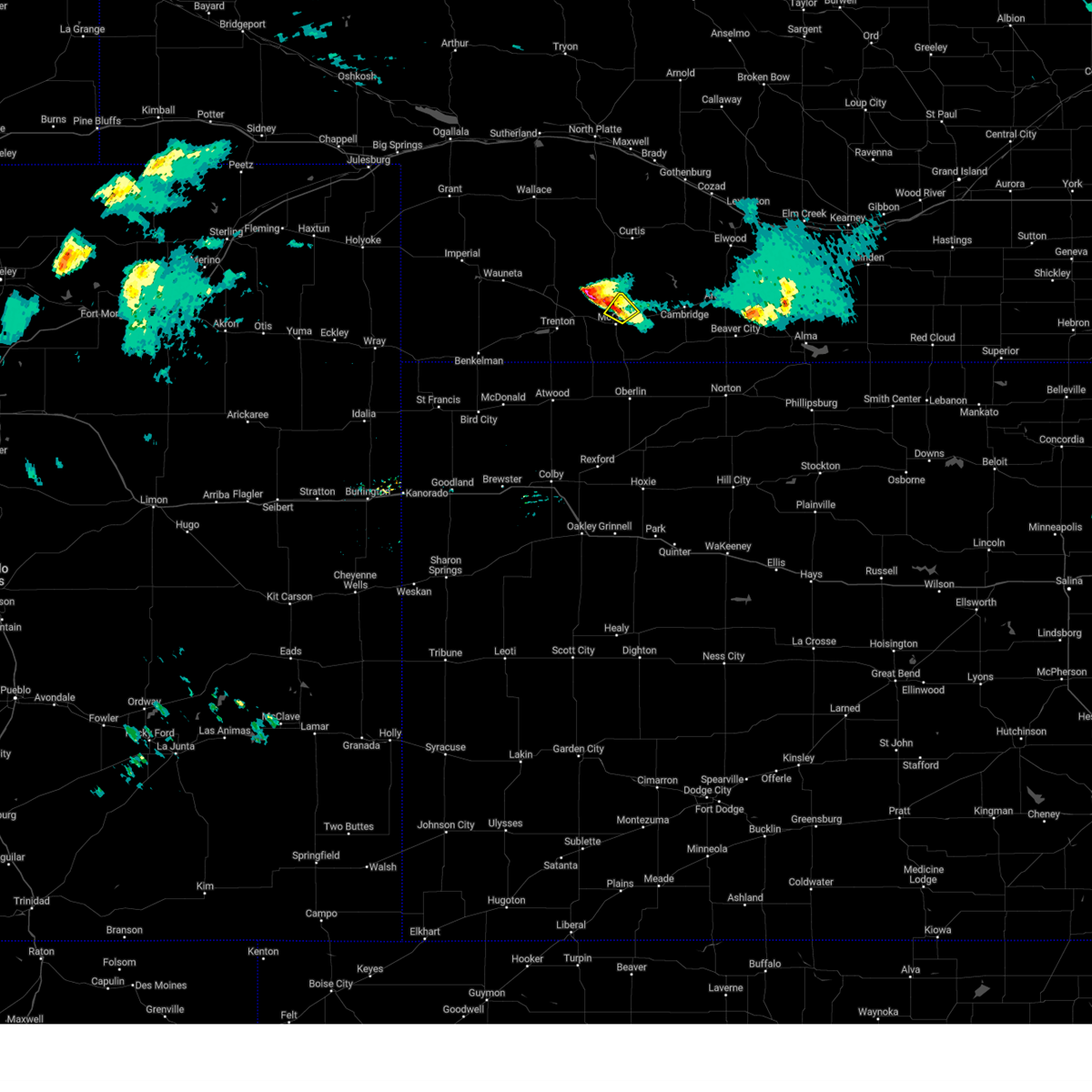
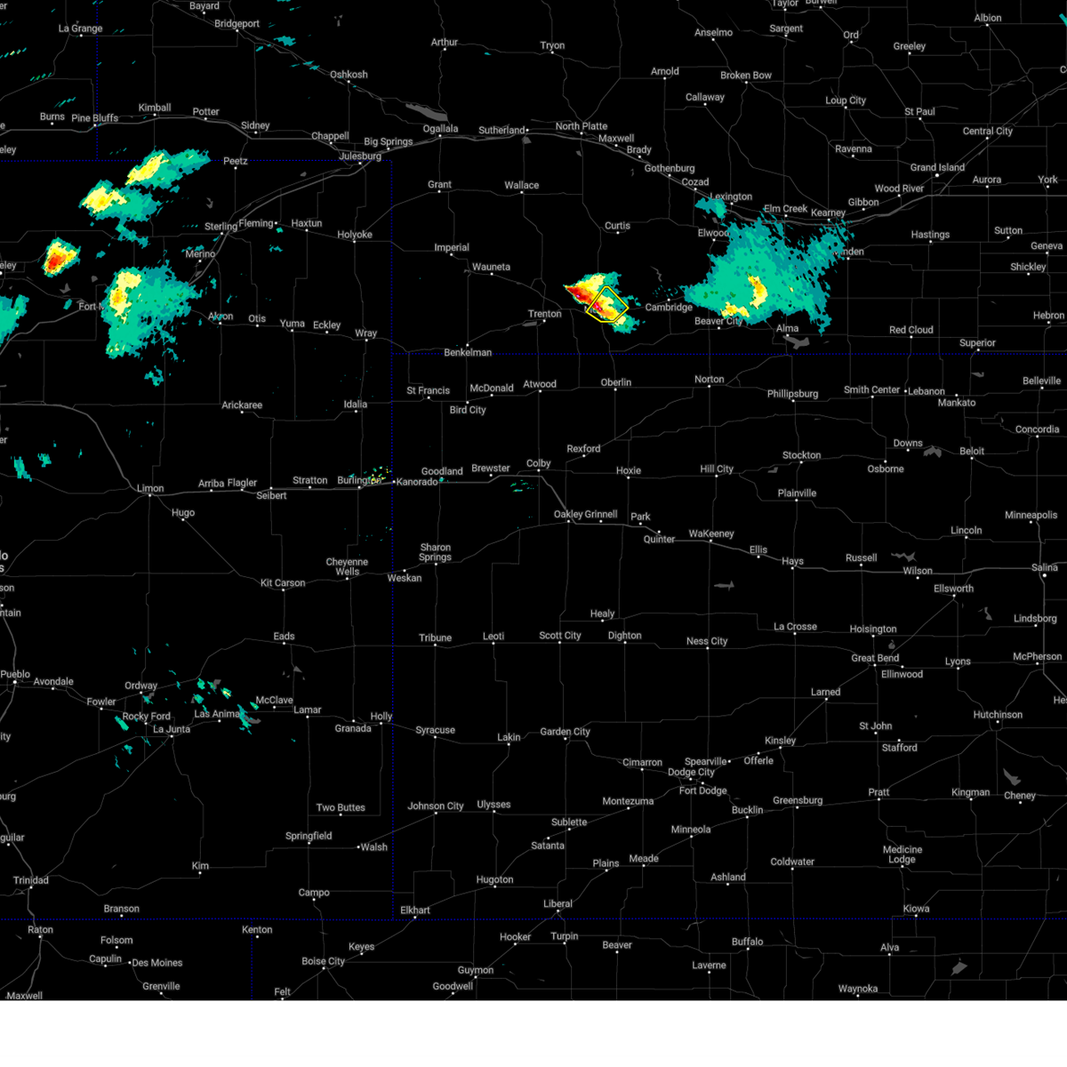
| 6/2/2024 8:38 PM CDT |
 At 837 pm cdt, severe thunderstorms were located along a line extending from near cambridge to 12 miles south of herndon to 7 miles northwest of colby, moving east at 30 mph (mesonet. at 824 pm cdt, a 62 mph wind gust was reported 7 miles northeast of oberlin, kansas). Hazards include 60 mph wind gusts and quarter size hail. Hail damage to vehicles is expected. expect wind damage to roofs, siding, and trees. these severe storms will be near, oberlin and lebanon around 845 pm cdt. Other locations impacted by these severe thunderstorms include traer and cedar bluffs. At 837 pm cdt, severe thunderstorms were located along a line extending from near cambridge to 12 miles south of herndon to 7 miles northwest of colby, moving east at 30 mph (mesonet. at 824 pm cdt, a 62 mph wind gust was reported 7 miles northeast of oberlin, kansas). Hazards include 60 mph wind gusts and quarter size hail. Hail damage to vehicles is expected. expect wind damage to roofs, siding, and trees. these severe storms will be near, oberlin and lebanon around 845 pm cdt. Other locations impacted by these severe thunderstorms include traer and cedar bluffs.
|
| 6/2/2024 8:27 PM CDT |
 the severe thunderstorm warning has been cancelled and is no longer in effect the severe thunderstorm warning has been cancelled and is no longer in effect
|
| 6/2/2024 8:27 PM CDT |
 At 827 pm cdt, severe thunderstorms were located along a line extending from 3 miles west of cambridge to 9 miles southeast of ludell to 7 miles north of levant, moving east at 35 mph (radar indicated). Hazards include 60 mph wind gusts and quarter size hail. Hail damage to vehicles is expected. expect wind damage to roofs, siding, and trees. these severe storms will be near, danbury around 830 pm cdt. oberlin and lebanon around 835 pm cdt. Other locations impacted by these severe thunderstorms include blakeman, cedar bluffs, beardsley, and traer. At 827 pm cdt, severe thunderstorms were located along a line extending from 3 miles west of cambridge to 9 miles southeast of ludell to 7 miles north of levant, moving east at 35 mph (radar indicated). Hazards include 60 mph wind gusts and quarter size hail. Hail damage to vehicles is expected. expect wind damage to roofs, siding, and trees. these severe storms will be near, danbury around 830 pm cdt. oberlin and lebanon around 835 pm cdt. Other locations impacted by these severe thunderstorms include blakeman, cedar bluffs, beardsley, and traer.
|
| 6/2/2024 8:16 PM CDT |
 At 714 pm mdt/814 pm cdt/, severe thunderstorms were located along a line extending from 3 miles northwest of bartley to near atwood to 10 miles north of brewster, moving east at 30 mph (radar indicated). Hazards include 60 mph wind gusts and quarter size hail. Hail damage to vehicles is expected. expect wind damage to roofs, siding, and trees. these severe storms will be near, indianola, bartley, and herndon around 820 pm cdt. danbury around 835 pm cdt. lebanon around 845 pm cdt. oberlin around 850 pm cdt. other locations impacted by these severe thunderstorms include blakeman, cedar bluffs, beardsley, and traer. This includes interstate 70 in kansas between mile markers 36 and 60. At 714 pm mdt/814 pm cdt/, severe thunderstorms were located along a line extending from 3 miles northwest of bartley to near atwood to 10 miles north of brewster, moving east at 30 mph (radar indicated). Hazards include 60 mph wind gusts and quarter size hail. Hail damage to vehicles is expected. expect wind damage to roofs, siding, and trees. these severe storms will be near, indianola, bartley, and herndon around 820 pm cdt. danbury around 835 pm cdt. lebanon around 845 pm cdt. oberlin around 850 pm cdt. other locations impacted by these severe thunderstorms include blakeman, cedar bluffs, beardsley, and traer. This includes interstate 70 in kansas between mile markers 36 and 60.
|
| 6/2/2024 7:56 PM CDT |
 Svrgld the national weather service in goodland has issued a * severe thunderstorm warning for, southeastern cheyenne county in northwestern kansas, northern thomas county in northwestern kansas, rawlins county in northwestern kansas, northwestern decatur county in northwestern kansas, northern sherman county in northwestern kansas, red willow county in southwestern nebraska, hitchcock county in southwestern nebraska, southeastern dundy county in southwestern nebraska, * until 800 pm mdt/900 pm cdt/. * at 656 pm mdt/756 pm cdt/, severe thunderstorms were located along a line extending from 6 miles northwest of indianola to 8 miles west of atwood to 13 miles northwest of brewster, moving east at 30 mph (radar indicated). Hazards include 60 mph wind gusts and quarter size hail. Hail damage to vehicles is expected. expect wind damage to roofs, siding, and trees. severe thunderstorms will be near, mccook, atwood, indianola, and ludell around 800 pm cdt. bartley and herndon around 810 pm cdt. danbury around 830 pm cdt. lebanon around 840 pm cdt. oberlin around 845 pm cdt. other locations impacted by these severe thunderstorms include blakeman, cedar bluffs, beardsley, and traer. This includes interstate 70 in kansas between mile markers 36 and 60. Svrgld the national weather service in goodland has issued a * severe thunderstorm warning for, southeastern cheyenne county in northwestern kansas, northern thomas county in northwestern kansas, rawlins county in northwestern kansas, northwestern decatur county in northwestern kansas, northern sherman county in northwestern kansas, red willow county in southwestern nebraska, hitchcock county in southwestern nebraska, southeastern dundy county in southwestern nebraska, * until 800 pm mdt/900 pm cdt/. * at 656 pm mdt/756 pm cdt/, severe thunderstorms were located along a line extending from 6 miles northwest of indianola to 8 miles west of atwood to 13 miles northwest of brewster, moving east at 30 mph (radar indicated). Hazards include 60 mph wind gusts and quarter size hail. Hail damage to vehicles is expected. expect wind damage to roofs, siding, and trees. severe thunderstorms will be near, mccook, atwood, indianola, and ludell around 800 pm cdt. bartley and herndon around 810 pm cdt. danbury around 830 pm cdt. lebanon around 840 pm cdt. oberlin around 845 pm cdt. other locations impacted by these severe thunderstorms include blakeman, cedar bluffs, beardsley, and traer. This includes interstate 70 in kansas between mile markers 36 and 60.
|
| 6/2/2024 7:48 PM CDT |
 At 648 pm mdt/748 pm cdt/, severe thunderstorms were located along a line extending from 8 miles north of mccook to 11 miles southeast of stratton to 10 miles south of mcdonald, moving east at 45 mph (radar indicated). Hazards include 60 mph wind gusts and half dollar size hail. Hail damage to vehicles is expected. expect wind damage to roofs, siding, and trees. these severe storms will be near, mccook and atwood around 755 pm cdt. ludell around 800 pm cdt. Other locations impacted by these severe thunderstorms include blakeman, beardsley, wheeler, and max. At 648 pm mdt/748 pm cdt/, severe thunderstorms were located along a line extending from 8 miles north of mccook to 11 miles southeast of stratton to 10 miles south of mcdonald, moving east at 45 mph (radar indicated). Hazards include 60 mph wind gusts and half dollar size hail. Hail damage to vehicles is expected. expect wind damage to roofs, siding, and trees. these severe storms will be near, mccook and atwood around 755 pm cdt. ludell around 800 pm cdt. Other locations impacted by these severe thunderstorms include blakeman, beardsley, wheeler, and max.
|
| 6/2/2024 7:44 PM CDT | Weatherlink site bryans hous in red willow county NE, 5 miles SW of McCook, NE |
| 6/2/2024 7:44 PM CDT |
 At 644 pm mdt/744 pm cdt/, severe thunderstorms were located along a line extending from 7 miles north of mccook to 11 miles south of stratton to 10 miles southeast of bird city, moving east at 45 mph (mesonet. at 7:44 pm cdt the mccook airport reported a 62 mph wind gust). Hazards include two inch hail and 60 mph wind gusts. People and animals outdoors will be injured. expect hail damage to roofs, siding, windows, and vehicles. expect wind damage to roofs, siding, and trees. these severe storms will be near, mccook around 750 pm cdt. atwood around 755 pm cdt. ludell around 805 pm cdt. Other locations impacted by these severe thunderstorms include blakeman, beardsley, wheeler, and max. At 644 pm mdt/744 pm cdt/, severe thunderstorms were located along a line extending from 7 miles north of mccook to 11 miles south of stratton to 10 miles southeast of bird city, moving east at 45 mph (mesonet. at 7:44 pm cdt the mccook airport reported a 62 mph wind gust). Hazards include two inch hail and 60 mph wind gusts. People and animals outdoors will be injured. expect hail damage to roofs, siding, windows, and vehicles. expect wind damage to roofs, siding, and trees. these severe storms will be near, mccook around 750 pm cdt. atwood around 755 pm cdt. ludell around 805 pm cdt. Other locations impacted by these severe thunderstorms include blakeman, beardsley, wheeler, and max.
|
| 6/2/2024 7:43 PM CDT | Asos station kmck mccook airpor in red willow county NE, 2.4 miles W of McCook, NE |
| 6/2/2024 7:40 PM CDT | Report and photo of a downed tree in mccook. time estimate in red willow county NE, 0.5 miles NE of McCook, NE |
| 6/2/2024 7:32 PM CDT |
 At 631 pm mdt/731 pm cdt/, severe thunderstorms were located along a line extending from 5 miles northeast of culbertson to 12 miles north of mcdonald to 10 miles south of bird city, moving east at 40 mph (trained weather spotters. at 725 pm cdt, two and a quarter inch hail was reported 13 miles north of bird city). Hazards include two inch hail and 60 mph wind gusts. People and animals outdoors will be injured. expect hail damage to roofs, siding, windows, and vehicles. expect wind damage to roofs, siding, and trees. these severe storms will be near, mccook, culbertson, and mcdonald around 735 pm cdt. atwood around 755 pm cdt. ludell around 800 pm cdt. Other locations impacted by these severe thunderstorms include blakeman, beardsley, wheeler, and max. At 631 pm mdt/731 pm cdt/, severe thunderstorms were located along a line extending from 5 miles northeast of culbertson to 12 miles north of mcdonald to 10 miles south of bird city, moving east at 40 mph (trained weather spotters. at 725 pm cdt, two and a quarter inch hail was reported 13 miles north of bird city). Hazards include two inch hail and 60 mph wind gusts. People and animals outdoors will be injured. expect hail damage to roofs, siding, windows, and vehicles. expect wind damage to roofs, siding, and trees. these severe storms will be near, mccook, culbertson, and mcdonald around 735 pm cdt. atwood around 755 pm cdt. ludell around 800 pm cdt. Other locations impacted by these severe thunderstorms include blakeman, beardsley, wheeler, and max.
|
| 6/2/2024 7:15 PM CDT |
 Svrgld the national weather service in goodland has issued a * severe thunderstorm warning for, cheyenne county in northwestern kansas, northwestern thomas county in northwestern kansas, rawlins county in northwestern kansas, northern sherman county in northwestern kansas, western red willow county in southwestern nebraska, hitchcock county in southwestern nebraska, eastern dundy county in southwestern nebraska, * until 700 pm mdt/800 pm cdt/. * at 614 pm mdt/714 pm cdt/, severe thunderstorms were located along a line extending from 5 miles west of culbertson to 13 miles south of st. francis, moving east at 45 mph (radar indicated. at 0712 pm cdt, ping pong ball sized hail was reported northwest of stratton, nebraska). Hazards include golf ball size hail and 60 mph wind gusts. People and animals outdoors will be injured. expect hail damage to roofs, siding, windows, and vehicles. expect wind damage to roofs, siding, and trees. severe thunderstorms will be near, trenton, culbertson, bird city, and mcdonald around 720 pm cdt. Other locations in the path of these severe thunderstorms include mccook. Svrgld the national weather service in goodland has issued a * severe thunderstorm warning for, cheyenne county in northwestern kansas, northwestern thomas county in northwestern kansas, rawlins county in northwestern kansas, northern sherman county in northwestern kansas, western red willow county in southwestern nebraska, hitchcock county in southwestern nebraska, eastern dundy county in southwestern nebraska, * until 700 pm mdt/800 pm cdt/. * at 614 pm mdt/714 pm cdt/, severe thunderstorms were located along a line extending from 5 miles west of culbertson to 13 miles south of st. francis, moving east at 45 mph (radar indicated. at 0712 pm cdt, ping pong ball sized hail was reported northwest of stratton, nebraska). Hazards include golf ball size hail and 60 mph wind gusts. People and animals outdoors will be injured. expect hail damage to roofs, siding, windows, and vehicles. expect wind damage to roofs, siding, and trees. severe thunderstorms will be near, trenton, culbertson, bird city, and mcdonald around 720 pm cdt. Other locations in the path of these severe thunderstorms include mccook.
|
| 5/25/2024 8:20 PM CDT |
 the severe thunderstorm warning has been cancelled and is no longer in effect the severe thunderstorm warning has been cancelled and is no longer in effect
|
| 5/25/2024 8:05 PM CDT |
 At 805 pm cdt, a severe thunderstorm was located near culbertson, or 7 miles northeast of trenton, moving northeast at 20 mph (radar indicated). Hazards include 60 mph wind gusts and quarter size hail. Hail damage to vehicles is expected. expect wind damage to roofs, siding, and trees. This severe storm will be near, culbertson around 810 pm cdt. At 805 pm cdt, a severe thunderstorm was located near culbertson, or 7 miles northeast of trenton, moving northeast at 20 mph (radar indicated). Hazards include 60 mph wind gusts and quarter size hail. Hail damage to vehicles is expected. expect wind damage to roofs, siding, and trees. This severe storm will be near, culbertson around 810 pm cdt.
|
| 5/25/2024 7:53 PM CDT |
 Svrgld the national weather service in goodland has issued a * severe thunderstorm warning for, northwestern red willow county in southwestern nebraska, eastern hitchcock county in southwestern nebraska, * until 845 pm cdt. * at 753 pm cdt, a severe thunderstorm was located 4 miles east of trenton, moving northeast at 20 mph (radar indicated). Hazards include 60 mph wind gusts and quarter size hail. Hail damage to vehicles is expected. expect wind damage to roofs, siding, and trees. This severe thunderstorm will be near, culbertson around 800 pm cdt. Svrgld the national weather service in goodland has issued a * severe thunderstorm warning for, northwestern red willow county in southwestern nebraska, eastern hitchcock county in southwestern nebraska, * until 845 pm cdt. * at 753 pm cdt, a severe thunderstorm was located 4 miles east of trenton, moving northeast at 20 mph (radar indicated). Hazards include 60 mph wind gusts and quarter size hail. Hail damage to vehicles is expected. expect wind damage to roofs, siding, and trees. This severe thunderstorm will be near, culbertson around 800 pm cdt.
|
| 5/23/2024 10:30 PM CDT |
 The storms which prompted the warning have moved out of the area. therefore, the warning will be allowed to expire. however, gusty winds and heavy rain are still possible with these thunderstorms. a severe thunderstorm watch remains in effect until 400 am cdt for northwestern kansas, and southwestern nebraska. The storms which prompted the warning have moved out of the area. therefore, the warning will be allowed to expire. however, gusty winds and heavy rain are still possible with these thunderstorms. a severe thunderstorm watch remains in effect until 400 am cdt for northwestern kansas, and southwestern nebraska.
|
| 5/23/2024 10:10 PM CDT | Delayed report of storm damage. partially constructed house has mostly collapsed. neighbor shed was reported to be lifted and dropped. time and location (3n mccook) are in red willow county NE, 3.1 miles S of McCook, NE |
| 5/23/2024 10:08 PM CDT | Half Dollar sized hail reported 0.4 miles SSW of McCook, NE, picture of 3 hail stones... one of the stones appears to be bigger than a quarter. |
| 5/23/2024 10:05 PM CDT |
 At 1004 pm cdt, severe thunderstorms were located along a line extending from near medicine creek reservoir state recreation area to near bartley to 3 miles west of danbury, moving east at 40 mph (radar indicated). Hazards include 70 mph wind gusts and half dollar size hail. Hail damage to vehicles is expected. expect considerable tree damage. wind damage is also likely to mobile homes, roofs, and outbuildings. these severe storms will be near, danbury around 1010 pm cdt. lebanon around 1015 pm cdt. Other locations impacted by these severe thunderstorms include traer and cedar bluffs. At 1004 pm cdt, severe thunderstorms were located along a line extending from near medicine creek reservoir state recreation area to near bartley to 3 miles west of danbury, moving east at 40 mph (radar indicated). Hazards include 70 mph wind gusts and half dollar size hail. Hail damage to vehicles is expected. expect considerable tree damage. wind damage is also likely to mobile homes, roofs, and outbuildings. these severe storms will be near, danbury around 1010 pm cdt. lebanon around 1015 pm cdt. Other locations impacted by these severe thunderstorms include traer and cedar bluffs.
|
| 5/23/2024 10:03 PM CDT | Quarter sized hail reported 0.4 miles NW of McCook, NE, facebook picture of quarter size hail. |
| 5/23/2024 9:54 PM CDT |
 the severe thunderstorm warning has been cancelled and is no longer in effect the severe thunderstorm warning has been cancelled and is no longer in effect
|
| 5/23/2024 9:54 PM CDT |
 At 954 pm cdt, severe thunderstorms were located along a line extending from 7 miles west of medicine creek reservoir state recreation area to near indianola to 8 miles west of danbury, moving east at 40 mph (radar indicated). Hazards include 60 mph wind gusts and quarter size hail. Hail damage to vehicles is expected. expect wind damage to roofs, siding, and trees. these severe storms will be near, bartley and danbury around 1000 pm cdt. lebanon around 1010 pm cdt. Other locations impacted by these severe thunderstorms include traer and cedar bluffs. At 954 pm cdt, severe thunderstorms were located along a line extending from 7 miles west of medicine creek reservoir state recreation area to near indianola to 8 miles west of danbury, moving east at 40 mph (radar indicated). Hazards include 60 mph wind gusts and quarter size hail. Hail damage to vehicles is expected. expect wind damage to roofs, siding, and trees. these severe storms will be near, bartley and danbury around 1000 pm cdt. lebanon around 1010 pm cdt. Other locations impacted by these severe thunderstorms include traer and cedar bluffs.
|
| 5/23/2024 9:43 PM CDT |
 The tornado threat has diminished and the tornado warning has been allowed to expire. however, large hail and damaging winds remain likely and a severe thunderstorm warning remains in effect for the area. however, small hail and gusty winds are still possible with this thunderstorm. a severe thunderstorm watch remains in effect until 400 am cdt for northwestern kansas, and southwestern nebraska. to report severe weather, contact your nearest law enforcement agency. they will relay your report to the national weather service goodland. The tornado threat has diminished and the tornado warning has been allowed to expire. however, large hail and damaging winds remain likely and a severe thunderstorm warning remains in effect for the area. however, small hail and gusty winds are still possible with this thunderstorm. a severe thunderstorm watch remains in effect until 400 am cdt for northwestern kansas, and southwestern nebraska. to report severe weather, contact your nearest law enforcement agency. they will relay your report to the national weather service goodland.
|
| 5/23/2024 9:41 PM CDT |
 Svrgld the national weather service in goodland has issued a * severe thunderstorm warning for, northeastern rawlins county in northwestern kansas, northern decatur county in northwestern kansas, red willow county in southwestern nebraska, southeastern hitchcock county in southwestern nebraska, * until 1030 pm cdt. * at 940 pm cdt, severe thunderstorms were located along a line extending from 10 miles northwest of indianola to near mccook to 8 miles north of herndon, moving east at 40 mph (radar indicated). Hazards include 70 mph wind gusts and ping pong ball size hail. People and animals outdoors will be injured. expect hail damage to roofs, siding, windows, and vehicles. expect considerable tree damage. wind damage is also likely to mobile homes, roofs, and outbuildings. severe thunderstorms will be near, mccook and indianola around 945 pm cdt. bartley around 955 pm cdt. danbury around 1000 pm cdt. Other locations in the path of these severe thunderstorms include lebanon. Svrgld the national weather service in goodland has issued a * severe thunderstorm warning for, northeastern rawlins county in northwestern kansas, northern decatur county in northwestern kansas, red willow county in southwestern nebraska, southeastern hitchcock county in southwestern nebraska, * until 1030 pm cdt. * at 940 pm cdt, severe thunderstorms were located along a line extending from 10 miles northwest of indianola to near mccook to 8 miles north of herndon, moving east at 40 mph (radar indicated). Hazards include 70 mph wind gusts and ping pong ball size hail. People and animals outdoors will be injured. expect hail damage to roofs, siding, windows, and vehicles. expect considerable tree damage. wind damage is also likely to mobile homes, roofs, and outbuildings. severe thunderstorms will be near, mccook and indianola around 945 pm cdt. bartley around 955 pm cdt. danbury around 1000 pm cdt. Other locations in the path of these severe thunderstorms include lebanon.
|
| 5/23/2024 9:24 PM CDT |
 At 924 pm cdt, a severe thunderstorm capable of producing a tornado was located near culbertson, or 9 miles west of mccook, moving east at 35 mph (radar indicated rotation). Hazards include tornado and ping pong ball size hail. Flying debris will be dangerous to those caught without shelter. mobile homes will be damaged or destroyed. damage to roofs, windows, and vehicles will occur. tree damage is likely. This dangerous storm will be near, mccook around 930 pm cdt. At 924 pm cdt, a severe thunderstorm capable of producing a tornado was located near culbertson, or 9 miles west of mccook, moving east at 35 mph (radar indicated rotation). Hazards include tornado and ping pong ball size hail. Flying debris will be dangerous to those caught without shelter. mobile homes will be damaged or destroyed. damage to roofs, windows, and vehicles will occur. tree damage is likely. This dangerous storm will be near, mccook around 930 pm cdt.
|
| 5/23/2024 9:19 PM CDT |
 At 918 pm cdt, a severe thunderstorm capable of producing a tornado was located near culbertson, or 9 miles east of trenton, moving east at 40 mph (radar indicated rotation). Hazards include tornado and two inch hail. Flying debris will be dangerous to those caught without shelter. mobile homes will be damaged or destroyed. damage to roofs, windows, and vehicles will occur. tree damage is likely. This dangerous storm will be near, mccook around 925 pm cdt. At 918 pm cdt, a severe thunderstorm capable of producing a tornado was located near culbertson, or 9 miles east of trenton, moving east at 40 mph (radar indicated rotation). Hazards include tornado and two inch hail. Flying debris will be dangerous to those caught without shelter. mobile homes will be damaged or destroyed. damage to roofs, windows, and vehicles will occur. tree damage is likely. This dangerous storm will be near, mccook around 925 pm cdt.
|
| 5/23/2024 9:10 PM CDT |
 At 909 pm cdt, a severe thunderstorm capable of producing a tornado was located near trenton, moving east at 40 mph (radar indicated rotation. spotters 3 miles west of trenton observed golf ball sized hail at 903 pm cdt). Hazards include tornado and two inch hail. Flying debris will be dangerous to those caught without shelter. mobile homes will be damaged or destroyed. damage to roofs, windows, and vehicles will occur. tree damage is likely. this dangerous storm will be near, culbertson around 915 pm cdt. Other locations in the path of this tornadic thunderstorm include mccook. At 909 pm cdt, a severe thunderstorm capable of producing a tornado was located near trenton, moving east at 40 mph (radar indicated rotation. spotters 3 miles west of trenton observed golf ball sized hail at 903 pm cdt). Hazards include tornado and two inch hail. Flying debris will be dangerous to those caught without shelter. mobile homes will be damaged or destroyed. damage to roofs, windows, and vehicles will occur. tree damage is likely. this dangerous storm will be near, culbertson around 915 pm cdt. Other locations in the path of this tornadic thunderstorm include mccook.
|
| 5/23/2024 9:03 PM CDT |
 Torgld the national weather service in goodland has issued a * tornado warning for, western red willow county in southwestern nebraska, eastern hitchcock county in southwestern nebraska, * until 945 pm cdt. * at 903 pm cdt, a severe thunderstorm capable of producing a tornado was located near trenton, moving east at 40 mph (radar indicated rotation). Hazards include tornado and hail up to two inches in diameter. Flying debris will be dangerous to those caught without shelter. mobile homes will be damaged or destroyed. damage to roofs, windows, and vehicles will occur. tree damage is likely. this dangerous storm will be near, culbertson around 915 pm cdt. Other locations in the path of this tornadic thunderstorm include mccook. Torgld the national weather service in goodland has issued a * tornado warning for, western red willow county in southwestern nebraska, eastern hitchcock county in southwestern nebraska, * until 945 pm cdt. * at 903 pm cdt, a severe thunderstorm capable of producing a tornado was located near trenton, moving east at 40 mph (radar indicated rotation). Hazards include tornado and hail up to two inches in diameter. Flying debris will be dangerous to those caught without shelter. mobile homes will be damaged or destroyed. damage to roofs, windows, and vehicles will occur. tree damage is likely. this dangerous storm will be near, culbertson around 915 pm cdt. Other locations in the path of this tornadic thunderstorm include mccook.
|
| 5/21/2024 2:06 AM CDT |
 The storms which prompted the warning have weakened below severe limits, and no longer pose an immediate threat to life or property. therefore, the warning will be allowed to expire. however, small hail, gusty winds and heavy rain are still possible with these thunderstorms. a tornado watch remains in effect until 300 am cdt for southwestern nebraska. The storms which prompted the warning have weakened below severe limits, and no longer pose an immediate threat to life or property. therefore, the warning will be allowed to expire. however, small hail, gusty winds and heavy rain are still possible with these thunderstorms. a tornado watch remains in effect until 300 am cdt for southwestern nebraska.
|
| 5/21/2024 1:53 AM CDT |
 At 152 am cdt, severe thunderstorms were located along a line extending from 11 miles east of hayes center to 10 miles southwest of stockville to 4 miles southwest of indianola to 9 miles north of herndon, moving east at 40 mph (radar indicated). Hazards include 70 mph wind gusts and penny size hail. Expect considerable tree damage. damage is likely to mobile homes, roofs, and outbuildings. These severe storms will be near, indianola and bartley around 200 am cdt. At 152 am cdt, severe thunderstorms were located along a line extending from 11 miles east of hayes center to 10 miles southwest of stockville to 4 miles southwest of indianola to 9 miles north of herndon, moving east at 40 mph (radar indicated). Hazards include 70 mph wind gusts and penny size hail. Expect considerable tree damage. damage is likely to mobile homes, roofs, and outbuildings. These severe storms will be near, indianola and bartley around 200 am cdt.
|
| 5/21/2024 1:37 AM CDT |
 At 136 am cdt, severe thunderstorms were located along a line extending from 4 miles south of hayes center to 9 miles northeast of culbertson to 7 miles southwest of mccook to 7 miles north of ludell, moving east at 45 mph. these are destructive storms for rural northwestern red willow county (radar indicated). Hazards include 80 mph wind gusts and quarter size hail. Flying debris will be dangerous to those caught without shelter. mobile homes will be heavily damaged. expect considerable damage to roofs, windows, and vehicles. extensive tree damage and power outages are likely. these severe storms will be near, mccook around 140 am cdt. indianola around 150 am cdt. bartley around 200 am cdt. danbury around 210 am cdt. Lebanon around 220 am cdt. At 136 am cdt, severe thunderstorms were located along a line extending from 4 miles south of hayes center to 9 miles northeast of culbertson to 7 miles southwest of mccook to 7 miles north of ludell, moving east at 45 mph. these are destructive storms for rural northwestern red willow county (radar indicated). Hazards include 80 mph wind gusts and quarter size hail. Flying debris will be dangerous to those caught without shelter. mobile homes will be heavily damaged. expect considerable damage to roofs, windows, and vehicles. extensive tree damage and power outages are likely. these severe storms will be near, mccook around 140 am cdt. indianola around 150 am cdt. bartley around 200 am cdt. danbury around 210 am cdt. Lebanon around 220 am cdt.
|
| 5/21/2024 1:37 AM CDT |
 the severe thunderstorm warning has been cancelled and is no longer in effect the severe thunderstorm warning has been cancelled and is no longer in effect
|
| 5/21/2024 1:22 AM CDT |
 At 1220 am mdt/120 am cdt/, severe thunderstorms were located along a line extending from 6 miles northwest of palisade to 4 miles northwest of culbertson to 8 miles southeast of trenton to 9 miles northwest of atwood, moving east at 40 mph. these are destructive storms for culbertson and mccook (radar indicated. this area of storms has a history of producing 2 inch in diameter hail and wind gusts in excess of 80 mph). Hazards include 80 mph wind gusts and two inch hail. Flying debris will be dangerous to those caught without shelter. mobile homes will be heavily damaged. expect considerable damage to roofs, windows, and vehicles. extensive tree damage and power outages are likely. these severe storms will be near, culbertson around 125 am cdt. mccook around 135 am cdt. indianola around 155 am cdt. bartley around 205 am cdt. Other locations impacted by these severe thunderstorms include max. At 1220 am mdt/120 am cdt/, severe thunderstorms were located along a line extending from 6 miles northwest of palisade to 4 miles northwest of culbertson to 8 miles southeast of trenton to 9 miles northwest of atwood, moving east at 40 mph. these are destructive storms for culbertson and mccook (radar indicated. this area of storms has a history of producing 2 inch in diameter hail and wind gusts in excess of 80 mph). Hazards include 80 mph wind gusts and two inch hail. Flying debris will be dangerous to those caught without shelter. mobile homes will be heavily damaged. expect considerable damage to roofs, windows, and vehicles. extensive tree damage and power outages are likely. these severe storms will be near, culbertson around 125 am cdt. mccook around 135 am cdt. indianola around 155 am cdt. bartley around 205 am cdt. Other locations impacted by these severe thunderstorms include max.
|
| 5/21/2024 1:09 AM CDT |
 Svrgld the national weather service in goodland has issued a * severe thunderstorm warning for, red willow county in southwestern nebraska, hitchcock county in southwestern nebraska, eastern dundy county in southwestern nebraska, * until 115 am mdt/215 am cdt/. * at 1207 am mdt/107 am cdt/, severe thunderstorms were located along a line extending from near wauneta to 4 miles southeast of palisade to 3 miles southwest of trenton to 12 miles north of mcdonald, moving east at 50 mph. these are destructive storms for trenton and culbertson (radar indicated). Hazards include 80 mph wind gusts and two inch hail. Flying debris will be dangerous to those caught without shelter. mobile homes will be heavily damaged. expect considerable damage to roofs, windows, and vehicles. extensive tree damage and power outages are likely. severe thunderstorms will be near, trenton and culbertson around 115 am cdt. Other locations in the path of these severe thunderstorms include mccook, indianola and bartley. Svrgld the national weather service in goodland has issued a * severe thunderstorm warning for, red willow county in southwestern nebraska, hitchcock county in southwestern nebraska, eastern dundy county in southwestern nebraska, * until 115 am mdt/215 am cdt/. * at 1207 am mdt/107 am cdt/, severe thunderstorms were located along a line extending from near wauneta to 4 miles southeast of palisade to 3 miles southwest of trenton to 12 miles north of mcdonald, moving east at 50 mph. these are destructive storms for trenton and culbertson (radar indicated). Hazards include 80 mph wind gusts and two inch hail. Flying debris will be dangerous to those caught without shelter. mobile homes will be heavily damaged. expect considerable damage to roofs, windows, and vehicles. extensive tree damage and power outages are likely. severe thunderstorms will be near, trenton and culbertson around 115 am cdt. Other locations in the path of these severe thunderstorms include mccook, indianola and bartley.
|
| 5/3/2024 8:33 PM CDT |
 At 833 pm cdt, severe thunderstorms were located along a line extending from near elwood to near indianola to 10 miles south of mccook, moving east at 30 mph (radar indicated). Hazards include 70 mph wind gusts and quarter size hail. Hail damage to vehicles is expected. expect considerable tree damage. wind damage is also likely to mobile homes, roofs, and outbuildings. these severe storms will be near, bartley around 840 pm cdt. danbury around 850 pm cdt. Lebanon around 905 pm cdt. At 833 pm cdt, severe thunderstorms were located along a line extending from near elwood to near indianola to 10 miles south of mccook, moving east at 30 mph (radar indicated). Hazards include 70 mph wind gusts and quarter size hail. Hail damage to vehicles is expected. expect considerable tree damage. wind damage is also likely to mobile homes, roofs, and outbuildings. these severe storms will be near, bartley around 840 pm cdt. danbury around 850 pm cdt. Lebanon around 905 pm cdt.
|
| 5/3/2024 8:19 PM CDT |
 At 818 pm cdt, severe thunderstorms were located along a line extending from 7 miles south of eustis to 5 miles west of indianola to 8 miles north of herndon, moving east at 30 mph (radar indicated). Hazards include 70 mph wind gusts and quarter size hail. Hail damage to vehicles is expected. expect considerable tree damage. wind damage is also likely to mobile homes, roofs, and outbuildings. these severe storms will be near, indianola and bartley around 825 pm cdt. danbury around 850 pm cdt. Lebanon around 900 pm cdt. At 818 pm cdt, severe thunderstorms were located along a line extending from 7 miles south of eustis to 5 miles west of indianola to 8 miles north of herndon, moving east at 30 mph (radar indicated). Hazards include 70 mph wind gusts and quarter size hail. Hail damage to vehicles is expected. expect considerable tree damage. wind damage is also likely to mobile homes, roofs, and outbuildings. these severe storms will be near, indianola and bartley around 825 pm cdt. danbury around 850 pm cdt. Lebanon around 900 pm cdt.
|
| 5/3/2024 7:54 PM CDT |
 At 754 pm cdt, severe thunderstorms were located along a line extending from 7 miles east of stockville to 5 miles east of culbertson to 10 miles south of trenton, moving east at 30 mph (mesonet. mccook airport reported a 71 mph wind gust). Hazards include 70 mph wind gusts and quarter size hail. Hail damage to vehicles is expected. expect considerable tree damage. wind damage is also likely to mobile homes, roofs, and outbuildings. these severe storms will be near, mccook around 800 pm cdt. indianola around 810 pm cdt. bartley around 820 pm cdt. danbury around 845 pm cdt. Lebanon around 900 pm cdt. At 754 pm cdt, severe thunderstorms were located along a line extending from 7 miles east of stockville to 5 miles east of culbertson to 10 miles south of trenton, moving east at 30 mph (mesonet. mccook airport reported a 71 mph wind gust). Hazards include 70 mph wind gusts and quarter size hail. Hail damage to vehicles is expected. expect considerable tree damage. wind damage is also likely to mobile homes, roofs, and outbuildings. these severe storms will be near, mccook around 800 pm cdt. indianola around 810 pm cdt. bartley around 820 pm cdt. danbury around 845 pm cdt. Lebanon around 900 pm cdt.
|
| 5/3/2024 7:49 PM CDT | Storm damage reported in red willow county NE, 1.9 miles W of McCook, NE |
| 5/3/2024 7:44 PM CDT |
 At 743 pm cdt, severe thunderstorms were located along a line extending from 3 miles east of stockville to culbertson to 12 miles southeast of stratton, moving east at 25 mph (trained weather spotters reported 60 mph winds near the trenton dam at 7:43pm ct). Hazards include 60 mph wind gusts and quarter size hail. Hail damage to vehicles is expected. expect wind damage to roofs, siding, and trees. these severe storms will be near, mccook around 750 pm cdt. indianola around 815 pm cdt. Bartley around 825 pm cdt. At 743 pm cdt, severe thunderstorms were located along a line extending from 3 miles east of stockville to culbertson to 12 miles southeast of stratton, moving east at 25 mph (trained weather spotters reported 60 mph winds near the trenton dam at 7:43pm ct). Hazards include 60 mph wind gusts and quarter size hail. Hail damage to vehicles is expected. expect wind damage to roofs, siding, and trees. these severe storms will be near, mccook around 750 pm cdt. indianola around 815 pm cdt. Bartley around 825 pm cdt.
|
| 5/3/2024 7:30 PM CDT |
 Svrgld the national weather service in goodland has issued a * severe thunderstorm warning for, red willow county in southwestern nebraska, hitchcock county in southwestern nebraska, * until 845 pm cdt. * at 730 pm cdt, severe thunderstorms were located along a line extending from near stockville to near culbertson to 10 miles south of stratton, moving east at 30 mph (radar indicated). Hazards include 60 mph wind gusts and quarter size hail. Hail damage to vehicles is expected. expect wind damage to roofs, siding, and trees. severe thunderstorms will be near, culbertson around 735 pm cdt. mccook around 740 pm cdt. Other locations in the path of these severe thunderstorms include indianola and bartley. Svrgld the national weather service in goodland has issued a * severe thunderstorm warning for, red willow county in southwestern nebraska, hitchcock county in southwestern nebraska, * until 845 pm cdt. * at 730 pm cdt, severe thunderstorms were located along a line extending from near stockville to near culbertson to 10 miles south of stratton, moving east at 30 mph (radar indicated). Hazards include 60 mph wind gusts and quarter size hail. Hail damage to vehicles is expected. expect wind damage to roofs, siding, and trees. severe thunderstorms will be near, culbertson around 735 pm cdt. mccook around 740 pm cdt. Other locations in the path of these severe thunderstorms include indianola and bartley.
|
| 4/26/2024 5:42 AM CDT |
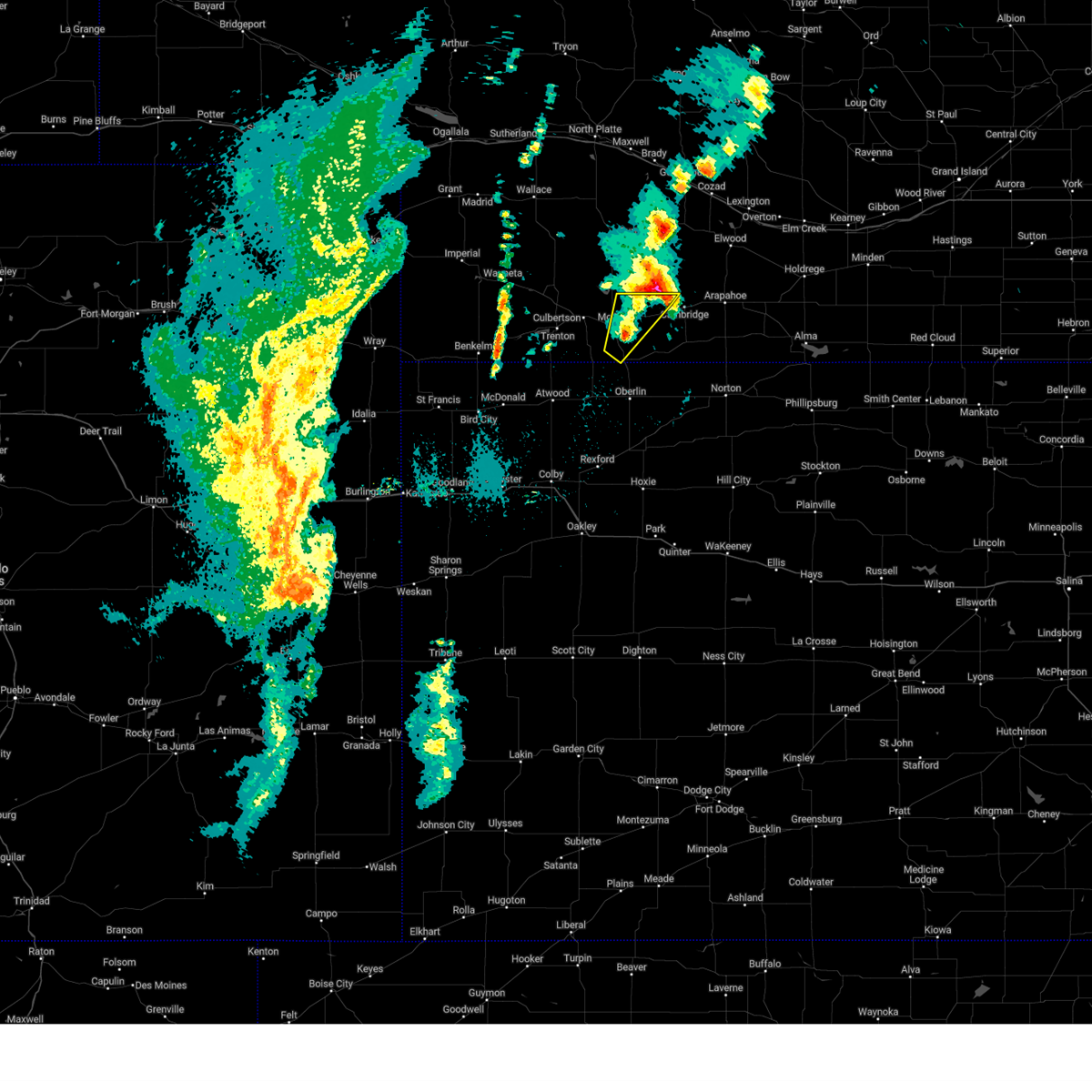 The storms which prompted the warning have weakened below severe limits, and exited the warned area. therefore, the warning will be allowed to expire. The storms which prompted the warning have weakened below severe limits, and exited the warned area. therefore, the warning will be allowed to expire.
|
| 4/26/2024 5:33 AM CDT |
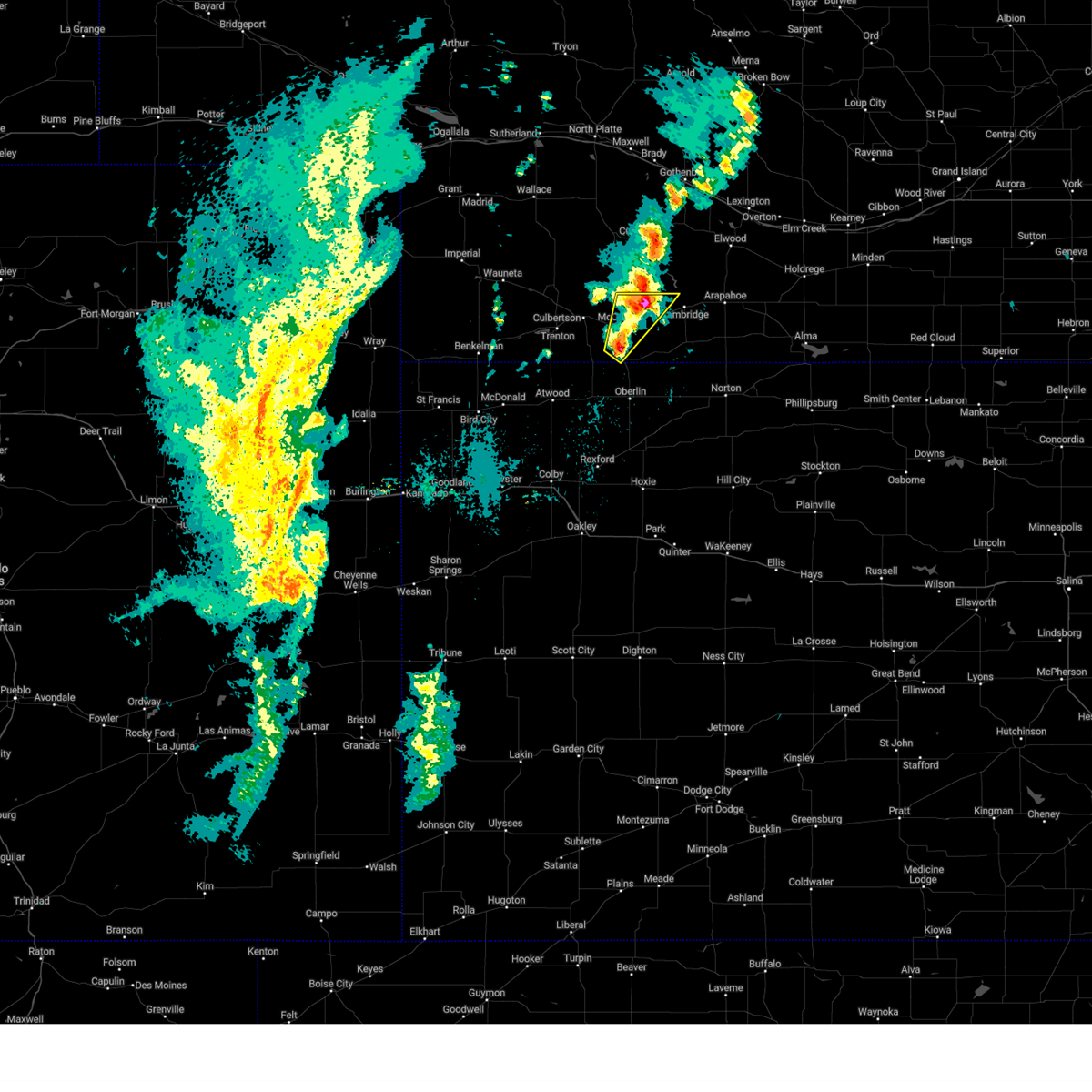 At 532 am cdt, severe thunderstorms were located in central red willow county, moving northeast at 35 mph (radar indicated). Hazards include quarter size hail. Damage to vehicles is expected. Locations impacted include, mccook, indianola, and bartley. At 532 am cdt, severe thunderstorms were located in central red willow county, moving northeast at 35 mph (radar indicated). Hazards include quarter size hail. Damage to vehicles is expected. Locations impacted include, mccook, indianola, and bartley.
|
| 4/26/2024 5:16 AM CDT |
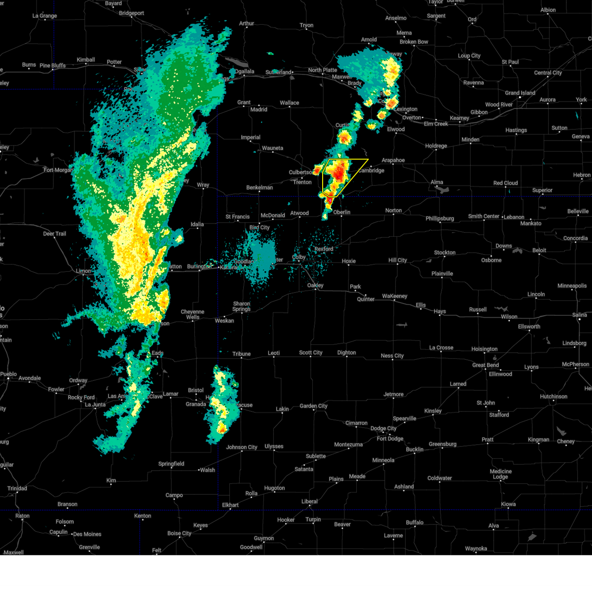 At 515 am cdt, a severe thunderstorm was located near mccook, moving northeast at 35 mph. an additional severe thunderstorm was moving into southern red willow county at 30 mph (radar indicated). Hazards include half dollar size hail. Damage to vehicles is expected. These severe thunderstorms will remain over mainly rural areas of red willow county. At 515 am cdt, a severe thunderstorm was located near mccook, moving northeast at 35 mph. an additional severe thunderstorm was moving into southern red willow county at 30 mph (radar indicated). Hazards include half dollar size hail. Damage to vehicles is expected. These severe thunderstorms will remain over mainly rural areas of red willow county.
|
| 4/26/2024 4:56 AM CDT |
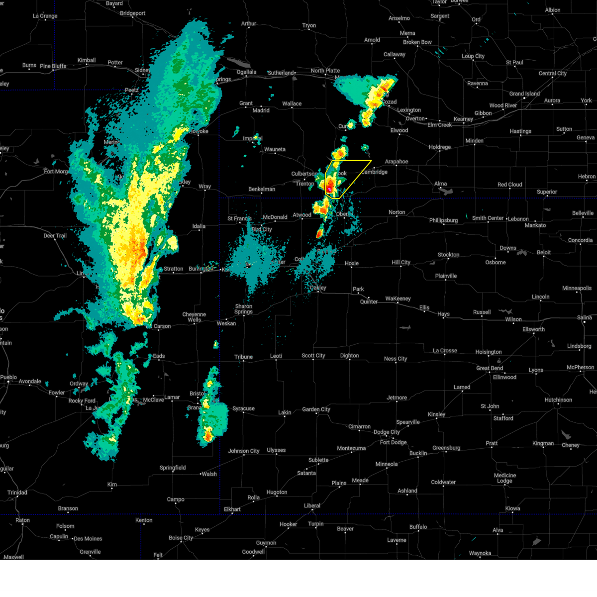 Svrgld the national weather service in goodland has issued a * severe thunderstorm warning for, red willow county in southwestern nebraska, * until 545 am cdt. * at 455 am cdt, a severe thunderstorm was located 7 miles southwest of mccook, moving northeast at 35 mph (radar indicated). Hazards include half dollar size hail. Damage to vehicles is expected. This severe thunderstorm will be near, mccook around 500 am cdt. Svrgld the national weather service in goodland has issued a * severe thunderstorm warning for, red willow county in southwestern nebraska, * until 545 am cdt. * at 455 am cdt, a severe thunderstorm was located 7 miles southwest of mccook, moving northeast at 35 mph (radar indicated). Hazards include half dollar size hail. Damage to vehicles is expected. This severe thunderstorm will be near, mccook around 500 am cdt.
|
| 4/25/2024 6:56 PM CDT |
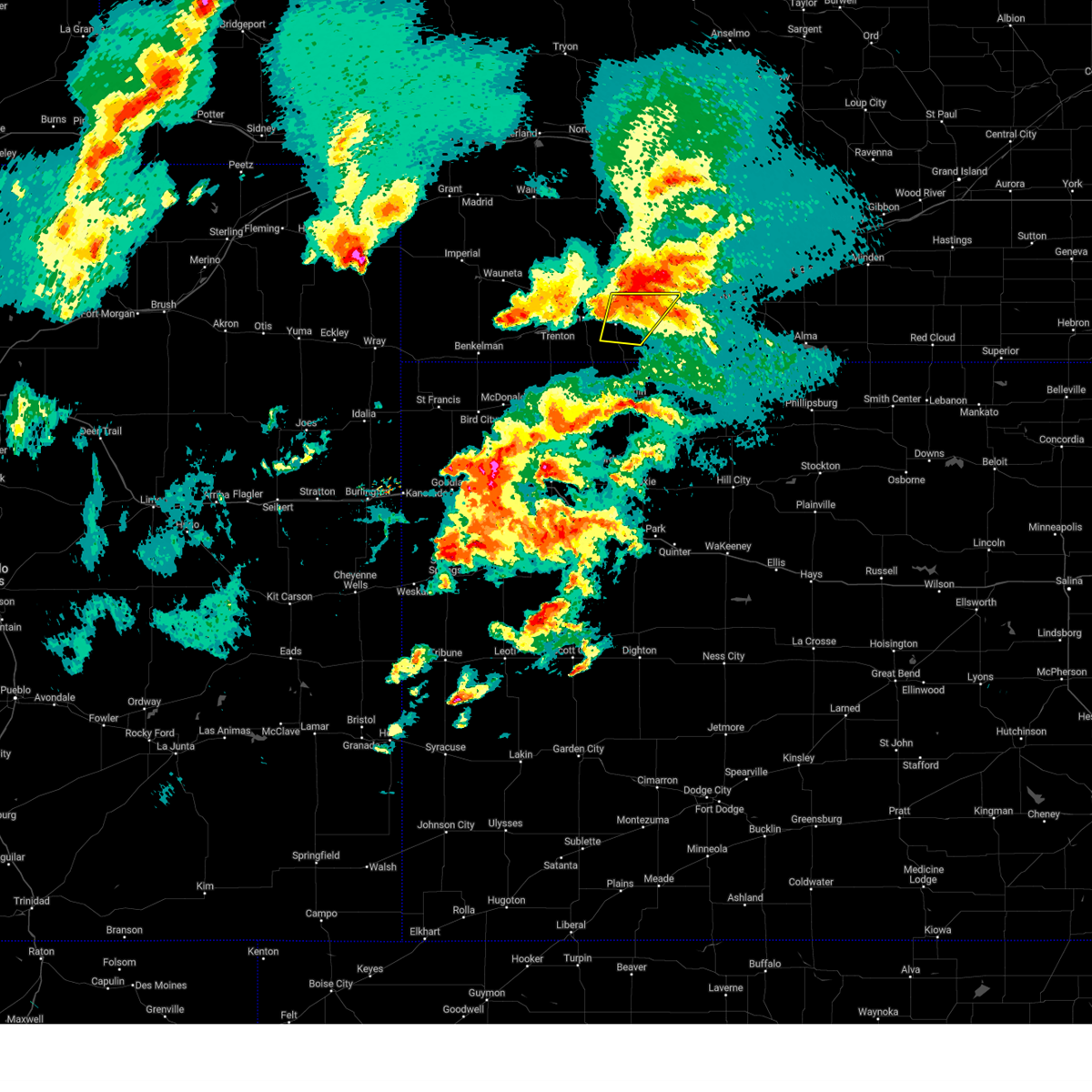 The storm which prompted the warning has weakened below severe limits, and has exited the warned area. therefore, the warning will be allowed to expire. a tornado watch remains in effect until 1000 pm cdt for southwestern nebraska. to report severe weather, contact your nearest law enforcement agency. they will relay your report to the national weather service goodland. The storm which prompted the warning has weakened below severe limits, and has exited the warned area. therefore, the warning will be allowed to expire. a tornado watch remains in effect until 1000 pm cdt for southwestern nebraska. to report severe weather, contact your nearest law enforcement agency. they will relay your report to the national weather service goodland.
|
| 4/25/2024 6:54 PM CDT |
 The storm which prompted the warning has weakened below severe limits, and no longer poses an immediate threat to life or property. therefore, the warning will be allowed to expire. a tornado watch remains in effect until 1000 pm cdt for southwestern nebraska. The storm which prompted the warning has weakened below severe limits, and no longer poses an immediate threat to life or property. therefore, the warning will be allowed to expire. a tornado watch remains in effect until 1000 pm cdt for southwestern nebraska.
|
| 4/25/2024 6:54 PM CDT |
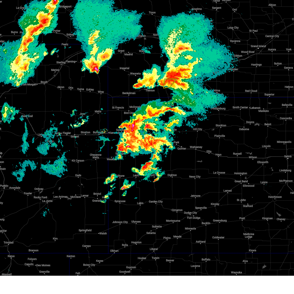 The storm which prompted the warning has weakened below severe limits, and no longer poses an immediate threat to life or property. therefore, the warning will be allowed to expire. however, heavy rain is still possible with this thunderstorm. a tornado watch remains in effect until 1000 pm cdt for southwestern nebraska. The storm which prompted the warning has weakened below severe limits, and no longer poses an immediate threat to life or property. therefore, the warning will be allowed to expire. however, heavy rain is still possible with this thunderstorm. a tornado watch remains in effect until 1000 pm cdt for southwestern nebraska.
|
| 4/25/2024 6:43 PM CDT |
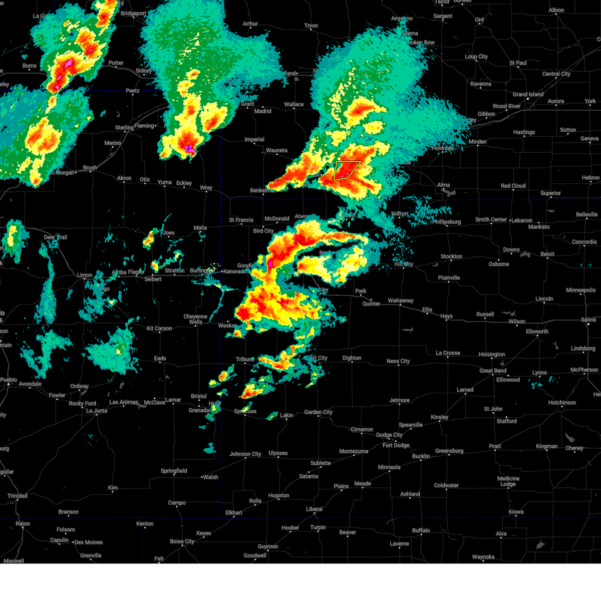 At 643 pm cdt, a severe thunderstorm was located 5 miles northeast of mccook, moving north at 30 mph (radar indicated). Hazards include 60 mph wind gusts and quarter size hail. Hail damage to vehicles is expected. expect wind damage to roofs, siding, and trees. This severe thunderstorm will remain over mainly rural areas of northwestern red willow county. At 643 pm cdt, a severe thunderstorm was located 5 miles northeast of mccook, moving north at 30 mph (radar indicated). Hazards include 60 mph wind gusts and quarter size hail. Hail damage to vehicles is expected. expect wind damage to roofs, siding, and trees. This severe thunderstorm will remain over mainly rural areas of northwestern red willow county.
|
| 4/25/2024 6:42 PM CDT |
 At 642 pm cdt, a severe thunderstorm was located near mccook, moving northeast at 25 mph (radar indicated). Hazards include 60 mph wind gusts and quarter size hail. Hail damage to vehicles is expected. expect wind damage to roofs, siding, and trees. Locations impacted include, mccook, indianola, and bartley. At 642 pm cdt, a severe thunderstorm was located near mccook, moving northeast at 25 mph (radar indicated). Hazards include 60 mph wind gusts and quarter size hail. Hail damage to vehicles is expected. expect wind damage to roofs, siding, and trees. Locations impacted include, mccook, indianola, and bartley.
|
| 4/25/2024 6:41 PM CDT |
 the severe thunderstorm warning has been cancelled and is no longer in effect the severe thunderstorm warning has been cancelled and is no longer in effect
|
| 4/25/2024 6:41 PM CDT |
 At 641 pm cdt, a severe thunderstorm was located 6 miles southeast of culbertson, or 8 miles southwest of mccook, moving northeast at 30 mph (radar indicated). Hazards include 60 mph wind gusts and quarter size hail. Hail damage to vehicles is expected. expect wind damage to roofs, siding, and trees. Locations impacted include, mccook and culbertson. At 641 pm cdt, a severe thunderstorm was located 6 miles southeast of culbertson, or 8 miles southwest of mccook, moving northeast at 30 mph (radar indicated). Hazards include 60 mph wind gusts and quarter size hail. Hail damage to vehicles is expected. expect wind damage to roofs, siding, and trees. Locations impacted include, mccook and culbertson.
|
| 4/25/2024 6:30 PM CDT | Quarter sized hail reported 3.1 miles N of McCook, NE, trained spotter reports pea to quarter size hail. |
| 4/25/2024 6:29 PM CDT |
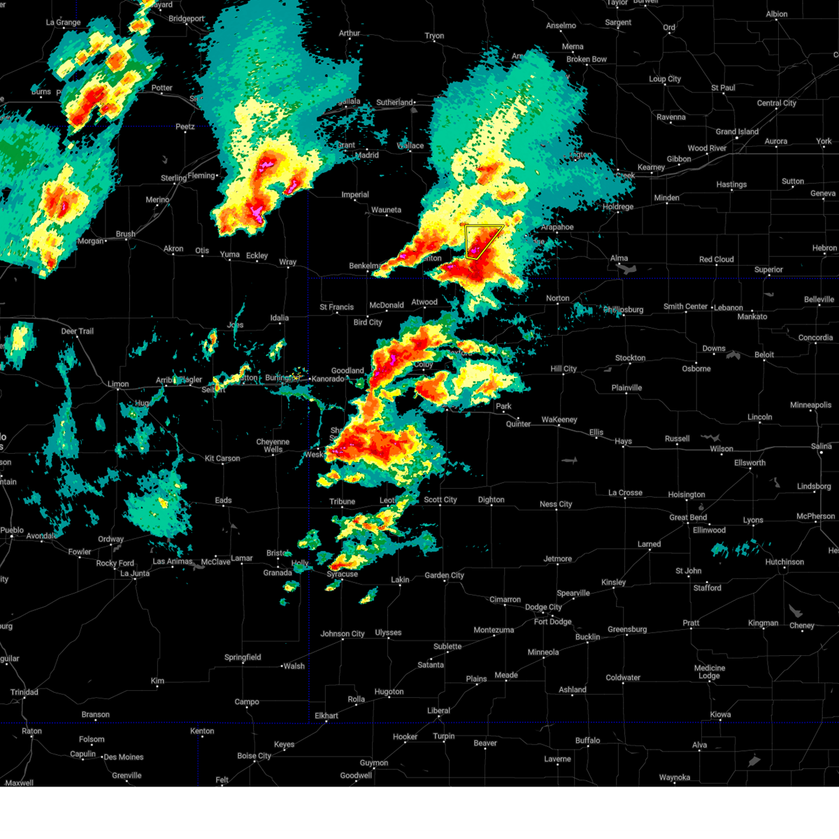 Svrgld the national weather service in goodland has issued a * severe thunderstorm warning for, northwestern red willow county in southwestern nebraska, * until 700 pm cdt. * at 629 pm cdt, a severe thunderstorm was located over mccook, moving north at 30 mph. this is a destructive storm for mccook, nebraska (radar indicated). Hazards include baseball size hail and 60 mph wind gusts. People and animals outdoors will be severely injured. expect shattered windows, extensive damage to roofs, siding, and vehicles. This severe thunderstorm will be near, mccook around 635 pm cdt. Svrgld the national weather service in goodland has issued a * severe thunderstorm warning for, northwestern red willow county in southwestern nebraska, * until 700 pm cdt. * at 629 pm cdt, a severe thunderstorm was located over mccook, moving north at 30 mph. this is a destructive storm for mccook, nebraska (radar indicated). Hazards include baseball size hail and 60 mph wind gusts. People and animals outdoors will be severely injured. expect shattered windows, extensive damage to roofs, siding, and vehicles. This severe thunderstorm will be near, mccook around 635 pm cdt.
|
| 4/25/2024 6:23 PM CDT |
 Svrgld the national weather service in goodland has issued a * severe thunderstorm warning for, northeastern rawlins county in northwestern kansas, northwestern decatur county in northwestern kansas, red willow county in southwestern nebraska, eastern hitchcock county in southwestern nebraska, * until 700 pm cdt. * at 622 pm cdt, a severe thunderstorm was located 7 miles north of herndon, or 14 miles southeast of trenton, moving north at 60 mph (radar indicated). Hazards include 60 mph wind gusts and quarter size hail. Hail damage to vehicles is expected. expect wind damage to roofs, siding, and trees. This severe thunderstorm will remain over mainly rural areas of northeastern rawlins, northwestern decatur, red willow and eastern hitchcock counties, including the following locations, traer. Svrgld the national weather service in goodland has issued a * severe thunderstorm warning for, northeastern rawlins county in northwestern kansas, northwestern decatur county in northwestern kansas, red willow county in southwestern nebraska, eastern hitchcock county in southwestern nebraska, * until 700 pm cdt. * at 622 pm cdt, a severe thunderstorm was located 7 miles north of herndon, or 14 miles southeast of trenton, moving north at 60 mph (radar indicated). Hazards include 60 mph wind gusts and quarter size hail. Hail damage to vehicles is expected. expect wind damage to roofs, siding, and trees. This severe thunderstorm will remain over mainly rural areas of northeastern rawlins, northwestern decatur, red willow and eastern hitchcock counties, including the following locations, traer.
|
| 4/25/2024 6:16 PM CDT |
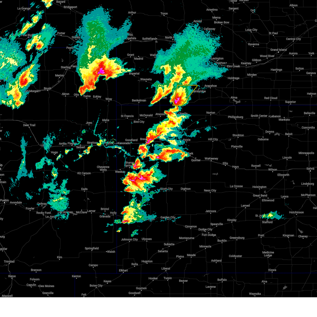 At 616 pm cdt, a severe thunderstorm was located 7 miles south of mccook, moving northeast at 35 mph (radar indicated). Hazards include ping pong ball size hail and 60 mph wind gusts. People and animals outdoors will be injured. expect hail damage to roofs, siding, windows, and vehicles. expect wind damage to roofs, siding, and trees. Locations impacted include, mccook, indianola, and bartley. At 616 pm cdt, a severe thunderstorm was located 7 miles south of mccook, moving northeast at 35 mph (radar indicated). Hazards include ping pong ball size hail and 60 mph wind gusts. People and animals outdoors will be injured. expect hail damage to roofs, siding, windows, and vehicles. expect wind damage to roofs, siding, and trees. Locations impacted include, mccook, indianola, and bartley.
|
| 4/25/2024 6:16 PM CDT |
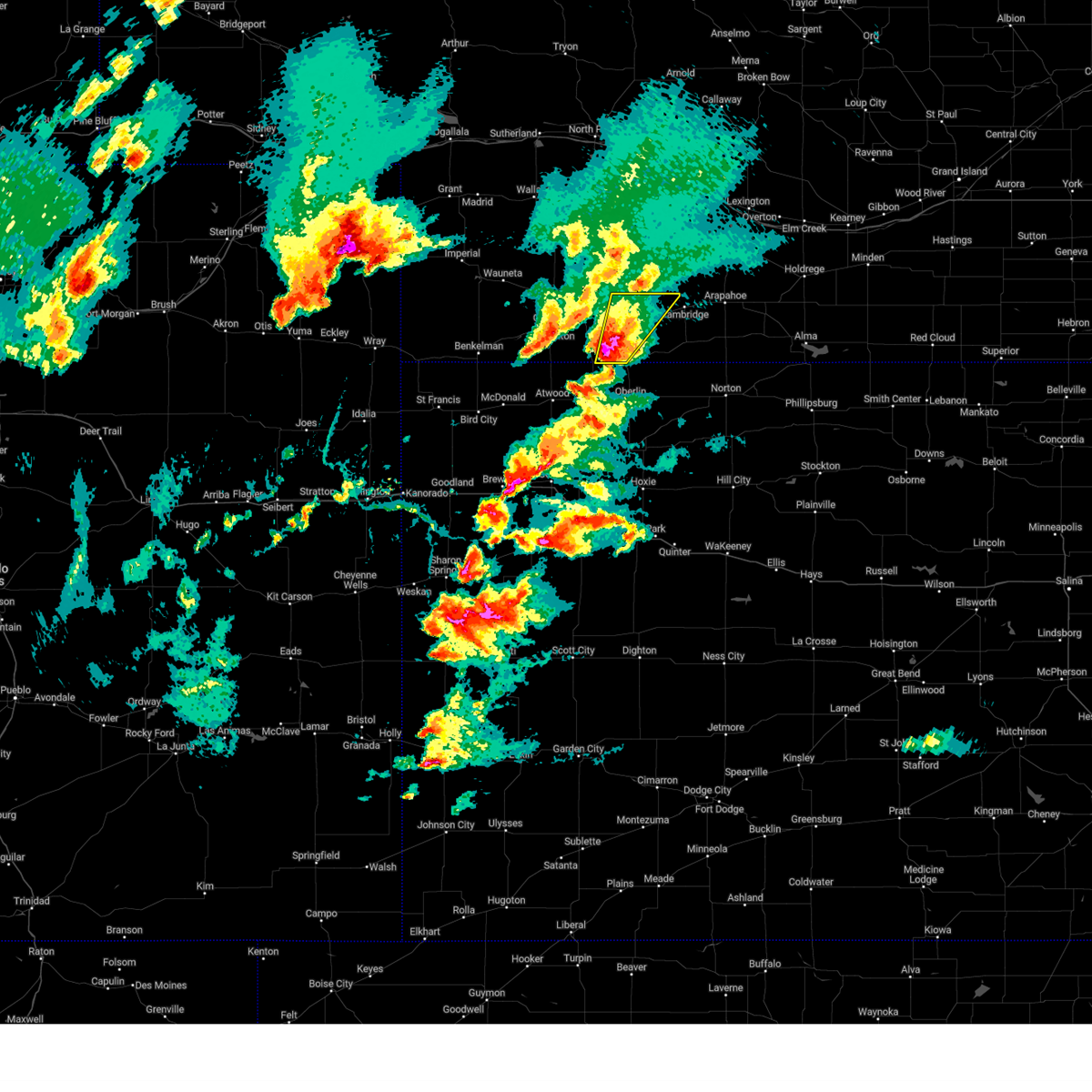 the severe thunderstorm warning has been cancelled and is no longer in effect the severe thunderstorm warning has been cancelled and is no longer in effect
|
| 4/25/2024 6:02 PM CDT |
 Svrgld the national weather service in goodland has issued a * severe thunderstorm warning for, red willow county in southwestern nebraska, eastern hitchcock county in southwestern nebraska, * until 700 pm cdt. * at 602 pm cdt, a severe thunderstorm was located 8 miles north of herndon, or 14 miles southwest of mccook, moving northeast at 25 mph (radar indicated). Hazards include 60 mph wind gusts and quarter size hail. Hail damage to vehicles is expected. Expect wind damage to roofs, siding, and trees. Svrgld the national weather service in goodland has issued a * severe thunderstorm warning for, red willow county in southwestern nebraska, eastern hitchcock county in southwestern nebraska, * until 700 pm cdt. * at 602 pm cdt, a severe thunderstorm was located 8 miles north of herndon, or 14 miles southwest of mccook, moving northeast at 25 mph (radar indicated). Hazards include 60 mph wind gusts and quarter size hail. Hail damage to vehicles is expected. Expect wind damage to roofs, siding, and trees.
|
| 4/7/2024 12:31 PM CDT | Report from mping: trees uprooted or snapped; roof blown of in red willow county NE, 0.5 miles NE of McCook, NE |
| 9/21/2023 7:13 PM CDT |
 At 712 pm cdt, a severe thunderstorm was located over danbury, or 15 miles northeast of oberlin, moving northeast at 10 mph (trained weather spotters). Hazards include golf ball size hail and 60 mph wind gusts. People and animals outdoors will be injured. expect hail damage to roofs, siding, windows, and vehicles. expect wind damage to roofs, siding, and trees. this severe storm will be near, danbury around 720 pm cdt. lebanon around 735 pm cdt. other locations impacted by this severe thunderstorm include traer and cedar bluffs. thunderstorm damage threat, considerable hail threat, observed max hail size, 1. 75 in wind threat, radar indicated max wind gust, 60 mph. At 712 pm cdt, a severe thunderstorm was located over danbury, or 15 miles northeast of oberlin, moving northeast at 10 mph (trained weather spotters). Hazards include golf ball size hail and 60 mph wind gusts. People and animals outdoors will be injured. expect hail damage to roofs, siding, windows, and vehicles. expect wind damage to roofs, siding, and trees. this severe storm will be near, danbury around 720 pm cdt. lebanon around 735 pm cdt. other locations impacted by this severe thunderstorm include traer and cedar bluffs. thunderstorm damage threat, considerable hail threat, observed max hail size, 1. 75 in wind threat, radar indicated max wind gust, 60 mph.
|
| 9/21/2023 6:59 PM CDT |
 At 659 pm cdt, a severe thunderstorm was located near danbury, or 14 miles north of oberlin, moving northeast at 20 mph (radar indicated). Hazards include ping pong ball size hail and 60 mph wind gusts. People and animals outdoors will be injured. expect hail damage to roofs, siding, windows, and vehicles. expect wind damage to roofs, siding, and trees. this severe thunderstorm will be near, danbury around 705 pm cdt. hail threat, radar indicated max hail size, 1. 50 in wind threat, radar indicated max wind gust, 60 mph. At 659 pm cdt, a severe thunderstorm was located near danbury, or 14 miles north of oberlin, moving northeast at 20 mph (radar indicated). Hazards include ping pong ball size hail and 60 mph wind gusts. People and animals outdoors will be injured. expect hail damage to roofs, siding, windows, and vehicles. expect wind damage to roofs, siding, and trees. this severe thunderstorm will be near, danbury around 705 pm cdt. hail threat, radar indicated max hail size, 1. 50 in wind threat, radar indicated max wind gust, 60 mph.
|
| 9/21/2023 6:33 PM CDT |
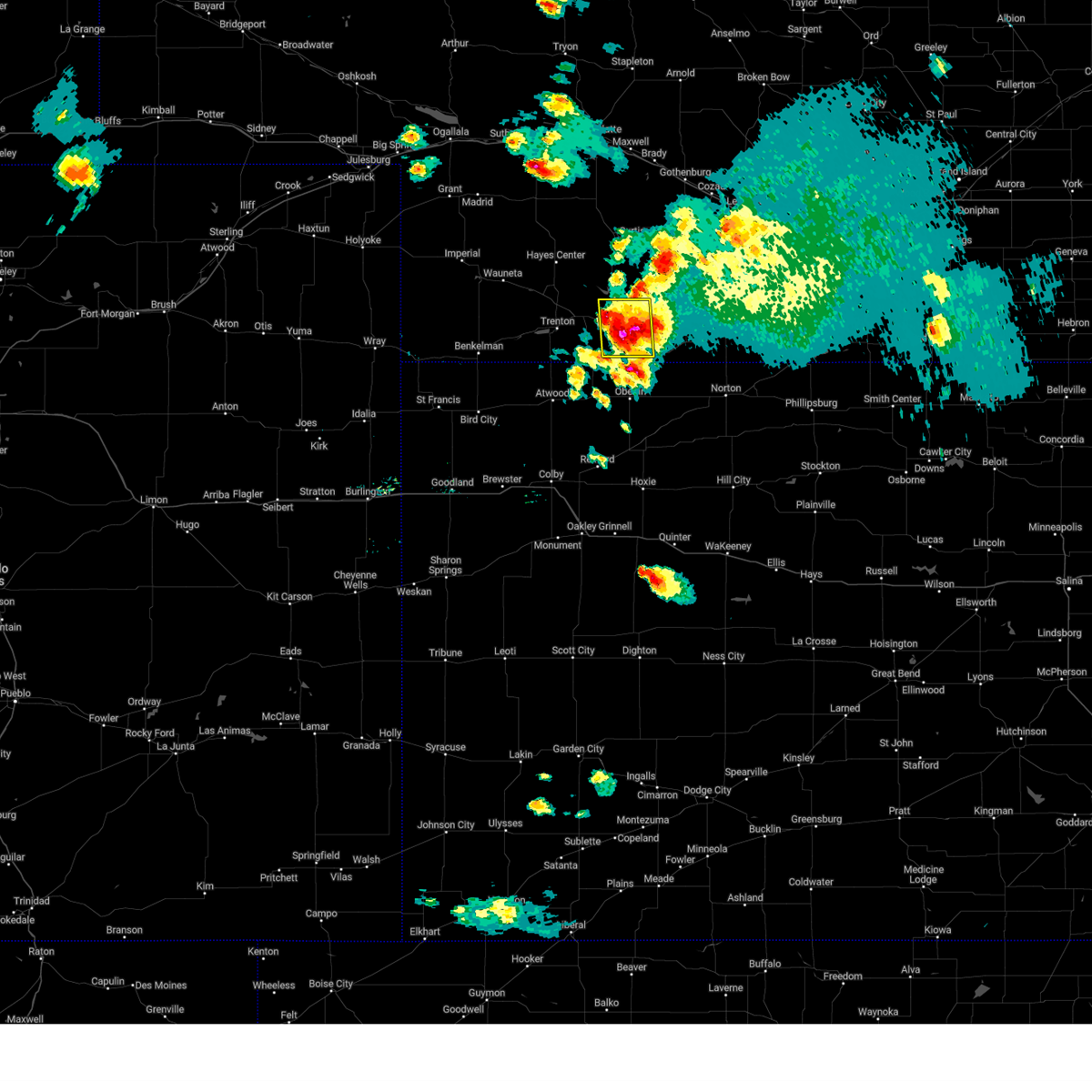 At 633 pm cdt, a severe thunderstorm was located 7 miles south of indianola, or 9 miles southeast of mccook, moving southeast at 15 mph (trained weather spotters). Hazards include 60 mph wind gusts and quarter size hail. Hail damage to vehicles is expected. expect wind damage to roofs, siding, and trees. this severe storm will be near, danbury around 655 pm cdt. hail threat, observed max hail size, 1. 00 in wind threat, radar indicated max wind gust, 60 mph. At 633 pm cdt, a severe thunderstorm was located 7 miles south of indianola, or 9 miles southeast of mccook, moving southeast at 15 mph (trained weather spotters). Hazards include 60 mph wind gusts and quarter size hail. Hail damage to vehicles is expected. expect wind damage to roofs, siding, and trees. this severe storm will be near, danbury around 655 pm cdt. hail threat, observed max hail size, 1. 00 in wind threat, radar indicated max wind gust, 60 mph.
|
| 9/21/2023 6:16 PM CDT | Quarter sized hail reported 8.6 miles NW of McCook, NE |
| 9/21/2023 5:58 PM CDT |
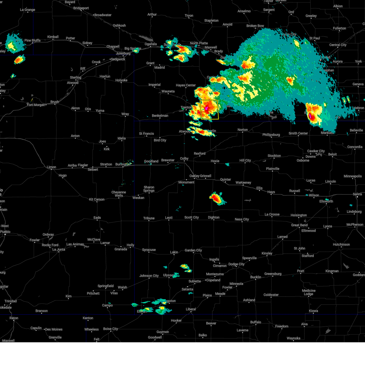 At 558 pm cdt, a severe thunderstorm was located near mccook, moving east at 5 mph (radar indicated). Hazards include ping pong ball size hail and 60 mph wind gusts. People and animals outdoors will be injured. expect hail damage to roofs, siding, windows, and vehicles. expect wind damage to roofs, siding, and trees. this severe thunderstorm will be near, mccook around 605 pm cdt. hail threat, radar indicated max hail size, 1. 50 in wind threat, radar indicated max wind gust, 60 mph. At 558 pm cdt, a severe thunderstorm was located near mccook, moving east at 5 mph (radar indicated). Hazards include ping pong ball size hail and 60 mph wind gusts. People and animals outdoors will be injured. expect hail damage to roofs, siding, windows, and vehicles. expect wind damage to roofs, siding, and trees. this severe thunderstorm will be near, mccook around 605 pm cdt. hail threat, radar indicated max hail size, 1. 50 in wind threat, radar indicated max wind gust, 60 mph.
|
| 9/21/2023 5:56 PM CDT |
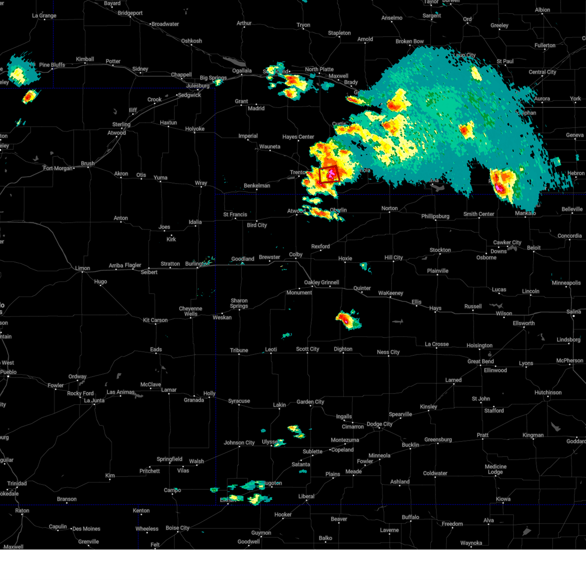 The tornado warning for west central red willow county will expire at 600 pm cdt, the tornado threat has diminished and the tornado warning will be allowed to expire. however, large hail and damaging winds remain likely and a severe thunderstorm warning remains in effect for the area. a tornado watch remains in effect until 1000 pm cdt for southwestern nebraska. The tornado warning for west central red willow county will expire at 600 pm cdt, the tornado threat has diminished and the tornado warning will be allowed to expire. however, large hail and damaging winds remain likely and a severe thunderstorm warning remains in effect for the area. a tornado watch remains in effect until 1000 pm cdt for southwestern nebraska.
|
| 9/21/2023 5:32 PM CDT |
 At 532 pm cdt, a severe thunderstorm was located near mccook, moving east at 10 mph (trained weather spotters). Hazards include golf ball size hail and 60 mph wind gusts. People and animals outdoors will be injured. expect hail damage to roofs, siding, windows, and vehicles. expect wind damage to roofs, siding, and trees. this severe storm will be near, mccook around 540 pm cdt. thunderstorm damage threat, considerable hail threat, observed max hail size, 1. 75 in wind threat, radar indicated max wind gust, 60 mph. At 532 pm cdt, a severe thunderstorm was located near mccook, moving east at 10 mph (trained weather spotters). Hazards include golf ball size hail and 60 mph wind gusts. People and animals outdoors will be injured. expect hail damage to roofs, siding, windows, and vehicles. expect wind damage to roofs, siding, and trees. this severe storm will be near, mccook around 540 pm cdt. thunderstorm damage threat, considerable hail threat, observed max hail size, 1. 75 in wind threat, radar indicated max wind gust, 60 mph.
|
| 9/21/2023 5:30 PM CDT | Half Dollar sized hail reported 0.5 miles NE of McCook, NE, hail on the ground ranged from nickel to half dollar sized. |
| 9/21/2023 5:28 PM CDT |
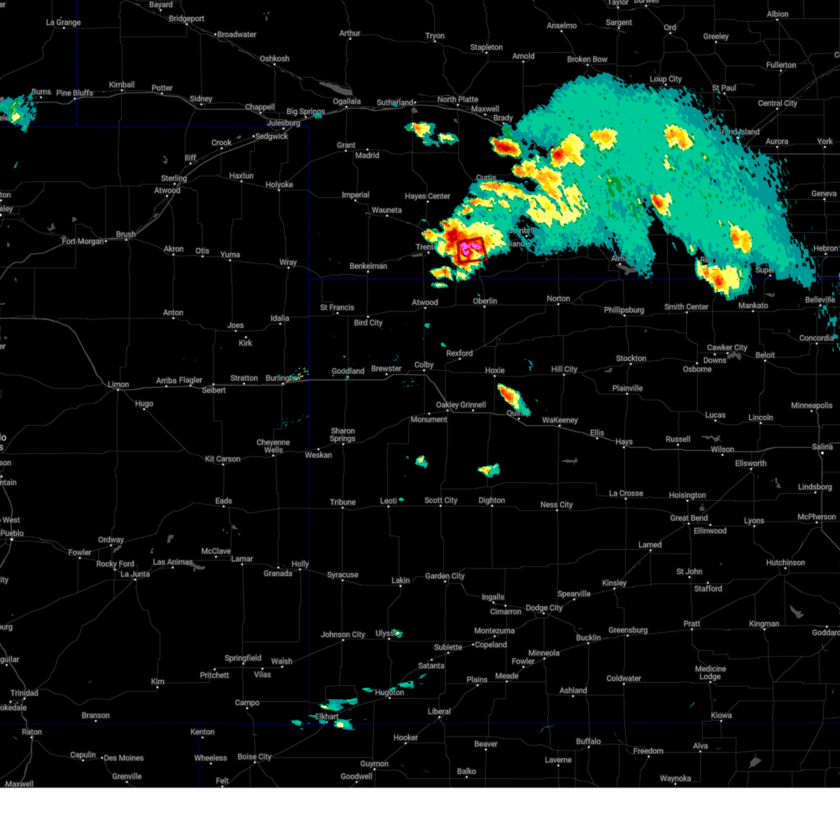 At 528 pm cdt, a severe thunderstorm capable of producing a tornado was located near mccook, moving northeast at 5 mph (radar indicated rotation). Hazards include tornado and golf ball size hail. Flying debris will be dangerous to those caught without shelter. mobile homes will be damaged or destroyed. damage to roofs, windows, and vehicles will occur. tree damage is likely. This dangerous storm will be near, mccook around 535 pm cdt. At 528 pm cdt, a severe thunderstorm capable of producing a tornado was located near mccook, moving northeast at 5 mph (radar indicated rotation). Hazards include tornado and golf ball size hail. Flying debris will be dangerous to those caught without shelter. mobile homes will be damaged or destroyed. damage to roofs, windows, and vehicles will occur. tree damage is likely. This dangerous storm will be near, mccook around 535 pm cdt.
|
| 9/21/2023 5:20 PM CDT |
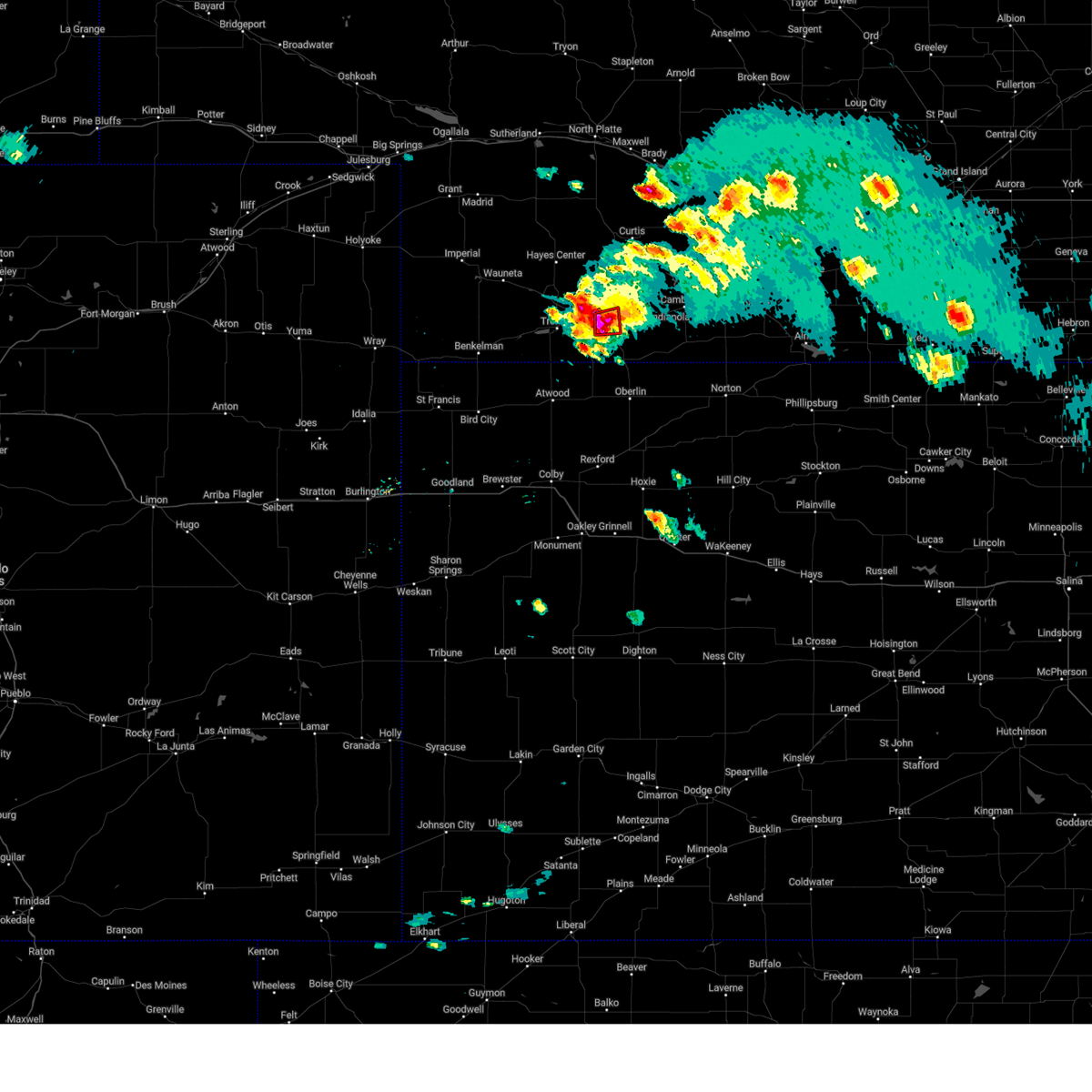 At 519 pm cdt, a severe thunderstorm capable of producing a tornado was located near mccook, moving east at 10 mph (weather spotters reported a funnel cloud). Hazards include tornado. Flying debris will be dangerous to those caught without shelter. mobile homes will be damaged or destroyed. damage to roofs, windows, and vehicles will occur. tree damage is likely. Locations impacted include, mccook. At 519 pm cdt, a severe thunderstorm capable of producing a tornado was located near mccook, moving east at 10 mph (weather spotters reported a funnel cloud). Hazards include tornado. Flying debris will be dangerous to those caught without shelter. mobile homes will be damaged or destroyed. damage to roofs, windows, and vehicles will occur. tree damage is likely. Locations impacted include, mccook.
|
| 9/21/2023 5:01 PM CDT |
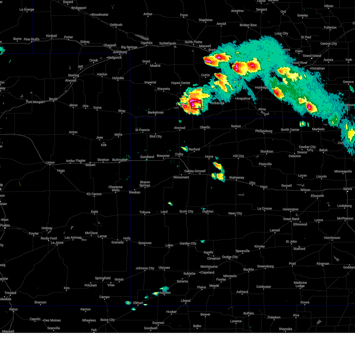 At 501 pm cdt, a severe thunderstorm capable of producing a tornado was located 5 miles southeast of culbertson, or 6 miles west of mccook, moving east at 10 mph (weather spotters reported funnel cloud). Hazards include tornado. Flying debris will be dangerous to those caught without shelter. mobile homes will be damaged or destroyed. damage to roofs, windows, and vehicles will occur. tree damage is likely. This dangerous storm will be near, mccook around 505 pm cdt. At 501 pm cdt, a severe thunderstorm capable of producing a tornado was located 5 miles southeast of culbertson, or 6 miles west of mccook, moving east at 10 mph (weather spotters reported funnel cloud). Hazards include tornado. Flying debris will be dangerous to those caught without shelter. mobile homes will be damaged or destroyed. damage to roofs, windows, and vehicles will occur. tree damage is likely. This dangerous storm will be near, mccook around 505 pm cdt.
|
| 9/21/2023 5:00 PM CDT | Cwop station 9.5 miles sw mccoo in red willow county NE, 9.3 miles NE of McCook, NE |
| 9/21/2023 5:00 PM CDT |
 At 500 pm cdt, a severe thunderstorm was located 4 miles east of culbertson, or 6 miles west of mccook, moving east at 15 mph (trained weather spotters). Hazards include two inch hail and 60 mph wind gusts. People and animals outdoors will be injured. expect hail damage to roofs, siding, windows, and vehicles. expect wind damage to roofs, siding, and trees. this severe thunderstorm will be near, mccook around 505 pm cdt. thunderstorm damage threat, considerable hail threat, observed max hail size, 2. 00 in wind threat, radar indicated max wind gust, 60 mph. At 500 pm cdt, a severe thunderstorm was located 4 miles east of culbertson, or 6 miles west of mccook, moving east at 15 mph (trained weather spotters). Hazards include two inch hail and 60 mph wind gusts. People and animals outdoors will be injured. expect hail damage to roofs, siding, windows, and vehicles. expect wind damage to roofs, siding, and trees. this severe thunderstorm will be near, mccook around 505 pm cdt. thunderstorm damage threat, considerable hail threat, observed max hail size, 2. 00 in wind threat, radar indicated max wind gust, 60 mph.
|
| 9/9/2023 8:27 PM CDT |
 The severe thunderstorm warning for southwestern red willow and eastern hitchcock counties will expire at 830 pm cdt, the storm which prompted the warning has moved out of the area. therefore, the warning will be allowed to expire. however, small hail and gusty winds are still possible with this thunderstorm. a severe thunderstorm watch remains in effect until midnight cdt for northwestern kansas, and southwestern nebraska. The severe thunderstorm warning for southwestern red willow and eastern hitchcock counties will expire at 830 pm cdt, the storm which prompted the warning has moved out of the area. therefore, the warning will be allowed to expire. however, small hail and gusty winds are still possible with this thunderstorm. a severe thunderstorm watch remains in effect until midnight cdt for northwestern kansas, and southwestern nebraska.
|
| 9/9/2023 8:17 PM CDT |
 At 817 pm cdt, a severe thunderstorm was located 9 miles northeast of herndon, or 12 miles south of mccook, moving southeast at 25 mph (radar indicated). Hazards include 60 mph wind gusts and half dollar size hail. Hail damage to vehicles is expected. expect wind damage to roofs, siding, and trees. locations impacted include, mccook, trenton, and culbertson. hail threat, radar indicated max hail size, 1. 25 in wind threat, radar indicated max wind gust, 60 mph. At 817 pm cdt, a severe thunderstorm was located 9 miles northeast of herndon, or 12 miles south of mccook, moving southeast at 25 mph (radar indicated). Hazards include 60 mph wind gusts and half dollar size hail. Hail damage to vehicles is expected. expect wind damage to roofs, siding, and trees. locations impacted include, mccook, trenton, and culbertson. hail threat, radar indicated max hail size, 1. 25 in wind threat, radar indicated max wind gust, 60 mph.
|
| 9/9/2023 7:55 PM CDT |
 At 755 pm cdt, a severe thunderstorm was located 5 miles southeast of culbertson, or 8 miles west of mccook, moving southeast at 35 mph (radar indicated). Hazards include ping pong ball size hail and 60 mph wind gusts. People and animals outdoors will be injured. expect hail damage to roofs, siding, windows, and vehicles. expect wind damage to roofs, siding, and trees. This severe thunderstorm will remain over mainly rural areas of southwestern red willow and eastern hitchcock counties. At 755 pm cdt, a severe thunderstorm was located 5 miles southeast of culbertson, or 8 miles west of mccook, moving southeast at 35 mph (radar indicated). Hazards include ping pong ball size hail and 60 mph wind gusts. People and animals outdoors will be injured. expect hail damage to roofs, siding, windows, and vehicles. expect wind damage to roofs, siding, and trees. This severe thunderstorm will remain over mainly rural areas of southwestern red willow and eastern hitchcock counties.
|
| 9/9/2023 7:51 PM CDT |
 At 751 pm cdt, a severe thunderstorm was located 5 miles southeast of culbertson, or 7 miles west of mccook, moving southeast at 40 mph (radar indicated). Hazards include ping pong ball size hail and 60 mph wind gusts. People and animals outdoors will be injured. expect hail damage to roofs, siding, windows, and vehicles. expect wind damage to roofs, siding, and trees. this severe thunderstorm will remain over mainly rural areas of southwestern red willow and eastern hitchcock counties. hail threat, radar indicated max hail size, 1. 50 in wind threat, radar indicated max wind gust, 60 mph. At 751 pm cdt, a severe thunderstorm was located 5 miles southeast of culbertson, or 7 miles west of mccook, moving southeast at 40 mph (radar indicated). Hazards include ping pong ball size hail and 60 mph wind gusts. People and animals outdoors will be injured. expect hail damage to roofs, siding, windows, and vehicles. expect wind damage to roofs, siding, and trees. this severe thunderstorm will remain over mainly rural areas of southwestern red willow and eastern hitchcock counties. hail threat, radar indicated max hail size, 1. 50 in wind threat, radar indicated max wind gust, 60 mph.
|
| 9/9/2023 7:42 PM CDT | Asos station kmck mccook airpor in red willow county NE, 2.4 miles W of McCook, NE |
| 9/9/2023 7:26 PM CDT |
 At 726 pm cdt, a severe thunderstorm was located 8 miles northwest of culbertson, or 12 miles northeast of trenton, moving southeast at 25 mph (radar indicated). Hazards include ping pong ball size hail and 60 mph wind gusts. People and animals outdoors will be injured. expect hail damage to roofs, siding, windows, and vehicles. expect wind damage to roofs, siding, and trees. this severe thunderstorm will be near, culbertson around 735 pm cdt. hail threat, radar indicated max hail size, 1. 50 in wind threat, radar indicated max wind gust, 60 mph. At 726 pm cdt, a severe thunderstorm was located 8 miles northwest of culbertson, or 12 miles northeast of trenton, moving southeast at 25 mph (radar indicated). Hazards include ping pong ball size hail and 60 mph wind gusts. People and animals outdoors will be injured. expect hail damage to roofs, siding, windows, and vehicles. expect wind damage to roofs, siding, and trees. this severe thunderstorm will be near, culbertson around 735 pm cdt. hail threat, radar indicated max hail size, 1. 50 in wind threat, radar indicated max wind gust, 60 mph.
|
| 8/5/2023 8:36 PM CDT |
 The severe thunderstorm warning for northern cheyenne and northern rawlins counties in northwestern kansas, western red willow, hitchcock and southeastern dundy counties in southwestern nebraska will expire at 745 pm mdt/845 pm cdt/, the storms which prompted the warning have weakened. therefore, the warning will be allowed to expire. however small hail and gusty winds are still possible with these thunderstorms. a severe thunderstorm watch remains in effect until midnight mdt/100 am cdt/ for northwestern kansas, and southwestern nebraska. The severe thunderstorm warning for northern cheyenne and northern rawlins counties in northwestern kansas, western red willow, hitchcock and southeastern dundy counties in southwestern nebraska will expire at 745 pm mdt/845 pm cdt/, the storms which prompted the warning have weakened. therefore, the warning will be allowed to expire. however small hail and gusty winds are still possible with these thunderstorms. a severe thunderstorm watch remains in effect until midnight mdt/100 am cdt/ for northwestern kansas, and southwestern nebraska.
|
| 8/5/2023 8:06 PM CDT |
 At 705 pm mdt/805 pm cdt/, severe thunderstorms were located along a line extending from 4 miles southeast of palisade to near stratton to 7 miles southwest of benkelman, moving east at 35 mph (radar indicated). Hazards include 60 mph wind gusts and quarter size hail. Hail damage to vehicles is expected. expect wind damage to roofs, siding, and trees. locations impacted include, palisade, stratton, trenton, culbertson, mccook and indianola. hail threat, radar indicated max hail size, 1. 00 in wind threat, radar indicated max wind gust, 60 mph. At 705 pm mdt/805 pm cdt/, severe thunderstorms were located along a line extending from 4 miles southeast of palisade to near stratton to 7 miles southwest of benkelman, moving east at 35 mph (radar indicated). Hazards include 60 mph wind gusts and quarter size hail. Hail damage to vehicles is expected. expect wind damage to roofs, siding, and trees. locations impacted include, palisade, stratton, trenton, culbertson, mccook and indianola. hail threat, radar indicated max hail size, 1. 00 in wind threat, radar indicated max wind gust, 60 mph.
|
| 8/5/2023 7:46 PM CDT |
 At 646 pm mdt/746 pm cdt/, severe thunderstorms were located along a line extending from 7 miles west of palisade to 6 miles northeast of benkelman to 8 miles east of haigler, moving east at 35 mph (radar indicated). Hazards include 60 mph wind gusts and quarter size hail. Hail damage to vehicles is expected. expect wind damage to roofs, siding, and trees. severe thunderstorms will be near, palisade around 800 pm cdt. stratton around 805 pm cdt. other locations in the path of these severe thunderstorms include trenton, culbertson and mccook. hail threat, radar indicated max hail size, 1. 00 in wind threat, radar indicated max wind gust, 60 mph. At 646 pm mdt/746 pm cdt/, severe thunderstorms were located along a line extending from 7 miles west of palisade to 6 miles northeast of benkelman to 8 miles east of haigler, moving east at 35 mph (radar indicated). Hazards include 60 mph wind gusts and quarter size hail. Hail damage to vehicles is expected. expect wind damage to roofs, siding, and trees. severe thunderstorms will be near, palisade around 800 pm cdt. stratton around 805 pm cdt. other locations in the path of these severe thunderstorms include trenton, culbertson and mccook. hail threat, radar indicated max hail size, 1. 00 in wind threat, radar indicated max wind gust, 60 mph.
|
| 8/4/2023 9:28 PM CDT |
 The severe thunderstorm warning for northwestern decatur and red willow counties will expire at 930 pm cdt, the storms which prompted the warning have weakened below severe limits, and no longer pose an immediate threat to life or property. therefore, the warning will be allowed to expire. however gusty winds are still possible with these thunderstorms. a severe thunderstorm watch remains in effect until 100 am cdt for northwestern kansas, and southwestern nebraska. The severe thunderstorm warning for northwestern decatur and red willow counties will expire at 930 pm cdt, the storms which prompted the warning have weakened below severe limits, and no longer pose an immediate threat to life or property. therefore, the warning will be allowed to expire. however gusty winds are still possible with these thunderstorms. a severe thunderstorm watch remains in effect until 100 am cdt for northwestern kansas, and southwestern nebraska.
|
| 8/4/2023 9:28 PM CDT |
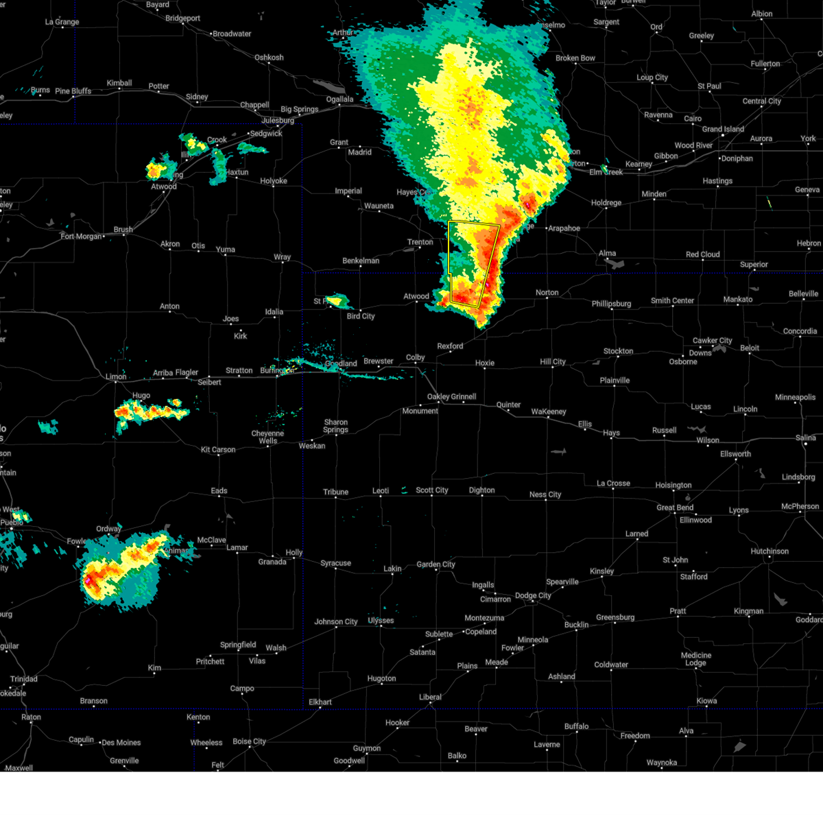 The severe thunderstorm warning for northwestern decatur and red willow counties will expire at 930 pm cdt, the storms which prompted the warning have weakened below severe limits, and no longer pose an immediate threat to life or property. therefore, the warning will be allowed to expire. however gusty winds are still possible with these thunderstorms. a severe thunderstorm watch remains in effect until 100 am cdt for northwestern kansas, and southwestern nebraska. The severe thunderstorm warning for northwestern decatur and red willow counties will expire at 930 pm cdt, the storms which prompted the warning have weakened below severe limits, and no longer pose an immediate threat to life or property. therefore, the warning will be allowed to expire. however gusty winds are still possible with these thunderstorms. a severe thunderstorm watch remains in effect until 100 am cdt for northwestern kansas, and southwestern nebraska.
|
| 8/4/2023 9:14 PM CDT |
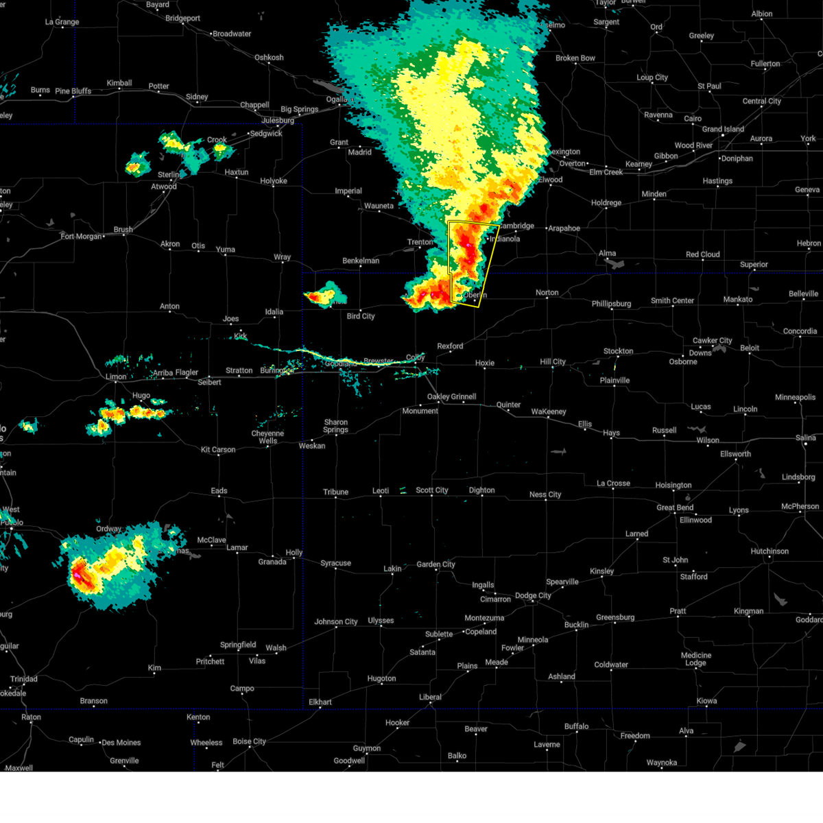 At 913 pm cdt, severe thunderstorms were located along a line extending from near indianola to 6 miles west of oberlin, moving east at 45 mph (radar indicated). Hazards include 60 mph wind gusts and nickel size hail. Expect damage to roofs, siding, and trees. locations impacted include, mccook, oberlin, indianola, danbury, cedar bluffs and traer. hail threat, radar indicated max hail size, 0. 88 in wind threat, radar indicated max wind gust, 60 mph. At 913 pm cdt, severe thunderstorms were located along a line extending from near indianola to 6 miles west of oberlin, moving east at 45 mph (radar indicated). Hazards include 60 mph wind gusts and nickel size hail. Expect damage to roofs, siding, and trees. locations impacted include, mccook, oberlin, indianola, danbury, cedar bluffs and traer. hail threat, radar indicated max hail size, 0. 88 in wind threat, radar indicated max wind gust, 60 mph.
|
| 8/4/2023 9:14 PM CDT |
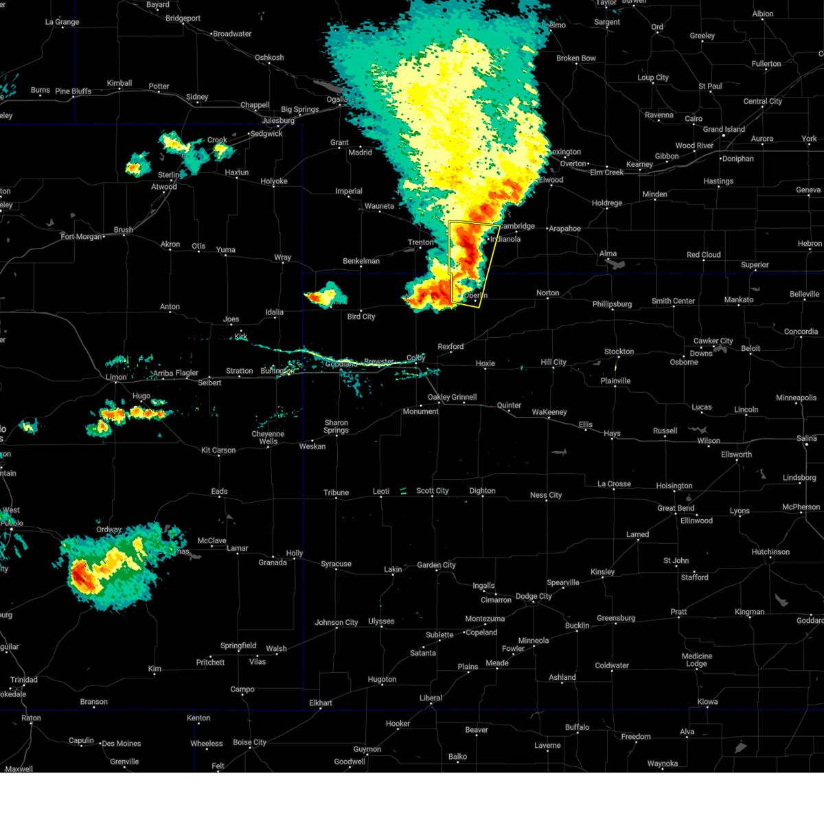 At 913 pm cdt, severe thunderstorms were located along a line extending from near indianola to 6 miles west of oberlin, moving east at 45 mph (radar indicated). Hazards include 60 mph wind gusts and nickel size hail. Expect damage to roofs, siding, and trees. locations impacted include, mccook, oberlin, indianola, danbury, cedar bluffs and traer. hail threat, radar indicated max hail size, 0. 88 in wind threat, radar indicated max wind gust, 60 mph. At 913 pm cdt, severe thunderstorms were located along a line extending from near indianola to 6 miles west of oberlin, moving east at 45 mph (radar indicated). Hazards include 60 mph wind gusts and nickel size hail. Expect damage to roofs, siding, and trees. locations impacted include, mccook, oberlin, indianola, danbury, cedar bluffs and traer. hail threat, radar indicated max hail size, 0. 88 in wind threat, radar indicated max wind gust, 60 mph.
|
| 8/4/2023 8:58 PM CDT |
 At 858 pm cdt, severe thunderstorms were located along a line extending from 6 miles east of culbertson to 4 miles northeast of ludell, moving southeast at 40 mph (radar indicated). Hazards include 60 mph wind gusts and nickel size hail. Expect damage to roofs, siding, and trees. locations impacted include, mccook, herndon, indianola, oberlin and danbury. hail threat, radar indicated max hail size, 0. 88 in wind threat, radar indicated max wind gust, 60 mph. At 858 pm cdt, severe thunderstorms were located along a line extending from 6 miles east of culbertson to 4 miles northeast of ludell, moving southeast at 40 mph (radar indicated). Hazards include 60 mph wind gusts and nickel size hail. Expect damage to roofs, siding, and trees. locations impacted include, mccook, herndon, indianola, oberlin and danbury. hail threat, radar indicated max hail size, 0. 88 in wind threat, radar indicated max wind gust, 60 mph.
|
| 8/4/2023 8:26 PM CDT |
 At 826 pm cdt, severe thunderstorms were located along a line extending from near palisade to 7 miles south of stratton, moving east at 30 mph (radar indicated). Hazards include 60 mph wind gusts and quarter size hail. Hail damage to vehicles is expected. expect wind damage to roofs, siding, and trees. severe thunderstorms will be near, trenton around 840 pm cdt. other locations in the path of these severe thunderstorms include culbertson, mccook, herndon and indianola. hail threat, radar indicated max hail size, 1. 00 in wind threat, radar indicated max wind gust, 60 mph. At 826 pm cdt, severe thunderstorms were located along a line extending from near palisade to 7 miles south of stratton, moving east at 30 mph (radar indicated). Hazards include 60 mph wind gusts and quarter size hail. Hail damage to vehicles is expected. expect wind damage to roofs, siding, and trees. severe thunderstorms will be near, trenton around 840 pm cdt. other locations in the path of these severe thunderstorms include culbertson, mccook, herndon and indianola. hail threat, radar indicated max hail size, 1. 00 in wind threat, radar indicated max wind gust, 60 mph.
|
| 7/22/2023 9:26 PM CDT |
 At 926 pm cdt, a severe thunderstorm was located 7 miles south of culbertson, or 10 miles east of trenton, moving south at 40 mph (public reported golf ball size hail in culbertson). Hazards include golf ball size hail and 60 mph wind gusts. People and animals outdoors will be injured. expect hail damage to roofs, siding, windows, and vehicles. Expect wind damage to roofs, siding, and trees. At 926 pm cdt, a severe thunderstorm was located 7 miles south of culbertson, or 10 miles east of trenton, moving south at 40 mph (public reported golf ball size hail in culbertson). Hazards include golf ball size hail and 60 mph wind gusts. People and animals outdoors will be injured. expect hail damage to roofs, siding, windows, and vehicles. Expect wind damage to roofs, siding, and trees.
|
| 7/22/2023 9:24 PM CDT |
 At 923 pm cdt, a severe thunderstorm was located 7 miles south of culbertson, or 10 miles east of trenton, moving south at 40 mph (public reported golf ball size hail in culbertson). Hazards include golf ball size hail and 60 mph wind gusts. People and animals outdoors will be injured. expect hail damage to roofs, siding, windows, and vehicles. expect wind damage to roofs, siding, and trees. Locations impacted include, mccook, trenton and culbertson. At 923 pm cdt, a severe thunderstorm was located 7 miles south of culbertson, or 10 miles east of trenton, moving south at 40 mph (public reported golf ball size hail in culbertson). Hazards include golf ball size hail and 60 mph wind gusts. People and animals outdoors will be injured. expect hail damage to roofs, siding, windows, and vehicles. expect wind damage to roofs, siding, and trees. Locations impacted include, mccook, trenton and culbertson.
|
| 7/22/2023 9:17 PM CDT |
 At 917 pm cdt, a severe thunderstorm was located near culbertson, or 9 miles east of trenton, moving south at 40 mph (radar indicated). Hazards include ping pong ball size hail and 60 mph wind gusts. People and animals outdoors will be injured. expect hail damage to roofs, siding, windows, and vehicles. expect wind damage to roofs, siding, and trees. This severe thunderstorm will remain over mainly rural areas of western red willow and eastern hitchcock counties. At 917 pm cdt, a severe thunderstorm was located near culbertson, or 9 miles east of trenton, moving south at 40 mph (radar indicated). Hazards include ping pong ball size hail and 60 mph wind gusts. People and animals outdoors will be injured. expect hail damage to roofs, siding, windows, and vehicles. expect wind damage to roofs, siding, and trees. This severe thunderstorm will remain over mainly rural areas of western red willow and eastern hitchcock counties.
|
| 7/22/2023 9:05 PM CDT |
 At 905 pm cdt, a severe thunderstorm was located 4 miles north of culbertson, or 12 miles northeast of trenton, moving south at 40 mph (radar indicated). Hazards include 60 mph wind gusts and half dollar size hail. Hail damage to vehicles is expected. expect wind damage to roofs, siding, and trees. This severe storm will be near, culbertson around 910 pm cdt. At 905 pm cdt, a severe thunderstorm was located 4 miles north of culbertson, or 12 miles northeast of trenton, moving south at 40 mph (radar indicated). Hazards include 60 mph wind gusts and half dollar size hail. Hail damage to vehicles is expected. expect wind damage to roofs, siding, and trees. This severe storm will be near, culbertson around 910 pm cdt.
|
| 7/22/2023 8:52 PM CDT |
 At 852 pm cdt, a severe thunderstorm was located 12 miles north of culbertson, or 12 miles southeast of hayes center, moving south at 40 mph (radar indicated). Hazards include 60 mph wind gusts and quarter size hail. Hail damage to vehicles is expected. expect wind damage to roofs, siding, and trees. this severe thunderstorm will be near, culbertson around 910 pm cdt. hail threat, radar indicated max hail size, 1. 00 in wind threat, radar indicated max wind gust, 60 mph. At 852 pm cdt, a severe thunderstorm was located 12 miles north of culbertson, or 12 miles southeast of hayes center, moving south at 40 mph (radar indicated). Hazards include 60 mph wind gusts and quarter size hail. Hail damage to vehicles is expected. expect wind damage to roofs, siding, and trees. this severe thunderstorm will be near, culbertson around 910 pm cdt. hail threat, radar indicated max hail size, 1. 00 in wind threat, radar indicated max wind gust, 60 mph.
|
| 7/14/2023 11:07 AM CDT |
 At 1107 am cdt, a severe thunderstorm was located 5 miles north of danbury, or 13 miles southeast of mccook, moving southeast at 40 mph (radar indicated). Hazards include 60 mph wind gusts and quarter size hail. Hail damage to vehicles is expected. expect wind damage to roofs, siding, and trees. locations impacted include, mccook, indianola, bartley, danbury and lebanon. hail threat, radar indicated max hail size, 1. 00 in wind threat, radar indicated max wind gust, 60 mph. At 1107 am cdt, a severe thunderstorm was located 5 miles north of danbury, or 13 miles southeast of mccook, moving southeast at 40 mph (radar indicated). Hazards include 60 mph wind gusts and quarter size hail. Hail damage to vehicles is expected. expect wind damage to roofs, siding, and trees. locations impacted include, mccook, indianola, bartley, danbury and lebanon. hail threat, radar indicated max hail size, 1. 00 in wind threat, radar indicated max wind gust, 60 mph.
|
| 7/14/2023 10:47 AM CDT |
 At 1047 am cdt, a severe thunderstorm was located 6 miles south of cambridge, or 22 miles east of mccook, moving southeast at 45 mph (trained weather spotters reported 60 mph wind gusts near bartley). Hazards include 60 mph wind gusts and half dollar size hail. Hail damage to vehicles is expected. expect wind damage to roofs, siding, and trees. locations impacted include, mccook, indianola, bartley, danbury and lebanon. hail threat, radar indicated max hail size, 1. 25 in wind threat, radar indicated max wind gust, 60 mph. At 1047 am cdt, a severe thunderstorm was located 6 miles south of cambridge, or 22 miles east of mccook, moving southeast at 45 mph (trained weather spotters reported 60 mph wind gusts near bartley). Hazards include 60 mph wind gusts and half dollar size hail. Hail damage to vehicles is expected. expect wind damage to roofs, siding, and trees. locations impacted include, mccook, indianola, bartley, danbury and lebanon. hail threat, radar indicated max hail size, 1. 25 in wind threat, radar indicated max wind gust, 60 mph.
|
| 7/14/2023 10:44 AM CDT |
 At 1043 am cdt, a severe thunderstorm was located 4 miles southeast of bartley, or 20 miles east of mccook, moving southeast at 45 mph (radar indicated). Hazards include 60 mph wind gusts and half dollar size hail. Hail damage to vehicles is expected. expect wind damage to roofs, siding, and trees. locations impacted include, mccook, indianola, bartley, danbury and lebanon. hail threat, radar indicated max hail size, 1. 25 in wind threat, radar indicated max wind gust, 60 mph. At 1043 am cdt, a severe thunderstorm was located 4 miles southeast of bartley, or 20 miles east of mccook, moving southeast at 45 mph (radar indicated). Hazards include 60 mph wind gusts and half dollar size hail. Hail damage to vehicles is expected. expect wind damage to roofs, siding, and trees. locations impacted include, mccook, indianola, bartley, danbury and lebanon. hail threat, radar indicated max hail size, 1. 25 in wind threat, radar indicated max wind gust, 60 mph.
|
| 7/14/2023 10:35 AM CDT |
 At 1034 am cdt, a severe thunderstorm was located near bartley, or 16 miles east of mccook, moving southeast at 45 mph (radar indicated. at 1030 am cdt mccook aiport recorded a 53 mph wind gust). Hazards include 60 mph wind gusts and half dollar size hail. Hail damage to vehicles is expected. expect wind damage to roofs, siding, and trees. locations impacted include, mccook, indianola, bartley, danbury and lebanon. hail threat, radar indicated max hail size, 1. 25 in wind threat, radar indicated max wind gust, 60 mph. At 1034 am cdt, a severe thunderstorm was located near bartley, or 16 miles east of mccook, moving southeast at 45 mph (radar indicated. at 1030 am cdt mccook aiport recorded a 53 mph wind gust). Hazards include 60 mph wind gusts and half dollar size hail. Hail damage to vehicles is expected. expect wind damage to roofs, siding, and trees. locations impacted include, mccook, indianola, bartley, danbury and lebanon. hail threat, radar indicated max hail size, 1. 25 in wind threat, radar indicated max wind gust, 60 mph.
|
| 7/14/2023 10:13 AM CDT |
 At 1013 am cdt, a severe thunderstorm was located 10 miles southwest of stockville, or 13 miles south of curtis, moving southeast at 45 mph (radar indicated). Hazards include 60 mph wind gusts and half dollar size hail. Hail damage to vehicles is expected. Expect wind damage to roofs, siding, and trees. At 1013 am cdt, a severe thunderstorm was located 10 miles southwest of stockville, or 13 miles south of curtis, moving southeast at 45 mph (radar indicated). Hazards include 60 mph wind gusts and half dollar size hail. Hail damage to vehicles is expected. Expect wind damage to roofs, siding, and trees.
|
| 7/10/2023 7:47 PM CDT |
 At 747 pm cdt, a severe thunderstorm was located 6 miles southwest of oberlin, moving east at 20 mph (public reported quarter size hail north of colby). Hazards include 70 mph wind gusts and quarter size hail. Hail damage to vehicles is expected. expect considerable tree damage. wind damage is also likely to mobile homes, roofs, and outbuildings. locations impacted include, dresden. thunderstorm damage threat, considerable hail threat, radar indicated max hail size, 1. 00 in wind threat, radar indicated max wind gust, 70 mph. At 747 pm cdt, a severe thunderstorm was located 6 miles southwest of oberlin, moving east at 20 mph (public reported quarter size hail north of colby). Hazards include 70 mph wind gusts and quarter size hail. Hail damage to vehicles is expected. expect considerable tree damage. wind damage is also likely to mobile homes, roofs, and outbuildings. locations impacted include, dresden. thunderstorm damage threat, considerable hail threat, radar indicated max hail size, 1. 00 in wind threat, radar indicated max wind gust, 70 mph.
|
| 7/10/2023 7:01 PM CDT |
 At 700 pm cdt, a severe thunderstorm was located 5 miles east of ludell, or 9 miles east of atwood, moving southeast at 20 mph (mesonet. multiple weather stations in rawlins county has reported 65-70 mph wind gusts). Hazards include 70 mph wind gusts and quarter size hail. Hail damage to vehicles is expected. expect considerable tree damage. wind damage is also likely to mobile homes, roofs, and outbuildings. this severe thunderstorm will be near, herndon around 705 pm cdt. other locations in the path of this severe thunderstorm include oberlin and dresden. thunderstorm damage threat, considerable hail threat, radar indicated max hail size, 1. 00 in wind threat, radar indicated max wind gust, 70 mph. At 700 pm cdt, a severe thunderstorm was located 5 miles east of ludell, or 9 miles east of atwood, moving southeast at 20 mph (mesonet. multiple weather stations in rawlins county has reported 65-70 mph wind gusts). Hazards include 70 mph wind gusts and quarter size hail. Hail damage to vehicles is expected. expect considerable tree damage. wind damage is also likely to mobile homes, roofs, and outbuildings. this severe thunderstorm will be near, herndon around 705 pm cdt. other locations in the path of this severe thunderstorm include oberlin and dresden. thunderstorm damage threat, considerable hail threat, radar indicated max hail size, 1. 00 in wind threat, radar indicated max wind gust, 70 mph.
|
| 6/29/2023 2:56 AM CDT |
 At 253 am cdt, a severe thunderstorm was located 5 miles north of lebanon, or 20 miles east of mccook, moving east at 45 mph (radar indicated). Hazards include two inch hail and 70 mph wind gusts. People and animals outdoors will be injured. expect hail damage to roofs, siding, windows, and vehicles. expect considerable tree damage. wind damage is also likely to mobile homes, roofs, and outbuildings. locations impacted include, mccook, indianola, bartley, danbury and lebanon. thunderstorm damage threat, considerable hail threat, radar indicated max hail size, 2. 00 in wind threat, radar indicated max wind gust, 70 mph. At 253 am cdt, a severe thunderstorm was located 5 miles north of lebanon, or 20 miles east of mccook, moving east at 45 mph (radar indicated). Hazards include two inch hail and 70 mph wind gusts. People and animals outdoors will be injured. expect hail damage to roofs, siding, windows, and vehicles. expect considerable tree damage. wind damage is also likely to mobile homes, roofs, and outbuildings. locations impacted include, mccook, indianola, bartley, danbury and lebanon. thunderstorm damage threat, considerable hail threat, radar indicated max hail size, 2. 00 in wind threat, radar indicated max wind gust, 70 mph.
|
| 6/29/2023 2:32 AM CDT | Asos station kmck mccook airpor in red willow county NE, 2.4 miles W of McCook, NE |
| 6/29/2023 2:28 AM CDT |
 At 227 am cdt, a severe thunderstorm was located 5 miles south of mccook, moving east at 25 mph (radar indicated). Hazards include tennis ball size hail and 70 mph wind gusts. People and animals outdoors will be injured. expect hail damage to roofs, siding, windows, and vehicles. expect considerable tree damage. wind damage is also likely to mobile homes, roofs, and outbuildings. locations impacted include, mccook, trenton, culbertson, indianola, palisade, stratton and bartley. thunderstorm damage threat, considerable hail threat, radar indicated max hail size, 2. 50 in wind threat, radar indicated max wind gust, 70 mph. At 227 am cdt, a severe thunderstorm was located 5 miles south of mccook, moving east at 25 mph (radar indicated). Hazards include tennis ball size hail and 70 mph wind gusts. People and animals outdoors will be injured. expect hail damage to roofs, siding, windows, and vehicles. expect considerable tree damage. wind damage is also likely to mobile homes, roofs, and outbuildings. locations impacted include, mccook, trenton, culbertson, indianola, palisade, stratton and bartley. thunderstorm damage threat, considerable hail threat, radar indicated max hail size, 2. 50 in wind threat, radar indicated max wind gust, 70 mph.
|
| 6/29/2023 2:27 AM CDT |
 At 227 am cdt, a severe thunderstorm was located 5 miles southwest of mccook, moving east at 20 mph (radar indicated). Hazards include tennis ball size hail and 70 mph wind gusts. People and animals outdoors will be injured. expect hail damage to roofs, siding, windows, and vehicles. expect considerable tree damage. wind damage is also likely to mobile homes, roofs, and outbuildings. locations impacted include, mccook, trenton, culbertson, palisade and stratton. thunderstorm damage threat, considerable hail threat, radar indicated max hail size, 2. 50 in wind threat, radar indicated max wind gust, 70 mph. At 227 am cdt, a severe thunderstorm was located 5 miles southwest of mccook, moving east at 20 mph (radar indicated). Hazards include tennis ball size hail and 70 mph wind gusts. People and animals outdoors will be injured. expect hail damage to roofs, siding, windows, and vehicles. expect considerable tree damage. wind damage is also likely to mobile homes, roofs, and outbuildings. locations impacted include, mccook, trenton, culbertson, palisade and stratton. thunderstorm damage threat, considerable hail threat, radar indicated max hail size, 2. 50 in wind threat, radar indicated max wind gust, 70 mph.
|
| 6/29/2023 2:23 AM CDT | Storm damage reported in red willow county NE, 4.2 miles NNE of McCook, NE |
| 6/29/2023 2:21 AM CDT |
 At 220 am cdt, a severe thunderstorm was located 6 miles south of mccook, moving east at 25 mph (radar indicated). Hazards include two inch hail and 70 mph wind gusts. People and animals outdoors will be injured. expect hail damage to roofs, siding, windows, and vehicles. expect considerable tree damage. Wind damage is also likely to mobile homes, roofs, and outbuildings. At 220 am cdt, a severe thunderstorm was located 6 miles south of mccook, moving east at 25 mph (radar indicated). Hazards include two inch hail and 70 mph wind gusts. People and animals outdoors will be injured. expect hail damage to roofs, siding, windows, and vehicles. expect considerable tree damage. Wind damage is also likely to mobile homes, roofs, and outbuildings.
|
| 6/29/2023 2:16 AM CDT | Storm damage reported in red willow county NE, 7.7 miles ENE of McCook, NE |
| 6/29/2023 1:54 AM CDT |
 At 151 am cdt, a severe thunderstorm was located over trenton, moving east at 25 mph. this is a destructive storm for culbertson and mccook (this storm has a history of producing ping pong ball to baseball size hail). Hazards include baseball size hail and 60 mph wind gusts. People and animals outdoors will be severely injured. expect shattered windows, extensive damage to roofs, siding, and vehicles. locations impacted include, culbertson and mccook. thunderstorm damage threat, destructive hail threat, observed max hail size, 2. 75 in wind threat, radar indicated max wind gust, 60 mph. At 151 am cdt, a severe thunderstorm was located over trenton, moving east at 25 mph. this is a destructive storm for culbertson and mccook (this storm has a history of producing ping pong ball to baseball size hail). Hazards include baseball size hail and 60 mph wind gusts. People and animals outdoors will be severely injured. expect shattered windows, extensive damage to roofs, siding, and vehicles. locations impacted include, culbertson and mccook. thunderstorm damage threat, destructive hail threat, observed max hail size, 2. 75 in wind threat, radar indicated max wind gust, 60 mph.
|
| 6/29/2023 1:25 AM CDT |
 At 124 am cdt, a severe thunderstorm was located near stratton, or 13 miles west of trenton, moving east at 25 mph. this is a destructive storm for stratton, nebraska (at 100 am cdt, baseball size hail was observed 15 miles north of benkelman). Hazards include baseball size hail and 60 mph wind gusts. People and animals outdoors will be severely injured. expect shattered windows, extensive damage to roofs, siding, and vehicles. this severe thunderstorm will be near, stratton around 130 am cdt. other locations in the path of this severe thunderstorm include trenton, culbertson and mccook. thunderstorm damage threat, destructive hail threat, observed max hail size, 2. 75 in wind threat, radar indicated max wind gust, 60 mph. At 124 am cdt, a severe thunderstorm was located near stratton, or 13 miles west of trenton, moving east at 25 mph. this is a destructive storm for stratton, nebraska (at 100 am cdt, baseball size hail was observed 15 miles north of benkelman). Hazards include baseball size hail and 60 mph wind gusts. People and animals outdoors will be severely injured. expect shattered windows, extensive damage to roofs, siding, and vehicles. this severe thunderstorm will be near, stratton around 130 am cdt. other locations in the path of this severe thunderstorm include trenton, culbertson and mccook. thunderstorm damage threat, destructive hail threat, observed max hail size, 2. 75 in wind threat, radar indicated max wind gust, 60 mph.
|
| 5/11/2023 5:22 PM CDT |
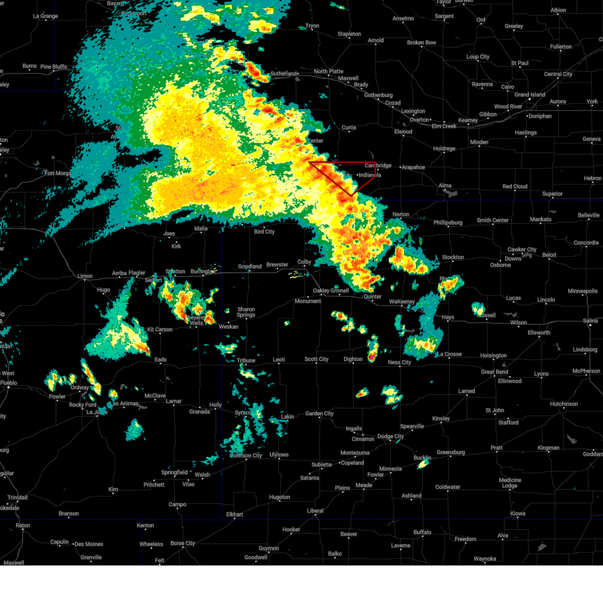 At 521 pm cdt, a confirmed tornado was located near mccook, moving northeast at 35 mph (public confirmed tornado. at 518 pm cdt, a tornado was reported 4 miles southwest of mccook). Hazards include damaging tornado. Flying debris will be dangerous to those caught without shelter. mobile homes will be damaged or destroyed. damage to roofs, windows, and vehicles will occur. tree damage is likely. the tornado will be near, indianola around 535 pm cdt. Bartley around 540 pm cdt. At 521 pm cdt, a confirmed tornado was located near mccook, moving northeast at 35 mph (public confirmed tornado. at 518 pm cdt, a tornado was reported 4 miles southwest of mccook). Hazards include damaging tornado. Flying debris will be dangerous to those caught without shelter. mobile homes will be damaged or destroyed. damage to roofs, windows, and vehicles will occur. tree damage is likely. the tornado will be near, indianola around 535 pm cdt. Bartley around 540 pm cdt.
|
| 5/9/2023 8:48 AM CDT |
 At 847 am cdt, a severe thunderstorm was located 8 miles northeast of oberlin, moving northeast at 40 mph (public reported golf ball size hail in oberlin at 8:48am ct). Hazards include golf ball size hail and 60 mph wind gusts. People and animals outdoors will be injured. expect hail damage to roofs, siding, windows, and vehicles. expect wind damage to roofs, siding, and trees. locations impacted include, mccook, oberlin, atwood, trenton, culbertson, herndon and danbury. thunderstorm damage threat, considerable hail threat, observed max hail size, 1. 75 in wind threat, observed max wind gust, 60 mph. At 847 am cdt, a severe thunderstorm was located 8 miles northeast of oberlin, moving northeast at 40 mph (public reported golf ball size hail in oberlin at 8:48am ct). Hazards include golf ball size hail and 60 mph wind gusts. People and animals outdoors will be injured. expect hail damage to roofs, siding, windows, and vehicles. expect wind damage to roofs, siding, and trees. locations impacted include, mccook, oberlin, atwood, trenton, culbertson, herndon and danbury. thunderstorm damage threat, considerable hail threat, observed max hail size, 1. 75 in wind threat, observed max wind gust, 60 mph.
|
| 5/9/2023 8:31 AM CDT |
 At 830 am cdt, a severe thunderstorm was located near oberlin, moving northeast at 20 mph (spotters reported quarter size hail northwest of oberlin). Hazards include golf ball size hail and 60 mph wind gusts. People and animals outdoors will be injured. expect hail damage to roofs, siding, windows, and vehicles. expect wind damage to roofs, siding, and trees. locations impacted include, mccook, oberlin, atwood, trenton, culbertson, herndon and danbury. thunderstorm damage threat, considerable hail threat, observed max hail size, 1. 75 in wind threat, observed max wind gust, 60 mph. At 830 am cdt, a severe thunderstorm was located near oberlin, moving northeast at 20 mph (spotters reported quarter size hail northwest of oberlin). Hazards include golf ball size hail and 60 mph wind gusts. People and animals outdoors will be injured. expect hail damage to roofs, siding, windows, and vehicles. expect wind damage to roofs, siding, and trees. locations impacted include, mccook, oberlin, atwood, trenton, culbertson, herndon and danbury. thunderstorm damage threat, considerable hail threat, observed max hail size, 1. 75 in wind threat, observed max wind gust, 60 mph.
|
| 5/9/2023 8:24 AM CDT |
 At 824 am cdt, a severe thunderstorm was located 6 miles west of danbury, or 13 miles south of mccook, moving northeast at 40 mph (radar indicated). Hazards include golf ball size hail and 60 mph wind gusts. People and animals outdoors will be injured. expect hail damage to roofs, siding, windows, and vehicles. expect wind damage to roofs, siding, and trees. locations impacted include, mccook, oberlin, atwood, trenton, culbertson, herndon and danbury. thunderstorm damage threat, considerable hail threat, observed max hail size, 1. 75 in wind threat, observed max wind gust, 60 mph. At 824 am cdt, a severe thunderstorm was located 6 miles west of danbury, or 13 miles south of mccook, moving northeast at 40 mph (radar indicated). Hazards include golf ball size hail and 60 mph wind gusts. People and animals outdoors will be injured. expect hail damage to roofs, siding, windows, and vehicles. expect wind damage to roofs, siding, and trees. locations impacted include, mccook, oberlin, atwood, trenton, culbertson, herndon and danbury. thunderstorm damage threat, considerable hail threat, observed max hail size, 1. 75 in wind threat, observed max wind gust, 60 mph.
|
| 5/9/2023 7:59 AM CDT |
 At 759 am cdt, a severe thunderstorm was located over herndon, or 14 miles northeast of atwood, moving northeast at 40 mph (public). Hazards include ping pong ball size hail and 60 mph wind gusts. People and animals outdoors will be injured. expect hail damage to roofs, siding, windows, and vehicles. Expect wind damage to roofs, siding, and trees. At 759 am cdt, a severe thunderstorm was located over herndon, or 14 miles northeast of atwood, moving northeast at 40 mph (public). Hazards include ping pong ball size hail and 60 mph wind gusts. People and animals outdoors will be injured. expect hail damage to roofs, siding, windows, and vehicles. Expect wind damage to roofs, siding, and trees.
|
| 5/7/2023 6:03 PM CDT | Asos station kmck mccook airpor in red willow county NE, 2.4 miles W of McCook, NE |
| 7/23/2022 3:37 PM CDT |
 At 336 pm cdt, severe thunderstorms were located along a line extending from bartley to 5 miles east of mccook, moving east at 30 mph (public. at 329 pm cdt...a 59 mph wind gust was reported at mccook municipal airport). Hazards include 60 mph wind gusts and half dollar size hail. Hail damage to vehicles is expected. expect wind damage to roofs, siding, and trees. locations impacted include, mccook, indianola, bartley, danbury and lebanon. hail threat, radar indicated max hail size, 1. 25 in wind threat, observed max wind gust, 60 mph. At 336 pm cdt, severe thunderstorms were located along a line extending from bartley to 5 miles east of mccook, moving east at 30 mph (public. at 329 pm cdt...a 59 mph wind gust was reported at mccook municipal airport). Hazards include 60 mph wind gusts and half dollar size hail. Hail damage to vehicles is expected. expect wind damage to roofs, siding, and trees. locations impacted include, mccook, indianola, bartley, danbury and lebanon. hail threat, radar indicated max hail size, 1. 25 in wind threat, observed max wind gust, 60 mph.
|
| 7/23/2022 3:29 PM CDT | Storm damage reported in red willow county NE, 1.3 miles WSW of McCook, NE |
| 7/23/2022 3:20 PM CDT |
 At 320 pm cdt, a severe thunderstorm was located near mccook, moving east at 15 mph (public. at 310 pm cdt, a 61 mph wind gust was reported at the mccook municipal airport). Hazards include 60 mph wind gusts and quarter size hail. Hail damage to vehicles is expected. expect wind damage to roofs, siding, and trees. locations impacted include, mccook, indianola, bartley, danbury and lebanon. hail threat, radar indicated max hail size, 1. 00 in wind threat, observed max wind gust, 60 mph. At 320 pm cdt, a severe thunderstorm was located near mccook, moving east at 15 mph (public. at 310 pm cdt, a 61 mph wind gust was reported at the mccook municipal airport). Hazards include 60 mph wind gusts and quarter size hail. Hail damage to vehicles is expected. expect wind damage to roofs, siding, and trees. locations impacted include, mccook, indianola, bartley, danbury and lebanon. hail threat, radar indicated max hail size, 1. 00 in wind threat, observed max wind gust, 60 mph.
|
| 7/23/2022 3:14 PM CDT |
 At 313 pm cdt, a severe thunderstorm was located near mccook, moving east at 15 mph (radar indicated. at 310 pm cdt, a 61 mph wind gust was reported at the mccook municipal airport). Hazards include 60 mph wind gusts and penny size hail. expect damage to roofs, siding, and trees At 313 pm cdt, a severe thunderstorm was located near mccook, moving east at 15 mph (radar indicated. at 310 pm cdt, a 61 mph wind gust was reported at the mccook municipal airport). Hazards include 60 mph wind gusts and penny size hail. expect damage to roofs, siding, and trees
|
| 7/23/2022 3:07 PM CDT | Storm damage reported in red willow county NE, 1.3 miles WSW of McCook, NE |
| 7/21/2022 9:37 PM CDT | Asos station kmck mccook airpor in red willow county NE, 2.4 miles W of McCook, NE |
| 7/4/2022 8:13 PM CDT |
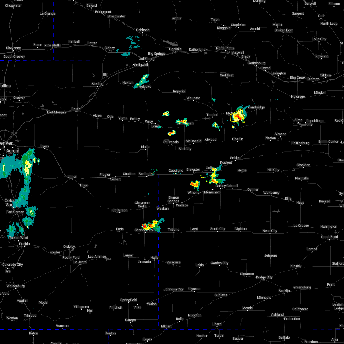 The severe thunderstorm warning for central red willow county will expire at 815 pm cdt. the storm which prompted the warning has weakened below severe limits, and no longer poses an immediate threat to life or property. therefore, the warning will be allowed to expire. However gusty winds are still possible with this thunderstorm. The severe thunderstorm warning for central red willow county will expire at 815 pm cdt. the storm which prompted the warning has weakened below severe limits, and no longer poses an immediate threat to life or property. therefore, the warning will be allowed to expire. However gusty winds are still possible with this thunderstorm.
|
| 7/4/2022 8:00 PM CDT |
 At 800 pm cdt, a severe thunderstorm was located 5 miles southwest of indianola, or 5 miles east of mccook, moving northeast at 20 mph. this is a destructive storm for mccook, nebraska (radar indicated). Hazards include 80 mph wind gusts and penny size hail. Flying debris will be dangerous to those caught without shelter. mobile homes will be heavily damaged. expect considerable damage to roofs, windows, and vehicles. extensive tree damage and power outages are likely. locations impacted include, mccook and indianola. thunderstorm damage threat, destructive hail threat, radar indicated max hail size, 0. 75 in wind threat, observed max wind gust, 80 mph. At 800 pm cdt, a severe thunderstorm was located 5 miles southwest of indianola, or 5 miles east of mccook, moving northeast at 20 mph. this is a destructive storm for mccook, nebraska (radar indicated). Hazards include 80 mph wind gusts and penny size hail. Flying debris will be dangerous to those caught without shelter. mobile homes will be heavily damaged. expect considerable damage to roofs, windows, and vehicles. extensive tree damage and power outages are likely. locations impacted include, mccook and indianola. thunderstorm damage threat, destructive hail threat, radar indicated max hail size, 0. 75 in wind threat, observed max wind gust, 80 mph.
|
| 7/4/2022 7:51 PM CDT |
 At 749 pm cdt, a severe thunderstorm was located 4 miles east of mccook, moving east at 10 mph. this is a destructive storm for mccook nebraska (radar indicated. at 7:48 pm cdt, a 84 mph wind gust was recorded at the mccook airport). Hazards include 80 mph wind gusts and penny size hail. Flying debris will be dangerous to those caught without shelter. mobile homes will be heavily damaged. expect considerable damage to roofs, windows, and vehicles. extensive tree damage and power outages are likely. locations impacted include, mccook and indianola. thunderstorm damage threat, destructive hail threat, radar indicated max hail size, 0. 75 in wind threat, observed max wind gust, 80 mph. At 749 pm cdt, a severe thunderstorm was located 4 miles east of mccook, moving east at 10 mph. this is a destructive storm for mccook nebraska (radar indicated. at 7:48 pm cdt, a 84 mph wind gust was recorded at the mccook airport). Hazards include 80 mph wind gusts and penny size hail. Flying debris will be dangerous to those caught without shelter. mobile homes will be heavily damaged. expect considerable damage to roofs, windows, and vehicles. extensive tree damage and power outages are likely. locations impacted include, mccook and indianola. thunderstorm damage threat, destructive hail threat, radar indicated max hail size, 0. 75 in wind threat, observed max wind gust, 80 mph.
|
| 7/4/2022 7:48 PM CDT | Corrects previous non-tstm wnd gst report from 2 e mccook. asos station kmck mccook airpor in red willow county NE, 2.4 miles W of McCook, NE |
| 7/4/2022 7:37 PM CDT |
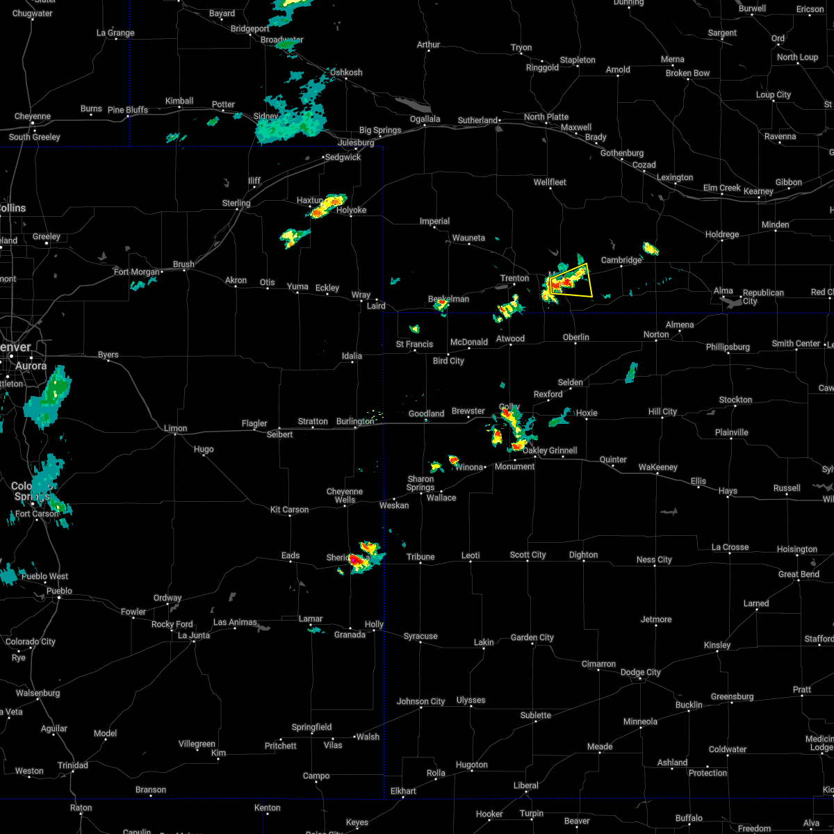 At 737 pm cdt, a severe thunderstorm was located near mccook, moving east at 10 mph (radar indicated). Hazards include 70 mph wind gusts and penny size hail. Expect considerable tree damage. Damage is likely to mobile homes, roofs, and outbuildings. At 737 pm cdt, a severe thunderstorm was located near mccook, moving east at 10 mph (radar indicated). Hazards include 70 mph wind gusts and penny size hail. Expect considerable tree damage. Damage is likely to mobile homes, roofs, and outbuildings.
|
| 7/4/2022 7:30 PM CDT | Reported via social media. gusts of 60 mph continued over a duration of 15 minute in red willow county NE, 2.4 miles E of McCook, NE |
| 7/4/2022 7:30 PM CDT | Sustained at 54 mp in red willow county NE, 1.9 miles W of McCook, NE |
| 6/24/2022 10:18 PM CDT |
 At 1018 pm cdt, a severe thunderstorm was located near indianola, or 12 miles east of mccook, moving east at 35 mph (measured at the mccook airport). Hazards include 60 mph wind gusts. Expect damage to roofs, siding, and trees. locations impacted include, mccook, indianola and bartley. hail threat, radar indicated max hail size, <. 75 in wind threat, radar indicated max wind gust, 60 mph. At 1018 pm cdt, a severe thunderstorm was located near indianola, or 12 miles east of mccook, moving east at 35 mph (measured at the mccook airport). Hazards include 60 mph wind gusts. Expect damage to roofs, siding, and trees. locations impacted include, mccook, indianola and bartley. hail threat, radar indicated max hail size, <. 75 in wind threat, radar indicated max wind gust, 60 mph.
|
| 6/24/2022 10:10 PM CDT |
 At 1009 pm cdt, a severe thunderstorm was located near indianola, or 11 miles northeast of mccook, moving east at 45 mph. this is a destructive storm for mccook, nebraska (trained weather spotters). Hazards include 80 mph wind gusts. Flying debris will be dangerous to those caught without shelter. mobile homes will be heavily damaged. expect considerable damage to roofs, windows, and vehicles. extensive tree damage and power outages are likely. locations impacted include, bartley. thunderstorm damage threat, destructive hail threat, radar indicated max hail size, <. 75 in wind threat, radar indicated max wind gust, 80 mph. At 1009 pm cdt, a severe thunderstorm was located near indianola, or 11 miles northeast of mccook, moving east at 45 mph. this is a destructive storm for mccook, nebraska (trained weather spotters). Hazards include 80 mph wind gusts. Flying debris will be dangerous to those caught without shelter. mobile homes will be heavily damaged. expect considerable damage to roofs, windows, and vehicles. extensive tree damage and power outages are likely. locations impacted include, bartley. thunderstorm damage threat, destructive hail threat, radar indicated max hail size, <. 75 in wind threat, radar indicated max wind gust, 80 mph.
|
| 6/24/2022 10:09 PM CDT | Asos at kmck reported 50 kts wind gus in red willow county NE, 1.9 miles W of McCook, NE |
| 6/24/2022 9:50 PM CDT |
 At 949 pm cdt, a severe thunderstorm was located 5 miles northwest of mccook, moving east at 45 mph. this is a destructive storm for mccook, nebraska (trained weather spotters north of culbertson). Hazards include 80 mph wind gusts. Flying debris will be dangerous to those caught without shelter. mobile homes will be heavily damaged. expect considerable damage to roofs, windows, and vehicles. extensive tree damage and power outages are likely. this severe storm will be near, mccook around 955 pm cdt. other locations in the path of this severe thunderstorm include indianola and bartley. thunderstorm damage threat, destructive hail threat, radar indicated max hail size, <. 75 in wind threat, radar indicated max wind gust, 80 mph. At 949 pm cdt, a severe thunderstorm was located 5 miles northwest of mccook, moving east at 45 mph. this is a destructive storm for mccook, nebraska (trained weather spotters north of culbertson). Hazards include 80 mph wind gusts. Flying debris will be dangerous to those caught without shelter. mobile homes will be heavily damaged. expect considerable damage to roofs, windows, and vehicles. extensive tree damage and power outages are likely. this severe storm will be near, mccook around 955 pm cdt. other locations in the path of this severe thunderstorm include indianola and bartley. thunderstorm damage threat, destructive hail threat, radar indicated max hail size, <. 75 in wind threat, radar indicated max wind gust, 80 mph.
|
| 6/24/2022 9:43 PM CDT |
 At 942 pm cdt, a severe thunderstorm was located near culbertson, or 9 miles northwest of mccook, moving east at 50 mph. this is a destructive storm for mccook, nebraska (trained weather spotters). Hazards include 80 mph wind gusts. Flying debris will be dangerous to those caught without shelter. mobile homes will be heavily damaged. expect considerable damage to roofs, windows, and vehicles. extensive tree damage and power outages are likely. this severe thunderstorm will be near, mccook around 950 pm cdt. other locations in the path of this severe thunderstorm include indianola and bartley. thunderstorm damage threat, destructive hail threat, radar indicated max hail size, <. 75 in wind threat, radar indicated max wind gust, 80 mph. At 942 pm cdt, a severe thunderstorm was located near culbertson, or 9 miles northwest of mccook, moving east at 50 mph. this is a destructive storm for mccook, nebraska (trained weather spotters). Hazards include 80 mph wind gusts. Flying debris will be dangerous to those caught without shelter. mobile homes will be heavily damaged. expect considerable damage to roofs, windows, and vehicles. extensive tree damage and power outages are likely. this severe thunderstorm will be near, mccook around 950 pm cdt. other locations in the path of this severe thunderstorm include indianola and bartley. thunderstorm damage threat, destructive hail threat, radar indicated max hail size, <. 75 in wind threat, radar indicated max wind gust, 80 mph.
|
| 6/9/2022 9:34 PM CDT |
 At 933 pm cdt, a severe thunderstorm was located near indianola, or 9 miles east of mccook, moving south at 25 mph (trained weather spotters. at 928 pm cdt, quarter sized hail was reported in indianola). Hazards include ping pong ball size hail and 60 mph wind gusts. People and animals outdoors will be injured. expect hail damage to roofs, siding, windows, and vehicles. expect wind damage to roofs, siding, and trees. this severe storm will be near, danbury and lebanon around 1005 pm cdt. hail threat, observed max hail size, 1. 50 in wind threat, radar indicated max wind gust, 60 mph. At 933 pm cdt, a severe thunderstorm was located near indianola, or 9 miles east of mccook, moving south at 25 mph (trained weather spotters. at 928 pm cdt, quarter sized hail was reported in indianola). Hazards include ping pong ball size hail and 60 mph wind gusts. People and animals outdoors will be injured. expect hail damage to roofs, siding, windows, and vehicles. expect wind damage to roofs, siding, and trees. this severe storm will be near, danbury and lebanon around 1005 pm cdt. hail threat, observed max hail size, 1. 50 in wind threat, radar indicated max wind gust, 60 mph.
|
| 6/9/2022 9:30 PM CDT |
 At 929 pm cdt, a severe thunderstorm was located near indianola, or 8 miles east of mccook, moving south at 25 mph (trained weather spotters). Hazards include ping pong ball size hail and 60 mph wind gusts. People and animals outdoors will be injured. expect hail damage to roofs, siding, windows, and vehicles. expect wind damage to roofs, siding, and trees. this severe storm will be near, bartley around 935 pm cdt. danbury around 1000 pm cdt. lebanon around 1005 pm cdt. hail threat, radar indicated max hail size, 1. 50 in wind threat, radar indicated max wind gust, 60 mph. At 929 pm cdt, a severe thunderstorm was located near indianola, or 8 miles east of mccook, moving south at 25 mph (trained weather spotters). Hazards include ping pong ball size hail and 60 mph wind gusts. People and animals outdoors will be injured. expect hail damage to roofs, siding, windows, and vehicles. expect wind damage to roofs, siding, and trees. this severe storm will be near, bartley around 935 pm cdt. danbury around 1000 pm cdt. lebanon around 1005 pm cdt. hail threat, radar indicated max hail size, 1. 50 in wind threat, radar indicated max wind gust, 60 mph.
|
| 6/9/2022 9:22 PM CDT |
 At 920 pm cdt, a severe thunderstorm was located 4 miles northwest of indianola, or 9 miles northeast of mccook, moving southeast at 30 mph (trained weather spotters. at 0851 pm cdt, ping pong ball sized hail was reported 13 s of maywood). Hazards include ping pong ball size hail and 60 mph wind gusts. People and animals outdoors will be injured. expect hail damage to roofs, siding, windows, and vehicles. expect wind damage to roofs, siding, and trees. this severe storm will be near, indianola around 930 pm cdt. bartley around 935 pm cdt. danbury around 955 pm cdt. lebanon around 1000 pm cdt. hail threat, radar indicated max hail size, 1. 50 in wind threat, radar indicated max wind gust, 60 mph. At 920 pm cdt, a severe thunderstorm was located 4 miles northwest of indianola, or 9 miles northeast of mccook, moving southeast at 30 mph (trained weather spotters. at 0851 pm cdt, ping pong ball sized hail was reported 13 s of maywood). Hazards include ping pong ball size hail and 60 mph wind gusts. People and animals outdoors will be injured. expect hail damage to roofs, siding, windows, and vehicles. expect wind damage to roofs, siding, and trees. this severe storm will be near, indianola around 930 pm cdt. bartley around 935 pm cdt. danbury around 955 pm cdt. lebanon around 1000 pm cdt. hail threat, radar indicated max hail size, 1. 50 in wind threat, radar indicated max wind gust, 60 mph.
|
| 6/9/2022 8:57 PM CDT |
 At 856 pm cdt, a severe thunderstorm was located 13 miles southwest of stockville, or 14 miles south of curtis, moving south at 25 mph (radar indicated). Hazards include ping pong ball size hail and 60 mph wind gusts. People and animals outdoors will be injured. expect hail damage to roofs, siding, windows, and vehicles. expect wind damage to roofs, siding, and trees. this severe thunderstorm will be near, mccook around 930 pm cdt. indianola around 935 pm cdt. danbury around 1010 pm cdt. hail threat, radar indicated max hail size, 1. 50 in wind threat, radar indicated max wind gust, 60 mph. At 856 pm cdt, a severe thunderstorm was located 13 miles southwest of stockville, or 14 miles south of curtis, moving south at 25 mph (radar indicated). Hazards include ping pong ball size hail and 60 mph wind gusts. People and animals outdoors will be injured. expect hail damage to roofs, siding, windows, and vehicles. expect wind damage to roofs, siding, and trees. this severe thunderstorm will be near, mccook around 930 pm cdt. indianola around 935 pm cdt. danbury around 1010 pm cdt. hail threat, radar indicated max hail size, 1. 50 in wind threat, radar indicated max wind gust, 60 mph.
|
| 6/7/2022 8:44 PM CDT |
 At 843 pm cdt, severe thunderstorms were located along a line extending from 8 miles southwest of danbury to 5 miles west of oberlin, moving southeast at 50 mph (radar indicated). Hazards include two inch hail and 70 mph wind gusts. People and animals outdoors will be injured. expect hail damage to roofs, siding, windows, and vehicles. expect considerable tree damage. wind damage is also likely to mobile homes, roofs, and outbuildings. Locations impacted include, oberlin, jennings, dresden, norcatur and clayton. At 843 pm cdt, severe thunderstorms were located along a line extending from 8 miles southwest of danbury to 5 miles west of oberlin, moving southeast at 50 mph (radar indicated). Hazards include two inch hail and 70 mph wind gusts. People and animals outdoors will be injured. expect hail damage to roofs, siding, windows, and vehicles. expect considerable tree damage. wind damage is also likely to mobile homes, roofs, and outbuildings. Locations impacted include, oberlin, jennings, dresden, norcatur and clayton.
|
| 6/7/2022 8:19 PM CDT |
 At 819 pm cdt, severe thunderstorms were located along a line extending from culbertson to 10 miles northwest of herndon, moving southeast at 40 mph (trained weather spotters. at 809 pm cdt...golf ball size hail was reported at trenton dam). Hazards include two inch hail and 70 mph wind gusts. People and animals outdoors will be injured. expect hail damage to roofs, siding, windows, and vehicles. expect considerable tree damage. wind damage is also likely to mobile homes, roofs, and outbuildings. severe thunderstorms will be near, mccook and herndon around 835 pm cdt. Other locations in the path of these severe thunderstorms include oberlin, danbury, lebanon, norcatur, jennings and dresden. At 819 pm cdt, severe thunderstorms were located along a line extending from culbertson to 10 miles northwest of herndon, moving southeast at 40 mph (trained weather spotters. at 809 pm cdt...golf ball size hail was reported at trenton dam). Hazards include two inch hail and 70 mph wind gusts. People and animals outdoors will be injured. expect hail damage to roofs, siding, windows, and vehicles. expect considerable tree damage. wind damage is also likely to mobile homes, roofs, and outbuildings. severe thunderstorms will be near, mccook and herndon around 835 pm cdt. Other locations in the path of these severe thunderstorms include oberlin, danbury, lebanon, norcatur, jennings and dresden.
|
| 6/7/2022 8:16 PM CDT |
 At 816 pm cdt, severe thunderstorms were located along a line extending from near culbertson to 10 miles southeast of trenton, moving southeast at 40 mph (radar indicated. at 809 pm cdt...golf ball size hail was reported at trenton dam). Hazards include two inch hail and 70 mph wind gusts. People and animals outdoors will be injured. expect hail damage to roofs, siding, windows, and vehicles. expect considerable tree damage. wind damage is also likely to mobile homes, roofs, and outbuildings. severe thunderstorms will be near, mccook around 830 pm cdt. herndon around 835 pm cdt. Other locations in the path of these severe thunderstorms include oberlin, danbury, norcatur, jennings and dresden. At 816 pm cdt, severe thunderstorms were located along a line extending from near culbertson to 10 miles southeast of trenton, moving southeast at 40 mph (radar indicated. at 809 pm cdt...golf ball size hail was reported at trenton dam). Hazards include two inch hail and 70 mph wind gusts. People and animals outdoors will be injured. expect hail damage to roofs, siding, windows, and vehicles. expect considerable tree damage. wind damage is also likely to mobile homes, roofs, and outbuildings. severe thunderstorms will be near, mccook around 830 pm cdt. herndon around 835 pm cdt. Other locations in the path of these severe thunderstorms include oberlin, danbury, norcatur, jennings and dresden.
|
| 6/5/2022 10:59 PM CDT |
 At 1059 pm cdt, a severe thunderstorm was located near bartley, or 14 miles east of mccook, moving southeast at 20 mph (radar indicated). Hazards include half dollar size hail. Damage to vehicles is expected. locations impacted include, lebanon. hail threat, radar indicated max hail size, 1. 25 in wind threat, radar indicated max wind gust, <50 mph. At 1059 pm cdt, a severe thunderstorm was located near bartley, or 14 miles east of mccook, moving southeast at 20 mph (radar indicated). Hazards include half dollar size hail. Damage to vehicles is expected. locations impacted include, lebanon. hail threat, radar indicated max hail size, 1. 25 in wind threat, radar indicated max wind gust, <50 mph.
|
| 6/5/2022 10:48 PM CDT |
 At 1048 pm cdt, a severe thunderstorm was located 4 miles northwest of bartley, or 15 miles northeast of mccook, moving southeast at 15 mph (radar indicated). Hazards include ping pong ball size hail. People and animals outdoors will be injured. expect damage to roofs, siding, windows, and vehicles. this severe thunderstorm will be near, indianola around 1100 pm cdt. other locations in the path of this severe thunderstorm include bartley and lebanon. hail threat, radar indicated max hail size, 1. 50 in wind threat, radar indicated max wind gust, <50 mph. At 1048 pm cdt, a severe thunderstorm was located 4 miles northwest of bartley, or 15 miles northeast of mccook, moving southeast at 15 mph (radar indicated). Hazards include ping pong ball size hail. People and animals outdoors will be injured. expect damage to roofs, siding, windows, and vehicles. this severe thunderstorm will be near, indianola around 1100 pm cdt. other locations in the path of this severe thunderstorm include bartley and lebanon. hail threat, radar indicated max hail size, 1. 50 in wind threat, radar indicated max wind gust, <50 mph.
|
| 6/5/2022 8:26 PM CDT | Tea Cup sized hail reported 3.8 miles N of McCook, NE, few hailstone reported at location via social media that were about half the size of a dollar bill in diameter (3 inches). |
| 6/5/2022 8:26 PM CDT | Grapefruit sized hail reported 3.8 miles N of McCook, NE, corrects previous hail report from 4 s mccook. few hailstone reported at location via social media that were about 2/3rds the size of a dollar bill in diameter (4 inche |
| 6/5/2022 8:10 PM CDT | Quarter sized hail reported 0.8 miles WNW of McCook, NE, 1 inch hail reported at location via social media. |
| 6/5/2022 8:04 PM CDT | Hen Egg sized hail reported 1.1 miles SSW of McCook, NE, estimated 2 inch hail reported at location via social media. |
| 6/5/2022 7:57 PM CDT | Asos station kmck mccook airpor in red willow county NE, 2.4 miles W of McCook, NE |
| 6/5/2022 7:54 PM CDT |
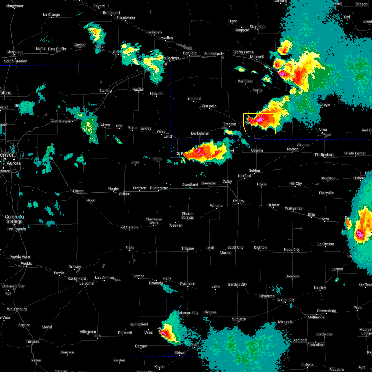 At 753 pm cdt, a severe thunderstorm was located over indianola, or 9 miles east of mccook, moving southeast at 30 mph (radar indicated). Hazards include 60 mph wind gusts and half dollar size hail. Hail damage to vehicles is expected. expect wind damage to roofs, siding, and trees. locations impacted include, mccook, indianola and bartley. hail threat, radar indicated max hail size, 1. 25 in wind threat, radar indicated max wind gust, 60 mph. At 753 pm cdt, a severe thunderstorm was located over indianola, or 9 miles east of mccook, moving southeast at 30 mph (radar indicated). Hazards include 60 mph wind gusts and half dollar size hail. Hail damage to vehicles is expected. expect wind damage to roofs, siding, and trees. locations impacted include, mccook, indianola and bartley. hail threat, radar indicated max hail size, 1. 25 in wind threat, radar indicated max wind gust, 60 mph.
|
| 6/5/2022 7:25 PM CDT |
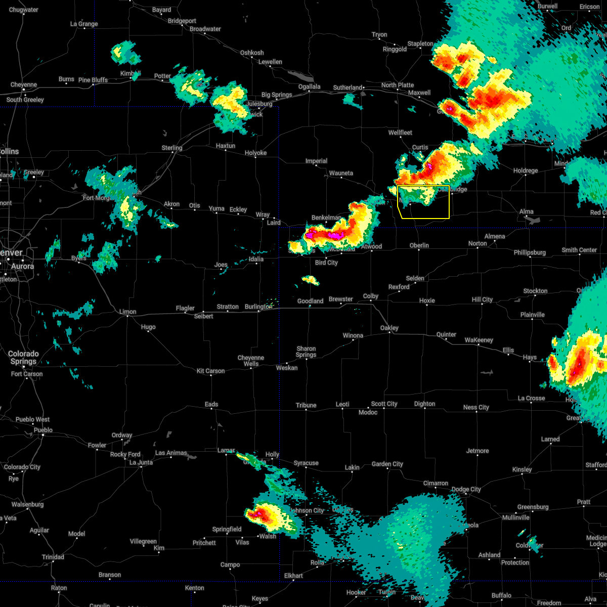 At 724 pm cdt, severe thunderstorms were located along a line extending from 3 miles southeast of stockville to 10 miles northeast of culbertson, moving southeast at 35 mph (radar indicated). Hazards include 60 mph wind gusts and half dollar size hail. Hail damage to vehicles is expected. Expect wind damage to roofs, siding, and trees. At 724 pm cdt, severe thunderstorms were located along a line extending from 3 miles southeast of stockville to 10 miles northeast of culbertson, moving southeast at 35 mph (radar indicated). Hazards include 60 mph wind gusts and half dollar size hail. Hail damage to vehicles is expected. Expect wind damage to roofs, siding, and trees.
|
| 6/4/2022 8:19 PM CDT | Asos station kmck mccook airpor in red willow county NE, 2.4 miles W of McCook, NE |
| 6/4/2022 8:18 PM CDT | Asos station kmck mccook airpor in red willow county NE, 2.4 miles W of McCook, NE |
| 6/4/2022 8:16 PM CDT |
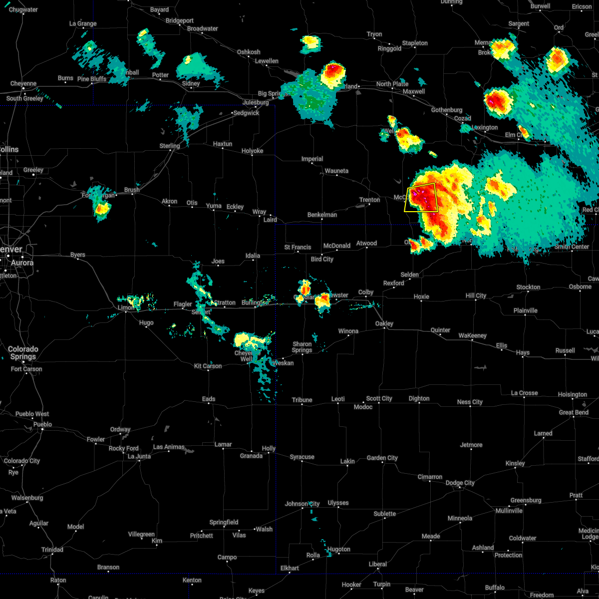 At 816 pm cdt, a severe thunderstorm was located over indianola, or 9 miles east of mccook, moving south at 30 mph (radar indicated). Hazards include golf ball size hail and 60 mph wind gusts. People and animals outdoors will be injured. expect hail damage to roofs, siding, windows, and vehicles. expect wind damage to roofs, siding, and trees. locations impacted include, mccook, indianola and bartley. thunderstorm damage threat, considerable hail threat, radar indicated max hail size, 1. 75 in wind threat, radar indicated max wind gust, 60 mph. At 816 pm cdt, a severe thunderstorm was located over indianola, or 9 miles east of mccook, moving south at 30 mph (radar indicated). Hazards include golf ball size hail and 60 mph wind gusts. People and animals outdoors will be injured. expect hail damage to roofs, siding, windows, and vehicles. expect wind damage to roofs, siding, and trees. locations impacted include, mccook, indianola and bartley. thunderstorm damage threat, considerable hail threat, radar indicated max hail size, 1. 75 in wind threat, radar indicated max wind gust, 60 mph.
|
| 6/4/2022 8:06 PM CDT |
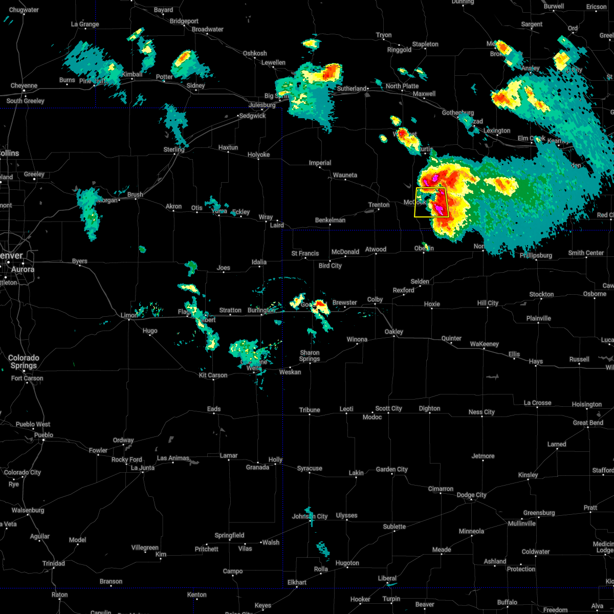 At 806 pm cdt, a severe thunderstorm was located 5 miles north of indianola, or 11 miles northeast of mccook, moving south at 30 mph (radar indicated). Hazards include golf ball size hail and 60 mph wind gusts. People and animals outdoors will be injured. expect hail damage to roofs, siding, windows, and vehicles. expect wind damage to roofs, siding, and trees. locations impacted include, mccook, indianola and bartley. thunderstorm damage threat, considerable hail threat, radar indicated max hail size, 1. 75 in wind threat, radar indicated max wind gust, 60 mph. At 806 pm cdt, a severe thunderstorm was located 5 miles north of indianola, or 11 miles northeast of mccook, moving south at 30 mph (radar indicated). Hazards include golf ball size hail and 60 mph wind gusts. People and animals outdoors will be injured. expect hail damage to roofs, siding, windows, and vehicles. expect wind damage to roofs, siding, and trees. locations impacted include, mccook, indianola and bartley. thunderstorm damage threat, considerable hail threat, radar indicated max hail size, 1. 75 in wind threat, radar indicated max wind gust, 60 mph.
|
| 6/4/2022 7:50 PM CDT |
 At 750 pm cdt, a severe thunderstorm was located 8 miles southwest of stockville, or 15 miles south of curtis, moving south at 25 mph (radar indicated). Hazards include golf ball size hail and 60 mph wind gusts. People and animals outdoors will be injured. expect hail damage to roofs, siding, windows, and vehicles. Expect wind damage to roofs, siding, and trees. At 750 pm cdt, a severe thunderstorm was located 8 miles southwest of stockville, or 15 miles south of curtis, moving south at 25 mph (radar indicated). Hazards include golf ball size hail and 60 mph wind gusts. People and animals outdoors will be injured. expect hail damage to roofs, siding, windows, and vehicles. Expect wind damage to roofs, siding, and trees.
|
| 5/30/2022 3:21 PM CDT | Asos station kmck mccook airport. peak wind gust from decaying thunderstorm in red willow county NE, 2.4 miles W of McCook, NE |
| 4/22/2022 8:37 PM CDT |
 The severe thunderstorm warning for northwestern red willow and northeastern hitchcock counties will expire at 845 pm cdt, the storm which prompted the warning has weakened below severe limits, and no longer poses an immediate threat to life or property. therefore, the warning will be allowed to expire. a severe thunderstorm watch remains in effect until 100 am cdt for southwestern nebraska. The severe thunderstorm warning for northwestern red willow and northeastern hitchcock counties will expire at 845 pm cdt, the storm which prompted the warning has weakened below severe limits, and no longer poses an immediate threat to life or property. therefore, the warning will be allowed to expire. a severe thunderstorm watch remains in effect until 100 am cdt for southwestern nebraska.
|
| 4/22/2022 8:34 PM CDT |
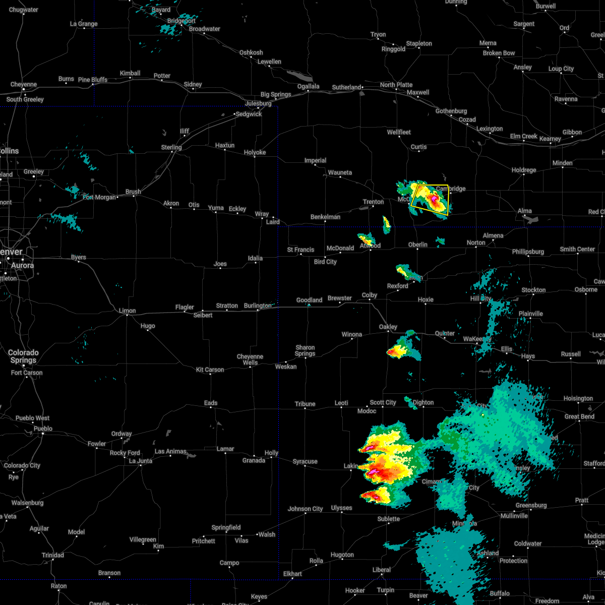 At 833 pm cdt, a severe thunderstorm was located near bartley, or 14 miles east of mccook, moving northeast at 65 mph (radar indicated. at 0830 pm cdt, nickel sized hail was reported near indianola). Hazards include 60 mph wind gusts and quarter size hail. Hail damage to vehicles is expected. expect wind damage to roofs, siding, and trees. locations impacted include, mccook, indianola and bartley. hail threat, radar indicated max hail size, 1. 00 in wind threat, radar indicated max wind gust, 60 mph. At 833 pm cdt, a severe thunderstorm was located near bartley, or 14 miles east of mccook, moving northeast at 65 mph (radar indicated. at 0830 pm cdt, nickel sized hail was reported near indianola). Hazards include 60 mph wind gusts and quarter size hail. Hail damage to vehicles is expected. expect wind damage to roofs, siding, and trees. locations impacted include, mccook, indianola and bartley. hail threat, radar indicated max hail size, 1. 00 in wind threat, radar indicated max wind gust, 60 mph.
|
| 4/22/2022 8:26 PM CDT | Asos station kmck mccook airpor in red willow county NE, 2.4 miles W of McCook, NE |
| 4/22/2022 8:24 PM CDT |
 At 824 pm cdt, a severe thunderstorm was located near mccook, moving northeast at 65 mph (radar indicated). Hazards include 60 mph wind gusts and quarter size hail. Hail damage to vehicles is expected. expect wind damage to roofs, siding, and trees. this severe thunderstorm will remain over mainly rural areas of northwestern red willow and northeastern hitchcock counties. hail threat, radar indicated max hail size, 1. 00 in wind threat, radar indicated max wind gust, 60 mph. At 824 pm cdt, a severe thunderstorm was located near mccook, moving northeast at 65 mph (radar indicated). Hazards include 60 mph wind gusts and quarter size hail. Hail damage to vehicles is expected. expect wind damage to roofs, siding, and trees. this severe thunderstorm will remain over mainly rural areas of northwestern red willow and northeastern hitchcock counties. hail threat, radar indicated max hail size, 1. 00 in wind threat, radar indicated max wind gust, 60 mph.
|
| 4/22/2022 8:22 PM CDT |
 At 822 pm cdt, a severe thunderstorm was located 4 miles northwest of danbury, or 12 miles southeast of mccook, moving northeast at 70 mph (radar indicated). Hazards include 70 mph wind gusts and half dollar size hail. Hail damage to vehicles is expected. expect considerable tree damage. wind damage is also likely to mobile homes, roofs, and outbuildings. locations impacted include, indianola and bartley. thunderstorm damage threat, considerable hail threat, radar indicated max hail size, 1. 25 in wind threat, radar indicated max wind gust, 70 mph. At 822 pm cdt, a severe thunderstorm was located 4 miles northwest of danbury, or 12 miles southeast of mccook, moving northeast at 70 mph (radar indicated). Hazards include 70 mph wind gusts and half dollar size hail. Hail damage to vehicles is expected. expect considerable tree damage. wind damage is also likely to mobile homes, roofs, and outbuildings. locations impacted include, indianola and bartley. thunderstorm damage threat, considerable hail threat, radar indicated max hail size, 1. 25 in wind threat, radar indicated max wind gust, 70 mph.
|
| 4/22/2022 8:14 PM CDT |
 At 813 pm cdt, a severe thunderstorm was located 6 miles north of herndon, or 15 miles southwest of mccook, moving northeast at 80 mph (public. at 0810 pm cdt, penny sized hail was reported near herndon). Hazards include 60 mph wind gusts and quarter size hail. Hail damage to vehicles is expected. expect wind damage to roofs, siding, and trees. this severe thunderstorm will be near, mccook around 825 pm cdt. hail threat, radar indicated max hail size, 1. 00 in wind threat, radar indicated max wind gust, 60 mph. At 813 pm cdt, a severe thunderstorm was located 6 miles north of herndon, or 15 miles southwest of mccook, moving northeast at 80 mph (public. at 0810 pm cdt, penny sized hail was reported near herndon). Hazards include 60 mph wind gusts and quarter size hail. Hail damage to vehicles is expected. expect wind damage to roofs, siding, and trees. this severe thunderstorm will be near, mccook around 825 pm cdt. hail threat, radar indicated max hail size, 1. 00 in wind threat, radar indicated max wind gust, 60 mph.
|
| 4/22/2022 8:09 PM CDT |
 At 807 pm cdt, a severe thunderstorm was located near oberlin, moving northeast at 70 mph (radar indicated. at 0805 pm cdt, quarter sized hail was reported near oberlin). Hazards include 60 mph wind gusts and half dollar size hail. Hail damage to vehicles is expected. expect wind damage to roofs, siding, and trees. this severe thunderstorm will be near, danbury around 820 pm cdt. other locations in the path of this severe thunderstorm include indianola and bartley. hail threat, observed max hail size, 1. 25 in wind threat, radar indicated max wind gust, 60 mph. At 807 pm cdt, a severe thunderstorm was located near oberlin, moving northeast at 70 mph (radar indicated. at 0805 pm cdt, quarter sized hail was reported near oberlin). Hazards include 60 mph wind gusts and half dollar size hail. Hail damage to vehicles is expected. expect wind damage to roofs, siding, and trees. this severe thunderstorm will be near, danbury around 820 pm cdt. other locations in the path of this severe thunderstorm include indianola and bartley. hail threat, observed max hail size, 1. 25 in wind threat, radar indicated max wind gust, 60 mph.
|
| 8/26/2021 8:17 PM CDT |
 At 817 pm cdt, a severe thunderstorm was located 8 miles southwest of mccook, moving northeast at 25 mph (trained weather spotters). Hazards include 70 mph wind gusts. Expect considerable tree damage. damage is likely to mobile homes, roofs, and outbuildings. this severe thunderstorm will be near, mccook around 835 pm cdt. other locations in the path of this severe thunderstorm include indianola and bartley. thunderstorm damage threat, considerable hail threat, radar indicated max hail size, <. 75 in wind threat, observed max wind gust, 70 mph. At 817 pm cdt, a severe thunderstorm was located 8 miles southwest of mccook, moving northeast at 25 mph (trained weather spotters). Hazards include 70 mph wind gusts. Expect considerable tree damage. damage is likely to mobile homes, roofs, and outbuildings. this severe thunderstorm will be near, mccook around 835 pm cdt. other locations in the path of this severe thunderstorm include indianola and bartley. thunderstorm damage threat, considerable hail threat, radar indicated max hail size, <. 75 in wind threat, observed max wind gust, 70 mph.
|
| 8/26/2021 8:13 PM CDT | Report from mping: 1-inch tree limbs broken; shingles blown of in red willow county NE, 0.5 miles SE of McCook, NE |
| 7/10/2021 2:43 AM CDT | Storm damage reported in red willow county NE, 0.9 miles ESE of McCook, NE |
| 6/25/2021 3:41 PM CDT | Quarter sized hail reported 3.1 miles N of McCook, NE, hail ranged from half inch to quarter in size. |
| 6/25/2021 3:41 PM CDT |
 At 340 pm cdt, a severe thunderstorm was located near mccook, moving east at 20 mph (radar indicated). Hazards include 60 mph wind gusts and half dollar size hail. Hail damage to vehicles is expected. Expect wind damage to roofs, siding, and trees. At 340 pm cdt, a severe thunderstorm was located near mccook, moving east at 20 mph (radar indicated). Hazards include 60 mph wind gusts and half dollar size hail. Hail damage to vehicles is expected. Expect wind damage to roofs, siding, and trees.
|
| 6/25/2021 3:32 PM CDT |
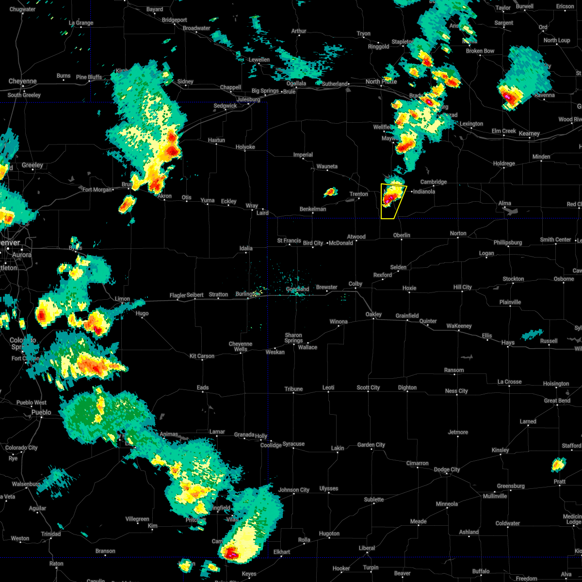 At 331 pm cdt, a severe thunderstorm was located 5 miles southwest of mccook, moving east at 20 mph (trained weather spotters). Hazards include 60 mph wind gusts and half dollar size hail. Hail damage to vehicles is expected. expect wind damage to roofs, siding, and trees. Locations impacted include, mccook. At 331 pm cdt, a severe thunderstorm was located 5 miles southwest of mccook, moving east at 20 mph (trained weather spotters). Hazards include 60 mph wind gusts and half dollar size hail. Hail damage to vehicles is expected. expect wind damage to roofs, siding, and trees. Locations impacted include, mccook.
|
| 6/25/2021 3:13 PM CDT |
 At 313 pm cdt, a severe thunderstorm was located near culbertson, or 10 miles west of mccook, moving east at 20 mph (trained weather spotters). Hazards include 60 mph wind gusts and half dollar size hail. Hail damage to vehicles is expected. expect wind damage to roofs, siding, and trees. Locations impacted include, mccook, trenton and culbertson. At 313 pm cdt, a severe thunderstorm was located near culbertson, or 10 miles west of mccook, moving east at 20 mph (trained weather spotters). Hazards include 60 mph wind gusts and half dollar size hail. Hail damage to vehicles is expected. expect wind damage to roofs, siding, and trees. Locations impacted include, mccook, trenton and culbertson.
|
| 6/25/2021 2:59 PM CDT |
 At 258 pm cdt, a severe thunderstorm was located 4 miles east of trenton, moving east at 20 mph (radar indicated). Hazards include 60 mph wind gusts and half dollar size hail. Hail damage to vehicles is expected. expect wind damage to roofs, siding, and trees. Locations impacted include, culbertson and mccook. At 258 pm cdt, a severe thunderstorm was located 4 miles east of trenton, moving east at 20 mph (radar indicated). Hazards include 60 mph wind gusts and half dollar size hail. Hail damage to vehicles is expected. expect wind damage to roofs, siding, and trees. Locations impacted include, culbertson and mccook.
|
| 6/25/2021 2:42 PM CDT |
 At 241 pm cdt, a severe thunderstorm was located near trenton, moving southeast at 20 mph (radar indicated). Hazards include 60 mph wind gusts and half dollar size hail. Hail damage to vehicles is expected. expect wind damage to roofs, siding, and trees. this severe thunderstorm will be near, trenton around 245 pm cdt. Other locations in the path of this severe thunderstorm include culbertson. At 241 pm cdt, a severe thunderstorm was located near trenton, moving southeast at 20 mph (radar indicated). Hazards include 60 mph wind gusts and half dollar size hail. Hail damage to vehicles is expected. expect wind damage to roofs, siding, and trees. this severe thunderstorm will be near, trenton around 245 pm cdt. Other locations in the path of this severe thunderstorm include culbertson.
|
| 6/19/2021 9:39 PM CDT |
 At 938 pm cdt, severe thunderstorms were located along a line extending from 4 miles southwest of medicine creek reservoir state recreation area to 9 miles south of wilsonville to near lenora, moving east at 35 mph (radar indicated). Hazards include 70 mph wind gusts and quarter size hail. Hail damage to vehicles is expected. expect considerable tree damage. wind damage is also likely to mobile homes, roofs, and outbuildings. Locations impacted include, mccook, norton, oberlin, indianola, almena, bartley and lenora. At 938 pm cdt, severe thunderstorms were located along a line extending from 4 miles southwest of medicine creek reservoir state recreation area to 9 miles south of wilsonville to near lenora, moving east at 35 mph (radar indicated). Hazards include 70 mph wind gusts and quarter size hail. Hail damage to vehicles is expected. expect considerable tree damage. wind damage is also likely to mobile homes, roofs, and outbuildings. Locations impacted include, mccook, norton, oberlin, indianola, almena, bartley and lenora.
|
| 6/19/2021 9:09 PM CDT |
 At 909 pm cdt, severe thunderstorms were located along a line extending from 9 miles north of mccook to 5 miles south of danbury to 4 miles southeast of dresden, moving east at 35 mph (radar indicated). Hazards include 70 mph wind gusts. Expect considerable tree damage. damage is likely to mobile homes, roofs, and outbuildings. Locations impacted include, jennings, lebanon, indianola, bartley, lenora, edmond and almena. At 909 pm cdt, severe thunderstorms were located along a line extending from 9 miles north of mccook to 5 miles south of danbury to 4 miles southeast of dresden, moving east at 35 mph (radar indicated). Hazards include 70 mph wind gusts. Expect considerable tree damage. damage is likely to mobile homes, roofs, and outbuildings. Locations impacted include, jennings, lebanon, indianola, bartley, lenora, edmond and almena.
|
| 6/19/2021 8:59 PM CDT | Asos station kmck mccook airpor in red willow county NE, 2.4 miles W of McCook, NE |
| 6/19/2021 8:54 PM CDT | Site knemccoo2 in red willow county NE, 3.8 miles N of McCook, NE |
| 6/19/2021 8:54 PM CDT |
 At 853 pm cdt, severe thunderstorms were located along a line extending from 7 miles northeast of culbertson to 8 miles north of oberlin to 3 miles northeast of selden, moving east at 35 mph (radar indicated). Hazards include 60 mph wind gusts. Expect damage to roofs, siding, and trees. severe thunderstorms will be near, mccook, danbury and dresden around 905 pm cdt. Other locations in the path of these severe thunderstorms include jennings, lebanon, indianola, bartley, lenora, edmond and almena. At 853 pm cdt, severe thunderstorms were located along a line extending from 7 miles northeast of culbertson to 8 miles north of oberlin to 3 miles northeast of selden, moving east at 35 mph (radar indicated). Hazards include 60 mph wind gusts. Expect damage to roofs, siding, and trees. severe thunderstorms will be near, mccook, danbury and dresden around 905 pm cdt. Other locations in the path of these severe thunderstorms include jennings, lebanon, indianola, bartley, lenora, edmond and almena.
|
| 6/19/2021 8:34 PM CDT |
 At 834 pm cdt, severe thunderstorms were located along a line extending from 12 miles southwest of stockville to 12 miles north of gem, moving east at 45 mph. these are very dangerous storms (public). Hazards include 80 mph wind gusts. Flying debris will be dangerous to those caught without shelter. mobile homes will be heavily damaged. expect considerable damage to roofs, windows, and vehicles. extensive tree damage and power outages are likely. Locations impacted include, mccook, oberlin, atwood, trenton, culbertson, indianola and palisade. At 834 pm cdt, severe thunderstorms were located along a line extending from 12 miles southwest of stockville to 12 miles north of gem, moving east at 45 mph. these are very dangerous storms (public). Hazards include 80 mph wind gusts. Flying debris will be dangerous to those caught without shelter. mobile homes will be heavily damaged. expect considerable damage to roofs, windows, and vehicles. extensive tree damage and power outages are likely. Locations impacted include, mccook, oberlin, atwood, trenton, culbertson, indianola and palisade.
|
| 6/19/2021 7:32 PM CDT |
 At 731 pm cdt, severe thunderstorms were located along a line extending from near wauneta to 14 miles south of st. francis, moving east at 45 mph. these are very dangerous storms (public reported eight to ten inch diameter tree limbs blown down in benkelman). Hazards include 80 mph wind gusts. Flying debris will be dangerous to those caught without shelter. mobile homes will be heavily damaged. expect considerable damage to roofs, windows, and vehicles. extensive tree damage and power outages are likely. Locations impacted include, mccook, oberlin, atwood, trenton, culbertson, indianola and palisade. At 731 pm cdt, severe thunderstorms were located along a line extending from near wauneta to 14 miles south of st. francis, moving east at 45 mph. these are very dangerous storms (public reported eight to ten inch diameter tree limbs blown down in benkelman). Hazards include 80 mph wind gusts. Flying debris will be dangerous to those caught without shelter. mobile homes will be heavily damaged. expect considerable damage to roofs, windows, and vehicles. extensive tree damage and power outages are likely. Locations impacted include, mccook, oberlin, atwood, trenton, culbertson, indianola and palisade.
|
| 6/19/2021 7:29 PM CDT |
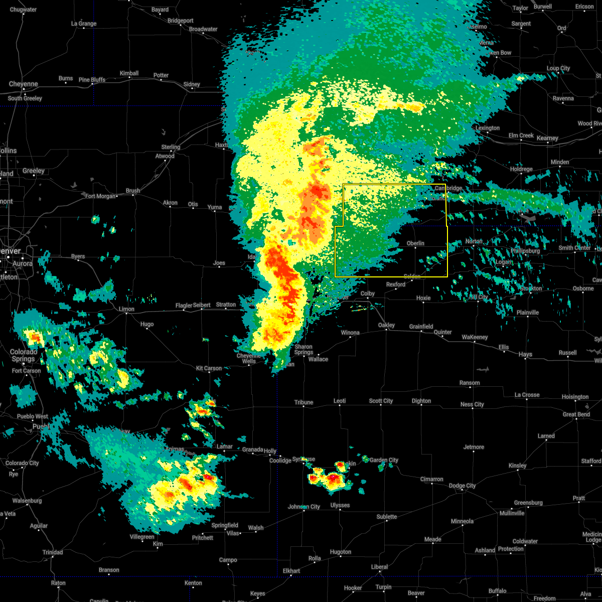 At 729 pm cdt, severe thunderstorms were located along a line extending from near wauneta to 14 miles south of st. francis, moving east at 45 mph. these are very dangerous storms (public). Hazards include 80 mph wind gusts. Flying debris will be dangerous to those caught without shelter. mobile homes will be heavily damaged. expect considerable damage to roofs, windows, and vehicles. Extensive tree damage and power outages are likely. At 729 pm cdt, severe thunderstorms were located along a line extending from near wauneta to 14 miles south of st. francis, moving east at 45 mph. these are very dangerous storms (public). Hazards include 80 mph wind gusts. Flying debris will be dangerous to those caught without shelter. mobile homes will be heavily damaged. expect considerable damage to roofs, windows, and vehicles. Extensive tree damage and power outages are likely.
|
| 5/26/2021 9:30 PM CDT | Report from mping: 1-inch tree limbs broken; shingles blown of in red willow county NE, 0.9 miles ESE of McCook, NE |
| 5/26/2021 9:14 PM CDT |
 At 914 pm cdt, a severe thunderstorm was located near indianola, or 8 miles east of mccook, moving east at 30 mph (radar indicated). Hazards include 60 mph wind gusts and quarter size hail. Hail damage to vehicles is expected. expect wind damage to roofs, siding, and trees. this severe thunderstorm will be near, bartley around 930 pm cdt. A tornado watch remains in effect until 200 am cdt for southwestern nebraska. At 914 pm cdt, a severe thunderstorm was located near indianola, or 8 miles east of mccook, moving east at 30 mph (radar indicated). Hazards include 60 mph wind gusts and quarter size hail. Hail damage to vehicles is expected. expect wind damage to roofs, siding, and trees. this severe thunderstorm will be near, bartley around 930 pm cdt. A tornado watch remains in effect until 200 am cdt for southwestern nebraska.
|
| 5/26/2021 8:48 PM CDT |
 At 848 pm cdt, a severe thunderstorm was located 8 miles north of mccook, moving east at 30 mph (radar indicated). Hazards include 60 mph wind gusts and quarter size hail. Hail damage to vehicles is expected. expect wind damage to roofs, siding, and trees. locations impacted include, mccook and culbertson. A tornado watch remains in effect until 200 am cdt for southwestern nebraska. At 848 pm cdt, a severe thunderstorm was located 8 miles north of mccook, moving east at 30 mph (radar indicated). Hazards include 60 mph wind gusts and quarter size hail. Hail damage to vehicles is expected. expect wind damage to roofs, siding, and trees. locations impacted include, mccook and culbertson. A tornado watch remains in effect until 200 am cdt for southwestern nebraska.
|
| 5/26/2021 8:27 PM CDT |
 At 827 pm cdt, a severe thunderstorm was located 6 miles north of culbertson, or 13 miles northeast of trenton, moving east at 30 mph (radar indicated). Hazards include ping pong ball size hail and 60 mph wind gusts. People and animals outdoors will be injured. expect hail damage to roofs, siding, windows, and vehicles. Expect wind damage to roofs, siding, and trees. At 827 pm cdt, a severe thunderstorm was located 6 miles north of culbertson, or 13 miles northeast of trenton, moving east at 30 mph (radar indicated). Hazards include ping pong ball size hail and 60 mph wind gusts. People and animals outdoors will be injured. expect hail damage to roofs, siding, windows, and vehicles. Expect wind damage to roofs, siding, and trees.
|
| 5/26/2021 6:46 PM CDT |
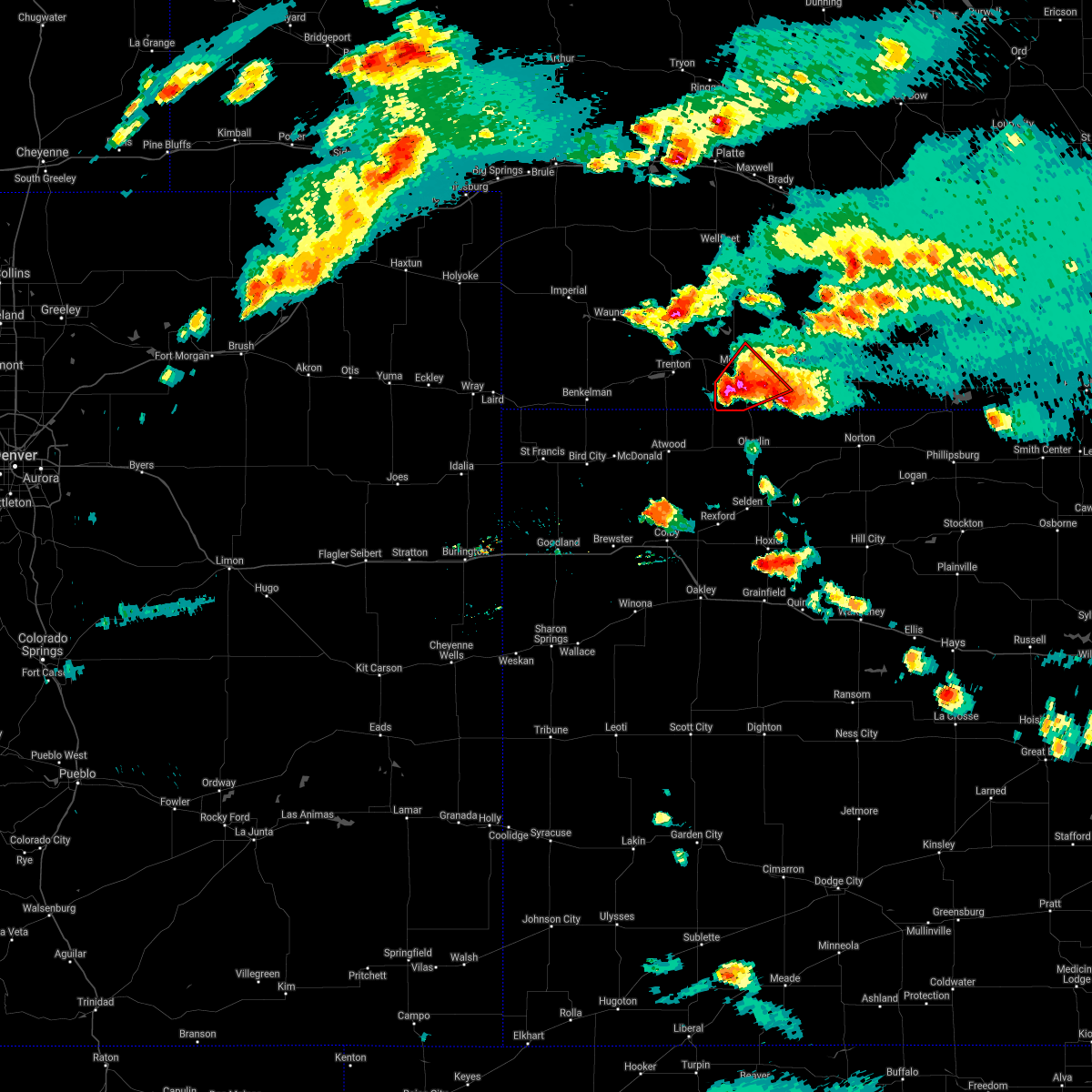 At 645 pm cdt, a severe thunderstorm capable of producing a tornado was located 10 miles south of mccook, moving northeast at 15 mph (radar indicated rotation). Hazards include tornado and golf ball size hail. Flying debris will be dangerous to those caught without shelter. mobile homes will be damaged or destroyed. damage to roofs, windows, and vehicles will occur. tree damage is likely. This tornadic thunderstorm will remain over mainly rural areas of southwestern red willow county. At 645 pm cdt, a severe thunderstorm capable of producing a tornado was located 10 miles south of mccook, moving northeast at 15 mph (radar indicated rotation). Hazards include tornado and golf ball size hail. Flying debris will be dangerous to those caught without shelter. mobile homes will be damaged or destroyed. damage to roofs, windows, and vehicles will occur. tree damage is likely. This tornadic thunderstorm will remain over mainly rural areas of southwestern red willow county.
|
| 5/26/2021 6:30 PM CDT |
 At 629 pm cdt, a severe thunderstorm capable of producing a tornado was located 8 miles south of culbertson, or 10 miles southeast of trenton, moving northeast at 25 mph (radar indicated rotation. at 628 pm cdt...a funnel cloud was reported 8 miles south of culbertson). Hazards include tornado and ping pong ball size hail. Flying debris will be dangerous to those caught without shelter. mobile homes will be damaged or destroyed. damage to roofs, windows, and vehicles will occur. tree damage is likely. Locations impacted include, mccook. At 629 pm cdt, a severe thunderstorm capable of producing a tornado was located 8 miles south of culbertson, or 10 miles southeast of trenton, moving northeast at 25 mph (radar indicated rotation. at 628 pm cdt...a funnel cloud was reported 8 miles south of culbertson). Hazards include tornado and ping pong ball size hail. Flying debris will be dangerous to those caught without shelter. mobile homes will be damaged or destroyed. damage to roofs, windows, and vehicles will occur. tree damage is likely. Locations impacted include, mccook.
|
| 5/26/2021 6:17 PM CDT |
 At 617 pm cdt, a severe thunderstorm capable of producing a tornado was located 8 miles southwest of mccook, moving northeast at 20 mph (radar indicated rotation). Hazards include tornado and golf ball size hail. Flying debris will be dangerous to those caught without shelter. mobile homes will be damaged or destroyed. damage to roofs, windows, and vehicles will occur. tree damage is likely. Locations impacted include, mccook. At 617 pm cdt, a severe thunderstorm capable of producing a tornado was located 8 miles southwest of mccook, moving northeast at 20 mph (radar indicated rotation). Hazards include tornado and golf ball size hail. Flying debris will be dangerous to those caught without shelter. mobile homes will be damaged or destroyed. damage to roofs, windows, and vehicles will occur. tree damage is likely. Locations impacted include, mccook.
|
| 5/26/2021 6:00 PM CDT |
 At 559 pm cdt, a severe thunderstorm capable of producing a tornado was located 8 miles north of herndon, or 14 miles southwest of mccook, moving northeast at 15 mph (radar indicated rotation. this storm has a history of producing tornadoes). Hazards include tornado and baseball size hail. Flying debris will be dangerous to those caught without shelter. mobile homes will be damaged or destroyed. damage to roofs, windows, and vehicles will occur. Tree damage is likely. At 559 pm cdt, a severe thunderstorm capable of producing a tornado was located 8 miles north of herndon, or 14 miles southwest of mccook, moving northeast at 15 mph (radar indicated rotation. this storm has a history of producing tornadoes). Hazards include tornado and baseball size hail. Flying debris will be dangerous to those caught without shelter. mobile homes will be damaged or destroyed. damage to roofs, windows, and vehicles will occur. Tree damage is likely.
|
| 5/26/2021 6:00 PM CDT |
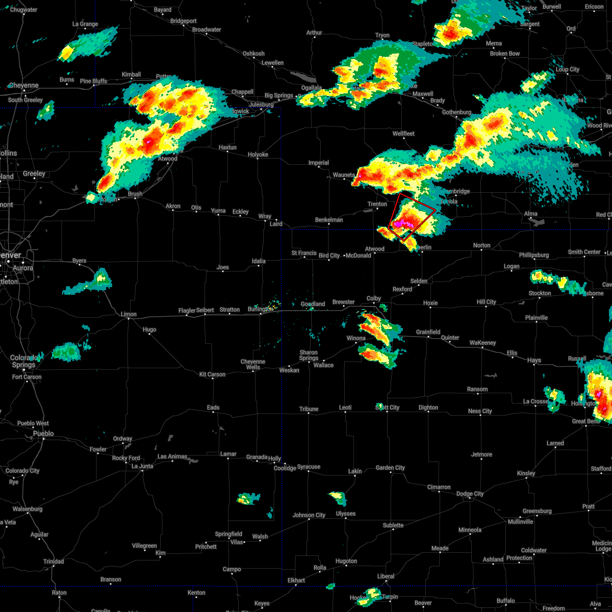 At 559 pm cdt, a severe thunderstorm capable of producing a tornado was located 8 miles north of herndon, or 14 miles southwest of mccook, moving northeast at 15 mph (radar indicated rotation. this storm has a history of producing tornadoes). Hazards include tornado and baseball size hail. Flying debris will be dangerous to those caught without shelter. mobile homes will be damaged or destroyed. damage to roofs, windows, and vehicles will occur. Tree damage is likely. At 559 pm cdt, a severe thunderstorm capable of producing a tornado was located 8 miles north of herndon, or 14 miles southwest of mccook, moving northeast at 15 mph (radar indicated rotation. this storm has a history of producing tornadoes). Hazards include tornado and baseball size hail. Flying debris will be dangerous to those caught without shelter. mobile homes will be damaged or destroyed. damage to roofs, windows, and vehicles will occur. Tree damage is likely.
|
| 5/26/2021 5:14 PM CDT |
 At 514 pm cdt, a severe thunderstorm was located 9 miles northwest of herndon, or 13 miles south of trenton, moving northeast at 20 mph (radar indicated). Hazards include ping pong ball size hail and 60 mph wind gusts. People and animals outdoors will be injured. expect hail damage to roofs, siding, windows, and vehicles. expect wind damage to roofs, siding, and trees. locations impacted include, culbertson and mccook. A tornado watch remains in effect until 200 am cdt for northwestern kansas, and southwestern nebraska. At 514 pm cdt, a severe thunderstorm was located 9 miles northwest of herndon, or 13 miles south of trenton, moving northeast at 20 mph (radar indicated). Hazards include ping pong ball size hail and 60 mph wind gusts. People and animals outdoors will be injured. expect hail damage to roofs, siding, windows, and vehicles. expect wind damage to roofs, siding, and trees. locations impacted include, culbertson and mccook. A tornado watch remains in effect until 200 am cdt for northwestern kansas, and southwestern nebraska.
|
| 5/26/2021 4:51 PM CDT |
 At 451 pm cdt, a severe thunderstorm was located near ludell, or 4 miles northeast of atwood, moving northeast at 45 mph (radar indicated). Hazards include 60 mph wind gusts and half dollar size hail. Hail damage to vehicles is expected. expect wind damage to roofs, siding, and trees. this severe thunderstorm will be near, herndon around 505 pm cdt. other locations in the path of this severe thunderstorm include culbertson and mccook. A tornado watch remains in effect until 200 am cdt for northwestern kansas, and southwestern nebraska. At 451 pm cdt, a severe thunderstorm was located near ludell, or 4 miles northeast of atwood, moving northeast at 45 mph (radar indicated). Hazards include 60 mph wind gusts and half dollar size hail. Hail damage to vehicles is expected. expect wind damage to roofs, siding, and trees. this severe thunderstorm will be near, herndon around 505 pm cdt. other locations in the path of this severe thunderstorm include culbertson and mccook. A tornado watch remains in effect until 200 am cdt for northwestern kansas, and southwestern nebraska.
|
| 5/23/2021 11:49 PM CDT |
 At 1149 pm cdt, a severe thunderstorm was located 10 miles southwest of mccook, moving northeast at 25 mph (radar indicated). Hazards include 60 mph wind gusts. Expect damage to roofs, siding, and trees. Locations impacted include, mccook, trenton, culbertson and indianola. At 1149 pm cdt, a severe thunderstorm was located 10 miles southwest of mccook, moving northeast at 25 mph (radar indicated). Hazards include 60 mph wind gusts. Expect damage to roofs, siding, and trees. Locations impacted include, mccook, trenton, culbertson and indianola.
|
| 5/23/2021 11:39 PM CDT |
 At 1139 pm cdt, a severe thunderstorm was located 9 miles south of culbertson, or 11 miles southwest of mccook, moving northeast at 35 mph (radar indicated). Hazards include 60 mph wind gusts. Expect damage to roofs, siding, and trees. Locations impacted include, mccook and indianola. At 1139 pm cdt, a severe thunderstorm was located 9 miles south of culbertson, or 11 miles southwest of mccook, moving northeast at 35 mph (radar indicated). Hazards include 60 mph wind gusts. Expect damage to roofs, siding, and trees. Locations impacted include, mccook and indianola.
|
| 5/23/2021 11:29 PM CDT |
 At 1129 pm cdt, a severe thunderstorm was located 10 miles southeast of trenton, moving northeast at 60 mph (radar indicated). Hazards include 70 mph wind gusts. Expect considerable tree damage. damage is likely to mobile homes, roofs, and outbuildings. this severe thunderstorm will be near, culbertson around 1140 pm cdt. Mccook around 1145 pm cdt. At 1129 pm cdt, a severe thunderstorm was located 10 miles southeast of trenton, moving northeast at 60 mph (radar indicated). Hazards include 70 mph wind gusts. Expect considerable tree damage. damage is likely to mobile homes, roofs, and outbuildings. this severe thunderstorm will be near, culbertson around 1140 pm cdt. Mccook around 1145 pm cdt.
|
| 8/16/2020 5:22 PM CDT |
 At 421 pm mdt/521 pm cdt/, severe thunderstorms were located along a line extending from 7 miles south of hendley to 3 miles northwest of haigler, moving south at 5 mph (spotters have reported hail 1 to 2 inches in size). Hazards include two inch hail and 70 mph wind gusts. People and animals outdoors will be injured. expect hail damage to roofs, siding, windows, and vehicles. expect considerable tree damage. wind damage is also likely to mobile homes, roofs, and outbuildings. locations impacted include, mccook, norton, oberlin, st. Francis, atwood, benkelman and trenton. At 421 pm mdt/521 pm cdt/, severe thunderstorms were located along a line extending from 7 miles south of hendley to 3 miles northwest of haigler, moving south at 5 mph (spotters have reported hail 1 to 2 inches in size). Hazards include two inch hail and 70 mph wind gusts. People and animals outdoors will be injured. expect hail damage to roofs, siding, windows, and vehicles. expect considerable tree damage. wind damage is also likely to mobile homes, roofs, and outbuildings. locations impacted include, mccook, norton, oberlin, st. Francis, atwood, benkelman and trenton.
|
| 8/16/2020 5:04 PM CDT |
 At 404 pm mdt/504 pm cdt/, severe thunderstorms were located along a line extending from 5 miles south of hendley to 4 miles northwest of haigler, moving south at 5 mph (radar indicated). Hazards include two inch hail and 70 mph wind gusts. People and animals outdoors will be injured. expect hail damage to roofs, siding, windows, and vehicles. expect considerable tree damage. Wind damage is also likely to mobile homes, roofs, and outbuildings. At 404 pm mdt/504 pm cdt/, severe thunderstorms were located along a line extending from 5 miles south of hendley to 4 miles northwest of haigler, moving south at 5 mph (radar indicated). Hazards include two inch hail and 70 mph wind gusts. People and animals outdoors will be injured. expect hail damage to roofs, siding, windows, and vehicles. expect considerable tree damage. Wind damage is also likely to mobile homes, roofs, and outbuildings.
|
| 8/16/2020 5:02 PM CDT | Quarter sized hail reported 3.4 miles SSW of McCook, NE, caller reported heavy hail up to quarter sized that is covering the ground and roads. hail is falling like a snow shower with very little rain. |
| 8/16/2020 4:52 PM CDT | The asos in mccook (kmck) gusted to 52 knots (60 mph) at 2152 utc. sustained wind of 41 mp in red willow county NE, 2.4 miles W of McCook, NE |
| 8/16/2020 4:34 PM CDT |
 At 334 pm mdt/434 pm cdt/, severe thunderstorms were located along a line extending from 10 miles north of mccook to 6 miles north of benkelman, moving south at 15 mph (trained weather spotters). Hazards include 60 mph wind gusts and half dollar size hail. Hail damage to vehicles is expected. expect wind damage to roofs, siding, and trees. Locations impacted include, mccook, oberlin, atwood, benkelman, trenton, culbertson and indianola. At 334 pm mdt/434 pm cdt/, severe thunderstorms were located along a line extending from 10 miles north of mccook to 6 miles north of benkelman, moving south at 15 mph (trained weather spotters). Hazards include 60 mph wind gusts and half dollar size hail. Hail damage to vehicles is expected. expect wind damage to roofs, siding, and trees. Locations impacted include, mccook, oberlin, atwood, benkelman, trenton, culbertson and indianola.
|
| 8/16/2020 4:20 PM CDT |
 At 319 pm mdt/419 pm cdt/, severe thunderstorms were located along a line extending from 13 miles southwest of stockville to 10 miles north of benkelman, moving south at 15 mph (trained weather spotters have reported hail size ranging as big as a half inch up to golf ball). Hazards include 60 mph wind gusts and half dollar size hail. Hail damage to vehicles is expected. Expect wind damage to roofs, siding, and trees. At 319 pm mdt/419 pm cdt/, severe thunderstorms were located along a line extending from 13 miles southwest of stockville to 10 miles north of benkelman, moving south at 15 mph (trained weather spotters have reported hail size ranging as big as a half inch up to golf ball). Hazards include 60 mph wind gusts and half dollar size hail. Hail damage to vehicles is expected. Expect wind damage to roofs, siding, and trees.
|
| 8/16/2020 3:50 PM CDT |
 At 250 pm mdt/350 pm cdt/, severe thunderstorms were located along a line extending from 13 miles northeast of culbertson to 9 miles northwest of stratton, moving southeast at 25 mph (radar indicated). Hazards include golf ball size hail and 70 mph wind gusts. People and animals outdoors will be injured. expect hail damage to roofs, siding, windows, and vehicles. expect considerable tree damage. wind damage is also likely to mobile homes, roofs, and outbuildings. Locations impacted include, mccook, oberlin, atwood, trenton, culbertson, indianola and palisade. At 250 pm mdt/350 pm cdt/, severe thunderstorms were located along a line extending from 13 miles northeast of culbertson to 9 miles northwest of stratton, moving southeast at 25 mph (radar indicated). Hazards include golf ball size hail and 70 mph wind gusts. People and animals outdoors will be injured. expect hail damage to roofs, siding, windows, and vehicles. expect considerable tree damage. wind damage is also likely to mobile homes, roofs, and outbuildings. Locations impacted include, mccook, oberlin, atwood, trenton, culbertson, indianola and palisade.
|
| 8/16/2020 3:32 PM CDT |
 At 232 pm mdt/332 pm cdt/, severe thunderstorms were located along a line extending from 11 miles east of hayes center to 8 miles southwest of wauneta, moving southeast at 25 mph (radar indicated). Hazards include golf ball size hail and 70 mph wind gusts. People and animals outdoors will be injured. expect hail damage to roofs, siding, windows, and vehicles. expect considerable tree damage. Wind damage is also likely to mobile homes, roofs, and outbuildings. At 232 pm mdt/332 pm cdt/, severe thunderstorms were located along a line extending from 11 miles east of hayes center to 8 miles southwest of wauneta, moving southeast at 25 mph (radar indicated). Hazards include golf ball size hail and 70 mph wind gusts. People and animals outdoors will be injured. expect hail damage to roofs, siding, windows, and vehicles. expect considerable tree damage. Wind damage is also likely to mobile homes, roofs, and outbuildings.
|
| 8/12/2020 7:04 AM CDT | Mesonet recorded a 59mph wind gus in red willow county NE, 0.4 miles SSW of McCook, NE |
| 8/11/2020 8:30 PM CDT |
 At 829 pm cdt, a severe thunderstorm was located 6 miles northwest of indianola, or 9 miles northeast of mccook, moving east at 15 mph (radar indicated). Hazards include 60 mph wind gusts and penny size hail. Expect damage to roofs, siding, and trees. Locations impacted include, mccook, indianola and bartley. At 829 pm cdt, a severe thunderstorm was located 6 miles northwest of indianola, or 9 miles northeast of mccook, moving east at 15 mph (radar indicated). Hazards include 60 mph wind gusts and penny size hail. Expect damage to roofs, siding, and trees. Locations impacted include, mccook, indianola and bartley.
|
| 8/11/2020 8:23 PM CDT |
 At 823 pm cdt, a severe thunderstorm was located 6 miles north of mccook, moving east at 15 mph (radar indicated). Hazards include 60 mph wind gusts and quarter size hail. Hail damage to vehicles is expected. expect wind damage to roofs, siding, and trees. Locations impacted include, mccook, indianola and bartley. At 823 pm cdt, a severe thunderstorm was located 6 miles north of mccook, moving east at 15 mph (radar indicated). Hazards include 60 mph wind gusts and quarter size hail. Hail damage to vehicles is expected. expect wind damage to roofs, siding, and trees. Locations impacted include, mccook, indianola and bartley.
|
| 8/11/2020 8:19 PM CDT |
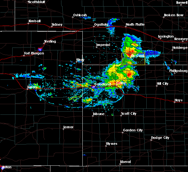 At 818 pm cdt, a severe thunderstorm was located 5 miles north of mccook, moving east at 20 mph (radar indicated). Hazards include 60 mph wind gusts and quarter size hail. Hail damage to vehicles is expected. expect wind damage to roofs, siding, and trees. Locations impacted include, mccook, indianola and bartley. At 818 pm cdt, a severe thunderstorm was located 5 miles north of mccook, moving east at 20 mph (radar indicated). Hazards include 60 mph wind gusts and quarter size hail. Hail damage to vehicles is expected. expect wind damage to roofs, siding, and trees. Locations impacted include, mccook, indianola and bartley.
|
| 8/11/2020 8:09 PM CDT |
 At 808 pm cdt, a severe thunderstorm was located 5 miles northeast of culbertson, or 7 miles northwest of mccook, moving east at 10 mph (radar indicated). Hazards include 60 mph wind gusts and quarter size hail. Hail damage to vehicles is expected. Expect wind damage to roofs, siding, and trees. At 808 pm cdt, a severe thunderstorm was located 5 miles northeast of culbertson, or 7 miles northwest of mccook, moving east at 10 mph (radar indicated). Hazards include 60 mph wind gusts and quarter size hail. Hail damage to vehicles is expected. Expect wind damage to roofs, siding, and trees.
|
| 7/20/2020 8:48 PM CDT |
 At 746 pm mdt/846 pm cdt/, severe thunderstorms were located along a line extending from 6 miles west of danbury to 7 miles southwest of haigler, moving south at 25 mph (these storms have a history of producing quarter size hail and damaging winds). Hazards include 60 mph wind gusts and quarter size hail. Hail damage to vehicles is expected. expect wind damage to roofs, siding, and trees. locations impacted include, mccook, oberlin, st. Francis, atwood, benkelman, trenton and culbertson. At 746 pm mdt/846 pm cdt/, severe thunderstorms were located along a line extending from 6 miles west of danbury to 7 miles southwest of haigler, moving south at 25 mph (these storms have a history of producing quarter size hail and damaging winds). Hazards include 60 mph wind gusts and quarter size hail. Hail damage to vehicles is expected. expect wind damage to roofs, siding, and trees. locations impacted include, mccook, oberlin, st. Francis, atwood, benkelman, trenton and culbertson.
|
| 7/20/2020 8:29 PM CDT |
 At 729 pm mdt/829 pm cdt/, severe thunderstorms were located along a line extending from 4 miles northeast of mccook to 5 miles northwest of haigler, moving south at 25 mph (these storms have a history of producing quarter size hail and damaging winds). Hazards include 60 mph wind gusts and quarter size hail. Hail damage to vehicles is expected. Expect wind damage to roofs, siding, and trees. At 729 pm mdt/829 pm cdt/, severe thunderstorms were located along a line extending from 4 miles northeast of mccook to 5 miles northwest of haigler, moving south at 25 mph (these storms have a history of producing quarter size hail and damaging winds). Hazards include 60 mph wind gusts and quarter size hail. Hail damage to vehicles is expected. Expect wind damage to roofs, siding, and trees.
|
| 7/20/2020 8:03 PM CDT |
 At 703 pm mdt/803 pm cdt/, severe thunderstorms were located along a line extending from 11 miles northeast of culbertson to 13 miles northeast of haigler, moving south at 30 mph (these storms have a history of producing large hail and damaging winds). Hazards include 70 mph wind gusts and quarter size hail. Hail damage to vehicles is expected. expect considerable tree damage. wind damage is also likely to mobile homes, roofs, and outbuildings. Locations impacted include, mccook, benkelman, trenton, culbertson, indianola, palisade and stratton. At 703 pm mdt/803 pm cdt/, severe thunderstorms were located along a line extending from 11 miles northeast of culbertson to 13 miles northeast of haigler, moving south at 30 mph (these storms have a history of producing large hail and damaging winds). Hazards include 70 mph wind gusts and quarter size hail. Hail damage to vehicles is expected. expect considerable tree damage. wind damage is also likely to mobile homes, roofs, and outbuildings. Locations impacted include, mccook, benkelman, trenton, culbertson, indianola, palisade and stratton.
|
| 7/20/2020 7:50 PM CDT |
 At 648 pm mdt/748 pm cdt/, severe thunderstorms were located along a line extending from 10 miles southwest of curtis to 11 miles southwest of enders reservoir state recreation area, moving south at 35 mph (these storms have a history of producing large hail and damaging winds). Hazards include 70 mph wind gusts and quarter size hail. Hail damage to vehicles is expected. expect considerable tree damage. wind damage is also likely to mobile homes, roofs, and outbuildings. Locations impacted include, mccook, benkelman, trenton, culbertson, indianola, palisade and stratton. At 648 pm mdt/748 pm cdt/, severe thunderstorms were located along a line extending from 10 miles southwest of curtis to 11 miles southwest of enders reservoir state recreation area, moving south at 35 mph (these storms have a history of producing large hail and damaging winds). Hazards include 70 mph wind gusts and quarter size hail. Hail damage to vehicles is expected. expect considerable tree damage. wind damage is also likely to mobile homes, roofs, and outbuildings. Locations impacted include, mccook, benkelman, trenton, culbertson, indianola, palisade and stratton.
|
| 7/20/2020 7:37 PM CDT |
 At 636 pm mdt/736 pm cdt/, severe thunderstorms were located along a line extending from 3 miles northwest of curtis to near champion, moving south at 30 mph (radar indicated). Hazards include 70 mph wind gusts and quarter size hail. Hail damage to vehicles is expected. expect considerable tree damage. Wind damage is also likely to mobile homes, roofs, and outbuildings. At 636 pm mdt/736 pm cdt/, severe thunderstorms were located along a line extending from 3 miles northwest of curtis to near champion, moving south at 30 mph (radar indicated). Hazards include 70 mph wind gusts and quarter size hail. Hail damage to vehicles is expected. expect considerable tree damage. Wind damage is also likely to mobile homes, roofs, and outbuildings.
|
| 7/13/2020 10:30 PM CDT |
 At 1030 pm cdt, severe thunderstorms were located along a line extending from 3 miles northeast of indianola to 6 miles north of oberlin to 10 miles southeast of atwood, moving east at 55 mph. these are very dangerous storms (trained weather spotters. at 1028 pm cdt, a 79 mph wind gust was reported at the mccook airport). Hazards include 80 mph wind gusts and quarter size hail. Flying debris will be dangerous to those caught without shelter. mobile homes will be heavily damaged. expect considerable damage to roofs, windows, and vehicles. extensive tree damage and power outages are likely. Locations impacted include, mccook, oberlin, indianola, bartley, norcatur, danbury and jennings. At 1030 pm cdt, severe thunderstorms were located along a line extending from 3 miles northeast of indianola to 6 miles north of oberlin to 10 miles southeast of atwood, moving east at 55 mph. these are very dangerous storms (trained weather spotters. at 1028 pm cdt, a 79 mph wind gust was reported at the mccook airport). Hazards include 80 mph wind gusts and quarter size hail. Flying debris will be dangerous to those caught without shelter. mobile homes will be heavily damaged. expect considerable damage to roofs, windows, and vehicles. extensive tree damage and power outages are likely. Locations impacted include, mccook, oberlin, indianola, bartley, norcatur, danbury and jennings.
|
| 7/13/2020 10:28 PM CDT | Corrects previous tstm wnd gst report from mccook. asos recorded at 79mph wind gust at 9:28m in red willow county NE, 0.4 miles SSW of McCook, NE |
| 7/13/2020 10:14 PM CDT |
 At 1011 pm cdt, severe thunderstorms were located along a line extending from 4 miles northwest of mccook to 3 miles southwest of herndon to 12 miles southeast of mcdonald, moving east at 55 mph (trained weather spotters. at 948 pm cdt, a 62 mph wind gust was reported in trenton, nebraska. a 65 mph wind gusts was also reported in ludell, kansas at 1004 pm cdt). Hazards include 60 mph wind gusts and quarter size hail. Hail damage to vehicles is expected. Expect wind damage to roofs, siding, and trees. At 1011 pm cdt, severe thunderstorms were located along a line extending from 4 miles northwest of mccook to 3 miles southwest of herndon to 12 miles southeast of mcdonald, moving east at 55 mph (trained weather spotters. at 948 pm cdt, a 62 mph wind gust was reported in trenton, nebraska. a 65 mph wind gusts was also reported in ludell, kansas at 1004 pm cdt). Hazards include 60 mph wind gusts and quarter size hail. Hail damage to vehicles is expected. Expect wind damage to roofs, siding, and trees.
|
| 7/12/2020 8:15 PM CDT |
 At 814 pm cdt, severe thunderstorms were located along a line extending from 11 miles west of medicine creek reservoir state recreation area to 4 miles north of indianola to 8 miles northwest of danbury to 8 miles south of mccook, moving east at 35 mph (radar indicated). Hazards include 70 mph wind gusts and half dollar size hail. Hail damage to vehicles is expected. expect considerable tree damage. Wind damage is also likely to mobile homes, roofs, and outbuildings. At 814 pm cdt, severe thunderstorms were located along a line extending from 11 miles west of medicine creek reservoir state recreation area to 4 miles north of indianola to 8 miles northwest of danbury to 8 miles south of mccook, moving east at 35 mph (radar indicated). Hazards include 70 mph wind gusts and half dollar size hail. Hail damage to vehicles is expected. expect considerable tree damage. Wind damage is also likely to mobile homes, roofs, and outbuildings.
|
| 7/12/2020 8:03 PM CDT |
 At 803 pm cdt, severe thunderstorms were located along a line extending from 7 miles west of palisade to 7 miles northwest of trenton to 5 miles east of stratton, moving northeast at 40 mph. these are very dangerous storms (radar indicated). Hazards include 80 mph wind gusts and half dollar size hail. Flying debris will be dangerous to those caught without shelter. mobile homes will be heavily damaged. expect considerable damage to roofs, windows, and vehicles. extensive tree damage and power outages are likely. Locations impacted include, mccook and culbertson. At 803 pm cdt, severe thunderstorms were located along a line extending from 7 miles west of palisade to 7 miles northwest of trenton to 5 miles east of stratton, moving northeast at 40 mph. these are very dangerous storms (radar indicated). Hazards include 80 mph wind gusts and half dollar size hail. Flying debris will be dangerous to those caught without shelter. mobile homes will be heavily damaged. expect considerable damage to roofs, windows, and vehicles. extensive tree damage and power outages are likely. Locations impacted include, mccook and culbertson.
|
| 7/12/2020 8:00 PM CDT |
 At 800 pm cdt, a severe thunderstorm was located 4 miles southeast of mccook, moving east at 60 mph. this is a very dangerous storm (radar indicated). Hazards include 90 mph wind gusts and ping pong ball size hail. You are in a life-threatening situation. flying debris may be deadly to those caught without shelter. mobile homes will be heavily damaged or destroyed. homes and businesses will have substantial roof and window damage. Expect extensive tree damage and power outages. At 800 pm cdt, a severe thunderstorm was located 4 miles southeast of mccook, moving east at 60 mph. this is a very dangerous storm (radar indicated). Hazards include 90 mph wind gusts and ping pong ball size hail. You are in a life-threatening situation. flying debris may be deadly to those caught without shelter. mobile homes will be heavily damaged or destroyed. homes and businesses will have substantial roof and window damage. Expect extensive tree damage and power outages.
|
| 7/12/2020 7:58 PM CDT | Storm damage reported in red willow county NE, 1.3 miles WNW of McCook, NE |
| 7/12/2020 7:54 PM CDT | Storm damage reported in red willow county NE, 3.8 miles N of McCook, NE |
| 7/12/2020 7:45 PM CDT | Two car garage door and window blown out. estimated time of report from rada in red willow county NE, 2.1 miles WSW of McCook, NE |
| 7/12/2020 7:44 PM CDT |
 At 743 pm cdt, severe thunderstorms were located along a line extending from 10 miles southwest of wauneta to 5 miles west of stratton to 10 miles east of benkelman to 9 miles north of mcdonald, moving east at 40 mph (radar indicated). Hazards include 70 mph wind gusts and ping pong ball size hail. People and animals outdoors will be injured. expect hail damage to roofs, siding, windows, and vehicles. expect considerable tree damage. wind damage is also likely to mobile homes, roofs, and outbuildings. Locations impacted include, mccook, trenton and culbertson. At 743 pm cdt, severe thunderstorms were located along a line extending from 10 miles southwest of wauneta to 5 miles west of stratton to 10 miles east of benkelman to 9 miles north of mcdonald, moving east at 40 mph (radar indicated). Hazards include 70 mph wind gusts and ping pong ball size hail. People and animals outdoors will be injured. expect hail damage to roofs, siding, windows, and vehicles. expect considerable tree damage. wind damage is also likely to mobile homes, roofs, and outbuildings. Locations impacted include, mccook, trenton and culbertson.
|
| 7/12/2020 7:29 PM CDT |
 At 729 pm cdt, severe thunderstorms were located along a line extending from 14 miles south of enders reservoir state recreation area to 3 miles northeast of benkelman to 15 miles northwest of mcdonald to 8 miles north of bird city, moving northeast at 40 mph (radar indicated). Hazards include 70 mph wind gusts and ping pong ball size hail. People and animals outdoors will be injured. expect hail damage to roofs, siding, windows, and vehicles. expect considerable tree damage. Wind damage is also likely to mobile homes, roofs, and outbuildings. At 729 pm cdt, severe thunderstorms were located along a line extending from 14 miles south of enders reservoir state recreation area to 3 miles northeast of benkelman to 15 miles northwest of mcdonald to 8 miles north of bird city, moving northeast at 40 mph (radar indicated). Hazards include 70 mph wind gusts and ping pong ball size hail. People and animals outdoors will be injured. expect hail damage to roofs, siding, windows, and vehicles. expect considerable tree damage. Wind damage is also likely to mobile homes, roofs, and outbuildings.
|
| 7/8/2020 10:33 PM CDT |
 At 1031 pm cdt, severe thunderstorms were located along a line extending from 3 miles southwest of orleans to 7 miles north of almena to 6 miles north of norcatur to 7 miles southeast of herndon, moving southeast at 40 mph (radar indicated. at 10:23 cdt, a 63 mph wind gust was reported at mccook, nebraska). Hazards include 60 mph wind gusts. Expect damage to roofs, siding, and trees. Locations impacted include, mccook, norton, oberlin, indianola, almena, bartley and lenora. At 1031 pm cdt, severe thunderstorms were located along a line extending from 3 miles southwest of orleans to 7 miles north of almena to 6 miles north of norcatur to 7 miles southeast of herndon, moving southeast at 40 mph (radar indicated. at 10:23 cdt, a 63 mph wind gust was reported at mccook, nebraska). Hazards include 60 mph wind gusts. Expect damage to roofs, siding, and trees. Locations impacted include, mccook, norton, oberlin, indianola, almena, bartley and lenora.
|
| 7/8/2020 10:23 PM CDT | Storm damage reported in red willow county NE, 0.4 miles NW of McCook, NE |
| 7/8/2020 10:20 PM CDT | Report of a tree limb roughly 3 car lengths in length dow in red willow county NE, 0.9 miles ESE of McCook, NE |
| 7/8/2020 10:11 PM CDT |
 At 1011 pm cdt, severe thunderstorms were located along a line extending from 4 miles southeast of edison to near hendley to 4 miles southwest of lebanon to near herndon, moving southeast at 35 mph (radar indicated). Hazards include 60 mph wind gusts. expect damage to roofs, siding, and trees At 1011 pm cdt, severe thunderstorms were located along a line extending from 4 miles southeast of edison to near hendley to 4 miles southwest of lebanon to near herndon, moving southeast at 35 mph (radar indicated). Hazards include 60 mph wind gusts. expect damage to roofs, siding, and trees
|
| 7/8/2020 9:42 PM CDT |
 At 940 pm cdt, severe thunderstorms were located along a line extending from 10 miles south of eustis to 3 miles south of indianola to 4 miles northeast of ludell to 3 miles northeast of mcdonald, moving east at 30 mph (radar indicated). Hazards include 60 mph wind gusts and quarter size hail. Hail damage to vehicles is expected. expect wind damage to roofs, siding, and trees. Locations impacted include, mccook, oberlin, atwood, trenton, culbertson, indianola and palisade. At 940 pm cdt, severe thunderstorms were located along a line extending from 10 miles south of eustis to 3 miles south of indianola to 4 miles northeast of ludell to 3 miles northeast of mcdonald, moving east at 30 mph (radar indicated). Hazards include 60 mph wind gusts and quarter size hail. Hail damage to vehicles is expected. expect wind damage to roofs, siding, and trees. Locations impacted include, mccook, oberlin, atwood, trenton, culbertson, indianola and palisade.
|
| 7/8/2020 9:14 PM CDT |
 At 813 pm mdt/913 pm cdt/, severe thunderstorms were located along a line extending from 7 miles northeast of stockville to 5 miles north of mccook to 11 miles northwest of ludell to 10 miles northwest of bird city, moving southeast at 30 mph (radar indicated). Hazards include 60 mph wind gusts and quarter size hail. Hail damage to vehicles is expected. Expect wind damage to roofs, siding, and trees. At 813 pm mdt/913 pm cdt/, severe thunderstorms were located along a line extending from 7 miles northeast of stockville to 5 miles north of mccook to 11 miles northwest of ludell to 10 miles northwest of bird city, moving southeast at 30 mph (radar indicated). Hazards include 60 mph wind gusts and quarter size hail. Hail damage to vehicles is expected. Expect wind damage to roofs, siding, and trees.
|
| 7/2/2020 7:37 PM CDT |
 At 737 pm cdt, severe thunderstorms were located along a line extending from near bartley to 5 miles east of hoxie, moving east at 40 mph (trained weather spotters). Hazards include 70 mph wind gusts and quarter size hail. Hail damage to vehicles is expected. expect considerable tree damage. wind damage is also likely to mobile homes, roofs, and outbuildings. Locations impacted include, mccook, oberlin, hoxie, indianola, bartley, selden and norcatur. At 737 pm cdt, severe thunderstorms were located along a line extending from near bartley to 5 miles east of hoxie, moving east at 40 mph (trained weather spotters). Hazards include 70 mph wind gusts and quarter size hail. Hail damage to vehicles is expected. expect considerable tree damage. wind damage is also likely to mobile homes, roofs, and outbuildings. Locations impacted include, mccook, oberlin, hoxie, indianola, bartley, selden and norcatur.
|
| 7/2/2020 7:26 PM CDT |
 At 725 pm cdt, severe thunderstorms were located along a line extending from indianola to near hoxie, moving east at 40 mph (trained weather spotters). Hazards include 70 mph wind gusts and quarter size hail. Hail damage to vehicles is expected. expect considerable tree damage. wind damage is also likely to mobile homes, roofs, and outbuildings. locations impacted include, mccook, colby, oberlin, hoxie, atwood, trenton and brewster. People attending downtown atwood should seek safe shelter immediately! this includes interstate 70 in kansas between mile markers 36 and 74. At 725 pm cdt, severe thunderstorms were located along a line extending from indianola to near hoxie, moving east at 40 mph (trained weather spotters). Hazards include 70 mph wind gusts and quarter size hail. Hail damage to vehicles is expected. expect considerable tree damage. wind damage is also likely to mobile homes, roofs, and outbuildings. locations impacted include, mccook, colby, oberlin, hoxie, atwood, trenton and brewster. People attending downtown atwood should seek safe shelter immediately! this includes interstate 70 in kansas between mile markers 36 and 74.
|
| 7/2/2020 7:03 PM CDT |
 At 703 pm cdt, severe thunderstorms were located along a line extending from 8 miles north of culbertson to near levant, moving east at 40 mph (trained weather spotters). Hazards include 70 mph wind gusts and quarter size hail. Hail damage to vehicles is expected. expect considerable tree damage. wind damage is also likely to mobile homes, roofs, and outbuildings. locations impacted include, mccook, colby, oberlin, hoxie, atwood, trenton and brewster. This includes interstate 70 in kansas between mile markers 36 and 74. At 703 pm cdt, severe thunderstorms were located along a line extending from 8 miles north of culbertson to near levant, moving east at 40 mph (trained weather spotters). Hazards include 70 mph wind gusts and quarter size hail. Hail damage to vehicles is expected. expect considerable tree damage. wind damage is also likely to mobile homes, roofs, and outbuildings. locations impacted include, mccook, colby, oberlin, hoxie, atwood, trenton and brewster. This includes interstate 70 in kansas between mile markers 36 and 74.
|
| 7/2/2020 6:51 PM CDT |
 At 551 pm mdt/651 pm cdt/, severe thunderstorms were located along a line extending from 9 miles northwest of culbertson to 3 miles east of brewster, moving east at 40 mph (storm chaser 2 miles south of culbertson). Hazards include 74 mph wind gusts. Expect considerable tree damage. damage is likely to mobile homes, roofs, and outbuildings. locations impacted include, mccook, colby, oberlin, hoxie, atwood, trenton and brewster. This includes interstate 70 in kansas between mile markers 22 and 74. At 551 pm mdt/651 pm cdt/, severe thunderstorms were located along a line extending from 9 miles northwest of culbertson to 3 miles east of brewster, moving east at 40 mph (storm chaser 2 miles south of culbertson). Hazards include 74 mph wind gusts. Expect considerable tree damage. damage is likely to mobile homes, roofs, and outbuildings. locations impacted include, mccook, colby, oberlin, hoxie, atwood, trenton and brewster. This includes interstate 70 in kansas between mile markers 22 and 74.
|
| 7/2/2020 6:49 PM CDT |
 At 548 pm mdt/648 pm cdt/, severe thunderstorms were located along a line extending from 9 miles east of palisade to near brewster, moving east at 40 mph (mesonet). Hazards include 63 mph wind gusts measured six miles north of ludell. Expect damage to roofs, siding, and trees. locations impacted include, mccook, colby, oberlin, hoxie, atwood, trenton and brewster. This includes interstate 70 in kansas between mile markers 22 and 74. At 548 pm mdt/648 pm cdt/, severe thunderstorms were located along a line extending from 9 miles east of palisade to near brewster, moving east at 40 mph (mesonet). Hazards include 63 mph wind gusts measured six miles north of ludell. Expect damage to roofs, siding, and trees. locations impacted include, mccook, colby, oberlin, hoxie, atwood, trenton and brewster. This includes interstate 70 in kansas between mile markers 22 and 74.
|
| 7/2/2020 6:43 PM CDT |
 At 543 pm mdt/643 pm cdt/, severe thunderstorms were located along a line extending from 7 miles east of palisade to near brewster, moving east at 40 mph (radar indicated). Hazards include 70 mph wind gusts and half dollar size hail. Hail damage to vehicles is expected. expect considerable tree damage. Wind damage is also likely to mobile homes, roofs, and outbuildings. At 543 pm mdt/643 pm cdt/, severe thunderstorms were located along a line extending from 7 miles east of palisade to near brewster, moving east at 40 mph (radar indicated). Hazards include 70 mph wind gusts and half dollar size hail. Hail damage to vehicles is expected. expect considerable tree damage. Wind damage is also likely to mobile homes, roofs, and outbuildings.
|
| 6/25/2020 7:14 PM CDT |
 At 713 pm cdt, severe thunderstorms were located along a line extending from 9 miles north of indianola to 5 miles north of danbury to 4 miles north of oberlin to 10 miles southeast of herndon, moving east at 20 mph (radar indicated). Hazards include 60 mph wind gusts, blowing dust, and quarter size hail. Hail damage to vehicles is expected. expect wind damage to roofs, siding, and trees. Locations impacted include, mccook, oberlin, indianola, bartley, herndon, danbury and lebanon. At 713 pm cdt, severe thunderstorms were located along a line extending from 9 miles north of indianola to 5 miles north of danbury to 4 miles north of oberlin to 10 miles southeast of herndon, moving east at 20 mph (radar indicated). Hazards include 60 mph wind gusts, blowing dust, and quarter size hail. Hail damage to vehicles is expected. expect wind damage to roofs, siding, and trees. Locations impacted include, mccook, oberlin, indianola, bartley, herndon, danbury and lebanon.
|
| 6/25/2020 7:03 PM CDT |
 At 630 pm cdt, a public official reported quarter size hail in herndon. 701 pm cdt, severe thunderstorms were located along a line extending from 10 miles northwest of indianola to 6 miles northwest of danbury to 5 miles northwest of oberlin to 8 miles southeast of herndon, moving east at 20 mph (public official). Hazards include 60 mph wind gusts and quarter size hail. Hail damage to vehicles is expected. expect wind damage to roofs, siding, and trees. Locations impacted include, mccook, oberlin, indianola, bartley, herndon, danbury and lebanon. At 630 pm cdt, a public official reported quarter size hail in herndon. 701 pm cdt, severe thunderstorms were located along a line extending from 10 miles northwest of indianola to 6 miles northwest of danbury to 5 miles northwest of oberlin to 8 miles southeast of herndon, moving east at 20 mph (public official). Hazards include 60 mph wind gusts and quarter size hail. Hail damage to vehicles is expected. expect wind damage to roofs, siding, and trees. Locations impacted include, mccook, oberlin, indianola, bartley, herndon, danbury and lebanon.
|
| 6/25/2020 6:29 PM CDT |
 At 629 pm cdt, severe thunderstorms were located along a line extending from 9 miles northeast of culbertson to 9 miles south of mccook to 4 miles south of herndon to 7 miles southeast of ludell, moving east at 20 mph (radar indicated). Hazards include 60 mph wind gusts, blowing dust, and half dollar size hail. Hail damage to vehicles is expected. Expect wind damage to roofs, siding, and trees. At 629 pm cdt, severe thunderstorms were located along a line extending from 9 miles northeast of culbertson to 9 miles south of mccook to 4 miles south of herndon to 7 miles southeast of ludell, moving east at 20 mph (radar indicated). Hazards include 60 mph wind gusts, blowing dust, and half dollar size hail. Hail damage to vehicles is expected. Expect wind damage to roofs, siding, and trees.
|
| 6/25/2020 5:50 PM CDT |
 At 550 pm cdt, severe thunderstorms were located along a line extending from 9 miles northwest of mccook to 4 miles east of culbertson to 7 miles southeast of trenton to 11 miles southeast of stratton, moving southeast at 15 mph (radar indicated). Hazards include 60 mph wind gusts, blowing dust, and nickel size hail. expect damage to roofs, siding, and trees At 550 pm cdt, severe thunderstorms were located along a line extending from 9 miles northwest of mccook to 4 miles east of culbertson to 7 miles southeast of trenton to 11 miles southeast of stratton, moving southeast at 15 mph (radar indicated). Hazards include 60 mph wind gusts, blowing dust, and nickel size hail. expect damage to roofs, siding, and trees
|
| 6/4/2020 7:56 PM CDT |
 At 754 pm cdt, severe thunderstorms were located along a line extending from 4 miles southeast of mccook to 3 miles west of danbury to 9 miles west of norcatur to 5 miles north of jennings to near dresden, moving east at 35 mph (trained weather spotters have reported ongoing one quarter mile visibility with blowing dirt near dresden, ks). Hazards include 60 mph wind gusts. Expect damage to roofs, siding, and trees. Locations impacted include, mccook, oberlin, indianola, bartley, norcatur, danbury and jennings. At 754 pm cdt, severe thunderstorms were located along a line extending from 4 miles southeast of mccook to 3 miles west of danbury to 9 miles west of norcatur to 5 miles north of jennings to near dresden, moving east at 35 mph (trained weather spotters have reported ongoing one quarter mile visibility with blowing dirt near dresden, ks). Hazards include 60 mph wind gusts. Expect damage to roofs, siding, and trees. Locations impacted include, mccook, oberlin, indianola, bartley, norcatur, danbury and jennings.
|
| 6/4/2020 7:23 PM CDT |
 At 722 pm cdt, severe thunderstorms were located along a line extending from 7 miles southeast of trenton to 4 miles north of herndon to 9 miles west of oberlin to 8 miles north of rexford, moving northeast at 35 mph (fire department officials observed near zero visibility with blowing dirt that is ongoing at herndon, ks along with estimated 60 mph wind gusts). Hazards include 60 mph wind gusts. expect damage to roofs, siding, and trees At 722 pm cdt, severe thunderstorms were located along a line extending from 7 miles southeast of trenton to 4 miles north of herndon to 9 miles west of oberlin to 8 miles north of rexford, moving northeast at 35 mph (fire department officials observed near zero visibility with blowing dirt that is ongoing at herndon, ks along with estimated 60 mph wind gusts). Hazards include 60 mph wind gusts. expect damage to roofs, siding, and trees
|
| 6/3/2020 7:48 PM CDT |
 At 748 pm cdt, a severe thunderstorm was located over bartley, or 17 miles east of mccook, moving southeast at 45 mph (radar indicated). Hazards include 70 mph wind gusts and quarter size hail. Hail damage to vehicles is expected. expect considerable tree damage. Wind damage is also likely to mobile homes, roofs, and outbuildings. At 748 pm cdt, a severe thunderstorm was located over bartley, or 17 miles east of mccook, moving southeast at 45 mph (radar indicated). Hazards include 70 mph wind gusts and quarter size hail. Hail damage to vehicles is expected. expect considerable tree damage. Wind damage is also likely to mobile homes, roofs, and outbuildings.
|
| 6/2/2020 7:20 PM CDT |
 At 720 pm cdt, a severe thunderstorm was located near culbertson, or 10 miles east of trenton, moving east at 15 mph (radar indicated). Hazards include 60 mph wind gusts and quarter size hail. Hail damage to vehicles is expected. expect wind damage to roofs, siding, and trees. Locations impacted include, mccook and culbertson. At 720 pm cdt, a severe thunderstorm was located near culbertson, or 10 miles east of trenton, moving east at 15 mph (radar indicated). Hazards include 60 mph wind gusts and quarter size hail. Hail damage to vehicles is expected. expect wind damage to roofs, siding, and trees. Locations impacted include, mccook and culbertson.
|
| 6/2/2020 7:04 PM CDT |
 At 703 pm cdt, a severe thunderstorm was located over culbertson, or 8 miles east of trenton, moving east at 25 mph (radar indicated). Hazards include golf ball size hail and 70 mph wind gusts. People and animals outdoors will be injured. expect hail damage to roofs, siding, windows, and vehicles. expect considerable tree damage. Wind damage is also likely to mobile homes, roofs, and outbuildings. At 703 pm cdt, a severe thunderstorm was located over culbertson, or 8 miles east of trenton, moving east at 25 mph (radar indicated). Hazards include golf ball size hail and 70 mph wind gusts. People and animals outdoors will be injured. expect hail damage to roofs, siding, windows, and vehicles. expect considerable tree damage. Wind damage is also likely to mobile homes, roofs, and outbuildings.
|
| 5/3/2020 7:54 PM CDT |
 At 753 pm cdt, a severe thunderstorm was located over mccook, moving southeast at 30 mph (radar indicated). Hazards include 60 mph wind gusts and quarter size hail. Hail damage to vehicles is expected. expect wind damage to roofs, siding, and trees. Locations impacted include, mccook, indianola, danbury and lebanon. At 753 pm cdt, a severe thunderstorm was located over mccook, moving southeast at 30 mph (radar indicated). Hazards include 60 mph wind gusts and quarter size hail. Hail damage to vehicles is expected. expect wind damage to roofs, siding, and trees. Locations impacted include, mccook, indianola, danbury and lebanon.
|
| 5/3/2020 7:44 PM CDT |
 At 744 pm cdt, a severe thunderstorm was located near mccook, moving southeast at 30 mph (radar indicated). Hazards include 60 mph wind gusts and quarter size hail. Hail damage to vehicles is expected. Expect wind damage to roofs, siding, and trees. At 744 pm cdt, a severe thunderstorm was located near mccook, moving southeast at 30 mph (radar indicated). Hazards include 60 mph wind gusts and quarter size hail. Hail damage to vehicles is expected. Expect wind damage to roofs, siding, and trees.
|
| 5/3/2020 7:38 PM CDT |
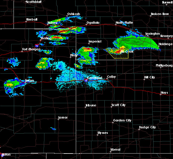 At 738 pm cdt, a severe thunderstorm was located 11 miles northwest of indianola, or 12 miles north of mccook, moving southeast at 35 mph (radar indicated). Hazards include 60 mph wind gusts and quarter size hail. Hail damage to vehicles is expected. expect wind damage to roofs, siding, and trees. Locations impacted include, mccook and indianola. At 738 pm cdt, a severe thunderstorm was located 11 miles northwest of indianola, or 12 miles north of mccook, moving southeast at 35 mph (radar indicated). Hazards include 60 mph wind gusts and quarter size hail. Hail damage to vehicles is expected. expect wind damage to roofs, siding, and trees. Locations impacted include, mccook and indianola.
|
| 5/3/2020 7:05 PM CDT |
 At 704 pm cdt, a severe thunderstorm was located 7 miles east of hayes center, moving southeast at 35 mph (radar indicated). Hazards include 60 mph wind gusts and quarter size hail. Hail damage to vehicles is expected. Expect wind damage to roofs, siding, and trees. At 704 pm cdt, a severe thunderstorm was located 7 miles east of hayes center, moving southeast at 35 mph (radar indicated). Hazards include 60 mph wind gusts and quarter size hail. Hail damage to vehicles is expected. Expect wind damage to roofs, siding, and trees.
|
| 9/11/2019 11:00 PM CDT |
 At 1059 pm cdt, severe thunderstorms were located along a line extending from 9 miles north of mccook to 9 miles northwest of herndon, moving east at 30 mph (an automated observation site in mccook reported a wind gust of 64 mph at 953 pm mdt). Hazards include 70 mph wind gusts. Expect considerable tree damage. Damage is likely to mobile homes, roofs, and outbuildings. At 1059 pm cdt, severe thunderstorms were located along a line extending from 9 miles north of mccook to 9 miles northwest of herndon, moving east at 30 mph (an automated observation site in mccook reported a wind gust of 64 mph at 953 pm mdt). Hazards include 70 mph wind gusts. Expect considerable tree damage. Damage is likely to mobile homes, roofs, and outbuildings.
|
| 9/11/2019 10:51 PM CDT | Asos station kmck mccook airpor in red willow county NE, 2.4 miles W of McCook, NE |
| 8/29/2019 6:55 PM CDT | Quarter sized hail reported 12.1 miles N of McCook, NE, delayed report via facebook with a picture. |
| 8/29/2019 6:48 PM CDT |
 At 648 pm cdt, severe thunderstorms were located along a line extending from 3 miles southeast of mccook to 13 miles west of danbury to 4 miles west of herndon, moving southeast at 30 mph. these are very dangerous storms (radar indicated). Hazards include 80 mph wind gusts and tennis ball size hail. Flying debris will be dangerous to those caught without shelter. mobile homes will be heavily damaged. expect considerable damage to roofs, windows, and vehicles. extensive tree damage and power outages are likely. Locations impacted include, mccook, oberlin, atwood, culbertson, indianola, bartley and norcatur. At 648 pm cdt, severe thunderstorms were located along a line extending from 3 miles southeast of mccook to 13 miles west of danbury to 4 miles west of herndon, moving southeast at 30 mph. these are very dangerous storms (radar indicated). Hazards include 80 mph wind gusts and tennis ball size hail. Flying debris will be dangerous to those caught without shelter. mobile homes will be heavily damaged. expect considerable damage to roofs, windows, and vehicles. extensive tree damage and power outages are likely. Locations impacted include, mccook, oberlin, atwood, culbertson, indianola, bartley and norcatur.
|
| 8/29/2019 6:45 PM CDT | Ping Pong Ball sized hail reported 10 miles N of McCook, NE, delayed report via facebook. includes a picture of hail next to measuring tape. |
| 8/29/2019 6:42 PM CDT |
 At 641 pm cdt, severe thunderstorms were located along a line extending from near mccook to 13 miles southeast of culbertson to 6 miles west of herndon, moving southeast at 30 mph. these are very dangerous storms (radar indicated). Hazards include 80 mph wind gusts and two inch hail. Flying debris will be dangerous to those caught without shelter. mobile homes will be heavily damaged. expect considerable damage to roofs, windows, and vehicles. extensive tree damage and power outages are likely. Locations impacted include, mccook, oberlin, atwood, culbertson, indianola, bartley and norcatur. At 641 pm cdt, severe thunderstorms were located along a line extending from near mccook to 13 miles southeast of culbertson to 6 miles west of herndon, moving southeast at 30 mph. these are very dangerous storms (radar indicated). Hazards include 80 mph wind gusts and two inch hail. Flying debris will be dangerous to those caught without shelter. mobile homes will be heavily damaged. expect considerable damage to roofs, windows, and vehicles. extensive tree damage and power outages are likely. Locations impacted include, mccook, oberlin, atwood, culbertson, indianola, bartley and norcatur.
|
| 8/29/2019 6:32 PM CDT | Quarter sized hail reported 9.8 miles NE of McCook, NE |
| 8/29/2019 6:30 PM CDT |
 At 629 pm cdt, a severe thunderstorm was located 11 miles north of herndon, or 12 miles southwest of mccook, moving southeast at 30 mph (this storm has a history of producing golf ball size hail and damaging winds). Hazards include golf ball size hail and 70 mph wind gusts. People and animals outdoors will be injured. expect hail damage to roofs, siding, windows, and vehicles. expect considerable tree damage. wind damage is also likely to mobile homes, roofs, and outbuildings. Locations impacted include, mccook, oberlin, atwood, culbertson, indianola, bartley and norcatur. At 629 pm cdt, a severe thunderstorm was located 11 miles north of herndon, or 12 miles southwest of mccook, moving southeast at 30 mph (this storm has a history of producing golf ball size hail and damaging winds). Hazards include golf ball size hail and 70 mph wind gusts. People and animals outdoors will be injured. expect hail damage to roofs, siding, windows, and vehicles. expect considerable tree damage. wind damage is also likely to mobile homes, roofs, and outbuildings. Locations impacted include, mccook, oberlin, atwood, culbertson, indianola, bartley and norcatur.
|
| 8/29/2019 6:16 PM CDT |
 At 616 pm cdt, a severe thunderstorm was located 10 miles south of culbertson, or 11 miles southeast of trenton, moving southeast at 35 mph (radar indicated). Hazards include two inch hail and 70 mph wind gusts. People and animals outdoors will be injured. expect hail damage to roofs, siding, windows, and vehicles. expect considerable tree damage. Wind damage is also likely to mobile homes, roofs, and outbuildings. At 616 pm cdt, a severe thunderstorm was located 10 miles south of culbertson, or 11 miles southeast of trenton, moving southeast at 35 mph (radar indicated). Hazards include two inch hail and 70 mph wind gusts. People and animals outdoors will be injured. expect hail damage to roofs, siding, windows, and vehicles. expect considerable tree damage. Wind damage is also likely to mobile homes, roofs, and outbuildings.
|
| 8/29/2019 6:16 PM CDT |
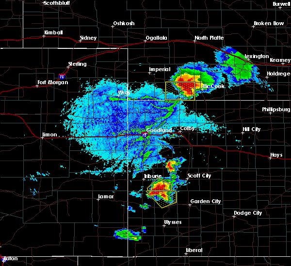 At 616 pm cdt, a severe thunderstorm was located 10 miles south of culbertson, or 11 miles southeast of trenton, moving southeast at 35 mph (radar indicated). Hazards include two inch hail and 70 mph wind gusts. People and animals outdoors will be injured. expect hail damage to roofs, siding, windows, and vehicles. expect considerable tree damage. Wind damage is also likely to mobile homes, roofs, and outbuildings. At 616 pm cdt, a severe thunderstorm was located 10 miles south of culbertson, or 11 miles southeast of trenton, moving southeast at 35 mph (radar indicated). Hazards include two inch hail and 70 mph wind gusts. People and animals outdoors will be injured. expect hail damage to roofs, siding, windows, and vehicles. expect considerable tree damage. Wind damage is also likely to mobile homes, roofs, and outbuildings.
|
| 8/13/2019 3:51 PM CDT |
 At 350 pm cdt, a severe thunderstorm capable of producing a tornado was located 4 miles east of trenton, moving southeast at 40 mph (radar indicated rotation). Hazards include tornado and hail up to two inches in diameter. Flying debris will be dangerous to those caught without shelter. mobile homes will be damaged or destroyed. damage to roofs, windows, and vehicles will occur. Tree damage is likely. At 350 pm cdt, a severe thunderstorm capable of producing a tornado was located 4 miles east of trenton, moving southeast at 40 mph (radar indicated rotation). Hazards include tornado and hail up to two inches in diameter. Flying debris will be dangerous to those caught without shelter. mobile homes will be damaged or destroyed. damage to roofs, windows, and vehicles will occur. Tree damage is likely.
|
| 8/11/2019 10:53 PM CDT | Storm damage reported in red willow county NE, 2.4 miles W of McCook, NE |
| 8/11/2019 10:51 PM CDT |
 At 1051 pm cdt, a severe thunderstorm was located near mccook, moving east at 35 mph (radar indicated). Hazards include 60 mph wind gusts and quarter size hail. Hail damage to vehicles is expected. Expect wind damage to roofs, siding, and trees. At 1051 pm cdt, a severe thunderstorm was located near mccook, moving east at 35 mph (radar indicated). Hazards include 60 mph wind gusts and quarter size hail. Hail damage to vehicles is expected. Expect wind damage to roofs, siding, and trees.
|
| 8/11/2019 10:51 PM CDT |
 The national weather service in goodland has issued a * severe thunderstorm warning for. northwestern decatur county in northwestern kansas. red willow county in southwestern nebraska. eastern hitchcock county in southwestern nebraska. Until 1130 pm cdt. The national weather service in goodland has issued a * severe thunderstorm warning for. northwestern decatur county in northwestern kansas. red willow county in southwestern nebraska. eastern hitchcock county in southwestern nebraska. Until 1130 pm cdt.
|
| 7/10/2019 2:20 AM CDT |
 At 219 am cdt, a severe thunderstorm was located 5 miles northwest of mccook, moving east at 30 mph (radar indicated). Hazards include 60 mph wind gusts and quarter size hail. Hail damage to vehicles is expected. Expect wind damage to roofs, siding, and trees. At 219 am cdt, a severe thunderstorm was located 5 miles northwest of mccook, moving east at 30 mph (radar indicated). Hazards include 60 mph wind gusts and quarter size hail. Hail damage to vehicles is expected. Expect wind damage to roofs, siding, and trees.
|
| 7/1/2019 6:35 PM CDT |
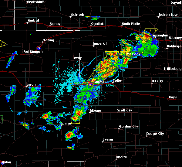 The severe thunderstorm warning for northwestern red willow and northeastern hitchcock counties will expire at 645 pm cdt, the storm which prompted the warning has weakened below severe limits, and no longer poses an immediate threat to life or property. therefore, the warning will be allowed to expire. however gusty winds and heavy rain are still possible with this thunderstorm. The severe thunderstorm warning for northwestern red willow and northeastern hitchcock counties will expire at 645 pm cdt, the storm which prompted the warning has weakened below severe limits, and no longer poses an immediate threat to life or property. therefore, the warning will be allowed to expire. however gusty winds and heavy rain are still possible with this thunderstorm.
|
| 7/1/2019 6:17 PM CDT |
 At 617 pm cdt, a severe thunderstorm was located 6 miles northwest of mccook, moving northeast at 10 mph (radar indicated). Hazards include 60 mph wind gusts and quarter size hail. Hail damage to vehicles is expected. expect wind damage to roofs, siding, and trees. Locations impacted include, mccook. At 617 pm cdt, a severe thunderstorm was located 6 miles northwest of mccook, moving northeast at 10 mph (radar indicated). Hazards include 60 mph wind gusts and quarter size hail. Hail damage to vehicles is expected. expect wind damage to roofs, siding, and trees. Locations impacted include, mccook.
|
| 7/1/2019 5:58 PM CDT |
 At 558 pm cdt, a severe thunderstorm was located 5 miles northwest of mccook, moving northeast at 15 mph (radar indicated). Hazards include 60 mph wind gusts and quarter size hail. Hail damage to vehicles is expected. Expect wind damage to roofs, siding, and trees. At 558 pm cdt, a severe thunderstorm was located 5 miles northwest of mccook, moving northeast at 15 mph (radar indicated). Hazards include 60 mph wind gusts and quarter size hail. Hail damage to vehicles is expected. Expect wind damage to roofs, siding, and trees.
|
| 7/1/2019 5:49 PM CDT |
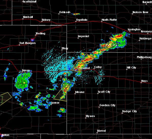 At 534 pm cdt, a severe thunderstorm was located near mccook, moving northeast at 15 mph (radar indicated). Hazards include 60 mph wind gusts and quarter size hail. Hail damage to vehicles is expected. expect wind damage to roofs, siding, and trees. Locations impacted include, mccook, indianola and bartley. At 534 pm cdt, a severe thunderstorm was located near mccook, moving northeast at 15 mph (radar indicated). Hazards include 60 mph wind gusts and quarter size hail. Hail damage to vehicles is expected. expect wind damage to roofs, siding, and trees. Locations impacted include, mccook, indianola and bartley.
|
| 7/1/2019 5:45 PM CDT | Ping Pong Ball sized hail reported 3 miles SW of McCook, NE, public reported via twitter hail up to ping pong ball size roughly 2 miles north of the mccook airport. |
| 7/1/2019 5:45 PM CDT | Quarter sized hail reported 0.4 miles NW of McCook, NE, report received via facebook comment with a picture comparing hail to a quarter. |
| 7/1/2019 5:43 PM CDT | Half Dollar sized hail reported 0.4 miles NW of McCook, NE |
| 7/1/2019 5:35 PM CDT | Ping Pong Ball sized hail reported 0.4 miles NW of McCook, NE, report received via facebook message with a picture. |
| 7/1/2019 5:34 PM CDT |
 At 534 pm cdt, a severe thunderstorm was located near mccook, moving northeast at 15 mph (radar indicated). Hazards include 60 mph wind gusts and quarter size hail. Hail damage to vehicles is expected. expect wind damage to roofs, siding, and trees. Locations impacted include, mccook, indianola and bartley. At 534 pm cdt, a severe thunderstorm was located near mccook, moving northeast at 15 mph (radar indicated). Hazards include 60 mph wind gusts and quarter size hail. Hail damage to vehicles is expected. expect wind damage to roofs, siding, and trees. Locations impacted include, mccook, indianola and bartley.
|
| 7/1/2019 5:18 PM CDT |
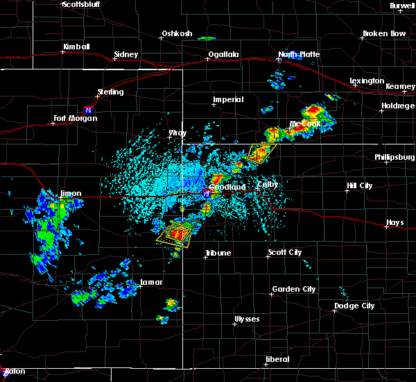 At 518 pm cdt, a severe thunderstorm was located 5 miles east of mccook, moving northeast at 20 mph (radar indicated). Hazards include 60 mph wind gusts and quarter size hail. Hail damage to vehicles is expected. Expect wind damage to roofs, siding, and trees. At 518 pm cdt, a severe thunderstorm was located 5 miles east of mccook, moving northeast at 20 mph (radar indicated). Hazards include 60 mph wind gusts and quarter size hail. Hail damage to vehicles is expected. Expect wind damage to roofs, siding, and trees.
|
| 6/20/2019 10:39 PM CDT |
 At 1039 pm cdt, severe thunderstorms were located along a line extending from 3 miles north of mccook to 7 miles northwest of selden, moving northeast at 40 mph (radar indicated). Hazards include 60 mph wind gusts and quarter size hail. Hail damage to vehicles is expected. Expect wind damage to roofs, siding, and trees. At 1039 pm cdt, severe thunderstorms were located along a line extending from 3 miles north of mccook to 7 miles northwest of selden, moving northeast at 40 mph (radar indicated). Hazards include 60 mph wind gusts and quarter size hail. Hail damage to vehicles is expected. Expect wind damage to roofs, siding, and trees.
|
| 6/8/2019 8:08 PM CDT |
 At 808 pm cdt, a severe thunderstorm was located 4 miles west of trenton, moving east at 25 mph (radar indicated). Hazards include ping pong ball size hail and 60 mph wind gusts. People and animals outdoors will be injured. expect hail damage to roofs, siding, windows, and vehicles. Expect wind damage to roofs, siding, and trees. At 808 pm cdt, a severe thunderstorm was located 4 miles west of trenton, moving east at 25 mph (radar indicated). Hazards include ping pong ball size hail and 60 mph wind gusts. People and animals outdoors will be injured. expect hail damage to roofs, siding, windows, and vehicles. Expect wind damage to roofs, siding, and trees.
|
| 6/3/2019 10:07 PM CDT |
 The severe thunderstorm warning for northeastern rawlins, northwestern decatur, red willow and southeastern hitchcock counties will expire at 1015 pm cdt, the storm which prompted the warning has weakened below severe limits, and no longer poses an immediate threat to life or property. therefore, the warning will be allowed to expire. The severe thunderstorm warning for northeastern rawlins, northwestern decatur, red willow and southeastern hitchcock counties will expire at 1015 pm cdt, the storm which prompted the warning has weakened below severe limits, and no longer poses an immediate threat to life or property. therefore, the warning will be allowed to expire.
|
| 6/3/2019 9:51 PM CDT |
 At 951 pm cdt, a severe thunderstorm was located 4 miles north of herndon, or 15 miles northwest of oberlin, moving northeast at 35 mph (radar indicated). Hazards include 60 mph wind gusts. Expect damage to roofs, siding, and trees. Locations impacted include, mccook, indianola, herndon, danbury, lebanon, traer and cedar bluffs. At 951 pm cdt, a severe thunderstorm was located 4 miles north of herndon, or 15 miles northwest of oberlin, moving northeast at 35 mph (radar indicated). Hazards include 60 mph wind gusts. Expect damage to roofs, siding, and trees. Locations impacted include, mccook, indianola, herndon, danbury, lebanon, traer and cedar bluffs.
|
| 6/3/2019 9:30 PM CDT |
 At 929 pm cdt, a severe thunderstorm was located 5 miles north of ludell, or 9 miles northeast of atwood, moving northeast at 40 mph. this is a very dangerous storm (radar indicated). Hazards include 80 mph wind gusts and quarter size hail. Flying debris will be dangerous to those caught without shelter. mobile homes will be heavily damaged. expect considerable damage to roofs, windows, and vehicles. Extensive tree damage and power outages are likely. At 929 pm cdt, a severe thunderstorm was located 5 miles north of ludell, or 9 miles northeast of atwood, moving northeast at 40 mph. this is a very dangerous storm (radar indicated). Hazards include 80 mph wind gusts and quarter size hail. Flying debris will be dangerous to those caught without shelter. mobile homes will be heavily damaged. expect considerable damage to roofs, windows, and vehicles. Extensive tree damage and power outages are likely.
|
| 5/17/2019 6:00 PM CDT | Ping Pong Ball sized hail reported 6.7 miles SSE of McCook, NE, trained spotter reported hail up to 1 to 1.5 inches in diameter along us hwy 83 north of mccook... ne. time estimated via radar. |
| 5/17/2019 5:59 PM CDT |
 At 558 pm cdt, a severe thunderstorm was located 6 miles northeast of culbertson, or 9 miles northwest of mccook, moving northeast at 40 mph (radar indicated). Hazards include tennis ball size hail and 60 mph wind gusts. People and animals outdoors will be injured. expect hail damage to roofs, siding, windows, and vehicles. expect wind damage to roofs, siding, and trees. locations impacted include, mccook. A tornado watch remains in effect until 1000 pm cdt for southwestern nebraska. At 558 pm cdt, a severe thunderstorm was located 6 miles northeast of culbertson, or 9 miles northwest of mccook, moving northeast at 40 mph (radar indicated). Hazards include tennis ball size hail and 60 mph wind gusts. People and animals outdoors will be injured. expect hail damage to roofs, siding, windows, and vehicles. expect wind damage to roofs, siding, and trees. locations impacted include, mccook. A tornado watch remains in effect until 1000 pm cdt for southwestern nebraska.
|
| 5/17/2019 5:54 PM CDT |
 At 553 pm cdt, a confirmed tornado was located 4 miles east of culbertson, or 7 miles west of mccook, moving northeast at 25 mph (law enforcement confirmed tornado on highway 17 between mile markers 10 and 11). Hazards include damaging tornado and tennis ball size hail. Flying debris will be dangerous to those caught without shelter. mobile homes will be damaged or destroyed. damage to roofs, windows, and vehicles will occur. tree damage is likely. Locations impacted include, mccook and culbertson. At 553 pm cdt, a confirmed tornado was located 4 miles east of culbertson, or 7 miles west of mccook, moving northeast at 25 mph (law enforcement confirmed tornado on highway 17 between mile markers 10 and 11). Hazards include damaging tornado and tennis ball size hail. Flying debris will be dangerous to those caught without shelter. mobile homes will be damaged or destroyed. damage to roofs, windows, and vehicles will occur. tree damage is likely. Locations impacted include, mccook and culbertson.
|
| 5/17/2019 5:51 PM CDT |
 The national weather service in goodland has issued a * tornado warning for. northwestern red willow county in southwestern nebraska. until 645 pm cdt. At 551 pm cdt, a confirmed tornado was located 4 miles east of culbertson, or 7 miles west of mccook, moving northeast at 35 mph. The national weather service in goodland has issued a * tornado warning for. northwestern red willow county in southwestern nebraska. until 645 pm cdt. At 551 pm cdt, a confirmed tornado was located 4 miles east of culbertson, or 7 miles west of mccook, moving northeast at 35 mph.
|
| 5/17/2019 5:47 PM CDT |
 At 546 pm cdt, a confirmed tornado was located 4 miles southeast of culbertson, or 9 miles west of mccook, moving northeast at 35 mph (law enforcement confirmed tornado 7 miles west-southwest of mccook). Hazards include damaging tornado. Flying debris will be dangerous to those caught without shelter. mobile homes will be damaged or destroyed. damage to roofs, windows, and vehicles will occur. tree damage is likely. Locations impacted include, mccook and culbertson. At 546 pm cdt, a confirmed tornado was located 4 miles southeast of culbertson, or 9 miles west of mccook, moving northeast at 35 mph (law enforcement confirmed tornado 7 miles west-southwest of mccook). Hazards include damaging tornado. Flying debris will be dangerous to those caught without shelter. mobile homes will be damaged or destroyed. damage to roofs, windows, and vehicles will occur. tree damage is likely. Locations impacted include, mccook and culbertson.
|
| 5/17/2019 5:42 PM CDT |
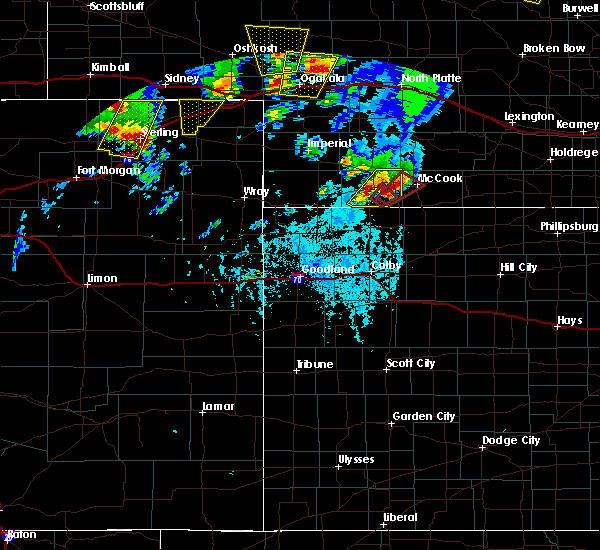 At 542 pm cdt, a severe thunderstorm was located 4 miles southwest of culbertson, or 7 miles east of trenton, moving northeast at 40 mph (radar indicated). Hazards include tennis ball size hail and 60 mph wind gusts. People and animals outdoors will be injured. expect hail damage to roofs, siding, windows, and vehicles. Expect wind damage to roofs, siding, and trees. At 542 pm cdt, a severe thunderstorm was located 4 miles southwest of culbertson, or 7 miles east of trenton, moving northeast at 40 mph (radar indicated). Hazards include tennis ball size hail and 60 mph wind gusts. People and animals outdoors will be injured. expect hail damage to roofs, siding, windows, and vehicles. Expect wind damage to roofs, siding, and trees.
|
| 5/17/2019 5:37 PM CDT |
 At 537 pm cdt, a severe thunderstorm capable of producing a tornado was located 9 miles south of culbertson, or 10 miles southeast of trenton, moving northeast at 30 mph (radar indicated rotation). Hazards include tornado and tennis ball size hail. Flying debris will be dangerous to those caught without shelter. mobile homes will be damaged or destroyed. damage to roofs, windows, and vehicles will occur. Tree damage is likely. At 537 pm cdt, a severe thunderstorm capable of producing a tornado was located 9 miles south of culbertson, or 10 miles southeast of trenton, moving northeast at 30 mph (radar indicated rotation). Hazards include tornado and tennis ball size hail. Flying debris will be dangerous to those caught without shelter. mobile homes will be damaged or destroyed. damage to roofs, windows, and vehicles will occur. Tree damage is likely.
|
| 6/19/2018 8:37 PM CDT |
 At 836 pm cdt, a severe thunderstorm was located 8 miles northwest of indianola, or 9 miles northeast of mccook, moving northeast at 25 mph. the automated observation station at the mccook airport just reported a gust to 71 mph (radar indicated). Hazards include 70 mph wind gusts and quarter size hail. Hail damage to vehicles is expected. expect considerable tree damage. wind damage is also likely to mobile homes, roofs, and outbuildings. Locations impacted include, mccook. At 836 pm cdt, a severe thunderstorm was located 8 miles northwest of indianola, or 9 miles northeast of mccook, moving northeast at 25 mph. the automated observation station at the mccook airport just reported a gust to 71 mph (radar indicated). Hazards include 70 mph wind gusts and quarter size hail. Hail damage to vehicles is expected. expect considerable tree damage. wind damage is also likely to mobile homes, roofs, and outbuildings. Locations impacted include, mccook.
|
| 6/19/2018 8:29 PM CDT | Peak gust measured at mccook airpor in red willow county NE, 1.9 miles W of McCook, NE |
| 6/19/2018 8:25 PM CDT |
 At 824 pm cdt, a severe thunderstorm was located 4 miles northeast of mccook, moving north at 40 mph (radar indicated). Hazards include 60 mph wind gusts and quarter size hail. Hail damage to vehicles is expected. Expect wind damage to roofs, siding, and trees. At 824 pm cdt, a severe thunderstorm was located 4 miles northeast of mccook, moving north at 40 mph (radar indicated). Hazards include 60 mph wind gusts and quarter size hail. Hail damage to vehicles is expected. Expect wind damage to roofs, siding, and trees.
|
| 6/19/2018 8:19 PM CDT | Asos station mck... mccook airport measured 58 mph thunderstorm wind gus in red willow county NE, 1.9 miles W of McCook, NE |
| 5/29/2018 2:38 PM CDT | Quarter sized hail reported 3.1 miles N of McCook, NE, spotter reported an estimated hail size of dime to quarter sized hail 3 miles south of mccook. |
| 5/18/2018 5:55 AM CDT | Storm damage reported in red willow county NE, 1.8 miles W of McCook, NE |
| 10/2/2017 8:39 PM CDT |
 At 839 pm cdt, a severe thunderstorm was located 9 miles south of trenton, moving northeast at 45 mph (radar indicated). Hazards include 60 mph wind gusts and quarter size hail. Hail damage to vehicles is expected. expect wind damage to roofs, siding, and trees. Locations impacted include, mccook, culbertson and indianola. At 839 pm cdt, a severe thunderstorm was located 9 miles south of trenton, moving northeast at 45 mph (radar indicated). Hazards include 60 mph wind gusts and quarter size hail. Hail damage to vehicles is expected. expect wind damage to roofs, siding, and trees. Locations impacted include, mccook, culbertson and indianola.
|
| 10/2/2017 8:22 PM CDT |
 At 822 pm cdt, a severe thunderstorm was located 9 miles northwest of atwood, moving northeast at 45 mph (radar indicated). Hazards include 60 mph wind gusts and quarter size hail. Hail damage to vehicles is expected. Expect wind damage to roofs, siding, and trees. At 822 pm cdt, a severe thunderstorm was located 9 miles northwest of atwood, moving northeast at 45 mph (radar indicated). Hazards include 60 mph wind gusts and quarter size hail. Hail damage to vehicles is expected. Expect wind damage to roofs, siding, and trees.
|
| 7/2/2017 9:43 PM CDT |
 At 941 pm cdt, a severe thunderstorm was located 6 miles southeast of indianola, or 14 miles east of mccook, moving south at 25 mph. this is a very dangerous storm (radar indicated. at 936 pm cdt, a spotter 8 miles south southeast of culbertson reported a 59 mph wind gust). Hazards include 80 mph wind gusts and quarter size hail. Flying debris will be dangerous to those caught without shelter. mobile homes will be heavily damaged. expect considerable damage to roofs, windows, and vehicles. extensive tree damage and power outages are likely. Locations impacted include, mccook, oberlin, indianola, bartley, norcatur, danbury and lebanon. At 941 pm cdt, a severe thunderstorm was located 6 miles southeast of indianola, or 14 miles east of mccook, moving south at 25 mph. this is a very dangerous storm (radar indicated. at 936 pm cdt, a spotter 8 miles south southeast of culbertson reported a 59 mph wind gust). Hazards include 80 mph wind gusts and quarter size hail. Flying debris will be dangerous to those caught without shelter. mobile homes will be heavily damaged. expect considerable damage to roofs, windows, and vehicles. extensive tree damage and power outages are likely. Locations impacted include, mccook, oberlin, indianola, bartley, norcatur, danbury and lebanon.
|
| 7/2/2017 9:17 PM CDT | Storm spotter estimated wind gusts of 60 mp in red willow county NE, 0.4 miles NW of McCook, NE |
| 7/2/2017 9:01 PM CDT |
 At 900 pm cdt, a severe thunderstorm was located near medicine creek reservoir state recreation area, or 18 miles southeast of curtis, moving south at 55 mph. this is a very dangerous storm (radar indicated). Hazards include 80 mph wind gusts and quarter size hail. Flying debris will be dangerous to those caught without shelter. mobile homes will be heavily damaged. expect considerable damage to roofs, windows, and vehicles. Extensive tree damage and power outages are likely. At 900 pm cdt, a severe thunderstorm was located near medicine creek reservoir state recreation area, or 18 miles southeast of curtis, moving south at 55 mph. this is a very dangerous storm (radar indicated). Hazards include 80 mph wind gusts and quarter size hail. Flying debris will be dangerous to those caught without shelter. mobile homes will be heavily damaged. expect considerable damage to roofs, windows, and vehicles. Extensive tree damage and power outages are likely.
|
| 4/9/2017 4:40 PM CDT |
 The severe thunderstorm warning for northeastern rawlins, northwestern decatur, western red willow and eastern hitchcock counties will expire at 445 pm cdt, the storm which prompted the warning has moved out of the area. therefore the warning will be allowed to expire. however gusty winds are still possible with this thunderstorm. a new severe thunderstorm warning has been issued for eastern red willow county in southwest nebraska valid until 5 pm cdt. The severe thunderstorm warning for northeastern rawlins, northwestern decatur, western red willow and eastern hitchcock counties will expire at 445 pm cdt, the storm which prompted the warning has moved out of the area. therefore the warning will be allowed to expire. however gusty winds are still possible with this thunderstorm. a new severe thunderstorm warning has been issued for eastern red willow county in southwest nebraska valid until 5 pm cdt.
|
| 4/9/2017 4:15 PM CDT |
 At 415 pm cdt, a severe thunderstorm was located near mccook, moving east at 40 mph (trained weather spotters). Hazards include 70 mph wind gusts. Expect considerable tree damage. damage is likely to mobile homes, roofs, and outbuildings. Locations impacted include, mccook, culbertson, indianola, bartley, danbury, traer and cedar bluffs. At 415 pm cdt, a severe thunderstorm was located near mccook, moving east at 40 mph (trained weather spotters). Hazards include 70 mph wind gusts. Expect considerable tree damage. damage is likely to mobile homes, roofs, and outbuildings. Locations impacted include, mccook, culbertson, indianola, bartley, danbury, traer and cedar bluffs.
|
| 4/9/2017 4:10 PM CDT | Near zero visibility in blowing dust in red willow county NE, 4.9 miles SSE of McCook, NE |
| 4/9/2017 4:10 PM CDT | Trained spotter called and reported shingles damage to his roo in red willow county NE, 0.4 miles NW of McCook, NE |
| 4/9/2017 3:59 PM CDT |
 At 358 pm cdt, a severe thunderstorm was located 9 miles south of culbertson, or 11 miles southeast of trenton, moving east at 45 mph (trained weather spotters). Hazards include 70 mph wind gusts. Expect considerable tree damage. Damage is likely to mobile homes, roofs, and outbuildings. At 358 pm cdt, a severe thunderstorm was located 9 miles south of culbertson, or 11 miles southeast of trenton, moving east at 45 mph (trained weather spotters). Hazards include 70 mph wind gusts. Expect considerable tree damage. Damage is likely to mobile homes, roofs, and outbuildings.
|
| 3/7/2017 3:17 PM CST | Storm damage reported in red willow county NE, 0.4 miles NW of McCook, NE |
| 9/5/2016 7:08 PM CDT |
 At 708 pm cdt, a severe thunderstorm was located near mccook, moving northeast at 35 mph (radar indicated). Hazards include 60 mph wind gusts and quarter size hail. Hail damage to vehicles is expected. expect wind damage to roofs, siding, and trees. Locations impacted include, mccook. At 708 pm cdt, a severe thunderstorm was located near mccook, moving northeast at 35 mph (radar indicated). Hazards include 60 mph wind gusts and quarter size hail. Hail damage to vehicles is expected. expect wind damage to roofs, siding, and trees. Locations impacted include, mccook.
|
| 9/5/2016 7:05 PM CDT | Quarter sized hail reported 0.4 miles NW of McCook, NE |
| 9/5/2016 6:58 PM CDT |
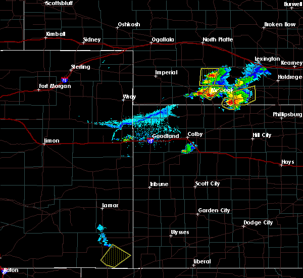 At 658 pm cdt, a severe thunderstorm was located near mccook, moving northeast at 35 mph (radar indicated). Hazards include 60 mph wind gusts and quarter size hail. Hail damage to vehicles is expected. Expect wind damage to roofs, siding, and trees. At 658 pm cdt, a severe thunderstorm was located near mccook, moving northeast at 35 mph (radar indicated). Hazards include 60 mph wind gusts and quarter size hail. Hail damage to vehicles is expected. Expect wind damage to roofs, siding, and trees.
|
| 9/5/2016 6:35 PM CDT |
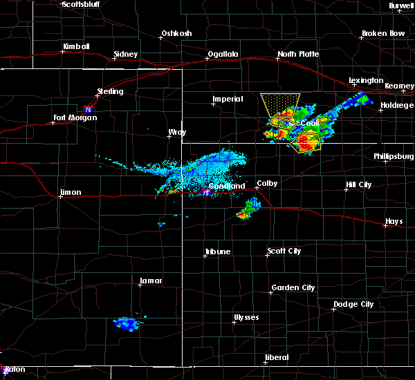 The severe thunderstorm warning for northwestern red willow county will expire at 645 pm cdt, the storm which prompted the warning has moved out of the area. therefore the warning will be allowed to expire. however small. The severe thunderstorm warning for northwestern red willow county will expire at 645 pm cdt, the storm which prompted the warning has moved out of the area. therefore the warning will be allowed to expire. however small.
|
| 9/5/2016 6:27 PM CDT |
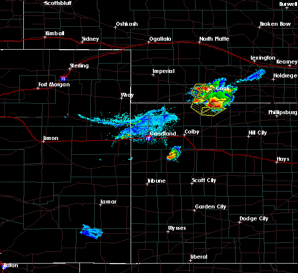 At 626 pm cdt, a severe thunderstorm was located 4 miles west of mccook, moving northeast at 30 mph (radar indicated). Hazards include golf ball size hail and 60 mph wind gusts. People and animals outdoors will be injured. expect hail damage to roofs, siding, windows, and vehicles. expect wind damage to roofs, siding, and trees. Locations impacted include, mccook. At 626 pm cdt, a severe thunderstorm was located 4 miles west of mccook, moving northeast at 30 mph (radar indicated). Hazards include golf ball size hail and 60 mph wind gusts. People and animals outdoors will be injured. expect hail damage to roofs, siding, windows, and vehicles. expect wind damage to roofs, siding, and trees. Locations impacted include, mccook.
|
| 9/5/2016 6:21 PM CDT |
 At 621 pm cdt, a severe thunderstorm was located 5 miles west of mccook, moving northeast at 30 mph (radar indicated. golf ball sized hail 3 miles west of mccook). Hazards include golf ball size hail and 60 mph wind gusts. People and animals outdoors will be injured. expect hail damage to roofs, siding, windows, and vehicles. expect wind damage to roofs, siding, and trees. Locations impacted include, mccook. At 621 pm cdt, a severe thunderstorm was located 5 miles west of mccook, moving northeast at 30 mph (radar indicated. golf ball sized hail 3 miles west of mccook). Hazards include golf ball size hail and 60 mph wind gusts. People and animals outdoors will be injured. expect hail damage to roofs, siding, windows, and vehicles. expect wind damage to roofs, siding, and trees. Locations impacted include, mccook.
|
| 9/5/2016 6:20 PM CDT | Golf Ball sized hail reported 1.9 miles E of McCook, NE |
| 9/5/2016 6:20 PM CDT | Half Dollar sized hail reported 3.6 miles ESE of McCook, NE, pea to shooter marble size hail. hail was very brief. |
| 9/5/2016 6:06 PM CDT |
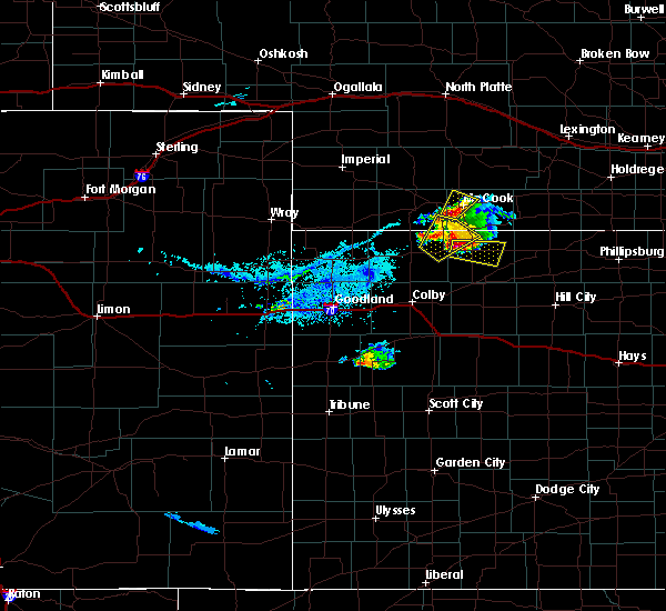 At 606 pm cdt, a severe thunderstorm was located 9 miles south of culbertson, or 11 miles southwest of mccook, moving northeast at 30 mph (radar indicated). Hazards include 60 mph wind gusts and quarter size hail. Hail damage to vehicles is expected. Expect wind damage to roofs, siding, and trees. At 606 pm cdt, a severe thunderstorm was located 9 miles south of culbertson, or 11 miles southwest of mccook, moving northeast at 30 mph (radar indicated). Hazards include 60 mph wind gusts and quarter size hail. Hail damage to vehicles is expected. Expect wind damage to roofs, siding, and trees.
|
| 9/3/2016 7:45 PM CDT |
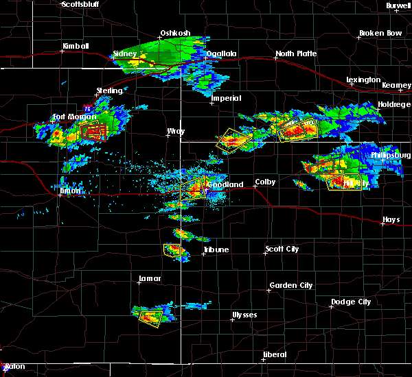 At 745 pm cdt, a severe thunderstorm was located 7 miles south of mccook, moving east at 20 mph (radar indicated). Hazards include 60 mph wind gusts and half dollar size hail. Hail damage to vehicles is expected. Expect wind damage to roofs, siding, and trees. At 745 pm cdt, a severe thunderstorm was located 7 miles south of mccook, moving east at 20 mph (radar indicated). Hazards include 60 mph wind gusts and half dollar size hail. Hail damage to vehicles is expected. Expect wind damage to roofs, siding, and trees.
|
| 9/3/2016 7:18 PM CDT |
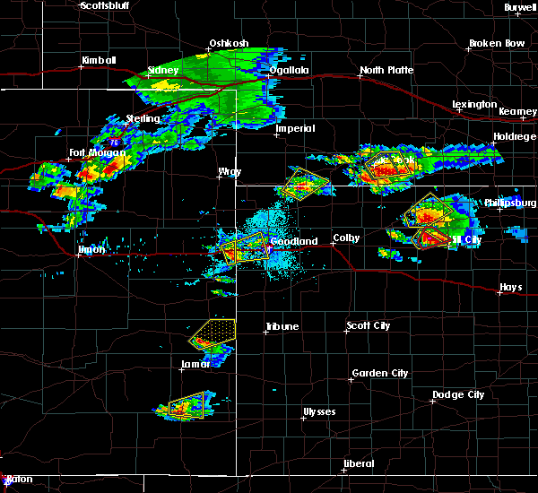 At 718 pm cdt, a severe thunderstorm was located 6 miles southeast of mccook, moving east at 10 mph (radar indicated). Hazards include two inch hail and 60 mph wind gusts. People and animals outdoors will be injured. expect hail damage to roofs, siding, windows, and vehicles. expect wind damage to roofs, siding, and trees. Locations impacted include, mccook and indianola. At 718 pm cdt, a severe thunderstorm was located 6 miles southeast of mccook, moving east at 10 mph (radar indicated). Hazards include two inch hail and 60 mph wind gusts. People and animals outdoors will be injured. expect hail damage to roofs, siding, windows, and vehicles. expect wind damage to roofs, siding, and trees. Locations impacted include, mccook and indianola.
|
| 9/3/2016 6:59 PM CDT |
 At 658 pm cdt, a severe thunderstorm was located 4 miles southeast of mccook, moving east at 5 mph (radar indicated). Hazards include two inch hail and 60 mph wind gusts. People and animals outdoors will be injured. expect hail damage to roofs, siding, windows, and vehicles. expect wind damage to roofs, siding, and trees. Locations impacted include, mccook, indianola and bartley. At 658 pm cdt, a severe thunderstorm was located 4 miles southeast of mccook, moving east at 5 mph (radar indicated). Hazards include two inch hail and 60 mph wind gusts. People and animals outdoors will be injured. expect hail damage to roofs, siding, windows, and vehicles. expect wind damage to roofs, siding, and trees. Locations impacted include, mccook, indianola and bartley.
|
| 9/3/2016 6:50 PM CDT | Half Dollar sized hail reported 0.4 miles NW of McCook, NE, hail lasted about 5 minutes. relayed via social media. |
| 9/3/2016 6:41 PM CDT |
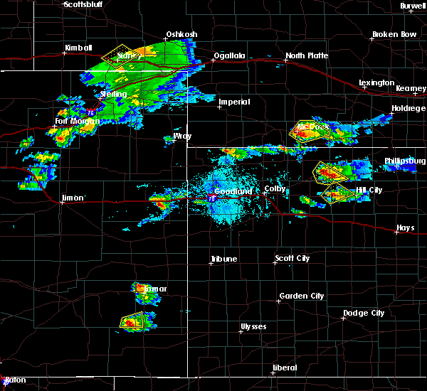 At 640 pm cdt, a severe thunderstorm was located near mccook, moving northeast at 10 mph (trained weather spotters. at 625 pm cdt...golf ball ze hail was reported three miles south of mccook). Hazards include golf ball size hail and 60 mph wind gusts. People and animals outdoors will be injured. expect hail damage to roofs, siding, windows, and vehicles. Expect wind damage to roofs, siding, and trees. At 640 pm cdt, a severe thunderstorm was located near mccook, moving northeast at 10 mph (trained weather spotters. at 625 pm cdt...golf ball ze hail was reported three miles south of mccook). Hazards include golf ball size hail and 60 mph wind gusts. People and animals outdoors will be injured. expect hail damage to roofs, siding, windows, and vehicles. Expect wind damage to roofs, siding, and trees.
|
| 9/3/2016 6:26 PM CDT |
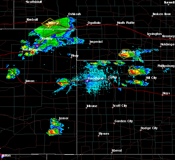 At 626 pm cdt, a severe thunderstorm was located near mccook, moving northeast at 5 mph (trained weather spotters. at 625 pm cdt...golf ball size hail was reported three miles south of mccook). Hazards include golf ball size hail and 60 mph wind gusts. People and animals outdoors will be injured. expect hail damage to roofs, siding, windows, and vehicles. expect wind damage to roofs, siding, and trees. Locations impacted include, mccook, indianola and bartley. At 626 pm cdt, a severe thunderstorm was located near mccook, moving northeast at 5 mph (trained weather spotters. at 625 pm cdt...golf ball size hail was reported three miles south of mccook). Hazards include golf ball size hail and 60 mph wind gusts. People and animals outdoors will be injured. expect hail damage to roofs, siding, windows, and vehicles. expect wind damage to roofs, siding, and trees. Locations impacted include, mccook, indianola and bartley.
|
| 9/3/2016 6:22 PM CDT | Golf Ball sized hail reported 3.1 miles N of McCook, NE |
| 9/3/2016 6:15 PM CDT |
 At 615 pm cdt, a severe thunderstorm was located 4 miles southeast of mccook, moving northeast at 10 mph (radar indicated). Hazards include golf ball size hail and 60 mph wind gusts. People and animals outdoors will be injured. expect hail damage to roofs, siding, windows, and vehicles. expect wind damage to roofs, siding, and trees. Locations impacted include, mccook, indianola and bartley. At 615 pm cdt, a severe thunderstorm was located 4 miles southeast of mccook, moving northeast at 10 mph (radar indicated). Hazards include golf ball size hail and 60 mph wind gusts. People and animals outdoors will be injured. expect hail damage to roofs, siding, windows, and vehicles. expect wind damage to roofs, siding, and trees. Locations impacted include, mccook, indianola and bartley.
|
| 9/3/2016 6:01 PM CDT |
 The national weather service in goodland has issued a * severe thunderstorm warning for. central red willow county in southwestern nebraska. until 645 pm cdt * at 601 pm cdt. a severe thunderstorm was located 5 miles south of mccook. Moving northeast at 15 mph. The national weather service in goodland has issued a * severe thunderstorm warning for. central red willow county in southwestern nebraska. until 645 pm cdt * at 601 pm cdt. a severe thunderstorm was located 5 miles south of mccook. Moving northeast at 15 mph.
|
| 7/28/2016 3:32 PM CDT |
 At 331 pm cdt, severe thunderstorms were located along a line extending from 6 miles south of cambridge to 5 miles south of oberlin, moving east at 55 mph (radar indicated. at 330 pm cdt...62 mph wind gusts were measured at the oberlin airport). Hazards include 60 mph wind gusts and quarter size hail. Hail damage to vehicles is expected. expect wind damage to roofs, siding, and trees. Locations impacted include, mccook, oberlin, indianola, bartley, norcatur, danbury and jennings. At 331 pm cdt, severe thunderstorms were located along a line extending from 6 miles south of cambridge to 5 miles south of oberlin, moving east at 55 mph (radar indicated. at 330 pm cdt...62 mph wind gusts were measured at the oberlin airport). Hazards include 60 mph wind gusts and quarter size hail. Hail damage to vehicles is expected. expect wind damage to roofs, siding, and trees. Locations impacted include, mccook, oberlin, indianola, bartley, norcatur, danbury and jennings.
|
| 7/28/2016 3:20 PM CDT |
 At 320 pm cdt, severe thunderstorms were located along a line extending from 3 miles west of cambridge to 6 miles northwest of oberlin, moving east at 60 mph (radar indicated). Hazards include 60 mph wind gusts and quarter size hail. Hail damage to vehicles is expected. expect wind damage to roofs, siding, and trees. Locations impacted include, mccook, oberlin, indianola, bartley, norcatur, danbury and jennings. At 320 pm cdt, severe thunderstorms were located along a line extending from 3 miles west of cambridge to 6 miles northwest of oberlin, moving east at 60 mph (radar indicated). Hazards include 60 mph wind gusts and quarter size hail. Hail damage to vehicles is expected. expect wind damage to roofs, siding, and trees. Locations impacted include, mccook, oberlin, indianola, bartley, norcatur, danbury and jennings.
|
| 7/28/2016 3:09 PM CDT |
 At 309 pm cdt, severe thunderstorms were located along a line extending from 3 miles north of indianola to near herndon, moving east at 60 mph (radar indicated). Hazards include 60 mph wind gusts and quarter size hail. Hail damage to vehicles is expected. Expect wind damage to roofs, siding, and trees. At 309 pm cdt, severe thunderstorms were located along a line extending from 3 miles north of indianola to near herndon, moving east at 60 mph (radar indicated). Hazards include 60 mph wind gusts and quarter size hail. Hail damage to vehicles is expected. Expect wind damage to roofs, siding, and trees.
|
| 7/28/2016 3:06 PM CDT | Storm damage reported in red willow county NE, 0.4 miles NW of McCook, NE |
| 7/6/2016 10:30 PM CDT |
 At 1030 pm cdt, a severe thunderstorm was located 6 miles northwest of danbury, or 9 miles southeast of mccook, moving east at 45 mph (radar indicated). Hazards include 60 mph wind gusts and quarter size hail. Hail damage to vehicles is expected. expect wind damage to roofs, siding, and trees. Locations impacted include, mccook, indianola, bartley, danbury and lebanon. At 1030 pm cdt, a severe thunderstorm was located 6 miles northwest of danbury, or 9 miles southeast of mccook, moving east at 45 mph (radar indicated). Hazards include 60 mph wind gusts and quarter size hail. Hail damage to vehicles is expected. expect wind damage to roofs, siding, and trees. Locations impacted include, mccook, indianola, bartley, danbury and lebanon.
|
| 7/6/2016 10:16 PM CDT |
 At 1016 pm cdt, a severe thunderstorm was located 8 miles southwest of mccook, moving northeast at 35 mph (radar indicated). Hazards include ping pong ball size hail and 60 mph wind gusts. People and animals outdoors will be injured. expect hail damage to roofs, siding, windows, and vehicles. expect wind damage to roofs, siding, and trees. Locations impacted include, mccook and culbertson. At 1016 pm cdt, a severe thunderstorm was located 8 miles southwest of mccook, moving northeast at 35 mph (radar indicated). Hazards include ping pong ball size hail and 60 mph wind gusts. People and animals outdoors will be injured. expect hail damage to roofs, siding, windows, and vehicles. expect wind damage to roofs, siding, and trees. Locations impacted include, mccook and culbertson.
|
| 7/6/2016 10:08 PM CDT |
 At 1008 pm cdt, severe thunderstorms were located along a line extending from 9 miles northwest of bartley to 4 miles south of indianola to 8 miles west of danbury, moving east at 50 mph (radar indicated). Hazards include 70 mph wind gusts. Expect considerable tree damage. damage is likely to mobile homes, roofs, and outbuildings. Locations impacted include, mccook, indianola, bartley, danbury and lebanon. At 1008 pm cdt, severe thunderstorms were located along a line extending from 9 miles northwest of bartley to 4 miles south of indianola to 8 miles west of danbury, moving east at 50 mph (radar indicated). Hazards include 70 mph wind gusts. Expect considerable tree damage. damage is likely to mobile homes, roofs, and outbuildings. Locations impacted include, mccook, indianola, bartley, danbury and lebanon.
|
| 7/6/2016 10:04 PM CDT |
 At 1003 pm cdt, severe thunderstorms were located along a line extending from 8 miles southeast of willow view campground to 6 miles southwest of indianola to 9 miles south of mccook, moving east at 50 mph (radar indicated. at 958 pm cdt 62 mph winds were measured at the mccook airport). Hazards include 70 mph wind gusts. Expect considerable tree damage. damage is likely to mobile homes, roofs, and outbuildings. Locations impacted include, mccook, indianola, bartley, danbury and lebanon. At 1003 pm cdt, severe thunderstorms were located along a line extending from 8 miles southeast of willow view campground to 6 miles southwest of indianola to 9 miles south of mccook, moving east at 50 mph (radar indicated. at 958 pm cdt 62 mph winds were measured at the mccook airport). Hazards include 70 mph wind gusts. Expect considerable tree damage. damage is likely to mobile homes, roofs, and outbuildings. Locations impacted include, mccook, indianola, bartley, danbury and lebanon.
|
| 7/6/2016 9:58 PM CDT | Measured at mccook airport in red willow county NE, 2.1 miles WSW of McCook, NE |
| 7/6/2016 9:53 PM CDT |
 At 953 pm cdt, severe thunderstorms were located along a line extending from 3 miles south of willow view campground to near mccook to 11 miles north of herndon, moving east at 50 mph (radar indicated). Hazards include 70 mph wind gusts. Expect considerable tree damage. Damage is likely to mobile homes, roofs, and outbuildings. At 953 pm cdt, severe thunderstorms were located along a line extending from 3 miles south of willow view campground to near mccook to 11 miles north of herndon, moving east at 50 mph (radar indicated). Hazards include 70 mph wind gusts. Expect considerable tree damage. Damage is likely to mobile homes, roofs, and outbuildings.
|
| 7/6/2016 9:45 PM CDT |
 At 945 pm cdt, severe thunderstorms were located along a line extending from 9 miles southwest of red willow reservoir state recreation area to 4 miles south of culbertson to 8 miles southeast of trenton, moving east at 45 mph (radar indicated). Hazards include 70 mph wind gusts. Expect considerable tree damage. damage is likely to mobile homes, roofs, and outbuildings. Locations impacted include, mccook, trenton and culbertson. At 945 pm cdt, severe thunderstorms were located along a line extending from 9 miles southwest of red willow reservoir state recreation area to 4 miles south of culbertson to 8 miles southeast of trenton, moving east at 45 mph (radar indicated). Hazards include 70 mph wind gusts. Expect considerable tree damage. damage is likely to mobile homes, roofs, and outbuildings. Locations impacted include, mccook, trenton and culbertson.
|
| 7/6/2016 9:35 PM CDT |
 At 935 pm cdt, severe thunderstorms were located along a line extending from 7 miles east of palisade to 4 miles east of trenton to 10 miles southeast of stratton, moving east at 45 mph (radar indicated). Hazards include 70 mph wind gusts. Expect considerable tree damage. damage is likely to mobile homes, roofs, and outbuildings. Locations impacted include, mccook, trenton, culbertson, palisade and stratton. At 935 pm cdt, severe thunderstorms were located along a line extending from 7 miles east of palisade to 4 miles east of trenton to 10 miles southeast of stratton, moving east at 45 mph (radar indicated). Hazards include 70 mph wind gusts. Expect considerable tree damage. damage is likely to mobile homes, roofs, and outbuildings. Locations impacted include, mccook, trenton, culbertson, palisade and stratton.
|
| 7/6/2016 9:24 PM CDT |
 At 923 pm cdt, severe thunderstorms were located along a line extending from 4 miles southeast of palisade to 6 miles southeast of stratton, moving east at 40 mph (radar indicated). Hazards include 60 mph wind gusts. Expect damage to roofs. siding. And trees. At 923 pm cdt, severe thunderstorms were located along a line extending from 4 miles southeast of palisade to 6 miles southeast of stratton, moving east at 40 mph (radar indicated). Hazards include 60 mph wind gusts. Expect damage to roofs. siding. And trees.
|
| 6/28/2016 11:15 PM CDT |
 At 1115 pm cdt, severe thunderstorms were located along a line extending from 6 miles north of danbury to 10 miles northwest of brewster, moving south at 30 mph (wind gusts measured at atwood airport). Hazards include 60 mph wind gusts and nickel size hail. Expect damage to roofs. siding. and trees. Locations impacted include, mccook, oberlin, atwood, trenton, culbertson, indianola and bartley. At 1115 pm cdt, severe thunderstorms were located along a line extending from 6 miles north of danbury to 10 miles northwest of brewster, moving south at 30 mph (wind gusts measured at atwood airport). Hazards include 60 mph wind gusts and nickel size hail. Expect damage to roofs. siding. and trees. Locations impacted include, mccook, oberlin, atwood, trenton, culbertson, indianola and bartley.
|
| 6/28/2016 11:08 PM CDT |
 At 1107 pm cdt, severe thunderstorms were located along a line extending from near indianola to 13 miles south of mcdonald, moving south at 70 mph (radar indicated). Hazards include 70 mph wind gusts and nickel size hail. Expect considerable tree damage. Damage is likely to mobile homes, roofs, and outbuildings. At 1107 pm cdt, severe thunderstorms were located along a line extending from near indianola to 13 miles south of mcdonald, moving south at 70 mph (radar indicated). Hazards include 70 mph wind gusts and nickel size hail. Expect considerable tree damage. Damage is likely to mobile homes, roofs, and outbuildings.
|
| 6/28/2016 11:03 PM CDT | Storm damage reported in red willow county NE, 0.4 miles NW of McCook, NE |
| 6/28/2016 11:03 PM CDT |
 At 1103 pm cdt, severe thunderstorms were located along a line extending from 5 miles west of freedom to 3 miles east of trenton, moving southeast at 35 mph (measured at mccook airport). Hazards include 60 mph wind gusts. Expect damage to roofs. siding. and trees. Locations impacted include, mccook, trenton, culbertson, indianola and bartley. At 1103 pm cdt, severe thunderstorms were located along a line extending from 5 miles west of freedom to 3 miles east of trenton, moving southeast at 35 mph (measured at mccook airport). Hazards include 60 mph wind gusts. Expect damage to roofs. siding. and trees. Locations impacted include, mccook, trenton, culbertson, indianola and bartley.
|
| 6/28/2016 10:39 PM CDT |
 At 1038 pm cdt, severe thunderstorms were located along a line extending from 7 miles south of maywood to 3 miles southeast of hamlet, moving east at 35 mph (radar indicated). Hazards include 70 mph wind gusts. Expect considerable tree damage. damage is likely to mobile homes, roofs, and outbuildings. these storms are producing blowing dust and near zero visibilities. Locations impacted include, mccook, trenton, culbertson, indianola, palisade and bartley. At 1038 pm cdt, severe thunderstorms were located along a line extending from 7 miles south of maywood to 3 miles southeast of hamlet, moving east at 35 mph (radar indicated). Hazards include 70 mph wind gusts. Expect considerable tree damage. damage is likely to mobile homes, roofs, and outbuildings. these storms are producing blowing dust and near zero visibilities. Locations impacted include, mccook, trenton, culbertson, indianola, palisade and bartley.
|
| 6/28/2016 10:35 PM CDT |
 At 1034 pm cdt, severe thunderstorms were located along a line extending from 7 miles southwest of maywood to near hamlet, moving southeast at 35 mph (radar indicated). Hazards include 70 mph wind gusts and nickel size hail. Expect considerable tree damage. damage is likely to mobile homes, roofs, and outbuildings. Locations impacted include, mccook, trenton, culbertson, indianola, palisade and bartley. At 1034 pm cdt, severe thunderstorms were located along a line extending from 7 miles southwest of maywood to near hamlet, moving southeast at 35 mph (radar indicated). Hazards include 70 mph wind gusts and nickel size hail. Expect considerable tree damage. damage is likely to mobile homes, roofs, and outbuildings. Locations impacted include, mccook, trenton, culbertson, indianola, palisade and bartley.
|
| 6/28/2016 10:23 PM CDT |
 At 1023 pm cdt, severe thunderstorms were located along a line extending from 7 miles west of maywood to 4 miles northwest of hamlet, moving southeast at 35 mph (radar indicated). Hazards include 70 mph wind gusts and quarter size hail. Hail damage to vehicles is expected. expect considerable tree damage. Wind damage is also likely to mobile homes, roofs, and outbuildings. At 1023 pm cdt, severe thunderstorms were located along a line extending from 7 miles west of maywood to 4 miles northwest of hamlet, moving southeast at 35 mph (radar indicated). Hazards include 70 mph wind gusts and quarter size hail. Hail damage to vehicles is expected. expect considerable tree damage. Wind damage is also likely to mobile homes, roofs, and outbuildings.
|
| 6/17/2016 6:33 PM CDT |
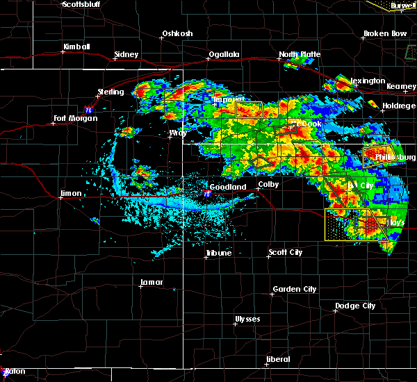 At 633 pm cdt, a severe thunderstorm was located over mccook, moving west at 10 mph (trained weather spotters). Hazards include 70 mph wind gusts. Expect considerable tree damage. Damage is likely to mobile homes, roofs, and outbuildings. At 633 pm cdt, a severe thunderstorm was located over mccook, moving west at 10 mph (trained weather spotters). Hazards include 70 mph wind gusts. Expect considerable tree damage. Damage is likely to mobile homes, roofs, and outbuildings.
|
| 6/17/2016 6:26 PM CDT |
 The severe thunderstorm warning for southwestern red willow county will expire at 630 pm cdt, the storm which prompted the warning has weakened below severe limits, and no longer pose an immediate threat to life or property. therefore the warning will be allowed to expire. however gusty winds and heavy rain are still possible with this thunderstorm. The severe thunderstorm warning for southwestern red willow county will expire at 630 pm cdt, the storm which prompted the warning has weakened below severe limits, and no longer pose an immediate threat to life or property. therefore the warning will be allowed to expire. however gusty winds and heavy rain are still possible with this thunderstorm.
|
| 6/17/2016 6:21 PM CDT | Storm damage reported in red willow county NE, 0.4 miles NW of McCook, NE |
| 6/17/2016 6:15 PM CDT |
 At 615 pm cdt, a severe thunderstorm was located 7 miles south of mccook, moving northwest at 20 mph (radar indicated). Hazards include 60 mph wind gusts and quarter size hail. Hail damage to vehicles is expected. expect wind damage to roofs, siding, and trees. Locations impacted include, mccook. At 615 pm cdt, a severe thunderstorm was located 7 miles south of mccook, moving northwest at 20 mph (radar indicated). Hazards include 60 mph wind gusts and quarter size hail. Hail damage to vehicles is expected. expect wind damage to roofs, siding, and trees. Locations impacted include, mccook.
|
| 6/17/2016 5:50 PM CDT |
 At 550 pm cdt, a severe thunderstorm was located 5 miles south of mccook, moving west at 5 mph (radar indicated). Hazards include 60 mph wind gusts and half dollar size hail. Hail damage to vehicles is expected. Expect wind damage to roofs, siding, and trees. At 550 pm cdt, a severe thunderstorm was located 5 miles south of mccook, moving west at 5 mph (radar indicated). Hazards include 60 mph wind gusts and half dollar size hail. Hail damage to vehicles is expected. Expect wind damage to roofs, siding, and trees.
|
| 6/17/2016 5:42 PM CDT | The severe thunderstorm warning for northeastern hitchcock and southwestern red willow counties will expire at 545 pm cdt. the storm which prompted the warning has weakened below severe limits. and no longer pose an immediate threat to life or property. therefore the warning will be allowed to expire. however. A flash flood warning remains in effect for east central. |
| 6/17/2016 5:16 PM CDT |
 At 516 pm cdt, a severe thunderstorm was located near mccook, and is nearly stationary (trained weather spotters). Hazards include 60 mph wind gusts and quarter size hail. Hail damage to vehicles is expected. Expect wind damage to roofs, siding, and trees. At 516 pm cdt, a severe thunderstorm was located near mccook, and is nearly stationary (trained weather spotters). Hazards include 60 mph wind gusts and quarter size hail. Hail damage to vehicles is expected. Expect wind damage to roofs, siding, and trees.
|
| 6/17/2016 5:06 PM CDT | Quarter sized hail reported 0.4 miles NW of McCook, NE, currently falling and getting bigger |
| 6/17/2016 4:49 PM CDT |
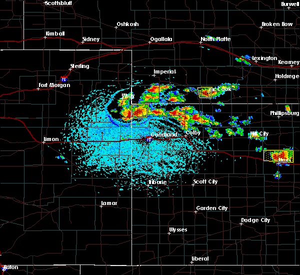 At 449 pm cdt, a severe thunderstorm was located 4 miles west of mccook, moving north at 5 mph (radar indicated). Hazards include 60 mph wind gusts and half dollar size hail. Hail damage to vehicles is expected. Expect wind damage to roofs, siding, and trees. At 449 pm cdt, a severe thunderstorm was located 4 miles west of mccook, moving north at 5 mph (radar indicated). Hazards include 60 mph wind gusts and half dollar size hail. Hail damage to vehicles is expected. Expect wind damage to roofs, siding, and trees.
|
| 5/30/2016 8:02 PM CDT | Storm damage reported in red willow county NE, 0.4 miles NW of McCook, NE |
| 5/26/2016 9:46 PM CDT |
 At 945 pm cdt, a severe thunderstorm was located 7 miles northwest of indianola, or 7 miles northeast of mccook, moving northeast at 35 mph (radar indicated). Hazards include 60 mph wind gusts. Expect damage to roofs. siding. And trees. At 945 pm cdt, a severe thunderstorm was located 7 miles northwest of indianola, or 7 miles northeast of mccook, moving northeast at 35 mph (radar indicated). Hazards include 60 mph wind gusts. Expect damage to roofs. siding. And trees.
|
| 5/26/2016 9:23 PM CDT |
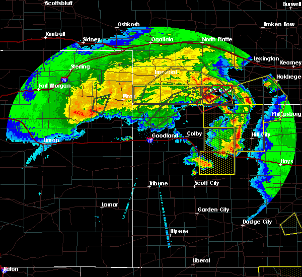 At 923 pm cdt, a severe thunderstorm capable of producing a tornado was located near mccook, moving northeast at 45 mph (radar indicated rotation). Hazards include tornado and quarter size hail. Flying debris will be dangerous to those caught without shelter. mobile homes will be damaged or destroyed. damage to roofs, windows, and vehicles will occur. tree damage is likely. this dangerous storm will be near, indianola around 940 pm cdt. Bartley around 950 pm cdt. At 923 pm cdt, a severe thunderstorm capable of producing a tornado was located near mccook, moving northeast at 45 mph (radar indicated rotation). Hazards include tornado and quarter size hail. Flying debris will be dangerous to those caught without shelter. mobile homes will be damaged or destroyed. damage to roofs, windows, and vehicles will occur. tree damage is likely. this dangerous storm will be near, indianola around 940 pm cdt. Bartley around 950 pm cdt.
|
| 5/26/2016 9:02 PM CDT |
 At 901 pm cdt, a severe thunderstorm capable of producing a tornado was located near herndon, or 15 miles northwest of oberlin, moving northeast at 40 mph (radar indicated rotation). Hazards include tornado and quarter size hail. Flying debris will be dangerous to those caught without shelter. mobile homes will be damaged or destroyed. damage to roofs, windows, and vehicles will occur. tree damage is likely. this dangerous storm will be near, danbury around 930 pm cdt. indianola around 940 pm cdt. Other locations impacted by this tornadic thunderstorm include cedar bluffs and traer. At 901 pm cdt, a severe thunderstorm capable of producing a tornado was located near herndon, or 15 miles northwest of oberlin, moving northeast at 40 mph (radar indicated rotation). Hazards include tornado and quarter size hail. Flying debris will be dangerous to those caught without shelter. mobile homes will be damaged or destroyed. damage to roofs, windows, and vehicles will occur. tree damage is likely. this dangerous storm will be near, danbury around 930 pm cdt. indianola around 940 pm cdt. Other locations impacted by this tornadic thunderstorm include cedar bluffs and traer.
|
| 5/26/2016 8:56 PM CDT |
 At 856 pm cdt, severe thunderstorms were located along a line extending from 7 miles northeast of culbertson to near herndon, moving east at 50 mph (radar indicated). Hazards include 60 mph wind gusts. Expect damage to roofs. siding. And trees. At 856 pm cdt, severe thunderstorms were located along a line extending from 7 miles northeast of culbertson to near herndon, moving east at 50 mph (radar indicated). Hazards include 60 mph wind gusts. Expect damage to roofs. siding. And trees.
|
| 5/26/2016 8:43 PM CDT |
 At 842 pm cdt, a severe thunderstorm capable of producing a tornado was located over culbertson, or 9 miles east of trenton, moving northeast at 25 mph (radar indicated rotation). Hazards include tornado and quarter size hail. Flying debris will be dangerous to those caught without shelter. mobile homes will be damaged or destroyed. damage to roofs, windows, and vehicles will occur. tree damage is likely. This dangerous storm will be near, mccook around 900 pm cdt. At 842 pm cdt, a severe thunderstorm capable of producing a tornado was located over culbertson, or 9 miles east of trenton, moving northeast at 25 mph (radar indicated rotation). Hazards include tornado and quarter size hail. Flying debris will be dangerous to those caught without shelter. mobile homes will be damaged or destroyed. damage to roofs, windows, and vehicles will occur. tree damage is likely. This dangerous storm will be near, mccook around 900 pm cdt.
|
| 5/26/2016 8:14 PM CDT |
 At 813 pm cdt, a severe thunderstorm capable of producing a tornado was located near trenton, moving northeast at 30 mph (radar indicated rotation). Hazards include tornado and quarter size hail. Flying debris will be dangerous to those caught without shelter. mobile homes will be damaged or destroyed. damage to roofs, windows, and vehicles will occur. tree damage is likely. this dangerous storm will be near, culbertson around 830 pm cdt. Mccook around 850 pm cdt. At 813 pm cdt, a severe thunderstorm capable of producing a tornado was located near trenton, moving northeast at 30 mph (radar indicated rotation). Hazards include tornado and quarter size hail. Flying debris will be dangerous to those caught without shelter. mobile homes will be damaged or destroyed. damage to roofs, windows, and vehicles will occur. tree damage is likely. this dangerous storm will be near, culbertson around 830 pm cdt. Mccook around 850 pm cdt.
|
| 5/26/2016 7:27 PM CDT |
 At 726 pm cdt, a severe thunderstorm capable of producing a tornado was located near mccook, moving northeast at 10 mph (radar indicated rotation). Hazards include tornado and golf ball size hail. Flying debris will be dangerous to those caught without shelter. mobile homes will be damaged or destroyed. damage to roofs, windows, and vehicles will occur. tree damage is likely. This dangerous storm will be near, indianola around 815 pm cdt. At 726 pm cdt, a severe thunderstorm capable of producing a tornado was located near mccook, moving northeast at 10 mph (radar indicated rotation). Hazards include tornado and golf ball size hail. Flying debris will be dangerous to those caught without shelter. mobile homes will be damaged or destroyed. damage to roofs, windows, and vehicles will occur. tree damage is likely. This dangerous storm will be near, indianola around 815 pm cdt.
|
| 4/24/2016 12:31 AM CDT |
 At 1231 am cdt, a severe thunderstorm was located 4 miles east of herndon, or 11 miles northwest of oberlin, moving northeast at 35 mph (radar indicated). Hazards include 60 mph wind gusts. Expect damage to roofs. siding. And trees. At 1231 am cdt, a severe thunderstorm was located 4 miles east of herndon, or 11 miles northwest of oberlin, moving northeast at 35 mph (radar indicated). Hazards include 60 mph wind gusts. Expect damage to roofs. siding. And trees.
|
| 4/23/2016 11:46 PM CDT |
 At 1146 pm cdt, a severe thunderstorm was located 8 miles southeast of trenton, moving northeast at 35 mph (radar indicated). Hazards include 60 mph wind gusts. Expect damage to roofs. siding. And trees. At 1146 pm cdt, a severe thunderstorm was located 8 miles southeast of trenton, moving northeast at 35 mph (radar indicated). Hazards include 60 mph wind gusts. Expect damage to roofs. siding. And trees.
|
| 11/16/2015 5:09 PM CST |
 At 508 pm cst, a severe thunderstorm was located over mccook, moving northeast at 45 mph (radar indicated). Hazards include 60 mph wind gusts and quarter size hail. Hail damage to vehicles is expected. expect wind damage to roofs, siding and trees. locations impacted include, mccook and indianola. A tornado watch remains in effect until 1000 pm cst for southwestern nebraska. At 508 pm cst, a severe thunderstorm was located over mccook, moving northeast at 45 mph (radar indicated). Hazards include 60 mph wind gusts and quarter size hail. Hail damage to vehicles is expected. expect wind damage to roofs, siding and trees. locations impacted include, mccook and indianola. A tornado watch remains in effect until 1000 pm cst for southwestern nebraska.
|
| 11/16/2015 4:54 PM CST |
 At 453 pm cst, a severe thunderstorm was located 10 miles southwest of mccook, moving northeast at 45 mph (radar indicated). Hazards include 60 mph wind gusts and half dollar size hail. Hail damage to vehicles is expected. expect wind damage to roofs, siding and trees. locations impacted include, mccook and indianola. A tornado watch remains in effect until 1000 pm cst for northwestern kansas and southwestern nebraska. At 453 pm cst, a severe thunderstorm was located 10 miles southwest of mccook, moving northeast at 45 mph (radar indicated). Hazards include 60 mph wind gusts and half dollar size hail. Hail damage to vehicles is expected. expect wind damage to roofs, siding and trees. locations impacted include, mccook and indianola. A tornado watch remains in effect until 1000 pm cst for northwestern kansas and southwestern nebraska.
|
| 11/16/2015 4:42 PM CST |
 At 441 pm cst, a severe thunderstorm was located 5 miles northwest of herndon, or 15 miles northeast of atwood, moving northeast at 45 mph (radar indicated). Hazards include 60 mph wind gusts and quarter size hail. Hail damage to vehicles is expected. Expect wind damage to roofs, siding and trees. At 441 pm cst, a severe thunderstorm was located 5 miles northwest of herndon, or 15 miles northeast of atwood, moving northeast at 45 mph (radar indicated). Hazards include 60 mph wind gusts and quarter size hail. Hail damage to vehicles is expected. Expect wind damage to roofs, siding and trees.
|
| 9/15/2015 5:23 PM CDT |
 At 523 pm cdt, a severe thunderstorm was located 4 miles west of indianola, or 6 miles east of mccook, moving northeast at 40 mph (radar indicated). Hazards include 60 mph wind gusts. Expect damage to roofs. Siding and trees. At 523 pm cdt, a severe thunderstorm was located 4 miles west of indianola, or 6 miles east of mccook, moving northeast at 40 mph (radar indicated). Hazards include 60 mph wind gusts. Expect damage to roofs. Siding and trees.
|
| 9/15/2015 5:17 PM CDT | Storm damage reported in red willow county NE, 0.4 miles NW of McCook, NE |
| 9/13/2015 5:48 PM CDT |
 At 546 pm cdt, a severe thunderstorm was located 6 miles northeast of culbertson, or 7 miles northwest of mccook, moving east at 25 mph. a second thunderstorm was located about 7 miles southwest of mccook moving east-northeast at 25 mph (radar indicated). Hazards include 60 mph wind gusts and quarter size hail. Hail damage to vehicles is expected. expect wind damage to roofs, siding and trees. Locations impacted include, mccook. At 546 pm cdt, a severe thunderstorm was located 6 miles northeast of culbertson, or 7 miles northwest of mccook, moving east at 25 mph. a second thunderstorm was located about 7 miles southwest of mccook moving east-northeast at 25 mph (radar indicated). Hazards include 60 mph wind gusts and quarter size hail. Hail damage to vehicles is expected. expect wind damage to roofs, siding and trees. Locations impacted include, mccook.
|
| 9/13/2015 5:31 PM CDT |
 At 531 pm cdt, a severe thunderstorm was located near culbertson, or 10 miles northeast of trenton, moving east at 25 mph (radar indicated). Hazards include 70 mph wind gusts and quarter size hail. Hail damage to vehicles is expected. expect considerable tree damage. Wind damage is also likely to mobile homes, roofs and outbuildings. At 531 pm cdt, a severe thunderstorm was located near culbertson, or 10 miles northeast of trenton, moving east at 25 mph (radar indicated). Hazards include 70 mph wind gusts and quarter size hail. Hail damage to vehicles is expected. expect considerable tree damage. Wind damage is also likely to mobile homes, roofs and outbuildings.
|
| 8/13/2015 11:15 PM CDT |
 At 1115 pm cdt, a severe thunderstorm was located 7 miles southeast of culbertson, or 9 miles southwest of mccook, moving southeast at 40 mph (radar indicated). Hazards include 60 mph wind gusts and half dollar size hail. Hail damage to vehicles is expected. expect wind damage to roofs, siding and trees. Locations impacted include, mccook and culbertson. At 1115 pm cdt, a severe thunderstorm was located 7 miles southeast of culbertson, or 9 miles southwest of mccook, moving southeast at 40 mph (radar indicated). Hazards include 60 mph wind gusts and half dollar size hail. Hail damage to vehicles is expected. expect wind damage to roofs, siding and trees. Locations impacted include, mccook and culbertson.
|
| 8/13/2015 10:59 PM CDT |
 At 1058 pm cdt, severe thunderstorms were located along a line extending from near beaver city to 8 miles southwest of mccook, moving south at 40 mph. this warning replaces the previous severe thunderstorm warning for eastern red willow county (radar indicated). Hazards include 60 mph wind gusts and half dollar size hail. Hail damage to vehicles is expected. expect wind damage to roofs, siding and trees. Locations impacted include, mccook, culbertson, indianola, bartley, danbury and lebanon. At 1058 pm cdt, severe thunderstorms were located along a line extending from near beaver city to 8 miles southwest of mccook, moving south at 40 mph. this warning replaces the previous severe thunderstorm warning for eastern red willow county (radar indicated). Hazards include 60 mph wind gusts and half dollar size hail. Hail damage to vehicles is expected. expect wind damage to roofs, siding and trees. Locations impacted include, mccook, culbertson, indianola, bartley, danbury and lebanon.
|
| 8/13/2015 10:27 PM CDT |
 At 1026 pm cdt, severe thunderstorms were located along a line extending from 8 miles north of arapahoe to 10 miles northwest of red willow reservoir state recreation area, moving south at 40 mph (radar indicated). Hazards include 60 mph wind gusts and quarter size hail. Hail damage to vehicles is expected. Expect wind damage to roofs, siding and trees. At 1026 pm cdt, severe thunderstorms were located along a line extending from 8 miles north of arapahoe to 10 miles northwest of red willow reservoir state recreation area, moving south at 40 mph (radar indicated). Hazards include 60 mph wind gusts and quarter size hail. Hail damage to vehicles is expected. Expect wind damage to roofs, siding and trees.
|
| 8/7/2015 10:18 PM CDT |
 At 917 pm mdt /1017 pm cdt/, severe thunderstorms were located along a line extending from 4 miles west of mccook to 4 miles southeast of herndon, moving east at 20 mph (radar indicated). Hazards include 70 mph wind gusts and half dollar size hail. Hail damage to vehicles is expected. expect considerable tree damage. wind damage is also likely to mobile homes, roofs and outbuildings. Locations impacted include, mccook, benkelman, trenton, culbertson, indianola, almena, palisade, stratton, bartley and herndon. At 917 pm mdt /1017 pm cdt/, severe thunderstorms were located along a line extending from 4 miles west of mccook to 4 miles southeast of herndon, moving east at 20 mph (radar indicated). Hazards include 70 mph wind gusts and half dollar size hail. Hail damage to vehicles is expected. expect considerable tree damage. wind damage is also likely to mobile homes, roofs and outbuildings. Locations impacted include, mccook, benkelman, trenton, culbertson, indianola, almena, palisade, stratton, bartley and herndon.
|
| 8/7/2015 9:52 PM CDT |
 At 851 pm mdt /951 pm cdt/, severe thunderstorms were located along a line extending from 5 miles south of wauneta to 6 miles west of stratton to 9 miles southeast of benkelman, moving east at 20 mph (radar indicated). Hazards include 70 mph wind gusts and half dollar size hail. Hail damage to vehicles is expected. expect considerable tree damage. Wind damage is also likely to mobile homes, roofs and outbuildings. At 851 pm mdt /951 pm cdt/, severe thunderstorms were located along a line extending from 5 miles south of wauneta to 6 miles west of stratton to 9 miles southeast of benkelman, moving east at 20 mph (radar indicated). Hazards include 70 mph wind gusts and half dollar size hail. Hail damage to vehicles is expected. expect considerable tree damage. Wind damage is also likely to mobile homes, roofs and outbuildings.
|
| 8/7/2015 9:25 PM CDT |
 At 825 pm mdt /925 pm cdt/, severe thunderstorms were located along a line extending from 3 miles northeast of palisade to 4 miles southeast of mccook, moving northeast at 25 mph (radar indicated). Hazards include 70 mph wind gusts and quarter size hail. Hail damage to vehicles is expected. expect considerable tree damage. wind damage is also likely to mobile homes, roofs and outbuildings. Locations impacted include, mccook, atwood, benkelman, trenton, culbertson, indianola, palisade, stratton, bartley and herndon. At 825 pm mdt /925 pm cdt/, severe thunderstorms were located along a line extending from 3 miles northeast of palisade to 4 miles southeast of mccook, moving northeast at 25 mph (radar indicated). Hazards include 70 mph wind gusts and quarter size hail. Hail damage to vehicles is expected. expect considerable tree damage. wind damage is also likely to mobile homes, roofs and outbuildings. Locations impacted include, mccook, atwood, benkelman, trenton, culbertson, indianola, palisade, stratton, bartley and herndon.
|
| 8/7/2015 9:04 PM CDT |
 At 803 pm mdt /903 pm cdt/, severe thunderstorms were located along a line extending from near benkelman to near ludell, moving northeast at 25 mph (radar indicated). Hazards include 70 mph wind gusts and quarter size hail. Hail damage to vehicles is expected. expect considerable tree damage. Wind damage is also likely to mobile homes, roofs and outbuildings. At 803 pm mdt /903 pm cdt/, severe thunderstorms were located along a line extending from near benkelman to near ludell, moving northeast at 25 mph (radar indicated). Hazards include 70 mph wind gusts and quarter size hail. Hail damage to vehicles is expected. expect considerable tree damage. Wind damage is also likely to mobile homes, roofs and outbuildings.
|
| 8/4/2015 3:45 PM CDT |
 At 345 pm cdt, severe thunderstorms were located along a line extending from near red willow reservoir state recreation area to near selden, moving east at 15 mph (radar indicated). Hazards include 60 mph wind gusts and quarter size hail. Hail damage to vehicles is expected. expect wind damage to roofs, siding and trees. Locations impacted include, mccook, indianola, bartley, danbury, lebanon and cedar bluffs. At 345 pm cdt, severe thunderstorms were located along a line extending from near red willow reservoir state recreation area to near selden, moving east at 15 mph (radar indicated). Hazards include 60 mph wind gusts and quarter size hail. Hail damage to vehicles is expected. expect wind damage to roofs, siding and trees. Locations impacted include, mccook, indianola, bartley, danbury, lebanon and cedar bluffs.
|
| 8/4/2015 3:22 PM CDT |
 At 322 pm cdt, severe thunderstorms were located along a line extending from 6 miles west of red willow reservoir state recreation area to 4 miles east of rexford, moving east at 15 mph (radar indicated). Hazards include 60 mph wind gusts and quarter size hail. Hail damage to vehicles is expected. Expect wind damage to roofs, siding and trees. At 322 pm cdt, severe thunderstorms were located along a line extending from 6 miles west of red willow reservoir state recreation area to 4 miles east of rexford, moving east at 15 mph (radar indicated). Hazards include 60 mph wind gusts and quarter size hail. Hail damage to vehicles is expected. Expect wind damage to roofs, siding and trees.
|
| 8/4/2015 3:08 PM CDT |
 At 308 pm cdt, a severe thunderstorm was located 4 miles east of culbertson, or 7 miles northwest of mccook, and is nearly stationary (radar indicated). Hazards include 60 mph wind gusts and quarter size hail. Hail damage to vehicles is expected. expect wind damage to roofs, siding and trees. Locations impacted include, mccook and culbertson. At 308 pm cdt, a severe thunderstorm was located 4 miles east of culbertson, or 7 miles northwest of mccook, and is nearly stationary (radar indicated). Hazards include 60 mph wind gusts and quarter size hail. Hail damage to vehicles is expected. expect wind damage to roofs, siding and trees. Locations impacted include, mccook and culbertson.
|
| 8/4/2015 2:48 PM CDT |
 At 248 pm cdt, a severe thunderstorm was located near culbertson, or 7 miles west of mccook, and is nearly stationary (radar indicated). Hazards include 60 mph wind gusts and quarter size hail. Hail damage to vehicles is expected. Expect wind damage to roofs, siding and trees. At 248 pm cdt, a severe thunderstorm was located near culbertson, or 7 miles west of mccook, and is nearly stationary (radar indicated). Hazards include 60 mph wind gusts and quarter size hail. Hail damage to vehicles is expected. Expect wind damage to roofs, siding and trees.
|
| 8/4/2015 12:46 PM CDT |
 At 1245 pm cdt, a severe thunderstorm was located 5 miles south of indianola, or 10 miles east of mccook, moving northeast at 5 mph (trained weather spotters). Hazards include quarter size hail. Damage to vehicles is expected. Locations impacted include, indianola, bartley, danbury and lebanon. At 1245 pm cdt, a severe thunderstorm was located 5 miles south of indianola, or 10 miles east of mccook, moving northeast at 5 mph (trained weather spotters). Hazards include quarter size hail. Damage to vehicles is expected. Locations impacted include, indianola, bartley, danbury and lebanon.
|
| 8/4/2015 12:21 PM CDT |
 At 1221 pm cdt, a severe thunderstorm was located 6 miles north of danbury, or 10 miles southeast of mccook, moving east at 15 mph (radar indicated). Hazards include quarter size hail. damage to vehicles is expected At 1221 pm cdt, a severe thunderstorm was located 6 miles north of danbury, or 10 miles southeast of mccook, moving east at 15 mph (radar indicated). Hazards include quarter size hail. damage to vehicles is expected
|
| 7/23/2015 10:03 PM CDT |
 At 1003 pm cdt, a severe thunderstorm was located 4 miles south of mccook, moving south at 10 mph (radar indicated). Hazards include golf ball size hail and 60 mph wind gusts. People and animals outdoors will be injured. expect hail damage to roofs, siding, windows and vehicles. expect wind damage to roofs, siding and trees. Locations impacted include, mccook. At 1003 pm cdt, a severe thunderstorm was located 4 miles south of mccook, moving south at 10 mph (radar indicated). Hazards include golf ball size hail and 60 mph wind gusts. People and animals outdoors will be injured. expect hail damage to roofs, siding, windows and vehicles. expect wind damage to roofs, siding and trees. Locations impacted include, mccook.
|
| 7/23/2015 9:58 PM CDT |
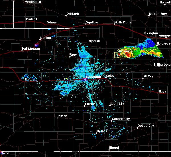 At 957 pm cdt, a severe thunderstorm was located over indianola, or 11 miles east of mccook, moving southeast at 15 mph (radar indicated). Hazards include 60 mph wind gusts and quarter size hail. Hail damage to vehicles is expected. expect wind damage to roofs, siding and trees. Locations impacted include, mccook, indianola and bartley. At 957 pm cdt, a severe thunderstorm was located over indianola, or 11 miles east of mccook, moving southeast at 15 mph (radar indicated). Hazards include 60 mph wind gusts and quarter size hail. Hail damage to vehicles is expected. expect wind damage to roofs, siding and trees. Locations impacted include, mccook, indianola and bartley.
|
| 7/23/2015 9:54 PM CDT |
 At 954 pm cdt, a severe thunderstorm was located near mccook, moving south at 10 mph (radar indicated). Hazards include golf ball size hail and 60 mph wind gusts. People and animals outdoors will be injured. expect hail damage to roofs, siding, windows and vehicles. Expect wind damage to roofs, siding and trees. At 954 pm cdt, a severe thunderstorm was located near mccook, moving south at 10 mph (radar indicated). Hazards include golf ball size hail and 60 mph wind gusts. People and animals outdoors will be injured. expect hail damage to roofs, siding, windows and vehicles. Expect wind damage to roofs, siding and trees.
|
| 7/23/2015 9:39 PM CDT |
 At 939 pm cdt, severe thunderstorms were located along a line extending from 6 miles east of willow view campground to 4 miles south of indianola, moving southeast at 5 mph (public reported the hail). Hazards include tennis ball size hail and 60 mph wind gusts. People and animals outdoors will be injured. expect hail damage to roofs, siding, windows and vehicles. expect wind damage to roofs, siding and trees. Locations impacted include, mccook, indianola and bartley. At 939 pm cdt, severe thunderstorms were located along a line extending from 6 miles east of willow view campground to 4 miles south of indianola, moving southeast at 5 mph (public reported the hail). Hazards include tennis ball size hail and 60 mph wind gusts. People and animals outdoors will be injured. expect hail damage to roofs, siding, windows and vehicles. expect wind damage to roofs, siding and trees. Locations impacted include, mccook, indianola and bartley.
|
| 7/23/2015 9:27 PM CDT |
 At 926 pm cdt, severe thunderstorms were located along a line extending from 7 miles northwest of bartley to near indianola, moving east at 10 mph (public). Hazards include tennis ball size hail and 60 mph wind gusts. People and animals outdoors will be injured. expect hail damage to roofs, siding, windows and vehicles. expect wind damage to roofs, siding and trees. Locations impacted include, mccook, indianola and bartley. At 926 pm cdt, severe thunderstorms were located along a line extending from 7 miles northwest of bartley to near indianola, moving east at 10 mph (public). Hazards include tennis ball size hail and 60 mph wind gusts. People and animals outdoors will be injured. expect hail damage to roofs, siding, windows and vehicles. expect wind damage to roofs, siding and trees. Locations impacted include, mccook, indianola and bartley.
|
| 7/23/2015 9:13 PM CDT |
 At 913 pm cdt, a severe thunderstorm was located 4 miles northwest of indianola, or 9 miles northeast of mccook, moving southeast at 10 mph (radar indicated). Hazards include golf ball size hail and 60 mph wind gusts. People and animals outdoors will be injured. expect hail damage to roofs, siding, windows and vehicles. Expect wind damage to roofs, siding and trees. At 913 pm cdt, a severe thunderstorm was located 4 miles northwest of indianola, or 9 miles northeast of mccook, moving southeast at 10 mph (radar indicated). Hazards include golf ball size hail and 60 mph wind gusts. People and animals outdoors will be injured. expect hail damage to roofs, siding, windows and vehicles. Expect wind damage to roofs, siding and trees.
|
| 7/23/2015 8:52 PM CDT |
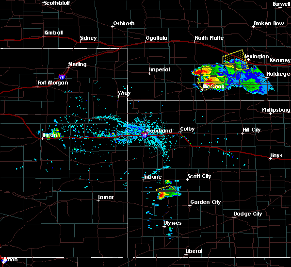 At 852 pm cdt, a severe thunderstorm was located 6 miles northwest of indianola, or 10 miles northeast of mccook, moving southeast at 10 mph (radar indicated). Hazards include two inch hail. People and animals outdoors will be injured. expect damage to roofs, siding, windows and vehicles. This severe thunderstorm will remain over mainly rural areas of northwestern red willow county. At 852 pm cdt, a severe thunderstorm was located 6 miles northwest of indianola, or 10 miles northeast of mccook, moving southeast at 10 mph (radar indicated). Hazards include two inch hail. People and animals outdoors will be injured. expect damage to roofs, siding, windows and vehicles. This severe thunderstorm will remain over mainly rural areas of northwestern red willow county.
|
| 7/23/2015 8:47 PM CDT |
 At 847 pm cdt, a severe thunderstorm was located 7 miles northwest of indianola, or 10 miles northeast of mccook, moving southeast at 10 mph (radar indicated). Hazards include two inch hail. People and animals outdoors will be injured. expect damage to roofs, siding, windows and vehicles. Locations impacted include, mccook. At 847 pm cdt, a severe thunderstorm was located 7 miles northwest of indianola, or 10 miles northeast of mccook, moving southeast at 10 mph (radar indicated). Hazards include two inch hail. People and animals outdoors will be injured. expect damage to roofs, siding, windows and vehicles. Locations impacted include, mccook.
|
| 7/23/2015 8:35 PM CDT |
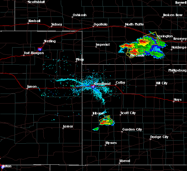 At 834 pm cdt, a severe thunderstorm was located 7 miles northwest of indianola, or 9 miles northeast of mccook, moving southeast at 10 mph (radar indicated). Hazards include two inch hail. People and animals outdoors will be injured. expect damage to roofs, siding, windows and vehicles. Locations impacted include, mccook. At 834 pm cdt, a severe thunderstorm was located 7 miles northwest of indianola, or 9 miles northeast of mccook, moving southeast at 10 mph (radar indicated). Hazards include two inch hail. People and animals outdoors will be injured. expect damage to roofs, siding, windows and vehicles. Locations impacted include, mccook.
|
| 7/23/2015 8:28 PM CDT |
 At 828 pm cdt, a severe thunderstorm was located 6 miles east of willow view campground, or 9 miles northeast of mccook, moving southeast at 15 mph (radar indicated). Hazards include two inch hail. People and animals outdoors will be injured. expect damage to roofs, siding, windows and vehicles. Locations impacted include, mccook. At 828 pm cdt, a severe thunderstorm was located 6 miles east of willow view campground, or 9 miles northeast of mccook, moving southeast at 15 mph (radar indicated). Hazards include two inch hail. People and animals outdoors will be injured. expect damage to roofs, siding, windows and vehicles. Locations impacted include, mccook.
|
| 7/23/2015 8:25 PM CDT | Tennis Ball sized hail reported 9.3 miles S of McCook, NE, hail up to tennis ball size. |
| 7/23/2015 8:18 PM CDT |
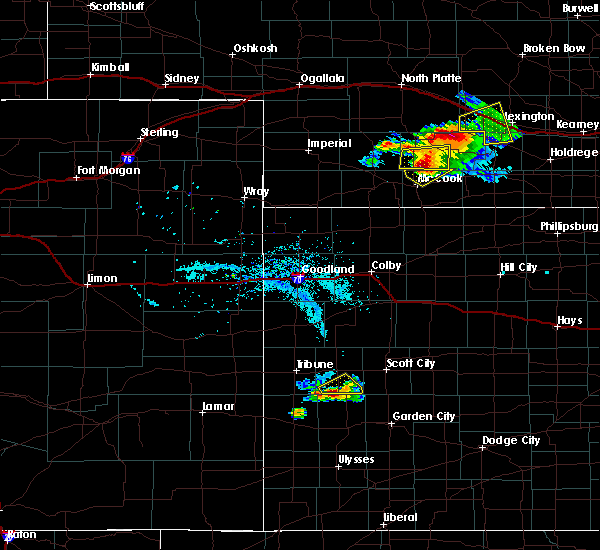 At 818 pm cdt, a severe thunderstorm was located 4 miles east of willow view campground, or 11 miles north of mccook, moving southeast at 10 mph (trained weather spotters). Hazards include golf ball size hail. People and animals outdoors will be injured. Expect damage to roofs, siding, windows and vehicles. At 818 pm cdt, a severe thunderstorm was located 4 miles east of willow view campground, or 11 miles north of mccook, moving southeast at 10 mph (trained weather spotters). Hazards include golf ball size hail. People and animals outdoors will be injured. Expect damage to roofs, siding, windows and vehicles.
|
| 7/10/2015 10:50 PM CDT |
 At 1050 pm cdt, a severe thunderstorm was located 4 miles southwest of indianola, or 8 miles east of mccook, moving east at 20 mph (radar indicated). Hazards include golf ball size hail and 70 mph wind gusts. People and animals outdoors will be injured. expect hail damage to roofs, siding, windows and vehicles. expect considerable tree damage. wind damage is also likely to mobile homes, roofs and outbuildings. Locations impacted include, mccook, indianola and bartley. At 1050 pm cdt, a severe thunderstorm was located 4 miles southwest of indianola, or 8 miles east of mccook, moving east at 20 mph (radar indicated). Hazards include golf ball size hail and 70 mph wind gusts. People and animals outdoors will be injured. expect hail damage to roofs, siding, windows and vehicles. expect considerable tree damage. wind damage is also likely to mobile homes, roofs and outbuildings. Locations impacted include, mccook, indianola and bartley.
|
| 7/10/2015 10:44 PM CDT |
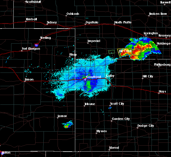 At 1044 pm cdt, a severe thunderstorm was located over indianola, or 11 miles east of mccook, moving northeast at 40 mph (radar indicated). Hazards include 60 mph wind gusts and half dollar size hail. Hail damage to vehicles is expected. Expect wind damage to roofs, siding and trees. At 1044 pm cdt, a severe thunderstorm was located over indianola, or 11 miles east of mccook, moving northeast at 40 mph (radar indicated). Hazards include 60 mph wind gusts and half dollar size hail. Hail damage to vehicles is expected. Expect wind damage to roofs, siding and trees.
|
| 7/10/2015 9:17 PM CDT |
 At 917 pm cdt, a severe thunderstorm was located 7 miles northwest of danbury, or 8 miles southeast of mccook, moving southeast at 25 mph (radar indicated). Hazards include 60 mph wind gusts and half dollar size hail. Hail damage to vehicles is expected. expect wind damage to roofs, siding and trees. Locations impacted include, mccook, indianola, danbury and lebanon. At 917 pm cdt, a severe thunderstorm was located 7 miles northwest of danbury, or 8 miles southeast of mccook, moving southeast at 25 mph (radar indicated). Hazards include 60 mph wind gusts and half dollar size hail. Hail damage to vehicles is expected. expect wind damage to roofs, siding and trees. Locations impacted include, mccook, indianola, danbury and lebanon.
|
| 7/10/2015 9:10 PM CDT | Golf Ball sized hail reported 3.1 miles N of McCook, NE, nickel and quarter hail fell prior to the golf ball... a lot of golfball hail fell |
| 7/10/2015 9:10 PM CDT |
 At 909 pm cdt, a severe thunderstorm was located 5 miles south of mccook, moving southeast at 25 mph (radar indicated). Hazards include golf ball size hail. People and animals outdoors will be injured. Expect damage to roofs, siding, windows and vehicles. At 909 pm cdt, a severe thunderstorm was located 5 miles south of mccook, moving southeast at 25 mph (radar indicated). Hazards include golf ball size hail. People and animals outdoors will be injured. Expect damage to roofs, siding, windows and vehicles.
|
| 7/10/2015 9:07 PM CDT |
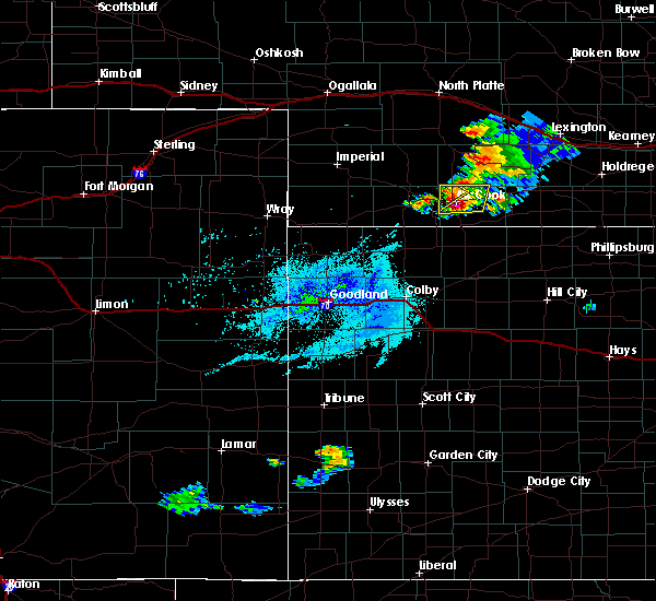 The severe thunderstorm warning for northwestern red willow county will expire at 915 pm cdt, the severe thunderstorm which prompted the warning has moved out of the warned area. therefore the warning will be allowed to expire. to report severe weather, contact your nearest law enforcement agency. they will relay your report to the national weather service goodland. remember, a severe thunderstorm warning still remains in effect for western red willow county. The severe thunderstorm warning for northwestern red willow county will expire at 915 pm cdt, the severe thunderstorm which prompted the warning has moved out of the warned area. therefore the warning will be allowed to expire. to report severe weather, contact your nearest law enforcement agency. they will relay your report to the national weather service goodland. remember, a severe thunderstorm warning still remains in effect for western red willow county.
|
| 7/10/2015 9:05 PM CDT | Quarter sized hail reported 3.1 miles N of McCook, NE, ongoing at time of call. mix of nickel and quarter hail |
| 7/10/2015 9:05 PM CDT |
 At 905 pm cdt, a severe thunderstorm was located near mccook, moving east at 30 mph (radar indicated). Hazards include two inch hail and 70 mph wind gusts. People and animals outdoors will be injured. expect hail damage to roofs, siding, windows and vehicles. expect considerable tree damage. wind damage is also likely to mobile homes, roofs and outbuildings. Locations impacted include, mccook and indianola. At 905 pm cdt, a severe thunderstorm was located near mccook, moving east at 30 mph (radar indicated). Hazards include two inch hail and 70 mph wind gusts. People and animals outdoors will be injured. expect hail damage to roofs, siding, windows and vehicles. expect considerable tree damage. wind damage is also likely to mobile homes, roofs and outbuildings. Locations impacted include, mccook and indianola.
|
| 7/10/2015 8:59 PM CDT | Quarter sized hail reported 0.4 miles NW of McCook, NE, mostly pea sized hail but some up to quarter size. hail was increasing in size at call time. |
| 7/10/2015 8:57 PM CDT |
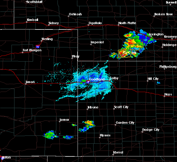 At 857 pm cdt, a severe thunderstorm was located over mccook, moving east at 35 mph (radar indicated). Hazards include golf ball size hail and 70 mph wind gusts. People and animals outdoors will be injured. expect hail damage to roofs, siding, windows and vehicles. expect considerable tree damage. wind damage is also likely to mobile homes, roofs and outbuildings. Locations impacted include, mccook. At 857 pm cdt, a severe thunderstorm was located over mccook, moving east at 35 mph (radar indicated). Hazards include golf ball size hail and 70 mph wind gusts. People and animals outdoors will be injured. expect hail damage to roofs, siding, windows and vehicles. expect considerable tree damage. wind damage is also likely to mobile homes, roofs and outbuildings. Locations impacted include, mccook.
|
| 7/10/2015 8:54 PM CDT |
 At 854 pm cdt, a severe thunderstorm was located over mccook, moving east at 30 mph (radar indicated). Hazards include golf ball size hail and 70 mph wind gusts. People and animals outdoors will be injured. expect hail damage to roofs, siding, windows and vehicles. expect considerable tree damage. wind damage is also likely to mobile homes, roofs and outbuildings. Locations impacted include, mccook and indianola. At 854 pm cdt, a severe thunderstorm was located over mccook, moving east at 30 mph (radar indicated). Hazards include golf ball size hail and 70 mph wind gusts. People and animals outdoors will be injured. expect hail damage to roofs, siding, windows and vehicles. expect considerable tree damage. wind damage is also likely to mobile homes, roofs and outbuildings. Locations impacted include, mccook and indianola.
|
| 7/10/2015 8:46 PM CDT |
 At 845 pm cdt, a severe thunderstorm was located 5 miles west of mccook, moving east at 30 mph (radar indicated). Hazards include 60 mph wind gusts and quarter size hail. Hail damage to vehicles is expected. Expect wind damage to roofs, siding and trees. At 845 pm cdt, a severe thunderstorm was located 5 miles west of mccook, moving east at 30 mph (radar indicated). Hazards include 60 mph wind gusts and quarter size hail. Hail damage to vehicles is expected. Expect wind damage to roofs, siding and trees.
|
| 7/10/2015 8:36 PM CDT |
 At 836 pm cdt, a severe thunderstorm was located near culbertson, or 8 miles west of mccook, moving northeast at 15 mph (radar indicated). Hazards include 60 mph wind gusts and quarter size hail. Hail damage to vehicles is expected. expect wind damage to roofs, siding and trees. Locations impacted include, mccook and culbertson. At 836 pm cdt, a severe thunderstorm was located near culbertson, or 8 miles west of mccook, moving northeast at 15 mph (radar indicated). Hazards include 60 mph wind gusts and quarter size hail. Hail damage to vehicles is expected. expect wind damage to roofs, siding and trees. Locations impacted include, mccook and culbertson.
|
| 7/10/2015 8:30 PM CDT |
 At 830 pm cdt, a severe thunderstorm was located over culbertson, or 9 miles west of mccook, moving northeast at 15 mph (radar indicated). Hazards include 60 mph wind gusts and quarter size hail. Hail damage to vehicles is expected. Expect wind damage to roofs, siding and trees. At 830 pm cdt, a severe thunderstorm was located over culbertson, or 9 miles west of mccook, moving northeast at 15 mph (radar indicated). Hazards include 60 mph wind gusts and quarter size hail. Hail damage to vehicles is expected. Expect wind damage to roofs, siding and trees.
|
| 6/21/2015 9:43 AM CDT |
 At 943 am cdt, a severe thunderstorm was located 4 miles northwest of indianola, or 7 miles northeast of mccook, moving southeast at 35 mph (radar indicated). Hazards include golf ball size hail and 60 mph wind gusts. People and animals outdoors will be injured. expect hail damage to roofs, siding, windows and vehicles. expect wind damage to roofs, siding and trees. Locations impacted include, mccook, indianola, bartley, danbury and lebanon. At 943 am cdt, a severe thunderstorm was located 4 miles northwest of indianola, or 7 miles northeast of mccook, moving southeast at 35 mph (radar indicated). Hazards include golf ball size hail and 60 mph wind gusts. People and animals outdoors will be injured. expect hail damage to roofs, siding, windows and vehicles. expect wind damage to roofs, siding and trees. Locations impacted include, mccook, indianola, bartley, danbury and lebanon.
|
| 6/21/2015 9:32 AM CDT |
 At 930 am cdt, a severe thunderstorm was located 4 miles southeast of willow view campground, or 8 miles north of mccook, moving southeast at 40 mph (radar indicated. this storm has a history of producing very large hail over western nebraska. quarter size hail was reported at 914 am cdt 11 miles southwest of maywood in frontier county). Hazards include golf ball size hail and 60 mph wind gusts. People and animals outdoors will be injured. expect hail damage to roofs, siding, windows and vehicles. expect wind damage to roofs, siding and trees. Locations impacted include, mccook, indianola, bartley, danbury and lebanon. At 930 am cdt, a severe thunderstorm was located 4 miles southeast of willow view campground, or 8 miles north of mccook, moving southeast at 40 mph (radar indicated. this storm has a history of producing very large hail over western nebraska. quarter size hail was reported at 914 am cdt 11 miles southwest of maywood in frontier county). Hazards include golf ball size hail and 60 mph wind gusts. People and animals outdoors will be injured. expect hail damage to roofs, siding, windows and vehicles. expect wind damage to roofs, siding and trees. Locations impacted include, mccook, indianola, bartley, danbury and lebanon.
|
| 6/21/2015 9:30 AM CDT | Golf Ball sized hail reported 16 miles SSE of McCook, NE, delayed report of golf ball size hail at red willow reservoir state recreation headquarters |
| 6/21/2015 9:17 AM CDT |
 At 916 am cdt, a severe thunderstorm was located near quick, or 16 miles southwest of curtis, moving southeast at 40 mph (radar indicated. this storm has a history of producing large hail across western nebraska). Hazards include golf ball size hail and 60 mph wind gusts. People and animals outdoors will be injured. expect hail damage to roofs, siding, windows and vehicles. Expect wind damage to roofs, siding and trees. At 916 am cdt, a severe thunderstorm was located near quick, or 16 miles southwest of curtis, moving southeast at 40 mph (radar indicated. this storm has a history of producing large hail across western nebraska). Hazards include golf ball size hail and 60 mph wind gusts. People and animals outdoors will be injured. expect hail damage to roofs, siding, windows and vehicles. Expect wind damage to roofs, siding and trees.
|
| 5/29/2015 4:58 PM CDT | At 457 pm cdt, severe thunderstorms were located along a line extending from near bartley to mccook, moving east at 20 mph (trained weather spotters. at 553 pm cdt...a 58 mph wind gust was reported at the mccook municipal airport). Hazards include 60 mph wind gusts and quarter size hail. Hail damage to vehicles is expected. Expect wind damage to roofs, siding and trees. |
| 5/29/2015 4:56 PM CDT | Asos measured a wind gust of 58 mph at mccook airpor in red willow county NE, 0.4 miles NW of McCook, NE |
| 5/9/2015 11:26 PM CDT | At 1125 pm cdt, a severe thunderstorm capable of producing a tornado was located 5 miles southwest of mccook, moving north at 25 mph (radar indicated rotation). Hazards include tornado and quarter size hail. Flying debris will be dangerous to those caught without shelter. mobile homes will be damaged or destroyed. damage to roofs, windows and vehicles will occur. Tree damage is likely. |
| 7/10/2014 12:32 AM CDT | Ping Pong Ball sized hail reported 1.1 miles NNE of McCook, NE |
| 7/10/2014 12:30 AM CDT | Golf Ball sized hail reported 0.4 miles NW of McCook, NE |
| 7/10/2014 12:20 AM CDT | Half Dollar sized hail reported 3 miles E of McCook, NE, hail occurred for about 3 minutes. |
| 6/22/2014 12:10 AM CDT | Storm damage reported in red willow county NE, 0.4 miles NW of McCook, NE |
| 6/14/2014 9:30 PM CDT | Storm damage reported in frontier county NE, 10.7 miles S of McCook, NE |
| 6/14/2014 9:28 PM CDT | Storm damage reported in red willow county NE, 0.4 miles NW of McCook, NE |
| 5/7/2014 6:13 PM CDT | Half Dollar sized hail reported 0.4 miles NW of McCook, NE |
| 5/7/2014 6:12 PM CDT | Golf Ball sized hail reported 0.4 miles NW of McCook, NE |
| 5/7/2014 6:12 PM CDT | Golf Ball sized hail reported 1.1 miles NNE of McCook, NE, relayed via 911 dispatch |
| 9/10/2013 10:30 PM CDT | Strong winds tipped over some irrigation pipe. wind gusts estimated up to 60 mph. pea to marble sized hail also occurred with this stor in frontier county NE, 13.5 miles S of McCook, NE |
| 8/7/2013 2:34 AM CDT | Storm damage reported in red willow county NE, 0.4 miles NW of McCook, NE |
| 7/21/2013 12:02 AM CDT | Storm damage reported in red willow county NE, 0.4 miles NW of McCook, NE |
| 7/8/2013 9:26 PM CDT | Storm damage reported in red willow county NE, 0.4 miles NW of McCook, NE |
| 7/8/2013 9:25 PM CDT | Industrial building of unknown size on west side of town lost its roof in thunderstorm wind gust. time estimated based on nearby asos wind gus in red willow county NE, 0.4 miles NW of McCook, NE |
| 6/24/2013 2:01 AM CDT | Storm damage reported in red willow county NE, 0.4 miles NW of McCook, NE |
| 6/23/2013 12:12 AM CDT | Quarter sized hail reported 0.4 miles NW of McCook, NE, via social media |
| 6/23/2013 12:00 AM CDT | Quarter sized hail reported 2.2 miles ESE of McCook, NE |
| 5/29/2013 4:55 PM CDT | Quarter sized hail reported 1.1 miles SSW of McCook, NE |
| 5/25/2013 12:08 AM CDT | Storm damage reported in red willow county NE, 0.4 miles NW of McCook, NE |
| 4/9/2013 1:49 AM CDT | Storm damage reported in red willow county NE, 0.4 miles NW of McCook, NE |
| 6/14/2012 6:19 PM CDT | Ping Pong Ball sized hail reported 11.5 miles S of McCook, NE |
| 4/12/2012 9:37 PM CDT | Also quarter sized hai in red willow county NE, 5.1 miles ENE of McCook, NE |
| 1/1/0001 12:00 AM | Quarter sized hail reported 1.1 miles SSW of McCook, NE, from severe hazards analysis and verification experiment |
| 1/1/0001 12:00 AM | Golf Ball sized hail reported 0.4 miles NW of McCook, NE, reported on east side of town. |
| 1/1/0001 12:00 AM | Quarter sized hail reported 0.4 miles NW of McCook, NE, public report also included estimated 60 mph winds. |
| 1/1/0001 12:00 AM | Storm damage reported in red willow county NE, 0.4 miles NW of McCook, NE |
| 1/1/0001 12:00 AM | Quarter sized hail reported 0.9 miles ENE of McCook, NE, from severe hazards analysis and verification experiment |
| 1/1/0001 12:00 AM | Ping Pong Ball sized hail reported 0.4 miles NW of McCook, NE, *** 1 inj *** spotter also reports many skylights at local walmart blown out and store is currently shut down. also reported one minor injury. |
| 1/1/0001 12:00 AM | Golf Ball sized hail reported 0.4 miles NW of McCook, NE, reported on west side of town. |
| 1/1/0001 12:00 AM | Quarter sized hail reported 9.4 miles S of McCook, NE, emergency mgr relayed report from law enforcement on hwy 83 just south of red willow/frontier co. line. |
| 1/1/0001 12:00 AM | 7 to 8 inch diameter green tree limbs broken of in red willow county NE, 0.4 miles NW of McCook, NE |
| 1/1/0001 12:00 AM | Storm damage reported in red willow county NE, 0.4 miles NW of McCook, NE |
| 1/1/0001 12:00 AM | Storm damage reported in red willow county NE, 2.1 miles WSW of McCook, NE |
| 1/1/0001 12:00 AM | Storm damage reported in red willow county NE, 2.1 miles WSW of McCook, NE |
Hail Maps for McCook, NE
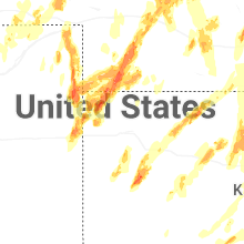
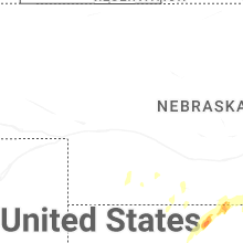


Connect with Interactive Hail Maps