

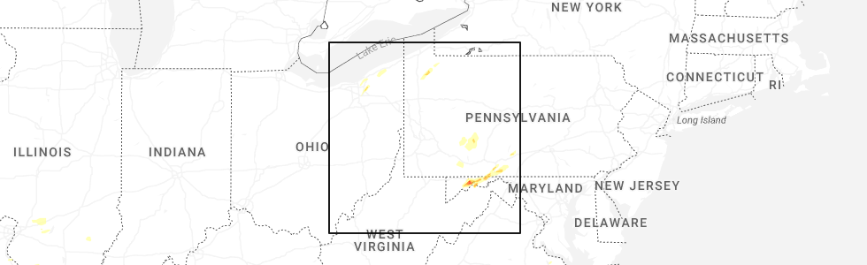
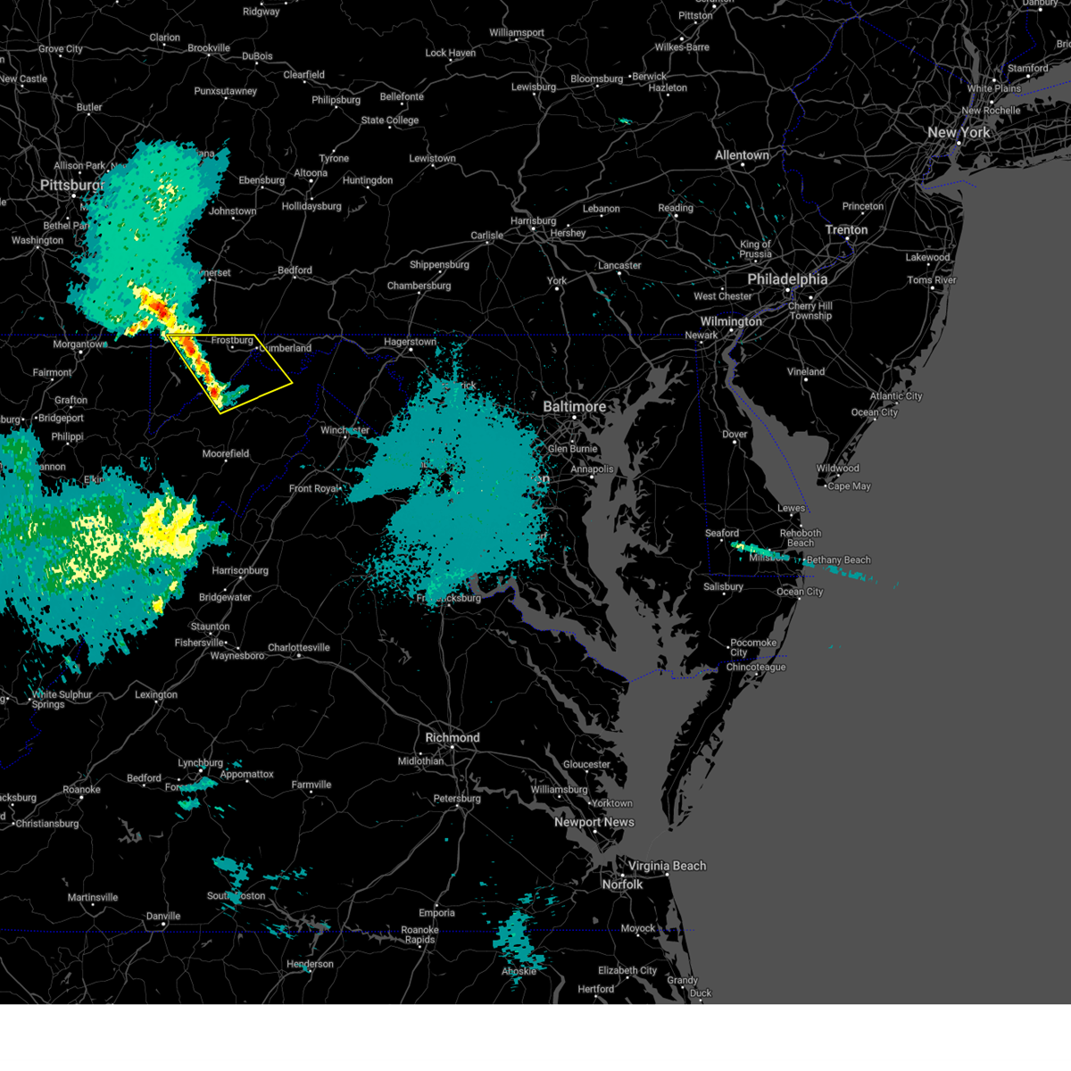
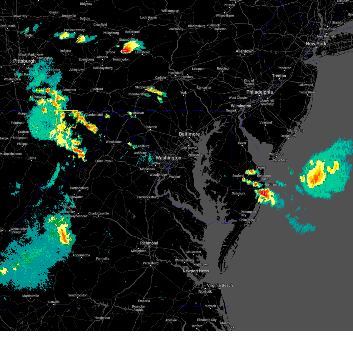
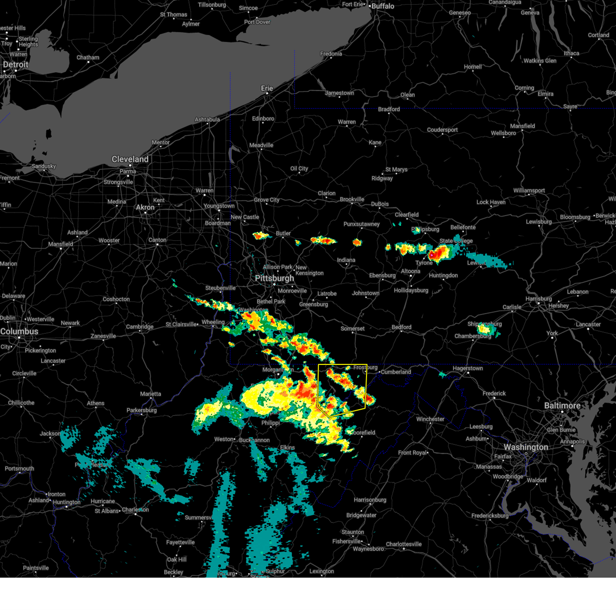
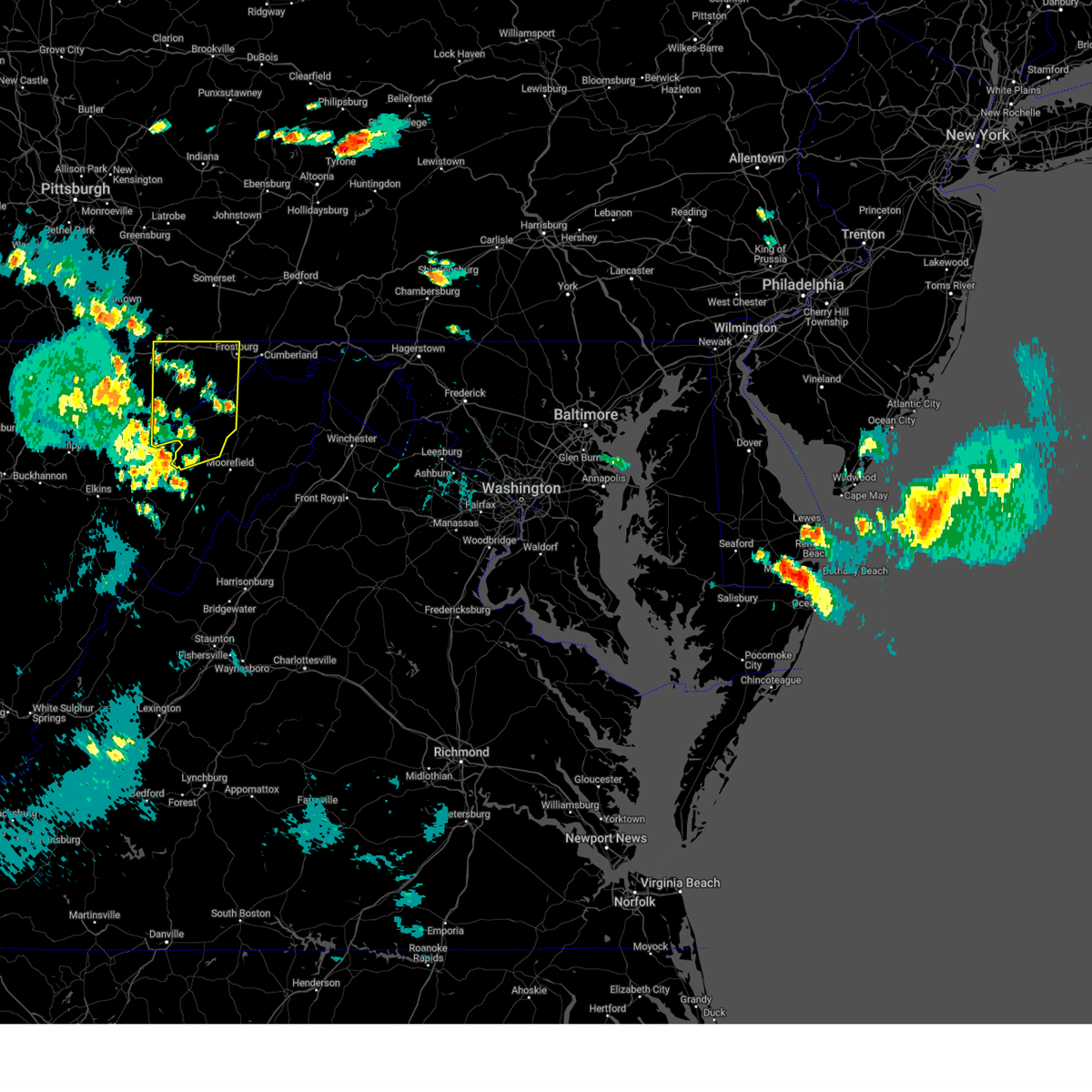
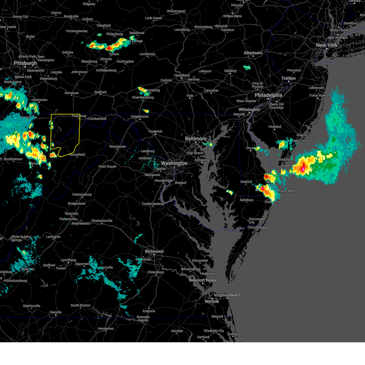
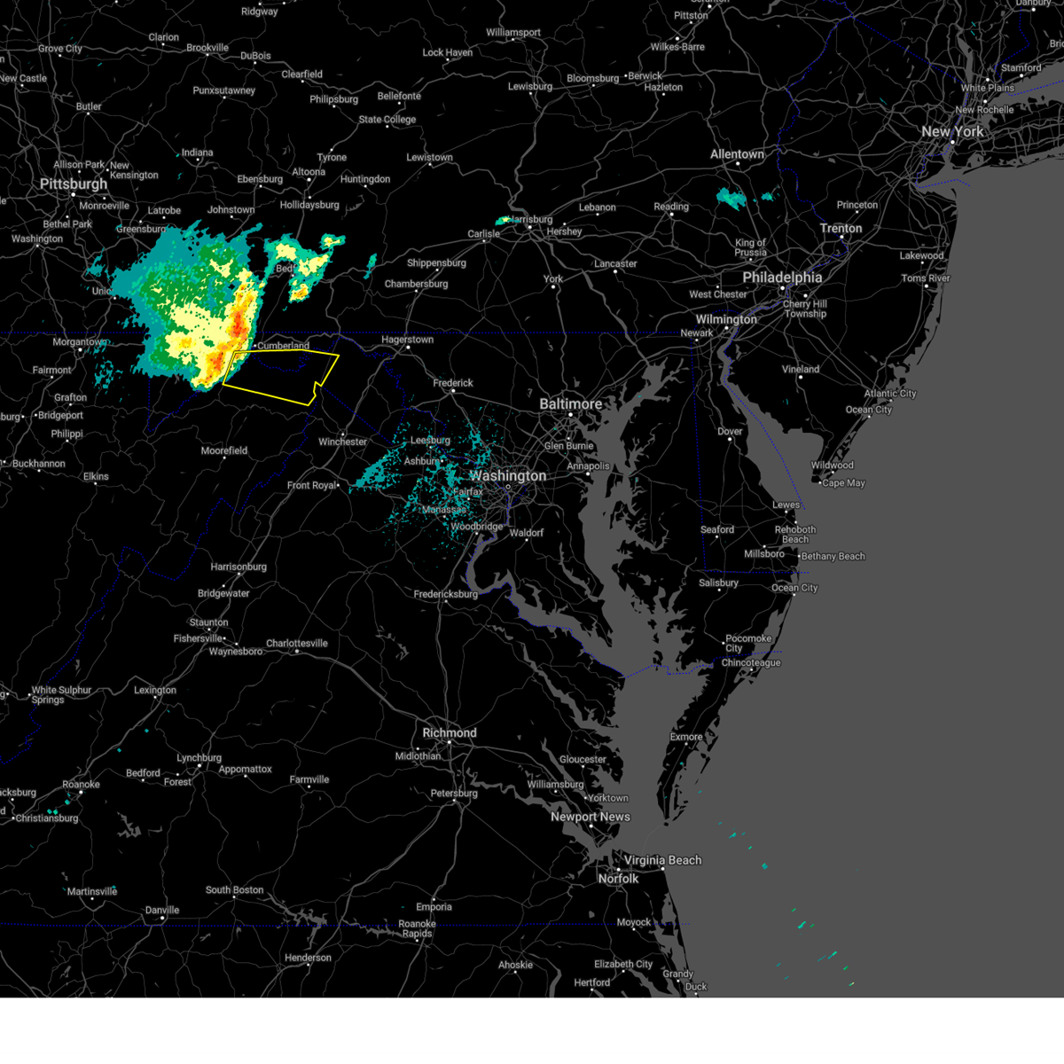
Hail Map for McCoole, MD
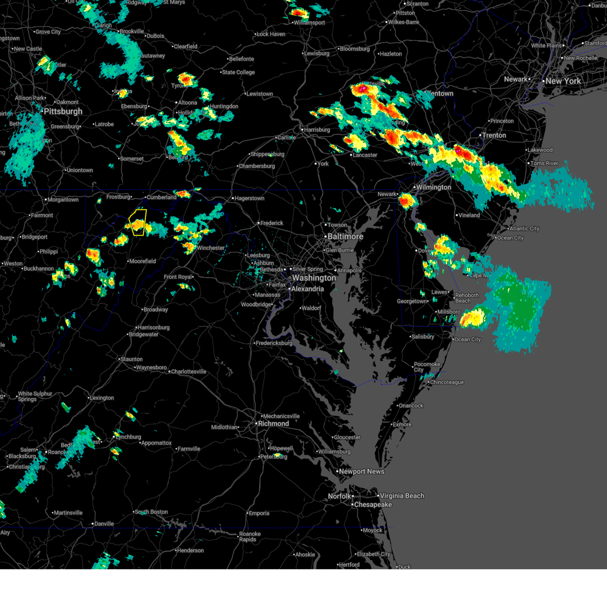
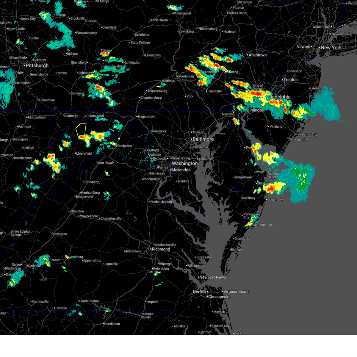
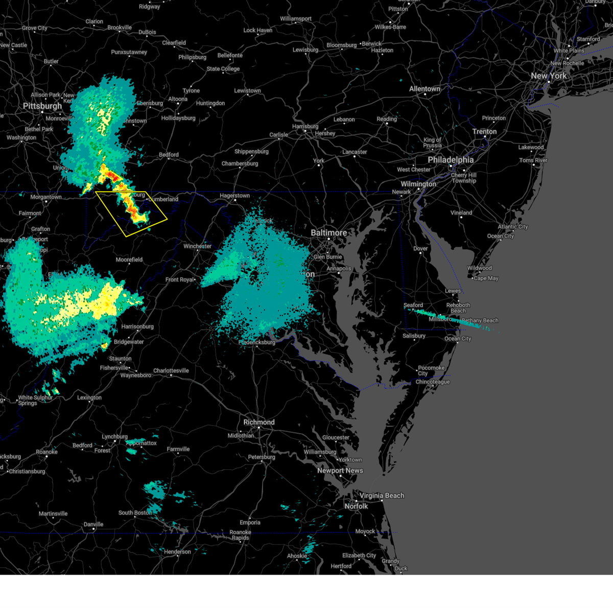
The McCoole, MD area has had 0 reports of on-the-ground hail by trained spotters, and has been under severe weather warnings 22 times during the past 12 months. Doppler radar has detected hail at or near McCoole, MD on 22 occasions, including 3 occasions during the past year.
| Name: | McCoole, MD |
| Where Located: | 59.4 miles NE of Elkins, WV |
| Map: | Google Map for McCoole, MD |
| Population: | 511 |
| Housing Units: | 243 |
| More Info: | Search Google for McCoole, MD |
0
The Top Recent Hail Date for McCoole, MD is Thursday, May 1, 2025 (20th out of 22)
Hail and Wind Damage Spotted near McCoole, MD
| Date / Time | Report Details |
|---|---|
| 6/30/2025 3:10 PM EDT |
 The storm which prompted the warning has weakened below severe limits, and no longer poses an immediate threat to life or property. therefore, the warning will be allowed to expire. however, heavy rain is still possible with this thunderstorm. to report severe weather, contact your nearest law enforcement agency. they will relay your report to the national weather service sterling virginia. The storm which prompted the warning has weakened below severe limits, and no longer poses an immediate threat to life or property. therefore, the warning will be allowed to expire. however, heavy rain is still possible with this thunderstorm. to report severe weather, contact your nearest law enforcement agency. they will relay your report to the national weather service sterling virginia.
|
| 6/30/2025 2:48 PM EDT |
 Svrlwx the national weather service in sterling virginia has issued a * severe thunderstorm warning for, southeastern mineral county in eastern west virginia, northwestern hampshire county in eastern west virginia, * until 315 pm edt. * at 247 pm edt, a severe thunderstorm was located near romney, moving north at 25 mph (radar indicated). Hazards include 60 mph wind gusts and quarter size hail. Damaging winds will cause some trees and large branches to fall. this could injure those outdoors, as well as damage homes and vehicles. roadways may become blocked by downed trees. localized power outages are possible. Unsecured light objects may become projectiles. Svrlwx the national weather service in sterling virginia has issued a * severe thunderstorm warning for, southeastern mineral county in eastern west virginia, northwestern hampshire county in eastern west virginia, * until 315 pm edt. * at 247 pm edt, a severe thunderstorm was located near romney, moving north at 25 mph (radar indicated). Hazards include 60 mph wind gusts and quarter size hail. Damaging winds will cause some trees and large branches to fall. this could injure those outdoors, as well as damage homes and vehicles. roadways may become blocked by downed trees. localized power outages are possible. Unsecured light objects may become projectiles.
|
| 5/17/2025 1:59 AM EDT |
 The storms which prompted the warning have weakened below severe limits, and no longer pose an immediate threat to life or property. therefore, the warning will be allowed to expire. The storms which prompted the warning have weakened below severe limits, and no longer pose an immediate threat to life or property. therefore, the warning will be allowed to expire.
|
| 5/17/2025 1:46 AM EDT |
 At 145 am edt, severe thunderstorms were located along a line extending from near ursina to near keyser, moving east at 55 mph (radar indicated). Hazards include 60 mph wind gusts and quarter size hail. Damaging winds will cause some trees and large branches to fall. this could injure those outdoors, as well as damage homes and vehicles. roadways may become blocked by downed trees. localized power outages are possible. unsecured light objects may become projectiles. Locations impacted include, potomac park, franklin, lonaconing, keyser, dogwood flats, fort ashby, bittinger, new creek, short gap, north branch, mccoole, brady, oldtown, big run state park, piney grove, ridgeville, cresaptown, merrill, rawlings, and spring gap. At 145 am edt, severe thunderstorms were located along a line extending from near ursina to near keyser, moving east at 55 mph (radar indicated). Hazards include 60 mph wind gusts and quarter size hail. Damaging winds will cause some trees and large branches to fall. this could injure those outdoors, as well as damage homes and vehicles. roadways may become blocked by downed trees. localized power outages are possible. unsecured light objects may become projectiles. Locations impacted include, potomac park, franklin, lonaconing, keyser, dogwood flats, fort ashby, bittinger, new creek, short gap, north branch, mccoole, brady, oldtown, big run state park, piney grove, ridgeville, cresaptown, merrill, rawlings, and spring gap.
|
| 5/17/2025 1:46 AM EDT |
 the severe thunderstorm warning has been cancelled and is no longer in effect the severe thunderstorm warning has been cancelled and is no longer in effect
|
| 5/17/2025 1:34 AM EDT | Svrlwx the national weather service in sterling virginia has issued a * severe thunderstorm warning for, western allegany county in western maryland, garrett county in western maryland, north central grant county in eastern west virginia, mineral county in eastern west virginia, north central hampshire county in eastern west virginia, * until 200 am edt. * at 134 am edt, severe thunderstorms were located along a line extending from 6 miles north of friendsville to near keyser, moving east at 55 mph (radar indicated). Hazards include 60 mph wind gusts. Damaging winds will cause some trees and large branches to fall. this could injure those outdoors, as well as damage homes and vehicles. roadways may become blocked by downed trees. localized power outages are possible. Unsecured light objects may become projectiles. |
| 5/16/2025 3:22 PM EDT |
 The storm which prompted the warning has weakened below severe limits, and no longer poses an immediate threat to life or property. therefore, the warning will be allowed to expire. however, gusty winds and heavy rain are still possible with this thunderstorm. a severe thunderstorm watch remains in effect until 1000 pm edt for western maryland, and eastern west virginia. to report severe weather, contact your nearest law enforcement agency. they will relay your report to the national weather service sterling virginia. The storm which prompted the warning has weakened below severe limits, and no longer poses an immediate threat to life or property. therefore, the warning will be allowed to expire. however, gusty winds and heavy rain are still possible with this thunderstorm. a severe thunderstorm watch remains in effect until 1000 pm edt for western maryland, and eastern west virginia. to report severe weather, contact your nearest law enforcement agency. they will relay your report to the national weather service sterling virginia.
|
| 5/16/2025 3:19 PM EDT | At 319 pm edt, a severe thunderstorm was located over bittinger, moving northeast at 35 mph (radar indicated). Hazards include 60 mph wind gusts. Damaging winds will cause some trees and large branches to fall. this could injure those outdoors, as well as damage homes and vehicles. roadways may become blocked by downed trees. localized power outages are possible. unsecured light objects may become projectiles. Locations impacted include, franklin, lonaconing, dogwood flats, bittinger, jennings, woodland, deep creek lake state park, mccoole, deer park, big run state park, piney grove, merrill, reynolds, luke, grantsville, westernport, midlothian, keysers ridge, barton, and mineral spring. |
| 5/16/2025 3:19 PM EDT | the severe thunderstorm warning has been cancelled and is no longer in effect |
| 5/16/2025 3:13 PM EDT | the severe thunderstorm warning has been cancelled and is no longer in effect |
| 5/16/2025 3:13 PM EDT | At 312 pm edt, severe thunderstorms were located along a line extending from near friendsville to accident to kitzmiller, moving northeast at 45 mph (radar indicated). Hazards include 60 mph wind gusts. Damaging winds will cause some trees and large branches to fall. this could injure those outdoors, as well as damage homes and vehicles. roadways may become blocked by downed trees. localized power outages are possible. unsecured light objects may become projectiles. Locations impacted include, franklin, lonaconing, keyser, dogwood flats, bittinger, new creek, oakland, jennings, woodland, deep creek lake state park, mccoole, swallow falls state park, deer park, mchenry, big run state park, friendsville, piney grove, mccomas beach, kitzmiller, and merrill. |
| 5/16/2025 3:06 PM EDT |
 At 305 pm edt, severe thunderstorms were located along a line extending from 6 miles northwest of kingwood to 6 miles northeast of terra alta to near kitzmiller, moving east at 35 mph (radar indicated). Hazards include 60 mph wind gusts. Damaging winds will cause some trees and large branches to fall. this could injure those outdoors, as well as damage homes and vehicles. roadways may become blocked by downed trees. localized power outages are possible. unsecured light objects may become projectiles. Locations impacted include, franklin, lonaconing, keyser, dogwood flats, bittinger, hutton, new creek, oakland, mccoole, deer park, big run state park, piney grove, kitzmiller, ridgeville, merrill, mountain lake park, emoryville, grantsville, westernport, and midlothian. At 305 pm edt, severe thunderstorms were located along a line extending from 6 miles northwest of kingwood to 6 miles northeast of terra alta to near kitzmiller, moving east at 35 mph (radar indicated). Hazards include 60 mph wind gusts. Damaging winds will cause some trees and large branches to fall. this could injure those outdoors, as well as damage homes and vehicles. roadways may become blocked by downed trees. localized power outages are possible. unsecured light objects may become projectiles. Locations impacted include, franklin, lonaconing, keyser, dogwood flats, bittinger, hutton, new creek, oakland, mccoole, deer park, big run state park, piney grove, kitzmiller, ridgeville, merrill, mountain lake park, emoryville, grantsville, westernport, and midlothian.
|
| 5/16/2025 2:47 PM EDT |
 At 244 pm edt, severe thunderstorms were located along a line extending from 6 miles east of winfield to kingwood to near bayard, moving east at 40 mph (a wind gust of 60 mph was observed near bridgeport, wv). Hazards include 60 mph wind gusts. Damaging winds will cause some trees and large branches to fall. this could injure those outdoors, as well as damage homes and vehicles. roadways may become blocked by downed trees. localized power outages are possible. unsecured light objects may become projectiles. Locations impacted include, russelldale, franklin, lonaconing, keyser, dogwood flats, bittinger, hutton, new creek, oakland, lahmansville, mccoole, deer park, big run state park, williamsport, piney grove, kitzmiller, ridgeville, merrill, mountain lake park, and emoryville. At 244 pm edt, severe thunderstorms were located along a line extending from 6 miles east of winfield to kingwood to near bayard, moving east at 40 mph (a wind gust of 60 mph was observed near bridgeport, wv). Hazards include 60 mph wind gusts. Damaging winds will cause some trees and large branches to fall. this could injure those outdoors, as well as damage homes and vehicles. roadways may become blocked by downed trees. localized power outages are possible. unsecured light objects may become projectiles. Locations impacted include, russelldale, franklin, lonaconing, keyser, dogwood flats, bittinger, hutton, new creek, oakland, lahmansville, mccoole, deer park, big run state park, williamsport, piney grove, kitzmiller, ridgeville, merrill, mountain lake park, and emoryville.
|
| 5/16/2025 2:32 PM EDT |
 Svrlwx the national weather service in sterling virginia has issued a * severe thunderstorm warning for, western allegany county in western maryland, garrett county in western maryland, northern grant county in eastern west virginia, southwestern mineral county in eastern west virginia, * until 330 pm edt. * at 231 pm edt, severe thunderstorms were located along a line extending from near pleasant valley to near newburg to near parsons, moving east at 35 mph (radar indicated). Hazards include 60 mph wind gusts. Damaging winds will cause some trees and large branches to fall. this could injure those outdoors, as well as damage homes and vehicles. roadways may become blocked by downed trees. localized power outages are possible. Unsecured light objects may become projectiles. Svrlwx the national weather service in sterling virginia has issued a * severe thunderstorm warning for, western allegany county in western maryland, garrett county in western maryland, northern grant county in eastern west virginia, southwestern mineral county in eastern west virginia, * until 330 pm edt. * at 231 pm edt, severe thunderstorms were located along a line extending from near pleasant valley to near newburg to near parsons, moving east at 35 mph (radar indicated). Hazards include 60 mph wind gusts. Damaging winds will cause some trees and large branches to fall. this could injure those outdoors, as well as damage homes and vehicles. roadways may become blocked by downed trees. localized power outages are possible. Unsecured light objects may become projectiles.
|
| 4/30/2025 12:25 AM EDT |
 The storms which prompted the warning have weakened below severe limits, and no longer pose an immediate threat to life or property. therefore, the warning will be allowed to expire. however, gusty winds and heavy rain are still possible with these thunderstorms. The storms which prompted the warning have weakened below severe limits, and no longer pose an immediate threat to life or property. therefore, the warning will be allowed to expire. however, gusty winds and heavy rain are still possible with these thunderstorms.
|
| 4/30/2025 12:10 AM EDT |
 At 1210 am edt, severe thunderstorms were located along a line extending from near kitzmiller to 7 miles south of brandywine, moving east at 60 mph (radar indicated). Hazards include 60 mph wind gusts. Damaging winds will cause some trees and large branches to fall. this could injure those outdoors, as well as damage homes and vehicles. roadways may become blocked by downed trees. localized power outages are possible. unsecured light objects may become projectiles. Locations impacted include, potomac park, franklin, lonaconing, keyser, dogwood flats, arthur, bittinger, hutton, new creek, oakland, lahmansville, mccoole, brady, cabins, deer park, big run state park, kline gap, williamsport, piney grove, and kitzmiller. At 1210 am edt, severe thunderstorms were located along a line extending from near kitzmiller to 7 miles south of brandywine, moving east at 60 mph (radar indicated). Hazards include 60 mph wind gusts. Damaging winds will cause some trees and large branches to fall. this could injure those outdoors, as well as damage homes and vehicles. roadways may become blocked by downed trees. localized power outages are possible. unsecured light objects may become projectiles. Locations impacted include, potomac park, franklin, lonaconing, keyser, dogwood flats, arthur, bittinger, hutton, new creek, oakland, lahmansville, mccoole, brady, cabins, deer park, big run state park, kline gap, williamsport, piney grove, and kitzmiller.
|
| 4/29/2025 11:41 PM EDT |
 Svrlwx the national weather service in sterling virginia has issued a * severe thunderstorm warning for, western allegany county in western maryland, garrett county in western maryland, western highland county in western virginia, western pendleton county in eastern west virginia, grant county in eastern west virginia, western mineral county in eastern west virginia, * until 1230 am edt. * at 1140 pm edt, severe thunderstorms were located along a line extending from near kingwood to 10 miles northeast of greenbank, moving east at 60 mph (radar indicated). Hazards include 60 mph wind gusts. Damaging winds will cause some trees and large branches to fall. this could injure those outdoors, as well as damage homes and vehicles. roadways may become blocked by downed trees. localized power outages are possible. Unsecured light objects may become projectiles. Svrlwx the national weather service in sterling virginia has issued a * severe thunderstorm warning for, western allegany county in western maryland, garrett county in western maryland, western highland county in western virginia, western pendleton county in eastern west virginia, grant county in eastern west virginia, western mineral county in eastern west virginia, * until 1230 am edt. * at 1140 pm edt, severe thunderstorms were located along a line extending from near kingwood to 10 miles northeast of greenbank, moving east at 60 mph (radar indicated). Hazards include 60 mph wind gusts. Damaging winds will cause some trees and large branches to fall. this could injure those outdoors, as well as damage homes and vehicles. roadways may become blocked by downed trees. localized power outages are possible. Unsecured light objects may become projectiles.
|
| 4/19/2025 9:10 PM EDT |
 Svrlwx the national weather service in sterling virginia has issued a * severe thunderstorm warning for, central allegany county in western maryland, southwestern morgan county in the panhandle of west virginia, northeastern mineral county in eastern west virginia, northeastern hampshire county in eastern west virginia, * until 945 pm edt. * at 910 pm edt, severe thunderstorms were located along a line extending from near bel air to near westernport to near elk garden, moving east at 75 mph (radar indicated). Hazards include 60 mph wind gusts and quarter size hail. Damaging winds will cause some trees and large branches to fall. this could injure those outdoors, as well as damage homes and vehicles. roadways may become blocked by downed trees. localized power outages are possible. Unsecured light objects may become projectiles. Svrlwx the national weather service in sterling virginia has issued a * severe thunderstorm warning for, central allegany county in western maryland, southwestern morgan county in the panhandle of west virginia, northeastern mineral county in eastern west virginia, northeastern hampshire county in eastern west virginia, * until 945 pm edt. * at 910 pm edt, severe thunderstorms were located along a line extending from near bel air to near westernport to near elk garden, moving east at 75 mph (radar indicated). Hazards include 60 mph wind gusts and quarter size hail. Damaging winds will cause some trees and large branches to fall. this could injure those outdoors, as well as damage homes and vehicles. roadways may become blocked by downed trees. localized power outages are possible. Unsecured light objects may become projectiles.
|
| 4/3/2025 6:50 AM EDT | Svrlwx the national weather service in sterling virginia has issued a * severe thunderstorm warning for, western allegany county in western maryland, garrett county in western maryland, central mineral county in eastern west virginia, * until 715 am edt. * at 650 am edt, severe thunderstorms were located along a line extending from near friendsville to near loch lynn heights, moving east at 65 mph (radar indicated). Hazards include 60 mph wind gusts. Damaging winds will cause some trees and large branches to fall. this could injure those outdoors, as well as damage homes and vehicles. roadways may become blocked by downed trees. localized power outages are possible. Unsecured light objects may become projectiles. |
| 3/16/2025 2:21 PM EDT |
 the severe thunderstorm warning has been cancelled and is no longer in effect the severe thunderstorm warning has been cancelled and is no longer in effect
|
| 3/16/2025 1:44 PM EDT |
 Svrlwx the national weather service in sterling virginia has issued a * severe thunderstorm warning for, western allegany county in western maryland, garrett county in western maryland, northern pendleton county in eastern west virginia, grant county in eastern west virginia, mineral county in eastern west virginia, * until 245 pm edt. * at 144 pm edt, severe thunderstorms were located along a line extending from grantsville to 9 miles south of davis, moving east at 30 mph (radar indicated). Hazards include 60 mph wind gusts. Damaging winds will cause some trees and large branches to fall. this could injure those outdoors, as well as damage homes and vehicles. roadways may become blocked by downed trees. localized power outages are possible. Unsecured light objects may become projectiles. Svrlwx the national weather service in sterling virginia has issued a * severe thunderstorm warning for, western allegany county in western maryland, garrett county in western maryland, northern pendleton county in eastern west virginia, grant county in eastern west virginia, mineral county in eastern west virginia, * until 245 pm edt. * at 144 pm edt, severe thunderstorms were located along a line extending from grantsville to 9 miles south of davis, moving east at 30 mph (radar indicated). Hazards include 60 mph wind gusts. Damaging winds will cause some trees and large branches to fall. this could injure those outdoors, as well as damage homes and vehicles. roadways may become blocked by downed trees. localized power outages are possible. Unsecured light objects may become projectiles.
|
| 12/31/2024 2:52 PM EST |
 Svrlwx the national weather service in sterling virginia has issued a * severe thunderstorm warning for, southwestern allegany county in western maryland, central garrett county in western maryland, central mineral county in eastern west virginia, * until 315 pm est. * at 251 pm est, a severe thunderstorm was located near kitzmiller, or 9 miles east of mountain lake park, moving northeast at 30 mph (radar indicated). Hazards include 60 mph wind gusts and quarter size hail. Damaging winds will cause some trees and large branches to fall. this could injure those outdoors, as well as damage homes and vehicles. roadways may become blocked by downed trees. localized power outages are possible. Unsecured light objects may become projectiles. Svrlwx the national weather service in sterling virginia has issued a * severe thunderstorm warning for, southwestern allegany county in western maryland, central garrett county in western maryland, central mineral county in eastern west virginia, * until 315 pm est. * at 251 pm est, a severe thunderstorm was located near kitzmiller, or 9 miles east of mountain lake park, moving northeast at 30 mph (radar indicated). Hazards include 60 mph wind gusts and quarter size hail. Damaging winds will cause some trees and large branches to fall. this could injure those outdoors, as well as damage homes and vehicles. roadways may become blocked by downed trees. localized power outages are possible. Unsecured light objects may become projectiles.
|
| 5/26/2024 8:53 PM EDT |
 the severe thunderstorm warning has been cancelled and is no longer in effect the severe thunderstorm warning has been cancelled and is no longer in effect
|
| 5/26/2024 8:53 PM EDT |
 At 850 pm edt, severe thunderstorms were located along a line extending from mount davis to near westernport to moorefield to 6 miles southwest of mathias to near broadway, moving east at 35 mph. these storms have a history of storm damage including numerous trees reported down (radar indicated. impact...damaging winds will cause some trees and large branches to fall. this could injure those outdoors, as well as damage homes and vehicles. roadways may become blocked by downed trees. localized power outages are possible. unsecured light objects may become projectiles. locations impacted include, cumberland, frostburg, keyser, woodstock, westernport, romney, bel air, luray, la vale, timberville, shenandoah, mount jackson, stanley, fort ashby, lonaconing, piedmont, basye-bryce mountain, mathias, big meadows, and ridgeley). Hazards include 60 mph wind gusts and quarter size hail. At 850 pm edt, severe thunderstorms were located along a line extending from mount davis to near westernport to moorefield to 6 miles southwest of mathias to near broadway, moving east at 35 mph. these storms have a history of storm damage including numerous trees reported down (radar indicated. impact...damaging winds will cause some trees and large branches to fall. this could injure those outdoors, as well as damage homes and vehicles. roadways may become blocked by downed trees. localized power outages are possible. unsecured light objects may become projectiles. locations impacted include, cumberland, frostburg, keyser, woodstock, westernport, romney, bel air, luray, la vale, timberville, shenandoah, mount jackson, stanley, fort ashby, lonaconing, piedmont, basye-bryce mountain, mathias, big meadows, and ridgeley). Hazards include 60 mph wind gusts and quarter size hail.
|
| 5/26/2024 8:17 PM EDT |
 Svrlwx the national weather service in sterling virginia has issued a * severe thunderstorm warning for, northeastern garrett county in western maryland, western allegany county in western maryland, shenandoah county in northwestern virginia, southwestern rappahannock county in northwestern virginia, northwestern madison county in northwestern virginia, northeastern rockingham county in western virginia, page county in northwestern virginia, northwestern greene county in central virginia, eastern grant county in eastern west virginia, mineral county in eastern west virginia, east central pendleton county in eastern west virginia, hardy county in eastern west virginia, western hampshire county in eastern west virginia, * until 915 pm edt. * at 817 pm edt, severe thunderstorms were located along a line extending from friendsville to near deer park to 6 miles west of rough run to near brandywine to 13 miles west of dale enterprise, moving northeast at 35 mph (radar indicated). Hazards include 60 mph wind gusts and quarter size hail. Damaging winds will cause some trees and large branches to fall. this could injure those outdoors, as well as damage homes and vehicles. roadways may become blocked by downed trees. localized power outages are possible. Unsecured light objects may become projectiles. Svrlwx the national weather service in sterling virginia has issued a * severe thunderstorm warning for, northeastern garrett county in western maryland, western allegany county in western maryland, shenandoah county in northwestern virginia, southwestern rappahannock county in northwestern virginia, northwestern madison county in northwestern virginia, northeastern rockingham county in western virginia, page county in northwestern virginia, northwestern greene county in central virginia, eastern grant county in eastern west virginia, mineral county in eastern west virginia, east central pendleton county in eastern west virginia, hardy county in eastern west virginia, western hampshire county in eastern west virginia, * until 915 pm edt. * at 817 pm edt, severe thunderstorms were located along a line extending from friendsville to near deer park to 6 miles west of rough run to near brandywine to 13 miles west of dale enterprise, moving northeast at 35 mph (radar indicated). Hazards include 60 mph wind gusts and quarter size hail. Damaging winds will cause some trees and large branches to fall. this could injure those outdoors, as well as damage homes and vehicles. roadways may become blocked by downed trees. localized power outages are possible. Unsecured light objects may become projectiles.
|
| 4/3/2024 2:01 AM EDT |
 the severe thunderstorm warning has been cancelled and is no longer in effect the severe thunderstorm warning has been cancelled and is no longer in effect
|
| 4/3/2024 1:52 AM EDT |
 At 152 am edt, a severe thunderstorm was located over bayard, moving northeast at 40 mph (radar indicated). Hazards include 60 mph wind gusts and quarter size hail. Damaging winds will cause some trees and large branches to fall. this could injure those outdoors, as well as damage homes and vehicles. roadways may become blocked by downed trees. localized power outages are possible. unsecured light objects may become projectiles. Locations impacted include, cumberland, frostburg, keyser, mountain lake park, oakland, westernport, bel air, bayard, bittinger, la vale, fort ashby, lonaconing, piedmont, loch lynn heights, deer park, elk garden, kitzmiller, cresaptown, potomac park, and wiley ford. At 152 am edt, a severe thunderstorm was located over bayard, moving northeast at 40 mph (radar indicated). Hazards include 60 mph wind gusts and quarter size hail. Damaging winds will cause some trees and large branches to fall. this could injure those outdoors, as well as damage homes and vehicles. roadways may become blocked by downed trees. localized power outages are possible. unsecured light objects may become projectiles. Locations impacted include, cumberland, frostburg, keyser, mountain lake park, oakland, westernport, bel air, bayard, bittinger, la vale, fort ashby, lonaconing, piedmont, loch lynn heights, deer park, elk garden, kitzmiller, cresaptown, potomac park, and wiley ford.
|
| 4/3/2024 1:34 AM EDT |
 Svrlwx the national weather service in sterling virginia has issued a * severe thunderstorm warning for, western allegany county in western maryland, garrett county in western maryland, northern grant county in eastern west virginia, mineral county in eastern west virginia, central hampshire county in eastern west virginia, * until 215 am edt. * at 133 am edt, a severe thunderstorm was located near thomas, moving northeast at 40 mph (radar indicated). Hazards include 60 mph wind gusts and quarter size hail. Damaging winds will cause some trees and large branches to fall. this could injure those outdoors, as well as damage homes and vehicles. roadways may become blocked by downed trees. localized power outages are possible. Unsecured light objects may become projectiles. Svrlwx the national weather service in sterling virginia has issued a * severe thunderstorm warning for, western allegany county in western maryland, garrett county in western maryland, northern grant county in eastern west virginia, mineral county in eastern west virginia, central hampshire county in eastern west virginia, * until 215 am edt. * at 133 am edt, a severe thunderstorm was located near thomas, moving northeast at 40 mph (radar indicated). Hazards include 60 mph wind gusts and quarter size hail. Damaging winds will cause some trees and large branches to fall. this could injure those outdoors, as well as damage homes and vehicles. roadways may become blocked by downed trees. localized power outages are possible. Unsecured light objects may become projectiles.
|
| 8/12/2023 10:51 PM EDT |
 The severe thunderstorm warning for southwestern allegany, central garrett, northern grant and southwestern mineral counties will expire at 1100 pm edt, the storm which prompted the warning has weakened below severe limits, and has exited the warned area. therefore, the warning will be allowed to expire. however heavy rain is still possible with this thunderstorm. a severe thunderstorm watch remains in effect until 200 am edt for western maryland, and eastern west virginia. The severe thunderstorm warning for southwestern allegany, central garrett, northern grant and southwestern mineral counties will expire at 1100 pm edt, the storm which prompted the warning has weakened below severe limits, and has exited the warned area. therefore, the warning will be allowed to expire. however heavy rain is still possible with this thunderstorm. a severe thunderstorm watch remains in effect until 200 am edt for western maryland, and eastern west virginia.
|
| 8/12/2023 10:43 PM EDT |
 At 1043 pm edt, a severe thunderstorm was located over keyser, moving southeast at 40 mph (radar indicated). Hazards include 60 mph wind gusts. Damaging winds will cause some trees and large branches to fall. this could injure those outdoors, as well as damage homes and vehicles. roadways may become blocked by downed trees. localized power outages are possible. unsecured light objects may become projectiles. locations impacted include, keyser, westernport, lonaconing, piedmont, deer park, elk garden, kitzmiller, barton, franklin, luke, big run state park, dogwood flats, sulphur city, reynolds, emoryville, hartmansville, new creek, warnocks, mccoole, and mount pisgah. hail threat, radar indicated max hail size, <. 75 in wind threat, radar indicated max wind gust, 60 mph. At 1043 pm edt, a severe thunderstorm was located over keyser, moving southeast at 40 mph (radar indicated). Hazards include 60 mph wind gusts. Damaging winds will cause some trees and large branches to fall. this could injure those outdoors, as well as damage homes and vehicles. roadways may become blocked by downed trees. localized power outages are possible. unsecured light objects may become projectiles. locations impacted include, keyser, westernport, lonaconing, piedmont, deer park, elk garden, kitzmiller, barton, franklin, luke, big run state park, dogwood flats, sulphur city, reynolds, emoryville, hartmansville, new creek, warnocks, mccoole, and mount pisgah. hail threat, radar indicated max hail size, <. 75 in wind threat, radar indicated max wind gust, 60 mph.
|
| 8/12/2023 10:29 PM EDT |
 At 1029 pm edt, a severe thunderstorm was located near piedmont, or near westernport, moving southeast at 30 mph (radar indicated). Hazards include 70 mph wind gusts. Damaging winds will cause some trees and large branches to fall. this could injure those outdoors, as well as damage homes and vehicles. roadways may become blocked by downed trees. localized power outages are possible. Unsecured light objects may become projectiles. At 1029 pm edt, a severe thunderstorm was located near piedmont, or near westernport, moving southeast at 30 mph (radar indicated). Hazards include 70 mph wind gusts. Damaging winds will cause some trees and large branches to fall. this could injure those outdoors, as well as damage homes and vehicles. roadways may become blocked by downed trees. localized power outages are possible. Unsecured light objects may become projectiles.
|
| 8/7/2023 2:11 PM EDT |
 At 210 pm edt, a severe thunderstorm was located near westernport, moving east at 35 mph. this is a destructive storm for portions of southwestern allegany county, far eastern garrett, and northern mineral counties. (radar indicated). Hazards include 80 mph wind gusts and ping pong ball size hail. Expect considerable damage to trees and power lines. your life is at significant risk if outdoors. In addition to some trees falling into homes, wind damage is possible to roofs, sheds, open garages, and mobile homes. At 210 pm edt, a severe thunderstorm was located near westernport, moving east at 35 mph. this is a destructive storm for portions of southwestern allegany county, far eastern garrett, and northern mineral counties. (radar indicated). Hazards include 80 mph wind gusts and ping pong ball size hail. Expect considerable damage to trees and power lines. your life is at significant risk if outdoors. In addition to some trees falling into homes, wind damage is possible to roofs, sheds, open garages, and mobile homes.
|
| 8/7/2023 1:58 PM EDT |
 At 158 pm edt, a severe thunderstorm was located near bittinger, moving east at 40 mph (radar indicated). Hazards include 70 mph wind gusts and ping pong ball size hail. Damaging winds will cause some trees and large branches to fall. this could injure those outdoors, as well as damage homes and vehicles. roadways may become blocked by downed trees. localized power outages are possible. Unsecured light objects may become projectiles. At 158 pm edt, a severe thunderstorm was located near bittinger, moving east at 40 mph (radar indicated). Hazards include 70 mph wind gusts and ping pong ball size hail. Damaging winds will cause some trees and large branches to fall. this could injure those outdoors, as well as damage homes and vehicles. roadways may become blocked by downed trees. localized power outages are possible. Unsecured light objects may become projectiles.
|
| 11/30/2022 12:25 PM EST |
 The severe thunderstorm warning for western allegany, northeastern garrett, north central grant and southwestern mineral counties will expire at 1230 pm est, the storms which prompted the warning have weakened below severe limits, and have exited the warned area. therefore, the warning will be allowed to expire. however gusty winds are still possible with these thunderstorms. The severe thunderstorm warning for western allegany, northeastern garrett, north central grant and southwestern mineral counties will expire at 1230 pm est, the storms which prompted the warning have weakened below severe limits, and have exited the warned area. therefore, the warning will be allowed to expire. however gusty winds are still possible with these thunderstorms.
|
| 11/30/2022 12:16 PM EST |
 At 1216 pm est, severe thunderstorms were located along a line extending from near meyersdale to 6 miles southeast of bittinger to near kitzmiller, moving east at 45 mph (radar indicated). Hazards include 60 mph wind gusts. Damaging winds will cause some trees and large branches to fall. this could injure those outdoors, as well as damage homes and vehicles. roadways may become blocked by downed trees. localized power outages are possible. unsecured light objects may become projectiles. locations impacted include, frostburg, keyser, westernport, lonaconing, piedmont, grantsville, elk garden, kitzmiller, eckhart mines, mount savage, barton, midland, midlothian, franklin, woodland, luke, big run state park, piney grove, merrill and new germany. hail threat, radar indicated max hail size, <. 75 in wind threat, radar indicated max wind gust, 60 mph. At 1216 pm est, severe thunderstorms were located along a line extending from near meyersdale to 6 miles southeast of bittinger to near kitzmiller, moving east at 45 mph (radar indicated). Hazards include 60 mph wind gusts. Damaging winds will cause some trees and large branches to fall. this could injure those outdoors, as well as damage homes and vehicles. roadways may become blocked by downed trees. localized power outages are possible. unsecured light objects may become projectiles. locations impacted include, frostburg, keyser, westernport, lonaconing, piedmont, grantsville, elk garden, kitzmiller, eckhart mines, mount savage, barton, midland, midlothian, franklin, woodland, luke, big run state park, piney grove, merrill and new germany. hail threat, radar indicated max hail size, <. 75 in wind threat, radar indicated max wind gust, 60 mph.
|
| 11/30/2022 12:00 PM EST |
 At 1159 am est, a strong line of showers were located along a line extending from near new centerville to near accident to near bayard, moving east at 40 mph (radar indicated). Hazards include 60 mph wind gusts. Damaging winds will cause some trees and large branches to fall. this could injure those outdoors, as well as damage homes and vehicles. roadways may become blocked by downed trees. localized power outages are possible. Unsecured light objects may become projectiles. At 1159 am est, a strong line of showers were located along a line extending from near new centerville to near accident to near bayard, moving east at 40 mph (radar indicated). Hazards include 60 mph wind gusts. Damaging winds will cause some trees and large branches to fall. this could injure those outdoors, as well as damage homes and vehicles. roadways may become blocked by downed trees. localized power outages are possible. Unsecured light objects may become projectiles.
|
| 9/25/2022 11:29 AM EDT |
 At 1128 am edt, a severe thunderstorm was located over lonaconing, or near westernport, moving east at 45 mph (radar indicated). Hazards include ping pong ball size hail and 60 mph wind gusts. Damaging winds will cause some trees and large branches to fall. this could injure those outdoors, as well as damage homes and vehicles. roadways may become blocked by downed trees. localized power outages are possible. unsecured light objects may become projectiles. locations impacted include, cumberland, westernport, bel air, fort ashby, lonaconing, piedmont, cresaptown, potomac park, wiley ford, rawlings, springfield, barton, midland, midlothian, franklin, green spring, woodland, oldtown, luke and spring gap. hail threat, observed max hail size, 1. 50 in wind threat, radar indicated max wind gust, 60 mph. At 1128 am edt, a severe thunderstorm was located over lonaconing, or near westernport, moving east at 45 mph (radar indicated). Hazards include ping pong ball size hail and 60 mph wind gusts. Damaging winds will cause some trees and large branches to fall. this could injure those outdoors, as well as damage homes and vehicles. roadways may become blocked by downed trees. localized power outages are possible. unsecured light objects may become projectiles. locations impacted include, cumberland, westernport, bel air, fort ashby, lonaconing, piedmont, cresaptown, potomac park, wiley ford, rawlings, springfield, barton, midland, midlothian, franklin, green spring, woodland, oldtown, luke and spring gap. hail threat, observed max hail size, 1. 50 in wind threat, radar indicated max wind gust, 60 mph.
|
| 9/25/2022 11:20 AM EDT |
 At 1120 am edt, a severe thunderstorm was located near westernport, moving east at 45 mph (radar indicated). Hazards include 60 mph wind gusts and quarter size hail. Damaging winds will cause some trees and large branches to fall. this could injure those outdoors, as well as damage homes and vehicles. roadways may become blocked by downed trees. localized power outages are possible. Unsecured light objects may become projectiles. At 1120 am edt, a severe thunderstorm was located near westernport, moving east at 45 mph (radar indicated). Hazards include 60 mph wind gusts and quarter size hail. Damaging winds will cause some trees and large branches to fall. this could injure those outdoors, as well as damage homes and vehicles. roadways may become blocked by downed trees. localized power outages are possible. Unsecured light objects may become projectiles.
|
| 7/23/2022 4:29 PM EDT |
 At 429 pm edt, a severe thunderstorm was located near elk garden, or 9 miles southwest of keyser, moving northeast at 10 mph (radar indicated). Hazards include 60 mph wind gusts and quarter size hail. Damaging winds will cause some trees and large branches to fall. this could injure those outdoors, as well as damage homes and vehicles. roadways may become blocked by downed trees. localized power outages are possible. Unsecured light objects may become projectiles. At 429 pm edt, a severe thunderstorm was located near elk garden, or 9 miles southwest of keyser, moving northeast at 10 mph (radar indicated). Hazards include 60 mph wind gusts and quarter size hail. Damaging winds will cause some trees and large branches to fall. this could injure those outdoors, as well as damage homes and vehicles. roadways may become blocked by downed trees. localized power outages are possible. Unsecured light objects may become projectiles.
|
| 7/12/2022 3:02 PM EDT |
 At 301 pm edt, severe thunderstorms were located along a line extending from near cumberland to near bayard, moving east at 45 mph (radar indicated). Hazards include 60 mph wind gusts and quarter size hail. Damaging winds will cause some trees and large branches to fall. this could injure those outdoors, as well as damage homes and vehicles. roadways may become blocked by downed trees. localized power outages are possible. unsecured light objects may become projectiles. locations impacted include, cumberland, frostburg, keyser, mountain lake park, oakland, westernport, bel air, bayard, la vale, lonaconing, piedmont, loch lynn heights, deer park, elk garden, kitzmiller, ridgeley, cresaptown, potomac park, wiley ford and eckhart mines. hail threat, radar indicated max hail size, 1. 00 in wind threat, radar indicated max wind gust, 60 mph. At 301 pm edt, severe thunderstorms were located along a line extending from near cumberland to near bayard, moving east at 45 mph (radar indicated). Hazards include 60 mph wind gusts and quarter size hail. Damaging winds will cause some trees and large branches to fall. this could injure those outdoors, as well as damage homes and vehicles. roadways may become blocked by downed trees. localized power outages are possible. unsecured light objects may become projectiles. locations impacted include, cumberland, frostburg, keyser, mountain lake park, oakland, westernport, bel air, bayard, la vale, lonaconing, piedmont, loch lynn heights, deer park, elk garden, kitzmiller, ridgeley, cresaptown, potomac park, wiley ford and eckhart mines. hail threat, radar indicated max hail size, 1. 00 in wind threat, radar indicated max wind gust, 60 mph.
|
| 7/12/2022 2:53 PM EDT |
 At 252 pm edt, severe thunderstorms were located along a line extending from near lake gordon to near rowlesburg, moving east at 50 mph (radar indicated). Hazards include 60 mph wind gusts and quarter size hail. Damaging winds will cause some trees and large branches to fall. this could injure those outdoors, as well as damage homes and vehicles. roadways may become blocked by downed trees. localized power outages are possible. unsecured light objects may become projectiles. locations impacted include, cumberland, frostburg, keyser, mountain lake park, oakland, westernport, bel air, bayard, bittinger, la vale, lonaconing, piedmont, loch lynn heights, deer park, elk garden, kitzmiller, ridgeley, cresaptown, potomac park and wiley ford. hail threat, radar indicated max hail size, 1. 00 in wind threat, radar indicated max wind gust, 60 mph. At 252 pm edt, severe thunderstorms were located along a line extending from near lake gordon to near rowlesburg, moving east at 50 mph (radar indicated). Hazards include 60 mph wind gusts and quarter size hail. Damaging winds will cause some trees and large branches to fall. this could injure those outdoors, as well as damage homes and vehicles. roadways may become blocked by downed trees. localized power outages are possible. unsecured light objects may become projectiles. locations impacted include, cumberland, frostburg, keyser, mountain lake park, oakland, westernport, bel air, bayard, bittinger, la vale, lonaconing, piedmont, loch lynn heights, deer park, elk garden, kitzmiller, ridgeley, cresaptown, potomac park and wiley ford. hail threat, radar indicated max hail size, 1. 00 in wind threat, radar indicated max wind gust, 60 mph.
|
| 7/12/2022 2:25 PM EDT |
 At 224 pm edt, severe thunderstorms were located along a line extending from near grantsville to near grafton, moving east at 45 mph (radar indicated). Hazards include 60 mph wind gusts and quarter size hail. Damaging winds will cause some trees and large branches to fall. this could injure those outdoors, as well as damage homes and vehicles. roadways may become blocked by downed trees. localized power outages are possible. Unsecured light objects may become projectiles. At 224 pm edt, severe thunderstorms were located along a line extending from near grantsville to near grafton, moving east at 45 mph (radar indicated). Hazards include 60 mph wind gusts and quarter size hail. Damaging winds will cause some trees and large branches to fall. this could injure those outdoors, as well as damage homes and vehicles. roadways may become blocked by downed trees. localized power outages are possible. Unsecured light objects may become projectiles.
|
| 6/22/2022 7:37 PM EDT |
 At 737 pm edt, severe thunderstorms were located along a line extending from 6 miles northwest of romney to 7 miles southwest of rowlesburg, moving south at 35 mph (radar indicated). Hazards include 60 mph wind gusts and quarter size hail. Damaging winds will cause some trees and large branches to fall. this could injure those outdoors, as well as damage homes and vehicles. roadways may become blocked by downed trees. localized power outages are possible. unsecured light objects may become projectiles. locations impacted include, keyser, mountain lake park, oakland, bayard, loch lynn heights, elk garden, kitzmiller, burlington, redhouse, gorman, crellin, beechwood, hartmansville, new creek, reeses mill, ridgeville, sulphur city, emoryville, wilson and headsville. hail threat, radar indicated max hail size, 1. 00 in wind threat, radar indicated max wind gust, 60 mph. At 737 pm edt, severe thunderstorms were located along a line extending from 6 miles northwest of romney to 7 miles southwest of rowlesburg, moving south at 35 mph (radar indicated). Hazards include 60 mph wind gusts and quarter size hail. Damaging winds will cause some trees and large branches to fall. this could injure those outdoors, as well as damage homes and vehicles. roadways may become blocked by downed trees. localized power outages are possible. unsecured light objects may become projectiles. locations impacted include, keyser, mountain lake park, oakland, bayard, loch lynn heights, elk garden, kitzmiller, burlington, redhouse, gorman, crellin, beechwood, hartmansville, new creek, reeses mill, ridgeville, sulphur city, emoryville, wilson and headsville. hail threat, radar indicated max hail size, 1. 00 in wind threat, radar indicated max wind gust, 60 mph.
|
| 6/22/2022 7:21 PM EDT |
 At 721 pm edt, severe thunderstorms were located along a line extending from near bel air to near rowlesburg, moving south at 35 mph (radar indicated). Hazards include 60 mph wind gusts and quarter size hail. Damaging winds will cause some trees and large branches to fall. this could injure those outdoors, as well as damage homes and vehicles. roadways may become blocked by downed trees. localized power outages are possible. unsecured light objects may become projectiles. locations impacted include, keyser, mountain lake park, oakland, westernport, bel air, bayard, lonaconing, piedmont, loch lynn heights, deer park, elk garden, kitzmiller, cresaptown, rawlings, barton, franklin, burlington, luke, redhouse and hutton. hail threat, radar indicated max hail size, 1. 00 in wind threat, radar indicated max wind gust, 60 mph. At 721 pm edt, severe thunderstorms were located along a line extending from near bel air to near rowlesburg, moving south at 35 mph (radar indicated). Hazards include 60 mph wind gusts and quarter size hail. Damaging winds will cause some trees and large branches to fall. this could injure those outdoors, as well as damage homes and vehicles. roadways may become blocked by downed trees. localized power outages are possible. unsecured light objects may become projectiles. locations impacted include, keyser, mountain lake park, oakland, westernport, bel air, bayard, lonaconing, piedmont, loch lynn heights, deer park, elk garden, kitzmiller, cresaptown, rawlings, barton, franklin, burlington, luke, redhouse and hutton. hail threat, radar indicated max hail size, 1. 00 in wind threat, radar indicated max wind gust, 60 mph.
|
| 6/22/2022 7:10 PM EDT |
 The severe thunderstorm warning for western allegany, garrett, northwestern grant and central mineral counties will expire at 715 pm edt, a new severe thunderstorm warning has been issued until 8:00 pm edt. a severe thunderstorm watch remains in effect until 900 pm edt for western maryland, and eastern west virginia. remember, a severe thunderstorm warning still remains in effect for central and southern garrett county and western allegany county until 8:00 pm edt. The severe thunderstorm warning for western allegany, garrett, northwestern grant and central mineral counties will expire at 715 pm edt, a new severe thunderstorm warning has been issued until 8:00 pm edt. a severe thunderstorm watch remains in effect until 900 pm edt for western maryland, and eastern west virginia. remember, a severe thunderstorm warning still remains in effect for central and southern garrett county and western allegany county until 8:00 pm edt.
|
| 6/22/2022 7:07 PM EDT |
 At 707 pm edt, severe thunderstorms were located along a line extending from la vale to near kingwood, moving south at 30 mph (radar indicated). Hazards include 60 mph wind gusts and quarter size hail. Damaging winds will cause some trees and large branches to fall. this could injure those outdoors, as well as damage homes and vehicles. roadways may become blocked by downed trees. localized power outages are possible. Unsecured light objects may become projectiles. At 707 pm edt, severe thunderstorms were located along a line extending from la vale to near kingwood, moving south at 30 mph (radar indicated). Hazards include 60 mph wind gusts and quarter size hail. Damaging winds will cause some trees and large branches to fall. this could injure those outdoors, as well as damage homes and vehicles. roadways may become blocked by downed trees. localized power outages are possible. Unsecured light objects may become projectiles.
|
| 6/22/2022 6:51 PM EDT |
 At 651 pm edt, severe thunderstorms were located along a line extending from near frostburg to near brookhaven, moving southeast at 35 mph (radar indicated). Hazards include 60 mph wind gusts and quarter size hail. Damaging winds will cause some trees and large branches to fall. this could injure those outdoors, as well as damage homes and vehicles. roadways may become blocked by downed trees. localized power outages are possible. unsecured light objects may become projectiles. locations impacted include, frostburg, mountain lake park, oakland, westernport, bel air, bayard, bittinger, la vale, lonaconing, piedmont, grantsville, loch lynn heights, friendsville, deer park, accident, cresaptown, potomac park, eckhart mines, mount savage and rawlings. hail threat, radar indicated max hail size, 1. 00 in wind threat, radar indicated max wind gust, 60 mph. At 651 pm edt, severe thunderstorms were located along a line extending from near frostburg to near brookhaven, moving southeast at 35 mph (radar indicated). Hazards include 60 mph wind gusts and quarter size hail. Damaging winds will cause some trees and large branches to fall. this could injure those outdoors, as well as damage homes and vehicles. roadways may become blocked by downed trees. localized power outages are possible. unsecured light objects may become projectiles. locations impacted include, frostburg, mountain lake park, oakland, westernport, bel air, bayard, bittinger, la vale, lonaconing, piedmont, grantsville, loch lynn heights, friendsville, deer park, accident, cresaptown, potomac park, eckhart mines, mount savage and rawlings. hail threat, radar indicated max hail size, 1. 00 in wind threat, radar indicated max wind gust, 60 mph.
|
| 6/22/2022 6:26 PM EDT |
 At 626 pm edt, severe thunderstorms were located along a line extending from near meyersdale to point marion, moving southeast at 40 mph (radar indicated). Hazards include 60 mph wind gusts and quarter size hail. Damaging winds will cause some trees and large branches to fall. this could injure those outdoors, as well as damage homes and vehicles. roadways may become blocked by downed trees. localized power outages are possible. Unsecured light objects may become projectiles. At 626 pm edt, severe thunderstorms were located along a line extending from near meyersdale to point marion, moving southeast at 40 mph (radar indicated). Hazards include 60 mph wind gusts and quarter size hail. Damaging winds will cause some trees and large branches to fall. this could injure those outdoors, as well as damage homes and vehicles. roadways may become blocked by downed trees. localized power outages are possible. Unsecured light objects may become projectiles.
|
| 6/8/2022 11:11 PM EDT |
 At 1111 pm edt, severe thunderstorms were located along a line extending from near kingwood to 6 miles southeast of rowlesburg to 7 miles west of parsons, moving east at 60 mph (radar indicated). Hazards include 60 mph wind gusts. Damaging winds will cause some trees and large branches to fall. this could injure those outdoors, as well as damage homes and vehicles. roadways may become blocked by downed trees. localized power outages are possible. Unsecured light objects may become projectiles. At 1111 pm edt, severe thunderstorms were located along a line extending from near kingwood to 6 miles southeast of rowlesburg to 7 miles west of parsons, moving east at 60 mph (radar indicated). Hazards include 60 mph wind gusts. Damaging winds will cause some trees and large branches to fall. this could injure those outdoors, as well as damage homes and vehicles. roadways may become blocked by downed trees. localized power outages are possible. Unsecured light objects may become projectiles.
|
| 3/31/2022 3:15 PM EDT |
 At 314 pm edt, severe thunderstorms were located along a line extending from near frostburg to near keyser, moving south at 10 mph (radar indicated). Hazards include 60 mph wind gusts. Damaging winds will cause some trees and large branches to fall. this could injure those outdoors, as well as damage homes and vehicles. roadways may become blocked by downed trees. localized power outages are possible. unsecured light objects may become projectiles. locations impacted include, cumberland, frostburg, keyser, westernport, bel air, la vale, fort ashby, lonaconing, piedmont, ridgeley, cresaptown, potomac park, wiley ford, eckhart mines, rawlings, barton, corriganville, midland, midlothian and woodland. hail threat, radar indicated max hail size, <. 75 in wind threat, radar indicated max wind gust, 60 mph. At 314 pm edt, severe thunderstorms were located along a line extending from near frostburg to near keyser, moving south at 10 mph (radar indicated). Hazards include 60 mph wind gusts. Damaging winds will cause some trees and large branches to fall. this could injure those outdoors, as well as damage homes and vehicles. roadways may become blocked by downed trees. localized power outages are possible. unsecured light objects may become projectiles. locations impacted include, cumberland, frostburg, keyser, westernport, bel air, la vale, fort ashby, lonaconing, piedmont, ridgeley, cresaptown, potomac park, wiley ford, eckhart mines, rawlings, barton, corriganville, midland, midlothian and woodland. hail threat, radar indicated max hail size, <. 75 in wind threat, radar indicated max wind gust, 60 mph.
|
| 3/31/2022 2:50 PM EDT |
 At 250 pm edt, severe thunderstorms were located along a line extending from near frostburg to near elk garden, moving east at 30 mph (radar indicated). Hazards include 60 mph wind gusts. Damaging winds will cause some trees and large branches to fall. this could injure those outdoors, as well as damage homes and vehicles. roadways may become blocked by downed trees. localized power outages are possible. Unsecured light objects may become projectiles. At 250 pm edt, severe thunderstorms were located along a line extending from near frostburg to near elk garden, moving east at 30 mph (radar indicated). Hazards include 60 mph wind gusts. Damaging winds will cause some trees and large branches to fall. this could injure those outdoors, as well as damage homes and vehicles. roadways may become blocked by downed trees. localized power outages are possible. Unsecured light objects may become projectiles.
|
| 3/7/2022 5:29 PM EST |
 At 528 pm est, severe thunderstorms were located along a line extending from near mount davis to 6 miles northwest of thomas, moving east at 50 mph (radar indicated). Hazards include 60 mph wind gusts. Damaging winds will cause some trees and large branches to fall. this could injure those outdoors, as well as damage homes and vehicles. roadways may become blocked by downed trees. localized power outages are possible. unsecured light objects may become projectiles. locations impacted include, frostburg, keyser, mountain lake park, oakland, westernport, bayard, bittinger, la vale, lonaconing, piedmont, grantsville, loch lynn heights, friendsville, deer park, accident, elk garden, kitzmiller, cresaptown, eckhart mines and mount savage. hail threat, radar indicated max hail size, <. 75 in wind threat, radar indicated max wind gust, 60 mph. At 528 pm est, severe thunderstorms were located along a line extending from near mount davis to 6 miles northwest of thomas, moving east at 50 mph (radar indicated). Hazards include 60 mph wind gusts. Damaging winds will cause some trees and large branches to fall. this could injure those outdoors, as well as damage homes and vehicles. roadways may become blocked by downed trees. localized power outages are possible. unsecured light objects may become projectiles. locations impacted include, frostburg, keyser, mountain lake park, oakland, westernport, bayard, bittinger, la vale, lonaconing, piedmont, grantsville, loch lynn heights, friendsville, deer park, accident, elk garden, kitzmiller, cresaptown, eckhart mines and mount savage. hail threat, radar indicated max hail size, <. 75 in wind threat, radar indicated max wind gust, 60 mph.
|
| 3/7/2022 5:02 PM EST |
 At 501 pm est, severe thunderstorms were located along a line extending from near farmington to 10 miles east of philippi, moving east at 50 mph (radar indicated). Hazards include 60 mph wind gusts. Damaging winds will cause some trees and large branches to fall. this could injure those outdoors, as well as damage homes and vehicles. roadways may become blocked by downed trees. localized power outages are possible. Unsecured light objects may become projectiles. At 501 pm est, severe thunderstorms were located along a line extending from near farmington to 10 miles east of philippi, moving east at 50 mph (radar indicated). Hazards include 60 mph wind gusts. Damaging winds will cause some trees and large branches to fall. this could injure those outdoors, as well as damage homes and vehicles. roadways may become blocked by downed trees. localized power outages are possible. Unsecured light objects may become projectiles.
|
| 7/13/2021 4:46 PM EDT |
 At 446 pm edt, a severe thunderstorm was located near westernport, moving northeast at 25 mph (radar indicated). Hazards include 60 mph wind gusts and quarter size hail. Damaging winds will cause some trees and large branches to fall. this could injure those outdoors, as well as damage homes and vehicles. roadways may become blocked by downed trees. localized power outages are possible. unsecured light objects may become projectiles. Locations impacted include, cumberland, frostburg, westernport, bel air, la vale, lonaconing, piedmont, cresaptown, eckhart mines, mount savage, rawlings, barton, midland, midlothian, franklin, woodland, luke, merrill, big run state park and new germany. At 446 pm edt, a severe thunderstorm was located near westernport, moving northeast at 25 mph (radar indicated). Hazards include 60 mph wind gusts and quarter size hail. Damaging winds will cause some trees and large branches to fall. this could injure those outdoors, as well as damage homes and vehicles. roadways may become blocked by downed trees. localized power outages are possible. unsecured light objects may become projectiles. Locations impacted include, cumberland, frostburg, westernport, bel air, la vale, lonaconing, piedmont, cresaptown, eckhart mines, mount savage, rawlings, barton, midland, midlothian, franklin, woodland, luke, merrill, big run state park and new germany.
|
| 7/13/2021 4:40 PM EDT |
 At 440 pm edt, a severe thunderstorm was located over piedmont, or near westernport, moving northeast at 30 mph (radar indicated). Hazards include 60 mph wind gusts and quarter size hail. Damaging winds will cause some trees and large branches to fall. this could injure those outdoors, as well as damage homes and vehicles. roadways may become blocked by downed trees. localized power outages are possible. unsecured light objects may become projectiles. Locations impacted include, cumberland, frostburg, westernport, bel air, la vale, lonaconing, piedmont, grantsville, ridgeley, cresaptown, potomac park, wiley ford, eckhart mines, mount savage, rawlings, barton, midland, midlothian, franklin and woodland. At 440 pm edt, a severe thunderstorm was located over piedmont, or near westernport, moving northeast at 30 mph (radar indicated). Hazards include 60 mph wind gusts and quarter size hail. Damaging winds will cause some trees and large branches to fall. this could injure those outdoors, as well as damage homes and vehicles. roadways may become blocked by downed trees. localized power outages are possible. unsecured light objects may become projectiles. Locations impacted include, cumberland, frostburg, westernport, bel air, la vale, lonaconing, piedmont, grantsville, ridgeley, cresaptown, potomac park, wiley ford, eckhart mines, mount savage, rawlings, barton, midland, midlothian, franklin and woodland.
|
| 7/13/2021 4:33 PM EDT |
 At 433 pm edt, a severe thunderstorm was located near elk garden, or near westernport, moving northeast at 30 mph (radar indicated). Hazards include 60 mph wind gusts and quarter size hail. Damaging winds will cause some trees and large branches to fall. this could injure those outdoors, as well as damage homes and vehicles. roadways may become blocked by downed trees. localized power outages are possible. Unsecured light objects may become projectiles. At 433 pm edt, a severe thunderstorm was located near elk garden, or near westernport, moving northeast at 30 mph (radar indicated). Hazards include 60 mph wind gusts and quarter size hail. Damaging winds will cause some trees and large branches to fall. this could injure those outdoors, as well as damage homes and vehicles. roadways may become blocked by downed trees. localized power outages are possible. Unsecured light objects may become projectiles.
|
| 6/21/2021 6:46 PM EDT |
 At 645 pm edt, a severe thunderstorm was located over terra alta, moving east at 50 mph (radar indicated). Hazards include 60 mph wind gusts and quarter size hail. Damaging winds will cause some trees and large branches to fall. this could injure those outdoors, as well as damage homes and vehicles. roadways may become blocked by downed trees. localized power outages are possible. Unsecured light objects may become projectiles. At 645 pm edt, a severe thunderstorm was located over terra alta, moving east at 50 mph (radar indicated). Hazards include 60 mph wind gusts and quarter size hail. Damaging winds will cause some trees and large branches to fall. this could injure those outdoors, as well as damage homes and vehicles. roadways may become blocked by downed trees. localized power outages are possible. Unsecured light objects may become projectiles.
|
| 6/2/2021 6:15 PM EDT |
 At 615 pm edt, a severe thunderstorm was located over keyser, moving east at 15 mph (radar indicated). Hazards include 60 mph wind gusts and quarter size hail. Damaging winds will cause some trees and large branches to fall. this could injure those outdoors, as well as damage homes and vehicles. roadways may become blocked by downed trees. localized power outages are possible. unsecured light objects may become projectiles. Locations impacted include, keyser, bel air, cresaptown, rawlings, mccoole and reeses mill. At 615 pm edt, a severe thunderstorm was located over keyser, moving east at 15 mph (radar indicated). Hazards include 60 mph wind gusts and quarter size hail. Damaging winds will cause some trees and large branches to fall. this could injure those outdoors, as well as damage homes and vehicles. roadways may become blocked by downed trees. localized power outages are possible. unsecured light objects may become projectiles. Locations impacted include, keyser, bel air, cresaptown, rawlings, mccoole and reeses mill.
|
| 6/2/2021 6:00 PM EDT |
 At 600 pm edt, a severe thunderstorm was located near keyser, moving east at 15 mph (radar indicated). Hazards include 60 mph wind gusts and quarter size hail. Damaging winds will cause some trees and large branches to fall. this could injure those outdoors, as well as damage homes and vehicles. roadways may become blocked by downed trees. localized power outages are possible. Unsecured light objects may become projectiles. At 600 pm edt, a severe thunderstorm was located near keyser, moving east at 15 mph (radar indicated). Hazards include 60 mph wind gusts and quarter size hail. Damaging winds will cause some trees and large branches to fall. this could injure those outdoors, as well as damage homes and vehicles. roadways may become blocked by downed trees. localized power outages are possible. Unsecured light objects may become projectiles.
|
| 11/15/2020 5:21 PM EST |
 At 519 pm est, gradient winds from a passing cold front will continue to produce sporadic gusts around and above 60 mph (radar indicated). Hazards include 60 mph wind gusts. Damaging gradient winds will cause some trees and large branches to fall. this could injure those outdoors, as well as damage homes and vehicles. roadways may become blocked by downed trees. localized power outages are possible. unsecured light objects may become projectiles. Locations impacted include, cumberland, frostburg, keyser, westernport, romney, hancock, bel air, paw paw, bayard, la vale, fort ashby, lonaconing, piedmont, berkeley springs, elk garden, kitzmiller, ridgeley, cresaptown, potomac park and wiley ford. At 519 pm est, gradient winds from a passing cold front will continue to produce sporadic gusts around and above 60 mph (radar indicated). Hazards include 60 mph wind gusts. Damaging gradient winds will cause some trees and large branches to fall. this could injure those outdoors, as well as damage homes and vehicles. roadways may become blocked by downed trees. localized power outages are possible. unsecured light objects may become projectiles. Locations impacted include, cumberland, frostburg, keyser, westernport, romney, hancock, bel air, paw paw, bayard, la vale, fort ashby, lonaconing, piedmont, berkeley springs, elk garden, kitzmiller, ridgeley, cresaptown, potomac park and wiley ford.
|
| 11/15/2020 4:58 PM EST |
 At 456 pm est, gradient winds from a passing cold front were located along a line extending from near frostburg to near thomas, moving east at 35 mph (radar indicated). Hazards include 60 mph wind gusts. Damaging gradint winds from a passing cold front will cause some trees and large branches to fall. this could injure those outdoors, as well as damage homes and vehicles. roadways may become blocked by downed trees. localized power outages are possible. Unsecured light objects may become projectiles. At 456 pm est, gradient winds from a passing cold front were located along a line extending from near frostburg to near thomas, moving east at 35 mph (radar indicated). Hazards include 60 mph wind gusts. Damaging gradint winds from a passing cold front will cause some trees and large branches to fall. this could injure those outdoors, as well as damage homes and vehicles. roadways may become blocked by downed trees. localized power outages are possible. Unsecured light objects may become projectiles.
|
| 11/15/2020 3:57 PM EST |
 At 337 pm est, severe thunderstorms were located along a line extending from near uniontown to 6 miles east of brookhaven to grafton, moving east at 40 mph (radar indicated). Hazards include 60 mph wind gusts. Damaging winds will cause some trees and large branches to fall. this could injure those outdoors, as well as damage homes and vehicles. roadways may become blocked by downed trees. localized power outages are possible. Unsecured light objects may become projectiles. At 337 pm est, severe thunderstorms were located along a line extending from near uniontown to 6 miles east of brookhaven to grafton, moving east at 40 mph (radar indicated). Hazards include 60 mph wind gusts. Damaging winds will cause some trees and large branches to fall. this could injure those outdoors, as well as damage homes and vehicles. roadways may become blocked by downed trees. localized power outages are possible. Unsecured light objects may become projectiles.
|
| 11/15/2020 3:57 PM EST |
 At 356 pm est, severe thunderstorms were located along a line extending from 7 miles northeast of farmington to 9 miles southwest of friendsville to near newburg, moving east at 40 mph. this storm has a history of producing wind damage in monongalia county west virginia (radar indicated). Hazards include 60 mph wind gusts. Damaging winds will cause some trees and large branches to fall. this could injure those outdoors, as well as damage homes and vehicles. roadways may become blocked by downed trees. localized power outages are possible. unsecured light objects may become projectiles. Locations impacted include, cumberland, frostburg, keyser, mountain lake park, oakland, westernport, bel air, bayard, bittinger, la vale, lonaconing, piedmont, grantsville, loch lynn heights, friendsville, deer park, accident, elk garden, kitzmiller and cresaptown. At 356 pm est, severe thunderstorms were located along a line extending from 7 miles northeast of farmington to 9 miles southwest of friendsville to near newburg, moving east at 40 mph. this storm has a history of producing wind damage in monongalia county west virginia (radar indicated). Hazards include 60 mph wind gusts. Damaging winds will cause some trees and large branches to fall. this could injure those outdoors, as well as damage homes and vehicles. roadways may become blocked by downed trees. localized power outages are possible. unsecured light objects may become projectiles. Locations impacted include, cumberland, frostburg, keyser, mountain lake park, oakland, westernport, bel air, bayard, bittinger, la vale, lonaconing, piedmont, grantsville, loch lynn heights, friendsville, deer park, accident, elk garden, kitzmiller and cresaptown.
|
| 11/15/2020 3:38 PM EST |
 At 337 pm est, severe thunderstorms were located along a line extending from near uniontown to 6 miles east of brookhaven to grafton, moving east at 40 mph (radar indicated). Hazards include 60 mph wind gusts. Damaging winds will cause some trees and large branches to fall. this could injure those outdoors, as well as damage homes and vehicles. roadways may become blocked by downed trees. localized power outages are possible. Unsecured light objects may become projectiles. At 337 pm est, severe thunderstorms were located along a line extending from near uniontown to 6 miles east of brookhaven to grafton, moving east at 40 mph (radar indicated). Hazards include 60 mph wind gusts. Damaging winds will cause some trees and large branches to fall. this could injure those outdoors, as well as damage homes and vehicles. roadways may become blocked by downed trees. localized power outages are possible. Unsecured light objects may become projectiles.
|
| 8/27/2020 8:30 PM EDT |
 At 829 pm edt, severe thunderstorms were located along a line extending from meyersdale to near mount davis to near grantsville, moving southeast at 35 mph (radar indicated). Hazards include 60 mph wind gusts and quarter size hail. Damaging winds will cause some trees and large branches to fall. this could injure those outdoors, as well as damage homes and vehicles. roadways may become blocked by downed trees. localized power outages are possible. Unsecured light objects may become projectiles. At 829 pm edt, severe thunderstorms were located along a line extending from meyersdale to near mount davis to near grantsville, moving southeast at 35 mph (radar indicated). Hazards include 60 mph wind gusts and quarter size hail. Damaging winds will cause some trees and large branches to fall. this could injure those outdoors, as well as damage homes and vehicles. roadways may become blocked by downed trees. localized power outages are possible. Unsecured light objects may become projectiles.
|
| 8/25/2020 5:27 PM EDT |
 At 527 pm edt, a severe thunderstorm was located 7 miles southeast of keyser, moving southeast at 30 mph (radar indicated). Hazards include 60 mph wind gusts. Damaging winds will cause some trees and large branches to fall. this could injure those outdoors, as well as damage homes and vehicles. roadways may become blocked by downed trees. localized power outages are possible. Unsecured light objects may become projectiles. At 527 pm edt, a severe thunderstorm was located 7 miles southeast of keyser, moving southeast at 30 mph (radar indicated). Hazards include 60 mph wind gusts. Damaging winds will cause some trees and large branches to fall. this could injure those outdoors, as well as damage homes and vehicles. roadways may become blocked by downed trees. localized power outages are possible. Unsecured light objects may become projectiles.
|
| 8/25/2020 5:19 PM EDT |
 At 519 pm edt, a severe thunderstorm was located near keyser, moving southeast at 30 mph (radar indicated). Hazards include 60 mph wind gusts. Damaging winds will cause some trees and large branches to fall. this could injure those outdoors, as well as damage homes and vehicles. roadways may become blocked by downed trees. localized power outages are possible. unsecured light objects may become projectiles. Locations impacted include, keyser, westernport, fort ashby, lonaconing, piedmont, rawlings, barton, franklin, burlington, luke, russelldale, dogwood flats, reynolds, headsville, short gap, new creek, wagoner, antioch, mccoole and reeses mill. At 519 pm edt, a severe thunderstorm was located near keyser, moving southeast at 30 mph (radar indicated). Hazards include 60 mph wind gusts. Damaging winds will cause some trees and large branches to fall. this could injure those outdoors, as well as damage homes and vehicles. roadways may become blocked by downed trees. localized power outages are possible. unsecured light objects may become projectiles. Locations impacted include, keyser, westernport, fort ashby, lonaconing, piedmont, rawlings, barton, franklin, burlington, luke, russelldale, dogwood flats, reynolds, headsville, short gap, new creek, wagoner, antioch, mccoole and reeses mill.
|
| 8/25/2020 5:04 PM EDT |
 At 504 pm edt, a severe thunderstorm was located over piedmont, or over westernport, moving southeast at 30 mph (radar indicated). Hazards include 60 mph wind gusts. Damaging winds will cause some trees and large branches to fall. this could injure those outdoors, as well as damage homes and vehicles. roadways may become blocked by downed trees. localized power outages are possible. unsecured light objects may become projectiles. Locations impacted include, frostburg, keyser, westernport, bel air, fort ashby, lonaconing, piedmont, cresaptown, potomac park, wiley ford, eckhart mines, rawlings, barton, midland, midlothian, franklin, burlington, woodland, luke and spring gap. At 504 pm edt, a severe thunderstorm was located over piedmont, or over westernport, moving southeast at 30 mph (radar indicated). Hazards include 60 mph wind gusts. Damaging winds will cause some trees and large branches to fall. this could injure those outdoors, as well as damage homes and vehicles. roadways may become blocked by downed trees. localized power outages are possible. unsecured light objects may become projectiles. Locations impacted include, frostburg, keyser, westernport, bel air, fort ashby, lonaconing, piedmont, cresaptown, potomac park, wiley ford, eckhart mines, rawlings, barton, midland, midlothian, franklin, burlington, woodland, luke and spring gap.
|
| 8/25/2020 4:52 PM EDT |
 At 451 pm edt, a severe thunderstorm was located near bittinger, moving southeast at 30 mph (radar indicated). Hazards include 60 mph wind gusts. Damaging winds will cause some trees and large branches to fall. this could injure those outdoors, as well as damage homes and vehicles. roadways may become blocked by downed trees. localized power outages are possible. Unsecured light objects may become projectiles. At 451 pm edt, a severe thunderstorm was located near bittinger, moving southeast at 30 mph (radar indicated). Hazards include 60 mph wind gusts. Damaging winds will cause some trees and large branches to fall. this could injure those outdoors, as well as damage homes and vehicles. roadways may become blocked by downed trees. localized power outages are possible. Unsecured light objects may become projectiles.
|
| 8/7/2020 4:53 PM EDT |
 At 453 pm edt, a severe thunderstorm was located near westernport, moving southeast at 15 mph (radar indicated). Hazards include 60 mph wind gusts. Damaging winds will cause some trees and large branches to fall. this could injure those outdoors, as well as damage homes and vehicles. roadways may become blocked by downed trees. localized power outages are possible. Unsecured light objects may become projectiles. At 453 pm edt, a severe thunderstorm was located near westernport, moving southeast at 15 mph (radar indicated). Hazards include 60 mph wind gusts. Damaging winds will cause some trees and large branches to fall. this could injure those outdoors, as well as damage homes and vehicles. roadways may become blocked by downed trees. localized power outages are possible. Unsecured light objects may become projectiles.
|
| 7/7/2020 4:12 PM EDT |
 At 411 pm edt, a severe thunderstorm was located near keyser, and is nearly stationary (radar indicated). Hazards include localized damaging wind gusts of up to 60 mph. Damaging winds will cause some trees and large branches to fall. this could injure those outdoors, as well as damage homes and vehicles. roadways may become blocked by downed trees. localized power outages are possible. unsecured light objects may become projectiles. Locations impacted include, keyser, reeses mill and mccoole. At 411 pm edt, a severe thunderstorm was located near keyser, and is nearly stationary (radar indicated). Hazards include localized damaging wind gusts of up to 60 mph. Damaging winds will cause some trees and large branches to fall. this could injure those outdoors, as well as damage homes and vehicles. roadways may become blocked by downed trees. localized power outages are possible. unsecured light objects may become projectiles. Locations impacted include, keyser, reeses mill and mccoole.
|
| 7/7/2020 3:57 PM EDT |
 At 357 pm edt, a severe thunderstorm was located over keyser, and is nearly stationary (radar indicated). Hazards include 60 mph wind gusts. Damaging winds will cause some trees and large branches to fall. this could injure those outdoors, as well as damage homes and vehicles. roadways may become blocked by downed trees. localized power outages are possible. Unsecured light objects may become projectiles. At 357 pm edt, a severe thunderstorm was located over keyser, and is nearly stationary (radar indicated). Hazards include 60 mph wind gusts. Damaging winds will cause some trees and large branches to fall. this could injure those outdoors, as well as damage homes and vehicles. roadways may become blocked by downed trees. localized power outages are possible. Unsecured light objects may become projectiles.
|
| 4/8/2020 3:03 AM EDT |
 At 303 am edt, severe thunderstorms were located along a line extending from near paw paw to near fort ashby to deer park, moving southeast at 60 mph (radar indicated). Hazards include 60 mph wind gusts. Damaging winds will cause some trees and large branches to fall. this could injure those outdoors, as well as damage homes and vehicles. roadways may become blocked by downed trees. localized power outages are possible. unsecured light objects may become projectiles. Locations impacted include, keyser, moorefield, petersburg, romney, bayard, fort ashby, elk garden, kitzmiller, springfield, green spring, burlington, oldtown, gorman, russelldale, arthur, new creek, lahmansville, mccoole, cabins and delray. At 303 am edt, severe thunderstorms were located along a line extending from near paw paw to near fort ashby to deer park, moving southeast at 60 mph (radar indicated). Hazards include 60 mph wind gusts. Damaging winds will cause some trees and large branches to fall. this could injure those outdoors, as well as damage homes and vehicles. roadways may become blocked by downed trees. localized power outages are possible. unsecured light objects may become projectiles. Locations impacted include, keyser, moorefield, petersburg, romney, bayard, fort ashby, elk garden, kitzmiller, springfield, green spring, burlington, oldtown, gorman, russelldale, arthur, new creek, lahmansville, mccoole, cabins and delray.
|
| 4/8/2020 2:29 AM EDT |
 At 229 am edt, severe thunderstorms were located along a line extending from near berlin to near accident to 6 miles east of point marion, moving southeast at 65 mph (radar indicated). Hazards include 60 mph wind gusts. Damaging winds will cause some trees and large branches to fall. this could injure those outdoors, as well as damage homes and vehicles. roadways may become blocked by downed trees. localized power outages are possible. Unsecured light objects may become projectiles. At 229 am edt, severe thunderstorms were located along a line extending from near berlin to near accident to 6 miles east of point marion, moving southeast at 65 mph (radar indicated). Hazards include 60 mph wind gusts. Damaging winds will cause some trees and large branches to fall. this could injure those outdoors, as well as damage homes and vehicles. roadways may become blocked by downed trees. localized power outages are possible. Unsecured light objects may become projectiles.
|
| 3/3/2020 10:03 PM EST |
 At 1003 pm est, severe thunderstorms were located along a line extending from 6 miles southwest of inglesmith to near keyser, moving east at 55 mph (trained weather spotters). Hazards include 60 mph wind gusts. Damaging winds will cause some trees and large branches to fall. this could injure those outdoors, as well as damage homes and vehicles. roadways may become blocked by downed trees. localized power outages are possible. Unsecured light objects may become projectiles. At 1003 pm est, severe thunderstorms were located along a line extending from 6 miles southwest of inglesmith to near keyser, moving east at 55 mph (trained weather spotters). Hazards include 60 mph wind gusts. Damaging winds will cause some trees and large branches to fall. this could injure those outdoors, as well as damage homes and vehicles. roadways may become blocked by downed trees. localized power outages are possible. Unsecured light objects may become projectiles.
|
| 10/31/2019 4:24 PM EDT |
 At 423 pm edt, severe thunderstorms were located along a line extending from 6 miles south of kitzmiller to 9 miles northwest of petersburg, moving northeast at 60 mph (radar indicated). Hazards include 60 mph wind gusts. Damaging winds will cause some trees and large branches to fall. this could injure those outdoors, as well as damage homes and vehicles. roadways may become blocked by downed trees. localized power outages are possible. unsecured light objects may become projectiles. Locations impacted include, keyser, moorefield, romney, piedmont, elk garden, kitzmiller, burlington, luke, russelldale, bean settlement, arthur, hartmansville, new creek, seymourville, lahmansville, reeses mill, medley, kline gap, kirby and williamsport. At 423 pm edt, severe thunderstorms were located along a line extending from 6 miles south of kitzmiller to 9 miles northwest of petersburg, moving northeast at 60 mph (radar indicated). Hazards include 60 mph wind gusts. Damaging winds will cause some trees and large branches to fall. this could injure those outdoors, as well as damage homes and vehicles. roadways may become blocked by downed trees. localized power outages are possible. unsecured light objects may become projectiles. Locations impacted include, keyser, moorefield, romney, piedmont, elk garden, kitzmiller, burlington, luke, russelldale, bean settlement, arthur, hartmansville, new creek, seymourville, lahmansville, reeses mill, medley, kline gap, kirby and williamsport.
|
| 10/31/2019 4:10 PM EDT |
 At 409 pm edt, severe thunderstorms were located along a line extending from near davis to 10 miles southeast of thomas, moving northeast at 60 mph (radar indicated). Hazards include 60 mph wind gusts. Damaging winds will cause some trees and large branches to fall. this could injure those outdoors, as well as damage homes and vehicles. roadways may become blocked by downed trees. localized power outages are possible. Unsecured light objects may become projectiles. At 409 pm edt, severe thunderstorms were located along a line extending from near davis to 10 miles southeast of thomas, moving northeast at 60 mph (radar indicated). Hazards include 60 mph wind gusts. Damaging winds will cause some trees and large branches to fall. this could injure those outdoors, as well as damage homes and vehicles. roadways may become blocked by downed trees. localized power outages are possible. Unsecured light objects may become projectiles.
|
| 6/29/2019 10:14 PM EDT |
 At 1013 pm edt, a severe thunderstorm was located over piedmont, or over westernport, moving southeast at 25 mph (radar indicated). Hazards include 60 mph wind gusts. Damaging winds will cause some trees and large branches to fall. this could injure those outdoors, as well as damage homes and vehicles. roadways may become blocked by downed trees. localized power outages are possible. Unsecured light objects may become projectiles. At 1013 pm edt, a severe thunderstorm was located over piedmont, or over westernport, moving southeast at 25 mph (radar indicated). Hazards include 60 mph wind gusts. Damaging winds will cause some trees and large branches to fall. this could injure those outdoors, as well as damage homes and vehicles. roadways may become blocked by downed trees. localized power outages are possible. Unsecured light objects may become projectiles.
|
| 4/14/2019 10:38 PM EDT |
 At 1037 pm edt, severe thunderstorms were located along a line extending from near lake gordon to near ridgeley to 10 miles southeast of elk garden, moving east at 35 mph (radar indicated). Hazards include 60 mph wind gusts. Damaging winds will cause some trees and large branches to fall. this could injure those outdoors, as well as damage homes and vehicles. roadways may become blocked by downed trees. localized power outages are possible. unsecured light objects may become projectiles. Locations impacted include, cumberland, frostburg, keyser, westernport, romney, bel air, la vale, fort ashby, lonaconing, piedmont, ridgeley, cresaptown, potomac park, wiley ford, eckhart mines, mount savage, rawlings, ellerslie, springfield and barton. At 1037 pm edt, severe thunderstorms were located along a line extending from near lake gordon to near ridgeley to 10 miles southeast of elk garden, moving east at 35 mph (radar indicated). Hazards include 60 mph wind gusts. Damaging winds will cause some trees and large branches to fall. this could injure those outdoors, as well as damage homes and vehicles. roadways may become blocked by downed trees. localized power outages are possible. unsecured light objects may become projectiles. Locations impacted include, cumberland, frostburg, keyser, westernport, romney, bel air, la vale, fort ashby, lonaconing, piedmont, ridgeley, cresaptown, potomac park, wiley ford, eckhart mines, mount savage, rawlings, ellerslie, springfield and barton.
|
| 4/14/2019 10:11 PM EDT |
 At 1011 pm edt, severe thunderstorms were located along a line extending from 6 miles east of grantsville to piedmont to near bayard, moving east at 40 mph (radar indicated). Hazards include 60 mph wind gusts. Damaging winds will cause some trees and large branches to fall. this could injure those outdoors, as well as damage homes and vehicles. roadways may become blocked by downed trees. localized power outages are possible. unsecured light objects may become projectiles. Locations impacted include, cumberland, frostburg, keyser, westernport, romney, bel air, bayard, la vale, fort ashby, lonaconing, piedmont, elk garden, kitzmiller, ridgeley, cresaptown, potomac park, wiley ford, eckhart mines, mount savage and rawlings. At 1011 pm edt, severe thunderstorms were located along a line extending from 6 miles east of grantsville to piedmont to near bayard, moving east at 40 mph (radar indicated). Hazards include 60 mph wind gusts. Damaging winds will cause some trees and large branches to fall. this could injure those outdoors, as well as damage homes and vehicles. roadways may become blocked by downed trees. localized power outages are possible. unsecured light objects may become projectiles. Locations impacted include, cumberland, frostburg, keyser, westernport, romney, bel air, bayard, la vale, fort ashby, lonaconing, piedmont, elk garden, kitzmiller, ridgeley, cresaptown, potomac park, wiley ford, eckhart mines, mount savage and rawlings.
|
| 4/14/2019 9:55 PM EDT |
 At 955 pm edt, severe thunderstorms were located along a line extending from near accident to near davis, moving east at 40 mph (radar indicated). Hazards include 60 mph wind gusts. Damaging winds will cause some trees and large branches to fall. this could injure those outdoors, as well as damage homes and vehicles. roadways may become blocked by downed trees. localized power outages are possible. Unsecured light objects may become projectiles. At 955 pm edt, severe thunderstorms were located along a line extending from near accident to near davis, moving east at 40 mph (radar indicated). Hazards include 60 mph wind gusts. Damaging winds will cause some trees and large branches to fall. this could injure those outdoors, as well as damage homes and vehicles. roadways may become blocked by downed trees. localized power outages are possible. Unsecured light objects may become projectiles.
|
| 4/12/2019 5:16 PM EDT |
 At 516 pm edt, a severe thunderstorm was located over fort ashby, or near bel air, moving northeast at 60 mph (radar indicated). Hazards include 60 mph wind gusts. Damaging winds will cause some trees and large branches to fall. this could injure those outdoors, as well as damage homes and vehicles. roadways may become blocked by downed trees. localized power outages are possible. Unsecured light objects may become projectiles. At 516 pm edt, a severe thunderstorm was located over fort ashby, or near bel air, moving northeast at 60 mph (radar indicated). Hazards include 60 mph wind gusts. Damaging winds will cause some trees and large branches to fall. this could injure those outdoors, as well as damage homes and vehicles. roadways may become blocked by downed trees. localized power outages are possible. Unsecured light objects may become projectiles.
|
| 8/21/2018 3:13 PM EDT |
 At 313 pm edt, severe thunderstorms were located along a line extending from lonaconing to near elk garden, moving northeast at 35 mph (radar indicated). Hazards include 60 mph wind gusts and quarter size hail. Damaging winds will cause some trees and large branches to fall. this could injure those outdoors, as well as damage homes and vehicles. roadways may become blocked by downed trees. localized power outages are possible. Unsecured light objects may become projectiles. At 313 pm edt, severe thunderstorms were located along a line extending from lonaconing to near elk garden, moving northeast at 35 mph (radar indicated). Hazards include 60 mph wind gusts and quarter size hail. Damaging winds will cause some trees and large branches to fall. this could injure those outdoors, as well as damage homes and vehicles. roadways may become blocked by downed trees. localized power outages are possible. Unsecured light objects may become projectiles.
|
| 8/21/2018 2:56 PM EDT |
 At 255 pm edt, a severe thunderstorm was located near lonaconing, or near westernport, moving northeast at 35 mph (radar indicated). Hazards include 60 mph wind gusts and quarter size hail. Damaging winds will cause some trees and large branches to fall. this could injure those outdoors, as well as damage homes and vehicles. roadways may become blocked by downed trees. localized power outages are possible. unsecured light objects may become projectiles. Locations impacted include, cumberland, frostburg, keyser, westernport, bel air, la vale, fort ashby, lonaconing, piedmont, ridgeley, cresaptown, potomac park, wiley ford, eckhart mines, rawlings, barton, corriganville, midland, midlothian and franklin. At 255 pm edt, a severe thunderstorm was located near lonaconing, or near westernport, moving northeast at 35 mph (radar indicated). Hazards include 60 mph wind gusts and quarter size hail. Damaging winds will cause some trees and large branches to fall. this could injure those outdoors, as well as damage homes and vehicles. roadways may become blocked by downed trees. localized power outages are possible. unsecured light objects may become projectiles. Locations impacted include, cumberland, frostburg, keyser, westernport, bel air, la vale, fort ashby, lonaconing, piedmont, ridgeley, cresaptown, potomac park, wiley ford, eckhart mines, rawlings, barton, corriganville, midland, midlothian and franklin.
|
| 8/21/2018 2:34 PM EDT |
 At 234 pm edt, a severe thunderstorm was located near kitzmiller, or 9 miles southwest of westernport, moving northeast at 35 mph (radar indicated). Hazards include 60 mph wind gusts and quarter size hail. Damaging winds will cause some trees and large branches to fall. this could injure those outdoors, as well as damage homes and vehicles. roadways may become blocked by downed trees. localized power outages are possible. Unsecured light objects may become projectiles. At 234 pm edt, a severe thunderstorm was located near kitzmiller, or 9 miles southwest of westernport, moving northeast at 35 mph (radar indicated). Hazards include 60 mph wind gusts and quarter size hail. Damaging winds will cause some trees and large branches to fall. this could injure those outdoors, as well as damage homes and vehicles. roadways may become blocked by downed trees. localized power outages are possible. Unsecured light objects may become projectiles.
|
| 8/6/2018 1:02 PM EDT |
 At 102 pm edt, a severe thunderstorm was located near keyser, and is nearly stationary (radar indicated). Hazards include 60 mph wind gusts and quarter size hail. Damaging winds will cause some trees and large branches to fall. this could injure those outdoors, as well as damage homes and vehicles. roadways may become blocked by downed trees. localized power outages are possible. unsecured light objects may become projectiles. Locations impacted include, keyser, bel air, fort ashby, cresaptown, rawlings, burlington, mccoole, reeses mill, pinto, headsville and short gap. At 102 pm edt, a severe thunderstorm was located near keyser, and is nearly stationary (radar indicated). Hazards include 60 mph wind gusts and quarter size hail. Damaging winds will cause some trees and large branches to fall. this could injure those outdoors, as well as damage homes and vehicles. roadways may become blocked by downed trees. localized power outages are possible. unsecured light objects may become projectiles. Locations impacted include, keyser, bel air, fort ashby, cresaptown, rawlings, burlington, mccoole, reeses mill, pinto, headsville and short gap.
|
| 8/6/2018 12:40 PM EDT |
 At 1240 pm edt, a severe thunderstorm was located near lonaconing, or near keyser, and is nearly stationary (radar indicated). Hazards include 60 mph wind gusts and quarter size hail. Damaging winds will cause some trees and large branches to fall. this could injure those outdoors, as well as damage homes and vehicles. roadways may become blocked by downed trees. localized power outages are possible. Unsecured light objects may become projectiles. At 1240 pm edt, a severe thunderstorm was located near lonaconing, or near keyser, and is nearly stationary (radar indicated). Hazards include 60 mph wind gusts and quarter size hail. Damaging winds will cause some trees and large branches to fall. this could injure those outdoors, as well as damage homes and vehicles. roadways may become blocked by downed trees. localized power outages are possible. Unsecured light objects may become projectiles.
|
| 5/14/2018 4:54 PM EDT |
 The severe thunderstorm warning for northeastern grant, mineral, northwestern hardy and northwestern hampshire counties will expire at 500 pm edt, the storms which prompted the warning have moved out of the area. therefore the warning will be allowed to expire. however gusty winds and heavy rain are still possible with additional thunderstorms over the area. a severe thunderstorm watch remains in effect until 900 pm edt for western maryland, and eastern west virginia. The severe thunderstorm warning for northeastern grant, mineral, northwestern hardy and northwestern hampshire counties will expire at 500 pm edt, the storms which prompted the warning have moved out of the area. therefore the warning will be allowed to expire. however gusty winds and heavy rain are still possible with additional thunderstorms over the area. a severe thunderstorm watch remains in effect until 900 pm edt for western maryland, and eastern west virginia.
|
| 5/14/2018 4:41 PM EDT |
 At 441 pm edt, severe thunderstorms were located along a line extending from near paw paw to 10 miles southwest of romney, moving east at 45 mph (radar indicated). Hazards include 60 mph wind gusts and quarter size hail. Damaging winds will cause some trees and large branches to fall. this could injure those outdoors, as well as damage homes and vehicles. roadways may become blocked by downed trees. localized power outages are possible. unsecured light objects may become projectiles. Locations impacted include, keyser, romney, fort ashby, springfield, green spring, burlington, russelldale, hartmansville, short gap, new creek, lahmansville, reeses mill, medley, williamsport, junction, wapocomo, ridgeville, patterson creek, purgitsville and headsville. At 441 pm edt, severe thunderstorms were located along a line extending from near paw paw to 10 miles southwest of romney, moving east at 45 mph (radar indicated). Hazards include 60 mph wind gusts and quarter size hail. Damaging winds will cause some trees and large branches to fall. this could injure those outdoors, as well as damage homes and vehicles. roadways may become blocked by downed trees. localized power outages are possible. unsecured light objects may become projectiles. Locations impacted include, keyser, romney, fort ashby, springfield, green spring, burlington, russelldale, hartmansville, short gap, new creek, lahmansville, reeses mill, medley, williamsport, junction, wapocomo, ridgeville, patterson creek, purgitsville and headsville.
|
| 5/14/2018 4:12 PM EDT |
 At 412 pm edt, severe thunderstorms were located along a line extending from near ridgeley to near bayard, moving east at 45 mph (radar indicated). Hazards include 60 mph wind gusts and quarter size hail. Damaging winds will cause some trees and large branches to fall. this could injure those outdoors, as well as damage homes and vehicles. roadways may become blocked by downed trees. localized power outages are possible. Unsecured light objects may become projectiles. At 412 pm edt, severe thunderstorms were located along a line extending from near ridgeley to near bayard, moving east at 45 mph (radar indicated). Hazards include 60 mph wind gusts and quarter size hail. Damaging winds will cause some trees and large branches to fall. this could injure those outdoors, as well as damage homes and vehicles. roadways may become blocked by downed trees. localized power outages are possible. Unsecured light objects may become projectiles.
|
| 7/17/2017 6:30 PM EDT |
 At 629 pm edt, a severe thunderstorm was located over keyser, and is nearly stationary (radar indicated). Hazards include 60 mph wind gusts and quarter size hail. Damaging winds will cause some trees and large branches to fall. this could injure those outdoors, as well as damage homes and vehicles. roadways may become blocked by downed trees. localized power outages are possible. Unsecured light objects may become projectiles. At 629 pm edt, a severe thunderstorm was located over keyser, and is nearly stationary (radar indicated). Hazards include 60 mph wind gusts and quarter size hail. Damaging winds will cause some trees and large branches to fall. this could injure those outdoors, as well as damage homes and vehicles. roadways may become blocked by downed trees. localized power outages are possible. Unsecured light objects may become projectiles.
|
| 7/7/2017 6:11 PM EDT |
 At 610 pm edt, severe thunderstorms were located along a line extending from 6 miles northwest of elk garden to 6 miles east of bayard to davis, moving east at 40 mph (radar indicated). Hazards include 60 mph wind gusts. Damaging winds will cause some trees and large branches to fall. this could injure those outdoors, as well as damage homes and vehicles. roadways may become blocked by downed trees. localized power outages are possible. unsecured light objects may become projectiles. Locations impacted include, keyser, bayard, elk garden, kitzmiller, burlington, luke, gorman, russelldale, beechwood, hartmansville, new creek, lahmansville, reeses mill, medley, williamsport, junction, ridgeville, maysville, sulphur city and purgitsville. At 610 pm edt, severe thunderstorms were located along a line extending from 6 miles northwest of elk garden to 6 miles east of bayard to davis, moving east at 40 mph (radar indicated). Hazards include 60 mph wind gusts. Damaging winds will cause some trees and large branches to fall. this could injure those outdoors, as well as damage homes and vehicles. roadways may become blocked by downed trees. localized power outages are possible. unsecured light objects may become projectiles. Locations impacted include, keyser, bayard, elk garden, kitzmiller, burlington, luke, gorman, russelldale, beechwood, hartmansville, new creek, lahmansville, reeses mill, medley, williamsport, junction, ridgeville, maysville, sulphur city and purgitsville.
|
| 7/7/2017 5:55 PM EDT |
 At 554 pm edt, severe thunderstorms were located along a line extending from near oakland to bayard to near hambleton, moving east at 40 mph (radar indicated). Hazards include 60 mph wind gusts. Damaging winds will cause some trees and large branches to fall. this could injure those outdoors, as well as damage homes and vehicles. roadways may become blocked by downed trees. localized power outages are possible. Unsecured light objects may become projectiles. At 554 pm edt, severe thunderstorms were located along a line extending from near oakland to bayard to near hambleton, moving east at 40 mph (radar indicated). Hazards include 60 mph wind gusts. Damaging winds will cause some trees and large branches to fall. this could injure those outdoors, as well as damage homes and vehicles. roadways may become blocked by downed trees. localized power outages are possible. Unsecured light objects may become projectiles.
|
| 2/12/2017 10:09 PM EST |
 The severe thunderstorm warning for washington and northwestern carroll counties in north central maryland, southern allegany county in western maryland, northwestern frederick county in north central maryland, north central frederick county in northwestern virginia, north central jefferson and morgan counties in the panhandle of west virginia, east central mineral county in eastern west virginia, berkeley county in the panhandle of west virginia and northeastern hampshire counties in eastern west virginia will expire at 1015 pm est, the storms which prompted the warning have moved out of the area. therefore the warning will be allowed to expire. to report severe weather, contact your nearest law enforcement agency. they will relay your report to the national weather service sterling virginia. The severe thunderstorm warning for washington and northwestern carroll counties in north central maryland, southern allegany county in western maryland, northwestern frederick county in north central maryland, north central frederick county in northwestern virginia, north central jefferson and morgan counties in the panhandle of west virginia, east central mineral county in eastern west virginia, berkeley county in the panhandle of west virginia and northeastern hampshire counties in eastern west virginia will expire at 1015 pm est, the storms which prompted the warning have moved out of the area. therefore the warning will be allowed to expire. to report severe weather, contact your nearest law enforcement agency. they will relay your report to the national weather service sterling virginia.
|
| 2/12/2017 9:55 PM EST |
 At 955 pm est, severe thunderstorms were located along a line extending from near dillsburg to near williamsport to 12 miles east of romney, moving east at 60 mph (radar indicated). Hazards include 60 mph wind gusts. Damaging winds will cause some trees and large branches to fall. this could injure those outdoors, as well as damage homes and vehicles. roadways may become blocked by downed trees. localized power outages are possible. unsecured light objects may become projectiles. Locations impacted include, hagerstown, martinsburg, thurmont, keyser, emmitsburg, shepherdstown, paw paw, municipal stadium, greenwood, robinwood, taneytown, fountainhead-orchard hills, boonsboro, smithsburg, paramount-long meadow, wilson-conococheague, williamsport, fort ashby, berkeley springs and mount aetna. At 955 pm est, severe thunderstorms were located along a line extending from near dillsburg to near williamsport to 12 miles east of romney, moving east at 60 mph (radar indicated). Hazards include 60 mph wind gusts. Damaging winds will cause some trees and large branches to fall. this could injure those outdoors, as well as damage homes and vehicles. roadways may become blocked by downed trees. localized power outages are possible. unsecured light objects may become projectiles. Locations impacted include, hagerstown, martinsburg, thurmont, keyser, emmitsburg, shepherdstown, paw paw, municipal stadium, greenwood, robinwood, taneytown, fountainhead-orchard hills, boonsboro, smithsburg, paramount-long meadow, wilson-conococheague, williamsport, fort ashby, berkeley springs and mount aetna.
|
| 2/12/2017 9:32 PM EST |
 At 931 pm est, severe thunderstorms were located along a line extending from 6 miles west of newville to hancock to near westernport, moving east at 45 mph (radar indicated). Hazards include 60 mph wind gusts. Damaging winds will cause some trees and large branches to fall. this could injure those outdoors, as well as damage homes and vehicles. roadways may become blocked by downed trees. localized power outages are possible. Unsecured light objects may become projectiles. At 931 pm est, severe thunderstorms were located along a line extending from 6 miles west of newville to hancock to near westernport, moving east at 45 mph (radar indicated). Hazards include 60 mph wind gusts. Damaging winds will cause some trees and large branches to fall. this could injure those outdoors, as well as damage homes and vehicles. roadways may become blocked by downed trees. localized power outages are possible. Unsecured light objects may become projectiles.
|
| 2/12/2017 9:26 PM EST |
 At 925 pm est, severe thunderstorms were located along a line extending from 6 miles southwest of clearville to westernport to near grafton, moving east at 45 mph (radar indicated). Hazards include 60 mph wind gusts. Damaging winds will cause some trees and large branches to fall. this could injure those outdoors, as well as damage homes and vehicles. roadways may become blocked by downed trees. localized power outages are possible. unsecured light objects may become projectiles. Locations impacted include, cumberland, frostburg, keyser, westernport, romney, hancock, bel air, paw paw, bayard, la vale, fort ashby, lonaconing, piedmont, berkeley springs, elk garden, kitzmiller, ridgeley, cresaptown, potomac park and wiley ford. At 925 pm est, severe thunderstorms were located along a line extending from 6 miles southwest of clearville to westernport to near grafton, moving east at 45 mph (radar indicated). Hazards include 60 mph wind gusts. Damaging winds will cause some trees and large branches to fall. this could injure those outdoors, as well as damage homes and vehicles. roadways may become blocked by downed trees. localized power outages are possible. unsecured light objects may become projectiles. Locations impacted include, cumberland, frostburg, keyser, westernport, romney, hancock, bel air, paw paw, bayard, la vale, fort ashby, lonaconing, piedmont, berkeley springs, elk garden, kitzmiller, ridgeley, cresaptown, potomac park and wiley ford.
|
| 2/12/2017 9:00 PM EST |
 At 900 pm est, severe thunderstorms were located along a line extending from near buffalo mills to near bittinger to near enterprise, moving southeast at 45 mph (radar indicated). Hazards include 60 mph wind gusts. Damaging winds will cause some trees and large branches to fall. this could injure those outdoors, as well as damage homes and vehicles. roadways may become blocked by downed trees. localized power outages are possible. Unsecured light objects may become projectiles. At 900 pm est, severe thunderstorms were located along a line extending from near buffalo mills to near bittinger to near enterprise, moving southeast at 45 mph (radar indicated). Hazards include 60 mph wind gusts. Damaging winds will cause some trees and large branches to fall. this could injure those outdoors, as well as damage homes and vehicles. roadways may become blocked by downed trees. localized power outages are possible. Unsecured light objects may become projectiles.
|
| 6/16/2016 6:01 PM EDT |
 At 600 pm edt, severe thunderstorms were located along a line extending from near frostburg to westernport to near bayard to near dailey, moving southeast at 45 mph (radar indicated). Hazards include 60 mph wind gusts and quarter size hail. Damaging winds will cause some trees and large branches to fall. this could injure those outdoors, as well as damage homes and vehicles. roadways may become blocked by downed trees. localized power outages are possible. Unsecured light objects may become projectiles. At 600 pm edt, severe thunderstorms were located along a line extending from near frostburg to westernport to near bayard to near dailey, moving southeast at 45 mph (radar indicated). Hazards include 60 mph wind gusts and quarter size hail. Damaging winds will cause some trees and large branches to fall. this could injure those outdoors, as well as damage homes and vehicles. roadways may become blocked by downed trees. localized power outages are possible. Unsecured light objects may become projectiles.
|
| 9/4/2015 5:37 PM EDT |
 At 537 pm edt, doppler radar indicated a severe thunderstorm capable of producing quarter size hail and damaging winds in excess of 60 mph. this storm was located near romney, and moving west at 15 mph. At 537 pm edt, doppler radar indicated a severe thunderstorm capable of producing quarter size hail and damaging winds in excess of 60 mph. this storm was located near romney, and moving west at 15 mph.
|
| 8/4/2015 3:21 AM EDT |
 At 320 am edt, doppler radar indicated a severe thunderstorm capable of producing quarter size hail and damaging winds in excess of 60 mph. this storm was located near lonaconing, or 7 miles northeast of keyser, moving northeast at 45 mph. locations impacted include, cumberland, frostburg, la vale, ridgeley, corriganville, wolfe mill, pinto, cresaptown, brady, potomac park, spring gap, wiley ford, eckhart mines, short gap, north branch, patterson creek, rawlings, ellerslie and midland. At 320 am edt, doppler radar indicated a severe thunderstorm capable of producing quarter size hail and damaging winds in excess of 60 mph. this storm was located near lonaconing, or 7 miles northeast of keyser, moving northeast at 45 mph. locations impacted include, cumberland, frostburg, la vale, ridgeley, corriganville, wolfe mill, pinto, cresaptown, brady, potomac park, spring gap, wiley ford, eckhart mines, short gap, north branch, patterson creek, rawlings, ellerslie and midland.
|
| 8/4/2015 2:55 AM EDT |
 At 255 am edt, doppler radar indicated a severe thunderstorm capable of producing quarter size hail and damaging winds in excess of 60 mph. this storm was located over keyser, and moving northeast at 35 mph. At 255 am edt, doppler radar indicated a severe thunderstorm capable of producing quarter size hail and damaging winds in excess of 60 mph. this storm was located over keyser, and moving northeast at 35 mph.
|
| 8/4/2015 2:35 AM EDT |
 At 234 am edt, doppler radar indicated a severe thunderstorm capable of producing quarter size hail and damaging winds in excess of 60 mph. this storm was located near elk garden, or 11 miles southwest of keyser, and moving east at 40 mph. At 234 am edt, doppler radar indicated a severe thunderstorm capable of producing quarter size hail and damaging winds in excess of 60 mph. this storm was located near elk garden, or 11 miles southwest of keyser, and moving east at 40 mph.
|
| 5/30/2015 1:54 PM EDT | At 154 pm edt, doppler radar indicated a severe thunderstorm capable of producing damaging winds in excess of 60 mph. this storm was located near keyser, moving northeast at 35 mph. locations impacted include, cumberland, keyser, westernport, piedmont, fort ashby, ridgeley, la vale, luke, springfield, wolfe mill, reeses mill, new creek, reynolds, wiley ford, short gap, wapocomo, headsville, patterson creek, rawlings and three churches. lightning is one of natures number one killers. remember, if you can hear thunder, you are close enough to be struck by lightning. |
| 5/30/2015 1:54 PM EDT | At 154 pm edt, doppler radar indicated a severe thunderstorm capable of producing damaging winds in excess of 60 mph. this storm was located near keyser, moving northeast at 35 mph. locations impacted include, cumberland, keyser, westernport, piedmont, fort ashby, ridgeley, la vale, luke, springfield, wolfe mill, reeses mill, new creek, reynolds, wiley ford, short gap, wapocomo, headsville, patterson creek, rawlings and three churches. lightning is one of natures number one killers. remember, if you can hear thunder, you are close enough to be struck by lightning. |
| 5/30/2015 1:43 PM EDT | At 142 pm edt, doppler radar indicated a severe thunderstorm capable of producing damaging winds in excess of 60 mph. this storm was located over keyser, and moving northeast at 35 mph. penny size hail, frequent lightning and very heavy rain are also possible with this storm. |
| 5/30/2015 1:43 PM EDT | At 142 pm edt, doppler radar indicated a severe thunderstorm capable of producing damaging winds in excess of 60 mph. this storm was located over keyser, and moving northeast at 35 mph. penny size hail, frequent lightning and very heavy rain are also possible with this storm. |
Hail Maps for McCoole, MD
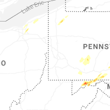


Connect with Interactive Hail Maps