

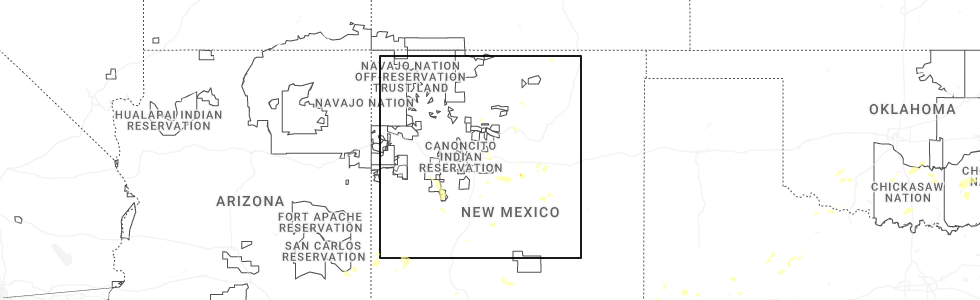
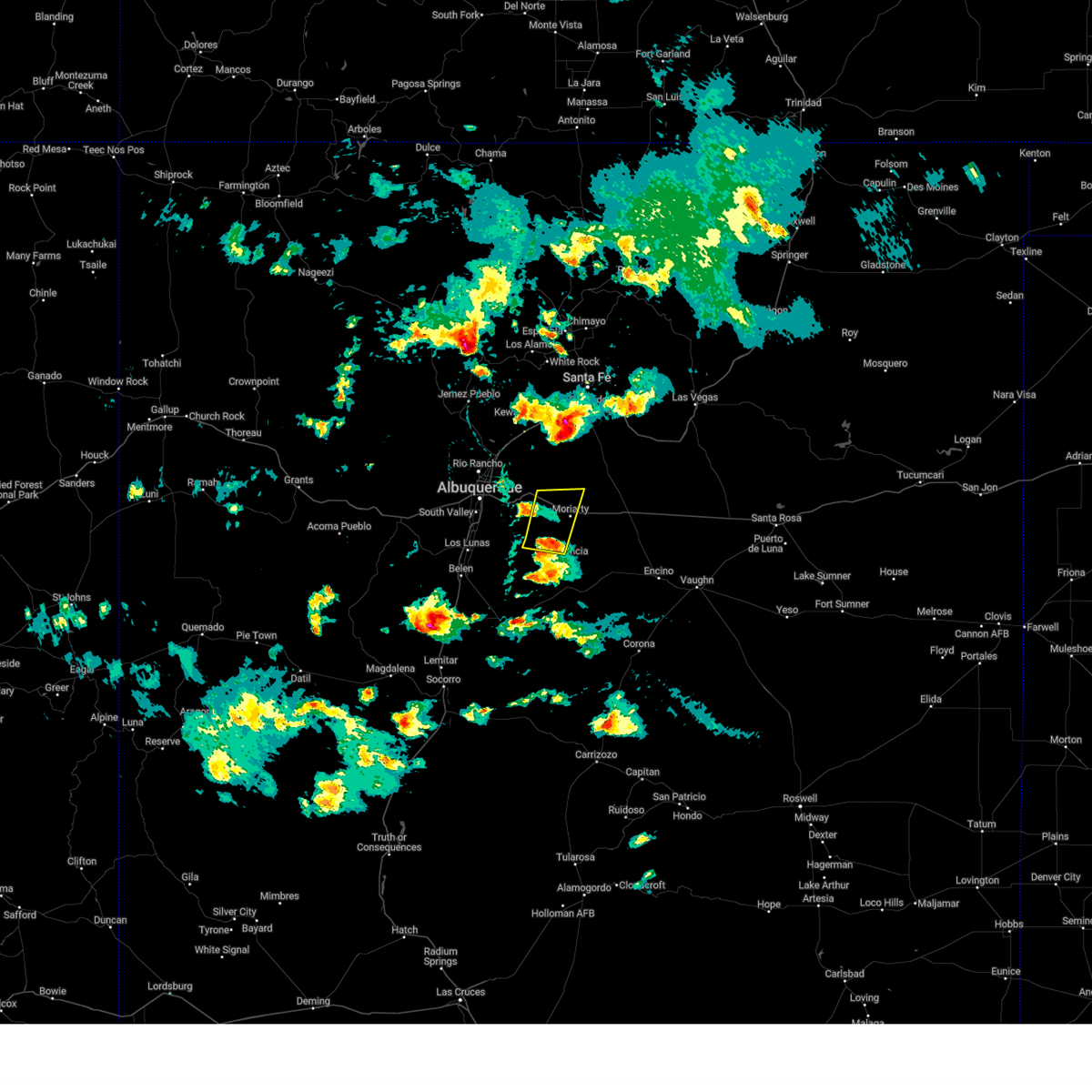
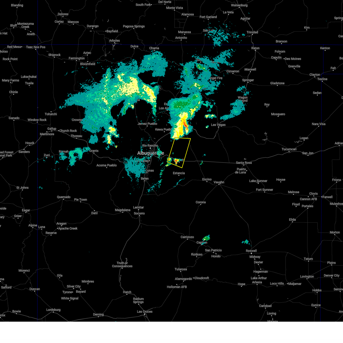
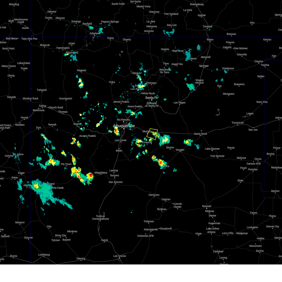
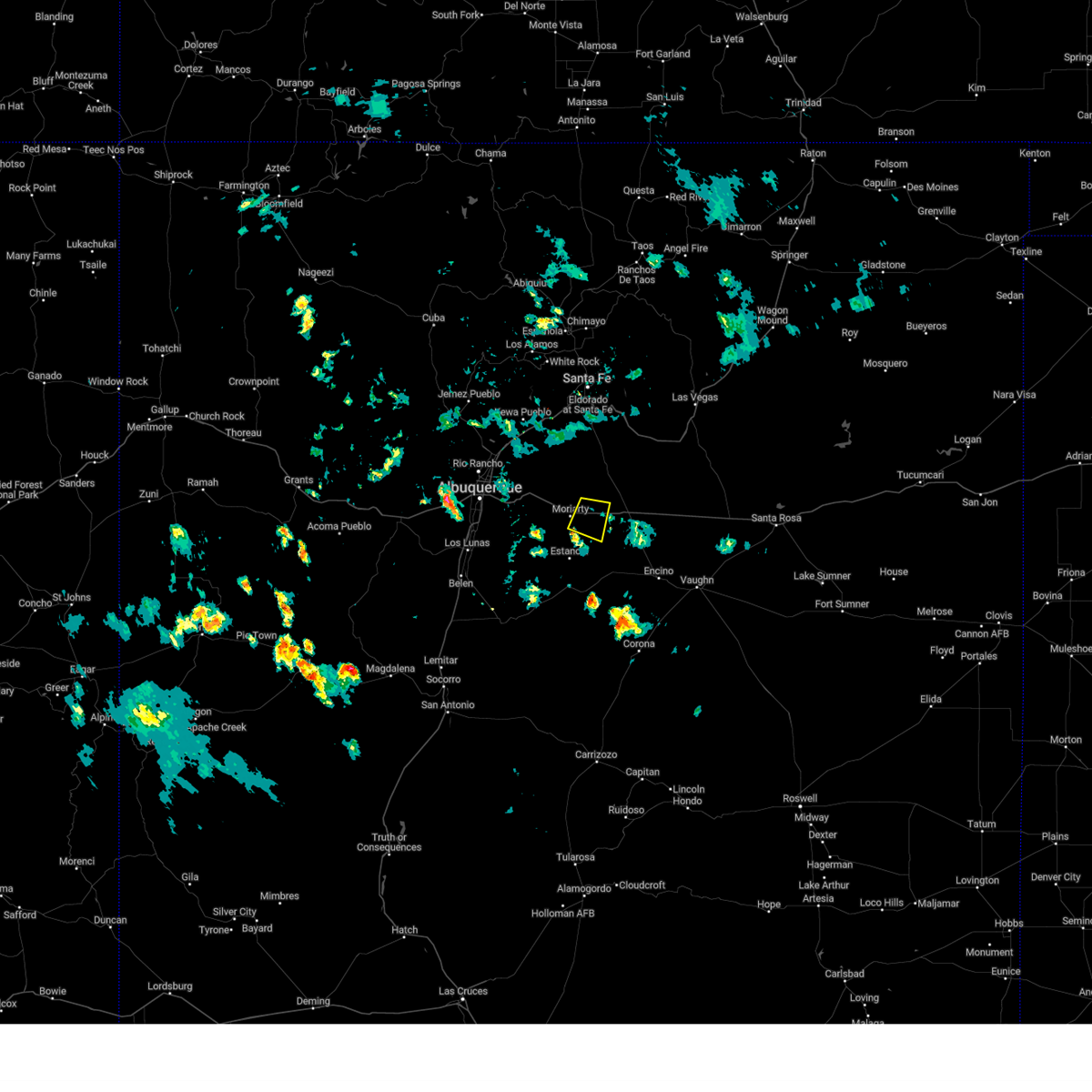
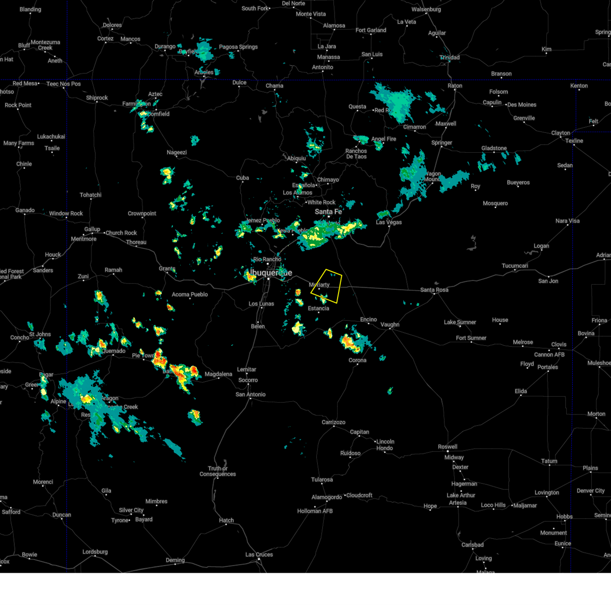
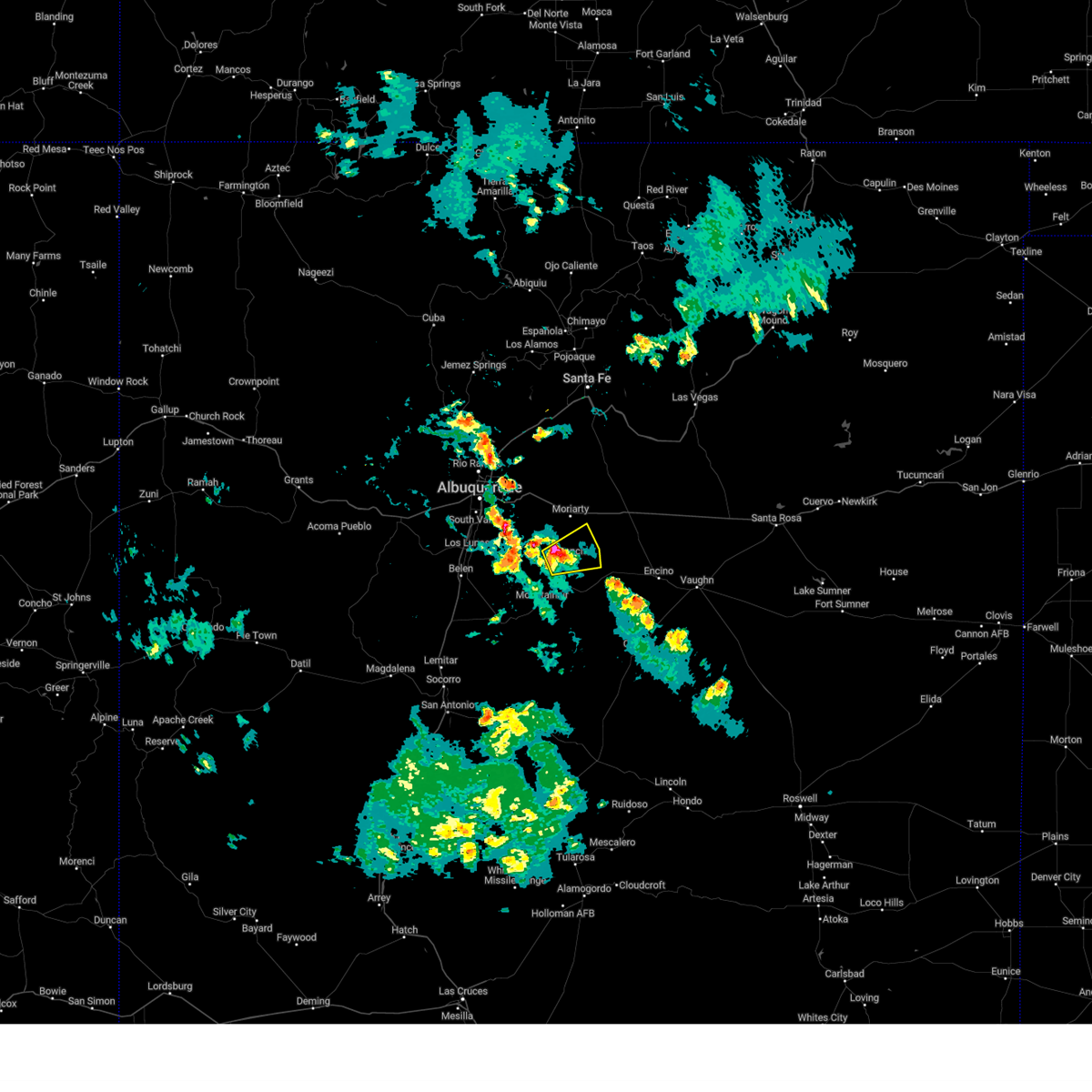
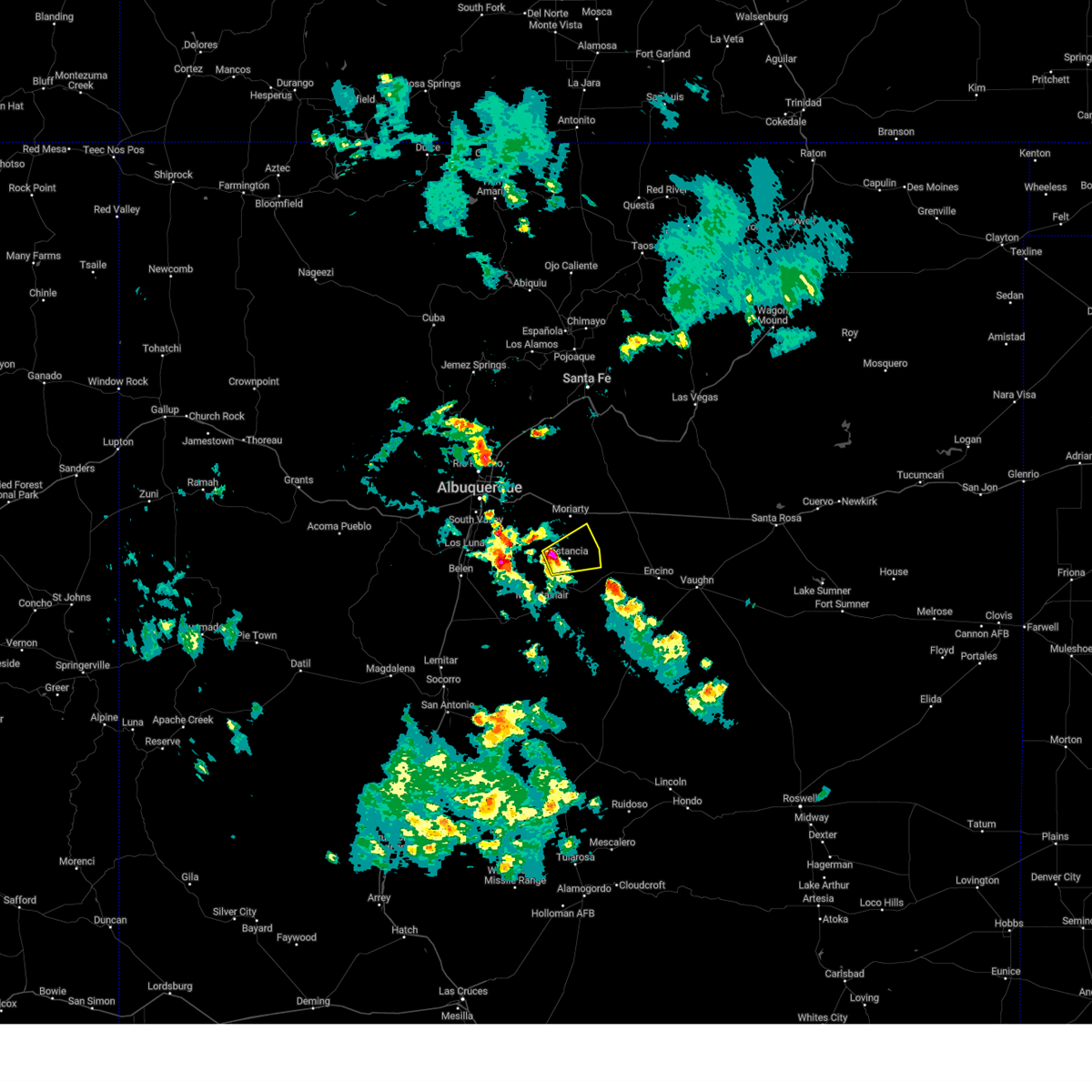
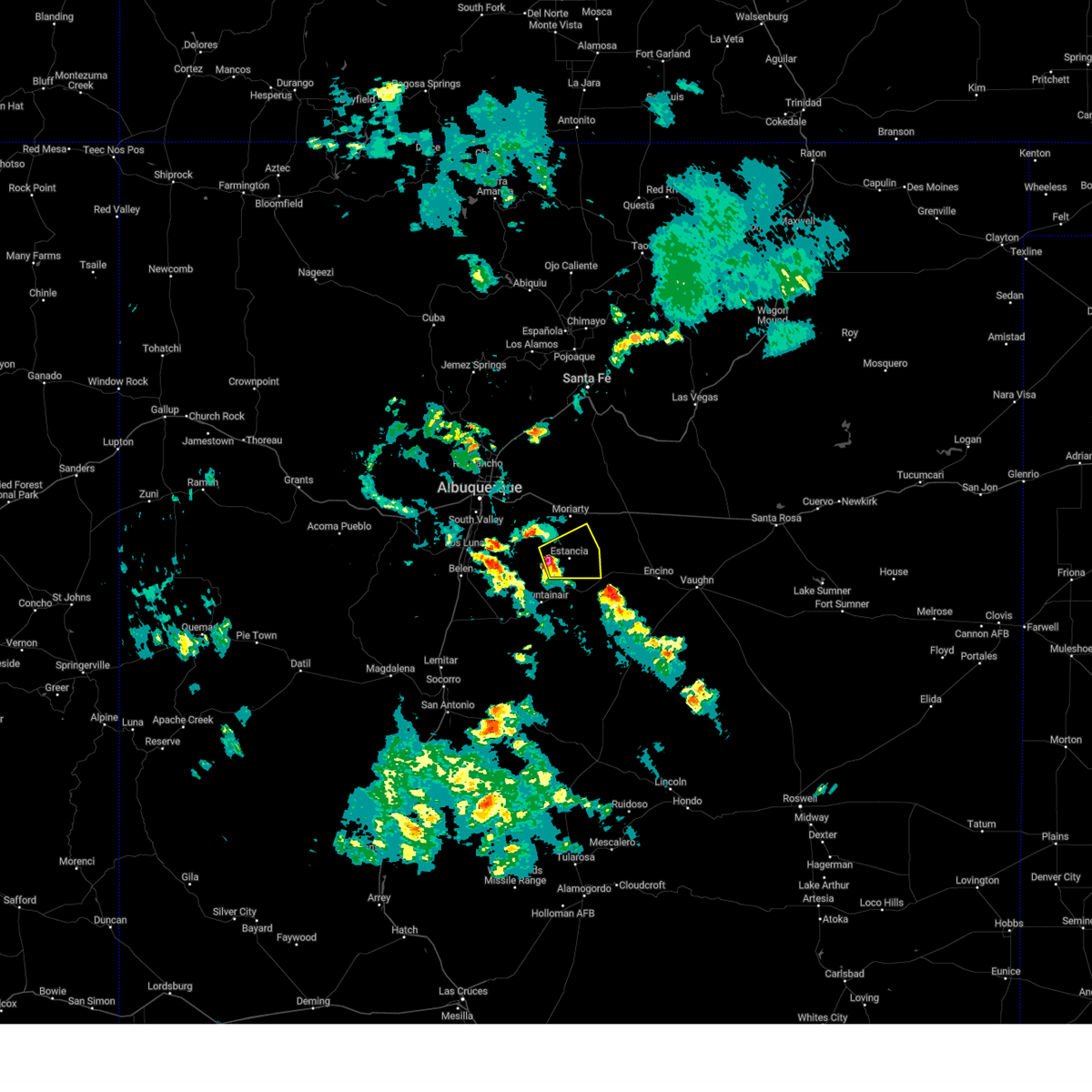
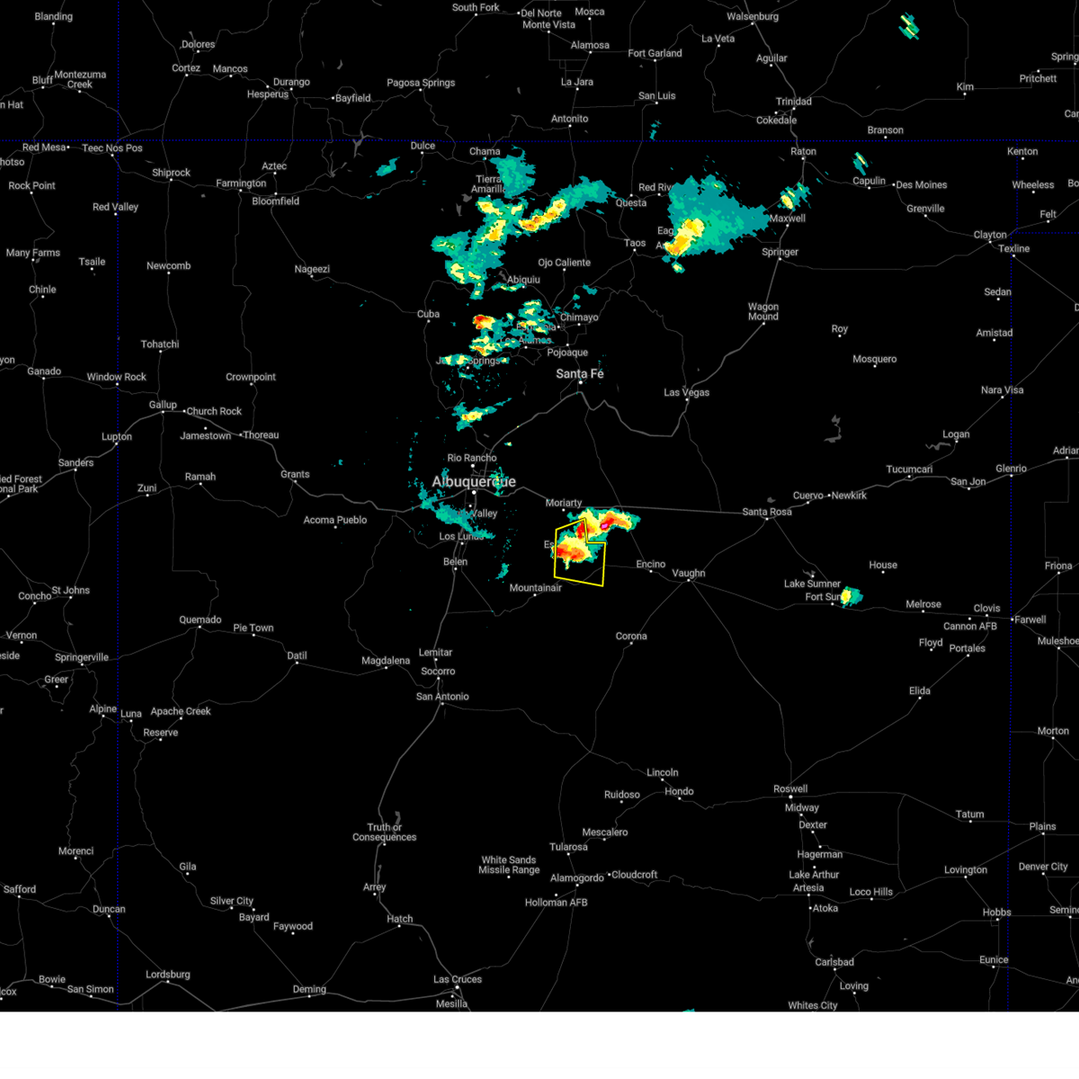
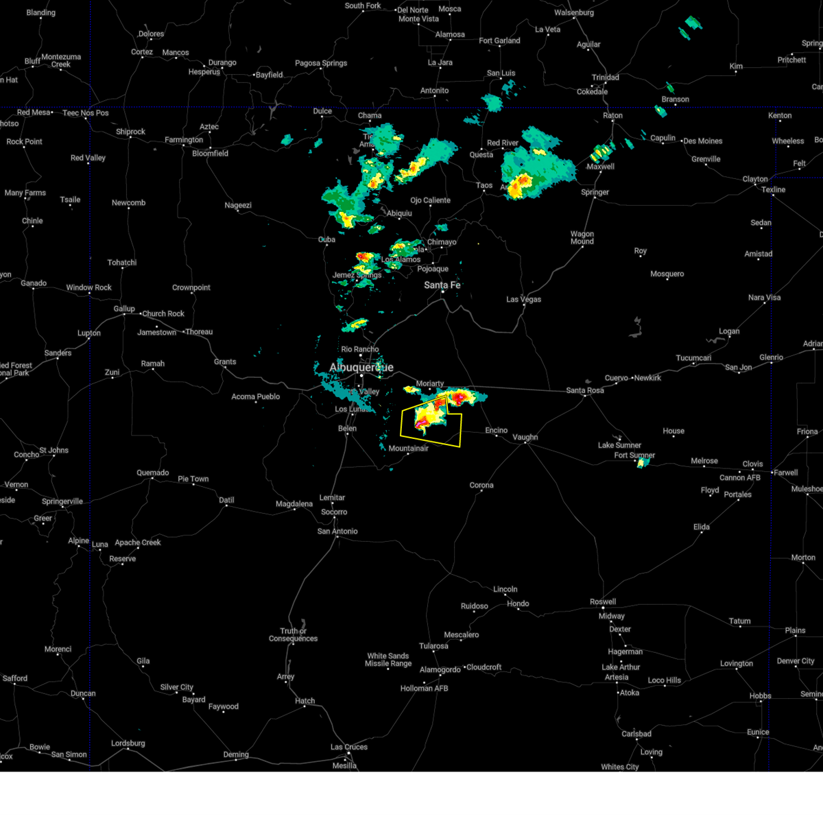
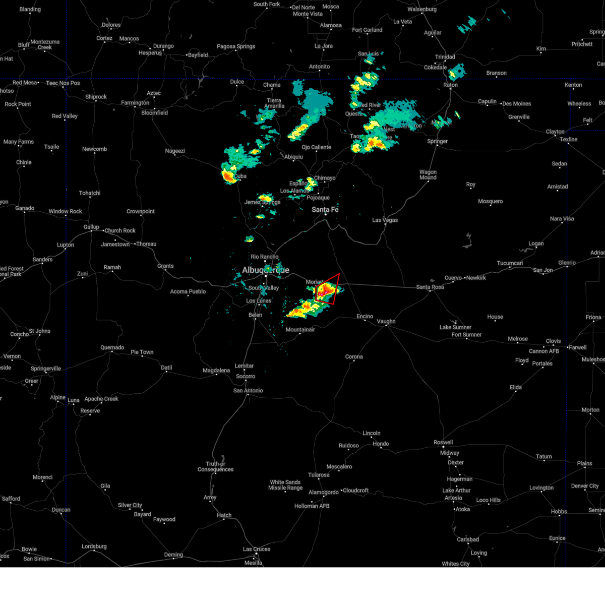
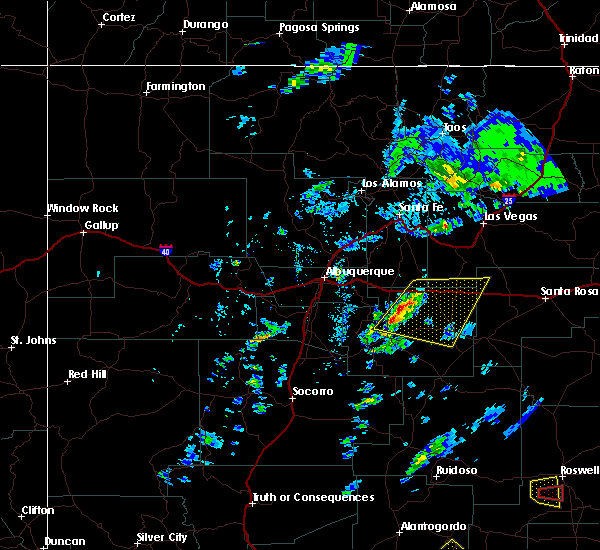
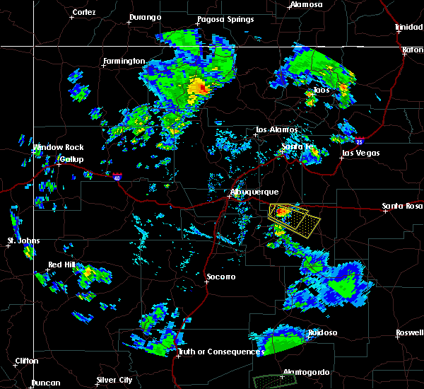
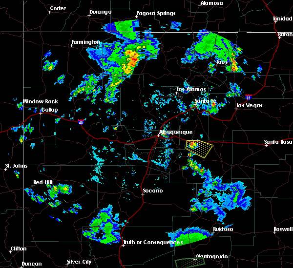
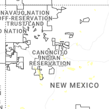
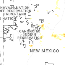
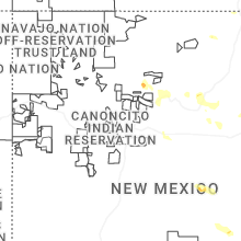
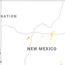
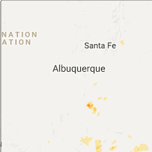
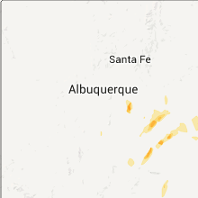
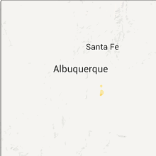
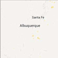
Hail Map for McIntosh, NM
The McIntosh, NM area has had 0 reports of on-the-ground hail by trained spotters, and has been under severe weather warnings 12 times during the past 12 months. Doppler radar has detected hail at or near McIntosh, NM on 44 occasions, including 4 occasions during the past year.
| Name: | McIntosh, NM |
| Where Located: | 36.2 miles ESE of Albuquerque, NM |
| Map: | Google Map for McIntosh, NM |
| Population: | 1484 |
| Housing Units: | 716 |
| More Info: | Search Google for McIntosh, NM |
0
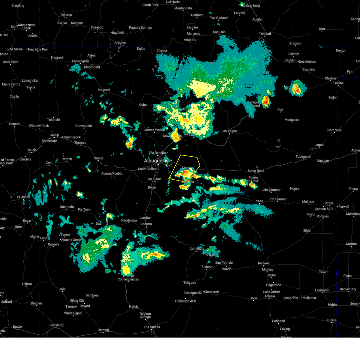
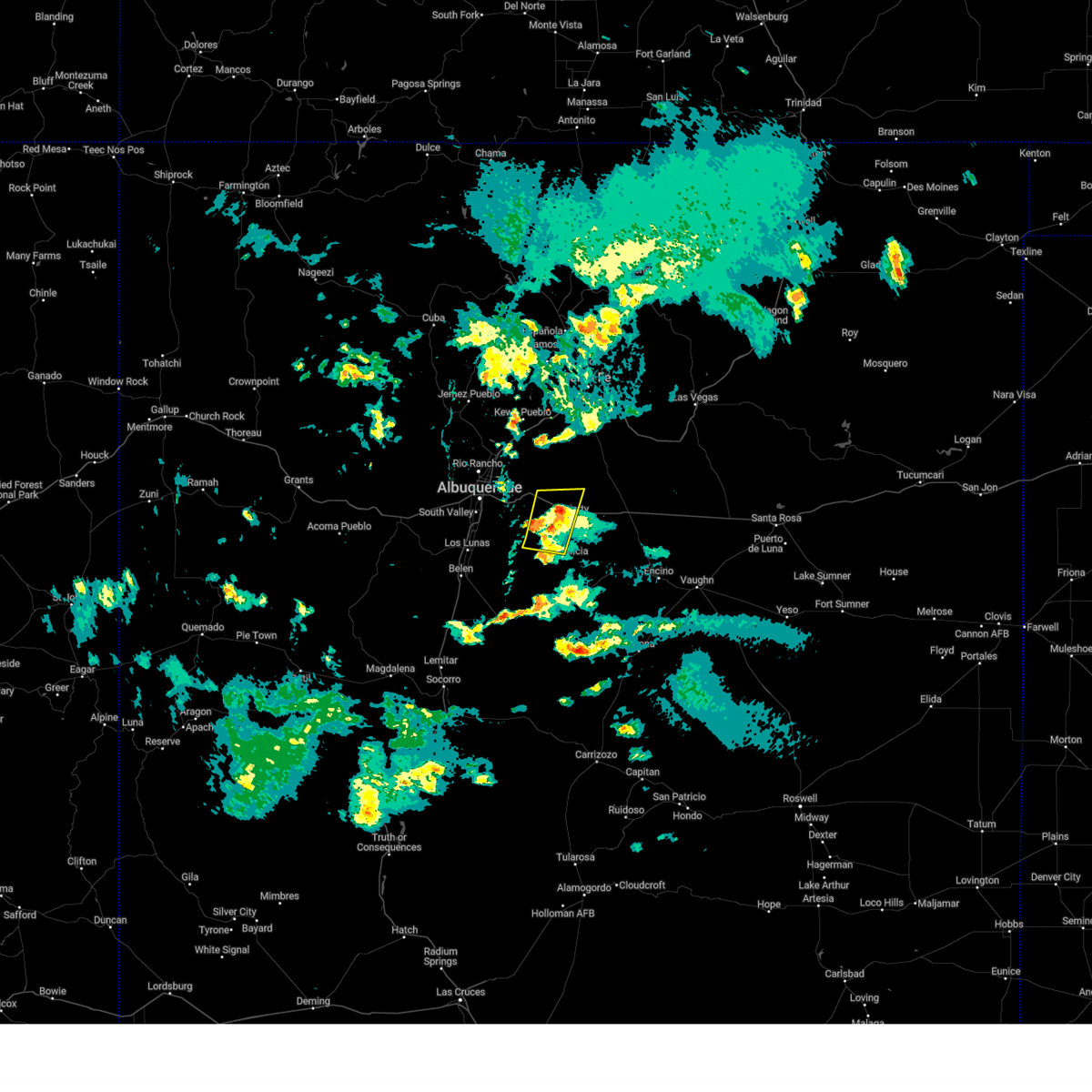
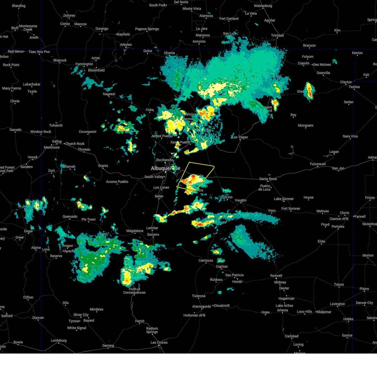
The Top Recent Hail Date for McIntosh, NM is Monday, June 30, 2025 (42nd out of 44)
Hail and Wind Damage Spotted near McIntosh, NM
| Date / Time | Report Details |
|---|---|
| 6/9/2025 4:48 PM MDT |
 At 448 pm mdt, a severe thunderstorm was located near stanley, or 7 miles north of moriarty, moving northeast at 20 mph (broadcast media reported). Hazards include 60 mph wind gusts and half dollar size hail. Hail damage to vehicles is expected. expect wind damage to roofs, siding, and trees. locations impacted include, moriarty, edgewood, cedar grove, mcintosh, chilili, stanley, escabosa, miera and ponderosa pines. This includes interstate 40 between mile markers 182 and 206. At 448 pm mdt, a severe thunderstorm was located near stanley, or 7 miles north of moriarty, moving northeast at 20 mph (broadcast media reported). Hazards include 60 mph wind gusts and half dollar size hail. Hail damage to vehicles is expected. expect wind damage to roofs, siding, and trees. locations impacted include, moriarty, edgewood, cedar grove, mcintosh, chilili, stanley, escabosa, miera and ponderosa pines. This includes interstate 40 between mile markers 182 and 206.
|
| 6/9/2025 4:29 PM MDT |
 The severe thunderstorm warning that was previously in effect has been reissued for bernalillo, santa fe, and torrance counties and is in effect until 500 pm mdt. please refer to that bulletin for the latest severe weather information. a severe thunderstorm watch remains in effect until 1000 pm mdt monday for portions of central and north central new mexico. The severe thunderstorm warning that was previously in effect has been reissued for bernalillo, santa fe, and torrance counties and is in effect until 500 pm mdt. please refer to that bulletin for the latest severe weather information. a severe thunderstorm watch remains in effect until 1000 pm mdt monday for portions of central and north central new mexico.
|
| 6/9/2025 4:29 PM MDT |
 Svrabq the national weather service in albuquerque has issued a * severe thunderstorm warning for, bernalillo county in central new mexico, northwestern torrance county in central new mexico, southern santa fe county in north central new mexico, * until 500 pm mdt. * at 429 pm mdt, a severe thunderstorm was located near moriarty, moving northeast at 25 mph (radar indicated). Hazards include ping pong ball size hail and 60 mph wind gusts. People and animals outdoors will be injured. expect hail damage to roofs, siding, windows, and vehicles. Expect wind damage to roofs, siding, and trees. Svrabq the national weather service in albuquerque has issued a * severe thunderstorm warning for, bernalillo county in central new mexico, northwestern torrance county in central new mexico, southern santa fe county in north central new mexico, * until 500 pm mdt. * at 429 pm mdt, a severe thunderstorm was located near moriarty, moving northeast at 25 mph (radar indicated). Hazards include ping pong ball size hail and 60 mph wind gusts. People and animals outdoors will be injured. expect hail damage to roofs, siding, windows, and vehicles. Expect wind damage to roofs, siding, and trees.
|
| 6/9/2025 3:56 PM MDT |
 At 356 pm mdt, a severe thunderstorm was located 6 miles south of edgewood, or 7 miles west of moriarty, moving northeast at 20 mph (radar indicated). Hazards include golf ball size hail and 60 mph wind gusts. People and animals outdoors will be injured. expect hail damage to roofs, siding, windows, and vehicles. expect wind damage to roofs, siding, and trees. locations impacted include, moriarty, edgewood, chilili, escabosa, miera and ponderosa pines. This includes interstate 40 between mile markers 182 and 198. At 356 pm mdt, a severe thunderstorm was located 6 miles south of edgewood, or 7 miles west of moriarty, moving northeast at 20 mph (radar indicated). Hazards include golf ball size hail and 60 mph wind gusts. People and animals outdoors will be injured. expect hail damage to roofs, siding, windows, and vehicles. expect wind damage to roofs, siding, and trees. locations impacted include, moriarty, edgewood, chilili, escabosa, miera and ponderosa pines. This includes interstate 40 between mile markers 182 and 198.
|
| 6/9/2025 3:41 PM MDT |
 Svrabq the national weather service in albuquerque has issued a * severe thunderstorm warning for, bernalillo county in central new mexico, northwestern torrance county in central new mexico, southwestern santa fe county in north central new mexico, * until 430 pm mdt. * at 341 pm mdt, a severe thunderstorm was located over chilili, or 13 miles southwest of moriarty, moving northeast at 20 mph (radar indicated). Hazards include 60 mph wind gusts and half dollar size hail. Hail damage to vehicles is expected. Expect wind damage to roofs, siding, and trees. Svrabq the national weather service in albuquerque has issued a * severe thunderstorm warning for, bernalillo county in central new mexico, northwestern torrance county in central new mexico, southwestern santa fe county in north central new mexico, * until 430 pm mdt. * at 341 pm mdt, a severe thunderstorm was located over chilili, or 13 miles southwest of moriarty, moving northeast at 20 mph (radar indicated). Hazards include 60 mph wind gusts and half dollar size hail. Hail damage to vehicles is expected. Expect wind damage to roofs, siding, and trees.
|
| 5/26/2025 3:16 PM MDT | the severe thunderstorm warning has been cancelled and is no longer in effect |
| 5/26/2025 3:16 PM MDT | At 316 pm mdt, a severe thunderstorm was located 5 miles southeast of moriarty, moving southeast at 15 mph (radar indicated). Hazards include 60 mph wind gusts and quarter size hail. Hail damage to vehicles is expected. expect wind damage to roofs, siding, and trees. locations impacted include, moriarty. This includes interstate 40 between mile markers 197 and 203. |
| 5/26/2025 3:03 PM MDT | Svrabq the national weather service in albuquerque has issued a * severe thunderstorm warning for, north central torrance county in central new mexico, south central santa fe county in north central new mexico, * until 345 pm mdt. * at 303 pm mdt, a severe thunderstorm was located over moriarty, moving southeast at 10 mph (radar indicated). Hazards include 60 mph wind gusts and quarter size hail. Hail damage to vehicles is expected. Expect wind damage to roofs, siding, and trees. |
| 5/4/2025 9:14 PM MDT |
 Svrabq the national weather service in albuquerque has issued a * severe thunderstorm warning for, bernalillo county in central new mexico, north central torrance county in central new mexico, southern santa fe county in north central new mexico, * until 1015 pm mdt. * at 914 pm mdt, a severe thunderstorm was located near cedar grove, or 12 miles northwest of moriarty, moving north at 15 mph (trained spotters reported quarter sized hail near edgewood). Hazards include half dollar size hail. damage to vehicles is expected Svrabq the national weather service in albuquerque has issued a * severe thunderstorm warning for, bernalillo county in central new mexico, north central torrance county in central new mexico, southern santa fe county in north central new mexico, * until 1015 pm mdt. * at 914 pm mdt, a severe thunderstorm was located near cedar grove, or 12 miles northwest of moriarty, moving north at 15 mph (trained spotters reported quarter sized hail near edgewood). Hazards include half dollar size hail. damage to vehicles is expected
|
| 7/19/2024 7:02 PM MDT |
 the severe thunderstorm warning has been cancelled and is no longer in effect the severe thunderstorm warning has been cancelled and is no longer in effect
|
| 7/19/2024 6:50 PM MDT |
 At 650 pm mdt, a severe thunderstorm was located near moriarty, moving south at 20 mph (radar indicated). Hazards include 60 mph wind gusts and penny size hail. Expect damage to roofs, siding, and trees. locations impacted include, moriarty. This includes interstate 40 between mile markers 198 and 210. At 650 pm mdt, a severe thunderstorm was located near moriarty, moving south at 20 mph (radar indicated). Hazards include 60 mph wind gusts and penny size hail. Expect damage to roofs, siding, and trees. locations impacted include, moriarty. This includes interstate 40 between mile markers 198 and 210.
|
| 7/19/2024 6:32 PM MDT |
 Svrabq the national weather service in albuquerque has issued a * severe thunderstorm warning for, south central santa fe county in north central new mexico, north central torrance county in central new mexico, * until 715 pm mdt. * at 631 pm mdt, a severe thunderstorm was located near stanley, or 9 miles northeast of moriarty, moving southwest at 20 mph (radar indicated). Hazards include 60 mph wind gusts and quarter size hail. Hail damage to vehicles is expected. Expect wind damage to roofs, siding, and trees. Svrabq the national weather service in albuquerque has issued a * severe thunderstorm warning for, south central santa fe county in north central new mexico, north central torrance county in central new mexico, * until 715 pm mdt. * at 631 pm mdt, a severe thunderstorm was located near stanley, or 9 miles northeast of moriarty, moving southwest at 20 mph (radar indicated). Hazards include 60 mph wind gusts and quarter size hail. Hail damage to vehicles is expected. Expect wind damage to roofs, siding, and trees.
|
| 6/19/2024 2:19 PM MDT |
 At 219 pm mdt, a severe thunderstorm was located over edgewood, or 8 miles west of moriarty, moving north at 30 mph (radar indicated). Hazards include 60 mph wind gusts and quarter size hail. Hail damage to vehicles is expected. expect wind damage to roofs, siding, and trees. Locations impacted include, moriarty, edgewood, sedillo, and cedar grove. At 219 pm mdt, a severe thunderstorm was located over edgewood, or 8 miles west of moriarty, moving north at 30 mph (radar indicated). Hazards include 60 mph wind gusts and quarter size hail. Hail damage to vehicles is expected. expect wind damage to roofs, siding, and trees. Locations impacted include, moriarty, edgewood, sedillo, and cedar grove.
|
| 6/19/2024 2:09 PM MDT |
 Svrabq the national weather service in albuquerque has issued a * severe thunderstorm warning for, southeastern sandoval county in north central new mexico, southwestern santa fe county in north central new mexico, bernalillo county in central new mexico, northwestern torrance county in central new mexico, * until 245 pm mdt. * at 208 pm mdt, a severe thunderstorm was located near chilili, or 9 miles southwest of moriarty, moving north at 25 mph (radar indicated). Hazards include 60 mph wind gusts and quarter size hail. Hail damage to vehicles is expected. Expect wind damage to roofs, siding, and trees. Svrabq the national weather service in albuquerque has issued a * severe thunderstorm warning for, southeastern sandoval county in north central new mexico, southwestern santa fe county in north central new mexico, bernalillo county in central new mexico, northwestern torrance county in central new mexico, * until 245 pm mdt. * at 208 pm mdt, a severe thunderstorm was located near chilili, or 9 miles southwest of moriarty, moving north at 25 mph (radar indicated). Hazards include 60 mph wind gusts and quarter size hail. Hail damage to vehicles is expected. Expect wind damage to roofs, siding, and trees.
|
| 6/5/2023 5:58 PM MDT |
 The severe thunderstorm warning for northwestern torrance county will expire at 600 pm mdt, the storm which prompted the warning has weakened below severe limits, and no longer poses an immediate threat to life or property. therefore, the warning will be allowed to expire. however small hail, gusty winds and heavy rain are still possible with this thunderstorm. The severe thunderstorm warning for northwestern torrance county will expire at 600 pm mdt, the storm which prompted the warning has weakened below severe limits, and no longer poses an immediate threat to life or property. therefore, the warning will be allowed to expire. however small hail, gusty winds and heavy rain are still possible with this thunderstorm.
|
| 6/5/2023 5:49 PM MDT |
 At 549 pm mdt, a severe thunderstorm was located near estancia, moving northeast at 15 mph (radar indicated). Hazards include 60 mph wind gusts and half dollar size hail. Hail damage to vehicles is expected. expect wind damage to roofs, siding, and trees. locations impacted include, estancia and mcintosh. hail threat, radar indicated max hail size, 1. 25 in wind threat, radar indicated max wind gust, 60 mph. At 549 pm mdt, a severe thunderstorm was located near estancia, moving northeast at 15 mph (radar indicated). Hazards include 60 mph wind gusts and half dollar size hail. Hail damage to vehicles is expected. expect wind damage to roofs, siding, and trees. locations impacted include, estancia and mcintosh. hail threat, radar indicated max hail size, 1. 25 in wind threat, radar indicated max wind gust, 60 mph.
|
| 6/5/2023 5:37 PM MDT |
 At 536 pm mdt, a severe thunderstorm was located near estancia, moving east at 15 mph (radar indicated). Hazards include 60 mph wind gusts and quarter size hail. Hail damage to vehicles is expected. Expect wind damage to roofs, siding, and trees. At 536 pm mdt, a severe thunderstorm was located near estancia, moving east at 15 mph (radar indicated). Hazards include 60 mph wind gusts and quarter size hail. Hail damage to vehicles is expected. Expect wind damage to roofs, siding, and trees.
|
| 5/31/2023 5:27 PM MDT |
 The severe thunderstorm warning for south central santa fe, bernalillo and northwestern torrance counties will expire at 530 pm mdt, the storm that prompted the warning has weakened below severe limits, and no longer poses an immediate threat to life or property. therefore, the warning will be allowed to expire. however small hail is still possible with this thunderstorm. a severe thunderstorm watch remains in effect until 900 pm mdt for central new mexico. The severe thunderstorm warning for south central santa fe, bernalillo and northwestern torrance counties will expire at 530 pm mdt, the storm that prompted the warning has weakened below severe limits, and no longer poses an immediate threat to life or property. therefore, the warning will be allowed to expire. however small hail is still possible with this thunderstorm. a severe thunderstorm watch remains in effect until 900 pm mdt for central new mexico.
|
| 5/31/2023 5:01 PM MDT |
 At 500 pm mdt, a severe thunderstorm was located near chilili, or 8 miles southwest of moriarty, moving northeast at 15 mph (radar indicated). Hazards include 60 mph wind gusts and quarter size hail. Hail damage to vehicles is expected. expect wind damage to roofs, siding, and trees. locations impacted include, edgewood, moriarty and chilili. this includes interstate 40 between mile markers 189 and 209. hail threat, radar indicated max hail size, 1. 00 in wind threat, radar indicated max wind gust, 60 mph. At 500 pm mdt, a severe thunderstorm was located near chilili, or 8 miles southwest of moriarty, moving northeast at 15 mph (radar indicated). Hazards include 60 mph wind gusts and quarter size hail. Hail damage to vehicles is expected. expect wind damage to roofs, siding, and trees. locations impacted include, edgewood, moriarty and chilili. this includes interstate 40 between mile markers 189 and 209. hail threat, radar indicated max hail size, 1. 00 in wind threat, radar indicated max wind gust, 60 mph.
|
| 5/31/2023 4:45 PM MDT |
 At 444 pm mdt, a severe thunderstorm was located near moriarty, moving northeast at 10 mph (radar indicated). Hazards include 60 mph wind gusts and quarter size hail. Hail damage to vehicles is expected. Expect wind damage to roofs, siding, and trees. At 444 pm mdt, a severe thunderstorm was located near moriarty, moving northeast at 10 mph (radar indicated). Hazards include 60 mph wind gusts and quarter size hail. Hail damage to vehicles is expected. Expect wind damage to roofs, siding, and trees.
|
| 5/31/2023 4:36 PM MDT |
 At 436 pm mdt, a severe thunderstorm was located near moriarty, moving northeast at 15 mph (trained weather spotters). Hazards include 60 mph wind gusts and quarter size hail. Hail damage to vehicles is expected. expect wind damage to roofs, siding, and trees. locations impacted include, edgewood, moriarty, mcintosh, escabosa, chilili, ponderosa pines, miera, stanley, tajique and cedar grove. this includes interstate 40 between mile markers 185 and 209. hail threat, radar indicated max hail size, 1. 00 in wind threat, radar indicated max wind gust, 60 mph. At 436 pm mdt, a severe thunderstorm was located near moriarty, moving northeast at 15 mph (trained weather spotters). Hazards include 60 mph wind gusts and quarter size hail. Hail damage to vehicles is expected. expect wind damage to roofs, siding, and trees. locations impacted include, edgewood, moriarty, mcintosh, escabosa, chilili, ponderosa pines, miera, stanley, tajique and cedar grove. this includes interstate 40 between mile markers 185 and 209. hail threat, radar indicated max hail size, 1. 00 in wind threat, radar indicated max wind gust, 60 mph.
|
| 5/26/2023 3:41 PM MDT |
 At 340 pm mdt, a severe thunderstorm was located over estancia, moving east at 25 mph (radar indicated). Hazards include 60 mph wind gusts and quarter size hail. Hail damage to vehicles is expected. expect wind damage to roofs, siding, and trees. locations impacted include, estancia and mcintosh. this includes highway 60 between mile markers 226 and 234. hail threat, radar indicated max hail size, 1. 00 in wind threat, radar indicated max wind gust, 60 mph. At 340 pm mdt, a severe thunderstorm was located over estancia, moving east at 25 mph (radar indicated). Hazards include 60 mph wind gusts and quarter size hail. Hail damage to vehicles is expected. expect wind damage to roofs, siding, and trees. locations impacted include, estancia and mcintosh. this includes highway 60 between mile markers 226 and 234. hail threat, radar indicated max hail size, 1. 00 in wind threat, radar indicated max wind gust, 60 mph.
|
| 5/26/2023 3:25 PM MDT |
 At 324 pm mdt, a severe thunderstorm was located 7 miles southwest of estancia, moving east at 20 mph (radar indicated). Hazards include 70 mph wind gusts and ping pong ball size hail. People and animals outdoors will be injured. expect hail damage to roofs, siding, windows, and vehicles. expect considerable tree damage. Wind damage is also likely to mobile homes, roofs, and outbuildings. At 324 pm mdt, a severe thunderstorm was located 7 miles southwest of estancia, moving east at 20 mph (radar indicated). Hazards include 70 mph wind gusts and ping pong ball size hail. People and animals outdoors will be injured. expect hail damage to roofs, siding, windows, and vehicles. expect considerable tree damage. Wind damage is also likely to mobile homes, roofs, and outbuildings.
|
| 5/26/2023 2:44 PM MDT |
 At 242 pm mdt, a severe thunderstorm capable of producing a tornado was located near mcintosh, or 8 miles southeast of moriarty, moving east at 15 mph (radar indicated rotation). Hazards include tornado and two inch hail. Flying debris will be dangerous to those caught without shelter. mobile homes will be damaged or destroyed. damage to roofs, windows, and vehicles will occur. tree damage is likely. locations impacted include, areas southeast of moriarty including clements road and ansley ranch road. Large hail will impact interstate 40 between mile markers 199 and 210. At 242 pm mdt, a severe thunderstorm capable of producing a tornado was located near mcintosh, or 8 miles southeast of moriarty, moving east at 15 mph (radar indicated rotation). Hazards include tornado and two inch hail. Flying debris will be dangerous to those caught without shelter. mobile homes will be damaged or destroyed. damage to roofs, windows, and vehicles will occur. tree damage is likely. locations impacted include, areas southeast of moriarty including clements road and ansley ranch road. Large hail will impact interstate 40 between mile markers 199 and 210.
|
| 5/26/2023 2:25 PM MDT |
 At 225 pm mdt, a severe thunderstorm capable of producing a tornado was located near mcintosh, or near moriarty, moving east at 15 mph (radar indicated rotation). Hazards include tornado and hail up to two inches in diameter. Flying debris will be dangerous to those caught without shelter. mobile homes will be damaged or destroyed. damage to roofs, windows, and vehicles will occur. tree damage is likely. this tornadic thunderstorm will remain over mainly rural areas of south central santa fe and north central torrance counties. This includes interstate 40 between mile markers 195 and 210. At 225 pm mdt, a severe thunderstorm capable of producing a tornado was located near mcintosh, or near moriarty, moving east at 15 mph (radar indicated rotation). Hazards include tornado and hail up to two inches in diameter. Flying debris will be dangerous to those caught without shelter. mobile homes will be damaged or destroyed. damage to roofs, windows, and vehicles will occur. tree damage is likely. this tornadic thunderstorm will remain over mainly rural areas of south central santa fe and north central torrance counties. This includes interstate 40 between mile markers 195 and 210.
|
| 5/26/2023 2:10 PM MDT |
 At 209 pm mdt, severe thunderstorms were located along a line extending from near moriarty to near mcintosh, moving east at 15 mph (radar indicated). Hazards include two inch hail and 70 mph wind gusts. People and animals outdoors will be injured. expect hail damage to roofs, siding, windows, and vehicles. expect considerable tree damage. wind damage is also likely to mobile homes, roofs, and outbuildings. locations impacted include, moriarty, chilili and mcintosh. This includes interstate 40 between mile markers 192 and 211. At 209 pm mdt, severe thunderstorms were located along a line extending from near moriarty to near mcintosh, moving east at 15 mph (radar indicated). Hazards include two inch hail and 70 mph wind gusts. People and animals outdoors will be injured. expect hail damage to roofs, siding, windows, and vehicles. expect considerable tree damage. wind damage is also likely to mobile homes, roofs, and outbuildings. locations impacted include, moriarty, chilili and mcintosh. This includes interstate 40 between mile markers 192 and 211.
|
| 5/26/2023 2:02 PM MDT |
 At 202 pm mdt, severe thunderstorms were located along a line extending from near moriarty to near chilili, moving northeast at 10 mph (radar indicated). Hazards include two inch hail and 70 mph wind gusts. People and animals outdoors will be injured. expect hail damage to roofs, siding, windows, and vehicles. expect considerable tree damage. Wind damage is also likely to mobile homes, roofs, and outbuildings. At 202 pm mdt, severe thunderstorms were located along a line extending from near moriarty to near chilili, moving northeast at 10 mph (radar indicated). Hazards include two inch hail and 70 mph wind gusts. People and animals outdoors will be injured. expect hail damage to roofs, siding, windows, and vehicles. expect considerable tree damage. Wind damage is also likely to mobile homes, roofs, and outbuildings.
|
| 9/4/2021 9:10 PM MDT |
 The severe thunderstorm warning for north central torrance county will expire at 915 pm mdt, the storm which prompted the warning has weakened below severe limits, and no longer poses an immediate threat to life or property. therefore, the warning will be allowed to expire. however heavy rain is still possible with this thunderstorm. The severe thunderstorm warning for north central torrance county will expire at 915 pm mdt, the storm which prompted the warning has weakened below severe limits, and no longer poses an immediate threat to life or property. therefore, the warning will be allowed to expire. however heavy rain is still possible with this thunderstorm.
|
| 9/4/2021 8:47 PM MDT |
 At 846 pm mdt, a severe thunderstorm was located over moriarty, moving southeast at 10 mph (radar indicated). Hazards include 60 mph wind gusts and quarter size hail. Hail damage to vehicles is expected. expect wind damage to roofs, siding, and trees. locations impacted include, moriarty. this includes interstate 40 between mile markers 193 and 202. hail threat, radar indicated max hail size, 1. 00 in wind threat, radar indicated max wind gust, 60 mph. At 846 pm mdt, a severe thunderstorm was located over moriarty, moving southeast at 10 mph (radar indicated). Hazards include 60 mph wind gusts and quarter size hail. Hail damage to vehicles is expected. expect wind damage to roofs, siding, and trees. locations impacted include, moriarty. this includes interstate 40 between mile markers 193 and 202. hail threat, radar indicated max hail size, 1. 00 in wind threat, radar indicated max wind gust, 60 mph.
|
| 9/4/2021 8:27 PM MDT |
 At 826 pm mdt, a severe thunderstorm was located over moriarty, moving southeast at 10 mph (radar indicated). Hazards include 60 mph wind gusts and quarter size hail. Hail damage to vehicles is expected. Expect wind damage to roofs, siding, and trees. At 826 pm mdt, a severe thunderstorm was located over moriarty, moving southeast at 10 mph (radar indicated). Hazards include 60 mph wind gusts and quarter size hail. Hail damage to vehicles is expected. Expect wind damage to roofs, siding, and trees.
|
| 8/15/2021 7:22 PM MDT |
 At 720 pm mdt, an outflow boundary racing southward from strong thunderstorms were located along a line extending from about 6 miles north of sandia park to near sandia pueblo to rio rancho to 10 miles west of northern meadows, moving south to souteast at 40 mph (radar indicated). Hazards include 60 mph wind gusts. expect damage to roofs, siding, and trees At 720 pm mdt, an outflow boundary racing southward from strong thunderstorms were located along a line extending from about 6 miles north of sandia park to near sandia pueblo to rio rancho to 10 miles west of northern meadows, moving south to souteast at 40 mph (radar indicated). Hazards include 60 mph wind gusts. expect damage to roofs, siding, and trees
|
| 7/12/2021 7:51 PM MDT |
 At 750 pm mdt, severe thunderstorms were located along a line extending from near cedar grove to 9 miles southeast of moriarty, moving southwest at 20 mph (radar indicated). Hazards include 60 mph wind gusts and quarter size hail. Hail damage to vehicles is expected. expect wind damage to roofs, siding, and trees. locations impacted include, edgewood, moriarty, tijeras, cedar crest, cedar grove, sedillo, chilili, mcintosh, escabosa and cedro. this includes interstate 40 between mile markers 172 and 205. Significant blowing dust has been observed with this storm. At 750 pm mdt, severe thunderstorms were located along a line extending from near cedar grove to 9 miles southeast of moriarty, moving southwest at 20 mph (radar indicated). Hazards include 60 mph wind gusts and quarter size hail. Hail damage to vehicles is expected. expect wind damage to roofs, siding, and trees. locations impacted include, edgewood, moriarty, tijeras, cedar crest, cedar grove, sedillo, chilili, mcintosh, escabosa and cedro. this includes interstate 40 between mile markers 172 and 205. Significant blowing dust has been observed with this storm.
|
| 7/12/2021 7:22 PM MDT |
 At 720 pm mdt, severe thunderstorms were located along a line extending from near stanley to 9 miles west of clines corners, moving southwest at 25 mph (radar and trained weather spotters). Hazards include 60 mph wind gusts and half dollar size hail. Hail damage to vehicles is expected. expect wind damage to roofs, siding, and trees. locations impacted include, edgewood, moriarty, estancia, tijeras, cedar crest, cedar grove, sedillo, chilili, mcintosh and stanley. a storm spotter in stanley observed quarter size hail with these storms at 717 pm mdt. This includes interstate 40 between mile markers 172 and 215. At 720 pm mdt, severe thunderstorms were located along a line extending from near stanley to 9 miles west of clines corners, moving southwest at 25 mph (radar and trained weather spotters). Hazards include 60 mph wind gusts and half dollar size hail. Hail damage to vehicles is expected. expect wind damage to roofs, siding, and trees. locations impacted include, edgewood, moriarty, estancia, tijeras, cedar crest, cedar grove, sedillo, chilili, mcintosh and stanley. a storm spotter in stanley observed quarter size hail with these storms at 717 pm mdt. This includes interstate 40 between mile markers 172 and 215.
|
| 7/12/2021 7:12 PM MDT |
 At 711 pm mdt, severe thunderstorms were located along a line extending from near stanley to 7 miles west of clines corners, moving southwest at 25 mph (radar indicated). Hazards include 60 mph wind gusts and quarter size hail. Hail damage to vehicles is expected. Expect wind damage to roofs, siding, and trees. At 711 pm mdt, severe thunderstorms were located along a line extending from near stanley to 7 miles west of clines corners, moving southwest at 25 mph (radar indicated). Hazards include 60 mph wind gusts and quarter size hail. Hail damage to vehicles is expected. Expect wind damage to roofs, siding, and trees.
|
| 7/31/2020 6:20 PM MDT |
 At 619 pm mdt, a severe thunderstorm was located over northeastern albuquerque, moving south at 35 mph (radar indicated). Hazards include 70 mph wind gusts. Expect considerable tree damage. damage is likely to mobile homes, roofs, and outbuildings. locations impacted include, albuquerque, rio rancho, valencia, los lunas, corrales, bernalillo, los ranchos de albuquerque, bosque farms, edgewood and peralta. this includes the following highways, interstate 40 between mile markers 143 and 193. interstate 25 between mile markers 201 and 253. Highway 550 between mile markers 1 and 10. At 619 pm mdt, a severe thunderstorm was located over northeastern albuquerque, moving south at 35 mph (radar indicated). Hazards include 70 mph wind gusts. Expect considerable tree damage. damage is likely to mobile homes, roofs, and outbuildings. locations impacted include, albuquerque, rio rancho, valencia, los lunas, corrales, bernalillo, los ranchos de albuquerque, bosque farms, edgewood and peralta. this includes the following highways, interstate 40 between mile markers 143 and 193. interstate 25 between mile markers 201 and 253. Highway 550 between mile markers 1 and 10.
|
| 7/31/2020 5:57 PM MDT |
 At 556 pm mdt, a severe thunderstorm was located over bernalillo, moving south at 40 mph (radar indicated). Hazards include 70 mph wind gusts. Expect considerable tree damage. Damage is likely to mobile homes, roofs, and outbuildings. At 556 pm mdt, a severe thunderstorm was located over bernalillo, moving south at 40 mph (radar indicated). Hazards include 70 mph wind gusts. Expect considerable tree damage. Damage is likely to mobile homes, roofs, and outbuildings.
|
| 6/3/2019 5:08 PM MDT |
 At 507 pm mdt, severe thunderstorms were located along a line extending from 10 miles northwest of clines corners to near estancia, moving northeast at 30 mph (radar indicated). Hazards include 60 mph wind gusts and quarter size hail. Hail damage to vehicles is expected. Expect wind damage to roofs, siding, and trees. At 507 pm mdt, severe thunderstorms were located along a line extending from 10 miles northwest of clines corners to near estancia, moving northeast at 30 mph (radar indicated). Hazards include 60 mph wind gusts and quarter size hail. Hail damage to vehicles is expected. Expect wind damage to roofs, siding, and trees.
|
| 6/2/2019 4:47 PM MDT |
 At 447 pm mdt, severe thunderstorms were located along a line extending from near edgewood to near tajique, moving east at 25 mph (radar indicated). Hazards include 60 mph wind gusts and penny size hail. Expect damage to roofs, siding, and trees. Locations impacted include, torreon, tajique, chilili, escabosa, ponderosa pines and miera. At 447 pm mdt, severe thunderstorms were located along a line extending from near edgewood to near tajique, moving east at 25 mph (radar indicated). Hazards include 60 mph wind gusts and penny size hail. Expect damage to roofs, siding, and trees. Locations impacted include, torreon, tajique, chilili, escabosa, ponderosa pines and miera.
|
| 6/2/2019 4:30 PM MDT |
 At 430 pm mdt, a severe thunderstorm was located near escabosa, or 19 miles west of estancia, moving east at 30 mph (radar indicated). Hazards include ping pong ball size hail and 60 mph wind gusts. People and animals outdoors will be injured. expect hail damage to roofs, siding, windows, and vehicles. Expect wind damage to roofs, siding, and trees. At 430 pm mdt, a severe thunderstorm was located near escabosa, or 19 miles west of estancia, moving east at 30 mph (radar indicated). Hazards include ping pong ball size hail and 60 mph wind gusts. People and animals outdoors will be injured. expect hail damage to roofs, siding, windows, and vehicles. Expect wind damage to roofs, siding, and trees.
|
| 5/26/2019 4:00 PM MDT | Large barn destroyed by outflow winds in torrance county NM, 0.9 miles NW of McIntosh, NM |
| 8/1/2018 7:08 PM MDT |
 At 708 pm mdt, a severe thunderstorm was located 8 miles southeast of moriarty, moving southeast at 10 mph (radar indicated). Hazards include 60 mph wind gusts and half dollar size hail. Hail damage to vehicles is expected. expect wind damage to roofs, siding, and trees. this severe thunderstorm will remain over mainly rural areas of north central torrance county. This includes interstate 40 between mile markers 201 and 209. At 708 pm mdt, a severe thunderstorm was located 8 miles southeast of moriarty, moving southeast at 10 mph (radar indicated). Hazards include 60 mph wind gusts and half dollar size hail. Hail damage to vehicles is expected. expect wind damage to roofs, siding, and trees. this severe thunderstorm will remain over mainly rural areas of north central torrance county. This includes interstate 40 between mile markers 201 and 209.
|
| 6/3/2018 4:24 PM MDT |
 At 353 pm mdt, a severe thunderstorm was located near tajique, or 18 miles west of estancia, moving east at 30 mph (radar indicated). Hazards include ping pong ball size hail and 60 mph wind gusts. People and animals outdoors will be injured. expect hail damage to roofs, siding, windows, and vehicles. Expect wind damage to roofs, siding, and trees. At 353 pm mdt, a severe thunderstorm was located near tajique, or 18 miles west of estancia, moving east at 30 mph (radar indicated). Hazards include ping pong ball size hail and 60 mph wind gusts. People and animals outdoors will be injured. expect hail damage to roofs, siding, windows, and vehicles. Expect wind damage to roofs, siding, and trees.
|
| 6/3/2018 3:53 PM MDT |
 At 353 pm mdt, a severe thunderstorm was located near tajique, or 18 miles west of estancia, moving east at 30 mph (radar indicated). Hazards include ping pong ball size hail and 60 mph wind gusts. People and animals outdoors will be injured. expect hail damage to roofs, siding, windows, and vehicles. Expect wind damage to roofs, siding, and trees. At 353 pm mdt, a severe thunderstorm was located near tajique, or 18 miles west of estancia, moving east at 30 mph (radar indicated). Hazards include ping pong ball size hail and 60 mph wind gusts. People and animals outdoors will be injured. expect hail damage to roofs, siding, windows, and vehicles. Expect wind damage to roofs, siding, and trees.
|
| 5/21/2018 3:29 PM MDT |
 At 329 pm mdt, severe thunderstorms were located along a line extending from near cedar grove to near mcintosh, moving north at 20 mph (radar indicated). Hazards include 60 mph wind gusts and half dollar size hail. Hail damage to vehicles is expected. Expect wind damage to roofs, siding, and trees. At 329 pm mdt, severe thunderstorms were located along a line extending from near cedar grove to near mcintosh, moving north at 20 mph (radar indicated). Hazards include 60 mph wind gusts and half dollar size hail. Hail damage to vehicles is expected. Expect wind damage to roofs, siding, and trees.
|
| 6/25/2017 5:20 PM MDT |
 The severe thunderstorm warning for north central torrance county will expire at 530 pm mdt, the storm which prompted the warning has weakened below severe limits, and no longer pose an immediate threat to life or property. therefore the warning will be allowed to expire. a severe thunderstorm watch remains in effect until 1000 pm mdt for central new mexico. The severe thunderstorm warning for north central torrance county will expire at 530 pm mdt, the storm which prompted the warning has weakened below severe limits, and no longer pose an immediate threat to life or property. therefore the warning will be allowed to expire. a severe thunderstorm watch remains in effect until 1000 pm mdt for central new mexico.
|
| 6/25/2017 4:39 PM MDT |
 At 439 pm mdt, a severe thunderstorm was located near moriarty, moving east at 15 mph (radar indicated). Hazards include ping pong ball size hail and 60 mph wind gusts. People and animals outdoors will be injured. expect hail damage to roofs, siding, windows, and vehicles. Expect wind damage to roofs, siding, and trees. At 439 pm mdt, a severe thunderstorm was located near moriarty, moving east at 15 mph (radar indicated). Hazards include ping pong ball size hail and 60 mph wind gusts. People and animals outdoors will be injured. expect hail damage to roofs, siding, windows, and vehicles. Expect wind damage to roofs, siding, and trees.
|
| 5/9/2017 11:22 AM MDT |
 At 1121 am mdt, a severe thunderstorm was located over chilili, or 11 miles southwest of moriarty, moving north at 15 mph (radar indicated). Hazards include 60 mph wind gusts and penny size hail. Expect damage to roofs, siding, and trees. Locations impacted include, chilili, escabosa and miera. At 1121 am mdt, a severe thunderstorm was located over chilili, or 11 miles southwest of moriarty, moving north at 15 mph (radar indicated). Hazards include 60 mph wind gusts and penny size hail. Expect damage to roofs, siding, and trees. Locations impacted include, chilili, escabosa and miera.
|
| 5/9/2017 11:03 AM MDT |
 At 1103 am mdt, a severe thunderstorm was located near chilili, or 7 miles northwest of estancia, moving north at 20 mph (radar indicated). Hazards include 60 mph wind gusts and quarter size hail. Hail damage to vehicles is expected. Expect wind damage to roofs, siding, and trees. At 1103 am mdt, a severe thunderstorm was located near chilili, or 7 miles northwest of estancia, moving north at 20 mph (radar indicated). Hazards include 60 mph wind gusts and quarter size hail. Hail damage to vehicles is expected. Expect wind damage to roofs, siding, and trees.
|
| 5/9/2017 10:56 AM MDT |
 The national weather service in albuquerque has issued a * severe thunderstorm warning for. southwestern santa fe county in north central new mexico. northwestern torrance county in central new mexico. until 1145 am mdt. At 1056 am mdt, a severe thunderstorm was located near moriarty,. The national weather service in albuquerque has issued a * severe thunderstorm warning for. southwestern santa fe county in north central new mexico. northwestern torrance county in central new mexico. until 1145 am mdt. At 1056 am mdt, a severe thunderstorm was located near moriarty,.
|
| 4/12/2017 1:38 PM MDT |
 At 138 pm mdt, a severe thunderstorm was located over mcintosh, or 7 miles north of estancia, moving east at 10 mph (radar indicated). Hazards include 60 mph wind gusts and quarter size hail. Hail damage to vehicles is expected. Expect wind damage to roofs, siding, and trees. At 138 pm mdt, a severe thunderstorm was located over mcintosh, or 7 miles north of estancia, moving east at 10 mph (radar indicated). Hazards include 60 mph wind gusts and quarter size hail. Hail damage to vehicles is expected. Expect wind damage to roofs, siding, and trees.
|
| 8/20/2016 7:10 PM MDT |
 At 709 pm mdt, a severe thunderstorm was located near moriarty, moving southeast at 15 mph (radar indicated). Hazards include quarter size hail. Damage to vehicles is expected. locations impacted include, moriarty, estancia and mcintosh. This includes interstate 40 between mile markers 195 and 216. At 709 pm mdt, a severe thunderstorm was located near moriarty, moving southeast at 15 mph (radar indicated). Hazards include quarter size hail. Damage to vehicles is expected. locations impacted include, moriarty, estancia and mcintosh. This includes interstate 40 between mile markers 195 and 216.
|
| 8/20/2016 7:02 PM MDT |
 At 700 pm mdt, a line of strong to severe thunderstorms was located from near escabosa to moriarty. the line was moving southeast at 10 to 15 mph. in addition to dime to quarter sized (radar indicated). Hazards include quarter size hail. damage to vehicles is expected At 700 pm mdt, a line of strong to severe thunderstorms was located from near escabosa to moriarty. the line was moving southeast at 10 to 15 mph. in addition to dime to quarter sized (radar indicated). Hazards include quarter size hail. damage to vehicles is expected
|
| 10/20/2015 2:46 PM MDT |
 At 246 pm mdt, a severe thunderstorm was located near mountainair, or 15 miles south of estancia, moving northeast at 30 mph (radar indicated). Hazards include quarter size hail and 60 mph wind gusts. Hail damage to vehicles is expected. Expect wind damage to roofs, siding and trees. At 246 pm mdt, a severe thunderstorm was located near mountainair, or 15 miles south of estancia, moving northeast at 30 mph (radar indicated). Hazards include quarter size hail and 60 mph wind gusts. Hail damage to vehicles is expected. Expect wind damage to roofs, siding and trees.
|
| 10/6/2015 7:51 PM MDT |
 The severe thunderstorm warning for north central torrance county will expire at 800 pm mdt, the storm which prompted the warning has weakened below severe limits, and no longer pose an immediate threat to life or property. therefore the warning will be allowed to expire. however small. The severe thunderstorm warning for north central torrance county will expire at 800 pm mdt, the storm which prompted the warning has weakened below severe limits, and no longer pose an immediate threat to life or property. therefore the warning will be allowed to expire. however small.
|
| 10/6/2015 7:35 PM MDT |
 At 735 pm mdt, a severe thunderstorm was located over estancia, moving northeast at 25 mph (radar indicated). Hazards include quarter size hail and 60 mph wind gusts. Hail damage to vehicles is expected. Expect wind damage to roofs, siding and trees. At 735 pm mdt, a severe thunderstorm was located over estancia, moving northeast at 25 mph (radar indicated). Hazards include quarter size hail and 60 mph wind gusts. Hail damage to vehicles is expected. Expect wind damage to roofs, siding and trees.
|
| 7/7/2015 5:59 PM MDT |
 At 558 pm mdt, a severe thunderstorm was located near mcintosh, or just south of moriarty, moving southeast at 30 mph (radar indicated). Hazards include quarter size hail and 60 mph wind gusts. Hail damage to vehicles is expected. Expect wind damage to roofs, siding and trees. At 558 pm mdt, a severe thunderstorm was located near mcintosh, or just south of moriarty, moving southeast at 30 mph (radar indicated). Hazards include quarter size hail and 60 mph wind gusts. Hail damage to vehicles is expected. Expect wind damage to roofs, siding and trees.
|
| 7/7/2015 5:45 PM MDT |
 At 544 pm mdt, a severe thunderstorm was located near moriarty, moving southeast at 30 mph (radar indicated. at 541 pm...quarter size hail was reported in moriarty). Hazards include 60 mph wind gusts and quarter size hail. Hail damage to vehicles is expected. expect wind damage to roofs, siding and trees. locations impacted include, moriarty and mcintosh. this includes the following highways, interstate 40 between mile markers 193 and 210. Highway 285 near mile marker 245. At 544 pm mdt, a severe thunderstorm was located near moriarty, moving southeast at 30 mph (radar indicated. at 541 pm...quarter size hail was reported in moriarty). Hazards include 60 mph wind gusts and quarter size hail. Hail damage to vehicles is expected. expect wind damage to roofs, siding and trees. locations impacted include, moriarty and mcintosh. this includes the following highways, interstate 40 between mile markers 193 and 210. Highway 285 near mile marker 245.
|
| 7/7/2015 5:35 PM MDT |
 At 535 pm mdt, a severe thunderstorm was located over moriarty, moving southeast at 30 mph (radar indicated). Hazards include quarter size hail and 60 mph wind gusts. Hail damage to vehicles is expected. Expect wind damage to roofs, siding and trees. At 535 pm mdt, a severe thunderstorm was located over moriarty, moving southeast at 30 mph (radar indicated). Hazards include quarter size hail and 60 mph wind gusts. Hail damage to vehicles is expected. Expect wind damage to roofs, siding and trees.
|
| 6/13/2015 1:12 PM MDT |
 At 112 pm mdt, a severe thunderstorm was located near moriarty, and is nearly stationary (radar indicated). Hazards include quarter size hail and 60 mph wind gusts. Hail damage to vehicles is expected. Expect wind damage to roofs, siding and trees. At 112 pm mdt, a severe thunderstorm was located near moriarty, and is nearly stationary (radar indicated). Hazards include quarter size hail and 60 mph wind gusts. Hail damage to vehicles is expected. Expect wind damage to roofs, siding and trees.
|
| 5/19/2015 12:02 AM MDT | At 1202 am mdt, a severe thunderstorm was located 6 miles southeast of moriarty, moving north at 35 mph (radar indicated). Hazards include quarter size hail and 60 mph wind gusts. Hail damage to vehicles is expected. Expect wind damage to roofs, siding and trees. |
| 6/3/2014 5:06 PM MDT | Reported damges of overturned semi...snapped radio tower...and destroyed bar in torrance county NM, 0.9 miles NW of McIntosh, NM |
Hail Maps for McIntosh, NM


Connect with Interactive Hail Maps