

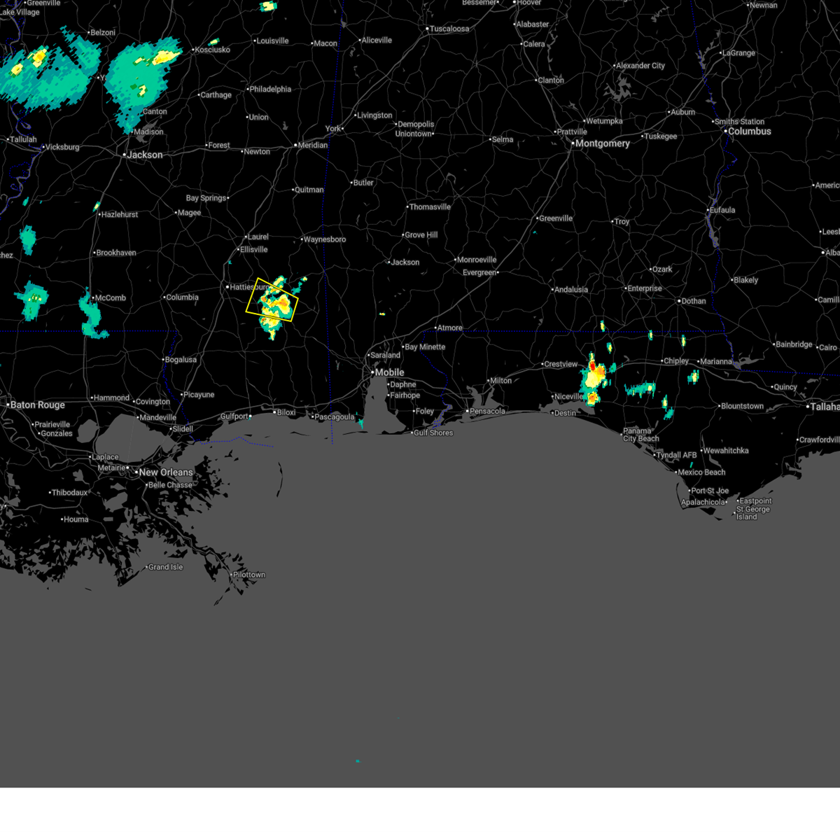
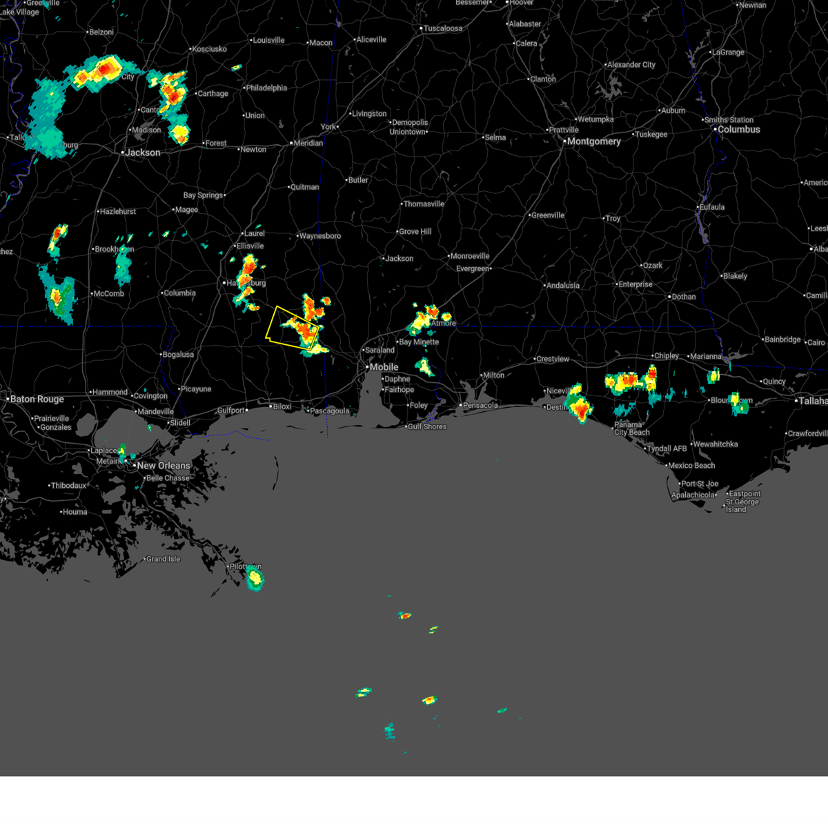
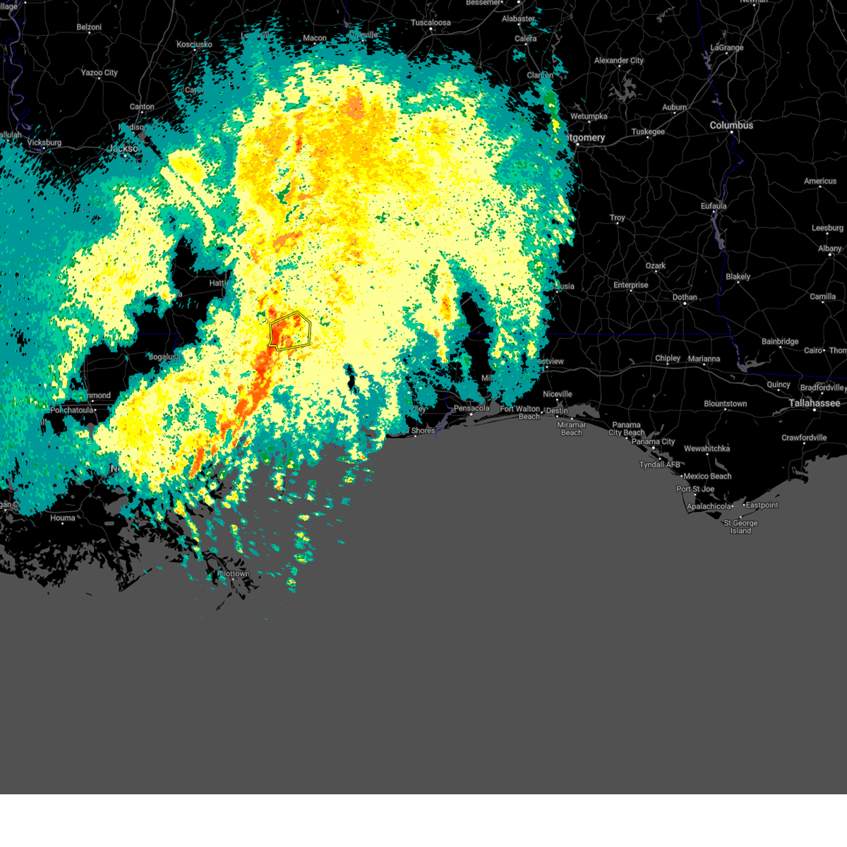
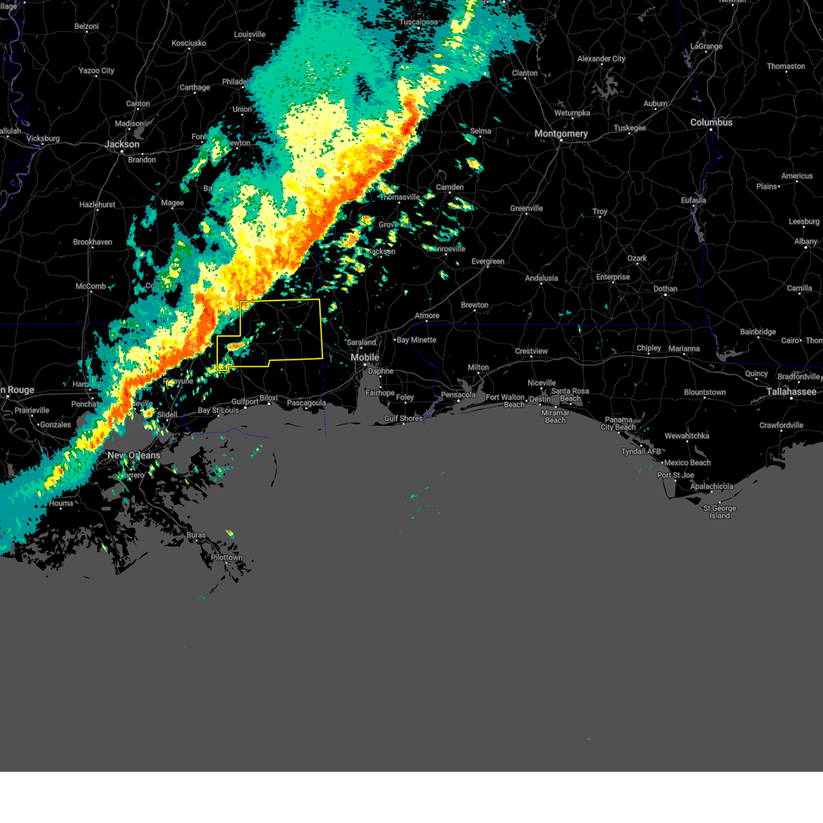
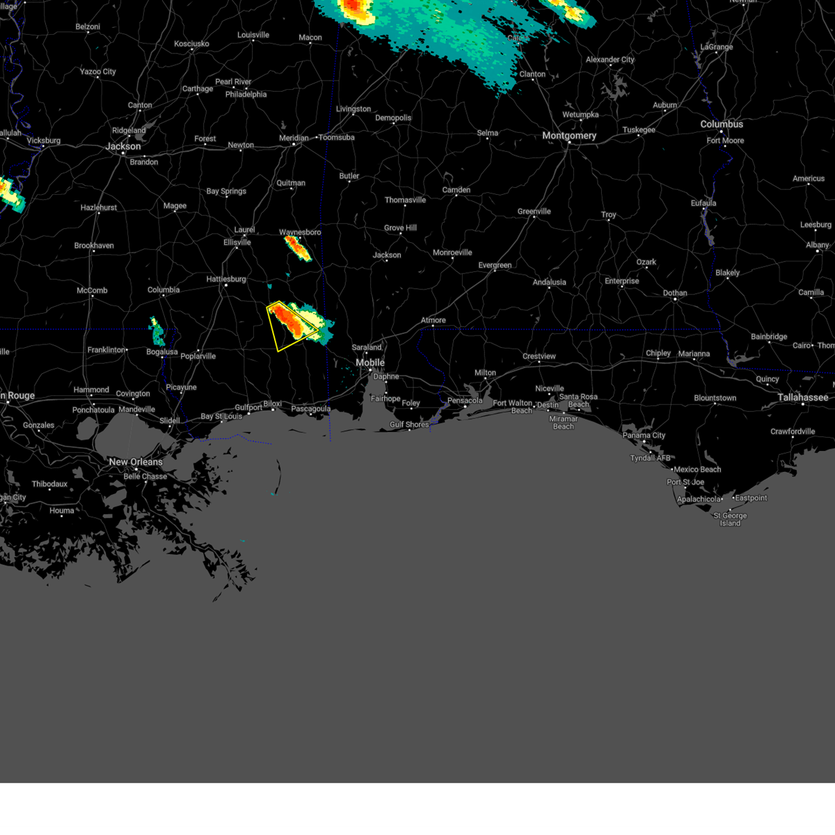
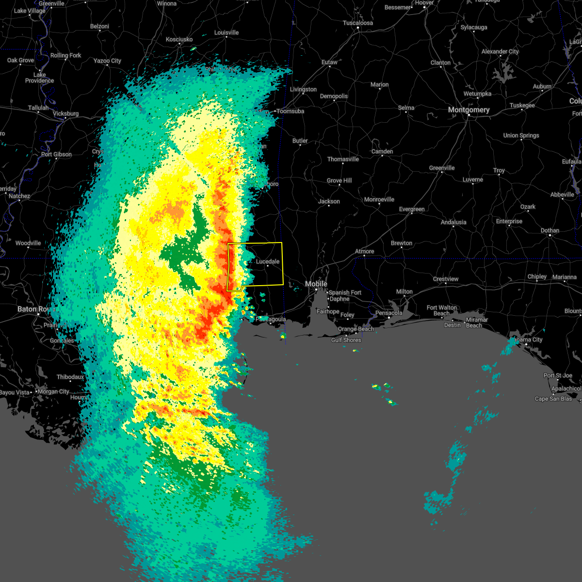
Hail Map for McLain, MS
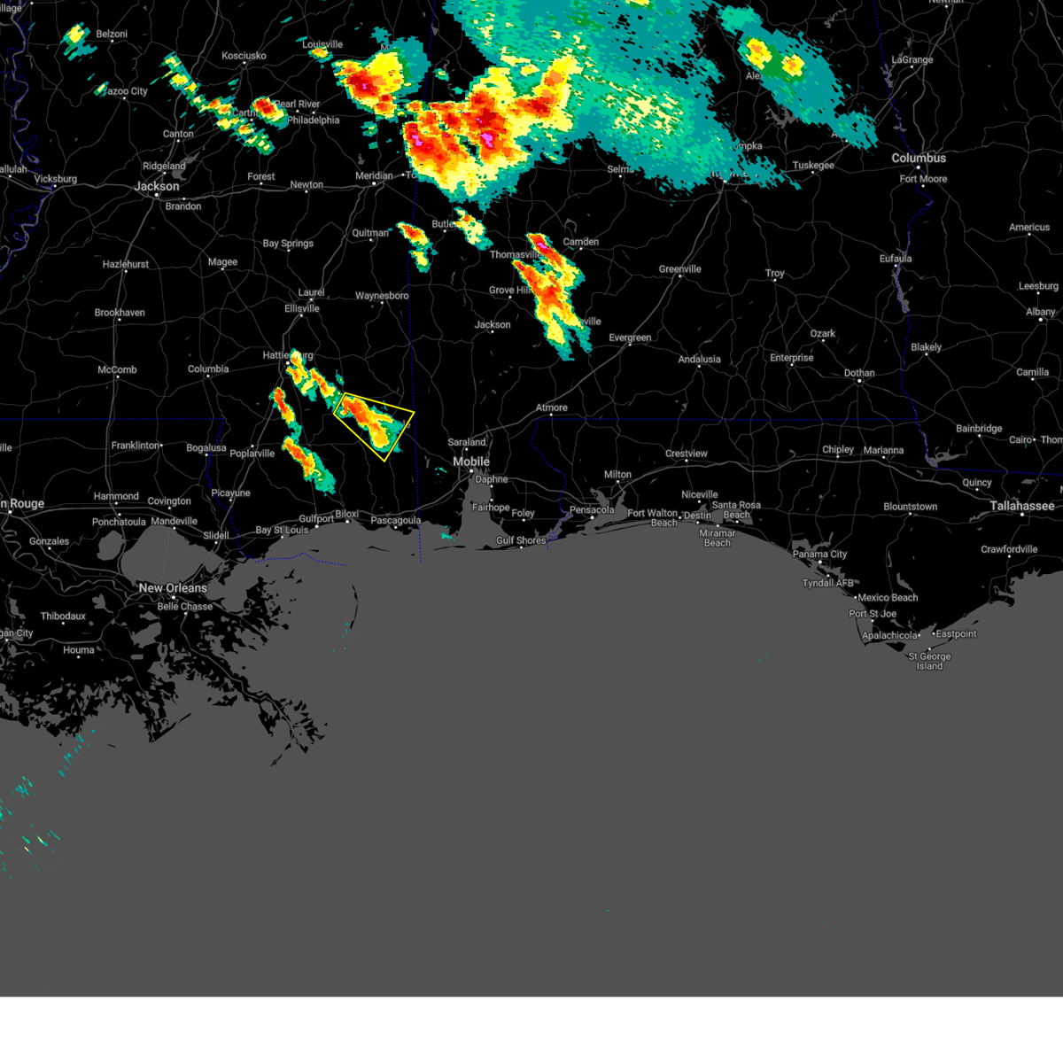
The McLain, MS area has had 2 reports of on-the-ground hail by trained spotters, and has been under severe weather warnings 20 times during the past 12 months. Doppler radar has detected hail at or near McLain, MS on 42 occasions.
| Name: | McLain, MS |
| Where Located: | 53.8 miles WNW of Mobile, AL |
| Map: | Google Map for McLain, MS |
| Population: | 441 |
| Housing Units: | 220 |
| More Info: | Search Google for McLain, MS |
0
The Top Recent Hail Date for McLain, MS is Tuesday, August 15, 2023 (26th out of 42)

Hail and Wind Damage Spotted near McLain, MS
| Date / Time | Report Details |
|---|---|
| 6/24/2025 7:58 PM CDT |
 the severe thunderstorm warning has been cancelled and is no longer in effect the severe thunderstorm warning has been cancelled and is no longer in effect
|
| 6/24/2025 7:39 PM CDT |
 Svrmob the national weather service in mobile has issued a * severe thunderstorm warning for, central perry county in southeastern mississippi, southwestern greene county in southeastern mississippi, * until 815 pm cdt. * at 739 pm cdt, a severe thunderstorm was located 5 miles north of mclain, or 14 miles southeast of richton, moving west at 15 mph (radar indicated). Hazards include 60 mph wind gusts and nickel size hail. expect damage to roofs, siding, and trees Svrmob the national weather service in mobile has issued a * severe thunderstorm warning for, central perry county in southeastern mississippi, southwestern greene county in southeastern mississippi, * until 815 pm cdt. * at 739 pm cdt, a severe thunderstorm was located 5 miles north of mclain, or 14 miles southeast of richton, moving west at 15 mph (radar indicated). Hazards include 60 mph wind gusts and nickel size hail. expect damage to roofs, siding, and trees
|
| 6/24/2025 7:27 PM CDT |
 The storm which prompted the warning has weakened below severe limits, and no longer poses an immediate threat to life or property. therefore, the warning will be allowed to expire. however, gusty winds are still possible with this thunderstorm. The storm which prompted the warning has weakened below severe limits, and no longer poses an immediate threat to life or property. therefore, the warning will be allowed to expire. however, gusty winds are still possible with this thunderstorm.
|
| 6/24/2025 7:02 PM CDT |
 Svrmob the national weather service in mobile has issued a * severe thunderstorm warning for, east central perry county in southeastern mississippi, southern greene county in southeastern mississippi, * until 745 pm cdt. * at 702 pm cdt, a severe thunderstorm was located near leakesville, moving west at 15 mph (radar indicated). Hazards include 60 mph wind gusts and nickel size hail. expect damage to roofs, siding, and trees Svrmob the national weather service in mobile has issued a * severe thunderstorm warning for, east central perry county in southeastern mississippi, southern greene county in southeastern mississippi, * until 745 pm cdt. * at 702 pm cdt, a severe thunderstorm was located near leakesville, moving west at 15 mph (radar indicated). Hazards include 60 mph wind gusts and nickel size hail. expect damage to roofs, siding, and trees
|
| 6/24/2025 6:47 PM CDT |
 Svrmob the national weather service in mobile has issued a * severe thunderstorm warning for, northern george county in southeastern mississippi, southeastern perry county in southeastern mississippi, southwestern greene county in southeastern mississippi, * until 730 pm cdt. * at 646 pm cdt, a severe thunderstorm was located over lucedale, moving west at 15 mph (radar indicated). Hazards include 60 mph wind gusts and nickel size hail. expect damage to roofs, siding, and trees Svrmob the national weather service in mobile has issued a * severe thunderstorm warning for, northern george county in southeastern mississippi, southeastern perry county in southeastern mississippi, southwestern greene county in southeastern mississippi, * until 730 pm cdt. * at 646 pm cdt, a severe thunderstorm was located over lucedale, moving west at 15 mph (radar indicated). Hazards include 60 mph wind gusts and nickel size hail. expect damage to roofs, siding, and trees
|
| 6/10/2025 4:00 PM CDT | At 400 pm cdt, severe thunderstorms were located along a line extending from 6 miles east of sunrise to 6 miles east of maxie to 3 miles northwest of mchenry, moving east at 25 mph (radar indicated). Hazards include 60 mph wind gusts and quarter size hail. Hail damage to vehicles is expected. expect wind damage to roofs, siding, and trees. Locations impacted include, wiggins, richton, perkinston, mchenry, beaumont, and new augusta. |
| 6/10/2025 3:49 PM CDT |
 At 349 pm cdt, severe thunderstorms were located along a line extending from near sunrise to near maxie to 7 miles west of mchenry, moving east at 30 mph (radar indicated). Hazards include 70 mph wind gusts and quarter size hail. Hail damage to vehicles is expected. expect considerable tree damage. wind damage is also likely to mobile homes, roofs, and outbuildings. Locations impacted include, wiggins, richton, perkinston, mchenry, beaumont, and new augusta. At 349 pm cdt, severe thunderstorms were located along a line extending from near sunrise to near maxie to 7 miles west of mchenry, moving east at 30 mph (radar indicated). Hazards include 70 mph wind gusts and quarter size hail. Hail damage to vehicles is expected. expect considerable tree damage. wind damage is also likely to mobile homes, roofs, and outbuildings. Locations impacted include, wiggins, richton, perkinston, mchenry, beaumont, and new augusta.
|
| 6/10/2025 3:41 PM CDT | Svrmob the national weather service in mobile has issued a * severe thunderstorm warning for, perry county in southeastern mississippi, stone county in southeastern mississippi, * until 430 pm cdt. * at 341 pm cdt, severe thunderstorms were located along a line extending from sunrise to 9 miles west of mchenry, moving east at 25 mph (radar indicated). Hazards include 60 mph wind gusts and quarter size hail. Hail damage to vehicles is expected. Expect wind damage to roofs, siding, and trees. |
| 5/23/2025 7:21 PM CDT |
 The storm which prompted the warning has weakened below severe limits, therefore, the warning will be allowed to expire. however, small hail and gusty winds are still possible with this thunderstorm. The storm which prompted the warning has weakened below severe limits, therefore, the warning will be allowed to expire. however, small hail and gusty winds are still possible with this thunderstorm.
|
| 5/23/2025 6:51 PM CDT |
 Svrmob the national weather service in mobile has issued a * severe thunderstorm warning for, southern perry county in southeastern mississippi, * until 730 pm cdt. * at 650 pm cdt, a severe thunderstorm was located 8 miles southwest of mclain, or 16 miles northeast of wiggins, moving north at 10 mph (radar indicated). Hazards include 60 mph wind gusts and quarter size hail. Hail damage to vehicles is expected. Expect wind damage to roofs, siding, and trees. Svrmob the national weather service in mobile has issued a * severe thunderstorm warning for, southern perry county in southeastern mississippi, * until 730 pm cdt. * at 650 pm cdt, a severe thunderstorm was located 8 miles southwest of mclain, or 16 miles northeast of wiggins, moving north at 10 mph (radar indicated). Hazards include 60 mph wind gusts and quarter size hail. Hail damage to vehicles is expected. Expect wind damage to roofs, siding, and trees.
|
| 5/7/2025 1:14 AM CDT |
 At 113 am cdt, a severe thunderstorm was located 8 miles south of mclain, or 17 miles west of lucedale, moving east at 25 mph (radar indicated). Hazards include 60 mph wind gusts and penny size hail. Expect damage to roofs, siding, and trees. Locations impacted include, mclain. At 113 am cdt, a severe thunderstorm was located 8 miles south of mclain, or 17 miles west of lucedale, moving east at 25 mph (radar indicated). Hazards include 60 mph wind gusts and penny size hail. Expect damage to roofs, siding, and trees. Locations impacted include, mclain.
|
| 5/7/2025 1:14 AM CDT |
 the severe thunderstorm warning has been cancelled and is no longer in effect the severe thunderstorm warning has been cancelled and is no longer in effect
|
| 5/7/2025 12:49 AM CDT |
 Svrmob the national weather service in mobile has issued a * severe thunderstorm warning for, northwestern george county in southeastern mississippi, southern perry county in southeastern mississippi, southwestern greene county in southeastern mississippi, northeastern stone county in southeastern mississippi, * until 130 am cdt. * at 1248 am cdt, a severe thunderstorm was located 8 miles northeast of wiggins, moving east at 25 mph (radar indicated). Hazards include 60 mph wind gusts and penny size hail. expect damage to roofs, siding, and trees Svrmob the national weather service in mobile has issued a * severe thunderstorm warning for, northwestern george county in southeastern mississippi, southern perry county in southeastern mississippi, southwestern greene county in southeastern mississippi, northeastern stone county in southeastern mississippi, * until 130 am cdt. * at 1248 am cdt, a severe thunderstorm was located 8 miles northeast of wiggins, moving east at 25 mph (radar indicated). Hazards include 60 mph wind gusts and penny size hail. expect damage to roofs, siding, and trees
|
| 3/4/2025 7:14 PM CST |
 Svrmob the national weather service in mobile has issued a * severe thunderstorm warning for, northwestern mobile county in southwestern alabama, southern washington county in southwestern alabama, george county in southeastern mississippi, southeastern perry county in southeastern mississippi, greene county in southeastern mississippi, eastern stone county in southeastern mississippi, * until 815 pm cst. * at 714 pm cst, severe thunderstorms were located along a line extending from 10 miles northwest of leakesville to 11 miles southwest of mclain to 6 miles southwest of lyman, moving east at 40 mph (radar indicated). Hazards include 60 mph wind gusts. expect damage to roofs, siding, and trees Svrmob the national weather service in mobile has issued a * severe thunderstorm warning for, northwestern mobile county in southwestern alabama, southern washington county in southwestern alabama, george county in southeastern mississippi, southeastern perry county in southeastern mississippi, greene county in southeastern mississippi, eastern stone county in southeastern mississippi, * until 815 pm cst. * at 714 pm cst, severe thunderstorms were located along a line extending from 10 miles northwest of leakesville to 11 miles southwest of mclain to 6 miles southwest of lyman, moving east at 40 mph (radar indicated). Hazards include 60 mph wind gusts. expect damage to roofs, siding, and trees
|
| 3/4/2025 6:17 PM CST |
 Svrmob the national weather service in mobile has issued a * severe thunderstorm warning for, perry county in southeastern mississippi, greene county in southeastern mississippi, * until 715 pm cst. * at 617 pm cst, severe thunderstorms were located along a line extending from 3 miles south of macedonia to mclaurin to near lumberton, moving east at 60 mph (radar indicated). Hazards include 60 mph wind gusts. expect damage to roofs, siding, and trees Svrmob the national weather service in mobile has issued a * severe thunderstorm warning for, perry county in southeastern mississippi, greene county in southeastern mississippi, * until 715 pm cst. * at 617 pm cst, severe thunderstorms were located along a line extending from 3 miles south of macedonia to mclaurin to near lumberton, moving east at 60 mph (radar indicated). Hazards include 60 mph wind gusts. expect damage to roofs, siding, and trees
|
| 2/16/2025 1:16 AM CST | The storms which prompted the warning have moved out of the area. therefore, the warning has been allowed to expire. a tornado watch remains in effect until 400 am cst for southwestern alabama, and southeastern mississippi. remember, a severe thunderstorm warning still remains in effect for southeastern wayne and greene counties until 2 am. |
| 2/16/2025 1:10 AM CST | Svrmob the national weather service in mobile has issued a * severe thunderstorm warning for, northwestern monroe county in south central alabama, south central choctaw county in southwestern alabama, northwestern mobile county in southwestern alabama, washington county in southwestern alabama, central clarke county in southwestern alabama, east central perry county in southeastern mississippi, southeastern wayne county in southeastern mississippi, greene county in southeastern mississippi, * until 200 am cst. * at 109 am cst, severe thunderstorms were located along a line extending from 6 miles west of coffeeville to state line to near beaumont, moving east at 50 mph (radar indicated). Hazards include 60 mph wind gusts. expect damage to roofs, siding, and trees |
| 2/16/2025 12:59 AM CST |
 Svrmob the national weather service in mobile has issued a * severe thunderstorm warning for, george county in southeastern mississippi, southern perry county in southeastern mississippi, southern greene county in southeastern mississippi, stone county in southeastern mississippi, * until 200 am cst. * at 1259 am cst, severe thunderstorms were located along a line extending from 3 miles southwest of pine ridge to 4 miles east of lumberton to 7 miles south of crossroads, moving east at 65 mph (radar indicated). Hazards include 60 mph wind gusts. expect damage to roofs, siding, and trees Svrmob the national weather service in mobile has issued a * severe thunderstorm warning for, george county in southeastern mississippi, southern perry county in southeastern mississippi, southern greene county in southeastern mississippi, stone county in southeastern mississippi, * until 200 am cst. * at 1259 am cst, severe thunderstorms were located along a line extending from 3 miles southwest of pine ridge to 4 miles east of lumberton to 7 miles south of crossroads, moving east at 65 mph (radar indicated). Hazards include 60 mph wind gusts. expect damage to roofs, siding, and trees
|
| 2/16/2025 12:44 AM CST |
 At 1243 am cst, severe thunderstorms were located along a line extending from 6 miles north of waynesboro to 4 miles west of richton to 3 miles northwest of mclaurin, moving east at 55 mph (radar indicated). Hazards include 60 mph wind gusts. Expect damage to roofs, siding, and trees. Locations impacted include, clara, new augusta, silas, chatom, leakesville, mclain, waynesboro, beaumont, state line, richton, fruitdale, millry, tibbie, and buckatunna. At 1243 am cst, severe thunderstorms were located along a line extending from 6 miles north of waynesboro to 4 miles west of richton to 3 miles northwest of mclaurin, moving east at 55 mph (radar indicated). Hazards include 60 mph wind gusts. Expect damage to roofs, siding, and trees. Locations impacted include, clara, new augusta, silas, chatom, leakesville, mclain, waynesboro, beaumont, state line, richton, fruitdale, millry, tibbie, and buckatunna.
|
| 2/16/2025 12:22 AM CST |
 Svrmob the national weather service in mobile has issued a * severe thunderstorm warning for, southwestern choctaw county in southwestern alabama, western washington county in southwestern alabama, northwestern clarke county in southwestern alabama, perry county in southeastern mississippi, wayne county in southeastern mississippi, greene county in southeastern mississippi, * until 115 am cst. * at 1222 am cst, severe thunderstorms were located along a line extending from 4 miles northeast of mill creek to eastabuchie to 6 miles northwest of pine ridge, moving east at 50 mph (radar indicated). Hazards include 60 mph wind gusts. expect damage to roofs, siding, and trees Svrmob the national weather service in mobile has issued a * severe thunderstorm warning for, southwestern choctaw county in southwestern alabama, western washington county in southwestern alabama, northwestern clarke county in southwestern alabama, perry county in southeastern mississippi, wayne county in southeastern mississippi, greene county in southeastern mississippi, * until 115 am cst. * at 1222 am cst, severe thunderstorms were located along a line extending from 4 miles northeast of mill creek to eastabuchie to 6 miles northwest of pine ridge, moving east at 50 mph (radar indicated). Hazards include 60 mph wind gusts. expect damage to roofs, siding, and trees
|
| 5/10/2024 2:20 AM CDT |
 At 219 am cdt, severe thunderstorms were located along a line extending from 4 miles northwest of leakesville to 9 miles southeast of mclain to 11 miles east of perkinston to 6 miles west of wiggins, moving east at 60 mph (radar indicated). Hazards include golf ball size hail and 70 mph wind gusts. People and animals outdoors will be injured. expect hail damage to roofs, siding, windows, and vehicles. expect considerable tree damage. wind damage is also likely to mobile homes, roofs, and outbuildings. Locations impacted include, wiggins, lucedale, perkinston, beaumont, and mclain. At 219 am cdt, severe thunderstorms were located along a line extending from 4 miles northwest of leakesville to 9 miles southeast of mclain to 11 miles east of perkinston to 6 miles west of wiggins, moving east at 60 mph (radar indicated). Hazards include golf ball size hail and 70 mph wind gusts. People and animals outdoors will be injured. expect hail damage to roofs, siding, windows, and vehicles. expect considerable tree damage. wind damage is also likely to mobile homes, roofs, and outbuildings. Locations impacted include, wiggins, lucedale, perkinston, beaumont, and mclain.
|
| 5/10/2024 2:13 AM CDT |
 At 213 am cdt, severe thunderstorms were located along a line extending from 9 miles northwest of leakesville to 4 miles south of mclain to near wiggins to 11 miles east of poplarville, moving east at 60 mph (radar indicated). Hazards include ping pong ball size hail and 60 mph wind gusts. People and animals outdoors will be injured. expect hail damage to roofs, siding, windows, and vehicles. expect wind damage to roofs, siding, and trees. Locations impacted include, wiggins, lucedale, perkinston, beaumont, and mclain. At 213 am cdt, severe thunderstorms were located along a line extending from 9 miles northwest of leakesville to 4 miles south of mclain to near wiggins to 11 miles east of poplarville, moving east at 60 mph (radar indicated). Hazards include ping pong ball size hail and 60 mph wind gusts. People and animals outdoors will be injured. expect hail damage to roofs, siding, windows, and vehicles. expect wind damage to roofs, siding, and trees. Locations impacted include, wiggins, lucedale, perkinston, beaumont, and mclain.
|
| 5/10/2024 1:50 AM CDT |
 Svrmob the national weather service in mobile has issued a * severe thunderstorm warning for, western george county in southeastern mississippi, southern perry county in southeastern mississippi, southern greene county in southeastern mississippi, stone county in southeastern mississippi, * until 245 am cdt. * at 149 am cdt, severe thunderstorms were located along a line extending from sunrise to 3 miles southwest of mclaurin to 3 miles southwest of lumberton to 4 miles northwest of poplarville, moving east at 40 mph (radar indicated). Hazards include 60 mph wind gusts and quarter size hail. Hail damage to vehicles is expected. Expect wind damage to roofs, siding, and trees. Svrmob the national weather service in mobile has issued a * severe thunderstorm warning for, western george county in southeastern mississippi, southern perry county in southeastern mississippi, southern greene county in southeastern mississippi, stone county in southeastern mississippi, * until 245 am cdt. * at 149 am cdt, severe thunderstorms were located along a line extending from sunrise to 3 miles southwest of mclaurin to 3 miles southwest of lumberton to 4 miles northwest of poplarville, moving east at 40 mph (radar indicated). Hazards include 60 mph wind gusts and quarter size hail. Hail damage to vehicles is expected. Expect wind damage to roofs, siding, and trees.
|
| 4/10/2024 11:23 AM CDT |
 Svrmob the national weather service in mobile has issued a * severe thunderstorm warning for, mobile county in southwestern alabama, southern washington county in southwestern alabama, george county in southeastern mississippi, southern greene county in southeastern mississippi, * until 1215 pm cdt. * at 1123 am cdt, severe thunderstorms were located along a line extending from near mclain to 11 miles southwest of lucedale to vancleave to 5 miles southwest of gulf park estates, moving east at 50 mph (radar indicated). Hazards include 70 mph wind gusts. Expect considerable tree damage. Damage is likely to mobile homes, roofs, and outbuildings. Svrmob the national weather service in mobile has issued a * severe thunderstorm warning for, mobile county in southwestern alabama, southern washington county in southwestern alabama, george county in southeastern mississippi, southern greene county in southeastern mississippi, * until 1215 pm cdt. * at 1123 am cdt, severe thunderstorms were located along a line extending from near mclain to 11 miles southwest of lucedale to vancleave to 5 miles southwest of gulf park estates, moving east at 50 mph (radar indicated). Hazards include 70 mph wind gusts. Expect considerable tree damage. Damage is likely to mobile homes, roofs, and outbuildings.
|
| 4/10/2024 11:03 AM CDT |
 At 1102 am cdt, severe thunderstorms were located along a line extending from 3 miles northeast of laurel to 12 miles southwest of mclain to 7 miles north of biloxi, moving east at 60 mph (radar indicated). Hazards include 60 mph wind gusts. Expect damage to roofs, siding, and trees. Locations impacted include, waynesboro, wiggins, lucedale, richton, leakesville, clara, perkinston, mchenry, beaumont, new augusta, mclain, state line, and buckatunna. At 1102 am cdt, severe thunderstorms were located along a line extending from 3 miles northeast of laurel to 12 miles southwest of mclain to 7 miles north of biloxi, moving east at 60 mph (radar indicated). Hazards include 60 mph wind gusts. Expect damage to roofs, siding, and trees. Locations impacted include, waynesboro, wiggins, lucedale, richton, leakesville, clara, perkinston, mchenry, beaumont, new augusta, mclain, state line, and buckatunna.
|
| 4/10/2024 10:33 AM CDT |
 Svrmob the national weather service in mobile has issued a * severe thunderstorm warning for, george county in southeastern mississippi, perry county in southeastern mississippi, wayne county in southeastern mississippi, greene county in southeastern mississippi, stone county in southeastern mississippi, * until 1130 am cdt. * at 1033 am cdt, severe thunderstorms were located along a line extending from 3 miles southwest of hebron to 6 miles west of maxie to 9 miles northeast of diamondhead, moving east at 55 mph (radar indicated). Hazards include 70 mph wind gusts. Expect considerable tree damage. Damage is likely to mobile homes, roofs, and outbuildings. Svrmob the national weather service in mobile has issued a * severe thunderstorm warning for, george county in southeastern mississippi, perry county in southeastern mississippi, wayne county in southeastern mississippi, greene county in southeastern mississippi, stone county in southeastern mississippi, * until 1130 am cdt. * at 1033 am cdt, severe thunderstorms were located along a line extending from 3 miles southwest of hebron to 6 miles west of maxie to 9 miles northeast of diamondhead, moving east at 55 mph (radar indicated). Hazards include 70 mph wind gusts. Expect considerable tree damage. Damage is likely to mobile homes, roofs, and outbuildings.
|
| 1/25/2024 11:43 AM CST |
 The severe thunderstorm warning for george, eastern perry, southern wayne, greene and eastern stone counties will expire at 1145 am cst, the storms which prompted the warning have weakened below severe limits, and no longer pose an immediate threat to life or property. therefore, the warning will be allowed to expire. however, strong, gusty winds are still possible with these thunderstorms. a severe thunderstorm watch remains in effect until 400 pm cst for southwestern alabama, and southeastern mississippi. The severe thunderstorm warning for george, eastern perry, southern wayne, greene and eastern stone counties will expire at 1145 am cst, the storms which prompted the warning have weakened below severe limits, and no longer pose an immediate threat to life or property. therefore, the warning will be allowed to expire. however, strong, gusty winds are still possible with these thunderstorms. a severe thunderstorm watch remains in effect until 400 pm cst for southwestern alabama, and southeastern mississippi.
|
| 1/25/2024 11:27 AM CST |
 At 1127 am cst, severe thunderstorms were located along a line extending from 5 miles northeast of richton to 4 miles north of mclain to 13 miles east of mchenry, moving east at 45 mph (radar indicated). Hazards include 60 mph wind gusts. Expect damage to roofs, siding, and trees. locations impacted include, lucedale, richton, leakesville, beaumont, mclain, state line, and buckatunna. hail threat, radar indicated max hail size, <. 75 in wind threat, radar indicated max wind gust, 60 mph. At 1127 am cst, severe thunderstorms were located along a line extending from 5 miles northeast of richton to 4 miles north of mclain to 13 miles east of mchenry, moving east at 45 mph (radar indicated). Hazards include 60 mph wind gusts. Expect damage to roofs, siding, and trees. locations impacted include, lucedale, richton, leakesville, beaumont, mclain, state line, and buckatunna. hail threat, radar indicated max hail size, <. 75 in wind threat, radar indicated max wind gust, 60 mph.
|
| 1/25/2024 11:13 AM CST |
 At 1112 am cst, severe thunderstorms were located along a line extending from 5 miles west of richton to 4 miles southwest of beaumont to 5 miles east of mchenry, moving east at 50 mph (radar indicated). Hazards include 60 mph wind gusts. Expect damage to roofs, siding, and trees. locations impacted include, lucedale, richton, leakesville, beaumont, new augusta, mclain, state line, and buckatunna. hail threat, radar indicated max hail size, <. 75 in wind threat, radar indicated max wind gust, 60 mph. At 1112 am cst, severe thunderstorms were located along a line extending from 5 miles west of richton to 4 miles southwest of beaumont to 5 miles east of mchenry, moving east at 50 mph (radar indicated). Hazards include 60 mph wind gusts. Expect damage to roofs, siding, and trees. locations impacted include, lucedale, richton, leakesville, beaumont, new augusta, mclain, state line, and buckatunna. hail threat, radar indicated max hail size, <. 75 in wind threat, radar indicated max wind gust, 60 mph.
|
| 1/25/2024 10:45 AM CST |
 At 1044 am cst, severe thunderstorms were located along a line extending from oak grove to 4 miles southwest of rock hill to 14 miles west of saucier, moving east at 45 mph (radar indicated). Hazards include 60 mph wind gusts. expect damage to roofs, siding, and trees At 1044 am cst, severe thunderstorms were located along a line extending from oak grove to 4 miles southwest of rock hill to 14 miles west of saucier, moving east at 45 mph (radar indicated). Hazards include 60 mph wind gusts. expect damage to roofs, siding, and trees
|
| 1/9/2024 1:52 AM CST |
 At 152 am cst, severe thunderstorms were located along a line extending from 5 miles southeast of sunrise to 10 miles southwest of maxie to 5 miles southeast of mcneil, moving east at 30 mph (radar indicated). Hazards include 70 mph wind gusts. Expect considerable tree damage. Damage is likely to mobile homes, roofs, and outbuildings. At 152 am cst, severe thunderstorms were located along a line extending from 5 miles southeast of sunrise to 10 miles southwest of maxie to 5 miles southeast of mcneil, moving east at 30 mph (radar indicated). Hazards include 70 mph wind gusts. Expect considerable tree damage. Damage is likely to mobile homes, roofs, and outbuildings.
|
| 6/26/2023 1:14 AM CDT |
 At 113 am cdt, severe thunderstorms were located along a line extending from 7 miles southwest of millry to 7 miles southwest of state line to 4 miles northeast of mclain to 7 miles east of brooklyn, moving southeast at 50 mph (radar indicated). Hazards include 60 mph wind gusts. expect damage to roofs, siding, and trees At 113 am cdt, severe thunderstorms were located along a line extending from 7 miles southwest of millry to 7 miles southwest of state line to 4 miles northeast of mclain to 7 miles east of brooklyn, moving southeast at 50 mph (radar indicated). Hazards include 60 mph wind gusts. expect damage to roofs, siding, and trees
|
| 6/26/2023 12:31 AM CDT |
 At 1230 am cdt, severe thunderstorms were located along a line extending from 8 miles east of mill creek to near tuckers crossing to 4 miles west of moselle to 3 miles north of progress, moving southeast at 45 mph (radar indicated). Hazards include 60 mph wind gusts. expect damage to roofs, siding, and trees At 1230 am cdt, severe thunderstorms were located along a line extending from 8 miles east of mill creek to near tuckers crossing to 4 miles west of moselle to 3 miles north of progress, moving southeast at 45 mph (radar indicated). Hazards include 60 mph wind gusts. expect damage to roofs, siding, and trees
|
| 6/17/2023 5:18 PM CDT |
 At 517 pm cdt, a severe thunderstorm was located near beaumont, or 12 miles south of richton, moving southeast at 30 mph (radar indicated). Hazards include half dollar size hail. damage to vehicles is expected At 517 pm cdt, a severe thunderstorm was located near beaumont, or 12 miles south of richton, moving southeast at 30 mph (radar indicated). Hazards include half dollar size hail. damage to vehicles is expected
|
| 6/17/2023 4:07 PM CDT |
 At 407 pm cdt, a severe thunderstorm was located 5 miles south of richton, moving southeast at 25 mph (radar indicated). Hazards include 60 mph wind gusts and quarter size hail. Hail damage to vehicles is expected. Expect wind damage to roofs, siding, and trees. At 407 pm cdt, a severe thunderstorm was located 5 miles south of richton, moving southeast at 25 mph (radar indicated). Hazards include 60 mph wind gusts and quarter size hail. Hail damage to vehicles is expected. Expect wind damage to roofs, siding, and trees.
|
| 6/16/2023 7:29 PM CDT |
 At 728 pm cdt, a severe thunderstorm was located 5 miles southwest of mclain, or 19 miles northeast of wiggins, moving east at 20 mph (radar indicated). Hazards include 60 mph wind gusts and quarter size hail. Hail damage to vehicles is expected. Expect wind damage to roofs, siding, and trees. At 728 pm cdt, a severe thunderstorm was located 5 miles southwest of mclain, or 19 miles northeast of wiggins, moving east at 20 mph (radar indicated). Hazards include 60 mph wind gusts and quarter size hail. Hail damage to vehicles is expected. Expect wind damage to roofs, siding, and trees.
|
| 6/16/2023 7:07 PM CDT |
 At 707 pm cdt, a severe thunderstorm was located near beaumont, or 14 miles south of richton, moving southeast at 15 mph (radar indicated). Hazards include ping pong ball size hail and 60 mph wind gusts. People and animals outdoors will be injured. expect hail damage to roofs, siding, windows, and vehicles. expect wind damage to roofs, siding, and trees. Locations impacted include, beaumont and mclain. At 707 pm cdt, a severe thunderstorm was located near beaumont, or 14 miles south of richton, moving southeast at 15 mph (radar indicated). Hazards include ping pong ball size hail and 60 mph wind gusts. People and animals outdoors will be injured. expect hail damage to roofs, siding, windows, and vehicles. expect wind damage to roofs, siding, and trees. Locations impacted include, beaumont and mclain.
|
| 6/16/2023 6:48 PM CDT |
 At 648 pm cdt, a severe thunderstorm was located over new augusta, or 11 miles south of richton, moving east at 15 mph (radar indicated). Hazards include 60 mph wind gusts and quarter size hail. Hail damage to vehicles is expected. Expect wind damage to roofs, siding, and trees. At 648 pm cdt, a severe thunderstorm was located over new augusta, or 11 miles south of richton, moving east at 15 mph (radar indicated). Hazards include 60 mph wind gusts and quarter size hail. Hail damage to vehicles is expected. Expect wind damage to roofs, siding, and trees.
|
| 6/16/2023 5:57 PM CDT |
 At 557 pm cdt, a severe thunderstorm was located 6 miles southeast of mclain, or 11 miles northwest of lucedale, moving southeast at 20 mph (radar indicated). Hazards include quarter size hail. Damage to vehicles is expected. this severe thunderstorm will remain over mainly rural areas of north central george and southwestern greene counties. hail threat, radar indicated max hail size, 1. 00 in wind threat, radar indicated max wind gust, <50 mph. At 557 pm cdt, a severe thunderstorm was located 6 miles southeast of mclain, or 11 miles northwest of lucedale, moving southeast at 20 mph (radar indicated). Hazards include quarter size hail. Damage to vehicles is expected. this severe thunderstorm will remain over mainly rural areas of north central george and southwestern greene counties. hail threat, radar indicated max hail size, 1. 00 in wind threat, radar indicated max wind gust, <50 mph.
|
| 6/16/2023 5:38 PM CDT |
 At 537 pm cdt, a severe thunderstorm was located over mclain, or 16 miles west of leakesville, moving southeast at 20 mph (radar indicated). Hazards include 60 mph wind gusts and quarter size hail. Hail damage to vehicles is expected. expect wind damage to roofs, siding, and trees. locations impacted include, mclain. hail threat, radar indicated max hail size, 1. 00 in wind threat, radar indicated max wind gust, 60 mph. At 537 pm cdt, a severe thunderstorm was located over mclain, or 16 miles west of leakesville, moving southeast at 20 mph (radar indicated). Hazards include 60 mph wind gusts and quarter size hail. Hail damage to vehicles is expected. expect wind damage to roofs, siding, and trees. locations impacted include, mclain. hail threat, radar indicated max hail size, 1. 00 in wind threat, radar indicated max wind gust, 60 mph.
|
| 6/16/2023 5:26 PM CDT |
 At 525 pm cdt, a severe thunderstorm was located near beaumont, or 15 miles south of richton, moving southeast at 20 mph (radar indicated). Hazards include golf ball size hail and 60 mph wind gusts. People and animals outdoors will be injured. expect hail damage to roofs, siding, windows, and vehicles. Expect wind damage to roofs, siding, and trees. At 525 pm cdt, a severe thunderstorm was located near beaumont, or 15 miles south of richton, moving southeast at 20 mph (radar indicated). Hazards include golf ball size hail and 60 mph wind gusts. People and animals outdoors will be injured. expect hail damage to roofs, siding, windows, and vehicles. Expect wind damage to roofs, siding, and trees.
|
| 6/16/2023 5:10 PM CDT |
 At 510 pm cdt, a severe thunderstorm was located over beaumont, or 12 miles south of richton, moving southeast at 20 mph (radar indicated). Hazards include golf ball size hail and 60 mph wind gusts. People and animals outdoors will be injured. expect hail damage to roofs, siding, windows, and vehicles. expect wind damage to roofs, siding, and trees. locations impacted include, beaumont and mclain. thunderstorm damage threat, considerable hail threat, radar indicated max hail size, 1. 75 in wind threat, radar indicated max wind gust, 60 mph. At 510 pm cdt, a severe thunderstorm was located over beaumont, or 12 miles south of richton, moving southeast at 20 mph (radar indicated). Hazards include golf ball size hail and 60 mph wind gusts. People and animals outdoors will be injured. expect hail damage to roofs, siding, windows, and vehicles. expect wind damage to roofs, siding, and trees. locations impacted include, beaumont and mclain. thunderstorm damage threat, considerable hail threat, radar indicated max hail size, 1. 75 in wind threat, radar indicated max wind gust, 60 mph.
|
| 6/16/2023 4:46 PM CDT |
 At 446 pm cdt, a severe thunderstorm was located 4 miles south of richton, moving southeast at 20 mph. this is a destructive storm for neely (radar indicated). Hazards include baseball size hail and 60 mph wind gusts. People and animals outdoors will be severely injured. expect shattered windows, extensive damage to roofs, siding, and vehicles. Locations impacted include, richton, leakesville, beaumont and mclain. At 446 pm cdt, a severe thunderstorm was located 4 miles south of richton, moving southeast at 20 mph. this is a destructive storm for neely (radar indicated). Hazards include baseball size hail and 60 mph wind gusts. People and animals outdoors will be severely injured. expect shattered windows, extensive damage to roofs, siding, and vehicles. Locations impacted include, richton, leakesville, beaumont and mclain.
|
| 6/16/2023 4:43 PM CDT |
 At 443 pm cdt, a severe thunderstorm was located 4 miles south of richton, moving southeast at 20 mph (radar indicated). Hazards include two inch hail and 60 mph wind gusts. People and animals outdoors will be injured. expect hail damage to roofs, siding, windows, and vehicles. Expect wind damage to roofs, siding, and trees. At 443 pm cdt, a severe thunderstorm was located 4 miles south of richton, moving southeast at 20 mph (radar indicated). Hazards include two inch hail and 60 mph wind gusts. People and animals outdoors will be injured. expect hail damage to roofs, siding, windows, and vehicles. Expect wind damage to roofs, siding, and trees.
|
| 6/16/2023 7:12 AM CDT |
 At 710 am cdt, severe thunderstorms were located along a line extending from 3 miles west of state line to 9 miles northeast of mclain to 15 miles north of latimer, moving east at 50 mph. other severe thunderstorms were developing in the vicinity of wilmer, semmes, and mobile regional airport, moving east at around 40 mph (radar indicated). Hazards include 60 mph wind gusts and quarter size hail. Hail damage to vehicles is expected. Expect wind damage to roofs, siding, and trees. At 710 am cdt, severe thunderstorms were located along a line extending from 3 miles west of state line to 9 miles northeast of mclain to 15 miles north of latimer, moving east at 50 mph. other severe thunderstorms were developing in the vicinity of wilmer, semmes, and mobile regional airport, moving east at around 40 mph (radar indicated). Hazards include 60 mph wind gusts and quarter size hail. Hail damage to vehicles is expected. Expect wind damage to roofs, siding, and trees.
|
| 6/16/2023 7:10 AM CDT | Quarter sized hail reported 0.8 miles SE of McLain, MS, quarter size hail reported in the community of mclain. shared via facebook. time estimated from radar. |
| 6/16/2023 6:58 AM CDT |
 At 656 am cdt, severe thunderstorms were located along a line extending from 11 miles northeast of richton to 5 miles north of beaumont to 7 miles southwest of mclain to 8 miles northeast of perkinston, moving southeast at 50 mph (radar indicated). Hazards include 60 mph wind gusts and quarter size hail. Hail damage to vehicles is expected. expect wind damage to roofs, siding, and trees. locations impacted include, wiggins, lucedale, richton, leakesville, perkinston, beaumont, new augusta and mclain. hail threat, radar indicated max hail size, 1. 00 in wind threat, radar indicated max wind gust, 60 mph. At 656 am cdt, severe thunderstorms were located along a line extending from 11 miles northeast of richton to 5 miles north of beaumont to 7 miles southwest of mclain to 8 miles northeast of perkinston, moving southeast at 50 mph (radar indicated). Hazards include 60 mph wind gusts and quarter size hail. Hail damage to vehicles is expected. expect wind damage to roofs, siding, and trees. locations impacted include, wiggins, lucedale, richton, leakesville, perkinston, beaumont, new augusta and mclain. hail threat, radar indicated max hail size, 1. 00 in wind threat, radar indicated max wind gust, 60 mph.
|
| 6/16/2023 6:29 AM CDT |
 At 627 am cdt, severe thunderstorms were located along a line extending from 4 miles northeast of eastabuchie to 4 miles southeast of hattiesburg to 10 miles southeast of lumberton, moving east at 60 mph (radar indicated). Hazards include 70 mph wind gusts and quarter size hail. Hail damage to vehicles is expected. expect considerable tree damage. Wind damage is also likely to mobile homes, roofs, and outbuildings. At 627 am cdt, severe thunderstorms were located along a line extending from 4 miles northeast of eastabuchie to 4 miles southeast of hattiesburg to 10 miles southeast of lumberton, moving east at 60 mph (radar indicated). Hazards include 70 mph wind gusts and quarter size hail. Hail damage to vehicles is expected. expect considerable tree damage. Wind damage is also likely to mobile homes, roofs, and outbuildings.
|
| 6/14/2023 8:08 PM CDT |
 The severe thunderstorm warning for central greene county will expire at 815 pm cdt, the storms which prompted the warning have moved out of the area. therefore, the warning will be allowed to expire. a severe thunderstorm watch remains in effect until 1000 pm cdt for southwestern alabama, and southeastern mississippi. The severe thunderstorm warning for central greene county will expire at 815 pm cdt, the storms which prompted the warning have moved out of the area. therefore, the warning will be allowed to expire. a severe thunderstorm watch remains in effect until 1000 pm cdt for southwestern alabama, and southeastern mississippi.
|
| 6/14/2023 7:57 PM CDT |
 At 756 pm cdt, severe thunderstorms were located along a line extending from 3 miles south of buckatunna to 8 miles north of leakesville to 5 miles south of mclain, moving east at 50 mph (radar indicated). Hazards include 70 mph wind gusts and penny size hail. Expect considerable tree damage. damage is likely to mobile homes, roofs, and outbuildings. locations impacted include, leakesville and state line. thunderstorm damage threat, considerable hail threat, radar indicated max hail size, 0. 75 in wind threat, radar indicated max wind gust, 70 mph. At 756 pm cdt, severe thunderstorms were located along a line extending from 3 miles south of buckatunna to 8 miles north of leakesville to 5 miles south of mclain, moving east at 50 mph (radar indicated). Hazards include 70 mph wind gusts and penny size hail. Expect considerable tree damage. damage is likely to mobile homes, roofs, and outbuildings. locations impacted include, leakesville and state line. thunderstorm damage threat, considerable hail threat, radar indicated max hail size, 0. 75 in wind threat, radar indicated max wind gust, 70 mph.
|
| 6/14/2023 7:43 PM CDT |
 At 741 pm cdt, severe thunderstorms were located along a line extending from 5 miles south of clara to 11 miles east of richton to 8 miles east of brooklyn, moving east at 50 mph. numerous trees have been reported down with this storm and a widespread swath of possible hurricane force wind gusts will be moving towards neely and leakesville mississippi. these are destructive storms for western greene county mississippi including neely and leakesville (radar indicated). Hazards include 80 mph wind gusts and penny size hail. Flying debris will be dangerous to those caught without shelter. mobile homes will be heavily damaged. expect considerable damage to roofs, windows, and vehicles. extensive tree damage and power outages are likely. locations impacted include, richton, leakesville, beaumont, new augusta, mclain and state line. thunderstorm damage threat, destructive hail threat, radar indicated max hail size, 0. 75 in wind threat, radar indicated max wind gust, 80 mph. At 741 pm cdt, severe thunderstorms were located along a line extending from 5 miles south of clara to 11 miles east of richton to 8 miles east of brooklyn, moving east at 50 mph. numerous trees have been reported down with this storm and a widespread swath of possible hurricane force wind gusts will be moving towards neely and leakesville mississippi. these are destructive storms for western greene county mississippi including neely and leakesville (radar indicated). Hazards include 80 mph wind gusts and penny size hail. Flying debris will be dangerous to those caught without shelter. mobile homes will be heavily damaged. expect considerable damage to roofs, windows, and vehicles. extensive tree damage and power outages are likely. locations impacted include, richton, leakesville, beaumont, new augusta, mclain and state line. thunderstorm damage threat, destructive hail threat, radar indicated max hail size, 0. 75 in wind threat, radar indicated max wind gust, 80 mph.
|
| 6/14/2023 7:35 PM CDT |
 At 732 pm cdt, severe thunderstorms were located along a line extending from 9 miles southwest of clara to 4 miles southeast of richton to brooklyn, moving east at 50 mph. recent observations recorded at least 63 mph wind gust at hattiesburg mississippi (radar indicated). Hazards include 70 mph wind gusts and penny size hail. Expect considerable tree damage. damage is likely to mobile homes, roofs, and outbuildings. locations impacted include, richton, leakesville, beaumont, new augusta, mclain and state line. thunderstorm damage threat, considerable hail threat, radar indicated max hail size, 0. 75 in wind threat, radar indicated max wind gust, 70 mph. At 732 pm cdt, severe thunderstorms were located along a line extending from 9 miles southwest of clara to 4 miles southeast of richton to brooklyn, moving east at 50 mph. recent observations recorded at least 63 mph wind gust at hattiesburg mississippi (radar indicated). Hazards include 70 mph wind gusts and penny size hail. Expect considerable tree damage. damage is likely to mobile homes, roofs, and outbuildings. locations impacted include, richton, leakesville, beaumont, new augusta, mclain and state line. thunderstorm damage threat, considerable hail threat, radar indicated max hail size, 0. 75 in wind threat, radar indicated max wind gust, 70 mph.
|
| 6/14/2023 7:17 PM CDT |
 At 715 pm cdt, severe thunderstorms were located along a line extending from 5 miles northwest of ovett to 4 miles southeast of macedonia to 3 miles south of purvis, moving east at 50 mph (radar indicated). Hazards include 60 mph wind gusts and penny size hail. expect damage to roofs, siding, and trees At 715 pm cdt, severe thunderstorms were located along a line extending from 5 miles northwest of ovett to 4 miles southeast of macedonia to 3 miles south of purvis, moving east at 50 mph (radar indicated). Hazards include 60 mph wind gusts and penny size hail. expect damage to roofs, siding, and trees
|
| 5/5/2023 4:14 PM CDT |
 At 414 pm cdt, severe thunderstorms were located along a line extending from near beaumont to 4 miles southwest of mclain to 8 miles east of maxie to near wiggins, moving southeast at 40 mph (radar indicated). Hazards include 60 mph wind gusts and nickel size hail. Expect damage to roofs, siding, and trees. locations impacted include, wiggins, beaumont and new augusta. hail threat, radar indicated max hail size, 0. 88 in wind threat, radar indicated max wind gust, 60 mph. At 414 pm cdt, severe thunderstorms were located along a line extending from near beaumont to 4 miles southwest of mclain to 8 miles east of maxie to near wiggins, moving southeast at 40 mph (radar indicated). Hazards include 60 mph wind gusts and nickel size hail. Expect damage to roofs, siding, and trees. locations impacted include, wiggins, beaumont and new augusta. hail threat, radar indicated max hail size, 0. 88 in wind threat, radar indicated max wind gust, 60 mph.
|
| 5/5/2023 3:38 PM CDT |
 At 337 pm cdt, severe thunderstorms were located along a line extending from near macedonia to 4 miles south of sunrise to purvis to 5 miles north of lumberton, moving southeast at 40 mph. this line has had a history of producing damaging winds with numerous trees being reported down across lamar county mississippi (radar indicated). Hazards include 60 mph wind gusts and nickel size hail. expect damage to roofs, siding, and trees At 337 pm cdt, severe thunderstorms were located along a line extending from near macedonia to 4 miles south of sunrise to purvis to 5 miles north of lumberton, moving southeast at 40 mph. this line has had a history of producing damaging winds with numerous trees being reported down across lamar county mississippi (radar indicated). Hazards include 60 mph wind gusts and nickel size hail. expect damage to roofs, siding, and trees
|
| 4/15/2023 1:59 PM CDT |
 At 159 pm cdt, severe thunderstorms were located along a line extending from 3 miles north of leakesville to 5 miles southwest of lucedale to 7 miles east of saucier, moving east at 50 mph (radar indicated). Hazards include 60 mph wind gusts and penny size hail. expect damage to roofs, siding, and trees At 159 pm cdt, severe thunderstorms were located along a line extending from 3 miles north of leakesville to 5 miles southwest of lucedale to 7 miles east of saucier, moving east at 50 mph (radar indicated). Hazards include 60 mph wind gusts and penny size hail. expect damage to roofs, siding, and trees
|
| 4/15/2023 1:44 PM CDT |
 At 142 pm cdt, severe thunderstorms were located along a line extending from 8 miles northeast of beaumont to 5 miles south of mclain to 7 miles west of mchenry, moving east at 55 mph (radar indicated). Hazards include 60 mph wind gusts and penny size hail. Expect damage to roofs, siding, and trees. locations impacted include, wiggins, lucedale, leakesville, perkinston, mchenry, beaumont, mclain and state line. hail threat, radar indicated max hail size, 0. 75 in wind threat, radar indicated max wind gust, 60 mph. At 142 pm cdt, severe thunderstorms were located along a line extending from 8 miles northeast of beaumont to 5 miles south of mclain to 7 miles west of mchenry, moving east at 55 mph (radar indicated). Hazards include 60 mph wind gusts and penny size hail. Expect damage to roofs, siding, and trees. locations impacted include, wiggins, lucedale, leakesville, perkinston, mchenry, beaumont, mclain and state line. hail threat, radar indicated max hail size, 0. 75 in wind threat, radar indicated max wind gust, 60 mph.
|
| 4/15/2023 1:13 PM CDT |
 At 112 pm cdt, severe thunderstorms were located along a line extending from sunrise to 4 miles south of mclaurin to 6 miles northeast of mcneil, moving east at 50 mph (radar indicated). Hazards include 60 mph wind gusts and nickel size hail. expect damage to roofs, siding, and trees At 112 pm cdt, severe thunderstorms were located along a line extending from sunrise to 4 miles south of mclaurin to 6 miles northeast of mcneil, moving east at 50 mph (radar indicated). Hazards include 60 mph wind gusts and nickel size hail. expect damage to roofs, siding, and trees
|
| 1/4/2023 12:54 AM CST |
 At 1253 am cst, severe thunderstorms were located along a line extending from 7 miles northeast of beaumont to near mclain to 13 miles west of lucedale to 9 miles east of wiggins, moving northeast at 40 mph (radar indicated). Hazards include 60 mph wind gusts. expect damage to roofs, siding, and trees At 1253 am cst, severe thunderstorms were located along a line extending from 7 miles northeast of beaumont to near mclain to 13 miles west of lucedale to 9 miles east of wiggins, moving northeast at 40 mph (radar indicated). Hazards include 60 mph wind gusts. expect damage to roofs, siding, and trees
|
| 12/30/2022 10:30 AM CST |
 At 1029 am cst, severe thunderstorms were located along a line extending from 7 miles east of mclain to 7 miles west of lucedale to 7 miles west of wade to near d`iberville, moving east at 30 mph (radar indicated). Hazards include 60 mph wind gusts. Expect damage to roofs, siding, and trees. Locations impacted include, lucedale and mclain. At 1029 am cst, severe thunderstorms were located along a line extending from 7 miles east of mclain to 7 miles west of lucedale to 7 miles west of wade to near d`iberville, moving east at 30 mph (radar indicated). Hazards include 60 mph wind gusts. Expect damage to roofs, siding, and trees. Locations impacted include, lucedale and mclain.
|
| 12/30/2022 10:13 AM CST |
 At 1013 am cst, severe thunderstorms were located along a line extending from 3 miles southwest of mclain to 16 miles south of beaumont to 9 miles north of latimer to near lyman, moving east at 35 mph (radar indicated). Hazards include 60 mph wind gusts. Expect damage to roofs, siding, and trees. Locations impacted include, lucedale and mclain. At 1013 am cst, severe thunderstorms were located along a line extending from 3 miles southwest of mclain to 16 miles south of beaumont to 9 miles north of latimer to near lyman, moving east at 35 mph (radar indicated). Hazards include 60 mph wind gusts. Expect damage to roofs, siding, and trees. Locations impacted include, lucedale and mclain.
|
| 12/30/2022 10:01 AM CST |
 At 1001 am cst, severe thunderstorms were located along a line extending from 7 miles south of beaumont to 11 miles northeast of wiggins to 9 miles east of saucier to 4 miles southwest of lyman, moving east at 35 mph (radar indicated). Hazards include 60 mph wind gusts. expect damage to roofs, siding, and trees At 1001 am cst, severe thunderstorms were located along a line extending from 7 miles south of beaumont to 11 miles northeast of wiggins to 9 miles east of saucier to 4 miles southwest of lyman, moving east at 35 mph (radar indicated). Hazards include 60 mph wind gusts. expect damage to roofs, siding, and trees
|
| 12/14/2022 4:43 PM CST |
 At 443 pm cst, severe thunderstorms were located along a line extending from 11 miles southwest of mclain to 4 miles east of saucier, moving east at 45 mph (radar indicated). Hazards include 60 mph wind gusts. expect damage to roofs, siding, and trees At 443 pm cst, severe thunderstorms were located along a line extending from 11 miles southwest of mclain to 4 miles east of saucier, moving east at 45 mph (radar indicated). Hazards include 60 mph wind gusts. expect damage to roofs, siding, and trees
|
| 12/14/2022 3:53 PM CST |
 At 353 pm cst, a severe thunderstorm was located 7 miles south of new augusta, or 16 miles north of wiggins, moving northeast at 35 mph (radar indicated). Hazards include 60 mph wind gusts and quarter size hail. Hail damage to vehicles is expected. expect wind damage to roofs, siding, and trees. Locations impacted include, beaumont and new augusta. At 353 pm cst, a severe thunderstorm was located 7 miles south of new augusta, or 16 miles north of wiggins, moving northeast at 35 mph (radar indicated). Hazards include 60 mph wind gusts and quarter size hail. Hail damage to vehicles is expected. expect wind damage to roofs, siding, and trees. Locations impacted include, beaumont and new augusta.
|
| 12/14/2022 3:35 PM CST |
 At 335 pm cst, a severe thunderstorm was located 5 miles south of rock hill, or 13 miles northwest of wiggins, moving northeast at 30 mph (radar indicated). Hazards include 60 mph wind gusts and quarter size hail. Hail damage to vehicles is expected. Expect wind damage to roofs, siding, and trees. At 335 pm cst, a severe thunderstorm was located 5 miles south of rock hill, or 13 miles northwest of wiggins, moving northeast at 30 mph (radar indicated). Hazards include 60 mph wind gusts and quarter size hail. Hail damage to vehicles is expected. Expect wind damage to roofs, siding, and trees.
|
| 11/30/2022 3:44 AM CST |
 At 343 am cst, severe thunderstorms were located along a line extending from near wagarville to 5 miles southwest of fruitdale to 3 miles west of leakesville to 5 miles southeast of mclain, moving east at 30 mph (radar indicated). Hazards include 60 mph wind gusts. Expect damage to roofs, siding, and trees. locations impacted include, jackson, chatom, leakesville, saint stephens, wagarville, leroy, deer park, tibbie, beaumont, new augusta, mclain, state line, fruitdale and mcintosh. hail threat, radar indicated max hail size, <. 75 in wind threat, radar indicated max wind gust, 60 mph. At 343 am cst, severe thunderstorms were located along a line extending from near wagarville to 5 miles southwest of fruitdale to 3 miles west of leakesville to 5 miles southeast of mclain, moving east at 30 mph (radar indicated). Hazards include 60 mph wind gusts. Expect damage to roofs, siding, and trees. locations impacted include, jackson, chatom, leakesville, saint stephens, wagarville, leroy, deer park, tibbie, beaumont, new augusta, mclain, state line, fruitdale and mcintosh. hail threat, radar indicated max hail size, <. 75 in wind threat, radar indicated max wind gust, 60 mph.
|
| 11/30/2022 3:04 AM CST |
 At 304 am cst, severe thunderstorms were located along a line extending from 6 miles west of chatom to 8 miles east of richton to 3 miles north of beaumont to 5 miles northeast of brooklyn, moving east at 30 mph (radar indicated). Hazards include 60 mph wind gusts. expect damage to roofs, siding, and trees At 304 am cst, severe thunderstorms were located along a line extending from 6 miles west of chatom to 8 miles east of richton to 3 miles north of beaumont to 5 miles northeast of brooklyn, moving east at 30 mph (radar indicated). Hazards include 60 mph wind gusts. expect damage to roofs, siding, and trees
|
| 10/29/2022 5:59 PM CDT |
 At 558 pm cdt, a severe thunderstorm was located 4 miles southwest of mclain, or 19 miles south of richton, moving northeast at 25 mph (radar indicated). Hazards include 60 mph wind gusts. expect damage to roofs, siding, and trees At 558 pm cdt, a severe thunderstorm was located 4 miles southwest of mclain, or 19 miles south of richton, moving northeast at 25 mph (radar indicated). Hazards include 60 mph wind gusts. expect damage to roofs, siding, and trees
|
| 6/10/2022 3:03 PM CDT |
 At 302 pm cdt, severe thunderstorms were located along a line extending from 8 miles southwest of fruitdale to 5 miles southwest of leakesville to near brooklyn, moving east at 45 mph (radar indicated). Hazards include 60 mph wind gusts and quarter size hail. Hail damage to vehicles is expected. expect wind damage to roofs, siding, and trees. locations impacted include, lucedale, leakesville, beaumont and mclain. hail threat, radar indicated max hail size, 1. 00 in wind threat, radar indicated max wind gust, 60 mph. At 302 pm cdt, severe thunderstorms were located along a line extending from 8 miles southwest of fruitdale to 5 miles southwest of leakesville to near brooklyn, moving east at 45 mph (radar indicated). Hazards include 60 mph wind gusts and quarter size hail. Hail damage to vehicles is expected. expect wind damage to roofs, siding, and trees. locations impacted include, lucedale, leakesville, beaumont and mclain. hail threat, radar indicated max hail size, 1. 00 in wind threat, radar indicated max wind gust, 60 mph.
|
| 6/10/2022 2:38 PM CDT |
 At 238 pm cdt, severe thunderstorms were located along a line extending from 5 miles east of richton to 4 miles south of purvis, moving east at 35 mph (radar indicated). Hazards include 60 mph wind gusts and quarter size hail. Hail damage to vehicles is expected. Expect wind damage to roofs, siding, and trees. At 238 pm cdt, severe thunderstorms were located along a line extending from 5 miles east of richton to 4 miles south of purvis, moving east at 35 mph (radar indicated). Hazards include 60 mph wind gusts and quarter size hail. Hail damage to vehicles is expected. Expect wind damage to roofs, siding, and trees.
|
| 4/17/2022 9:01 PM CDT |
 At 901 pm cdt, a confirmed tornado was located near mclain, or 14 miles west of leakesville, moving east at 45 mph (radar confirmed tornado). Hazards include damaging tornado and quarter size hail. Flying debris will be dangerous to those caught without shelter. mobile homes will be damaged or destroyed. damage to roofs, windows, and vehicles will occur. tree damage is likely. This tornado will be near, leakesville around 920 pm cdt. At 901 pm cdt, a confirmed tornado was located near mclain, or 14 miles west of leakesville, moving east at 45 mph (radar confirmed tornado). Hazards include damaging tornado and quarter size hail. Flying debris will be dangerous to those caught without shelter. mobile homes will be damaged or destroyed. damage to roofs, windows, and vehicles will occur. tree damage is likely. This tornado will be near, leakesville around 920 pm cdt.
|
| 4/17/2022 8:57 PM CDT |
 At 856 pm cdt, a severe thunderstorm capable of producing a tornado was located near beaumont, or 13 miles south of richton, moving east at 45 mph (radar indicated rotation). Hazards include tornado and quarter size hail. Flying debris will be dangerous to those caught without shelter. mobile homes will be damaged or destroyed. damage to roofs, windows, and vehicles will occur. tree damage is likely. This dangerous storm will be near, leakesville around 920 pm cdt. At 856 pm cdt, a severe thunderstorm capable of producing a tornado was located near beaumont, or 13 miles south of richton, moving east at 45 mph (radar indicated rotation). Hazards include tornado and quarter size hail. Flying debris will be dangerous to those caught without shelter. mobile homes will be damaged or destroyed. damage to roofs, windows, and vehicles will occur. tree damage is likely. This dangerous storm will be near, leakesville around 920 pm cdt.
|
| 4/17/2022 8:52 PM CDT |
 At 851 pm cdt, severe thunderstorms were located along a line extending from 7 miles northeast of richton to near brooklyn, moving east at 35 mph (radar indicated). Hazards include 70 mph wind gusts and quarter size hail. Hail damage to vehicles is expected. expect considerable tree damage. wind damage is also likely to mobile homes, roofs, and outbuildings. Locations impacted include, richton, beaumont, new augusta, mclain and state line. At 851 pm cdt, severe thunderstorms were located along a line extending from 7 miles northeast of richton to near brooklyn, moving east at 35 mph (radar indicated). Hazards include 70 mph wind gusts and quarter size hail. Hail damage to vehicles is expected. expect considerable tree damage. wind damage is also likely to mobile homes, roofs, and outbuildings. Locations impacted include, richton, beaumont, new augusta, mclain and state line.
|
| 4/17/2022 8:25 PM CDT |
 At 825 pm cdt, severe thunderstorms were located along a line extending from 5 miles southeast of tuckers crossing to 6 miles south of west hattiesburg, moving south at 35 mph (radar indicated). Hazards include 70 mph wind gusts and quarter size hail. Hail damage to vehicles is expected. expect considerable tree damage. Wind damage is also likely to mobile homes, roofs, and outbuildings. At 825 pm cdt, severe thunderstorms were located along a line extending from 5 miles southeast of tuckers crossing to 6 miles south of west hattiesburg, moving south at 35 mph (radar indicated). Hazards include 70 mph wind gusts and quarter size hail. Hail damage to vehicles is expected. expect considerable tree damage. Wind damage is also likely to mobile homes, roofs, and outbuildings.
|
| 4/13/2022 10:55 PM CDT |
 At 1054 pm cdt, severe thunderstorms were located along a line extending from 3 miles northwest of leakesville to 5 miles west of mchenry, moving east at 40 mph (radar indicated). Hazards include 60 mph wind gusts. expect damage to roofs, siding, and trees At 1054 pm cdt, severe thunderstorms were located along a line extending from 3 miles northwest of leakesville to 5 miles west of mchenry, moving east at 40 mph (radar indicated). Hazards include 60 mph wind gusts. expect damage to roofs, siding, and trees
|
| 4/13/2022 10:43 PM CDT |
 At 1043 pm cdt, severe thunderstorms were located along a line extending from near beaumont to 11 miles southeast of poplarville, moving east at 50 mph (radar indicated). Hazards include 60 mph wind gusts and penny size hail. Expect damage to roofs, siding, and trees. locations impacted include, wiggins, leakesville, perkinston, mchenry, beaumont, new augusta and mclain. hail threat, radar indicated max hail size, 0. 75 in wind threat, radar indicated max wind gust, 60 mph. At 1043 pm cdt, severe thunderstorms were located along a line extending from near beaumont to 11 miles southeast of poplarville, moving east at 50 mph (radar indicated). Hazards include 60 mph wind gusts and penny size hail. Expect damage to roofs, siding, and trees. locations impacted include, wiggins, leakesville, perkinston, mchenry, beaumont, new augusta and mclain. hail threat, radar indicated max hail size, 0. 75 in wind threat, radar indicated max wind gust, 60 mph.
|
| 4/13/2022 10:19 PM CDT |
 At 1018 pm cdt, severe thunderstorms were located along a line extending from mclaurin to 4 miles southeast of crossroads, moving east at 50 mph (radar indicated). Hazards include 60 mph wind gusts and penny size hail. expect damage to roofs, siding, and trees At 1018 pm cdt, severe thunderstorms were located along a line extending from mclaurin to 4 miles southeast of crossroads, moving east at 50 mph (radar indicated). Hazards include 60 mph wind gusts and penny size hail. expect damage to roofs, siding, and trees
|
| 4/13/2022 10:13 PM CDT |
 The severe thunderstorm warning for southwestern washington, northern george, perry and greene counties will expire at 1015 pm cdt, the storms which prompted the warning have weakened below severe limits. therefore, the warning will be allowed to expire. however gusty winds are still possible with these thunderstorms. a tornado watch remains in effect until midnight cdt for southwestern alabama, and southeastern mississippi. a severe thunderstorm watch remains in effect until 200 am cdt for southwestern alabama. The severe thunderstorm warning for southwestern washington, northern george, perry and greene counties will expire at 1015 pm cdt, the storms which prompted the warning have weakened below severe limits. therefore, the warning will be allowed to expire. however gusty winds are still possible with these thunderstorms. a tornado watch remains in effect until midnight cdt for southwestern alabama, and southeastern mississippi. a severe thunderstorm watch remains in effect until 200 am cdt for southwestern alabama.
|
| 4/13/2022 9:49 PM CDT |
 At 949 pm cdt, severe thunderstorms were located along a line extending from 10 miles south of clara to 11 miles east of richton to 3 miles east of new augusta, moving east at 45 mph (radar indicated). Hazards include 60 mph wind gusts and nickel size hail. Expect damage to roofs, siding, and trees. locations impacted include, lucedale, leakesville, deer park, beaumont, new augusta and mclain. hail threat, radar indicated max hail size, 0. 88 in wind threat, radar indicated max wind gust, 60 mph. At 949 pm cdt, severe thunderstorms were located along a line extending from 10 miles south of clara to 11 miles east of richton to 3 miles east of new augusta, moving east at 45 mph (radar indicated). Hazards include 60 mph wind gusts and nickel size hail. Expect damage to roofs, siding, and trees. locations impacted include, lucedale, leakesville, deer park, beaumont, new augusta and mclain. hail threat, radar indicated max hail size, 0. 88 in wind threat, radar indicated max wind gust, 60 mph.
|
| 4/13/2022 9:19 PM CDT |
 At 919 pm cdt, severe thunderstorms were located along a line extending from 3 miles north of ovett to 3 miles east of macedonia to near west hattiesburg, moving east at 45 mph (radar indicated). Hazards include 60 mph wind gusts and nickel size hail. expect damage to roofs, siding, and trees At 919 pm cdt, severe thunderstorms were located along a line extending from 3 miles north of ovett to 3 miles east of macedonia to near west hattiesburg, moving east at 45 mph (radar indicated). Hazards include 60 mph wind gusts and nickel size hail. expect damage to roofs, siding, and trees
|
| 3/30/2022 9:25 PM CDT |
 At 923 pm cdt, severe thunderstorms were located along a line extending from 6 miles east of millry to near fruitdale to 8 miles southeast of leakesville to 10 miles west of lucedale to 10 miles east of mchenry, moving east at 30 mph. these are destructive storms for chatom, fruitdale, vinegar bend, locaitons near leakesville (radar indicated). Hazards include 80 mph wind gusts. Flying debris will be dangerous to those caught without shelter. mobile homes will be heavily damaged. expect considerable damage to roofs, windows, and vehicles. Extensive tree damage and power outages are likely. At 923 pm cdt, severe thunderstorms were located along a line extending from 6 miles east of millry to near fruitdale to 8 miles southeast of leakesville to 10 miles west of lucedale to 10 miles east of mchenry, moving east at 30 mph. these are destructive storms for chatom, fruitdale, vinegar bend, locaitons near leakesville (radar indicated). Hazards include 80 mph wind gusts. Flying debris will be dangerous to those caught without shelter. mobile homes will be heavily damaged. expect considerable damage to roofs, windows, and vehicles. Extensive tree damage and power outages are likely.
|
| 3/30/2022 8:56 PM CDT |
 At 855 pm cdt, a confirmed tornado was located 4 miles northeast of mclain, or 11 miles west of leakesville, moving northeast at 40 mph (radar confirmed tornado). Hazards include damaging tornado. Flying debris will be dangerous to those caught without shelter. mobile homes will be damaged or destroyed. damage to roofs, windows, and vehicles will occur. tree damage is likely. this tornado will be near, leakesville around 910 pm cdt. Fruitdale around 935 pm cdt. At 855 pm cdt, a confirmed tornado was located 4 miles northeast of mclain, or 11 miles west of leakesville, moving northeast at 40 mph (radar confirmed tornado). Hazards include damaging tornado. Flying debris will be dangerous to those caught without shelter. mobile homes will be damaged or destroyed. damage to roofs, windows, and vehicles will occur. tree damage is likely. this tornado will be near, leakesville around 910 pm cdt. Fruitdale around 935 pm cdt.
|
| 3/30/2022 8:48 PM CDT |
 At 848 pm cdt, a severe thunderstorm capable of producing a tornado was located over mclain, or 16 miles west of leakesville, moving northeast at 40 mph (radar indicated rotation). Hazards include tornado. Flying debris will be dangerous to those caught without shelter. mobile homes will be damaged or destroyed. damage to roofs, windows, and vehicles will occur. tree damage is likely. this dangerous storm will be near, leakesville around 910 pm cdt. Fruitdale around 930 pm cdt. At 848 pm cdt, a severe thunderstorm capable of producing a tornado was located over mclain, or 16 miles west of leakesville, moving northeast at 40 mph (radar indicated rotation). Hazards include tornado. Flying debris will be dangerous to those caught without shelter. mobile homes will be damaged or destroyed. damage to roofs, windows, and vehicles will occur. tree damage is likely. this dangerous storm will be near, leakesville around 910 pm cdt. Fruitdale around 930 pm cdt.
|
| 3/30/2022 8:46 PM CDT |
 At 845 pm cdt, severe thunderstorms were located along a line extending from clara to 6 miles southwest of buckatunna to 12 miles northeast of beaumont to 4 miles south of mclain to 13 miles east of wiggins, moving northeast at 50 mph. these are destructive storms for mclain, avent, jonathan, (radar indicated). Hazards include 80 mph wind gusts. Flying debris will be dangerous to those caught without shelter. mobile homes will be heavily damaged. expect considerable damage to roofs, windows, and vehicles. extensive tree damage and power outages are likely. Locations impacted include, wiggins, citronelle, lucedale, chatom, richton, leakesville, saint stephens, wagarville, clara, perkinston, mchenry, gulfcrest, deer park, tibbie, beaumont, calvert, mount vernon, new augusta, millry and mclain. At 845 pm cdt, severe thunderstorms were located along a line extending from clara to 6 miles southwest of buckatunna to 12 miles northeast of beaumont to 4 miles south of mclain to 13 miles east of wiggins, moving northeast at 50 mph. these are destructive storms for mclain, avent, jonathan, (radar indicated). Hazards include 80 mph wind gusts. Flying debris will be dangerous to those caught without shelter. mobile homes will be heavily damaged. expect considerable damage to roofs, windows, and vehicles. extensive tree damage and power outages are likely. Locations impacted include, wiggins, citronelle, lucedale, chatom, richton, leakesville, saint stephens, wagarville, clara, perkinston, mchenry, gulfcrest, deer park, tibbie, beaumont, calvert, mount vernon, new augusta, millry and mclain.
|
| 3/30/2022 8:39 PM CDT |
 At 838 pm cdt, severe thunderstorms were located along a line extending from near clara to 7 miles southwest of mclain to 9 miles north of kiln, moving northeast at 60 mph (radar indicated). Hazards include 70 mph wind gusts. Expect considerable tree damage. Damage is likely to mobile homes, roofs, and outbuildings. At 838 pm cdt, severe thunderstorms were located along a line extending from near clara to 7 miles southwest of mclain to 9 miles north of kiln, moving northeast at 60 mph (radar indicated). Hazards include 70 mph wind gusts. Expect considerable tree damage. Damage is likely to mobile homes, roofs, and outbuildings.
|
| 3/30/2022 8:18 PM CDT |
 At 817 pm cdt, a confirmed tornado was located over maxie, or 8 miles north of wiggins, moving northeast at 50 mph (radar confirmed tornado). Hazards include damaging tornado. Flying debris will be dangerous to those caught without shelter. mobile homes will be damaged or destroyed. damage to roofs, windows, and vehicles will occur. tree damage is likely. this tornado will be near, beaumont around 840 pm cdt. Mclain around 845 pm cdt. At 817 pm cdt, a confirmed tornado was located over maxie, or 8 miles north of wiggins, moving northeast at 50 mph (radar confirmed tornado). Hazards include damaging tornado. Flying debris will be dangerous to those caught without shelter. mobile homes will be damaged or destroyed. damage to roofs, windows, and vehicles will occur. tree damage is likely. this tornado will be near, beaumont around 840 pm cdt. Mclain around 845 pm cdt.
|
| 3/30/2022 8:13 PM CDT |
 At 813 pm cdt, a severe thunderstorm capable of producing a tornado was located over maxie, or 8 miles northwest of wiggins, moving northeast at 50 mph (radar indicated rotation). Hazards include tornado. Flying debris will be dangerous to those caught without shelter. mobile homes will be damaged or destroyed. damage to roofs, windows, and vehicles will occur. tree damage is likely. this dangerous storm will be near, beaumont around 840 pm cdt. Mclain around 845 pm cdt. At 813 pm cdt, a severe thunderstorm capable of producing a tornado was located over maxie, or 8 miles northwest of wiggins, moving northeast at 50 mph (radar indicated rotation). Hazards include tornado. Flying debris will be dangerous to those caught without shelter. mobile homes will be damaged or destroyed. damage to roofs, windows, and vehicles will occur. tree damage is likely. this dangerous storm will be near, beaumont around 840 pm cdt. Mclain around 845 pm cdt.
|
| 3/30/2022 8:04 PM CDT |
 At 803 pm cdt, severe thunderstorms were located along a line extending from moselle to 5 miles northeast of mclaurin to 8 miles southeast of lumberton to 4 miles south of mcneil, moving northeast at 60 mph (radar indicated). Hazards include 70 mph wind gusts. Expect considerable tree damage. damage is likely to mobile homes, roofs, and outbuildings. Locations impacted include, wiggins, richton, perkinston, mchenry, beaumont, new augusta and mclain. At 803 pm cdt, severe thunderstorms were located along a line extending from moselle to 5 miles northeast of mclaurin to 8 miles southeast of lumberton to 4 miles south of mcneil, moving northeast at 60 mph (radar indicated). Hazards include 70 mph wind gusts. Expect considerable tree damage. damage is likely to mobile homes, roofs, and outbuildings. Locations impacted include, wiggins, richton, perkinston, mchenry, beaumont, new augusta and mclain.
|
| 3/30/2022 7:50 PM CDT |
 At 749 pm cdt, severe thunderstorms were located along a line extending from west hattiesburg to 5 miles southeast of lumberton to 6 miles south of poplarville to 3 miles northwest of picayune to 6 miles northwest of lacombe, moving northeast at 55 mph (radar indicated). Hazards include 60 mph wind gusts. expect damage to roofs, siding, and trees At 749 pm cdt, severe thunderstorms were located along a line extending from west hattiesburg to 5 miles southeast of lumberton to 6 miles south of poplarville to 3 miles northwest of picayune to 6 miles northwest of lacombe, moving northeast at 55 mph (radar indicated). Hazards include 60 mph wind gusts. expect damage to roofs, siding, and trees
|
| 3/22/2022 5:43 PM CDT |
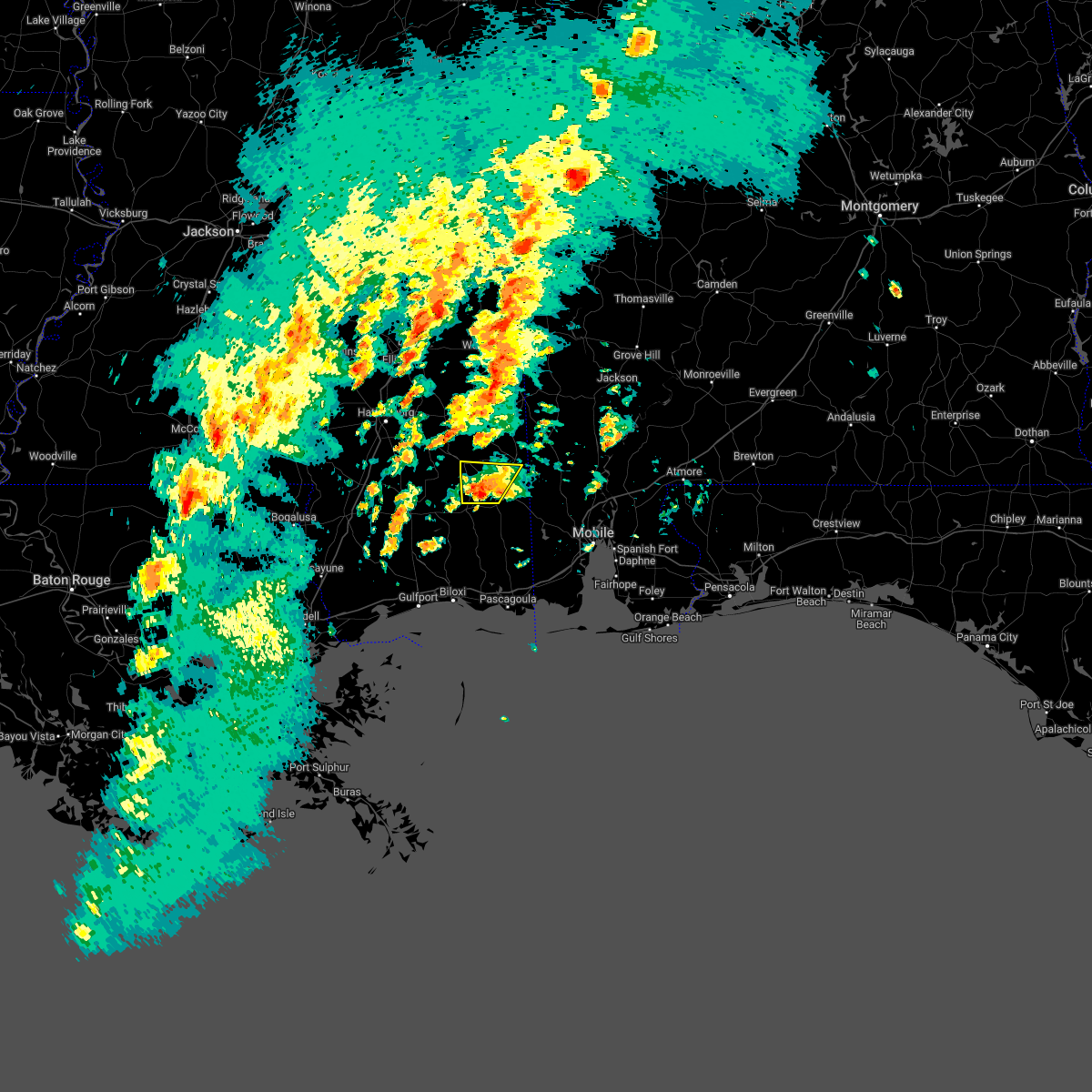 At 543 pm cdt, a severe thunderstorm was located 9 miles west of lucedale, moving northeast at 45 mph (radar indicated). Hazards include 60 mph wind gusts and quarter size hail. Hail damage to vehicles is expected. expect wind damage to roofs, siding, and trees. Locations impacted include, mclain. At 543 pm cdt, a severe thunderstorm was located 9 miles west of lucedale, moving northeast at 45 mph (radar indicated). Hazards include 60 mph wind gusts and quarter size hail. Hail damage to vehicles is expected. expect wind damage to roofs, siding, and trees. Locations impacted include, mclain.
|
| 3/22/2022 5:17 PM CDT |
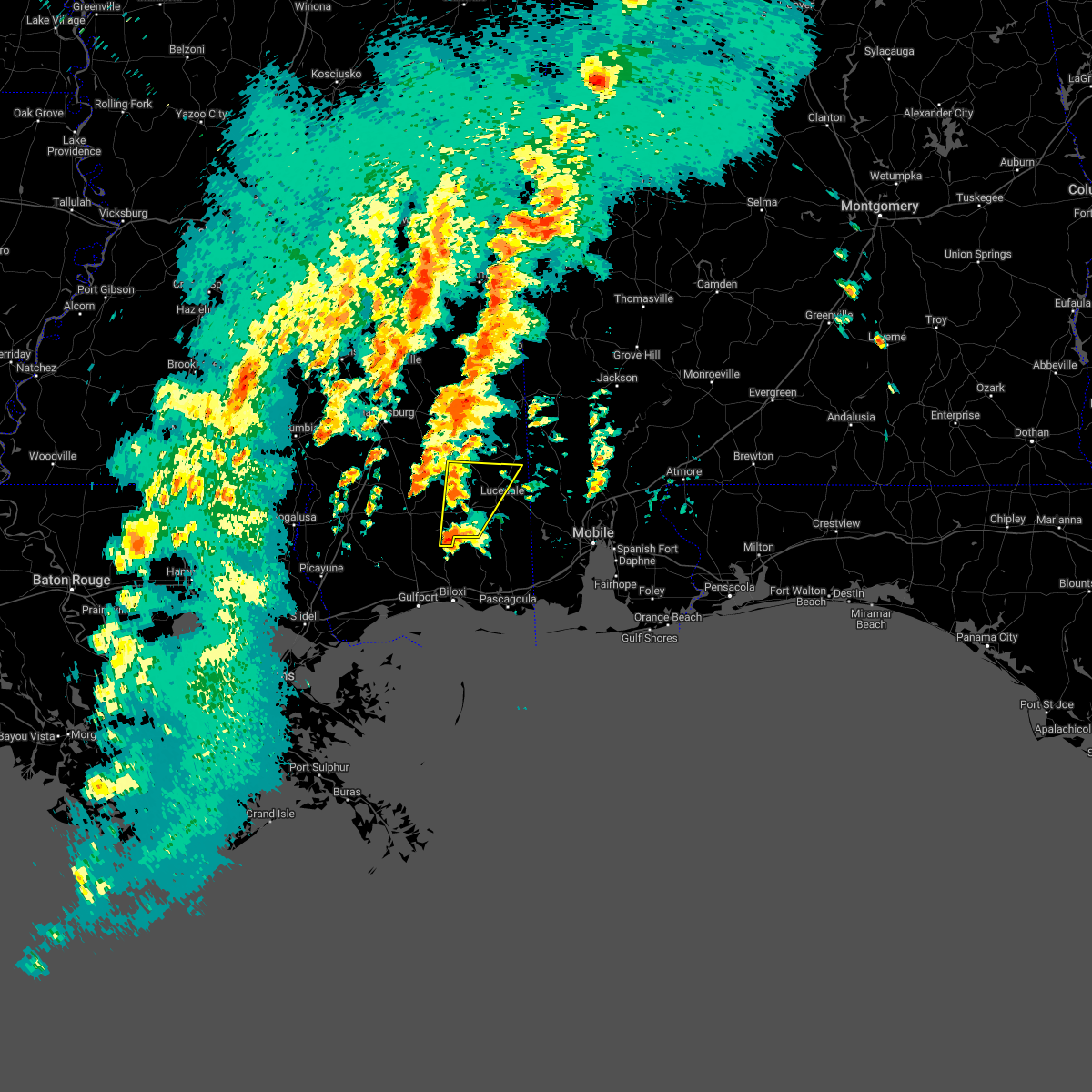 At 516 pm cdt, a severe thunderstorm was located 12 miles north of latimer, or 16 miles north of st. martin, moving northeast at 45 mph (radar indicated). Hazards include 60 mph wind gusts and quarter size hail. Hail damage to vehicles is expected. Expect wind damage to roofs, siding, and trees. At 516 pm cdt, a severe thunderstorm was located 12 miles north of latimer, or 16 miles north of st. martin, moving northeast at 45 mph (radar indicated). Hazards include 60 mph wind gusts and quarter size hail. Hail damage to vehicles is expected. Expect wind damage to roofs, siding, and trees.
|
| 3/18/2022 10:22 AM CDT |
 The severe thunderstorm warning for west central washington, southeastern perry and central greene counties will expire at 1030 am cdt, the storms which prompted the warning have weakened below severe limits. therefore, the warning will be allowed to expire. however small hail and gusty winds are still possible with these thunderstorms. a tornado watch remains in effect until noon cdt for southwestern alabama, and southeastern mississippi. The severe thunderstorm warning for west central washington, southeastern perry and central greene counties will expire at 1030 am cdt, the storms which prompted the warning have weakened below severe limits. therefore, the warning will be allowed to expire. however small hail and gusty winds are still possible with these thunderstorms. a tornado watch remains in effect until noon cdt for southwestern alabama, and southeastern mississippi.
|
| 3/18/2022 10:12 AM CDT |
 The severe thunderstorm warning for western george, southern perry, southwestern greene and stone counties will expire at 1015 am cdt, the storm which prompted the warning has weakened below severe limits. therefore, the warning will be allowed to expire. however gusty winds are still possible with this thunderstorm. a tornado watch remains in effect until noon cdt for southeastern mississippi. The severe thunderstorm warning for western george, southern perry, southwestern greene and stone counties will expire at 1015 am cdt, the storm which prompted the warning has weakened below severe limits. therefore, the warning will be allowed to expire. however gusty winds are still possible with this thunderstorm. a tornado watch remains in effect until noon cdt for southeastern mississippi.
|
| 3/18/2022 9:43 AM CDT |
 At 943 am cdt, severe thunderstorms were located along a line extending from 8 miles north of leakesville to 5 miles south of beaumont, moving northeast at 40 mph (radar indicated). Hazards include 60 mph wind gusts and quarter size hail. Hail damage to vehicles is expected. Expect wind damage to roofs, siding, and trees. At 943 am cdt, severe thunderstorms were located along a line extending from 8 miles north of leakesville to 5 miles south of beaumont, moving northeast at 40 mph (radar indicated). Hazards include 60 mph wind gusts and quarter size hail. Hail damage to vehicles is expected. Expect wind damage to roofs, siding, and trees.
|
| 3/18/2022 9:38 AM CDT |
 At 938 am cdt, a severe thunderstorm was located 7 miles west of wiggins, moving northeast at 50 mph (radar indicated). Hazards include 60 mph wind gusts and nickel size hail. Expect damage to roofs, siding, and trees. Locations impacted include, wiggins and perkinston. At 938 am cdt, a severe thunderstorm was located 7 miles west of wiggins, moving northeast at 50 mph (radar indicated). Hazards include 60 mph wind gusts and nickel size hail. Expect damage to roofs, siding, and trees. Locations impacted include, wiggins and perkinston.
|
| 3/18/2022 9:37 AM CDT |
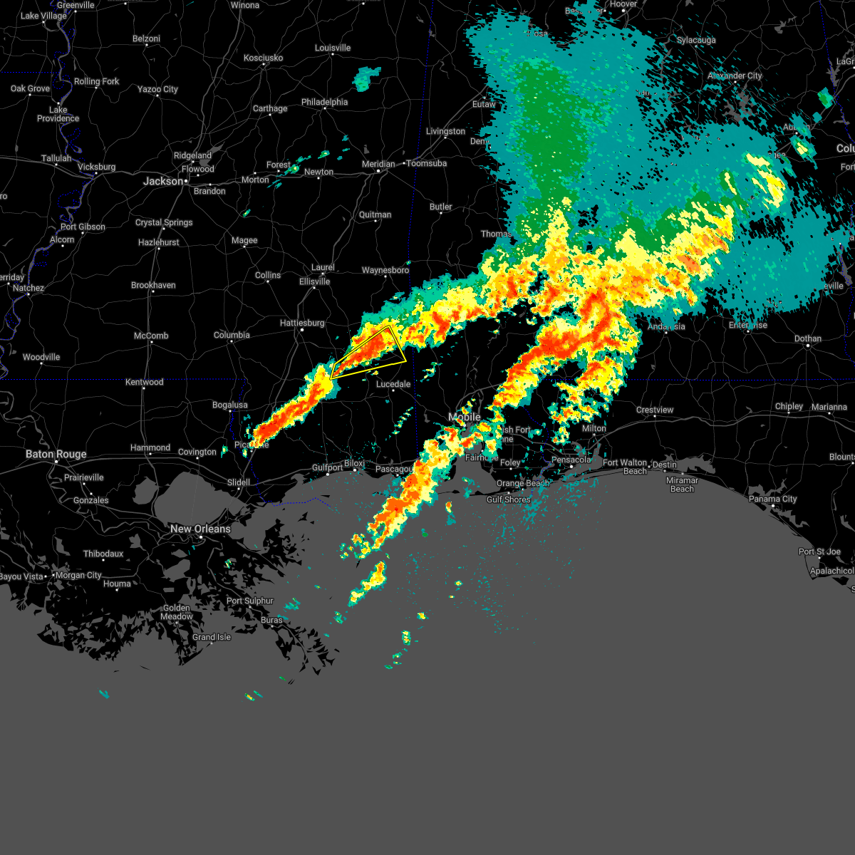 At 937 am cdt, a severe thunderstorm was located 5 miles northeast of mclain, or 11 miles west of leakesville, moving northeast at 45 mph (radar indicated). Hazards include 60 mph wind gusts and penny size hail. Expect damage to roofs, siding, and trees. Locations impacted include, leakesville, beaumont and mclain. At 937 am cdt, a severe thunderstorm was located 5 miles northeast of mclain, or 11 miles west of leakesville, moving northeast at 45 mph (radar indicated). Hazards include 60 mph wind gusts and penny size hail. Expect damage to roofs, siding, and trees. Locations impacted include, leakesville, beaumont and mclain.
|
| 3/18/2022 9:23 AM CDT |
 At 922 am cdt, a severe thunderstorm was located 5 miles southeast of poplarville, moving northeast at 45 mph (radar indicated). Hazards include 60 mph wind gusts and nickel size hail. expect damage to roofs, siding, and trees At 922 am cdt, a severe thunderstorm was located 5 miles southeast of poplarville, moving northeast at 45 mph (radar indicated). Hazards include 60 mph wind gusts and nickel size hail. expect damage to roofs, siding, and trees
|
| 3/18/2022 9:06 AM CDT |
 At 905 am cdt, a severe thunderstorm was located 4 miles northeast of maxie, or 10 miles north of wiggins, moving northeast at 45 mph (radar indicated). Hazards include 60 mph wind gusts and penny size hail. expect damage to roofs, siding, and trees At 905 am cdt, a severe thunderstorm was located 4 miles northeast of maxie, or 10 miles north of wiggins, moving northeast at 45 mph (radar indicated). Hazards include 60 mph wind gusts and penny size hail. expect damage to roofs, siding, and trees
|
| 2/3/2022 3:00 PM CST |
 At 259 pm cst, severe thunderstorms were located along a line extending from 3 miles southeast of mchenry to 9 miles south of mclain to 5 miles southeast of leakesville to 4 miles west of tibbie, moving northeast at 35 mph (radar indicated). Hazards include 60 mph wind gusts. expect damage to roofs, siding, and trees At 259 pm cst, severe thunderstorms were located along a line extending from 3 miles southeast of mchenry to 9 miles south of mclain to 5 miles southeast of leakesville to 4 miles west of tibbie, moving northeast at 35 mph (radar indicated). Hazards include 60 mph wind gusts. expect damage to roofs, siding, and trees
|
| 2/3/2022 12:17 PM CST |
 At 1216 pm cst, severe thunderstorms were located along a line extending from near macedonia to 4 miles northwest of new augusta to near brooklyn, moving northeast at 50 mph (radar indicated). Hazards include 60 mph wind gusts. Expect damage to roofs, siding, and trees. Locations impacted include, richton, beaumont and new augusta. At 1216 pm cst, severe thunderstorms were located along a line extending from near macedonia to 4 miles northwest of new augusta to near brooklyn, moving northeast at 50 mph (radar indicated). Hazards include 60 mph wind gusts. Expect damage to roofs, siding, and trees. Locations impacted include, richton, beaumont and new augusta.
|
| 2/3/2022 12:01 PM CST |
 At 1200 pm cst, a severe thunderstorm was located near rock hill, or 12 miles south of hattiesburg, moving northeast at 40 mph (radar indicated). Hazards include 60 mph wind gusts. expect damage to roofs, siding, and trees At 1200 pm cst, a severe thunderstorm was located near rock hill, or 12 miles south of hattiesburg, moving northeast at 40 mph (radar indicated). Hazards include 60 mph wind gusts. expect damage to roofs, siding, and trees
|
| 10/27/2021 7:43 PM CDT |
 The severe thunderstorm warning for perry and stone counties will expire at 745 pm cdt, the storms which prompted the warning have moved out of the area. therefore, the warning will be allowed to expire. a tornado watch remains in effect until 1000 pm cdt for southeastern mississippi. remember, a severe thunderstorm warning still remains in effect for southeastern stone county until 830 pm cdt. The severe thunderstorm warning for perry and stone counties will expire at 745 pm cdt, the storms which prompted the warning have moved out of the area. therefore, the warning will be allowed to expire. a tornado watch remains in effect until 1000 pm cdt for southeastern mississippi. remember, a severe thunderstorm warning still remains in effect for southeastern stone county until 830 pm cdt.
|
| 10/27/2021 6:59 PM CDT |
 At 659 pm cdt, severe thunderstorms were located along a line extending from 4 miles west of mclaurin to 7 miles west of wiggins to 10 miles southeast of poplarville, moving northeast at 35 mph (radar indicated). Hazards include 60 mph wind gusts. expect damage to roofs, siding, and trees At 659 pm cdt, severe thunderstorms were located along a line extending from 4 miles west of mclaurin to 7 miles west of wiggins to 10 miles southeast of poplarville, moving northeast at 35 mph (radar indicated). Hazards include 60 mph wind gusts. expect damage to roofs, siding, and trees
|
| 8/30/2021 3:39 AM CDT |
 At 338 am cdt, a severe thunderstorm capable of producing a tornado was located 6 miles west of lucedale, moving north at 45 mph. another tornadic circulation was nearing the jackson and george county line and also moving north at 45 mph (radar indicated rotation). Hazards include tornado. Flying debris will be dangerous to those caught without shelter. mobile homes will be damaged or destroyed. damage to roofs, windows, and vehicles will occur. tree damage is likely. this dangerous storm will be near, merrilll around 345 am cdt. mclain around 355 am cdt. Richton around 420 am cdt. At 338 am cdt, a severe thunderstorm capable of producing a tornado was located 6 miles west of lucedale, moving north at 45 mph. another tornadic circulation was nearing the jackson and george county line and also moving north at 45 mph (radar indicated rotation). Hazards include tornado. Flying debris will be dangerous to those caught without shelter. mobile homes will be damaged or destroyed. damage to roofs, windows, and vehicles will occur. tree damage is likely. this dangerous storm will be near, merrilll around 345 am cdt. mclain around 355 am cdt. Richton around 420 am cdt.
|
| 6/13/2021 5:48 PM CDT |
 At 546 pm cdt, severe thunderstorms were located along a line extending from 4 miles east of mclaurin to 4 miles northwest of leakesville to 6 miles east of deer park, moving south at 30 mph (radar indicated). Hazards include 60 mph wind gusts and penny size hail. expect damage to roofs, siding, and trees At 546 pm cdt, severe thunderstorms were located along a line extending from 4 miles east of mclaurin to 4 miles northwest of leakesville to 6 miles east of deer park, moving south at 30 mph (radar indicated). Hazards include 60 mph wind gusts and penny size hail. expect damage to roofs, siding, and trees
|
| 6/13/2021 5:35 PM CDT |
 The severe thunderstorm warning for western george, southeastern perry, southwestern greene and northeastern stone counties will expire at 545 pm cdt, the storm which prompted the warning has moved out of the area. therefore, the warning will be allowed to expire. however gusty winds and heavy rain are still possible with this thunderstorm. a severe thunderstorm watch remains in effect until 700 pm cdt for southeastern mississippi. The severe thunderstorm warning for western george, southeastern perry, southwestern greene and northeastern stone counties will expire at 545 pm cdt, the storm which prompted the warning has moved out of the area. therefore, the warning will be allowed to expire. however gusty winds and heavy rain are still possible with this thunderstorm. a severe thunderstorm watch remains in effect until 700 pm cdt for southeastern mississippi.
|
| 6/13/2021 5:22 PM CDT |
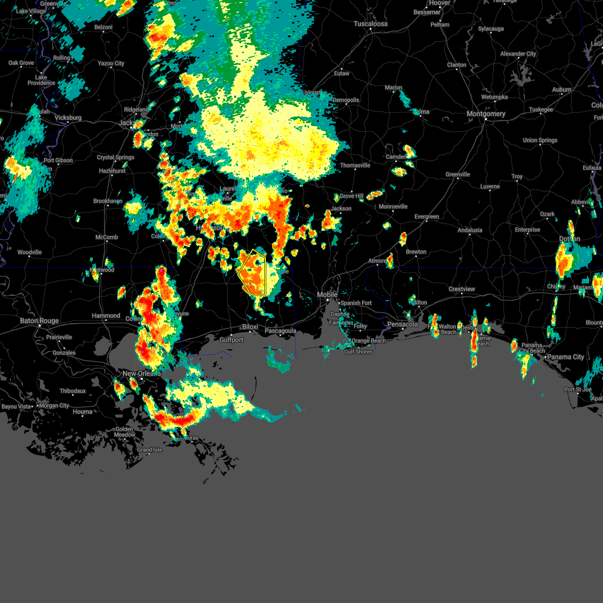 At 521 pm cdt, a cluster of severe thunderstorms was located 7 miles south of mclain, or 13 miles northwest of lucedale, moving southwest at 10 mph (radar indicated). Hazards include 60 mph wind gusts and penny size hail. Expect damage to roofs, siding, and trees. Locations impacted include, mclain. At 521 pm cdt, a cluster of severe thunderstorms was located 7 miles south of mclain, or 13 miles northwest of lucedale, moving southwest at 10 mph (radar indicated). Hazards include 60 mph wind gusts and penny size hail. Expect damage to roofs, siding, and trees. Locations impacted include, mclain.
|
| 6/13/2021 5:00 PM CDT |
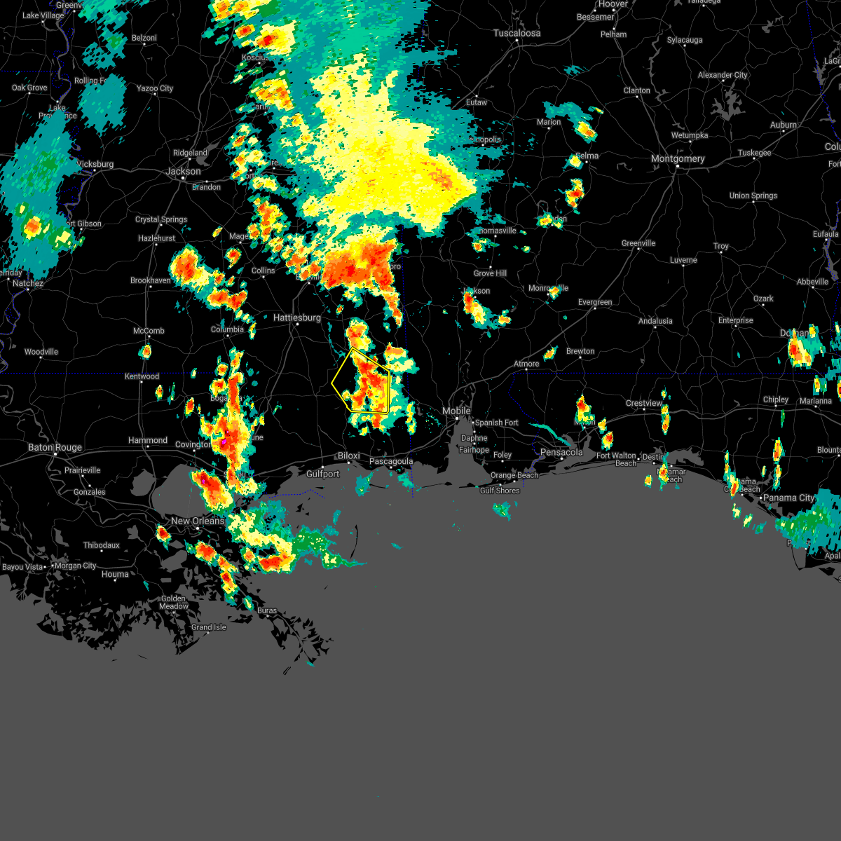 At 459 pm cdt, a cluster of severe thunderstorms was located 6 miles southeast of mclain, or 12 miles northwest of lucedale, moving southwest at 10 mph (radar indicated). Hazards include 60 mph wind gusts and penny size hail. expect damage to roofs, siding, and trees At 459 pm cdt, a cluster of severe thunderstorms was located 6 miles southeast of mclain, or 12 miles northwest of lucedale, moving southwest at 10 mph (radar indicated). Hazards include 60 mph wind gusts and penny size hail. expect damage to roofs, siding, and trees
|
| 5/4/2021 6:02 PM CDT |
 At 602 pm cdt, severe thunderstorms were located along a line extending from near leroy to 5 miles east of mclain, moving east at 45 mph (radar indicated). Hazards include 60 mph wind gusts. Expect damage to roofs, siding, and trees. Locations impacted include, monroeville, jackson, citronelle, lucedale, frisco city, leakesville, chunchula, stockton, saint stephens, wagarville, leroy, gulfcrest, deer park, axis, uriah, tibbie, calvert, mount vernon, mclain and excel. At 602 pm cdt, severe thunderstorms were located along a line extending from near leroy to 5 miles east of mclain, moving east at 45 mph (radar indicated). Hazards include 60 mph wind gusts. Expect damage to roofs, siding, and trees. Locations impacted include, monroeville, jackson, citronelle, lucedale, frisco city, leakesville, chunchula, stockton, saint stephens, wagarville, leroy, gulfcrest, deer park, axis, uriah, tibbie, calvert, mount vernon, mclain and excel.
|
| 5/4/2021 5:44 PM CDT |
 At 543 pm cdt, severe thunderstorms were located along a line extending from 6 miles west of saint stephens to near beaumont, moving east at 45 mph (radar indicated). Hazards include 60 mph wind gusts. expect damage to roofs, siding, and trees At 543 pm cdt, severe thunderstorms were located along a line extending from 6 miles west of saint stephens to near beaumont, moving east at 45 mph (radar indicated). Hazards include 60 mph wind gusts. expect damage to roofs, siding, and trees
|
| 5/4/2021 5:13 PM CDT |
 At 513 pm cdt, severe thunderstorms were located along a line extending from 4 miles west of silas to 3 miles east of clara to 8 miles northeast of richton to sunrise, moving east at 45 mph (radar indicated). Hazards include 60 mph wind gusts. Expect damage to roofs, siding, and trees. Locations impacted include, citronelle, chatom, richton, leakesville, wagarville, gulfcrest, deer park, tibbie, beaumont, calvert, mount vernon, new augusta, mclain, state line, fruitdale, mcintosh and movico. At 513 pm cdt, severe thunderstorms were located along a line extending from 4 miles west of silas to 3 miles east of clara to 8 miles northeast of richton to sunrise, moving east at 45 mph (radar indicated). Hazards include 60 mph wind gusts. Expect damage to roofs, siding, and trees. Locations impacted include, citronelle, chatom, richton, leakesville, wagarville, gulfcrest, deer park, tibbie, beaumont, calvert, mount vernon, new augusta, mclain, state line, fruitdale, mcintosh and movico.
|
| 5/4/2021 4:50 PM CDT |
 At 449 pm cdt, severe thunderstorms were located along a line extending from 7 miles northwest of waynesboro to 6 miles southeast of mill creek to 3 miles west of ovett to rawls springs, moving east at 45 mph (radar indicated). Hazards include 60 mph wind gusts. Expect damage to roofs, siding, and trees. Locations impacted include, citronelle, lucedale, frisco city, chatom, richton, leakesville, chunchula, wagarville, gulfcrest, deer park, uriah, tibbie, beaumont, calvert, mount vernon, new augusta, mclain, excel, state line and fruitdale. At 449 pm cdt, severe thunderstorms were located along a line extending from 7 miles northwest of waynesboro to 6 miles southeast of mill creek to 3 miles west of ovett to rawls springs, moving east at 45 mph (radar indicated). Hazards include 60 mph wind gusts. Expect damage to roofs, siding, and trees. Locations impacted include, citronelle, lucedale, frisco city, chatom, richton, leakesville, chunchula, wagarville, gulfcrest, deer park, uriah, tibbie, beaumont, calvert, mount vernon, new augusta, mclain, excel, state line and fruitdale.
|
| 5/4/2021 4:44 PM CDT |
 At 444 pm cdt, severe thunderstorms were located along a line extending from 7 miles north of waynesboro to 9 miles southeast of mill creek to 3 miles west of ovett to west hattiesburg, moving east at 75 mph (radar indicated). Hazards include 60 mph wind gusts. expect damage to roofs, siding, and trees At 444 pm cdt, severe thunderstorms were located along a line extending from 7 miles north of waynesboro to 9 miles southeast of mill creek to 3 miles west of ovett to west hattiesburg, moving east at 75 mph (radar indicated). Hazards include 60 mph wind gusts. expect damage to roofs, siding, and trees
|
| 4/24/2021 3:49 AM CDT |
 At 349 am cdt, severe thunderstorms were located along a line extending from 3 miles southeast of rock hill to 9 miles east of mcneil, moving east at 65 mph (radar indicated). Hazards include 60 mph wind gusts. expect damage to roofs, siding, and trees At 349 am cdt, severe thunderstorms were located along a line extending from 3 miles southeast of rock hill to 9 miles east of mcneil, moving east at 65 mph (radar indicated). Hazards include 60 mph wind gusts. expect damage to roofs, siding, and trees
|
| 4/24/2021 2:44 AM CDT |
 At 244 am cdt, a severe thunderstorm was located 6 miles northeast of mclain, or 12 miles west of leakesville, moving northeast at 40 mph (radar indicated). Hazards include 60 mph wind gusts. Expect damage to roofs, siding, and trees. Locations impacted include, leakesville, beaumont, mclain and state line. At 244 am cdt, a severe thunderstorm was located 6 miles northeast of mclain, or 12 miles west of leakesville, moving northeast at 40 mph (radar indicated). Hazards include 60 mph wind gusts. Expect damage to roofs, siding, and trees. Locations impacted include, leakesville, beaumont, mclain and state line.
|
| 4/24/2021 2:10 AM CDT |
 At 210 am cdt, a severe thunderstorm was located over brooklyn, or 13 miles north of wiggins, moving northeast at 55 mph (radar indicated). Hazards include 60 mph wind gusts. expect damage to roofs, siding, and trees At 210 am cdt, a severe thunderstorm was located over brooklyn, or 13 miles north of wiggins, moving northeast at 55 mph (radar indicated). Hazards include 60 mph wind gusts. expect damage to roofs, siding, and trees
|
| 4/24/2021 1:52 AM CDT |
 At 152 am cdt, a severe thunderstorm was located 9 miles northeast of mclain, or 12 miles northwest of leakesville, moving northeast at 60 mph (radar indicated). Hazards include 60 mph wind gusts. Expect damage to roofs, siding, and trees. Locations impacted include, leakesville, beaumont, new augusta, mclain and state line. At 152 am cdt, a severe thunderstorm was located 9 miles northeast of mclain, or 12 miles northwest of leakesville, moving northeast at 60 mph (radar indicated). Hazards include 60 mph wind gusts. Expect damage to roofs, siding, and trees. Locations impacted include, leakesville, beaumont, new augusta, mclain and state line.
|
| 4/24/2021 1:12 AM CDT |
 At 112 am cdt, a severe thunderstorm was located 4 miles southeast of rock hill, or 14 miles northwest of wiggins, moving northeast at 55 mph (radar indicated). Hazards include 60 mph wind gusts. expect damage to roofs, siding, and trees At 112 am cdt, a severe thunderstorm was located 4 miles southeast of rock hill, or 14 miles northwest of wiggins, moving northeast at 55 mph (radar indicated). Hazards include 60 mph wind gusts. expect damage to roofs, siding, and trees
|
| 4/10/2021 1:58 AM CDT |
 At 157 am cdt, severe thunderstorms were located along a line extending from 8 miles northwest of pennington to beaumont, moving east at 65 mph (radar indicated). Hazards include 70 mph wind gusts and quarter size hail. Hail damage to vehicles is expected. expect considerable tree damage. Wind damage is also likely to mobile homes, roofs, and outbuildings. At 157 am cdt, severe thunderstorms were located along a line extending from 8 miles northwest of pennington to beaumont, moving east at 65 mph (radar indicated). Hazards include 70 mph wind gusts and quarter size hail. Hail damage to vehicles is expected. expect considerable tree damage. Wind damage is also likely to mobile homes, roofs, and outbuildings.
|
| 4/10/2021 1:46 AM CDT |
 At 146 am cdt, severe thunderstorms were located along a line extending from 4 miles north of waynesboro to near brooklyn, moving east at 50 mph (radar indicated). Hazards include 70 mph wind gusts and quarter size hail. Hail damage to vehicles is expected. expect considerable tree damage. wind damage is also likely to mobile homes, roofs, and outbuildings. Locations impacted include, waynesboro, richton, clara, beaumont, new augusta, millry, mclain, state line and buckatunna. At 146 am cdt, severe thunderstorms were located along a line extending from 4 miles north of waynesboro to near brooklyn, moving east at 50 mph (radar indicated). Hazards include 70 mph wind gusts and quarter size hail. Hail damage to vehicles is expected. expect considerable tree damage. wind damage is also likely to mobile homes, roofs, and outbuildings. Locations impacted include, waynesboro, richton, clara, beaumont, new augusta, millry, mclain, state line and buckatunna.
|
| 4/10/2021 1:15 AM CDT |
 At 114 am cdt, severe thunderstorms were located along a line extending from 6 miles northeast of mill creek to near pinebur, moving east at 60 mph (radar indicated). Hazards include 60 mph wind gusts. expect damage to roofs, siding, and trees At 114 am cdt, severe thunderstorms were located along a line extending from 6 miles northeast of mill creek to near pinebur, moving east at 60 mph (radar indicated). Hazards include 60 mph wind gusts. expect damage to roofs, siding, and trees
|
| 3/30/2021 7:29 PM CDT |
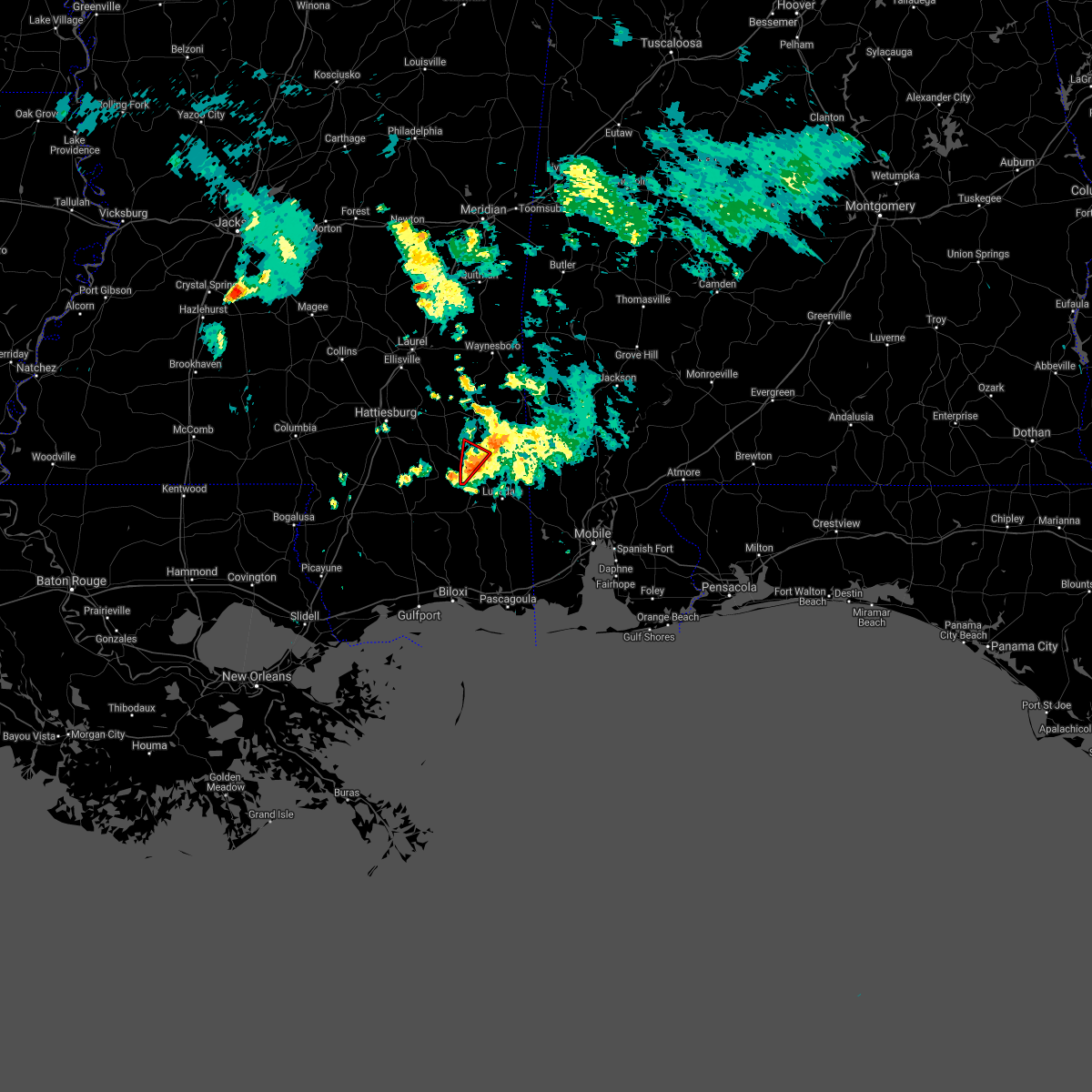 At 728 pm cdt, a severe thunderstorm capable of producing a tornado was located over mclain, or 15 miles west of leakesville, moving northeast at 20 mph (radar indicated rotation). Hazards include tornado. Flying debris will be dangerous to those caught without shelter. mobile homes will be damaged or destroyed. damage to roofs, windows, and vehicles will occur. tree damage is likely. This tornadic thunderstorm will remain over mainly rural areas of southwestern greene county. At 728 pm cdt, a severe thunderstorm capable of producing a tornado was located over mclain, or 15 miles west of leakesville, moving northeast at 20 mph (radar indicated rotation). Hazards include tornado. Flying debris will be dangerous to those caught without shelter. mobile homes will be damaged or destroyed. damage to roofs, windows, and vehicles will occur. tree damage is likely. This tornadic thunderstorm will remain over mainly rural areas of southwestern greene county.
|
| 3/30/2021 7:13 PM CDT |
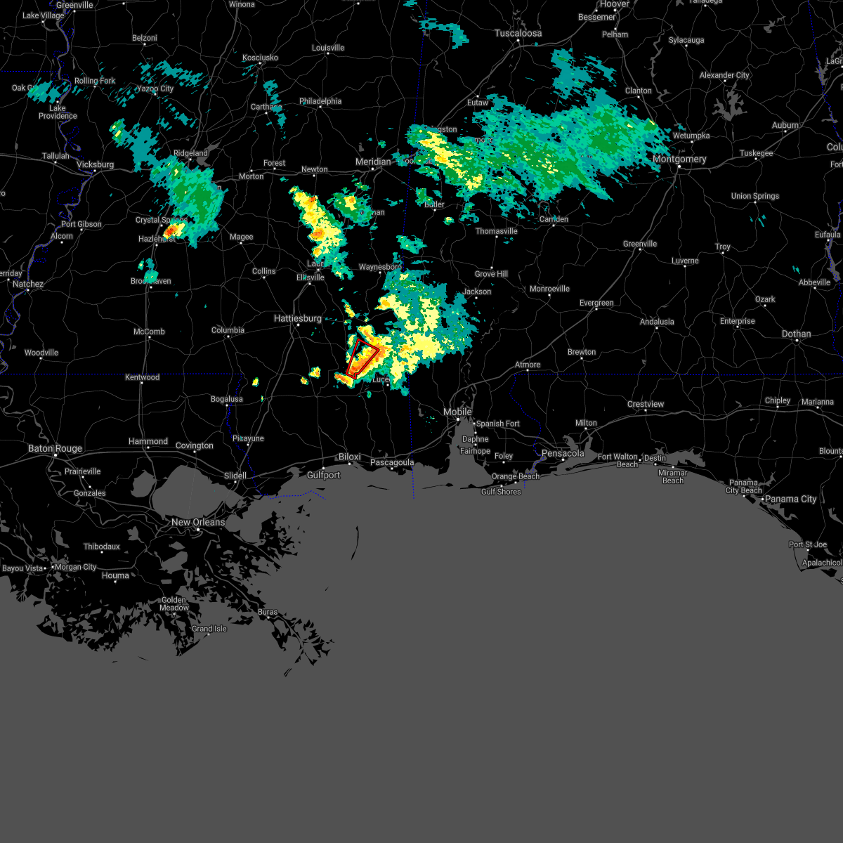 At 712 pm cdt, a severe thunderstorm capable of producing a tornado was located 7 miles south of mclain, or 16 miles west of lucedale, moving northeast at 20 mph (radar indicated rotation). Hazards include tornado. Flying debris will be dangerous to those caught without shelter. mobile homes will be damaged or destroyed. damage to roofs, windows, and vehicles will occur. tree damage is likely. This dangerous storm will be near, mclain around 730 pm cdt. At 712 pm cdt, a severe thunderstorm capable of producing a tornado was located 7 miles south of mclain, or 16 miles west of lucedale, moving northeast at 20 mph (radar indicated rotation). Hazards include tornado. Flying debris will be dangerous to those caught without shelter. mobile homes will be damaged or destroyed. damage to roofs, windows, and vehicles will occur. tree damage is likely. This dangerous storm will be near, mclain around 730 pm cdt.
|
| 3/17/2021 9:05 PM CDT |
 At 904 pm cdt, a severe thunderstorm was located 11 miles south of mclain, or 13 miles west of lucedale, moving northeast at 55 mph (radar indicated). Hazards include 60 mph wind gusts. Expect damage to roofs, siding, and trees. Locations impacted include, lucedale, leakesville and mclain. At 904 pm cdt, a severe thunderstorm was located 11 miles south of mclain, or 13 miles west of lucedale, moving northeast at 55 mph (radar indicated). Hazards include 60 mph wind gusts. Expect damage to roofs, siding, and trees. Locations impacted include, lucedale, leakesville and mclain.
|
| 3/17/2021 8:54 PM CDT |
 At 853 pm cdt, a severe thunderstorm was located 8 miles east of wiggins, moving northeast at 55 mph (radar indicated). Hazards include 70 mph wind gusts and penny size hail. Expect considerable tree damage. Damage is likely to mobile homes, roofs, and outbuildings. At 853 pm cdt, a severe thunderstorm was located 8 miles east of wiggins, moving northeast at 55 mph (radar indicated). Hazards include 70 mph wind gusts and penny size hail. Expect considerable tree damage. Damage is likely to mobile homes, roofs, and outbuildings.
|
| 3/17/2021 8:08 PM CDT |
 The severe thunderstorm warning for choctaw, western washington, southeastern perry, eastern wayne and greene counties will expire at 815 pm cdt, the storms which prompted the warning have weakened below severe limits, and no longer pose an immediate threat to life or property. therefore, the warning will be allowed to expire. however gusty winds are still possible with these thunderstorms. a tornado watch remains in effect until 300 am cdt for southwestern alabama, and southeastern mississippi. The severe thunderstorm warning for choctaw, western washington, southeastern perry, eastern wayne and greene counties will expire at 815 pm cdt, the storms which prompted the warning have weakened below severe limits, and no longer pose an immediate threat to life or property. therefore, the warning will be allowed to expire. however gusty winds are still possible with these thunderstorms. a tornado watch remains in effect until 300 am cdt for southwestern alabama, and southeastern mississippi.
|
| 3/17/2021 7:44 PM CDT |
 At 742 pm cdt, severe thunderstorms were located along a line extending from near melvin to 5 miles northeast of buckatunna to 7 miles west of fruitdale to 5 miles east of mclain, moving northeast at 60 mph (radar indicated). Hazards include 60 mph wind gusts. Expect damage to roofs, siding, and trees. Locations impacted include, waynesboro, butler, chatom, leakesville, deer park, tibbie, beaumont, lisman, millry, mclain, state line, buckatunna, silas, fruitdale, gilbertown and toxey. At 742 pm cdt, severe thunderstorms were located along a line extending from near melvin to 5 miles northeast of buckatunna to 7 miles west of fruitdale to 5 miles east of mclain, moving northeast at 60 mph (radar indicated). Hazards include 60 mph wind gusts. Expect damage to roofs, siding, and trees. Locations impacted include, waynesboro, butler, chatom, leakesville, deer park, tibbie, beaumont, lisman, millry, mclain, state line, buckatunna, silas, fruitdale, gilbertown and toxey.
|
| 3/17/2021 7:27 PM CDT |
 At 725 pm cdt, severe thunderstorms were located along a line extending from 8 miles southeast of goodwater to waynesboro to 10 miles east of richton to 5 miles south of beaumont, moving northeast at 55 mph (radar indicated). Hazards include 60 mph wind gusts. Expect damage to roofs, siding, and trees. Locations impacted include, waynesboro, butler, chatom, richton, leakesville, clara, tibbie, beaumont, new augusta, lisman, millry, mclain, state line, buckatunna, silas, fruitdale, gilbertown and toxey. At 725 pm cdt, severe thunderstorms were located along a line extending from 8 miles southeast of goodwater to waynesboro to 10 miles east of richton to 5 miles south of beaumont, moving northeast at 55 mph (radar indicated). Hazards include 60 mph wind gusts. Expect damage to roofs, siding, and trees. Locations impacted include, waynesboro, butler, chatom, richton, leakesville, clara, tibbie, beaumont, new augusta, lisman, millry, mclain, state line, buckatunna, silas, fruitdale, gilbertown and toxey.
|
| 3/17/2021 7:10 PM CDT |
 At 710 pm cdt, severe thunderstorms were located along a line extending from sandersville to 8 miles west of clara to 4 miles south of richton to 3 miles east of maxie, moving northeast at 55 mph (radar indicated). Hazards include 60 mph wind gusts. expect damage to roofs, siding, and trees At 710 pm cdt, severe thunderstorms were located along a line extending from sandersville to 8 miles west of clara to 4 miles south of richton to 3 miles east of maxie, moving northeast at 55 mph (radar indicated). Hazards include 60 mph wind gusts. expect damage to roofs, siding, and trees
|
| 3/17/2021 7:00 PM CDT |
 At 658 pm cdt, severe thunderstorms were located along a line extending from 4 miles northwest of sandersville to 4 miles southeast of ovett to 5 miles southwest of new augusta to 7 miles southwest of maxie, moving northeast at 55 mph (radar indicated). Hazards include 60 mph wind gusts. Expect damage to roofs, siding, and trees. Locations impacted include, richton, clara, beaumont, new augusta and mclain. At 658 pm cdt, severe thunderstorms were located along a line extending from 4 miles northwest of sandersville to 4 miles southeast of ovett to 5 miles southwest of new augusta to 7 miles southwest of maxie, moving northeast at 55 mph (radar indicated). Hazards include 60 mph wind gusts. Expect damage to roofs, siding, and trees. Locations impacted include, richton, clara, beaumont, new augusta and mclain.
|
| 3/17/2021 6:19 PM CDT |
 At 619 pm cdt, severe thunderstorms were located along a line extending from 3 miles south of magee to 3 miles south of sumrall to 7 miles northwest of poplarville, moving northeast at 60 mph (radar indicated). Hazards include 60 mph wind gusts. expect damage to roofs, siding, and trees At 619 pm cdt, severe thunderstorms were located along a line extending from 3 miles south of magee to 3 miles south of sumrall to 7 miles northwest of poplarville, moving northeast at 60 mph (radar indicated). Hazards include 60 mph wind gusts. expect damage to roofs, siding, and trees
|
| 6/24/2020 1:55 PM CDT |
 The severe thunderstorm warning for northern george, east central perry and southern greene counties will expire at 200 pm cdt, the storm which prompted the warning has weakened below severe limits, and has exited the warned area. therefore, the warning will be allowed to expire. a severe thunderstorm watch remains in effect until 900 pm cdt for southwestern alabama. The severe thunderstorm warning for northern george, east central perry and southern greene counties will expire at 200 pm cdt, the storm which prompted the warning has weakened below severe limits, and has exited the warned area. therefore, the warning will be allowed to expire. a severe thunderstorm watch remains in effect until 900 pm cdt for southwestern alabama.
|
| 6/24/2020 1:31 PM CDT |
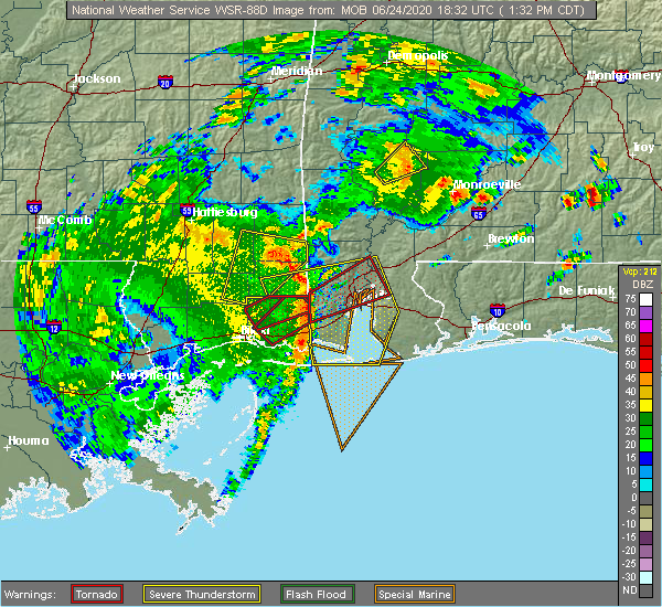 At 130 pm cdt, a severe thunderstorm was located 6 miles west of lucedale, moving northeast at 35 mph (radar indicated). Hazards include 60 mph wind gusts. Expect damage to roofs, siding, and trees. Locations impacted include, lucedale, leakesville and mclain. At 130 pm cdt, a severe thunderstorm was located 6 miles west of lucedale, moving northeast at 35 mph (radar indicated). Hazards include 60 mph wind gusts. Expect damage to roofs, siding, and trees. Locations impacted include, lucedale, leakesville and mclain.
|
| 6/24/2020 12:58 PM CDT |
 At 1257 pm cdt, a severe thunderstorm was located 14 miles east of mchenry, or 16 miles southeast of wiggins, moving northeast at 35 mph (radar indicated). Hazards include 60 mph wind gusts. expect damage to roofs, siding, and trees At 1257 pm cdt, a severe thunderstorm was located 14 miles east of mchenry, or 16 miles southeast of wiggins, moving northeast at 35 mph (radar indicated). Hazards include 60 mph wind gusts. expect damage to roofs, siding, and trees
|
| 5/27/2020 1:40 PM CDT |
 At 140 pm cdt, a severe thunderstorm was located over beaumont, or 14 miles south of richton, moving northeast at 20 mph (radar indicated). Hazards include 60 mph wind gusts and quarter size hail. Hail damage to vehicles is expected. Expect wind damage to roofs, siding, and trees. At 140 pm cdt, a severe thunderstorm was located over beaumont, or 14 miles south of richton, moving northeast at 20 mph (radar indicated). Hazards include 60 mph wind gusts and quarter size hail. Hail damage to vehicles is expected. Expect wind damage to roofs, siding, and trees.
|
| 5/27/2020 1:22 PM CDT |
 At 121 pm cdt, severe thunderstorms were located along a line extending from 4 miles south of new augusta to 7 miles southwest of mclain to 13 miles northeast of wiggins, moving northeast at 35 mph (radar indicated). Hazards include 70 mph wind gusts and half dollar size hail. Hail damage to vehicles is expected. expect considerable tree damage. Wind damage is also likely to mobile homes, roofs, and outbuildings. At 121 pm cdt, severe thunderstorms were located along a line extending from 4 miles south of new augusta to 7 miles southwest of mclain to 13 miles northeast of wiggins, moving northeast at 35 mph (radar indicated). Hazards include 70 mph wind gusts and half dollar size hail. Hail damage to vehicles is expected. expect considerable tree damage. Wind damage is also likely to mobile homes, roofs, and outbuildings.
|
| 5/27/2020 1:16 PM CDT |
 At 116 pm cdt, severe thunderstorms were located along a line extending from 4 miles south of new augusta to 9 miles southwest of mclain to 9 miles east of wiggins, moving northeast at 35 mph (radar indicated). Hazards include 70 mph wind gusts and half dollar size hail. Hail damage to vehicles is expected. expect considerable tree damage. wind damage is also likely to mobile homes, roofs, and outbuildings. Locations impacted include, beaumont and new augusta. At 116 pm cdt, severe thunderstorms were located along a line extending from 4 miles south of new augusta to 9 miles southwest of mclain to 9 miles east of wiggins, moving northeast at 35 mph (radar indicated). Hazards include 70 mph wind gusts and half dollar size hail. Hail damage to vehicles is expected. expect considerable tree damage. wind damage is also likely to mobile homes, roofs, and outbuildings. Locations impacted include, beaumont and new augusta.
|
| 5/27/2020 1:08 PM CDT |
 At 107 pm cdt, severe thunderstorms were located along a line extending from 5 miles southwest of new augusta to 9 miles east of brooklyn to 7 miles northeast of wiggins, moving east at 35 mph (radar indicated). Hazards include 70 mph wind gusts and quarter size hail. Hail damage to vehicles is expected. expect considerable tree damage. wind damage is also likely to mobile homes, roofs, and outbuildings. Locations impacted include, beaumont and new augusta. At 107 pm cdt, severe thunderstorms were located along a line extending from 5 miles southwest of new augusta to 9 miles east of brooklyn to 7 miles northeast of wiggins, moving east at 35 mph (radar indicated). Hazards include 70 mph wind gusts and quarter size hail. Hail damage to vehicles is expected. expect considerable tree damage. wind damage is also likely to mobile homes, roofs, and outbuildings. Locations impacted include, beaumont and new augusta.
|
| 5/27/2020 12:55 PM CDT |
 At 1255 pm cdt, a severe thunderstorm was located over maxie, or 9 miles north of wiggins, moving northeast at 20 mph (radar indicated). Hazards include 60 mph wind gusts and quarter size hail. Hail damage to vehicles is expected. Expect wind damage to roofs, siding, and trees. At 1255 pm cdt, a severe thunderstorm was located over maxie, or 9 miles north of wiggins, moving northeast at 20 mph (radar indicated). Hazards include 60 mph wind gusts and quarter size hail. Hail damage to vehicles is expected. Expect wind damage to roofs, siding, and trees.
|
| 4/19/2020 9:03 PM CDT |
 At 902 pm cdt, a severe thunderstorm was located over new augusta, or 14 miles southwest of richton, moving east at 45 mph. additional strong to severe storms are also occurring in greene county (radar indicated). Hazards include 60 mph wind gusts. expect damage to roofs, siding, and trees At 902 pm cdt, a severe thunderstorm was located over new augusta, or 14 miles southwest of richton, moving east at 45 mph. additional strong to severe storms are also occurring in greene county (radar indicated). Hazards include 60 mph wind gusts. expect damage to roofs, siding, and trees
|
| 4/19/2020 8:45 PM CDT |
 At 845 pm cdt, a severe thunderstorm was located 10 miles west of new augusta, moving east at 45 mph (radar indicated). Hazards include 60 mph wind gusts. expect damage to roofs, siding, and trees At 845 pm cdt, a severe thunderstorm was located 10 miles west of new augusta, moving east at 45 mph (radar indicated). Hazards include 60 mph wind gusts. expect damage to roofs, siding, and trees
|
| 4/12/2020 9:37 PM CDT |
 At 937 pm cdt, severe thunderstorms were located along a line extending from near mclain to 11 miles east of mchenry, moving east at 55 mph (radar indicated). Hazards include 60 mph wind gusts and nickel size hail. Expect damage to roofs, siding, and trees. Locations impacted include, wiggins, perkinston, mchenry and mclain. At 937 pm cdt, severe thunderstorms were located along a line extending from near mclain to 11 miles east of mchenry, moving east at 55 mph (radar indicated). Hazards include 60 mph wind gusts and nickel size hail. Expect damage to roofs, siding, and trees. Locations impacted include, wiggins, perkinston, mchenry and mclain.
|
| 4/12/2020 9:09 PM CDT |
 At 908 pm cdt, a severe thunderstorm was located 8 miles west of perkinston, or 10 miles southwest of wiggins, moving northeast at 70 mph (radar indicated). Hazards include 60 mph wind gusts and quarter size hail. Hail damage to vehicles is expected. Expect wind damage to roofs, siding, and trees. At 908 pm cdt, a severe thunderstorm was located 8 miles west of perkinston, or 10 miles southwest of wiggins, moving northeast at 70 mph (radar indicated). Hazards include 60 mph wind gusts and quarter size hail. Hail damage to vehicles is expected. Expect wind damage to roofs, siding, and trees.
|
| 3/31/2020 9:08 AM CDT |
 At 907 am cdt, a severe thunderstorm was located 12 miles south of mclain, or 14 miles east of wiggins, moving east at 80 mph (radar indicated). Hazards include 70 mph wind gusts. Expect considerable tree damage. Damage is likely to mobile homes, roofs, and outbuildings. At 907 am cdt, a severe thunderstorm was located 12 miles south of mclain, or 14 miles east of wiggins, moving east at 80 mph (radar indicated). Hazards include 70 mph wind gusts. Expect considerable tree damage. Damage is likely to mobile homes, roofs, and outbuildings.
|
| 1/11/2020 11:18 AM CST |
 At 1118 am cst, severe thunderstorms were located along a line extending from york to 7 miles southwest of mclain, moving east at 30 mph (radar indicated). Hazards include 60 mph wind gusts. Expect damage to roofs, siding, and trees. Locations impacted include, waynesboro, butler, chatom, leakesville, clara, beaumont, lisman, millry, mclain, state line, buckatunna, silas, fruitdale, pennington, gilbertown and toxey. At 1118 am cst, severe thunderstorms were located along a line extending from york to 7 miles southwest of mclain, moving east at 30 mph (radar indicated). Hazards include 60 mph wind gusts. Expect damage to roofs, siding, and trees. Locations impacted include, waynesboro, butler, chatom, leakesville, clara, beaumont, lisman, millry, mclain, state line, buckatunna, silas, fruitdale, pennington, gilbertown and toxey.
|
| 1/11/2020 10:55 AM CST |
 At 1054 am cst, severe thunderstorms were located along a line extending from toomsuba to 4 miles east of maxie, moving east at 30 mph (radar indicated). Hazards include 60 mph wind gusts. expect damage to roofs, siding, and trees At 1054 am cst, severe thunderstorms were located along a line extending from toomsuba to 4 miles east of maxie, moving east at 30 mph (radar indicated). Hazards include 60 mph wind gusts. expect damage to roofs, siding, and trees
|
| 10/31/2019 5:28 AM CDT |
 At 528 am cdt, a severe thunderstorm was located 4 miles northeast of wiggins, moving northeast at 30 mph (radar indicated). Hazards include 60 mph wind gusts. Expect damage to roofs, siding, and trees. This severe thunderstorm will remain over mainly rural areas of northwestern george, southern perry, southwestern greene and northeastern stone counties. At 528 am cdt, a severe thunderstorm was located 4 miles northeast of wiggins, moving northeast at 30 mph (radar indicated). Hazards include 60 mph wind gusts. Expect damage to roofs, siding, and trees. This severe thunderstorm will remain over mainly rural areas of northwestern george, southern perry, southwestern greene and northeastern stone counties.
|
| 10/25/2019 2:42 PM CDT |
 At 241 pm cdt, a severe thunderstorm capable of producing a tornado was located near beaumont, or 16 miles south of richton, moving north at 35 mph (radar indicated rotation). Hazards include tornado. Flying debris will be dangerous to those caught without shelter. mobile homes will be damaged or destroyed. damage to roofs, windows, and vehicles will occur. tree damage is likely. this dangerous storm will be near, beaumont around 250 pm cdt. Richton around 300 pm cdt. At 241 pm cdt, a severe thunderstorm capable of producing a tornado was located near beaumont, or 16 miles south of richton, moving north at 35 mph (radar indicated rotation). Hazards include tornado. Flying debris will be dangerous to those caught without shelter. mobile homes will be damaged or destroyed. damage to roofs, windows, and vehicles will occur. tree damage is likely. this dangerous storm will be near, beaumont around 250 pm cdt. Richton around 300 pm cdt.
|
| 10/25/2019 2:21 PM CDT |
 At 221 pm cdt, a severe thunderstorm capable of producing a tornado was located 6 miles southwest of mclain, or 18 miles northeast of wiggins, moving north at 25 mph (radar indicated rotation). Hazards include tornado. Flying debris will be dangerous to those caught without shelter. mobile homes will be damaged or destroyed. damage to roofs, windows, and vehicles will occur. tree damage is likely. this dangerous storm will be near, beaumont around 240 pm cdt. new augusta around 245 pm cdt. Richton around 300 pm cdt. At 221 pm cdt, a severe thunderstorm capable of producing a tornado was located 6 miles southwest of mclain, or 18 miles northeast of wiggins, moving north at 25 mph (radar indicated rotation). Hazards include tornado. Flying debris will be dangerous to those caught without shelter. mobile homes will be damaged or destroyed. damage to roofs, windows, and vehicles will occur. tree damage is likely. this dangerous storm will be near, beaumont around 240 pm cdt. new augusta around 245 pm cdt. Richton around 300 pm cdt.
|
| 7/10/2019 4:55 PM CDT |
 At 455 pm cdt, a severe thunderstorm was located 9 miles southwest of mclain, or 16 miles northeast of wiggins, moving west at 20 mph (radar indicated). Hazards include 60 mph wind gusts and penny size hail. expect damage to roofs, siding, and trees At 455 pm cdt, a severe thunderstorm was located 9 miles southwest of mclain, or 16 miles northeast of wiggins, moving west at 20 mph (radar indicated). Hazards include 60 mph wind gusts and penny size hail. expect damage to roofs, siding, and trees
|
| 7/10/2019 4:30 PM CDT |
 At 429 pm cdt, a severe thunderstorm was located 6 miles east of mclain, or 10 miles west of leakesville, moving west at 30 mph (radar indicated). Hazards include 60 mph wind gusts and penny size hail. expect damage to roofs, siding, and trees At 429 pm cdt, a severe thunderstorm was located 6 miles east of mclain, or 10 miles west of leakesville, moving west at 30 mph (radar indicated). Hazards include 60 mph wind gusts and penny size hail. expect damage to roofs, siding, and trees
|
| 6/28/2019 4:58 PM CDT |
 At 457 pm cdt, powerful, damaging winds are spreading quickly westward and northward from a severe thunderstorm located over mobile regional airport, or 7 miles northwest of tillmans corner (radar indicated). Hazards include 70 mph wind gusts. Expect considerable tree damage. Damage is likely to mobile homes, roofs, and outbuildings. At 457 pm cdt, powerful, damaging winds are spreading quickly westward and northward from a severe thunderstorm located over mobile regional airport, or 7 miles northwest of tillmans corner (radar indicated). Hazards include 70 mph wind gusts. Expect considerable tree damage. Damage is likely to mobile homes, roofs, and outbuildings.
|
| 5/4/2019 12:28 PM CDT |
 At 1228 pm cdt, severe thunderstorms were located along a line extending from 4 miles southeast of maxie to saucier, moving east at 40 mph (radar indicated). Hazards include 60 mph wind gusts. Expect damage to roofs, siding, and trees. Locations impacted include, wiggins, perkinston and mchenry. At 1228 pm cdt, severe thunderstorms were located along a line extending from 4 miles southeast of maxie to saucier, moving east at 40 mph (radar indicated). Hazards include 60 mph wind gusts. Expect damage to roofs, siding, and trees. Locations impacted include, wiggins, perkinston and mchenry.
|
| 5/4/2019 12:02 PM CDT |
 At 1201 pm cdt, severe thunderstorms were located along a line extending from near lumberton to 13 miles northeast of kiln, moving east at 35 mph (radar indicated). Hazards include 60 mph wind gusts. expect damage to roofs, siding, and trees At 1201 pm cdt, severe thunderstorms were located along a line extending from near lumberton to 13 miles northeast of kiln, moving east at 35 mph (radar indicated). Hazards include 60 mph wind gusts. expect damage to roofs, siding, and trees
|
| 4/18/2019 5:44 PM CDT |
 At 544 pm cdt, severe thunderstorms were located along a line extending from 10 miles south of clara to 12 miles east of wiggins, moving east at 30 mph (radar indicated). Hazards include 60 mph wind gusts. expect damage to roofs, siding, and trees At 544 pm cdt, severe thunderstorms were located along a line extending from 10 miles south of clara to 12 miles east of wiggins, moving east at 30 mph (radar indicated). Hazards include 60 mph wind gusts. expect damage to roofs, siding, and trees
|
| 4/18/2019 5:32 PM CDT |
 At 532 pm cdt, severe thunderstorms were located along a line extending from 10 miles northeast of richton to 8 miles east of maxie, moving east at 40 mph (radar indicated). Hazards include 60 mph wind gusts. Expect damage to roofs, siding, and trees. Locations impacted include, richton, leakesville, beaumont, new augusta, mclain and state line. At 532 pm cdt, severe thunderstorms were located along a line extending from 10 miles northeast of richton to 8 miles east of maxie, moving east at 40 mph (radar indicated). Hazards include 60 mph wind gusts. Expect damage to roofs, siding, and trees. Locations impacted include, richton, leakesville, beaumont, new augusta, mclain and state line.
|
| 4/18/2019 4:52 PM CDT |
 At 451 pm cdt, severe thunderstorms were located along a line extending from 5 miles east of moselle to 6 miles west of lumberton, moving east at 45 mph (radar indicated). Hazards include 60 mph wind gusts. expect damage to roofs, siding, and trees At 451 pm cdt, severe thunderstorms were located along a line extending from 5 miles east of moselle to 6 miles west of lumberton, moving east at 45 mph (radar indicated). Hazards include 60 mph wind gusts. expect damage to roofs, siding, and trees
|
| 1/19/2019 11:24 AM CST |
 At 1124 am cst, severe thunderstorms were located along a line extending from 8 miles north of waynesboro to clara to 3 miles east of new augusta, moving northeast at 55 mph (radar indicated). Hazards include 60 mph wind gusts. Expect damage to roofs, siding, and trees. locations impacted include, waynesboro, richton, clara, beaumont, new augusta, mclain, state line and buckatunna. A tornado watch remains in effect until 500 pm cst for southwestern alabama, and southeastern mississippi. At 1124 am cst, severe thunderstorms were located along a line extending from 8 miles north of waynesboro to clara to 3 miles east of new augusta, moving northeast at 55 mph (radar indicated). Hazards include 60 mph wind gusts. Expect damage to roofs, siding, and trees. locations impacted include, waynesboro, richton, clara, beaumont, new augusta, mclain, state line and buckatunna. A tornado watch remains in effect until 500 pm cst for southwestern alabama, and southeastern mississippi.
|
| 1/19/2019 10:53 AM CST |
 At 1053 am cst, severe thunderstorms were located along a line extending from 3 miles south of mill creek to 5 miles southeast of lumberton, moving northeast at 65 mph (radar indicated). Hazards include 60 mph wind gusts. expect damage to roofs, siding, and trees At 1053 am cst, severe thunderstorms were located along a line extending from 3 miles south of mill creek to 5 miles southeast of lumberton, moving northeast at 65 mph (radar indicated). Hazards include 60 mph wind gusts. expect damage to roofs, siding, and trees
|
| 11/1/2018 6:22 AM CDT |
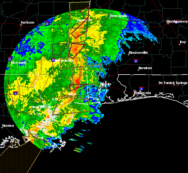 At 621 am cdt, a severe thunderstorm was located 5 miles southeast of leakesville, moving northeast at 50 mph (radar indicated). Hazards include 60 mph wind gusts. Expect damage to roofs, siding, and trees. locations impacted include, mclain. A tornado watch remains in effect until 900 am cdt for southeastern mississippi. At 621 am cdt, a severe thunderstorm was located 5 miles southeast of leakesville, moving northeast at 50 mph (radar indicated). Hazards include 60 mph wind gusts. Expect damage to roofs, siding, and trees. locations impacted include, mclain. A tornado watch remains in effect until 900 am cdt for southeastern mississippi.
|
| 11/1/2018 6:10 AM CDT |
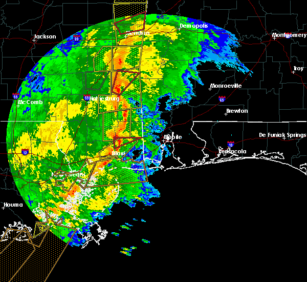 At 610 am cdt, a severe thunderstorm was located 8 miles southwest of leakesville, moving northeast at 50 mph (radar indicated). Hazards include 70 mph wind gusts. Expect considerable tree damage. damage is likely to mobile homes, roofs, and outbuildings. locations impacted include, mclain. A tornado watch remains in effect until 900 am cdt for southeastern mississippi. At 610 am cdt, a severe thunderstorm was located 8 miles southwest of leakesville, moving northeast at 50 mph (radar indicated). Hazards include 70 mph wind gusts. Expect considerable tree damage. damage is likely to mobile homes, roofs, and outbuildings. locations impacted include, mclain. A tornado watch remains in effect until 900 am cdt for southeastern mississippi.
|
| 11/1/2018 5:42 AM CDT |
 At 542 am cdt, a severe thunderstorm was located 7 miles northeast of wiggins, moving northeast at 50 mph (radar indicated). Hazards include 70 mph wind gusts. Expect considerable tree damage. Damage is likely to mobile homes, roofs, and outbuildings. At 542 am cdt, a severe thunderstorm was located 7 miles northeast of wiggins, moving northeast at 50 mph (radar indicated). Hazards include 70 mph wind gusts. Expect considerable tree damage. Damage is likely to mobile homes, roofs, and outbuildings.
|
| 11/1/2018 5:22 AM CDT |
 At 521 am cdt, severe thunderstorms were located along a line extending from 5 miles north of macedonia to mclaurin to near rock hill to 8 miles southeast of lumberton, moving northeast at 55 mph (radar indicated). Hazards include 60 mph wind gusts. expect damage to roofs, siding, and trees At 521 am cdt, severe thunderstorms were located along a line extending from 5 miles north of macedonia to mclaurin to near rock hill to 8 miles southeast of lumberton, moving northeast at 55 mph (radar indicated). Hazards include 60 mph wind gusts. expect damage to roofs, siding, and trees
|
| 8/26/2018 6:41 PM CDT |
 The national weather service in mobile has issued a * severe thunderstorm warning for. central perry county in southeastern mississippi. until 730 pm cdt. At 640 pm cdt, a severe thunderstorm was located 6 miles southwest of mclain, or 19 miles northeast of wiggins, moving northwest at 20. The national weather service in mobile has issued a * severe thunderstorm warning for. central perry county in southeastern mississippi. until 730 pm cdt. At 640 pm cdt, a severe thunderstorm was located 6 miles southwest of mclain, or 19 miles northeast of wiggins, moving northwest at 20.
|
| 7/31/2018 1:30 PM CDT |
 At 129 pm cdt, a severe thunderstorm was located over beaumont, or 10 miles south of richton, moving northeast at 25 mph (radar indicated). Hazards include 60 mph wind gusts. expect damage to roofs, siding, and trees At 129 pm cdt, a severe thunderstorm was located over beaumont, or 10 miles south of richton, moving northeast at 25 mph (radar indicated). Hazards include 60 mph wind gusts. expect damage to roofs, siding, and trees
|
| 6/30/2018 8:16 PM CDT |
 At 815 pm cdt, a severe thunderstorm was located 6 miles northeast of beaumont, or 12 miles southeast of richton, moving southwest at 20 mph (radar indicated). Hazards include 60 mph wind gusts. Expect damage to roofs, siding, and trees. Locations impacted include, beaumont. At 815 pm cdt, a severe thunderstorm was located 6 miles northeast of beaumont, or 12 miles southeast of richton, moving southwest at 20 mph (radar indicated). Hazards include 60 mph wind gusts. Expect damage to roofs, siding, and trees. Locations impacted include, beaumont.
|
| 6/30/2018 7:52 PM CDT |
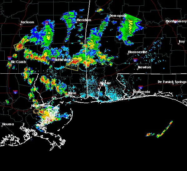 At 751 pm cdt, a severe thunderstorm was located 10 miles east of richton, moving southwest at 15 mph (radar indicated). Hazards include 60 mph wind gusts. expect damage to roofs, siding, and trees At 751 pm cdt, a severe thunderstorm was located 10 miles east of richton, moving southwest at 15 mph (radar indicated). Hazards include 60 mph wind gusts. expect damage to roofs, siding, and trees
|
| 3/17/2018 6:48 PM CDT |
 At 647 pm cdt, a severe thunderstorm was located 5 miles south of mclain, or 16 miles south of richton, moving east at 15 mph (radar indicated). Hazards include 60 mph wind gusts. Expect damage to roofs, siding, and trees. This severe thunderstorm will remain over mainly rural areas of east central perry county. At 647 pm cdt, a severe thunderstorm was located 5 miles south of mclain, or 16 miles south of richton, moving east at 15 mph (radar indicated). Hazards include 60 mph wind gusts. Expect damage to roofs, siding, and trees. This severe thunderstorm will remain over mainly rural areas of east central perry county.
|
| 3/17/2018 6:39 PM CDT |
 At 639 pm cdt, severe thunderstorms were located along a line extending from 10 miles northeast of wiggins to 11 miles southeast of beaumont to mclain, moving east at 25 mph (radar indicated). Hazards include 60 mph wind gusts and nickel size hail. expect damage to roofs, siding, and trees At 639 pm cdt, severe thunderstorms were located along a line extending from 10 miles northeast of wiggins to 11 miles southeast of beaumont to mclain, moving east at 25 mph (radar indicated). Hazards include 60 mph wind gusts and nickel size hail. expect damage to roofs, siding, and trees
|
| 3/17/2018 6:17 PM CDT |
 At 615 pm cdt, a severe thunderstorm was located 5 miles southwest of beaumont, or 15 miles south of richton, moving east at 10 mph (radar indicated). Hazards include 60 mph wind gusts and quarter size hail. Hail damage to vehicles is expected. Expect wind damage to roofs, siding, and trees. At 615 pm cdt, a severe thunderstorm was located 5 miles southwest of beaumont, or 15 miles south of richton, moving east at 10 mph (radar indicated). Hazards include 60 mph wind gusts and quarter size hail. Hail damage to vehicles is expected. Expect wind damage to roofs, siding, and trees.
|
| 8/30/2017 1:50 PM CDT |
 At 148 pm cdt, severe thunderstorms were located along a line extending from belleville, to near new augusta, to 9 miles southwest of mclain, to 6 miles east of mchenry, moving north at 45 mph (radar indicated). Hazards include 60 mph wind gusts. Expect damage to roofs, siding, and trees. locations impacted include, wiggins, richton, perkinston, beaumont and new augusta. A tornado watch remains in effect until 600 pm cdt for southeastern mississippi. At 148 pm cdt, severe thunderstorms were located along a line extending from belleville, to near new augusta, to 9 miles southwest of mclain, to 6 miles east of mchenry, moving north at 45 mph (radar indicated). Hazards include 60 mph wind gusts. Expect damage to roofs, siding, and trees. locations impacted include, wiggins, richton, perkinston, beaumont and new augusta. A tornado watch remains in effect until 600 pm cdt for southeastern mississippi.
|
| 8/30/2017 1:20 PM CDT |
 At 119 pm cdt, severe thunderstorms were located along a line extending from near maxie to near wiggins to near perkinston to saucier, moving north at 40 mph (radar indicated). Hazards include 60 mph wind gusts. expect damage to roofs, siding, and trees At 119 pm cdt, severe thunderstorms were located along a line extending from near maxie to near wiggins to near perkinston to saucier, moving north at 40 mph (radar indicated). Hazards include 60 mph wind gusts. expect damage to roofs, siding, and trees
|
| 5/12/2017 10:59 AM CDT |
 At 1058 am cdt, severe thunderstorms were located along a line extending from near mclaurin to 11 miles north of kiln, moving east at 45 mph (radar indicated). Hazards include 60 mph wind gusts. Expect damage to roofs, siding, and trees. Locations impacted include, wiggins, perkinston, mchenry, beaumont, new augusta and mclain. At 1058 am cdt, severe thunderstorms were located along a line extending from near mclaurin to 11 miles north of kiln, moving east at 45 mph (radar indicated). Hazards include 60 mph wind gusts. Expect damage to roofs, siding, and trees. Locations impacted include, wiggins, perkinston, mchenry, beaumont, new augusta and mclain.
|
| 5/12/2017 10:45 AM CDT |
 At 1044 am cdt, severe thunderstorms were located along a line extending from near purvis to 7 miles east of picayune, moving east at 45 mph (radar indicated). Hazards include 60 mph wind gusts. expect damage to roofs, siding, and trees At 1044 am cdt, severe thunderstorms were located along a line extending from near purvis to 7 miles east of picayune, moving east at 45 mph (radar indicated). Hazards include 60 mph wind gusts. expect damage to roofs, siding, and trees
|
| 4/30/2017 2:27 PM CDT |
 At 226 pm cdt, severe thunderstorms were located along a line extending from 6 miles east of deer park to 8 miles east of lucedale to 14 miles northwest of wade to near d`iberville, moving northeast at 40 mph (radar indicated). Hazards include 60 mph wind gusts. Expect damage to roofs, siding, and trees. locations impacted include, citronelle, lucedale, leakesville, chunchula, gulfcrest, deer park, mount vernon, calvert, semmes, mcintosh, movico and wilmer. a tornado watch remains in effect until 300 pm cdt for southeastern mississippi. A tornado watch also remains in effect until 700 pm cdt for southwestern alabama. At 226 pm cdt, severe thunderstorms were located along a line extending from 6 miles east of deer park to 8 miles east of lucedale to 14 miles northwest of wade to near d`iberville, moving northeast at 40 mph (radar indicated). Hazards include 60 mph wind gusts. Expect damage to roofs, siding, and trees. locations impacted include, citronelle, lucedale, leakesville, chunchula, gulfcrest, deer park, mount vernon, calvert, semmes, mcintosh, movico and wilmer. a tornado watch remains in effect until 300 pm cdt for southeastern mississippi. A tornado watch also remains in effect until 700 pm cdt for southwestern alabama.
|
| 4/30/2017 2:00 PM CDT |
 At 159 pm cdt, severe thunderstorms were located along a line extending from near deer park to 12 miles southwest of lucedale to 6 miles east of saucier to near long beach, moving east at 20 mph (radar indicated). Hazards include 60 mph wind gusts and penny size hail. expect damage to roofs, siding, and trees At 159 pm cdt, severe thunderstorms were located along a line extending from near deer park to 12 miles southwest of lucedale to 6 miles east of saucier to near long beach, moving east at 20 mph (radar indicated). Hazards include 60 mph wind gusts and penny size hail. expect damage to roofs, siding, and trees
|
| 4/30/2017 1:19 PM CDT |
 At 118 pm cdt, severe thunderstorms were located along a line extending from near state line to near leakesville to near mclain to 11 miles east of mchenry, moving east at 30 mph (radar indicated). Hazards include 70 mph wind gusts. Expect considerable tree damage. damage is likely to mobile homes, roofs, and outbuildings. locations impacted include, wiggins, lucedale, leakesville, perkinston, mchenry, deer park, tibbie, beaumont, mclain, state line and fruitdale. a tornado watch remains in effect until 300 pm cdt for southeastern mississippi. A tornado watch also remains in effect until 700 pm cdt for southwestern alabama. At 118 pm cdt, severe thunderstorms were located along a line extending from near state line to near leakesville to near mclain to 11 miles east of mchenry, moving east at 30 mph (radar indicated). Hazards include 70 mph wind gusts. Expect considerable tree damage. damage is likely to mobile homes, roofs, and outbuildings. locations impacted include, wiggins, lucedale, leakesville, perkinston, mchenry, deer park, tibbie, beaumont, mclain, state line and fruitdale. a tornado watch remains in effect until 300 pm cdt for southeastern mississippi. A tornado watch also remains in effect until 700 pm cdt for southwestern alabama.
|
| 4/30/2017 1:02 PM CDT |
 At 102 pm cdt, severe thunderstorms were located along a line extending from 10 miles northeast of richton to near mclain to 11 miles south of beaumont to 6 miles east of mchenry, moving east at 45 mph (radar indicated). Hazards include 70 mph wind gusts. Expect considerable tree damage. Damage is likely to mobile homes, roofs, and outbuildings. At 102 pm cdt, severe thunderstorms were located along a line extending from 10 miles northeast of richton to near mclain to 11 miles south of beaumont to 6 miles east of mchenry, moving east at 45 mph (radar indicated). Hazards include 70 mph wind gusts. Expect considerable tree damage. Damage is likely to mobile homes, roofs, and outbuildings.
|
| 4/30/2017 12:41 PM CDT |
 At 1240 pm cdt, severe thunderstorms were located along a line extending from near buckatunna to near maxie to 8 miles west of saucier, moving east at 20 mph (radar indicated). Hazards include 70 mph wind gusts and penny size hail. Expect considerable tree damage. damage is likely to mobile homes, roofs, and outbuildings. locations impacted include, wiggins, richton, leakesville, perkinston, mchenry, beaumont, new augusta, mclain and state line. a tornado watch remains in effect until 300 pm cdt for southeastern mississippi. A tornado watch also remains in effect until 700 pm cdt for southwestern alabama. At 1240 pm cdt, severe thunderstorms were located along a line extending from near buckatunna to near maxie to 8 miles west of saucier, moving east at 20 mph (radar indicated). Hazards include 70 mph wind gusts and penny size hail. Expect considerable tree damage. damage is likely to mobile homes, roofs, and outbuildings. locations impacted include, wiggins, richton, leakesville, perkinston, mchenry, beaumont, new augusta, mclain and state line. a tornado watch remains in effect until 300 pm cdt for southeastern mississippi. A tornado watch also remains in effect until 700 pm cdt for southwestern alabama.
|
| 4/30/2017 12:16 PM CDT |
 At 1215 pm cdt, severe thunderstorms were located along a line extending from 8 miles south of clara to near maxie to 12 miles north of kiln, moving east at 20 mph (radar indicated). Hazards include 60 mph wind gusts and penny size hail. expect damage to roofs, siding, and trees At 1215 pm cdt, severe thunderstorms were located along a line extending from 8 miles south of clara to near maxie to 12 miles north of kiln, moving east at 20 mph (radar indicated). Hazards include 60 mph wind gusts and penny size hail. expect damage to roofs, siding, and trees
|
| 4/30/2017 11:52 AM CDT |
 At 1151 am cdt, severe thunderstorms were located along a line extending from 6 miles southeast of goodwater to near richton to near maxie, moving east at 25 mph (radar indicated). Hazards include 60 mph wind gusts and penny size hail. Expect damage to roofs, siding, and trees. locations impacted include, waynesboro, richton, clara, beaumont, new augusta and mclain. a tornado watch remains in effect until 300 pm cdt for southeastern mississippi. A tornado watch also remains in effect until 700 pm cdt for southwestern alabama. At 1151 am cdt, severe thunderstorms were located along a line extending from 6 miles southeast of goodwater to near richton to near maxie, moving east at 25 mph (radar indicated). Hazards include 60 mph wind gusts and penny size hail. Expect damage to roofs, siding, and trees. locations impacted include, waynesboro, richton, clara, beaumont, new augusta and mclain. a tornado watch remains in effect until 300 pm cdt for southeastern mississippi. A tornado watch also remains in effect until 700 pm cdt for southwestern alabama.
|
| 4/30/2017 11:34 AM CDT |
 At 1134 am cdt, severe thunderstorms were located along a line extending from near stafford springs to 9 miles southeast of lumberton, moving east at 25 mph. wind damage has been reported with this line of thunderstorms as it moved through previous counties in mississippi (radar indicated). Hazards include 60 mph wind gusts and penny size hail. expect damage to roofs, siding, and trees At 1134 am cdt, severe thunderstorms were located along a line extending from near stafford springs to 9 miles southeast of lumberton, moving east at 25 mph. wind damage has been reported with this line of thunderstorms as it moved through previous counties in mississippi (radar indicated). Hazards include 60 mph wind gusts and penny size hail. expect damage to roofs, siding, and trees
|
| 4/3/2017 5:40 AM CDT |
 At 540 am cdt, severe thunderstorms were located along a line extending from near buckatunna to 6 miles northwest of lucedale, moving east at 35 mph (radar indicated). Hazards include 60 mph wind gusts. Expect damage to roofs, siding, and trees. locations impacted include, chatom, leakesville, deer park, tibbie, mclain, state line and fruitdale. A tornado watch remains in effect until 900 am cdt for southwestern alabama, and southeastern mississippi. At 540 am cdt, severe thunderstorms were located along a line extending from near buckatunna to 6 miles northwest of lucedale, moving east at 35 mph (radar indicated). Hazards include 60 mph wind gusts. Expect damage to roofs, siding, and trees. locations impacted include, chatom, leakesville, deer park, tibbie, mclain, state line and fruitdale. A tornado watch remains in effect until 900 am cdt for southwestern alabama, and southeastern mississippi.
|
| 4/3/2017 5:10 AM CDT |
 At 510 am cdt, severe thunderstorms were located along a line extending from 9 miles south of clara to 8 miles southwest of mclain, moving east at 40 mph (radar indicated). Hazards include 60 mph wind gusts. expect damage to roofs, siding, and trees At 510 am cdt, severe thunderstorms were located along a line extending from 9 miles south of clara to 8 miles southwest of mclain, moving east at 40 mph (radar indicated). Hazards include 60 mph wind gusts. expect damage to roofs, siding, and trees
|
| 3/30/2017 11:50 AM CDT |
 At 1150 am cdt, a severe thunderstorm was located 15 miles east of wiggins, moving northeast at 20 mph (radar indicated). Hazards include 60 mph wind gusts and quarter size hail. Hail damage to vehicles is expected. Expect wind damage to roofs, siding, and trees. At 1150 am cdt, a severe thunderstorm was located 15 miles east of wiggins, moving northeast at 20 mph (radar indicated). Hazards include 60 mph wind gusts and quarter size hail. Hail damage to vehicles is expected. Expect wind damage to roofs, siding, and trees.
|
| 1/21/2017 10:13 PM CST |
 At 1013 pm cst, a severe thunderstorm was located over wiggins, moving northeast at 45 mph (radar indicated). Hazards include 60 mph wind gusts and half dollar size hail. Hail damage to vehicles is expected. expect wind damage to roofs, siding, and trees. locations impacted include, wiggins, perkinston, beaumont and mclain. A tornado watch remains in effect until 300 am cst for southeastern mississippi. At 1013 pm cst, a severe thunderstorm was located over wiggins, moving northeast at 45 mph (radar indicated). Hazards include 60 mph wind gusts and half dollar size hail. Hail damage to vehicles is expected. expect wind damage to roofs, siding, and trees. locations impacted include, wiggins, perkinston, beaumont and mclain. A tornado watch remains in effect until 300 am cst for southeastern mississippi.
|
| 1/21/2017 9:49 PM CST |
 At 949 pm cst, a severe thunderstorm was located 11 miles southeast of poplarville, moving northeast at 45 mph (radar indicated). Hazards include 60 mph wind gusts and half dollar size hail. Hail damage to vehicles is expected. Expect wind damage to roofs, siding, and trees. At 949 pm cst, a severe thunderstorm was located 11 miles southeast of poplarville, moving northeast at 45 mph (radar indicated). Hazards include 60 mph wind gusts and half dollar size hail. Hail damage to vehicles is expected. Expect wind damage to roofs, siding, and trees.
|
| 1/21/2017 9:48 PM CST |
 At 948 pm cst, a severe thunderstorm was located 7 miles east of richton, moving northeast at 50 mph (radar indicated). Hazards include 60 mph wind gusts and half dollar size hail. Hail damage to vehicles is expected. Expect wind damage to roofs, siding, and trees. At 948 pm cst, a severe thunderstorm was located 7 miles east of richton, moving northeast at 50 mph (radar indicated). Hazards include 60 mph wind gusts and half dollar size hail. Hail damage to vehicles is expected. Expect wind damage to roofs, siding, and trees.
|
| 1/21/2017 9:25 PM CST |
 At 925 pm cst, a severe thunderstorm was located near new augusta, or 11 miles southeast of petal, moving northeast at 50 mph (radar indicated). Hazards include 60 mph wind gusts and quarter size hail. Hail damage to vehicles is expected. Expect wind damage to roofs, siding, and trees. At 925 pm cst, a severe thunderstorm was located near new augusta, or 11 miles southeast of petal, moving northeast at 50 mph (radar indicated). Hazards include 60 mph wind gusts and quarter size hail. Hail damage to vehicles is expected. Expect wind damage to roofs, siding, and trees.
|
| 1/21/2017 8:02 PM CST |
 At 802 pm cst, a severe thunderstorm was located over brooklyn, or 13 miles north of wiggins, moving northeast at 65 mph (radar indicated). Hazards include ping pong ball size hail and 60 mph wind gusts. People and animals outdoors will be injured. expect hail damage to roofs, siding, windows, and vehicles. expect wind damage to roofs, siding, and trees. locations impacted include, beaumont and new augusta. A tornado watch remains in effect until 900 pm cst for southeastern mississippi. At 802 pm cst, a severe thunderstorm was located over brooklyn, or 13 miles north of wiggins, moving northeast at 65 mph (radar indicated). Hazards include ping pong ball size hail and 60 mph wind gusts. People and animals outdoors will be injured. expect hail damage to roofs, siding, windows, and vehicles. expect wind damage to roofs, siding, and trees. locations impacted include, beaumont and new augusta. A tornado watch remains in effect until 900 pm cst for southeastern mississippi.
|
| 1/21/2017 7:56 PM CST |
 At 755 pm cst, a severe thunderstorm was located near maxie, or 12 miles northwest of wiggins, moving northeast at 65 mph (radar indicated). Hazards include ping pong ball size hail and 60 mph wind gusts. People and animals outdoors will be injured. expect hail damage to roofs, siding, windows, and vehicles. Expect wind damage to roofs, siding, and trees. At 755 pm cst, a severe thunderstorm was located near maxie, or 12 miles northwest of wiggins, moving northeast at 65 mph (radar indicated). Hazards include ping pong ball size hail and 60 mph wind gusts. People and animals outdoors will be injured. expect hail damage to roofs, siding, windows, and vehicles. Expect wind damage to roofs, siding, and trees.
|
| 1/2/2017 3:40 PM CST |
 At 340 pm cst, severe thunderstorms were located along a line extending from near kewanee to 9 miles west of silas to 7 miles west of leakesville to 8 miles east of wiggins, moving northeast at 65 mph (radar indicated). Hazards include 70 mph wind gusts and quarter size hail. Hail damage to vehicles is expected. expect considerable tree damage. wind damage is also likely to mobile homes, roofs, and outbuildings. locations impacted include, waynesboro, wiggins, lucedale, butler, chatom, richton, leakesville, clara, mchenry, perkinston, beaumont, new augusta, lisman, millry, mclain, buckatunna, state line, silas, fruitdale and pennington. A tornado watch remains in effect until 800 pm cst for southwestern alabama, and southeastern mississippi. At 340 pm cst, severe thunderstorms were located along a line extending from near kewanee to 9 miles west of silas to 7 miles west of leakesville to 8 miles east of wiggins, moving northeast at 65 mph (radar indicated). Hazards include 70 mph wind gusts and quarter size hail. Hail damage to vehicles is expected. expect considerable tree damage. wind damage is also likely to mobile homes, roofs, and outbuildings. locations impacted include, waynesboro, wiggins, lucedale, butler, chatom, richton, leakesville, clara, mchenry, perkinston, beaumont, new augusta, lisman, millry, mclain, buckatunna, state line, silas, fruitdale and pennington. A tornado watch remains in effect until 800 pm cst for southwestern alabama, and southeastern mississippi.
|
| 1/2/2017 3:07 PM CST |
 At 307 pm cst, severe thunderstorms were located along a line extending from near rose hill to near ovett to maxie to 8 miles east of mcneil, moving northeast at 60 mph (radar indicated). Hazards include 60 mph wind gusts and quarter size hail. Hail damage to vehicles is expected. Expect wind damage to roofs, siding, and trees. At 307 pm cst, severe thunderstorms were located along a line extending from near rose hill to near ovett to maxie to 8 miles east of mcneil, moving northeast at 60 mph (radar indicated). Hazards include 60 mph wind gusts and quarter size hail. Hail damage to vehicles is expected. Expect wind damage to roofs, siding, and trees.
|
| 1/2/2017 3:07 PM CST |
 The national weather service in mobile has issued a * severe thunderstorm warning for. choctaw county in southwestern alabama. western washington county in southwestern alabama. northwestern clarke county in southwestern alabama. George county in southeastern mississippi. The national weather service in mobile has issued a * severe thunderstorm warning for. choctaw county in southwestern alabama. western washington county in southwestern alabama. northwestern clarke county in southwestern alabama. George county in southeastern mississippi.
|
| 1/2/2017 3:07 PM CST |
 At 307 pm cst, severe thunderstorms were located along a line extending from near rose hill to near ovett to maxie to 8 miles east of mcneil, moving northeast at 60 mph (radar indicated). Hazards include 60 mph wind gusts and quarter size hail. Hail damage to vehicles is expected. Expect wind damage to roofs, siding, and trees. At 307 pm cst, severe thunderstorms were located along a line extending from near rose hill to near ovett to maxie to 8 miles east of mcneil, moving northeast at 60 mph (radar indicated). Hazards include 60 mph wind gusts and quarter size hail. Hail damage to vehicles is expected. Expect wind damage to roofs, siding, and trees.
|
| 1/2/2017 10:27 AM CST |
 At 1026 am cst, a severe thunderstorm capable of producing a tornado was located 7 miles southeast of mclain, or 10 miles southwest of leakesville, moving northeast at 30 mph (radar indicated rotation). Hazards include tornado and quarter size hail. Flying debris will be dangerous to those caught without shelter. mobile homes will be damaged or destroyed. damage to roofs, windows, and vehicles will occur. tree damage is likely. This dangerous storm will be near, leakesville around 1050 am cst. At 1026 am cst, a severe thunderstorm capable of producing a tornado was located 7 miles southeast of mclain, or 10 miles southwest of leakesville, moving northeast at 30 mph (radar indicated rotation). Hazards include tornado and quarter size hail. Flying debris will be dangerous to those caught without shelter. mobile homes will be damaged or destroyed. damage to roofs, windows, and vehicles will occur. tree damage is likely. This dangerous storm will be near, leakesville around 1050 am cst.
|
| 1/2/2017 10:12 AM CST |
 At 1012 am cst, a severe thunderstorm capable of producing a tornado was located 7 miles south of mclain, or 13 miles west of lucedale, moving northeast at 35 mph (radar indicated rotation). Hazards include tornado and quarter size hail. Flying debris will be dangerous to those caught without shelter. mobile homes will be damaged or destroyed. damage to roofs, windows, and vehicles will occur. tree damage is likely. this dangerous storm will be near, mclain around 1020 am cst. Leakesville around 1040 am cst. At 1012 am cst, a severe thunderstorm capable of producing a tornado was located 7 miles south of mclain, or 13 miles west of lucedale, moving northeast at 35 mph (radar indicated rotation). Hazards include tornado and quarter size hail. Flying debris will be dangerous to those caught without shelter. mobile homes will be damaged or destroyed. damage to roofs, windows, and vehicles will occur. tree damage is likely. this dangerous storm will be near, mclain around 1020 am cst. Leakesville around 1040 am cst.
|
| 6/17/2016 6:59 PM CDT |
 At 658 pm cdt, severe thunderstorms were located along a line extending from near maxie to 9 miles south of lucedale to near stapleton to 7 miles northwest of baker, moving south at 45 mph. wind damage will likely occur along a gust front ahead of the rain and lightning and will continue with the thunderstorms that follow (trained weather spotters. numerous trees have been reported blown down. there have also been several measured wind gusts of 60 mph). Hazards include 60 mph wind gusts and penny size hail. Expect damage to roofs. siding. and trees. Locations impacted include, downtown mobile, midtown mobile, pensacola, prichard, ferry pass, ensley, daphne, tillmans corner, fairhope, saraland, gonzalez, bay minette, atmore, foley, pace, milton, theodore, chickasaw, satsuma and spanish fort. At 658 pm cdt, severe thunderstorms were located along a line extending from near maxie to 9 miles south of lucedale to near stapleton to 7 miles northwest of baker, moving south at 45 mph. wind damage will likely occur along a gust front ahead of the rain and lightning and will continue with the thunderstorms that follow (trained weather spotters. numerous trees have been reported blown down. there have also been several measured wind gusts of 60 mph). Hazards include 60 mph wind gusts and penny size hail. Expect damage to roofs. siding. and trees. Locations impacted include, downtown mobile, midtown mobile, pensacola, prichard, ferry pass, ensley, daphne, tillmans corner, fairhope, saraland, gonzalez, bay minette, atmore, foley, pace, milton, theodore, chickasaw, satsuma and spanish fort.
|
| 6/17/2016 6:46 PM CDT |
 At 645 pm cdt, severe thunderstorms were located along a line extending from near macedonia to near citronelle to 16 miles north of baker to 9 miles north of new brockton, moving southeast at 45 mph (radar indicated). Hazards include 60 mph wind gusts and nickel size hail. Expect damage to roofs. siding. and trees. Locations impacted include, andalusia, atmore, opp, brewton, citronelle, florala, richton, leakesville, mccullough, deer park, east brewton, uriah, beaumont, brantley, mount vernon, calvert, new augusta, river falls, mclain and castleberry. At 645 pm cdt, severe thunderstorms were located along a line extending from near macedonia to near citronelle to 16 miles north of baker to 9 miles north of new brockton, moving southeast at 45 mph (radar indicated). Hazards include 60 mph wind gusts and nickel size hail. Expect damage to roofs. siding. and trees. Locations impacted include, andalusia, atmore, opp, brewton, citronelle, florala, richton, leakesville, mccullough, deer park, east brewton, uriah, beaumont, brantley, mount vernon, calvert, new augusta, river falls, mclain and castleberry.
|
| 6/17/2016 6:24 PM CDT |
 At 622 pm cdt, severe thunderstorms were located along a line extending from near new augusta to 6 miles west of leakesville to near mount vernon to near i65 and al 113, moving south at 45 mph. wind damage will likely occur along a gust front ahead of the rain and lightning and will continue with the thunderstorms that follow (radar indicated). Hazards include 60 mph wind gusts and nickel size hail. Expect damage to roofs. siding. And trees. At 622 pm cdt, severe thunderstorms were located along a line extending from near new augusta to 6 miles west of leakesville to near mount vernon to near i65 and al 113, moving south at 45 mph. wind damage will likely occur along a gust front ahead of the rain and lightning and will continue with the thunderstorms that follow (radar indicated). Hazards include 60 mph wind gusts and nickel size hail. Expect damage to roofs. siding. And trees.
|
| 6/17/2016 6:11 PM CDT |
 At 610 pm cdt, severe thunderstorms were located along a line extending from near moss to 6 miles southwest of state line to near castleberry to near goshen, moving southeast at 50 mph (radar indicated). Hazards include 60 mph wind gusts and quarter size hail. Hail damage to vehicles is expected. expect wind damage to roofs, siding, and trees. Locations impacted include, andalusia, atmore, greenville, monroeville, opp, brewton, jackson, waynesboro, citronelle, evergreen, luverne, florala, frisco city, chatom, richton, leakesville, mccullough, peterman, saint stephens and wagarville. At 610 pm cdt, severe thunderstorms were located along a line extending from near moss to 6 miles southwest of state line to near castleberry to near goshen, moving southeast at 50 mph (radar indicated). Hazards include 60 mph wind gusts and quarter size hail. Hail damage to vehicles is expected. expect wind damage to roofs, siding, and trees. Locations impacted include, andalusia, atmore, greenville, monroeville, opp, brewton, jackson, waynesboro, citronelle, evergreen, luverne, florala, frisco city, chatom, richton, leakesville, mccullough, peterman, saint stephens and wagarville.
|
| 6/17/2016 6:00 PM CDT |
 At 559 pm cdt, severe thunderstorms were located along a line extending from bay springs to near buckatunna to near i65 and us 84 to near lapine, moving southeast at 50 mph (radar indicated). Hazards include 60 mph wind gusts and nickel size hail. Expect damage to roofs. siding. And trees. At 559 pm cdt, severe thunderstorms were located along a line extending from bay springs to near buckatunna to near i65 and us 84 to near lapine, moving southeast at 50 mph (radar indicated). Hazards include 60 mph wind gusts and nickel size hail. Expect damage to roofs. siding. And trees.
|
| 4/28/2016 9:25 AM CDT |
 The severe thunderstorm warning for northern george and southern greene counties will expire at 930 am cdt, the storms which prompted the warning have weakened below severe limits, and no longer pose an immediate threat to life or property. therefore the warning will be allowed to expire. additional statements will be issued by the national weather service in mobile as conditions warrant. The severe thunderstorm warning for northern george and southern greene counties will expire at 930 am cdt, the storms which prompted the warning have weakened below severe limits, and no longer pose an immediate threat to life or property. therefore the warning will be allowed to expire. additional statements will be issued by the national weather service in mobile as conditions warrant.
|
| 4/28/2016 9:18 AM CDT |
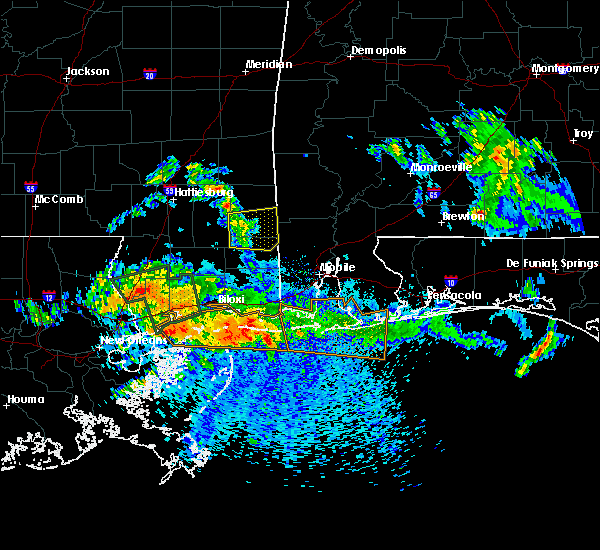 At 917 am cdt, severe thunderstorms were located along a line extending from 8 miles east of mclain to 9 miles southwest of leakesville to 9 miles northwest of lucedale, moving east at 35 mph (radar indicated). Hazards include 60 mph wind gusts and quarter size hail. Hail damage to vehicles is expected. expect wind damage to roofs, siding, and trees. Locations impacted include, lucedale, leakesville and mclain. At 917 am cdt, severe thunderstorms were located along a line extending from 8 miles east of mclain to 9 miles southwest of leakesville to 9 miles northwest of lucedale, moving east at 35 mph (radar indicated). Hazards include 60 mph wind gusts and quarter size hail. Hail damage to vehicles is expected. expect wind damage to roofs, siding, and trees. Locations impacted include, lucedale, leakesville and mclain.
|
| 4/28/2016 9:08 AM CDT |
 At 906 am cdt, severe thunderstorms were located along a line extending from mclain to 10 miles southeast of beaumont to 15 miles west of lucedale. additional thunderstorms were also locatedfrom new augusta to redhill. movement was to the east at 35 mph (radar indicated). Hazards include 60 mph wind gusts and quarter size hail. Hail damage to vehicles is expected. expect wind damage to roofs, siding, and trees. Locations impacted include, lucedale, leakesville, beaumont and mclain. At 906 am cdt, severe thunderstorms were located along a line extending from mclain to 10 miles southeast of beaumont to 15 miles west of lucedale. additional thunderstorms were also locatedfrom new augusta to redhill. movement was to the east at 35 mph (radar indicated). Hazards include 60 mph wind gusts and quarter size hail. Hail damage to vehicles is expected. expect wind damage to roofs, siding, and trees. Locations impacted include, lucedale, leakesville, beaumont and mclain.
|
| 4/28/2016 8:51 AM CDT |
 At 851 am cdt, severe thunderstorms were located along a line extending from near beaumont to 6 miles southwest of mclain, moving east at 35 mph (radar indicated). Hazards include 60 mph wind gusts and half dollar size hail. Hail damage to vehicles is expected. expect wind damage to roofs, siding, and trees. Locations impacted include, lucedale, leakesville, beaumont and mclain. At 851 am cdt, severe thunderstorms were located along a line extending from near beaumont to 6 miles southwest of mclain, moving east at 35 mph (radar indicated). Hazards include 60 mph wind gusts and half dollar size hail. Hail damage to vehicles is expected. expect wind damage to roofs, siding, and trees. Locations impacted include, lucedale, leakesville, beaumont and mclain.
|
| 4/28/2016 8:47 AM CDT |
 At 846 am cdt, doppler radar indicated a line of severe thunderstorms capable of producing half dollar size hail and damaging winds in excess of 60 mph. these storms were located along a line extending from near beaumont to 8 miles southwest of mclain to 11 miles east of brooklyn, and moving east at 35 mph. At 846 am cdt, doppler radar indicated a line of severe thunderstorms capable of producing half dollar size hail and damaging winds in excess of 60 mph. these storms were located along a line extending from near beaumont to 8 miles southwest of mclain to 11 miles east of brooklyn, and moving east at 35 mph.
|
| 4/28/2016 5:33 AM CDT |
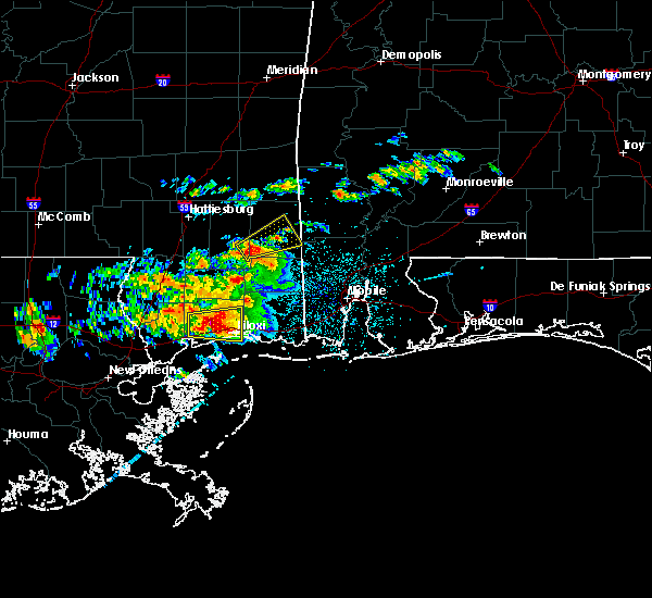 At 532 am cdt, a severe thunderstorm was located over mclain, or 15 miles west of leakesville, moving northeast at 30 mph (radar indicated). Hazards include 60 mph wind gusts and quarter size hail. Hail damage to vehicles is expected. Expect wind damage to roofs, siding, and trees. At 532 am cdt, a severe thunderstorm was located over mclain, or 15 miles west of leakesville, moving northeast at 30 mph (radar indicated). Hazards include 60 mph wind gusts and quarter size hail. Hail damage to vehicles is expected. Expect wind damage to roofs, siding, and trees.
|
| 3/31/2016 9:01 AM CDT |
 At 900 am cdt, a severe thunderstorm was located near mclain, or 13 miles west of leakesville, moving east at 35 mph (radar indicated). Hazards include 60 mph wind gusts and quarter size hail. Hail damage to vehicles is expected. expect wind damage to roofs, siding, and trees. locations impacted include, leakesville, state line and mclain. A tornado watch remains in effect until 200 pm cdt for southwestern alabama, and southeastern mississippi. At 900 am cdt, a severe thunderstorm was located near mclain, or 13 miles west of leakesville, moving east at 35 mph (radar indicated). Hazards include 60 mph wind gusts and quarter size hail. Hail damage to vehicles is expected. expect wind damage to roofs, siding, and trees. locations impacted include, leakesville, state line and mclain. A tornado watch remains in effect until 200 pm cdt for southwestern alabama, and southeastern mississippi.
|
| 3/31/2016 8:52 AM CDT |
 At 852 am cdt, a severe thunderstorm was located near mclain, or 14 miles south of richton, moving east at 40 mph (radar indicated). Hazards include 60 mph wind gusts and quarter size hail. Hail damage to vehicles is expected. expect wind damage to roofs, siding, and trees. locations impacted include, leakesville, beaumont, state line and mclain. a tornado watch remains in effect until 200 pm cdt for southwestern alabama, and southeastern mississippi. Stay tuned for further updates from your national weather service in mobile. At 852 am cdt, a severe thunderstorm was located near mclain, or 14 miles south of richton, moving east at 40 mph (radar indicated). Hazards include 60 mph wind gusts and quarter size hail. Hail damage to vehicles is expected. expect wind damage to roofs, siding, and trees. locations impacted include, leakesville, beaumont, state line and mclain. a tornado watch remains in effect until 200 pm cdt for southwestern alabama, and southeastern mississippi. Stay tuned for further updates from your national weather service in mobile.
|
| 3/31/2016 8:50 AM CDT |
 At 850 am cdt, a severe thunderstorm capable of producing a tornado was located over beaumont, or 13 miles south of richton, moving east at 30 mph (radar indicated rotation). Hazards include tornado and quarter size hail. Flying debris will be dangerous to those caught without shelter. mobile homes will be damaged or destroyed. damage to roofs, windows, and vehicles will occur. tree damage is likely. This tornadic thunderstorm will remain over mainly rural areas of southeastern perry county. At 850 am cdt, a severe thunderstorm capable of producing a tornado was located over beaumont, or 13 miles south of richton, moving east at 30 mph (radar indicated rotation). Hazards include tornado and quarter size hail. Flying debris will be dangerous to those caught without shelter. mobile homes will be damaged or destroyed. damage to roofs, windows, and vehicles will occur. tree damage is likely. This tornadic thunderstorm will remain over mainly rural areas of southeastern perry county.
|
| 3/31/2016 8:41 AM CDT |
 At 841 am cdt, a severe thunderstorm capable of producing a tornado was located near beaumont, or 13 miles south of richton, moving east at 40 mph (radar indicated rotation). Hazards include tornado and quarter size hail. Flying debris will be dangerous to those caught without shelter. mobile homes will be damaged or destroyed. damage to roofs, windows, and vehicles will occur. tree damage is likely. This dangerous storm will be near, beaumont around 845 am cdt. At 841 am cdt, a severe thunderstorm capable of producing a tornado was located near beaumont, or 13 miles south of richton, moving east at 40 mph (radar indicated rotation). Hazards include tornado and quarter size hail. Flying debris will be dangerous to those caught without shelter. mobile homes will be damaged or destroyed. damage to roofs, windows, and vehicles will occur. tree damage is likely. This dangerous storm will be near, beaumont around 845 am cdt.
|
| 3/31/2016 8:35 AM CDT |
 At 834 am cdt, a severe thunderstorm was located near new augusta, or 15 miles southwest of richton, moving east at 30 mph (radar indicated). Hazards include 70 mph wind gusts and quarter size hail. Hail damage to vehicles is expected. expect considerable tree damage. wind damage is also likely to mobile homes, roofs, and outbuildings. Locations impacted include, leakesville, beaumont, new augusta, state line and mclain. At 834 am cdt, a severe thunderstorm was located near new augusta, or 15 miles southwest of richton, moving east at 30 mph (radar indicated). Hazards include 70 mph wind gusts and quarter size hail. Hail damage to vehicles is expected. expect considerable tree damage. wind damage is also likely to mobile homes, roofs, and outbuildings. Locations impacted include, leakesville, beaumont, new augusta, state line and mclain.
|
| 3/31/2016 8:31 AM CDT |
 At 831 am cdt, a severe thunderstorm capable of producing a tornado was located near new augusta, or 16 miles southeast of petal, moving east at 25 mph (radar indicated rotation). Hazards include tornado and quarter size hail. Flying debris will be dangerous to those caught without shelter. mobile homes will be damaged or destroyed. damage to roofs, windows, and vehicles will occur. tree damage is likely. this dangerous storm will be near, new augusta around 840 am cdt. Beaumont around 900 am cdt. At 831 am cdt, a severe thunderstorm capable of producing a tornado was located near new augusta, or 16 miles southeast of petal, moving east at 25 mph (radar indicated rotation). Hazards include tornado and quarter size hail. Flying debris will be dangerous to those caught without shelter. mobile homes will be damaged or destroyed. damage to roofs, windows, and vehicles will occur. tree damage is likely. this dangerous storm will be near, new augusta around 840 am cdt. Beaumont around 900 am cdt.
|
| 3/31/2016 8:13 AM CDT |
 At 813 am cdt, severe thunderstorms were located along a line extending from near sunrise to mclaurin to near rock hill, moving east at 35 mph (radar indicated). Hazards include 70 mph wind gusts and quarter size hail. Hail damage to vehicles is expected. expect considerable tree damage. Wind damage is also likely to mobile homes, roofs, and outbuildings. At 813 am cdt, severe thunderstorms were located along a line extending from near sunrise to mclaurin to near rock hill, moving east at 35 mph (radar indicated). Hazards include 70 mph wind gusts and quarter size hail. Hail damage to vehicles is expected. expect considerable tree damage. Wind damage is also likely to mobile homes, roofs, and outbuildings.
|
| 3/17/2016 3:34 PM CDT |
 At 333 pm cdt, a severe thunderstorm was located 10 miles northeast of beaumont, or 11 miles southeast of richton, moving northeast at 30 mph (radar indicated). Hazards include 60 mph wind gusts and quarter size hail. Hail damage to vehicles is expected. Expect wind damage to roofs, siding, and trees. At 333 pm cdt, a severe thunderstorm was located 10 miles northeast of beaumont, or 11 miles southeast of richton, moving northeast at 30 mph (radar indicated). Hazards include 60 mph wind gusts and quarter size hail. Hail damage to vehicles is expected. Expect wind damage to roofs, siding, and trees.
|
| 3/17/2016 1:17 PM CDT |
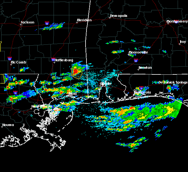 At 116 pm cdt, a severe thunderstorm was located 7 miles southeast of mclain, or 12 miles northwest of lucedale, moving east at 30 to 35 mph (radar indicated). Hazards include golf ball size hail and 60 mph wind gusts. People and animals outdoors will be injured. expect hail damage to roofs, siding, windows, and vehicles. expect wind damage to roofs, siding, and trees. Locations impacted include, mclain. At 116 pm cdt, a severe thunderstorm was located 7 miles southeast of mclain, or 12 miles northwest of lucedale, moving east at 30 to 35 mph (radar indicated). Hazards include golf ball size hail and 60 mph wind gusts. People and animals outdoors will be injured. expect hail damage to roofs, siding, windows, and vehicles. expect wind damage to roofs, siding, and trees. Locations impacted include, mclain.
|
| 3/17/2016 1:15 PM CDT | Quarter sized hail reported 0.7 miles SW of McLain, MS |
| 3/17/2016 1:07 PM CDT |
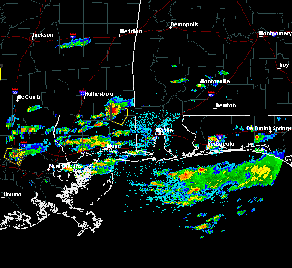 At 106 pm cdt, a severe thunderstorm was located near mclain, or 16 miles northwest of lucedale, moving east at 35 mph (radar indicated). Hazards include golf ball size hail and 60 mph wind gusts. People and animals outdoors will be injured. expect hail damage to roofs, siding, windows, and vehicles. expect wind damage to roofs, siding, and trees. This severe thunderstorm will remain over mainly rural areas of southeastern perry county. At 106 pm cdt, a severe thunderstorm was located near mclain, or 16 miles northwest of lucedale, moving east at 35 mph (radar indicated). Hazards include golf ball size hail and 60 mph wind gusts. People and animals outdoors will be injured. expect hail damage to roofs, siding, windows, and vehicles. expect wind damage to roofs, siding, and trees. This severe thunderstorm will remain over mainly rural areas of southeastern perry county.
|
| 3/17/2016 12:58 PM CDT |
 At 1257 pm cdt, a severe thunderstorm was located near mclain, or 18 miles northeast of wiggins, moving east at 30 mph (radar indicated). Hazards include golf ball size hail and 60 mph wind gusts. People and animals outdoors will be injured. expect hail damage to roofs, siding, windows, and vehicles. expect wind damage to roofs, siding, and trees. Locations impacted include, beaumont. At 1257 pm cdt, a severe thunderstorm was located near mclain, or 18 miles northeast of wiggins, moving east at 30 mph (radar indicated). Hazards include golf ball size hail and 60 mph wind gusts. People and animals outdoors will be injured. expect hail damage to roofs, siding, windows, and vehicles. expect wind damage to roofs, siding, and trees. Locations impacted include, beaumont.
|
| 3/17/2016 12:52 PM CDT |
 At 1251 pm cdt, a severe thunderstorm was located 8 miles south of beaumont, or 17 miles northeast of wiggins, moving southeast at 30 mph (radar indicated). Hazards include golf ball size hail and 60 mph wind gusts. People and animals outdoors will be injured. expect hail damage to roofs, siding, windows, and vehicles. Expect wind damage to roofs, siding, and trees. At 1251 pm cdt, a severe thunderstorm was located 8 miles south of beaumont, or 17 miles northeast of wiggins, moving southeast at 30 mph (radar indicated). Hazards include golf ball size hail and 60 mph wind gusts. People and animals outdoors will be injured. expect hail damage to roofs, siding, windows, and vehicles. Expect wind damage to roofs, siding, and trees.
|
| 3/17/2016 12:46 PM CDT |
 At 1245 pm cdt, a severe thunderstorm was located 8 miles southwest of beaumont, or 16 miles northeast of wiggins, moving southeast at 35 mph (radar indicated). Hazards include golf ball size hail and 60 mph wind gusts. People and animals outdoors will be injured. expect hail damage to roofs, siding, windows, and vehicles. expect wind damage to roofs, siding, and trees. Locations impacted include, beaumont. At 1245 pm cdt, a severe thunderstorm was located 8 miles southwest of beaumont, or 16 miles northeast of wiggins, moving southeast at 35 mph (radar indicated). Hazards include golf ball size hail and 60 mph wind gusts. People and animals outdoors will be injured. expect hail damage to roofs, siding, windows, and vehicles. expect wind damage to roofs, siding, and trees. Locations impacted include, beaumont.
|
| 3/17/2016 12:36 PM CDT |
 At 1235 pm cdt, a severe thunderstorm was located near brooklyn, or 16 miles north of wiggins, moving east at 35 to 40 mph (radar indicated). Hazards include golf ball size hail and 60 mph wind gusts. People and animals outdoors will be injured. expect hail damage to roofs, siding, windows, and vehicles. expect wind damage to roofs, siding, and trees. Locations impacted include, beaumont. At 1235 pm cdt, a severe thunderstorm was located near brooklyn, or 16 miles north of wiggins, moving east at 35 to 40 mph (radar indicated). Hazards include golf ball size hail and 60 mph wind gusts. People and animals outdoors will be injured. expect hail damage to roofs, siding, windows, and vehicles. expect wind damage to roofs, siding, and trees. Locations impacted include, beaumont.
|
| 3/17/2016 12:17 PM CDT |
 At 1217 pm cdt, a severe thunderstorm was located over mclaurin, or 12 miles south of hattiesburg, moving east at 25 to 30 mph (radar indicated). Hazards include golf ball size hail and 60 mph wind gusts. People and animals outdoors will be injured. expect hail damage to roofs, siding, windows, and vehicles. Expect wind damage to roofs, siding, and trees. At 1217 pm cdt, a severe thunderstorm was located over mclaurin, or 12 miles south of hattiesburg, moving east at 25 to 30 mph (radar indicated). Hazards include golf ball size hail and 60 mph wind gusts. People and animals outdoors will be injured. expect hail damage to roofs, siding, windows, and vehicles. Expect wind damage to roofs, siding, and trees.
|
| 2/23/2016 6:59 PM CST |
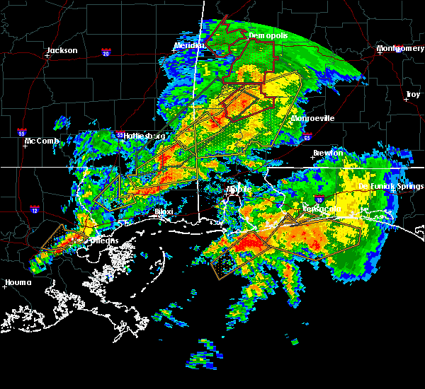 At 658 pm cst, a severe thunderstorm was located near mclain, or 16 miles northwest of lucedale, moving northeast at 45 mph (radar indicated). Hazards include 60 mph wind gusts and quarter size hail. Hail damage to vehicles is expected. expect wind damage to roofs, siding, and trees. locations impacted include, lucedale, leakesville and mclain. A tornado watch remains in effect until 1000 pm cst for southwestern alabama and southeastern mississippi. At 658 pm cst, a severe thunderstorm was located near mclain, or 16 miles northwest of lucedale, moving northeast at 45 mph (radar indicated). Hazards include 60 mph wind gusts and quarter size hail. Hail damage to vehicles is expected. expect wind damage to roofs, siding, and trees. locations impacted include, lucedale, leakesville and mclain. A tornado watch remains in effect until 1000 pm cst for southwestern alabama and southeastern mississippi.
|
| 2/23/2016 6:36 PM CST |
 At 636 pm cst, a severe thunderstorm was located over wiggins, moving northeast at 50 mph (radar indicated). Hazards include 60 mph wind gusts and quarter size hail. Hail damage to vehicles is expected. Expect wind damage to roofs, siding, and trees. At 636 pm cst, a severe thunderstorm was located over wiggins, moving northeast at 50 mph (radar indicated). Hazards include 60 mph wind gusts and quarter size hail. Hail damage to vehicles is expected. Expect wind damage to roofs, siding, and trees.
|
| 2/23/2016 6:16 PM CST |
 At 615 pm cst, severe thunderstorms were located along a line extending from near coffeeville to near wagarville to 6 miles southwest of leakesville, moving northeast at 55 mph (radar indicated). Hazards include 70 mph wind gusts and quarter size hail. Hail damage to vehicles is expected. expect considerable tree damage. wind damage is also likely to mobile homes, roofs, and outbuildings. locations impacted include, jackson, wiggins, thomasville, citronelle, lucedale, grove hill, chatom, leakesville, state line, millry, coffeeville, fulton, mcintosh, saint stephens, deer park, whatley, wagarville, vinegar bend, fruitdale and tibbie. A tornado watch remains in effect until 1000 pm cst for southwestern alabama and southeastern mississippi. At 615 pm cst, severe thunderstorms were located along a line extending from near coffeeville to near wagarville to 6 miles southwest of leakesville, moving northeast at 55 mph (radar indicated). Hazards include 70 mph wind gusts and quarter size hail. Hail damage to vehicles is expected. expect considerable tree damage. wind damage is also likely to mobile homes, roofs, and outbuildings. locations impacted include, jackson, wiggins, thomasville, citronelle, lucedale, grove hill, chatom, leakesville, state line, millry, coffeeville, fulton, mcintosh, saint stephens, deer park, whatley, wagarville, vinegar bend, fruitdale and tibbie. A tornado watch remains in effect until 1000 pm cst for southwestern alabama and southeastern mississippi.
|
| 2/23/2016 5:44 PM CST |
 At 544 pm cst, severe thunderstorms were located along a line extending from 6 miles northeast of buckatunna to 7 miles southwest of fruitdale to near wiggins, moving northeast at 55 mph (radar indicated). Hazards include 60 mph wind gusts and quarter size hail. Hail damage to vehicles is expected. Expect wind damage to roofs, siding, and trees. At 544 pm cst, severe thunderstorms were located along a line extending from 6 miles northeast of buckatunna to 7 miles southwest of fruitdale to near wiggins, moving northeast at 55 mph (radar indicated). Hazards include 60 mph wind gusts and quarter size hail. Hail damage to vehicles is expected. Expect wind damage to roofs, siding, and trees.
|
| 2/23/2016 5:30 PM CST |
 At 529 pm cst, severe thunderstorms were located along a line extending from near buckatunna to 8 miles northwest of leakesville to near mclain to 11 miles east of maxie, moving east at 30 mph (radar indicated). Hazards include 70 mph wind gusts and quarter size hail. Hail damage to vehicles is expected. expect considerable tree damage. wind damage is also likely to mobile homes, roofs, and outbuildings. locations impacted include, wiggins, lucedale, leakesville, beaumont, state line, mclain and buckatunna. A tornado watch remains in effect until 1000 pm cst for southeastern mississippi. At 529 pm cst, severe thunderstorms were located along a line extending from near buckatunna to 8 miles northwest of leakesville to near mclain to 11 miles east of maxie, moving east at 30 mph (radar indicated). Hazards include 70 mph wind gusts and quarter size hail. Hail damage to vehicles is expected. expect considerable tree damage. wind damage is also likely to mobile homes, roofs, and outbuildings. locations impacted include, wiggins, lucedale, leakesville, beaumont, state line, mclain and buckatunna. A tornado watch remains in effect until 1000 pm cst for southeastern mississippi.
|
| 2/23/2016 5:14 PM CST |
 At 513 pm cst, severe thunderstorms were located along a line extending from near clara to near beaumont to 7 miles southwest of mclain to near maxie, moving northeast at 40 mph (radar indicated). Hazards include 70 mph wind gusts and quarter size hail. Hail damage to vehicles is expected. expect considerable tree damage. wind damage is also likely to mobile homes, roofs, and outbuildings. locations impacted include, wiggins, lucedale, leakesville, beaumont, state line, mclain, buckatunna and clara. A tornado watch remains in effect until 1000 pm cst for southeastern mississippi. At 513 pm cst, severe thunderstorms were located along a line extending from near clara to near beaumont to 7 miles southwest of mclain to near maxie, moving northeast at 40 mph (radar indicated). Hazards include 70 mph wind gusts and quarter size hail. Hail damage to vehicles is expected. expect considerable tree damage. wind damage is also likely to mobile homes, roofs, and outbuildings. locations impacted include, wiggins, lucedale, leakesville, beaumont, state line, mclain, buckatunna and clara. A tornado watch remains in effect until 1000 pm cst for southeastern mississippi.
|
| 2/23/2016 5:00 PM CST |
 At 459 pm cst, severe thunderstorms were located along a line extending from 9 miles northeast of richton to near beaumont to 8 miles east of maxie to 10 miles west of wiggins, moving northeast at 40 mph (radar indicated). Hazards include 70 mph wind gusts and quarter size hail. Hail damage to vehicles is expected. expect considerable tree damage. Wind damage is also likely to mobile homes, roofs, and outbuildings. At 459 pm cst, severe thunderstorms were located along a line extending from 9 miles northeast of richton to near beaumont to 8 miles east of maxie to 10 miles west of wiggins, moving northeast at 40 mph (radar indicated). Hazards include 70 mph wind gusts and quarter size hail. Hail damage to vehicles is expected. expect considerable tree damage. Wind damage is also likely to mobile homes, roofs, and outbuildings.
|
| 2/23/2016 4:37 PM CST |
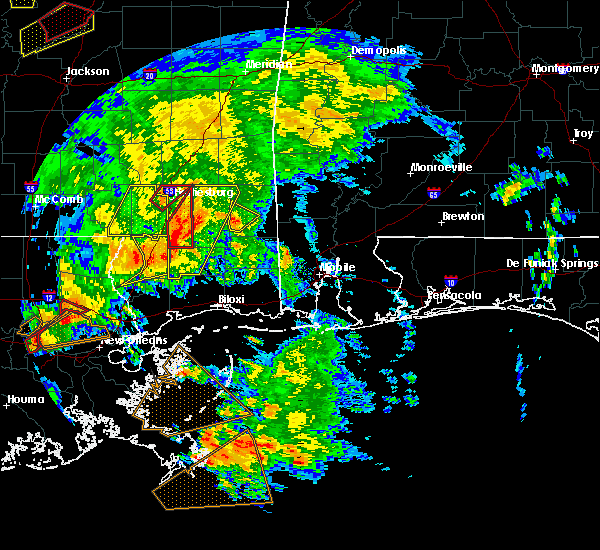 At 436 pm cst, a severe thunderstorm was located near mclain, or 12 miles west of leakesville, moving northeast at 70 mph (radar indicated). Hazards include 60 mph wind gusts and penny size hail. Expect damage to roofs. siding. and trees. locations impacted include, mclain. A tornado watch remains in effect until 1000 pm cst for southeastern mississippi. At 436 pm cst, a severe thunderstorm was located near mclain, or 12 miles west of leakesville, moving northeast at 70 mph (radar indicated). Hazards include 60 mph wind gusts and penny size hail. Expect damage to roofs. siding. and trees. locations impacted include, mclain. A tornado watch remains in effect until 1000 pm cst for southeastern mississippi.
|
| 2/23/2016 4:27 PM CST |
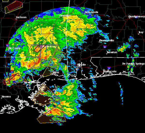 At 426 pm cst, a severe thunderstorm was located 9 miles south of mclain, or 16 miles west of lucedale, moving north at 75 mph (radar indicated). Hazards include 60 mph wind gusts and quarter size hail. Hail damage to vehicles is expected. expect wind damage to roofs, siding, and trees. locations impacted include, leakesville and mclain. A tornado watch remains in effect until 1000 pm cst for southeastern mississippi. At 426 pm cst, a severe thunderstorm was located 9 miles south of mclain, or 16 miles west of lucedale, moving north at 75 mph (radar indicated). Hazards include 60 mph wind gusts and quarter size hail. Hail damage to vehicles is expected. expect wind damage to roofs, siding, and trees. locations impacted include, leakesville and mclain. A tornado watch remains in effect until 1000 pm cst for southeastern mississippi.
|
| 2/23/2016 4:07 PM CST |
 At 406 pm cst, a severe thunderstorm was located 7 miles east of saucier, or 14 miles north of biloxi, moving northeast at 60 mph (radar indicated). Hazards include 70 mph wind gusts and quarter size hail. Hail damage to vehicles is expected. expect considerable tree damage. Wind damage is also likely to mobile homes, roofs, and outbuildings. At 406 pm cst, a severe thunderstorm was located 7 miles east of saucier, or 14 miles north of biloxi, moving northeast at 60 mph (radar indicated). Hazards include 70 mph wind gusts and quarter size hail. Hail damage to vehicles is expected. expect considerable tree damage. Wind damage is also likely to mobile homes, roofs, and outbuildings.
|
| 2/15/2016 3:19 PM CST |
 At 319 pm cst, severe thunderstorms were located along a line extending from near lisman to 6 miles southwest of fruitdale to 10 miles south of mclain to saucier, moving east at 50 mph (radar indicated). Hazards include 70 mph wind gusts and quarter size hail. Hail damage to vehicles is expected. expect considerable tree damage. Wind damage is also likely to mobile homes, roofs, and outbuildings. At 319 pm cst, severe thunderstorms were located along a line extending from near lisman to 6 miles southwest of fruitdale to 10 miles south of mclain to saucier, moving east at 50 mph (radar indicated). Hazards include 70 mph wind gusts and quarter size hail. Hail damage to vehicles is expected. expect considerable tree damage. Wind damage is also likely to mobile homes, roofs, and outbuildings.
|
| 2/15/2016 2:58 PM CST |
 At 257 pm cst, severe thunderstorms were located along a line extending from near clara to near beaumont to 6 miles southeast of brooklyn, moving northeast at 60 mph (radar indicated). Hazards include 70 mph wind gusts and quarter size hail. Hail damage to vehicles is expected. expect considerable tree damage. wind damage is also likely to mobile homes, roofs, and outbuildings. locations impacted include, waynesboro, richton, beaumont, new augusta, state line, mclain, buckatunna and clara. a tornado watch remains in effect until 600 pm cst for southeastern mississippi. A tornado watch also remains in effect until 900 pm cst for southwestern alabama. At 257 pm cst, severe thunderstorms were located along a line extending from near clara to near beaumont to 6 miles southeast of brooklyn, moving northeast at 60 mph (radar indicated). Hazards include 70 mph wind gusts and quarter size hail. Hail damage to vehicles is expected. expect considerable tree damage. wind damage is also likely to mobile homes, roofs, and outbuildings. locations impacted include, waynesboro, richton, beaumont, new augusta, state line, mclain, buckatunna and clara. a tornado watch remains in effect until 600 pm cst for southeastern mississippi. A tornado watch also remains in effect until 900 pm cst for southwestern alabama.
|
| 2/15/2016 2:38 PM CST |
 At 238 pm cst, severe thunderstorms were located along a line extending from near ovett to near brooklyn to 7 miles southeast of lumberton, moving northeast at 60 mph (radar indicated). Hazards include 70 mph wind gusts and quarter size hail. Hail damage to vehicles is expected. expect considerable tree damage. Wind damage is also likely to mobile homes, roofs, and outbuildings. At 238 pm cst, severe thunderstorms were located along a line extending from near ovett to near brooklyn to 7 miles southeast of lumberton, moving northeast at 60 mph (radar indicated). Hazards include 70 mph wind gusts and quarter size hail. Hail damage to vehicles is expected. expect considerable tree damage. Wind damage is also likely to mobile homes, roofs, and outbuildings.
|
| 2/15/2016 11:21 AM CST |
 At 1120 am cst, a severe thunderstorm was located 8 miles northeast of mclain, or 13 miles west of leakesville, moving northeast at 35 mph (radar indicated). Hazards include 60 mph wind gusts and quarter size hail. Hail damage to vehicles is expected. expect wind damage to roofs, siding, and trees. locations impacted include, mclain. A tornado watch remains in effect until 600 pm cst for southeastern mississippi. At 1120 am cst, a severe thunderstorm was located 8 miles northeast of mclain, or 13 miles west of leakesville, moving northeast at 35 mph (radar indicated). Hazards include 60 mph wind gusts and quarter size hail. Hail damage to vehicles is expected. expect wind damage to roofs, siding, and trees. locations impacted include, mclain. A tornado watch remains in effect until 600 pm cst for southeastern mississippi.
|
| 2/15/2016 11:17 AM CST |
 At 1116 am cst, a severe thunderstorm capable of producing a tornado was located near mclain, or 13 miles southeast of richton, moving northeast at 35 mph. a funnel cloud was reported with this storm as it passed near new augusta (radar indicated rotation). Hazards include tornado and quarter size hail. Flying debris will be dangerous to those caught without shelter. mobile homes will be damaged or destroyed. damage to roofs, windows, and vehicles will occur. tree damage is likely. This tornadic thunderstorm will remain over mainly rural areas of central greene county. At 1116 am cst, a severe thunderstorm capable of producing a tornado was located near mclain, or 13 miles southeast of richton, moving northeast at 35 mph. a funnel cloud was reported with this storm as it passed near new augusta (radar indicated rotation). Hazards include tornado and quarter size hail. Flying debris will be dangerous to those caught without shelter. mobile homes will be damaged or destroyed. damage to roofs, windows, and vehicles will occur. tree damage is likely. This tornadic thunderstorm will remain over mainly rural areas of central greene county.
|
| 2/15/2016 11:05 AM CST |
 At 1104 am cst, a severe thunderstorm was located near mclain, or 16 miles south of richton, moving northeast at 40 mph (radar indicated). Hazards include 60 mph wind gusts and quarter size hail. Hail damage to vehicles is expected. Expect wind damage to roofs, siding, and trees. At 1104 am cst, a severe thunderstorm was located near mclain, or 16 miles south of richton, moving northeast at 40 mph (radar indicated). Hazards include 60 mph wind gusts and quarter size hail. Hail damage to vehicles is expected. Expect wind damage to roofs, siding, and trees.
|
| 12/28/2015 7:37 AM CST |
 The severe thunderstorm warning for southern perry and eastern stone counties will expire at 745 am cst, the severe thunderstorm which prompted the warning has weakened. therefore the warning will be allowed to expire. a tornado watch remains in effect until 1000 am cst for southeastern mississippi. The severe thunderstorm warning for southern perry and eastern stone counties will expire at 745 am cst, the severe thunderstorm which prompted the warning has weakened. therefore the warning will be allowed to expire. a tornado watch remains in effect until 1000 am cst for southeastern mississippi.
|
| 12/28/2015 6:53 AM CST |
 At 653 am cst, a severe thunderstorm was located near saucier, or 14 miles south of wiggins, moving north at 55 mph (radar indicated). Hazards include 60 mph wind gusts. Expect damage to roofs. Siding and trees. At 653 am cst, a severe thunderstorm was located near saucier, or 14 miles south of wiggins, moving north at 55 mph (radar indicated). Hazards include 60 mph wind gusts. Expect damage to roofs. Siding and trees.
|
| 12/28/2015 6:48 AM CST |
 At 647 am cst, a severe thunderstorm was located near kinterbish, or 8 miles south of cuba, moving north at 55 mph (radar indicated). Hazards include 60 mph wind gusts. Expect damage to roofs. siding and trees. locations impacted include, waynesboro, mclain, buckatunna and clara. a tornado watch remains in effect until 800 am cst for southeastern mississippi. A tornado watch also remains in effect until noon cst for southwestern alabama. At 647 am cst, a severe thunderstorm was located near kinterbish, or 8 miles south of cuba, moving north at 55 mph (radar indicated). Hazards include 60 mph wind gusts. Expect damage to roofs. siding and trees. locations impacted include, waynesboro, mclain, buckatunna and clara. a tornado watch remains in effect until 800 am cst for southeastern mississippi. A tornado watch also remains in effect until noon cst for southwestern alabama.
|
| 12/28/2015 6:41 AM CST |
 At 640 am cst, a severe thunderstorm was located near mclain, or 13 miles northwest of lucedale, moving north at 55 mph (radar indicated). Hazards include 60 mph wind gusts. Expect damage to roofs. Siding and trees. At 640 am cst, a severe thunderstorm was located near mclain, or 13 miles northwest of lucedale, moving north at 55 mph (radar indicated). Hazards include 60 mph wind gusts. Expect damage to roofs. Siding and trees.
|
| 10/31/2015 5:58 PM CDT |
 At 558 pm cdt, severe thunderstorms were located along a line extending from 6 miles southeast of mclain to 14 miles north of latimer, moving east at 40 mph (radar indicated). Hazards include 60 mph wind gusts. Expect damage to roofs. siding and trees. locations impacted include, lucedale, leakesville, vinegar bend and deer park. a tornado watch remains in effect until 700 pm cdt for southeastern mississippi. A tornado watch also remains in effect until 1000 pm cdt for southwestern alabama. At 558 pm cdt, severe thunderstorms were located along a line extending from 6 miles southeast of mclain to 14 miles north of latimer, moving east at 40 mph (radar indicated). Hazards include 60 mph wind gusts. Expect damage to roofs. siding and trees. locations impacted include, lucedale, leakesville, vinegar bend and deer park. a tornado watch remains in effect until 700 pm cdt for southeastern mississippi. A tornado watch also remains in effect until 1000 pm cdt for southwestern alabama.
|
| 10/31/2015 5:58 PM CDT |
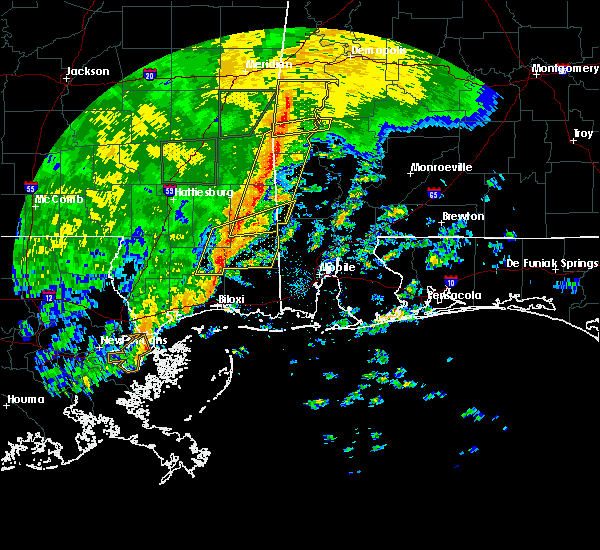 At 558 pm cdt, severe thunderstorms were located along a line extending from 6 miles southeast of mclain to 14 miles north of latimer, moving east at 40 mph (radar indicated). Hazards include 60 mph wind gusts. Expect damage to roofs. siding and trees. locations impacted include, lucedale, leakesville, vinegar bend and deer park. a tornado watch remains in effect until 700 pm cdt for southeastern mississippi. A tornado watch also remains in effect until 1000 pm cdt for southwestern alabama. At 558 pm cdt, severe thunderstorms were located along a line extending from 6 miles southeast of mclain to 14 miles north of latimer, moving east at 40 mph (radar indicated). Hazards include 60 mph wind gusts. Expect damage to roofs. siding and trees. locations impacted include, lucedale, leakesville, vinegar bend and deer park. a tornado watch remains in effect until 700 pm cdt for southeastern mississippi. A tornado watch also remains in effect until 1000 pm cdt for southwestern alabama.
|
| 10/31/2015 5:40 PM CDT |
 At 540 pm cdt, severe thunderstorms were located along a line extending from 7 miles southeast of crandall to 6 miles southeast of mclain, moving east at 30 mph (radar indicated). Hazards include 60 mph wind gusts. Expect damage to roofs. siding and trees. locations impacted include, waynesboro, chatom, leakesville, state line, millry, silas, mclain, gilbertown, toxey, vinegar bend, buckatunna and fruitdale. a tornado watch remains in effect until 700 pm cdt for southeastern mississippi. A tornado watch also remains in effect until 1000 pm cdt for southwestern alabama. At 540 pm cdt, severe thunderstorms were located along a line extending from 7 miles southeast of crandall to 6 miles southeast of mclain, moving east at 30 mph (radar indicated). Hazards include 60 mph wind gusts. Expect damage to roofs. siding and trees. locations impacted include, waynesboro, chatom, leakesville, state line, millry, silas, mclain, gilbertown, toxey, vinegar bend, buckatunna and fruitdale. a tornado watch remains in effect until 700 pm cdt for southeastern mississippi. A tornado watch also remains in effect until 1000 pm cdt for southwestern alabama.
|
| 10/31/2015 5:40 PM CDT |
 At 540 pm cdt, severe thunderstorms were located along a line extending from near mclain to 11 miles east of mchenry, moving east at 40 mph (radar indicated). Hazards include 60 mph wind gusts. Expect damage to roofs. siding and trees. locations impacted include, lucedale, leakesville, mclain, vinegar bend and deer park. a tornado watch remains in effect until 700 pm cdt for southeastern mississippi. A tornado watch also remains in effect until 1000 pm cdt for southwestern alabama. At 540 pm cdt, severe thunderstorms were located along a line extending from near mclain to 11 miles east of mchenry, moving east at 40 mph (radar indicated). Hazards include 60 mph wind gusts. Expect damage to roofs. siding and trees. locations impacted include, lucedale, leakesville, mclain, vinegar bend and deer park. a tornado watch remains in effect until 700 pm cdt for southeastern mississippi. A tornado watch also remains in effect until 1000 pm cdt for southwestern alabama.
|
| 10/31/2015 5:40 PM CDT |
 At 540 pm cdt, severe thunderstorms were located along a line extending from 7 miles southeast of crandall to 6 miles southeast of mclain, moving east at 30 mph (radar indicated). Hazards include 60 mph wind gusts. Expect damage to roofs. siding and trees. locations impacted include, waynesboro, chatom, leakesville, state line, millry, silas, mclain, gilbertown, toxey, vinegar bend, buckatunna and fruitdale. a tornado watch remains in effect until 700 pm cdt for southeastern mississippi. A tornado watch also remains in effect until 1000 pm cdt for southwestern alabama. At 540 pm cdt, severe thunderstorms were located along a line extending from 7 miles southeast of crandall to 6 miles southeast of mclain, moving east at 30 mph (radar indicated). Hazards include 60 mph wind gusts. Expect damage to roofs. siding and trees. locations impacted include, waynesboro, chatom, leakesville, state line, millry, silas, mclain, gilbertown, toxey, vinegar bend, buckatunna and fruitdale. a tornado watch remains in effect until 700 pm cdt for southeastern mississippi. A tornado watch also remains in effect until 1000 pm cdt for southwestern alabama.
|
| 10/31/2015 5:31 PM CDT |
 At 530 pm cdt, severe thunderstorms were located along a line extending from 8 miles southwest of mclain to near mchenry, moving east at 40 mph (radar indicated). Hazards include 60 mph wind gusts. Expect damage to roofs. Siding and trees. At 530 pm cdt, severe thunderstorms were located along a line extending from 8 miles southwest of mclain to near mchenry, moving east at 40 mph (radar indicated). Hazards include 60 mph wind gusts. Expect damage to roofs. Siding and trees.
|
| 10/31/2015 5:31 PM CDT |
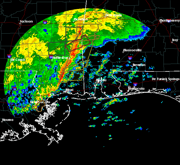 At 530 pm cdt, severe thunderstorms were located along a line extending from 8 miles southwest of mclain to near mchenry, moving east at 40 mph (radar indicated). Hazards include 60 mph wind gusts. Expect damage to roofs. Siding and trees. At 530 pm cdt, severe thunderstorms were located along a line extending from 8 miles southwest of mclain to near mchenry, moving east at 40 mph (radar indicated). Hazards include 60 mph wind gusts. Expect damage to roofs. Siding and trees.
|
| 10/31/2015 5:28 PM CDT |
 At 528 pm cdt, severe thunderstorms were located along a line extending from 8 miles southeast of de soto to near mclain, moving east at 30 mph (radar indicated). Hazards include 60 mph wind gusts. Expect damage to roofs. Siding and trees. At 528 pm cdt, severe thunderstorms were located along a line extending from 8 miles southeast of de soto to near mclain, moving east at 30 mph (radar indicated). Hazards include 60 mph wind gusts. Expect damage to roofs. Siding and trees.
|
| 10/31/2015 5:08 PM CDT |
 At 508 pm cdt, severe thunderstorms were located along a line extending from near new augusta to 7 miles west of saucier, moving east at 35 mph (radar indicated). Hazards include 60 mph wind gusts. Expect damage to roofs. siding and trees. locations impacted include, wiggins, mclain, mchenry and perkinston. A tornado watch remains in effect until 700 pm cdt for southeastern mississippi. At 508 pm cdt, severe thunderstorms were located along a line extending from near new augusta to 7 miles west of saucier, moving east at 35 mph (radar indicated). Hazards include 60 mph wind gusts. Expect damage to roofs. siding and trees. locations impacted include, wiggins, mclain, mchenry and perkinston. A tornado watch remains in effect until 700 pm cdt for southeastern mississippi.
|
| 10/31/2015 4:52 PM CDT |
 At 451 pm cdt, severe thunderstorms were located along a line extending from near maxie to 8 miles north of kiln, moving east at 35 mph (radar indicated). Hazards include 60 mph wind gusts. Expect damage to roofs. Siding and trees. At 451 pm cdt, severe thunderstorms were located along a line extending from near maxie to 8 miles north of kiln, moving east at 35 mph (radar indicated). Hazards include 60 mph wind gusts. Expect damage to roofs. Siding and trees.
|
| 8/8/2015 4:27 PM CDT |
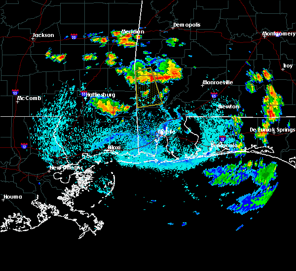 The national weather service in mobile has issued a * severe thunderstorm warning for. george county in southeastern mississippi. southwestern greene county in southeastern mississippi. southeastern perry county in southeastern mississippi. Until 530 pm cdt. The national weather service in mobile has issued a * severe thunderstorm warning for. george county in southeastern mississippi. southwestern greene county in southeastern mississippi. southeastern perry county in southeastern mississippi. Until 530 pm cdt.
|
| 8/8/2015 4:27 PM CDT |
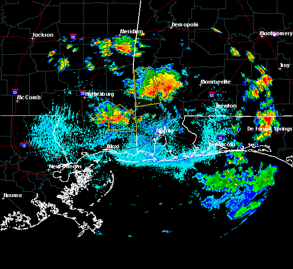 At 427 pm cdt, a severe thunderstorm capable of producing damaging winds over 60 mph was located near mclain, or 12 miles southwest of leakesville, and moving southeast at 45 mph. At 427 pm cdt, a severe thunderstorm capable of producing damaging winds over 60 mph was located near mclain, or 12 miles southwest of leakesville, and moving southeast at 45 mph.
|
| 7/5/2015 1:58 PM CDT |
 At 157 pm cdt, a line of severe thunderstorms capable of producing damaging winds over 60 mph was located along a line extending from 7 miles northeast of mclain to 6 miles south of beaumont to brooklyn, and moving southeast at 30 mph. At 157 pm cdt, a line of severe thunderstorms capable of producing damaging winds over 60 mph was located along a line extending from 7 miles northeast of mclain to 6 miles south of beaumont to brooklyn, and moving southeast at 30 mph.
|
| 7/4/2015 3:33 PM CDT |
 At 333 pm cdt, a line of severe thunderstorms capable of producing damaging winds over 60 mph were located along a line extending from 6 miles northeast of waynesboro to 11 miles south of clara to near beaumont, moving east at 30 mph. At 333 pm cdt, a line of severe thunderstorms capable of producing damaging winds over 60 mph were located along a line extending from 6 miles northeast of waynesboro to 11 miles south of clara to near beaumont, moving east at 30 mph.
|
| 7/4/2015 3:07 PM CDT |
 At 306 pm cdt, a line of severe thunderstorms capable of producing damaging winds over 60 mph was located along a line extending from 6 miles west of waynesboro to near richton to near new augusta, and moving east at 30 mph. At 306 pm cdt, a line of severe thunderstorms capable of producing damaging winds over 60 mph was located along a line extending from 6 miles west of waynesboro to near richton to near new augusta, and moving east at 30 mph.
|
| 6/21/2015 5:22 PM CDT |
 At 521 pm cdt, the storm that prompted the warning for central greene county has weakened below severe limits thus the severe thunderstorm warning will be allowed to expire at 530 pm cdt. At 521 pm cdt, the storm that prompted the warning for central greene county has weakened below severe limits thus the severe thunderstorm warning will be allowed to expire at 530 pm cdt.
|
| 6/21/2015 5:11 PM CDT |
 At 509 pm cdt, a severe thunderstorm capable of producing damaging winds over 60 mph was located near leakesville, moving southeast at 10 mph. this thunderstorm produced wind damage near the intersection of highways 42 and 63 shortly before 430 pm. At 509 pm cdt, a severe thunderstorm capable of producing damaging winds over 60 mph was located near leakesville, moving southeast at 10 mph. this thunderstorm produced wind damage near the intersection of highways 42 and 63 shortly before 430 pm.
|
| 6/21/2015 4:50 PM CDT |
 At 449 pm cdt, a severe thunderstorm capable of producing damaging winds over 60 mph was located 9 miles northwest of leakesville, moving southeast at 20 mph. At 449 pm cdt, a severe thunderstorm capable of producing damaging winds over 60 mph was located 9 miles northwest of leakesville, moving southeast at 20 mph.
|
| 6/21/2015 4:24 PM CDT |
 At 424 pm cdt, a severe thunderstorm capable of producing damaging winds over 60 mph was located 11 miles west of state line, or 17 miles east of richton, and moving southeast at 10 mph. At 424 pm cdt, a severe thunderstorm capable of producing damaging winds over 60 mph was located 11 miles west of state line, or 17 miles east of richton, and moving southeast at 10 mph.
|
| 5/20/2015 4:44 PM CDT | At 443 pm cdt, a severe thunderstorm capable of producing quarter size hail and damaging winds over 60 mph was located near mclain, or 12 miles northwest of lucedale, and moving east at 30 mph. |
Hail Maps for McLain, MS


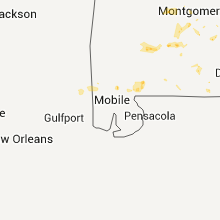


Connect with Interactive Hail Maps