

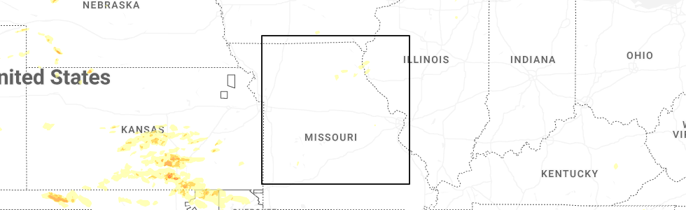
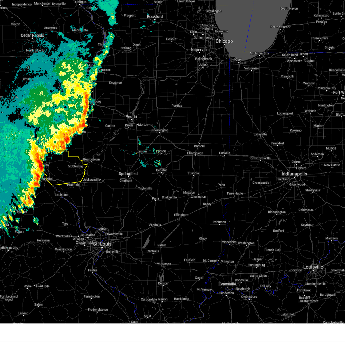
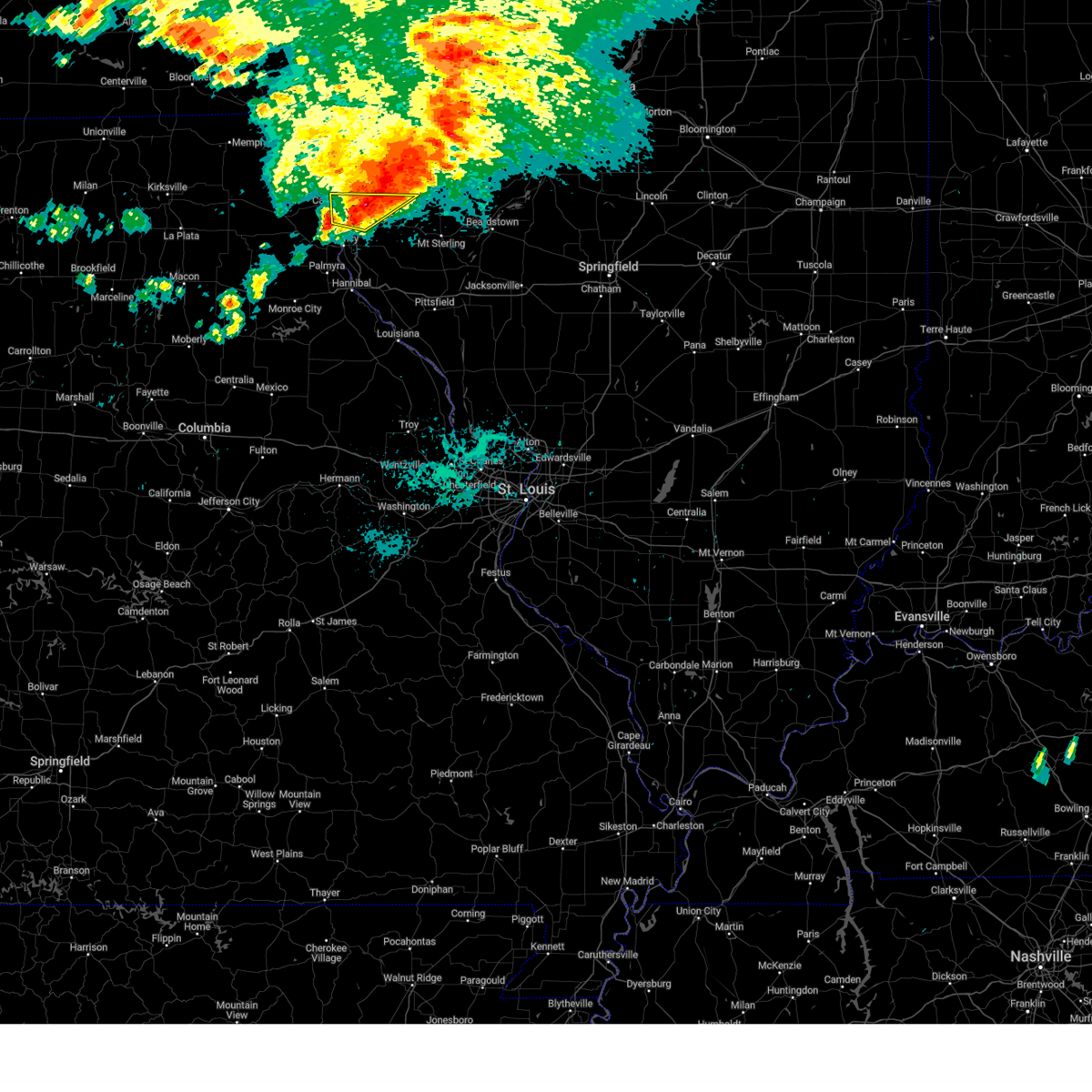
Hail Map for Mendon, IL
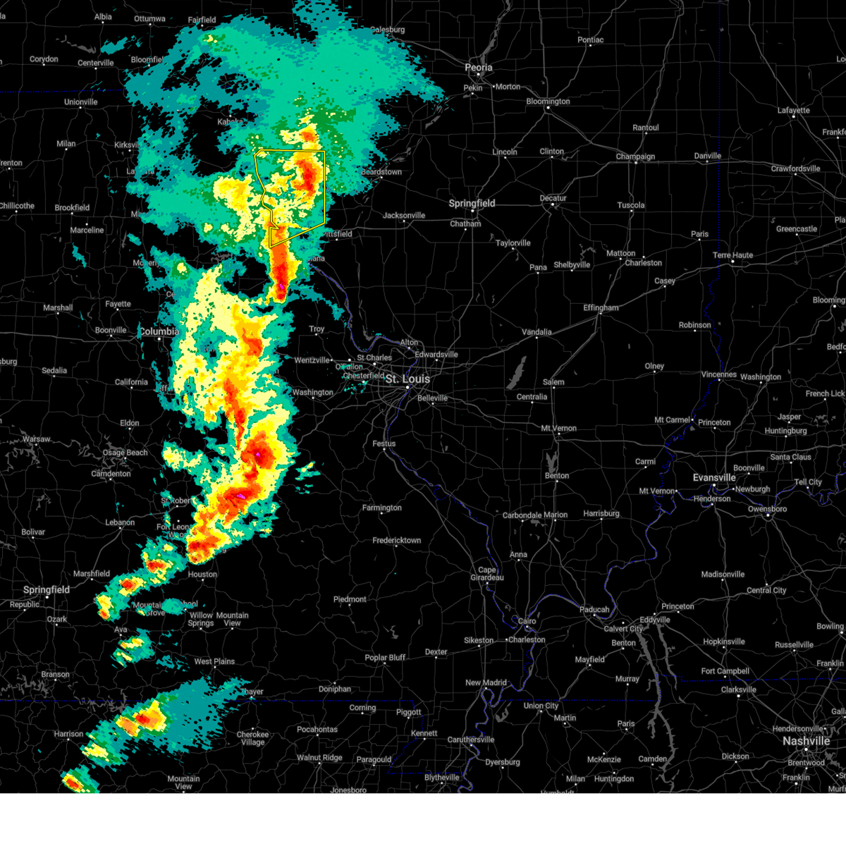
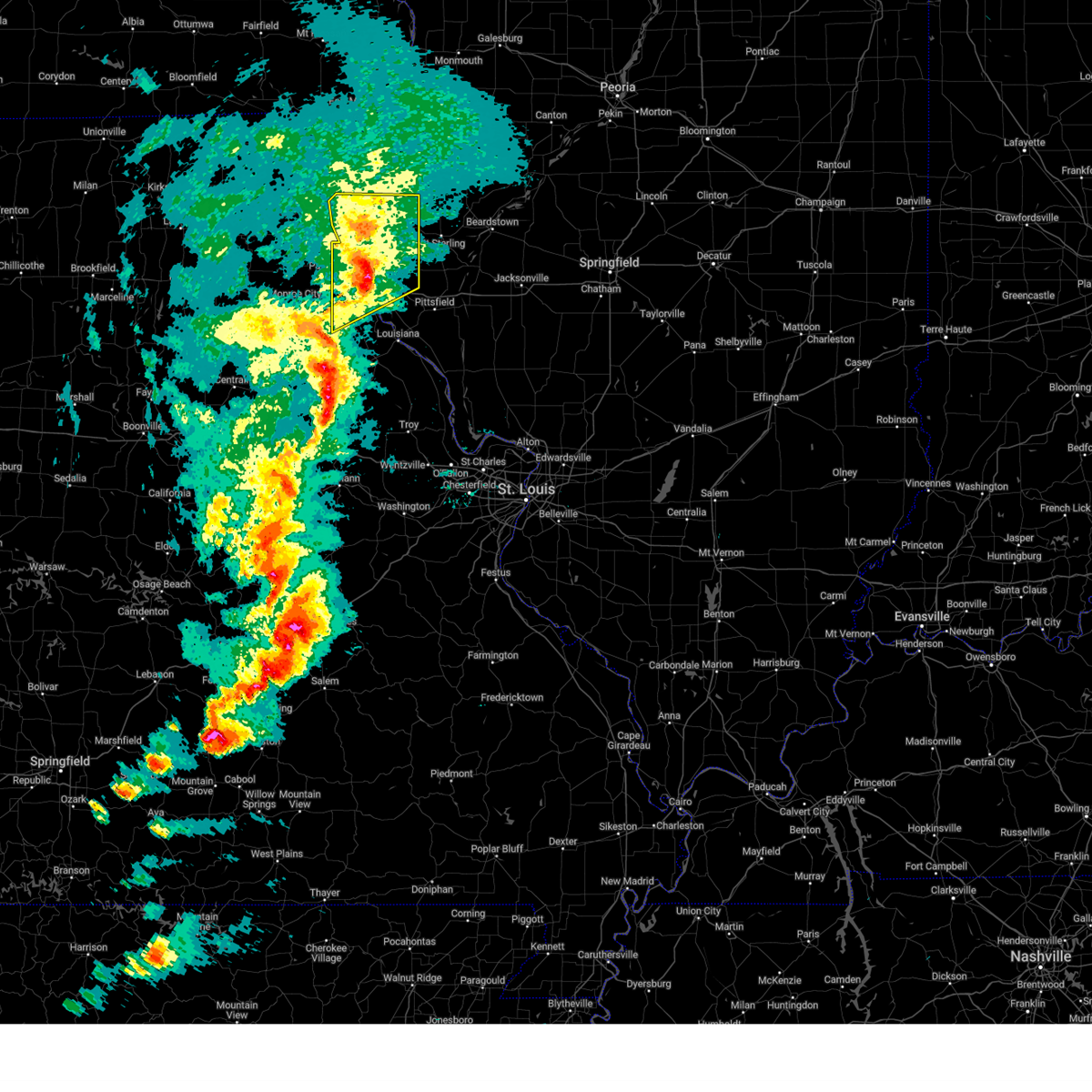
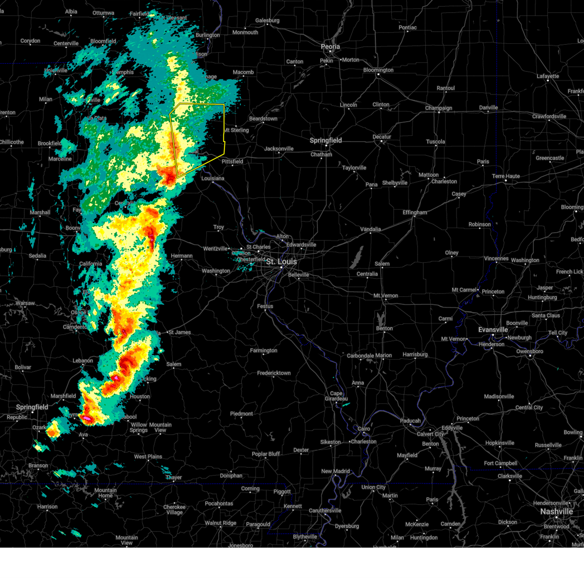
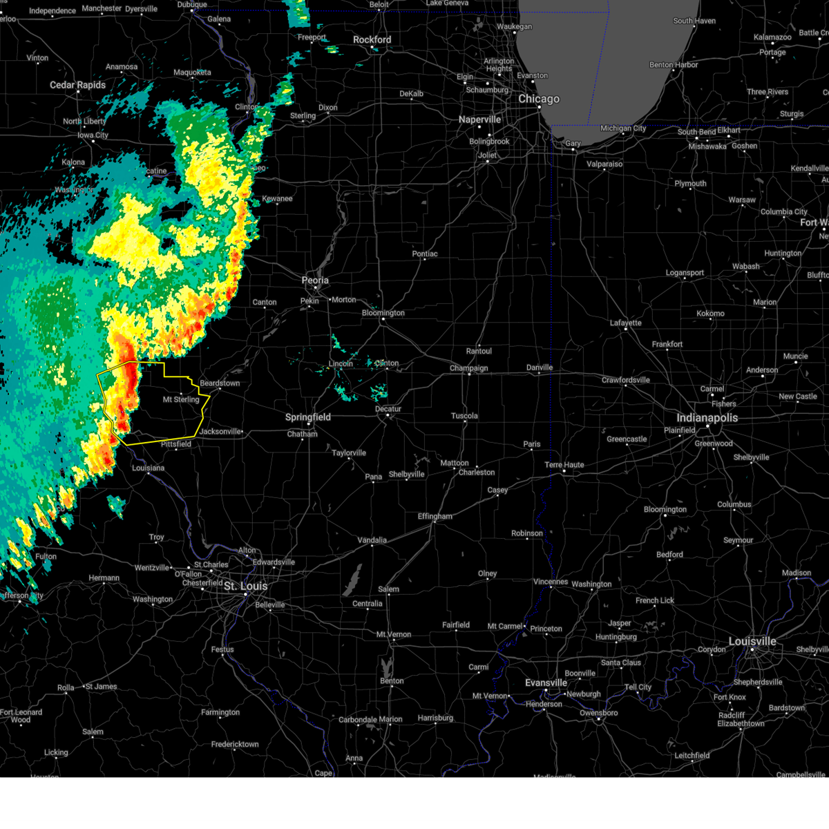
The Mendon, IL area has had 0 reports of on-the-ground hail by trained spotters, and has been under severe weather warnings 31 times during the past 12 months. Doppler radar has detected hail at or near Mendon, IL on 54 occasions, including 2 occasions during the past year.
| Name: | Mendon, IL |
| Where Located: | 32.4 miles SE of Kahoka, MO |
| Map: | Google Map for Mendon, IL |
| Population: | 953 |
| Housing Units: | 376 |
| More Info: | Search Google for Mendon, IL |
0
The Top Recent Hail Date for Mendon, IL is Tuesday, June 17, 2025 (53rd out of 54)
Hail and Wind Damage Spotted near Mendon, IL
| Date / Time | Report Details |
|---|---|
| 5/19/2025 10:00 PM CDT |
 At 1000 pm cdt, a severe thunderstorm was located near quincy regional airport, moving northeast at 30 mph (radar indicated). Hazards include 60 mph wind gusts and small hail. Expect damage to roofs, siding, and trees. locations impacted include, quincy, quincy regional airport, payson, mendon, fall creek, beverly, adams, kingston, burton, liberty, richfield, plainville, coatsburg, columbus, paloma, fowler, seehorn and marblehead. this includes the following highways, interstate 72 near exit 4. Interstate 172 between exits 2 and 19. At 1000 pm cdt, a severe thunderstorm was located near quincy regional airport, moving northeast at 30 mph (radar indicated). Hazards include 60 mph wind gusts and small hail. Expect damage to roofs, siding, and trees. locations impacted include, quincy, quincy regional airport, payson, mendon, fall creek, beverly, adams, kingston, burton, liberty, richfield, plainville, coatsburg, columbus, paloma, fowler, seehorn and marblehead. this includes the following highways, interstate 72 near exit 4. Interstate 172 between exits 2 and 19.
|
| 5/19/2025 10:00 PM CDT |
 the severe thunderstorm warning has been cancelled and is no longer in effect the severe thunderstorm warning has been cancelled and is no longer in effect
|
| 5/19/2025 9:47 PM CDT |
 the severe thunderstorm warning has been cancelled and is no longer in effect the severe thunderstorm warning has been cancelled and is no longer in effect
|
| 5/19/2025 9:47 PM CDT |
 At 947 pm cdt, a severe thunderstorm was located near fall creek, or 8 miles south of quincy, moving northeast at 30 mph (radar indicated). Hazards include ping pong ball size hail and 60 mph wind gusts. People and animals outdoors will be injured. expect hail damage to roofs, siding, windows, and vehicles. expect wind damage to roofs, siding, and trees. locations impacted include, quincy, hannibal, quincy regional airport, payson, mendon, fall creek, beverly, adams, kingston, burton, liberty, hull, richfield, plainville, coatsburg, columbus, fowler, seehorn, paloma and marblehead. this includes the following highways, interstate 72 between exits 4 and 10. Interstate 172 between exits 2 and 19. At 947 pm cdt, a severe thunderstorm was located near fall creek, or 8 miles south of quincy, moving northeast at 30 mph (radar indicated). Hazards include ping pong ball size hail and 60 mph wind gusts. People and animals outdoors will be injured. expect hail damage to roofs, siding, windows, and vehicles. expect wind damage to roofs, siding, and trees. locations impacted include, quincy, hannibal, quincy regional airport, payson, mendon, fall creek, beverly, adams, kingston, burton, liberty, hull, richfield, plainville, coatsburg, columbus, fowler, seehorn, paloma and marblehead. this includes the following highways, interstate 72 between exits 4 and 10. Interstate 172 between exits 2 and 19.
|
| 5/19/2025 9:28 PM CDT |
 Svrlsx the national weather service in st louis has issued a * severe thunderstorm warning for, adams county in west central illinois, northwestern pike county in west central illinois, eastern marion county in northeastern missouri, north central ralls county in northeastern missouri, * until 1015 pm cdt. * at 928 pm cdt, a severe thunderstorm was located near hannibal, moving northeast at 35 mph (radar indicated). Hazards include 60 mph wind gusts. expect damage to roofs, siding, and trees Svrlsx the national weather service in st louis has issued a * severe thunderstorm warning for, adams county in west central illinois, northwestern pike county in west central illinois, eastern marion county in northeastern missouri, north central ralls county in northeastern missouri, * until 1015 pm cdt. * at 928 pm cdt, a severe thunderstorm was located near hannibal, moving northeast at 35 mph (radar indicated). Hazards include 60 mph wind gusts. expect damage to roofs, siding, and trees
|
| 4/20/2025 6:52 PM CDT |
 the severe thunderstorm warning has been cancelled and is no longer in effect the severe thunderstorm warning has been cancelled and is no longer in effect
|
| 4/20/2025 6:52 PM CDT |
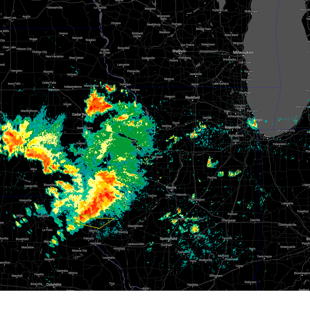
 At 652 pm cdt, severe thunderstorms were located along a line from 8 miles northwest of mendon to over payson, or along a line from 9 miles northeast of canton to 9 miles south of quincy regional airport, moving east at 50 mph (trained spotters reported. multiple reports of wind near 70 mph across southern marion county). Hazards include 70 mph wind gusts and small hail. Expect considerable tree damage. damage is likely to mobile homes, roofs, and outbuildings. other locations impacted by the severe thunderstorm include meyer, marblehead, burton, lima, ursa, adams, paloma, fowler, richfield and plainville. this includes the following state parks, siloam springs state park. This includes interstate 172 between exits 2 and 19. At 652 pm cdt, severe thunderstorms were located along a line from 8 miles northwest of mendon to over payson, or along a line from 9 miles northeast of canton to 9 miles south of quincy regional airport, moving east at 50 mph (trained spotters reported. multiple reports of wind near 70 mph across southern marion county). Hazards include 70 mph wind gusts and small hail. Expect considerable tree damage. damage is likely to mobile homes, roofs, and outbuildings. other locations impacted by the severe thunderstorm include meyer, marblehead, burton, lima, ursa, adams, paloma, fowler, richfield and plainville. this includes the following state parks, siloam springs state park. This includes interstate 172 between exits 2 and 19.
|
| 4/20/2025 6:15 PM CDT |
 Svrlsx the national weather service in st louis has issued a * severe thunderstorm warning for, adams county in west central illinois, southeastern lewis county in northeastern missouri, marion county in northeastern missouri, * until 715 pm cdt. * at 615 pm cdt, severe thunderstorms were located along a line from near steffenville to over monroe city, or along a line from 17 miles southeast of edina to over monroe city, moving east at 50 mph (radar indicated). Hazards include 60 mph wind gusts and small hail. Expect damage to roofs, siding, and trees. this severe thunderstorm will be near, monroe city, steffenville and warren around 615 pm cdt. philadelphia around 620 pm cdt. other locations impacted by the severe thunderstorm include monticello, taylor, meyer, marblehead, burton, lima, ursa, adams, paloma and fowler. this includes the following state parks, wakonda state park and siloam springs state park. this includes the following highways, interstate 72 near exit 4. Interstate 172 between exits 2 and 19. Svrlsx the national weather service in st louis has issued a * severe thunderstorm warning for, adams county in west central illinois, southeastern lewis county in northeastern missouri, marion county in northeastern missouri, * until 715 pm cdt. * at 615 pm cdt, severe thunderstorms were located along a line from near steffenville to over monroe city, or along a line from 17 miles southeast of edina to over monroe city, moving east at 50 mph (radar indicated). Hazards include 60 mph wind gusts and small hail. Expect damage to roofs, siding, and trees. this severe thunderstorm will be near, monroe city, steffenville and warren around 615 pm cdt. philadelphia around 620 pm cdt. other locations impacted by the severe thunderstorm include monticello, taylor, meyer, marblehead, burton, lima, ursa, adams, paloma and fowler. this includes the following state parks, wakonda state park and siloam springs state park. this includes the following highways, interstate 72 near exit 4. Interstate 172 between exits 2 and 19.
|
| 4/10/2025 2:22 PM CDT |
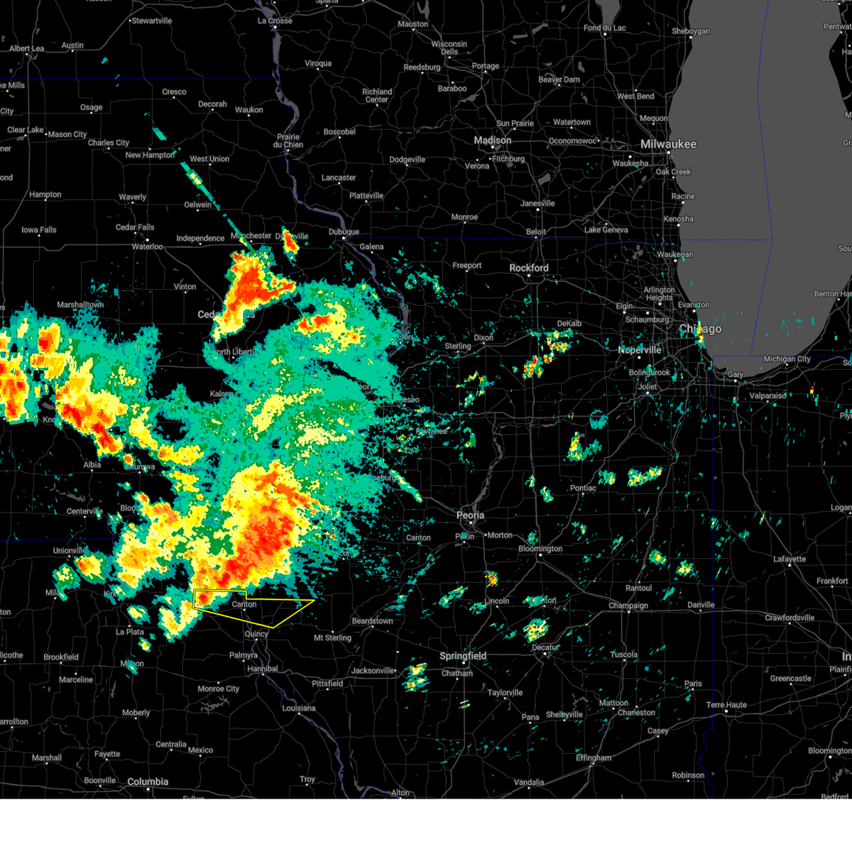
 Svrlsx the national weather service in st louis has issued a * severe thunderstorm warning for, northern adams county in west central illinois, northwestern brown county in west central illinois, * until 300 pm cdt. * at 222 pm cdt, a severe thunderstorm was located 6 miles northeast of mendon, or 15 miles north of quincy regional airport, moving southeast at 25 mph (radar indicated). Hazards include quarter size hail. damage to vehicles is expected Svrlsx the national weather service in st louis has issued a * severe thunderstorm warning for, northern adams county in west central illinois, northwestern brown county in west central illinois, * until 300 pm cdt. * at 222 pm cdt, a severe thunderstorm was located 6 miles northeast of mendon, or 15 miles north of quincy regional airport, moving southeast at 25 mph (radar indicated). Hazards include quarter size hail. damage to vehicles is expected
|
| 3/14/2025 8:19 PM CDT | At 819 pm cdt, severe thunderstorms were located along a line from 19 miles north of golden to over buckhorn, or along a line from 33 miles northeast of quincy regional airport to 18 miles east of quincy regional airport, moving northeast at 55 mph (radar indicated). Hazards include 70 mph wind gusts and small hail. Expect considerable tree damage. damage is likely to mobile homes, roofs, and outbuildings. this severe thunderstorm will be near, hannibal around 735 pm cdt. quincy around 740 pm cdt. other locations impacted by the severe thunderstorm include seehorn, fowler, hull, burton, paloma, loraine, kinderhook, plainville, adams and liberty. this includes the following state parks, siloam springs state park. this includes the following highways, interstate 72 between exits 4 and 20. Interstate 172 between exits 2 and 14. |
| 3/14/2025 8:19 PM CDT | the severe thunderstorm warning has been cancelled and is no longer in effect |
| 3/14/2025 8:11 PM CDT |
 At 811 pm cdt, severe thunderstorms were located along a line from 13 miles north of golden to near beverly, or along a line from 26 miles north of quincy regional airport to 14 miles southeast of quincy regional airport, moving northeast at 55 mph (trained spotters reported. at 7:28 pm 70 mph winds were reported in hannibal, mo). Hazards include 70 mph wind gusts and small hail. Expect considerable tree damage. damage is likely to mobile homes, roofs, and outbuildings. severe thunderstorms will remain over mainly rural areas of adams and northwestern pike counties in west central illinois and northeastern ralls county in northeastern missouri. this includes the following state parks, siloam springs state park. this includes the following highways, interstate 72 between exits 4 and 20. Interstate 172 between exits 2 and 19. At 811 pm cdt, severe thunderstorms were located along a line from 13 miles north of golden to near beverly, or along a line from 26 miles north of quincy regional airport to 14 miles southeast of quincy regional airport, moving northeast at 55 mph (trained spotters reported. at 7:28 pm 70 mph winds were reported in hannibal, mo). Hazards include 70 mph wind gusts and small hail. Expect considerable tree damage. damage is likely to mobile homes, roofs, and outbuildings. severe thunderstorms will remain over mainly rural areas of adams and northwestern pike counties in west central illinois and northeastern ralls county in northeastern missouri. this includes the following state parks, siloam springs state park. this includes the following highways, interstate 72 between exits 4 and 20. Interstate 172 between exits 2 and 19.
|
| 3/14/2025 8:11 PM CDT |
 the severe thunderstorm warning has been cancelled and is no longer in effect the severe thunderstorm warning has been cancelled and is no longer in effect
|
| 3/14/2025 7:50 PM CDT |
 the severe thunderstorm warning has been cancelled and is no longer in effect the severe thunderstorm warning has been cancelled and is no longer in effect
|
| 3/14/2025 7:50 PM CDT |
 At 750 pm cdt, severe thunderstorms were located along a line from over mendon to 9 miles west of barry, or along a line from 12 miles north of quincy regional airport to 11 miles east of hannibal, moving northeast at 55 mph (trained spotters reported. at 7:28 pm 70 mph winds were reported in hannibal, mo). Hazards include 70 mph wind gusts and small hail. Expect considerable tree damage. damage is likely to mobile homes, roofs, and outbuildings. this severe thunderstorm will be near, hannibal, new london and la grange around 735 pm cdt. quincy around 740 pm cdt. other locations impacted by the severe thunderstorm include marblehead, ilasco, saverton, seehorn, ursa, fowler, hull, burton, lima and paloma. this includes the following state parks, siloam springs state park. this includes the following highways, interstate 72 between exits 4 and 20. Interstate 172 between exits 2 and 19. At 750 pm cdt, severe thunderstorms were located along a line from over mendon to 9 miles west of barry, or along a line from 12 miles north of quincy regional airport to 11 miles east of hannibal, moving northeast at 55 mph (trained spotters reported. at 7:28 pm 70 mph winds were reported in hannibal, mo). Hazards include 70 mph wind gusts and small hail. Expect considerable tree damage. damage is likely to mobile homes, roofs, and outbuildings. this severe thunderstorm will be near, hannibal, new london and la grange around 735 pm cdt. quincy around 740 pm cdt. other locations impacted by the severe thunderstorm include marblehead, ilasco, saverton, seehorn, ursa, fowler, hull, burton, lima and paloma. this includes the following state parks, siloam springs state park. this includes the following highways, interstate 72 between exits 4 and 20. Interstate 172 between exits 2 and 19.
|
| 3/14/2025 7:35 PM CDT |
 Svrlsx the national weather service in st louis has issued a * severe thunderstorm warning for, adams county in west central illinois, northwestern pike county in west central illinois, southeastern lewis county in northeastern missouri, eastern marion county in northeastern missouri, northeastern ralls county in northeastern missouri, * until 830 pm cdt. * at 735 pm cdt, severe thunderstorms were located along a line from near quincy to near center, or along a line from near quincy to 12 miles north of vandalia, moving northeast at 45 mph (radar indicated). Hazards include 70 mph wind gusts. Expect considerable tree damage. damage is likely to mobile homes, roofs, and outbuildings. this severe thunderstorm will be near, hannibal, quincy, new london, la grange and palmyra around 735 pm cdt. other locations impacted by the severe thunderstorm include taylor, marblehead, ursa, ilasco, burton, saverton, seehorn, fowler, lima and adams. this includes the following state parks, wakonda state park and siloam springs state park. this includes the following highways, interstate 72 between exits 4 and 20. Interstate 172 between exits 2 and 19. Svrlsx the national weather service in st louis has issued a * severe thunderstorm warning for, adams county in west central illinois, northwestern pike county in west central illinois, southeastern lewis county in northeastern missouri, eastern marion county in northeastern missouri, northeastern ralls county in northeastern missouri, * until 830 pm cdt. * at 735 pm cdt, severe thunderstorms were located along a line from near quincy to near center, or along a line from near quincy to 12 miles north of vandalia, moving northeast at 45 mph (radar indicated). Hazards include 70 mph wind gusts. Expect considerable tree damage. damage is likely to mobile homes, roofs, and outbuildings. this severe thunderstorm will be near, hannibal, quincy, new london, la grange and palmyra around 735 pm cdt. other locations impacted by the severe thunderstorm include taylor, marblehead, ursa, ilasco, burton, saverton, seehorn, fowler, lima and adams. this includes the following state parks, wakonda state park and siloam springs state park. this includes the following highways, interstate 72 between exits 4 and 20. Interstate 172 between exits 2 and 19.
|
| 10/30/2024 11:48 PM CDT |
 At 1148 pm cdt, severe thunderstorms were located along a line from 8 miles northwest of golden to 6 miles south of quincy regional airport, or along a line from 17 miles north of quincy regional airport to 6 miles south of quincy regional airport, moving east at 55 mph (automated observing station at quincy (kuin) reported a wind gust of 81 mph). Hazards include 70 mph wind gusts. Expect considerable tree damage. damage is likely to mobile homes, roofs, and outbuildings. locations impacted include, quincy, hannibal, quincy regional airport, mount sterling, barry, griggsville, camp point, payson, mendon, clayton, golden, fall creek, beverly, buckhorn, adams, la grange, kingston, burton, ursa and liberty. this includes the following state parks, siloam springs state park. this includes the following highways, interstate 72 between exits 4 and 20. Interstate 172 between exits 2 and 19. At 1148 pm cdt, severe thunderstorms were located along a line from 8 miles northwest of golden to 6 miles south of quincy regional airport, or along a line from 17 miles north of quincy regional airport to 6 miles south of quincy regional airport, moving east at 55 mph (automated observing station at quincy (kuin) reported a wind gust of 81 mph). Hazards include 70 mph wind gusts. Expect considerable tree damage. damage is likely to mobile homes, roofs, and outbuildings. locations impacted include, quincy, hannibal, quincy regional airport, mount sterling, barry, griggsville, camp point, payson, mendon, clayton, golden, fall creek, beverly, buckhorn, adams, la grange, kingston, burton, ursa and liberty. this includes the following state parks, siloam springs state park. this includes the following highways, interstate 72 between exits 4 and 20. Interstate 172 between exits 2 and 19.
|
| 10/30/2024 11:25 PM CDT |
 Svrlsx the national weather service in st louis has issued a * severe thunderstorm warning for, adams county in west central illinois, brown county in west central illinois, northern pike county in west central illinois, * until 1230 am cdt. * at 1125 pm cdt, severe thunderstorms were located along a line from over la grange to near palmyra, or along a line from near canton to near palmyra, moving east at 60 mph (radar indicated). Hazards include 60 mph wind gusts. expect damage to roofs, siding, and trees Svrlsx the national weather service in st louis has issued a * severe thunderstorm warning for, adams county in west central illinois, brown county in west central illinois, northern pike county in west central illinois, * until 1230 am cdt. * at 1125 pm cdt, severe thunderstorms were located along a line from over la grange to near palmyra, or along a line from near canton to near palmyra, moving east at 60 mph (radar indicated). Hazards include 60 mph wind gusts. expect damage to roofs, siding, and trees
|
| 7/31/2024 6:16 AM CDT |
 The storms which prompted the warning have moved out of the area. therefore, the warning has been allowed to expire. a severe thunderstorm watch remains in effect until 900 am cdt for west central illinois, and northeastern missouri. The storms which prompted the warning have moved out of the area. therefore, the warning has been allowed to expire. a severe thunderstorm watch remains in effect until 900 am cdt for west central illinois, and northeastern missouri.
|
| 7/31/2024 6:12 AM CDT |
 Svrlsx the national weather service in st louis has issued a * severe thunderstorm warning for, northern adams county in west central illinois, brown county in west central illinois, * until 700 am cdt. * at 611 am cdt, severe thunderstorms were located along a line extending from augusta to near quincy, moving east at 40 mph (radar indicated). Hazards include 60 mph wind gusts and nickel size hail. expect damage to roofs, siding, and trees Svrlsx the national weather service in st louis has issued a * severe thunderstorm warning for, northern adams county in west central illinois, brown county in west central illinois, * until 700 am cdt. * at 611 am cdt, severe thunderstorms were located along a line extending from augusta to near quincy, moving east at 40 mph (radar indicated). Hazards include 60 mph wind gusts and nickel size hail. expect damage to roofs, siding, and trees
|
| 7/31/2024 6:07 AM CDT |
 At 606 am cdt, severe thunderstorms were located along a line extending from near bowen to near la grange, moving east at 45 mph (radar indicated). Hazards include 60 mph wind gusts and quarter size hail. Hail damage to vehicles is expected. expect wind damage to roofs, siding, and trees. Locations impacted include, mendon, ursa, loraine, woodville, lima, la prairie, meyer, and chatton. At 606 am cdt, severe thunderstorms were located along a line extending from near bowen to near la grange, moving east at 45 mph (radar indicated). Hazards include 60 mph wind gusts and quarter size hail. Hail damage to vehicles is expected. expect wind damage to roofs, siding, and trees. Locations impacted include, mendon, ursa, loraine, woodville, lima, la prairie, meyer, and chatton.
|
| 7/31/2024 6:07 AM CDT |
 the severe thunderstorm warning has been cancelled and is no longer in effect the severe thunderstorm warning has been cancelled and is no longer in effect
|
| 7/31/2024 5:50 AM CDT |
 At 550 am cdt, severe thunderstorms were located along a line extending from near west point to near canton, moving east at 40 mph (radar indicated). Hazards include 60 mph wind gusts and quarter size hail. Hail damage to vehicles is expected. expect wind damage to roofs, siding, and trees. Locations impacted include, canton, mendon, la grange, ursa, loraine, woodville, lima, monticello, la prairie, meyer, and chatton. At 550 am cdt, severe thunderstorms were located along a line extending from near west point to near canton, moving east at 40 mph (radar indicated). Hazards include 60 mph wind gusts and quarter size hail. Hail damage to vehicles is expected. expect wind damage to roofs, siding, and trees. Locations impacted include, canton, mendon, la grange, ursa, loraine, woodville, lima, monticello, la prairie, meyer, and chatton.
|
| 7/31/2024 5:35 AM CDT |
 Svrlsx the national weather service in st louis has issued a * severe thunderstorm warning for, northern adams county in west central illinois, northern lewis county in northeastern missouri, * until 615 am cdt. * at 534 am cdt, severe thunderstorms were located along a line extending from near biggsville to near carthage to near la belle, moving east at 40 mph (radar indicated). Hazards include 60 mph wind gusts and quarter size hail. Hail damage to vehicles is expected. Expect wind damage to roofs, siding, and trees. Svrlsx the national weather service in st louis has issued a * severe thunderstorm warning for, northern adams county in west central illinois, northern lewis county in northeastern missouri, * until 615 am cdt. * at 534 am cdt, severe thunderstorms were located along a line extending from near biggsville to near carthage to near la belle, moving east at 40 mph (radar indicated). Hazards include 60 mph wind gusts and quarter size hail. Hail damage to vehicles is expected. Expect wind damage to roofs, siding, and trees.
|
| 7/7/2024 4:55 PM CDT |
 At 455 pm cdt, severe thunderstorms were located along a line extending from near west point to near camp point to near payson, moving east at 35 mph (radar indicated). Hazards include 60 mph wind gusts and quarter size hail. Hail damage to vehicles is expected. expect wind damage to roofs, siding, and trees. locations impacted include, quincy, quincy regional airport, mendon, burton, loraine, woodville, coatsburg, columbus, paloma, and fowler. This includes interstate 172 between exits 10 and 19. At 455 pm cdt, severe thunderstorms were located along a line extending from near west point to near camp point to near payson, moving east at 35 mph (radar indicated). Hazards include 60 mph wind gusts and quarter size hail. Hail damage to vehicles is expected. expect wind damage to roofs, siding, and trees. locations impacted include, quincy, quincy regional airport, mendon, burton, loraine, woodville, coatsburg, columbus, paloma, and fowler. This includes interstate 172 between exits 10 and 19.
|
| 7/7/2024 4:55 PM CDT |
 the severe thunderstorm warning has been cancelled and is no longer in effect the severe thunderstorm warning has been cancelled and is no longer in effect
|
| 7/7/2024 4:47 PM CDT |
 the severe thunderstorm warning has been cancelled and is no longer in effect the severe thunderstorm warning has been cancelled and is no longer in effect
|
| 7/7/2024 4:47 PM CDT |
 At 447 pm cdt, severe thunderstorms were located along a line extending from 7 miles southwest of west point to near mendon to near quincy, moving east at 35 mph (radar indicated). Hazards include 60 mph wind gusts and quarter size hail. Hail damage to vehicles is expected. expect wind damage to roofs, siding, and trees. locations impacted include, quincy, quincy regional airport, mendon, burton, ursa, loraine, woodville, lima, coatsburg, columbus, paloma, and fowler. This includes interstate 172 between exits 10 and 19. At 447 pm cdt, severe thunderstorms were located along a line extending from 7 miles southwest of west point to near mendon to near quincy, moving east at 35 mph (radar indicated). Hazards include 60 mph wind gusts and quarter size hail. Hail damage to vehicles is expected. expect wind damage to roofs, siding, and trees. locations impacted include, quincy, quincy regional airport, mendon, burton, ursa, loraine, woodville, lima, coatsburg, columbus, paloma, and fowler. This includes interstate 172 between exits 10 and 19.
|
| 7/7/2024 4:31 PM CDT |
 Svrlsx the national weather service in st louis has issued a * severe thunderstorm warning for, northwestern adams county in west central illinois, north central marion county in northeastern missouri, eastern lewis county in northeastern missouri, * until 515 pm cdt. * at 430 pm cdt, severe thunderstorms were located along a line extending from near canton to la grange to near maywood, moving east at 30 mph (radar indicated). Hazards include 60 mph wind gusts and quarter size hail. Hail damage to vehicles is expected. Expect wind damage to roofs, siding, and trees. Svrlsx the national weather service in st louis has issued a * severe thunderstorm warning for, northwestern adams county in west central illinois, north central marion county in northeastern missouri, eastern lewis county in northeastern missouri, * until 515 pm cdt. * at 430 pm cdt, severe thunderstorms were located along a line extending from near canton to la grange to near maywood, moving east at 30 mph (radar indicated). Hazards include 60 mph wind gusts and quarter size hail. Hail damage to vehicles is expected. Expect wind damage to roofs, siding, and trees.
|
| 7/7/2024 4:07 PM CDT |
 the severe thunderstorm warning has been cancelled and is no longer in effect the severe thunderstorm warning has been cancelled and is no longer in effect
|
| 7/7/2024 3:51 PM CDT |
 Svrlsx the national weather service in st louis has issued a * severe thunderstorm warning for, northwestern adams county in west central illinois, * until 430 pm cdt. * at 351 pm cdt, a severe thunderstorm was located near la grange, moving northeast at 20 mph (radar indicated). Hazards include 60 mph wind gusts and quarter size hail. Hail damage to vehicles is expected. Expect wind damage to roofs, siding, and trees. Svrlsx the national weather service in st louis has issued a * severe thunderstorm warning for, northwestern adams county in west central illinois, * until 430 pm cdt. * at 351 pm cdt, a severe thunderstorm was located near la grange, moving northeast at 20 mph (radar indicated). Hazards include 60 mph wind gusts and quarter size hail. Hail damage to vehicles is expected. Expect wind damage to roofs, siding, and trees.
|
| 7/2/2024 9:25 PM CDT |
 At 925 pm cdt, a severe thunderstorm was located near golden, moving east at 50 mph (radar indicated). Hazards include 60 mph wind gusts. Expect damage to roofs, siding, and trees. Locations impacted include, camp point, clayton, golden, loraine, woodville, coatsburg, la prairie, paloma, and chatton. At 925 pm cdt, a severe thunderstorm was located near golden, moving east at 50 mph (radar indicated). Hazards include 60 mph wind gusts. Expect damage to roofs, siding, and trees. Locations impacted include, camp point, clayton, golden, loraine, woodville, coatsburg, la prairie, paloma, and chatton.
|
| 7/2/2024 9:16 PM CDT |
 At 915 pm cdt, a severe thunderstorm was located near bowen, moving east at 55 mph (radar indicated). Hazards include 60 mph wind gusts. Expect damage to roofs, siding, and trees. Locations impacted include, camp point, mendon, clayton, golden, ursa, loraine, woodville, coatsburg, la prairie, paloma, and chatton. At 915 pm cdt, a severe thunderstorm was located near bowen, moving east at 55 mph (radar indicated). Hazards include 60 mph wind gusts. Expect damage to roofs, siding, and trees. Locations impacted include, camp point, mendon, clayton, golden, ursa, loraine, woodville, coatsburg, la prairie, paloma, and chatton.
|
| 7/2/2024 8:54 PM CDT |
 Svrlsx the national weather service in st louis has issued a * severe thunderstorm warning for, northern adams county in west central illinois, * until 945 pm cdt. * at 854 pm cdt, a severe thunderstorm was located near canton, moving east at 55 mph (radar indicated). Hazards include 60 mph wind gusts. expect damage to roofs, siding, and trees Svrlsx the national weather service in st louis has issued a * severe thunderstorm warning for, northern adams county in west central illinois, * until 945 pm cdt. * at 854 pm cdt, a severe thunderstorm was located near canton, moving east at 55 mph (radar indicated). Hazards include 60 mph wind gusts. expect damage to roofs, siding, and trees
|
| 4/16/2024 7:33 PM CDT |
 Svrlsx the national weather service in st louis has issued a * severe thunderstorm warning for, northeastern adams county in west central illinois, northwestern brown county in west central illinois, * until 815 pm cdt. * at 732 pm cdt, a severe thunderstorm was located over mainly rural areas of northern adams and far northwestern brown counties, moving northeast at 35 mph (radar indicated). Hazards include 60 mph wind gusts and quarter size hail. Hail damage to vehicles is expected. Expect wind damage to roofs, siding, and trees. Svrlsx the national weather service in st louis has issued a * severe thunderstorm warning for, northeastern adams county in west central illinois, northwestern brown county in west central illinois, * until 815 pm cdt. * at 732 pm cdt, a severe thunderstorm was located over mainly rural areas of northern adams and far northwestern brown counties, moving northeast at 35 mph (radar indicated). Hazards include 60 mph wind gusts and quarter size hail. Hail damage to vehicles is expected. Expect wind damage to roofs, siding, and trees.
|
| 3/14/2024 3:22 AM CDT |
 At 321 am cdt, severe thunderstorms were located along a line extending from near st. francisville to near warsaw to near mendon to near hannibal, moving east at 40 mph (radar indicated). Hazards include 60 mph wind gusts. Expect damage to roofs, siding, and trees. locations impacted include, quincy, quincy regional airport, camp point, payson, mendon, la grange, clayton, golden, fall creek, adams, burton, ursa, liberty, richfield, loraine, woodville, lima, coatsburg, columbus, and la prairie. this also includes siloam springs state park. This includes interstate 172 between exits 2 and 19. At 321 am cdt, severe thunderstorms were located along a line extending from near st. francisville to near warsaw to near mendon to near hannibal, moving east at 40 mph (radar indicated). Hazards include 60 mph wind gusts. Expect damage to roofs, siding, and trees. locations impacted include, quincy, quincy regional airport, camp point, payson, mendon, la grange, clayton, golden, fall creek, adams, burton, ursa, liberty, richfield, loraine, woodville, lima, coatsburg, columbus, and la prairie. this also includes siloam springs state park. This includes interstate 172 between exits 2 and 19.
|
| 3/14/2024 3:22 AM CDT |
 the severe thunderstorm warning has been cancelled and is no longer in effect the severe thunderstorm warning has been cancelled and is no longer in effect
|
| 3/14/2024 2:40 AM CDT |
 Svrlsx the national weather service in st louis has issued a * severe thunderstorm warning for, adams county in west central illinois, central marion county in northeastern missouri, eastern lewis county in northeastern missouri, * until 330 am cdt. * at 240 am cdt, severe thunderstorms were located along a line extending from near south gorin to near lewistown to 6 miles east of shelbina, moving east at 55 mph (radar indicated). Hazards include 60 mph wind gusts. expect damage to roofs, siding, and trees Svrlsx the national weather service in st louis has issued a * severe thunderstorm warning for, adams county in west central illinois, central marion county in northeastern missouri, eastern lewis county in northeastern missouri, * until 330 am cdt. * at 240 am cdt, severe thunderstorms were located along a line extending from near south gorin to near lewistown to 6 miles east of shelbina, moving east at 55 mph (radar indicated). Hazards include 60 mph wind gusts. expect damage to roofs, siding, and trees
|
| 6/29/2023 11:22 AM CDT |
 The severe thunderstorm warning for adams and brown counties will expire at 1130 am cdt, the storms which prompted the warning have moved out of the warned area. therefore, the warning will be allowed to expire. a severe thunderstorm watch remains in effect until 100 pm cdt for west central illinois, and northeastern missouri. remember, a severe thunderstorm warning still remains in effect for eastern adams county and brown county until 1200 pm cdt. The severe thunderstorm warning for adams and brown counties will expire at 1130 am cdt, the storms which prompted the warning have moved out of the warned area. therefore, the warning will be allowed to expire. a severe thunderstorm watch remains in effect until 100 pm cdt for west central illinois, and northeastern missouri. remember, a severe thunderstorm warning still remains in effect for eastern adams county and brown county until 1200 pm cdt.
|
| 6/29/2023 10:51 AM CDT |
 At 1051 am cdt, severe thunderstorms were located along a line extending from near west point to near quincy to near palmyra, moving east at 50 mph (radar indicated). Hazards include 60 mph wind gusts and quarter size hail. Hail damage to vehicles is expected. Expect wind damage to roofs, siding, and trees. At 1051 am cdt, severe thunderstorms were located along a line extending from near west point to near quincy to near palmyra, moving east at 50 mph (radar indicated). Hazards include 60 mph wind gusts and quarter size hail. Hail damage to vehicles is expected. Expect wind damage to roofs, siding, and trees.
|
| 4/20/2023 2:04 PM CDT |
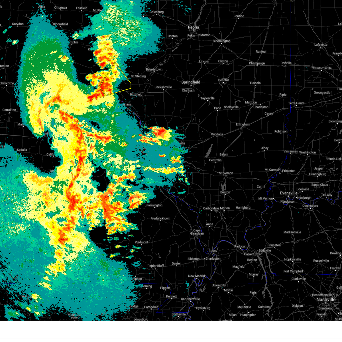
 At 204 pm cdt, a severe thunderstorm was located over mendon, moving northeast at 55 mph (trained weather spotters report quarter sized hail north of quincy, il). Hazards include 60 mph wind gusts and quarter size hail. Hail damage to vehicles is expected. expect wind damage to roofs, siding, and trees. this severe thunderstorm will remain over mainly rural areas of northern adams county, including the following locations, coatsburg, meyer, ursa, paloma, lima, loraine, woodville, fowler, la prairie , and chatton. this includes interstate 172 near exit 19. hail threat, observed max hail size, 1. 00 in wind threat, radar indicated max wind gust, 60 mph. At 204 pm cdt, a severe thunderstorm was located over mendon, moving northeast at 55 mph (trained weather spotters report quarter sized hail north of quincy, il). Hazards include 60 mph wind gusts and quarter size hail. Hail damage to vehicles is expected. expect wind damage to roofs, siding, and trees. this severe thunderstorm will remain over mainly rural areas of northern adams county, including the following locations, coatsburg, meyer, ursa, paloma, lima, loraine, woodville, fowler, la prairie , and chatton. this includes interstate 172 near exit 19. hail threat, observed max hail size, 1. 00 in wind threat, radar indicated max wind gust, 60 mph.
|
| 4/20/2023 1:51 PM CDT |
 At 151 pm cdt, a severe thunderstorm was located near la grange, moving northeast at 55 mph (radar indicated). Hazards include 60 mph wind gusts and half dollar size hail. Hail damage to vehicles is expected. expect wind damage to roofs, siding, and trees. this severe thunderstorm will be near, quincy and la grange around 155 pm cdt. mendon around 200 pm cdt. this includes interstate 172 near exit 19. this also includes wakonda state park. hail threat, radar indicated max hail size, 1. 25 in wind threat, radar indicated max wind gust, 60 mph. At 151 pm cdt, a severe thunderstorm was located near la grange, moving northeast at 55 mph (radar indicated). Hazards include 60 mph wind gusts and half dollar size hail. Hail damage to vehicles is expected. expect wind damage to roofs, siding, and trees. this severe thunderstorm will be near, quincy and la grange around 155 pm cdt. mendon around 200 pm cdt. this includes interstate 172 near exit 19. this also includes wakonda state park. hail threat, radar indicated max hail size, 1. 25 in wind threat, radar indicated max wind gust, 60 mph.
|
| 4/4/2023 6:26 PM CDT |
 The severe thunderstorm warning for northern adams county will expire at 630 pm cdt, the storm which prompted the warning has moved out of the area. therefore, the warning will be allowed to expire. a tornado watch remains in effect until 1000 pm cdt for west central illinois. The severe thunderstorm warning for northern adams county will expire at 630 pm cdt, the storm which prompted the warning has moved out of the area. therefore, the warning will be allowed to expire. a tornado watch remains in effect until 1000 pm cdt for west central illinois.
|
| 4/4/2023 6:12 PM CDT |
 At 611 pm cdt, a severe thunderstorm was located over mendon, moving northeast at 60 mph (radar indicated). Hazards include 60 mph wind gusts and quarter size hail. Hail damage to vehicles is expected. expect wind damage to roofs, siding, and trees. locations impacted include, mendon, ursa, loraine, woodville, la prairie, fowler and chatton. this includes interstate 172 near exit 19. hail threat, radar indicated max hail size, 1. 00 in wind threat, radar indicated max wind gust, 60 mph. At 611 pm cdt, a severe thunderstorm was located over mendon, moving northeast at 60 mph (radar indicated). Hazards include 60 mph wind gusts and quarter size hail. Hail damage to vehicles is expected. expect wind damage to roofs, siding, and trees. locations impacted include, mendon, ursa, loraine, woodville, la prairie, fowler and chatton. this includes interstate 172 near exit 19. hail threat, radar indicated max hail size, 1. 00 in wind threat, radar indicated max wind gust, 60 mph.
|
| 4/4/2023 5:59 PM CDT |
 At 559 pm cdt, a severe thunderstorm was located near quincy, moving northeast at 60 mph (radar indicated). Hazards include 60 mph wind gusts and half dollar size hail. Hail damage to vehicles is expected. expect wind damage to roofs, siding, and trees. locations impacted include, mendon and golden. this also includes wakonda state park. this includes interstate 172 between exits 15 and 19. hail threat, radar indicated max hail size, 1. 25 in wind threat, radar indicated max wind gust, 60 mph. At 559 pm cdt, a severe thunderstorm was located near quincy, moving northeast at 60 mph (radar indicated). Hazards include 60 mph wind gusts and half dollar size hail. Hail damage to vehicles is expected. expect wind damage to roofs, siding, and trees. locations impacted include, mendon and golden. this also includes wakonda state park. this includes interstate 172 between exits 15 and 19. hail threat, radar indicated max hail size, 1. 25 in wind threat, radar indicated max wind gust, 60 mph.
|
| 4/4/2023 5:47 PM CDT |
 At 547 pm cdt, a severe thunderstorm was located near maywood, moving northeast at 55 mph (radar indicated). Hazards include 60 mph wind gusts and half dollar size hail. Hail damage to vehicles is expected. expect wind damage to roofs, siding, and trees. this severe storm will be near, maywood around 555 pm cdt. other locations in the path of this severe thunderstorm include quincy, la grange and mendon. this also includes wakonda state park. this includes interstate 172 between exits 15 and 19. hail threat, radar indicated max hail size, 1. 25 in wind threat, radar indicated max wind gust, 60 mph. At 547 pm cdt, a severe thunderstorm was located near maywood, moving northeast at 55 mph (radar indicated). Hazards include 60 mph wind gusts and half dollar size hail. Hail damage to vehicles is expected. expect wind damage to roofs, siding, and trees. this severe storm will be near, maywood around 555 pm cdt. other locations in the path of this severe thunderstorm include quincy, la grange and mendon. this also includes wakonda state park. this includes interstate 172 between exits 15 and 19. hail threat, radar indicated max hail size, 1. 25 in wind threat, radar indicated max wind gust, 60 mph.
|
| 4/4/2023 5:36 PM CDT |
 At 536 pm cdt, a severe thunderstorm was located over warren, moving northeast at 60 mph (radar indicated). Hazards include 60 mph wind gusts and half dollar size hail. Hail damage to vehicles is expected. expect wind damage to roofs, siding, and trees. this severe thunderstorm will be near, philadelphia around 540 pm cdt. maywood around 550 pm cdt. other locations in the path of this severe thunderstorm include quincy, la grange and mendon. this includes interstate 172 between exits 14 and 19. this also includes wakonda state park. hail threat, radar indicated max hail size, 1. 25 in wind threat, radar indicated max wind gust, 60 mph. At 536 pm cdt, a severe thunderstorm was located over warren, moving northeast at 60 mph (radar indicated). Hazards include 60 mph wind gusts and half dollar size hail. Hail damage to vehicles is expected. expect wind damage to roofs, siding, and trees. this severe thunderstorm will be near, philadelphia around 540 pm cdt. maywood around 550 pm cdt. other locations in the path of this severe thunderstorm include quincy, la grange and mendon. this includes interstate 172 between exits 14 and 19. this also includes wakonda state park. hail threat, radar indicated max hail size, 1. 25 in wind threat, radar indicated max wind gust, 60 mph.
|
| 8/29/2022 6:57 PM CDT |
 At 656 pm cdt, severe thunderstorms were located along a line extending from camp point to near maywood to near steffenville to 9 miles northeast of atlanta, moving southeast at 20 mph (radar indicated). Hazards include 60 mph wind gusts and quarter size hail. Hail damage to vehicles is expected. expect wind damage to roofs, siding, and trees. severe thunderstorms will be near, camp point and golden around 700 pm cdt. maywood around 705 pm cdt. clayton around 715 pm cdt. other locations in the path of these severe thunderstorms include palmyra, emden, philadelphia, shelbyville and fall creek. this includes interstate 172 between exits 2 and 19. this also includes wakonda state park and siloam springs state park. hail threat, radar indicated max hail size, 1. 00 in wind threat, radar indicated max wind gust, 60 mph. At 656 pm cdt, severe thunderstorms were located along a line extending from camp point to near maywood to near steffenville to 9 miles northeast of atlanta, moving southeast at 20 mph (radar indicated). Hazards include 60 mph wind gusts and quarter size hail. Hail damage to vehicles is expected. expect wind damage to roofs, siding, and trees. severe thunderstorms will be near, camp point and golden around 700 pm cdt. maywood around 705 pm cdt. clayton around 715 pm cdt. other locations in the path of these severe thunderstorms include palmyra, emden, philadelphia, shelbyville and fall creek. this includes interstate 172 between exits 2 and 19. this also includes wakonda state park and siloam springs state park. hail threat, radar indicated max hail size, 1. 00 in wind threat, radar indicated max wind gust, 60 mph.
|
| 8/29/2022 6:37 PM CDT |
 At 637 pm cdt, severe thunderstorms were located along a line extending from near golden to near mendon to near ewing, moving east at 25 mph (radar indicated). Hazards include 60 mph wind gusts and quarter size hail. Hail damage to vehicles is expected. expect wind damage to roofs, siding, and trees. locations impacted include, quincy, canton, quincy regional airport, camp point, mendon, la grange, clayton, golden, ewing, maywood, ursa, loraine, woodville, taylor, lima, coatsburg, columbus, la prairie, paloma and fowler. this also includes wakonda state park. this includes interstate 172 between exits 14 and 19. hail threat, radar indicated max hail size, 1. 00 in wind threat, radar indicated max wind gust, 60 mph. At 637 pm cdt, severe thunderstorms were located along a line extending from near golden to near mendon to near ewing, moving east at 25 mph (radar indicated). Hazards include 60 mph wind gusts and quarter size hail. Hail damage to vehicles is expected. expect wind damage to roofs, siding, and trees. locations impacted include, quincy, canton, quincy regional airport, camp point, mendon, la grange, clayton, golden, ewing, maywood, ursa, loraine, woodville, taylor, lima, coatsburg, columbus, la prairie, paloma and fowler. this also includes wakonda state park. this includes interstate 172 between exits 14 and 19. hail threat, radar indicated max hail size, 1. 00 in wind threat, radar indicated max wind gust, 60 mph.
|
| 8/29/2022 6:13 PM CDT |
 At 612 pm cdt, severe thunderstorms were located along a line extending from near west point to near la grange to near ewing, moving southeast at 15 mph (trained weather spotters. half dollar size hail was reported near canton at 606 pm cdt). Hazards include 60 mph wind gusts and half dollar size hail. Hail damage to vehicles is expected. Expect wind damage to roofs, siding, and trees. At 612 pm cdt, severe thunderstorms were located along a line extending from near west point to near la grange to near ewing, moving southeast at 15 mph (trained weather spotters. half dollar size hail was reported near canton at 606 pm cdt). Hazards include 60 mph wind gusts and half dollar size hail. Hail damage to vehicles is expected. Expect wind damage to roofs, siding, and trees.
|
| 4/5/2022 8:14 PM CDT |
 At 813 pm cdt, a severe thunderstorm was located near la grange, moving east at 25 mph (broadcast media. at 812 pm 1 inch hail was reported in lagrange). Hazards include quarter size hail. Damage to vehicles is expected. locations impacted include, mendon, quincy regional airport and camp point. this includes interstate 172 between exits 15 and 19. hail threat, observed max hail size, 1. 00 in wind threat, radar indicated max wind gust, <50 mph. At 813 pm cdt, a severe thunderstorm was located near la grange, moving east at 25 mph (broadcast media. at 812 pm 1 inch hail was reported in lagrange). Hazards include quarter size hail. Damage to vehicles is expected. locations impacted include, mendon, quincy regional airport and camp point. this includes interstate 172 between exits 15 and 19. hail threat, observed max hail size, 1. 00 in wind threat, radar indicated max wind gust, <50 mph.
|
| 4/5/2022 7:53 PM CDT |
 At 753 pm cdt, a severe thunderstorm was located over la grange, moving east at 45 mph (trained weather spotters). Hazards include quarter size hail. Damage to vehicles is expected. this severe thunderstorm will be near, quincy around 805 pm cdt. mendon around 810 pm cdt. other locations in the path of this severe thunderstorm include quincy regional airport and camp point. this includes interstate 172 between exits 15 and 19. this also includes wakonda state park. hail threat, observed max hail size, 1. 00 in wind threat, radar indicated max wind gust, <50 mph. At 753 pm cdt, a severe thunderstorm was located over la grange, moving east at 45 mph (trained weather spotters). Hazards include quarter size hail. Damage to vehicles is expected. this severe thunderstorm will be near, quincy around 805 pm cdt. mendon around 810 pm cdt. other locations in the path of this severe thunderstorm include quincy regional airport and camp point. this includes interstate 172 between exits 15 and 19. this also includes wakonda state park. hail threat, observed max hail size, 1. 00 in wind threat, radar indicated max wind gust, <50 mph.
|
| 6/25/2021 12:17 AM CDT |
 At 1216 am cdt, severe thunderstorms were located along a line extending from near mendon to 6 miles southeast of fall creek to near curryville to near martinsburg, moving east at 65 mph (radar indicated). Hazards include 60 mph wind gusts. Expect damage to roofs, siding, and trees. severe thunderstorms will be near, mendon around 1220 am cdt. bowling green, barry and camp point around 1225 am cdt. golden, beverly and tarrants around 1230 am cdt. other locations in the path of these severe thunderstorms include griggsville, clarksville, pleasant hill, eolia, belleview and elsberry. this includes the following highways, interstate 172 near exit 2, and between exits 14 and 19. interstate 72 between exits 4 and 35. This also includes siloam springs state park. At 1216 am cdt, severe thunderstorms were located along a line extending from near mendon to 6 miles southeast of fall creek to near curryville to near martinsburg, moving east at 65 mph (radar indicated). Hazards include 60 mph wind gusts. Expect damage to roofs, siding, and trees. severe thunderstorms will be near, mendon around 1220 am cdt. bowling green, barry and camp point around 1225 am cdt. golden, beverly and tarrants around 1230 am cdt. other locations in the path of these severe thunderstorms include griggsville, clarksville, pleasant hill, eolia, belleview and elsberry. this includes the following highways, interstate 172 near exit 2, and between exits 14 and 19. interstate 72 between exits 4 and 35. This also includes siloam springs state park.
|
| 6/24/2021 11:52 PM CDT |
 At 1151 pm cdt, severe thunderstorms were located along a line extending from canton to near maywood to near rensselaer to 7 miles northeast of mexico, moving east at 45 mph (radar indicated). Hazards include 60 mph wind gusts. Expect damage to roofs, siding, and trees. locations impacted include, palmyra, canton, la grange, rensselaer, quincy, spaulding, new london, laddonia, mendon, fall creek, farber, vandalia, quincy regional airport, payson, camp point, golden, barry, beverly and clayton. this also includes wakonda state park, mark twain lake recreational area, and siloam springs state park. this includes the following highways, interstate 172 between exits 2 and 19. Interstate 72 between exits 4 and 20. At 1151 pm cdt, severe thunderstorms were located along a line extending from canton to near maywood to near rensselaer to 7 miles northeast of mexico, moving east at 45 mph (radar indicated). Hazards include 60 mph wind gusts. Expect damage to roofs, siding, and trees. locations impacted include, palmyra, canton, la grange, rensselaer, quincy, spaulding, new london, laddonia, mendon, fall creek, farber, vandalia, quincy regional airport, payson, camp point, golden, barry, beverly and clayton. this also includes wakonda state park, mark twain lake recreational area, and siloam springs state park. this includes the following highways, interstate 172 between exits 2 and 19. Interstate 72 between exits 4 and 20.
|
| 6/24/2021 11:29 PM CDT |
 At 1129 pm cdt, severe thunderstorms were located along a line extending from near la belle to near steffenville to near shelbina to near centralia, moving east at 45 mph (radar indicated). Hazards include 60 mph wind gusts. Expect damage to roofs, siding, and trees. severe thunderstorms will be near, lewistown around 1135 pm cdt. warren, ewing and philadelphia around 1140 pm cdt. monroe city and maywood around 1145 pm cdt. other locations in the path of these severe thunderstorms include mexico, santa fe, palmyra, canton, la grange, rensselaer, spaulding, quincy, new london, laddonia, farber, mendon and fall creek. this includes the following highways, interstate 172 between exits 2 and 19. interstate 72 between exits 4 and 20. This also includes wakonda state park, union covered bridge historic site, mark twain lake recreational area, and siloam springs state park. At 1129 pm cdt, severe thunderstorms were located along a line extending from near la belle to near steffenville to near shelbina to near centralia, moving east at 45 mph (radar indicated). Hazards include 60 mph wind gusts. Expect damage to roofs, siding, and trees. severe thunderstorms will be near, lewistown around 1135 pm cdt. warren, ewing and philadelphia around 1140 pm cdt. monroe city and maywood around 1145 pm cdt. other locations in the path of these severe thunderstorms include mexico, santa fe, palmyra, canton, la grange, rensselaer, spaulding, quincy, new london, laddonia, farber, mendon and fall creek. this includes the following highways, interstate 172 between exits 2 and 19. interstate 72 between exits 4 and 20. This also includes wakonda state park, union covered bridge historic site, mark twain lake recreational area, and siloam springs state park.
|
| 11/10/2020 1:50 PM CST |
 At 150 pm cst, severe thunderstorms were located along a line extending from near la harpe to tennessee to 6 miles east of quincy regional airport, moving northeast at 65 mph (radar indicated). Hazards include 60 mph wind gusts. Expect damage to roofs, siding, and trees. locations impacted include, quincy, quincy regional airport, payson, mendon, fall creek, adams, burton, hull, loraine, plainville, woodville, coatsburg, columbus, saverton, paloma, seehorn, fowler and ilasco. this includes the following highways, interstate 172 between exits 2 and 19. Interstate 72 between exits 4 and 10. At 150 pm cst, severe thunderstorms were located along a line extending from near la harpe to tennessee to 6 miles east of quincy regional airport, moving northeast at 65 mph (radar indicated). Hazards include 60 mph wind gusts. Expect damage to roofs, siding, and trees. locations impacted include, quincy, quincy regional airport, payson, mendon, fall creek, adams, burton, hull, loraine, plainville, woodville, coatsburg, columbus, saverton, paloma, seehorn, fowler and ilasco. this includes the following highways, interstate 172 between exits 2 and 19. Interstate 72 between exits 4 and 10.
|
| 11/10/2020 1:36 PM CST |
 At 135 pm cst, severe thunderstorms were located along a line extending from near adrian to near bowen to fall creek, moving east at 65 mph (radar indicated). Hazards include 60 mph wind gusts. Expect damage to roofs, siding, and trees. locations impacted include, quincy, hannibal, quincy regional airport, payson, mendon, fall creek, adams, burton, ursa, hull, loraine, plainville, woodville, lima, coatsburg, columbus, saverton, marblehead, paloma and seehorn. this includes the following highways, interstate 172 between exits 2 and 19. Interstate 72 between exits 4 and 10. At 135 pm cst, severe thunderstorms were located along a line extending from near adrian to near bowen to fall creek, moving east at 65 mph (radar indicated). Hazards include 60 mph wind gusts. Expect damage to roofs, siding, and trees. locations impacted include, quincy, hannibal, quincy regional airport, payson, mendon, fall creek, adams, burton, ursa, hull, loraine, plainville, woodville, lima, coatsburg, columbus, saverton, marblehead, paloma and seehorn. this includes the following highways, interstate 172 between exits 2 and 19. Interstate 72 between exits 4 and 10.
|
| 11/10/2020 1:21 PM CST |
 At 120 pm cst, severe thunderstorms were located along a line extending from near warsaw to near mendon to rensselaer, moving northeast at 65 mph (radar indicated). Hazards include 60 mph wind gusts. Expect damage to roofs, siding, and trees. locations impacted include, quincy, hannibal, quincy regional airport, payson, mendon, fall creek, adams, burton, ursa, hull, loraine, plainville, woodville, lima, coatsburg, columbus, saverton, marblehead, paloma and seehorn. this includes the following highways, interstate 172 between exits 2 and 19. Interstate 72 between exits 4 and 10. At 120 pm cst, severe thunderstorms were located along a line extending from near warsaw to near mendon to rensselaer, moving northeast at 65 mph (radar indicated). Hazards include 60 mph wind gusts. Expect damage to roofs, siding, and trees. locations impacted include, quincy, hannibal, quincy regional airport, payson, mendon, fall creek, adams, burton, ursa, hull, loraine, plainville, woodville, lima, coatsburg, columbus, saverton, marblehead, paloma and seehorn. this includes the following highways, interstate 172 between exits 2 and 19. Interstate 72 between exits 4 and 10.
|
| 11/10/2020 1:07 PM CST |
 At 106 pm cst, severe thunderstorms were located along a line extending from 7 miles northwest of canton to near la grange to 7 miles northwest of perry, moving northeast at 65 mph (radar indicated). Hazards include 60 mph wind gusts. expect damage to roofs, siding, and trees At 106 pm cst, severe thunderstorms were located along a line extending from 7 miles northwest of canton to near la grange to 7 miles northwest of perry, moving northeast at 65 mph (radar indicated). Hazards include 60 mph wind gusts. expect damage to roofs, siding, and trees
|
| 7/15/2020 10:43 AM CDT |
 The severe thunderstorm warning for northern adams county will expire at 1045 am cdt, the storms which prompted the warning have weakened below severe limits, and no longer pose an immediate threat to life or property. therefore, the warning will be allowed to expire. The severe thunderstorm warning for northern adams county will expire at 1045 am cdt, the storms which prompted the warning have weakened below severe limits, and no longer pose an immediate threat to life or property. therefore, the warning will be allowed to expire.
|
| 7/15/2020 10:27 AM CDT |
 At 1011 am cdt, severe thunderstorms were located along a line extending from near canton to near quincy to near payson, moving northeast at 40 mph (radar indicated). Hazards include 60 mph wind gusts and penny size hail. Expect damage to roofs, siding, and trees. locations impacted include, quincy, canton, quincy regional airport, camp point, payson, mendon, la grange, clayton, golden, adams, burton, ursa, liberty, loraine, woodville, lima, coatsburg, columbus, la prairie and meyer. this also includes wakonda state park. This includes interstate 172 between exits 10 and 19. At 1011 am cdt, severe thunderstorms were located along a line extending from near canton to near quincy to near payson, moving northeast at 40 mph (radar indicated). Hazards include 60 mph wind gusts and penny size hail. Expect damage to roofs, siding, and trees. locations impacted include, quincy, canton, quincy regional airport, camp point, payson, mendon, la grange, clayton, golden, adams, burton, ursa, liberty, loraine, woodville, lima, coatsburg, columbus, la prairie and meyer. this also includes wakonda state park. This includes interstate 172 between exits 10 and 19.
|
| 7/15/2020 10:12 AM CDT |
 At 1011 am cdt, severe thunderstorms were located along a line extending from near canton to near quincy to near payson, moving northeast at 40 mph (radar indicated). Hazards include 60 mph wind gusts and penny size hail. Expect damage to roofs, siding, and trees. locations impacted include, quincy, canton, quincy regional airport, camp point, payson, mendon, la grange, clayton, golden, adams, burton, ursa, liberty, loraine, woodville, lima, coatsburg, columbus, la prairie and meyer. this also includes wakonda state park. This includes interstate 172 between exits 10 and 19. At 1011 am cdt, severe thunderstorms were located along a line extending from near canton to near quincy to near payson, moving northeast at 40 mph (radar indicated). Hazards include 60 mph wind gusts and penny size hail. Expect damage to roofs, siding, and trees. locations impacted include, quincy, canton, quincy regional airport, camp point, payson, mendon, la grange, clayton, golden, adams, burton, ursa, liberty, loraine, woodville, lima, coatsburg, columbus, la prairie and meyer. this also includes wakonda state park. This includes interstate 172 between exits 10 and 19.
|
| 7/15/2020 9:56 AM CDT |
 At 956 am cdt, severe thunderstorms were located along a line extending from maywood to 6 miles west of quincy to near hannibal, moving northeast at 35 mph (radar indicated). Hazards include 60 mph wind gusts and penny size hail. expect damage to roofs, siding, and trees At 956 am cdt, severe thunderstorms were located along a line extending from maywood to 6 miles west of quincy to near hannibal, moving northeast at 35 mph (radar indicated). Hazards include 60 mph wind gusts and penny size hail. expect damage to roofs, siding, and trees
|
| 5/24/2020 6:24 PM CDT |
 The severe thunderstorm warning for northern adams county will expire at 630 pm cdt, the storms which prompted the warning have weakened below severe limits, and no longer pose an immediate threat to life or property. therefore, the warning will be allowed to expire. The severe thunderstorm warning for northern adams county will expire at 630 pm cdt, the storms which prompted the warning have weakened below severe limits, and no longer pose an immediate threat to life or property. therefore, the warning will be allowed to expire.
|
| 5/24/2020 6:16 PM CDT |
 At 615 pm cdt, severe thunderstorms were located along a line extending from 8 miles northeast of canton to near mendon to near quincy, moving east at 30 mph (radar indicated). Hazards include 60 mph wind gusts. Expect damage to roofs, siding, and trees. locations impacted include, quincy, camp point, mendon, clayton, golden, ursa, loraine, woodville, lima, coatsburg, la prairie, paloma, fowler and chatton. This includes interstate 172 near exit 19. At 615 pm cdt, severe thunderstorms were located along a line extending from 8 miles northeast of canton to near mendon to near quincy, moving east at 30 mph (radar indicated). Hazards include 60 mph wind gusts. Expect damage to roofs, siding, and trees. locations impacted include, quincy, camp point, mendon, clayton, golden, ursa, loraine, woodville, lima, coatsburg, la prairie, paloma, fowler and chatton. This includes interstate 172 near exit 19.
|
| 5/24/2020 6:02 PM CDT |
 At 602 pm cdt, severe thunderstorms were located along a line extending from near canton to 6 miles northeast of la grange to near quincy, moving east at 30 mph (radar indicated). Hazards include 60 mph wind gusts and penny size hail. Expect damage to roofs, siding, and trees. locations impacted include, quincy, canton, camp point, mendon, la grange, clayton, golden, ursa, loraine, woodville, lima, coatsburg, la prairie, meyer, paloma, fowler and chatton. this also includes wakonda state park. This includes interstate 172 near exit 19. At 602 pm cdt, severe thunderstorms were located along a line extending from near canton to 6 miles northeast of la grange to near quincy, moving east at 30 mph (radar indicated). Hazards include 60 mph wind gusts and penny size hail. Expect damage to roofs, siding, and trees. locations impacted include, quincy, canton, camp point, mendon, la grange, clayton, golden, ursa, loraine, woodville, lima, coatsburg, la prairie, meyer, paloma, fowler and chatton. this also includes wakonda state park. This includes interstate 172 near exit 19.
|
| 5/24/2020 5:44 PM CDT |
 At 544 pm cdt, severe thunderstorms were located along a line extending from 10 miles northeast of lewistown to near canton to maywood, moving east at 40 mph (radar indicated). Hazards include 70 mph wind gusts and quarter size hail. Hail damage to vehicles is expected. expect considerable tree damage. Wind damage is also likely to mobile homes, roofs, and outbuildings. At 544 pm cdt, severe thunderstorms were located along a line extending from 10 miles northeast of lewistown to near canton to maywood, moving east at 40 mph (radar indicated). Hazards include 70 mph wind gusts and quarter size hail. Hail damage to vehicles is expected. expect considerable tree damage. Wind damage is also likely to mobile homes, roofs, and outbuildings.
|
| 11/26/2019 10:33 PM CST |
 At 1032 pm cst, severe thunderstorms were located along a line extending from near quincy to near hannibal, moving northeast at 60 mph (radar indicated). Hazards include 60 mph wind gusts and penny size hail. Expect damage to roofs, siding, and trees. locations impacted include, quincy, quincy regional airport, barry, camp point, payson, clayton, golden, fall creek, beverly, adams, kingston, burton, liberty, hull, richfield, plainville, kinderhook, coatsburg, columbus and la prairie. this also includes siloam springs state park. this includes the following highways, interstate 172 between exits 2 and 19. Interstate 72 between exits 4 and 20. At 1032 pm cst, severe thunderstorms were located along a line extending from near quincy to near hannibal, moving northeast at 60 mph (radar indicated). Hazards include 60 mph wind gusts and penny size hail. Expect damage to roofs, siding, and trees. locations impacted include, quincy, quincy regional airport, barry, camp point, payson, clayton, golden, fall creek, beverly, adams, kingston, burton, liberty, hull, richfield, plainville, kinderhook, coatsburg, columbus and la prairie. this also includes siloam springs state park. this includes the following highways, interstate 172 between exits 2 and 19. Interstate 72 between exits 4 and 20.
|
| 11/26/2019 10:20 PM CST |
 At 1019 pm cst, a severe thunderstorm was located near palmyra, moving northeast at 60 mph (radar indicated). Hazards include 60 mph wind gusts and penny size hail. expect damage to roofs, siding, and trees At 1019 pm cst, a severe thunderstorm was located near palmyra, moving northeast at 60 mph (radar indicated). Hazards include 60 mph wind gusts and penny size hail. expect damage to roofs, siding, and trees
|
| 9/27/2019 10:14 PM CDT |
 At 1014 pm cdt, severe thunderstorms were located along a line extending from near camp point to near palmyra, moving east at 55 mph (radar indicated). Hazards include 60 mph wind gusts and quarter size hail. Hail damage to vehicles is expected. Expect wind damage to roofs, siding, and trees. At 1014 pm cdt, severe thunderstorms were located along a line extending from near camp point to near palmyra, moving east at 55 mph (radar indicated). Hazards include 60 mph wind gusts and quarter size hail. Hail damage to vehicles is expected. Expect wind damage to roofs, siding, and trees.
|
| 9/27/2019 8:31 PM CDT |
 At 831 pm cdt, a severe thunderstorm capable of producing a tornado was located near mendon, moving east at 35 mph (radar indicated rotation). Hazards include tornado and half dollar size hail. Flying debris will be dangerous to those caught without shelter. mobile homes will be damaged or destroyed. damage to roofs, windows, and vehicles will occur. tree damage is likely. this dangerous storm will be near, camp point around 840 pm cdt. golden around 845 pm cdt. Other locations impacted by this tornadic thunderstorm include loraine, woodville, la prairie and chatton. At 831 pm cdt, a severe thunderstorm capable of producing a tornado was located near mendon, moving east at 35 mph (radar indicated rotation). Hazards include tornado and half dollar size hail. Flying debris will be dangerous to those caught without shelter. mobile homes will be damaged or destroyed. damage to roofs, windows, and vehicles will occur. tree damage is likely. this dangerous storm will be near, camp point around 840 pm cdt. golden around 845 pm cdt. Other locations impacted by this tornadic thunderstorm include loraine, woodville, la prairie and chatton.
|
| 9/27/2019 8:19 PM CDT |
 At 819 pm cdt, a severe thunderstorm capable of producing a tornado was located near mendon, moving east at 40 mph (radar indicated rotation). Hazards include tornado and half dollar size hail. Flying debris will be dangerous to those caught without shelter. mobile homes will be damaged or destroyed. damage to roofs, windows, and vehicles will occur. tree damage is likely. this dangerous storm will be near, camp point around 840 pm cdt. golden around 845 pm cdt. Other locations impacted by this tornadic thunderstorm include coatsburg, ursa, paloma, lima, loraine, woodville, la prairie and chatton. At 819 pm cdt, a severe thunderstorm capable of producing a tornado was located near mendon, moving east at 40 mph (radar indicated rotation). Hazards include tornado and half dollar size hail. Flying debris will be dangerous to those caught without shelter. mobile homes will be damaged or destroyed. damage to roofs, windows, and vehicles will occur. tree damage is likely. this dangerous storm will be near, camp point around 840 pm cdt. golden around 845 pm cdt. Other locations impacted by this tornadic thunderstorm include coatsburg, ursa, paloma, lima, loraine, woodville, la prairie and chatton.
|
| 9/27/2019 8:07 PM CDT |
 At 807 pm cdt, a severe thunderstorm capable of producing a tornado was located over la grange, moving east at 40 mph (radar indicated rotation). Hazards include tornado and golf ball size hail. Flying debris will be dangerous to those caught without shelter. mobile homes will be damaged or destroyed. damage to roofs, windows, and vehicles will occur. tree damage is likely. this dangerous storm will be near, mendon around 825 pm cdt. camp point around 840 pm cdt. golden around 845 pm cdt. clayton around 850 pm cdt. Other locations impacted by this tornadic thunderstorm include coatsburg, ursa, paloma, lima, loraine, woodville, la prairie and chatton. At 807 pm cdt, a severe thunderstorm capable of producing a tornado was located over la grange, moving east at 40 mph (radar indicated rotation). Hazards include tornado and golf ball size hail. Flying debris will be dangerous to those caught without shelter. mobile homes will be damaged or destroyed. damage to roofs, windows, and vehicles will occur. tree damage is likely. this dangerous storm will be near, mendon around 825 pm cdt. camp point around 840 pm cdt. golden around 845 pm cdt. clayton around 850 pm cdt. Other locations impacted by this tornadic thunderstorm include coatsburg, ursa, paloma, lima, loraine, woodville, la prairie and chatton.
|
| 9/27/2019 7:59 PM CDT |
 At 759 pm cdt, a severe thunderstorm capable of producing a tornado was located near canton, moving east at 40 mph (radar indicated rotation). Hazards include tornado and golf ball size hail. Flying debris will be dangerous to those caught without shelter. mobile homes will be damaged or destroyed. damage to roofs, windows, and vehicles will occur. tree damage is likely. This tornadic thunderstorm will remain over mainly rural areas of northwestern adams and northeastern lewis counties, including the following locations, monticello, meyer, ursa and lima. At 759 pm cdt, a severe thunderstorm capable of producing a tornado was located near canton, moving east at 40 mph (radar indicated rotation). Hazards include tornado and golf ball size hail. Flying debris will be dangerous to those caught without shelter. mobile homes will be damaged or destroyed. damage to roofs, windows, and vehicles will occur. tree damage is likely. This tornadic thunderstorm will remain over mainly rural areas of northwestern adams and northeastern lewis counties, including the following locations, monticello, meyer, ursa and lima.
|
| 9/27/2019 7:53 PM CDT |
 At 752 pm cdt, a severe thunderstorm capable of producing a tornado was located near ewing, moving east at 40 mph (radar indicated rotation). Hazards include tornado and golf ball size hail. Flying debris will be dangerous to those caught without shelter. mobile homes will be damaged or destroyed. damage to roofs, windows, and vehicles will occur. tree damage is likely. this dangerous storm will be near, canton and la grange around 805 pm cdt. Other locations impacted by this tornadic thunderstorm include monticello, meyer, ursa and lima. At 752 pm cdt, a severe thunderstorm capable of producing a tornado was located near ewing, moving east at 40 mph (radar indicated rotation). Hazards include tornado and golf ball size hail. Flying debris will be dangerous to those caught without shelter. mobile homes will be damaged or destroyed. damage to roofs, windows, and vehicles will occur. tree damage is likely. this dangerous storm will be near, canton and la grange around 805 pm cdt. Other locations impacted by this tornadic thunderstorm include monticello, meyer, ursa and lima.
|
| 9/27/2019 7:43 PM CDT |
 At 741 pm cdt, a severe thunderstorm capable of producing a tornado was located over lewistown, moving east at 30 mph (radar indicated rotation). Hazards include tornado and half dollar size hail. Flying debris will be dangerous to those caught without shelter. mobile homes will be damaged or destroyed. damage to roofs, windows, and vehicles will occur. tree damage is likely. this dangerous storm will be near, canton and la grange around 815 pm cdt. Other locations impacted by this tornadic thunderstorm include monticello, meyer, ursa and lima. At 741 pm cdt, a severe thunderstorm capable of producing a tornado was located over lewistown, moving east at 30 mph (radar indicated rotation). Hazards include tornado and half dollar size hail. Flying debris will be dangerous to those caught without shelter. mobile homes will be damaged or destroyed. damage to roofs, windows, and vehicles will occur. tree damage is likely. this dangerous storm will be near, canton and la grange around 815 pm cdt. Other locations impacted by this tornadic thunderstorm include monticello, meyer, ursa and lima.
|
| 9/27/2019 7:34 PM CDT |
 At 734 pm cdt, a severe thunderstorm capable of producing a tornado was located over lewistown, moving east at 40 mph (radar indicated rotation). Hazards include tornado and half dollar size hail. Flying debris will be dangerous to those caught without shelter. mobile homes will be damaged or destroyed. damage to roofs, windows, and vehicles will occur. tree damage is likely. this dangerous storm will be near, canton and la grange around 805 pm cdt. Other locations impacted by this tornadic thunderstorm include monticello, meyer, ursa and lima. At 734 pm cdt, a severe thunderstorm capable of producing a tornado was located over lewistown, moving east at 40 mph (radar indicated rotation). Hazards include tornado and half dollar size hail. Flying debris will be dangerous to those caught without shelter. mobile homes will be damaged or destroyed. damage to roofs, windows, and vehicles will occur. tree damage is likely. this dangerous storm will be near, canton and la grange around 805 pm cdt. Other locations impacted by this tornadic thunderstorm include monticello, meyer, ursa and lima.
|
| 8/20/2019 9:32 AM CDT |
 At 931 am cdt, severe thunderstorms were located along a line extending from near rushville to near rensselaer, moving southeast at 35 mph (law enforcement). Hazards include 60 mph wind gusts and quarter size hail. Hail damage to vehicles is expected. expect wind damage to roofs, siding, and trees. locations impacted include, quincy, hannibal, palmyra, monroe city, quincy regional airport, mount sterling, barry, camp point, payson, new london, mendon, clayton, golden, fall creek, beverly, rensselaer, buckhorn, spaulding, adams and la grange. this also includes siloam springs state park. this includes the following highways, interstate 172 between exits 2 and 19. Interstate 72 between exits 4 and 20. At 931 am cdt, severe thunderstorms were located along a line extending from near rushville to near rensselaer, moving southeast at 35 mph (law enforcement). Hazards include 60 mph wind gusts and quarter size hail. Hail damage to vehicles is expected. expect wind damage to roofs, siding, and trees. locations impacted include, quincy, hannibal, palmyra, monroe city, quincy regional airport, mount sterling, barry, camp point, payson, new london, mendon, clayton, golden, fall creek, beverly, rensselaer, buckhorn, spaulding, adams and la grange. this also includes siloam springs state park. this includes the following highways, interstate 172 between exits 2 and 19. Interstate 72 between exits 4 and 20.
|
| 8/20/2019 9:19 AM CDT |
 At 853 am cdt, severe thunderstorms were located along a line extending from near fandon to near philadelphia, moving southeast at 35 mph (radar indicated). Hazards include 60 mph wind gusts and quarter size hail. Hail damage to vehicles is expected. Expect wind damage to roofs, siding, and trees. At 853 am cdt, severe thunderstorms were located along a line extending from near fandon to near philadelphia, moving southeast at 35 mph (radar indicated). Hazards include 60 mph wind gusts and quarter size hail. Hail damage to vehicles is expected. Expect wind damage to roofs, siding, and trees.
|
| 8/20/2019 8:54 AM CDT |
 At 853 am cdt, severe thunderstorms were located along a line extending from near fandon to near philadelphia, moving southeast at 35 mph (radar indicated). Hazards include 60 mph wind gusts and quarter size hail. Hail damage to vehicles is expected. Expect wind damage to roofs, siding, and trees. At 853 am cdt, severe thunderstorms were located along a line extending from near fandon to near philadelphia, moving southeast at 35 mph (radar indicated). Hazards include 60 mph wind gusts and quarter size hail. Hail damage to vehicles is expected. Expect wind damage to roofs, siding, and trees.
|
| 7/17/2019 3:36 PM CDT |
 At 336 pm cdt, severe thunderstorms were located along a line extending from near bowen to near mendon to near quincy, moving southeast at 40 mph (radar indicated). Hazards include 60 mph wind gusts and penny size hail. expect damage to roofs, siding, and trees At 336 pm cdt, severe thunderstorms were located along a line extending from near bowen to near mendon to near quincy, moving southeast at 40 mph (radar indicated). Hazards include 60 mph wind gusts and penny size hail. expect damage to roofs, siding, and trees
|
| 6/21/2019 10:21 AM CDT |
 At 1021 am cdt, severe thunderstorms were located along a line extending from near la grange to near frankford, moving east at 50 mph (radar indicated). Hazards include 60 mph wind gusts and quarter size hail. Hail damage to vehicles is expected. expect wind damage to roofs, siding, and trees. locations impacted include, quincy, hannibal, bowling green, palmyra, louisiana, quincy regional airport, payson, new london, mendon, la grange, fall creek, frankford, curryville, tarrants, spencerburg, adams, burton, ursa, liberty and hull. this also includes wakonda state park. this includes the following highways, interstate 172 between exits 2 and 19. Interstate 72 between exits 4 and 10. At 1021 am cdt, severe thunderstorms were located along a line extending from near la grange to near frankford, moving east at 50 mph (radar indicated). Hazards include 60 mph wind gusts and quarter size hail. Hail damage to vehicles is expected. expect wind damage to roofs, siding, and trees. locations impacted include, quincy, hannibal, bowling green, palmyra, louisiana, quincy regional airport, payson, new london, mendon, la grange, fall creek, frankford, curryville, tarrants, spencerburg, adams, burton, ursa, liberty and hull. this also includes wakonda state park. this includes the following highways, interstate 172 between exits 2 and 19. Interstate 72 between exits 4 and 10.
|
| 6/21/2019 10:08 AM CDT |
 At 1008 am cdt, severe thunderstorms were located along a line extending from near maywood to near center, moving northeast at 45 mph (radar indicated). Hazards include 60 mph wind gusts and quarter size hail. Hail damage to vehicles is expected. expect wind damage to roofs, siding, and trees. locations impacted include, quincy, hannibal, bowling green, palmyra, louisiana, monroe city, quincy regional airport, santa fe, payson, new london, mendon, la grange, perry, fall creek, center, frankford, rensselaer, curryville, maywood and spaulding. this also includes wakonda state park. this includes the following highways, interstate 172 between exits 2 and 19. Interstate 72 between exits 4 and 10. At 1008 am cdt, severe thunderstorms were located along a line extending from near maywood to near center, moving northeast at 45 mph (radar indicated). Hazards include 60 mph wind gusts and quarter size hail. Hail damage to vehicles is expected. expect wind damage to roofs, siding, and trees. locations impacted include, quincy, hannibal, bowling green, palmyra, louisiana, monroe city, quincy regional airport, santa fe, payson, new london, mendon, la grange, perry, fall creek, center, frankford, rensselaer, curryville, maywood and spaulding. this also includes wakonda state park. this includes the following highways, interstate 172 between exits 2 and 19. Interstate 72 between exits 4 and 10.
|
| 6/21/2019 9:39 AM CDT |
 At 939 am cdt, severe thunderstorms were located along a line extending from 6 miles northwest of emden to 6 miles west of santa fe, moving east at 50 mph (radar indicated). Hazards include 60 mph wind gusts. expect damage to roofs, siding, and trees At 939 am cdt, severe thunderstorms were located along a line extending from 6 miles northwest of emden to 6 miles west of santa fe, moving east at 50 mph (radar indicated). Hazards include 60 mph wind gusts. expect damage to roofs, siding, and trees
|
| 6/1/2019 4:38 PM CDT |
 At 438 pm cdt, a severe thunderstorm was located over la grange, moving southeast at 20 mph (law enforcement). Hazards include ping pong ball size hail and 60 mph wind gusts. People and animals outdoors will be injured. expect hail damage to roofs, siding, windows, and vehicles. expect wind damage to roofs, siding, and trees. locations impacted include, quincy, canton, quincy regional airport, camp point, payson, mendon, la grange, adams, burton, ursa, liberty, plainville, taylor, coatsburg, columbus, paloma and fowler. this also includes wakonda state park. This includes interstate 172 between exits 10 and 19. At 438 pm cdt, a severe thunderstorm was located over la grange, moving southeast at 20 mph (law enforcement). Hazards include ping pong ball size hail and 60 mph wind gusts. People and animals outdoors will be injured. expect hail damage to roofs, siding, windows, and vehicles. expect wind damage to roofs, siding, and trees. locations impacted include, quincy, canton, quincy regional airport, camp point, payson, mendon, la grange, adams, burton, ursa, liberty, plainville, taylor, coatsburg, columbus, paloma and fowler. this also includes wakonda state park. This includes interstate 172 between exits 10 and 19.
|
| 6/1/2019 4:24 PM CDT |
 At 423 pm cdt, a severe thunderstorm was located over la grange, moving southeast at 30 mph (radar indicated). Hazards include ping pong ball size hail and 60 mph wind gusts. People and animals outdoors will be injured. expect hail damage to roofs, siding, windows, and vehicles. Expect wind damage to roofs, siding, and trees. At 423 pm cdt, a severe thunderstorm was located over la grange, moving southeast at 30 mph (radar indicated). Hazards include ping pong ball size hail and 60 mph wind gusts. People and animals outdoors will be injured. expect hail damage to roofs, siding, windows, and vehicles. Expect wind damage to roofs, siding, and trees.
|
| 6/1/2019 4:14 PM CDT |
 At 413 pm cdt, a severe thunderstorm was located near canton, moving east at 35 mph (radar indicated). Hazards include ping pong ball size hail and 60 mph wind gusts. People and animals outdoors will be injured. expect hail damage to roofs, siding, windows, and vehicles. expect wind damage to roofs, siding, and trees. locations impacted include, canton, mendon, la grange, ursa, loraine, lima, monticello, meyer and fowler. This includes interstate 172 near exit 19. At 413 pm cdt, a severe thunderstorm was located near canton, moving east at 35 mph (radar indicated). Hazards include ping pong ball size hail and 60 mph wind gusts. People and animals outdoors will be injured. expect hail damage to roofs, siding, windows, and vehicles. expect wind damage to roofs, siding, and trees. locations impacted include, canton, mendon, la grange, ursa, loraine, lima, monticello, meyer and fowler. This includes interstate 172 near exit 19.
|
| 6/1/2019 4:02 PM CDT |
 At 401 pm cdt, a severe thunderstorm was located near lewistown, moving east at 40 mph (radar indicated). Hazards include 60 mph wind gusts and quarter size hail. Hail damage to vehicles is expected. expect wind damage to roofs, siding, and trees. locations impacted include, canton, mendon, la grange, lewistown, ursa, loraine, lima, monticello, meyer and fowler. This includes interstate 172 near exit 19. At 401 pm cdt, a severe thunderstorm was located near lewistown, moving east at 40 mph (radar indicated). Hazards include 60 mph wind gusts and quarter size hail. Hail damage to vehicles is expected. expect wind damage to roofs, siding, and trees. locations impacted include, canton, mendon, la grange, lewistown, ursa, loraine, lima, monticello, meyer and fowler. This includes interstate 172 near exit 19.
|
| 6/1/2019 3:51 PM CDT |
 At 351 pm cdt, a severe thunderstorm was located near lewistown, moving east at 50 mph (radar indicated). Hazards include 60 mph wind gusts and quarter size hail. Hail damage to vehicles is expected. Expect wind damage to roofs, siding, and trees. At 351 pm cdt, a severe thunderstorm was located near lewistown, moving east at 50 mph (radar indicated). Hazards include 60 mph wind gusts and quarter size hail. Hail damage to vehicles is expected. Expect wind damage to roofs, siding, and trees.
|
| 5/25/2019 10:32 PM CDT |
 A severe thunderstorm warning remains in effect until 1115 pm cdt for adams county. at 1032 pm cdt, severe thunderstorms were located along a line extending from 7 miles northeast of canton to quincy, moving east at 45 mph. hazard. 60 mph wind gusts and quarter size hail. A severe thunderstorm warning remains in effect until 1115 pm cdt for adams county. at 1032 pm cdt, severe thunderstorms were located along a line extending from 7 miles northeast of canton to quincy, moving east at 45 mph. hazard. 60 mph wind gusts and quarter size hail.
|
| 5/25/2019 10:27 PM CDT |
 At 1027 pm cdt, severe thunderstorms were located along a line extending from near canton to quincy, moving east at 40 mph (radar indicated). Hazards include 60 mph wind gusts and quarter size hail. Hail damage to vehicles is expected. Expect wind damage to roofs, siding, and trees. At 1027 pm cdt, severe thunderstorms were located along a line extending from near canton to quincy, moving east at 40 mph (radar indicated). Hazards include 60 mph wind gusts and quarter size hail. Hail damage to vehicles is expected. Expect wind damage to roofs, siding, and trees.
|
| 5/22/2019 8:55 PM CDT | Storm damage reported in adams county IL, 2.1 miles NNW of Mendon, IL |
| 5/22/2019 8:49 PM CDT |
 At 849 pm cdt, a severe thunderstorm was located over la grange, moving northeast at 30 mph (radar indicated). Hazards include ping pong ball size hail and 60 mph wind gusts. People and animals outdoors will be injured. expect hail damage to roofs, siding, windows, and vehicles. expect wind damage to roofs, siding, and trees. locations impacted include, quincy, mendon, ursa, coatsburg, columbus, paloma and fowler. This includes interstate 172 between exits 14 and 19. At 849 pm cdt, a severe thunderstorm was located over la grange, moving northeast at 30 mph (radar indicated). Hazards include ping pong ball size hail and 60 mph wind gusts. People and animals outdoors will be injured. expect hail damage to roofs, siding, windows, and vehicles. expect wind damage to roofs, siding, and trees. locations impacted include, quincy, mendon, ursa, coatsburg, columbus, paloma and fowler. This includes interstate 172 between exits 14 and 19.
|
| 5/22/2019 8:48 PM CDT |
 At 847 pm cdt, a severe thunderstorm capable of producing a tornado was located near quincy, moving east at 40 mph (radar indicated rotation). Hazards include tornado and ping pong ball size hail. Flying debris will be dangerous to those caught without shelter. mobile homes will be damaged or destroyed. damage to roofs, windows, and vehicles will occur. tree damage is likely. this tornadic thunderstorm will remain over mainly rural areas of central adams county, including the following locations, coatsburg, fowler, paloma and columbus. This includes interstate 172 between exits 15 and 19. At 847 pm cdt, a severe thunderstorm capable of producing a tornado was located near quincy, moving east at 40 mph (radar indicated rotation). Hazards include tornado and ping pong ball size hail. Flying debris will be dangerous to those caught without shelter. mobile homes will be damaged or destroyed. damage to roofs, windows, and vehicles will occur. tree damage is likely. this tornadic thunderstorm will remain over mainly rural areas of central adams county, including the following locations, coatsburg, fowler, paloma and columbus. This includes interstate 172 between exits 15 and 19.
|
| 5/22/2019 8:42 PM CDT |
 At 842 pm cdt, a severe thunderstorm was located near la grange, moving northeast at 30 mph (radar indicated). Hazards include ping pong ball size hail and 60 mph wind gusts. People and animals outdoors will be injured. expect hail damage to roofs, siding, windows, and vehicles. expect wind damage to roofs, siding, and trees. locations impacted include, quincy, mendon, la grange, ursa, coatsburg, columbus, paloma and fowler. this also includes wakonda state park. This includes interstate 172 between exits 14 and 19. At 842 pm cdt, a severe thunderstorm was located near la grange, moving northeast at 30 mph (radar indicated). Hazards include ping pong ball size hail and 60 mph wind gusts. People and animals outdoors will be injured. expect hail damage to roofs, siding, windows, and vehicles. expect wind damage to roofs, siding, and trees. locations impacted include, quincy, mendon, la grange, ursa, coatsburg, columbus, paloma and fowler. this also includes wakonda state park. This includes interstate 172 between exits 14 and 19.
|
| 5/22/2019 8:41 PM CDT |
 A tornado warning remains in effect until 900 pm cdt for northwestern adams and southeastern lewis counties. at 841 pm cdt, a severe thunderstorm capable of producing a tornado was located near maywood, moving east at 20 mph. hazard. tornado and ping pong ball size hail. source. Radar indicated rotation. A tornado warning remains in effect until 900 pm cdt for northwestern adams and southeastern lewis counties. at 841 pm cdt, a severe thunderstorm capable of producing a tornado was located near maywood, moving east at 20 mph. hazard. tornado and ping pong ball size hail. source. Radar indicated rotation.
|
| 5/22/2019 8:41 PM CDT |
 At 830 pm cdt, a severe thunderstorm capable of producing a tornado was located over maywood, moving east at 20 mph (radar indicated rotation). Hazards include tornado and ping pong ball size hail. Flying debris will be dangerous to those caught without shelter. mobile homes will be damaged or destroyed. damage to roofs, windows, and vehicles will occur. tree damage is likely. this dangerous storm will be near, la grange around 855 pm cdt. quincy around 900 pm cdt. other locations impacted by this tornadic thunderstorm include coatsburg, ursa, fowler, paloma, taylor and columbus. this also includes wakonda state park. This includes interstate 172 between exits 15 and 19. At 830 pm cdt, a severe thunderstorm capable of producing a tornado was located over maywood, moving east at 20 mph (radar indicated rotation). Hazards include tornado and ping pong ball size hail. Flying debris will be dangerous to those caught without shelter. mobile homes will be damaged or destroyed. damage to roofs, windows, and vehicles will occur. tree damage is likely. this dangerous storm will be near, la grange around 855 pm cdt. quincy around 900 pm cdt. other locations impacted by this tornadic thunderstorm include coatsburg, ursa, fowler, paloma, taylor and columbus. this also includes wakonda state park. This includes interstate 172 between exits 15 and 19.
|
| 5/22/2019 8:30 PM CDT |
 At 830 pm cdt, a severe thunderstorm capable of producing a tornado was located over maywood, moving east at 20 mph (radar indicated rotation). Hazards include tornado and ping pong ball size hail. Flying debris will be dangerous to those caught without shelter. mobile homes will be damaged or destroyed. damage to roofs, windows, and vehicles will occur. tree damage is likely. this dangerous storm will be near, la grange around 855 pm cdt. quincy around 900 pm cdt. other locations impacted by this tornadic thunderstorm include coatsburg, ursa, fowler, paloma, taylor and columbus. this also includes wakonda state park. This includes interstate 172 between exits 15 and 19. At 830 pm cdt, a severe thunderstorm capable of producing a tornado was located over maywood, moving east at 20 mph (radar indicated rotation). Hazards include tornado and ping pong ball size hail. Flying debris will be dangerous to those caught without shelter. mobile homes will be damaged or destroyed. damage to roofs, windows, and vehicles will occur. tree damage is likely. this dangerous storm will be near, la grange around 855 pm cdt. quincy around 900 pm cdt. other locations impacted by this tornadic thunderstorm include coatsburg, ursa, fowler, paloma, taylor and columbus. this also includes wakonda state park. This includes interstate 172 between exits 15 and 19.
|
| 5/22/2019 8:23 PM CDT |
 At 823 pm cdt, a severe thunderstorm was located near maywood, moving northeast at 30 mph (radar indicated). Hazards include 60 mph wind gusts and half dollar size hail. Hail damage to vehicles is expected. Expect wind damage to roofs, siding, and trees. At 823 pm cdt, a severe thunderstorm was located near maywood, moving northeast at 30 mph (radar indicated). Hazards include 60 mph wind gusts and half dollar size hail. Hail damage to vehicles is expected. Expect wind damage to roofs, siding, and trees.
|
| 7/19/2018 7:26 PM CDT |
 At 726 pm cdt, a severe thunderstorm capable of producing a tornado was located 7 miles southeast of warsaw, moving southeast at 40 mph (radar indicated rotation). Hazards include tornado and quarter size hail. Flying debris will be dangerous to those caught without shelter. mobile homes will be damaged or destroyed. damage to roofs, windows, and vehicles will occur. tree damage is likely. this dangerous storm will be near, mendon around 745 pm cdt. golden around 755 pm cdt. camp point around 800 pm cdt. clayton around 805 pm cdt. other locations impacted by this tornadic thunderstorm include coatsburg, ursa, paloma, lima, columbus, loraine, woodville, fowler, la prairie and chatton. This includes interstate 172 between exits 15 and 19. At 726 pm cdt, a severe thunderstorm capable of producing a tornado was located 7 miles southeast of warsaw, moving southeast at 40 mph (radar indicated rotation). Hazards include tornado and quarter size hail. Flying debris will be dangerous to those caught without shelter. mobile homes will be damaged or destroyed. damage to roofs, windows, and vehicles will occur. tree damage is likely. this dangerous storm will be near, mendon around 745 pm cdt. golden around 755 pm cdt. camp point around 800 pm cdt. clayton around 805 pm cdt. other locations impacted by this tornadic thunderstorm include coatsburg, ursa, paloma, lima, columbus, loraine, woodville, fowler, la prairie and chatton. This includes interstate 172 between exits 15 and 19.
|
| 7/19/2018 7:04 PM CDT |
 At 704 pm cdt, a severe thunderstorm was located over wayland, moving southeast at 35 mph (radar indicated). Hazards include 60 mph wind gusts and quarter size hail. Hail damage to vehicles is expected. Expect wind damage to roofs, siding, and trees. At 704 pm cdt, a severe thunderstorm was located over wayland, moving southeast at 35 mph (radar indicated). Hazards include 60 mph wind gusts and quarter size hail. Hail damage to vehicles is expected. Expect wind damage to roofs, siding, and trees.
|
| 6/28/2018 2:37 PM CDT |
 The national weather service in st louis has issued a * severe thunderstorm warning for. adams county in west central illinois. northeastern marion county in northeastern missouri. eastern lewis county in northeastern missouri. Until 330 pm cdt. The national weather service in st louis has issued a * severe thunderstorm warning for. adams county in west central illinois. northeastern marion county in northeastern missouri. eastern lewis county in northeastern missouri. Until 330 pm cdt.
|
| 6/28/2018 2:37 PM CDT |
 At 236 pm cdt, severe thunderstorms were located along a line extending from near fort madison to 6 miles southwest of alexandria to la belle, moving southeast at 50 mph (radar indicated). Hazards include 60 mph wind gusts and quarter size hail. Hail damage to vehicles is expected. Expect wind damage to roofs, siding, and trees. At 236 pm cdt, severe thunderstorms were located along a line extending from near fort madison to 6 miles southwest of alexandria to la belle, moving southeast at 50 mph (radar indicated). Hazards include 60 mph wind gusts and quarter size hail. Hail damage to vehicles is expected. Expect wind damage to roofs, siding, and trees.
|
| 6/14/2018 1:52 PM CDT |
 At 152 pm cdt, a severe thunderstorm was located near camp point, moving southeast at 30 mph (radar indicated). Hazards include 60 mph wind gusts and quarter size hail. Hail damage to vehicles is expected. expect wind damage to roofs, siding, and trees. locations impacted include, quincy regional airport, camp point, mendon, clayton, ursa, liberty, loraine, woodville, coatsburg, columbus, paloma, fowler and kellerville. This includes interstate 172 near exit 19. At 152 pm cdt, a severe thunderstorm was located near camp point, moving southeast at 30 mph (radar indicated). Hazards include 60 mph wind gusts and quarter size hail. Hail damage to vehicles is expected. expect wind damage to roofs, siding, and trees. locations impacted include, quincy regional airport, camp point, mendon, clayton, ursa, liberty, loraine, woodville, coatsburg, columbus, paloma, fowler and kellerville. This includes interstate 172 near exit 19.
|
| 6/14/2018 1:40 PM CDT |
 At 140 pm cdt, a severe thunderstorm was located over mendon, moving southeast at 20 mph (radar indicated). Hazards include 60 mph wind gusts and quarter size hail. Hail damage to vehicles is expected. Expect wind damage to roofs, siding, and trees. At 140 pm cdt, a severe thunderstorm was located over mendon, moving southeast at 20 mph (radar indicated). Hazards include 60 mph wind gusts and quarter size hail. Hail damage to vehicles is expected. Expect wind damage to roofs, siding, and trees.
|
| 6/10/2018 3:36 PM CDT |
 At 336 pm cdt, a severe thunderstorm was located near mendon, moving east at 25 mph (radar indicated). Hazards include 60 mph wind gusts and quarter size hail. Hail damage to vehicles is expected. Expect wind damage to roofs, siding, and trees. At 336 pm cdt, a severe thunderstorm was located near mendon, moving east at 25 mph (radar indicated). Hazards include 60 mph wind gusts and quarter size hail. Hail damage to vehicles is expected. Expect wind damage to roofs, siding, and trees.
|
| 5/26/2018 5:45 PM CDT |
 At 544 pm cdt, a severe thunderstorm was located near canton, moving southeast at 10 mph (radar indicated). Hazards include 60 mph wind gusts and quarter size hail. Hail damage to vehicles is expected. Expect wind damage to roofs, siding, and trees. At 544 pm cdt, a severe thunderstorm was located near canton, moving southeast at 10 mph (radar indicated). Hazards include 60 mph wind gusts and quarter size hail. Hail damage to vehicles is expected. Expect wind damage to roofs, siding, and trees.
|
| 5/26/2018 5:28 PM CDT |
 At 527 pm cdt, severe thunderstorms were located along a line extending from near mendon to near mount sterling, moving southeast at 30 mph (radar indicated). Hazards include 60 mph wind gusts and quarter size hail. Hail damage to vehicles is expected. Expect wind damage to roofs, siding, and trees. At 527 pm cdt, severe thunderstorms were located along a line extending from near mendon to near mount sterling, moving southeast at 30 mph (radar indicated). Hazards include 60 mph wind gusts and quarter size hail. Hail damage to vehicles is expected. Expect wind damage to roofs, siding, and trees.
|
| 6/14/2017 1:13 PM CDT |
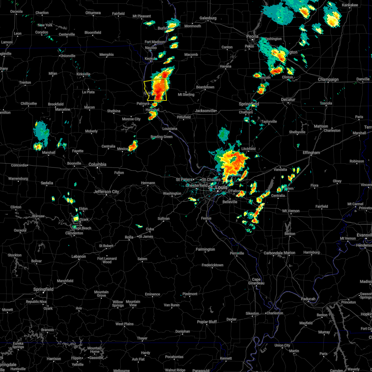 The severe thunderstorm warning for northwestern adams county will expire at 115 pm cdt, the storm which prompted the warning has moved out of the area. therefore the warning will be allowed to expire. a severe thunderstorm watch remains in effect until 800 pm cdt for west central illinois, and northeastern missouri. remember, a severe thunderstorm warning still remains in effect for portions of adams county. The severe thunderstorm warning for northwestern adams county will expire at 115 pm cdt, the storm which prompted the warning has moved out of the area. therefore the warning will be allowed to expire. a severe thunderstorm watch remains in effect until 800 pm cdt for west central illinois, and northeastern missouri. remember, a severe thunderstorm warning still remains in effect for portions of adams county.
|
| 6/14/2017 1:12 PM CDT |
 At 111 pm cdt, a severe thunderstorm was located near mendon, moving east at 35 mph (radar indicated). Hazards include 60 mph wind gusts and nickel size hail. expect damage to roofs, siding, and trees At 111 pm cdt, a severe thunderstorm was located near mendon, moving east at 35 mph (radar indicated). Hazards include 60 mph wind gusts and nickel size hail. expect damage to roofs, siding, and trees
|
| 6/14/2017 1:05 PM CDT |
 At 104 pm cdt, a severe thunderstorm was located near mendon, moving east at 30 mph (trained weather spotters. trained spotters reported nickel size hail in adams county). Hazards include 60 mph wind gusts and nickel size hail. Expect damage to roofs, siding, and trees. locations impacted include, quincy, quincy regional airport, mendon, la grange, burton, ursa, liberty, loraine, coatsburg, columbus, paloma and fowler. This includes interstate 172 between exits 10 and 19. At 104 pm cdt, a severe thunderstorm was located near mendon, moving east at 30 mph (trained weather spotters. trained spotters reported nickel size hail in adams county). Hazards include 60 mph wind gusts and nickel size hail. Expect damage to roofs, siding, and trees. locations impacted include, quincy, quincy regional airport, mendon, la grange, burton, ursa, liberty, loraine, coatsburg, columbus, paloma and fowler. This includes interstate 172 between exits 10 and 19.
|
| 6/14/2017 12:52 PM CDT |
 At 1252 pm cdt, a severe thunderstorm was located near mendon, moving east at 30 mph (radar indicated). Hazards include 60 mph wind gusts and nickel size hail. Expect damage to roofs, siding, and trees. locations impacted include, quincy, quincy regional airport, mendon, la grange, burton, ursa, liberty, loraine, coatsburg, columbus, paloma and fowler. This includes interstate 172 between exits 10 and 19. At 1252 pm cdt, a severe thunderstorm was located near mendon, moving east at 30 mph (radar indicated). Hazards include 60 mph wind gusts and nickel size hail. Expect damage to roofs, siding, and trees. locations impacted include, quincy, quincy regional airport, mendon, la grange, burton, ursa, liberty, loraine, coatsburg, columbus, paloma and fowler. This includes interstate 172 between exits 10 and 19.
|
| 6/14/2017 12:35 PM CDT |
 At 1235 pm cdt, a severe thunderstorm was located near la grange, moving east at 30 mph (radar indicated). Hazards include 60 mph wind gusts and nickel size hail. expect damage to roofs, siding, and trees At 1235 pm cdt, a severe thunderstorm was located near la grange, moving east at 30 mph (radar indicated). Hazards include 60 mph wind gusts and nickel size hail. expect damage to roofs, siding, and trees
|
| 3/6/2017 11:10 PM CST |
 The severe thunderstorm warning for northern pike, adams and brown counties in west central illinois will expire at 1115 pm cst, the storms which prompted the warning have weakened below severe limits, and no longer poses an immediate threat to life or property. therefore, the warning will be allowed to expire. however gusty winds are still possible with these thunderstorms. a tornado watch remains in effect until 400 am cst for west central illinois, and northeastern missouri. The severe thunderstorm warning for northern pike, adams and brown counties in west central illinois will expire at 1115 pm cst, the storms which prompted the warning have weakened below severe limits, and no longer poses an immediate threat to life or property. therefore, the warning will be allowed to expire. however gusty winds are still possible with these thunderstorms. a tornado watch remains in effect until 400 am cst for west central illinois, and northeastern missouri.
|
| 3/6/2017 10:49 PM CST |
 At 1048 pm cst, severe thunderstorms were located along a line extending from 7 miles northwest of colmar to camp point to near payson, moving east at 65 mph (trained weather spotters. a 60 mph wind gust was reported at the quincy airport). Hazards include 60 mph wind gusts and quarter size hail. Hail damage to vehicles is expected. expect wind damage to roofs, siding, and trees. locations impacted include, quincy, pittsfield, quincy regional airport, mount sterling, barry, griggsville, camp point, payson, mendon, clayton, golden, fall creek, beverly, buckhorn, adams, la grange, kingston, burton, ursa and liberty. this also includes siloam springs state park. this includes the following highways, interstate 172 between exits 2 and 19. interstate 72 between exits 4 and 35. A tornado watch remains in effect until 400 am cst for west central illinois, and northeastern missouri. At 1048 pm cst, severe thunderstorms were located along a line extending from 7 miles northwest of colmar to camp point to near payson, moving east at 65 mph (trained weather spotters. a 60 mph wind gust was reported at the quincy airport). Hazards include 60 mph wind gusts and quarter size hail. Hail damage to vehicles is expected. expect wind damage to roofs, siding, and trees. locations impacted include, quincy, pittsfield, quincy regional airport, mount sterling, barry, griggsville, camp point, payson, mendon, clayton, golden, fall creek, beverly, buckhorn, adams, la grange, kingston, burton, ursa and liberty. this also includes siloam springs state park. this includes the following highways, interstate 172 between exits 2 and 19. interstate 72 between exits 4 and 35. A tornado watch remains in effect until 400 am cst for west central illinois, and northeastern missouri.
|
| 3/6/2017 10:37 PM CST |
 At 1036 pm cst, a severe thunderstorm capable of producing a tornado was located near quincy regional airport, moving east at 55 mph (radar indicated rotation). Hazards include tornado. Flying debris will be dangerous to those caught without shelter. mobile homes will be damaged or destroyed. damage to roofs, windows, and vehicles will occur. tree damage is likely. locations impacted include, quincy, quincy regional airport, camp point, mendon, la grange, clayton, golden, adams, burton, ursa, liberty, coatsburg, mound station, columbus, la prairie, marblehead, paloma, fowler, kellerville and chatton. this also includes siloam springs state park. This includes interstate 172 between exits 10 and 19. At 1036 pm cst, a severe thunderstorm capable of producing a tornado was located near quincy regional airport, moving east at 55 mph (radar indicated rotation). Hazards include tornado. Flying debris will be dangerous to those caught without shelter. mobile homes will be damaged or destroyed. damage to roofs, windows, and vehicles will occur. tree damage is likely. locations impacted include, quincy, quincy regional airport, camp point, mendon, la grange, clayton, golden, adams, burton, ursa, liberty, coatsburg, mound station, columbus, la prairie, marblehead, paloma, fowler, kellerville and chatton. this also includes siloam springs state park. This includes interstate 172 between exits 10 and 19.
|
| 3/6/2017 10:33 PM CST |
 At 1032 pm cst, a severe thunderstorm capable of producing a tornado was located near quincy, moving east at 55 mph (radar indicated rotation. damage was reported in emden and tornadoes have been previously reported east of ewing and west of palmyra with this storm). Hazards include tornado and quarter size hail. Flying debris will be dangerous to those caught without shelter. mobile homes will be damaged or destroyed. damage to roofs, windows, and vehicles will occur. tree damage is likely. locations impacted include, quincy, quincy regional airport, camp point, mendon, la grange, clayton, golden, adams, burton, ursa, liberty, taylor, coatsburg, mound station, columbus, la prairie, marblehead, paloma, fowler and kellerville. this also includes wakonda state park and siloam springs state park. This includes interstate 172 between exits 10 and 19. At 1032 pm cst, a severe thunderstorm capable of producing a tornado was located near quincy, moving east at 55 mph (radar indicated rotation. damage was reported in emden and tornadoes have been previously reported east of ewing and west of palmyra with this storm). Hazards include tornado and quarter size hail. Flying debris will be dangerous to those caught without shelter. mobile homes will be damaged or destroyed. damage to roofs, windows, and vehicles will occur. tree damage is likely. locations impacted include, quincy, quincy regional airport, camp point, mendon, la grange, clayton, golden, adams, burton, ursa, liberty, taylor, coatsburg, mound station, columbus, la prairie, marblehead, paloma, fowler and kellerville. this also includes wakonda state park and siloam springs state park. This includes interstate 172 between exits 10 and 19.
|
| 3/6/2017 10:22 PM CST |
 At 1022 pm cst, a confirmed tornado was located near maywood, moving east at 55 mph (weather spotters confirmed tornado. several circulations are present and tornadoes have been reported east of ewing and west of palmyra). Hazards include damaging tornado and quarter size hail. Flying debris will be dangerous to those caught without shelter. mobile homes will be damaged or destroyed. damage to roofs, windows, and vehicles will occur. Tree damage is likely. At 1022 pm cst, a confirmed tornado was located near maywood, moving east at 55 mph (weather spotters confirmed tornado. several circulations are present and tornadoes have been reported east of ewing and west of palmyra). Hazards include damaging tornado and quarter size hail. Flying debris will be dangerous to those caught without shelter. mobile homes will be damaged or destroyed. damage to roofs, windows, and vehicles will occur. Tree damage is likely.
|
| 3/6/2017 10:20 PM CST |
 At 1020 pm cst, severe thunderstorms were located along a line extending from near alexandria to maywood to near monroe city, moving east at 65 mph (radar indicated). Hazards include 60 mph wind gusts and quarter size hail. Hail damage to vehicles is expected. Expect wind damage to roofs, siding, and trees. At 1020 pm cst, severe thunderstorms were located along a line extending from near alexandria to maywood to near monroe city, moving east at 65 mph (radar indicated). Hazards include 60 mph wind gusts and quarter size hail. Hail damage to vehicles is expected. Expect wind damage to roofs, siding, and trees.
|
| 7/19/2016 5:47 PM CDT |
 At 546 pm cdt, severe thunderstorms were located along a line extending from near west point to 6 miles south of mendon to near payson, moving east at 30 mph (the quincy asos reported a wind gust of 61mph at 531 pm). Hazards include 60 mph wind gusts. Expect damage to roofs. siding. and trees. locations impacted include, quincy, camp point, payson, mendon, clayton, golden, adams, kingston, burton, ursa, liberty, richfield, loraine, woodville, lima, coatsburg, columbus, la prairie, marblehead and fowler. this also includes siloam springs state park. This includes interstate 172 between exits 10 and 19. At 546 pm cdt, severe thunderstorms were located along a line extending from near west point to 6 miles south of mendon to near payson, moving east at 30 mph (the quincy asos reported a wind gust of 61mph at 531 pm). Hazards include 60 mph wind gusts. Expect damage to roofs. siding. and trees. locations impacted include, quincy, camp point, payson, mendon, clayton, golden, adams, kingston, burton, ursa, liberty, richfield, loraine, woodville, lima, coatsburg, columbus, la prairie, marblehead and fowler. this also includes siloam springs state park. This includes interstate 172 between exits 10 and 19.
|
| 7/19/2016 5:27 PM CDT |
 At 526 pm cdt, severe thunderstorms were located along a line extending from 6 miles north of canton to near quincy to near fall creek, moving east at 30 mph (law enforcement reported a tree blocking railroad tracks in canton mo). Hazards include 60 mph wind gusts. Expect damage to roofs. siding. And trees. At 526 pm cdt, severe thunderstorms were located along a line extending from 6 miles north of canton to near quincy to near fall creek, moving east at 30 mph (law enforcement reported a tree blocking railroad tracks in canton mo). Hazards include 60 mph wind gusts. Expect damage to roofs. siding. And trees.
|
| 7/13/2016 2:46 PM CDT |
 At 245 pm cdt, a severe thunderstorm was located near camp point, moving east at 35 mph (trained weather spotters. large tree limbs down). Hazards include 60 mph wind gusts. Expect damage to roofs. siding. and trees. locations impacted include, quincy, mount sterling, camp point, payson, mendon, clayton, golden, fall creek, beverly, buckhorn, adams, la grange, kingston, burton, ursa, liberty, versailles, richfield, perry and loraine. this also includes siloam springs state park. This includes interstate 172 between exits 2 and 19. At 245 pm cdt, a severe thunderstorm was located near camp point, moving east at 35 mph (trained weather spotters. large tree limbs down). Hazards include 60 mph wind gusts. Expect damage to roofs. siding. and trees. locations impacted include, quincy, mount sterling, camp point, payson, mendon, clayton, golden, fall creek, beverly, buckhorn, adams, la grange, kingston, burton, ursa, liberty, versailles, richfield, perry and loraine. this also includes siloam springs state park. This includes interstate 172 between exits 2 and 19.
|
| 7/13/2016 2:21 PM CDT |
 At 221 pm cdt, a severe thunderstorm was located near payson, moving east at 35 mph (radar indicated). Hazards include 60 mph wind gusts. Expect damage to roofs. siding. And trees. At 221 pm cdt, a severe thunderstorm was located near payson, moving east at 35 mph (radar indicated). Hazards include 60 mph wind gusts. Expect damage to roofs. siding. And trees.
|
| 7/7/2016 8:07 AM CDT |
 At 807 am cdt, severe thunderstorms were located along a line extending from west point to 7 miles west of barry, moving east at 50 mph (radar indicated). Hazards include 60 mph wind gusts and penny size hail. Expect damage to roofs. siding. and trees. locations impacted include, quincy, mount sterling, barry, griggsville, camp point, payson, mendon, clayton, golden, fall creek, beverly, buckhorn, adams, la grange, kingston, burton, ursa, liberty, versailles and hull. this also includes siloam springs state park. this includes the following highways, interstate 172 between exits 2 and 19. Interstate 72 between exits 4 and 35. At 807 am cdt, severe thunderstorms were located along a line extending from west point to 7 miles west of barry, moving east at 50 mph (radar indicated). Hazards include 60 mph wind gusts and penny size hail. Expect damage to roofs. siding. and trees. locations impacted include, quincy, mount sterling, barry, griggsville, camp point, payson, mendon, clayton, golden, fall creek, beverly, buckhorn, adams, la grange, kingston, burton, ursa, liberty, versailles and hull. this also includes siloam springs state park. this includes the following highways, interstate 172 between exits 2 and 19. Interstate 72 between exits 4 and 35.
|
| 7/7/2016 7:43 AM CDT |
 At 743 am cdt, severe thunderstorms were located along a line extending from 7 miles north of canton to near rensselaer, moving east at 45 mph (radar indicated). Hazards include 60 mph wind gusts and penny size hail. Expect damage to roofs. siding. and trees. locations impacted include, quincy, mount sterling, barry, griggsville, camp point, payson, mendon, clayton, golden, fall creek, beverly, buckhorn, adams, la grange, kingston, burton, ursa, liberty, versailles and hull. this also includes siloam springs state park. this includes the following highways, interstate 172 between exits 2 and 19. Interstate 72 between exits 4 and 35. At 743 am cdt, severe thunderstorms were located along a line extending from 7 miles north of canton to near rensselaer, moving east at 45 mph (radar indicated). Hazards include 60 mph wind gusts and penny size hail. Expect damage to roofs. siding. and trees. locations impacted include, quincy, mount sterling, barry, griggsville, camp point, payson, mendon, clayton, golden, fall creek, beverly, buckhorn, adams, la grange, kingston, burton, ursa, liberty, versailles and hull. this also includes siloam springs state park. this includes the following highways, interstate 172 between exits 2 and 19. Interstate 72 between exits 4 and 35.
|
| 7/7/2016 7:32 AM CDT |
 At 732 am cdt, severe thunderstorms were located along a line extending from 8 miles south of wayland to near rensselaer, moving east at 75 mph (radar indicated). Hazards include 60 mph wind gusts and penny size hail. Expect damage to roofs. siding. And trees. At 732 am cdt, severe thunderstorms were located along a line extending from 8 miles south of wayland to near rensselaer, moving east at 75 mph (radar indicated). Hazards include 60 mph wind gusts and penny size hail. Expect damage to roofs. siding. And trees.
|
| 5/11/2016 9:53 PM CDT |
 At 953 pm cdt, a severe thunderstorm was located over ewing, moving east at 40 mph (radar indicated). Hazards include quarter size hail. damage to vehicles is expected At 953 pm cdt, a severe thunderstorm was located over ewing, moving east at 40 mph (radar indicated). Hazards include quarter size hail. damage to vehicles is expected
|
| 4/27/2016 9:45 PM CDT |
 At 944 pm cdt, a severe thunderstorm was located over mendon, moving east at 35 mph (radar indicated). Hazards include 60 mph wind gusts and quarter size hail. Hail damage to vehicles is expected. Expect wind damage to roofs, siding, and trees. At 944 pm cdt, a severe thunderstorm was located over mendon, moving east at 35 mph (radar indicated). Hazards include 60 mph wind gusts and quarter size hail. Hail damage to vehicles is expected. Expect wind damage to roofs, siding, and trees.
|
| 4/27/2016 9:36 PM CDT |
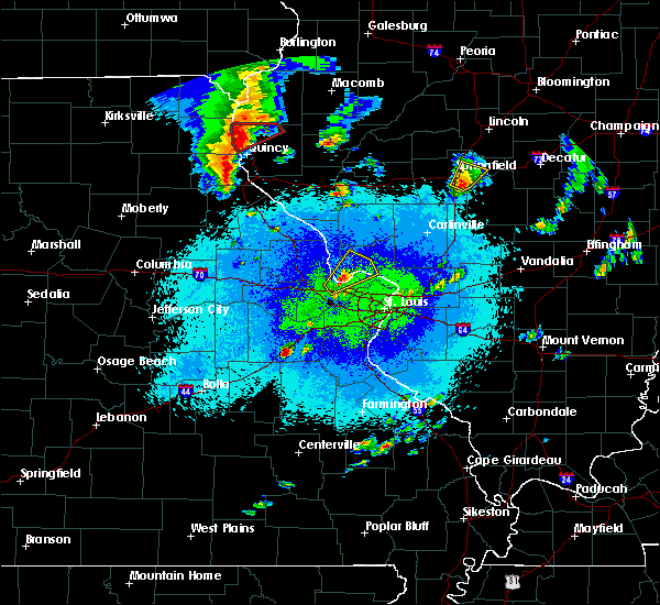 At 936 pm cdt, a severe thunderstorm capable of producing a tornado was located over mendon, moving east at 25 mph (radar indicated rotation). Hazards include tornado and ping pong ball size hail. Flying debris will be dangerous to those caught without shelter. mobile homes will be damaged or destroyed. damage to roofs, windows, and vehicles will occur. tree damage is likely. this dangerous storm will be near, mendon around 945 pm cdt. Other locations impacted by this tornadic thunderstorm include lima, woodville, loraine, ursa and meyer. At 936 pm cdt, a severe thunderstorm capable of producing a tornado was located over mendon, moving east at 25 mph (radar indicated rotation). Hazards include tornado and ping pong ball size hail. Flying debris will be dangerous to those caught without shelter. mobile homes will be damaged or destroyed. damage to roofs, windows, and vehicles will occur. tree damage is likely. this dangerous storm will be near, mendon around 945 pm cdt. Other locations impacted by this tornadic thunderstorm include lima, woodville, loraine, ursa and meyer.
|
| 4/27/2016 9:30 PM CDT | A couple of sheds destroyed. time estimated by rada in adams county IL, 2 miles NNE of Mendon, IL |
| 4/27/2016 9:15 PM CDT |
 At 915 pm cdt, a confirmed tornado was located over la grange, moving northeast at 30 mph (law enforcement confirmed tornado). Hazards include damaging tornado and ping pong ball size hail. Flying debris will be dangerous to those caught without shelter. mobile homes will be damaged or destroyed. damage to roofs, windows, and vehicles will occur. tree damage is likely. the tornado will be near, mendon around 940 pm cdt. other locations impacted by this tornadic thunderstorm include lima, woodville, loraine, ursa and meyer. This also includes wakonda state park. At 915 pm cdt, a confirmed tornado was located over la grange, moving northeast at 30 mph (law enforcement confirmed tornado). Hazards include damaging tornado and ping pong ball size hail. Flying debris will be dangerous to those caught without shelter. mobile homes will be damaged or destroyed. damage to roofs, windows, and vehicles will occur. tree damage is likely. the tornado will be near, mendon around 940 pm cdt. other locations impacted by this tornadic thunderstorm include lima, woodville, loraine, ursa and meyer. This also includes wakonda state park.
|
| 3/15/2016 4:55 PM CDT |
 At 455 pm cdt, a severe thunderstorm was located over la grange, moving northeast at 45 mph (radar indicated). Hazards include 60 mph wind gusts and quarter size hail. Hail damage to vehicles is expected. Expect wind damage to roofs, siding and trees. At 455 pm cdt, a severe thunderstorm was located over la grange, moving northeast at 45 mph (radar indicated). Hazards include 60 mph wind gusts and quarter size hail. Hail damage to vehicles is expected. Expect wind damage to roofs, siding and trees.
|
| 12/23/2015 3:32 PM CST | At 332 pm cst, a severe thunderstorm was located near camp point, moving northeast at 55 mph (trained weather spotters). Hazards include ping pong ball size hail and 60 mph wind gusts. People and animals outdoors will be injured. expect hail damage to roofs, siding, windows and vehicles. expect wind damage to roofs, siding and trees. locations impacted include, camp point, payson, mendon, clayton, golden, fall creek, beverly, adams, kingston, burton, liberty, richfield, loraine, plainville, woodville, coatsburg, columbus, la prairie, fowler and paloma. this warning also includes siloam springs state park. this includes interstate 172 near exit 2. A tornado watch remains in effect until 800 pm cst for west central illinois and northeastern missouri. |
| 12/23/2015 3:24 PM CST | At 323 pm cst, a severe thunderstorm was located near quincy, moving northeast at 50 mph (trained weather spotters reported ping pong ball size hail at 321 pm on the east side of quincy). Hazards include ping pong ball size hail and 60 mph wind gusts. People and animals outdoors will be injured. expect hail damage to roofs, siding, windows and vehicles. expect wind damage to roofs, siding and trees. locations impacted include, quincy, camp point, payson, mendon, clayton, golden, fall creek, beverly, adams, kingston, burton, liberty, richfield, loraine, plainville, woodville, coatsburg, columbus, la prairie and seehorn. this warning also includes siloam springs state park. this includes the following highways, interstate 172 between exits 2 and 19. interstate 72 near exit 4. A tornado watch remains in effect until 800 pm cst for west central illinois and northeastern missouri. |
| 12/23/2015 3:24 PM CST | At 323 pm cst, a severe thunderstorm was located near quincy, moving northeast at 50 mph (trained weather spotters reported ping pong ball size hail at 321 pm on the east side of quincy). Hazards include ping pong ball size hail and 60 mph wind gusts. People and animals outdoors will be injured. expect hail damage to roofs, siding, windows and vehicles. expect wind damage to roofs, siding and trees. locations impacted include, quincy, camp point, payson, mendon, clayton, golden, fall creek, beverly, adams, kingston, burton, liberty, richfield, loraine, plainville, woodville, coatsburg, columbus, la prairie and seehorn. this warning also includes siloam springs state park. this includes the following highways, interstate 172 between exits 2 and 19. interstate 72 near exit 4. A tornado watch remains in effect until 800 pm cst for west central illinois and northeastern missouri. |
| 12/23/2015 3:09 PM CST | The national weather service in st louis has issued a * severe thunderstorm warning for. adams county in west central illinois. northeastern marion county in northeastern missouri. until 400 pm cst * at 308 pm cst. A severe thunderstorm was located near quincy. |
| 12/23/2015 3:09 PM CST | The national weather service in st louis has issued a * severe thunderstorm warning for. adams county in west central illinois. northeastern marion county in northeastern missouri. until 400 pm cst * at 308 pm cst. A severe thunderstorm was located near quincy. |
| 11/11/2015 5:19 PM CST |
 At 518 pm cst, a severe thunderstorm was located near canton, moving northeast at 55 mph (radar indicated). Hazards include 70 mph wind gusts. Expect considerable tree damage. damage is likely to mobile homes, roofs and outbuildings. locations impacted include, canton, mendon, la grange, ursa, loraine, woodville, lima and meyer. A tornado watch remains in effect until 900 pm cst for west central illinois and northeastern missouri. At 518 pm cst, a severe thunderstorm was located near canton, moving northeast at 55 mph (radar indicated). Hazards include 70 mph wind gusts. Expect considerable tree damage. damage is likely to mobile homes, roofs and outbuildings. locations impacted include, canton, mendon, la grange, ursa, loraine, woodville, lima and meyer. A tornado watch remains in effect until 900 pm cst for west central illinois and northeastern missouri.
|
| 11/11/2015 5:05 PM CST |
 At 505 pm cst, a severe thunderstorm was located near la grange, moving northeast at 55 mph (radar indicated). Hazards include 70 mph wind gusts. Expect considerable tree damage. damage is likely to mobile homes, roofs and outbuildings. locations impacted include, canton, mendon, la grange, ewing, philadelphia, maywood, ursa, loraine, woodville, taylor, lima, monticello, chatton and meyer. this warning also includes wakonda state park. A tornado watch remains in effect until 900 pm cst for west central illinois and northeastern missouri. At 505 pm cst, a severe thunderstorm was located near la grange, moving northeast at 55 mph (radar indicated). Hazards include 70 mph wind gusts. Expect considerable tree damage. damage is likely to mobile homes, roofs and outbuildings. locations impacted include, canton, mendon, la grange, ewing, philadelphia, maywood, ursa, loraine, woodville, taylor, lima, monticello, chatton and meyer. this warning also includes wakonda state park. A tornado watch remains in effect until 900 pm cst for west central illinois and northeastern missouri.
|
| 11/11/2015 4:52 PM CST |
 At 452 pm cst, a severe thunderstorm was located near ewing, moving northeast at 55 mph (radar indicated). Hazards include 70 mph wind gusts. Expect considerable tree damage. Damage is likely to mobile homes, roofs and outbuildings. At 452 pm cst, a severe thunderstorm was located near ewing, moving northeast at 55 mph (radar indicated). Hazards include 70 mph wind gusts. Expect considerable tree damage. Damage is likely to mobile homes, roofs and outbuildings.
|
| 7/16/2015 7:01 PM CDT |
 At 701 pm cdt, a severe thunderstorm was located over la grange, moving east at 35 mph (radar indicated). Hazards include 60 mph wind gusts and quarter size hail. Hail damage to vehicles is expected. Expect wind damage to roofs, siding and trees. At 701 pm cdt, a severe thunderstorm was located over la grange, moving east at 35 mph (radar indicated). Hazards include 60 mph wind gusts and quarter size hail. Hail damage to vehicles is expected. Expect wind damage to roofs, siding and trees.
|
| 7/13/2015 6:12 PM CDT |
 At 612 pm cdt, a severe thunderstorm was located near mendon, moving east at 55 mph (trained weather spotters). Hazards include 70 mph wind gusts and quarter size hail. Hail damage to vehicles is expected. expect considerable tree damage. wind damage is also likely to mobile homes, roofs and outbuildings. locations impacted include, quincy, canton, payson, mendon, la grange, lewistown, fall creek, ewing, maywood, adams, burton, ursa, loraine, woodville, taylor, lima, coatsburg, monticello, meyer and fowler. this warning also includes wakonda state park. This includes interstate 172 between exits 2 and 19. At 612 pm cdt, a severe thunderstorm was located near mendon, moving east at 55 mph (trained weather spotters). Hazards include 70 mph wind gusts and quarter size hail. Hail damage to vehicles is expected. expect considerable tree damage. wind damage is also likely to mobile homes, roofs and outbuildings. locations impacted include, quincy, canton, payson, mendon, la grange, lewistown, fall creek, ewing, maywood, adams, burton, ursa, loraine, woodville, taylor, lima, coatsburg, monticello, meyer and fowler. this warning also includes wakonda state park. This includes interstate 172 between exits 2 and 19.
|
| 7/13/2015 6:04 PM CDT |
 At 603 pm cdt, a severe thunderstorm was located over canton, moving east at 55 mph (trained weather spotters). Hazards include 70 mph wind gusts and quarter size hail. Hail damage to vehicles is expected. expect considerable tree damage. wind damage is also likely to mobile homes, roofs and outbuildings. locations impacted include, quincy, canton, payson, mendon, la grange, la belle, lewistown, fall creek, ewing, steffenville, maywood, adams, burton, ursa, loraine, woodville, taylor, lima, coatsburg and monticello. this warning also includes wakonda state park. This includes interstate 172 between exits 2 and 19. At 603 pm cdt, a severe thunderstorm was located over canton, moving east at 55 mph (trained weather spotters). Hazards include 70 mph wind gusts and quarter size hail. Hail damage to vehicles is expected. expect considerable tree damage. wind damage is also likely to mobile homes, roofs and outbuildings. locations impacted include, quincy, canton, payson, mendon, la grange, la belle, lewistown, fall creek, ewing, steffenville, maywood, adams, burton, ursa, loraine, woodville, taylor, lima, coatsburg and monticello. this warning also includes wakonda state park. This includes interstate 172 between exits 2 and 19.
|
| 7/13/2015 5:49 PM CDT |
 At 549 pm cdt, a severe thunderstorm was located near lewistown, moving east at 55 mph (trained weather spotters). Hazards include 70 mph wind gusts and quarter size hail. Hail damage to vehicles is expected. expect considerable tree damage. wind damage is also likely to mobile homes, roofs and outbuildings. locations impacted include, quincy, canton, payson, mendon, la grange, la belle, lewistown, fall creek, ewing, steffenville, maywood, adams, burton, ursa, loraine, woodville, taylor, lima, coatsburg and monticello. this warning also includes wakonda state park. This includes interstate 172 between exits 2 and 19. At 549 pm cdt, a severe thunderstorm was located near lewistown, moving east at 55 mph (trained weather spotters). Hazards include 70 mph wind gusts and quarter size hail. Hail damage to vehicles is expected. expect considerable tree damage. wind damage is also likely to mobile homes, roofs and outbuildings. locations impacted include, quincy, canton, payson, mendon, la grange, la belle, lewistown, fall creek, ewing, steffenville, maywood, adams, burton, ursa, loraine, woodville, taylor, lima, coatsburg and monticello. this warning also includes wakonda state park. This includes interstate 172 between exits 2 and 19.
|
| 7/13/2015 5:49 PM CDT |
 A severe thunderstorm warning remains in effect until 630 pm cdt for western adams. northeastern shelby. lewis and northern marion counties. at 549 pm cdt. a severe thunderstorm was located near lewistown. moving east at 55 mph. hazard. 70 mph wind gusts and quarter size hail. A severe thunderstorm warning remains in effect until 630 pm cdt for western adams. northeastern shelby. lewis and northern marion counties. at 549 pm cdt. a severe thunderstorm was located near lewistown. moving east at 55 mph. hazard. 70 mph wind gusts and quarter size hail.
|
| 7/13/2015 5:37 PM CDT |
 At 537 pm cdt, a severe thunderstorm was located over knox city, moving east at 55 mph (trained weather spotters). Hazards include 70 mph wind gusts and quarter size hail. Hail damage to vehicles is expected. expect considerable tree damage. Wind damage is also likely to mobile homes, roofs and outbuildings. At 537 pm cdt, a severe thunderstorm was located over knox city, moving east at 55 mph (trained weather spotters). Hazards include 70 mph wind gusts and quarter size hail. Hail damage to vehicles is expected. expect considerable tree damage. Wind damage is also likely to mobile homes, roofs and outbuildings.
|
| 7/13/2015 5:37 PM CDT |
 The national weather service in st louis has issued a * severe thunderstorm warning for. western adams county in west central illinois. northeastern shelby county in northeastern missouri. lewis county in northeastern missouri. Northern marion county in northeastern missouri. The national weather service in st louis has issued a * severe thunderstorm warning for. western adams county in west central illinois. northeastern shelby county in northeastern missouri. lewis county in northeastern missouri. Northern marion county in northeastern missouri.
|
| 7/11/2015 1:07 PM CDT |
 At 106 pm cdt, a severe thunderstorm was located near camp point, moving east at 35 mph (radar indicated). Hazards include 60 mph wind gusts and quarter size hail. Hail damage to vehicles is expected. Expect wind damage to roofs, siding and trees. At 106 pm cdt, a severe thunderstorm was located near camp point, moving east at 35 mph (radar indicated). Hazards include 60 mph wind gusts and quarter size hail. Hail damage to vehicles is expected. Expect wind damage to roofs, siding and trees.
|
| 6/22/2015 8:42 PM CDT |
 At 840 pm cdt, a severe thunderstorm was located near mendon, and moving southeast at 50 mph (trained weather spotters reported a 60 mph wind gust near lorraine, and storm damage was also reported in mendon). Hazards include 60 mph wind gusts. Expect damage to roofs. Siding and trees. At 840 pm cdt, a severe thunderstorm was located near mendon, and moving southeast at 50 mph (trained weather spotters reported a 60 mph wind gust near lorraine, and storm damage was also reported in mendon). Hazards include 60 mph wind gusts. Expect damage to roofs. Siding and trees.
|
| 6/22/2015 8:38 PM CDT | Tree blown onto a house in adams county IL, 0.4 miles WSW of Mendon, IL |
| 6/22/2015 8:36 PM CDT |
 At 833 pm cdt, a severe thunderstorm was located 6 miles northeast of la grange, and moving southeast at 50 mph (trained weather spotters reported damage to a metal barn north of monticello missouri). Hazards include 60 mph wind gusts. Expect damage to roofs. siding and trees. locations impacted include, quincy, mendon, golden, camp point, ursa, loraine, woodville, fowler, paloma, marblehead, coatsburg, chatton, burton, la prairie and columbus. This warning also includes, interstate 172 from exit 10 to exit 19. At 833 pm cdt, a severe thunderstorm was located 6 miles northeast of la grange, and moving southeast at 50 mph (trained weather spotters reported damage to a metal barn north of monticello missouri). Hazards include 60 mph wind gusts. Expect damage to roofs. siding and trees. locations impacted include, quincy, mendon, golden, camp point, ursa, loraine, woodville, fowler, paloma, marblehead, coatsburg, chatton, burton, la prairie and columbus. This warning also includes, interstate 172 from exit 10 to exit 19.
|
| 6/22/2015 8:26 PM CDT |
 At 823 pm cdt, a severe thunderstorm was located near canton, and moving southeast at 50 mph (trained weather spotters. damage was reported to a metal barn north of monticello missouri). Hazards include 60 mph wind gusts. Expect damage to roofs. siding and trees. locations impacted include, quincy, maywood, la grange, mendon, golden, camp point, lima, taylor, ursa, loraine, woodville, fowler, paloma, marblehead, coatsburg, chatton, burton, la prairie and columbus. this warning includes wakonda state park. This warning also includes, interstate 172 from exit 10 to exit 19. At 823 pm cdt, a severe thunderstorm was located near canton, and moving southeast at 50 mph (trained weather spotters. damage was reported to a metal barn north of monticello missouri). Hazards include 60 mph wind gusts. Expect damage to roofs. siding and trees. locations impacted include, quincy, maywood, la grange, mendon, golden, camp point, lima, taylor, ursa, loraine, woodville, fowler, paloma, marblehead, coatsburg, chatton, burton, la prairie and columbus. this warning includes wakonda state park. This warning also includes, interstate 172 from exit 10 to exit 19.
|
| 6/22/2015 8:12 PM CDT |
 At 811 pm cdt, a severe thunderstorm was located 11 miles southwest of wayland, and moving southeast at 50 mph (radar indicated). Hazards include 60 mph wind gusts. Expect damage to roofs. Siding and trees. At 811 pm cdt, a severe thunderstorm was located 11 miles southwest of wayland, and moving southeast at 50 mph (radar indicated). Hazards include 60 mph wind gusts. Expect damage to roofs. Siding and trees.
|
| 6/20/2015 9:50 PM CDT |
 The severe thunderstorm warning for northern shelby, northern marion, southern lewis, southern knox, brown and central adams counties will expire at 1000 pm cdt, the line of storms which prompted the warning has weakened below severe limits, and no longer poses an immediate threat to life or property. however, gusty winds and heavy rain are still possible with these thunderstorms. in addition, strong thunderstorms may redevelop, and a tornado watch remains in effect until 11 pm. The severe thunderstorm warning for northern shelby, northern marion, southern lewis, southern knox, brown and central adams counties will expire at 1000 pm cdt, the line of storms which prompted the warning has weakened below severe limits, and no longer poses an immediate threat to life or property. however, gusty winds and heavy rain are still possible with these thunderstorms. in addition, strong thunderstorms may redevelop, and a tornado watch remains in effect until 11 pm.
|
| 6/20/2015 8:55 PM CDT |
 At 853 pm cdt, severe thunderstorms were located along a line extending from vermont to 5 miles southwest of west point to green city, and moving southeast at 25 mph (radar indicated). Hazards include 60 mph wind gusts. Expect damage to roofs. Siding and trees. At 853 pm cdt, severe thunderstorms were located along a line extending from vermont to 5 miles southwest of west point to green city, and moving southeast at 25 mph (radar indicated). Hazards include 60 mph wind gusts. Expect damage to roofs. Siding and trees.
|
| 6/8/2015 2:58 PM CDT |
 At 255 pm cdt, a severe thunderstorm was located near la grange, and moving southeast at 30 mph (trained weather spotters report quarter size hail in ursa). Hazards include 60 mph wind gusts and quarter size hail. Hail damage to vehicles is expected. expect wind damage to roofs, siding and trees. locations impacted include, fowler, paloma, coatsburg and columbus. This warning also includes, interstate 172 near exit 19. At 255 pm cdt, a severe thunderstorm was located near la grange, and moving southeast at 30 mph (trained weather spotters report quarter size hail in ursa). Hazards include 60 mph wind gusts and quarter size hail. Hail damage to vehicles is expected. expect wind damage to roofs, siding and trees. locations impacted include, fowler, paloma, coatsburg and columbus. This warning also includes, interstate 172 near exit 19.
|
| 6/8/2015 2:54 PM CDT |
 At 252 pm cdt, a severe thunderstorm was located near la grange, and moving southeast at 30 mph (radar indicated). Hazards include 60 mph wind gusts and quarter size hail. Hail damage to vehicles is expected. expect wind damage to roofs, siding and trees. locations impacted include, mendon, ursa, fowler, paloma, coatsburg and columbus. This warning also includes, interstate 172 near exit 19. At 252 pm cdt, a severe thunderstorm was located near la grange, and moving southeast at 30 mph (radar indicated). Hazards include 60 mph wind gusts and quarter size hail. Hail damage to vehicles is expected. expect wind damage to roofs, siding and trees. locations impacted include, mendon, ursa, fowler, paloma, coatsburg and columbus. This warning also includes, interstate 172 near exit 19.
|
| 6/8/2015 2:43 PM CDT |
 At 242 pm cdt, a severe thunderstorm was located 6 miles west of mendon, and moving southeast at 30 mph (radar indicated). Hazards include 60 mph wind gusts and quarter size hail. Hail damage to vehicles is expected. expect wind damage to roofs, siding and trees. locations impacted include, mendon, camp point, ursa, loraine, fowler, paloma, coatsburg and columbus. This warning also includes, interstate 172 near exit 19. At 242 pm cdt, a severe thunderstorm was located 6 miles west of mendon, and moving southeast at 30 mph (radar indicated). Hazards include 60 mph wind gusts and quarter size hail. Hail damage to vehicles is expected. expect wind damage to roofs, siding and trees. locations impacted include, mendon, camp point, ursa, loraine, fowler, paloma, coatsburg and columbus. This warning also includes, interstate 172 near exit 19.
|
| 6/8/2015 2:31 PM CDT |
 At 228 pm cdt, a severe thunderstorm was located 6 miles northeast of canton, and moving southeast at 30 mph (radar indicated). Hazards include 60 mph wind gusts and quarter size hail. Hail damage to vehicles is expected. expect wind damage to roofs, siding and trees. locations impacted include, la grange, mendon, camp point, lima, ursa, loraine, fowler, paloma, coatsburg and columbus. This warning also includes, interstate 172 near exit 19. At 228 pm cdt, a severe thunderstorm was located 6 miles northeast of canton, and moving southeast at 30 mph (radar indicated). Hazards include 60 mph wind gusts and quarter size hail. Hail damage to vehicles is expected. expect wind damage to roofs, siding and trees. locations impacted include, la grange, mendon, camp point, lima, ursa, loraine, fowler, paloma, coatsburg and columbus. This warning also includes, interstate 172 near exit 19.
|
| 6/8/2015 2:12 PM CDT |
 At 208 pm cdt, a severe thunderstorm was located 5 miles southwest of wayland, and moving southeast at 30 mph (radar indicated). Hazards include 60 mph wind gusts and quarter size hail. Hail damage to vehicles is expected. Expect wind damage to roofs, siding and trees. At 208 pm cdt, a severe thunderstorm was located 5 miles southwest of wayland, and moving southeast at 30 mph (radar indicated). Hazards include 60 mph wind gusts and quarter size hail. Hail damage to vehicles is expected. Expect wind damage to roofs, siding and trees.
|
| 6/7/2015 7:52 PM CDT | At 747 pm cdt, several intense thunderstorms were occurring in a band from near mendon to near ripley, with the storms moving east at 50 to 55 mph. there has been some decrease in the intensity of these storms (radar indicated). Hazards include 60 mph wind gusts. Expect damage to roofs. siding and trees. Locations impacted include,. |
| 6/7/2015 7:30 PM CDT | At 728 pm cdt, a severe thunderstorm was located 6 miles east of mendon, and moving east at 55 mph (radar indicated). Hazards include 60 mph wind gusts. Expect damage to roofs. siding and trees. Locations impacted include, camp point, golden, clayton, chatton and la prairie. |
| 6/7/2015 7:19 PM CDT | At 716 pm cdt, a severe thunderstorm was located near mendon, and moving east at 55 mph (radar indicated). Hazards include 60 mph wind gusts. Expect damage to roofs. Siding and trees. |
| 1/1/0001 12:00 AM | Several trees downed and power out in adams county IL, 2 miles NNE of Mendon, IL |
| 1/1/0001 12:00 AM | Trees down along route 336 in adams county IL, 0.4 miles WSW of Mendon, IL |
Hail Maps for Mendon, IL
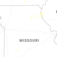


Connect with Interactive Hail Maps