

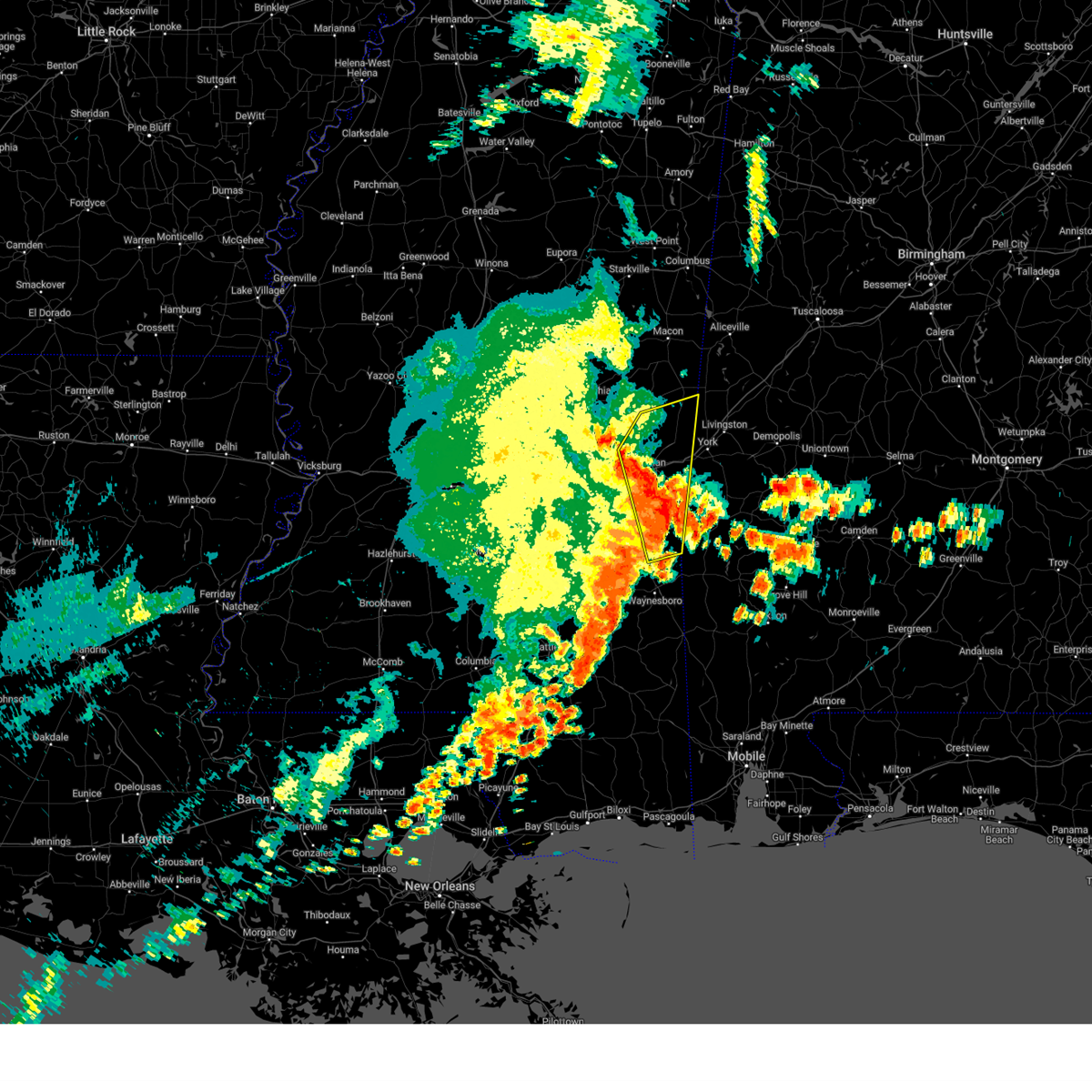
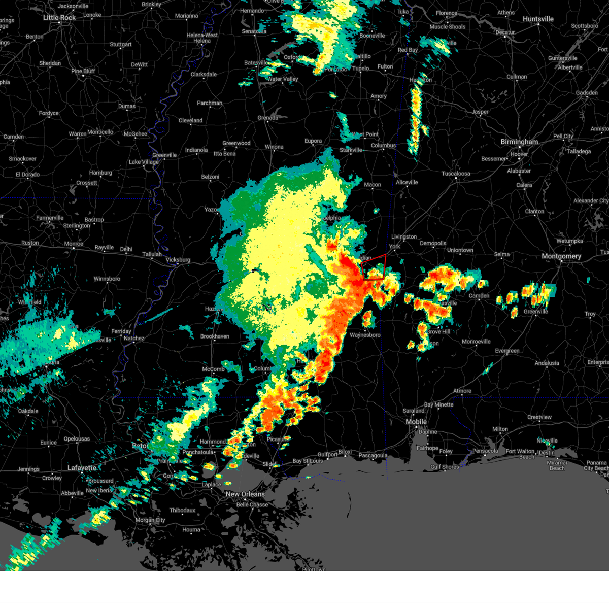
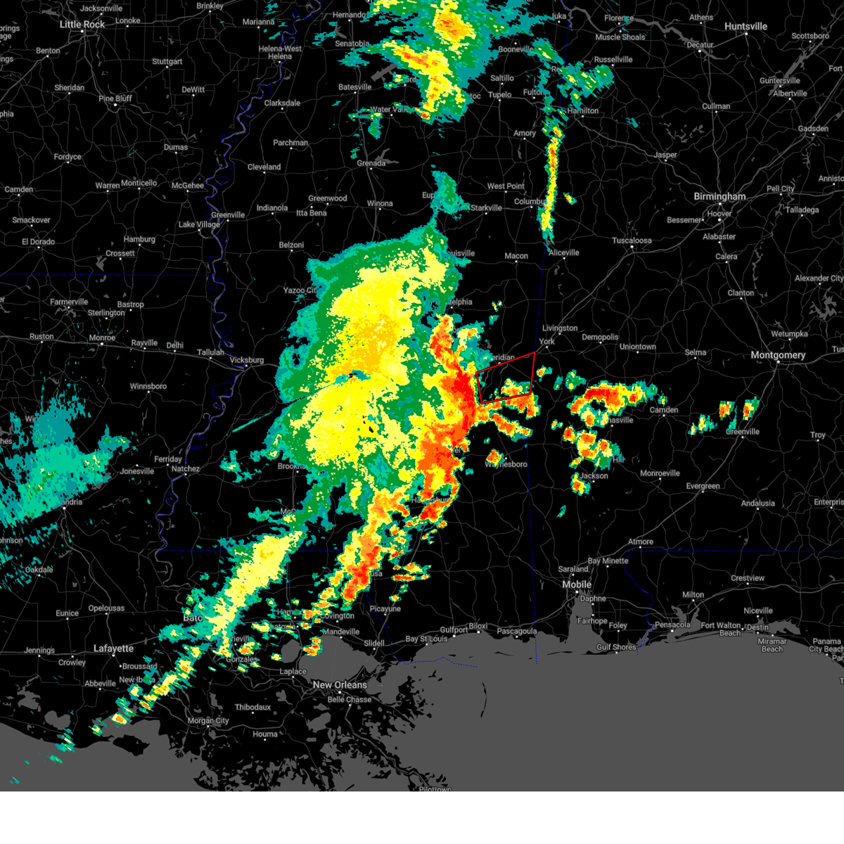
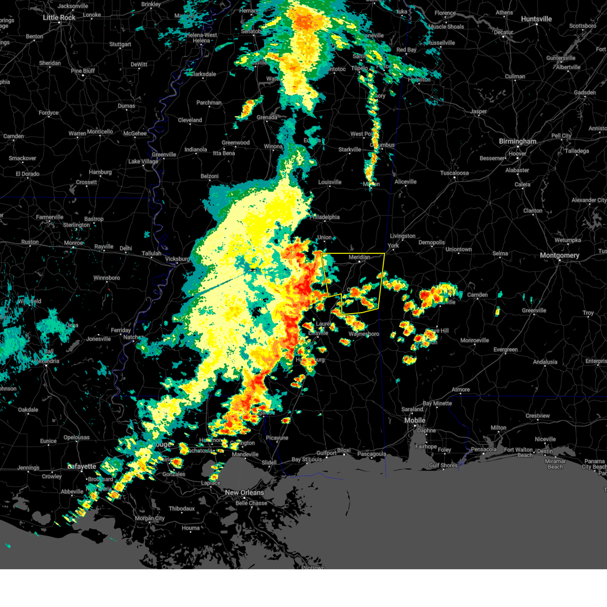
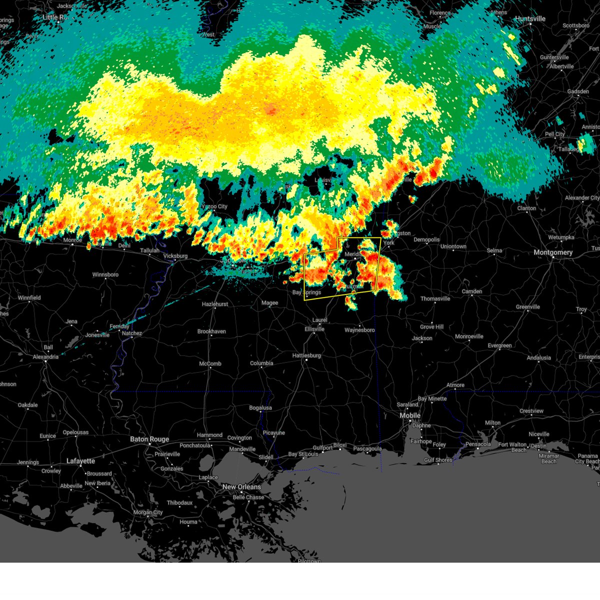
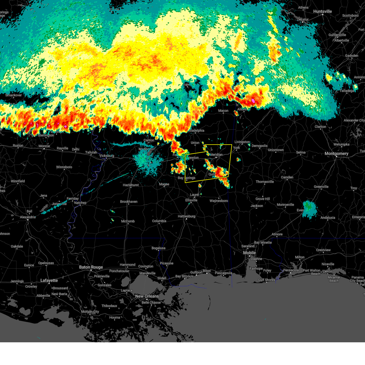
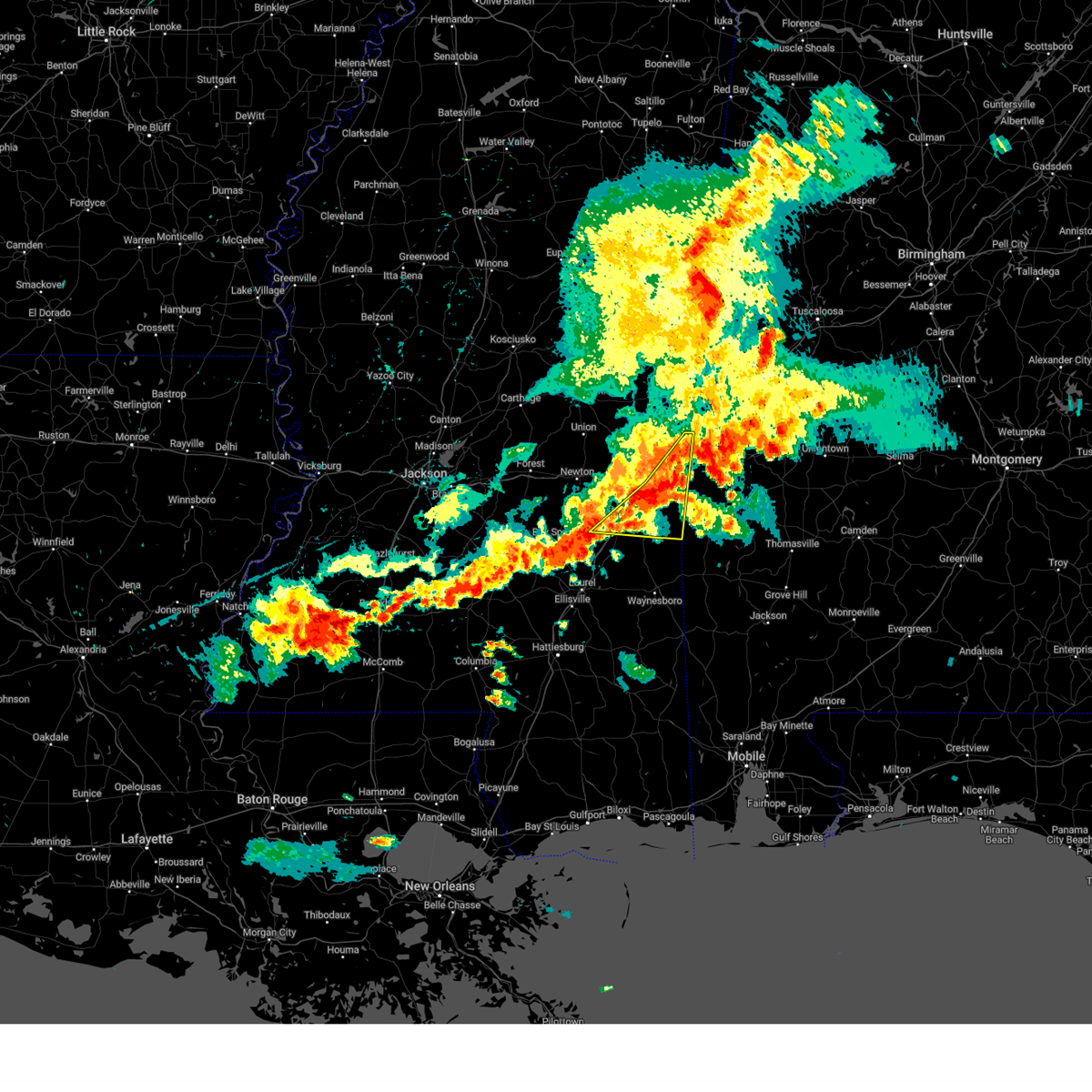
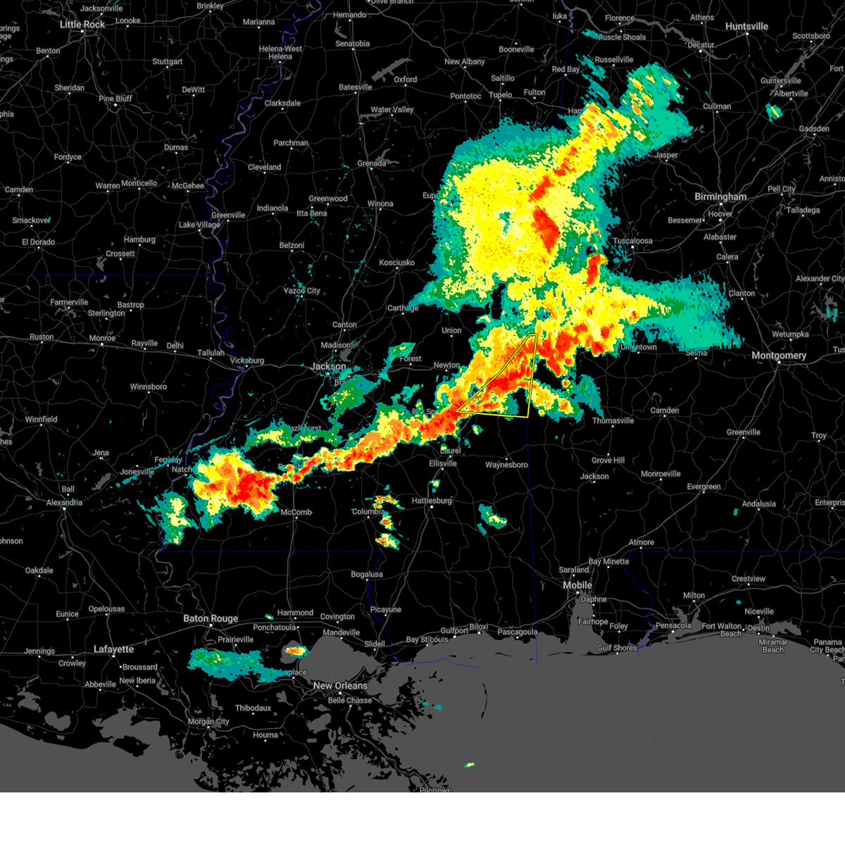
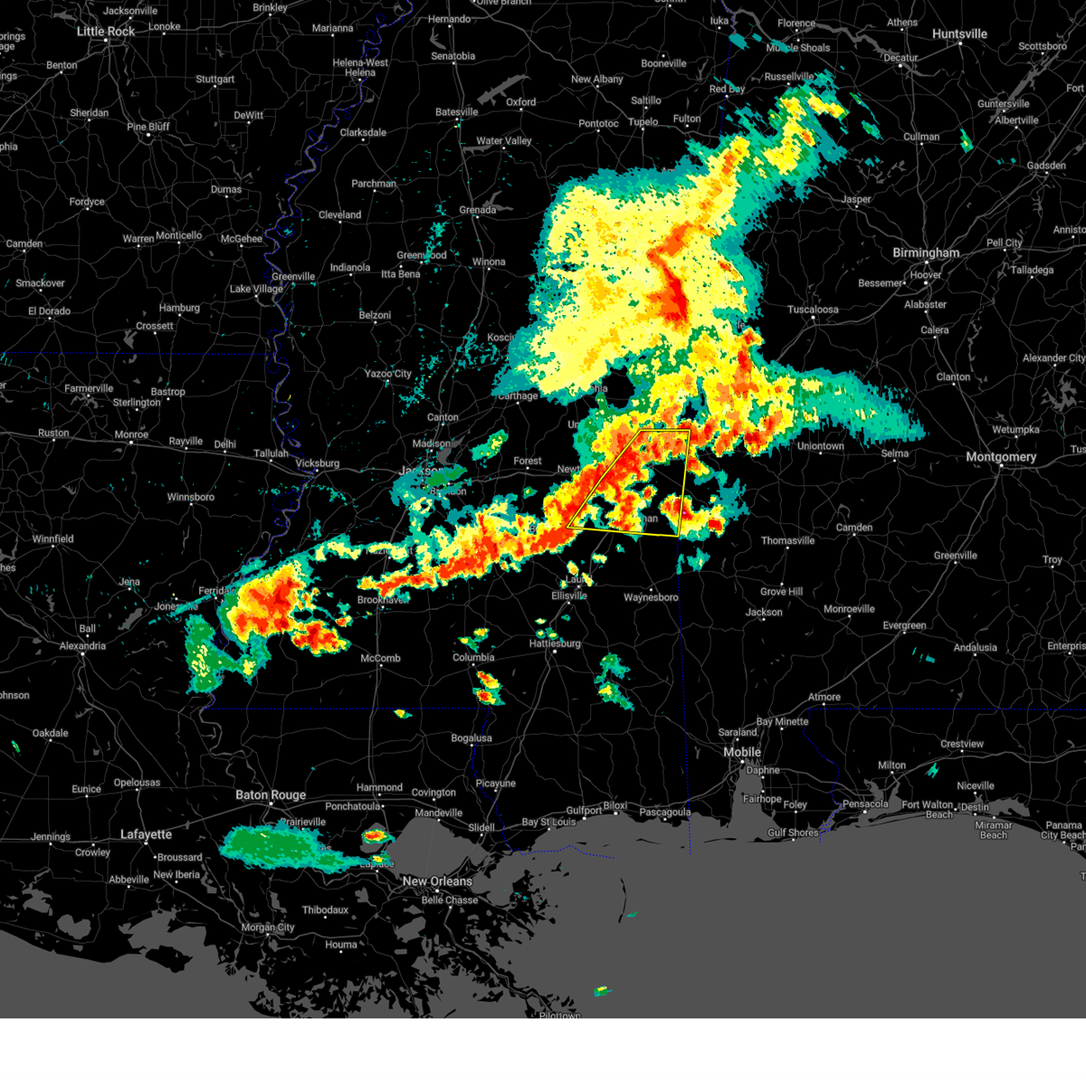
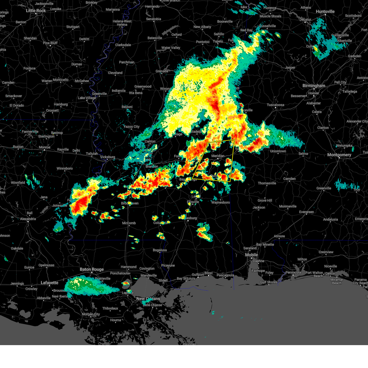
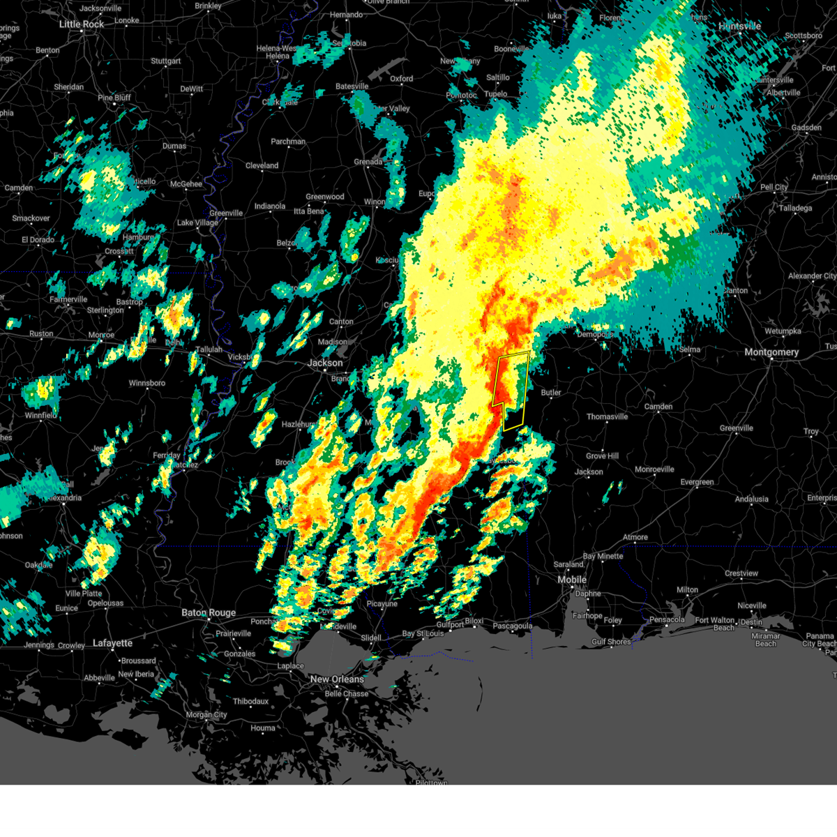
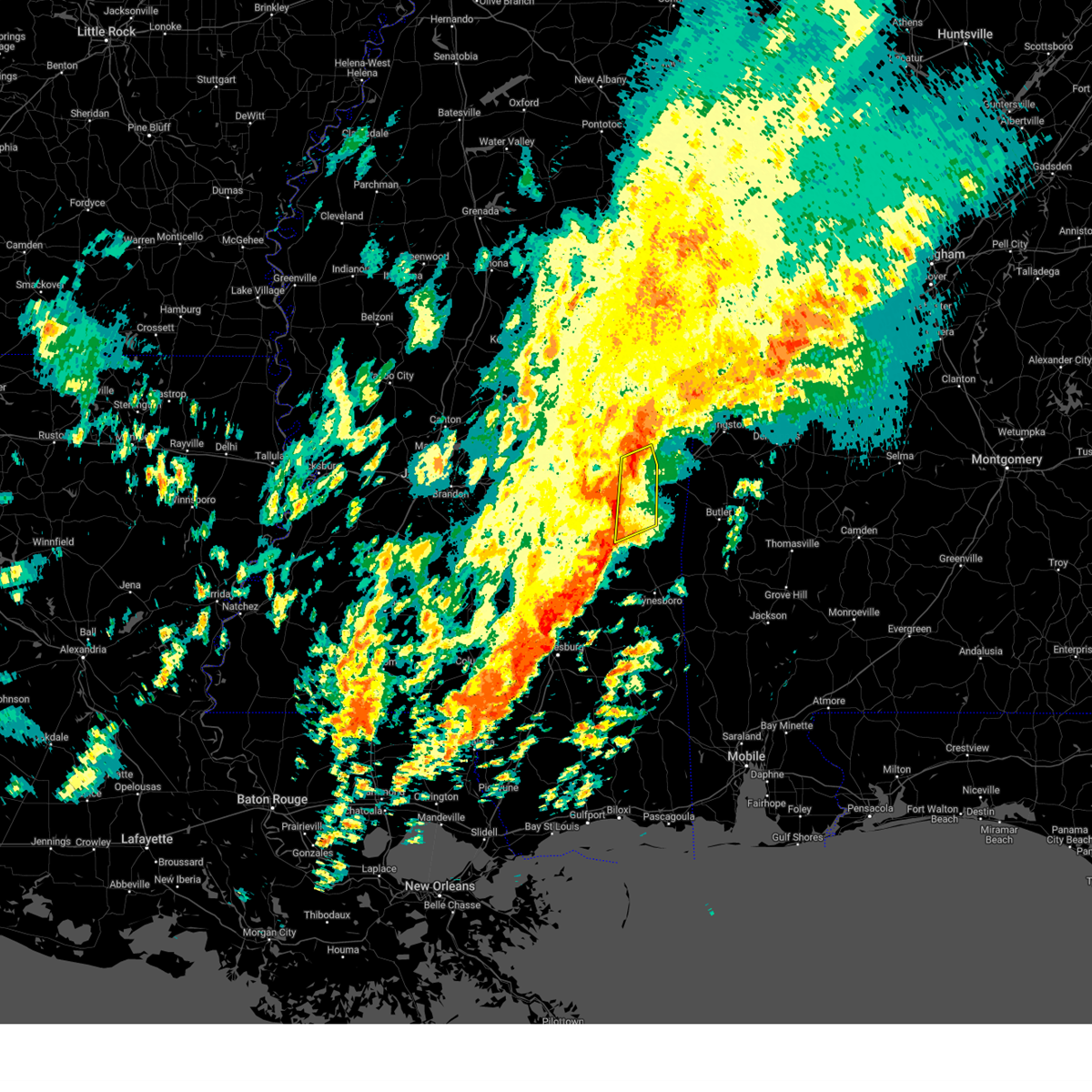
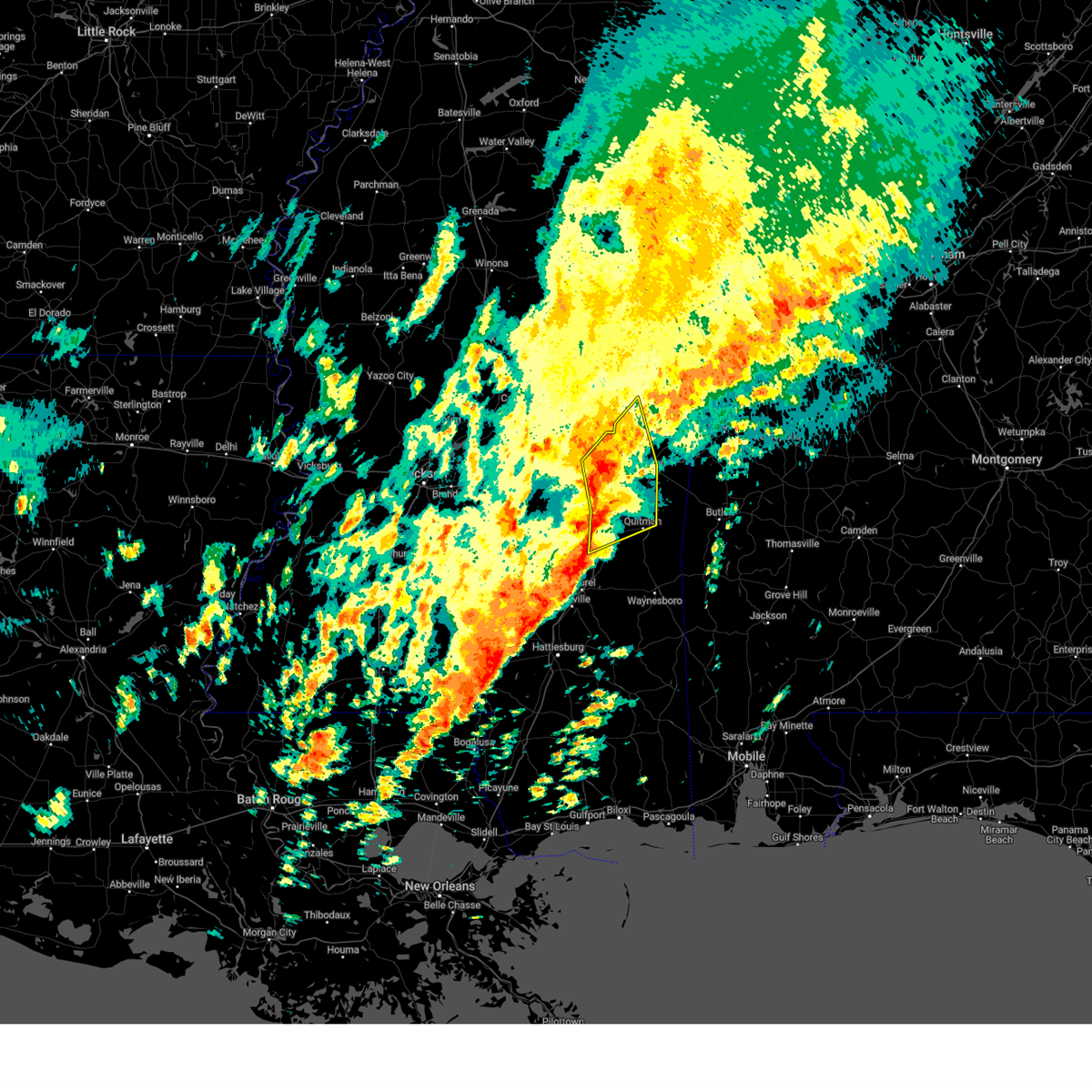
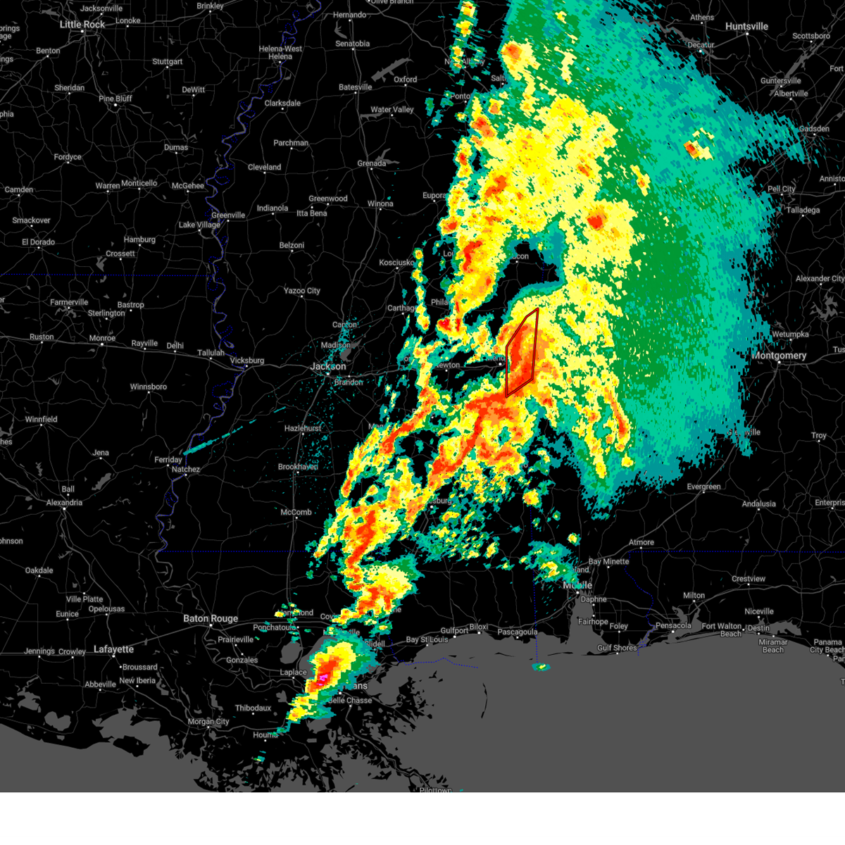
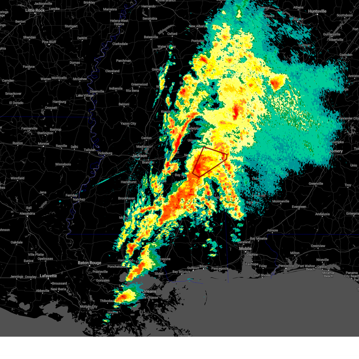
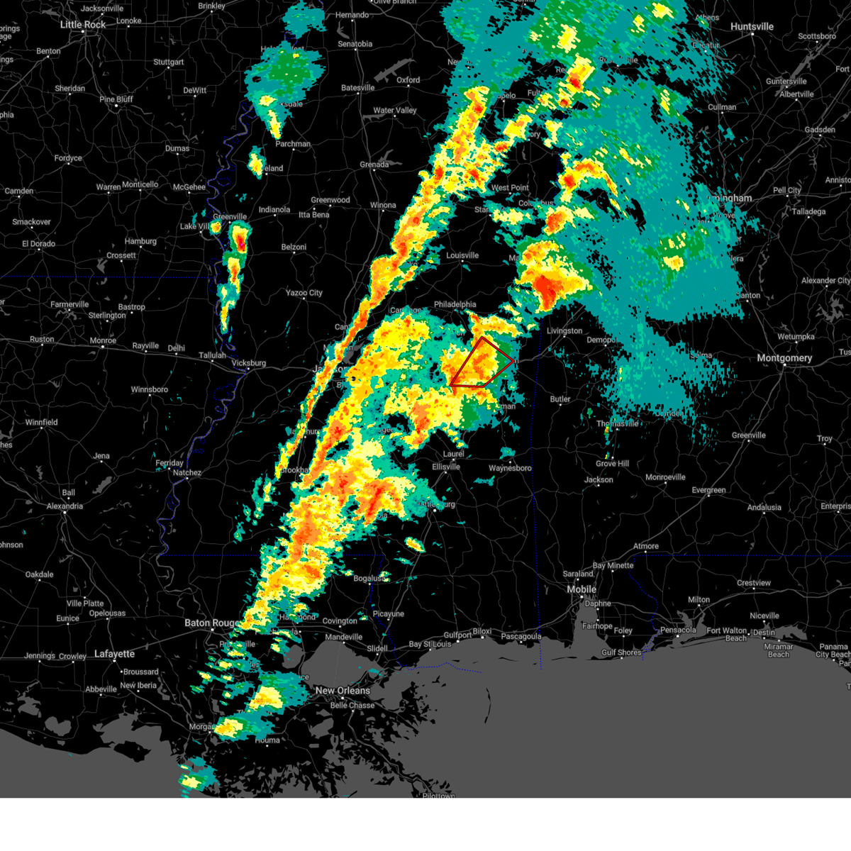
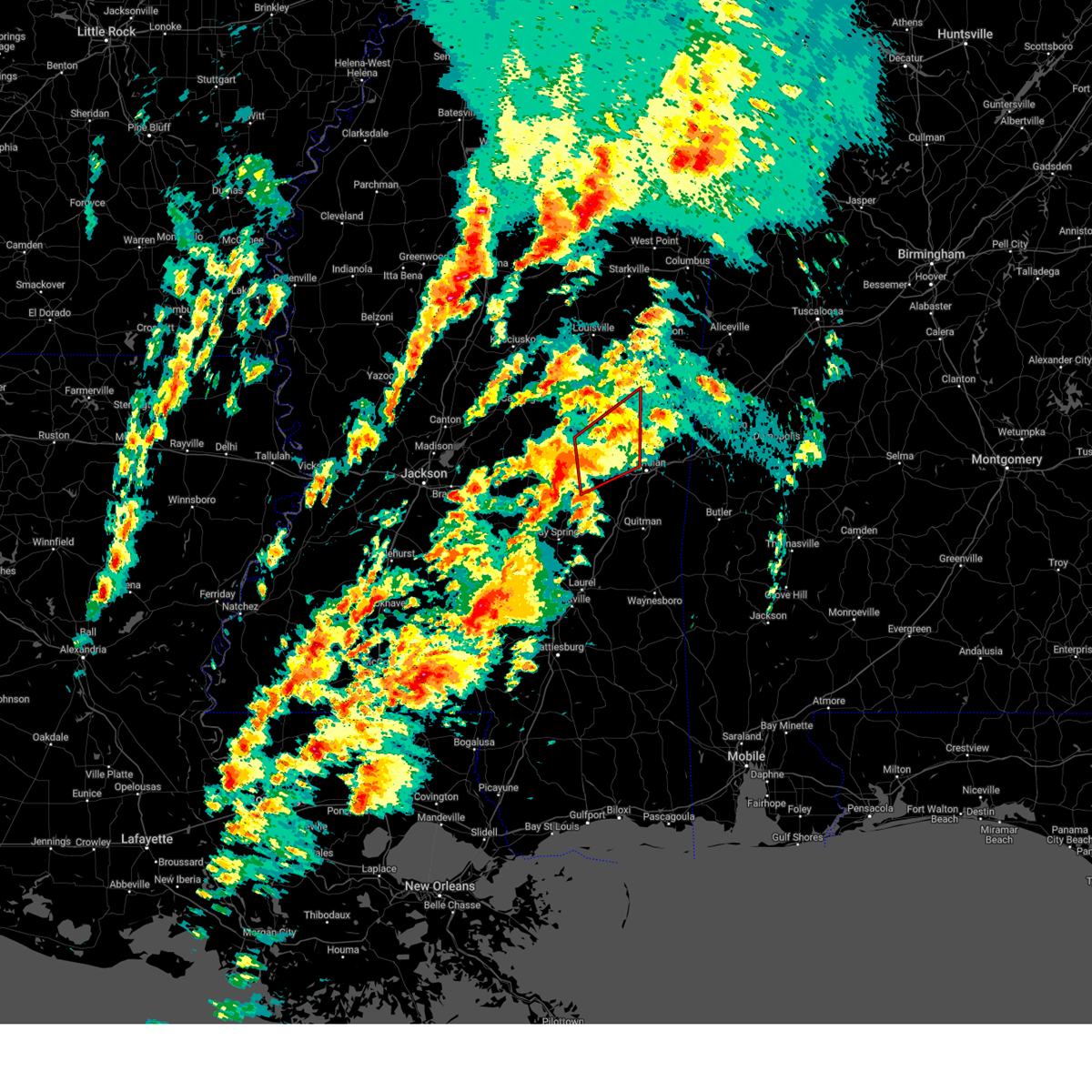
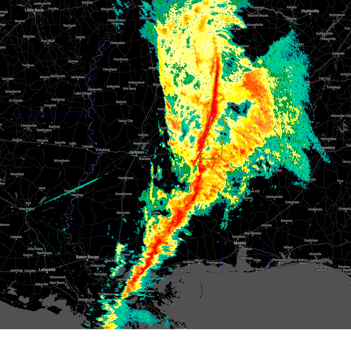
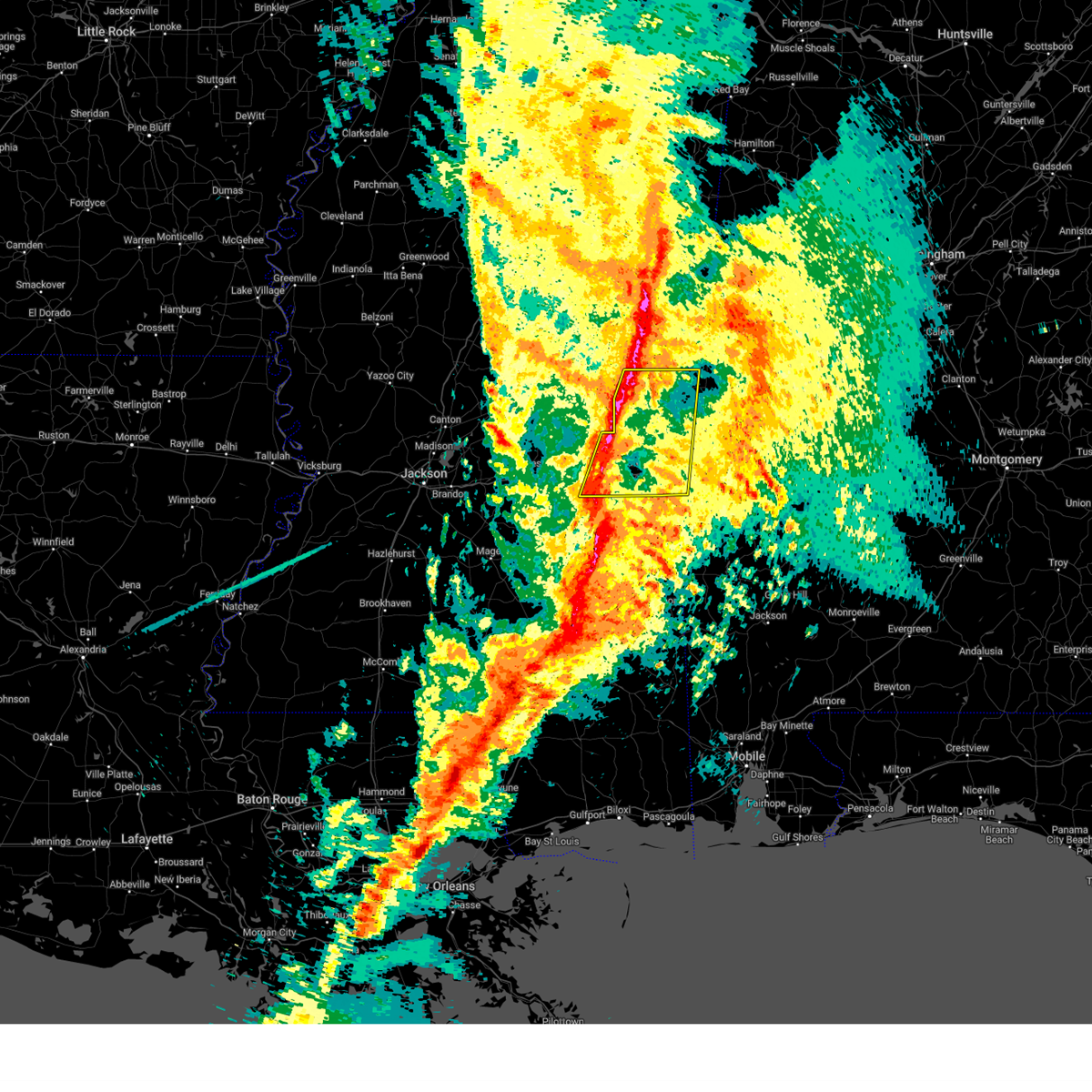
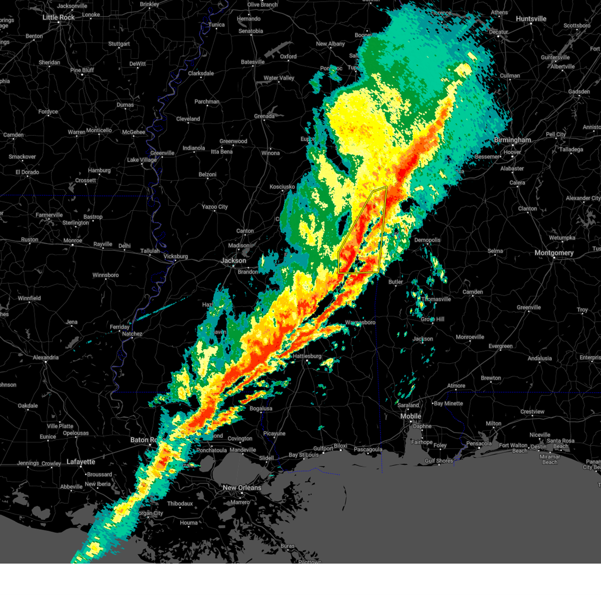
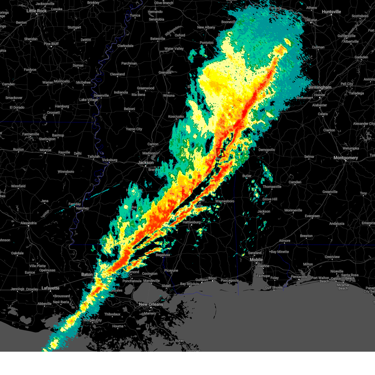
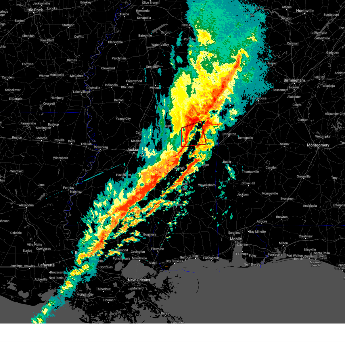
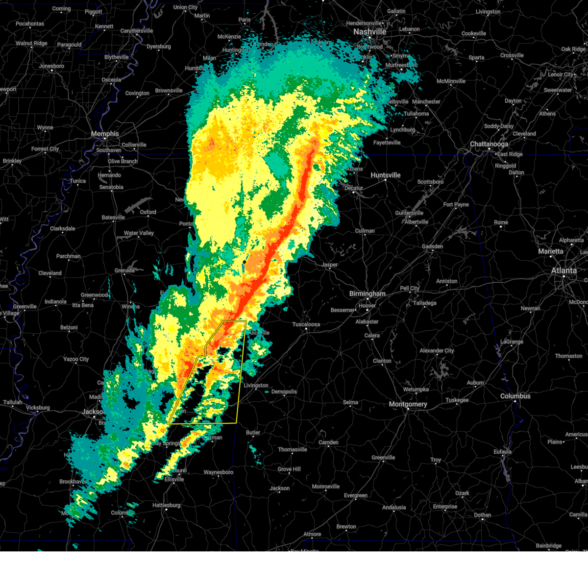
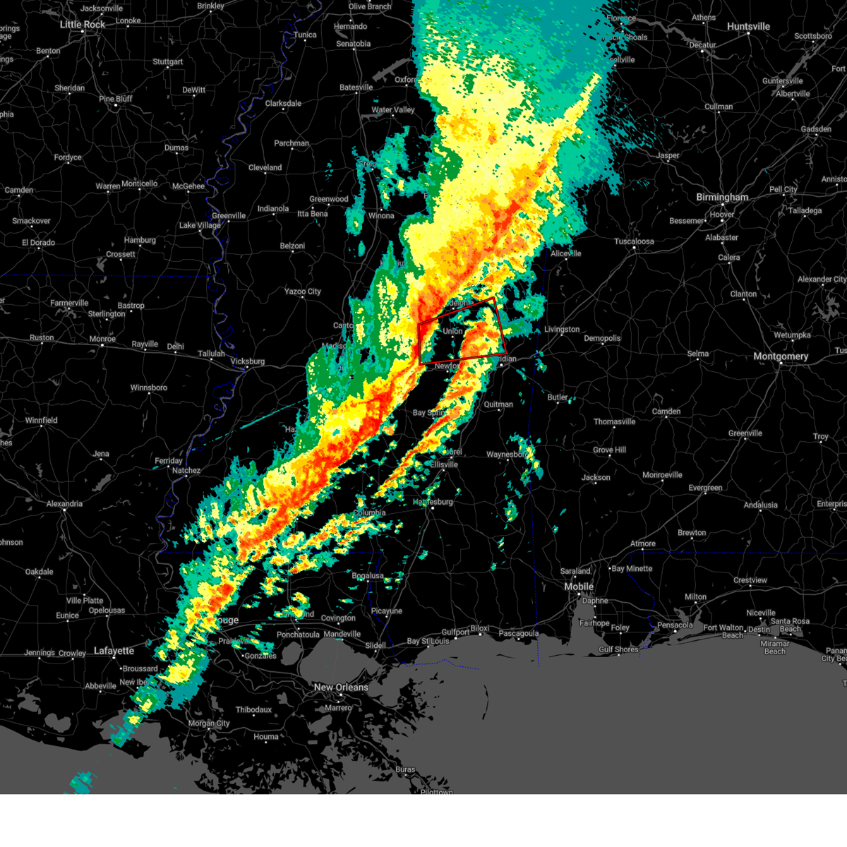
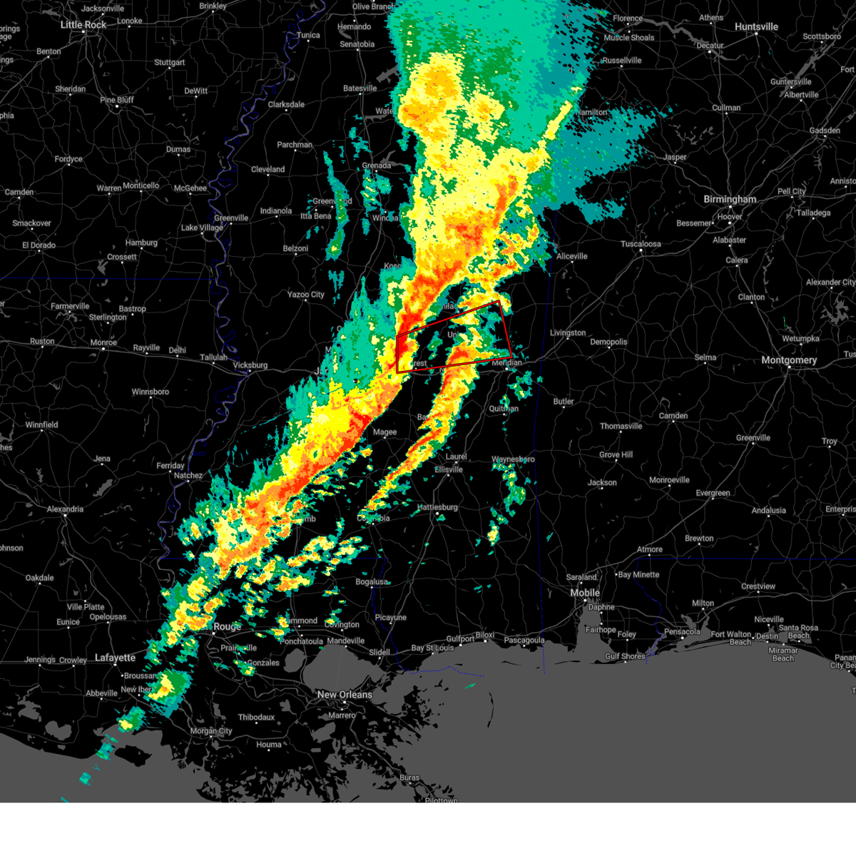
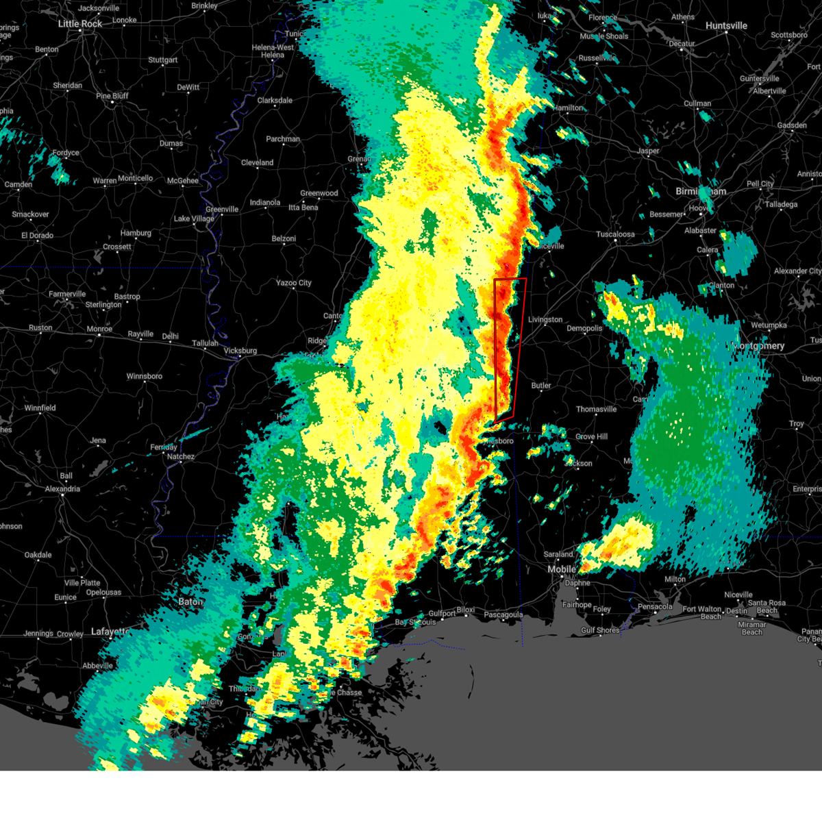
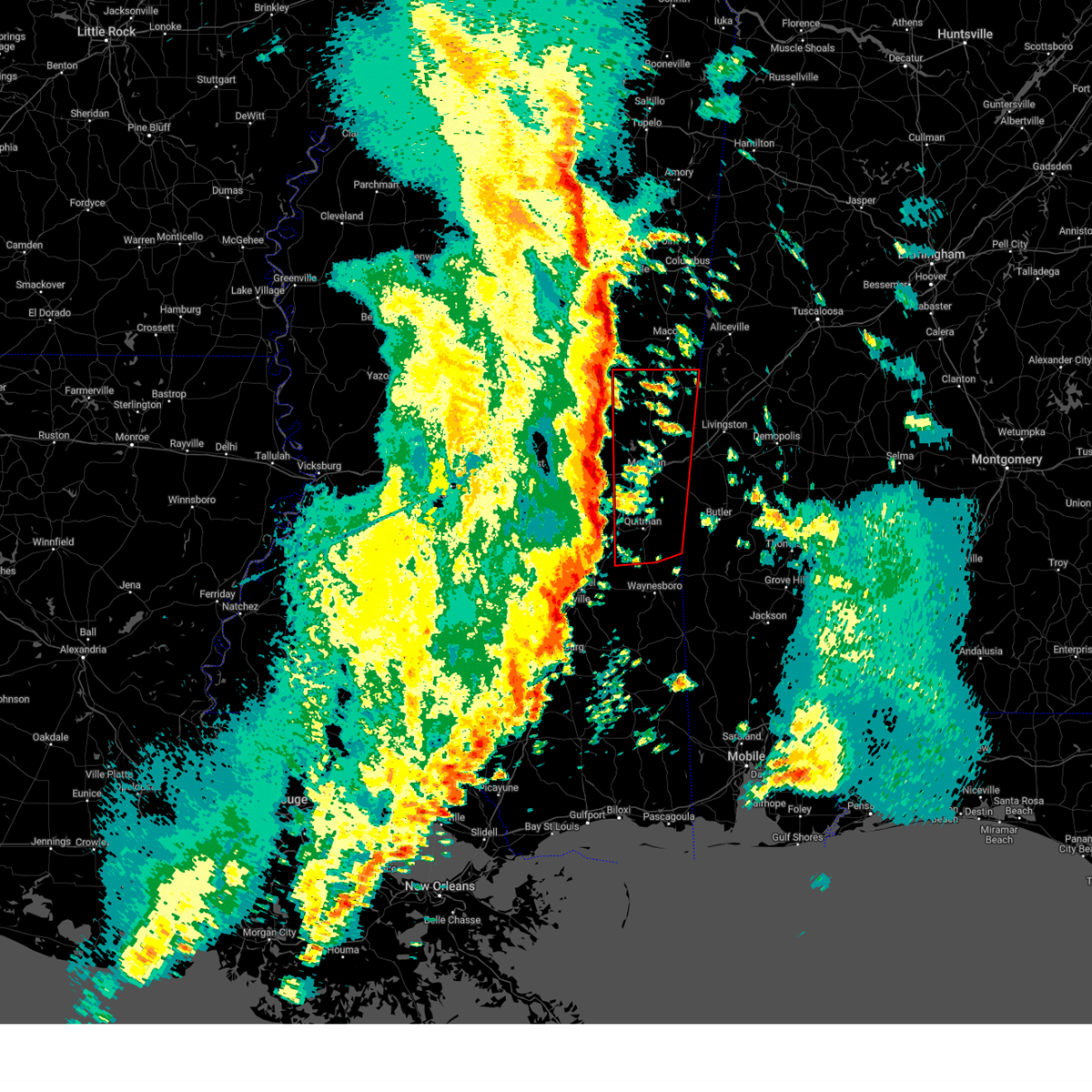
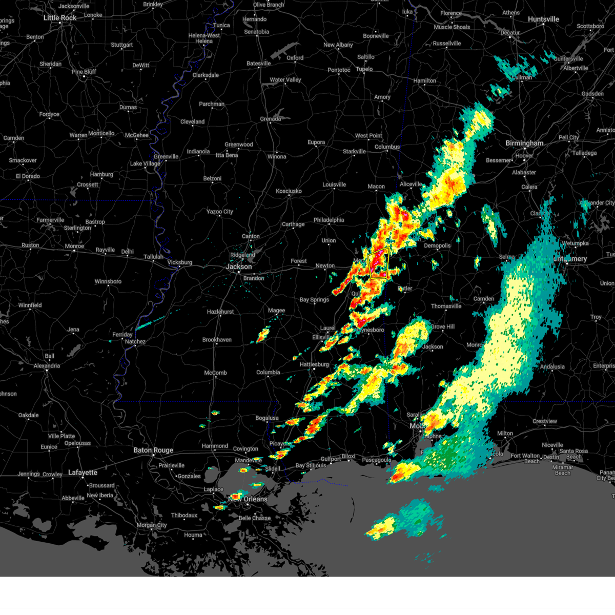
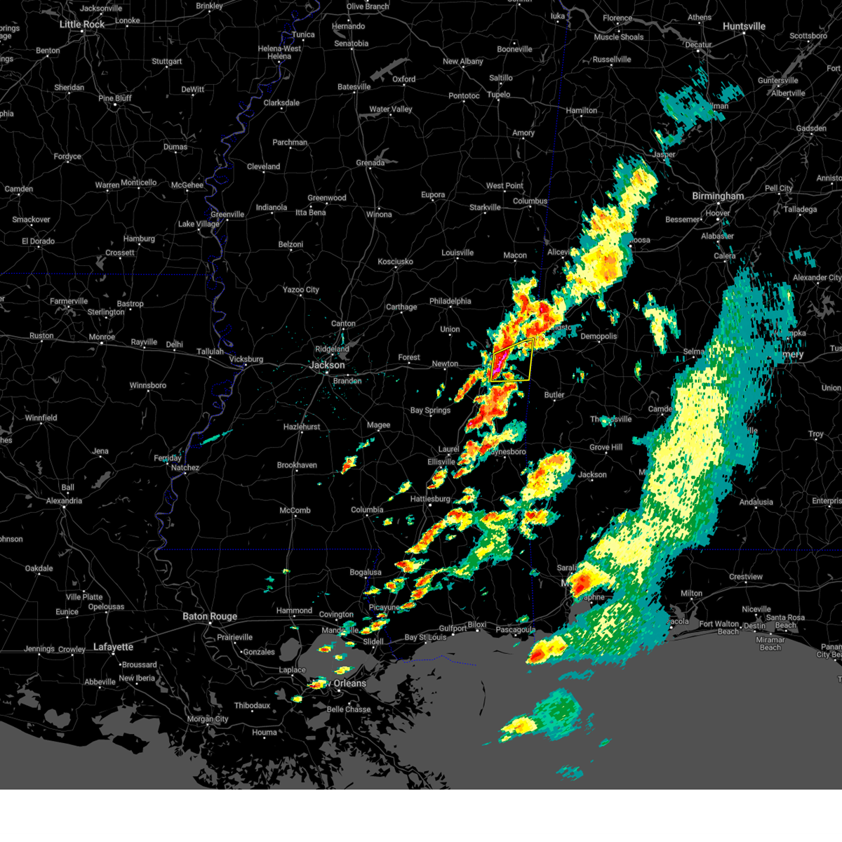
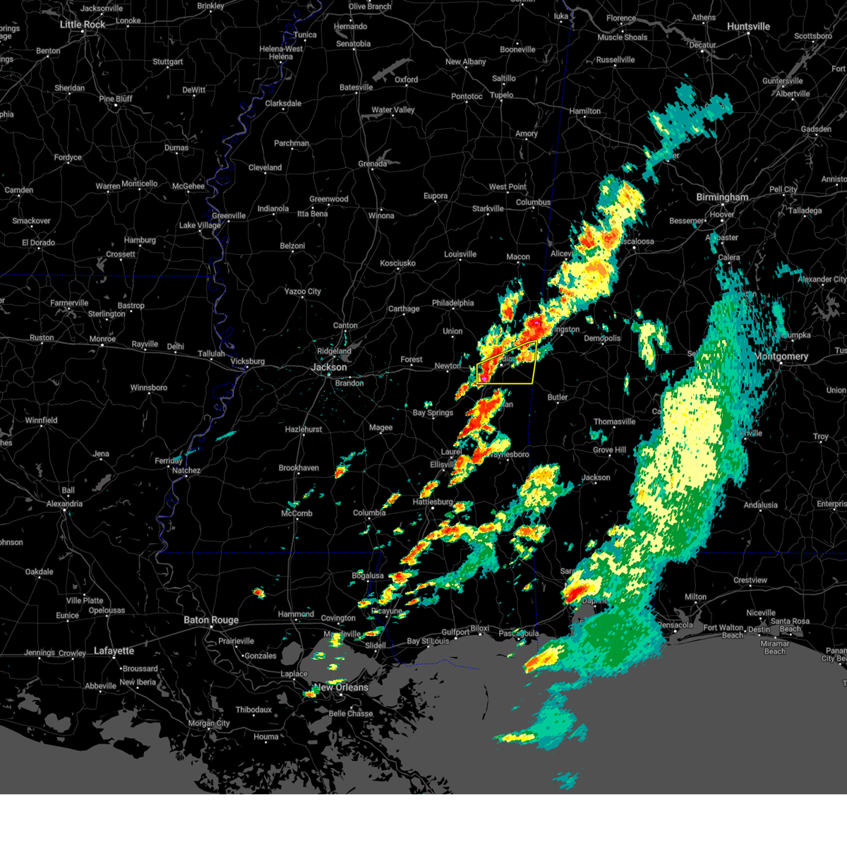
Hail Map for Meridian, MS
The Meridian, MS area has had 31 reports of on-the-ground hail by trained spotters, and has been under severe weather warnings 66 times during the past 12 months. Doppler radar has detected hail at or near Meridian, MS on 98 occasions, including 8 occasions during the past year.
| Name: | Meridian, MS |
| Where Located: | 75.2 miles S of Starkville, MS |
| Map: | Google Map for Meridian, MS |
| Population: | 41148 |
| Housing Units: | 18591 |
| More Info: | Search Google for Meridian, MS |
1
The Top Recent Hail Date for Meridian, MS is Friday, August 16, 2024 (23rd out of 98)

Hail and Wind Damage Spotted near Meridian, MS
| Date / Time | Report Details |
|---|---|
| 6/16/2025 4:05 PM CDT |
 The storm which prompted the warning has weakened below severe limits, and has exited the warned area. therefore, the warning will be allowed to expire. The storm which prompted the warning has weakened below severe limits, and has exited the warned area. therefore, the warning will be allowed to expire.
|
| 6/16/2025 3:51 PM CDT |
 At 351 pm cdt, a severe thunderstorm was located over lauderdale, or 12 miles northwest of cuba, moving northeast at 30 mph (radar indicated). Hazards include 60 mph wind gusts. Expect damage to roofs, siding, and trees. This severe storm will be near, tamola around 355 pm cdt. At 351 pm cdt, a severe thunderstorm was located over lauderdale, or 12 miles northwest of cuba, moving northeast at 30 mph (radar indicated). Hazards include 60 mph wind gusts. Expect damage to roofs, siding, and trees. This severe storm will be near, tamola around 355 pm cdt.
|
| 6/16/2025 3:26 PM CDT | A few trees down in the bailey are in lauderdale county MS, 6.4 miles SSE of Meridian, MS |
| 6/16/2025 3:25 PM CDT |
 Svrjan the national weather service in jackson has issued a * severe thunderstorm warning for, southeastern kemper county in east central mississippi, lauderdale county in east central mississippi, * until 415 pm cdt. * at 325 pm cdt, a severe thunderstorm was located over marion, or near meridian, moving northeast at 30 mph (radar indicated). Hazards include 60 mph wind gusts. Expect damage to roofs, siding, and trees. this severe thunderstorm will be near, meridian, toomsuba, meridian station, and lauderdale around 330 pm cdt. Daleville and tamola around 340 pm cdt. Svrjan the national weather service in jackson has issued a * severe thunderstorm warning for, southeastern kemper county in east central mississippi, lauderdale county in east central mississippi, * until 415 pm cdt. * at 325 pm cdt, a severe thunderstorm was located over marion, or near meridian, moving northeast at 30 mph (radar indicated). Hazards include 60 mph wind gusts. Expect damage to roofs, siding, and trees. this severe thunderstorm will be near, meridian, toomsuba, meridian station, and lauderdale around 330 pm cdt. Daleville and tamola around 340 pm cdt.
|
| 6/16/2025 3:10 PM CDT | Measured 61 mph gust at kme in lauderdale county MS, 4.2 miles NE of Meridian, MS |
| 6/16/2025 3:09 PM CDT | Trees down on arundel roa in lauderdale county MS, 6.7 miles NE of Meridian, MS |
| 5/26/2025 4:50 PM CDT |
 At 449 pm cdt, severe thunderstorms were located along a line extending from daleville to near toomsuba to near alamucha, moving east at 40 mph (radar indicated). Hazards include 60 mph wind gusts. Expect damage to roofs, siding, and trees. These severe storms will be near, meridian station, lauderdale, and kewanee around 455 pm cdt. At 449 pm cdt, severe thunderstorms were located along a line extending from daleville to near toomsuba to near alamucha, moving east at 40 mph (radar indicated). Hazards include 60 mph wind gusts. Expect damage to roofs, siding, and trees. These severe storms will be near, meridian station, lauderdale, and kewanee around 455 pm cdt.
|
| 5/26/2025 4:50 PM CDT |
 the severe thunderstorm warning has been cancelled and is no longer in effect the severe thunderstorm warning has been cancelled and is no longer in effect
|
| 5/26/2025 4:48 PM CDT |
 At 448 pm cdt, a severe thunderstorm capable of producing a tornado was located near toomsuba, or 7 miles west of cuba, moving east at 30 mph (radar indicated rotation). Hazards include tornado. Flying debris will be dangerous to those caught without shelter. mobile homes will be damaged or destroyed. damage to roofs, windows, and vehicles will occur. tree damage is likely. This dangerous storm will be near, tamola around 455 pm cdt. At 448 pm cdt, a severe thunderstorm capable of producing a tornado was located near toomsuba, or 7 miles west of cuba, moving east at 30 mph (radar indicated rotation). Hazards include tornado. Flying debris will be dangerous to those caught without shelter. mobile homes will be damaged or destroyed. damage to roofs, windows, and vehicles will occur. tree damage is likely. This dangerous storm will be near, tamola around 455 pm cdt.
|
| 5/26/2025 4:43 PM CDT |
 The storm which prompted the warning has moved out of the area. therefore, the warning will be allowed to expire. a severe thunderstorm watch remains in effect until 700 pm cdt for east central mississippi. The storm which prompted the warning has moved out of the area. therefore, the warning will be allowed to expire. a severe thunderstorm watch remains in effect until 700 pm cdt for east central mississippi.
|
| 5/26/2025 4:31 PM CDT | Tree downed along ms hwy 496 about four miles east of hwy 19... report via social medi in lauderdale county MS, 9.1 miles W of Meridian, MS |
| 5/26/2025 4:30 PM CDT |
 Torjan the national weather service in jackson has issued a * tornado warning for, southeastern kemper county in east central mississippi, northern lauderdale county in east central mississippi, * until 530 pm cdt. * at 430 pm cdt, a severe thunderstorm capable of producing a tornado was located over marion, or near meridian, moving northeast at 30 mph (radar indicated rotation). Hazards include tornado. Flying debris will be dangerous to those caught without shelter. mobile homes will be damaged or destroyed. damage to roofs, windows, and vehicles will occur. tree damage is likely. this dangerous storm will be near, meridian, toomsuba, meridian station, and lauderdale around 435 pm cdt. Kewanee and tamola around 445 pm cdt. Torjan the national weather service in jackson has issued a * tornado warning for, southeastern kemper county in east central mississippi, northern lauderdale county in east central mississippi, * until 530 pm cdt. * at 430 pm cdt, a severe thunderstorm capable of producing a tornado was located over marion, or near meridian, moving northeast at 30 mph (radar indicated rotation). Hazards include tornado. Flying debris will be dangerous to those caught without shelter. mobile homes will be damaged or destroyed. damage to roofs, windows, and vehicles will occur. tree damage is likely. this dangerous storm will be near, meridian, toomsuba, meridian station, and lauderdale around 435 pm cdt. Kewanee and tamola around 445 pm cdt.
|
| 5/26/2025 4:27 PM CDT |
 Svrjan the national weather service in jackson has issued a * severe thunderstorm warning for, southeastern kemper county in east central mississippi, clarke county in east central mississippi, lauderdale county in east central mississippi, * until 515 pm cdt. * at 427 pm cdt, severe thunderstorms were located along a line extending from near suqualena to near zero to near middleton, moving northeast at 40 mph (radar indicated). Hazards include 60 mph wind gusts. Expect damage to roofs, siding, and trees. severe thunderstorms will be near, meridian, collinsville, marion, nellieburg, causeyville, suqualena, and zero around 430 pm cdt. toomsuba, meridian station, daleville, prismatic, and alamucha around 440 pm cdt. lauderdale, kewanee, and blackwater around 445 pm cdt. tamola around 455 pm cdt. Porterville around 500 pm cdt. Svrjan the national weather service in jackson has issued a * severe thunderstorm warning for, southeastern kemper county in east central mississippi, clarke county in east central mississippi, lauderdale county in east central mississippi, * until 515 pm cdt. * at 427 pm cdt, severe thunderstorms were located along a line extending from near suqualena to near zero to near middleton, moving northeast at 40 mph (radar indicated). Hazards include 60 mph wind gusts. Expect damage to roofs, siding, and trees. severe thunderstorms will be near, meridian, collinsville, marion, nellieburg, causeyville, suqualena, and zero around 430 pm cdt. toomsuba, meridian station, daleville, prismatic, and alamucha around 440 pm cdt. lauderdale, kewanee, and blackwater around 445 pm cdt. tamola around 455 pm cdt. Porterville around 500 pm cdt.
|
| 5/26/2025 4:26 PM CDT | Tree downed along 43rd st... report via social medi in lauderdale county MS, 1.4 miles S of Meridian, MS |
| 5/26/2025 4:25 PM CDT | Tree downed partially blocking the road on country club dr near ashland ave... report via social medi in lauderdale county MS, 1.4 miles S of Meridian, MS |
| 5/26/2025 4:23 PM CDT | Tree downed blocking causeyville rd near buckatunna creek... report via social medi in lauderdale county MS, 11.1 miles NW of Meridian, MS |
| 5/26/2025 4:21 PM CDT | Tree down partially blocking fisher rd... report via social medi in lauderdale county MS, 9.1 miles NNW of Meridian, MS |
| 5/26/2025 4:21 PM CDT |
 At 421 pm cdt, a severe thunderstorm capable of producing a tornado was located near causeyville, or 11 miles southeast of meridian, moving east at 50 mph (radar indicated rotation). Hazards include tornado. Flying debris will be dangerous to those caught without shelter. mobile homes will be damaged or destroyed. damage to roofs, windows, and vehicles will occur. tree damage is likely. this dangerous storm will be near, causeyville and alamucha around 425 pm cdt. Other locations impacted by this tornadic thunderstorm include i 20 welcome center at cuba. At 421 pm cdt, a severe thunderstorm capable of producing a tornado was located near causeyville, or 11 miles southeast of meridian, moving east at 50 mph (radar indicated rotation). Hazards include tornado. Flying debris will be dangerous to those caught without shelter. mobile homes will be damaged or destroyed. damage to roofs, windows, and vehicles will occur. tree damage is likely. this dangerous storm will be near, causeyville and alamucha around 425 pm cdt. Other locations impacted by this tornadic thunderstorm include i 20 welcome center at cuba.
|
| 5/26/2025 4:16 PM CDT | Trees down on cr 470... report via social medi in clarke county MS, 11.1 miles N of Meridian, MS |
| 5/26/2025 4:15 PM CDT | Tree down across the road on luther walker rd near walker bottom rd... report via social medi in lauderdale county MS, 10.3 miles N of Meridian, MS |
| 5/26/2025 4:14 PM CDT | Large tree down at southern hills sout in clarke county MS, 11 miles N of Meridian, MS |
| 5/26/2025 4:11 PM CDT | Trees down on cr 350... report via social medi in clarke county MS, 12 miles NNE of Meridian, MS |
| 5/26/2025 4:10 PM CDT | Numerous trees downed across northwestern clarke co from us 11 north of enterprise and including cr 3771... cr 358... cr 359... and cr 350 near clarkdale school. possib in clarke county MS, 12.1 miles NNE of Meridian, MS |
| 5/26/2025 4:06 PM CDT |
 Torjan the national weather service in jackson has issued a * tornado warning for, northern clarke county in east central mississippi, southern lauderdale county in east central mississippi, * until 445 pm cdt. * at 406 pm cdt, a severe thunderstorm capable of producing a tornado was located over enterprise, or 11 miles northwest of quitman, moving east at 45 mph (radar indicated rotation). Hazards include tornado. Flying debris will be dangerous to those caught without shelter. mobile homes will be damaged or destroyed. damage to roofs, windows, and vehicles will occur. tree damage is likely. this dangerous storm will be near, meridian, middleton, savoy, sable, and zero around 410 pm cdt. causeyville around 415 pm cdt. snell around 420 pm cdt. alamucha around 430 pm cdt. Other locations impacted by this tornadic thunderstorm include i 20 welcome center at cuba. Torjan the national weather service in jackson has issued a * tornado warning for, northern clarke county in east central mississippi, southern lauderdale county in east central mississippi, * until 445 pm cdt. * at 406 pm cdt, a severe thunderstorm capable of producing a tornado was located over enterprise, or 11 miles northwest of quitman, moving east at 45 mph (radar indicated rotation). Hazards include tornado. Flying debris will be dangerous to those caught without shelter. mobile homes will be damaged or destroyed. damage to roofs, windows, and vehicles will occur. tree damage is likely. this dangerous storm will be near, meridian, middleton, savoy, sable, and zero around 410 pm cdt. causeyville around 415 pm cdt. snell around 420 pm cdt. alamucha around 430 pm cdt. Other locations impacted by this tornadic thunderstorm include i 20 welcome center at cuba.
|
| 5/26/2025 3:35 PM CDT |
 Svrjan the national weather service in jackson has issued a * severe thunderstorm warning for, northeastern jasper county in east central mississippi, southeastern newton county in east central mississippi, clarke county in east central mississippi, lauderdale county in east central mississippi, * until 430 pm cdt. * at 335 pm cdt, severe thunderstorms were located along a line extending from near newton to louin, moving east at 45 mph (radar indicated). Hazards include 60 mph wind gusts and nickel size hail. expect damage to roofs, siding, and trees Svrjan the national weather service in jackson has issued a * severe thunderstorm warning for, northeastern jasper county in east central mississippi, southeastern newton county in east central mississippi, clarke county in east central mississippi, lauderdale county in east central mississippi, * until 430 pm cdt. * at 335 pm cdt, severe thunderstorms were located along a line extending from near newton to louin, moving east at 45 mph (radar indicated). Hazards include 60 mph wind gusts and nickel size hail. expect damage to roofs, siding, and trees
|
| 5/25/2025 10:06 PM CDT | Svrjan the national weather service in jackson has issued a * severe thunderstorm warning for, jasper county in east central mississippi, clarke county in east central mississippi, jones county in southeastern mississippi, southeastern lauderdale county in east central mississippi, * until 1115 pm cdt. * at 1005 pm cdt, severe thunderstorms were located along a line extending from near toomsuba to near savoy to montrose, moving southeast at 40 mph (radar indicated). Hazards include 60 mph wind gusts. Expect damage to roofs, siding, and trees. severe thunderstorms will be near, stonewall, toomsuba, enterprise, turnerville, causeyville, orange, sable, zero, rose hill, and alamucha around 1010 pm cdt. pachuta, paulding, and middleton around 1015 pm cdt. snell around 1020 pm cdt. quitman, barnett, and sykes around 1025 pm cdt. heidelberg, de soto, and stafford springs around 1030 pm cdt. goodwater around 1035 pm cdt. crandall around 1040 pm cdt. Shubuta around 1045 pm cdt. |
| 5/25/2025 10:03 PM CDT | Tree down on old marion r in lauderdale county MS, 1.1 miles SW of Meridian, MS |
| 5/25/2025 10:03 PM CDT | At 1003 pm cdt, severe thunderstorms were located along a line extending from meridian to near chunky to montrose, moving southeast at 35 mph (radar indicated). Hazards include 60 mph wind gusts. Expect damage to roofs, siding, and trees. Locations impacted include, meridian, newton, quitman, bay springs, marion, nellieburg, stonewall, toomsuba, meridian station, hickory, enterprise, lauderdale, chunky, louin, pachuta, montrose, paulding, rose hill, kewanee, and savoy. |
| 5/25/2025 10:00 PM CDT | Tree downed on power lines on 36th near 8th s in lauderdale county MS, 1.6 miles NNE of Meridian, MS |
| 5/25/2025 9:57 PM CDT | Social media report of a tree downed on a hous in lauderdale county MS, 4.8 miles ENE of Meridian, MS |
| 5/25/2025 9:47 PM CDT |
 At 947 pm cdt, severe thunderstorms were located along a line extending from daleville to near roberts, moving southeast at 40 mph (radar indicated). Hazards include 60 mph wind gusts. Expect damage to roofs, siding, and trees. Locations impacted include, meridian, newton, quitman, bay springs, collinsville, marion, nellieburg, stonewall, toomsuba, meridian station, hickory, enterprise, lauderdale, chunky, louin, pachuta, montrose, paulding, rose hill, and kewanee. At 947 pm cdt, severe thunderstorms were located along a line extending from daleville to near roberts, moving southeast at 40 mph (radar indicated). Hazards include 60 mph wind gusts. Expect damage to roofs, siding, and trees. Locations impacted include, meridian, newton, quitman, bay springs, collinsville, marion, nellieburg, stonewall, toomsuba, meridian station, hickory, enterprise, lauderdale, chunky, louin, pachuta, montrose, paulding, rose hill, and kewanee.
|
| 5/25/2025 9:35 PM CDT | At 934 pm cdt, severe thunderstorms were located along a line extending from prismatic to near homewood, moving southeast at 40 mph (radar indicated). Hazards include 60 mph wind gusts and quarter size hail. Hail damage to vehicles is expected. expect wind damage to roofs, siding, and trees. Locations impacted include, meridian, newton, quitman, bay springs, collinsville, marion, nellieburg, stonewall, toomsuba, meridian station, hickory, enterprise, lauderdale, chunky, louin, pachuta, montrose, paulding, rose hill, and kewanee. |
| 5/25/2025 9:27 PM CDT | Tree downed across shiloh vimville r in lauderdale county MS, 8.7 miles NW of Meridian, MS |
| 5/25/2025 9:20 PM CDT | Golf Ball sized hail reported 11.4 miles NW of Meridian, MS, multiple social media reports of golfball size hail near causeyville. |
| 5/25/2025 9:15 PM CDT | Half Dollar sized hail reported 11.4 miles NW of Meridian, MS, report via social media. |
| 5/25/2025 9:06 PM CDT |
 Svrjan the national weather service in jackson has issued a * severe thunderstorm warning for, jasper county in east central mississippi, newton county in east central mississippi, northern clarke county in east central mississippi, lauderdale county in east central mississippi, * until 1015 pm cdt. * at 906 pm cdt, severe thunderstorms were located along a line extending from gholson to near walnut grove, moving southeast at 45 mph (radar indicated). Hazards include 60 mph wind gusts and quarter size hail. Hail damage to vehicles is expected. Expect wind damage to roofs, siding, and trees. Svrjan the national weather service in jackson has issued a * severe thunderstorm warning for, jasper county in east central mississippi, newton county in east central mississippi, northern clarke county in east central mississippi, lauderdale county in east central mississippi, * until 1015 pm cdt. * at 906 pm cdt, severe thunderstorms were located along a line extending from gholson to near walnut grove, moving southeast at 45 mph (radar indicated). Hazards include 60 mph wind gusts and quarter size hail. Hail damage to vehicles is expected. Expect wind damage to roofs, siding, and trees.
|
| 5/24/2025 6:13 PM CDT |
 the severe thunderstorm warning has been cancelled and is no longer in effect the severe thunderstorm warning has been cancelled and is no longer in effect
|
| 5/24/2025 6:13 PM CDT |
 At 612 pm cdt, severe thunderstorms were located along a line extending from near lauderdale to near zero to pachuta, moving east at 35 mph (radar indicated. at 556 pm, a 52 mph wind gust was reported at key field in meridian). Hazards include 60 mph wind gusts and penny size hail. Expect damage to roofs, siding, and trees. Locations impacted include, meridian, quitman, stonewall, toomsuba, enterprise, pachuta, zero, paulding, kewanee, orange, snell, sable, alamucha, middleton, sykes, and causeyville. At 612 pm cdt, severe thunderstorms were located along a line extending from near lauderdale to near zero to pachuta, moving east at 35 mph (radar indicated. at 556 pm, a 52 mph wind gust was reported at key field in meridian). Hazards include 60 mph wind gusts and penny size hail. Expect damage to roofs, siding, and trees. Locations impacted include, meridian, quitman, stonewall, toomsuba, enterprise, pachuta, zero, paulding, kewanee, orange, snell, sable, alamucha, middleton, sykes, and causeyville.
|
| 5/24/2025 6:02 PM CDT |
 At 602 pm cdt, severe thunderstorms were located along a line extending from near meridian station to near zero to near paulding, moving east at 50 mph (radar indicated). Hazards include 60 mph wind gusts and nickel size hail. Expect damage to roofs, siding, and trees. Locations impacted include, meridian, quitman, collinsville, marion, nellieburg, stonewall, toomsuba, meridian station, enterprise, lauderdale, chunky, pachuta, paulding, rose hill, kewanee, savoy, orange, suqualena, snell, and sable. At 602 pm cdt, severe thunderstorms were located along a line extending from near meridian station to near zero to near paulding, moving east at 50 mph (radar indicated). Hazards include 60 mph wind gusts and nickel size hail. Expect damage to roofs, siding, and trees. Locations impacted include, meridian, quitman, collinsville, marion, nellieburg, stonewall, toomsuba, meridian station, enterprise, lauderdale, chunky, pachuta, paulding, rose hill, kewanee, savoy, orange, suqualena, snell, and sable.
|
| 5/24/2025 6:02 PM CDT |
 the severe thunderstorm warning has been cancelled and is no longer in effect the severe thunderstorm warning has been cancelled and is no longer in effect
|
| 5/24/2025 5:58 PM CDT | A few trees downed around meridia in lauderdale county MS, 0.7 miles NNE of Meridian, MS |
| 5/24/2025 5:33 PM CDT |
 Svrjan the national weather service in jackson has issued a * severe thunderstorm warning for, northeastern jasper county in east central mississippi, southeastern newton county in east central mississippi, southern kemper county in east central mississippi, clarke county in east central mississippi, lauderdale county in east central mississippi, * until 645 pm cdt. * at 533 pm cdt, severe thunderstorms were located along a line extending from near martin to near pineville, moving east at 30 mph (radar indicated). Hazards include ping pong ball size hail and 60 mph wind gusts. People and animals outdoors will be injured. expect hail damage to roofs, siding, windows, and vehicles. Expect wind damage to roofs, siding, and trees. Svrjan the national weather service in jackson has issued a * severe thunderstorm warning for, northeastern jasper county in east central mississippi, southeastern newton county in east central mississippi, southern kemper county in east central mississippi, clarke county in east central mississippi, lauderdale county in east central mississippi, * until 645 pm cdt. * at 533 pm cdt, severe thunderstorms were located along a line extending from near martin to near pineville, moving east at 30 mph (radar indicated). Hazards include ping pong ball size hail and 60 mph wind gusts. People and animals outdoors will be injured. expect hail damage to roofs, siding, windows, and vehicles. Expect wind damage to roofs, siding, and trees.
|
| 4/6/2025 7:00 AM CDT | East mississippi power association reported several power poles broke in lauderdale county MS, 7.9 miles WNW of Meridian, MS |
| 4/6/2025 6:27 AM CDT |
 Svrjan the national weather service in jackson has issued a * severe thunderstorm warning for, eastern clarke county in east central mississippi, southeastern lauderdale county in east central mississippi, * until 700 am cdt. * at 627 am cdt, severe thunderstorms were located along a line extending from near marion to near quitman to shubuta, moving east at 40 mph (radar indicated). Hazards include 60 mph wind gusts and penny size hail. expect damage to roofs, siding, and trees Svrjan the national weather service in jackson has issued a * severe thunderstorm warning for, eastern clarke county in east central mississippi, southeastern lauderdale county in east central mississippi, * until 700 am cdt. * at 627 am cdt, severe thunderstorms were located along a line extending from near marion to near quitman to shubuta, moving east at 40 mph (radar indicated). Hazards include 60 mph wind gusts and penny size hail. expect damage to roofs, siding, and trees
|
| 4/6/2025 6:06 AM CDT |
 At 606 am cdt, severe thunderstorms were located along a line extending from marion to near pachuta, moving northeast at 30 mph (radar indicated). Hazards include 60 mph wind gusts. Expect damage to roofs, siding, and trees. These severe storms will be near, meridian, marion, stonewall, sable, quitman, zero, and enterprise around 610 am cdt. At 606 am cdt, severe thunderstorms were located along a line extending from marion to near pachuta, moving northeast at 30 mph (radar indicated). Hazards include 60 mph wind gusts. Expect damage to roofs, siding, and trees. These severe storms will be near, meridian, marion, stonewall, sable, quitman, zero, and enterprise around 610 am cdt.
|
| 4/6/2025 6:05 AM CDT |
 At 604 am cdt, severe thunderstorms were located along a line extending from meridian to near pachuta, moving northeast at 30 mph (radar indicated). Hazards include 60 mph wind gusts. Expect damage to roofs, siding, and trees. These severe storms will be near, meridian, marion, stonewall, sable, quitman, and zero around 610 am cdt. At 604 am cdt, severe thunderstorms were located along a line extending from meridian to near pachuta, moving northeast at 30 mph (radar indicated). Hazards include 60 mph wind gusts. Expect damage to roofs, siding, and trees. These severe storms will be near, meridian, marion, stonewall, sable, quitman, and zero around 610 am cdt.
|
| 4/6/2025 6:05 AM CDT |
 the severe thunderstorm warning has been cancelled and is no longer in effect the severe thunderstorm warning has been cancelled and is no longer in effect
|
| 4/6/2025 5:27 AM CDT |
 Svrjan the national weather service in jackson has issued a * severe thunderstorm warning for, northeastern jasper county in east central mississippi, eastern newton county in east central mississippi, southwestern kemper county in east central mississippi, northwestern clarke county in east central mississippi, western lauderdale county in east central mississippi, * until 630 am cdt. * at 527 am cdt, severe thunderstorms were located along a line extending from near decatur to near rose hill to near heidelberg, moving northeast at 30 mph (radar indicated). Hazards include 60 mph wind gusts. Expect damage to roofs, siding, and trees. severe thunderstorms will be near, barnett, pachuta, orange, chunky, and rose hill around 535 am cdt. collinsville, meehan, duffee, and enterprise around 540 am cdt. suqualena around 545 am cdt. meridian, stonewall, savoy, martin, and nellieburg around 550 am cdt. sable and prismatic around 600 am cdt. Marion and zero around 605 am cdt. Svrjan the national weather service in jackson has issued a * severe thunderstorm warning for, northeastern jasper county in east central mississippi, eastern newton county in east central mississippi, southwestern kemper county in east central mississippi, northwestern clarke county in east central mississippi, western lauderdale county in east central mississippi, * until 630 am cdt. * at 527 am cdt, severe thunderstorms were located along a line extending from near decatur to near rose hill to near heidelberg, moving northeast at 30 mph (radar indicated). Hazards include 60 mph wind gusts. Expect damage to roofs, siding, and trees. severe thunderstorms will be near, barnett, pachuta, orange, chunky, and rose hill around 535 am cdt. collinsville, meehan, duffee, and enterprise around 540 am cdt. suqualena around 545 am cdt. meridian, stonewall, savoy, martin, and nellieburg around 550 am cdt. sable and prismatic around 600 am cdt. Marion and zero around 605 am cdt.
|
| 3/31/2025 7:22 AM CDT |
 At 721 am cdt, severe thunderstorms were located along a line extending from near martin to near savoy to de soto, moving northeast at 60 mph (radar indicated). Hazards include 60 mph wind gusts. Expect damage to roofs, siding, and trees. these severe storms will be near, meridian, marion, causeyville, middleton, meridian station, sykes, sable, crandall, and zero around 725 am cdt. toomsuba and snell around 730 am cdt. Alamucha, kewanee, and lauderdale around 735 am cdt. At 721 am cdt, severe thunderstorms were located along a line extending from near martin to near savoy to de soto, moving northeast at 60 mph (radar indicated). Hazards include 60 mph wind gusts. Expect damage to roofs, siding, and trees. these severe storms will be near, meridian, marion, causeyville, middleton, meridian station, sykes, sable, crandall, and zero around 725 am cdt. toomsuba and snell around 730 am cdt. Alamucha, kewanee, and lauderdale around 735 am cdt.
|
| 3/31/2025 7:22 AM CDT |
 the severe thunderstorm warning has been cancelled and is no longer in effect the severe thunderstorm warning has been cancelled and is no longer in effect
|
| 3/31/2025 7:05 AM CDT |
 the severe thunderstorm warning has been cancelled and is no longer in effect the severe thunderstorm warning has been cancelled and is no longer in effect
|
| 3/31/2025 7:05 AM CDT |
 At 705 am cdt, severe thunderstorms were located along a line extending from near decatur to rose hill to near stafford springs, moving east at 45 mph (radar indicated). Hazards include 60 mph wind gusts. Expect damage to roofs, siding, and trees. these severe storms will be near, collinsville, meehan, barnett, pachuta, duffee, orange, goodwater, chunky, and enterprise around 710 am cdt. meridian, stonewall, savoy, shubuta, suqualena, and nellieburg around 715 am cdt. sable, quitman, and de soto around 720 am cdt. zero around 725 am cdt. marion, middleton, sykes, and crandall around 730 am cdt. causeyville and snell around 735 am cdt. toomsuba and alamucha around 740 am cdt. Kewanee and lauderdale around 745 am cdt. At 705 am cdt, severe thunderstorms were located along a line extending from near decatur to rose hill to near stafford springs, moving east at 45 mph (radar indicated). Hazards include 60 mph wind gusts. Expect damage to roofs, siding, and trees. these severe storms will be near, collinsville, meehan, barnett, pachuta, duffee, orange, goodwater, chunky, and enterprise around 710 am cdt. meridian, stonewall, savoy, shubuta, suqualena, and nellieburg around 715 am cdt. sable, quitman, and de soto around 720 am cdt. zero around 725 am cdt. marion, middleton, sykes, and crandall around 730 am cdt. causeyville and snell around 735 am cdt. toomsuba and alamucha around 740 am cdt. Kewanee and lauderdale around 745 am cdt.
|
| 3/31/2025 6:36 AM CDT |
 Svrjan the national weather service in jackson has issued a * severe thunderstorm warning for, jasper county in east central mississippi, newton county in east central mississippi, eastern smith county in central mississippi, clarke county in east central mississippi, southeastern scott county in central mississippi, northern jones county in southeastern mississippi, lauderdale county in east central mississippi, * until 745 am cdt. * at 636 am cdt, severe thunderstorms were located along a line extending from near forest to near pineville to near taylorsville, moving northeast at 65 mph (radar indicated). Hazards include 60 mph wind gusts and quarter size hail. Hail damage to vehicles is expected. expect wind damage to roofs, siding, and trees. severe thunderstorms will be near, conehatta, turnerville, bay springs, montrose, lawrence, roberts, lake, stringer, and louin around 640 am cdt. garlandville, newton, and vernon around 645 am cdt. paulding and decatur around 650 am cdt. orange, heidelberg, rose hill, and hickory around 655 am cdt. meehan, barnett, pachuta, duffee, and chunky around 700 am cdt. collinsville, stonewall, savoy, suqualena, and enterprise around 705 am cdt. meridian, sable, quitman, and nellieburg around 710 am cdt. Marion, middleton, sykes, and zero around 715 am cdt. Svrjan the national weather service in jackson has issued a * severe thunderstorm warning for, jasper county in east central mississippi, newton county in east central mississippi, eastern smith county in central mississippi, clarke county in east central mississippi, southeastern scott county in central mississippi, northern jones county in southeastern mississippi, lauderdale county in east central mississippi, * until 745 am cdt. * at 636 am cdt, severe thunderstorms were located along a line extending from near forest to near pineville to near taylorsville, moving northeast at 65 mph (radar indicated). Hazards include 60 mph wind gusts and quarter size hail. Hail damage to vehicles is expected. expect wind damage to roofs, siding, and trees. severe thunderstorms will be near, conehatta, turnerville, bay springs, montrose, lawrence, roberts, lake, stringer, and louin around 640 am cdt. garlandville, newton, and vernon around 645 am cdt. paulding and decatur around 650 am cdt. orange, heidelberg, rose hill, and hickory around 655 am cdt. meehan, barnett, pachuta, duffee, and chunky around 700 am cdt. collinsville, stonewall, savoy, suqualena, and enterprise around 705 am cdt. meridian, sable, quitman, and nellieburg around 710 am cdt. Marion, middleton, sykes, and zero around 715 am cdt.
|
| 3/15/2025 4:54 PM CDT |
 At 453 pm cdt, a confirmed tornado was located near toomsuba moving northeast at 55 mph (weather spotters confirmed tornado). Hazards include damaging tornado. Flying debris will be dangerous to those caught without shelter. mobile homes will be damaged or destroyed. damage to roofs, windows, and vehicles will occur. tree damage is likely. This tornado will be near, tamola, toomsuba, kewanee, and lauderdale around 500 pm cdt. At 453 pm cdt, a confirmed tornado was located near toomsuba moving northeast at 55 mph (weather spotters confirmed tornado). Hazards include damaging tornado. Flying debris will be dangerous to those caught without shelter. mobile homes will be damaged or destroyed. damage to roofs, windows, and vehicles will occur. tree damage is likely. This tornado will be near, tamola, toomsuba, kewanee, and lauderdale around 500 pm cdt.
|
| 3/15/2025 4:51 PM CDT | At 451 pm cdt, a confirmed tornado was located near zero, or near meridian, moving northeast at 55 mph (weather spotters confirmed tornado). Hazards include damaging tornado. Flying debris will be dangerous to those caught without shelter. mobile homes will be damaged or destroyed. damage to roofs, windows, and vehicles will occur. tree damage is likely. this tornado will be near, meridian, marion, toomsuba, alamucha, kewanee, and lauderdale around 455 pm cdt. Tamola around 505 pm cdt. |
| 3/15/2025 4:37 PM CDT | Torjan the national weather service in jackson has issued a * tornado warning for, southeastern kemper county in east central mississippi, northwestern clarke county in east central mississippi, eastern lauderdale county in east central mississippi, * until 545 pm cdt. * at 437 pm cdt, a tornado producing storm was located near sable, or 11 miles north of quitman, moving northeast at 55 mph (radar confirmed tornado). Hazards include damaging tornado. Flying debris will be dangerous to those caught without shelter. mobile homes will be damaged or destroyed. damage to roofs, windows, and vehicles will occur. tree damage is likely. this tornadic storm will be near, meridian, causeyville, and zero around 445 pm cdt. marion, toomsuba, and alamucha around 450 pm cdt. kewanee and lauderdale around 455 pm cdt. Tamola around 505 pm cdt. |
| 3/15/2025 4:31 PM CDT | the tornado warning has been cancelled and is no longer in effect |
| 3/15/2025 4:31 PM CDT | At 431 pm cdt, a confirmed large and extremely dangerous tornado was located near enterprise, or 13 miles southwest of meridian, moving northeast at 55 mph. this is a particularly dangerous situation. take cover now! (weather spotters confirmed tornado). Hazards include damaging tornado. You are in a life-threatening situation. flying debris may be deadly to those caught without shelter. mobile homes will be destroyed. considerable damage to homes, businesses, and vehicles is likely and complete destruction is possible. the tornado will be near, meehan, meridian, savoy, sable, zero, and nellieburg around 435 pm cdt. Marion around 440 pm cdt. |
| 3/15/2025 4:18 PM CDT |
 At 418 pm cdt, a confirmed large and extremely dangerous tornado was located over orange, or 15 miles west of quitman, moving northeast at 55 mph. this is a particularly dangerous situation. take cover now! (weather spotters confirmed tornado). Hazards include damaging tornado. You are in a life-threatening situation. flying debris may be deadly to those caught without shelter. mobile homes will be destroyed. considerable damage to homes, businesses, and vehicles is likely and complete destruction is possible. the tornado will be near, stonewall and enterprise around 425 pm cdt. meehan, meridian, and savoy around 430 pm cdt. sable, zero, and nellieburg around 435 pm cdt. Marion around 440 pm cdt. At 418 pm cdt, a confirmed large and extremely dangerous tornado was located over orange, or 15 miles west of quitman, moving northeast at 55 mph. this is a particularly dangerous situation. take cover now! (weather spotters confirmed tornado). Hazards include damaging tornado. You are in a life-threatening situation. flying debris may be deadly to those caught without shelter. mobile homes will be destroyed. considerable damage to homes, businesses, and vehicles is likely and complete destruction is possible. the tornado will be near, stonewall and enterprise around 425 pm cdt. meehan, meridian, and savoy around 430 pm cdt. sable, zero, and nellieburg around 435 pm cdt. Marion around 440 pm cdt.
|
| 3/15/2025 4:17 PM CDT |
 At 416 pm cdt, a confirmed large and extremely dangerous tornado was located near paulding, or 15 miles west of quitman, moving northeast at 40 mph. this is a particularly dangerous situation. take cover now! (radar confirmed tornado). Hazards include damaging tornado. You are in a life-threatening situation. flying debris may be deadly to those caught without shelter. mobile homes will be destroyed. considerable damage to homes, businesses, and vehicles is likely and complete destruction is possible. the tornado will be near, pachuta, orange, rose hill, and enterprise around 420 pm cdt. stonewall around 425 pm cdt. savoy and sable around 435 pm cdt. meridian and zero around 440 pm cdt. causeyville around 450 pm cdt. marion around 455 pm cdt. Alamucha around 500 pm cdt. At 416 pm cdt, a confirmed large and extremely dangerous tornado was located near paulding, or 15 miles west of quitman, moving northeast at 40 mph. this is a particularly dangerous situation. take cover now! (radar confirmed tornado). Hazards include damaging tornado. You are in a life-threatening situation. flying debris may be deadly to those caught without shelter. mobile homes will be destroyed. considerable damage to homes, businesses, and vehicles is likely and complete destruction is possible. the tornado will be near, pachuta, orange, rose hill, and enterprise around 420 pm cdt. stonewall around 425 pm cdt. savoy and sable around 435 pm cdt. meridian and zero around 440 pm cdt. causeyville around 450 pm cdt. marion around 455 pm cdt. Alamucha around 500 pm cdt.
|
| 3/15/2025 4:04 PM CDT | At 404 pm cdt, a severe thunderstorm capable of producing a tornado was located over paulding, or 13 miles northeast of bay springs, moving northeast at 55 mph (radar indicated rotation). Hazards include tornado. Flying debris will be dangerous to those caught without shelter. mobile homes will be damaged or destroyed. damage to roofs, windows, and vehicles will occur. tree damage is likely. this dangerous storm will be near, orange and rose hill around 410 pm cdt. enterprise around 415 pm cdt. meehan, savoy, and chunky around 420 pm cdt. meridian and nellieburg around 425 pm cdt. collinsville and suqualena around 430 pm cdt. Marion around 435 pm cdt. |
| 3/15/2025 4:04 PM CDT | the tornado warning has been cancelled and is no longer in effect |
| 3/15/2025 3:45 PM CDT | Torjan the national weather service in jackson has issued a * tornado warning for, jasper county in east central mississippi, eastern newton county in east central mississippi, east central smith county in central mississippi, northwestern clarke county in east central mississippi, southern lauderdale county in east central mississippi, * until 445 pm cdt. * at 345 pm cdt, a confirmed large and extremely dangerous tornado was located over stringer, or 7 miles south of bay springs, moving northeast at 55 mph. this is a particularly dangerous situation. take cover now! (radar confirmed tornado). Hazards include damaging tornado. You are in a life-threatening situation. flying debris may be deadly to those caught without shelter. mobile homes will be destroyed. considerable damage to homes, businesses, and vehicles is likely and complete destruction is possible. the tornado will be near, turnerville, bay springs, and vernon around 350 pm cdt. paulding around 355 pm cdt. orange and rose hill around 405 pm cdt. enterprise around 415 pm cdt. meehan, savoy, and chunky around 420 pm cdt. meridian and nellieburg around 425 pm cdt. collinsville and suqualena around 430 pm cdt. Marion and zero around 435 pm cdt. |
| 3/15/2025 3:41 PM CDT | the tornado warning has been cancelled and is no longer in effect |
| 3/15/2025 3:16 PM CDT | Torjan the national weather service in jackson has issued a * tornado warning for, northern jasper county in east central mississippi, eastern newton county in east central mississippi, western lauderdale county in east central mississippi, * until 415 pm cdt. * at 316 pm cdt, a severe thunderstorm capable of producing a tornado was located near garlandville, or 12 miles south of newton, moving northeast at 55 mph (radar indicated rotation). Hazards include tornado. Flying debris will be dangerous to those caught without shelter. mobile homes will be damaged or destroyed. damage to roofs, windows, and vehicles will occur. tree damage is likely. this dangerous storm will be near, garlandville and rose hill around 320 pm cdt. newton, chunky, and hickory around 325 pm cdt. meehan around 330 pm cdt. collinsville, meridian, duffee, suqualena, and nellieburg around 340 pm cdt. martin around 345 pm cdt. Daleville and meridian station around 355 pm cdt. |
| 3/15/2025 2:49 PM CDT |
 Torjan the national weather service in jackson has issued a * tornado warning for, southeastern newton county in east central mississippi, western lauderdale county in east central mississippi, * until 345 pm cdt. * at 248 pm cdt, a tornado producing storm was located near garlandville, or 10 miles south of newton, moving northeast at 40 mph (radar confirmed tornado). Hazards include damaging tornado. Flying debris will be dangerous to those caught without shelter. mobile homes will be damaged or destroyed. damage to roofs, windows, and vehicles will occur. tree damage is likely. this tornadic storm will be near, hickory around 255 pm cdt. chunky around 300 pm cdt. meehan around 305 pm cdt. collinsville, meridian, suqualena, and nellieburg around 315 pm cdt. duffee around 320 pm cdt. martin around 325 pm cdt. Marion around 330 pm cdt. Torjan the national weather service in jackson has issued a * tornado warning for, southeastern newton county in east central mississippi, western lauderdale county in east central mississippi, * until 345 pm cdt. * at 248 pm cdt, a tornado producing storm was located near garlandville, or 10 miles south of newton, moving northeast at 40 mph (radar confirmed tornado). Hazards include damaging tornado. Flying debris will be dangerous to those caught without shelter. mobile homes will be damaged or destroyed. damage to roofs, windows, and vehicles will occur. tree damage is likely. this tornadic storm will be near, hickory around 255 pm cdt. chunky around 300 pm cdt. meehan around 305 pm cdt. collinsville, meridian, suqualena, and nellieburg around 315 pm cdt. duffee around 320 pm cdt. martin around 325 pm cdt. Marion around 330 pm cdt.
|
| 3/15/2025 1:30 PM CDT |
 Torjan the national weather service in jackson has issued a * tornado warning for, eastern newton county in east central mississippi, southwestern kemper county in east central mississippi, southeastern neshoba county in east central mississippi, northwestern lauderdale county in east central mississippi, * until 230 pm cdt. * at 130 pm cdt, a severe thunderstorm capable of producing a tornado was located near lawrence, or near newton, moving northeast at 40 mph (radar indicated rotation). Hazards include tornado and quarter size hail. Flying debris will be dangerous to those caught without shelter. mobile homes will be damaged or destroyed. damage to roofs, windows, and vehicles will occur. tree damage is likely. this dangerous storm will be near, newton around 135 pm cdt. decatur and hickory around 140 pm cdt. duffee and little rock around 150 pm cdt. collinsville around 155 pm cdt. suqualena and martin around 200 pm cdt. herbert springs around 205 pm cdt. Damascus and liberty around 215 pm cdt. Torjan the national weather service in jackson has issued a * tornado warning for, eastern newton county in east central mississippi, southwestern kemper county in east central mississippi, southeastern neshoba county in east central mississippi, northwestern lauderdale county in east central mississippi, * until 230 pm cdt. * at 130 pm cdt, a severe thunderstorm capable of producing a tornado was located near lawrence, or near newton, moving northeast at 40 mph (radar indicated rotation). Hazards include tornado and quarter size hail. Flying debris will be dangerous to those caught without shelter. mobile homes will be damaged or destroyed. damage to roofs, windows, and vehicles will occur. tree damage is likely. this dangerous storm will be near, newton around 135 pm cdt. decatur and hickory around 140 pm cdt. duffee and little rock around 150 pm cdt. collinsville around 155 pm cdt. suqualena and martin around 200 pm cdt. herbert springs around 205 pm cdt. Damascus and liberty around 215 pm cdt.
|
| 3/4/2025 6:20 PM CST | Large tree downed in front of house on poplar springs drive... between 23rd and 24th stree in lauderdale county MS, 0.3 miles E of Meridian, MS |
| 3/4/2025 6:14 PM CST |
 the severe thunderstorm warning has been cancelled and is no longer in effect the severe thunderstorm warning has been cancelled and is no longer in effect
|
| 3/4/2025 6:14 PM CST |
 At 614 pm cst, severe thunderstorms were located along a line extending from shuqualak to near savoy, moving east at 40 mph (radar indicated). Hazards include 60 mph wind gusts. Expect damage to roofs, siding, and trees. these severe storms will be near, meridian, marion, meridian station, zero, scooba, electric mills, and porterville around 620 pm cst. tamola and lauderdale around 625 pm cst. toomsuba around 630 pm cst. Alamucha and kewanee around 635 pm cst. At 614 pm cst, severe thunderstorms were located along a line extending from shuqualak to near savoy, moving east at 40 mph (radar indicated). Hazards include 60 mph wind gusts. Expect damage to roofs, siding, and trees. these severe storms will be near, meridian, marion, meridian station, zero, scooba, electric mills, and porterville around 620 pm cst. tamola and lauderdale around 625 pm cst. toomsuba around 630 pm cst. Alamucha and kewanee around 635 pm cst.
|
| 3/4/2025 5:58 PM CST |
 Svrjan the national weather service in jackson has issued a * severe thunderstorm warning for, eastern newton county in east central mississippi, kemper county in east central mississippi, lauderdale county in east central mississippi, * until 715 pm cst. * at 558 pm cst, severe thunderstorms were located along a line extending from near gholson to near chunky, moving east at 40 mph (radar indicated). Hazards include 60 mph wind gusts. Expect damage to roofs, siding, and trees. severe thunderstorms will be near, collinsville, daleville, meehan, meridian, savoy, suqualena, blackwater, nellieburg, de kalb, and liberty around 605 pm cst. marion and meridian station around 610 pm cst. zero, scooba, and electric mills around 615 pm cst. tamola, porterville, and lauderdale around 620 pm cst. toomsuba around 625 pm cst. Alamucha and kewanee around 630 pm cst. Svrjan the national weather service in jackson has issued a * severe thunderstorm warning for, eastern newton county in east central mississippi, kemper county in east central mississippi, lauderdale county in east central mississippi, * until 715 pm cst. * at 558 pm cst, severe thunderstorms were located along a line extending from near gholson to near chunky, moving east at 40 mph (radar indicated). Hazards include 60 mph wind gusts. Expect damage to roofs, siding, and trees. severe thunderstorms will be near, collinsville, daleville, meehan, meridian, savoy, suqualena, blackwater, nellieburg, de kalb, and liberty around 605 pm cst. marion and meridian station around 610 pm cst. zero, scooba, and electric mills around 615 pm cst. tamola, porterville, and lauderdale around 620 pm cst. toomsuba around 625 pm cst. Alamucha and kewanee around 630 pm cst.
|
| 2/16/2025 12:21 AM CST | The storms which prompted the warning have moved out of the area. therefore, the warning will be allowed to expire. a tornado watch remains in effect until 400 am cst for east central mississippi. |
| 2/15/2025 11:54 PM CST | Large tree down and blocking hwy 493 heading towards baile in lauderdale county MS, 2.8 miles S of Meridian, MS |
| 2/15/2025 11:53 PM CST |
 the severe thunderstorm warning has been cancelled and is no longer in effect the severe thunderstorm warning has been cancelled and is no longer in effect
|
| 2/15/2025 11:53 PM CST |
 At 1153 pm cst, severe thunderstorms were located along a line extending from near scooba to near daleville to near savoy, moving east at 60 mph (radar indicated). Hazards include 60 mph wind gusts and nickel size hail. Expect damage to roofs, siding, and trees. these severe storms will be near, meridian, marion, tamola, zero, toomsuba, electric mills, cooksville, porterville, and lauderdale around 1200 am cst. Causeyville, alamucha, and kewanee around 1205 am cst. At 1153 pm cst, severe thunderstorms were located along a line extending from near scooba to near daleville to near savoy, moving east at 60 mph (radar indicated). Hazards include 60 mph wind gusts and nickel size hail. Expect damage to roofs, siding, and trees. these severe storms will be near, meridian, marion, tamola, zero, toomsuba, electric mills, cooksville, porterville, and lauderdale around 1200 am cst. Causeyville, alamucha, and kewanee around 1205 am cst.
|
| 2/15/2025 11:50 PM CST |
 At 1149 pm cst, a severe thunderstorm capable of producing a tornado was located over daleville, or 10 miles north of meridian, moving east at 60 mph (radar indicated rotation). Hazards include tornado. Flying debris will be dangerous to those caught without shelter. mobile homes will be damaged or destroyed. damage to roofs, windows, and vehicles will occur. tree damage is likely. This tornadic thunderstorm will remain over mainly rural areas of northwestern lauderdale county. At 1149 pm cst, a severe thunderstorm capable of producing a tornado was located over daleville, or 10 miles north of meridian, moving east at 60 mph (radar indicated rotation). Hazards include tornado. Flying debris will be dangerous to those caught without shelter. mobile homes will be damaged or destroyed. damage to roofs, windows, and vehicles will occur. tree damage is likely. This tornadic thunderstorm will remain over mainly rural areas of northwestern lauderdale county.
|
| 2/15/2025 11:50 PM CST |
 the tornado warning has been cancelled and is no longer in effect the tornado warning has been cancelled and is no longer in effect
|
| 2/15/2025 11:30 PM CST |
 At 1129 pm cst, a severe thunderstorm capable of producing a tornado was located over little rock, or near union, moving east at 60 mph (radar indicated rotation). Hazards include tornado. Flying debris will be dangerous to those caught without shelter. mobile homes will be damaged or destroyed. damage to roofs, windows, and vehicles will occur. tree damage is likely. this dangerous storm will be near, collinsville, house, duffee, martin, and herbert springs around 1135 pm cst. damascus and prismatic around 1140 pm cst. Liberty around 1145 pm cst. At 1129 pm cst, a severe thunderstorm capable of producing a tornado was located over little rock, or near union, moving east at 60 mph (radar indicated rotation). Hazards include tornado. Flying debris will be dangerous to those caught without shelter. mobile homes will be damaged or destroyed. damage to roofs, windows, and vehicles will occur. tree damage is likely. this dangerous storm will be near, collinsville, house, duffee, martin, and herbert springs around 1135 pm cst. damascus and prismatic around 1140 pm cst. Liberty around 1145 pm cst.
|
| 2/15/2025 11:30 PM CST |
 the tornado warning has been cancelled and is no longer in effect the tornado warning has been cancelled and is no longer in effect
|
| 2/15/2025 11:28 PM CST |
 Svrjan the national weather service in jackson has issued a * severe thunderstorm warning for, noxubee county in east central mississippi, newton county in east central mississippi, kemper county in east central mississippi, southeastern neshoba county in east central mississippi, lauderdale county in east central mississippi, * until 1230 am cst. * at 1128 pm cst, severe thunderstorms were located along a line extending from near deerbrook to near bluff springs to near newton, moving east at 65 mph (radar indicated). Hazards include 60 mph wind gusts and nickel size hail. Expect damage to roofs, siding, and trees. severe thunderstorms will be near, collinsville, bigbee valley, prairie point, duffee, shuqualak, martin, damascus, herbert springs, de kalb, and chunky around 1135 pm cst. daleville, meehan, meridian, suqualena, blackwater, scooba, and cooksville around 1140 pm cst. meridian station, nellieburg, and electric mills around 1145 pm cst. marion and porterville around 1150 pm cst. tamola and lauderdale around 1155 pm cst. toomsuba around 1200 am cst. Kewanee around 1205 am cst. Svrjan the national weather service in jackson has issued a * severe thunderstorm warning for, noxubee county in east central mississippi, newton county in east central mississippi, kemper county in east central mississippi, southeastern neshoba county in east central mississippi, lauderdale county in east central mississippi, * until 1230 am cst. * at 1128 pm cst, severe thunderstorms were located along a line extending from near deerbrook to near bluff springs to near newton, moving east at 65 mph (radar indicated). Hazards include 60 mph wind gusts and nickel size hail. Expect damage to roofs, siding, and trees. severe thunderstorms will be near, collinsville, bigbee valley, prairie point, duffee, shuqualak, martin, damascus, herbert springs, de kalb, and chunky around 1135 pm cst. daleville, meehan, meridian, suqualena, blackwater, scooba, and cooksville around 1140 pm cst. meridian station, nellieburg, and electric mills around 1145 pm cst. marion and porterville around 1150 pm cst. tamola and lauderdale around 1155 pm cst. toomsuba around 1200 am cst. Kewanee around 1205 am cst.
|
| 2/15/2025 11:12 PM CST |
 At 1112 pm cst, a severe thunderstorm capable of producing a tornado was located near steele, or 11 miles northeast of forest, moving east at 50 mph (radar indicated rotation). Hazards include tornado. Flying debris will be dangerous to those caught without shelter. mobile homes will be damaged or destroyed. damage to roofs, windows, and vehicles will occur. tree damage is likely. this dangerous storm will be near, conehatta, stratton, prospect, and sebastopol around 1115 pm cst. decatur and union around 1120 pm cst. little rock around 1125 pm cst. duffee around 1130 pm cst. collinsville and herbert springs around 1135 pm cst. suqualena and martin around 1140 pm cst. prismatic around 1145 pm cst. Meridian around 1150 pm cst. At 1112 pm cst, a severe thunderstorm capable of producing a tornado was located near steele, or 11 miles northeast of forest, moving east at 50 mph (radar indicated rotation). Hazards include tornado. Flying debris will be dangerous to those caught without shelter. mobile homes will be damaged or destroyed. damage to roofs, windows, and vehicles will occur. tree damage is likely. this dangerous storm will be near, conehatta, stratton, prospect, and sebastopol around 1115 pm cst. decatur and union around 1120 pm cst. little rock around 1125 pm cst. duffee around 1130 pm cst. collinsville and herbert springs around 1135 pm cst. suqualena and martin around 1140 pm cst. prismatic around 1145 pm cst. Meridian around 1150 pm cst.
|
| 2/15/2025 10:59 PM CST |
 Torjan the national weather service in jackson has issued a * tornado warning for, southeastern leake county in central mississippi, northern newton county in east central mississippi, southwestern kemper county in east central mississippi, northeastern scott county in central mississippi, southern neshoba county in east central mississippi, northwestern lauderdale county in east central mississippi, * until midnight cst. * at 1059 pm cst, a severe thunderstorm capable of producing a tornado was located over hillsboro, or 7 miles northwest of forest, moving east at 60 mph (radar indicated rotation). Hazards include tornado. Flying debris will be dangerous to those caught without shelter. mobile homes will be damaged or destroyed. damage to roofs, windows, and vehicles will occur. tree damage is likely. this dangerous storm will be near, harperville, steele, and forest around 1105 pm cst. conehatta, prospect, and sebastopol around 1110 pm cst. stratton around 1115 pm cst. decatur, neshoba, and union around 1120 pm cst. little rock around 1125 pm cst. collinsville, house, duffee, and herbert springs around 1130 pm cst. martin around 1135 pm cst. Damascus and prismatic around 1140 pm cst. Torjan the national weather service in jackson has issued a * tornado warning for, southeastern leake county in central mississippi, northern newton county in east central mississippi, southwestern kemper county in east central mississippi, northeastern scott county in central mississippi, southern neshoba county in east central mississippi, northwestern lauderdale county in east central mississippi, * until midnight cst. * at 1059 pm cst, a severe thunderstorm capable of producing a tornado was located over hillsboro, or 7 miles northwest of forest, moving east at 60 mph (radar indicated rotation). Hazards include tornado. Flying debris will be dangerous to those caught without shelter. mobile homes will be damaged or destroyed. damage to roofs, windows, and vehicles will occur. tree damage is likely. this dangerous storm will be near, harperville, steele, and forest around 1105 pm cst. conehatta, prospect, and sebastopol around 1110 pm cst. stratton around 1115 pm cst. decatur, neshoba, and union around 1120 pm cst. little rock around 1125 pm cst. collinsville, house, duffee, and herbert springs around 1130 pm cst. martin around 1135 pm cst. Damascus and prismatic around 1140 pm cst.
|
| 12/28/2024 9:14 PM CST |
 the tornado warning has been cancelled and is no longer in effect the tornado warning has been cancelled and is no longer in effect
|
| 12/28/2024 9:14 PM CST |
 At 914 pm cst, severe thunderstorms capable of producing tornadoes were located along a line extending from near bent oak to near snell, moving northeast at 45 mph (radar indicated rotation). Hazards include tornado. Flying debris will be dangerous to those caught without shelter. mobile homes will be damaged or destroyed. damage to roofs, windows, and vehicles will occur. tree damage is likely. These dangerous storms will be near, tamola, electric mills, alamucha, and kewanee around 920 pm cst. At 914 pm cst, severe thunderstorms capable of producing tornadoes were located along a line extending from near bent oak to near snell, moving northeast at 45 mph (radar indicated rotation). Hazards include tornado. Flying debris will be dangerous to those caught without shelter. mobile homes will be damaged or destroyed. damage to roofs, windows, and vehicles will occur. tree damage is likely. These dangerous storms will be near, tamola, electric mills, alamucha, and kewanee around 920 pm cst.
|
| 12/28/2024 9:09 PM CST | Social media report of powerlines down on old hwy 19 s in lauderdale county MS, 11.3 miles WNW of Meridian, MS |
| 12/28/2024 9:07 PM CST | Social media report of tree downed at the intersection of russell camp rd and gene carr r in lauderdale county MS, 11 miles NW of Meridian, MS |
| 12/28/2024 9:06 PM CST | Social media report of tree down near southeast lauderdale high schoo in lauderdale county MS, 8.1 miles WNW of Meridian, MS |
| 12/28/2024 9:06 PM CST | Social media picture of downed powerline on rob sims r in lauderdale county MS, 11.4 miles NW of Meridian, MS |
| 12/28/2024 9:04 PM CST | Social media picture of tree downed on causeyville r in lauderdale county MS, 9.2 miles NW of Meridian, MS |
| 12/28/2024 9:00 PM CST | Social media report of tree down at the intersection of zero rd and mt hored r in lauderdale county MS, 7.2 miles NNW of Meridian, MS |
| 12/28/2024 8:57 PM CST | Social media report of powerlines down on both lanes along hwy 39 near alliance health cente in lauderdale county MS, 2.3 miles SSW of Meridian, MS |
| 12/28/2024 8:57 PM CST | Social media report of large limb falling on porch of residential home on briarwood r in lauderdale county MS, 6.5 miles SSW of Meridian, MS |
| 12/28/2024 8:55 PM CST | Social media picture of tree downed on cr 48 in clarke county MS, 12.4 miles N of Meridian, MS |
| 12/28/2024 8:50 PM CST | Social media report of tree down on pine springs roa in lauderdale county MS, 7.6 miles SE of Meridian, MS |
| 12/28/2024 8:48 PM CST | Social media report of tree downed at the intersection of hwy 514 and cr350 east of enterpris in clarke county MS, 14.8 miles NNE of Meridian, MS |
| 12/28/2024 8:47 PM CST | Social media report of tree down on old 8th street rd near whippoorwill r in lauderdale county MS, 5.1 miles ESE of Meridian, MS |
| 12/28/2024 8:31 PM CST |
 Torjan the national weather service in jackson has issued a * tornado warning for, kemper county in east central mississippi, clarke county in east central mississippi, northeastern neshoba county in east central mississippi, lauderdale county in east central mississippi, * until 930 pm cst. * at 831 pm cst, severe thunderstorms capable of producing a tornado were located along a line extending from betheden to near heidelberg, moving northeast at 45 mph (radar indicated rotation). Hazards include tornado. Flying debris will be dangerous to those caught without shelter. mobile homes will be damaged or destroyed. damage to roofs, windows, and vehicles will occur. tree damage is likely. these dangerous storms will be near, collinsville, meehan, barnett, pachuta, martin, damascus, preston, and bluff springs around 835 pm cst. meridian, stonewall, suqualena, nellieburg, and enterprise around 840 pm cst. savoy, liberty, and prismatic around 845 pm cst. daleville, sable, quitman, blackwater, and de kalb around 850 pm cst. marion, meridian station, and zero around 855 pm cst. causeyville, middleton, and sykes around 900 pm cst. tamola, toomsuba, snell, scooba, porterville, and lauderdale around 905 pm cst. Electric mills, alamucha, and kewanee around 910 pm cst. Torjan the national weather service in jackson has issued a * tornado warning for, kemper county in east central mississippi, clarke county in east central mississippi, northeastern neshoba county in east central mississippi, lauderdale county in east central mississippi, * until 930 pm cst. * at 831 pm cst, severe thunderstorms capable of producing a tornado were located along a line extending from betheden to near heidelberg, moving northeast at 45 mph (radar indicated rotation). Hazards include tornado. Flying debris will be dangerous to those caught without shelter. mobile homes will be damaged or destroyed. damage to roofs, windows, and vehicles will occur. tree damage is likely. these dangerous storms will be near, collinsville, meehan, barnett, pachuta, martin, damascus, preston, and bluff springs around 835 pm cst. meridian, stonewall, suqualena, nellieburg, and enterprise around 840 pm cst. savoy, liberty, and prismatic around 845 pm cst. daleville, sable, quitman, blackwater, and de kalb around 850 pm cst. marion, meridian station, and zero around 855 pm cst. causeyville, middleton, and sykes around 900 pm cst. tamola, toomsuba, snell, scooba, porterville, and lauderdale around 905 pm cst. Electric mills, alamucha, and kewanee around 910 pm cst.
|
| 12/27/2024 3:31 PM CST |
 At 331 pm cst, a severe thunderstorm was located near toomsuba, or 8 miles east of meridian, moving northeast at 45 mph (radar indicated). Hazards include 60 mph wind gusts and quarter size hail. Hail damage to vehicles is expected. expect wind damage to roofs, siding, and trees. This severe storm will be near, kewanee, toomsuba, and alamucha around 335 pm cst. At 331 pm cst, a severe thunderstorm was located near toomsuba, or 8 miles east of meridian, moving northeast at 45 mph (radar indicated). Hazards include 60 mph wind gusts and quarter size hail. Hail damage to vehicles is expected. expect wind damage to roofs, siding, and trees. This severe storm will be near, kewanee, toomsuba, and alamucha around 335 pm cst.
|
| 12/27/2024 3:18 PM CST |
 At 318 pm cst, a severe thunderstorm was located over zero, or near meridian, moving east at 40 mph (radar indicated). Hazards include 60 mph wind gusts and quarter size hail. Hail damage to vehicles is expected. expect wind damage to roofs, siding, and trees. this severe storm will be near, meridian, marion, causeyville, toomsuba, and alamucha around 325 pm cst. Kewanee around 330 pm cst. At 318 pm cst, a severe thunderstorm was located over zero, or near meridian, moving east at 40 mph (radar indicated). Hazards include 60 mph wind gusts and quarter size hail. Hail damage to vehicles is expected. expect wind damage to roofs, siding, and trees. this severe storm will be near, meridian, marion, causeyville, toomsuba, and alamucha around 325 pm cst. Kewanee around 330 pm cst.
|
| 12/27/2024 3:08 PM CST |
 Svrjan the national weather service in jackson has issued a * severe thunderstorm warning for, lauderdale county in east central mississippi, * until 415 pm cst. * at 307 pm cst, a severe thunderstorm was located over savoy, or 10 miles southwest of meridian, moving east at 40 mph (radar indicated). Hazards include 60 mph wind gusts and quarter size hail. Hail damage to vehicles is expected. expect wind damage to roofs, siding, and trees. this severe thunderstorm will be near, meridian, zero, and nellieburg around 315 pm cst. marion and causeyville around 320 pm cst. toomsuba and alamucha around 325 pm cst. Kewanee around 330 pm cst. Svrjan the national weather service in jackson has issued a * severe thunderstorm warning for, lauderdale county in east central mississippi, * until 415 pm cst. * at 307 pm cst, a severe thunderstorm was located over savoy, or 10 miles southwest of meridian, moving east at 40 mph (radar indicated). Hazards include 60 mph wind gusts and quarter size hail. Hail damage to vehicles is expected. expect wind damage to roofs, siding, and trees. this severe thunderstorm will be near, meridian, zero, and nellieburg around 315 pm cst. marion and causeyville around 320 pm cst. toomsuba and alamucha around 325 pm cst. Kewanee around 330 pm cst.
|
| 8/16/2024 4:50 PM CDT | Trees downed at springhill rd and baggett rd. report via social medi in lauderdale county MS, 8.4 miles N of Meridian, MS |
| 8/16/2024 4:49 PM CDT |
 Svrjan the national weather service in jackson has issued a * severe thunderstorm warning for, central lauderdale county in east central mississippi, * until 515 pm cdt. * at 449 pm cdt, severe thunderstorms were located along a line extending from near marion to near zero, moving northeast at 10 mph (radar indicated). Hazards include 60 mph wind gusts and penny size hail. expect damage to roofs, siding, and trees Svrjan the national weather service in jackson has issued a * severe thunderstorm warning for, central lauderdale county in east central mississippi, * until 515 pm cdt. * at 449 pm cdt, severe thunderstorms were located along a line extending from near marion to near zero, moving northeast at 10 mph (radar indicated). Hazards include 60 mph wind gusts and penny size hail. expect damage to roofs, siding, and trees
|
| 8/16/2024 4:45 PM CDT | Report of trees and power lines downed on ms 145 near springhill rd and a tree downed across s anderson rd. report via social medi in lauderdale county MS, 8.3 miles N of Meridian, MS |
| 6/26/2024 3:30 PM CDT | A tree was blown down on pine springs road near the water towe in lauderdale county MS, 10.2 miles SSE of Meridian, MS |
| 6/5/2024 5:53 PM CDT | A tree fell onto power lines along causeyville whynot road. report relayed via faceboo in lauderdale county MS, 13.3 miles WNW of Meridian, MS |
| 6/5/2024 5:45 PM CDT |
 Svrjan the national weather service in jackson has issued a * severe thunderstorm warning for, noxubee county in east central mississippi, kemper county in east central mississippi, southeastern oktibbeha county in northeastern mississippi, eastern clarke county in east central mississippi, lauderdale county in east central mississippi, southern lowndes county in northeastern mississippi, * until 630 pm cdt. * at 544 pm cdt, a severe thunderstorm was located near marion, or near meridian, moving northeast at 45 mph (radar indicated). Hazards include 60 mph wind gusts. Expect damage to roofs, siding, and trees. this severe thunderstorm will be near, meridian, meridian station, lauderdale, and daleville around 550 pm cdt. Tamola around 555 pm cdt. Svrjan the national weather service in jackson has issued a * severe thunderstorm warning for, noxubee county in east central mississippi, kemper county in east central mississippi, southeastern oktibbeha county in northeastern mississippi, eastern clarke county in east central mississippi, lauderdale county in east central mississippi, southern lowndes county in northeastern mississippi, * until 630 pm cdt. * at 544 pm cdt, a severe thunderstorm was located near marion, or near meridian, moving northeast at 45 mph (radar indicated). Hazards include 60 mph wind gusts. Expect damage to roofs, siding, and trees. this severe thunderstorm will be near, meridian, meridian station, lauderdale, and daleville around 550 pm cdt. Tamola around 555 pm cdt.
|
| 6/5/2024 5:41 PM CDT | A tree was blown down near the intersection of 14th street and 46th avenue. report relayed via faceboo in lauderdale county MS, 1.6 miles ENE of Meridian, MS |
| 6/5/2024 5:40 PM CDT | A social media report of several trees down and a blown transformer was relaye in lauderdale county MS, 1.6 miles WNW of Meridian, MS |
| 6/5/2024 5:27 PM CDT |
 the severe thunderstorm warning has been cancelled and is no longer in effect the severe thunderstorm warning has been cancelled and is no longer in effect
|
| 6/5/2024 5:27 PM CDT |
 At 527 pm cdt, a severe thunderstorm was located near waynesboro, moving east at 45 mph (radar indicated). Hazards include 60 mph wind gusts. Expect damage to roofs, siding, and trees. This severe thunderstorm will remain over mainly rural areas of clarke and southern lauderdale counties. At 527 pm cdt, a severe thunderstorm was located near waynesboro, moving east at 45 mph (radar indicated). Hazards include 60 mph wind gusts. Expect damage to roofs, siding, and trees. This severe thunderstorm will remain over mainly rural areas of clarke and southern lauderdale counties.
|
| 5/27/2024 3:45 AM CDT |
 Svrjan the national weather service in jackson has issued a * severe thunderstorm warning for, southwestern noxubee county in east central mississippi, eastern newton county in east central mississippi, kemper county in east central mississippi, eastern neshoba county in east central mississippi, lauderdale county in east central mississippi, * until 445 am cdt. * at 344 am cdt, severe thunderstorms were located along a line extending from near burnside to chunky, moving east at 55 mph (radar indicated). Hazards include 60 mph wind gusts and half dollar size hail. Hail damage to vehicles is expected. expect wind damage to roofs, siding, and trees. severe thunderstorms will be near, meridian, philadelphia, collinsville, nellieburg, tucker, house, meehan, burnside, duffee, and suqualena around 350 am cdt. savoy and damascus around 355 am cdt. marion, daleville, nanih waiya, zero, preston, liberty, prismatic, and bluff springs around 400 am cdt. meridian station and blackwater around 405 am cdt. de kalb, toomsuba, lauderdale, and alamucha around 410 am cdt. tamola and kewanee around 415 am cdt. porterville and electric mills around 420 am cdt. Scooba around 425 am cdt. Svrjan the national weather service in jackson has issued a * severe thunderstorm warning for, southwestern noxubee county in east central mississippi, eastern newton county in east central mississippi, kemper county in east central mississippi, eastern neshoba county in east central mississippi, lauderdale county in east central mississippi, * until 445 am cdt. * at 344 am cdt, severe thunderstorms were located along a line extending from near burnside to chunky, moving east at 55 mph (radar indicated). Hazards include 60 mph wind gusts and half dollar size hail. Hail damage to vehicles is expected. expect wind damage to roofs, siding, and trees. severe thunderstorms will be near, meridian, philadelphia, collinsville, nellieburg, tucker, house, meehan, burnside, duffee, and suqualena around 350 am cdt. savoy and damascus around 355 am cdt. marion, daleville, nanih waiya, zero, preston, liberty, prismatic, and bluff springs around 400 am cdt. meridian station and blackwater around 405 am cdt. de kalb, toomsuba, lauderdale, and alamucha around 410 am cdt. tamola and kewanee around 415 am cdt. porterville and electric mills around 420 am cdt. Scooba around 425 am cdt.
|
| 5/10/2024 12:26 AM CDT |
 At 1225 am cdt, severe thunderstorms were located along a line extending from near kinterbish to 9 miles west of butler to 6 miles south of crandall, moving east at 55 mph (radar indicated). Hazards include 70 mph wind gusts and quarter size hail. Hail damage to vehicles is expected. expect considerable tree damage. wind damage is also likely to mobile homes, roofs, and outbuildings. These severe thunderstorms will remain over mainly rural areas of southern jasper, clarke, northeastern jones and southeastern lauderdale counties. At 1225 am cdt, severe thunderstorms were located along a line extending from near kinterbish to 9 miles west of butler to 6 miles south of crandall, moving east at 55 mph (radar indicated). Hazards include 70 mph wind gusts and quarter size hail. Hail damage to vehicles is expected. expect considerable tree damage. wind damage is also likely to mobile homes, roofs, and outbuildings. These severe thunderstorms will remain over mainly rural areas of southern jasper, clarke, northeastern jones and southeastern lauderdale counties.
|
| 5/10/2024 12:26 AM CDT |
 the severe thunderstorm warning has been cancelled and is no longer in effect the severe thunderstorm warning has been cancelled and is no longer in effect
|
| 5/10/2024 12:24 AM CDT | A tree was blown down on gene carr road. report relayed via social medi in lauderdale county MS, 10.9 miles NW of Meridian, MS |
| 5/10/2024 12:15 AM CDT | There was significant damage to a house near the zero community. the power meter was ripped off... cars were damaged... livestock pens were damaged... and trees were bl in lauderdale county MS, 6.1 miles NNW of Meridian, MS |
| 5/10/2024 12:14 AM CDT | Tree downed... with property and home damage on baggett road in the zero community. time estimated based on rada in lauderdale county MS, 9.2 miles NNW of Meridian, MS |
| 5/10/2024 12:12 AM CDT | A large tree was blown down across the road along county road 350 south of ms highway 514. report relayed via social medi in clarke county MS, 14.9 miles NNE of Meridian, MS |
| 5/10/2024 12:11 AM CDT | Trees were blown down on tm jones roa in lauderdale county MS, 7.7 miles N of Meridian, MS |
| 5/10/2024 12:11 AM CDT |
 Torjan the national weather service in jackson has issued a * tornado warning for, northeastern clarke county in east central mississippi, southeastern lauderdale county in east central mississippi, * until 115 am cdt. * at 1211 am cdt, a severe thunderstorm capable of producing a tornado was located near savoy, or 7 miles south of meridian, moving east at 40 mph (radar indicated rotation). Hazards include tornado and quarter size hail. Flying debris will be dangerous to those caught without shelter. mobile homes will be damaged or destroyed. damage to roofs, windows, and vehicles will occur. tree damage is likely. this dangerous storm will be near, meridian, causeyville, middleton, sable, and zero around 1215 am cdt. Snell around 1220 am cdt. Torjan the national weather service in jackson has issued a * tornado warning for, northeastern clarke county in east central mississippi, southeastern lauderdale county in east central mississippi, * until 115 am cdt. * at 1211 am cdt, a severe thunderstorm capable of producing a tornado was located near savoy, or 7 miles south of meridian, moving east at 40 mph (radar indicated rotation). Hazards include tornado and quarter size hail. Flying debris will be dangerous to those caught without shelter. mobile homes will be damaged or destroyed. damage to roofs, windows, and vehicles will occur. tree damage is likely. this dangerous storm will be near, meridian, causeyville, middleton, sable, and zero around 1215 am cdt. Snell around 1220 am cdt.
|
| 5/10/2024 12:09 AM CDT |
 At 1209 am cdt, severe thunderstorms were located along a line extending from kewanee to sykes to near shubuta, moving east at 55 mph (radar indicated). Hazards include 70 mph wind gusts and quarter size hail. Hail damage to vehicles is expected. expect considerable tree damage. wind damage is also likely to mobile homes, roofs, and outbuildings. These severe storms will be near, shubuta, crandall, and snell around 1215 am cdt. At 1209 am cdt, severe thunderstorms were located along a line extending from kewanee to sykes to near shubuta, moving east at 55 mph (radar indicated). Hazards include 70 mph wind gusts and quarter size hail. Hail damage to vehicles is expected. expect considerable tree damage. wind damage is also likely to mobile homes, roofs, and outbuildings. These severe storms will be near, shubuta, crandall, and snell around 1215 am cdt.
|
| 5/9/2024 11:41 PM CDT |
 Svrjan the national weather service in jackson has issued a * severe thunderstorm warning for, jasper county in east central mississippi, southeastern newton county in east central mississippi, east central smith county in central mississippi, clarke county in east central mississippi, northeastern jones county in southeastern mississippi, lauderdale county in east central mississippi, * until 1245 am cdt. * at 1141 pm cdt, severe thunderstorms were located along a line extending from near collinsville to near rose hill to near vernon, moving east at 55 mph (radar indicated). Hazards include 70 mph wind gusts and quarter size hail. Hail damage to vehicles is expected. expect considerable tree damage. wind damage is also likely to mobile homes, roofs, and outbuildings. severe thunderstorms will be near, meridian, nellieburg, enterprise, pachuta, meehan, paulding, savoy, orange, and vernon around 1145 pm cdt. marion, stonewall, heidelberg, stafford springs, and barnett around 1150 pm cdt. quitman, sable, zero, and goodwater around 1155 pm cdt. toomsuba, de soto, causeyville, middleton, and sykes around 1200 am cdt. shubuta, snell, alamucha, and kewanee around 1205 am cdt. Crandall around 1210 am cdt. Svrjan the national weather service in jackson has issued a * severe thunderstorm warning for, jasper county in east central mississippi, southeastern newton county in east central mississippi, east central smith county in central mississippi, clarke county in east central mississippi, northeastern jones county in southeastern mississippi, lauderdale county in east central mississippi, * until 1245 am cdt. * at 1141 pm cdt, severe thunderstorms were located along a line extending from near collinsville to near rose hill to near vernon, moving east at 55 mph (radar indicated). Hazards include 70 mph wind gusts and quarter size hail. Hail damage to vehicles is expected. expect considerable tree damage. wind damage is also likely to mobile homes, roofs, and outbuildings. severe thunderstorms will be near, meridian, nellieburg, enterprise, pachuta, meehan, paulding, savoy, orange, and vernon around 1145 pm cdt. marion, stonewall, heidelberg, stafford springs, and barnett around 1150 pm cdt. quitman, sable, zero, and goodwater around 1155 pm cdt. toomsuba, de soto, causeyville, middleton, and sykes around 1200 am cdt. shubuta, snell, alamucha, and kewanee around 1205 am cdt. Crandall around 1210 am cdt.
|
| 3/8/2024 12:18 PM CST |
 At 1218 pm cst, severe thunderstorms were located along a line extending from near toomsuba to near sykes, moving east at 50 mph (radar indicated). Hazards include 60 mph wind gusts and quarter size hail. Hail damage to vehicles is expected. expect wind damage to roofs, siding, and trees. These severe storms will be near, snell, alamucha, and kewanee around 1225 pm cst. At 1218 pm cst, severe thunderstorms were located along a line extending from near toomsuba to near sykes, moving east at 50 mph (radar indicated). Hazards include 60 mph wind gusts and quarter size hail. Hail damage to vehicles is expected. expect wind damage to roofs, siding, and trees. These severe storms will be near, snell, alamucha, and kewanee around 1225 pm cst.
|
| 3/8/2024 12:11 PM CST |
 At 1211 pm cst, severe thunderstorms were located along a line extending from meridian to near stonewall, moving east at 40 mph (radar indicated). Hazards include 60 mph wind gusts and quarter size hail. Hail damage to vehicles is expected. expect wind damage to roofs, siding, and trees. these severe storms will be near, meridian, causeyville, middleton, sykes, sable, and zero around 1215 pm cst. toomsuba and snell around 1220 pm cst. alamucha around 1225 pm cst. Kewanee around 1230 pm cst. At 1211 pm cst, severe thunderstorms were located along a line extending from meridian to near stonewall, moving east at 40 mph (radar indicated). Hazards include 60 mph wind gusts and quarter size hail. Hail damage to vehicles is expected. expect wind damage to roofs, siding, and trees. these severe storms will be near, meridian, causeyville, middleton, sykes, sable, and zero around 1215 pm cst. toomsuba and snell around 1220 pm cst. alamucha around 1225 pm cst. Kewanee around 1230 pm cst.
|
| 3/8/2024 12:03 PM CST | Trees downed onto utility lines along valley r in lauderdale county MS, 8 miles NNE of Meridian, MS |
| 3/8/2024 12:02 PM CST |
 At 1201 pm cst, severe thunderstorms were located along a line extending from near nellieburg to near stonewall, moving east at 50 mph (radar indicated). Hazards include 60 mph wind gusts and quarter size hail. Hail damage to vehicles is expected. expect wind damage to roofs, siding, and trees. these severe storms will be near, meridian, stonewall, enterprise, savoy, sable, and zero around 1205 pm cst. marion and middleton around 1210 pm cst. causeyville and sykes around 1215 pm cst. toomsuba, snell, and alamucha around 1220 pm cst. Kewanee around 1225 pm cst. At 1201 pm cst, severe thunderstorms were located along a line extending from near nellieburg to near stonewall, moving east at 50 mph (radar indicated). Hazards include 60 mph wind gusts and quarter size hail. Hail damage to vehicles is expected. expect wind damage to roofs, siding, and trees. these severe storms will be near, meridian, stonewall, enterprise, savoy, sable, and zero around 1205 pm cst. marion and middleton around 1210 pm cst. causeyville and sykes around 1215 pm cst. toomsuba, snell, and alamucha around 1220 pm cst. Kewanee around 1225 pm cst.
|
| 3/8/2024 12:02 PM CST |
 the severe thunderstorm warning has been cancelled and is no longer in effect the severe thunderstorm warning has been cancelled and is no longer in effect
|
| 3/8/2024 11:50 AM CST |
 Svrjan the national weather service in jackson has issued a * severe thunderstorm warning for, northeastern jasper county in east central mississippi, southeastern newton county in east central mississippi, northern clarke county in east central mississippi, lauderdale county in east central mississippi, * until 1245 pm cst. * at 1149 am cst, severe thunderstorms were located along a line extending from near hickory to near rose hill, moving east at 40 mph (radar indicated). Hazards include 60 mph wind gusts and half dollar size hail. Hail damage to vehicles is expected. expect wind damage to roofs, siding, and trees. severe thunderstorms will be near, enterprise, chunky, meehan, and orange around 1155 am cst. meridian, nellieburg, stonewall, and savoy around 1200 pm cst. sable and zero around 1210 pm cst. marion and middleton around 1215 pm cst. causeyville around 1220 pm cst. toomsuba, sykes, and snell around 1225 pm cst. Alamucha and kewanee around 1230 pm cst. Svrjan the national weather service in jackson has issued a * severe thunderstorm warning for, northeastern jasper county in east central mississippi, southeastern newton county in east central mississippi, northern clarke county in east central mississippi, lauderdale county in east central mississippi, * until 1245 pm cst. * at 1149 am cst, severe thunderstorms were located along a line extending from near hickory to near rose hill, moving east at 40 mph (radar indicated). Hazards include 60 mph wind gusts and half dollar size hail. Hail damage to vehicles is expected. expect wind damage to roofs, siding, and trees. severe thunderstorms will be near, enterprise, chunky, meehan, and orange around 1155 am cst. meridian, nellieburg, stonewall, and savoy around 1200 pm cst. sable and zero around 1210 pm cst. marion and middleton around 1215 pm cst. causeyville around 1220 pm cst. toomsuba, sykes, and snell around 1225 pm cst. Alamucha and kewanee around 1230 pm cst.
|
| 1/25/2024 11:35 AM CST |
 The severe thunderstorm warning for clarke and eastern lauderdale counties will expire at 1145 am cst, the storms which prompted the warning have weakened below severe limits, and have exited the warned area. therefore, the warning will be allowed to expire. a severe thunderstorm watch remains in effect until 400 pm cst for east central mississippi. The severe thunderstorm warning for clarke and eastern lauderdale counties will expire at 1145 am cst, the storms which prompted the warning have weakened below severe limits, and have exited the warned area. therefore, the warning will be allowed to expire. a severe thunderstorm watch remains in effect until 400 pm cst for east central mississippi.
|
| 1/25/2024 11:05 AM CST |
 At 1105 am cst, severe thunderstorms were located along a line extending from meridian to near goodwater, moving northeast at 60 mph (radar indicated). Hazards include 60 mph wind gusts. Expect damage to roofs, siding, and trees. these severe storms will be near, meridian, quitman, marion, toomsuba, de soto, causeyville, middleton, sykes, sable, and zero around 1110 am cst. lauderdale, snell, and alamucha around 1115 am cst. crandall and kewanee around 1120 am cst. hail threat, radar indicated max hail size, <. 75 in wind threat, radar indicated max wind gust, 60 mph. At 1105 am cst, severe thunderstorms were located along a line extending from meridian to near goodwater, moving northeast at 60 mph (radar indicated). Hazards include 60 mph wind gusts. Expect damage to roofs, siding, and trees. these severe storms will be near, meridian, quitman, marion, toomsuba, de soto, causeyville, middleton, sykes, sable, and zero around 1110 am cst. lauderdale, snell, and alamucha around 1115 am cst. crandall and kewanee around 1120 am cst. hail threat, radar indicated max hail size, <. 75 in wind threat, radar indicated max wind gust, 60 mph.
|
| 1/25/2024 10:41 AM CST |
 At 1041 am cst, a severe thunderstorm was located near heidelberg, or 13 miles east of bay springs, moving northeast at 50 mph (radar indicated). Hazards include 60 mph wind gusts. Expect damage to roofs, siding, and trees. this severe thunderstorm will be near, barnett and goodwater around 1045 am cst. pachuta around 1050 am cst. quitman and de soto around 1100 am cst. sykes around 1110 am cst. middleton around 1115 am cst. crandall and snell around 1120 am cst. hail threat, radar indicated max hail size, <. 75 in wind threat, radar indicated max wind gust, 60 mph. At 1041 am cst, a severe thunderstorm was located near heidelberg, or 13 miles east of bay springs, moving northeast at 50 mph (radar indicated). Hazards include 60 mph wind gusts. Expect damage to roofs, siding, and trees. this severe thunderstorm will be near, barnett and goodwater around 1045 am cst. pachuta around 1050 am cst. quitman and de soto around 1100 am cst. sykes around 1110 am cst. middleton around 1115 am cst. crandall and snell around 1120 am cst. hail threat, radar indicated max hail size, <. 75 in wind threat, radar indicated max wind gust, 60 mph.
|
| 1/12/2024 10:17 AM CST |
 At 1016 am cst, a severe thunderstorm was located near causeyville, or 9 miles southeast of meridian, moving northeast at 60 mph (radar indicated). Hazards include 60 mph wind gusts. Expect damage to roofs, siding, and trees. this severe storm will be near, meridian, toomsuba, alamucha, and kewanee around 1020 am cst. hail threat, radar indicated max hail size, <. 75 in wind threat, radar indicated max wind gust, 60 mph. At 1016 am cst, a severe thunderstorm was located near causeyville, or 9 miles southeast of meridian, moving northeast at 60 mph (radar indicated). Hazards include 60 mph wind gusts. Expect damage to roofs, siding, and trees. this severe storm will be near, meridian, toomsuba, alamucha, and kewanee around 1020 am cst. hail threat, radar indicated max hail size, <. 75 in wind threat, radar indicated max wind gust, 60 mph.
|
| 1/12/2024 9:58 AM CST |
 At 958 am cst, severe thunderstorms were located along a line extending from suqualena to near pachuta, moving northeast at 70 mph (radar indicated). Hazards include 60 mph wind gusts. Expect damage to roofs, siding, and trees. these severe storms will be near, meridian, marion, nellieburg, stonewall, meridian station, enterprise, daleville, savoy, sable, and zero around 1005 am cst. lauderdale and middleton around 1010 am cst. toomsuba and causeyville around 1015 am cst. snell, alamucha, and kewanee around 1020 am cst. hail threat, radar indicated max hail size, <. 75 in wind threat, radar indicated max wind gust, 60 mph. At 958 am cst, severe thunderstorms were located along a line extending from suqualena to near pachuta, moving northeast at 70 mph (radar indicated). Hazards include 60 mph wind gusts. Expect damage to roofs, siding, and trees. these severe storms will be near, meridian, marion, nellieburg, stonewall, meridian station, enterprise, daleville, savoy, sable, and zero around 1005 am cst. lauderdale and middleton around 1010 am cst. toomsuba and causeyville around 1015 am cst. snell, alamucha, and kewanee around 1020 am cst. hail threat, radar indicated max hail size, <. 75 in wind threat, radar indicated max wind gust, 60 mph.
|
| 1/12/2024 9:57 AM CST | Tree and power line down along hwy 49 in lauderdale county MS, 2.8 miles S of Meridian, MS |
| 1/12/2024 9:45 AM CST |
 At 945 am cst, severe thunderstorms were located along a line extending from near hickory to near vernon, moving northeast at 55 mph (radar indicated). Hazards include 60 mph wind gusts. Expect damage to roofs, siding, and trees. these severe storms will be near, collinsville, hickory, chunky, meehan, paulding, duffee, orange, and rose hill around 950 am cst. meridian, nellieburg, enterprise, pachuta, barnett, and suqualena around 955 am cst. stonewall and savoy around 1000 am cst. marion and daleville around 1005 am cst. quitman, meridian station, sable, and zero around 1010 am cst. toomsuba, lauderdale, causeyville, and middleton around 1015 am cst. sykes, snell, alamucha, and kewanee around 1020 am cst. hail threat, radar indicated max hail size, <. 75 in wind threat, radar indicated max wind gust, 60 mph. At 945 am cst, severe thunderstorms were located along a line extending from near hickory to near vernon, moving northeast at 55 mph (radar indicated). Hazards include 60 mph wind gusts. Expect damage to roofs, siding, and trees. these severe storms will be near, collinsville, hickory, chunky, meehan, paulding, duffee, orange, and rose hill around 950 am cst. meridian, nellieburg, enterprise, pachuta, barnett, and suqualena around 955 am cst. stonewall and savoy around 1000 am cst. marion and daleville around 1005 am cst. quitman, meridian station, sable, and zero around 1010 am cst. toomsuba, lauderdale, causeyville, and middleton around 1015 am cst. sykes, snell, alamucha, and kewanee around 1020 am cst. hail threat, radar indicated max hail size, <. 75 in wind threat, radar indicated max wind gust, 60 mph.
|
| 1/12/2024 9:28 AM CST |
 At 928 am cst, severe thunderstorms were located along a line extending from near lawrence to near stringer, moving east at 60 mph (radar indicated). Hazards include 60 mph wind gusts. Expect damage to roofs, siding, and trees. severe thunderstorms will be near, newton, hickory, garlandville, turnerville, and vernon around 935 am cst. chunky, paulding, and rose hill around 940 am cst. meehan and orange around 945 am cst. meridian, collinsville, nellieburg, enterprise, pachuta, barnett, and suqualena around 950 am cst. stonewall and savoy around 955 am cst. quitman, marion, sable, and zero around 1000 am cst. meridian station and middleton around 1005 am cst. toomsuba, lauderdale, causeyville, and sykes around 1010 am cst. hail threat, radar indicated max hail size, <. 75 in wind threat, radar indicated max wind gust, 60 mph. At 928 am cst, severe thunderstorms were located along a line extending from near lawrence to near stringer, moving east at 60 mph (radar indicated). Hazards include 60 mph wind gusts. Expect damage to roofs, siding, and trees. severe thunderstorms will be near, newton, hickory, garlandville, turnerville, and vernon around 935 am cst. chunky, paulding, and rose hill around 940 am cst. meehan and orange around 945 am cst. meridian, collinsville, nellieburg, enterprise, pachuta, barnett, and suqualena around 950 am cst. stonewall and savoy around 955 am cst. quitman, marion, sable, and zero around 1000 am cst. meridian station and middleton around 1005 am cst. toomsuba, lauderdale, causeyville, and sykes around 1010 am cst. hail threat, radar indicated max hail size, <. 75 in wind threat, radar indicated max wind gust, 60 mph.
|
| 12/9/2023 11:36 PM CST |
 The severe thunderstorm warning for clarke and southeastern lauderdale counties will expire at 1145 pm cst, the storms which prompted the warning have weakened below severe limits, and have exited the warned area. therefore, the warning will be allowed to expire. a tornado watch remains in effect until midnight cst for east central mississippi. The severe thunderstorm warning for clarke and southeastern lauderdale counties will expire at 1145 pm cst, the storms which prompted the warning have weakened below severe limits, and have exited the warned area. therefore, the warning will be allowed to expire. a tornado watch remains in effect until midnight cst for east central mississippi.
|
| 12/9/2023 11:00 PM CST |
 At 1100 pm cst, severe thunderstorms were located along a line extending from near causeyville to near middleton to near barnett, moving east at 40 mph (radar indicated). Hazards include 60 mph wind gusts. Expect damage to roofs, siding, and trees. severe thunderstorms will be near, quitman, causeyville, middleton, sykes, and snell around 1105 pm cst. hail threat, radar indicated max hail size, <. 75 in wind threat, radar indicated max wind gust, 60 mph. At 1100 pm cst, severe thunderstorms were located along a line extending from near causeyville to near middleton to near barnett, moving east at 40 mph (radar indicated). Hazards include 60 mph wind gusts. Expect damage to roofs, siding, and trees. severe thunderstorms will be near, quitman, causeyville, middleton, sykes, and snell around 1105 pm cst. hail threat, radar indicated max hail size, <. 75 in wind threat, radar indicated max wind gust, 60 mph.
|
| 11/20/2023 9:43 PM CST |
 At 943 pm cst, a severe thunderstorm was located over causeyville, or 13 miles southeast of meridian, moving northeast at 35 mph (radar indicated). Hazards include 60 mph wind gusts and nickel size hail. Expect damage to roofs, siding, and trees. This severe storm will be near, alamucha around 950 pm cst. At 943 pm cst, a severe thunderstorm was located over causeyville, or 13 miles southeast of meridian, moving northeast at 35 mph (radar indicated). Hazards include 60 mph wind gusts and nickel size hail. Expect damage to roofs, siding, and trees. This severe storm will be near, alamucha around 950 pm cst.
|
| 11/20/2023 9:02 PM CST |
 At 902 pm cst, a severe thunderstorm was located over orange, or 12 miles west of quitman, moving northeast at 35 mph (radar indicated). Hazards include 60 mph wind gusts and nickel size hail. Expect damage to roofs, siding, and trees. this severe thunderstorm will be near, stonewall, enterprise, and pachuta around 905 pm cst. savoy and sable around 915 pm cst. middleton around 920 pm cst. zero around 925 pm cst. causeyville around 930 pm cst. snell around 935 pm cst. Alamucha around 945 pm cst. At 902 pm cst, a severe thunderstorm was located over orange, or 12 miles west of quitman, moving northeast at 35 mph (radar indicated). Hazards include 60 mph wind gusts and nickel size hail. Expect damage to roofs, siding, and trees. this severe thunderstorm will be near, stonewall, enterprise, and pachuta around 905 pm cst. savoy and sable around 915 pm cst. middleton around 920 pm cst. zero around 925 pm cst. causeyville around 930 pm cst. snell around 935 pm cst. Alamucha around 945 pm cst.
|
| 7/30/2023 4:52 PM CDT |
 The severe thunderstorm warning for southern lauderdale county will expire at 500 pm cdt, the storms which prompted the warning have moved out of the area. therefore, the warning will be allowed to expire. The severe thunderstorm warning for southern lauderdale county will expire at 500 pm cdt, the storms which prompted the warning have moved out of the area. therefore, the warning will be allowed to expire.
|
| 7/30/2023 4:27 PM CDT |
 At 427 pm cdt, severe thunderstorms were located along a line extending from near kinterbish to zero to near chunky, moving south at 25 mph (radar indicated). Hazards include 60 mph wind gusts. Expect damage to roofs, siding, and trees. these severe storms will be near, causeyville around 440 pm cdt. hail threat, radar indicated max hail size, <. 75 in wind threat, radar indicated max wind gust, 60 mph. At 427 pm cdt, severe thunderstorms were located along a line extending from near kinterbish to zero to near chunky, moving south at 25 mph (radar indicated). Hazards include 60 mph wind gusts. Expect damage to roofs, siding, and trees. these severe storms will be near, causeyville around 440 pm cdt. hail threat, radar indicated max hail size, <. 75 in wind threat, radar indicated max wind gust, 60 mph.
|
| 7/30/2023 4:03 PM CDT | Numerous trees and powerlines downed across the city... with some downed powerlines catching fire. time estimated based upon rada in lauderdale county MS, 1.4 miles S of Meridian, MS |
| 7/30/2023 4:02 PM CDT | Tree downed across grandview avenue at 42nd street. report and picture relayed via social media. time estimated based upon rada in lauderdale county MS, 1.4 miles S of Meridian, MS |
| 7/30/2023 4:01 PM CDT |
 At 401 pm cdt, severe thunderstorms were located along a line extending from near cuba to near marion to near suqualena, moving south at 15 mph (radar indicated). Hazards include 60 mph wind gusts and quarter size hail. Hail damage to vehicles is expected. expect wind damage to roofs, siding, and trees. severe thunderstorms will be near, toomsuba around 405 pm cdt. meridian, marion and kewanee around 410 pm cdt. nellieburg around 415 pm cdt. meehan and alamucha around 425 pm cdt. zero and savoy around 445 pm cdt. causeyville around 500 pm cdt. hail threat, radar indicated max hail size, 1. 00 in wind threat, radar indicated max wind gust, 60 mph. At 401 pm cdt, severe thunderstorms were located along a line extending from near cuba to near marion to near suqualena, moving south at 15 mph (radar indicated). Hazards include 60 mph wind gusts and quarter size hail. Hail damage to vehicles is expected. expect wind damage to roofs, siding, and trees. severe thunderstorms will be near, toomsuba around 405 pm cdt. meridian, marion and kewanee around 410 pm cdt. nellieburg around 415 pm cdt. meehan and alamucha around 425 pm cdt. zero and savoy around 445 pm cdt. causeyville around 500 pm cdt. hail threat, radar indicated max hail size, 1. 00 in wind threat, radar indicated max wind gust, 60 mph.
|
| 6/19/2023 2:51 AM CDT |
 At 250 am cdt, a severe thunderstorm was located over snell, or 17 miles northwest of butler, moving southeast at 35 mph (radar indicated). Hazards include 60 mph wind gusts and half dollar size hail. Hail damage to vehicles is expected. expect wind damage to roofs, siding, and trees. this severe thunderstorm will remain over mainly rural areas of northeastern clarke and southeastern lauderdale counties. hail threat, radar indicated max hail size, 1. 25 in wind threat, radar indicated max wind gust, 60 mph. At 250 am cdt, a severe thunderstorm was located over snell, or 17 miles northwest of butler, moving southeast at 35 mph (radar indicated). Hazards include 60 mph wind gusts and half dollar size hail. Hail damage to vehicles is expected. expect wind damage to roofs, siding, and trees. this severe thunderstorm will remain over mainly rural areas of northeastern clarke and southeastern lauderdale counties. hail threat, radar indicated max hail size, 1. 25 in wind threat, radar indicated max wind gust, 60 mph.
|
| 6/19/2023 1:59 AM CDT |
 At 159 am cdt, a severe thunderstorm capable of producing a tornado was located near causeyville, or 12 miles southeast of meridian, moving east at 55 mph (radar indicated rotation). Hazards include tornado. Flying debris will be dangerous to those caught without shelter. mobile homes will be damaged or destroyed. damage to roofs, windows, and vehicles will occur. tree damage is likely. This dangerous storm will be near, snell around 205 am cdt. At 159 am cdt, a severe thunderstorm capable of producing a tornado was located near causeyville, or 12 miles southeast of meridian, moving east at 55 mph (radar indicated rotation). Hazards include tornado. Flying debris will be dangerous to those caught without shelter. mobile homes will be damaged or destroyed. damage to roofs, windows, and vehicles will occur. tree damage is likely. This dangerous storm will be near, snell around 205 am cdt.
|
| 6/19/2023 1:50 AM CDT |
 At 149 am cdt, a severe thunderstorm was located over causeyville, or 14 miles southeast of meridian, moving east at 45 mph (radar indicated). Hazards include 60 mph wind gusts and half dollar size hail. Hail damage to vehicles is expected. expect wind damage to roofs, siding, and trees. This severe thunderstorm will remain over mainly rural areas of northern clarke and lauderdale counties. At 149 am cdt, a severe thunderstorm was located over causeyville, or 14 miles southeast of meridian, moving east at 45 mph (radar indicated). Hazards include 60 mph wind gusts and half dollar size hail. Hail damage to vehicles is expected. expect wind damage to roofs, siding, and trees. This severe thunderstorm will remain over mainly rural areas of northern clarke and lauderdale counties.
|
| 6/19/2023 1:36 AM CDT |
 At 135 am cdt, a severe thunderstorm was located near zero, or 7 miles south of meridian, moving east at 45 mph (radar indicated). Hazards include 60 mph wind gusts and half dollar size hail. Hail damage to vehicles is expected. expect wind damage to roofs, siding, and trees. this severe storm will be near, middleton around 145 am cdt. causeyville around 150 am cdt. snell around 155 am cdt. hail threat, radar indicated max hail size, 1. 25 in wind threat, radar indicated max wind gust, 60 mph. At 135 am cdt, a severe thunderstorm was located near zero, or 7 miles south of meridian, moving east at 45 mph (radar indicated). Hazards include 60 mph wind gusts and half dollar size hail. Hail damage to vehicles is expected. expect wind damage to roofs, siding, and trees. this severe storm will be near, middleton around 145 am cdt. causeyville around 150 am cdt. snell around 155 am cdt. hail threat, radar indicated max hail size, 1. 25 in wind threat, radar indicated max wind gust, 60 mph.
|
| 6/19/2023 1:08 AM CDT |
 At 108 am cdt, a severe thunderstorm was located near hickory, or near decatur, moving east at 45 mph (radar indicated). Hazards include 60 mph wind gusts and half dollar size hail. Hail damage to vehicles is expected. expect wind damage to roofs, siding, and trees. this severe thunderstorm will be near, chunky around 115 am cdt. meehan and suqualena around 120 am cdt. meridian and nellieburg around 125 am cdt. savoy around 130 am cdt. zero and sable around 140 am cdt. causeyville and middleton around 145 am cdt. snell around 155 am cdt. hail threat, radar indicated max hail size, 1. 25 in wind threat, radar indicated max wind gust, 60 mph. At 108 am cdt, a severe thunderstorm was located near hickory, or near decatur, moving east at 45 mph (radar indicated). Hazards include 60 mph wind gusts and half dollar size hail. Hail damage to vehicles is expected. expect wind damage to roofs, siding, and trees. this severe thunderstorm will be near, chunky around 115 am cdt. meehan and suqualena around 120 am cdt. meridian and nellieburg around 125 am cdt. savoy around 130 am cdt. zero and sable around 140 am cdt. causeyville and middleton around 145 am cdt. snell around 155 am cdt. hail threat, radar indicated max hail size, 1. 25 in wind threat, radar indicated max wind gust, 60 mph.
|
| 6/18/2023 10:33 AM CDT |
 At 1032 am cdt, a severe thunderstorm was located near orange, or 13 miles northwest of quitman, moving east at 55 mph (radar indicated). Hazards include 70 mph wind gusts and quarter size hail. Hail damage to vehicles is expected. expect considerable tree damage. wind damage is also likely to mobile homes, roofs, and outbuildings. this severe thunderstorm will be near, quitman and sable around 1045 am cdt. middleton around 1050 am cdt. sykes around 1055 am cdt. crandall around 1100 am cdt. thunderstorm damage threat, considerable hail threat, radar indicated max hail size, 1. 00 in wind threat, radar indicated max wind gust, 70 mph. At 1032 am cdt, a severe thunderstorm was located near orange, or 13 miles northwest of quitman, moving east at 55 mph (radar indicated). Hazards include 70 mph wind gusts and quarter size hail. Hail damage to vehicles is expected. expect considerable tree damage. wind damage is also likely to mobile homes, roofs, and outbuildings. this severe thunderstorm will be near, quitman and sable around 1045 am cdt. middleton around 1050 am cdt. sykes around 1055 am cdt. crandall around 1100 am cdt. thunderstorm damage threat, considerable hail threat, radar indicated max hail size, 1. 00 in wind threat, radar indicated max wind gust, 70 mph.
|
| 6/16/2023 8:23 PM CDT |
 At 823 pm cdt, a severe thunderstorm was located near stratton, or near decatur, moving southeast at 40 mph (radar indicated). Hazards include 60 mph wind gusts and quarter size hail. Hail damage to vehicles is expected. Expect wind damage to roofs, siding, and trees. At 823 pm cdt, a severe thunderstorm was located near stratton, or near decatur, moving southeast at 40 mph (radar indicated). Hazards include 60 mph wind gusts and quarter size hail. Hail damage to vehicles is expected. Expect wind damage to roofs, siding, and trees.
|
| 6/16/2023 7:07 AM CDT |
 The severe thunderstorm warning for clarke and lauderdale counties will expire at 715 am cdt, the storms which prompted the warning have moved out of the area. therefore, the warning will be allowed to expire. a severe thunderstorm watch remains in effect until 1000 am cdt for east central mississippi. The severe thunderstorm warning for clarke and lauderdale counties will expire at 715 am cdt, the storms which prompted the warning have moved out of the area. therefore, the warning will be allowed to expire. a severe thunderstorm watch remains in effect until 1000 am cdt for east central mississippi.
|
| 6/16/2023 6:52 AM CDT |
 At 651 am cdt, severe thunderstorms were located along a line extending from near marion to near causeyville to near shubuta, moving east at 60 mph (radar indicated). Hazards include 70 mph wind gusts. Expect considerable tree damage. damage is likely to mobile homes, roofs, and outbuildings. these severe storms will be near, snell around 655 am cdt. toomsuba and lauderdale around 700 am cdt. kewanee around 705 am cdt. thunderstorm damage threat, considerable hail threat, radar indicated max hail size, <. 75 in wind threat, radar indicated max wind gust, 70 mph. At 651 am cdt, severe thunderstorms were located along a line extending from near marion to near causeyville to near shubuta, moving east at 60 mph (radar indicated). Hazards include 70 mph wind gusts. Expect considerable tree damage. damage is likely to mobile homes, roofs, and outbuildings. these severe storms will be near, snell around 655 am cdt. toomsuba and lauderdale around 700 am cdt. kewanee around 705 am cdt. thunderstorm damage threat, considerable hail threat, radar indicated max hail size, <. 75 in wind threat, radar indicated max wind gust, 70 mph.
|
| 6/16/2023 6:18 AM CDT |
 At 618 am cdt, severe thunderstorms were located along a line extending from prospect to near garlandville to near stringer, moving east at 60 mph (radar indicated). Hazards include 70 mph wind gusts and penny size hail. Expect considerable tree damage. damage is likely to mobile homes, roofs, and outbuildings. severe thunderstorms will be near, enterprise and meehan around 635 am cdt. collinsville, stonewall, martin, goodwater, savoy, damascus and barnett around 640 am cdt. prismatic, sable and liberty around 645 am cdt. shubuta, de soto, daleville, blackwater, zero and middleton around 650 am cdt. meridian station, causeyville and snell around 655 am cdt. lauderdale, tamola, crandall and alamucha around 700 am cdt. porterville around 705 am cdt. thunderstorm damage threat, considerable hail threat, radar indicated max hail size, 0. 75 in wind threat, radar indicated max wind gust, 70 mph. At 618 am cdt, severe thunderstorms were located along a line extending from prospect to near garlandville to near stringer, moving east at 60 mph (radar indicated). Hazards include 70 mph wind gusts and penny size hail. Expect considerable tree damage. damage is likely to mobile homes, roofs, and outbuildings. severe thunderstorms will be near, enterprise and meehan around 635 am cdt. collinsville, stonewall, martin, goodwater, savoy, damascus and barnett around 640 am cdt. prismatic, sable and liberty around 645 am cdt. shubuta, de soto, daleville, blackwater, zero and middleton around 650 am cdt. meridian station, causeyville and snell around 655 am cdt. lauderdale, tamola, crandall and alamucha around 700 am cdt. porterville around 705 am cdt. thunderstorm damage threat, considerable hail threat, radar indicated max hail size, 0. 75 in wind threat, radar indicated max wind gust, 70 mph.
|
| 6/15/2023 9:52 AM CDT |
 The severe thunderstorm warning for southeastern kemper and northeastern lauderdale counties will expire at 1000 am cdt, the storm which prompted the warning has moved out of the area. therefore, the warning will be allowed to expire. The severe thunderstorm warning for southeastern kemper and northeastern lauderdale counties will expire at 1000 am cdt, the storm which prompted the warning has moved out of the area. therefore, the warning will be allowed to expire.
|
| 6/15/2023 9:37 AM CDT |
 At 937 am cdt, a severe thunderstorm was located over lauderdale, or 9 miles northwest of cuba, moving east at 45 mph (radar indicated). Hazards include ping pong ball size hail and 60 mph wind gusts. People and animals outdoors will be injured. expect hail damage to roofs, siding, windows, and vehicles. expect wind damage to roofs, siding, and trees. this severe storm will be near, kewanee around 945 am cdt. hail threat, radar indicated max hail size, 1. 50 in wind threat, radar indicated max wind gust, 60 mph. At 937 am cdt, a severe thunderstorm was located over lauderdale, or 9 miles northwest of cuba, moving east at 45 mph (radar indicated). Hazards include ping pong ball size hail and 60 mph wind gusts. People and animals outdoors will be injured. expect hail damage to roofs, siding, windows, and vehicles. expect wind damage to roofs, siding, and trees. this severe storm will be near, kewanee around 945 am cdt. hail threat, radar indicated max hail size, 1. 50 in wind threat, radar indicated max wind gust, 60 mph.
|
| 6/15/2023 9:19 AM CDT |
 At 919 am cdt, a severe thunderstorm was located over prismatic, or 12 miles south of de kalb, moving east at 35 mph (radar indicated). Hazards include 60 mph wind gusts and quarter size hail. Hail damage to vehicles is expected. expect wind damage to roofs, siding, and trees. this severe thunderstorm will be near, meridian station around 930 am cdt. lauderdale, porterville and tamola around 940 am cdt. hail threat, radar indicated max hail size, 1. 00 in wind threat, radar indicated max wind gust, 60 mph. At 919 am cdt, a severe thunderstorm was located over prismatic, or 12 miles south of de kalb, moving east at 35 mph (radar indicated). Hazards include 60 mph wind gusts and quarter size hail. Hail damage to vehicles is expected. expect wind damage to roofs, siding, and trees. this severe thunderstorm will be near, meridian station around 930 am cdt. lauderdale, porterville and tamola around 940 am cdt. hail threat, radar indicated max hail size, 1. 00 in wind threat, radar indicated max wind gust, 60 mph.
|
| 6/15/2023 7:05 AM CDT |
 The severe thunderstorm warning for northern lauderdale county will expire at 715 am cdt, the storm which prompted the warning has weakened below severe limits, and has exited the warned area. therefore, the warning will be allowed to expire. however, gusty winds are still possible with this thunderstorm. The severe thunderstorm warning for northern lauderdale county will expire at 715 am cdt, the storm which prompted the warning has weakened below severe limits, and has exited the warned area. therefore, the warning will be allowed to expire. however, gusty winds are still possible with this thunderstorm.
|
| 6/15/2023 6:44 AM CDT |
 At 644 am cdt, a severe thunderstorm was located over toomsuba, or near cuba, moving east at 40 mph (radar indicated). Hazards include 60 mph wind gusts and penny size hail. Expect damage to roofs, siding, and trees. this severe thunderstorm will remain over mainly rural areas of northern lauderdale county. hail threat, radar indicated max hail size, 0. 75 in wind threat, radar indicated max wind gust, 60 mph. At 644 am cdt, a severe thunderstorm was located over toomsuba, or near cuba, moving east at 40 mph (radar indicated). Hazards include 60 mph wind gusts and penny size hail. Expect damage to roofs, siding, and trees. this severe thunderstorm will remain over mainly rural areas of northern lauderdale county. hail threat, radar indicated max hail size, 0. 75 in wind threat, radar indicated max wind gust, 60 mph.
|
| 6/15/2023 6:36 AM CDT |
 At 635 am cdt, a severe thunderstorm was located near marion, or 8 miles northeast of meridian, moving east at 50 mph (radar indicated). Hazards include 60 mph wind gusts and quarter size hail. Hail damage to vehicles is expected. expect wind damage to roofs, siding, and trees. this severe storm will be near, toomsuba and lauderdale around 640 am cdt. kewanee around 645 am cdt. hail threat, radar indicated max hail size, 1. 00 in wind threat, radar indicated max wind gust, 60 mph. At 635 am cdt, a severe thunderstorm was located near marion, or 8 miles northeast of meridian, moving east at 50 mph (radar indicated). Hazards include 60 mph wind gusts and quarter size hail. Hail damage to vehicles is expected. expect wind damage to roofs, siding, and trees. this severe storm will be near, toomsuba and lauderdale around 640 am cdt. kewanee around 645 am cdt. hail threat, radar indicated max hail size, 1. 00 in wind threat, radar indicated max wind gust, 60 mph.
|
| 6/15/2023 6:15 AM CDT |
 At 615 am cdt, a severe thunderstorm was located near prismatic, or 10 miles north of meridian, moving east at 55 mph (radar indicated). Hazards include 60 mph wind gusts and quarter size hail. Hail damage to vehicles is expected. expect wind damage to roofs, siding, and trees. this severe storm will be near, daleville around 620 am cdt. marion and meridian station around 625 am cdt. lauderdale around 630 am cdt. toomsuba, kewanee and tamola around 635 am cdt. hail threat, radar indicated max hail size, 1. 00 in wind threat, radar indicated max wind gust, 60 mph. At 615 am cdt, a severe thunderstorm was located near prismatic, or 10 miles north of meridian, moving east at 55 mph (radar indicated). Hazards include 60 mph wind gusts and quarter size hail. Hail damage to vehicles is expected. expect wind damage to roofs, siding, and trees. this severe storm will be near, daleville around 620 am cdt. marion and meridian station around 625 am cdt. lauderdale around 630 am cdt. toomsuba, kewanee and tamola around 635 am cdt. hail threat, radar indicated max hail size, 1. 00 in wind threat, radar indicated max wind gust, 60 mph.
|
| 6/15/2023 6:06 AM CDT |
 At 606 am cdt, a severe thunderstorm was located over herbert springs, or 11 miles east of union, moving east at 40 mph (radar indicated). Hazards include ping pong ball size hail and 60 mph wind gusts. People and animals outdoors will be injured. expect hail damage to roofs, siding, windows, and vehicles. expect wind damage to roofs, siding, and trees. this severe thunderstorm will be near, collinsville around 610 am cdt. martin and suqualena around 615 am cdt. prismatic and blackwater around 625 am cdt. daleville around 630 am cdt. marion and meridian station around 635 am cdt. toomsuba, lauderdale and tamola around 645 am cdt. kewanee around 650 am cdt. hail threat, radar indicated max hail size, 1. 50 in wind threat, radar indicated max wind gust, 60 mph. At 606 am cdt, a severe thunderstorm was located over herbert springs, or 11 miles east of union, moving east at 40 mph (radar indicated). Hazards include ping pong ball size hail and 60 mph wind gusts. People and animals outdoors will be injured. expect hail damage to roofs, siding, windows, and vehicles. expect wind damage to roofs, siding, and trees. this severe thunderstorm will be near, collinsville around 610 am cdt. martin and suqualena around 615 am cdt. prismatic and blackwater around 625 am cdt. daleville around 630 am cdt. marion and meridian station around 635 am cdt. toomsuba, lauderdale and tamola around 645 am cdt. kewanee around 650 am cdt. hail threat, radar indicated max hail size, 1. 50 in wind threat, radar indicated max wind gust, 60 mph.
|
| 6/15/2023 5:38 AM CDT |
 The severe thunderstorm warning for kemper, neshoba and northern lauderdale counties will expire at 545 am cdt, the storm which prompted the warning has weakened below severe limits, and no longer poses an immediate threat to life or property. therefore, the warning will be allowed to expire. however small hail and gusty winds are still possible with this thunderstorm. The severe thunderstorm warning for kemper, neshoba and northern lauderdale counties will expire at 545 am cdt, the storm which prompted the warning has weakened below severe limits, and no longer poses an immediate threat to life or property. therefore, the warning will be allowed to expire. however small hail and gusty winds are still possible with this thunderstorm.
|
| 6/15/2023 4:47 AM CDT |
 At 447 am cdt, a severe thunderstorm was located over forestdale, or 11 miles east of philadelphia, moving east at 55 mph (radar indicated). Hazards include 60 mph wind gusts and penny size hail. Expect damage to roofs, siding, and trees. this severe storm will be near, bluff springs and damascus around 455 am cdt. liberty around 500 am cdt. de kalb and blackwater around 505 am cdt. porterville and electric mills around 515 am cdt. tamola around 520 am cdt. hail threat, radar indicated max hail size, 0. 75 in wind threat, radar indicated max wind gust, 60 mph. At 447 am cdt, a severe thunderstorm was located over forestdale, or 11 miles east of philadelphia, moving east at 55 mph (radar indicated). Hazards include 60 mph wind gusts and penny size hail. Expect damage to roofs, siding, and trees. this severe storm will be near, bluff springs and damascus around 455 am cdt. liberty around 500 am cdt. de kalb and blackwater around 505 am cdt. porterville and electric mills around 515 am cdt. tamola around 520 am cdt. hail threat, radar indicated max hail size, 0. 75 in wind threat, radar indicated max wind gust, 60 mph.
|
| 6/15/2023 4:39 AM CDT |
 At 439 am cdt, a severe thunderstorm was located near philadelphia, moving east at 40 mph (radar indicated). Hazards include 60 mph wind gusts and penny size hail. Expect damage to roofs, siding, and trees. this severe storm will be near, forestdale around 450 am cdt. damascus and bluff springs around 500 am cdt. liberty around 505 am cdt. de kalb and prismatic around 510 am cdt. blackwater and daleville around 515 am cdt. meridian station around 525 am cdt. lauderdale and porterville around 530 am cdt. tamola around 535 am cdt. hail threat, radar indicated max hail size, 0. 75 in wind threat, radar indicated max wind gust, 60 mph. At 439 am cdt, a severe thunderstorm was located near philadelphia, moving east at 40 mph (radar indicated). Hazards include 60 mph wind gusts and penny size hail. Expect damage to roofs, siding, and trees. this severe storm will be near, forestdale around 450 am cdt. damascus and bluff springs around 500 am cdt. liberty around 505 am cdt. de kalb and prismatic around 510 am cdt. blackwater and daleville around 515 am cdt. meridian station around 525 am cdt. lauderdale and porterville around 530 am cdt. tamola around 535 am cdt. hail threat, radar indicated max hail size, 0. 75 in wind threat, radar indicated max wind gust, 60 mph.
|
| 6/15/2023 4:20 AM CDT |
 At 420 am cdt, a severe thunderstorm was located near pearl river, moving east at 45 mph (radar indicated). Hazards include 70 mph wind gusts and quarter size hail. Hail damage to vehicles is expected. expect considerable tree damage. wind damage is also likely to mobile homes, roofs, and outbuildings. this severe storm will be near, philadelphia around 425 am cdt. burnside and stallo around 430 am cdt. nanih waiya around 440 am cdt. forestdale around 445 am cdt. preston around 450 am cdt. bluff springs around 455 am cdt. liberty around 500 am cdt. de kalb around 505 am cdt. thunderstorm damage threat, considerable hail threat, radar indicated max hail size, 1. 00 in wind threat, radar indicated max wind gust, 70 mph. At 420 am cdt, a severe thunderstorm was located near pearl river, moving east at 45 mph (radar indicated). Hazards include 70 mph wind gusts and quarter size hail. Hail damage to vehicles is expected. expect considerable tree damage. wind damage is also likely to mobile homes, roofs, and outbuildings. this severe storm will be near, philadelphia around 425 am cdt. burnside and stallo around 430 am cdt. nanih waiya around 440 am cdt. forestdale around 445 am cdt. preston around 450 am cdt. bluff springs around 455 am cdt. liberty around 500 am cdt. de kalb around 505 am cdt. thunderstorm damage threat, considerable hail threat, radar indicated max hail size, 1. 00 in wind threat, radar indicated max wind gust, 70 mph.
|
| 6/15/2023 4:09 AM CDT |
 At 408 am cdt, a severe thunderstorm was located near edinburg, or 9 miles northwest of pearl river, moving east at 55 mph (radar indicated). Hazards include 70 mph wind gusts and quarter size hail. Hail damage to vehicles is expected. expect considerable tree damage. wind damage is also likely to mobile homes, roofs, and outbuildings. this severe thunderstorm will be near, pearl river around 415 am cdt. philadelphia around 420 am cdt. burnside and stallo around 425 am cdt. tucker around 430 am cdt. forestdale around 435 am cdt. preston around 440 am cdt. bluff springs around 445 am cdt. liberty around 450 am cdt. thunderstorm damage threat, considerable hail threat, radar indicated max hail size, 1. 00 in wind threat, radar indicated max wind gust, 70 mph. At 408 am cdt, a severe thunderstorm was located near edinburg, or 9 miles northwest of pearl river, moving east at 55 mph (radar indicated). Hazards include 70 mph wind gusts and quarter size hail. Hail damage to vehicles is expected. expect considerable tree damage. wind damage is also likely to mobile homes, roofs, and outbuildings. this severe thunderstorm will be near, pearl river around 415 am cdt. philadelphia around 420 am cdt. burnside and stallo around 425 am cdt. tucker around 430 am cdt. forestdale around 435 am cdt. preston around 440 am cdt. bluff springs around 445 am cdt. liberty around 450 am cdt. thunderstorm damage threat, considerable hail threat, radar indicated max hail size, 1. 00 in wind threat, radar indicated max wind gust, 70 mph.
|
| 6/15/2023 1:11 AM CDT |
 At 110 am cdt, a severe thunderstorm was located over martin, or 13 miles northwest of meridian, moving east at 40 mph (radar indicated). Hazards include ping pong ball size hail and 60 mph wind gusts. People and animals outdoors will be injured. expect hail damage to roofs, siding, windows, and vehicles. expect wind damage to roofs, siding, and trees. this severe thunderstorm will be near, prismatic and blackwater around 120 am cdt. daleville around 125 am cdt. marion and meridian station around 130 am cdt. toomsuba, lauderdale and tamola around 140 am cdt. kewanee around 145 am cdt. hail threat, radar indicated max hail size, 1. 50 in wind threat, radar indicated max wind gust, 60 mph. At 110 am cdt, a severe thunderstorm was located over martin, or 13 miles northwest of meridian, moving east at 40 mph (radar indicated). Hazards include ping pong ball size hail and 60 mph wind gusts. People and animals outdoors will be injured. expect hail damage to roofs, siding, windows, and vehicles. expect wind damage to roofs, siding, and trees. this severe thunderstorm will be near, prismatic and blackwater around 120 am cdt. daleville around 125 am cdt. marion and meridian station around 130 am cdt. toomsuba, lauderdale and tamola around 140 am cdt. kewanee around 145 am cdt. hail threat, radar indicated max hail size, 1. 50 in wind threat, radar indicated max wind gust, 60 mph.
|
| 6/15/2023 12:07 AM CDT |
 At 1207 am cdt, a severe thunderstorm was located over meridian, moving east at 45 mph (radar indicated). Hazards include two inch hail and 60 mph wind gusts. People and animals outdoors will be injured. expect hail damage to roofs, siding, windows, and vehicles. expect wind damage to roofs, siding, and trees. this severe storm will be near, zero around 1210 am cdt. toomsuba around 1220 am cdt. alamucha and kewanee around 1225 am cdt. thunderstorm damage threat, considerable hail threat, radar indicated max hail size, 2. 00 in wind threat, radar indicated max wind gust, 60 mph. At 1207 am cdt, a severe thunderstorm was located over meridian, moving east at 45 mph (radar indicated). Hazards include two inch hail and 60 mph wind gusts. People and animals outdoors will be injured. expect hail damage to roofs, siding, windows, and vehicles. expect wind damage to roofs, siding, and trees. this severe storm will be near, zero around 1210 am cdt. toomsuba around 1220 am cdt. alamucha and kewanee around 1225 am cdt. thunderstorm damage threat, considerable hail threat, radar indicated max hail size, 2. 00 in wind threat, radar indicated max wind gust, 60 mph.
|
| 6/14/2023 11:54 PM CDT |
 At 1154 pm cdt, a severe thunderstorm was located over suqualena, or 10 miles west of meridian, moving east at 45 mph (radar indicated). Hazards include ping pong ball size hail and 60 mph wind gusts. People and animals outdoors will be injured. expect hail damage to roofs, siding, windows, and vehicles. expect wind damage to roofs, siding, and trees. this severe storm will be near, nellieburg around 1200 am cdt. meridian around 1205 am cdt. marion around 1210 am cdt. zero around 1215 am cdt. toomsuba and alamucha around 1225 am cdt. kewanee around 1230 am cdt. hail threat, radar indicated max hail size, 1. 50 in wind threat, radar indicated max wind gust, 60 mph. At 1154 pm cdt, a severe thunderstorm was located over suqualena, or 10 miles west of meridian, moving east at 45 mph (radar indicated). Hazards include ping pong ball size hail and 60 mph wind gusts. People and animals outdoors will be injured. expect hail damage to roofs, siding, windows, and vehicles. expect wind damage to roofs, siding, and trees. this severe storm will be near, nellieburg around 1200 am cdt. meridian around 1205 am cdt. marion around 1210 am cdt. zero around 1215 am cdt. toomsuba and alamucha around 1225 am cdt. kewanee around 1230 am cdt. hail threat, radar indicated max hail size, 1. 50 in wind threat, radar indicated max wind gust, 60 mph.
|
| 6/14/2023 11:48 PM CDT |
 At 1148 pm cdt, a severe thunderstorm was located near duffee, or 12 miles west of meridian, moving east at 45 mph (radar indicated). Hazards include tennis ball size hail and 60 mph wind gusts. People and animals outdoors will be injured. expect hail damage to roofs, siding, windows, and vehicles. expect wind damage to roofs, siding, and trees. this severe storm will be near, meridian and nellieburg around 1200 am cdt. marion around 1205 am cdt. zero around 1210 am cdt. toomsuba and alamucha around 1220 am cdt. kewanee around 1225 am cdt. thunderstorm damage threat, considerable hail threat, radar indicated max hail size, 2. 50 in wind threat, radar indicated max wind gust, 60 mph. At 1148 pm cdt, a severe thunderstorm was located near duffee, or 12 miles west of meridian, moving east at 45 mph (radar indicated). Hazards include tennis ball size hail and 60 mph wind gusts. People and animals outdoors will be injured. expect hail damage to roofs, siding, windows, and vehicles. expect wind damage to roofs, siding, and trees. this severe storm will be near, meridian and nellieburg around 1200 am cdt. marion around 1205 am cdt. zero around 1210 am cdt. toomsuba and alamucha around 1220 am cdt. kewanee around 1225 am cdt. thunderstorm damage threat, considerable hail threat, radar indicated max hail size, 2. 50 in wind threat, radar indicated max wind gust, 60 mph.
|
| 6/14/2023 11:24 PM CDT |
 At 1123 pm cdt, a severe thunderstorm was located over stratton, or near decatur, moving east at 50 mph. this is a destructive storm for decatur and surrounding areas (radar indicated). Hazards include baseball size hail and 60 mph wind gusts. People and animals outdoors will be severely injured. expect shattered windows, extensive damage to roofs, siding, and vehicles. this severe storm will be near, little rock around 1135 pm cdt. collinsville and duffee around 1140 pm cdt. martin around 1145 pm cdt. meridian, nellieburg and suqualena around 1150 pm cdt. marion around 1200 am cdt. toomsuba around 1210 am cdt. alamucha and kewanee around 1215 am cdt. thunderstorm damage threat, destructive hail threat, radar indicated max hail size, 2. 75 in wind threat, radar indicated max wind gust, 60 mph. At 1123 pm cdt, a severe thunderstorm was located over stratton, or near decatur, moving east at 50 mph. this is a destructive storm for decatur and surrounding areas (radar indicated). Hazards include baseball size hail and 60 mph wind gusts. People and animals outdoors will be severely injured. expect shattered windows, extensive damage to roofs, siding, and vehicles. this severe storm will be near, little rock around 1135 pm cdt. collinsville and duffee around 1140 pm cdt. martin around 1145 pm cdt. meridian, nellieburg and suqualena around 1150 pm cdt. marion around 1200 am cdt. toomsuba around 1210 am cdt. alamucha and kewanee around 1215 am cdt. thunderstorm damage threat, destructive hail threat, radar indicated max hail size, 2. 75 in wind threat, radar indicated max wind gust, 60 mph.
|
| 6/14/2023 11:17 PM CDT |
 At 1117 pm cdt, a severe thunderstorm was located near prospect, or near union, moving east at 55 mph (radar indicated). Hazards include 60 mph wind gusts and half dollar size hail. Hail damage to vehicles is expected. expect wind damage to roofs, siding, and trees. this severe thunderstorm will be near, union and neshoba around 1120 pm cdt. decatur and stratton around 1125 pm cdt. little rock and house around 1130 pm cdt. duffee and herbert springs around 1135 pm cdt. collinsville, martin and suqualena around 1140 pm cdt. meridian and prismatic around 1145 pm cdt. daleville around 1150 pm cdt. marion and meridian station around 1155 pm cdt. hail threat, radar indicated max hail size, 1. 25 in wind threat, radar indicated max wind gust, 60 mph. At 1117 pm cdt, a severe thunderstorm was located near prospect, or near union, moving east at 55 mph (radar indicated). Hazards include 60 mph wind gusts and half dollar size hail. Hail damage to vehicles is expected. expect wind damage to roofs, siding, and trees. this severe thunderstorm will be near, union and neshoba around 1120 pm cdt. decatur and stratton around 1125 pm cdt. little rock and house around 1130 pm cdt. duffee and herbert springs around 1135 pm cdt. collinsville, martin and suqualena around 1140 pm cdt. meridian and prismatic around 1145 pm cdt. daleville around 1150 pm cdt. marion and meridian station around 1155 pm cdt. hail threat, radar indicated max hail size, 1. 25 in wind threat, radar indicated max wind gust, 60 mph.
|
| 6/14/2023 5:02 PM CDT |
 At 501 pm cdt, a severe thunderstorm was located over savoy, or 10 miles southwest of meridian, moving east at 25 mph (radar indicated). Hazards include 60 mph wind gusts and quarter size hail. Hail damage to vehicles is expected. expect wind damage to roofs, siding, and trees. this severe storm will be near, zero around 520 pm cdt. hail threat, radar indicated max hail size, 1. 00 in wind threat, radar indicated max wind gust, 60 mph. At 501 pm cdt, a severe thunderstorm was located over savoy, or 10 miles southwest of meridian, moving east at 25 mph (radar indicated). Hazards include 60 mph wind gusts and quarter size hail. Hail damage to vehicles is expected. expect wind damage to roofs, siding, and trees. this severe storm will be near, zero around 520 pm cdt. hail threat, radar indicated max hail size, 1. 00 in wind threat, radar indicated max wind gust, 60 mph.
|
| 6/14/2023 4:51 PM CDT |
 At 451 pm cdt, a severe thunderstorm was located near savoy, or 12 miles southwest of meridian, moving east at 25 mph (radar indicated). Hazards include 60 mph wind gusts and quarter size hail. Hail damage to vehicles is expected. expect wind damage to roofs, siding, and trees. this severe storm will be near, enterprise around 455 pm cdt. savoy around 500 pm cdt. sable around 515 pm cdt. zero around 520 pm cdt. middleton around 530 pm cdt. hail threat, radar indicated max hail size, 1. 00 in wind threat, radar indicated max wind gust, 60 mph. At 451 pm cdt, a severe thunderstorm was located near savoy, or 12 miles southwest of meridian, moving east at 25 mph (radar indicated). Hazards include 60 mph wind gusts and quarter size hail. Hail damage to vehicles is expected. expect wind damage to roofs, siding, and trees. this severe storm will be near, enterprise around 455 pm cdt. savoy around 500 pm cdt. sable around 515 pm cdt. zero around 520 pm cdt. middleton around 530 pm cdt. hail threat, radar indicated max hail size, 1. 00 in wind threat, radar indicated max wind gust, 60 mph.
|
| 6/14/2023 4:29 PM CDT |
 At 429 pm cdt, a severe thunderstorm was located near hickory, or 10 miles east of newton, moving east at 25 mph (radar indicated). Hazards include 60 mph wind gusts and half dollar size hail. Hail damage to vehicles is expected. expect wind damage to roofs, siding, and trees. this severe thunderstorm will be near, chunky around 440 pm cdt. meehan around 445 pm cdt. enterprise around 455 pm cdt. savoy around 505 pm cdt. sable around 515 pm cdt. zero around 520 pm cdt. middleton around 530 pm cdt. hail threat, radar indicated max hail size, 1. 25 in wind threat, radar indicated max wind gust, 60 mph. At 429 pm cdt, a severe thunderstorm was located near hickory, or 10 miles east of newton, moving east at 25 mph (radar indicated). Hazards include 60 mph wind gusts and half dollar size hail. Hail damage to vehicles is expected. expect wind damage to roofs, siding, and trees. this severe thunderstorm will be near, chunky around 440 pm cdt. meehan around 445 pm cdt. enterprise around 455 pm cdt. savoy around 505 pm cdt. sable around 515 pm cdt. zero around 520 pm cdt. middleton around 530 pm cdt. hail threat, radar indicated max hail size, 1. 25 in wind threat, radar indicated max wind gust, 60 mph.
|
| 6/14/2023 4:02 PM CDT |
 At 402 pm cdt, a severe thunderstorm was located near de kalb, moving east at 75 mph (radar indicated). Hazards include 70 mph wind gusts and half dollar size hail. Hail damage to vehicles is expected. expect considerable tree damage. wind damage is also likely to mobile homes, roofs, and outbuildings. this severe thunderstorm will be near, de kalb around 405 pm cdt. scooba, porterville and electric mills around 415 pm cdt. thunderstorm damage threat, considerable hail threat, radar indicated max hail size, 1. 25 in wind threat, radar indicated max wind gust, 70 mph. At 402 pm cdt, a severe thunderstorm was located near de kalb, moving east at 75 mph (radar indicated). Hazards include 70 mph wind gusts and half dollar size hail. Hail damage to vehicles is expected. expect considerable tree damage. wind damage is also likely to mobile homes, roofs, and outbuildings. this severe thunderstorm will be near, de kalb around 405 pm cdt. scooba, porterville and electric mills around 415 pm cdt. thunderstorm damage threat, considerable hail threat, radar indicated max hail size, 1. 25 in wind threat, radar indicated max wind gust, 70 mph.
|
| 5/17/2023 12:55 PM CDT |
 At 1255 pm cdt, a severe thunderstorm was located over lauderdale, or 9 miles northwest of cuba, moving southeast at 15 mph (radar indicated). Hazards include 60 mph wind gusts and nickel size hail. Expect damage to roofs, siding, and trees. this severe thunderstorm will be near, toomsuba around 115 pm cdt. kewanee around 125 pm cdt. alamucha around 135 pm cdt. hail threat, radar indicated max hail size, 0. 88 in wind threat, radar indicated max wind gust, 60 mph. At 1255 pm cdt, a severe thunderstorm was located over lauderdale, or 9 miles northwest of cuba, moving southeast at 15 mph (radar indicated). Hazards include 60 mph wind gusts and nickel size hail. Expect damage to roofs, siding, and trees. this severe thunderstorm will be near, toomsuba around 115 pm cdt. kewanee around 125 pm cdt. alamucha around 135 pm cdt. hail threat, radar indicated max hail size, 0. 88 in wind threat, radar indicated max wind gust, 60 mph.
|
| 5/16/2023 2:41 PM CDT |
 At 241 pm cdt, a severe thunderstorm was located over enterprise, or 12 miles northwest of quitman, moving east at 25 mph (radar indicated). Hazards include 60 mph wind gusts. Expect damage to roofs, siding, and trees. this severe storm will be near, stonewall around 245 pm cdt. savoy around 255 pm cdt. sable around 305 pm cdt. hail threat, radar indicated max hail size, <. 75 in wind threat, radar indicated max wind gust, 60 mph. At 241 pm cdt, a severe thunderstorm was located over enterprise, or 12 miles northwest of quitman, moving east at 25 mph (radar indicated). Hazards include 60 mph wind gusts. Expect damage to roofs, siding, and trees. this severe storm will be near, stonewall around 245 pm cdt. savoy around 255 pm cdt. sable around 305 pm cdt. hail threat, radar indicated max hail size, <. 75 in wind threat, radar indicated max wind gust, 60 mph.
|
| 5/16/2023 2:26 PM CDT |
 At 226 pm cdt, a severe thunderstorm was located near rose hill, or 15 miles northwest of quitman, moving east at 20 mph (radar indicated). Hazards include 60 mph wind gusts. Expect damage to roofs, siding, and trees. this severe storm will be near, enterprise around 240 pm cdt. stonewall around 245 pm cdt. savoy around 255 pm cdt. sable around 305 pm cdt. hail threat, radar indicated max hail size, <. 75 in wind threat, radar indicated max wind gust, 60 mph. At 226 pm cdt, a severe thunderstorm was located near rose hill, or 15 miles northwest of quitman, moving east at 20 mph (radar indicated). Hazards include 60 mph wind gusts. Expect damage to roofs, siding, and trees. this severe storm will be near, enterprise around 240 pm cdt. stonewall around 245 pm cdt. savoy around 255 pm cdt. sable around 305 pm cdt. hail threat, radar indicated max hail size, <. 75 in wind threat, radar indicated max wind gust, 60 mph.
|
| 5/16/2023 2:10 PM CDT |
 At 210 pm cdt, a severe thunderstorm was located near garlandville, or 10 miles southeast of newton, moving east at 25 mph (radar indicated). Hazards include 60 mph wind gusts and quarter size hail. Hail damage to vehicles is expected. expect wind damage to roofs, siding, and trees. this severe thunderstorm will be near, hickory around 220 pm cdt. enterprise and chunky around 235 pm cdt. meehan around 240 pm cdt. savoy around 250 pm cdt. nellieburg and sable around 255 pm cdt. meridian around 300 pm cdt. marion around 315 pm cdt. hail threat, radar indicated max hail size, 1. 00 in wind threat, radar indicated max wind gust, 60 mph. At 210 pm cdt, a severe thunderstorm was located near garlandville, or 10 miles southeast of newton, moving east at 25 mph (radar indicated). Hazards include 60 mph wind gusts and quarter size hail. Hail damage to vehicles is expected. expect wind damage to roofs, siding, and trees. this severe thunderstorm will be near, hickory around 220 pm cdt. enterprise and chunky around 235 pm cdt. meehan around 240 pm cdt. savoy around 250 pm cdt. nellieburg and sable around 255 pm cdt. meridian around 300 pm cdt. marion around 315 pm cdt. hail threat, radar indicated max hail size, 1. 00 in wind threat, radar indicated max wind gust, 60 mph.
|
| 5/16/2023 12:45 PM CDT |
 At 1245 pm cdt, a severe thunderstorm was located over marion, or near meridian, moving east at 20 mph (radar indicated). Hazards include 60 mph wind gusts and half dollar size hail. Hail damage to vehicles is expected. expect wind damage to roofs, siding, and trees. this severe thunderstorm will be near, meridian station around 100 pm cdt. toomsuba around 110 pm cdt. lauderdale around 115 pm cdt. kewanee around 120 pm cdt. hail threat, radar indicated max hail size, 1. 25 in wind threat, radar indicated max wind gust, 60 mph. At 1245 pm cdt, a severe thunderstorm was located over marion, or near meridian, moving east at 20 mph (radar indicated). Hazards include 60 mph wind gusts and half dollar size hail. Hail damage to vehicles is expected. expect wind damage to roofs, siding, and trees. this severe thunderstorm will be near, meridian station around 100 pm cdt. toomsuba around 110 pm cdt. lauderdale around 115 pm cdt. kewanee around 120 pm cdt. hail threat, radar indicated max hail size, 1. 25 in wind threat, radar indicated max wind gust, 60 mph.
|
| 5/12/2023 6:05 PM CDT |
 At 605 pm cdt, a severe thunderstorm was located near marion, or 7 miles northeast of meridian, moving east at 30 mph (radar indicated). Hazards include 60 mph wind gusts and quarter size hail. Hail damage to vehicles is expected. expect wind damage to roofs, siding, and trees. locations impacted include, meridian, marion, toomsuba, meridian station, lauderdale, zero, alamucha, daleville and kewanee. hail threat, radar indicated max hail size, 1. 00 in wind threat, radar indicated max wind gust, 60 mph. At 605 pm cdt, a severe thunderstorm was located near marion, or 7 miles northeast of meridian, moving east at 30 mph (radar indicated). Hazards include 60 mph wind gusts and quarter size hail. Hail damage to vehicles is expected. expect wind damage to roofs, siding, and trees. locations impacted include, meridian, marion, toomsuba, meridian station, lauderdale, zero, alamucha, daleville and kewanee. hail threat, radar indicated max hail size, 1. 00 in wind threat, radar indicated max wind gust, 60 mph.
|
| 5/12/2023 5:42 PM CDT | Tree down on causeyville roa in lauderdale county MS, 9.2 miles NW of Meridian, MS |
| 5/12/2023 5:41 PM CDT |
 At 541 pm cdt, a severe thunderstorm was located over nellieburg, or near meridian, moving east at 35 mph (radar indicated). Hazards include 60 mph wind gusts and quarter size hail. Hail damage to vehicles is expected. Expect wind damage to roofs, siding, and trees. At 541 pm cdt, a severe thunderstorm was located over nellieburg, or near meridian, moving east at 35 mph (radar indicated). Hazards include 60 mph wind gusts and quarter size hail. Hail damage to vehicles is expected. Expect wind damage to roofs, siding, and trees.
|
| 5/11/2023 4:47 PM CDT |
 At 446 pm cdt, severe thunderstorms were located along a line extending from near paulette to near lauderdale to near zero, moving east at 40 mph (radar indicated). Hazards include 60 mph wind gusts. Expect damage to roofs, siding, and trees. these severe storms will be near, tamola around 450 pm cdt. alamucha around 510 pm cdt. hail threat, radar indicated max hail size, <. 75 in wind threat, radar indicated max wind gust, 60 mph. At 446 pm cdt, severe thunderstorms were located along a line extending from near paulette to near lauderdale to near zero, moving east at 40 mph (radar indicated). Hazards include 60 mph wind gusts. Expect damage to roofs, siding, and trees. these severe storms will be near, tamola around 450 pm cdt. alamucha around 510 pm cdt. hail threat, radar indicated max hail size, <. 75 in wind threat, radar indicated max wind gust, 60 mph.
|
| 5/11/2023 4:29 PM CDT |
 At 429 pm cdt, severe thunderstorms were located along a line extending from near gholson to near daleville to near meehan, moving east at 40 mph (radar indicated). Hazards include 60 mph wind gusts. Expect damage to roofs, siding, and trees. these severe storms will be near, marion and meridian station around 435 pm cdt. lauderdale around 445 pm cdt. zero and tamola around 450 pm cdt. causeyville around 500 pm cdt. alamucha around 510 pm cdt. hail threat, radar indicated max hail size, <. 75 in wind threat, radar indicated max wind gust, 60 mph. At 429 pm cdt, severe thunderstorms were located along a line extending from near gholson to near daleville to near meehan, moving east at 40 mph (radar indicated). Hazards include 60 mph wind gusts. Expect damage to roofs, siding, and trees. these severe storms will be near, marion and meridian station around 435 pm cdt. lauderdale around 445 pm cdt. zero and tamola around 450 pm cdt. causeyville around 500 pm cdt. alamucha around 510 pm cdt. hail threat, radar indicated max hail size, <. 75 in wind threat, radar indicated max wind gust, 60 mph.
|
| 5/11/2023 4:13 PM CDT |
 At 413 pm cdt, severe thunderstorms were located along a line extending from near preston to near collinsville to near hickory, moving east at 40 mph (radar indicated). Hazards include 60 mph wind gusts. Expect damage to roofs, siding, and trees. these severe storms will be near, preston around 420 pm cdt. prismatic around 425 pm cdt. daleville and blackwater around 430 pm cdt. nellieburg, meridian station and savoy around 435 pm cdt. meridian around 440 pm cdt. lauderdale around 445 pm cdt. marion, tamola and zero around 450 pm cdt. causeyville around 455 pm cdt. hail threat, radar indicated max hail size, <. 75 in wind threat, radar indicated max wind gust, 60 mph. At 413 pm cdt, severe thunderstorms were located along a line extending from near preston to near collinsville to near hickory, moving east at 40 mph (radar indicated). Hazards include 60 mph wind gusts. Expect damage to roofs, siding, and trees. these severe storms will be near, preston around 420 pm cdt. prismatic around 425 pm cdt. daleville and blackwater around 430 pm cdt. nellieburg, meridian station and savoy around 435 pm cdt. meridian around 440 pm cdt. lauderdale around 445 pm cdt. marion, tamola and zero around 450 pm cdt. causeyville around 455 pm cdt. hail threat, radar indicated max hail size, <. 75 in wind threat, radar indicated max wind gust, 60 mph.
|
| 5/11/2023 3:56 PM CDT |
 At 355 pm cdt, severe thunderstorms were located along a line extending from near nanih waiya to near little rock to near roberts, moving east at 40 mph (radar indicated). Hazards include 60 mph wind gusts. Expect damage to roofs, siding, and trees. severe thunderstorms will be near, collinsville and preston around 410 pm cdt. meehan and prismatic around 425 pm cdt. meridian, meridian station and savoy around 435 pm cdt. lauderdale around 440 pm cdt. tamola and zero around 445 pm cdt. marion around 450 pm cdt. hail threat, radar indicated max hail size, <. 75 in wind threat, radar indicated max wind gust, 60 mph. At 355 pm cdt, severe thunderstorms were located along a line extending from near nanih waiya to near little rock to near roberts, moving east at 40 mph (radar indicated). Hazards include 60 mph wind gusts. Expect damage to roofs, siding, and trees. severe thunderstorms will be near, collinsville and preston around 410 pm cdt. meehan and prismatic around 425 pm cdt. meridian, meridian station and savoy around 435 pm cdt. lauderdale around 440 pm cdt. tamola and zero around 445 pm cdt. marion around 450 pm cdt. hail threat, radar indicated max hail size, <. 75 in wind threat, radar indicated max wind gust, 60 mph.
|
| 3/26/2023 7:22 PM CDT |
 At 721 pm cdt, severe thunderstorms were located along a line extending from near tamola to kewanee to near increase, moving east at 50 mph (emergency management. at 715 pm, trees were reported down on multiple homes in lauderdale county). Hazards include 70 mph wind gusts and ping pong ball size hail. People and animals outdoors will be injured. expect hail damage to roofs, siding, windows, and vehicles. expect considerable tree damage. wind damage is also likely to mobile homes, roofs, and outbuildings. locations impacted include, lauderdale, meridian, meridian station, zero, tamola, increase, toomsuba, kewanee, snell, sable, alamucha, middleton and sykes. thunderstorm damage threat, considerable hail threat, radar indicated max hail size, 1. 50 in wind threat, observed max wind gust, 70 mph. At 721 pm cdt, severe thunderstorms were located along a line extending from near tamola to kewanee to near increase, moving east at 50 mph (emergency management. at 715 pm, trees were reported down on multiple homes in lauderdale county). Hazards include 70 mph wind gusts and ping pong ball size hail. People and animals outdoors will be injured. expect hail damage to roofs, siding, windows, and vehicles. expect considerable tree damage. wind damage is also likely to mobile homes, roofs, and outbuildings. locations impacted include, lauderdale, meridian, meridian station, zero, tamola, increase, toomsuba, kewanee, snell, sable, alamucha, middleton and sykes. thunderstorm damage threat, considerable hail threat, radar indicated max hail size, 1. 50 in wind threat, observed max wind gust, 70 mph.
|
| 3/26/2023 6:58 PM CDT |
 At 658 pm cdt, severe thunderstorms were located along a line extending from prismatic to nellieburg to 6 miles northwest of stonewall, moving east at 50 mph (emergency management). Hazards include two inch hail and 70 mph wind gusts. People and animals outdoors will be injured. expect hail damage to roofs, siding, windows, and vehicles. expect considerable tree damage. wind damage is also likely to mobile homes, roofs, and outbuildings. locations impacted include, lauderdale, meridian, meridian station, marion, stonewall, zero, blackwater, tamola, increase, martin, meehan, toomsuba, prismatic, savoy, suqualena, kewanee, snell, nellieburg, sable and alamucha. thunderstorm damage threat, considerable hail threat, radar indicated max hail size, 2. 00 in wind threat, observed max wind gust, 70 mph. At 658 pm cdt, severe thunderstorms were located along a line extending from prismatic to nellieburg to 6 miles northwest of stonewall, moving east at 50 mph (emergency management). Hazards include two inch hail and 70 mph wind gusts. People and animals outdoors will be injured. expect hail damage to roofs, siding, windows, and vehicles. expect considerable tree damage. wind damage is also likely to mobile homes, roofs, and outbuildings. locations impacted include, lauderdale, meridian, meridian station, marion, stonewall, zero, blackwater, tamola, increase, martin, meehan, toomsuba, prismatic, savoy, suqualena, kewanee, snell, nellieburg, sable and alamucha. thunderstorm damage threat, considerable hail threat, radar indicated max hail size, 2. 00 in wind threat, observed max wind gust, 70 mph.
|
| 3/26/2023 6:38 PM CDT | At 638 pm cdt, severe thunderstorms were located along a line extending from near little rock to 6 miles southeast of decatur to near garlandville, moving east at 50 mph (radar indicated). Hazards include two inch hail and 70 mph wind gusts. People and animals outdoors will be injured. expect hail damage to roofs, siding, windows, and vehicles. expect considerable tree damage. Wind damage is also likely to mobile homes, roofs, and outbuildings. |
| 3/26/2023 6:15 PM CDT | Half Dollar sized hail reported 14.1 miles NW of Meridian, MS, half dollar hail reported by ema. |
| 3/26/2023 5:46 PM CDT |
 At 545 pm cdt, a severe thunderstorm was located over sykes, or 8 miles northeast of quitman, moving north at 35 mph (radar indicated). Hazards include two inch hail and 60 mph wind gusts. People and animals outdoors will be injured. expect hail damage to roofs, siding, windows, and vehicles. expect wind damage to roofs, siding, and trees. this severe storm will be near, middleton around 550 pm cdt. snell around 555 pm cdt. increase around 600 pm cdt. alamucha around 615 pm cdt. toomsuba around 620 pm cdt. kewanee around 625 pm cdt. lauderdale around 630 pm cdt. tamola around 640 pm cdt. thunderstorm damage threat, considerable hail threat, radar indicated max hail size, 2. 00 in wind threat, radar indicated max wind gust, 60 mph. At 545 pm cdt, a severe thunderstorm was located over sykes, or 8 miles northeast of quitman, moving north at 35 mph (radar indicated). Hazards include two inch hail and 60 mph wind gusts. People and animals outdoors will be injured. expect hail damage to roofs, siding, windows, and vehicles. expect wind damage to roofs, siding, and trees. this severe storm will be near, middleton around 550 pm cdt. snell around 555 pm cdt. increase around 600 pm cdt. alamucha around 615 pm cdt. toomsuba around 620 pm cdt. kewanee around 625 pm cdt. lauderdale around 630 pm cdt. tamola around 640 pm cdt. thunderstorm damage threat, considerable hail threat, radar indicated max hail size, 2. 00 in wind threat, radar indicated max wind gust, 60 mph.
|
| 3/26/2023 5:44 PM CDT |
 At 544 pm cdt, a severe thunderstorm was located over meridian station, moving northeast at 35 mph (radar indicated). Hazards include two inch hail and 60 mph wind gusts. People and animals outdoors will be injured. expect hail damage to roofs, siding, windows, and vehicles. expect wind damage to roofs, siding, and trees. this severe thunderstorm will remain over mainly rural areas of south central kemper and north central lauderdale counties. thunderstorm damage threat, considerable hail threat, radar indicated max hail size, 2. 00 in wind threat, radar indicated max wind gust, 60 mph. At 544 pm cdt, a severe thunderstorm was located over meridian station, moving northeast at 35 mph (radar indicated). Hazards include two inch hail and 60 mph wind gusts. People and animals outdoors will be injured. expect hail damage to roofs, siding, windows, and vehicles. expect wind damage to roofs, siding, and trees. this severe thunderstorm will remain over mainly rural areas of south central kemper and north central lauderdale counties. thunderstorm damage threat, considerable hail threat, radar indicated max hail size, 2. 00 in wind threat, radar indicated max wind gust, 60 mph.
|
| 3/26/2023 5:36 PM CDT |
 At 536 pm cdt, a severe thunderstorm was located near sykes, or near quitman, moving northeast at 35 mph (radar indicated). Hazards include ping pong ball size hail and 60 mph wind gusts. People and animals outdoors will be injured. expect hail damage to roofs, siding, windows, and vehicles. expect wind damage to roofs, siding, and trees. this severe thunderstorm will be near, sykes around 545 pm cdt. middleton around 550 pm cdt. snell around 600 pm cdt. increase around 605 pm cdt. alamucha around 615 pm cdt. toomsuba around 620 pm cdt. kewanee around 625 pm cdt. lauderdale around 630 pm cdt. hail threat, radar indicated max hail size, 1. 50 in wind threat, radar indicated max wind gust, 60 mph. At 536 pm cdt, a severe thunderstorm was located near sykes, or near quitman, moving northeast at 35 mph (radar indicated). Hazards include ping pong ball size hail and 60 mph wind gusts. People and animals outdoors will be injured. expect hail damage to roofs, siding, windows, and vehicles. expect wind damage to roofs, siding, and trees. this severe thunderstorm will be near, sykes around 545 pm cdt. middleton around 550 pm cdt. snell around 600 pm cdt. increase around 605 pm cdt. alamucha around 615 pm cdt. toomsuba around 620 pm cdt. kewanee around 625 pm cdt. lauderdale around 630 pm cdt. hail threat, radar indicated max hail size, 1. 50 in wind threat, radar indicated max wind gust, 60 mph.
|
| 3/26/2023 5:33 PM CDT |
 At 533 pm cdt, a severe thunderstorm was located near daleville, or near meridian station, moving northeast at 35 mph (radar indicated). Hazards include golf ball size hail and 60 mph wind gusts. People and animals outdoors will be injured. expect hail damage to roofs, siding, windows, and vehicles. expect wind damage to roofs, siding, and trees. this severe storm will be near, meridian station around 540 pm cdt. thunderstorm damage threat, considerable hail threat, radar indicated max hail size, 1. 75 in wind threat, radar indicated max wind gust, 60 mph. At 533 pm cdt, a severe thunderstorm was located near daleville, or near meridian station, moving northeast at 35 mph (radar indicated). Hazards include golf ball size hail and 60 mph wind gusts. People and animals outdoors will be injured. expect hail damage to roofs, siding, windows, and vehicles. expect wind damage to roofs, siding, and trees. this severe storm will be near, meridian station around 540 pm cdt. thunderstorm damage threat, considerable hail threat, radar indicated max hail size, 1. 75 in wind threat, radar indicated max wind gust, 60 mph.
|
| 3/26/2023 5:02 PM CDT |
 At 502 pm cdt, a severe thunderstorm was located near duffee, or 12 miles northeast of newton, moving northeast at 35 mph (radar indicated). Hazards include golf ball size hail and 60 mph wind gusts. People and animals outdoors will be injured. expect hail damage to roofs, siding, windows, and vehicles. expect wind damage to roofs, siding, and trees. this severe thunderstorm will be near, suqualena around 520 pm cdt. martin around 525 pm cdt. prismatic around 535 pm cdt. liberty and daleville around 540 pm cdt. meridian station and blackwater around 545 pm cdt. thunderstorm damage threat, considerable hail threat, radar indicated max hail size, 1. 75 in wind threat, radar indicated max wind gust, 60 mph. At 502 pm cdt, a severe thunderstorm was located near duffee, or 12 miles northeast of newton, moving northeast at 35 mph (radar indicated). Hazards include golf ball size hail and 60 mph wind gusts. People and animals outdoors will be injured. expect hail damage to roofs, siding, windows, and vehicles. expect wind damage to roofs, siding, and trees. this severe thunderstorm will be near, suqualena around 520 pm cdt. martin around 525 pm cdt. prismatic around 535 pm cdt. liberty and daleville around 540 pm cdt. meridian station and blackwater around 545 pm cdt. thunderstorm damage threat, considerable hail threat, radar indicated max hail size, 1. 75 in wind threat, radar indicated max wind gust, 60 mph.
|
| 3/26/2023 4:39 AM CDT | Quarter sized hail reported 6.3 miles WSW of Meridian, MS, quarter size hail reported via twitter. |
| 3/26/2023 4:38 AM CDT |
 At 438 am cdt, a severe thunderstorm was located over marion, or near meridian, moving northeast at 45 mph (radar indicated). Hazards include half dollar size hail. Damage to vehicles is expected. this severe storm will be near, toomsuba around 445 am cdt. lauderdale and kewanee around 450 am cdt. hail threat, radar indicated max hail size, 1. 25 in wind threat, radar indicated max wind gust, <50 mph. At 438 am cdt, a severe thunderstorm was located over marion, or near meridian, moving northeast at 45 mph (radar indicated). Hazards include half dollar size hail. Damage to vehicles is expected. this severe storm will be near, toomsuba around 445 am cdt. lauderdale and kewanee around 450 am cdt. hail threat, radar indicated max hail size, 1. 25 in wind threat, radar indicated max wind gust, <50 mph.
|
| 3/26/2023 4:25 AM CDT |
 At 425 am cdt, a severe thunderstorm was located over nellieburg, or near meridian, moving east at 30 mph (radar indicated). Hazards include golf ball size hail. People and animals outdoors will be injured. expect damage to roofs, siding, windows, and vehicles. this severe storm will be near, meridian around 430 am cdt. zero around 440 am cdt. marion around 445 am cdt. toomsuba and alamucha around 500 am cdt. lauderdale and kewanee around 505 am cdt. thunderstorm damage threat, considerable hail threat, radar indicated max hail size, 1. 75 in wind threat, radar indicated max wind gust, <50 mph. At 425 am cdt, a severe thunderstorm was located over nellieburg, or near meridian, moving east at 30 mph (radar indicated). Hazards include golf ball size hail. People and animals outdoors will be injured. expect damage to roofs, siding, windows, and vehicles. this severe storm will be near, meridian around 430 am cdt. zero around 440 am cdt. marion around 445 am cdt. toomsuba and alamucha around 500 am cdt. lauderdale and kewanee around 505 am cdt. thunderstorm damage threat, considerable hail threat, radar indicated max hail size, 1. 75 in wind threat, radar indicated max wind gust, <50 mph.
|
| 3/26/2023 4:15 AM CDT |
 At 415 am cdt, a severe thunderstorm was located over meehan, or 9 miles west of meridian, moving northeast at 45 mph (radar indicated). Hazards include ping pong ball size hail. People and animals outdoors will be injured. expect damage to roofs, siding, windows, and vehicles. this severe thunderstorm will be near, nellieburg and suqualena around 420 am cdt. meridian around 425 am cdt. marion around 430 am cdt. meridian station and toomsuba around 440 am cdt. lauderdale and kewanee around 445 am cdt. other locations impacted by this severe thunderstorm include chunky. hail threat, radar indicated max hail size, 1. 50 in wind threat, radar indicated max wind gust, <50 mph. At 415 am cdt, a severe thunderstorm was located over meehan, or 9 miles west of meridian, moving northeast at 45 mph (radar indicated). Hazards include ping pong ball size hail. People and animals outdoors will be injured. expect damage to roofs, siding, windows, and vehicles. this severe thunderstorm will be near, nellieburg and suqualena around 420 am cdt. meridian around 425 am cdt. marion around 430 am cdt. meridian station and toomsuba around 440 am cdt. lauderdale and kewanee around 445 am cdt. other locations impacted by this severe thunderstorm include chunky. hail threat, radar indicated max hail size, 1. 50 in wind threat, radar indicated max wind gust, <50 mph.
|
| 3/12/2023 4:28 AM CDT |
 At 428 am cdt, severe thunderstorms were located along a line extending from near gholson to near house to near conehatta, moving east at 60 mph (radar indicated). Hazards include 60 mph wind gusts and penny size hail. Expect damage to roofs, siding, and trees. these severe storms will be near, damascus around 435 am cdt. liberty and prismatic around 440 am cdt. duffee, blackwater, daleville and electric mills around 445 am cdt. suqualena and martin around 450 am cdt. meridian and nellieburg around 455 am cdt. marion, porterville and tamola around 500 am cdt. meridian station around 505 am cdt. lauderdale and toomsuba around 510 am cdt. other locations impacted by these severe thunderstorms include scooba and sebastopol. hail threat, radar indicated max hail size, 0. 75 in wind threat, radar indicated max wind gust, 60 mph. At 428 am cdt, severe thunderstorms were located along a line extending from near gholson to near house to near conehatta, moving east at 60 mph (radar indicated). Hazards include 60 mph wind gusts and penny size hail. Expect damage to roofs, siding, and trees. these severe storms will be near, damascus around 435 am cdt. liberty and prismatic around 440 am cdt. duffee, blackwater, daleville and electric mills around 445 am cdt. suqualena and martin around 450 am cdt. meridian and nellieburg around 455 am cdt. marion, porterville and tamola around 500 am cdt. meridian station around 505 am cdt. lauderdale and toomsuba around 510 am cdt. other locations impacted by these severe thunderstorms include scooba and sebastopol. hail threat, radar indicated max hail size, 0. 75 in wind threat, radar indicated max wind gust, 60 mph.
|
| 3/12/2023 4:18 AM CDT |
 At 417 am cdt, severe thunderstorms were located along a line extending from preston to bethsaida to near conehatta, moving east at 60 mph (radar indicated). Hazards include 60 mph wind gusts and nickel size hail. Expect damage to roofs, siding, and trees. these severe storms will be near, preston and herbert springs around 425 am cdt. damascus around 430 am cdt. liberty, little rock, prismatic and bluff springs around 435 am cdt. de kalb, duffee and blackwater around 440 am cdt. martin and suqualena around 445 am cdt. meridian and nellieburg around 450 am cdt. marion, porterville, daleville, tamola and electric mills around 455 am cdt. meridian station around 500 am cdt. other locations impacted by these severe thunderstorms include tucker, walnut grove, sebastopol and scooba. hail threat, radar indicated max hail size, 0. 88 in wind threat, radar indicated max wind gust, 60 mph. At 417 am cdt, severe thunderstorms were located along a line extending from preston to bethsaida to near conehatta, moving east at 60 mph (radar indicated). Hazards include 60 mph wind gusts and nickel size hail. Expect damage to roofs, siding, and trees. these severe storms will be near, preston and herbert springs around 425 am cdt. damascus around 430 am cdt. liberty, little rock, prismatic and bluff springs around 435 am cdt. de kalb, duffee and blackwater around 440 am cdt. martin and suqualena around 445 am cdt. meridian and nellieburg around 450 am cdt. marion, porterville, daleville, tamola and electric mills around 455 am cdt. meridian station around 500 am cdt. other locations impacted by these severe thunderstorms include tucker, walnut grove, sebastopol and scooba. hail threat, radar indicated max hail size, 0. 88 in wind threat, radar indicated max wind gust, 60 mph.
|
| 3/12/2023 4:04 AM CDT |
 At 404 am cdt, severe thunderstorms were located along a line extending from nanih waiya to near dixon to near steele, moving east at 60 mph (radar indicated). Hazards include 60 mph wind gusts and nickel size hail. Expect damage to roofs, siding, and trees. these severe storms will be near, preston, nanih waiya and bethsaida around 410 am cdt. gholson and house around 415 am cdt. decatur, stratton and forestdale around 420 am cdt. damascus and bluff springs around 425 am cdt. liberty and little rock around 430 am cdt. de kalb, duffee, herbert springs and blackwater around 435 am cdt. martin and suqualena around 440 am cdt. porterville, prismatic and electric mills around 445 am cdt. other locations impacted by these severe thunderstorms include noxapater, tucker, walnut grove, sebastopol, standing pine, scooba, lena and shuqualak. hail threat, radar indicated max hail size, 0. 88 in wind threat, radar indicated max wind gust, 60 mph. At 404 am cdt, severe thunderstorms were located along a line extending from nanih waiya to near dixon to near steele, moving east at 60 mph (radar indicated). Hazards include 60 mph wind gusts and nickel size hail. Expect damage to roofs, siding, and trees. these severe storms will be near, preston, nanih waiya and bethsaida around 410 am cdt. gholson and house around 415 am cdt. decatur, stratton and forestdale around 420 am cdt. damascus and bluff springs around 425 am cdt. liberty and little rock around 430 am cdt. de kalb, duffee, herbert springs and blackwater around 435 am cdt. martin and suqualena around 440 am cdt. porterville, prismatic and electric mills around 445 am cdt. other locations impacted by these severe thunderstorms include noxapater, tucker, walnut grove, sebastopol, standing pine, scooba, lena and shuqualak. hail threat, radar indicated max hail size, 0. 88 in wind threat, radar indicated max wind gust, 60 mph.
|
| 3/12/2023 3:43 AM CDT |
 At 343 am cdt, severe thunderstorms were located along a line extending from 8 miles northwest of stallo to near edinburg to near ludlow, moving east at 55 mph (radar indicated). Hazards include 60 mph wind gusts and quarter size hail. Hail damage to vehicles is expected. expect wind damage to roofs, siding, and trees. severe thunderstorms will be near, dowdville, stallo and madden around 350 am cdt. philadelphia, pearl river and dixon around 355 am cdt. nanih waiya and steele around 400 am cdt. prospect and neshoba around 405 am cdt. preston, house, bethsaida, conehatta, gholson and bluff springs around 410 am cdt. herbert springs and stratton around 415 am cdt. decatur, de kalb, damascus, martin and little rock around 420 am cdt. liberty and prismatic around 425 am cdt. other locations impacted by these severe thunderstorms include noxapater, tucker, walnut grove, sebastopol, standing pine, scooba, lena, shuqualak and chunky. hail threat, radar indicated max hail size, 1. 00 in wind threat, radar indicated max wind gust, 60 mph. At 343 am cdt, severe thunderstorms were located along a line extending from 8 miles northwest of stallo to near edinburg to near ludlow, moving east at 55 mph (radar indicated). Hazards include 60 mph wind gusts and quarter size hail. Hail damage to vehicles is expected. expect wind damage to roofs, siding, and trees. severe thunderstorms will be near, dowdville, stallo and madden around 350 am cdt. philadelphia, pearl river and dixon around 355 am cdt. nanih waiya and steele around 400 am cdt. prospect and neshoba around 405 am cdt. preston, house, bethsaida, conehatta, gholson and bluff springs around 410 am cdt. herbert springs and stratton around 415 am cdt. decatur, de kalb, damascus, martin and little rock around 420 am cdt. liberty and prismatic around 425 am cdt. other locations impacted by these severe thunderstorms include noxapater, tucker, walnut grove, sebastopol, standing pine, scooba, lena, shuqualak and chunky. hail threat, radar indicated max hail size, 1. 00 in wind threat, radar indicated max wind gust, 60 mph.
|
| 1/12/2023 9:36 AM CST |
 At 935 am cst, a severe thunderstorm was located over nellieburg, or near meridian, moving east at 55 mph (radar indicated). Hazards include 60 mph wind gusts and quarter size hail. Hail damage to vehicles is expected. expect wind damage to roofs, siding, and trees. this severe storm will be near, marion and daleville around 945 am cst. meridian station around 950 am cst. lauderdale around 955 am cst. Other locations impacted by this severe thunderstorm include chunky and hickory. At 935 am cst, a severe thunderstorm was located over nellieburg, or near meridian, moving east at 55 mph (radar indicated). Hazards include 60 mph wind gusts and quarter size hail. Hail damage to vehicles is expected. expect wind damage to roofs, siding, and trees. this severe storm will be near, marion and daleville around 945 am cst. meridian station around 950 am cst. lauderdale around 955 am cst. Other locations impacted by this severe thunderstorm include chunky and hickory.
|
| 1/12/2023 9:21 AM CST |
 At 921 am cst, a severe thunderstorm was located over suqualena, or 7 miles west of meridian, moving northeast at 35 mph (radar indicated). Hazards include 60 mph wind gusts and quarter size hail. Hail damage to vehicles is expected. expect wind damage to roofs, siding, and trees. this severe thunderstorm will be near, meridian station around 925 am cst. lauderdale around 930 am cst. other locations impacted by this severe thunderstorm include chunky and hickory. time, mot, loc 1521z 245deg 158kt 3241 8882 hail threat, radar indicated max hail size, 1. 00 in wind threat, radar indicated max wind gust, 60 mph. At 921 am cst, a severe thunderstorm was located over suqualena, or 7 miles west of meridian, moving northeast at 35 mph (radar indicated). Hazards include 60 mph wind gusts and quarter size hail. Hail damage to vehicles is expected. expect wind damage to roofs, siding, and trees. this severe thunderstorm will be near, meridian station around 925 am cst. lauderdale around 930 am cst. other locations impacted by this severe thunderstorm include chunky and hickory. time, mot, loc 1521z 245deg 158kt 3241 8882 hail threat, radar indicated max hail size, 1. 00 in wind threat, radar indicated max wind gust, 60 mph.
|
| 12/14/2022 2:21 PM CST |
 At 221 pm cst, a severe thunderstorm capable of producing a tornado was located near alamucha, or 8 miles east of meridian, moving northeast at 45 mph (radar indicated rotation). Hazards include tornado. Flying debris will be dangerous to those caught without shelter. mobile homes will be damaged or destroyed. damage to roofs, windows, and vehicles will occur. tree damage is likely. this dangerous storm will be near, alamucha around 225 pm cst. toomsuba around 230 pm cst. Lauderdale and kewanee around 235 pm cst. At 221 pm cst, a severe thunderstorm capable of producing a tornado was located near alamucha, or 8 miles east of meridian, moving northeast at 45 mph (radar indicated rotation). Hazards include tornado. Flying debris will be dangerous to those caught without shelter. mobile homes will be damaged or destroyed. damage to roofs, windows, and vehicles will occur. tree damage is likely. this dangerous storm will be near, alamucha around 225 pm cst. toomsuba around 230 pm cst. Lauderdale and kewanee around 235 pm cst.
|
| 12/14/2022 1:53 PM CST |
 At 153 pm cst, a severe thunderstorm capable of producing a tornado was located over stonewall, or 7 miles northwest of quitman, moving northeast at 30 mph (radar indicated rotation). Hazards include tornado. Flying debris will be dangerous to those caught without shelter. mobile homes will be damaged or destroyed. damage to roofs, windows, and vehicles will occur. tree damage is likely. this dangerous storm will be near, sable and savoy around 205 pm cst. middleton around 210 pm cst. Zero and increase around 220 pm cst. At 153 pm cst, a severe thunderstorm capable of producing a tornado was located over stonewall, or 7 miles northwest of quitman, moving northeast at 30 mph (radar indicated rotation). Hazards include tornado. Flying debris will be dangerous to those caught without shelter. mobile homes will be damaged or destroyed. damage to roofs, windows, and vehicles will occur. tree damage is likely. this dangerous storm will be near, sable and savoy around 205 pm cst. middleton around 210 pm cst. Zero and increase around 220 pm cst.
|
| 12/14/2022 1:49 PM CST |
 At 148 pm cst, a severe thunderstorm capable of producing a tornado was located over increase, or 10 miles southeast of meridian, moving northeast at 35 mph (radar indicated rotation). Hazards include tornado. Flying debris will be dangerous to those caught without shelter. mobile homes will be damaged or destroyed. damage to roofs, windows, and vehicles will occur. tree damage is likely. this dangerous storm will be near, alamucha and toomsuba around 205 pm cst. Kewanee around 210 pm cst. At 148 pm cst, a severe thunderstorm capable of producing a tornado was located over increase, or 10 miles southeast of meridian, moving northeast at 35 mph (radar indicated rotation). Hazards include tornado. Flying debris will be dangerous to those caught without shelter. mobile homes will be damaged or destroyed. damage to roofs, windows, and vehicles will occur. tree damage is likely. this dangerous storm will be near, alamucha and toomsuba around 205 pm cst. Kewanee around 210 pm cst.
|
| 12/14/2022 1:41 PM CST |
 At 141 pm cst, a severe thunderstorm capable of producing a tornado was located near orange, or 8 miles west of quitman, moving northeast at 35 mph (radar indicated rotation). Hazards include tornado. Flying debris will be dangerous to those caught without shelter. mobile homes will be damaged or destroyed. damage to roofs, windows, and vehicles will occur. tree damage is likely. this dangerous storm will be near, quitman around 145 pm cst. stonewall around 150 pm cst. sable, savoy and middleton around 205 pm cst. zero and increase around 215 pm cst. Other locations impacted by this tornadic thunderstorm include pachuta. At 141 pm cst, a severe thunderstorm capable of producing a tornado was located near orange, or 8 miles west of quitman, moving northeast at 35 mph (radar indicated rotation). Hazards include tornado. Flying debris will be dangerous to those caught without shelter. mobile homes will be damaged or destroyed. damage to roofs, windows, and vehicles will occur. tree damage is likely. this dangerous storm will be near, quitman around 145 pm cst. stonewall around 150 pm cst. sable, savoy and middleton around 205 pm cst. zero and increase around 215 pm cst. Other locations impacted by this tornadic thunderstorm include pachuta.
|
| 12/14/2022 1:28 PM CST |
 At 128 pm cst, a severe thunderstorm capable of producing a tornado was located over heidelberg, or 17 miles east of stringer, moving northeast at 30 mph (radar indicated rotation). Hazards include tornado. Flying debris will be dangerous to those caught without shelter. mobile homes will be damaged or destroyed. damage to roofs, windows, and vehicles will occur. tree damage is likely. this dangerous storm will be near, barnett and goodwater around 140 pm cst. orange around 150 pm cst. quitman and stonewall around 205 pm cst. sable and savoy around 220 pm cst. middleton around 225 pm cst. increase and zero around 230 pm cst. Other locations impacted by this tornadic thunderstorm include pachuta. At 128 pm cst, a severe thunderstorm capable of producing a tornado was located over heidelberg, or 17 miles east of stringer, moving northeast at 30 mph (radar indicated rotation). Hazards include tornado. Flying debris will be dangerous to those caught without shelter. mobile homes will be damaged or destroyed. damage to roofs, windows, and vehicles will occur. tree damage is likely. this dangerous storm will be near, barnett and goodwater around 140 pm cst. orange around 150 pm cst. quitman and stonewall around 205 pm cst. sable and savoy around 220 pm cst. middleton around 225 pm cst. increase and zero around 230 pm cst. Other locations impacted by this tornadic thunderstorm include pachuta.
|
| 12/14/2022 1:02 PM CST |
 At 102 pm cst, a confirmed tornado was located near martin, or 12 miles northwest of meridian, moving northeast at 30 mph (radar confirmed tornado). Hazards include damaging tornado and quarter size hail. Flying debris will be dangerous to those caught without shelter. mobile homes will be damaged or destroyed. damage to roofs, windows, and vehicles will occur. tree damage is likely. this tornado will be near, prismatic and damascus around 120 pm cst. daleville around 125 pm cst. Liberty and blackwater around 130 pm cst. At 102 pm cst, a confirmed tornado was located near martin, or 12 miles northwest of meridian, moving northeast at 30 mph (radar confirmed tornado). Hazards include damaging tornado and quarter size hail. Flying debris will be dangerous to those caught without shelter. mobile homes will be damaged or destroyed. damage to roofs, windows, and vehicles will occur. tree damage is likely. this tornado will be near, prismatic and damascus around 120 pm cst. daleville around 125 pm cst. Liberty and blackwater around 130 pm cst.
|
| 12/14/2022 12:39 PM CST |
 At 1239 pm cst, a confirmed large and extremely dangerous tornado was located 7 miles west of meehan, or 10 miles east of newton, moving northeast at 30 mph. this is a particularly dangerous situation. take cover now! (radar confirmed tornado). Hazards include damaging tornado. You are in a life-threatening situation. flying debris may be deadly to those caught without shelter. mobile homes will be destroyed. considerable damage to homes, businesses, and vehicles is likely and complete destruction is possible. the tornado will be near, meehan around 1245 pm cst. nellieburg around 1255 pm cst. suqualena around 100 pm cst. martin around 105 pm cst. damascus around 115 pm cst. prismatic and daleville around 120 pm cst. Meridian station, liberty and blackwater around 125 pm cst. At 1239 pm cst, a confirmed large and extremely dangerous tornado was located 7 miles west of meehan, or 10 miles east of newton, moving northeast at 30 mph. this is a particularly dangerous situation. take cover now! (radar confirmed tornado). Hazards include damaging tornado. You are in a life-threatening situation. flying debris may be deadly to those caught without shelter. mobile homes will be destroyed. considerable damage to homes, businesses, and vehicles is likely and complete destruction is possible. the tornado will be near, meehan around 1245 pm cst. nellieburg around 1255 pm cst. suqualena around 100 pm cst. martin around 105 pm cst. damascus around 115 pm cst. prismatic and daleville around 120 pm cst. Meridian station, liberty and blackwater around 125 pm cst.
|
| 11/29/2022 7:39 PM CST |
 At 738 pm cst, a severe thunderstorm capable of producing a tornado was located over sable, or 12 miles north of quitman, moving northeast at 35 mph (radar indicated rotation). Hazards include tornado and quarter size hail. Flying debris will be dangerous to those caught without shelter. mobile homes will be damaged or destroyed. damage to roofs, windows, and vehicles will occur. tree damage is likely. This dangerous storm will be near, zero around 745 pm cst. At 738 pm cst, a severe thunderstorm capable of producing a tornado was located over sable, or 12 miles north of quitman, moving northeast at 35 mph (radar indicated rotation). Hazards include tornado and quarter size hail. Flying debris will be dangerous to those caught without shelter. mobile homes will be damaged or destroyed. damage to roofs, windows, and vehicles will occur. tree damage is likely. This dangerous storm will be near, zero around 745 pm cst.
|
| 11/29/2022 7:26 PM CST |
 At 726 pm cst, a severe thunderstorm capable of producing a tornado was located over stonewall, or 9 miles northwest of quitman, moving northeast at 30 mph (radar indicated rotation). Hazards include tornado. Flying debris will be dangerous to those caught without shelter. mobile homes will be damaged or destroyed. damage to roofs, windows, and vehicles will occur. tree damage is likely. this dangerous storm will be near, sable and savoy around 740 pm cst. Zero around 750 pm cst. At 726 pm cst, a severe thunderstorm capable of producing a tornado was located over stonewall, or 9 miles northwest of quitman, moving northeast at 30 mph (radar indicated rotation). Hazards include tornado. Flying debris will be dangerous to those caught without shelter. mobile homes will be damaged or destroyed. damage to roofs, windows, and vehicles will occur. tree damage is likely. this dangerous storm will be near, sable and savoy around 740 pm cst. Zero around 750 pm cst.
|
| 11/29/2022 6:59 PM CST |
 At 659 pm cst, a severe thunderstorm capable of producing a tornado was located near paulding, or 15 miles west of quitman, moving northeast at 35 mph (radar indicated rotation). Hazards include tornado. Flying debris will be dangerous to those caught without shelter. mobile homes will be damaged or destroyed. damage to roofs, windows, and vehicles will occur. tree damage is likely. this dangerous storm will be near, stonewall around 720 pm cst. sable, savoy and middleton around 735 pm cst. zero around 745 pm cst. Other locations impacted by this tornadic thunderstorm include pachuta. At 659 pm cst, a severe thunderstorm capable of producing a tornado was located near paulding, or 15 miles west of quitman, moving northeast at 35 mph (radar indicated rotation). Hazards include tornado. Flying debris will be dangerous to those caught without shelter. mobile homes will be damaged or destroyed. damage to roofs, windows, and vehicles will occur. tree damage is likely. this dangerous storm will be near, stonewall around 720 pm cst. sable, savoy and middleton around 735 pm cst. zero around 745 pm cst. Other locations impacted by this tornadic thunderstorm include pachuta.
|
| 10/12/2022 6:31 PM CDT | Quarter sized hail reported 5.7 miles NNW of Meridian, MS, report from mping: quarter (1.00 in.). |
| 10/12/2022 6:30 PM CDT | Report from mping: 1-inch tree limbs broken; shingles blown of in lauderdale county MS, 5.7 miles NNW of Meridian, MS |
| 8/16/2022 3:31 PM CDT |
 At 331 pm cdt, severe thunderstorms were located along a line extending from near marion to near kewanee, moving southeast at 20 mph (radar indicated). Hazards include 60 mph wind gusts and nickel size hail. Expect damage to roofs, siding, and trees. locations impacted include, lauderdale, meridian, meridian station, marion, alamucha, toomsuba and kewanee. hail threat, radar indicated max hail size, 0. 88 in wind threat, radar indicated max wind gust, 60 mph. At 331 pm cdt, severe thunderstorms were located along a line extending from near marion to near kewanee, moving southeast at 20 mph (radar indicated). Hazards include 60 mph wind gusts and nickel size hail. Expect damage to roofs, siding, and trees. locations impacted include, lauderdale, meridian, meridian station, marion, alamucha, toomsuba and kewanee. hail threat, radar indicated max hail size, 0. 88 in wind threat, radar indicated max wind gust, 60 mph.
|
| 8/16/2022 3:23 PM CDT |
 At 323 pm cdt, severe thunderstorms were located along a line extending from near marion to toomsuba, moving southeast at 20 mph (radar indicated). Hazards include 60 mph wind gusts and nickel size hail. expect damage to roofs, siding, and trees At 323 pm cdt, severe thunderstorms were located along a line extending from near marion to toomsuba, moving southeast at 20 mph (radar indicated). Hazards include 60 mph wind gusts and nickel size hail. expect damage to roofs, siding, and trees
|
| 7/22/2022 3:47 PM CDT | Multiple trees downed. pea sized hail reporte in lauderdale county MS, 0.7 miles NNE of Meridian, MS |
| 7/21/2022 10:01 PM CDT |
 At 1001 pm cdt, severe thunderstorms were located along a line extending from near meehan to sykes, moving southwest at 25 mph (radar indicated). Hazards include 60 mph wind gusts. Expect damage to roofs, siding, and trees. locations impacted include, meridian, quitman, stonewall, crandall, zero, increase, rose hill, savoy, orange, snell, sable, middleton, sykes, hickory and chunky. hail threat, radar indicated max hail size, <. 75 in wind threat, radar indicated max wind gust, 60 mph. At 1001 pm cdt, severe thunderstorms were located along a line extending from near meehan to sykes, moving southwest at 25 mph (radar indicated). Hazards include 60 mph wind gusts. Expect damage to roofs, siding, and trees. locations impacted include, meridian, quitman, stonewall, crandall, zero, increase, rose hill, savoy, orange, snell, sable, middleton, sykes, hickory and chunky. hail threat, radar indicated max hail size, <. 75 in wind threat, radar indicated max wind gust, 60 mph.
|
| 7/21/2022 9:46 PM CDT |
 At 946 pm cdt, severe thunderstorms were located along a line extending from near meehan to near snell, moving southwest at 30 mph (radar indicated). Hazards include 60 mph wind gusts. Expect damage to roofs, siding, and trees. these severe storms will be near, meehan and savoy around 950 pm cdt. middleton around 955 pm cdt. sykes around 1000 pm cdt. crandall around 1010 pm cdt. quitman around 1015 pm cdt. rose hill and orange around 1025 pm cdt. other locations impacted by these severe thunderstorms include chunky and hickory. hail threat, radar indicated max hail size, <. 75 in wind threat, radar indicated max wind gust, 60 mph. At 946 pm cdt, severe thunderstorms were located along a line extending from near meehan to near snell, moving southwest at 30 mph (radar indicated). Hazards include 60 mph wind gusts. Expect damage to roofs, siding, and trees. these severe storms will be near, meehan and savoy around 950 pm cdt. middleton around 955 pm cdt. sykes around 1000 pm cdt. crandall around 1010 pm cdt. quitman around 1015 pm cdt. rose hill and orange around 1025 pm cdt. other locations impacted by these severe thunderstorms include chunky and hickory. hail threat, radar indicated max hail size, <. 75 in wind threat, radar indicated max wind gust, 60 mph.
|
| 7/21/2022 9:40 PM CDT |
 At 940 pm cdt, a severe thunderstorm was located near marion, or near meridian, moving southeast at 25 mph (radar indicated). Hazards include 60 mph wind gusts. Expect damage to roofs, siding, and trees. this severe storm will be near, meridian and meridian station around 945 pm cdt. marion around 950 pm cdt. kewanee around 1015 pm cdt. hail threat, radar indicated max hail size, <. 75 in wind threat, radar indicated max wind gust, 60 mph. At 940 pm cdt, a severe thunderstorm was located near marion, or near meridian, moving southeast at 25 mph (radar indicated). Hazards include 60 mph wind gusts. Expect damage to roofs, siding, and trees. this severe storm will be near, meridian and meridian station around 945 pm cdt. marion around 950 pm cdt. kewanee around 1015 pm cdt. hail threat, radar indicated max hail size, <. 75 in wind threat, radar indicated max wind gust, 60 mph.
|
| 7/21/2022 9:16 PM CDT |
 At 916 pm cdt, severe thunderstorms were located along a line extending from near marion to near kinterbish, moving southwest at 30 mph (radar indicated). Hazards include 60 mph wind gusts. Expect damage to roofs, siding, and trees. severe thunderstorms will be near, marion around 920 pm cdt. meridian and nellieburg around 935 pm cdt. snell and zero around 940 pm cdt. savoy, meehan and sable around 950 pm cdt. sykes around 955 pm cdt. stonewall and crandall around 1005 pm cdt. orange and rose hill around 1015 pm cdt. other locations impacted by these severe thunderstorms include chunky and hickory. hail threat, radar indicated max hail size, <. 75 in wind threat, radar indicated max wind gust, 60 mph. At 916 pm cdt, severe thunderstorms were located along a line extending from near marion to near kinterbish, moving southwest at 30 mph (radar indicated). Hazards include 60 mph wind gusts. Expect damage to roofs, siding, and trees. severe thunderstorms will be near, marion around 920 pm cdt. meridian and nellieburg around 935 pm cdt. snell and zero around 940 pm cdt. savoy, meehan and sable around 950 pm cdt. sykes around 955 pm cdt. stonewall and crandall around 1005 pm cdt. orange and rose hill around 1015 pm cdt. other locations impacted by these severe thunderstorms include chunky and hickory. hail threat, radar indicated max hail size, <. 75 in wind threat, radar indicated max wind gust, 60 mph.
|
| 7/21/2022 9:08 PM CDT |
 At 907 pm cdt, a severe thunderstorm was located over herbert springs, or 14 miles southeast of philadelphia, moving southeast at 20 mph (radar indicated). Hazards include 60 mph wind gusts. Expect damage to roofs, siding, and trees. this severe storm will be near, damascus and duffee around 920 pm cdt. liberty and martin around 930 pm cdt. prismatic around 940 pm cdt. blackwater around 945 pm cdt. daleville around 950 pm cdt. meridian station around 1005 pm cdt. marion around 1010 pm cdt. lauderdale around 1020 pm cdt. hail threat, radar indicated max hail size, <. 75 in wind threat, radar indicated max wind gust, 60 mph. At 907 pm cdt, a severe thunderstorm was located over herbert springs, or 14 miles southeast of philadelphia, moving southeast at 20 mph (radar indicated). Hazards include 60 mph wind gusts. Expect damage to roofs, siding, and trees. this severe storm will be near, damascus and duffee around 920 pm cdt. liberty and martin around 930 pm cdt. prismatic around 940 pm cdt. blackwater around 945 pm cdt. daleville around 950 pm cdt. meridian station around 1005 pm cdt. marion around 1010 pm cdt. lauderdale around 1020 pm cdt. hail threat, radar indicated max hail size, <. 75 in wind threat, radar indicated max wind gust, 60 mph.
|
| 7/21/2022 8:40 PM CDT |
 At 840 pm cdt, a severe thunderstorm was located over bethsaida, or near philadelphia, moving southeast at 20 mph (radar indicated). Hazards include 60 mph wind gusts. Expect damage to roofs, siding, and trees. this severe thunderstorm will be near, bethsaida around 850 pm cdt. house around 900 pm cdt. herbert springs around 910 pm cdt. damascus and duffee around 920 pm cdt. liberty and martin around 930 pm cdt. prismatic around 940 pm cdt. blackwater around 950 pm cdt. daleville around 955 pm cdt. other locations impacted by this severe thunderstorm include tucker. hail threat, radar indicated max hail size, <. 75 in wind threat, radar indicated max wind gust, 60 mph. At 840 pm cdt, a severe thunderstorm was located over bethsaida, or near philadelphia, moving southeast at 20 mph (radar indicated). Hazards include 60 mph wind gusts. Expect damage to roofs, siding, and trees. this severe thunderstorm will be near, bethsaida around 850 pm cdt. house around 900 pm cdt. herbert springs around 910 pm cdt. damascus and duffee around 920 pm cdt. liberty and martin around 930 pm cdt. prismatic around 940 pm cdt. blackwater around 950 pm cdt. daleville around 955 pm cdt. other locations impacted by this severe thunderstorm include tucker. hail threat, radar indicated max hail size, <. 75 in wind threat, radar indicated max wind gust, 60 mph.
|
| 6/10/2022 1:42 PM CDT |
 At 141 pm cdt, severe thunderstorms were located along a line extending from near duffee to near meehan to near rose hill, moving east at 35 mph (radar indicated). Hazards include 60 mph wind gusts. Expect damage to roofs, siding, and trees. severe thunderstorms will be near, meehan around 145 pm cdt. orange around 150 pm cdt. savoy and barnett around 155 pm cdt. nellieburg around 200 pm cdt. meridian, stonewall and sable around 205 pm cdt. zero around 210 pm cdt. quitman, marion, middleton and de soto around 215 pm cdt. increase around 220 pm cdt. other locations impacted by these severe thunderstorms include pachuta and shubuta. hail threat, radar indicated max hail size, <. 75 in wind threat, radar indicated max wind gust, 60 mph. At 141 pm cdt, severe thunderstorms were located along a line extending from near duffee to near meehan to near rose hill, moving east at 35 mph (radar indicated). Hazards include 60 mph wind gusts. Expect damage to roofs, siding, and trees. severe thunderstorms will be near, meehan around 145 pm cdt. orange around 150 pm cdt. savoy and barnett around 155 pm cdt. nellieburg around 200 pm cdt. meridian, stonewall and sable around 205 pm cdt. zero around 210 pm cdt. quitman, marion, middleton and de soto around 215 pm cdt. increase around 220 pm cdt. other locations impacted by these severe thunderstorms include pachuta and shubuta. hail threat, radar indicated max hail size, <. 75 in wind threat, radar indicated max wind gust, 60 mph.
|
| 5/25/2022 3:21 PM CDT |
 At 320 pm cdt, a severe thunderstorm was located near toomsuba, or 9 miles east of meridian, moving northeast at 40 mph (radar indicated). Hazards include 60 mph wind gusts. Expect damage to roofs, siding, and trees. this severe storm will be near, toomsuba around 325 pm cdt. lauderdale and kewanee around 330 pm cdt. hail threat, radar indicated max hail size, <. 75 in wind threat, radar indicated max wind gust, 60 mph. At 320 pm cdt, a severe thunderstorm was located near toomsuba, or 9 miles east of meridian, moving northeast at 40 mph (radar indicated). Hazards include 60 mph wind gusts. Expect damage to roofs, siding, and trees. this severe storm will be near, toomsuba around 325 pm cdt. lauderdale and kewanee around 330 pm cdt. hail threat, radar indicated max hail size, <. 75 in wind threat, radar indicated max wind gust, 60 mph.
|
| 5/25/2022 3:05 PM CDT |
 At 305 pm cdt, a severe thunderstorm was located over zero, or 8 miles south of meridian, moving northeast at 45 mph (radar indicated). Hazards include 60 mph wind gusts. Expect damage to roofs, siding, and trees. this severe storm will be near, increase around 310 pm cdt. marion around 315 pm cdt. toomsuba and alamucha around 320 pm cdt. kewanee around 325 pm cdt. lauderdale around 330 pm cdt. hail threat, radar indicated max hail size, <. 75 in wind threat, radar indicated max wind gust, 60 mph. At 305 pm cdt, a severe thunderstorm was located over zero, or 8 miles south of meridian, moving northeast at 45 mph (radar indicated). Hazards include 60 mph wind gusts. Expect damage to roofs, siding, and trees. this severe storm will be near, increase around 310 pm cdt. marion around 315 pm cdt. toomsuba and alamucha around 320 pm cdt. kewanee around 325 pm cdt. lauderdale around 330 pm cdt. hail threat, radar indicated max hail size, <. 75 in wind threat, radar indicated max wind gust, 60 mph.
|
| 5/25/2022 2:35 PM CDT |
 At 235 pm cdt, a severe thunderstorm was located over orange, or 12 miles west of quitman, moving northeast at 50 mph (radar indicated). Hazards include 60 mph wind gusts. Expect damage to roofs, siding, and trees. this severe thunderstorm will be near, stonewall around 245 pm cdt. savoy and sable around 255 pm cdt. zero around 300 pm cdt. increase around 305 pm cdt. marion around 310 pm cdt. toomsuba and alamucha around 315 pm cdt. kewanee around 320 pm cdt. lauderdale around 325 pm cdt. other locations impacted by this severe thunderstorm include pachuta. hail threat, radar indicated max hail size, <. 75 in wind threat, radar indicated max wind gust, 60 mph. At 235 pm cdt, a severe thunderstorm was located over orange, or 12 miles west of quitman, moving northeast at 50 mph (radar indicated). Hazards include 60 mph wind gusts. Expect damage to roofs, siding, and trees. this severe thunderstorm will be near, stonewall around 245 pm cdt. savoy and sable around 255 pm cdt. zero around 300 pm cdt. increase around 305 pm cdt. marion around 310 pm cdt. toomsuba and alamucha around 315 pm cdt. kewanee around 320 pm cdt. lauderdale around 325 pm cdt. other locations impacted by this severe thunderstorm include pachuta. hail threat, radar indicated max hail size, <. 75 in wind threat, radar indicated max wind gust, 60 mph.
|
| 5/21/2022 2:50 PM CDT | Quarter sized hail reported 5.8 miles SSW of Meridian, MS, social media picture of a hail that was quarter size... potentially slightly larger... that fell just north of marion. |
| 4/17/2022 10:29 AM CDT |
 At 1029 am cdt, a severe thunderstorm was located near snell, or 15 miles southwest of cuba, moving southeast at 35 mph (radar indicated). Hazards include 60 mph wind gusts and quarter size hail. Hail damage to vehicles is expected. expect wind damage to roofs, siding, and trees. this severe thunderstorm will remain over mainly rural areas of eastern lauderdale county, including the following locations, i 20 welcome center at cuba. hail threat, radar indicated max hail size, 1. 00 in wind threat, radar indicated max wind gust, 60 mph. At 1029 am cdt, a severe thunderstorm was located near snell, or 15 miles southwest of cuba, moving southeast at 35 mph (radar indicated). Hazards include 60 mph wind gusts and quarter size hail. Hail damage to vehicles is expected. expect wind damage to roofs, siding, and trees. this severe thunderstorm will remain over mainly rural areas of eastern lauderdale county, including the following locations, i 20 welcome center at cuba. hail threat, radar indicated max hail size, 1. 00 in wind threat, radar indicated max wind gust, 60 mph.
|
| 4/17/2022 9:45 AM CDT |
 At 945 am cdt, a severe thunderstorm was located near suqualena, or 11 miles west of meridian, moving southeast at 35 mph (radar indicated). Hazards include 60 mph wind gusts and quarter size hail. Hail damage to vehicles is expected. expect wind damage to roofs, siding, and trees. this severe thunderstorm will be near, meehan and suqualena around 950 am cdt. meridian and nellieburg around 955 am cdt. marion and savoy around 1005 am cdt. zero around 1010 am cdt. increase around 1020 am cdt. other locations impacted by this severe thunderstorm include i 20 welcome center at cuba. hail threat, radar indicated max hail size, 1. 00 in wind threat, radar indicated max wind gust, 60 mph. At 945 am cdt, a severe thunderstorm was located near suqualena, or 11 miles west of meridian, moving southeast at 35 mph (radar indicated). Hazards include 60 mph wind gusts and quarter size hail. Hail damage to vehicles is expected. expect wind damage to roofs, siding, and trees. this severe thunderstorm will be near, meehan and suqualena around 950 am cdt. meridian and nellieburg around 955 am cdt. marion and savoy around 1005 am cdt. zero around 1010 am cdt. increase around 1020 am cdt. other locations impacted by this severe thunderstorm include i 20 welcome center at cuba. hail threat, radar indicated max hail size, 1. 00 in wind threat, radar indicated max wind gust, 60 mph.
|
| 4/17/2022 9:17 AM CDT | Quarter sized hail reported 11.7 miles N of Meridian, MS, quarter sized hail observed by fire personnel near hwy 45 at clarke/lauderdale county line. |
| 1/1/0001 12:00 AM | Multiple homes with the roof blown off along causeyville rd... trees down. likely tornad in lauderdale county MS, 10.1 miles NW of Meridian, MS |
| 4/13/2022 9:11 PM CDT |
 At 911 pm cdt, severe thunderstorms were located along a line extending from tamola to near increase, moving east at 60 mph (radar indicated). Hazards include 70 mph wind gusts. Expect considerable tree damage. damage is likely to mobile homes, roofs, and outbuildings. These severe storms will be near, porterville around 915 pm cdt. At 911 pm cdt, severe thunderstorms were located along a line extending from tamola to near increase, moving east at 60 mph (radar indicated). Hazards include 70 mph wind gusts. Expect considerable tree damage. damage is likely to mobile homes, roofs, and outbuildings. These severe storms will be near, porterville around 915 pm cdt.
|
| 1/1/0001 12:00 AM | Damage to roofs and porches on clarkdale rd. possible tornad in lauderdale county MS, 10.3 miles N of Meridian, MS |
| 1/1/0001 12:00 AM | Trees down cr 352... hwy 4 in clarke county MS, 11 miles N of Meridian, MS |
| 1/1/0001 12:00 AM | Structural damage along cr 350. possible tornad in clarke county MS, 11.9 miles N of Meridian, MS |
| 4/13/2022 8:56 PM CDT |
 At 856 pm cdt, severe thunderstorms were located along a line extending from blackwater to near savoy, moving east at 60 mph (radar indicated). Hazards include 70 mph wind gusts. Expect considerable tree damage. damage is likely to mobile homes, roofs, and outbuildings. these severe storms will be near, meridian station, daleville and blackwater around 900 pm cdt. lauderdale and zero around 905 pm cdt. Tamola, increase and porterville around 910 pm cdt. At 856 pm cdt, severe thunderstorms were located along a line extending from blackwater to near savoy, moving east at 60 mph (radar indicated). Hazards include 70 mph wind gusts. Expect considerable tree damage. damage is likely to mobile homes, roofs, and outbuildings. these severe storms will be near, meridian station, daleville and blackwater around 900 pm cdt. lauderdale and zero around 905 pm cdt. Tamola, increase and porterville around 910 pm cdt.
|
| 4/13/2022 8:44 PM CDT |
 At 844 pm cdt, severe thunderstorms were located along a line extending from near martin to near rose hill, moving east at 60 mph (radar indicated). Hazards include 70 mph wind gusts. Expect considerable tree damage. damage is likely to mobile homes, roofs, and outbuildings. these severe storms will be near, liberty, prismatic and damascus around 850 pm cdt. blackwater and daleville around 855 pm cdt. meridian station and savoy around 900 pm cdt. lauderdale, tamola, zero and porterville around 905 pm cdt. increase around 910 pm cdt. Other locations impacted by these severe thunderstorms include chunky and hickory. At 844 pm cdt, severe thunderstorms were located along a line extending from near martin to near rose hill, moving east at 60 mph (radar indicated). Hazards include 70 mph wind gusts. Expect considerable tree damage. damage is likely to mobile homes, roofs, and outbuildings. these severe storms will be near, liberty, prismatic and damascus around 850 pm cdt. blackwater and daleville around 855 pm cdt. meridian station and savoy around 900 pm cdt. lauderdale, tamola, zero and porterville around 905 pm cdt. increase around 910 pm cdt. Other locations impacted by these severe thunderstorms include chunky and hickory.
|
| 4/13/2022 8:24 PM CDT |
 At 824 pm cdt, severe thunderstorms were located along a line extending from near prospect to near pineville, moving east at 60 mph (radar indicated). Hazards include 70 mph wind gusts. Expect considerable tree damage. damage is likely to mobile homes, roofs, and outbuildings. severe thunderstorms will be near, roberts and dixon around 830 pm cdt. neshoba and stratton around 835 pm cdt. bethsaida and little rock around 840 pm cdt. herbert springs and house around 845 pm cdt. martin around 850 pm cdt. liberty and damascus around 855 pm cdt. prismatic, blackwater, daleville and savoy around 900 pm cdt. meridian station around 905 pm cdt. Other locations impacted by these severe thunderstorms include tucker, chunky and hickory. At 824 pm cdt, severe thunderstorms were located along a line extending from near prospect to near pineville, moving east at 60 mph (radar indicated). Hazards include 70 mph wind gusts. Expect considerable tree damage. damage is likely to mobile homes, roofs, and outbuildings. severe thunderstorms will be near, roberts and dixon around 830 pm cdt. neshoba and stratton around 835 pm cdt. bethsaida and little rock around 840 pm cdt. herbert springs and house around 845 pm cdt. martin around 850 pm cdt. liberty and damascus around 855 pm cdt. prismatic, blackwater, daleville and savoy around 900 pm cdt. meridian station around 905 pm cdt. Other locations impacted by these severe thunderstorms include tucker, chunky and hickory.
|
| 4/5/2022 8:22 AM CDT | Several trees down on hwy 19... including one on a home. possible tornad in lauderdale county MS, 16.2 miles WNW of Meridian, MS |
| 4/5/2022 7:59 AM CDT |
 At 759 am cdt, severe thunderstorms were located along a line extending from near tamola to near quitman, moving east at 45 mph (radar indicated). Hazards include 70 mph wind gusts. Expect considerable tree damage. damage is likely to mobile homes, roofs, and outbuildings. these severe storms will be near, lauderdale around 805 am cdt. Snell around 815 am cdt. At 759 am cdt, severe thunderstorms were located along a line extending from near tamola to near quitman, moving east at 45 mph (radar indicated). Hazards include 70 mph wind gusts. Expect considerable tree damage. damage is likely to mobile homes, roofs, and outbuildings. these severe storms will be near, lauderdale around 805 am cdt. Snell around 815 am cdt.
|
| 4/5/2022 7:58 AM CDT |
 At 758 am cdt, a severe thunderstorm capable of producing a tornado was located near marion, or near meridian, moving east at 50 mph (radar indicated rotation). Hazards include tornado. Flying debris will be dangerous to those caught without shelter. mobile homes will be damaged or destroyed. damage to roofs, windows, and vehicles will occur. tree damage is likely. this dangerous storm will be near, toomsuba around 805 am cdt. Kewanee and alamucha around 810 am cdt. At 758 am cdt, a severe thunderstorm capable of producing a tornado was located near marion, or near meridian, moving east at 50 mph (radar indicated rotation). Hazards include tornado. Flying debris will be dangerous to those caught without shelter. mobile homes will be damaged or destroyed. damage to roofs, windows, and vehicles will occur. tree damage is likely. this dangerous storm will be near, toomsuba around 805 am cdt. Kewanee and alamucha around 810 am cdt.
|
| 4/5/2022 7:52 AM CDT |
 At 752 am cdt, a severe thunderstorm capable of producing a tornado was located over meridian, moving east at 50 mph (radar indicated rotation). Hazards include tornado. Flying debris will be dangerous to those caught without shelter. mobile homes will be damaged or destroyed. damage to roofs, windows, and vehicles will occur. tree damage is likely. this dangerous storm will be near, marion and zero around 755 am cdt. toomsuba around 805 am cdt. Kewanee and alamucha around 810 am cdt. At 752 am cdt, a severe thunderstorm capable of producing a tornado was located over meridian, moving east at 50 mph (radar indicated rotation). Hazards include tornado. Flying debris will be dangerous to those caught without shelter. mobile homes will be damaged or destroyed. damage to roofs, windows, and vehicles will occur. tree damage is likely. this dangerous storm will be near, marion and zero around 755 am cdt. toomsuba around 805 am cdt. Kewanee and alamucha around 810 am cdt.
|
| 4/5/2022 7:48 AM CDT | Tree down on mosby r in lauderdale county MS, 2.6 miles E of Meridian, MS |
| 4/5/2022 7:44 AM CDT |
 At 744 am cdt, a severe thunderstorm capable of producing a tornado was located over nellieburg, or near meridian, moving east at 50 mph (radar indicated rotation). Hazards include tornado. Flying debris will be dangerous to those caught without shelter. mobile homes will be damaged or destroyed. damage to roofs, windows, and vehicles will occur. tree damage is likely. this dangerous storm will be near, meridian around 750 am cdt. marion and zero around 755 am cdt. toomsuba around 805 am cdt. Kewanee and alamucha around 810 am cdt. At 744 am cdt, a severe thunderstorm capable of producing a tornado was located over nellieburg, or near meridian, moving east at 50 mph (radar indicated rotation). Hazards include tornado. Flying debris will be dangerous to those caught without shelter. mobile homes will be damaged or destroyed. damage to roofs, windows, and vehicles will occur. tree damage is likely. this dangerous storm will be near, meridian around 750 am cdt. marion and zero around 755 am cdt. toomsuba around 805 am cdt. Kewanee and alamucha around 810 am cdt.
|
| 4/5/2022 7:32 AM CDT |
 At 732 am cdt, severe thunderstorms were located along a line extending from near martin to near paulding, moving east at 45 mph (radar indicated). Hazards include 70 mph wind gusts. Expect considerable tree damage. damage is likely to mobile homes, roofs, and outbuildings. these severe storms will be near, marion and daleville around 740 am cdt. meridian station around 745 am cdt. stonewall around 750 am cdt. lauderdale and toomsuba around 755 am cdt. kewanee around 800 am cdt. sykes and middleton around 805 am cdt. Other locations impacted by these severe thunderstorms include chunky and hickory. At 732 am cdt, severe thunderstorms were located along a line extending from near martin to near paulding, moving east at 45 mph (radar indicated). Hazards include 70 mph wind gusts. Expect considerable tree damage. damage is likely to mobile homes, roofs, and outbuildings. these severe storms will be near, marion and daleville around 740 am cdt. meridian station around 745 am cdt. stonewall around 750 am cdt. lauderdale and toomsuba around 755 am cdt. kewanee around 800 am cdt. sykes and middleton around 805 am cdt. Other locations impacted by these severe thunderstorms include chunky and hickory.
|
| 4/5/2022 7:24 AM CDT |
 At 723 am cdt, severe thunderstorms were located along a line extending from near duffee to near turnerville, moving east at 50 mph (radar indicated). Hazards include 70 mph wind gusts. Expect considerable tree damage. damage is likely to mobile homes, roofs, and outbuildings. these severe storms will be near, martin, suqualena and duffee around 730 am cdt. marion, orange and daleville around 740 am cdt. meridian station around 745 am cdt. lauderdale, stonewall and toomsuba around 750 am cdt. kewanee around 755 am cdt. sykes and middleton around 805 am cdt. Other locations impacted by these severe thunderstorms include chunky and hickory. At 723 am cdt, severe thunderstorms were located along a line extending from near duffee to near turnerville, moving east at 50 mph (radar indicated). Hazards include 70 mph wind gusts. Expect considerable tree damage. damage is likely to mobile homes, roofs, and outbuildings. these severe storms will be near, martin, suqualena and duffee around 730 am cdt. marion, orange and daleville around 740 am cdt. meridian station around 745 am cdt. lauderdale, stonewall and toomsuba around 750 am cdt. kewanee around 755 am cdt. sykes and middleton around 805 am cdt. Other locations impacted by these severe thunderstorms include chunky and hickory.
|
| 4/5/2022 7:02 AM CDT | At 701 am cdt, severe thunderstorms were located along a line extending from near conehatta to near raleigh, moving east at 45 mph (radar indicated). Hazards include 70 mph wind gusts. Expect considerable tree damage. damage is likely to mobile homes, roofs, and outbuildings. these severe storms will be near, prospect and conehatta around 705 am cdt. stratton around 710 am cdt. decatur around 715 am cdt. little rock around 720 am cdt. duffee around 725 am cdt. martin, suqualena and nellieburg around 735 am cdt. meridian and rose hill around 740 am cdt. marion, orange and daleville around 745 am cdt. Other locations impacted by these severe thunderstorms include chunky, montrose, louin and hickory. |
| 3/30/2022 8:32 PM CDT |
 At 831 pm cdt, a confirmed large and extremely dangerous tornado was located over toomsuba, or 7 miles southwest of cuba, moving northeast at 50 mph. this is a particularly dangerous situation. take cover now! (radar confirmed tornado). Hazards include damaging tornado. You are in a life-threatening situation. flying debris may be deadly to those caught without shelter. mobile homes will be destroyed. considerable damage to homes, businesses, and vehicles is likely and complete destruction is possible. The tornado will be near, kewanee around 835 pm cdt. At 831 pm cdt, a confirmed large and extremely dangerous tornado was located over toomsuba, or 7 miles southwest of cuba, moving northeast at 50 mph. this is a particularly dangerous situation. take cover now! (radar confirmed tornado). Hazards include damaging tornado. You are in a life-threatening situation. flying debris may be deadly to those caught without shelter. mobile homes will be destroyed. considerable damage to homes, businesses, and vehicles is likely and complete destruction is possible. The tornado will be near, kewanee around 835 pm cdt.
|
| 3/30/2022 8:30 PM CDT |
 At 830 pm cdt, a confirmed tornado was located over alamucha, or 9 miles southwest of cuba, moving northeast at 25 mph (radar confirmed tornado). Hazards include damaging tornado. Flying debris will be dangerous to those caught without shelter. mobile homes will be damaged or destroyed. damage to roofs, windows, and vehicles will occur. tree damage is likely. this tornado will be near, toomsuba around 840 pm cdt. Kewanee around 845 pm cdt. At 830 pm cdt, a confirmed tornado was located over alamucha, or 9 miles southwest of cuba, moving northeast at 25 mph (radar confirmed tornado). Hazards include damaging tornado. Flying debris will be dangerous to those caught without shelter. mobile homes will be damaged or destroyed. damage to roofs, windows, and vehicles will occur. tree damage is likely. this tornado will be near, toomsuba around 840 pm cdt. Kewanee around 845 pm cdt.
|
| 3/30/2022 8:20 PM CDT |
 At 820 pm cdt, a confirmed tornado was located over zero, or near meridian, moving northeast at 50 mph (radar confirmed tornado). Hazards include damaging tornado. Flying debris will be dangerous to those caught without shelter. mobile homes will be damaged or destroyed. damage to roofs, windows, and vehicles will occur. tree damage is likely. this tornado will be near, marion around 825 pm cdt. toomsuba and alamucha around 830 pm cdt. Kewanee around 835 pm cdt. At 820 pm cdt, a confirmed tornado was located over zero, or near meridian, moving northeast at 50 mph (radar confirmed tornado). Hazards include damaging tornado. Flying debris will be dangerous to those caught without shelter. mobile homes will be damaged or destroyed. damage to roofs, windows, and vehicles will occur. tree damage is likely. this tornado will be near, marion around 825 pm cdt. toomsuba and alamucha around 830 pm cdt. Kewanee around 835 pm cdt.
|
| 3/30/2022 8:16 PM CDT |
 At 816 pm cdt, a severe thunderstorm capable of producing a tornado was located over zero, or 7 miles southeast of meridian, moving northeast at 50 mph (radar indicated rotation). Hazards include tornado. Flying debris will be dangerous to those caught without shelter. mobile homes will be damaged or destroyed. damage to roofs, windows, and vehicles will occur. tree damage is likely. this dangerous storm will be near, marion around 825 pm cdt. toomsuba and alamucha around 830 pm cdt. Kewanee around 835 pm cdt. At 816 pm cdt, a severe thunderstorm capable of producing a tornado was located over zero, or 7 miles southeast of meridian, moving northeast at 50 mph (radar indicated rotation). Hazards include tornado. Flying debris will be dangerous to those caught without shelter. mobile homes will be damaged or destroyed. damage to roofs, windows, and vehicles will occur. tree damage is likely. this dangerous storm will be near, marion around 825 pm cdt. toomsuba and alamucha around 830 pm cdt. Kewanee around 835 pm cdt.
|
| 3/30/2022 8:00 PM CDT |
 At 800 pm cdt, a severe thunderstorm capable of producing a tornado was located near stonewall, or 11 miles northwest of quitman, moving northeast at 45 mph (radar indicated rotation). Hazards include tornado. Flying debris will be dangerous to those caught without shelter. mobile homes will be damaged or destroyed. damage to roofs, windows, and vehicles will occur. tree damage is likely. this dangerous storm will be near, savoy around 810 pm cdt. zero around 820 pm cdt. increase around 825 pm cdt. marion around 830 pm cdt. toomsuba and alamucha around 835 pm cdt. Kewanee around 840 pm cdt. At 800 pm cdt, a severe thunderstorm capable of producing a tornado was located near stonewall, or 11 miles northwest of quitman, moving northeast at 45 mph (radar indicated rotation). Hazards include tornado. Flying debris will be dangerous to those caught without shelter. mobile homes will be damaged or destroyed. damage to roofs, windows, and vehicles will occur. tree damage is likely. this dangerous storm will be near, savoy around 810 pm cdt. zero around 820 pm cdt. increase around 825 pm cdt. marion around 830 pm cdt. toomsuba and alamucha around 835 pm cdt. Kewanee around 840 pm cdt.
|
| 3/30/2022 7:32 PM CDT |
 At 732 pm cdt, a severe thunderstorm was located near duffee, or 13 miles west of meridian, moving northeast at 60 mph (radar indicated). Hazards include 60 mph wind gusts. Expect damage to roofs, siding, and trees. this severe thunderstorm will be near, meridian, suqualena, martin and nellieburg around 740 pm cdt. daleville and prismatic around 750 pm cdt. meridian station and blackwater around 755 pm cdt. tamola around 800 pm cdt. porterville around 805 pm cdt. hail threat, radar indicated max hail size, <. 75 in wind threat, radar indicated max wind gust, 60 mph. At 732 pm cdt, a severe thunderstorm was located near duffee, or 13 miles west of meridian, moving northeast at 60 mph (radar indicated). Hazards include 60 mph wind gusts. Expect damage to roofs, siding, and trees. this severe thunderstorm will be near, meridian, suqualena, martin and nellieburg around 740 pm cdt. daleville and prismatic around 750 pm cdt. meridian station and blackwater around 755 pm cdt. tamola around 800 pm cdt. porterville around 805 pm cdt. hail threat, radar indicated max hail size, <. 75 in wind threat, radar indicated max wind gust, 60 mph.
|
| 3/22/2022 4:12 PM CDT |
 At 412 pm cdt, a confirmed tornado was located over lauderdale, moving northeast at 45 mph (weather spotters confirmed tornado). Hazards include damaging tornado. Flying debris will be dangerous to those caught without shelter. mobile homes will be damaged or destroyed. damage to roofs, windows, and vehicles will occur. tree damage is likely. this tornado will be near, tamola around 420 pm cdt. porterville around 425 pm cdt. electric mills around 435 pm cdt. Other locations impacted by this tornadic thunderstorm include i 20 welcome center at cuba. At 412 pm cdt, a confirmed tornado was located over lauderdale, moving northeast at 45 mph (weather spotters confirmed tornado). Hazards include damaging tornado. Flying debris will be dangerous to those caught without shelter. mobile homes will be damaged or destroyed. damage to roofs, windows, and vehicles will occur. tree damage is likely. this tornado will be near, tamola around 420 pm cdt. porterville around 425 pm cdt. electric mills around 435 pm cdt. Other locations impacted by this tornadic thunderstorm include i 20 welcome center at cuba.
|
| 3/22/2022 3:46 PM CDT |
 At 346 pm cdt, a severe thunderstorm capable of producing a tornado was located near zero, or 9 miles south of meridian, moving northeast at 45 mph (radar indicated rotation). Hazards include tornado. Flying debris will be dangerous to those caught without shelter. mobile homes will be damaged or destroyed. damage to roofs, windows, and vehicles will occur. tree damage is likely. this dangerous storm will be near, zero and increase around 350 pm cdt. marion and alamucha around 400 pm cdt. toomsuba and kewanee around 405 pm cdt. lauderdale and meridian station around 410 pm cdt. tamola around 420 pm cdt. porterville around 425 pm cdt. electric mills around 435 pm cdt. Other locations impacted by this tornadic thunderstorm include i 20 welcome center at cuba. At 346 pm cdt, a severe thunderstorm capable of producing a tornado was located near zero, or 9 miles south of meridian, moving northeast at 45 mph (radar indicated rotation). Hazards include tornado. Flying debris will be dangerous to those caught without shelter. mobile homes will be damaged or destroyed. damage to roofs, windows, and vehicles will occur. tree damage is likely. this dangerous storm will be near, zero and increase around 350 pm cdt. marion and alamucha around 400 pm cdt. toomsuba and kewanee around 405 pm cdt. lauderdale and meridian station around 410 pm cdt. tamola around 420 pm cdt. porterville around 425 pm cdt. electric mills around 435 pm cdt. Other locations impacted by this tornadic thunderstorm include i 20 welcome center at cuba.
|
| 1/9/2022 12:01 PM CST |
 At 1200 pm cst, severe thunderstorms were located along a line extending from boyd to 6 miles southwest of savoy, moving east at 30 mph (radar indicated). Hazards include 60 mph wind gusts. Expect damage to roofs, siding, and trees. these severe storms will be near, zero around 1220 pm cst. increase around 1230 pm cst. hail threat, radar indicated max hail size, <. 75 in wind threat, radar indicated max wind gust, 60 mph. At 1200 pm cst, severe thunderstorms were located along a line extending from boyd to 6 miles southwest of savoy, moving east at 30 mph (radar indicated). Hazards include 60 mph wind gusts. Expect damage to roofs, siding, and trees. these severe storms will be near, zero around 1220 pm cst. increase around 1230 pm cst. hail threat, radar indicated max hail size, <. 75 in wind threat, radar indicated max wind gust, 60 mph.
|
| 1/9/2022 11:18 AM CST |
 At 1117 am cst, severe thunderstorms were located along a line extending from herbert springs to near roberts, moving east at 45 mph (radar indicated). Hazards include 60 mph wind gusts. Expect damage to roofs, siding, and trees. severe thunderstorms will be near, martin and damascus around 1125 am cst. newton, liberty, blackwater, prismatic and daleville around 1135 am cst. meridian station around 1140 am cst. meehan and tamola around 1150 am cst. porterville and electric mills around 1155 am cst. meridian, savoy and nellieburg around 1200 pm cst. marion and zero around 1210 pm cst. alamucha, toomsuba and increase around 1215 pm cst. other locations impacted by these severe thunderstorms include chunky and hickory. hail threat, radar indicated max hail size, <. 75 in wind threat, radar indicated max wind gust, 60 mph. At 1117 am cst, severe thunderstorms were located along a line extending from herbert springs to near roberts, moving east at 45 mph (radar indicated). Hazards include 60 mph wind gusts. Expect damage to roofs, siding, and trees. severe thunderstorms will be near, martin and damascus around 1125 am cst. newton, liberty, blackwater, prismatic and daleville around 1135 am cst. meridian station around 1140 am cst. meehan and tamola around 1150 am cst. porterville and electric mills around 1155 am cst. meridian, savoy and nellieburg around 1200 pm cst. marion and zero around 1210 pm cst. alamucha, toomsuba and increase around 1215 pm cst. other locations impacted by these severe thunderstorms include chunky and hickory. hail threat, radar indicated max hail size, <. 75 in wind threat, radar indicated max wind gust, 60 mph.
|
| 9/1/2021 6:39 PM CDT |
 At 639 pm cdt, severe thunderstorms were located along a line extending from 6 miles southeast of snell to lawrence, moving south at 15 mph (radar indicated). Hazards include 60 mph wind gusts and nickel size hail. Expect damage to roofs, siding, and trees. these severe storms will be near, snell around 645 pm cdt. garlandville around 720 pm cdt. other locations impacted by these severe thunderstorms include montrose, chunky and hickory. hail threat, radar indicated max hail size, 0. 88 in wind threat, radar indicated max wind gust, 60 mph. At 639 pm cdt, severe thunderstorms were located along a line extending from 6 miles southeast of snell to lawrence, moving south at 15 mph (radar indicated). Hazards include 60 mph wind gusts and nickel size hail. Expect damage to roofs, siding, and trees. these severe storms will be near, snell around 645 pm cdt. garlandville around 720 pm cdt. other locations impacted by these severe thunderstorms include montrose, chunky and hickory. hail threat, radar indicated max hail size, 0. 88 in wind threat, radar indicated max wind gust, 60 mph.
|
| 9/1/2021 6:15 PM CDT |
 At 614 pm cdt, severe thunderstorms were located along a line extending from near snell to near conehatta, moving south at 15 mph (radar indicated). Hazards include 60 mph wind gusts and nickel size hail. Expect damage to roofs, siding, and trees. severe thunderstorms will be near, snell and increase around 620 pm cdt. roberts around 705 pm cdt. garlandville around 715 pm cdt. other locations impacted by these severe thunderstorms include montrose, chunky and hickory. hail threat, radar indicated max hail size, 0. 88 in wind threat, radar indicated max wind gust, 60 mph. At 614 pm cdt, severe thunderstorms were located along a line extending from near snell to near conehatta, moving south at 15 mph (radar indicated). Hazards include 60 mph wind gusts and nickel size hail. Expect damage to roofs, siding, and trees. severe thunderstorms will be near, snell and increase around 620 pm cdt. roberts around 705 pm cdt. garlandville around 715 pm cdt. other locations impacted by these severe thunderstorms include montrose, chunky and hickory. hail threat, radar indicated max hail size, 0. 88 in wind threat, radar indicated max wind gust, 60 mph.
|
| 9/1/2021 5:47 PM CDT | Tree downed near cr 48 in clarke county MS, 11.7 miles N of Meridian, MS |
| 9/1/2021 5:34 PM CDT |
 At 534 pm cdt, severe thunderstorms were located along a line extending from near meridian station to thomastown, moving southeast at 30 mph (radar indicated). Hazards include 60 mph wind gusts and nickel size hail. Expect damage to roofs, siding, and trees. severe thunderstorms will be near, meridian station, daleville and blackwater around 540 pm cdt. tamola around 545 pm cdt. lauderdale around 550 pm cdt. kewanee around 605 pm cdt. tuscola around 615 pm cdt. other locations impacted by these severe thunderstorms include tucker, standing pine and redwater. hail threat, radar indicated max hail size, 0. 88 in wind threat, radar indicated max wind gust, 60 mph. At 534 pm cdt, severe thunderstorms were located along a line extending from near meridian station to thomastown, moving southeast at 30 mph (radar indicated). Hazards include 60 mph wind gusts and nickel size hail. Expect damage to roofs, siding, and trees. severe thunderstorms will be near, meridian station, daleville and blackwater around 540 pm cdt. tamola around 545 pm cdt. lauderdale around 550 pm cdt. kewanee around 605 pm cdt. tuscola around 615 pm cdt. other locations impacted by these severe thunderstorms include tucker, standing pine and redwater. hail threat, radar indicated max hail size, 0. 88 in wind threat, radar indicated max wind gust, 60 mph.
|
| 9/1/2021 5:24 PM CDT |
 At 524 pm cdt, severe thunderstorms were located along a line extending from near tamola to renfroe, moving southeast at 35 mph (radar indicated). Hazards include 60 mph wind gusts and nickel size hail. Expect damage to roofs, siding, and trees. these severe storms will be near, meridian station and tamola around 530 pm cdt. lauderdale around 535 pm cdt. madden, kewanee and dowdville around 550 pm cdt. dixon around 600 pm cdt. other locations impacted by these severe thunderstorms include tucker, standing pine and redwater. hail threat, radar indicated max hail size, 0. 88 in wind threat, radar indicated max wind gust, 60 mph. At 524 pm cdt, severe thunderstorms were located along a line extending from near tamola to renfroe, moving southeast at 35 mph (radar indicated). Hazards include 60 mph wind gusts and nickel size hail. Expect damage to roofs, siding, and trees. these severe storms will be near, meridian station and tamola around 530 pm cdt. lauderdale around 535 pm cdt. madden, kewanee and dowdville around 550 pm cdt. dixon around 600 pm cdt. other locations impacted by these severe thunderstorms include tucker, standing pine and redwater. hail threat, radar indicated max hail size, 0. 88 in wind threat, radar indicated max wind gust, 60 mph.
|
| 9/1/2021 5:19 PM CDT |
 At 519 pm cdt, severe thunderstorms were located along a line extending from near snell to near prospect, moving southeast at 35 mph (radar indicated). Hazards include 60 mph wind gusts and nickel size hail. Expect damage to roofs, siding, and trees. severe thunderstorms will be near, snell around 525 pm cdt. stratton around 540 pm cdt. decatur around 545 pm cdt. lawrence around 550 pm cdt. newton around 555 pm cdt. garlandville around 605 pm cdt. other locations impacted by these severe thunderstorms include chunky and hickory. hail threat, radar indicated max hail size, 0. 88 in wind threat, radar indicated max wind gust, 60 mph. At 519 pm cdt, severe thunderstorms were located along a line extending from near snell to near prospect, moving southeast at 35 mph (radar indicated). Hazards include 60 mph wind gusts and nickel size hail. Expect damage to roofs, siding, and trees. severe thunderstorms will be near, snell around 525 pm cdt. stratton around 540 pm cdt. decatur around 545 pm cdt. lawrence around 550 pm cdt. newton around 555 pm cdt. garlandville around 605 pm cdt. other locations impacted by these severe thunderstorms include chunky and hickory. hail threat, radar indicated max hail size, 0. 88 in wind threat, radar indicated max wind gust, 60 mph.
|
| 9/1/2021 4:42 PM CDT |
 At 442 pm cdt, severe thunderstorms were located along a line extending from near gholson to near hesterville, moving southeast at 35 mph (radar indicated). Hazards include 60 mph wind gusts and nickel size hail. Expect damage to roofs, siding, and trees. severe thunderstorms will be near, de kalb around 455 pm cdt. smyrna around 505 pm cdt. singleton and blackwater around 510 pm cdt. meridian station and renfroe around 520 pm cdt. carthage and tamola around 525 pm cdt. lauderdale, edinburg, madden and kewanee around 530 pm cdt. other locations impacted by these severe thunderstorms include tucker, standing pine and redwater. hail threat, radar indicated max hail size, 0. 88 in wind threat, radar indicated max wind gust, 60 mph. At 442 pm cdt, severe thunderstorms were located along a line extending from near gholson to near hesterville, moving southeast at 35 mph (radar indicated). Hazards include 60 mph wind gusts and nickel size hail. Expect damage to roofs, siding, and trees. severe thunderstorms will be near, de kalb around 455 pm cdt. smyrna around 505 pm cdt. singleton and blackwater around 510 pm cdt. meridian station and renfroe around 520 pm cdt. carthage and tamola around 525 pm cdt. lauderdale, edinburg, madden and kewanee around 530 pm cdt. other locations impacted by these severe thunderstorms include tucker, standing pine and redwater. hail threat, radar indicated max hail size, 0. 88 in wind threat, radar indicated max wind gust, 60 mph.
|
| 8/30/2021 3:30 PM CDT | Flooding reported on front st and 14th s in lauderdale county MS, 0.8 miles NNW of Meridian, MS |
| 8/1/2021 9:01 PM CDT |
 At 900 pm cdt, a severe thunderstorm was located near meehan, or 7 miles west of meridian, moving southeast at 20 mph (radar indicated). Hazards include 60 mph wind gusts and nickel size hail. Expect damage to roofs, siding, and trees. This severe storm will be near, meridian and nellieburg around 910 pm cdt. At 900 pm cdt, a severe thunderstorm was located near meehan, or 7 miles west of meridian, moving southeast at 20 mph (radar indicated). Hazards include 60 mph wind gusts and nickel size hail. Expect damage to roofs, siding, and trees. This severe storm will be near, meridian and nellieburg around 910 pm cdt.
|
| 8/1/2021 8:27 PM CDT |
 At 827 pm cdt, a severe thunderstorm was located near duffee, or 13 miles northeast of newton, moving southeast at 20 mph (radar indicated). Hazards include 60 mph wind gusts and nickel size hail. Expect damage to roofs, siding, and trees. this severe thunderstorm will be near, suqualena around 850 pm cdt. meehan around 900 pm cdt. meridian and nellieburg around 905 pm cdt. Other locations impacted by this severe thunderstorm include chunky and hickory. At 827 pm cdt, a severe thunderstorm was located near duffee, or 13 miles northeast of newton, moving southeast at 20 mph (radar indicated). Hazards include 60 mph wind gusts and nickel size hail. Expect damage to roofs, siding, and trees. this severe thunderstorm will be near, suqualena around 850 pm cdt. meehan around 900 pm cdt. meridian and nellieburg around 905 pm cdt. Other locations impacted by this severe thunderstorm include chunky and hickory.
|
| 6/13/2021 3:52 PM CDT |
 At 351 pm cdt, a severe thunderstorm was located near meehan, or 14 miles east of newton, moving south at 30 mph (emergency management. several trees have been downed by these storms, and mobile homes were damaged in kemper county). Hazards include 60 mph wind gusts and penny size hail. Expect damage to roofs, siding, and trees. Locations impacted include, meridian, decatur, marion, zero, herbert springs, meehan, savoy, suqualena, nellieburg, duffee, little rock, hickory and chunky. At 351 pm cdt, a severe thunderstorm was located near meehan, or 14 miles east of newton, moving south at 30 mph (emergency management. several trees have been downed by these storms, and mobile homes were damaged in kemper county). Hazards include 60 mph wind gusts and penny size hail. Expect damage to roofs, siding, and trees. Locations impacted include, meridian, decatur, marion, zero, herbert springs, meehan, savoy, suqualena, nellieburg, duffee, little rock, hickory and chunky.
|
| 6/13/2021 3:42 PM CDT |
 At 341 pm cdt, a severe thunderstorm was located over meehan, or 11 miles west of meridian, moving south at 30 mph (national weather service observations. at 334 pm, the meridian airport measured a 59 mph wind gust). Hazards include 60 mph wind gusts and penny size hail. Expect damage to roofs, siding, and trees. Locations impacted include, meridian, decatur, marion, zero, herbert springs, meehan, savoy, suqualena, nellieburg, duffee, little rock, hickory and chunky. At 341 pm cdt, a severe thunderstorm was located over meehan, or 11 miles west of meridian, moving south at 30 mph (national weather service observations. at 334 pm, the meridian airport measured a 59 mph wind gust). Hazards include 60 mph wind gusts and penny size hail. Expect damage to roofs, siding, and trees. Locations impacted include, meridian, decatur, marion, zero, herbert springs, meehan, savoy, suqualena, nellieburg, duffee, little rock, hickory and chunky.
|
| 6/13/2021 3:38 PM CDT | Quarter sized hail reported 5.9 miles NNW of Meridian, MS, public reports quarter sized hail falling in zero. |
| 6/13/2021 3:30 PM CDT | Large tree downed at 36th st near poplar springs d in lauderdale county MS, 1.1 miles SE of Meridian, MS |
| 6/13/2021 3:30 PM CDT | Tree downed on a power line on 11th av in lauderdale county MS, 3.5 miles S of Meridian, MS |
| 6/13/2021 3:29 PM CDT | Tree downed on a power line along arundel r in lauderdale county MS, 6 miles NE of Meridian, MS |
| 6/13/2021 3:28 PM CDT | Storm damage reported in lauderdale county MS, 4.7 miles NE of Meridian, MS |
| 6/13/2021 3:24 PM CDT | Roof blown off house on gum log r in lauderdale county MS, 8.5 miles SSE of Meridian, MS |
| 6/13/2021 3:22 PM CDT |
 At 322 pm cdt, a severe thunderstorm was located over suqualena, or 9 miles northwest of meridian, moving south at 30 mph (radar indicated). Hazards include 60 mph wind gusts and penny size hail. Expect damage to roofs, siding, and trees. Locations impacted include, meridian, meridian station, decatur, marion, zero, herbert springs, martin, meehan, savoy, suqualena, nellieburg, daleville, duffee, little rock, hickory and chunky. At 322 pm cdt, a severe thunderstorm was located over suqualena, or 9 miles northwest of meridian, moving south at 30 mph (radar indicated). Hazards include 60 mph wind gusts and penny size hail. Expect damage to roofs, siding, and trees. Locations impacted include, meridian, meridian station, decatur, marion, zero, herbert springs, martin, meehan, savoy, suqualena, nellieburg, daleville, duffee, little rock, hickory and chunky.
|
| 6/13/2021 2:57 PM CDT |
 At 257 pm cdt, a severe thunderstorm was located over prismatic, or 10 miles west of meridian station, moving south at 25 mph (radar indicated). Hazards include 60 mph wind gusts and penny size hail. expect damage to roofs, siding, and trees At 257 pm cdt, a severe thunderstorm was located over prismatic, or 10 miles west of meridian station, moving south at 25 mph (radar indicated). Hazards include 60 mph wind gusts and penny size hail. expect damage to roofs, siding, and trees
|
| 5/4/2021 4:22 PM CDT |
 The severe thunderstorm warning for lauderdale county will expire at 430 pm cdt, the storm which prompted the warning has moved out of the area. therefore, the warning will be allowed to expire. a tornado watch remains in effect until 1000 pm cdt for east central mississippi. The severe thunderstorm warning for lauderdale county will expire at 430 pm cdt, the storm which prompted the warning has moved out of the area. therefore, the warning will be allowed to expire. a tornado watch remains in effect until 1000 pm cdt for east central mississippi.
|
| 5/4/2021 4:08 PM CDT |
 At 408 pm cdt, a severe thunderstorm was located over toomsuba, or 8 miles west of cuba, moving east at 65 mph. this is a very dangerous storm (radar indicated). Hazards include 80 mph wind gusts and penny size hail. Flying debris will be dangerous to those caught without shelter. mobile homes will be heavily damaged. expect considerable damage to roofs, windows, and vehicles. extensive tree damage and power outages are likely. this severe thunderstorm will remain over mainly rural areas of lauderdale county. A tornado watch remains in effect until 1000 pm cdt for east central mississippi. At 408 pm cdt, a severe thunderstorm was located over toomsuba, or 8 miles west of cuba, moving east at 65 mph. this is a very dangerous storm (radar indicated). Hazards include 80 mph wind gusts and penny size hail. Flying debris will be dangerous to those caught without shelter. mobile homes will be heavily damaged. expect considerable damage to roofs, windows, and vehicles. extensive tree damage and power outages are likely. this severe thunderstorm will remain over mainly rural areas of lauderdale county. A tornado watch remains in effect until 1000 pm cdt for east central mississippi.
|
| 5/4/2021 4:04 PM CDT | Numerous trees and lines down in the russel are in lauderdale county MS, 5.8 miles WSW of Meridian, MS |
| 5/4/2021 4:03 PM CDT | Trees downed in the westbound lanes of i-20/59 near mile marker 15 in lauderdale county MS, 5.6 miles W of Meridian, MS |
| 5/4/2021 3:59 PM CDT | Corrects previous tstm wnd gst report from 2 se lost gap. peak gust measured out of the west. lasted 4 minutes until 4:03 p in lauderdale county MS, 4.7 miles NE of Meridian, MS |
| 5/4/2021 3:58 PM CDT | Part of a roof blown off an apt complex. widespread downed trees and power lines in the county. roughly 50 homes damaged by trees on them in the count in lauderdale county MS, 2.6 miles E of Meridian, MS |
| 5/4/2021 3:57 PM CDT | Trees and power lines downed across the county. several homes with trees on the in lauderdale county MS, 1.4 miles N of Meridian, MS |
| 5/4/2021 3:45 PM CDT |
 At 336 pm cdt, a severe thunderstorm was located near decatur, or 10 miles northeast of newton, moving east at 70 mph (radar indicated). Hazards include 60 mph wind gusts and quarter size hail. Hail damage to vehicles is expected. expect wind damage to roofs, siding, and trees. this severe thunderstorm will be near, suqualena and meehan around 345 pm cdt. meridian and nellieburg around 350 pm cdt. marion and zero around 355 pm cdt. toomsuba around 400 pm cdt. kewanee and alamucha around 405 pm cdt. A tornado watch remains in effect until 1000 pm cdt for east central mississippi. At 336 pm cdt, a severe thunderstorm was located near decatur, or 10 miles northeast of newton, moving east at 70 mph (radar indicated). Hazards include 60 mph wind gusts and quarter size hail. Hail damage to vehicles is expected. expect wind damage to roofs, siding, and trees. this severe thunderstorm will be near, suqualena and meehan around 345 pm cdt. meridian and nellieburg around 350 pm cdt. marion and zero around 355 pm cdt. toomsuba around 400 pm cdt. kewanee and alamucha around 405 pm cdt. A tornado watch remains in effect until 1000 pm cdt for east central mississippi.
|
| 5/4/2021 3:36 PM CDT |
 At 336 pm cdt, a severe thunderstorm was located near decatur, or 10 miles northeast of newton, moving east at 70 mph (radar indicated). Hazards include 60 mph wind gusts and quarter size hail. Hail damage to vehicles is expected. expect wind damage to roofs, siding, and trees. this severe thunderstorm will be near, suqualena and meehan around 345 pm cdt. meridian and nellieburg around 350 pm cdt. marion and zero around 355 pm cdt. toomsuba around 400 pm cdt. kewanee and alamucha around 405 pm cdt. A tornado watch remains in effect until 1000 pm cdt for east central mississippi. At 336 pm cdt, a severe thunderstorm was located near decatur, or 10 miles northeast of newton, moving east at 70 mph (radar indicated). Hazards include 60 mph wind gusts and quarter size hail. Hail damage to vehicles is expected. expect wind damage to roofs, siding, and trees. this severe thunderstorm will be near, suqualena and meehan around 345 pm cdt. meridian and nellieburg around 350 pm cdt. marion and zero around 355 pm cdt. toomsuba around 400 pm cdt. kewanee and alamucha around 405 pm cdt. A tornado watch remains in effect until 1000 pm cdt for east central mississippi.
|
| 3/31/2021 11:24 AM CDT |
 At 1124 am cdt, a severe thunderstorm was located near marion, or near lauderdale, moving east at 50 mph (radar indicated). Hazards include 60 mph wind gusts and penny size hail. Expect damage to roofs, siding, and trees. this severe storm will be near, alamucha around 1130 am cdt. Kewanee around 1135 am cdt. At 1124 am cdt, a severe thunderstorm was located near marion, or near lauderdale, moving east at 50 mph (radar indicated). Hazards include 60 mph wind gusts and penny size hail. Expect damage to roofs, siding, and trees. this severe storm will be near, alamucha around 1130 am cdt. Kewanee around 1135 am cdt.
|
| 3/31/2021 11:15 AM CDT |
 At 1115 am cdt, a severe thunderstorm was located near marion, or near meridian, moving east at 50 mph (radar indicated). Hazards include 60 mph wind gusts and penny size hail. Expect damage to roofs, siding, and trees. this severe thunderstorm will be near, meridian station around 1120 am cdt. lauderdale, toomsuba and alamucha around 1130 am cdt. kewanee around 1135 am cdt. Other locations impacted by this severe thunderstorm include chunky. At 1115 am cdt, a severe thunderstorm was located near marion, or near meridian, moving east at 50 mph (radar indicated). Hazards include 60 mph wind gusts and penny size hail. Expect damage to roofs, siding, and trees. this severe thunderstorm will be near, meridian station around 1120 am cdt. lauderdale, toomsuba and alamucha around 1130 am cdt. kewanee around 1135 am cdt. Other locations impacted by this severe thunderstorm include chunky.
|
| 3/25/2021 3:25 PM CDT |
 At 325 pm cdt, a severe thunderstorm was located near increase, or 11 miles southeast of meridian, moving northeast at 45 mph (radar indicated). Hazards include 60 mph wind gusts. Expect damage to roofs, siding, and trees. this severe storm will be near, alamucha, kewanee and toomsuba around 335 pm cdt. A tornado watch remains in effect until 800 pm cdt for east central mississippi. At 325 pm cdt, a severe thunderstorm was located near increase, or 11 miles southeast of meridian, moving northeast at 45 mph (radar indicated). Hazards include 60 mph wind gusts. Expect damage to roofs, siding, and trees. this severe storm will be near, alamucha, kewanee and toomsuba around 335 pm cdt. A tornado watch remains in effect until 800 pm cdt for east central mississippi.
|
| 3/25/2021 3:25 PM CDT |
 At 325 pm cdt, a severe thunderstorm capable of producing a tornado was located near increase, or 10 miles southeast of meridian, moving northeast at 45 mph (radar indicated rotation). Hazards include tornado. Flying debris will be dangerous to those caught without shelter. mobile homes will be damaged or destroyed. damage to roofs, windows, and vehicles will occur. tree damage is likely. this dangerous storm will be near, alamucha and toomsuba around 335 pm cdt. Kewanee around 340 pm cdt. At 325 pm cdt, a severe thunderstorm capable of producing a tornado was located near increase, or 10 miles southeast of meridian, moving northeast at 45 mph (radar indicated rotation). Hazards include tornado. Flying debris will be dangerous to those caught without shelter. mobile homes will be damaged or destroyed. damage to roofs, windows, and vehicles will occur. tree damage is likely. this dangerous storm will be near, alamucha and toomsuba around 335 pm cdt. Kewanee around 340 pm cdt.
|
| 3/25/2021 3:18 PM CDT |
 At 318 pm cdt, a severe thunderstorm capable of producing a tornado was located over zero, or 8 miles southeast of meridian, moving northeast at 45 mph (radar indicated rotation). Hazards include tornado. Flying debris will be dangerous to those caught without shelter. mobile homes will be damaged or destroyed. damage to roofs, windows, and vehicles will occur. tree damage is likely. this dangerous storm will be near, alamucha and toomsuba around 335 pm cdt. Kewanee around 340 pm cdt. At 318 pm cdt, a severe thunderstorm capable of producing a tornado was located over zero, or 8 miles southeast of meridian, moving northeast at 45 mph (radar indicated rotation). Hazards include tornado. Flying debris will be dangerous to those caught without shelter. mobile homes will be damaged or destroyed. damage to roofs, windows, and vehicles will occur. tree damage is likely. this dangerous storm will be near, alamucha and toomsuba around 335 pm cdt. Kewanee around 340 pm cdt.
|
| 3/25/2021 3:17 PM CDT |
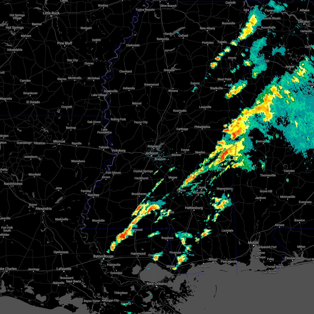 At 317 pm cdt, a severe thunderstorm was located over zero, or 9 miles southeast of meridian, moving northeast at 45 mph (radar indicated). Hazards include 60 mph wind gusts. Expect damage to roofs, siding, and trees. this severe storm will be near, increase around 325 pm cdt. alamucha and toomsuba around 335 pm cdt. kewanee around 340 pm cdt. A tornado watch remains in effect until 800 pm cdt for east central mississippi. At 317 pm cdt, a severe thunderstorm was located over zero, or 9 miles southeast of meridian, moving northeast at 45 mph (radar indicated). Hazards include 60 mph wind gusts. Expect damage to roofs, siding, and trees. this severe storm will be near, increase around 325 pm cdt. alamucha and toomsuba around 335 pm cdt. kewanee around 340 pm cdt. A tornado watch remains in effect until 800 pm cdt for east central mississippi.
|
| 3/25/2021 3:09 PM CDT |
 At 308 pm cdt, a severe thunderstorm was located near savoy, or 10 miles south of meridian, moving northeast at 45 mph (radar indicated). Hazards include 60 mph wind gusts. Expect damage to roofs, siding, and trees. this severe thunderstorm will be near, zero and increase around 320 pm cdt. alamucha and toomsuba around 330 pm cdt. kewanee around 335 pm cdt. A tornado watch remains in effect until 800 pm cdt for east central mississippi. At 308 pm cdt, a severe thunderstorm was located near savoy, or 10 miles south of meridian, moving northeast at 45 mph (radar indicated). Hazards include 60 mph wind gusts. Expect damage to roofs, siding, and trees. this severe thunderstorm will be near, zero and increase around 320 pm cdt. alamucha and toomsuba around 330 pm cdt. kewanee around 335 pm cdt. A tornado watch remains in effect until 800 pm cdt for east central mississippi.
|
| 3/25/2021 2:59 PM CDT |
 A severe thunderstorm warning remains in effect until 315 pm cdt for northern clarke and eastern lauderdale counties. at 258 pm cdt, a severe thunderstorm was located near stonewall, or 10 miles northwest of quitman, moving northeast at 55 mph. hazard. 60 mph wind gusts. source. Radar indicated. A severe thunderstorm warning remains in effect until 315 pm cdt for northern clarke and eastern lauderdale counties. at 258 pm cdt, a severe thunderstorm was located near stonewall, or 10 miles northwest of quitman, moving northeast at 55 mph. hazard. 60 mph wind gusts. source. Radar indicated.
|
| 3/25/2021 2:58 PM CDT |
 At 258 pm cdt, a severe thunderstorm capable of producing a tornado was located over meridian station, moving northeast at 40 mph (radar indicated rotation). Hazards include tornado. Flying debris will be dangerous to those caught without shelter. mobile homes will be damaged or destroyed. damage to roofs, windows, and vehicles will occur. tree damage is likely. this dangerous storm will be near, lauderdale around 305 pm cdt. Tamola around 310 pm cdt. At 258 pm cdt, a severe thunderstorm capable of producing a tornado was located over meridian station, moving northeast at 40 mph (radar indicated rotation). Hazards include tornado. Flying debris will be dangerous to those caught without shelter. mobile homes will be damaged or destroyed. damage to roofs, windows, and vehicles will occur. tree damage is likely. this dangerous storm will be near, lauderdale around 305 pm cdt. Tamola around 310 pm cdt.
|
| 3/25/2021 2:48 PM CDT |
 At 248 pm cdt, a severe thunderstorm was located over paulding, or 16 miles west of quitman, moving east at 50 mph (radar indicated). Hazards include 60 mph wind gusts. Expect damage to roofs, siding, and trees. this severe storm will be near, orange around 255 pm cdt. stonewall around 305 pm cdt. sable and middleton around 315 pm cdt. zero around 320 pm cdt. snell and increase around 325 pm cdt. alamucha around 330 pm cdt. A tornado watch remains in effect until 800 pm cdt for east central mississippi. At 248 pm cdt, a severe thunderstorm was located over paulding, or 16 miles west of quitman, moving east at 50 mph (radar indicated). Hazards include 60 mph wind gusts. Expect damage to roofs, siding, and trees. this severe storm will be near, orange around 255 pm cdt. stonewall around 305 pm cdt. sable and middleton around 315 pm cdt. zero around 320 pm cdt. snell and increase around 325 pm cdt. alamucha around 330 pm cdt. A tornado watch remains in effect until 800 pm cdt for east central mississippi.
|
| 3/25/2021 2:47 PM CDT |
 At 247 pm cdt, a severe thunderstorm capable of producing a tornado was located over nellieburg, or near meridian, moving northeast at 40 mph (radar indicated rotation). Hazards include tornado. Flying debris will be dangerous to those caught without shelter. mobile homes will be damaged or destroyed. damage to roofs, windows, and vehicles will occur. tree damage is likely. this dangerous storm will be near, marion around 255 pm cdt. meridian station around 305 pm cdt. lauderdale around 310 pm cdt. Tamola around 315 pm cdt. At 247 pm cdt, a severe thunderstorm capable of producing a tornado was located over nellieburg, or near meridian, moving northeast at 40 mph (radar indicated rotation). Hazards include tornado. Flying debris will be dangerous to those caught without shelter. mobile homes will be damaged or destroyed. damage to roofs, windows, and vehicles will occur. tree damage is likely. this dangerous storm will be near, marion around 255 pm cdt. meridian station around 305 pm cdt. lauderdale around 310 pm cdt. Tamola around 315 pm cdt.
|
| 3/25/2021 2:37 PM CDT |
 At 236 pm cdt, a severe thunderstorm was located near turnerville, or 14 miles northeast of stringer, moving northeast at 40 mph (radar indicated). Hazards include 60 mph wind gusts. Expect damage to roofs, siding, and trees. this severe storm will be near, paulding around 245 pm cdt. rose hill around 250 pm cdt. orange around 255 pm cdt. stonewall around 305 pm cdt. savoy around 315 pm cdt. sable and middleton around 320 pm cdt. zero around 325 pm cdt. increase and snell around 330 pm cdt. A tornado watch remains in effect until 800 pm cdt for east central mississippi. At 236 pm cdt, a severe thunderstorm was located near turnerville, or 14 miles northeast of stringer, moving northeast at 40 mph (radar indicated). Hazards include 60 mph wind gusts. Expect damage to roofs, siding, and trees. this severe storm will be near, paulding around 245 pm cdt. rose hill around 250 pm cdt. orange around 255 pm cdt. stonewall around 305 pm cdt. savoy around 315 pm cdt. sable and middleton around 320 pm cdt. zero around 325 pm cdt. increase and snell around 330 pm cdt. A tornado watch remains in effect until 800 pm cdt for east central mississippi.
|
| 3/25/2021 2:35 PM CDT |
 At 235 pm cdt, a severe thunderstorm capable of producing a tornado was located over meehan, or 9 miles west of meridian, moving northeast at 40 mph (radar indicated rotation). Hazards include tornado. Flying debris will be dangerous to those caught without shelter. mobile homes will be damaged or destroyed. damage to roofs, windows, and vehicles will occur. tree damage is likely. this dangerous storm will be near, meridian, nellieburg and suqualena around 245 pm cdt. marion around 255 pm cdt. meridian station and toomsuba around 305 pm cdt. lauderdale and kewanee around 310 pm cdt. Tamola around 315 pm cdt. At 235 pm cdt, a severe thunderstorm capable of producing a tornado was located over meehan, or 9 miles west of meridian, moving northeast at 40 mph (radar indicated rotation). Hazards include tornado. Flying debris will be dangerous to those caught without shelter. mobile homes will be damaged or destroyed. damage to roofs, windows, and vehicles will occur. tree damage is likely. this dangerous storm will be near, meridian, nellieburg and suqualena around 245 pm cdt. marion around 255 pm cdt. meridian station and toomsuba around 305 pm cdt. lauderdale and kewanee around 310 pm cdt. Tamola around 315 pm cdt.
|
| 3/25/2021 2:29 PM CDT |
 At 229 pm cdt, a severe thunderstorm capable of producing a tornado was located near meehan, or 11 miles east of newton, moving northeast at 40 mph (radar indicated rotation). Hazards include tornado. Flying debris will be dangerous to those caught without shelter. mobile homes will be damaged or destroyed. damage to roofs, windows, and vehicles will occur. tree damage is likely. this dangerous storm will be near, meehan around 235 pm cdt. nellieburg, suqualena and savoy around 245 pm cdt. meridian around 250 pm cdt. marion around 300 pm cdt. meridian station around 305 pm cdt. toomsuba around 310 pm cdt. lauderdale and kewanee around 315 pm cdt. tamola around 320 pm cdt. Other locations impacted by this tornadic thunderstorm include chunky and hickory. At 229 pm cdt, a severe thunderstorm capable of producing a tornado was located near meehan, or 11 miles east of newton, moving northeast at 40 mph (radar indicated rotation). Hazards include tornado. Flying debris will be dangerous to those caught without shelter. mobile homes will be damaged or destroyed. damage to roofs, windows, and vehicles will occur. tree damage is likely. this dangerous storm will be near, meehan around 235 pm cdt. nellieburg, suqualena and savoy around 245 pm cdt. meridian around 250 pm cdt. marion around 300 pm cdt. meridian station around 305 pm cdt. toomsuba around 310 pm cdt. lauderdale and kewanee around 315 pm cdt. tamola around 320 pm cdt. Other locations impacted by this tornadic thunderstorm include chunky and hickory.
|
| 3/25/2021 2:26 PM CDT |
 At 226 pm cdt, a severe thunderstorm was located near meehan, or 11 miles east of newton, moving northeast at 45 mph (radar indicated). Hazards include 60 mph wind gusts. Expect damage to roofs, siding, and trees. this severe storm will be near, meehan around 235 pm cdt. nellieburg and suqualena around 240 pm cdt. meridian around 245 pm cdt. marion around 255 pm cdt. meridian station around 300 pm cdt. lauderdale and toomsuba around 305 pm cdt. kewanee around 310 pm cdt. other locations impacted by this severe thunderstorm include louin, chunky and hickory. A tornado watch remains in effect until 800 pm cdt for east central mississippi. At 226 pm cdt, a severe thunderstorm was located near meehan, or 11 miles east of newton, moving northeast at 45 mph (radar indicated). Hazards include 60 mph wind gusts. Expect damage to roofs, siding, and trees. this severe storm will be near, meehan around 235 pm cdt. nellieburg and suqualena around 240 pm cdt. meridian around 245 pm cdt. marion around 255 pm cdt. meridian station around 300 pm cdt. lauderdale and toomsuba around 305 pm cdt. kewanee around 310 pm cdt. other locations impacted by this severe thunderstorm include louin, chunky and hickory. A tornado watch remains in effect until 800 pm cdt for east central mississippi.
|
| 3/25/2021 2:17 PM CDT |
 At 217 pm cdt, a severe thunderstorm was located near newton, moving northeast at 55 mph (radar indicated). Hazards include 60 mph wind gusts. Expect damage to roofs, siding, and trees. this severe storm will be near, meehan and duffee around 230 pm cdt. meridian, suqualena and nellieburg around 235 pm cdt. marion around 245 pm cdt. meridian station and daleville around 250 pm cdt. lauderdale around 255 pm cdt. other locations impacted by this severe thunderstorm include louin, chunky and hickory. A tornado watch remains in effect until 800 pm cdt for east central mississippi. At 217 pm cdt, a severe thunderstorm was located near newton, moving northeast at 55 mph (radar indicated). Hazards include 60 mph wind gusts. Expect damage to roofs, siding, and trees. this severe storm will be near, meehan and duffee around 230 pm cdt. meridian, suqualena and nellieburg around 235 pm cdt. marion around 245 pm cdt. meridian station and daleville around 250 pm cdt. lauderdale around 255 pm cdt. other locations impacted by this severe thunderstorm include louin, chunky and hickory. A tornado watch remains in effect until 800 pm cdt for east central mississippi.
|
| 3/25/2021 1:54 PM CDT |
 At 154 pm cdt, a severe thunderstorm was located near pineville, or 14 miles southwest of newton, moving northeast at 55 mph (radar indicated). Hazards include 60 mph wind gusts. Expect damage to roofs, siding, and trees. this severe thunderstorm will be near, roberts around 200 pm cdt. garlandville around 205 pm cdt. newton around 210 pm cdt. meehan around 225 pm cdt. nellieburg and suqualena around 230 pm cdt. meridian around 235 pm cdt. marion around 240 pm cdt. meridian station and daleville around 245 pm cdt. other locations impacted by this severe thunderstorm include chunky, montrose, louin and hickory. A tornado watch remains in effect until 800 pm cdt for east central mississippi. At 154 pm cdt, a severe thunderstorm was located near pineville, or 14 miles southwest of newton, moving northeast at 55 mph (radar indicated). Hazards include 60 mph wind gusts. Expect damage to roofs, siding, and trees. this severe thunderstorm will be near, roberts around 200 pm cdt. garlandville around 205 pm cdt. newton around 210 pm cdt. meehan around 225 pm cdt. nellieburg and suqualena around 230 pm cdt. meridian around 235 pm cdt. marion around 240 pm cdt. meridian station and daleville around 245 pm cdt. other locations impacted by this severe thunderstorm include chunky, montrose, louin and hickory. A tornado watch remains in effect until 800 pm cdt for east central mississippi.
|
| 3/17/2021 1:00 PM CDT |
 At 100 pm cdt, a severe thunderstorm was located near porterville, or 14 miles north of lauderdale, moving north at 45 mph (radar indicated). Hazards include 60 mph wind gusts and nickel size hail. Expect damage to roofs, siding, and trees. this severe thunderstorm will be near, cooksville and paulette around 125 pm cdt. other locations impacted by this severe thunderstorm include scooba. A tornado watch remains in effect until 700 pm cdt for east central mississippi. At 100 pm cdt, a severe thunderstorm was located near porterville, or 14 miles north of lauderdale, moving north at 45 mph (radar indicated). Hazards include 60 mph wind gusts and nickel size hail. Expect damage to roofs, siding, and trees. this severe thunderstorm will be near, cooksville and paulette around 125 pm cdt. other locations impacted by this severe thunderstorm include scooba. A tornado watch remains in effect until 700 pm cdt for east central mississippi.
|
| 8/16/2020 4:14 PM CDT | Tree down on a car along 36th av in lauderdale county MS, 1.1 miles NE of Meridian, MS |
| 8/16/2020 3:40 PM CDT |
 At 340 pm cdt, severe thunderstorms were located along a line extending from near de kalb to damascus to near philadelphia, moving south at 30 mph (radar indicated). Hazards include 60 mph wind gusts and nickel size hail. Expect damage to roofs, siding, and trees. severe thunderstorms will be near, herbert springs around 345 pm cdt. prismatic and porterville around 350 pm cdt. martin, blackwater and house around 355 pm cdt. daleville and duffee around 400 pm cdt. meridian station and tamola around 405 pm cdt. lauderdale, stratton, suqualena and little rock around 410 pm cdt. meridian, decatur, marion and nellieburg around 420 pm cdt. toomsuba, kewanee and meehan around 425 pm cdt. Other locations impacted by these severe thunderstorms include chunky and hickory. At 340 pm cdt, severe thunderstorms were located along a line extending from near de kalb to damascus to near philadelphia, moving south at 30 mph (radar indicated). Hazards include 60 mph wind gusts and nickel size hail. Expect damage to roofs, siding, and trees. severe thunderstorms will be near, herbert springs around 345 pm cdt. prismatic and porterville around 350 pm cdt. martin, blackwater and house around 355 pm cdt. daleville and duffee around 400 pm cdt. meridian station and tamola around 405 pm cdt. lauderdale, stratton, suqualena and little rock around 410 pm cdt. meridian, decatur, marion and nellieburg around 420 pm cdt. toomsuba, kewanee and meehan around 425 pm cdt. Other locations impacted by these severe thunderstorms include chunky and hickory.
|
| 8/11/2020 8:51 PM CDT | Tree down on power line in lauderdale county MS, 10.1 miles NW of Meridian, MS |
| 8/11/2020 8:35 PM CDT | Social media picture of a tree down in the zero communit in lauderdale county MS, 6.1 miles NNW of Meridian, MS |
| 8/11/2020 8:11 PM CDT |
 At 811 pm cdt, a severe thunderstorm was located over sable, or 10 miles south of meridian, moving east at 15 mph (radar indicated). Hazards include 60 mph wind gusts and quarter size hail. Hail damage to vehicles is expected. expect wind damage to roofs, siding, and trees. this severe thunderstorm will be near, sable around 815 pm cdt. zero around 820 pm cdt. middleton around 840 pm cdt. increase around 845 pm cdt. Snell around 900 pm cdt. At 811 pm cdt, a severe thunderstorm was located over sable, or 10 miles south of meridian, moving east at 15 mph (radar indicated). Hazards include 60 mph wind gusts and quarter size hail. Hail damage to vehicles is expected. expect wind damage to roofs, siding, and trees. this severe thunderstorm will be near, sable around 815 pm cdt. zero around 820 pm cdt. middleton around 840 pm cdt. increase around 845 pm cdt. Snell around 900 pm cdt.
|
| 7/15/2020 3:36 PM CDT |
 At 336 pm cdt, a severe thunderstorm was located near orange, or 7 miles west of quitman, moving west at 10 mph (radar indicated). Hazards include 60 mph wind gusts and quarter size hail. Hail damage to vehicles is expected. expect wind damage to roofs, siding, and trees. this severe thunderstorm will be near, orange around 355 pm cdt. barnett and paulding around 400 pm cdt. Other locations impacted by this severe thunderstorm include pachuta. At 336 pm cdt, a severe thunderstorm was located near orange, or 7 miles west of quitman, moving west at 10 mph (radar indicated). Hazards include 60 mph wind gusts and quarter size hail. Hail damage to vehicles is expected. expect wind damage to roofs, siding, and trees. this severe thunderstorm will be near, orange around 355 pm cdt. barnett and paulding around 400 pm cdt. Other locations impacted by this severe thunderstorm include pachuta.
|
| 6/25/2020 7:28 PM CDT |
 At 728 pm cdt, severe thunderstorms were located along a line extending from near gholson to near electric mills to near york, moving northeast at 40 mph (radar indicated). Hazards include 60 mph wind gusts. Expect damage to roofs, siding, and trees. These severe thunderstorms will remain over mainly rural areas of kemper and eastern lauderdale counties, including the following locations, scooba. At 728 pm cdt, severe thunderstorms were located along a line extending from near gholson to near electric mills to near york, moving northeast at 40 mph (radar indicated). Hazards include 60 mph wind gusts. Expect damage to roofs, siding, and trees. These severe thunderstorms will remain over mainly rural areas of kemper and eastern lauderdale counties, including the following locations, scooba.
|
| 6/25/2020 7:22 PM CDT |
 At 722 pm cdt, severe thunderstorms were located along a line extending from near preston to near gholson to near porterville to cuba, moving north at 45 mph (radar indicated). Hazards include 60 mph wind gusts. Expect damage to roofs, siding, and trees. these severe storms will be near, preston around 725 pm cdt. electric mills around 730 pm cdt. Other locations impacted by these severe thunderstorms include scooba. At 722 pm cdt, severe thunderstorms were located along a line extending from near preston to near gholson to near porterville to cuba, moving north at 45 mph (radar indicated). Hazards include 60 mph wind gusts. Expect damage to roofs, siding, and trees. these severe storms will be near, preston around 725 pm cdt. electric mills around 730 pm cdt. Other locations impacted by these severe thunderstorms include scooba.
|
| 6/25/2020 7:17 PM CDT |
 At 717 pm cdt, severe thunderstorms were located along a line extending from near nanih waiya to near de kalb to near tamola to near cuba, moving northeast at 35 mph (radar indicated). Hazards include 60 mph wind gusts. Expect damage to roofs, siding, and trees. these severe storms will be near, porterville around 725 pm cdt. electric mills around 735 pm cdt. Other locations impacted by these severe thunderstorms include tucker and scooba. At 717 pm cdt, severe thunderstorms were located along a line extending from near nanih waiya to near de kalb to near tamola to near cuba, moving northeast at 35 mph (radar indicated). Hazards include 60 mph wind gusts. Expect damage to roofs, siding, and trees. these severe storms will be near, porterville around 725 pm cdt. electric mills around 735 pm cdt. Other locations impacted by these severe thunderstorms include tucker and scooba.
|
| 6/25/2020 7:00 PM CDT | Two houses with trees on them in meridian - one on the 4600 block of 17th street and one on the 300 block of 27th street. another tree down on power lines on the 3800 b in lauderdale county MS, 0.7 miles NNE of Meridian, MS |
| 6/25/2020 6:58 PM CDT |
 At 637 pm cdt, severe thunderstorms were located along a line extending from near dowdville to near neshoba to near meehan to near sable to near quitman, moving northeast at 40 mph (radar indicated). Hazards include 60 mph wind gusts. Expect damage to roofs, siding, and trees. these severe storms will be near, sable and savoy around 640 pm cdt. meridian, philadelphia, bethsaida, suqualena, sykes, nellieburg, house, middleton and crandall around 645 pm cdt. zero around 650 pm cdt. marion, burnside, increase and forestdale around 655 pm cdt. daleville, snell, stallo and prismatic around 700 pm cdt. meridian station, bluff springs and blackwater around 705 pm cdt. lauderdale, preston, alamucha and toomsuba around 710 pm cdt. nanih waiya, de kalb and kewanee around 715 pm cdt. Other locations impacted by these severe thunderstorms include pachuta, tucker, shubuta and scooba. At 637 pm cdt, severe thunderstorms were located along a line extending from near dowdville to near neshoba to near meehan to near sable to near quitman, moving northeast at 40 mph (radar indicated). Hazards include 60 mph wind gusts. Expect damage to roofs, siding, and trees. these severe storms will be near, sable and savoy around 640 pm cdt. meridian, philadelphia, bethsaida, suqualena, sykes, nellieburg, house, middleton and crandall around 645 pm cdt. zero around 650 pm cdt. marion, burnside, increase and forestdale around 655 pm cdt. daleville, snell, stallo and prismatic around 700 pm cdt. meridian station, bluff springs and blackwater around 705 pm cdt. lauderdale, preston, alamucha and toomsuba around 710 pm cdt. nanih waiya, de kalb and kewanee around 715 pm cdt. Other locations impacted by these severe thunderstorms include pachuta, tucker, shubuta and scooba.
|
| 6/25/2020 6:37 PM CDT |
 At 637 pm cdt, severe thunderstorms were located along a line extending from near dowdville to near neshoba to near meehan to near sable to near quitman, moving northeast at 40 mph (radar indicated). Hazards include 60 mph wind gusts. Expect damage to roofs, siding, and trees. these severe storms will be near, sable and savoy around 640 pm cdt. meridian, philadelphia, bethsaida, suqualena, sykes, nellieburg, house, middleton and crandall around 645 pm cdt. zero around 650 pm cdt. marion, burnside, increase and forestdale around 655 pm cdt. daleville, snell, stallo and prismatic around 700 pm cdt. meridian station, bluff springs and blackwater around 705 pm cdt. lauderdale, preston, alamucha and toomsuba around 710 pm cdt. nanih waiya, de kalb and kewanee around 715 pm cdt. Other locations impacted by these severe thunderstorms include pachuta, tucker, shubuta and scooba. At 637 pm cdt, severe thunderstorms were located along a line extending from near dowdville to near neshoba to near meehan to near sable to near quitman, moving northeast at 40 mph (radar indicated). Hazards include 60 mph wind gusts. Expect damage to roofs, siding, and trees. these severe storms will be near, sable and savoy around 640 pm cdt. meridian, philadelphia, bethsaida, suqualena, sykes, nellieburg, house, middleton and crandall around 645 pm cdt. zero around 650 pm cdt. marion, burnside, increase and forestdale around 655 pm cdt. daleville, snell, stallo and prismatic around 700 pm cdt. meridian station, bluff springs and blackwater around 705 pm cdt. lauderdale, preston, alamucha and toomsuba around 710 pm cdt. nanih waiya, de kalb and kewanee around 715 pm cdt. Other locations impacted by these severe thunderstorms include pachuta, tucker, shubuta and scooba.
|
| 6/25/2020 6:09 PM CDT |
 At 609 pm cdt, severe thunderstorms were located along a line extending from conehatta to stafford springs, moving northeast at 60 mph (radar indicated). Hazards include 60 mph wind gusts. Expect damage to roofs, siding, and trees. severe thunderstorms will be near, quitman and dixon around 620 pm cdt. neshoba, stonewall and house around 625 pm cdt. philadelphia, sable, bethsaida and middleton around 630 pm cdt. forestdale, savoy and burnside around 635 pm cdt. zero and increase around 640 pm cdt. nanih waiya, preston and marion around 645 pm cdt. toomsuba and alamucha around 650 pm cdt. lauderdale and kewanee around 655 pm cdt. Other locations impacted by these severe thunderstorms include pachuta, tucker, shubuta and scooba. At 609 pm cdt, severe thunderstorms were located along a line extending from conehatta to stafford springs, moving northeast at 60 mph (radar indicated). Hazards include 60 mph wind gusts. Expect damage to roofs, siding, and trees. severe thunderstorms will be near, quitman and dixon around 620 pm cdt. neshoba, stonewall and house around 625 pm cdt. philadelphia, sable, bethsaida and middleton around 630 pm cdt. forestdale, savoy and burnside around 635 pm cdt. zero and increase around 640 pm cdt. nanih waiya, preston and marion around 645 pm cdt. toomsuba and alamucha around 650 pm cdt. lauderdale and kewanee around 655 pm cdt. Other locations impacted by these severe thunderstorms include pachuta, tucker, shubuta and scooba.
|
| 6/24/2020 3:13 PM CDT |
 At 313 pm cdt, a severe thunderstorm was located over zero, or near meridian, moving northeast at 15 mph (radar indicated). Hazards include 60 mph wind gusts. Expect damage to roofs, siding, and trees. this severe storm will be near, marion around 330 pm cdt. toomsuba around 355 pm cdt. Lauderdale and kewanee around 400 pm cdt. At 313 pm cdt, a severe thunderstorm was located over zero, or near meridian, moving northeast at 15 mph (radar indicated). Hazards include 60 mph wind gusts. Expect damage to roofs, siding, and trees. this severe storm will be near, marion around 330 pm cdt. toomsuba around 355 pm cdt. Lauderdale and kewanee around 400 pm cdt.
|
| 6/24/2020 2:41 PM CDT |
 The national weather service in jackson has issued a * severe thunderstorm warning for. lauderdale county in east central mississippi. until 330 pm cdt. At 241 pm cdt, a severe thunderstorm was located over marion, or near meridian, moving northeast at 25 mph. The national weather service in jackson has issued a * severe thunderstorm warning for. lauderdale county in east central mississippi. until 330 pm cdt. At 241 pm cdt, a severe thunderstorm was located over marion, or near meridian, moving northeast at 25 mph.
|
| 6/5/2020 6:59 PM CDT |
 At 636 pm cdt, severe thunderstorms were located along a line extending from near york to near meehan to near roberts, moving south at 35 mph (radar indicated). Hazards include 60 mph wind gusts. Expect damage to roofs, siding, and trees. these severe storms will be near, savoy and roberts around 640 pm cdt. alamucha around 650 pm cdt. rose hill around 700 pm cdt. Other locations impacted by these severe thunderstorms include chunky, montrose, louin and hickory. At 636 pm cdt, severe thunderstorms were located along a line extending from near york to near meehan to near roberts, moving south at 35 mph (radar indicated). Hazards include 60 mph wind gusts. Expect damage to roofs, siding, and trees. these severe storms will be near, savoy and roberts around 640 pm cdt. alamucha around 650 pm cdt. rose hill around 700 pm cdt. Other locations impacted by these severe thunderstorms include chunky, montrose, louin and hickory.
|
| 6/5/2020 6:50 PM CDT | Several trees down reported across the county...reported by lauderdale s in lauderdale county MS, 0.7 miles NNE of Meridian, MS |
| 6/5/2020 6:36 PM CDT |
 At 636 pm cdt, severe thunderstorms were located along a line extending from near york to near meehan to near roberts, moving south at 35 mph (radar indicated). Hazards include 60 mph wind gusts. Expect damage to roofs, siding, and trees. these severe storms will be near, savoy and roberts around 640 pm cdt. alamucha around 650 pm cdt. rose hill around 700 pm cdt. Other locations impacted by these severe thunderstorms include chunky, montrose, louin and hickory. At 636 pm cdt, severe thunderstorms were located along a line extending from near york to near meehan to near roberts, moving south at 35 mph (radar indicated). Hazards include 60 mph wind gusts. Expect damage to roofs, siding, and trees. these severe storms will be near, savoy and roberts around 640 pm cdt. alamucha around 650 pm cdt. rose hill around 700 pm cdt. Other locations impacted by these severe thunderstorms include chunky, montrose, louin and hickory.
|
| 6/5/2020 5:58 PM CDT |
 At 557 pm cdt, severe thunderstorms were located along a line extending from panola to near bluff springs to near prospect, moving south at 35 mph (radar indicated). Hazards include 60 mph wind gusts. Expect damage to roofs, siding, and trees. severe thunderstorms will be near, prospect around 605 pm cdt. stratton around 610 pm cdt. conehatta around 615 pm cdt. martin and daleville around 620 pm cdt. newton, lawrence and suqualena around 630 pm cdt. meridian and marion around 635 pm cdt. roberts and nellieburg around 640 pm cdt. garlandville around 645 pm cdt. Other locations impacted by these severe thunderstorms include chunky, montrose, louin and hickory. At 557 pm cdt, severe thunderstorms were located along a line extending from panola to near bluff springs to near prospect, moving south at 35 mph (radar indicated). Hazards include 60 mph wind gusts. Expect damage to roofs, siding, and trees. severe thunderstorms will be near, prospect around 605 pm cdt. stratton around 610 pm cdt. conehatta around 615 pm cdt. martin and daleville around 620 pm cdt. newton, lawrence and suqualena around 630 pm cdt. meridian and marion around 635 pm cdt. roberts and nellieburg around 640 pm cdt. garlandville around 645 pm cdt. Other locations impacted by these severe thunderstorms include chunky, montrose, louin and hickory.
|
| 5/26/2020 7:20 PM CDT | Tree down in the city of meridian. likely sub-severe gus in lauderdale county MS, 1.1 miles NE of Meridian, MS |
| 5/23/2020 4:36 PM CDT |
 At 436 pm cdt, a severe thunderstorm was located over duffee, or 14 miles northwest of meridian, moving north at 30 mph (radar indicated). Hazards include 60 mph wind gusts and penny size hail. Expect damage to roofs, siding, and trees. This severe storm will be near, martin around 445 pm cdt. At 436 pm cdt, a severe thunderstorm was located over duffee, or 14 miles northwest of meridian, moving north at 30 mph (radar indicated). Hazards include 60 mph wind gusts and penny size hail. Expect damage to roofs, siding, and trees. This severe storm will be near, martin around 445 pm cdt.
|
| 5/23/2020 4:32 PM CDT | Trees dow in lauderdale county MS, 12 miles E of Meridian, MS |
| 5/23/2020 4:25 PM CDT |
 At 425 pm cdt, a severe thunderstorm was located near meehan, or 13 miles west of meridian, moving north at 30 mph (radar indicated). Hazards include 60 mph wind gusts and penny size hail. Expect damage to roofs, siding, and trees. this severe storm will be near, duffee and suqualena around 440 pm cdt. little rock around 445 pm cdt. martin around 455 pm cdt. Other locations impacted by this severe thunderstorm include chunky and hickory. At 425 pm cdt, a severe thunderstorm was located near meehan, or 13 miles west of meridian, moving north at 30 mph (radar indicated). Hazards include 60 mph wind gusts and penny size hail. Expect damage to roofs, siding, and trees. this severe storm will be near, duffee and suqualena around 440 pm cdt. little rock around 445 pm cdt. martin around 455 pm cdt. Other locations impacted by this severe thunderstorm include chunky and hickory.
|
| 5/23/2020 4:10 PM CDT |
 At 410 pm cdt, a severe thunderstorm was located near rose hill, or 12 miles southeast of newton, moving north at 20 mph (radar indicated). Hazards include 60 mph wind gusts and quarter size hail. Hail damage to vehicles is expected. expect wind damage to roofs, siding, and trees. this severe thunderstorm will be near, meehan around 435 pm cdt. suqualena around 500 pm cdt. duffee around 505 pm cdt. little rock around 510 pm cdt. martin around 515 pm cdt. Other locations impacted by this severe thunderstorm include chunky and hickory. At 410 pm cdt, a severe thunderstorm was located near rose hill, or 12 miles southeast of newton, moving north at 20 mph (radar indicated). Hazards include 60 mph wind gusts and quarter size hail. Hail damage to vehicles is expected. expect wind damage to roofs, siding, and trees. this severe thunderstorm will be near, meehan around 435 pm cdt. suqualena around 500 pm cdt. duffee around 505 pm cdt. little rock around 510 pm cdt. martin around 515 pm cdt. Other locations impacted by this severe thunderstorm include chunky and hickory.
|
| 5/17/2020 3:40 PM CDT |
 The severe thunderstorm warning for southeastern kemper and northeastern lauderdale counties will expire at 345 pm cdt, the storm which prompted the warning has weakened below severe limits, and no longer poses an immediate threat to life or property. therefore, the warning will be allowed to expire. to report severe weather, contact your nearest law enforcement agency. they will relay your report to the national weather service jackson. The severe thunderstorm warning for southeastern kemper and northeastern lauderdale counties will expire at 345 pm cdt, the storm which prompted the warning has weakened below severe limits, and no longer poses an immediate threat to life or property. therefore, the warning will be allowed to expire. to report severe weather, contact your nearest law enforcement agency. they will relay your report to the national weather service jackson.
|
| 5/17/2020 3:22 PM CDT |
 At 322 pm cdt, a severe thunderstorm was located near marion, or 7 miles northeast of meridian, moving north at 30 mph (radar indicated). Hazards include 60 mph wind gusts and nickel size hail. Expect damage to roofs, siding, and trees. this severe thunderstorm will be near, lauderdale and meridian station around 335 pm cdt. daleville around 340 pm cdt. Tamola and blackwater around 345 pm cdt. At 322 pm cdt, a severe thunderstorm was located near marion, or 7 miles northeast of meridian, moving north at 30 mph (radar indicated). Hazards include 60 mph wind gusts and nickel size hail. Expect damage to roofs, siding, and trees. this severe thunderstorm will be near, lauderdale and meridian station around 335 pm cdt. daleville around 340 pm cdt. Tamola and blackwater around 345 pm cdt.
|
| 4/23/2020 3:23 AM CDT | Tree downed on a trailer on valley r in lauderdale county MS, 3.4 miles NE of Meridian, MS |
| 4/23/2020 3:21 AM CDT |
 At 320 am cdt, a severe thunderstorm was located near zero, or near meridian, moving east at 60 mph (radar indicated). Hazards include 60 mph wind gusts and nickel size hail. Expect damage to roofs, siding, and trees. this severe storm will be near, increase around 330 am cdt. alamucha, kewanee and toomsuba around 335 am cdt. A tornado watch remains in effect until 700 am cdt for east central mississippi. At 320 am cdt, a severe thunderstorm was located near zero, or near meridian, moving east at 60 mph (radar indicated). Hazards include 60 mph wind gusts and nickel size hail. Expect damage to roofs, siding, and trees. this severe storm will be near, increase around 330 am cdt. alamucha, kewanee and toomsuba around 335 am cdt. A tornado watch remains in effect until 700 am cdt for east central mississippi.
|
| 4/23/2020 3:09 AM CDT |
 At 309 am cdt, a severe thunderstorm was located near meehan, or 13 miles southwest of meridian, moving east at 60 mph (radar indicated). Hazards include 60 mph wind gusts and nickel size hail. Expect damage to roofs, siding, and trees. this severe thunderstorm will be near, savoy around 315 am cdt. meridian and nellieburg around 320 am cdt. marion and zero around 325 am cdt. increase around 330 am cdt. alamucha and toomsuba around 335 am cdt. kewanee around 340 am cdt. Other locations impacted by this severe thunderstorm include chunky. At 309 am cdt, a severe thunderstorm was located near meehan, or 13 miles southwest of meridian, moving east at 60 mph (radar indicated). Hazards include 60 mph wind gusts and nickel size hail. Expect damage to roofs, siding, and trees. this severe thunderstorm will be near, savoy around 315 am cdt. meridian and nellieburg around 320 am cdt. marion and zero around 325 am cdt. increase around 330 am cdt. alamucha and toomsuba around 335 am cdt. kewanee around 340 am cdt. Other locations impacted by this severe thunderstorm include chunky.
|
| 4/19/2020 5:10 PM CDT |
 At 509 pm cdt, severe thunderstorms were located along a line extending from near zero to near middleton to near stafford springs, moving east at 60 mph (radar indicated. at 502 pm, a 54 mph wind gust was reported at the meridian regional airport). Hazards include 60 mph wind gusts. Expect damage to roofs, siding, and trees. these severe storms will be near, snell, increase, toomsuba, middleton and sykes around 515 pm cdt. quitman, alamucha and kewanee around 520 pm cdt. crandall around 530 pm cdt. other locations impacted by these severe thunderstorms include pachuta. A tornado watch remains in effect until 700 pm cdt for east central mississippi. At 509 pm cdt, severe thunderstorms were located along a line extending from near zero to near middleton to near stafford springs, moving east at 60 mph (radar indicated. at 502 pm, a 54 mph wind gust was reported at the meridian regional airport). Hazards include 60 mph wind gusts. Expect damage to roofs, siding, and trees. these severe storms will be near, snell, increase, toomsuba, middleton and sykes around 515 pm cdt. quitman, alamucha and kewanee around 520 pm cdt. crandall around 530 pm cdt. other locations impacted by these severe thunderstorms include pachuta. A tornado watch remains in effect until 700 pm cdt for east central mississippi.
|
| 4/19/2020 4:55 PM CDT |
 At 455 pm cdt, severe thunderstorms were located along a line extending from meehan to near stonewall to 7 miles southeast of turnerville, moving east at 60 mph (radar indicated). Hazards include 60 mph wind gusts. Expect damage to roofs, siding, and trees. these severe storms will be near, meridian, stonewall, nellieburg, savoy and meehan around 500 pm cdt. marion, sable and zero around 505 pm cdt. middleton, goodwater, barnett and sykes around 510 pm cdt. snell, toomsuba and increase around 515 pm cdt. quitman, alamucha, de soto and kewanee around 520 pm cdt. crandall around 530 pm cdt. other locations impacted by these severe thunderstorms include pachuta. A tornado watch remains in effect until 700 pm cdt for east central mississippi. At 455 pm cdt, severe thunderstorms were located along a line extending from meehan to near stonewall to 7 miles southeast of turnerville, moving east at 60 mph (radar indicated). Hazards include 60 mph wind gusts. Expect damage to roofs, siding, and trees. these severe storms will be near, meridian, stonewall, nellieburg, savoy and meehan around 500 pm cdt. marion, sable and zero around 505 pm cdt. middleton, goodwater, barnett and sykes around 510 pm cdt. snell, toomsuba and increase around 515 pm cdt. quitman, alamucha, de soto and kewanee around 520 pm cdt. crandall around 530 pm cdt. other locations impacted by these severe thunderstorms include pachuta. A tornado watch remains in effect until 700 pm cdt for east central mississippi.
|
| 4/19/2020 4:53 PM CDT | Trees were blown down along gilbert joyner road in far northern lauderdale county. time estimated from rada in lauderdale county MS, 13.6 miles SSE of Meridian, MS |
| 4/19/2020 4:39 PM CDT |
 At 439 pm cdt, severe thunderstorms were located along a line extending from near newton to near garlandville to 7 miles north of taylorsville, moving east at 65 mph (radar indicated). Hazards include 60 mph wind gusts. Expect damage to roofs, siding, and trees. severe thunderstorms will be near, rose hill and garlandville around 445 pm cdt. turnerville and orange around 450 pm cdt. meehan and vernon around 455 pm cdt. meridian, stonewall, nellieburg, savoy and paulding around 500 pm cdt. marion, heidelberg, sable, stafford springs and zero around 505 pm cdt. barnett, increase, goodwater and middleton around 510 pm cdt. toomsuba, alamucha and snell around 515 pm cdt. quitman, de soto and kewanee around 520 pm cdt. other locations impacted by these severe thunderstorms include pachuta, chunky, shubuta and hickory. A tornado watch remains in effect until 700 pm cdt for southeastern and east central mississippi. At 439 pm cdt, severe thunderstorms were located along a line extending from near newton to near garlandville to 7 miles north of taylorsville, moving east at 65 mph (radar indicated). Hazards include 60 mph wind gusts. Expect damage to roofs, siding, and trees. severe thunderstorms will be near, rose hill and garlandville around 445 pm cdt. turnerville and orange around 450 pm cdt. meehan and vernon around 455 pm cdt. meridian, stonewall, nellieburg, savoy and paulding around 500 pm cdt. marion, heidelberg, sable, stafford springs and zero around 505 pm cdt. barnett, increase, goodwater and middleton around 510 pm cdt. toomsuba, alamucha and snell around 515 pm cdt. quitman, de soto and kewanee around 520 pm cdt. other locations impacted by these severe thunderstorms include pachuta, chunky, shubuta and hickory. A tornado watch remains in effect until 700 pm cdt for southeastern and east central mississippi.
|
| 4/12/2020 7:57 PM CDT |
 The severe thunderstorm warning for southeastern kemper and northeastern lauderdale counties will expire at 800 pm cdt, the storm which prompted the warning has weakened below severe limits, and no longer poses an immediate threat to life or property. therefore, the warning will be allowed to expire. however, gusty winds and heavy rain are still possible with this thunderstorm. a tornado watch remains in effect until 900 pm cdt for east central mississippi. The severe thunderstorm warning for southeastern kemper and northeastern lauderdale counties will expire at 800 pm cdt, the storm which prompted the warning has weakened below severe limits, and no longer poses an immediate threat to life or property. therefore, the warning will be allowed to expire. however, gusty winds and heavy rain are still possible with this thunderstorm. a tornado watch remains in effect until 900 pm cdt for east central mississippi.
|
| 4/12/2020 7:38 PM CDT |
 At 738 pm cdt, a severe thunderstorm was located near martin, or 9 miles west of meridian station, moving northeast at 35 mph (radar indicated). Hazards include 60 mph wind gusts. Expect damage to roofs, siding, and trees. this severe storm will be near, meridian station, blackwater and daleville around 750 pm cdt. tamola around 805 pm cdt. porterville and electric mills around 815 pm cdt. A tornado watch remains in effect until 800 pm cdt for east central mississippi. At 738 pm cdt, a severe thunderstorm was located near martin, or 9 miles west of meridian station, moving northeast at 35 mph (radar indicated). Hazards include 60 mph wind gusts. Expect damage to roofs, siding, and trees. this severe storm will be near, meridian station, blackwater and daleville around 750 pm cdt. tamola around 805 pm cdt. porterville and electric mills around 815 pm cdt. A tornado watch remains in effect until 800 pm cdt for east central mississippi.
|
| 4/12/2020 7:06 PM CDT |
 At 706 pm cdt, a severe thunderstorm was located over meridian station, moving northeast at 60 mph (radar indicated). Hazards include 60 mph wind gusts. Expect damage to roofs, siding, and trees. this severe storm will be near, porterville and tamola around 715 pm cdt. electric mills around 720 pm cdt. A tornado watch remains in effect until 800 pm cdt for east central mississippi. At 706 pm cdt, a severe thunderstorm was located over meridian station, moving northeast at 60 mph (radar indicated). Hazards include 60 mph wind gusts. Expect damage to roofs, siding, and trees. this severe storm will be near, porterville and tamola around 715 pm cdt. electric mills around 720 pm cdt. A tornado watch remains in effect until 800 pm cdt for east central mississippi.
|
| 4/12/2020 6:55 PM CDT |
 At 655 pm cdt, a severe thunderstorm was located near suqualena, or 8 miles northwest of meridian, moving northeast at 60 mph (radar indicated). Hazards include 60 mph wind gusts and quarter size hail. Hail damage to vehicles is expected. expect wind damage to roofs, siding, and trees. this severe thunderstorm will be near, prismatic around 700 pm cdt. meridian station, daleville and blackwater around 705 pm cdt. lauderdale around 710 pm cdt. porterville and tamola around 715 pm cdt. electric mills around 720 pm cdt. A tornado watch remains in effect until 800 pm cdt for east central mississippi. At 655 pm cdt, a severe thunderstorm was located near suqualena, or 8 miles northwest of meridian, moving northeast at 60 mph (radar indicated). Hazards include 60 mph wind gusts and quarter size hail. Hail damage to vehicles is expected. expect wind damage to roofs, siding, and trees. this severe thunderstorm will be near, prismatic around 700 pm cdt. meridian station, daleville and blackwater around 705 pm cdt. lauderdale around 710 pm cdt. porterville and tamola around 715 pm cdt. electric mills around 720 pm cdt. A tornado watch remains in effect until 800 pm cdt for east central mississippi.
|
| 4/12/2020 6:03 PM CDT |
 At 603 pm cdt, a confirmed tornado was located near toomsuba, or near lauderdale, moving northeast at 50 mph (weather spotters confirmed tornado). Hazards include damaging tornado. Flying debris will be dangerous to those caught without shelter. mobile homes will be damaged or destroyed. damage to roofs, windows, and vehicles will occur. tree damage is likely. this tornado will be near, tamola around 615 pm cdt. porterville around 620 pm cdt. electric mills around 630 pm cdt. Other locations impacted by this tornadic thunderstorm include scooba. At 603 pm cdt, a confirmed tornado was located near toomsuba, or near lauderdale, moving northeast at 50 mph (weather spotters confirmed tornado). Hazards include damaging tornado. Flying debris will be dangerous to those caught without shelter. mobile homes will be damaged or destroyed. damage to roofs, windows, and vehicles will occur. tree damage is likely. this tornado will be near, tamola around 615 pm cdt. porterville around 620 pm cdt. electric mills around 630 pm cdt. Other locations impacted by this tornadic thunderstorm include scooba.
|
| 4/12/2020 5:54 PM CDT |
 At 554 pm cdt, a severe thunderstorm capable of producing a tornado was located near zero, or near meridian, moving northeast at 50 mph (radar indicated rotation). Hazards include tornado. Flying debris will be dangerous to those caught without shelter. mobile homes will be damaged or destroyed. damage to roofs, windows, and vehicles will occur. tree damage is likely. this dangerous storm will be near, toomsuba around 600 pm cdt. meridian station and kewanee around 605 pm cdt. lauderdale around 610 pm cdt. tamola around 615 pm cdt. porterville around 620 pm cdt. electric mills around 630 pm cdt. Other locations impacted by this tornadic thunderstorm include scooba. At 554 pm cdt, a severe thunderstorm capable of producing a tornado was located near zero, or near meridian, moving northeast at 50 mph (radar indicated rotation). Hazards include tornado. Flying debris will be dangerous to those caught without shelter. mobile homes will be damaged or destroyed. damage to roofs, windows, and vehicles will occur. tree damage is likely. this dangerous storm will be near, toomsuba around 600 pm cdt. meridian station and kewanee around 605 pm cdt. lauderdale around 610 pm cdt. tamola around 615 pm cdt. porterville around 620 pm cdt. electric mills around 630 pm cdt. Other locations impacted by this tornadic thunderstorm include scooba.
|
| 4/12/2020 5:45 PM CDT |
 At 545 pm cdt, a confirmed tornado was located near sable, or 9 miles south of meridian, moving northeast at 50 mph (radar confirmed tornado). Hazards include damaging tornado. Flying debris will be dangerous to those caught without shelter. mobile homes will be damaged or destroyed. damage to roofs, windows, and vehicles will occur. tree damage is likely. this tornadic storm will be near, zero around 550 pm cdt. marion around 600 pm cdt. toomsuba and kewanee around 605 pm cdt. lauderdale and meridian station around 610 pm cdt. tamola around 615 pm cdt. porterville around 625 pm cdt. electric mills around 630 pm cdt. Other locations impacted by this tornadic thunderstorm include scooba. At 545 pm cdt, a confirmed tornado was located near sable, or 9 miles south of meridian, moving northeast at 50 mph (radar confirmed tornado). Hazards include damaging tornado. Flying debris will be dangerous to those caught without shelter. mobile homes will be damaged or destroyed. damage to roofs, windows, and vehicles will occur. tree damage is likely. this tornadic storm will be near, zero around 550 pm cdt. marion around 600 pm cdt. toomsuba and kewanee around 605 pm cdt. lauderdale and meridian station around 610 pm cdt. tamola around 615 pm cdt. porterville around 625 pm cdt. electric mills around 630 pm cdt. Other locations impacted by this tornadic thunderstorm include scooba.
|
| 4/8/2020 4:24 PM CDT |
 The severe thunderstorm warning for northeastern clarke and southeastern lauderdale counties will expire at 430 pm cdt, the storm which prompted the warning has moved out of the area. therefore, the warning will be allowed to expire. a severe thunderstorm watch remains in effect until 900 pm cdt for east central mississippi. The severe thunderstorm warning for northeastern clarke and southeastern lauderdale counties will expire at 430 pm cdt, the storm which prompted the warning has moved out of the area. therefore, the warning will be allowed to expire. a severe thunderstorm watch remains in effect until 900 pm cdt for east central mississippi.
|
| 4/8/2020 4:10 PM CDT |
 At 409 pm cdt, a severe thunderstorm was located near increase, or 13 miles southwest of cuba, moving east at 45 mph (radar indicated). Hazards include two inch hail and 60 mph wind gusts. People and animals outdoors will be injured. expect hail damage to roofs, siding, windows, and vehicles. expect wind damage to roofs, siding, and trees. This severe thunderstorm will remain over mainly rural areas of northeastern clarke and southeastern lauderdale counties. At 409 pm cdt, a severe thunderstorm was located near increase, or 13 miles southwest of cuba, moving east at 45 mph (radar indicated). Hazards include two inch hail and 60 mph wind gusts. People and animals outdoors will be injured. expect hail damage to roofs, siding, windows, and vehicles. expect wind damage to roofs, siding, and trees. This severe thunderstorm will remain over mainly rural areas of northeastern clarke and southeastern lauderdale counties.
|
| 4/8/2020 4:02 PM CDT | Golf Ball sized hail reported 6.1 miles NNW of Meridian, MS, occurred in the zero community. also reports of limbs blown down and debris blown around. report via social media. |
| 4/8/2020 4:00 PM CDT | Tennis Ball sized hail reported 4.6 miles NNE of Meridian, MS, hail up to tennis ball size reported along valley rd south of i-20/59. report via social media. |
| 4/8/2020 3:58 PM CDT | Quarter sized hail reported 3.7 miles NNW of Meridian, MS, penny to quarter size hail along causeyville rd just outside the meridian city limits. |
| 4/8/2020 3:55 PM CDT | Baseball sized hail reported 4.7 miles NE of Meridian, MS, observers at the control tower at key field in meridian observed baseball size hail. hail lasted about 5 minutes. a few cars were dented. |
| 4/8/2020 3:50 PM CDT |
 At 349 pm cdt, a severe thunderstorm was located over nellieburg, or over meridian, moving east at 50 mph (radar indicated). Hazards include two inch hail and 60 mph wind gusts. People and animals outdoors will be injured. expect hail damage to roofs, siding, windows, and vehicles. expect wind damage to roofs, siding, and trees. this severe thunderstorm will be near, marion around 355 pm cdt. zero around 400 pm cdt. increase around 405 pm cdt. Alamucha and snell around 410 pm cdt. At 349 pm cdt, a severe thunderstorm was located over nellieburg, or over meridian, moving east at 50 mph (radar indicated). Hazards include two inch hail and 60 mph wind gusts. People and animals outdoors will be injured. expect hail damage to roofs, siding, windows, and vehicles. expect wind damage to roofs, siding, and trees. this severe thunderstorm will be near, marion around 355 pm cdt. zero around 400 pm cdt. increase around 405 pm cdt. Alamucha and snell around 410 pm cdt.
|
| 4/8/2020 3:48 PM CDT |
 At 347 pm cdt, a severe thunderstorm was located over nellieburg, or near meridian, moving east at 45 mph (radar indicated). Hazards include two inch hail and 60 mph wind gusts. People and animals outdoors will be injured. expect hail damage to roofs, siding, windows, and vehicles. expect wind damage to roofs, siding, and trees. This severe thunderstorm will remain over mainly rural areas of western lauderdale county. At 347 pm cdt, a severe thunderstorm was located over nellieburg, or near meridian, moving east at 45 mph (radar indicated). Hazards include two inch hail and 60 mph wind gusts. People and animals outdoors will be injured. expect hail damage to roofs, siding, windows, and vehicles. expect wind damage to roofs, siding, and trees. This severe thunderstorm will remain over mainly rural areas of western lauderdale county.
|
| 4/8/2020 3:35 PM CDT |
 At 334 pm cdt, a severe thunderstorm was located near duffee, or 13 miles northeast of newton, moving east at 45 mph (radar indicated). Hazards include two inch hail and 60 mph wind gusts. People and animals outdoors will be injured. expect hail damage to roofs, siding, windows, and vehicles. expect wind damage to roofs, siding, and trees. this severe storm will be near, suqualena and meehan around 345 pm cdt. meridian and nellieburg around 350 pm cdt. savoy around 355 pm cdt. Other locations impacted by this severe thunderstorm include chunky. At 334 pm cdt, a severe thunderstorm was located near duffee, or 13 miles northeast of newton, moving east at 45 mph (radar indicated). Hazards include two inch hail and 60 mph wind gusts. People and animals outdoors will be injured. expect hail damage to roofs, siding, windows, and vehicles. expect wind damage to roofs, siding, and trees. this severe storm will be near, suqualena and meehan around 345 pm cdt. meridian and nellieburg around 350 pm cdt. savoy around 355 pm cdt. Other locations impacted by this severe thunderstorm include chunky.
|
| 4/8/2020 3:24 PM CDT |
 At 323 pm cdt, a severe thunderstorm was located over decatur, or 9 miles north of newton, moving southeast at 40 mph (radar indicated). Hazards include two inch hail and 60 mph wind gusts. People and animals outdoors will be injured. expect hail damage to roofs, siding, windows, and vehicles. expect wind damage to roofs, siding, and trees. this severe storm will be near, duffee around 335 pm cdt. meehan and suqualena around 345 pm cdt. meridian and nellieburg around 350 pm cdt. savoy around 355 pm cdt. Other locations impacted by this severe thunderstorm include chunky. At 323 pm cdt, a severe thunderstorm was located over decatur, or 9 miles north of newton, moving southeast at 40 mph (radar indicated). Hazards include two inch hail and 60 mph wind gusts. People and animals outdoors will be injured. expect hail damage to roofs, siding, windows, and vehicles. expect wind damage to roofs, siding, and trees. this severe storm will be near, duffee around 335 pm cdt. meehan and suqualena around 345 pm cdt. meridian and nellieburg around 350 pm cdt. savoy around 355 pm cdt. Other locations impacted by this severe thunderstorm include chunky.
|
| 4/8/2020 3:13 PM CDT |
 At 313 pm cdt, a severe thunderstorm was located near stratton, or near prospect, moving east at 40 mph (radar indicated). Hazards include golf ball size hail and 60 mph wind gusts. People and animals outdoors will be injured. expect hail damage to roofs, siding, windows, and vehicles. expect wind damage to roofs, siding, and trees. this severe storm will be near, decatur around 320 pm cdt. little rock around 325 pm cdt. duffee around 335 pm cdt. meridian, suqualena, nellieburg and meehan around 345 pm cdt. Other locations impacted by this severe thunderstorm include chunky and sebastopol. At 313 pm cdt, a severe thunderstorm was located near stratton, or near prospect, moving east at 40 mph (radar indicated). Hazards include golf ball size hail and 60 mph wind gusts. People and animals outdoors will be injured. expect hail damage to roofs, siding, windows, and vehicles. expect wind damage to roofs, siding, and trees. this severe storm will be near, decatur around 320 pm cdt. little rock around 325 pm cdt. duffee around 335 pm cdt. meridian, suqualena, nellieburg and meehan around 345 pm cdt. Other locations impacted by this severe thunderstorm include chunky and sebastopol.
|
| 4/8/2020 3:03 PM CDT |
 At 302 pm cdt, a severe thunderstorm was located over prospect, moving east at 45 mph (radar indicated). Hazards include 60 mph wind gusts and quarter size hail. Hail damage to vehicles is expected. expect wind damage to roofs, siding, and trees. this severe thunderstorm will be near, neshoba and stratton around 315 pm cdt. decatur around 320 pm cdt. little rock around 325 pm cdt. duffee around 335 pm cdt. suqualena and meehan around 340 pm cdt. nellieburg around 345 pm cdt. meridian around 350 pm cdt. Other locations impacted by this severe thunderstorm include walnut grove, chunky, sebastopol and hickory. At 302 pm cdt, a severe thunderstorm was located over prospect, moving east at 45 mph (radar indicated). Hazards include 60 mph wind gusts and quarter size hail. Hail damage to vehicles is expected. expect wind damage to roofs, siding, and trees. this severe thunderstorm will be near, neshoba and stratton around 315 pm cdt. decatur around 320 pm cdt. little rock around 325 pm cdt. duffee around 335 pm cdt. suqualena and meehan around 340 pm cdt. nellieburg around 345 pm cdt. meridian around 350 pm cdt. Other locations impacted by this severe thunderstorm include walnut grove, chunky, sebastopol and hickory.
|
| 3/4/2020 11:45 AM CST | A tree was blown down onto county road 420 near the lauderdale county line. time estimated from rada in clarke county MS, 19.3 miles NW of Meridian, MS |
| 3/4/2020 3:56 AM CST |
 At 355 am cst, a severe thunderstorm was located over meehan, or near meridian, moving east at 55 mph (radar indicated). Hazards include 70 mph wind gusts and quarter size hail. Hail damage to vehicles is expected. expect considerable tree damage. wind damage is also likely to mobile homes, roofs, and outbuildings. this severe thunderstorm will be near, meridian and savoy around 400 am cst. marion around 405 am cst. zero around 410 am cst. increase and toomsuba around 415 am cst. alamucha around 420 am cst. A tornado watch remains in effect until 1000 am cst for east central mississippi. At 355 am cst, a severe thunderstorm was located over meehan, or near meridian, moving east at 55 mph (radar indicated). Hazards include 70 mph wind gusts and quarter size hail. Hail damage to vehicles is expected. expect considerable tree damage. wind damage is also likely to mobile homes, roofs, and outbuildings. this severe thunderstorm will be near, meridian and savoy around 400 am cst. marion around 405 am cst. zero around 410 am cst. increase and toomsuba around 415 am cst. alamucha around 420 am cst. A tornado watch remains in effect until 1000 am cst for east central mississippi.
|
| 3/4/2020 3:48 AM CST |
 At 347 am cst, a severe thunderstorm was located near meehan, or 13 miles east of newton, moving east at 55 mph (radar indicated). Hazards include 70 mph wind gusts and quarter size hail. Hail damage to vehicles is expected. expect considerable tree damage. wind damage is also likely to mobile homes, roofs, and outbuildings. this severe storm will be near, meridian and nellieburg around 355 am cst. savoy around 400 am cst. other locations impacted by this severe thunderstorm include chunky and hickory. A tornado watch remains in effect until 1000 am cst for east central mississippi. At 347 am cst, a severe thunderstorm was located near meehan, or 13 miles east of newton, moving east at 55 mph (radar indicated). Hazards include 70 mph wind gusts and quarter size hail. Hail damage to vehicles is expected. expect considerable tree damage. wind damage is also likely to mobile homes, roofs, and outbuildings. this severe storm will be near, meridian and nellieburg around 355 am cst. savoy around 400 am cst. other locations impacted by this severe thunderstorm include chunky and hickory. A tornado watch remains in effect until 1000 am cst for east central mississippi.
|
| 3/4/2020 3:23 AM CST |
 At 322 am cst, a severe thunderstorm was located near conehatta, or 10 miles east of forest, moving east at 55 mph (radar indicated). Hazards include 70 mph wind gusts and half dollar size hail. Hail damage to vehicles is expected. expect considerable tree damage. wind damage is also likely to mobile homes, roofs, and outbuildings. this severe thunderstorm will be near, newton and decatur around 335 am cst. meehan around 350 am cst. nellieburg around 355 am cst. savoy around 400 am cst. other locations impacted by this severe thunderstorm include chunky, lake and hickory. A tornado watch remains in effect until 1000 am cst for central and east central mississippi. At 322 am cst, a severe thunderstorm was located near conehatta, or 10 miles east of forest, moving east at 55 mph (radar indicated). Hazards include 70 mph wind gusts and half dollar size hail. Hail damage to vehicles is expected. expect considerable tree damage. wind damage is also likely to mobile homes, roofs, and outbuildings. this severe thunderstorm will be near, newton and decatur around 335 am cst. meehan around 350 am cst. nellieburg around 355 am cst. savoy around 400 am cst. other locations impacted by this severe thunderstorm include chunky, lake and hickory. A tornado watch remains in effect until 1000 am cst for central and east central mississippi.
|
| 2/5/2020 11:46 PM CST |
 At 1146 pm cst, a confirmed tornado was located near zero, or 7 miles east of meridian, moving northeast at 55 mph (law enforcement confirmed tornado). Hazards include damaging tornado and quarter size hail. Flying debris will be dangerous to those caught without shelter. mobile homes will be damaged or destroyed. damage to roofs, windows, and vehicles will occur. tree damage is likely. This tornadic thunderstorm will remain over mainly rural areas of south central lauderdale county. At 1146 pm cst, a confirmed tornado was located near zero, or 7 miles east of meridian, moving northeast at 55 mph (law enforcement confirmed tornado). Hazards include damaging tornado and quarter size hail. Flying debris will be dangerous to those caught without shelter. mobile homes will be damaged or destroyed. damage to roofs, windows, and vehicles will occur. tree damage is likely. This tornadic thunderstorm will remain over mainly rural areas of south central lauderdale county.
|
| 2/5/2020 11:45 PM CST |
 At 1145 pm cst, a confirmed tornado was located near zero, or 8 miles southeast of meridian, moving northeast at 55 mph (emergency management confirmed tornado). Hazards include damaging tornado. Flying debris will be dangerous to those caught without shelter. mobile homes will be damaged or destroyed. damage to roofs, windows, and vehicles will occur. tree damage is likely. this tornado will be near, toomsuba around 1150 pm cst. Alamucha and kewanee around 1155 pm cst. At 1145 pm cst, a confirmed tornado was located near zero, or 8 miles southeast of meridian, moving northeast at 55 mph (emergency management confirmed tornado). Hazards include damaging tornado. Flying debris will be dangerous to those caught without shelter. mobile homes will be damaged or destroyed. damage to roofs, windows, and vehicles will occur. tree damage is likely. this tornado will be near, toomsuba around 1150 pm cst. Alamucha and kewanee around 1155 pm cst.
|
| 2/5/2020 11:41 PM CST |
 At 1139 pm cst, a severe thunderstorm capable of producing a tornado was located over zero, or 7 miles southeast of meridian, moving northeast at 60 mph (radar indicated rotation). Hazards include tornado. Flying debris will be dangerous to those caught without shelter. mobile homes will be damaged or destroyed. damage to roofs, windows, and vehicles will occur. tree damage is likely. this dangerous storm will be near, alamucha and toomsuba around 1150 pm cst. Kewanee around 1155 pm cst. At 1139 pm cst, a severe thunderstorm capable of producing a tornado was located over zero, or 7 miles southeast of meridian, moving northeast at 60 mph (radar indicated rotation). Hazards include tornado. Flying debris will be dangerous to those caught without shelter. mobile homes will be damaged or destroyed. damage to roofs, windows, and vehicles will occur. tree damage is likely. this dangerous storm will be near, alamucha and toomsuba around 1150 pm cst. Kewanee around 1155 pm cst.
|
| 2/5/2020 11:31 PM CST |
 A tornado warning remains in effect until midnight cst for northwestern clarke and southwestern lauderdale counties. at 1131 pm cst, a confirmed tornado was located over savoy, or 11 miles south of meridian, moving northeast at 55 mph. hazard. damaging tornado and quarter size hail. source. Law enforcement confirmed tornado. A tornado warning remains in effect until midnight cst for northwestern clarke and southwestern lauderdale counties. at 1131 pm cst, a confirmed tornado was located over savoy, or 11 miles south of meridian, moving northeast at 55 mph. hazard. damaging tornado and quarter size hail. source. Law enforcement confirmed tornado.
|
| 2/5/2020 11:23 PM CST |
 At 1123 pm cst, a severe thunderstorm capable of producing a tornado was located near rose hill, or 14 miles northwest of quitman, moving northeast at 55 mph (radar indicated rotation). Hazards include tornado and quarter size hail. Flying debris will be dangerous to those caught without shelter. mobile homes will be damaged or destroyed. damage to roofs, windows, and vehicles will occur. tree damage is likely. this dangerous storm will be near, meehan around 1130 pm cst. savoy and sable around 1135 pm cst. meridian, zero and nellieburg around 1140 pm cst. increase around 1145 pm cst. Other locations impacted by this tornadic thunderstorm include chunky. At 1123 pm cst, a severe thunderstorm capable of producing a tornado was located near rose hill, or 14 miles northwest of quitman, moving northeast at 55 mph (radar indicated rotation). Hazards include tornado and quarter size hail. Flying debris will be dangerous to those caught without shelter. mobile homes will be damaged or destroyed. damage to roofs, windows, and vehicles will occur. tree damage is likely. this dangerous storm will be near, meehan around 1130 pm cst. savoy and sable around 1135 pm cst. meridian, zero and nellieburg around 1140 pm cst. increase around 1145 pm cst. Other locations impacted by this tornadic thunderstorm include chunky.
|
| 2/5/2020 11:13 PM CST |
 At 1113 pm cst, a confirmed large and extremely dangerous tornado was located near rose hill, or 16 miles southeast of newton, moving northeast at 55 mph. this is a particularly dangerous situation. take cover now! (radar confirmed tornado). Hazards include damaging tornado. You are in a life-threatening situation. flying debris may be deadly to those caught without shelter. mobile homes will be destroyed. considerable damage to homes, businesses, and vehicles is likely and complete destruction is possible. the tornado will be near, stonewall around 1130 pm cst. savoy and sable around 1135 pm cst. zero and increase around 1145 pm cst. Other locations impacted by this tornadic thunderstorm include pachuta and chunky. At 1113 pm cst, a confirmed large and extremely dangerous tornado was located near rose hill, or 16 miles southeast of newton, moving northeast at 55 mph. this is a particularly dangerous situation. take cover now! (radar confirmed tornado). Hazards include damaging tornado. You are in a life-threatening situation. flying debris may be deadly to those caught without shelter. mobile homes will be destroyed. considerable damage to homes, businesses, and vehicles is likely and complete destruction is possible. the tornado will be near, stonewall around 1130 pm cst. savoy and sable around 1135 pm cst. zero and increase around 1145 pm cst. Other locations impacted by this tornadic thunderstorm include pachuta and chunky.
|
| 2/5/2020 11:04 PM CST |
 At 1103 pm cst, a confirmed large and extremely dangerous tornado was located near turnerville, or 14 miles northeast of stringer, moving northeast at 55 mph. this is a particularly dangerous situation. take cover now! (radar confirmed tornado). Hazards include damaging tornado. You are in a life-threatening situation. flying debris may be deadly to those caught without shelter. mobile homes will be destroyed. considerable damage to homes, businesses, and vehicles is likely and complete destruction is possible. the tornado will be near, rose hill around 1115 pm cst. orange around 1120 pm cst. stonewall around 1125 pm cst. savoy and meehan around 1130 pm cst. Other locations impacted by this tornadic thunderstorm include pachuta, chunky, montrose and louin. At 1103 pm cst, a confirmed large and extremely dangerous tornado was located near turnerville, or 14 miles northeast of stringer, moving northeast at 55 mph. this is a particularly dangerous situation. take cover now! (radar confirmed tornado). Hazards include damaging tornado. You are in a life-threatening situation. flying debris may be deadly to those caught without shelter. mobile homes will be destroyed. considerable damage to homes, businesses, and vehicles is likely and complete destruction is possible. the tornado will be near, rose hill around 1115 pm cst. orange around 1120 pm cst. stonewall around 1125 pm cst. savoy and meehan around 1130 pm cst. Other locations impacted by this tornadic thunderstorm include pachuta, chunky, montrose and louin.
|
| 2/5/2020 10:58 PM CST |
 At 1058 pm cst, a confirmed tornado was located over turnerville, or 9 miles north of stringer, moving northeast at 55 mph (radar confirmed tornado). Hazards include damaging tornado and quarter size hail. Flying debris will be dangerous to those caught without shelter. mobile homes will be damaged or destroyed. damage to roofs, windows, and vehicles will occur. tree damage is likely. this tornado will be near, paulding around 1110 pm cst. rose hill around 1115 pm cst. orange around 1120 pm cst. stonewall around 1125 pm cst. savoy and meehan around 1130 pm cst. Other locations impacted by this tornadic thunderstorm include pachuta, chunky, montrose and louin. At 1058 pm cst, a confirmed tornado was located over turnerville, or 9 miles north of stringer, moving northeast at 55 mph (radar confirmed tornado). Hazards include damaging tornado and quarter size hail. Flying debris will be dangerous to those caught without shelter. mobile homes will be damaged or destroyed. damage to roofs, windows, and vehicles will occur. tree damage is likely. this tornado will be near, paulding around 1110 pm cst. rose hill around 1115 pm cst. orange around 1120 pm cst. stonewall around 1125 pm cst. savoy and meehan around 1130 pm cst. Other locations impacted by this tornadic thunderstorm include pachuta, chunky, montrose and louin.
|
| 2/5/2020 10:56 PM CST |
 At 1056 pm cst, a severe thunderstorm capable of producing a tornado was located over bay springs, or 7 miles north of stringer, moving northeast at 55 mph (radar indicated rotation). Hazards include tornado and quarter size hail. Flying debris will be dangerous to those caught without shelter. mobile homes will be damaged or destroyed. damage to roofs, windows, and vehicles will occur. tree damage is likely. this dangerous storm will be near, turnerville and vernon around 1100 pm cst. paulding around 1110 pm cst. rose hill around 1115 pm cst. orange around 1120 pm cst. stonewall around 1125 pm cst. savoy, meehan and sable around 1135 pm cst. meridian and nellieburg around 1140 pm cst. zero around 1145 pm cst. Other locations impacted by this tornadic thunderstorm include pachuta, chunky, montrose and louin. At 1056 pm cst, a severe thunderstorm capable of producing a tornado was located over bay springs, or 7 miles north of stringer, moving northeast at 55 mph (radar indicated rotation). Hazards include tornado and quarter size hail. Flying debris will be dangerous to those caught without shelter. mobile homes will be damaged or destroyed. damage to roofs, windows, and vehicles will occur. tree damage is likely. this dangerous storm will be near, turnerville and vernon around 1100 pm cst. paulding around 1110 pm cst. rose hill around 1115 pm cst. orange around 1120 pm cst. stonewall around 1125 pm cst. savoy, meehan and sable around 1135 pm cst. meridian and nellieburg around 1140 pm cst. zero around 1145 pm cst. Other locations impacted by this tornadic thunderstorm include pachuta, chunky, montrose and louin.
|
| 2/5/2020 9:50 PM CST |
 At 950 pm cst, a severe thunderstorm was located over suqualena, or 7 miles northwest of meridian, moving northeast at 50 mph (radar indicated). Hazards include quarter size hail. Damage to vehicles is expected. this severe storm will be near, marion around 955 pm cst. daleville and prismatic around 1000 pm cst. meridian station and blackwater around 1005 pm cst. lauderdale around 1010 pm cst. A tornado watch remains in effect until midnight cst for east central mississippi. At 950 pm cst, a severe thunderstorm was located over suqualena, or 7 miles northwest of meridian, moving northeast at 50 mph (radar indicated). Hazards include quarter size hail. Damage to vehicles is expected. this severe storm will be near, marion around 955 pm cst. daleville and prismatic around 1000 pm cst. meridian station and blackwater around 1005 pm cst. lauderdale around 1010 pm cst. A tornado watch remains in effect until midnight cst for east central mississippi.
|
| 2/5/2020 9:41 PM CST |
 At 940 pm cst, a severe thunderstorm was located near meehan, or 12 miles west of meridian, moving northeast at 50 mph (radar indicated). Hazards include quarter size hail. Damage to vehicles is expected. this severe thunderstorm will be near, meridian, suqualena and nellieburg around 950 pm cst. martin around 955 pm cst. prismatic around 1000 pm cst. meridian station, daleville and blackwater around 1005 pm cst. lauderdale around 1010 pm cst. other locations impacted by this severe thunderstorm include chunky and hickory. A tornado watch remains in effect until midnight cst for east central mississippi. At 940 pm cst, a severe thunderstorm was located near meehan, or 12 miles west of meridian, moving northeast at 50 mph (radar indicated). Hazards include quarter size hail. Damage to vehicles is expected. this severe thunderstorm will be near, meridian, suqualena and nellieburg around 950 pm cst. martin around 955 pm cst. prismatic around 1000 pm cst. meridian station, daleville and blackwater around 1005 pm cst. lauderdale around 1010 pm cst. other locations impacted by this severe thunderstorm include chunky and hickory. A tornado watch remains in effect until midnight cst for east central mississippi.
|
| 1/11/2020 10:47 AM CST | Mping report of trees dow in lauderdale county MS, 8.2 miles NNW of Meridian, MS |
| 1/11/2020 10:44 AM CST | Tree across co rd 35 in clarke county MS, 13.5 miles NNE of Meridian, MS |
| 1/11/2020 10:39 AM CST | Tree down across hwy 45 blocking southbound lanes between marion russell rd and the i-20 ram in lauderdale county MS, 3.5 miles WSW of Meridian, MS |
| 1/11/2020 10:38 AM CST | Tree down on hous in lauderdale county MS, 1.1 miles SE of Meridian, MS |
| 1/11/2020 10:38 AM CST | Tree down across power line and on fire at george reece apartment in lauderdale county MS, 0.3 miles E of Meridian, MS |
| 1/11/2020 10:36 AM CST |
 At 1036 am cst, severe thunderstorms were located along a line extending from near meridian station to near stonewall, moving northeast at 60 mph (radar indicated). Hazards include 60 mph wind gusts. Expect damage to roofs, siding, and trees. these severe storms will be near, meridian station, marion and daleville around 1040 am cst. lauderdale around 1045 am cst. increase and snell around 1050 am cst. alamucha around 1100 am cst. other locations impacted by these severe thunderstorms include pachuta and shubuta. A tornado watch remains in effect until 400 pm cst for east central mississippi. At 1036 am cst, severe thunderstorms were located along a line extending from near meridian station to near stonewall, moving northeast at 60 mph (radar indicated). Hazards include 60 mph wind gusts. Expect damage to roofs, siding, and trees. these severe storms will be near, meridian station, marion and daleville around 1040 am cst. lauderdale around 1045 am cst. increase and snell around 1050 am cst. alamucha around 1100 am cst. other locations impacted by these severe thunderstorms include pachuta and shubuta. A tornado watch remains in effect until 400 pm cst for east central mississippi.
|
| 1/11/2020 10:06 AM CST |
 At 1006 am cst, severe thunderstorms were located along a line extending from near garlandville to near moss, moving northeast at 60 mph (radar indicated). Hazards include 60 mph wind gusts. Expect damage to roofs, siding, and trees. severe thunderstorms will be near, vernon around 1010 am cst. barnett, meehan, stafford springs and goodwater around 1020 am cst. meridian, nellieburg, suqualena and orange around 1025 am cst. quitman, marion and stonewall around 1035 am cst. meridian station, sable, daleville and sykes around 1040 am cst. lauderdale and middleton around 1045 am cst. snell and increase around 1050 am cst. alamucha around 1100 am cst. other locations impacted by these severe thunderstorms include pachuta, shubuta and chunky. A tornado watch remains in effect until 400 pm cst for east central mississippi. At 1006 am cst, severe thunderstorms were located along a line extending from near garlandville to near moss, moving northeast at 60 mph (radar indicated). Hazards include 60 mph wind gusts. Expect damage to roofs, siding, and trees. severe thunderstorms will be near, vernon around 1010 am cst. barnett, meehan, stafford springs and goodwater around 1020 am cst. meridian, nellieburg, suqualena and orange around 1025 am cst. quitman, marion and stonewall around 1035 am cst. meridian station, sable, daleville and sykes around 1040 am cst. lauderdale and middleton around 1045 am cst. snell and increase around 1050 am cst. alamucha around 1100 am cst. other locations impacted by these severe thunderstorms include pachuta, shubuta and chunky. A tornado watch remains in effect until 400 pm cst for east central mississippi.
|
| 12/16/2019 7:40 PM CST | Quarter sized hail reported 8.2 miles NNW of Meridian, MS, report from mping: quarter (1.00 in.). |
| 12/16/2019 7:24 PM CST | Quarter sized hail reported 10 miles NNW of Meridian, MS |
| 7/14/2019 12:13 PM CDT |
 At 1212 pm cdt, a severe thunderstorm was located near stonewall, or 10 miles north of quitman, moving north at 25 mph (radar indicated). Hazards include 60 mph wind gusts. Expect damage to roofs, siding, and trees. this severe thunderstorm will be near, savoy around 1225 pm cdt. zero around 1230 pm cdt. meehan around 1235 pm cdt. meridian and nellieburg around 1245 pm cdt. marion around 1250 pm cdt. suqualena around 1255 pm cdt. meridian station and martin around 110 pm cdt. Daleville around 115 pm cdt. At 1212 pm cdt, a severe thunderstorm was located near stonewall, or 10 miles north of quitman, moving north at 25 mph (radar indicated). Hazards include 60 mph wind gusts. Expect damage to roofs, siding, and trees. this severe thunderstorm will be near, savoy around 1225 pm cdt. zero around 1230 pm cdt. meehan around 1235 pm cdt. meridian and nellieburg around 1245 pm cdt. marion around 1250 pm cdt. suqualena around 1255 pm cdt. meridian station and martin around 110 pm cdt. Daleville around 115 pm cdt.
|
| 6/7/2019 9:35 AM CDT | A tree fell onto a power line in the vimville communit in lauderdale county MS, 8.6 miles WNW of Meridian, MS |
| 6/7/2019 9:33 AM CDT |
 At 933 am cdt, severe thunderstorms were located along a line extending from near alamucha to 10 miles southwest of crandall, moving east at 65 mph (radar indicated). Hazards include 60 mph wind gusts. Expect damage to roofs, siding, and trees. severe thunderstorms will be near, kewanee, alamucha and toomsuba around 940 am cdt. Other locations impacted by these severe thunderstorms include shubuta. At 933 am cdt, severe thunderstorms were located along a line extending from near alamucha to 10 miles southwest of crandall, moving east at 65 mph (radar indicated). Hazards include 60 mph wind gusts. Expect damage to roofs, siding, and trees. severe thunderstorms will be near, kewanee, alamucha and toomsuba around 940 am cdt. Other locations impacted by these severe thunderstorms include shubuta.
|
| 6/7/2019 9:20 AM CDT | A tree fell on a power line and broke the pole along valley roa in lauderdale county MS, 6.7 miles NNE of Meridian, MS |
| 6/7/2019 8:43 AM CDT |
 At 843 am cdt, severe thunderstorms were located along a line extending from near stratton to near garlandville to near sandersville, moving east at 50 mph (radar indicated). Hazards include 60 mph wind gusts. Expect damage to roofs, siding, and trees. severe thunderstorms will be near, little rock and meehan around 855 am cdt. savoy, goodwater, duffee and barnett around 900 am cdt. meridian, nellieburg, sable and suqualena around 905 am cdt. zero and martin around 910 am cdt. marion, de soto and increase around 915 am cdt. daleville around 920 am cdt. meridian station, alamucha, crandall and toomsuba around 925 am cdt. lauderdale and kewanee around 930 am cdt. Other locations impacted by these severe thunderstorms include pachuta, chunky, shubuta and hickory. At 843 am cdt, severe thunderstorms were located along a line extending from near stratton to near garlandville to near sandersville, moving east at 50 mph (radar indicated). Hazards include 60 mph wind gusts. Expect damage to roofs, siding, and trees. severe thunderstorms will be near, little rock and meehan around 855 am cdt. savoy, goodwater, duffee and barnett around 900 am cdt. meridian, nellieburg, sable and suqualena around 905 am cdt. zero and martin around 910 am cdt. marion, de soto and increase around 915 am cdt. daleville around 920 am cdt. meridian station, alamucha, crandall and toomsuba around 925 am cdt. lauderdale and kewanee around 930 am cdt. Other locations impacted by these severe thunderstorms include pachuta, chunky, shubuta and hickory.
|
| 5/11/2019 5:10 PM CDT | Tree downed on a house on 33rd place. likely sub-severe wind gus in lauderdale county MS, 2.2 miles SSE of Meridian, MS |
| 5/11/2019 1:50 PM CDT | Tree down on a powerline near west lauderdale elementary. report via social media. likely sub-severe wind gus in lauderdale county MS, 11.9 miles SSE of Meridian, MS |
| 5/9/2019 12:27 PM CDT |
 The national weather service in jackson has issued a * severe thunderstorm warning for. southeastern jasper county in east central mississippi. southeastern smith county in central mississippi. clarke county in east central mississippi. Northern jones county in southeastern mississippi. The national weather service in jackson has issued a * severe thunderstorm warning for. southeastern jasper county in east central mississippi. southeastern smith county in central mississippi. clarke county in east central mississippi. Northern jones county in southeastern mississippi.
|
| 4/18/2019 4:47 PM CDT |
 At 447 pm cdt, a severe thunderstorm capable of producing a tornado was located near de kalb, or 14 miles southeast of preston, moving northeast at 45 mph (radar indicated rotation). Hazards include tornado. Flying debris will be dangerous to those caught without shelter. mobile homes will be damaged or destroyed. damage to roofs, windows, and vehicles will occur. tree damage is likely. this dangerous storm will be near, electric mills around 455 pm cdt. Other locations impacted by this tornadic thunderstorm include scooba. At 447 pm cdt, a severe thunderstorm capable of producing a tornado was located near de kalb, or 14 miles southeast of preston, moving northeast at 45 mph (radar indicated rotation). Hazards include tornado. Flying debris will be dangerous to those caught without shelter. mobile homes will be damaged or destroyed. damage to roofs, windows, and vehicles will occur. tree damage is likely. this dangerous storm will be near, electric mills around 455 pm cdt. Other locations impacted by this tornadic thunderstorm include scooba.
|
| 4/18/2019 4:35 PM CDT |
 At 435 pm cdt, a severe thunderstorm capable of producing a tornado was located near liberty, or 10 miles northwest of meridian station, moving northeast at 55 mph (radar indicated rotation). Hazards include tornado. Flying debris will be dangerous to those caught without shelter. mobile homes will be damaged or destroyed. damage to roofs, windows, and vehicles will occur. tree damage is likely. this dangerous storm will be near, de kalb around 440 pm cdt. electric mills around 450 pm cdt. Other locations impacted by this tornadic thunderstorm include scooba. At 435 pm cdt, a severe thunderstorm capable of producing a tornado was located near liberty, or 10 miles northwest of meridian station, moving northeast at 55 mph (radar indicated rotation). Hazards include tornado. Flying debris will be dangerous to those caught without shelter. mobile homes will be damaged or destroyed. damage to roofs, windows, and vehicles will occur. tree damage is likely. this dangerous storm will be near, de kalb around 440 pm cdt. electric mills around 450 pm cdt. Other locations impacted by this tornadic thunderstorm include scooba.
|
| 4/18/2019 4:12 PM CDT |
 At 411 pm cdt, a severe thunderstorm capable of producing a tornado was located near little rock, or 17 miles east of prospect, moving northeast at 60 mph (radar indicated rotation). Hazards include tornado. Flying debris will be dangerous to those caught without shelter. mobile homes will be damaged or destroyed. damage to roofs, windows, and vehicles will occur. tree damage is likely. this dangerous storm will be near, martin around 415 pm cdt. liberty, damascus and prismatic around 425 pm cdt. bluff springs and blackwater around 430 pm cdt. de kalb around 435 pm cdt. electric mills around 445 pm cdt. Other locations impacted by this tornadic thunderstorm include scooba. At 411 pm cdt, a severe thunderstorm capable of producing a tornado was located near little rock, or 17 miles east of prospect, moving northeast at 60 mph (radar indicated rotation). Hazards include tornado. Flying debris will be dangerous to those caught without shelter. mobile homes will be damaged or destroyed. damage to roofs, windows, and vehicles will occur. tree damage is likely. this dangerous storm will be near, martin around 415 pm cdt. liberty, damascus and prismatic around 425 pm cdt. bluff springs and blackwater around 430 pm cdt. de kalb around 435 pm cdt. electric mills around 445 pm cdt. Other locations impacted by this tornadic thunderstorm include scooba.
|
| 4/18/2019 4:02 PM CDT |
 At 402 pm cdt, severe thunderstorms were located along a line extending from near stratton to 6 miles north of rose hill to stringer, moving east at 50 mph (radar indicated). Hazards include 60 mph wind gusts. Expect damage to roofs, siding, and trees. severe thunderstorms will be near, meehan around 415 pm cdt. savoy and martin around 420 pm cdt. zero and sable around 425 pm cdt. goodwater, daleville and barnett around 430 pm cdt. meridian station, increase and snell around 435 pm cdt. lauderdale, alamucha, de soto and toomsuba around 440 pm cdt. kewanee around 445 pm cdt. crandall around 455 pm cdt. other locations impacted by these severe thunderstorms include pachuta and shubuta. A tornado watch remains in effect until 900 pm cdt for east central mississippi. At 402 pm cdt, severe thunderstorms were located along a line extending from near stratton to 6 miles north of rose hill to stringer, moving east at 50 mph (radar indicated). Hazards include 60 mph wind gusts. Expect damage to roofs, siding, and trees. severe thunderstorms will be near, meehan around 415 pm cdt. savoy and martin around 420 pm cdt. zero and sable around 425 pm cdt. goodwater, daleville and barnett around 430 pm cdt. meridian station, increase and snell around 435 pm cdt. lauderdale, alamucha, de soto and toomsuba around 440 pm cdt. kewanee around 445 pm cdt. crandall around 455 pm cdt. other locations impacted by these severe thunderstorms include pachuta and shubuta. A tornado watch remains in effect until 900 pm cdt for east central mississippi.
|
| 4/13/2019 11:21 PM CDT |
 At 1121 pm cdt, a severe thunderstorm capable of producing a tornado was located near sandersville, or 7 miles east of laurel, moving northeast at 50 mph (radar indicated rotation). Hazards include tornado. Flying debris will be dangerous to those caught without shelter. mobile homes will be damaged or destroyed. damage to roofs, windows, and vehicles will occur. tree damage is likely. this dangerous storm will be near, heidelberg and stafford springs around 1135 pm cdt. goodwater around 1140 pm cdt. barnett around 1145 pm cdt. de soto around 1150 pm cdt. quitman and stonewall around 1155 pm cdt. sykes around 1200 am cdt. sable and middleton around 1205 am cdt. increase, zero and snell around 1215 am cdt. Other locations impacted by this tornadic thunderstorm include pachuta. At 1121 pm cdt, a severe thunderstorm capable of producing a tornado was located near sandersville, or 7 miles east of laurel, moving northeast at 50 mph (radar indicated rotation). Hazards include tornado. Flying debris will be dangerous to those caught without shelter. mobile homes will be damaged or destroyed. damage to roofs, windows, and vehicles will occur. tree damage is likely. this dangerous storm will be near, heidelberg and stafford springs around 1135 pm cdt. goodwater around 1140 pm cdt. barnett around 1145 pm cdt. de soto around 1150 pm cdt. quitman and stonewall around 1155 pm cdt. sykes around 1200 am cdt. sable and middleton around 1205 am cdt. increase, zero and snell around 1215 am cdt. Other locations impacted by this tornadic thunderstorm include pachuta.
|
| 4/13/2019 11:08 PM CDT |
 At 1107 pm cdt, a severe thunderstorm capable of producing a tornado was located over tuckers crossing, or near laurel, moving northeast at 65 mph (radar indicated rotation). Hazards include tornado. Flying debris will be dangerous to those caught without shelter. mobile homes will be damaged or destroyed. damage to roofs, windows, and vehicles will occur. tree damage is likely. this dangerous storm will be near, mill creek around 1115 pm cdt. sandersville around 1120 pm cdt. heidelberg and stafford springs around 1125 pm cdt. goodwater and barnett around 1130 pm cdt. de soto around 1135 pm cdt. quitman around 1140 pm cdt. stonewall and sykes around 1145 pm cdt. sable and middleton around 1150 pm cdt. Other locations impacted by this tornadic thunderstorm include pachuta. At 1107 pm cdt, a severe thunderstorm capable of producing a tornado was located over tuckers crossing, or near laurel, moving northeast at 65 mph (radar indicated rotation). Hazards include tornado. Flying debris will be dangerous to those caught without shelter. mobile homes will be damaged or destroyed. damage to roofs, windows, and vehicles will occur. tree damage is likely. this dangerous storm will be near, mill creek around 1115 pm cdt. sandersville around 1120 pm cdt. heidelberg and stafford springs around 1125 pm cdt. goodwater and barnett around 1130 pm cdt. de soto around 1135 pm cdt. quitman around 1140 pm cdt. stonewall and sykes around 1145 pm cdt. sable and middleton around 1150 pm cdt. Other locations impacted by this tornadic thunderstorm include pachuta.
|
| 4/13/2019 11:06 PM CDT |
 At 1105 pm cdt, a severe thunderstorm capable of producing a tornado was located over daleville, or near meridian station, moving northeast at 55 mph (radar indicated rotation). Hazards include tornado. Flying debris will be dangerous to those caught without shelter. mobile homes will be damaged or destroyed. damage to roofs, windows, and vehicles will occur. tree damage is likely. This tornadic thunderstorm will remain over mainly rural areas of northeastern lauderdale county. At 1105 pm cdt, a severe thunderstorm capable of producing a tornado was located over daleville, or near meridian station, moving northeast at 55 mph (radar indicated rotation). Hazards include tornado. Flying debris will be dangerous to those caught without shelter. mobile homes will be damaged or destroyed. damage to roofs, windows, and vehicles will occur. tree damage is likely. This tornadic thunderstorm will remain over mainly rural areas of northeastern lauderdale county.
|
| 4/13/2019 10:38 PM CDT |
 At 1036 pm cdt, a severe thunderstorm capable of producing a tornado was located near orange, or 12 miles northwest of quitman, moving northeast at 50 mph (radar indicated rotation). Hazards include tornado. Flying debris will be dangerous to those caught without shelter. mobile homes will be damaged or destroyed. damage to roofs, windows, and vehicles will occur. tree damage is likely. this dangerous storm will be near, savoy around 1050 pm cdt. nellieburg and zero around 1055 pm cdt. meridian around 1100 pm cdt. marion around 1105 pm cdt. Lauderdale, meridian station and daleville around 1115 pm cdt. At 1036 pm cdt, a severe thunderstorm capable of producing a tornado was located near orange, or 12 miles northwest of quitman, moving northeast at 50 mph (radar indicated rotation). Hazards include tornado. Flying debris will be dangerous to those caught without shelter. mobile homes will be damaged or destroyed. damage to roofs, windows, and vehicles will occur. tree damage is likely. this dangerous storm will be near, savoy around 1050 pm cdt. nellieburg and zero around 1055 pm cdt. meridian around 1100 pm cdt. marion around 1105 pm cdt. Lauderdale, meridian station and daleville around 1115 pm cdt.
|
| 4/13/2019 10:23 PM CDT |
 At 1023 pm cdt, a severe thunderstorm capable of producing a tornado was located near paulding, or 14 miles west of quitman, moving northeast at 50 mph (radar indicated rotation). Hazards include tornado. Flying debris will be dangerous to those caught without shelter. mobile homes will be damaged or destroyed. damage to roofs, windows, and vehicles will occur. tree damage is likely. this dangerous storm will be near, orange around 1030 pm cdt. stonewall around 1040 pm cdt. savoy and sable around 1050 pm cdt. zero and nellieburg around 1055 pm cdt. meridian around 1100 pm cdt. marion around 1105 pm cdt. toomsuba around 1110 pm cdt. lauderdale and meridian station around 1115 pm cdt. Other locations impacted by this tornadic thunderstorm include pachuta. At 1023 pm cdt, a severe thunderstorm capable of producing a tornado was located near paulding, or 14 miles west of quitman, moving northeast at 50 mph (radar indicated rotation). Hazards include tornado. Flying debris will be dangerous to those caught without shelter. mobile homes will be damaged or destroyed. damage to roofs, windows, and vehicles will occur. tree damage is likely. this dangerous storm will be near, orange around 1030 pm cdt. stonewall around 1040 pm cdt. savoy and sable around 1050 pm cdt. zero and nellieburg around 1055 pm cdt. meridian around 1100 pm cdt. marion around 1105 pm cdt. toomsuba around 1110 pm cdt. lauderdale and meridian station around 1115 pm cdt. Other locations impacted by this tornadic thunderstorm include pachuta.
|
| 3/14/2019 4:16 PM CDT |
 At 416 pm cdt, a severe thunderstorm was located near meridian station, moving east at 45 mph (radar indicated). Hazards include 60 mph wind gusts and quarter size hail. Hail damage to vehicles is expected. expect wind damage to roofs, siding, and trees. this severe storm will be near, tamola around 425 pm cdt. porterville around 430 pm cdt. A tornado watch remains in effect until 700 pm cdt for east central mississippi. At 416 pm cdt, a severe thunderstorm was located near meridian station, moving east at 45 mph (radar indicated). Hazards include 60 mph wind gusts and quarter size hail. Hail damage to vehicles is expected. expect wind damage to roofs, siding, and trees. this severe storm will be near, tamola around 425 pm cdt. porterville around 430 pm cdt. A tornado watch remains in effect until 700 pm cdt for east central mississippi.
|
| 3/14/2019 4:05 PM CDT |
 At 405 pm cdt, a severe thunderstorm was located over prismatic, or near meridian station, moving east at 45 mph (radar indicated). Hazards include 60 mph wind gusts and quarter size hail. Hail damage to vehicles is expected. expect wind damage to roofs, siding, and trees. this severe storm will be near, blackwater around 410 pm cdt. meridian station around 415 pm cdt. lauderdale around 420 pm cdt. tamola around 425 pm cdt. porterville around 430 pm cdt. A tornado watch remains in effect until 700 pm cdt for east central mississippi. At 405 pm cdt, a severe thunderstorm was located over prismatic, or near meridian station, moving east at 45 mph (radar indicated). Hazards include 60 mph wind gusts and quarter size hail. Hail damage to vehicles is expected. expect wind damage to roofs, siding, and trees. this severe storm will be near, blackwater around 410 pm cdt. meridian station around 415 pm cdt. lauderdale around 420 pm cdt. tamola around 425 pm cdt. porterville around 430 pm cdt. A tornado watch remains in effect until 700 pm cdt for east central mississippi.
|
| 3/14/2019 3:56 PM CDT |
 At 356 pm cdt, a severe thunderstorm was located over martin, or 12 miles northwest of meridian, moving east at 45 mph (radar indicated). Hazards include 60 mph wind gusts and quarter size hail. Hail damage to vehicles is expected. expect wind damage to roofs, siding, and trees. this severe thunderstorm will be near, prismatic around 405 pm cdt. daleville and blackwater around 410 pm cdt. meridian station around 415 pm cdt. lauderdale around 420 pm cdt. tamola around 425 pm cdt. porterville around 430 pm cdt. A tornado watch remains in effect until 700 pm cdt for east central mississippi. At 356 pm cdt, a severe thunderstorm was located over martin, or 12 miles northwest of meridian, moving east at 45 mph (radar indicated). Hazards include 60 mph wind gusts and quarter size hail. Hail damage to vehicles is expected. expect wind damage to roofs, siding, and trees. this severe thunderstorm will be near, prismatic around 405 pm cdt. daleville and blackwater around 410 pm cdt. meridian station around 415 pm cdt. lauderdale around 420 pm cdt. tamola around 425 pm cdt. porterville around 430 pm cdt. A tornado watch remains in effect until 700 pm cdt for east central mississippi.
|
| 1/19/2019 10:11 AM CST |
 At 1011 am cst, a severe thunderstorm was located over meridian station, moving northeast at 50 mph (radar indicated). Hazards include 60 mph wind gusts. Expect damage to roofs, siding, and trees. this severe storm will be near, lauderdale around 1015 am cst. tamola around 1020 am cst. porterville around 1025 am cst. other locations impacted by this severe thunderstorm include scooba. A tornado watch remains in effect until 100 pm cst for east central mississippi. At 1011 am cst, a severe thunderstorm was located over meridian station, moving northeast at 50 mph (radar indicated). Hazards include 60 mph wind gusts. Expect damage to roofs, siding, and trees. this severe storm will be near, lauderdale around 1015 am cst. tamola around 1020 am cst. porterville around 1025 am cst. other locations impacted by this severe thunderstorm include scooba. A tornado watch remains in effect until 100 pm cst for east central mississippi.
|
| 1/19/2019 9:56 AM CST |
 At 955 am cst, a severe thunderstorm was located over suqualena, or 7 miles northwest of meridian, moving northeast at 35 mph (radar indicated). Hazards include 60 mph wind gusts and penny size hail. Expect damage to roofs, siding, and trees. this severe storm will be near, meridian around 1000 am cst. marion and prismatic around 1010 am cst. daleville around 1015 am cst. meridian station and blackwater around 1020 am cst. lauderdale around 1025 am cst. tamola around 1030 am cst. other locations impacted by this severe thunderstorm include scooba. A tornado watch remains in effect until 100 pm cst for east central mississippi. At 955 am cst, a severe thunderstorm was located over suqualena, or 7 miles northwest of meridian, moving northeast at 35 mph (radar indicated). Hazards include 60 mph wind gusts and penny size hail. Expect damage to roofs, siding, and trees. this severe storm will be near, meridian around 1000 am cst. marion and prismatic around 1010 am cst. daleville around 1015 am cst. meridian station and blackwater around 1020 am cst. lauderdale around 1025 am cst. tamola around 1030 am cst. other locations impacted by this severe thunderstorm include scooba. A tornado watch remains in effect until 100 pm cst for east central mississippi.
|
| 1/19/2019 9:47 AM CST |
 At 947 am cst, a severe thunderstorm was located over suqualena, or 10 miles northwest of meridian, moving northeast at 55 mph (radar indicated). Hazards include 60 mph wind gusts and penny size hail. Expect damage to roofs, siding, and trees. this severe thunderstorm will be near, meridian around 950 am cst. prismatic around 955 am cst. meridian station, daleville and blackwater around 1000 am cst. lauderdale around 1005 am cst. tamola around 1010 am cst. porterville around 1015 am cst. electric mills around 1020 am cst. other locations impacted by this severe thunderstorm include chunky and scooba. A tornado watch remains in effect until 100 pm cst for east central mississippi. At 947 am cst, a severe thunderstorm was located over suqualena, or 10 miles northwest of meridian, moving northeast at 55 mph (radar indicated). Hazards include 60 mph wind gusts and penny size hail. Expect damage to roofs, siding, and trees. this severe thunderstorm will be near, meridian around 950 am cst. prismatic around 955 am cst. meridian station, daleville and blackwater around 1000 am cst. lauderdale around 1005 am cst. tamola around 1010 am cst. porterville around 1015 am cst. electric mills around 1020 am cst. other locations impacted by this severe thunderstorm include chunky and scooba. A tornado watch remains in effect until 100 pm cst for east central mississippi.
|
| 1/19/2019 9:02 AM CST |
 At 902 am cst, a severe thunderstorm capable of producing a tornado was located over marion, or near meridian station, moving northeast at 55 mph (radar indicated rotation). Hazards include tornado. Flying debris will be dangerous to those caught without shelter. mobile homes will be damaged or destroyed. damage to roofs, windows, and vehicles will occur. tree damage is likely. this dangerous storm will be near, meridian station and toomsuba around 905 am cst. lauderdale around 910 am cst. Tamola around 915 am cst. At 902 am cst, a severe thunderstorm capable of producing a tornado was located over marion, or near meridian station, moving northeast at 55 mph (radar indicated rotation). Hazards include tornado. Flying debris will be dangerous to those caught without shelter. mobile homes will be damaged or destroyed. damage to roofs, windows, and vehicles will occur. tree damage is likely. this dangerous storm will be near, meridian station and toomsuba around 905 am cst. lauderdale around 910 am cst. Tamola around 915 am cst.
|
| 1/19/2019 9:01 AM CST | Tree downed across the road at ms hwy 145 and dr. brock r in lauderdale county MS, 4.8 miles N of Meridian, MS |
| 1/19/2019 8:52 AM CST |
 At 852 am cst, a severe thunderstorm capable of producing a tornado was located over meridian, moving northeast at 55 mph (radar indicated rotation). Hazards include tornado. Flying debris will be dangerous to those caught without shelter. mobile homes will be damaged or destroyed. damage to roofs, windows, and vehicles will occur. tree damage is likely. this dangerous storm will be near, marion around 900 am cst. meridian station and toomsuba around 905 am cst. lauderdale around 910 am cst. Tamola around 915 am cst. At 852 am cst, a severe thunderstorm capable of producing a tornado was located over meridian, moving northeast at 55 mph (radar indicated rotation). Hazards include tornado. Flying debris will be dangerous to those caught without shelter. mobile homes will be damaged or destroyed. damage to roofs, windows, and vehicles will occur. tree damage is likely. this dangerous storm will be near, marion around 900 am cst. meridian station and toomsuba around 905 am cst. lauderdale around 910 am cst. Tamola around 915 am cst.
|
| 11/1/2018 6:54 AM CDT |
 The severe thunderstorm warning for southeastern lauderdale county will expire at 700 am cdt, the storms which prompted the warning have moved out of the area. therefore, the warning will be allowed to expire. a tornado watch remains in effect until 900 am cdt for east central mississippi. The severe thunderstorm warning for southeastern lauderdale county will expire at 700 am cdt, the storms which prompted the warning have moved out of the area. therefore, the warning will be allowed to expire. a tornado watch remains in effect until 900 am cdt for east central mississippi.
|
| 11/1/2018 6:45 AM CDT |
 At 645 am cdt, severe thunderstorms were located along a line extending from near cooksville to near alamucha, moving east at 30 mph (radar indicated). Hazards include 60 mph wind gusts. Expect damage to roofs, siding, and trees. locations impacted include, increase, toomsuba, alamucha and kewanee. A tornado watch remains in effect until 900 am cdt for east central mississippi. At 645 am cdt, severe thunderstorms were located along a line extending from near cooksville to near alamucha, moving east at 30 mph (radar indicated). Hazards include 60 mph wind gusts. Expect damage to roofs, siding, and trees. locations impacted include, increase, toomsuba, alamucha and kewanee. A tornado watch remains in effect until 900 am cdt for east central mississippi.
|
| 11/1/2018 6:23 AM CDT |
 At 623 am cdt, severe thunderstorms were located along a line extending from 6 miles west of paulette to near increase, moving east at 30 mph (radar indicated). Hazards include 60 mph wind gusts. Expect damage to roofs, siding, and trees. these severe thunderstorms will remain over mainly rural areas of eastern kemper and eastern lauderdale counties, including the following locations, scooba. A tornado watch remains in effect until 900 am cdt for east central mississippi. At 623 am cdt, severe thunderstorms were located along a line extending from 6 miles west of paulette to near increase, moving east at 30 mph (radar indicated). Hazards include 60 mph wind gusts. Expect damage to roofs, siding, and trees. these severe thunderstorms will remain over mainly rural areas of eastern kemper and eastern lauderdale counties, including the following locations, scooba. A tornado watch remains in effect until 900 am cdt for east central mississippi.
|
| 11/1/2018 5:58 AM CDT |
 At 557 am cdt, a severe thunderstorm capable of producing a tornado was located near prismatic, or 8 miles west of meridian station, moving northeast at 45 mph (radar indicated rotation). Hazards include tornado. Flying debris will be dangerous to those caught without shelter. mobile homes will be damaged or destroyed. damage to roofs, windows, and vehicles will occur. tree damage is likely. this dangerous storm will be near, daleville and blackwater around 605 am cdt. meridian station around 610 am cdt. lauderdale around 615 am cdt. tamola around 620 am cdt. Porterville around 625 am cdt. At 557 am cdt, a severe thunderstorm capable of producing a tornado was located near prismatic, or 8 miles west of meridian station, moving northeast at 45 mph (radar indicated rotation). Hazards include tornado. Flying debris will be dangerous to those caught without shelter. mobile homes will be damaged or destroyed. damage to roofs, windows, and vehicles will occur. tree damage is likely. this dangerous storm will be near, daleville and blackwater around 605 am cdt. meridian station around 610 am cdt. lauderdale around 615 am cdt. tamola around 620 am cdt. Porterville around 625 am cdt.
|
| 11/1/2018 5:52 AM CDT |
 At 552 am cdt, severe thunderstorms were located along a line extending from near gholson to savoy, moving east at 25 mph (radar indicated). Hazards include 60 mph wind gusts. Expect damage to roofs, siding, and trees. severe thunderstorms will be near, zero around 610 am cdt. increase around 620 am cdt. alamucha and toomsuba around 635 am cdt. kewanee around 640 am cdt. other locations impacted by these severe thunderstorms include scooba. A tornado watch remains in effect until 900 am cdt for east central mississippi. At 552 am cdt, severe thunderstorms were located along a line extending from near gholson to savoy, moving east at 25 mph (radar indicated). Hazards include 60 mph wind gusts. Expect damage to roofs, siding, and trees. severe thunderstorms will be near, zero around 610 am cdt. increase around 620 am cdt. alamucha and toomsuba around 635 am cdt. kewanee around 640 am cdt. other locations impacted by these severe thunderstorms include scooba. A tornado watch remains in effect until 900 am cdt for east central mississippi.
|
| 11/1/2018 5:50 AM CDT |
 At 549 am cdt, severe thunderstorms were located along a line extending from 6 miles north of electric mills to lauderdale, moving east at 50 mph (radar indicated). Hazards include 60 mph wind gusts. Expect damage to roofs, siding, and trees. these severe thunderstorms will remain over mainly rural areas of northeastern newton, western kemper, eastern neshoba and western lauderdale counties, including the following locations, chunky. A tornado watch remains in effect until 900 am cdt for east central mississippi. At 549 am cdt, severe thunderstorms were located along a line extending from 6 miles north of electric mills to lauderdale, moving east at 50 mph (radar indicated). Hazards include 60 mph wind gusts. Expect damage to roofs, siding, and trees. these severe thunderstorms will remain over mainly rural areas of northeastern newton, western kemper, eastern neshoba and western lauderdale counties, including the following locations, chunky. A tornado watch remains in effect until 900 am cdt for east central mississippi.
|
| 11/1/2018 5:38 AM CDT |
 At 538 am cdt, a severe thunderstorm capable of producing a tornado was located near duffee, or 12 miles northeast of newton, moving northeast at 45 mph (radar indicated rotation). Hazards include tornado. Flying debris will be dangerous to those caught without shelter. mobile homes will be damaged or destroyed. damage to roofs, windows, and vehicles will occur. tree damage is likely. this dangerous storm will be near, suqualena around 550 am cdt. meridian and martin around 555 am cdt. prismatic around 600 am cdt. daleville and blackwater around 605 am cdt. meridian station around 610 am cdt. lauderdale around 615 am cdt. tamola around 620 am cdt. Porterville around 625 am cdt. At 538 am cdt, a severe thunderstorm capable of producing a tornado was located near duffee, or 12 miles northeast of newton, moving northeast at 45 mph (radar indicated rotation). Hazards include tornado. Flying debris will be dangerous to those caught without shelter. mobile homes will be damaged or destroyed. damage to roofs, windows, and vehicles will occur. tree damage is likely. this dangerous storm will be near, suqualena around 550 am cdt. meridian and martin around 555 am cdt. prismatic around 600 am cdt. daleville and blackwater around 605 am cdt. meridian station around 610 am cdt. lauderdale around 615 am cdt. tamola around 620 am cdt. Porterville around 625 am cdt.
|
| 11/1/2018 4:54 AM CDT |
 At 454 am cdt, severe thunderstorms were located along a line extending from 7 miles southeast of zama to near prospect, moving east at 50 mph (radar indicated). Hazards include 60 mph wind gusts. Expect damage to roofs, siding, and trees. severe thunderstorms will be near, neshoba, stallo, burnside and stratton around 505 am cdt. bethsaida around 510 am cdt. little rock, house and forestdale around 515 am cdt. herbert springs and duffee around 520 am cdt. preston, martin, damascus, bluff springs and suqualena around 525 am cdt. liberty and prismatic around 530 am cdt. blackwater around 535 am cdt. other locations impacted by these severe thunderstorms include tucker, chunky and hickory. A tornado watch remains in effect until 700 am cdt for central and east central mississippi. At 454 am cdt, severe thunderstorms were located along a line extending from 7 miles southeast of zama to near prospect, moving east at 50 mph (radar indicated). Hazards include 60 mph wind gusts. Expect damage to roofs, siding, and trees. severe thunderstorms will be near, neshoba, stallo, burnside and stratton around 505 am cdt. bethsaida around 510 am cdt. little rock, house and forestdale around 515 am cdt. herbert springs and duffee around 520 am cdt. preston, martin, damascus, bluff springs and suqualena around 525 am cdt. liberty and prismatic around 530 am cdt. blackwater around 535 am cdt. other locations impacted by these severe thunderstorms include tucker, chunky and hickory. A tornado watch remains in effect until 700 am cdt for central and east central mississippi.
|
| 9/2/2018 5:29 PM CDT |
 At 529 pm cdt, a severe thunderstorm was located near daleville, or 7 miles southwest of meridian station, moving northwest at 20 mph (radar indicated). Hazards include 60 mph wind gusts and penny size hail. Expect damage to roofs, siding, and trees. this severe storm will be near, suqualena around 535 pm cdt. Martin around 545 pm cdt. At 529 pm cdt, a severe thunderstorm was located near daleville, or 7 miles southwest of meridian station, moving northwest at 20 mph (radar indicated). Hazards include 60 mph wind gusts and penny size hail. Expect damage to roofs, siding, and trees. this severe storm will be near, suqualena around 535 pm cdt. Martin around 545 pm cdt.
|
| 9/2/2018 5:07 PM CDT |
 At 507 pm cdt, a severe thunderstorm was located over meridian, moving north at 15 mph (radar indicated). Hazards include 60 mph wind gusts and penny size hail. Expect damage to roofs, siding, and trees. this severe thunderstorm will be near, marion and nellieburg around 515 pm cdt. suqualena around 530 pm cdt. Martin and daleville around 545 pm cdt. At 507 pm cdt, a severe thunderstorm was located over meridian, moving north at 15 mph (radar indicated). Hazards include 60 mph wind gusts and penny size hail. Expect damage to roofs, siding, and trees. this severe thunderstorm will be near, marion and nellieburg around 515 pm cdt. suqualena around 530 pm cdt. Martin and daleville around 545 pm cdt.
|
| 7/17/2018 5:25 PM CDT | Tree on a power line across liberty church rd. sub-severe wind gust est 50mp in lauderdale county MS, 15.8 miles W of Meridian, MS |
| 6/22/2018 6:32 PM CDT |
 At 632 pm cdt, severe thunderstorms were located along a line extending from near garlandville to near turnerville to near bay springs, moving east at 40 mph (radar indicated). Hazards include 60 mph wind gusts. Expect damage to roofs, siding, and trees. severe thunderstorms will be near, garlandville around 635 pm cdt. paulding and rose hill around 645 pm cdt. orange around 655 pm cdt. barnett around 700 pm cdt. stonewall, heidelberg and savoy around 705 pm cdt. stafford springs around 710 pm cdt. quitman, sable and goodwater around 715 pm cdt. middleton and de soto around 720 pm cdt. Other locations impacted by these severe thunderstorms include pachuta, shubuta, louin and hickory. At 632 pm cdt, severe thunderstorms were located along a line extending from near garlandville to near turnerville to near bay springs, moving east at 40 mph (radar indicated). Hazards include 60 mph wind gusts. Expect damage to roofs, siding, and trees. severe thunderstorms will be near, garlandville around 635 pm cdt. paulding and rose hill around 645 pm cdt. orange around 655 pm cdt. barnett around 700 pm cdt. stonewall, heidelberg and savoy around 705 pm cdt. stafford springs around 710 pm cdt. quitman, sable and goodwater around 715 pm cdt. middleton and de soto around 720 pm cdt. Other locations impacted by these severe thunderstorms include pachuta, shubuta, louin and hickory.
|
| 6/12/2018 4:36 PM CDT |
 At 435 pm cdt, a severe thunderstorm was located over meehan, or 8 miles southwest of meridian, moving southwest at 10 mph (radar indicated). Hazards include 60 mph wind gusts and quarter size hail. Hail damage to vehicles is expected. expect wind damage to roofs, siding, and trees. this severe thunderstorm will be near, meehan around 440 pm cdt. Other locations impacted by this severe thunderstorm include pachuta. At 435 pm cdt, a severe thunderstorm was located over meehan, or 8 miles southwest of meridian, moving southwest at 10 mph (radar indicated). Hazards include 60 mph wind gusts and quarter size hail. Hail damage to vehicles is expected. expect wind damage to roofs, siding, and trees. this severe thunderstorm will be near, meehan around 440 pm cdt. Other locations impacted by this severe thunderstorm include pachuta.
|
| 5/30/2018 6:30 PM CDT | Ping Pong Ball sized hail reported 5.8 miles WSW of Meridian, MS, em and social media reports of hail. |
| 5/30/2018 6:18 PM CDT |
 At 618 pm cdt, a severe thunderstorm was located near toomsuba, or 8 miles east of meridian, and is nearly stationary (radar indicated). Hazards include 60 mph wind gusts and quarter size hail. Hail damage to vehicles is expected. expect wind damage to roofs, siding, and trees. This severe thunderstorm will be near, toomsuba, alamucha and kewanee around 700 pm cdt. At 618 pm cdt, a severe thunderstorm was located near toomsuba, or 8 miles east of meridian, and is nearly stationary (radar indicated). Hazards include 60 mph wind gusts and quarter size hail. Hail damage to vehicles is expected. expect wind damage to roofs, siding, and trees. This severe thunderstorm will be near, toomsuba, alamucha and kewanee around 700 pm cdt.
|
| 5/24/2018 5:57 PM CDT |
 The severe thunderstorm warning for western lauderdale county will expire at 600 pm cdt, the storm which prompted the warning has weakened below severe limits, and no longer poses an immediate threat to life or property. therefore, the warning will be allowed to expire. The severe thunderstorm warning for western lauderdale county will expire at 600 pm cdt, the storm which prompted the warning has weakened below severe limits, and no longer poses an immediate threat to life or property. therefore, the warning will be allowed to expire.
|
| 5/24/2018 5:17 PM CDT |
 At 517 pm cdt, a severe thunderstorm was located near meridian, moving southwest at 15 mph (radar indicated). Hazards include 60 mph wind gusts and quarter size hail. Hail damage to vehicles is expected. expect wind damage to roofs, siding, and trees. this severe thunderstorm will be near, meridian and suqualena around 530 pm cdt. Nellieburg around 540 pm cdt. At 517 pm cdt, a severe thunderstorm was located near meridian, moving southwest at 15 mph (radar indicated). Hazards include 60 mph wind gusts and quarter size hail. Hail damage to vehicles is expected. expect wind damage to roofs, siding, and trees. this severe thunderstorm will be near, meridian and suqualena around 530 pm cdt. Nellieburg around 540 pm cdt.
|
| 4/14/2018 11:36 AM CDT |
 The severe thunderstorm warning for southeastern kemper and northern lauderdale counties will expire at 1145 am cdt, the storm which prompted the warning has moved out of the area. therefore the warning will be allowed to expire. a tornado watch remains in effect until 200 pm cdt for east central mississippi. The severe thunderstorm warning for southeastern kemper and northern lauderdale counties will expire at 1145 am cdt, the storm which prompted the warning has moved out of the area. therefore the warning will be allowed to expire. a tornado watch remains in effect until 200 pm cdt for east central mississippi.
|
| 4/14/2018 11:00 AM CDT |
 At 1100 am cdt, a severe thunderstorm capable of producing a tornado was located near meridian station, moving northeast at 40 mph (radar indicated rotation). Hazards include tornado. Flying debris will be dangerous to those caught without shelter. mobile homes will be damaged or destroyed. damage to roofs, windows, and vehicles will occur. tree damage is likely. this dangerous storm will be near, lauderdale around 1110 am cdt. tamola around 1115 am cdt. Porterville around 1120 am cdt. At 1100 am cdt, a severe thunderstorm capable of producing a tornado was located near meridian station, moving northeast at 40 mph (radar indicated rotation). Hazards include tornado. Flying debris will be dangerous to those caught without shelter. mobile homes will be damaged or destroyed. damage to roofs, windows, and vehicles will occur. tree damage is likely. this dangerous storm will be near, lauderdale around 1110 am cdt. tamola around 1115 am cdt. Porterville around 1120 am cdt.
|
| 4/14/2018 10:58 AM CDT | A tree was downed on cr 34 in clarke county MS, 15.3 miles N of Meridian, MS |
| 4/14/2018 10:49 AM CDT |
 At 1049 am cdt, a severe thunderstorm was located near meridian, moving northeast at 40 mph (radar indicated). Hazards include 60 mph wind gusts. Expect damage to roofs, siding, and trees. this severe thunderstorm will be near, daleville around 1100 am cdt. meridian station around 1105 am cdt. lauderdale around 1110 am cdt. tamola around 1115 am cdt. porterville around 1120 am cdt. A tornado watch remains in effect until 200 pm cdt for east central mississippi. At 1049 am cdt, a severe thunderstorm was located near meridian, moving northeast at 40 mph (radar indicated). Hazards include 60 mph wind gusts. Expect damage to roofs, siding, and trees. this severe thunderstorm will be near, daleville around 1100 am cdt. meridian station around 1105 am cdt. lauderdale around 1110 am cdt. tamola around 1115 am cdt. porterville around 1120 am cdt. A tornado watch remains in effect until 200 pm cdt for east central mississippi.
|
| 4/14/2018 10:48 AM CDT | Magnolia middle school sustained damag in lauderdale county MS, 0.3 miles W of Meridian, MS |
| 4/14/2018 10:48 AM CDT | Magnolia middle school sustained damag in lauderdale county MS, 0.3 miles W of Meridian, MS |
| 4/14/2018 10:45 AM CDT | Trees down on houses on 29th ave near the railroad track in lauderdale county MS, 1.6 miles NNE of Meridian, MS |
| 4/14/2018 10:40 AM CDT | Roof blown off a building. also multiple trees down around the city and power outage in lauderdale county MS, 0.3 miles E of Meridian, MS |
| 4/6/2018 10:01 PM CDT |
 At 1000 pm cdt, a severe thunderstorm was located over increase, or 12 miles southeast of meridian, moving east at 45 mph (radar indicated). Hazards include 60 mph wind gusts. Expect damage to roofs, siding, and trees. this severe storm will be near, alamucha around 1005 pm cdt. other locations impacted by this severe thunderstorm include i 20 welcome center at cuba. A tornado watch remains in effect until 1100 pm cdt for east central mississippi. At 1000 pm cdt, a severe thunderstorm was located over increase, or 12 miles southeast of meridian, moving east at 45 mph (radar indicated). Hazards include 60 mph wind gusts. Expect damage to roofs, siding, and trees. this severe storm will be near, alamucha around 1005 pm cdt. other locations impacted by this severe thunderstorm include i 20 welcome center at cuba. A tornado watch remains in effect until 1100 pm cdt for east central mississippi.
|
| 4/6/2018 9:48 PM CDT |
 At 948 pm cdt, a severe thunderstorm was located near sable, or 9 miles south of meridian, moving east at 50 mph (radar indicated). Hazards include 60 mph wind gusts. Expect damage to roofs, siding, and trees. this severe storm will be near, middleton around 955 pm cdt. increase around 1000 pm cdt. snell around 1005 pm cdt. other locations impacted by this severe thunderstorm include i 20 welcome center at cuba. A tornado watch remains in effect until 1100 pm cdt for east central mississippi. At 948 pm cdt, a severe thunderstorm was located near sable, or 9 miles south of meridian, moving east at 50 mph (radar indicated). Hazards include 60 mph wind gusts. Expect damage to roofs, siding, and trees. this severe storm will be near, middleton around 955 pm cdt. increase around 1000 pm cdt. snell around 1005 pm cdt. other locations impacted by this severe thunderstorm include i 20 welcome center at cuba. A tornado watch remains in effect until 1100 pm cdt for east central mississippi.
|
| 4/6/2018 9:29 PM CDT |
 At 929 pm cdt, a severe thunderstorm was located near meehan, or 12 miles east of newton, moving east at 45 mph (radar indicated). Hazards include 60 mph wind gusts. Expect damage to roofs, siding, and trees. this severe thunderstorm will be near, meehan around 935 pm cdt. savoy around 945 pm cdt. sable and zero around 950 pm cdt. middleton around 955 pm cdt. increase around 1000 pm cdt. snell around 1005 pm cdt. other locations impacted by this severe thunderstorm include chunky, hickory and i 20 welcome center at cuba. A tornado watch remains in effect until 1100 pm cdt for east central mississippi. At 929 pm cdt, a severe thunderstorm was located near meehan, or 12 miles east of newton, moving east at 45 mph (radar indicated). Hazards include 60 mph wind gusts. Expect damage to roofs, siding, and trees. this severe thunderstorm will be near, meehan around 935 pm cdt. savoy around 945 pm cdt. sable and zero around 950 pm cdt. middleton around 955 pm cdt. increase around 1000 pm cdt. snell around 1005 pm cdt. other locations impacted by this severe thunderstorm include chunky, hickory and i 20 welcome center at cuba. A tornado watch remains in effect until 1100 pm cdt for east central mississippi.
|
| 4/3/2018 10:35 PM CDT |
 At 1034 pm cdt, severe thunderstorms were located along a line extending from near cooksville to near tamola to near savoy, moving east at 45 mph (radar indicated). Hazards include 60 mph wind gusts. Expect damage to roofs, siding, and trees. these severe storms will be near, lauderdale, tamola and porterville around 1040 pm cdt. increase around 1055 pm cdt. alamucha around 1100 pm cdt. Other locations impacted by these severe thunderstorms include scooba. At 1034 pm cdt, severe thunderstorms were located along a line extending from near cooksville to near tamola to near savoy, moving east at 45 mph (radar indicated). Hazards include 60 mph wind gusts. Expect damage to roofs, siding, and trees. these severe storms will be near, lauderdale, tamola and porterville around 1040 pm cdt. increase around 1055 pm cdt. alamucha around 1100 pm cdt. Other locations impacted by these severe thunderstorms include scooba.
|
| 4/3/2018 10:24 PM CDT |
 At 1024 pm cdt, severe thunderstorms were located along a line extending from 9 miles southwest of paulette to daleville to 7 miles southwest of meehan, moving east at 40 mph (radar indicated). Hazards include 60 mph wind gusts. Expect damage to roofs, siding, and trees. these severe storms will be near, meridian station around 1030 pm cdt. lauderdale, tamola and porterville around 1040 pm cdt. zero around 1050 pm cdt. increase around 1055 pm cdt. Other locations impacted by these severe thunderstorms include chunky, scooba and hickory. At 1024 pm cdt, severe thunderstorms were located along a line extending from 9 miles southwest of paulette to daleville to 7 miles southwest of meehan, moving east at 40 mph (radar indicated). Hazards include 60 mph wind gusts. Expect damage to roofs, siding, and trees. these severe storms will be near, meridian station around 1030 pm cdt. lauderdale, tamola and porterville around 1040 pm cdt. zero around 1050 pm cdt. increase around 1055 pm cdt. Other locations impacted by these severe thunderstorms include chunky, scooba and hickory.
|
| 4/3/2018 9:42 PM CDT |
 At 941 pm cdt, severe thunderstorms were located along a line extending from near burnside to near neshoba to near lawrence, moving east at 35 mph (radar indicated). Hazards include 60 mph wind gusts. Expect damage to roofs, siding, and trees. severe thunderstorms will be near, neshoba and stratton around 945 pm cdt. nanih waiya, house, little rock, bethsaida and forestdale around 955 pm cdt. newton, preston, herbert springs, bluff springs and duffee around 1005 pm cdt. martin around 1010 pm cdt. damascus around 1015 pm cdt. de kalb, liberty and prismatic around 1020 pm cdt. daleville, blackwater and meehan around 1030 pm cdt. meridian station, savoy and nellieburg around 1035 pm cdt. Other locations impacted by these severe thunderstorms include tucker, chunky, lake, scooba and hickory. At 941 pm cdt, severe thunderstorms were located along a line extending from near burnside to near neshoba to near lawrence, moving east at 35 mph (radar indicated). Hazards include 60 mph wind gusts. Expect damage to roofs, siding, and trees. severe thunderstorms will be near, neshoba and stratton around 945 pm cdt. nanih waiya, house, little rock, bethsaida and forestdale around 955 pm cdt. newton, preston, herbert springs, bluff springs and duffee around 1005 pm cdt. martin around 1010 pm cdt. damascus around 1015 pm cdt. de kalb, liberty and prismatic around 1020 pm cdt. daleville, blackwater and meehan around 1030 pm cdt. meridian station, savoy and nellieburg around 1035 pm cdt. Other locations impacted by these severe thunderstorms include tucker, chunky, lake, scooba and hickory.
|
| 3/11/2018 4:40 AM CDT |
 At 439 am cdt, severe thunderstorms were located along a line extending from near marion to near savoy to 6 miles northwest of stonewall, moving southeast at 40 mph (radar indicated). Hazards include 60 mph wind gusts. Expect damage to roofs, siding, and trees. these severe storms will be near, zero around 445 am cdt. increase, alamucha and sable around 455 am cdt. Snell, middleton and sykes around 500 am cdt. At 439 am cdt, severe thunderstorms were located along a line extending from near marion to near savoy to 6 miles northwest of stonewall, moving southeast at 40 mph (radar indicated). Hazards include 60 mph wind gusts. Expect damage to roofs, siding, and trees. these severe storms will be near, zero around 445 am cdt. increase, alamucha and sable around 455 am cdt. Snell, middleton and sykes around 500 am cdt.
|
| 3/11/2018 4:07 AM CDT |
 At 406 am cdt, severe thunderstorms were located along a line extending from near little rock to near decatur to near newton, moving southeast at 40 mph (radar indicated). Hazards include 60 mph wind gusts. Expect damage to roofs, siding, and trees. severe thunderstorms will be near, duffee around 415 am cdt. suqualena around 420 am cdt. meehan around 425 am cdt. meridian and nellieburg around 430 am cdt. marion and savoy around 435 am cdt. zero around 440 am cdt. stonewall around 445 am cdt. increase, sable and toomsuba around 450 am cdt. Other locations impacted by these severe thunderstorms include chunky and hickory. At 406 am cdt, severe thunderstorms were located along a line extending from near little rock to near decatur to near newton, moving southeast at 40 mph (radar indicated). Hazards include 60 mph wind gusts. Expect damage to roofs, siding, and trees. severe thunderstorms will be near, duffee around 415 am cdt. suqualena around 420 am cdt. meehan around 425 am cdt. meridian and nellieburg around 430 am cdt. marion and savoy around 435 am cdt. zero around 440 am cdt. stonewall around 445 am cdt. increase, sable and toomsuba around 450 am cdt. Other locations impacted by these severe thunderstorms include chunky and hickory.
|
| 2/7/2018 4:24 AM CST |
 At 423 am cst, a severe thunderstorm was located near suqualena, or near meridian, moving east at 55 mph (radar indicated). Hazards include 60 mph wind gusts and quarter size hail. Hail damage to vehicles is expected. expect wind damage to roofs, siding, and trees. this severe storm will be near, marion and daleville around 430 am cst. meridian station around 435 am cst. lauderdale and toomsuba around 440 am cst. Kewanee around 445 am cst. At 423 am cst, a severe thunderstorm was located near suqualena, or near meridian, moving east at 55 mph (radar indicated). Hazards include 60 mph wind gusts and quarter size hail. Hail damage to vehicles is expected. expect wind damage to roofs, siding, and trees. this severe storm will be near, marion and daleville around 430 am cst. meridian station around 435 am cst. lauderdale and toomsuba around 440 am cst. Kewanee around 445 am cst.
|
| 2/7/2018 4:20 AM CST | Em reports tree down on a house cedar street in suqualena are in lauderdale county MS, 8.9 miles ESE of Meridian, MS |
| 2/7/2018 4:13 AM CST |
 At 413 am cst, a severe thunderstorm was located near duffee, or 13 miles west of meridian, moving east at 45 mph (radar indicated). Hazards include 60 mph wind gusts and quarter size hail. Hail damage to vehicles is expected. expect wind damage to roofs, siding, and trees. this severe thunderstorm will be near, meridian, suqualena and nellieburg around 425 am cst. marion and daleville around 435 am cst. meridian station around 440 am cst. toomsuba around 445 am cst. lauderdale and kewanee around 450 am cst. Other locations impacted by this severe thunderstorm include chunky. At 413 am cst, a severe thunderstorm was located near duffee, or 13 miles west of meridian, moving east at 45 mph (radar indicated). Hazards include 60 mph wind gusts and quarter size hail. Hail damage to vehicles is expected. expect wind damage to roofs, siding, and trees. this severe thunderstorm will be near, meridian, suqualena and nellieburg around 425 am cst. marion and daleville around 435 am cst. meridian station around 440 am cst. toomsuba around 445 am cst. lauderdale and kewanee around 450 am cst. Other locations impacted by this severe thunderstorm include chunky.
|
| 8/16/2017 7:05 PM CDT | Trees downed across ms highway 145 at grand av in lauderdale county MS, 2.8 miles N of Meridian, MS |
| 7/1/2017 7:35 PM CDT | A tree was blown down in front of the whynot community center on old highway 19 se. another tree was blown down along ponds road. estimated winds were 40mp in lauderdale county MS, 14.4 miles WNW of Meridian, MS |
| 6/23/2017 3:10 PM CDT |
 At 310 pm cdt, a severe thunderstorm was located over sable, or 10 miles north of quitman, moving east at 35 mph (radar indicated). Hazards include 60 mph wind gusts. Expect damage to roofs, siding, and trees. Locations impacted include, stonewall, zero, sable, alamucha, middleton, increase, savoy and snell. At 310 pm cdt, a severe thunderstorm was located over sable, or 10 miles north of quitman, moving east at 35 mph (radar indicated). Hazards include 60 mph wind gusts. Expect damage to roofs, siding, and trees. Locations impacted include, stonewall, zero, sable, alamucha, middleton, increase, savoy and snell.
|
| 6/23/2017 3:06 PM CDT | Tree downed on dr brock r in lauderdale county MS, 4.8 miles N of Meridian, MS |
| 6/23/2017 3:00 PM CDT |
 At 259 pm cdt, a severe thunderstorm was located over stonewall, or 10 miles northwest of quitman, moving east at 35 mph (radar indicated). Hazards include 60 mph wind gusts. Expect damage to roofs, siding, and trees. this severe thunderstorm will be near, savoy around 310 pm cdt. sable around 315 pm cdt. middleton and zero around 320 pm cdt. causeyville and snell around 330 pm cdt. Alamucha around 340 pm cdt. At 259 pm cdt, a severe thunderstorm was located over stonewall, or 10 miles northwest of quitman, moving east at 35 mph (radar indicated). Hazards include 60 mph wind gusts. Expect damage to roofs, siding, and trees. this severe thunderstorm will be near, savoy around 310 pm cdt. sable around 315 pm cdt. middleton and zero around 320 pm cdt. causeyville and snell around 330 pm cdt. Alamucha around 340 pm cdt.
|
| 6/23/2017 2:23 PM CDT | Tree downed along n lakeland dr. wind estimated 40-50 mp in lauderdale county MS, 4.6 miles ENE of Meridian, MS |
| 6/16/2017 7:05 PM CDT | Quarter sized hail reported 8.1 miles WNW of Meridian, MS |
| 6/16/2017 7:00 PM CDT |
 At 700 pm cdt, severe thunderstorms were located along a line extending from near toomsuba to near sykes, moving east at 30 mph (radar indicated). Hazards include 60 mph wind gusts. Expect damage to roofs, siding, and trees. these severe storms will be near, toomsuba around 705 pm cdt. alamucha and kewanee around 710 pm cdt. Snell around 715 pm cdt. At 700 pm cdt, severe thunderstorms were located along a line extending from near toomsuba to near sykes, moving east at 30 mph (radar indicated). Hazards include 60 mph wind gusts. Expect damage to roofs, siding, and trees. these severe storms will be near, toomsuba around 705 pm cdt. alamucha and kewanee around 710 pm cdt. Snell around 715 pm cdt.
|
| 6/16/2017 6:48 PM CDT |
 At 648 pm cdt, severe thunderstorms were located along a line extending from near zero to near quitman, moving east at 40 mph (radar indicated). Hazards include 60 mph wind gusts and quarter size hail. Hail damage to vehicles is expected. expect wind damage to roofs, siding, and trees. these severe storms will be near, alamucha and toomsuba around 700 pm cdt. kewanee around 705 pm cdt. snell around 710 pm cdt. Other locations impacted by these severe thunderstorms include pachuta. At 648 pm cdt, severe thunderstorms were located along a line extending from near zero to near quitman, moving east at 40 mph (radar indicated). Hazards include 60 mph wind gusts and quarter size hail. Hail damage to vehicles is expected. expect wind damage to roofs, siding, and trees. these severe storms will be near, alamucha and toomsuba around 700 pm cdt. kewanee around 705 pm cdt. snell around 710 pm cdt. Other locations impacted by these severe thunderstorms include pachuta.
|
| 6/16/2017 6:23 PM CDT |
 At 622 pm cdt, severe thunderstorms were located along a line extending from near meehan to near rose hill, moving east at 30 mph (radar indicated). Hazards include 60 mph wind gusts and quarter size hail. Hail damage to vehicles is expected. expect wind damage to roofs, siding, and trees. severe thunderstorms will be near, suqualena and meehan around 630 pm cdt. meridian and nellieburg around 635 pm cdt. stonewall and zero around 645 pm cdt. quitman and marion around 650 pm cdt. sable around 700 pm cdt. middleton, toomsuba and sykes around 705 pm cdt. alamucha around 710 pm cdt. kewanee and increase around 715 pm cdt. Other locations impacted by these severe thunderstorms include pachuta. At 622 pm cdt, severe thunderstorms were located along a line extending from near meehan to near rose hill, moving east at 30 mph (radar indicated). Hazards include 60 mph wind gusts and quarter size hail. Hail damage to vehicles is expected. expect wind damage to roofs, siding, and trees. severe thunderstorms will be near, suqualena and meehan around 630 pm cdt. meridian and nellieburg around 635 pm cdt. stonewall and zero around 645 pm cdt. quitman and marion around 650 pm cdt. sable around 700 pm cdt. middleton, toomsuba and sykes around 705 pm cdt. alamucha around 710 pm cdt. kewanee and increase around 715 pm cdt. Other locations impacted by these severe thunderstorms include pachuta.
|
| 6/16/2017 5:00 PM CDT |
 At 458 pm cdt, a severe thunderstorm was located near martin, or 10 miles west of meridian station, moving southeast at 10 mph (radar indicated). Hazards include 60 mph wind gusts and quarter size hail. Hail damage to vehicles is expected. expect wind damage to roofs, siding, and trees. this severe thunderstorm will be near, suqualena around 515 pm cdt. meridian and nellieburg around 540 pm cdt. Marion around 555 pm cdt. At 458 pm cdt, a severe thunderstorm was located near martin, or 10 miles west of meridian station, moving southeast at 10 mph (radar indicated). Hazards include 60 mph wind gusts and quarter size hail. Hail damage to vehicles is expected. expect wind damage to roofs, siding, and trees. this severe thunderstorm will be near, suqualena around 515 pm cdt. meridian and nellieburg around 540 pm cdt. Marion around 555 pm cdt.
|
| 6/15/2017 5:04 PM CDT | Estimated winds of 45 mph brought a tree down on a hous in lauderdale county MS, 2.1 miles N of Meridian, MS |
| 4/30/2017 11:11 AM CDT |
 At 1110 am cdt, severe thunderstorms were located along a line extending from macon to 6 miles north of electric mills to marion, moving northeast at 40 mph (radar indicated). Hazards include 60 mph wind gusts. Expect damage to roofs, siding, and trees. locations impacted include, lauderdale, meridian, meridian station, marion, de kalb, prairie point, zero, blackwater, tamola, cooksville, increase, paulette, toomsuba, savoy, kewanee, nellieburg, bigbee valley, alamucha, daleville and electric mills. a tornado warning is also in effect for portions of kemper and noxubee counties. Take cover now! a tornado watch remains in effect until 300 pm cdt for northeastern and east central mississippi. At 1110 am cdt, severe thunderstorms were located along a line extending from macon to 6 miles north of electric mills to marion, moving northeast at 40 mph (radar indicated). Hazards include 60 mph wind gusts. Expect damage to roofs, siding, and trees. locations impacted include, lauderdale, meridian, meridian station, marion, de kalb, prairie point, zero, blackwater, tamola, cooksville, increase, paulette, toomsuba, savoy, kewanee, nellieburg, bigbee valley, alamucha, daleville and electric mills. a tornado warning is also in effect for portions of kemper and noxubee counties. Take cover now! a tornado watch remains in effect until 300 pm cdt for northeastern and east central mississippi.
|
| 4/30/2017 10:45 AM CDT |
 At 1045 am cdt, severe thunderstorms were located along a line extending from near oktoc to near gholson to near meehan, moving northeast at 40 mph (radar indicated). Hazards include 60 mph wind gusts. expect damage to roofs, siding, and trees At 1045 am cdt, severe thunderstorms were located along a line extending from near oktoc to near gholson to near meehan, moving northeast at 40 mph (radar indicated). Hazards include 60 mph wind gusts. expect damage to roofs, siding, and trees
|
| 4/30/2017 10:07 AM CDT |
 At 1006 am cdt, severe thunderstorms were located along a line extending from union to garlandville, moving northeast at 45 mph (radar indicated). Hazards include 60 mph wind gusts. expect damage to roofs, siding, and trees At 1006 am cdt, severe thunderstorms were located along a line extending from union to garlandville, moving northeast at 45 mph (radar indicated). Hazards include 60 mph wind gusts. expect damage to roofs, siding, and trees
|
| 4/27/2017 1:08 AM CDT | Quarter sized hail reported 15.2 miles N of Meridian, MS, multiple reports of nickel/quarter size hail near enterprise/stonewall east towards hwy 45. |
| 4/27/2017 12:52 AM CDT |
 At 1252 am cdt, a severe thunderstorm was located near alamucha, or 10 miles east of meridian, moving east at 55 mph (radar indicated). Hazards include ping pong ball size hail and 60 mph wind gusts. People and animals outdoors will be injured. expect hail damage to roofs, siding, windows, and vehicles. expect wind damage to roofs, siding, and trees. this severe storm will be near, alamucha and toomsuba around 1255 am cdt. Kewanee around 100 am cdt. At 1252 am cdt, a severe thunderstorm was located near alamucha, or 10 miles east of meridian, moving east at 55 mph (radar indicated). Hazards include ping pong ball size hail and 60 mph wind gusts. People and animals outdoors will be injured. expect hail damage to roofs, siding, windows, and vehicles. expect wind damage to roofs, siding, and trees. this severe storm will be near, alamucha and toomsuba around 1255 am cdt. Kewanee around 100 am cdt.
|
| 4/27/2017 12:40 AM CDT |
 At 1239 am cdt, a severe thunderstorm was located near zero, or near meridian, moving northeast at 60 mph (radar indicated). Hazards include 60 mph wind gusts and half dollar size hail. Hail damage to vehicles is expected. expect wind damage to roofs, siding, and trees. this severe storm will be near, marion and increase around 1245 am cdt. Alamucha, kewanee and toomsuba around 1255 am cdt. At 1239 am cdt, a severe thunderstorm was located near zero, or near meridian, moving northeast at 60 mph (radar indicated). Hazards include 60 mph wind gusts and half dollar size hail. Hail damage to vehicles is expected. expect wind damage to roofs, siding, and trees. this severe storm will be near, marion and increase around 1245 am cdt. Alamucha, kewanee and toomsuba around 1255 am cdt.
|
| 4/27/2017 12:30 AM CDT |
 At 1230 am cdt, a severe thunderstorm was located near savoy, or 13 miles southwest of meridian, moving northeast at 60 mph (radar indicated). Hazards include 60 mph wind gusts and quarter size hail. Hail damage to vehicles is expected. expect wind damage to roofs, siding, and trees. this severe thunderstorm will be near, savoy around 1235 am cdt. sable around 1240 am cdt. marion and zero around 1245 am cdt. increase around 1250 am cdt. alamucha and toomsuba around 1255 am cdt. Kewanee around 100 am cdt. At 1230 am cdt, a severe thunderstorm was located near savoy, or 13 miles southwest of meridian, moving northeast at 60 mph (radar indicated). Hazards include 60 mph wind gusts and quarter size hail. Hail damage to vehicles is expected. expect wind damage to roofs, siding, and trees. this severe thunderstorm will be near, savoy around 1235 am cdt. sable around 1240 am cdt. marion and zero around 1245 am cdt. increase around 1250 am cdt. alamucha and toomsuba around 1255 am cdt. Kewanee around 100 am cdt.
|
| 4/27/2017 12:21 AM CDT |
 The severe thunderstorm warning for lauderdale county will expire at 1230 am cdt, the storm which prompted the warning has moved out of the area. therefore the warning will be allowed to expire. a severe thunderstorm watch remains in effect until 200 am cdt for east central mississippi. The severe thunderstorm warning for lauderdale county will expire at 1230 am cdt, the storm which prompted the warning has moved out of the area. therefore the warning will be allowed to expire. a severe thunderstorm watch remains in effect until 200 am cdt for east central mississippi.
|
| 4/26/2017 11:49 PM CDT |
 At 1149 pm cdt, a severe thunderstorm was located over martin, or 12 miles northwest of meridian, moving east at 50 mph (radar indicated). Hazards include ping pong ball size hail and 60 mph wind gusts. People and animals outdoors will be injured. expect hail damage to roofs, siding, windows, and vehicles. expect wind damage to roofs, siding, and trees. this severe storm will be near, daleville around 1200 am cdt. meridian station around 1205 am cdt. Lauderdale around 1210 am cdt. At 1149 pm cdt, a severe thunderstorm was located over martin, or 12 miles northwest of meridian, moving east at 50 mph (radar indicated). Hazards include ping pong ball size hail and 60 mph wind gusts. People and animals outdoors will be injured. expect hail damage to roofs, siding, windows, and vehicles. expect wind damage to roofs, siding, and trees. this severe storm will be near, daleville around 1200 am cdt. meridian station around 1205 am cdt. Lauderdale around 1210 am cdt.
|
| 4/26/2017 11:40 PM CDT |
 At 1140 pm cdt, a severe thunderstorm was located over duffee, or 14 miles northwest of meridian, moving east at 55 mph (radar indicated). Hazards include 60 mph wind gusts and quarter size hail. Hail damage to vehicles is expected. expect wind damage to roofs, siding, and trees. this severe thunderstorm will be near, martin and suqualena around 1145 pm cdt. meridian around 1150 pm cdt. marion and daleville around 1155 pm cdt. meridian station around 1200 am cdt. Lauderdale around 1205 am cdt. At 1140 pm cdt, a severe thunderstorm was located over duffee, or 14 miles northwest of meridian, moving east at 55 mph (radar indicated). Hazards include 60 mph wind gusts and quarter size hail. Hail damage to vehicles is expected. expect wind damage to roofs, siding, and trees. this severe thunderstorm will be near, martin and suqualena around 1145 pm cdt. meridian around 1150 pm cdt. marion and daleville around 1155 pm cdt. meridian station around 1200 am cdt. Lauderdale around 1205 am cdt.
|
| 4/22/2017 6:20 PM CDT | Numerous trees down across southeastern lauderdale count in lauderdale county MS, 9.3 miles WNW of Meridian, MS |
| 4/22/2017 5:52 PM CDT |
 At 551 pm cdt, a severe thunderstorm was located over zero, or near meridian, moving east at 40 mph (radar indicated). Hazards include 60 mph wind gusts and quarter size hail. Hail damage to vehicles is expected. expect wind damage to roofs, siding, and trees. this severe thunderstorm will be near, increase around 600 pm cdt. alamucha and toomsuba around 605 pm cdt. kewanee around 610 pm cdt. Other locations impacted by this severe thunderstorm include i 20 welcome center at cuba. At 551 pm cdt, a severe thunderstorm was located over zero, or near meridian, moving east at 40 mph (radar indicated). Hazards include 60 mph wind gusts and quarter size hail. Hail damage to vehicles is expected. expect wind damage to roofs, siding, and trees. this severe thunderstorm will be near, increase around 600 pm cdt. alamucha and toomsuba around 605 pm cdt. kewanee around 610 pm cdt. Other locations impacted by this severe thunderstorm include i 20 welcome center at cuba.
|
| 4/22/2017 5:50 PM CDT | Trees down along briarwood road near northeast high schoo in lauderdale county MS, 6.8 miles SSW of Meridian, MS |
| 4/22/2017 5:46 PM CDT |
 At 546 pm cdt, a severe thunderstorm was located over marion, or near meridian, moving east at 35 mph (radar indicated). Hazards include 60 mph wind gusts and quarter size hail. Hail damage to vehicles is expected. expect wind damage to roofs, siding, and trees. This severe storm will be near, toomsuba, alamucha and kewanee around 600 pm cdt. At 546 pm cdt, a severe thunderstorm was located over marion, or near meridian, moving east at 35 mph (radar indicated). Hazards include 60 mph wind gusts and quarter size hail. Hail damage to vehicles is expected. expect wind damage to roofs, siding, and trees. This severe storm will be near, toomsuba, alamucha and kewanee around 600 pm cdt.
|
| 4/22/2017 5:45 PM CDT | Dozens of trees and power lines blown down across meridia in lauderdale county MS, 1.1 miles NE of Meridian, MS |
| 4/22/2017 5:43 PM CDT | Trees down near the intersection of poplar springs drive and 41st stree in lauderdale county MS, 1.4 miles S of Meridian, MS |
| 4/22/2017 5:42 PM CDT | Tree on a house at the intersection of 23rd ave and 34th stree in lauderdale county MS, 0.7 miles SSE of Meridian, MS |
| 4/22/2017 5:20 PM CDT |
 At 519 pm cdt, a severe thunderstorm was located over suqualena, or 9 miles west of meridian, moving east at 40 mph (radar indicated). Hazards include 60 mph wind gusts and quarter size hail. Hail damage to vehicles is expected. expect wind damage to roofs, siding, and trees. this severe thunderstorm will be near, nellieburg around 525 pm cdt. meridian around 530 pm cdt. meridian station and marion around 540 pm cdt. lauderdale, toomsuba and alamucha around 550 pm cdt. Kewanee around 555 pm cdt. At 519 pm cdt, a severe thunderstorm was located over suqualena, or 9 miles west of meridian, moving east at 40 mph (radar indicated). Hazards include 60 mph wind gusts and quarter size hail. Hail damage to vehicles is expected. expect wind damage to roofs, siding, and trees. this severe thunderstorm will be near, nellieburg around 525 pm cdt. meridian around 530 pm cdt. meridian station and marion around 540 pm cdt. lauderdale, toomsuba and alamucha around 550 pm cdt. Kewanee around 555 pm cdt.
|
| 4/3/2017 3:29 AM CDT |
 At 328 am cdt, a severe thunderstorm was located near snell, or 14 miles south of cuba, moving northeast at 65 mph (radar indicated). Hazards include 60 mph wind gusts and quarter size hail. Hail damage to vehicles is expected. expect wind damage to roofs, siding, and trees. this severe thunderstorm will remain over mainly rural areas of clarke and eastern lauderdale counties, including the following locations: shubuta. A tornado watch remains in effect until 900 am cdt for east central mississippi. At 328 am cdt, a severe thunderstorm was located near snell, or 14 miles south of cuba, moving northeast at 65 mph (radar indicated). Hazards include 60 mph wind gusts and quarter size hail. Hail damage to vehicles is expected. expect wind damage to roofs, siding, and trees. this severe thunderstorm will remain over mainly rural areas of clarke and eastern lauderdale counties, including the following locations: shubuta. A tornado watch remains in effect until 900 am cdt for east central mississippi.
|
| 4/3/2017 3:19 AM CDT | Trees down on zero r in lauderdale county MS, 6.1 miles NNW of Meridian, MS |
| 4/3/2017 3:13 AM CDT |
 At 313 am cdt, a severe thunderstorm was located near stonewall, or near quitman, moving northeast at 35 mph (radar indicated). Hazards include 60 mph wind gusts and quarter size hail. Hail damage to vehicles is expected. expect wind damage to roofs, siding, and trees. this severe thunderstorm will be near, middleton around 320 am cdt. snell and increase around 325 am cdt. alamucha around 330 am cdt. other locations impacted by this severe thunderstorm include pachuta and shubuta. A tornado watch remains in effect until 900 am cdt for east central mississippi. At 313 am cdt, a severe thunderstorm was located near stonewall, or near quitman, moving northeast at 35 mph (radar indicated). Hazards include 60 mph wind gusts and quarter size hail. Hail damage to vehicles is expected. expect wind damage to roofs, siding, and trees. this severe thunderstorm will be near, middleton around 320 am cdt. snell and increase around 325 am cdt. alamucha around 330 am cdt. other locations impacted by this severe thunderstorm include pachuta and shubuta. A tornado watch remains in effect until 900 am cdt for east central mississippi.
|
| 4/3/2017 3:12 AM CDT | A few trees down in meridian... one on a power lin in lauderdale county MS, 1.1 miles NE of Meridian, MS |
| 3/27/2017 9:37 PM CDT |
 At 937 pm cdt, a severe thunderstorm was located near meehan, or 9 miles west of meridian, moving east at 15 mph (radar indicated). Hazards include 60 mph wind gusts and quarter size hail. Hail damage to vehicles is expected. expect wind damage to roofs, siding, and trees. this severe storm will be near, suqualena around 950 pm cdt. nellieburg around 1000 pm cdt. Meridian around 1005 pm cdt. At 937 pm cdt, a severe thunderstorm was located near meehan, or 9 miles west of meridian, moving east at 15 mph (radar indicated). Hazards include 60 mph wind gusts and quarter size hail. Hail damage to vehicles is expected. expect wind damage to roofs, siding, and trees. this severe storm will be near, suqualena around 950 pm cdt. nellieburg around 1000 pm cdt. Meridian around 1005 pm cdt.
|
| 3/27/2017 9:29 PM CDT |
 At 929 pm cdt, a severe thunderstorm was located near meehan, or 11 miles west of meridian, moving east at 15 mph (radar indicated). Hazards include 60 mph wind gusts and quarter size hail. Hail damage to vehicles is expected. expect wind damage to roofs, siding, and trees. this severe thunderstorm will be near, meehan around 940 pm cdt. suqualena around 955 pm cdt. nellieburg around 1000 pm cdt. meridian around 1005 pm cdt. Other locations impacted by this severe thunderstorm include chunky. At 929 pm cdt, a severe thunderstorm was located near meehan, or 11 miles west of meridian, moving east at 15 mph (radar indicated). Hazards include 60 mph wind gusts and quarter size hail. Hail damage to vehicles is expected. expect wind damage to roofs, siding, and trees. this severe thunderstorm will be near, meehan around 940 pm cdt. suqualena around 955 pm cdt. nellieburg around 1000 pm cdt. meridian around 1005 pm cdt. Other locations impacted by this severe thunderstorm include chunky.
|
| 3/7/2017 3:40 PM CST | Trees down near zero rd and springhill r in lauderdale county MS, 6.1 miles NNW of Meridian, MS |
| 3/7/2017 2:53 PM CST |
 At 253 pm cst, severe thunderstorms were located along a line extending from suqualena to near turnerville, moving east at 45 mph (radar indicated). Hazards include 60 mph wind gusts and penny size hail. Expect damage to roofs, siding, and trees. severe thunderstorms will be near, meridian and nellieburg around 300 pm cst. marion around 305 pm cst. orange around 315 pm cst. toomsuba and alamucha around 320 pm cst. stonewall and kewanee around 325 pm cst. sable around 335 pm cst. sykes and middleton around 340 pm cst. snell around 345 pm cst. Other locations impacted by these severe thunderstorms include chunky. At 253 pm cst, severe thunderstorms were located along a line extending from suqualena to near turnerville, moving east at 45 mph (radar indicated). Hazards include 60 mph wind gusts and penny size hail. Expect damage to roofs, siding, and trees. severe thunderstorms will be near, meridian and nellieburg around 300 pm cst. marion around 305 pm cst. orange around 315 pm cst. toomsuba and alamucha around 320 pm cst. stonewall and kewanee around 325 pm cst. sable around 335 pm cst. sykes and middleton around 340 pm cst. snell around 345 pm cst. Other locations impacted by these severe thunderstorms include chunky.
|
| 3/7/2017 2:48 PM CST |
 At 248 pm cst, severe thunderstorms were located along a line extending from 6 miles southwest of duffee to near roberts, moving east at 40 mph (radar indicated). Hazards include 60 mph wind gusts and penny size hail. Expect damage to roofs, siding, and trees. these severe storms will be near, suqualena around 300 pm cst. Other locations impacted by these severe thunderstorms include montrose, chunky and hickory. At 248 pm cst, severe thunderstorms were located along a line extending from 6 miles southwest of duffee to near roberts, moving east at 40 mph (radar indicated). Hazards include 60 mph wind gusts and penny size hail. Expect damage to roofs, siding, and trees. these severe storms will be near, suqualena around 300 pm cst. Other locations impacted by these severe thunderstorms include montrose, chunky and hickory.
|
| 3/7/2017 2:28 PM CST |
 At 228 pm cst, severe thunderstorms were located along a line extending from near lawrence to near pineville, moving east at 40 mph (radar indicated). Hazards include 60 mph wind gusts and quarter size hail. Hail damage to vehicles is expected. expect wind damage to roofs, siding, and trees. these severe storms will be near, newton and lawrence around 235 pm cst. roberts around 250 pm cst. garlandville and suqualena around 300 pm cst. Other locations impacted by these severe thunderstorms include montrose, chunky and hickory. At 228 pm cst, severe thunderstorms were located along a line extending from near lawrence to near pineville, moving east at 40 mph (radar indicated). Hazards include 60 mph wind gusts and quarter size hail. Hail damage to vehicles is expected. expect wind damage to roofs, siding, and trees. these severe storms will be near, newton and lawrence around 235 pm cst. roberts around 250 pm cst. garlandville and suqualena around 300 pm cst. Other locations impacted by these severe thunderstorms include montrose, chunky and hickory.
|
| 3/7/2017 2:22 PM CST |
 At 221 pm cst, severe thunderstorms were located along a line extending from near lawrence to near burns, moving east at 40 mph (radar indicated). Hazards include 60 mph wind gusts and quarter size hail. Hail damage to vehicles is expected. expect wind damage to roofs, siding, and trees. severe thunderstorms will be near, lawrence around 225 pm cst. newton around 235 pm cst. roberts around 250 pm cst. garlandville around 255 pm cst. suqualena around 300 pm cst. Other locations impacted by these severe thunderstorms include montrose, chunky and hickory. At 221 pm cst, severe thunderstorms were located along a line extending from near lawrence to near burns, moving east at 40 mph (radar indicated). Hazards include 60 mph wind gusts and quarter size hail. Hail damage to vehicles is expected. expect wind damage to roofs, siding, and trees. severe thunderstorms will be near, lawrence around 225 pm cst. newton around 235 pm cst. roberts around 250 pm cst. garlandville around 255 pm cst. suqualena around 300 pm cst. Other locations impacted by these severe thunderstorms include montrose, chunky and hickory.
|
| 1/21/2017 10:41 PM CST | *** 1 inj *** 1 injury sustained in a mobile home due to damaging winds in lauderdale county MS, 10 miles SW of Meridian, MS |
| 1/21/2017 10:27 PM CST |
 At 1027 pm cst, a severe thunderstorm was located over suqualena, or near meridian, moving northeast at 35 mph (radar indicated). Hazards include 60 mph wind gusts and quarter size hail. Hail damage to vehicles is expected. expect wind damage to roofs, siding, and trees. this severe storm will be near, meridian and collinsville around 1030 pm cst. marion around 1040 pm cst. daleville around 1045 pm cst. meridian station around 1050 pm cst. lauderdale around 1055 pm cst. A tornado watch remains in effect until 300 am cst for east central mississippi. At 1027 pm cst, a severe thunderstorm was located over suqualena, or near meridian, moving northeast at 35 mph (radar indicated). Hazards include 60 mph wind gusts and quarter size hail. Hail damage to vehicles is expected. expect wind damage to roofs, siding, and trees. this severe storm will be near, meridian and collinsville around 1030 pm cst. marion around 1040 pm cst. daleville around 1045 pm cst. meridian station around 1050 pm cst. lauderdale around 1055 pm cst. A tornado watch remains in effect until 300 am cst for east central mississippi.
|
| 1/21/2017 10:12 PM CST |
 At 1012 pm cst, a severe thunderstorm was located near meehan, or 12 miles east of newton, moving northeast at 35 mph (radar indicated). Hazards include 60 mph wind gusts and half dollar size hail. Hail damage to vehicles is expected. expect wind damage to roofs, siding, and trees. this severe thunderstorm will be near, duffee around 1020 pm cst. meridian, collinsville, suqualena and nellieburg around 1030 pm cst. martin around 1035 pm cst. marion around 1045 pm cst. daleville around 1050 pm cst. meridian station around 1055 pm cst. lauderdale around 1100 pm cst. other locations impacted by this severe thunderstorm include chunky and hickory. A tornado watch remains in effect until 300 am cst for east central mississippi. At 1012 pm cst, a severe thunderstorm was located near meehan, or 12 miles east of newton, moving northeast at 35 mph (radar indicated). Hazards include 60 mph wind gusts and half dollar size hail. Hail damage to vehicles is expected. expect wind damage to roofs, siding, and trees. this severe thunderstorm will be near, duffee around 1020 pm cst. meridian, collinsville, suqualena and nellieburg around 1030 pm cst. martin around 1035 pm cst. marion around 1045 pm cst. daleville around 1050 pm cst. meridian station around 1055 pm cst. lauderdale around 1100 pm cst. other locations impacted by this severe thunderstorm include chunky and hickory. A tornado watch remains in effect until 300 am cst for east central mississippi.
|
| 1/2/2017 3:45 PM CST | Tree across road on hwy 39 in lauderdale county MS, 11.1 miles S of Meridian, MS |
| 1/2/2017 3:39 PM CST |
 At 339 pm cst, a severe thunderstorm capable of producing a tornado was located over toomsuba, or 7 miles west of cuba, moving northeast at 55 mph (radar indicated rotation). Hazards include tornado. Flying debris will be dangerous to those caught without shelter. mobile homes will be damaged or destroyed. damage to roofs, windows, and vehicles will occur. tree damage is likely. This tornadic thunderstorm will remain over mainly rural areas of eastern lauderdale county. At 339 pm cst, a severe thunderstorm capable of producing a tornado was located over toomsuba, or 7 miles west of cuba, moving northeast at 55 mph (radar indicated rotation). Hazards include tornado. Flying debris will be dangerous to those caught without shelter. mobile homes will be damaged or destroyed. damage to roofs, windows, and vehicles will occur. tree damage is likely. This tornadic thunderstorm will remain over mainly rural areas of eastern lauderdale county.
|
| 1/2/2017 3:33 PM CST | Tree on a home in meridian in lauderdale county MS, 0.8 miles E of Meridian, MS |
| 1/2/2017 3:31 PM CST |
 At 331 pm cst, a severe thunderstorm capable of producing a tornado was located near meridian, moving northeast at 60 mph (radar indicated rotation). Hazards include tornado. Flying debris will be dangerous to those caught without shelter. mobile homes will be damaged or destroyed. damage to roofs, windows, and vehicles will occur. tree damage is likely. this dangerous storm will be near, toomsuba and alamucha around 340 pm cst. Lauderdale and kewanee around 345 pm cst. At 331 pm cst, a severe thunderstorm capable of producing a tornado was located near meridian, moving northeast at 60 mph (radar indicated rotation). Hazards include tornado. Flying debris will be dangerous to those caught without shelter. mobile homes will be damaged or destroyed. damage to roofs, windows, and vehicles will occur. tree damage is likely. this dangerous storm will be near, toomsuba and alamucha around 340 pm cst. Lauderdale and kewanee around 345 pm cst.
|
| 1/2/2017 3:30 PM CST | Tree on a house in lauderdale county MS, 0.3 miles W of Meridian, MS |
| 1/2/2017 3:19 PM CST |
 At 319 pm cst, a severe thunderstorm capable of producing a tornado was located near rose hill, or 15 miles southeast of newton, moving northeast at 40 mph (radar indicated rotation). Hazards include tornado. Flying debris will be dangerous to those caught without shelter. mobile homes will be damaged or destroyed. damage to roofs, windows, and vehicles will occur. tree damage is likely. this dangerous storm will be near, meehan around 330 pm cst. savoy around 335 pm cst. meridian and nellieburg around 340 pm cst. zero around 345 pm cst. increase around 350 pm cst. marion around 355 pm cst. toomsuba and alamucha around 405 pm cst. Lauderdale and kewanee around 410 pm cst. At 319 pm cst, a severe thunderstorm capable of producing a tornado was located near rose hill, or 15 miles southeast of newton, moving northeast at 40 mph (radar indicated rotation). Hazards include tornado. Flying debris will be dangerous to those caught without shelter. mobile homes will be damaged or destroyed. damage to roofs, windows, and vehicles will occur. tree damage is likely. this dangerous storm will be near, meehan around 330 pm cst. savoy around 335 pm cst. meridian and nellieburg around 340 pm cst. zero around 345 pm cst. increase around 350 pm cst. marion around 355 pm cst. toomsuba and alamucha around 405 pm cst. Lauderdale and kewanee around 410 pm cst.
|
| 1/2/2017 3:12 PM CST |
 At 312 pm cst, severe thunderstorms were located along a line extending from near stratton to 6 miles northwest of stonewall, moving east at 65 mph (radar indicated). Hazards include 60 mph wind gusts. Expect damage to roofs, siding, and trees. severe thunderstorms will be near, savoy around 320 pm cst. collinsville, martin, zero and suqualena around 325 pm cst. increase around 330 pm cst. daleville around 335 pm cst. meridian station around 340 pm cst. lauderdale around 345 pm cst. A tornado watch remains in effect until 800 pm cst for east central mississippi. At 312 pm cst, severe thunderstorms were located along a line extending from near stratton to 6 miles northwest of stonewall, moving east at 65 mph (radar indicated). Hazards include 60 mph wind gusts. Expect damage to roofs, siding, and trees. severe thunderstorms will be near, savoy around 320 pm cst. collinsville, martin, zero and suqualena around 325 pm cst. increase around 330 pm cst. daleville around 335 pm cst. meridian station around 340 pm cst. lauderdale around 345 pm cst. A tornado watch remains in effect until 800 pm cst for east central mississippi.
|
| 11/28/2016 6:58 PM CST |
 At 657 pm cst, severe thunderstorms were located along a line extending from near lauderdale to alamucha, moving east at 60 mph (radar indicated). Hazards include 60 mph wind gusts. Expect damage to roofs. siding. and trees. these severe thunderstorms will remain over mainly rural areas of eastern lauderdale county. A tornado watch remains in effect until 900 pm cst for east central mississippi. At 657 pm cst, severe thunderstorms were located along a line extending from near lauderdale to alamucha, moving east at 60 mph (radar indicated). Hazards include 60 mph wind gusts. Expect damage to roofs. siding. and trees. these severe thunderstorms will remain over mainly rural areas of eastern lauderdale county. A tornado watch remains in effect until 900 pm cst for east central mississippi.
|
| 11/28/2016 6:41 PM CST |
 At 640 pm cst, severe thunderstorms were located along a line extending from near marion to near meridian, moving east at 55 mph (radar indicated). Hazards include 60 mph wind gusts and nickel size hail. Expect damage to roofs. siding. and trees. severe thunderstorms will be near, marion and daleville around 645 pm cst. meridian station around 650 pm cst. lauderdale and toomsuba around 655 pm cst. kewanee and alamucha around 700 pm cst. A tornado watch remains in effect until 900 pm cst for east central mississippi. At 640 pm cst, severe thunderstorms were located along a line extending from near marion to near meridian, moving east at 55 mph (radar indicated). Hazards include 60 mph wind gusts and nickel size hail. Expect damage to roofs. siding. and trees. severe thunderstorms will be near, marion and daleville around 645 pm cst. meridian station around 650 pm cst. lauderdale and toomsuba around 655 pm cst. kewanee and alamucha around 700 pm cst. A tornado watch remains in effect until 900 pm cst for east central mississippi.
|
| 11/28/2016 6:40 PM CST | Multiple trees down in the city of meridian associated with thunderstorm wind in lauderdale county MS, 0.8 miles E of Meridian, MS |
| 11/28/2016 6:31 PM CST |
 At 630 pm cst, severe thunderstorms were located along a line extending from near suqualena to meehan, moving east at 55 mph (radar indicated). Hazards include 70 mph wind gusts. Expect considerable tree damage. damage is likely to mobile homes, roofs, and outbuildings. locations impacted include, lauderdale, meridian, meridian station, marion, de kalb, liberty, blackwater, tamola, alamucha, porterville, kewanee, nellieburg, prismatic, martin, meehan, toomsuba, daleville, electric mills, suqualena and zero. A tornado watch remains in effect until 900 pm cst for east central mississippi. At 630 pm cst, severe thunderstorms were located along a line extending from near suqualena to meehan, moving east at 55 mph (radar indicated). Hazards include 70 mph wind gusts. Expect considerable tree damage. damage is likely to mobile homes, roofs, and outbuildings. locations impacted include, lauderdale, meridian, meridian station, marion, de kalb, liberty, blackwater, tamola, alamucha, porterville, kewanee, nellieburg, prismatic, martin, meehan, toomsuba, daleville, electric mills, suqualena and zero. A tornado watch remains in effect until 900 pm cst for east central mississippi.
|
| 11/28/2016 6:12 PM CST |
 At 612 pm cst, severe thunderstorms were located along a line extending from 7 miles northeast of electric mills to daleville, moving east at 65 mph (radar indicated). Hazards include 60 mph wind gusts. Expect damage to roofs. siding. and trees. these severe thunderstorms will remain over mainly rural areas of neshoba, lauderdale, newton and kemper counties, including the following locations: tucker, chunky, hickory and scooba. A tornado watch remains in effect until 900 pm cst for central and east central mississippi. At 612 pm cst, severe thunderstorms were located along a line extending from 7 miles northeast of electric mills to daleville, moving east at 65 mph (radar indicated). Hazards include 60 mph wind gusts. Expect damage to roofs. siding. and trees. these severe thunderstorms will remain over mainly rural areas of neshoba, lauderdale, newton and kemper counties, including the following locations: tucker, chunky, hickory and scooba. A tornado watch remains in effect until 900 pm cst for central and east central mississippi.
|
| 11/28/2016 5:54 PM CST |
 At 553 pm cst, severe thunderstorms were located along a line extending from near de kalb to near duffee, moving east at 65 mph (radar indicated). Hazards include 60 mph wind gusts. Expect damage to roofs. siding. and trees. severe thunderstorms will be near, de kalb around 600 pm cst. meridian, collinsville, electric mills and nellieburg around 605 pm cst. prismatic around 610 pm cst. meridian station, daleville and blackwater around 615 pm cst. lauderdale around 620 pm cst. tamola and porterville around 625 pm cst. other locations impacted by these severe thunderstorms include tucker, chunky, hickory, scooba, lake and sebastopol. A tornado watch remains in effect until 900 pm cst for central and east central mississippi. At 553 pm cst, severe thunderstorms were located along a line extending from near de kalb to near duffee, moving east at 65 mph (radar indicated). Hazards include 60 mph wind gusts. Expect damage to roofs. siding. and trees. severe thunderstorms will be near, de kalb around 600 pm cst. meridian, collinsville, electric mills and nellieburg around 605 pm cst. prismatic around 610 pm cst. meridian station, daleville and blackwater around 615 pm cst. lauderdale around 620 pm cst. tamola and porterville around 625 pm cst. other locations impacted by these severe thunderstorms include tucker, chunky, hickory, scooba, lake and sebastopol. A tornado watch remains in effect until 900 pm cst for central and east central mississippi.
|
| 7/14/2016 8:55 PM CDT | A few trees and power lines downed along valley rd in lauderdale county MS, 4.6 miles NNE of Meridian, MS |
| 7/9/2016 3:27 PM CDT |
 At 326 pm cdt, a severe thunderstorm was located over zero, or near meridian, moving southeast at 15 mph (radar indicated). Hazards include 60 mph wind gusts and quarter size hail. Hail damage to vehicles is expected. expect wind damage to roofs, siding, and trees. this severe thunderstorm will be near, zero around 330 pm cdt. Increase around 400 pm cdt. At 326 pm cdt, a severe thunderstorm was located over zero, or near meridian, moving southeast at 15 mph (radar indicated). Hazards include 60 mph wind gusts and quarter size hail. Hail damage to vehicles is expected. expect wind damage to roofs, siding, and trees. this severe thunderstorm will be near, zero around 330 pm cdt. Increase around 400 pm cdt.
|
| 7/6/2016 7:05 PM CDT |
 At 705 pm cdt, a severe thunderstorm was located over alamucha, or near cuba, moving east at 30 mph (radar indicated). Hazards include 60 mph wind gusts. Expect damage to roofs. siding. and trees. This severe thunderstorm will remain over mainly rural areas of southeastern lauderdale county, including the following locations: i 20 welcome center at cuba. At 705 pm cdt, a severe thunderstorm was located over alamucha, or near cuba, moving east at 30 mph (radar indicated). Hazards include 60 mph wind gusts. Expect damage to roofs. siding. and trees. This severe thunderstorm will remain over mainly rural areas of southeastern lauderdale county, including the following locations: i 20 welcome center at cuba.
|
| 7/6/2016 6:51 PM CDT |
 At 650 pm cdt, a severe thunderstorm was located near marion, or near meridian, moving east at 20 mph (radar indicated). Hazards include 60 mph wind gusts. Expect damage to roofs. siding. and trees. this severe storm will be near, toomsuba around 710 pm cdt. alamucha and kewanee around 715 pm cdt. Other locations impacted by this severe thunderstorm include i 20 welcome center at cuba. At 650 pm cdt, a severe thunderstorm was located near marion, or near meridian, moving east at 20 mph (radar indicated). Hazards include 60 mph wind gusts. Expect damage to roofs. siding. and trees. this severe storm will be near, toomsuba around 710 pm cdt. alamucha and kewanee around 715 pm cdt. Other locations impacted by this severe thunderstorm include i 20 welcome center at cuba.
|
| 7/6/2016 6:34 PM CDT | Powerline downed and on fire along lizelia roa in lauderdale county MS, 5.8 miles SSW of Meridian, MS |
| 7/6/2016 6:33 PM CDT |
 At 632 pm cdt, a severe thunderstorm was located near tamola, or 8 miles north of lauderdale, moving east at 25 mph (radar indicated). Hazards include 60 mph wind gusts and penny size hail. Expect damage to roofs. siding. and trees. This severe thunderstorm will remain over mainly rural areas of northeastern lauderdale and southern kemper counties, including the following locations: i 20 welcome center at cuba. At 632 pm cdt, a severe thunderstorm was located near tamola, or 8 miles north of lauderdale, moving east at 25 mph (radar indicated). Hazards include 60 mph wind gusts and penny size hail. Expect damage to roofs. siding. and trees. This severe thunderstorm will remain over mainly rural areas of northeastern lauderdale and southern kemper counties, including the following locations: i 20 welcome center at cuba.
|
| 7/6/2016 6:25 PM CDT | Tree down across a trailor on whippoorwill roa in lauderdale county MS, 5.1 miles ESE of Meridian, MS |
| 7/6/2016 6:23 PM CDT |
 At 623 pm cdt, a severe thunderstorm was located over nellieburg, or near meridian, moving east at 15 mph (radar indicated). Hazards include 60 mph wind gusts and penny size hail. Expect damage to roofs. siding. and trees. this severe storm will be near, meridian around 630 pm cdt. marion and zero around 650 pm cdt. toomsuba, alamucha and kewanee around 715 pm cdt. Other locations impacted by this severe thunderstorm include i 20 welcome center at cuba. At 623 pm cdt, a severe thunderstorm was located over nellieburg, or near meridian, moving east at 15 mph (radar indicated). Hazards include 60 mph wind gusts and penny size hail. Expect damage to roofs. siding. and trees. this severe storm will be near, meridian around 630 pm cdt. marion and zero around 650 pm cdt. toomsuba, alamucha and kewanee around 715 pm cdt. Other locations impacted by this severe thunderstorm include i 20 welcome center at cuba.
|
| 7/6/2016 6:07 PM CDT |
 At 607 pm cdt, a severe thunderstorm was located near meehan, or 8 miles west of meridian, moving east at 20 mph (radar indicated). Hazards include 60 mph wind gusts and penny size hail. Expect damage to roofs. siding. and trees. this severe thunderstorm will be near, collinsville around 610 pm cdt. suqualena around 615 pm cdt. nellieburg around 620 pm cdt. meridian and savoy around 625 pm cdt. marion and zero around 645 pm cdt. toomsuba around 710 pm cdt. alamucha and kewanee around 715 pm cdt. Other locations impacted by this severe thunderstorm include i 20 welcome center at cuba. At 607 pm cdt, a severe thunderstorm was located near meehan, or 8 miles west of meridian, moving east at 20 mph (radar indicated). Hazards include 60 mph wind gusts and penny size hail. Expect damage to roofs. siding. and trees. this severe thunderstorm will be near, collinsville around 610 pm cdt. suqualena around 615 pm cdt. nellieburg around 620 pm cdt. meridian and savoy around 625 pm cdt. marion and zero around 645 pm cdt. toomsuba around 710 pm cdt. alamucha and kewanee around 715 pm cdt. Other locations impacted by this severe thunderstorm include i 20 welcome center at cuba.
|
| 7/6/2016 6:02 PM CDT |
 At 602 pm cdt, severe thunderstorms were located along a line extending from near bluff springs to near liberty to blackwater to near marion, moving east at 25 mph (radar indicated). Hazards include 60 mph wind gusts and nickel size hail. Expect damage to roofs. siding. and trees. these severe storms will be near, meridian station around 610 pm cdt. lauderdale around 625 pm cdt. porterville and tamola around 635 pm cdt. electric mills around 650 pm cdt. Other locations impacted by these severe thunderstorms include scooba and i 20 welcome center at cuba. At 602 pm cdt, severe thunderstorms were located along a line extending from near bluff springs to near liberty to blackwater to near marion, moving east at 25 mph (radar indicated). Hazards include 60 mph wind gusts and nickel size hail. Expect damage to roofs. siding. and trees. these severe storms will be near, meridian station around 610 pm cdt. lauderdale around 625 pm cdt. porterville and tamola around 635 pm cdt. electric mills around 650 pm cdt. Other locations impacted by these severe thunderstorms include scooba and i 20 welcome center at cuba.
|
| 7/6/2016 5:52 PM CDT |
 At 552 pm cdt, severe thunderstorms were located along a line extending from bluff springs to near prismatic to near suqualena, moving east at 15 mph (radar indicated). Hazards include 60 mph wind gusts and nickel size hail. Expect damage to roofs. siding. and trees. severe thunderstorms will be near, meridian and prismatic around 600 pm cdt. blackwater and daleville around 615 pm cdt. meridian station around 625 pm cdt. de kalb around 630 pm cdt. lauderdale around 650 pm cdt. tamola around 700 pm cdt. porterville around 705 pm cdt. electric mills around 715 pm cdt. Other locations impacted by these severe thunderstorms include scooba and i 20 welcome center at cuba. At 552 pm cdt, severe thunderstorms were located along a line extending from bluff springs to near prismatic to near suqualena, moving east at 15 mph (radar indicated). Hazards include 60 mph wind gusts and nickel size hail. Expect damage to roofs. siding. and trees. severe thunderstorms will be near, meridian and prismatic around 600 pm cdt. blackwater and daleville around 615 pm cdt. meridian station around 625 pm cdt. de kalb around 630 pm cdt. lauderdale around 650 pm cdt. tamola around 700 pm cdt. porterville around 705 pm cdt. electric mills around 715 pm cdt. Other locations impacted by these severe thunderstorms include scooba and i 20 welcome center at cuba.
|
| 6/17/2016 4:44 PM CDT |
 At 444 pm cdt, severe thunderstorms were located along a line extending from near meehan to 6 miles northeast of snell, moving south at 30 mph (radar indicated). Hazards include 60 mph wind gusts. Expect damage to roofs. siding. and trees. these severe storms will be near, increase around 450 pm cdt. Savoy around 455 pm cdt. At 444 pm cdt, severe thunderstorms were located along a line extending from near meehan to 6 miles northeast of snell, moving south at 30 mph (radar indicated). Hazards include 60 mph wind gusts. Expect damage to roofs. siding. and trees. these severe storms will be near, increase around 450 pm cdt. Savoy around 455 pm cdt.
|
| 6/17/2016 4:31 PM CDT | 61 mph gust measured at key field asos due to outflow wind in lauderdale county MS, 4.7 miles NE of Meridian, MS |
| 6/17/2016 4:20 PM CDT | Tree down on hwy 493 in the bailey community in lauderdale county MS, 6.3 miles S of Meridian, MS |
| 6/17/2016 4:18 PM CDT | Several trees down across the n portion of the count in lauderdale county MS, 8 miles SSW of Meridian, MS |
| 6/17/2016 4:13 PM CDT |
 At 413 pm cdt, severe thunderstorms were located along a line extending from near herbert springs to 6 miles southeast of tamola, moving south at 40 mph (radar indicated). Hazards include 60 mph wind gusts. Expect damage to roofs. siding. and trees. severe thunderstorms will be near, collinsville, kewanee and toomsuba around 425 pm cdt. suqualena and alamucha around 430 pm cdt. meridian and nellieburg around 435 pm cdt. meehan around 440 pm cdt. Savoy around 445 pm cdt. At 413 pm cdt, severe thunderstorms were located along a line extending from near herbert springs to 6 miles southeast of tamola, moving south at 40 mph (radar indicated). Hazards include 60 mph wind gusts. Expect damage to roofs. siding. and trees. severe thunderstorms will be near, collinsville, kewanee and toomsuba around 425 pm cdt. suqualena and alamucha around 430 pm cdt. meridian and nellieburg around 435 pm cdt. meehan around 440 pm cdt. Savoy around 445 pm cdt.
|
| 4/30/2016 4:55 PM CDT |
 At 454 pm cdt, a severe thunderstorm was located over suqualena, or near meridian, moving northeast at 30 mph (radar indicated). Hazards include 60 mph wind gusts. Expect damage to roofs. siding. and trees. this severe storm will be near, collinsville around 500 pm cdt. Marion around 510 pm cdt. At 454 pm cdt, a severe thunderstorm was located over suqualena, or near meridian, moving northeast at 30 mph (radar indicated). Hazards include 60 mph wind gusts. Expect damage to roofs. siding. and trees. this severe storm will be near, collinsville around 500 pm cdt. Marion around 510 pm cdt.
|
| 4/30/2016 4:44 PM CDT |
 At 444 pm cdt, a severe thunderstorm was located near nellieburg, or 8 miles west of meridian, moving northeast at 30 mph (radar indicated). Hazards include 60 mph wind gusts. Expect damage to roofs. siding. and trees. this severe storm will be near, nellieburg and suqualena around 450 pm cdt. meridian and collinsville around 455 pm cdt. Marion around 510 pm cdt. At 444 pm cdt, a severe thunderstorm was located near nellieburg, or 8 miles west of meridian, moving northeast at 30 mph (radar indicated). Hazards include 60 mph wind gusts. Expect damage to roofs. siding. and trees. this severe storm will be near, nellieburg and suqualena around 450 pm cdt. meridian and collinsville around 455 pm cdt. Marion around 510 pm cdt.
|
| 4/30/2016 4:39 PM CDT |
 At 439 pm cdt, a severe thunderstorm was located over meehan, or 10 miles west of meridian, moving northeast at 30 mph (radar indicated). Hazards include 60 mph wind gusts. Expect damage to roofs. siding. and trees. this severe storm will be near, nellieburg around 450 pm cdt. meridian, collinsville and suqualena around 455 pm cdt. marion around 510 pm cdt. Other locations impacted by this severe thunderstorm include chunky. At 439 pm cdt, a severe thunderstorm was located over meehan, or 10 miles west of meridian, moving northeast at 30 mph (radar indicated). Hazards include 60 mph wind gusts. Expect damage to roofs. siding. and trees. this severe storm will be near, nellieburg around 450 pm cdt. meridian, collinsville and suqualena around 455 pm cdt. marion around 510 pm cdt. Other locations impacted by this severe thunderstorm include chunky.
|
| 4/30/2016 4:24 PM CDT |
 At 424 pm cdt, a severe thunderstorm was located near meehan, or 11 miles east of newton, moving northeast at 30 mph (radar indicated). Hazards include 60 mph wind gusts. Expect damage to roofs. siding. and trees. this severe thunderstorm will be near, meehan around 440 pm cdt. meridian, nellieburg and suqualena around 455 pm cdt. collinsville around 500 pm cdt. marion around 510 pm cdt. Other locations impacted by this severe thunderstorm include chunky and hickory. At 424 pm cdt, a severe thunderstorm was located near meehan, or 11 miles east of newton, moving northeast at 30 mph (radar indicated). Hazards include 60 mph wind gusts. Expect damage to roofs. siding. and trees. this severe thunderstorm will be near, meehan around 440 pm cdt. meridian, nellieburg and suqualena around 455 pm cdt. collinsville around 500 pm cdt. marion around 510 pm cdt. Other locations impacted by this severe thunderstorm include chunky and hickory.
|
| 4/11/2016 6:45 PM CDT | Storm damage reported in lauderdale county MS, 12.5 miles SSW of Meridian, MS |
| 4/11/2016 6:43 PM CDT |
 At 643 pm cdt, severe thunderstorms were located along a line extending from near emelle to cuba to near increase, moving east at 50 mph (radar indicated). Hazards include 60 mph wind gusts and quarter size hail. Hail damage to vehicles is expected. expect wind damage to roofs, siding, and trees. These severe thunderstorms will remain over mainly rural areas of southeastern lauderdale county. At 643 pm cdt, severe thunderstorms were located along a line extending from near emelle to cuba to near increase, moving east at 50 mph (radar indicated). Hazards include 60 mph wind gusts and quarter size hail. Hail damage to vehicles is expected. expect wind damage to roofs, siding, and trees. These severe thunderstorms will remain over mainly rural areas of southeastern lauderdale county.
|
| 4/11/2016 6:27 PM CDT |
 At 627 pm cdt, severe thunderstorms were located along a line extending from electric mills to near lauderdale to near savoy, moving east at 50 mph (radar indicated). Hazards include 60 mph wind gusts and quarter size hail. Hail damage to vehicles is expected. expect wind damage to roofs, siding, and trees. severe thunderstorms will be near, kewanee and toomsuba around 635 pm cdt. increase around 645 pm cdt. Other locations impacted by these severe thunderstorms include scooba. At 627 pm cdt, severe thunderstorms were located along a line extending from electric mills to near lauderdale to near savoy, moving east at 50 mph (radar indicated). Hazards include 60 mph wind gusts and quarter size hail. Hail damage to vehicles is expected. expect wind damage to roofs, siding, and trees. severe thunderstorms will be near, kewanee and toomsuba around 635 pm cdt. increase around 645 pm cdt. Other locations impacted by these severe thunderstorms include scooba.
|
| 4/11/2016 6:26 PM CDT | Trees down in meridian in lauderdale county MS, 0.8 miles E of Meridian, MS |
| 4/11/2016 6:22 PM CDT | Trees down in meridian in lauderdale county MS, 0.8 miles E of Meridian, MS |
| 2/15/2016 3:57 PM CST | The severe thunderstorm warning for eastern lauderdale and eastern clarke counties will expire at 400 pm cst, the storms which prompted the warning have moved out of the area. therefore the warning will be allowed to expire. however, gusty winds around 40 mph are expexted to continue across the area over the next hour. . a tornado watch remains in effect until 600 pm cst for east central mississippi. |
| 2/15/2016 3:37 PM CST |
 At 337 pm cst, severe thunderstorms were located along a line extending from near tamola to near snell to 6 miles southwest of crandall, moving east at 50 mph (radar indicated). Hazards include 60 mph wind gusts. Expect damage to roofs. siding and trees. these severe thunderstorms will remain over mainly rural areas of eastern lauderdale and eastern clarke counties, including the following locations, shubuta. A tornado watch remains in effect until 600 pm cst for east central mississippi. At 337 pm cst, severe thunderstorms were located along a line extending from near tamola to near snell to 6 miles southwest of crandall, moving east at 50 mph (radar indicated). Hazards include 60 mph wind gusts. Expect damage to roofs. siding and trees. these severe thunderstorms will remain over mainly rural areas of eastern lauderdale and eastern clarke counties, including the following locations, shubuta. A tornado watch remains in effect until 600 pm cst for east central mississippi.
|
| 2/15/2016 3:31 PM CST |
 At 331 pm cst, severe thunderstorms were located along a line extending from near lauderdale to near sykes to 7 miles southeast of de soto, moving northeast at 45 mph (radar indicated). Hazards include 60 mph wind gusts. Expect damage to roofs. siding and trees. these severe storms will be near, lauderdale, meridian station and snell around 335 pm cst. other locations impacted by these severe thunderstorms include shubuta. A tornado watch remains in effect until 600 pm cst for east central mississippi. At 331 pm cst, severe thunderstorms were located along a line extending from near lauderdale to near sykes to 7 miles southeast of de soto, moving northeast at 45 mph (radar indicated). Hazards include 60 mph wind gusts. Expect damage to roofs. siding and trees. these severe storms will be near, lauderdale, meridian station and snell around 335 pm cst. other locations impacted by these severe thunderstorms include shubuta. A tornado watch remains in effect until 600 pm cst for east central mississippi.
|
| 2/15/2016 3:20 PM CST | Power lines down at hwy 145 and tm jones r in lauderdale county MS, 6.3 miles N of Meridian, MS |
| 2/15/2016 2:50 PM CST |
 At 250 pm cst, severe thunderstorms were located along a line extending from little rock to near paulding to moss, moving east at 50 mph (radar indicated). Hazards include 60 mph wind gusts. Expect damage to roofs. siding and trees. severe thunderstorms will be near, collinsville, martin, barnett and suqualena around 305 pm cst. stonewall around 310 pm cst. quitman and goodwater around 315 pm cst. meridian station, marion, daleville and de soto around 320 pm cst. sykes and middleton around 325 pm cst. lauderdale and crandall around 330 pm cst. other locations impacted by these severe thunderstorms include shubuta and pachuta. A tornado watch remains in effect until 600 pm cst for east central mississippi. At 250 pm cst, severe thunderstorms were located along a line extending from little rock to near paulding to moss, moving east at 50 mph (radar indicated). Hazards include 60 mph wind gusts. Expect damage to roofs. siding and trees. severe thunderstorms will be near, collinsville, martin, barnett and suqualena around 305 pm cst. stonewall around 310 pm cst. quitman and goodwater around 315 pm cst. meridian station, marion, daleville and de soto around 320 pm cst. sykes and middleton around 325 pm cst. lauderdale and crandall around 330 pm cst. other locations impacted by these severe thunderstorms include shubuta and pachuta. A tornado watch remains in effect until 600 pm cst for east central mississippi.
|
| 2/15/2016 1:36 PM CST |
 At 136 pm cst, a severe thunderstorm was located over sable, or 9 miles north of quitman, moving northeast at 35 mph (radar indicated). Hazards include 60 mph wind gusts and quarter size hail. Hail damage to vehicles is expected. expect wind damage to roofs, siding and trees. this severe thunderstorm will be near, sable and middleton around 140 pm cst. zero and snell around 150 pm cst. increase around 155 pm cst. alamucha and toomsuba around 210 pm cst. kewanee around 215 pm cst. A tornado watch remains in effect until 600 pm cst for east central mississippi. At 136 pm cst, a severe thunderstorm was located over sable, or 9 miles north of quitman, moving northeast at 35 mph (radar indicated). Hazards include 60 mph wind gusts and quarter size hail. Hail damage to vehicles is expected. expect wind damage to roofs, siding and trees. this severe thunderstorm will be near, sable and middleton around 140 pm cst. zero and snell around 150 pm cst. increase around 155 pm cst. alamucha and toomsuba around 210 pm cst. kewanee around 215 pm cst. A tornado watch remains in effect until 600 pm cst for east central mississippi.
|
| 2/2/2016 3:38 PM CST |
 The tornado warning for northwestern lauderdale county will expire at 345 pm cst, the storm which prompted the warning has moved out of the area. therefore the warning will be allowed to expire. a tornado watch remains in effect until 700 pm cst for east central mississippi. The tornado warning for northwestern lauderdale county will expire at 345 pm cst, the storm which prompted the warning has moved out of the area. therefore the warning will be allowed to expire. a tornado watch remains in effect until 700 pm cst for east central mississippi.
|
| 2/2/2016 3:24 PM CST |
 A tornado warning remains in effect until 345 pm cst for northwestern lauderdale county. at 324 pm cst. a confirmed tornado was located over martin. or 11 miles northwest of meridian. moving northeast at 40 mph. hazard. damaging tornado and quarter size hail. source. Radar confirmed tornado. A tornado warning remains in effect until 345 pm cst for northwestern lauderdale county. at 324 pm cst. a confirmed tornado was located over martin. or 11 miles northwest of meridian. moving northeast at 40 mph. hazard. damaging tornado and quarter size hail. source. Radar confirmed tornado.
|
| 2/2/2016 3:13 PM CST |
 At 303 pm cst, a severe thunderstorm capable of producing a tornado was located 7 miles southwest of duffee, or 11 miles northeast of newton, moving northeast at 50 mph (radar indicated rotation). Hazards include tornado. Flying debris will be dangerous to those caught without shelter. mobile homes will be damaged or destroyed. damage to roofs, windows and vehicles will occur. tree damage is likely. this dangerous storm will be near, duffee around 310 pm cst. meridian, collinsville, suqualena and nellieburg around 315 pm cst. martin around 320 pm cst. meridian station around 330 pm cst. Other locations impacted by this tornadic thunderstorm include chunky and hickory. At 303 pm cst, a severe thunderstorm capable of producing a tornado was located 7 miles southwest of duffee, or 11 miles northeast of newton, moving northeast at 50 mph (radar indicated rotation). Hazards include tornado. Flying debris will be dangerous to those caught without shelter. mobile homes will be damaged or destroyed. damage to roofs, windows and vehicles will occur. tree damage is likely. this dangerous storm will be near, duffee around 310 pm cst. meridian, collinsville, suqualena and nellieburg around 315 pm cst. martin around 320 pm cst. meridian station around 330 pm cst. Other locations impacted by this tornadic thunderstorm include chunky and hickory.
|
| 2/2/2016 3:03 PM CST |
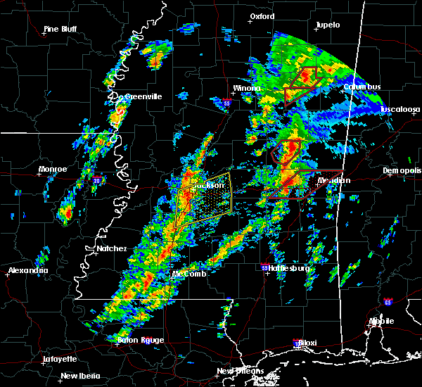 At 303 pm cst, a severe thunderstorm capable of producing a tornado was located 7 miles southwest of duffee, or 11 miles northeast of newton, moving northeast at 50 mph (radar indicated rotation). Hazards include tornado. Flying debris will be dangerous to those caught without shelter. mobile homes will be damaged or destroyed. damage to roofs, windows and vehicles will occur. tree damage is likely. this dangerous storm will be near, duffee around 310 pm cst. meridian, collinsville, suqualena and nellieburg around 315 pm cst. martin around 320 pm cst. meridian station around 330 pm cst. Other locations impacted by this tornadic thunderstorm include chunky and hickory. At 303 pm cst, a severe thunderstorm capable of producing a tornado was located 7 miles southwest of duffee, or 11 miles northeast of newton, moving northeast at 50 mph (radar indicated rotation). Hazards include tornado. Flying debris will be dangerous to those caught without shelter. mobile homes will be damaged or destroyed. damage to roofs, windows and vehicles will occur. tree damage is likely. this dangerous storm will be near, duffee around 310 pm cst. meridian, collinsville, suqualena and nellieburg around 315 pm cst. martin around 320 pm cst. meridian station around 330 pm cst. Other locations impacted by this tornadic thunderstorm include chunky and hickory.
|
| 2/2/2016 2:58 PM CST |
 At 258 pm cst, a confirmed tornado was located 7 miles east of newton, moving northeast at 50 mph (radar confirmed tornado). Hazards include damaging tornado. Flying debris will be dangerous to those caught without shelter. mobile homes will be damaged or destroyed. damage to roofs, windows and vehicles will occur. tree damage is likely. this tornado will be near, meehan around 305 pm cst. duffee around 310 pm cst. meridian, collinsville, suqualena and nellieburg around 315 pm cst. martin around 320 pm cst. meridian station around 330 pm cst. Other locations impacted by this tornadic thunderstorm include chunky and hickory. At 258 pm cst, a confirmed tornado was located 7 miles east of newton, moving northeast at 50 mph (radar confirmed tornado). Hazards include damaging tornado. Flying debris will be dangerous to those caught without shelter. mobile homes will be damaged or destroyed. damage to roofs, windows and vehicles will occur. tree damage is likely. this tornado will be near, meehan around 305 pm cst. duffee around 310 pm cst. meridian, collinsville, suqualena and nellieburg around 315 pm cst. martin around 320 pm cst. meridian station around 330 pm cst. Other locations impacted by this tornadic thunderstorm include chunky and hickory.
|
| 2/2/2016 2:51 PM CST |
 At 251 pm cst, a confirmed tornado was located near garlandville, or near newton, moving northeast at 45 mph (radar confirmed tornado). Hazards include damaging tornado. Flying debris will be dangerous to those caught without shelter. mobile homes will be damaged or destroyed. damage to roofs, windows and vehicles will occur. tree damage is likely. this tornado will be near, meehan around 310 pm cst. duffee around 315 pm cst. meridian, collinsville, suqualena and nellieburg around 320 pm cst. martin around 325 pm cst. marion around 330 pm cst. meridian station around 340 pm cst. lauderdale around 345 pm cst. Other locations impacted by this tornadic thunderstorm include chunky and hickory. At 251 pm cst, a confirmed tornado was located near garlandville, or near newton, moving northeast at 45 mph (radar confirmed tornado). Hazards include damaging tornado. Flying debris will be dangerous to those caught without shelter. mobile homes will be damaged or destroyed. damage to roofs, windows and vehicles will occur. tree damage is likely. this tornado will be near, meehan around 310 pm cst. duffee around 315 pm cst. meridian, collinsville, suqualena and nellieburg around 320 pm cst. martin around 325 pm cst. marion around 330 pm cst. meridian station around 340 pm cst. lauderdale around 345 pm cst. Other locations impacted by this tornadic thunderstorm include chunky and hickory.
|
| 1/21/2016 7:49 PM CST | At 748 pm cst, a severe thunderstorm was located over zero, or 7 miles southeast of meridian, moving northeast at 30 mph (radar indicated). Hazards include 60 mph wind gusts and quarter size hail. Hail damage to vehicles is expected. expect wind damage to roofs, siding and trees. this severe storm will be near, alamucha and toomsuba around 805 pm cst. kewanee around 815 pm cst. A tornado watch remains in effect until 1000 pm cst for east central mississippi. |
| 1/21/2016 7:45 PM CST | Trees down along walker bottom r in lauderdale county MS, 10.4 miles N of Meridian, MS |
| 1/21/2016 7:10 PM CST | At 710 pm cst, a severe thunderstorm was located near rose hill, or 14 miles northwest of quitman, moving northeast at 30 mph (radar indicated). Hazards include 60 mph wind gusts and quarter size hail. Hail damage to vehicles is expected. expect wind damage to roofs, siding and trees. this severe thunderstorm will be near, stonewall around 720 pm cst. meehan around 725 pm cst. savoy around 730 pm cst. sable around 735 pm cst. zero around 745 pm cst. increase around 750 pm cst. alamucha and toomsuba around 810 pm cst. kewanee around 815 pm cst. other locations impacted by this severe thunderstorm include pachuta. A tornado watch remains in effect until 1000 pm cst for east central mississippi. |
| 12/28/2015 8:02 AM CST |
 At 802 am cst, severe thunderstorms were located along a line extending from near blackwater to near crandall, moving east at 35 mph (radar indicated). Hazards include 60 mph wind gusts. Expect damage to roofs. siding and trees. these severe storms will be near, daleville around 805 am cst. A tornado watch remains in effect until 1000 am cst for east central mississippi. At 802 am cst, severe thunderstorms were located along a line extending from near blackwater to near crandall, moving east at 35 mph (radar indicated). Hazards include 60 mph wind gusts. Expect damage to roofs. siding and trees. these severe storms will be near, daleville around 805 am cst. A tornado watch remains in effect until 1000 am cst for east central mississippi.
|
| 12/28/2015 7:33 AM CST |
 At 733 am cst, severe thunderstorms were located along a line extending from near duffee to 8 miles northwest of waynesboro, moving northeast at 40 mph (radar indicated). Hazards include 60 mph wind gusts. Expect damage to roofs. siding and trees. severe thunderstorms will be near, collinsville, martin and suqualena around 740 am cst. daleville around 750 am cst. meridian station around 755 am cst. crandall around 805 am cst. other locations impacted by these severe thunderstorms include shubuta. A tornado watch remains in effect until 800 am cst for east central mississippi. At 733 am cst, severe thunderstorms were located along a line extending from near duffee to 8 miles northwest of waynesboro, moving northeast at 40 mph (radar indicated). Hazards include 60 mph wind gusts. Expect damage to roofs. siding and trees. severe thunderstorms will be near, collinsville, martin and suqualena around 740 am cst. daleville around 750 am cst. meridian station around 755 am cst. crandall around 805 am cst. other locations impacted by these severe thunderstorms include shubuta. A tornado watch remains in effect until 800 am cst for east central mississippi.
|
| 12/25/2015 4:54 PM CST |
 At 453 pm cst, severe thunderstorms were located along a line extending from near prismatic to near suqualena to near meridian to near sable, moving east at 40 mph (radar indicated). Hazards include 60 mph wind gusts and penny size hail. Expect damage to roofs. siding and trees. these severe storms will be near, marion around 500 pm cst. Increase around 510 pm cst. At 453 pm cst, severe thunderstorms were located along a line extending from near prismatic to near suqualena to near meridian to near sable, moving east at 40 mph (radar indicated). Hazards include 60 mph wind gusts and penny size hail. Expect damage to roofs. siding and trees. these severe storms will be near, marion around 500 pm cst. Increase around 510 pm cst.
|
| 12/25/2015 4:44 PM CST |
 At 443 pm cst, severe thunderstorms were located along a line extending from near duffee to near suqualena to near savoy, moving northeast at 30 mph (radar indicated). Hazards include 60 mph wind gusts and penny size hail. Expect damage to roofs. siding and trees. these severe storms will be near, meridian, collinsville, martin, suqualena and nellieburg around 450 pm cst. zero around 505 pm cst. daleville around 510 pm cst. marion around 515 pm cst. Other locations impacted by these severe thunderstorms include chunky. At 443 pm cst, severe thunderstorms were located along a line extending from near duffee to near suqualena to near savoy, moving northeast at 30 mph (radar indicated). Hazards include 60 mph wind gusts and penny size hail. Expect damage to roofs. siding and trees. these severe storms will be near, meridian, collinsville, martin, suqualena and nellieburg around 450 pm cst. zero around 505 pm cst. daleville around 510 pm cst. marion around 515 pm cst. Other locations impacted by these severe thunderstorms include chunky.
|
| 12/25/2015 4:27 PM CST |
 At 427 pm cst, severe thunderstorms were located along a line extending from near newton to rose hill, moving northeast at 35 mph (radar indicated). Hazards include 60 mph wind gusts and penny size hail. Expect damage to roofs. siding and trees. severe thunderstorms will be near, duffee and meehan around 450 pm cst. savoy and suqualena around 455 pm cst. collinsville and nellieburg around 500 pm cst. meridian, martin and zero around 505 pm cst. marion and daleville around 515 pm cst. Other locations impacted by these severe thunderstorms include chunky and hickory. At 427 pm cst, severe thunderstorms were located along a line extending from near newton to rose hill, moving northeast at 35 mph (radar indicated). Hazards include 60 mph wind gusts and penny size hail. Expect damage to roofs. siding and trees. severe thunderstorms will be near, duffee and meehan around 450 pm cst. savoy and suqualena around 455 pm cst. collinsville and nellieburg around 500 pm cst. meridian, martin and zero around 505 pm cst. marion and daleville around 515 pm cst. Other locations impacted by these severe thunderstorms include chunky and hickory.
|
| 7/5/2015 10:33 AM CDT |
 At 1032 am cdt, a severe thunderstorm was located near marion, or near meridian, moving east at 30 mph (radar indicated). Hazards include 60 mph wind gusts. Expect damage to roofs. siding and trees. This severe storm will be near, alamucha, toomsuba and kewanee around 1045 am cdt. At 1032 am cdt, a severe thunderstorm was located near marion, or near meridian, moving east at 30 mph (radar indicated). Hazards include 60 mph wind gusts. Expect damage to roofs. siding and trees. This severe storm will be near, alamucha, toomsuba and kewanee around 1045 am cdt.
|
| 7/5/2015 10:06 AM CDT |
 At 1006 am cdt, a severe thunderstorm was located over nellieburg, or near meridian, moving east at 45 mph (radar indicated). Hazards include 60 mph wind gusts. Expect damage to roofs. siding and trees. this severe thunderstorm will be near, meridian around 1010 am cdt. marion around 1020 am cdt. lauderdale, toomsuba and alamucha around 1030 am cdt. Kewanee around 1035 am cdt. At 1006 am cdt, a severe thunderstorm was located over nellieburg, or near meridian, moving east at 45 mph (radar indicated). Hazards include 60 mph wind gusts. Expect damage to roofs. siding and trees. this severe thunderstorm will be near, meridian around 1010 am cdt. marion around 1020 am cdt. lauderdale, toomsuba and alamucha around 1030 am cdt. Kewanee around 1035 am cdt.
|
| 6/30/2015 7:36 AM CDT |
 The severe thunderstorm warning for northern lauderdale and southwestern kemper counties will expire at 745 am cdt, the storms which prompted the warning have weakened below severe limits, and no longer pose an immediate threat to life or property. therefore the warning will be allowed to expire. The severe thunderstorm warning for northern lauderdale and southwestern kemper counties will expire at 745 am cdt, the storms which prompted the warning have weakened below severe limits, and no longer pose an immediate threat to life or property. therefore the warning will be allowed to expire.
|
| 6/30/2015 7:00 AM CDT | Tree down on hwy 39 north. time estimate in lauderdale county MS, 7.6 miles S of Meridian, MS |
| 6/30/2015 6:55 AM CDT |
 At 655 am cdt, severe thunderstorms were located along a line extending from near lauderdale to near martin, moving southeast at 15 mph (radar indicated). Hazards include 60 mph wind gusts and quarter size hail. Hail damage to vehicles is expected. expect wind damage to roofs, siding and trees. severe thunderstorms will be near, lauderdale around 700 am cdt. collinsville and toomsuba around 715 am cdt. kewanee around 720 am cdt. suqualena around 730 am cdt. Meridian and marion around 745 am cdt. At 655 am cdt, severe thunderstorms were located along a line extending from near lauderdale to near martin, moving southeast at 15 mph (radar indicated). Hazards include 60 mph wind gusts and quarter size hail. Hail damage to vehicles is expected. expect wind damage to roofs, siding and trees. severe thunderstorms will be near, lauderdale around 700 am cdt. collinsville and toomsuba around 715 am cdt. kewanee around 720 am cdt. suqualena around 730 am cdt. Meridian and marion around 745 am cdt.
|
| 6/30/2015 5:58 AM CDT | Storm damage reported in lauderdale county MS, 6.3 miles S of Meridian, MS |
| 6/24/2015 7:16 PM CDT |
 At 716 pm cdt, a severe thunderstorm was located near martin, or 12 miles northwest of meridian, moving southwest at 15 mph (radar indicated). Hazards include 60 mph wind gusts and quarter size hail. Hail damage to vehicles is expected. expect wind damage to roofs, siding and trees. this severe thunderstorm will be near, suqualena around 725 pm cdt. duffee around 730 pm cdt. Newton around 815 pm cdt. At 716 pm cdt, a severe thunderstorm was located near martin, or 12 miles northwest of meridian, moving southwest at 15 mph (radar indicated). Hazards include 60 mph wind gusts and quarter size hail. Hail damage to vehicles is expected. expect wind damage to roofs, siding and trees. this severe thunderstorm will be near, suqualena around 725 pm cdt. duffee around 730 pm cdt. Newton around 815 pm cdt.
|
| 6/21/2015 3:38 PM CDT |
 The severe thunderstorm warning for northwestern lauderdale county will expire at 345 pm cdt, the storm which prompted the warning has weakened below severe limits, and no longer pose an immediate threat to life or property. therefore the warning will be allowed to expire. The severe thunderstorm warning for northwestern lauderdale county will expire at 345 pm cdt, the storm which prompted the warning has weakened below severe limits, and no longer pose an immediate threat to life or property. therefore the warning will be allowed to expire.
|
| 6/21/2015 3:21 PM CDT |
 At 320 pm cdt, a severe thunderstorm was located near meridian, moving southeast at 10 mph (radar indicated). Hazards include 60 mph wind gusts and nickel size hail. Expect damage to roofs. siding and trees. this severe storm will be near, meridian around 325 pm cdt. Marion around 345 pm cdt. At 320 pm cdt, a severe thunderstorm was located near meridian, moving southeast at 10 mph (radar indicated). Hazards include 60 mph wind gusts and nickel size hail. Expect damage to roofs. siding and trees. this severe storm will be near, meridian around 325 pm cdt. Marion around 345 pm cdt.
|
| 6/21/2015 3:06 PM CDT |
 At 306 pm cdt, a severe thunderstorm was located over nellieburg, or near meridian, moving southeast at 10 mph (radar indicated). Hazards include 60 mph wind gusts and quarter size hail. Hail damage to vehicles is expected. expect wind damage to roofs, siding and trees. this severe thunderstorm will be near, meridian and nellieburg around 320 pm cdt. Marion around 340 pm cdt. At 306 pm cdt, a severe thunderstorm was located over nellieburg, or near meridian, moving southeast at 10 mph (radar indicated). Hazards include 60 mph wind gusts and quarter size hail. Hail damage to vehicles is expected. expect wind damage to roofs, siding and trees. this severe thunderstorm will be near, meridian and nellieburg around 320 pm cdt. Marion around 340 pm cdt.
|
| 6/10/2015 4:37 PM CDT |
 At 436 pm cdt, severe thunderstorms were located along a line extending from near alamucha to near nellieburg, moving south at 10 mph (radar indicated). Hazards include 60 mph wind gusts and nickel size hail. Expect damage to roofs. siding and trees. these severe storms will be near, alamucha around 440 pm cdt. savoy and zero around 500 pm cdt. Other locations impacted by these severe thunderstorms include i 20 welcome center at cuba. At 436 pm cdt, severe thunderstorms were located along a line extending from near alamucha to near nellieburg, moving south at 10 mph (radar indicated). Hazards include 60 mph wind gusts and nickel size hail. Expect damage to roofs. siding and trees. these severe storms will be near, alamucha around 440 pm cdt. savoy and zero around 500 pm cdt. Other locations impacted by these severe thunderstorms include i 20 welcome center at cuba.
|
| 6/10/2015 4:35 PM CDT | Quarter sized hail reported 0.8 miles E of Meridian, MS, quarter size hail reported in the west side of the city |
| 6/10/2015 4:32 PM CDT | 64 knot peak wind gust measured at meridian key field in lauderdale county MS, 0.8 miles E of Meridian, MS |
| 6/10/2015 4:30 PM CDT | County sheriff reports quite a few trees down around the city in lauderdale county MS, 0.8 miles E of Meridian, MS |
| 6/10/2015 4:13 PM CDT |
 At 412 pm cdt, severe thunderstorms were located along a line extending from near kewanee to near nellieburg, moving southeast at 15 mph (radar indicated). Hazards include 60 mph wind gusts and quarter size hail. Hail damage to vehicles is expected. expect wind damage to roofs, siding and trees. severe thunderstorms will be near, alamucha and kewanee around 420 pm cdt. savoy around 450 pm cdt. zero around 455 pm cdt. Other locations impacted by these severe thunderstorms include i 20 welcome center at cuba. At 412 pm cdt, severe thunderstorms were located along a line extending from near kewanee to near nellieburg, moving southeast at 15 mph (radar indicated). Hazards include 60 mph wind gusts and quarter size hail. Hail damage to vehicles is expected. expect wind damage to roofs, siding and trees. severe thunderstorms will be near, alamucha and kewanee around 420 pm cdt. savoy around 450 pm cdt. zero around 455 pm cdt. Other locations impacted by these severe thunderstorms include i 20 welcome center at cuba.
|
| 5/15/2015 4:25 PM CDT | Trees downed along old hwy 19 in se lauderdale co in lauderdale county MS, 13.5 miles WNW of Meridian, MS |
| 4/25/2015 3:38 AM CDT | At 338 am cdt, a severe thunderstorm capable of producing a tornado was located near electric mills, or 16 miles northwest of livingston, moving east at 55 mph (radar indicated rotation). Hazards include tornado. Flying debris will be dangerous to those caught without shelter. mobile homes will be damaged or destroyed. damage to roofs, windows and vehicles will occur. tree damage is likely. this tornadic thunderstorm will remain over mainly rural areas of northeastern lauderdale and eastern kemper counties, including the following locations, scooba and i 20 welcome center at cuba. Radar indicated. |
| 4/25/2015 3:27 AM CDT | At 327 am cdt, a severe thunderstorm capable of producing a tornado was located near de kalb, or 12 miles north of meridian station, moving east at 55 mph (radar indicated rotation). Hazards include tornado. Flying debris will be dangerous to those caught without shelter. mobile homes will be damaged or destroyed. damage to roofs, windows and vehicles will occur. tree damage is likely. this dangerous storm will be near, electric mills and porterville around 335 am cdt. other locations impacted by this tornadic thunderstorm include scooba and i 20 welcome center at cuba. Radar indicated. |
| 4/25/2015 3:17 AM CDT | At 317 am cdt, a severe thunderstorm capable of producing a tornado was located near bluff springs, or 9 miles southeast of preston, moving east at 60 mph (radar indicated rotation). Hazards include tornado. Flying debris will be dangerous to those caught without shelter. mobile homes will be damaged or destroyed. damage to roofs, windows and vehicles will occur. tree damage is likely. this dangerous storm will be near, de kalb around 320 am cdt. electric mills around 335 am cdt. other locations impacted by this tornadic thunderstorm include scooba and i 20 welcome center at cuba. Radar indicated. |
| 4/25/2015 3:11 AM CDT | At 311 am cdt, a severe thunderstorm capable of producing a tornado was located near bluff springs, or 10 miles south of preston, moving east at 50 mph (radar indicated rotation). Hazards include tornado. Flying debris will be dangerous to those caught without shelter. mobile homes will be damaged or destroyed. damage to roofs, windows and vehicles will occur. tree damage is likely. this dangerous storm will be near, liberty around 315 am cdt. de kalb around 325 am cdt. electric mills around 340 am cdt. other locations impacted by this tornadic thunderstorm include scooba and i 20 welcome center at cuba. Radar indicated. |
| 4/25/2015 2:54 AM CDT | At 253 am cdt, a severe thunderstorm capable of producing a tornado was located over bethsaida, or 8 miles south of philadelphia, moving east at 55 mph (radar indicated rotation). Hazards include tornado. Flying debris will be dangerous to those caught without shelter. mobile homes will be damaged or destroyed. damage to roofs, windows and vehicles will occur. tree damage is likely. this dangerous storm will be near, damascus around 305 am cdt. liberty and bluff springs around 310 am cdt. de kalb around 320 am cdt. electric mills around 330 am cdt. other locations impacted by this tornadic thunderstorm include scooba and i 20 welcome center at cuba. this storm has a history of brief tornadoes. Radar indicated. |
| 1/3/2015 3:45 PM CST | Multiple trees and powerlines down in lauderdale county around meehan/bailey areas. damage also occurred to a barn in meeha in lauderdale county MS, 5.8 miles SSE of Meridian, MS |
| 1/3/2015 3:45 PM CST | Multiple trees and powerlines down in lauderdale county around meehan/bailey areas. damage also occurred to a barn in meeha in lauderdale county MS, 5.8 miles SSE of Meridian, MS |
| 12/23/2014 4:00 PM CST | Power line down in lauderdale county MS, 0.8 miles E of Meridian, MS |
| 12/23/2014 11:40 AM CST | Quarter sized hail reported 8.1 miles ENE of Meridian, MS, report of nickel to quarter size hail in western lauderdale county. |
| 10/13/2014 7:18 PM CDT | Report of a tree down blocking a roadway on north frontage road in meridia in lauderdale county MS, 0.8 miles E of Meridian, MS |
| 10/13/2014 3:25 PM CDT | A few trees down in lauderdale county MS, 0.8 miles E of Meridian, MS |
| 10/2/2014 6:25 PM CDT | Tree down on 37th st. rd crew had to remove the tre in lauderdale county MS, 0.8 miles E of Meridian, MS |
| 7/2/2014 6:27 PM CDT | Tree down along i-20 in lauderdale county MS, 6.9 miles WSW of Meridian, MS |
| 6/28/2014 5:30 PM CDT | Report of a tree down on trip talbert roa in lauderdale county MS, 8.7 miles SSE of Meridian, MS |
| 4/28/2014 9:20 PM CDT | Numerous trees down in meridian in lauderdale county MS, 0.8 miles E of Meridian, MS |
| 4/28/2014 8:55 PM CDT | Trees blown down just north of meridian in lauderdale county MS, 6.5 miles SSW of Meridian, MS |
| 4/28/2014 8:55 PM CDT | Numerous trees down in meridian in lauderdale county MS, 0.8 miles E of Meridian, MS |
| 4/28/2014 8:50 PM CDT | Trees blown down in the bailey area in lauderdale county MS, 6.4 miles SSE of Meridian, MS |
| 4/6/2014 9:05 PM CDT | A few trees uproote in lauderdale county MS, 0.8 miles E of Meridian, MS |
| 7/23/2013 2:45 PM CDT | Tree downed on causeyville road near the causeyville community in lauderdale county MS, 11.9 miles NW of Meridian, MS |
| 7/23/2013 2:40 PM CDT | A home on 32nd street in meridian sustained roof damage due to a large oak tree falling onto i in lauderdale county MS, 0.8 miles E of Meridian, MS |
| 7/23/2013 2:30 PM CDT | Power lines down in the north hills area of meridian in lauderdale county MS, 2.5 miles SE of Meridian, MS |
| 6/28/2013 8:50 PM CDT | Trees down in clarkedale community near us highway 45 in lauderdale county MS, 6.3 miles N of Meridian, MS |
| 6/28/2013 8:25 PM CDT | Trees down across roads in the bailey community in lauderdale county MS, 5.8 miles SSE of Meridian, MS |
| 6/5/2013 6:00 PM CDT | A few trees down on pine springs road and north hills street in lauderdale county MS, 0.8 miles E of Meridian, MS |
| 3/24/2013 3:00 AM CDT | Quarter sized hail reported 9.7 miles N of Meridian, MS, nickel to quarter. report via social media |
| 3/23/2013 6:14 PM CDT | Half Dollar sized hail reported 5.7 miles SSW of Meridian, MS, quarter to half dollar size hail in the bailey community |
| 3/18/2013 4:19 PM CDT | Quarter sized hail reported 12.5 miles SSW of Meridian, MS |
| 12/25/2012 4:36 PM CST | A tree was blown down onto a house along wesley chapel road in lauderdale county MS, 8.3 miles N of Meridian, MS |
| 12/20/2012 6:35 AM CST | Powerlines down in lauderdale county MS, 0.8 miles E of Meridian, MS |
| 8/30/2012 8:00 AM CDT | Trees down across highway 11 in lauderdale county MS, 4.9 miles N of Meridian, MS |
| 8/30/2012 8:00 AM CDT | Trees down across highway 19 in lauderdale county MS, 4.9 miles N of Meridian, MS |
| 8/30/2012 8:00 AM CDT | Trees down across highway 11 in lauderdale county MS, 5.8 miles NNE of Meridian, MS |
| 6/11/2012 8:35 PM CDT | Tree down along bolen long creek road in lauderdale county MS, 6.6 miles WNW of Meridian, MS |
| 5/31/2012 6:03 PM CDT | Reports of trees down countywid in lauderdale county MS, 0.8 miles E of Meridian, MS |
| 5/31/2012 6:00 PM CDT | Trees down in the yard of a house on west gate hill drive in lauderdale county MS, 0.8 miles E of Meridian, MS |
| 5/31/2012 5:53 PM CDT | Trees down...one on a house and one on a vehicle. transformer blown. occurred near 24th street and 29th av in lauderdale county MS, 1.6 miles ENE of Meridian, MS |
| 5/21/2012 7:12 PM CDT | Quarter sized hail reported 8.6 miles ENE of Meridian, MS, nickel to quarter sized hail fell for several minutes |
| 5/6/2012 5:00 PM CDT | Quarter sized hail reported 11.9 miles SSE of Meridian, MS, occurred at west lauderdale elementary |
| 5/6/2012 4:50 PM CDT | A tree was on a house on poplar springs driv in lauderdale county MS, 0.8 miles E of Meridian, MS |
| 5/6/2012 4:40 PM CDT | Quarter sized hail reported 5.3 miles SSW of Meridian, MS, just off hwy 39 |
| 1/1/0001 12:00 AM | Quarter sized hail reported 9.2 miles NW of Meridian, MS, in causeyville community |
| 1/1/0001 12:00 AM | Quarter sized hail reported 5.8 miles SSE of Meridian, MS, in the bailey community |
| 1/1/0001 12:00 AM | Trees down near exit 152 on i-20/i-5 in lauderdale county MS, 0.8 miles E of Meridian, MS |
| 1/1/0001 12:00 AM | Trees and power lines down on myrtle drive in lauderdale county MS, 2.1 miles N of Meridian, MS |
| 1/1/0001 12:00 AM | A wall of a convenience store was collapsed at i-20 and 22nd ave in lauderdale county MS, 0.8 miles E of Meridian, MS |
| 1/1/0001 12:00 AM | Broadcast media reported two trees down on zero roa in lauderdale county MS, 6.4 miles NNW of Meridian, MS |
| 1/1/0001 12:00 AM | A few trees down in lauderdale county MS, 7 miles S of Meridian, MS |
| 1/1/0001 12:00 AM | A tree fell on a house along skyland dr in lauderdale county MS, 3.5 miles N of Meridian, MS |
| 1/1/0001 12:00 AM | Trees downed at the intersection of hwy 45 and hwy 14 in lauderdale county MS, 4.8 miles N of Meridian, MS |
| 1/1/0001 12:00 AM | Power outages around bailey in lauderdale county MS, 3.5 miles S of Meridian, MS |
| 1/1/0001 12:00 AM | Tree fell on powerline at 2115 wilkerson loop. report of quarter size hail in marion and lauderdal in lauderdale county MS, 4.3 miles WNW of Meridian, MS |
| 1/1/0001 12:00 AM | Tree fell onto a house at the intersection of 37th avenue and 20th street. trees fell on powerlines on 4100 40th street and the intersection of 23rd avenue and 23rd str in lauderdale county MS, 0.8 miles E of Meridian, MS |
| 1/1/0001 12:00 AM | Numerous trees down across the n half of the county...trees across rds...4 homes damaged due to trees. one vehicle ran into a downed tree which resulted in a few in in lauderdale county MS, 3.5 miles SW of Meridian, MS |
| 1/1/0001 12:00 AM | Several trees down...one of which fell across blind brown road. also...several reports of 50 mph winds in the northwest part of the county in lauderdale county MS, 8 miles SSE of Meridian, MS |
| 1/1/0001 12:00 AM | Quarter sized hail reported 10.8 miles ENE of Meridian, MS, reported at lost gap |
| 4/15/2011 3:15 PM CDT | Golf Ball sized hail reported 2.9 miles SSE of Meridian, MS |
| 1/1/0001 12:00 AM | Trees and powerlines down. one tree down on a house...and another down on a ca in lauderdale county MS, 3.8 miles ESE of Meridian, MS |
| 1/1/0001 12:00 AM | Quarter sized hail reported 10.8 miles ENE of Meridian, MS |
| 1/1/0001 12:00 AM | Baseball sized hail reported 10.8 miles ENE of Meridian, MS |
| 1/1/0001 12:00 AM | Trees down...tree on powerlines in lauderdale county MS, 0.8 miles E of Meridian, MS |
| 1/1/0001 12:00 AM | Trees were downed at king rd and n hills s in lauderdale county MS, 2.5 miles SE of Meridian, MS |
Hail Maps for Meridian, MS
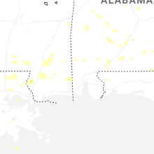

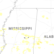
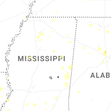
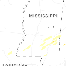


Connect with Interactive Hail Maps