

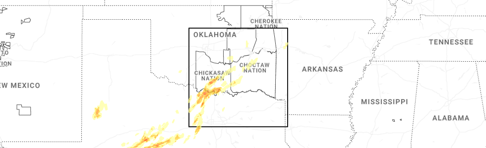
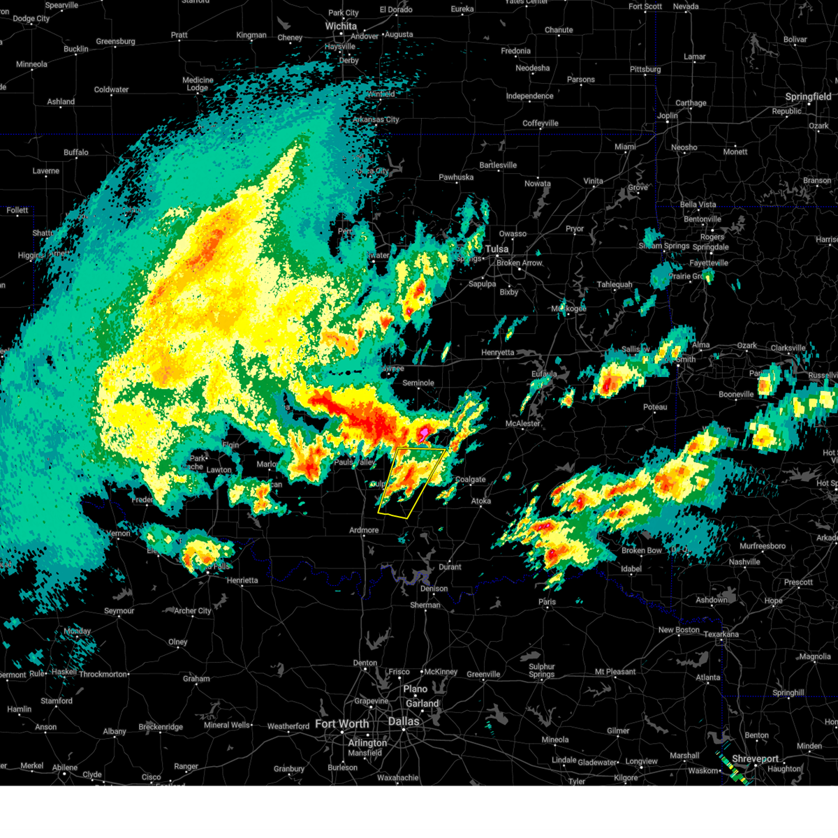
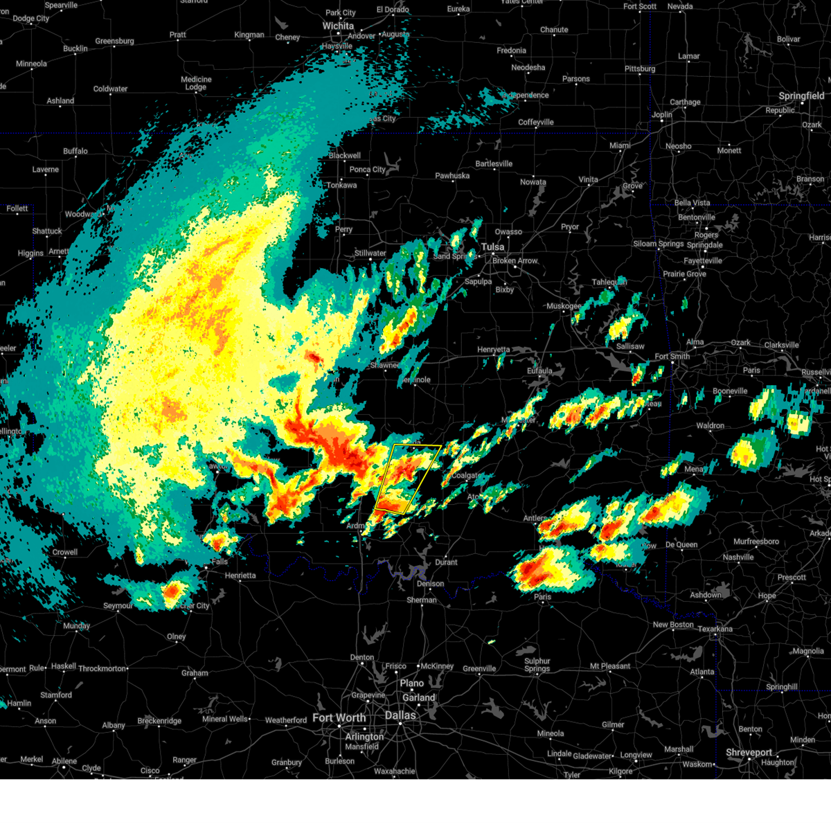
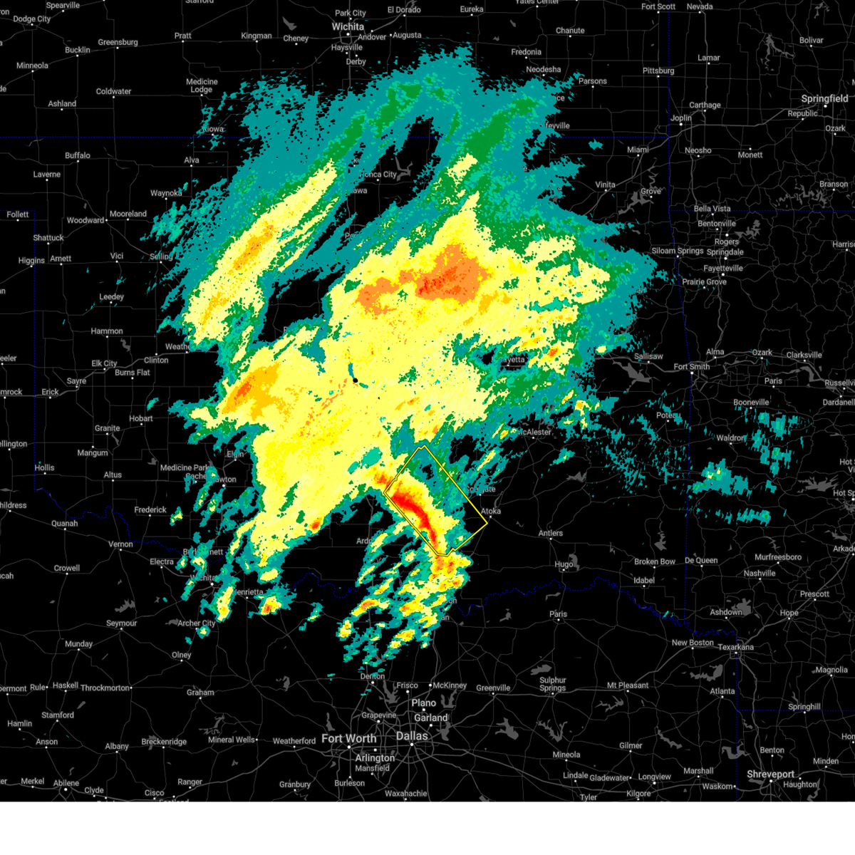
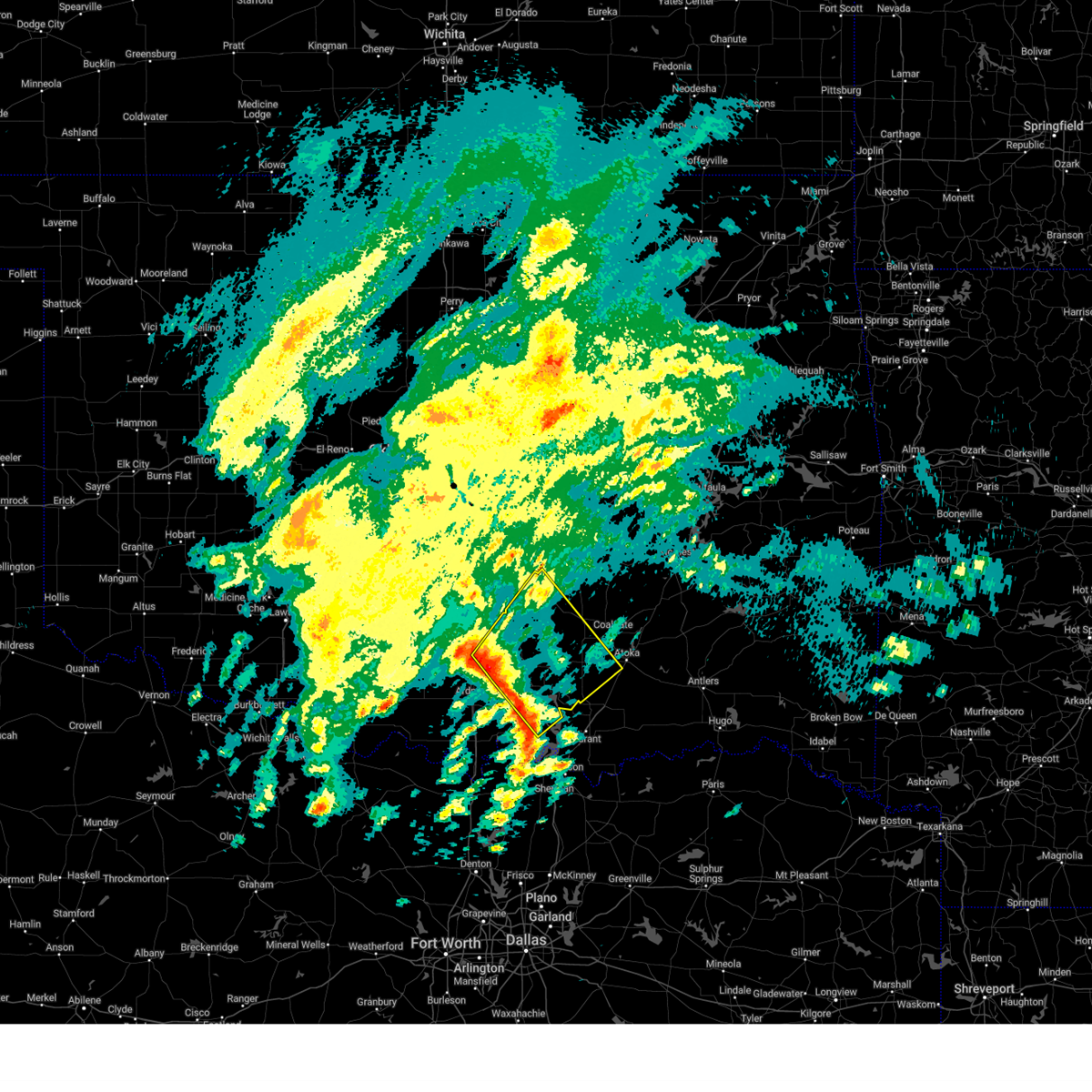
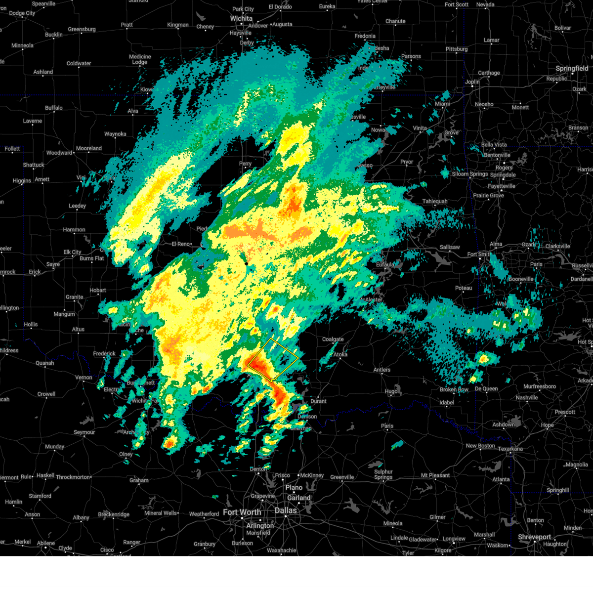
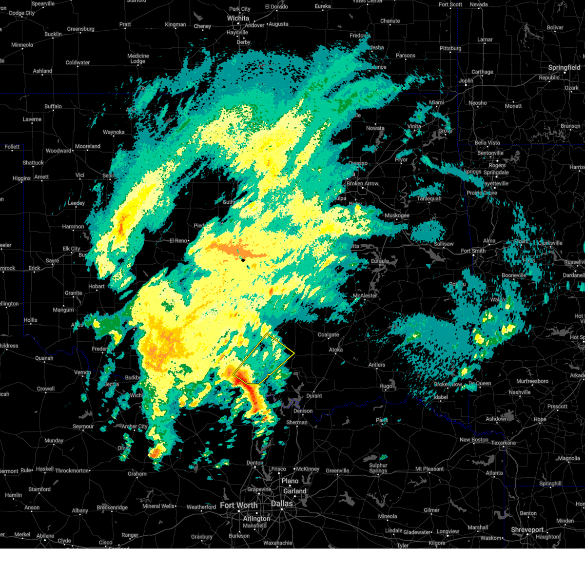
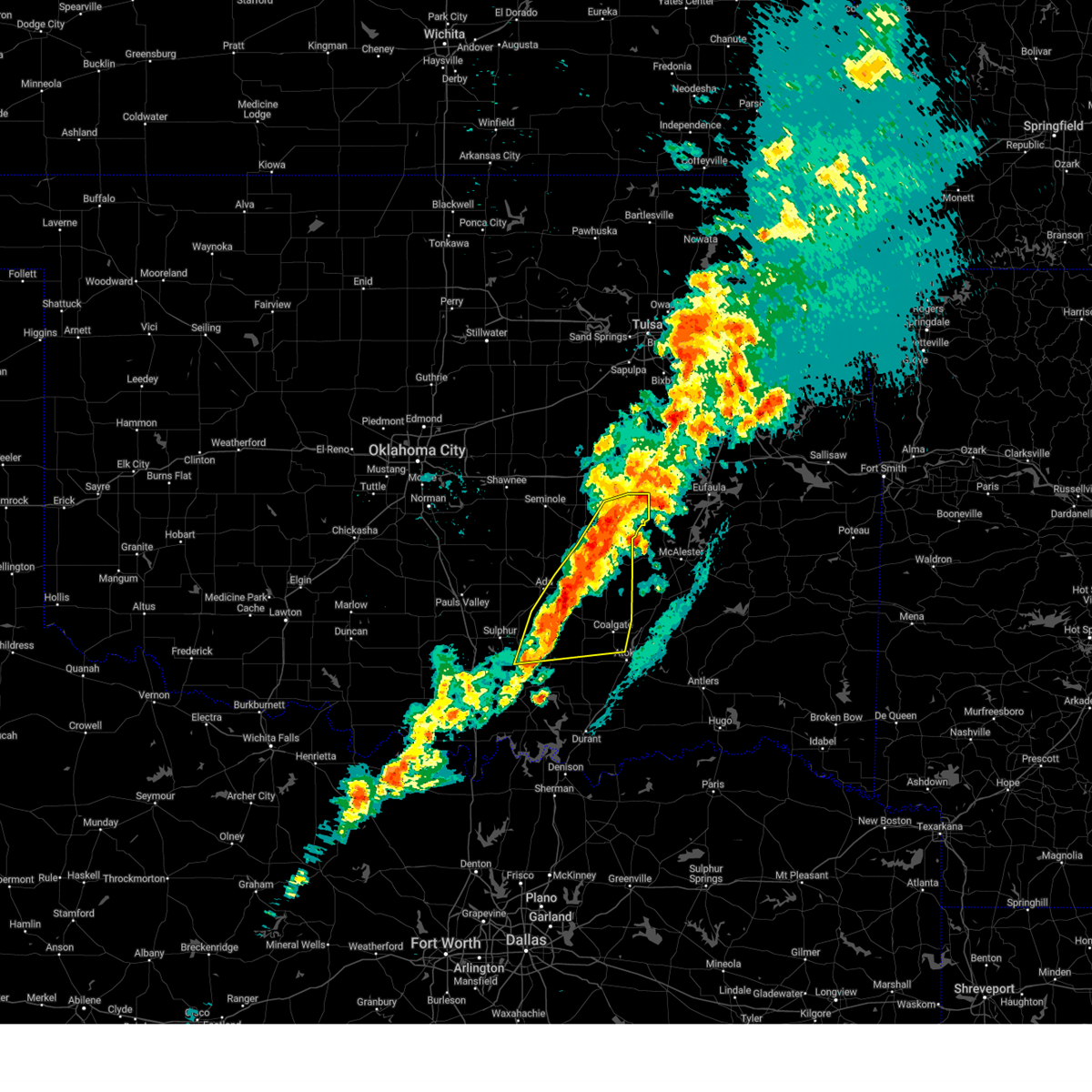
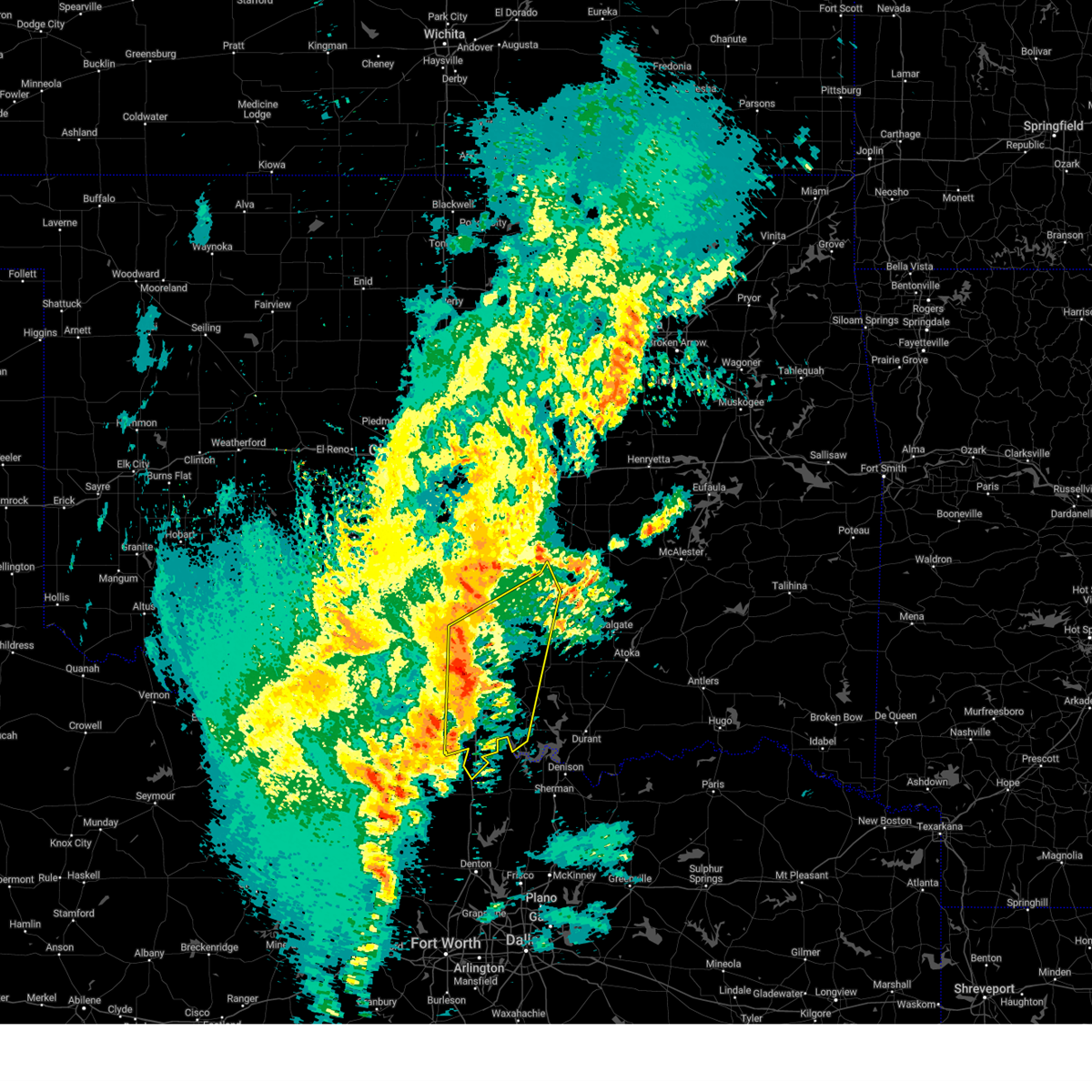
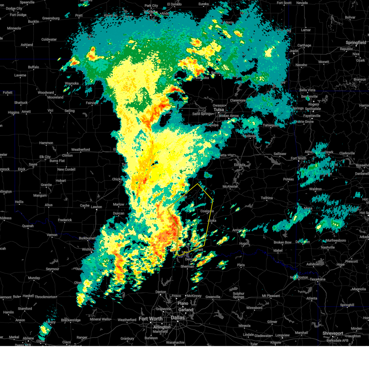
Hail Map for Mill Creek, OK
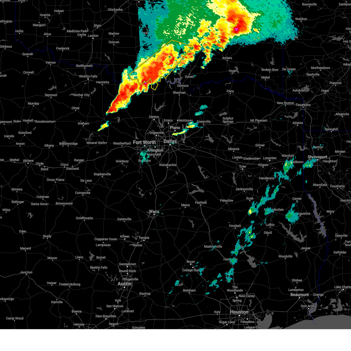
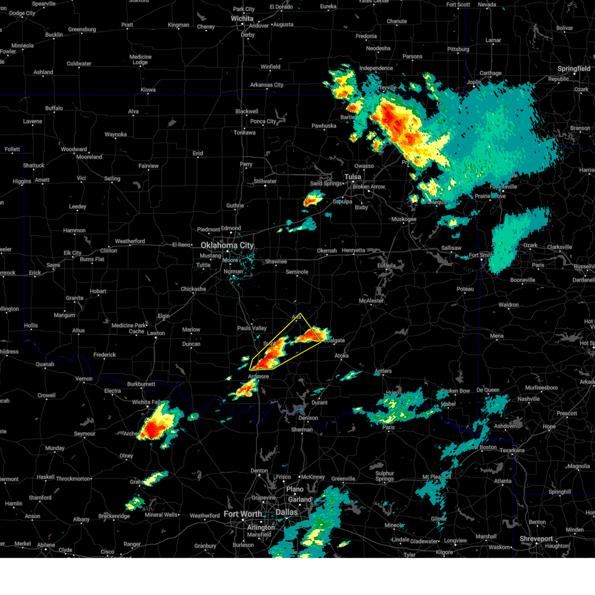
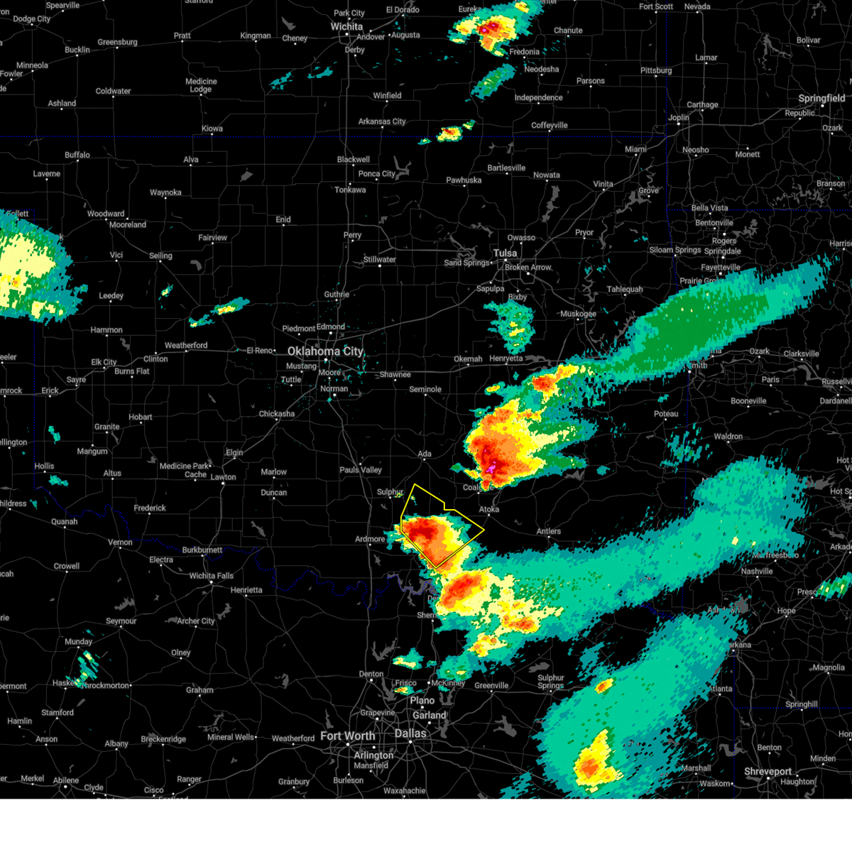
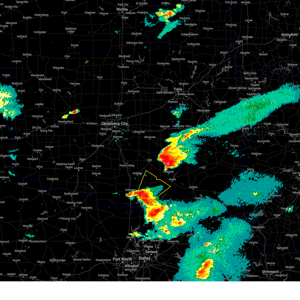
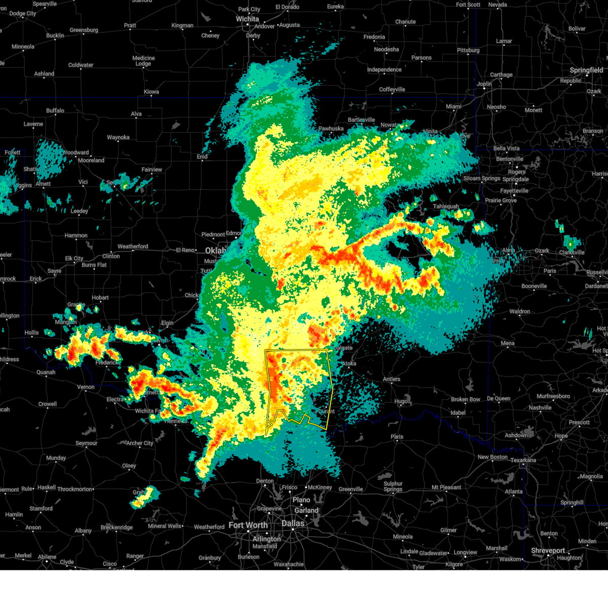
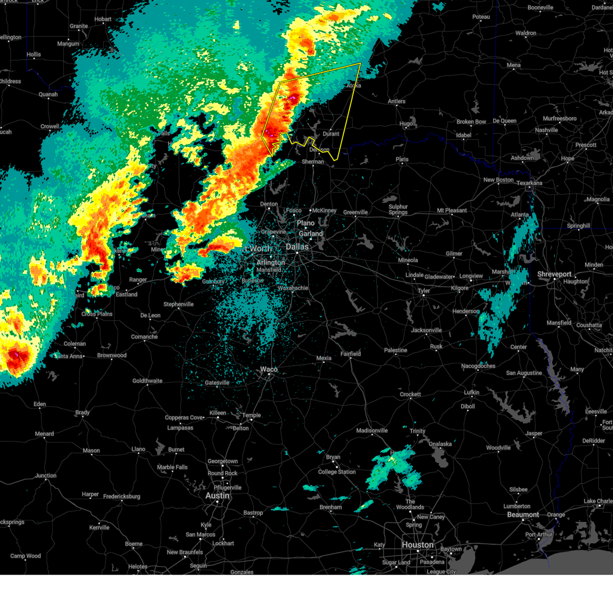
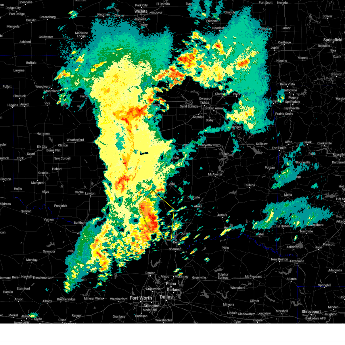
The Mill Creek, OK area has had 12 reports of on-the-ground hail by trained spotters, and has been under severe weather warnings 49 times during the past 12 months. Doppler radar has detected hail at or near Mill Creek, OK on 79 occasions, including 9 occasions during the past year.
| Name: | Mill Creek, OK |
| Where Located: | 39.8 miles W of Atoka, OK |
| Map: | Google Map for Mill Creek, OK |
| Population: | 319 |
| Housing Units: | 138 |
| More Info: | Search Google for Mill Creek, OK |
2
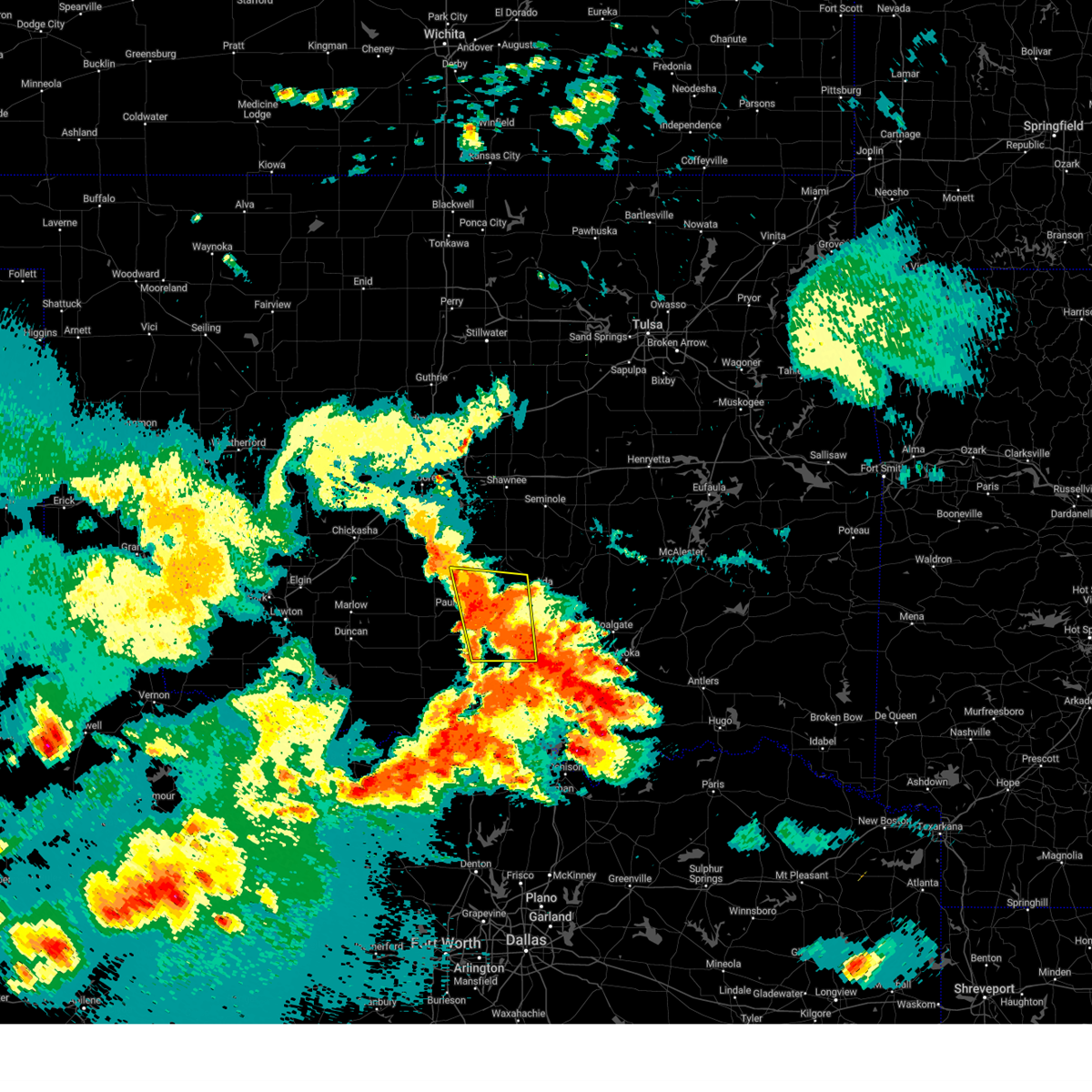
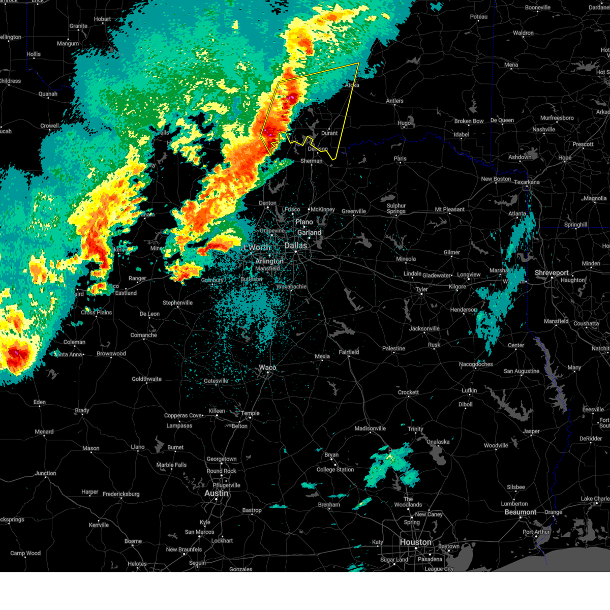
The Top Recent Hail Date for Mill Creek, OK is Saturday, April 19, 2025 (20th out of 79)
Hail and Wind Damage Spotted near Mill Creek, OK
| Date / Time | Report Details |
|---|---|
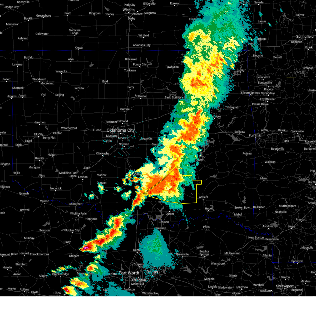
| 6/8/2025 8:59 PM CDT |
 Svroun the national weather service in norman has issued a * severe thunderstorm warning for, northwestern johnston county in southeastern oklahoma, eastern garvin county in southern oklahoma, southwestern pontotoc county in east central oklahoma, murray county in southern oklahoma, southeastern mcclain county in central oklahoma, * until 930 pm cdt. * at 859 pm cdt, severe thunderstorms were located along a line extending from near pauls valley to near turner falls, moving east at 20 mph (radar indicated). Hazards include 60 mph wind gusts and penny size hail. expect damage to roofs, siding, and trees Svroun the national weather service in norman has issued a * severe thunderstorm warning for, northwestern johnston county in southeastern oklahoma, eastern garvin county in southern oklahoma, southwestern pontotoc county in east central oklahoma, murray county in southern oklahoma, southeastern mcclain county in central oklahoma, * until 930 pm cdt. * at 859 pm cdt, severe thunderstorms were located along a line extending from near pauls valley to near turner falls, moving east at 20 mph (radar indicated). Hazards include 60 mph wind gusts and penny size hail. expect damage to roofs, siding, and trees
|
| 6/8/2025 7:51 PM CDT | Svroun the national weather service in norman has issued a * severe thunderstorm warning for, northwestern johnston county in southeastern oklahoma, south central garvin county in southern oklahoma, northern carter county in southern oklahoma, murray county in southern oklahoma, * until 830 pm cdt. * at 751 pm cdt, a severe thunderstorm was located 5 miles southeast of hennepin, moving east-southeast at 25 mph (radar indicated). Hazards include 60 mph wind gusts and quarter size hail. Hail damage to vehicles is expected. Expect wind damage to roofs, siding, and trees. |
| 6/3/2025 7:55 PM CDT |
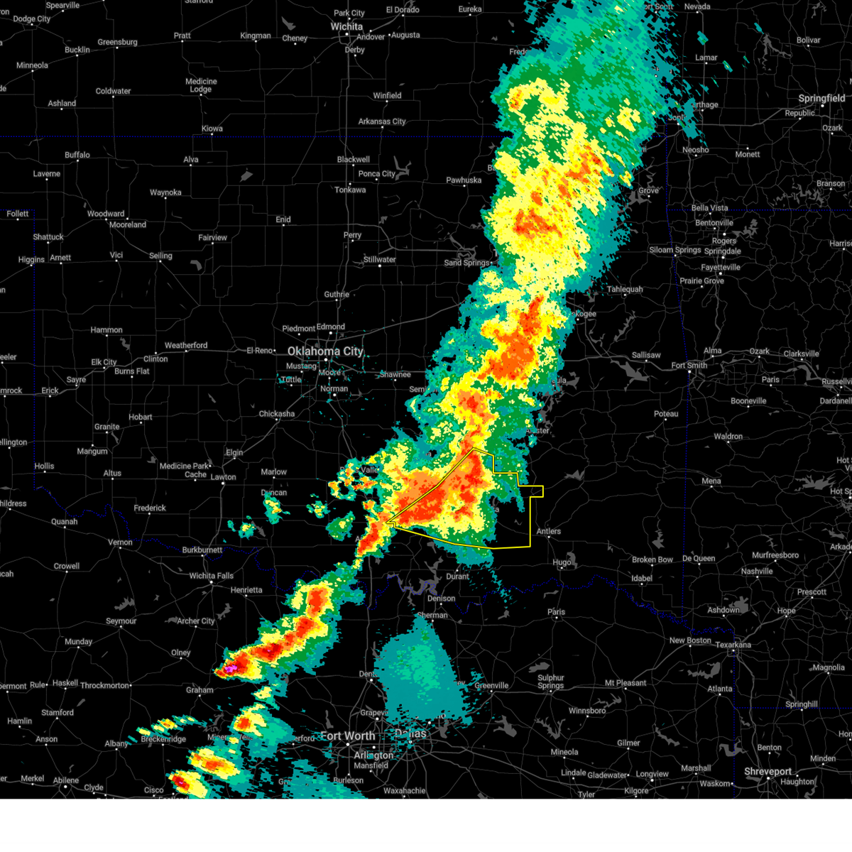 Svroun the national weather service in norman has issued a * severe thunderstorm warning for, johnston county in southeastern oklahoma, coal county in southeastern oklahoma, southeastern pontotoc county in east central oklahoma, atoka county in southeastern oklahoma, southeastern murray county in southern oklahoma, south central hughes county in southeastern oklahoma, * until 845 pm cdt. * at 754 pm cdt, severe thunderstorms were located along a line extending from 6 miles southeast of gerty to near lehigh to 6 miles southwest of mill creek, moving east at 35 mph (radar indicated). Hazards include 60 mph wind gusts. Expect damage to roofs, siding, and trees. Locations in or near the path include, clarita, jesse, olney, fillmore, chockie, lehigh, reagan, phillips, centrahoma, wapanucka, connerville, redden, atoka, wardville, boggy depot park, stringtown, atoka reservoir, pontotoc, tupelo, coalgate,. Svroun the national weather service in norman has issued a * severe thunderstorm warning for, johnston county in southeastern oklahoma, coal county in southeastern oklahoma, southeastern pontotoc county in east central oklahoma, atoka county in southeastern oklahoma, southeastern murray county in southern oklahoma, south central hughes county in southeastern oklahoma, * until 845 pm cdt. * at 754 pm cdt, severe thunderstorms were located along a line extending from 6 miles southeast of gerty to near lehigh to 6 miles southwest of mill creek, moving east at 35 mph (radar indicated). Hazards include 60 mph wind gusts. Expect damage to roofs, siding, and trees. Locations in or near the path include, clarita, jesse, olney, fillmore, chockie, lehigh, reagan, phillips, centrahoma, wapanucka, connerville, redden, atoka, wardville, boggy depot park, stringtown, atoka reservoir, pontotoc, tupelo, coalgate,.
|
| 6/3/2025 7:54 PM CDT |
 Svroun the national weather service in norman has issued a * severe thunderstorm warning for, johnston county in southeastern oklahoma, coal county in southeastern oklahoma, southeastern pontotoc county in east central oklahoma, atoka county in southeastern oklahoma, southeastern murray county in southern oklahoma, south central hughes county in southeastern oklahoma, * until 845 pm cdt. * at 753 pm cdt, severe thunderstorms were located along a line extending from 6 miles southeast of gerty to near lehigh to 6 miles southwest of mill creek, moving east at 35 mph (radar indicated). Hazards include 60 mph wind gusts. Expect damage to roofs, siding, and trees. Locations in or near the path include, clarita, jesse, olney, fillmore, chockie, lehigh, reagan, phillips, centrahoma, wapanucka, connerville, redden, atoka, wardville, boggy depot park, stringtown, atoka reservoir, pontotoc, tupelo, coalgate,. Svroun the national weather service in norman has issued a * severe thunderstorm warning for, johnston county in southeastern oklahoma, coal county in southeastern oklahoma, southeastern pontotoc county in east central oklahoma, atoka county in southeastern oklahoma, southeastern murray county in southern oklahoma, south central hughes county in southeastern oklahoma, * until 845 pm cdt. * at 753 pm cdt, severe thunderstorms were located along a line extending from 6 miles southeast of gerty to near lehigh to 6 miles southwest of mill creek, moving east at 35 mph (radar indicated). Hazards include 60 mph wind gusts. Expect damage to roofs, siding, and trees. Locations in or near the path include, clarita, jesse, olney, fillmore, chockie, lehigh, reagan, phillips, centrahoma, wapanucka, connerville, redden, atoka, wardville, boggy depot park, stringtown, atoka reservoir, pontotoc, tupelo, coalgate,.
|
| 6/3/2025 7:43 PM CDT |
 At 743 pm cdt, severe thunderstorms were located along a line extending from 6 miles south of gerty to 3 miles north of clarita to 6 miles southwest of mill creek, moving east at 20 mph (radar indicated). Hazards include 60 mph wind gusts. Expect damage to roofs, siding, and trees. Locations in or near the path include, pontotoc, fittstown, clarita, tupelo, coalgate, jesse, stonewall, olney, reagan, phillips, centrahoma, bromide, connerville, mill creek, scullin, dougherty, lake of the arbuckles,. At 743 pm cdt, severe thunderstorms were located along a line extending from 6 miles south of gerty to 3 miles north of clarita to 6 miles southwest of mill creek, moving east at 20 mph (radar indicated). Hazards include 60 mph wind gusts. Expect damage to roofs, siding, and trees. Locations in or near the path include, pontotoc, fittstown, clarita, tupelo, coalgate, jesse, stonewall, olney, reagan, phillips, centrahoma, bromide, connerville, mill creek, scullin, dougherty, lake of the arbuckles,.
|
| 6/3/2025 7:37 PM CDT |
 At 736 pm cdt, severe thunderstorms were located along a line extending from 5 miles south of gerty to 4 miles southwest of tupelo to near dougherty, moving east at 15 mph (there was a 64 mph wind gust at the fittstown mesonet site). Hazards include 60 mph wind gusts. Expect damage to roofs, siding, and trees. Locations in or near the path include, pontotoc, fittstown, clarita, tupelo, dougherty, coalgate, jesse, stonewall, olney, lake of the arbuckles, reagan, phillips, sulphur, fitzhugh, centrahoma, turner falls, bromide, davis, connerville, mill creek,. At 736 pm cdt, severe thunderstorms were located along a line extending from 5 miles south of gerty to 4 miles southwest of tupelo to near dougherty, moving east at 15 mph (there was a 64 mph wind gust at the fittstown mesonet site). Hazards include 60 mph wind gusts. Expect damage to roofs, siding, and trees. Locations in or near the path include, pontotoc, fittstown, clarita, tupelo, dougherty, coalgate, jesse, stonewall, olney, lake of the arbuckles, reagan, phillips, sulphur, fitzhugh, centrahoma, turner falls, bromide, davis, connerville, mill creek,.
|
| 6/3/2025 7:22 PM CDT | At 722 pm cdt, severe thunderstorms were located along a line extending from 6 miles southwest of gerty to 5 miles southwest of tupelo to near dougherty, moving east at 20 mph (radar indicated). Hazards include 60 mph wind gusts. Expect damage to roofs, siding, and trees. Locations in or near the path include, pontotoc, fittstown, clarita, tupelo, dougherty, coalgate, jesse, stonewall, olney, lake of the arbuckles, reagan, phillips, sulphur, fitzhugh, centrahoma, turner falls, bromide, davis, connerville, mill creek,. |
| 6/3/2025 7:22 PM CDT | the severe thunderstorm warning has been cancelled and is no longer in effect |
| 6/3/2025 7:11 PM CDT | Svroun the national weather service in norman has issued a * severe thunderstorm warning for, northern johnston county in southeastern oklahoma, southeastern garvin county in southern oklahoma, coal county in southeastern oklahoma, southern pontotoc county in east central oklahoma, murray county in southern oklahoma, * until 800 pm cdt. * at 711 pm cdt, severe thunderstorms were located along a line extending from 2 miles northwest of centrahoma to 2 miles southeast of turner falls, moving east at 25 mph (radar indicated). Hazards include 60 mph wind gusts. Expect damage to roofs, siding, and trees. Locations in or near the path include, pontotoc, fittstown, clarita, tupelo, dougherty, coalgate, jesse, stonewall, olney, lake of the arbuckles, reagan, phillips, sulphur, fitzhugh, centrahoma, turner falls, bromide, davis, connerville, mill creek,. |
| 6/3/2025 6:29 PM CDT |
 Svroun the national weather service in norman has issued a * severe thunderstorm warning for, northern johnston county in southeastern oklahoma, south central pontotoc county in east central oklahoma, * until 715 pm cdt. * at 629 pm cdt, a severe thunderstorm was located 4 miles north of reagan, moving east at 45 mph (radar indicated). Hazards include 60 mph wind gusts and quarter size hail. Hail damage to vehicles is expected. expect wind damage to roofs, siding, and trees. Locations in or near the path include, connerville, mill creek, pontotoc,. Svroun the national weather service in norman has issued a * severe thunderstorm warning for, northern johnston county in southeastern oklahoma, south central pontotoc county in east central oklahoma, * until 715 pm cdt. * at 629 pm cdt, a severe thunderstorm was located 4 miles north of reagan, moving east at 45 mph (radar indicated). Hazards include 60 mph wind gusts and quarter size hail. Hail damage to vehicles is expected. expect wind damage to roofs, siding, and trees. Locations in or near the path include, connerville, mill creek, pontotoc,.
|
| 5/25/2025 10:58 PM CDT |
 Svroun the national weather service in norman has issued a * severe thunderstorm warning for, northwestern johnston county in southeastern oklahoma, southwestern pontotoc county in east central oklahoma, eastern murray county in southern oklahoma, * until 1130 pm cdt. * at 1057 pm cdt, a severe thunderstorm was located 5 miles east of lake of the arbuckles, moving north at 15 mph (radar indicated). Hazards include 60 mph wind gusts and quarter size hail. Hail damage to vehicles is expected. Expect wind damage to roofs, siding, and trees. Svroun the national weather service in norman has issued a * severe thunderstorm warning for, northwestern johnston county in southeastern oklahoma, southwestern pontotoc county in east central oklahoma, eastern murray county in southern oklahoma, * until 1130 pm cdt. * at 1057 pm cdt, a severe thunderstorm was located 5 miles east of lake of the arbuckles, moving north at 15 mph (radar indicated). Hazards include 60 mph wind gusts and quarter size hail. Hail damage to vehicles is expected. Expect wind damage to roofs, siding, and trees.
|
| 5/19/2025 6:23 PM CDT |
 At 623 pm cdt, severe thunderstorms were located along a line extending from near mill creek to near lake murray to 3 miles southeast of leon, moving northeast at 55 mph (radar indicated). Hazards include golf ball size hail and 60 mph wind gusts. People and animals outdoors will be injured. expect hail damage to roofs, siding, windows, and vehicles. expect wind damage to roofs, siding, and trees. Locations impacted include, ardmore, madill, tishomingo, marietta, lone grove, dickson, mannsville, springer, ravia, thackerville, wapanucka, mill creek, bromide, gene autry, leon, clarita, olney, reagan, burneyville, and connerville. At 623 pm cdt, severe thunderstorms were located along a line extending from near mill creek to near lake murray to 3 miles southeast of leon, moving northeast at 55 mph (radar indicated). Hazards include golf ball size hail and 60 mph wind gusts. People and animals outdoors will be injured. expect hail damage to roofs, siding, windows, and vehicles. expect wind damage to roofs, siding, and trees. Locations impacted include, ardmore, madill, tishomingo, marietta, lone grove, dickson, mannsville, springer, ravia, thackerville, wapanucka, mill creek, bromide, gene autry, leon, clarita, olney, reagan, burneyville, and connerville.
|
| 5/19/2025 5:56 PM CDT |
 Svroun the national weather service in norman has issued a * severe thunderstorm warning for, johnston county in southeastern oklahoma, east central jefferson county in southern oklahoma, love county in southern oklahoma, southwestern coal county in southeastern oklahoma, southeastern carter county in southern oklahoma, south central pontotoc county in east central oklahoma, northwestern marshall county in southeastern oklahoma, southeastern murray county in southern oklahoma, * until 645 pm cdt. * at 556 pm cdt, severe thunderstorms were located along a line extending from 7 miles southwest of mill creek to 3 miles east of ardmore to 6 miles southwest of overbrook, moving northeast at 60 mph (radar indicated). Hazards include golf ball size hail and 60 mph wind gusts. People and animals outdoors will be injured. expect hail damage to roofs, siding, windows, and vehicles. Expect wind damage to roofs, siding, and trees. Svroun the national weather service in norman has issued a * severe thunderstorm warning for, johnston county in southeastern oklahoma, east central jefferson county in southern oklahoma, love county in southern oklahoma, southwestern coal county in southeastern oklahoma, southeastern carter county in southern oklahoma, south central pontotoc county in east central oklahoma, northwestern marshall county in southeastern oklahoma, southeastern murray county in southern oklahoma, * until 645 pm cdt. * at 556 pm cdt, severe thunderstorms were located along a line extending from 7 miles southwest of mill creek to 3 miles east of ardmore to 6 miles southwest of overbrook, moving northeast at 60 mph (radar indicated). Hazards include golf ball size hail and 60 mph wind gusts. People and animals outdoors will be injured. expect hail damage to roofs, siding, windows, and vehicles. Expect wind damage to roofs, siding, and trees.
|
| 5/19/2025 5:11 PM CDT | Svroun the national weather service in norman has issued a * severe thunderstorm warning for, johnston county in southeastern oklahoma, northwestern bryan county in southeastern oklahoma, love county in southern oklahoma, coal county in southeastern oklahoma, southeastern seminole county in east central oklahoma, southeastern carter county in southern oklahoma, pontotoc county in east central oklahoma, marshall county in southeastern oklahoma, atoka county in southeastern oklahoma, eastern murray county in southern oklahoma, hughes county in southeastern oklahoma, * until 600 pm cdt. * at 511 pm cdt, severe thunderstorms were located along a line extending from 4 miles west of haywood to near coleman to 3 miles northeast of burneyville, moving northeast at 45 mph (radar indicated). Hazards include 70 mph wind gusts and quarter size hail. Hail damage to vehicles is expected. expect considerable tree damage. Wind damage is also likely to mobile homes, roofs, and outbuildings. |
| 5/19/2025 4:52 PM CDT | the severe thunderstorm warning has been cancelled and is no longer in effect |
| 5/19/2025 4:52 PM CDT | At 451 pm cdt, a severe thunderstorm was located near stonewall, moving northeast at 40 mph. this is a destructive storm for johnston, pontotoc and coal counties (trained weather spotters). Hazards include 80 mph wind gusts and half dollar size hail. Flying debris will be dangerous to those caught without shelter. mobile homes will be heavily damaged. expect considerable damage to roofs, windows, and vehicles. extensive tree damage and power outages are likely. Locations impacted include, ada, sulphur, tishomingo, coalgate, dickson, byng, allen, mannsville, roff, ravia, stonewall, wapanucka, lehigh, tupelo, mill creek, milburn, francis, calvin, fitzhugh, and dougherty. |
| 5/19/2025 4:36 PM CDT | Svroun the national weather service in norman has issued a * severe thunderstorm warning for, johnston county in southeastern oklahoma, east central garvin county in southern oklahoma, coal county in southeastern oklahoma, southern seminole county in east central oklahoma, east central carter county in southern oklahoma, pontotoc county in east central oklahoma, northeastern marshall county in southeastern oklahoma, northwestern atoka county in southeastern oklahoma, eastern murray county in southern oklahoma, south central pottawatomie county in central oklahoma, southern hughes county in southeastern oklahoma, * until 515 pm cdt. * at 436 pm cdt, a severe thunderstorm was located near pontotoc, moving north at 40 mph (radar indicated). Hazards include 60 mph wind gusts and quarter size hail. Hail damage to vehicles is expected. Expect wind damage to roofs, siding, and trees. |
| 5/19/2025 4:29 PM CDT | At 428 pm cdt, a severe thunderstorm was located near connerville, moving north at 40 mph (emergency management). Hazards include 60 mph wind gusts and half dollar size hail. Hail damage to vehicles is expected. expect wind damage to roofs, siding, and trees. Locations impacted include, ada, tishomingo, coalgate, dickson, mannsville, ravia, stonewall, wapanucka, lehigh, tupelo, mill creek, milburn, bromide, centrahoma, clarita, olney, fillmore, reagan, connerville, and pontotoc. |
| 5/19/2025 4:18 PM CDT | At 418 pm cdt, a severe thunderstorm was located 4 miles east of reagan, moving northeast at 55 mph (emergency management). Hazards include golf ball size hail and 60 mph wind gusts. People and animals outdoors will be injured. expect hail damage to roofs, siding, windows, and vehicles. expect wind damage to roofs, siding, and trees. Locations impacted include, ada, madill, tishomingo, coalgate, kingston, dickson, mannsville, ravia, stonewall, wapanucka, lehigh, tupelo, mill creek, milburn, bromide, centrahoma, clarita, olney, fillmore, and reagan. |
| 5/19/2025 4:10 PM CDT | Svroun the national weather service in norman has issued a * severe thunderstorm warning for, johnston county in southeastern oklahoma, coal county in southeastern oklahoma, southeastern carter county in southern oklahoma, southeastern pontotoc county in east central oklahoma, northern marshall county in southeastern oklahoma, northwestern atoka county in southeastern oklahoma, southeastern murray county in southern oklahoma, * until 500 pm cdt. * at 410 pm cdt, a severe thunderstorm was located near tishomingo, moving northeast at 55 mph (radar indicated). Hazards include 60 mph wind gusts and half dollar size hail. Hail damage to vehicles is expected. Expect wind damage to roofs, siding, and trees. |
| 5/19/2025 2:14 PM CDT | At 214 pm cdt, a severe thunderstorm was located near scullin, moving northeast at 55 mph (emergency management reported golf-ball-sized hail near sulphur). Hazards include golf ball size hail and 60 mph wind gusts. People and animals outdoors will be injured. expect hail damage to roofs, siding, windows, and vehicles. expect wind damage to roofs, siding, and trees. Locations impacted include, ada, sulphur, roff, springer, stonewall, tupelo, mill creek, fitzhugh, dougherty, hickory, pontotoc, fittstown, lake of the arbuckles, turner falls, scullin, and jesse. |
| 5/19/2025 2:09 PM CDT |
 At 209 pm cdt, a severe thunderstorm was located near sulphur, moving northeast at 65 mph (radar indicated). Hazards include 60 mph wind gusts and half dollar size hail. Hail damage to vehicles is expected. expect wind damage to roofs, siding, and trees. Locations impacted include, ada, sulphur, roff, springer, stonewall, tupelo, mill creek, fitzhugh, dougherty, gene autry, hickory, pontotoc, fittstown, lake of the arbuckles, turner falls, connerville, scullin, and jesse. At 209 pm cdt, a severe thunderstorm was located near sulphur, moving northeast at 65 mph (radar indicated). Hazards include 60 mph wind gusts and half dollar size hail. Hail damage to vehicles is expected. expect wind damage to roofs, siding, and trees. Locations impacted include, ada, sulphur, roff, springer, stonewall, tupelo, mill creek, fitzhugh, dougherty, gene autry, hickory, pontotoc, fittstown, lake of the arbuckles, turner falls, connerville, scullin, and jesse.
|
| 5/19/2025 1:56 PM CDT |
 Svroun the national weather service in norman has issued a * severe thunderstorm warning for, northern johnston county in southeastern oklahoma, southwestern coal county in southeastern oklahoma, southeastern carter county in southern oklahoma, southern pontotoc county in east central oklahoma, eastern murray county in southern oklahoma, * until 245 pm cdt. * at 156 pm cdt, a severe thunderstorm was located near gene autry, moving northeast at 55 mph (radar indicated). Hazards include ping pong ball size hail and 60 mph wind gusts. People and animals outdoors will be injured. expect hail damage to roofs, siding, windows, and vehicles. Expect wind damage to roofs, siding, and trees. Svroun the national weather service in norman has issued a * severe thunderstorm warning for, northern johnston county in southeastern oklahoma, southwestern coal county in southeastern oklahoma, southeastern carter county in southern oklahoma, southern pontotoc county in east central oklahoma, eastern murray county in southern oklahoma, * until 245 pm cdt. * at 156 pm cdt, a severe thunderstorm was located near gene autry, moving northeast at 55 mph (radar indicated). Hazards include ping pong ball size hail and 60 mph wind gusts. People and animals outdoors will be injured. expect hail damage to roofs, siding, windows, and vehicles. Expect wind damage to roofs, siding, and trees.
|
| 5/17/2025 7:45 PM CDT |
 At 745 pm cdt, the leading edge of severe thunderstorms were located along a line extending from 3 miles south of connerville to near nida, moving northeast at 40 mph (radar indicated). Hazards include 60 mph wind gusts and quarter size hail. Hail damage to vehicles is expected. expect wind damage to roofs, siding, and trees. Locations impacted include, tishomingo, ravia, wapanucka, mill creek, milburn, kenefic, bromide, pontotoc, fillmore, reagan, connerville, coleman, little city, nida, northeastern lake texoma, and boggy depot park. At 745 pm cdt, the leading edge of severe thunderstorms were located along a line extending from 3 miles south of connerville to near nida, moving northeast at 40 mph (radar indicated). Hazards include 60 mph wind gusts and quarter size hail. Hail damage to vehicles is expected. expect wind damage to roofs, siding, and trees. Locations impacted include, tishomingo, ravia, wapanucka, mill creek, milburn, kenefic, bromide, pontotoc, fillmore, reagan, connerville, coleman, little city, nida, northeastern lake texoma, and boggy depot park.
|
| 5/17/2025 7:23 PM CDT |
 Svroun the national weather service in norman has issued a * severe thunderstorm warning for, johnston county in southeastern oklahoma, northwestern bryan county in southeastern oklahoma, south central pontotoc county in east central oklahoma, marshall county in southeastern oklahoma, southwestern atoka county in southeastern oklahoma, * until 815 pm cdt. * at 723 pm cdt, a severe thunderstorm was located near madill, moving northeast at 50 mph (radar indicated). Hazards include 60 mph wind gusts and half dollar size hail. Hail damage to vehicles is expected. Expect wind damage to roofs, siding, and trees. Svroun the national weather service in norman has issued a * severe thunderstorm warning for, johnston county in southeastern oklahoma, northwestern bryan county in southeastern oklahoma, south central pontotoc county in east central oklahoma, marshall county in southeastern oklahoma, southwestern atoka county in southeastern oklahoma, * until 815 pm cdt. * at 723 pm cdt, a severe thunderstorm was located near madill, moving northeast at 50 mph (radar indicated). Hazards include 60 mph wind gusts and half dollar size hail. Hail damage to vehicles is expected. Expect wind damage to roofs, siding, and trees.
|
| 5/2/2025 4:37 AM CDT |
 At 434 am cdt, severe thunderstorms were located along a line extending from near scullin to 5 miles south of tishomingo to near lake texoma, moving east at 35 mph (the madill mesonet measured a 75 mph wind gust). Hazards include 70 to 75 mph wind gusts and quarter size hail. Hail damage to vehicles is expected. expect considerable tree damage. wind damage is also likely to mobile homes, roofs, and outbuildings. Locations impacted include, durant, sulphur, madill, tishomingo, kingston, dickson, colbert, mannsville, ravia, achille, wapanucka, silo, mill creek, milburn, kenefic, bromide, mead, armstrong, hendrix, and hickory. At 434 am cdt, severe thunderstorms were located along a line extending from near scullin to 5 miles south of tishomingo to near lake texoma, moving east at 35 mph (the madill mesonet measured a 75 mph wind gust). Hazards include 70 to 75 mph wind gusts and quarter size hail. Hail damage to vehicles is expected. expect considerable tree damage. wind damage is also likely to mobile homes, roofs, and outbuildings. Locations impacted include, durant, sulphur, madill, tishomingo, kingston, dickson, colbert, mannsville, ravia, achille, wapanucka, silo, mill creek, milburn, kenefic, bromide, mead, armstrong, hendrix, and hickory.
|
| 5/2/2025 4:19 AM CDT |
 Svroun the national weather service in norman has issued a * severe thunderstorm warning for, johnston county in southeastern oklahoma, western bryan county in southeastern oklahoma, eastern love county in southern oklahoma, southwestern coal county in southeastern oklahoma, southeastern carter county in southern oklahoma, south central pontotoc county in east central oklahoma, marshall county in southeastern oklahoma, southwestern atoka county in southeastern oklahoma, southeastern murray county in southern oklahoma, * until 500 am cdt. * at 419 am cdt, severe thunderstorms were located along a line extending from near sulphur to near mannsville to 8 miles southwest of willis, moving east at 35 mph (radar indicated). Hazards include 60 mph wind gusts and quarter size hail. Hail damage to vehicles is expected. Expect wind damage to roofs, siding, and trees. Svroun the national weather service in norman has issued a * severe thunderstorm warning for, johnston county in southeastern oklahoma, western bryan county in southeastern oklahoma, eastern love county in southern oklahoma, southwestern coal county in southeastern oklahoma, southeastern carter county in southern oklahoma, south central pontotoc county in east central oklahoma, marshall county in southeastern oklahoma, southwestern atoka county in southeastern oklahoma, southeastern murray county in southern oklahoma, * until 500 am cdt. * at 419 am cdt, severe thunderstorms were located along a line extending from near sulphur to near mannsville to 8 miles southwest of willis, moving east at 35 mph (radar indicated). Hazards include 60 mph wind gusts and quarter size hail. Hail damage to vehicles is expected. Expect wind damage to roofs, siding, and trees.
|
| 4/19/2025 10:14 PM CDT |
 At 1014 pm cdt, severe thunderstorms were located along a line extending from near pontotoc to 3 miles west of callisburg, moving east at 20 mph (radar indicated). Hazards include 70 mph wind gusts and ping pong ball size hail. People and animals outdoors will be injured. expect hail damage to roofs, siding, windows, and vehicles. expect considerable tree damage. wind damage is also likely to mobile homes, roofs, and outbuildings. Locations impacted include, ardmore, durant, madill, atoka, tishomingo, marietta, coalgate, denison, kingston, dickson, colbert, caddo, mannsville, ravia, achille, thackerville, wapanucka, lehigh, silo, and mill creek. At 1014 pm cdt, severe thunderstorms were located along a line extending from near pontotoc to 3 miles west of callisburg, moving east at 20 mph (radar indicated). Hazards include 70 mph wind gusts and ping pong ball size hail. People and animals outdoors will be injured. expect hail damage to roofs, siding, windows, and vehicles. expect considerable tree damage. wind damage is also likely to mobile homes, roofs, and outbuildings. Locations impacted include, ardmore, durant, madill, atoka, tishomingo, marietta, coalgate, denison, kingston, dickson, colbert, caddo, mannsville, ravia, achille, thackerville, wapanucka, lehigh, silo, and mill creek.
|
| 4/19/2025 10:08 PM CDT |
 Svroun the national weather service in norman has issued a * severe thunderstorm warning for, johnston county in southeastern oklahoma, western bryan county in southeastern oklahoma, eastern love county in southern oklahoma, southern coal county in southeastern oklahoma, southeastern carter county in southern oklahoma, south central pontotoc county in east central oklahoma, marshall county in southeastern oklahoma, western atoka county in southeastern oklahoma, southeastern murray county in southern oklahoma, * until 1115 pm cdt. * at 1007 pm cdt, severe thunderstorms were located along a line extending from 5 miles northwest of connerville to 4 miles north of gainesville, moving east at 35 mph (radar indicated). Hazards include 70 mph wind gusts and quarter size hail. Hail damage to vehicles is expected. expect considerable tree damage. Wind damage is also likely to mobile homes, roofs, and outbuildings. Svroun the national weather service in norman has issued a * severe thunderstorm warning for, johnston county in southeastern oklahoma, western bryan county in southeastern oklahoma, eastern love county in southern oklahoma, southern coal county in southeastern oklahoma, southeastern carter county in southern oklahoma, south central pontotoc county in east central oklahoma, marshall county in southeastern oklahoma, western atoka county in southeastern oklahoma, southeastern murray county in southern oklahoma, * until 1115 pm cdt. * at 1007 pm cdt, severe thunderstorms were located along a line extending from 5 miles northwest of connerville to 4 miles north of gainesville, moving east at 35 mph (radar indicated). Hazards include 70 mph wind gusts and quarter size hail. Hail damage to vehicles is expected. expect considerable tree damage. Wind damage is also likely to mobile homes, roofs, and outbuildings.
|
| 4/19/2025 9:57 PM CDT |
 Toroun the national weather service in norman has issued a * tornado warning for, northwestern johnston county in southeastern oklahoma, southeastern murray county in southern oklahoma, * until 1030 pm cdt. * at 956 pm cdt, a severe thunderstorm capable of producing a tornado was located 4 miles west of mill creek, moving northeast at 20 mph (radar indicated rotation). Hazards include tornado and quarter size hail. Flying debris will be dangerous to those caught without shelter. mobile homes will be damaged or destroyed. damage to roofs, windows, and vehicles will occur. Tree damage is likely. Toroun the national weather service in norman has issued a * tornado warning for, northwestern johnston county in southeastern oklahoma, southeastern murray county in southern oklahoma, * until 1030 pm cdt. * at 956 pm cdt, a severe thunderstorm capable of producing a tornado was located 4 miles west of mill creek, moving northeast at 20 mph (radar indicated rotation). Hazards include tornado and quarter size hail. Flying debris will be dangerous to those caught without shelter. mobile homes will be damaged or destroyed. damage to roofs, windows, and vehicles will occur. Tree damage is likely.
|
| 4/19/2025 9:37 PM CDT |
 Toroun the national weather service in norman has issued a * tornado warning for, northwestern johnston county in southeastern oklahoma, east central carter county in southern oklahoma, eastern murray county in southern oklahoma, * until 1015 pm cdt. * at 937 pm cdt, a severe thunderstorm capable of producing a tornado was located near dougherty, moving northeast at 20 mph (radar indicated rotation). Hazards include tornado and golf ball size hail. Flying debris will be dangerous to those caught without shelter. mobile homes will be damaged or destroyed. damage to roofs, windows, and vehicles will occur. Tree damage is likely. Toroun the national weather service in norman has issued a * tornado warning for, northwestern johnston county in southeastern oklahoma, east central carter county in southern oklahoma, eastern murray county in southern oklahoma, * until 1015 pm cdt. * at 937 pm cdt, a severe thunderstorm capable of producing a tornado was located near dougherty, moving northeast at 20 mph (radar indicated rotation). Hazards include tornado and golf ball size hail. Flying debris will be dangerous to those caught without shelter. mobile homes will be damaged or destroyed. damage to roofs, windows, and vehicles will occur. Tree damage is likely.
|
| 4/19/2025 9:34 PM CDT |
 Svroun the national weather service in norman has issued a * severe thunderstorm warning for, western johnston county in southeastern oklahoma, southeastern carter county in southern oklahoma, northwestern marshall county in southeastern oklahoma, southeastern murray county in southern oklahoma, * until 1015 pm cdt. * at 934 pm cdt, severe thunderstorms were located along a line extending from near dougherty to near dickson to near overbrook, moving northeast at 20 mph (radar indicated). Hazards include golf ball size hail and 70 mph wind gusts. People and animals outdoors will be injured. expect hail damage to roofs, siding, windows, and vehicles. expect considerable tree damage. Wind damage is also likely to mobile homes, roofs, and outbuildings. Svroun the national weather service in norman has issued a * severe thunderstorm warning for, western johnston county in southeastern oklahoma, southeastern carter county in southern oklahoma, northwestern marshall county in southeastern oklahoma, southeastern murray county in southern oklahoma, * until 1015 pm cdt. * at 934 pm cdt, severe thunderstorms were located along a line extending from near dougherty to near dickson to near overbrook, moving northeast at 20 mph (radar indicated). Hazards include golf ball size hail and 70 mph wind gusts. People and animals outdoors will be injured. expect hail damage to roofs, siding, windows, and vehicles. expect considerable tree damage. Wind damage is also likely to mobile homes, roofs, and outbuildings.
|
| 4/19/2025 9:28 PM CDT | Toroun the national weather service in norman has issued a * tornado warning for, western johnston county in southeastern oklahoma, east central carter county in southern oklahoma, southeastern murray county in southern oklahoma, * until 1015 pm cdt. * at 928 pm cdt, a severe thunderstorm capable of producing a tornado was located near ardmore, moving northeast at 20 mph (radar indicated rotation). Hazards include tornado and hail up to two inches in diameter. Flying debris will be dangerous to those caught without shelter. mobile homes will be damaged or destroyed. damage to roofs, windows, and vehicles will occur. Tree damage is likely. |
| 4/4/2025 5:29 AM CDT |
 The storm that moved from mill creek into southern pontotoc county has weakened below severe limits, therefore the warning will be allowed to expire for murray, johnston and southern pontotoc counties. however, a severe thunderstorm warning still remains in effect for northern pontotoc county until 6 am. The storm that moved from mill creek into southern pontotoc county has weakened below severe limits, therefore the warning will be allowed to expire for murray, johnston and southern pontotoc counties. however, a severe thunderstorm warning still remains in effect for northern pontotoc county until 6 am.
|
| 4/4/2025 5:05 AM CDT |
 Svroun the national weather service in norman has issued a * severe thunderstorm warning for, northwestern johnston county in southeastern oklahoma, southern pontotoc county in east central oklahoma, eastern murray county in southern oklahoma, * until 530 am cdt. * at 505 am cdt, a severe thunderstorm was located near mill creek, moving northeast at 60 mph (radar indicated). Hazards include 60 mph wind gusts and quarter size hail. Hail damage to vehicles is expected. Expect wind damage to roofs, siding, and trees. Svroun the national weather service in norman has issued a * severe thunderstorm warning for, northwestern johnston county in southeastern oklahoma, southern pontotoc county in east central oklahoma, eastern murray county in southern oklahoma, * until 530 am cdt. * at 505 am cdt, a severe thunderstorm was located near mill creek, moving northeast at 60 mph (radar indicated). Hazards include 60 mph wind gusts and quarter size hail. Hail damage to vehicles is expected. Expect wind damage to roofs, siding, and trees.
|
| 4/3/2025 8:49 AM CDT |
 At 848 am cdt, severe thunderstorms were located along a line extending from 3 miles west of scullin to 3 miles southwest of connerville to 4 miles south of milburn, moving northeast at 75 mph (radar indicated). Hazards include 60 mph wind gusts and quarter size hail. Hail damage to vehicles is expected. expect wind damage to roofs, siding, and trees. Locations impacted include, clarita, jesse, stonewall, olney, fillmore, reagan, sulphur, fitzhugh, wapanucka, connerville, scullin, boggy depot park, hickory, tishomingo, pontotoc, fittstown, tupelo, bromide, mill creek, and milburn. At 848 am cdt, severe thunderstorms were located along a line extending from 3 miles west of scullin to 3 miles southwest of connerville to 4 miles south of milburn, moving northeast at 75 mph (radar indicated). Hazards include 60 mph wind gusts and quarter size hail. Hail damage to vehicles is expected. expect wind damage to roofs, siding, and trees. Locations impacted include, clarita, jesse, stonewall, olney, fillmore, reagan, sulphur, fitzhugh, wapanucka, connerville, scullin, boggy depot park, hickory, tishomingo, pontotoc, fittstown, tupelo, bromide, mill creek, and milburn.
|
| 4/3/2025 8:49 AM CDT |
 the severe thunderstorm warning has been cancelled and is no longer in effect the severe thunderstorm warning has been cancelled and is no longer in effect
|
| 4/3/2025 8:36 AM CDT |
 Svroun the national weather service in norman has issued a * severe thunderstorm warning for, johnston county in southeastern oklahoma, southwestern coal county in southeastern oklahoma, east central carter county in southern oklahoma, pontotoc county in east central oklahoma, northeastern marshall county in southeastern oklahoma, west central atoka county in southeastern oklahoma, eastern murray county in southern oklahoma, * until 900 am cdt. * at 835 am cdt, severe thunderstorms were located along a line extending from near dougherty to near kingston, moving northeast at 65 mph. winds of 72 mph were measured near burneyville and 63 mph were measured near lebanon with these storms (radar indicated). Hazards include 60 mph wind gusts and quarter size hail. Hail damage to vehicles is expected. Expect wind damage to roofs, siding, and trees. Svroun the national weather service in norman has issued a * severe thunderstorm warning for, johnston county in southeastern oklahoma, southwestern coal county in southeastern oklahoma, east central carter county in southern oklahoma, pontotoc county in east central oklahoma, northeastern marshall county in southeastern oklahoma, west central atoka county in southeastern oklahoma, eastern murray county in southern oklahoma, * until 900 am cdt. * at 835 am cdt, severe thunderstorms were located along a line extending from near dougherty to near kingston, moving northeast at 65 mph. winds of 72 mph were measured near burneyville and 63 mph were measured near lebanon with these storms (radar indicated). Hazards include 60 mph wind gusts and quarter size hail. Hail damage to vehicles is expected. Expect wind damage to roofs, siding, and trees.
|
| 4/3/2025 8:32 AM CDT |
 At 831 am cdt, a severe thunderstorm was located near gene autry, moving northeast at 65 mph (radar indicated). Hazards include 60 mph wind gusts and quarter size hail. Hail damage to vehicles is expected. expect wind damage to roofs, siding, and trees. Locations impacted include, mill creek, scullin, springer, gene autry, dougherty, lake of the arbuckles, reagan, sulphur, dickson, turner falls, and ardmore. At 831 am cdt, a severe thunderstorm was located near gene autry, moving northeast at 65 mph (radar indicated). Hazards include 60 mph wind gusts and quarter size hail. Hail damage to vehicles is expected. expect wind damage to roofs, siding, and trees. Locations impacted include, mill creek, scullin, springer, gene autry, dougherty, lake of the arbuckles, reagan, sulphur, dickson, turner falls, and ardmore.
|
| 4/3/2025 8:20 AM CDT |
 Svroun the national weather service in norman has issued a * severe thunderstorm warning for, northwestern johnston county in southeastern oklahoma, southeastern carter county in southern oklahoma, eastern murray county in southern oklahoma, * until 845 am cdt. * at 819 am cdt, a severe thunderstorm was located near ardmore, moving northeast at 55 mph. a wind gust of 72 mph was reported with this storm near burneyville (radar indicated). Hazards include 60 mph wind gusts. expect damage to roofs, siding, and trees Svroun the national weather service in norman has issued a * severe thunderstorm warning for, northwestern johnston county in southeastern oklahoma, southeastern carter county in southern oklahoma, eastern murray county in southern oklahoma, * until 845 am cdt. * at 819 am cdt, a severe thunderstorm was located near ardmore, moving northeast at 55 mph. a wind gust of 72 mph was reported with this storm near burneyville (radar indicated). Hazards include 60 mph wind gusts. expect damage to roofs, siding, and trees
|
| 4/2/2025 7:23 AM CDT |
 Svroun the national weather service in norman has issued a * severe thunderstorm warning for, northern johnston county in southeastern oklahoma, coal county in southeastern oklahoma, southeastern seminole county in east central oklahoma, eastern pontotoc county in east central oklahoma, west central atoka county in southeastern oklahoma, hughes county in southeastern oklahoma, * until 815 am cdt. * at 723 am cdt, severe thunderstorms were located along a line extending from 5 miles southeast of wetumka to 4 miles northeast of atwood to 3 miles southwest of allen to near fittstown to 5 miles northwest of connerville, moving east at 40 mph (radar indicated). Hazards include 60 mph wind gusts and quarter size hail. Hail damage to vehicles is expected. Expect wind damage to roofs, siding, and trees. Svroun the national weather service in norman has issued a * severe thunderstorm warning for, northern johnston county in southeastern oklahoma, coal county in southeastern oklahoma, southeastern seminole county in east central oklahoma, eastern pontotoc county in east central oklahoma, west central atoka county in southeastern oklahoma, hughes county in southeastern oklahoma, * until 815 am cdt. * at 723 am cdt, severe thunderstorms were located along a line extending from 5 miles southeast of wetumka to 4 miles northeast of atwood to 3 miles southwest of allen to near fittstown to 5 miles northwest of connerville, moving east at 40 mph (radar indicated). Hazards include 60 mph wind gusts and quarter size hail. Hail damage to vehicles is expected. Expect wind damage to roofs, siding, and trees.
|
| 3/4/2025 5:19 AM CST | Power poles down highway 7&1 intersect south near mill cree in johnston county OK, 0.3 miles NW of Mill Creek, OK |
| 3/4/2025 5:12 AM CST | At 511 am cst, severe thunderstorms were located along a line extending from 5 miles west of ada to near fittstown to 3 miles south of marietta, moving northeast at 60 mph (radar indicated). Hazards include 60 mph wind gusts and penny size hail. Expect damage to roofs, siding, and trees. Locations impacted include, oakland, reagan, sulphur, fitzhugh, scullin, mannsville, madill, thackerville, hickory, dickson, fittstown, gene autry, lake of the arbuckles, lake murray, ravia, byng, lebanon, mill creek, marietta, and russett. |
| 3/4/2025 5:12 AM CST | the severe thunderstorm warning has been cancelled and is no longer in effect |
| 3/4/2025 5:07 AM CST | Barn and outbuildings damaged east of scullin y hwy 7 & in johnston county OK, 3.1 miles NNW of Mill Creek, OK |
| 3/4/2025 4:42 AM CST |
 Svroun the national weather service in norman has issued a * severe thunderstorm warning for, western johnston county in southeastern oklahoma, southeastern garvin county in southern oklahoma, love county in southern oklahoma, southeastern carter county in southern oklahoma, western pontotoc county in east central oklahoma, western marshall county in southeastern oklahoma, murray county in southern oklahoma, * until 530 am cst. * at 440 am cst, severe thunderstorms were located along a line extending from near davis to near gene autry to near marietta, moving northeast at 60 mph (radar indicated). Hazards include 60 mph wind gusts and penny size hail. expect damage to roofs, siding, and trees Svroun the national weather service in norman has issued a * severe thunderstorm warning for, western johnston county in southeastern oklahoma, southeastern garvin county in southern oklahoma, love county in southern oklahoma, southeastern carter county in southern oklahoma, western pontotoc county in east central oklahoma, western marshall county in southeastern oklahoma, murray county in southern oklahoma, * until 530 am cst. * at 440 am cst, severe thunderstorms were located along a line extending from near davis to near gene autry to near marietta, moving northeast at 60 mph (radar indicated). Hazards include 60 mph wind gusts and penny size hail. expect damage to roofs, siding, and trees
|
| 11/3/2024 4:22 PM CST |
 Svroun the national weather service in norman has issued a * severe thunderstorm warning for, johnston county in southeastern oklahoma, northwestern bryan county in southeastern oklahoma, coal county in southeastern oklahoma, southeastern seminole county in east central oklahoma, pontotoc county in east central oklahoma, marshall county in southeastern oklahoma, southwestern atoka county in southeastern oklahoma, northeastern murray county in southern oklahoma, southwestern hughes county in southeastern oklahoma, * until 500 pm cst. * at 422 pm cst, severe thunderstorms were located along a line extending from near roff to 3 miles northeast of reagan to 3 miles south of madill, moving northeast at 50 mph (radar indicated). Hazards include 60 mph wind gusts and quarter size hail. Hail damage to vehicles is expected. Expect wind damage to roofs, siding, and trees. Svroun the national weather service in norman has issued a * severe thunderstorm warning for, johnston county in southeastern oklahoma, northwestern bryan county in southeastern oklahoma, coal county in southeastern oklahoma, southeastern seminole county in east central oklahoma, pontotoc county in east central oklahoma, marshall county in southeastern oklahoma, southwestern atoka county in southeastern oklahoma, northeastern murray county in southern oklahoma, southwestern hughes county in southeastern oklahoma, * until 500 pm cst. * at 422 pm cst, severe thunderstorms were located along a line extending from near roff to 3 miles northeast of reagan to 3 miles south of madill, moving northeast at 50 mph (radar indicated). Hazards include 60 mph wind gusts and quarter size hail. Hail damage to vehicles is expected. Expect wind damage to roofs, siding, and trees.
|
| 11/3/2024 4:01 PM CST |
 At 401 pm cst, severe thunderstorms were located along a line extending from near turner falls to near dickson to 5 miles west of lebanon, moving northeast at 50 mph (radar indicated). Hazards include 70 mph wind gusts and quarter size hail. Hail damage to vehicles is expected. expect considerable tree damage. wind damage is also likely to mobile homes, roofs, and outbuildings. Locations impacted include, ardmore, sulphur, madill, tishomingo, davis, lone grove, kingston, dickson, mannsville, springer, ravia, mill creek, dougherty, gene autry, reagan, turner falls, scullin, overbrook, lake of the arbuckles, and lake murray. At 401 pm cst, severe thunderstorms were located along a line extending from near turner falls to near dickson to 5 miles west of lebanon, moving northeast at 50 mph (radar indicated). Hazards include 70 mph wind gusts and quarter size hail. Hail damage to vehicles is expected. expect considerable tree damage. wind damage is also likely to mobile homes, roofs, and outbuildings. Locations impacted include, ardmore, sulphur, madill, tishomingo, davis, lone grove, kingston, dickson, mannsville, springer, ravia, mill creek, dougherty, gene autry, reagan, turner falls, scullin, overbrook, lake of the arbuckles, and lake murray.
|
| 11/3/2024 3:39 PM CST |
 Svroun the national weather service in norman has issued a * severe thunderstorm warning for, western johnston county in southeastern oklahoma, southeastern garvin county in southern oklahoma, love county in southern oklahoma, carter county in southern oklahoma, marshall county in southeastern oklahoma, murray county in southern oklahoma, * until 430 pm cst. * at 339 pm cst, severe thunderstorms were located along a line extending from 3 miles south of graham to 6 miles west of overbrook to 3 miles south of burneyville, moving northeast at 50 mph (radar indicated). Hazards include 70 mph wind gusts and quarter size hail. Hail damage to vehicles is expected. expect considerable tree damage. Wind damage is also likely to mobile homes, roofs, and outbuildings. Svroun the national weather service in norman has issued a * severe thunderstorm warning for, western johnston county in southeastern oklahoma, southeastern garvin county in southern oklahoma, love county in southern oklahoma, carter county in southern oklahoma, marshall county in southeastern oklahoma, murray county in southern oklahoma, * until 430 pm cst. * at 339 pm cst, severe thunderstorms were located along a line extending from 3 miles south of graham to 6 miles west of overbrook to 3 miles south of burneyville, moving northeast at 50 mph (radar indicated). Hazards include 70 mph wind gusts and quarter size hail. Hail damage to vehicles is expected. expect considerable tree damage. Wind damage is also likely to mobile homes, roofs, and outbuildings.
|
| 11/3/2024 3:25 AM CST |
 Svroun the national weather service in norman has issued a * severe thunderstorm warning for, northern johnston county in southeastern oklahoma, coal county in southeastern oklahoma, southern seminole county in east central oklahoma, pontotoc county in east central oklahoma, northwestern atoka county in southeastern oklahoma, eastern murray county in southern oklahoma, southern hughes county in southeastern oklahoma, * until 415 am cst. * at 324 am cst, severe thunderstorms were located along a line extending from 5 miles west of atwood to 4 miles southwest of allen to near stonewall to 5 miles west of connerville to 5 miles southwest of mill creek, moving east at 40 mph (radar indicated). Hazards include 60 mph wind gusts and penny size hail. expect damage to roofs, siding, and trees Svroun the national weather service in norman has issued a * severe thunderstorm warning for, northern johnston county in southeastern oklahoma, coal county in southeastern oklahoma, southern seminole county in east central oklahoma, pontotoc county in east central oklahoma, northwestern atoka county in southeastern oklahoma, eastern murray county in southern oklahoma, southern hughes county in southeastern oklahoma, * until 415 am cst. * at 324 am cst, severe thunderstorms were located along a line extending from 5 miles west of atwood to 4 miles southwest of allen to near stonewall to 5 miles west of connerville to 5 miles southwest of mill creek, moving east at 40 mph (radar indicated). Hazards include 60 mph wind gusts and penny size hail. expect damage to roofs, siding, and trees
|
| 11/3/2024 2:42 AM CST |
 Svroun the national weather service in norman has issued a * severe thunderstorm warning for, northern johnston county in southeastern oklahoma, eastern garvin county in southern oklahoma, western coal county in southeastern oklahoma, southern seminole county in east central oklahoma, pontotoc county in east central oklahoma, murray county in southern oklahoma, southwestern pottawatomie county in central oklahoma, southwestern hughes county in southeastern oklahoma, southeastern mcclain county in central oklahoma, * until 330 am cst. * at 242 am cst, severe thunderstorms were located along a line extending from 5 miles southwest of tribbey to near wynnewood to 4 miles northeast of milo, moving east at 55 mph (radar indicated). Hazards include 70 mph wind gusts and nickel size hail. Expect considerable tree damage. Damage is likely to mobile homes, roofs, and outbuildings. Svroun the national weather service in norman has issued a * severe thunderstorm warning for, northern johnston county in southeastern oklahoma, eastern garvin county in southern oklahoma, western coal county in southeastern oklahoma, southern seminole county in east central oklahoma, pontotoc county in east central oklahoma, murray county in southern oklahoma, southwestern pottawatomie county in central oklahoma, southwestern hughes county in southeastern oklahoma, southeastern mcclain county in central oklahoma, * until 330 am cst. * at 242 am cst, severe thunderstorms were located along a line extending from 5 miles southwest of tribbey to near wynnewood to 4 miles northeast of milo, moving east at 55 mph (radar indicated). Hazards include 70 mph wind gusts and nickel size hail. Expect considerable tree damage. Damage is likely to mobile homes, roofs, and outbuildings.
|
| 6/4/2024 3:44 AM CDT |
 Svroun the national weather service in norman has issued a * severe thunderstorm warning for, johnston county in southeastern oklahoma, bryan county in southeastern oklahoma, coal county in southeastern oklahoma, east central carter county in southern oklahoma, marshall county in southeastern oklahoma, atoka county in southeastern oklahoma, southeastern murray county in southern oklahoma, * until 445 am cdt. * at 343 am cdt, severe thunderstorms were located along a line extending from near kiowa to 4 miles east of coleman to near mannsville, moving southeast at 50 mph (radar indicated). Hazards include 60 mph wind gusts and quarter size hail. Hail damage to vehicles is expected. Expect wind damage to roofs, siding, and trees. Svroun the national weather service in norman has issued a * severe thunderstorm warning for, johnston county in southeastern oklahoma, bryan county in southeastern oklahoma, coal county in southeastern oklahoma, east central carter county in southern oklahoma, marshall county in southeastern oklahoma, atoka county in southeastern oklahoma, southeastern murray county in southern oklahoma, * until 445 am cdt. * at 343 am cdt, severe thunderstorms were located along a line extending from near kiowa to 4 miles east of coleman to near mannsville, moving southeast at 50 mph (radar indicated). Hazards include 60 mph wind gusts and quarter size hail. Hail damage to vehicles is expected. Expect wind damage to roofs, siding, and trees.
|
| 6/4/2024 3:36 AM CDT |
 At 335 am cdt, severe thunderstorms were located along a line extending from 3 miles north of wardville to near wapanucka to 5 miles northwest of mannsville, moving southeast at 50 mph (radar indicated). Hazards include 60 mph wind gusts and quarter size hail. Hail damage to vehicles is expected. expect wind damage to roofs, siding, and trees. Locations impacted include, durant, madill, atoka, tishomingo, coalgate, kingston, dickson, colbert, caddo, mannsville, ravia, wapanucka, stringtown, lehigh, silo, tupelo, mill creek, milburn, tushka, and dougherty. At 335 am cdt, severe thunderstorms were located along a line extending from 3 miles north of wardville to near wapanucka to 5 miles northwest of mannsville, moving southeast at 50 mph (radar indicated). Hazards include 60 mph wind gusts and quarter size hail. Hail damage to vehicles is expected. expect wind damage to roofs, siding, and trees. Locations impacted include, durant, madill, atoka, tishomingo, coalgate, kingston, dickson, colbert, caddo, mannsville, ravia, wapanucka, stringtown, lehigh, silo, tupelo, mill creek, milburn, tushka, and dougherty.
|
| 6/4/2024 3:26 AM CDT |
 At 325 am cdt, severe thunderstorms were located along a line extending from near ashland to 3 miles north of bromide to 4 miles east of gene autry, moving southeast at 50 mph (radar indicated). Hazards include 60 mph wind gusts and quarter size hail. Hail damage to vehicles is expected. expect wind damage to roofs, siding, and trees. Locations impacted include, ada, durant, sulphur, madill, atoka, tishomingo, davis, coalgate, kingston, dickson, colbert, caddo, mannsville, roff, ravia, stonewall, wapanucka, stringtown, lehigh, and silo. At 325 am cdt, severe thunderstorms were located along a line extending from near ashland to 3 miles north of bromide to 4 miles east of gene autry, moving southeast at 50 mph (radar indicated). Hazards include 60 mph wind gusts and quarter size hail. Hail damage to vehicles is expected. expect wind damage to roofs, siding, and trees. Locations impacted include, ada, durant, sulphur, madill, atoka, tishomingo, davis, coalgate, kingston, dickson, colbert, caddo, mannsville, roff, ravia, stonewall, wapanucka, stringtown, lehigh, and silo.
|
| 6/4/2024 3:04 AM CDT |
 Svroun the national weather service in norman has issued a * severe thunderstorm warning for, johnston county in southeastern oklahoma, northwestern bryan county in southeastern oklahoma, coal county in southeastern oklahoma, east central carter county in southern oklahoma, southern pontotoc county in east central oklahoma, marshall county in southeastern oklahoma, atoka county in southeastern oklahoma, eastern murray county in southern oklahoma, southwestern hughes county in southeastern oklahoma, * until 345 am cdt. * at 304 am cdt, severe thunderstorms were located along a line extending from 7 miles south of allen to near lake of the arbuckles, moving southeast at 45 mph (radar indicated). Hazards include 60 mph wind gusts and quarter size hail. Hail damage to vehicles is expected. Expect wind damage to roofs, siding, and trees. Svroun the national weather service in norman has issued a * severe thunderstorm warning for, johnston county in southeastern oklahoma, northwestern bryan county in southeastern oklahoma, coal county in southeastern oklahoma, east central carter county in southern oklahoma, southern pontotoc county in east central oklahoma, marshall county in southeastern oklahoma, atoka county in southeastern oklahoma, eastern murray county in southern oklahoma, southwestern hughes county in southeastern oklahoma, * until 345 am cdt. * at 304 am cdt, severe thunderstorms were located along a line extending from 7 miles south of allen to near lake of the arbuckles, moving southeast at 45 mph (radar indicated). Hazards include 60 mph wind gusts and quarter size hail. Hail damage to vehicles is expected. Expect wind damage to roofs, siding, and trees.
|
| 6/4/2024 2:37 AM CDT |
 Svroun the national weather service in norman has issued a * severe thunderstorm warning for, northern johnston county in southeastern oklahoma, southeastern garvin county in southern oklahoma, coal county in southeastern oklahoma, southern seminole county in east central oklahoma, northeastern carter county in southern oklahoma, pontotoc county in east central oklahoma, north central atoka county in southeastern oklahoma, murray county in southern oklahoma, south central pottawatomie county in central oklahoma, southwestern hughes county in southeastern oklahoma, southeastern mcclain county in central oklahoma, * until 315 am cdt. * at 237 am cdt, severe thunderstorms were located along a line extending from 7 miles northwest of sasakwa to 3 miles south of foster, moving southeast at 45 mph (radar indicated). Hazards include 60 mph wind gusts and quarter size hail. Hail damage to vehicles is expected. Expect wind damage to roofs, siding, and trees. Svroun the national weather service in norman has issued a * severe thunderstorm warning for, northern johnston county in southeastern oklahoma, southeastern garvin county in southern oklahoma, coal county in southeastern oklahoma, southern seminole county in east central oklahoma, northeastern carter county in southern oklahoma, pontotoc county in east central oklahoma, north central atoka county in southeastern oklahoma, murray county in southern oklahoma, south central pottawatomie county in central oklahoma, southwestern hughes county in southeastern oklahoma, southeastern mcclain county in central oklahoma, * until 315 am cdt. * at 237 am cdt, severe thunderstorms were located along a line extending from 7 miles northwest of sasakwa to 3 miles south of foster, moving southeast at 45 mph (radar indicated). Hazards include 60 mph wind gusts and quarter size hail. Hail damage to vehicles is expected. Expect wind damage to roofs, siding, and trees.
|
| 6/2/2024 3:21 PM CDT |
 The storms which prompted the warning have weakened below severe limits, therefore the warning will be allowed to expire. however, gusty winds and heavy rain are still possible with these thunderstorms. The storms which prompted the warning have weakened below severe limits, therefore the warning will be allowed to expire. however, gusty winds and heavy rain are still possible with these thunderstorms.
|
| 6/2/2024 2:39 PM CDT |
 Svroun the national weather service in norman has issued a * severe thunderstorm warning for, northern johnston county in southeastern oklahoma, east central carter county in southern oklahoma, southern pontotoc county in east central oklahoma, murray county in southern oklahoma, * until 330 pm cdt. * at 239 pm cdt, severe thunderstorms were located along a line extending from 4 miles northeast of davis to 4 miles southeast of dougherty to near gene autry, moving east at 30 mph (radar indicated). Hazards include 60 mph wind gusts and quarter size hail. Hail damage to vehicles is expected. Expect wind damage to roofs, siding, and trees. Svroun the national weather service in norman has issued a * severe thunderstorm warning for, northern johnston county in southeastern oklahoma, east central carter county in southern oklahoma, southern pontotoc county in east central oklahoma, murray county in southern oklahoma, * until 330 pm cdt. * at 239 pm cdt, severe thunderstorms were located along a line extending from 4 miles northeast of davis to 4 miles southeast of dougherty to near gene autry, moving east at 30 mph (radar indicated). Hazards include 60 mph wind gusts and quarter size hail. Hail damage to vehicles is expected. Expect wind damage to roofs, siding, and trees.
|
| 5/25/2024 8:57 PM CDT |
 At 857 pm cdt, a severe thunderstorm was located 4 miles northwest of ravia, moving northeast at 25 mph (radar indicated). Hazards include 60 mph wind gusts and quarter size hail. Hail damage to vehicles is expected. expect wind damage to roofs, siding, and trees. Locations impacted include, tishomingo, ravia, mill creek, and reagan. At 857 pm cdt, a severe thunderstorm was located 4 miles northwest of ravia, moving northeast at 25 mph (radar indicated). Hazards include 60 mph wind gusts and quarter size hail. Hail damage to vehicles is expected. expect wind damage to roofs, siding, and trees. Locations impacted include, tishomingo, ravia, mill creek, and reagan.
|
| 5/25/2024 8:57 PM CDT |
 the severe thunderstorm warning has been cancelled and is no longer in effect the severe thunderstorm warning has been cancelled and is no longer in effect
|
| 5/25/2024 8:38 PM CDT |
 Svroun the national weather service in norman has issued a * severe thunderstorm warning for, western johnston county in southeastern oklahoma, east central carter county in southern oklahoma, northwestern marshall county in southeastern oklahoma, southeastern murray county in southern oklahoma, * until 915 pm cdt. * at 838 pm cdt, a severe thunderstorm was located near dickson, moving northeast at 25 mph (radar indicated). Hazards include 60 mph wind gusts and quarter size hail. Hail damage to vehicles is expected. Expect wind damage to roofs, siding, and trees. Svroun the national weather service in norman has issued a * severe thunderstorm warning for, western johnston county in southeastern oklahoma, east central carter county in southern oklahoma, northwestern marshall county in southeastern oklahoma, southeastern murray county in southern oklahoma, * until 915 pm cdt. * at 838 pm cdt, a severe thunderstorm was located near dickson, moving northeast at 25 mph (radar indicated). Hazards include 60 mph wind gusts and quarter size hail. Hail damage to vehicles is expected. Expect wind damage to roofs, siding, and trees.
|
| 5/24/2024 1:23 AM CDT |
 At 122 am cdt, severe thunderstorms were located along a line extending from 3 miles northeast of hickory to 4 miles northeast of mill creek to 5 miles east of gene autry to near springer, moving east at 40 mph (radar indicated). Hazards include 60 mph wind gusts and quarter size hail. Hail damage to vehicles is expected. expect wind damage to roofs, siding, and trees. Locations impacted include, sulphur, roff, springer, mill creek, dougherty, gene autry, hickory, scullin, lake of the arbuckles, reagan, and turner falls. At 122 am cdt, severe thunderstorms were located along a line extending from 3 miles northeast of hickory to 4 miles northeast of mill creek to 5 miles east of gene autry to near springer, moving east at 40 mph (radar indicated). Hazards include 60 mph wind gusts and quarter size hail. Hail damage to vehicles is expected. expect wind damage to roofs, siding, and trees. Locations impacted include, sulphur, roff, springer, mill creek, dougherty, gene autry, hickory, scullin, lake of the arbuckles, reagan, and turner falls.
|
| 5/24/2024 1:23 AM CDT |
 the severe thunderstorm warning has been cancelled and is no longer in effect the severe thunderstorm warning has been cancelled and is no longer in effect
|
| 5/24/2024 12:54 AM CDT |
 Svroun the national weather service in norman has issued a * severe thunderstorm warning for, northwestern johnston county in southeastern oklahoma, southeastern garvin county in southern oklahoma, central carter county in southern oklahoma, southwestern pontotoc county in east central oklahoma, murray county in southern oklahoma, * until 145 am cdt. * at 1254 am cdt, severe thunderstorms were located along a line extending from near wynnewood to 3 miles north of davis to 4 miles southwest of turner falls to near graham, moving east at 35 mph (radar indicated). Hazards include 60 mph wind gusts and quarter size hail. Hail damage to vehicles is expected. Expect wind damage to roofs, siding, and trees. Svroun the national weather service in norman has issued a * severe thunderstorm warning for, northwestern johnston county in southeastern oklahoma, southeastern garvin county in southern oklahoma, central carter county in southern oklahoma, southwestern pontotoc county in east central oklahoma, murray county in southern oklahoma, * until 145 am cdt. * at 1254 am cdt, severe thunderstorms were located along a line extending from near wynnewood to 3 miles north of davis to 4 miles southwest of turner falls to near graham, moving east at 35 mph (radar indicated). Hazards include 60 mph wind gusts and quarter size hail. Hail damage to vehicles is expected. Expect wind damage to roofs, siding, and trees.
|
| 5/23/2024 3:22 AM CDT |
 The storm which prompted the warning has weakened below severe limits, and has exited the warned area. therefore, the warning will be allowed to expire. however, gusty winds are still possible with this thunderstorm. The storm which prompted the warning has weakened below severe limits, and has exited the warned area. therefore, the warning will be allowed to expire. however, gusty winds are still possible with this thunderstorm.
|
| 5/23/2024 3:04 AM CDT |
 At 304 am cdt, a severe thunderstorm was located near connerville, moving east at 30 mph (radar indicated). Hazards include ping pong ball size hail. People and animals outdoors will be injured. expect damage to roofs, siding, windows, and vehicles. Locations impacted include, wapanucka, mill creek, bromide, connerville, pontotoc, clarita, reagan, and jesse. At 304 am cdt, a severe thunderstorm was located near connerville, moving east at 30 mph (radar indicated). Hazards include ping pong ball size hail. People and animals outdoors will be injured. expect damage to roofs, siding, windows, and vehicles. Locations impacted include, wapanucka, mill creek, bromide, connerville, pontotoc, clarita, reagan, and jesse.
|
| 5/23/2024 2:45 AM CDT |
 Svroun the national weather service in norman has issued a * severe thunderstorm warning for, northern johnston county in southeastern oklahoma, southwestern coal county in southeastern oklahoma, southeastern pontotoc county in east central oklahoma, * until 330 am cdt. * at 245 am cdt, a severe thunderstorm was located near mill creek, moving east at 30 mph (radar indicated). Hazards include half dollar size hail. damage to vehicles is expected Svroun the national weather service in norman has issued a * severe thunderstorm warning for, northern johnston county in southeastern oklahoma, southwestern coal county in southeastern oklahoma, southeastern pontotoc county in east central oklahoma, * until 330 am cdt. * at 245 am cdt, a severe thunderstorm was located near mill creek, moving east at 30 mph (radar indicated). Hazards include half dollar size hail. damage to vehicles is expected
|
| 5/22/2024 9:56 AM CDT |
 the severe thunderstorm warning has been cancelled and is no longer in effect the severe thunderstorm warning has been cancelled and is no longer in effect
|
| 5/22/2024 9:56 AM CDT |
 At 955 am cdt, a severe thunderstorm was located near roff, moving east at 45 mph (radar indicated). Hazards include golf ball size hail and 60 mph wind gusts. People and animals outdoors will be injured. expect hail damage to roofs, siding, windows, and vehicles. expect wind damage to roofs, siding, and trees. Locations impacted include, ada, roff, stonewall, tupelo, mill creek, fitzhugh, bromide, hickory, pontotoc, fittstown, clarita, vanoss, reagan, connerville, scullin, and jesse. At 955 am cdt, a severe thunderstorm was located near roff, moving east at 45 mph (radar indicated). Hazards include golf ball size hail and 60 mph wind gusts. People and animals outdoors will be injured. expect hail damage to roofs, siding, windows, and vehicles. expect wind damage to roofs, siding, and trees. Locations impacted include, ada, roff, stonewall, tupelo, mill creek, fitzhugh, bromide, hickory, pontotoc, fittstown, clarita, vanoss, reagan, connerville, scullin, and jesse.
|
| 5/22/2024 9:50 AM CDT | Two power poles snapped. relayed by koco t in johnston county OK, 3.1 miles NNW of Mill Creek, OK |
| 5/22/2024 9:39 AM CDT |
 At 939 am cdt, a severe thunderstorm was located 5 miles north of sulphur, moving east at 45 mph (radar indicated). Hazards include golf ball size hail and 60 mph wind gusts. People and animals outdoors will be injured. expect hail damage to roofs, siding, windows, and vehicles. expect wind damage to roofs, siding, and trees. Locations impacted include, ada, sulphur, davis, wynnewood, stratford, byng, roff, stonewall, tupelo, mill creek, francis, fitzhugh, dougherty, bromide, hickory, clarita, reagan, turner falls, connerville, and scullin. At 939 am cdt, a severe thunderstorm was located 5 miles north of sulphur, moving east at 45 mph (radar indicated). Hazards include golf ball size hail and 60 mph wind gusts. People and animals outdoors will be injured. expect hail damage to roofs, siding, windows, and vehicles. expect wind damage to roofs, siding, and trees. Locations impacted include, ada, sulphur, davis, wynnewood, stratford, byng, roff, stonewall, tupelo, mill creek, francis, fitzhugh, dougherty, bromide, hickory, clarita, reagan, turner falls, connerville, and scullin.
|
| 5/22/2024 9:27 AM CDT |
 Svroun the national weather service in norman has issued a * severe thunderstorm warning for, northern johnston county in southeastern oklahoma, eastern garvin county in southern oklahoma, southwestern coal county in southeastern oklahoma, south central seminole county in east central oklahoma, east central carter county in southern oklahoma, pontotoc county in east central oklahoma, murray county in southern oklahoma, * until 1015 am cdt. * at 927 am cdt, a severe thunderstorm was located 4 miles south of wynnewood, moving east at 45 mph (radar indicated). Hazards include 60 mph wind gusts and half dollar size hail. Hail damage to vehicles is expected. Expect wind damage to roofs, siding, and trees. Svroun the national weather service in norman has issued a * severe thunderstorm warning for, northern johnston county in southeastern oklahoma, eastern garvin county in southern oklahoma, southwestern coal county in southeastern oklahoma, south central seminole county in east central oklahoma, east central carter county in southern oklahoma, pontotoc county in east central oklahoma, murray county in southern oklahoma, * until 1015 am cdt. * at 927 am cdt, a severe thunderstorm was located 4 miles south of wynnewood, moving east at 45 mph (radar indicated). Hazards include 60 mph wind gusts and half dollar size hail. Hail damage to vehicles is expected. Expect wind damage to roofs, siding, and trees.
|
| 5/1/2024 12:19 AM CDT |
 At 1218 am cdt, severe thunderstorms were located along a line extending from 4 miles east of pooleville to 3 miles southeast of milo to 5 miles south of wilson, moving east at 35 mph. the strongest winds are expected north of ardmore around springer and turner falls (radar indicated). Hazards include 70 mph wind gusts and quarter size hail. Hail damage to vehicles is expected. expect considerable tree damage. wind damage is also likely to mobile homes, roofs, and outbuildings. Locations impacted include, ardmore, sulphur, davis, marietta, lone grove, healdton, wilson, dickson, ringling, mannsville, springer, mill creek, dougherty, gene autry, tatums, graham, pooleville, overbrook, lake of the arbuckles, and lake murray. At 1218 am cdt, severe thunderstorms were located along a line extending from 4 miles east of pooleville to 3 miles southeast of milo to 5 miles south of wilson, moving east at 35 mph. the strongest winds are expected north of ardmore around springer and turner falls (radar indicated). Hazards include 70 mph wind gusts and quarter size hail. Hail damage to vehicles is expected. expect considerable tree damage. wind damage is also likely to mobile homes, roofs, and outbuildings. Locations impacted include, ardmore, sulphur, davis, marietta, lone grove, healdton, wilson, dickson, ringling, mannsville, springer, mill creek, dougherty, gene autry, tatums, graham, pooleville, overbrook, lake of the arbuckles, and lake murray.
|
| 5/1/2024 12:01 AM CDT |
 Svroun the national weather service in norman has issued a * severe thunderstorm warning for, western johnston county in southeastern oklahoma, east central jefferson county in southern oklahoma, northern love county in southern oklahoma, carter county in southern oklahoma, northwestern marshall county in southeastern oklahoma, southern murray county in southern oklahoma, * until 1245 am cdt. * at 1201 am cdt, severe thunderstorms were located along a line extending from near pooleville to 3 miles north of healdton to near ringling, moving east at 40 mph (radar indicated). Hazards include 60 mph wind gusts and quarter size hail. Hail damage to vehicles is expected. Expect wind damage to roofs, siding, and trees. Svroun the national weather service in norman has issued a * severe thunderstorm warning for, western johnston county in southeastern oklahoma, east central jefferson county in southern oklahoma, northern love county in southern oklahoma, carter county in southern oklahoma, northwestern marshall county in southeastern oklahoma, southern murray county in southern oklahoma, * until 1245 am cdt. * at 1201 am cdt, severe thunderstorms were located along a line extending from near pooleville to 3 miles north of healdton to near ringling, moving east at 40 mph (radar indicated). Hazards include 60 mph wind gusts and quarter size hail. Hail damage to vehicles is expected. Expect wind damage to roofs, siding, and trees.
|
| 4/28/2024 1:35 AM CDT |
 Svroun the national weather service in norman has issued a * severe thunderstorm warning for, johnston county in southeastern oklahoma, love county in southern oklahoma, coal county in southeastern oklahoma, southeastern carter county in southern oklahoma, southeastern pontotoc county in east central oklahoma, marshall county in southeastern oklahoma, northwestern atoka county in southeastern oklahoma, southeastern murray county in southern oklahoma, southeastern hughes county in southeastern oklahoma, * until 215 am cdt. * at 135 am cdt, severe thunderstorms were located along a line extending from 3 miles northwest of wardville to near thackerville, moving northeast at 55 mph (radar indicated). Hazards include 60 mph wind gusts and penny size hail. expect damage to roofs, siding, and trees Svroun the national weather service in norman has issued a * severe thunderstorm warning for, johnston county in southeastern oklahoma, love county in southern oklahoma, coal county in southeastern oklahoma, southeastern carter county in southern oklahoma, southeastern pontotoc county in east central oklahoma, marshall county in southeastern oklahoma, northwestern atoka county in southeastern oklahoma, southeastern murray county in southern oklahoma, southeastern hughes county in southeastern oklahoma, * until 215 am cdt. * at 135 am cdt, severe thunderstorms were located along a line extending from 3 miles northwest of wardville to near thackerville, moving northeast at 55 mph (radar indicated). Hazards include 60 mph wind gusts and penny size hail. expect damage to roofs, siding, and trees
|
| 4/28/2024 12:59 AM CDT |
 The storm which prompted the warning no longer appears capable of producing a tornado. therefore, the tornado warning will be allowed to expire. however a severe thunderstorm warnings remains in effect for this area. The storm which prompted the warning no longer appears capable of producing a tornado. therefore, the tornado warning will be allowed to expire. however a severe thunderstorm warnings remains in effect for this area.
|
| 4/28/2024 12:52 AM CDT |
 At 1251 am cdt, the leading edge of severe thunderstorms were located along a line extending from 3 miles northwest of ashland to 4 miles west of marietta, moving northeast at 35 mph (radar indicated). Hazards include 60 mph wind gusts and penny size hail. Expect damage to roofs, siding, and trees. Locations impacted include, ardmore, ada, sulphur, madill, atoka, tishomingo, marietta, coalgate, lone grove, wilson, kingston, dickson, allen, mannsville, roff, springer, ravia, stonewall, thackerville, and wapanucka. At 1251 am cdt, the leading edge of severe thunderstorms were located along a line extending from 3 miles northwest of ashland to 4 miles west of marietta, moving northeast at 35 mph (radar indicated). Hazards include 60 mph wind gusts and penny size hail. Expect damage to roofs, siding, and trees. Locations impacted include, ardmore, ada, sulphur, madill, atoka, tishomingo, marietta, coalgate, lone grove, wilson, kingston, dickson, allen, mannsville, roff, springer, ravia, stonewall, thackerville, and wapanucka.
|
| 4/28/2024 12:46 AM CDT |
 Svroun the national weather service in norman has issued a * severe thunderstorm warning for, johnston county in southeastern oklahoma, northwestern bryan county in southeastern oklahoma, love county in southern oklahoma, coal county in southeastern oklahoma, carter county in southern oklahoma, pontotoc county in east central oklahoma, marshall county in southeastern oklahoma, central atoka county in southeastern oklahoma, eastern murray county in southern oklahoma, southern hughes county in southeastern oklahoma, * until 130 am cdt. * at 1246 am cdt, severe thunderstorms were located along a line extending from 5 miles northwest of ashland to 5 miles northeast of burneyville, moving east at 75 mph (radar indicated). Hazards include 60 mph wind gusts and penny size hail. expect damage to roofs, siding, and trees Svroun the national weather service in norman has issued a * severe thunderstorm warning for, johnston county in southeastern oklahoma, northwestern bryan county in southeastern oklahoma, love county in southern oklahoma, coal county in southeastern oklahoma, carter county in southern oklahoma, pontotoc county in east central oklahoma, marshall county in southeastern oklahoma, central atoka county in southeastern oklahoma, eastern murray county in southern oklahoma, southern hughes county in southeastern oklahoma, * until 130 am cdt. * at 1246 am cdt, severe thunderstorms were located along a line extending from 5 miles northwest of ashland to 5 miles northeast of burneyville, moving east at 75 mph (radar indicated). Hazards include 60 mph wind gusts and penny size hail. expect damage to roofs, siding, and trees
|
| 4/28/2024 12:24 AM CDT |
 the tornado warning has been cancelled and is no longer in effect the tornado warning has been cancelled and is no longer in effect
|
| 4/28/2024 12:24 AM CDT |
 At 1223 am cdt, a confirmed large and extremely dangerous tornado was located near mill creek, moving northeast at 50 mph. this is a particularly dangerous situation. take cover now! (emergency management confirmed tornado). Hazards include damaging tornado. You are in a life-threatening situation. flying debris may be deadly to those caught without shelter. mobile homes will be destroyed. considerable damage to homes, businesses, and vehicles is likely and complete destruction is possible. Locations impacted include, mill creek and reagan. At 1223 am cdt, a confirmed large and extremely dangerous tornado was located near mill creek, moving northeast at 50 mph. this is a particularly dangerous situation. take cover now! (emergency management confirmed tornado). Hazards include damaging tornado. You are in a life-threatening situation. flying debris may be deadly to those caught without shelter. mobile homes will be destroyed. considerable damage to homes, businesses, and vehicles is likely and complete destruction is possible. Locations impacted include, mill creek and reagan.
|
| 4/28/2024 12:13 AM CDT |
 Toroun the national weather service in norman has issued a * tornado warning for, northwestern johnston county in southeastern oklahoma, east central carter county in southern oklahoma, southeastern murray county in southern oklahoma, * until 100 am cdt. * at 1213 am cdt, a large and extremely dangerous tornado was located 5 miles east of gene autry, moving northeast at 50 mph. this is a particularly dangerous situation. take cover now! (radar indicated rotation). Hazards include damaging tornado. You are in a life-threatening situation. flying debris may be deadly to those caught without shelter. mobile homes will be destroyed. Considerable damage to homes, businesses, and vehicles is likely and complete destruction is possible. Toroun the national weather service in norman has issued a * tornado warning for, northwestern johnston county in southeastern oklahoma, east central carter county in southern oklahoma, southeastern murray county in southern oklahoma, * until 100 am cdt. * at 1213 am cdt, a large and extremely dangerous tornado was located 5 miles east of gene autry, moving northeast at 50 mph. this is a particularly dangerous situation. take cover now! (radar indicated rotation). Hazards include damaging tornado. You are in a life-threatening situation. flying debris may be deadly to those caught without shelter. mobile homes will be destroyed. Considerable damage to homes, businesses, and vehicles is likely and complete destruction is possible.
|
| 4/28/2024 12:02 AM CDT |
 At 1201 am cdt, a confirmed large and extremely dangerous tornado was located near mill creek, moving northeast at 35 mph. people in and near mill creek should take shelter now! another tornado was located east of ardmore moving northeast. this is a particularly dangerous situation. take cover now! (radar confirmed tornado). Hazards include damaging tornado. You are in a life-threatening situation. flying debris may be deadly to those caught without shelter. mobile homes will be destroyed. considerable damage to homes, businesses, and vehicles is likely and complete destruction is possible. Locations impacted include, ardmore, dickson, mannsville, mill creek, gene autry, hickory, connerville, scullin, pontotoc, reagan, and lake of the arbuckles. At 1201 am cdt, a confirmed large and extremely dangerous tornado was located near mill creek, moving northeast at 35 mph. people in and near mill creek should take shelter now! another tornado was located east of ardmore moving northeast. this is a particularly dangerous situation. take cover now! (radar confirmed tornado). Hazards include damaging tornado. You are in a life-threatening situation. flying debris may be deadly to those caught without shelter. mobile homes will be destroyed. considerable damage to homes, businesses, and vehicles is likely and complete destruction is possible. Locations impacted include, ardmore, dickson, mannsville, mill creek, gene autry, hickory, connerville, scullin, pontotoc, reagan, and lake of the arbuckles.
|
| 4/27/2024 11:38 PM CDT |
 Toroun the national weather service in norman has issued a * tornado warning for, northwestern johnston county in southeastern oklahoma, east central carter county in southern oklahoma, south central pontotoc county in east central oklahoma, northwestern marshall county in southeastern oklahoma, southeastern murray county in southern oklahoma, * until 1215 am cdt. * at 1138 pm cdt, a confirmed large and extremely dangerous tornado was located near dickson, moving northeast at 45 mph. this is a particularly dangerous situation. take cover now! (radar confirmed tornado). Hazards include damaging tornado. You are in a life-threatening situation. flying debris may be deadly to those caught without shelter. mobile homes will be destroyed. Considerable damage to homes, businesses, and vehicles is likely and complete destruction is possible. Toroun the national weather service in norman has issued a * tornado warning for, northwestern johnston county in southeastern oklahoma, east central carter county in southern oklahoma, south central pontotoc county in east central oklahoma, northwestern marshall county in southeastern oklahoma, southeastern murray county in southern oklahoma, * until 1215 am cdt. * at 1138 pm cdt, a confirmed large and extremely dangerous tornado was located near dickson, moving northeast at 45 mph. this is a particularly dangerous situation. take cover now! (radar confirmed tornado). Hazards include damaging tornado. You are in a life-threatening situation. flying debris may be deadly to those caught without shelter. mobile homes will be destroyed. Considerable damage to homes, businesses, and vehicles is likely and complete destruction is possible.
|
| 4/27/2024 11:00 PM CDT |
 Toroun the national weather service in norman has issued a * tornado warning for, northwestern johnston county in southeastern oklahoma, eastern carter county in southern oklahoma, southeastern murray county in southern oklahoma, * until 1145 pm cdt. * at 1100 pm cdt, a large and extremely dangerous tornado was located 4 miles northeast of gene autry, moving north at 35 mph. this is a particularly dangerous situation. take cover now! (radar indicated rotation). Hazards include damaging tornado. You are in a life-threatening situation. flying debris may be deadly to those caught without shelter. mobile homes will be destroyed. Considerable damage to homes, businesses, and vehicles is likely and complete destruction is possible. Toroun the national weather service in norman has issued a * tornado warning for, northwestern johnston county in southeastern oklahoma, eastern carter county in southern oklahoma, southeastern murray county in southern oklahoma, * until 1145 pm cdt. * at 1100 pm cdt, a large and extremely dangerous tornado was located 4 miles northeast of gene autry, moving north at 35 mph. this is a particularly dangerous situation. take cover now! (radar indicated rotation). Hazards include damaging tornado. You are in a life-threatening situation. flying debris may be deadly to those caught without shelter. mobile homes will be destroyed. Considerable damage to homes, businesses, and vehicles is likely and complete destruction is possible.
|
| 4/26/2024 8:09 AM CDT |
 The storm which prompted the warning has weakened below severe limits, therefore the warning will be allowed to expire. however, gusty winds are still possible with this thunderstorm. The storm which prompted the warning has weakened below severe limits, therefore the warning will be allowed to expire. however, gusty winds are still possible with this thunderstorm.
|
| 4/26/2024 7:50 AM CDT |
 At 750 am cdt, a severe thunderstorm was located near gene autry, moving northeast at 40 mph (radar indicated). Hazards include 60 mph wind gusts and quarter size hail. Hail damage to vehicles is expected. expect wind damage to roofs, siding, and trees. Locations impacted include, ardmore, springer, mill creek, dougherty, gene autry, scullin, and lake of the arbuckles. At 750 am cdt, a severe thunderstorm was located near gene autry, moving northeast at 40 mph (radar indicated). Hazards include 60 mph wind gusts and quarter size hail. Hail damage to vehicles is expected. expect wind damage to roofs, siding, and trees. Locations impacted include, ardmore, springer, mill creek, dougherty, gene autry, scullin, and lake of the arbuckles.
|
| 4/26/2024 7:40 AM CDT |
 At 740 am cdt, a severe thunderstorm was located 5 miles southwest of springer, moving northeast at 40 mph (radar indicated). Hazards include 60 mph wind gusts and quarter size hail. Hail damage to vehicles is expected. expect wind damage to roofs, siding, and trees. Locations impacted include, ardmore, lone grove, springer, mill creek, dougherty, gene autry, scullin, and lake of the arbuckles. At 740 am cdt, a severe thunderstorm was located 5 miles southwest of springer, moving northeast at 40 mph (radar indicated). Hazards include 60 mph wind gusts and quarter size hail. Hail damage to vehicles is expected. expect wind damage to roofs, siding, and trees. Locations impacted include, ardmore, lone grove, springer, mill creek, dougherty, gene autry, scullin, and lake of the arbuckles.
|
| 4/26/2024 7:31 AM CDT |
 Svroun the national weather service in norman has issued a * severe thunderstorm warning for, western johnston county in southeastern oklahoma, southeastern carter county in southern oklahoma, southeastern murray county in southern oklahoma, * until 815 am cdt. * at 731 am cdt, a severe thunderstorm was located near lone grove, moving northeast at 40 mph (radar indicated). Hazards include 60 mph wind gusts. expect damage to roofs, siding, and trees Svroun the national weather service in norman has issued a * severe thunderstorm warning for, western johnston county in southeastern oklahoma, southeastern carter county in southern oklahoma, southeastern murray county in southern oklahoma, * until 815 am cdt. * at 731 am cdt, a severe thunderstorm was located near lone grove, moving northeast at 40 mph (radar indicated). Hazards include 60 mph wind gusts. expect damage to roofs, siding, and trees
|
| 4/26/2024 4:58 AM CDT |
 Svroun the national weather service in norman has issued a * severe thunderstorm warning for, northwestern johnston county in southeastern oklahoma, southeastern garvin county in southern oklahoma, central carter county in southern oklahoma, southwestern pontotoc county in east central oklahoma, murray county in southern oklahoma, * until 545 am cdt. * at 458 am cdt, a severe thunderstorm was located 4 miles northeast of milo, moving northeast at 50 mph (radar indicated). Hazards include 60 mph wind gusts and nickel size hail. expect damage to roofs, siding, and trees Svroun the national weather service in norman has issued a * severe thunderstorm warning for, northwestern johnston county in southeastern oklahoma, southeastern garvin county in southern oklahoma, central carter county in southern oklahoma, southwestern pontotoc county in east central oklahoma, murray county in southern oklahoma, * until 545 am cdt. * at 458 am cdt, a severe thunderstorm was located 4 miles northeast of milo, moving northeast at 50 mph (radar indicated). Hazards include 60 mph wind gusts and nickel size hail. expect damage to roofs, siding, and trees
|
| 4/1/2024 10:57 PM CDT |
 The storms which prompted the warning have weakened below severe limits, therefore the warning will be allowed to expire. however, small hail and gusty winds are still possible with these thunderstorms. The storms which prompted the warning have weakened below severe limits, therefore the warning will be allowed to expire. however, small hail and gusty winds are still possible with these thunderstorms.
|
| 4/1/2024 10:46 PM CDT |
 At 1046 pm cdt, severe thunderstorms were located along a line extending from 4 miles southeast of st. louis to 3 miles south of ada to near mill creek, moving east at 50 mph (radar indicated). Hazards include 60 mph wind gusts and quarter size hail. Hail damage to vehicles is expected. expect wind damage to roofs, siding, and trees. locations impacted include, ada, sulphur, konawa, byng, roff, stonewall, asher, mill creek, francis, fitzhugh, dougherty, st. Louis, sasakwa, hickory, pontotoc, fittstown, vanoss, lake of the arbuckles, reagan, and connerville. At 1046 pm cdt, severe thunderstorms were located along a line extending from 4 miles southeast of st. louis to 3 miles south of ada to near mill creek, moving east at 50 mph (radar indicated). Hazards include 60 mph wind gusts and quarter size hail. Hail damage to vehicles is expected. expect wind damage to roofs, siding, and trees. locations impacted include, ada, sulphur, konawa, byng, roff, stonewall, asher, mill creek, francis, fitzhugh, dougherty, st. Louis, sasakwa, hickory, pontotoc, fittstown, vanoss, lake of the arbuckles, reagan, and connerville.
|
| 4/1/2024 10:46 PM CDT |
 the severe thunderstorm warning has been cancelled and is no longer in effect the severe thunderstorm warning has been cancelled and is no longer in effect
|
| 4/1/2024 10:36 PM CDT |
 At 1035 pm cdt, severe thunderstorms were located along a line extending from near asher to near fitzhugh to 3 miles southeast of dougherty, moving east at 50 mph (radar indicated). Hazards include 60 mph wind gusts and quarter size hail. Hail damage to vehicles is expected. expect wind damage to roofs, siding, and trees. locations impacted include, ada, sulphur, davis, stratford, konawa, byng, roff, springer, stonewall, asher, wanette, mill creek, francis, byars, fitzhugh, dougherty, st. Louis, sasakwa, hickory, and reagan. At 1035 pm cdt, severe thunderstorms were located along a line extending from near asher to near fitzhugh to 3 miles southeast of dougherty, moving east at 50 mph (radar indicated). Hazards include 60 mph wind gusts and quarter size hail. Hail damage to vehicles is expected. expect wind damage to roofs, siding, and trees. locations impacted include, ada, sulphur, davis, stratford, konawa, byng, roff, springer, stonewall, asher, wanette, mill creek, francis, byars, fitzhugh, dougherty, st. Louis, sasakwa, hickory, and reagan.
|
| 4/1/2024 10:18 PM CDT |
 Svroun the national weather service in norman has issued a * severe thunderstorm warning for, northwestern johnston county in southeastern oklahoma, eastern garvin county in southern oklahoma, southwestern seminole county in east central oklahoma, central carter county in southern oklahoma, pontotoc county in east central oklahoma, murray county in southern oklahoma, southwestern pottawatomie county in central oklahoma, southeastern mcclain county in central oklahoma, * until 1100 pm cdt. * at 1017 pm cdt, severe thunderstorms were located along a line extending from 6 miles north of rosedale to 7 miles southwest of stratford to 5 miles southwest of turner falls, moving east at 50 mph (radar indicated). Hazards include 60 mph wind gusts and quarter size hail. Hail damage to vehicles is expected. Expect wind damage to roofs, siding, and trees. Svroun the national weather service in norman has issued a * severe thunderstorm warning for, northwestern johnston county in southeastern oklahoma, eastern garvin county in southern oklahoma, southwestern seminole county in east central oklahoma, central carter county in southern oklahoma, pontotoc county in east central oklahoma, murray county in southern oklahoma, southwestern pottawatomie county in central oklahoma, southeastern mcclain county in central oklahoma, * until 1100 pm cdt. * at 1017 pm cdt, severe thunderstorms were located along a line extending from 6 miles north of rosedale to 7 miles southwest of stratford to 5 miles southwest of turner falls, moving east at 50 mph (radar indicated). Hazards include 60 mph wind gusts and quarter size hail. Hail damage to vehicles is expected. Expect wind damage to roofs, siding, and trees.
|
| 3/14/2024 6:19 PM CDT | Quarter sized hail reported 2.3 miles WSW of Mill Creek, OK, report from mping: quarter (1.00 in.). |
| 3/14/2024 3:44 PM CDT |
 Svroun the national weather service in norman has issued a * severe thunderstorm warning for, northern johnston county in southeastern oklahoma, southwestern coal county in southeastern oklahoma, southeastern pontotoc county in east central oklahoma, * until 430 pm cdt. * at 344 pm cdt, a severe thunderstorm was located near reagan, moving northeast at 40 mph (radar indicated). Hazards include 60 mph wind gusts and quarter size hail. Hail damage to vehicles is expected. Expect wind damage to roofs, siding, and trees. Svroun the national weather service in norman has issued a * severe thunderstorm warning for, northern johnston county in southeastern oklahoma, southwestern coal county in southeastern oklahoma, southeastern pontotoc county in east central oklahoma, * until 430 pm cdt. * at 344 pm cdt, a severe thunderstorm was located near reagan, moving northeast at 40 mph (radar indicated). Hazards include 60 mph wind gusts and quarter size hail. Hail damage to vehicles is expected. Expect wind damage to roofs, siding, and trees.
|
| 7/11/2023 5:35 AM CDT |
 At 534 am cdt, severe thunderstorms were located along a line extending from near reagan to 3 miles southeast of russett to 7 miles north of lebanon, moving east at 45 mph (radar indicated). Hazards include 60 mph wind gusts. Expect damage to roofs, siding, and trees. locations impacted include, madill, tishomingo, dickson, mannsville, ravia, wapanucka, mill creek, milburn, bromide, reagan, russett, southeastern lake murray, northwestern lake texoma, and oakland. hail threat, radar indicated max hail size, <. 75 in wind threat, radar indicated max wind gust, 60 mph. At 534 am cdt, severe thunderstorms were located along a line extending from near reagan to 3 miles southeast of russett to 7 miles north of lebanon, moving east at 45 mph (radar indicated). Hazards include 60 mph wind gusts. Expect damage to roofs, siding, and trees. locations impacted include, madill, tishomingo, dickson, mannsville, ravia, wapanucka, mill creek, milburn, bromide, reagan, russett, southeastern lake murray, northwestern lake texoma, and oakland. hail threat, radar indicated max hail size, <. 75 in wind threat, radar indicated max wind gust, 60 mph.
|
| 7/11/2023 5:14 AM CDT |
 At 514 am cdt, severe thunderstorms were located along a line extending from 5 miles northeast of gene autry to 4 miles southeast of lone grove, moving east at 35 mph (radar indicated). Hazards include 60 mph wind gusts. expect damage to roofs, siding, and trees At 514 am cdt, severe thunderstorms were located along a line extending from 5 miles northeast of gene autry to 4 miles southeast of lone grove, moving east at 35 mph (radar indicated). Hazards include 60 mph wind gusts. expect damage to roofs, siding, and trees
|
| 7/9/2023 6:08 AM CDT |
 At 607 am cdt, severe thunderstorms were located along a line extending from 3 miles south of connerville to 4 miles south of tishomingo to near lake texoma, moving east at 55 mph (radar indicated). Hazards include 60 mph wind gusts. Expect damage to roofs, siding, and trees. locations impacted include, madill, tishomingo, kingston, dickson, mannsville, ravia, wapanucka, milburn, bromide, pontotoc, fillmore, woodville, reagan, connerville, lebanon, russett, willis, coleman, little city, and nida. hail threat, radar indicated max hail size, <. 75 in wind threat, radar indicated max wind gust, 60 mph. At 607 am cdt, severe thunderstorms were located along a line extending from 3 miles south of connerville to 4 miles south of tishomingo to near lake texoma, moving east at 55 mph (radar indicated). Hazards include 60 mph wind gusts. Expect damage to roofs, siding, and trees. locations impacted include, madill, tishomingo, kingston, dickson, mannsville, ravia, wapanucka, milburn, bromide, pontotoc, fillmore, woodville, reagan, connerville, lebanon, russett, willis, coleman, little city, and nida. hail threat, radar indicated max hail size, <. 75 in wind threat, radar indicated max wind gust, 60 mph.
|
| 7/9/2023 5:40 AM CDT |
 At 539 am cdt, severe thunderstorms were located along a line extending from near lake of the arbuckles to near ardmore to near burneyville, moving east-southeast at 50 mph (radar indicated). Hazards include 60 mph wind gusts. Expect damage to roofs, siding, and trees. locations impacted include, ardmore, sulphur, madill, tishomingo, davis, marietta, lone grove, healdton, wilson, kingston, dickson, mannsville, springer, ravia, thackerville, wapanucka, mill creek, milburn, dougherty, and bromide. hail threat, radar indicated max hail size, <. 75 in wind threat, radar indicated max wind gust, 60 mph. At 539 am cdt, severe thunderstorms were located along a line extending from near lake of the arbuckles to near ardmore to near burneyville, moving east-southeast at 50 mph (radar indicated). Hazards include 60 mph wind gusts. Expect damage to roofs, siding, and trees. locations impacted include, ardmore, sulphur, madill, tishomingo, davis, marietta, lone grove, healdton, wilson, kingston, dickson, mannsville, springer, ravia, thackerville, wapanucka, mill creek, milburn, dougherty, and bromide. hail threat, radar indicated max hail size, <. 75 in wind threat, radar indicated max wind gust, 60 mph.
|
| 7/9/2023 5:11 AM CDT |
 At 511 am cdt, severe thunderstorms were located along a line extending from near hennepin to near healdton to near grady, moving east-southeast at 55 mph (radar indicated). Hazards include 60 mph wind gusts. expect damage to roofs, siding, and trees At 511 am cdt, severe thunderstorms were located along a line extending from near hennepin to near healdton to near grady, moving east-southeast at 55 mph (radar indicated). Hazards include 60 mph wind gusts. expect damage to roofs, siding, and trees
|
| 7/7/2023 9:14 AM CDT |
 At 913 am cdt, severe thunderstorms were located along a line extending from 3 miles southeast of konawa to near wynnewood, moving east at 40 mph (radar indicated). Hazards include 60 mph wind gusts. expect damage to roofs, siding, and trees At 913 am cdt, severe thunderstorms were located along a line extending from 3 miles southeast of konawa to near wynnewood, moving east at 40 mph (radar indicated). Hazards include 60 mph wind gusts. expect damage to roofs, siding, and trees
|
| 6/17/2023 10:54 PM CDT |
 At 1053 pm cdt, severe thunderstorms were located along a line extending from near bromide to near lake texoma to near willis, moving east at 50 mph (radar indicated). Hazards include 70 mph wind gusts and quarter size hail. Hail damage to vehicles is expected. expect considerable tree damage. wind damage is also likely to mobile homes, roofs, and outbuildings. locations impacted include, durant, madill, atoka, tishomingo, kingston, colbert, caddo, mannsville, ravia, achille, wapanucka, stringtown, lehigh, silo, mill creek, milburn, tushka, caney, kenefic, and bromide. thunderstorm damage threat, considerable hail threat, radar indicated max hail size, 1. 00 in wind threat, observed max wind gust, 70 mph. At 1053 pm cdt, severe thunderstorms were located along a line extending from near bromide to near lake texoma to near willis, moving east at 50 mph (radar indicated). Hazards include 70 mph wind gusts and quarter size hail. Hail damage to vehicles is expected. expect considerable tree damage. wind damage is also likely to mobile homes, roofs, and outbuildings. locations impacted include, durant, madill, atoka, tishomingo, kingston, colbert, caddo, mannsville, ravia, achille, wapanucka, stringtown, lehigh, silo, mill creek, milburn, tushka, caney, kenefic, and bromide. thunderstorm damage threat, considerable hail threat, radar indicated max hail size, 1. 00 in wind threat, observed max wind gust, 70 mph.
|
| 6/17/2023 10:44 PM CDT |
 At 1042 pm cdt, severe thunderstorms were located along a line extending from 4 miles southeast of connerville to 4 miles west of little city to 8 miles north of callisburg, moving east at 50 mph (the madill mesonet measured a 63 mph wind gust). Hazards include 70 mph wind gusts and quarter size hail. Hail damage to vehicles is expected. expect considerable tree damage. wind damage is also likely to mobile homes, roofs, and outbuildings. Locations impacted include, ardmore, durant, madill, atoka, tishomingo, marietta, kingston, dickson, colbert, caddo, mannsville, ravia, achille, thackerville, wapanucka, stringtown, lehigh, silo, mill creek, and milburn. At 1042 pm cdt, severe thunderstorms were located along a line extending from 4 miles southeast of connerville to 4 miles west of little city to 8 miles north of callisburg, moving east at 50 mph (the madill mesonet measured a 63 mph wind gust). Hazards include 70 mph wind gusts and quarter size hail. Hail damage to vehicles is expected. expect considerable tree damage. wind damage is also likely to mobile homes, roofs, and outbuildings. Locations impacted include, ardmore, durant, madill, atoka, tishomingo, marietta, kingston, dickson, colbert, caddo, mannsville, ravia, achille, thackerville, wapanucka, stringtown, lehigh, silo, mill creek, and milburn.
|
| 6/17/2023 10:20 PM CDT |
 At 1018 pm cdt, severe thunderstorms were located along a line extending from 4 miles south of scullin to 4 miles northeast of lake murray to near burneyville, moving east at 50 mph (the ardmore mesonet measured a 69 mph wind gust). Hazards include 70 mph wind gusts and quarter size hail. Hail damage to vehicles is expected. expect considerable tree damage. wind damage is also likely to mobile homes, roofs, and outbuildings. Locations impacted include, ardmore, durant, sulphur, madill, atoka, tishomingo, davis, marietta, lone grove, wilson, kingston, dickson, colbert, caddo, mannsville, springer, ravia, achille, thackerville, and wapanucka. At 1018 pm cdt, severe thunderstorms were located along a line extending from 4 miles south of scullin to 4 miles northeast of lake murray to near burneyville, moving east at 50 mph (the ardmore mesonet measured a 69 mph wind gust). Hazards include 70 mph wind gusts and quarter size hail. Hail damage to vehicles is expected. expect considerable tree damage. wind damage is also likely to mobile homes, roofs, and outbuildings. Locations impacted include, ardmore, durant, sulphur, madill, atoka, tishomingo, davis, marietta, lone grove, wilson, kingston, dickson, colbert, caddo, mannsville, springer, ravia, achille, thackerville, and wapanucka.
|
| 6/17/2023 10:14 PM CDT |
 At 1013 pm cdt, severe thunderstorms were located along a line extending from 3 miles southeast of sulphur to 3 miles northeast of lake murray to 3 miles east of leon, moving east at 50 mph (radar indicated). Hazards include 70 mph wind gusts and quarter size hail. Hail damage to vehicles is expected. expect considerable tree damage. Wind damage is also likely to mobile homes, roofs, and outbuildings. At 1013 pm cdt, severe thunderstorms were located along a line extending from 3 miles southeast of sulphur to 3 miles northeast of lake murray to 3 miles east of leon, moving east at 50 mph (radar indicated). Hazards include 70 mph wind gusts and quarter size hail. Hail damage to vehicles is expected. expect considerable tree damage. Wind damage is also likely to mobile homes, roofs, and outbuildings.
|
| 6/12/2023 8:44 AM CDT |
 At 843 am cdt, severe thunderstorms were located along a line extending from near pontotoc to 3 miles northeast of tishomingo to 5 miles west of madill, moving southeast at 45 mph. the storm with the greatest potential for large hail was located near madill (radar indicated). Hazards include golf ball size hail and 60 mph wind gusts. People and animals outdoors will be injured. expect hail damage to roofs, siding, windows, and vehicles. expect wind damage to roofs, siding, and trees. locations impacted include, madill, tishomingo, kingston, dickson, mannsville, ravia, wapanucka, lehigh, silo, mill creek, milburn, kenefic, bromide, mead, clarita, olney, fillmore, reagan, connerville, and pontotoc. thunderstorm damage threat, considerable hail threat, radar indicated max hail size, 1. 75 in wind threat, radar indicated max wind gust, 60 mph. At 843 am cdt, severe thunderstorms were located along a line extending from near pontotoc to 3 miles northeast of tishomingo to 5 miles west of madill, moving southeast at 45 mph. the storm with the greatest potential for large hail was located near madill (radar indicated). Hazards include golf ball size hail and 60 mph wind gusts. People and animals outdoors will be injured. expect hail damage to roofs, siding, windows, and vehicles. expect wind damage to roofs, siding, and trees. locations impacted include, madill, tishomingo, kingston, dickson, mannsville, ravia, wapanucka, lehigh, silo, mill creek, milburn, kenefic, bromide, mead, clarita, olney, fillmore, reagan, connerville, and pontotoc. thunderstorm damage threat, considerable hail threat, radar indicated max hail size, 1. 75 in wind threat, radar indicated max wind gust, 60 mph.
|
| 6/12/2023 8:26 AM CDT |
 At 825 am cdt, severe thunderstorms were located along a line extending from 3 miles northeast of hickory to near mill creek to near ardmore, moving southeast at 45 mph. the storm with the greatest hail threat is located near gene autry (radar indicated). Hazards include two inch hail and 60 mph wind gusts. People and animals outdoors will be injured. expect hail damage to roofs, siding, windows, and vehicles. Expect wind damage to roofs, siding, and trees. At 825 am cdt, severe thunderstorms were located along a line extending from 3 miles northeast of hickory to near mill creek to near ardmore, moving southeast at 45 mph. the storm with the greatest hail threat is located near gene autry (radar indicated). Hazards include two inch hail and 60 mph wind gusts. People and animals outdoors will be injured. expect hail damage to roofs, siding, windows, and vehicles. Expect wind damage to roofs, siding, and trees.
|
| 6/12/2023 8:20 AM CDT |
 At 820 am cdt, a severe thunderstorm was located near gene autry, moving east at 50 mph (radar indicated). Hazards include two inch hail and 60 mph wind gusts. People and animals outdoors will be injured. expect hail damage to roofs, siding, windows, and vehicles. expect wind damage to roofs, siding, and trees. locations impacted include, sulphur, davis, wynnewood, dickson, mannsville, roff, springer, mill creek, fitzhugh, dougherty, gene autry, hickory, lake of the arbuckles, turner falls, and scullin. thunderstorm damage threat, considerable hail threat, radar indicated max hail size, 2. 00 in wind threat, radar indicated max wind gust, 60 mph. At 820 am cdt, a severe thunderstorm was located near gene autry, moving east at 50 mph (radar indicated). Hazards include two inch hail and 60 mph wind gusts. People and animals outdoors will be injured. expect hail damage to roofs, siding, windows, and vehicles. expect wind damage to roofs, siding, and trees. locations impacted include, sulphur, davis, wynnewood, dickson, mannsville, roff, springer, mill creek, fitzhugh, dougherty, gene autry, hickory, lake of the arbuckles, turner falls, and scullin. thunderstorm damage threat, considerable hail threat, radar indicated max hail size, 2. 00 in wind threat, radar indicated max wind gust, 60 mph.
|
| 6/12/2023 8:09 AM CDT |
 At 809 am cdt, a severe thunderstorm was located near springer, moving east at 55 mph (radar indicated). Hazards include two inch hail and 60 mph wind gusts. People and animals outdoors will be injured. expect hail damage to roofs, siding, windows, and vehicles. expect wind damage to roofs, siding, and trees. locations impacted include, pauls valley, sulphur, davis, wynnewood, dickson, mannsville, roff, springer, mill creek, fitzhugh, dougherty, gene autry, hickory, lake of the arbuckles, turner falls, scullin, milo, and vanoss. thunderstorm damage threat, considerable hail threat, radar indicated max hail size, 2. 00 in wind threat, radar indicated max wind gust, 60 mph. At 809 am cdt, a severe thunderstorm was located near springer, moving east at 55 mph (radar indicated). Hazards include two inch hail and 60 mph wind gusts. People and animals outdoors will be injured. expect hail damage to roofs, siding, windows, and vehicles. expect wind damage to roofs, siding, and trees. locations impacted include, pauls valley, sulphur, davis, wynnewood, dickson, mannsville, roff, springer, mill creek, fitzhugh, dougherty, gene autry, hickory, lake of the arbuckles, turner falls, scullin, milo, and vanoss. thunderstorm damage threat, considerable hail threat, radar indicated max hail size, 2. 00 in wind threat, radar indicated max wind gust, 60 mph.
|
| 6/12/2023 7:50 AM CDT |
 At 749 am cdt, a severe thunderstorm was located near hennepin, moving east at 50 mph. another severe thunderstorm was located near maysville (radar indicated). Hazards include two inch hail and 60 mph wind gusts. People and animals outdoors will be injured. expect hail damage to roofs, siding, windows, and vehicles. Expect wind damage to roofs, siding, and trees. At 749 am cdt, a severe thunderstorm was located near hennepin, moving east at 50 mph. another severe thunderstorm was located near maysville (radar indicated). Hazards include two inch hail and 60 mph wind gusts. People and animals outdoors will be injured. expect hail damage to roofs, siding, windows, and vehicles. Expect wind damage to roofs, siding, and trees.
|
| 2/26/2023 10:30 PM CST |
 At 1029 pm cst, severe thunderstorms were located along a line extending from 4 miles north of sasakwa to 7 miles north of tupelo to near reagan, moving east at 70 mph (radar indicated). Hazards include golf ball size hail and 70 mph wind gusts. People and animals outdoors will be injured. expect hail damage to roofs, siding, windows, and vehicles. expect considerable tree damage. wind damage is also likely to mobile homes, roofs, and outbuildings. locations impacted include, ada, holdenville, atoka, coalgate, konawa, byng, allen, stonewall, wapanucka, stringtown, lehigh, tupelo, mill creek, francis, calvin, stuart, bromide, lamar, sasakwa and gerty. thunderstorm damage threat, considerable hail threat, radar indicated max hail size, 1. 75 in wind threat, radar indicated max wind gust, 70 mph. At 1029 pm cst, severe thunderstorms were located along a line extending from 4 miles north of sasakwa to 7 miles north of tupelo to near reagan, moving east at 70 mph (radar indicated). Hazards include golf ball size hail and 70 mph wind gusts. People and animals outdoors will be injured. expect hail damage to roofs, siding, windows, and vehicles. expect considerable tree damage. wind damage is also likely to mobile homes, roofs, and outbuildings. locations impacted include, ada, holdenville, atoka, coalgate, konawa, byng, allen, stonewall, wapanucka, stringtown, lehigh, tupelo, mill creek, francis, calvin, stuart, bromide, lamar, sasakwa and gerty. thunderstorm damage threat, considerable hail threat, radar indicated max hail size, 1. 75 in wind threat, radar indicated max wind gust, 70 mph.
|
| 2/26/2023 10:16 PM CST |
 At 1016 pm cst, severe thunderstorms were located along a line extending from near konawa to 4 miles northwest of fittstown to 3 miles southeast of dougherty, moving east at 70 mph (radar indicated). Hazards include 70 mph wind gusts and half dollar size hail. Hail damage to vehicles is expected. expect considerable tree damage. Wind damage is also likely to mobile homes, roofs, and outbuildings. At 1016 pm cst, severe thunderstorms were located along a line extending from near konawa to 4 miles northwest of fittstown to 3 miles southeast of dougherty, moving east at 70 mph (radar indicated). Hazards include 70 mph wind gusts and half dollar size hail. Hail damage to vehicles is expected. expect considerable tree damage. Wind damage is also likely to mobile homes, roofs, and outbuildings.
|
| 2/26/2023 10:00 PM CST |
 At 959 pm cst, severe thunderstorms were located along a line extending from near wanette to 5 miles north of davis to near milo, moving east at 70 mph (radar indicated). Hazards include 70 mph wind gusts and ping pong ball size hail. People and animals outdoors will be injured. expect hail damage to roofs, siding, windows, and vehicles. expect considerable tree damage. wind damage is also likely to mobile homes, roofs, and outbuildings. locations impacted include, ardmore, ada, pauls valley, sulphur, davis, lone grove, healdton, wynnewood, stratford, byng, allen, roff, springer, elmore city, paoli, ravia, stonewall, katie, mill creek and francis. thunderstorm damage threat, considerable hail threat, radar indicated max hail size, 1. 50 in wind threat, radar indicated max wind gust, 70 mph. At 959 pm cst, severe thunderstorms were located along a line extending from near wanette to 5 miles north of davis to near milo, moving east at 70 mph (radar indicated). Hazards include 70 mph wind gusts and ping pong ball size hail. People and animals outdoors will be injured. expect hail damage to roofs, siding, windows, and vehicles. expect considerable tree damage. wind damage is also likely to mobile homes, roofs, and outbuildings. locations impacted include, ardmore, ada, pauls valley, sulphur, davis, lone grove, healdton, wynnewood, stratford, byng, allen, roff, springer, elmore city, paoli, ravia, stonewall, katie, mill creek and francis. thunderstorm damage threat, considerable hail threat, radar indicated max hail size, 1. 50 in wind threat, radar indicated max wind gust, 70 mph.
|
| 2/26/2023 9:54 PM CST |
 At 954 pm cst, severe thunderstorms were located along a line extending from 4 miles northeast of rosedale to 5 miles southwest of wynnewood to 3 miles south of graham, moving east at 70 mph (radar indicated). Hazards include 70 mph wind gusts and nickel size hail. Expect considerable tree damage. damage is likely to mobile homes, roofs, and outbuildings. locations impacted include, ardmore, ada, pauls valley, sulphur, davis, lone grove, healdton, wynnewood, stratford, byng, allen, roff, springer, elmore city, paoli, ravia, stonewall, katie, mill creek and francis. thunderstorm damage threat, considerable hail threat, radar indicated max hail size, 0. 88 in wind threat, radar indicated max wind gust, 70 mph. At 954 pm cst, severe thunderstorms were located along a line extending from 4 miles northeast of rosedale to 5 miles southwest of wynnewood to 3 miles south of graham, moving east at 70 mph (radar indicated). Hazards include 70 mph wind gusts and nickel size hail. Expect considerable tree damage. damage is likely to mobile homes, roofs, and outbuildings. locations impacted include, ardmore, ada, pauls valley, sulphur, davis, lone grove, healdton, wynnewood, stratford, byng, allen, roff, springer, elmore city, paoli, ravia, stonewall, katie, mill creek and francis. thunderstorm damage threat, considerable hail threat, radar indicated max hail size, 0. 88 in wind threat, radar indicated max wind gust, 70 mph.
|
| 2/26/2023 9:31 PM CST |
 At 931 pm cst, severe thunderstorms were located along a line extending from near criner to 6 miles north of velma to 5 miles east of addington, moving east at 70 mph (radar indicated). Hazards include 70 mph wind gusts and nickel size hail. Expect considerable tree damage. Damage is likely to mobile homes, roofs, and outbuildings. At 931 pm cst, severe thunderstorms were located along a line extending from near criner to 6 miles north of velma to 5 miles east of addington, moving east at 70 mph (radar indicated). Hazards include 70 mph wind gusts and nickel size hail. Expect considerable tree damage. Damage is likely to mobile homes, roofs, and outbuildings.
|
| 2/15/2023 10:03 PM CST |
 At 1003 pm cst, severe thunderstorms were located along a line extending from 4 miles northwest of fittstown to near reagan, moving east at 50 mph (radar indicated). Hazards include 60 mph wind gusts and quarter size hail. Hail damage to vehicles is expected. expect wind damage to roofs, siding, and trees. Locations impacted include, ada, roff, stonewall, mill creek, fitzhugh, connerville, pontotoc, fittstown, reagan and jesse. At 1003 pm cst, severe thunderstorms were located along a line extending from 4 miles northwest of fittstown to near reagan, moving east at 50 mph (radar indicated). Hazards include 60 mph wind gusts and quarter size hail. Hail damage to vehicles is expected. expect wind damage to roofs, siding, and trees. Locations impacted include, ada, roff, stonewall, mill creek, fitzhugh, connerville, pontotoc, fittstown, reagan and jesse.
|
| 2/15/2023 9:51 PM CST |
 At 951 pm cst, severe thunderstorms were located along a line extending from 5 miles west of roff to near gene autry, moving northeast at 35 mph (radar indicated). Hazards include 60 mph wind gusts and quarter size hail. Hail damage to vehicles is expected. expect wind damage to roofs, siding, and trees. Locations impacted include, ada, sulphur, roff, stonewall, mill creek, fitzhugh, hickory, pontotoc, fittstown, reagan, connerville, scullin, lake of the arbuckles and jesse. At 951 pm cst, severe thunderstorms were located along a line extending from 5 miles west of roff to near gene autry, moving northeast at 35 mph (radar indicated). Hazards include 60 mph wind gusts and quarter size hail. Hail damage to vehicles is expected. expect wind damage to roofs, siding, and trees. Locations impacted include, ada, sulphur, roff, stonewall, mill creek, fitzhugh, hickory, pontotoc, fittstown, reagan, connerville, scullin, lake of the arbuckles and jesse.
|
| 2/15/2023 9:46 PM CST |
 At 945 pm cst, severe thunderstorms were located along a line extending from 6 miles north of sulphur to near gene autry, moving northeast at 35 mph (emergency management reported quarter size hail east of springer). Hazards include 60 mph wind gusts and quarter size hail. Hail damage to vehicles is expected. Expect wind damage to roofs, siding, and trees. At 945 pm cst, severe thunderstorms were located along a line extending from 6 miles north of sulphur to near gene autry, moving northeast at 35 mph (emergency management reported quarter size hail east of springer). Hazards include 60 mph wind gusts and quarter size hail. Hail damage to vehicles is expected. Expect wind damage to roofs, siding, and trees.
|
| 11/4/2022 4:23 PM CDT |
 The severe thunderstorm warning for northwestern johnston and southeastern murray counties will expire at 430 pm cdt, the storm which prompted the warning has weakened below severe limits, therefore the warning will be allowed to expire. The severe thunderstorm warning for northwestern johnston and southeastern murray counties will expire at 430 pm cdt, the storm which prompted the warning has weakened below severe limits, therefore the warning will be allowed to expire.
|
| 11/4/2022 4:18 PM CDT |
 At 418 pm cdt, a severe thunderstorm was located near mill creek, moving northeast at 50 mph (radar indicated). Hazards include 60 mph wind gusts and quarter size hail. Hail damage to vehicles is expected. expect wind damage to roofs, siding, and trees. locations impacted include, mill creek. hail threat, radar indicated max hail size, 1. 00 in wind threat, radar indicated max wind gust, 60 mph. At 418 pm cdt, a severe thunderstorm was located near mill creek, moving northeast at 50 mph (radar indicated). Hazards include 60 mph wind gusts and quarter size hail. Hail damage to vehicles is expected. expect wind damage to roofs, siding, and trees. locations impacted include, mill creek. hail threat, radar indicated max hail size, 1. 00 in wind threat, radar indicated max wind gust, 60 mph.
|
| 11/4/2022 4:07 PM CDT |
 At 407 pm cdt, a severe thunderstorm was located 6 miles north of mannsville, moving northeast at 50 mph (radar indicated). Hazards include 60 mph wind gusts and quarter size hail. Hail damage to vehicles is expected. expect wind damage to roofs, siding, and trees. locations impacted include, mill creek, connerville and reagan. hail threat, radar indicated max hail size, 1. 00 in wind threat, radar indicated max wind gust, 60 mph. At 407 pm cdt, a severe thunderstorm was located 6 miles north of mannsville, moving northeast at 50 mph (radar indicated). Hazards include 60 mph wind gusts and quarter size hail. Hail damage to vehicles is expected. expect wind damage to roofs, siding, and trees. locations impacted include, mill creek, connerville and reagan. hail threat, radar indicated max hail size, 1. 00 in wind threat, radar indicated max wind gust, 60 mph.
|
| 11/4/2022 3:58 PM CDT |
 At 358 pm cdt, a severe thunderstorm was located 4 miles southwest of mannsville, moving northeast at 50 mph (radar indicated). Hazards include golf ball size hail and 60 mph wind gusts. People and animals outdoors will be injured. expect hail damage to roofs, siding, windows, and vehicles. expect wind damage to roofs, siding, and trees. locations impacted include, dickson, mannsville, ravia, mill creek, connerville, russett and reagan. thunderstorm damage threat, considerable hail threat, radar indicated max hail size, 1. 75 in wind threat, radar indicated max wind gust, 60 mph. At 358 pm cdt, a severe thunderstorm was located 4 miles southwest of mannsville, moving northeast at 50 mph (radar indicated). Hazards include golf ball size hail and 60 mph wind gusts. People and animals outdoors will be injured. expect hail damage to roofs, siding, windows, and vehicles. expect wind damage to roofs, siding, and trees. locations impacted include, dickson, mannsville, ravia, mill creek, connerville, russett and reagan. thunderstorm damage threat, considerable hail threat, radar indicated max hail size, 1. 75 in wind threat, radar indicated max wind gust, 60 mph.
|
| 11/4/2022 3:48 PM CDT |
 At 348 pm cdt, a severe thunderstorm was located 5 miles northwest of lebanon, moving northeast at 50 mph (radar indicated). Hazards include golf ball size hail and 60 mph wind gusts. People and animals outdoors will be injured. expect hail damage to roofs, siding, windows, and vehicles. expect wind damage to roofs, siding, and trees. locations impacted include, madill, tishomingo, dickson, mannsville, ravia, mill creek, reagan, lake murray, connerville, lebanon, russett, western lake texoma and oakland. thunderstorm damage threat, considerable hail threat, radar indicated max hail size, 1. 75 in wind threat, radar indicated max wind gust, 60 mph. At 348 pm cdt, a severe thunderstorm was located 5 miles northwest of lebanon, moving northeast at 50 mph (radar indicated). Hazards include golf ball size hail and 60 mph wind gusts. People and animals outdoors will be injured. expect hail damage to roofs, siding, windows, and vehicles. expect wind damage to roofs, siding, and trees. locations impacted include, madill, tishomingo, dickson, mannsville, ravia, mill creek, reagan, lake murray, connerville, lebanon, russett, western lake texoma and oakland. thunderstorm damage threat, considerable hail threat, radar indicated max hail size, 1. 75 in wind threat, radar indicated max wind gust, 60 mph.
|
| 11/4/2022 3:42 PM CDT |
 At 342 pm cdt, a severe thunderstorm was located 5 miles east of marietta, moving northeast at 50 mph (radar indicated). Hazards include 60 mph wind gusts and quarter size hail. Hail damage to vehicles is expected. Expect wind damage to roofs, siding, and trees. At 342 pm cdt, a severe thunderstorm was located 5 miles east of marietta, moving northeast at 50 mph (radar indicated). Hazards include 60 mph wind gusts and quarter size hail. Hail damage to vehicles is expected. Expect wind damage to roofs, siding, and trees.
|
| 10/24/2022 10:40 AM CDT |
 At 1040 am cdt, severe thunderstorms were located along a line extending from near vanoss to near scullin to 6 miles southwest of mill creek to 3 miles west of mannsville, moving northeast at 40 mph (radar indicated). Hazards include 60 mph wind gusts. expect damage to roofs, siding, and trees At 1040 am cdt, severe thunderstorms were located along a line extending from near vanoss to near scullin to 6 miles southwest of mill creek to 3 miles west of mannsville, moving northeast at 40 mph (radar indicated). Hazards include 60 mph wind gusts. expect damage to roofs, siding, and trees
|
| 10/15/2022 7:54 PM CDT |
 The severe thunderstorm warning for northwestern johnston, southwestern pontotoc and eastern murray counties will expire at 800 pm cdt, the storm which prompted the warning has weakened below severe limits, therefore the warning will be allowed to expire. however small hail is still possible with this thunderstorm. The severe thunderstorm warning for northwestern johnston, southwestern pontotoc and eastern murray counties will expire at 800 pm cdt, the storm which prompted the warning has weakened below severe limits, therefore the warning will be allowed to expire. however small hail is still possible with this thunderstorm.
|
| 10/15/2022 7:41 PM CDT |
 At 740 pm cdt, a severe thunderstorm was located near lake of the arbuckles, moving northeast at 35 mph (radar indicated). Hazards include 60 mph wind gusts and half dollar size hail. Hail damage to vehicles is expected. expect wind damage to roofs, siding, and trees. locations impacted include, sulphur, roff, mill creek, dougherty, hickory, connerville, scullin, pontotoc and lake of the arbuckles. hail threat, radar indicated max hail size, 1. 25 in wind threat, radar indicated max wind gust, 60 mph. At 740 pm cdt, a severe thunderstorm was located near lake of the arbuckles, moving northeast at 35 mph (radar indicated). Hazards include 60 mph wind gusts and half dollar size hail. Hail damage to vehicles is expected. expect wind damage to roofs, siding, and trees. locations impacted include, sulphur, roff, mill creek, dougherty, hickory, connerville, scullin, pontotoc and lake of the arbuckles. hail threat, radar indicated max hail size, 1. 25 in wind threat, radar indicated max wind gust, 60 mph.
|
| 10/15/2022 7:22 PM CDT |
 At 721 pm cdt, a severe thunderstorm was located near gene autry, moving northeast at 35 mph (radar indicated). Hazards include golf ball size hail and 60 mph wind gusts. People and animals outdoors will be injured. expect hail damage to roofs, siding, windows, and vehicles. expect wind damage to roofs, siding, and trees. locations impacted include, sulphur, roff, springer, mill creek, dougherty, gene autry, hickory, connerville, scullin, pontotoc, lake of the arbuckles and turner falls. thunderstorm damage threat, considerable hail threat, radar indicated max hail size, 1. 75 in wind threat, radar indicated max wind gust, 60 mph. At 721 pm cdt, a severe thunderstorm was located near gene autry, moving northeast at 35 mph (radar indicated). Hazards include golf ball size hail and 60 mph wind gusts. People and animals outdoors will be injured. expect hail damage to roofs, siding, windows, and vehicles. expect wind damage to roofs, siding, and trees. locations impacted include, sulphur, roff, springer, mill creek, dougherty, gene autry, hickory, connerville, scullin, pontotoc, lake of the arbuckles and turner falls. thunderstorm damage threat, considerable hail threat, radar indicated max hail size, 1. 75 in wind threat, radar indicated max wind gust, 60 mph.
|
| 10/15/2022 7:17 PM CDT |
 At 717 pm cdt, a severe thunderstorm was located near springer, moving northeast at 35 mph (radar indicated). Hazards include 60 mph wind gusts and half dollar size hail. Hail damage to vehicles is expected. Expect wind damage to roofs, siding, and trees. At 717 pm cdt, a severe thunderstorm was located near springer, moving northeast at 35 mph (radar indicated). Hazards include 60 mph wind gusts and half dollar size hail. Hail damage to vehicles is expected. Expect wind damage to roofs, siding, and trees.
|
| 6/10/2022 3:20 AM CDT |
 The severe thunderstorm warning for western johnston, eastern garvin, southwestern seminole, southeastern carter, southeastern cleveland, western pontotoc, murray, southwestern pottawatomie and southeastern mcclain counties will expire at 330 am cdt, the storms which prompted the warning have weakened below severe limits, therefore the warning will be allowed to expire. however gusty winds are still possible with these thunderstorms. The severe thunderstorm warning for western johnston, eastern garvin, southwestern seminole, southeastern carter, southeastern cleveland, western pontotoc, murray, southwestern pottawatomie and southeastern mcclain counties will expire at 330 am cdt, the storms which prompted the warning have weakened below severe limits, therefore the warning will be allowed to expire. however gusty winds are still possible with these thunderstorms.
|
| 6/10/2022 2:50 AM CDT |
 At 250 am cdt, severe thunderstorms were located along a line extending from near norman to 3 miles southwest of rosedale to 5 miles south of wynnewood to 3 miles northwest of turner falls to near lone grove, moving east at 35 mph (radar indicated). Hazards include 60 mph wind gusts. expect damage to roofs, siding, and trees At 250 am cdt, severe thunderstorms were located along a line extending from near norman to 3 miles southwest of rosedale to 5 miles south of wynnewood to 3 miles northwest of turner falls to near lone grove, moving east at 35 mph (radar indicated). Hazards include 60 mph wind gusts. expect damage to roofs, siding, and trees
|
| 6/8/2022 10:31 AM CDT |
 At 1031 am cdt, severe thunderstorms were located along a line extending from near reagan to near lake murray to 4 miles east of grady, moving southeast at 40 mph (radar indicated). Hazards include 60 mph wind gusts and quarter size hail. Hail damage to vehicles is expected. expect wind damage to roofs, siding, and trees. locations impacted include, ardmore, madill, tishomingo, marietta, waurika, lone grove, healdton, wilson, dickson, ringling, mannsville, ryan, springer, ravia, terral, mill creek, milburn, dougherty, gene autry and leon. hail threat, radar indicated max hail size, 1. 00 in wind threat, radar indicated max wind gust, 60 mph. At 1031 am cdt, severe thunderstorms were located along a line extending from near reagan to near lake murray to 4 miles east of grady, moving southeast at 40 mph (radar indicated). Hazards include 60 mph wind gusts and quarter size hail. Hail damage to vehicles is expected. expect wind damage to roofs, siding, and trees. locations impacted include, ardmore, madill, tishomingo, marietta, waurika, lone grove, healdton, wilson, dickson, ringling, mannsville, ryan, springer, ravia, terral, mill creek, milburn, dougherty, gene autry and leon. hail threat, radar indicated max hail size, 1. 00 in wind threat, radar indicated max wind gust, 60 mph.
|
| 6/8/2022 9:58 AM CDT |
 At 958 am cdt, severe thunderstorms were located along a line extending from 4 miles west of roff to near sugden, moving east at 45 mph (radar indicated). Hazards include 60 mph wind gusts and quarter size hail. Hail damage to vehicles is expected. Expect wind damage to roofs, siding, and trees. At 958 am cdt, severe thunderstorms were located along a line extending from 4 miles west of roff to near sugden, moving east at 45 mph (radar indicated). Hazards include 60 mph wind gusts and quarter size hail. Hail damage to vehicles is expected. Expect wind damage to roofs, siding, and trees.
|
| 6/7/2022 8:44 AM CDT |
 At 842 am cdt, severe thunderstorms were located along a line extending from 4 miles west of stonewall to 3 miles northwest of pontotoc to near mill creek, moving southeast at 60 mph. these are destructive storms for mill creek, pontotoc, and connerville (radar indicated). Hazards include 80 mph wind gusts and quarter size hail. Flying debris will be dangerous to those caught without shelter. mobile homes will be heavily damaged. expect considerable damage to roofs, windows, and vehicles. extensive tree damage and power outages are likely. locations impacted include, ada, sulphur, atoka, tishomingo, coalgate, roff, ravia, stonewall, wapanucka, lehigh, tupelo, mill creek, milburn, fitzhugh, bromide, centrahoma, hickory, clarita, olney and fillmore. thunderstorm damage threat, destructive hail threat, radar indicated max hail size, 1. 00 in wind threat, radar indicated max wind gust, 80 mph. At 842 am cdt, severe thunderstorms were located along a line extending from 4 miles west of stonewall to 3 miles northwest of pontotoc to near mill creek, moving southeast at 60 mph. these are destructive storms for mill creek, pontotoc, and connerville (radar indicated). Hazards include 80 mph wind gusts and quarter size hail. Flying debris will be dangerous to those caught without shelter. mobile homes will be heavily damaged. expect considerable damage to roofs, windows, and vehicles. extensive tree damage and power outages are likely. locations impacted include, ada, sulphur, atoka, tishomingo, coalgate, roff, ravia, stonewall, wapanucka, lehigh, tupelo, mill creek, milburn, fitzhugh, bromide, centrahoma, hickory, clarita, olney and fillmore. thunderstorm damage threat, destructive hail threat, radar indicated max hail size, 1. 00 in wind threat, radar indicated max wind gust, 80 mph.
|
| 6/7/2022 8:35 AM CDT |
 At 834 am cdt, severe thunderstorms were located along a line extending from 3 miles southwest of ada to 4 miles southeast of roff to 3 miles east of lake of the arbuckles, moving southeast at 60 mph. these are destructive storms for pontotoc, fittstown, and jesse (radar indicated). Hazards include 80 mph wind gusts and quarter size hail. Flying debris will be dangerous to those caught without shelter. mobile homes will be heavily damaged. expect considerable damage to roofs, windows, and vehicles. Extensive tree damage and power outages are likely. At 834 am cdt, severe thunderstorms were located along a line extending from 3 miles southwest of ada to 4 miles southeast of roff to 3 miles east of lake of the arbuckles, moving southeast at 60 mph. these are destructive storms for pontotoc, fittstown, and jesse (radar indicated). Hazards include 80 mph wind gusts and quarter size hail. Flying debris will be dangerous to those caught without shelter. mobile homes will be heavily damaged. expect considerable damage to roofs, windows, and vehicles. Extensive tree damage and power outages are likely.
|
| 5/15/2022 8:42 PM CDT |
 At 841 pm cdt, severe thunderstorms were located along a line extending from 4 miles northeast of bennington to near durant to near kingston to near lake murray to near wilson, moving southeast at 30 mph (radar indicated). Hazards include two inch hail and 70 mph wind gusts. People and animals outdoors will be injured. expect hail damage to roofs, siding, windows, and vehicles. expect considerable tree damage. Wind damage is also likely to mobile homes, roofs, and outbuildings. At 841 pm cdt, severe thunderstorms were located along a line extending from 4 miles northeast of bennington to near durant to near kingston to near lake murray to near wilson, moving southeast at 30 mph (radar indicated). Hazards include two inch hail and 70 mph wind gusts. People and animals outdoors will be injured. expect hail damage to roofs, siding, windows, and vehicles. expect considerable tree damage. Wind damage is also likely to mobile homes, roofs, and outbuildings.
|
| 5/15/2022 8:37 PM CDT |
 At 837 pm cdt, severe thunderstorms were located along a line extending from 9 miles south of lane to 4 miles northwest of bokchito to near silo to near madill to near lake murray to near lone grove, moving south at 30 mph (radar indicated). Hazards include tennis ball size hail and 70 mph wind gusts. People and animals outdoors will be injured. expect hail damage to roofs, siding, windows, and vehicles. expect considerable tree damage. wind damage is also likely to mobile homes, roofs, and outbuildings. locations impacted include, ardmore, durant, madill, atoka, tishomingo, coalgate, lone grove, kingston, dickson, caddo, mannsville, springer, bokchito, ravia, wapanucka, stringtown, lehigh, bennington, silo and mill creek. thunderstorm damage threat, considerable hail threat, radar indicated max hail size, 2. 50 in wind threat, radar indicated max wind gust, 70 mph. At 837 pm cdt, severe thunderstorms were located along a line extending from 9 miles south of lane to 4 miles northwest of bokchito to near silo to near madill to near lake murray to near lone grove, moving south at 30 mph (radar indicated). Hazards include tennis ball size hail and 70 mph wind gusts. People and animals outdoors will be injured. expect hail damage to roofs, siding, windows, and vehicles. expect considerable tree damage. wind damage is also likely to mobile homes, roofs, and outbuildings. locations impacted include, ardmore, durant, madill, atoka, tishomingo, coalgate, lone grove, kingston, dickson, caddo, mannsville, springer, bokchito, ravia, wapanucka, stringtown, lehigh, bennington, silo and mill creek. thunderstorm damage threat, considerable hail threat, radar indicated max hail size, 2. 50 in wind threat, radar indicated max wind gust, 70 mph.
|
| 5/15/2022 8:31 PM CDT |
 At 831 pm cdt, severe thunderstorms were located along a line extending from 7 miles south of lane to 4 miles southeast of caddo to near silo to near madill to near lake murray to near lone grove, moving southeast at 25 mph (radar indicated). Hazards include tennis ball size hail and 60 mph wind gusts. People and animals outdoors will be injured. expect hail damage to roofs, siding, windows, and vehicles. expect wind damage to roofs, siding, and trees. locations impacted include, ardmore, durant, madill, atoka, tishomingo, coalgate, lone grove, kingston, dickson, caddo, mannsville, springer, bokchito, ravia, wapanucka, stringtown, lehigh, bennington, silo and mill creek. thunderstorm damage threat, considerable hail threat, radar indicated max hail size, 2. 50 in wind threat, radar indicated max wind gust, 60 mph. At 831 pm cdt, severe thunderstorms were located along a line extending from 7 miles south of lane to 4 miles southeast of caddo to near silo to near madill to near lake murray to near lone grove, moving southeast at 25 mph (radar indicated). Hazards include tennis ball size hail and 60 mph wind gusts. People and animals outdoors will be injured. expect hail damage to roofs, siding, windows, and vehicles. expect wind damage to roofs, siding, and trees. locations impacted include, ardmore, durant, madill, atoka, tishomingo, coalgate, lone grove, kingston, dickson, caddo, mannsville, springer, bokchito, ravia, wapanucka, stringtown, lehigh, bennington, silo and mill creek. thunderstorm damage threat, considerable hail threat, radar indicated max hail size, 2. 50 in wind threat, radar indicated max wind gust, 60 mph.
|
| 5/15/2022 8:16 PM CDT |
 At 816 pm cdt, severe thunderstorms were located along a line extending from near lane to near caney to 3 miles east of nida to 3 miles southeast of russett to 3 miles east of ardmore to 4 miles southeast of milo, moving southeast at 25 mph (radar indicated). Hazards include two inch hail and 60 mph wind gusts. People and animals outdoors will be injured. expect hail damage to roofs, siding, windows, and vehicles. expect wind damage to roofs, siding, and trees. locations impacted include, ardmore, durant, madill, atoka, tishomingo, coalgate, lone grove, kingston, dickson, caddo, mannsville, springer, bokchito, ravia, wapanucka, stringtown, lehigh, bennington, silo and mill creek. thunderstorm damage threat, considerable hail threat, radar indicated max hail size, 2. 00 in wind threat, radar indicated max wind gust, 60 mph. At 816 pm cdt, severe thunderstorms were located along a line extending from near lane to near caney to 3 miles east of nida to 3 miles southeast of russett to 3 miles east of ardmore to 4 miles southeast of milo, moving southeast at 25 mph (radar indicated). Hazards include two inch hail and 60 mph wind gusts. People and animals outdoors will be injured. expect hail damage to roofs, siding, windows, and vehicles. expect wind damage to roofs, siding, and trees. locations impacted include, ardmore, durant, madill, atoka, tishomingo, coalgate, lone grove, kingston, dickson, caddo, mannsville, springer, bokchito, ravia, wapanucka, stringtown, lehigh, bennington, silo and mill creek. thunderstorm damage threat, considerable hail threat, radar indicated max hail size, 2. 00 in wind threat, radar indicated max wind gust, 60 mph.
|
| 5/15/2022 8:00 PM CDT | Golf Ball sized hail reported 0.3 miles NW of Mill Creek, OK |
| 5/15/2022 7:57 PM CDT |
 At 757 pm cdt, severe thunderstorms were located along a line extending from 4 miles southeast of stringtown to 3 miles northwest of tushka to near milburn to near mannsville to near springer, moving south at 30 mph (radar indicated). Hazards include two inch hail and 60 mph wind gusts. People and animals outdoors will be injured. expect hail damage to roofs, siding, windows, and vehicles. Expect wind damage to roofs, siding, and trees. At 757 pm cdt, severe thunderstorms were located along a line extending from 4 miles southeast of stringtown to 3 miles northwest of tushka to near milburn to near mannsville to near springer, moving south at 30 mph (radar indicated). Hazards include two inch hail and 60 mph wind gusts. People and animals outdoors will be injured. expect hail damage to roofs, siding, windows, and vehicles. Expect wind damage to roofs, siding, and trees.
|
| 5/15/2022 7:41 PM CDT |
 At 741 pm cdt, severe thunderstorms were located along a line extending from 6 miles south of wardville to 3 miles west of lehigh to 3 miles south of connerville to 4 miles north of mannsville, moving east at 25 mph (radar indicated). Hazards include two inch hail and 70 mph wind gusts. People and animals outdoors will be injured. expect hail damage to roofs, siding, windows, and vehicles. expect considerable tree damage. wind damage is also likely to mobile homes, roofs, and outbuildings. locations impacted include, sulphur, atoka, tishomingo, coalgate, dickson, mannsville, ravia, stonewall, wapanucka, stringtown, lehigh, tupelo, mill creek, milburn, bromide, centrahoma, hickory, clarita, olney and fillmore. thunderstorm damage threat, considerable hail threat, radar indicated max hail size, 2. 00 in wind threat, radar indicated max wind gust, 70 mph. At 741 pm cdt, severe thunderstorms were located along a line extending from 6 miles south of wardville to 3 miles west of lehigh to 3 miles south of connerville to 4 miles north of mannsville, moving east at 25 mph (radar indicated). Hazards include two inch hail and 70 mph wind gusts. People and animals outdoors will be injured. expect hail damage to roofs, siding, windows, and vehicles. expect considerable tree damage. wind damage is also likely to mobile homes, roofs, and outbuildings. locations impacted include, sulphur, atoka, tishomingo, coalgate, dickson, mannsville, ravia, stonewall, wapanucka, stringtown, lehigh, tupelo, mill creek, milburn, bromide, centrahoma, hickory, clarita, olney and fillmore. thunderstorm damage threat, considerable hail threat, radar indicated max hail size, 2. 00 in wind threat, radar indicated max wind gust, 70 mph.
|
| 5/15/2022 7:16 PM CDT |
 At 716 pm cdt, severe thunderstorms were located along a line extending from 4 miles northwest of wardville to near centrahoma to 3 miles northwest of pontotoc to 5 miles southeast of lake of the arbuckles, moving south at 25 mph (radar indicated). Hazards include two inch hail and 70 mph wind gusts. People and animals outdoors will be injured. expect hail damage to roofs, siding, windows, and vehicles. expect considerable tree damage. Wind damage is also likely to mobile homes, roofs, and outbuildings. At 716 pm cdt, severe thunderstorms were located along a line extending from 4 miles northwest of wardville to near centrahoma to 3 miles northwest of pontotoc to 5 miles southeast of lake of the arbuckles, moving south at 25 mph (radar indicated). Hazards include two inch hail and 70 mph wind gusts. People and animals outdoors will be injured. expect hail damage to roofs, siding, windows, and vehicles. expect considerable tree damage. Wind damage is also likely to mobile homes, roofs, and outbuildings.
|
| 5/15/2022 6:56 PM CDT |
 At 656 pm cdt, a severe thunderstorm was located near lake of the arbuckles, moving southeast at 25 mph (radar indicated). Hazards include 60 mph wind gusts and half dollar size hail. Hail damage to vehicles is expected. Expect wind damage to roofs, siding, and trees. At 656 pm cdt, a severe thunderstorm was located near lake of the arbuckles, moving southeast at 25 mph (radar indicated). Hazards include 60 mph wind gusts and half dollar size hail. Hail damage to vehicles is expected. Expect wind damage to roofs, siding, and trees.
|
| 5/2/2022 9:49 PM CDT |
 At 949 pm cdt, severe thunderstorms were located along a line extending from 5 miles north of haywood to near fittstown, moving east at 30 mph (radar indicated). Hazards include 60 mph wind gusts and quarter size hail. Hail damage to vehicles is expected. expect wind damage to roofs, siding, and trees. locations impacted include, atoka, coalgate, allen, stonewall, wapanucka, lehigh, tupelo, mill creek, calvin, stuart, bromide, gerty, centrahoma, atwood, hickory, clarita, olney, reagan, connerville and scullin. hail threat, radar indicated max hail size, 1. 00 in wind threat, radar indicated max wind gust, 60 mph. At 949 pm cdt, severe thunderstorms were located along a line extending from 5 miles north of haywood to near fittstown, moving east at 30 mph (radar indicated). Hazards include 60 mph wind gusts and quarter size hail. Hail damage to vehicles is expected. expect wind damage to roofs, siding, and trees. locations impacted include, atoka, coalgate, allen, stonewall, wapanucka, lehigh, tupelo, mill creek, calvin, stuart, bromide, gerty, centrahoma, atwood, hickory, clarita, olney, reagan, connerville and scullin. hail threat, radar indicated max hail size, 1. 00 in wind threat, radar indicated max wind gust, 60 mph.
|
| 5/2/2022 9:45 PM CDT |
 At 945 pm cdt, severe thunderstorms were located along a line extending from 4 miles east of scullin to near mill creek to 9 miles southeast of dougherty to near gene autry, moving southeast at 40 mph (radar indicated). Hazards include ping pong ball size hail and 60 mph wind gusts. People and animals outdoors will be injured. expect hail damage to roofs, siding, windows, and vehicles. expect wind damage to roofs, siding, and trees. locations impacted include, tishomingo, dickson, mannsville, ravia, mill creek, dougherty, gene autry, russett, lake of the arbuckles and reagan. hail threat, radar indicated max hail size, 1. 50 in wind threat, radar indicated max wind gust, 60 mph. At 945 pm cdt, severe thunderstorms were located along a line extending from 4 miles east of scullin to near mill creek to 9 miles southeast of dougherty to near gene autry, moving southeast at 40 mph (radar indicated). Hazards include ping pong ball size hail and 60 mph wind gusts. People and animals outdoors will be injured. expect hail damage to roofs, siding, windows, and vehicles. expect wind damage to roofs, siding, and trees. locations impacted include, tishomingo, dickson, mannsville, ravia, mill creek, dougherty, gene autry, russett, lake of the arbuckles and reagan. hail threat, radar indicated max hail size, 1. 50 in wind threat, radar indicated max wind gust, 60 mph.
|
| 5/2/2022 9:29 PM CDT |
 At 929 pm cdt, severe thunderstorms were located along a line extending from near hickory to near dougherty to 4 miles south of milo, moving southeast at 25 mph (radar indicated). Hazards include ping pong ball size hail and 60 mph wind gusts. People and animals outdoors will be injured. expect hail damage to roofs, siding, windows, and vehicles. expect wind damage to roofs, siding, and trees. locations impacted include, ardmore, sulphur, tishomingo, davis, lone grove, dickson, mannsville, springer, ravia, mill creek, dougherty, gene autry, hickory, graham, overbrook, lake of the arbuckles, reagan, lake murray, turner falls and scullin. hail threat, radar indicated max hail size, 1. 50 in wind threat, radar indicated max wind gust, 60 mph. At 929 pm cdt, severe thunderstorms were located along a line extending from near hickory to near dougherty to 4 miles south of milo, moving southeast at 25 mph (radar indicated). Hazards include ping pong ball size hail and 60 mph wind gusts. People and animals outdoors will be injured. expect hail damage to roofs, siding, windows, and vehicles. expect wind damage to roofs, siding, and trees. locations impacted include, ardmore, sulphur, tishomingo, davis, lone grove, dickson, mannsville, springer, ravia, mill creek, dougherty, gene autry, hickory, graham, overbrook, lake of the arbuckles, reagan, lake murray, turner falls and scullin. hail threat, radar indicated max hail size, 1. 50 in wind threat, radar indicated max wind gust, 60 mph.
|
| 5/2/2022 9:27 PM CDT |
 At 927 pm cdt, severe thunderstorms were located along a line extending from near scullin to near dougherty to 4 miles south of milo, moving southeast at 25 mph (radar indicated). Hazards include 60 mph wind gusts and quarter size hail. Hail damage to vehicles is expected. Expect wind damage to roofs, siding, and trees. At 927 pm cdt, severe thunderstorms were located along a line extending from near scullin to near dougherty to 4 miles south of milo, moving southeast at 25 mph (radar indicated). Hazards include 60 mph wind gusts and quarter size hail. Hail damage to vehicles is expected. Expect wind damage to roofs, siding, and trees.
|
| 5/2/2022 9:13 PM CDT |
 At 913 pm cdt, severe thunderstorms were located along a line extending from near calvin to near hickory, moving east at 30 mph (radar indicated). Hazards include 60 mph wind gusts and quarter size hail. Hail damage to vehicles is expected. Expect wind damage to roofs, siding, and trees. At 913 pm cdt, severe thunderstorms were located along a line extending from near calvin to near hickory, moving east at 30 mph (radar indicated). Hazards include 60 mph wind gusts and quarter size hail. Hail damage to vehicles is expected. Expect wind damage to roofs, siding, and trees.
|
| 12/17/2021 7:09 PM CST |
 The severe thunderstorm warning for northwestern johnston, southwestern pontotoc and eastern murray counties will expire at 715 pm cst, the storm which prompted the warning has weakened below severe limits, therefore the warning will be allowed to expire. however gusty winds and heavy rain are still possible with this thunderstorm. The severe thunderstorm warning for northwestern johnston, southwestern pontotoc and eastern murray counties will expire at 715 pm cst, the storm which prompted the warning has weakened below severe limits, therefore the warning will be allowed to expire. however gusty winds and heavy rain are still possible with this thunderstorm.
|
| 12/17/2021 6:54 PM CST |
 At 654 pm cst, a severe thunderstorm was located 4 miles southeast of sulphur, moving northeast at 40 mph (radar indicated). Hazards include 60 mph wind gusts and quarter size hail. Hail damage to vehicles is expected. expect wind damage to roofs, siding, and trees. locations impacted include, sulphur, roff, mill creek, fitzhugh, dougherty, hickory, connerville, scullin, pontotoc, fittstown and lake of the arbuckles. hail threat, radar indicated max hail size, 1. 00 in wind threat, radar indicated max wind gust, 60 mph. At 654 pm cst, a severe thunderstorm was located 4 miles southeast of sulphur, moving northeast at 40 mph (radar indicated). Hazards include 60 mph wind gusts and quarter size hail. Hail damage to vehicles is expected. expect wind damage to roofs, siding, and trees. locations impacted include, sulphur, roff, mill creek, fitzhugh, dougherty, hickory, connerville, scullin, pontotoc, fittstown and lake of the arbuckles. hail threat, radar indicated max hail size, 1. 00 in wind threat, radar indicated max wind gust, 60 mph.
|
| 12/17/2021 6:30 PM CST |
 At 630 pm cst, a severe thunderstorm was located 4 miles northwest of springer, moving northeast at 40 mph (radar indicated). Hazards include 60 mph wind gusts and quarter size hail. Hail damage to vehicles is expected. Expect wind damage to roofs, siding, and trees. At 630 pm cst, a severe thunderstorm was located 4 miles northwest of springer, moving northeast at 40 mph (radar indicated). Hazards include 60 mph wind gusts and quarter size hail. Hail damage to vehicles is expected. Expect wind damage to roofs, siding, and trees.
|
| 10/10/2021 8:59 PM CDT |
 At 859 pm cdt, severe thunderstorms were located along a line extending from 5 miles northeast of pauls valley to near davis to 3 miles northwest of ardmore, moving east at 45 mph (radar indicated). Hazards include 60 mph wind gusts and quarter size hail. Hail damage to vehicles is expected. Expect wind damage to roofs, siding, and trees. At 859 pm cdt, severe thunderstorms were located along a line extending from 5 miles northeast of pauls valley to near davis to 3 miles northwest of ardmore, moving east at 45 mph (radar indicated). Hazards include 60 mph wind gusts and quarter size hail. Hail damage to vehicles is expected. Expect wind damage to roofs, siding, and trees.
|
| 6/12/2021 4:29 AM CDT |
 At 429 am cdt, severe thunderstorms were located along a line extending from near ravia to near ardmore to 5 miles south of ringling to 4 miles west of ryan, moving southeast at 30 mph (radar indicated). Hazards include 70 mph wind gusts and quarter size hail. Hail damage to vehicles is expected. expect considerable tree damage. wind damage is also likely to mobile homes, roofs, and outbuildings. Locations impacted include, ardmore, sulphur, madill, tishomingo, davis, waurika, lone grove, healdton, wynnewood, wilson, comanche, dickson, ringling, temple, mannsville, ryan, springer, velma, ravia and terral. At 429 am cdt, severe thunderstorms were located along a line extending from near ravia to near ardmore to 5 miles south of ringling to 4 miles west of ryan, moving southeast at 30 mph (radar indicated). Hazards include 70 mph wind gusts and quarter size hail. Hail damage to vehicles is expected. expect considerable tree damage. wind damage is also likely to mobile homes, roofs, and outbuildings. Locations impacted include, ardmore, sulphur, madill, tishomingo, davis, waurika, lone grove, healdton, wynnewood, wilson, comanche, dickson, ringling, temple, mannsville, ryan, springer, velma, ravia and terral.
|
| 6/12/2021 4:17 AM CDT |
 At 417 am cdt, severe thunderstorms were located along a line extending from near mill creek to 5 miles southeast of milo to 6 miles west of ringling to 5 miles northeast of byers, moving southeast at 35 mph (radar indicated). Hazards include 60 mph wind gusts and quarter size hail. Hail damage to vehicles is expected. Expect wind damage to roofs, siding, and trees. At 417 am cdt, severe thunderstorms were located along a line extending from near mill creek to 5 miles southeast of milo to 6 miles west of ringling to 5 miles northeast of byers, moving southeast at 35 mph (radar indicated). Hazards include 60 mph wind gusts and quarter size hail. Hail damage to vehicles is expected. Expect wind damage to roofs, siding, and trees.
|
| 5/4/2021 1:45 AM CDT |
 At 145 am cdt, a severe thunderstorm was located 5 miles east of scullin, moving east at 45 mph (public). Hazards include 60 mph wind gusts and quarter size hail. Hail damage to vehicles is expected. expect wind damage to roofs, siding, and trees. Locations impacted include, mill creek, hickory, connerville, scullin, pontotoc and fittstown. At 145 am cdt, a severe thunderstorm was located 5 miles east of scullin, moving east at 45 mph (public). Hazards include 60 mph wind gusts and quarter size hail. Hail damage to vehicles is expected. expect wind damage to roofs, siding, and trees. Locations impacted include, mill creek, hickory, connerville, scullin, pontotoc and fittstown.
|
| 5/4/2021 1:37 AM CDT |
 At 137 am cdt, a severe thunderstorm was located 4 miles northwest of mill creek, moving east at 40 mph (public reported half dollar size hail near lake of the arbuckles). Hazards include 70 mph wind gusts and ping pong ball size hail. People and animals outdoors will be injured. expect hail damage to roofs, siding, windows, and vehicles. expect considerable tree damage. wind damage is also likely to mobile homes, roofs, and outbuildings. Locations impacted include, sulphur, mill creek, hickory, connerville, scullin, pontotoc and fittstown. At 137 am cdt, a severe thunderstorm was located 4 miles northwest of mill creek, moving east at 40 mph (public reported half dollar size hail near lake of the arbuckles). Hazards include 70 mph wind gusts and ping pong ball size hail. People and animals outdoors will be injured. expect hail damage to roofs, siding, windows, and vehicles. expect considerable tree damage. wind damage is also likely to mobile homes, roofs, and outbuildings. Locations impacted include, sulphur, mill creek, hickory, connerville, scullin, pontotoc and fittstown.
|
| 5/4/2021 1:23 AM CDT |
 At 122 am cdt, a severe thunderstorm was located near lake of the arbuckles, moving east at 35 mph (radar indicated). Hazards include golf ball size hail and 70 mph wind gusts. People and animals outdoors will be injured. expect hail damage to roofs, siding, windows, and vehicles. expect considerable tree damage. Wind damage is also likely to mobile homes, roofs, and outbuildings. At 122 am cdt, a severe thunderstorm was located near lake of the arbuckles, moving east at 35 mph (radar indicated). Hazards include golf ball size hail and 70 mph wind gusts. People and animals outdoors will be injured. expect hail damage to roofs, siding, windows, and vehicles. expect considerable tree damage. Wind damage is also likely to mobile homes, roofs, and outbuildings.
|
| 5/3/2021 7:39 PM CDT |
 The severe thunderstorm warning for northwestern johnston and south central pontotoc counties will expire at 745 pm cdt, the storm which prompted the warning has moved out of the area. therefore, the warning will be allowed to expire. remember, a severe thunderstorm warning still remains in effect for northeast johnston county. The severe thunderstorm warning for northwestern johnston and south central pontotoc counties will expire at 745 pm cdt, the storm which prompted the warning has moved out of the area. therefore, the warning will be allowed to expire. remember, a severe thunderstorm warning still remains in effect for northeast johnston county.
|
| 5/3/2021 7:15 PM CDT |
 At 715 pm cdt, a severe thunderstorm was located 4 miles northeast of mill creek, moving northeast at 25 mph (radar indicated). Hazards include 60 mph wind gusts and quarter size hail. Hail damage to vehicles is expected. expect wind damage to roofs, siding, and trees. Locations impacted include, mill creek, connerville, pontotoc, fittstown and reagan. At 715 pm cdt, a severe thunderstorm was located 4 miles northeast of mill creek, moving northeast at 25 mph (radar indicated). Hazards include 60 mph wind gusts and quarter size hail. Hail damage to vehicles is expected. expect wind damage to roofs, siding, and trees. Locations impacted include, mill creek, connerville, pontotoc, fittstown and reagan.
|
| 5/3/2021 6:56 PM CDT |
 At 656 pm cdt, a severe thunderstorm was located 4 miles southwest of mill creek, moving northeast at 25 mph (radar indicated). Hazards include 60 mph wind gusts and quarter size hail. Hail damage to vehicles is expected. Expect wind damage to roofs, siding, and trees. At 656 pm cdt, a severe thunderstorm was located 4 miles southwest of mill creek, moving northeast at 25 mph (radar indicated). Hazards include 60 mph wind gusts and quarter size hail. Hail damage to vehicles is expected. Expect wind damage to roofs, siding, and trees.
|
| 5/3/2021 6:53 PM CDT |
 At 653 pm cdt, a severe thunderstorm was located 5 miles southwest of mill creek, moving northeast at 30 mph (radar indicated). Hazards include 60 mph wind gusts and quarter size hail. Hail damage to vehicles is expected. expect wind damage to roofs, siding, and trees. Locations impacted include, tishomingo, ravia, mill creek and gene autry. At 653 pm cdt, a severe thunderstorm was located 5 miles southwest of mill creek, moving northeast at 30 mph (radar indicated). Hazards include 60 mph wind gusts and quarter size hail. Hail damage to vehicles is expected. expect wind damage to roofs, siding, and trees. Locations impacted include, tishomingo, ravia, mill creek and gene autry.
|
| 5/3/2021 6:38 PM CDT |
 At 638 pm cdt, a severe thunderstorm was located near dickson, moving northeast at 25 mph (radar indicated). Hazards include 60 mph wind gusts and quarter size hail. Hail damage to vehicles is expected. Expect wind damage to roofs, siding, and trees. At 638 pm cdt, a severe thunderstorm was located near dickson, moving northeast at 25 mph (radar indicated). Hazards include 60 mph wind gusts and quarter size hail. Hail damage to vehicles is expected. Expect wind damage to roofs, siding, and trees.
|
| 5/3/2021 6:20 PM CDT |
 At 620 pm cdt, a severe thunderstorm was located over gene autry, moving northeast at 35 mph (radar indicated). Hazards include 60 mph wind gusts and quarter size hail. Hail damage to vehicles is expected. expect wind damage to roofs, siding, and trees. Locations impacted include, tishomingo, springer, ravia, mill creek, dougherty, gene autry and reagan. At 620 pm cdt, a severe thunderstorm was located over gene autry, moving northeast at 35 mph (radar indicated). Hazards include 60 mph wind gusts and quarter size hail. Hail damage to vehicles is expected. expect wind damage to roofs, siding, and trees. Locations impacted include, tishomingo, springer, ravia, mill creek, dougherty, gene autry and reagan.
|
| 5/3/2021 6:02 PM CDT |
 At 601 pm cdt, severe thunderstorms were located along a line extending from near fitzhugh to 4 miles northeast of mill creek, moving northeast at 20 mph (radar indicated). Hazards include 60 mph wind gusts and quarter size hail. Hail damage to vehicles is expected. Expect wind damage to roofs, siding, and trees. At 601 pm cdt, severe thunderstorms were located along a line extending from near fitzhugh to 4 miles northeast of mill creek, moving northeast at 20 mph (radar indicated). Hazards include 60 mph wind gusts and quarter size hail. Hail damage to vehicles is expected. Expect wind damage to roofs, siding, and trees.
|
| 5/3/2021 5:53 PM CDT |
 At 553 pm cdt, a severe thunderstorm was located near springer, moving east at 20 mph (radar indicated). Hazards include ping pong ball size hail and 60 mph wind gusts. People and animals outdoors will be injured. expect hail damage to roofs, siding, windows, and vehicles. Expect wind damage to roofs, siding, and trees. At 553 pm cdt, a severe thunderstorm was located near springer, moving east at 20 mph (radar indicated). Hazards include ping pong ball size hail and 60 mph wind gusts. People and animals outdoors will be injured. expect hail damage to roofs, siding, windows, and vehicles. Expect wind damage to roofs, siding, and trees.
|
| 5/3/2021 5:24 PM CDT |
 At 524 pm cdt, a severe thunderstorm was located near turner falls, moving northeast at 25 mph (radar indicated). Hazards include two inch hail and 60 mph wind gusts. People and animals outdoors will be injured. expect hail damage to roofs, siding, windows, and vehicles. Expect wind damage to roofs, siding, and trees. At 524 pm cdt, a severe thunderstorm was located near turner falls, moving northeast at 25 mph (radar indicated). Hazards include two inch hail and 60 mph wind gusts. People and animals outdoors will be injured. expect hail damage to roofs, siding, windows, and vehicles. Expect wind damage to roofs, siding, and trees.
|
| 4/9/2021 8:11 PM CDT |
 At 811 pm cdt, severe thunderstorms were located along a line extending from 4 miles east of gene autry to near mill creek to 5 miles northwest of pontotoc, moving east at 30 mph (radar indicated). Hazards include 60 mph wind gusts and quarter size hail. Hail damage to vehicles is expected. Expect wind damage to roofs, siding, and trees. At 811 pm cdt, severe thunderstorms were located along a line extending from 4 miles east of gene autry to near mill creek to 5 miles northwest of pontotoc, moving east at 30 mph (radar indicated). Hazards include 60 mph wind gusts and quarter size hail. Hail damage to vehicles is expected. Expect wind damage to roofs, siding, and trees.
|
| 8/16/2020 4:46 PM CDT |
 At 446 pm cdt, severe thunderstorms were located along a line extending from 5 miles west of mill creek to near springer to near lone grove, moving southeast at 15 mph (public). Hazards include ping pong ball size hail and 60 mph wind gusts. People and animals outdoors will be injured. expect hail damage to roofs, siding, windows, and vehicles. Expect wind damage to roofs, siding, and trees. At 446 pm cdt, severe thunderstorms were located along a line extending from 5 miles west of mill creek to near springer to near lone grove, moving southeast at 15 mph (public). Hazards include ping pong ball size hail and 60 mph wind gusts. People and animals outdoors will be injured. expect hail damage to roofs, siding, windows, and vehicles. Expect wind damage to roofs, siding, and trees.
|
| 8/16/2020 4:03 PM CDT |
 At 403 pm cdt, a severe thunderstorm was located over gene autry, and is nearly stationary (radar indicated). Hazards include 60 mph wind gusts and quarter size hail. Hail damage to vehicles is expected. expect wind damage to roofs, siding, and trees. Locations impacted include, ardmore, sulphur, dickson, springer, mill creek, dougherty, gene autry and lake of the arbuckles. At 403 pm cdt, a severe thunderstorm was located over gene autry, and is nearly stationary (radar indicated). Hazards include 60 mph wind gusts and quarter size hail. Hail damage to vehicles is expected. expect wind damage to roofs, siding, and trees. Locations impacted include, ardmore, sulphur, dickson, springer, mill creek, dougherty, gene autry and lake of the arbuckles.
|
| 8/16/2020 3:42 PM CDT |
 At 342 pm cdt, a severe thunderstorm was located near mill creek, moving southwest at 10 mph. another severe thunderstorm was located near gene autry moving south at 10 mph (radar indicated). Hazards include 60 mph wind gusts and quarter size hail. Hail damage to vehicles is expected. Expect wind damage to roofs, siding, and trees. At 342 pm cdt, a severe thunderstorm was located near mill creek, moving southwest at 10 mph. another severe thunderstorm was located near gene autry moving south at 10 mph (radar indicated). Hazards include 60 mph wind gusts and quarter size hail. Hail damage to vehicles is expected. Expect wind damage to roofs, siding, and trees.
|
| 7/30/2020 7:23 PM CDT | Multiple powerlines down in mill cree in johnston county OK, 0.3 miles NW of Mill Creek, OK |
| 7/30/2020 7:23 PM CDT |
 At 722 pm cdt, severe thunderstorms were located along a line extending from 3 miles south of centrahoma to near pontotoc to 4 miles northwest of mannsville, moving southeast at 20 mph. these are very dangerous storms (radar indicated). Hazards include 80 mph wind gusts and nickel size hail. the strongest wind will arrive ahead of the heavy rainfall. Flying debris will be dangerous to those caught without shelter. mobile homes will be heavily damaged. expect considerable damage to roofs, windows, and vehicles. extensive tree damage and power outages are likely. Locations impacted include, madill, tishomingo, coalgate, dickson, mannsville, roff, ravia, stonewall, wapanucka, lehigh, tupelo, mill creek, milburn, fitzhugh, bromide, gene autry, centrahoma, hickory, clarita and olney. At 722 pm cdt, severe thunderstorms were located along a line extending from 3 miles south of centrahoma to near pontotoc to 4 miles northwest of mannsville, moving southeast at 20 mph. these are very dangerous storms (radar indicated). Hazards include 80 mph wind gusts and nickel size hail. the strongest wind will arrive ahead of the heavy rainfall. Flying debris will be dangerous to those caught without shelter. mobile homes will be heavily damaged. expect considerable damage to roofs, windows, and vehicles. extensive tree damage and power outages are likely. Locations impacted include, madill, tishomingo, coalgate, dickson, mannsville, roff, ravia, stonewall, wapanucka, lehigh, tupelo, mill creek, milburn, fitzhugh, bromide, gene autry, centrahoma, hickory, clarita and olney.
|
| 7/30/2020 7:06 PM CDT |
 At 706 pm cdt, severe thunderstorms were located along a line extending from near tupelo to 5 miles west of pontotoc to near gene autry, moving southeast at 20 mph. these are very dangerous storms (radar indicated). Hazards include 80 mph wind gusts and nickel size hail. Flying debris will be dangerous to those caught without shelter. mobile homes will be heavily damaged. expect considerable damage to roofs, windows, and vehicles. Extensive tree damage and power outages are likely. At 706 pm cdt, severe thunderstorms were located along a line extending from near tupelo to 5 miles west of pontotoc to near gene autry, moving southeast at 20 mph. these are very dangerous storms (radar indicated). Hazards include 80 mph wind gusts and nickel size hail. Flying debris will be dangerous to those caught without shelter. mobile homes will be heavily damaged. expect considerable damage to roofs, windows, and vehicles. Extensive tree damage and power outages are likely.
|
| 7/30/2020 6:58 PM CDT |
 At 657 pm cdt, severe thunderstorms were located along a line extending from near sulphur to near ringling to near jolly, moving southeast at 35 mph (radar indicated). Hazards include 70 mph wind gusts and quarter size hail. Hail damage to vehicles is expected. expect considerable tree damage. wind damage is also likely to mobile homes, roofs, and outbuildings. locations impacted include, ardmore, burkburnett, pauls valley, sulphur, henrietta, davis, walters, waurika, lone grove, healdton, wynnewood, wilson, comanche, grandfield, ringling, temple, ryan, roff, springer and elmore city. this includes the following highways, interstate 35 between mile markers 35 and 70. Interstate 44 between mile markers 0 and 18. At 657 pm cdt, severe thunderstorms were located along a line extending from near sulphur to near ringling to near jolly, moving southeast at 35 mph (radar indicated). Hazards include 70 mph wind gusts and quarter size hail. Hail damage to vehicles is expected. expect considerable tree damage. wind damage is also likely to mobile homes, roofs, and outbuildings. locations impacted include, ardmore, burkburnett, pauls valley, sulphur, henrietta, davis, walters, waurika, lone grove, healdton, wynnewood, wilson, comanche, grandfield, ringling, temple, ryan, roff, springer and elmore city. this includes the following highways, interstate 35 between mile markers 35 and 70. Interstate 44 between mile markers 0 and 18.
|
| 7/30/2020 6:27 PM CDT |
 At 627 pm cdt, severe thunderstorms were located along a line extending from 7 miles northeast of wynnewood to 4 miles northwest of loco to 4 miles east of burkburnett, moving southeast at 35 mph (radar indicated). Hazards include 60 mph wind gusts and quarter size hail. Hail damage to vehicles is expected. Expect wind damage to roofs, siding, and trees. At 627 pm cdt, severe thunderstorms were located along a line extending from 7 miles northeast of wynnewood to 4 miles northwest of loco to 4 miles east of burkburnett, moving southeast at 35 mph (radar indicated). Hazards include 60 mph wind gusts and quarter size hail. Hail damage to vehicles is expected. Expect wind damage to roofs, siding, and trees.
|
| 7/12/2020 2:01 AM CDT |
 At 201 am cdt, severe thunderstorms were located along a line extending from 8 miles southeast of lane to near coleman to 4 miles southwest of madill, moving southeast at 45 mph (radar indicated). Hazards include 70 mph wind gusts and quarter size hail. Hail damage to vehicles is expected. expect considerable tree damage. wind damage is also likely to mobile homes, roofs, and outbuildings. Locations impacted include, ardmore, durant, madill, atoka, tishomingo, kingston, dickson, colbert, caddo, mannsville, bokchito, ravia, wapanucka, stringtown, lehigh, silo, mill creek, milburn, tushka and caney. At 201 am cdt, severe thunderstorms were located along a line extending from 8 miles southeast of lane to near coleman to 4 miles southwest of madill, moving southeast at 45 mph (radar indicated). Hazards include 70 mph wind gusts and quarter size hail. Hail damage to vehicles is expected. expect considerable tree damage. wind damage is also likely to mobile homes, roofs, and outbuildings. Locations impacted include, ardmore, durant, madill, atoka, tishomingo, kingston, dickson, colbert, caddo, mannsville, bokchito, ravia, wapanucka, stringtown, lehigh, silo, mill creek, milburn, tushka and caney.
|
| 7/12/2020 1:40 AM CDT |
 At 139 am cdt, severe thunderstorms were located along a line extending from 9 miles northeast of stringtown to near bromide to near dickson, moving southeast at 50 mph (radar indicated). Hazards include 70 mph wind gusts and quarter size hail. Hail damage to vehicles is expected. expect considerable tree damage. wind damage is also likely to mobile homes, roofs, and outbuildings. Locations impacted include, ardmore, ada, durant, sulphur, madill, atoka, tishomingo, coalgate, kingston, dickson, colbert, caddo, mannsville, roff, springer, bokchito, ravia, stonewall, wapanucka and stringtown. At 139 am cdt, severe thunderstorms were located along a line extending from 9 miles northeast of stringtown to near bromide to near dickson, moving southeast at 50 mph (radar indicated). Hazards include 70 mph wind gusts and quarter size hail. Hail damage to vehicles is expected. expect considerable tree damage. wind damage is also likely to mobile homes, roofs, and outbuildings. Locations impacted include, ardmore, ada, durant, sulphur, madill, atoka, tishomingo, coalgate, kingston, dickson, colbert, caddo, mannsville, roff, springer, bokchito, ravia, stonewall, wapanucka and stringtown.
|
| 7/12/2020 1:20 AM CDT |
 At 120 am cdt, severe thunderstorms were located along a line extending from 4 miles southwest of calvin to 4 miles north of pontotoc to 3 miles northwest of springer, moving southeast at 50 mph (radar indicated). Hazards include 70 mph wind gusts and quarter size hail. Hail damage to vehicles is expected. expect considerable tree damage. Wind damage is also likely to mobile homes, roofs, and outbuildings. At 120 am cdt, severe thunderstorms were located along a line extending from 4 miles southwest of calvin to 4 miles north of pontotoc to 3 miles northwest of springer, moving southeast at 50 mph (radar indicated). Hazards include 70 mph wind gusts and quarter size hail. Hail damage to vehicles is expected. expect considerable tree damage. Wind damage is also likely to mobile homes, roofs, and outbuildings.
|
| 7/12/2020 1:00 AM CDT |
 At 1259 am cdt, severe thunderstorms were located along a line extending from 4 miles east of bowlegs to near ada to near davis, moving southeast at 55 mph. these are very dangerous storms (radar indicated). Hazards include 80 mph wind gusts. Flying debris will be dangerous to those caught without shelter. mobile homes will be heavily damaged. expect considerable damage to roofs, windows, and vehicles. extensive tree damage and power outages are likely. Locations impacted include, shawnee, ada, seminole, tecumseh, pauls valley, holdenville, sulphur, davis, wewoka, wynnewood, stratford, konawa, byng, maud, allen, mannsville, roff, elmore city, earlsboro and ravia. At 1259 am cdt, severe thunderstorms were located along a line extending from 4 miles east of bowlegs to near ada to near davis, moving southeast at 55 mph. these are very dangerous storms (radar indicated). Hazards include 80 mph wind gusts. Flying debris will be dangerous to those caught without shelter. mobile homes will be heavily damaged. expect considerable damage to roofs, windows, and vehicles. extensive tree damage and power outages are likely. Locations impacted include, shawnee, ada, seminole, tecumseh, pauls valley, holdenville, sulphur, davis, wewoka, wynnewood, stratford, konawa, byng, maud, allen, mannsville, roff, elmore city, earlsboro and ravia.
|
| 7/12/2020 12:41 AM CDT |
 At 1241 am cdt, severe thunderstorms were located along a line extending from near earlsboro to 5 miles northeast of stratford to 4 miles northeast of katie, moving southeast at 55 mph. these are very dangerous storms (radar indicated). Hazards include 80 mph wind gusts. Flying debris will be dangerous to those caught without shelter. mobile homes will be heavily damaged. expect considerable damage to roofs, windows, and vehicles. Extensive tree damage and power outages are likely. At 1241 am cdt, severe thunderstorms were located along a line extending from near earlsboro to 5 miles northeast of stratford to 4 miles northeast of katie, moving southeast at 55 mph. these are very dangerous storms (radar indicated). Hazards include 80 mph wind gusts. Flying debris will be dangerous to those caught without shelter. mobile homes will be heavily damaged. expect considerable damage to roofs, windows, and vehicles. Extensive tree damage and power outages are likely.
|
| 6/22/2020 2:08 AM CDT |
 The severe thunderstorm warning for western johnston, central jefferson, love, carter, marshall and southeastern murray counties will expire at 215 am cdt, the storms which prompted the warning have weakened below severe limits, and have exited the warned area. therefore, the warning will be allowed to expire. however gusty winds and heavy rain are still possible with these thunderstorms. The severe thunderstorm warning for western johnston, central jefferson, love, carter, marshall and southeastern murray counties will expire at 215 am cdt, the storms which prompted the warning have weakened below severe limits, and have exited the warned area. therefore, the warning will be allowed to expire. however gusty winds and heavy rain are still possible with these thunderstorms.
|
| 6/22/2020 1:43 AM CDT |
 At 143 am cdt, severe thunderstorms were located along a line extending from 5 miles south of mill creek to 6 miles east of lake murray to near burneyville to 5 miles south of oscar, moving southeast at 50 mph (radar indicated). Hazards include 60 mph wind gusts. Expect damage to roofs, siding, and trees. Locations impacted include, ardmore, madill, tishomingo, marietta, lone grove, wilson, kingston, dickson, mannsville, ryan, springer, ravia, thackerville, mill creek, dougherty, gene autry, leon, sugden, reagan and burneyville. At 143 am cdt, severe thunderstorms were located along a line extending from 5 miles south of mill creek to 6 miles east of lake murray to near burneyville to 5 miles south of oscar, moving southeast at 50 mph (radar indicated). Hazards include 60 mph wind gusts. Expect damage to roofs, siding, and trees. Locations impacted include, ardmore, madill, tishomingo, marietta, lone grove, wilson, kingston, dickson, mannsville, ryan, springer, ravia, thackerville, mill creek, dougherty, gene autry, leon, sugden, reagan and burneyville.
|
| 6/22/2020 1:23 AM CDT |
 At 122 am cdt, severe thunderstorms were located along a line extending from near sulphur to 3 miles west of gene autry to 5 miles south of wilson to 3 miles east of sugden, moving southeast at 45 mph (radar indicated). Hazards include 60 mph wind gusts and penny size hail. expect damage to roofs, siding, and trees At 122 am cdt, severe thunderstorms were located along a line extending from near sulphur to 3 miles west of gene autry to 5 miles south of wilson to 3 miles east of sugden, moving southeast at 45 mph (radar indicated). Hazards include 60 mph wind gusts and penny size hail. expect damage to roofs, siding, and trees
|
| 5/24/2020 1:55 AM CDT |
 The severe thunderstorm warning for northwestern johnston, eastern garvin, southeastern cleveland, western pontotoc, murray, southwestern pottawatomie and southeastern mcclain counties will expire at 200 am cdt, the storms which prompted the warning have weakened below severe limits, therefore the warning will be allowed to expire. however gusty winds are still possible with these thunderstorms. The severe thunderstorm warning for northwestern johnston, eastern garvin, southeastern cleveland, western pontotoc, murray, southwestern pottawatomie and southeastern mcclain counties will expire at 200 am cdt, the storms which prompted the warning have weakened below severe limits, therefore the warning will be allowed to expire. however gusty winds are still possible with these thunderstorms.
|
| 5/24/2020 1:29 AM CDT |
 At 129 am cdt, severe thunderstorms were located along a line extending from near rosedale to 3 miles west of davis, moving east at 35 mph (radar indicated). Hazards include 60 mph wind gusts and penny size hail. Expect damage to roofs, siding, and trees. Locations impacted include, pauls valley, sulphur, davis, wynnewood, stratford, roff, paoli, asher, wanette, mill creek, byars, fitzhugh, dougherty, hickory, rosedale, vanoss, lake of the arbuckles, turner falls and scullin. At 129 am cdt, severe thunderstorms were located along a line extending from near rosedale to 3 miles west of davis, moving east at 35 mph (radar indicated). Hazards include 60 mph wind gusts and penny size hail. Expect damage to roofs, siding, and trees. Locations impacted include, pauls valley, sulphur, davis, wynnewood, stratford, roff, paoli, asher, wanette, mill creek, byars, fitzhugh, dougherty, hickory, rosedale, vanoss, lake of the arbuckles, turner falls and scullin.
|
| 5/24/2020 1:14 AM CDT |
 At 114 am cdt, severe thunderstorms were located along a line extending from near wayne to near hennepin, moving east at 35 mph (radar indicated). Hazards include 60 mph wind gusts and quarter size hail. Hail damage to vehicles is expected. Expect wind damage to roofs, siding, and trees. At 114 am cdt, severe thunderstorms were located along a line extending from near wayne to near hennepin, moving east at 35 mph (radar indicated). Hazards include 60 mph wind gusts and quarter size hail. Hail damage to vehicles is expected. Expect wind damage to roofs, siding, and trees.
|
| 5/8/2020 2:30 AM CDT |
 At 230 am cdt, severe thunderstorms were located along a line extending from 3 miles south of centrahoma to 4 miles southwest of bromide to near springer, moving southeast at 65 mph (radar indicated). Hazards include 60 mph wind gusts and quarter size hail. Hail damage to vehicles is expected. Expect wind damage to roofs, siding, and trees. At 230 am cdt, severe thunderstorms were located along a line extending from 3 miles south of centrahoma to 4 miles southwest of bromide to near springer, moving southeast at 65 mph (radar indicated). Hazards include 60 mph wind gusts and quarter size hail. Hail damage to vehicles is expected. Expect wind damage to roofs, siding, and trees.
|
| 5/8/2020 2:28 AM CDT |
 At 228 am cdt, severe thunderstorms were located along a line extending from 4 miles west of clarita to near reagan to 3 miles northwest of gene autry, moving southeast at 65 mph (radar indicated). Hazards include 60 mph wind gusts and quarter size hail. Hail damage to vehicles is expected. expect wind damage to roofs, siding, and trees. Locations impacted include, sulphur, tishomingo, davis, mannsville, roff, springer, ravia, wapanucka, mill creek, milburn, fitzhugh, dougherty, bromide, gene autry, tatums, hickory, fillmore, reagan, turner falls and connerville. At 228 am cdt, severe thunderstorms were located along a line extending from 4 miles west of clarita to near reagan to 3 miles northwest of gene autry, moving southeast at 65 mph (radar indicated). Hazards include 60 mph wind gusts and quarter size hail. Hail damage to vehicles is expected. expect wind damage to roofs, siding, and trees. Locations impacted include, sulphur, tishomingo, davis, mannsville, roff, springer, ravia, wapanucka, mill creek, milburn, fitzhugh, dougherty, bromide, gene autry, tatums, hickory, fillmore, reagan, turner falls and connerville.
|
| 5/8/2020 2:02 AM CDT |
 At 201 am cdt, severe thunderstorms were located along a line extending from 4 miles west of stratford to 7 miles east of katie, moving southeast at 60 mph (radar indicated). Hazards include ping pong ball size hail and 60 mph wind gusts. People and animals outdoors will be injured. expect hail damage to roofs, siding, windows, and vehicles. Expect wind damage to roofs, siding, and trees. At 201 am cdt, severe thunderstorms were located along a line extending from 4 miles west of stratford to 7 miles east of katie, moving southeast at 60 mph (radar indicated). Hazards include ping pong ball size hail and 60 mph wind gusts. People and animals outdoors will be injured. expect hail damage to roofs, siding, windows, and vehicles. Expect wind damage to roofs, siding, and trees.
|
| 5/4/2020 8:03 PM CDT |
 At 801 pm cdt, severe thunderstorms were located along a line extending from near sulphur to near springer to near wilson to 4 miles northeast of grady, moving south at 30 mph. these are very dangerous storms (radar indicated). Hazards include up to baseball size hail and 60 mph wind gusts. People and animals outdoors will be severely injured. expect shattered windows, extensive damage to roofs, siding, and vehicles. the largest hail will occur in southwest carter county, near wilson. up to golfball size hail is expected elsewhere within this line of storms. Locations impacted include, ardmore, sulphur, marietta, lone grove, healdton, wilson, dickson, mannsville, springer, ravia, mill creek, dougherty, gene autry, leon, hickory, burneyville, turner falls, scullin, milo and overbrook. At 801 pm cdt, severe thunderstorms were located along a line extending from near sulphur to near springer to near wilson to 4 miles northeast of grady, moving south at 30 mph. these are very dangerous storms (radar indicated). Hazards include up to baseball size hail and 60 mph wind gusts. People and animals outdoors will be severely injured. expect shattered windows, extensive damage to roofs, siding, and vehicles. the largest hail will occur in southwest carter county, near wilson. up to golfball size hail is expected elsewhere within this line of storms. Locations impacted include, ardmore, sulphur, marietta, lone grove, healdton, wilson, dickson, mannsville, springer, ravia, mill creek, dougherty, gene autry, leon, hickory, burneyville, turner falls, scullin, milo and overbrook.
|
| 5/4/2020 7:42 PM CDT |
 At 741 pm cdt, severe thunderstorms were located along a line extending from 6 miles north of sulphur to near davis to near graham to near ringling, moving south at 25 mph (radar indicated. this line of storms has a history of producing large hail up to golf ball size). Hazards include golf ball size hail and 60 mph wind gusts. People and animals outdoors will be injured. expect hail damage to roofs, siding, windows, and vehicles. Expect wind damage to roofs, siding, and trees. At 741 pm cdt, severe thunderstorms were located along a line extending from 6 miles north of sulphur to near davis to near graham to near ringling, moving south at 25 mph (radar indicated. this line of storms has a history of producing large hail up to golf ball size). Hazards include golf ball size hail and 60 mph wind gusts. People and animals outdoors will be injured. expect hail damage to roofs, siding, windows, and vehicles. Expect wind damage to roofs, siding, and trees.
|
| 5/4/2020 7:25 PM CDT |
 At 725 pm cdt, a severe thunderstorm was located near vanoss, moving southeast at 30 mph (radar indicated). Hazards include golf ball size hail and 60 mph wind gusts. People and animals outdoors will be injured. expect hail damage to roofs, siding, windows, and vehicles. Expect wind damage to roofs, siding, and trees. At 725 pm cdt, a severe thunderstorm was located near vanoss, moving southeast at 30 mph (radar indicated). Hazards include golf ball size hail and 60 mph wind gusts. People and animals outdoors will be injured. expect hail damage to roofs, siding, windows, and vehicles. Expect wind damage to roofs, siding, and trees.
|
| 4/28/2020 9:43 PM CDT |
 At 943 pm cdt, severe thunderstorms were located along a line extending from 8 miles south of daisy to near russett, moving southeast at 50 mph (radar indicated). Hazards include ping pong ball size hail and 60 mph wind gusts. People and animals outdoors will be injured. expect hail damage to roofs, siding, windows, and vehicles. Expect wind damage to roofs, siding, and trees. At 943 pm cdt, severe thunderstorms were located along a line extending from 8 miles south of daisy to near russett, moving southeast at 50 mph (radar indicated). Hazards include ping pong ball size hail and 60 mph wind gusts. People and animals outdoors will be injured. expect hail damage to roofs, siding, windows, and vehicles. Expect wind damage to roofs, siding, and trees.
|
| 4/28/2020 9:31 PM CDT |
 At 931 pm cdt, severe thunderstorms were located along a line extending from 4 miles west of connerville to 7 miles north of mannsville, moving southeast at 35 mph (radar indicated). Hazards include 60 mph wind gusts and quarter size hail. Hail damage to vehicles is expected. expect wind damage to roofs, siding, and trees. Locations impacted include, mill creek and reagan. At 931 pm cdt, severe thunderstorms were located along a line extending from 4 miles west of connerville to 7 miles north of mannsville, moving southeast at 35 mph (radar indicated). Hazards include 60 mph wind gusts and quarter size hail. Hail damage to vehicles is expected. expect wind damage to roofs, siding, and trees. Locations impacted include, mill creek and reagan.
|
| 4/28/2020 9:06 PM CDT |
 At 906 pm cdt, a severe thunderstorm was located 5 miles north of sulphur, moving southeast at 25 mph (radar indicated). Hazards include 60 mph wind gusts and quarter size hail. Hail damage to vehicles is expected. Expect wind damage to roofs, siding, and trees. At 906 pm cdt, a severe thunderstorm was located 5 miles north of sulphur, moving southeast at 25 mph (radar indicated). Hazards include 60 mph wind gusts and quarter size hail. Hail damage to vehicles is expected. Expect wind damage to roofs, siding, and trees.
|
| 4/22/2020 4:59 PM CDT |
 At 459 pm cdt, a severe thunderstorm capable of producing a tornado was located near reagan, moving east at 30 mph (radar indicated rotation). Hazards include tornado and golf ball size hail. Flying debris will be dangerous to those caught without shelter. mobile homes will be damaged or destroyed. damage to roofs, windows, and vehicles will occur. Tree damage is likely. At 459 pm cdt, a severe thunderstorm capable of producing a tornado was located near reagan, moving east at 30 mph (radar indicated rotation). Hazards include tornado and golf ball size hail. Flying debris will be dangerous to those caught without shelter. mobile homes will be damaged or destroyed. damage to roofs, windows, and vehicles will occur. Tree damage is likely.
|
| 4/22/2020 4:51 PM CDT |
 At 450 pm cdt, a severe thunderstorm was located 4 miles northeast of mill creek, moving east-northeast at 30 mph (radar indicated). Hazards include golf ball size hail and 70 mph wind gusts. People and animals outdoors will be injured. expect hail damage to roofs, siding, windows, and vehicles. expect considerable tree damage. Wind damage is also likely to mobile homes, roofs, and outbuildings. At 450 pm cdt, a severe thunderstorm was located 4 miles northeast of mill creek, moving east-northeast at 30 mph (radar indicated). Hazards include golf ball size hail and 70 mph wind gusts. People and animals outdoors will be injured. expect hail damage to roofs, siding, windows, and vehicles. expect considerable tree damage. Wind damage is also likely to mobile homes, roofs, and outbuildings.
|
| 4/22/2020 4:47 PM CDT |
 At 446 pm cdt, a severe thunderstorm with very strong rotation and capable of producing a tornado was located 4 miles southwest of mill creek, moving east at 30 mph. people near and south of mill creek should seek shelter now! (radar indicated rotation). Hazards include tornado and golf ball size hail. Flying debris will be dangerous to those caught without shelter. mobile homes will be damaged or destroyed. damage to roofs, windows, and vehicles will occur. tree damage is likely. Locations impacted include, mill creek. At 446 pm cdt, a severe thunderstorm with very strong rotation and capable of producing a tornado was located 4 miles southwest of mill creek, moving east at 30 mph. people near and south of mill creek should seek shelter now! (radar indicated rotation). Hazards include tornado and golf ball size hail. Flying debris will be dangerous to those caught without shelter. mobile homes will be damaged or destroyed. damage to roofs, windows, and vehicles will occur. tree damage is likely. Locations impacted include, mill creek.
|
| 4/22/2020 4:34 PM CDT |
 At 433 pm cdt, a confirmed tornado was located just southwest of dougherty, moving east at 25 mph. this tornado will pass very close to dougherty (weather spotters confirmed tornado). Hazards include damaging tornado and golf ball size hail. Flying debris will be dangerous to those caught without shelter. mobile homes will be damaged or destroyed. damage to roofs, windows, and vehicles will occur. tree damage is likely. Locations impacted include, mill creek and dougherty. At 433 pm cdt, a confirmed tornado was located just southwest of dougherty, moving east at 25 mph. this tornado will pass very close to dougherty (weather spotters confirmed tornado). Hazards include damaging tornado and golf ball size hail. Flying debris will be dangerous to those caught without shelter. mobile homes will be damaged or destroyed. damage to roofs, windows, and vehicles will occur. tree damage is likely. Locations impacted include, mill creek and dougherty.
|
| 4/22/2020 4:26 PM CDT |
 At 426 pm cdt, a confirmed large and extremely dangerous tornado was located near springer, moving east at 30 mph. this is a particularly dangerous situation. take cover now! (weather spotters confirmed tornado). Hazards include damaging tornado. You are in a life-threatening situation. flying debris may be deadly to those caught without shelter. mobile homes will be destroyed. considerable damage to homes, businesses, and vehicles is likely and complete destruction is possible. Locations impacted include, springer, mill creek and dougherty. At 426 pm cdt, a confirmed large and extremely dangerous tornado was located near springer, moving east at 30 mph. this is a particularly dangerous situation. take cover now! (weather spotters confirmed tornado). Hazards include damaging tornado. You are in a life-threatening situation. flying debris may be deadly to those caught without shelter. mobile homes will be destroyed. considerable damage to homes, businesses, and vehicles is likely and complete destruction is possible. Locations impacted include, springer, mill creek and dougherty.
|
| 4/22/2020 4:22 PM CDT |
 At 422 pm cdt, a severe thunderstorm capable of producing a tornado was located near springer, moving east at 30 mph (radar indicated rotation). Hazards include tornado and golf ball size hail. Flying debris will be dangerous to those caught without shelter. mobile homes will be damaged or destroyed. damage to roofs, windows, and vehicles will occur. Tree damage is likely. At 422 pm cdt, a severe thunderstorm capable of producing a tornado was located near springer, moving east at 30 mph (radar indicated rotation). Hazards include tornado and golf ball size hail. Flying debris will be dangerous to those caught without shelter. mobile homes will be damaged or destroyed. damage to roofs, windows, and vehicles will occur. Tree damage is likely.
|
| 4/22/2020 10:34 AM CDT |
 At 1032 am cdt, a severe thunderstorm was located over tishomingo, moving east at 50 mph. tennis ball size hail was reported east of mannsville (radar indicated). Hazards include tennis ball size hail and 60 mph wind gusts. People and animals outdoors will be injured. expect hail damage to roofs, siding, windows, and vehicles. expect wind damage to roofs, siding, and trees. Locations impacted include, madill, tishomingo, mannsville, ravia, wapanucka, milburn, bromide, fillmore, reagan, connerville, russett, coleman, nida, pontotoc, northeastern lake texoma and oakland. At 1032 am cdt, a severe thunderstorm was located over tishomingo, moving east at 50 mph. tennis ball size hail was reported east of mannsville (radar indicated). Hazards include tennis ball size hail and 60 mph wind gusts. People and animals outdoors will be injured. expect hail damage to roofs, siding, windows, and vehicles. expect wind damage to roofs, siding, and trees. Locations impacted include, madill, tishomingo, mannsville, ravia, wapanucka, milburn, bromide, fillmore, reagan, connerville, russett, coleman, nida, pontotoc, northeastern lake texoma and oakland.
|
| 4/22/2020 10:02 AM CDT |
 At 1002 am cdt, a severe thunderstorm was located 4 miles southwest of dickson, moving northeast at 55 mph (radar indicated). Hazards include ping pong ball size hail and 60 mph wind gusts. People and animals outdoors will be injured. expect hail damage to roofs, siding, windows, and vehicles. Expect wind damage to roofs, siding, and trees. At 1002 am cdt, a severe thunderstorm was located 4 miles southwest of dickson, moving northeast at 55 mph (radar indicated). Hazards include ping pong ball size hail and 60 mph wind gusts. People and animals outdoors will be injured. expect hail damage to roofs, siding, windows, and vehicles. Expect wind damage to roofs, siding, and trees.
|
| 4/22/2020 1:35 AM CDT |
 At 135 am cdt, a severe thunderstorm was located near ravia, moving east at 40 mph. this is a very dangerous storm (radar indicated). Hazards include three inch hail and 70 mph wind gusts. People and animals outdoors will be severely injured. expect shattered windows, extensive damage to roofs, siding, and vehicles. Locations impacted include, tishomingo, ravia, mill creek, milburn, fillmore, reagan and northern lake texoma. At 135 am cdt, a severe thunderstorm was located near ravia, moving east at 40 mph. this is a very dangerous storm (radar indicated). Hazards include three inch hail and 70 mph wind gusts. People and animals outdoors will be severely injured. expect shattered windows, extensive damage to roofs, siding, and vehicles. Locations impacted include, tishomingo, ravia, mill creek, milburn, fillmore, reagan and northern lake texoma.
|
| 4/22/2020 1:30 AM CDT | Quarter sized hail reported 5.7 miles NW of Mill Creek, OK |
| 4/22/2020 1:28 AM CDT |
 At 128 am cdt, a severe thunderstorm was located 6 miles south of mill creek, moving east at 40 mph. this is a very dangerous storm (radar indicated). Hazards include three inch hail and 70 mph wind gusts. People and animals outdoors will be severely injured. expect shattered windows, extensive damage to roofs, siding, and vehicles. Locations impacted include, tishomingo, ravia, mill creek, milburn, bromide, fillmore, reagan, lake of the arbuckles and northern lake texoma. At 128 am cdt, a severe thunderstorm was located 6 miles south of mill creek, moving east at 40 mph. this is a very dangerous storm (radar indicated). Hazards include three inch hail and 70 mph wind gusts. People and animals outdoors will be severely injured. expect shattered windows, extensive damage to roofs, siding, and vehicles. Locations impacted include, tishomingo, ravia, mill creek, milburn, bromide, fillmore, reagan, lake of the arbuckles and northern lake texoma.
|
| 4/22/2020 1:10 AM CDT |
 At 110 am cdt, a severe thunderstorm was located near dougherty, moving east-southeast at 40 mph. this is a very dangerous storm (radar indicated). Hazards include baseball size hail and 70 mph wind gusts. People and animals outdoors will be severely injured. Expect shattered windows, extensive damage to roofs, siding, and vehicles. At 110 am cdt, a severe thunderstorm was located near dougherty, moving east-southeast at 40 mph. this is a very dangerous storm (radar indicated). Hazards include baseball size hail and 70 mph wind gusts. People and animals outdoors will be severely injured. Expect shattered windows, extensive damage to roofs, siding, and vehicles.
|
| 4/12/2020 4:08 PM CDT |
 At 408 pm cdt, a severe thunderstorm was located near mill creek, moving east at 30 mph (radar indicated). Hazards include 60 mph wind gusts and quarter size hail. hail may cover the ground. Hail damage to vehicles is expected. Expect wind damage to roofs, siding, and trees. At 408 pm cdt, a severe thunderstorm was located near mill creek, moving east at 30 mph (radar indicated). Hazards include 60 mph wind gusts and quarter size hail. hail may cover the ground. Hail damage to vehicles is expected. Expect wind damage to roofs, siding, and trees.
|
| 10/10/2019 4:30 PM CDT |
 At 429 pm cdt, a severe thunderstorm was located near mill creek, moving northeast at 20 mph (radar indicated). Hazards include up to quarter size hail. Damage to vehicles is possible. Locations impacted include, mill creek, bromide, connerville, pontotoc and reagan. At 429 pm cdt, a severe thunderstorm was located near mill creek, moving northeast at 20 mph (radar indicated). Hazards include up to quarter size hail. Damage to vehicles is possible. Locations impacted include, mill creek, bromide, connerville, pontotoc and reagan.
|
| 10/10/2019 4:18 PM CDT |
 At 418 pm cdt, a severe thunderstorm was located 6 miles southwest of mill creek, moving northeast at 25 mph (radar indicated). Hazards include quarter size hail. damage to vehicles is possible At 418 pm cdt, a severe thunderstorm was located 6 miles southwest of mill creek, moving northeast at 25 mph (radar indicated). Hazards include quarter size hail. damage to vehicles is possible
|
| 8/27/2019 2:51 AM CDT |
 The severe thunderstorm warning for johnston, southeastern carter and northern marshall counties will expire at 300 am cdt, the storm which prompted the warning has weakened below severe limits, and has exited the warned area. therefore, the warning will be allowed to expire. however gusty winds and heavy rain are still possible with this thunderstorm. The severe thunderstorm warning for johnston, southeastern carter and northern marshall counties will expire at 300 am cdt, the storm which prompted the warning has weakened below severe limits, and has exited the warned area. therefore, the warning will be allowed to expire. however gusty winds and heavy rain are still possible with this thunderstorm.
|
| 8/27/2019 2:37 AM CDT |
 At 235 am cdt, a severe thunderstorm was located near milburn, moving east at 35 mph (emergency management has reported a tree down on kemp street between sixth and seventh street. highway 377 is blocked). Hazards include 70 mph wind gusts and penny size hail. Expect considerable tree damage. damage is likely to mobile homes, roofs, and outbuildings. Locations impacted include, ardmore, madill, tishomingo, dickson, mannsville, ravia, wapanucka, mill creek, milburn, bromide, fillmore, reagan, russett, little city, connerville, northwestern lake murray, northeastern lake texoma and oakland. At 235 am cdt, a severe thunderstorm was located near milburn, moving east at 35 mph (emergency management has reported a tree down on kemp street between sixth and seventh street. highway 377 is blocked). Hazards include 70 mph wind gusts and penny size hail. Expect considerable tree damage. damage is likely to mobile homes, roofs, and outbuildings. Locations impacted include, ardmore, madill, tishomingo, dickson, mannsville, ravia, wapanucka, mill creek, milburn, bromide, fillmore, reagan, russett, little city, connerville, northwestern lake murray, northeastern lake texoma and oakland.
|
| 8/27/2019 2:26 AM CDT |
 At 226 am cdt, a severe thunderstorm was located near tishomingo, moving east at 30 mph (radar indicated). Hazards include 60 mph wind gusts and penny size hail. Expect damage to roofs, siding, and trees. Locations impacted include, ardmore, madill, tishomingo, lone grove, dickson, mannsville, springer, ravia, wapanucka, mill creek, milburn, bromide, gene autry, fillmore, reagan, connerville, russett, little city, lake of the arbuckles and northwestern lake murray. At 226 am cdt, a severe thunderstorm was located near tishomingo, moving east at 30 mph (radar indicated). Hazards include 60 mph wind gusts and penny size hail. Expect damage to roofs, siding, and trees. Locations impacted include, ardmore, madill, tishomingo, lone grove, dickson, mannsville, springer, ravia, wapanucka, mill creek, milburn, bromide, gene autry, fillmore, reagan, connerville, russett, little city, lake of the arbuckles and northwestern lake murray.
|
| 8/27/2019 2:03 AM CDT |
 At 203 am cdt, a severe thunderstorm was located 6 miles southwest of mill creek, moving east at 35 mph (radar indicated). Hazards include 60 mph wind gusts and quarter size hail. Hail damage to vehicles is expected. Expect wind damage to roofs, siding, and trees. At 203 am cdt, a severe thunderstorm was located 6 miles southwest of mill creek, moving east at 35 mph (radar indicated). Hazards include 60 mph wind gusts and quarter size hail. Hail damage to vehicles is expected. Expect wind damage to roofs, siding, and trees.
|
| 6/19/2019 2:43 AM CDT |
 At 242 am cdt, severe thunderstorms were located along a line extending from 3 miles southeast of sasakwa to 4 miles north of centrahoma to near wapanucka, moving east at 55 mph. this line of thunderstorms is producing widespread wind damage, including damage to homes. take shelter now away from windows in an interior room away from windows! these are very dangerous storms (public). Hazards include 80 mph wind gusts and penny size hail. Flying debris will be dangerous to those caught without shelter. mobile homes will be heavily damaged. expect considerable damage to roofs, windows, and vehicles. extensive tree damage and power outages are likely. Locations impacted include, ada, atoka, coalgate, konawa, byng, allen, stonewall, wapanucka, stringtown, lehigh, tupelo, mill creek, francis, calvin, fitzhugh, stuart, bromide, lamar, sasakwa and gerty. At 242 am cdt, severe thunderstorms were located along a line extending from 3 miles southeast of sasakwa to 4 miles north of centrahoma to near wapanucka, moving east at 55 mph. this line of thunderstorms is producing widespread wind damage, including damage to homes. take shelter now away from windows in an interior room away from windows! these are very dangerous storms (public). Hazards include 80 mph wind gusts and penny size hail. Flying debris will be dangerous to those caught without shelter. mobile homes will be heavily damaged. expect considerable damage to roofs, windows, and vehicles. extensive tree damage and power outages are likely. Locations impacted include, ada, atoka, coalgate, konawa, byng, allen, stonewall, wapanucka, stringtown, lehigh, tupelo, mill creek, francis, calvin, fitzhugh, stuart, bromide, lamar, sasakwa and gerty.
|
| 6/19/2019 2:28 AM CDT |
 At 227 am cdt, severe thunderstorms were located along a line extending from near byng to near stonewall to 4 miles south of connerville, moving east at 70 mph. emergency management reported a roof was blown off a home 2 miles north of vanoss at 215 am. these are very dangerous storms (public). Hazards include 80 mph wind gusts and penny size hail. Flying debris will be dangerous to those caught without shelter. mobile homes will be heavily damaged. expect considerable damage to roofs, windows, and vehicles. extensive tree damage and power outages are likely. Locations impacted include, ada, sulphur, atoka, coalgate, stratford, konawa, byng, allen, roff, paoli, stonewall, wapanucka, stringtown, lehigh, tupelo, mill creek, francis, calvin, byars and fitzhugh. At 227 am cdt, severe thunderstorms were located along a line extending from near byng to near stonewall to 4 miles south of connerville, moving east at 70 mph. emergency management reported a roof was blown off a home 2 miles north of vanoss at 215 am. these are very dangerous storms (public). Hazards include 80 mph wind gusts and penny size hail. Flying debris will be dangerous to those caught without shelter. mobile homes will be heavily damaged. expect considerable damage to roofs, windows, and vehicles. extensive tree damage and power outages are likely. Locations impacted include, ada, sulphur, atoka, coalgate, stratford, konawa, byng, allen, roff, paoli, stonewall, wapanucka, stringtown, lehigh, tupelo, mill creek, francis, calvin, byars and fitzhugh.
|
| 6/19/2019 2:11 AM CDT |
 At 210 am cdt, severe thunderstorms were located along a line extending from near byars to near roff to near lake of the arbuckles, moving east at 55 mph (radar indicated. a 69 mph wind gust occurred in pauls valley). Hazards include 70 mph wind gusts and penny size hail. Expect considerable tree damage. Damage is likely to mobile homes, roofs, and outbuildings. At 210 am cdt, severe thunderstorms were located along a line extending from near byars to near roff to near lake of the arbuckles, moving east at 55 mph (radar indicated. a 69 mph wind gust occurred in pauls valley). Hazards include 70 mph wind gusts and penny size hail. Expect considerable tree damage. Damage is likely to mobile homes, roofs, and outbuildings.
|
| 6/19/2019 2:03 AM CDT |
 At 202 am cdt, severe thunderstorms were located along a line extending from near paoli to near wynnewood to near turner falls, moving east at 60 mph (radar indicated). Hazards include 60 mph wind gusts and penny size hail. Expect damage to roofs, siding, and trees. Locations impacted include, pauls valley, sulphur, davis, lindsay, wynnewood, stratford, maysville, roff, springer, elmore city, paoli, katie, mill creek, byars, fitzhugh, dougherty, hickory, rosedale, turner falls and scullin. At 202 am cdt, severe thunderstorms were located along a line extending from near paoli to near wynnewood to near turner falls, moving east at 60 mph (radar indicated). Hazards include 60 mph wind gusts and penny size hail. Expect damage to roofs, siding, and trees. Locations impacted include, pauls valley, sulphur, davis, lindsay, wynnewood, stratford, maysville, roff, springer, elmore city, paoli, katie, mill creek, byars, fitzhugh, dougherty, hickory, rosedale, turner falls and scullin.
|
| 6/19/2019 1:35 AM CDT |
 At 135 am cdt, severe thunderstorms were located along a line extending from 8 miles north of bray to near ratliff city, moving east at 60 mph (radar indicated). Hazards include 60 mph wind gusts and penny size hail. expect damage to roofs, siding, and trees At 135 am cdt, severe thunderstorms were located along a line extending from 8 miles north of bray to near ratliff city, moving east at 60 mph (radar indicated). Hazards include 60 mph wind gusts and penny size hail. expect damage to roofs, siding, and trees
|
| 6/15/2019 11:55 PM CDT |
 At 1155 pm cdt, severe thunderstorms were located along a line extending from 4 miles south of macomb to 6 miles east of wynnewood to near grady, moving east at 45 mph (radar indicated). Hazards include 60 mph wind gusts. expect damage to roofs, siding, and trees At 1155 pm cdt, severe thunderstorms were located along a line extending from 4 miles south of macomb to 6 miles east of wynnewood to near grady, moving east at 45 mph (radar indicated). Hazards include 60 mph wind gusts. expect damage to roofs, siding, and trees
|
| 6/9/2019 11:15 AM CDT |
 At 1113 am cdt, severe thunderstorms were located along a line extending from 5 miles southwest of bromide to 4 miles north of mannsville to near lone grove, moving southeast at 45 mph (radar indicated). Hazards include 70 mph wind gusts and quarter size hail. Hail damage to vehicles is expected. expect considerable tree damage. wind damage is also likely to mobile homes, roofs, and outbuildings. Locations impacted include, ardmore, madill, tishomingo, marietta, lone grove, healdton, wilson, kingston, dickson, ringling, mannsville, springer, ravia, thackerville, mill creek, milburn, bromide, gene autry, leon and graham. At 1113 am cdt, severe thunderstorms were located along a line extending from 5 miles southwest of bromide to 4 miles north of mannsville to near lone grove, moving southeast at 45 mph (radar indicated). Hazards include 70 mph wind gusts and quarter size hail. Hail damage to vehicles is expected. expect considerable tree damage. wind damage is also likely to mobile homes, roofs, and outbuildings. Locations impacted include, ardmore, madill, tishomingo, marietta, lone grove, healdton, wilson, kingston, dickson, ringling, mannsville, springer, ravia, thackerville, mill creek, milburn, bromide, gene autry, leon and graham.
|
| 6/9/2019 10:52 AM CDT |
 At 1052 am cdt, severe thunderstorms were located along a line extending from 4 miles southwest of vanoss to 4 miles northeast of davis to 4 miles southeast of velma, moving southeast at 50 mph (radar indicated). Hazards include 70 mph wind gusts and quarter size hail. Hail damage to vehicles is expected. expect considerable tree damage. Wind damage is also likely to mobile homes, roofs, and outbuildings. At 1052 am cdt, severe thunderstorms were located along a line extending from 4 miles southwest of vanoss to 4 miles northeast of davis to 4 miles southeast of velma, moving southeast at 50 mph (radar indicated). Hazards include 70 mph wind gusts and quarter size hail. Hail damage to vehicles is expected. expect considerable tree damage. Wind damage is also likely to mobile homes, roofs, and outbuildings.
|
| 6/9/2019 10:39 AM CDT |
 At 1038 am cdt, severe thunderstorms were located along a line extending from near fitzhugh to near davis to 6 miles east of loco, moving southeast at 50 mph (radar indicated). Hazards include 70 mph wind gusts and quarter size hail. Hail damage to vehicles is expected. expect considerable tree damage. wind damage is also likely to mobile homes, roofs, and outbuildings. Locations impacted include, pauls valley, sulphur, davis, wynnewood, stratford, roff, springer, elmore city, velma, katie, mill creek, fitzhugh, dougherty, foster, tatums, ratliff city, hickory, graham, turner falls and scullin. At 1038 am cdt, severe thunderstorms were located along a line extending from near fitzhugh to near davis to 6 miles east of loco, moving southeast at 50 mph (radar indicated). Hazards include 70 mph wind gusts and quarter size hail. Hail damage to vehicles is expected. expect considerable tree damage. wind damage is also likely to mobile homes, roofs, and outbuildings. Locations impacted include, pauls valley, sulphur, davis, wynnewood, stratford, roff, springer, elmore city, velma, katie, mill creek, fitzhugh, dougherty, foster, tatums, ratliff city, hickory, graham, turner falls and scullin.
|
| 6/9/2019 10:17 AM CDT |
 The national weather service in norman has issued a * severe thunderstorm warning for. northwestern johnston county in southeastern oklahoma. southeastern garvin county in southern oklahoma. eastern stephens county in southern oklahoma. Northern carter county in southern oklahoma. The national weather service in norman has issued a * severe thunderstorm warning for. northwestern johnston county in southeastern oklahoma. southeastern garvin county in southern oklahoma. eastern stephens county in southern oklahoma. Northern carter county in southern oklahoma.
|
| 5/18/2019 10:11 AM CDT |
 At 1010 am cdt, severe thunderstorms were located along a line extending from 3 miles north of konawa to 5 miles north of fittstown to 5 miles southwest of mill creek, moving east at 40 mph (radar indicated). Hazards include 70 mph wind gusts. Expect considerable tree damage. Damage is likely to mobile homes, roofs, and outbuildings. At 1010 am cdt, severe thunderstorms were located along a line extending from 3 miles north of konawa to 5 miles north of fittstown to 5 miles southwest of mill creek, moving east at 40 mph (radar indicated). Hazards include 70 mph wind gusts. Expect considerable tree damage. Damage is likely to mobile homes, roofs, and outbuildings.
|
| 5/18/2019 10:04 AM CDT |
 At 1003 am cdt, severe thunderstorms were located along a line extending from 4 miles east of vanoss to 3 miles southeast of scullin to 5 miles southwest of mill creek, moving northeast at 40 mph (radar indicated). Hazards include 70 mph wind gusts. Expect considerable tree damage. damage is likely to mobile homes, roofs, and outbuildings. Locations impacted include, ada, byng, roff, mill creek, fitzhugh, hickory, connerville, scullin, pontotoc, fittstown, reagan and jesse. At 1003 am cdt, severe thunderstorms were located along a line extending from 4 miles east of vanoss to 3 miles southeast of scullin to 5 miles southwest of mill creek, moving northeast at 40 mph (radar indicated). Hazards include 70 mph wind gusts. Expect considerable tree damage. damage is likely to mobile homes, roofs, and outbuildings. Locations impacted include, ada, byng, roff, mill creek, fitzhugh, hickory, connerville, scullin, pontotoc, fittstown, reagan and jesse.
|
| 5/18/2019 9:50 AM CDT |
 At 946 am cdt, severe thunderstorms were located along a line extending from 6 miles east of wynnewood to 3 miles southeast of lake of the arbuckles to 3 miles south of springer, moving northeast at 40 mph (radar indicated). Hazards include 60 mph wind gusts and penny size hail. expect damage to roofs, siding, and trees At 946 am cdt, severe thunderstorms were located along a line extending from 6 miles east of wynnewood to 3 miles southeast of lake of the arbuckles to 3 miles south of springer, moving northeast at 40 mph (radar indicated). Hazards include 60 mph wind gusts and penny size hail. expect damage to roofs, siding, and trees
|
| 5/18/2019 9:46 AM CDT |
 At 946 am cdt, severe thunderstorms were located along a line extending from 6 miles east of wynnewood to 3 miles southeast of lake of the arbuckles to 3 miles south of springer, moving northeast at 40 mph (radar indicated). Hazards include 60 mph wind gusts and penny size hail. expect damage to roofs, siding, and trees At 946 am cdt, severe thunderstorms were located along a line extending from 6 miles east of wynnewood to 3 miles southeast of lake of the arbuckles to 3 miles south of springer, moving northeast at 40 mph (radar indicated). Hazards include 60 mph wind gusts and penny size hail. expect damage to roofs, siding, and trees
|
| 5/1/2019 5:23 PM CDT |
 At 523 pm cdt, severe thunderstorms were located along a line extending from 5 miles west of connerville to near tishomingo to near kingston, moving northeast at 30 mph (radar indicated). Hazards include 60 mph wind gusts and quarter size hail. Hail damage to vehicles is expected. Expect wind damage to roofs, siding, and trees. At 523 pm cdt, severe thunderstorms were located along a line extending from 5 miles west of connerville to near tishomingo to near kingston, moving northeast at 30 mph (radar indicated). Hazards include 60 mph wind gusts and quarter size hail. Hail damage to vehicles is expected. Expect wind damage to roofs, siding, and trees.
|
| 5/1/2019 5:00 PM CDT |
 At 500 pm cdt, severe thunderstorms were located along a line extending from 6 miles east of hennepin to 4 miles southwest of turner falls to 5 miles northwest of lone grove, moving east at 20 mph (radar indicated). Hazards include 60 mph wind gusts and quarter size hail. Hail damage to vehicles is expected. Expect wind damage to roofs, siding, and trees. At 500 pm cdt, severe thunderstorms were located along a line extending from 6 miles east of hennepin to 4 miles southwest of turner falls to 5 miles northwest of lone grove, moving east at 20 mph (radar indicated). Hazards include 60 mph wind gusts and quarter size hail. Hail damage to vehicles is expected. Expect wind damage to roofs, siding, and trees.
|
| 4/18/2019 8:05 PM CDT | Wind damage to a building in the town of mill cree in johnston county OK, 0.3 miles NW of Mill Creek, OK |
| 4/18/2019 6:56 PM CDT |
 At 655 pm cdt, severe thunderstorms were located along a line extending from near roff to near sulphur to 3 miles northeast of springer, moving southeast at 35 mph (radar indicated). Hazards include 60 mph wind gusts. expect damage to roofs, siding, and trees At 655 pm cdt, severe thunderstorms were located along a line extending from near roff to near sulphur to 3 miles northeast of springer, moving southeast at 35 mph (radar indicated). Hazards include 60 mph wind gusts. expect damage to roofs, siding, and trees
|
| 12/26/2018 8:40 PM CST |
 At 840 pm cst, severe thunderstorms were located along a line extending from 3 miles east of st. louis to 3 miles east of konawa to near ada to 5 miles west of pontotoc, moving northeast at 50 mph (radar indicated). Hazards include 60 mph wind gusts. expect damage to roofs, siding, and trees At 840 pm cst, severe thunderstorms were located along a line extending from 3 miles east of st. louis to 3 miles east of konawa to near ada to 5 miles west of pontotoc, moving northeast at 50 mph (radar indicated). Hazards include 60 mph wind gusts. expect damage to roofs, siding, and trees
|
| 11/30/2018 8:35 PM CST |
 At 834 pm cst, severe thunderstorms were located along a line extending from near turner falls to near ardmore, moving northeast at 60 mph. winds of 55 mph were reported at the emergency operations center in ardmore (radar indicated). Hazards include 60 mph wind gusts and quarter size hail. Hail damage to vehicles is expected. Expect wind damage to roofs, siding, and trees. At 834 pm cst, severe thunderstorms were located along a line extending from near turner falls to near ardmore, moving northeast at 60 mph. winds of 55 mph were reported at the emergency operations center in ardmore (radar indicated). Hazards include 60 mph wind gusts and quarter size hail. Hail damage to vehicles is expected. Expect wind damage to roofs, siding, and trees.
|
| 10/9/2018 8:34 AM CDT |
 At 834 am cdt, severe thunderstorms were located along a line extending from near byars to near sulphur to 3 miles south of madill, moving northeast at 45 mph (radar indicated). Hazards include 70 mph wind gusts. Expect considerable tree damage. damage is likely to mobile homes, roofs, and outbuildings. locations impacted include, ardmore, pauls valley, sulphur, madill, tishomingo, davis, wynnewood, kingston, stratford, dickson, mannsville, roff, springer, ravia, mill creek, milburn, byars, fitzhugh, dougherty and gene autry. This includes interstate 35 between mile markers 48 and 54. At 834 am cdt, severe thunderstorms were located along a line extending from near byars to near sulphur to 3 miles south of madill, moving northeast at 45 mph (radar indicated). Hazards include 70 mph wind gusts. Expect considerable tree damage. damage is likely to mobile homes, roofs, and outbuildings. locations impacted include, ardmore, pauls valley, sulphur, madill, tishomingo, davis, wynnewood, kingston, stratford, dickson, mannsville, roff, springer, ravia, mill creek, milburn, byars, fitzhugh, dougherty and gene autry. This includes interstate 35 between mile markers 48 and 54.
|
| 10/9/2018 8:18 AM CDT |
 At 817 am cdt, severe thunderstorms were located along a line extending from near paoli to near lebanon, moving northeast at 40 mph (law enforcement). Hazards include 70 mph wind gusts. Expect considerable tree damage. Damage is likely to mobile homes, roofs, and outbuildings. At 817 am cdt, severe thunderstorms were located along a line extending from near paoli to near lebanon, moving northeast at 40 mph (law enforcement). Hazards include 70 mph wind gusts. Expect considerable tree damage. Damage is likely to mobile homes, roofs, and outbuildings.
|
| 10/6/2018 8:58 PM CDT |
 At 857 pm cdt, severe thunderstorms were located along a line extending from near scullin to 4 miles east of reagan to 4 miles southeast of russett, moving east at 45 mph (radar indicated). Hazards include 60 mph wind gusts and quarter size hail. Hail damage to vehicles is expected. Expect wind damage to roofs, siding, and trees. At 857 pm cdt, severe thunderstorms were located along a line extending from near scullin to 4 miles east of reagan to 4 miles southeast of russett, moving east at 45 mph (radar indicated). Hazards include 60 mph wind gusts and quarter size hail. Hail damage to vehicles is expected. Expect wind damage to roofs, siding, and trees.
|
| 10/6/2018 8:27 PM CDT |
 At 826 pm cdt, severe thunderstorms were located along a line extending from near sulphur to 5 miles southeast of dougherty to 3 miles southeast of dickson, moving northeast at 25 mph. the more dangerous part of this storm is between dougherty and gene autry (radar indicated). Hazards include 60 mph wind gusts and quarter size hail. Hail damage to vehicles is expected. expect wind damage to roofs, siding, and trees. locations impacted include, ardmore, sulphur, madill, tishomingo, dickson, mannsville, ravia, mill creek, dougherty, gene autry, hickory, lake of the arbuckles, reagan, scullin, russett and oakland. This includes interstate 35 between mile markers 50 and 51. At 826 pm cdt, severe thunderstorms were located along a line extending from near sulphur to 5 miles southeast of dougherty to 3 miles southeast of dickson, moving northeast at 25 mph. the more dangerous part of this storm is between dougherty and gene autry (radar indicated). Hazards include 60 mph wind gusts and quarter size hail. Hail damage to vehicles is expected. expect wind damage to roofs, siding, and trees. locations impacted include, ardmore, sulphur, madill, tishomingo, dickson, mannsville, ravia, mill creek, dougherty, gene autry, hickory, lake of the arbuckles, reagan, scullin, russett and oakland. This includes interstate 35 between mile markers 50 and 51.
|
| 10/6/2018 8:12 PM CDT |
 At 812 pm cdt, severe thunderstorms were located along a line extending from near lake of the arbuckles to near dickson, moving northeast at 30 mph (radar indicated). Hazards include 60 mph wind gusts and quarter size hail. Hail damage to vehicles is expected. Expect wind damage to roofs, siding, and trees. At 812 pm cdt, severe thunderstorms were located along a line extending from near lake of the arbuckles to near dickson, moving northeast at 30 mph (radar indicated). Hazards include 60 mph wind gusts and quarter size hail. Hail damage to vehicles is expected. Expect wind damage to roofs, siding, and trees.
|
| 6/24/2018 4:24 PM CDT |
 At 424 pm cdt, severe thunderstorms were located along a line extending from 4 miles northwest of mill creek to 4 miles northeast of lake murray, moving southeast at 30 mph (radar indicated). Hazards include 70 mph wind gusts and nickel size hail. Expect considerable tree damage. damage is likely to mobile homes, roofs, and outbuildings. Locations impacted include, ardmore, dickson, mannsville, mill creek, dougherty, gene autry and lake of the arbuckles. At 424 pm cdt, severe thunderstorms were located along a line extending from 4 miles northwest of mill creek to 4 miles northeast of lake murray, moving southeast at 30 mph (radar indicated). Hazards include 70 mph wind gusts and nickel size hail. Expect considerable tree damage. damage is likely to mobile homes, roofs, and outbuildings. Locations impacted include, ardmore, dickson, mannsville, mill creek, dougherty, gene autry and lake of the arbuckles.
|
| 6/24/2018 4:04 PM CDT |
 At 404 pm cdt, severe thunderstorms were located along a line extending from near wynnewood to near ardmore, moving east at 20 mph (radar indicated). Hazards include 70 mph wind gusts and nickel size hail. Expect considerable tree damage. damage is likely to mobile homes, roofs, and outbuildings. locations impacted include, ardmore, pauls valley, sulphur, davis, lone grove, wynnewood, dickson, mannsville, springer, mill creek, dougherty, gene autry, hickory, lake of the arbuckles, turner falls and scullin. This includes interstate 35 between mile markers 30 and 74. At 404 pm cdt, severe thunderstorms were located along a line extending from near wynnewood to near ardmore, moving east at 20 mph (radar indicated). Hazards include 70 mph wind gusts and nickel size hail. Expect considerable tree damage. damage is likely to mobile homes, roofs, and outbuildings. locations impacted include, ardmore, pauls valley, sulphur, davis, lone grove, wynnewood, dickson, mannsville, springer, mill creek, dougherty, gene autry, hickory, lake of the arbuckles, turner falls and scullin. This includes interstate 35 between mile markers 30 and 74.
|
| 6/24/2018 4:00 PM CDT | Damage to metal roofin in johnston county OK, 0.4 miles NE of Mill Creek, OK |
| 6/24/2018 3:44 PM CDT |
 At 343 pm cdt, severe thunderstorms were located along a line extending from 6 miles southwest of pauls valley to near lone grove, moving east at 20 mph (radar indicated). Hazards include 70 mph wind gusts and penny size hail. Expect considerable tree damage. Damage is likely to mobile homes, roofs, and outbuildings. At 343 pm cdt, severe thunderstorms were located along a line extending from 6 miles southwest of pauls valley to near lone grove, moving east at 20 mph (radar indicated). Hazards include 70 mph wind gusts and penny size hail. Expect considerable tree damage. Damage is likely to mobile homes, roofs, and outbuildings.
|
| 6/23/2018 12:28 AM CDT |
 At 1228 am cdt, severe thunderstorms were located along a line extending from 4 miles west of scipio to near stonewall to 4 miles southwest of lone grove, moving southeast at 40 mph (radar indicated). Hazards include 60 mph wind gusts. expect damage to roofs, siding, and trees At 1228 am cdt, severe thunderstorms were located along a line extending from 4 miles west of scipio to near stonewall to 4 miles southwest of lone grove, moving southeast at 40 mph (radar indicated). Hazards include 60 mph wind gusts. expect damage to roofs, siding, and trees
|
| 6/7/2018 2:45 PM CDT |
 At 244 pm cdt, a severe thunderstorm was located 5 miles southeast of dougherty, moving southeast at 10 mph (radar indicated). Hazards include 60 mph wind gusts. Expect damage to roofs, siding, and trees. Locations impacted include, mill creek, dougherty, gene autry and lake of the arbuckles. At 244 pm cdt, a severe thunderstorm was located 5 miles southeast of dougherty, moving southeast at 10 mph (radar indicated). Hazards include 60 mph wind gusts. Expect damage to roofs, siding, and trees. Locations impacted include, mill creek, dougherty, gene autry and lake of the arbuckles.
|
| 6/7/2018 2:29 PM CDT |
 At 229 pm cdt, a severe thunderstorm was located near lake of the arbuckles, moving southeast at 15 mph (radar indicated). Hazards include 70 mph wind gusts. Expect considerable tree damage. damage is likely to mobile homes, roofs, and outbuildings. locations impacted include, sulphur, mill creek, dougherty, gene autry and lake of the arbuckles. This includes interstate 35 near mile marker 50. At 229 pm cdt, a severe thunderstorm was located near lake of the arbuckles, moving southeast at 15 mph (radar indicated). Hazards include 70 mph wind gusts. Expect considerable tree damage. damage is likely to mobile homes, roofs, and outbuildings. locations impacted include, sulphur, mill creek, dougherty, gene autry and lake of the arbuckles. This includes interstate 35 near mile marker 50.
|
| 6/7/2018 2:19 PM CDT |
 At 218 pm cdt, a severe thunderstorm was located near lake of the arbuckles, moving southeast at 10 mph (radar indicated). Hazards include 60 mph wind gusts. expect damage to roofs, siding, and trees At 218 pm cdt, a severe thunderstorm was located near lake of the arbuckles, moving southeast at 10 mph (radar indicated). Hazards include 60 mph wind gusts. expect damage to roofs, siding, and trees
|
| 5/15/2018 3:24 PM CDT |
 At 323 pm cdt, severe thunderstorms were located along a line extending from near pontotoc to 6 miles east of reagan, moving east at 15 mph (radar indicated). Hazards include 70 mph wind gusts and ping pong ball size hail. People and animals outdoors will be injured. expect hail damage to roofs, siding, windows, and vehicles. expect considerable tree damage. Wind damage is also likely to mobile homes, roofs, and outbuildings. At 323 pm cdt, severe thunderstorms were located along a line extending from near pontotoc to 6 miles east of reagan, moving east at 15 mph (radar indicated). Hazards include 70 mph wind gusts and ping pong ball size hail. People and animals outdoors will be injured. expect hail damage to roofs, siding, windows, and vehicles. expect considerable tree damage. Wind damage is also likely to mobile homes, roofs, and outbuildings.
|
| 5/15/2018 3:19 PM CDT |
 At 318 pm cdt, a severe thunderstorm was located near connerville, moving southeast at 25 mph. other severe storms extended southeast toward mill creek and dickson (radar indicated). Hazards include 70 mph wind gusts and ping pong ball size hail. People and animals outdoors will be injured. expect hail damage to roofs, siding, windows, and vehicles. expect considerable tree damage. wind damage is also likely to mobile homes, roofs, and outbuildings. Locations impacted include, dickson, roff, mill creek, connerville, pontotoc and reagan. At 318 pm cdt, a severe thunderstorm was located near connerville, moving southeast at 25 mph. other severe storms extended southeast toward mill creek and dickson (radar indicated). Hazards include 70 mph wind gusts and ping pong ball size hail. People and animals outdoors will be injured. expect hail damage to roofs, siding, windows, and vehicles. expect considerable tree damage. wind damage is also likely to mobile homes, roofs, and outbuildings. Locations impacted include, dickson, roff, mill creek, connerville, pontotoc and reagan.
|
| 5/15/2018 2:56 PM CDT |
 At 254 pm cdt, a severe thunderstorm was located over scullin, moving southeast at 25 mph. this storm is capable of producing golf ball size hail and 70 mph wind gusts. another severe storm was located over lake of the arbuckles that is capable of producing quarter size hail and 60 mph winds (radar indicated). Hazards include golf ball size hail and 70 mph wind gusts. People and animals outdoors will be injured. expect hail damage to roofs, siding, windows, and vehicles. expect considerable tree damage. Wind damage is also likely to mobile homes, roofs, and outbuildings. At 254 pm cdt, a severe thunderstorm was located over scullin, moving southeast at 25 mph. this storm is capable of producing golf ball size hail and 70 mph wind gusts. another severe storm was located over lake of the arbuckles that is capable of producing quarter size hail and 60 mph winds (radar indicated). Hazards include golf ball size hail and 70 mph wind gusts. People and animals outdoors will be injured. expect hail damage to roofs, siding, windows, and vehicles. expect considerable tree damage. Wind damage is also likely to mobile homes, roofs, and outbuildings.
|
| 5/2/2018 10:53 PM CDT |
 At 1052 pm cdt, a severe thunderstorm was located near bromide, moving east at 45 mph (radar indicated). Hazards include 70 mph wind gusts and nickel size hail. Expect considerable tree damage. damage is likely to mobile homes, roofs, and outbuildings. Locations impacted include, madill, tishomingo, mannsville, ravia, wapanucka, tupelo, mill creek, milburn, bromide, pontotoc, clarita, olney, fillmore, reagan, connerville, russett, coleman, nida, oakland and jesse. At 1052 pm cdt, a severe thunderstorm was located near bromide, moving east at 45 mph (radar indicated). Hazards include 70 mph wind gusts and nickel size hail. Expect considerable tree damage. damage is likely to mobile homes, roofs, and outbuildings. Locations impacted include, madill, tishomingo, mannsville, ravia, wapanucka, tupelo, mill creek, milburn, bromide, pontotoc, clarita, olney, fillmore, reagan, connerville, russett, coleman, nida, oakland and jesse.
|
| 5/2/2018 10:26 PM CDT |
 At 1026 pm cdt, a severe thunderstorm was located 5 miles northwest of ravia, moving east at 45 mph (radar indicated). Hazards include 70 mph wind gusts and nickel size hail. Expect considerable tree damage. Damage is likely to mobile homes, roofs, and outbuildings. At 1026 pm cdt, a severe thunderstorm was located 5 miles northwest of ravia, moving east at 45 mph (radar indicated). Hazards include 70 mph wind gusts and nickel size hail. Expect considerable tree damage. Damage is likely to mobile homes, roofs, and outbuildings.
|
| 5/2/2018 10:14 PM CDT |
 At 1014 pm cdt, a severe thunderstorm was located 4 miles northeast of gene autry, moving northeast at 50 mph (radar indicated). Hazards include 70 mph wind gusts and nickel size hail. Expect considerable tree damage. damage is likely to mobile homes, roofs, and outbuildings. locations impacted include, ardmore, sulphur, tishomingo, davis, lone grove, dickson, mannsville, springer, ravia, mill creek, milburn, dougherty, gene autry, hickory, overbrook, lake of the arbuckles, reagan, lake murray, turner falls and scullin. This includes interstate 35 between mile markers 20 and 54. At 1014 pm cdt, a severe thunderstorm was located 4 miles northeast of gene autry, moving northeast at 50 mph (radar indicated). Hazards include 70 mph wind gusts and nickel size hail. Expect considerable tree damage. damage is likely to mobile homes, roofs, and outbuildings. locations impacted include, ardmore, sulphur, tishomingo, davis, lone grove, dickson, mannsville, springer, ravia, mill creek, milburn, dougherty, gene autry, hickory, overbrook, lake of the arbuckles, reagan, lake murray, turner falls and scullin. This includes interstate 35 between mile markers 20 and 54.
|
| 5/2/2018 9:48 PM CDT |
 At 947 pm cdt, a severe thunderstorm was located 4 miles southwest of lone grove, moving northeast at 50 mph (radar indicated). Hazards include 70 mph wind gusts and nickel size hail. Expect considerable tree damage. Damage is likely to mobile homes, roofs, and outbuildings. At 947 pm cdt, a severe thunderstorm was located 4 miles southwest of lone grove, moving northeast at 50 mph (radar indicated). Hazards include 70 mph wind gusts and nickel size hail. Expect considerable tree damage. Damage is likely to mobile homes, roofs, and outbuildings.
|
| 4/13/2018 2:51 PM CDT |
 At 251 pm cdt, a severe thunderstorm was located 6 miles east of scullin, moving northeast at 45 mph (trained weather spotters). Hazards include golf ball size hail and 60 mph wind gusts. People and animals outdoors will be injured. expect hail damage to roofs, siding, windows, and vehicles. expect wind damage to roofs, siding, and trees. Locations impacted include, mill creek and reagan. At 251 pm cdt, a severe thunderstorm was located 6 miles east of scullin, moving northeast at 45 mph (trained weather spotters). Hazards include golf ball size hail and 60 mph wind gusts. People and animals outdoors will be injured. expect hail damage to roofs, siding, windows, and vehicles. expect wind damage to roofs, siding, and trees. Locations impacted include, mill creek and reagan.
|
| 4/13/2018 2:48 PM CDT | Ping Pong Ball sized hail reported 1.9 miles S of Mill Creek, OK |
| 4/13/2018 2:48 PM CDT |
 At 248 pm cdt, a severe thunderstorm was located near connerville, moving northeast at 45 mph (radar indicated). Hazards include golf ball size hail and 70 mph wind gusts. People and animals outdoors will be injured. expect hail damage to roofs, siding, windows, and vehicles. expect considerable tree damage. Wind damage is also likely to mobile homes, roofs, and outbuildings. At 248 pm cdt, a severe thunderstorm was located near connerville, moving northeast at 45 mph (radar indicated). Hazards include golf ball size hail and 70 mph wind gusts. People and animals outdoors will be injured. expect hail damage to roofs, siding, windows, and vehicles. expect considerable tree damage. Wind damage is also likely to mobile homes, roofs, and outbuildings.
|
| 4/13/2018 2:46 PM CDT | Quarter sized hail reported 0.6 miles SE of Mill Creek, OK |
| 4/13/2018 2:34 PM CDT |
 At 234 pm cdt, a severe thunderstorm was located 5 miles west of mill creek, moving northeast at 45 mph (trained weather spotters). Hazards include golf ball size hail and 70 mph wind gusts. People and animals outdoors will be injured. expect hail damage to roofs, siding, windows, and vehicles. expect considerable tree damage. wind damage is also likely to mobile homes, roofs, and outbuildings. Locations impacted include, ardmore, sulphur, dickson, roff, mill creek, fitzhugh, dougherty, gene autry, hickory, lake of the arbuckles, reagan, scullin and northwestern lake murray. At 234 pm cdt, a severe thunderstorm was located 5 miles west of mill creek, moving northeast at 45 mph (trained weather spotters). Hazards include golf ball size hail and 70 mph wind gusts. People and animals outdoors will be injured. expect hail damage to roofs, siding, windows, and vehicles. expect considerable tree damage. wind damage is also likely to mobile homes, roofs, and outbuildings. Locations impacted include, ardmore, sulphur, dickson, roff, mill creek, fitzhugh, dougherty, gene autry, hickory, lake of the arbuckles, reagan, scullin and northwestern lake murray.
|
| 4/13/2018 2:13 PM CDT |
 At 213 pm cdt, a severe thunderstorm was located near ardmore, moving northeast at 45 mph (trained weather spotters). Hazards include 60 mph wind gusts and half dollar size hail. Hail damage to vehicles is expected. Expect wind damage to roofs, siding, and trees. At 213 pm cdt, a severe thunderstorm was located near ardmore, moving northeast at 45 mph (trained weather spotters). Hazards include 60 mph wind gusts and half dollar size hail. Hail damage to vehicles is expected. Expect wind damage to roofs, siding, and trees.
|
| 7/2/2017 6:41 PM CDT |
 At 639 pm cdt, a severe thunderstorm was located near centrahoma, moving east at 25 mph (radar indicated). Hazards include 70 mph wind gusts and ping pong ball size hail. People and animals outdoors will be injured. expect hail damage to roofs, siding, windows, and vehicles. expect considerable tree damage. wind damage is also likely to mobile homes, roofs, and outbuildings. locations impacted include, coalgate, stonewall, lehigh, tupelo, mill creek, bromide, centrahoma, pontotoc, fittstown, clarita, olney, connerville, phillips and jesse. The strongest winds associated with this storm will impact highway 75 near and northwest of coalgate. At 639 pm cdt, a severe thunderstorm was located near centrahoma, moving east at 25 mph (radar indicated). Hazards include 70 mph wind gusts and ping pong ball size hail. People and animals outdoors will be injured. expect hail damage to roofs, siding, windows, and vehicles. expect considerable tree damage. wind damage is also likely to mobile homes, roofs, and outbuildings. locations impacted include, coalgate, stonewall, lehigh, tupelo, mill creek, bromide, centrahoma, pontotoc, fittstown, clarita, olney, connerville, phillips and jesse. The strongest winds associated with this storm will impact highway 75 near and northwest of coalgate.
|
| 7/2/2017 6:26 PM CDT |
 At 625 pm cdt, a severe thunderstorm was located near tupelo, moving east at 20 mph (radar indicated). Hazards include 70 mph wind gusts and half dollar size hail. Hail damage to vehicles is expected. expect considerable tree damage. Wind damage is also likely to mobile homes, roofs, and outbuildings. At 625 pm cdt, a severe thunderstorm was located near tupelo, moving east at 20 mph (radar indicated). Hazards include 70 mph wind gusts and half dollar size hail. Hail damage to vehicles is expected. expect considerable tree damage. Wind damage is also likely to mobile homes, roofs, and outbuildings.
|
| 7/2/2017 4:45 PM CDT |
 At 445 pm cdt, severe thunderstorms were located along a line extending from 5 miles north of stonewall to near mill creek, moving northeast at 35 mph (radar indicated). Hazards include 60 mph wind gusts. Expect damage to roofs, siding, and trees. Locations impacted include, ada, stonewall, mill creek, fitzhugh, connerville, pontotoc, fittstown and jesse. At 445 pm cdt, severe thunderstorms were located along a line extending from 5 miles north of stonewall to near mill creek, moving northeast at 35 mph (radar indicated). Hazards include 60 mph wind gusts. Expect damage to roofs, siding, and trees. Locations impacted include, ada, stonewall, mill creek, fitzhugh, connerville, pontotoc, fittstown and jesse.
|
| 7/2/2017 4:22 PM CDT |
 At 422 pm cdt, severe thunderstorms were located along a line extending from near scullin to 5 miles southwest of mill creek, moving northeast at 35 mph (radar indicated). Hazards include 70 mph wind gusts and half dollar size hail. Hail damage to vehicles is expected. expect considerable tree damage. Wind damage is also likely to mobile homes, roofs, and outbuildings. At 422 pm cdt, severe thunderstorms were located along a line extending from near scullin to 5 miles southwest of mill creek, moving northeast at 35 mph (radar indicated). Hazards include 70 mph wind gusts and half dollar size hail. Hail damage to vehicles is expected. expect considerable tree damage. Wind damage is also likely to mobile homes, roofs, and outbuildings.
|
| 5/28/2017 12:25 AM CDT |
 At 1225 am cdt, a severe thunderstorm was located near tishomingo, moving east at 45 mph (radar indicated). Hazards include 60 mph wind gusts and quarter size hail. Hail damage to vehicles is expected. Expect wind damage to roofs, siding, and trees. At 1225 am cdt, a severe thunderstorm was located near tishomingo, moving east at 45 mph (radar indicated). Hazards include 60 mph wind gusts and quarter size hail. Hail damage to vehicles is expected. Expect wind damage to roofs, siding, and trees.
|
| 5/28/2017 12:04 AM CDT |
 At 1203 am cdt, severe thunderstorms were located along a line extending from near reagan to near gene autry to 4 miles south of milo to 5 miles southwest of ringling, moving east at 55 mph (radar indicated). Hazards include golf ball size hail and 70 mph wind gusts. People and animals outdoors will be injured. expect hail damage to roofs, siding, windows, and vehicles. expect considerable tree damage. wind damage is also likely to mobile homes, roofs, and outbuildings. locations impacted include, ardmore, tishomingo, lone grove, healdton, wilson, dickson, ringling, mannsville, ryan, springer, ravia, wapanucka, mill creek, milburn, dougherty, bromide, gene autry, loco, sugden and graham. This includes interstate 35 between mile markers 30 and 49. At 1203 am cdt, severe thunderstorms were located along a line extending from near reagan to near gene autry to 4 miles south of milo to 5 miles southwest of ringling, moving east at 55 mph (radar indicated). Hazards include golf ball size hail and 70 mph wind gusts. People and animals outdoors will be injured. expect hail damage to roofs, siding, windows, and vehicles. expect considerable tree damage. wind damage is also likely to mobile homes, roofs, and outbuildings. locations impacted include, ardmore, tishomingo, lone grove, healdton, wilson, dickson, ringling, mannsville, ryan, springer, ravia, wapanucka, mill creek, milburn, dougherty, bromide, gene autry, loco, sugden and graham. This includes interstate 35 between mile markers 30 and 49.
|
| 5/27/2017 11:17 PM CDT |
 At 1116 pm cdt, severe thunderstorms were located along a line extending from near clarita to near mill creek to 3 miles west of graham to near hastings, moving east southeast at 35 mph (radar indicated). Hazards include tennis ball size hail and 70 mph wind gusts. People and animals outdoors will be injured. expect hail damage to roofs, siding, windows, and vehicles. expect considerable tree damage. Wind damage is also likely to mobile homes, roofs, and outbuildings. At 1116 pm cdt, severe thunderstorms were located along a line extending from near clarita to near mill creek to 3 miles west of graham to near hastings, moving east southeast at 35 mph (radar indicated). Hazards include tennis ball size hail and 70 mph wind gusts. People and animals outdoors will be injured. expect hail damage to roofs, siding, windows, and vehicles. expect considerable tree damage. Wind damage is also likely to mobile homes, roofs, and outbuildings.
|
| 5/27/2017 10:48 PM CDT | Ping Pong Ball sized hail reported 0.3 miles NW of Mill Creek, OK |
| 5/27/2017 10:24 PM CDT |
 At 1024 pm cdt, a severe thunderstorm was located near hickory, moving east at 40 mph (radar indicated). Hazards include tennis ball size hail and 60 mph wind gusts. People and animals outdoors will be injured. expect hail damage to roofs, siding, windows, and vehicles. Expect wind damage to roofs, siding, and trees. At 1024 pm cdt, a severe thunderstorm was located near hickory, moving east at 40 mph (radar indicated). Hazards include tennis ball size hail and 60 mph wind gusts. People and animals outdoors will be injured. expect hail damage to roofs, siding, windows, and vehicles. Expect wind damage to roofs, siding, and trees.
|
| 5/27/2017 7:49 PM CDT | Ping Pong Ball sized hail reported 0.3 miles NW of Mill Creek, OK |
| 5/27/2017 7:39 PM CDT |
 At 738 pm cdt, a severe thunderstorm was located near mill creek, moving east at 30 mph (radar indicated). Hazards include tennis ball size hail and 70 mph wind gusts. People and animals outdoors will be injured. expect hail damage to roofs, siding, windows, and vehicles. expect considerable tree damage. wind damage is also likely to mobile homes, roofs, and outbuildings. Locations impacted include, tishomingo, ravia, mill creek, gene autry, connerville, pontotoc, reagan and lake of the arbuckles. At 738 pm cdt, a severe thunderstorm was located near mill creek, moving east at 30 mph (radar indicated). Hazards include tennis ball size hail and 70 mph wind gusts. People and animals outdoors will be injured. expect hail damage to roofs, siding, windows, and vehicles. expect considerable tree damage. wind damage is also likely to mobile homes, roofs, and outbuildings. Locations impacted include, tishomingo, ravia, mill creek, gene autry, connerville, pontotoc, reagan and lake of the arbuckles.
|
| 5/27/2017 7:19 PM CDT |
 At 719 pm cdt, a severe thunderstorm was located near gene autry, moving east at 30 mph. this is a very dangerous storm (radar indicated). Hazards include baseball size hail and 70 mph wind gusts. People and animals outdoors will be severely injured. Expect shattered windows, extensive damage to roofs, siding, and vehicles. At 719 pm cdt, a severe thunderstorm was located near gene autry, moving east at 30 mph. this is a very dangerous storm (radar indicated). Hazards include baseball size hail and 70 mph wind gusts. People and animals outdoors will be severely injured. Expect shattered windows, extensive damage to roofs, siding, and vehicles.
|
| 5/19/2017 11:29 PM CDT |
 At 1129 pm cdt, a severe thunderstorm was located near mill creek, moving northeast at 35 mph (radar indicated). Hazards include 60 mph wind gusts and quarter size hail. Hail damage to vehicles is expected. Expect wind damage to roofs, siding, and trees. At 1129 pm cdt, a severe thunderstorm was located near mill creek, moving northeast at 35 mph (radar indicated). Hazards include 60 mph wind gusts and quarter size hail. Hail damage to vehicles is expected. Expect wind damage to roofs, siding, and trees.
|
| 5/19/2017 10:39 PM CDT |
 At 1039 pm cdt, severe thunderstorms were located along a line extending from 4 miles south of stuart to near centrahoma to 4 miles northwest of fillmore to 3 miles northeast of madill, moving northeast at 50 mph (radar indicated). Hazards include 60 mph wind gusts and half dollar size hail. Hail damage to vehicles is expected. Expect wind damage to roofs, siding, and trees. At 1039 pm cdt, severe thunderstorms were located along a line extending from 4 miles south of stuart to near centrahoma to 4 miles northwest of fillmore to 3 miles northeast of madill, moving northeast at 50 mph (radar indicated). Hazards include 60 mph wind gusts and half dollar size hail. Hail damage to vehicles is expected. Expect wind damage to roofs, siding, and trees.
|
| 5/19/2017 10:01 PM CDT |
 At 1001 pm cdt, severe thunderstorms were located along a line extending from near fittstown to 3 miles southeast of mill creek to near mannsville, moving northeast at 15 mph (radar indicated). Hazards include ping pong ball size hail and 60 mph wind gusts. People and animals outdoors will be injured. expect hail damage to roofs, siding, windows, and vehicles. expect wind damage to roofs, siding, and trees. Locations impacted include, ardmore, dickson, mannsville, mill creek and fittstown. At 1001 pm cdt, severe thunderstorms were located along a line extending from near fittstown to 3 miles southeast of mill creek to near mannsville, moving northeast at 15 mph (radar indicated). Hazards include ping pong ball size hail and 60 mph wind gusts. People and animals outdoors will be injured. expect hail damage to roofs, siding, windows, and vehicles. expect wind damage to roofs, siding, and trees. Locations impacted include, ardmore, dickson, mannsville, mill creek and fittstown.
|
| 5/19/2017 9:44 PM CDT |
 At 944 pm cdt, severe thunderstorms were located along a line extending from 3 miles southwest of fittstown to near mill creek to near mannsville, moving northeast at 40 mph (radar indicated). Hazards include ping pong ball size hail and 60 mph wind gusts. People and animals outdoors will be injured. expect hail damage to roofs, siding, windows, and vehicles. Expect wind damage to roofs, siding, and trees. At 944 pm cdt, severe thunderstorms were located along a line extending from 3 miles southwest of fittstown to near mill creek to near mannsville, moving northeast at 40 mph (radar indicated). Hazards include ping pong ball size hail and 60 mph wind gusts. People and animals outdoors will be injured. expect hail damage to roofs, siding, windows, and vehicles. Expect wind damage to roofs, siding, and trees.
|
| 5/19/2017 9:26 PM CDT | Quarter sized hail reported 0.4 miles NE of Mill Creek, OK |
| 5/19/2017 9:09 PM CDT |
 At 909 pm cdt, severe thunderstorms were located along a line extending from 5 miles southeast of fitzhugh to 3 miles southwest of mill creek to 3 miles southwest of mannsville, moving northeast at 20 mph (radar indicated). Hazards include ping pong ball size hail and 60 mph wind gusts. People and animals outdoors will be injured. expect hail damage to roofs, siding, windows, and vehicles. Expect wind damage to roofs, siding, and trees. At 909 pm cdt, severe thunderstorms were located along a line extending from 5 miles southeast of fitzhugh to 3 miles southwest of mill creek to 3 miles southwest of mannsville, moving northeast at 20 mph (radar indicated). Hazards include ping pong ball size hail and 60 mph wind gusts. People and animals outdoors will be injured. expect hail damage to roofs, siding, windows, and vehicles. Expect wind damage to roofs, siding, and trees.
|
| 5/19/2017 8:48 PM CDT |
 At 848 pm cdt, a severe thunderstorm capable of producing a tornado was located 5 miles south of mill creek, moving east at 25 mph (radar indicated rotation). Hazards include tornado and golf ball size hail. Flying debris will be dangerous to those caught without shelter. mobile homes will be damaged or destroyed. damage to roofs, windows, and vehicles will occur. Tree damage is likely. At 848 pm cdt, a severe thunderstorm capable of producing a tornado was located 5 miles south of mill creek, moving east at 25 mph (radar indicated rotation). Hazards include tornado and golf ball size hail. Flying debris will be dangerous to those caught without shelter. mobile homes will be damaged or destroyed. damage to roofs, windows, and vehicles will occur. Tree damage is likely.
|
| 5/19/2017 8:33 PM CDT | Storm damage reported in johnston county OK, 0.3 miles NW of Mill Creek, OK |
| 5/19/2017 8:28 PM CDT |
 At 828 pm cdt, severe thunderstorms were located along a line extending from near roff to 3 miles south of sulphur to near gene autry, moving northeast at 40 mph (radar indicated). Hazards include 60 mph wind gusts and half dollar size hail. Hail damage to vehicles is expected. Expect wind damage to roofs, siding, and trees. At 828 pm cdt, severe thunderstorms were located along a line extending from near roff to 3 miles south of sulphur to near gene autry, moving northeast at 40 mph (radar indicated). Hazards include 60 mph wind gusts and half dollar size hail. Hail damage to vehicles is expected. Expect wind damage to roofs, siding, and trees.
|
| 5/19/2017 8:17 PM CDT |
 At 817 pm cdt, a severe thunderstorm capable of producing a tornado was located near scullin, moving northeast at 30 mph (radar indicated rotation). Hazards include tornado and golf ball size hail. Flying debris will be dangerous to those caught without shelter. mobile homes will be damaged or destroyed. damage to roofs, windows, and vehicles will occur. tree damage is likely. Locations impacted include, sulphur, mill creek, hickory and scullin. At 817 pm cdt, a severe thunderstorm capable of producing a tornado was located near scullin, moving northeast at 30 mph (radar indicated rotation). Hazards include tornado and golf ball size hail. Flying debris will be dangerous to those caught without shelter. mobile homes will be damaged or destroyed. damage to roofs, windows, and vehicles will occur. tree damage is likely. Locations impacted include, sulphur, mill creek, hickory and scullin.
|
| 5/19/2017 7:54 PM CDT |
 At 754 pm cdt, a severe thunderstorm capable of producing a tornado was located near dougherty, moving northeast at 30 mph (radar indicated rotation). Hazards include tornado and golf ball size hail. Flying debris will be dangerous to those caught without shelter. mobile homes will be damaged or destroyed. damage to roofs, windows, and vehicles will occur. Tree damage is likely. At 754 pm cdt, a severe thunderstorm capable of producing a tornado was located near dougherty, moving northeast at 30 mph (radar indicated rotation). Hazards include tornado and golf ball size hail. Flying debris will be dangerous to those caught without shelter. mobile homes will be damaged or destroyed. damage to roofs, windows, and vehicles will occur. Tree damage is likely.
|
| 5/18/2017 10:48 PM CDT |
 At 1047 pm cdt, a severe thunderstorm was located near ardmore, moving northeast at 30 mph. another severe storm was located near ravia (radar indicated). Hazards include ping pong ball size hail and 60 mph wind gusts. People and animals outdoors will be injured. expect hail damage to roofs, siding, windows, and vehicles. expect wind damage to roofs, siding, and trees. locations impacted include, ardmore, lone grove, dickson, mannsville, springer, ravia, mill creek, dougherty, gene autry and lake of the arbuckles. This includes interstate 35 between mile markers 29 and 45. At 1047 pm cdt, a severe thunderstorm was located near ardmore, moving northeast at 30 mph. another severe storm was located near ravia (radar indicated). Hazards include ping pong ball size hail and 60 mph wind gusts. People and animals outdoors will be injured. expect hail damage to roofs, siding, windows, and vehicles. expect wind damage to roofs, siding, and trees. locations impacted include, ardmore, lone grove, dickson, mannsville, springer, ravia, mill creek, dougherty, gene autry and lake of the arbuckles. This includes interstate 35 between mile markers 29 and 45.
|
| 5/18/2017 10:26 PM CDT |
 At 1025 pm cdt, a severe thunderstorm was located near lone grove, moving northeast at 45 mph (radar indicated). Hazards include 60 mph wind gusts and half dollar size hail. Hail damage to vehicles is expected. Expect wind damage to roofs, siding, and trees. At 1025 pm cdt, a severe thunderstorm was located near lone grove, moving northeast at 45 mph (radar indicated). Hazards include 60 mph wind gusts and half dollar size hail. Hail damage to vehicles is expected. Expect wind damage to roofs, siding, and trees.
|
| 5/18/2017 10:15 PM CDT |
 A severe thunderstorm warning remains in effect until 1030 pm cdt for johnston. southwestern coal and southeastern pontotoc counties. at 1014 pm cdt, a severe thunderstorm was located near connerville, moving northeast at 45 mph. hazard. 60 mph wind gusts and half dollar size hail. A severe thunderstorm warning remains in effect until 1030 pm cdt for johnston. southwestern coal and southeastern pontotoc counties. at 1014 pm cdt, a severe thunderstorm was located near connerville, moving northeast at 45 mph. hazard. 60 mph wind gusts and half dollar size hail.
|
| 5/18/2017 9:48 PM CDT |
 At 948 pm cdt, a severe thunderstorm was located over gene autry, moving east at 45 mph (radar indicated). Hazards include 60 mph wind gusts and half dollar size hail. Hail damage to vehicles is expected. Expect wind damage to roofs, siding, and trees. At 948 pm cdt, a severe thunderstorm was located over gene autry, moving east at 45 mph (radar indicated). Hazards include 60 mph wind gusts and half dollar size hail. Hail damage to vehicles is expected. Expect wind damage to roofs, siding, and trees.
|
| 5/18/2017 9:07 PM CDT |
 A severe thunderstorm warning remains in effect until 945 pm cdt for northern johnston. northeastern garvin. western coal. pontotoc. northeastern murray and southwestern hughes counties. At 907 pm cdt, severe thunderstorms were located along a line extending from 4 miles south of konawa to 3 miles northwest of fittstown to near reagan, moving northeast at 55 mph. A severe thunderstorm warning remains in effect until 945 pm cdt for northern johnston. northeastern garvin. western coal. pontotoc. northeastern murray and southwestern hughes counties. At 907 pm cdt, severe thunderstorms were located along a line extending from 4 miles south of konawa to 3 miles northwest of fittstown to near reagan, moving northeast at 55 mph.
|
| 5/18/2017 8:53 PM CDT |
 At 852 pm cdt, severe thunderstorms were located along a line extending from near stratford to near hickory to 5 miles northeast of gene autry, moving northeast at 50 mph (radar indicated). Hazards include 70 mph wind gusts and half dollar size hail. Hail damage to vehicles is expected. expect considerable tree damage. Wind damage is also likely to mobile homes, roofs, and outbuildings. At 852 pm cdt, severe thunderstorms were located along a line extending from near stratford to near hickory to 5 miles northeast of gene autry, moving northeast at 50 mph (radar indicated). Hazards include 70 mph wind gusts and half dollar size hail. Hail damage to vehicles is expected. expect considerable tree damage. Wind damage is also likely to mobile homes, roofs, and outbuildings.
|
| 4/21/2017 6:53 PM CDT |
 At 653 pm cdt, a severe thunderstorm was located near scullin, moving east at 35 mph (radar indicated). Hazards include 60 mph wind gusts and quarter size hail. Hail damage to vehicles is expected. Expect wind damage to roofs, siding, and trees. At 653 pm cdt, a severe thunderstorm was located near scullin, moving east at 35 mph (radar indicated). Hazards include 60 mph wind gusts and quarter size hail. Hail damage to vehicles is expected. Expect wind damage to roofs, siding, and trees.
|
| 4/21/2017 5:02 PM CDT |
 At 502 pm cdt, a severe thunderstorm was located 7 miles southwest of mill creek, moving east at 35 mph (radar indicated). Hazards include golf ball size hail and 70 mph wind gusts. People and animals outdoors will be injured. expect hail damage to roofs, siding, windows, and vehicles. expect considerable tree damage. wind damage is also likely to mobile homes, roofs, and outbuildings. Locations impacted include, mill creek and reagan. At 502 pm cdt, a severe thunderstorm was located 7 miles southwest of mill creek, moving east at 35 mph (radar indicated). Hazards include golf ball size hail and 70 mph wind gusts. People and animals outdoors will be injured. expect hail damage to roofs, siding, windows, and vehicles. expect considerable tree damage. wind damage is also likely to mobile homes, roofs, and outbuildings. Locations impacted include, mill creek and reagan.
|
| 4/21/2017 4:49 PM CDT |
 At 447 pm cdt, a severe thunderstorm was located near gene autry, moving east at 30 mph (radar indicated). Hazards include 60 mph wind gusts and quarter size hail. Hail damage to vehicles is expected. expect wind damage to roofs, siding, and trees. Locations impacted include, springer, mill creek and reagan. At 447 pm cdt, a severe thunderstorm was located near gene autry, moving east at 30 mph (radar indicated). Hazards include 60 mph wind gusts and quarter size hail. Hail damage to vehicles is expected. expect wind damage to roofs, siding, and trees. Locations impacted include, springer, mill creek and reagan.
|
| 4/21/2017 4:35 PM CDT |
 At 434 pm cdt, a severe thunderstorm was located just northwest of gene autry, moving east at 30 mph (radar indicated). Hazards include 60 mph wind gusts and half dollar size hail. Hail damage to vehicles is expected. expect wind damage to roofs, siding, and trees. locations impacted include, springer, mill creek, dougherty, connerville, pontotoc, reagan and lake of the arbuckles. This includes interstate 35 between mile markers 41 and 46. At 434 pm cdt, a severe thunderstorm was located just northwest of gene autry, moving east at 30 mph (radar indicated). Hazards include 60 mph wind gusts and half dollar size hail. Hail damage to vehicles is expected. expect wind damage to roofs, siding, and trees. locations impacted include, springer, mill creek, dougherty, connerville, pontotoc, reagan and lake of the arbuckles. This includes interstate 35 between mile markers 41 and 46.
|
| 4/21/2017 4:27 PM CDT |
 At 426 pm cdt, a severe thunderstorm was located near springer, moving east-northeast at 35 mph (radar indicated). Hazards include 60 mph wind gusts and half dollar size hail. Hail damage to vehicles is expected. Expect wind damage to roofs, siding, and trees. At 426 pm cdt, a severe thunderstorm was located near springer, moving east-northeast at 35 mph (radar indicated). Hazards include 60 mph wind gusts and half dollar size hail. Hail damage to vehicles is expected. Expect wind damage to roofs, siding, and trees.
|
| 3/26/2017 7:04 PM CDT |
 At 703 pm cdt, a severe thunderstorm was located 4 miles north of lone grove, moving northeast at 65 mph (radar indicated). Hazards include ping pong ball size hail and 60 mph wind gusts. People and animals outdoors will be injured. expect hail damage to roofs, siding, windows, and vehicles. Expect wind damage to roofs, siding, and trees. At 703 pm cdt, a severe thunderstorm was located 4 miles north of lone grove, moving northeast at 65 mph (radar indicated). Hazards include ping pong ball size hail and 60 mph wind gusts. People and animals outdoors will be injured. expect hail damage to roofs, siding, windows, and vehicles. Expect wind damage to roofs, siding, and trees.
|
| 11/22/2016 8:41 PM CST |
 The severe thunderstorm warning for west central johnston and southeastern murray counties will expire at 845 pm cst, the storm which prompted the warning has weakened below severe limits, and have exited the warned area. therefore the warning will be allowed to expire. however gusty winds are still possible with this thunderstorm. The severe thunderstorm warning for west central johnston and southeastern murray counties will expire at 845 pm cst, the storm which prompted the warning has weakened below severe limits, and have exited the warned area. therefore the warning will be allowed to expire. however gusty winds are still possible with this thunderstorm.
|
| 11/22/2016 8:31 PM CST |
 At 831 pm cst, a severe thunderstorm was located 6 miles northwest of ravia, moving east at 45 mph (radar indicated). Hazards include 60 mph wind gusts and nickel size hail. Expect damage to roofs. siding. and trees. Locations impacted include, mill creek. At 831 pm cst, a severe thunderstorm was located 6 miles northwest of ravia, moving east at 45 mph (radar indicated). Hazards include 60 mph wind gusts and nickel size hail. Expect damage to roofs. siding. and trees. Locations impacted include, mill creek.
|
| 11/22/2016 8:17 PM CST |
 At 817 pm cst, a severe thunderstorm was located near gene autry, moving northeast at 35 mph (radar indicated). Hazards include 60 mph wind gusts and nickel size hail. Expect damage to roofs. siding. and trees. locations impacted include, ardmore, dickson, mannsville, springer, ravia, mill creek, gene autry, russett and northwestern lake murray. This includes interstate 35 between mile markers 36 and 40. At 817 pm cst, a severe thunderstorm was located near gene autry, moving northeast at 35 mph (radar indicated). Hazards include 60 mph wind gusts and nickel size hail. Expect damage to roofs. siding. and trees. locations impacted include, ardmore, dickson, mannsville, springer, ravia, mill creek, gene autry, russett and northwestern lake murray. This includes interstate 35 between mile markers 36 and 40.
|
| 11/22/2016 7:53 PM CST |
 At 753 pm cst, a severe thunderstorm was located near lone grove, moving east at 45 mph (radar indicated). Hazards include 60 mph wind gusts. Expect damage to roofs. siding. And trees. At 753 pm cst, a severe thunderstorm was located near lone grove, moving east at 45 mph (radar indicated). Hazards include 60 mph wind gusts. Expect damage to roofs. siding. And trees.
|
| 10/26/2016 6:00 PM CDT |
 At 600 pm cdt, a severe thunderstorm was located 6 miles southeast of lake of the arbuckles, moving south at 20 mph (radar indicated). Hazards include 70 mph wind gusts and quarter size hail. Hail damage to vehicles is expected. expect considerable tree damage. wind damage is also likely to mobile homes, roofs, and outbuildings. Locations impacted include, mill creek and lake of the arbuckles. At 600 pm cdt, a severe thunderstorm was located 6 miles southeast of lake of the arbuckles, moving south at 20 mph (radar indicated). Hazards include 70 mph wind gusts and quarter size hail. Hail damage to vehicles is expected. expect considerable tree damage. wind damage is also likely to mobile homes, roofs, and outbuildings. Locations impacted include, mill creek and lake of the arbuckles.
|
| 10/26/2016 5:44 PM CDT |
 At 542 pm cdt, a severe thunderstorm was located 4 miles southeast of sulphur, moving south at 25 mph. this is a very dangerous storm (at 535 pm...a wind gust of 80 mph was measured 4 miles north north east of sulphur. radar is also indicating very strong winds with this storm). Hazards include 80 mph wind gusts and half dollar size hail. Flying debris will be dangerous to those caught without shelter. mobile homes will be heavily damaged. expect considerable damage to roofs, windows, and vehicles. extensive tree damage and power outages are likely. Locations impacted include, sulphur, mill creek, reagan, lake of the arbuckles and scullin. At 542 pm cdt, a severe thunderstorm was located 4 miles southeast of sulphur, moving south at 25 mph. this is a very dangerous storm (at 535 pm...a wind gust of 80 mph was measured 4 miles north north east of sulphur. radar is also indicating very strong winds with this storm). Hazards include 80 mph wind gusts and half dollar size hail. Flying debris will be dangerous to those caught without shelter. mobile homes will be heavily damaged. expect considerable damage to roofs, windows, and vehicles. extensive tree damage and power outages are likely. Locations impacted include, sulphur, mill creek, reagan, lake of the arbuckles and scullin.
|
| 10/26/2016 5:29 PM CDT |
 At 529 pm cdt, a severe thunderstorm was located near hickory, moving south at 20 mph (the media and trained weather spotters have reported wind damage and wind gusts over 70 mph with this storm). Hazards include 70 mph wind gusts and half dollar size hail. Hail damage to vehicles is expected. expect considerable tree damage. Wind damage is also likely to mobile homes, roofs, and outbuildings. At 529 pm cdt, a severe thunderstorm was located near hickory, moving south at 20 mph (the media and trained weather spotters have reported wind damage and wind gusts over 70 mph with this storm). Hazards include 70 mph wind gusts and half dollar size hail. Hail damage to vehicles is expected. expect considerable tree damage. Wind damage is also likely to mobile homes, roofs, and outbuildings.
|
| 9/17/2016 2:20 PM CDT |
 At 219 pm cdt, a severe thunderstorm was located near mill creek, moving east at 15 mph (radar indicated). Hazards include 60 mph wind gusts and quarter size hail. Hail damage to vehicles is expected. expect wind damage to roofs, siding, and trees. Locations impacted include, mill creek and lake of the arbuckles. At 219 pm cdt, a severe thunderstorm was located near mill creek, moving east at 15 mph (radar indicated). Hazards include 60 mph wind gusts and quarter size hail. Hail damage to vehicles is expected. expect wind damage to roofs, siding, and trees. Locations impacted include, mill creek and lake of the arbuckles.
|
| 9/17/2016 2:08 PM CDT |
 At 207 pm cdt, a severe thunderstorm was located 5 miles west of mill creek, moving east at 15 mph (radar indicated). Hazards include ping pong ball size hail and 60 mph wind gusts. People and animals outdoors will be injured. expect hail damage to roofs, siding, windows, and vehicles. Expect wind damage to roofs, siding, and trees. At 207 pm cdt, a severe thunderstorm was located 5 miles west of mill creek, moving east at 15 mph (radar indicated). Hazards include ping pong ball size hail and 60 mph wind gusts. People and animals outdoors will be injured. expect hail damage to roofs, siding, windows, and vehicles. Expect wind damage to roofs, siding, and trees.
|
| 8/8/2016 3:20 PM CDT |
 The severe thunderstorm warning for northwestern johnston and murray counties will expire at 330 pm cdt, the storm which prompted the warning has weakened below severe limits, and no longer pose an immediate threat to life or property. therefore the warning will be allowed to expire. however gusty winds and heavy rain are still possible with this thunderstorm. The severe thunderstorm warning for northwestern johnston and murray counties will expire at 330 pm cdt, the storm which prompted the warning has weakened below severe limits, and no longer pose an immediate threat to life or property. therefore the warning will be allowed to expire. however gusty winds and heavy rain are still possible with this thunderstorm.
|
| 8/8/2016 2:34 PM CDT |
 At 234 pm cdt, a severe thunderstorm was located near davis, moving east at 10 mph (radar indicated). Hazards include 70 mph wind gusts and quarter size hail. Hail damage to vehicles is expected. expect considerable tree damage. Wind damage is also likely to mobile homes, roofs, and outbuildings. At 234 pm cdt, a severe thunderstorm was located near davis, moving east at 10 mph (radar indicated). Hazards include 70 mph wind gusts and quarter size hail. Hail damage to vehicles is expected. expect considerable tree damage. Wind damage is also likely to mobile homes, roofs, and outbuildings.
|
| 5/29/2016 2:43 AM CDT |
 At 243 am cdt, a severe thunderstorm was located 5 miles northwest of ravia, moving northeast at 25 mph (radar indicated). Hazards include 60 mph wind gusts and quarter size hail. Hail damage to vehicles is expected. expect wind damage to roofs, siding, and trees. Locations impacted include, tishomingo, dickson, mannsville, ravia, mill creek, gene autry, reagan and russett. At 243 am cdt, a severe thunderstorm was located 5 miles northwest of ravia, moving northeast at 25 mph (radar indicated). Hazards include 60 mph wind gusts and quarter size hail. Hail damage to vehicles is expected. expect wind damage to roofs, siding, and trees. Locations impacted include, tishomingo, dickson, mannsville, ravia, mill creek, gene autry, reagan and russett.
|
| 5/29/2016 2:20 AM CDT |
 At 219 am cdt, a severe thunderstorm was located near dickson, moving northeast at 25 mph (radar indicated). Hazards include 60 mph wind gusts and quarter size hail. Hail damage to vehicles is expected. Expect wind damage to roofs, siding, and trees. At 219 am cdt, a severe thunderstorm was located near dickson, moving northeast at 25 mph (radar indicated). Hazards include 60 mph wind gusts and quarter size hail. Hail damage to vehicles is expected. Expect wind damage to roofs, siding, and trees.
|
| 5/27/2016 9:13 PM CDT |
 At 913 pm cdt, severe thunderstorms were located along a line extending from near springer to 3 miles east of reagan, moving southeast at 20 mph (radar indicated). Hazards include 60 mph wind gusts and quarter size hail. Hail damage to vehicles is expected. expect wind damage to roofs, siding, and trees. locations impacted include, ardmore, tishomingo, dickson, mannsville, springer, ravia, wapanucka, mill creek, milburn, dougherty, bromide, gene autry, reagan, nida, russett, coleman, fillmore, connerville, lake of the arbuckles and boggy depot park. This includes interstate 35 between mile markers 34 and 43. At 913 pm cdt, severe thunderstorms were located along a line extending from near springer to 3 miles east of reagan, moving southeast at 20 mph (radar indicated). Hazards include 60 mph wind gusts and quarter size hail. Hail damage to vehicles is expected. expect wind damage to roofs, siding, and trees. locations impacted include, ardmore, tishomingo, dickson, mannsville, springer, ravia, wapanucka, mill creek, milburn, dougherty, bromide, gene autry, reagan, nida, russett, coleman, fillmore, connerville, lake of the arbuckles and boggy depot park. This includes interstate 35 between mile markers 34 and 43.
|
| 5/27/2016 9:05 PM CDT |
 At 904 pm cdt, severe thunderstorms were located along a line extending from near springer to near reagan, moving southeast at 25 mph (radar indicated). Hazards include 60 mph wind gusts and quarter size hail. Hail damage to vehicles is expected. expect wind damage to roofs, siding, and trees. locations impacted include, ardmore, sulphur, tishomingo, davis, dickson, mannsville, springer, ravia, wapanucka, mill creek, milburn, dougherty, bromide, gene autry, reagan, nida, russett, coleman, lake of the arbuckles and fillmore. This includes interstate 35 between mile markers 34 and 53. At 904 pm cdt, severe thunderstorms were located along a line extending from near springer to near reagan, moving southeast at 25 mph (radar indicated). Hazards include 60 mph wind gusts and quarter size hail. Hail damage to vehicles is expected. expect wind damage to roofs, siding, and trees. locations impacted include, ardmore, sulphur, tishomingo, davis, dickson, mannsville, springer, ravia, wapanucka, mill creek, milburn, dougherty, bromide, gene autry, reagan, nida, russett, coleman, lake of the arbuckles and fillmore. This includes interstate 35 between mile markers 34 and 53.
|
| 5/27/2016 8:51 PM CDT |
 At 850 pm cdt, severe thunderstorms were located along a line extending from 5 miles northwest of springer to near mill creek, moving southeast at 25 mph (radar indicated). Hazards include 60 mph wind gusts and half dollar size hail. Hail damage to vehicles is expected. Expect wind damage to roofs, siding, and trees. At 850 pm cdt, severe thunderstorms were located along a line extending from 5 miles northwest of springer to near mill creek, moving southeast at 25 mph (radar indicated). Hazards include 60 mph wind gusts and half dollar size hail. Hail damage to vehicles is expected. Expect wind damage to roofs, siding, and trees.
|
| 5/27/2016 8:42 PM CDT |
 At 842 pm cdt, severe thunderstorms were located along a line extending from 5 miles northeast of milo to near mill creek to 6 miles west of connerville to 4 miles southwest of fittstown, moving southeast at 25 mph (radar indicated). Hazards include 60 mph wind gusts and half dollar size hail. Hail damage to vehicles is expected. expect wind damage to roofs, siding, and trees. locations impacted include, sulphur, davis, roff, springer, tupelo, mill creek, dougherty, bromide, centrahoma, hickory, reagan, clarita, milo, fittstown, lake of the arbuckles, pontotoc, scullin, turner falls, olney and connerville. This includes interstate 35 between mile markers 41 and 58. At 842 pm cdt, severe thunderstorms were located along a line extending from 5 miles northeast of milo to near mill creek to 6 miles west of connerville to 4 miles southwest of fittstown, moving southeast at 25 mph (radar indicated). Hazards include 60 mph wind gusts and half dollar size hail. Hail damage to vehicles is expected. expect wind damage to roofs, siding, and trees. locations impacted include, sulphur, davis, roff, springer, tupelo, mill creek, dougherty, bromide, centrahoma, hickory, reagan, clarita, milo, fittstown, lake of the arbuckles, pontotoc, scullin, turner falls, olney and connerville. This includes interstate 35 between mile markers 41 and 58.
|
| 5/27/2016 8:21 PM CDT |
 At 821 pm cdt, severe thunderstorms were located along a line extending from near pooleville to near sulphur to near scullin to 4 miles southeast of fitzhugh, moving east at 30 mph (radar indicated). Hazards include golf ball size hail and 60 mph wind gusts. People and animals outdoors will be injured. expect hail damage to roofs, siding, windows, and vehicles. Expect wind damage to roofs, siding, and trees. At 821 pm cdt, severe thunderstorms were located along a line extending from near pooleville to near sulphur to near scullin to 4 miles southeast of fitzhugh, moving east at 30 mph (radar indicated). Hazards include golf ball size hail and 60 mph wind gusts. People and animals outdoors will be injured. expect hail damage to roofs, siding, windows, and vehicles. Expect wind damage to roofs, siding, and trees.
|
| 4/29/2016 6:30 PM CDT |
 At 630 pm cdt, severe thunderstorms were located along a line extending from near konawa to near lake of the arbuckles, moving northeast at 40 mph (radar indicated). Hazards include 70 mph wind gusts and quarter size hail. Hail damage to vehicles is expected. expect considerable tree damage. Wind damage is also likely to mobile homes, roofs, and outbuildings. At 630 pm cdt, severe thunderstorms were located along a line extending from near konawa to near lake of the arbuckles, moving northeast at 40 mph (radar indicated). Hazards include 70 mph wind gusts and quarter size hail. Hail damage to vehicles is expected. expect considerable tree damage. Wind damage is also likely to mobile homes, roofs, and outbuildings.
|
| 4/29/2016 3:42 AM CDT | The severe thunderstorm warning for johnston and southwestern atoka counties will expire at 345 am cdt, the storms which prompted the warning have weakened below severe limits, and no longer pose an immediate threat to life or property. therefore the warning will be allowed to expire. however, a severe thunderstorm warning remains in effect for central and northern atoka county for a storm located near atoka. |
| 4/29/2016 3:31 AM CDT |
 At 330 am cdt, severe thunderstorms were located along a line extending from near reagan to 4 miles south of coleman, moving north at 45 mph (radar indicated). Hazards include quarter size hail. Damage to vehicles is expected. Locations impacted include, tishomingo, ravia, wapanucka, mill creek, milburn, caney, kenefic, bromide, reagan, coleman, pontotoc, fillmore, connerville and boggy depot park. At 330 am cdt, severe thunderstorms were located along a line extending from near reagan to 4 miles south of coleman, moving north at 45 mph (radar indicated). Hazards include quarter size hail. Damage to vehicles is expected. Locations impacted include, tishomingo, ravia, wapanucka, mill creek, milburn, caney, kenefic, bromide, reagan, coleman, pontotoc, fillmore, connerville and boggy depot park.
|
| 4/29/2016 3:08 AM CDT |
 At 307 am cdt, severe thunderstorms were located near russett to and near lake texoma, moving northeast at 50 mph (radar indicated). Hazards include ping pong ball size hail. People and animals outdoors will be injured. Expect damage to roofs, siding, windows, and vehicles. At 307 am cdt, severe thunderstorms were located near russett to and near lake texoma, moving northeast at 50 mph (radar indicated). Hazards include ping pong ball size hail. People and animals outdoors will be injured. Expect damage to roofs, siding, windows, and vehicles.
|
| 4/26/2016 8:56 PM CDT |
 At 854 pm cdt, severe thunderstorms were located along a line extending from 3 miles southeast of lindsay to near tatums to 4 miles east of wilson to near burneyville, moving east at 50 to 60 mph. other severe storms will move into southern oklahoma from north texas near thackerville and marietta (radar indicated). Hazards include 65 to 70 mph wind gusts and half dollar size hail. Hail damage to vehicles is expected. expect considerable tree damage. Wind damage is also likely to mobile homes, roofs, and outbuildings. At 854 pm cdt, severe thunderstorms were located along a line extending from 3 miles southeast of lindsay to near tatums to 4 miles east of wilson to near burneyville, moving east at 50 to 60 mph. other severe storms will move into southern oklahoma from north texas near thackerville and marietta (radar indicated). Hazards include 65 to 70 mph wind gusts and half dollar size hail. Hail damage to vehicles is expected. expect considerable tree damage. Wind damage is also likely to mobile homes, roofs, and outbuildings.
|
| 4/11/2016 12:46 AM CDT |
 At 1246 am cdt, severe thunderstorms were located along a line extending from near bowlegs to near lake of the arbuckles to 3 miles south of wilson, moving east at 50 mph (radar indicated). Hazards include 70 mph wind gusts and half dollar size hail. Hail damage to vehicles is expected. expect considerable tree damage. Wind damage is also likely to mobile homes, roofs, and outbuildings. At 1246 am cdt, severe thunderstorms were located along a line extending from near bowlegs to near lake of the arbuckles to 3 miles south of wilson, moving east at 50 mph (radar indicated). Hazards include 70 mph wind gusts and half dollar size hail. Hail damage to vehicles is expected. expect considerable tree damage. Wind damage is also likely to mobile homes, roofs, and outbuildings.
|
| 3/30/2016 5:44 PM CDT |
 At 543 pm cdt, a severe thunderstorm was located 5 miles southeast of dougherty, moving northeast at 20 mph (radar indicated). Hazards include 60 mph wind gusts and quarter size hail. Hail damage to vehicles is expected. expect wind damage to roofs, siding, and trees. Locations impacted include, sulphur, mill creek, hickory, scullin and lake of the arbuckles. At 543 pm cdt, a severe thunderstorm was located 5 miles southeast of dougherty, moving northeast at 20 mph (radar indicated). Hazards include 60 mph wind gusts and quarter size hail. Hail damage to vehicles is expected. expect wind damage to roofs, siding, and trees. Locations impacted include, sulphur, mill creek, hickory, scullin and lake of the arbuckles.
|
| 3/30/2016 5:24 PM CDT |
 At 524 pm cdt, a severe thunderstorm was located near gene autry, moving northeast at 25 mph (radar indicated). Hazards include ping pong ball size hail and 60 mph wind gusts. People and animals outdoors will be injured. expect hail damage to roofs, siding, windows, and vehicles. Expect wind damage to roofs, siding, and trees. At 524 pm cdt, a severe thunderstorm was located near gene autry, moving northeast at 25 mph (radar indicated). Hazards include ping pong ball size hail and 60 mph wind gusts. People and animals outdoors will be injured. expect hail damage to roofs, siding, windows, and vehicles. Expect wind damage to roofs, siding, and trees.
|
| 3/23/2016 6:24 PM CDT |
 The severe thunderstorm warning for northwestern johnston county will expire at 630 pm cdt. the storm which prompted the warning has moved out of the area. Therefore the warning will be allowed to expire. The severe thunderstorm warning for northwestern johnston county will expire at 630 pm cdt. the storm which prompted the warning has moved out of the area. Therefore the warning will be allowed to expire.
|
| 3/23/2016 6:09 PM CDT |
 At 608 pm cdt, a severe thunderstorm was located 4 miles east of mill creek, moving northeast at 45 mph (radar indicated). Hazards include 60 mph wind gusts and quarter size hail. Hail damage to vehicles is expected. expect wind damage to roofs, siding, and trees. Locations impacted include, mill creek, reagan and connerville. At 608 pm cdt, a severe thunderstorm was located 4 miles east of mill creek, moving northeast at 45 mph (radar indicated). Hazards include 60 mph wind gusts and quarter size hail. Hail damage to vehicles is expected. expect wind damage to roofs, siding, and trees. Locations impacted include, mill creek, reagan and connerville.
|
| 3/23/2016 6:02 PM CDT |
 At 601 pm cdt, a severe thunderstorm was located 4 miles south of mill creek, moving northeast at 55 mph (radar indicated). Hazards include 60 mph wind gusts and half dollar size hail. Hail damage to vehicles is expected. expect wind damage to roofs, siding, and trees. Locations impacted include, tishomingo, dickson, mannsville, ravia, mill creek, reagan, russett and connerville. At 601 pm cdt, a severe thunderstorm was located 4 miles south of mill creek, moving northeast at 55 mph (radar indicated). Hazards include 60 mph wind gusts and half dollar size hail. Hail damage to vehicles is expected. expect wind damage to roofs, siding, and trees. Locations impacted include, tishomingo, dickson, mannsville, ravia, mill creek, reagan, russett and connerville.
|
| 3/23/2016 5:43 PM CDT |
 At 543 pm cdt, a severe thunderstorm was located 4 miles northeast of lake murray, moving northeast at 45 mph (radar indicated). Hazards include 60 mph wind gusts and quarter size hail. Hail damage to vehicles is expected. Expect wind damage to roofs, siding, and trees. At 543 pm cdt, a severe thunderstorm was located 4 miles northeast of lake murray, moving northeast at 45 mph (radar indicated). Hazards include 60 mph wind gusts and quarter size hail. Hail damage to vehicles is expected. Expect wind damage to roofs, siding, and trees.
|
| 3/1/2016 1:09 AM CST |
 At 109 am cst, severe thunderstorms were located along a line extending from 4 miles west of stonewall to 4 miles south of fittstown to near connerville to near reagan, moving east at 40 mph (radar indicated). Hazards include golf ball size hail and 60 mph wind gusts. People and animals outdoors will be injured. expect hail damage to roofs, siding, windows, and vehicles. Expect wind damage to roofs, siding, and trees. At 109 am cst, severe thunderstorms were located along a line extending from 4 miles west of stonewall to 4 miles south of fittstown to near connerville to near reagan, moving east at 40 mph (radar indicated). Hazards include golf ball size hail and 60 mph wind gusts. People and animals outdoors will be injured. expect hail damage to roofs, siding, windows, and vehicles. Expect wind damage to roofs, siding, and trees.
|
| 3/1/2016 12:58 AM CST |
 At 1257 am cst, severe thunderstorms were located along a line extending from near fitzhugh to 4 miles east of hickory to 3 miles south of scullin, moving east at 40 mph (radar indicated). Hazards include golf ball size hail and 60 mph wind gusts. People and animals outdoors will be injured. expect hail damage to roofs, siding, windows, and vehicles. expect wind damage to roofs, siding, and trees. Locations impacted include, ada, roff, stonewall, mill creek, fitzhugh, hickory, scullin, fittstown, pontotoc, connerville, reagan and jesse. At 1257 am cst, severe thunderstorms were located along a line extending from near fitzhugh to 4 miles east of hickory to 3 miles south of scullin, moving east at 40 mph (radar indicated). Hazards include golf ball size hail and 60 mph wind gusts. People and animals outdoors will be injured. expect hail damage to roofs, siding, windows, and vehicles. expect wind damage to roofs, siding, and trees. Locations impacted include, ada, roff, stonewall, mill creek, fitzhugh, hickory, scullin, fittstown, pontotoc, connerville, reagan and jesse.
|
| 3/1/2016 12:42 AM CST |
 At 1241 am cst, severe thunderstorms were located along a line extending from 7 miles west of roff to 3 miles north of sulphur to near lake of the arbuckles, moving east at 45 mph (radar indicated). Hazards include quarter size hail. Damage to vehicles is expected. locations impacted include, ada, sulphur, davis, roff, stonewall, mill creek, fitzhugh, dougherty, hickory, fittstown, lake of the arbuckles, pontotoc, scullin, connerville, reagan, turner falls and jesse. This includes interstate 35 between mile markers 47 and 51. At 1241 am cst, severe thunderstorms were located along a line extending from 7 miles west of roff to 3 miles north of sulphur to near lake of the arbuckles, moving east at 45 mph (radar indicated). Hazards include quarter size hail. Damage to vehicles is expected. locations impacted include, ada, sulphur, davis, roff, stonewall, mill creek, fitzhugh, dougherty, hickory, fittstown, lake of the arbuckles, pontotoc, scullin, connerville, reagan, turner falls and jesse. This includes interstate 35 between mile markers 47 and 51.
|
| 3/1/2016 12:23 AM CST |
 At 1223 am cst, severe thunderstorms were located along a line extending from near wynnewood to 6 miles east of hennepin, moving east at 40 mph (radar indicated). Hazards include half dollar size hail. damage to vehicles is expected At 1223 am cst, severe thunderstorms were located along a line extending from near wynnewood to 6 miles east of hennepin, moving east at 40 mph (radar indicated). Hazards include half dollar size hail. damage to vehicles is expected
|
| 12/26/2015 5:36 PM CST |
 The severe thunderstorm warning for northwestern johnston, northern love, southeastern carter and southeastern murray counties will expire at 545 pm cst, the storm which prompted the warning has weakened below severe limits, and no longer pose an immediate threat to life or property. therefore the warning will be allowed to expire. however heavy rain is still possible with this thunderstorm. The severe thunderstorm warning for northwestern johnston, northern love, southeastern carter and southeastern murray counties will expire at 545 pm cst, the storm which prompted the warning has weakened below severe limits, and no longer pose an immediate threat to life or property. therefore the warning will be allowed to expire. however heavy rain is still possible with this thunderstorm.
|
| 12/26/2015 5:20 PM CST |
 The national weather service in norman has issued a * severe thunderstorm warning for. northwestern johnston county in southeastern oklahoma. northern love county in southern oklahoma. southeastern carter county in southern oklahoma. Southeastern murray county in southern oklahoma. The national weather service in norman has issued a * severe thunderstorm warning for. northwestern johnston county in southeastern oklahoma. northern love county in southern oklahoma. southeastern carter county in southern oklahoma. Southeastern murray county in southern oklahoma.
|
| 11/5/2015 3:29 PM CST |
 At 328 pm cst, a severe thunderstorm was located over reagan, moving northeast at 50 mph (radar indicated). Hazards include 60 mph wind gusts and quarter size hail. Hail damage to vehicles is expected. Expect wind damage to roofs, siding and trees. At 328 pm cst, a severe thunderstorm was located over reagan, moving northeast at 50 mph (radar indicated). Hazards include 60 mph wind gusts and quarter size hail. Hail damage to vehicles is expected. Expect wind damage to roofs, siding and trees.
|
| 11/5/2015 2:21 PM CST |
 At 220 pm cst, severe thunderstorms were located along a line extending from near vanoss to near fitzhugh to near mill creek, moving northeast at 65 mph (radar indicated). Hazards include 70 mph wind gusts and nickel size hail. Expect considerable tree damage. damage is likely to mobile homes, roofs and outbuildings. Locations impacted include, sulphur, stratford, roff, mill creek, fitzhugh, dougherty, hickory, scullin, vanoss and lake of the arbuckles. At 220 pm cst, severe thunderstorms were located along a line extending from near vanoss to near fitzhugh to near mill creek, moving northeast at 65 mph (radar indicated). Hazards include 70 mph wind gusts and nickel size hail. Expect considerable tree damage. damage is likely to mobile homes, roofs and outbuildings. Locations impacted include, sulphur, stratford, roff, mill creek, fitzhugh, dougherty, hickory, scullin, vanoss and lake of the arbuckles.
|
| 11/5/2015 2:08 PM CST |
 At 207 pm cst, severe thunderstorms were located along a line extending from 3 miles northeast of wynnewood to 4 miles northwest of sulphur to 3 miles east of springer, moving northeast at 60 mph (radar indicated). Hazards include 70 mph wind gusts and quarter size hail. Hail damage to vehicles is expected. expect considerable tree damage. wind damage is also likely to mobile homes, roofs and outbuildings. Locations impacted include, pauls valley, sulphur, davis, wynnewood, stratford, roff, springer, mill creek, fitzhugh, dougherty, hickory, lake of the arbuckles, scullin, turner falls and vanoss. At 207 pm cst, severe thunderstorms were located along a line extending from 3 miles northeast of wynnewood to 4 miles northwest of sulphur to 3 miles east of springer, moving northeast at 60 mph (radar indicated). Hazards include 70 mph wind gusts and quarter size hail. Hail damage to vehicles is expected. expect considerable tree damage. wind damage is also likely to mobile homes, roofs and outbuildings. Locations impacted include, pauls valley, sulphur, davis, wynnewood, stratford, roff, springer, mill creek, fitzhugh, dougherty, hickory, lake of the arbuckles, scullin, turner falls and vanoss.
|
| 11/5/2015 1:58 PM CST |
 At 158 pm cst, severe thunderstorms were located along a line extending from 5 miles southwest of wynnewood to 3 miles southwest of davis to 5 miles northeast of lone grove, moving northeast at 60 mph (radar indicated). Hazards include 70 mph wind gusts and half dollar size hail. Hail damage to vehicles is expected. expect considerable tree damage. Wind damage is also likely to mobile homes, roofs and outbuildings. At 158 pm cst, severe thunderstorms were located along a line extending from 5 miles southwest of wynnewood to 3 miles southwest of davis to 5 miles northeast of lone grove, moving northeast at 60 mph (radar indicated). Hazards include 70 mph wind gusts and half dollar size hail. Hail damage to vehicles is expected. expect considerable tree damage. Wind damage is also likely to mobile homes, roofs and outbuildings.
|
| 5/28/2015 9:42 PM CDT | At 940 pm cdt, a severe thunderstorm was located near dickson, moving north at 45 mph (radar indicated). Hazards include 60 mph wind gusts and quarter size hail. Hail damage to vehicles is expected. Expect wind damage to roofs, siding and trees. |
| 5/25/2015 3:28 PM CDT | At 326 pm cdt, severe thunderstorms were located along a line extending from 4 miles east of tushka to near antioch, and south to near durant. these storms were moving northeast at 30 to 40 mph (radar indicated). Hazards include 60 mph wind gusts and nickel size hail. Expect damage to roofs. Siding and trees. |
| 5/25/2015 2:45 PM CDT | At 245 pm cdt, severe thunderstorms were located along a line extending from near marlow to near gene autry to 8 miles southeast of lane, moving northeast at 95 mph (radar indicated). Hazards include 70 mph wind gusts and ping pong ball size hail. People and animals outdoors will be injured. expect hail damage to roofs, siding, windows and vehicles. expect considerable tree damage. Wind damage is also likely to mobile homes, roofs and outbuildings. |
| 5/25/2015 2:23 PM CDT | At 222 pm cdt, severe thunderstorms were located along a line extending from near empire city to near ardmore to near madill, moving northeast at 45 mph (radar indicated). Hazards include 70 mph wind gusts and ping pong ball size hail. People and animals outdoors will be injured. expect hail damage to roofs, siding, windows and vehicles. expect considerable tree damage. wind damage is also likely to mobile homes, roofs and outbuildings. Locations impacted include, ardmore, duncan, marlow, madill, tishomingo, marietta, waurika, lone grove, healdton, wilson, comanche, kingston, dickson, ringling, mannsville, springer, velma, ravia, thackerville and mill creek. |
| 5/25/2015 1:58 PM CDT | At 157 pm cdt, severe thunderstorms were located along a line extending from near ryan to 7 miles north of callisburg texas, moving north at 50 mph (radar indicated). Hazards include 70 mph wind gusts and ping pong ball size hail. People and animals outdoors will be injured. expect hail damage to roofs, siding, windows and vehicles. expect considerable tree damage. Wind damage is also likely to mobile homes, roofs and outbuildings. |
| 5/25/2015 1:58 PM CDT | At 157 pm cdt, severe thunderstorms were located along a line extending from near ryan to 7 miles north of callisburg texas, moving north at 50 mph (radar indicated). Hazards include 70 mph wind gusts and ping pong ball size hail. People and animals outdoors will be injured. expect hail damage to roofs, siding, windows and vehicles. expect considerable tree damage. Wind damage is also likely to mobile homes, roofs and outbuildings. |
| 5/17/2015 12:52 AM CDT | At 1251 am cdt, severe thunderstorms were located along a line extending from 3 miles west of ashland to near russett to near lebanon, moving east at 25 mph (radar indicated). Hazards include 60 mph wind gusts and quarter size hail. Hail damage to vehicles is expected. expect wind damage to roofs, siding and trees. locations impacted include, madill, tishomingo, coalgate, kingston, dickson, mannsville, ravia, stonewall, wapanucka, lehigh, tupelo, mill creek, milburn, stuart, bromide, gerty, centrahoma, russett, lebanon and pontotoc. 1. 00in. |
| 5/17/2015 12:12 AM CDT | At 1212 am cdt, severe thunderstorms were located along a line extending from 4 miles north of stuart to 3 miles east of marietta, moving northeast at 30 mph (radar indicated). Hazards include 60 mph wind gusts and quarter size hail. Hail damage to vehicles is expected. Expect wind damage to roofs, siding and trees. |
| 5/16/2015 11:33 PM CDT | At 1131 pm cdt, severe thunderstorms were located along a line extending from 5 miles southeast of ada to 3 miles east of pontotoc to 4 miles east of burneyville, moving east at 50 mph (radar indicated). Hazards include 60 mph wind gusts and quarter size hail. Hail damage to vehicles is expected. Expect wind damage to roofs, siding and trees. |
| 5/16/2015 10:43 PM CDT | At 1043 pm cdt, severe thunderstorms were located along a line extending from 3 miles north of vanoss to near sulphur to near grady, moving east at 35 mph (radar indicated). Hazards include 60 mph wind gusts and half dollar size hail. Hail damage to vehicles is expected. Expect wind damage to roofs, siding and trees. |
| 5/8/2015 9:24 PM CDT | The severe thunderstorm warning for johnston, love, northwestern bryan, southeastern murray, southeastern pontotoc, southwestern atoka, southeastern carter, marshall and southern coal counties will expire at 930 pm cdt, the storms which prompted the warning have weakened below severe limits, and no longer pose an immediate threat to life or property. therefore the warning will be allowed to expire. however gusty winds are still possible with these thunderstorms. |
| 5/8/2015 9:06 PM CDT | At 906 pm cdt, severe thunderstorms were located along a line extending from 3 miles east of burneyville to near lake murray to near russett to 3 miles southwest of connerville to 3 miles east of fittstown, moving east at 30 mph (law enforcement). Hazards include 60 mph wind gusts and quarter size hail. Hail damage to vehicles is expected. expect wind damage to roofs, siding and trees. locations impacted include, ardmore, durant, madill, tishomingo, marietta, coalgate, lone grove, kingston, dickson, colbert, caddo, mannsville, ravia, thackerville, wapanucka, lehigh, silo, tupelo, mill creek and milburn. 1. 00in. |
| 5/8/2015 8:46 PM CDT | At 845 pm cdt, severe thunderstorms were located along a line extending from 4 miles southeast of leon to 3 miles south of overbrook to near dickson to 3 miles southwest of mill creek to 3 miles east of hickory, moving east at 40 mph (radar indicated). Hazards include 60 mph wind gusts and quarter size hail. Hail damage to vehicles is expected. Expect wind damage to roofs, siding and trees. |
| 5/8/2015 8:20 PM CDT | At 819 pm cdt, severe thunderstorms were located along a line extending from 5 miles southeast of tribbey to near stratford to 4 miles northwest of sulphur to 4 miles southwest of turner falls to near wilson to near rubottom, moving east at 40 mph (radar indicated). Hazards include 60 mph wind gusts and quarter size hail. Hail damage to vehicles is expected. expect wind damage to roofs, siding and trees. locations impacted include, ardmore, pauls valley, sulphur, davis, marietta, lone grove, healdton, wynnewood, wilson, stratford, dickson, mannsville, roff, springer, paoli, thackerville, asher, tribbey, wanette and katie. 1. 00in. |
| 5/8/2015 8:12 PM CDT | At 811 pm cdt, severe thunderstorms were located along a line extending from 6 miles north of rosedale to 7 miles south of byars to near davis to 5 miles northeast of milo to near wilson to near rubottom, moving east at 40 mph (radar indicated). Hazards include 60 mph wind gusts and quarter size hail. Hail damage to vehicles is expected. expect wind damage to roofs, siding and trees. locations impacted include, ardmore, pauls valley, purcell, sulphur, davis, marietta, noble, lone grove, slaughterville, healdton, wynnewood, lexington, wilson, stratford, maysville, dickson, mannsville, roff, springer and elmore city. 1. 00in. |
| 5/8/2015 7:49 PM CDT | At 749 pm cdt, severe thunderstorms were located along a line extending from 4 miles south of washington to 3 miles northeast of antioch to 3 miles west of hennepin to near graham to near ringling to near oscar, moving east at 45 mph (radar indicated). Hazards include 60 mph wind gusts and quarter size hail. Hail damage to vehicles is expected. Expect wind damage to roofs, siding and trees. |
| 3/25/2015 10:02 PM CDT | A severe thunderstorm warning remains in effect until 1045 pm cdt for northern johnston. southern pontotoc and coal counties. at 1000 pm cdt. a severe thunderstorm extended from roff to 4 miles northeast of mill creek. moving east at 45 mph. the strongest part of the storm will move toward fittstown. hazard. Golf ball size hail and 60 mph wind gusts. |
| 3/25/2015 9:42 PM CDT | The national weather service in norman has issued a * severe thunderstorm warning for. northern johnston county in southeastern oklahoma. eastern murray county in southern oklahoma. southern pontotoc county in east central oklahoma. Coal county in southeastern oklahoma. |
| 1/1/0001 12:00 AM | Reported by the mill creek emerg mgr. most of the town is without electricity in johnston county OK, 0.3 miles NW of Mill Creek, OK |
| 1/1/0001 12:00 AM | Quarter sized hail reported 0.3 miles NW of Mill Creek, OK, quarter sized hail reported at mill creek fire department. |
| 1/1/0001 12:00 AM | Golf Ball sized hail reported 0.3 miles NW of Mill Creek, OK |
| 1/1/0001 12:00 AM | Golf Ball sized hail reported 5.5 miles SSE of Mill Creek, OK |
| 1/1/0001 12:00 AM | Quarter sized hail reported 2.1 miles E of Mill Creek, OK |
Hail Maps for Mill Creek, OK
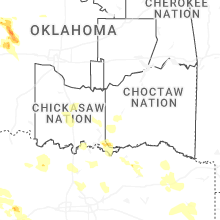
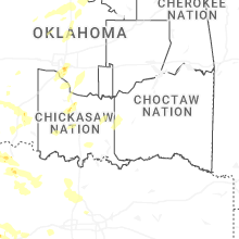
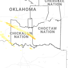
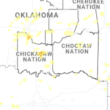


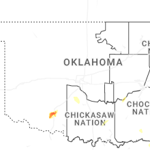
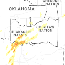


Connect with Interactive Hail Maps