

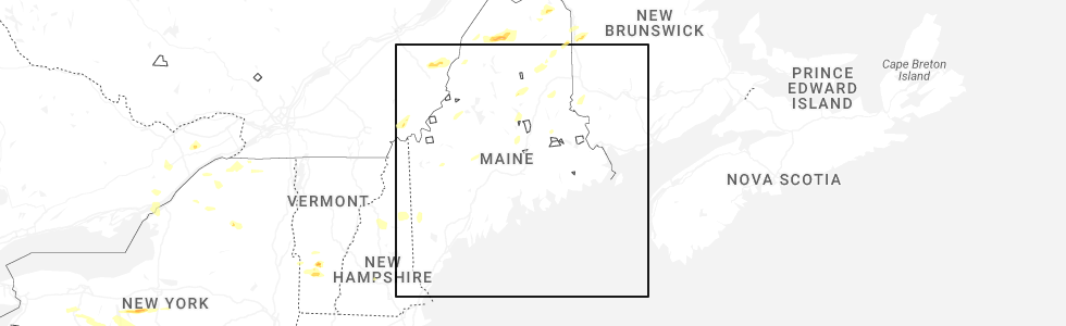
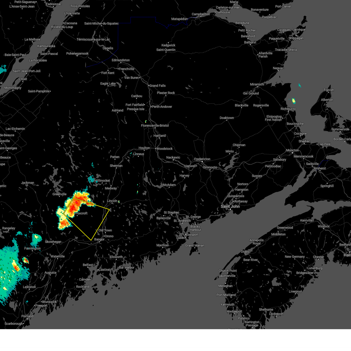
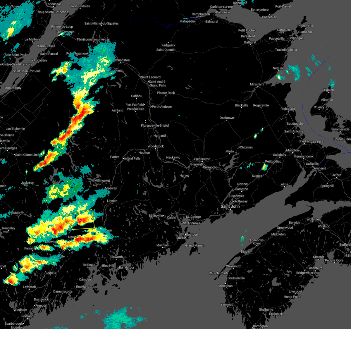
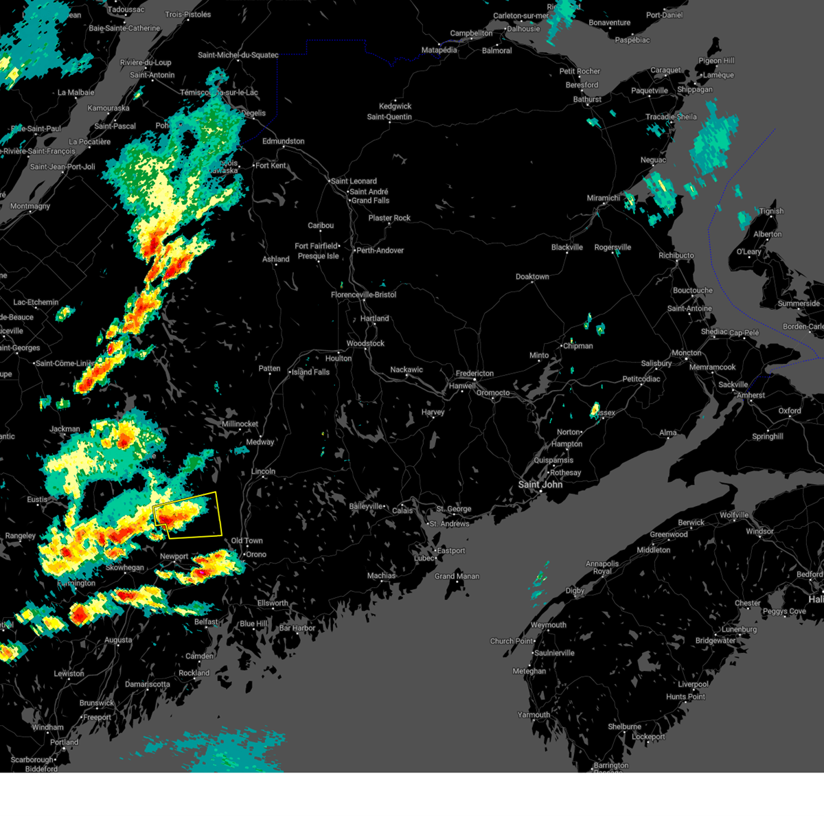
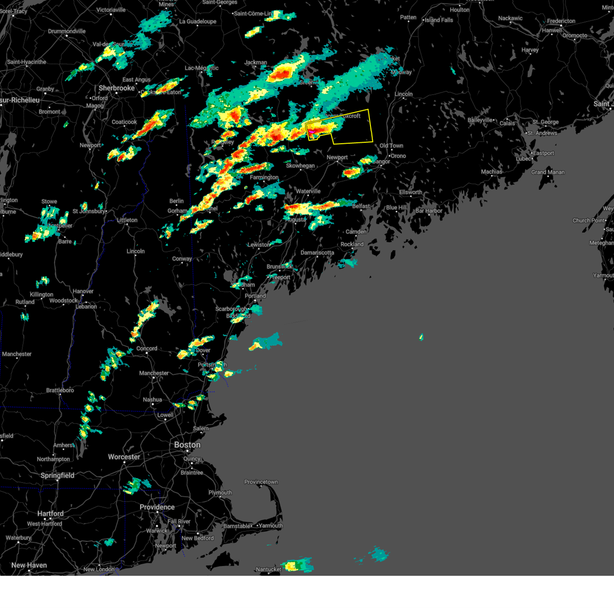
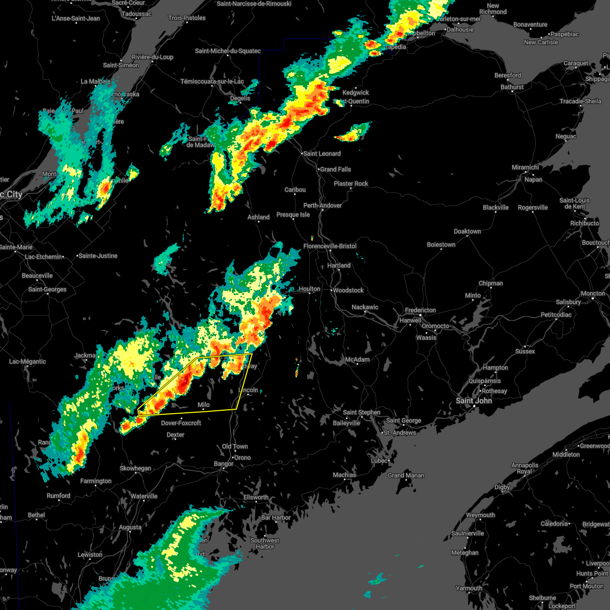
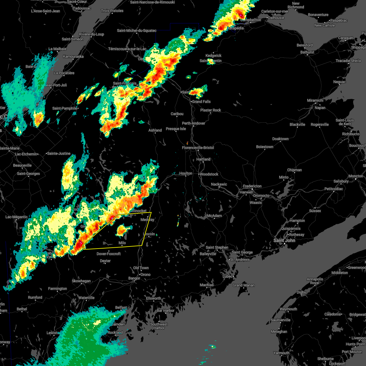
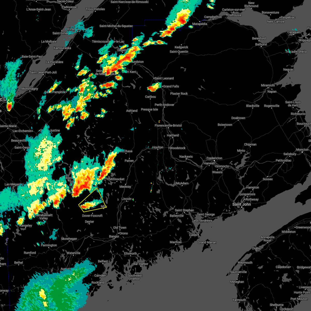
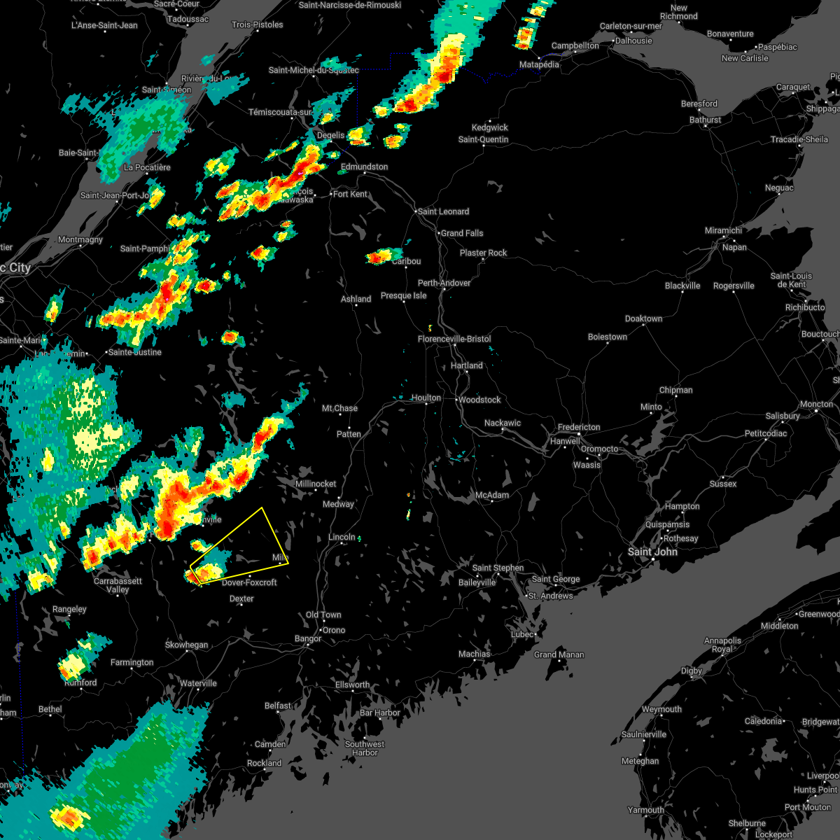
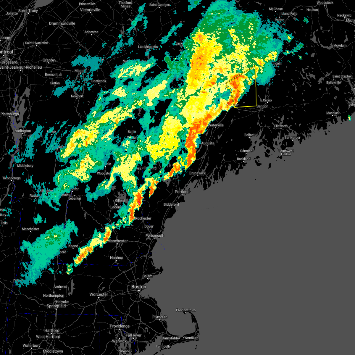
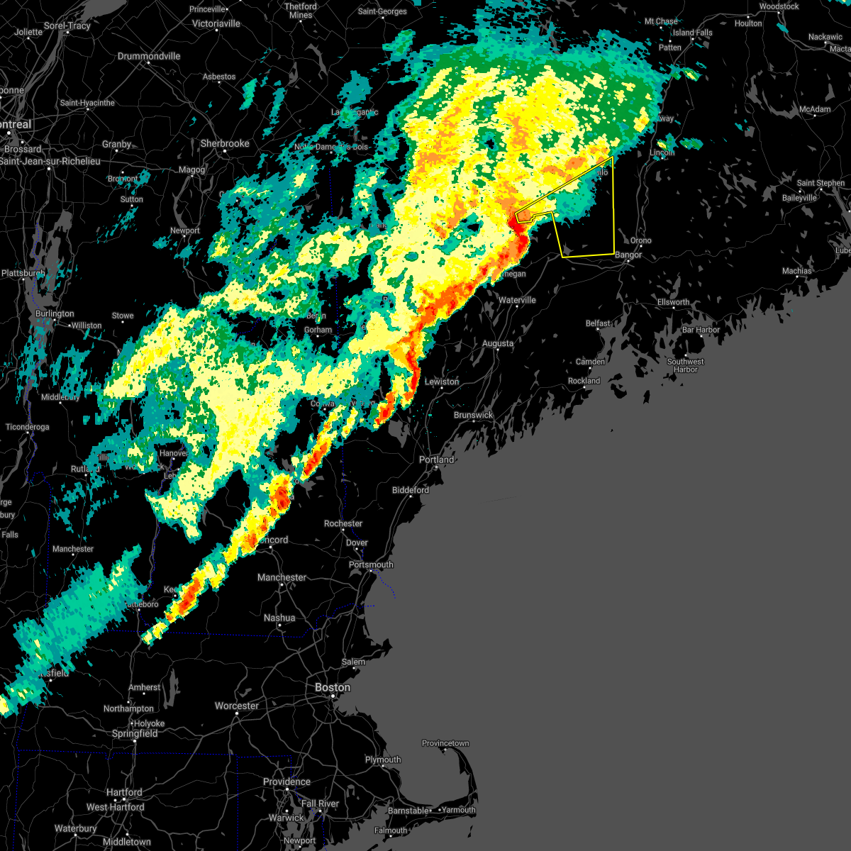
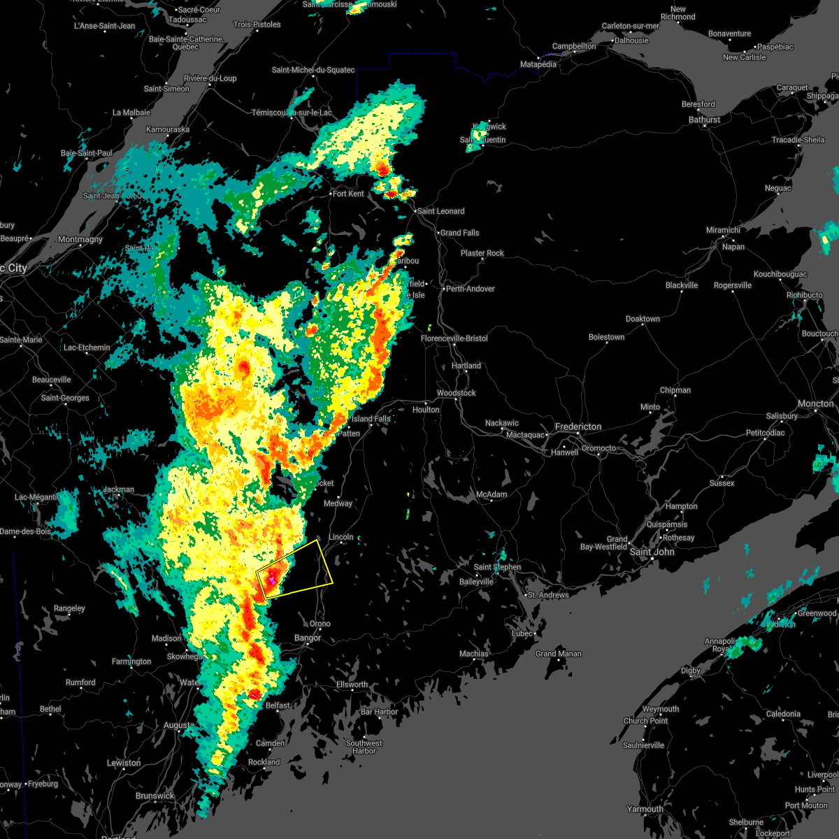
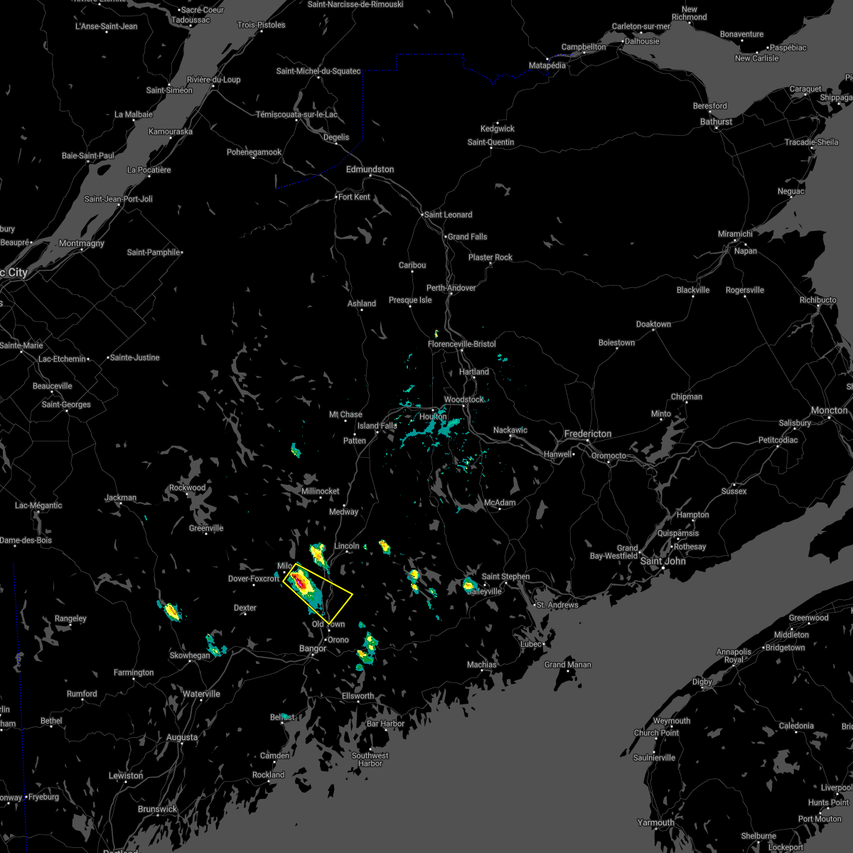
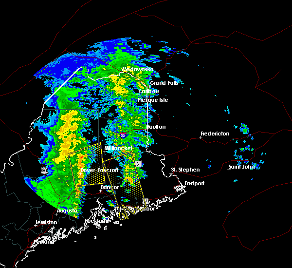
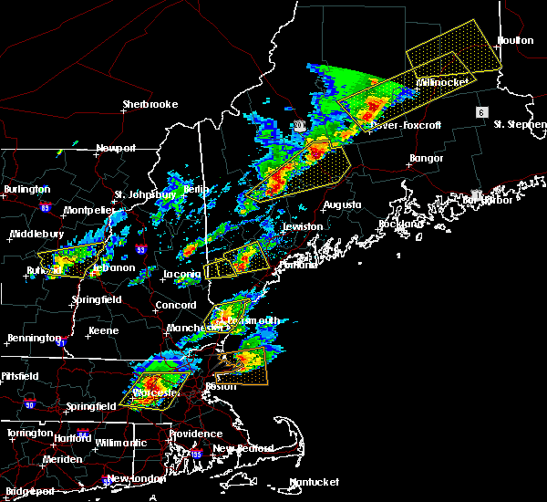
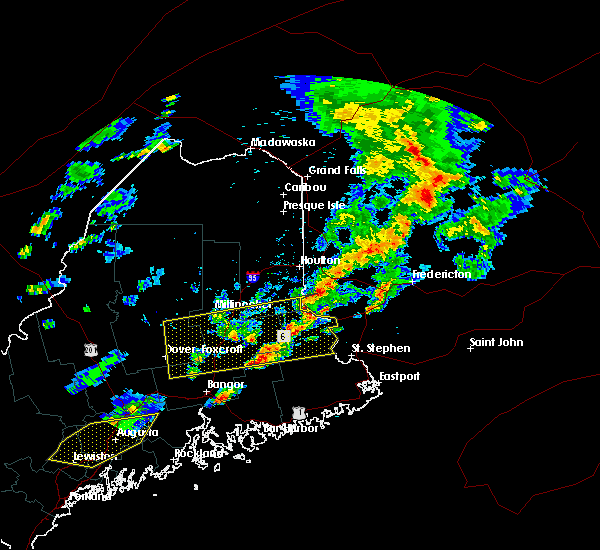
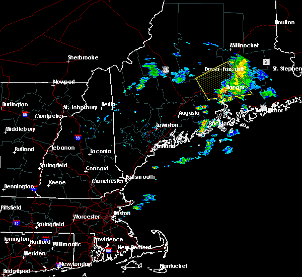
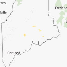
Hail Map for Milo, ME
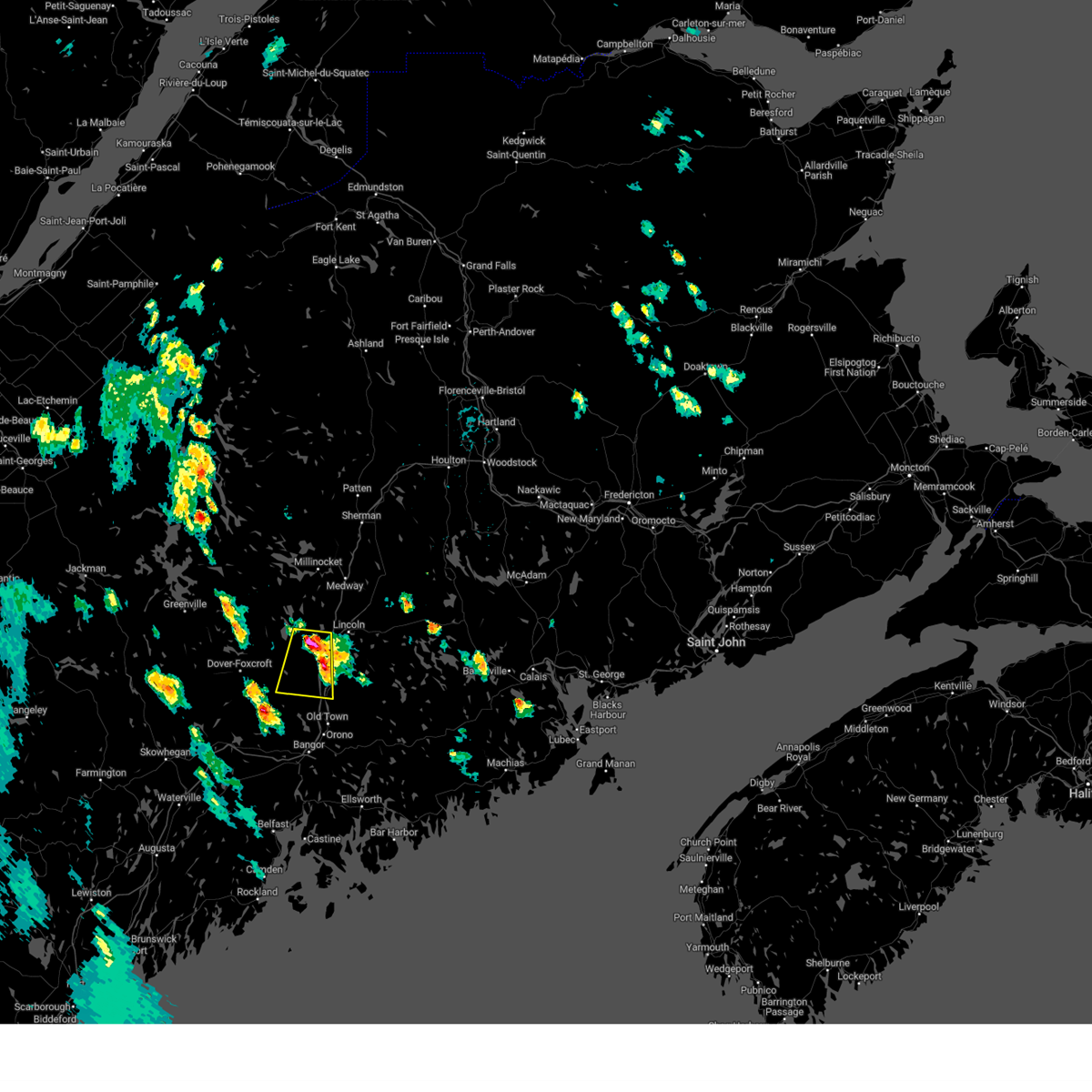
The Milo, ME area has had 4 reports of on-the-ground hail by trained spotters, and has been under severe weather warnings 7 times during the past 12 months. Doppler radar has detected hail at or near Milo, ME on 12 occasions, including 1 occasion during the past year.
| Name: | Milo, ME |
| Where Located: | 32.6 miles NNW of Bangor, ME |
| Map: | Google Map for Milo, ME |
| Population: | 1847 |
| Housing Units: | 993 |
| More Info: | Search Google for Milo, ME |
1
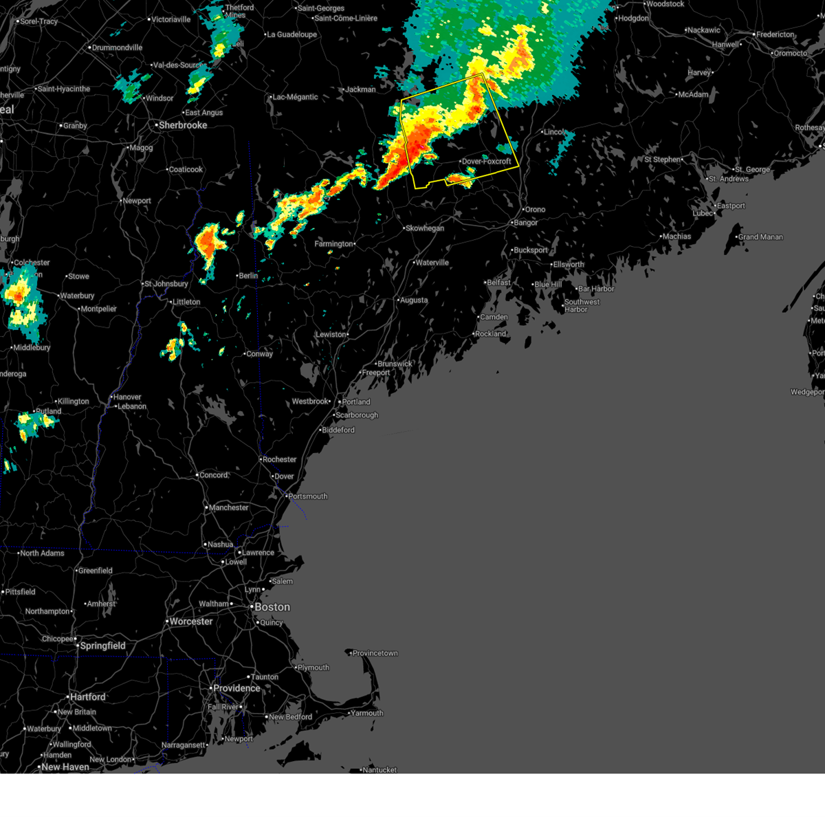
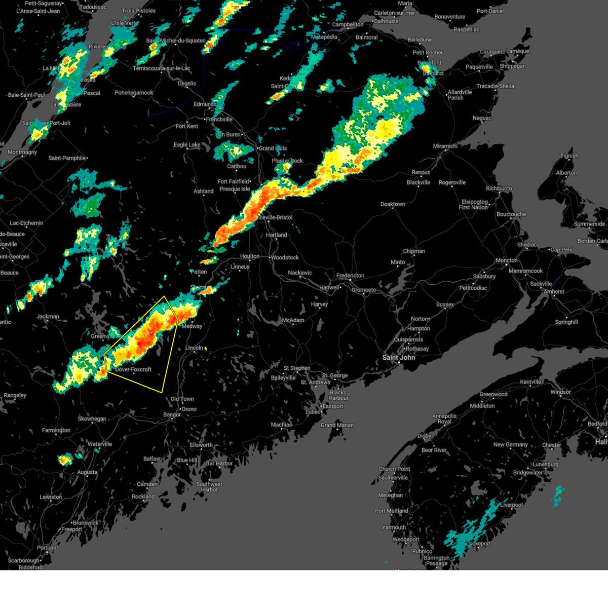
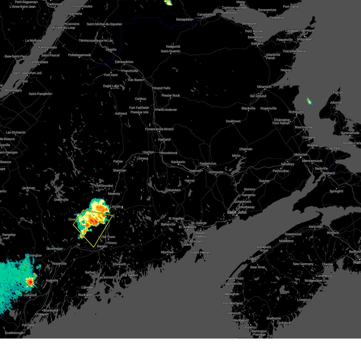
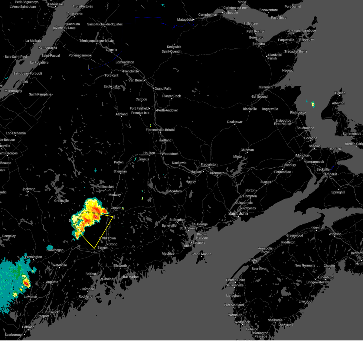
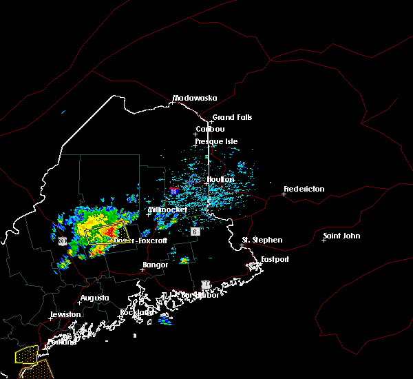
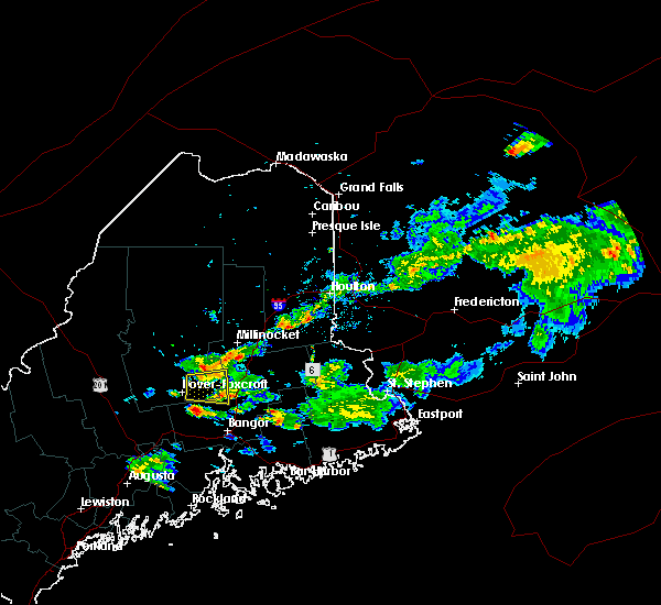
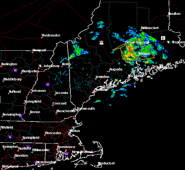
The Top Recent Hail Date for Milo, ME is Thursday, July 3, 2025 (2nd out of 12)
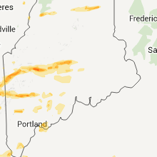
Hail and Wind Damage Spotted near Milo, ME
| Date / Time | Report Details |
|---|---|
| 7/3/2025 2:02 PM EDT |
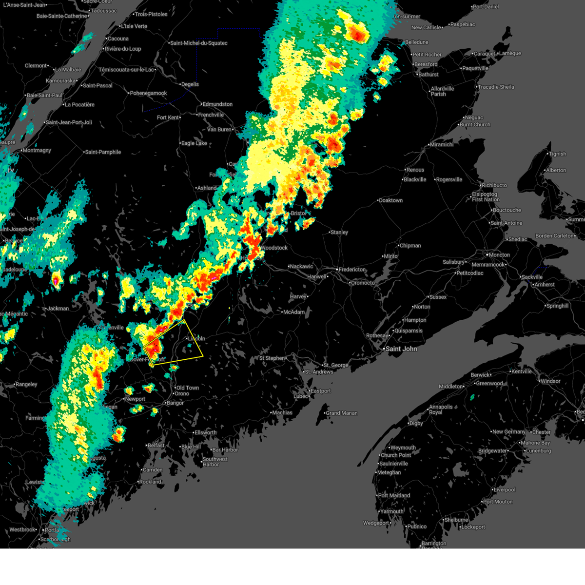 Svrcar the national weather service in caribou maine has issued a * severe thunderstorm warning for, southeastern piscataquis county in north central maine, central penobscot county in east central maine, * until 245 pm edt. * at 202 pm edt, a severe thunderstorm was located near milo, or 9 miles west of howland, moving northeast at 25 mph (radar indicated). Hazards include 60 mph wind gusts and quarter size hail. Minor hail damage to vehicles is possible. Expect wind damage to trees and power lines. Svrcar the national weather service in caribou maine has issued a * severe thunderstorm warning for, southeastern piscataquis county in north central maine, central penobscot county in east central maine, * until 245 pm edt. * at 202 pm edt, a severe thunderstorm was located near milo, or 9 miles west of howland, moving northeast at 25 mph (radar indicated). Hazards include 60 mph wind gusts and quarter size hail. Minor hail damage to vehicles is possible. Expect wind damage to trees and power lines.
|
| 6/19/2025 9:44 PM EDT |
 The storm which prompted the warning has weakened below severe limits, and no longer poses an immediate threat to life or property. therefore, the warning will be allowed to expire. however, gusty winds and heavy rain are still possible with this thunderstorm. a severe thunderstorm watch remains in effect until 1100 pm edt for north central and west central maine. to report severe weather, contact your nearest law enforcement agency. they will relay your report to the national weather service caribou maine. The storm which prompted the warning has weakened below severe limits, and no longer poses an immediate threat to life or property. therefore, the warning will be allowed to expire. however, gusty winds and heavy rain are still possible with this thunderstorm. a severe thunderstorm watch remains in effect until 1100 pm edt for north central and west central maine. to report severe weather, contact your nearest law enforcement agency. they will relay your report to the national weather service caribou maine.
|
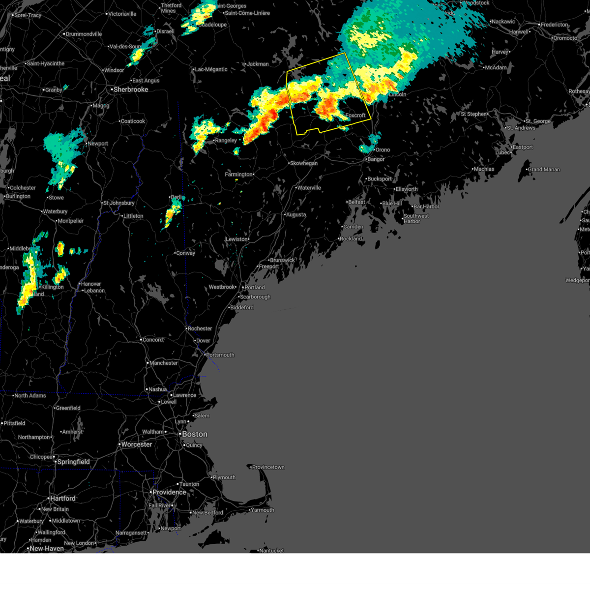
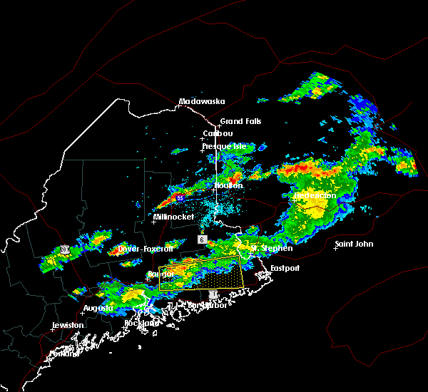
| 6/19/2025 9:14 PM EDT |
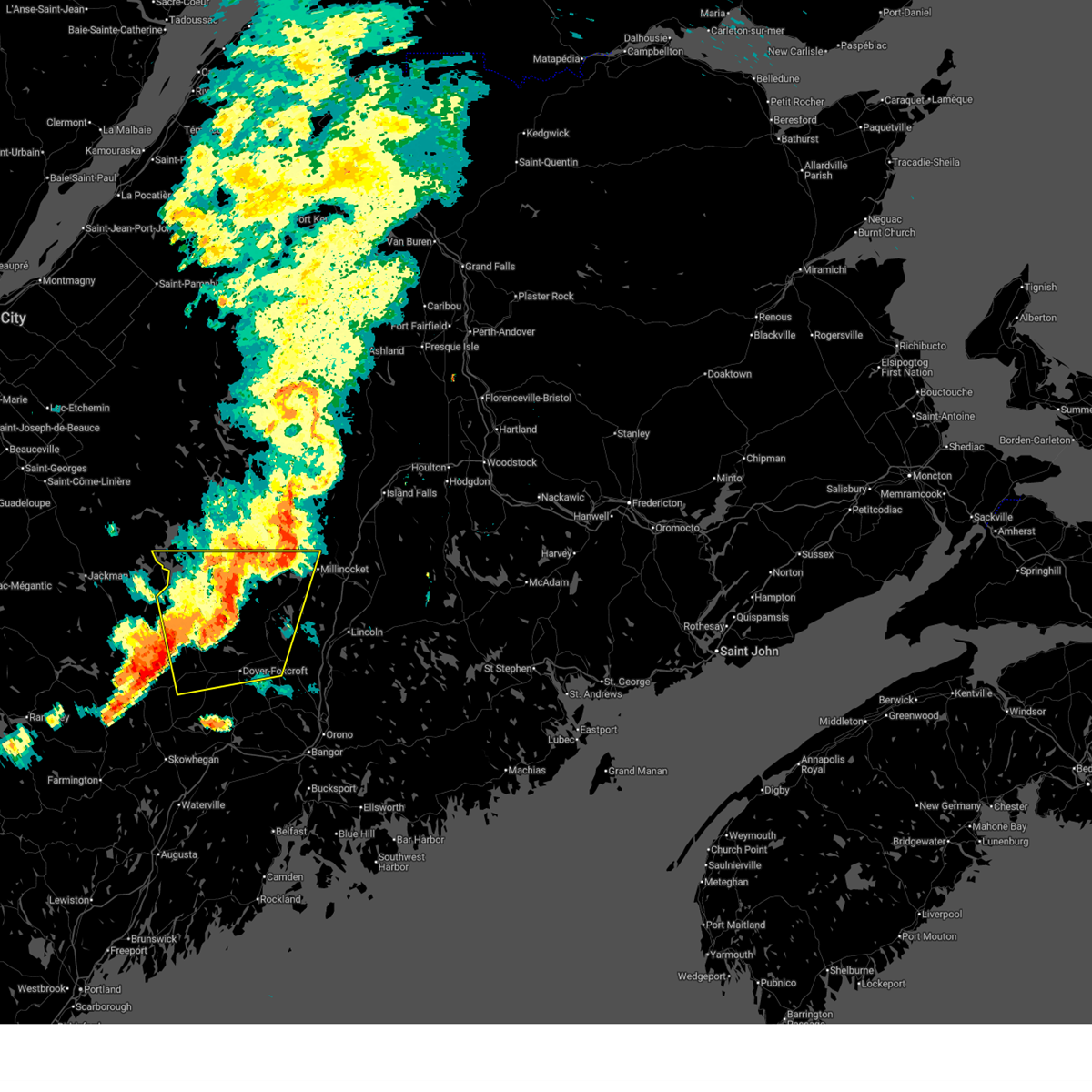
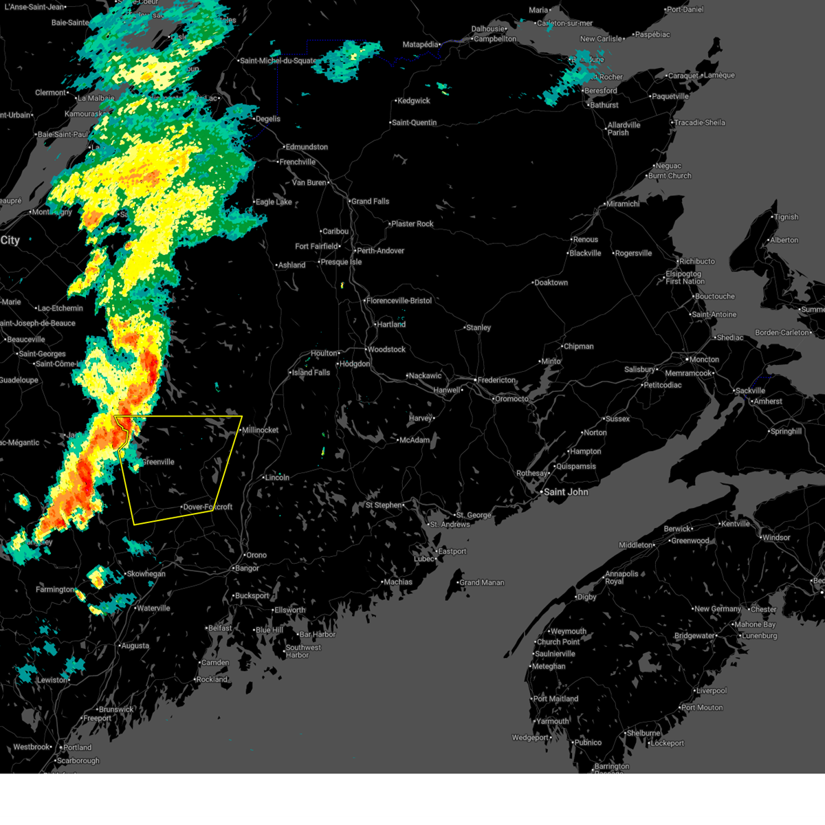
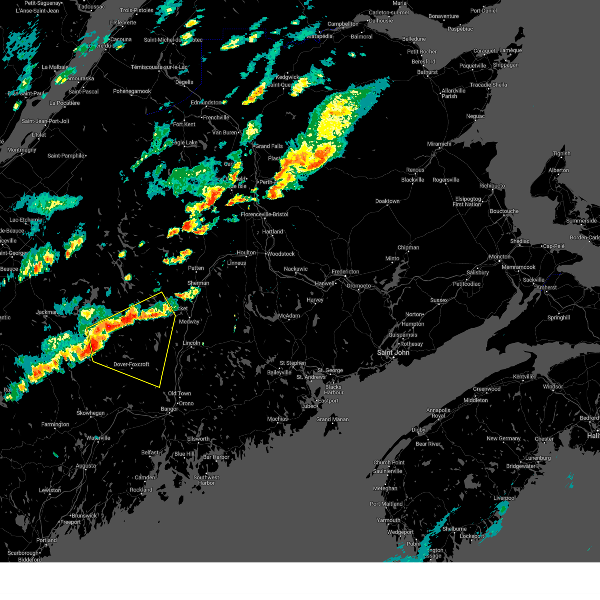
 At 914 pm edt, a severe thunderstorm was located near dover-foxcroft, moving east at 35 mph (radar indicated). Hazards include 60 mph wind gusts and quarter size hail. Minor hail damage to vehicles is possible. expect wind damage to trees and power lines. locations impacted include, dover-foxcroft, dexter, greenville, guilford, howland, brownville junction, milo, monson, blanchard, orneville, white cap mountain, ebeemee, kingsbury plantation, elliottsville, lake view plantation, frenchtown, charleston, sangerville, bradford, and brownville. This includes state highway 11 between milo and brownville junction. At 914 pm edt, a severe thunderstorm was located near dover-foxcroft, moving east at 35 mph (radar indicated). Hazards include 60 mph wind gusts and quarter size hail. Minor hail damage to vehicles is possible. expect wind damage to trees and power lines. locations impacted include, dover-foxcroft, dexter, greenville, guilford, howland, brownville junction, milo, monson, blanchard, orneville, white cap mountain, ebeemee, kingsbury plantation, elliottsville, lake view plantation, frenchtown, charleston, sangerville, bradford, and brownville. This includes state highway 11 between milo and brownville junction.
|
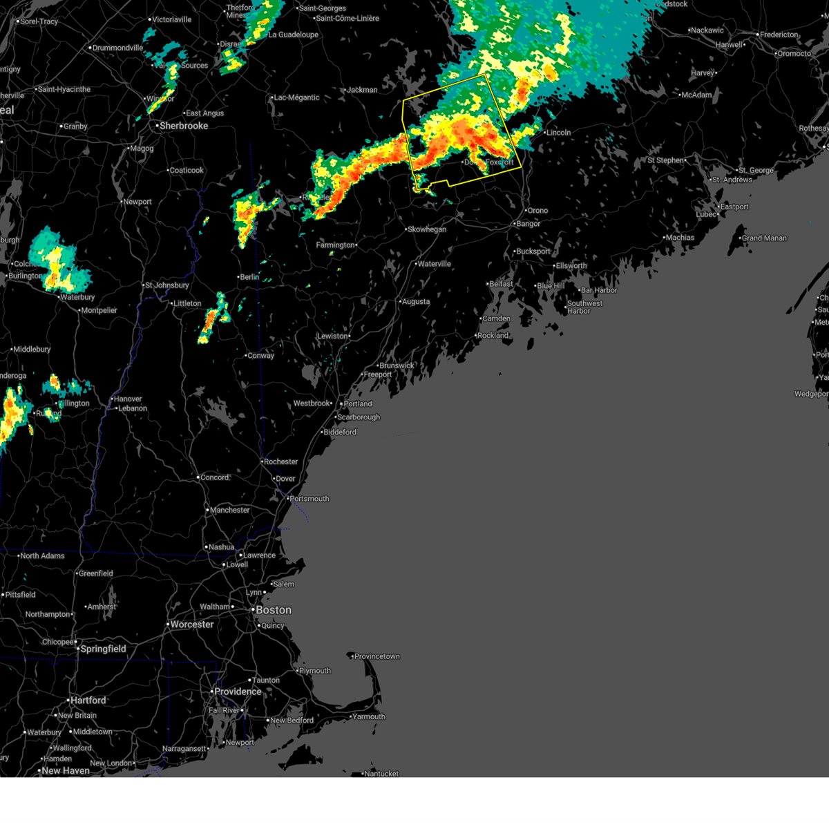
| 6/19/2025 8:43 PM EDT |
 Svrcar the national weather service in caribou maine has issued a * severe thunderstorm warning for, southern piscataquis county in north central maine, west central penobscot county in east central maine, * until 945 pm edt. * at 842 pm edt, a severe thunderstorm was located near kingsbury plantation, or 9 miles west of guilford, moving north east at 40 mph (radar indicated). Hazards include 60 mph wind gusts and quarter size hail. Minor hail damage to vehicles is possible. Expect wind damage to trees and power lines. Svrcar the national weather service in caribou maine has issued a * severe thunderstorm warning for, southern piscataquis county in north central maine, west central penobscot county in east central maine, * until 945 pm edt. * at 842 pm edt, a severe thunderstorm was located near kingsbury plantation, or 9 miles west of guilford, moving north east at 40 mph (radar indicated). Hazards include 60 mph wind gusts and quarter size hail. Minor hail damage to vehicles is possible. Expect wind damage to trees and power lines.
|
| 6/19/2025 8:29 PM EDT |
 The storm which prompted the warning has weakened below severe limits, and no longer poses an immediate threat to life or property. therefore, the warning will be allowed to expire. however, gusty winds and heavy rain are still possible with this thunderstorm. a severe thunderstorm watch remains in effect until 1100 pm edt for north central and west central maine. to report severe weather, contact your nearest law enforcement agency. they will relay your report to the national weather service caribou maine. The storm which prompted the warning has weakened below severe limits, and no longer poses an immediate threat to life or property. therefore, the warning will be allowed to expire. however, gusty winds and heavy rain are still possible with this thunderstorm. a severe thunderstorm watch remains in effect until 1100 pm edt for north central and west central maine. to report severe weather, contact your nearest law enforcement agency. they will relay your report to the national weather service caribou maine.
|
| 6/19/2025 7:54 PM EDT |
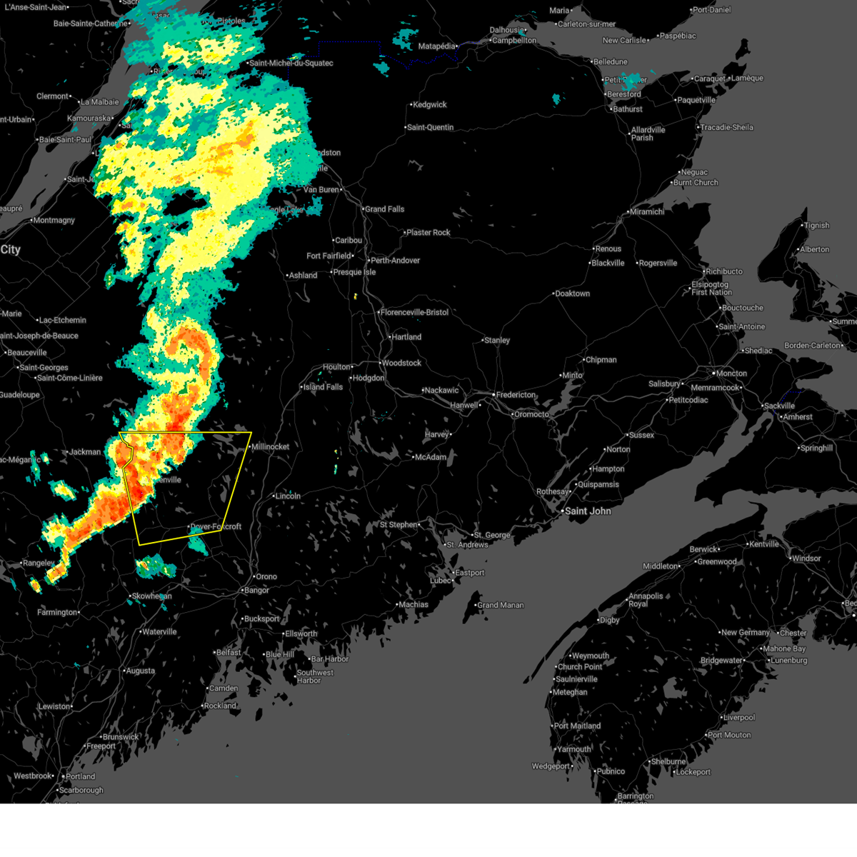 At 753 pm edt, a severe thunderstorm was located near frenchtown, or 9 miles northeast of greenville, moving east at 40 mph (radar indicated). Hazards include 70 mph wind gusts and half dollar size hail. Minor hail damage to vehicles is possible. expect considerable tree damage. wind damage is also likely to mobile homes, roofs, and outbuildings. locations impacted include, millinocket, dover-foxcroft, greenville, guilford, brownville junction, milo, monson, blanchard, rockwood, white cap mountain, ebeemee, kingsbury plantation, kokadjo, elliottsville, lake view plantation, frenchtown, orneville, sangerville, brownville, and parkman. This includes state highway 11 between milo and norcross. At 753 pm edt, a severe thunderstorm was located near frenchtown, or 9 miles northeast of greenville, moving east at 40 mph (radar indicated). Hazards include 70 mph wind gusts and half dollar size hail. Minor hail damage to vehicles is possible. expect considerable tree damage. wind damage is also likely to mobile homes, roofs, and outbuildings. locations impacted include, millinocket, dover-foxcroft, greenville, guilford, brownville junction, milo, monson, blanchard, rockwood, white cap mountain, ebeemee, kingsbury plantation, kokadjo, elliottsville, lake view plantation, frenchtown, orneville, sangerville, brownville, and parkman. This includes state highway 11 between milo and norcross.
|
| 6/19/2025 7:23 PM EDT |
 Svrcar the national weather service in caribou maine has issued a * severe thunderstorm warning for, southern piscataquis county in north central maine, central penobscot county in east central maine, * until 830 pm edt. * at 722 pm edt, a severe thunderstorm was located 8 miles south of rockwood, or 10 miles northwest of greenville, moving east at 35 mph (radar indicated). Hazards include 70 mph wind gusts and half dollar size hail. Minor hail damage to vehicles is possible. expect considerable tree damage. Wind damage is also likely to mobile homes, roofs, and outbuildings. Svrcar the national weather service in caribou maine has issued a * severe thunderstorm warning for, southern piscataquis county in north central maine, central penobscot county in east central maine, * until 830 pm edt. * at 722 pm edt, a severe thunderstorm was located 8 miles south of rockwood, or 10 miles northwest of greenville, moving east at 35 mph (radar indicated). Hazards include 70 mph wind gusts and half dollar size hail. Minor hail damage to vehicles is possible. expect considerable tree damage. Wind damage is also likely to mobile homes, roofs, and outbuildings.
|
| 6/30/2024 2:50 PM EDT |
 Svrcar the national weather service in caribou maine has issued a * severe thunderstorm warning for, northwestern washington county in southeastern maine, northeastern hancock county in southeastern maine, southeastern piscataquis county in north central maine, southeastern aroostook county in northern maine, southern penobscot county in east central maine, * until 330 pm edt. * at 250 pm edt, severe thunderstorms were located along a line extending from wytopitlock to near licoln township to 6 miles southeast of dover-foxcroft, moving east at 45 mph (radar indicated). Hazards include 70 mph wind gusts and quarter size hail. Minor hail damage to vehicles is possible. expect considerable tree damage. Wind damage is also likely to mobile homes, roofs, and outbuildings. Svrcar the national weather service in caribou maine has issued a * severe thunderstorm warning for, northwestern washington county in southeastern maine, northeastern hancock county in southeastern maine, southeastern piscataquis county in north central maine, southeastern aroostook county in northern maine, southern penobscot county in east central maine, * until 330 pm edt. * at 250 pm edt, severe thunderstorms were located along a line extending from wytopitlock to near licoln township to 6 miles southeast of dover-foxcroft, moving east at 45 mph (radar indicated). Hazards include 70 mph wind gusts and quarter size hail. Minor hail damage to vehicles is possible. expect considerable tree damage. Wind damage is also likely to mobile homes, roofs, and outbuildings.
|
| 6/30/2024 2:32 PM EDT |
 At 232 pm edt, severe thunderstorms were located along a line extending from 7 miles northeast of medway to near brownville junction, moving east at 30 mph (radar indicated). Hazards include 70 mph wind gusts and half dollar size hail. Minor hail damage to vehicles is possible. expect considerable tree damage. wind damage is also likely to mobile homes, roofs, and outbuildings. Locations impacted include, lincoln, dover-foxcroft, guilford, howland, brownville junction, milo, east millinocket, medway, haynesville, licoln township, wytopitlock, lake view plantation, reed plantation, orneville, ebeemee, enfield, hudson, charleston, bradford, and brownville. At 232 pm edt, severe thunderstorms were located along a line extending from 7 miles northeast of medway to near brownville junction, moving east at 30 mph (radar indicated). Hazards include 70 mph wind gusts and half dollar size hail. Minor hail damage to vehicles is possible. expect considerable tree damage. wind damage is also likely to mobile homes, roofs, and outbuildings. Locations impacted include, lincoln, dover-foxcroft, guilford, howland, brownville junction, milo, east millinocket, medway, haynesville, licoln township, wytopitlock, lake view plantation, reed plantation, orneville, ebeemee, enfield, hudson, charleston, bradford, and brownville.
|
| 6/30/2024 2:20 PM EDT | Tree down blocking lakeview roa in piscataquis county ME, 6 miles SSW of Milo, ME |
| 6/30/2024 2:14 PM EDT | Multiple trees down on davis street in brownvill in piscataquis county ME, 9 miles SSE of Milo, ME |
| 6/30/2024 2:07 PM EDT |
 Svrcar the national weather service in caribou maine has issued a * severe thunderstorm warning for, southeastern piscataquis county in north central maine, southeastern aroostook county in northern maine, central penobscot county in east central maine, * until 300 pm edt. * at 207 pm edt, severe thunderstorms were located along a line extending from near millinocket to 6 miles southeast of elliottsville, moving east at 30 mph (radar indicated). Hazards include 70 mph wind gusts and half dollar size hail. Minor hail damage to vehicles is possible. expect considerable tree damage. Wind damage is also likely to mobile homes, roofs, and outbuildings. Svrcar the national weather service in caribou maine has issued a * severe thunderstorm warning for, southeastern piscataquis county in north central maine, southeastern aroostook county in northern maine, central penobscot county in east central maine, * until 300 pm edt. * at 207 pm edt, severe thunderstorms were located along a line extending from near millinocket to 6 miles southeast of elliottsville, moving east at 30 mph (radar indicated). Hazards include 70 mph wind gusts and half dollar size hail. Minor hail damage to vehicles is possible. expect considerable tree damage. Wind damage is also likely to mobile homes, roofs, and outbuildings.
|
| 6/30/2024 2:04 PM EDT |
 At 204 pm edt, a severe thunderstorm was located near dover-foxcroft, moving east at 45 mph (radar indicated). Hazards include 70 mph wind gusts and half dollar size hail. Minor hail damage to vehicles is possible. expect considerable tree damage. wind damage is also likely to mobile homes, roofs, and outbuildings. Locations impacted include, millinocket, dover-foxcroft, guilford, brownville junction, milo, monson, blanchard, orneville, white cap mountain, ebeemee, elliottsville, lake view plantation, hudson, charleston, sangerville, bradford, brownville, garland, abbot, and lagrange. At 204 pm edt, a severe thunderstorm was located near dover-foxcroft, moving east at 45 mph (radar indicated). Hazards include 70 mph wind gusts and half dollar size hail. Minor hail damage to vehicles is possible. expect considerable tree damage. wind damage is also likely to mobile homes, roofs, and outbuildings. Locations impacted include, millinocket, dover-foxcroft, guilford, brownville junction, milo, monson, blanchard, orneville, white cap mountain, ebeemee, elliottsville, lake view plantation, hudson, charleston, sangerville, bradford, brownville, garland, abbot, and lagrange.
|
| 6/30/2024 1:34 PM EDT |
 Svrcar the national weather service in caribou maine has issued a * severe thunderstorm warning for, southern piscataquis county in north central maine, southwestern penobscot county in east central maine, * until 215 pm edt. * at 133 pm edt, a severe thunderstorm was located near blanchard, or 9 miles southwest of greenville, moving east at 45 mph (radar indicated). Hazards include 70 mph wind gusts and half dollar size hail. Minor hail damage to vehicles is possible. expect considerable tree damage. Wind damage is also likely to mobile homes, roofs, and outbuildings. Svrcar the national weather service in caribou maine has issued a * severe thunderstorm warning for, southern piscataquis county in north central maine, southwestern penobscot county in east central maine, * until 215 pm edt. * at 133 pm edt, a severe thunderstorm was located near blanchard, or 9 miles southwest of greenville, moving east at 45 mph (radar indicated). Hazards include 70 mph wind gusts and half dollar size hail. Minor hail damage to vehicles is possible. expect considerable tree damage. Wind damage is also likely to mobile homes, roofs, and outbuildings.
|
| 6/20/2024 3:50 PM EDT | Delayed report. tree down on powerlines near the bradford fire statio in penobscot county ME, 10.6 miles NNW of Milo, ME |
| 6/19/2024 4:55 PM EDT |
 The storm which prompted the warning has weakened below severe limits, and no longer poses an immediate threat to life or property. therefore, the warning will be allowed to expire. however, gusty winds and heavy rain are still possible with this thunderstorm. The storm which prompted the warning has weakened below severe limits, and no longer poses an immediate threat to life or property. therefore, the warning will be allowed to expire. however, gusty winds and heavy rain are still possible with this thunderstorm.
|
| 6/19/2024 4:44 PM EDT |
 At 444 pm edt, a severe thunderstorm was located near orneville, or 8 miles east of dover-foxcroft, moving southeast at 30 mph (radar indicated). Hazards include 60 mph wind gusts and penny size hail. Expect damage to trees and power lines. Locations impacted include, dover-foxcroft, dexter, guilford, howland, hermon, corinth, milo, kenduskeag, orneville, east corinth, lake view plantation, glenburn, levant, enfield, hudson, charleston, sangerville, bradford, brownville, and garland. At 444 pm edt, a severe thunderstorm was located near orneville, or 8 miles east of dover-foxcroft, moving southeast at 30 mph (radar indicated). Hazards include 60 mph wind gusts and penny size hail. Expect damage to trees and power lines. Locations impacted include, dover-foxcroft, dexter, guilford, howland, hermon, corinth, milo, kenduskeag, orneville, east corinth, lake view plantation, glenburn, levant, enfield, hudson, charleston, sangerville, bradford, brownville, and garland.
|
| 6/19/2024 4:40 PM EDT | Trees down on power lines and blocking roads in ornevill in piscataquis county ME, 3.5 miles N of Milo, ME |
| 6/19/2024 4:35 PM EDT | Trees down on power lines and blocking roads in atkinso in piscataquis county ME, 6.4 miles NE of Milo, ME |
| 6/19/2024 4:35 PM EDT | Trees down on power lines and blocking roads in mil in piscataquis county ME, 0.7 miles S of Milo, ME |
| 6/19/2024 4:21 PM EDT | Corrects previous tstm wnd dmg report from sebec. trees down on power lines and blocking roads in sebe in piscataquis county ME, 6.5 miles ESE of Milo, ME |
| 6/19/2024 4:20 PM EDT | Trees down on power lines and blocking roads in brownvill in piscataquis county ME, 5.1 miles SE of Milo, ME |
| 6/19/2024 4:17 PM EDT | Trees down on power lines and blocking roads in sebe in piscataquis county ME, 6.5 miles ESE of Milo, ME |
| 6/19/2024 4:17 PM EDT |
 Svrcar the national weather service in caribou maine has issued a * severe thunderstorm warning for, southeastern piscataquis county in north central maine, southwestern penobscot county in east central maine, * until 500 pm edt. * at 416 pm edt, a severe thunderstorm was located near guilford, moving southeast at 30 mph (radar indicated). Hazards include 60 mph wind gusts and penny size hail. expect damage to trees and power lines Svrcar the national weather service in caribou maine has issued a * severe thunderstorm warning for, southeastern piscataquis county in north central maine, southwestern penobscot county in east central maine, * until 500 pm edt. * at 416 pm edt, a severe thunderstorm was located near guilford, moving southeast at 30 mph (radar indicated). Hazards include 60 mph wind gusts and penny size hail. expect damage to trees and power lines
|
| 6/5/2024 5:03 PM EDT | Two or three trees down on power lines on shore road south. location reported as on the dover foxcroft/sebec lin in piscataquis county ME, 7 miles ESE of Milo, ME |
| 6/5/2024 3:55 PM EDT |
 Svrcar the national weather service in caribou maine has issued a * severe thunderstorm warning for, southeastern piscataquis county in north central maine, central penobscot county in east central maine, * until 445 pm edt. * at 354 pm edt, a severe thunderstorm was located near howland, moving south at 15 mph (radar indicated). Hazards include 60 mph wind gusts and quarter size hail. Minor hail damage to vehicles is possible. Expect wind damage to trees and power lines. Svrcar the national weather service in caribou maine has issued a * severe thunderstorm warning for, southeastern piscataquis county in north central maine, central penobscot county in east central maine, * until 445 pm edt. * at 354 pm edt, a severe thunderstorm was located near howland, moving south at 15 mph (radar indicated). Hazards include 60 mph wind gusts and quarter size hail. Minor hail damage to vehicles is possible. Expect wind damage to trees and power lines.
|
| 8/13/2023 4:54 PM EDT |
 The severe thunderstorm warning for southeastern piscataquis and southwestern penobscot counties will expire at 500 pm edt, the storms which prompted the warning have weakened below severe limits, but frequent cloud to ground lightning and heavy downpours are still likely. therefore, the warning will be allowed to expire. however small hail is still possible with this thunderstorm. a severe thunderstorm watch remains in effect until 900 pm edt for north central, west central and east central maine. The severe thunderstorm warning for southeastern piscataquis and southwestern penobscot counties will expire at 500 pm edt, the storms which prompted the warning have weakened below severe limits, but frequent cloud to ground lightning and heavy downpours are still likely. therefore, the warning will be allowed to expire. however small hail is still possible with this thunderstorm. a severe thunderstorm watch remains in effect until 900 pm edt for north central, west central and east central maine.
|
| 8/13/2023 4:37 PM EDT |
 At 437 pm edt, a severe thunderstorm was located near orneville, or 8 miles southwest of howland, moving east at 25 mph (radar indicated). Hazards include ping pong ball size hail and 60 mph wind gusts. People and animals outdoors will be injured. expect hail damage to roofs, siding, windows, and vehicles. expect wind damage to trees and power lines. locations impacted include, dexter, corinth, milo, orneville, east corinth, corinna, hudson, charleston, bradford, garland, exeter, atkinson and boyd lake. this includes state highway 11 between east corinth and bradford. hail threat, radar indicated max hail size, 1. 50 in wind threat, radar indicated max wind gust, 60 mph. At 437 pm edt, a severe thunderstorm was located near orneville, or 8 miles southwest of howland, moving east at 25 mph (radar indicated). Hazards include ping pong ball size hail and 60 mph wind gusts. People and animals outdoors will be injured. expect hail damage to roofs, siding, windows, and vehicles. expect wind damage to trees and power lines. locations impacted include, dexter, corinth, milo, orneville, east corinth, corinna, hudson, charleston, bradford, garland, exeter, atkinson and boyd lake. this includes state highway 11 between east corinth and bradford. hail threat, radar indicated max hail size, 1. 50 in wind threat, radar indicated max wind gust, 60 mph.
|
| 8/13/2023 4:13 PM EDT |
 At 413 pm edt, a severe thunderstorm was located near orneville, or 9 miles east of dover-foxcroft, moving east at 25 mph (radar indicated). Hazards include ping pong ball size hail and 60 mph wind gusts. People and animals outdoors will be injured. expect hail damage to roofs, siding, windows, and vehicles. Expect wind damage to trees and power lines. At 413 pm edt, a severe thunderstorm was located near orneville, or 9 miles east of dover-foxcroft, moving east at 25 mph (radar indicated). Hazards include ping pong ball size hail and 60 mph wind gusts. People and animals outdoors will be injured. expect hail damage to roofs, siding, windows, and vehicles. Expect wind damage to trees and power lines.
|
| 8/13/2023 4:08 PM EDT |
 The severe thunderstorm warning for southeastern piscataquis and southwestern penobscot counties will expire at 415 pm edt, the storms which prompted the warning have weakened below severe limits, but frequent cloud to ground lightning and heavy downpours are still likely. therefore, the warning will be allowed to expire. however small hail is still possible with this thunderstorm. a severe thunderstorm watch remains in effect until 900 pm edt for north central, west central and east central maine. The severe thunderstorm warning for southeastern piscataquis and southwestern penobscot counties will expire at 415 pm edt, the storms which prompted the warning have weakened below severe limits, but frequent cloud to ground lightning and heavy downpours are still likely. therefore, the warning will be allowed to expire. however small hail is still possible with this thunderstorm. a severe thunderstorm watch remains in effect until 900 pm edt for north central, west central and east central maine.
|
| 8/13/2023 3:42 PM EDT |
 At 342 pm edt, a severe thunderstorm was located near dexter, moving east at 25 mph (radar indicated). Hazards include ping pong ball size hail and 60 mph wind gusts. People and animals outdoors will be injured. expect hail damage to roofs, siding, windows, and vehicles. expect wind damage to trees and power lines. locations impacted include, dover-foxcroft, dexter, guilford, corinth, milo, orneville, east corinth, corinna, hudson, charleston, sangerville, bradford, garland, exeter, parkman, abbot, sebec, atkinson, medford and boyd lake. this includes state highway 11 between east corinth and milo. hail threat, radar indicated max hail size, 1. 50 in wind threat, radar indicated max wind gust, 60 mph. At 342 pm edt, a severe thunderstorm was located near dexter, moving east at 25 mph (radar indicated). Hazards include ping pong ball size hail and 60 mph wind gusts. People and animals outdoors will be injured. expect hail damage to roofs, siding, windows, and vehicles. expect wind damage to trees and power lines. locations impacted include, dover-foxcroft, dexter, guilford, corinth, milo, orneville, east corinth, corinna, hudson, charleston, sangerville, bradford, garland, exeter, parkman, abbot, sebec, atkinson, medford and boyd lake. this includes state highway 11 between east corinth and milo. hail threat, radar indicated max hail size, 1. 50 in wind threat, radar indicated max wind gust, 60 mph.
|
| 8/13/2023 3:12 PM EDT |
 At 311 pm edt, a severe thunderstorm was located near kingsbury plantation, or 12 miles west of dexter, moving east at 25 mph (radar indicated). Hazards include golf ball size hail and 70 mph wind gusts. People and animals outdoors will be injured. expect hail damage to roofs, siding, windows, and vehicles. expect considerable tree damage. Wind damage is also likely to mobile homes, roofs, and outbuildings. At 311 pm edt, a severe thunderstorm was located near kingsbury plantation, or 12 miles west of dexter, moving east at 25 mph (radar indicated). Hazards include golf ball size hail and 70 mph wind gusts. People and animals outdoors will be injured. expect hail damage to roofs, siding, windows, and vehicles. expect considerable tree damage. Wind damage is also likely to mobile homes, roofs, and outbuildings.
|
| 7/12/2023 5:17 PM EDT | Tree down on powerlines blocking davis st (route 11). power is out in the area. time estimated based on rada in piscataquis county ME, 8.2 miles SSE of Milo, ME |
| 7/12/2023 5:15 PM EDT | Corrects previous tstm wnd dmg report from 1 nnw brownville junction. tree down on powerlines. power is out in the area. time estimated on rada in piscataquis county ME, 8.6 miles SSE of Milo, ME |
| 7/12/2023 4:34 PM EDT | Tree down on powerlines. power is out in the area. time estimated on rada in piscataquis county ME, 8.6 miles SSE of Milo, ME |
| 7/12/2022 8:07 PM EDT |
 At 807 pm edt, severe thunderstorms were located along a line extending from 7 miles east of sherman to near lake view plantation, moving northeast at 45 mph (radar indicated). Hazards include 60 mph wind gusts and quarter size hail. Minor hail damage to vehicles is possible. expect wind damage to trees and power lines. locations impacted include, millinocket, dover-foxcroft, howland, brownville junction, milo, east millinocket, medway, sherman, ebeemee, lake view plantation, licoln township, southeastern katahdin woods and waters national monument, enfield, brownville, lagrange, sebec, chester, stacyville, medford and woodville. hail threat, radar indicated max hail size, 1. 00 in wind threat, radar indicated max wind gust, 60 mph. At 807 pm edt, severe thunderstorms were located along a line extending from 7 miles east of sherman to near lake view plantation, moving northeast at 45 mph (radar indicated). Hazards include 60 mph wind gusts and quarter size hail. Minor hail damage to vehicles is possible. expect wind damage to trees and power lines. locations impacted include, millinocket, dover-foxcroft, howland, brownville junction, milo, east millinocket, medway, sherman, ebeemee, lake view plantation, licoln township, southeastern katahdin woods and waters national monument, enfield, brownville, lagrange, sebec, chester, stacyville, medford and woodville. hail threat, radar indicated max hail size, 1. 00 in wind threat, radar indicated max wind gust, 60 mph.
|
| 7/12/2022 7:45 PM EDT |
 At 744 pm edt, severe thunderstorms were located along a line extending from 8 miles northeast of east millinocket to 6 miles southwest of brownville junction, moving northeast at 45 mph (radar indicated). Hazards include 60 mph wind gusts and quarter size hail. Minor hail damage to vehicles is possible. Expect wind damage to trees and power lines. At 744 pm edt, severe thunderstorms were located along a line extending from 8 miles northeast of east millinocket to 6 miles southwest of brownville junction, moving northeast at 45 mph (radar indicated). Hazards include 60 mph wind gusts and quarter size hail. Minor hail damage to vehicles is possible. Expect wind damage to trees and power lines.
|
| 7/12/2022 7:29 PM EDT |
 At 729 pm edt, severe thunderstorms were located along a line extending from near millinocket to 6 miles southeast of elliottsville, moving east at 30 mph (radar indicated). Hazards include 70 mph wind gusts and ping pong ball size hail. People and animals outdoors will be injured. expect hail damage to roofs, siding, windows, and vehicles. expect considerable tree damage. wind damage is also likely to mobile homes, roofs, and outbuildings. locations impacted include, millinocket, dover-foxcroft, guilford, howland, brownville junction, milo, east millinocket, medway, monson, blanchard, ebeemee, elliottsville, lake view plantation, kingsbury plantation, enfield, brownville, abbot, sebec, chester and medford. thunderstorm damage threat, considerable hail threat, radar indicated max hail size, 1. 50 in wind threat, radar indicated max wind gust, 70 mph. At 729 pm edt, severe thunderstorms were located along a line extending from near millinocket to 6 miles southeast of elliottsville, moving east at 30 mph (radar indicated). Hazards include 70 mph wind gusts and ping pong ball size hail. People and animals outdoors will be injured. expect hail damage to roofs, siding, windows, and vehicles. expect considerable tree damage. wind damage is also likely to mobile homes, roofs, and outbuildings. locations impacted include, millinocket, dover-foxcroft, guilford, howland, brownville junction, milo, east millinocket, medway, monson, blanchard, ebeemee, elliottsville, lake view plantation, kingsbury plantation, enfield, brownville, abbot, sebec, chester and medford. thunderstorm damage threat, considerable hail threat, radar indicated max hail size, 1. 50 in wind threat, radar indicated max wind gust, 70 mph.
|
| 7/12/2022 7:01 PM EDT |
 At 700 pm edt, severe thunderstorms were located along a line extending from 10 miles northeast of white cap mountain to blanchard, moving east at 30 mph (radar indicated). Hazards include 70 mph wind gusts and ping pong ball size hail. People and animals outdoors will be injured. expect hail damage to roofs, siding, windows, and vehicles. expect considerable tree damage. Wind damage is also likely to mobile homes, roofs, and outbuildings. At 700 pm edt, severe thunderstorms were located along a line extending from 10 miles northeast of white cap mountain to blanchard, moving east at 30 mph (radar indicated). Hazards include 70 mph wind gusts and ping pong ball size hail. People and animals outdoors will be injured. expect hail damage to roofs, siding, windows, and vehicles. expect considerable tree damage. Wind damage is also likely to mobile homes, roofs, and outbuildings.
|
| 7/12/2022 6:27 PM EDT |
 At 626 pm edt, a severe thunderstorm was located near monson, or near guilford, moving northeast at 30 mph (radar indicated). Hazards include 60 mph wind gusts and quarter size hail. Minor hail damage to vehicles is possible. expect wind damage to trees and power lines. locations impacted include, dover-foxcroft, guilford, brownville junction, milo, monson, ebeemee, elliottsville, brownville, abbot, sebec, willimantic, bowerbank, onawa, barnard, katahdin iron works and williamsburg. hail threat, radar indicated max hail size, 1. 00 in wind threat, radar indicated max wind gust, 60 mph. At 626 pm edt, a severe thunderstorm was located near monson, or near guilford, moving northeast at 30 mph (radar indicated). Hazards include 60 mph wind gusts and quarter size hail. Minor hail damage to vehicles is possible. expect wind damage to trees and power lines. locations impacted include, dover-foxcroft, guilford, brownville junction, milo, monson, ebeemee, elliottsville, brownville, abbot, sebec, willimantic, bowerbank, onawa, barnard, katahdin iron works and williamsburg. hail threat, radar indicated max hail size, 1. 00 in wind threat, radar indicated max wind gust, 60 mph.
|
| 7/12/2022 6:06 PM EDT |
 At 606 pm edt, a severe thunderstorm was located near kingsbury plantation, or 11 miles west of guilford, moving northeast at 25 mph (radar indicated). Hazards include 60 mph wind gusts and quarter size hail. Minor hail damage to vehicles is possible. Expect wind damage to trees and power lines. At 606 pm edt, a severe thunderstorm was located near kingsbury plantation, or 11 miles west of guilford, moving northeast at 25 mph (radar indicated). Hazards include 60 mph wind gusts and quarter size hail. Minor hail damage to vehicles is possible. Expect wind damage to trees and power lines.
|
| 9/15/2021 5:23 PM EDT |
 At 521 pm edt, a severe thunderstorm was located over dover-foxcroft, moving northeast at 50 mph (radar indicated). Hazards include 60 mph wind gusts and quarter size hail. Minor hail damage to vehicles is possible. expect wind damage to trees and power lines. locations impacted include, dover-foxcroft, dexter, newport, guilford, hermon, corinth, milo, kenduskeag, orneville, east corinth, lake view plantation, glenburn, levant, carmel, corinna, hudson, charleston, sangerville, bradford and brownville. hail threat, radar indicated max hail size, 1. 00 in wind threat, radar indicated max wind gust, 60 mph. At 521 pm edt, a severe thunderstorm was located over dover-foxcroft, moving northeast at 50 mph (radar indicated). Hazards include 60 mph wind gusts and quarter size hail. Minor hail damage to vehicles is possible. expect wind damage to trees and power lines. locations impacted include, dover-foxcroft, dexter, newport, guilford, hermon, corinth, milo, kenduskeag, orneville, east corinth, lake view plantation, glenburn, levant, carmel, corinna, hudson, charleston, sangerville, bradford and brownville. hail threat, radar indicated max hail size, 1. 00 in wind threat, radar indicated max wind gust, 60 mph.
|
| 9/15/2021 4:57 PM EDT |
 At 456 pm edt, a severe thunderstorm was located 11 miles south of kingsbury plantation, or 15 miles west of dexter, moving northeast at 55 mph (radar indicated). Hazards include 60 mph wind gusts and quarter size hail. Minor hail damage to vehicles is possible. Expect wind damage to trees and power lines. At 456 pm edt, a severe thunderstorm was located 11 miles south of kingsbury plantation, or 15 miles west of dexter, moving northeast at 55 mph (radar indicated). Hazards include 60 mph wind gusts and quarter size hail. Minor hail damage to vehicles is possible. Expect wind damage to trees and power lines.
|
| 9/6/2021 5:20 PM EDT |
 At 520 pm edt, a severe thunderstorm was located near orneville, or 8 miles east of dover-foxcroft, moving east at 15 mph (radar indicated). Hazards include 60 mph wind gusts and quarter size hail. Minor hail damage to vehicles is possible. Expect wind damage to trees and power lines. At 520 pm edt, a severe thunderstorm was located near orneville, or 8 miles east of dover-foxcroft, moving east at 15 mph (radar indicated). Hazards include 60 mph wind gusts and quarter size hail. Minor hail damage to vehicles is possible. Expect wind damage to trees and power lines.
|
| 6/19/2021 3:51 PM EDT | Multiple trees down. time estimated via rada in penobscot county ME, 11.1 miles N of Milo, ME |
| 6/6/2021 4:48 PM EDT |
 At 448 pm edt, a severe thunderstorm was located near orneville, or 10 miles west of howland, moving southeast at 25 mph (radar indicated). Hazards include 60 mph wind gusts and quarter size hail. Minor hail damage to vehicles is possible. expect wind damage to trees and power lines. Locations impacted include, old town, howland, milo, orneville, milford, greenbush, bradford, alton, lagrange, passadumkeag, argyle, medford, maxfield, costigan and boyd lake. At 448 pm edt, a severe thunderstorm was located near orneville, or 10 miles west of howland, moving southeast at 25 mph (radar indicated). Hazards include 60 mph wind gusts and quarter size hail. Minor hail damage to vehicles is possible. expect wind damage to trees and power lines. Locations impacted include, old town, howland, milo, orneville, milford, greenbush, bradford, alton, lagrange, passadumkeag, argyle, medford, maxfield, costigan and boyd lake.
|
| 6/6/2021 4:41 PM EDT |
 At 440 pm edt, a severe thunderstorm was located near orneville, or 11 miles west of howland, moving southeast at 25 mph (radar indicated). Hazards include 60 mph wind gusts and penny size hail. expect damage to trees and power lines At 440 pm edt, a severe thunderstorm was located near orneville, or 11 miles west of howland, moving southeast at 25 mph (radar indicated). Hazards include 60 mph wind gusts and penny size hail. expect damage to trees and power lines
|
| 7/13/2020 3:20 PM EDT | Trees down and trees down across the road. power outage in piscataquis county ME, 11.3 miles SE of Milo, ME |
| 7/13/2020 3:15 PM EDT |
 At 314 pm edt, a severe thunderstorm was located near ebeemee, or 7 miles northwest of brownville junction, moving east at 35 mph (radar indicated). Hazards include 60 mph wind gusts and nickel size hail. Expect damage to trees and power lines. Locations impacted include, brownville junction, milo, ebeemee, elliottsville, brownville, sebec, willimantic, bowerbank, onawa, barnard, katahdin iron works and williamsburg. At 314 pm edt, a severe thunderstorm was located near ebeemee, or 7 miles northwest of brownville junction, moving east at 35 mph (radar indicated). Hazards include 60 mph wind gusts and nickel size hail. Expect damage to trees and power lines. Locations impacted include, brownville junction, milo, ebeemee, elliottsville, brownville, sebec, willimantic, bowerbank, onawa, barnard, katahdin iron works and williamsburg.
|
| 7/13/2020 2:50 PM EDT |
 At 250 pm edt, a severe thunderstorm was located near elliottsville, or 8 miles southeast of greenville, moving east at 30 mph (radar indicated). Hazards include 60 mph wind gusts and nickel size hail. expect damage to trees and power lines At 250 pm edt, a severe thunderstorm was located near elliottsville, or 8 miles southeast of greenville, moving east at 30 mph (radar indicated). Hazards include 60 mph wind gusts and nickel size hail. expect damage to trees and power lines
|
| 7/2/2020 4:45 PM EDT |
 At 445 pm edt, a severe thunderstorm was located near lake view plantation, or 8 miles northwest of howland, moving southeast at 30 mph (radar indicated). Hazards include 60 mph wind gusts and quarter size hail. Minor hail damage to vehicles is possible. Expect wind damage to trees and power lines. At 445 pm edt, a severe thunderstorm was located near lake view plantation, or 8 miles northwest of howland, moving southeast at 30 mph (radar indicated). Hazards include 60 mph wind gusts and quarter size hail. Minor hail damage to vehicles is possible. Expect wind damage to trees and power lines.
|
| 7/6/2019 2:55 PM EDT |
 The severe thunderstorm warning for southeastern piscataquis and east central penobscot counties will expire at 300 pm edt, the storm which prompted the warning has weakened below severe limits, but frequent cloud to ground lightning and heavy downpours are still likely. therefore, the warning will be allowed to expire. however heavy rain is still possible with this thunderstorm. a severe thunderstorm watch remains in effect until 800 pm edt for southeastern, north central and east central maine. The severe thunderstorm warning for southeastern piscataquis and east central penobscot counties will expire at 300 pm edt, the storm which prompted the warning has weakened below severe limits, but frequent cloud to ground lightning and heavy downpours are still likely. therefore, the warning will be allowed to expire. however heavy rain is still possible with this thunderstorm. a severe thunderstorm watch remains in effect until 800 pm edt for southeastern, north central and east central maine.
|
| 7/6/2019 2:37 PM EDT |
 At 236 pm edt, a severe thunderstorm was located near howland, moving east at 35 mph (radar indicated). Hazards include 70 mph wind gusts and half dollar size hail. Minor hail damage to vehicles is possible. expect considerable tree damage. wind damage is also likely to mobile homes, roofs, and outbuildings. Locations impacted include, lincoln, howland, milo, lincoln township, orneville, grand falls, lake view plantation, enfield, greenbush, brownville, lee, lagrange, chester, winn, passadumkeag, burlington, lowell, medford, maxfield and lake view. At 236 pm edt, a severe thunderstorm was located near howland, moving east at 35 mph (radar indicated). Hazards include 70 mph wind gusts and half dollar size hail. Minor hail damage to vehicles is possible. expect considerable tree damage. wind damage is also likely to mobile homes, roofs, and outbuildings. Locations impacted include, lincoln, howland, milo, lincoln township, orneville, grand falls, lake view plantation, enfield, greenbush, brownville, lee, lagrange, chester, winn, passadumkeag, burlington, lowell, medford, maxfield and lake view.
|
| 7/6/2019 2:22 PM EDT |
 At 221 pm edt, a severe thunderstorm was located near lake view plantation, or 9 miles northwest of howland, moving east at 35 mph (radar indicated). Hazards include 60 mph wind gusts and quarter size hail. Minor hail damage to vehicles is possible. Expect wind damage to trees and power lines. At 221 pm edt, a severe thunderstorm was located near lake view plantation, or 9 miles northwest of howland, moving east at 35 mph (radar indicated). Hazards include 60 mph wind gusts and quarter size hail. Minor hail damage to vehicles is possible. Expect wind damage to trees and power lines.
|
| 8/7/2018 1:55 PM EDT |
 The severe thunderstorm warning for southeastern piscataquis and southwestern penobscot counties will expire at 200 pm edt, the storm which prompted the warning has weakened below severe limits, and has exited the warned area. therefore, the warning will be allowed to expire. to report severe weather, contact your nearest law enforcement agency. they will relay your report to the national weather service caribou maine. The severe thunderstorm warning for southeastern piscataquis and southwestern penobscot counties will expire at 200 pm edt, the storm which prompted the warning has weakened below severe limits, and has exited the warned area. therefore, the warning will be allowed to expire. to report severe weather, contact your nearest law enforcement agency. they will relay your report to the national weather service caribou maine.
|
| 8/7/2018 1:43 PM EDT |
 At 143 pm edt, a severe thunderstorm was located over orneville, or 12 miles east of dover-foxcroft, moving east at 35 mph (radar indicated). Hazards include 60 mph wind gusts and quarter size hail. Minor hail damage to vehicles is possible. expect wind damage to trees and power lines. Locations impacted include, milo, orneville, charleston, bradford, lagrange, sebec, atkinson, medford and boyd lake. At 143 pm edt, a severe thunderstorm was located over orneville, or 12 miles east of dover-foxcroft, moving east at 35 mph (radar indicated). Hazards include 60 mph wind gusts and quarter size hail. Minor hail damage to vehicles is possible. expect wind damage to trees and power lines. Locations impacted include, milo, orneville, charleston, bradford, lagrange, sebec, atkinson, medford and boyd lake.
|
| 8/7/2018 1:24 PM EDT |
 At 123 pm edt, a severe thunderstorm was located over dover-foxcroft, moving east at 25 mph (radar indicated). Hazards include 60 mph wind gusts and quarter size hail. Minor hail damage to vehicles is possible. Expect wind damage to trees and power lines. At 123 pm edt, a severe thunderstorm was located over dover-foxcroft, moving east at 25 mph (radar indicated). Hazards include 60 mph wind gusts and quarter size hail. Minor hail damage to vehicles is possible. Expect wind damage to trees and power lines.
|
| 7/10/2018 2:37 PM EDT |
 At 237 pm edt, a severe thunderstorm was located near milo, or 7 miles southeast of brownville junction, moving east at 30 mph (radar indicated). Hazards include 60 mph wind gusts and quarter size hail. Minor hail damage to vehicles is possible. expect wind damage to trees and power lines. Locations impacted include, howland, milo, lake view plantation, orneville, licoln township, enfield, greenbush, brownville, lagrange, passadumkeag, burlington, lowell, argyle, medford, maxfield, lake view and seboeis. At 237 pm edt, a severe thunderstorm was located near milo, or 7 miles southeast of brownville junction, moving east at 30 mph (radar indicated). Hazards include 60 mph wind gusts and quarter size hail. Minor hail damage to vehicles is possible. expect wind damage to trees and power lines. Locations impacted include, howland, milo, lake view plantation, orneville, licoln township, enfield, greenbush, brownville, lagrange, passadumkeag, burlington, lowell, argyle, medford, maxfield, lake view and seboeis.
|
| 7/10/2018 2:15 PM EDT |
 At 215 pm edt, a severe thunderstorm was located near brownville junction, moving east at 40 mph (radar indicated). Hazards include 60 mph wind gusts and quarter size hail. Minor hail damage to vehicles is possible. Expect wind damage to trees and power lines. At 215 pm edt, a severe thunderstorm was located near brownville junction, moving east at 40 mph (radar indicated). Hazards include 60 mph wind gusts and quarter size hail. Minor hail damage to vehicles is possible. Expect wind damage to trees and power lines.
|
| 7/10/2018 1:54 PM EDT |
 At 154 pm edt, a severe thunderstorm was located near elliottsville, or 13 miles north of guilford, moving east at 30 mph (radar indicated). Hazards include 60 mph wind gusts and quarter size hail. Minor hail damage to vehicles is possible. expect wind damage to trees and power lines. Locations impacted include, brownville junction, milo, monson, ebeemee, elliottsville, lake view plantation, brownville, sebec, medford, willimantic, bowerbank, lake view, seboeis, onawa, ebeemee lake, barnard, west seboeis, katahdin iron works, williamsburg and cedar lake. At 154 pm edt, a severe thunderstorm was located near elliottsville, or 13 miles north of guilford, moving east at 30 mph (radar indicated). Hazards include 60 mph wind gusts and quarter size hail. Minor hail damage to vehicles is possible. expect wind damage to trees and power lines. Locations impacted include, brownville junction, milo, monson, ebeemee, elliottsville, lake view plantation, brownville, sebec, medford, willimantic, bowerbank, lake view, seboeis, onawa, ebeemee lake, barnard, west seboeis, katahdin iron works, williamsburg and cedar lake.
|
| 7/10/2018 1:32 PM EDT |
 At 132 pm edt, a severe thunderstorm was located over elliottsville, or 7 miles southeast of greenville, moving east at 45 mph (radar indicated). Hazards include 60 mph wind gusts and quarter size hail. Minor hail damage to vehicles is possible. Expect wind damage to trees and power lines. At 132 pm edt, a severe thunderstorm was located over elliottsville, or 7 miles southeast of greenville, moving east at 45 mph (radar indicated). Hazards include 60 mph wind gusts and quarter size hail. Minor hail damage to vehicles is possible. Expect wind damage to trees and power lines.
|
| 7/20/2017 7:30 PM EDT | Quarter sized hail reported 7 miles ESE of Milo, ME, mostly pea sized... but some quarter sized hail. picture of hail sent via facebook. |
| 7/28/2016 6:23 PM EDT |
 The severe thunderstorm warning for southeastern piscataquis and west central penobscot counties will expire at 630 pm edt, the severe thunderstorm which prompted the warning has weakened and will be moving out of the warned area. therefore, the warning will be allowed to expire. however gusty winds are still possible with this thunderstorm. The severe thunderstorm warning for southeastern piscataquis and west central penobscot counties will expire at 630 pm edt, the severe thunderstorm which prompted the warning has weakened and will be moving out of the warned area. therefore, the warning will be allowed to expire. however gusty winds are still possible with this thunderstorm.
|
| 7/28/2016 5:57 PM EDT |
 At 556 pm edt, a severe thunderstorm was located near milo, or 7 miles northeast of dover-foxcroft, moving east at 20 mph (radar indicated). Hazards include 60 mph wind gusts. Expect damage to roofs. siding. and trees. Locations impacted include, dover-foxcroft, brownville junction, milo, lake view plantation, orneville, charleston, bradford, brownville, alton, lagrange, sebec, atkinson, medford, bowerbank, maxfield, lake view, seboeis, boyd lake, williamsburg and barnard. At 556 pm edt, a severe thunderstorm was located near milo, or 7 miles northeast of dover-foxcroft, moving east at 20 mph (radar indicated). Hazards include 60 mph wind gusts. Expect damage to roofs. siding. and trees. Locations impacted include, dover-foxcroft, brownville junction, milo, lake view plantation, orneville, charleston, bradford, brownville, alton, lagrange, sebec, atkinson, medford, bowerbank, maxfield, lake view, seboeis, boyd lake, williamsburg and barnard.
|
| 7/28/2016 5:28 PM EDT |
 At 528 pm edt, a severe thunderstorm was located near dover-foxcroft, moving east at 20 mph (radar indicated). Hazards include 60 mph wind gusts and quarter size hail. Hail damage to vehicles is expected. Expect wind damage to roofs, siding, and trees. At 528 pm edt, a severe thunderstorm was located near dover-foxcroft, moving east at 20 mph (radar indicated). Hazards include 60 mph wind gusts and quarter size hail. Hail damage to vehicles is expected. Expect wind damage to roofs, siding, and trees.
|
| 7/18/2016 3:03 PM EDT |
 At 302 pm edt, severe thunderstorms were located along a line extending from near medway to near east corinth, moving southeast at 40 mph (radar indicated). Hazards include 60 mph wind gusts and quarter size hail. Expect wind damage to roofs. siding. And trees. At 302 pm edt, severe thunderstorms were located along a line extending from near medway to near east corinth, moving southeast at 40 mph (radar indicated). Hazards include 60 mph wind gusts and quarter size hail. Expect wind damage to roofs. siding. And trees.
|
| 7/18/2016 2:45 PM EDT | Tops of many trees snapped of in piscataquis county ME, 6.6 miles WSW of Milo, ME |
| 7/18/2016 2:35 PM EDT |
 At 234 pm edt, severe thunderstorms were located along a line extending from near brownville junction to near dexter, moving east at 50 mph (radar indicated). Hazards include 60 mph wind gusts and quarter size hail. Hail damage to vehicles is expected. expect wind damage to roofs, siding, and trees. Locations impacted include, dover-foxcroft, dexter, guilford, brownville junction, milo, lake view plantation, orneville, kingsbury plantation, charleston, sangerville, bradford, brownville, garland, harmony, parkman, abbot, lagrange, sebec, atkinson and wellington. At 234 pm edt, severe thunderstorms were located along a line extending from near brownville junction to near dexter, moving east at 50 mph (radar indicated). Hazards include 60 mph wind gusts and quarter size hail. Hail damage to vehicles is expected. expect wind damage to roofs, siding, and trees. Locations impacted include, dover-foxcroft, dexter, guilford, brownville junction, milo, lake view plantation, orneville, kingsbury plantation, charleston, sangerville, bradford, brownville, garland, harmony, parkman, abbot, lagrange, sebec, atkinson and wellington.
|
| 7/18/2016 2:06 PM EDT |
 At 206 pm edt, severe thunderstorms were located along a line extending from near blanchard to near kingfield, moving east at 40 mph (radar indicated). Hazards include 60 mph wind gusts and quarter size hail. Hail damage to vehicles is expected. Expect wind damage to roofs, siding, and trees. At 206 pm edt, severe thunderstorms were located along a line extending from near blanchard to near kingfield, moving east at 40 mph (radar indicated). Hazards include 60 mph wind gusts and quarter size hail. Hail damage to vehicles is expected. Expect wind damage to roofs, siding, and trees.
|
| 2/25/2016 5:04 AM EST |
 At 503 am est, an area of severe thunderstorms was located 8 miles southwest of millinocket, moving northeast at 30 mph (radar indicated). Hazards include 60 mph wind gusts. Expect downed trees and power lines with power outages. locations impacted include, dover-foxcroft, howland, brownville junction, corinth, milo, east corinth, lake view plantation, white cap mountain, ebeemee, orneville, hudson, charleston, bradford, brownville, garland, exeter, alton, lagrange, sebec and atkinson. This includes interstate 95 between mile markers 200 and 211. At 503 am est, an area of severe thunderstorms was located 8 miles southwest of millinocket, moving northeast at 30 mph (radar indicated). Hazards include 60 mph wind gusts. Expect downed trees and power lines with power outages. locations impacted include, dover-foxcroft, howland, brownville junction, corinth, milo, east corinth, lake view plantation, white cap mountain, ebeemee, orneville, hudson, charleston, bradford, brownville, garland, exeter, alton, lagrange, sebec and atkinson. This includes interstate 95 between mile markers 200 and 211.
|
| 2/25/2016 4:44 AM EST |
 At 443 am est, an area of severe thunderstorm was located near white cap mountain, or 11 miles northwest of brownville junction, moving northeast at 60 mph (radar indicated). Hazards include 60 mph wind gusts. expect damage to trees with downed power lines At 443 am est, an area of severe thunderstorm was located near white cap mountain, or 11 miles northwest of brownville junction, moving northeast at 60 mph (radar indicated). Hazards include 60 mph wind gusts. expect damage to trees with downed power lines
|
| 2/25/2016 4:03 AM EST |
 At 402 am est, severe thunderstorms were located along a line extending from near milo to near stonington, moving northeast at 45 mph (radar indicated). Hazards include 60 mph wind gusts. Expect damage to roofs. Siding and trees. At 402 am est, severe thunderstorms were located along a line extending from near milo to near stonington, moving northeast at 45 mph (radar indicated). Hazards include 60 mph wind gusts. Expect damage to roofs. Siding and trees.
|
| 10/29/2015 5:50 PM EDT | Tree down in tow in penobscot county ME, 8.4 miles NW of Milo, ME |
| 10/29/2015 5:08 PM EDT |
 At 508 pm edt, a severe thunderstorm was located 7 miles northwest of east corinth, or 8 miles northeast of dexter, moving northeast at 35 mph (radar indicated). Hazards include 60 mph wind gusts. Expect damage to roofs. Siding and trees. At 508 pm edt, a severe thunderstorm was located 7 miles northwest of east corinth, or 8 miles northeast of dexter, moving northeast at 35 mph (radar indicated). Hazards include 60 mph wind gusts. Expect damage to roofs. Siding and trees.
|
| 8/4/2015 4:06 PM EDT |
 At 404 pm edt, a severe thunderstorm was located near dover- foxcroft, moving northeast at 50 mph (radar indicated). Hazards include 60 mph wind gusts and quarter size hail. Hail damage to vehicles is expected. expect wind damage to roofs, siding and trees. Locations impacted include, dover-foxcroft, dexter, newport, guilford, howland, brownville junction, corinth, milo, monson, blanchard, east corinth, lake view plantation, orneville, kingsbury plantation, ebeemee, corinna, hudson, greenbush, charleston and sangerville. At 404 pm edt, a severe thunderstorm was located near dover- foxcroft, moving northeast at 50 mph (radar indicated). Hazards include 60 mph wind gusts and quarter size hail. Hail damage to vehicles is expected. expect wind damage to roofs, siding and trees. Locations impacted include, dover-foxcroft, dexter, newport, guilford, howland, brownville junction, corinth, milo, monson, blanchard, east corinth, lake view plantation, orneville, kingsbury plantation, ebeemee, corinna, hudson, greenbush, charleston and sangerville.
|
| 8/4/2015 3:40 PM EDT |
 At 339 pm edt, a severe thunderstorm was located 8 miles southwest of kingsbury plantation, or 16 miles southwest of guilford, moving northeast at 50 mph (radar indicated). Hazards include 60 mph wind gusts and quarter size hail. Hail damage to vehicles is expected. Expect wind damage to roofs, siding and trees. At 339 pm edt, a severe thunderstorm was located 8 miles southwest of kingsbury plantation, or 16 miles southwest of guilford, moving northeast at 50 mph (radar indicated). Hazards include 60 mph wind gusts and quarter size hail. Hail damage to vehicles is expected. Expect wind damage to roofs, siding and trees.
|
| 8/1/2015 4:45 PM EDT | Trees down in piscataquis county ME, 4.8 miles SSE of Milo, ME |
| 8/1/2015 3:32 PM EDT |
 At 330 pm edt, a severe thunderstorm was located 7 miles northwest of codyville plantation, or 10 miles southeast of danforth, moving east at 50 mph (radar indicated). Hazards include ping pong ball size hail and 60 mph wind gusts. People and animals outdoors will be injured. expect hail damage to roofs, siding, windows and vehicles. expect wind damage to roofs, siding and trees. Locations impacted include, lincoln, millinocket, dover-foxcroft, howland, danforth, vanceboro, brownville junction, corinth, milo, east millinocket, medway, princeton, springfield, topsfield, haynesville, grand lake stream, lakeville, east corinth, lake view plantation and ebeemee. At 330 pm edt, a severe thunderstorm was located 7 miles northwest of codyville plantation, or 10 miles southeast of danforth, moving east at 50 mph (radar indicated). Hazards include ping pong ball size hail and 60 mph wind gusts. People and animals outdoors will be injured. expect hail damage to roofs, siding, windows and vehicles. expect wind damage to roofs, siding and trees. Locations impacted include, lincoln, millinocket, dover-foxcroft, howland, danforth, vanceboro, brownville junction, corinth, milo, east millinocket, medway, princeton, springfield, topsfield, haynesville, grand lake stream, lakeville, east corinth, lake view plantation and ebeemee.
|
| 8/1/2015 3:01 PM EDT |
 At 300 pm edt, a severe thunderstorm was located near lake view plantation, or 10 miles northwest of howland, moving east at 50 mph (radar indicated). Hazards include 60 mph wind gusts and quarter size hail. Hail damage to vehicles is expected. Expect wind damage to roofs, siding and trees. At 300 pm edt, a severe thunderstorm was located near lake view plantation, or 10 miles northwest of howland, moving east at 50 mph (radar indicated). Hazards include 60 mph wind gusts and quarter size hail. Hail damage to vehicles is expected. Expect wind damage to roofs, siding and trees.
|
| 8/1/2015 2:45 PM EDT | Quarter sized hail reported 7 miles ESE of Milo, ME, time estimated from radar |
| 8/1/2015 2:39 PM EDT |
 At 238 pm edt, a severe thunderstorm was located over lake view plantation, or 7 miles east of brownville junction, moving east at 50 mph (radar indicated). Hazards include 60 mph wind gusts and quarter size hail. Hail damage to vehicles is expected. expect wind damage to roofs, siding and trees. Locations impacted include, millinocket, dover-foxcroft, dexter, greenville, guilford, howland, brownville junction, milo, east millinocket, monson, blanchard, lake view plantation, ebeemee, kingsbury plantation, frenchtown, elliottsville, white cap mountain, orneville, licoln township and enfield. At 238 pm edt, a severe thunderstorm was located over lake view plantation, or 7 miles east of brownville junction, moving east at 50 mph (radar indicated). Hazards include 60 mph wind gusts and quarter size hail. Hail damage to vehicles is expected. expect wind damage to roofs, siding and trees. Locations impacted include, millinocket, dover-foxcroft, dexter, greenville, guilford, howland, brownville junction, milo, east millinocket, monson, blanchard, lake view plantation, ebeemee, kingsbury plantation, frenchtown, elliottsville, white cap mountain, orneville, licoln township and enfield.
|
| 8/1/2015 2:06 PM EDT |
 At 204 pm edt, a severe thunderstorm was located over monson, or 8 miles northwest of guilford, moving east at 50 mph (radar indicated). Hazards include 60 mph wind gusts and quarter size hail. Hail damage to vehicles is expected. Expect wind damage to roofs, siding and trees. At 204 pm edt, a severe thunderstorm was located over monson, or 8 miles northwest of guilford, moving east at 50 mph (radar indicated). Hazards include 60 mph wind gusts and quarter size hail. Hail damage to vehicles is expected. Expect wind damage to roofs, siding and trees.
|
| 8/1/2015 2:05 PM EDT | Quarter sized hail reported 5.9 miles SSW of Milo, ME, pea to quarter sized hail in lakeview plantation on schoodic lake |
| 6/11/2015 5:08 AM EDT |
 The severe thunderstorm warning for central hancock, southeastern piscataquis and southwestern penobscot counties will expire at 515 am edt, the severe thunderstorm which prompted the warning has weakened. therefore the warning will be allowed to expire. The severe thunderstorm warning for central hancock, southeastern piscataquis and southwestern penobscot counties will expire at 515 am edt, the severe thunderstorm which prompted the warning has weakened. therefore the warning will be allowed to expire.
|
| 6/11/2015 5:01 AM EDT |
 At 500 am edt, a severe thunderstorm was located near indian island, or near old town, and is nearly stationary (radar indicated). Hazards include 60 mph wind gusts. Expect damage to roofs. siding and trees. Locations impacted include, bangor, old town, bucksport, dover-foxcroft, dexter, newport, howland, orono, brewer, hampden, hermon, corinth, milo, veazie, dedham, kenduskeag, east corinth, indian island, orneville and lake view plantation. At 500 am edt, a severe thunderstorm was located near indian island, or near old town, and is nearly stationary (radar indicated). Hazards include 60 mph wind gusts. Expect damage to roofs. siding and trees. Locations impacted include, bangor, old town, bucksport, dover-foxcroft, dexter, newport, howland, orono, brewer, hampden, hermon, corinth, milo, veazie, dedham, kenduskeag, east corinth, indian island, orneville and lake view plantation.
|
| 6/11/2015 4:35 AM EDT |
 At 434 am edt, a severe thunderstorm was located near kenduskeag, or 11 miles east of newport, moving northeast at 55 mph (radar indicated). Hazards include 60 mph wind gusts. Expect damage to roofs. Siding and trees. At 434 am edt, a severe thunderstorm was located near kenduskeag, or 11 miles east of newport, moving northeast at 55 mph (radar indicated). Hazards include 60 mph wind gusts. Expect damage to roofs. Siding and trees.
|
| 5/28/2015 2:41 PM EDT | The severe thunderstorm warning for southeastern piscataquis and central penobscot counties will expire at 245 pm edt, the storm which prompted the warning has weakened below severe limits and exited the warned area. therefore the warning will be allowed to expire. a severe thunderstorm watch remains in effect until 700 pm edt for northeastern maine. |
| 5/28/2015 2:23 PM EDT | At 223 pm edt, a severe thunderstorm was located near lake view plantation, or 8 miles east of brownville junction, moving east at 50 mph (radar indicated). Hazards include 60 mph wind gusts and quarter size hail. Hail damage to vehicles is expected. expect wind damage to roofs, siding and trees. Locations impacted include, howland, brownville junction, milo, lake view plantation, orneville, enfield, brownville, lagrange, sebec, passadumkeag, atkinson, medford, maxfield, lake view, seboeis, boyd lake, williamsburg and cedar lake. |
| 5/28/2015 1:43 PM EDT | At 142 pm edt, a severe thunderstorm was located over monson, or 7 miles northwest of guilford, moving east at 35 mph (radar indicated). Hazards include 60 mph wind gusts and quarter size hail. Hail damage to vehicles is expected. Expect wind damage to roofs, siding and trees. |
| 7/2/2014 5:25 PM EDT | Trees down in sebec in piscataquis county ME, 7 miles ESE of Milo, ME |
| 7/2/2014 5:14 PM EDT | Trees down in sebec in piscataquis county ME, 7 miles ESE of Milo, ME |
| 9/3/2013 5:30 PM EDT | Numerous trees down along a 7 mile stretch of katahdin iron works road from gulf hagas to katahdin iron works check point in piscataquis county ME, 16.4 miles SE of Milo, ME |
| 8/14/2013 1:30 PM EDT | Trees down in piscataquis county ME, 4.8 miles SSE of Milo, ME |
| 7/19/2013 7:35 PM EDT | Large tree fell on a car. time was estimate in piscataquis county ME, 4.8 miles SSE of Milo, ME |
| 7/19/2013 7:05 PM EDT | Large tree fell on a car. time was estimate in piscataquis county ME, 4.8 miles SSE of Milo, ME |
| 6/2/2013 6:50 PM EDT | Trees and power lines down in town. time is estimate in piscataquis county ME, 0.5 miles E of Milo, ME |
| 6/2/2013 6:00 PM EDT | Large trees down. time is estimate in piscataquis county ME, 7 miles ESE of Milo, ME |
| 6/2/2013 6:00 PM EDT | Trees down in town. time is estimated using rada in piscataquis county ME, 7 miles ESE of Milo, ME |
| 6/2/2013 5:30 PM EDT | Large trees down. time estimated between 530-600 pm in piscataquis county ME, 7 miles ESE of Milo, ME |
| 7/14/2012 5:40 PM EDT | Thunderstorm wind gusts estimated between 50 and 60 mph toppled trees on portions of route 155...route 16 and town roa in penobscot county ME, 8.4 miles NW of Milo, ME |
| 6/23/2012 6:05 PM EDT | Trees down on route 1 in piscataquis county ME, 4.8 miles SSE of Milo, ME |
| 1/1/0001 12:00 AM | Numerous trees down in piscataquis county ME, 0.5 miles E of Milo, ME |
| 1/1/0001 12:00 AM | Trees and large branches down across the roads leading to sebec lake. time is estimate in piscataquis county ME, 7 miles ESE of Milo, ME |
| 1/1/0001 12:00 AM | Numerous trees down ne of katahdin iron works. time is estimate in piscataquis county ME, 17.3 miles SSE of Milo, ME |
| 1/1/0001 12:00 AM | Numerous tree limbs down across power lines in piscataquis county ME, 0.5 miles E of Milo, ME |
| 1/1/0001 12:00 AM | Tree limb approximately 2 ft around down across power lin in piscataquis county ME, 0.5 miles E of Milo, ME |
| 1/1/0001 12:00 AM | Tress down around high street and church stree in piscataquis county ME, 4.8 miles SSE of Milo, ME |
| 1/1/0001 12:00 AM | Storm damage reported in piscataquis county ME, 7 miles ESE of Milo, ME |
| 1/1/0001 12:00 AM | Quarter sized hail reported 8.8 miles NNE of Milo, ME |
Hail Maps for Milo, ME


Connect with Interactive Hail Maps