

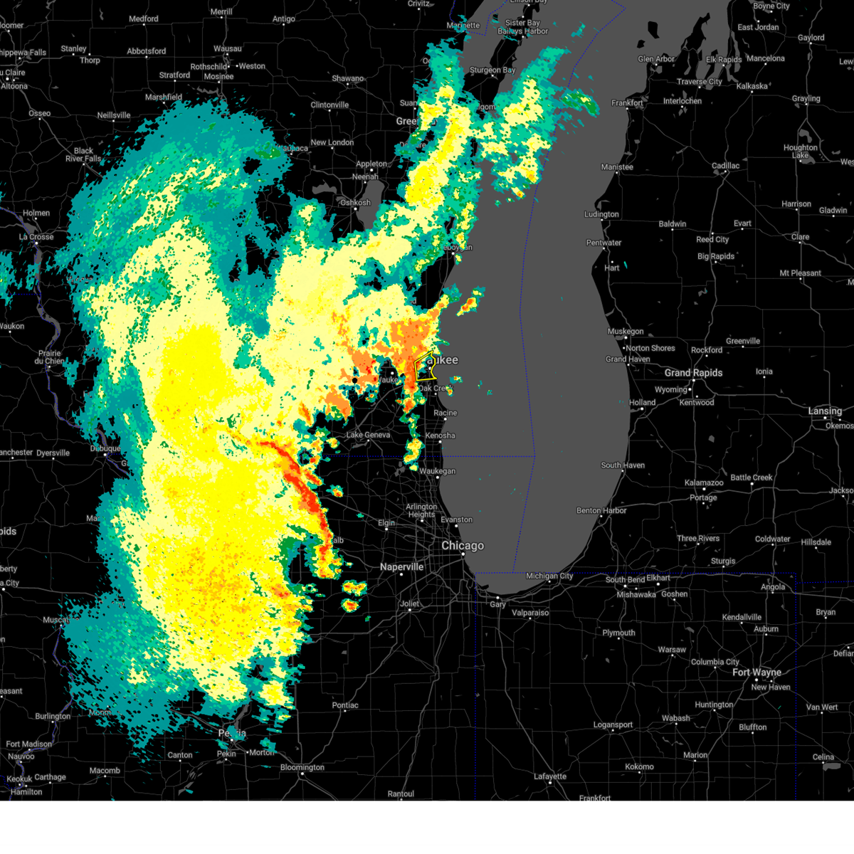
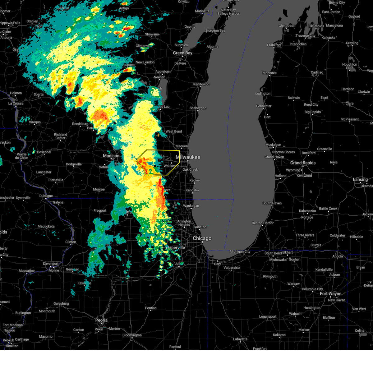
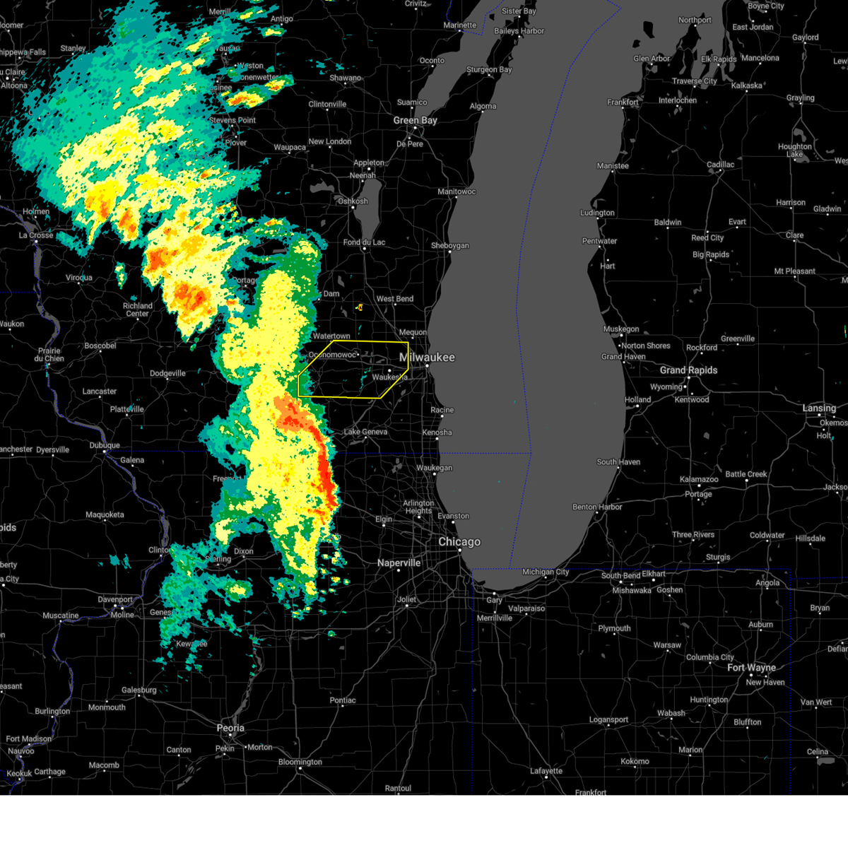
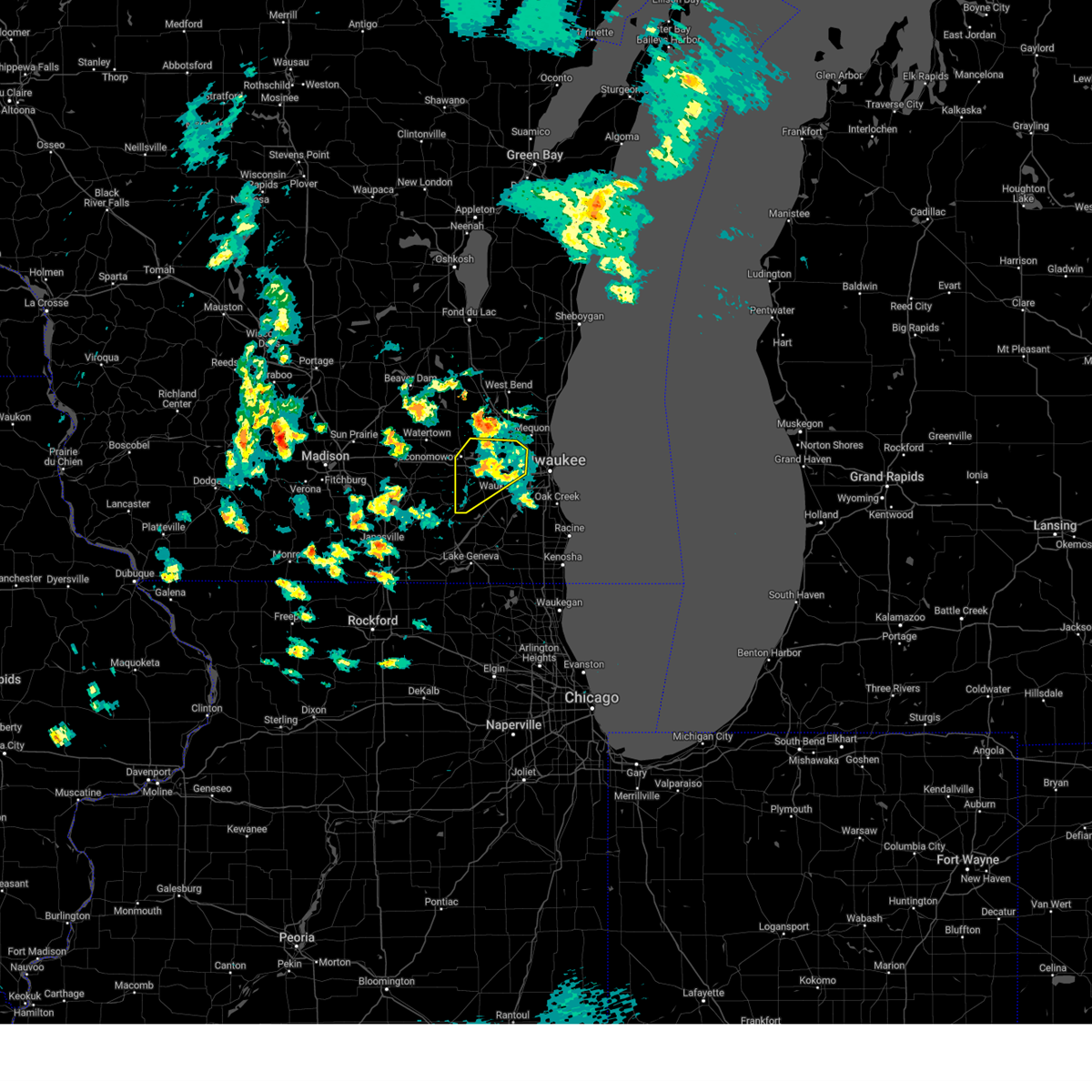
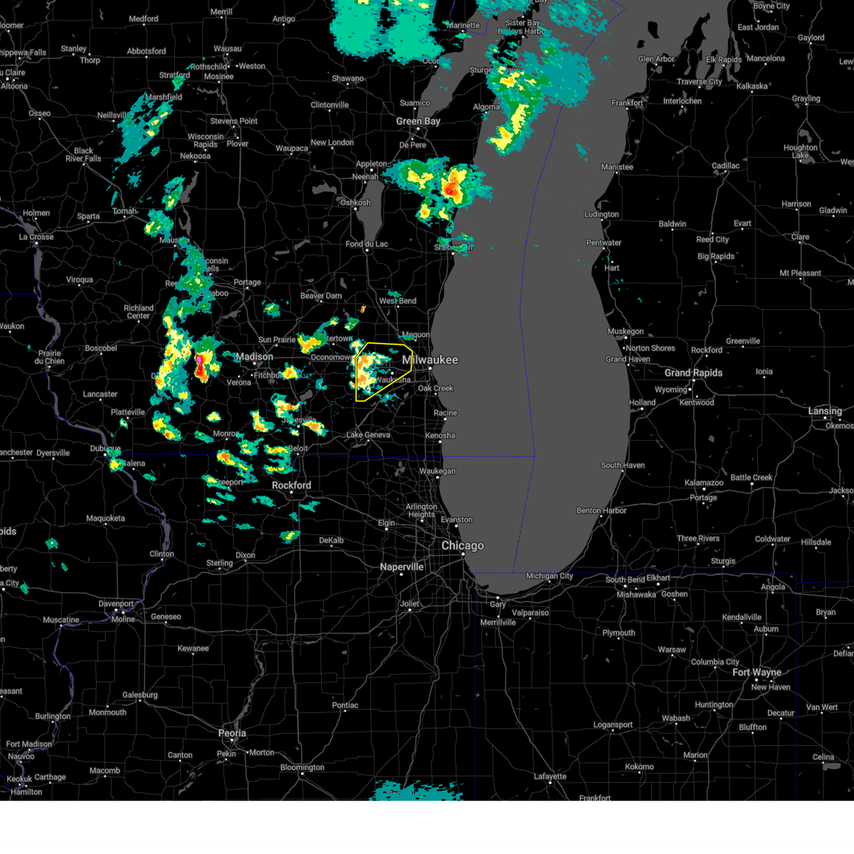
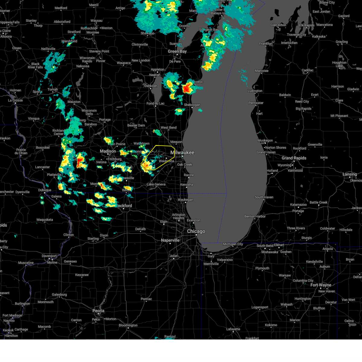
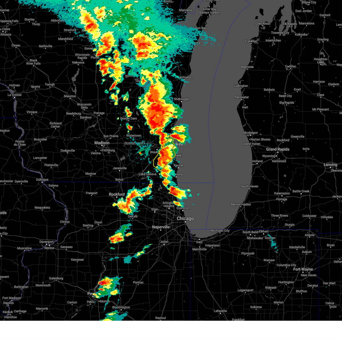
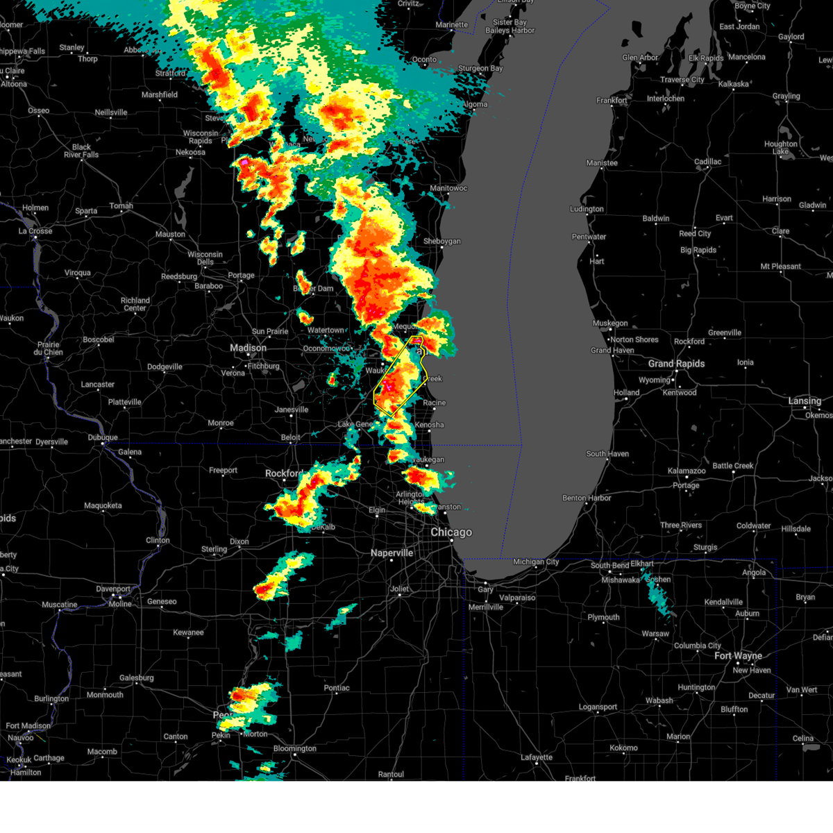
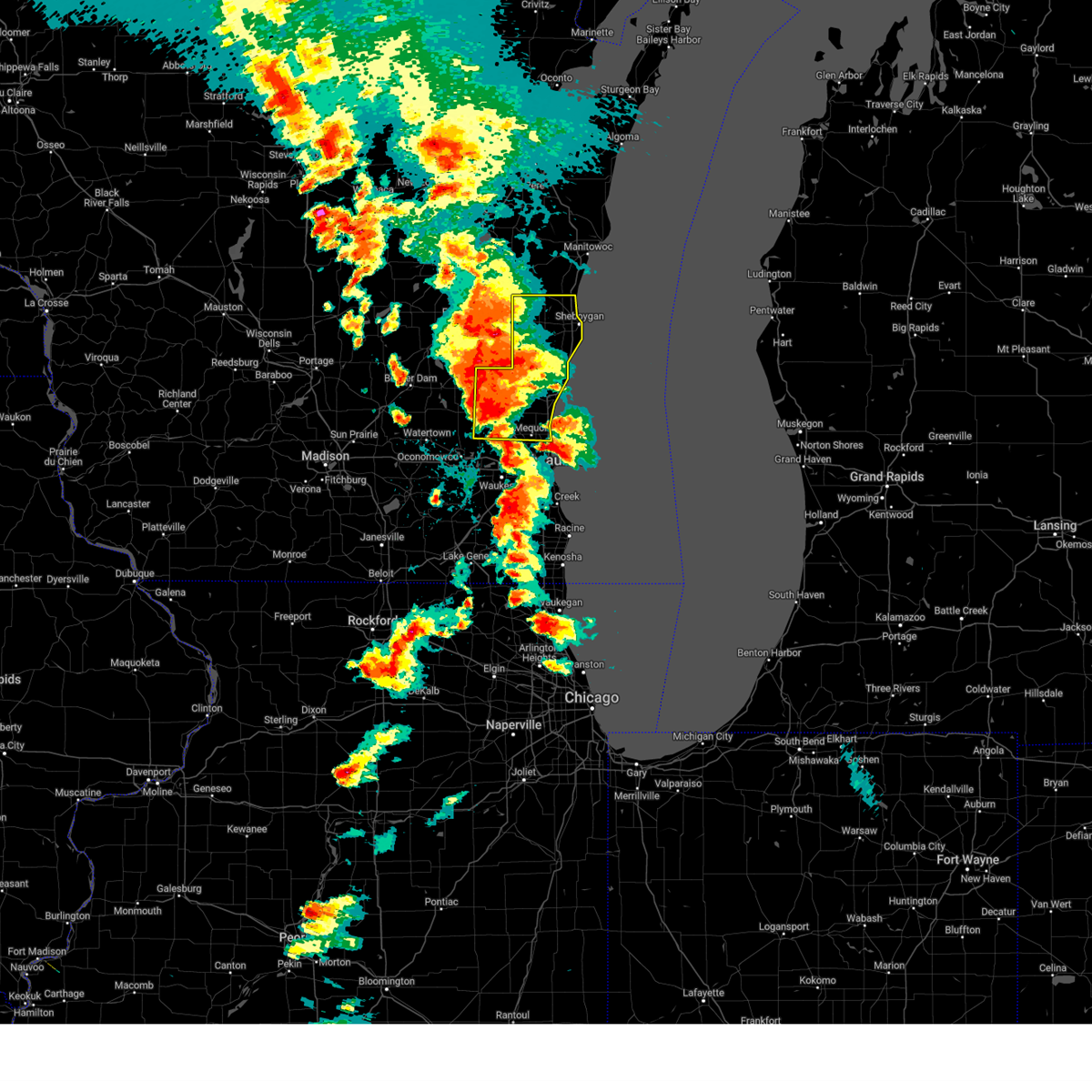
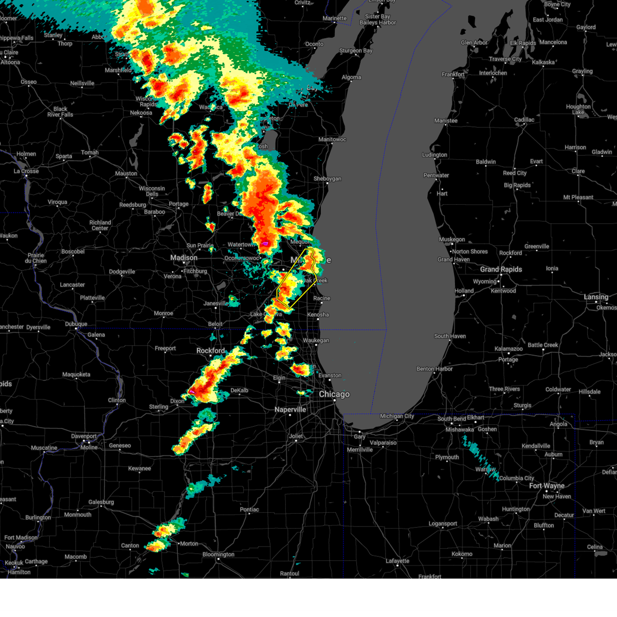
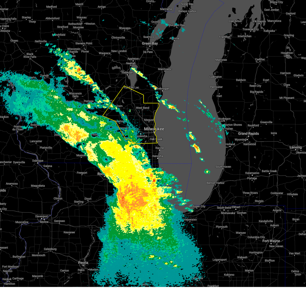
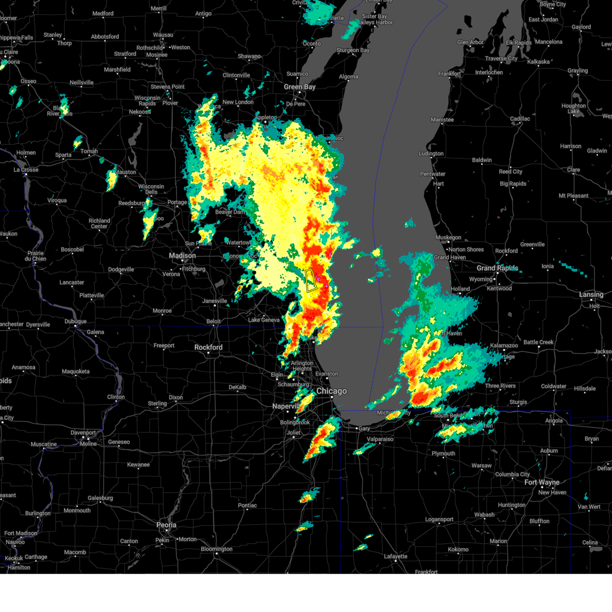
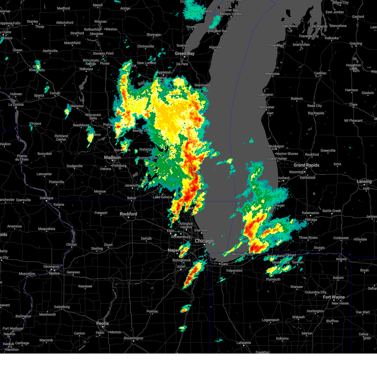
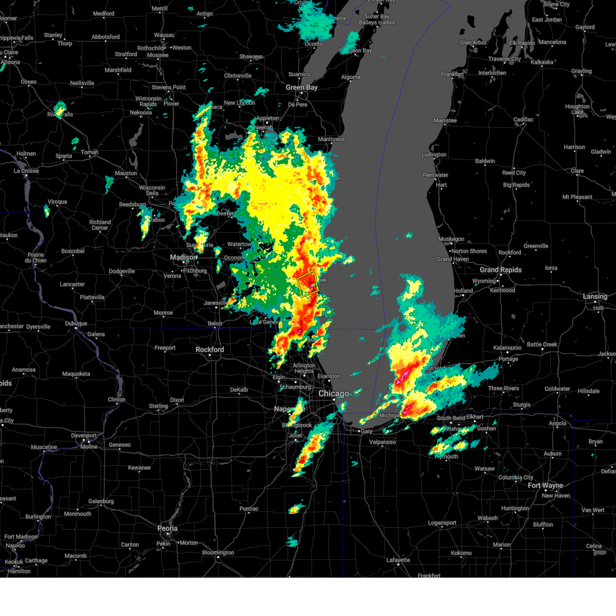
Hail Map for Milwaukee, WI
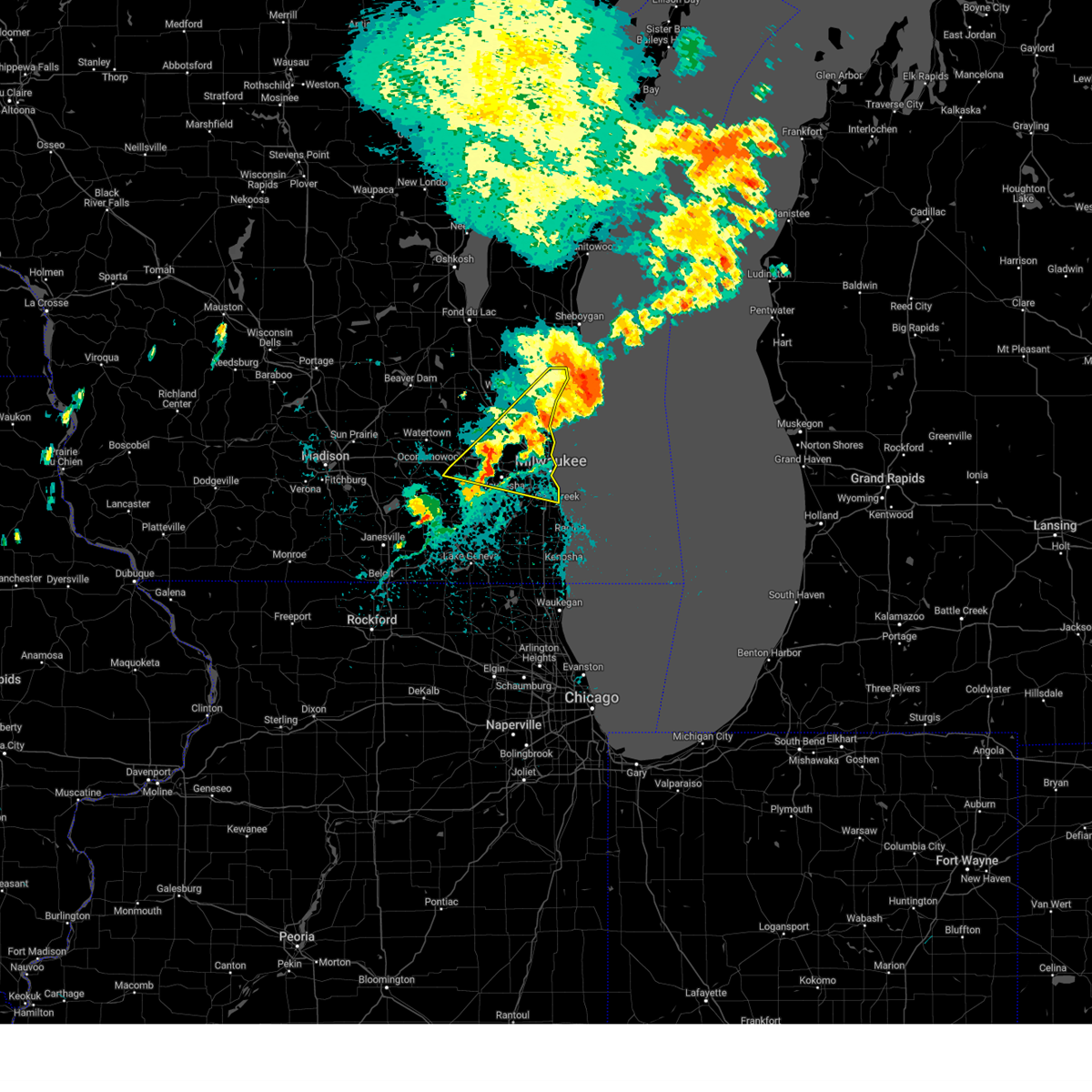
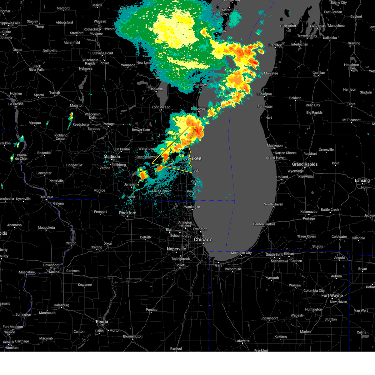
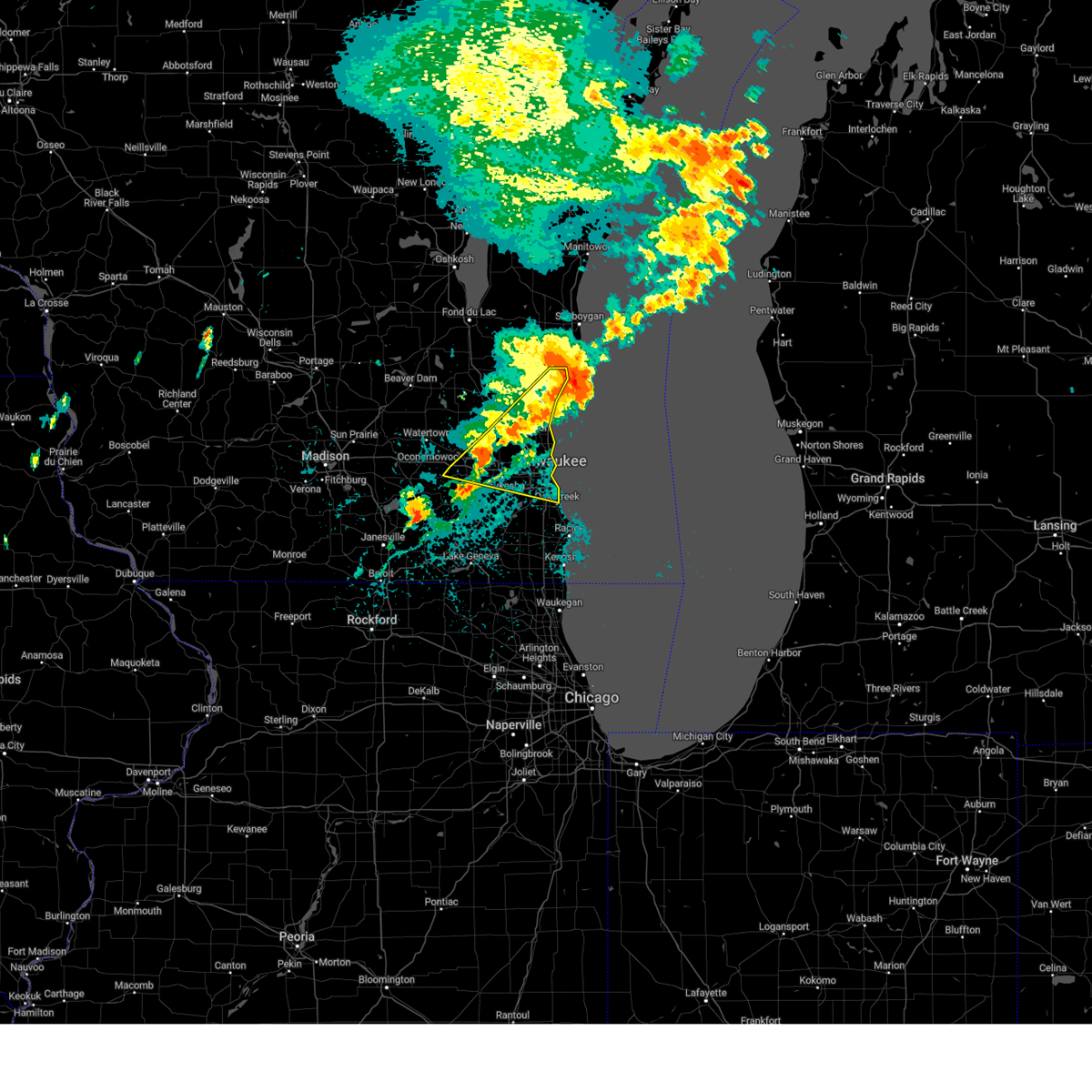
The Milwaukee, WI area has had 22 reports of on-the-ground hail by trained spotters, and has been under severe weather warnings 52 times during the past 12 months. Doppler radar has detected hail at or near Milwaukee, WI on 80 occasions, including 4 occasions during the past year.
| Name: | Milwaukee, WI |
| Where Located: | 72.3 miles E of Madison, WI |
| Map: | Google Map for Milwaukee, WI |
| Population: | 594833 |
| Housing Units: | 255569 |
| More Info: | Search Google for Milwaukee, WI |
3
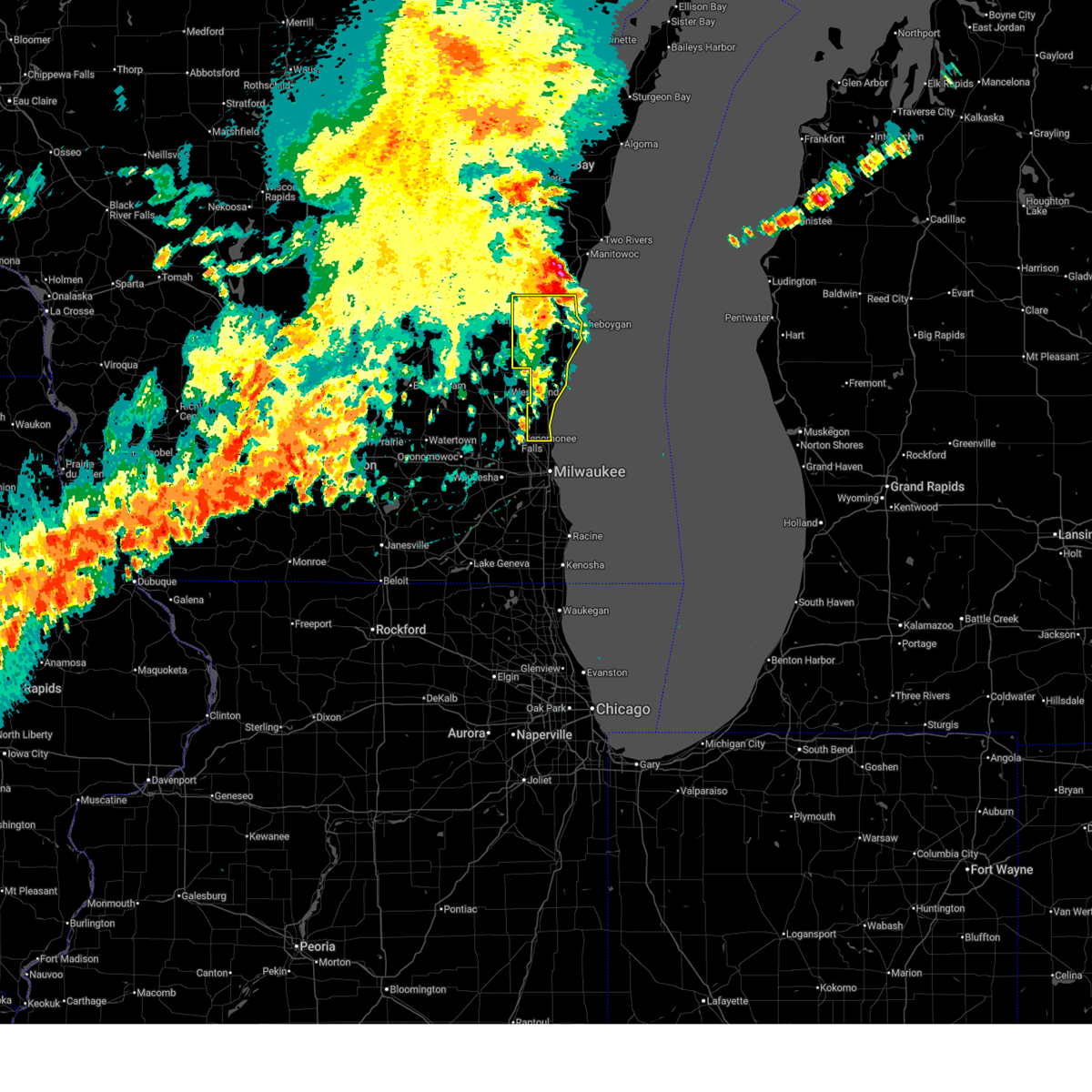
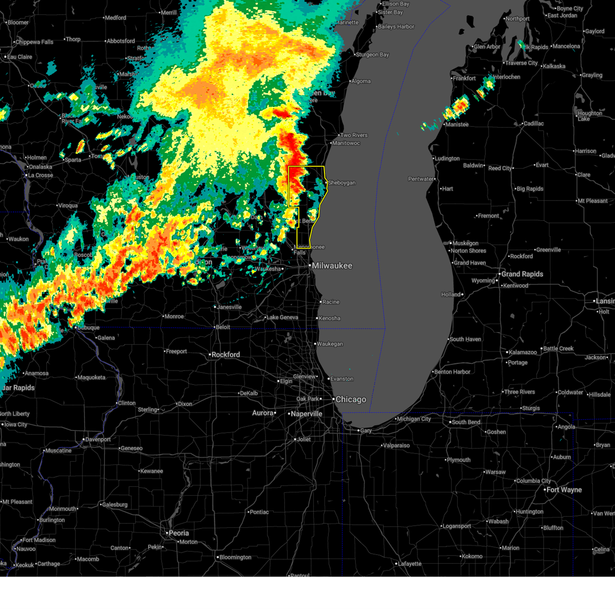
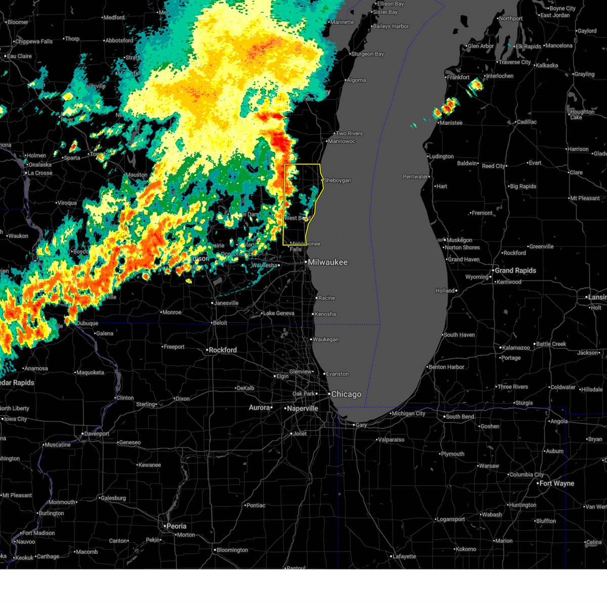
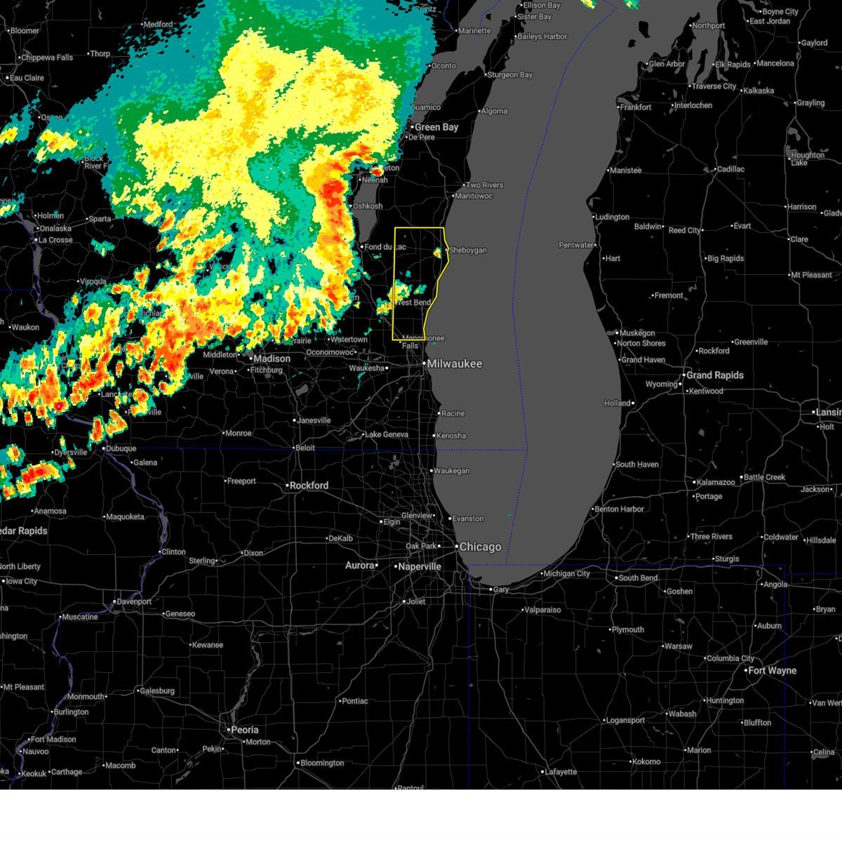
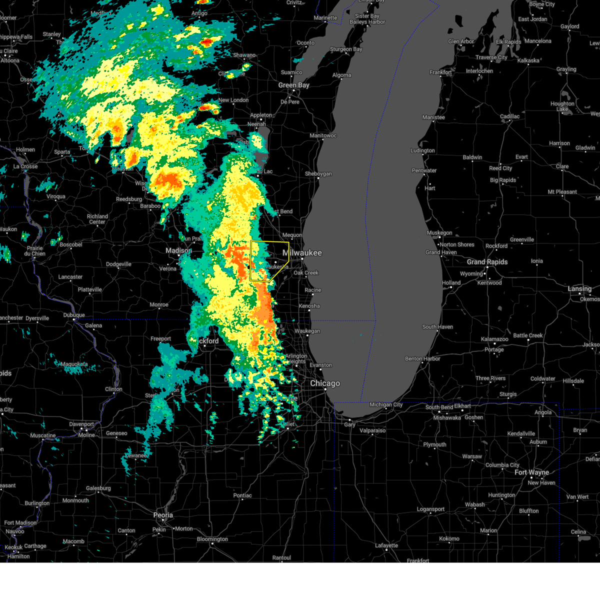
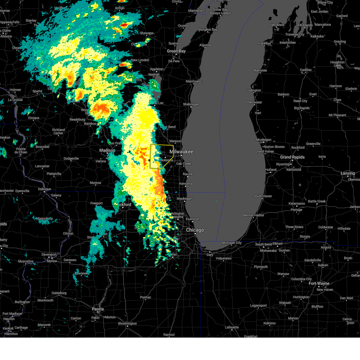
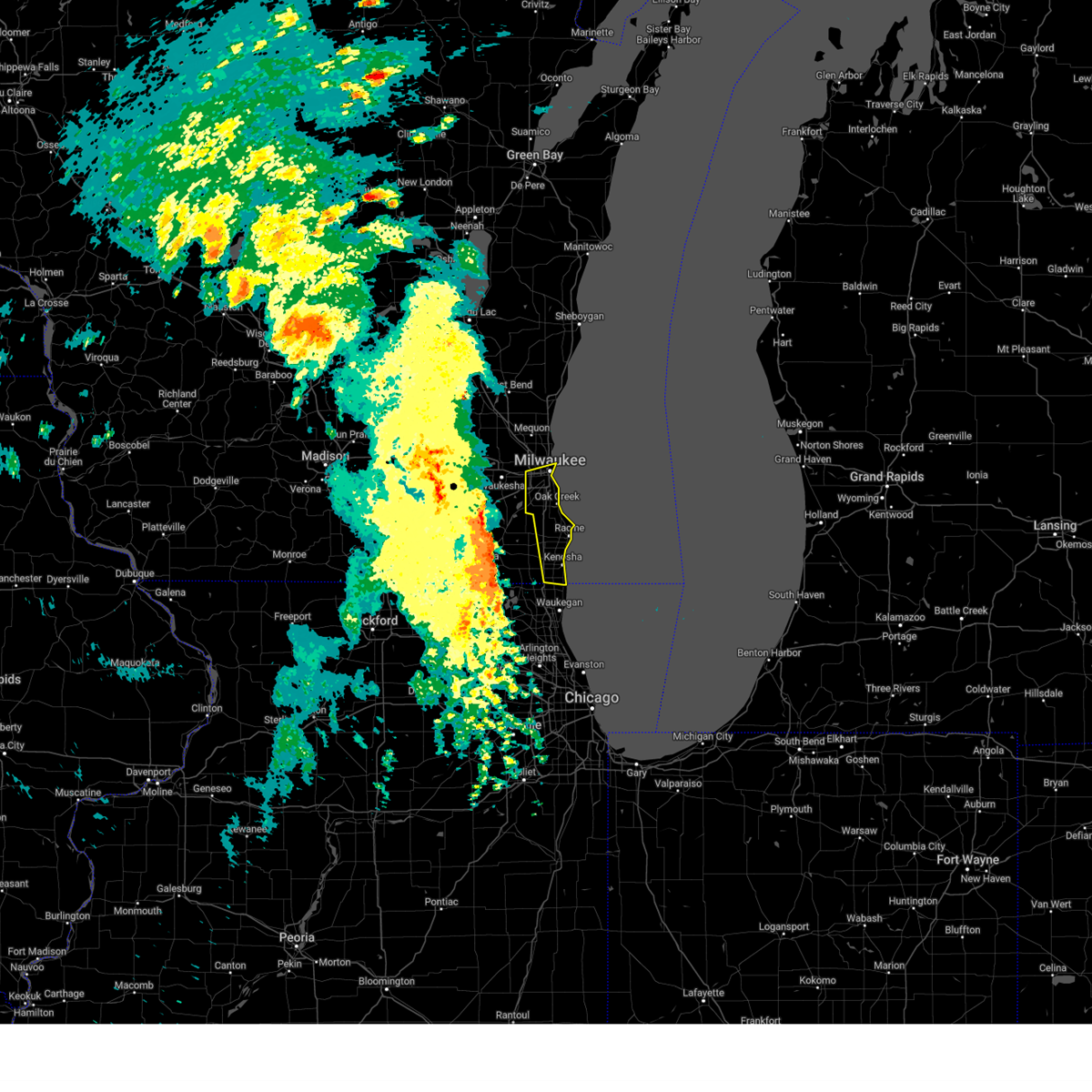
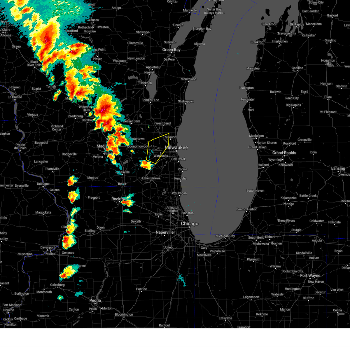
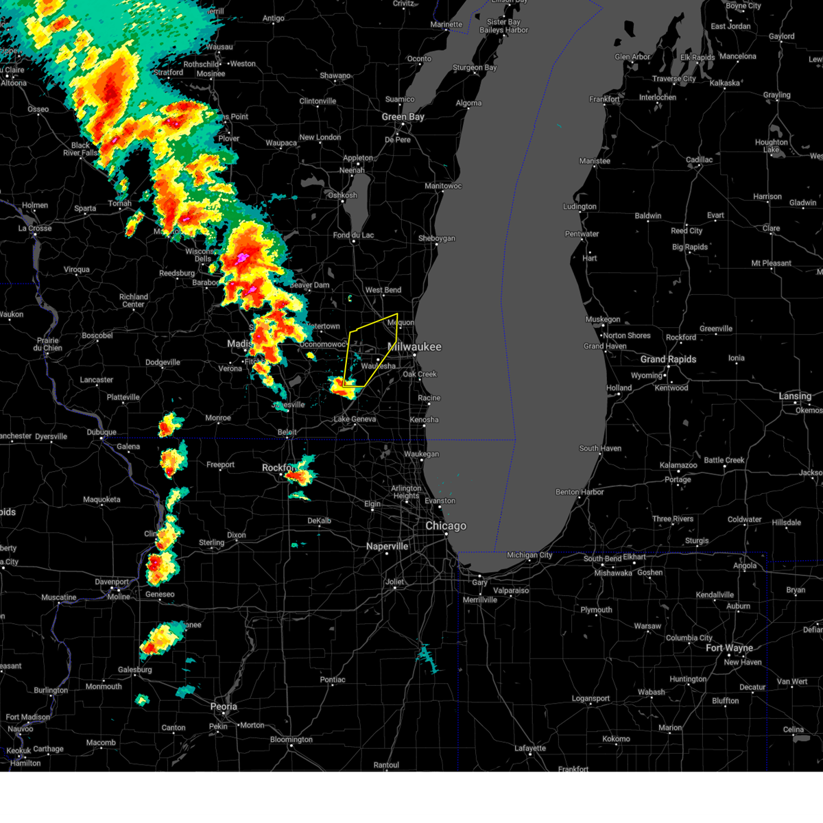
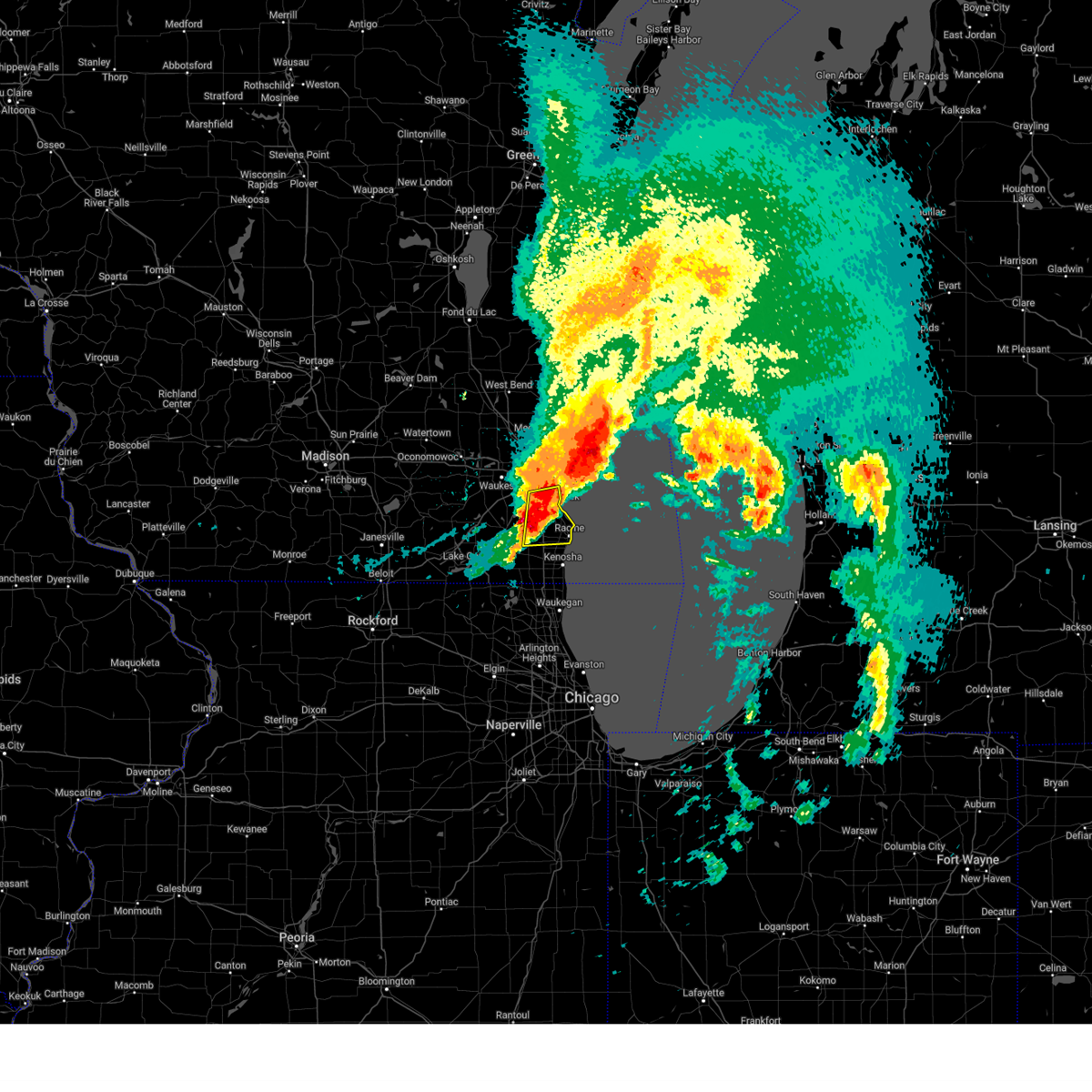
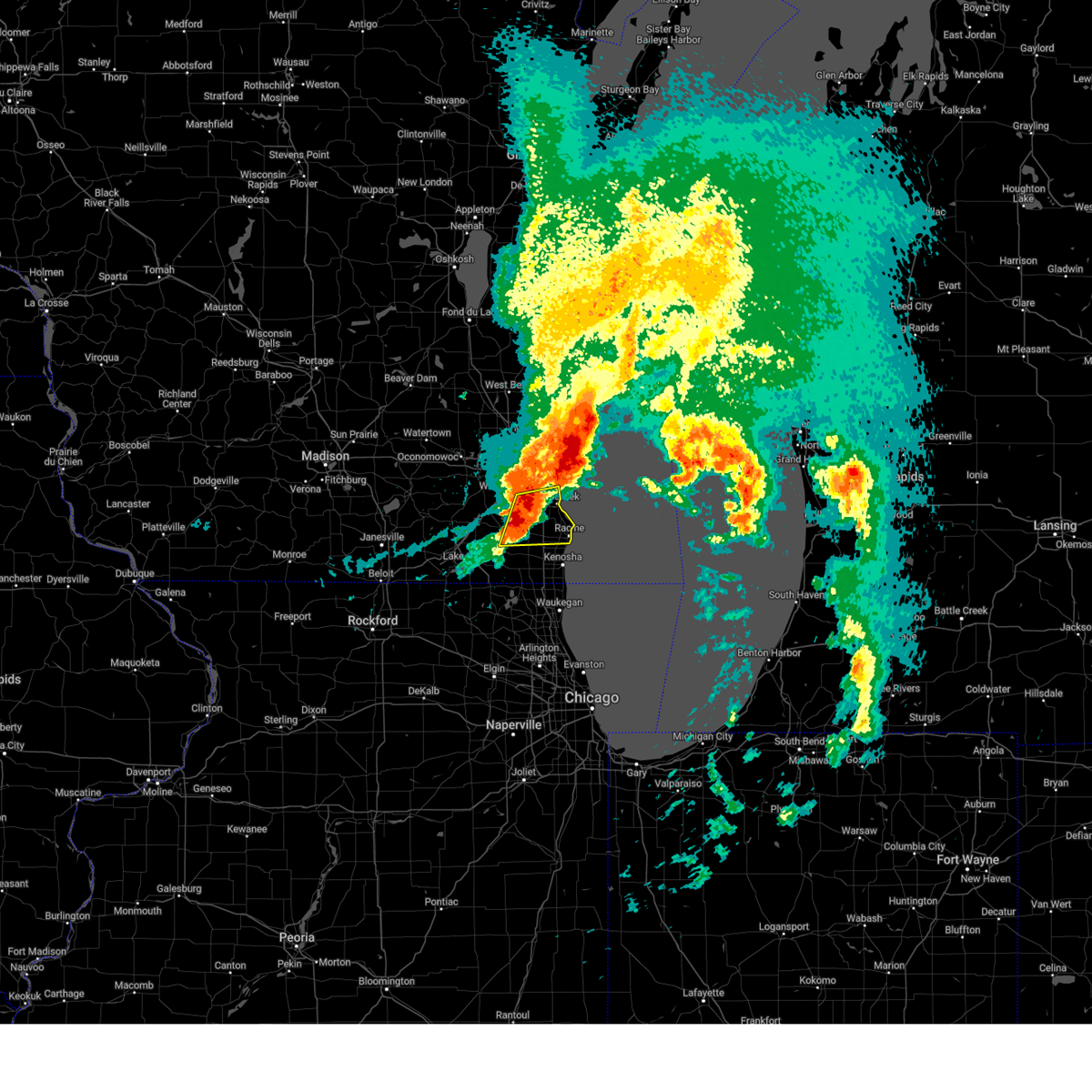
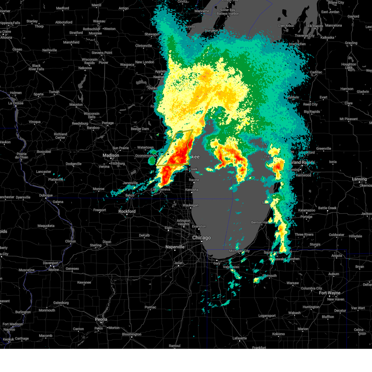
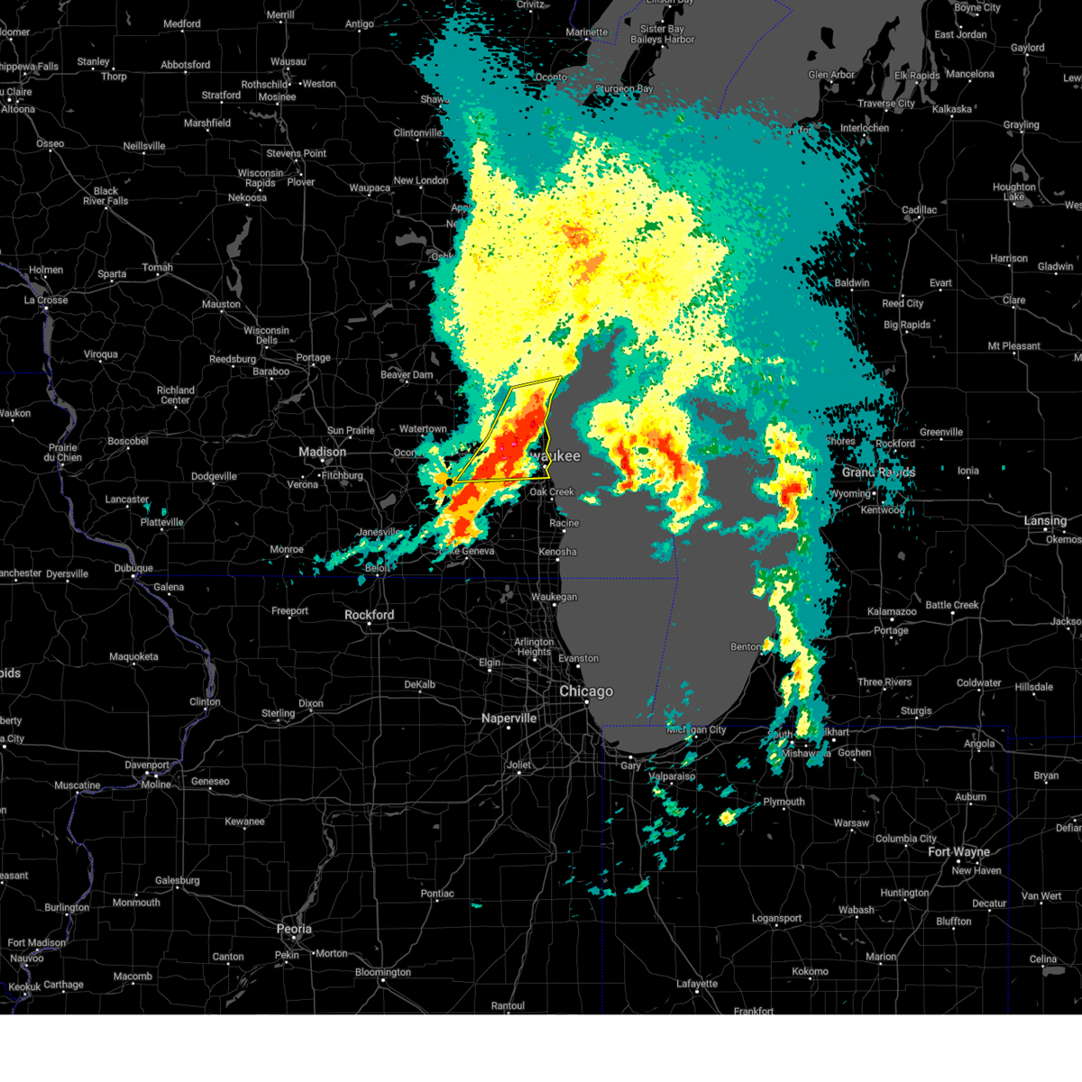
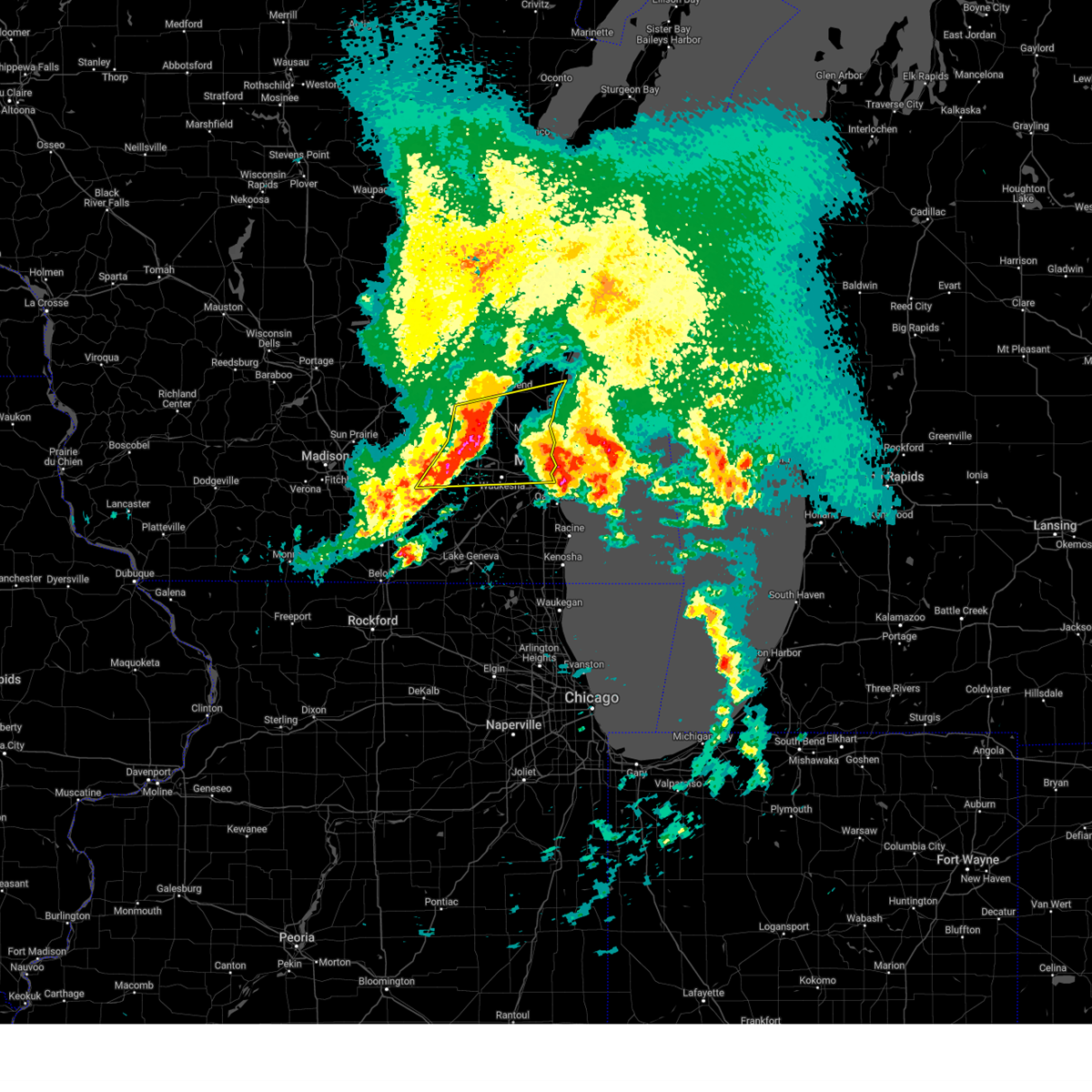
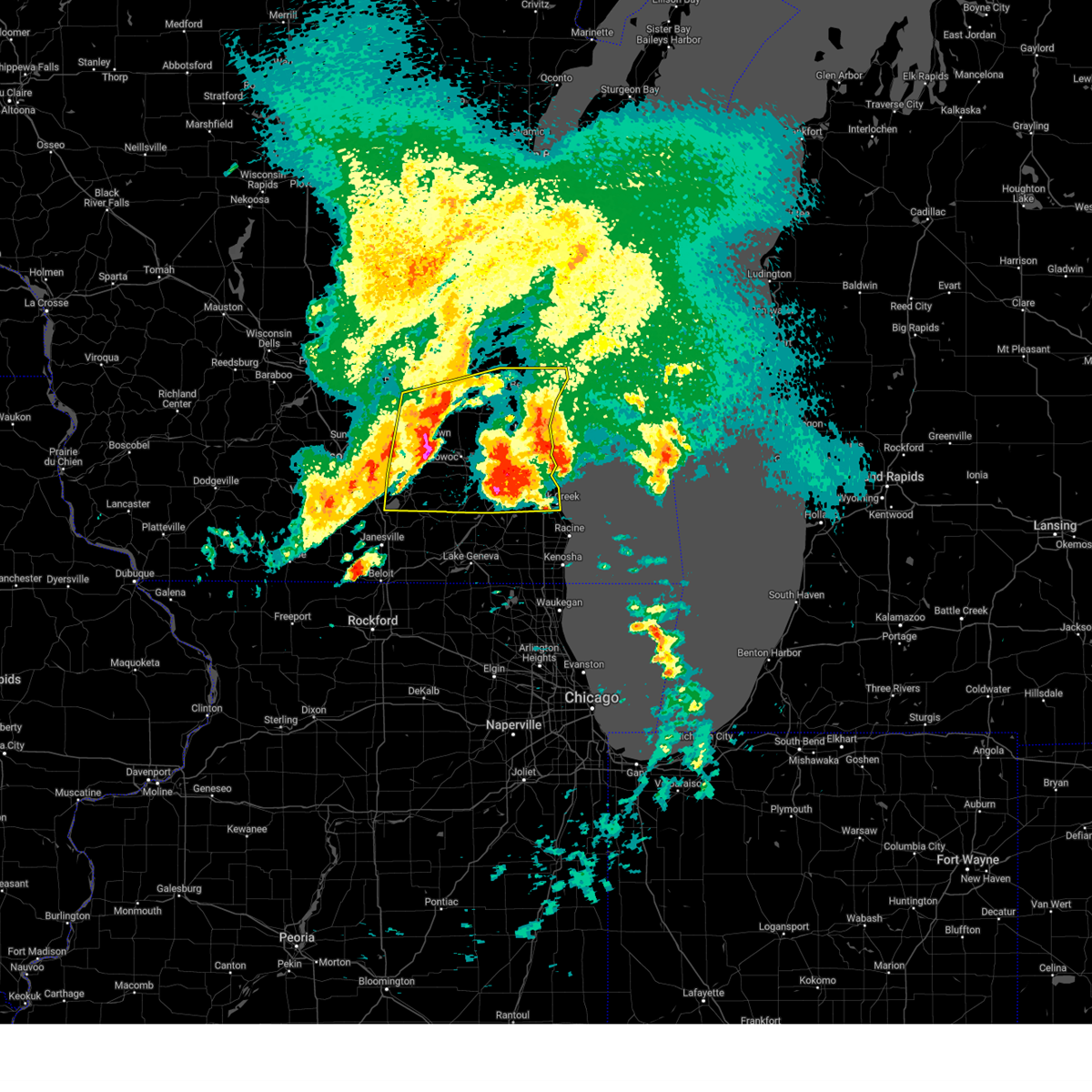
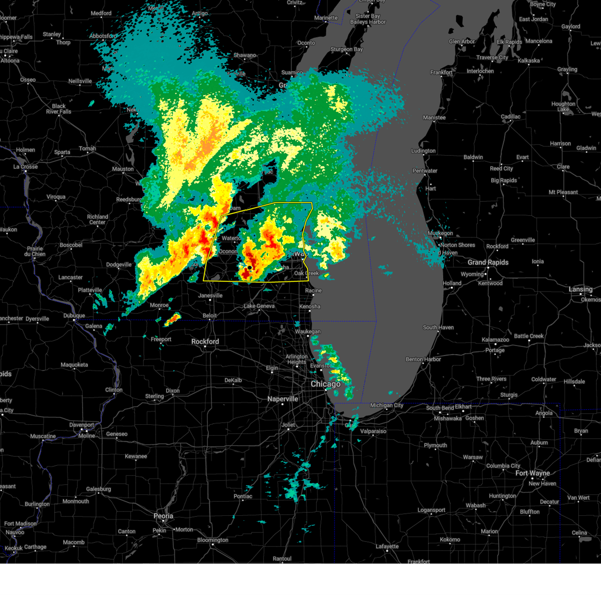
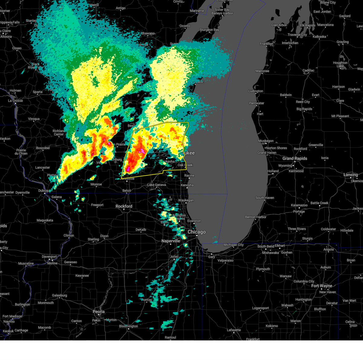
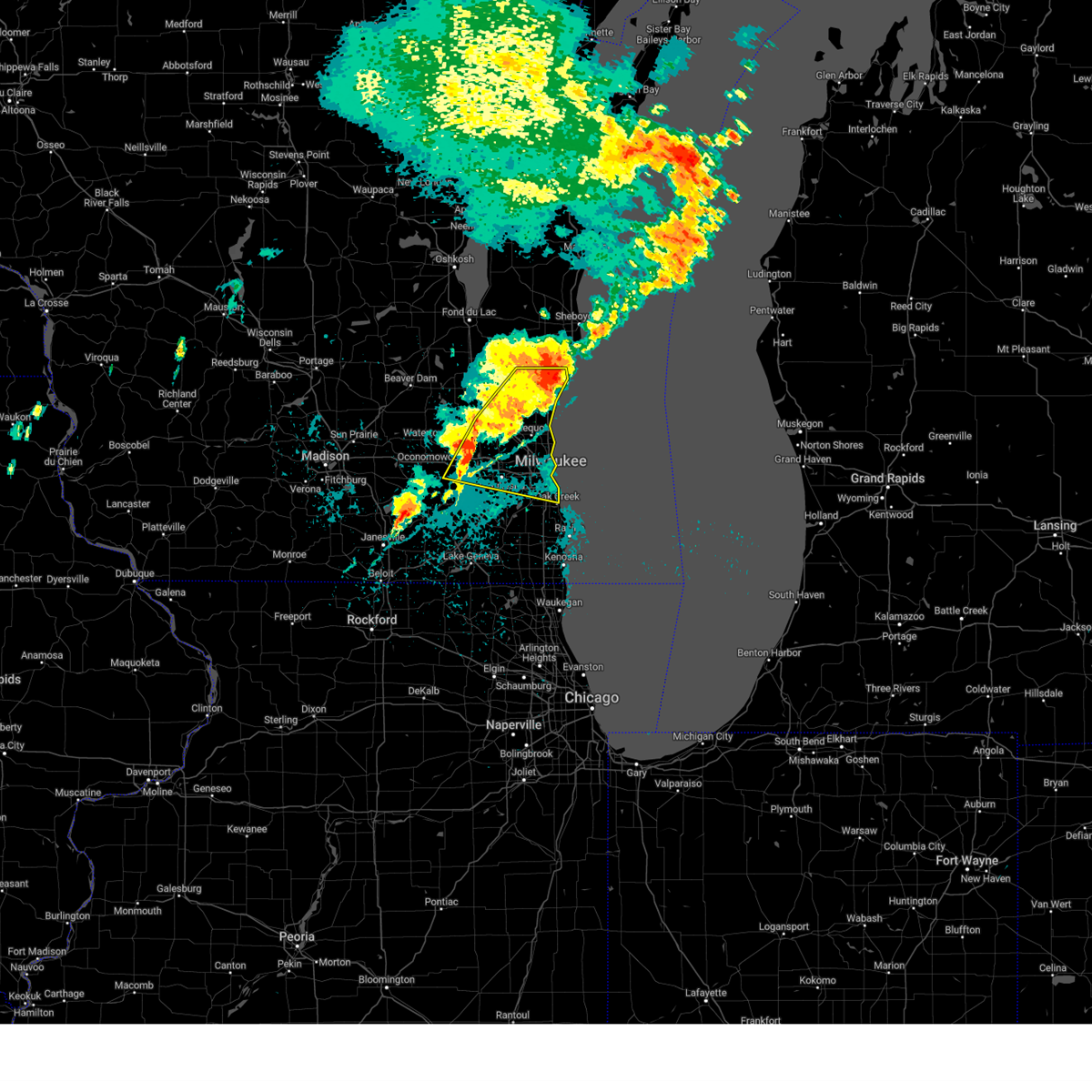
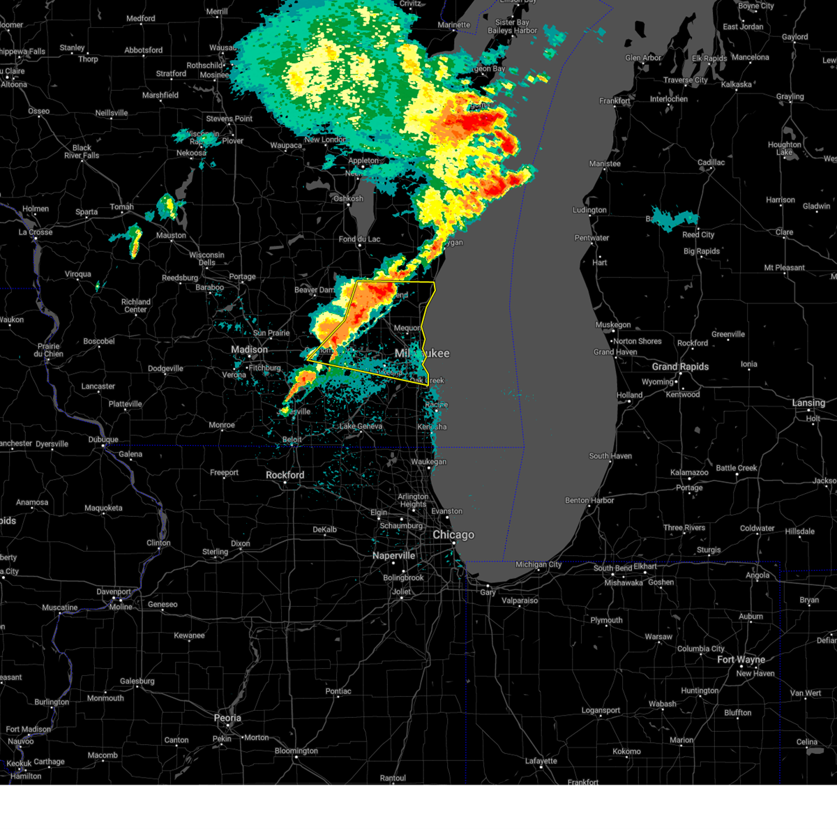
The Top Recent Hail Date for Milwaukee, WI is Thursday, May 15, 2025 (5th out of 80)

Hail and Wind Damage Spotted near Milwaukee, WI
| Date / Time | Report Details |
|---|---|
| 6/29/2025 9:23 PM CDT | Milwaukee fire department reports that an empty plane was flipped from thunderstorm wind gusts at milwaukee lawrence-timmerman airpor in milwaukee county WI, 6.1 miles SE of Milwaukee, WI |
| 6/29/2025 9:20 PM CDT | Off-duty nws employee reports large tree and branch down near silver spring drive and interstate 4 in milwaukee county WI, 7.1 miles SE of Milwaukee, WI |
| 6/29/2025 8:49 PM CDT | Broadcast media relays report of tree down near 97th and carmen near butle in milwaukee county WI, 6.6 miles SSE of Milwaukee, WI |
| 6/29/2025 8:44 PM CDT | Photo shared on social media of large tree trunk split near 106th and congress in northern wauwautos in milwaukee county WI, 5.9 miles SE of Milwaukee, WI |
| 6/29/2025 7:26 PM CDT | Awos station kmwc milwaukee lawrence-timmerman airpor in milwaukee county WI, 6.6 miles SSE of Milwaukee, WI |
| 6/29/2025 7:26 PM CDT | Tree down relayed from social media. time estimated from rada in milwaukee county WI, 5.9 miles SE of Milwaukee, WI |
| 6/23/2025 7:36 PM CDT |
 The storms which prompted the warning have weakened below severe limits, and no longer pose an immediate threat to life or property. therefore, the warning will be allowed to expire. a severe thunderstorm watch remains in effect until 900 pm cdt for southeastern and east central wisconsin. The storms which prompted the warning have weakened below severe limits, and no longer pose an immediate threat to life or property. therefore, the warning will be allowed to expire. a severe thunderstorm watch remains in effect until 900 pm cdt for southeastern and east central wisconsin.
|
| 6/23/2025 7:27 PM CDT |
 the severe thunderstorm warning has been cancelled and is no longer in effect the severe thunderstorm warning has been cancelled and is no longer in effect
|
| 6/23/2025 7:27 PM CDT |
 At 727 pm cdt, severe thunderstorms were located along a line extending from near cleveland to bayside, moving east at 45 mph (radar indicated). Hazards include 60 mph wind gusts. Expect damage to roofs, siding, and trees. Locations impacted include, sheboygan, mequon, brown deer, grafton, cedarburg, port washington, plymouth, sheboygan falls, saukville, bayside, thiensville, howards grove, oostburg, belgium, fredonia, kohler, cedar grove, river hills, random lake, and newburg. At 727 pm cdt, severe thunderstorms were located along a line extending from near cleveland to bayside, moving east at 45 mph (radar indicated). Hazards include 60 mph wind gusts. Expect damage to roofs, siding, and trees. Locations impacted include, sheboygan, mequon, brown deer, grafton, cedarburg, port washington, plymouth, sheboygan falls, saukville, bayside, thiensville, howards grove, oostburg, belgium, fredonia, kohler, cedar grove, river hills, random lake, and newburg.
|
| 6/23/2025 7:17 PM CDT |
 At 717 pm cdt, severe thunderstorms were located along a line extending from near camp rokilio scout camp to milwaukee, moving east at 30 mph (radar indicated). Hazards include 60 mph wind gusts. Expect damage to roofs, siding, and trees. Locations impacted include, sheboygan, menomonee falls, west bend, mequon, brown deer, grafton, cedarburg, port washington, plymouth, sheboygan falls, jackson, saukville, bayside, thiensville, howards grove, germantown, oostburg, belgium, fredonia, and kohler. At 717 pm cdt, severe thunderstorms were located along a line extending from near camp rokilio scout camp to milwaukee, moving east at 30 mph (radar indicated). Hazards include 60 mph wind gusts. Expect damage to roofs, siding, and trees. Locations impacted include, sheboygan, menomonee falls, west bend, mequon, brown deer, grafton, cedarburg, port washington, plymouth, sheboygan falls, jackson, saukville, bayside, thiensville, howards grove, germantown, oostburg, belgium, fredonia, and kohler.
|
| 6/23/2025 6:47 PM CDT |
 Svrmkx the national weather service in milwaukee/sullivan has issued a * severe thunderstorm warning for, ozaukee county in southeastern wisconsin, eastern washington county in southeastern wisconsin, sheboygan county in east central wisconsin, * until 745 pm cdt. * at 646 pm cdt, severe thunderstorms were located along a line extending from near central lake winnebago to near lac la belle, moving east at 40 mph (radar indicated). Hazards include 60 mph wind gusts. expect damage to roofs, siding, and trees Svrmkx the national weather service in milwaukee/sullivan has issued a * severe thunderstorm warning for, ozaukee county in southeastern wisconsin, eastern washington county in southeastern wisconsin, sheboygan county in east central wisconsin, * until 745 pm cdt. * at 646 pm cdt, severe thunderstorms were located along a line extending from near central lake winnebago to near lac la belle, moving east at 40 mph (radar indicated). Hazards include 60 mph wind gusts. expect damage to roofs, siding, and trees
|
| 6/3/2025 9:09 PM CDT |
 Svrmkx the national weather service in milwaukee/sullivan has issued a * severe thunderstorm warning for, central milwaukee county in southeastern wisconsin, * until 930 pm cdt. * at 908 pm cdt, a severe thunderstorm was located over west milwaukee, moving northeast at 55 mph (radar indicated). Hazards include 60 mph wind gusts. expect damage to roofs, siding, and trees Svrmkx the national weather service in milwaukee/sullivan has issued a * severe thunderstorm warning for, central milwaukee county in southeastern wisconsin, * until 930 pm cdt. * at 908 pm cdt, a severe thunderstorm was located over west milwaukee, moving northeast at 55 mph (radar indicated). Hazards include 60 mph wind gusts. expect damage to roofs, siding, and trees
|
| 6/3/2025 2:04 PM CDT |
 At 203 pm cdt, severe thunderstorms were located along a line extending from near oconomowoc to near wind lake, moving east at 55 mph (radar indicated). Hazards include 60 mph wind gusts. Expect damage to roofs, siding, and trees. Locations impacted include, waukesha, new berlin, brookfield, menomonee falls, pewaukee, sussex, hartland, mukwonago, delafield, elm grove, wales, okauchee lake, oconomowoc, lisbon, vernon, ottawa, merton, dousman, north prairie, and butler. At 203 pm cdt, severe thunderstorms were located along a line extending from near oconomowoc to near wind lake, moving east at 55 mph (radar indicated). Hazards include 60 mph wind gusts. Expect damage to roofs, siding, and trees. Locations impacted include, waukesha, new berlin, brookfield, menomonee falls, pewaukee, sussex, hartland, mukwonago, delafield, elm grove, wales, okauchee lake, oconomowoc, lisbon, vernon, ottawa, merton, dousman, north prairie, and butler.
|
| 6/3/2025 2:04 PM CDT |
 the severe thunderstorm warning has been cancelled and is no longer in effect the severe thunderstorm warning has been cancelled and is no longer in effect
|
| 6/3/2025 2:03 PM CDT |
 Svrmkx the national weather service in milwaukee/sullivan has issued a * severe thunderstorm warning for, milwaukee county in southeastern wisconsin, northeastern racine county in southeastern wisconsin, eastern kenosha county in southeastern wisconsin, * until 245 pm cdt. * at 202 pm cdt, severe thunderstorms were located along a line extending from near waukesha to near antioch, moving east at 55 mph (radar indicated). Hazards include 60 mph wind gusts. expect damage to roofs, siding, and trees Svrmkx the national weather service in milwaukee/sullivan has issued a * severe thunderstorm warning for, milwaukee county in southeastern wisconsin, northeastern racine county in southeastern wisconsin, eastern kenosha county in southeastern wisconsin, * until 245 pm cdt. * at 202 pm cdt, severe thunderstorms were located along a line extending from near waukesha to near antioch, moving east at 55 mph (radar indicated). Hazards include 60 mph wind gusts. expect damage to roofs, siding, and trees
|
| 6/3/2025 1:58 PM CDT |
 At 158 pm cdt, severe thunderstorms were located along a line extending from near dousman to waterford north, moving northeast at 55 mph (radar indicated). Hazards include 60 mph wind gusts. Expect damage to roofs, siding, and trees. Locations impacted include, waukesha, new berlin, brookfield, menomonee falls, watertown, pewaukee, sussex, hartland, mukwonago, delafield, elm grove, wales, okauchee lake, oconomowoc, lisbon, vernon, ottawa, merton, dousman, and north prairie. At 158 pm cdt, severe thunderstorms were located along a line extending from near dousman to waterford north, moving northeast at 55 mph (radar indicated). Hazards include 60 mph wind gusts. Expect damage to roofs, siding, and trees. Locations impacted include, waukesha, new berlin, brookfield, menomonee falls, watertown, pewaukee, sussex, hartland, mukwonago, delafield, elm grove, wales, okauchee lake, oconomowoc, lisbon, vernon, ottawa, merton, dousman, and north prairie.
|
| 6/3/2025 1:54 PM CDT |
 At 154 pm cdt, severe thunderstorms were located along a line extending from near dousman to near waterford north, moving northeast at 55 mph (radar indicated). Hazards include 60 mph wind gusts. Expect damage to roofs, siding, and trees. Locations impacted include, waukesha, new berlin, brookfield, menomonee falls, watertown, whitewater, pewaukee, fort atkinson, sussex, hartland, jefferson, mukwonago, delafield, elm grove, lake mills, wales, okauchee lake, oconomowoc, lisbon, and vernon. At 154 pm cdt, severe thunderstorms were located along a line extending from near dousman to near waterford north, moving northeast at 55 mph (radar indicated). Hazards include 60 mph wind gusts. Expect damage to roofs, siding, and trees. Locations impacted include, waukesha, new berlin, brookfield, menomonee falls, watertown, whitewater, pewaukee, fort atkinson, sussex, hartland, jefferson, mukwonago, delafield, elm grove, lake mills, wales, okauchee lake, oconomowoc, lisbon, and vernon.
|
| 6/3/2025 1:31 PM CDT |
 Svrmkx the national weather service in milwaukee/sullivan has issued a * severe thunderstorm warning for, waukesha county in southeastern wisconsin, jefferson county in southeastern wisconsin, * until 215 pm cdt. * at 131 pm cdt, severe thunderstorms were located along a line extending from near lake koshkonong to near elkhorn, moving northeast at 55 mph (radar indicated). Hazards include 60 mph wind gusts. expect damage to roofs, siding, and trees Svrmkx the national weather service in milwaukee/sullivan has issued a * severe thunderstorm warning for, waukesha county in southeastern wisconsin, jefferson county in southeastern wisconsin, * until 215 pm cdt. * at 131 pm cdt, severe thunderstorms were located along a line extending from near lake koshkonong to near elkhorn, moving northeast at 55 mph (radar indicated). Hazards include 60 mph wind gusts. expect damage to roofs, siding, and trees
|
| 5/16/2025 3:57 PM CDT |
 the severe thunderstorm warning has been cancelled and is no longer in effect the severe thunderstorm warning has been cancelled and is no longer in effect
|
| 5/16/2025 3:42 PM CDT |
 the severe thunderstorm warning has been cancelled and is no longer in effect the severe thunderstorm warning has been cancelled and is no longer in effect
|
| 5/16/2025 3:42 PM CDT |
 At 342 pm cdt, a severe thunderstorm was located over wales, moving northeast at 50 mph (radar indicated). Hazards include 60 mph wind gusts. Expect damage to roofs, siding, and trees. Locations impacted include, waukesha, wauwatosa, new berlin, brookfield, menomonee falls, pewaukee, sussex, hartland, delafield, elm grove, wales, okauchee lake, oconomowoc, lisbon, ottawa, merton, dousman, north prairie, butler, and lannon. At 342 pm cdt, a severe thunderstorm was located over wales, moving northeast at 50 mph (radar indicated). Hazards include 60 mph wind gusts. Expect damage to roofs, siding, and trees. Locations impacted include, waukesha, wauwatosa, new berlin, brookfield, menomonee falls, pewaukee, sussex, hartland, delafield, elm grove, wales, okauchee lake, oconomowoc, lisbon, ottawa, merton, dousman, north prairie, butler, and lannon.
|
| 5/16/2025 3:30 PM CDT |
 Svrmkx the national weather service in milwaukee/sullivan has issued a * severe thunderstorm warning for, waukesha county in southeastern wisconsin, southeastern jefferson county in southeastern wisconsin, * until 415 pm cdt. * at 330 pm cdt, a severe thunderstorm was located near palmyra, or 10 miles northeast of whitewater, moving northeast at 50 mph (radar indicated). Hazards include 60 mph wind gusts and penny size hail. expect damage to roofs, siding, and trees Svrmkx the national weather service in milwaukee/sullivan has issued a * severe thunderstorm warning for, waukesha county in southeastern wisconsin, southeastern jefferson county in southeastern wisconsin, * until 415 pm cdt. * at 330 pm cdt, a severe thunderstorm was located near palmyra, or 10 miles northeast of whitewater, moving northeast at 50 mph (radar indicated). Hazards include 60 mph wind gusts and penny size hail. expect damage to roofs, siding, and trees
|
| 5/15/2025 7:20 PM CDT |
 the severe thunderstorm warning has been cancelled and is no longer in effect the severe thunderstorm warning has been cancelled and is no longer in effect
|
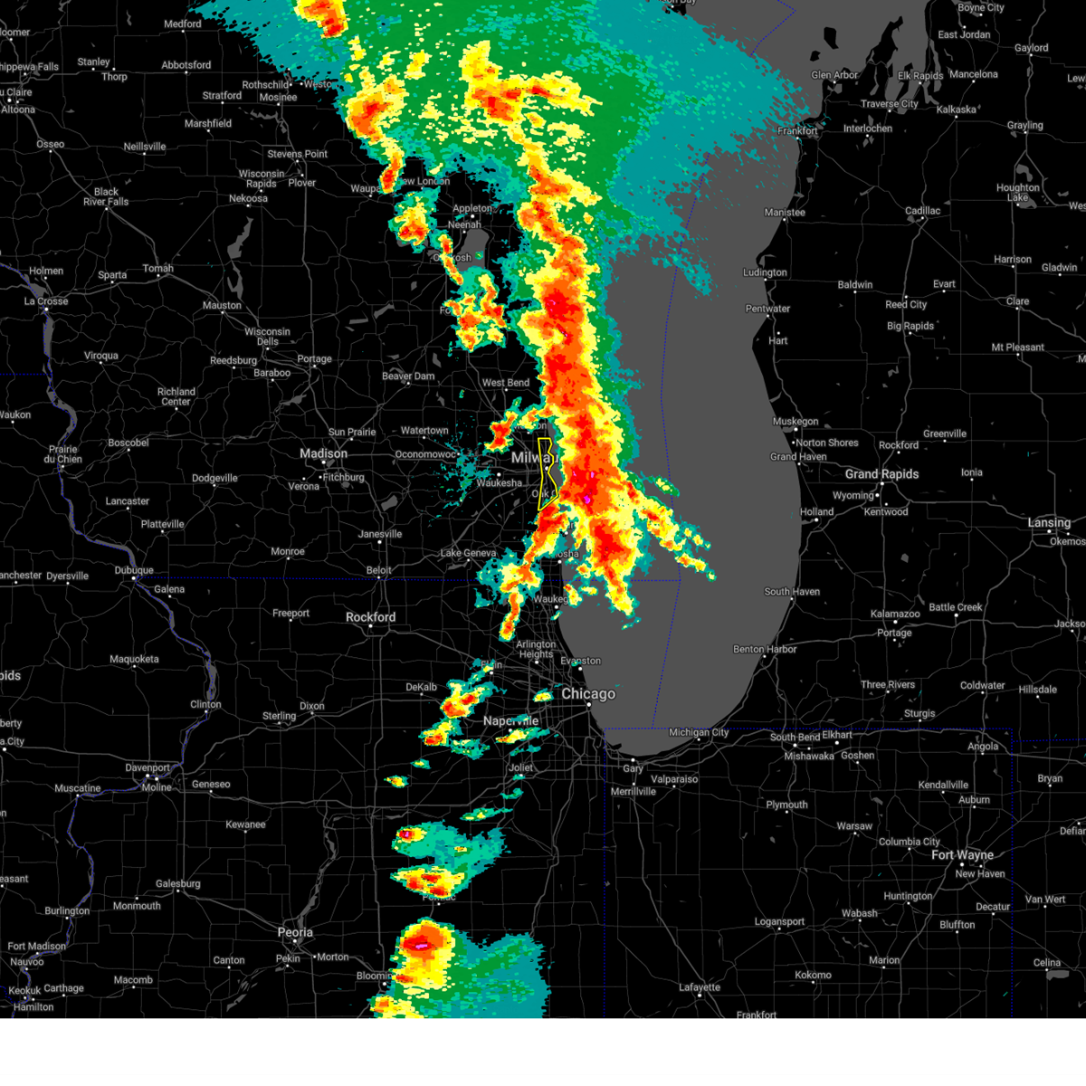
| 5/15/2025 7:13 PM CDT |
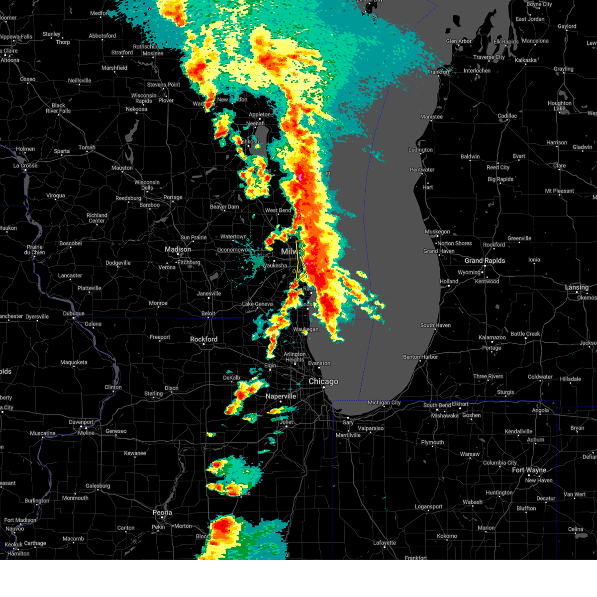 At 713 pm cdt, severe thunderstorms were located along a line extending from near port washington to near st. francis, moving northeast at 45 mph (public). Hazards include golf ball size hail and 60 mph wind gusts. People and animals outdoors will be injured. expect hail damage to roofs, siding, windows, and vehicles. expect wind damage to roofs, siding, and trees. locations impacted include, milwaukee, oak creek, south milwaukee, cudahy, whitefish bay, brown deer, st. Francis, fox point, bayside, glendale, franklin, river hills, milwaukee hoan bridge, shorewood, marquette university, uw- milwaukee, milwaukee south shore park, and maier festival park. At 713 pm cdt, severe thunderstorms were located along a line extending from near port washington to near st. francis, moving northeast at 45 mph (public). Hazards include golf ball size hail and 60 mph wind gusts. People and animals outdoors will be injured. expect hail damage to roofs, siding, windows, and vehicles. expect wind damage to roofs, siding, and trees. locations impacted include, milwaukee, oak creek, south milwaukee, cudahy, whitefish bay, brown deer, st. Francis, fox point, bayside, glendale, franklin, river hills, milwaukee hoan bridge, shorewood, marquette university, uw- milwaukee, milwaukee south shore park, and maier festival park.
|
| 5/15/2025 7:05 PM CDT | Last asos observation before power went out for contract observer at general mitchell international airpor in milwaukee county WI, 6.8 miles NNW of Milwaukee, WI |
| 5/15/2025 6:56 PM CDT |
 Svrmkx the national weather service in milwaukee/sullivan has issued a * severe thunderstorm warning for, milwaukee county in southeastern wisconsin, * until 745 pm cdt. * at 656 pm cdt, severe thunderstorms were located along a line extending from mequon to oak creek, moving northeast at 45 mph (public). Hazards include golf ball size hail and 60 mph wind gusts. People and animals outdoors will be injured. expect hail damage to roofs, siding, windows, and vehicles. Expect wind damage to roofs, siding, and trees. Svrmkx the national weather service in milwaukee/sullivan has issued a * severe thunderstorm warning for, milwaukee county in southeastern wisconsin, * until 745 pm cdt. * at 656 pm cdt, severe thunderstorms were located along a line extending from mequon to oak creek, moving northeast at 45 mph (public). Hazards include golf ball size hail and 60 mph wind gusts. People and animals outdoors will be injured. expect hail damage to roofs, siding, windows, and vehicles. Expect wind damage to roofs, siding, and trees.
|
| 5/15/2025 6:54 PM CDT | Multiple calls for wires down and some tree damage. no significant damag in milwaukee county WI, 3.9 miles ESE of Milwaukee, WI |
| 5/15/2025 6:50 PM CDT |
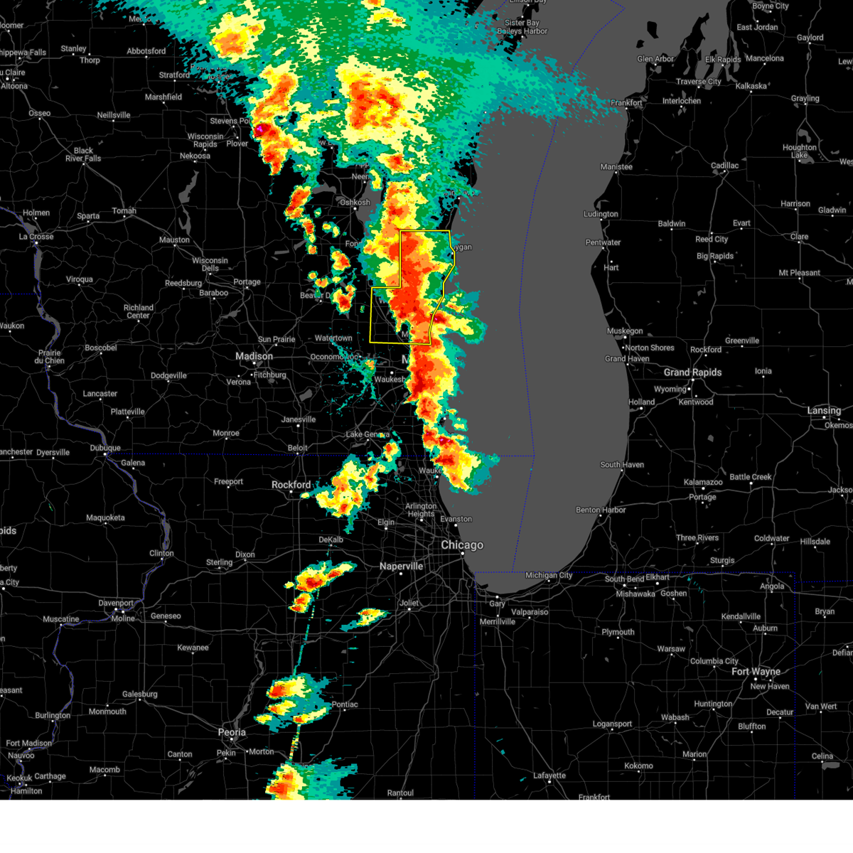 At 650 pm cdt, severe thunderstorms were located along a line extending from near st anna to cedarburg, moving northeast at 35 mph (radar indicated). Hazards include 60 mph wind gusts and quarter size hail. Hail damage to vehicles is expected. expect wind damage to roofs, siding, and trees. Locations impacted include, sheboygan, west bend, mequon, hartford, brown deer, grafton, cedarburg, port washington, plymouth, sheboygan falls, jackson, slinger, saukville, bayside, kewaskum, thiensville, howards grove, germantown, oostburg, and belgium. At 650 pm cdt, severe thunderstorms were located along a line extending from near st anna to cedarburg, moving northeast at 35 mph (radar indicated). Hazards include 60 mph wind gusts and quarter size hail. Hail damage to vehicles is expected. expect wind damage to roofs, siding, and trees. Locations impacted include, sheboygan, west bend, mequon, hartford, brown deer, grafton, cedarburg, port washington, plymouth, sheboygan falls, jackson, slinger, saukville, bayside, kewaskum, thiensville, howards grove, germantown, oostburg, and belgium.
|
| 5/15/2025 6:49 PM CDT | At 648 pm cdt, a severe thunderstorm was located over whitefish bay, moving northeast at 55 mph (trained spotter). Hazards include ping pong ball size hail and 60 mph wind gusts. People and animals outdoors will be injured. expect hail damage to roofs, siding, windows, and vehicles. expect wind damage to roofs, siding, and trees. locations impacted include, milwaukee, west allis, wauwatosa, new berlin, brookfield, greenfield, oak creek, muskego, south milwaukee, cudahy, whitefish bay, greendale, brown deer, st. Francis, hales corners, fox point, elm grove, bayside, west milwaukee, and franklin. |
| 5/15/2025 6:45 PM CDT | Quarter sized hail reported 4.1 miles NE of Milwaukee, WI, report from mping: quarter (1.00 in.). |
| 5/15/2025 6:45 PM CDT |
 At 644 pm cdt, a severe thunderstorm was located over west allis, moving northeast at 55 mph (public report of ping pong ball sized hail near hales corner). Hazards include golf ball size hail and 60 mph wind gusts. People and animals outdoors will be injured. expect hail damage to roofs, siding, windows, and vehicles. expect wind damage to roofs, siding, and trees. locations impacted include, milwaukee, west allis, wauwatosa, new berlin, brookfield, greenfield, oak creek, muskego, south milwaukee, cudahy, whitefish bay, greendale, brown deer, st. Francis, hales corners, fox point, elm grove, bayside, west milwaukee, and franklin. At 644 pm cdt, a severe thunderstorm was located over west allis, moving northeast at 55 mph (public report of ping pong ball sized hail near hales corner). Hazards include golf ball size hail and 60 mph wind gusts. People and animals outdoors will be injured. expect hail damage to roofs, siding, windows, and vehicles. expect wind damage to roofs, siding, and trees. locations impacted include, milwaukee, west allis, wauwatosa, new berlin, brookfield, greenfield, oak creek, muskego, south milwaukee, cudahy, whitefish bay, greendale, brown deer, st. Francis, hales corners, fox point, elm grove, bayside, west milwaukee, and franklin.
|
| 5/15/2025 6:34 PM CDT |
 At 634 pm cdt, a severe thunderstorm was located over muskego, and is nearly stationary (radar indicated). Hazards include golf ball size hail and 60 mph wind gusts. People and animals outdoors will be injured. expect hail damage to roofs, siding, windows, and vehicles. expect wind damage to roofs, siding, and trees. locations impacted include, milwaukee, west allis, wauwatosa, new berlin, brookfield, greenfield, oak creek, muskego, south milwaukee, cudahy, whitefish bay, greendale, brown deer, st. Francis, hales corners, fox point, elm grove, bayside, west milwaukee, and franklin. At 634 pm cdt, a severe thunderstorm was located over muskego, and is nearly stationary (radar indicated). Hazards include golf ball size hail and 60 mph wind gusts. People and animals outdoors will be injured. expect hail damage to roofs, siding, windows, and vehicles. expect wind damage to roofs, siding, and trees. locations impacted include, milwaukee, west allis, wauwatosa, new berlin, brookfield, greenfield, oak creek, muskego, south milwaukee, cudahy, whitefish bay, greendale, brown deer, st. Francis, hales corners, fox point, elm grove, bayside, west milwaukee, and franklin.
|
| 5/15/2025 6:32 PM CDT |
 At 631 pm cdt, severe thunderstorms were located along a line extending from 6 miles southeast of central lake winnebago to campbellsport to near slinger, moving northeast at 40 mph (public reports of two inch hail east of ashippun). Hazards include two inch hail and 60 mph wind gusts. People and animals outdoors will be injured. expect hail damage to roofs, siding, windows, and vehicles. expect wind damage to roofs, siding, and trees. Locations impacted include, sheboygan, west bend, mequon, hartford, brown deer, grafton, cedarburg, port washington, plymouth, sheboygan falls, jackson, slinger, saukville, bayside, kewaskum, thiensville, howards grove, germantown, oostburg, and belgium. At 631 pm cdt, severe thunderstorms were located along a line extending from 6 miles southeast of central lake winnebago to campbellsport to near slinger, moving northeast at 40 mph (public reports of two inch hail east of ashippun). Hazards include two inch hail and 60 mph wind gusts. People and animals outdoors will be injured. expect hail damage to roofs, siding, windows, and vehicles. expect wind damage to roofs, siding, and trees. Locations impacted include, sheboygan, west bend, mequon, hartford, brown deer, grafton, cedarburg, port washington, plymouth, sheboygan falls, jackson, slinger, saukville, bayside, kewaskum, thiensville, howards grove, germantown, oostburg, and belgium.
|
| 5/15/2025 6:26 PM CDT |
 Svrmkx the national weather service in milwaukee/sullivan has issued a * severe thunderstorm warning for, ozaukee county in southeastern wisconsin, washington county in southeastern wisconsin, sheboygan county in east central wisconsin, * until 745 pm cdt. * at 625 pm cdt, severe thunderstorms were located along a line extending from near southern lake winnebago to near campbellsport to near slinger, moving northeast at 40 mph (radar indicated). Hazards include two inch hail and 60 mph wind gusts. People and animals outdoors will be injured. expect hail damage to roofs, siding, windows, and vehicles. Expect wind damage to roofs, siding, and trees. Svrmkx the national weather service in milwaukee/sullivan has issued a * severe thunderstorm warning for, ozaukee county in southeastern wisconsin, washington county in southeastern wisconsin, sheboygan county in east central wisconsin, * until 745 pm cdt. * at 625 pm cdt, severe thunderstorms were located along a line extending from near southern lake winnebago to near campbellsport to near slinger, moving northeast at 40 mph (radar indicated). Hazards include two inch hail and 60 mph wind gusts. People and animals outdoors will be injured. expect hail damage to roofs, siding, windows, and vehicles. Expect wind damage to roofs, siding, and trees.
|
| 5/15/2025 6:24 PM CDT |
 Svrmkx the national weather service in milwaukee/sullivan has issued a * severe thunderstorm warning for, milwaukee county in southeastern wisconsin, northwestern racine county in southeastern wisconsin, southeastern waukesha county in southeastern wisconsin, * until 700 pm cdt. * at 623 pm cdt, a cluster of severe thunderstorms was located over waterford north, or over wind lake, moving northeast at 55 mph (radar indicated). Hazards include 60 mph wind gusts and half dollar size hail. Hail damage to vehicles is expected. Expect wind damage to roofs, siding, and trees. Svrmkx the national weather service in milwaukee/sullivan has issued a * severe thunderstorm warning for, milwaukee county in southeastern wisconsin, northwestern racine county in southeastern wisconsin, southeastern waukesha county in southeastern wisconsin, * until 700 pm cdt. * at 623 pm cdt, a cluster of severe thunderstorms was located over waterford north, or over wind lake, moving northeast at 55 mph (radar indicated). Hazards include 60 mph wind gusts and half dollar size hail. Hail damage to vehicles is expected. Expect wind damage to roofs, siding, and trees.
|
| 5/15/2025 6:21 PM CDT |
 Svrmkx the national weather service in milwaukee/sullivan has issued a * severe thunderstorm warning for, south central ozaukee county in southeastern wisconsin, northern milwaukee county in southeastern wisconsin, * until 700 pm cdt. * at 621 pm cdt, a severe thunderstorm was located over western milwaukee, moving north at 35 mph (radar indicated). Hazards include 60 mph wind gusts and quarter size hail. Hail damage to vehicles is expected. Expect wind damage to roofs, siding, and trees. Svrmkx the national weather service in milwaukee/sullivan has issued a * severe thunderstorm warning for, south central ozaukee county in southeastern wisconsin, northern milwaukee county in southeastern wisconsin, * until 700 pm cdt. * at 621 pm cdt, a severe thunderstorm was located over western milwaukee, moving north at 35 mph (radar indicated). Hazards include 60 mph wind gusts and quarter size hail. Hail damage to vehicles is expected. Expect wind damage to roofs, siding, and trees.
|
| 5/15/2025 5:40 PM CDT | Svrmkx the national weather service in milwaukee/sullivan has issued a * severe thunderstorm warning for, northeastern waukesha county in southeastern wisconsin, washington county in southeastern wisconsin, * until 630 pm cdt. * at 539 pm cdt, a severe thunderstorm was located near lisbon, or 7 miles northwest of sussex, moving northeast at 40 mph (radar indicated). Hazards include 60 mph wind gusts and half dollar size hail. Hail damage to vehicles is expected. Expect wind damage to roofs, siding, and trees. |
| 5/15/2025 5:24 PM CDT | At 524 pm cdt, a severe thunderstorm was located over merton, or near sussex, moving east at 55 mph (public report of ping pong ball sized hail in dousman). Hazards include ping pong ball size hail and 60 mph wind gusts. People and animals outdoors will be injured. expect hail damage to roofs, siding, windows, and vehicles. expect wind damage to roofs, siding, and trees. Locations impacted include, waukesha, menomonee falls, pewaukee, sussex, hartland, delafield, wales, germantown, okauchee lake, oconomowoc, lisbon, ottawa, merton, dousman, lannon, brookfield, richfield, nashotah, waterville, and oconomowoc lake. |
| 5/15/2025 5:10 PM CDT |
 At 509 pm cdt, a severe thunderstorm was located over ottawa, or over wales, moving northeast at 55 mph (public. ping pong ball sized hail was reported in eagle at 504 pm). Hazards include ping pong ball size hail and 60 mph wind gusts. People and animals outdoors will be injured. expect hail damage to roofs, siding, windows, and vehicles. expect wind damage to roofs, siding, and trees. Locations impacted include, waukesha, menomonee falls, pewaukee, sussex, hartland, mukwonago, delafield, wales, germantown, okauchee lake, oconomowoc, lisbon, ottawa, merton, dousman, north prairie, lannon, brookfield, richfield, and nashotah. At 509 pm cdt, a severe thunderstorm was located over ottawa, or over wales, moving northeast at 55 mph (public. ping pong ball sized hail was reported in eagle at 504 pm). Hazards include ping pong ball size hail and 60 mph wind gusts. People and animals outdoors will be injured. expect hail damage to roofs, siding, windows, and vehicles. expect wind damage to roofs, siding, and trees. Locations impacted include, waukesha, menomonee falls, pewaukee, sussex, hartland, mukwonago, delafield, wales, germantown, okauchee lake, oconomowoc, lisbon, ottawa, merton, dousman, north prairie, lannon, brookfield, richfield, and nashotah.
|
| 5/15/2025 5:02 PM CDT |
 Svrmkx the national weather service in milwaukee/sullivan has issued a * severe thunderstorm warning for, waukesha county in southeastern wisconsin, southern washington county in southeastern wisconsin, * until 545 pm cdt. * at 502 pm cdt, a severe thunderstorm was located near north prairie, or 8 miles southwest of wales, moving northeast at 55 mph (radar indicated). Hazards include 60 mph wind gusts and quarter size hail. Hail damage to vehicles is expected. Expect wind damage to roofs, siding, and trees. Svrmkx the national weather service in milwaukee/sullivan has issued a * severe thunderstorm warning for, waukesha county in southeastern wisconsin, southern washington county in southeastern wisconsin, * until 545 pm cdt. * at 502 pm cdt, a severe thunderstorm was located near north prairie, or 8 miles southwest of wales, moving northeast at 55 mph (radar indicated). Hazards include 60 mph wind gusts and quarter size hail. Hail damage to vehicles is expected. Expect wind damage to roofs, siding, and trees.
|
| 4/18/2025 3:31 PM CDT |
 At 330 pm cdt, a severe thunderstorm was located over hales corners, moving east at 65 mph (radar indicated). Hazards include quarter size hail. Damage to vehicles is expected. locations impacted include, muskego, franklin, raymond, waterford, south milwaukee, mukwonago, north cape, waterford north, milwaukee south shore park, cudahy, potter lake, oak creek, st. Francis, rochester, east troy, honey creek, caledonia, vernon, greenfield, and wind lake. At 330 pm cdt, a severe thunderstorm was located over hales corners, moving east at 65 mph (radar indicated). Hazards include quarter size hail. Damage to vehicles is expected. locations impacted include, muskego, franklin, raymond, waterford, south milwaukee, mukwonago, north cape, waterford north, milwaukee south shore park, cudahy, potter lake, oak creek, st. Francis, rochester, east troy, honey creek, caledonia, vernon, greenfield, and wind lake.
|
| 4/18/2025 3:04 PM CDT |
 Svrmkx the national weather service in milwaukee/sullivan has issued a * severe thunderstorm warning for, milwaukee county in southeastern wisconsin, northeastern walworth county in southeastern wisconsin, northern racine county in southeastern wisconsin, southern waukesha county in southeastern wisconsin, * until 345 pm cdt. * at 304 pm cdt, a severe thunderstorm was located near elkhorn, moving east at 65 mph (radar indicated). Hazards include quarter size hail. damage to vehicles is expected Svrmkx the national weather service in milwaukee/sullivan has issued a * severe thunderstorm warning for, milwaukee county in southeastern wisconsin, northeastern walworth county in southeastern wisconsin, northern racine county in southeastern wisconsin, southern waukesha county in southeastern wisconsin, * until 345 pm cdt. * at 304 pm cdt, a severe thunderstorm was located near elkhorn, moving east at 65 mph (radar indicated). Hazards include quarter size hail. damage to vehicles is expected
|
| 4/18/2025 8:52 AM CDT |
 the severe thunderstorm warning has been cancelled and is no longer in effect the severe thunderstorm warning has been cancelled and is no longer in effect
|
| 4/18/2025 8:52 AM CDT |
 At 852 am cdt, severe thunderstorms were located along a line extending from greendale to yorkville, moving east at 70 mph (radar indicated). Hazards include quarter size hail. Damage to vehicles is expected. locations impacted include, franklin, elmwood park, north bay, raymond, franksville, mount pleasant, south milwaukee, north cape, caledonia, cudahy, wind point, greendale, yorkville, sturtevant, union grove, racine, oak creek, hales corners, st. Francis, and greenfield. At 852 am cdt, severe thunderstorms were located along a line extending from greendale to yorkville, moving east at 70 mph (radar indicated). Hazards include quarter size hail. Damage to vehicles is expected. locations impacted include, franklin, elmwood park, north bay, raymond, franksville, mount pleasant, south milwaukee, north cape, caledonia, cudahy, wind point, greendale, yorkville, sturtevant, union grove, racine, oak creek, hales corners, st. Francis, and greenfield.
|
| 4/18/2025 8:46 AM CDT |
 Svrmkx the national weather service in milwaukee/sullivan has issued a * severe thunderstorm warning for, southern milwaukee county in southeastern wisconsin, racine county in southeastern wisconsin, southeastern waukesha county in southeastern wisconsin, * until 915 am cdt. * at 846 am cdt, severe thunderstorms were located along a line extending from muskego to eagle lake, moving east at 70 mph (radar indicated). Hazards include quarter size hail. damage to vehicles is expected Svrmkx the national weather service in milwaukee/sullivan has issued a * severe thunderstorm warning for, southern milwaukee county in southeastern wisconsin, racine county in southeastern wisconsin, southeastern waukesha county in southeastern wisconsin, * until 915 am cdt. * at 846 am cdt, severe thunderstorms were located along a line extending from muskego to eagle lake, moving east at 70 mph (radar indicated). Hazards include quarter size hail. damage to vehicles is expected
|
| 4/18/2025 8:36 AM CDT |
 the severe thunderstorm warning has been cancelled and is no longer in effect the severe thunderstorm warning has been cancelled and is no longer in effect
|
| 4/18/2025 8:29 AM CDT |
 At 828 am cdt, severe thunderstorms were located along a line extending from near port washington to mequon to waukesha, moving east at 65 mph (radar indicated). Hazards include quarter size hail. Damage to vehicles is expected. Locations impacted include, milwaukee, pewaukee, wales, uw- milwaukee, grafton, west allis, jackson, lannon, glendale, bayside, mequon, keowns, ottawa, lapham peak st park, delafield, hubertus, lisbon, port washington, hartland, and mitchell park domes. At 828 am cdt, severe thunderstorms were located along a line extending from near port washington to mequon to waukesha, moving east at 65 mph (radar indicated). Hazards include quarter size hail. Damage to vehicles is expected. Locations impacted include, milwaukee, pewaukee, wales, uw- milwaukee, grafton, west allis, jackson, lannon, glendale, bayside, mequon, keowns, ottawa, lapham peak st park, delafield, hubertus, lisbon, port washington, hartland, and mitchell park domes.
|
| 4/18/2025 8:29 AM CDT |
 the severe thunderstorm warning has been cancelled and is no longer in effect the severe thunderstorm warning has been cancelled and is no longer in effect
|
| 4/18/2025 8:11 AM CDT |
 Svrmkx the national weather service in milwaukee/sullivan has issued a * severe thunderstorm warning for, ozaukee county in southeastern wisconsin, northern milwaukee county in southeastern wisconsin, waukesha county in southeastern wisconsin, washington county in southeastern wisconsin, northeastern jefferson county in southeastern wisconsin, southeastern dodge county in southeastern wisconsin, * until 900 am cdt. * at 810 am cdt, severe thunderstorms were located along a line extending from near slinger to merton to near dousman, moving east at 65 mph (radar indicated). Hazards include half dollar size hail. damage to vehicles is expected Svrmkx the national weather service in milwaukee/sullivan has issued a * severe thunderstorm warning for, ozaukee county in southeastern wisconsin, northern milwaukee county in southeastern wisconsin, waukesha county in southeastern wisconsin, washington county in southeastern wisconsin, northeastern jefferson county in southeastern wisconsin, southeastern dodge county in southeastern wisconsin, * until 900 am cdt. * at 810 am cdt, severe thunderstorms were located along a line extending from near slinger to merton to near dousman, moving east at 65 mph (radar indicated). Hazards include half dollar size hail. damage to vehicles is expected
|
| 4/18/2025 8:01 AM CDT |
 the severe thunderstorm warning has been cancelled and is no longer in effect the severe thunderstorm warning has been cancelled and is no longer in effect
|
| 4/18/2025 8:01 AM CDT |
 At 800 am cdt, severe thunderstorms were located along a line extending from near cedar grove to 17 miles southeast of port washington to cudahy, moving east at 75 mph (radar indicated. 1.25 inch hail was reported in watertown). Hazards include golf ball size hail and 60 mph wind gusts. People and animals outdoors will be injured. expect hail damage to roofs, siding, windows, and vehicles. expect wind damage to roofs, siding, and trees. Locations impacted include, milwaukee, franklin, nenno, pewaukee, wales, uw- milwaukee, dousman, fillmore, grafton, west allis, summit, mukwonago, north lake, glendale, lac la belle, okauchee lake, cudahy, iron ridge, ottawa, and eagle. At 800 am cdt, severe thunderstorms were located along a line extending from near cedar grove to 17 miles southeast of port washington to cudahy, moving east at 75 mph (radar indicated. 1.25 inch hail was reported in watertown). Hazards include golf ball size hail and 60 mph wind gusts. People and animals outdoors will be injured. expect hail damage to roofs, siding, windows, and vehicles. expect wind damage to roofs, siding, and trees. Locations impacted include, milwaukee, franklin, nenno, pewaukee, wales, uw- milwaukee, dousman, fillmore, grafton, west allis, summit, mukwonago, north lake, glendale, lac la belle, okauchee lake, cudahy, iron ridge, ottawa, and eagle.
|
| 4/18/2025 7:36 AM CDT |
 the severe thunderstorm warning has been cancelled and is no longer in effect the severe thunderstorm warning has been cancelled and is no longer in effect
|
| 4/18/2025 7:36 AM CDT |
 At 736 am cdt, severe thunderstorms were located along a line extending from near west bend to near germantown to near potter lake, moving east at 75 mph (radar indicated). Hazards include two inch hail and 60 mph wind gusts. People and animals outdoors will be injured. expect hail damage to roofs, siding, windows, and vehicles. expect wind damage to roofs, siding, and trees. Locations impacted include, milwaukee, franklin, nenno, pewaukee, wales, uw- milwaukee, dousman, fillmore, grafton, west allis, summit, mukwonago, cambridge, north lake, glendale, lac la belle, okauchee lake, cudahy, iron ridge, and ottawa. At 736 am cdt, severe thunderstorms were located along a line extending from near west bend to near germantown to near potter lake, moving east at 75 mph (radar indicated). Hazards include two inch hail and 60 mph wind gusts. People and animals outdoors will be injured. expect hail damage to roofs, siding, windows, and vehicles. expect wind damage to roofs, siding, and trees. Locations impacted include, milwaukee, franklin, nenno, pewaukee, wales, uw- milwaukee, dousman, fillmore, grafton, west allis, summit, mukwonago, cambridge, north lake, glendale, lac la belle, okauchee lake, cudahy, iron ridge, and ottawa.
|
| 4/18/2025 7:18 AM CDT |
 Svrmkx the national weather service in milwaukee/sullivan has issued a * severe thunderstorm warning for, ozaukee county in southeastern wisconsin, milwaukee county in southeastern wisconsin, northern walworth county in southeastern wisconsin, northeastern rock county in south central wisconsin, waukesha county in southeastern wisconsin, southeastern dane county in south central wisconsin, washington county in southeastern wisconsin, jefferson county in southeastern wisconsin, southern dodge county in southeastern wisconsin, * until 815 am cdt. * at 717 am cdt, severe thunderstorms were located along a line extending from near juneau to near lac la belle to near milton, moving east at 75 mph (radar indicated). Hazards include two inch hail and 60 mph wind gusts. People and animals outdoors will be injured. expect hail damage to roofs, siding, windows, and vehicles. Expect wind damage to roofs, siding, and trees. Svrmkx the national weather service in milwaukee/sullivan has issued a * severe thunderstorm warning for, ozaukee county in southeastern wisconsin, milwaukee county in southeastern wisconsin, northern walworth county in southeastern wisconsin, northeastern rock county in south central wisconsin, waukesha county in southeastern wisconsin, southeastern dane county in south central wisconsin, washington county in southeastern wisconsin, jefferson county in southeastern wisconsin, southern dodge county in southeastern wisconsin, * until 815 am cdt. * at 717 am cdt, severe thunderstorms were located along a line extending from near juneau to near lac la belle to near milton, moving east at 75 mph (radar indicated). Hazards include two inch hail and 60 mph wind gusts. People and animals outdoors will be injured. expect hail damage to roofs, siding, windows, and vehicles. Expect wind damage to roofs, siding, and trees.
|
| 3/15/2025 1:11 AM CDT | Svrmkx the national weather service in milwaukee/sullivan has issued a * severe thunderstorm warning for, ozaukee county in southeastern wisconsin, fond du lac county in east central wisconsin, milwaukee county in southeastern wisconsin, northeastern waukesha county in southeastern wisconsin, washington county in southeastern wisconsin, northern dodge county in southeastern wisconsin, sheboygan county in east central wisconsin, * until 200 am cdt. * at 110 am cdt, severe thunderstorms were located along a line extending from near central lake winnebago to near random lake to 9 miles east of whitefish bay, moving northeast at 40 mph (radar indicated). Hazards include 60 mph wind gusts. expect damage to roofs, siding, and trees |
| 3/15/2025 12:57 AM CDT | Milwaukee asos measured 62 mph/54 knot in milwaukee county WI, 6.8 miles NNW of Milwaukee, WI |
| 3/15/2025 12:30 AM CDT |
 Svrmkx the national weather service in milwaukee/sullivan has issued a * severe thunderstorm warning for, ozaukee county in southeastern wisconsin, southern fond du lac county in east central wisconsin, milwaukee county in southeastern wisconsin, southeastern columbia county in south central wisconsin, waukesha county in southeastern wisconsin, washington county in southeastern wisconsin, northeastern jefferson county in southeastern wisconsin, dodge county in southeastern wisconsin, * until 115 am cdt. * at 1229 am cdt, severe thunderstorms were located along a line extending from near beaver dam to near hartford to near waukesha, moving northeast at 60 mph (radar indicated). Hazards include 60 mph wind gusts. expect damage to roofs, siding, and trees Svrmkx the national weather service in milwaukee/sullivan has issued a * severe thunderstorm warning for, ozaukee county in southeastern wisconsin, southern fond du lac county in east central wisconsin, milwaukee county in southeastern wisconsin, southeastern columbia county in south central wisconsin, waukesha county in southeastern wisconsin, washington county in southeastern wisconsin, northeastern jefferson county in southeastern wisconsin, dodge county in southeastern wisconsin, * until 115 am cdt. * at 1229 am cdt, severe thunderstorms were located along a line extending from near beaver dam to near hartford to near waukesha, moving northeast at 60 mph (radar indicated). Hazards include 60 mph wind gusts. expect damage to roofs, siding, and trees
|
| 8/27/2024 12:36 PM CDT |
 The storms which prompted the warning have weakened below severe limits, and no longer pose an immediate threat to life or property. therefore, the warning will be allowed to expire. however, gusty winds are still possible with these thunderstorms. a severe thunderstorm watch remains in effect until 400 pm cdt for southeastern wisconsin. The storms which prompted the warning have weakened below severe limits, and no longer pose an immediate threat to life or property. therefore, the warning will be allowed to expire. however, gusty winds are still possible with these thunderstorms. a severe thunderstorm watch remains in effect until 400 pm cdt for southeastern wisconsin.
|
| 8/27/2024 12:30 PM CDT |
 At 1229 pm cdt, severe thunderstorms were located along a line extending from 6 miles east of belgium to brown deer to near north prairie, moving southeast at 30 mph (radar indicated). Hazards include 60 mph wind gusts. Expect damage to roofs, siding, and trees. Locations impacted include, milwaukee, waukesha, west allis, wauwatosa, new berlin, brookfield, greenfield, menomonee falls, oak creek, mequon, south milwaukee, cudahy, whitefish bay, greendale, pewaukee, brown deer, grafton, cedarburg, port washington, and sussex. At 1229 pm cdt, severe thunderstorms were located along a line extending from 6 miles east of belgium to brown deer to near north prairie, moving southeast at 30 mph (radar indicated). Hazards include 60 mph wind gusts. Expect damage to roofs, siding, and trees. Locations impacted include, milwaukee, waukesha, west allis, wauwatosa, new berlin, brookfield, greenfield, menomonee falls, oak creek, mequon, south milwaukee, cudahy, whitefish bay, greendale, pewaukee, brown deer, grafton, cedarburg, port washington, and sussex.
|
| 8/27/2024 12:30 PM CDT |
 the severe thunderstorm warning has been cancelled and is no longer in effect the severe thunderstorm warning has been cancelled and is no longer in effect
|
| 8/27/2024 12:19 PM CDT |
 At 1219 pm cdt, severe thunderstorms were located along a line extending from near belgium to near germantown to north prairie, moving southeast at 30 mph (radar indicated). Hazards include 60 mph wind gusts. Expect damage to roofs, siding, and trees. Locations impacted include, milwaukee, waukesha, west allis, wauwatosa, new berlin, brookfield, greenfield, menomonee falls, oak creek, west bend, muskego, mequon, south milwaukee, cudahy, hartford, whitefish bay, greendale, pewaukee, brown deer, and grafton. At 1219 pm cdt, severe thunderstorms were located along a line extending from near belgium to near germantown to north prairie, moving southeast at 30 mph (radar indicated). Hazards include 60 mph wind gusts. Expect damage to roofs, siding, and trees. Locations impacted include, milwaukee, waukesha, west allis, wauwatosa, new berlin, brookfield, greenfield, menomonee falls, oak creek, west bend, muskego, mequon, south milwaukee, cudahy, hartford, whitefish bay, greendale, pewaukee, brown deer, and grafton.
|
| 8/27/2024 11:59 AM CDT |
 Svrmkx the national weather service in milwaukee/sullivan has issued a * severe thunderstorm warning for, ozaukee county in southeastern wisconsin, milwaukee county in southeastern wisconsin, waukesha county in southeastern wisconsin, washington county in southeastern wisconsin, northeastern jefferson county in southeastern wisconsin, southeastern dodge county in southeastern wisconsin, * until 1245 pm cdt. * at 1158 am cdt, severe thunderstorms were located along a line extending from near random lake to near slinger to 8 miles east of jefferson, moving southeast at 35 mph (radar indicated). Hazards include 60 mph wind gusts and penny size hail. expect damage to roofs, siding, and trees Svrmkx the national weather service in milwaukee/sullivan has issued a * severe thunderstorm warning for, ozaukee county in southeastern wisconsin, milwaukee county in southeastern wisconsin, waukesha county in southeastern wisconsin, washington county in southeastern wisconsin, northeastern jefferson county in southeastern wisconsin, southeastern dodge county in southeastern wisconsin, * until 1245 pm cdt. * at 1158 am cdt, severe thunderstorms were located along a line extending from near random lake to near slinger to 8 miles east of jefferson, moving southeast at 35 mph (radar indicated). Hazards include 60 mph wind gusts and penny size hail. expect damage to roofs, siding, and trees
|
| 7/7/2024 5:41 PM CDT | Photo of tree limb damage on the corner of 118th and cherry streets in wauwatosa. time estimated from rada in milwaukee county WI, 5.2 miles E of Milwaukee, WI |
| 6/25/2024 6:32 AM CDT |
 the severe thunderstorm warning has been cancelled and is no longer in effect the severe thunderstorm warning has been cancelled and is no longer in effect
|
| 6/25/2024 6:28 AM CDT |
 the severe thunderstorm warning has been cancelled and is no longer in effect the severe thunderstorm warning has been cancelled and is no longer in effect
|
| 6/22/2024 8:59 PM CDT |
 the severe thunderstorm warning has been cancelled and is no longer in effect the severe thunderstorm warning has been cancelled and is no longer in effect
|
| 6/22/2024 8:47 PM CDT |
 At 847 pm cdt, severe thunderstorms were located along a line extending from 8 miles southeast of port washington to near bayside to near milwaukee hoan bridge to near raymond, moving east at 50 mph (radar indicated). Hazards include 60 mph wind gusts. Expect damage to roofs, siding, and trees. locations impacted include, milwaukee, west allis, wauwatosa, greenfield, oak creek, south milwaukee, cudahy, whitefish bay, greendale, brown deer, st. francis, hales corners, fox point, bayside, west milwaukee, franklin, glendale, river hills, milwaukee hoan bridge, and shorewood. People attending greek fest at state fair park, and summerfest in milwaukee should seek safe shelter immediately!. At 847 pm cdt, severe thunderstorms were located along a line extending from 8 miles southeast of port washington to near bayside to near milwaukee hoan bridge to near raymond, moving east at 50 mph (radar indicated). Hazards include 60 mph wind gusts. Expect damage to roofs, siding, and trees. locations impacted include, milwaukee, west allis, wauwatosa, greenfield, oak creek, south milwaukee, cudahy, whitefish bay, greendale, brown deer, st. francis, hales corners, fox point, bayside, west milwaukee, franklin, glendale, river hills, milwaukee hoan bridge, and shorewood. People attending greek fest at state fair park, and summerfest in milwaukee should seek safe shelter immediately!.
|
| 6/22/2024 8:47 PM CDT |
 the severe thunderstorm warning has been cancelled and is no longer in effect the severe thunderstorm warning has been cancelled and is no longer in effect
|
| 6/22/2024 8:44 PM CDT |
 The storms which prompted the warning have moved out of the area. therefore, the warning will be allowed to expire. a tornado watch remains in effect until 1000 pm cdt for southeastern wisconsin. The storms which prompted the warning have moved out of the area. therefore, the warning will be allowed to expire. a tornado watch remains in effect until 1000 pm cdt for southeastern wisconsin.
|
| 6/22/2024 8:33 PM CDT |
 At 833 pm cdt, severe thunderstorms were located along a line extending from near fredonia to menomonee falls to near mukwonago, moving east at 50 mph (radar indicated). Hazards include 60 mph wind gusts and quarter size hail. Hail damage to vehicles is expected. expect wind damage to roofs, siding, and trees. Locations impacted include, waukesha, west allis, wauwatosa, new berlin, brookfield, greenfield, menomonee falls, west bend, muskego, pewaukee, sussex, hales corners, mukwonago, jackson, elm grove, germantown, wind lake, lisbon, vernon, and butler. At 833 pm cdt, severe thunderstorms were located along a line extending from near fredonia to menomonee falls to near mukwonago, moving east at 50 mph (radar indicated). Hazards include 60 mph wind gusts and quarter size hail. Hail damage to vehicles is expected. expect wind damage to roofs, siding, and trees. Locations impacted include, waukesha, west allis, wauwatosa, new berlin, brookfield, greenfield, menomonee falls, west bend, muskego, pewaukee, sussex, hales corners, mukwonago, jackson, elm grove, germantown, wind lake, lisbon, vernon, and butler.
|
| 6/22/2024 8:33 PM CDT |
 the severe thunderstorm warning has been cancelled and is no longer in effect the severe thunderstorm warning has been cancelled and is no longer in effect
|
| 6/22/2024 8:18 PM CDT |
 Svrmkx the national weather service in milwaukee/sullivan has issued a * severe thunderstorm warning for, southwestern ozaukee county in southeastern wisconsin, milwaukee county in southeastern wisconsin, eastern waukesha county in southeastern wisconsin, southeastern washington county in southeastern wisconsin, * until 915 pm cdt. * at 818 pm cdt, severe thunderstorms were located along a line extending from jackson to near lisbon to pewaukee to near east troy, moving east at 50 mph (radar indicated). Hazards include 60 mph wind gusts. expect damage to roofs, siding, and trees Svrmkx the national weather service in milwaukee/sullivan has issued a * severe thunderstorm warning for, southwestern ozaukee county in southeastern wisconsin, milwaukee county in southeastern wisconsin, eastern waukesha county in southeastern wisconsin, southeastern washington county in southeastern wisconsin, * until 915 pm cdt. * at 818 pm cdt, severe thunderstorms were located along a line extending from jackson to near lisbon to pewaukee to near east troy, moving east at 50 mph (radar indicated). Hazards include 60 mph wind gusts. expect damage to roofs, siding, and trees
|
| 6/22/2024 7:52 PM CDT |
 Svrmkx the national weather service in milwaukee/sullivan has issued a * severe thunderstorm warning for, waukesha county in southeastern wisconsin, washington county in southeastern wisconsin, eastern jefferson county in southeastern wisconsin, southeastern dodge county in southeastern wisconsin, * until 845 pm cdt. * at 752 pm cdt, severe thunderstorms were located along a line extending from near iron ridge to near johnson creek to near lake koshkonong, moving east at 50 mph (radar indicated). Hazards include 60 mph wind gusts and quarter size hail. Hail damage to vehicles is expected. Expect wind damage to roofs, siding, and trees. Svrmkx the national weather service in milwaukee/sullivan has issued a * severe thunderstorm warning for, waukesha county in southeastern wisconsin, washington county in southeastern wisconsin, eastern jefferson county in southeastern wisconsin, southeastern dodge county in southeastern wisconsin, * until 845 pm cdt. * at 752 pm cdt, severe thunderstorms were located along a line extending from near iron ridge to near johnson creek to near lake koshkonong, moving east at 50 mph (radar indicated). Hazards include 60 mph wind gusts and quarter size hail. Hail damage to vehicles is expected. Expect wind damage to roofs, siding, and trees.
|
| 6/16/2024 5:40 PM CDT |
 The storm which prompted the warning has weakened below severe limits, and no longer poses an immediate threat to life or property. therefore, the warning will be allowed to expire. a severe thunderstorm watch remains in effect until 800 pm cdt for southeastern wisconsin. The storm which prompted the warning has weakened below severe limits, and no longer poses an immediate threat to life or property. therefore, the warning will be allowed to expire. a severe thunderstorm watch remains in effect until 800 pm cdt for southeastern wisconsin.
|
| 6/16/2024 5:18 PM CDT |
 At 518 pm cdt, a severe thunderstorm was located over wales, moving northeast at 35 mph (radar indicated). Hazards include 60 mph wind gusts and quarter size hail. Hail damage to vehicles is expected. expect wind damage to roofs, siding, and trees. Locations impacted include, waukesha, brookfield, menomonee falls, pewaukee, sussex, hartland, delafield, wales, lisbon, ottawa, merton, north prairie, butler, lannon, eagle, nashotah, waterville, chenequa, genesee depot, and genesee. At 518 pm cdt, a severe thunderstorm was located over wales, moving northeast at 35 mph (radar indicated). Hazards include 60 mph wind gusts and quarter size hail. Hail damage to vehicles is expected. expect wind damage to roofs, siding, and trees. Locations impacted include, waukesha, brookfield, menomonee falls, pewaukee, sussex, hartland, delafield, wales, lisbon, ottawa, merton, north prairie, butler, lannon, eagle, nashotah, waterville, chenequa, genesee depot, and genesee.
|
| 6/16/2024 5:18 PM CDT |
 the severe thunderstorm warning has been cancelled and is no longer in effect the severe thunderstorm warning has been cancelled and is no longer in effect
|
| 6/16/2024 4:50 PM CDT |
 Svrmkx the national weather service in milwaukee/sullivan has issued a * severe thunderstorm warning for, waukesha county in southeastern wisconsin, southeastern jefferson county in southeastern wisconsin, * until 545 pm cdt. * at 450 pm cdt, a severe thunderstorm was located over palmyra, or near whitewater, moving northeast at 40 mph (radar indicated). Hazards include 60 mph wind gusts and quarter size hail. Hail damage to vehicles is expected. Expect wind damage to roofs, siding, and trees. Svrmkx the national weather service in milwaukee/sullivan has issued a * severe thunderstorm warning for, waukesha county in southeastern wisconsin, southeastern jefferson county in southeastern wisconsin, * until 545 pm cdt. * at 450 pm cdt, a severe thunderstorm was located over palmyra, or near whitewater, moving northeast at 40 mph (radar indicated). Hazards include 60 mph wind gusts and quarter size hail. Hail damage to vehicles is expected. Expect wind damage to roofs, siding, and trees.
|
| 5/28/2024 5:09 PM CDT |
 the severe thunderstorm warning has been cancelled and is no longer in effect the severe thunderstorm warning has been cancelled and is no longer in effect
|
| 5/28/2024 5:01 PM CDT |
 the severe thunderstorm warning has been cancelled and is no longer in effect the severe thunderstorm warning has been cancelled and is no longer in effect
|
| 5/28/2024 5:01 PM CDT |
 At 459 pm cdt, a severe thunderstorm was located over greenfield, moving east at 15 mph (radar indicated). Hazards include quarter size hail. Damage to vehicles is expected. locations impacted include, milwaukee, west allis, new berlin, greenfield, oak creek, south milwaukee, cudahy, greendale, st. Francis, hales corners, west milwaukee, franklin, milwaukee hoan bridge, state fair park, marquette university, mitchell park domes, amfam field, and maier festival park. At 459 pm cdt, a severe thunderstorm was located over greenfield, moving east at 15 mph (radar indicated). Hazards include quarter size hail. Damage to vehicles is expected. locations impacted include, milwaukee, west allis, new berlin, greenfield, oak creek, south milwaukee, cudahy, greendale, st. Francis, hales corners, west milwaukee, franklin, milwaukee hoan bridge, state fair park, marquette university, mitchell park domes, amfam field, and maier festival park.
|
| 5/28/2024 4:44 PM CDT |
 Svrmkx the national weather service in milwaukee/sullivan has issued a * severe thunderstorm warning for, southern milwaukee county in southeastern wisconsin, east central waukesha county in southeastern wisconsin, * until 530 pm cdt. * at 443 pm cdt, a severe thunderstorm was located over hales corners, moving east at 20 mph (radar indicated). Hazards include quarter size hail. damage to vehicles is expected Svrmkx the national weather service in milwaukee/sullivan has issued a * severe thunderstorm warning for, southern milwaukee county in southeastern wisconsin, east central waukesha county in southeastern wisconsin, * until 530 pm cdt. * at 443 pm cdt, a severe thunderstorm was located over hales corners, moving east at 20 mph (radar indicated). Hazards include quarter size hail. damage to vehicles is expected
|
| 5/24/2024 11:45 AM CDT |
 The storms which prompted the warning have weakened below severe limits, and no longer pose an immediate threat to life or property. therefore, the warning has been allowed to expire. still expect wind gusts between 40 and 50 mph as these storms continue to move through the area. a severe thunderstorm watch remains in effect until 100 pm cdt for southeastern wisconsin. The storms which prompted the warning have weakened below severe limits, and no longer pose an immediate threat to life or property. therefore, the warning has been allowed to expire. still expect wind gusts between 40 and 50 mph as these storms continue to move through the area. a severe thunderstorm watch remains in effect until 100 pm cdt for southeastern wisconsin.
|
| 5/24/2024 11:32 AM CDT |
 the severe thunderstorm warning has been cancelled and is no longer in effect the severe thunderstorm warning has been cancelled and is no longer in effect
|
| 5/24/2024 11:32 AM CDT |
 At 1131 am cdt, severe thunderstorms were located along a line extending from near hartford to near sussex to new berlin, moving east at 40 mph (radar indicated). Hazards include 60 mph wind gusts and penny size hail. Expect damage to roofs, siding, and trees. Locations impacted include, milwaukee, waukesha, west allis, wauwatosa, new berlin, brookfield, greenfield, menomonee falls, west bend, muskego, mequon, cudahy, whitefish bay, greendale, pewaukee, brown deer, grafton, cedarburg, port washington, and sussex. At 1131 am cdt, severe thunderstorms were located along a line extending from near hartford to near sussex to new berlin, moving east at 40 mph (radar indicated). Hazards include 60 mph wind gusts and penny size hail. Expect damage to roofs, siding, and trees. Locations impacted include, milwaukee, waukesha, west allis, wauwatosa, new berlin, brookfield, greenfield, menomonee falls, west bend, muskego, mequon, cudahy, whitefish bay, greendale, pewaukee, brown deer, grafton, cedarburg, port washington, and sussex.
|
| 5/24/2024 11:18 AM CDT |
 At 1117 am cdt, severe thunderstorms were located along a line extending from near lac la belle to near wales to vernon, moving northeast at 40 mph (radar indicated). Hazards include 60 mph wind gusts and penny size hail. Expect damage to roofs, siding, and trees. Locations impacted include, milwaukee, waukesha, west allis, wauwatosa, new berlin, brookfield, greenfield, menomonee falls, west bend, muskego, mequon, cudahy, whitefish bay, greendale, pewaukee, brown deer, grafton, cedarburg, port washington, and sussex. At 1117 am cdt, severe thunderstorms were located along a line extending from near lac la belle to near wales to vernon, moving northeast at 40 mph (radar indicated). Hazards include 60 mph wind gusts and penny size hail. Expect damage to roofs, siding, and trees. Locations impacted include, milwaukee, waukesha, west allis, wauwatosa, new berlin, brookfield, greenfield, menomonee falls, west bend, muskego, mequon, cudahy, whitefish bay, greendale, pewaukee, brown deer, grafton, cedarburg, port washington, and sussex.
|
| 5/24/2024 11:05 AM CDT |
 Svrmkx the national weather service in milwaukee/sullivan has issued a * severe thunderstorm warning for, ozaukee county in southeastern wisconsin, milwaukee county in southeastern wisconsin, waukesha county in southeastern wisconsin, southern washington county in southeastern wisconsin, southeastern dodge county in southeastern wisconsin, * until 1145 am cdt. * at 1105 am cdt, severe thunderstorms were located along a line extending from near lac la belle to ottawa to mukwonago, moving northeast at 40 mph (radar indicated). Hazards include 60 mph wind gusts and penny size hail. expect damage to roofs, siding, and trees Svrmkx the national weather service in milwaukee/sullivan has issued a * severe thunderstorm warning for, ozaukee county in southeastern wisconsin, milwaukee county in southeastern wisconsin, waukesha county in southeastern wisconsin, southern washington county in southeastern wisconsin, southeastern dodge county in southeastern wisconsin, * until 1145 am cdt. * at 1105 am cdt, severe thunderstorms were located along a line extending from near lac la belle to ottawa to mukwonago, moving northeast at 40 mph (radar indicated). Hazards include 60 mph wind gusts and penny size hail. expect damage to roofs, siding, and trees
|
| 5/22/2024 12:41 AM CDT |
 the severe thunderstorm warning has been cancelled and is no longer in effect the severe thunderstorm warning has been cancelled and is no longer in effect
|
| 5/22/2024 12:29 AM CDT |
 the severe thunderstorm warning has been cancelled and is no longer in effect the severe thunderstorm warning has been cancelled and is no longer in effect
|
| 5/22/2024 12:29 AM CDT |
 At 1229 am cdt, a severe thunderstorm was located near grafton, moving northeast at 55 mph (radar indicated). Hazards include 60 mph wind gusts and penny size hail. Expect damage to roofs, siding, and trees. Locations impacted include, northern milwaukee, wauwatosa, mequon, whitefish bay, brown deer, grafton, cedarburg, port washington, fox point, saukville, bayside, thiensville, glendale, and river hills. At 1229 am cdt, a severe thunderstorm was located near grafton, moving northeast at 55 mph (radar indicated). Hazards include 60 mph wind gusts and penny size hail. Expect damage to roofs, siding, and trees. Locations impacted include, northern milwaukee, wauwatosa, mequon, whitefish bay, brown deer, grafton, cedarburg, port washington, fox point, saukville, bayside, thiensville, glendale, and river hills.
|
| 5/22/2024 12:21 AM CDT |
 At 1220 am cdt, a severe thunderstorm was located over mequon, moving northeast at 55 mph (radar indicated). Hazards include 60 mph wind gusts and penny size hail. Expect damage to roofs, siding, and trees. Locations impacted include, northern milwaukee, waukesha, wauwatosa, new berlin, brookfield, menomonee falls, mequon, whitefish bay, pewaukee, brown deer, grafton, cedarburg, port washington, sussex, fox point, elm grove, saukville, bayside, thiensville, and germantown. At 1220 am cdt, a severe thunderstorm was located over mequon, moving northeast at 55 mph (radar indicated). Hazards include 60 mph wind gusts and penny size hail. Expect damage to roofs, siding, and trees. Locations impacted include, northern milwaukee, waukesha, wauwatosa, new berlin, brookfield, menomonee falls, mequon, whitefish bay, pewaukee, brown deer, grafton, cedarburg, port washington, sussex, fox point, elm grove, saukville, bayside, thiensville, and germantown.
|
| 5/22/2024 12:10 AM CDT |
 Svrmkx the national weather service in milwaukee/sullivan has issued a * severe thunderstorm warning for, southern ozaukee county in southeastern wisconsin, northwestern milwaukee county in southeastern wisconsin, northeastern waukesha county in southeastern wisconsin, southeastern washington county in southeastern wisconsin, * until 100 am cdt. * at 1209 am cdt, a severe thunderstorm was located over lannon, or over menomonee falls, moving northeast at 55 mph (radar indicated). Hazards include 60 mph wind gusts and penny size hail. expect damage to roofs, siding, and trees Svrmkx the national weather service in milwaukee/sullivan has issued a * severe thunderstorm warning for, southern ozaukee county in southeastern wisconsin, northwestern milwaukee county in southeastern wisconsin, northeastern waukesha county in southeastern wisconsin, southeastern washington county in southeastern wisconsin, * until 100 am cdt. * at 1209 am cdt, a severe thunderstorm was located over lannon, or over menomonee falls, moving northeast at 55 mph (radar indicated). Hazards include 60 mph wind gusts and penny size hail. expect damage to roofs, siding, and trees
|
| 5/16/2024 5:36 PM CDT |
 The storm which prompted the warning has moved out of the area. therefore, the warning will be allowed to expire. The storm which prompted the warning has moved out of the area. therefore, the warning will be allowed to expire.
|
| 5/16/2024 5:31 PM CDT |
 At 531 pm cdt, a severe thunderstorm capable of producing a tornado was located over south milwaukee, moving east at 25 mph (radar indicated rotation). Hazards include tornado. Flying debris will be dangerous to those caught without shelter. mobile homes will be damaged or destroyed. damage to roofs, windows, and vehicles will occur. tree damage is likely. Locations impacted include, oak creek, south milwaukee, and cudahy. At 531 pm cdt, a severe thunderstorm capable of producing a tornado was located over south milwaukee, moving east at 25 mph (radar indicated rotation). Hazards include tornado. Flying debris will be dangerous to those caught without shelter. mobile homes will be damaged or destroyed. damage to roofs, windows, and vehicles will occur. tree damage is likely. Locations impacted include, oak creek, south milwaukee, and cudahy.
|
| 5/16/2024 5:23 PM CDT |
 Tormkx the national weather service in milwaukee/sullivan has issued a * tornado warning for, southeastern milwaukee county in southeastern wisconsin, * until 545 pm cdt. * at 523 pm cdt, a severe thunderstorm capable of producing a tornado was located over oak creek, moving east at 25 mph (radar indicated rotation). Hazards include tornado. Flying debris will be dangerous to those caught without shelter. mobile homes will be damaged or destroyed. damage to roofs, windows, and vehicles will occur. Tree damage is likely. Tormkx the national weather service in milwaukee/sullivan has issued a * tornado warning for, southeastern milwaukee county in southeastern wisconsin, * until 545 pm cdt. * at 523 pm cdt, a severe thunderstorm capable of producing a tornado was located over oak creek, moving east at 25 mph (radar indicated rotation). Hazards include tornado. Flying debris will be dangerous to those caught without shelter. mobile homes will be damaged or destroyed. damage to roofs, windows, and vehicles will occur. Tree damage is likely.
|
| 5/13/2024 2:19 PM CDT |
 the severe thunderstorm warning has been cancelled and is no longer in effect the severe thunderstorm warning has been cancelled and is no longer in effect
|
| 5/13/2024 2:09 PM CDT |
 At 208 pm cdt, a severe thunderstorm was located over wauwatosa, moving northeast at 20 mph (radar indicated). Hazards include 60 mph wind gusts and quarter size hail. Hail damage to vehicles is expected. expect wind damage to roofs, siding, and trees. Locations impacted include, milwaukee, west allis, wauwatosa, new berlin, brookfield, menomonee falls, whitefish bay, brown deer, fox point, elm grove, bayside, west milwaukee, glendale, butler, river hills, milwaukee hoan bridge, shorewood, state fair park, marquette university, and uw-milwaukee. At 208 pm cdt, a severe thunderstorm was located over wauwatosa, moving northeast at 20 mph (radar indicated). Hazards include 60 mph wind gusts and quarter size hail. Hail damage to vehicles is expected. expect wind damage to roofs, siding, and trees. Locations impacted include, milwaukee, west allis, wauwatosa, new berlin, brookfield, menomonee falls, whitefish bay, brown deer, fox point, elm grove, bayside, west milwaukee, glendale, butler, river hills, milwaukee hoan bridge, shorewood, state fair park, marquette university, and uw-milwaukee.
|
| 5/13/2024 1:54 PM CDT |
 Svrmkx the national weather service in milwaukee/sullivan has issued a * severe thunderstorm warning for, northern milwaukee county in southeastern wisconsin, east central waukesha county in southeastern wisconsin, * until 245 pm cdt. * at 153 pm cdt, a severe thunderstorm was located over brookfield, moving northeast at 20 mph (radar indicated). Hazards include 60 mph wind gusts and quarter size hail. Hail damage to vehicles is expected. Expect wind damage to roofs, siding, and trees. Svrmkx the national weather service in milwaukee/sullivan has issued a * severe thunderstorm warning for, northern milwaukee county in southeastern wisconsin, east central waukesha county in southeastern wisconsin, * until 245 pm cdt. * at 153 pm cdt, a severe thunderstorm was located over brookfield, moving northeast at 20 mph (radar indicated). Hazards include 60 mph wind gusts and quarter size hail. Hail damage to vehicles is expected. Expect wind damage to roofs, siding, and trees.
|
| 5/7/2024 9:12 PM CDT |
 At 911 pm cdt, severe thunderstorms were located along a line extending from near menomonee falls to oak creek to near union grove, moving east at 45 mph (radar indicated). Hazards include 60 mph wind gusts and quarter size hail. Hail damage to vehicles is expected. expect wind damage to roofs, siding, and trees. locations impacted include, milwaukee, kenosha, racine, west allis, greenfield, oak creek, mount pleasant, south milwaukee, cudahy, greendale, st. Francis, sturtevant, union grove, west milwaukee, franklin, raymond, yorkville, wind point, milwaukee hoan bridge, and caledonia. At 911 pm cdt, severe thunderstorms were located along a line extending from near menomonee falls to oak creek to near union grove, moving east at 45 mph (radar indicated). Hazards include 60 mph wind gusts and quarter size hail. Hail damage to vehicles is expected. expect wind damage to roofs, siding, and trees. locations impacted include, milwaukee, kenosha, racine, west allis, greenfield, oak creek, mount pleasant, south milwaukee, cudahy, greendale, st. Francis, sturtevant, union grove, west milwaukee, franklin, raymond, yorkville, wind point, milwaukee hoan bridge, and caledonia.
|
| 5/7/2024 9:12 PM CDT |
 the severe thunderstorm warning has been cancelled and is no longer in effect the severe thunderstorm warning has been cancelled and is no longer in effect
|
| 5/7/2024 8:58 PM CDT |
 At 858 pm cdt, severe thunderstorms were located along a line extending from lisbon to muskego to near wheatland, moving east at 45 mph (radar indicated). Hazards include 60 mph wind gusts and quarter size hail. Hail damage to vehicles is expected. expect wind damage to roofs, siding, and trees. Locations impacted include, milwaukee, kenosha, racine, waukesha, west allis, wauwatosa, new berlin, brookfield, greenfield, menomonee falls, oak creek, mount pleasant, muskego, south milwaukee, cudahy, whitefish bay, greendale, pewaukee, brown deer, and sussex. At 858 pm cdt, severe thunderstorms were located along a line extending from lisbon to muskego to near wheatland, moving east at 45 mph (radar indicated). Hazards include 60 mph wind gusts and quarter size hail. Hail damage to vehicles is expected. expect wind damage to roofs, siding, and trees. Locations impacted include, milwaukee, kenosha, racine, waukesha, west allis, wauwatosa, new berlin, brookfield, greenfield, menomonee falls, oak creek, mount pleasant, muskego, south milwaukee, cudahy, whitefish bay, greendale, pewaukee, brown deer, and sussex.
|
| 5/7/2024 8:58 PM CDT |
 the severe thunderstorm warning has been cancelled and is no longer in effect the severe thunderstorm warning has been cancelled and is no longer in effect
|
| 5/7/2024 8:43 PM CDT |
 Svrmkx the national weather service in milwaukee/sullivan has issued a * severe thunderstorm warning for, milwaukee county in southeastern wisconsin, northeastern walworth county in southeastern wisconsin, racine county in southeastern wisconsin, eastern waukesha county in southeastern wisconsin, northern kenosha county in southeastern wisconsin, * until 930 pm cdt. * at 843 pm cdt, severe thunderstorms were located along a line extending from near okauchee lake to vernon to near lake geneva, moving east at 45 mph (radar indicated). Hazards include 60 mph wind gusts and quarter size hail. Hail damage to vehicles is expected. Expect wind damage to roofs, siding, and trees. Svrmkx the national weather service in milwaukee/sullivan has issued a * severe thunderstorm warning for, milwaukee county in southeastern wisconsin, northeastern walworth county in southeastern wisconsin, racine county in southeastern wisconsin, eastern waukesha county in southeastern wisconsin, northern kenosha county in southeastern wisconsin, * until 930 pm cdt. * at 843 pm cdt, severe thunderstorms were located along a line extending from near okauchee lake to vernon to near lake geneva, moving east at 45 mph (radar indicated). Hazards include 60 mph wind gusts and quarter size hail. Hail damage to vehicles is expected. Expect wind damage to roofs, siding, and trees.
|
| 5/7/2024 3:43 PM CDT |
 the severe thunderstorm warning has been cancelled and is no longer in effect the severe thunderstorm warning has been cancelled and is no longer in effect
|
| 5/7/2024 3:34 PM CDT |
 At 333 pm cdt, a severe thunderstorm was located over oak creek, moving northeast at 40 mph (public. quarter inch hail was reported in oak creek). Hazards include 60 mph wind gusts and quarter size hail. Hail damage to vehicles is expected. expect wind damage to roofs, siding, and trees. locations impacted include, milwaukee, oak creek, south milwaukee, cudahy, st. Francis, caledonia, and milwaukee south shore park. At 333 pm cdt, a severe thunderstorm was located over oak creek, moving northeast at 40 mph (public. quarter inch hail was reported in oak creek). Hazards include 60 mph wind gusts and quarter size hail. Hail damage to vehicles is expected. expect wind damage to roofs, siding, and trees. locations impacted include, milwaukee, oak creek, south milwaukee, cudahy, st. Francis, caledonia, and milwaukee south shore park.
|
| 5/7/2024 3:28 PM CDT |
 At 328 pm cdt, a severe thunderstorm was located over oak creek, moving northeast at 40 mph (radar indicated). Hazards include 60 mph wind gusts and quarter size hail. Hail damage to vehicles is expected. expect wind damage to roofs, siding, and trees. locations impacted include, milwaukee, greenfield, oak creek, south milwaukee, cudahy, greendale, st. Francis, hales corners, franklin, raymond, caledonia, and milwaukee south shore park. At 328 pm cdt, a severe thunderstorm was located over oak creek, moving northeast at 40 mph (radar indicated). Hazards include 60 mph wind gusts and quarter size hail. Hail damage to vehicles is expected. expect wind damage to roofs, siding, and trees. locations impacted include, milwaukee, greenfield, oak creek, south milwaukee, cudahy, greendale, st. Francis, hales corners, franklin, raymond, caledonia, and milwaukee south shore park.
|
| 5/7/2024 3:28 PM CDT |
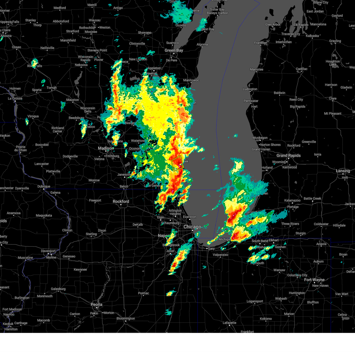 the severe thunderstorm warning has been cancelled and is no longer in effect the severe thunderstorm warning has been cancelled and is no longer in effect
|
| 5/7/2024 3:14 PM CDT |
 Svrmkx the national weather service in milwaukee/sullivan has issued a * severe thunderstorm warning for, southern milwaukee county in southeastern wisconsin, northwestern racine county in southeastern wisconsin, southeastern waukesha county in southeastern wisconsin, * until 400 pm cdt. * at 313 pm cdt, a severe thunderstorm was located near wind lake, moving northeast at 40 mph (radar indicated). Hazards include 60 mph wind gusts and nickel size hail. expect damage to roofs, siding, and trees Svrmkx the national weather service in milwaukee/sullivan has issued a * severe thunderstorm warning for, southern milwaukee county in southeastern wisconsin, northwestern racine county in southeastern wisconsin, southeastern waukesha county in southeastern wisconsin, * until 400 pm cdt. * at 313 pm cdt, a severe thunderstorm was located near wind lake, moving northeast at 40 mph (radar indicated). Hazards include 60 mph wind gusts and nickel size hail. expect damage to roofs, siding, and trees
|
| 4/27/2024 11:09 PM CDT |
 The storms which prompted the warning have weakened below severe limits, and no longer pose an immediate threat to life or property. therefore, the warning will be allowed to expire. a severe thunderstorm watch remains in effect until midnight cdt for southeastern wisconsin. The storms which prompted the warning have weakened below severe limits, and no longer pose an immediate threat to life or property. therefore, the warning will be allowed to expire. a severe thunderstorm watch remains in effect until midnight cdt for southeastern wisconsin.
|
| 4/27/2024 11:05 PM CDT |
 the severe thunderstorm warning has been cancelled and is no longer in effect the severe thunderstorm warning has been cancelled and is no longer in effect
|
| 4/27/2024 11:05 PM CDT |
 At 1104 pm cdt, severe thunderstorms were located along a line extending from 6 miles east of cudahy to racine to near paddock lake, moving east at 35 mph (radar indicated). Hazards include 60 mph wind gusts. Expect damage to roofs, siding, and trees. locations impacted include, milwaukee, kenosha, racine, west allis, greenfield, oak creek, mount pleasant, south milwaukee, cudahy, greendale, st. Francis, hales corners, sturtevant, union grove, west milwaukee, franklin, raymond, yorkville, wind point, and browns lake. At 1104 pm cdt, severe thunderstorms were located along a line extending from 6 miles east of cudahy to racine to near paddock lake, moving east at 35 mph (radar indicated). Hazards include 60 mph wind gusts. Expect damage to roofs, siding, and trees. locations impacted include, milwaukee, kenosha, racine, west allis, greenfield, oak creek, mount pleasant, south milwaukee, cudahy, greendale, st. Francis, hales corners, sturtevant, union grove, west milwaukee, franklin, raymond, yorkville, wind point, and browns lake.
|
| 4/27/2024 10:43 PM CDT |
 At 1043 pm cdt, severe thunderstorms were located along a line extending from near greenfield to yorkville to near wheatland, moving east at 35 mph (radar indicated). Hazards include 60 mph wind gusts. Expect damage to roofs, siding, and trees. locations impacted include, milwaukee, kenosha, racine, waukesha, west allis, new berlin, greenfield, oak creek, mount pleasant, muskego, south milwaukee, cudahy, greendale, pewaukee, elkhorn, st. Francis, hales corners, lake geneva, mukwonago, and sturtevant. At 1043 pm cdt, severe thunderstorms were located along a line extending from near greenfield to yorkville to near wheatland, moving east at 35 mph (radar indicated). Hazards include 60 mph wind gusts. Expect damage to roofs, siding, and trees. locations impacted include, milwaukee, kenosha, racine, waukesha, west allis, new berlin, greenfield, oak creek, mount pleasant, muskego, south milwaukee, cudahy, greendale, pewaukee, elkhorn, st. Francis, hales corners, lake geneva, mukwonago, and sturtevant.
|
| 4/27/2024 10:31 PM CDT |
 At 1031 pm cdt, severe thunderstorms were located along a line extending from hales corners to near eagle lake to near lake geneva, moving east at 35 mph (radar indicated). Hazards include 60 mph wind gusts. Expect damage to roofs, siding, and trees. locations impacted include, milwaukee, kenosha, racine, waukesha, west allis, new berlin, greenfield, oak creek, mount pleasant, muskego, south milwaukee, cudahy, greendale, pewaukee, elkhorn, st. Francis, delavan, hales corners, lake geneva, and mukwonago. At 1031 pm cdt, severe thunderstorms were located along a line extending from hales corners to near eagle lake to near lake geneva, moving east at 35 mph (radar indicated). Hazards include 60 mph wind gusts. Expect damage to roofs, siding, and trees. locations impacted include, milwaukee, kenosha, racine, waukesha, west allis, new berlin, greenfield, oak creek, mount pleasant, muskego, south milwaukee, cudahy, greendale, pewaukee, elkhorn, st. Francis, delavan, hales corners, lake geneva, and mukwonago.
|
| 4/27/2024 10:31 PM CDT |
 the severe thunderstorm warning has been cancelled and is no longer in effect the severe thunderstorm warning has been cancelled and is no longer in effect
|
| 4/27/2024 10:01 PM CDT |
 Svrmkx the national weather service in milwaukee/sullivan has issued a * severe thunderstorm warning for, southern milwaukee county in southeastern wisconsin, walworth county in southeastern wisconsin, racine county in southeastern wisconsin, southern waukesha county in southeastern wisconsin, southeastern jefferson county in southeastern wisconsin, northern kenosha county in southeastern wisconsin, * until 1115 pm cdt. * at 1001 pm cdt, severe thunderstorms were located along a line extending from ottawa to near east troy to darien, moving east at 35 mph (radar indicated). Hazards include 60 mph wind gusts. expect damage to roofs, siding, and trees Svrmkx the national weather service in milwaukee/sullivan has issued a * severe thunderstorm warning for, southern milwaukee county in southeastern wisconsin, walworth county in southeastern wisconsin, racine county in southeastern wisconsin, southern waukesha county in southeastern wisconsin, southeastern jefferson county in southeastern wisconsin, northern kenosha county in southeastern wisconsin, * until 1115 pm cdt. * at 1001 pm cdt, severe thunderstorms were located along a line extending from ottawa to near east troy to darien, moving east at 35 mph (radar indicated). Hazards include 60 mph wind gusts. expect damage to roofs, siding, and trees
|
| 2/8/2024 6:58 PM CST |
 At 657 pm cst, a severe thunderstorm was located over okauchee lake, moving northeast at 45 mph (radar indicated). Hazards include quarter size hail. damage to vehicles is expected At 657 pm cst, a severe thunderstorm was located over okauchee lake, moving northeast at 45 mph (radar indicated). Hazards include quarter size hail. damage to vehicles is expected
|
| 2/8/2024 6:50 PM CST |
 At 649 pm cst, a severe thunderstorm was located over vernon, or near mukwonago, moving northeast at 45 mph (radar indicated). Hazards include quarter size hail. Damage to vehicles is expected. locations impacted include, milwaukee, waukesha, west allis, wauwatosa, new berlin, greenfield, muskego, pewaukee, hales corners, mukwonago, elm grove, vernon, big bend, brookfield, state fair park, and milwaukee co zoo. hail threat, radar indicated max hail size, 1. 00 in wind threat, radar indicated max wind gust, <50 mph. At 649 pm cst, a severe thunderstorm was located over vernon, or near mukwonago, moving northeast at 45 mph (radar indicated). Hazards include quarter size hail. Damage to vehicles is expected. locations impacted include, milwaukee, waukesha, west allis, wauwatosa, new berlin, greenfield, muskego, pewaukee, hales corners, mukwonago, elm grove, vernon, big bend, brookfield, state fair park, and milwaukee co zoo. hail threat, radar indicated max hail size, 1. 00 in wind threat, radar indicated max wind gust, <50 mph.
|
| 2/8/2024 6:22 PM CST |
 At 622 pm cst, a severe thunderstorm was located near elkhorn, moving northeast at 50 mph (radar indicated). Hazards include quarter size hail. damage to vehicles is expected At 622 pm cst, a severe thunderstorm was located near elkhorn, moving northeast at 50 mph (radar indicated). Hazards include quarter size hail. damage to vehicles is expected
|
| 8/24/2023 4:51 PM CDT |
 At 451 pm cdt, a severe thunderstorm was located over muskego, moving east at 20 mph (radar indicated). Hazards include 60 mph wind gusts and quarter size hail. Hail damage to vehicles is expected. Expect wind damage to roofs, siding, and trees. At 451 pm cdt, a severe thunderstorm was located over muskego, moving east at 20 mph (radar indicated). Hazards include 60 mph wind gusts and quarter size hail. Hail damage to vehicles is expected. Expect wind damage to roofs, siding, and trees.
|
| 8/24/2023 4:18 PM CDT |
 At 418 pm cdt, a severe thunderstorm was located over west allis, moving east at 25 mph (radar indicated). Hazards include 60 mph wind gusts and quarter size hail. Hail damage to vehicles is expected. Expect wind damage to roofs, siding, and trees. At 418 pm cdt, a severe thunderstorm was located over west allis, moving east at 25 mph (radar indicated). Hazards include 60 mph wind gusts and quarter size hail. Hail damage to vehicles is expected. Expect wind damage to roofs, siding, and trees.
|
| 7/28/2023 11:11 PM CDT |
 The severe thunderstorm warning for ozaukee, milwaukee, eastern waukesha and eastern washington counties will expire at 1115 pm cdt, the storms which prompted the warning are moving out of the area. therefore, the warning will be allowed to expire. a severe thunderstorm watch remains in effect until midnight cdt for southeastern wisconsin. The severe thunderstorm warning for ozaukee, milwaukee, eastern waukesha and eastern washington counties will expire at 1115 pm cdt, the storms which prompted the warning are moving out of the area. therefore, the warning will be allowed to expire. a severe thunderstorm watch remains in effect until midnight cdt for southeastern wisconsin.
|
| 7/28/2023 10:57 PM CDT |
 At 1057 pm cdt, severe thunderstorms were located along a line extending from near random lake to near grafton to west milwaukee to wind lake, moving east at 55 mph (radar indicated). Hazards include 70 mph wind gusts and penny size hail. Expect considerable tree damage. damage is likely to mobile homes, roofs, and outbuildings. locations impacted include, milwaukee, waukesha, west allis, wauwatosa, new berlin, brookfield, greenfield, menomonee falls, oak creek, west bend, muskego, mequon, south milwaukee, cudahy, whitefish bay, greendale, pewaukee, brown deer, grafton, and cedarburg. People attending the oak creek farmers market , german fest in milwaukee , and the washington county fair should seek safe shelter immediately!. At 1057 pm cdt, severe thunderstorms were located along a line extending from near random lake to near grafton to west milwaukee to wind lake, moving east at 55 mph (radar indicated). Hazards include 70 mph wind gusts and penny size hail. Expect considerable tree damage. damage is likely to mobile homes, roofs, and outbuildings. locations impacted include, milwaukee, waukesha, west allis, wauwatosa, new berlin, brookfield, greenfield, menomonee falls, oak creek, west bend, muskego, mequon, south milwaukee, cudahy, whitefish bay, greendale, pewaukee, brown deer, grafton, and cedarburg. People attending the oak creek farmers market , german fest in milwaukee , and the washington county fair should seek safe shelter immediately!.
|
| 7/28/2023 10:26 PM CDT |
 At 1025 pm cdt, severe thunderstorms were located along a line extending from lomira to hartford to near dousman to near palmyra, moving east at 60 mph (radar indicated). Hazards include 70 mph wind gusts and penny size hail. Expect considerable tree damage. Damage is likely to mobile homes, roofs, and outbuildings. At 1025 pm cdt, severe thunderstorms were located along a line extending from lomira to hartford to near dousman to near palmyra, moving east at 60 mph (radar indicated). Hazards include 70 mph wind gusts and penny size hail. Expect considerable tree damage. Damage is likely to mobile homes, roofs, and outbuildings.
|
| 7/26/2023 12:17 PM CDT |
 At 1217 pm cdt, severe thunderstorms were located along a line extending from brookfield to milwaukee to near oak creek to near sturtevant, moving east at 50 mph (radar indicated). Hazards include 60 mph wind gusts. Expect damage to roofs, siding, and trees. locations impacted include, milwaukee, kenosha, racine, west allis, new berlin, greenfield, oak creek, mount pleasant, muskego, south milwaukee, cudahy, greendale, st. francis, hales corners, sturtevant, union grove, west milwaukee, franklin, raymond, and yorkville. hail threat, radar indicated max hail size, <. 75 in wind threat, radar indicated max wind gust, 60 mph. At 1217 pm cdt, severe thunderstorms were located along a line extending from brookfield to milwaukee to near oak creek to near sturtevant, moving east at 50 mph (radar indicated). Hazards include 60 mph wind gusts. Expect damage to roofs, siding, and trees. locations impacted include, milwaukee, kenosha, racine, west allis, new berlin, greenfield, oak creek, mount pleasant, muskego, south milwaukee, cudahy, greendale, st. francis, hales corners, sturtevant, union grove, west milwaukee, franklin, raymond, and yorkville. hail threat, radar indicated max hail size, <. 75 in wind threat, radar indicated max wind gust, 60 mph.
|
| 7/26/2023 12:07 PM CDT |
 At 1207 pm cdt, severe thunderstorms were located along a line extending from waukesha to hales corners to raymond to near paddock lake, moving east at 50 mph (radar indicated). Hazards include 60 mph wind gusts. Expect damage to roofs, siding, and trees. locations impacted include, milwaukee, kenosha, racine, waukesha, west allis, new berlin, greenfield, oak creek, mount pleasant, muskego, south milwaukee, cudahy, greendale, st. francis, hales corners, mukwonago, sturtevant, union grove, east troy, and west milwaukee. people attending the racine county fair should seek safe shelter immediately! hail threat, radar indicated max hail size, <. 75 in wind threat, radar indicated max wind gust, 60 mph. At 1207 pm cdt, severe thunderstorms were located along a line extending from waukesha to hales corners to raymond to near paddock lake, moving east at 50 mph (radar indicated). Hazards include 60 mph wind gusts. Expect damage to roofs, siding, and trees. locations impacted include, milwaukee, kenosha, racine, waukesha, west allis, new berlin, greenfield, oak creek, mount pleasant, muskego, south milwaukee, cudahy, greendale, st. francis, hales corners, mukwonago, sturtevant, union grove, east troy, and west milwaukee. people attending the racine county fair should seek safe shelter immediately! hail threat, radar indicated max hail size, <. 75 in wind threat, radar indicated max wind gust, 60 mph.
|
| 7/26/2023 11:46 AM CDT |
 At 1145 am cdt, severe thunderstorms were located along a line extending from near dousman to near mukwonago to near east troy to pell lake, moving east at 50 mph (radar indicated. numerous reports of tree damage as well). Hazards include 60 mph wind gusts. expect damage to roofs, siding, and trees At 1145 am cdt, severe thunderstorms were located along a line extending from near dousman to near mukwonago to near east troy to pell lake, moving east at 50 mph (radar indicated. numerous reports of tree damage as well). Hazards include 60 mph wind gusts. expect damage to roofs, siding, and trees
|
| 7/5/2023 2:22 PM CDT |
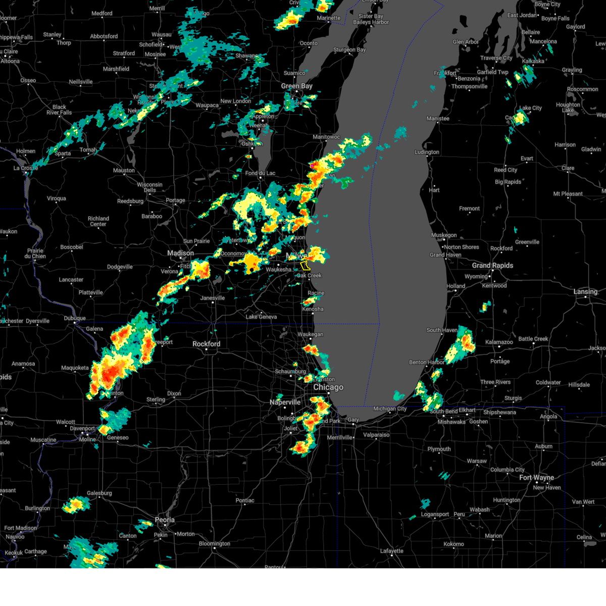 The severe thunderstorm warning for central milwaukee county will expire at 230 pm cdt, the storm which prompted the warning has moved out of the area. therefore, the warning will be allowed to expire. The severe thunderstorm warning for central milwaukee county will expire at 230 pm cdt, the storm which prompted the warning has moved out of the area. therefore, the warning will be allowed to expire.
|
| 7/5/2023 2:03 PM CDT |
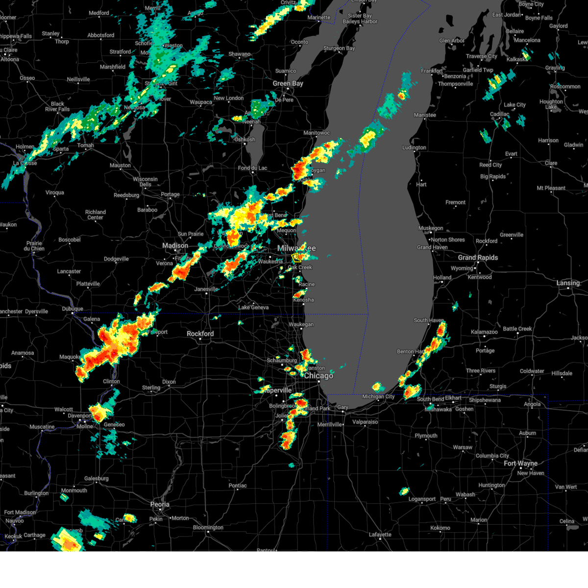 At 203 pm cdt, a severe thunderstorm was located over southeastern milwaukee, moving north at 10 mph (radar indicated). Hazards include 60 mph wind gusts and quarter size hail. Hail damage to vehicles is expected. Expect wind damage to roofs, siding, and trees. At 203 pm cdt, a severe thunderstorm was located over southeastern milwaukee, moving north at 10 mph (radar indicated). Hazards include 60 mph wind gusts and quarter size hail. Hail damage to vehicles is expected. Expect wind damage to roofs, siding, and trees.
|
| 7/5/2023 2:00 PM CDT | Corrects previous tstm wnd dmg report from 1 ene milwaukee. multiple reports of downed large limbs... uprooted and snapped trees. time estimated with rada in milwaukee county WI, 3 miles W of Milwaukee, WI |
| 6/29/2023 1:47 PM CDT | Quarter sized hail reported 9.2 miles S of Milwaukee, WI |
| 4/20/2023 6:37 PM CDT |
 The severe thunderstorm warning for central milwaukee county will expire at 645 pm cdt, the storm which prompted the warning has moved out of the area. therefore, the warning will be allowed to expire. a tornado watch remains in effect until 800 pm cdt for southeastern wisconsin. The severe thunderstorm warning for central milwaukee county will expire at 645 pm cdt, the storm which prompted the warning has moved out of the area. therefore, the warning will be allowed to expire. a tornado watch remains in effect until 800 pm cdt for southeastern wisconsin.
|
| 4/20/2023 6:30 PM CDT | Large tree fell onto parked car in the street. time estimated from rada in milwaukee county WI, 4.9 miles NW of Milwaukee, WI |
| 4/20/2023 6:29 PM CDT |
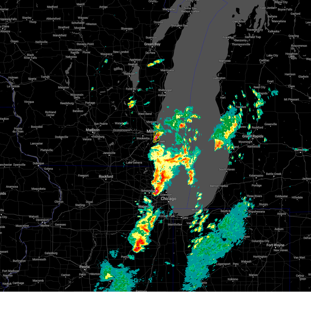 At 629 pm cdt, a severe thunderstorm was located over st. francis, moving northeast at 55 mph (radar indicated). Hazards include quarter size hail. Damage to vehicles is expected. locations impacted include, milwaukee, greenfield, oak creek, cudahy, whitefish bay, greendale, st. francis, west milwaukee, franklin, glendale, milwaukee hoan bridge, shorewood, marquette university, uw- milwaukee, mitchell park domes, amfam field, and maier festival park. hail threat, radar indicated max hail size, 1. 00 in wind threat, radar indicated max wind gust, <50 mph. At 629 pm cdt, a severe thunderstorm was located over st. francis, moving northeast at 55 mph (radar indicated). Hazards include quarter size hail. Damage to vehicles is expected. locations impacted include, milwaukee, greenfield, oak creek, cudahy, whitefish bay, greendale, st. francis, west milwaukee, franklin, glendale, milwaukee hoan bridge, shorewood, marquette university, uw- milwaukee, mitchell park domes, amfam field, and maier festival park. hail threat, radar indicated max hail size, 1. 00 in wind threat, radar indicated max wind gust, <50 mph.
|
| 4/20/2023 6:19 PM CDT |
 At 618 pm cdt, a severe thunderstorm was located over franklin, moving northeast at 55 mph (radar indicated). Hazards include quarter size hail. damage to vehicles is expected At 618 pm cdt, a severe thunderstorm was located over franklin, moving northeast at 55 mph (radar indicated). Hazards include quarter size hail. damage to vehicles is expected
|
| 4/4/2023 11:42 PM CDT |
 The severe thunderstorm warning for ozaukee, northern milwaukee, northeastern waukesha and washington counties will expire at 1145 pm cdt, the storms which prompted the warning have weakened below severe limits, and no longer pose an immediate threat to life or property. therefore, the warning will be allowed to expire. however small hail is still possible with these thunderstorms. The severe thunderstorm warning for ozaukee, northern milwaukee, northeastern waukesha and washington counties will expire at 1145 pm cdt, the storms which prompted the warning have weakened below severe limits, and no longer pose an immediate threat to life or property. therefore, the warning will be allowed to expire. however small hail is still possible with these thunderstorms.
|
| 4/4/2023 11:25 PM CDT |
 At 1124 pm cdt, severe thunderstorms were located along a line extending from near lac la belle to 17 miles east of cudahy, moving northeast at 70 mph (radar indicated). Hazards include quarter size hail. Damage to vehicles is expected. locations impacted include, northern milwaukee, menomonee falls, west bend, mequon, hartford, whitefish bay, brown deer, grafton, cedarburg, port washington, sussex, jackson, fox point, slinger, saukville, bayside, kewaskum, thiensville, germantown, and glendale. hail threat, radar indicated max hail size, 1. 00 in wind threat, radar indicated max wind gust, <50 mph. At 1124 pm cdt, severe thunderstorms were located along a line extending from near lac la belle to 17 miles east of cudahy, moving northeast at 70 mph (radar indicated). Hazards include quarter size hail. Damage to vehicles is expected. locations impacted include, northern milwaukee, menomonee falls, west bend, mequon, hartford, whitefish bay, brown deer, grafton, cedarburg, port washington, sussex, jackson, fox point, slinger, saukville, bayside, kewaskum, thiensville, germantown, and glendale. hail threat, radar indicated max hail size, 1. 00 in wind threat, radar indicated max wind gust, <50 mph.
|
| 4/4/2023 11:20 PM CDT | Quarter sized hail reported 5 miles WSW of Milwaukee, WI |
| 4/4/2023 10:59 PM CDT |
 At 1059 pm cdt, severe thunderstorms were located along a line extending from near lake ripley to near raymond, moving northeast at 70 mph (trained weather spotters). Hazards include half dollar size hail. damage to vehicles is expected At 1059 pm cdt, severe thunderstorms were located along a line extending from near lake ripley to near raymond, moving northeast at 70 mph (trained weather spotters). Hazards include half dollar size hail. damage to vehicles is expected
|
| 11/5/2022 12:37 PM CDT | Corrects previous tstm wnd dmg report from 1 ssw whitefish bay for time. trees down in estabrook park. time est from rada in milwaukee county WI, 4.9 miles SSW of Milwaukee, WI |
| 11/5/2022 12:37 PM CDT |
 At 1236 pm cdt, severe thunderstorms were located along a line extending from kewaskum to near germantown, moving northeast at 45 mph (radar indicated). Hazards include 60 mph wind gusts. expect damage to roofs, siding, and trees At 1236 pm cdt, severe thunderstorms were located along a line extending from kewaskum to near germantown, moving northeast at 45 mph (radar indicated). Hazards include 60 mph wind gusts. expect damage to roofs, siding, and trees
|
| 11/5/2022 12:32 PM CDT |
 At 1231 pm cdt, severe thunderstorms were located along a line extending from milwaukee to racine, moving northeast at 50 mph (radar indicated). Hazards include 60 mph wind gusts. Expect damage to roofs, siding, and trees. locations impacted include, milwaukee, racine, west allis, wauwatosa, greenfield, oak creek, mount pleasant, south milwaukee, cudahy, whitefish bay, greendale, brown deer, st. francis, sturtevant, fox point, bayside, west milwaukee, glendale, franklin and wind point. hail threat, radar indicated max hail size, <. 75 in wind threat, radar indicated max wind gust, 60 mph. At 1231 pm cdt, severe thunderstorms were located along a line extending from milwaukee to racine, moving northeast at 50 mph (radar indicated). Hazards include 60 mph wind gusts. Expect damage to roofs, siding, and trees. locations impacted include, milwaukee, racine, west allis, wauwatosa, greenfield, oak creek, mount pleasant, south milwaukee, cudahy, whitefish bay, greendale, brown deer, st. francis, sturtevant, fox point, bayside, west milwaukee, glendale, franklin and wind point. hail threat, radar indicated max hail size, <. 75 in wind threat, radar indicated max wind gust, 60 mph.
|
| 11/5/2022 12:23 PM CDT | Social media report from home weather statio in milwaukee county WI, 7.6 miles SE of Milwaukee, WI |
| 11/5/2022 12:23 PM CDT | Corrects previous tstm wnd dmg report from west allis for time. power outages reported in west alli in milwaukee county WI, 4.5 miles NE of Milwaukee, WI |
| 11/5/2022 12:23 PM CDT |
 At 1222 pm cdt, severe thunderstorms were located along a line extending from sussex to near paddock lake, moving east at 40 mph (radar indicated). Hazards include 60 mph wind gusts. Expect damage to roofs, siding, and trees. locations impacted include, milwaukee, kenosha, racine, waukesha, west allis, wauwatosa, new berlin, brookfield, greenfield, menomonee falls, oak creek, mount pleasant, muskego, south milwaukee, pleasant prairie, cudahy, whitefish bay, greendale, pewaukee and brown deer. hail threat, radar indicated max hail size, <. 75 in wind threat, radar indicated max wind gust, 60 mph. At 1222 pm cdt, severe thunderstorms were located along a line extending from sussex to near paddock lake, moving east at 40 mph (radar indicated). Hazards include 60 mph wind gusts. Expect damage to roofs, siding, and trees. locations impacted include, milwaukee, kenosha, racine, waukesha, west allis, wauwatosa, new berlin, brookfield, greenfield, menomonee falls, oak creek, mount pleasant, muskego, south milwaukee, pleasant prairie, cudahy, whitefish bay, greendale, pewaukee and brown deer. hail threat, radar indicated max hail size, <. 75 in wind threat, radar indicated max wind gust, 60 mph.
|
| 11/5/2022 12:22 PM CDT | Pic from social media showing a flag pole bent at a 45 degree angle. time est from rada in milwaukee county WI, 4.5 miles NE of Milwaukee, WI |
| 11/5/2022 12:10 PM CDT |
 At 1209 pm cdt, severe thunderstorms were located along a line extending from hartland to near lake catherine, moving east at 45 mph (radar indicated). Hazards include 60 mph wind gusts. Expect damage to roofs, siding, and trees. locations impacted include, milwaukee, kenosha, racine, waukesha, west allis, wauwatosa, new berlin, brookfield, greenfield, menomonee falls, oak creek, mount pleasant, muskego, south milwaukee, pleasant prairie, cudahy, whitefish bay, greendale, pewaukee and brown deer. hail threat, radar indicated max hail size, <. 75 in wind threat, radar indicated max wind gust, 60 mph. At 1209 pm cdt, severe thunderstorms were located along a line extending from hartland to near lake catherine, moving east at 45 mph (radar indicated). Hazards include 60 mph wind gusts. Expect damage to roofs, siding, and trees. locations impacted include, milwaukee, kenosha, racine, waukesha, west allis, wauwatosa, new berlin, brookfield, greenfield, menomonee falls, oak creek, mount pleasant, muskego, south milwaukee, pleasant prairie, cudahy, whitefish bay, greendale, pewaukee and brown deer. hail threat, radar indicated max hail size, <. 75 in wind threat, radar indicated max wind gust, 60 mph.
|
| 11/5/2022 11:49 AM CDT |
 At 1147 am cdt, severe thunderstorms were located along a line extending from 7 miles west of dousman to bull valley, moving northeast at 45 mph (law enforcement reported trees down across western portions of walworth county). Hazards include 60 mph wind gusts. expect damage to roofs, siding, and trees At 1147 am cdt, severe thunderstorms were located along a line extending from 7 miles west of dousman to bull valley, moving northeast at 45 mph (law enforcement reported trees down across western portions of walworth county). Hazards include 60 mph wind gusts. expect damage to roofs, siding, and trees
|
| 11/5/2022 11:37 AM CDT | Trees down in estabrook park. time est from rada in milwaukee county WI, 4.9 miles SSW of Milwaukee, WI |
| 11/5/2022 11:23 AM CDT | Power outages reported in west alli in milwaukee county WI, 4.5 miles NE of Milwaukee, WI |
| 11/4/2022 3:38 PM CDT |
 The severe thunderstorm warning for central milwaukee county will expire at 345 pm cdt, the severe thunderstorm which prompted the warning has moved out of the warned area. therefore, the warning will be allowed to expire. The severe thunderstorm warning for central milwaukee county will expire at 345 pm cdt, the severe thunderstorm which prompted the warning has moved out of the warned area. therefore, the warning will be allowed to expire.
|
| 11/4/2022 3:37 PM CDT | Quarter sized hail reported 4.1 miles ENE of Milwaukee, WI, 89th and arthur. |
| 11/4/2022 3:34 PM CDT |
 At 332 pm cdt, a severe thunderstorm was located over northeastern milwaukee, moving northeast at 65 mph (radar indicated. three quarter of an inch hail has been reported near state fair park). Hazards include quarter size hail. Damage to vehicles is expected. locations impacted include, milwaukee, west allis, wauwatosa, whitefish bay, fox point, bayside, west milwaukee, glendale, river hills, milwaukee hoan bridge, shorewood, state fair park, marquette university, uw- milwaukee, mitchell park domes, milwaukee co zoo, amfam field and maier festival park. hail threat, radar indicated max hail size, 1. 00 in wind threat, radar indicated max wind gust, <50 mph. At 332 pm cdt, a severe thunderstorm was located over northeastern milwaukee, moving northeast at 65 mph (radar indicated. three quarter of an inch hail has been reported near state fair park). Hazards include quarter size hail. Damage to vehicles is expected. locations impacted include, milwaukee, west allis, wauwatosa, whitefish bay, fox point, bayside, west milwaukee, glendale, river hills, milwaukee hoan bridge, shorewood, state fair park, marquette university, uw- milwaukee, mitchell park domes, milwaukee co zoo, amfam field and maier festival park. hail threat, radar indicated max hail size, 1. 00 in wind threat, radar indicated max wind gust, <50 mph.
|
| 11/4/2022 3:33 PM CDT | Quarter sized hail reported 4.1 miles NE of Milwaukee, WI |
| 11/4/2022 3:24 PM CDT |
 At 324 pm cdt, a severe thunderstorm was located over west allis, moving northeast at 65 mph (radar indicated). Hazards include quarter size hail. damage to vehicles is expected At 324 pm cdt, a severe thunderstorm was located over west allis, moving northeast at 65 mph (radar indicated). Hazards include quarter size hail. damage to vehicles is expected
|
| 10/12/2022 1:00 PM CDT | Large limbs down. time estimated from rada in milwaukee county WI, 4.9 miles NNW of Milwaukee, WI |
| 10/12/2022 12:52 PM CDT | Report from mping: 1-inch tree limbs broken; shingles blown of in milwaukee county WI, 2.6 miles WSW of Milwaukee, WI |
| 10/12/2022 12:46 PM CDT | Trees downed 68th & harrison and 65th & cleveland ave milwaukee/west allis borde in milwaukee county WI, 4.1 miles ENE of Milwaukee, WI |
| 10/12/2022 12:40 PM CDT | Tree branches down along e bolivar ave along with some yard decorations damage in milwaukee county WI, 5.6 miles NNW of Milwaukee, WI |
| 10/12/2022 12:36 PM CDT |
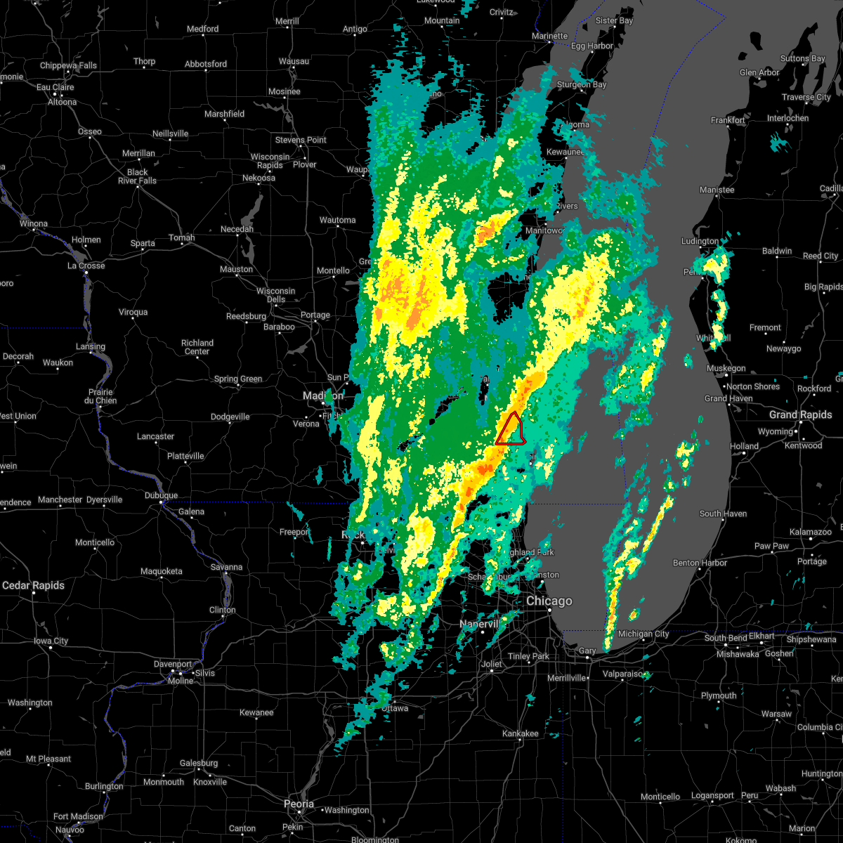 At 1236 pm cdt, tornado producing storms were located along a line extending from 7 miles east of bayside to near franklin, moving east at 40 mph (radar confirmed tornado). Hazards include damaging tornado. Flying debris will be dangerous to those caught without shelter. mobile homes will be damaged or destroyed. damage to roofs, windows, and vehicles will occur. tree damage is likely. locations impacted include, milwaukee, greenfield, oak creek, south milwaukee, cudahy, greendale, st. Francis, franklin and milwaukee south shore park. At 1236 pm cdt, tornado producing storms were located along a line extending from 7 miles east of bayside to near franklin, moving east at 40 mph (radar confirmed tornado). Hazards include damaging tornado. Flying debris will be dangerous to those caught without shelter. mobile homes will be damaged or destroyed. damage to roofs, windows, and vehicles will occur. tree damage is likely. locations impacted include, milwaukee, greenfield, oak creek, south milwaukee, cudahy, greendale, st. Francis, franklin and milwaukee south shore park.
|
| 10/12/2022 12:34 PM CDT | Peak gust at mitchell internationa in milwaukee county WI, 6.8 miles NNW of Milwaukee, WI |
| 10/12/2022 12:30 PM CDT | 3 inch diameter tree limbs snapped at 2nd street and plainfield avenue. time estimated from rada in milwaukee county WI, 5.4 miles NNW of Milwaukee, WI |
| 10/12/2022 12:27 PM CDT |
 At 1226 pm cdt, tornado producing storms were located along a line extending from bayside to wind lake, and are nearly stationary (radar confirmed tornado near brown deer, greenfield, and west allis). Hazards include damaging tornado. Flying debris will be dangerous to those caught without shelter. mobile homes will be damaged or destroyed. damage to roofs, windows, and vehicles will occur. tree damage is likely. locations impacted include, milwaukee, west allis, wauwatosa, greenfield, oak creek, south milwaukee, cudahy, whitefish bay, greendale, brown deer, st. Francis, hales corners, fox point, bayside, west milwaukee, franklin, glendale, river hills, milwaukee hoan bridge and shorewood. At 1226 pm cdt, tornado producing storms were located along a line extending from bayside to wind lake, and are nearly stationary (radar confirmed tornado near brown deer, greenfield, and west allis). Hazards include damaging tornado. Flying debris will be dangerous to those caught without shelter. mobile homes will be damaged or destroyed. damage to roofs, windows, and vehicles will occur. tree damage is likely. locations impacted include, milwaukee, west allis, wauwatosa, greenfield, oak creek, south milwaukee, cudahy, whitefish bay, greendale, brown deer, st. Francis, hales corners, fox point, bayside, west milwaukee, franklin, glendale, river hills, milwaukee hoan bridge and shorewood.
|
| 10/12/2022 12:26 PM CDT | Report from mping: 3-inch tree limbs broken; power poles broken. estimated 50-60 mp in milwaukee county WI, 6.4 miles SE of Milwaukee, WI |
| 10/12/2022 12:24 PM CDT | Large trees down on hayes avenue between 72nd and 74th streets. power lines down on 72nd street between hayes avenue and beloit road. time estimated from rada in milwaukee county WI, 3.4 miles NE of Milwaukee, WI |
| 10/12/2022 12:22 PM CDT |
 At 1222 pm cdt, tornado producing storms were located along a line extending from bayside to wind lake, moving east at 40 mph (radar confirmed tornado near new berlin). Hazards include damaging tornado. Flying debris will be dangerous to those caught without shelter. mobile homes will be damaged or destroyed. damage to roofs, windows, and vehicles will occur. tree damage is likely. locations impacted include, milwaukee, west allis, wauwatosa, greenfield, oak creek, south milwaukee, cudahy, whitefish bay, greendale, brown deer, st. Francis, hales corners, fox point, bayside, west milwaukee, franklin, glendale, river hills, milwaukee hoan bridge and shorewood. At 1222 pm cdt, tornado producing storms were located along a line extending from bayside to wind lake, moving east at 40 mph (radar confirmed tornado near new berlin). Hazards include damaging tornado. Flying debris will be dangerous to those caught without shelter. mobile homes will be damaged or destroyed. damage to roofs, windows, and vehicles will occur. tree damage is likely. locations impacted include, milwaukee, west allis, wauwatosa, greenfield, oak creek, south milwaukee, cudahy, whitefish bay, greendale, brown deer, st. Francis, hales corners, fox point, bayside, west milwaukee, franklin, glendale, river hills, milwaukee hoan bridge and shorewood.
|
| 10/12/2022 12:10 PM CDT |
 At 1209 pm cdt, severe thunderstorms capable of producing a tornado were located along a line extending from near menomonee falls to mukwonago, moving northeast at 35 mph (radar indicated rotation). Hazards include tornado. Flying debris will be dangerous to those caught without shelter. mobile homes will be damaged or destroyed. damage to roofs, windows, and vehicles will occur. Tree damage is likely. At 1209 pm cdt, severe thunderstorms capable of producing a tornado were located along a line extending from near menomonee falls to mukwonago, moving northeast at 35 mph (radar indicated rotation). Hazards include tornado. Flying debris will be dangerous to those caught without shelter. mobile homes will be damaged or destroyed. damage to roofs, windows, and vehicles will occur. Tree damage is likely.
|
| 10/12/2022 12:06 PM CDT |
 At 1205 pm cdt, severe thunderstorms were located along a line extending from 13 miles east of cleveland to menomonee falls, moving east at 40 mph (radar indicated). Hazards include 60 mph wind gusts. Expect damage to roofs, siding, and trees. Locations impacted include, sheboygan, mequon, brown deer, grafton, cedarburg, port washington, saukville, bayside, thiensville, germantown, oostburg, belgium, fredonia, cedar grove, richfield, colgate, kirchhayn, gibbsville and hubertus. At 1205 pm cdt, severe thunderstorms were located along a line extending from 13 miles east of cleveland to menomonee falls, moving east at 40 mph (radar indicated). Hazards include 60 mph wind gusts. Expect damage to roofs, siding, and trees. Locations impacted include, sheboygan, mequon, brown deer, grafton, cedarburg, port washington, saukville, bayside, thiensville, germantown, oostburg, belgium, fredonia, cedar grove, richfield, colgate, kirchhayn, gibbsville and hubertus.
|
| 10/12/2022 12:03 PM CDT |
 At 1202 pm cdt, tornado producing storms were located along a line extending from sussex to near mukwonago, moving east at 50 mph (radar confirmed tornadoes southeast of north prairie and genessee depot). Hazards include damaging tornado. Flying debris will be dangerous to those caught without shelter. mobile homes will be damaged or destroyed. damage to roofs, windows, and vehicles will occur. tree damage is likely. locations impacted include, waukesha, new berlin, brookfield, menomonee falls, muskego, pewaukee, sussex, hartland, mukwonago, delafield, elm grove, wales, lisbon, vernon, ottawa, merton, dousman, north prairie, butler and big bend. People attending wambold dam construction should seek safe shelter immediately!. At 1202 pm cdt, tornado producing storms were located along a line extending from sussex to near mukwonago, moving east at 50 mph (radar confirmed tornadoes southeast of north prairie and genessee depot). Hazards include damaging tornado. Flying debris will be dangerous to those caught without shelter. mobile homes will be damaged or destroyed. damage to roofs, windows, and vehicles will occur. tree damage is likely. locations impacted include, waukesha, new berlin, brookfield, menomonee falls, muskego, pewaukee, sussex, hartland, mukwonago, delafield, elm grove, wales, lisbon, vernon, ottawa, merton, dousman, north prairie, butler and big bend. People attending wambold dam construction should seek safe shelter immediately!.
|
| 10/12/2022 12:02 PM CDT |
 At 1202 pm cdt, severe thunderstorms were located along a line extending from near germantown to near east troy, moving east at 55 mph (radar indicated). Hazards include 60 mph wind gusts. expect damage to roofs, siding, and trees At 1202 pm cdt, severe thunderstorms were located along a line extending from near germantown to near east troy, moving east at 55 mph (radar indicated). Hazards include 60 mph wind gusts. expect damage to roofs, siding, and trees
|
| 10/12/2022 11:57 AM CDT |
 At 1156 am cdt, severe thunderstorms capable of producing tornadoes were located along a line extending from lisbon to near palmyra, moving east at 45 mph (radar indicated rotation). Hazards include tornado. Flying debris will be dangerous to those caught without shelter. mobile homes will be damaged or destroyed. damage to roofs, windows, and vehicles will occur. tree damage is likely. locations impacted include, waukesha, new berlin, brookfield, menomonee falls, muskego, pewaukee, sussex, hartland, mukwonago, delafield, elm grove, wales, lisbon, vernon, ottawa, merton, dousman, north prairie, butler and big bend. People attending wambold dam construction should seek safe shelter immediately!. At 1156 am cdt, severe thunderstorms capable of producing tornadoes were located along a line extending from lisbon to near palmyra, moving east at 45 mph (radar indicated rotation). Hazards include tornado. Flying debris will be dangerous to those caught without shelter. mobile homes will be damaged or destroyed. damage to roofs, windows, and vehicles will occur. tree damage is likely. locations impacted include, waukesha, new berlin, brookfield, menomonee falls, muskego, pewaukee, sussex, hartland, mukwonago, delafield, elm grove, wales, lisbon, vernon, ottawa, merton, dousman, north prairie, butler and big bend. People attending wambold dam construction should seek safe shelter immediately!.
|
| 10/12/2022 11:52 AM CDT |
 At 1152 am cdt, severe thunderstorms capable of producing a tornado were located along a line extending from near lisbon to near palmyra, moving east at 45 mph (radar indicated rotation). Hazards include tornado. Flying debris will be dangerous to those caught without shelter. mobile homes will be damaged or destroyed. damage to roofs, windows, and vehicles will occur. Tree damage is likely. At 1152 am cdt, severe thunderstorms capable of producing a tornado were located along a line extending from near lisbon to near palmyra, moving east at 45 mph (radar indicated rotation). Hazards include tornado. Flying debris will be dangerous to those caught without shelter. mobile homes will be damaged or destroyed. damage to roofs, windows, and vehicles will occur. Tree damage is likely.
|
| 10/12/2022 11:49 AM CDT |
 At 1149 am cdt, severe thunderstorms were located along a line extending from near merton to near palmyra, moving east at 45 mph (radar indicated). Hazards include 60 mph wind gusts. expect damage to roofs, siding, and trees At 1149 am cdt, severe thunderstorms were located along a line extending from near merton to near palmyra, moving east at 45 mph (radar indicated). Hazards include 60 mph wind gusts. expect damage to roofs, siding, and trees
|
| 10/12/2022 11:41 AM CDT |
 At 1140 am cdt, severe thunderstorms were located along a line extending from near cleveland to near okauchee lake, moving east at 35 mph (radar indicated). Hazards include 60 mph wind gusts. expect damage to roofs, siding, and trees At 1140 am cdt, severe thunderstorms were located along a line extending from near cleveland to near okauchee lake, moving east at 35 mph (radar indicated). Hazards include 60 mph wind gusts. expect damage to roofs, siding, and trees
|
| 9/25/2022 7:05 PM CDT | Report from mping: 1-inch tree limbs broken; shingles blown of in milwaukee county WI, 3.6 miles NW of Milwaukee, WI |
| 9/25/2022 6:33 PM CDT |
 At 631 pm cdt, severe thunderstorms were located along a line extending from 11 miles east of st. francis to near franklin to near east troy, moving southeast at 65 mph (public reports of trees down in northeastern walworth county). Hazards include 60 mph wind gusts and nickel size hail. Expect damage to roofs, siding, and trees. locations impacted include, milwaukee, racine, waukesha, west allis, wauwatosa, new berlin, brookfield, greenfield, oak creek, mount pleasant, muskego, south milwaukee, cudahy, whitefish bay, greendale, elkhorn, st. francis, hales corners, mukwonago and sturtevant. people attending harvest fest at state fair should seek safe shelter immediately! hail threat, radar indicated max hail size, 0. 88 in wind threat, radar indicated max wind gust, 60 mph. At 631 pm cdt, severe thunderstorms were located along a line extending from 11 miles east of st. francis to near franklin to near east troy, moving southeast at 65 mph (public reports of trees down in northeastern walworth county). Hazards include 60 mph wind gusts and nickel size hail. Expect damage to roofs, siding, and trees. locations impacted include, milwaukee, racine, waukesha, west allis, wauwatosa, new berlin, brookfield, greenfield, oak creek, mount pleasant, muskego, south milwaukee, cudahy, whitefish bay, greendale, elkhorn, st. francis, hales corners, mukwonago and sturtevant. people attending harvest fest at state fair should seek safe shelter immediately! hail threat, radar indicated max hail size, 0. 88 in wind threat, radar indicated max wind gust, 60 mph.
|
| 9/25/2022 6:32 PM CDT | Large tree limbs dow in milwaukee county WI, 6.4 miles SSW of Milwaukee, WI |
| 9/25/2022 6:30 PM CDT | Down tree on top of a car on milwaukee southside. time radar estimate in milwaukee county WI, 2.1 miles NNW of Milwaukee, WI |
| 9/25/2022 6:25 PM CDT | Delayed report. numerous trees down and large limbs snapped in the bayview neighborhood. report of some roads blocked. report via twitter. time radar estimate in milwaukee county WI, 4 miles NW of Milwaukee, WI |
| 9/25/2022 6:24 PM CDT | Estimated 60-65 mph wind in milwaukee county WI, 1 miles W of Milwaukee, WI |
| 9/25/2022 6:18 PM CDT |
 At 617 pm cdt, severe thunderstorms were located along a line extending from near whitefish bay to near waukesha to near palmyra, moving southeast at 60 mph (trained weather spotters reports trees down across jefferson and waukesha counites). Hazards include 60 mph wind gusts and nickel size hail. Expect damage to roofs, siding, and trees. locations impacted include, milwaukee, racine, waukesha, west allis, wauwatosa, new berlin, brookfield, greenfield, menomonee falls, oak creek, mount pleasant, muskego, south milwaukee, cudahy, whitewater, whitefish bay, greendale, pewaukee, brown deer and sussex. people attending harvest fest at state fair should seek safe shelter immediately! hail threat, radar indicated max hail size, 0. 88 in wind threat, radar indicated max wind gust, 60 mph. At 617 pm cdt, severe thunderstorms were located along a line extending from near whitefish bay to near waukesha to near palmyra, moving southeast at 60 mph (trained weather spotters reports trees down across jefferson and waukesha counites). Hazards include 60 mph wind gusts and nickel size hail. Expect damage to roofs, siding, and trees. locations impacted include, milwaukee, racine, waukesha, west allis, wauwatosa, new berlin, brookfield, greenfield, menomonee falls, oak creek, mount pleasant, muskego, south milwaukee, cudahy, whitewater, whitefish bay, greendale, pewaukee, brown deer and sussex. people attending harvest fest at state fair should seek safe shelter immediately! hail threat, radar indicated max hail size, 0. 88 in wind threat, radar indicated max wind gust, 60 mph.
|
| 9/25/2022 6:16 PM CDT | Numerous downed trees and large limbs snapped. power out at the time of the report. delayed report. time radar estimate in milwaukee county WI, 1.7 miles ESE of Milwaukee, WI |
| 9/25/2022 6:01 PM CDT |
 At 601 pm cdt, severe thunderstorms were located along a line extending from 10 miles east of sheboygan to 7 miles southeast of belgium to near cedarburg, moving southeast at 45 mph (radar indicated). Hazards include 60 mph wind gusts and nickel size hail. Expect damage to roofs, siding, and trees. locations impacted include, sheboygan, west bend, mequon, brown deer, grafton, cedarburg, port washington, plymouth, sheboygan falls, jackson, slinger, saukville, bayside, thiensville, howards grove, germantown, oostburg, belgium, fredonia and kohler. hail threat, radar indicated max hail size, 0. 88 in wind threat, radar indicated max wind gust, 60 mph. At 601 pm cdt, severe thunderstorms were located along a line extending from 10 miles east of sheboygan to 7 miles southeast of belgium to near cedarburg, moving southeast at 45 mph (radar indicated). Hazards include 60 mph wind gusts and nickel size hail. Expect damage to roofs, siding, and trees. locations impacted include, sheboygan, west bend, mequon, brown deer, grafton, cedarburg, port washington, plymouth, sheboygan falls, jackson, slinger, saukville, bayside, thiensville, howards grove, germantown, oostburg, belgium, fredonia and kohler. hail threat, radar indicated max hail size, 0. 88 in wind threat, radar indicated max wind gust, 60 mph.
|
| 9/25/2022 5:59 PM CDT |
 At 559 pm cdt, severe thunderstorms were located along a line extending from germantown to oconomowoc to fort atkinson, moving southeast at 65 mph (emergency management). Hazards include 60 mph wind gusts and nickel size hail. expect damage to roofs, siding, and trees At 559 pm cdt, severe thunderstorms were located along a line extending from germantown to oconomowoc to fort atkinson, moving southeast at 65 mph (emergency management). Hazards include 60 mph wind gusts and nickel size hail. expect damage to roofs, siding, and trees
|
| 9/25/2022 5:47 PM CDT |
 At 547 pm cdt, severe thunderstorms were located along a line extending from hartford to near deerfield, moving southeast at 55 mph (radar indicated). Hazards include 60 mph wind gusts and nickel size hail. Expect damage to roofs, siding, and trees. locations impacted include, menomonee falls, watertown, hartford, pewaukee, fort atkinson, sussex, hartland, jefferson, delafield, lake mills, slinger, marshall, waterloo, okauchee lake, germantown, oconomowoc, lisbon, cottage grove, merton and johnson creek. hail threat, radar indicated max hail size, 0. 88 in wind threat, radar indicated max wind gust, 60 mph. At 547 pm cdt, severe thunderstorms were located along a line extending from hartford to near deerfield, moving southeast at 55 mph (radar indicated). Hazards include 60 mph wind gusts and nickel size hail. Expect damage to roofs, siding, and trees. locations impacted include, menomonee falls, watertown, hartford, pewaukee, fort atkinson, sussex, hartland, jefferson, delafield, lake mills, slinger, marshall, waterloo, okauchee lake, germantown, oconomowoc, lisbon, cottage grove, merton and johnson creek. hail threat, radar indicated max hail size, 0. 88 in wind threat, radar indicated max wind gust, 60 mph.
|
| 9/25/2022 5:32 PM CDT |
 At 532 pm cdt, severe thunderstorms were located along a line extending from near mayville to sun prairie, moving southeast at 50 mph (radar indicated). Hazards include 60 mph wind gusts and nickel size hail. Expect damage to roofs, siding, and trees. locations impacted include, menomonee falls, sun prairie, watertown, hartford, pewaukee, fort atkinson, sussex, hartland, jefferson, delafield, windsor, lake mills, mayville, slinger, columbus, marshall, horicon, waterloo, juneau and okauchee lake. hail threat, radar indicated max hail size, 0. 88 in wind threat, radar indicated max wind gust, 60 mph. At 532 pm cdt, severe thunderstorms were located along a line extending from near mayville to sun prairie, moving southeast at 50 mph (radar indicated). Hazards include 60 mph wind gusts and nickel size hail. Expect damage to roofs, siding, and trees. locations impacted include, menomonee falls, sun prairie, watertown, hartford, pewaukee, fort atkinson, sussex, hartland, jefferson, delafield, windsor, lake mills, mayville, slinger, columbus, marshall, horicon, waterloo, juneau and okauchee lake. hail threat, radar indicated max hail size, 0. 88 in wind threat, radar indicated max wind gust, 60 mph.
|
| 9/25/2022 5:29 PM CDT |
 At 529 pm cdt, severe thunderstorms were located along a line extending from near camp rokilio scout camp to 8 miles northwest of random lake to near theresa, moving southeast at 45 mph (radar indicated). Hazards include 60 mph wind gusts and nickel size hail. expect damage to roofs, siding, and trees At 529 pm cdt, severe thunderstorms were located along a line extending from near camp rokilio scout camp to 8 miles northwest of random lake to near theresa, moving southeast at 45 mph (radar indicated). Hazards include 60 mph wind gusts and nickel size hail. expect damage to roofs, siding, and trees
|
| 9/25/2022 5:20 PM CDT |
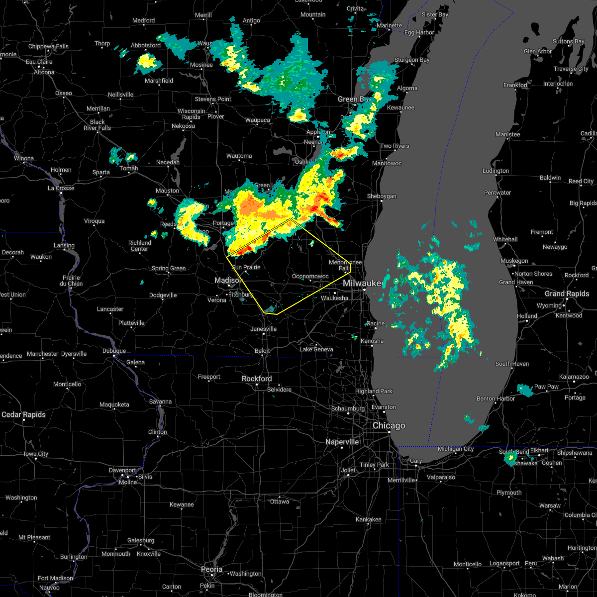 At 520 pm cdt, severe thunderstorms were located along a line extending from 6 miles southeast of waupun to near deforest, moving southeast at 50 mph (radar indicated). Hazards include 60 mph wind gusts and nickel size hail. expect damage to roofs, siding, and trees At 520 pm cdt, severe thunderstorms were located along a line extending from 6 miles southeast of waupun to near deforest, moving southeast at 50 mph (radar indicated). Hazards include 60 mph wind gusts and nickel size hail. expect damage to roofs, siding, and trees
|
| 8/28/2022 5:09 PM CDT | The severe thunderstorm warning for eastern walworth, western racine, waukesha and western kenosha counties will expire at 515 pm cdt, the storms which prompted the warning have weakened below severe limits, and no longer pose an immediate threat to life or property. therefore, the warning will be allowed to expire. a severe thunderstorm watch remains in effect until 700 pm cdt for southeastern wisconsin. |
| 8/28/2022 5:02 PM CDT | At 502 pm cdt, severe thunderstorms were located along a line extending from near germantown to near antioch, moving east at 40 mph (radar indicated). Hazards include 60 mph wind gusts and nickel size hail. Expect damage to roofs, siding, and trees. locations impacted include, waukesha, new berlin, brookfield, menomonee falls, muskego, antioch, pewaukee, sussex, hartland, mukwonago, delafield, elm grove, union grove, paddock lake, wales, camp lake, wind lake, lisbon, vernon and twin lakes. hail threat, radar indicated max hail size, 0. 88 in wind threat, radar indicated max wind gust, 60 mph. |
| 8/28/2022 4:41 PM CDT | At 440 pm cdt, severe thunderstorms were located along a line extending from near okauchee lake to twin lakes, moving east at 40 mph (radar indicated). Hazards include 60 mph wind gusts and nickel size hail. Expect damage to roofs, siding, and trees. Locations impacted include, waukesha, new berlin, brookfield, menomonee falls, muskego, antioch, pewaukee, sussex, elkhorn, hartland, lake geneva, mukwonago, delafield, elm grove, union grove, east troy, paddock lake, wales, camp lake and okauchee lake. |
| 8/28/2022 4:13 PM CDT | At 413 pm cdt, severe thunderstorms were located along a line extending from watertown to near harvard, moving east at 55 mph (radar indicated). Hazards include 60 mph wind gusts and nickel size hail. expect damage to roofs, siding, and trees |
| 7/24/2022 3:04 AM CDT |
 At 304 am cdt, severe thunderstorms were located along a line extending from near vernon to near rochester to near hebron, moving east at 45 mph (public). Hazards include 60 mph wind gusts. Expect damage to roofs, siding, and trees. locations impacted include, milwaukee, kenosha, racine, waukesha, west allis, new berlin, greenfield, oak creek, mount pleasant, muskego, south milwaukee, pleasant prairie, cudahy, greendale, elkhorn, st. francis, delavan, hales corners, lake geneva and mukwonago. people attending country thunder in twin lakes , sa: wisconsin state fair park , konkel park , and the milwaukee air and water show should seek safe shelter immediately! hail threat, radar indicated max hail size, <. 75 in wind threat, radar indicated max wind gust, 60 mph. At 304 am cdt, severe thunderstorms were located along a line extending from near vernon to near rochester to near hebron, moving east at 45 mph (public). Hazards include 60 mph wind gusts. Expect damage to roofs, siding, and trees. locations impacted include, milwaukee, kenosha, racine, waukesha, west allis, new berlin, greenfield, oak creek, mount pleasant, muskego, south milwaukee, pleasant prairie, cudahy, greendale, elkhorn, st. francis, delavan, hales corners, lake geneva and mukwonago. people attending country thunder in twin lakes , sa: wisconsin state fair park , konkel park , and the milwaukee air and water show should seek safe shelter immediately! hail threat, radar indicated max hail size, <. 75 in wind threat, radar indicated max wind gust, 60 mph.
|
| 7/24/2022 2:41 AM CDT |
 At 241 am cdt, severe thunderstorms were located along a line extending from near lac la belle to near elkhorn to near clinton, moving east at 45 mph (public). Hazards include 60 mph wind gusts. expect damage to roofs, siding, and trees At 241 am cdt, severe thunderstorms were located along a line extending from near lac la belle to near elkhorn to near clinton, moving east at 45 mph (public). Hazards include 60 mph wind gusts. expect damage to roofs, siding, and trees
|
| 7/23/2022 11:58 PM CDT | Large tree limb down. time estimated from rada in milwaukee county WI, 9.1 miles S of Milwaukee, WI |
| 7/23/2022 11:57 PM CDT |
 At 1156 pm cdt, severe thunderstorms were located along a line extending from 29 miles northeast of wind point to 11 miles east of cudahy to near new berlin, moving southeast at 45 mph (radar indicated). Hazards include 60 mph wind gusts and penny size hail. Expect damage to roofs, siding, and trees. locations impacted include, milwaukee, west allis, wauwatosa, whitefish bay, brown deer, st. francis, fox point, bayside, west milwaukee, glendale, river hills, milwaukee hoan bridge, shorewood, state fair park, marquette university, uw- milwaukee, mitchell park domes, milwaukee co zoo, amfam field and milwaukee south shore park. people attending sa: wisconsin state fair park , and the milwaukee air and water show should seek safe shelter immediately! hail threat, radar indicated max hail size, 0. 75 in wind threat, radar indicated max wind gust, 60 mph. At 1156 pm cdt, severe thunderstorms were located along a line extending from 29 miles northeast of wind point to 11 miles east of cudahy to near new berlin, moving southeast at 45 mph (radar indicated). Hazards include 60 mph wind gusts and penny size hail. Expect damage to roofs, siding, and trees. locations impacted include, milwaukee, west allis, wauwatosa, whitefish bay, brown deer, st. francis, fox point, bayside, west milwaukee, glendale, river hills, milwaukee hoan bridge, shorewood, state fair park, marquette university, uw- milwaukee, mitchell park domes, milwaukee co zoo, amfam field and milwaukee south shore park. people attending sa: wisconsin state fair park , and the milwaukee air and water show should seek safe shelter immediately! hail threat, radar indicated max hail size, 0. 75 in wind threat, radar indicated max wind gust, 60 mph.
|
| 7/23/2022 11:35 PM CDT |
 At 1134 pm cdt, severe thunderstorms were located along a line extending from 19 miles east of whitefish bay to milwaukee to near hartland, moving southeast at 45 mph (radar indicated). Hazards include 60 mph wind gusts and penny size hail. Expect damage to roofs, siding, and trees. locations impacted include, milwaukee, west allis, wauwatosa, new berlin, brookfield, greenfield, menomonee falls, oak creek, muskego, south milwaukee, cudahy, whitefish bay, greendale, pewaukee, brown deer, sussex, st. francis, hales corners, fox point and elm grove. people attending sa: wisconsin state fair park , konkel park , and the milwaukee air and water show should seek safe shelter immediately! hail threat, radar indicated max hail size, 0. 75 in wind threat, radar indicated max wind gust, 60 mph. At 1134 pm cdt, severe thunderstorms were located along a line extending from 19 miles east of whitefish bay to milwaukee to near hartland, moving southeast at 45 mph (radar indicated). Hazards include 60 mph wind gusts and penny size hail. Expect damage to roofs, siding, and trees. locations impacted include, milwaukee, west allis, wauwatosa, new berlin, brookfield, greenfield, menomonee falls, oak creek, muskego, south milwaukee, cudahy, whitefish bay, greendale, pewaukee, brown deer, sussex, st. francis, hales corners, fox point and elm grove. people attending sa: wisconsin state fair park , konkel park , and the milwaukee air and water show should seek safe shelter immediately! hail threat, radar indicated max hail size, 0. 75 in wind threat, radar indicated max wind gust, 60 mph.
|
| 7/23/2022 11:26 PM CDT |
 At 1126 pm cdt, severe thunderstorms were located along a line extending from 10 miles southeast of port washington to germantown, moving east at 40 mph (radar indicated). Hazards include 60 mph wind gusts and nickel size hail. Expect damage to roofs, siding, and trees. locations impacted include, west bend, mequon, hartford, grafton, cedarburg, port washington, jackson, slinger, saukville, thiensville, germantown, newburg, richfield, holy hill, kirchhayn, keowns and hubertus. hail threat, radar indicated max hail size, 0. 88 in wind threat, radar indicated max wind gust, 60 mph. At 1126 pm cdt, severe thunderstorms were located along a line extending from 10 miles southeast of port washington to germantown, moving east at 40 mph (radar indicated). Hazards include 60 mph wind gusts and nickel size hail. Expect damage to roofs, siding, and trees. locations impacted include, west bend, mequon, hartford, grafton, cedarburg, port washington, jackson, slinger, saukville, thiensville, germantown, newburg, richfield, holy hill, kirchhayn, keowns and hubertus. hail threat, radar indicated max hail size, 0. 88 in wind threat, radar indicated max wind gust, 60 mph.
|
| 7/23/2022 11:12 PM CDT |
 At 1112 pm cdt, severe thunderstorms were located along a line extending from 8 miles northeast of bayside to near germantown to 6 miles south of hustisford, moving southeast at 45 mph (radar indicated). Hazards include 60 mph wind gusts and penny size hail. expect damage to roofs, siding, and trees At 1112 pm cdt, severe thunderstorms were located along a line extending from 8 miles northeast of bayside to near germantown to 6 miles south of hustisford, moving southeast at 45 mph (radar indicated). Hazards include 60 mph wind gusts and penny size hail. expect damage to roofs, siding, and trees
|
| 7/23/2022 10:48 PM CDT |
 At 1048 pm cdt, severe thunderstorms were located along a line extending from near west bend to near hartford, moving east at 35 mph (radar indicated). Hazards include 60 mph wind gusts and nickel size hail. expect damage to roofs, siding, and trees At 1048 pm cdt, severe thunderstorms were located along a line extending from near west bend to near hartford, moving east at 35 mph (radar indicated). Hazards include 60 mph wind gusts and nickel size hail. expect damage to roofs, siding, and trees
|
| 7/23/2022 7:08 PM CDT |
 At 708 pm cdt, severe thunderstorms were located along a line extending from near thiensville to delafield, moving southeast at 25 mph (trained weather spotters). Hazards include 60 mph wind gusts. expect damage to roofs, siding, and trees At 708 pm cdt, severe thunderstorms were located along a line extending from near thiensville to delafield, moving southeast at 25 mph (trained weather spotters). Hazards include 60 mph wind gusts. expect damage to roofs, siding, and trees
|
| 7/23/2022 6:21 PM CDT |
 At 620 pm cdt, severe thunderstorms were located along a line extending from near campbellsport to near hustisford to 6 miles east of waterloo, moving southeast at 45 mph (radar indicated). Hazards include 60 mph wind gusts. expect damage to roofs, siding, and trees At 620 pm cdt, severe thunderstorms were located along a line extending from near campbellsport to near hustisford to 6 miles east of waterloo, moving southeast at 45 mph (radar indicated). Hazards include 60 mph wind gusts. expect damage to roofs, siding, and trees
|
| 7/11/2022 8:00 PM CDT | Estimated winds 50-60 mph. relayed by broadcast medi in milwaukee county WI, 3.9 miles ESE of Milwaukee, WI |
| 6/21/2022 8:45 PM CDT |
 At 844 pm cdt, a severe thunderstorm was located near hartford, moving east at 30 mph (radar indicated). Hazards include 60 mph wind gusts and quarter size hail. Hail damage to vehicles is expected. expect wind damage to roofs, siding, and trees. locations impacted include, menomonee falls, west bend, hartford, sussex, jackson, slinger, germantown, lisbon, merton, newburg, lannon, richfield, ashippun, rubicon, neosho, mapleton, north lake, monches, keowns and saint lawrence. hail threat, radar indicated max hail size, 1. 00 in wind threat, radar indicated max wind gust, 60 mph. At 844 pm cdt, a severe thunderstorm was located near hartford, moving east at 30 mph (radar indicated). Hazards include 60 mph wind gusts and quarter size hail. Hail damage to vehicles is expected. expect wind damage to roofs, siding, and trees. locations impacted include, menomonee falls, west bend, hartford, sussex, jackson, slinger, germantown, lisbon, merton, newburg, lannon, richfield, ashippun, rubicon, neosho, mapleton, north lake, monches, keowns and saint lawrence. hail threat, radar indicated max hail size, 1. 00 in wind threat, radar indicated max wind gust, 60 mph.
|
| 6/21/2022 8:26 PM CDT |
 At 826 pm cdt, a severe thunderstorm was located near hustisford, or 8 miles southwest of hartford, moving east at 30 mph (radar indicated). Hazards include 60 mph wind gusts and quarter size hail. Hail damage to vehicles is expected. Expect wind damage to roofs, siding, and trees. At 826 pm cdt, a severe thunderstorm was located near hustisford, or 8 miles southwest of hartford, moving east at 30 mph (radar indicated). Hazards include 60 mph wind gusts and quarter size hail. Hail damage to vehicles is expected. Expect wind damage to roofs, siding, and trees.
|
| 6/13/2022 4:39 PM CDT | At mke. also had half inch hai in milwaukee county WI, 6.8 miles NNW of Milwaukee, WI |
| 3/5/2022 11:05 PM CST |
 At 1105 pm cst, severe thunderstorms were located along a line extending from near st anna to port washington to near pleasant prairie, moving east at 45 mph (radar indicated). Hazards include 60 mph wind gusts. Expect damage to roofs, siding, and trees. locations impacted include, milwaukee, kenosha, racine, west allis, sheboygan, wauwatosa, greenfield, oak creek, mount pleasant, mequon, south milwaukee, pleasant prairie, cudahy, whitefish bay, greendale, brown deer, grafton, cedarburg, port washington and st. francis. hail threat, radar indicated max hail size, <. 75 in wind threat, radar indicated max wind gust, 60 mph. At 1105 pm cst, severe thunderstorms were located along a line extending from near st anna to port washington to near pleasant prairie, moving east at 45 mph (radar indicated). Hazards include 60 mph wind gusts. Expect damage to roofs, siding, and trees. locations impacted include, milwaukee, kenosha, racine, west allis, sheboygan, wauwatosa, greenfield, oak creek, mount pleasant, mequon, south milwaukee, pleasant prairie, cudahy, whitefish bay, greendale, brown deer, grafton, cedarburg, port washington and st. francis. hail threat, radar indicated max hail size, <. 75 in wind threat, radar indicated max wind gust, 60 mph.
|
| 3/5/2022 10:46 PM CST |
 At 1046 pm cst, severe thunderstorms were located along a line extending from near southern lake winnebago to near west bend to channel lake, moving east at 45 mph (radar indicated). Hazards include 60 mph wind gusts. Expect damage to roofs, siding, and trees. locations impacted include, milwaukee, kenosha, racine, waukesha, west allis, sheboygan, wauwatosa, new berlin, brookfield, greenfield, menomonee falls, oak creek, west bend, mount pleasant, muskego, mequon, south milwaukee, pleasant prairie, cudahy and whitefish bay. hail threat, radar indicated max hail size, <. 75 in wind threat, radar indicated max wind gust, 60 mph. At 1046 pm cst, severe thunderstorms were located along a line extending from near southern lake winnebago to near west bend to channel lake, moving east at 45 mph (radar indicated). Hazards include 60 mph wind gusts. Expect damage to roofs, siding, and trees. locations impacted include, milwaukee, kenosha, racine, waukesha, west allis, sheboygan, wauwatosa, new berlin, brookfield, greenfield, menomonee falls, oak creek, west bend, mount pleasant, muskego, mequon, south milwaukee, pleasant prairie, cudahy and whitefish bay. hail threat, radar indicated max hail size, <. 75 in wind threat, radar indicated max wind gust, 60 mph.
|
| 3/5/2022 10:35 PM CST |
 At 1035 pm cst, severe thunderstorms were located along a line extending from near southern lake winnebago to near slinger to richmond, moving east at 45 mph (radar indicated). Hazards include 60 mph wind gusts. expect damage to roofs, siding, and trees At 1035 pm cst, severe thunderstorms were located along a line extending from near southern lake winnebago to near slinger to richmond, moving east at 45 mph (radar indicated). Hazards include 60 mph wind gusts. expect damage to roofs, siding, and trees
|
| 9/13/2021 4:05 AM CDT |
 The severe thunderstorm warning for central milwaukee county will expire at 415 am cdt, the storm which prompted the warning has moved out of the area. therefore, the warning will be allowed to expire. to report severe weather, contact your nearest law enforcement agency. they will relay your report to the national weather service milwaukee/sullivan. The severe thunderstorm warning for central milwaukee county will expire at 415 am cdt, the storm which prompted the warning has moved out of the area. therefore, the warning will be allowed to expire. to report severe weather, contact your nearest law enforcement agency. they will relay your report to the national weather service milwaukee/sullivan.
|
| 9/13/2021 3:52 AM CDT |
 At 352 am cdt, a severe thunderstorm was located over west allis, moving east at 35 mph (radar indicated). Hazards include quarter size hail. Damage to vehicles is expected. locations impacted include, milwaukee, west allis, wauwatosa, greenfield, oak creek, south milwaukee, cudahy, whitefish bay, greendale, st. francis, hales corners, west milwaukee, glendale, franklin, milwaukee hoan bridge, shorewood, state fair park, marquette university, uw- milwaukee and mitchell park domes. hail threat, radar indicated max hail size, 1. 00 in wind threat, radar indicated max wind gust, <50 mph. At 352 am cdt, a severe thunderstorm was located over west allis, moving east at 35 mph (radar indicated). Hazards include quarter size hail. Damage to vehicles is expected. locations impacted include, milwaukee, west allis, wauwatosa, greenfield, oak creek, south milwaukee, cudahy, whitefish bay, greendale, st. francis, hales corners, west milwaukee, glendale, franklin, milwaukee hoan bridge, shorewood, state fair park, marquette university, uw- milwaukee and mitchell park domes. hail threat, radar indicated max hail size, 1. 00 in wind threat, radar indicated max wind gust, <50 mph.
|
| 9/13/2021 3:34 AM CDT |
 At 334 am cdt, a severe thunderstorm was located over waukesha, moving east at 35 mph (radar indicated). Hazards include quarter size hail. damage to vehicles is expected At 334 am cdt, a severe thunderstorm was located over waukesha, moving east at 35 mph (radar indicated). Hazards include quarter size hail. damage to vehicles is expected
|
| 9/12/2021 4:25 PM CDT |
 At 425 pm cdt, a severe thunderstorm was located 9 miles northeast of bayside, moving east at 55 mph (radar indicated). Hazards include quarter size hail. Damage to vehicles is expected. locations impacted include, northern milwaukee, mequon, whitefish bay, brown deer, grafton, cedarburg, fox point, bayside, thiensville, glendale, river hills and shorewood. people attending the packer viewing party in shorewood should seek safe shelter immediately! hail threat, radar indicated max hail size, 1. 00 in wind threat, radar indicated max wind gust, <50 mph. At 425 pm cdt, a severe thunderstorm was located 9 miles northeast of bayside, moving east at 55 mph (radar indicated). Hazards include quarter size hail. Damage to vehicles is expected. locations impacted include, northern milwaukee, mequon, whitefish bay, brown deer, grafton, cedarburg, fox point, bayside, thiensville, glendale, river hills and shorewood. people attending the packer viewing party in shorewood should seek safe shelter immediately! hail threat, radar indicated max hail size, 1. 00 in wind threat, radar indicated max wind gust, <50 mph.
|
| 9/12/2021 3:59 PM CDT |
 The national weather service in milwaukee/sullivan has issued a * severe thunderstorm warning for. southwestern ozaukee county in southeastern wisconsin. northern milwaukee county in southeastern wisconsin. until 445 pm cdt. At 358 pm cdt, a severe thunderstorm was located near germantown,. The national weather service in milwaukee/sullivan has issued a * severe thunderstorm warning for. southwestern ozaukee county in southeastern wisconsin. northern milwaukee county in southeastern wisconsin. until 445 pm cdt. At 358 pm cdt, a severe thunderstorm was located near germantown,.
|
| 9/12/2021 3:55 PM CDT |
 At 354 pm cdt, a severe thunderstorm was located near hartford, moving east at 45 mph (radar indicated). Hazards include quarter size hail. Damage to vehicles is expected. locations impacted include, menomonee falls, hartford, sussex, jackson, slinger, germantown, lannon, richfield, colgate, holy hill, kirchhayn, monches, keowns and hubertus. hail threat, radar indicated max hail size, 1. 00 in wind threat, radar indicated max wind gust, <50 mph. At 354 pm cdt, a severe thunderstorm was located near hartford, moving east at 45 mph (radar indicated). Hazards include quarter size hail. Damage to vehicles is expected. locations impacted include, menomonee falls, hartford, sussex, jackson, slinger, germantown, lannon, richfield, colgate, holy hill, kirchhayn, monches, keowns and hubertus. hail threat, radar indicated max hail size, 1. 00 in wind threat, radar indicated max wind gust, <50 mph.
|
| 9/12/2021 3:42 PM CDT |
 At 341 pm cdt, a severe thunderstorm was located near lac la belle, or 8 miles east of watertown, moving east at 45 mph (radar indicated). Hazards include quarter size hail. damage to vehicles is expected At 341 pm cdt, a severe thunderstorm was located near lac la belle, or 8 miles east of watertown, moving east at 45 mph (radar indicated). Hazards include quarter size hail. damage to vehicles is expected
|
| 9/7/2021 12:23 PM CDT |
 At 1223 pm cdt, severe thunderstorms were located along a line extending from milwaukee to near waterford north, moving east at 60 mph (radar indicated). Hazards include 60 mph wind gusts and quarter size hail. Hail damage to vehicles is expected. expect wind damage to roofs, siding, and trees. these severe storms will be near, south milwaukee, cudahy, st. francis and milwaukee hoan bridge around 1230 pm cdt. other locations impacted by these severe thunderstorms include state fair park, waterville, marquette university, mitchell park domes, milwaukee co zoo, miller park, genesee depot, genesee, milwaukee south shore park and maier festival park. hail threat, radar indicated max hail size, 1. 00 in wind threat, radar indicated max wind gust, 60 mph. At 1223 pm cdt, severe thunderstorms were located along a line extending from milwaukee to near waterford north, moving east at 60 mph (radar indicated). Hazards include 60 mph wind gusts and quarter size hail. Hail damage to vehicles is expected. expect wind damage to roofs, siding, and trees. these severe storms will be near, south milwaukee, cudahy, st. francis and milwaukee hoan bridge around 1230 pm cdt. other locations impacted by these severe thunderstorms include state fair park, waterville, marquette university, mitchell park domes, milwaukee co zoo, miller park, genesee depot, genesee, milwaukee south shore park and maier festival park. hail threat, radar indicated max hail size, 1. 00 in wind threat, radar indicated max wind gust, 60 mph.
|
| 9/7/2021 12:03 PM CDT |
 At 1202 pm cdt, severe thunderstorms were located along a line extending from near butler to palmyra, moving east at 55 mph (radar indicated). Hazards include quarter size hail. Damage to vehicles is expected. these severe storms will be near, milwaukee, wauwatosa, brookfield, elm grove and west milwaukee around 1210 pm cdt. milwaukee hoan bridge around 1215 pm cdt. vernon around 1220 pm cdt. big bend around 1225 pm cdt. west allis and muskego around 1230 pm cdt. greenfield, greendale and hales corners around 1235 pm cdt. oak creek, st. francis and franklin around 1240 pm cdt. south milwaukee and cudahy around 1245 pm cdt. other locations impacted by these severe thunderstorms include state fair park, waterville, marquette university, mitchell park domes, milwaukee co zoo, miller park, genesee depot, genesee, milwaukee south shore park and maier festival park. hail threat, radar indicated max hail size, 1. 00 in wind threat, radar indicated max wind gust, <50 mph. At 1202 pm cdt, severe thunderstorms were located along a line extending from near butler to palmyra, moving east at 55 mph (radar indicated). Hazards include quarter size hail. Damage to vehicles is expected. these severe storms will be near, milwaukee, wauwatosa, brookfield, elm grove and west milwaukee around 1210 pm cdt. milwaukee hoan bridge around 1215 pm cdt. vernon around 1220 pm cdt. big bend around 1225 pm cdt. west allis and muskego around 1230 pm cdt. greenfield, greendale and hales corners around 1235 pm cdt. oak creek, st. francis and franklin around 1240 pm cdt. south milwaukee and cudahy around 1245 pm cdt. other locations impacted by these severe thunderstorms include state fair park, waterville, marquette university, mitchell park domes, milwaukee co zoo, miller park, genesee depot, genesee, milwaukee south shore park and maier festival park. hail threat, radar indicated max hail size, 1. 00 in wind threat, radar indicated max wind gust, <50 mph.
|
| 9/7/2021 11:54 AM CDT |
 At 1154 am cdt, severe thunderstorms were located along a line extending from near cedarburg to brookfield, moving east at 55 mph (radar indicated). Hazards include 60 mph wind gusts and quarter size hail. Hail damage to vehicles is expected. expect wind damage to roofs, siding, and trees. these severe storms will be near, whitefish bay and glendale around 1205 pm cdt. other locations impacted by these severe thunderstorms include marquette university, colgate, chenequa, richfield, uw- milwaukee, stone bank, summit, north lake, kirchhayn and oconomowoc lake. hail threat, radar indicated max hail size, 1. 00 in wind threat, radar indicated max wind gust, 60 mph. At 1154 am cdt, severe thunderstorms were located along a line extending from near cedarburg to brookfield, moving east at 55 mph (radar indicated). Hazards include 60 mph wind gusts and quarter size hail. Hail damage to vehicles is expected. expect wind damage to roofs, siding, and trees. these severe storms will be near, whitefish bay and glendale around 1205 pm cdt. other locations impacted by these severe thunderstorms include marquette university, colgate, chenequa, richfield, uw- milwaukee, stone bank, summit, north lake, kirchhayn and oconomowoc lake. hail threat, radar indicated max hail size, 1. 00 in wind threat, radar indicated max wind gust, 60 mph.
|
| 9/7/2021 11:45 AM CDT |
 At 1145 am cdt, severe thunderstorms were located along a line extending from near okauchee lake to near lake koshkonong, moving east at 55 mph (radar indicated). Hazards include quarter size hail. Damage to vehicles is expected. severe thunderstorms will be near, delafield and wales around 1150 am cdt. waukesha and pewaukee around 1155 am cdt. new berlin, brookfield, palmyra and brookfield around 1200 pm cdt. milwaukee, wauwatosa and elm grove around 1205 pm cdt. west milwaukee, ottawa and north prairie around 1210 pm cdt. mukwonago and milwaukee hoan bridge around 1215 pm cdt. vernon around 1220 pm cdt. big bend around 1225 pm cdt. other locations impacted by these severe thunderstorms include state fair park, waterville, marquette university, mitchell park domes, milwaukee co zoo, miller park, genesee depot, genesee, milwaukee south shore park and maier festival park. hail threat, radar indicated max hail size, 1. 00 in wind threat, radar indicated max wind gust, <50 mph. At 1145 am cdt, severe thunderstorms were located along a line extending from near okauchee lake to near lake koshkonong, moving east at 55 mph (radar indicated). Hazards include quarter size hail. Damage to vehicles is expected. severe thunderstorms will be near, delafield and wales around 1150 am cdt. waukesha and pewaukee around 1155 am cdt. new berlin, brookfield, palmyra and brookfield around 1200 pm cdt. milwaukee, wauwatosa and elm grove around 1205 pm cdt. west milwaukee, ottawa and north prairie around 1210 pm cdt. mukwonago and milwaukee hoan bridge around 1215 pm cdt. vernon around 1220 pm cdt. big bend around 1225 pm cdt. other locations impacted by these severe thunderstorms include state fair park, waterville, marquette university, mitchell park domes, milwaukee co zoo, miller park, genesee depot, genesee, milwaukee south shore park and maier festival park. hail threat, radar indicated max hail size, 1. 00 in wind threat, radar indicated max wind gust, <50 mph.
|
| 9/7/2021 11:27 AM CDT |
 At 1126 am cdt, severe thunderstorms were located along a line extending from near hustisford to johnson creek, moving east at 55 mph (radar indicated). Hazards include 60 mph wind gusts and quarter size hail. Hail damage to vehicles is expected. expect wind damage to roofs, siding, and trees. severe thunderstorms will be near, hartford, oconomowoc and lac la belle around 1135 am cdt. delafield and okauchee lake around 1140 am cdt. hartland and merton around 1145 am cdt. waukesha, pewaukee, sussex, jackson, germantown and lisbon around 1150 am cdt. brookfield, cedarburg, elm grove, thiensville, butler and brookfield around 1155 am cdt. wauwatosa, mequon, grafton and bayside around 1200 pm cdt. whitefish bay and glendale around 1205 pm cdt. other locations impacted by these severe thunderstorms include marquette university, colgate, chenequa, richfield, uw- milwaukee, mapleton, stone bank, summit, north lake and holy hill. hail threat, radar indicated max hail size, 1. 00 in wind threat, radar indicated max wind gust, 60 mph. At 1126 am cdt, severe thunderstorms were located along a line extending from near hustisford to johnson creek, moving east at 55 mph (radar indicated). Hazards include 60 mph wind gusts and quarter size hail. Hail damage to vehicles is expected. expect wind damage to roofs, siding, and trees. severe thunderstorms will be near, hartford, oconomowoc and lac la belle around 1135 am cdt. delafield and okauchee lake around 1140 am cdt. hartland and merton around 1145 am cdt. waukesha, pewaukee, sussex, jackson, germantown and lisbon around 1150 am cdt. brookfield, cedarburg, elm grove, thiensville, butler and brookfield around 1155 am cdt. wauwatosa, mequon, grafton and bayside around 1200 pm cdt. whitefish bay and glendale around 1205 pm cdt. other locations impacted by these severe thunderstorms include marquette university, colgate, chenequa, richfield, uw- milwaukee, mapleton, stone bank, summit, north lake and holy hill. hail threat, radar indicated max hail size, 1. 00 in wind threat, radar indicated max wind gust, 60 mph.
|
| 8/24/2021 2:20 PM CDT | Video of tree uprooted from outflow boundary near 24th and layton. mke gusted 47 mph at this tim in milwaukee county WI, 5.5 miles N of Milwaukee, WI |
| 8/24/2021 2:04 PM CDT | Section of a large tree snapped and fell on house... multiple tree limbs down across town. timing estimated with the gust front on rada in milwaukee county WI, 3.9 miles ESE of Milwaukee, WI |
| 8/11/2021 6:22 PM CDT |
 The severe thunderstorm warning for southern milwaukee and southeastern waukesha counties will expire at 630 pm cdt, the storm which prompted the warning has weakened below severe limits, and no longer poses an immediate threat to life or property. therefore, the warning will be allowed to expire. The severe thunderstorm warning for southern milwaukee and southeastern waukesha counties will expire at 630 pm cdt, the storm which prompted the warning has weakened below severe limits, and no longer poses an immediate threat to life or property. therefore, the warning will be allowed to expire.
|
| 8/11/2021 6:18 PM CDT |
 At 618 pm cdt, a severe thunderstorm was located over south milwaukee, moving east at 55 mph (radar indicated). Hazards include 60 mph wind gusts and penny size hail. Expect damage to roofs, siding, and trees. locations impacted include, milwaukee, waukesha, west allis, new berlin, greenfield, oak creek, muskego, south milwaukee, cudahy, greendale, st. francis, hales corners, mukwonago, west milwaukee, franklin, vernon, big bend and milwaukee south shore park. hail threat, radar indicated max hail size, 0. 75 in wind threat, radar indicated max wind gust, 60 mph. At 618 pm cdt, a severe thunderstorm was located over south milwaukee, moving east at 55 mph (radar indicated). Hazards include 60 mph wind gusts and penny size hail. Expect damage to roofs, siding, and trees. locations impacted include, milwaukee, waukesha, west allis, new berlin, greenfield, oak creek, muskego, south milwaukee, cudahy, greendale, st. francis, hales corners, mukwonago, west milwaukee, franklin, vernon, big bend and milwaukee south shore park. hail threat, radar indicated max hail size, 0. 75 in wind threat, radar indicated max wind gust, 60 mph.
|
| 8/11/2021 5:49 PM CDT |
 At 549 pm cdt, a severe thunderstorm was located over mukwonago, moving east at 55 mph (radar indicated). Hazards include 60 mph wind gusts and quarter size hail. Hail damage to vehicles is expected. Expect wind damage to roofs, siding, and trees. At 549 pm cdt, a severe thunderstorm was located over mukwonago, moving east at 55 mph (radar indicated). Hazards include 60 mph wind gusts and quarter size hail. Hail damage to vehicles is expected. Expect wind damage to roofs, siding, and trees.
|
| 8/10/2021 8:10 PM CDT |
 The severe thunderstorm warning for ozaukee, milwaukee, northeastern racine and kenosha counties will expire at 815 pm cdt, the storms which prompted the warning have moved out of the area. therefore, the warning will be allowed to expire. a severe thunderstorm watch remains in effect until 1000 pm cdt for southeastern wisconsin. The severe thunderstorm warning for ozaukee, milwaukee, northeastern racine and kenosha counties will expire at 815 pm cdt, the storms which prompted the warning have moved out of the area. therefore, the warning will be allowed to expire. a severe thunderstorm watch remains in effect until 1000 pm cdt for southeastern wisconsin.
|
| 8/10/2021 7:43 PM CDT |
 At 742 pm cdt, severe thunderstorms were located along a line extending from near random lake to near pleasant prairie, moving east at 20 mph (radar indicated). Hazards include 60 mph wind gusts. expect damage to roofs, siding, and trees At 742 pm cdt, severe thunderstorms were located along a line extending from near random lake to near pleasant prairie, moving east at 20 mph (radar indicated). Hazards include 60 mph wind gusts. expect damage to roofs, siding, and trees
|
| 8/10/2021 7:32 PM CDT |
 At 731 pm cdt, severe thunderstorms were located along a line extending from belgium to near winthrop harbor, moving east at 60 mph (trained weather spotters reported tree damage in the wauwatosa area). Hazards include 70 mph wind gusts. Expect considerable tree damage. damage is likely to mobile homes, roofs, and outbuildings. locations impacted include, milwaukee, kenosha, racine, west allis, wauwatosa, greenfield, oak creek, mount pleasant, mequon, south milwaukee, pleasant prairie, cudahy, whitefish bay, greendale, brown deer, grafton, cedarburg, port washington, st. francis and hales corners. people attending the wisconsin state fair, and music in the glen in glendale should seek safe shelter immediately! thunderstorm damage threat, considerable hail threat, radar indicated max hail size, <. 75 in wind threat, observed max wind gust, 70 mph. At 731 pm cdt, severe thunderstorms were located along a line extending from belgium to near winthrop harbor, moving east at 60 mph (trained weather spotters reported tree damage in the wauwatosa area). Hazards include 70 mph wind gusts. Expect considerable tree damage. damage is likely to mobile homes, roofs, and outbuildings. locations impacted include, milwaukee, kenosha, racine, west allis, wauwatosa, greenfield, oak creek, mount pleasant, mequon, south milwaukee, pleasant prairie, cudahy, whitefish bay, greendale, brown deer, grafton, cedarburg, port washington, st. francis and hales corners. people attending the wisconsin state fair, and music in the glen in glendale should seek safe shelter immediately! thunderstorm damage threat, considerable hail threat, radar indicated max hail size, <. 75 in wind threat, observed max wind gust, 70 mph.
|
| 8/10/2021 7:29 PM CDT | Large tree uprooted...power lines dow in milwaukee county WI, 5.7 miles SSW of Milwaukee, WI |
| 8/10/2021 7:29 PM CDT |
 At 727 pm cdt, severe thunderstorms were located along a line extending from near random lake to near pleasant prairie, moving east at 40 mph (trained weather spotters reported trees down in waukesha county). Hazards include 70 mph wind gusts. Expect considerable tree damage. damage is likely to mobile homes, roofs, and outbuildings. locations impacted include, waukesha, west allis, wauwatosa, new berlin, brookfield, menomonee falls, west bend, muskego, hartford, pewaukee, sussex, elkhorn, hartland, hales corners, lake geneva, mukwonago, delafield, jackson, elm grove and slinger. thunderstorm damage threat, considerable hail threat, radar indicated max hail size, <. 75 in wind threat, radar indicated max wind gust, 70 mph. At 727 pm cdt, severe thunderstorms were located along a line extending from near random lake to near pleasant prairie, moving east at 40 mph (trained weather spotters reported trees down in waukesha county). Hazards include 70 mph wind gusts. Expect considerable tree damage. damage is likely to mobile homes, roofs, and outbuildings. locations impacted include, waukesha, west allis, wauwatosa, new berlin, brookfield, menomonee falls, west bend, muskego, hartford, pewaukee, sussex, elkhorn, hartland, hales corners, lake geneva, mukwonago, delafield, jackson, elm grove and slinger. thunderstorm damage threat, considerable hail threat, radar indicated max hail size, <. 75 in wind threat, radar indicated max wind gust, 70 mph.
|
| 8/10/2021 7:20 PM CDT | Large branch 12-15 inches in diameter dow in milwaukee county WI, 3.9 miles ESE of Milwaukee, WI |
| 8/10/2021 7:18 PM CDT | Large tree uproote in milwaukee county WI, 3.7 miles ENE of Milwaukee, WI |
| 8/10/2021 7:14 PM CDT |
 At 713 pm cdt, severe thunderstorms were located along a line extending from near kewaskum to camp lake, moving east at 40 mph (trained weather spotters. several reports of wind gusts between 60 and 75mph. trees and limbs downed). Hazards include 70 mph wind gusts. Expect considerable tree damage. damage is likely to mobile homes, roofs, and outbuildings. locations impacted include, waukesha, west allis, wauwatosa, new berlin, brookfield, menomonee falls, west bend, muskego, whitewater, hartford, pewaukee, sussex, elkhorn, hartland, delavan, hales corners, lake geneva, mukwonago, delafield and jackson. thunderstorm damage threat, considerable hail threat, radar indicated max hail size, <. 75 in wind threat, radar indicated max wind gust, 70 mph. At 713 pm cdt, severe thunderstorms were located along a line extending from near kewaskum to camp lake, moving east at 40 mph (trained weather spotters. several reports of wind gusts between 60 and 75mph. trees and limbs downed). Hazards include 70 mph wind gusts. Expect considerable tree damage. damage is likely to mobile homes, roofs, and outbuildings. locations impacted include, waukesha, west allis, wauwatosa, new berlin, brookfield, menomonee falls, west bend, muskego, whitewater, hartford, pewaukee, sussex, elkhorn, hartland, delavan, hales corners, lake geneva, mukwonago, delafield and jackson. thunderstorm damage threat, considerable hail threat, radar indicated max hail size, <. 75 in wind threat, radar indicated max wind gust, 70 mph.
|
| 8/10/2021 7:13 PM CDT |
 At 712 pm cdt, severe thunderstorms were located along a line extending from near kewaskum to near camp lake, moving east at 50 mph (radar indicated). Hazards include 70 mph wind gusts. Expect considerable tree damage. damage is likely to mobile homes, roofs, and outbuildings. locations impacted include, milwaukee, kenosha, racine, west allis, wauwatosa, greenfield, oak creek, mount pleasant, mequon, south milwaukee, pleasant prairie, cudahy, whitefish bay, greendale, brown deer, grafton, cedarburg, port washington, st. francis and hales corners. people attending the wisconsin state fair, and music in the glen in glendale should seek safe shelter immediately! thunderstorm damage threat, considerable hail threat, radar indicated max hail size, <. 75 in wind threat, radar indicated max wind gust, 70 mph. At 712 pm cdt, severe thunderstorms were located along a line extending from near kewaskum to near camp lake, moving east at 50 mph (radar indicated). Hazards include 70 mph wind gusts. Expect considerable tree damage. damage is likely to mobile homes, roofs, and outbuildings. locations impacted include, milwaukee, kenosha, racine, west allis, wauwatosa, greenfield, oak creek, mount pleasant, mequon, south milwaukee, pleasant prairie, cudahy, whitefish bay, greendale, brown deer, grafton, cedarburg, port washington, st. francis and hales corners. people attending the wisconsin state fair, and music in the glen in glendale should seek safe shelter immediately! thunderstorm damage threat, considerable hail threat, radar indicated max hail size, <. 75 in wind threat, radar indicated max wind gust, 70 mph.
|
| 8/10/2021 7:03 PM CDT |
 At 702 pm cdt, severe thunderstorms were located along a line extending from near campbellsport to twin lakes, moving east at 50 mph (trained weather spotters reported a localized wind gust to 77 mph near eagle). Hazards include 60 mph wind gusts. Expect damage to roofs, siding, and trees. locations impacted include, waukesha, west allis, wauwatosa, new berlin, brookfield, menomonee falls, west bend, muskego, whitewater, hartford, pewaukee, sussex, elkhorn, hartland, delavan, hales corners, lake geneva, mukwonago, delafield and jackson. hail threat, radar indicated max hail size, <. 75 in wind threat, radar indicated max wind gust, 60 mph. At 702 pm cdt, severe thunderstorms were located along a line extending from near campbellsport to twin lakes, moving east at 50 mph (trained weather spotters reported a localized wind gust to 77 mph near eagle). Hazards include 60 mph wind gusts. Expect damage to roofs, siding, and trees. locations impacted include, waukesha, west allis, wauwatosa, new berlin, brookfield, menomonee falls, west bend, muskego, whitewater, hartford, pewaukee, sussex, elkhorn, hartland, delavan, hales corners, lake geneva, mukwonago, delafield and jackson. hail threat, radar indicated max hail size, <. 75 in wind threat, radar indicated max wind gust, 60 mph.
|
| 8/10/2021 6:51 PM CDT |
 At 650 pm cdt, severe thunderstorms were located along a line extending from lomira to powers lake, moving east at 65 mph (radar indicated). Hazards include 60 mph wind gusts. expect damage to roofs, siding, and trees At 650 pm cdt, severe thunderstorms were located along a line extending from lomira to powers lake, moving east at 65 mph (radar indicated). Hazards include 60 mph wind gusts. expect damage to roofs, siding, and trees
|
| 8/10/2021 6:08 PM CDT |
 At 608 pm cdt, severe thunderstorms were located along a line extending from randolph to near beloit, moving east at 40 mph (radar indicated). Hazards include 60 mph wind gusts. expect damage to roofs, siding, and trees At 608 pm cdt, severe thunderstorms were located along a line extending from randolph to near beloit, moving east at 40 mph (radar indicated). Hazards include 60 mph wind gusts. expect damage to roofs, siding, and trees
|
| 7/29/2021 2:06 AM CDT |
 The tornado warning for southern milwaukee, racine and southeastern waukesha counties will expire at 215 am cdt, the storms which prompted the warning have weakened and no longer appear capable of producing a tornado. therefore, the warning will be allowed to expire. however gusty winds are still possible with these thunderstorms. The tornado warning for southern milwaukee, racine and southeastern waukesha counties will expire at 215 am cdt, the storms which prompted the warning have weakened and no longer appear capable of producing a tornado. therefore, the warning will be allowed to expire. however gusty winds are still possible with these thunderstorms.
|
| 7/29/2021 2:00 AM CDT |
 At 200 am cdt, a severe squall line capable of producing both tornadoes and extensive straight line wind damage was located along a line extending from near oak creek to near eagle lake to bohners lake, moving southeast at 50 mph (radar indicated rotation). Hazards include tornado. Flying debris will be dangerous to those caught without shelter. mobile homes will be damaged or destroyed. damage to roofs, windows, and vehicles will occur. tree damage is likely. locations impacted include, milwaukee, racine, west allis, new berlin, greenfield, oak creek, mount pleasant, muskego, south milwaukee, cudahy, greendale, st. francis, hales corners, sturtevant, union grove, west milwaukee, franklin, wind lake, raymond and yorkville. People attending the racine county fair in union grove should seek safe shelter immediately!. At 200 am cdt, a severe squall line capable of producing both tornadoes and extensive straight line wind damage was located along a line extending from near oak creek to near eagle lake to bohners lake, moving southeast at 50 mph (radar indicated rotation). Hazards include tornado. Flying debris will be dangerous to those caught without shelter. mobile homes will be damaged or destroyed. damage to roofs, windows, and vehicles will occur. tree damage is likely. locations impacted include, milwaukee, racine, west allis, new berlin, greenfield, oak creek, mount pleasant, muskego, south milwaukee, cudahy, greendale, st. francis, hales corners, sturtevant, union grove, west milwaukee, franklin, wind lake, raymond and yorkville. People attending the racine county fair in union grove should seek safe shelter immediately!.
|
| 7/29/2021 1:57 AM CDT |
 A severe thunderstorm warning remains in effect until 245 am cdt for milwaukee. walworth. rock. racine. waukesha and kenosha counties. At 156 am cdt, severe thunderstorms were located along a line extending from milwaukee to near browns lake to near clinton, moving east at 45 mph. A severe thunderstorm warning remains in effect until 245 am cdt for milwaukee. walworth. rock. racine. waukesha and kenosha counties. At 156 am cdt, severe thunderstorms were located along a line extending from milwaukee to near browns lake to near clinton, moving east at 45 mph.
|
| 7/29/2021 1:44 AM CDT |
 At 142 am cdt, tornado producing storms were located along a line extending from near waukesha to potter lake to near elkhorn, moving southeast at 50 mph (radar confirmed tornado west of waukesha). Hazards include damaging tornado. Flying debris will be dangerous to those caught without shelter. mobile homes will be damaged or destroyed. damage to roofs, windows, and vehicles will occur. tree damage is likely. locations impacted include, milwaukee, racine, waukesha, west allis, wauwatosa, new berlin, brookfield, greenfield, oak creek, mount pleasant, muskego, south milwaukee, cudahy, whitefish bay, greendale, pewaukee, st. francis, hartland, hales corners and mukwonago. People attending the waukesha kennel club dog show, and the racine county fair in union grove should seek safe shelter immediately!. At 142 am cdt, tornado producing storms were located along a line extending from near waukesha to potter lake to near elkhorn, moving southeast at 50 mph (radar confirmed tornado west of waukesha). Hazards include damaging tornado. Flying debris will be dangerous to those caught without shelter. mobile homes will be damaged or destroyed. damage to roofs, windows, and vehicles will occur. tree damage is likely. locations impacted include, milwaukee, racine, waukesha, west allis, wauwatosa, new berlin, brookfield, greenfield, oak creek, mount pleasant, muskego, south milwaukee, cudahy, whitefish bay, greendale, pewaukee, st. francis, hartland, hales corners and mukwonago. People attending the waukesha kennel club dog show, and the racine county fair in union grove should seek safe shelter immediately!.
|
| 7/29/2021 1:32 AM CDT |
 At 131 am cdt, severe thunderstorms were located along a line extending from near germantown to palmyra to near footville, moving southeast at 45 mph (trained weather spotter reports winds of 60 mph in oconomowoc). Hazards include 70 mph wind gusts. Expect considerable tree damage. damage is likely to mobile homes, roofs, and outbuildings. locations impacted include, milwaukee, kenosha, racine, waukesha, janesville, west allis, wauwatosa, new berlin, brookfield, beloit, greenfield, menomonee falls, oak creek, mount pleasant, muskego, south milwaukee, pleasant prairie, cudahy, whitewater and whitefish bay. People attending the waukesha kennel club dog show, the rock county 4h fair in janesville, and the racine county fair in union grove should seek safe shelter immediately!. At 131 am cdt, severe thunderstorms were located along a line extending from near germantown to palmyra to near footville, moving southeast at 45 mph (trained weather spotter reports winds of 60 mph in oconomowoc). Hazards include 70 mph wind gusts. Expect considerable tree damage. damage is likely to mobile homes, roofs, and outbuildings. locations impacted include, milwaukee, kenosha, racine, waukesha, janesville, west allis, wauwatosa, new berlin, brookfield, beloit, greenfield, menomonee falls, oak creek, mount pleasant, muskego, south milwaukee, pleasant prairie, cudahy, whitewater and whitefish bay. People attending the waukesha kennel club dog show, the rock county 4h fair in janesville, and the racine county fair in union grove should seek safe shelter immediately!.
|
| 7/29/2021 1:31 AM CDT |
 At 130 am cdt, severe thunderstorms capable of producing both tornadoes and extensive straight line wind damage were located along a line extending from near hartland to near north prairie to near whitewater, moving southeast at 50 mph (radar indicated rotation. has a history of producing tornadoes). Hazards include tornado. Flying debris will be dangerous to those caught without shelter. mobile homes will be damaged or destroyed. damage to roofs, windows, and vehicles will occur. Tree damage is likely. At 130 am cdt, severe thunderstorms capable of producing both tornadoes and extensive straight line wind damage were located along a line extending from near hartland to near north prairie to near whitewater, moving southeast at 50 mph (radar indicated rotation. has a history of producing tornadoes). Hazards include tornado. Flying debris will be dangerous to those caught without shelter. mobile homes will be damaged or destroyed. damage to roofs, windows, and vehicles will occur. Tree damage is likely.
|
| 7/29/2021 1:17 AM CDT |
 At 116 am cdt, severe thunderstorms were located along a line extending from slinger to near jefferson to near brooklyn, moving southeast at 45 mph (trained weather spotter estimated 70 mph winds in johnson creek ). Hazards include 70 mph wind gusts. Expect considerable tree damage. Damage is likely to mobile homes, roofs, and outbuildings. At 116 am cdt, severe thunderstorms were located along a line extending from slinger to near jefferson to near brooklyn, moving southeast at 45 mph (trained weather spotter estimated 70 mph winds in johnson creek ). Hazards include 70 mph wind gusts. Expect considerable tree damage. Damage is likely to mobile homes, roofs, and outbuildings.
|
| 11/10/2020 4:54 PM CST | Mitchell airport asos reported 69 knot wind gus in milwaukee county WI, 6.2 miles NNW of Milwaukee, WI |
| 11/10/2020 4:48 PM CST | Multiple power lines down and transformer on fire. time estimated from rada in milwaukee county WI, 2.2 miles ESE of Milwaukee, WI |
| 11/10/2020 4:47 PM CST |
 At 446 pm cst, severe thunderstorms were located along a line extending from hales corners to franklin to raymond, moving northeast at 60 mph (radar indicated). Hazards include 70 mph wind gusts. Expect considerable tree damage. damage is likely to mobile homes, roofs, and outbuildings. locations impacted include, milwaukee, west allis, wauwatosa, greenfield, oak creek, south milwaukee, cudahy, greendale, st. Francis, hales corners, west milwaukee, franklin, milwaukee hoan bridge, state fair park, marquette university, uw- milwaukee, mitchell park domes, milwaukee co zoo, miller park and maier festival park. At 446 pm cst, severe thunderstorms were located along a line extending from hales corners to franklin to raymond, moving northeast at 60 mph (radar indicated). Hazards include 70 mph wind gusts. Expect considerable tree damage. damage is likely to mobile homes, roofs, and outbuildings. locations impacted include, milwaukee, west allis, wauwatosa, greenfield, oak creek, south milwaukee, cudahy, greendale, st. Francis, hales corners, west milwaukee, franklin, milwaukee hoan bridge, state fair park, marquette university, uw- milwaukee, mitchell park domes, milwaukee co zoo, miller park and maier festival park.
|
| 11/10/2020 4:35 PM CST |
 At 434 pm cst, severe thunderstorms were located along a line extending from near mukwonago to rochester to silver lake, moving east at 55 mph (radar indicated). Hazards include 70 mph wind gusts. Expect considerable tree damage. Damage is likely to mobile homes, roofs, and outbuildings. At 434 pm cst, severe thunderstorms were located along a line extending from near mukwonago to rochester to silver lake, moving east at 55 mph (radar indicated). Hazards include 70 mph wind gusts. Expect considerable tree damage. Damage is likely to mobile homes, roofs, and outbuildings.
|
| 8/9/2020 6:38 PM CDT | Milwaukee co. dispatch relayed report of tree dow in milwaukee county WI, 3.7 miles ENE of Milwaukee, WI |
| 8/9/2020 6:36 PM CDT |
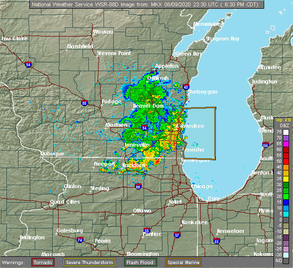 The severe thunderstorm warning for central milwaukee county will expire at 645 pm cdt, the storms which prompted the warning have weakened below severe limits, and no longer pose an immediate threat to life or property. therefore, the warning will be allowed to expire. The severe thunderstorm warning for central milwaukee county will expire at 645 pm cdt, the storms which prompted the warning have weakened below severe limits, and no longer pose an immediate threat to life or property. therefore, the warning will be allowed to expire.
|
| 8/9/2020 6:32 PM CDT |
 At 632 pm cdt, severe thunderstorms were located along a line extending from bayside to near oak creek, moving east at 15 mph (radar indicated). Hazards include 60 mph wind gusts. Expect damage to roofs, siding, and trees. locations impacted include, milwaukee, greenfield, oak creek, south milwaukee, cudahy, whitefish bay, greendale, brown deer, st. Francis, fox point, bayside, west milwaukee, glendale, franklin, river hills, milwaukee hoan bridge, shorewood, marquette university, uw- milwaukee and mitchell park domes. At 632 pm cdt, severe thunderstorms were located along a line extending from bayside to near oak creek, moving east at 15 mph (radar indicated). Hazards include 60 mph wind gusts. Expect damage to roofs, siding, and trees. locations impacted include, milwaukee, greenfield, oak creek, south milwaukee, cudahy, whitefish bay, greendale, brown deer, st. Francis, fox point, bayside, west milwaukee, glendale, franklin, river hills, milwaukee hoan bridge, shorewood, marquette university, uw- milwaukee and mitchell park domes.
|
| 8/9/2020 6:16 PM CDT |
 At 615 pm cdt, a severe thunderstorm was located over southern milwaukee, moving east at 35 mph (radar indicated). Hazards include 60 mph wind gusts. Expect damage to roofs, siding, and trees. locations impacted include, milwaukee, west allis, wauwatosa, greenfield, oak creek, south milwaukee, cudahy, whitefish bay, greendale, brown deer, st. Francis, hales corners, fox point, bayside, west milwaukee, franklin, glendale, river hills, milwaukee hoan bridge and shorewood. At 615 pm cdt, a severe thunderstorm was located over southern milwaukee, moving east at 35 mph (radar indicated). Hazards include 60 mph wind gusts. Expect damage to roofs, siding, and trees. locations impacted include, milwaukee, west allis, wauwatosa, greenfield, oak creek, south milwaukee, cudahy, whitefish bay, greendale, brown deer, st. Francis, hales corners, fox point, bayside, west milwaukee, franklin, glendale, river hills, milwaukee hoan bridge and shorewood.
|
| 8/9/2020 6:10 PM CDT |
 The severe thunderstorm warning for eastern waukesha county will expire at 615 pm cdt, the storm which prompted the warning has weakened below severe limits, and no longer poses an immediate threat to life or property. therefore, the warning will be allowed to expire. however gusty winds are still possible with this thunderstorm. The severe thunderstorm warning for eastern waukesha county will expire at 615 pm cdt, the storm which prompted the warning has weakened below severe limits, and no longer poses an immediate threat to life or property. therefore, the warning will be allowed to expire. however gusty winds are still possible with this thunderstorm.
|
| 8/9/2020 6:05 PM CDT |
 At 605 pm cdt, a severe thunderstorm was located over west allis, moving east at 35 mph (law enforcement. there were trees down on power lines in the waukesha area). Hazards include 60 mph wind gusts. Expect damage to roofs, siding, and trees. Locations impacted include, waukesha, new berlin, brookfield, menomonee falls, muskego, pewaukee, sussex, elm grove, vernon, butler, big bend and lannon. At 605 pm cdt, a severe thunderstorm was located over west allis, moving east at 35 mph (law enforcement. there were trees down on power lines in the waukesha area). Hazards include 60 mph wind gusts. Expect damage to roofs, siding, and trees. Locations impacted include, waukesha, new berlin, brookfield, menomonee falls, muskego, pewaukee, sussex, elm grove, vernon, butler, big bend and lannon.
|
| 8/9/2020 6:04 PM CDT |
 At 603 pm cdt, a severe thunderstorm was located over new berlin, moving east at 35 mph (law enforcement. trees were down in the waukesha area). Hazards include 60 mph wind gusts. expect damage to roofs, siding, and trees At 603 pm cdt, a severe thunderstorm was located over new berlin, moving east at 35 mph (law enforcement. trees were down in the waukesha area). Hazards include 60 mph wind gusts. expect damage to roofs, siding, and trees
|
| 8/9/2020 6:01 PM CDT |
 At 600 pm cdt, a severe thunderstorm was located over new berlin, moving east at 35 mph (law enforcement. trees were reported down across the waukesha area). Hazards include 60 mph wind gusts. Expect damage to roofs, siding, and trees. Locations impacted include, waukesha, new berlin, brookfield, menomonee falls, muskego, pewaukee, sussex, hartland, mukwonago, elm grove, lisbon, vernon, merton, butler, big bend and lannon. At 600 pm cdt, a severe thunderstorm was located over new berlin, moving east at 35 mph (law enforcement. trees were reported down across the waukesha area). Hazards include 60 mph wind gusts. Expect damage to roofs, siding, and trees. Locations impacted include, waukesha, new berlin, brookfield, menomonee falls, muskego, pewaukee, sussex, hartland, mukwonago, elm grove, lisbon, vernon, merton, butler, big bend and lannon.
|
| 8/9/2020 5:50 PM CDT |
 At 550 pm cdt, a severe thunderstorm was located over waukesha, moving east at 35 mph (radar indicated). Hazards include 60 mph wind gusts and quarter size hail. Hail damage to vehicles is expected. expect wind damage to roofs, siding, and trees. Locations impacted include, waukesha, new berlin, brookfield, menomonee falls, muskego, pewaukee, sussex, hartland, mukwonago, delafield, elm grove, wales, okauchee lake, lisbon, vernon, merton, north prairie, butler, big bend and lannon. At 550 pm cdt, a severe thunderstorm was located over waukesha, moving east at 35 mph (radar indicated). Hazards include 60 mph wind gusts and quarter size hail. Hail damage to vehicles is expected. expect wind damage to roofs, siding, and trees. Locations impacted include, waukesha, new berlin, brookfield, menomonee falls, muskego, pewaukee, sussex, hartland, mukwonago, delafield, elm grove, wales, okauchee lake, lisbon, vernon, merton, north prairie, butler, big bend and lannon.
|
| 8/9/2020 5:37 PM CDT |
 At 537 pm cdt, a severe thunderstorm was located over wales, moving east at 35 mph (radar indicated). Hazards include 60 mph wind gusts and quarter size hail. Hail damage to vehicles is expected. expect wind damage to roofs, siding, and trees. Locations impacted include, waukesha, new berlin, brookfield, menomonee falls, muskego, pewaukee, sussex, hartland, mukwonago, delafield, elm grove, wales, okauchee lake, oconomowoc, lisbon, vernon, ottawa, merton, dousman and north prairie. At 537 pm cdt, a severe thunderstorm was located over wales, moving east at 35 mph (radar indicated). Hazards include 60 mph wind gusts and quarter size hail. Hail damage to vehicles is expected. expect wind damage to roofs, siding, and trees. Locations impacted include, waukesha, new berlin, brookfield, menomonee falls, muskego, pewaukee, sussex, hartland, mukwonago, delafield, elm grove, wales, okauchee lake, oconomowoc, lisbon, vernon, ottawa, merton, dousman and north prairie.
|
| 8/9/2020 5:20 PM CDT |
 At 519 pm cdt, a severe thunderstorm was located near dousman, or 9 miles west of wales, moving east at 35 mph (radar indicated). Hazards include 60 mph wind gusts and quarter size hail. Hail damage to vehicles is expected. Expect wind damage to roofs, siding, and trees. At 519 pm cdt, a severe thunderstorm was located near dousman, or 9 miles west of wales, moving east at 35 mph (radar indicated). Hazards include 60 mph wind gusts and quarter size hail. Hail damage to vehicles is expected. Expect wind damage to roofs, siding, and trees.
|
| 7/19/2020 4:44 AM CDT |
 At 443 am cdt, severe thunderstorms were located along a line extending from near fond du lac to near mayville to near cambria, moving east at 45 mph (radar indicated. this line does have a history of producing estimated 60-70 mph winds). Hazards include 60 mph wind gusts and quarter size hail. Hail damage to vehicles is expected. Expect wind damage to roofs, siding, and trees. At 443 am cdt, severe thunderstorms were located along a line extending from near fond du lac to near mayville to near cambria, moving east at 45 mph (radar indicated. this line does have a history of producing estimated 60-70 mph winds). Hazards include 60 mph wind gusts and quarter size hail. Hail damage to vehicles is expected. Expect wind damage to roofs, siding, and trees.
|
| 7/18/2020 12:57 PM CDT |
 At 1257 pm cdt, a severe thunderstorm was located over oak creek, moving east at 35 mph (radar indicated). Hazards include 60 mph wind gusts. expect damage to roofs, siding, and trees At 1257 pm cdt, a severe thunderstorm was located over oak creek, moving east at 35 mph (radar indicated). Hazards include 60 mph wind gusts. expect damage to roofs, siding, and trees
|
| 7/18/2020 12:39 PM CDT | Numerous trees and branches down in an area bounded by hampton avenue and capitol drive from north to south... and 92nd street to 84th street from west to east. one lar in milwaukee county WI, 5.2 miles SE of Milwaukee, WI |
| 7/9/2020 7:38 PM CDT |
 At 737 pm cdt, severe thunderstorms were located along a line extending from near iron ridge to milwaukee, moving northeast at 45 mph (law enforcement. trees and powerlines have been reported down in the lac la belle, dousman, and eagle areas). Hazards include 60 mph wind gusts and penny size hail. Expect damage to roofs, siding, and trees. Locations impacted include, northern milwaukee, wauwatosa, brookfield, menomonee falls, west bend, mequon, hartford, whitefish bay, pewaukee, brown deer, grafton, cedarburg, port washington, sussex, hartland, jackson, fox point, slinger, saukville and bayside. At 737 pm cdt, severe thunderstorms were located along a line extending from near iron ridge to milwaukee, moving northeast at 45 mph (law enforcement. trees and powerlines have been reported down in the lac la belle, dousman, and eagle areas). Hazards include 60 mph wind gusts and penny size hail. Expect damage to roofs, siding, and trees. Locations impacted include, northern milwaukee, wauwatosa, brookfield, menomonee falls, west bend, mequon, hartford, whitefish bay, pewaukee, brown deer, grafton, cedarburg, port washington, sussex, hartland, jackson, fox point, slinger, saukville and bayside.
|
| 7/9/2020 7:25 PM CDT |
 At 725 pm cdt, severe thunderstorms were located along a line extending from near new berlin to 6 miles east of wind point, moving northeast at 30 mph (radar indicated). Hazards include 60 mph wind gusts and penny size hail. Expect damage to roofs, siding, and trees. locations impacted include, milwaukee, waukesha, west allis, wauwatosa, new berlin, brookfield, greenfield, oak creek, muskego, south milwaukee, cudahy, greendale, pewaukee, st. Francis, hales corners, elm grove, west milwaukee, franklin, vernon and big bend. At 725 pm cdt, severe thunderstorms were located along a line extending from near new berlin to 6 miles east of wind point, moving northeast at 30 mph (radar indicated). Hazards include 60 mph wind gusts and penny size hail. Expect damage to roofs, siding, and trees. locations impacted include, milwaukee, waukesha, west allis, wauwatosa, new berlin, brookfield, greenfield, oak creek, muskego, south milwaukee, cudahy, greendale, pewaukee, st. Francis, hales corners, elm grove, west milwaukee, franklin, vernon and big bend.
|
| 7/9/2020 7:24 PM CDT |
 At 723 pm cdt, severe thunderstorms were located along a line extending from hustisford to pewaukee, moving northeast at 45 mph (radar indicated). Hazards include 60 mph wind gusts and penny size hail. expect damage to roofs, siding, and trees At 723 pm cdt, severe thunderstorms were located along a line extending from hustisford to pewaukee, moving northeast at 45 mph (radar indicated). Hazards include 60 mph wind gusts and penny size hail. expect damage to roofs, siding, and trees
|
| 7/9/2020 6:52 PM CDT |
 At 652 pm cdt, severe thunderstorms were located along a line extending from near potter lake to near kenosha, moving northeast at 30 mph (radar indicated). Hazards include 60 mph wind gusts and penny size hail. expect damage to roofs, siding, and trees At 652 pm cdt, severe thunderstorms were located along a line extending from near potter lake to near kenosha, moving northeast at 30 mph (radar indicated). Hazards include 60 mph wind gusts and penny size hail. expect damage to roofs, siding, and trees
|
| 6/20/2020 12:26 PM CDT |
 At 1226 pm cdt, a severe thunderstorm was located near milwaukee hoan bridge, or near whitefish bay, moving northeast at 30 mph (radar indicated). Hazards include 60 mph wind gusts and penny size hail. Expect damage to roofs, siding, and trees. locations impacted include, milwaukee, west allis, cudahy, whitefish bay, st. Francis, fox point, west milwaukee, milwaukee hoan bridge, shorewood, marquette university, uw- milwaukee, mitchell park domes, miller park, milwaukee south shore park, maier festival park and milwaukee bradford beach. At 1226 pm cdt, a severe thunderstorm was located near milwaukee hoan bridge, or near whitefish bay, moving northeast at 30 mph (radar indicated). Hazards include 60 mph wind gusts and penny size hail. Expect damage to roofs, siding, and trees. locations impacted include, milwaukee, west allis, cudahy, whitefish bay, st. Francis, fox point, west milwaukee, milwaukee hoan bridge, shorewood, marquette university, uw- milwaukee, mitchell park domes, miller park, milwaukee south shore park, maier festival park and milwaukee bradford beach.
|
| 6/20/2020 12:15 PM CDT | Large tree branch in the road near the intersection of waterford avenue and pine avenu in milwaukee county WI, 5.6 miles NNW of Milwaukee, WI |
| 6/20/2020 12:15 PM CDT | Several large tree limbs knocked down in the bay view neighborhoo in milwaukee county WI, 4.5 miles NW of Milwaukee, WI |
| 6/20/2020 12:12 PM CDT | Numerous reports of trees and tree limbs down from the are in milwaukee county WI, 6 miles NNW of Milwaukee, WI |
| 6/20/2020 12:10 PM CDT |
 At 1210 pm cdt, a severe thunderstorm was located over southeastern milwaukee, moving northeast at 40 mph (radar indicated). Hazards include 60 mph wind gusts and penny size hail. expect damage to roofs, siding, and trees At 1210 pm cdt, a severe thunderstorm was located over southeastern milwaukee, moving northeast at 40 mph (radar indicated). Hazards include 60 mph wind gusts and penny size hail. expect damage to roofs, siding, and trees
|
| 6/11/2020 5:37 PM CDT |
 At 536 pm cdt, a severe thunderstorm was located near oak creek, moving east at 45 mph (radar indicated). Hazards include 60 mph wind gusts. Expect damage to roofs, siding, and trees. locations impacted include, milwaukee, racine, greenfield, oak creek, south milwaukee, cudahy, greendale, wind point, caledonia, north bay and franksville. People attending outdoor testing at aurora south shore in cudahy should seek safe shelter immediately!. At 536 pm cdt, a severe thunderstorm was located near oak creek, moving east at 45 mph (radar indicated). Hazards include 60 mph wind gusts. Expect damage to roofs, siding, and trees. locations impacted include, milwaukee, racine, greenfield, oak creek, south milwaukee, cudahy, greendale, wind point, caledonia, north bay and franksville. People attending outdoor testing at aurora south shore in cudahy should seek safe shelter immediately!.
|
| 6/11/2020 5:26 PM CDT |
 At 526 pm cdt, a severe thunderstorm was located over muskego, moving east at 45 mph (radar indicated). Hazards include 60 mph wind gusts. Expect damage to roofs, siding, and trees. locations impacted include, milwaukee, racine, new berlin, greenfield, oak creek, mount pleasant, muskego, south milwaukee, cudahy, greendale, hales corners, sturtevant, wind lake, wind point, caledonia, elmwood park, north bay, franksville and north cape. People attending outdoor testing at aurora south shore in cudahy should seek safe shelter immediately!. At 526 pm cdt, a severe thunderstorm was located over muskego, moving east at 45 mph (radar indicated). Hazards include 60 mph wind gusts. Expect damage to roofs, siding, and trees. locations impacted include, milwaukee, racine, new berlin, greenfield, oak creek, mount pleasant, muskego, south milwaukee, cudahy, greendale, hales corners, sturtevant, wind lake, wind point, caledonia, elmwood park, north bay, franksville and north cape. People attending outdoor testing at aurora south shore in cudahy should seek safe shelter immediately!.
|
| 6/11/2020 5:12 PM CDT |
 At 511 pm cdt, a severe thunderstorm was located near north prairie, or near wales, moving east at 45 mph (radar indicated). Hazards include 60 mph wind gusts. expect damage to roofs, siding, and trees At 511 pm cdt, a severe thunderstorm was located near north prairie, or near wales, moving east at 45 mph (radar indicated). Hazards include 60 mph wind gusts. expect damage to roofs, siding, and trees
|
| 6/2/2020 9:37 PM CDT |
 The severe thunderstorm warning for ozaukee and eastern washington counties will expire at 945 pm cdt, the storms which prompted the warning have moved out of the area. therefore, the warning will be allowed to expire. a severe thunderstorm watch remains in effect until midnight cdt for southeastern wisconsin. The severe thunderstorm warning for ozaukee and eastern washington counties will expire at 945 pm cdt, the storms which prompted the warning have moved out of the area. therefore, the warning will be allowed to expire. a severe thunderstorm watch remains in effect until midnight cdt for southeastern wisconsin.
|
| 6/2/2020 9:20 PM CDT |
 At 920 pm cdt, severe thunderstorms were located along a line extending from near oostburg to cedarburg, moving east at 45 mph (radar indicated). Hazards include 60 mph wind gusts. Expect damage to roofs, siding, and trees. locations impacted include, west bend, mequon, brown deer, grafton, cedarburg, port washington, jackson, saukville, bayside, thiensville, belgium, fredonia, newburg, waubeka, fillmore, harrington beach st park and boltonville. People attending outdoor testing at ascension in mequon, and outdoor testing at aurora in grafton should seek safe shelter immediately!. At 920 pm cdt, severe thunderstorms were located along a line extending from near oostburg to cedarburg, moving east at 45 mph (radar indicated). Hazards include 60 mph wind gusts. Expect damage to roofs, siding, and trees. locations impacted include, west bend, mequon, brown deer, grafton, cedarburg, port washington, jackson, saukville, bayside, thiensville, belgium, fredonia, newburg, waubeka, fillmore, harrington beach st park and boltonville. People attending outdoor testing at ascension in mequon, and outdoor testing at aurora in grafton should seek safe shelter immediately!.
|
| 6/2/2020 9:09 PM CDT |
 At 908 pm cdt, severe thunderstorms were located along a line extending from near sheboygan falls to near slinger, moving southeast at 40 mph (radar indicated). Hazards include 60 mph wind gusts. Expect damage to roofs, siding, and trees. locations impacted include, west bend, mequon, hartford, grafton, cedarburg, port washington, jackson, slinger, saukville, bayside, kewaskum, thiensville, belgium, fredonia, newburg, richfield, addison, wayne, nenno and waubeka. People attending washington county outdoor testing, outdoor testing at ascension in mequon, outdoor testing at aurora in grafton, and outdoor testing at aurora in hartford should seek safe shelter immediately!. At 908 pm cdt, severe thunderstorms were located along a line extending from near sheboygan falls to near slinger, moving southeast at 40 mph (radar indicated). Hazards include 60 mph wind gusts. Expect damage to roofs, siding, and trees. locations impacted include, west bend, mequon, hartford, grafton, cedarburg, port washington, jackson, slinger, saukville, bayside, kewaskum, thiensville, belgium, fredonia, newburg, richfield, addison, wayne, nenno and waubeka. People attending washington county outdoor testing, outdoor testing at ascension in mequon, outdoor testing at aurora in grafton, and outdoor testing at aurora in hartford should seek safe shelter immediately!.
|
| 6/2/2020 8:44 PM CDT |
 At 843 pm cdt, severe thunderstorms were located along a line extending from 7 miles west of plymouth to near watertown, moving east at 45 mph (radar indicated). Hazards include 60 mph wind gusts and penny size hail. expect damage to roofs, siding, and trees At 843 pm cdt, severe thunderstorms were located along a line extending from 7 miles west of plymouth to near watertown, moving east at 45 mph (radar indicated). Hazards include 60 mph wind gusts and penny size hail. expect damage to roofs, siding, and trees
|
| 4/20/2020 9:35 PM CDT |
 At 934 pm cdt, a severe thunderstorm was located over oak creek, moving southeast at 45 mph (radar indicated). Hazards include 70 mph wind gusts. pea size hail. Expect considerable tree damage. Damage is likely to mobile homes, roofs, and outbuildings. At 934 pm cdt, a severe thunderstorm was located over oak creek, moving southeast at 45 mph (radar indicated). Hazards include 70 mph wind gusts. pea size hail. Expect considerable tree damage. Damage is likely to mobile homes, roofs, and outbuildings.
|
| 4/20/2020 9:26 PM CDT | Asos station kmke milwaukee-gen mitchell arp in milwaukee county WI, 6.8 miles NNW of Milwaukee, WI |
| 4/20/2020 9:15 PM CDT | Awos station kmwc milwaukee lawre in milwaukee county WI, 6.6 miles SSE of Milwaukee, WI |
| 4/7/2020 5:30 PM CDT | Quarter sized hail reported 2.4 miles SW of Milwaukee, WI, relayed from social media. |
| 4/7/2020 5:28 PM CDT | Quarter sized hail reported 6.4 miles SSW of Milwaukee, WI, relayed by wtmj. |
| 4/7/2020 5:26 PM CDT |
 At 526 pm cdt, a severe thunderstorm was located over northern milwaukee, moving east at 45 mph (radar indicated). Hazards include quarter size hail. damage to vehicles is expected At 526 pm cdt, a severe thunderstorm was located over northern milwaukee, moving east at 45 mph (radar indicated). Hazards include quarter size hail. damage to vehicles is expected
|
| 7/20/2019 1:07 PM CDT |
 The severe thunderstorm warning for ozaukee, north central milwaukee, washington and dodge counties will expire at 115 pm cdt, the storms which prompted the warning have weakened below severe limits, and no longer pose an immediate threat to life or property. therefore, the warning will be allowed to expire. however gusty winds to 40 mph are still likely with these thunderstorms. a severe thunderstorm watch remains in effect until 900 pm cdt for south central and southeastern wisconsin. The severe thunderstorm warning for ozaukee, north central milwaukee, washington and dodge counties will expire at 115 pm cdt, the storms which prompted the warning have weakened below severe limits, and no longer pose an immediate threat to life or property. therefore, the warning will be allowed to expire. however gusty winds to 40 mph are still likely with these thunderstorms. a severe thunderstorm watch remains in effect until 900 pm cdt for south central and southeastern wisconsin.
|
| 7/20/2019 12:54 PM CDT |
 At 1254 pm cdt, severe thunderstorms were located along a line extending from 11 miles east of sheboygan to near waterloo, moving southeast at 35 mph (radar indicated). Hazards include 60 mph wind gusts. Expect damage to roofs, siding, and trees. Locations impacted include, west bend, watertown, mequon, beaver dam, hartford, grafton, cedarburg, port washington, jackson, mayville, slinger, saukville, bayside, kewaskum, horicon, thiensville, juneau, belgium, fredonia and newburg. At 1254 pm cdt, severe thunderstorms were located along a line extending from 11 miles east of sheboygan to near waterloo, moving southeast at 35 mph (radar indicated). Hazards include 60 mph wind gusts. Expect damage to roofs, siding, and trees. Locations impacted include, west bend, watertown, mequon, beaver dam, hartford, grafton, cedarburg, port washington, jackson, mayville, slinger, saukville, bayside, kewaskum, horicon, thiensville, juneau, belgium, fredonia and newburg.
|
| 7/20/2019 12:32 PM CDT |
 At 1231 pm cdt, severe thunderstorms were located along a line extending from 13 miles east of sheboygan to near waterloo, moving southeast at 45 mph (radar indicated). Hazards include 60 mph wind gusts. Expect damage to roofs, siding, and trees. Locations impacted include, sheboygan, west bend, watertown, mequon, beaver dam, hartford, grafton, cedarburg, waupun, port washington, plymouth, sheboygan falls, jackson, mayville, slinger, saukville, bayside, kewaskum, horicon and thiensville. At 1231 pm cdt, severe thunderstorms were located along a line extending from 13 miles east of sheboygan to near waterloo, moving southeast at 45 mph (radar indicated). Hazards include 60 mph wind gusts. Expect damage to roofs, siding, and trees. Locations impacted include, sheboygan, west bend, watertown, mequon, beaver dam, hartford, grafton, cedarburg, waupun, port washington, plymouth, sheboygan falls, jackson, mayville, slinger, saukville, bayside, kewaskum, horicon and thiensville.
|
| 7/20/2019 12:18 PM CDT |
 At 1217 pm cdt, severe thunderstorms were located along a line extending from near sheboygan to near columbus, moving southeast at 45 mph (radar indicated). Hazards include 60 mph wind gusts. expect damage to roofs, siding, and trees At 1217 pm cdt, severe thunderstorms were located along a line extending from near sheboygan to near columbus, moving southeast at 45 mph (radar indicated). Hazards include 60 mph wind gusts. expect damage to roofs, siding, and trees
|
| 7/2/2019 4:50 PM CDT | 12 inch diameter tree down on ca in milwaukee county WI, 3.3 miles WSW of Milwaukee, WI |
| 7/2/2019 4:50 PM CDT |
 The severe thunderstorm warning for milwaukee county will expire at 500 pm cdt, the storm which prompted the warning has weakened below severe limits, and no longer poses an immediate threat to life or property. therefore, the warning will be allowed to expire. The severe thunderstorm warning for milwaukee county will expire at 500 pm cdt, the storm which prompted the warning has weakened below severe limits, and no longer poses an immediate threat to life or property. therefore, the warning will be allowed to expire.
|
| 7/2/2019 4:42 PM CDT |
 At 441 pm cdt, a severe thunderstorm was located over greendale, moving east at 35 mph (radar indicated). Hazards include 60 mph wind gusts. Expect damage to roofs, siding, and trees. locations impacted include, milwaukee, west allis, wauwatosa, greenfield, oak creek, south milwaukee, cudahy, greendale, st. francis, hales corners, west milwaukee, milwaukee hoan bridge, state fair park, marquette university, mitchell park domes, milwaukee co zoo, miller park, milwaukee south shore park and maier festival park. People attending summerfest in milwaukee, and the west allis independence day parade should seek safe shelter immediately!. At 441 pm cdt, a severe thunderstorm was located over greendale, moving east at 35 mph (radar indicated). Hazards include 60 mph wind gusts. Expect damage to roofs, siding, and trees. locations impacted include, milwaukee, west allis, wauwatosa, greenfield, oak creek, south milwaukee, cudahy, greendale, st. francis, hales corners, west milwaukee, milwaukee hoan bridge, state fair park, marquette university, mitchell park domes, milwaukee co zoo, miller park, milwaukee south shore park and maier festival park. People attending summerfest in milwaukee, and the west allis independence day parade should seek safe shelter immediately!.
|
| 7/2/2019 4:31 PM CDT |
 At 430 pm cdt, a severe thunderstorm was located over new berlin, moving east at 35 mph (emergency management. at 430 pm trees down and power lines were reported down in eastern waukesha county near new berlin). Hazards include 70 mph wind gusts. Expect considerable tree damage. damage is likely to mobile homes, roofs, and outbuildings. locations impacted include, milwaukee, waukesha, west allis, wauwatosa, new berlin, brookfield, greenfield, oak creek, muskego, south milwaukee, cudahy, greendale, pewaukee, st. francis, hales corners, elm grove, west milwaukee, big bend, milwaukee hoan bridge and marquette university. People attending summerfest in milwaukee, and the west allis independence day parade should seek safe shelter immediately!. At 430 pm cdt, a severe thunderstorm was located over new berlin, moving east at 35 mph (emergency management. at 430 pm trees down and power lines were reported down in eastern waukesha county near new berlin). Hazards include 70 mph wind gusts. Expect considerable tree damage. damage is likely to mobile homes, roofs, and outbuildings. locations impacted include, milwaukee, waukesha, west allis, wauwatosa, new berlin, brookfield, greenfield, oak creek, muskego, south milwaukee, cudahy, greendale, pewaukee, st. francis, hales corners, elm grove, west milwaukee, big bend, milwaukee hoan bridge and marquette university. People attending summerfest in milwaukee, and the west allis independence day parade should seek safe shelter immediately!.
|
| 7/2/2019 4:30 PM CDT | Corrects previous tstm wnd dmg report from 2 nne milwaukee. 12 inch diameter branch down on car. 2500 block of weil s in milwaukee county WI, 3.3 miles WSW of Milwaukee, WI |
| 7/2/2019 4:30 PM CDT | 122nd and washington area of west allis. 12 inches diameter branch dow in milwaukee county WI, 5.3 miles ENE of Milwaukee, WI |
| 7/2/2019 4:25 PM CDT |
 At 425 pm cdt, a severe thunderstorm was located over new berlin, moving east at 35 mph (radar indicated). Hazards include 60 mph wind gusts. expect damage to roofs, siding, and trees At 425 pm cdt, a severe thunderstorm was located over new berlin, moving east at 35 mph (radar indicated). Hazards include 60 mph wind gusts. expect damage to roofs, siding, and trees
|
| 6/27/2019 5:52 PM CDT |
 At 526 pm cdt, severe thunderstorms were located along a line extending from near bayside to near wind lake, moving east at 45 mph (law enforcement. widespread wind damage has been reported across the waukesha area. numerous trees have been reported down). Hazards include 70 mph wind gusts and quarter size hail. Hail damage to vehicles is expected. expect considerable tree damage. wind damage is also likely to mobile homes, roofs, and outbuildings. locations impacted include, milwaukee, waukesha, west allis, wauwatosa, new berlin, brookfield, greenfield, menomonee falls, oak creek, muskego, south milwaukee, cudahy, whitefish bay, greendale, pewaukee, brown deer, sussex, st. francis, hales corners and mukwonago. People attending summerfest in milwaukee, and the shorewood criterium should seek safe shelter immediately!. At 526 pm cdt, severe thunderstorms were located along a line extending from near bayside to near wind lake, moving east at 45 mph (law enforcement. widespread wind damage has been reported across the waukesha area. numerous trees have been reported down). Hazards include 70 mph wind gusts and quarter size hail. Hail damage to vehicles is expected. expect considerable tree damage. wind damage is also likely to mobile homes, roofs, and outbuildings. locations impacted include, milwaukee, waukesha, west allis, wauwatosa, new berlin, brookfield, greenfield, menomonee falls, oak creek, muskego, south milwaukee, cudahy, whitefish bay, greendale, pewaukee, brown deer, sussex, st. francis, hales corners and mukwonago. People attending summerfest in milwaukee, and the shorewood criterium should seek safe shelter immediately!.
|
| 6/27/2019 5:42 PM CDT |
 The severe thunderstorm warning for ozaukee, washington and sheboygan counties will expire at 545 pm cdt, the strongest winds with the line of storms has moved out over lake michigan. therefore, the warning will be allowed to expire. however gusty winds of 30 mph to 40 mph are still expected through 6 pm over sheboygan and ozaukee counties. a severe thunderstorm watch remains in effect until 900 pm cdt for southeastern and east central wisconsin. The severe thunderstorm warning for ozaukee, washington and sheboygan counties will expire at 545 pm cdt, the strongest winds with the line of storms has moved out over lake michigan. therefore, the warning will be allowed to expire. however gusty winds of 30 mph to 40 mph are still expected through 6 pm over sheboygan and ozaukee counties. a severe thunderstorm watch remains in effect until 900 pm cdt for southeastern and east central wisconsin.
|
| 6/27/2019 5:33 PM CDT | Large trees dow in milwaukee county WI, 7.5 miles N of Milwaukee, WI |
| 6/27/2019 5:27 PM CDT |
 At 526 pm cdt, severe thunderstorms were located along a line extending from near bayside to near wind lake, moving east at 45 mph (law enforcement. widespread wind damage has been reported across the waukesha area. numerous trees have been reported down). Hazards include 70 mph wind gusts and quarter size hail. Hail damage to vehicles is expected. expect considerable tree damage. wind damage is also likely to mobile homes, roofs, and outbuildings. locations impacted include, milwaukee, waukesha, west allis, wauwatosa, new berlin, brookfield, greenfield, menomonee falls, oak creek, muskego, south milwaukee, cudahy, whitefish bay, greendale, pewaukee, brown deer, sussex, st. francis, hales corners and mukwonago. People attending summerfest in milwaukee, and the shorewood criterium should seek safe shelter immediately!. At 526 pm cdt, severe thunderstorms were located along a line extending from near bayside to near wind lake, moving east at 45 mph (law enforcement. widespread wind damage has been reported across the waukesha area. numerous trees have been reported down). Hazards include 70 mph wind gusts and quarter size hail. Hail damage to vehicles is expected. expect considerable tree damage. wind damage is also likely to mobile homes, roofs, and outbuildings. locations impacted include, milwaukee, waukesha, west allis, wauwatosa, new berlin, brookfield, greenfield, menomonee falls, oak creek, muskego, south milwaukee, cudahy, whitefish bay, greendale, pewaukee, brown deer, sussex, st. francis, hales corners and mukwonago. People attending summerfest in milwaukee, and the shorewood criterium should seek safe shelter immediately!.
|
| 6/27/2019 5:25 PM CDT | Large tree blown ove in milwaukee county WI, 7 miles S of Milwaukee, WI |
| 6/27/2019 5:15 PM CDT |
 At 514 pm cdt, severe thunderstorms were located along a line extending from near menomonee falls to near waterford north, moving east at 45 mph (law enforcement. these storms have a widespread history of producing wind damage. wind gusts have been measured in excess of 60 mph). Hazards include 60 mph wind gusts and quarter size hail. Hail damage to vehicles is expected. expect wind damage to roofs, siding, and trees. locations impacted include, milwaukee, waukesha, west allis, wauwatosa, new berlin, brookfield, greenfield, menomonee falls, oak creek, muskego, south milwaukee, cudahy, whitefish bay, greendale, pewaukee, brown deer, sussex, st. francis, hartland and hales corners. People attending summerfest in milwaukee, and the shorewood criterium should seek safe shelter immediately!. At 514 pm cdt, severe thunderstorms were located along a line extending from near menomonee falls to near waterford north, moving east at 45 mph (law enforcement. these storms have a widespread history of producing wind damage. wind gusts have been measured in excess of 60 mph). Hazards include 60 mph wind gusts and quarter size hail. Hail damage to vehicles is expected. expect wind damage to roofs, siding, and trees. locations impacted include, milwaukee, waukesha, west allis, wauwatosa, new berlin, brookfield, greenfield, menomonee falls, oak creek, muskego, south milwaukee, cudahy, whitefish bay, greendale, pewaukee, brown deer, sussex, st. francis, hartland and hales corners. People attending summerfest in milwaukee, and the shorewood criterium should seek safe shelter immediately!.
|
| 6/27/2019 5:14 PM CDT |
 At 513 pm cdt, severe thunderstorms were located along a line extending from near st. nazianz to menomonee falls, moving east at 50 mph (radar indicated). Hazards include 60 mph wind gusts and penny size hail. Expect damage to roofs, siding, and trees. Locations impacted include, sheboygan, menomonee falls, west bend, mequon, hartford, brown deer, grafton, cedarburg, port washington, plymouth, sheboygan falls, jackson, slinger, saukville, bayside, kewaskum, thiensville, howards grove, oostburg and belgium. At 513 pm cdt, severe thunderstorms were located along a line extending from near st. nazianz to menomonee falls, moving east at 50 mph (radar indicated). Hazards include 60 mph wind gusts and penny size hail. Expect damage to roofs, siding, and trees. Locations impacted include, sheboygan, menomonee falls, west bend, mequon, hartford, brown deer, grafton, cedarburg, port washington, plymouth, sheboygan falls, jackson, slinger, saukville, bayside, kewaskum, thiensville, howards grove, oostburg and belgium.
|
| 6/27/2019 4:59 PM CDT |
 At 458 pm cdt, severe thunderstorms were located along a line extending from near merton to near east troy, moving east at 45 mph (trained weather spotters. these storms have a widespread history of producing wind gusts in excess of 60 mph. the gusty winds will proceed the heavy rain). Hazards include 60 mph wind gusts and penny size hail. Expect damage to roofs, siding, and trees. locations impacted include, milwaukee, waukesha, west allis, wauwatosa, new berlin, brookfield, greenfield, menomonee falls, oak creek, muskego, south milwaukee, cudahy, whitefish bay, greendale, pewaukee, brown deer, sussex, st. francis, hartland and hales corners. People attending summerfest in milwaukee, and the shorewood criterium should seek safe shelter immediately!. At 458 pm cdt, severe thunderstorms were located along a line extending from near merton to near east troy, moving east at 45 mph (trained weather spotters. these storms have a widespread history of producing wind gusts in excess of 60 mph. the gusty winds will proceed the heavy rain). Hazards include 60 mph wind gusts and penny size hail. Expect damage to roofs, siding, and trees. locations impacted include, milwaukee, waukesha, west allis, wauwatosa, new berlin, brookfield, greenfield, menomonee falls, oak creek, muskego, south milwaukee, cudahy, whitefish bay, greendale, pewaukee, brown deer, sussex, st. francis, hartland and hales corners. People attending summerfest in milwaukee, and the shorewood criterium should seek safe shelter immediately!.
|
| 6/27/2019 4:58 PM CDT |
 At 457 pm cdt, severe thunderstorms were located along a line extending from 6 miles southwest of chilton to merton, moving east at 45 mph (radar indicated). Hazards include 60 mph wind gusts and penny size hail. Expect damage to roofs, siding, and trees. Locations impacted include, sheboygan, menomonee falls, west bend, mequon, hartford, brown deer, grafton, cedarburg, port washington, plymouth, sheboygan falls, jackson, slinger, saukville, bayside, kewaskum, thiensville, howards grove, oostburg and belgium. At 457 pm cdt, severe thunderstorms were located along a line extending from 6 miles southwest of chilton to merton, moving east at 45 mph (radar indicated). Hazards include 60 mph wind gusts and penny size hail. Expect damage to roofs, siding, and trees. Locations impacted include, sheboygan, menomonee falls, west bend, mequon, hartford, brown deer, grafton, cedarburg, port washington, plymouth, sheboygan falls, jackson, slinger, saukville, bayside, kewaskum, thiensville, howards grove, oostburg and belgium.
|
| 6/27/2019 4:41 PM CDT |
 At 441 pm cdt, severe thunderstorms were located along a line extending from near lac la belle to near whitewater, moving east at 45 mph (radar indicated). Hazards include 60 mph wind gusts and penny size hail. expect damage to roofs, siding, and trees At 441 pm cdt, severe thunderstorms were located along a line extending from near lac la belle to near whitewater, moving east at 45 mph (radar indicated). Hazards include 60 mph wind gusts and penny size hail. expect damage to roofs, siding, and trees
|
| 6/27/2019 4:29 PM CDT |
 At 429 pm cdt, severe thunderstorms were located along a line extending from 6 miles southwest of oshkosh to watertown, moving east at 55 mph (radar indicated). Hazards include 60 mph wind gusts and penny size hail. expect damage to roofs, siding, and trees At 429 pm cdt, severe thunderstorms were located along a line extending from 6 miles southwest of oshkosh to watertown, moving east at 55 mph (radar indicated). Hazards include 60 mph wind gusts and penny size hail. expect damage to roofs, siding, and trees
|
| 5/19/2019 1:24 PM CDT | Gust of 51 knots at mitchell airpor in milwaukee county WI, 6.2 miles NNW of Milwaukee, WI |
| 5/19/2019 1:15 PM CDT | Tree with at least 12 inch diameter base down. report relayed from fox6 tv meteorologis in milwaukee county WI, 3.7 miles NNE of Milwaukee, WI |
| 5/19/2019 1:15 PM CDT | Large tree snapped mid base. several large branches down too. report relayed from fox6 tv meteorologis in milwaukee county WI, 3 miles SE of Milwaukee, WI |
| 9/4/2018 5:05 PM CDT | Large tree snapped midway up. other trees damaged in the are in milwaukee county WI, 4.5 miles SW of Milwaukee, WI |
| 8/28/2018 4:59 PM CDT |
 A severe thunderstorm warning remains in effect until 530 pm cdt for southern ozaukee. northwestern milwaukee. northeastern waukesha and southern washington counties. At 458 pm cdt, severe thunderstorms were located along a line extending from near fredonia to near jackson to near merton, moving east at 40 mph. A severe thunderstorm warning remains in effect until 530 pm cdt for southern ozaukee. northwestern milwaukee. northeastern waukesha and southern washington counties. At 458 pm cdt, severe thunderstorms were located along a line extending from near fredonia to near jackson to near merton, moving east at 40 mph.
|
| 8/28/2018 4:41 PM CDT |
 At 441 pm cdt, severe thunderstorms were located along a line extending from near west bend to near hartford to 6 miles north of lac la belle, moving east at 40 mph (radar indicated). Hazards include 60 mph wind gusts. expect damage to roofs, siding, and trees At 441 pm cdt, severe thunderstorms were located along a line extending from near west bend to near hartford to 6 miles north of lac la belle, moving east at 40 mph (radar indicated). Hazards include 60 mph wind gusts. expect damage to roofs, siding, and trees
|
| 8/26/2018 11:28 PM CDT |
 At 1127 pm cdt, a severe thunderstorm was located over northeastern milwaukee, moving east at 55 mph (radar indicated). Hazards include 60 mph wind gusts. Expect damage to roofs, siding, and trees. Locations impacted include, milwaukee, west allis, wauwatosa, whitefish bay, west milwaukee, milwaukee hoan bridge, shorewood, state fair park, marquette university, uw- milwaukee, mitchell park domes, milwaukee co zoo, miller park, milwaukee south shore park, maier festival park and milwaukee bradford beach. At 1127 pm cdt, a severe thunderstorm was located over northeastern milwaukee, moving east at 55 mph (radar indicated). Hazards include 60 mph wind gusts. Expect damage to roofs, siding, and trees. Locations impacted include, milwaukee, west allis, wauwatosa, whitefish bay, west milwaukee, milwaukee hoan bridge, shorewood, state fair park, marquette university, uw- milwaukee, mitchell park domes, milwaukee co zoo, miller park, milwaukee south shore park, maier festival park and milwaukee bradford beach.
|
| 8/26/2018 11:16 PM CDT |
 At 1115 pm cdt, a severe thunderstorm was located over elm grove, moving east at 55 mph. numerous trees reported down in the oconomowoc area, especially to the south (law enforcement). Hazards include 60 mph wind gusts. Expect damage to roofs, siding, and trees. Locations impacted include, milwaukee, waukesha, west allis, wauwatosa, new berlin, brookfield, menomonee falls, whitefish bay, pewaukee, brown deer, sussex, fox point, elm grove, bayside, west milwaukee, butler, river hills, lannon, milwaukee hoan bridge and shorewood. At 1115 pm cdt, a severe thunderstorm was located over elm grove, moving east at 55 mph. numerous trees reported down in the oconomowoc area, especially to the south (law enforcement). Hazards include 60 mph wind gusts. Expect damage to roofs, siding, and trees. Locations impacted include, milwaukee, waukesha, west allis, wauwatosa, new berlin, brookfield, menomonee falls, whitefish bay, pewaukee, brown deer, sussex, fox point, elm grove, bayside, west milwaukee, butler, river hills, lannon, milwaukee hoan bridge and shorewood.
|
| 8/26/2018 11:06 PM CDT |
 At 1106 pm cdt, a severe thunderstorm was located over waukesha, moving east at 55 mph (radar indicated). Hazards include 60 mph wind gusts. expect damage to roofs, siding, and trees At 1106 pm cdt, a severe thunderstorm was located over waukesha, moving east at 55 mph (radar indicated). Hazards include 60 mph wind gusts. expect damage to roofs, siding, and trees
|
| 8/26/2018 10:18 PM CDT |
 At 1018 pm cdt, a severe thunderstorm was located over northwestern milwaukee, moving east at 45 mph (radar indicated). Hazards include 60 mph wind gusts. expect damage to roofs, siding, and trees At 1018 pm cdt, a severe thunderstorm was located over northwestern milwaukee, moving east at 45 mph (radar indicated). Hazards include 60 mph wind gusts. expect damage to roofs, siding, and trees
|
| 7/1/2018 3:53 PM CDT |
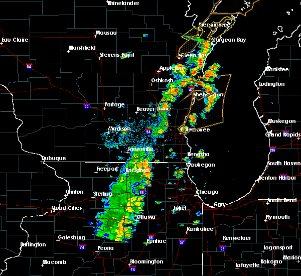 At 353 pm cdt, a severe thunderstorm was located over fox point, moving northeast at 40 mph (radar indicated). Hazards include 60 mph wind gusts. Expect damage to roofs, siding, and trees. locations impacted include, northern milwaukee, mequon, whitefish bay, brown deer, fox point, bayside, river hills and shorewood. A tornado watch remains in effect until 700 pm cdt for southeastern wisconsin. At 353 pm cdt, a severe thunderstorm was located over fox point, moving northeast at 40 mph (radar indicated). Hazards include 60 mph wind gusts. Expect damage to roofs, siding, and trees. locations impacted include, northern milwaukee, mequon, whitefish bay, brown deer, fox point, bayside, river hills and shorewood. A tornado watch remains in effect until 700 pm cdt for southeastern wisconsin.
|
| 7/1/2018 3:50 PM CDT | Trees down. relayed through mpin in milwaukee county WI, 9.7 miles S of Milwaukee, WI |
| 7/1/2018 3:50 PM CDT | Large tree limb down between bradley and dean on 61st st. relayed by wisn. delayed repor in milwaukee county WI, 9.2 miles S of Milwaukee, WI |
| 7/1/2018 3:47 PM CDT |
 At 346 pm cdt, a severe thunderstorm was located over whitefish bay, moving northeast at 60 mph (radar indicated). Hazards include 60 mph wind gusts. Expect damage to roofs, siding, and trees. locations impacted include, milwaukee, wauwatosa, mequon, whitefish bay, brown deer, fox point, bayside, butler, river hills, milwaukee hoan bridge, shorewood, marquette university, uw- milwaukee, maier festival park and milwaukee bradford beach. A tornado watch remains in effect until 700 pm cdt for southeastern wisconsin. At 346 pm cdt, a severe thunderstorm was located over whitefish bay, moving northeast at 60 mph (radar indicated). Hazards include 60 mph wind gusts. Expect damage to roofs, siding, and trees. locations impacted include, milwaukee, wauwatosa, mequon, whitefish bay, brown deer, fox point, bayside, butler, river hills, milwaukee hoan bridge, shorewood, marquette university, uw- milwaukee, maier festival park and milwaukee bradford beach. A tornado watch remains in effect until 700 pm cdt for southeastern wisconsin.
|
| 7/1/2018 3:43 PM CDT | Significant tree damage between 84th and 76th st between lisbon and capital dr. nash park neighborhood. delayed repor in milwaukee county WI, 3.8 miles SE of Milwaukee, WI |
| 7/1/2018 3:41 PM CDT |
 At 341 pm cdt, a severe thunderstorm was located over wauwatosa, moving northeast at 40 mph (radar indicated). Hazards include 60 mph wind gusts. expect damage to roofs, siding, and trees At 341 pm cdt, a severe thunderstorm was located over wauwatosa, moving northeast at 40 mph (radar indicated). Hazards include 60 mph wind gusts. expect damage to roofs, siding, and trees
|
| 7/1/2018 3:13 PM CDT |
 At 311 pm cdt, a severe thunderstorm was located over port washington, moving northeast at 45 mph (emergency management). Hazards include 60 mph wind gusts. Expect damage to roofs, siding, and trees. at 252 pm cdt, emergency management reported several trees and power lines down in the southwest side of cedarburg, and in the thiensville area. locations impacted include, mequon, brown deer, grafton, cedarburg, port washington, saukville, bayside, thiensville, belgium and harrington beach st park. A tornado watch remains in effect until 700 pm cdt for southeastern wisconsin. At 311 pm cdt, a severe thunderstorm was located over port washington, moving northeast at 45 mph (emergency management). Hazards include 60 mph wind gusts. Expect damage to roofs, siding, and trees. at 252 pm cdt, emergency management reported several trees and power lines down in the southwest side of cedarburg, and in the thiensville area. locations impacted include, mequon, brown deer, grafton, cedarburg, port washington, saukville, bayside, thiensville, belgium and harrington beach st park. A tornado watch remains in effect until 700 pm cdt for southeastern wisconsin.
|
| 7/1/2018 3:00 PM CDT |
 At 259 pm cdt, a severe thunderstorm was located over grafton, moving northeast at 55 mph (radar indicated). Hazards include 70 mph wind gusts. Expect considerable tree damage. damage is likely to mobile homes, roofs, and outbuildings. locations impacted include, mequon, brown deer, grafton, cedarburg, port washington, saukville, bayside, thiensville, belgium and harrington beach st park. A tornado watch remains in effect until 700 pm cdt for southeastern wisconsin. At 259 pm cdt, a severe thunderstorm was located over grafton, moving northeast at 55 mph (radar indicated). Hazards include 70 mph wind gusts. Expect considerable tree damage. damage is likely to mobile homes, roofs, and outbuildings. locations impacted include, mequon, brown deer, grafton, cedarburg, port washington, saukville, bayside, thiensville, belgium and harrington beach st park. A tornado watch remains in effect until 700 pm cdt for southeastern wisconsin.
|
| 7/1/2018 2:50 PM CDT |
 At 250 pm cdt, a severe thunderstorm was located near mequon, moving northeast at 40 mph (radar indicated). Hazards include 70 mph wind gusts. Expect considerable tree damage. damage is likely to mobile homes, roofs, and outbuildings. locations impacted include, northern milwaukee, brookfield, menomonee falls, mequon, brown deer, grafton, cedarburg, port washington, sussex, saukville, bayside, thiensville, belgium, butler, river hills, lannon, richfield, colgate, harrington beach st park and hubertus. A tornado watch remains in effect until 700 pm cdt for southeastern wisconsin. At 250 pm cdt, a severe thunderstorm was located near mequon, moving northeast at 40 mph (radar indicated). Hazards include 70 mph wind gusts. Expect considerable tree damage. damage is likely to mobile homes, roofs, and outbuildings. locations impacted include, northern milwaukee, brookfield, menomonee falls, mequon, brown deer, grafton, cedarburg, port washington, sussex, saukville, bayside, thiensville, belgium, butler, river hills, lannon, richfield, colgate, harrington beach st park and hubertus. A tornado watch remains in effect until 700 pm cdt for southeastern wisconsin.
|
| 7/1/2018 2:43 PM CDT |
 At 243 pm cdt, a severe thunderstorm was located near menomonee falls, moving northeast at 45 mph (radar indicated). Hazards include 60 mph wind gusts. expect damage to roofs, siding, and trees At 243 pm cdt, a severe thunderstorm was located near menomonee falls, moving northeast at 45 mph (radar indicated). Hazards include 60 mph wind gusts. expect damage to roofs, siding, and trees
|
| 5/27/2018 4:50 PM CDT |
 At 450 pm cdt, a severe thunderstorm was located near merton, or 7 miles south of hartford, moving southeast at 20 mph (radar indicated). Hazards include 60 mph wind gusts and quarter size hail. Hail damage to vehicles is expected. expect wind damage to roofs, siding, and trees. Locations impacted include, waukesha, new berlin, brookfield, menomonee falls, hartford, pewaukee, sussex, hartland, delafield, elm grove, okauchee lake, merton, butler, lannon, lac la belle, richfield, ashippun, nashotah, chenequa and neosho. At 450 pm cdt, a severe thunderstorm was located near merton, or 7 miles south of hartford, moving southeast at 20 mph (radar indicated). Hazards include 60 mph wind gusts and quarter size hail. Hail damage to vehicles is expected. expect wind damage to roofs, siding, and trees. Locations impacted include, waukesha, new berlin, brookfield, menomonee falls, hartford, pewaukee, sussex, hartland, delafield, elm grove, okauchee lake, merton, butler, lannon, lac la belle, richfield, ashippun, nashotah, chenequa and neosho.
|
| 5/27/2018 4:19 PM CDT |
 The national weather service in milwaukee/sullivan has issued a * severe thunderstorm warning for. northern waukesha county in southeastern wisconsin. southern washington county in southeastern wisconsin. northeastern jefferson county in southeastern wisconsin. Southeastern dodge county in southeastern wisconsin. The national weather service in milwaukee/sullivan has issued a * severe thunderstorm warning for. northern waukesha county in southeastern wisconsin. southern washington county in southeastern wisconsin. northeastern jefferson county in southeastern wisconsin. Southeastern dodge county in southeastern wisconsin.
|
| 5/9/2018 5:36 PM CDT |
 At 535 pm cdt, a severe thunderstorm was located over oak creek, moving east at 40 mph (radar indicated). Hazards include 60 mph wind gusts and quarter size hail. Hail damage to vehicles is expected. expect wind damage to roofs, siding, and trees. locations impacted include, milwaukee, greenfield, oak creek, south milwaukee, cudahy, st. Francis, wind point, milwaukee hoan bridge, caledonia, milwaukee south shore park, franksville and maier festival park. At 535 pm cdt, a severe thunderstorm was located over oak creek, moving east at 40 mph (radar indicated). Hazards include 60 mph wind gusts and quarter size hail. Hail damage to vehicles is expected. expect wind damage to roofs, siding, and trees. locations impacted include, milwaukee, greenfield, oak creek, south milwaukee, cudahy, st. Francis, wind point, milwaukee hoan bridge, caledonia, milwaukee south shore park, franksville and maier festival park.
|
| 5/9/2018 5:29 PM CDT |
 At 529 pm cdt, a severe thunderstorm was located over southern milwaukee, moving east at 40 mph (radar indicated). Hazards include 60 mph wind gusts and quarter size hail. Hail damage to vehicles is expected. Expect wind damage to roofs, siding, and trees. At 529 pm cdt, a severe thunderstorm was located over southern milwaukee, moving east at 40 mph (radar indicated). Hazards include 60 mph wind gusts and quarter size hail. Hail damage to vehicles is expected. Expect wind damage to roofs, siding, and trees.
|
| 5/2/2018 8:50 PM CDT |
 At 850 pm cdt, severe thunderstorms were located along a line extending from near bayside to harvard, moving east at 50 mph (radar indicated). Hazards include 60 mph wind gusts and quarter size hail. Hail damage to vehicles is expected. Expect wind damage to roofs, siding, and trees. At 850 pm cdt, severe thunderstorms were located along a line extending from near bayside to harvard, moving east at 50 mph (radar indicated). Hazards include 60 mph wind gusts and quarter size hail. Hail damage to vehicles is expected. Expect wind damage to roofs, siding, and trees.
|
| 5/2/2018 8:17 PM CDT |
 At 817 pm cdt, a severe thunderstorm was located near lac la belle, or near okauchee lake, moving east at 25 mph (radar indicated). Hazards include 60 mph wind gusts and quarter size hail. Hail damage to vehicles is expected. Expect wind damage to roofs, siding, and trees. At 817 pm cdt, a severe thunderstorm was located near lac la belle, or near okauchee lake, moving east at 25 mph (radar indicated). Hazards include 60 mph wind gusts and quarter size hail. Hail damage to vehicles is expected. Expect wind damage to roofs, siding, and trees.
|
| 8/3/2017 3:45 PM CDT | Quarter sized hail reported 3.2 miles ESE of Milwaukee, WI |
| 8/3/2017 2:10 PM CDT | Tree branches and limbs down on 20th and howar in milwaukee county WI, 4.8 miles N of Milwaukee, WI |
| 7/15/2017 11:54 PM CDT |
 The severe thunderstorm warning for milwaukee, waukesha and eastern jefferson counties will expire at midnight cdt, the storms which prompted the warning have weakened. therefore, the warning will be allowed to expire. however gusty winds and heavy rain are still possible with these thunderstorms. a severe thunderstorm watch remains in effect until 100 am cdt for southeastern wisconsin. The severe thunderstorm warning for milwaukee, waukesha and eastern jefferson counties will expire at midnight cdt, the storms which prompted the warning have weakened. therefore, the warning will be allowed to expire. however gusty winds and heavy rain are still possible with these thunderstorms. a severe thunderstorm watch remains in effect until 100 am cdt for southeastern wisconsin.
|
| 7/15/2017 11:44 PM CDT |
 At 1143 pm cdt, severe thunderstorms were located along a line extending from near oconomowoc to west allis, moving southeast at 30 mph (radar indicated). Hazards include 60 mph wind gusts and quarter size hail. Hail damage to vehicles is expected. expect wind damage to roofs, siding, and trees. locations impacted include, milwaukee, waukesha, west allis, wauwatosa, new berlin, brookfield, greenfield, menomonee falls, oak creek, muskego, watertown, south milwaukee, cudahy, greendale, pewaukee, sussex, st. Francis, hartland, hales corners and mukwonago. At 1143 pm cdt, severe thunderstorms were located along a line extending from near oconomowoc to west allis, moving southeast at 30 mph (radar indicated). Hazards include 60 mph wind gusts and quarter size hail. Hail damage to vehicles is expected. expect wind damage to roofs, siding, and trees. locations impacted include, milwaukee, waukesha, west allis, wauwatosa, new berlin, brookfield, greenfield, menomonee falls, oak creek, muskego, watertown, south milwaukee, cudahy, greendale, pewaukee, sussex, st. Francis, hartland, hales corners and mukwonago.
|
| 7/15/2017 11:31 PM CDT |
 At 1131 pm cdt, severe thunderstorms were located along a line extending from lac la belle to brookfield, moving southeast at 30 mph (radar indicated). Hazards include golf ball size hail and 60 mph wind gusts. People and animals outdoors will be injured. expect hail damage to roofs, siding, windows, and vehicles. expect wind damage to roofs, siding, and trees. locations impacted include, milwaukee, waukesha, west allis, wauwatosa, new berlin, brookfield, greenfield, menomonee falls, oak creek, muskego, watertown, south milwaukee, cudahy, whitefish bay, greendale, pewaukee, brown deer, sussex, st. Francis and hartland. At 1131 pm cdt, severe thunderstorms were located along a line extending from lac la belle to brookfield, moving southeast at 30 mph (radar indicated). Hazards include golf ball size hail and 60 mph wind gusts. People and animals outdoors will be injured. expect hail damage to roofs, siding, windows, and vehicles. expect wind damage to roofs, siding, and trees. locations impacted include, milwaukee, waukesha, west allis, wauwatosa, new berlin, brookfield, greenfield, menomonee falls, oak creek, muskego, watertown, south milwaukee, cudahy, whitefish bay, greendale, pewaukee, brown deer, sussex, st. Francis and hartland.
|
| 7/15/2017 11:20 PM CDT |
 At 1120 pm cdt, severe thunderstorms were located along a line extending from 6 miles northeast of watertown to lannon, moving southeast at 30 mph (radar indicated). Hazards include 60 mph wind gusts and quarter size hail. Hail damage to vehicles is expected. Expect wind damage to roofs, siding, and trees. At 1120 pm cdt, severe thunderstorms were located along a line extending from 6 miles northeast of watertown to lannon, moving southeast at 30 mph (radar indicated). Hazards include 60 mph wind gusts and quarter size hail. Hail damage to vehicles is expected. Expect wind damage to roofs, siding, and trees.
|
| 7/15/2017 10:51 PM CDT |
 At 1051 pm cdt, severe thunderstorms were located along a line extending from near saukville to jackson to hartford, moving south at 25 mph (radar indicated). Hazards include 60 mph wind gusts and penny size hail. Expect damage to roofs, siding, and trees. Locations impacted include, west bend, mequon, hartford, brown deer, grafton, cedarburg, port washington, jackson, slinger, saukville, bayside, thiensville, newburg, richfield, addison, wayne, nenno, colgate, holy hill and allenton. At 1051 pm cdt, severe thunderstorms were located along a line extending from near saukville to jackson to hartford, moving south at 25 mph (radar indicated). Hazards include 60 mph wind gusts and penny size hail. Expect damage to roofs, siding, and trees. Locations impacted include, west bend, mequon, hartford, brown deer, grafton, cedarburg, port washington, jackson, slinger, saukville, bayside, thiensville, newburg, richfield, addison, wayne, nenno, colgate, holy hill and allenton.
|
| 7/15/2017 10:33 PM CDT |
 At 1033 pm cdt, severe thunderstorms were located along a line extending from belgium to near fredonia to near newburg to near west bend, moving southeast at 35 mph (radar indicated). Hazards include 60 mph wind gusts and penny size hail. Expect damage to roofs, siding, and trees. Locations impacted include, west bend, mequon, hartford, brown deer, grafton, cedarburg, port washington, jackson, slinger, saukville, bayside, kewaskum, thiensville, belgium, fredonia, newburg, richfield, addison, wayne and nenno. At 1033 pm cdt, severe thunderstorms were located along a line extending from belgium to near fredonia to near newburg to near west bend, moving southeast at 35 mph (radar indicated). Hazards include 60 mph wind gusts and penny size hail. Expect damage to roofs, siding, and trees. Locations impacted include, west bend, mequon, hartford, brown deer, grafton, cedarburg, port washington, jackson, slinger, saukville, bayside, kewaskum, thiensville, belgium, fredonia, newburg, richfield, addison, wayne and nenno.
|
| 7/15/2017 10:16 PM CDT |
 At 1015 pm cdt, severe thunderstorms were located along a line extending from 7 miles northwest of cedar grove to near random lake to 6 miles east of kewaskum to near campbellsport, moving southeast at 35 mph (radar indicated). Hazards include 60 mph wind gusts and penny size hail. Expect damage to roofs, siding, and trees. Locations impacted include, west bend, mequon, hartford, brown deer, grafton, cedarburg, port washington, jackson, slinger, saukville, bayside, kewaskum, thiensville, belgium, fredonia, cedar grove, campbellsport, random lake, newburg and richfield. At 1015 pm cdt, severe thunderstorms were located along a line extending from 7 miles northwest of cedar grove to near random lake to 6 miles east of kewaskum to near campbellsport, moving southeast at 35 mph (radar indicated). Hazards include 60 mph wind gusts and penny size hail. Expect damage to roofs, siding, and trees. Locations impacted include, west bend, mequon, hartford, brown deer, grafton, cedarburg, port washington, jackson, slinger, saukville, bayside, kewaskum, thiensville, belgium, fredonia, cedar grove, campbellsport, random lake, newburg and richfield.
|
| 7/15/2017 10:03 PM CDT |
 At 1003 pm cdt, severe thunderstorms were located along a line extending from near plymouth to 8 miles northwest of random lake to 6 miles east of campbellsport to near lomira, moving southeast at 35 mph (radar indicated). Hazards include 60 mph wind gusts and penny size hail. expect damage to roofs, siding, and trees At 1003 pm cdt, severe thunderstorms were located along a line extending from near plymouth to 8 miles northwest of random lake to 6 miles east of campbellsport to near lomira, moving southeast at 35 mph (radar indicated). Hazards include 60 mph wind gusts and penny size hail. expect damage to roofs, siding, and trees
|
| 6/28/2017 3:24 PM CDT |
 The severe thunderstorm warning for waukesha county will expire at 830 pm cdt, the storms which prompted the warning were moving out of the warned area. therefore the warning will be allowed to expire. however heavy rain is still possible with these thunderstorms. a tornado watch remains in effect until 1000 pm cdt for southeastern wisconsin. The severe thunderstorm warning for waukesha county will expire at 830 pm cdt, the storms which prompted the warning were moving out of the warned area. therefore the warning will be allowed to expire. however heavy rain is still possible with these thunderstorms. a tornado watch remains in effect until 1000 pm cdt for southeastern wisconsin.
|
| 6/28/2017 3:11 PM CDT |
 At 810 pm cdt, severe thunderstorms were located along a line extending from menomonee falls to near waukesha to mukwonago, moving east at 50 mph (radar indicated). Hazards include 60 mph wind gusts and penny size hail. Expect damage to roofs, siding, and trees. locations impacted include, waukesha, new berlin, brookfield, menomonee falls, muskego, pewaukee, sussex, hartland, mukwonago, delafield, elm grove, wales, merton, north prairie, butler, big bend, lannon, eagle, genesee depot and genesee. A tornado watch remains in effect until 1000 pm cdt for southeastern wisconsin. At 810 pm cdt, severe thunderstorms were located along a line extending from menomonee falls to near waukesha to mukwonago, moving east at 50 mph (radar indicated). Hazards include 60 mph wind gusts and penny size hail. Expect damage to roofs, siding, and trees. locations impacted include, waukesha, new berlin, brookfield, menomonee falls, muskego, pewaukee, sussex, hartland, mukwonago, delafield, elm grove, wales, merton, north prairie, butler, big bend, lannon, eagle, genesee depot and genesee. A tornado watch remains in effect until 1000 pm cdt for southeastern wisconsin.
|
| 6/28/2017 2:45 PM CDT |
 At 745 pm cdt, severe thunderstorms were located along a line extending from near watertown to near whitewater, moving southeast at 55 mph (radar indicated). Hazards include 60 mph wind gusts and penny size hail. expect damage to roofs, siding, and trees At 745 pm cdt, severe thunderstorms were located along a line extending from near watertown to near whitewater, moving southeast at 55 mph (radar indicated). Hazards include 60 mph wind gusts and penny size hail. expect damage to roofs, siding, and trees
|
| 6/28/2017 1:55 PM CDT |
 At 655 pm cdt, severe thunderstorms were located along a line extending from near cedarburg to near mequon to sussex, moving east at 50 mph (radar indicated). Hazards include 60 mph wind gusts and penny size hail. Expect damage to roofs, siding, and trees. locations impacted include, milwaukee, wauwatosa, brookfield, menomonee falls, mequon, whitefish bay, pewaukee, brown deer, grafton, cedarburg, sussex, hartland, delafield, jackson, fox point, elm grove, slinger, bayside, thiensville and okauchee lake. A tornado watch remains in effect until 1000 pm cdt for southeastern wisconsin. At 655 pm cdt, severe thunderstorms were located along a line extending from near cedarburg to near mequon to sussex, moving east at 50 mph (radar indicated). Hazards include 60 mph wind gusts and penny size hail. Expect damage to roofs, siding, and trees. locations impacted include, milwaukee, wauwatosa, brookfield, menomonee falls, mequon, whitefish bay, pewaukee, brown deer, grafton, cedarburg, sussex, hartland, delafield, jackson, fox point, elm grove, slinger, bayside, thiensville and okauchee lake. A tornado watch remains in effect until 1000 pm cdt for southeastern wisconsin.
|
| 6/28/2017 1:45 PM CDT |
 At 645 pm cdt, severe thunderstorms were located along a line extending from jackson to merton, moving east at 50 mph (radar indicated). Hazards include 60 mph wind gusts and penny size hail. expect damage to roofs, siding, and trees At 645 pm cdt, severe thunderstorms were located along a line extending from jackson to merton, moving east at 50 mph (radar indicated). Hazards include 60 mph wind gusts and penny size hail. expect damage to roofs, siding, and trees
|
| 6/12/2017 7:44 PM CDT |
 At 744 pm cdt, severe thunderstorms were located along a line extending from near howards grove to random lake to near mequon, moving east at 15 mph (radar indicated). Hazards include 60 mph wind gusts. Expect damage to roofs, siding, and trees. Locations impacted include, sheboygan, mequon, brown deer, grafton, cedarburg, port washington, plymouth, sheboygan falls, saukville, bayside, thiensville, howards grove, oostburg, belgium, fredonia, kohler, cedar grove, random lake, newburg and elkhart lake. At 744 pm cdt, severe thunderstorms were located along a line extending from near howards grove to random lake to near mequon, moving east at 15 mph (radar indicated). Hazards include 60 mph wind gusts. Expect damage to roofs, siding, and trees. Locations impacted include, sheboygan, mequon, brown deer, grafton, cedarburg, port washington, plymouth, sheboygan falls, saukville, bayside, thiensville, howards grove, oostburg, belgium, fredonia, kohler, cedar grove, random lake, newburg and elkhart lake.
|
| 6/12/2017 7:38 PM CDT |
 At 737 pm cdt, severe thunderstorms were located along a line extending from near howards grove to random lake to near brown deer, moving east at 50 mph (radar indicated). Hazards include 60 mph wind gusts. expect damage to roofs, siding, and trees At 737 pm cdt, severe thunderstorms were located along a line extending from near howards grove to random lake to near brown deer, moving east at 50 mph (radar indicated). Hazards include 60 mph wind gusts. expect damage to roofs, siding, and trees
|
| 6/12/2017 7:31 PM CDT |
 At 730 pm cdt, severe thunderstorms were located along a line extending from elkhart lake to random lake to near merton, moving east at 65 mph (trained weather spotters). Hazards include 70 mph wind gusts. Expect considerable tree damage. damage is likely to mobile homes, roofs, and outbuildings. locations impacted include, sheboygan, fond du lac, west bend, mequon, hartford, grafton, cedarburg, port washington, plymouth, sheboygan falls, jackson, slinger, saukville, kewaskum, thiensville, howards grove, oostburg, lomira, belgium and fredonia. People attending erin hills golf course, and lenz field house should seek safe shelter immediately!. At 730 pm cdt, severe thunderstorms were located along a line extending from elkhart lake to random lake to near merton, moving east at 65 mph (trained weather spotters). Hazards include 70 mph wind gusts. Expect considerable tree damage. damage is likely to mobile homes, roofs, and outbuildings. locations impacted include, sheboygan, fond du lac, west bend, mequon, hartford, grafton, cedarburg, port washington, plymouth, sheboygan falls, jackson, slinger, saukville, kewaskum, thiensville, howards grove, oostburg, lomira, belgium and fredonia. People attending erin hills golf course, and lenz field house should seek safe shelter immediately!.
|
| 6/12/2017 7:20 PM CDT |
 At 720 pm cdt, severe thunderstorms were located along a line extending from near elkhart lake to 7 miles west of random lake to near hartford, moving east at 55 mph (trained weather spotters). Hazards include 70 mph wind gusts. Expect considerable tree damage. damage is likely to mobile homes, roofs, and outbuildings. locations impacted include, sheboygan, fond du lac, west bend, watertown, mequon, hartford, grafton, cedarburg, port washington, plymouth, sheboygan falls, jackson, mayville, slinger, north fond du lac, saukville, kewaskum, horicon, thiensville and howards grove. People attending erin hills golf course, and lenz field house should seek safe shelter immediately!. At 720 pm cdt, severe thunderstorms were located along a line extending from near elkhart lake to 7 miles west of random lake to near hartford, moving east at 55 mph (trained weather spotters). Hazards include 70 mph wind gusts. Expect considerable tree damage. damage is likely to mobile homes, roofs, and outbuildings. locations impacted include, sheboygan, fond du lac, west bend, watertown, mequon, hartford, grafton, cedarburg, port washington, plymouth, sheboygan falls, jackson, mayville, slinger, north fond du lac, saukville, kewaskum, horicon, thiensville and howards grove. People attending erin hills golf course, and lenz field house should seek safe shelter immediately!.
|
| 6/12/2017 7:06 PM CDT |
 At 706 pm cdt, severe thunderstorms were located along a line extending from near southern lake winnebago to near campbellsport to near watertown, moving east at 55 mph (trained weather spotters). Hazards include 70 mph wind gusts. Expect considerable tree damage. damage is likely to mobile homes, roofs, and outbuildings. locations impacted include, sheboygan, fond du lac, west bend, watertown, mequon, beaver dam, hartford, grafton, cedarburg, port washington, plymouth, sheboygan falls, jackson, mayville, slinger, north fond du lac, saukville, kewaskum, horicon and thiensville. People attending erin hills golf course, and lenz field house should seek safe shelter immediately!. At 706 pm cdt, severe thunderstorms were located along a line extending from near southern lake winnebago to near campbellsport to near watertown, moving east at 55 mph (trained weather spotters). Hazards include 70 mph wind gusts. Expect considerable tree damage. damage is likely to mobile homes, roofs, and outbuildings. locations impacted include, sheboygan, fond du lac, west bend, watertown, mequon, beaver dam, hartford, grafton, cedarburg, port washington, plymouth, sheboygan falls, jackson, mayville, slinger, north fond du lac, saukville, kewaskum, horicon and thiensville. People attending erin hills golf course, and lenz field house should seek safe shelter immediately!.
|
| 6/12/2017 6:58 PM CDT |
 At 658 pm cdt, severe thunderstorms were located along a line extending from southern lake winnebago to lomira to 6 miles northwest of watertown, moving east at 55 mph (radar indicated). Hazards include 70 mph wind gusts. Expect considerable tree damage. damage is likely to mobile homes, roofs, and outbuildings. locations impacted include, sheboygan, fond du lac, west bend, watertown, mequon, beaver dam, hartford, grafton, cedarburg, port washington, plymouth, sheboygan falls, jackson, mayville, slinger, north fond du lac, saukville, kewaskum, horicon and thiensville. People attending erin hills golf course, and lenz field house should seek safe shelter immediately!. At 658 pm cdt, severe thunderstorms were located along a line extending from southern lake winnebago to lomira to 6 miles northwest of watertown, moving east at 55 mph (radar indicated). Hazards include 70 mph wind gusts. Expect considerable tree damage. damage is likely to mobile homes, roofs, and outbuildings. locations impacted include, sheboygan, fond du lac, west bend, watertown, mequon, beaver dam, hartford, grafton, cedarburg, port washington, plymouth, sheboygan falls, jackson, mayville, slinger, north fond du lac, saukville, kewaskum, horicon and thiensville. People attending erin hills golf course, and lenz field house should seek safe shelter immediately!.
|
| 6/12/2017 6:52 PM CDT |
 At 651 pm cdt, severe thunderstorms were located along a line extending from near north fond du lac to 6 miles south of oakfield to 7 miles northeast of waterloo, moving east at 55 mph (radar indicated). Hazards include 70 mph wind gusts. Expect considerable tree damage. Damage is likely to mobile homes, roofs, and outbuildings. At 651 pm cdt, severe thunderstorms were located along a line extending from near north fond du lac to 6 miles south of oakfield to 7 miles northeast of waterloo, moving east at 55 mph (radar indicated). Hazards include 70 mph wind gusts. Expect considerable tree damage. Damage is likely to mobile homes, roofs, and outbuildings.
|
| 5/17/2017 7:19 PM CDT |
 At 719 pm cdt, a severe thunderstorm was located over wind lake, moving northeast at 60 mph (radar indicated). Hazards include 60 mph wind gusts and quarter size hail. Hail damage to vehicles is expected. expect wind damage to roofs, siding, and trees. Locations impacted include, west allis, new berlin, greenfield, muskego, greendale, hales corners, wind lake, big bend and waterford north. At 719 pm cdt, a severe thunderstorm was located over wind lake, moving northeast at 60 mph (radar indicated). Hazards include 60 mph wind gusts and quarter size hail. Hail damage to vehicles is expected. expect wind damage to roofs, siding, and trees. Locations impacted include, west allis, new berlin, greenfield, muskego, greendale, hales corners, wind lake, big bend and waterford north.
|
| 5/17/2017 7:14 PM CDT |
 At 714 pm cdt, a severe thunderstorm was located over rochester, or near wind lake, moving northeast at 60 mph (radar indicated). Hazards include 60 mph wind gusts and quarter size hail. Hail damage to vehicles is expected. Expect wind damage to roofs, siding, and trees. At 714 pm cdt, a severe thunderstorm was located over rochester, or near wind lake, moving northeast at 60 mph (radar indicated). Hazards include 60 mph wind gusts and quarter size hail. Hail damage to vehicles is expected. Expect wind damage to roofs, siding, and trees.
|
| 5/17/2017 7:14 PM CDT |
 The national weather service in milwaukee/sullivan has issued a * severe thunderstorm warning for. southwestern milwaukee county in southeastern wisconsin. northwestern racine county in southeastern wisconsin. southeastern waukesha county in southeastern wisconsin. Until 730 pm cdt. The national weather service in milwaukee/sullivan has issued a * severe thunderstorm warning for. southwestern milwaukee county in southeastern wisconsin. northwestern racine county in southeastern wisconsin. southeastern waukesha county in southeastern wisconsin. Until 730 pm cdt.
|
| 5/17/2017 7:14 PM CDT |
 At 714 pm cdt, a severe thunderstorm was located over rochester, or near wind lake, moving northeast at 60 mph (radar indicated). Hazards include 60 mph wind gusts and quarter size hail. Hail damage to vehicles is expected. Expect wind damage to roofs, siding, and trees. At 714 pm cdt, a severe thunderstorm was located over rochester, or near wind lake, moving northeast at 60 mph (radar indicated). Hazards include 60 mph wind gusts and quarter size hail. Hail damage to vehicles is expected. Expect wind damage to roofs, siding, and trees.
|
| 5/15/2017 11:09 PM CDT |
 The severe thunderstorm warning for milwaukee, northeastern racine, southeastern waukesha and kenosha counties will expire at 1115 pm cdt, the storms which prompted the warning are moving out of the area. therefore the warning will be allowed to expire. a severe thunderstorm watch remains in effect until 200 am cdt for southeastern wisconsin. The severe thunderstorm warning for milwaukee, northeastern racine, southeastern waukesha and kenosha counties will expire at 1115 pm cdt, the storms which prompted the warning are moving out of the area. therefore the warning will be allowed to expire. a severe thunderstorm watch remains in effect until 200 am cdt for southeastern wisconsin.
|
| 5/15/2017 11:09 PM CDT |
 The severe thunderstorm warning for southern ozaukee county will expire at 1115 pm cdt, the storm which prompted the warning has moved out of the area. therefore the warning will be allowed to expire. The severe thunderstorm warning for southern ozaukee county will expire at 1115 pm cdt, the storm which prompted the warning has moved out of the area. therefore the warning will be allowed to expire.
|
| 5/15/2017 11:03 PM CDT |
 At 1103 pm cdt, severe thunderstorms were located along a line extending from 7 miles east of bayside to 6 miles northeast of st. francis to near wind point to near pleasant prairie, moving east at 60 mph (radar indicated. these storms have had a history of producing wind gusts between 45 and 60 mph during the past hour). Hazards include 60 mph wind gusts. Expect damage to roofs, siding, and trees. locations impacted include, milwaukee, kenosha, racine, west allis, wauwatosa, greenfield, oak creek, mount pleasant, south milwaukee, pleasant prairie, cudahy, whitefish bay, greendale, brown deer, st. Francis, hales corners, sturtevant, fox point, union grove and bayside. At 1103 pm cdt, severe thunderstorms were located along a line extending from 7 miles east of bayside to 6 miles northeast of st. francis to near wind point to near pleasant prairie, moving east at 60 mph (radar indicated. these storms have had a history of producing wind gusts between 45 and 60 mph during the past hour). Hazards include 60 mph wind gusts. Expect damage to roofs, siding, and trees. locations impacted include, milwaukee, kenosha, racine, west allis, wauwatosa, greenfield, oak creek, mount pleasant, south milwaukee, pleasant prairie, cudahy, whitefish bay, greendale, brown deer, st. Francis, hales corners, sturtevant, fox point, union grove and bayside.
|
| 5/15/2017 11:02 PM CDT |
 At 1102 pm cdt, a severe thunderstorm was located near grafton, moving northeast at 35 mph (radar indicated. these storms have had a history of producing hail between the size of quarters and golf balls.). Hazards include quarter size hail. Damage to vehicles is expected. Locations impacted include, mequon, brown deer, grafton, cedarburg, port washington, saukville, bayside and thiensville. At 1102 pm cdt, a severe thunderstorm was located near grafton, moving northeast at 35 mph (radar indicated. these storms have had a history of producing hail between the size of quarters and golf balls.). Hazards include quarter size hail. Damage to vehicles is expected. Locations impacted include, mequon, brown deer, grafton, cedarburg, port washington, saukville, bayside and thiensville.
|
| 5/15/2017 10:57 PM CDT |
 At 1057 pm cdt, severe thunderstorms were located along a line extending from bayside to milwaukee hoan bridge to 6 miles northwest of sturtevant to near antioch, moving east at 55 mph (radar indicated). Hazards include 60 mph wind gusts. Expect damage to roofs, siding, and trees. Locations impacted include, milwaukee, kenosha, racine, waukesha, west allis, wauwatosa, new berlin, brookfield, greenfield, menomonee falls, oak creek, mount pleasant, muskego, south milwaukee, pleasant prairie, cudahy, whitefish bay, greendale, pewaukee and brown deer. At 1057 pm cdt, severe thunderstorms were located along a line extending from bayside to milwaukee hoan bridge to 6 miles northwest of sturtevant to near antioch, moving east at 55 mph (radar indicated). Hazards include 60 mph wind gusts. Expect damage to roofs, siding, and trees. Locations impacted include, milwaukee, kenosha, racine, waukesha, west allis, wauwatosa, new berlin, brookfield, greenfield, menomonee falls, oak creek, mount pleasant, muskego, south milwaukee, pleasant prairie, cudahy, whitefish bay, greendale, pewaukee and brown deer.
|
| 5/15/2017 10:49 PM CDT |
 At 1048 pm cdt, a severe thunderstorm was located near grafton, moving east at 45 mph (law enforcement. at 1049 pm, golf ball sized hail was reported in grafton). Hazards include golf ball size hail. People and animals outdoors will be injured. Expect damage to roofs, siding, windows, and vehicles. At 1048 pm cdt, a severe thunderstorm was located near grafton, moving east at 45 mph (law enforcement. at 1049 pm, golf ball sized hail was reported in grafton). Hazards include golf ball size hail. People and animals outdoors will be injured. Expect damage to roofs, siding, windows, and vehicles.
|
| 5/15/2017 10:43 PM CDT |
 At 1042 pm cdt, severe thunderstorms were located along a line extending from near lannon to brookfield to waterford north to twin lakes, moving east at 55 mph (trained weather spotters. at 1023 pm cdt...a 57 mph wind gust was measured at the sullivan national weather service office). Hazards include 60 mph wind gusts. Expect damage to roofs, siding, and trees. Locations impacted include, milwaukee, kenosha, racine, waukesha, west allis, wauwatosa, new berlin, brookfield, greenfield, menomonee falls, oak creek, mount pleasant, muskego, south milwaukee, pleasant prairie, cudahy, whitefish bay, greendale, pewaukee and brown deer. At 1042 pm cdt, severe thunderstorms were located along a line extending from near lannon to brookfield to waterford north to twin lakes, moving east at 55 mph (trained weather spotters. at 1023 pm cdt...a 57 mph wind gust was measured at the sullivan national weather service office). Hazards include 60 mph wind gusts. Expect damage to roofs, siding, and trees. Locations impacted include, milwaukee, kenosha, racine, waukesha, west allis, wauwatosa, new berlin, brookfield, greenfield, menomonee falls, oak creek, mount pleasant, muskego, south milwaukee, pleasant prairie, cudahy, whitefish bay, greendale, pewaukee and brown deer.
|
| 5/15/2017 10:24 PM CDT |
 At 1024 pm cdt, severe thunderstorms were located along a line extending from near lac la belle to near williams bay, moving east at 55 mph (trained weather spotters). Hazards include 60 mph wind gusts. expect damage to roofs, siding, and trees At 1024 pm cdt, severe thunderstorms were located along a line extending from near lac la belle to near williams bay, moving east at 55 mph (trained weather spotters). Hazards include 60 mph wind gusts. expect damage to roofs, siding, and trees
|
| 4/20/2017 2:11 AM CDT |
 At 210 am cdt, severe thunderstorms were located along a line extending from 17 miles east of whitefish bay to lake villa, moving east at 60 mph (radar indicated). Hazards include 60 mph wind gusts. Expect damage to roofs, siding, and trees. locations impacted include, milwaukee, kenosha, racine, west allis, wauwatosa, greenfield, oak creek, mount pleasant, south milwaukee, pleasant prairie, cudahy, whitefish bay, greendale, brown deer, st. Francis, hales corners, sturtevant, fox point, twin lakes and union grove. At 210 am cdt, severe thunderstorms were located along a line extending from 17 miles east of whitefish bay to lake villa, moving east at 60 mph (radar indicated). Hazards include 60 mph wind gusts. Expect damage to roofs, siding, and trees. locations impacted include, milwaukee, kenosha, racine, west allis, wauwatosa, greenfield, oak creek, mount pleasant, south milwaukee, pleasant prairie, cudahy, whitefish bay, greendale, brown deer, st. Francis, hales corners, sturtevant, fox point, twin lakes and union grove.
|
| 4/20/2017 1:59 AM CDT |
 At 158 am cdt, severe thunderstorms were located along a line extending from near whitefish bay to near richmond, moving east at 55 mph (radar indicated). Hazards include 60 mph wind gusts. Expect damage to roofs, siding, and trees. Locations impacted include, milwaukee, kenosha, racine, waukesha, west allis, wauwatosa, new berlin, brookfield, greenfield, menomonee falls, oak creek, mount pleasant, muskego, south milwaukee, pleasant prairie, cudahy, whitefish bay, greendale, pewaukee and brown deer. At 158 am cdt, severe thunderstorms were located along a line extending from near whitefish bay to near richmond, moving east at 55 mph (radar indicated). Hazards include 60 mph wind gusts. Expect damage to roofs, siding, and trees. Locations impacted include, milwaukee, kenosha, racine, waukesha, west allis, wauwatosa, new berlin, brookfield, greenfield, menomonee falls, oak creek, mount pleasant, muskego, south milwaukee, pleasant prairie, cudahy, whitefish bay, greendale, pewaukee and brown deer.
|
| 4/20/2017 1:42 AM CDT |
 At 142 am cdt, severe thunderstorms were located along a line extending from menomonee falls to near sharon, moving east at 55 mph (radar indicated). Hazards include 60 mph wind gusts. expect damage to roofs, siding, and trees At 142 am cdt, severe thunderstorms were located along a line extending from menomonee falls to near sharon, moving east at 55 mph (radar indicated). Hazards include 60 mph wind gusts. expect damage to roofs, siding, and trees
|
| 3/7/2017 1:12 AM CST |
 The severe thunderstorm warning for central milwaukee, northeastern racine and eastern kenosha counties will expire at 115 am cst, the storms which prompted the warning have moved out of the area. therefore, the warning will be allowed to expire. however gusty winds to 45 mph are still possible behind these thunderstorms. a severe thunderstorm watch remains in effect until 500 am cst for southeastern wisconsin. The severe thunderstorm warning for central milwaukee, northeastern racine and eastern kenosha counties will expire at 115 am cst, the storms which prompted the warning have moved out of the area. therefore, the warning will be allowed to expire. however gusty winds to 45 mph are still possible behind these thunderstorms. a severe thunderstorm watch remains in effect until 500 am cst for southeastern wisconsin.
|
| 3/7/2017 1:07 AM CST |
 At 107 am cst, severe thunderstorms were located along a line extending from fox point to near winthrop harbor, moving east at 55 mph (radar indicated). Hazards include 60 mph wind gusts and penny size hail. Expect damage to roofs, siding, and trees. locations impacted include, milwaukee, kenosha, racine, greenfield, oak creek, mount pleasant, south milwaukee, pleasant prairie, cudahy, whitefish bay, brown deer, st. Francis, sturtevant, fox point, bayside, west milwaukee, wind point, river hills, milwaukee hoan bridge and caledonia. At 107 am cst, severe thunderstorms were located along a line extending from fox point to near winthrop harbor, moving east at 55 mph (radar indicated). Hazards include 60 mph wind gusts and penny size hail. Expect damage to roofs, siding, and trees. locations impacted include, milwaukee, kenosha, racine, greenfield, oak creek, mount pleasant, south milwaukee, pleasant prairie, cudahy, whitefish bay, brown deer, st. Francis, sturtevant, fox point, bayside, west milwaukee, wind point, river hills, milwaukee hoan bridge and caledonia.
|
| 3/7/2017 12:59 AM CST |
 At 1257 am cst, severe thunderstorms were located along a line extending from near fox point to near pleasant prairie, moving east at 55 mph (radar indicated). Hazards include 60 mph wind gusts and penny size hail. Expect damage to roofs, siding, and trees. locations impacted include, milwaukee, kenosha, racine, west allis, wauwatosa, greenfield, oak creek, mount pleasant, south milwaukee, pleasant prairie, cudahy, whitefish bay, greendale, brown deer, st. Francis, hales corners, sturtevant, fox point, union grove and bayside. At 1257 am cst, severe thunderstorms were located along a line extending from near fox point to near pleasant prairie, moving east at 55 mph (radar indicated). Hazards include 60 mph wind gusts and penny size hail. Expect damage to roofs, siding, and trees. locations impacted include, milwaukee, kenosha, racine, west allis, wauwatosa, greenfield, oak creek, mount pleasant, south milwaukee, pleasant prairie, cudahy, whitefish bay, greendale, brown deer, st. Francis, hales corners, sturtevant, fox point, union grove and bayside.
|
| 3/7/2017 12:56 AM CST |
 At 1255 am cst, severe thunderstorms were located along a line extending from near cleveland to near bayside, moving east at 60 mph (radar indicated). Hazards include 60 mph wind gusts and penny size hail. Expect damage to roofs, siding, and trees. Locations impacted include, sheboygan, mequon, brown deer, grafton, cedarburg, port washington, plymouth, sheboygan falls, saukville, bayside, thiensville, howards grove, oostburg, belgium, fredonia, kohler, cedar grove, random lake, adell and waldo. At 1255 am cst, severe thunderstorms were located along a line extending from near cleveland to near bayside, moving east at 60 mph (radar indicated). Hazards include 60 mph wind gusts and penny size hail. Expect damage to roofs, siding, and trees. Locations impacted include, sheboygan, mequon, brown deer, grafton, cedarburg, port washington, plymouth, sheboygan falls, saukville, bayside, thiensville, howards grove, oostburg, belgium, fredonia, kohler, cedar grove, random lake, adell and waldo.
|
| 3/7/2017 12:50 AM CST |
 At 1249 am cst, severe thunderstorms were located along a line extending from near st. nazianz to mequon, moving east at 60 mph (radar indicated). Hazards include 60 mph wind gusts and penny size hail. Expect damage to roofs, siding, and trees. Locations impacted include, sheboygan, west bend, mequon, brown deer, grafton, cedarburg, port washington, plymouth, sheboygan falls, jackson, saukville, bayside, thiensville, howards grove, oostburg, belgium, fredonia, kohler, cedar grove and random lake. At 1249 am cst, severe thunderstorms were located along a line extending from near st. nazianz to mequon, moving east at 60 mph (radar indicated). Hazards include 60 mph wind gusts and penny size hail. Expect damage to roofs, siding, and trees. Locations impacted include, sheboygan, west bend, mequon, brown deer, grafton, cedarburg, port washington, plymouth, sheboygan falls, jackson, saukville, bayside, thiensville, howards grove, oostburg, belgium, fredonia, kohler, cedar grove and random lake.
|
| 3/7/2017 12:48 AM CST |
 At 1248 am cst, severe thunderstorms were located along a line extending from milwaukee to lake catherine, moving east at 55 mph (radar indicated). Hazards include 60 mph wind gusts and penny size hail. Expect damage to roofs, siding, and trees. Locations impacted include, milwaukee, kenosha, racine, waukesha, west allis, wauwatosa, new berlin, brookfield, greenfield, menomonee falls, oak creek, mount pleasant, muskego, south milwaukee, pleasant prairie, cudahy, whitefish bay, greendale, pewaukee and brown deer. At 1248 am cst, severe thunderstorms were located along a line extending from milwaukee to lake catherine, moving east at 55 mph (radar indicated). Hazards include 60 mph wind gusts and penny size hail. Expect damage to roofs, siding, and trees. Locations impacted include, milwaukee, kenosha, racine, waukesha, west allis, wauwatosa, new berlin, brookfield, greenfield, menomonee falls, oak creek, mount pleasant, muskego, south milwaukee, pleasant prairie, cudahy, whitefish bay, greendale, pewaukee and brown deer.
|
| 3/7/2017 12:40 AM CST |
 At 1239 am cst, severe thunderstorms were located along a line extending from near st anna to near lannon, moving east at 60 mph (radar indicated). Hazards include 60 mph wind gusts and penny size hail. Expect damage to roofs, siding, and trees. Locations impacted include, sheboygan, west bend, mequon, brown deer, grafton, cedarburg, port washington, plymouth, sheboygan falls, jackson, slinger, saukville, bayside, kewaskum, thiensville, howards grove, oostburg, belgium, fredonia and kohler. At 1239 am cst, severe thunderstorms were located along a line extending from near st anna to near lannon, moving east at 60 mph (radar indicated). Hazards include 60 mph wind gusts and penny size hail. Expect damage to roofs, siding, and trees. Locations impacted include, sheboygan, west bend, mequon, brown deer, grafton, cedarburg, port washington, plymouth, sheboygan falls, jackson, slinger, saukville, bayside, kewaskum, thiensville, howards grove, oostburg, belgium, fredonia and kohler.
|
| 3/7/2017 12:38 AM CST |
 At 1237 am cst, severe thunderstorms were located along a line extending from near sussex to richmond, moving east at 55 mph. at 1238 pm, trees and power lines were reported down near lake geneva (radar indicated). Hazards include 60 mph wind gusts and penny size hail. Expect damage to roofs, siding, and trees. Locations impacted include, milwaukee, kenosha, racine, waukesha, west allis, wauwatosa, new berlin, brookfield, greenfield, menomonee falls, oak creek, mount pleasant, muskego, south milwaukee, pleasant prairie, cudahy, whitefish bay, greendale, pewaukee and brown deer. At 1237 am cst, severe thunderstorms were located along a line extending from near sussex to richmond, moving east at 55 mph. at 1238 pm, trees and power lines were reported down near lake geneva (radar indicated). Hazards include 60 mph wind gusts and penny size hail. Expect damage to roofs, siding, and trees. Locations impacted include, milwaukee, kenosha, racine, waukesha, west allis, wauwatosa, new berlin, brookfield, greenfield, menomonee falls, oak creek, mount pleasant, muskego, south milwaukee, pleasant prairie, cudahy, whitefish bay, greendale, pewaukee and brown deer.
|
| 3/7/2017 12:30 AM CST |
 At 1230 am cst, severe thunderstorms were located along a line extending from near st anna to near merton, moving east at 60 mph (radar indicated). Hazards include 60 mph wind gusts and penny size hail. expect damage to roofs, siding, and trees At 1230 am cst, severe thunderstorms were located along a line extending from near st anna to near merton, moving east at 60 mph (radar indicated). Hazards include 60 mph wind gusts and penny size hail. expect damage to roofs, siding, and trees
|
| 3/7/2017 12:28 AM CST |
 At 1227 am cst, severe thunderstorms were located along a line extending from near merton to near hebron, moving east at 55 mph (radar indicated). Hazards include 60 mph wind gusts and penny size hail. expect damage to roofs, siding, and trees At 1227 am cst, severe thunderstorms were located along a line extending from near merton to near hebron, moving east at 55 mph (radar indicated). Hazards include 60 mph wind gusts and penny size hail. expect damage to roofs, siding, and trees
|
| 9/7/2016 5:19 PM CDT |
 At 518 pm cdt, a severe thunderstorm was located over southeastern milwaukee, moving east at 40 mph (radar indicated). Hazards include 60 mph wind gusts. Expect damage to roofs. siding. and trees. locations impacted include, milwaukee, west allis, new berlin, greenfield, oak creek, muskego, south milwaukee, cudahy, greendale, st. Francis, hales corners, west milwaukee, milwaukee hoan bridge and milwaukee south shore park. At 518 pm cdt, a severe thunderstorm was located over southeastern milwaukee, moving east at 40 mph (radar indicated). Hazards include 60 mph wind gusts. Expect damage to roofs. siding. and trees. locations impacted include, milwaukee, west allis, new berlin, greenfield, oak creek, muskego, south milwaukee, cudahy, greendale, st. Francis, hales corners, west milwaukee, milwaukee hoan bridge and milwaukee south shore park.
|
| 9/7/2016 5:15 PM CDT | Social media video shows several large tree branches and a tree falling in strong winds estimated around 60 mph. 37th st at west becher st. time estimate in milwaukee county WI, 2 miles N of Milwaukee, WI |
| 9/7/2016 5:12 PM CDT | Large tree uprooted in west allis. relayed via social media. around 1900 customers lost power in west allis and over 3000 total lost power in the milwaukee are in milwaukee county WI, 3.3 miles NE of Milwaukee, WI |
| 9/7/2016 5:01 PM CDT |
 At 501 pm cdt, a severe thunderstorm was located over muskego, moving east at 50 mph (radar indicated). Hazards include 60 mph wind gusts. Expect damage to roofs. siding. And trees. At 501 pm cdt, a severe thunderstorm was located over muskego, moving east at 50 mph (radar indicated). Hazards include 60 mph wind gusts. Expect damage to roofs. siding. And trees.
|
| 8/3/2016 2:02 PM CDT | Several large limbs and a few trees down. south and east of west allis. probable wet microburst. time estimated from rada in milwaukee county WI, 3.1 miles NNE of Milwaukee, WI |
| 7/21/2016 6:37 PM CDT |
 At 637 pm cdt, a severe thunderstorm was located near potter lake, or near east troy, moving southeast at 40 mph (law enforcement). Hazards include 60 mph wind gusts. Expect damage to roofs. siding. and trees. locations impacted include, waukesha, new berlin, brookfield, menomonee falls, muskego, whitewater, hartford, pewaukee, sussex, elkhorn, hartland, delavan, mukwonago, delafield, jackson, elm grove, slinger, east troy, wales and okauchee lake. People attending the waukesha county fair should seek safe shelter immediately!. At 637 pm cdt, a severe thunderstorm was located near potter lake, or near east troy, moving southeast at 40 mph (law enforcement). Hazards include 60 mph wind gusts. Expect damage to roofs. siding. and trees. locations impacted include, waukesha, new berlin, brookfield, menomonee falls, muskego, whitewater, hartford, pewaukee, sussex, elkhorn, hartland, delavan, mukwonago, delafield, jackson, elm grove, slinger, east troy, wales and okauchee lake. People attending the waukesha county fair should seek safe shelter immediately!.
|
| 7/21/2016 6:08 PM CDT |
 At 607 pm cdt, a severe thunderstorm was located near dousman, or 8 miles west of wales, moving southeast at 40 mph (radar indicated). Hazards include 70 mph wind gusts. Expect considerable tree damage. Damage is likely to mobile homes, roofs, and outbuildings. At 607 pm cdt, a severe thunderstorm was located near dousman, or 8 miles west of wales, moving southeast at 40 mph (radar indicated). Hazards include 70 mph wind gusts. Expect considerable tree damage. Damage is likely to mobile homes, roofs, and outbuildings.
|
| 6/5/2016 7:32 PM CDT |
 At 729 pm cdt, severe thunderstorms were located along a line extending from near south milwaukee to near rochester, moving southeast at 55 mph. at 716 pm cdt a 66 mph wind gust was reported in ottawa. this storm has a history of producing widespread wind damage. seek shelter now!! (public reported and radar indicated). Hazards include 70 mph wind gusts. Expect considerable tree damage. damage is likely to mobile homes, roofs, and outbuildings. locations impacted include, milwaukee, kenosha, racine, new berlin, greenfield, oak creek, mount pleasant, muskego, south milwaukee, pleasant prairie, cudahy, greendale, st. Francis, hales corners, mukwonago, sturtevant, twin lakes, union grove, east troy and paddock lake. At 729 pm cdt, severe thunderstorms were located along a line extending from near south milwaukee to near rochester, moving southeast at 55 mph. at 716 pm cdt a 66 mph wind gust was reported in ottawa. this storm has a history of producing widespread wind damage. seek shelter now!! (public reported and radar indicated). Hazards include 70 mph wind gusts. Expect considerable tree damage. damage is likely to mobile homes, roofs, and outbuildings. locations impacted include, milwaukee, kenosha, racine, new berlin, greenfield, oak creek, mount pleasant, muskego, south milwaukee, pleasant prairie, cudahy, greendale, st. Francis, hales corners, mukwonago, sturtevant, twin lakes, union grove, east troy and paddock lake.
|
| 6/5/2016 7:20 PM CDT |
 At 718 pm cdt, severe thunderstorms were located along a line extending from near greenfield to near east troy, moving southeast at 55 mph. widespread wind damage is expected with these storms. seek shelter now! (radar indicated). Hazards include 70 mph wind gusts. Expect considerable tree damage. damage is likely to mobile homes, roofs, and outbuildings. locations impacted include, milwaukee, kenosha, racine, waukesha, west allis, new berlin, greenfield, oak creek, mount pleasant, muskego, south milwaukee, pleasant prairie, cudahy, greendale, elkhorn, st. Francis, delavan, hales corners, lake geneva and mukwonago. At 718 pm cdt, severe thunderstorms were located along a line extending from near greenfield to near east troy, moving southeast at 55 mph. widespread wind damage is expected with these storms. seek shelter now! (radar indicated). Hazards include 70 mph wind gusts. Expect considerable tree damage. damage is likely to mobile homes, roofs, and outbuildings. locations impacted include, milwaukee, kenosha, racine, waukesha, west allis, new berlin, greenfield, oak creek, mount pleasant, muskego, south milwaukee, pleasant prairie, cudahy, greendale, elkhorn, st. Francis, delavan, hales corners, lake geneva and mukwonago.
|
| 6/5/2016 7:10 PM CDT |
 At 708 pm cdt, severe thunderstorms were located along a line extending from elm grove to palmyra, moving southeast at 55 mph (radar indicated). Hazards include 70 mph wind gusts. Expect considerable tree damage. damage is likely to mobile homes, roofs, and outbuildings. severe thunderstorms will be near, west allis, greenfield, muskego, greendale, hales corners, elm grove and west milwaukee around 715 pm cdt. oak creek, cudahy and st. francis around 720 pm cdt. south milwaukee around 725 pm cdt. racine, rochester, wind point and browns lake around 730 pm cdt. eagle lake and bohners lake around 735 pm cdt. union grove and silver lake around 740 pm cdt. paddock lake and camp lake around 745 pm cdt. kenosha around 750 pm cdt. Other locations impacted by these severe thunderstorms include millard, delavan lake, springfield, waterford, salem, tibbets, north bay, honey creek, elmwood park and north cape. At 708 pm cdt, severe thunderstorms were located along a line extending from elm grove to palmyra, moving southeast at 55 mph (radar indicated). Hazards include 70 mph wind gusts. Expect considerable tree damage. damage is likely to mobile homes, roofs, and outbuildings. severe thunderstorms will be near, west allis, greenfield, muskego, greendale, hales corners, elm grove and west milwaukee around 715 pm cdt. oak creek, cudahy and st. francis around 720 pm cdt. south milwaukee around 725 pm cdt. racine, rochester, wind point and browns lake around 730 pm cdt. eagle lake and bohners lake around 735 pm cdt. union grove and silver lake around 740 pm cdt. paddock lake and camp lake around 745 pm cdt. kenosha around 750 pm cdt. Other locations impacted by these severe thunderstorms include millard, delavan lake, springfield, waterford, salem, tibbets, north bay, honey creek, elmwood park and north cape.
|
| 4/25/2016 5:10 PM CDT |
 At 509 pm cdt, a severe thunderstorm was located near jackson, moving east at 45 mph (radar indicated). Hazards include golf ball size hail and 60 mph wind gusts. People and animals outdoors will be injured. expect hail damage to roofs, siding, windows, and vehicles. expect wind damage to roofs, siding, and trees. this severe thunderstorm will be near, jackson around 515 pm cdt. brown deer, cedarburg, thiensville and river hills around 525 pm cdt. mequon, grafton, saukville and bayside around 530 pm cdt. port washington around 535 pm cdt. Other locations impacted by this severe thunderstorm include hubertus, harrington beach st park and richfield. At 509 pm cdt, a severe thunderstorm was located near jackson, moving east at 45 mph (radar indicated). Hazards include golf ball size hail and 60 mph wind gusts. People and animals outdoors will be injured. expect hail damage to roofs, siding, windows, and vehicles. expect wind damage to roofs, siding, and trees. this severe thunderstorm will be near, jackson around 515 pm cdt. brown deer, cedarburg, thiensville and river hills around 525 pm cdt. mequon, grafton, saukville and bayside around 530 pm cdt. port washington around 535 pm cdt. Other locations impacted by this severe thunderstorm include hubertus, harrington beach st park and richfield.
|
| 8/14/2015 8:15 PM CDT | One block north of 68th and fond du lac ave. 2 ft diameter tree branch fell...damaging a car. relayed via faceboo in milwaukee county WI, 3.2 miles SSE of Milwaukee, WI |
| 8/14/2015 7:48 PM CDT |
 At 748 pm cdt, a severe thunderstorm was located over north prairie, or near mukwonago, moving south at 20 mph (radar indicated). Hazards include 60 mph wind gusts and penny size hail. Expect damage to roofs. siding and trees. Locations impacted include, waukesha, new berlin, brookfield, menomonee falls, muskego, pewaukee, sussex, hartland, delafield, elm grove, wales, okauchee lake, oconomowoc, merton, dousman, north prairie, butler, lannon, lac la belle and nashotah. At 748 pm cdt, a severe thunderstorm was located over north prairie, or near mukwonago, moving south at 20 mph (radar indicated). Hazards include 60 mph wind gusts and penny size hail. Expect damage to roofs. siding and trees. Locations impacted include, waukesha, new berlin, brookfield, menomonee falls, muskego, pewaukee, sussex, hartland, delafield, elm grove, wales, okauchee lake, oconomowoc, merton, dousman, north prairie, butler, lannon, lac la belle and nashotah.
|
| 8/14/2015 7:31 PM CDT |
 At 731 pm cdt, a severe thunderstorm was located over north prairie, or near wales, and is nearly stationary (radar indicated). Hazards include 60 mph wind gusts and penny size hail. Expect damage to roofs. siding and trees. Locations impacted include, waukesha, new berlin, brookfield, menomonee falls, muskego, pewaukee, sussex, hartland, delafield, elm grove, wales, okauchee lake, oconomowoc, merton, dousman, north prairie, butler, lannon, lac la belle and nashotah. At 731 pm cdt, a severe thunderstorm was located over north prairie, or near wales, and is nearly stationary (radar indicated). Hazards include 60 mph wind gusts and penny size hail. Expect damage to roofs. siding and trees. Locations impacted include, waukesha, new berlin, brookfield, menomonee falls, muskego, pewaukee, sussex, hartland, delafield, elm grove, wales, okauchee lake, oconomowoc, merton, dousman, north prairie, butler, lannon, lac la belle and nashotah.
|
| 8/14/2015 7:14 PM CDT |
 At 714 pm cdt, a severe thunderstorm was located over hartland, moving southwest at 40 mph (radar indicated). Hazards include 60 mph wind gusts and penny size hail. Expect damage to roofs. Siding and trees. At 714 pm cdt, a severe thunderstorm was located over hartland, moving southwest at 40 mph (radar indicated). Hazards include 60 mph wind gusts and penny size hail. Expect damage to roofs. Siding and trees.
|
| 8/10/2015 12:17 PM CDT |
 At 1216 pm cdt, a severe thunderstorm was located on the milwaukee lakeshore near st. francis, moving southeast at 30 mph (radar indicated). Hazards include quarter size hail. Damage to vehicles is possible. locations impacted include, milwaukee, greenfield, oak creek, south milwaukee, cudahy, whitefish bay, st. Francis, milwaukee hoan bridge, shorewood, glendale, milwaukee south shore park, uw-milwaukee, mair festival park, mitchell park domes and marquette university. At 1216 pm cdt, a severe thunderstorm was located on the milwaukee lakeshore near st. francis, moving southeast at 30 mph (radar indicated). Hazards include quarter size hail. Damage to vehicles is possible. locations impacted include, milwaukee, greenfield, oak creek, south milwaukee, cudahy, whitefish bay, st. Francis, milwaukee hoan bridge, shorewood, glendale, milwaukee south shore park, uw-milwaukee, mair festival park, mitchell park domes and marquette university.
|
| 8/10/2015 12:15 PM CDT | Quarter sized hail reported 3.6 miles NW of Milwaukee, WI, a few blocks from south shore park in bay view |
| 8/10/2015 12:07 PM CDT |
 At 1206 pm cdt, a severe thunderstorm was located over milwaukee hoan bridge, or over milwaukee, moving southeast at 30 mph (radar indicated). Hazards include quarter size hail. damage to vehicles is expected At 1206 pm cdt, a severe thunderstorm was located over milwaukee hoan bridge, or over milwaukee, moving southeast at 30 mph (radar indicated). Hazards include quarter size hail. damage to vehicles is expected
|
| 8/10/2015 11:55 AM CDT |
 At 1154 am cdt, a severe thunderstorm was located over whitefish bay, moving southeast at 25 mph (radar indicated). Hazards include quarter size hail. Damage to vehicles is expected. locations impacted include, milwaukee, west allis, wauwatosa, brookfield, greenfield, menomonee falls, mequon, whitefish bay, greendale, brown deer, st. francis, fox point, bayside, west milwaukee, thiensville, butler, river hills, milwaukee hoan bridge, shorewood and glendale. People attending the wisconsin state fair should seek safe shelter immediately!. At 1154 am cdt, a severe thunderstorm was located over whitefish bay, moving southeast at 25 mph (radar indicated). Hazards include quarter size hail. Damage to vehicles is expected. locations impacted include, milwaukee, west allis, wauwatosa, brookfield, greenfield, menomonee falls, mequon, whitefish bay, greendale, brown deer, st. francis, fox point, bayside, west milwaukee, thiensville, butler, river hills, milwaukee hoan bridge, shorewood and glendale. People attending the wisconsin state fair should seek safe shelter immediately!.
|
| 8/10/2015 11:41 AM CDT |
 At 1140 am cdt, a severe thunderstorm was located in the brown deer area, moving southeast at 30 mph. around 1125 am, golf ball hail was reported in germantown with this storm (radar indicated). Hazards include quarter size hail. Damage to vehicles is expected. locations impacted include, milwaukee, west allis, wauwatosa, brookfield, greenfield, menomonee falls, mequon, whitefish bay, greendale, brown deer, grafton, cedarburg, st. francis, fox point, elm grove, bayside, west milwaukee, thiensville, butler and river hills. People attending the wisconsin state fair should seek safe shelter immediately!. At 1140 am cdt, a severe thunderstorm was located in the brown deer area, moving southeast at 30 mph. around 1125 am, golf ball hail was reported in germantown with this storm (radar indicated). Hazards include quarter size hail. Damage to vehicles is expected. locations impacted include, milwaukee, west allis, wauwatosa, brookfield, greenfield, menomonee falls, mequon, whitefish bay, greendale, brown deer, grafton, cedarburg, st. francis, fox point, elm grove, bayside, west milwaukee, thiensville, butler and river hills. People attending the wisconsin state fair should seek safe shelter immediately!.
|
| 8/10/2015 11:27 AM CDT |
 At 1127 am cdt, a severe thunderstorm was located over mequon, moving southeast at 25 mph (radar indicated). Hazards include quarter size hail. damage to vehicles is expected At 1127 am cdt, a severe thunderstorm was located over mequon, moving southeast at 25 mph (radar indicated). Hazards include quarter size hail. damage to vehicles is expected
|
| 8/2/2015 8:20 PM CDT | Quarter sized hail reported 4.8 miles N of Milwaukee, WI |
| 8/2/2015 8:17 PM CDT |
 At 817 pm cdt, severe thunderstorms were located along a line extending from milwaukee to near big bend, moving southeast at 40 mph (trained weather spotters). Hazards include golf ball size hail. People and animals outdoors will be injured. expect damage to roofs, siding, windows and vehicles. locations impacted include, milwaukee, new berlin, greenfield, oak creek, muskego, south milwaukee, cudahy, greendale, st. Francis, hales corners, wind lake, big bend, waterford north, franklin and milwaukee south shore park. At 817 pm cdt, severe thunderstorms were located along a line extending from milwaukee to near big bend, moving southeast at 40 mph (trained weather spotters). Hazards include golf ball size hail. People and animals outdoors will be injured. expect damage to roofs, siding, windows and vehicles. locations impacted include, milwaukee, new berlin, greenfield, oak creek, muskego, south milwaukee, cudahy, greendale, st. Francis, hales corners, wind lake, big bend, waterford north, franklin and milwaukee south shore park.
|
| 8/2/2015 8:10 PM CDT |
 At 809 pm cdt, a severe thunderstorm was located over southeast waukesha county and southern milwaukee county, moving east at 40 mph (radar indicated). Hazards include 70 mph wind gusts and half dollar size hail. Hail damage to vehicles is expected. expect considerable tree damage. wind damage is also likely to mobile homes, roofs and outbuildings. locations impacted include, milwaukee, west allis, new berlin, greenfield, oak creek, muskego, south milwaukee, cudahy, greendale, st. Francis, hales corners, mukwonago, west milwaukee, wind lake, big bend, milwaukee hoan bridge, waterford north, franklin, milwaukee south shore park and mair festival park. At 809 pm cdt, a severe thunderstorm was located over southeast waukesha county and southern milwaukee county, moving east at 40 mph (radar indicated). Hazards include 70 mph wind gusts and half dollar size hail. Hail damage to vehicles is expected. expect considerable tree damage. wind damage is also likely to mobile homes, roofs and outbuildings. locations impacted include, milwaukee, west allis, new berlin, greenfield, oak creek, muskego, south milwaukee, cudahy, greendale, st. Francis, hales corners, mukwonago, west milwaukee, wind lake, big bend, milwaukee hoan bridge, waterford north, franklin, milwaukee south shore park and mair festival park.
|
| 8/2/2015 8:06 PM CDT | Quarter sized hail reported 3.3 miles NW of Milwaukee, WI, picture relayed via facebook. |
| 8/2/2015 8:05 PM CDT | Half Dollar sized hail reported 6 miles NNE of Milwaukee, WI, picture relayed via facebook. |
| 8/2/2015 8:03 PM CDT | Quarter sized hail reported 4.1 miles ENE of Milwaukee, WI |
| 8/2/2015 7:59 PM CDT |
 At 759 pm cdt, a severe thunderstorm was located over muskego, moving east at 40 mph (radar indicated). Hazards include 70 mph wind gusts and half dollar size hail. Hail damage to vehicles is expected. expect considerable tree damage. wind damage is also likely to mobile homes, roofs and outbuildings. locations impacted include, milwaukee, waukesha, west allis, wauwatosa, new berlin, brookfield, greenfield, oak creek, muskego, south milwaukee, cudahy, greendale, pewaukee, st. Francis, hales corners, mukwonago, elm grove, west milwaukee, wales and wind lake. At 759 pm cdt, a severe thunderstorm was located over muskego, moving east at 40 mph (radar indicated). Hazards include 70 mph wind gusts and half dollar size hail. Hail damage to vehicles is expected. expect considerable tree damage. wind damage is also likely to mobile homes, roofs and outbuildings. locations impacted include, milwaukee, waukesha, west allis, wauwatosa, new berlin, brookfield, greenfield, oak creek, muskego, south milwaukee, cudahy, greendale, pewaukee, st. Francis, hales corners, mukwonago, elm grove, west milwaukee, wales and wind lake.
|
| 8/2/2015 7:53 PM CDT |
 At 753 pm cdt, a severe thunderstorm was located near big bend, or near new berlin, moving east at 40 mph (radar indicated). Hazards include 60 mph wind gusts and half dollar size hail. Hail damage to vehicles is expected. Expect wind damage to roofs, siding and trees. At 753 pm cdt, a severe thunderstorm was located near big bend, or near new berlin, moving east at 40 mph (radar indicated). Hazards include 60 mph wind gusts and half dollar size hail. Hail damage to vehicles is expected. Expect wind damage to roofs, siding and trees.
|
| 8/2/2015 7:38 PM CDT | Quarter sized hail reported 8.9 miles SSW of Milwaukee, WI, relayed via skywarn. |
| 8/2/2015 7:15 PM CDT |
 At 715 pm cdt, severe thunderstorms were located along a line extending from near mequon to near grafton, moving east at 40 mph (trained weather spotters). Hazards include golf ball size hail. People and animals outdoors will be injured. expect damage to roofs, siding, windows and vehicles. locations impacted include, mequon, brown deer, grafton, cedarburg, bayside, thiensville and river hills. People attending the ozaukee county fair should seek safe shelter immediately!. At 715 pm cdt, severe thunderstorms were located along a line extending from near mequon to near grafton, moving east at 40 mph (trained weather spotters). Hazards include golf ball size hail. People and animals outdoors will be injured. expect damage to roofs, siding, windows and vehicles. locations impacted include, mequon, brown deer, grafton, cedarburg, bayside, thiensville and river hills. People attending the ozaukee county fair should seek safe shelter immediately!.
|
| 8/2/2015 7:02 PM CDT |
 At 701 pm cdt, severe thunderstorms were located along a line extending from near slinger to jackson, moving east at 40 mph (trained weather spotters). Hazards include golf ball size hail. People and animals outdoors will be injured. expect damage to roofs, siding, windows and vehicles. locations impacted include, menomonee falls, mequon, hartford, brown deer, grafton, cedarburg, jackson, slinger, bayside, thiensville, river hills, germantown, richfield, colgate, hubertus, saint lawrence and holy hill. People attending the ozaukee county fair should seek safe shelter immediately!. At 701 pm cdt, severe thunderstorms were located along a line extending from near slinger to jackson, moving east at 40 mph (trained weather spotters). Hazards include golf ball size hail. People and animals outdoors will be injured. expect damage to roofs, siding, windows and vehicles. locations impacted include, menomonee falls, mequon, hartford, brown deer, grafton, cedarburg, jackson, slinger, bayside, thiensville, river hills, germantown, richfield, colgate, hubertus, saint lawrence and holy hill. People attending the ozaukee county fair should seek safe shelter immediately!.
|
| 8/2/2015 6:56 PM CDT |
 At 655 pm cdt, severe thunderstorms were located along a line extending from hartford to slinger, moving east at 45 mph (trained weather spotters). Hazards include quarter size hail. Damage to vehicles is expected. locations impacted include, menomonee falls, mequon, hartford, brown deer, grafton, cedarburg, jackson, slinger, bayside, thiensville, river hills, germantown, richfield, colgate, hubertus, saint lawrence and holy hill. People attending the ozaukee county fair should seek safe shelter immediately!. At 655 pm cdt, severe thunderstorms were located along a line extending from hartford to slinger, moving east at 45 mph (trained weather spotters). Hazards include quarter size hail. Damage to vehicles is expected. locations impacted include, menomonee falls, mequon, hartford, brown deer, grafton, cedarburg, jackson, slinger, bayside, thiensville, river hills, germantown, richfield, colgate, hubertus, saint lawrence and holy hill. People attending the ozaukee county fair should seek safe shelter immediately!.
|
| 8/2/2015 6:48 PM CDT |
 At 647 pm cdt, severe thunderstorms were located along a line extending from 6 miles east of hustisford to near hartford, moving east at 45 mph (radar indicated). Hazards include 60 mph wind gusts and half dollar size hail. Hail damage to vehicles is expected. Expect wind damage to roofs, siding and trees. At 647 pm cdt, severe thunderstorms were located along a line extending from 6 miles east of hustisford to near hartford, moving east at 45 mph (radar indicated). Hazards include 60 mph wind gusts and half dollar size hail. Hail damage to vehicles is expected. Expect wind damage to roofs, siding and trees.
|
| 7/18/2015 3:34 PM CDT |
 At 332 pm cdt, severe thunderstorms were located along a line extending from near greendale to near mount pleasant to near sturtevant to twin lakes, moving east at 45 mph (radar indicated). Hazards include 60 mph wind gusts and quarter size hail. Hail damage to vehicles is expected. expect wind damage to roofs, siding and trees. these severe storms will be near, kenosha, racine, mount pleasant, cudahy and wind point around 340 pm cdt. south milwaukee around 345 pm cdt. pleasant prairie around 355 pm cdt. other locations impacted by these severe thunderstorms include kansasville, franklin, waterford, franksville, salem, burlington, bristol, elmwood park, bassett and new munster. People attending the bristol renaissance faire should seek safe shelter immediately! a tornado watch remains in effect until 1000 pm cdt for southeastern wisconsin. At 332 pm cdt, severe thunderstorms were located along a line extending from near greendale to near mount pleasant to near sturtevant to twin lakes, moving east at 45 mph (radar indicated). Hazards include 60 mph wind gusts and quarter size hail. Hail damage to vehicles is expected. expect wind damage to roofs, siding and trees. these severe storms will be near, kenosha, racine, mount pleasant, cudahy and wind point around 340 pm cdt. south milwaukee around 345 pm cdt. pleasant prairie around 355 pm cdt. other locations impacted by these severe thunderstorms include kansasville, franklin, waterford, franksville, salem, burlington, bristol, elmwood park, bassett and new munster. People attending the bristol renaissance faire should seek safe shelter immediately! a tornado watch remains in effect until 1000 pm cdt for southeastern wisconsin.
|
| 7/18/2015 3:22 PM CDT |
 At 321 pm cdt, a severe thunderstorm was located over union grove, moving east at 45 mph (radar indicated). Hazards include 60 mph wind gusts and quarter size hail. Hail damage to vehicles is expected. Expect wind damage to roofs, siding and trees. At 321 pm cdt, a severe thunderstorm was located over union grove, moving east at 45 mph (radar indicated). Hazards include 60 mph wind gusts and quarter size hail. Hail damage to vehicles is expected. Expect wind damage to roofs, siding and trees.
|
| 7/18/2015 3:11 PM CDT | Large tree uprooted on 68th street between morgan ave. and euclid ave. time estimated from rada in milwaukee county WI, 5.2 miles NNE of Milwaukee, WI |
| 7/18/2015 2:55 PM CDT |
 At 254 pm cdt, a line of severe thunderstorm extended from menomenee falls to near clinton, moving southeast at 50 mph (radar indicated). Hazards include 60 mph wind gusts and quarter size hail. Hail damage to vehicles is expected. Expect wind damage to roofs, siding and trees. At 254 pm cdt, a line of severe thunderstorm extended from menomenee falls to near clinton, moving southeast at 50 mph (radar indicated). Hazards include 60 mph wind gusts and quarter size hail. Hail damage to vehicles is expected. Expect wind damage to roofs, siding and trees.
|
| 7/18/2015 2:42 PM CDT |
 At 241 pm cdt, severe thunderstorms were located along a line extending from near okauchee lake to near whitewater to 6 miles southeast of orfordville, moving east at 20 mph (radar indicated). Hazards include 60 mph wind gusts and quarter size hail. Hail damage to vehicles is expected. expect wind damage to roofs, siding and trees. these severe storms will be near, whitewater, delafield, okauchee lake, oconomowoc and lac la belle around 245 pm cdt. hartland, merton and palmyra around 300 pm cdt. waukesha around 305 pm cdt. sussex around 310 pm cdt. brookfield, menomonee falls, butler and lannon around 315 pm cdt. other locations impacted by these severe thunderstorms include lake lac la belle, johnstown center, mapleton, monterey, emerald grove, genesee, nashotah, ixonia, richmond and hanover. People attending the waukesha county fair should seek safe shelter immediately! a tornado watch remains in effect until 1000 pm cdt for southeastern wisconsin. At 241 pm cdt, severe thunderstorms were located along a line extending from near okauchee lake to near whitewater to 6 miles southeast of orfordville, moving east at 20 mph (radar indicated). Hazards include 60 mph wind gusts and quarter size hail. Hail damage to vehicles is expected. expect wind damage to roofs, siding and trees. these severe storms will be near, whitewater, delafield, okauchee lake, oconomowoc and lac la belle around 245 pm cdt. hartland, merton and palmyra around 300 pm cdt. waukesha around 305 pm cdt. sussex around 310 pm cdt. brookfield, menomonee falls, butler and lannon around 315 pm cdt. other locations impacted by these severe thunderstorms include lake lac la belle, johnstown center, mapleton, monterey, emerald grove, genesee, nashotah, ixonia, richmond and hanover. People attending the waukesha county fair should seek safe shelter immediately! a tornado watch remains in effect until 1000 pm cdt for southeastern wisconsin.
|
| 7/18/2015 2:24 PM CDT |
 At 223 pm cdt, a severe thunderstorm was located near wales, moving east at 110 mph (radar indicated). Hazards include 60 mph wind gusts and quarter size hail. Hail damage to vehicles is expected. Expect wind damage to roofs, siding and trees. At 223 pm cdt, a severe thunderstorm was located near wales, moving east at 110 mph (radar indicated). Hazards include 60 mph wind gusts and quarter size hail. Hail damage to vehicles is expected. Expect wind damage to roofs, siding and trees.
|
| 7/13/2015 5:22 AM CDT |
 At 522 am cdt, severe thunderstorms were located along a line extending from 8 miles east of oostburg to 15 miles east of port washington to 7 miles east of whitefish bay, moving east at 70 mph (radar indicated). Hazards include 60 mph wind gusts. Expect damage to roofs. siding and trees. locations impacted include, milwaukee, west allis, wauwatosa, greenfield, oak creek, mequon, south milwaukee, cudahy, whitefish bay, greendale, brown deer, grafton, cedarburg, port washington, st. francis, plymouth, sheboygan falls, hales corners, fox point and saukville. People attending bastille days in milwaukee should seek safe shelter immediately!. At 522 am cdt, severe thunderstorms were located along a line extending from 8 miles east of oostburg to 15 miles east of port washington to 7 miles east of whitefish bay, moving east at 70 mph (radar indicated). Hazards include 60 mph wind gusts. Expect damage to roofs. siding and trees. locations impacted include, milwaukee, west allis, wauwatosa, greenfield, oak creek, mequon, south milwaukee, cudahy, whitefish bay, greendale, brown deer, grafton, cedarburg, port washington, st. francis, plymouth, sheboygan falls, hales corners, fox point and saukville. People attending bastille days in milwaukee should seek safe shelter immediately!.
|
| 7/13/2015 5:14 AM CDT |
 At 513 am cdt, severe thunderstorms were located along a line extending from cedar grove to 7 miles southeast of port washington to whitefish bay, moving east at 70 mph (trained weather spotters). Hazards include 60 mph wind gusts. Expect damage to roofs. siding and trees. locations impacted include, milwaukee, west allis, wauwatosa, greenfield, oak creek, mequon, south milwaukee, cudahy, whitefish bay, greendale, brown deer, grafton, cedarburg, port washington, st. francis, plymouth, sheboygan falls, hales corners, fox point and saukville. People attending bastille days in milwaukee should seek safe shelter immediately!. At 513 am cdt, severe thunderstorms were located along a line extending from cedar grove to 7 miles southeast of port washington to whitefish bay, moving east at 70 mph (trained weather spotters). Hazards include 60 mph wind gusts. Expect damage to roofs. siding and trees. locations impacted include, milwaukee, west allis, wauwatosa, greenfield, oak creek, mequon, south milwaukee, cudahy, whitefish bay, greendale, brown deer, grafton, cedarburg, port washington, st. francis, plymouth, sheboygan falls, hales corners, fox point and saukville. People attending bastille days in milwaukee should seek safe shelter immediately!.
|
| 7/13/2015 5:05 AM CDT |
 At 504 am cdt, severe thunderstorms were located along a line extending from near random lake to grafton to brookfield, moving east at 70 mph. these storms have a history of producing wind damage (trained weather spotters). Hazards include 60 mph wind gusts. Expect damage to roofs. siding and trees. locations impacted include, milwaukee, west allis, wauwatosa, greenfield, oak creek, mequon, south milwaukee, cudahy, whitefish bay, greendale, brown deer, grafton, cedarburg, port washington, st. francis, plymouth, sheboygan falls, hales corners, fox point and saukville. People attending bastille days in milwaukee should seek safe shelter immediately!. At 504 am cdt, severe thunderstorms were located along a line extending from near random lake to grafton to brookfield, moving east at 70 mph. these storms have a history of producing wind damage (trained weather spotters). Hazards include 60 mph wind gusts. Expect damage to roofs. siding and trees. locations impacted include, milwaukee, west allis, wauwatosa, greenfield, oak creek, mequon, south milwaukee, cudahy, whitefish bay, greendale, brown deer, grafton, cedarburg, port washington, st. francis, plymouth, sheboygan falls, hales corners, fox point and saukville. People attending bastille days in milwaukee should seek safe shelter immediately!.
|
| 7/13/2015 4:52 AM CDT |
 At 452 am cdt, severe thunderstorms were located along a line extending from kewaskum to jackson to near delafield, moving east at 50 mph (trained weather spotters). Hazards include 60 mph wind gusts. Expect damage to roofs. Siding and trees. At 452 am cdt, severe thunderstorms were located along a line extending from kewaskum to jackson to near delafield, moving east at 50 mph (trained weather spotters). Hazards include 60 mph wind gusts. Expect damage to roofs. Siding and trees.
|
| 6/22/2015 11:15 AM CDT | Two large tree branches down at 42nd and beethoven. time estimated from radar. relayed via twitte in milwaukee county WI, 2.2 miles SSE of Milwaukee, WI |
| 6/22/2015 11:13 AM CDT |
 At 1111 am cdt, severe thunderstorms were located along a line extending from cedarburg to cudahy to near union grove to hebron, moving east at 65 mph. these storms have a history of producing tree and power line damage, including in fort atkinson (radar indicated). Hazards include 60 mph wind gusts. Expect damage to roofs. siding and trees. locations impacted include, milwaukee, brown deer, burlington, kenosha, racine, waukesha. People attending cycling classic in waukesha should seek safe shelter immediately!. At 1111 am cdt, severe thunderstorms were located along a line extending from cedarburg to cudahy to near union grove to hebron, moving east at 65 mph. these storms have a history of producing tree and power line damage, including in fort atkinson (radar indicated). Hazards include 60 mph wind gusts. Expect damage to roofs. siding and trees. locations impacted include, milwaukee, brown deer, burlington, kenosha, racine, waukesha. People attending cycling classic in waukesha should seek safe shelter immediately!.
|
| 6/22/2015 11:02 AM CDT |
 At 1101 am cdt, severe thunderstorms were located along a line extending from near west bend to hales corners to near browns lake to harvard, moving east at 60 mph (radar indicated). Hazards include 60 mph wind gusts. Expect damage to roofs. siding and trees. locations impacted include, waukesha, milwaukee, burlington, racine, kenosha, brookfield. People attending cycling classic in waukesha should seek safe shelter immediately!. At 1101 am cdt, severe thunderstorms were located along a line extending from near west bend to hales corners to near browns lake to harvard, moving east at 60 mph (radar indicated). Hazards include 60 mph wind gusts. Expect damage to roofs. siding and trees. locations impacted include, waukesha, milwaukee, burlington, racine, kenosha, brookfield. People attending cycling classic in waukesha should seek safe shelter immediately!.
|
| 6/22/2015 10:38 AM CDT |
 At 1037 am cdt, severe thunderstorms were located along a line extending from near markesan to near jefferson to near rockton, moving east at 55 mph (radar indicated). Hazards include 70 mph wind gusts. Expect considerable tree damage. damage is likely to mobile homes, roofs and outbuildings. severe thunderstorms will be near, whitewater and jefferson around 1040 am cdt. palmyra around 1045 am cdt. dousman around 1050 am cdt. wales and north prairie around 1055 am cdt. waukesha, pewaukee, mukwonago, sharon and darien around 1100 am cdt. new berlin, delavan lake, walworth, fontana-on-geneva lake and big bend around 1105 am cdt. muskego, elm grove, williams bay and como around 1110 am cdt. west allis, greenfield, greendale, hales corners and lake geneva around 1115 am cdt. other locations impacted by these severe thunderstorms include kansasville, franklin, waterford, millard, lake lac la belle, franksville, burlington, mapleton, honey creek and genesee. People attending cyling classic in waukesha should seek safe shelter immediately!. At 1037 am cdt, severe thunderstorms were located along a line extending from near markesan to near jefferson to near rockton, moving east at 55 mph (radar indicated). Hazards include 70 mph wind gusts. Expect considerable tree damage. damage is likely to mobile homes, roofs and outbuildings. severe thunderstorms will be near, whitewater and jefferson around 1040 am cdt. palmyra around 1045 am cdt. dousman around 1050 am cdt. wales and north prairie around 1055 am cdt. waukesha, pewaukee, mukwonago, sharon and darien around 1100 am cdt. new berlin, delavan lake, walworth, fontana-on-geneva lake and big bend around 1105 am cdt. muskego, elm grove, williams bay and como around 1110 am cdt. west allis, greenfield, greendale, hales corners and lake geneva around 1115 am cdt. other locations impacted by these severe thunderstorms include kansasville, franklin, waterford, millard, lake lac la belle, franksville, burlington, mapleton, honey creek and genesee. People attending cyling classic in waukesha should seek safe shelter immediately!.
|
| 4/9/2015 8:37 PM CDT | A severe thunderstorm warning remains in effect until 845 pm cdt for southeastern milwaukee. northeastern racine and kenosha counties. at 836 pm cdt. a severe thunderstorm was located near wind point. or near oak creek. moving northeast at 65 mph. hazard. 60 mph wind gusts and quarter size hail. |
| 4/9/2015 8:14 PM CDT | The national weather service in milwaukee/sullivan has issued a * severe thunderstorm warning for. southeastern milwaukee county in southeastern wisconsin. racine county in southeastern wisconsin. kenosha county in southeastern wisconsin. Until 845 pm cdt. |
| 4/9/2015 8:05 PM CDT | A severe thunderstorm warning remains in effect until 815 pm cdt for southern milwaukee. northwestern racine. southeastern waukesha and northeastern walworth counties. at 805 pm cdt. a severe thunderstorm was located near wind lake. moving northeast at 50 mph. hazard. 60 mph wind gusts and quarter size hail. |
| 4/9/2015 8:00 PM CDT | A severe thunderstorm warning remains in effect until 815 pm cdt for southern milwaukee. racine. northwestern kenosha. southeastern waukesha and east central walworth counties. at 759 pm cdt. a severe thunderstorm was located near eagle lake. or near wind lake. moving northeast at 50 mph. hazard. 60 mph wind gusts and quarter size hail. |
| 4/9/2015 7:43 PM CDT | The national weather service in milwaukee/sullivan has issued a * severe thunderstorm warning for. southern milwaukee county in southeastern wisconsin. racine county in southeastern wisconsin. northwestern kenosha county in southeastern wisconsin. Southeastern waukesha county in southeastern wisconsin. |
| 8/1/2014 4:35 PM CDT | Quarter sized hail reported 2.1 miles WNW of Milwaukee, WI |
| 6/30/2014 6:20 PM CDT | Wind snapped a large tree in half and came through the roof and ceiling of residence on the north side of college ave. exact location is college ave just west of howell in milwaukee county WI, 2.1 miles WNW of Milwaukee, WI |
| 6/30/2014 6:10 PM CDT | 2 foot diameter tree uprooted and fallen on a vehicle and completely blocking southbound 60th st. exact location is 60th and morga in milwaukee county WI, 4.4 miles NNE of Milwaukee, WI |
| 6/28/2014 12:35 PM CDT | 65th and morgan. 1 large tree snapped in half. 1 large oak tree completely uproote in milwaukee county WI, 5 miles NNE of Milwaukee, WI |
| 6/18/2014 1:00 AM CDT | Quarter sized hail reported 4.1 miles SSE of Milwaukee, WI, quarter size hail with very heavy rain. hail lasted off and on for 15 minutes. 1 mile south of timmerman airport. |
| 6/17/2014 11:38 PM CDT | Quarter sized hail reported 1.1 miles WNW of Milwaukee, WI, 1 inch hail at 19th and wisconsin ave. |
| 6/17/2014 11:33 PM CDT | Half Dollar sized hail reported 1.5 miles SSE of Milwaukee, WI |
| 6/17/2014 11:31 PM CDT | Half Dollar sized hail reported 2.2 miles ESE of Milwaukee, WI |
| 5/12/2014 7:48 PM CDT | Hen Egg sized hail reported 2.2 miles SSE of Milwaukee, WI, at intersection of 56th and nash st. |
| 5/12/2014 7:48 PM CDT | At intersection of 56th st and nash s in milwaukee county WI, 2.2 miles SSE of Milwaukee, WI |
| 4/12/2014 7:45 PM CDT | Quarter sized hail reported 1.5 miles W of Milwaukee, WI |
| 11/17/2013 10:37 AM CST | Quarter sized hail reported 5.8 miles NNW of Milwaukee, WI |
| 6/27/2013 2:52 PM CDT | Several trees near 100th and capitol drive uprooted or with branches down. time estimated. relayed via social medi in milwaukee county WI, 5.4 miles SE of Milwaukee, WI |
| 5/14/2013 9:41 PM CDT | At intersection of howell and morgan avenues...6 inch to 8 inch diameter tree across the roa in milwaukee county WI, 4.5 miles NW of Milwaukee, WI |
| 5/14/2013 9:30 PM CDT | Storm damage reported in milwaukee county WI, 4.1 miles W of Milwaukee, WI |
| 5/14/2013 9:20 PM CDT | Milwaukee fire department reported several tree fires...live wires down and trees down. time estimated. house fire due to live wires on house. relayed by tv media via s in milwaukee county WI, 2.7 miles N of Milwaukee, WI |
| 1/1/0001 12:00 AM | Tree branches down on w county line road between n 76th st and n 91st st. time estimate in milwaukee county WI, 5.2 miles SE of Milwaukee, WI |
| 1/1/0001 12:00 AM | Tree down on county road between 76th st and 91st st. time estimated in milwaukee county WI, 5.2 miles SE of Milwaukee, WI |
| 1/1/0001 12:00 AM | 8 inch diameter tree limb down. 77th and oklahom in milwaukee county WI, 4.8 miles NNE of Milwaukee, WI |
| 1/1/0001 12:00 AM | Storm damage reported in milwaukee county WI, 7 miles NNW of Milwaukee, WI |
| 1/1/0001 12:00 AM | 8 inch diameter tree snapped in milwaukee county WI, 2.5 miles NW of Milwaukee, WI |
| 1/1/0001 12:00 AM | 53 knot wind gust at airpor in milwaukee county WI, 7.5 miles NNW of Milwaukee, WI |
| 1/1/0001 12:00 AM | Roofing torn off days inn at 13th and college. 45 mph gust recorded at greendale school mesonet site around the time of this repor in milwaukee county WI, 7 miles NNW of Milwaukee, WI |
| 1/1/0001 12:00 AM | Roofing torn off days inn at 13th and college. estimated 60 mph wind in milwaukee county WI, 7 miles NNW of Milwaukee, WI |
| 1/1/0001 12:00 AM | Storm damage reported in milwaukee county WI, 7 miles NNW of Milwaukee, WI |
Hail Maps for Milwaukee, WI


Connect with Interactive Hail Maps