

Hail Map for Mineral, VA
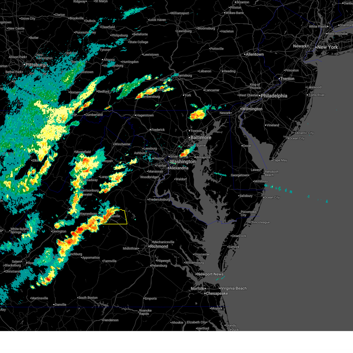
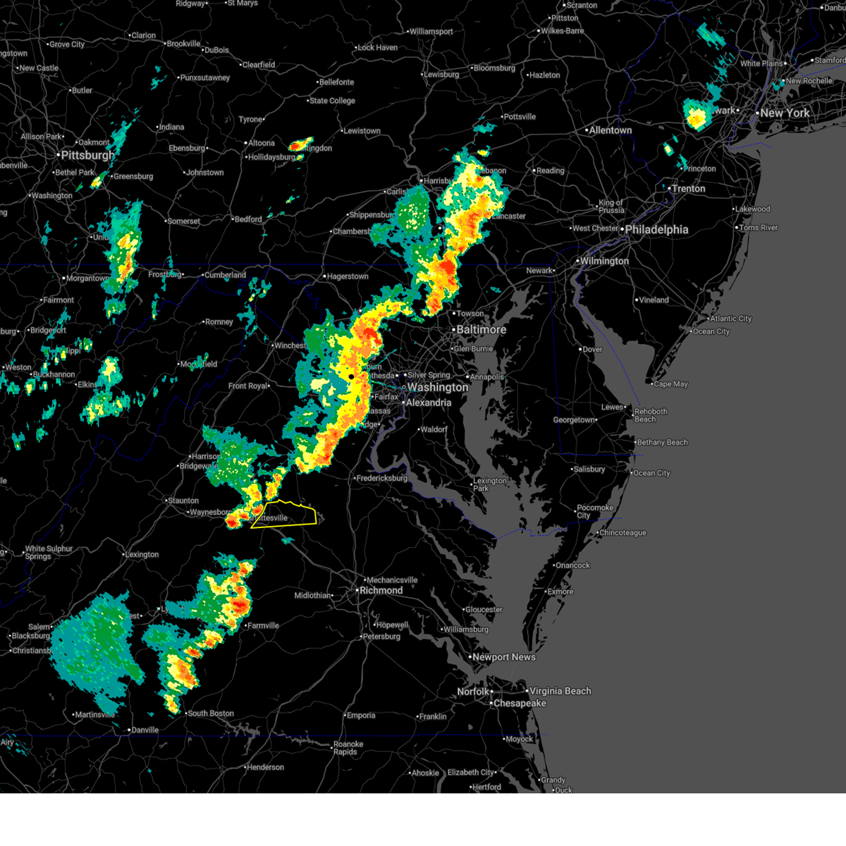
The Mineral, VA area has had 7 reports of on-the-ground hail by trained spotters, and has been under severe weather warnings 17 times during the past 12 months. Doppler radar has detected hail at or near Mineral, VA on 39 occasions.
| Name: | Mineral, VA |
| Where Located: | 37.3 miles NNW of Richmond, VA |
| Map: | Google Map for Mineral, VA |
| Population: | 467 |
| Housing Units: | 204 |
| More Info: | Search Google for Mineral, VA |
5
The Top Recent Hail Date for Mineral, VA is Monday, April 15, 2024 (1st out of 39)

Hail and Wind Damage Spotted near Mineral, VA
| Date / Time | Report Details |
|---|---|
| 7/9/2025 4:58 PM EDT |
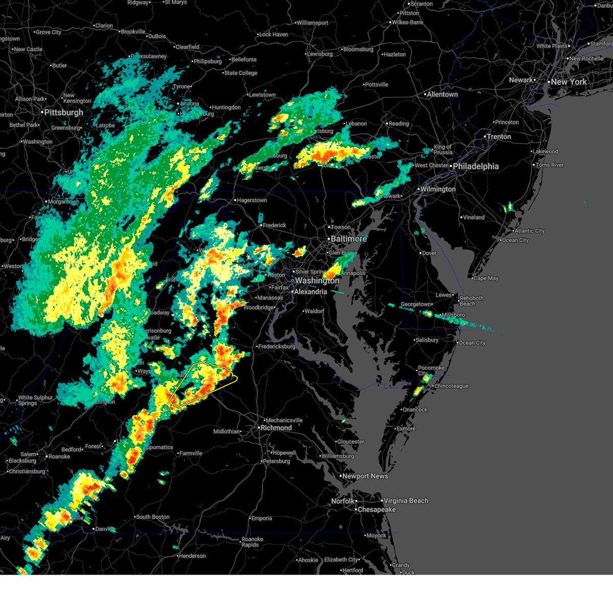 The storm which prompted the warning has weakened below severe limits, and no longer poses an immediate threat to life or property. therefore, the warning will be allowed to expire. however, gusty winds are still possible with this thunderstorm. a severe thunderstorm watch remains in effect until 1000 pm edt for central virginia. The storm which prompted the warning has weakened below severe limits, and no longer poses an immediate threat to life or property. therefore, the warning will be allowed to expire. however, gusty winds are still possible with this thunderstorm. a severe thunderstorm watch remains in effect until 1000 pm edt for central virginia.
|
| 7/9/2025 4:32 PM EDT |
 At 431 pm edt, a severe thunderstorm was located over louisa, moving east at 15 mph (radar indicated). Hazards include 60 mph wind gusts. Expect damage to trees and powerlines. this severe storm will be near, louisa around 435 pm edt. mineral around 440 pm edt. Other locations impacted by this severe thunderstorm include louisa airport, green springs, shores, central plains, cohasset, waldrop, tabscott, trevilians, hardware, and wares crossroads. At 431 pm edt, a severe thunderstorm was located over louisa, moving east at 15 mph (radar indicated). Hazards include 60 mph wind gusts. Expect damage to trees and powerlines. this severe storm will be near, louisa around 435 pm edt. mineral around 440 pm edt. Other locations impacted by this severe thunderstorm include louisa airport, green springs, shores, central plains, cohasset, waldrop, tabscott, trevilians, hardware, and wares crossroads.
|
| 7/9/2025 4:16 PM EDT |
 The severe thunderstorm which prompted the warning has expired. a severe thunderstorm watch remains in effect until 1000 pm edt for central virginia. remember, a new severe thunderstorm warning still remains in effect for northwestern louisa and northeastern fluvanna. The severe thunderstorm which prompted the warning has expired. a severe thunderstorm watch remains in effect until 1000 pm edt for central virginia. remember, a new severe thunderstorm warning still remains in effect for northwestern louisa and northeastern fluvanna.
|
| 7/9/2025 4:14 PM EDT |
 Svrakq the national weather service in wakefield has issued a * severe thunderstorm warning for, louisa county in central virginia, northwestern goochland county in central virginia, fluvanna county in central virginia, * until 500 pm edt. * at 413 pm edt, a severe thunderstorm was located over ferncliff, or near louisa, moving east at 15 mph (radar indicated). Hazards include 60 mph wind gusts. Expect damage to trees and powerlines. this severe thunderstorm will be near, louisa around 420 pm edt. mineral around 440 pm edt. Other locations impacted by this severe thunderstorm include louisa airport, green springs, shores, central plains, cohasset, waldrop, tabscott, trevilians, hardware, and wares crossroads. Svrakq the national weather service in wakefield has issued a * severe thunderstorm warning for, louisa county in central virginia, northwestern goochland county in central virginia, fluvanna county in central virginia, * until 500 pm edt. * at 413 pm edt, a severe thunderstorm was located over ferncliff, or near louisa, moving east at 15 mph (radar indicated). Hazards include 60 mph wind gusts. Expect damage to trees and powerlines. this severe thunderstorm will be near, louisa around 420 pm edt. mineral around 440 pm edt. Other locations impacted by this severe thunderstorm include louisa airport, green springs, shores, central plains, cohasset, waldrop, tabscott, trevilians, hardware, and wares crossroads.
|
| 7/9/2025 3:46 PM EDT |
 At 346 pm edt, a severe thunderstorm was located near troy, or 10 miles north of palmyra, moving east at 15 mph (radar indicated). Hazards include 60 mph wind gusts. Expect damage to trees and powerlines. this severe storm will be near, louisa around 410 pm edt. Other locations impacted by this severe thunderstorm include nahor, louisa airport, green springs, zion crossroads, union mills, wildwood, bybee, yanceyville, waldrop, and byrd mill. At 346 pm edt, a severe thunderstorm was located near troy, or 10 miles north of palmyra, moving east at 15 mph (radar indicated). Hazards include 60 mph wind gusts. Expect damage to trees and powerlines. this severe storm will be near, louisa around 410 pm edt. Other locations impacted by this severe thunderstorm include nahor, louisa airport, green springs, zion crossroads, union mills, wildwood, bybee, yanceyville, waldrop, and byrd mill.
|
| 7/9/2025 3:31 PM EDT |
 Svrakq the national weather service in wakefield has issued a * severe thunderstorm warning for, northwestern louisa county in central virginia, northeastern fluvanna county in central virginia, * until 415 pm edt. * at 331 pm edt, a severe thunderstorm was located near troy, or 8 miles north of palmyra, moving east at 15 mph (radar indicated). Hazards include 60 mph wind gusts. Expect damage to trees and powerlines. this severe thunderstorm will be near, troy around 335 pm edt. Other locations impacted by this severe thunderstorm include nahor, louisa airport, green springs, zion crossroads, union mills, wildwood, bybee, yanceyville, waldrop, and byrd mill. Svrakq the national weather service in wakefield has issued a * severe thunderstorm warning for, northwestern louisa county in central virginia, northeastern fluvanna county in central virginia, * until 415 pm edt. * at 331 pm edt, a severe thunderstorm was located near troy, or 8 miles north of palmyra, moving east at 15 mph (radar indicated). Hazards include 60 mph wind gusts. Expect damage to trees and powerlines. this severe thunderstorm will be near, troy around 335 pm edt. Other locations impacted by this severe thunderstorm include nahor, louisa airport, green springs, zion crossroads, union mills, wildwood, bybee, yanceyville, waldrop, and byrd mill.
|
| 7/8/2025 7:28 PM EDT |
 Svrakq the national weather service in wakefield has issued a * severe thunderstorm warning for, southeastern louisa county in central virginia, northeastern cumberland county in central virginia, goochland county in central virginia, northwestern hanover county in central virginia, northwestern powhatan county in central virginia, fluvanna county in central virginia, * until 815 pm edt. * at 728 pm edt, severe thunderstorms were located along a line extending from 6 miles east of ferncliff to near new canton, moving east at 25 mph (radar indicated). Hazards include 60 mph wind gusts. Expect damage to trees and powerlines. severe thunderstorms will be near, hadensville, columbia, duncan, fife, and lakeside village around 735 pm edt. cartersville around 740 pm edt. gum spring around 750 pm edt. bumpass around 755 pm edt. Other locations impacted by these severe thunderstorms include orchid, crozier, rock castle, louisa airport, maidens, vontay, three square, shores, irwin, and central plains. Svrakq the national weather service in wakefield has issued a * severe thunderstorm warning for, southeastern louisa county in central virginia, northeastern cumberland county in central virginia, goochland county in central virginia, northwestern hanover county in central virginia, northwestern powhatan county in central virginia, fluvanna county in central virginia, * until 815 pm edt. * at 728 pm edt, severe thunderstorms were located along a line extending from 6 miles east of ferncliff to near new canton, moving east at 25 mph (radar indicated). Hazards include 60 mph wind gusts. Expect damage to trees and powerlines. severe thunderstorms will be near, hadensville, columbia, duncan, fife, and lakeside village around 735 pm edt. cartersville around 740 pm edt. gum spring around 750 pm edt. bumpass around 755 pm edt. Other locations impacted by these severe thunderstorms include orchid, crozier, rock castle, louisa airport, maidens, vontay, three square, shores, irwin, and central plains.
|
| 7/1/2025 7:08 PM EDT | A tree knocked down a powerline on buckner r in louisa county VA, 6.9 miles NW of Mineral, VA |
| 6/19/2025 4:45 PM EDT | Tree down on cartersville rd in louisa county. time estimated from rada in louisa county VA, 10.7 miles N of Mineral, VA |
| 6/19/2025 4:33 PM EDT |
 At 433 pm edt, a severe thunderstorm was located near orange, moving northeast at 45 mph (radar indicated). Hazards include 60 mph wind gusts and quarter size hail. Minor damage to vehicles is possible. expect wind damage to trees and powerlines. Locations impacted include, louisa, mineral, louisa airport, green springs, trevilians, wares crossroads, and vawter corner. At 433 pm edt, a severe thunderstorm was located near orange, moving northeast at 45 mph (radar indicated). Hazards include 60 mph wind gusts and quarter size hail. Minor damage to vehicles is possible. expect wind damage to trees and powerlines. Locations impacted include, louisa, mineral, louisa airport, green springs, trevilians, wares crossroads, and vawter corner.
|
| 6/19/2025 4:24 PM EDT |
 At 424 pm edt, a severe thunderstorm was located near boswells tavern, or 9 miles south of orange, moving northeast at 45 mph (radar indicated). Hazards include 60 mph wind gusts and quarter size hail. Minor damage to vehicles is possible. expect wind damage to trees and powerlines. This severe thunderstorm will remain over mainly rural areas of northern louisa county, including the following locations, pendleton, louisa airport, waldrop, green springs, byrd mill, trevilians, wares crossroads, zion crossroads, vawter corner, and gordonsville. At 424 pm edt, a severe thunderstorm was located near boswells tavern, or 9 miles south of orange, moving northeast at 45 mph (radar indicated). Hazards include 60 mph wind gusts and quarter size hail. Minor damage to vehicles is possible. expect wind damage to trees and powerlines. This severe thunderstorm will remain over mainly rural areas of northern louisa county, including the following locations, pendleton, louisa airport, waldrop, green springs, byrd mill, trevilians, wares crossroads, zion crossroads, vawter corner, and gordonsville.
|
| 6/19/2025 4:24 PM EDT |
 the severe thunderstorm warning has been cancelled and is no longer in effect the severe thunderstorm warning has been cancelled and is no longer in effect
|
| 6/19/2025 4:05 PM EDT |
 Svrakq the national weather service in wakefield has issued a * severe thunderstorm warning for, northern louisa county in central virginia, north central fluvanna county in central virginia, * until 445 pm edt. * at 404 pm edt, a severe thunderstorm was located near charlottesville, moving northeast at 45 mph (radar indicated). Hazards include 60 mph wind gusts and quarter size hail. Minor damage to vehicles is possible. expect wind damage to trees and powerlines. this severe thunderstorm will be near, boswells tavern around 420 pm edt. Other locations impacted by this severe thunderstorm include pendleton, louisa airport, waldrop, green springs, byrd mill, trevilians, wares crossroads, zion crossroads, vawter corner, and gordonsville. Svrakq the national weather service in wakefield has issued a * severe thunderstorm warning for, northern louisa county in central virginia, north central fluvanna county in central virginia, * until 445 pm edt. * at 404 pm edt, a severe thunderstorm was located near charlottesville, moving northeast at 45 mph (radar indicated). Hazards include 60 mph wind gusts and quarter size hail. Minor damage to vehicles is possible. expect wind damage to trees and powerlines. this severe thunderstorm will be near, boswells tavern around 420 pm edt. Other locations impacted by this severe thunderstorm include pendleton, louisa airport, waldrop, green springs, byrd mill, trevilians, wares crossroads, zion crossroads, vawter corner, and gordonsville.
|
| 6/6/2025 4:27 PM EDT |
 Svrakq the national weather service in wakefield has issued a * severe thunderstorm warning for, eastern louisa county in central virginia, northwestern hanover county in central virginia, * until 515 pm edt. * at 427 pm edt, a severe thunderstorm was located over mineral, moving southeast at 20 mph (radar indicated). Hazards include 60 mph wind gusts and nickel size hail. Expect damage to trees and powerlines. This severe thunderstorm will remain over mainly rural areas of eastern louisa and northwestern hanover counties, including the following locations, orchid, pendleton, yanceyville, beaverdam, louisa airport, fredericks hall, coatesville, wares crossroads, locust creek, and mabelton. Svrakq the national weather service in wakefield has issued a * severe thunderstorm warning for, eastern louisa county in central virginia, northwestern hanover county in central virginia, * until 515 pm edt. * at 427 pm edt, a severe thunderstorm was located over mineral, moving southeast at 20 mph (radar indicated). Hazards include 60 mph wind gusts and nickel size hail. Expect damage to trees and powerlines. This severe thunderstorm will remain over mainly rural areas of eastern louisa and northwestern hanover counties, including the following locations, orchid, pendleton, yanceyville, beaverdam, louisa airport, fredericks hall, coatesville, wares crossroads, locust creek, and mabelton.
|
| 6/6/2025 4:16 PM EDT |
 At 416 pm edt, a severe thunderstorm was located near mineral, moving southeast at 20 mph (radar indicated). Hazards include 60 mph wind gusts and nickel size hail. Expect damage to trees and powerlines. this severe storm will be near, mineral around 420 pm edt. Other locations impacted by this severe thunderstorm include pendleton, yanceyville, louisa airport, fredericks hall, wares crossroads, vawter corner, and cuckoo. At 416 pm edt, a severe thunderstorm was located near mineral, moving southeast at 20 mph (radar indicated). Hazards include 60 mph wind gusts and nickel size hail. Expect damage to trees and powerlines. this severe storm will be near, mineral around 420 pm edt. Other locations impacted by this severe thunderstorm include pendleton, yanceyville, louisa airport, fredericks hall, wares crossroads, vawter corner, and cuckoo.
|
| 6/6/2025 3:40 PM EDT | Svrakq the national weather service in wakefield has issued a * severe thunderstorm warning for, northeastern louisa county in central virginia, * until 430 pm edt. * at 340 pm edt, a severe thunderstorm was located 7 miles southeast of orange, moving southeast at 20 mph (radar indicated). Hazards include 70 mph wind gusts and quarter size hail. Minor damage to vehicles is possible. expect considerable tree damage. wind damage is also likely to mobile homes, roofs, and outbuildings. this severe thunderstorm will be near, mineral around 405 pm edt. Other locations impacted by this severe thunderstorm include pendleton, yanceyville, louisa airport, fredericks hall, green springs, byrd mill, trevilians, wares crossroads, vawter corner, and cuckoo. |
| 7/17/2024 5:29 PM EDT |
 The storm which prompted the warning has weakened below severe limits, and no longer poses an immediate threat to life or property. therefore, the warning will be allowed to expire. a severe thunderstorm watch remains in effect until 1000 pm edt for central virginia. The storm which prompted the warning has weakened below severe limits, and no longer poses an immediate threat to life or property. therefore, the warning will be allowed to expire. a severe thunderstorm watch remains in effect until 1000 pm edt for central virginia.
|
| 7/17/2024 5:13 PM EDT |
 At 513 pm edt, a severe thunderstorm was located over louisa, moving east at 35 mph (radar indicated). Hazards include 60 mph wind gusts. Expect damage to trees and powerlines. Locations impacted include, louisa, mineral, palmyra, lake monticello, ferncliff, bumpass, boswells tavern, kents store, troy, gordonsville, louisa airport, green springs, waldrop, tabscott, trevilians, wares crossroads, cunningham, nahor, pendleton, and zion crossroads. At 513 pm edt, a severe thunderstorm was located over louisa, moving east at 35 mph (radar indicated). Hazards include 60 mph wind gusts. Expect damage to trees and powerlines. Locations impacted include, louisa, mineral, palmyra, lake monticello, ferncliff, bumpass, boswells tavern, kents store, troy, gordonsville, louisa airport, green springs, waldrop, tabscott, trevilians, wares crossroads, cunningham, nahor, pendleton, and zion crossroads.
|
| 7/17/2024 4:38 PM EDT |
 Svrakq the national weather service in wakefield has issued a * severe thunderstorm warning for, louisa county in central virginia, northwestern goochland county in central virginia, northern fluvanna county in central virginia, * until 530 pm edt. * at 437 pm edt, a severe thunderstorm was located near charlottesville, moving east at 45 mph (radar indicated). Hazards include 60 mph wind gusts. expect damage to trees and powerlines Svrakq the national weather service in wakefield has issued a * severe thunderstorm warning for, louisa county in central virginia, northwestern goochland county in central virginia, northern fluvanna county in central virginia, * until 530 pm edt. * at 437 pm edt, a severe thunderstorm was located near charlottesville, moving east at 45 mph (radar indicated). Hazards include 60 mph wind gusts. expect damage to trees and powerlines
|
| 6/26/2024 4:00 PM EDT | Numerous trees downed along sunset loop and adjacent roads on the western side of lake anna... along the spotsylvania/louisa county lin in spotsylvania county VA, 7.5 miles SSW of Mineral, VA |
| 6/26/2024 3:56 PM EDT | A former nws employee reported multiple trees down as well as damage to some homes at lake anna. time estimated from rada in louisa county VA, 6.8 miles SSW of Mineral, VA |
| 6/26/2024 3:50 PM EDT | Tree down in the 15000 block of orange springs road in spotsylvania county VA, 11.4 miles S of Mineral, VA |
| 5/26/2024 9:10 PM EDT |
 the severe thunderstorm warning has been cancelled and is no longer in effect the severe thunderstorm warning has been cancelled and is no longer in effect
|
| 5/26/2024 9:10 PM EDT |
 At 909 pm edt, severe thunderstorms were located along a line extending from near madison to 7 miles northwest of louisa to near goochland, moving northeast at 35 mph (radar indicated). Hazards include 60 mph wind gusts. Expect damage to trees and powerlines. these severe storms will be near, louisa and mineral around 915 pm edt. Other locations impacted by these severe thunderstorms include pendleton, louisa airport, rock castle, green springs, three square, cuckoo, caledonia, elk hill, yanceyville, and west view. At 909 pm edt, severe thunderstorms were located along a line extending from near madison to 7 miles northwest of louisa to near goochland, moving northeast at 35 mph (radar indicated). Hazards include 60 mph wind gusts. Expect damage to trees and powerlines. these severe storms will be near, louisa and mineral around 915 pm edt. Other locations impacted by these severe thunderstorms include pendleton, louisa airport, rock castle, green springs, three square, cuckoo, caledonia, elk hill, yanceyville, and west view.
|
| 5/26/2024 9:07 PM EDT |
 Svrakq the national weather service in wakefield has issued a * severe thunderstorm warning for, eastern louisa county in central virginia, central goochland county in central virginia, western caroline county in north central virginia, northwestern hanover county in central virginia, * until 1015 pm edt. * at 906 pm edt, severe thunderstorms were located along a line extending from near madison to near hadensville to near cartersville, moving northeast at 35 mph (radar indicated). Hazards include 60 mph wind gusts. Expect damage to trees and powerlines. severe thunderstorms will be near, goochland, mineral, and gum spring around 915 pm edt. oilville around 925 pm edt. bumpass around 930 pm edt. montpelier around 935 pm edt. ladysmith around 950 pm edt. ashland around 955 pm edt. kings dominion around 1000 pm edt. Other locations impacted by these severe thunderstorms include chilesburg, orchid, golansville, guinea, vontay, maidens, gum tree, irwin, johnsons springs, and gilman. Svrakq the national weather service in wakefield has issued a * severe thunderstorm warning for, eastern louisa county in central virginia, central goochland county in central virginia, western caroline county in north central virginia, northwestern hanover county in central virginia, * until 1015 pm edt. * at 906 pm edt, severe thunderstorms were located along a line extending from near madison to near hadensville to near cartersville, moving northeast at 35 mph (radar indicated). Hazards include 60 mph wind gusts. Expect damage to trees and powerlines. severe thunderstorms will be near, goochland, mineral, and gum spring around 915 pm edt. oilville around 925 pm edt. bumpass around 930 pm edt. montpelier around 935 pm edt. ladysmith around 950 pm edt. ashland around 955 pm edt. kings dominion around 1000 pm edt. Other locations impacted by these severe thunderstorms include chilesburg, orchid, golansville, guinea, vontay, maidens, gum tree, irwin, johnsons springs, and gilman.
|
| 5/26/2024 8:19 PM EDT |
 Svrakq the national weather service in wakefield has issued a * severe thunderstorm warning for, louisa county in central virginia, western goochland county in central virginia, fluvanna county in central virginia, * until 930 pm edt. * at 818 pm edt, severe thunderstorms were located along a line extending from near bridgewater to near crozet to near toga, moving northeast at 45 mph (radar indicated). Hazards include 60 mph wind gusts. Expect damage to trees and powerlines. severe thunderstorms will be near, lake monticello around 855 pm edt. palmyra and troy around 905 pm edt. boswells tavern around 915 pm edt. Other locations impacted by these severe thunderstorms include louisa airport, rock castle, green springs, three square, shores, central plains, bremo bluff, cohasset, west view, and waldrop. Svrakq the national weather service in wakefield has issued a * severe thunderstorm warning for, louisa county in central virginia, western goochland county in central virginia, fluvanna county in central virginia, * until 930 pm edt. * at 818 pm edt, severe thunderstorms were located along a line extending from near bridgewater to near crozet to near toga, moving northeast at 45 mph (radar indicated). Hazards include 60 mph wind gusts. Expect damage to trees and powerlines. severe thunderstorms will be near, lake monticello around 855 pm edt. palmyra and troy around 905 pm edt. boswells tavern around 915 pm edt. Other locations impacted by these severe thunderstorms include louisa airport, rock castle, green springs, three square, shores, central plains, bremo bluff, cohasset, west view, and waldrop.
|
| 4/15/2024 5:44 PM EDT | Quarter sized hail reported 1.1 miles NNW of Mineral, VA |
| 4/15/2024 5:39 PM EDT |
 At 537 pm edt, a severe thunderstorm was located over mineral, moving southeast at 35 mph. a second severe thunderstorm was located just to the west of gordonsville and is also moving southeast at 35 mph (radar indicated). Hazards include 60 mph wind gusts and quarter size hail. Minor damage to vehicles is possible. expect wind damage to trees and powerlines. this severe storm will be near, bumpass around 545 pm edt. Other locations impacted by this severe thunderstorm include pendleton, louisa airport, green springs, mabelton, cuckoo, beaverdam, fredericks hall, waldrop, trevilians, and wares crossroads. At 537 pm edt, a severe thunderstorm was located over mineral, moving southeast at 35 mph. a second severe thunderstorm was located just to the west of gordonsville and is also moving southeast at 35 mph (radar indicated). Hazards include 60 mph wind gusts and quarter size hail. Minor damage to vehicles is possible. expect wind damage to trees and powerlines. this severe storm will be near, bumpass around 545 pm edt. Other locations impacted by this severe thunderstorm include pendleton, louisa airport, green springs, mabelton, cuckoo, beaverdam, fredericks hall, waldrop, trevilians, and wares crossroads.
|
| 4/15/2024 5:09 PM EDT |
 Svrakq the national weather service in wakefield has issued a * severe thunderstorm warning for, louisa county in central virginia, northwestern hanover county in central virginia, * until 600 pm edt. * at 509 pm edt, a severe thunderstorm was located near boswells tavern, or 8 miles south of orange, moving southeast at 35 mph (radar indicated). Hazards include 60 mph wind gusts and quarter size hail. Minor damage to vehicles is possible. expect wind damage to trees and powerlines. this severe thunderstorm will be near, louisa around 520 pm edt. mineral around 530 pm edt. bumpass around 545 pm edt. Other locations impacted by this severe thunderstorm include pendleton, louisa airport, green springs, mabelton, cuckoo, beaverdam, fredericks hall, waldrop, trevilians, and wares crossroads. Svrakq the national weather service in wakefield has issued a * severe thunderstorm warning for, louisa county in central virginia, northwestern hanover county in central virginia, * until 600 pm edt. * at 509 pm edt, a severe thunderstorm was located near boswells tavern, or 8 miles south of orange, moving southeast at 35 mph (radar indicated). Hazards include 60 mph wind gusts and quarter size hail. Minor damage to vehicles is possible. expect wind damage to trees and powerlines. this severe thunderstorm will be near, louisa around 520 pm edt. mineral around 530 pm edt. bumpass around 545 pm edt. Other locations impacted by this severe thunderstorm include pendleton, louisa airport, green springs, mabelton, cuckoo, beaverdam, fredericks hall, waldrop, trevilians, and wares crossroads.
|
| 4/15/2024 4:46 PM EDT |
 At 445 pm edt, a severe thunderstorm was located near boswells tavern, or 9 miles south of orange, moving southeast at 30 mph (radar indicated). Hazards include 60 mph wind gusts and quarter size hail. Minor damage to vehicles is possible. expect wind damage to trees and powerlines. this severe storm will be near, louisa around 455 pm edt. mineral around 510 pm edt. Other locations impacted by this severe thunderstorm include pendleton, louisa airport, waldrop, green springs, byrd mill, trevilians, wares crossroads, vawter corner, cuckoo, and yanceyville. At 445 pm edt, a severe thunderstorm was located near boswells tavern, or 9 miles south of orange, moving southeast at 30 mph (radar indicated). Hazards include 60 mph wind gusts and quarter size hail. Minor damage to vehicles is possible. expect wind damage to trees and powerlines. this severe storm will be near, louisa around 455 pm edt. mineral around 510 pm edt. Other locations impacted by this severe thunderstorm include pendleton, louisa airport, waldrop, green springs, byrd mill, trevilians, wares crossroads, vawter corner, cuckoo, and yanceyville.
|
| 4/15/2024 4:25 PM EDT |
 Svrakq the national weather service in wakefield has issued a * severe thunderstorm warning for, northern louisa county in central virginia, * until 515 pm edt. * at 425 pm edt, a severe thunderstorm was located 10 miles northwest of boswells tavern, or 12 miles northeast of charlottesville, moving southeast at 35 mph (radar indicated). Hazards include 60 mph wind gusts and quarter size hail. Minor damage to vehicles is possible. expect wind damage to trees and powerlines. this severe thunderstorm will be near, boswells tavern around 435 pm edt. louisa around 450 pm edt. mineral around 500 pm edt. Other locations impacted by this severe thunderstorm include pendleton, yanceyville, louisa airport, waldrop, green springs, byrd mill, trevilians, wares crossroads, vawter corner, and cuckoo. Svrakq the national weather service in wakefield has issued a * severe thunderstorm warning for, northern louisa county in central virginia, * until 515 pm edt. * at 425 pm edt, a severe thunderstorm was located 10 miles northwest of boswells tavern, or 12 miles northeast of charlottesville, moving southeast at 35 mph (radar indicated). Hazards include 60 mph wind gusts and quarter size hail. Minor damage to vehicles is possible. expect wind damage to trees and powerlines. this severe thunderstorm will be near, boswells tavern around 435 pm edt. louisa around 450 pm edt. mineral around 500 pm edt. Other locations impacted by this severe thunderstorm include pendleton, yanceyville, louisa airport, waldrop, green springs, byrd mill, trevilians, wares crossroads, vawter corner, and cuckoo.
|
| 4/12/2024 12:01 AM EDT | Svrakq the national weather service in wakefield has issued a * severe thunderstorm warning for, louisa county in central virginia, the city of richmond in central virginia, chesterfield county in central virginia, southeastern goochland county in central virginia, southwestern caroline county in north central virginia, henrico county in central virginia, hanover county in central virginia, eastern amelia county in central virginia, eastern powhatan county in central virginia, * until 1245 am edt. * at 1201 am edt, severe thunderstorms were located along a line extending from near louisa to near oilville to 6 miles northeast of mannboro, moving east at 45 mph (radar indicated). Hazards include 60 mph wind gusts. expect damage to roofs, siding, and trees |
| 4/11/2024 11:20 PM EDT |
 Svrakq the national weather service in wakefield has issued a * severe thunderstorm warning for, louisa county in central virginia, northeastern cumberland county in central virginia, goochland county in central virginia, northwestern henrico county in central virginia, northwestern hanover county in central virginia, central powhatan county in central virginia, fluvanna county in central virginia, * until midnight edt. * at 1119 pm edt, severe thunderstorms were located along a line extending from near fork union to near gold hill to 6 miles southeast of guinea mills, moving east at 40 mph (radar indicated). Hazards include 60 mph wind gusts. expect damage to roofs, siding, and trees Svrakq the national weather service in wakefield has issued a * severe thunderstorm warning for, louisa county in central virginia, northeastern cumberland county in central virginia, goochland county in central virginia, northwestern henrico county in central virginia, northwestern hanover county in central virginia, central powhatan county in central virginia, fluvanna county in central virginia, * until midnight edt. * at 1119 pm edt, severe thunderstorms were located along a line extending from near fork union to near gold hill to 6 miles southeast of guinea mills, moving east at 40 mph (radar indicated). Hazards include 60 mph wind gusts. expect damage to roofs, siding, and trees
|
| 1/9/2024 4:16 PM EST |
 At 416 pm est, severe thunderstorms were located along a line extending from near lake monticello to near cumberland, moving northeast at 65 mph (radar indicated). Hazards include 60 mph wind gusts. Expect damage to trees and powerlines. severe thunderstorms will be near, palmyra, fork union, lake monticello, columbia, duncan, troy, and lakeside village around 420 pm est. cartersville, boswells tavern, kents store, and trenholm around 425 pm est. hadensville, ferncliff, and fife around 430 pm est. goochland, louisa, and gum spring around 435 pm est. mineral around 440 pm est. bumpass around 450 pm est. other locations impacted by these severe thunderstorms include orchid, maidens, three square, central plains, bremo bluff, whiteville, michaux, west view, grays siding, and wares crossroads. hail threat, radar indicated max hail size, <. 75 in wind threat, radar indicated max wind gust, 60 mph. At 416 pm est, severe thunderstorms were located along a line extending from near lake monticello to near cumberland, moving northeast at 65 mph (radar indicated). Hazards include 60 mph wind gusts. Expect damage to trees and powerlines. severe thunderstorms will be near, palmyra, fork union, lake monticello, columbia, duncan, troy, and lakeside village around 420 pm est. cartersville, boswells tavern, kents store, and trenholm around 425 pm est. hadensville, ferncliff, and fife around 430 pm est. goochland, louisa, and gum spring around 435 pm est. mineral around 440 pm est. bumpass around 450 pm est. other locations impacted by these severe thunderstorms include orchid, maidens, three square, central plains, bremo bluff, whiteville, michaux, west view, grays siding, and wares crossroads. hail threat, radar indicated max hail size, <. 75 in wind threat, radar indicated max wind gust, 60 mph.
|
| 8/7/2023 6:07 PM EDT | Golf Ball sized hail reported 10.1 miles SSW of Mineral, VA, trained spotter reports golf ball sized hail near lake anna state park. time estimated from radar. |
| 8/7/2023 5:22 PM EDT |
 At 521 pm edt, a severe thunderstorm was located near boswells tavern, or 10 miles east of charlottesville, moving northeast at 40 mph (radar indicated). Hazards include 60 mph wind gusts. Expect damage to trees and powerlines. this severe storm will be near, boswells tavern around 525 pm edt. other locations impacted by this severe thunderstorm include louisa airport, waldrop, green springs, trevilians, wares crossroads, vawter corner, and gordonsville. hail threat, radar indicated max hail size, <. 75 in wind threat, radar indicated max wind gust, 60 mph. At 521 pm edt, a severe thunderstorm was located near boswells tavern, or 10 miles east of charlottesville, moving northeast at 40 mph (radar indicated). Hazards include 60 mph wind gusts. Expect damage to trees and powerlines. this severe storm will be near, boswells tavern around 525 pm edt. other locations impacted by this severe thunderstorm include louisa airport, waldrop, green springs, trevilians, wares crossroads, vawter corner, and gordonsville. hail threat, radar indicated max hail size, <. 75 in wind threat, radar indicated max wind gust, 60 mph.
|
| 8/7/2023 4:58 PM EDT |
 At 457 pm edt, a severe thunderstorm was located near charlottesville, moving east at 40 mph (radar indicated). Hazards include 60 mph wind gusts and quarter size hail. Minor damage to vehicles is possible. expect wind damage to trees and powerlines. this severe thunderstorm will be near, boswells tavern around 520 pm edt. other locations impacted by this severe thunderstorm include pendleton, louisa airport, waldrop, green springs, byrd mill, trevilians, wares crossroads, zion crossroads, vawter corner, and union mills. hail threat, radar indicated max hail size, 1. 00 in wind threat, radar indicated max wind gust, 60 mph. At 457 pm edt, a severe thunderstorm was located near charlottesville, moving east at 40 mph (radar indicated). Hazards include 60 mph wind gusts and quarter size hail. Minor damage to vehicles is possible. expect wind damage to trees and powerlines. this severe thunderstorm will be near, boswells tavern around 520 pm edt. other locations impacted by this severe thunderstorm include pendleton, louisa airport, waldrop, green springs, byrd mill, trevilians, wares crossroads, zion crossroads, vawter corner, and union mills. hail threat, radar indicated max hail size, 1. 00 in wind threat, radar indicated max wind gust, 60 mph.
|
| 7/3/2023 4:35 PM EDT |
 At 434 pm edt, severe thunderstorms were located along a line extending from 8 miles northeast of louisa to mineral to near hadensville, moving east to northeast at 35 mph (radar indicated). Hazards include 60 mph wind gusts and quarter size hail. Minor damage to vehicles is possible. expect wind damage to trees and powerlines. severe thunderstorms will be near, bumpass around 500 pm edt. ladysmith around 515 pm edt. other locations impacted by these severe thunderstorms include chilesburg, rappahannock academy, golansville, pendleton, villboro, louisa airport, guinea, corbin, hewlett and cuckoo. hail threat, radar indicated max hail size, 1. 00 in wind threat, radar indicated max wind gust, 60 mph. At 434 pm edt, severe thunderstorms were located along a line extending from 8 miles northeast of louisa to mineral to near hadensville, moving east to northeast at 35 mph (radar indicated). Hazards include 60 mph wind gusts and quarter size hail. Minor damage to vehicles is possible. expect wind damage to trees and powerlines. severe thunderstorms will be near, bumpass around 500 pm edt. ladysmith around 515 pm edt. other locations impacted by these severe thunderstorms include chilesburg, rappahannock academy, golansville, pendleton, villboro, louisa airport, guinea, corbin, hewlett and cuckoo. hail threat, radar indicated max hail size, 1. 00 in wind threat, radar indicated max wind gust, 60 mph.
|
| 6/26/2023 6:40 PM EDT | Trees down across much of louisa county. numerous roads blocke in louisa county VA, 10.5 miles NNW of Mineral, VA |
| 6/26/2023 6:35 PM EDT |
 At 634 pm edt, severe thunderstorms were located along a line extending from near mineral to near hadensville to near lakeside village, moving east at 20 mph (radar indicated). Hazards include 70 mph wind gusts and quarter size hail. Minor damage to vehicles is possible. expect considerable tree damage. wind damage is also likely to mobile homes, roofs, and outbuildings. these severe storms will be near, mineral and hadensville around 640 pm edt. fife around 700 pm edt. other locations impacted by these severe thunderstorms include elk hill, pendleton, yanceyville, tabscott, apple grove, trenton mills, cuckoo and caledonia. thunderstorm damage threat, considerable hail threat, radar indicated max hail size, 1. 00 in wind threat, radar indicated max wind gust, 70 mph. At 634 pm edt, severe thunderstorms were located along a line extending from near mineral to near hadensville to near lakeside village, moving east at 20 mph (radar indicated). Hazards include 70 mph wind gusts and quarter size hail. Minor damage to vehicles is possible. expect considerable tree damage. wind damage is also likely to mobile homes, roofs, and outbuildings. these severe storms will be near, mineral and hadensville around 640 pm edt. fife around 700 pm edt. other locations impacted by these severe thunderstorms include elk hill, pendleton, yanceyville, tabscott, apple grove, trenton mills, cuckoo and caledonia. thunderstorm damage threat, considerable hail threat, radar indicated max hail size, 1. 00 in wind threat, radar indicated max wind gust, 70 mph.
|
| 6/26/2023 6:15 PM EDT |
 At 615 pm edt, severe thunderstorms were located along a line extending from near louisa to near kents store to new canton, moving east at 20 mph (radar indicated). Hazards include 70 mph wind gusts and half dollar size hail. Minor damage to vehicles is possible. expect considerable tree damage. wind damage is also likely to mobile homes, roofs, and outbuildings. these severe storms will be near, louisa and ferncliff around 620 pm edt. hadensville around 625 pm edt. mineral around 635 pm edt. columbia around 640 pm edt. fife around 655 pm edt. other locations impacted by these severe thunderstorms include dixie, pendleton, louisa airport, stage junction, shores, central plains, bremo bluff, cuckoo, caledonia and elk hill. thunderstorm damage threat, considerable hail threat, radar indicated max hail size, 1. 25 in wind threat, radar indicated max wind gust, 70 mph. At 615 pm edt, severe thunderstorms were located along a line extending from near louisa to near kents store to new canton, moving east at 20 mph (radar indicated). Hazards include 70 mph wind gusts and half dollar size hail. Minor damage to vehicles is possible. expect considerable tree damage. wind damage is also likely to mobile homes, roofs, and outbuildings. these severe storms will be near, louisa and ferncliff around 620 pm edt. hadensville around 625 pm edt. mineral around 635 pm edt. columbia around 640 pm edt. fife around 655 pm edt. other locations impacted by these severe thunderstorms include dixie, pendleton, louisa airport, stage junction, shores, central plains, bremo bluff, cuckoo, caledonia and elk hill. thunderstorm damage threat, considerable hail threat, radar indicated max hail size, 1. 25 in wind threat, radar indicated max wind gust, 70 mph.
|
| 6/26/2023 5:57 PM EDT |
 At 556 pm edt, severe thunderstorms were located along a line extending from near ferncliff to near kents store to near centenary, moving east at 20 mph (radar indicated). Hazards include 60 mph wind gusts and quarter size hail. Minor damage to vehicles is possible. expect wind damage to trees and powerlines. severe thunderstorms will be near, ferncliff around 600 pm edt. kents store around 605 pm edt. louisa around 620 pm edt. fork union around 625 pm edt. hadensville around 630 pm edt. mineral around 635 pm edt. columbia, lakeside village, duncan and fife around 645 pm edt. other locations impacted by these severe thunderstorms include dixie, pendleton, louisa airport, stage junction, shores, central plains, bremo bluff, cuckoo, caledonia and elk hill. hail threat, radar indicated max hail size, 1. 00 in wind threat, radar indicated max wind gust, 60 mph. At 556 pm edt, severe thunderstorms were located along a line extending from near ferncliff to near kents store to near centenary, moving east at 20 mph (radar indicated). Hazards include 60 mph wind gusts and quarter size hail. Minor damage to vehicles is possible. expect wind damage to trees and powerlines. severe thunderstorms will be near, ferncliff around 600 pm edt. kents store around 605 pm edt. louisa around 620 pm edt. fork union around 625 pm edt. hadensville around 630 pm edt. mineral around 635 pm edt. columbia, lakeside village, duncan and fife around 645 pm edt. other locations impacted by these severe thunderstorms include dixie, pendleton, louisa airport, stage junction, shores, central plains, bremo bluff, cuckoo, caledonia and elk hill. hail threat, radar indicated max hail size, 1. 00 in wind threat, radar indicated max wind gust, 60 mph.
|
| 6/16/2023 7:32 PM EDT |
 At 732 pm edt, a severe thunderstorm was located near mineral, moving southeast at 25 mph (radar indicated). Hazards include 60 mph wind gusts and quarter size hail. Minor damage to vehicles is possible. expect wind damage to trees and powerlines. this severe thunderstorm will remain over mainly rural areas of northeastern louisa county, including the following locations, pendleton, yanceyville, fredericks hall, apple grove and cuckoo. hail threat, radar indicated max hail size, 1. 00 in wind threat, radar indicated max wind gust, 60 mph. At 732 pm edt, a severe thunderstorm was located near mineral, moving southeast at 25 mph (radar indicated). Hazards include 60 mph wind gusts and quarter size hail. Minor damage to vehicles is possible. expect wind damage to trees and powerlines. this severe thunderstorm will remain over mainly rural areas of northeastern louisa county, including the following locations, pendleton, yanceyville, fredericks hall, apple grove and cuckoo. hail threat, radar indicated max hail size, 1. 00 in wind threat, radar indicated max wind gust, 60 mph.
|
| 6/16/2023 7:25 PM EDT | Quarter sized hail reported 0.4 miles SSE of Mineral, VA |
| 6/16/2023 7:12 PM EDT |
 At 712 pm edt, a severe thunderstorm was located near louisa, moving southeast at 15 mph (radar indicated). Hazards include 60 mph wind gusts and quarter size hail. Minor damage to vehicles is possible. expect wind damage to trees and powerlines. this severe thunderstorm will be near, louisa around 720 pm edt. mineral around 730 pm edt. other locations impacted by this severe thunderstorm include pendleton, yanceyville, louisa airport, fredericks hall, wares crossroads, apple grove and cuckoo. hail threat, radar indicated max hail size, 1. 00 in wind threat, radar indicated max wind gust, 60 mph. At 712 pm edt, a severe thunderstorm was located near louisa, moving southeast at 15 mph (radar indicated). Hazards include 60 mph wind gusts and quarter size hail. Minor damage to vehicles is possible. expect wind damage to trees and powerlines. this severe thunderstorm will be near, louisa around 720 pm edt. mineral around 730 pm edt. other locations impacted by this severe thunderstorm include pendleton, yanceyville, louisa airport, fredericks hall, wares crossroads, apple grove and cuckoo. hail threat, radar indicated max hail size, 1. 00 in wind threat, radar indicated max wind gust, 60 mph.
|
| 4/6/2023 5:06 PM EDT |
 At 506 pm edt, a severe thunderstorm was located near mineral, moving northeast at 35 mph (radar indicated). Hazards include 60 mph wind gusts and quarter size hail. Minor damage to vehicles is possible. expect wind damage to trees and powerlines. this severe thunderstorm will remain over mainly rural areas of northeastern louisa county, including the following locations, louisa airport, wares crossroads and pendleton. hail threat, radar indicated max hail size, 1. 00 in wind threat, radar indicated max wind gust, 60 mph. At 506 pm edt, a severe thunderstorm was located near mineral, moving northeast at 35 mph (radar indicated). Hazards include 60 mph wind gusts and quarter size hail. Minor damage to vehicles is possible. expect wind damage to trees and powerlines. this severe thunderstorm will remain over mainly rural areas of northeastern louisa county, including the following locations, louisa airport, wares crossroads and pendleton. hail threat, radar indicated max hail size, 1. 00 in wind threat, radar indicated max wind gust, 60 mph.
|
| 4/6/2023 4:59 PM EDT | Personal weather station kvaspots70 in spotsylvania county VA, 8.9 miles SW of Mineral, VA |
| 9/13/2022 1:06 AM EDT |
 The severe thunderstorm warning for louisa, northwestern goochland, northwestern hanover and eastern fluvanna counties will expire at 115 am edt, the severe thunderstorm which prompted the warning has weakened. therefore, the warning will be allowed to expire. The severe thunderstorm warning for louisa, northwestern goochland, northwestern hanover and eastern fluvanna counties will expire at 115 am edt, the severe thunderstorm which prompted the warning has weakened. therefore, the warning will be allowed to expire.
|
| 9/13/2022 12:45 AM EDT |
 At 1245 am edt, a severe thunderstorm was located over kents store, or near hadensville, moving northeast at 35 mph (radar indicated). Hazards include 60 mph wind gusts and penny size hail. Expect damage to trees and powerlines. this severe storm will be near, louisa around 105 am edt. mineral around 110 am edt. bumpass around 120 am edt. other locations impacted by this severe thunderstorm include orchid, nahor, pendleton, louisa airport, green springs, stage junction, zion crossroads, union mills, cuckoo and caledonia. hail threat, radar indicated max hail size, 0. 75 in wind threat, radar indicated max wind gust, 60 mph. At 1245 am edt, a severe thunderstorm was located over kents store, or near hadensville, moving northeast at 35 mph (radar indicated). Hazards include 60 mph wind gusts and penny size hail. Expect damage to trees and powerlines. this severe storm will be near, louisa around 105 am edt. mineral around 110 am edt. bumpass around 120 am edt. other locations impacted by this severe thunderstorm include orchid, nahor, pendleton, louisa airport, green springs, stage junction, zion crossroads, union mills, cuckoo and caledonia. hail threat, radar indicated max hail size, 0. 75 in wind threat, radar indicated max wind gust, 60 mph.
|
| 9/13/2022 12:21 AM EDT |
 At 1221 am edt, a severe thunderstorm was located over fork union, moving northeast at 35 mph (radar indicated). Hazards include 60 mph wind gusts and quarter size hail. Minor damage to vehicles is possible. expect wind damage to trees and powerlines. this severe thunderstorm will be near, fork union around 1225 am edt. palmyra and columbia around 1230 am edt. kents store around 1245 am edt. hadensville and ferncliff around 1250 am edt. louisa around 105 am edt. mineral around 110 am edt. bumpass around 115 am edt. other locations impacted by this severe thunderstorm include orchid, louisa airport, green springs, shores, central plains, bremo bluff, cohasset, tabscott, trevilians and wilmington. hail threat, radar indicated max hail size, 1. 00 in wind threat, radar indicated max wind gust, 60 mph. At 1221 am edt, a severe thunderstorm was located over fork union, moving northeast at 35 mph (radar indicated). Hazards include 60 mph wind gusts and quarter size hail. Minor damage to vehicles is possible. expect wind damage to trees and powerlines. this severe thunderstorm will be near, fork union around 1225 am edt. palmyra and columbia around 1230 am edt. kents store around 1245 am edt. hadensville and ferncliff around 1250 am edt. louisa around 105 am edt. mineral around 110 am edt. bumpass around 115 am edt. other locations impacted by this severe thunderstorm include orchid, louisa airport, green springs, shores, central plains, bremo bluff, cohasset, tabscott, trevilians and wilmington. hail threat, radar indicated max hail size, 1. 00 in wind threat, radar indicated max wind gust, 60 mph.
|
| 8/22/2022 7:22 PM EDT | At 722 pm edt, severe thunderstorms were located along a line extending from near mineral to near ferncliff to near palmyra, moving east at 20 mph (radar indicated). Hazards include 60 mph wind gusts. Expect damage to trees and powerlines. these severe storms will be near, mineral around 730 pm edt. fife around 805 pm edt. hadensville around 810 pm edt. goochland and gum spring around 815 pm edt. other locations impacted by these severe thunderstorms include orchid, dixie, pendleton, sandy hook, rock castle, stage junction, three square, irwin, cuckoo and caledonia. hail threat, radar indicated max hail size, <. 75 in wind threat, radar indicated max wind gust, 60 mph. |
| 8/22/2022 7:11 PM EDT | At 710 pm edt, severe thunderstorms were located along a line extending from louisa to near ferncliff to near palmyra, moving southeast at 20 mph (radar indicated). Hazards include 60 mph wind gusts. Expect damage to trees and powerlines. severe thunderstorms will be near, mineral around 725 pm edt. hadensville and columbia around 730 pm edt. fife around 745 pm edt. gum spring around 750 pm edt. goochland around 800 pm edt. other locations impacted by these severe thunderstorms include orchid, dixie, pendleton, sandy hook, louisa airport, rock castle, stage junction, three square, irwin and cuckoo. hail threat, radar indicated max hail size, <. 75 in wind threat, radar indicated max wind gust, 60 mph. |
| 7/25/2022 4:33 PM EDT |
 At 433 pm edt, a severe thunderstorm was located near ferncliff, or near hadensville, moving east at 25 mph (radar indicated). Hazards include 60 mph wind gusts and nickel size hail. Expect damage to trees and powerlines. this severe thunderstorm will remain over mainly rural areas of central louisa, northwestern goochland and eastern fluvanna counties, including the following locations, bybee, yanceyville, louisa airport, byrd mill, stage junction, tabscott, trevilians, carysbrook, wilmington and caledonia. hail threat, radar indicated max hail size, 0. 88 in wind threat, radar indicated max wind gust, 60 mph. At 433 pm edt, a severe thunderstorm was located near ferncliff, or near hadensville, moving east at 25 mph (radar indicated). Hazards include 60 mph wind gusts and nickel size hail. Expect damage to trees and powerlines. this severe thunderstorm will remain over mainly rural areas of central louisa, northwestern goochland and eastern fluvanna counties, including the following locations, bybee, yanceyville, louisa airport, byrd mill, stage junction, tabscott, trevilians, carysbrook, wilmington and caledonia. hail threat, radar indicated max hail size, 0. 88 in wind threat, radar indicated max wind gust, 60 mph.
|
| 7/25/2022 4:15 PM EDT |
 At 414 pm edt, a severe thunderstorm was located near troy, or near palmyra, moving east at 25 mph (radar indicated). Hazards include 60 mph wind gusts and nickel size hail. Expect damage to trees and powerlines. this severe thunderstorm will be near, ferncliff and kents store around 425 pm edt. other locations impacted by this severe thunderstorm include nahor, louisa airport, stage junction, zion crossroads, union mills, caledonia, wildwood, bybee, yanceyville and waldrop. hail threat, radar indicated max hail size, 0. 88 in wind threat, radar indicated max wind gust, 60 mph. At 414 pm edt, a severe thunderstorm was located near troy, or near palmyra, moving east at 25 mph (radar indicated). Hazards include 60 mph wind gusts and nickel size hail. Expect damage to trees and powerlines. this severe thunderstorm will be near, ferncliff and kents store around 425 pm edt. other locations impacted by this severe thunderstorm include nahor, louisa airport, stage junction, zion crossroads, union mills, caledonia, wildwood, bybee, yanceyville and waldrop. hail threat, radar indicated max hail size, 0. 88 in wind threat, radar indicated max wind gust, 60 mph.
|
| 6/17/2022 5:14 PM EDT | Tree down at the intersection of boggs dr. and stage coach r in spotsylvania county VA, 9 miles SW of Mineral, VA |
| 6/16/2022 7:12 PM EDT |
 The tornado warning for northeastern louisa, north central henrico, southwestern caroline and northwestern hanover counties will expire at 715 pm edt, the tornadic thunderstorm which prompted the warning has weakened. therefore, the warning will be allowed to expire. The tornado warning for northeastern louisa, north central henrico, southwestern caroline and northwestern hanover counties will expire at 715 pm edt, the tornadic thunderstorm which prompted the warning has weakened. therefore, the warning will be allowed to expire.
|
| 6/16/2022 7:02 PM EDT | Baseball stands and fencing significantly damage in louisa county VA, 0.4 miles SSE of Mineral, VA |
| 6/16/2022 6:36 PM EDT |
 At 636 pm edt, a severe thunderstorm capable of producing a tornado was located near mineral, moving southeast at 45 mph (radar indicated rotation). Hazards include tornado and ping pong ball size hail. Flying debris will be dangerous to those caught without shelter. mobile homes will be damaged or destroyed. damage to roofs, windows, and vehicles will occur. tree damage is likely. this dangerous storm will be near, bumpass around 645 pm edt. montpelier around 655 pm edt. ashland and kings dominion around 710 pm edt. randolph macon college, glen allen, dawn and laurel around 715 pm edt. Other locations impacted by this tornadic thunderstorm include pendleton, oliver, hanover airport, gum tree, coatesville, hewlett, goodall, doswell, elmont and mabelton. At 636 pm edt, a severe thunderstorm capable of producing a tornado was located near mineral, moving southeast at 45 mph (radar indicated rotation). Hazards include tornado and ping pong ball size hail. Flying debris will be dangerous to those caught without shelter. mobile homes will be damaged or destroyed. damage to roofs, windows, and vehicles will occur. tree damage is likely. this dangerous storm will be near, bumpass around 645 pm edt. montpelier around 655 pm edt. ashland and kings dominion around 710 pm edt. randolph macon college, glen allen, dawn and laurel around 715 pm edt. Other locations impacted by this tornadic thunderstorm include pendleton, oliver, hanover airport, gum tree, coatesville, hewlett, goodall, doswell, elmont and mabelton.
|
| 6/16/2022 6:35 PM EDT | Half Dollar sized hail reported 0.4 miles SSE of Mineral, VA, elizabeth trice walton park. |
| 6/16/2022 6:35 PM EDT | Trees down kennen r in louisa county VA, 1.3 miles NE of Mineral, VA |
| 6/16/2022 6:28 PM EDT |
 At 628 pm edt, a severe thunderstorm was located over mineral, moving southeast at 20 mph (radar indicated). Hazards include ping pong ball size hail and 60 mph wind gusts. People and animals outdoors will be injured. expect hail damage to roofs, siding, windows, and vehicles. expect wind damage to trees and powerlines. this severe thunderstorm will be near, bumpass around 650 pm edt. other locations impacted by this severe thunderstorm include pendleton, beaverdam, louisa airport, fredericks hall, wares crossroads, hewlett, locust creek, mabelton, apple grove and cuckoo. hail threat, radar indicated max hail size, 1. 50 in wind threat, radar indicated max wind gust, 60 mph. At 628 pm edt, a severe thunderstorm was located over mineral, moving southeast at 20 mph (radar indicated). Hazards include ping pong ball size hail and 60 mph wind gusts. People and animals outdoors will be injured. expect hail damage to roofs, siding, windows, and vehicles. expect wind damage to trees and powerlines. this severe thunderstorm will be near, bumpass around 650 pm edt. other locations impacted by this severe thunderstorm include pendleton, beaverdam, louisa airport, fredericks hall, wares crossroads, hewlett, locust creek, mabelton, apple grove and cuckoo. hail threat, radar indicated max hail size, 1. 50 in wind threat, radar indicated max wind gust, 60 mph.
|
| 6/16/2022 5:45 PM EDT |
 At 545 pm edt, a severe thunderstorm was located near louisa, moving east at 15 mph (radar indicated). Hazards include 60 mph wind gusts and quarter size hail. Minor damage to vehicles is possible. expect wind damage to trees and powerlines. this severe thunderstorm will be near, mineral around 605 pm edt. bumpass around 630 pm edt. other locations impacted by this severe thunderstorm include pendleton, louisa airport, fredericks hall, trevilians, wares crossroads, vawter corner and cuckoo. hail threat, radar indicated max hail size, 1. 00 in wind threat, radar indicated max wind gust, 60 mph. At 545 pm edt, a severe thunderstorm was located near louisa, moving east at 15 mph (radar indicated). Hazards include 60 mph wind gusts and quarter size hail. Minor damage to vehicles is possible. expect wind damage to trees and powerlines. this severe thunderstorm will be near, mineral around 605 pm edt. bumpass around 630 pm edt. other locations impacted by this severe thunderstorm include pendleton, louisa airport, fredericks hall, trevilians, wares crossroads, vawter corner and cuckoo. hail threat, radar indicated max hail size, 1. 00 in wind threat, radar indicated max wind gust, 60 mph.
|
| 6/2/2022 5:10 PM EDT | Tree down near the 8880 block of fredericks hall road. time estimate in louisa county VA, 1.5 miles WSW of Mineral, VA |
| 6/2/2022 5:04 PM EDT |
 At 504 pm edt, severe thunderstorms were located along a line extending from near mineral to near cartersville, moving east at 35 mph (radar indicated). Hazards include 60 mph wind gusts and penny size hail. Expect damage to trees and powerlines. severe thunderstorms will be near, mineral around 510 pm edt. goochland and gum spring around 520 pm edt. oilville around 530 pm edt. sabot around 535 pm edt. manakin around 540 pm edt. wyndham and montpelier around 545 pm edt. other locations impacted by these severe thunderstorms include orchid, crozier, rock castle, louisa airport, vontay, maidens, three square, irwin, johnsons springs and gilman. hail threat, radar indicated max hail size, 0. 75 in wind threat, radar indicated max wind gust, 60 mph. At 504 pm edt, severe thunderstorms were located along a line extending from near mineral to near cartersville, moving east at 35 mph (radar indicated). Hazards include 60 mph wind gusts and penny size hail. Expect damage to trees and powerlines. severe thunderstorms will be near, mineral around 510 pm edt. goochland and gum spring around 520 pm edt. oilville around 530 pm edt. sabot around 535 pm edt. manakin around 540 pm edt. wyndham and montpelier around 545 pm edt. other locations impacted by these severe thunderstorms include orchid, crozier, rock castle, louisa airport, vontay, maidens, three square, irwin, johnsons springs and gilman. hail threat, radar indicated max hail size, 0. 75 in wind threat, radar indicated max wind gust, 60 mph.
|
| 6/2/2022 5:00 PM EDT | Tree down on power line on raccoon lane. time estimate in louisa county VA, 4.2 miles SSE of Mineral, VA |
| 6/2/2022 4:53 PM EDT |
 At 453 pm edt, severe thunderstorms were located along a line extending from 7 miles north of louisa to near ferncliff to near kents store to near fork union, moving east at 35 mph (radar indicated). Hazards include 60 mph wind gusts and penny size hail. Expect damage to trees and powerlines. these severe storms will be near, louisa around 500 pm edt. mineral around 505 pm edt. hadensville around 510 pm edt. fife around 520 pm edt. other locations impacted by these severe thunderstorms include louisa airport, green springs, shores, central plains, bremo bluff, cohasset, waldrop, tabscott, trevilians and wares crossroads. hail threat, radar indicated max hail size, 0. 75 in wind threat, radar indicated max wind gust, 60 mph. At 453 pm edt, severe thunderstorms were located along a line extending from 7 miles north of louisa to near ferncliff to near kents store to near fork union, moving east at 35 mph (radar indicated). Hazards include 60 mph wind gusts and penny size hail. Expect damage to trees and powerlines. these severe storms will be near, louisa around 500 pm edt. mineral around 505 pm edt. hadensville around 510 pm edt. fife around 520 pm edt. other locations impacted by these severe thunderstorms include louisa airport, green springs, shores, central plains, bremo bluff, cohasset, waldrop, tabscott, trevilians and wares crossroads. hail threat, radar indicated max hail size, 0. 75 in wind threat, radar indicated max wind gust, 60 mph.
|
| 6/2/2022 4:34 PM EDT |
 At 433 pm edt, severe thunderstorms were located along a line extending from near boswells tavern to 7 miles north of centenary, moving east at 35 mph (radar indicated). Hazards include 60 mph wind gusts and penny size hail. Expect damage to trees and powerlines. severe thunderstorms will be near, boswells tavern around 440 pm edt. lake monticello around 450 pm edt. palmyra and fork union around 455 pm edt. columbia and kents store around 505 pm edt. ferncliff and fife around 510 pm edt. hadensville around 515 pm edt. other locations impacted by these severe thunderstorms include louisa airport, green springs, shores, central plains, bremo bluff, cohasset, waldrop, tabscott, trevilians and wares crossroads. hail threat, radar indicated max hail size, 0. 75 in wind threat, radar indicated max wind gust, 60 mph. At 433 pm edt, severe thunderstorms were located along a line extending from near boswells tavern to 7 miles north of centenary, moving east at 35 mph (radar indicated). Hazards include 60 mph wind gusts and penny size hail. Expect damage to trees and powerlines. severe thunderstorms will be near, boswells tavern around 440 pm edt. lake monticello around 450 pm edt. palmyra and fork union around 455 pm edt. columbia and kents store around 505 pm edt. ferncliff and fife around 510 pm edt. hadensville around 515 pm edt. other locations impacted by these severe thunderstorms include louisa airport, green springs, shores, central plains, bremo bluff, cohasset, waldrop, tabscott, trevilians and wares crossroads. hail threat, radar indicated max hail size, 0. 75 in wind threat, radar indicated max wind gust, 60 mph.
|
| 5/27/2022 7:59 PM EDT |
 At 756 pm edt, severe thunderstorms were located along a line extending from 6 miles northeast of louisa to near mineral to near fife, moving east at 40 mph (radar indicated). Hazards include 60 mph wind gusts and nickel size hail. Expect damage to trees and powerlines. these severe storms will be near, mineral around 800 pm edt. gum spring around 810 pm edt. bumpass around 815 pm edt. other locations impacted by these severe thunderstorms include orchid, pendleton, louisa airport, green springs, mabelton, cuckoo, caledonia, yanceyville, fredericks hall and byrd mill. hail threat, radar indicated max hail size, 0. 88 in wind threat, radar indicated max wind gust, 60 mph. At 756 pm edt, severe thunderstorms were located along a line extending from 6 miles northeast of louisa to near mineral to near fife, moving east at 40 mph (radar indicated). Hazards include 60 mph wind gusts and nickel size hail. Expect damage to trees and powerlines. these severe storms will be near, mineral around 800 pm edt. gum spring around 810 pm edt. bumpass around 815 pm edt. other locations impacted by these severe thunderstorms include orchid, pendleton, louisa airport, green springs, mabelton, cuckoo, caledonia, yanceyville, fredericks hall and byrd mill. hail threat, radar indicated max hail size, 0. 88 in wind threat, radar indicated max wind gust, 60 mph.
|
| 5/27/2022 7:40 PM EDT |
 At 739 pm edt, severe thunderstorms were located along a line extending from boswells tavern to kents store to near duncan, moving northeast at 35 mph (radar indicated). Hazards include 60 mph wind gusts and nickel size hail. Expect damage to trees and powerlines. severe thunderstorms will be near, ferncliff around 745 pm edt. louisa around 755 pm edt. hadensville around 800 pm edt. mineral and gum spring around 805 pm edt. bumpass around 815 pm edt. other locations impacted by these severe thunderstorms include orchid, dixie, pendleton, louisa airport, green springs, stage junction, zion crossroads, mabelton, cuckoo and caledonia. hail threat, radar indicated max hail size, 0. 88 in wind threat, radar indicated max wind gust, 60 mph. At 739 pm edt, severe thunderstorms were located along a line extending from boswells tavern to kents store to near duncan, moving northeast at 35 mph (radar indicated). Hazards include 60 mph wind gusts and nickel size hail. Expect damage to trees and powerlines. severe thunderstorms will be near, ferncliff around 745 pm edt. louisa around 755 pm edt. hadensville around 800 pm edt. mineral and gum spring around 805 pm edt. bumpass around 815 pm edt. other locations impacted by these severe thunderstorms include orchid, dixie, pendleton, louisa airport, green springs, stage junction, zion crossroads, mabelton, cuckoo and caledonia. hail threat, radar indicated max hail size, 0. 88 in wind threat, radar indicated max wind gust, 60 mph.
|
| 5/4/2022 4:35 PM EDT | Tree down in the 5000 block of lewiston road near belfonte roa in spotsylvania county VA, 10.3 miles SW of Mineral, VA |
| 8/28/2021 10:26 PM EDT |
 The severe thunderstorm warning for eastern louisa, northeastern cumberland, goochland, northwestern hanover, powhatan and southern fluvanna counties will expire at 1030 pm edt, the storms which prompted the warning have weakened below severe limits, and have exited the warned area. therefore, the warning will be allowed to expire. The severe thunderstorm warning for eastern louisa, northeastern cumberland, goochland, northwestern hanover, powhatan and southern fluvanna counties will expire at 1030 pm edt, the storms which prompted the warning have weakened below severe limits, and have exited the warned area. therefore, the warning will be allowed to expire.
|
| 8/28/2021 9:53 PM EDT |
 At 952 pm edt, severe thunderstorms were located along a line extending from bumpass to near gum spring to gold hill, moving southeast at 30 mph (radar indicated). Hazards include 60 mph wind gusts. Expect damage to trees and powerlines. locations impacted include, powhatan, goochland, louisa, mineral, hadensville, cartersville, fork union, columbia, gum spring, oilville, tobaccoville, trenholm, lakeside village, macon, sabot, fife, bumpass, montpelier, ballsville and duncan. hail threat, radar indicated max hail size, <. 75 in wind threat, radar indicated max wind gust, 60 mph. At 952 pm edt, severe thunderstorms were located along a line extending from bumpass to near gum spring to gold hill, moving southeast at 30 mph (radar indicated). Hazards include 60 mph wind gusts. Expect damage to trees and powerlines. locations impacted include, powhatan, goochland, louisa, mineral, hadensville, cartersville, fork union, columbia, gum spring, oilville, tobaccoville, trenholm, lakeside village, macon, sabot, fife, bumpass, montpelier, ballsville and duncan. hail threat, radar indicated max hail size, <. 75 in wind threat, radar indicated max wind gust, 60 mph.
|
| 8/28/2021 9:45 PM EDT | Tree downed over davis highway. time estimated by rada in louisa county VA, 1 miles SSE of Mineral, VA |
| 8/28/2021 9:39 PM EDT |
 At 938 pm edt, severe thunderstorms were located along a line extending from 6 miles northeast of mineral to hadensville to near centenary, moving southeast at 30 mph (radar indicated. at 9:30 pm edt a tree was reported down on louisa rd due to wind). Hazards include 60 mph wind gusts and penny size hail. expect damage to trees and powerlines At 938 pm edt, severe thunderstorms were located along a line extending from 6 miles northeast of mineral to hadensville to near centenary, moving southeast at 30 mph (radar indicated. at 9:30 pm edt a tree was reported down on louisa rd due to wind). Hazards include 60 mph wind gusts and penny size hail. expect damage to trees and powerlines
|
| 8/13/2021 5:05 PM EDT | Trees down along zachary taylor highway near minera in louisa county VA, 0.4 miles SSE of Mineral, VA |
| 8/13/2021 4:31 PM EDT |
 At 431 pm edt, severe thunderstorms were located along a line extending from near orange to near ferncliff to near palmyra, moving east at 15 mph (radar indicated). Hazards include 60 mph wind gusts. Expect damage to trees and powerlines. severe thunderstorms will be near, ferncliff around 440 pm edt. louisa around 505 pm edt. mineral around 515 pm edt. other locations impacted by these severe thunderstorms include pendleton, louisa airport, green springs, zion crossroads, union mills, cuckoo, bybee, yanceyville, waldrop and byrd mill. hail threat, radar indicated max hail size, <. 75 in wind threat, radar indicated max wind gust, 60 mph. At 431 pm edt, severe thunderstorms were located along a line extending from near orange to near ferncliff to near palmyra, moving east at 15 mph (radar indicated). Hazards include 60 mph wind gusts. Expect damage to trees and powerlines. severe thunderstorms will be near, ferncliff around 440 pm edt. louisa around 505 pm edt. mineral around 515 pm edt. other locations impacted by these severe thunderstorms include pendleton, louisa airport, green springs, zion crossroads, union mills, cuckoo, bybee, yanceyville, waldrop and byrd mill. hail threat, radar indicated max hail size, <. 75 in wind threat, radar indicated max wind gust, 60 mph.
|
| 8/11/2021 5:26 PM EDT |
 The severe thunderstorm warning for louisa, northwestern goochland and northeastern fluvanna counties will expire at 530 pm edt, the storms which prompted the warning have moved out of the area. therefore, the warning will be allowed to expire. a severe thunderstorm watch remains in effect until 900 pm edt for central virginia. remember, a severe thunderstorm warning still remains in effect for eastern louisa county until 600 pm. The severe thunderstorm warning for louisa, northwestern goochland and northeastern fluvanna counties will expire at 530 pm edt, the storms which prompted the warning have moved out of the area. therefore, the warning will be allowed to expire. a severe thunderstorm watch remains in effect until 900 pm edt for central virginia. remember, a severe thunderstorm warning still remains in effect for eastern louisa county until 600 pm.
|
| 8/11/2021 4:58 PM EDT |
 At 457 pm edt, severe thunderstorms were located along a line extending from 6 miles northeast of louisa to near hadensville, moving east at 20 mph (law enforcement). Hazards include 60 mph wind gusts. Expect damage to trees and powerlines. locations impacted include, louisa, mineral, hadensville, ferncliff, kents store, orchid, pendleton, louisa airport, cuckoo, yanceyville, fredericks hall, byrd mill, tabscott, trevilians, wares crossroads, vawter corner and apple grove. hail threat, radar indicated max hail size, <. 75 in wind threat, observed max wind gust, 60 mph. At 457 pm edt, severe thunderstorms were located along a line extending from 6 miles northeast of louisa to near hadensville, moving east at 20 mph (law enforcement). Hazards include 60 mph wind gusts. Expect damage to trees and powerlines. locations impacted include, louisa, mineral, hadensville, ferncliff, kents store, orchid, pendleton, louisa airport, cuckoo, yanceyville, fredericks hall, byrd mill, tabscott, trevilians, wares crossroads, vawter corner and apple grove. hail threat, radar indicated max hail size, <. 75 in wind threat, observed max wind gust, 60 mph.
|
| 8/11/2021 4:42 PM EDT |
 At 441 pm edt, severe thunderstorms were located along a line extending from 7 miles north of louisa to near kents store, moving east at 15 mph (law enforcement). Hazards include 60 mph wind gusts. expect damage to trees and powerlines At 441 pm edt, severe thunderstorms were located along a line extending from 7 miles north of louisa to near kents store, moving east at 15 mph (law enforcement). Hazards include 60 mph wind gusts. expect damage to trees and powerlines
|
| 7/28/2021 9:00 PM EDT | Trees downed along us-33 (jefferson highway) at paynes mill. numerous power outages reported in the area. time is radar-estimate in louisa county VA, 10.5 miles NNW of Mineral, VA |
| 7/17/2021 3:44 PM EDT |
 At 342 pm edt, a severe thunderstorm was located near mineral, moving northeast at 30 mph (radar indicated). Hazards include 60 mph wind gusts and penny size hail. Expect damage to trees and powerlines. this severe storm will be near, mineral around 355 pm edt. bumpass around 405 pm edt. Other locations impacted by this severe thunderstorm include pendleton, yanceyville, fredericks hall, apple grove, cuckoo and tabscott. At 342 pm edt, a severe thunderstorm was located near mineral, moving northeast at 30 mph (radar indicated). Hazards include 60 mph wind gusts and penny size hail. Expect damage to trees and powerlines. this severe storm will be near, mineral around 355 pm edt. bumpass around 405 pm edt. Other locations impacted by this severe thunderstorm include pendleton, yanceyville, fredericks hall, apple grove, cuckoo and tabscott.
|
| 7/17/2021 3:24 PM EDT |
 At 323 pm edt, a severe thunderstorm was located near kents store, or near hadensville, moving northeast at 55 mph (radar indicated). Hazards include 60 mph wind gusts and penny size hail. Expect damage to trees and powerlines. this severe thunderstorm will be near, mineral around 335 pm edt. bumpass around 345 pm edt. Other locations impacted by this severe thunderstorm include pendleton, yanceyville, fredericks hall, tabscott, apple grove, cuckoo and caledonia. At 323 pm edt, a severe thunderstorm was located near kents store, or near hadensville, moving northeast at 55 mph (radar indicated). Hazards include 60 mph wind gusts and penny size hail. Expect damage to trees and powerlines. this severe thunderstorm will be near, mineral around 335 pm edt. bumpass around 345 pm edt. Other locations impacted by this severe thunderstorm include pendleton, yanceyville, fredericks hall, tabscott, apple grove, cuckoo and caledonia.
|
| 7/14/2021 6:19 PM EDT | Trees down along jefferson highwa in louisa county VA, 10.5 miles NNW of Mineral, VA |
| 7/14/2021 6:00 PM EDT | Widespread tree damage south and southeast of mineral. route 33 blocked in multiple locations by large (2ft diameter) uprooted trees. report via twitte in louisa county VA, 5.8 miles NNW of Mineral, VA |
| 7/14/2021 6:00 PM EDT | Multiple trees down south and southeast of minera in louisa county VA, 7.1 miles NNW of Mineral, VA |
| 7/14/2021 5:58 PM EDT | Numerous trees down between yanceyville and apple grov in louisa county VA, 7.4 miles N of Mineral, VA |
| 7/14/2021 5:37 PM EDT |
 At 537 pm edt, a severe thunderstorm was located near mineral, moving east at 15 mph (radar indicated). Hazards include 60 mph wind gusts and quarter size hail. Minor damage to vehicles is possible. expect wind damage to trees and powerlines. this severe thunderstorm will be near, mineral around 555 pm edt. bumpass around 615 pm edt. Other locations impacted by this severe thunderstorm include orchid, pendleton, louisa airport, stage junction, cuckoo, caledonia, dabneys, yanceyville, fredericks hall and tabscott. At 537 pm edt, a severe thunderstorm was located near mineral, moving east at 15 mph (radar indicated). Hazards include 60 mph wind gusts and quarter size hail. Minor damage to vehicles is possible. expect wind damage to trees and powerlines. this severe thunderstorm will be near, mineral around 555 pm edt. bumpass around 615 pm edt. Other locations impacted by this severe thunderstorm include orchid, pendleton, louisa airport, stage junction, cuckoo, caledonia, dabneys, yanceyville, fredericks hall and tabscott.
|
| 7/14/2021 5:28 PM EDT |
 At 527 pm edt, a severe thunderstorm was located near mineral, moving east at 15 mph (radar indicated). Hazards include 60 mph wind gusts and quarter size hail. Minor damage to vehicles is possible. expect wind damage to trees and powerlines. this severe storm will be near, bumpass around 550 pm edt. Other locations impacted by this severe thunderstorm include fredericks hall, pendleton and wares crossroads. At 527 pm edt, a severe thunderstorm was located near mineral, moving east at 15 mph (radar indicated). Hazards include 60 mph wind gusts and quarter size hail. Minor damage to vehicles is possible. expect wind damage to trees and powerlines. this severe storm will be near, bumpass around 550 pm edt. Other locations impacted by this severe thunderstorm include fredericks hall, pendleton and wares crossroads.
|
| 7/14/2021 5:06 PM EDT |
 At 506 pm edt, a severe thunderstorm was located over louisa, moving east at 15 mph (radar indicated). Hazards include 60 mph wind gusts and quarter size hail. Minor damage to vehicles is possible. expect wind damage to trees and powerlines. this severe thunderstorm will be near, mineral around 520 pm edt. bumpass around 545 pm edt. Other locations impacted by this severe thunderstorm include pendleton, wares crossroads, louisa airport and fredericks hall. At 506 pm edt, a severe thunderstorm was located over louisa, moving east at 15 mph (radar indicated). Hazards include 60 mph wind gusts and quarter size hail. Minor damage to vehicles is possible. expect wind damage to trees and powerlines. this severe thunderstorm will be near, mineral around 520 pm edt. bumpass around 545 pm edt. Other locations impacted by this severe thunderstorm include pendleton, wares crossroads, louisa airport and fredericks hall.
|
| 6/3/2021 6:08 PM EDT |
 The severe thunderstorm warning for northwestern louisa and northeastern fluvanna counties will expire at 615 pm edt, the storm which prompted the warning has weakened below severe limits, and no longer poses an immediate threat to life or property. therefore, the warning will be allowed to expire. a severe thunderstorm watch remains in effect until 900 pm edt for central virginia. The severe thunderstorm warning for northwestern louisa and northeastern fluvanna counties will expire at 615 pm edt, the storm which prompted the warning has weakened below severe limits, and no longer poses an immediate threat to life or property. therefore, the warning will be allowed to expire. a severe thunderstorm watch remains in effect until 900 pm edt for central virginia.
|
| 6/3/2021 6:00 PM EDT |
 At 600 pm edt, a severe thunderstorm was located near louisa, moving east at 20 mph (radar indicated). Hazards include 60 mph wind gusts. Expect damage to trees and powerlines. this severe storm will be near, louisa around 615 pm edt. mineral around 630 pm edt. Other locations impacted by this severe thunderstorm include bybee, yanceyville, louisa airport, byrd mill, trevilians, wares crossroads and vawter corner. At 600 pm edt, a severe thunderstorm was located near louisa, moving east at 20 mph (radar indicated). Hazards include 60 mph wind gusts. Expect damage to trees and powerlines. this severe storm will be near, louisa around 615 pm edt. mineral around 630 pm edt. Other locations impacted by this severe thunderstorm include bybee, yanceyville, louisa airport, byrd mill, trevilians, wares crossroads and vawter corner.
|
| 6/3/2021 5:28 PM EDT |
 At 528 pm edt, a severe thunderstorm was located near boswells tavern, or 10 miles west of louisa, moving east at 25 mph (radar indicated). Hazards include 60 mph wind gusts. Expect damage to trees and powerlines. this severe thunderstorm will be near, ferncliff around 535 pm edt. louisa around 555 pm edt. mineral around 605 pm edt. Other locations impacted by this severe thunderstorm include bybee, yanceyville, louisa airport, waldrop, green springs, byrd mill, trevilians, wares crossroads, zion crossroads and vawter corner. At 528 pm edt, a severe thunderstorm was located near boswells tavern, or 10 miles west of louisa, moving east at 25 mph (radar indicated). Hazards include 60 mph wind gusts. Expect damage to trees and powerlines. this severe thunderstorm will be near, ferncliff around 535 pm edt. louisa around 555 pm edt. mineral around 605 pm edt. Other locations impacted by this severe thunderstorm include bybee, yanceyville, louisa airport, waldrop, green springs, byrd mill, trevilians, wares crossroads, zion crossroads and vawter corner.
|
| 5/4/2021 4:55 PM EDT | Corrects previous non-tstm wnd gst report from mineral. mesonet station fw1208 minera in louisa county VA, 0.4 miles NNE of Mineral, VA |
| 5/4/2021 4:54 PM EDT | Corrects previous tornado report from 1 wnw fredericks hall. car flipped over. silo and a barn damaged. roofs are damage in louisa county VA, 4.3 miles WNW of Mineral, VA |
| 5/4/2021 4:46 PM EDT |
 At 445 pm edt, severe thunderstorms were located along a line extending from near louisa to near hadensville to near cumberland, moving east at 50 mph (radar indicated. additionally, fluvanna county reported multiple trees down). Hazards include 60 mph wind gusts and penny size hail. Expect damage to trees and powerlines. these severe storms will be near, louisa around 450 pm edt. mineral around 455 pm edt. Other locations impacted by these severe thunderstorms include orchid, three square, central plains, bremo bluff, whiteville, west view, grays siding, wares crossroads, wilmington and pemberton. At 445 pm edt, severe thunderstorms were located along a line extending from near louisa to near hadensville to near cumberland, moving east at 50 mph (radar indicated. additionally, fluvanna county reported multiple trees down). Hazards include 60 mph wind gusts and penny size hail. Expect damage to trees and powerlines. these severe storms will be near, louisa around 450 pm edt. mineral around 455 pm edt. Other locations impacted by these severe thunderstorms include orchid, three square, central plains, bremo bluff, whiteville, west view, grays siding, wares crossroads, wilmington and pemberton.
|
| 5/4/2021 4:33 PM EDT |
 At 433 pm edt, severe thunderstorms were located along a line extending from near troy to near kents store to near dillwyn, moving east at 50 mph (radar indicated). Hazards include 60 mph wind gusts and penny size hail. Expect damage to trees and powerlines. these severe storms will be near, kents store, boswells tavern and ferncliff around 440 pm edt. hadensville and sunnyside around 445 pm edt. louisa, tobaccoville and lakeside village around 450 pm edt. mineral, cartersville, trenholm and ballsville around 455 pm edt. Other locations impacted by these severe thunderstorms include orchid, three square, central plains, bremo bluff, whiteville, west view, grays siding, wares crossroads, wilmington and pemberton. At 433 pm edt, severe thunderstorms were located along a line extending from near troy to near kents store to near dillwyn, moving east at 50 mph (radar indicated). Hazards include 60 mph wind gusts and penny size hail. Expect damage to trees and powerlines. these severe storms will be near, kents store, boswells tavern and ferncliff around 440 pm edt. hadensville and sunnyside around 445 pm edt. louisa, tobaccoville and lakeside village around 450 pm edt. mineral, cartersville, trenholm and ballsville around 455 pm edt. Other locations impacted by these severe thunderstorms include orchid, three square, central plains, bremo bluff, whiteville, west view, grays siding, wares crossroads, wilmington and pemberton.
|
| 5/4/2021 4:12 PM EDT |
 At 412 pm edt, severe thunderstorms were located along a line extending from 6 miles west of lake monticello to near toga, moving east at 45 mph (radar indicated). Hazards include 60 mph wind gusts and penny size hail. Expect damage to trees and powerlines. severe thunderstorms will be near, lake monticello around 420 pm edt. palmyra and troy around 425 pm edt. ferncliff, boswells tavern and guinea mills around 435 pm edt. cumberland around 440 pm edt. louisa and sunnyside around 445 pm edt. tobaccoville and lakeside village around 450 pm edt. mineral, cartersville, trenholm and ballsville around 455 pm edt. Other locations impacted by these severe thunderstorms include orchid, three square, central plains, bremo bluff, whiteville, west view, grays siding, wares crossroads, wilmington and pemberton. At 412 pm edt, severe thunderstorms were located along a line extending from 6 miles west of lake monticello to near toga, moving east at 45 mph (radar indicated). Hazards include 60 mph wind gusts and penny size hail. Expect damage to trees and powerlines. severe thunderstorms will be near, lake monticello around 420 pm edt. palmyra and troy around 425 pm edt. ferncliff, boswells tavern and guinea mills around 435 pm edt. cumberland around 440 pm edt. louisa and sunnyside around 445 pm edt. tobaccoville and lakeside village around 450 pm edt. mineral, cartersville, trenholm and ballsville around 455 pm edt. Other locations impacted by these severe thunderstorms include orchid, three square, central plains, bremo bluff, whiteville, west view, grays siding, wares crossroads, wilmington and pemberton.
|
| 8/6/2020 6:50 PM EDT | Trees down on va-208 courthouse road near lawyers roa in spotsylvania county VA, 10.3 miles SW of Mineral, VA |
| 8/6/2020 5:57 PM EDT |
 At 557 pm edt, a severe thunderstorm was located near boswells tavern, or near louisa, moving east at 20 mph (radar indicated). Hazards include 60 mph wind gusts and quarter size hail. Minor damage to vehicles is possible. expect wind damage to trees and powerlines. this severe thunderstorm will be near, louisa around 615 pm edt. mineral around 625 pm edt. Other locations impacted by this severe thunderstorm include pendleton, louisa airport, fredericks hall, green springs, byrd mill, trevilians, wares crossroads, vawter corner and cuckoo. At 557 pm edt, a severe thunderstorm was located near boswells tavern, or near louisa, moving east at 20 mph (radar indicated). Hazards include 60 mph wind gusts and quarter size hail. Minor damage to vehicles is possible. expect wind damage to trees and powerlines. this severe thunderstorm will be near, louisa around 615 pm edt. mineral around 625 pm edt. Other locations impacted by this severe thunderstorm include pendleton, louisa airport, fredericks hall, green springs, byrd mill, trevilians, wares crossroads, vawter corner and cuckoo.
|
| 7/28/2020 6:36 PM EDT |
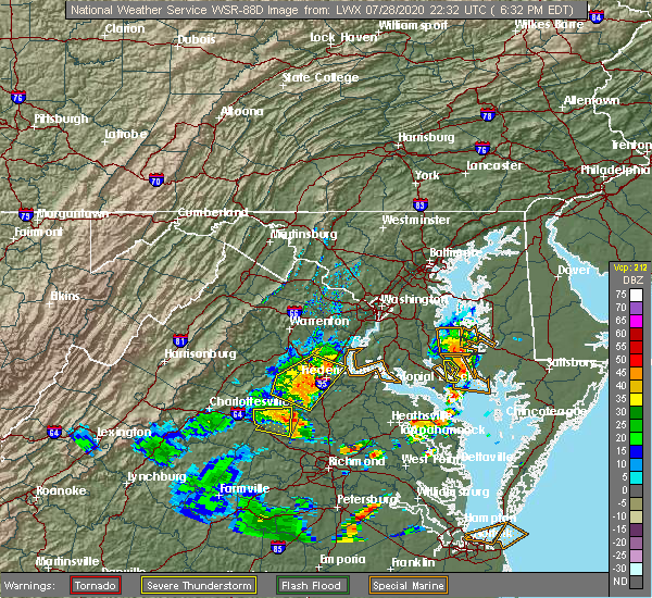 The severe thunderstorm warning for central louisa and north central goochland counties will expire at 645 pm edt, the storm which prompted the warning has moved out of the area. therefore, the warning will be allowed to expire. The severe thunderstorm warning for central louisa and north central goochland counties will expire at 645 pm edt, the storm which prompted the warning has moved out of the area. therefore, the warning will be allowed to expire.
|
| 7/28/2020 6:18 PM EDT |
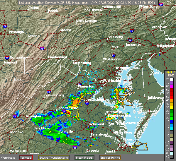 At 618 pm edt, a severe thunderstorm was located near louisa, moving east at 25 mph (radar indicated). Hazards include 60 mph wind gusts. Expect damage to trees and powerlines. this severe storm will be near, mineral around 630 pm edt. Other locations impacted by this severe thunderstorm include pendleton, yanceyville, louisa airport, fredericks hall, byrd mill, apple grove, cuckoo and orchid. At 618 pm edt, a severe thunderstorm was located near louisa, moving east at 25 mph (radar indicated). Hazards include 60 mph wind gusts. Expect damage to trees and powerlines. this severe storm will be near, mineral around 630 pm edt. Other locations impacted by this severe thunderstorm include pendleton, yanceyville, louisa airport, fredericks hall, byrd mill, apple grove, cuckoo and orchid.
|
| 7/28/2020 6:03 PM EDT |
 At 603 pm edt, a severe thunderstorm was located over ferncliff, or 7 miles southwest of louisa, moving east at 20 mph (radar indicated). Hazards include 60 mph wind gusts. Expect damage to trees and powerlines. this severe thunderstorm will be near, louisa and hadensville around 620 pm edt. mineral around 630 pm edt. Other locations impacted by this severe thunderstorm include orchid, pendleton, yanceyville, louisa airport, fredericks hall, byrd mill, tabscott, apple grove and cuckoo. At 603 pm edt, a severe thunderstorm was located over ferncliff, or 7 miles southwest of louisa, moving east at 20 mph (radar indicated). Hazards include 60 mph wind gusts. Expect damage to trees and powerlines. this severe thunderstorm will be near, louisa and hadensville around 620 pm edt. mineral around 630 pm edt. Other locations impacted by this severe thunderstorm include orchid, pendleton, yanceyville, louisa airport, fredericks hall, byrd mill, tabscott, apple grove and cuckoo.
|
| 6/25/2020 7:36 PM EDT |
 At 735 pm edt, a severe thunderstorm was located 7 miles north of bumpass, or 11 miles northeast of mineral, moving southeast at 25 mph (radar indicated). Hazards include 60 mph wind gusts and quarter size hail. Minor damage to vehicles is possible. expect wind damage to trees and powerlines. this severe thunderstorm will be near, bumpass around 750 pm edt. ladysmith around 755 pm edt. Other locations impacted by this severe thunderstorm include chilesburg, golansville, pendleton, coatesville, hewlett, noel, beaverdam, fredericks hall, nancy wrights corner and cedar fork. At 735 pm edt, a severe thunderstorm was located 7 miles north of bumpass, or 11 miles northeast of mineral, moving southeast at 25 mph (radar indicated). Hazards include 60 mph wind gusts and quarter size hail. Minor damage to vehicles is possible. expect wind damage to trees and powerlines. this severe thunderstorm will be near, bumpass around 750 pm edt. ladysmith around 755 pm edt. Other locations impacted by this severe thunderstorm include chilesburg, golansville, pendleton, coatesville, hewlett, noel, beaverdam, fredericks hall, nancy wrights corner and cedar fork.
|
| 4/13/2020 7:11 AM EDT | Trees down on elk creek r in louisa county VA, 4.8 miles WNW of Mineral, VA |
| 4/13/2020 7:11 AM EDT |
 At 710 am edt, severe thunderstorms were located along a line extending from near bumpass to near gum spring to morven, moving northeast at 65 mph (radar indicated). Hazards include 60 mph wind gusts. Expect damage to trees and powerlines. these severe storms will be near, montpelier, bumpass and trenholm around 720 am edt. goochland, sabot and manakin around 730 am edt. tuckahoe around 735 am edt. wyndham around 740 am edt. Other locations impacted by these severe thunderstorms include orchid, maidens, three square, fine creek mills, michaux, west view, holly hills, wares crossroads, pemberton and genito. At 710 am edt, severe thunderstorms were located along a line extending from near bumpass to near gum spring to morven, moving northeast at 65 mph (radar indicated). Hazards include 60 mph wind gusts. Expect damage to trees and powerlines. these severe storms will be near, montpelier, bumpass and trenholm around 720 am edt. goochland, sabot and manakin around 730 am edt. tuckahoe around 735 am edt. wyndham around 740 am edt. Other locations impacted by these severe thunderstorms include orchid, maidens, three square, fine creek mills, michaux, west view, holly hills, wares crossroads, pemberton and genito.
|
| 4/13/2020 6:55 AM EDT |
 At 655 am edt, severe thunderstorms were located along a line extending from 6 miles north of hadensville to trenholm to near hampden sydney college, moving northeast at 60 mph (radar indicated). Hazards include 60 mph wind gusts. Expect damage to trees and powerlines. severe thunderstorms will be near, louisa, mineral and trenholm around 700 am edt. goochland and bumpass around 705 am edt. oilville, jetersville and gum spring around 710 am edt. amelia courthouse, morven and tobaccoville around 715 am edt. montpelier, chula and ballsville around 720 am edt. powhatan and macon around 725 am edt. sabot around 735 am edt. tuckahoe and manakin around 740 am edt. other locations impacted by these severe thunderstorms include orchid, maidens, three square, fine creek mills, michaux, west view, holly hills, wares crossroads, pemberton and genito. A tornado watch remains in effect until noon edt for central and south central virginia. At 655 am edt, severe thunderstorms were located along a line extending from 6 miles north of hadensville to trenholm to near hampden sydney college, moving northeast at 60 mph (radar indicated). Hazards include 60 mph wind gusts. Expect damage to trees and powerlines. severe thunderstorms will be near, louisa, mineral and trenholm around 700 am edt. goochland and bumpass around 705 am edt. oilville, jetersville and gum spring around 710 am edt. amelia courthouse, morven and tobaccoville around 715 am edt. montpelier, chula and ballsville around 720 am edt. powhatan and macon around 725 am edt. sabot around 735 am edt. tuckahoe and manakin around 740 am edt. other locations impacted by these severe thunderstorms include orchid, maidens, three square, fine creek mills, michaux, west view, holly hills, wares crossroads, pemberton and genito. A tornado watch remains in effect until noon edt for central and south central virginia.
|
| 1/12/2020 12:26 AM EST |
 The severe thunderstorm warning for louisa, northeastern cumberland, goochland and fluvanna counties will expire at 1230 am est, the storms which prompted the warning have weakened below severe limits, and no longer pose an immediate threat to life or property. therefore, the warning will be allowed to expire. however gusty winds and heavy rain are still possible with these thunderstorms. remember, another severe thunderstorm warning remains in effect for parts of cumberland county until 1245 am. a severe thunderstorm watch remains in effect until 500 am est for central virginia. The severe thunderstorm warning for louisa, northeastern cumberland, goochland and fluvanna counties will expire at 1230 am est, the storms which prompted the warning have weakened below severe limits, and no longer pose an immediate threat to life or property. therefore, the warning will be allowed to expire. however gusty winds and heavy rain are still possible with these thunderstorms. remember, another severe thunderstorm warning remains in effect for parts of cumberland county until 1245 am. a severe thunderstorm watch remains in effect until 500 am est for central virginia.
|
| 1/12/2020 12:17 AM EST |
 At 1217 am est, severe thunderstorms were located along a line extending from 6 miles south of orange to kents store to new canton, moving east at 65 mph (radar indicated). Hazards include 60 mph wind gusts. Expect damage to trees and powerlines. these severe storms will be near, ferncliff around 1220 am est. cartersville around 1225 am est. louisa, mineral and fife around 1230 am est. hadensville and gum spring around 1235 am est. bumpass around 1240 am est. Other locations impacted by these severe thunderstorms include orchid, louisa airport, green springs, three square, shores, irwin, central plains, bremo bluff, cohasset and whiteville. At 1217 am est, severe thunderstorms were located along a line extending from 6 miles south of orange to kents store to new canton, moving east at 65 mph (radar indicated). Hazards include 60 mph wind gusts. Expect damage to trees and powerlines. these severe storms will be near, ferncliff around 1220 am est. cartersville around 1225 am est. louisa, mineral and fife around 1230 am est. hadensville and gum spring around 1235 am est. bumpass around 1240 am est. Other locations impacted by these severe thunderstorms include orchid, louisa airport, green springs, three square, shores, irwin, central plains, bremo bluff, cohasset and whiteville.
|
| 1/11/2020 11:47 PM EST |
 At 1147 pm est, severe thunderstorms were located along a line extending from 6 miles southwest of charlottesville to near centenary to near tower hill, moving northeast at 50 mph (radar indicated). Hazards include 60 mph wind gusts. Expect damage to trees and powerlines. severe thunderstorms will be near, lake monticello around 1210 am est. palmyra and boswells tavern around 1215 am est. kents store and troy around 1220 am est. fork union, ferncliff and lakeside village around 1225 am est. louisa, columbia, duncan and fife around 1230 am est. Other locations impacted by these severe thunderstorms include orchid, three square, central plains, bremo bluff, whiteville, west view, wares crossroads, wilmington, pemberton and dixie. At 1147 pm est, severe thunderstorms were located along a line extending from 6 miles southwest of charlottesville to near centenary to near tower hill, moving northeast at 50 mph (radar indicated). Hazards include 60 mph wind gusts. Expect damage to trees and powerlines. severe thunderstorms will be near, lake monticello around 1210 am est. palmyra and boswells tavern around 1215 am est. kents store and troy around 1220 am est. fork union, ferncliff and lakeside village around 1225 am est. louisa, columbia, duncan and fife around 1230 am est. Other locations impacted by these severe thunderstorms include orchid, three square, central plains, bremo bluff, whiteville, west view, wares crossroads, wilmington, pemberton and dixie.
|
| 10/31/2019 8:49 PM EDT |
 At 849 pm edt, a severe thunderstorm capable of producing a tornado was located over mineral, moving northeast at 65 mph (radar indicated rotation). Hazards include tornado. Flying debris will be dangerous to those caught without shelter. mobile homes will be damaged or destroyed. damage to roofs, windows, and vehicles will occur. tree damage is likely. this dangerous storm will be near, bumpass around 855 pm edt. Other locations impacted by this tornadic thunderstorm include wares crossroads, pendleton, louisa airport, fredericks hall, apple grove and cuckoo. At 849 pm edt, a severe thunderstorm capable of producing a tornado was located over mineral, moving northeast at 65 mph (radar indicated rotation). Hazards include tornado. Flying debris will be dangerous to those caught without shelter. mobile homes will be damaged or destroyed. damage to roofs, windows, and vehicles will occur. tree damage is likely. this dangerous storm will be near, bumpass around 855 pm edt. Other locations impacted by this tornadic thunderstorm include wares crossroads, pendleton, louisa airport, fredericks hall, apple grove and cuckoo.
|
| 10/31/2019 8:42 PM EDT |
 At 840 pm edt, severe thunderstorms were located along a line extending from near louisa to near trenholm, moving east at 30 mph (radar indicated). Hazards include 60 mph wind gusts and penny size hail. Expect damage to trees and powerlines. severe thunderstorms will be near, louisa around 845 pm edt. mineral around 855 pm edt. goochland around 905 pm edt. gum spring around 910 pm edt. oilville around 915 pm edt. montpelier and wyndham around 930 pm edt. other locations impacted by these severe thunderstorms include orchid, louisa airport, vontay, maidens, three square, irwin, johnsons springs, gilman, tabscott and othma. A tornado watch remains in effect until 1100 pm edt for central and north central virginia. At 840 pm edt, severe thunderstorms were located along a line extending from near louisa to near trenholm, moving east at 30 mph (radar indicated). Hazards include 60 mph wind gusts and penny size hail. Expect damage to trees and powerlines. severe thunderstorms will be near, louisa around 845 pm edt. mineral around 855 pm edt. goochland around 905 pm edt. gum spring around 910 pm edt. oilville around 915 pm edt. montpelier and wyndham around 930 pm edt. other locations impacted by these severe thunderstorms include orchid, louisa airport, vontay, maidens, three square, irwin, johnsons springs, gilman, tabscott and othma. A tornado watch remains in effect until 1100 pm edt for central and north central virginia.
|
| 10/31/2019 8:29 PM EDT |
 At 829 pm edt, severe thunderstorms capable of producing tornadoes were located along a line extending from near kents store to near lakeside village, moving northeast at 55 mph (radar indicated rotation). Hazards include tornado. Flying debris will be dangerous to those caught without shelter. mobile homes will be damaged or destroyed. damage to roofs, windows, and vehicles will occur. tree damage is likely. these dangerous storms will be near, ferncliff and kents store around 835 pm edt. louisa and hadensville around 845 pm edt. mineral around 900 pm edt. Other locations impacted by these tornadic storms include orchid, pendleton, louisa airport, stage junction, cuckoo, caledonia, elk hill, bybee, yanceyville and fredericks hall. At 829 pm edt, severe thunderstorms capable of producing tornadoes were located along a line extending from near kents store to near lakeside village, moving northeast at 55 mph (radar indicated rotation). Hazards include tornado. Flying debris will be dangerous to those caught without shelter. mobile homes will be damaged or destroyed. damage to roofs, windows, and vehicles will occur. tree damage is likely. these dangerous storms will be near, ferncliff and kents store around 835 pm edt. louisa and hadensville around 845 pm edt. mineral around 900 pm edt. Other locations impacted by these tornadic storms include orchid, pendleton, louisa airport, stage junction, cuckoo, caledonia, elk hill, bybee, yanceyville and fredericks hall.
|
| 10/31/2019 8:07 PM EDT |
 At 807 pm edt, severe thunderstorms capable of producing a tornado were located along a line extending from near centenary to near dillwyn, moving northeast at 55 mph (radar indicated rotation). Hazards include tornado. Flying debris will be dangerous to those caught without shelter. mobile homes will be damaged or destroyed. damage to roofs, windows, and vehicles will occur. tree damage is likely. these dangerous storms will be near, fork union around 820 pm edt. palmyra around 825 pm edt. cartersville, lakeside village and kents store around 830 pm edt. columbia, ferncliff and duncan around 835 pm edt. fife around 840 pm edt. louisa, mineral and hadensville around 845 pm edt. Other locations impacted by these tornadic storms include orchid, louisa airport, shores, central plains, bremo bluff, cohasset, tabscott, trevilians, othma and wares crossroads. At 807 pm edt, severe thunderstorms capable of producing a tornado were located along a line extending from near centenary to near dillwyn, moving northeast at 55 mph (radar indicated rotation). Hazards include tornado. Flying debris will be dangerous to those caught without shelter. mobile homes will be damaged or destroyed. damage to roofs, windows, and vehicles will occur. tree damage is likely. these dangerous storms will be near, fork union around 820 pm edt. palmyra around 825 pm edt. cartersville, lakeside village and kents store around 830 pm edt. columbia, ferncliff and duncan around 835 pm edt. fife around 840 pm edt. louisa, mineral and hadensville around 845 pm edt. Other locations impacted by these tornadic storms include orchid, louisa airport, shores, central plains, bremo bluff, cohasset, tabscott, trevilians, othma and wares crossroads.
|
| 10/31/2019 7:32 PM EDT |
 At 732 pm edt, severe thunderstorms were located along a line extending from near charlottesville to near phenix, moving east at 45 mph (radar indicated). Hazards include 60 mph wind gusts and penny size hail. Expect damage to trees and powerlines. severe thunderstorms will be near, darlington heights around 750 pm edt. hampden sydney college, hampden sydney and boswells tavern around 800 pm edt. farmville around 805 pm edt. longwood university and green bay around 810 pm edt. burkeville and rice around 815 pm edt. other locations impacted by these severe thunderstorms include tuggle, angola, three square, central plains, bremo bluff, hawk, elam, whiteville, grays siding and west view. A tornado watch remains in effect until 1100 pm edt for central and south central virginia. At 732 pm edt, severe thunderstorms were located along a line extending from near charlottesville to near phenix, moving east at 45 mph (radar indicated). Hazards include 60 mph wind gusts and penny size hail. Expect damage to trees and powerlines. severe thunderstorms will be near, darlington heights around 750 pm edt. hampden sydney college, hampden sydney and boswells tavern around 800 pm edt. farmville around 805 pm edt. longwood university and green bay around 810 pm edt. burkeville and rice around 815 pm edt. other locations impacted by these severe thunderstorms include tuggle, angola, three square, central plains, bremo bluff, hawk, elam, whiteville, grays siding and west view. A tornado watch remains in effect until 1100 pm edt for central and south central virginia.
|
| 9/11/2019 6:40 PM EDT |
 At 639 pm edt, severe thunderstorms were located along a line extending from near mineral to 7 miles north of gum spring to near lakeside village, moving east at 25 mph (radar indicated). Hazards include 60 mph wind gusts. Expect damage to trees and powerlines. these severe storms will be near, gum spring around 645 pm edt. bumpass around 650 pm edt. Other locations impacted by these severe thunderstorms include orchid, louisa airport, three square, tabscott, othma, wares crossroads, pemberton, pendleton, sandy hook and stage junction. At 639 pm edt, severe thunderstorms were located along a line extending from near mineral to 7 miles north of gum spring to near lakeside village, moving east at 25 mph (radar indicated). Hazards include 60 mph wind gusts. Expect damage to trees and powerlines. these severe storms will be near, gum spring around 645 pm edt. bumpass around 650 pm edt. Other locations impacted by these severe thunderstorms include orchid, louisa airport, three square, tabscott, othma, wares crossroads, pemberton, pendleton, sandy hook and stage junction.
|
| 9/11/2019 6:28 PM EDT |
 At 628 pm edt, severe thunderstorms were located along a line extending from near mineral to near hadensville to near gold hill, moving east at 25 mph (radar indicated). Hazards include 60 mph wind gusts. Expect damage to trees and powerlines. severe thunderstorms will be near, mineral, hadensville and fife around 635 pm edt. gum spring around 650 pm edt. cartersville and bumpass around 655 pm edt. Other locations impacted by these severe thunderstorms include orchid, louisa airport, three square, bremo bluff, tabscott, othma, wares crossroads, pemberton, pendleton and sandy hook. At 628 pm edt, severe thunderstorms were located along a line extending from near mineral to near hadensville to near gold hill, moving east at 25 mph (radar indicated). Hazards include 60 mph wind gusts. Expect damage to trees and powerlines. severe thunderstorms will be near, mineral, hadensville and fife around 635 pm edt. gum spring around 650 pm edt. cartersville and bumpass around 655 pm edt. Other locations impacted by these severe thunderstorms include orchid, louisa airport, three square, bremo bluff, tabscott, othma, wares crossroads, pemberton, pendleton and sandy hook.
|
| 9/11/2019 6:05 PM EDT |
 At 605 pm edt, severe thunderstorms were located along a line extending from near louisa to palmyra to near centenary, moving east at 25 mph (radar indicated). Hazards include 60 mph wind gusts. Expect damage to trees and powerlines. severe thunderstorms will be near, fork union around 610 pm edt. louisa and kents store around 620 pm edt. columbia and duncan around 625 pm edt. mineral, hadensville and fife around 630 pm edt. Other locations impacted by these severe thunderstorms include orchid, louisa airport, green springs, central plains, cohasset, tabscott, trevilians, othma, wares crossroads and wilmington. At 605 pm edt, severe thunderstorms were located along a line extending from near louisa to palmyra to near centenary, moving east at 25 mph (radar indicated). Hazards include 60 mph wind gusts. Expect damage to trees and powerlines. severe thunderstorms will be near, fork union around 610 pm edt. louisa and kents store around 620 pm edt. columbia and duncan around 625 pm edt. mineral, hadensville and fife around 630 pm edt. Other locations impacted by these severe thunderstorms include orchid, louisa airport, green springs, central plains, cohasset, tabscott, trevilians, othma, wares crossroads and wilmington.
|
| 8/22/2019 5:49 PM EDT |
 At 548 pm edt, severe thunderstorms were located along a line extending from 6 miles north of bumpass to 7 miles northwest of montpelier, moving northeast at 35 mph (radar indicated). Hazards include 60 mph wind gusts and penny size hail. Expect damage to trees and powerlines. These severe thunderstorms will remain over mainly rural areas of southeastern louisa, west central caroline and northwestern hanover counties, including the following locations, chilesburg, orchid, pendleton, coatesville, hewlett, mabelton, noel, beaverdam, fredericks hall and cedar fork. At 548 pm edt, severe thunderstorms were located along a line extending from 6 miles north of bumpass to 7 miles northwest of montpelier, moving northeast at 35 mph (radar indicated). Hazards include 60 mph wind gusts and penny size hail. Expect damage to trees and powerlines. These severe thunderstorms will remain over mainly rural areas of southeastern louisa, west central caroline and northwestern hanover counties, including the following locations, chilesburg, orchid, pendleton, coatesville, hewlett, mabelton, noel, beaverdam, fredericks hall and cedar fork.
|
| 8/22/2019 5:27 PM EDT |
 At 527 pm edt, severe thunderstorms were located along a line extending from near mineral to near gum spring, moving northeast at 25 mph (radar indicated). Hazards include 60 mph wind gusts and penny size hail. Expect damage to trees and powerlines. these severe storms will be near, mineral around 530 pm edt. bumpass around 545 pm edt. montpelier around 600 pm edt. Other locations impacted by these severe thunderstorms include chilesburg, orchid, pendleton, coatesville, hewlett, mabelton, noel, cuckoo, yanceyville and beaverdam. At 527 pm edt, severe thunderstorms were located along a line extending from near mineral to near gum spring, moving northeast at 25 mph (radar indicated). Hazards include 60 mph wind gusts and penny size hail. Expect damage to trees and powerlines. these severe storms will be near, mineral around 530 pm edt. bumpass around 545 pm edt. montpelier around 600 pm edt. Other locations impacted by these severe thunderstorms include chilesburg, orchid, pendleton, coatesville, hewlett, mabelton, noel, cuckoo, yanceyville and beaverdam.
|
| 8/22/2019 5:14 PM EDT |
 At 514 pm edt, severe thunderstorms were located along a line extending from near louisa to fife, moving northeast at 35 mph (radar indicated). Hazards include 60 mph wind gusts and penny size hail. Expect damage to trees and powerlines. severe thunderstorms will be near, mineral and gum spring around 525 pm edt. bumpass around 550 pm edt. Other locations impacted by these severe thunderstorms include chilesburg, orchid, pendleton, coatesville, hewlett, mabelton, noel, cuckoo, yanceyville and beaverdam. At 514 pm edt, severe thunderstorms were located along a line extending from near louisa to fife, moving northeast at 35 mph (radar indicated). Hazards include 60 mph wind gusts and penny size hail. Expect damage to trees and powerlines. severe thunderstorms will be near, mineral and gum spring around 525 pm edt. bumpass around 550 pm edt. Other locations impacted by these severe thunderstorms include chilesburg, orchid, pendleton, coatesville, hewlett, mabelton, noel, cuckoo, yanceyville and beaverdam.
|
| 8/15/2019 10:25 PM EDT | Trees down near minera in louisa county VA, 3.2 miles N of Mineral, VA |
| 8/15/2019 10:11 PM EDT |
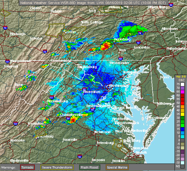 At 1010 pm edt, a severe thunderstorm was located over ferncliff, or 7 miles southwest of louisa, moving east at 20 mph (radar indicated). Hazards include 60 mph wind gusts and quarter size hail. Minor damage to vehicles is possible. expect wind damage to trees and powerlines. this severe thunderstorm will be near, louisa around 1015 pm edt. hadensville around 1025 pm edt. gum spring around 1045 pm edt. Other locations impacted by this severe thunderstorm include dabneys, orchid, pendleton, yanceyville, louisa airport, fredericks hall, byrd mill, tabscott, locust creek and apple grove. At 1010 pm edt, a severe thunderstorm was located over ferncliff, or 7 miles southwest of louisa, moving east at 20 mph (radar indicated). Hazards include 60 mph wind gusts and quarter size hail. Minor damage to vehicles is possible. expect wind damage to trees and powerlines. this severe thunderstorm will be near, louisa around 1015 pm edt. hadensville around 1025 pm edt. gum spring around 1045 pm edt. Other locations impacted by this severe thunderstorm include dabneys, orchid, pendleton, yanceyville, louisa airport, fredericks hall, byrd mill, tabscott, locust creek and apple grove.
|
| 8/13/2019 8:25 PM EDT |
 At 824 pm edt, a severe thunderstorm was located 2 miles north of hadensville, moving southeast at 20 mph (radar indicated). Hazards include 60 mph wind gusts and penny size hail. Expect damage to trees and powerlines. this severe storm will be near, gum spring around 845 pm edt. Other locations impacted by this severe thunderstorm include orchid, pendleton, sandy hook, louisa airport, irwin, cuckoo, caledonia, yanceyville, fredericks hall and tabscott. At 824 pm edt, a severe thunderstorm was located 2 miles north of hadensville, moving southeast at 20 mph (radar indicated). Hazards include 60 mph wind gusts and penny size hail. Expect damage to trees and powerlines. this severe storm will be near, gum spring around 845 pm edt. Other locations impacted by this severe thunderstorm include orchid, pendleton, sandy hook, louisa airport, irwin, cuckoo, caledonia, yanceyville, fredericks hall and tabscott.
|
| 8/13/2019 7:54 PM EDT |
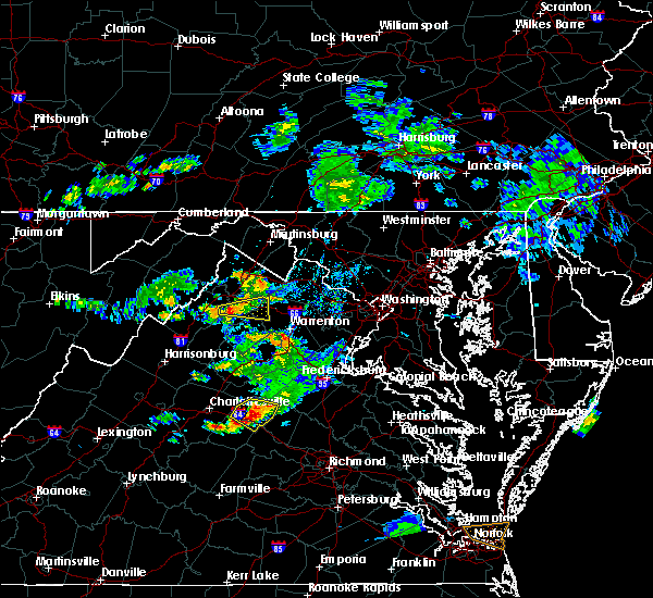 At 753 pm edt, a severe thunderstorm was located near ferncliff, or near louisa, moving southeast at 25 mph (radar indicated). Hazards include 60 mph wind gusts and quarter size hail. Minor damage to vehicles is possible. expect wind damage to trees and powerlines. this severe thunderstorm will be near, hadensville around 815 pm edt. gum spring around 830 pm edt. Other locations impacted by this severe thunderstorm include orchid, pendleton, sandy hook, louisa airport, irwin, cuckoo, caledonia, bybee, yanceyville and fredericks hall. At 753 pm edt, a severe thunderstorm was located near ferncliff, or near louisa, moving southeast at 25 mph (radar indicated). Hazards include 60 mph wind gusts and quarter size hail. Minor damage to vehicles is possible. expect wind damage to trees and powerlines. this severe thunderstorm will be near, hadensville around 815 pm edt. gum spring around 830 pm edt. Other locations impacted by this severe thunderstorm include orchid, pendleton, sandy hook, louisa airport, irwin, cuckoo, caledonia, bybee, yanceyville and fredericks hall.
|
| 8/1/2019 9:02 PM EDT |
 The national weather service in wakefield has issued a * severe thunderstorm warning for. north central louisa county in central virginia. until 945 pm edt. At 902 pm edt, a severe thunderstorm was located near louisa, and is nearly stationary. The national weather service in wakefield has issued a * severe thunderstorm warning for. north central louisa county in central virginia. until 945 pm edt. At 902 pm edt, a severe thunderstorm was located near louisa, and is nearly stationary.
|
| 7/31/2019 5:10 PM EDT | Tree and wires down near the intersection of belmont road and sunset harbor boulevard. corrected event tim in spotsylvania county VA, 9.6 miles SSW of Mineral, VA |
| 7/31/2019 5:03 PM EDT | Wires down near the intersection of belmont road and sunset harbor boulevar in spotsylvania county VA, 9.6 miles SSW of Mineral, VA |
| 7/22/2019 6:58 PM EDT | Tree down in 6300 blk of belmont rd in spotsylvania county VA, 8.8 miles SSW of Mineral, VA |
| 6/18/2019 5:15 PM EDT | Trees snapped and uprooted along pine harbour drive. report via social medi in louisa county VA, 5.2 miles SW of Mineral, VA |
| 6/18/2019 5:13 PM EDT |
 At 513 pm edt, a severe thunderstorm was located near mineral, moving east at 25 mph (radar indicated). Hazards include golf ball size hail and 60 mph wind gusts. People and animals outdoors will be injured. expect hail damage to roofs, siding, windows, and vehicles. expect wind damage to trees and powerlines. this severe storm will be near, bumpass around 530 pm edt. Other locations impacted by this severe thunderstorm include fredericks hall and wares crossroads. At 513 pm edt, a severe thunderstorm was located near mineral, moving east at 25 mph (radar indicated). Hazards include golf ball size hail and 60 mph wind gusts. People and animals outdoors will be injured. expect hail damage to roofs, siding, windows, and vehicles. expect wind damage to trees and powerlines. this severe storm will be near, bumpass around 530 pm edt. Other locations impacted by this severe thunderstorm include fredericks hall and wares crossroads.
|
| 6/18/2019 5:08 PM EDT | Tree down on chopping rd near louisa high schoo in louisa county VA, 1.6 miles SE of Mineral, VA |
| 6/18/2019 4:58 PM EDT |
 At 458 pm edt, a severe thunderstorm was located near mineral, moving east at 25 mph (radar indicated). Hazards include 60 mph wind gusts and quarter size hail. Minor damage to vehicles is possible. expect wind damage to trees and powerlines. this severe thunderstorm will be near, bumpass around 520 pm edt. Other locations impacted by this severe thunderstorm include wares crossroads, pendleton, louisa airport, fredericks hall and vawter corner. At 458 pm edt, a severe thunderstorm was located near mineral, moving east at 25 mph (radar indicated). Hazards include 60 mph wind gusts and quarter size hail. Minor damage to vehicles is possible. expect wind damage to trees and powerlines. this severe thunderstorm will be near, bumpass around 520 pm edt. Other locations impacted by this severe thunderstorm include wares crossroads, pendleton, louisa airport, fredericks hall and vawter corner.
|
| 6/17/2019 6:15 PM EDT | Tree down on a home on winding ridge roa in louisa county VA, 9.9 miles WNW of Mineral, VA |
| 6/17/2019 6:03 PM EDT | Multiple trees down from mineral to bumpas in louisa county VA, 0.4 miles SSE of Mineral, VA |
| 6/17/2019 6:00 PM EDT | Tree down on a mobile hom in louisa county VA, 1.8 miles N of Mineral, VA |
| 6/17/2019 5:58 PM EDT | Quarter sized hail reported 0.4 miles NNE of Mineral, VA, report via twitter. |
| 6/17/2019 5:57 PM EDT |
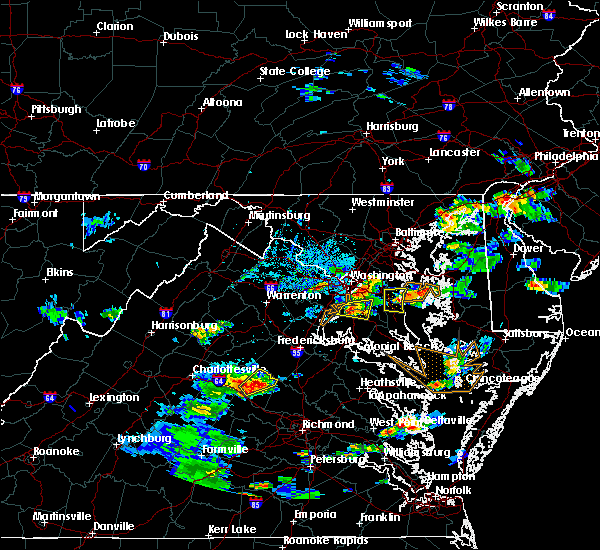 At 539 pm edt, a severe thunderstorm was located near mineral, moving northeast at 20 mph (radar indicated). Hazards include 60 mph wind gusts and quarter size hail. Minor damage to vehicles is possible. expect wind damage to trees and powerlines. this severe thunderstorm will be near, mineral around 555 pm edt. bumpass around 610 pm edt. Other locations impacted by this severe thunderstorm include wares crossroads, pendleton, yanceyville, fredericks hall, apple grove and cuckoo. At 539 pm edt, a severe thunderstorm was located near mineral, moving northeast at 20 mph (radar indicated). Hazards include 60 mph wind gusts and quarter size hail. Minor damage to vehicles is possible. expect wind damage to trees and powerlines. this severe thunderstorm will be near, mineral around 555 pm edt. bumpass around 610 pm edt. Other locations impacted by this severe thunderstorm include wares crossroads, pendleton, yanceyville, fredericks hall, apple grove and cuckoo.
|
| 6/17/2019 5:40 PM EDT |
 At 539 pm edt, a severe thunderstorm was located near mineral, moving northeast at 20 mph (radar indicated). Hazards include 60 mph wind gusts and quarter size hail. Minor damage to vehicles is possible. expect wind damage to trees and powerlines. this severe thunderstorm will be near, mineral around 555 pm edt. bumpass around 610 pm edt. Other locations impacted by this severe thunderstorm include wares crossroads, pendleton, yanceyville, fredericks hall, apple grove and cuckoo. At 539 pm edt, a severe thunderstorm was located near mineral, moving northeast at 20 mph (radar indicated). Hazards include 60 mph wind gusts and quarter size hail. Minor damage to vehicles is possible. expect wind damage to trees and powerlines. this severe thunderstorm will be near, mineral around 555 pm edt. bumpass around 610 pm edt. Other locations impacted by this severe thunderstorm include wares crossroads, pendleton, yanceyville, fredericks hall, apple grove and cuckoo.
|
| 5/26/2019 3:21 PM EDT |
 At 321 pm edt, a severe thunderstorm was located near boswells tavern, or 9 miles west of louisa, moving southeast at 25 mph (radar indicated). Hazards include 60 mph wind gusts and quarter size hail. Minor damage to vehicles is possible. expect wind damage to trees and powerlines. this severe thunderstorm will be near, ferncliff and kents store around 335 pm edt. louisa around 340 pm edt. mineral around 350 pm edt. hadensville around 355 pm edt. Other locations impacted by this severe thunderstorm include orchid, pendleton, louisa airport, green springs, zion crossroads, cuckoo, bybee, yanceyville, fredericks hall and waldrop. At 321 pm edt, a severe thunderstorm was located near boswells tavern, or 9 miles west of louisa, moving southeast at 25 mph (radar indicated). Hazards include 60 mph wind gusts and quarter size hail. Minor damage to vehicles is possible. expect wind damage to trees and powerlines. this severe thunderstorm will be near, ferncliff and kents store around 335 pm edt. louisa around 340 pm edt. mineral around 350 pm edt. hadensville around 355 pm edt. Other locations impacted by this severe thunderstorm include orchid, pendleton, louisa airport, green springs, zion crossroads, cuckoo, bybee, yanceyville, fredericks hall and waldrop.
|
| 5/2/2019 4:52 PM EDT |
 At 451 pm edt, a severe thunderstorm was located near boswells tavern, or near louisa, moving east at 20 mph (radar indicated). Hazards include 60 mph wind gusts and quarter size hail. Minor damage to vehicles is possible. expect wind damage to trees and powerlines. this severe thunderstorm will be near, louisa around 500 pm edt. Other locations impacted by this severe thunderstorm include wares crossroads, louisa airport, vawter corner, green springs and trevilians. At 451 pm edt, a severe thunderstorm was located near boswells tavern, or near louisa, moving east at 20 mph (radar indicated). Hazards include 60 mph wind gusts and quarter size hail. Minor damage to vehicles is possible. expect wind damage to trees and powerlines. this severe thunderstorm will be near, louisa around 500 pm edt. Other locations impacted by this severe thunderstorm include wares crossroads, louisa airport, vawter corner, green springs and trevilians.
|
| 4/26/2019 2:21 PM EDT | Tree down near the intersection of lewiston road and boggs driv in spotsylvania county VA, 9.9 miles SW of Mineral, VA |
| 4/26/2019 2:18 PM EDT | Tree uprooted and power lines down at the intersection of richmond st. and 1st st. time estimated from rada in louisa county VA, 0.4 miles SSE of Mineral, VA |
| 4/19/2019 8:11 PM EDT | Tree down in the 5200 block of lewiston road in spotsylvania county VA, 10.3 miles SW of Mineral, VA |
| 4/19/2019 8:07 PM EDT | Tree down along lawyers road in spotsylvania county VA, 10.7 miles SW of Mineral, VA |
| 4/19/2019 7:56 PM EDT |
 At 756 pm edt, a severe thunderstorm capable of producing a tornado was located near mineral, moving northeast at 45 mph (radar indicated rotation). Hazards include tornado. Flying debris will be dangerous to those caught without shelter. mobile homes will be damaged or destroyed. damage to roofs, windows, and vehicles will occur. tree damage is likely. this dangerous storm will be near, mineral and bumpass around 805 pm edt. Other locations impacted by this tornadic thunderstorm include pendleton, yanceyville, louisa airport, fredericks hall, wares crossroads, apple grove and cuckoo. At 756 pm edt, a severe thunderstorm capable of producing a tornado was located near mineral, moving northeast at 45 mph (radar indicated rotation). Hazards include tornado. Flying debris will be dangerous to those caught without shelter. mobile homes will be damaged or destroyed. damage to roofs, windows, and vehicles will occur. tree damage is likely. this dangerous storm will be near, mineral and bumpass around 805 pm edt. Other locations impacted by this tornadic thunderstorm include pendleton, yanceyville, louisa airport, fredericks hall, wares crossroads, apple grove and cuckoo.
|
| 4/19/2019 7:40 PM EDT |
 At 740 pm edt, a severe thunderstorm capable of producing a tornado was located over fife, or near hadensville, moving northeast at 45 mph (radar indicated rotation). Hazards include tornado. Flying debris will be dangerous to those caught without shelter. mobile homes will be damaged or destroyed. damage to roofs, windows, and vehicles will occur. tree damage is likely. this dangerous storm will be near, hadensville around 745 pm edt. louisa around 800 pm edt. mineral around 805 pm edt. Other locations impacted by this tornadic thunderstorm include orchid, pendleton, louisa airport, cuckoo, caledonia, elk hill, yanceyville, fredericks hall, georges tavern and tabscott. At 740 pm edt, a severe thunderstorm capable of producing a tornado was located over fife, or near hadensville, moving northeast at 45 mph (radar indicated rotation). Hazards include tornado. Flying debris will be dangerous to those caught without shelter. mobile homes will be damaged or destroyed. damage to roofs, windows, and vehicles will occur. tree damage is likely. this dangerous storm will be near, hadensville around 745 pm edt. louisa around 800 pm edt. mineral around 805 pm edt. Other locations impacted by this tornadic thunderstorm include orchid, pendleton, louisa airport, cuckoo, caledonia, elk hill, yanceyville, fredericks hall, georges tavern and tabscott.
|
| 4/19/2019 7:08 PM EDT |
 At 707 pm edt, a severe thunderstorm capable of producing a tornado was located over ferncliff, or 7 miles northwest of hadensville, moving northeast at 45 mph (radar indicated rotation). Hazards include tornado. Flying debris will be dangerous to those caught without shelter. mobile homes will be damaged or destroyed. damage to roofs, windows, and vehicles will occur. tree damage is likely. this dangerous storm will be near, louisa and mineral around 720 pm edt. Other locations impacted by this tornadic thunderstorm include wares crossroads, louisa airport, vawter corner, byrd mill and trevilians. At 707 pm edt, a severe thunderstorm capable of producing a tornado was located over ferncliff, or 7 miles northwest of hadensville, moving northeast at 45 mph (radar indicated rotation). Hazards include tornado. Flying debris will be dangerous to those caught without shelter. mobile homes will be damaged or destroyed. damage to roofs, windows, and vehicles will occur. tree damage is likely. this dangerous storm will be near, louisa and mineral around 720 pm edt. Other locations impacted by this tornadic thunderstorm include wares crossroads, louisa airport, vawter corner, byrd mill and trevilians.
|
| 4/15/2019 1:16 AM EDT |
 At 115 am edt, severe thunderstorms were located along a line extending from near spotsylvania to fife, moving northeast at 70 mph (radar indicated). Hazards include 60 mph wind gusts and penny size hail. Expect damage to trees and powerlines. these severe thunderstorms will remain over mainly rural areas of northeastern louisa and northwestern goochland counties, including the following locations, pendleton, yanceyville, louisa airport, fredericks hall, tabscott, wares crossroads, apple grove, cuckoo and caledonia. A tornado watch remains in effect until 700 am edt for central virginia. At 115 am edt, severe thunderstorms were located along a line extending from near spotsylvania to fife, moving northeast at 70 mph (radar indicated). Hazards include 60 mph wind gusts and penny size hail. Expect damage to trees and powerlines. these severe thunderstorms will remain over mainly rural areas of northeastern louisa and northwestern goochland counties, including the following locations, pendleton, yanceyville, louisa airport, fredericks hall, tabscott, wares crossroads, apple grove, cuckoo and caledonia. A tornado watch remains in effect until 700 am edt for central virginia.
|
| 4/15/2019 1:07 AM EDT |
 At 107 am edt, severe thunderstorms were located along a line extending from 10 miles west of spotsylvania to near lakeside village, moving northeast at 60 mph (radar indicated). Hazards include 60 mph wind gusts and penny size hail. Expect damage to trees and powerlines. these severe storms will be near, hadensville and kents store around 120 am edt. louisa and mineral around 130 am edt. other locations impacted by these severe thunderstorms include dixie, pendleton, louisa airport, stage junction, bremo bluff, cuckoo, caledonia, elk hill, yanceyville and fredericks hall. A tornado watch remains in effect until 700 am edt for central virginia. At 107 am edt, severe thunderstorms were located along a line extending from 10 miles west of spotsylvania to near lakeside village, moving northeast at 60 mph (radar indicated). Hazards include 60 mph wind gusts and penny size hail. Expect damage to trees and powerlines. these severe storms will be near, hadensville and kents store around 120 am edt. louisa and mineral around 130 am edt. other locations impacted by these severe thunderstorms include dixie, pendleton, louisa airport, stage junction, bremo bluff, cuckoo, caledonia, elk hill, yanceyville and fredericks hall. A tornado watch remains in effect until 700 am edt for central virginia.
|
| 4/15/2019 1:05 AM EDT | Multiple trees dow in louisa county VA, 0.4 miles SSE of Mineral, VA |
| 4/15/2019 12:50 AM EDT |
 At 1249 am edt, a severe thunderstorm was located near columbia, or near fork union, moving northeast at 65 mph (radar indicated). Hazards include 60 mph wind gusts and penny size hail. Expect damage to trees and powerlines. this severe storm will be near, hadensville and ferncliff around 1255 am edt. louisa around 105 am edt. mineral around 110 am edt. other locations impacted by this severe thunderstorm include louisa airport, green springs, shores, central plains, bremo bluff, cohasset, tabscott, trevilians, wares crossroads and hardware. A tornado watch remains in effect until 700 am edt for central virginia. At 1249 am edt, a severe thunderstorm was located near columbia, or near fork union, moving northeast at 65 mph (radar indicated). Hazards include 60 mph wind gusts and penny size hail. Expect damage to trees and powerlines. this severe storm will be near, hadensville and ferncliff around 1255 am edt. louisa around 105 am edt. mineral around 110 am edt. other locations impacted by this severe thunderstorm include louisa airport, green springs, shores, central plains, bremo bluff, cohasset, tabscott, trevilians, wares crossroads and hardware. A tornado watch remains in effect until 700 am edt for central virginia.
|
| 4/15/2019 12:39 AM EDT |
 At 1239 am edt, a severe thunderstorm was located over new canton, or near fork union, moving northeast at 70 mph (radar indicated). Hazards include 60 mph wind gusts and quarter size hail. Minor damage to vehicles is possible. expect wind damage to trees and powerlines. this severe thunderstorm will be near, columbia and duncan around 1245 am edt. palmyra and fife around 1250 am edt. hadensville, kents store and ferncliff around 1255 am edt. louisa and mineral around 105 am edt. other locations impacted by this severe thunderstorm include louisa airport, green springs, shores, central plains, bremo bluff, cohasset, tabscott, trevilians, wares crossroads and hardware. A tornado watch remains in effect until 700 am edt for central virginia. At 1239 am edt, a severe thunderstorm was located over new canton, or near fork union, moving northeast at 70 mph (radar indicated). Hazards include 60 mph wind gusts and quarter size hail. Minor damage to vehicles is possible. expect wind damage to trees and powerlines. this severe thunderstorm will be near, columbia and duncan around 1245 am edt. palmyra and fife around 1250 am edt. hadensville, kents store and ferncliff around 1255 am edt. louisa and mineral around 105 am edt. other locations impacted by this severe thunderstorm include louisa airport, green springs, shores, central plains, bremo bluff, cohasset, tabscott, trevilians, wares crossroads and hardware. A tornado watch remains in effect until 700 am edt for central virginia.
|
| 6/24/2018 3:48 PM EDT | Tree down on the 15000 block of monrovia roa in spotsylvania county VA, 7.9 miles S of Mineral, VA |
| 6/10/2018 5:45 PM EDT |
 At 544 pm edt, severe thunderstorms were located along a line extending from near mineral to near fife to near duncan, moving southeast at 15 mph (radar indicated). Hazards include 60 mph wind gusts and quarter size hail. Minor damage to vehicles is possible. expect wind damage to trees and powerlines. these severe storms will be near, gum spring and trenholm around 550 pm edt. bumpass around 555 pm edt. goochland around 600 pm edt. Other locations impacted by these severe thunderstorms include orchid, rock castle, maidens, three square, irwin, michaux, west view, tabscott, othma and wares crossroads. At 544 pm edt, severe thunderstorms were located along a line extending from near mineral to near fife to near duncan, moving southeast at 15 mph (radar indicated). Hazards include 60 mph wind gusts and quarter size hail. Minor damage to vehicles is possible. expect wind damage to trees and powerlines. these severe storms will be near, gum spring and trenholm around 550 pm edt. bumpass around 555 pm edt. goochland around 600 pm edt. Other locations impacted by these severe thunderstorms include orchid, rock castle, maidens, three square, irwin, michaux, west view, tabscott, othma and wares crossroads.
|
| 6/10/2018 5:32 PM EDT |
 At 531 pm edt, severe thunderstorms were located along a line extending from near louisa to duncan, moving southeast at 15 mph (radar indicated). Hazards include 60 mph wind gusts and quarter size hail. Minor damage to vehicles is possible. expect wind damage to trees and powerlines. severe thunderstorms will be near, mineral and fife around 545 pm edt. trenholm around 605 pm edt. goochland and bumpass around 615 pm edt. Other locations impacted by these severe thunderstorms include orchid, rock castle, louisa airport, maidens, three square, irwin, michaux, west view, tabscott and othma. At 531 pm edt, severe thunderstorms were located along a line extending from near louisa to duncan, moving southeast at 15 mph (radar indicated). Hazards include 60 mph wind gusts and quarter size hail. Minor damage to vehicles is possible. expect wind damage to trees and powerlines. severe thunderstorms will be near, mineral and fife around 545 pm edt. trenholm around 605 pm edt. goochland and bumpass around 615 pm edt. Other locations impacted by these severe thunderstorms include orchid, rock castle, louisa airport, maidens, three square, irwin, michaux, west view, tabscott and othma.
|
| 5/14/2018 7:20 PM EDT | Via twitter... e 50mph winds and tree branches down near intersection of halls/proffit/old fredericksburg r in goochland county VA, 11.8 miles NNE of Mineral, VA |
| 5/14/2018 7:17 PM EDT |
 At 717 pm edt, severe thunderstorms were located along a line extending from nanjemoy creek to near ladysmith to new canton, moving east at 50 mph (radar indicated). Hazards include 60 mph wind gusts and quarter size hail. Minor damage to vehicles is possible. expect wind damage to trees and powerlines. these severe storms will be near, ladysmith around 720 pm edt. milford and kings dominion around 725 pm edt. fife and dawn around 730 pm edt. oilville around 745 pm edt. Other locations impacted by these severe thunderstorms include chilesburg, orchid, gum tree, three square, central plains, bremo bluff, west view, nancy wrights corner, ruther glen and wilmington. At 717 pm edt, severe thunderstorms were located along a line extending from nanjemoy creek to near ladysmith to new canton, moving east at 50 mph (radar indicated). Hazards include 60 mph wind gusts and quarter size hail. Minor damage to vehicles is possible. expect wind damage to trees and powerlines. these severe storms will be near, ladysmith around 720 pm edt. milford and kings dominion around 725 pm edt. fife and dawn around 730 pm edt. oilville around 745 pm edt. Other locations impacted by these severe thunderstorms include chilesburg, orchid, gum tree, three square, central plains, bremo bluff, west view, nancy wrights corner, ruther glen and wilmington.
|
| 5/14/2018 7:02 PM EDT |
 At 702 pm edt, severe thunderstorms were located along a line extending from near aquia creek to near bumpass to near centenary, moving east at 50 mph (radar indicated). Hazards include 60 mph wind gusts and penny size hail. Expect damage to trees and powerlines. severe thunderstorms will be near, bumpass around 705 pm edt. fork union and ladysmith around 715 pm edt. milford around 720 pm edt. columbia, dawn and kings dominion around 725 pm edt. fife around 730 pm edt. oilville around 745 pm edt. Other locations impacted by these severe thunderstorms include chilesburg, orchid, gum tree, three square, central plains, bremo bluff, west view, nancy wrights corner, wares crossroads and ruther glen. At 702 pm edt, severe thunderstorms were located along a line extending from near aquia creek to near bumpass to near centenary, moving east at 50 mph (radar indicated). Hazards include 60 mph wind gusts and penny size hail. Expect damage to trees and powerlines. severe thunderstorms will be near, bumpass around 705 pm edt. fork union and ladysmith around 715 pm edt. milford around 720 pm edt. columbia, dawn and kings dominion around 725 pm edt. fife around 730 pm edt. oilville around 745 pm edt. Other locations impacted by these severe thunderstorms include chilesburg, orchid, gum tree, three square, central plains, bremo bluff, west view, nancy wrights corner, wares crossroads and ruther glen.
|
| 5/14/2018 6:38 PM EDT |
 At 637 pm edt, severe thunderstorms were located along a line extending from 10 miles northwest of spotsylvania to near boswells tavern to 8 miles northeast of schuyler, moving southeast at 45 mph (radar indicated). Hazards include 60 mph wind gusts and quarter size hail. Minor damage to vehicles is possible. expect wind damage to trees and powerlines. these severe storms will be near, ferncliff and kents store around 645 pm edt. louisa around 650 pm edt. mineral and hadensville around 655 pm edt. fork union and palmyra around 700 pm edt. Other locations impacted by these severe thunderstorms include louisa airport, green springs, shores, central plains, bremo bluff, cohasset, waldrop, tabscott, trevilians and wares crossroads. At 637 pm edt, severe thunderstorms were located along a line extending from 10 miles northwest of spotsylvania to near boswells tavern to 8 miles northeast of schuyler, moving southeast at 45 mph (radar indicated). Hazards include 60 mph wind gusts and quarter size hail. Minor damage to vehicles is possible. expect wind damage to trees and powerlines. these severe storms will be near, ferncliff and kents store around 645 pm edt. louisa around 650 pm edt. mineral and hadensville around 655 pm edt. fork union and palmyra around 700 pm edt. Other locations impacted by these severe thunderstorms include louisa airport, green springs, shores, central plains, bremo bluff, cohasset, waldrop, tabscott, trevilians and wares crossroads.
|
| 5/14/2018 6:18 PM EDT |
 At 617 pm edt, severe thunderstorms were located along a line extending from 7 miles south of culpeper to 9 miles north of schuyler, moving southeast at 50 mph (radar indicated). Hazards include 60 mph wind gusts and quarter size hail. Minor damage to vehicles is possible. expect wind damage to trees and powerlines. severe thunderstorms will be near, fork union around 650 pm edt. columbia around 655 pm edt. Other locations impacted by these severe thunderstorms include louisa airport, green springs, shores, central plains, bremo bluff, cohasset, waldrop, tabscott, trevilians and wares crossroads. At 617 pm edt, severe thunderstorms were located along a line extending from 7 miles south of culpeper to 9 miles north of schuyler, moving southeast at 50 mph (radar indicated). Hazards include 60 mph wind gusts and quarter size hail. Minor damage to vehicles is possible. expect wind damage to trees and powerlines. severe thunderstorms will be near, fork union around 650 pm edt. columbia around 655 pm edt. Other locations impacted by these severe thunderstorms include louisa airport, green springs, shores, central plains, bremo bluff, cohasset, waldrop, tabscott, trevilians and wares crossroads.
|
| 5/10/2018 3:35 PM EDT |
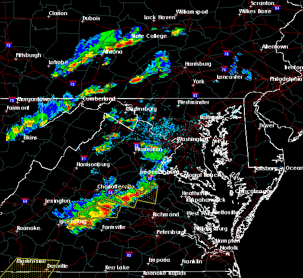 At 335 pm edt, severe thunderstorms were located along a line extending from near ladysmith to near hadensville, moving east at 35 mph (law enforcement. trees have been reported down in and around louisa with these storms). Hazards include 60 mph wind gusts and quarter size hail. Minor damage to vehicles is possible. expect wind damage to trees and powerlines. Locations impacted include, mineral, hadensville, gum spring, kents store, bumpass, orchid, pendleton, sandy hook, cuckoo, caledonia, dabneys, yanceyville, fredericks hall, tabscott, othma, wilmington, locust creek and apple grove. At 335 pm edt, severe thunderstorms were located along a line extending from near ladysmith to near hadensville, moving east at 35 mph (law enforcement. trees have been reported down in and around louisa with these storms). Hazards include 60 mph wind gusts and quarter size hail. Minor damage to vehicles is possible. expect wind damage to trees and powerlines. Locations impacted include, mineral, hadensville, gum spring, kents store, bumpass, orchid, pendleton, sandy hook, cuckoo, caledonia, dabneys, yanceyville, fredericks hall, tabscott, othma, wilmington, locust creek and apple grove.
|
| 5/10/2018 3:20 PM EDT | Tree down on kennon road reported by sheriff's offic in louisa county VA, 0.8 miles ENE of Mineral, VA |
| 5/10/2018 3:16 PM EDT |
 At 316 pm edt, severe thunderstorms were located along a line extending from 7 miles north of bumpass to near kents store, moving east at 35 mph (radar indicated). Hazards include 60 mph wind gusts and quarter size hail. Minor damage to vehicles is possible. expect wind damage to trees and powerlines. Locations impacted include, louisa, mineral, hadensville, palmyra, gum spring, ferncliff, bumpass, kents store, orchid, louisa airport, tabscott, othma, wares crossroads, wilmington, pendleton, sandy hook, cuckoo, caledonia, wildwood and dabneys. At 316 pm edt, severe thunderstorms were located along a line extending from 7 miles north of bumpass to near kents store, moving east at 35 mph (radar indicated). Hazards include 60 mph wind gusts and quarter size hail. Minor damage to vehicles is possible. expect wind damage to trees and powerlines. Locations impacted include, louisa, mineral, hadensville, palmyra, gum spring, ferncliff, bumpass, kents store, orchid, louisa airport, tabscott, othma, wares crossroads, wilmington, pendleton, sandy hook, cuckoo, caledonia, wildwood and dabneys.
|
| 5/10/2018 2:57 PM EDT |
 At 256 pm edt, severe thunderstorms were located along a line extending from near mineral to near palmyra, moving east at 35 mph (radar indicated. at around 240 pm edt, quarter size hail was reported north of troy). Hazards include 60 mph wind gusts and quarter size hail. Minor damage to vehicles is possible. expect wind damage to trees and powerlines. severe thunderstorms will be near, louisa and mineral around 300 pm edt. hadensville and bumpass around 315 pm edt. gum spring around 325 pm edt. Other locations impacted by these severe thunderstorms include orchid, pendleton, sandy hook, louisa airport, cuckoo, caledonia, wildwood, dabneys, bybee and yanceyville. At 256 pm edt, severe thunderstorms were located along a line extending from near mineral to near palmyra, moving east at 35 mph (radar indicated. at around 240 pm edt, quarter size hail was reported north of troy). Hazards include 60 mph wind gusts and quarter size hail. Minor damage to vehicles is possible. expect wind damage to trees and powerlines. severe thunderstorms will be near, louisa and mineral around 300 pm edt. hadensville and bumpass around 315 pm edt. gum spring around 325 pm edt. Other locations impacted by these severe thunderstorms include orchid, pendleton, sandy hook, louisa airport, cuckoo, caledonia, wildwood, dabneys, bybee and yanceyville.
|
| 4/15/2018 9:56 PM EDT |
 The severe thunderstorm warning for louisa, east central cumberland, goochland, north central amelia and powhatan counties will expire at 1000 pm edt, the storms which prompted the warning have weakened below severe limits, and have exited the warned area. therefore the warning will be allowed to expire. however heavy rain is still possible with these thunderstorms. to report severe weather, contact your nearest law enforcement agency. they will relay your report to the national weather service wakefield. The severe thunderstorm warning for louisa, east central cumberland, goochland, north central amelia and powhatan counties will expire at 1000 pm edt, the storms which prompted the warning have weakened below severe limits, and have exited the warned area. therefore the warning will be allowed to expire. however heavy rain is still possible with these thunderstorms. to report severe weather, contact your nearest law enforcement agency. they will relay your report to the national weather service wakefield.
|
| 4/15/2018 9:25 PM EDT |
 At 925 pm edt, severe thunderstorms were located along a line extending from near louisa to near hadensville to near goochland, moving northeast at 45 mph (radar indicated). Hazards include 60 mph wind gusts and penny size hail. Expect damage to trees and powerlines. locations impacted include, powhatan, goochland, louisa, mineral, hadensville, gum spring, fife, tobaccoville, trenholm, bumpass, macon, ballsville, orchid, rock castle, louisa airport, maidens, three square, irwin, michaux and west view. A tornado watch remains in effect until midnight edt for central virginia. At 925 pm edt, severe thunderstorms were located along a line extending from near louisa to near hadensville to near goochland, moving northeast at 45 mph (radar indicated). Hazards include 60 mph wind gusts and penny size hail. Expect damage to trees and powerlines. locations impacted include, powhatan, goochland, louisa, mineral, hadensville, gum spring, fife, tobaccoville, trenholm, bumpass, macon, ballsville, orchid, rock castle, louisa airport, maidens, three square, irwin, michaux and west view. A tornado watch remains in effect until midnight edt for central virginia.
|
| 4/15/2018 8:59 PM EDT |
 At 858 pm edt, severe thunderstorms were located along a line extending from 6 miles south of culpeper to near louisa to macon, moving northeast at 55 mph (radar indicated). Hazards include 60 mph wind gusts. Expect damage to trees and powerlines. these severe thunderstorms will remain over mainly rural areas of louisa, east central cumberland, goochland, north central amelia and powhatan counties, including the following locations: orchid, rock castle, louisa airport, maidens, three square, irwin, michaux, west view, tabscott and othma. A tornado watch remains in effect until midnight edt for central virginia. At 858 pm edt, severe thunderstorms were located along a line extending from 6 miles south of culpeper to near louisa to macon, moving northeast at 55 mph (radar indicated). Hazards include 60 mph wind gusts. Expect damage to trees and powerlines. these severe thunderstorms will remain over mainly rural areas of louisa, east central cumberland, goochland, north central amelia and powhatan counties, including the following locations: orchid, rock castle, louisa airport, maidens, three square, irwin, michaux, west view, tabscott and othma. A tornado watch remains in effect until midnight edt for central virginia.
|
| 4/15/2018 8:37 PM EDT |
 At 837 pm edt, severe thunderstorms were located along a line extending from near stanardsville to 6 miles north of boswells tavern to near louisa to near columbia, moving northeast at 55 mph (radar indicated). Hazards include 60 mph wind gusts and penny size hail. Expect damage to trees and powerlines. locations impacted include, louisa, mineral, ferncliff, boswells tavern, gordonsville, pendleton, louisa airport, green springs, zion crossroads, cuckoo, yanceyville, waldrop, byrd mill, trevilians, wares crossroads and vawter corner. A tornado watch remains in effect until midnight edt for central virginia. At 837 pm edt, severe thunderstorms were located along a line extending from near stanardsville to 6 miles north of boswells tavern to near louisa to near columbia, moving northeast at 55 mph (radar indicated). Hazards include 60 mph wind gusts and penny size hail. Expect damage to trees and powerlines. locations impacted include, louisa, mineral, ferncliff, boswells tavern, gordonsville, pendleton, louisa airport, green springs, zion crossroads, cuckoo, yanceyville, waldrop, byrd mill, trevilians, wares crossroads and vawter corner. A tornado watch remains in effect until midnight edt for central virginia.
|
| 4/15/2018 8:12 PM EDT |
 At 811 pm edt, severe thunderstorms were located along a line extending from near free union to near lake monticello to fork union to near cumberland, moving northeast at 45 mph (radar indicated). Hazards include 60 mph wind gusts and nickel size hail. expect damage to trees and powerlines At 811 pm edt, severe thunderstorms were located along a line extending from near free union to near lake monticello to fork union to near cumberland, moving northeast at 45 mph (radar indicated). Hazards include 60 mph wind gusts and nickel size hail. expect damage to trees and powerlines
|
| 7/17/2017 7:15 PM EDT | Trees down at 300 bumpass road and green coral roa in louisa county VA, 9.6 miles WNW of Mineral, VA |
| 5/27/2017 5:48 PM EDT |
 At 547 pm edt, a severe thunderstorm was located near mineral, moving southeast at 30 mph (radar indicated). Hazards include 60 mph wind gusts and quarter size hail. Minor damage to vehicles is possible. expect wind damage to trees and powerlines. this severe thunderstorm will be near, bumpass around 600 pm edt. montpelier around 620 pm edt. Other locations impacted by this severe thunderstorm include chilesburg, golansville, pendleton, oliver, gum tree, coatesville, hewlett, goodall, doswell and penola. At 547 pm edt, a severe thunderstorm was located near mineral, moving southeast at 30 mph (radar indicated). Hazards include 60 mph wind gusts and quarter size hail. Minor damage to vehicles is possible. expect wind damage to trees and powerlines. this severe thunderstorm will be near, bumpass around 600 pm edt. montpelier around 620 pm edt. Other locations impacted by this severe thunderstorm include chilesburg, golansville, pendleton, oliver, gum tree, coatesville, hewlett, goodall, doswell and penola.
|
| 4/21/2017 6:30 PM EDT | Tree down and dime size hai in louisa county VA, 5.3 miles W of Mineral, VA |
| 4/6/2017 12:14 PM EDT |
 At 1213 pm edt, a severe thunderstorm was located over louisa, moving northeast at 50 mph (radar indicated). Hazards include 60 mph wind gusts and quarter size hail. Hail damage to vehicles is expected. expect wind damage to roofs, siding, and trees. this severe thunderstorm will be near, mineral around 1220 pm edt. other locations impacted by this severe thunderstorm include pendleton, louisa airport, waldrop, green springs, byrd mill, trevilians, wares crossroads, vawter corner and gordonsville. A tornado watch remains in effect until 100 pm edt for central virginia. At 1213 pm edt, a severe thunderstorm was located over louisa, moving northeast at 50 mph (radar indicated). Hazards include 60 mph wind gusts and quarter size hail. Hail damage to vehicles is expected. expect wind damage to roofs, siding, and trees. this severe thunderstorm will be near, mineral around 1220 pm edt. other locations impacted by this severe thunderstorm include pendleton, louisa airport, waldrop, green springs, byrd mill, trevilians, wares crossroads, vawter corner and gordonsville. A tornado watch remains in effect until 100 pm edt for central virginia.
|
| 3/1/2017 1:40 PM EST | Large diameter tree knocked down across us-522. time estimated from rada in louisa county VA, 11.4 miles N of Mineral, VA |
| 8/15/2016 6:18 PM EDT | Tree down on belmont road at day dream court in spotsylvania county VA, 7.3 miles S of Mineral, VA |
| 7/19/2016 4:15 PM EDT | Tree down on cross county rd. near i-6 in louisa county VA, 14.3 miles N of Mineral, VA |
| 7/19/2016 3:55 PM EDT | Tree down on cross county rd. near i-6 in louisa county VA, 14.3 miles N of Mineral, VA |
| 7/19/2016 3:51 PM EDT |
 At 351 pm edt, a severe thunderstorm was located near mineral, moving southeast at 30 mph (radar indicated). Hazards include 60 mph wind gusts and quarter size hail. Hail damage to vehicles is expected. expect wind damage to roofs, siding, and trees. This severe thunderstorm will remain over mainly rural areas of central louisa and north central goochland counties, including the following locations: yanceyville, byrd mill, louisa airport, fredericks hall, pendleton, tabscott, cuckoo and apple grove. At 351 pm edt, a severe thunderstorm was located near mineral, moving southeast at 30 mph (radar indicated). Hazards include 60 mph wind gusts and quarter size hail. Hail damage to vehicles is expected. expect wind damage to roofs, siding, and trees. This severe thunderstorm will remain over mainly rural areas of central louisa and north central goochland counties, including the following locations: yanceyville, byrd mill, louisa airport, fredericks hall, pendleton, tabscott, cuckoo and apple grove.
|
| 7/19/2016 3:36 PM EDT |
 At 336 pm edt, a severe thunderstorm was located near louisa, moving southeast at 25 mph (radar indicated). Hazards include 60 mph wind gusts and quarter size hail. Hail damage to vehicles is expected. expect wind damage to roofs, siding, and trees. this severe thunderstorm will be near, louisa and ferncliff around 355 pm edt. mineral around 405 pm edt. Other locations impacted by this severe thunderstorm include yanceyville, byrd mill, louisa airport, vawter corner, trevilians, waldrop, fredericks hall, green springs, pendleton and tabscott. At 336 pm edt, a severe thunderstorm was located near louisa, moving southeast at 25 mph (radar indicated). Hazards include 60 mph wind gusts and quarter size hail. Hail damage to vehicles is expected. expect wind damage to roofs, siding, and trees. this severe thunderstorm will be near, louisa and ferncliff around 355 pm edt. mineral around 405 pm edt. Other locations impacted by this severe thunderstorm include yanceyville, byrd mill, louisa airport, vawter corner, trevilians, waldrop, fredericks hall, green springs, pendleton and tabscott.
|
| 6/16/2016 8:55 PM EDT |
 At 854 pm edt, severe thunderstorms were located along a line extending from near quantico to near kents store, moving east at 40 mph (radar indicated). Hazards include 60 mph wind gusts and quarter size hail. Hail damage to vehicles is expected. expect wind damage to roofs, siding, and trees. severe thunderstorms will be near, montpelier around 925 pm edt. wyndham around 930 pm edt. ashland and randolph macon college around 935 pm edt. glen allen around 940 pm edt. hanover around 945 pm edt. Other locations impacted by these severe thunderstorms include supply, elevon, hustle, woodford, pendleton, sparta, burruss corner, cedon, hewlett and guinea. At 854 pm edt, severe thunderstorms were located along a line extending from near quantico to near kents store, moving east at 40 mph (radar indicated). Hazards include 60 mph wind gusts and quarter size hail. Hail damage to vehicles is expected. expect wind damage to roofs, siding, and trees. severe thunderstorms will be near, montpelier around 925 pm edt. wyndham around 930 pm edt. ashland and randolph macon college around 935 pm edt. glen allen around 940 pm edt. hanover around 945 pm edt. Other locations impacted by these severe thunderstorms include supply, elevon, hustle, woodford, pendleton, sparta, burruss corner, cedon, hewlett and guinea.
|
| 6/16/2016 8:25 PM EDT |
 At 824 pm edt, a severe thunderstorm was located near bumpass, or near mineral, moving southeast at 25 mph (radar indicated). Hazards include two inch hail and 70 mph wind gusts. People and animals outdoors will be injured. expect hail damage to roofs, siding, windows, and vehicles. expect considerable tree damage. wind damage is also likely to mobile homes, roofs, and outbuildings. locations impacted include, louisa, mineral, bumpass, wares crossroads, louisa airport, fredericks hall and pendleton. precautionary/preparedness actions, remain alert for a possible tornado! tornadoes can develop quickly from severe thunderstorms. if you spot a tornado go at once into the basement or small central room in a sturdy structure. for your protection move to an interior room on the lowest floor of a building. please send your reports of hail and or wind damage, including trees or large limbs downed, by calling noaa`s national weather service in wakefield at , 7 5 7, 8 9 9, 2 4 1 5. At 824 pm edt, a severe thunderstorm was located near bumpass, or near mineral, moving southeast at 25 mph (radar indicated). Hazards include two inch hail and 70 mph wind gusts. People and animals outdoors will be injured. expect hail damage to roofs, siding, windows, and vehicles. expect considerable tree damage. wind damage is also likely to mobile homes, roofs, and outbuildings. locations impacted include, louisa, mineral, bumpass, wares crossroads, louisa airport, fredericks hall and pendleton. precautionary/preparedness actions, remain alert for a possible tornado! tornadoes can develop quickly from severe thunderstorms. if you spot a tornado go at once into the basement or small central room in a sturdy structure. for your protection move to an interior room on the lowest floor of a building. please send your reports of hail and or wind damage, including trees or large limbs downed, by calling noaa`s national weather service in wakefield at , 7 5 7, 8 9 9, 2 4 1 5.
|
| 6/16/2016 8:15 PM EDT | Ping Pong Ball sized hail reported 8.3 miles SSW of Mineral, VA |
| 6/16/2016 8:11 PM EDT |
 At 810 pm edt, severe thunderstorms were located along a line extending from 9 miles west of culpeper to charlottesville, moving east at 40 mph (radar indicated). Hazards include 60 mph wind gusts and quarter size hail. Hail damage to vehicles is expected. expect wind damage to roofs, siding, and trees. severe thunderstorms will be near, boswells tavern and troy around 830 pm edt. ferncliff and kents store around 835 pm edt. louisa around 845 pm edt. mineral around 850 pm edt. bumpass around 900 pm edt. Other locations impacted by these severe thunderstorms include yanceyville, louisa airport, vawter corner, zion crossroads, fredericks hall, green springs, pendleton, cuckoo, apple grove and bybee. At 810 pm edt, severe thunderstorms were located along a line extending from 9 miles west of culpeper to charlottesville, moving east at 40 mph (radar indicated). Hazards include 60 mph wind gusts and quarter size hail. Hail damage to vehicles is expected. expect wind damage to roofs, siding, and trees. severe thunderstorms will be near, boswells tavern and troy around 830 pm edt. ferncliff and kents store around 835 pm edt. louisa around 845 pm edt. mineral around 850 pm edt. bumpass around 900 pm edt. Other locations impacted by these severe thunderstorms include yanceyville, louisa airport, vawter corner, zion crossroads, fredericks hall, green springs, pendleton, cuckoo, apple grove and bybee.
|
| 6/16/2016 8:05 PM EDT |
 At 804 pm edt, a severe thunderstorm was located near mineral, moving southeast at 25 mph (radar indicated). Hazards include 70 mph wind gusts and ping pong ball size hail. People and animals outdoors will be injured. expect hail damage to roofs, siding, windows, and vehicles. expect considerable tree damage. wind damage is also likely to mobile homes, roofs, and outbuildings. locations impacted include, louisa, mineral, bumpass, wares crossroads, louisa airport, fredericks hall and pendleton. precautionary/preparedness actions, for your protection move to an interior room on the lowest floor of a building. please send your reports of hail and or wind damage, including trees or large limbs downed, by calling noaa`s national weather service in wakefield at , 7 5 7, 8 9 9, 2 4 1 5. At 804 pm edt, a severe thunderstorm was located near mineral, moving southeast at 25 mph (radar indicated). Hazards include 70 mph wind gusts and ping pong ball size hail. People and animals outdoors will be injured. expect hail damage to roofs, siding, windows, and vehicles. expect considerable tree damage. wind damage is also likely to mobile homes, roofs, and outbuildings. locations impacted include, louisa, mineral, bumpass, wares crossroads, louisa airport, fredericks hall and pendleton. precautionary/preparedness actions, for your protection move to an interior room on the lowest floor of a building. please send your reports of hail and or wind damage, including trees or large limbs downed, by calling noaa`s national weather service in wakefield at , 7 5 7, 8 9 9, 2 4 1 5.
|
| 6/16/2016 7:53 PM EDT |
 At 753 pm edt, a severe thunderstorm was located near mineral, moving southeast at 55 mph (radar indicated). Hazards include 60 mph wind gusts and quarter size hail. Hail damage to vehicles is expected. Expect wind damage to roofs, siding, and trees. At 753 pm edt, a severe thunderstorm was located near mineral, moving southeast at 55 mph (radar indicated). Hazards include 60 mph wind gusts and quarter size hail. Hail damage to vehicles is expected. Expect wind damage to roofs, siding, and trees.
|
| 2/24/2016 4:47 PM EST |
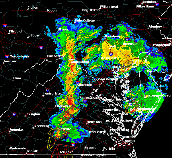 At 446 pm est, doppler radar indicated a tornado. this dangerous storm was located near hadensville, and moving northeast at 45 mph. * this dangerous storm will be near, hadensville around 450 pm est. louisa and mineral around 505 pm est. bumpass around 510 pm est. other locations impacted by this tornadic thunderstorm include yanceyville, louisa airport, fredericks hall, pendleton, cuckoo, caledonia, stage junction, apple grove, wares crossroads and elk hill. At 446 pm est, doppler radar indicated a tornado. this dangerous storm was located near hadensville, and moving northeast at 45 mph. * this dangerous storm will be near, hadensville around 450 pm est. louisa and mineral around 505 pm est. bumpass around 510 pm est. other locations impacted by this tornadic thunderstorm include yanceyville, louisa airport, fredericks hall, pendleton, cuckoo, caledonia, stage junction, apple grove, wares crossroads and elk hill.
|
| 8/11/2015 4:15 PM EDT | Numerous trees down east of louisa mainly north of highway 22. several roads blocked and power lines pulled dow in louisa county VA, 2.1 miles SE of Mineral, VA |
| 8/11/2015 4:06 PM EDT |
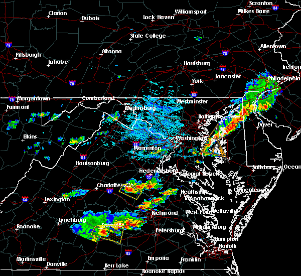 At 406 pm edt, doppler radar indicated a severe thunderstorm capable of producing quarter size hail and damaging winds in excess of 60 mph. this storm was located over mineral, and moving east at 25 mph. * this severe thunderstorm will be near, mineral around 410 pm edt. bumpass around 430 pm edt. other locations impacted by this severe thunderstorm include fredericks hall, pendleton, cuckoo, wares crossroads, louisa airport and locust creek. At 406 pm edt, doppler radar indicated a severe thunderstorm capable of producing quarter size hail and damaging winds in excess of 60 mph. this storm was located over mineral, and moving east at 25 mph. * this severe thunderstorm will be near, mineral around 410 pm edt. bumpass around 430 pm edt. other locations impacted by this severe thunderstorm include fredericks hall, pendleton, cuckoo, wares crossroads, louisa airport and locust creek.
|
| 7/30/2015 6:26 PM EDT |
 At 626 pm edt, doppler radar indicated a severe thunderstorm capable of producing damaging winds in excess of 60 mph. this storm was located near boswells tavern, or 12 miles north of palmyra, and moving southeast at 20 mph. penny size hail may also accompany the damaging winds. * this severe thunderstorm will be near, boswells tavern around 630 pm edt. ferncliff and kents store around 655 pm edt. louisa around 700 pm edt. mineral around 715 pm edt. other locations impacted by this severe thunderstorm include yanceyville, louisa airport, wilmington, vawter corner, zion crossroads, green springs, pendleton, caledonia, carysbrook and stage junction. At 626 pm edt, doppler radar indicated a severe thunderstorm capable of producing damaging winds in excess of 60 mph. this storm was located near boswells tavern, or 12 miles north of palmyra, and moving southeast at 20 mph. penny size hail may also accompany the damaging winds. * this severe thunderstorm will be near, boswells tavern around 630 pm edt. ferncliff and kents store around 655 pm edt. louisa around 700 pm edt. mineral around 715 pm edt. other locations impacted by this severe thunderstorm include yanceyville, louisa airport, wilmington, vawter corner, zion crossroads, green springs, pendleton, caledonia, carysbrook and stage junction.
|
| 6/25/2015 9:08 PM EDT |
 At 908 pm edt, doppler radar indicated a line of severe thunderstorms capable of producing quarter size hail and damaging winds in excess of 60 mph. these storms were located along a line extending from 7 miles north of bumpass to near gold hill, moving southeast at 30 mph. locations impacted include, louisa, mineral, palmyra, fork union, lake monticello, columbia, troy, ferncliff, kents store, boswells tavern, dixie, louisa airport, wilmington, central plains, zion crossroads, shores, pendleton, carysbrook, stage junction and bybee. At 908 pm edt, doppler radar indicated a line of severe thunderstorms capable of producing quarter size hail and damaging winds in excess of 60 mph. these storms were located along a line extending from 7 miles north of bumpass to near gold hill, moving southeast at 30 mph. locations impacted include, louisa, mineral, palmyra, fork union, lake monticello, columbia, troy, ferncliff, kents store, boswells tavern, dixie, louisa airport, wilmington, central plains, zion crossroads, shores, pendleton, carysbrook, stage junction and bybee.
|
| 6/25/2015 8:40 PM EDT |
 At 839 pm edt, doppler radar indicated a line of severe thunderstorms capable of producing quarter size hail and damaging winds in excess of 60 mph. these storms were located along a line extending from 9 miles southeast of orange to near schuyler, and moving southeast at 30 mph. * these severe thunderstorms will remain over mainly rural areas of fluvanna and louisa counties, including the following locations, yanceyville, dixie, louisa airport, wilmington, vawter corner, central plains, zion crossroads, shores, green springs and pendleton. At 839 pm edt, doppler radar indicated a line of severe thunderstorms capable of producing quarter size hail and damaging winds in excess of 60 mph. these storms were located along a line extending from 9 miles southeast of orange to near schuyler, and moving southeast at 30 mph. * these severe thunderstorms will remain over mainly rural areas of fluvanna and louisa counties, including the following locations, yanceyville, dixie, louisa airport, wilmington, vawter corner, central plains, zion crossroads, shores, green springs and pendleton.
|
| 6/25/2015 8:33 PM EDT |
 At 832 pm edt, doppler radar indicated a line of severe thunderstorms capable of producing quarter size hail and damaging winds in excess of 60 mph. these storms were located along a line extending from 6 miles northeast of gum spring to lakeside village, moving southeast at 25 mph. these severe storms will be near, gum spring around 835 pm edt. other locations impacted by these severe thunderstorms include trenton mills, dixie, louisa airport, wilmington, central plains, zion crossroads, shores, pendleton, carysbrook and stage junction. At 832 pm edt, doppler radar indicated a line of severe thunderstorms capable of producing quarter size hail and damaging winds in excess of 60 mph. these storms were located along a line extending from 6 miles northeast of gum spring to lakeside village, moving southeast at 25 mph. these severe storms will be near, gum spring around 835 pm edt. other locations impacted by these severe thunderstorms include trenton mills, dixie, louisa airport, wilmington, central plains, zion crossroads, shores, pendleton, carysbrook and stage junction.
|
| 6/25/2015 8:06 PM EDT |
 At 806 pm edt, doppler radar indicated a line of severe thunderstorms capable of producing quarter size hail and damaging winds in excess of 60 mph. these storms were located along a line extending from near hadensville to near new canton, and moving southeast at 25 mph. * severe thunderstorms will be near, hadensville around 810 pm edt. columbia and gum spring around 825 pm edt. duncan around 830 pm edt. lakeside village around 835 pm edt. cartersville around 840 pm edt. montpelier around 845 pm edt. other locations impacted by these severe thunderstorms include dixie, central plains, pendleton, carysbrook, stage junction, ashby, irwin, hewlett, whiteville and antioch. At 806 pm edt, doppler radar indicated a line of severe thunderstorms capable of producing quarter size hail and damaging winds in excess of 60 mph. these storms were located along a line extending from near hadensville to near new canton, and moving southeast at 25 mph. * severe thunderstorms will be near, hadensville around 810 pm edt. columbia and gum spring around 825 pm edt. duncan around 830 pm edt. lakeside village around 835 pm edt. cartersville around 840 pm edt. montpelier around 845 pm edt. other locations impacted by these severe thunderstorms include dixie, central plains, pendleton, carysbrook, stage junction, ashby, irwin, hewlett, whiteville and antioch.
|
| 6/20/2015 8:09 PM EDT |
 At 808 pm edt, doppler radar indicated a line of severe thunderstorms capable of producing damaging winds in excess of 60 mph. these storms were located along a line extending from 8 miles east of orange to near montpelier to 7 miles northwest of sutherland, and moving northeast at 50 mph. * severe thunderstorms will be near, ashland around 815 pm edt. kings dominion around 820 pm edt. chester and ladysmith around 825 pm edt. milford, bellwood and bensley around 830 pm edt. bowling green around 835 pm edt. highland springs and fort a.p. hill around 840 pm edt. bottoms bridge around 845 pm edt. talleysville, port royal, tunstall and loretto around 850 pm edt. other locations impacted by these severe thunderstorms include supply, elevon, hustle, orapax farms, epworth, sparta, maidens, burruss corner, irwin and roslyn hills. At 808 pm edt, doppler radar indicated a line of severe thunderstorms capable of producing damaging winds in excess of 60 mph. these storms were located along a line extending from 8 miles east of orange to near montpelier to 7 miles northwest of sutherland, and moving northeast at 50 mph. * severe thunderstorms will be near, ashland around 815 pm edt. kings dominion around 820 pm edt. chester and ladysmith around 825 pm edt. milford, bellwood and bensley around 830 pm edt. bowling green around 835 pm edt. highland springs and fort a.p. hill around 840 pm edt. bottoms bridge around 845 pm edt. talleysville, port royal, tunstall and loretto around 850 pm edt. other locations impacted by these severe thunderstorms include supply, elevon, hustle, orapax farms, epworth, sparta, maidens, burruss corner, irwin and roslyn hills.
|
| 6/20/2015 7:46 PM EDT |
 At 746 pm edt, doppler radar indicated a line of severe thunderstorms capable of producing damaging winds in excess of 60 mph. these storms were located along a line extending from 6 miles southwest of orange to near powhatan, and moving northeast at 55 mph. * severe thunderstorms will be near, goochland around 750 pm edt. oilville and sabot around 755 pm edt. manakin around 800 pm edt. tuckahoe, wyndham and montpelier around 805 pm edt. laurel around 810 pm edt. ashland, randolph macon college and glen allen around 815 pm edt. other locations impacted by these severe thunderstorms include crozier, jefferson, michaux, goodwins store, pendleton, maidens, irwin, lake powhatan, roslyn hills and provost. At 746 pm edt, doppler radar indicated a line of severe thunderstorms capable of producing damaging winds in excess of 60 mph. these storms were located along a line extending from 6 miles southwest of orange to near powhatan, and moving northeast at 55 mph. * severe thunderstorms will be near, goochland around 750 pm edt. oilville and sabot around 755 pm edt. manakin around 800 pm edt. tuckahoe, wyndham and montpelier around 805 pm edt. laurel around 810 pm edt. ashland, randolph macon college and glen allen around 815 pm edt. other locations impacted by these severe thunderstorms include crozier, jefferson, michaux, goodwins store, pendleton, maidens, irwin, lake powhatan, roslyn hills and provost.
|
| 6/13/2013 2:44 PM EDT | Trees down in louisa county VA, 9.6 miles WNW of Mineral, VA |
| 6/13/2013 2:44 PM EDT | Golf Ball sized hail reported 9.6 miles WNW of Mineral, VA |
| 6/13/2013 2:40 PM EDT | Numerous trees and powerlines down...andminor structural damage to a barn of va-664 near bumpas in louisa county VA, 9.6 miles WNW of Mineral, VA |
| 6/13/2013 2:40 PM EDT | Numerous trees and powerlines down...and minor structural damage to a barn of va-664 near bumpas in louisa county VA, 9.6 miles WNW of Mineral, VA |
| 6/13/2013 2:09 PM EDT | A few trees reported down in lake anna state park near the campgroun in spotsylvania county VA, 9.2 miles SSW of Mineral, VA |
| 4/19/2013 6:20 PM EDT | Large trees down...one tree severely damaged home...roof partially blown off another hom in louisa county VA, 0.4 miles SSE of Mineral, VA |
| 6/30/2012 7:55 PM EDT | Trees down and minor damage to farm outbuilding in louisa county VA, 2 miles W of Mineral, VA |
| 6/30/2012 7:08 PM EDT | Multiple trees down in the town of mineral in louisa county VA, 0.4 miles SSE of Mineral, VA |
| 6/29/2012 10:10 PM EDT | Several large trees down in minera in louisa county VA, 0.4 miles SSE of Mineral, VA |
| 6/1/2012 3:26 PM EDT | A couple of tree branches knocked down. diameter was a few inches eac in spotsylvania county VA, 10 miles WSW of Mineral, VA |
| 1/1/0001 12:00 AM | Tree down at courthouse road and lewiston roa in spotsylvania county VA, 10.3 miles SW of Mineral, VA |
| 1/1/0001 12:00 AM | Reports of trees down and damage to a carpor in louisa county VA, 9.6 miles WNW of Mineral, VA |
Hail Maps for Mineral, VA


Connect with Interactive Hail Maps