

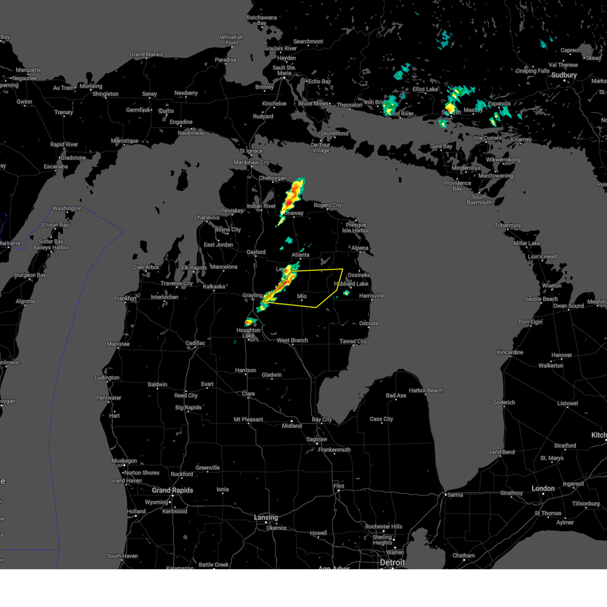
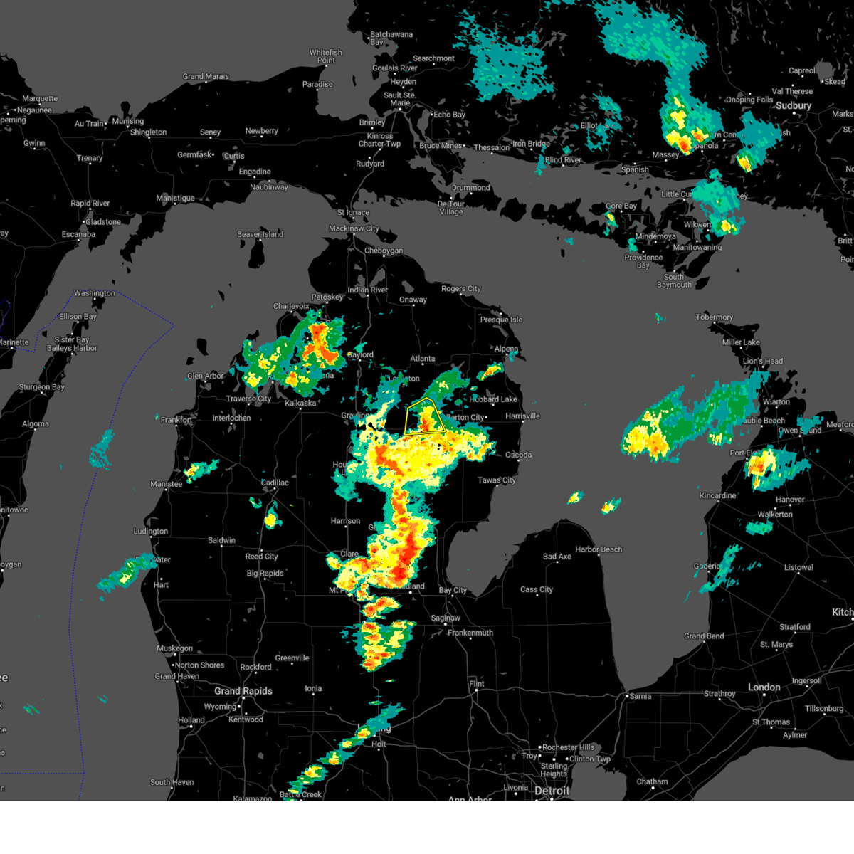
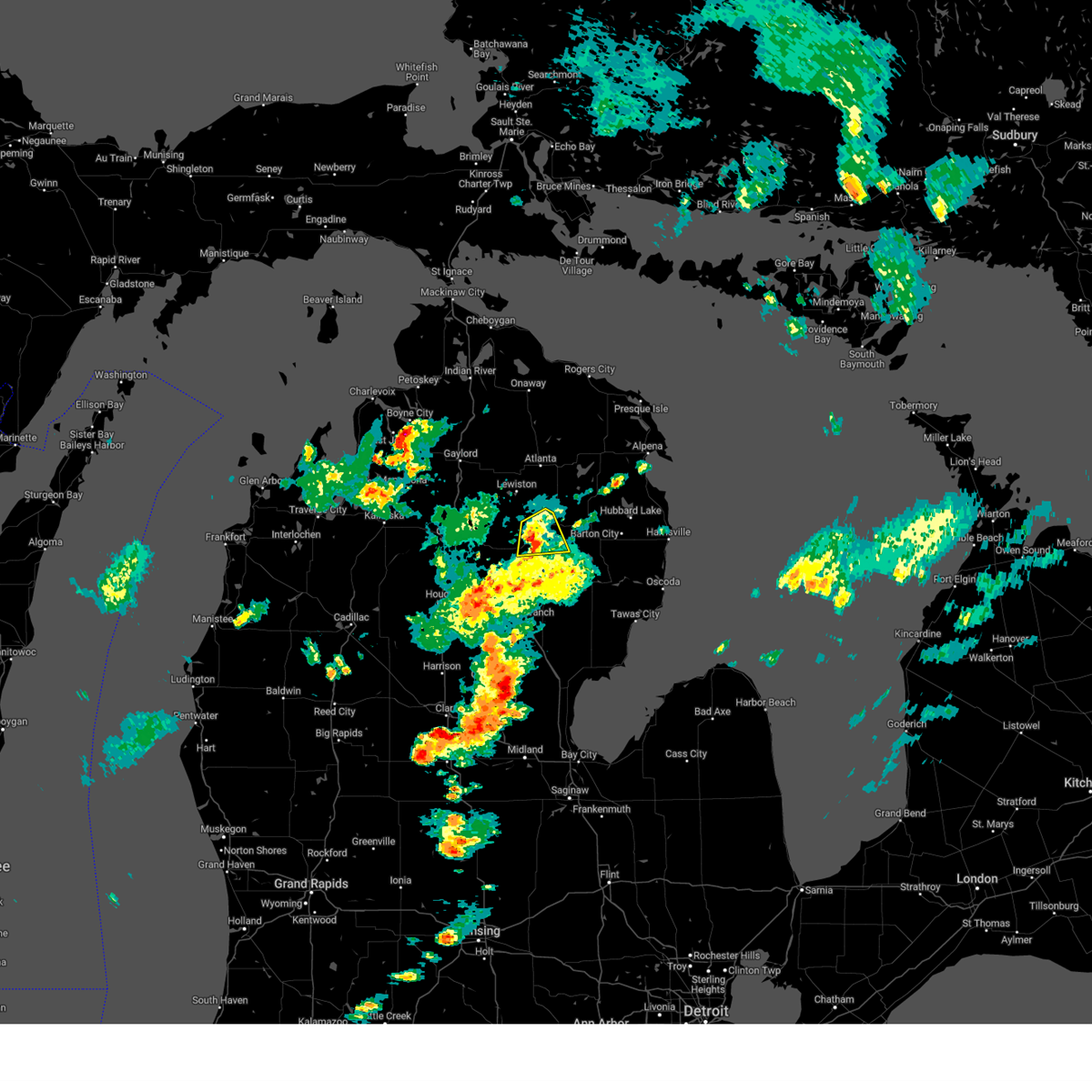
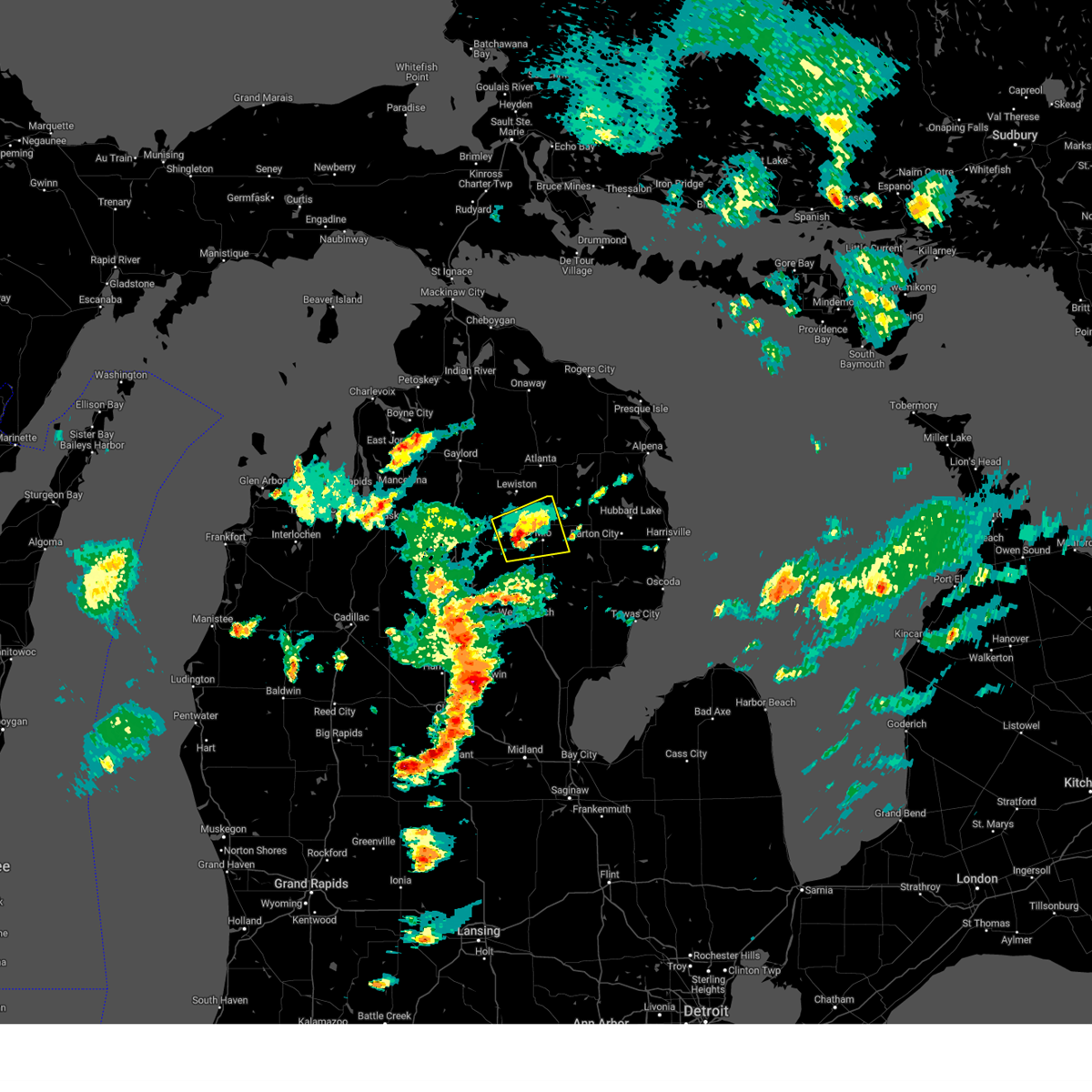
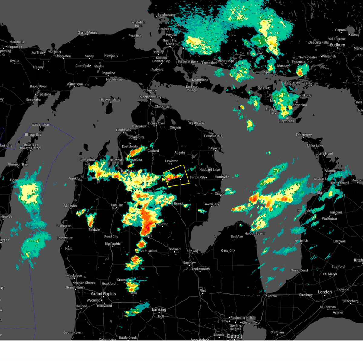
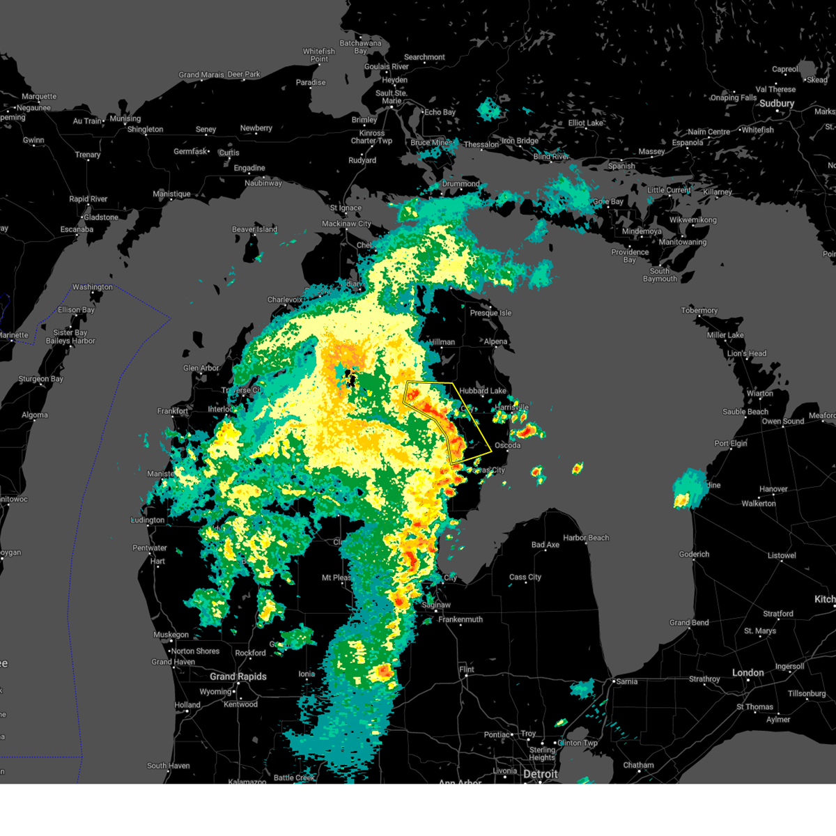
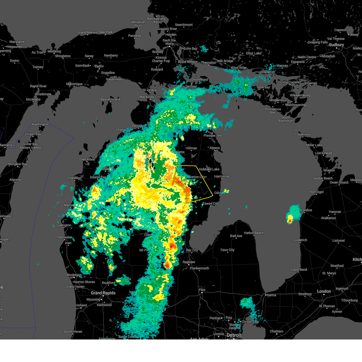
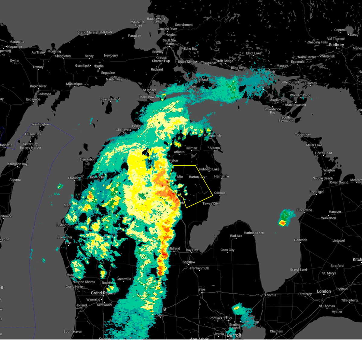
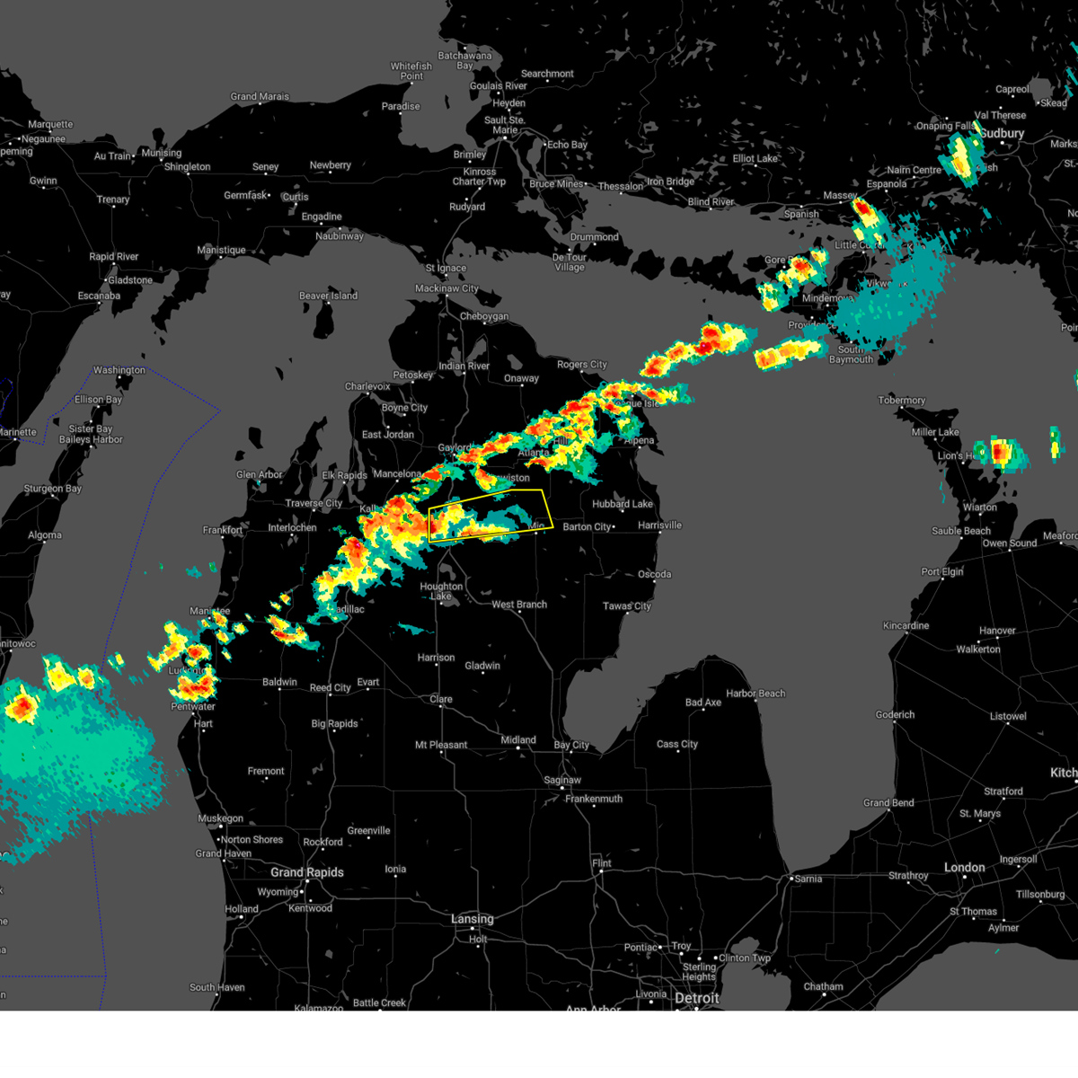
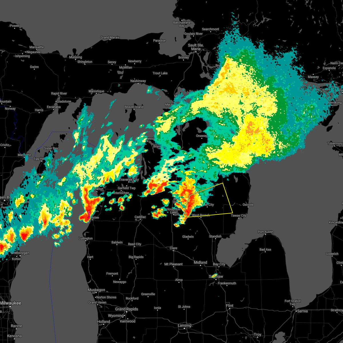
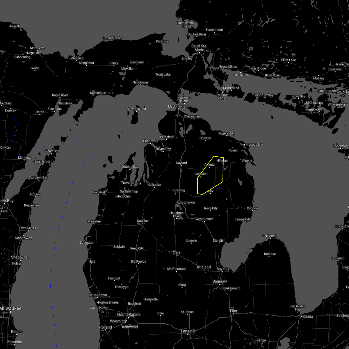
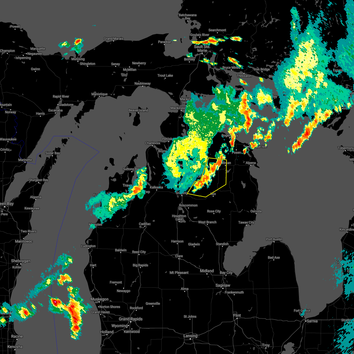
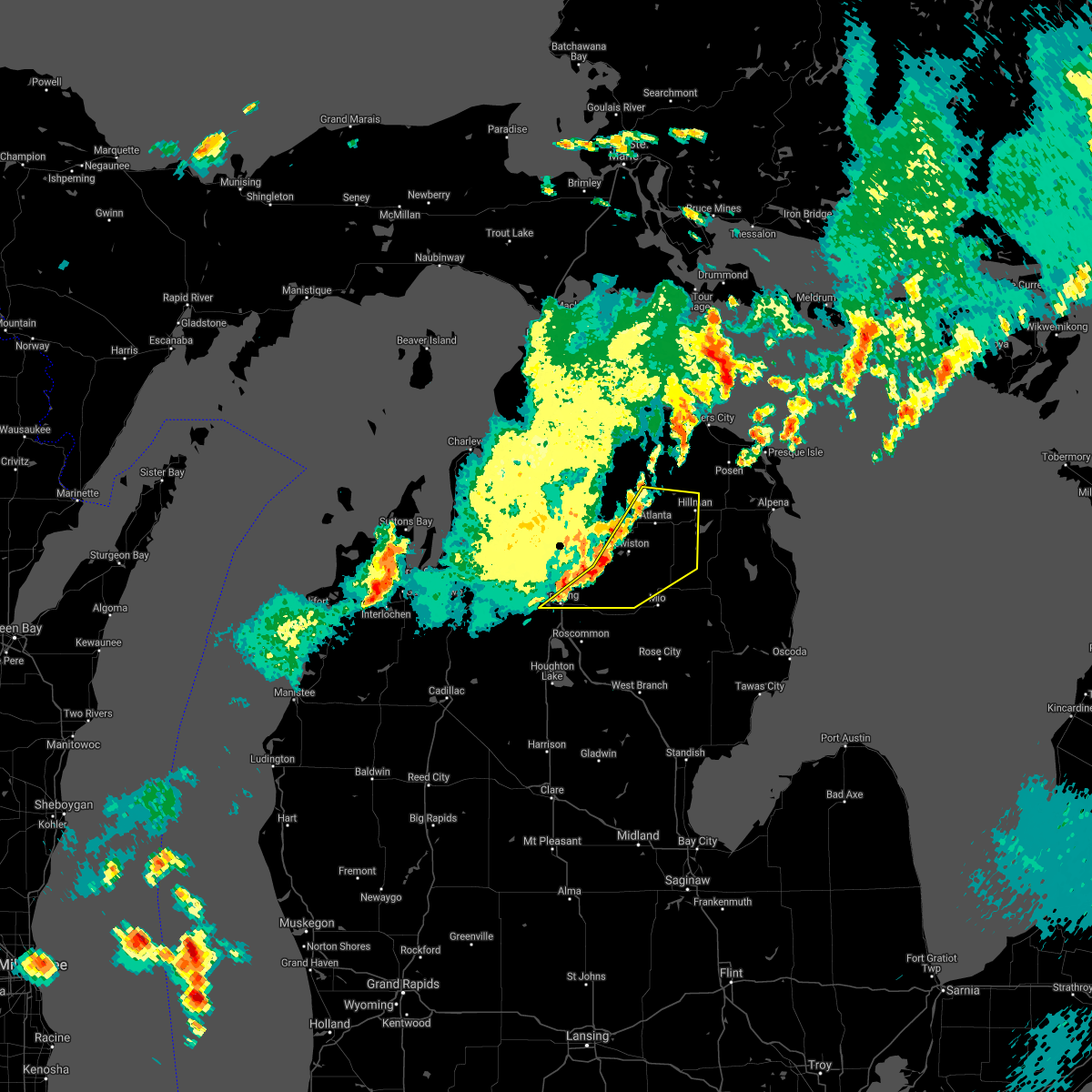
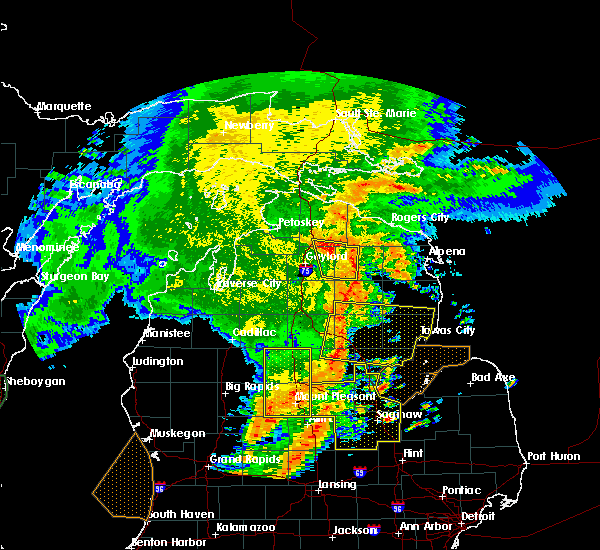
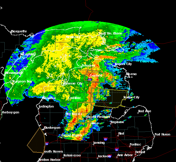
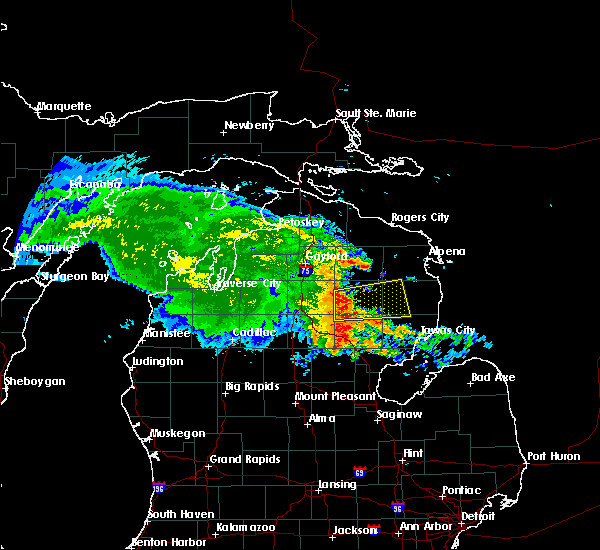
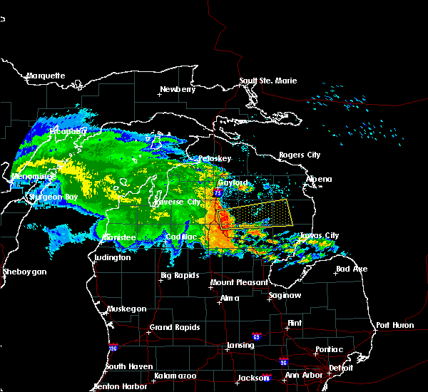
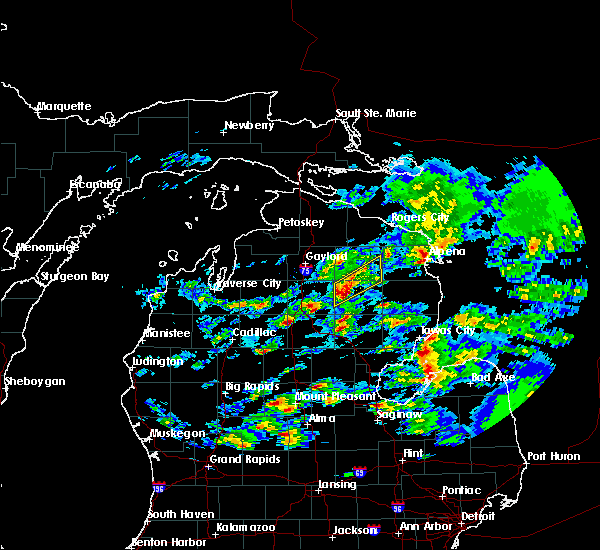
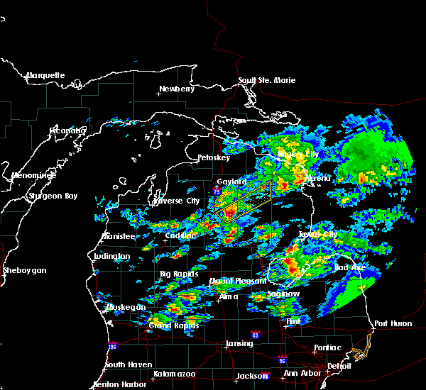
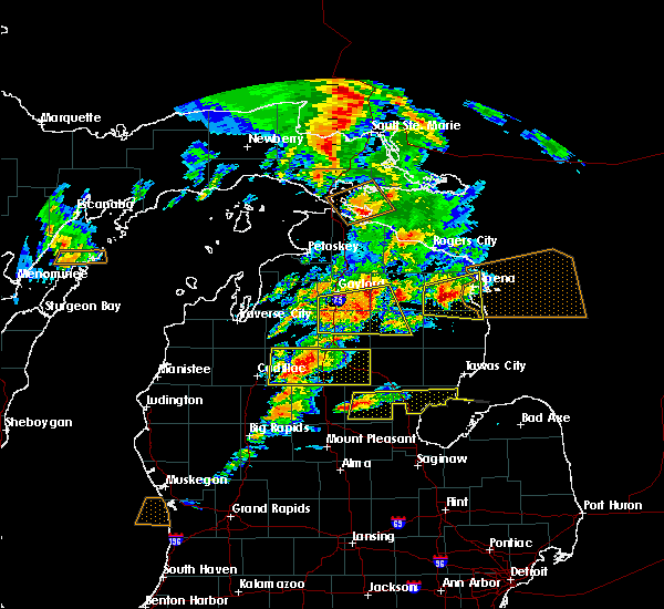
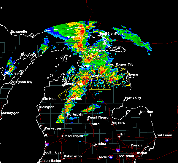
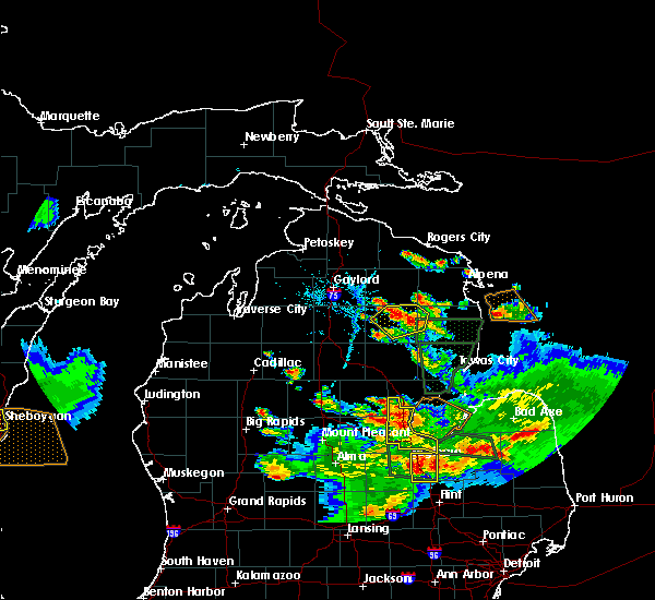
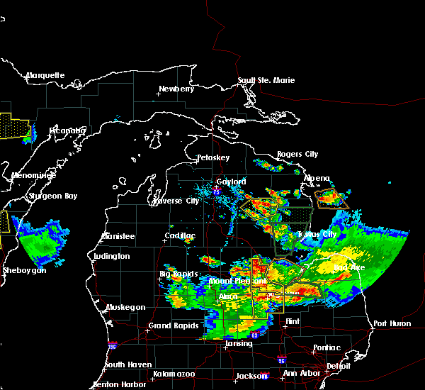
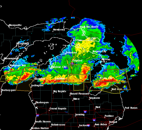
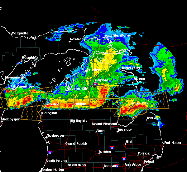
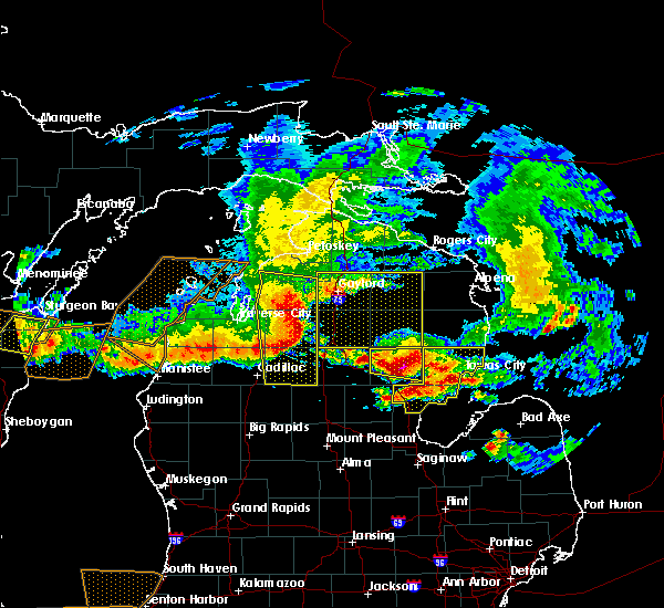
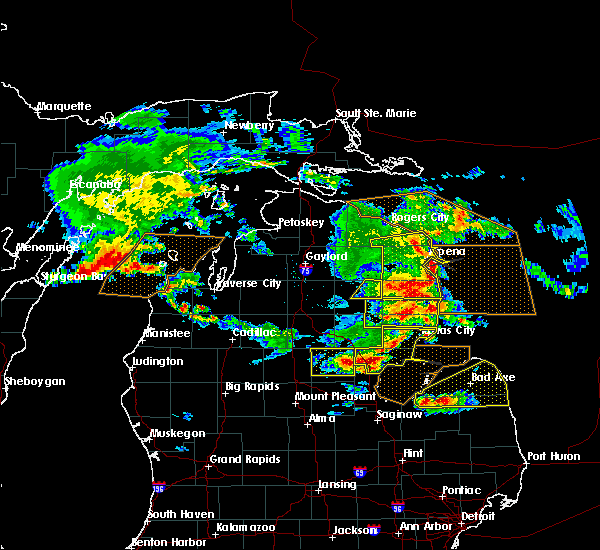
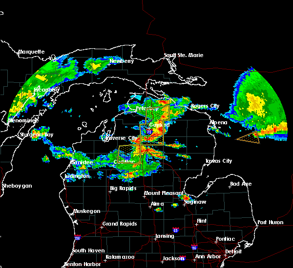
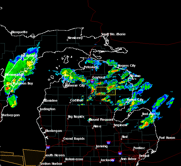
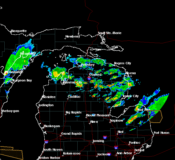
Hail Map for Mio, MI
The Mio, MI area has had 4 reports of on-the-ground hail by trained spotters, and has been under severe weather warnings 3 times during the past 12 months. Doppler radar has detected hail at or near Mio, MI on 19 occasions.
| Name: | Mio, MI |
| Where Located: | 43.8 miles SW of Alpena, MI |
| Map: | Google Map for Mio, MI |
| Population: | 1826 |
| Housing Units: | 1211 |
| More Info: | Search Google for Mio, MI |
0
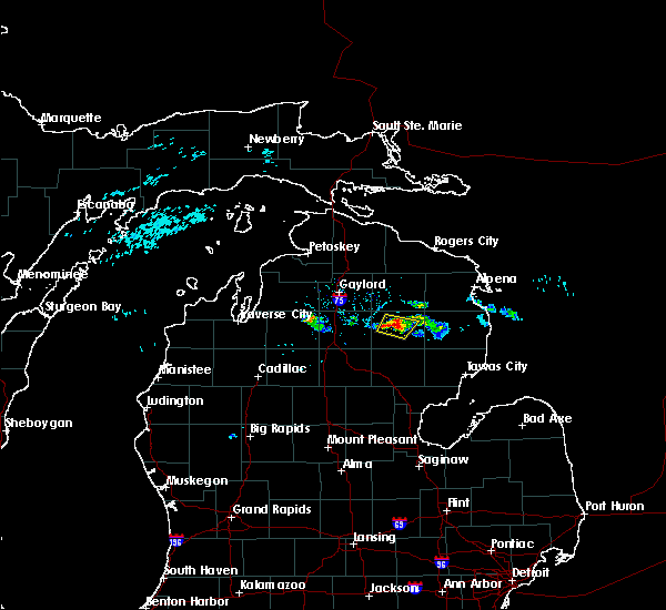
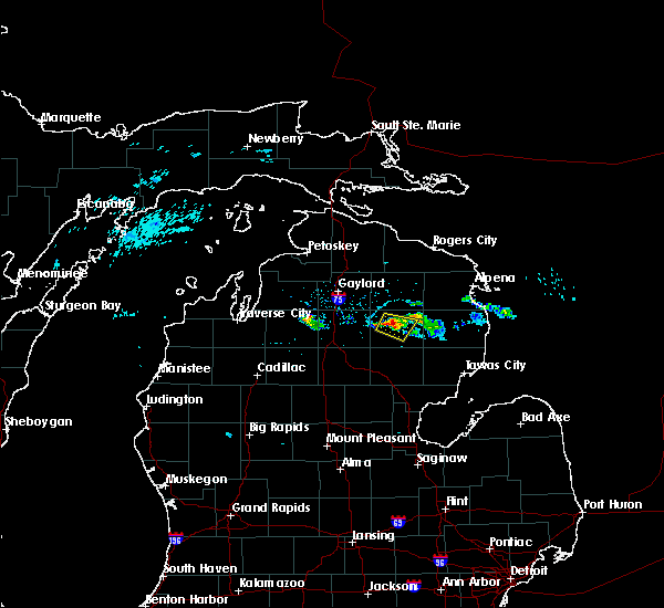
The Top Recent Hail Date for Mio, MI is Friday, July 5, 2024 (12th out of 19)

Hail and Wind Damage Spotted near Mio, MI
| Date / Time | Report Details |
|---|---|
| 5/16/2025 11:07 PM EDT | the severe thunderstorm warning has been cancelled and is no longer in effect |
| 5/16/2025 10:23 PM EDT | Svrapx the national weather service in gaylord has issued a * severe thunderstorm warning for, southwestern alcona county in northern michigan, ogemaw county in northern michigan, southern oscoda county in northern michigan, iosco county in northern michigan, * until 1130 pm edt. * at 1023 pm edt, severe thunderstorms were located along a line extending from near st. helen to 6 miles west of whittemore to near national city, moving north at 50 mph (radar indicated). Hazards include 60 mph wind gusts and quarter size hail. Hail damage to vehicles is expected. expect wind damage to roofs, siding, and trees. severe thunderstorms will be near, rose township, rifle river state park, clear lake, plainfield township, rose city, lupton, long lake, and hale around 1030 pm edt. south branch around 1035 pm edt. luzerne, glennie, mack lake, and curtisville around 1040 pm edt. mio around 1045 pm edt. Other locations impacted by these severe thunderstorms include wilber, foster township, sid town, and prescott. |
| 4/29/2025 11:23 AM EDT |
 Svrapx the national weather service in gaylord has issued a * severe thunderstorm warning for, northwestern alcona county in northern michigan, southwestern alpena county in northern michigan, east central crawford county in northern michigan, southeastern montmorency county in northern michigan, oscoda county in northern michigan, * until noon edt. * at 1123 am edt, severe thunderstorms were located along a line extending from near garland to near red oak to 7 miles north of south branch township, moving east at 35 mph (radar indicated). Hazards include 60 mph wind gusts and penny size hail. Expect damage to roofs, siding, and trees. severe thunderstorms will be near, mio, comins, and red oak around 1130 am edt. luzerne and fairview around 1135 am edt. Other locations impacted by these severe thunderstorms include mitchell township. Svrapx the national weather service in gaylord has issued a * severe thunderstorm warning for, northwestern alcona county in northern michigan, southwestern alpena county in northern michigan, east central crawford county in northern michigan, southeastern montmorency county in northern michigan, oscoda county in northern michigan, * until noon edt. * at 1123 am edt, severe thunderstorms were located along a line extending from near garland to near red oak to 7 miles north of south branch township, moving east at 35 mph (radar indicated). Hazards include 60 mph wind gusts and penny size hail. Expect damage to roofs, siding, and trees. severe thunderstorms will be near, mio, comins, and red oak around 1130 am edt. luzerne and fairview around 1135 am edt. Other locations impacted by these severe thunderstorms include mitchell township.
|
| 7/5/2024 6:27 PM EDT |
 The storm which prompted the warning has weakened below severe limits, and no longer poses an immediate threat to life or property. therefore, the warning will be allowed to expire. however, small hail and gusty winds are still possible with this thunderstorm. The storm which prompted the warning has weakened below severe limits, and no longer poses an immediate threat to life or property. therefore, the warning will be allowed to expire. however, small hail and gusty winds are still possible with this thunderstorm.
|
| 7/5/2024 6:10 PM EDT |
 the severe thunderstorm warning has been cancelled and is no longer in effect the severe thunderstorm warning has been cancelled and is no longer in effect
|
| 7/5/2024 6:10 PM EDT |
 At 610 pm edt, a severe thunderstorm was located near mio, moving east at 5 mph (radar indicated). Hazards include 60 mph wind gusts and quarter size hail. Hail damage to vehicles is expected. expect wind damage to roofs, siding, and trees. This severe storm will be near, mio around 615 pm edt. At 610 pm edt, a severe thunderstorm was located near mio, moving east at 5 mph (radar indicated). Hazards include 60 mph wind gusts and quarter size hail. Hail damage to vehicles is expected. expect wind damage to roofs, siding, and trees. This severe storm will be near, mio around 615 pm edt.
|
| 7/5/2024 5:48 PM EDT | Quarter sized hail reported 7.5 miles E of Mio, MI |
| 7/5/2024 5:48 PM EDT |
 At 547 pm edt, a severe thunderstorm was located over red oak, or near mio, moving east at 15 mph (radar indicated). Hazards include 60 mph wind gusts and quarter size hail. Hail damage to vehicles is expected. expect wind damage to roofs, siding, and trees. This severe storm will be near, mio around 555 pm edt. At 547 pm edt, a severe thunderstorm was located over red oak, or near mio, moving east at 15 mph (radar indicated). Hazards include 60 mph wind gusts and quarter size hail. Hail damage to vehicles is expected. expect wind damage to roofs, siding, and trees. This severe storm will be near, mio around 555 pm edt.
|
| 7/5/2024 5:26 PM EDT |
 Svrapx the national weather service in gaylord has issued a * severe thunderstorm warning for, east central crawford county in northern michigan, central oscoda county in northern michigan, * until 630 pm edt. * at 526 pm edt, a severe thunderstorm was located over red oak, or 7 miles west of mio, moving east at 15 mph (radar indicated). Hazards include 60 mph wind gusts and quarter size hail. Hail damage to vehicles is expected. expect wind damage to roofs, siding, and trees. This severe thunderstorm will be near, mio, luzerne, and red oak around 530 pm edt. Svrapx the national weather service in gaylord has issued a * severe thunderstorm warning for, east central crawford county in northern michigan, central oscoda county in northern michigan, * until 630 pm edt. * at 526 pm edt, a severe thunderstorm was located over red oak, or 7 miles west of mio, moving east at 15 mph (radar indicated). Hazards include 60 mph wind gusts and quarter size hail. Hail damage to vehicles is expected. expect wind damage to roofs, siding, and trees. This severe thunderstorm will be near, mio, luzerne, and red oak around 530 pm edt.
|
| 5/20/2024 9:31 PM EDT |
 At 931 pm edt, severe thunderstorms were located along a line extending from near fairview to near curtisville to 6 miles north of plainfield township, moving northeast at 40 mph (radar indicated. trained spotters also reported 40 to 50 mph wind gusts one quarter mile south of valley road in oscoda county around 910 pm edt). Hazards include 60 mph wind gusts. Expect damage to roofs, siding, and trees. these severe storms will be near, glennie, comins, and curran around 935 pm edt. Other locations impacted by these severe thunderstorms include milen township, mitchell township, and sid town. At 931 pm edt, severe thunderstorms were located along a line extending from near fairview to near curtisville to 6 miles north of plainfield township, moving northeast at 40 mph (radar indicated. trained spotters also reported 40 to 50 mph wind gusts one quarter mile south of valley road in oscoda county around 910 pm edt). Hazards include 60 mph wind gusts. Expect damage to roofs, siding, and trees. these severe storms will be near, glennie, comins, and curran around 935 pm edt. Other locations impacted by these severe thunderstorms include milen township, mitchell township, and sid town.
|
| 5/20/2024 9:31 PM EDT |
 the severe thunderstorm warning has been cancelled and is no longer in effect the severe thunderstorm warning has been cancelled and is no longer in effect
|
| 5/20/2024 9:21 PM EDT |
 At 920 pm edt, severe thunderstorms were located along a line extending from mio to near curtisville to near hale, moving northeast at 55 mph (radar indicated. trained spotters also reported 40 to 50 mph wind gusts one quarter mile south of valley road in oscoda county around 910 pm edt). Hazards include 60 mph wind gusts. Expect damage to roofs, siding, and trees. these severe storms will be near, glennie, comins, mckinley, fairview, and curtisville around 925 pm edt. curran around 930 pm edt. Other locations impacted by these severe thunderstorms include milen township, mitchell township, and sid town. At 920 pm edt, severe thunderstorms were located along a line extending from mio to near curtisville to near hale, moving northeast at 55 mph (radar indicated. trained spotters also reported 40 to 50 mph wind gusts one quarter mile south of valley road in oscoda county around 910 pm edt). Hazards include 60 mph wind gusts. Expect damage to roofs, siding, and trees. these severe storms will be near, glennie, comins, mckinley, fairview, and curtisville around 925 pm edt. curran around 930 pm edt. Other locations impacted by these severe thunderstorms include milen township, mitchell township, and sid town.
|
| 5/20/2024 9:02 PM EDT |
 Svrapx the national weather service in gaylord has issued a * severe thunderstorm warning for, western alcona county in northern michigan, northeastern ogemaw county in northern michigan, oscoda county in northern michigan, northwestern iosco county in northern michigan, * until 945 pm edt. * at 902 pm edt, severe thunderstorms were located along a line extending from near luzerne to near rose township to near selkirk, moving northeast at 40 mph (radar indicated). Hazards include 60 mph wind gusts. Expect damage to roofs, siding, and trees. severe thunderstorms will be near, mio, rose city, luzerne, rose township, mack lake, rifle river state park, lupton, and red oak around 905 pm edt. south branch and fairview around 915 pm edt. comins, mckinley, and curtisville around 920 pm edt. curran around 930 pm edt. Other locations impacted by these severe thunderstorms include milen township, mitchell township, and sid town. Svrapx the national weather service in gaylord has issued a * severe thunderstorm warning for, western alcona county in northern michigan, northeastern ogemaw county in northern michigan, oscoda county in northern michigan, northwestern iosco county in northern michigan, * until 945 pm edt. * at 902 pm edt, severe thunderstorms were located along a line extending from near luzerne to near rose township to near selkirk, moving northeast at 40 mph (radar indicated). Hazards include 60 mph wind gusts. Expect damage to roofs, siding, and trees. severe thunderstorms will be near, mio, rose city, luzerne, rose township, mack lake, rifle river state park, lupton, and red oak around 905 pm edt. south branch and fairview around 915 pm edt. comins, mckinley, and curtisville around 920 pm edt. curran around 930 pm edt. Other locations impacted by these severe thunderstorms include milen township, mitchell township, and sid town.
|
| 4/27/2024 9:57 PM EDT |
 Svrapx the national weather service in gaylord has issued a * severe thunderstorm warning for, central crawford county in northern michigan, northwestern oscoda county in northern michigan, * until 1045 pm edt. * at 957 pm edt, a severe thunderstorm was located near grayling, moving east at 60 mph (radar indicated). Hazards include quarter size hail. Damage to vehicles is expected. this severe thunderstorm will be near, hartwick pines state park around 1005 pm edt. lovells around 1010 pm edt. garland and red oak around 1015 pm edt. lewiston and mio around 1020 pm edt. Fairview around 1030 pm edt. Svrapx the national weather service in gaylord has issued a * severe thunderstorm warning for, central crawford county in northern michigan, northwestern oscoda county in northern michigan, * until 1045 pm edt. * at 957 pm edt, a severe thunderstorm was located near grayling, moving east at 60 mph (radar indicated). Hazards include quarter size hail. Damage to vehicles is expected. this severe thunderstorm will be near, hartwick pines state park around 1005 pm edt. lovells around 1010 pm edt. garland and red oak around 1015 pm edt. lewiston and mio around 1020 pm edt. Fairview around 1030 pm edt.
|
| 8/3/2022 11:56 AM EDT |
 At 1155 am edt, a severe thunderstorm was located near glennie, moving east at 70 mph (radar indicated. this storm has a history of producing tree and powerline damage). Hazards include 60 mph wind gusts and quarter size hail. Hail damage to vehicles is expected. expect wind damage to roofs, siding, and trees. locations impacted include, oscoda, au sable, mikado, wurtsmith airfield and harrisville state park. hail threat, radar indicated max hail size, 1. 00 in wind threat, observed max wind gust, 60 mph. At 1155 am edt, a severe thunderstorm was located near glennie, moving east at 70 mph (radar indicated. this storm has a history of producing tree and powerline damage). Hazards include 60 mph wind gusts and quarter size hail. Hail damage to vehicles is expected. expect wind damage to roofs, siding, and trees. locations impacted include, oscoda, au sable, mikado, wurtsmith airfield and harrisville state park. hail threat, radar indicated max hail size, 1. 00 in wind threat, observed max wind gust, 60 mph.
|
| 8/3/2022 11:41 AM EDT |
 At 1140 am edt, a severe thunderstorm was located over rose city, or 12 miles northeast of west branch, moving east at 60 mph (radar indicated. this storm has a history of producing tree and powerline damage across wexford and missaukee counties). Hazards include 60 mph wind gusts. Expect damage to roofs, siding, and trees. this severe thunderstorm will be near, long lake, south branch, hale and curtisville around 1150 am edt. glennie around 1200 pm edt. other locations in the path of this severe thunderstorm include au sable, mikado, wurtsmith airfield, oscoda and harrisville state park. hail threat, radar indicated max hail size, <. 75 in wind threat, observed max wind gust, 60 mph. At 1140 am edt, a severe thunderstorm was located over rose city, or 12 miles northeast of west branch, moving east at 60 mph (radar indicated. this storm has a history of producing tree and powerline damage across wexford and missaukee counties). Hazards include 60 mph wind gusts. Expect damage to roofs, siding, and trees. this severe thunderstorm will be near, long lake, south branch, hale and curtisville around 1150 am edt. glennie around 1200 pm edt. other locations in the path of this severe thunderstorm include au sable, mikado, wurtsmith airfield, oscoda and harrisville state park. hail threat, radar indicated max hail size, <. 75 in wind threat, observed max wind gust, 60 mph.
|
| 8/3/2022 11:30 AM EDT |
 At 1130 am edt, a severe thunderstorm was located near st. helen, moving east at 60 mph (radar indicated). Hazards include 60 mph wind gusts and penny size hail. Expect damage to roofs, siding, and trees. locations impacted include, clear lake, rose city, rose township and mack lake. hail threat, radar indicated max hail size, 0. 75 in wind threat, observed max wind gust, 60 mph. At 1130 am edt, a severe thunderstorm was located near st. helen, moving east at 60 mph (radar indicated). Hazards include 60 mph wind gusts and penny size hail. Expect damage to roofs, siding, and trees. locations impacted include, clear lake, rose city, rose township and mack lake. hail threat, radar indicated max hail size, 0. 75 in wind threat, observed max wind gust, 60 mph.
|
| 8/3/2022 11:02 AM EDT |
 At 1101 am edt, a severe thunderstorm was located near moorestown, or 12 miles northwest of houghton lake, moving east at 60 mph (radar indicated. at 1043 am, wexford county airport gusted to 55 mph). Hazards include 60 mph wind gusts and penny size hail. Expect damage to roofs, siding, and trees. this severe thunderstorm will be near, houghton lake around 1110 am edt. south higgins lake, higgins lake, north higgins lake and roscommon county airport around 1115 am edt. roscommon around 1120 am edt. other locations in the path of this severe thunderstorm include south branch township, luzerne, rose township and mack lake. hail threat, radar indicated max hail size, 0. 75 in wind threat, observed max wind gust, 60 mph. At 1101 am edt, a severe thunderstorm was located near moorestown, or 12 miles northwest of houghton lake, moving east at 60 mph (radar indicated. at 1043 am, wexford county airport gusted to 55 mph). Hazards include 60 mph wind gusts and penny size hail. Expect damage to roofs, siding, and trees. this severe thunderstorm will be near, houghton lake around 1110 am edt. south higgins lake, higgins lake, north higgins lake and roscommon county airport around 1115 am edt. roscommon around 1120 am edt. other locations in the path of this severe thunderstorm include south branch township, luzerne, rose township and mack lake. hail threat, radar indicated max hail size, 0. 75 in wind threat, observed max wind gust, 60 mph.
|
| 6/16/2022 2:30 AM EDT |
 At 230 am edt, a severe thunderstorm was located near clear lake, or near st. helen, moving northeast at 50 mph (radar indicated). Hazards include 60 mph wind gusts. Expect damage to roofs, siding, and trees. locations impacted include, rose city, rose township, mack lake and mckinley. hail threat, radar indicated max hail size, <. 75 in wind threat, radar indicated max wind gust, 60 mph. At 230 am edt, a severe thunderstorm was located near clear lake, or near st. helen, moving northeast at 50 mph (radar indicated). Hazards include 60 mph wind gusts. Expect damage to roofs, siding, and trees. locations impacted include, rose city, rose township, mack lake and mckinley. hail threat, radar indicated max hail size, <. 75 in wind threat, radar indicated max wind gust, 60 mph.
|
| 6/16/2022 2:18 AM EDT |
 At 216 am edt, a severe thunderstorm was located over lake st. helen, or near st. helen, moving northeast at 50 mph (radar indicated). Hazards include 60 mph wind gusts. Expect damage to roofs, siding, and trees. this severe thunderstorm will be near, st. helen around 225 am edt. clear lake around 235 am edt. other locations in the path of this severe thunderstorm include rose city, rose township, mack lake, lupton and mckinley. hail threat, radar indicated max hail size, <. 75 in wind threat, radar indicated max wind gust, 60 mph. At 216 am edt, a severe thunderstorm was located over lake st. helen, or near st. helen, moving northeast at 50 mph (radar indicated). Hazards include 60 mph wind gusts. Expect damage to roofs, siding, and trees. this severe thunderstorm will be near, st. helen around 225 am edt. clear lake around 235 am edt. other locations in the path of this severe thunderstorm include rose city, rose township, mack lake, lupton and mckinley. hail threat, radar indicated max hail size, <. 75 in wind threat, radar indicated max wind gust, 60 mph.
|
| 9/7/2021 11:30 AM EDT |
 At 1130 am edt, severe thunderstorms were located along a line extending from south branch township to near lake st. helen, moving east at 55 mph (radar indicated). Hazards include 60 mph wind gusts and quarter size hail. Hail damage to vehicles is expected. expect wind damage to roofs, siding, and trees. severe thunderstorms will be near, luzerne around 1140 am edt. clear lake around 1145 am edt. mio, rose city, mack lake and selkirk around 1150 am edt. other locations in the path of these severe thunderstorms include lupton, rose township, rifle river state park, mckinley, long lake, south branch and curtisville. hail threat, radar indicated max hail size, 1. 00 in wind threat, radar indicated max wind gust, 60 mph. At 1130 am edt, severe thunderstorms were located along a line extending from south branch township to near lake st. helen, moving east at 55 mph (radar indicated). Hazards include 60 mph wind gusts and quarter size hail. Hail damage to vehicles is expected. expect wind damage to roofs, siding, and trees. severe thunderstorms will be near, luzerne around 1140 am edt. clear lake around 1145 am edt. mio, rose city, mack lake and selkirk around 1150 am edt. other locations in the path of these severe thunderstorms include lupton, rose township, rifle river state park, mckinley, long lake, south branch and curtisville. hail threat, radar indicated max hail size, 1. 00 in wind threat, radar indicated max wind gust, 60 mph.
|
| 8/29/2021 3:42 PM EDT | Trees dow in oscoda county MI, 5.9 miles SW of Mio, MI |
| 8/29/2021 3:36 PM EDT |
 At 336 pm edt, severe thunderstorms were located along a line extending from near garland to near luzerne to st. helen, moving east at 50 mph (radar indicated). Hazards include 60 mph wind gusts. Expect damage to roofs, siding, and trees. severe thunderstorms will be near, mio, comins and mack lake around 345 pm edt. fairview around 350 pm edt. mckinley and rose city around 355 pm edt. other locations in the path of these severe thunderstorms include rose township, lupton and rifle river state park. hail threat, radar indicated max hail size, <. 75 in wind threat, radar indicated max wind gust, 60 mph. At 336 pm edt, severe thunderstorms were located along a line extending from near garland to near luzerne to st. helen, moving east at 50 mph (radar indicated). Hazards include 60 mph wind gusts. Expect damage to roofs, siding, and trees. severe thunderstorms will be near, mio, comins and mack lake around 345 pm edt. fairview around 350 pm edt. mckinley and rose city around 355 pm edt. other locations in the path of these severe thunderstorms include rose township, lupton and rifle river state park. hail threat, radar indicated max hail size, <. 75 in wind threat, radar indicated max wind gust, 60 mph.
|
| 8/11/2021 6:50 PM EDT |
 At 649 pm edt, severe thunderstorms were located along a line extending from royston to near garland to 8 miles south of lovells, moving east at 50 mph (radar indicated). Hazards include 60 mph wind gusts. Expect damage to roofs, siding, and trees. locations impacted include, atlanta, lewiston, mio, comins, hillman, fletcher pond, red oak, lockwood lake, loud township and garland. hail threat, radar indicated max hail size, <. 75 in wind threat, radar indicated max wind gust, 60 mph. At 649 pm edt, severe thunderstorms were located along a line extending from royston to near garland to 8 miles south of lovells, moving east at 50 mph (radar indicated). Hazards include 60 mph wind gusts. Expect damage to roofs, siding, and trees. locations impacted include, atlanta, lewiston, mio, comins, hillman, fletcher pond, red oak, lockwood lake, loud township and garland. hail threat, radar indicated max hail size, <. 75 in wind threat, radar indicated max wind gust, 60 mph.
|
| 8/11/2021 6:45 PM EDT |
 At 645 pm edt, severe thunderstorms were located along a line extending from 6 miles west of royston to garland to 6 miles east of grayling, moving east at 35 mph (radar indicated). Hazards include 60 mph wind gusts. Expect damage to roofs, siding, and trees. locations impacted include, hillman, lovells, loud township, comins, red oak, lockwood lake and mio. hail threat, radar indicated max hail size, <. 75 in wind threat, radar indicated max wind gust, 60 mph. At 645 pm edt, severe thunderstorms were located along a line extending from 6 miles west of royston to garland to 6 miles east of grayling, moving east at 35 mph (radar indicated). Hazards include 60 mph wind gusts. Expect damage to roofs, siding, and trees. locations impacted include, hillman, lovells, loud township, comins, red oak, lockwood lake and mio. hail threat, radar indicated max hail size, <. 75 in wind threat, radar indicated max wind gust, 60 mph.
|
| 8/11/2021 6:31 PM EDT |
 At 631 pm edt, severe thunderstorms were located along a line extending from canada creek ranch to lovells to near grayling, moving east at 35 mph (radar indicated). Hazards include 60 mph wind gusts. Expect damage to roofs, siding, and trees. severe thunderstorms will be near, canada creek ranch and briley township around 635 pm edt. lewiston and garland around 645 pm edt. other locations in the path of these severe thunderstorms include hillman, loud township, comins, red oak, lockwood lake and mio. hail threat, radar indicated max hail size, <. 75 in wind threat, radar indicated max wind gust, 60 mph. At 631 pm edt, severe thunderstorms were located along a line extending from canada creek ranch to lovells to near grayling, moving east at 35 mph (radar indicated). Hazards include 60 mph wind gusts. Expect damage to roofs, siding, and trees. severe thunderstorms will be near, canada creek ranch and briley township around 635 pm edt. lewiston and garland around 645 pm edt. other locations in the path of these severe thunderstorms include hillman, loud township, comins, red oak, lockwood lake and mio. hail threat, radar indicated max hail size, <. 75 in wind threat, radar indicated max wind gust, 60 mph.
|
| 11/10/2020 9:49 PM EST |
 At 949 pm est, a severe thunderstorm was located near comins, or near mio, moving northeast at 50 mph (radar indicated). Hazards include 60 mph wind gusts. Expect damage to roofs, siding, and trees. Locations impacted include, mio, comins, fairview and loud township. At 949 pm est, a severe thunderstorm was located near comins, or near mio, moving northeast at 50 mph (radar indicated). Hazards include 60 mph wind gusts. Expect damage to roofs, siding, and trees. Locations impacted include, mio, comins, fairview and loud township.
|
| 11/10/2020 9:48 PM EST |
 At 947 pm est, a severe thunderstorm was located near mack lake, or 10 miles south of mio, moving northeast at 60 mph (radar indicated). Hazards include 60 mph wind gusts. Expect damage to roofs, siding, and trees. Locations impacted include, west branch, mio, south branch, rose city, rose township, selkirk, lupton, rifle river state park and mack lake. At 947 pm est, a severe thunderstorm was located near mack lake, or 10 miles south of mio, moving northeast at 60 mph (radar indicated). Hazards include 60 mph wind gusts. Expect damage to roofs, siding, and trees. Locations impacted include, west branch, mio, south branch, rose city, rose township, selkirk, lupton, rifle river state park and mack lake.
|
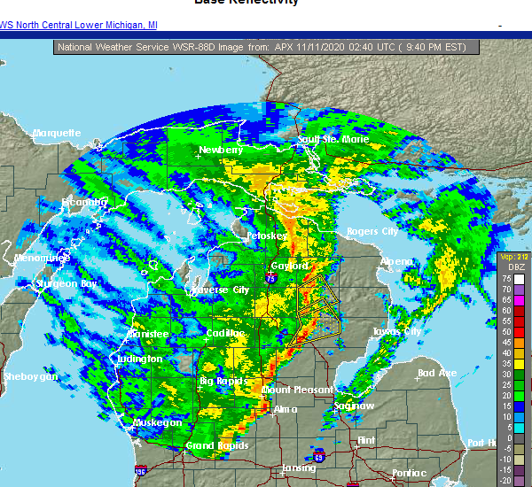
| 11/10/2020 9:40 PM EST | Tree down and power outage along most of s. camp ten r in oscoda county MI, 2.5 miles E of Mio, MI |
| 11/10/2020 9:39 PM EST |
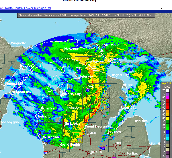 At 939 pm est, a severe thunderstorm was located over red oak, or 7 miles west of mio, moving northeast at 55 mph (radar indicated). Hazards include 60 mph wind gusts. Expect damage to roofs, siding, and trees. Locations impacted include, mio, lewiston, comins, fairview, luzerne, red oak, loud township and garland. At 939 pm est, a severe thunderstorm was located over red oak, or 7 miles west of mio, moving northeast at 55 mph (radar indicated). Hazards include 60 mph wind gusts. Expect damage to roofs, siding, and trees. Locations impacted include, mio, lewiston, comins, fairview, luzerne, red oak, loud township and garland.
|
| 11/10/2020 9:38 PM EST |
 At 937 pm est, a severe thunderstorm was located over clear lake, or 10 miles northeast of st. helen, moving northeast at 60 mph (radar indicated). Hazards include 60 mph wind gusts. Expect damage to roofs, siding, and trees. Locations impacted include, west branch, mio, south branch, rose city, luzerne, rose township, selkirk, clear lake, lupton, rifle river state park, mack lake and foster township. At 937 pm est, a severe thunderstorm was located over clear lake, or 10 miles northeast of st. helen, moving northeast at 60 mph (radar indicated). Hazards include 60 mph wind gusts. Expect damage to roofs, siding, and trees. Locations impacted include, west branch, mio, south branch, rose city, luzerne, rose township, selkirk, clear lake, lupton, rifle river state park, mack lake and foster township.
|
| 11/10/2020 9:28 PM EST |
 At 928 pm est, a severe thunderstorm was located near south branch township, or 11 miles northeast of roscommon, moving northeast at 55 mph (radar indicated). Hazards include 60 mph wind gusts. expect damage to roofs, siding, and trees At 928 pm est, a severe thunderstorm was located near south branch township, or 11 miles northeast of roscommon, moving northeast at 55 mph (radar indicated). Hazards include 60 mph wind gusts. expect damage to roofs, siding, and trees
|
| 11/10/2020 9:25 PM EST |
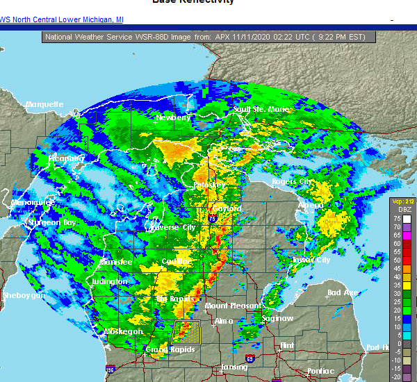 At 924 pm est, a severe thunderstorm was located over lake st. helen, or over st. helen, moving northeast at 60 mph (radar indicated). Hazards include 60 mph wind gusts. expect damage to roofs, siding, and trees At 924 pm est, a severe thunderstorm was located over lake st. helen, or over st. helen, moving northeast at 60 mph (radar indicated). Hazards include 60 mph wind gusts. expect damage to roofs, siding, and trees
|
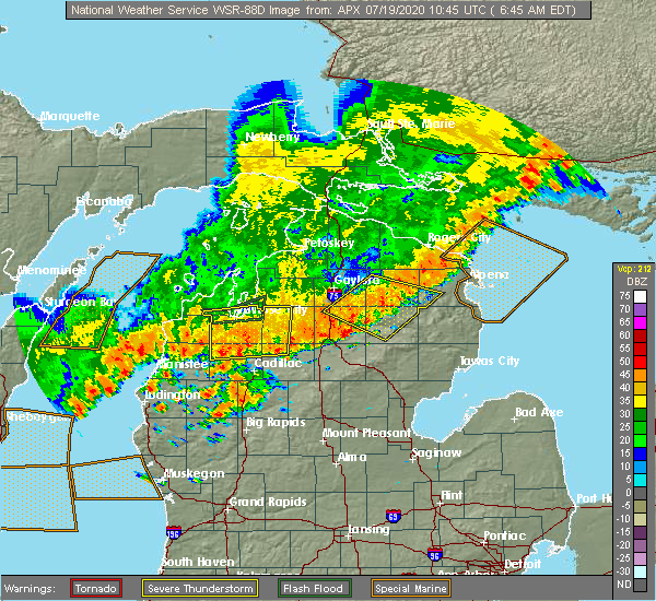
| 7/19/2020 7:14 AM EDT |
 At 713 am edt, a severe thunderstorm capable of producing a tornado was located over rose township, or 11 miles south of mio, moving east at 45 mph (radar indicated rotation). Hazards include tornado. Flying debris will be dangerous to those caught without shelter. mobile homes will be damaged or destroyed. damage to roofs, windows, and vehicles will occur. tree damage is likely. Locations impacted include, mio, south branch, rose city, hale, rose township, lupton, rifle river state park, curtisville, mack lake and foster township. At 713 am edt, a severe thunderstorm capable of producing a tornado was located over rose township, or 11 miles south of mio, moving east at 45 mph (radar indicated rotation). Hazards include tornado. Flying debris will be dangerous to those caught without shelter. mobile homes will be damaged or destroyed. damage to roofs, windows, and vehicles will occur. tree damage is likely. Locations impacted include, mio, south branch, rose city, hale, rose township, lupton, rifle river state park, curtisville, mack lake and foster township.
|
| 7/19/2020 6:59 AM EDT |
 The national weather service in gaylord has issued a * tornado warning for. southwestern alcona county in northern michigan. southeastern crawford county in northern michigan. northern ogemaw county in northern michigan. Northwestern iosco county in northern michigan. The national weather service in gaylord has issued a * tornado warning for. southwestern alcona county in northern michigan. southeastern crawford county in northern michigan. northern ogemaw county in northern michigan. Northwestern iosco county in northern michigan.
|
| 7/19/2020 6:48 AM EDT |
 At 647 am edt, severe thunderstorms were located along a line extending from lockwood lake to red oak, moving southeast at 40 mph (radar indicated). Hazards include 60 mph wind gusts. Expect damage to roofs, siding, and trees. Locations impacted include, mio, atlanta, lewiston, comins, fairview, fletcher pond, luzerne, red oak, lockwood lake, loud township, garland and spratt. At 647 am edt, severe thunderstorms were located along a line extending from lockwood lake to red oak, moving southeast at 40 mph (radar indicated). Hazards include 60 mph wind gusts. Expect damage to roofs, siding, and trees. Locations impacted include, mio, atlanta, lewiston, comins, fairview, fletcher pond, luzerne, red oak, lockwood lake, loud township, garland and spratt.
|
| 7/19/2020 6:14 AM EDT |
 At 614 am edt, severe thunderstorms were located along a line extending from near hetherton to near waters, moving southeast at 20 mph (radar indicated). Hazards include 60 mph wind gusts. expect damage to roofs, siding, and trees At 614 am edt, severe thunderstorms were located along a line extending from near hetherton to near waters, moving southeast at 20 mph (radar indicated). Hazards include 60 mph wind gusts. expect damage to roofs, siding, and trees
|
| 7/18/2020 1:04 PM EDT |
 At 104 pm edt, a severe thunderstorm was located over curran, or 11 miles north of glennie, moving east at 35 mph (radar indicated). Hazards include 60 mph wind gusts and quarter size hail. Hail damage to vehicles is expected. expect wind damage to roofs, siding, and trees. Locations impacted include, mio, comins, mckinley, fairview, red oak, curran, hubbard lake, garland, barton city, milen township and mitchell township. At 104 pm edt, a severe thunderstorm was located over curran, or 11 miles north of glennie, moving east at 35 mph (radar indicated). Hazards include 60 mph wind gusts and quarter size hail. Hail damage to vehicles is expected. expect wind damage to roofs, siding, and trees. Locations impacted include, mio, comins, mckinley, fairview, red oak, curran, hubbard lake, garland, barton city, milen township and mitchell township.
|
| 7/18/2020 12:40 PM EDT | Power outage cause reported as trees. time estimated from rada in oscoda county MI, 5.7 miles SW of Mio, MI |
| 7/18/2020 12:40 PM EDT |
 At 1239 pm edt, a severe thunderstorm was located over fairview, or near mio, moving east at 35 mph (radar indicated). Hazards include 60 mph wind gusts and quarter size hail. Hail damage to vehicles is expected. expect wind damage to roofs, siding, and trees. Locations impacted include, mio, comins, mckinley, fairview, red oak, curran, hubbard lake, garland, barton city, milen township and mitchell township. At 1239 pm edt, a severe thunderstorm was located over fairview, or near mio, moving east at 35 mph (radar indicated). Hazards include 60 mph wind gusts and quarter size hail. Hail damage to vehicles is expected. expect wind damage to roofs, siding, and trees. Locations impacted include, mio, comins, mckinley, fairview, red oak, curran, hubbard lake, garland, barton city, milen township and mitchell township.
|
| 7/18/2020 12:30 PM EDT |
 At 1230 pm edt, a severe thunderstorm was located near red oak, or near mio, moving east at 35 mph (radar indicated). Hazards include 60 mph wind gusts. expect damage to roofs, siding, and trees At 1230 pm edt, a severe thunderstorm was located near red oak, or near mio, moving east at 35 mph (radar indicated). Hazards include 60 mph wind gusts. expect damage to roofs, siding, and trees
|
| 7/9/2020 6:14 PM EDT |
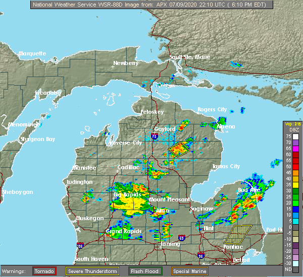 At 613 pm edt, a cluster of strong to severe thunderstorms were located near mio, moving northwest at 10 mph (radar indicated). Hazards include 60 mph wind gusts and quarter size hail. Hail damage to vehicles is expected. wind damage to roofs, siding, and trees is possible. Locations impacted include, mio, fairview, luzerne and red oak. At 613 pm edt, a cluster of strong to severe thunderstorms were located near mio, moving northwest at 10 mph (radar indicated). Hazards include 60 mph wind gusts and quarter size hail. Hail damage to vehicles is expected. wind damage to roofs, siding, and trees is possible. Locations impacted include, mio, fairview, luzerne and red oak.
|
| 7/9/2020 5:54 PM EDT |
 At 553 pm edt, a severe thunderstorm was located over mio, moving northwest at 10 mph (radar indicated). Hazards include quarter size hail. damage to vehicles is expected At 553 pm edt, a severe thunderstorm was located over mio, moving northwest at 10 mph (radar indicated). Hazards include quarter size hail. damage to vehicles is expected
|
| 8/28/2018 8:44 PM EDT |
 At 843 pm edt, severe thunderstorms were located along a line extending from near mack lake to near bowmanville, moving east at 65 mph (radar indicated). Hazards include 60 mph wind gusts. Expect damage to roofs, siding, and trees. locations impacted include, alger, east tawas, west branch, tawas city, au gres, sterling, st. Helen, glennie, south branch, maple ridge, mikado, rose city, whittemore, omer, twining, turner, skidway lake, hockaday, plainfield township and rifle river state park. At 843 pm edt, severe thunderstorms were located along a line extending from near mack lake to near bowmanville, moving east at 65 mph (radar indicated). Hazards include 60 mph wind gusts. Expect damage to roofs, siding, and trees. locations impacted include, alger, east tawas, west branch, tawas city, au gres, sterling, st. Helen, glennie, south branch, maple ridge, mikado, rose city, whittemore, omer, twining, turner, skidway lake, hockaday, plainfield township and rifle river state park.
|
| 8/28/2018 8:29 PM EDT |
 At 828 pm edt, severe thunderstorms were located along a line extending from near south branch township to near skeels, moving east at 65 mph (radar indicated). Hazards include 60 mph wind gusts. expect damage to roofs, siding, and trees At 828 pm edt, severe thunderstorms were located along a line extending from near south branch township to near skeels, moving east at 65 mph (radar indicated). Hazards include 60 mph wind gusts. expect damage to roofs, siding, and trees
|
| 8/15/2018 5:22 PM EDT |
 At 521 pm edt, a severe thunderstorm was located near mio, moving east at 10 mph (radar indicated). Hazards include 60 mph wind gusts and quarter size hail. Hail damage to vehicles is expected. expect wind damage to roofs, siding, and trees. Locations impacted include, mio, fairview and red oak. At 521 pm edt, a severe thunderstorm was located near mio, moving east at 10 mph (radar indicated). Hazards include 60 mph wind gusts and quarter size hail. Hail damage to vehicles is expected. expect wind damage to roofs, siding, and trees. Locations impacted include, mio, fairview and red oak.
|
| 8/15/2018 5:13 PM EDT |
 At 513 pm edt, a severe thunderstorm was located near mio, moving east at 15 mph (radar indicated). Hazards include 60 mph wind gusts and quarter size hail. Hail damage to vehicles is expected. Expect wind damage to roofs, siding, and trees. At 513 pm edt, a severe thunderstorm was located near mio, moving east at 15 mph (radar indicated). Hazards include 60 mph wind gusts and quarter size hail. Hail damage to vehicles is expected. Expect wind damage to roofs, siding, and trees.
|
| 6/13/2017 1:03 AM EDT | Mesonet station mmom4... mi in oscoda county MI, 1.2 miles SSW of Mio, MI |
| 6/13/2017 12:57 AM EDT |
 At 1256 am edt, a severe thunderstorm was located near mack lake, or near mio, moving east at 50 mph (radar indicated). Hazards include 60 mph wind gusts. Expect damage to roofs, siding, and trees. Locations impacted include, mio, glennie, comins, mckinley, red oak, curran, fairview, luzerne, rose township, curtisville, mack lake, milen township, mitchell township and foster township. At 1256 am edt, a severe thunderstorm was located near mack lake, or near mio, moving east at 50 mph (radar indicated). Hazards include 60 mph wind gusts. Expect damage to roofs, siding, and trees. Locations impacted include, mio, glennie, comins, mckinley, red oak, curran, fairview, luzerne, rose township, curtisville, mack lake, milen township, mitchell township and foster township.
|
| 6/13/2017 12:36 AM EDT |
 At 1236 am edt, a severe thunderstorm was located near south branch township, or near roscommon, moving east at 45 mph (radar indicated). Hazards include 60 mph wind gusts. expect damage to roofs, siding, and trees At 1236 am edt, a severe thunderstorm was located near south branch township, or near roscommon, moving east at 45 mph (radar indicated). Hazards include 60 mph wind gusts. expect damage to roofs, siding, and trees
|
| 2/24/2017 4:46 PM EST |
 At 445 pm est, a severe thunderstorm was located near red oak, or 7 miles northwest of mio, moving northeast at 55 mph (radar indicated). Hazards include quarter size hail. Damage to vehicles is expected. Locations impacted include, lewiston, comins, hillman, red oak, lockwood lake, loud township and garland. At 445 pm est, a severe thunderstorm was located near red oak, or 7 miles northwest of mio, moving northeast at 55 mph (radar indicated). Hazards include quarter size hail. Damage to vehicles is expected. Locations impacted include, lewiston, comins, hillman, red oak, lockwood lake, loud township and garland.
|
| 2/24/2017 4:30 PM EST |
 At 429 pm est, a severe thunderstorm was located near south branch township, or 9 miles northeast of roscommon, moving northeast at 55 mph (radar indicated). Hazards include quarter size hail. damage to vehicles is expected At 429 pm est, a severe thunderstorm was located near south branch township, or 9 miles northeast of roscommon, moving northeast at 55 mph (radar indicated). Hazards include quarter size hail. damage to vehicles is expected
|
| 9/10/2016 4:24 PM EDT |
 The severe thunderstorm warning for alcona, oscoda, iosco and northeastern ogemaw counties will expire at 430 pm edt, the line of showers producing gusty winds which prompted the warning have weakened moved out of the area. therefore, the warning will be allowed to expire. The severe thunderstorm warning for alcona, oscoda, iosco and northeastern ogemaw counties will expire at 430 pm edt, the line of showers producing gusty winds which prompted the warning have weakened moved out of the area. therefore, the warning will be allowed to expire.
|
| 9/10/2016 3:37 PM EDT |
 At 335 pm edt, a line of showers with embedded thunder was producing severe winds along a line extending from near red oak to near rifle river state park, moving northeast at 45 mph (radar indicated). Hazards include 60 mph wind gusts. Expect damage to roofs. siding. And trees. At 335 pm edt, a line of showers with embedded thunder was producing severe winds along a line extending from near red oak to near rifle river state park, moving northeast at 45 mph (radar indicated). Hazards include 60 mph wind gusts. Expect damage to roofs. siding. And trees.
|
| 7/8/2016 3:12 PM EDT |
 At 312 pm edt, severe thunderstorms were located along a line extending from near mckinley to rifle river state park to near west branch, moving east at 50 mph (radar indicated). Hazards include 60 mph wind gusts and quarter size hail. Hail damage to vehicles is expected. expect wind damage to roofs, siding, and trees. Locations impacted include, oscoda, east tawas, west branch, tawas city, au sable, glennie, mio, south branch, mikado, rose city, whittemore, curtisville, rifle river state park, skidway lake, plainfield township, rose township, lupton, mack lake, tawas point state park and wurtsmith airfield. At 312 pm edt, severe thunderstorms were located along a line extending from near mckinley to rifle river state park to near west branch, moving east at 50 mph (radar indicated). Hazards include 60 mph wind gusts and quarter size hail. Hail damage to vehicles is expected. expect wind damage to roofs, siding, and trees. Locations impacted include, oscoda, east tawas, west branch, tawas city, au sable, glennie, mio, south branch, mikado, rose city, whittemore, curtisville, rifle river state park, skidway lake, plainfield township, rose township, lupton, mack lake, tawas point state park and wurtsmith airfield.
|
| 7/8/2016 2:45 PM EDT |
 At 244 pm edt, a severe thunderstorm was located over clear lake, or 7 miles north of west branch, moving east at 40 mph (radar indicated). Hazards include 60 mph wind gusts and quarter size hail. Hail damage to vehicles is expected. Expect wind damage to roofs, siding, and trees. At 244 pm edt, a severe thunderstorm was located over clear lake, or 7 miles north of west branch, moving east at 40 mph (radar indicated). Hazards include 60 mph wind gusts and quarter size hail. Hail damage to vehicles is expected. Expect wind damage to roofs, siding, and trees.
|
| 7/8/2016 2:17 PM EDT |
 At 217 pm edt, a severe thunderstorm was located near atlanta, moving east at 35 mph (radar indicated). Hazards include two inch hail and 60 mph wind gusts. People and animals outdoors will be injured. expect hail damage to roofs, siding, windows, and vehicles. Expect wind damage to roofs, siding, and trees. At 217 pm edt, a severe thunderstorm was located near atlanta, moving east at 35 mph (radar indicated). Hazards include two inch hail and 60 mph wind gusts. People and animals outdoors will be injured. expect hail damage to roofs, siding, windows, and vehicles. Expect wind damage to roofs, siding, and trees.
|
| 7/8/2016 2:06 PM EDT |
 At 205 pm edt, severe thunderstorms were located along a line extending from near hetherton to near lovells, moving east at 40 mph (radar indicated). Hazards include 60 mph wind gusts and quarter size hail. Hail damage to vehicles is expected. expect wind damage to roofs, siding, and trees. Locations impacted include, lewiston, mio, atlanta, lovells, briley township, hetherton, red oak, garland, chester township, fairview and johannesburg. At 205 pm edt, severe thunderstorms were located along a line extending from near hetherton to near lovells, moving east at 40 mph (radar indicated). Hazards include 60 mph wind gusts and quarter size hail. Hail damage to vehicles is expected. expect wind damage to roofs, siding, and trees. Locations impacted include, lewiston, mio, atlanta, lovells, briley township, hetherton, red oak, garland, chester township, fairview and johannesburg.
|
| 7/8/2016 1:31 PM EDT |
 At 131 pm edt, a severe thunderstorm was located over waters, or 9 miles south of gaylord, moving east at 50 mph (radar indicated). Hazards include 60 mph wind gusts and quarter size hail. Hail damage to vehicles is expected. Expect wind damage to roofs, siding, and trees. At 131 pm edt, a severe thunderstorm was located over waters, or 9 miles south of gaylord, moving east at 50 mph (radar indicated). Hazards include 60 mph wind gusts and quarter size hail. Hail damage to vehicles is expected. Expect wind damage to roofs, siding, and trees.
|
| 6/20/2016 10:43 AM EDT |
 At 1042 am edt, severe thunderstorms were located along a line extending from near ossineke township to near fairview, moving east at 60 mph (radar indicated). Hazards include ping pong ball size hail and 60 mph wind gusts. People and animals outdoors will be injured. expect hail damage to roofs, siding, windows, and vehicles. Expect wind damage to roofs, siding, and trees. At 1042 am edt, severe thunderstorms were located along a line extending from near ossineke township to near fairview, moving east at 60 mph (radar indicated). Hazards include ping pong ball size hail and 60 mph wind gusts. People and animals outdoors will be injured. expect hail damage to roofs, siding, windows, and vehicles. Expect wind damage to roofs, siding, and trees.
|
| 8/14/2015 6:25 PM EDT |
 At 625 pm edt, severe thunderstorms were located along a line extending from near curran to near lewiston, moving southeast at 10 mph (radar indicated). Hazards include 60 mph wind gusts and quarter size hail. Hail damage to vehicles is expected. expect wind damage to roofs, siding and trees. Locations impacted include, mio, comins, mckinley, mack lake, curran, red oak, fairview and mitchell township. At 625 pm edt, severe thunderstorms were located along a line extending from near curran to near lewiston, moving southeast at 10 mph (radar indicated). Hazards include 60 mph wind gusts and quarter size hail. Hail damage to vehicles is expected. expect wind damage to roofs, siding and trees. Locations impacted include, mio, comins, mckinley, mack lake, curran, red oak, fairview and mitchell township.
|
| 8/14/2015 6:08 PM EDT |
 At 608 pm edt, a severe thunderstorm was located near comins, or 11 miles northeast of mio, moving southeast at 10 mph (radar indicated). Hazards include 60 mph wind gusts and quarter size hail. Hail damage to vehicles is expected. Expect wind damage to roofs, siding and trees. At 608 pm edt, a severe thunderstorm was located near comins, or 11 miles northeast of mio, moving southeast at 10 mph (radar indicated). Hazards include 60 mph wind gusts and quarter size hail. Hail damage to vehicles is expected. Expect wind damage to roofs, siding and trees.
|
| 8/2/2015 5:47 PM EDT |
 At 546 pm edt, severe thunderstorms were located along a line extending from near comins to rose township, moving east at 65 mph (radar indicated). Hazards include 70 mph wind gusts and quarter size hail. Hail damage to vehicles is expected. expect considerable tree damage. wind damage is also likely to mobile homes, roofs and outbuildings. Locations impacted include, mio, comins, mckinley, mack lake, luzerne, red oak, garland and fairview. At 546 pm edt, severe thunderstorms were located along a line extending from near comins to rose township, moving east at 65 mph (radar indicated). Hazards include 70 mph wind gusts and quarter size hail. Hail damage to vehicles is expected. expect considerable tree damage. wind damage is also likely to mobile homes, roofs and outbuildings. Locations impacted include, mio, comins, mckinley, mack lake, luzerne, red oak, garland and fairview.
|
| 8/2/2015 5:35 PM EDT |
 At 534 pm edt, severe thunderstorms were located along a line extending from near garland to near twin lakes area, moving east at 65 mph (radar indicated). Hazards include 70 mph wind gusts and quarter size hail. Hail damage to vehicles is expected. expect considerable tree damage. wind damage is also likely to mobile homes, roofs and outbuildings. Locations impacted include, grayling, lewiston, mio, comins, frederic, mckinley, lovells, lockwood lake, red oak, garland, waters, chester township, mack lake, luzerne, south branch township, loud township, hartwick pines state park and fairview. At 534 pm edt, severe thunderstorms were located along a line extending from near garland to near twin lakes area, moving east at 65 mph (radar indicated). Hazards include 70 mph wind gusts and quarter size hail. Hail damage to vehicles is expected. expect considerable tree damage. wind damage is also likely to mobile homes, roofs and outbuildings. Locations impacted include, grayling, lewiston, mio, comins, frederic, mckinley, lovells, lockwood lake, red oak, garland, waters, chester township, mack lake, luzerne, south branch township, loud township, hartwick pines state park and fairview.
|
| 8/2/2015 5:00 PM EDT |
 At 459 pm edt, severe thunderstorms were located along a line extending from near warner township to 6 miles north of moorestown, moving east at 60 mph (radar indicated. earlier in grand traverse and antrim counties 60 to 70 mph winds were reported). Hazards include 70 mph wind gusts and quarter size hail. Hail damage to vehicles is expected. expect considerable tree damage. Wind damage is also likely to mobile homes, roofs and outbuildings. At 459 pm edt, severe thunderstorms were located along a line extending from near warner township to 6 miles north of moorestown, moving east at 60 mph (radar indicated. earlier in grand traverse and antrim counties 60 to 70 mph winds were reported). Hazards include 70 mph wind gusts and quarter size hail. Hail damage to vehicles is expected. expect considerable tree damage. Wind damage is also likely to mobile homes, roofs and outbuildings.
|
| 8/2/2015 1:50 PM EDT |
 The severe thunderstorm warning for northeastern oscoda county will expire at 200 pm edt, the storm which prompted the warning has moved out of the area. therefore the warning will be allowed to expire. a severe thunderstorm watch remains in effect until 500 pm edt for northern michigan. The severe thunderstorm warning for northeastern oscoda county will expire at 200 pm edt, the storm which prompted the warning has moved out of the area. therefore the warning will be allowed to expire. a severe thunderstorm watch remains in effect until 500 pm edt for northern michigan.
|
| 8/2/2015 1:39 PM EDT |
 At 139 pm edt, a severe thunderstorm was located near curran, or 13 miles northeast of mio, moving east at 65 mph (radar indicated). Hazards include 60 mph wind gusts and quarter size hail. Hail damage to vehicles is expected. expect wind damage to roofs, siding and trees. Locations impacted include, mio, comins and fairview. At 139 pm edt, a severe thunderstorm was located near curran, or 13 miles northeast of mio, moving east at 65 mph (radar indicated). Hazards include 60 mph wind gusts and quarter size hail. Hail damage to vehicles is expected. expect wind damage to roofs, siding and trees. Locations impacted include, mio, comins and fairview.
|
| 8/2/2015 12:54 PM EDT |
 At 1253 pm edt, severe thunderstorms were located along a line extending from near nine mile point to 8 miles south of lovells, moving east at 50 mph (radar indicated). Hazards include 60 mph wind gusts and quarter size hail. Hail damage to vehicles is expected. Expect wind damage to roofs, siding and trees. At 1253 pm edt, severe thunderstorms were located along a line extending from near nine mile point to 8 miles south of lovells, moving east at 50 mph (radar indicated). Hazards include 60 mph wind gusts and quarter size hail. Hail damage to vehicles is expected. Expect wind damage to roofs, siding and trees.
|
| 6/18/2015 1:42 PM EDT | Several trees and power lines down near cherry creek road and camp ten road intersectio in oscoda county MI, 3.5 miles SE of Mio, MI |
| 6/8/2015 3:44 PM EDT |
 At 344 pm edt, a severe thunderstorm was located over fairview, or near mio, moving east at 35 mph (radar indicated). Hazards include quarter size hail. Damage to vehicles is expected. Locations impacted include, mio, mckinley, fairview, red oak, mack lake, south branch township and luzerne. At 344 pm edt, a severe thunderstorm was located over fairview, or near mio, moving east at 35 mph (radar indicated). Hazards include quarter size hail. Damage to vehicles is expected. Locations impacted include, mio, mckinley, fairview, red oak, mack lake, south branch township and luzerne.
|
| 6/8/2015 3:14 PM EDT |
 At 313 pm edt, a severe thunderstorm was located near red oak, or 12 miles west of mio, moving east at 30 mph (radar indicated). Hazards include quarter size hail. damage to vehicles is expected At 313 pm edt, a severe thunderstorm was located near red oak, or 12 miles west of mio, moving east at 30 mph (radar indicated). Hazards include quarter size hail. damage to vehicles is expected
|
| 5/26/2015 8:02 PM EDT | At 801 pm edt, a severe thunderstorm capable of producing a tornado was located 3 miles northeast of red oak, moving northeast at 25 mph (radar indicated rotation). Hazards include tornado. Flying debris will be dangerous to those caught without shelter. mobile homes will be damaged or destroyed. damage to roofs, windows and vehicles will occur. tree damage is likely. Locations impacted include, mio, garland, red oak and luzerne. |
| 5/26/2015 7:55 PM EDT | At 754 pm edt, a severe thunderstorm capable of producing a tornado was located over luzerne, or 8 miles west of mio, moving north at 25 mph (radar indicated rotation). Hazards include tornado. Flying debris will be dangerous to those caught without shelter. mobile homes will be damaged or destroyed. damage to roofs, windows and vehicles will occur. Tree damage is likely. |
| 7/27/2014 12:49 PM EDT | Quarter sized hail reported 1.1 miles NNW of Mio, MI, hail ranging in size from dime sized to quarter sized |
| 6/16/2013 8:15 PM EDT | Quarter sized hail reported 10.4 miles SSW of Mio, MI, 5 minutes of 1 inch hail reported in comins. |
| 6/16/2013 8:11 PM EDT | Quarter sized hail reported 10.4 miles SSW of Mio, MI, 5 minutes of 1 inch hail reported in comins. |
Hail Maps for Mio, MI


Connect with Interactive Hail Maps