

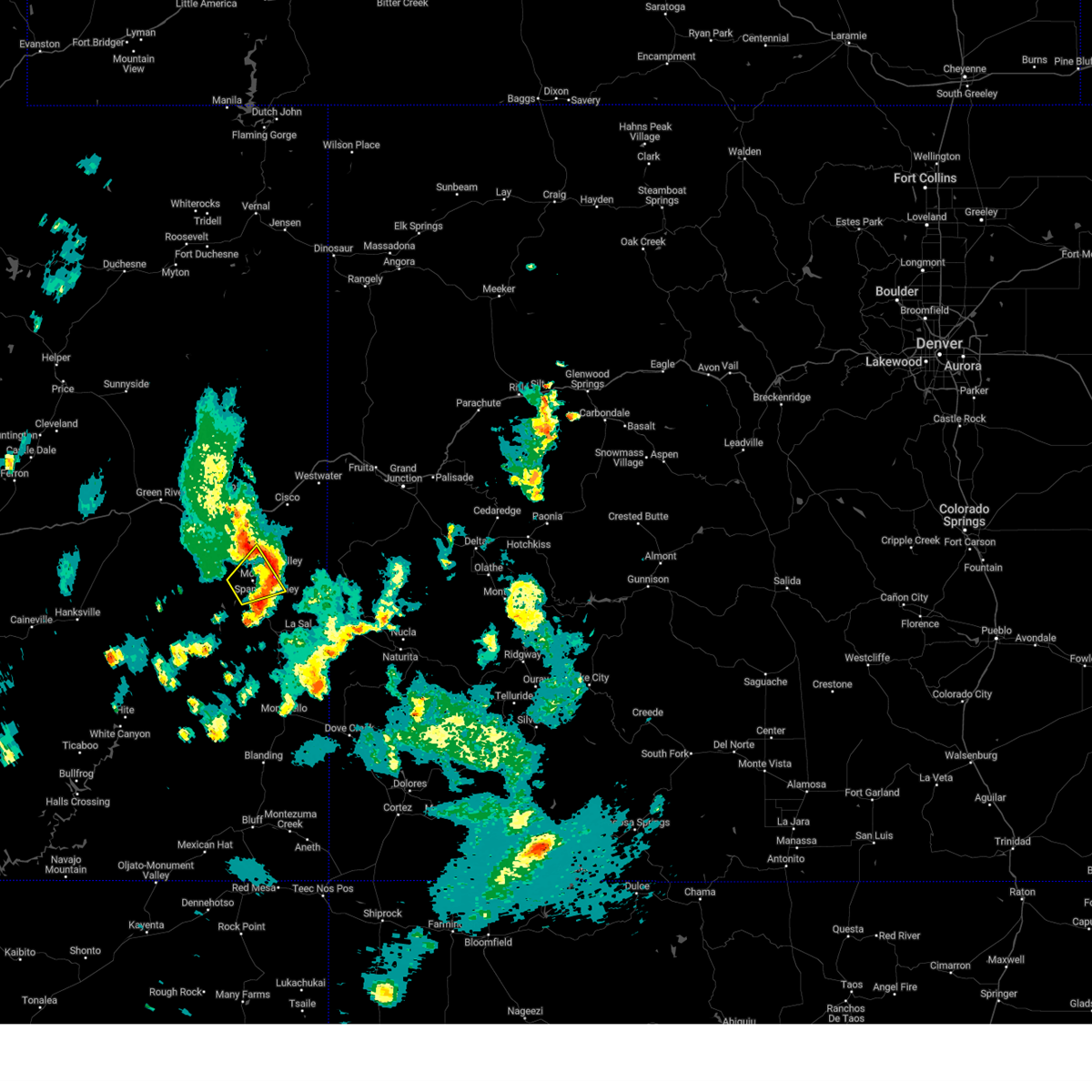
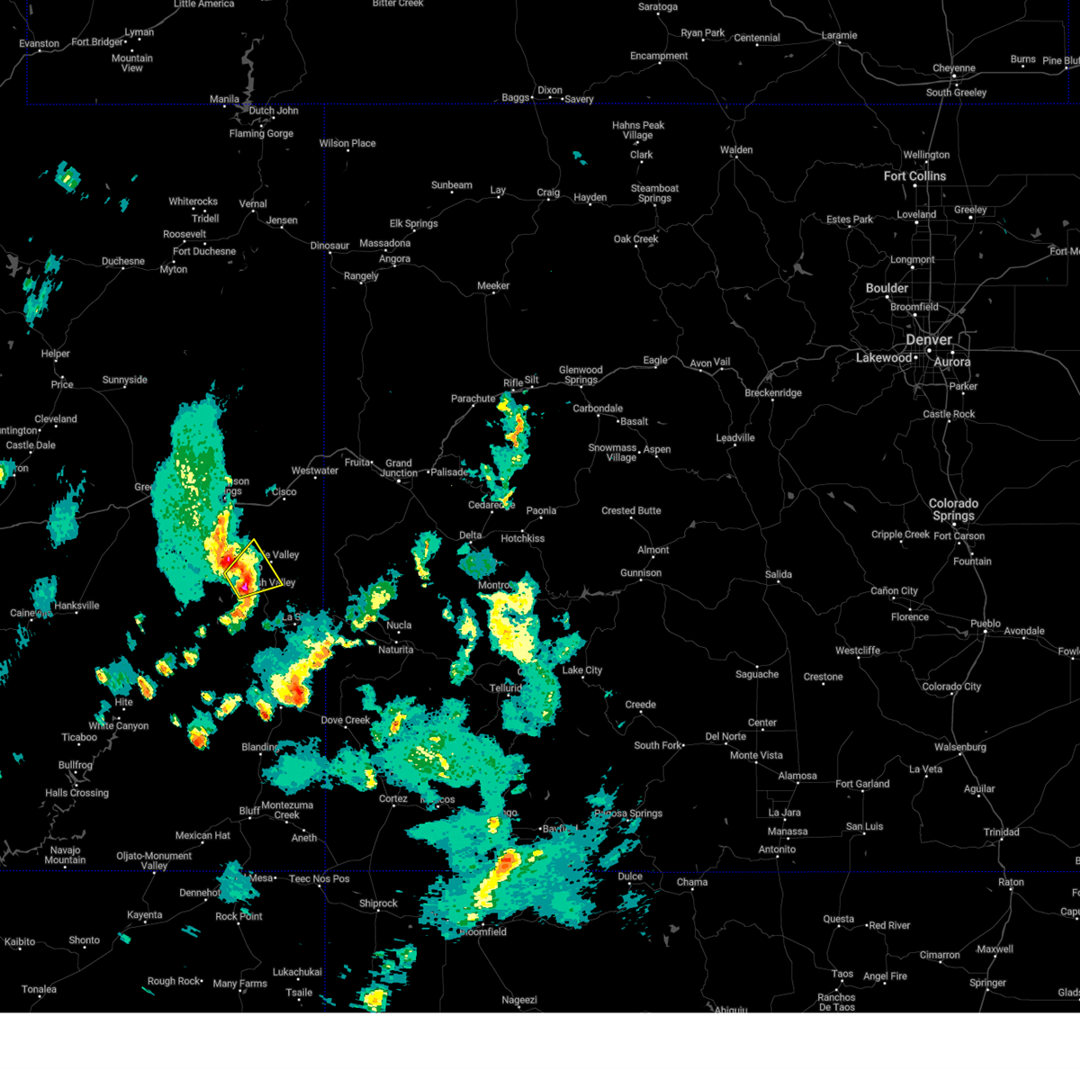
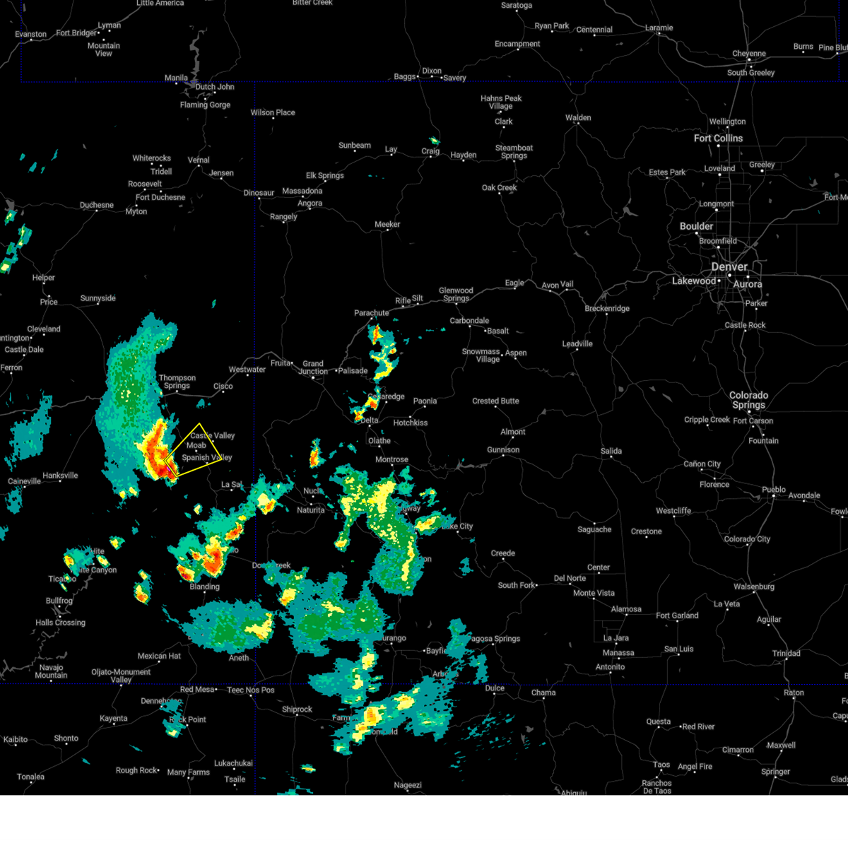
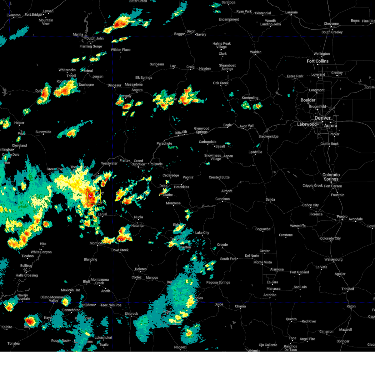
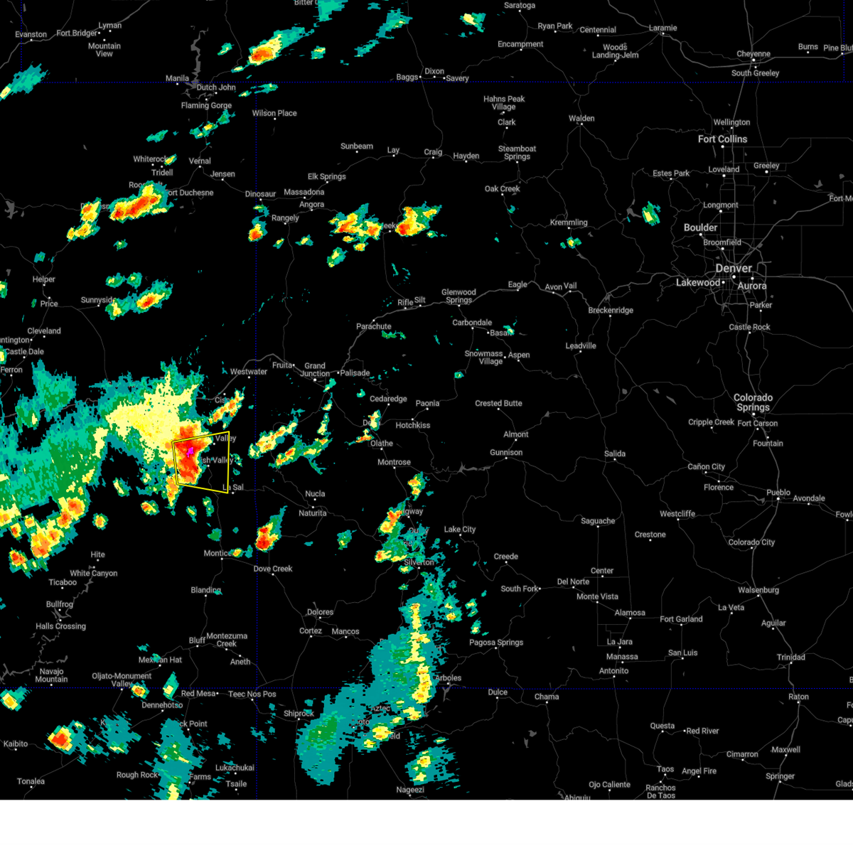
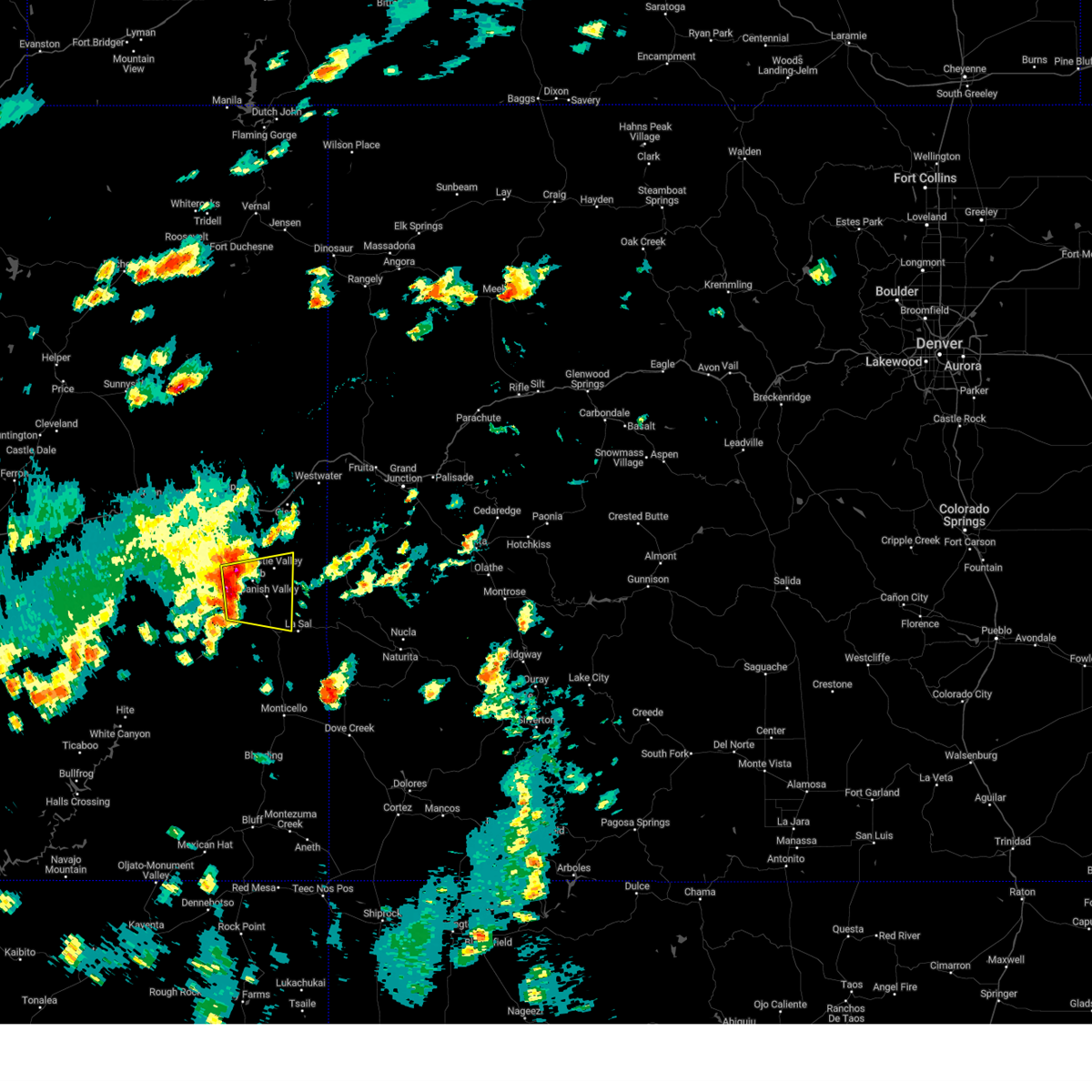
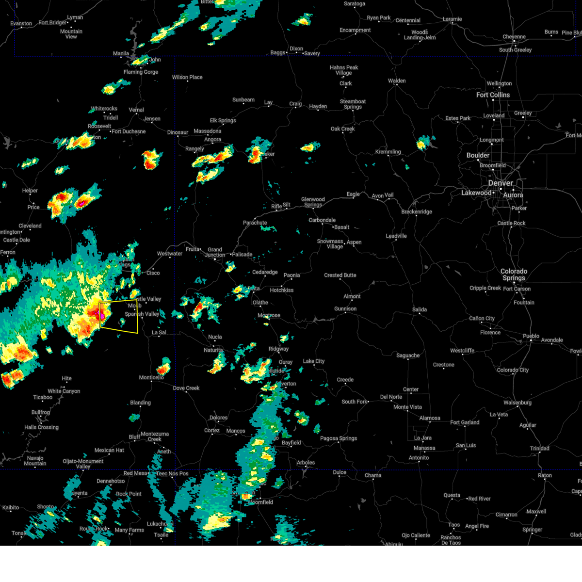
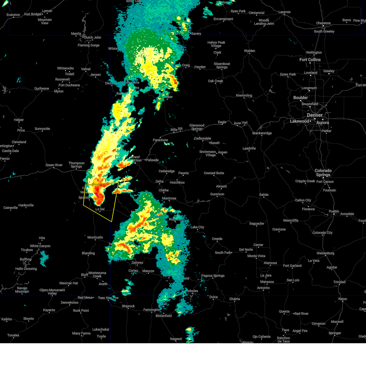
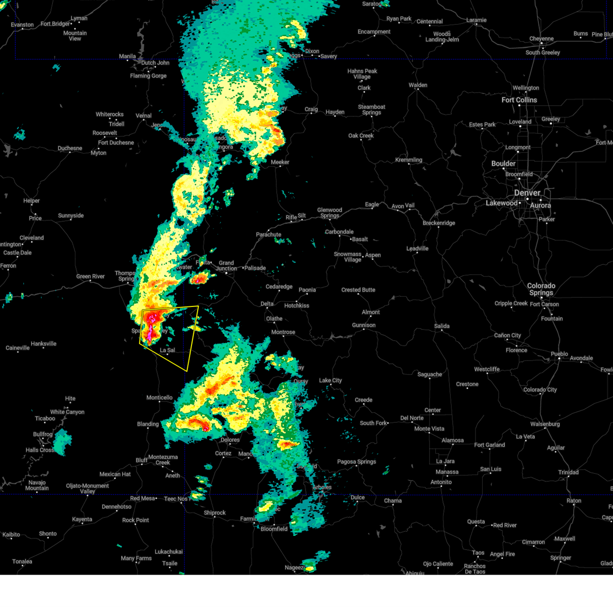
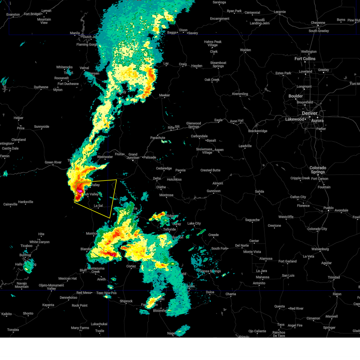
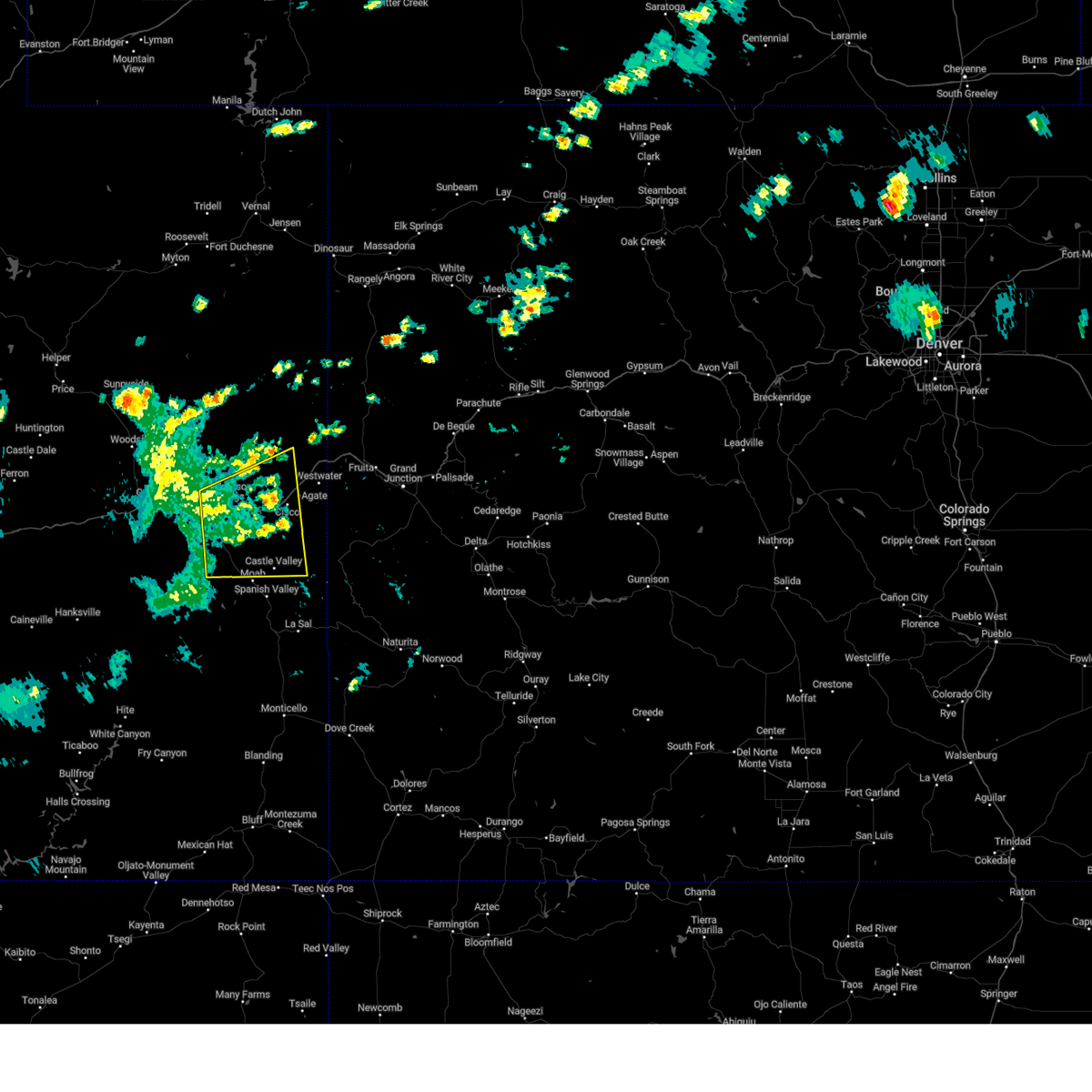
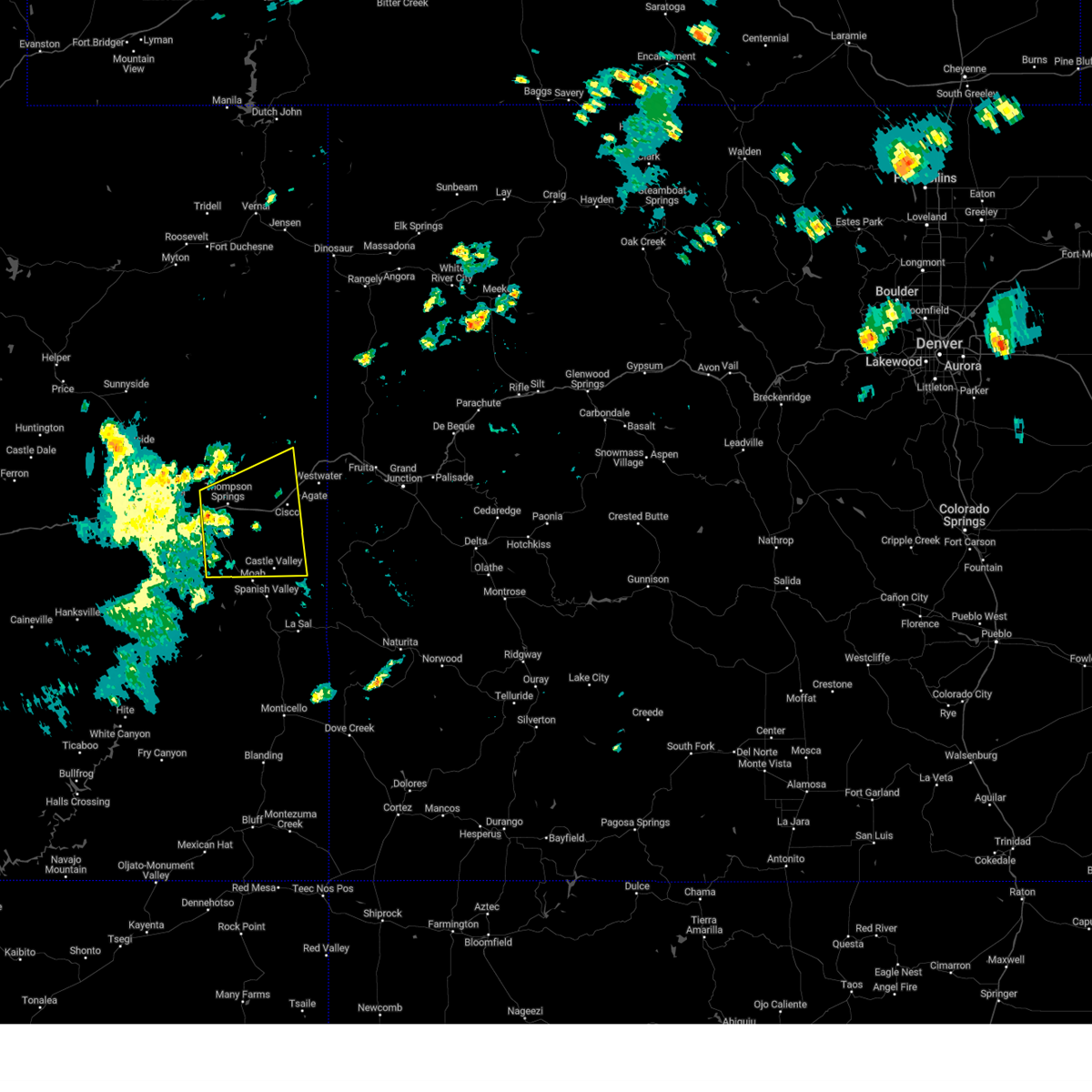
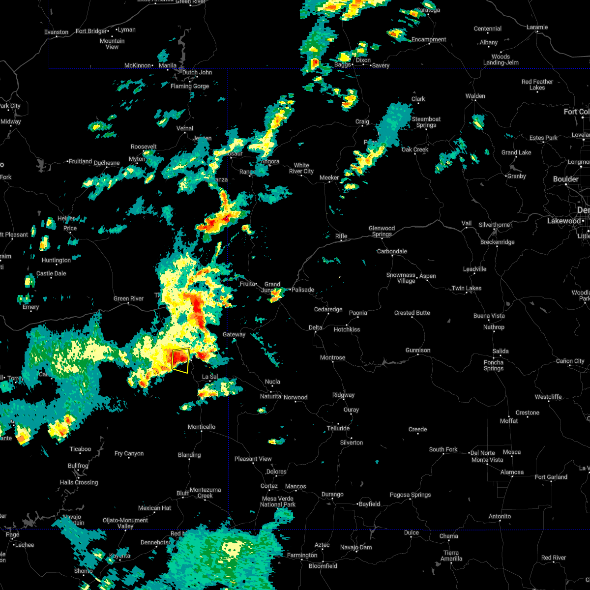
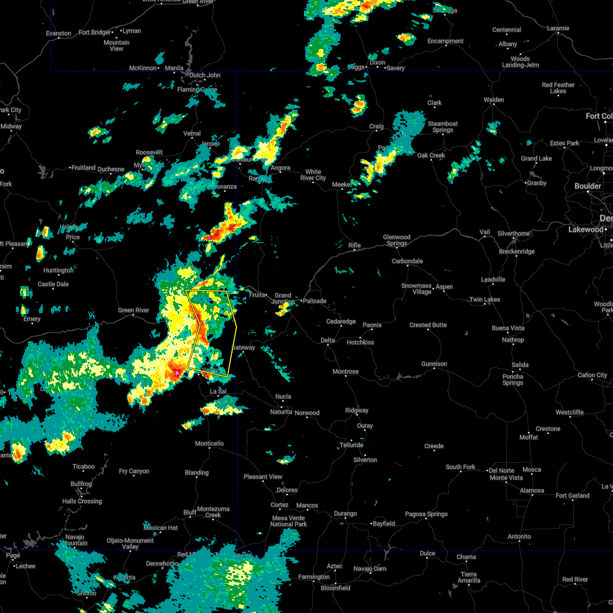
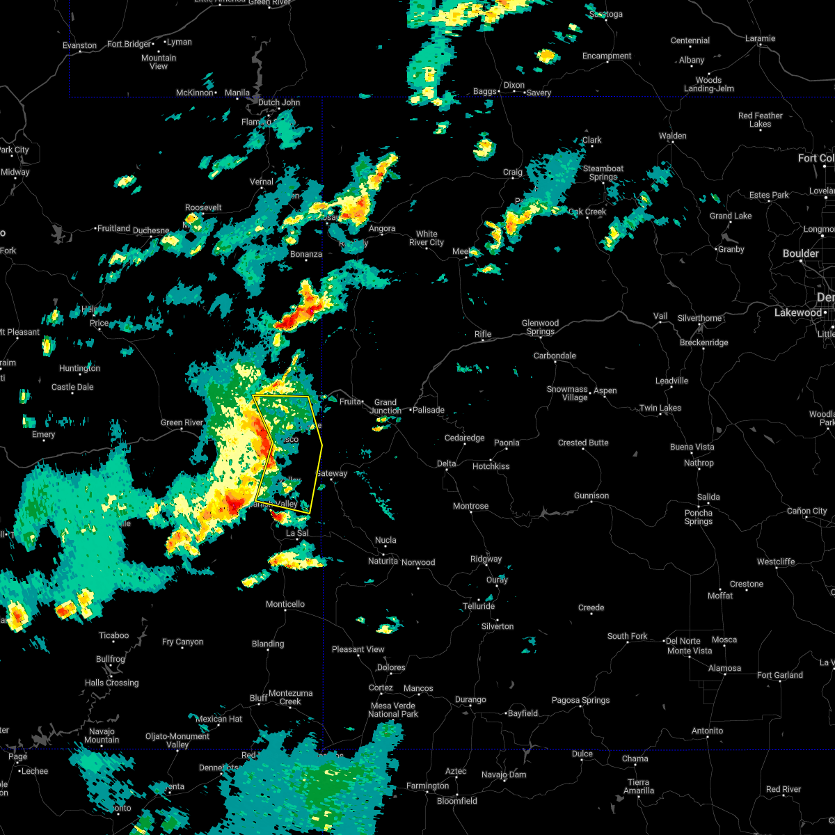
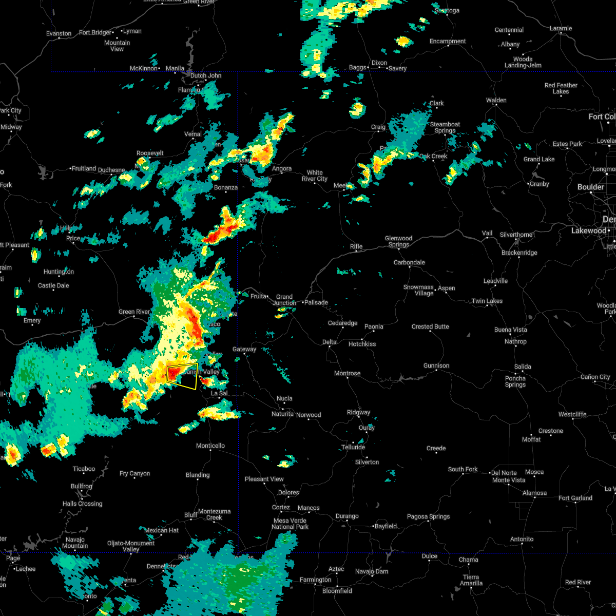
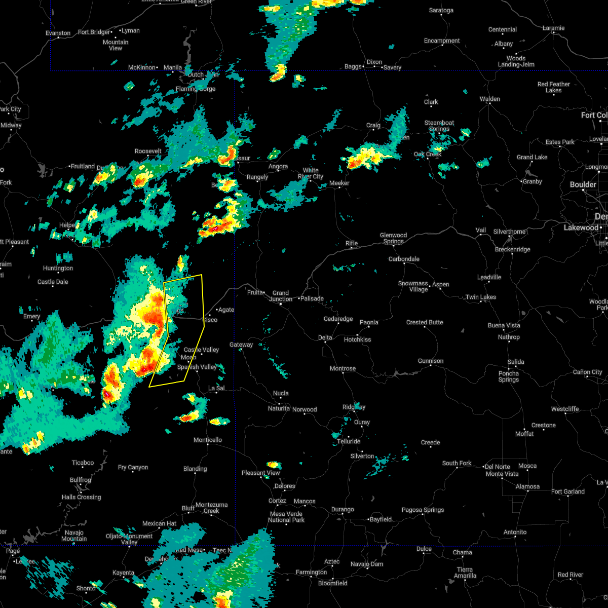
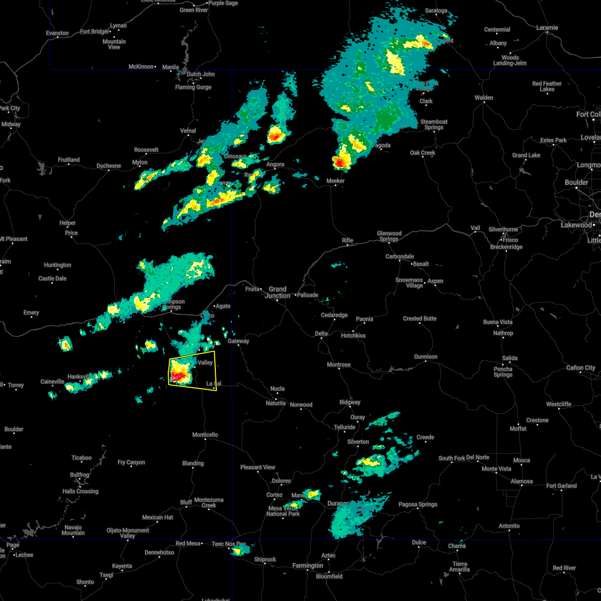
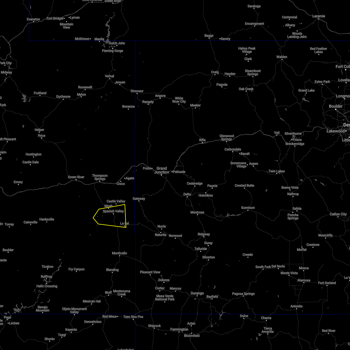
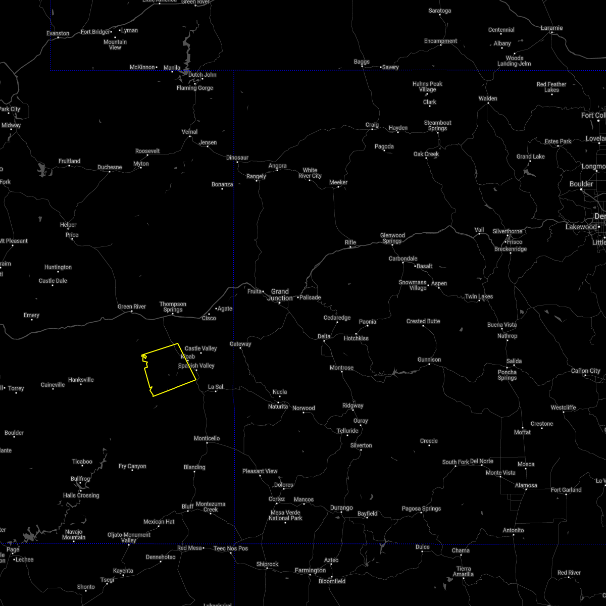
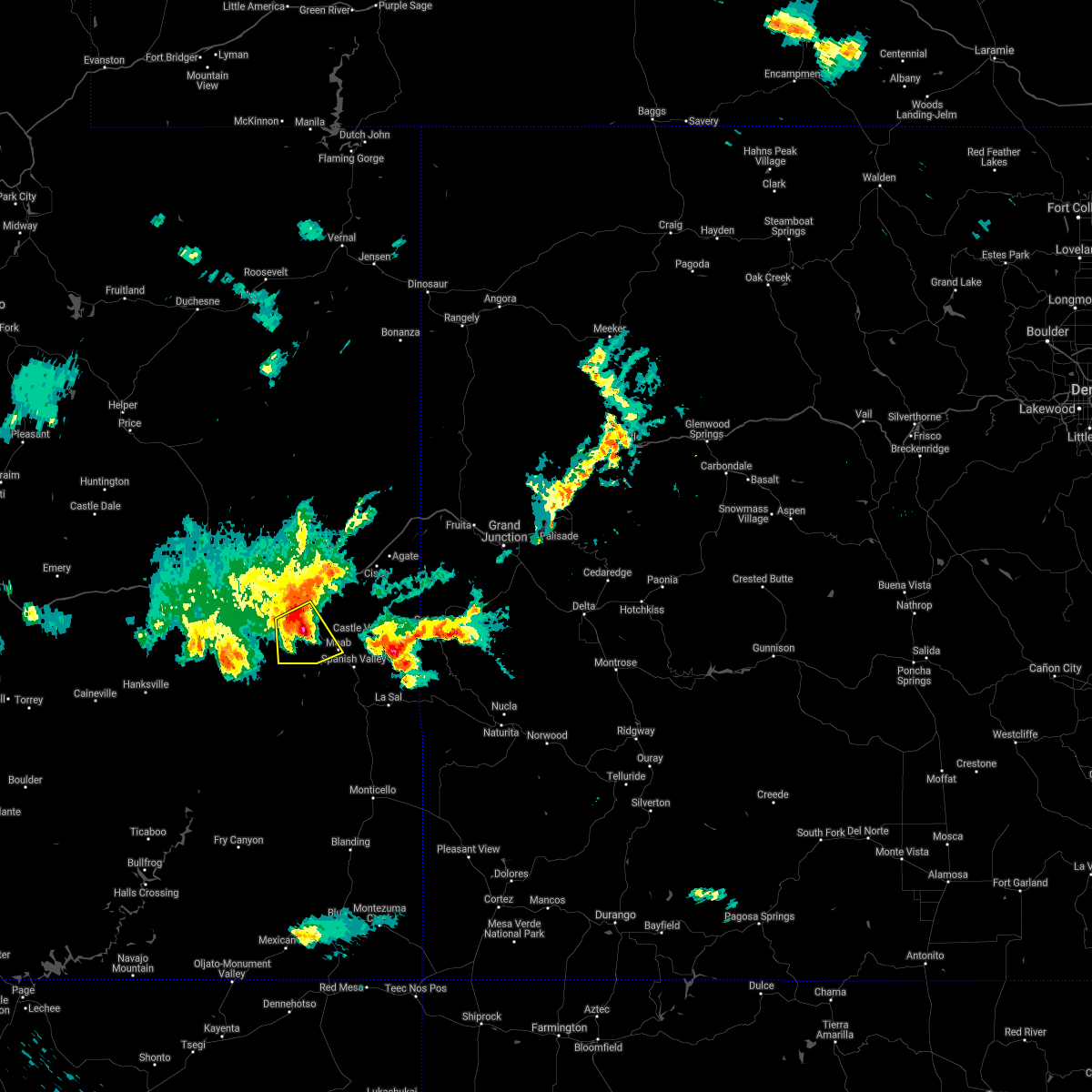
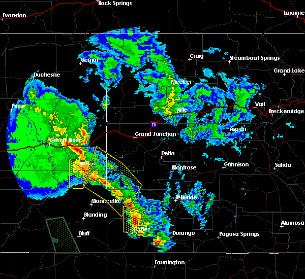
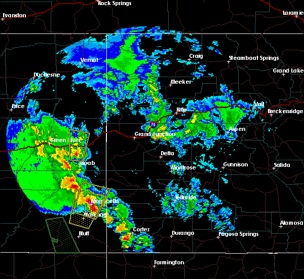
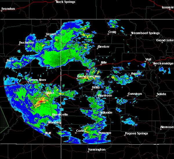
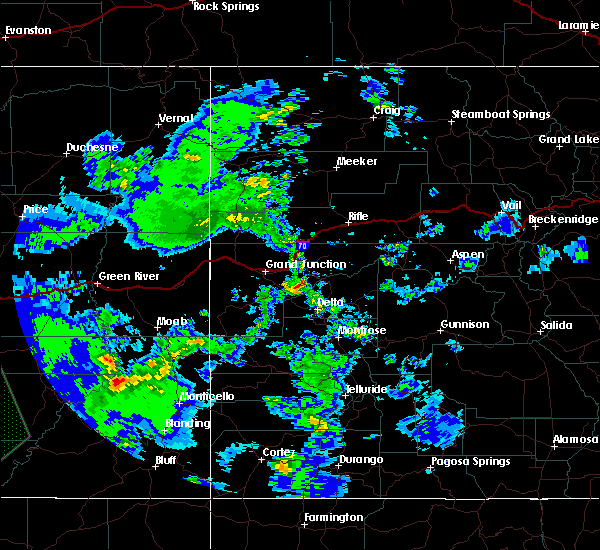
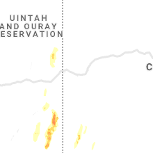
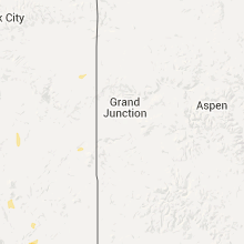
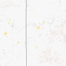
Hail Map for Moab, UT
The Moab, UT area has had 6 reports of on-the-ground hail by trained spotters, and has been under severe weather warnings 5 times during the past 12 months. Doppler radar has detected hail at or near Moab, UT on 8 occasions.
| Name: | Moab, UT |
| Where Located: | 63.4 miles WSW of Grand Junction, CO |
| Map: | Google Map for Moab, UT |
| Population: | 5046 |
| Housing Units: | 2366 |
| More Info: | Search Google for Moab, UT |
2
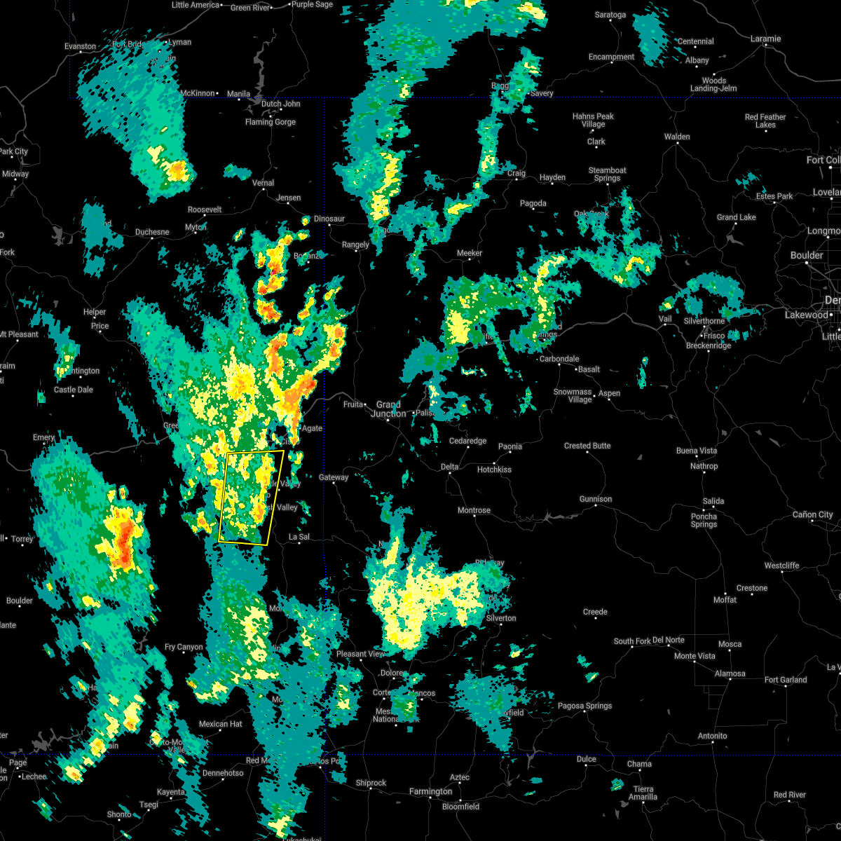
The Top Recent Hail Date for Moab, UT is Friday, August 23, 2024 (3rd out of 8)

Hail and Wind Damage Spotted near Moab, UT
| Date / Time | Report Details |
|---|---|
| 2/17/2026 2:33 AM MST | Asos station kcny 16 nw moa in grand county UT, 16.3 miles SE of Moab, UT |
| 9/12/2025 1:05 PM MDT | At 105 pm mdt, a severe thunderstorm was located 9 miles southwest of moab, moving northeast at 30 mph (radar indicated). Hazards include 60 mph wind gusts and quarter size hail. Hail damage to vehicles is expected. expect wind damage to roofs, siding, and trees. Locations impacted include, moab, spanish valley, and dead horse point state park. |
| 9/12/2025 12:51 PM MDT | Svrgjt the national weather service in grand junction has issued a * severe thunderstorm warning for, north central san juan county in southeastern utah, south central grand county in east central utah, * until 115 pm mdt. * at 1251 pm mdt, a severe thunderstorm was located near canyonlands national park, or 17 miles southwest of moab, moving northeast at 30 mph (radar indicated). Hazards include 60 mph wind gusts and quarter size hail. Hail damage to vehicles is expected. Expect wind damage to roofs, siding, and trees. |
| 9/12/2025 11:37 AM MDT | the severe thunderstorm warning has been cancelled and is no longer in effect |
| 9/12/2025 11:37 AM MDT | At 1136 am mdt, a severe thunderstorm was located 7 miles northwest of castle valley, moving north at 40 mph (radar indicated). Hazards include 60 mph wind gusts and quarter size hail. Hail damage to vehicles is expected. expect wind damage to roofs, siding, and trees. Locations impacted include, moab, castle valley, and arches national park. |
| 9/12/2025 11:21 AM MDT | Svrgjt the national weather service in grand junction has issued a * severe thunderstorm warning for, north central san juan county in southeastern utah, southeastern grand county in east central utah, * until 1145 am mdt. * at 1121 am mdt, a severe thunderstorm was located over moab, moving north at 40 mph (radar indicated). Hazards include 60 mph wind gusts and quarter size hail. Hail damage to vehicles is expected. Expect wind damage to roofs, siding, and trees. |
| 10/29/2024 10:53 AM MDT | Asos station kcny 16 nw moa in grand county UT, 16.3 miles SE of Moab, UT |
| 9/29/2024 9:44 PM MDT | Asos station kcny 16 nw moa in grand county UT, 16.3 miles SE of Moab, UT |
| 8/23/2024 6:31 PM MDT |
 The storm which prompted the warning has weakened below severe limits, the warning has been allowed to expire. however, gusty winds and heavy rain are still possible with this thunderstorm with heavy runoff and flash flooding possible. The storm which prompted the warning has weakened below severe limits, the warning has been allowed to expire. however, gusty winds and heavy rain are still possible with this thunderstorm with heavy runoff and flash flooding possible.
|
| 8/23/2024 6:14 PM MDT |
 At 613 pm mdt, a severe thunderstorm was located over moab, moving northeast at 45 mph (radar indicated). Hazards include 60 mph wind gusts and penny size hail. Expect damage to roofs, siding, and trees. Locations impacted include, moab, castle valley, spanish valley, and arches national park. At 613 pm mdt, a severe thunderstorm was located over moab, moving northeast at 45 mph (radar indicated). Hazards include 60 mph wind gusts and penny size hail. Expect damage to roofs, siding, and trees. Locations impacted include, moab, castle valley, spanish valley, and arches national park.
|
| 8/23/2024 6:05 PM MDT |
 At 605 pm mdt, a severe thunderstorm was located near moab, moving northeast at 45 mph (radar indicated). Hazards include 60 mph wind gusts and penny size hail. Expect damage to roofs, siding, and trees. Locations impacted include, moab, castle valley, spanish valley, arches national park, and dead horse point state park. At 605 pm mdt, a severe thunderstorm was located near moab, moving northeast at 45 mph (radar indicated). Hazards include 60 mph wind gusts and penny size hail. Expect damage to roofs, siding, and trees. Locations impacted include, moab, castle valley, spanish valley, arches national park, and dead horse point state park.
|
| 8/23/2024 5:59 PM MDT |
 Svrgjt the national weather service in grand junction has issued a * severe thunderstorm warning for, north central san juan county in southeastern utah, south central grand county in east central utah, * until 630 pm mdt. * at 559 pm mdt, a severe thunderstorm was located 8 miles southwest of moab, moving northeast at 45 mph (radar indicated). Hazards include 60 mph wind gusts and quarter size hail. Hail damage to vehicles is expected. Expect wind damage to roofs, siding, and trees. Svrgjt the national weather service in grand junction has issued a * severe thunderstorm warning for, north central san juan county in southeastern utah, south central grand county in east central utah, * until 630 pm mdt. * at 559 pm mdt, a severe thunderstorm was located 8 miles southwest of moab, moving northeast at 45 mph (radar indicated). Hazards include 60 mph wind gusts and quarter size hail. Hail damage to vehicles is expected. Expect wind damage to roofs, siding, and trees.
|
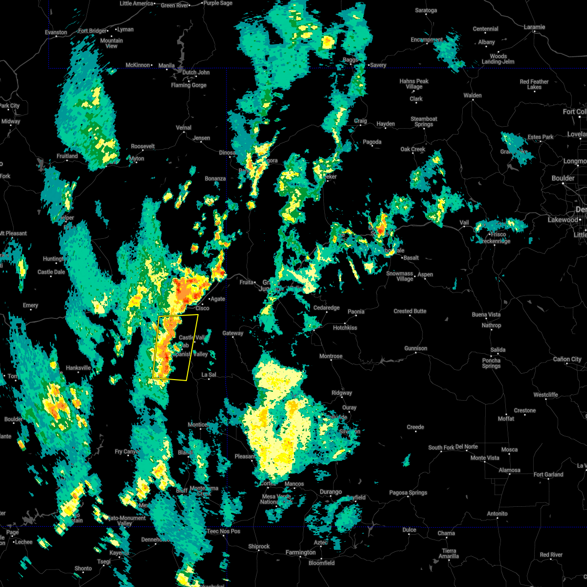
| 6/27/2024 4:00 PM MDT | Quarter sized hail reported 0.6 miles SSW of Moab, UT, also 1 inch of rain reported. |
| 6/27/2024 3:32 PM MDT |
 the severe thunderstorm warning has been cancelled and is no longer in effect the severe thunderstorm warning has been cancelled and is no longer in effect
|
| 6/27/2024 3:32 PM MDT |
 At 332 pm mdt, a severe thunderstorm was located near spanish valley, or 7 miles southeast of castle valley, moving east at 35 mph (trained weather spotters). Hazards include 60 mph wind gusts and quarter size hail. Hail damage to vehicles is expected. expect wind damage to roofs, siding, and trees. Locations impacted include, moab and castle valley. At 332 pm mdt, a severe thunderstorm was located near spanish valley, or 7 miles southeast of castle valley, moving east at 35 mph (trained weather spotters). Hazards include 60 mph wind gusts and quarter size hail. Hail damage to vehicles is expected. expect wind damage to roofs, siding, and trees. Locations impacted include, moab and castle valley.
|
| 6/27/2024 3:30 PM MDT | Quarter sized hail reported 1 miles E of Moab, UT |
| 6/27/2024 3:19 PM MDT |
 At 318 pm mdt, a severe thunderstorm was located near moab, moving east at 35 mph (trained weather spotters reported half dollar sized hail just north of moab). Hazards include ping pong ball size hail and 60 mph wind gusts. People and animals outdoors will be injured. expect hail damage to roofs, siding, windows, and vehicles. expect wind damage to roofs, siding, and trees. Locations impacted include, moab, castle valley, la sal, and spanish valley. At 318 pm mdt, a severe thunderstorm was located near moab, moving east at 35 mph (trained weather spotters reported half dollar sized hail just north of moab). Hazards include ping pong ball size hail and 60 mph wind gusts. People and animals outdoors will be injured. expect hail damage to roofs, siding, windows, and vehicles. expect wind damage to roofs, siding, and trees. Locations impacted include, moab, castle valley, la sal, and spanish valley.
|
| 6/27/2024 3:18 PM MDT | Ping Pong Ball sized hail reported 0.1 miles WNW of Moab, UT |
| 6/27/2024 3:14 PM MDT | Quarter sized hail reported 0.7 miles SE of Moab, UT, report from mping: quarter (1.00 in.). |
| 6/27/2024 3:11 PM MDT |
 Svrgjt the national weather service in grand junction has issued a * severe thunderstorm warning for, northeastern san juan county in southeastern utah, southeastern grand county in east central utah, * until 345 pm mdt. * at 311 pm mdt, a severe thunderstorm was located near moab, moving east at 35 mph (radar indicated). Hazards include 60 mph wind gusts and quarter size hail. Hail damage to vehicles is expected. Expect wind damage to roofs, siding, and trees. Svrgjt the national weather service in grand junction has issued a * severe thunderstorm warning for, northeastern san juan county in southeastern utah, southeastern grand county in east central utah, * until 345 pm mdt. * at 311 pm mdt, a severe thunderstorm was located near moab, moving east at 35 mph (radar indicated). Hazards include 60 mph wind gusts and quarter size hail. Hail damage to vehicles is expected. Expect wind damage to roofs, siding, and trees.
|
| 6/27/2024 2:46 PM MDT |
 Svrgjt the national weather service in grand junction has issued a * severe thunderstorm warning for, northern san juan county in southeastern utah, south central grand county in east central utah, * until 315 pm mdt. * at 246 pm mdt, a severe thunderstorm was located 8 miles north of canyonlands national park, or 18 miles west of moab, moving east at 40 mph (radar indicated). Hazards include 60 mph wind gusts and quarter size hail. Hail damage to vehicles is expected. Expect wind damage to roofs, siding, and trees. Svrgjt the national weather service in grand junction has issued a * severe thunderstorm warning for, northern san juan county in southeastern utah, south central grand county in east central utah, * until 315 pm mdt. * at 246 pm mdt, a severe thunderstorm was located 8 miles north of canyonlands national park, or 18 miles west of moab, moving east at 40 mph (radar indicated). Hazards include 60 mph wind gusts and quarter size hail. Hail damage to vehicles is expected. Expect wind damage to roofs, siding, and trees.
|
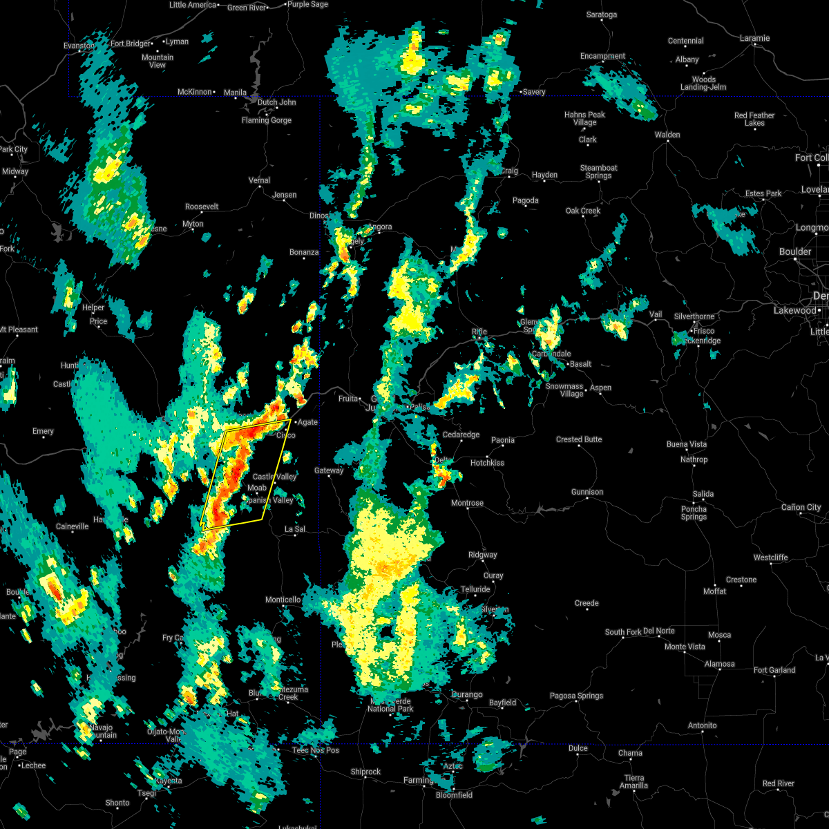
| 6/21/2024 6:16 PM MDT |
 The storm which prompted the warning has weakened below severe limits, and no longer poses an immediate threat to life or property. therefore, the warning has been allowed to expire. a severe thunderstorm watch remains in effect until 700 pm mdt for southwestern and west central colorado, and southeastern and east central utah. remember, a severe thunderstorm warning still remains in effect for southeastern grand county, as well as northeastern san juan county, southwestern mesa county, and west central montrose county. The storm which prompted the warning has weakened below severe limits, and no longer poses an immediate threat to life or property. therefore, the warning has been allowed to expire. a severe thunderstorm watch remains in effect until 700 pm mdt for southwestern and west central colorado, and southeastern and east central utah. remember, a severe thunderstorm warning still remains in effect for southeastern grand county, as well as northeastern san juan county, southwestern mesa county, and west central montrose county.
|
| 6/21/2024 5:59 PM MDT |
 At 559 pm mdt, a severe thunderstorm was located 9 miles east of spanish valley, or 11 miles southeast of castle valley, moving east at 55 mph (radar indicated). Hazards include 70 mph wind gusts and quarter size hail. Hail damage to vehicles is expected. expect considerable tree damage. wind damage is also likely to mobile homes, roofs, and outbuildings. Locations impacted include, moab, castle valley, la sal, spanish valley, gateway, and la sal junction. At 559 pm mdt, a severe thunderstorm was located 9 miles east of spanish valley, or 11 miles southeast of castle valley, moving east at 55 mph (radar indicated). Hazards include 70 mph wind gusts and quarter size hail. Hail damage to vehicles is expected. expect considerable tree damage. wind damage is also likely to mobile homes, roofs, and outbuildings. Locations impacted include, moab, castle valley, la sal, spanish valley, gateway, and la sal junction.
|
| 6/21/2024 5:57 PM MDT | Quarter sized hail reported 3.6 miles NW of Moab, UT |
| 6/21/2024 5:52 PM MDT | Quarter sized hail reported 5.3 miles NW of Moab, UT, brief heavy rain. |
| 6/21/2024 5:48 PM MDT |
 Svrgjt the national weather service in grand junction has issued a * severe thunderstorm warning for, southwestern montrose county in west central colorado, southwestern mesa county in west central colorado, northeastern san juan county in southeastern utah, southeastern grand county in east central utah, * until 615 pm mdt. * at 548 pm mdt, a severe thunderstorm was located near spanish valley, or near moab, moving east at 55 mph (radar indicated). Hazards include 70 mph wind gusts and half dollar size hail. Hail damage to vehicles is expected. expect considerable tree damage. Wind damage is also likely to mobile homes, roofs, and outbuildings. Svrgjt the national weather service in grand junction has issued a * severe thunderstorm warning for, southwestern montrose county in west central colorado, southwestern mesa county in west central colorado, northeastern san juan county in southeastern utah, southeastern grand county in east central utah, * until 615 pm mdt. * at 548 pm mdt, a severe thunderstorm was located near spanish valley, or near moab, moving east at 55 mph (radar indicated). Hazards include 70 mph wind gusts and half dollar size hail. Hail damage to vehicles is expected. expect considerable tree damage. Wind damage is also likely to mobile homes, roofs, and outbuildings.
|
| 5/20/2024 9:53 PM MDT | Asos station kcny 16 nw moa in grand county UT, 16.3 miles SE of Moab, UT |
| 8/3/2023 5:12 PM MDT |
 The severe thunderstorm warning for southeastern grand county will expire at 515 pm mdt, the storms which prompted the warning have weakened below severe limits, and no longer pose an immediate threat to life or property. therefore, the warning will be allowed to expire. however gusty winds are still possible with these thunderstorms. The severe thunderstorm warning for southeastern grand county will expire at 515 pm mdt, the storms which prompted the warning have weakened below severe limits, and no longer pose an immediate threat to life or property. therefore, the warning will be allowed to expire. however gusty winds are still possible with these thunderstorms.
|
| 8/3/2023 4:30 PM MDT |
 At 429 pm mdt, severe thunderstorms were located along a line extending from 25 miles east of green river to near moab, moving east at 30 mph (canyonlands airport reported 60 mph wind gust). Hazards include 60 mph wind gusts. expect damage to roofs, siding, and trees At 429 pm mdt, severe thunderstorms were located along a line extending from 25 miles east of green river to near moab, moving east at 30 mph (canyonlands airport reported 60 mph wind gust). Hazards include 60 mph wind gusts. expect damage to roofs, siding, and trees
|
| 8/3/2023 4:16 PM MDT | Asos station kcny 16 nw moa in grand county UT, 16.3 miles SE of Moab, UT |
| 8/2/2023 5:06 PM MDT | Asos station kcny 16 nw moa in grand county UT, 16.3 miles SE of Moab, UT |
| 7/18/2023 2:42 PM MDT | Asos station kcny 16 nw moa in grand county UT, 16.3 miles SE of Moab, UT |
| 6/15/2023 4:30 PM MDT | Asos station kcny 16 nw moa in grand county UT, 16.3 miles SE of Moab, UT |
| 10/2/2022 4:49 PM MDT |
 At 449 pm mdt, a severe thunderstorm was located near moab, moving east at 25 mph (radar indicated). Hazards include 60 mph wind gusts and quarter size hail. Hail damage to vehicles is expected. expect wind damage to roofs, siding, and trees. this severe thunderstorm will remain over mainly rural areas of northern san juan and south central grand counties. this includes the following highways, u. s. highway 191 in utah between mile markers 121 and 127. utah 279 between mile markers 0 and 13. hail threat, radar indicated max hail size, 1. 00 in wind threat, radar indicated max wind gust, 60 mph. At 449 pm mdt, a severe thunderstorm was located near moab, moving east at 25 mph (radar indicated). Hazards include 60 mph wind gusts and quarter size hail. Hail damage to vehicles is expected. expect wind damage to roofs, siding, and trees. this severe thunderstorm will remain over mainly rural areas of northern san juan and south central grand counties. this includes the following highways, u. s. highway 191 in utah between mile markers 121 and 127. utah 279 between mile markers 0 and 13. hail threat, radar indicated max hail size, 1. 00 in wind threat, radar indicated max wind gust, 60 mph.
|
| 10/2/2022 4:38 PM MDT |
 At 437 pm mdt, severe thunderstorms were located along a line extending from 38 miles north of moab to near castle valley, moving east at 30 mph (radar indicated). Hazards include 60 mph wind gusts and nickel size hail. hail may be deep enough to accumulate on roadways and create hazardous driving conditions. Expect damage to roofs, siding, and trees. these severe storms will be near, castle valley around 440 pm mdt. this includes the following highways, interstate 70 in utah between mile markers 203 and 225. u. s. highway 191 in utah between mile markers 123 and 127. utah 128 between mile markers 1 and 44. hail threat, observed max hail size, 0. 88 in wind threat, radar indicated max wind gust, 60 mph. At 437 pm mdt, severe thunderstorms were located along a line extending from 38 miles north of moab to near castle valley, moving east at 30 mph (radar indicated). Hazards include 60 mph wind gusts and nickel size hail. hail may be deep enough to accumulate on roadways and create hazardous driving conditions. Expect damage to roofs, siding, and trees. these severe storms will be near, castle valley around 440 pm mdt. this includes the following highways, interstate 70 in utah between mile markers 203 and 225. u. s. highway 191 in utah between mile markers 123 and 127. utah 128 between mile markers 1 and 44. hail threat, observed max hail size, 0. 88 in wind threat, radar indicated max wind gust, 60 mph.
|
| 10/2/2022 4:31 PM MDT |
 At 431 pm mdt, severe thunderstorms were located along a line extending from 36 miles east of green river to 19 miles north of castle valley to near moab, moving east at 30 mph (radar indicated). Hazards include 60 mph wind gusts and nickel size hail. Expect damage to roofs, siding, and trees. severe thunderstorms will be near, castle valley around 440 pm mdt. this includes the following highways, interstate 70 in utah between mile markers 203 and 225. u. s. highway 191 in utah between mile markers 123 and 127. utah 128 between mile markers 1 and 44. hail threat, radar indicated max hail size, 0. 88 in wind threat, radar indicated max wind gust, 60 mph. At 431 pm mdt, severe thunderstorms were located along a line extending from 36 miles east of green river to 19 miles north of castle valley to near moab, moving east at 30 mph (radar indicated). Hazards include 60 mph wind gusts and nickel size hail. Expect damage to roofs, siding, and trees. severe thunderstorms will be near, castle valley around 440 pm mdt. this includes the following highways, interstate 70 in utah between mile markers 203 and 225. u. s. highway 191 in utah between mile markers 123 and 127. utah 128 between mile markers 1 and 44. hail threat, radar indicated max hail size, 0. 88 in wind threat, radar indicated max wind gust, 60 mph.
|
| 10/2/2022 4:30 PM MDT |
 At 430 pm mdt, a severe thunderstorm was located 10 miles west of moab, moving east at 25 mph (radar indicated). Hazards include 60 mph wind gusts and half dollar size hail. Hail damage to vehicles is expected. expect wind damage to roofs, siding, and trees. this severe thunderstorm will be near, moab around 450 pm mdt. this includes the following highways, u. s. highway 191 in utah between mile markers 121 and 127. utah 279 between mile markers 0 and 13. utah 313 between mile markers 0 and 9. hail threat, radar indicated max hail size, 1. 25 in wind threat, radar indicated max wind gust, 60 mph. At 430 pm mdt, a severe thunderstorm was located 10 miles west of moab, moving east at 25 mph (radar indicated). Hazards include 60 mph wind gusts and half dollar size hail. Hail damage to vehicles is expected. expect wind damage to roofs, siding, and trees. this severe thunderstorm will be near, moab around 450 pm mdt. this includes the following highways, u. s. highway 191 in utah between mile markers 121 and 127. utah 279 between mile markers 0 and 13. utah 313 between mile markers 0 and 9. hail threat, radar indicated max hail size, 1. 25 in wind threat, radar indicated max wind gust, 60 mph.
|
| 10/2/2022 4:03 PM MDT |
 At 403 pm mdt, severe thunderstorms were located along a line extending from 26 miles northeast of green river to 18 miles northwest of moab to near canyonlands national park, moving east at 25 mph (radar indicated). Hazards include 60 mph wind gusts and quarter size hail. Hail damage to vehicles is expected. expect wind damage to roofs, siding, and trees. these severe thunderstorms will remain over mainly rural areas of northern san juan and central grand counties, including the following locations, arches national park and dead horse point state park. this includes the following highways, interstate 70 in utah between mile markers 184 and 206. u. s. highway 191 in utah between mile markers 124 and 147. utah 128 between mile markers 0 and 5, and between mile markers 8 and 12, and near mile marker 44. utah 279 between mile markers 0 and 15. utah 313 between mile markers 0 and 22. hail threat, radar indicated max hail size, 1. 00 in wind threat, radar indicated max wind gust, 60 mph. At 403 pm mdt, severe thunderstorms were located along a line extending from 26 miles northeast of green river to 18 miles northwest of moab to near canyonlands national park, moving east at 25 mph (radar indicated). Hazards include 60 mph wind gusts and quarter size hail. Hail damage to vehicles is expected. expect wind damage to roofs, siding, and trees. these severe thunderstorms will remain over mainly rural areas of northern san juan and central grand counties, including the following locations, arches national park and dead horse point state park. this includes the following highways, interstate 70 in utah between mile markers 184 and 206. u. s. highway 191 in utah between mile markers 124 and 147. utah 128 between mile markers 0 and 5, and between mile markers 8 and 12, and near mile marker 44. utah 279 between mile markers 0 and 15. utah 313 between mile markers 0 and 22. hail threat, radar indicated max hail size, 1. 00 in wind threat, radar indicated max wind gust, 60 mph.
|
| 7/14/2022 10:32 PM MDT | Asos station kcny 16 nw moa in grand county UT, 16.3 miles SE of Moab, UT |
| 9/18/2021 4:48 PM MDT | Asos station kcny 16 nw moa in grand county UT, 16.3 miles SE of Moab, UT |
| 9/11/2021 6:10 PM MDT | Asos station kcny 16 nw moa in grand county UT, 16.3 miles SE of Moab, UT |
| 8/26/2021 5:15 PM MDT |
 At 514 pm mdt, a severe thunderstorm was located near spanish valley, or 11 miles southeast of moab, moving east at 40 mph (radar indicated). Hazards include 60 mph wind gusts. Expect damage to roofs, siding, and trees. locations impacted include, la sal. this includes the following highways, u. s. highway 191 in utah between mile markers 104 and 126. utah 279 between mile markers 0 and 3, and between mile markers 6 and 13. utah 313 between mile markers 0 and 4. hail threat, radar indicated max hail size, <. 75 in wind threat, radar indicated max wind gust, 60 mph. At 514 pm mdt, a severe thunderstorm was located near spanish valley, or 11 miles southeast of moab, moving east at 40 mph (radar indicated). Hazards include 60 mph wind gusts. Expect damage to roofs, siding, and trees. locations impacted include, la sal. this includes the following highways, u. s. highway 191 in utah between mile markers 104 and 126. utah 279 between mile markers 0 and 3, and between mile markers 6 and 13. utah 313 between mile markers 0 and 4. hail threat, radar indicated max hail size, <. 75 in wind threat, radar indicated max wind gust, 60 mph.
|
| 8/26/2021 5:02 PM MDT |
 At 502 pm mdt, a severe thunderstorm was located 11 miles south of moab, moving east at 40 mph (radar indicated). Hazards include 60 mph wind gusts. Expect damage to roofs, siding, and trees. this severe thunderstorm will be near, spanish valley around 520 pm mdt. other locations in the path of this severe thunderstorm include la sal. this includes the following highways, u. s. highway 191 in utah between mile markers 104 and 126. utah 279 between mile markers 0 and 3, and between mile markers 6 and 13. utah 313 between mile markers 0 and 5. hail threat, radar indicated max hail size, <. 75 in wind threat, radar indicated max wind gust, 60 mph. At 502 pm mdt, a severe thunderstorm was located 11 miles south of moab, moving east at 40 mph (radar indicated). Hazards include 60 mph wind gusts. Expect damage to roofs, siding, and trees. this severe thunderstorm will be near, spanish valley around 520 pm mdt. other locations in the path of this severe thunderstorm include la sal. this includes the following highways, u. s. highway 191 in utah between mile markers 104 and 126. utah 279 between mile markers 0 and 3, and between mile markers 6 and 13. utah 313 between mile markers 0 and 5. hail threat, radar indicated max hail size, <. 75 in wind threat, radar indicated max wind gust, 60 mph.
|
| 8/26/2021 4:47 PM MDT |
 At 445 pm mdt, a severe thunderstorm was located 10 miles west of moab, moving northeast at 25 mph (the canyonlands asos reported a gust of 62 mph). Hazards include 60 mph wind gusts. Expect damage to roofs, siding, and trees. torrential rain is also occurring with this storm. locations impacted include, moab, canyonlands national park and dead horse point state park. this includes the following highways, u. s. highway 191 in utah between mile markers 129 and 139. utah 279 between mile markers 0 and 15. utah 313 between mile markers 0 and 22. hail threat, radar indicated max hail size, <. 75 in wind threat, observed max wind gust, 60 mph. At 445 pm mdt, a severe thunderstorm was located 10 miles west of moab, moving northeast at 25 mph (the canyonlands asos reported a gust of 62 mph). Hazards include 60 mph wind gusts. Expect damage to roofs, siding, and trees. torrential rain is also occurring with this storm. locations impacted include, moab, canyonlands national park and dead horse point state park. this includes the following highways, u. s. highway 191 in utah between mile markers 129 and 139. utah 279 between mile markers 0 and 15. utah 313 between mile markers 0 and 22. hail threat, radar indicated max hail size, <. 75 in wind threat, observed max wind gust, 60 mph.
|
| 8/26/2021 4:29 PM MDT | Asos station kcny 16 nw moa in grand county UT, 16.3 miles SE of Moab, UT |
| 8/26/2021 4:28 PM MDT |
 At 427 pm mdt, a severe thunderstorm was located near canyonlands national park, or 18 miles west of moab, moving northeast at 25 mph (radar indicated). Hazards include 60 mph wind gusts. expect damage to roofs, siding, and trees At 427 pm mdt, a severe thunderstorm was located near canyonlands national park, or 18 miles west of moab, moving northeast at 25 mph (radar indicated). Hazards include 60 mph wind gusts. expect damage to roofs, siding, and trees
|
| 8/18/2021 5:25 PM MDT |
 The severe thunderstorm warning for north central san juan and south central grand counties will expire at 530 pm mdt, the storms which prompted the warning have weakened below severe limits, and no longer pose an immediate threat to life or property. therefore, the warning will be allowed to expire. however heavy rain is still possible with these thunderstorms. a severe thunderstorm watch remains in effect until 800 pm mdt for east central utah. The severe thunderstorm warning for north central san juan and south central grand counties will expire at 530 pm mdt, the storms which prompted the warning have weakened below severe limits, and no longer pose an immediate threat to life or property. therefore, the warning will be allowed to expire. however heavy rain is still possible with these thunderstorms. a severe thunderstorm watch remains in effect until 800 pm mdt for east central utah.
|
| 8/18/2021 4:57 PM MDT |
 The national weather service in grand junction has issued a * severe thunderstorm warning for. north central san juan county in southeastern utah. south central grand county in east central utah. until 530 pm mdt. At 455 pm mdt, severe thunderstorms were located along a line. The national weather service in grand junction has issued a * severe thunderstorm warning for. north central san juan county in southeastern utah. south central grand county in east central utah. until 530 pm mdt. At 455 pm mdt, severe thunderstorms were located along a line.
|
| 8/18/2021 4:36 PM MDT |
 At 435 pm mdt, severe thunderstorms were located along a line extending from thompson springs to near canyonlands national park, moving east at 20 mph (radar indicated). Hazards include 60 mph wind gusts. Expect damage to roofs, siding, and trees. these severe thunderstorms will remain over mainly rural areas of northern san juan and southeastern grand counties, including the following locations, arches national park, cisco and dead horse point state park. this includes the following highways, interstate 70 in utah between mile markers 183 and 213. u. s. highway 191 in utah between mile markers 120 and 155. utah 128 between mile markers 0 and 16, and between mile markers 39 and 44. utah 279 between mile markers 0 and 15. utah 313 between mile markers 0 and 22. hail threat, radar indicated max hail size, <. 75 in wind threat, radar indicated max wind gust, 60 mph. At 435 pm mdt, severe thunderstorms were located along a line extending from thompson springs to near canyonlands national park, moving east at 20 mph (radar indicated). Hazards include 60 mph wind gusts. Expect damage to roofs, siding, and trees. these severe thunderstorms will remain over mainly rural areas of northern san juan and southeastern grand counties, including the following locations, arches national park, cisco and dead horse point state park. this includes the following highways, interstate 70 in utah between mile markers 183 and 213. u. s. highway 191 in utah between mile markers 120 and 155. utah 128 between mile markers 0 and 16, and between mile markers 39 and 44. utah 279 between mile markers 0 and 15. utah 313 between mile markers 0 and 22. hail threat, radar indicated max hail size, <. 75 in wind threat, radar indicated max wind gust, 60 mph.
|
| 7/14/2021 8:13 PM MDT | Corrects previous tstm wnd dmg report from 16 nw moab. 5 to 6 power lines were broken off just south of the canyonlands airport near blue hills rd. this was reported to in grand county UT, 16 miles SE of Moab, UT |
| 7/14/2021 7:12 PM MDT |
 At 712 pm mdt, a severe thunderstorm was located 15 miles northwest of moab, moving southeast at 35 mph (radar indicated). Hazards include 70 mph wind gusts. Expect considerable tree damage. damage is likely to mobile homes, roofs, and outbuildings. this severe thunderstorm will remain over mainly rural areas of southwestern grand county. this includes the following highways, u. s. highway 191 in utah between mile markers 125 and 145. utah 128 between mile markers 0 and 1. utah 279 between mile markers 0 and 8, and between mile markers 10 and 15. Utah 313 between mile markers 4 and 22. At 712 pm mdt, a severe thunderstorm was located 15 miles northwest of moab, moving southeast at 35 mph (radar indicated). Hazards include 70 mph wind gusts. Expect considerable tree damage. damage is likely to mobile homes, roofs, and outbuildings. this severe thunderstorm will remain over mainly rural areas of southwestern grand county. this includes the following highways, u. s. highway 191 in utah between mile markers 125 and 145. utah 128 between mile markers 0 and 1. utah 279 between mile markers 0 and 8, and between mile markers 10 and 15. Utah 313 between mile markers 4 and 22.
|
| 7/14/2021 7:11 PM MDT | Asos station kcny 16 nw moa in grand county UT, 16.3 miles SE of Moab, UT |
| 6/6/2020 11:02 AM MDT |
 At 1102 am mdt, a severe thunderstorm was located near moab, moving northeast at 30 mph (radar indicated). Hazards include 60 mph wind gusts and quarter size hail. Hail damage to vehicles is expected. expect wind damage to roofs, siding, and trees. locations impacted include, moab, castle valley and spanish valley. this includes the following highways, u. s. highway 191 in utah between mile markers 106 and 133. utah 128 between mile markers 0 and 11. Utah 279 between mile markers 0 and 15. At 1102 am mdt, a severe thunderstorm was located near moab, moving northeast at 30 mph (radar indicated). Hazards include 60 mph wind gusts and quarter size hail. Hail damage to vehicles is expected. expect wind damage to roofs, siding, and trees. locations impacted include, moab, castle valley and spanish valley. this includes the following highways, u. s. highway 191 in utah between mile markers 106 and 133. utah 128 between mile markers 0 and 11. Utah 279 between mile markers 0 and 15.
|
| 6/6/2020 10:33 AM MDT |
 At 1033 am mdt, a severe thunderstorm was located 16 miles southwest of spanish valley, or 17 miles west of la sal, moving north at 55 mph (radar indicated). Hazards include 70 mph wind gusts and quarter size hail. Hail damage to vehicles is expected. expect considerable tree damage. Wind damage is also likely to mobile homes, roofs, and outbuildings. At 1033 am mdt, a severe thunderstorm was located 16 miles southwest of spanish valley, or 17 miles west of la sal, moving north at 55 mph (radar indicated). Hazards include 70 mph wind gusts and quarter size hail. Hail damage to vehicles is expected. expect considerable tree damage. Wind damage is also likely to mobile homes, roofs, and outbuildings.
|
| 6/5/2020 7:30 PM MDT | Report via social medi in grand county UT, 0.1 miles WNW of Moab, UT |
| 9/14/2017 4:31 PM MDT |
 At 431 pm mdt, a severe thunderstorm was located 10 miles east of canyonlands national park, or 11 miles southwest of moab, moving northeast at 35 mph (radar indicated). Hazards include 70 mph wind gusts. Expect considerable tree damage. damage is likely to mobile homes, roofs, and outbuildings. locations impacted include, moab, canyonlands national park, spanish valley, dead horse point state park and grand co arpt. this includes the following highways, u. s. highway 191 in utah between mile markers 116 and 134. utah 128 near mile marker 0. utah 279 between mile markers 0 and 15. Utah 313 between mile markers 0 and 7. At 431 pm mdt, a severe thunderstorm was located 10 miles east of canyonlands national park, or 11 miles southwest of moab, moving northeast at 35 mph (radar indicated). Hazards include 70 mph wind gusts. Expect considerable tree damage. damage is likely to mobile homes, roofs, and outbuildings. locations impacted include, moab, canyonlands national park, spanish valley, dead horse point state park and grand co arpt. this includes the following highways, u. s. highway 191 in utah between mile markers 116 and 134. utah 128 near mile marker 0. utah 279 between mile markers 0 and 15. Utah 313 between mile markers 0 and 7.
|
| 9/14/2017 4:10 PM MDT |
 At 409 pm mdt, a severe thunderstorm was located near canyonlands national park, or 27 miles southwest of moab, moving northeast at 35 mph (radar indicated). Hazards include 70 mph wind gusts. Expect considerable tree damage. Damage is likely to mobile homes, roofs, and outbuildings. At 409 pm mdt, a severe thunderstorm was located near canyonlands national park, or 27 miles southwest of moab, moving northeast at 35 mph (radar indicated). Hazards include 70 mph wind gusts. Expect considerable tree damage. Damage is likely to mobile homes, roofs, and outbuildings.
|
| 5/6/2016 3:01 PM MDT | Storm damage reported in grand county UT, 14.9 miles SE of Moab, UT |
| 9/14/2015 8:10 PM MDT | Wind gust measured at canyonlands airpor in grand county UT, 14.9 miles SE of Moab, UT |
| 5/23/2014 5:30 PM MDT | Storm damage reported in grand county UT, 14.9 miles SE of Moab, UT |
| 8/23/2013 8:22 PM MDT | Storm damage reported in grand county UT, 14.9 miles SE of Moab, UT |
| 7/14/2012 2:12 PM MDT | Wind gust measured at canyonlands airport in grand county UT, 14.9 miles SE of Moab, UT |
| 1/1/0001 12:00 AM | Storm damage reported in grand county UT, 14.9 miles SE of Moab, UT |
Hail Maps for Moab, UT


Connect with Interactive Hail Maps