

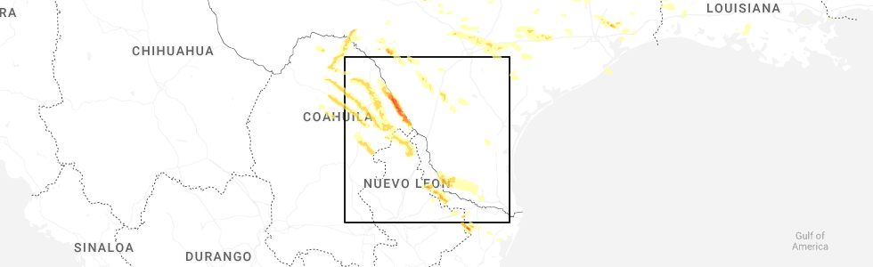
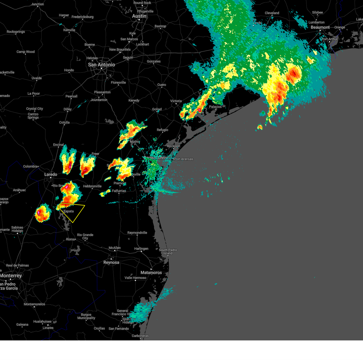
Hail Map for Morales-Sanchez, TX
The Morales-Sanchez, TX area has had 0 reports of on-the-ground hail by trained spotters, and has been under severe weather warnings 12 times during the past 12 months. Doppler radar has detected hail at or near Morales-Sanchez, TX on 47 occasions, including 1 occasion during the past year.
| Name: | Morales-Sanchez, TX |
| Where Located: | 56.7 miles SSE of Laredo, TX |
| Map: | Google Map for Morales-Sanchez, TX |
| Population: | 84 |
| Housing Units: | 41 |
| More Info: | Search Google for Morales-Sanchez, TX |
2
The Top Recent Hail Date for Morales-Sanchez, TX is Friday, May 2, 2025 (8th out of 47)
Hail and Wind Damage Spotted near Morales-Sanchez, TX
| Date / Time | Report Details |
|---|---|
| 5/28/2025 5:04 AM CDT |
 Svrbro the national weather service in brownsville has issued a * severe thunderstorm warning for, southern jim hogg county in deep south texas, northern starr county in deep south texas, southeastern zapata county in deep south texas, * until 600 am cdt. * at 504 am cdt, a severe thunderstorm was located near guerra, or 8 miles north of viboras, moving east at 25 mph (radar indicated). Hazards include 60 mph wind gusts and quarter size hail. Hail damage to vehicles is expected. Expect wind damage to roofs, siding, and trees. Svrbro the national weather service in brownsville has issued a * severe thunderstorm warning for, southern jim hogg county in deep south texas, northern starr county in deep south texas, southeastern zapata county in deep south texas, * until 600 am cdt. * at 504 am cdt, a severe thunderstorm was located near guerra, or 8 miles north of viboras, moving east at 25 mph (radar indicated). Hazards include 60 mph wind gusts and quarter size hail. Hail damage to vehicles is expected. Expect wind damage to roofs, siding, and trees.
|
| 5/8/2025 5:12 PM CDT | At 512 pm cdt, a severe thunderstorm was located near guerra, or 13 miles north of viboras, moving southeast at 30 mph (radar indicated). Hazards include ping pong ball size hail and 60 mph wind gusts. People and animals outdoors will be injured. expect hail damage to roofs, siding, windows, and vehicles. expect wind damage to roofs, siding, and trees. Locations impacted include, new falcon, guerra, falcon dam, randado, morales-sanchez, escobas, falcon state park, viboras, lopeno, and agua nueva. |
| 5/8/2025 4:59 PM CDT | Svrbro the national weather service in brownsville has issued a * severe thunderstorm warning for, southern jim hogg county in deep south texas, northwestern starr county in deep south texas, southeastern zapata county in deep south texas, * until 545 pm cdt. * at 459 pm cdt, a severe thunderstorm was located near guerra, or 11 miles east of bustamante, moving southeast at 30 mph (radar indicated). Hazards include ping pong ball size hail and 60 mph wind gusts. People and animals outdoors will be injured. expect hail damage to roofs, siding, windows, and vehicles. Expect wind damage to roofs, siding, and trees. |
| 5/8/2025 4:46 PM CDT |
 At 446 pm cdt, severe thunderstorms were located along a line extending from near randado to 7 miles northwest of guerra to near falcon mesa, moving southeast at 30 mph (radar indicated). Hazards include ping pong ball size hail and 60 mph wind gusts. People and animals outdoors will be injured. expect hail damage to roofs, siding, windows, and vehicles. expect wind damage to roofs, siding, and trees. Locations impacted include, new falcon, zapata high school, black bass, randado, zapata middle school, siesta shores, zapata county public library, las palmas, zapata--medina, and medina. At 446 pm cdt, severe thunderstorms were located along a line extending from near randado to 7 miles northwest of guerra to near falcon mesa, moving southeast at 30 mph (radar indicated). Hazards include ping pong ball size hail and 60 mph wind gusts. People and animals outdoors will be injured. expect hail damage to roofs, siding, windows, and vehicles. expect wind damage to roofs, siding, and trees. Locations impacted include, new falcon, zapata high school, black bass, randado, zapata middle school, siesta shores, zapata county public library, las palmas, zapata--medina, and medina.
|
| 5/8/2025 4:09 PM CDT |
 Svrbro the national weather service in brownsville has issued a * severe thunderstorm warning for, jim hogg county in deep south texas, northwestern starr county in deep south texas, zapata county in deep south texas, * until 500 pm cdt. * at 409 pm cdt, severe thunderstorms were located along a line extending from 7 miles northwest of thompsonville to 6 miles northwest of bustamante to 9 miles southwest of san ygnacio, moving southeast at 30 mph (radar indicated). Hazards include 60 mph wind gusts and half dollar size hail. Hail damage to vehicles is expected. Expect wind damage to roofs, siding, and trees. Svrbro the national weather service in brownsville has issued a * severe thunderstorm warning for, jim hogg county in deep south texas, northwestern starr county in deep south texas, zapata county in deep south texas, * until 500 pm cdt. * at 409 pm cdt, severe thunderstorms were located along a line extending from 7 miles northwest of thompsonville to 6 miles northwest of bustamante to 9 miles southwest of san ygnacio, moving southeast at 30 mph (radar indicated). Hazards include 60 mph wind gusts and half dollar size hail. Hail damage to vehicles is expected. Expect wind damage to roofs, siding, and trees.
|
| 5/7/2025 4:11 AM CDT |
 The storm which prompted the warning has weakened below severe limits, and no longer poses an immediate threat to life or property. therefore, the warning will be allowed to expire. a severe thunderstorm watch remains in effect until 800 am cdt for deep south texas. The storm which prompted the warning has weakened below severe limits, and no longer poses an immediate threat to life or property. therefore, the warning will be allowed to expire. a severe thunderstorm watch remains in effect until 800 am cdt for deep south texas.
|
| 5/7/2025 3:27 AM CDT |
 Svrbro the national weather service in brownsville has issued a * severe thunderstorm warning for, northwestern starr county in deep south texas, southeastern zapata county in deep south texas, * until 415 am cdt. * at 327 am cdt, a severe thunderstorm was located 11 miles northwest of falcon state park, or 11 miles west of lopeno, moving east at 30 mph (radar indicated). Hazards include ping pong ball size hail and 60 mph wind gusts. People and animals outdoors will be injured. expect hail damage to roofs, siding, windows, and vehicles. Expect wind damage to roofs, siding, and trees. Svrbro the national weather service in brownsville has issued a * severe thunderstorm warning for, northwestern starr county in deep south texas, southeastern zapata county in deep south texas, * until 415 am cdt. * at 327 am cdt, a severe thunderstorm was located 11 miles northwest of falcon state park, or 11 miles west of lopeno, moving east at 30 mph (radar indicated). Hazards include ping pong ball size hail and 60 mph wind gusts. People and animals outdoors will be injured. expect hail damage to roofs, siding, windows, and vehicles. Expect wind damage to roofs, siding, and trees.
|
| 5/7/2025 3:25 AM CDT |
 The storm which prompted the warning has moved out of the area. therefore, the warning will be allowed to expire. a severe thunderstorm watch remains in effect until 800 am cdt for deep south texas. remember, a severe thunderstorm warning still remains in effect for eastern zapata county until 400 am cdt. The storm which prompted the warning has moved out of the area. therefore, the warning will be allowed to expire. a severe thunderstorm watch remains in effect until 800 am cdt for deep south texas. remember, a severe thunderstorm warning still remains in effect for eastern zapata county until 400 am cdt.
|
| 5/7/2025 3:07 AM CDT |
 At 306 am cdt, a severe thunderstorm was located near morales-sanchez, or 9 miles north of lopeno, moving east at 35 mph (radar indicated). Hazards include 60 mph wind gusts and quarter size hail. Hail damage to vehicles is expected. expect wind damage to roofs, siding, and trees. Locations impacted include, morales-sanchez. At 306 am cdt, a severe thunderstorm was located near morales-sanchez, or 9 miles north of lopeno, moving east at 35 mph (radar indicated). Hazards include 60 mph wind gusts and quarter size hail. Hail damage to vehicles is expected. expect wind damage to roofs, siding, and trees. Locations impacted include, morales-sanchez.
|
| 5/7/2025 2:49 AM CDT |
 Svrbro the national weather service in brownsville has issued a * severe thunderstorm warning for, southern zapata county in deep south texas, * until 330 am cdt. * at 248 am cdt, a severe thunderstorm was located over falcon lake estates, or over zapata, moving east at 35 mph (radar indicated). Hazards include 60 mph wind gusts and quarter size hail. Hail damage to vehicles is expected. Expect wind damage to roofs, siding, and trees. Svrbro the national weather service in brownsville has issued a * severe thunderstorm warning for, southern zapata county in deep south texas, * until 330 am cdt. * at 248 am cdt, a severe thunderstorm was located over falcon lake estates, or over zapata, moving east at 35 mph (radar indicated). Hazards include 60 mph wind gusts and quarter size hail. Hail damage to vehicles is expected. Expect wind damage to roofs, siding, and trees.
|
| 5/3/2025 12:52 AM CDT |
 At 1250 am cdt, a severe thunderstorm was located near new falcon, or near lopeno, moving southeast at 30 mph (radar indicated). Hazards include ping pong ball size hail and 60 mph wind gusts. People and animals outdoors will be injured. expect hail damage to roofs, siding, windows, and vehicles. expect wind damage to roofs, siding, and trees. Locations impacted include, new falcon, roma creek, fronton, roma high school, salineno, falcon state park, el sauz, falcon dam, roma city hall, and roma city police department. At 1250 am cdt, a severe thunderstorm was located near new falcon, or near lopeno, moving southeast at 30 mph (radar indicated). Hazards include ping pong ball size hail and 60 mph wind gusts. People and animals outdoors will be injured. expect hail damage to roofs, siding, windows, and vehicles. expect wind damage to roofs, siding, and trees. Locations impacted include, new falcon, roma creek, fronton, roma high school, salineno, falcon state park, el sauz, falcon dam, roma city hall, and roma city police department.
|
| 5/3/2025 12:40 AM CDT |
 Svrbro the national weather service in brownsville has issued a * severe thunderstorm warning for, southwestern jim hogg county in deep south texas, northwestern starr county in deep south texas, southeastern zapata county in deep south texas, * until 130 am cdt. * at 1239 am cdt, a severe thunderstorm was located over lopeno, moving southeast at 30 mph (radar indicated). Hazards include 60 mph wind gusts and quarter size hail. Hail damage to vehicles is expected. Expect wind damage to roofs, siding, and trees. Svrbro the national weather service in brownsville has issued a * severe thunderstorm warning for, southwestern jim hogg county in deep south texas, northwestern starr county in deep south texas, southeastern zapata county in deep south texas, * until 130 am cdt. * at 1239 am cdt, a severe thunderstorm was located over lopeno, moving southeast at 30 mph (radar indicated). Hazards include 60 mph wind gusts and quarter size hail. Hail damage to vehicles is expected. Expect wind damage to roofs, siding, and trees.
|
| 5/28/2024 11:04 PM CDT |
 Svrbro the national weather service in brownsville has issued a * severe thunderstorm warning for, southwestern jim hogg county in deep south texas, starr county in deep south texas, southeastern zapata county in deep south texas, * until 1145 pm cdt. * at 1103 pm cdt, a severe thunderstorm was located over falcon dam, or 10 miles southwest of lopeno, moving southeast at 40 mph (radar indicated). Hazards include 60 mph wind gusts and quarter size hail. Hail damage to vehicles is expected. Expect wind damage to roofs, siding, and trees. Svrbro the national weather service in brownsville has issued a * severe thunderstorm warning for, southwestern jim hogg county in deep south texas, starr county in deep south texas, southeastern zapata county in deep south texas, * until 1145 pm cdt. * at 1103 pm cdt, a severe thunderstorm was located over falcon dam, or 10 miles southwest of lopeno, moving southeast at 40 mph (radar indicated). Hazards include 60 mph wind gusts and quarter size hail. Hail damage to vehicles is expected. Expect wind damage to roofs, siding, and trees.
|
| 5/28/2024 10:57 PM CDT |
 At 1055 pm cdt, severe thunderstorms were located along a line extending from 7 miles southeast of hebbronville to near guerra to near falcon state park, moving southeast at 40 mph (radar indicated). Hazards include 60 mph wind gusts and nickel size hail. Expect damage to roofs, siding, and trees. Locations impacted include, zapata, hebbronville, agua nueva, viboras, lopeno, bustamante, medina, new falcon, zapata high school, and randado. At 1055 pm cdt, severe thunderstorms were located along a line extending from 7 miles southeast of hebbronville to near guerra to near falcon state park, moving southeast at 40 mph (radar indicated). Hazards include 60 mph wind gusts and nickel size hail. Expect damage to roofs, siding, and trees. Locations impacted include, zapata, hebbronville, agua nueva, viboras, lopeno, bustamante, medina, new falcon, zapata high school, and randado.
|
| 5/28/2024 10:43 PM CDT |
 At 1043 pm cdt, severe thunderstorms were located along a line extending from near hebbronville to near agua nueva to falcon state park, moving east at 35 mph (radar indicated). Hazards include 60 mph wind gusts and nickel size hail. Expect damage to roofs, siding, and trees. Locations impacted include, zapata, hebbronville, agua nueva, viboras, lopeno, bustamante, medina, new falcon, zapata high school, and randado. At 1043 pm cdt, severe thunderstorms were located along a line extending from near hebbronville to near agua nueva to falcon state park, moving east at 35 mph (radar indicated). Hazards include 60 mph wind gusts and nickel size hail. Expect damage to roofs, siding, and trees. Locations impacted include, zapata, hebbronville, agua nueva, viboras, lopeno, bustamante, medina, new falcon, zapata high school, and randado.
|
| 5/28/2024 10:34 PM CDT |
 The storm which prompted the warning has moved out of the area. therefore, the warning has been allowed to expire. however, gusty winds are still possible with this thunderstorm. a severe thunderstorm watch remains in effect until 200 am cdt for deep south texas. to report severe weather, contact your nearest law enforcement agency. they will relay your report to the national weather service brownsville. remember, a severe thunderstorm warning still remains in effect for jim hogg county in deep south texas, northwestern starr county in deep south texas, and zapata county in deep south texas, until 1115 pm cdt. The storm which prompted the warning has moved out of the area. therefore, the warning has been allowed to expire. however, gusty winds are still possible with this thunderstorm. a severe thunderstorm watch remains in effect until 200 am cdt for deep south texas. to report severe weather, contact your nearest law enforcement agency. they will relay your report to the national weather service brownsville. remember, a severe thunderstorm warning still remains in effect for jim hogg county in deep south texas, northwestern starr county in deep south texas, and zapata county in deep south texas, until 1115 pm cdt.
|
| 5/28/2024 10:30 PM CDT |
 Svrbro the national weather service in brownsville has issued a * severe thunderstorm warning for, jim hogg county in deep south texas, northwestern starr county in deep south texas, zapata county in deep south texas, * until 1115 pm cdt. * at 1030 pm cdt, severe thunderstorms were located along a line extending from 7 miles south of mirando city to near guerra to 15 miles southwest of falcon mesa, moving east at 105 mph (radar indicated). Hazards include 60 mph wind gusts and nickel size hail. expect damage to roofs, siding, and trees Svrbro the national weather service in brownsville has issued a * severe thunderstorm warning for, jim hogg county in deep south texas, northwestern starr county in deep south texas, zapata county in deep south texas, * until 1115 pm cdt. * at 1030 pm cdt, severe thunderstorms were located along a line extending from 7 miles south of mirando city to near guerra to 15 miles southwest of falcon mesa, moving east at 105 mph (radar indicated). Hazards include 60 mph wind gusts and nickel size hail. expect damage to roofs, siding, and trees
|
| 5/28/2024 10:16 PM CDT |
 At 1014 pm cdt, a severe thunderstorm was located near bustamante, moving southeast at 45 mph (radar indicated). Hazards include 60 mph wind gusts and quarter size hail. Hail damage to vehicles is expected. expect wind damage to roofs, siding, and trees. Locations impacted include, zapata, san ygnacio, bustamante, medina, zapata high school, zapata county fire department, escobas, zapata middle school, siesta shores, and zapata county public library. At 1014 pm cdt, a severe thunderstorm was located near bustamante, moving southeast at 45 mph (radar indicated). Hazards include 60 mph wind gusts and quarter size hail. Hail damage to vehicles is expected. expect wind damage to roofs, siding, and trees. Locations impacted include, zapata, san ygnacio, bustamante, medina, zapata high school, zapata county fire department, escobas, zapata middle school, siesta shores, and zapata county public library.
|
| 5/28/2024 9:49 PM CDT |
 Svrbro the national weather service in brownsville has issued a * severe thunderstorm warning for, northwestern jim hogg county in deep south texas, zapata county in deep south texas, * until 1030 pm cdt. * at 948 pm cdt, a severe thunderstorm was located 9 miles south of el cenizo, or 10 miles north of san ygnacio, moving southeast at 35 mph (radar indicated). Hazards include 60 mph wind gusts and quarter size hail. Hail damage to vehicles is expected. Expect wind damage to roofs, siding, and trees. Svrbro the national weather service in brownsville has issued a * severe thunderstorm warning for, northwestern jim hogg county in deep south texas, zapata county in deep south texas, * until 1030 pm cdt. * at 948 pm cdt, a severe thunderstorm was located 9 miles south of el cenizo, or 10 miles north of san ygnacio, moving southeast at 35 mph (radar indicated). Hazards include 60 mph wind gusts and quarter size hail. Hail damage to vehicles is expected. Expect wind damage to roofs, siding, and trees.
|
| 5/27/2024 8:29 PM CDT |
 The storms which prompted the warning have weakened below severe limits, and no longer pose an immediate threat to life or property. therefore, the warning will be allowed to expire. however, small hail, gusty winds and heavy rain are still possible with these thunderstorms. a severe thunderstorm watch remains in effect until midnight cdt for deep south texas. to report severe weather, contact your nearest law enforcement agency. they will relay your report to the national weather service brownsville. The storms which prompted the warning have weakened below severe limits, and no longer pose an immediate threat to life or property. therefore, the warning will be allowed to expire. however, small hail, gusty winds and heavy rain are still possible with these thunderstorms. a severe thunderstorm watch remains in effect until midnight cdt for deep south texas. to report severe weather, contact your nearest law enforcement agency. they will relay your report to the national weather service brownsville.
|
| 5/27/2024 8:16 PM CDT |
 At 816 pm cdt, severe thunderstorms were located along a line extending from 15 miles west of falcon dam to near roma high school to 7 miles south of los garzas, moving north at 45 mph (radar indicated). Hazards include 60 mph wind gusts and quarter size hail. Hail damage to vehicles is expected. expect wind damage to roofs, siding, and trees. Locations impacted include, rio grande city, roma, escobares, el sauz, lopeno, garciasville, la rosita, la grulla, new falcon, and la victoria. At 816 pm cdt, severe thunderstorms were located along a line extending from 15 miles west of falcon dam to near roma high school to 7 miles south of los garzas, moving north at 45 mph (radar indicated). Hazards include 60 mph wind gusts and quarter size hail. Hail damage to vehicles is expected. expect wind damage to roofs, siding, and trees. Locations impacted include, rio grande city, roma, escobares, el sauz, lopeno, garciasville, la rosita, la grulla, new falcon, and la victoria.
|
| 5/27/2024 7:51 PM CDT |
 Svrbro the national weather service in brownsville has issued a * severe thunderstorm warning for, western starr county in deep south texas, southeastern zapata county in deep south texas, * until 830 pm cdt. * at 750 pm cdt, severe thunderstorms were located along a line extending from 24 miles southwest of fronton to 11 miles south of roma park to 25 miles southwest of la grulla, moving north at 45 mph (radar indicated). Hazards include 60 mph wind gusts and quarter size hail. Hail damage to vehicles is expected. Expect wind damage to roofs, siding, and trees. Svrbro the national weather service in brownsville has issued a * severe thunderstorm warning for, western starr county in deep south texas, southeastern zapata county in deep south texas, * until 830 pm cdt. * at 750 pm cdt, severe thunderstorms were located along a line extending from 24 miles southwest of fronton to 11 miles south of roma park to 25 miles southwest of la grulla, moving north at 45 mph (radar indicated). Hazards include 60 mph wind gusts and quarter size hail. Hail damage to vehicles is expected. Expect wind damage to roofs, siding, and trees.
|
| 5/13/2024 7:19 PM CDT |
 At 719 pm cdt, a severe thunderstorm was located near morales-sanchez, or 9 miles northeast of lopeno, moving northeast at 35 mph (radar indicated). Hazards include two inch hail and 60 mph wind gusts. People and animals outdoors will be injured. expect hail damage to roofs, siding, windows, and vehicles. expect wind damage to roofs, siding, and trees. Locations impacted include, lopeno, guerra, and morales-sanchez. At 719 pm cdt, a severe thunderstorm was located near morales-sanchez, or 9 miles northeast of lopeno, moving northeast at 35 mph (radar indicated). Hazards include two inch hail and 60 mph wind gusts. People and animals outdoors will be injured. expect hail damage to roofs, siding, windows, and vehicles. expect wind damage to roofs, siding, and trees. Locations impacted include, lopeno, guerra, and morales-sanchez.
|
| 5/13/2024 7:04 PM CDT |
 Svrbro the national weather service in brownsville has issued a * severe thunderstorm warning for, southwestern jim hogg county in deep south texas, northwestern starr county in deep south texas, southeastern zapata county in deep south texas, * until 745 pm cdt. * at 704 pm cdt, a severe thunderstorm was located over lopeno, moving northeast at 35 mph (radar indicated). Hazards include two inch hail and 60 mph wind gusts. People and animals outdoors will be injured. expect hail damage to roofs, siding, windows, and vehicles. Expect wind damage to roofs, siding, and trees. Svrbro the national weather service in brownsville has issued a * severe thunderstorm warning for, southwestern jim hogg county in deep south texas, northwestern starr county in deep south texas, southeastern zapata county in deep south texas, * until 745 pm cdt. * at 704 pm cdt, a severe thunderstorm was located over lopeno, moving northeast at 35 mph (radar indicated). Hazards include two inch hail and 60 mph wind gusts. People and animals outdoors will be injured. expect hail damage to roofs, siding, windows, and vehicles. Expect wind damage to roofs, siding, and trees.
|
| 5/13/2024 6:04 PM CDT |
 At 604 pm cdt, a severe thunderstorm was located 9 miles southwest of agua nueva, moving east at 55 mph (radar indicated). Hazards include tennis ball size hail and 60 mph wind gusts. People and animals outdoors will be injured. expect hail damage to roofs, siding, windows, and vehicles. expect wind damage to roofs, siding, and trees. Locations impacted include, lopeno, el sauz, new falcon, guerra, and morales-sanchez. At 604 pm cdt, a severe thunderstorm was located 9 miles southwest of agua nueva, moving east at 55 mph (radar indicated). Hazards include tennis ball size hail and 60 mph wind gusts. People and animals outdoors will be injured. expect hail damage to roofs, siding, windows, and vehicles. expect wind damage to roofs, siding, and trees. Locations impacted include, lopeno, el sauz, new falcon, guerra, and morales-sanchez.
|
| 5/13/2024 5:54 PM CDT |
 At 554 pm cdt, a severe thunderstorm was located near guerra, or 7 miles northwest of viboras, moving east at 55 mph (radar indicated). Hazards include 60 mph wind gusts and penny size hail. Expect damage to roofs, siding, and trees. Locations impacted include, lopeno, el sauz, new falcon, guerra, and morales-sanchez. At 554 pm cdt, a severe thunderstorm was located near guerra, or 7 miles northwest of viboras, moving east at 55 mph (radar indicated). Hazards include 60 mph wind gusts and penny size hail. Expect damage to roofs, siding, and trees. Locations impacted include, lopeno, el sauz, new falcon, guerra, and morales-sanchez.
|
| 5/13/2024 5:39 PM CDT |
 Svrbro the national weather service in brownsville has issued a * severe thunderstorm warning for, southwestern jim hogg county in deep south texas, northwestern starr county in deep south texas, southeastern zapata county in deep south texas, * until 630 pm cdt. * at 538 pm cdt, a severe thunderstorm was located over morales-sanchez, or near lopeno, moving east at 55 mph. this is a destructive storm for zapata (radar indicated). Hazards include baseball size hail and 70 mph wind gusts. People and animals outdoors will be severely injured. Expect shattered windows, extensive damage to roofs, siding, and vehicles. Svrbro the national weather service in brownsville has issued a * severe thunderstorm warning for, southwestern jim hogg county in deep south texas, northwestern starr county in deep south texas, southeastern zapata county in deep south texas, * until 630 pm cdt. * at 538 pm cdt, a severe thunderstorm was located over morales-sanchez, or near lopeno, moving east at 55 mph. this is a destructive storm for zapata (radar indicated). Hazards include baseball size hail and 70 mph wind gusts. People and animals outdoors will be severely injured. Expect shattered windows, extensive damage to roofs, siding, and vehicles.
|
| 5/13/2024 5:22 PM CDT |
 The storm which prompted the warning has weakened below severe limits, and no longer poses an immediate threat to life or property. therefore, the warning will be allowed to expire. however, small hail and gusty winds are still possible with this thunderstorm. a severe thunderstorm watch remains in effect until 1000 pm cdt for deep south texas. The storm which prompted the warning has weakened below severe limits, and no longer poses an immediate threat to life or property. therefore, the warning will be allowed to expire. however, small hail and gusty winds are still possible with this thunderstorm. a severe thunderstorm watch remains in effect until 1000 pm cdt for deep south texas.
|
| 5/13/2024 5:03 PM CDT |
 At 503 pm cdt, a severe thunderstorm was located near bustamante, moving east at 35 mph (radar indicated). Hazards include golf ball size hail and 70 mph wind gusts. People and animals outdoors will be injured. expect hail damage to roofs, siding, windows, and vehicles. expect considerable tree damage. wind damage is also likely to mobile homes, roofs, and outbuildings. Locations impacted include, zapata, bustamante, medina, zapata high school, zapata county fire department, zapata middle school, zapata county public library, las palmas, morales-sanchez, and zapata county airport. At 503 pm cdt, a severe thunderstorm was located near bustamante, moving east at 35 mph (radar indicated). Hazards include golf ball size hail and 70 mph wind gusts. People and animals outdoors will be injured. expect hail damage to roofs, siding, windows, and vehicles. expect considerable tree damage. wind damage is also likely to mobile homes, roofs, and outbuildings. Locations impacted include, zapata, bustamante, medina, zapata high school, zapata county fire department, zapata middle school, zapata county public library, las palmas, morales-sanchez, and zapata county airport.
|
| 5/13/2024 4:44 PM CDT |
 Svrbro the national weather service in brownsville has issued a * severe thunderstorm warning for, west central jim hogg county in deep south texas, central zapata county in deep south texas, * until 530 pm cdt. * at 444 pm cdt, a severe thunderstorm was located over zapata county airport, or 7 miles north of zapata, moving east at 35 mph (radar indicated). Hazards include golf ball size hail and 70 mph wind gusts. People and animals outdoors will be injured. expect hail damage to roofs, siding, windows, and vehicles. expect considerable tree damage. Wind damage is also likely to mobile homes, roofs, and outbuildings. Svrbro the national weather service in brownsville has issued a * severe thunderstorm warning for, west central jim hogg county in deep south texas, central zapata county in deep south texas, * until 530 pm cdt. * at 444 pm cdt, a severe thunderstorm was located over zapata county airport, or 7 miles north of zapata, moving east at 35 mph (radar indicated). Hazards include golf ball size hail and 70 mph wind gusts. People and animals outdoors will be injured. expect hail damage to roofs, siding, windows, and vehicles. expect considerable tree damage. Wind damage is also likely to mobile homes, roofs, and outbuildings.
|
| 3/17/2024 12:29 AM CDT |
 The storm which prompted the warning has weakened below severe limits, and no longer poses an immediate threat to life or property. therefore, the warning will be allowed to expire. however, small hail and gusty winds are still possible with this thunderstorm. a severe thunderstorm watch remains in effect until 600 am cdt for deep south texas. The storm which prompted the warning has weakened below severe limits, and no longer poses an immediate threat to life or property. therefore, the warning will be allowed to expire. however, small hail and gusty winds are still possible with this thunderstorm. a severe thunderstorm watch remains in effect until 600 am cdt for deep south texas.
|
| 3/16/2024 11:55 PM CDT |
 At 1154 pm cdt, a severe thunderstorm was located near siesta shores, or near zapata, moving east at 45 mph (radar indicated). Hazards include 60 mph wind gusts and quarter size hail. Hail damage to vehicles is expected. expect wind damage to roofs, siding, and trees. Locations impacted include, zapata, lopeno, medina, new falcon, zapata high school, zapata county fire department, zapata middle school, siesta shores, zapata county public library, and falcon mesa. At 1154 pm cdt, a severe thunderstorm was located near siesta shores, or near zapata, moving east at 45 mph (radar indicated). Hazards include 60 mph wind gusts and quarter size hail. Hail damage to vehicles is expected. expect wind damage to roofs, siding, and trees. Locations impacted include, zapata, lopeno, medina, new falcon, zapata high school, zapata county fire department, zapata middle school, siesta shores, zapata county public library, and falcon mesa.
|
| 3/16/2024 11:34 PM CDT |
 Svrbro the national weather service in brownsville has issued a * severe thunderstorm warning for, northwestern starr county in deep south texas, southeastern zapata county in deep south texas, * until 1230 am cdt. * at 1133 pm cdt, a severe thunderstorm was located 18 miles southwest of falcon mesa, or 20 miles southwest of zapata, moving east at 45 mph (radar indicated). Hazards include two inch hail and 60 mph wind gusts. People and animals outdoors will be injured. expect hail damage to roofs, siding, windows, and vehicles. Expect wind damage to roofs, siding, and trees. Svrbro the national weather service in brownsville has issued a * severe thunderstorm warning for, northwestern starr county in deep south texas, southeastern zapata county in deep south texas, * until 1230 am cdt. * at 1133 pm cdt, a severe thunderstorm was located 18 miles southwest of falcon mesa, or 20 miles southwest of zapata, moving east at 45 mph (radar indicated). Hazards include two inch hail and 60 mph wind gusts. People and animals outdoors will be injured. expect hail damage to roofs, siding, windows, and vehicles. Expect wind damage to roofs, siding, and trees.
|
| 6/3/2023 8:24 PM CDT |
 At 824 pm cdt, a severe thunderstorm was located over falcon dam, or 12 miles south of lopeno, moving southeast at 40 mph (radar indicated). Hazards include 60 mph wind gusts and quarter size hail. Hail damage to vehicles is expected. Expect wind damage to roofs, siding, and trees. At 824 pm cdt, a severe thunderstorm was located over falcon dam, or 12 miles south of lopeno, moving southeast at 40 mph (radar indicated). Hazards include 60 mph wind gusts and quarter size hail. Hail damage to vehicles is expected. Expect wind damage to roofs, siding, and trees.
|
| 4/28/2023 10:52 PM CDT |
 At 1052 pm cdt, a severe thunderstorm was located near new falcon, or 7 miles southeast of lopeno, moving southeast at 20 mph (radar indicated). Hazards include golf ball size hail and 60 mph wind gusts. People and animals outdoors will be injured. expect hail damage to roofs, siding, windows, and vehicles. expect wind damage to roofs, siding, and trees. locations impacted include, lopeno, new falcon, falcon dam, morales-sanchez, salineno, falcon heights and falcon state park. thunderstorm damage threat, considerable hail threat, radar indicated max hail size, 1. 75 in wind threat, radar indicated max wind gust, 60 mph. At 1052 pm cdt, a severe thunderstorm was located near new falcon, or 7 miles southeast of lopeno, moving southeast at 20 mph (radar indicated). Hazards include golf ball size hail and 60 mph wind gusts. People and animals outdoors will be injured. expect hail damage to roofs, siding, windows, and vehicles. expect wind damage to roofs, siding, and trees. locations impacted include, lopeno, new falcon, falcon dam, morales-sanchez, salineno, falcon heights and falcon state park. thunderstorm damage threat, considerable hail threat, radar indicated max hail size, 1. 75 in wind threat, radar indicated max wind gust, 60 mph.
|
| 4/28/2023 10:45 PM CDT |
 At 1044 pm cdt, a severe thunderstorm was located over new falcon, or near lopeno, moving southeast at 20 mph (radar indicated). Hazards include 60 mph wind gusts and half dollar size hail. Hail damage to vehicles is expected. expect wind damage to roofs, siding, and trees. locations impacted include, lopeno, new falcon, falcon dam, morales-sanchez, salineno, falcon heights and falcon state park. hail threat, radar indicated max hail size, 1. 25 in wind threat, radar indicated max wind gust, 60 mph. At 1044 pm cdt, a severe thunderstorm was located over new falcon, or near lopeno, moving southeast at 20 mph (radar indicated). Hazards include 60 mph wind gusts and half dollar size hail. Hail damage to vehicles is expected. expect wind damage to roofs, siding, and trees. locations impacted include, lopeno, new falcon, falcon dam, morales-sanchez, salineno, falcon heights and falcon state park. hail threat, radar indicated max hail size, 1. 25 in wind threat, radar indicated max wind gust, 60 mph.
|
| 4/28/2023 10:25 PM CDT |
 At 1024 pm cdt, a severe thunderstorm was located over lopeno, moving southeast at 20 mph (radar indicated). Hazards include 60 mph wind gusts and half dollar size hail. Hail damage to vehicles is expected. Expect wind damage to roofs, siding, and trees. At 1024 pm cdt, a severe thunderstorm was located over lopeno, moving southeast at 20 mph (radar indicated). Hazards include 60 mph wind gusts and half dollar size hail. Hail damage to vehicles is expected. Expect wind damage to roofs, siding, and trees.
|
| 4/28/2023 10:14 PM CDT |
 At 1013 pm cdt, a severe thunderstorm was located 8 miles northwest of viboras, moving east at 40 mph (public reported golf ball size hail near morales-sanchez). Hazards include golf ball size hail and 60 mph wind gusts. People and animals outdoors will be injured. expect hail damage to roofs, siding, windows, and vehicles. expect wind damage to roofs, siding, and trees. locations impacted include, zapata, lopeno, medina, new falcon, zapata high school, zapata county fire department, zapata middle school, siesta shores, zapata county public library and las palmas. thunderstorm damage threat, considerable hail threat, observed max hail size, 1. 75 in wind threat, radar indicated max wind gust, 60 mph. At 1013 pm cdt, a severe thunderstorm was located 8 miles northwest of viboras, moving east at 40 mph (public reported golf ball size hail near morales-sanchez). Hazards include golf ball size hail and 60 mph wind gusts. People and animals outdoors will be injured. expect hail damage to roofs, siding, windows, and vehicles. expect wind damage to roofs, siding, and trees. locations impacted include, zapata, lopeno, medina, new falcon, zapata high school, zapata county fire department, zapata middle school, siesta shores, zapata county public library and las palmas. thunderstorm damage threat, considerable hail threat, observed max hail size, 1. 75 in wind threat, radar indicated max wind gust, 60 mph.
|
| 4/28/2023 9:55 PM CDT |
 At 955 pm cdt, a severe thunderstorm was located over morales-sanchez, or near lopeno, moving east at 40 mph (radar indicated). Hazards include golf ball size hail and 60 mph wind gusts. People and animals outdoors will be injured. expect hail damage to roofs, siding, windows, and vehicles. expect wind damage to roofs, siding, and trees. locations impacted include, zapata, lopeno, medina, new falcon, zapata high school, zapata county fire department, zapata middle school, siesta shores, zapata county public library and las palmas. thunderstorm damage threat, considerable hail threat, radar indicated max hail size, 1. 75 in wind threat, radar indicated max wind gust, 60 mph. At 955 pm cdt, a severe thunderstorm was located over morales-sanchez, or near lopeno, moving east at 40 mph (radar indicated). Hazards include golf ball size hail and 60 mph wind gusts. People and animals outdoors will be injured. expect hail damage to roofs, siding, windows, and vehicles. expect wind damage to roofs, siding, and trees. locations impacted include, zapata, lopeno, medina, new falcon, zapata high school, zapata county fire department, zapata middle school, siesta shores, zapata county public library and las palmas. thunderstorm damage threat, considerable hail threat, radar indicated max hail size, 1. 75 in wind threat, radar indicated max wind gust, 60 mph.
|
| 4/28/2023 9:45 PM CDT |
 At 944 pm cdt, a severe thunderstorm was located near siesta shores, or near zapata, moving east at 40 mph (radar indicated). Hazards include 60 mph wind gusts and quarter size hail. Hail damage to vehicles is expected. Expect wind damage to roofs, siding, and trees. At 944 pm cdt, a severe thunderstorm was located near siesta shores, or near zapata, moving east at 40 mph (radar indicated). Hazards include 60 mph wind gusts and quarter size hail. Hail damage to vehicles is expected. Expect wind damage to roofs, siding, and trees.
|
| 4/23/2023 12:17 PM CDT |
 At 1216 pm cdt, severe thunderstorms were located along a line extending from 38 miles east of kenedy county wind farms to near rudolph to 7 miles west of santa catarina to 7 miles west of falcon dam, moving southeast at 45 mph (radar indicated). Hazards include 70 mph wind gusts and penny size hail. Expect considerable tree damage. Damage is likely to mobile homes, roofs, and outbuildings. At 1216 pm cdt, severe thunderstorms were located along a line extending from 38 miles east of kenedy county wind farms to near rudolph to 7 miles west of santa catarina to 7 miles west of falcon dam, moving southeast at 45 mph (radar indicated). Hazards include 70 mph wind gusts and penny size hail. Expect considerable tree damage. Damage is likely to mobile homes, roofs, and outbuildings.
|
| 5/23/2022 9:42 PM CDT |
 The severe thunderstorm warning for southwestern jim hogg, northwestern starr and southeastern zapata counties will expire at 945 pm cdt, the severe thunderstorm which prompted the warning has is crawling to the east. therefore, the warning is being replaced by the new warning just issued. hail and gusty winds are still possible with this thunderstorm. a severe thunderstorm watch remains in effect until midnight cdt for deep south texas. remember, a severe thunderstorm warning still remains in effect for the southern tip of zapata county, southern jim hogg county and western starr county until 10:30 pm. The severe thunderstorm warning for southwestern jim hogg, northwestern starr and southeastern zapata counties will expire at 945 pm cdt, the severe thunderstorm which prompted the warning has is crawling to the east. therefore, the warning is being replaced by the new warning just issued. hail and gusty winds are still possible with this thunderstorm. a severe thunderstorm watch remains in effect until midnight cdt for deep south texas. remember, a severe thunderstorm warning still remains in effect for the southern tip of zapata county, southern jim hogg county and western starr county until 10:30 pm.
|
| 5/23/2022 9:28 PM CDT |
 At 927 pm cdt, a severe thunderstorm was located near viboras, moving northeast at 20 mph (radar indicated). Hazards include 60 mph wind gusts and half dollar size hail. Hail damage to vehicles is expected. expect wind damage to roofs, siding, and trees. locations impacted include, viboras, lopeno, agua nueva, el sauz, new falcon, falcon dam, roma high school, morales-sanchez, salineno and falcon heights. hail threat, radar indicated max hail size, 1. 25 in wind threat, radar indicated max wind gust, 60 mph. At 927 pm cdt, a severe thunderstorm was located near viboras, moving northeast at 20 mph (radar indicated). Hazards include 60 mph wind gusts and half dollar size hail. Hail damage to vehicles is expected. expect wind damage to roofs, siding, and trees. locations impacted include, viboras, lopeno, agua nueva, el sauz, new falcon, falcon dam, roma high school, morales-sanchez, salineno and falcon heights. hail threat, radar indicated max hail size, 1. 25 in wind threat, radar indicated max wind gust, 60 mph.
|
| 5/23/2022 9:26 PM CDT |
 The severe thunderstorm warning for southwestern jim hogg and east central zapata counties will expire at 930 pm cdt, the severe thunderstorm which prompted the warning has moved out of the warned area. therefore, the warning will be allowed to expire. however hail is still possible with this thunderstorm. a severe thunderstorm watch remains in effect until midnight cdt for deep south texas. remember, a severe thunderstorm warning still remains in effect for for eastern zapata county and western jim hogg county until 10:15 pm. The severe thunderstorm warning for southwestern jim hogg and east central zapata counties will expire at 930 pm cdt, the severe thunderstorm which prompted the warning has moved out of the warned area. therefore, the warning will be allowed to expire. however hail is still possible with this thunderstorm. a severe thunderstorm watch remains in effect until midnight cdt for deep south texas. remember, a severe thunderstorm warning still remains in effect for for eastern zapata county and western jim hogg county until 10:15 pm.
|
| 5/23/2022 9:13 PM CDT |
 At 913 pm cdt, a severe thunderstorm was located 8 miles east of new falcon, or 8 miles northwest of el sauz, moving northeast at 25 mph (radar indicated). Hazards include ping pong ball size hail and 60 mph wind gusts. People and animals outdoors will be injured. expect hail damage to roofs, siding, windows, and vehicles. expect wind damage to roofs, siding, and trees. locations impacted include, viboras, lopeno, agua nueva, el sauz, new falcon, falcon dam, roma high school, morales-sanchez, salineno and falcon heights. hail threat, radar indicated max hail size, 1. 50 in wind threat, radar indicated max wind gust, 60 mph. At 913 pm cdt, a severe thunderstorm was located 8 miles east of new falcon, or 8 miles northwest of el sauz, moving northeast at 25 mph (radar indicated). Hazards include ping pong ball size hail and 60 mph wind gusts. People and animals outdoors will be injured. expect hail damage to roofs, siding, windows, and vehicles. expect wind damage to roofs, siding, and trees. locations impacted include, viboras, lopeno, agua nueva, el sauz, new falcon, falcon dam, roma high school, morales-sanchez, salineno and falcon heights. hail threat, radar indicated max hail size, 1. 50 in wind threat, radar indicated max wind gust, 60 mph.
|
| 5/23/2022 9:12 PM CDT |
 At 912 pm cdt, a severe thunderstorm was located 9 miles northwest of agua nueva, moving east at 15 mph (radar indicated). Hazards include tennis ball size hail and 60 mph wind gusts. People and animals outdoors will be injured. expect hail damage to roofs, siding, windows, and vehicles. expect wind damage to roofs, siding, and trees. locations impacted include, agua nueva, guerra, randado, falcon lake estates, siesta shores, escobas, black bass and zapata--medina. thunderstorm damage threat, considerable hail threat, radar indicated max hail size, 2. 50 in wind threat, radar indicated max wind gust, 60 mph. At 912 pm cdt, a severe thunderstorm was located 9 miles northwest of agua nueva, moving east at 15 mph (radar indicated). Hazards include tennis ball size hail and 60 mph wind gusts. People and animals outdoors will be injured. expect hail damage to roofs, siding, windows, and vehicles. expect wind damage to roofs, siding, and trees. locations impacted include, agua nueva, guerra, randado, falcon lake estates, siesta shores, escobas, black bass and zapata--medina. thunderstorm damage threat, considerable hail threat, radar indicated max hail size, 2. 50 in wind threat, radar indicated max wind gust, 60 mph.
|
| 5/23/2022 9:02 PM CDT |
 At 902 pm cdt, a severe thunderstorm was located near new falcon, or 7 miles southeast of lopeno, moving northeast at 20 mph (radar indicated). Hazards include 60 mph wind gusts and half dollar size hail. Hail damage to vehicles is expected. Expect wind damage to roofs, siding, and trees. At 902 pm cdt, a severe thunderstorm was located near new falcon, or 7 miles southeast of lopeno, moving northeast at 20 mph (radar indicated). Hazards include 60 mph wind gusts and half dollar size hail. Hail damage to vehicles is expected. Expect wind damage to roofs, siding, and trees.
|
| 5/23/2022 8:59 PM CDT |
 At 859 pm cdt, a severe thunderstorm was located 7 miles southeast of randado, or 13 miles northwest of agua nueva, moving east at 15 mph (radar indicated). Hazards include tennis ball size hail and 60 mph wind gusts. People and animals outdoors will be injured. expect hail damage to roofs, siding, windows, and vehicles. expect wind damage to roofs, siding, and trees. locations impacted include, zapata, agua nueva, bustamante, medina, zapata high school, guerra, zapata county fire department, randado, escobas and zapata middle school. thunderstorm damage threat, considerable hail threat, radar indicated max hail size, 2. 50 in wind threat, radar indicated max wind gust, 60 mph. At 859 pm cdt, a severe thunderstorm was located 7 miles southeast of randado, or 13 miles northwest of agua nueva, moving east at 15 mph (radar indicated). Hazards include tennis ball size hail and 60 mph wind gusts. People and animals outdoors will be injured. expect hail damage to roofs, siding, windows, and vehicles. expect wind damage to roofs, siding, and trees. locations impacted include, zapata, agua nueva, bustamante, medina, zapata high school, guerra, zapata county fire department, randado, escobas and zapata middle school. thunderstorm damage threat, considerable hail threat, radar indicated max hail size, 2. 50 in wind threat, radar indicated max wind gust, 60 mph.
|
| 5/23/2022 8:46 PM CDT |
 At 845 pm cdt, a severe thunderstorm was located near randado, or 16 miles northwest of agua nueva, moving east at 15 mph (a paramedic from the zapata county fire department reported quarter sized hail in zapata at 8:20 pm). Hazards include tennis ball size hail and 60 mph wind gusts. People and animals outdoors will be injured. expect hail damage to roofs, siding, windows, and vehicles. expect wind damage to roofs, siding, and trees. locations impacted include, zapata, agua nueva, bustamante, hebbronville, medina, zapata high school, guerra, zapata county fire department, randado and escobas. thunderstorm damage threat, considerable hail threat, observed max hail size, 2. 50 in wind threat, radar indicated max wind gust, 60 mph. At 845 pm cdt, a severe thunderstorm was located near randado, or 16 miles northwest of agua nueva, moving east at 15 mph (a paramedic from the zapata county fire department reported quarter sized hail in zapata at 8:20 pm). Hazards include tennis ball size hail and 60 mph wind gusts. People and animals outdoors will be injured. expect hail damage to roofs, siding, windows, and vehicles. expect wind damage to roofs, siding, and trees. locations impacted include, zapata, agua nueva, bustamante, hebbronville, medina, zapata high school, guerra, zapata county fire department, randado and escobas. thunderstorm damage threat, considerable hail threat, observed max hail size, 2. 50 in wind threat, radar indicated max wind gust, 60 mph.
|
| 5/23/2022 8:39 PM CDT |
 At 839 pm cdt, a severe thunderstorm was located near randado, or 15 miles east of bustamante, moving east at 15 mph (radar indicated). Hazards include tennis ball size hail and 60 mph wind gusts. People and animals outdoors will be injured. expect hail damage to roofs, siding, windows, and vehicles. Expect wind damage to roofs, siding, and trees. At 839 pm cdt, a severe thunderstorm was located near randado, or 15 miles east of bustamante, moving east at 15 mph (radar indicated). Hazards include tennis ball size hail and 60 mph wind gusts. People and animals outdoors will be injured. expect hail damage to roofs, siding, windows, and vehicles. Expect wind damage to roofs, siding, and trees.
|
| 5/22/2022 12:10 PM CDT |
 At 1207 pm cdt, a severe thunderstorm was located over lopeno, moving south at 20 to 25 mph (radar indicated). Hazards include ping pong ball size hail and 60 mph wind gusts. People and animals outdoors will be injured. expect hail damage to roofs, siding, windows, and vehicles. Expect wind damage to roofs, siding, and trees. At 1207 pm cdt, a severe thunderstorm was located over lopeno, moving south at 20 to 25 mph (radar indicated). Hazards include ping pong ball size hail and 60 mph wind gusts. People and animals outdoors will be injured. expect hail damage to roofs, siding, windows, and vehicles. Expect wind damage to roofs, siding, and trees.
|
| 5/22/2022 11:48 AM CDT |
 At 1147 am cdt, a severe thunderstorm was located 7 miles south of bustamante and near zapata, moving southeast at 25 mph (radar indicated). Hazards include 60 mph wind gusts and quarter size hail. Hail damage to vehicles is expected. expect wind damage to roofs, siding, and trees. locations impacted include, zapata, bustamante, medina, zapata high school, zapata county fire department, zapata middle school, siesta shores, zapata county public library, las palmas and falcon mesa. hail threat, radar indicated max hail size, 1. 00 in wind threat, radar indicated max wind gust, 60 mph. At 1147 am cdt, a severe thunderstorm was located 7 miles south of bustamante and near zapata, moving southeast at 25 mph (radar indicated). Hazards include 60 mph wind gusts and quarter size hail. Hail damage to vehicles is expected. expect wind damage to roofs, siding, and trees. locations impacted include, zapata, bustamante, medina, zapata high school, zapata county fire department, zapata middle school, siesta shores, zapata county public library, las palmas and falcon mesa. hail threat, radar indicated max hail size, 1. 00 in wind threat, radar indicated max wind gust, 60 mph.
|
| 5/22/2022 11:26 AM CDT |
 At 1123 am cdt, a severe thunderstorm was located over zapata county airport, or near zapata, moving southeast at 15 to 20 mph (radar indicated). Hazards include 60 mph wind gusts and quarter size hail. Hail damage to vehicles is expected. Expect wind damage to roofs, siding, and trees. At 1123 am cdt, a severe thunderstorm was located over zapata county airport, or near zapata, moving southeast at 15 to 20 mph (radar indicated). Hazards include 60 mph wind gusts and quarter size hail. Hail damage to vehicles is expected. Expect wind damage to roofs, siding, and trees.
|
| 5/11/2021 10:54 PM CDT |
 At 1053 pm cdt, a severe thunderstorm was located near new falcon, or 7 miles east of lopeno, moving southeast at 25 mph (radar indicated). Hazards include quarter size hail. Damage to vehicles is expected. Locations impacted include, roma, el sauz, viboras, lopeno, new falcon, roma creek, roma high school, salineno, falcon state park and roma city hall. At 1053 pm cdt, a severe thunderstorm was located near new falcon, or 7 miles east of lopeno, moving southeast at 25 mph (radar indicated). Hazards include quarter size hail. Damage to vehicles is expected. Locations impacted include, roma, el sauz, viboras, lopeno, new falcon, roma creek, roma high school, salineno, falcon state park and roma city hall.
|
| 5/11/2021 10:26 PM CDT |
 At 1025 pm cdt, a severe thunderstorm was located over morales-sanchez, or near lopeno, moving southeast at 25 mph. this is a very dangerous storm (radar indicated). Hazards include baseball size hail. People and animals outdoors will be severely injured. Expect shattered windows, extensive damage to roofs, siding, and vehicles. At 1025 pm cdt, a severe thunderstorm was located over morales-sanchez, or near lopeno, moving southeast at 25 mph. this is a very dangerous storm (radar indicated). Hazards include baseball size hail. People and animals outdoors will be severely injured. Expect shattered windows, extensive damage to roofs, siding, and vehicles.
|
| 5/11/2021 10:09 PM CDT |
 At 1008 pm cdt, a severe thunderstorm was located over falcon shores, or over zapata, moving southeast at 20 mph (radar indicated). Hazards include golf ball size hail. People and animals outdoors will be injured. expect damage to roofs, siding, windows, and vehicles. Locations impacted include, zapata, lopeno, medina, zapata high school, zapata county fire department, zapata middle school, siesta shores, zapata county public library, falcon mesa and morales-sanchez. At 1008 pm cdt, a severe thunderstorm was located over falcon shores, or over zapata, moving southeast at 20 mph (radar indicated). Hazards include golf ball size hail. People and animals outdoors will be injured. expect damage to roofs, siding, windows, and vehicles. Locations impacted include, zapata, lopeno, medina, zapata high school, zapata county fire department, zapata middle school, siesta shores, zapata county public library, falcon mesa and morales-sanchez.
|
| 5/11/2021 9:48 PM CDT |
 At 948 pm cdt, a severe thunderstorm was located near las palmas, or near zapata, moving southeast at 20 mph (radar indicated). Hazards include half dollar size hail. damage to vehicles is expected At 948 pm cdt, a severe thunderstorm was located near las palmas, or near zapata, moving southeast at 20 mph (radar indicated). Hazards include half dollar size hail. damage to vehicles is expected
|
| 5/26/2020 1:27 AM CDT |
 At 126 am cdt, severe thunderstorms were located along a line extending from near mirando city to near viboras to 16 miles southwest of falcon dam, moving east at 40 mph. these are very dangerous storms (radar indicated). Hazards include 80 mph wind gusts and golf ball size hail. Flying debris will be dangerous to those caught without shelter. mobile homes will be heavily damaged. expect considerable damage to roofs, windows, and vehicles. Extensive tree damage and power outages are likely. At 126 am cdt, severe thunderstorms were located along a line extending from near mirando city to near viboras to 16 miles southwest of falcon dam, moving east at 40 mph. these are very dangerous storms (radar indicated). Hazards include 80 mph wind gusts and golf ball size hail. Flying debris will be dangerous to those caught without shelter. mobile homes will be heavily damaged. expect considerable damage to roofs, windows, and vehicles. Extensive tree damage and power outages are likely.
|
| 5/26/2020 1:17 AM CDT |
 At 116 am cdt, a severe thunderstorm capable of producing a tornado was located 7 miles east of morales-sanchez, or 8 miles northeast of lopeno, moving southeast at 25 mph (radar indicated rotation). Hazards include tornado and hail up to two inches in diameter. Flying debris will be dangerous to those caught without shelter. mobile homes will be damaged or destroyed. damage to roofs, windows, and vehicles will occur. tree damage is likely. this dangerous storm will be near, viboras around 140 am cdt. el sauz around 155 am cdt. This includes us highway 83 near mile marker 780. At 116 am cdt, a severe thunderstorm capable of producing a tornado was located 7 miles east of morales-sanchez, or 8 miles northeast of lopeno, moving southeast at 25 mph (radar indicated rotation). Hazards include tornado and hail up to two inches in diameter. Flying debris will be dangerous to those caught without shelter. mobile homes will be damaged or destroyed. damage to roofs, windows, and vehicles will occur. tree damage is likely. this dangerous storm will be near, viboras around 140 am cdt. el sauz around 155 am cdt. This includes us highway 83 near mile marker 780.
|
| 5/26/2020 1:13 AM CDT |
 At 112 am cdt, a severe thunderstorm was located 7 miles southwest of guerra, or 10 miles northwest of viboras, moving southeast at 35 mph. this is a very dangerous storm (law enforcement). Hazards include 80 mph wind gusts and two inch hail. Flying debris will be dangerous to those caught without shelter. mobile homes will be heavily damaged. expect considerable damage to roofs, windows, and vehicles. extensive tree damage and power outages are likely. Locations impacted include, el sauz, viboras, lopeno, bustamante, new falcon, guerra, randado, escobas, falcon state park and siesta shores. At 112 am cdt, a severe thunderstorm was located 7 miles southwest of guerra, or 10 miles northwest of viboras, moving southeast at 35 mph. this is a very dangerous storm (law enforcement). Hazards include 80 mph wind gusts and two inch hail. Flying debris will be dangerous to those caught without shelter. mobile homes will be heavily damaged. expect considerable damage to roofs, windows, and vehicles. extensive tree damage and power outages are likely. Locations impacted include, el sauz, viboras, lopeno, bustamante, new falcon, guerra, randado, escobas, falcon state park and siesta shores.
|
| 5/26/2020 12:56 AM CDT |
 At 1255 am cdt, a severe thunderstorm was located near morales-sanchez, or 8 miles south of bustamante, moving southeast at 35 mph (radar indicated). Hazards include two inch hail and 70 mph wind gusts. People and animals outdoors will be injured. expect hail damage to roofs, siding, windows, and vehicles. expect considerable tree damage. wind damage is also likely to mobile homes, roofs, and outbuildings. Locations impacted include, zapata, el sauz, viboras, lopeno, bustamante, medina, new falcon, zapata high school, randado and zapata middle school. At 1255 am cdt, a severe thunderstorm was located near morales-sanchez, or 8 miles south of bustamante, moving southeast at 35 mph (radar indicated). Hazards include two inch hail and 70 mph wind gusts. People and animals outdoors will be injured. expect hail damage to roofs, siding, windows, and vehicles. expect considerable tree damage. wind damage is also likely to mobile homes, roofs, and outbuildings. Locations impacted include, zapata, el sauz, viboras, lopeno, bustamante, medina, new falcon, zapata high school, randado and zapata middle school.
|
| 5/26/2020 12:52 AM CDT |
 At 1251 am cdt, a severe thunderstorm was located near zapata high school, or 7 miles east of zapata, moving southeast at 35 mph (radar indicated). Hazards include 70 mph wind gusts and ping pong ball size hail. People and animals outdoors will be injured. expect hail damage to roofs, siding, windows, and vehicles. expect considerable tree damage. Wind damage is also likely to mobile homes, roofs, and outbuildings. At 1251 am cdt, a severe thunderstorm was located near zapata high school, or 7 miles east of zapata, moving southeast at 35 mph (radar indicated). Hazards include 70 mph wind gusts and ping pong ball size hail. People and animals outdoors will be injured. expect hail damage to roofs, siding, windows, and vehicles. expect considerable tree damage. Wind damage is also likely to mobile homes, roofs, and outbuildings.
|
| 5/26/2020 12:40 AM CDT |
 At 1240 am cdt, a severe thunderstorm was located over zapata county airport, or near zapata, moving east at 35 mph (radar indicated). Hazards include ping pong ball size hail and 60 mph wind gusts. People and animals outdoors will be injured. expect hail damage to roofs, siding, windows, and vehicles. expect wind damage to roofs, siding, and trees. Locations impacted include, zapata, bustamante, medina, zapata high school, zapata county fire department, escobas, zapata middle school, siesta shores, zapata county public library and las palmas. At 1240 am cdt, a severe thunderstorm was located over zapata county airport, or near zapata, moving east at 35 mph (radar indicated). Hazards include ping pong ball size hail and 60 mph wind gusts. People and animals outdoors will be injured. expect hail damage to roofs, siding, windows, and vehicles. expect wind damage to roofs, siding, and trees. Locations impacted include, zapata, bustamante, medina, zapata high school, zapata county fire department, escobas, zapata middle school, siesta shores, zapata county public library and las palmas.
|
| 5/26/2020 12:20 AM CDT |
 At 1218 am cdt, a severe thunderstorm was located 9 miles northwest of las palmas, or 12 miles northwest of zapata, moving east at 35 mph (radar indicated). Hazards include 60 mph wind gusts and quarter size hail. Hail damage to vehicles is expected. Expect wind damage to roofs, siding, and trees. At 1218 am cdt, a severe thunderstorm was located 9 miles northwest of las palmas, or 12 miles northwest of zapata, moving east at 35 mph (radar indicated). Hazards include 60 mph wind gusts and quarter size hail. Hail damage to vehicles is expected. Expect wind damage to roofs, siding, and trees.
|
| 8/24/2019 5:01 PM CDT |
 At 459 pm cdt, a severe thunderstorm was located near zapata, moving southeast at 10 mph (radar indicated). Hazards include 60 mph wind gusts and quarter size hail. Hail damage to vehicles is expected. expect wind damage to roofs, siding, and trees. Locations impacted include, zapata, medina, zapata high school, zapata county fire department, zapata middle school, siesta shores, zapata county public library, las palmas, falcon mesa and morales-sanchez. At 459 pm cdt, a severe thunderstorm was located near zapata, moving southeast at 10 mph (radar indicated). Hazards include 60 mph wind gusts and quarter size hail. Hail damage to vehicles is expected. expect wind damage to roofs, siding, and trees. Locations impacted include, zapata, medina, zapata high school, zapata county fire department, zapata middle school, siesta shores, zapata county public library, las palmas, falcon mesa and morales-sanchez.
|
| 8/24/2019 4:49 PM CDT |
 At 448 pm cdt, a severe thunderstorm was located over the medina addition near moving southeast at 10 mph (radar indicated). Hazards include 60 mph wind gusts and quarter size hail. Hail damage to vehicles is expected. Expect wind damage to roofs, siding, and trees. At 448 pm cdt, a severe thunderstorm was located over the medina addition near moving southeast at 10 mph (radar indicated). Hazards include 60 mph wind gusts and quarter size hail. Hail damage to vehicles is expected. Expect wind damage to roofs, siding, and trees.
|
| 5/6/2019 9:57 AM CDT |
 The severe thunderstorm warning for southeastern zapata county will expire at 1000 am cdt, the storm which prompted the warning has weakened below severe limits, and no longer poses an immediate threat to life or property. therefore, the warning will be allowed to expire. The severe thunderstorm warning for southeastern zapata county will expire at 1000 am cdt, the storm which prompted the warning has weakened below severe limits, and no longer poses an immediate threat to life or property. therefore, the warning will be allowed to expire.
|
| 5/6/2019 9:36 AM CDT |
 At 934 am cdt, a severe thunderstorm was located 7 miles north of morales-sanchez, or 8 miles south of bustamante, moving northeast at 30 mph (radar indicated). Hazards include 60 mph wind gusts and nickel size hail. Expect damage to roofs, siding, and trees. Locations impacted include, lopeno, new falcon, siesta shores, morales-sanchez, falcon lake estates and zapata--medina. At 934 am cdt, a severe thunderstorm was located 7 miles north of morales-sanchez, or 8 miles south of bustamante, moving northeast at 30 mph (radar indicated). Hazards include 60 mph wind gusts and nickel size hail. Expect damage to roofs, siding, and trees. Locations impacted include, lopeno, new falcon, siesta shores, morales-sanchez, falcon lake estates and zapata--medina.
|
| 5/6/2019 9:11 AM CDT |
 At 910 am cdt, a severe thunderstorm was located near siesta shores, or 8 miles south of zapata, moving northeast at 30 mph (radar indicated). Hazards include 60 mph wind gusts and quarter size hail. Hail damage to vehicles is expected. Expect wind damage to roofs, siding, and trees. At 910 am cdt, a severe thunderstorm was located near siesta shores, or 8 miles south of zapata, moving northeast at 30 mph (radar indicated). Hazards include 60 mph wind gusts and quarter size hail. Hail damage to vehicles is expected. Expect wind damage to roofs, siding, and trees.
|
| 4/7/2019 7:18 AM CDT |
 At 717 am cdt, national weather service doppler radar indicated severe thunderstorms located along a line extending from near viboras to roma creek, moving east at 35 mph (radar indicated). Hazards include 60 mph wind gusts and quarter size hail. Hail damage to vehicles is expected. expect wind damage to roofs, siding, and trees. Locations impacted include, rio grande city, roma, escobares, el sauz, viboras, lopeno, la rosita, new falcon, los alvarez and fort ringgold county park. At 717 am cdt, national weather service doppler radar indicated severe thunderstorms located along a line extending from near viboras to roma creek, moving east at 35 mph (radar indicated). Hazards include 60 mph wind gusts and quarter size hail. Hail damage to vehicles is expected. expect wind damage to roofs, siding, and trees. Locations impacted include, rio grande city, roma, escobares, el sauz, viboras, lopeno, la rosita, new falcon, los alvarez and fort ringgold county park.
|
| 4/7/2019 6:49 AM CDT |
 At 648 am cdt, national weather service doppler radar indicated severe thunderstorms located along a line extending from 7 miles west of lopeno to 12 miles southwest of falcon dam, moving east at 30 mph (radar indicated). Hazards include 60 mph wind gusts and quarter size hail. Hail damage to vehicles is expected. Expect wind damage to roofs, siding, and trees. At 648 am cdt, national weather service doppler radar indicated severe thunderstorms located along a line extending from 7 miles west of lopeno to 12 miles southwest of falcon dam, moving east at 30 mph (radar indicated). Hazards include 60 mph wind gusts and quarter size hail. Hail damage to vehicles is expected. Expect wind damage to roofs, siding, and trees.
|
| 5/20/2018 11:01 PM CDT |
 At 1100 pm cdt, a severe thunderstorm was located over morales-sanchez, or near lopeno, moving southwest at 15 mph (radar indicated). Hazards include 60 mph wind gusts and quarter size hail. Hail damage to vehicles is expected. expect wind damage to roofs, siding, and trees. Locations impacted include, lopeno and morales-sanchez. At 1100 pm cdt, a severe thunderstorm was located over morales-sanchez, or near lopeno, moving southwest at 15 mph (radar indicated). Hazards include 60 mph wind gusts and quarter size hail. Hail damage to vehicles is expected. expect wind damage to roofs, siding, and trees. Locations impacted include, lopeno and morales-sanchez.
|
| 5/20/2018 10:40 PM CDT |
 At 1039 pm cdt, a severe thunderstorm was located near morales-sanchez, or 9 miles south of bustamante, moving southwest at 10 mph (radar indicated). Hazards include 60 mph wind gusts and quarter size hail. Hail damage to vehicles is expected. Expect wind damage to roofs, siding, and trees. At 1039 pm cdt, a severe thunderstorm was located near morales-sanchez, or 9 miles south of bustamante, moving southwest at 10 mph (radar indicated). Hazards include 60 mph wind gusts and quarter size hail. Hail damage to vehicles is expected. Expect wind damage to roofs, siding, and trees.
|
| 3/28/2018 11:54 PM CDT |
 At 1154 pm cdt, a severe thunderstorm was located over morales-sanchez, or near lopeno, moving east at 60 mph (radar indicated). Hazards include 60 mph wind gusts and quarter size hail. Hail damage to vehicles is expected. expect wind damage to roofs, siding, and trees. Locations impacted include, lopeno, guerra and morales-sanchez. At 1154 pm cdt, a severe thunderstorm was located over morales-sanchez, or near lopeno, moving east at 60 mph (radar indicated). Hazards include 60 mph wind gusts and quarter size hail. Hail damage to vehicles is expected. expect wind damage to roofs, siding, and trees. Locations impacted include, lopeno, guerra and morales-sanchez.
|
| 3/28/2018 11:36 PM CDT |
 At 1135 pm cdt, a severe thunderstorm was located 12 miles southwest of siesta shores, or 14 miles south of zapata, moving northeast at 40 mph (radar indicated). Hazards include ping pong ball size hail and 60 mph wind gusts. People and animals outdoors will be injured. expect hail damage to roofs, siding, windows, and vehicles. Expect wind damage to roofs, siding, and trees. At 1135 pm cdt, a severe thunderstorm was located 12 miles southwest of siesta shores, or 14 miles south of zapata, moving northeast at 40 mph (radar indicated). Hazards include ping pong ball size hail and 60 mph wind gusts. People and animals outdoors will be injured. expect hail damage to roofs, siding, windows, and vehicles. Expect wind damage to roofs, siding, and trees.
|
| 5/29/2017 12:00 AM CDT |
 At 1155 pm cdt, severe thunderstorms were located along a line extending from near thompsonville to near guerra to new falcon, moving southeast at 30 mph (radar indicated). Hazards include 60 mph wind gusts and quarter size hail. Hail damage to vehicles. including cracked windshields and minor exterior dents can expected. some damage to crops and trees is expected. expect minor wind damage to mobile homes, some roofs, siding and some fences. tree limbs will blow down and small trees will be uprooted. damage to power lines and some power poles is expected. Locations impacted include, zapata, lopeno, bustamante, medina, zapata high school, zapata county fire department, escobas, zapata middle school, siesta shores and zapata county public library. At 1155 pm cdt, severe thunderstorms were located along a line extending from near thompsonville to near guerra to new falcon, moving southeast at 30 mph (radar indicated). Hazards include 60 mph wind gusts and quarter size hail. Hail damage to vehicles. including cracked windshields and minor exterior dents can expected. some damage to crops and trees is expected. expect minor wind damage to mobile homes, some roofs, siding and some fences. tree limbs will blow down and small trees will be uprooted. damage to power lines and some power poles is expected. Locations impacted include, zapata, lopeno, bustamante, medina, zapata high school, zapata county fire department, escobas, zapata middle school, siesta shores and zapata county public library.
|
| 5/28/2017 11:41 PM CDT |
 At 1141 pm cdt, severe thunderstorms were located along a line extending from near thompsonville to 8 miles west of guerra to 6 miles northwest of falcon state park, moving east at 30 mph (radar indicated). Hazards include 60 mph wind gusts and quarter size hail. Hail damage to vehicles. including cracked windshields and minor exterior dents can expected. some damage to crops and trees is expected. expect minor wind damage to mobile homes, some roofs, siding and some fences. tree limbs will blow down and small trees will be uprooted. Damage to power lines and some power poles is expected. At 1141 pm cdt, severe thunderstorms were located along a line extending from near thompsonville to 8 miles west of guerra to 6 miles northwest of falcon state park, moving east at 30 mph (radar indicated). Hazards include 60 mph wind gusts and quarter size hail. Hail damage to vehicles. including cracked windshields and minor exterior dents can expected. some damage to crops and trees is expected. expect minor wind damage to mobile homes, some roofs, siding and some fences. tree limbs will blow down and small trees will be uprooted. Damage to power lines and some power poles is expected.
|
| 5/28/2017 11:25 PM CDT |
 At 1124 pm cdt, severe thunderstorms were located along a line extending from 10 miles northwest of escobas to siesta shores, moving east at 30 mph (radar indicated). Hazards include 60 mph wind gusts and quarter size hail. Hail damage to vehicles. including cracked windshields and minor exterior dents can expected. some damage to crops and trees is expected. expect minor wind damage to mobile homes, some roofs, siding and some fences. tree limbs will blow down and small trees will be uprooted. Damage to power lines and some power poles is expected. At 1124 pm cdt, severe thunderstorms were located along a line extending from 10 miles northwest of escobas to siesta shores, moving east at 30 mph (radar indicated). Hazards include 60 mph wind gusts and quarter size hail. Hail damage to vehicles. including cracked windshields and minor exterior dents can expected. some damage to crops and trees is expected. expect minor wind damage to mobile homes, some roofs, siding and some fences. tree limbs will blow down and small trees will be uprooted. Damage to power lines and some power poles is expected.
|
| 5/21/2017 7:11 PM CDT |
 At 710 pm cdt, a severe thunderstorm was located 11 miles northwest of falcon state park, or 12 miles west of lopeno, moving southeast at 35 mph (radar indicated). Hazards include 60 mph wind gusts and half dollar size hail. Hail damage to vehicles. including cracked windshields and minor exterior dents can expected. some damage to crops and trees is expected. expect minor wind damage to mobile homes, some roofs, siding and some fences. tree limbs will blow down and small trees will be uprooted. Damage to power lines and some power poles is expected. At 710 pm cdt, a severe thunderstorm was located 11 miles northwest of falcon state park, or 12 miles west of lopeno, moving southeast at 35 mph (radar indicated). Hazards include 60 mph wind gusts and half dollar size hail. Hail damage to vehicles. including cracked windshields and minor exterior dents can expected. some damage to crops and trees is expected. expect minor wind damage to mobile homes, some roofs, siding and some fences. tree limbs will blow down and small trees will be uprooted. Damage to power lines and some power poles is expected.
|
| 5/21/2017 6:43 PM CDT |
 At 643 pm cdt, a severe thunderstorm was located near las palmas, or near zapata, moving east at 15 mph (radar indicated). Hazards include ping pong ball size hail and 60 mph wind gusts. People and animals outdoors will be injured. expect hail damage to roofs, siding, windows and property. vehicle damage will include cracked or shattered windshields and major dents requiring significant repairs. expect minor wind damage to mobile homes, some roofs, siding and some fences. tree limbs will blow down and small trees will be uprooted. Damage to power lines and some power poles is expected. At 643 pm cdt, a severe thunderstorm was located near las palmas, or near zapata, moving east at 15 mph (radar indicated). Hazards include ping pong ball size hail and 60 mph wind gusts. People and animals outdoors will be injured. expect hail damage to roofs, siding, windows and property. vehicle damage will include cracked or shattered windshields and major dents requiring significant repairs. expect minor wind damage to mobile homes, some roofs, siding and some fences. tree limbs will blow down and small trees will be uprooted. Damage to power lines and some power poles is expected.
|
| 5/21/2017 6:10 PM CDT |
 At 609 pm cdt, a severe thunderstorm was located over falcon lake estates, or over zapata, moving northeast at 25 mph (radar indicated). Hazards include ping pong ball size hail and 60 mph wind gusts. People and animals outdoors will be injured. expect hail damage to roofs, siding, windows and property. vehicle damage will include cracked or shattered windshields and major dents requiring significant repairs. expect minor wind damage to mobile homes, some roofs, siding and some fences. tree limbs will blow down and small trees will be uprooted. damage to power lines and some power poles is expected. Locations impacted include, zapata, zapata high school, zapata county fire department, zapata middle school, siesta shores, zapata county public library, falcon mesa, morales-sanchez, falcon lake estates and falcon shores. At 609 pm cdt, a severe thunderstorm was located over falcon lake estates, or over zapata, moving northeast at 25 mph (radar indicated). Hazards include ping pong ball size hail and 60 mph wind gusts. People and animals outdoors will be injured. expect hail damage to roofs, siding, windows and property. vehicle damage will include cracked or shattered windshields and major dents requiring significant repairs. expect minor wind damage to mobile homes, some roofs, siding and some fences. tree limbs will blow down and small trees will be uprooted. damage to power lines and some power poles is expected. Locations impacted include, zapata, zapata high school, zapata county fire department, zapata middle school, siesta shores, zapata county public library, falcon mesa, morales-sanchez, falcon lake estates and falcon shores.
|
| 5/21/2017 6:01 PM CDT |
 At 601 pm cdt, a severe thunderstorm was located over falcon mesa, or near zapata, moving northeast at 25 mph (radar indicated). Hazards include 60 mph wind gusts and quarter size hail. Hail damage to vehicles. including cracked windshields and minor exterior dents can expected. some damage to crops and trees is expected. expect minor wind damage to mobile homes, some roofs, siding and some fences. tree limbs will blow down and small trees will be uprooted. Damage to power lines and some power poles is expected. At 601 pm cdt, a severe thunderstorm was located over falcon mesa, or near zapata, moving northeast at 25 mph (radar indicated). Hazards include 60 mph wind gusts and quarter size hail. Hail damage to vehicles. including cracked windshields and minor exterior dents can expected. some damage to crops and trees is expected. expect minor wind damage to mobile homes, some roofs, siding and some fences. tree limbs will blow down and small trees will be uprooted. Damage to power lines and some power poles is expected.
|
| 4/17/2017 6:36 PM CDT |
 At 635 pm cdt, a severe thunderstorm was located over morales-sanchez, or near lopeno, moving south at 5 mph (radar indicated). Hazards include 60 mph wind gusts and quarter size hail. Hail damage to vehicles. including cracked windshields and minor exterior dents can expected. some damage to crops and trees is expected. expect minor wind damage to mobile homes, some roofs, siding and some fences. tree limbs will blow down and small trees will be uprooted. Damage to power lines and some power poles is expected. At 635 pm cdt, a severe thunderstorm was located over morales-sanchez, or near lopeno, moving south at 5 mph (radar indicated). Hazards include 60 mph wind gusts and quarter size hail. Hail damage to vehicles. including cracked windshields and minor exterior dents can expected. some damage to crops and trees is expected. expect minor wind damage to mobile homes, some roofs, siding and some fences. tree limbs will blow down and small trees will be uprooted. Damage to power lines and some power poles is expected.
|
| 4/17/2017 6:14 PM CDT |
 At 613 pm cdt, a severe thunderstorm was located near morales-sanchez, or 7 miles north of lopeno, moving southeast at 5 mph (radar indicated). Hazards include golf ball size hail and 60 mph wind gusts. People and animals outdoors will be injured. expect hail damage to roofs, siding, windows and property. vehicle damage will include cracked or shattered windshields and major dents requiring significant repairs. expect minor wind damage to mobile homes, some roofs, siding and some fences. tree limbs will blow down and small trees will be uprooted. Damage to power lines and some power poles is expected. At 613 pm cdt, a severe thunderstorm was located near morales-sanchez, or 7 miles north of lopeno, moving southeast at 5 mph (radar indicated). Hazards include golf ball size hail and 60 mph wind gusts. People and animals outdoors will be injured. expect hail damage to roofs, siding, windows and property. vehicle damage will include cracked or shattered windshields and major dents requiring significant repairs. expect minor wind damage to mobile homes, some roofs, siding and some fences. tree limbs will blow down and small trees will be uprooted. Damage to power lines and some power poles is expected.
|
| 4/17/2017 5:51 PM CDT |
 At 550 pm cdt, a severe thunderstorm was located 7 miles northeast of morales-sanchez, or 9 miles south of bustamante, moving east at 10 mph (radar indicated). Hazards include 60 mph wind gusts and quarter size hail. Hail damage to vehicles. including cracked windshields and minor exterior dents can expected. some damage to crops and trees is expected. expect minor wind damage to mobile homes, some roofs, siding and some fences. tree limbs will blow down and small trees will be uprooted. damage to power lines and some power poles is expected. This severe thunderstorm will remain over mainly rural areas of east central zapata county. At 550 pm cdt, a severe thunderstorm was located 7 miles northeast of morales-sanchez, or 9 miles south of bustamante, moving east at 10 mph (radar indicated). Hazards include 60 mph wind gusts and quarter size hail. Hail damage to vehicles. including cracked windshields and minor exterior dents can expected. some damage to crops and trees is expected. expect minor wind damage to mobile homes, some roofs, siding and some fences. tree limbs will blow down and small trees will be uprooted. damage to power lines and some power poles is expected. This severe thunderstorm will remain over mainly rural areas of east central zapata county.
|
| 4/17/2017 5:34 PM CDT |
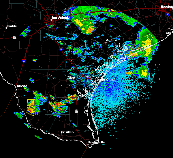 At 534 pm cdt, a severe thunderstorm was located near morales-sanchez, or 8 miles south of bustamante, moving east at 10 mph (radar indicated). Hazards include 60 mph wind gusts and quarter size hail. Hail damage to vehicles. including cracked windshields and minor exterior dents can expected. some damage to crops and trees is expected. expect minor wind damage to mobile homes, some roofs, siding and some fences. tree limbs will blow down and small trees will be uprooted. damage to power lines and some power poles is expected. this severe thunderstorm will remain over mainly rural areas of east central zapata county. This includes us highway 83 near mile marker 774. At 534 pm cdt, a severe thunderstorm was located near morales-sanchez, or 8 miles south of bustamante, moving east at 10 mph (radar indicated). Hazards include 60 mph wind gusts and quarter size hail. Hail damage to vehicles. including cracked windshields and minor exterior dents can expected. some damage to crops and trees is expected. expect minor wind damage to mobile homes, some roofs, siding and some fences. tree limbs will blow down and small trees will be uprooted. damage to power lines and some power poles is expected. this severe thunderstorm will remain over mainly rural areas of east central zapata county. This includes us highway 83 near mile marker 774.
|
| 5/18/2016 1:58 PM CDT | The severe thunderstorm warning for northeastern zapata county will expire at 200 pm cdt, the storms which prompted the warning have moved out of the area. therefore the warning will be allowed to expire. |
| 5/18/2016 1:30 PM CDT |
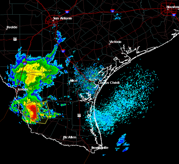 At 129 pm cdt, severe thunderstorms were located along a line extending from near escobas to 6 miles northwest of guerra to 6 miles east of morales-sanchez, moving east at 30 mph (radar indicated). Hazards include 60 mph wind gusts and quarter size hail. Hail damage to vehicles. including cracked windshields and minor exterior dents can expected. some damage to crops and trees is expected. expect minor wind damage to mobile homes, some roofs, siding and some fences. tree limbs will blow down and small trees will be uprooted. damage to power lines and some power poles is expected. Locations impacted include, bustamante and escobas. At 129 pm cdt, severe thunderstorms were located along a line extending from near escobas to 6 miles northwest of guerra to 6 miles east of morales-sanchez, moving east at 30 mph (radar indicated). Hazards include 60 mph wind gusts and quarter size hail. Hail damage to vehicles. including cracked windshields and minor exterior dents can expected. some damage to crops and trees is expected. expect minor wind damage to mobile homes, some roofs, siding and some fences. tree limbs will blow down and small trees will be uprooted. damage to power lines and some power poles is expected. Locations impacted include, bustamante and escobas.
|
| 5/18/2016 1:19 PM CDT |
 At 118 pm cdt, severe thunderstorms were located along a line extending from 6 miles northwest of escobas to near bustamante to morales-sanchez, moving east at 35 mph (radar indicated). Hazards include 60 mph wind gusts and quarter size hail. Hail damage to vehicles. including cracked windshields and minor exterior dents can expected. some damage to crops and trees is expected. expect minor wind damage to mobile homes, some roofs, siding and some fences. tree limbs will blow down and small trees will be uprooted. damage to power lines and some power poles is expected. Locations impacted include, zapata, escobas, bustamante, medina, zapata middle school, las palmas, escobas, zapata high school, falcon lake estates, zapata county public library and falcon shores. At 118 pm cdt, severe thunderstorms were located along a line extending from 6 miles northwest of escobas to near bustamante to morales-sanchez, moving east at 35 mph (radar indicated). Hazards include 60 mph wind gusts and quarter size hail. Hail damage to vehicles. including cracked windshields and minor exterior dents can expected. some damage to crops and trees is expected. expect minor wind damage to mobile homes, some roofs, siding and some fences. tree limbs will blow down and small trees will be uprooted. damage to power lines and some power poles is expected. Locations impacted include, zapata, escobas, bustamante, medina, zapata middle school, las palmas, escobas, zapata high school, falcon lake estates, zapata county public library and falcon shores.
|
| 5/18/2016 12:59 PM CDT |
 At 1258 pm cdt, severe thunderstorms were located along a line extending from 14 miles northwest of bustamante to zapata county airport to near falcon mesa, moving east at 30 mph (radar indicated). Hazards include 60 mph wind gusts and quarter size hail. Hail damage to vehicles. including cracked windshields and minor exterior dents can expected. some damage to crops and trees is expected. expect minor wind damage to mobile homes, some roofs, siding and some fences. tree limbs will blow down and small trees will be uprooted. Damage to power lines and some power poles is expected. At 1258 pm cdt, severe thunderstorms were located along a line extending from 14 miles northwest of bustamante to zapata county airport to near falcon mesa, moving east at 30 mph (radar indicated). Hazards include 60 mph wind gusts and quarter size hail. Hail damage to vehicles. including cracked windshields and minor exterior dents can expected. some damage to crops and trees is expected. expect minor wind damage to mobile homes, some roofs, siding and some fences. tree limbs will blow down and small trees will be uprooted. Damage to power lines and some power poles is expected.
|
| 5/17/2016 10:55 PM CDT |
 At 1054 pm cdt, a severe thunderstorm was located over las palmas, or near zapata, moving northeast at 10 mph. a second severe thunderstorm was located near falcon dam (radar indicated). Hazards include 60 mph wind gusts and quarter size hail. Hail damage to vehicles. including cracked windshields and minor exterior dents can expected. some damage to crops and trees is expected. expect minor wind damage to mobile homes, some roofs, siding and some fences. tree limbs will blow down and small trees will be uprooted. damage to power lines and some power poles is expected. Locations impacted include, zapata, lopeno, bustamante, medina and falcon lake estates. At 1054 pm cdt, a severe thunderstorm was located over las palmas, or near zapata, moving northeast at 10 mph. a second severe thunderstorm was located near falcon dam (radar indicated). Hazards include 60 mph wind gusts and quarter size hail. Hail damage to vehicles. including cracked windshields and minor exterior dents can expected. some damage to crops and trees is expected. expect minor wind damage to mobile homes, some roofs, siding and some fences. tree limbs will blow down and small trees will be uprooted. damage to power lines and some power poles is expected. Locations impacted include, zapata, lopeno, bustamante, medina and falcon lake estates.
|
| 5/17/2016 10:36 PM CDT |
 At 1036 pm cdt, a severe thunderstorm was located near falcon mesa, or near zapata, moving east at 10 mph (radar indicated). Hazards include ping pong ball size hail and 60 mph wind gusts. People and animals outdoors will be injured. expect hail damage to roofs, siding, windows and property. vehicle damage will include cracked or shattered windshields and major dents requiring significant repairs. expect minor wind damage to mobile homes, some roofs, siding and some fences. tree limbs will blow down and small trees will be uprooted. damage to power lines and some power poles is expected. Locations impacted include, zapata, lopeno, bustamante, medina, zapata middle school, morales-sanchez, las palmas, zapata high school, falcon lake estates and zapata county public library. At 1036 pm cdt, a severe thunderstorm was located near falcon mesa, or near zapata, moving east at 10 mph (radar indicated). Hazards include ping pong ball size hail and 60 mph wind gusts. People and animals outdoors will be injured. expect hail damage to roofs, siding, windows and property. vehicle damage will include cracked or shattered windshields and major dents requiring significant repairs. expect minor wind damage to mobile homes, some roofs, siding and some fences. tree limbs will blow down and small trees will be uprooted. damage to power lines and some power poles is expected. Locations impacted include, zapata, lopeno, bustamante, medina, zapata middle school, morales-sanchez, las palmas, zapata high school, falcon lake estates and zapata county public library.
|
| 5/17/2016 10:16 PM CDT |
 At 1015 pm cdt, a severe thunderstorm was located over medina, or over zapata, moving northeast at 10 mph (radar indicated). Hazards include 60 mph wind gusts and quarter size hail. Hail damage to vehicles. including cracked windshields and minor exterior dents can expected. some damage to crops and trees is expected. expect minor wind damage to mobile homes, some roofs, siding and some fences. tree limbs will blow down and small trees will be uprooted. Damage to power lines and some power poles is expected. At 1015 pm cdt, a severe thunderstorm was located over medina, or over zapata, moving northeast at 10 mph (radar indicated). Hazards include 60 mph wind gusts and quarter size hail. Hail damage to vehicles. including cracked windshields and minor exterior dents can expected. some damage to crops and trees is expected. expect minor wind damage to mobile homes, some roofs, siding and some fences. tree limbs will blow down and small trees will be uprooted. Damage to power lines and some power poles is expected.
|
| 3/18/2016 10:30 PM CDT |
 At 1028 pm cdt, a severe thunderstorm was located near san ygnacio, las palmas, or near zapata, moving southeast at 40 mph (radar indicated). Hazards include 70 mph wind gusts and half dollar size hail. Hail damage to vehicles. including cracked windshields and minor exterior dents can expected. some damage to crops and trees is expected. expect considerable tree damage. wind damage is also likely to mobile homes, roofs, outbuildings and some windows. power outages are likely. this severe thunderstorm will be near, zapata, medina, zapata middle school, zapata high school, zapata county fire department, zapata county public library and falcon mesa around 1035 pm cdt. falcon shores, falcon lake estates and siesta shores around 1040 pm cdt. morales-sanchez around 1055 pm cdt. lopeno around 1100 pm cdt. other locations impacted by this severe thunderstorm include zapata--medina, black bass and romeo t. Flores park. At 1028 pm cdt, a severe thunderstorm was located near san ygnacio, las palmas, or near zapata, moving southeast at 40 mph (radar indicated). Hazards include 70 mph wind gusts and half dollar size hail. Hail damage to vehicles. including cracked windshields and minor exterior dents can expected. some damage to crops and trees is expected. expect considerable tree damage. wind damage is also likely to mobile homes, roofs, outbuildings and some windows. power outages are likely. this severe thunderstorm will be near, zapata, medina, zapata middle school, zapata high school, zapata county fire department, zapata county public library and falcon mesa around 1035 pm cdt. falcon shores, falcon lake estates and siesta shores around 1040 pm cdt. morales-sanchez around 1055 pm cdt. lopeno around 1100 pm cdt. other locations impacted by this severe thunderstorm include zapata--medina, black bass and romeo t. Flores park.
|
| 3/18/2016 9:57 PM CDT |
 At 956 pm cdt, a severe thunderstorm was located 15 miles northwest of san ygnacio and las palmas, or 18 miles northwest of zapata, moving southeast at 50 mph (radar indicated). Hazards include 70 mph wind gusts and ping pong ball size hail. People and animals outdoors will be injured. expect hail damage to roofs, siding, windows and property. vehicle damage will include cracked or shattered windshields and major dents requiring significant repairs. expect considerable tree damage. wind damage is also likely to mobile homes, roofs, outbuildings and some windows. power outages are likely. this severe thunderstorm will be near, medina, zapata middle school, zapata county fire department, las palmas, zapata county public library, zapata high school, zapata county airport and falcon mesa around 1015 pm cdt. zapata, falcon shores, falcon lake estates and siesta shores around 1020 pm cdt. lopeno and morales-sanchez around 1030 pm cdt. other locations impacted by this severe thunderstorm include zapata--medina, black bass and romeo t. Flores park. At 956 pm cdt, a severe thunderstorm was located 15 miles northwest of san ygnacio and las palmas, or 18 miles northwest of zapata, moving southeast at 50 mph (radar indicated). Hazards include 70 mph wind gusts and ping pong ball size hail. People and animals outdoors will be injured. expect hail damage to roofs, siding, windows and property. vehicle damage will include cracked or shattered windshields and major dents requiring significant repairs. expect considerable tree damage. wind damage is also likely to mobile homes, roofs, outbuildings and some windows. power outages are likely. this severe thunderstorm will be near, medina, zapata middle school, zapata county fire department, las palmas, zapata county public library, zapata high school, zapata county airport and falcon mesa around 1015 pm cdt. zapata, falcon shores, falcon lake estates and siesta shores around 1020 pm cdt. lopeno and morales-sanchez around 1030 pm cdt. other locations impacted by this severe thunderstorm include zapata--medina, black bass and romeo t. Flores park.
|
| 5/23/2015 11:01 PM CDT | At 1100 pm cdt, doppler radar indicated a line of severe thunderstorms capable of producing destructive winds in excess of 80 mph. these storms were located along a line extending from near south fork estates to near escobas to 6 miles east of el sauz, moving east at 30 mph. locations impacted include, hebbronville, escobas, randado and la gloria. |
| 5/23/2015 10:39 PM CDT | The severe thunderstorm warning for southern zapata and western starr counties will expire at 1045 pm cdt, the storms which prompted the warning have moved out of the area. therefore the warning will be allowed to expire. however gusty winds and heavy rain are still possible with these thunderstorms. to report severe weather, contact your nearest law enforcement agency. they will relay your report to the national weather service brownsville. |
| 5/23/2015 10:33 PM CDT | At 1032 pm cdt, doppler radar indicated a line of severe thunderstorms capable of producing damaging winds in excess of 60 mph. these storms were located along a line extending from 6 miles northwest of thompsonville to near bustamante to 6 miles west of el sauz, and moving east at 30 mph. penny size hail may also accompany the damaging winds. |
| 5/23/2015 10:11 PM CDT | At 1011 pm cdt, doppler radar indicated a line of severe thunderstorms capable of producing damaging winds in excess of 60 mph. these storms were located along a line extending from 9 miles west of las palmas to 7 miles northwest of falcon state park to 13 miles west of fronton to 35 miles southwest of salineno, and moving east at 35 mph. |
| 5/21/2015 9:03 AM CDT | At 902 am cdt, national weather service doppler radar indicated a line of severe thunderstorms capable of producing large damaging hail up to golf ball size and damaging winds in excess of 60 mph. these storms were located along a line extending from 6 miles east of morales-sanchez to near lopeno, moving southeast at 30 mph. locations impacted include, zapata, bustamante, zapata county airport, medina, zapata middle school, lopeno, morales-sanchez, las palmas, zapata high school, zapata county public library, falcon lake estates, zapata county fire department, falcon shores, falcon mesa, new falcon, siesta shores, medina, black bass and romeo t. flores park. |
| 5/21/2015 8:45 AM CDT | At 844 am cdt, national weather service doppler radar indicated a line of severe thunderstorms capable of producing large damaging hail up to golf ball size and damaging winds in excess of 60 mph. these storms were located along a line extending from near bustamante to near siesta shores, moving southeast at 25 mph. locations impacted include, zapata, bustamante, zapata county airport, medina, zapata middle school, lopeno, morales-sanchez, las palmas, zapata high school, zapata county public library, falcon lake estates, zapata county fire department, falcon shores, falcon mesa, new falcon, siesta shores, medina, black bass and romeo t. flores park. |
| 5/21/2015 8:30 AM CDT | At 829 am cdt, national weather service meteorologists detected a line of severe thunderstorms capable of producing large damaging hail up to golf ball size and damaging winds in excess of 60 mph. these storms were located along a line extending from near the zapata county airport to near falcon mesa, and moving southeast at 20 mph. |
| 5/21/2015 8:23 AM CDT | At 821 am cdt, national weather service doppler radar indicated a line of severe thunderstorms capable of producing large damaging hail up to golf ball size and damaging winds in excess of 60 mph. these storms were located along a line extending from 6 miles northwest of bustamante to near the zapata county fire department, moving southeast at 30 mph. locations impacted include, zapata, bustamante, zapata county airport, medina, zapata middle school, lopeno, morales-sanchez, las palmas, zapata high school, zapata county public library, falcon lake estates, zapata county fire department, falcon shores, falcon mesa, new falcon, siesta shores, medina, black bass and romeo t. flores park. |
| 5/21/2015 8:03 AM CDT | At 802 am cdt, national weather service doppler radar indicated a line of severe thunderstorms capable of producing large damaging hail up to golf ball size and damaging winds in excess of 60 mph. these storms were located along a line extending from 12 miles north of zapata county airport to 11 miles west of las palmas, moving southeast at 30 mph. locations impacted include, zapata, bustamante, zapata county airport, medina, zapata middle school, lopeno, morales-sanchez, las palmas, zapata high school, zapata county public library, falcon lake estates, zapata county fire department, falcon shores, falcon mesa, new falcon, siesta shores, medina, black bass and romeo t. flores park. |
| 5/21/2015 7:48 AM CDT | At 746 am cdt, national weather service meteorologists detected a line of severe thunderstorms capable of producing large damaging hail up to golf ball size and damaging winds in excess of 60 mph. these storms were located along a line extending from 11 miles southeast of el cenizo to 18 miles northwest of las palmas, moving southeast at 25 mph. locations impacted include, zapata, bustamante, zapata county airport, medina, zapata middle school, lopeno, morales-sanchez, las palmas, zapata high school, zapata county public library, falcon lake estates, zapata county fire department, falcon shores, falcon mesa, new falcon, siesta shores, medina, black bass and romeo t. flores park. |
| 5/21/2015 7:32 AM CDT | At 731 am cdt, doppler radar indicated a line of severe thunderstorms capable of producing large damaging hail up to golf ball size and damaging winds in excess of 60 mph. these storms were located along a line extending from el cenizo to 17 miles southwest of rio bravo, and moving southeast at 40 mph. |
| 4/17/2015 9:38 PM CDT | A tornado warning remains in effect until 945 pm cdt for southeastern zapata and northwestern starr counties. at 937 pm cdt. doppler radar indicated a severe thunderstorm capable of producing a tornado. this dangerous storm was located near lopeno. or 11 miles west of viboras. moving east at 45 mph. Locations impacted include. |
| 4/17/2015 9:33 PM CDT | A tornado warning remains in effect until 945 pm cdt for southeastern zapata and northwestern starr counties. at 932 pm cdt. doppler radar indicated a severe thunderstorm capable of producing a tornado. this dangerous storm was located over lopeno. or 16 miles west of viboras. moving east at 45 mph. This tornadic thunderstorm will remain over mainly rural areas of. |
| 4/17/2015 9:30 PM CDT | At 928 pm cdt, doppler radar indicated a severe thunderstorm capable of producing quarter size hail and damaging winds in excess of 60 mph. this storm was located near lopeno, or 15 miles south of zapata, moving east at 25 mph. in addition, at 927 pm quarter size hail was reported near the city of zapata. locations impacted include, zapata, zapata middle school, falcon dam, lopeno, morales-sanchez, zapata high school, zapata county public library, falcon lake estates, zapata county fire department, falcon shores, falcon mesa, salineno, falcon heights, new falcon, falcon state park, siesta shores, zapata--medina, black bass and romeo t. flores park. a tornado watch remains in effect until 200 am cdt for deep south texas. |
| 4/17/2015 9:23 PM CDT | The national weather service in brownsville has issued a * tornado warning for. southeastern zapata county in deep south texas. northwestern starr county in deep south texas. until 945 pm cdt * at 922 pm cdt. Doppler radar indicated a severe thunderstorm. |
| 4/17/2015 9:02 PM CDT | At 901 pm cdt, doppler radar indicated a severe thunderstorm capable of producing quarter size hail and damaging winds in excess of 60 mph. this storm was located 25 miles west of falcon dam, or 28 miles southwest of zapata, and moving east at 30 mph. |
| 4/12/2015 10:04 PM CDT | A severe thunderstorm warning remains in effect until 1030 pm cdt for jim hogg. zapata. western brooks and starr counties. at 1001 pm cdt. doppler radar indicated a line of severe thunderstorms capable of producing quarter size hail and destructive winds in excess of 80 mph. These storms were located along a line extending from near hebbronville high school to 7 miles southwest of. |
| 4/12/2015 9:46 PM CDT | A severe thunderstorm warning remains in effect until 1030 pm cdt for jim hogg. zapata. western brooks and starr counties. at 942 pm cdt. doppler radar indicated a line of severe thunderstorms capable of producing quarter size hail and destructive winds in excess of 80 mph. These storms were located along a line extending from 6 miles west of south fork estates to near guerra to. |
| 4/12/2015 9:32 PM CDT | The national weather service in brownsville has issued a * severe thunderstorm warning for. jim hogg county in deep south texas. zapata county in deep south texas. western brooks county in deep south texas. Starr county in deep south texas. |
| 4/12/2015 9:14 PM CDT | A severe thunderstorm warning remains in effect until 930 pm cdt for western jim hogg. zapata and western starr counties. at 912 pm cdt. doppler radar indicated a line of severe thunderstorms capable of producing quarter size hail and destructive winds in excess of 80 mph. These storms were located along a line extending from 16 miles southeast of la presa to falcon lake estates. |
| 4/12/2015 9:08 PM CDT | The national weather service in brownsville has issued a * tornado warning for. central zapata county in deep south texas. until 930 pm cdt * at 907 pm cdt. doppler radar indicated a severe thunderstorm capable of producing a tornado. This dangerous storm was located. |
| 4/12/2015 8:50 PM CDT | A severe thunderstorm warning remains in effect until 930 pm cdt for western jim hogg. zapata and western starr counties. at 847 pm cdt. doppler radar indicated a line of severe thunderstorms capable of producing quarter size hail and destructive winds in excess of 70 mph. These storms were located along a line extending from near el cenizo to 32 miles west of falcon dam. |
| 4/12/2015 8:33 PM CDT | The national weather service in brownsville has issued a * severe thunderstorm warning for. western jim hogg county in deep south texas. zapata county in deep south texas. western starr county in deep south texas. Until 930 pm cdt. |
Hail Maps for Morales-Sanchez, TX


Connect with Interactive Hail Maps