

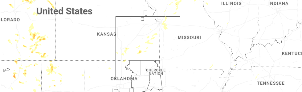
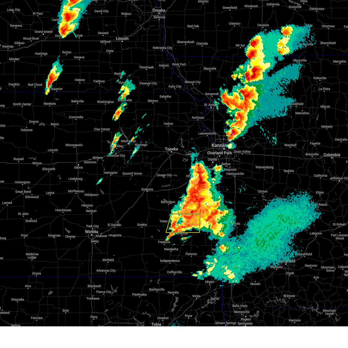
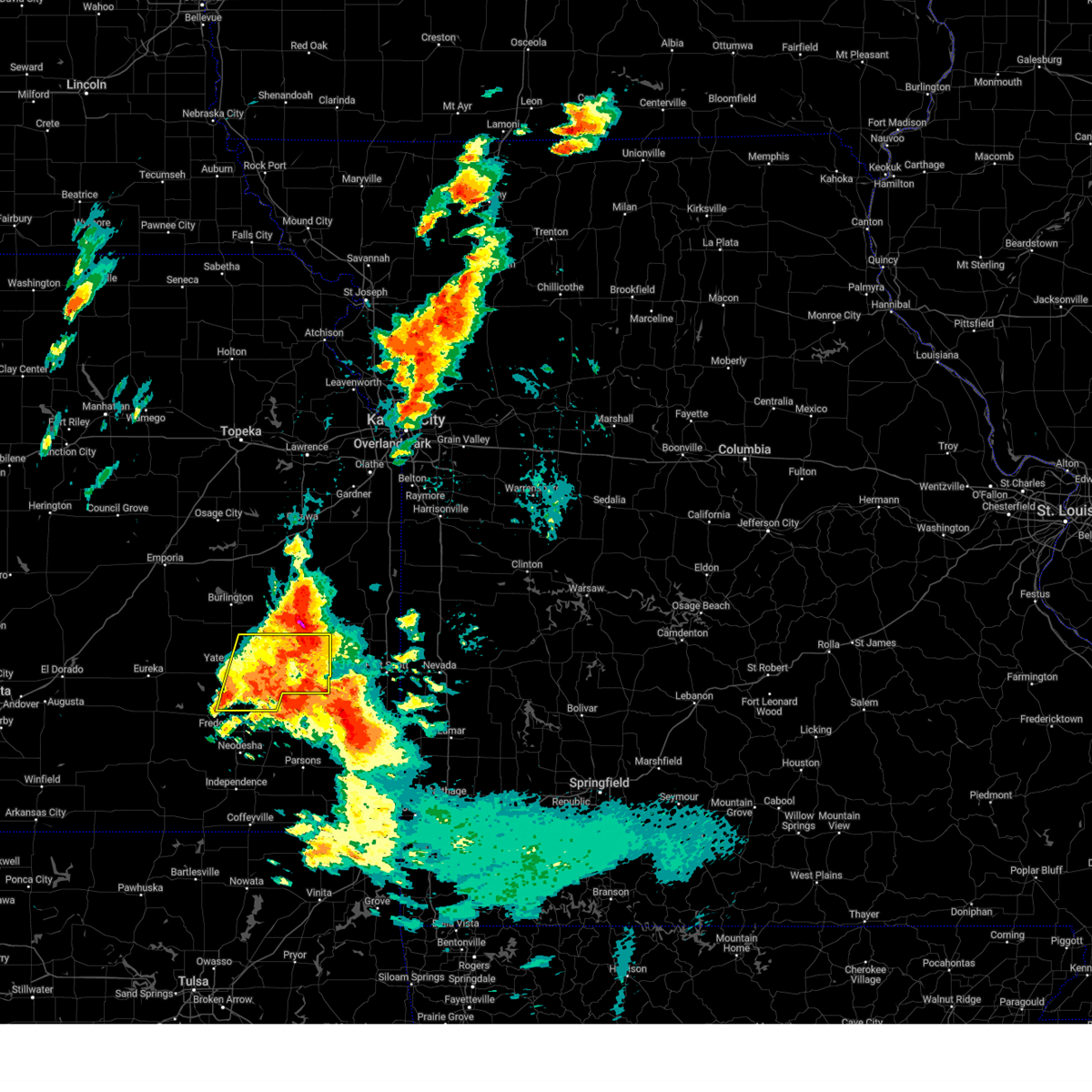
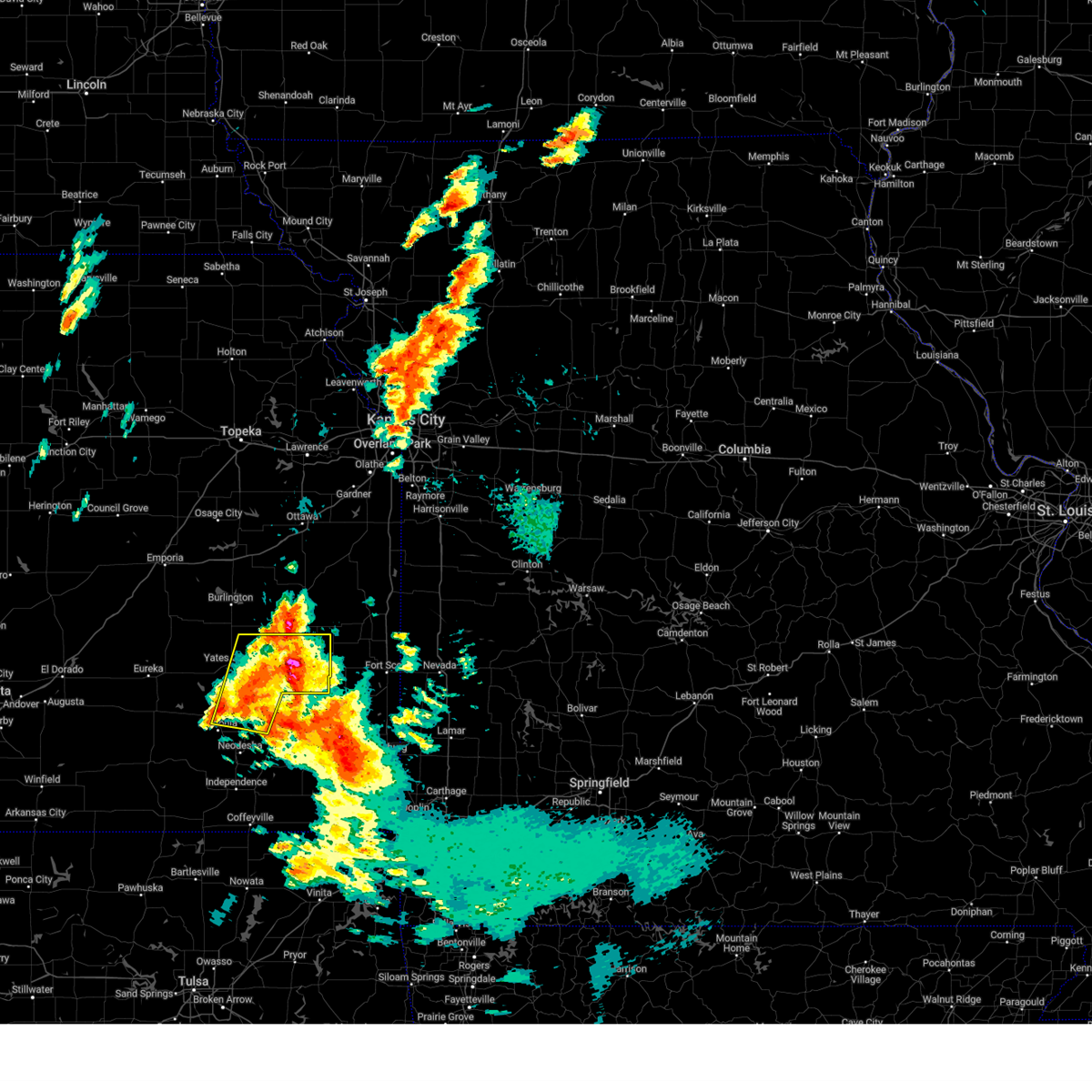
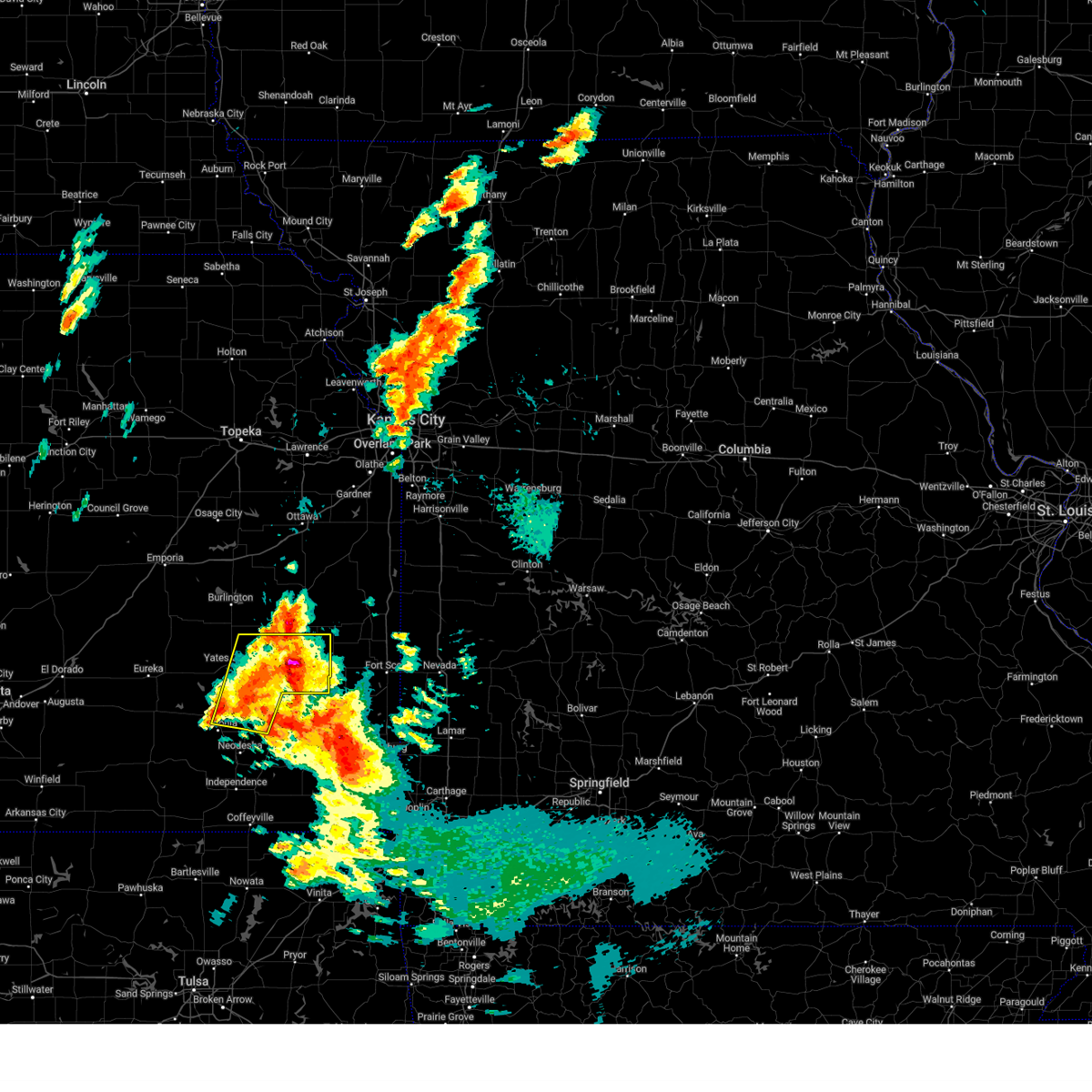
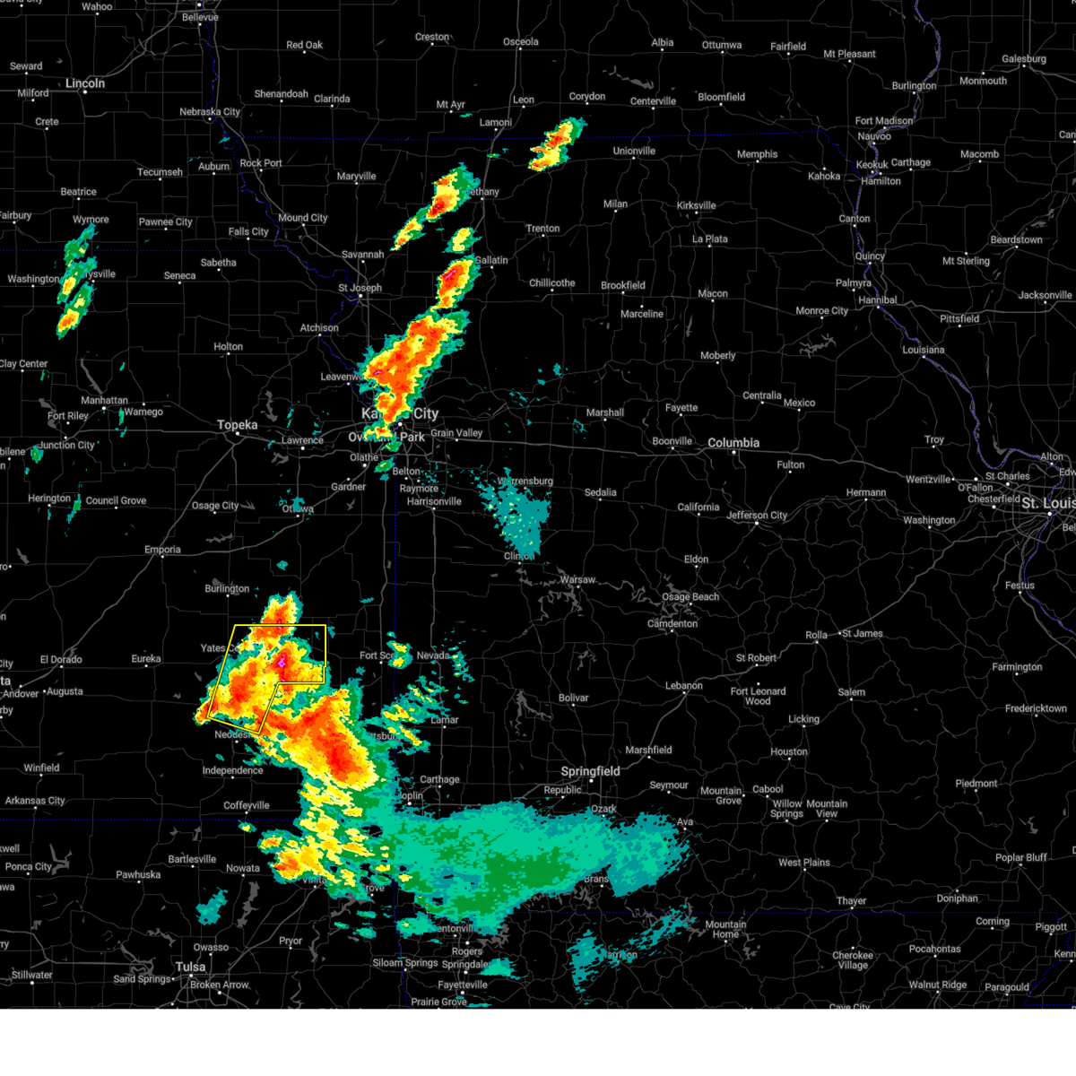
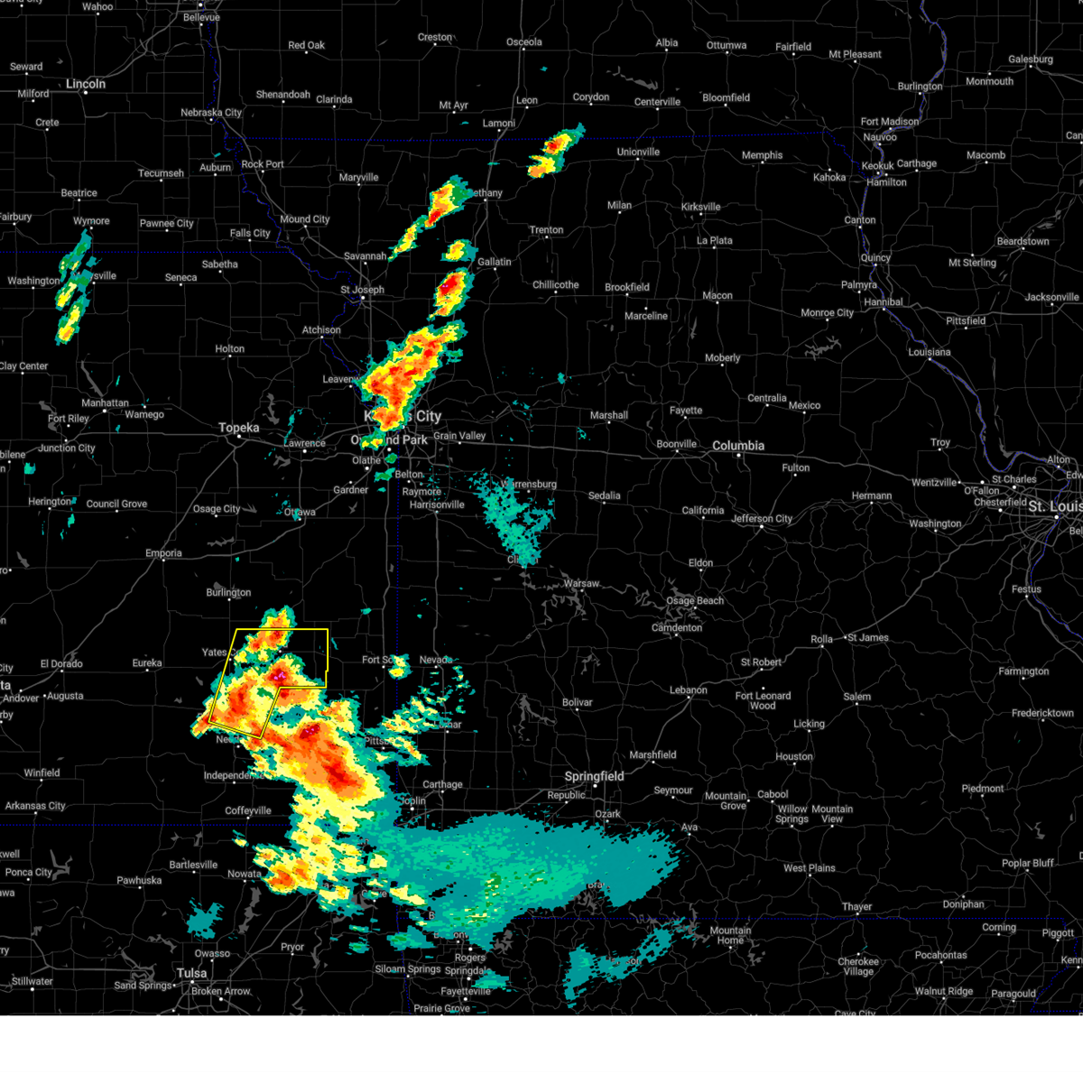
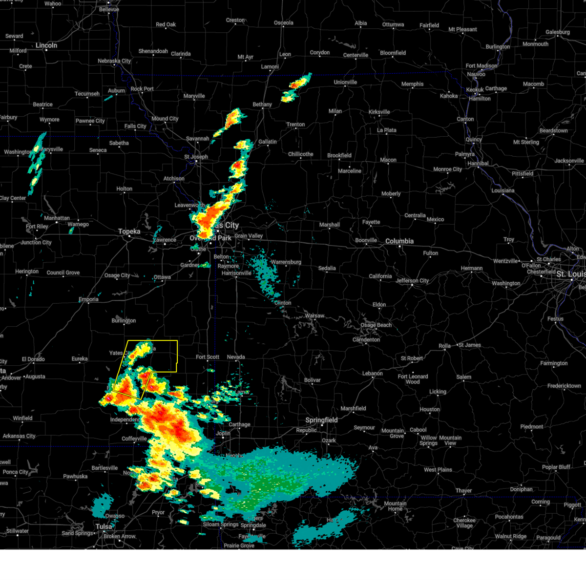
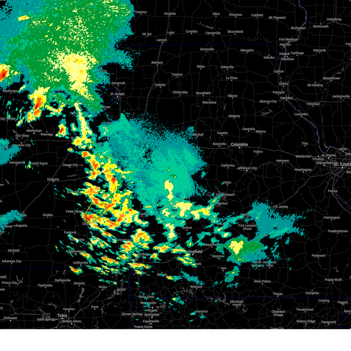
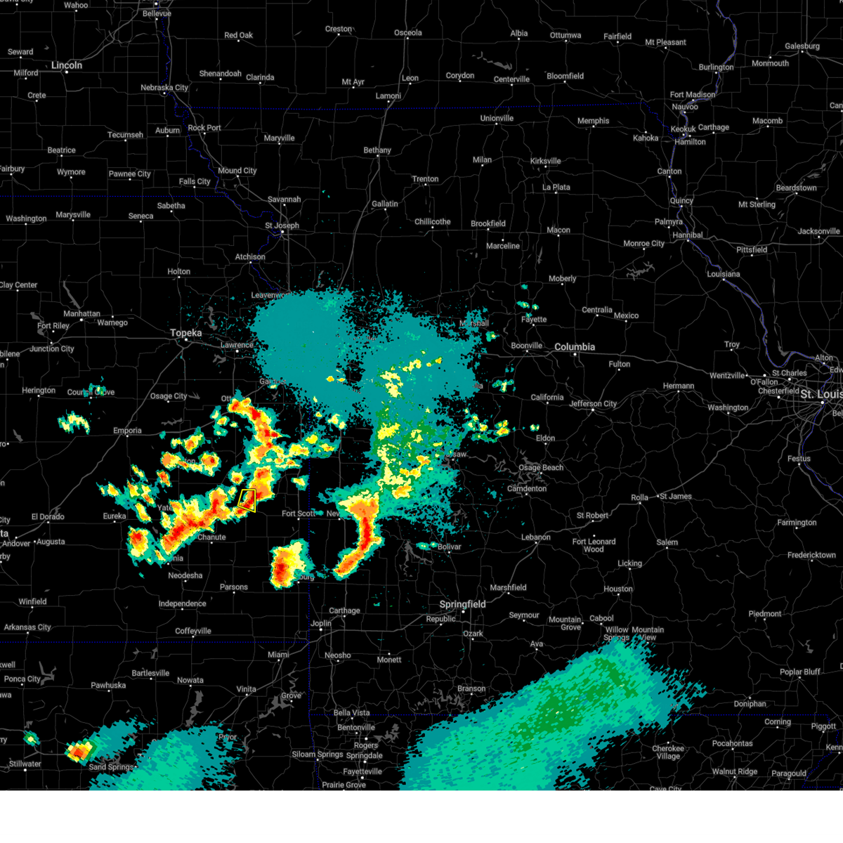
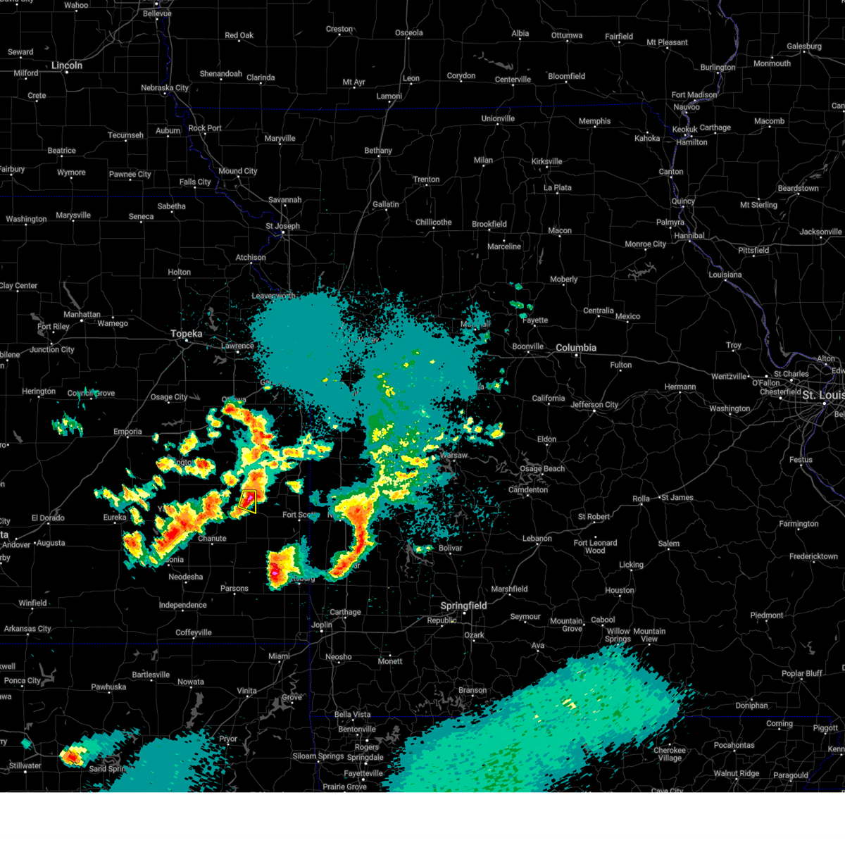
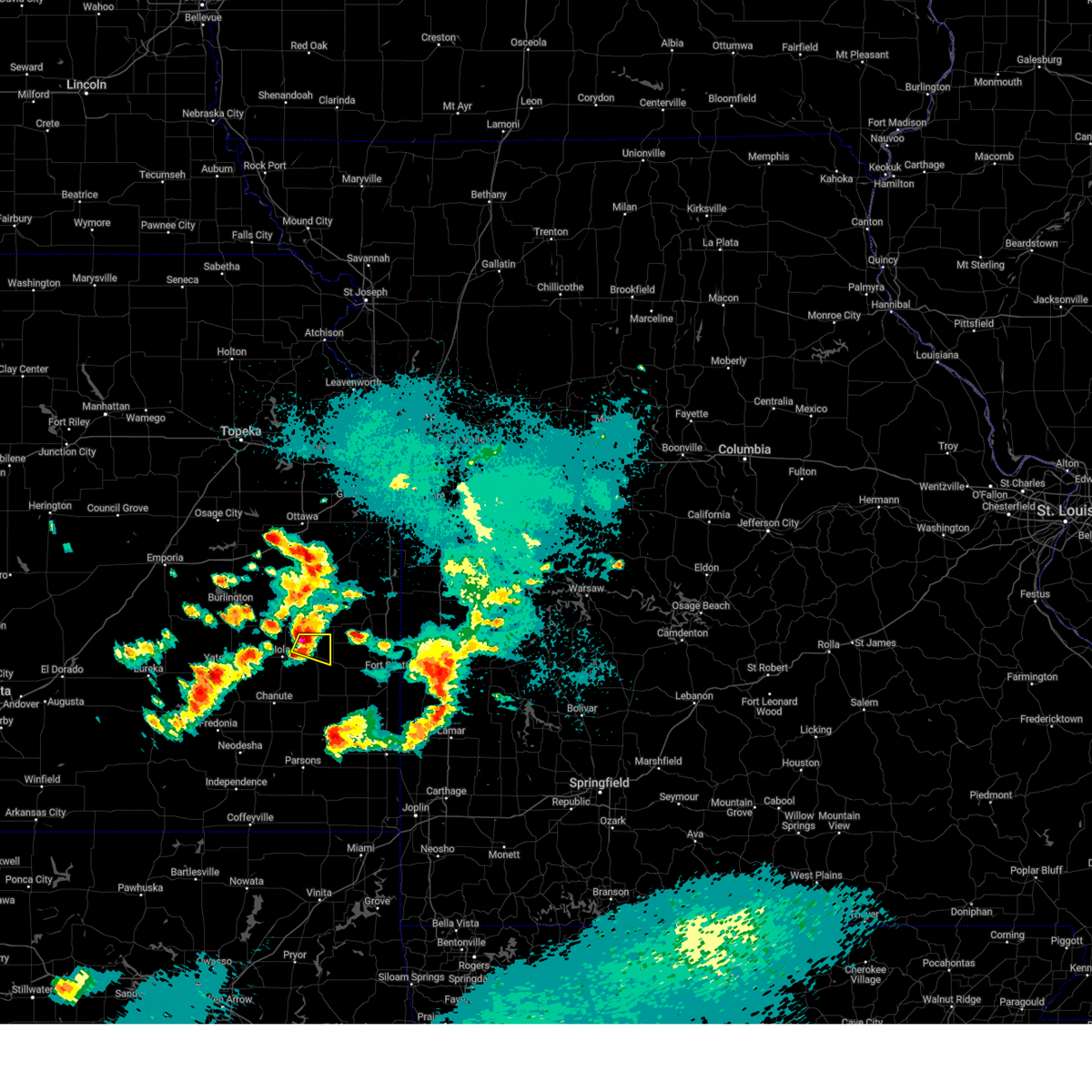
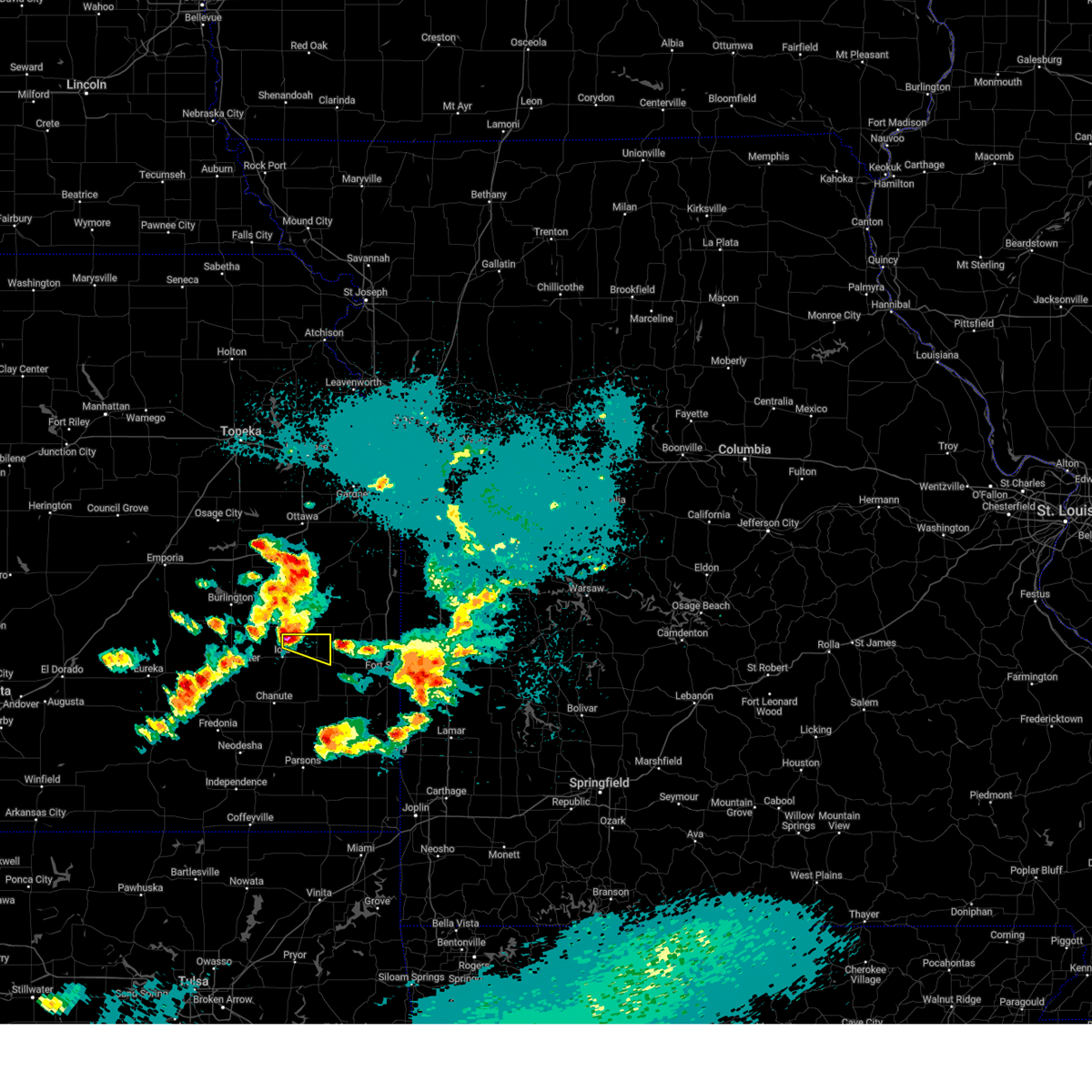
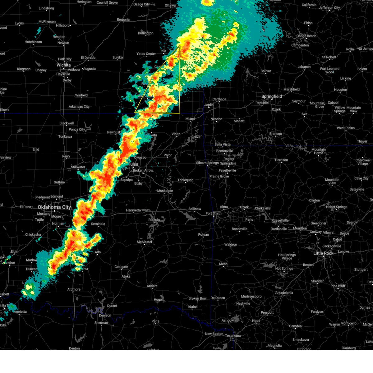
Hail Map for Moran, KS
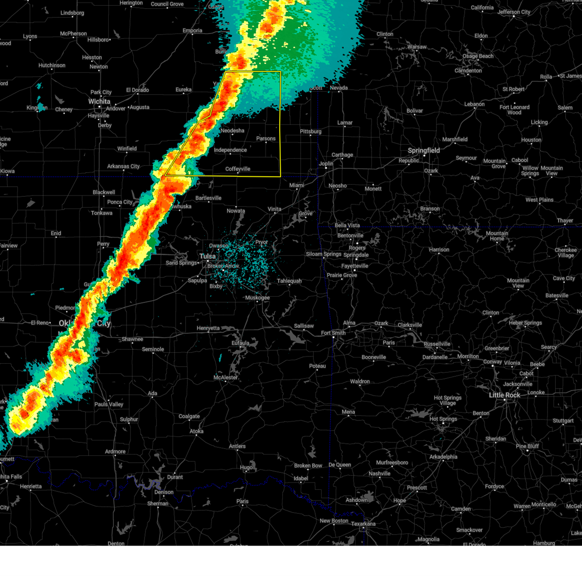
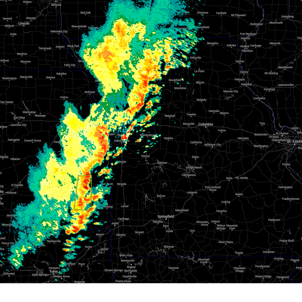
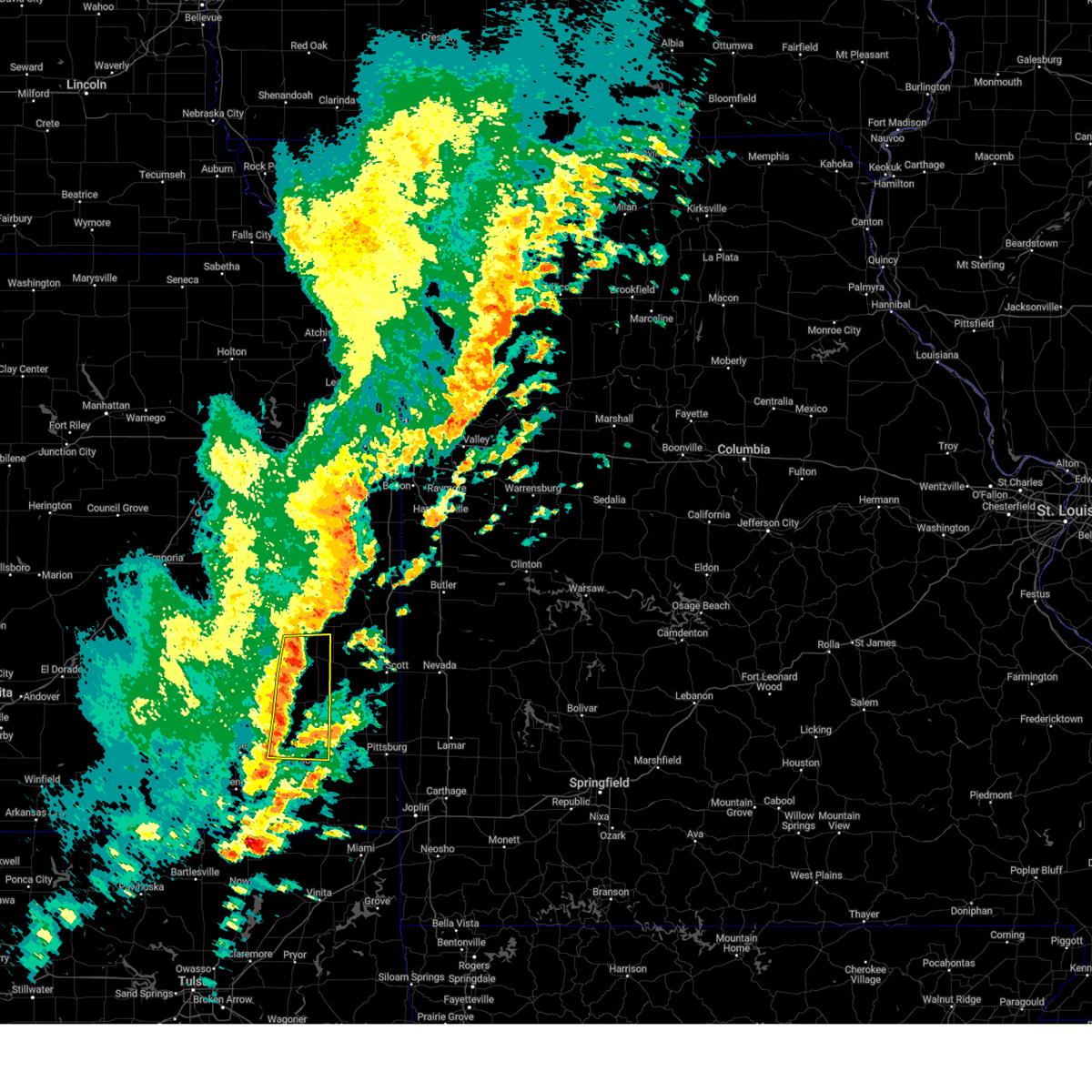
The Moran, KS area has had 8 reports of on-the-ground hail by trained spotters, and has been under severe weather warnings 25 times during the past 12 months. Doppler radar has detected hail at or near Moran, KS on 83 occasions, including 5 occasions during the past year.
| Name: | Moran, KS |
| Where Located: | 22.3 miles NE of Chanute, KS |
| Map: | Google Map for Moran, KS |
| Population: | 558 |
| Housing Units: | 247 |
| More Info: | Search Google for Moran, KS |
0
The Top Recent Hail Date for Moran, KS is Friday, July 11, 2025 (48th out of 83)
Hail and Wind Damage Spotted near Moran, KS
| Date / Time | Report Details |
|---|---|
| 5/19/2025 3:28 PM CDT |
 the severe thunderstorm warning has been cancelled and is no longer in effect the severe thunderstorm warning has been cancelled and is no longer in effect
|
| 5/19/2025 3:12 PM CDT | the severe thunderstorm warning has been cancelled and is no longer in effect |
| 5/19/2025 3:12 PM CDT | At 312 pm cdt, severe thunderstorms were located along a line extending from near buffalo to 6 miles south of moran, moving northeast at 60 mph (radar indicated). Hazards include 60 mph wind gusts and quarter size hail. Hail damage to vehicles is expected. expect wind damage to roofs, siding, and trees. Locations impacted include, iola, humboldt, yates center, la harpe, gas, moran, neosho falls, savonburg, elsmore, mildred, bassett, petrolia, rose, iola airport, and piqua. |
| 5/19/2025 3:07 PM CDT |
 At 307 pm cdt, severe thunderstorms were located along a line extending from near buffalo to 5 miles south of lone elm, moving northeast at 65 mph (radar indicated). Hazards include 60 mph wind gusts and quarter size hail. Hail damage to vehicles is expected. expect wind damage to roofs, siding, and trees. Locations impacted include, chanute, iola, humboldt, yates center, la harpe, gas, moran, buffalo, neosho falls, savonburg, elsmore, mildred, bassett, petrolia, rose, chanute airport, iola airport, and piqua. At 307 pm cdt, severe thunderstorms were located along a line extending from near buffalo to 5 miles south of lone elm, moving northeast at 65 mph (radar indicated). Hazards include 60 mph wind gusts and quarter size hail. Hail damage to vehicles is expected. expect wind damage to roofs, siding, and trees. Locations impacted include, chanute, iola, humboldt, yates center, la harpe, gas, moran, buffalo, neosho falls, savonburg, elsmore, mildred, bassett, petrolia, rose, chanute airport, iola airport, and piqua.
|
| 5/19/2025 3:01 PM CDT |
 At 301 pm cdt, severe thunderstorms were located along a line extending from 6 miles southwest of buffalo to near la harpe, moving northeast at 60 mph (trained weather spotters reported half dollar size hail in gas at 258 pm). Hazards include golf ball size hail and 70 mph wind gusts. People and animals outdoors will be injured. expect hail damage to roofs, siding, windows, and vehicles. expect considerable tree damage. wind damage is also likely to mobile homes, roofs, and outbuildings. Locations impacted include, chanute, iola, humboldt, yates center, la harpe, gas, moran, buffalo, neosho falls, savonburg, elsmore, benedict, earlton, mildred, bassett, petrolia, rose, chanute airport, iola airport, and piqua. At 301 pm cdt, severe thunderstorms were located along a line extending from 6 miles southwest of buffalo to near la harpe, moving northeast at 60 mph (trained weather spotters reported half dollar size hail in gas at 258 pm). Hazards include golf ball size hail and 70 mph wind gusts. People and animals outdoors will be injured. expect hail damage to roofs, siding, windows, and vehicles. expect considerable tree damage. wind damage is also likely to mobile homes, roofs, and outbuildings. Locations impacted include, chanute, iola, humboldt, yates center, la harpe, gas, moran, buffalo, neosho falls, savonburg, elsmore, benedict, earlton, mildred, bassett, petrolia, rose, chanute airport, iola airport, and piqua.
|
| 5/19/2025 3:00 PM CDT |
 At 259 pm cdt, severe thunderstorms were located along a line extending from 7 miles southwest of buffalo to la harpe, moving northeast at 60 mph (emergency management reported quarter size hail in la harpe at 259 pm). Hazards include golf ball size hail and 70 mph wind gusts. People and animals outdoors will be injured. expect hail damage to roofs, siding, windows, and vehicles. expect considerable tree damage. wind damage is also likely to mobile homes, roofs, and outbuildings. Locations impacted include, chanute, iola, humboldt, yates center, la harpe, gas, moran, buffalo, neosho falls, savonburg, elsmore, benedict, earlton, mildred, bassett, petrolia, rose, chanute airport, iola airport, and piqua. At 259 pm cdt, severe thunderstorms were located along a line extending from 7 miles southwest of buffalo to la harpe, moving northeast at 60 mph (emergency management reported quarter size hail in la harpe at 259 pm). Hazards include golf ball size hail and 70 mph wind gusts. People and animals outdoors will be injured. expect hail damage to roofs, siding, windows, and vehicles. expect considerable tree damage. wind damage is also likely to mobile homes, roofs, and outbuildings. Locations impacted include, chanute, iola, humboldt, yates center, la harpe, gas, moran, buffalo, neosho falls, savonburg, elsmore, benedict, earlton, mildred, bassett, petrolia, rose, chanute airport, iola airport, and piqua.
|
| 5/19/2025 2:55 PM CDT |
 At 254 pm cdt, severe thunderstorms were located along a line extending from 5 miles northeast of buffalo to near gas, moving northeast at 55 mph (radar indicated). Hazards include golf ball size hail and 70 mph wind gusts. People and animals outdoors will be injured. expect hail damage to roofs, siding, windows, and vehicles. expect considerable tree damage. wind damage is also likely to mobile homes, roofs, and outbuildings. Locations impacted include, chanute, iola, fredonia, humboldt, yates center, la harpe, gas, moran, altoona, buffalo, neosho falls, savonburg, elsmore, benedict, earlton, mildred, bassett, petrolia, rose, and chanute airport. At 254 pm cdt, severe thunderstorms were located along a line extending from 5 miles northeast of buffalo to near gas, moving northeast at 55 mph (radar indicated). Hazards include golf ball size hail and 70 mph wind gusts. People and animals outdoors will be injured. expect hail damage to roofs, siding, windows, and vehicles. expect considerable tree damage. wind damage is also likely to mobile homes, roofs, and outbuildings. Locations impacted include, chanute, iola, fredonia, humboldt, yates center, la harpe, gas, moran, altoona, buffalo, neosho falls, savonburg, elsmore, benedict, earlton, mildred, bassett, petrolia, rose, and chanute airport.
|
| 5/19/2025 2:49 PM CDT |
 At 247 pm cdt, severe thunderstorms were located along a line extending from near buffalo to near humboldt, moving northeast at 70 mph (law enforcement reported quarter size hail at 246 pm on the east side of humboldt). Hazards include 70 mph wind gusts and ping pong ball size hail. People and animals outdoors will be injured. expect hail damage to roofs, siding, windows, and vehicles. expect considerable tree damage. wind damage is also likely to mobile homes, roofs, and outbuildings. Locations impacted include, chanute, iola, fredonia, humboldt, yates center, la harpe, gas, moran, altoona, buffalo, neosho falls, savonburg, elsmore, benedict, earlton, mildred, bassett, petrolia, rose, and chanute airport. At 247 pm cdt, severe thunderstorms were located along a line extending from near buffalo to near humboldt, moving northeast at 70 mph (law enforcement reported quarter size hail at 246 pm on the east side of humboldt). Hazards include 70 mph wind gusts and ping pong ball size hail. People and animals outdoors will be injured. expect hail damage to roofs, siding, windows, and vehicles. expect considerable tree damage. wind damage is also likely to mobile homes, roofs, and outbuildings. Locations impacted include, chanute, iola, fredonia, humboldt, yates center, la harpe, gas, moran, altoona, buffalo, neosho falls, savonburg, elsmore, benedict, earlton, mildred, bassett, petrolia, rose, and chanute airport.
|
| 5/19/2025 2:41 PM CDT |
 Svrict the national weather service in wichita has issued a * severe thunderstorm warning for, northern wilson county in southeastern kansas, northwestern neosho county in southeastern kansas, eastern woodson county in southeastern kansas, allen county in southeastern kansas, * until 345 pm cdt. * at 241 pm cdt, severe thunderstorms were located along a line extending from 6 miles northeast of fredonia to near altoona, moving northeast at 65 mph. a second severe thunderstorm was located near chanute, moving northeast at 65 mph (radar indicated). Hazards include 70 mph wind gusts and ping pong ball size hail. People and animals outdoors will be injured. expect hail damage to roofs, siding, windows, and vehicles. expect considerable tree damage. Wind damage is also likely to mobile homes, roofs, and outbuildings. Svrict the national weather service in wichita has issued a * severe thunderstorm warning for, northern wilson county in southeastern kansas, northwestern neosho county in southeastern kansas, eastern woodson county in southeastern kansas, allen county in southeastern kansas, * until 345 pm cdt. * at 241 pm cdt, severe thunderstorms were located along a line extending from 6 miles northeast of fredonia to near altoona, moving northeast at 65 mph. a second severe thunderstorm was located near chanute, moving northeast at 65 mph (radar indicated). Hazards include 70 mph wind gusts and ping pong ball size hail. People and animals outdoors will be injured. expect hail damage to roofs, siding, windows, and vehicles. expect considerable tree damage. Wind damage is also likely to mobile homes, roofs, and outbuildings.
|
| 5/18/2025 9:28 PM CDT |
 Svrict the national weather service in wichita has issued a * severe thunderstorm warning for, allen county in southeastern kansas, * until 1015 pm cdt. * at 928 pm cdt, a severe thunderstorm was located over humboldt, moving northeast at 50 mph (radar indicated). Hazards include half dollar size hail. damage to vehicles is expected Svrict the national weather service in wichita has issued a * severe thunderstorm warning for, allen county in southeastern kansas, * until 1015 pm cdt. * at 928 pm cdt, a severe thunderstorm was located over humboldt, moving northeast at 50 mph (radar indicated). Hazards include half dollar size hail. damage to vehicles is expected
|
| 5/17/2025 10:49 PM CDT |
 the severe thunderstorm warning has been cancelled and is no longer in effect the severe thunderstorm warning has been cancelled and is no longer in effect
|
| 5/17/2025 10:39 PM CDT |
 At 1038 pm cdt, a severe thunderstorm was located near moran, or 10 miles east of la harpe, moving east at 30 mph (radar indicated). Hazards include quarter size hail. Damage to vehicles is expected. Locations impacted include, moran and mildred. At 1038 pm cdt, a severe thunderstorm was located near moran, or 10 miles east of la harpe, moving east at 30 mph (radar indicated). Hazards include quarter size hail. Damage to vehicles is expected. Locations impacted include, moran and mildred.
|
| 5/17/2025 10:28 PM CDT |
 At 1028 pm cdt, a severe thunderstorm was located 7 miles northeast of la harpe, moving east at 35 mph (radar indicated). Hazards include quarter size hail. Damage to vehicles is expected. Locations impacted include, moran and mildred. At 1028 pm cdt, a severe thunderstorm was located 7 miles northeast of la harpe, moving east at 35 mph (radar indicated). Hazards include quarter size hail. Damage to vehicles is expected. Locations impacted include, moran and mildred.
|
| 5/17/2025 10:18 PM CDT |
 Svrict the national weather service in wichita has issued a * severe thunderstorm warning for, northeastern allen county in southeastern kansas, * until 1100 pm cdt. * at 1018 pm cdt, a severe thunderstorm was located near colony, or near la harpe, moving east at 35 mph (radar indicated). Hazards include quarter size hail. damage to vehicles is expected Svrict the national weather service in wichita has issued a * severe thunderstorm warning for, northeastern allen county in southeastern kansas, * until 1100 pm cdt. * at 1018 pm cdt, a severe thunderstorm was located near colony, or near la harpe, moving east at 35 mph (radar indicated). Hazards include quarter size hail. damage to vehicles is expected
|
| 4/2/2025 6:16 AM CDT |
 At 616 am cdt, severe thunderstorms were located along a line extending from near mound city to near uniontown to near thayer to 7 miles east of coffeyville, moving east at 55 mph (radar indicated). Hazards include 60 mph wind gusts and quarter size hail. Hail damage to vehicles is expected. expect wind damage to roofs, siding, and trees. Locations impacted include, elsmore, parsons tri city airport, lake parsons, mound valley, angola, dennis, thayer, erie, elk city lake, tyro, big hill lake, liberty, elk city state park, earlton, edna, chetopa, cherryvale, south mound, parsons, and neodesha. At 616 am cdt, severe thunderstorms were located along a line extending from near mound city to near uniontown to near thayer to 7 miles east of coffeyville, moving east at 55 mph (radar indicated). Hazards include 60 mph wind gusts and quarter size hail. Hail damage to vehicles is expected. expect wind damage to roofs, siding, and trees. Locations impacted include, elsmore, parsons tri city airport, lake parsons, mound valley, angola, dennis, thayer, erie, elk city lake, tyro, big hill lake, liberty, elk city state park, earlton, edna, chetopa, cherryvale, south mound, parsons, and neodesha.
|
| 4/2/2025 6:01 AM CDT |
 the severe thunderstorm warning has been cancelled and is no longer in effect the severe thunderstorm warning has been cancelled and is no longer in effect
|
| 4/2/2025 6:01 AM CDT |
 At 600 am cdt, severe thunderstorms were located along a line extending from near kincaid to 10 miles south of la harpe to 5 miles west of thayer to near dearing, moving east at 25 mph (radar indicated). Hazards include 60 mph wind gusts and quarter size hail. Hail damage to vehicles is expected. expect wind damage to roofs, siding, and trees. Locations impacted include, elsmore, parsons tri city airport, lake parsons, mound valley, angola, dennis, thayer, erie, elk city lake, tyro, big hill lake, altoona, liberty, elk city state park, earlton, mildred, edna, chetopa, cherryvale, and south mound. At 600 am cdt, severe thunderstorms were located along a line extending from near kincaid to 10 miles south of la harpe to 5 miles west of thayer to near dearing, moving east at 25 mph (radar indicated). Hazards include 60 mph wind gusts and quarter size hail. Hail damage to vehicles is expected. expect wind damage to roofs, siding, and trees. Locations impacted include, elsmore, parsons tri city airport, lake parsons, mound valley, angola, dennis, thayer, erie, elk city lake, tyro, big hill lake, altoona, liberty, elk city state park, earlton, mildred, edna, chetopa, cherryvale, and south mound.
|
| 4/2/2025 5:38 AM CDT |
 At 538 am cdt, severe thunderstorms were located along a line extending from near colony to near chanute to 7 miles west of neodesha to near peru, moving east at 40 mph (radar indicated). Hazards include 60 mph wind gusts and quarter size hail. Hail damage to vehicles is expected. expect wind damage to roofs, siding, and trees. Locations impacted include, elsmore, parsons tri city airport, lake parsons, mound valley, angola, buxton, humboldt, erie, elk city lake, tyro, big hill lake, earlton, edna, neodesha, iola, piqua, dearing, petrolia, savonburg, and altamont. At 538 am cdt, severe thunderstorms were located along a line extending from near colony to near chanute to 7 miles west of neodesha to near peru, moving east at 40 mph (radar indicated). Hazards include 60 mph wind gusts and quarter size hail. Hail damage to vehicles is expected. expect wind damage to roofs, siding, and trees. Locations impacted include, elsmore, parsons tri city airport, lake parsons, mound valley, angola, buxton, humboldt, erie, elk city lake, tyro, big hill lake, earlton, edna, neodesha, iola, piqua, dearing, petrolia, savonburg, and altamont.
|
| 4/2/2025 5:14 AM CDT |
 Svrict the national weather service in wichita has issued a * severe thunderstorm warning for, eastern elk county in southeastern kansas, wilson county in southeastern kansas, labette county in southeastern kansas, neosho county in southeastern kansas, montgomery county in southeastern kansas, chautauqua county in southeastern kansas, woodson county in southeastern kansas, allen county in southeastern kansas, * until 645 am cdt. * at 514 am cdt, severe thunderstorms were located along a line extending from 5 miles west of neosho falls to 6 miles west of buffalo to longton to near elgin, moving east at 35 mph (radar indicated). Hazards include 60 mph wind gusts and quarter size hail. Hail damage to vehicles is expected. Expect wind damage to roofs, siding, and trees. Svrict the national weather service in wichita has issued a * severe thunderstorm warning for, eastern elk county in southeastern kansas, wilson county in southeastern kansas, labette county in southeastern kansas, neosho county in southeastern kansas, montgomery county in southeastern kansas, chautauqua county in southeastern kansas, woodson county in southeastern kansas, allen county in southeastern kansas, * until 645 am cdt. * at 514 am cdt, severe thunderstorms were located along a line extending from 5 miles west of neosho falls to 6 miles west of buffalo to longton to near elgin, moving east at 35 mph (radar indicated). Hazards include 60 mph wind gusts and quarter size hail. Hail damage to vehicles is expected. Expect wind damage to roofs, siding, and trees.
|
| 10/30/2024 8:29 PM CDT |
 The storms which prompted the warning have moved out of the area. therefore, the warning will be allowed to expire. a tornado watch remains in effect until 1000 pm cdt for southeastern kansas. The storms which prompted the warning have moved out of the area. therefore, the warning will be allowed to expire. a tornado watch remains in effect until 1000 pm cdt for southeastern kansas.
|
| 10/30/2024 8:18 PM CDT |
 At 818 pm cdt, severe thunderstorms were located along a line extending from kincaid to 5 miles south of galesburg, moving east at 35 mph (radar indicated). Hazards include 70 mph wind gusts and nickel size hail. Expect considerable tree damage. damage is likely to mobile homes, roofs, and outbuildings. locations impacted include, chanute, iola, humboldt, erie, st. Paul, la harpe, gas, moran, thayer, galesburg, savonburg, elsmore, stark, mildred, bassett, lake parsons, south mound, and iola airport. At 818 pm cdt, severe thunderstorms were located along a line extending from kincaid to 5 miles south of galesburg, moving east at 35 mph (radar indicated). Hazards include 70 mph wind gusts and nickel size hail. Expect considerable tree damage. damage is likely to mobile homes, roofs, and outbuildings. locations impacted include, chanute, iola, humboldt, erie, st. Paul, la harpe, gas, moran, thayer, galesburg, savonburg, elsmore, stark, mildred, bassett, lake parsons, south mound, and iola airport.
|
| 10/30/2024 8:18 PM CDT |
 the severe thunderstorm warning has been cancelled and is no longer in effect the severe thunderstorm warning has been cancelled and is no longer in effect
|
| 10/30/2024 7:56 PM CDT | At 756 pm cdt, severe thunderstorms were located along a line extending from 6 miles north of colony to 5 miles west of thayer, moving northeast at 55 mph (radar indicated). Hazards include 70 mph wind gusts and nickel size hail. Expect considerable tree damage. damage is likely to mobile homes, roofs, and outbuildings. locations impacted include, chanute, iola, neodesha, humboldt, erie, st. Paul, la harpe, gas, moran, thayer, altoona, neosho falls, galesburg, savonburg, elsmore, stark, earlton, mildred, bassett, and lake parsons. |
| 10/30/2024 7:51 PM CDT | At 750 pm cdt, severe thunderstorms were located along a line extending from 5 miles southeast of westphalia to neodesha, moving east at 40 mph (radar indicated). Hazards include 60 mph wind gusts and nickel size hail. Expect damage to roofs, siding, and trees. locations impacted include, chanute, iola, neodesha, humboldt, yates center, erie, st. Paul, la harpe, gas, moran, thayer, altoona, buffalo, neosho falls, galesburg, savonburg, elsmore, benedict, stark, and earlton. |
| 10/30/2024 7:35 PM CDT | Svrict the national weather service in wichita has issued a * severe thunderstorm warning for, eastern wilson county in southeastern kansas, neosho county in southeastern kansas, woodson county in southeastern kansas, allen county in southeastern kansas, * until 830 pm cdt. * at 735 pm cdt, severe thunderstorms were located along a line extending from near le roy to near neodesha, moving northeast at 55 mph (radar indicated). Hazards include 60 mph wind gusts and nickel size hail. expect damage to roofs, siding, and trees |
| 7/12/2024 2:20 AM CDT |
 the severe thunderstorm warning has been cancelled and is no longer in effect the severe thunderstorm warning has been cancelled and is no longer in effect
|
| 7/12/2024 1:56 AM CDT |
 At 156 am cdt, a severe thunderstorm was located 6 miles south of bronson, or 13 miles southeast of la harpe, moving east at 10 mph (radar indicated). Hazards include 60 mph wind gusts and penny size hail. Expect damage to roofs, siding, and trees. Locations impacted include, moran, savonburg, and elsmore. At 156 am cdt, a severe thunderstorm was located 6 miles south of bronson, or 13 miles southeast of la harpe, moving east at 10 mph (radar indicated). Hazards include 60 mph wind gusts and penny size hail. Expect damage to roofs, siding, and trees. Locations impacted include, moran, savonburg, and elsmore.
|
| 7/12/2024 1:41 AM CDT |
 Svrict the national weather service in wichita has issued a * severe thunderstorm warning for, southeastern allen county in southeastern kansas, * until 245 am cdt. * at 141 am cdt, a severe thunderstorm was located 9 miles southwest of bronson, or 13 miles southeast of la harpe, moving northeast at 15 mph (radar indicated). Hazards include 60 mph wind gusts and half dollar size hail. Hail damage to vehicles is expected. Expect wind damage to roofs, siding, and trees. Svrict the national weather service in wichita has issued a * severe thunderstorm warning for, southeastern allen county in southeastern kansas, * until 245 am cdt. * at 141 am cdt, a severe thunderstorm was located 9 miles southwest of bronson, or 13 miles southeast of la harpe, moving northeast at 15 mph (radar indicated). Hazards include 60 mph wind gusts and half dollar size hail. Hail damage to vehicles is expected. Expect wind damage to roofs, siding, and trees.
|
| 6/26/2024 4:54 AM CDT |
 At 453 am cdt, severe thunderstorms were located along a line extending from walnut to near erie to near fall river, moving south- southeast at 55 mph (radar indicated). Hazards include 60 mph wind gusts. Expect damage to roofs, siding, and trees. locations impacted include, chanute, iola, eureka, neodesha, fredonia, humboldt, yates center, erie, st. Paul, la harpe, gas, moran, thayer, altoona, toronto, buffalo, fall river, neosho falls, galesburg, and savonburg. At 453 am cdt, severe thunderstorms were located along a line extending from walnut to near erie to near fall river, moving south- southeast at 55 mph (radar indicated). Hazards include 60 mph wind gusts. Expect damage to roofs, siding, and trees. locations impacted include, chanute, iola, eureka, neodesha, fredonia, humboldt, yates center, erie, st. Paul, la harpe, gas, moran, thayer, altoona, toronto, buffalo, fall river, neosho falls, galesburg, and savonburg.
|
| 6/26/2024 4:29 AM CDT |
 At 427 am cdt, severe thunderstorms were located along a line extending from near kincaid to gas to hamilton, moving southeast at 75 mph. in some areas to the west of yates center and altoona, the damaging winds may occur well out ahead of the thunderstorm and rain (radar indicated). Hazards include 70 mph wind gusts. Expect considerable tree damage. damage is likely to mobile homes, roofs, and outbuildings. locations impacted include, chanute, iola, eureka, neodesha, fredonia, humboldt, yates center, erie, madison, st. Paul, la harpe, gas, moran, thayer, altoona, toronto, hamilton, buffalo, fall river, and neosho falls. At 427 am cdt, severe thunderstorms were located along a line extending from near kincaid to gas to hamilton, moving southeast at 75 mph. in some areas to the west of yates center and altoona, the damaging winds may occur well out ahead of the thunderstorm and rain (radar indicated). Hazards include 70 mph wind gusts. Expect considerable tree damage. damage is likely to mobile homes, roofs, and outbuildings. locations impacted include, chanute, iola, eureka, neodesha, fredonia, humboldt, yates center, erie, madison, st. Paul, la harpe, gas, moran, thayer, altoona, toronto, hamilton, buffalo, fall river, and neosho falls.
|
| 6/26/2024 4:11 AM CDT |
 Svrict the national weather service in wichita has issued a * severe thunderstorm warning for, wilson county in southeastern kansas, neosho county in southeastern kansas, woodson county in southeastern kansas, eastern greenwood county in southeastern kansas, allen county in southeastern kansas, * until 515 am cdt. * at 408 am cdt, severe thunderstorms were located along a line extending from near garnett to near westphalia to 5 miles west of olpe, moving southeast at 80 mph. in some areas to the west of yates center and fredonia, the damaging winds may occur well out ahead of the thunderstorm and rain (radar indicated). Hazards include 70 mph wind gusts. Expect considerable tree damage. Damage is likely to mobile homes, roofs, and outbuildings. Svrict the national weather service in wichita has issued a * severe thunderstorm warning for, wilson county in southeastern kansas, neosho county in southeastern kansas, woodson county in southeastern kansas, eastern greenwood county in southeastern kansas, allen county in southeastern kansas, * until 515 am cdt. * at 408 am cdt, severe thunderstorms were located along a line extending from near garnett to near westphalia to 5 miles west of olpe, moving southeast at 80 mph. in some areas to the west of yates center and fredonia, the damaging winds may occur well out ahead of the thunderstorm and rain (radar indicated). Hazards include 70 mph wind gusts. Expect considerable tree damage. Damage is likely to mobile homes, roofs, and outbuildings.
|
| 6/8/2024 2:11 AM CDT |
 The storm which prompted the warning has weakened below severe limits, and no longer poses an immediate threat to life or property. therefore, the warning will be allowed to expire. however, gusty winds are still possible with this thunderstorm. The storm which prompted the warning has weakened below severe limits, and no longer poses an immediate threat to life or property. therefore, the warning will be allowed to expire. however, gusty winds are still possible with this thunderstorm.
|
| 6/8/2024 1:59 AM CDT | Rain blowing sideways... cant see more than 300 feet. lightning extremely intens in allen county KS, 0.3 miles S of Moran, KS |
| 6/8/2024 1:54 AM CDT |
 At 153 am cdt, a severe thunderstorm was located over humboldt, moving east at 50 mph (radar indicated). Hazards include 60 mph wind gusts. Expect damage to roofs, siding, and trees. Locations impacted include, iola, humboldt, la harpe, gas, moran, savonburg, elsmore, mildred, bassett, petrolia, and iola airport. At 153 am cdt, a severe thunderstorm was located over humboldt, moving east at 50 mph (radar indicated). Hazards include 60 mph wind gusts. Expect damage to roofs, siding, and trees. Locations impacted include, iola, humboldt, la harpe, gas, moran, savonburg, elsmore, mildred, bassett, petrolia, and iola airport.
|
| 6/8/2024 1:54 AM CDT |
 the severe thunderstorm warning has been cancelled and is no longer in effect the severe thunderstorm warning has been cancelled and is no longer in effect
|
| 6/8/2024 1:41 AM CDT |
 At 141 am cdt, a severe thunderstorm was located 7 miles south of neosho falls, or 8 miles west of iola, moving southeast at 45 mph (radar indicated). Hazards include 60 mph wind gusts. Expect damage to roofs, siding, and trees. Locations impacted include, iola, humboldt, yates center, la harpe, gas, moran, neosho falls, savonburg, elsmore, mildred, bassett, petrolia, rose, iola airport, and piqua. At 141 am cdt, a severe thunderstorm was located 7 miles south of neosho falls, or 8 miles west of iola, moving southeast at 45 mph (radar indicated). Hazards include 60 mph wind gusts. Expect damage to roofs, siding, and trees. Locations impacted include, iola, humboldt, yates center, la harpe, gas, moran, neosho falls, savonburg, elsmore, mildred, bassett, petrolia, rose, iola airport, and piqua.
|
| 6/8/2024 1:28 AM CDT |
 At 128 am cdt, a severe thunderstorm was located near neosho falls, or 6 miles northwest of iola, moving southeast at 40 mph (radar indicated). Hazards include 60 mph wind gusts. Expect damage to roofs, siding, and trees. Locations impacted include, iola, humboldt, yates center, la harpe, gas, moran, toronto, neosho falls, savonburg, elsmore, mildred, bassett, batesville, toronto lake, petrolia, rose, cross timbers state park, iola airport, and piqua. At 128 am cdt, a severe thunderstorm was located near neosho falls, or 6 miles northwest of iola, moving southeast at 40 mph (radar indicated). Hazards include 60 mph wind gusts. Expect damage to roofs, siding, and trees. Locations impacted include, iola, humboldt, yates center, la harpe, gas, moran, toronto, neosho falls, savonburg, elsmore, mildred, bassett, batesville, toronto lake, petrolia, rose, cross timbers state park, iola airport, and piqua.
|
| 6/8/2024 1:16 AM CDT |
 Svrict the national weather service in wichita has issued a * severe thunderstorm warning for, woodson county in southeastern kansas, allen county in southeastern kansas, * until 215 am cdt. * at 115 am cdt, a severe thunderstorm was located near colony, or 9 miles north of iola, moving southeast at 45 mph (radar indicated). Hazards include 60 mph wind gusts and penny size hail. expect damage to roofs, siding, and trees Svrict the national weather service in wichita has issued a * severe thunderstorm warning for, woodson county in southeastern kansas, allen county in southeastern kansas, * until 215 am cdt. * at 115 am cdt, a severe thunderstorm was located near colony, or 9 miles north of iola, moving southeast at 45 mph (radar indicated). Hazards include 60 mph wind gusts and penny size hail. expect damage to roofs, siding, and trees
|
| 5/19/2024 10:10 PM CDT |
 The storms which prompted the warning have moved out of the area. therefore, the warning will be allowed to expire. a severe thunderstorm watch remains in effect until 200 am cdt for southeastern kansas. The storms which prompted the warning have moved out of the area. therefore, the warning will be allowed to expire. a severe thunderstorm watch remains in effect until 200 am cdt for southeastern kansas.
|
| 5/19/2024 9:54 PM CDT |
 At 954 pm cdt, severe thunderstorms were located along a line extending from near garnett to near gas to 5 miles southeast of buffalo, moving east at 55 mph (radar indicated). Hazards include 60 mph wind gusts and quarter size hail. Hail damage to vehicles is expected. expect wind damage to roofs, siding, and trees. locations impacted include, chanute, iola, humboldt, erie, st. Paul, la harpe, gas, moran, savonburg, elsmore, stark, earlton, mildred, bassett, petrolia, chanute airport, and iola airport. At 954 pm cdt, severe thunderstorms were located along a line extending from near garnett to near gas to 5 miles southeast of buffalo, moving east at 55 mph (radar indicated). Hazards include 60 mph wind gusts and quarter size hail. Hail damage to vehicles is expected. expect wind damage to roofs, siding, and trees. locations impacted include, chanute, iola, humboldt, erie, st. Paul, la harpe, gas, moran, savonburg, elsmore, stark, earlton, mildred, bassett, petrolia, chanute airport, and iola airport.
|
| 5/19/2024 9:54 PM CDT |
 the severe thunderstorm warning has been cancelled and is no longer in effect the severe thunderstorm warning has been cancelled and is no longer in effect
|
| 5/19/2024 9:37 PM CDT |
 At 936 pm cdt, severe thunderstorms were located along a line extending from 6 miles northwest of westphalia to near neosho falls to 8 miles northeast of fall river, moving east at 65 mph (radar indicated). Hazards include 60 mph wind gusts and quarter size hail. Hail damage to vehicles is expected. expect wind damage to roofs, siding, and trees. locations impacted include, chanute, iola, fredonia, humboldt, yates center, erie, st. Paul, la harpe, gas, moran, altoona, toronto, buffalo, neosho falls, savonburg, elsmore, benedict, stark, new albany, and earlton. At 936 pm cdt, severe thunderstorms were located along a line extending from 6 miles northwest of westphalia to near neosho falls to 8 miles northeast of fall river, moving east at 65 mph (radar indicated). Hazards include 60 mph wind gusts and quarter size hail. Hail damage to vehicles is expected. expect wind damage to roofs, siding, and trees. locations impacted include, chanute, iola, fredonia, humboldt, yates center, erie, st. Paul, la harpe, gas, moran, altoona, toronto, buffalo, neosho falls, savonburg, elsmore, benedict, stark, new albany, and earlton.
|
| 5/19/2024 9:11 PM CDT |
 Svrict the national weather service in wichita has issued a * severe thunderstorm warning for, wilson county in southeastern kansas, neosho county in southeastern kansas, woodson county in southeastern kansas, allen county in southeastern kansas, * until 1015 pm cdt. * at 911 pm cdt, severe thunderstorms were located along a line extending from near neosho rapids to 6 miles west of gridley to near eureka, moving east at 50 mph (radar indicated). Hazards include 60 mph wind gusts and quarter size hail. Hail damage to vehicles is expected. Expect wind damage to roofs, siding, and trees. Svrict the national weather service in wichita has issued a * severe thunderstorm warning for, wilson county in southeastern kansas, neosho county in southeastern kansas, woodson county in southeastern kansas, allen county in southeastern kansas, * until 1015 pm cdt. * at 911 pm cdt, severe thunderstorms were located along a line extending from near neosho rapids to 6 miles west of gridley to near eureka, moving east at 50 mph (radar indicated). Hazards include 60 mph wind gusts and quarter size hail. Hail damage to vehicles is expected. Expect wind damage to roofs, siding, and trees.
|
| 5/6/2024 10:49 PM CDT |
 the severe thunderstorm warning has been cancelled and is no longer in effect the severe thunderstorm warning has been cancelled and is no longer in effect
|
| 5/6/2024 10:49 PM CDT |
 At 1048 pm cdt, severe thunderstorms were located along a line extending from 5 miles northwest of walnut to near edna, moving northeast at 65 mph (trained weather spotters). Hazards include 60 mph wind gusts. Expect damage to roofs, siding, and trees. locations impacted include, parsons, chanute, iola, humboldt, oswego, erie, chetopa, altamont, st. Paul, la harpe, gas, moran, thayer, edna, mound valley, walnut, galesburg, savonburg, bartlett, and labette. At 1048 pm cdt, severe thunderstorms were located along a line extending from 5 miles northwest of walnut to near edna, moving northeast at 65 mph (trained weather spotters). Hazards include 60 mph wind gusts. Expect damage to roofs, siding, and trees. locations impacted include, parsons, chanute, iola, humboldt, oswego, erie, chetopa, altamont, st. Paul, la harpe, gas, moran, thayer, edna, mound valley, walnut, galesburg, savonburg, bartlett, and labette.
|
| 5/6/2024 10:32 PM CDT |
 the severe thunderstorm warning has been cancelled and is no longer in effect the severe thunderstorm warning has been cancelled and is no longer in effect
|
| 5/6/2024 10:32 PM CDT |
 At 1032 pm cdt, severe thunderstorms were located along a line extending from near chanute to near coffeyville, moving northeast at 45 mph (radar indicated). Hazards include 60 mph wind gusts. Expect damage to roofs, siding, and trees. locations impacted include, parsons, coffeyville, independence, chanute, iola, cherryvale, humboldt, oswego, erie, chetopa, altamont, st. Paul, la harpe, gas, moran, thayer, edna, dearing, mound valley, and bronson. At 1032 pm cdt, severe thunderstorms were located along a line extending from near chanute to near coffeyville, moving northeast at 45 mph (radar indicated). Hazards include 60 mph wind gusts. Expect damage to roofs, siding, and trees. locations impacted include, parsons, coffeyville, independence, chanute, iola, cherryvale, humboldt, oswego, erie, chetopa, altamont, st. Paul, la harpe, gas, moran, thayer, edna, dearing, mound valley, and bronson.
|
| 5/6/2024 10:23 PM CDT |
 Svrict the national weather service in wichita has issued a * severe thunderstorm warning for, wilson county in southeastern kansas, labette county in southeastern kansas, neosho county in southeastern kansas, montgomery county in southeastern kansas, eastern woodson county in southeastern kansas, allen county in southeastern kansas, * until 1145 pm cdt. * at 1022 pm cdt, severe thunderstorms were located along a line extending from near buffalo to near liberty, moving northeast at 65 mph (radar indicated). Hazards include 60 mph wind gusts. expect damage to roofs, siding, and trees Svrict the national weather service in wichita has issued a * severe thunderstorm warning for, wilson county in southeastern kansas, labette county in southeastern kansas, neosho county in southeastern kansas, montgomery county in southeastern kansas, eastern woodson county in southeastern kansas, allen county in southeastern kansas, * until 1145 pm cdt. * at 1022 pm cdt, severe thunderstorms were located along a line extending from near buffalo to near liberty, moving northeast at 65 mph (radar indicated). Hazards include 60 mph wind gusts. expect damage to roofs, siding, and trees
|
| 4/27/2024 10:54 PM CDT |
 the severe thunderstorm warning has been cancelled and is no longer in effect the severe thunderstorm warning has been cancelled and is no longer in effect
|
| 4/27/2024 10:49 PM CDT |
 At 1048 pm cdt, severe thunderstorms were located along a line extending from near humboldt to 5 miles north of altoona, moving northeast at 30 mph (radar indicated). Hazards include 60 mph wind gusts and nickel size hail. Expect damage to roofs, siding, and trees. Locations impacted include, chanute, iola, humboldt, la harpe, gas, moran, buffalo, neosho falls, earlton, mildred, bassett, petrolia, chanute airport, iola airport, and piqua. At 1048 pm cdt, severe thunderstorms were located along a line extending from near humboldt to 5 miles north of altoona, moving northeast at 30 mph (radar indicated). Hazards include 60 mph wind gusts and nickel size hail. Expect damage to roofs, siding, and trees. Locations impacted include, chanute, iola, humboldt, la harpe, gas, moran, buffalo, neosho falls, earlton, mildred, bassett, petrolia, chanute airport, iola airport, and piqua.
|
| 4/27/2024 10:46 PM CDT |
 the tornado warning has been cancelled and is no longer in effect the tornado warning has been cancelled and is no longer in effect
|
| 4/27/2024 10:29 PM CDT |
 At 1028 pm cdt, a severe thunderstorm capable of producing a tornado was located near la harpe, moving northeast at 40 mph (radar indicated rotation). Hazards include tornado and golf ball size hail. Flying debris will be dangerous to those caught without shelter. mobile homes will be damaged or destroyed. damage to roofs, windows, and vehicles will occur. tree damage is likely. this dangerous storm will be near, moran around 1035 pm cdt. Other locations impacted by this tornadic thunderstorm include elsmore, mildred, and savonburg. At 1028 pm cdt, a severe thunderstorm capable of producing a tornado was located near la harpe, moving northeast at 40 mph (radar indicated rotation). Hazards include tornado and golf ball size hail. Flying debris will be dangerous to those caught without shelter. mobile homes will be damaged or destroyed. damage to roofs, windows, and vehicles will occur. tree damage is likely. this dangerous storm will be near, moran around 1035 pm cdt. Other locations impacted by this tornadic thunderstorm include elsmore, mildred, and savonburg.
|
| 4/27/2024 10:29 PM CDT |
 the tornado warning has been cancelled and is no longer in effect the tornado warning has been cancelled and is no longer in effect
|
| 4/27/2024 10:25 PM CDT |
 Svrict the national weather service in wichita has issued a * severe thunderstorm warning for, wilson county in southeastern kansas, western neosho county in southeastern kansas, eastern woodson county in southeastern kansas, allen county in southeastern kansas, * until 1130 pm cdt. * at 1025 pm cdt, a severe thunderstorm was located near altoona, or 10 miles southwest of chanute, moving northeast at 35 mph (radar indicated). Hazards include 60 mph wind gusts and quarter size hail. Hail damage to vehicles is expected. Expect wind damage to roofs, siding, and trees. Svrict the national weather service in wichita has issued a * severe thunderstorm warning for, wilson county in southeastern kansas, western neosho county in southeastern kansas, eastern woodson county in southeastern kansas, allen county in southeastern kansas, * until 1130 pm cdt. * at 1025 pm cdt, a severe thunderstorm was located near altoona, or 10 miles southwest of chanute, moving northeast at 35 mph (radar indicated). Hazards include 60 mph wind gusts and quarter size hail. Hail damage to vehicles is expected. Expect wind damage to roofs, siding, and trees.
|
| 4/27/2024 10:14 PM CDT |
 Torict the national weather service in wichita has issued a * tornado warning for, north central neosho county in southeastern kansas, allen county in southeastern kansas, * until 1100 pm cdt. * at 1014 pm cdt, a severe thunderstorm capable of producing a tornado was located 6 miles southeast of humboldt, moving northeast at 40 mph (radar indicated rotation). Hazards include tornado and golf ball size hail. Flying debris will be dangerous to those caught without shelter. mobile homes will be damaged or destroyed. damage to roofs, windows, and vehicles will occur. tree damage is likely. this dangerous storm will be near, moran around 1030 pm cdt. Other locations impacted by this tornadic thunderstorm include elsmore, iola airport, mildred, and savonburg. Torict the national weather service in wichita has issued a * tornado warning for, north central neosho county in southeastern kansas, allen county in southeastern kansas, * until 1100 pm cdt. * at 1014 pm cdt, a severe thunderstorm capable of producing a tornado was located 6 miles southeast of humboldt, moving northeast at 40 mph (radar indicated rotation). Hazards include tornado and golf ball size hail. Flying debris will be dangerous to those caught without shelter. mobile homes will be damaged or destroyed. damage to roofs, windows, and vehicles will occur. tree damage is likely. this dangerous storm will be near, moran around 1030 pm cdt. Other locations impacted by this tornadic thunderstorm include elsmore, iola airport, mildred, and savonburg.
|
| 4/27/2024 7:01 PM CDT |
 Svrict the national weather service in wichita has issued a * severe thunderstorm warning for, northern neosho county in southeastern kansas, southern allen county in southeastern kansas, * until 745 pm cdt. * at 701 pm cdt, a severe thunderstorm was located near chanute, moving northeast at 35 mph (radar indicated). Hazards include 70 mph wind gusts and quarter size hail. Hail damage to vehicles is expected. expect considerable tree damage. Wind damage is also likely to mobile homes, roofs, and outbuildings. Svrict the national weather service in wichita has issued a * severe thunderstorm warning for, northern neosho county in southeastern kansas, southern allen county in southeastern kansas, * until 745 pm cdt. * at 701 pm cdt, a severe thunderstorm was located near chanute, moving northeast at 35 mph (radar indicated). Hazards include 70 mph wind gusts and quarter size hail. Hail damage to vehicles is expected. expect considerable tree damage. Wind damage is also likely to mobile homes, roofs, and outbuildings.
|
| 4/27/2024 6:44 PM CDT |
 At 644 pm cdt, a severe thunderstorm was located over la harpe, moving northeast at 35 mph (radar indicated). Hazards include 60 mph wind gusts and quarter size hail. Hail damage to vehicles is expected. expect wind damage to roofs, siding, and trees. Locations impacted include, iola, la harpe, gas, moran, elsmore, mildred, bassett, and iola airport. At 644 pm cdt, a severe thunderstorm was located over la harpe, moving northeast at 35 mph (radar indicated). Hazards include 60 mph wind gusts and quarter size hail. Hail damage to vehicles is expected. expect wind damage to roofs, siding, and trees. Locations impacted include, iola, la harpe, gas, moran, elsmore, mildred, bassett, and iola airport.
|
| 4/27/2024 6:44 PM CDT |
 the severe thunderstorm warning has been cancelled and is no longer in effect the severe thunderstorm warning has been cancelled and is no longer in effect
|
| 4/27/2024 6:09 PM CDT |
 Svrict the national weather service in wichita has issued a * severe thunderstorm warning for, northern neosho county in southeastern kansas, allen county in southeastern kansas, * until 700 pm cdt. * at 608 pm cdt, severe thunderstorms were located along a line extending from 6 miles northeast of yates center to 5 miles west of chanute, moving east at 35 mph (radar indicated). Hazards include 60 mph wind gusts and quarter size hail. Hail damage to vehicles is expected. Expect wind damage to roofs, siding, and trees. Svrict the national weather service in wichita has issued a * severe thunderstorm warning for, northern neosho county in southeastern kansas, allen county in southeastern kansas, * until 700 pm cdt. * at 608 pm cdt, severe thunderstorms were located along a line extending from 6 miles northeast of yates center to 5 miles west of chanute, moving east at 35 mph (radar indicated). Hazards include 60 mph wind gusts and quarter size hail. Hail damage to vehicles is expected. Expect wind damage to roofs, siding, and trees.
|
| 4/26/2024 5:24 PM CDT |
 the tornado warning has been cancelled and is no longer in effect the tornado warning has been cancelled and is no longer in effect
|
| 4/26/2024 5:17 PM CDT | Half Dollar sized hail reported 4.7 miles NNW of Moran, KS |
| 4/26/2024 5:11 PM CDT |
 At 511 pm cdt, a severe thunderstorm capable of producing a tornado was located 6 miles southwest of bronson, or 11 miles southeast of la harpe, moving east at 30 mph (radar indicated rotation). Hazards include tornado and golf ball size hail. Flying debris will be dangerous to those caught without shelter. mobile homes will be damaged or destroyed. damage to roofs, windows, and vehicles will occur. tree damage is likely. Locations impacted include, moran, savonburg, and elsmore. At 511 pm cdt, a severe thunderstorm capable of producing a tornado was located 6 miles southwest of bronson, or 11 miles southeast of la harpe, moving east at 30 mph (radar indicated rotation). Hazards include tornado and golf ball size hail. Flying debris will be dangerous to those caught without shelter. mobile homes will be damaged or destroyed. damage to roofs, windows, and vehicles will occur. tree damage is likely. Locations impacted include, moran, savonburg, and elsmore.
|
| 4/26/2024 4:53 PM CDT |
 Torict the national weather service in wichita has issued a * tornado warning for, southeastern allen county in southeastern kansas, * until 545 pm cdt. * at 452 pm cdt, a severe thunderstorm capable of producing a tornado was located 6 miles east of humboldt, moving northeast at 40 mph (radar indicated rotation). Hazards include tornado and ping pong ball size hail. Flying debris will be dangerous to those caught without shelter. mobile homes will be damaged or destroyed. damage to roofs, windows, and vehicles will occur. tree damage is likely. This tornadic thunderstorm will remain over mainly rural areas of southeastern allen county, including the following locations, elsmore and savonburg. Torict the national weather service in wichita has issued a * tornado warning for, southeastern allen county in southeastern kansas, * until 545 pm cdt. * at 452 pm cdt, a severe thunderstorm capable of producing a tornado was located 6 miles east of humboldt, moving northeast at 40 mph (radar indicated rotation). Hazards include tornado and ping pong ball size hail. Flying debris will be dangerous to those caught without shelter. mobile homes will be damaged or destroyed. damage to roofs, windows, and vehicles will occur. tree damage is likely. This tornadic thunderstorm will remain over mainly rural areas of southeastern allen county, including the following locations, elsmore and savonburg.
|
| 8/13/2023 8:26 PM CDT |
 The severe thunderstorm warning for northern wilson, neosho, southeastern woodson and southern allen counties will expire at 830 pm cdt, the storm which prompted the warning has weakened below severe limits, and no longer poses an immediate threat to life or property. therefore, the warning will be allowed to expire. however heavy rain is still possible with this thunderstorm. a severe thunderstorm watch remains in effect until 1100 pm cdt for southeastern kansas. The severe thunderstorm warning for northern wilson, neosho, southeastern woodson and southern allen counties will expire at 830 pm cdt, the storm which prompted the warning has weakened below severe limits, and no longer poses an immediate threat to life or property. therefore, the warning will be allowed to expire. however heavy rain is still possible with this thunderstorm. a severe thunderstorm watch remains in effect until 1100 pm cdt for southeastern kansas.
|
| 8/13/2023 8:14 PM CDT |
 At 814 pm cdt, a severe thunderstorm was located 6 miles southeast of chanute, moving east at 40 mph (radar indicated). Hazards include 60 mph wind gusts and quarter size hail. Hail damage to vehicles is expected. expect wind damage to roofs, siding, and trees. locations impacted include, chanute, fredonia, humboldt, erie, st. paul, moran, altoona, buffalo, savonburg, elsmore, benedict, stark, earlton, petrolia, rose, and chanute airport. hail threat, radar indicated max hail size, 1. 00 in wind threat, radar indicated max wind gust, 60 mph. At 814 pm cdt, a severe thunderstorm was located 6 miles southeast of chanute, moving east at 40 mph (radar indicated). Hazards include 60 mph wind gusts and quarter size hail. Hail damage to vehicles is expected. expect wind damage to roofs, siding, and trees. locations impacted include, chanute, fredonia, humboldt, erie, st. paul, moran, altoona, buffalo, savonburg, elsmore, benedict, stark, earlton, petrolia, rose, and chanute airport. hail threat, radar indicated max hail size, 1. 00 in wind threat, radar indicated max wind gust, 60 mph.
|
| 8/13/2023 7:46 PM CDT |
 At 746 pm cdt, a severe thunderstorm was located over buffalo, or 11 miles south of yates center, moving east at 35 mph (radar indicated). Hazards include 60 mph wind gusts and quarter size hail. Hail damage to vehicles is expected. Expect wind damage to roofs, siding, and trees. At 746 pm cdt, a severe thunderstorm was located over buffalo, or 11 miles south of yates center, moving east at 35 mph (radar indicated). Hazards include 60 mph wind gusts and quarter size hail. Hail damage to vehicles is expected. Expect wind damage to roofs, siding, and trees.
|
| 8/6/2023 1:12 AM CDT |
 At 112 am cdt, severe thunderstorms were located along a line extending from near iola to near thayer to 6 miles southwest of elk city, moving east at 65 mph (radar indicated). Hazards include 60 mph wind gusts and nickel size hail. expect damage to roofs, siding, and trees At 112 am cdt, severe thunderstorms were located along a line extending from near iola to near thayer to 6 miles southwest of elk city, moving east at 65 mph (radar indicated). Hazards include 60 mph wind gusts and nickel size hail. expect damage to roofs, siding, and trees
|
| 7/30/2023 9:25 PM CDT |
 The severe thunderstorm warning for allen county will expire at 930 pm cdt, the storms which prompted the warning have weakened below severe limits, and no longer pose an immediate threat to life or property. therefore, the warning will be allowed to expire. however gusty winds and heavy rain are still possible with these thunderstorms. a severe thunderstorm watch remains in effect until 100 am cdt for southeastern kansas. The severe thunderstorm warning for allen county will expire at 930 pm cdt, the storms which prompted the warning have weakened below severe limits, and no longer pose an immediate threat to life or property. therefore, the warning will be allowed to expire. however gusty winds and heavy rain are still possible with these thunderstorms. a severe thunderstorm watch remains in effect until 100 am cdt for southeastern kansas.
|
| 7/30/2023 9:17 PM CDT |
 At 917 pm cdt, severe thunderstorms were located along a line extending from iola to 6 miles south of moran to near bronson, moving south at 35 mph (radar indicated). Hazards include 60 mph wind gusts. Expect damage to roofs, siding, and trees. locations impacted include, iola, la harpe, gas, moran, savonburg, elsmore, mildred, bassett and iola airport. hail threat, radar indicated max hail size, <. 75 in wind threat, radar indicated max wind gust, 60 mph. At 917 pm cdt, severe thunderstorms were located along a line extending from iola to 6 miles south of moran to near bronson, moving south at 35 mph (radar indicated). Hazards include 60 mph wind gusts. Expect damage to roofs, siding, and trees. locations impacted include, iola, la harpe, gas, moran, savonburg, elsmore, mildred, bassett and iola airport. hail threat, radar indicated max hail size, <. 75 in wind threat, radar indicated max wind gust, 60 mph.
|
| 7/30/2023 8:59 PM CDT |
 At 858 pm cdt, severe thunderstorms were located along a line extending from 5 miles northeast of neosho falls to blue mound, moving southeast at 35 mph (radar indicated). Hazards include 60 mph wind gusts. Expect damage to roofs, siding, and trees. locations impacted include, iola, la harpe, gas, moran, savonburg, elsmore, mildred, bassett and iola airport. hail threat, radar indicated max hail size, <. 75 in wind threat, radar indicated max wind gust, 60 mph. At 858 pm cdt, severe thunderstorms were located along a line extending from 5 miles northeast of neosho falls to blue mound, moving southeast at 35 mph (radar indicated). Hazards include 60 mph wind gusts. Expect damage to roofs, siding, and trees. locations impacted include, iola, la harpe, gas, moran, savonburg, elsmore, mildred, bassett and iola airport. hail threat, radar indicated max hail size, <. 75 in wind threat, radar indicated max wind gust, 60 mph.
|
| 7/30/2023 8:46 PM CDT |
 At 845 pm cdt, severe thunderstorms were located along a line extending from 5 miles southwest of westphalia to near kincaid, moving south at 45 mph (radar indicated). Hazards include 60 mph wind gusts and penny size hail. expect damage to roofs, siding, and trees At 845 pm cdt, severe thunderstorms were located along a line extending from 5 miles southwest of westphalia to near kincaid, moving south at 45 mph (radar indicated). Hazards include 60 mph wind gusts and penny size hail. expect damage to roofs, siding, and trees
|
| 7/20/2023 5:38 AM CDT |
 At 538 am cdt, a severe thunderstorm was located near bronson, or 11 miles east of la harpe, moving east at 35 mph (radar indicated). Hazards include 60 mph wind gusts and quarter size hail. Hail damage to vehicles is expected. expect wind damage to roofs, siding, and trees. locations impacted include, moran and mildred. hail threat, radar indicated max hail size, 1. 00 in wind threat, radar indicated max wind gust, 60 mph. At 538 am cdt, a severe thunderstorm was located near bronson, or 11 miles east of la harpe, moving east at 35 mph (radar indicated). Hazards include 60 mph wind gusts and quarter size hail. Hail damage to vehicles is expected. expect wind damage to roofs, siding, and trees. locations impacted include, moran and mildred. hail threat, radar indicated max hail size, 1. 00 in wind threat, radar indicated max wind gust, 60 mph.
|
| 7/20/2023 5:32 AM CDT |
 At 531 am cdt, a severe thunderstorm was located over moran, or 8 miles east of la harpe, moving east at 35 mph (radar indicated). Hazards include 60 mph wind gusts and quarter size hail. Hail damage to vehicles is expected. expect wind damage to roofs, siding, and trees. locations impacted include, moran and mildred. hail threat, radar indicated max hail size, 1. 00 in wind threat, radar indicated max wind gust, 60 mph. At 531 am cdt, a severe thunderstorm was located over moran, or 8 miles east of la harpe, moving east at 35 mph (radar indicated). Hazards include 60 mph wind gusts and quarter size hail. Hail damage to vehicles is expected. expect wind damage to roofs, siding, and trees. locations impacted include, moran and mildred. hail threat, radar indicated max hail size, 1. 00 in wind threat, radar indicated max wind gust, 60 mph.
|
| 7/20/2023 5:23 AM CDT |
 At 523 am cdt, severe thunderstorms were located along a line extending from 5 miles south of kincaid to 6 miles west of colony, moving east at 30 mph (radar indicated). Hazards include 60 mph wind gusts and half dollar size hail. Hail damage to vehicles is expected. Expect wind damage to roofs, siding, and trees. At 523 am cdt, severe thunderstorms were located along a line extending from 5 miles south of kincaid to 6 miles west of colony, moving east at 30 mph (radar indicated). Hazards include 60 mph wind gusts and half dollar size hail. Hail damage to vehicles is expected. Expect wind damage to roofs, siding, and trees.
|
| 7/14/2023 5:48 PM CDT |
 At 548 pm cdt, severe thunderstorms were located along a line extending from 5 miles north of moran to 8 miles southwest of uniontown to near walnut, moving east at 65 mph (law enforcement). Hazards include 70 mph wind gusts. Expect considerable tree damage. damage is likely to mobile homes, roofs, and outbuildings. locations impacted include, chanute, iola, humboldt, la harpe, gas, moran, savonburg, elsmore, stark, mildred, bassett, petrolia, chanute airport and iola airport. thunderstorm damage threat, considerable hail threat, radar indicated max hail size, <. 75 in wind threat, radar indicated max wind gust, 70 mph. At 548 pm cdt, severe thunderstorms were located along a line extending from 5 miles north of moran to 8 miles southwest of uniontown to near walnut, moving east at 65 mph (law enforcement). Hazards include 70 mph wind gusts. Expect considerable tree damage. damage is likely to mobile homes, roofs, and outbuildings. locations impacted include, chanute, iola, humboldt, la harpe, gas, moran, savonburg, elsmore, stark, mildred, bassett, petrolia, chanute airport and iola airport. thunderstorm damage threat, considerable hail threat, radar indicated max hail size, <. 75 in wind threat, radar indicated max wind gust, 70 mph.
|
| 7/14/2023 5:45 PM CDT | Delayed report of trees down and the power out in the city. time based on rada in allen county KS, 0.3 miles S of Moran, KS |
| 7/14/2023 5:31 PM CDT |
 At 531 pm cdt, severe thunderstorms were located along a line extending from 5 miles north of iola to near humboldt to 5 miles southwest of chanute, moving east at 55 mph (law enforcement). Hazards include 70 mph wind gusts. Expect considerable tree damage. damage is likely to mobile homes, roofs, and outbuildings. locations impacted include, chanute, iola, humboldt, yates center, la harpe, gas, moran, buffalo, neosho falls, savonburg, elsmore, benedict, stark, earlton, coyville, mildred, bassett, petrolia, rose and chanute airport. thunderstorm damage threat, considerable hail threat, radar indicated max hail size, <. 75 in wind threat, radar indicated max wind gust, 70 mph. At 531 pm cdt, severe thunderstorms were located along a line extending from 5 miles north of iola to near humboldt to 5 miles southwest of chanute, moving east at 55 mph (law enforcement). Hazards include 70 mph wind gusts. Expect considerable tree damage. damage is likely to mobile homes, roofs, and outbuildings. locations impacted include, chanute, iola, humboldt, yates center, la harpe, gas, moran, buffalo, neosho falls, savonburg, elsmore, benedict, stark, earlton, coyville, mildred, bassett, petrolia, rose and chanute airport. thunderstorm damage threat, considerable hail threat, radar indicated max hail size, <. 75 in wind threat, radar indicated max wind gust, 70 mph.
|
| 7/14/2023 5:14 PM CDT |
 At 513 pm cdt, severe thunderstorms were located along a line extending from near neosho falls to 8 miles east of yates center to 5 miles north of fredonia, moving east at 60 mph (radar indicated). Hazards include 70 mph wind gusts. Expect considerable tree damage. damage is likely to mobile homes, roofs, and outbuildings. locations impacted include, chanute, iola, humboldt, yates center, la harpe, gas, moran, toronto, buffalo, neosho falls, savonburg, elsmore, benedict, stark, earlton, coyville, mildred, bassett, rose and piqua. thunderstorm damage threat, considerable hail threat, radar indicated max hail size, <. 75 in wind threat, radar indicated max wind gust, 70 mph. At 513 pm cdt, severe thunderstorms were located along a line extending from near neosho falls to 8 miles east of yates center to 5 miles north of fredonia, moving east at 60 mph (radar indicated). Hazards include 70 mph wind gusts. Expect considerable tree damage. damage is likely to mobile homes, roofs, and outbuildings. locations impacted include, chanute, iola, humboldt, yates center, la harpe, gas, moran, toronto, buffalo, neosho falls, savonburg, elsmore, benedict, stark, earlton, coyville, mildred, bassett, rose and piqua. thunderstorm damage threat, considerable hail threat, radar indicated max hail size, <. 75 in wind threat, radar indicated max wind gust, 70 mph.
|
| 7/14/2023 4:56 PM CDT |
 At 455 pm cdt, severe thunderstorms were located along a line extending from 5 miles northwest of gridley to 8 miles northwest of yates center to near severy, moving east at 70 mph. these are destructive storms for yates center and surrounding towns (radar indicated). Hazards include 80 mph wind gusts. Flying debris will be dangerous to those caught without shelter. mobile homes will be heavily damaged. expect considerable damage to roofs, windows, and vehicles. Extensive tree damage and power outages are likely. At 455 pm cdt, severe thunderstorms were located along a line extending from 5 miles northwest of gridley to 8 miles northwest of yates center to near severy, moving east at 70 mph. these are destructive storms for yates center and surrounding towns (radar indicated). Hazards include 80 mph wind gusts. Flying debris will be dangerous to those caught without shelter. mobile homes will be heavily damaged. expect considerable damage to roofs, windows, and vehicles. Extensive tree damage and power outages are likely.
|
| 7/5/2023 1:23 AM CDT |
 The severe thunderstorm warning for northern wilson, northern neosho, woodson, greenwood and allen counties will expire at 130 am cdt, the storms which prompted the warning have weakened below severe limits, and no longer pose an immediate threat to life or property. therefore, the warning will be allowed to expire. however gusty winds and heavy rain are still possible with these thunderstorms. a severe thunderstorm watch remains in effect until 500 am cdt for southeastern kansas. The severe thunderstorm warning for northern wilson, northern neosho, woodson, greenwood and allen counties will expire at 130 am cdt, the storms which prompted the warning have weakened below severe limits, and no longer pose an immediate threat to life or property. therefore, the warning will be allowed to expire. however gusty winds and heavy rain are still possible with these thunderstorms. a severe thunderstorm watch remains in effect until 500 am cdt for southeastern kansas.
|
| 7/5/2023 12:56 AM CDT |
 At 1255 am cdt, severe thunderstorms were located along a line extending from 8 miles southeast of garnett to 5 miles east of yates center to 12 miles west of eureka, moving southeast at 35 mph (radar indicated). Hazards include 50 to 60 mph wind gusts. Expect damage to roofs, siding, and trees. locations impacted include, chanute, iola, eureka, humboldt, yates center, madison, la harpe, gas, moran, toronto, hamilton, severy, buffalo, fall river, neosho falls, savonburg, elsmore, benedict, climax and stark. hail threat, radar indicated max hail size, <. 75 in wind threat, radar indicated max wind gust, 60 mph. At 1255 am cdt, severe thunderstorms were located along a line extending from 8 miles southeast of garnett to 5 miles east of yates center to 12 miles west of eureka, moving southeast at 35 mph (radar indicated). Hazards include 50 to 60 mph wind gusts. Expect damage to roofs, siding, and trees. locations impacted include, chanute, iola, eureka, humboldt, yates center, madison, la harpe, gas, moran, toronto, hamilton, severy, buffalo, fall river, neosho falls, savonburg, elsmore, benedict, climax and stark. hail threat, radar indicated max hail size, <. 75 in wind threat, radar indicated max wind gust, 60 mph.
|
| 7/5/2023 12:27 AM CDT |
 At 1227 am cdt, severe thunderstorms were located along a line extending from near garnett to 5 miles southeast of gridley to 13 miles northwest of eureka, moving southeast at 35 mph (radar indicated). Hazards include 60 mph wind gusts. expect damage to roofs, siding, and trees At 1227 am cdt, severe thunderstorms were located along a line extending from near garnett to 5 miles southeast of gridley to 13 miles northwest of eureka, moving southeast at 35 mph (radar indicated). Hazards include 60 mph wind gusts. expect damage to roofs, siding, and trees
|
| 6/5/2023 2:44 PM CDT |
 At 244 pm cdt, a severe thunderstorm was located near moran, or 8 miles southeast of la harpe, and is nearly stationary (radar indicated). Hazards include 60 mph wind gusts and quarter size hail. Hail damage to vehicles is expected. expect wind damage to roofs, siding, and trees. locations impacted include, moran and elsmore. hail threat, radar indicated max hail size, 1. 00 in wind threat, radar indicated max wind gust, 60 mph. At 244 pm cdt, a severe thunderstorm was located near moran, or 8 miles southeast of la harpe, and is nearly stationary (radar indicated). Hazards include 60 mph wind gusts and quarter size hail. Hail damage to vehicles is expected. expect wind damage to roofs, siding, and trees. locations impacted include, moran and elsmore. hail threat, radar indicated max hail size, 1. 00 in wind threat, radar indicated max wind gust, 60 mph.
|
| 6/5/2023 2:33 PM CDT |
 At 233 pm cdt, a severe thunderstorm was located near moran, or 9 miles southeast of la harpe, and is nearly stationary (radar indicated). Hazards include 70 mph wind gusts and quarter size hail. Hail damage to vehicles is expected. expect considerable tree damage. Wind damage is also likely to mobile homes, roofs, and outbuildings. At 233 pm cdt, a severe thunderstorm was located near moran, or 9 miles southeast of la harpe, and is nearly stationary (radar indicated). Hazards include 70 mph wind gusts and quarter size hail. Hail damage to vehicles is expected. expect considerable tree damage. Wind damage is also likely to mobile homes, roofs, and outbuildings.
|
| 5/9/2023 6:07 PM CDT |
 The severe thunderstorm warning for elk, wilson, northwestern neosho, southeastern woodson, southeastern greenwood and central allen counties will expire at 615 pm cdt, the storms which prompted the warning have weakened below severe limits, and no longer pose an immediate threat to life or property. therefore, the warning will be allowed to expire. however small hail and gusty winds are still possible with these thunderstorms. a severe thunderstorm watch remains in effect until 1100 pm cdt for southeastern kansas. The severe thunderstorm warning for elk, wilson, northwestern neosho, southeastern woodson, southeastern greenwood and central allen counties will expire at 615 pm cdt, the storms which prompted the warning have weakened below severe limits, and no longer pose an immediate threat to life or property. therefore, the warning will be allowed to expire. however small hail and gusty winds are still possible with these thunderstorms. a severe thunderstorm watch remains in effect until 1100 pm cdt for southeastern kansas.
|
| 5/9/2023 5:53 PM CDT |
 At 553 pm cdt, severe thunderstorms were located along a line extending from near humboldt to near longton, moving southeast at 30 mph (radar indicated). Hazards include 60 mph wind gusts. Expect damage to roofs, siding, and trees. locations impacted include, chanute, iola, fredonia, humboldt, howard, la harpe, gas, moran, altoona, moline, longton, severy, buffalo, grenola, fall river, elk falls, benedict, new albany, coyville and bassett. hail threat, radar indicated max hail size, <. 75 in wind threat, radar indicated max wind gust, 60 mph. At 553 pm cdt, severe thunderstorms were located along a line extending from near humboldt to near longton, moving southeast at 30 mph (radar indicated). Hazards include 60 mph wind gusts. Expect damage to roofs, siding, and trees. locations impacted include, chanute, iola, fredonia, humboldt, howard, la harpe, gas, moran, altoona, moline, longton, severy, buffalo, grenola, fall river, elk falls, benedict, new albany, coyville and bassett. hail threat, radar indicated max hail size, <. 75 in wind threat, radar indicated max wind gust, 60 mph.
|
| 5/9/2023 5:34 PM CDT |
 At 533 pm cdt, severe thunderstorms were located along a line extending from 7 miles west of humboldt to near howard, moving southeast at 25 mph. damaging winds are possible far beyond the area of precipitation, and along the leading gust front (radar indicated). Hazards include 60 mph wind gusts and penny size hail. Expect damage to roofs, siding, and trees. locations impacted include, chanute, iola, fredonia, humboldt, yates center, howard, la harpe, gas, moran, altoona, moline, longton, toronto, severy, buffalo, grenola, fall river, neosho falls, elk falls and benedict. hail threat, radar indicated max hail size, 0. 75 in wind threat, radar indicated max wind gust, 60 mph. At 533 pm cdt, severe thunderstorms were located along a line extending from 7 miles west of humboldt to near howard, moving southeast at 25 mph. damaging winds are possible far beyond the area of precipitation, and along the leading gust front (radar indicated). Hazards include 60 mph wind gusts and penny size hail. Expect damage to roofs, siding, and trees. locations impacted include, chanute, iola, fredonia, humboldt, yates center, howard, la harpe, gas, moran, altoona, moline, longton, toronto, severy, buffalo, grenola, fall river, neosho falls, elk falls and benedict. hail threat, radar indicated max hail size, 0. 75 in wind threat, radar indicated max wind gust, 60 mph.
|
| 5/9/2023 5:11 PM CDT |
 At 509 pm cdt, severe thunderstorms were located along a line extending from 7 miles west of humboldt to near grenola, moving south at 15 mph. damaging winds are occurring far beyond the area of precipitation, and along the leading gust front (radar indicated). Hazards include 70 mph wind gusts and penny size hail. Expect considerable tree damage. Damage is likely to mobile homes, roofs, and outbuildings. At 509 pm cdt, severe thunderstorms were located along a line extending from 7 miles west of humboldt to near grenola, moving south at 15 mph. damaging winds are occurring far beyond the area of precipitation, and along the leading gust front (radar indicated). Hazards include 70 mph wind gusts and penny size hail. Expect considerable tree damage. Damage is likely to mobile homes, roofs, and outbuildings.
|
| 5/9/2023 5:07 PM CDT |
 At 507 pm cdt, severe thunderstorms were located along a line extending from 7 miles north of yates center to 9 miles northeast of latham, moving southeast at 20 mph (radar indicated). Hazards include 70 mph wind gusts and penny size hail. Expect considerable tree damage. damage is likely to mobile homes, roofs, and outbuildings. locations impacted include, chanute, iola, eureka, fredonia, humboldt, yates center, howard, la harpe, gas, moran, altoona, moline, longton, toronto, hamilton, severy, buffalo, grenola, fall river and neosho falls. thunderstorm damage threat, considerable hail threat, radar indicated max hail size, 0. 75 in wind threat, observed max wind gust, 70 mph. At 507 pm cdt, severe thunderstorms were located along a line extending from 7 miles north of yates center to 9 miles northeast of latham, moving southeast at 20 mph (radar indicated). Hazards include 70 mph wind gusts and penny size hail. Expect considerable tree damage. damage is likely to mobile homes, roofs, and outbuildings. locations impacted include, chanute, iola, eureka, fredonia, humboldt, yates center, howard, la harpe, gas, moran, altoona, moline, longton, toronto, hamilton, severy, buffalo, grenola, fall river and neosho falls. thunderstorm damage threat, considerable hail threat, radar indicated max hail size, 0. 75 in wind threat, observed max wind gust, 70 mph.
|
| 5/9/2023 4:42 PM CDT |
 At 441 pm cdt, a severe thunderstorm was located near hamilton, or 7 miles northeast of eureka, moving southeast at 30 mph. 70 mph winds are occurring well ahead of the precipitation area, along the leading gust front (radar indicated). Hazards include 70 mph wind gusts and quarter size hail. Hail damage to vehicles is expected. expect considerable tree damage. Wind damage is also likely to mobile homes, roofs, and outbuildings. At 441 pm cdt, a severe thunderstorm was located near hamilton, or 7 miles northeast of eureka, moving southeast at 30 mph. 70 mph winds are occurring well ahead of the precipitation area, along the leading gust front (radar indicated). Hazards include 70 mph wind gusts and quarter size hail. Hail damage to vehicles is expected. expect considerable tree damage. Wind damage is also likely to mobile homes, roofs, and outbuildings.
|
| 4/5/2023 12:17 AM CDT |
 At 1217 am cdt, a severe thunderstorm was located over iola, moving northeast at 65 mph (radar indicated). Hazards include 70 mph wind gusts and half dollar size hail. Hail damage to vehicles is expected. expect considerable tree damage. wind damage is also likely to mobile homes, roofs, and outbuildings. locations impacted include, iola, humboldt, la harpe, gas, moran, savonburg, elsmore, mildred, bassett, iola airport and petrolia. thunderstorm damage threat, considerable hail threat, radar indicated max hail size, 1. 25 in wind threat, radar indicated max wind gust, 70 mph. At 1217 am cdt, a severe thunderstorm was located over iola, moving northeast at 65 mph (radar indicated). Hazards include 70 mph wind gusts and half dollar size hail. Hail damage to vehicles is expected. expect considerable tree damage. wind damage is also likely to mobile homes, roofs, and outbuildings. locations impacted include, iola, humboldt, la harpe, gas, moran, savonburg, elsmore, mildred, bassett, iola airport and petrolia. thunderstorm damage threat, considerable hail threat, radar indicated max hail size, 1. 25 in wind threat, radar indicated max wind gust, 70 mph.
|
| 4/5/2023 12:02 AM CDT |
 At 1202 am cdt, a severe thunderstorm was located 6 miles southeast of yates center, moving northeast at 60 mph (radar indicated). Hazards include 70 mph wind gusts and half dollar size hail. Hail damage to vehicles is expected. expect considerable tree damage. Wind damage is also likely to mobile homes, roofs, and outbuildings. At 1202 am cdt, a severe thunderstorm was located 6 miles southeast of yates center, moving northeast at 60 mph (radar indicated). Hazards include 70 mph wind gusts and half dollar size hail. Hail damage to vehicles is expected. expect considerable tree damage. Wind damage is also likely to mobile homes, roofs, and outbuildings.
|
| 8/20/2022 2:36 AM CDT |
 At 236 am cdt, a severe thunderstorm was located near iola, moving east at 40 mph (radar indicated). Hazards include 60 mph wind gusts and quarter size hail. Hail damage to vehicles is expected. Expect wind damage to roofs, siding, and trees. At 236 am cdt, a severe thunderstorm was located near iola, moving east at 40 mph (radar indicated). Hazards include 60 mph wind gusts and quarter size hail. Hail damage to vehicles is expected. Expect wind damage to roofs, siding, and trees.
|
| 6/26/2022 1:47 AM CDT |
 At 147 am cdt, severe thunderstorms were located along a line extending from near uniontown to near walnut, moving east at 75 mph (radar indicated). Hazards include 60 mph wind gusts and quarter size hail. Hail damage to vehicles is expected. Expect wind damage to roofs, siding, and trees. At 147 am cdt, severe thunderstorms were located along a line extending from near uniontown to near walnut, moving east at 75 mph (radar indicated). Hazards include 60 mph wind gusts and quarter size hail. Hail damage to vehicles is expected. Expect wind damage to roofs, siding, and trees.
|
| 6/1/2022 12:39 AM CDT |
 The severe thunderstorm warning for neosho and allen counties will expire at 1245 am cdt, the storms which prompted the warning have weakened below severe limits, and have exited the warned area. therefore, the warning will be allowed to expire. however small hail, gusty winds and heavy rain are still possible with these thunderstorms. a severe thunderstorm watch remains in effect until 300 am cdt for southeastern kansas. The severe thunderstorm warning for neosho and allen counties will expire at 1245 am cdt, the storms which prompted the warning have weakened below severe limits, and have exited the warned area. therefore, the warning will be allowed to expire. however small hail, gusty winds and heavy rain are still possible with these thunderstorms. a severe thunderstorm watch remains in effect until 300 am cdt for southeastern kansas.
|
| 6/1/2022 12:19 AM CDT | Missing roof on hay barn with trees also blown dow in allen county KS, 4.4 miles S of Moran, KS |
| 6/1/2022 12:17 AM CDT |
 At 1216 am cdt, severe thunderstorms were located along a line extending from near kincaid to 8 miles northwest of walnut to thayer, moving northeast at 25 mph (radar indicated. this storm has a history of producing 75 mph winds at chanute). Hazards include 60 mph wind gusts. Expect damage to roofs, siding, and trees. locations impacted include, chanute, iola, humboldt, erie, st. paul, la harpe, gas, moran, thayer, galesburg, savonburg, elsmore, stark, earlton, mildred, bassett, lake parsons, petrolia, chanute airport and south mound. hail threat, radar indicated max hail size, <. 75 in wind threat, radar indicated max wind gust, 60 mph. At 1216 am cdt, severe thunderstorms were located along a line extending from near kincaid to 8 miles northwest of walnut to thayer, moving northeast at 25 mph (radar indicated. this storm has a history of producing 75 mph winds at chanute). Hazards include 60 mph wind gusts. Expect damage to roofs, siding, and trees. locations impacted include, chanute, iola, humboldt, erie, st. paul, la harpe, gas, moran, thayer, galesburg, savonburg, elsmore, stark, earlton, mildred, bassett, lake parsons, petrolia, chanute airport and south mound. hail threat, radar indicated max hail size, <. 75 in wind threat, radar indicated max wind gust, 60 mph.
|
| 6/1/2022 12:06 AM CDT |
 At 1205 am cdt, severe thunderstorms were located along a line extending from 5 miles south of kincaid to 6 miles north of erie to near fredonia, moving northeast at 35 mph (radar indicated). Hazards include 60 mph wind gusts and penny size hail. Expect damage to roofs, siding, and trees. locations impacted include, chanute, iola, neodesha, fredonia, humboldt, yates center, erie, st. paul, la harpe, gas, moran, thayer, altoona, buffalo, neosho falls, galesburg, savonburg, elsmore, benedict and stark. hail threat, radar indicated max hail size, 0. 75 in wind threat, observed max wind gust, 60 mph. At 1205 am cdt, severe thunderstorms were located along a line extending from 5 miles south of kincaid to 6 miles north of erie to near fredonia, moving northeast at 35 mph (radar indicated). Hazards include 60 mph wind gusts and penny size hail. Expect damage to roofs, siding, and trees. locations impacted include, chanute, iola, neodesha, fredonia, humboldt, yates center, erie, st. paul, la harpe, gas, moran, thayer, altoona, buffalo, neosho falls, galesburg, savonburg, elsmore, benedict and stark. hail threat, radar indicated max hail size, 0. 75 in wind threat, observed max wind gust, 60 mph.
|
| 5/31/2022 11:45 PM CDT |
 At 1144 pm cdt, a severe thunderstorm was located near fall river, or 7 miles northwest of fredonia, moving northeast at 35 mph (radar indicated). Hazards include ping pong ball size hail and 60 mph wind gusts. People and animals outdoors will be injured. expect hail damage to roofs, siding, windows, and vehicles. Expect wind damage to roofs, siding, and trees. At 1144 pm cdt, a severe thunderstorm was located near fall river, or 7 miles northwest of fredonia, moving northeast at 35 mph (radar indicated). Hazards include ping pong ball size hail and 60 mph wind gusts. People and animals outdoors will be injured. expect hail damage to roofs, siding, windows, and vehicles. Expect wind damage to roofs, siding, and trees.
|
| 4/29/2022 10:34 PM CDT |
 At 1032 pm cdt, a severe thunderstorm was located 9 miles north of toronto, or 9 miles northwest of yates center, moving east at 45 mph (radar indicated). Hazards include 60 mph wind gusts and quarter size hail. Hail damage to vehicles is expected. Expect wind damage to roofs, siding, and trees. At 1032 pm cdt, a severe thunderstorm was located 9 miles north of toronto, or 9 miles northwest of yates center, moving east at 45 mph (radar indicated). Hazards include 60 mph wind gusts and quarter size hail. Hail damage to vehicles is expected. Expect wind damage to roofs, siding, and trees.
|
| 12/15/2021 6:27 PM CST | Zero visibilit in allen county KS, 0.4 miles N of Moran, KS |
| 6/25/2021 10:46 PM CDT |
 At 1045 pm cdt, severe thunderstorms were located along a line extending from kincaid to 7 miles north of erie to 5 miles east of neodesha, moving east at 50 mph (radar indicated). Hazards include 60 mph wind gusts and penny size hail. Expect damage to roofs, siding, and trees. locations impacted include, galesburg and st. Paul. At 1045 pm cdt, severe thunderstorms were located along a line extending from kincaid to 7 miles north of erie to 5 miles east of neodesha, moving east at 50 mph (radar indicated). Hazards include 60 mph wind gusts and penny size hail. Expect damage to roofs, siding, and trees. locations impacted include, galesburg and st. Paul.
|
| 6/25/2021 10:22 PM CDT |
 At 1022 pm cdt, severe thunderstorms were located along a line extending from near neosho falls to 7 miles southeast of buffalo to 5 miles north of elk city, moving east at 50 mph (radar indicated). Hazards include 60 mph wind gusts and penny size hail. Expect damage to roofs, siding, and trees. severe thunderstorms will be near, neosho falls around 1025 pm cdt. chanute around 1030 pm cdt. neodesha around 1040 pm cdt. other locations in the path of these severe thunderstorms include erie, thayer, galesburg and st. Paul. At 1022 pm cdt, severe thunderstorms were located along a line extending from near neosho falls to 7 miles southeast of buffalo to 5 miles north of elk city, moving east at 50 mph (radar indicated). Hazards include 60 mph wind gusts and penny size hail. Expect damage to roofs, siding, and trees. severe thunderstorms will be near, neosho falls around 1025 pm cdt. chanute around 1030 pm cdt. neodesha around 1040 pm cdt. other locations in the path of these severe thunderstorms include erie, thayer, galesburg and st. Paul.
|
| 6/11/2021 6:05 PM CDT |
 At 601 pm cdt, a severe thunderstorm was located over iola, moving southeast at 25 mph (emergency management. at 554 pm, numerous trees were reported down in iola, including a wind gust of 59 mph at the iola airport). Hazards include golf ball size hail and 70 mph wind gusts. People and animals outdoors will be injured. expect hail damage to roofs, siding, windows, and vehicles. expect considerable tree damage. wind damage is also likely to mobile homes, roofs, and outbuildings. Locations impacted include, iola, humboldt, la harpe, gas, moran, savonburg, elsmore, mildred, bassett, iola airport and petrolia. At 601 pm cdt, a severe thunderstorm was located over iola, moving southeast at 25 mph (emergency management. at 554 pm, numerous trees were reported down in iola, including a wind gust of 59 mph at the iola airport). Hazards include golf ball size hail and 70 mph wind gusts. People and animals outdoors will be injured. expect hail damage to roofs, siding, windows, and vehicles. expect considerable tree damage. wind damage is also likely to mobile homes, roofs, and outbuildings. Locations impacted include, iola, humboldt, la harpe, gas, moran, savonburg, elsmore, mildred, bassett, iola airport and petrolia.
|
| 6/11/2021 5:32 PM CDT |
 At 532 pm cdt, a severe thunderstorm was located over colony, or 8 miles north of iola, moving southeast at 25 mph (radar indicated). Hazards include golf ball size hail and 70 mph wind gusts. People and animals outdoors will be injured. expect hail damage to roofs, siding, windows, and vehicles. expect considerable tree damage. wind damage is also likely to mobile homes, roofs, and outbuildings. this severe thunderstorm will be near, gas around 545 pm cdt. la harpe around 550 pm cdt. Other locations in the path of this severe thunderstorm include moran. At 532 pm cdt, a severe thunderstorm was located over colony, or 8 miles north of iola, moving southeast at 25 mph (radar indicated). Hazards include golf ball size hail and 70 mph wind gusts. People and animals outdoors will be injured. expect hail damage to roofs, siding, windows, and vehicles. expect considerable tree damage. wind damage is also likely to mobile homes, roofs, and outbuildings. this severe thunderstorm will be near, gas around 545 pm cdt. la harpe around 550 pm cdt. Other locations in the path of this severe thunderstorm include moran.
|
| 3/10/2021 10:07 PM CST |
 At 1007 pm cst, a severe thunderstorm was located 6 miles east of buffalo, or 6 miles northwest of chanute, moving east at 45 mph (radar indicated). Hazards include 60 mph wind gusts and half dollar size hail. Hail damage to vehicles is expected. Expect wind damage to roofs, siding, and trees. At 1007 pm cst, a severe thunderstorm was located 6 miles east of buffalo, or 6 miles northwest of chanute, moving east at 45 mph (radar indicated). Hazards include 60 mph wind gusts and half dollar size hail. Hail damage to vehicles is expected. Expect wind damage to roofs, siding, and trees.
|
| 8/9/2020 8:55 PM CDT |
 The severe thunderstorm warning for southeastern allen county will expire at 900 pm cdt, the storm which prompted the warning has weakened below severe limits, and no longer poses an immediate threat to life or property. therefore, the warning will be allowed to expire. however gusty winds are still possible with this thunderstorm. The severe thunderstorm warning for southeastern allen county will expire at 900 pm cdt, the storm which prompted the warning has weakened below severe limits, and no longer poses an immediate threat to life or property. therefore, the warning will be allowed to expire. however gusty winds are still possible with this thunderstorm.
|
| 8/9/2020 8:45 PM CDT |
 At 845 pm cdt, a severe thunderstorm was located 11 miles south of moran, or 11 miles south of la harpe, moving east at 30 mph (trained weather spotters have reported 60 mph and quarter sized hail in humbolt.). Hazards include 60 mph wind gusts and quarter size hail. Hail damage to vehicles is expected. expect wind damage to roofs, siding, and trees. Locations impacted include, moran, savonburg and elsmore. At 845 pm cdt, a severe thunderstorm was located 11 miles south of moran, or 11 miles south of la harpe, moving east at 30 mph (trained weather spotters have reported 60 mph and quarter sized hail in humbolt.). Hazards include 60 mph wind gusts and quarter size hail. Hail damage to vehicles is expected. expect wind damage to roofs, siding, and trees. Locations impacted include, moran, savonburg and elsmore.
|
| 8/9/2020 8:25 PM CDT |
 At 825 pm cdt, a severe thunderstorm was located near humboldt, moving east at 20 mph (trained weather spotters have reported quarter sized hail in humbolt). Hazards include 60 mph wind gusts and quarter size hail. Hail damage to vehicles is expected. expect wind damage to roofs, siding, and trees. Locations impacted include, iola, humboldt, la harpe, gas, moran, savonburg, elsmore, iola airport and petrolia. At 825 pm cdt, a severe thunderstorm was located near humboldt, moving east at 20 mph (trained weather spotters have reported quarter sized hail in humbolt). Hazards include 60 mph wind gusts and quarter size hail. Hail damage to vehicles is expected. expect wind damage to roofs, siding, and trees. Locations impacted include, iola, humboldt, la harpe, gas, moran, savonburg, elsmore, iola airport and petrolia.
|
| 8/9/2020 7:59 PM CDT |
 At 759 pm cdt, a severe thunderstorm was located over humboldt, moving east at 15 mph (radar indicated). Hazards include 60 mph wind gusts and quarter size hail. Hail damage to vehicles is expected. Expect wind damage to roofs, siding, and trees. At 759 pm cdt, a severe thunderstorm was located over humboldt, moving east at 15 mph (radar indicated). Hazards include 60 mph wind gusts and quarter size hail. Hail damage to vehicles is expected. Expect wind damage to roofs, siding, and trees.
|
| 8/9/2020 5:58 PM CDT |
 The severe thunderstorm warning for northeastern allen county will expire at 600 pm cdt, the storm which prompted the warning has weakened below severe limits, and no longer poses an immediate threat to life or property. therefore, the warning will be allowed to expire. however gusty winds are still possible with this thunderstorm. The severe thunderstorm warning for northeastern allen county will expire at 600 pm cdt, the storm which prompted the warning has weakened below severe limits, and no longer poses an immediate threat to life or property. therefore, the warning will be allowed to expire. however gusty winds are still possible with this thunderstorm.
|
| 8/9/2020 5:42 PM CDT |
 At 542 pm cdt, a severe thunderstorm was located near kincaid, or 10 miles northeast of la harpe, moving east at 30 mph (trained weather spotters have reported 60 mph winds northwest of iola). Hazards include 60 mph wind gusts and penny size hail. Expect damage to roofs, siding, and trees. Locations impacted include, la harpe, gas, moran and mildred. At 542 pm cdt, a severe thunderstorm was located near kincaid, or 10 miles northeast of la harpe, moving east at 30 mph (trained weather spotters have reported 60 mph winds northwest of iola). Hazards include 60 mph wind gusts and penny size hail. Expect damage to roofs, siding, and trees. Locations impacted include, la harpe, gas, moran and mildred.
|
| 8/9/2020 5:24 PM CDT |
 At 523 pm cdt, a severe thunderstorm was located near colony, or near iola, moving east at 30 mph (trained weather spotters have reported 60 mph to the northwest of iola). Hazards include 60 mph wind gusts and quarter size hail. Hail damage to vehicles is expected. expect wind damage to roofs, siding, and trees. Locations impacted include, iola, la harpe, gas, moran, mildred and bassett. At 523 pm cdt, a severe thunderstorm was located near colony, or near iola, moving east at 30 mph (trained weather spotters have reported 60 mph to the northwest of iola). Hazards include 60 mph wind gusts and quarter size hail. Hail damage to vehicles is expected. expect wind damage to roofs, siding, and trees. Locations impacted include, iola, la harpe, gas, moran, mildred and bassett.
|
| 8/9/2020 5:19 PM CDT |
 At 518 pm cdt, a severe thunderstorm was located near iola, moving east at 30 mph (trained weather spotters have reported 60 mph winds northest of iola). Hazards include 60 mph wind gusts and quarter size hail. Hail damage to vehicles is expected. expect wind damage to roofs, siding, and trees. Locations impacted include, iola, la harpe, gas, moran, neosho falls, mildred, bassett and piqua. At 518 pm cdt, a severe thunderstorm was located near iola, moving east at 30 mph (trained weather spotters have reported 60 mph winds northest of iola). Hazards include 60 mph wind gusts and quarter size hail. Hail damage to vehicles is expected. expect wind damage to roofs, siding, and trees. Locations impacted include, iola, la harpe, gas, moran, neosho falls, mildred, bassett and piqua.
|
| 8/9/2020 5:10 PM CDT |
 At 510 pm cdt, a severe thunderstorm was located near neosho falls, or 6 miles northwest of iola, moving east at 30 mph (radar indicated). Hazards include 60 mph wind gusts and quarter size hail. Hail damage to vehicles is expected. expect wind damage to roofs, siding, and trees. Locations impacted include, iola, la harpe, gas, moran, neosho falls, mildred, bassett and piqua. At 510 pm cdt, a severe thunderstorm was located near neosho falls, or 6 miles northwest of iola, moving east at 30 mph (radar indicated). Hazards include 60 mph wind gusts and quarter size hail. Hail damage to vehicles is expected. expect wind damage to roofs, siding, and trees. Locations impacted include, iola, la harpe, gas, moran, neosho falls, mildred, bassett and piqua.
|
| 8/9/2020 5:04 PM CDT |
 At 504 pm cdt, a severe thunderstorm was located over neosho falls, or 8 miles northwest of iola, moving east at 30 mph (radar indicated). Hazards include 60 mph wind gusts and nickel size hail. expect damage to roofs, siding, and trees At 504 pm cdt, a severe thunderstorm was located over neosho falls, or 8 miles northwest of iola, moving east at 30 mph (radar indicated). Hazards include 60 mph wind gusts and nickel size hail. expect damage to roofs, siding, and trees
|
| 7/19/2020 9:37 PM CDT |
 The severe thunderstorm warning for northeastern allen county will expire at 945 pm cdt, the storm which prompted the warning has weakened below severe limits, and no longer poses an immediate threat to life or property. therefore, the warning will be allowed to expire. however gusty winds are still possible with this thunderstorm. The severe thunderstorm warning for northeastern allen county will expire at 945 pm cdt, the storm which prompted the warning has weakened below severe limits, and no longer poses an immediate threat to life or property. therefore, the warning will be allowed to expire. however gusty winds are still possible with this thunderstorm.
|
| 7/19/2020 9:16 PM CDT |
 At 916 pm cdt, a severe thunderstorm was located near moran, or 9 miles east of la harpe, moving southeast at 15 mph (radar indicated). Hazards include 60 mph wind gusts and quarter size hail. Hail damage to vehicles is expected. expect wind damage to roofs, siding, and trees. Locations impacted include, la harpe, moran and elsmore. At 916 pm cdt, a severe thunderstorm was located near moran, or 9 miles east of la harpe, moving southeast at 15 mph (radar indicated). Hazards include 60 mph wind gusts and quarter size hail. Hail damage to vehicles is expected. expect wind damage to roofs, siding, and trees. Locations impacted include, la harpe, moran and elsmore.
|
| 7/19/2020 8:59 PM CDT |
 At 846 pm cdt, a severe thunderstorm was located near la harpe, moving southeast at 15 mph (radar indicated). Hazards include 60 mph wind gusts and quarter size hail. Hail damage to vehicles is expected. expect wind damage to roofs, siding, and trees. Locations impacted include, la harpe, moran, elsmore and mildred. At 846 pm cdt, a severe thunderstorm was located near la harpe, moving southeast at 15 mph (radar indicated). Hazards include 60 mph wind gusts and quarter size hail. Hail damage to vehicles is expected. expect wind damage to roofs, siding, and trees. Locations impacted include, la harpe, moran, elsmore and mildred.
|
| 7/19/2020 8:46 PM CDT |
 At 846 pm cdt, a severe thunderstorm was located near la harpe, moving southeast at 15 mph (radar indicated). Hazards include 60 mph wind gusts and quarter size hail. Hail damage to vehicles is expected. expect wind damage to roofs, siding, and trees. Locations impacted include, la harpe, moran, elsmore and mildred. At 846 pm cdt, a severe thunderstorm was located near la harpe, moving southeast at 15 mph (radar indicated). Hazards include 60 mph wind gusts and quarter size hail. Hail damage to vehicles is expected. expect wind damage to roofs, siding, and trees. Locations impacted include, la harpe, moran, elsmore and mildred.
|
| 7/19/2020 8:45 PM CDT | Barn blown over filled with livestock. reported via the coop weather observe in allen county KS, 4.4 miles S of Moran, KS |
| 7/19/2020 8:27 PM CDT |
 At 827 pm cdt, a severe thunderstorm was located near lone elm, or 6 miles north of la harpe, moving southeast at 15 mph (radar indicated). Hazards include 60 mph wind gusts and quarter size hail. Hail damage to vehicles is expected. Expect wind damage to roofs, siding, and trees. At 827 pm cdt, a severe thunderstorm was located near lone elm, or 6 miles north of la harpe, moving southeast at 15 mph (radar indicated). Hazards include 60 mph wind gusts and quarter size hail. Hail damage to vehicles is expected. Expect wind damage to roofs, siding, and trees.
|
| 7/11/2020 4:21 PM CDT |
 At 421 pm cdt, a severe thunderstorm was located near moran, or 10 miles east of la harpe, moving southeast at 35 mph (radar indicated). Hazards include 60 mph wind gusts and quarter size hail. Hail damage to vehicles is expected. expect wind damage to roofs, siding, and trees. Locations impacted include, la harpe, moran, savonburg, elsmore and mildred. At 421 pm cdt, a severe thunderstorm was located near moran, or 10 miles east of la harpe, moving southeast at 35 mph (radar indicated). Hazards include 60 mph wind gusts and quarter size hail. Hail damage to vehicles is expected. expect wind damage to roofs, siding, and trees. Locations impacted include, la harpe, moran, savonburg, elsmore and mildred.
|
| 7/11/2020 4:08 PM CDT | Quarter sized hail reported 6.8 miles SSE of Moran, KS, delayed report of quarter sized hail |
| 7/11/2020 3:49 PM CDT |
 At 349 pm cdt, a severe thunderstorm was located near lone elm, or 9 miles south of garnett, moving southeast at 25 mph. this is a very dangerous storm (trained weather spotters). Hazards include softball size hail and 60 mph wind gusts. People and animals outdoors will be severely injured. Expect shattered windows, extensive damage to roofs, siding, and vehicles. At 349 pm cdt, a severe thunderstorm was located near lone elm, or 9 miles south of garnett, moving southeast at 25 mph. this is a very dangerous storm (trained weather spotters). Hazards include softball size hail and 60 mph wind gusts. People and animals outdoors will be severely injured. Expect shattered windows, extensive damage to roofs, siding, and vehicles.
|
| 5/15/2020 2:21 AM CDT |
 The severe thunderstorm warning for southeastern allen county will expire at 230 am cdt, the storm which prompted the warning has moved out of the area. therefore, the warning will be allowed to expire. however gusty winds and heavy rain are still possible with this thunderstorm. a severe thunderstorm watch remains in effect until 500 am cdt for southeastern kansas. The severe thunderstorm warning for southeastern allen county will expire at 230 am cdt, the storm which prompted the warning has moved out of the area. therefore, the warning will be allowed to expire. however gusty winds and heavy rain are still possible with this thunderstorm. a severe thunderstorm watch remains in effect until 500 am cdt for southeastern kansas.
|
| 5/15/2020 2:04 AM CDT |
 At 203 am cdt, a severe thunderstorm was located 8 miles southwest of bronson, or 12 miles southeast of la harpe, moving east at 35 mph (radar indicated). Hazards include 60 mph wind gusts and quarter size hail. Hail damage to vehicles is expected. expect wind damage to roofs, siding, and trees. Locations impacted include, moran, savonburg, elsmore and petrolia. At 203 am cdt, a severe thunderstorm was located 8 miles southwest of bronson, or 12 miles southeast of la harpe, moving east at 35 mph (radar indicated). Hazards include 60 mph wind gusts and quarter size hail. Hail damage to vehicles is expected. expect wind damage to roofs, siding, and trees. Locations impacted include, moran, savonburg, elsmore and petrolia.
|
| 5/15/2020 1:23 AM CDT |
 At 123 am cdt, a severe thunderstorm was located near gas, or near la harpe, moving east at 30 mph (radar indicated). Hazards include 60 mph wind gusts and quarter size hail. Hail damage to vehicles is expected. Expect wind damage to roofs, siding, and trees. At 123 am cdt, a severe thunderstorm was located near gas, or near la harpe, moving east at 30 mph (radar indicated). Hazards include 60 mph wind gusts and quarter size hail. Hail damage to vehicles is expected. Expect wind damage to roofs, siding, and trees.
|
| 5/15/2020 1:18 AM CDT |
 At 118 am cdt, a severe thunderstorm was located near iola, moving east at 30 mph (radar indicated). Hazards include 60 mph wind gusts and quarter size hail. Hail damage to vehicles is expected. expect wind damage to roofs, siding, and trees. Locations impacted include, iola, humboldt, la harpe, gas, moran, savonburg, elsmore, mildred, bassett, iola airport and petrolia. At 118 am cdt, a severe thunderstorm was located near iola, moving east at 30 mph (radar indicated). Hazards include 60 mph wind gusts and quarter size hail. Hail damage to vehicles is expected. expect wind damage to roofs, siding, and trees. Locations impacted include, iola, humboldt, la harpe, gas, moran, savonburg, elsmore, mildred, bassett, iola airport and petrolia.
|
| 5/15/2020 1:01 AM CDT |
 At 101 am cdt, a severe thunderstorm was located 6 miles northwest of humboldt, moving east at 25 mph (radar indicated). Hazards include 60 mph wind gusts and quarter size hail. Hail damage to vehicles is expected. expect wind damage to roofs, siding, and trees. Locations impacted include, iola, humboldt, yates center, la harpe, gas, moran, toronto, neosho falls, savonburg, elsmore, mildred, bassett, toronto lake, batesville, petrolia, rose, cross timbers state park, iola airport and piqua. At 101 am cdt, a severe thunderstorm was located 6 miles northwest of humboldt, moving east at 25 mph (radar indicated). Hazards include 60 mph wind gusts and quarter size hail. Hail damage to vehicles is expected. expect wind damage to roofs, siding, and trees. Locations impacted include, iola, humboldt, yates center, la harpe, gas, moran, toronto, neosho falls, savonburg, elsmore, mildred, bassett, toronto lake, batesville, petrolia, rose, cross timbers state park, iola airport and piqua.
|
| 5/15/2020 12:31 AM CDT |
 At 1231 am cdt, severe thunderstorms were located along a line extending from lone elm to near neosho falls to 5 miles northeast of toronto, moving east at 35 mph (radar indicated). Hazards include 60 mph wind gusts and penny size hail. expect damage to roofs, siding, and trees At 1231 am cdt, severe thunderstorms were located along a line extending from lone elm to near neosho falls to 5 miles northeast of toronto, moving east at 35 mph (radar indicated). Hazards include 60 mph wind gusts and penny size hail. expect damage to roofs, siding, and trees
|
| 5/4/2020 9:41 AM CDT | Golf Ball sized hail reported 1.2 miles WSW of Moran, KS |
| 5/4/2020 9:34 AM CDT | Quarter sized hail reported 0.3 miles S of Moran, KS |
| 5/4/2020 9:30 AM CDT | Quarter sized hail reported 0.3 miles S of Moran, KS, dime to quarter size hail lasted about 5 mins. |
| 5/4/2020 9:09 AM CDT |
 At 908 am cdt, a severe thunderstorm was located near moran, or 6 miles northeast of la harpe, moving east at 40 mph. a second thunderstorm was located near humboldt and is also capable of large hail (law enforcement. this storm has a history of producing golf ball size hail in iola). Hazards include golf ball size hail and 60 mph wind gusts. People and animals outdoors will be injured. expect hail damage to roofs, siding, windows, and vehicles. expect wind damage to roofs, siding, and trees. Locations impacted include, iola, la harpe, gas, moran, mildred, bassett and iola airport. At 908 am cdt, a severe thunderstorm was located near moran, or 6 miles northeast of la harpe, moving east at 40 mph. a second thunderstorm was located near humboldt and is also capable of large hail (law enforcement. this storm has a history of producing golf ball size hail in iola). Hazards include golf ball size hail and 60 mph wind gusts. People and animals outdoors will be injured. expect hail damage to roofs, siding, windows, and vehicles. expect wind damage to roofs, siding, and trees. Locations impacted include, iola, la harpe, gas, moran, mildred, bassett and iola airport.
|
| 5/4/2020 8:52 AM CDT |
 At 852 am cdt, a severe thunderstorm was located near iola, moving east at 35 mph (radar indicated). Hazards include golf ball size hail and 60 mph wind gusts. People and animals outdoors will be injured. expect hail damage to roofs, siding, windows, and vehicles. Expect wind damage to roofs, siding, and trees. At 852 am cdt, a severe thunderstorm was located near iola, moving east at 35 mph (radar indicated). Hazards include golf ball size hail and 60 mph wind gusts. People and animals outdoors will be injured. expect hail damage to roofs, siding, windows, and vehicles. Expect wind damage to roofs, siding, and trees.
|
| 5/3/2020 8:30 AM CDT |
 At 829 am cdt, severe thunderstorms were located along a line extending from 6 miles south of blue mound to near erie to near independence, moving east to southeast at 45 mph (radar indicated). Hazards include 70 mph wind gusts and quarter size hail. Hail damage to vehicles is expected. expect considerable tree damage. wind damage is also likely to mobile homes, roofs, and outbuildings. Locations impacted include, coffeyville, independence, chanute, neodesha, cherryvale, caney, erie, la harpe, moran, thayer, dearing, altoona, elk city, tyro, galesburg, liberty, havana, bolton, sycamore and savonburg. At 829 am cdt, severe thunderstorms were located along a line extending from 6 miles south of blue mound to near erie to near independence, moving east to southeast at 45 mph (radar indicated). Hazards include 70 mph wind gusts and quarter size hail. Hail damage to vehicles is expected. expect considerable tree damage. wind damage is also likely to mobile homes, roofs, and outbuildings. Locations impacted include, coffeyville, independence, chanute, neodesha, cherryvale, caney, erie, la harpe, moran, thayer, dearing, altoona, elk city, tyro, galesburg, liberty, havana, bolton, sycamore and savonburg.
|
| 5/3/2020 8:22 AM CDT |
 At 821 am cdt, severe thunderstorms were located along a line extending from 5 miles south of kincaid to 5 miles northwest of erie to near independence, moving east at 40 mph. these are very dangerous storms (radar indicated). Hazards include 80 mph wind gusts and quarter size hail. Flying debris will be dangerous to those caught without shelter. mobile homes will be heavily damaged. expect considerable damage to roofs, windows, and vehicles. extensive tree damage and power outages are likely. Locations impacted include, coffeyville, independence, chanute, neodesha, cherryvale, caney, erie, la harpe, moran, thayer, dearing, altoona, elk city, tyro, galesburg, liberty, havana, bolton, sycamore and savonburg. At 821 am cdt, severe thunderstorms were located along a line extending from 5 miles south of kincaid to 5 miles northwest of erie to near independence, moving east at 40 mph. these are very dangerous storms (radar indicated). Hazards include 80 mph wind gusts and quarter size hail. Flying debris will be dangerous to those caught without shelter. mobile homes will be heavily damaged. expect considerable damage to roofs, windows, and vehicles. extensive tree damage and power outages are likely. Locations impacted include, coffeyville, independence, chanute, neodesha, cherryvale, caney, erie, la harpe, moran, thayer, dearing, altoona, elk city, tyro, galesburg, liberty, havana, bolton, sycamore and savonburg.
|
| 5/3/2020 8:16 AM CDT |
 At 816 am cdt, severe thunderstorms were located along a line extending from 5 miles southeast of lone elm to 7 miles east of chanute to 6 miles northeast of elk city, moving east at 45 mph (radar indicated). Hazards include 60 mph wind gusts and quarter size hail. Hail damage to vehicles is expected. expect wind damage to roofs, siding, and trees. Locations impacted include, coffeyville, independence, chanute, neodesha, cherryvale, caney, erie, la harpe, moran, thayer, dearing, altoona, elk city, tyro, galesburg, liberty, havana, bolton, sycamore and savonburg. At 816 am cdt, severe thunderstorms were located along a line extending from 5 miles southeast of lone elm to 7 miles east of chanute to 6 miles northeast of elk city, moving east at 45 mph (radar indicated). Hazards include 60 mph wind gusts and quarter size hail. Hail damage to vehicles is expected. expect wind damage to roofs, siding, and trees. Locations impacted include, coffeyville, independence, chanute, neodesha, cherryvale, caney, erie, la harpe, moran, thayer, dearing, altoona, elk city, tyro, galesburg, liberty, havana, bolton, sycamore and savonburg.
|
| 5/3/2020 8:01 AM CDT |
 At 801 am cdt, severe thunderstorms were located along a line extending from 5 miles southwest of colony to near buffalo to near fall river to 5 miles south of longton, moving east at 40 mph (radar indicated). Hazards include 60 mph wind gusts and quarter size hail. Hail damage to vehicles is expected. Expect wind damage to roofs, siding, and trees. At 801 am cdt, severe thunderstorms were located along a line extending from 5 miles southwest of colony to near buffalo to near fall river to 5 miles south of longton, moving east at 40 mph (radar indicated). Hazards include 60 mph wind gusts and quarter size hail. Hail damage to vehicles is expected. Expect wind damage to roofs, siding, and trees.
|
| 8/30/2019 3:08 AM CDT |
 The severe thunderstorm warning for northern neosho and allen counties will expire at 315 am cdt, the strongest storms which prompted the warning have moved out of the area. therefore, the warning will be allowed to expire. however gusty winds are still possible with thunderstorms in the area as well as moderate rainfall. The severe thunderstorm warning for northern neosho and allen counties will expire at 315 am cdt, the strongest storms which prompted the warning have moved out of the area. therefore, the warning will be allowed to expire. however gusty winds are still possible with thunderstorms in the area as well as moderate rainfall.
|
| 8/30/2019 2:37 AM CDT |
 At 236 am cdt, severe thunderstorms were located along a line extending from 6 miles south of garnett to la harpe to 5 miles southwest of chanute, moving east at 50 mph (radar indicated). Hazards include 60 mph wind gusts and nickel size hail. Expect damage to roofs, siding, and trees. Locations impacted include, chanute, iola, humboldt, erie, la harpe, gas, moran, savonburg, elsmore, stark, earlton, mildred, bassett, petrolia, chanute airport and iola airport. At 236 am cdt, severe thunderstorms were located along a line extending from 6 miles south of garnett to la harpe to 5 miles southwest of chanute, moving east at 50 mph (radar indicated). Hazards include 60 mph wind gusts and nickel size hail. Expect damage to roofs, siding, and trees. Locations impacted include, chanute, iola, humboldt, erie, la harpe, gas, moran, savonburg, elsmore, stark, earlton, mildred, bassett, petrolia, chanute airport and iola airport.
|
| 8/30/2019 2:11 AM CDT |
 At 211 am cdt, severe thunderstorms were located along a line extending from 6 miles west of westphalia to near yates center to 6 miles east of fall river, moving east at 50 mph (radar indicated). Hazards include 60 mph wind gusts and nickel size hail. expect damage to roofs, siding, and trees At 211 am cdt, severe thunderstorms were located along a line extending from 6 miles west of westphalia to near yates center to 6 miles east of fall river, moving east at 50 mph (radar indicated). Hazards include 60 mph wind gusts and nickel size hail. expect damage to roofs, siding, and trees
|
| 8/16/2019 1:39 AM CDT |
 At 139 am cdt, a severe thunderstorm was located 10 miles southwest of uniontown, or 14 miles northeast of erie, moving east at 40 mph (trained weather spotters). Hazards include 70 mph wind gusts and ping pong ball size hail. People and animals outdoors will be injured. expect hail damage to roofs, siding, windows, and vehicles. expect considerable tree damage. wind damage is also likely to mobile homes, roofs, and outbuildings. Locations impacted include, moran, savonburg, elsmore and stark. At 139 am cdt, a severe thunderstorm was located 10 miles southwest of uniontown, or 14 miles northeast of erie, moving east at 40 mph (trained weather spotters). Hazards include 70 mph wind gusts and ping pong ball size hail. People and animals outdoors will be injured. expect hail damage to roofs, siding, windows, and vehicles. expect considerable tree damage. wind damage is also likely to mobile homes, roofs, and outbuildings. Locations impacted include, moran, savonburg, elsmore and stark.
|
| 8/16/2019 1:33 AM CDT |
 At 133 am cdt, a severe thunderstorm was located 9 miles south of moran, or 11 miles southeast of la harpe, moving east at 40 mph (trained weather spotters). Hazards include 70 mph wind gusts and ping pong ball size hail. People and animals outdoors will be injured. expect hail damage to roofs, siding, windows, and vehicles. expect considerable tree damage. wind damage is also likely to mobile homes, roofs, and outbuildings. locations impacted include, chanute, erie, st. Paul, moran, thayer, galesburg, savonburg, elsmore, stark, earlton, lake parsons and south mound. At 133 am cdt, a severe thunderstorm was located 9 miles south of moran, or 11 miles southeast of la harpe, moving east at 40 mph (trained weather spotters). Hazards include 70 mph wind gusts and ping pong ball size hail. People and animals outdoors will be injured. expect hail damage to roofs, siding, windows, and vehicles. expect considerable tree damage. wind damage is also likely to mobile homes, roofs, and outbuildings. locations impacted include, chanute, erie, st. Paul, moran, thayer, galesburg, savonburg, elsmore, stark, earlton, lake parsons and south mound.
|
| 8/16/2019 1:21 AM CDT |
 The national weather service in wichita has issued a * severe thunderstorm warning for. neosho county in southeastern kansas. allen county in southeastern kansas. until 215 am cdt. At 121 am cdt, a severe thunderstorm was located near humboldt,. The national weather service in wichita has issued a * severe thunderstorm warning for. neosho county in southeastern kansas. allen county in southeastern kansas. until 215 am cdt. At 121 am cdt, a severe thunderstorm was located near humboldt,.
|
| 8/16/2019 1:13 AM CDT |
 At 113 am cdt, a severe thunderstorm was located near iola, moving southeast at 35 mph (trained weather spotters). Hazards include 70 mph wind gusts and ping pong ball size hail. People and animals outdoors will be injured. expect hail damage to roofs, siding, windows, and vehicles. expect considerable tree damage. wind damage is also likely to mobile homes, roofs, and outbuildings. locations impacted include, chanute, iola, humboldt, erie, st. Paul, la harpe, gas, moran, savonburg, elsmore, stark, earlton, mildred, bassett, petrolia, chanute airport and iola airport. At 113 am cdt, a severe thunderstorm was located near iola, moving southeast at 35 mph (trained weather spotters). Hazards include 70 mph wind gusts and ping pong ball size hail. People and animals outdoors will be injured. expect hail damage to roofs, siding, windows, and vehicles. expect considerable tree damage. wind damage is also likely to mobile homes, roofs, and outbuildings. locations impacted include, chanute, iola, humboldt, erie, st. Paul, la harpe, gas, moran, savonburg, elsmore, stark, earlton, mildred, bassett, petrolia, chanute airport and iola airport.
|
| 8/16/2019 1:01 AM CDT |
 A severe thunderstorm warning remains in effect until 130 am cdt for northeastern wilson. neosho. woodson and allen counties. at 101 am cdt, a severe thunderstorm was located near neosho falls, or 6 miles west of iola, moving southeast at 35 mph. hazard. golf ball size hail and 70 mph wind gusts. source. Trained weather spotters. A severe thunderstorm warning remains in effect until 130 am cdt for northeastern wilson. neosho. woodson and allen counties. at 101 am cdt, a severe thunderstorm was located near neosho falls, or 6 miles west of iola, moving southeast at 35 mph. hazard. golf ball size hail and 70 mph wind gusts. source. Trained weather spotters.
|
| 8/16/2019 12:49 AM CDT |
 At 1248 am cdt, severe thunderstorms were located along a line extending from 5 miles south of blue mound to 8 miles southeast of gridley, moving southeast at 50 mph (trained weather spotters). Hazards include 70 mph wind gusts and half dollar size hail. Hail damage to vehicles is expected. expect considerable tree damage. wind damage is also likely to mobile homes, roofs, and outbuildings. locations impacted include, chanute, iola, humboldt, yates center, erie, st. Paul, la harpe, gas, moran, buffalo, neosho falls, savonburg, elsmore, benedict, stark, earlton, mildred, bassett, petrolia and rose. At 1248 am cdt, severe thunderstorms were located along a line extending from 5 miles south of blue mound to 8 miles southeast of gridley, moving southeast at 50 mph (trained weather spotters). Hazards include 70 mph wind gusts and half dollar size hail. Hail damage to vehicles is expected. expect considerable tree damage. wind damage is also likely to mobile homes, roofs, and outbuildings. locations impacted include, chanute, iola, humboldt, yates center, erie, st. Paul, la harpe, gas, moran, buffalo, neosho falls, savonburg, elsmore, benedict, stark, earlton, mildred, bassett, petrolia and rose.
|
| 8/16/2019 12:33 AM CDT |
 At 1233 am cdt, severe thunderstorms were located along a line extending from 5 miles southeast of blue mound to 7 miles southwest of le roy, moving southeast at 65 mph (trained weather spotters). Hazards include 70 mph wind gusts and half dollar size hail. Hail damage to vehicles is expected. expect considerable tree damage. Wind damage is also likely to mobile homes, roofs, and outbuildings. At 1233 am cdt, severe thunderstorms were located along a line extending from 5 miles southeast of blue mound to 7 miles southwest of le roy, moving southeast at 65 mph (trained weather spotters). Hazards include 70 mph wind gusts and half dollar size hail. Hail damage to vehicles is expected. expect considerable tree damage. Wind damage is also likely to mobile homes, roofs, and outbuildings.
|
| 8/16/2019 12:27 AM CDT |
 At 1226 am cdt, a severe thunderstorm was located near gridley, or 6 miles southwest of burlington, moving southeast at 30 mph (radar indicated). Hazards include 60 mph wind gusts and half dollar size hail. Hail damage to vehicles is expected. expect wind damage to roofs, siding, and trees. Locations impacted include, iola, yates center, la harpe, gas, moran, neosho falls, mildred, bassett, iola airport and piqua. At 1226 am cdt, a severe thunderstorm was located near gridley, or 6 miles southwest of burlington, moving southeast at 30 mph (radar indicated). Hazards include 60 mph wind gusts and half dollar size hail. Hail damage to vehicles is expected. expect wind damage to roofs, siding, and trees. Locations impacted include, iola, yates center, la harpe, gas, moran, neosho falls, mildred, bassett, iola airport and piqua.
|
| 8/15/2019 11:59 PM CDT |
 At 1159 pm cdt, a severe thunderstorm was located near hartford, or 10 miles southeast of emporia, moving southeast at 25 mph (radar indicated). Hazards include 60 mph wind gusts and quarter size hail. Hail damage to vehicles is expected. Expect wind damage to roofs, siding, and trees. At 1159 pm cdt, a severe thunderstorm was located near hartford, or 10 miles southeast of emporia, moving southeast at 25 mph (radar indicated). Hazards include 60 mph wind gusts and quarter size hail. Hail damage to vehicles is expected. Expect wind damage to roofs, siding, and trees.
|
| 8/12/2019 11:28 PM CDT |
 At 1125 pm cdt, there were 2 severe thunderstorms. one was located very close to moran while the second was located over iola. both severe thunderstorms were moving east at 30 mph and have had a history of producing quarter-sized hail and 60 to 70 mph winds (radar indicated). Hazards include 70 mph wind gusts and quarter size hail. Hail damage to vehicles is expected. expect considerable tree damage. Wind damage is also likely to mobile homes, roofs, and outbuildings. At 1125 pm cdt, there were 2 severe thunderstorms. one was located very close to moran while the second was located over iola. both severe thunderstorms were moving east at 30 mph and have had a history of producing quarter-sized hail and 60 to 70 mph winds (radar indicated). Hazards include 70 mph wind gusts and quarter size hail. Hail damage to vehicles is expected. expect considerable tree damage. Wind damage is also likely to mobile homes, roofs, and outbuildings.
|
| 8/12/2019 11:20 PM CDT | Dispatch relayed report of 60 to 70 mph wind gusts and pea size hail. report was from an officer northwest of mora in allen county KS, 4.9 miles SSE of Moran, KS |
| 8/12/2019 11:10 PM CDT |
 At 1105 pm cdt, there were 2 severe thunderstorms. one was located over iola, while the second was located about 5 miles north of la harpe. both severe thunderstorms were moving east at 30 mph. both severe thunderstorms have produced quarter-sized hail and 60 to 70 mph winds (radar indicated). Hazards include 70 mph wind gusts and half dollar size hail. Hail damage to vehicles is expected. expect considerable tree damage. wind damage is also likely to mobile homes, roofs, and outbuildings. Locations impacted include, iola, la harpe, gas, moran, mildred and bassett. At 1105 pm cdt, there were 2 severe thunderstorms. one was located over iola, while the second was located about 5 miles north of la harpe. both severe thunderstorms were moving east at 30 mph. both severe thunderstorms have produced quarter-sized hail and 60 to 70 mph winds (radar indicated). Hazards include 70 mph wind gusts and half dollar size hail. Hail damage to vehicles is expected. expect considerable tree damage. wind damage is also likely to mobile homes, roofs, and outbuildings. Locations impacted include, iola, la harpe, gas, moran, mildred and bassett.
|
| 8/12/2019 10:55 PM CDT |
 At 1052 pm cdt, a severe thunderstorm was located near colony, or near iola, moving east southeast at 35 mph (radar indicated). Hazards include 60 mph wind gusts and half dollar size hail. Hail damage to vehicles is expected. expect wind damage to roofs, siding, and trees. Locations impacted include, iola, la harpe, gas, moran, mildred and bassett. At 1052 pm cdt, a severe thunderstorm was located near colony, or near iola, moving east southeast at 35 mph (radar indicated). Hazards include 60 mph wind gusts and half dollar size hail. Hail damage to vehicles is expected. expect wind damage to roofs, siding, and trees. Locations impacted include, iola, la harpe, gas, moran, mildred and bassett.
|
| 8/12/2019 10:35 PM CDT |
 At 1030 pm cdt, a severe thunderstorm was located near neosho falls, or 11 miles northwest of iola, moving east southeast at 35 mph. the severe thunderstorm is intensifying (radar indicated). Hazards include golf ball size hail and 70 mph wind gusts. People and animals outdoors will be injured. expect hail damage to roofs, siding, windows, and vehicles. expect considerable tree damage. wind damage is also likely to mobile homes, roofs, and outbuildings. Locations impacted include, iola, la harpe, gas, moran, neosho falls, mildred, bassett and piqua. At 1030 pm cdt, a severe thunderstorm was located near neosho falls, or 11 miles northwest of iola, moving east southeast at 35 mph. the severe thunderstorm is intensifying (radar indicated). Hazards include golf ball size hail and 70 mph wind gusts. People and animals outdoors will be injured. expect hail damage to roofs, siding, windows, and vehicles. expect considerable tree damage. wind damage is also likely to mobile homes, roofs, and outbuildings. Locations impacted include, iola, la harpe, gas, moran, neosho falls, mildred, bassett and piqua.
|
| 8/12/2019 10:25 PM CDT |
 At 1022 pm cdt, a severe thunderstorm was located near le roy, or 12 miles southeast of burlington, moving east southeast at 40 mph (radar indicated). Hazards include 60 mph wind gusts and half dollar size hail. Hail damage to vehicles is expected. Expect wind damage to roofs, siding, and trees. At 1022 pm cdt, a severe thunderstorm was located near le roy, or 12 miles southeast of burlington, moving east southeast at 40 mph (radar indicated). Hazards include 60 mph wind gusts and half dollar size hail. Hail damage to vehicles is expected. Expect wind damage to roofs, siding, and trees.
|
| 8/1/2019 12:58 AM CDT |
 At 1257 am cdt, a severe thunderstorm was located near st. paul, moving south at 35 mph (law enforcement. at 1257 am this storm produced golf ball size hail in erie). Hazards include golf ball size hail and 60 mph wind gusts. People and animals outdoors will be injured. expect hail damage to roofs, siding, windows, and vehicles. Expect wind damage to roofs, siding, and trees. At 1257 am cdt, a severe thunderstorm was located near st. paul, moving south at 35 mph (law enforcement. at 1257 am this storm produced golf ball size hail in erie). Hazards include golf ball size hail and 60 mph wind gusts. People and animals outdoors will be injured. expect hail damage to roofs, siding, windows, and vehicles. Expect wind damage to roofs, siding, and trees.
|
| 7/31/2019 10:59 PM CDT |
 At 1058 pm cdt, severe thunderstorms were located along a line extending from 6 miles southwest of parker to near colony to 5 miles east of le roy, moving south at 25 mph (trained weather spotters. this storm has a history of producing wind damage and half dollar size hail in anderson county). Hazards include 60 mph wind gusts and half dollar size hail. Hail damage to vehicles is expected. Expect wind damage to roofs, siding, and trees. At 1058 pm cdt, severe thunderstorms were located along a line extending from 6 miles southwest of parker to near colony to 5 miles east of le roy, moving south at 25 mph (trained weather spotters. this storm has a history of producing wind damage and half dollar size hail in anderson county). Hazards include 60 mph wind gusts and half dollar size hail. Hail damage to vehicles is expected. Expect wind damage to roofs, siding, and trees.
|
| 7/21/2019 7:52 PM CDT |
 At 752 pm cdt, a severe thunderstorm was located near bronson, or 10 miles east of la harpe, moving southeast at 15 mph (radar indicated). Hazards include 60 mph wind gusts and quarter size hail. Hail damage to vehicles is expected. Expect wind damage to roofs, siding, and trees. At 752 pm cdt, a severe thunderstorm was located near bronson, or 10 miles east of la harpe, moving southeast at 15 mph (radar indicated). Hazards include 60 mph wind gusts and quarter size hail. Hail damage to vehicles is expected. Expect wind damage to roofs, siding, and trees.
|
| 7/21/2019 7:27 PM CDT |
 At 727 pm cdt, severe thunderstorms were located along a line extending from 6 miles north of bronson to near moran to la harpe, moving southeast at 40 mph (radar indicated). Hazards include 70 mph wind gusts and half dollar size hail. Hail damage to vehicles is expected. expect considerable tree damage. wind damage is also likely to mobile homes, roofs, and outbuildings. Locations impacted include, la harpe, gas, moran, savonburg, elsmore and mildred. At 727 pm cdt, severe thunderstorms were located along a line extending from 6 miles north of bronson to near moran to la harpe, moving southeast at 40 mph (radar indicated). Hazards include 70 mph wind gusts and half dollar size hail. Hail damage to vehicles is expected. expect considerable tree damage. wind damage is also likely to mobile homes, roofs, and outbuildings. Locations impacted include, la harpe, gas, moran, savonburg, elsmore and mildred.
|
| 7/21/2019 7:11 PM CDT |
 At 711 pm cdt, a severe thunderstorm was located near lone elm, or 6 miles north of la harpe, moving southeast at 20 mph (radar indicated). Hazards include 70 mph wind gusts and half dollar size hail. Hail damage to vehicles is expected. expect considerable tree damage. wind damage is also likely to mobile homes, roofs, and outbuildings. Locations impacted include, la harpe, gas, moran, savonburg, elsmore and mildred. At 711 pm cdt, a severe thunderstorm was located near lone elm, or 6 miles north of la harpe, moving southeast at 20 mph (radar indicated). Hazards include 70 mph wind gusts and half dollar size hail. Hail damage to vehicles is expected. expect considerable tree damage. wind damage is also likely to mobile homes, roofs, and outbuildings. Locations impacted include, la harpe, gas, moran, savonburg, elsmore and mildred.
|
| 7/21/2019 6:54 PM CDT |
 At 650 pm cdt, a severe thunderstorm was located over colony, or 10 miles north of iola, moving southeast at 30 mph (radar indicated). Hazards include golf ball size hail and 70 mph wind gusts. People and animals outdoors will be injured. expect hail damage to roofs, siding, windows, and vehicles. expect considerable tree damage. Wind damage is also likely to mobile homes, roofs, and outbuildings. At 650 pm cdt, a severe thunderstorm was located over colony, or 10 miles north of iola, moving southeast at 30 mph (radar indicated). Hazards include golf ball size hail and 70 mph wind gusts. People and animals outdoors will be injured. expect hail damage to roofs, siding, windows, and vehicles. expect considerable tree damage. Wind damage is also likely to mobile homes, roofs, and outbuildings.
|
| 6/23/2019 6:55 AM CDT |
 At 655 am cdt, severe thunderstorms were located along a line extending from 5 miles west of neosho falls to near altoona to near tyro, moving east at 45 mph (radar indicated). Hazards include 60 mph wind gusts. expect damage to roofs, siding, and trees At 655 am cdt, severe thunderstorms were located along a line extending from 5 miles west of neosho falls to near altoona to near tyro, moving east at 45 mph (radar indicated). Hazards include 60 mph wind gusts. expect damage to roofs, siding, and trees
|
| 6/1/2019 7:02 PM CDT |
 At 702 pm cdt, a severe thunderstorm was located 7 miles south of moran, or 8 miles southeast of la harpe, moving southeast at 20 mph (radar indicated). Hazards include ping pong ball size hail and 60 mph wind gusts. People and animals outdoors will be injured. expect hail damage to roofs, siding, windows, and vehicles. expect wind damage to roofs, siding, and trees. Locations impacted include, iola, la harpe, gas, moran, savonburg, elsmore, bassett and iola airport. At 702 pm cdt, a severe thunderstorm was located 7 miles south of moran, or 8 miles southeast of la harpe, moving southeast at 20 mph (radar indicated). Hazards include ping pong ball size hail and 60 mph wind gusts. People and animals outdoors will be injured. expect hail damage to roofs, siding, windows, and vehicles. expect wind damage to roofs, siding, and trees. Locations impacted include, iola, la harpe, gas, moran, savonburg, elsmore, bassett and iola airport.
|
| 6/1/2019 6:51 PM CDT |
 At 651 pm cdt, a severe thunderstorm was located near moran, or 6 miles southeast of la harpe, moving southeast at 25 mph (radar indicated). Hazards include 60 mph wind gusts and quarter size hail. Hail damage to vehicles is expected. expect wind damage to roofs, siding, and trees. Locations impacted include, iola, la harpe, gas, moran, savonburg, elsmore, bassett and iola airport. At 651 pm cdt, a severe thunderstorm was located near moran, or 6 miles southeast of la harpe, moving southeast at 25 mph (radar indicated). Hazards include 60 mph wind gusts and quarter size hail. Hail damage to vehicles is expected. expect wind damage to roofs, siding, and trees. Locations impacted include, iola, la harpe, gas, moran, savonburg, elsmore, bassett and iola airport.
|
| 6/1/2019 6:25 PM CDT |
 At 624 pm cdt, a severe thunderstorm was located over la harpe, moving southeast at 20 mph (radar indicated). Hazards include 60 mph wind gusts and quarter size hail. Hail damage to vehicles is expected. Expect wind damage to roofs, siding, and trees. At 624 pm cdt, a severe thunderstorm was located over la harpe, moving southeast at 20 mph (radar indicated). Hazards include 60 mph wind gusts and quarter size hail. Hail damage to vehicles is expected. Expect wind damage to roofs, siding, and trees.
|
| 6/1/2019 6:09 PM CDT |
 At 609 pm cdt, a severe thunderstorm was located over gas, or near iola, moving southeast at 20 mph (radar indicated). Hazards include ping pong ball size hail and 60 mph wind gusts. People and animals outdoors will be injured. expect hail damage to roofs, siding, windows, and vehicles. expect wind damage to roofs, siding, and trees. Locations impacted include, iola, la harpe, gas, moran, mildred and bassett. At 609 pm cdt, a severe thunderstorm was located over gas, or near iola, moving southeast at 20 mph (radar indicated). Hazards include ping pong ball size hail and 60 mph wind gusts. People and animals outdoors will be injured. expect hail damage to roofs, siding, windows, and vehicles. expect wind damage to roofs, siding, and trees. Locations impacted include, iola, la harpe, gas, moran, mildred and bassett.
|
| 6/1/2019 5:54 PM CDT |
 At 554 pm cdt, a severe thunderstorm was located near colony, or near iola, moving southeast at 15 mph (radar indicated). Hazards include ping pong ball size hail and 60 mph wind gusts. People and animals outdoors will be injured. expect hail damage to roofs, siding, windows, and vehicles. expect wind damage to roofs, siding, and trees. Locations impacted include, iola, la harpe, gas, moran, mildred and bassett. At 554 pm cdt, a severe thunderstorm was located near colony, or near iola, moving southeast at 15 mph (radar indicated). Hazards include ping pong ball size hail and 60 mph wind gusts. People and animals outdoors will be injured. expect hail damage to roofs, siding, windows, and vehicles. expect wind damage to roofs, siding, and trees. Locations impacted include, iola, la harpe, gas, moran, mildred and bassett.
|
| 6/1/2019 5:45 PM CDT |
 At 544 pm cdt, a severe thunderstorm was located near colony, or 7 miles north of iola, moving southeast at 15 mph. another severe storm will affect the northeast portion of allen county and will affect the town of mildred (radar indicated). Hazards include ping pong ball size hail and 60 mph wind gusts. People and animals outdoors will be injured. expect hail damage to roofs, siding, windows, and vehicles. expect wind damage to roofs, siding, and trees. Locations impacted include, iola, la harpe, gas, moran, mildred and bassett. At 544 pm cdt, a severe thunderstorm was located near colony, or 7 miles north of iola, moving southeast at 15 mph. another severe storm will affect the northeast portion of allen county and will affect the town of mildred (radar indicated). Hazards include ping pong ball size hail and 60 mph wind gusts. People and animals outdoors will be injured. expect hail damage to roofs, siding, windows, and vehicles. expect wind damage to roofs, siding, and trees. Locations impacted include, iola, la harpe, gas, moran, mildred and bassett.
|
| 6/1/2019 5:31 PM CDT |
 At 531 pm cdt, a severe thunderstorm was located near colony, or 9 miles north of iola, moving southeast at 20 mph (radar indicated). Hazards include ping pong ball size hail and 60 mph wind gusts. People and animals outdoors will be injured. expect hail damage to roofs, siding, windows, and vehicles. Expect wind damage to roofs, siding, and trees. At 531 pm cdt, a severe thunderstorm was located near colony, or 9 miles north of iola, moving southeast at 20 mph (radar indicated). Hazards include ping pong ball size hail and 60 mph wind gusts. People and animals outdoors will be injured. expect hail damage to roofs, siding, windows, and vehicles. Expect wind damage to roofs, siding, and trees.
|
| 5/6/2019 9:52 PM CDT |
 The severe thunderstorm warning for allen county will expire at 1000 pm cdt, the storm which prompted the warning has weakened below severe limits, and has exited the warned area. therefore, the warning will be allowed to expire. a tornado watch remains in effect until 100 am cdt for southeastern kansas. The severe thunderstorm warning for allen county will expire at 1000 pm cdt, the storm which prompted the warning has weakened below severe limits, and has exited the warned area. therefore, the warning will be allowed to expire. a tornado watch remains in effect until 100 am cdt for southeastern kansas.
|
| 5/6/2019 8:58 PM CDT |
 At 858 pm cdt, a severe thunderstorm was located over colony, or 9 miles north of iola, moving southeast at 25 mph (radar indicated). Hazards include 70 mph wind gusts and half dollar size hail. Hail damage to vehicles is expected. expect considerable tree damage. Wind damage is also likely to mobile homes, roofs, and outbuildings. At 858 pm cdt, a severe thunderstorm was located over colony, or 9 miles north of iola, moving southeast at 25 mph (radar indicated). Hazards include 70 mph wind gusts and half dollar size hail. Hail damage to vehicles is expected. expect considerable tree damage. Wind damage is also likely to mobile homes, roofs, and outbuildings.
|
| 4/29/2019 4:23 AM CDT |
 The severe thunderstorm warning for wilson, neosho and allen counties will expire at 430 am cdt, the storms which prompted the warning have weakened below severe limits, and no longer pose an immediate threat to life or property. therefore, the warning will be allowed to expire. however small hail, gusty winds and heavy rain are still possible with these thunderstorms. The severe thunderstorm warning for wilson, neosho and allen counties will expire at 430 am cdt, the storms which prompted the warning have weakened below severe limits, and no longer pose an immediate threat to life or property. therefore, the warning will be allowed to expire. however small hail, gusty winds and heavy rain are still possible with these thunderstorms.
|
| 4/29/2019 3:45 AM CDT |
 At 345 am cdt, severe thunderstorms were located along a line extending from lone elm to near iola to near fredonia, moving east at 70 mph (radar indicated). Hazards include 70 mph wind gusts and nickel size hail. Expect considerable tree damage. damage is likely to mobile homes, roofs, and outbuildings. locations impacted include, chanute, iola, neodesha, fredonia, humboldt, erie, st. Paul, la harpe, gas, moran, thayer, altoona, buffalo, galesburg, savonburg, elsmore, benedict, stark, new albany and earlton. At 345 am cdt, severe thunderstorms were located along a line extending from lone elm to near iola to near fredonia, moving east at 70 mph (radar indicated). Hazards include 70 mph wind gusts and nickel size hail. Expect considerable tree damage. damage is likely to mobile homes, roofs, and outbuildings. locations impacted include, chanute, iola, neodesha, fredonia, humboldt, erie, st. Paul, la harpe, gas, moran, thayer, altoona, buffalo, galesburg, savonburg, elsmore, benedict, stark, new albany and earlton.
|
| 4/29/2019 3:32 AM CDT |
 At 332 am cdt, severe thunderstorms were located along a line extending from near le roy to near yates center to fall river, moving southeast at 50 mph (radar indicated). Hazards include 70 mph wind gusts and quarter size hail. Hail damage to vehicles is expected. expect considerable tree damage. Wind damage is also likely to mobile homes, roofs, and outbuildings. At 332 am cdt, severe thunderstorms were located along a line extending from near le roy to near yates center to fall river, moving southeast at 50 mph (radar indicated). Hazards include 70 mph wind gusts and quarter size hail. Hail damage to vehicles is expected. expect considerable tree damage. Wind damage is also likely to mobile homes, roofs, and outbuildings.
|
| 11/30/2018 11:37 PM CST |
 The severe thunderstorm warning for eastern woodson and allen counties will expire at 1145 pm cst, the storms which prompted the warning have moved out of the area. therefore, the warning will be allowed to expire. a tornado watch remains in effect until 500 am cst for southeastern kansas. The severe thunderstorm warning for eastern woodson and allen counties will expire at 1145 pm cst, the storms which prompted the warning have moved out of the area. therefore, the warning will be allowed to expire. a tornado watch remains in effect until 500 am cst for southeastern kansas.
|
| 11/30/2018 11:14 PM CST |
 At 1113 pm cst, severe thunderstorms were located along a line extending from near neosho falls to iola to 7 miles northwest of walnut, moving north at 60 mph (radar indicated). Hazards include 60 mph wind gusts and penny size hail. Expect damage to roofs, siding, and trees. locations impacted include, iola, humboldt, yates center, la harpe, gas, moran, neosho falls, savonburg, elsmore, mildred, bassett, petrolia, rose, iola airport and piqua. A tornado watch remains in effect until 500 am cst for southeastern kansas. At 1113 pm cst, severe thunderstorms were located along a line extending from near neosho falls to iola to 7 miles northwest of walnut, moving north at 60 mph (radar indicated). Hazards include 60 mph wind gusts and penny size hail. Expect damage to roofs, siding, and trees. locations impacted include, iola, humboldt, yates center, la harpe, gas, moran, neosho falls, savonburg, elsmore, mildred, bassett, petrolia, rose, iola airport and piqua. A tornado watch remains in effect until 500 am cst for southeastern kansas.
|
| 11/30/2018 10:57 PM CST |
 At 1057 pm cst, severe thunderstorms were located along a line extending from near yates center to near chanute to near st. paul, moving north at 50 mph (radar indicated). Hazards include 60 mph wind gusts and nickel size hail. expect damage to roofs, siding, and trees At 1057 pm cst, severe thunderstorms were located along a line extending from near yates center to near chanute to near st. paul, moving north at 50 mph (radar indicated). Hazards include 60 mph wind gusts and nickel size hail. expect damage to roofs, siding, and trees
|
| 8/16/2018 6:56 PM CDT |
 The severe thunderstorm warning for northern allen county will expire at 700 pm cdt, the storm which prompted the warning has moved out of the area. therefore, the warning will be allowed to expire. however gusty winds and heavy rain are still possible with this thunderstorm. a severe thunderstorm watch remains in effect until 1100 pm cdt for southeastern kansas. The severe thunderstorm warning for northern allen county will expire at 700 pm cdt, the storm which prompted the warning has moved out of the area. therefore, the warning will be allowed to expire. however gusty winds and heavy rain are still possible with this thunderstorm. a severe thunderstorm watch remains in effect until 1100 pm cdt for southeastern kansas.
|
| 8/16/2018 6:39 PM CDT |
 At 639 pm cdt, severe thunderstorms were located along a line extending from 5 miles west of iola to near kincaid, moving southeast at 35 mph (radar indicated). Hazards include 60 mph wind gusts and quarter size hail. Hail damage to vehicles is expected. Expect wind damage to roofs, siding, and trees. At 639 pm cdt, severe thunderstorms were located along a line extending from 5 miles west of iola to near kincaid, moving southeast at 35 mph (radar indicated). Hazards include 60 mph wind gusts and quarter size hail. Hail damage to vehicles is expected. Expect wind damage to roofs, siding, and trees.
|
| 8/16/2018 6:34 PM CDT |
 At 634 pm cdt, a severe thunderstorm was located near gas, or near iola, moving southeast at 30 mph (radar indicated). Hazards include 60 mph wind gusts and quarter size hail. Hail damage to vehicles is expected. expect wind damage to roofs, siding, and trees. Locations impacted include, iola, la harpe, gas, moran, mildred, bassett and iola airport. At 634 pm cdt, a severe thunderstorm was located near gas, or near iola, moving southeast at 30 mph (radar indicated). Hazards include 60 mph wind gusts and quarter size hail. Hail damage to vehicles is expected. expect wind damage to roofs, siding, and trees. Locations impacted include, iola, la harpe, gas, moran, mildred, bassett and iola airport.
|
| 8/16/2018 6:26 PM CDT | Storm damage reported in allen county KS, 0.3 miles S of Moran, KS |
| 8/16/2018 6:20 PM CDT |
 At 620 pm cdt, a severe thunderstorm was located near colony, or 7 miles north of iola, moving east at 20 mph (radar indicated). Hazards include 60 mph wind gusts and quarter size hail. Hail damage to vehicles is expected. expect wind damage to roofs, siding, and trees. Locations impacted include, iola, la harpe, gas, moran, mildred, bassett and iola airport. At 620 pm cdt, a severe thunderstorm was located near colony, or 7 miles north of iola, moving east at 20 mph (radar indicated). Hazards include 60 mph wind gusts and quarter size hail. Hail damage to vehicles is expected. expect wind damage to roofs, siding, and trees. Locations impacted include, iola, la harpe, gas, moran, mildred, bassett and iola airport.
|
| 8/16/2018 6:18 PM CDT |
 At 618 pm cdt, a severe thunderstorm was located 6 miles south of blue mound, or 14 miles northeast of la harpe, moving southeast at 35 mph (radar indicated). Hazards include 60 mph wind gusts and quarter size hail. Hail damage to vehicles is expected. expect wind damage to roofs, siding, and trees. Locations impacted include, iola, la harpe, gas, moran, mildred, bassett and iola airport. At 618 pm cdt, a severe thunderstorm was located 6 miles south of blue mound, or 14 miles northeast of la harpe, moving southeast at 35 mph (radar indicated). Hazards include 60 mph wind gusts and quarter size hail. Hail damage to vehicles is expected. expect wind damage to roofs, siding, and trees. Locations impacted include, iola, la harpe, gas, moran, mildred, bassett and iola airport.
|
| 8/16/2018 5:53 PM CDT |
 At 553 pm cdt, a severe thunderstorm was located over lone elm, or 11 miles south of garnett, moving southeast at 35 mph (radar indicated). Hazards include 60 mph wind gusts and quarter size hail. Hail damage to vehicles is expected. Expect wind damage to roofs, siding, and trees. At 553 pm cdt, a severe thunderstorm was located over lone elm, or 11 miles south of garnett, moving southeast at 35 mph (radar indicated). Hazards include 60 mph wind gusts and quarter size hail. Hail damage to vehicles is expected. Expect wind damage to roofs, siding, and trees.
|
| 7/19/2018 4:48 PM CDT | Storm damage reported in allen county KS, 0.3 miles S of Moran, KS |
| 7/19/2018 4:48 PM CDT |
 At 447 pm cdt, a severe thunderstorm was located over la harpe, moving southeast at 30 mph (radar indicated). Hazards include 60 mph wind gusts and half dollar size hail. Hail damage to vehicles is expected. expect wind damage to roofs, siding, and trees. Locations impacted include, humboldt, la harpe, gas, moran, savonburg, elsmore, stark, mildred and iola airport. At 447 pm cdt, a severe thunderstorm was located over la harpe, moving southeast at 30 mph (radar indicated). Hazards include 60 mph wind gusts and half dollar size hail. Hail damage to vehicles is expected. expect wind damage to roofs, siding, and trees. Locations impacted include, humboldt, la harpe, gas, moran, savonburg, elsmore, stark, mildred and iola airport.
|
| 7/19/2018 4:38 PM CDT |
 At 437 pm cdt, a severe thunderstorm was located over gas, or over iola, moving southeast at 30 mph (radar indicated). Hazards include 60 mph wind gusts and half dollar size hail. Hail damage to vehicles is expected. expect wind damage to roofs, siding, and trees. locations impacted include, chanute, iola, humboldt, yates center, erie, st. Paul, la harpe, gas, moran, buffalo, neosho falls, savonburg, elsmore, stark, earlton, mildred, bassett, petrolia, rose and chanute airport. At 437 pm cdt, a severe thunderstorm was located over gas, or over iola, moving southeast at 30 mph (radar indicated). Hazards include 60 mph wind gusts and half dollar size hail. Hail damage to vehicles is expected. expect wind damage to roofs, siding, and trees. locations impacted include, chanute, iola, humboldt, yates center, erie, st. Paul, la harpe, gas, moran, buffalo, neosho falls, savonburg, elsmore, stark, earlton, mildred, bassett, petrolia, rose and chanute airport.
|
| 7/19/2018 4:17 PM CDT |
 At 417 pm cdt, a severe thunderstorm was located over neosho falls, or 8 miles northwest of iola, moving southeast at 30 mph (radar indicated). Hazards include 60 mph wind gusts and half dollar size hail. Hail damage to vehicles is expected. Expect wind damage to roofs, siding, and trees. At 417 pm cdt, a severe thunderstorm was located over neosho falls, or 8 miles northwest of iola, moving southeast at 30 mph (radar indicated). Hazards include 60 mph wind gusts and half dollar size hail. Hail damage to vehicles is expected. Expect wind damage to roofs, siding, and trees.
|
| 6/26/2018 8:30 PM CDT |
 At 830 pm cdt, a severe thunderstorm was located over iola, moving southeast at 35 mph (radar indicated). Hazards include 60 mph wind gusts and quarter size hail. Hail damage to vehicles is expected. expect wind damage to roofs, siding, and trees. Locations impacted include, iola, humboldt, la harpe, gas, moran, savonburg, elsmore, stark, mildred, bassett, iola airport and petrolia. At 830 pm cdt, a severe thunderstorm was located over iola, moving southeast at 35 mph (radar indicated). Hazards include 60 mph wind gusts and quarter size hail. Hail damage to vehicles is expected. expect wind damage to roofs, siding, and trees. Locations impacted include, iola, humboldt, la harpe, gas, moran, savonburg, elsmore, stark, mildred, bassett, iola airport and petrolia.
|
| 6/26/2018 8:05 PM CDT |
 At 805 pm cdt, a severe thunderstorm was located over la harpe, moving southeast at 15 mph (radar indicated). Hazards include 60 mph wind gusts and quarter size hail. Hail damage to vehicles is expected. expect wind damage to roofs, siding, and trees. Locations impacted include, iola, humboldt, la harpe, gas, moran, savonburg, elsmore, stark, mildred, bassett, iola airport and petrolia. At 805 pm cdt, a severe thunderstorm was located over la harpe, moving southeast at 15 mph (radar indicated). Hazards include 60 mph wind gusts and quarter size hail. Hail damage to vehicles is expected. expect wind damage to roofs, siding, and trees. Locations impacted include, iola, humboldt, la harpe, gas, moran, savonburg, elsmore, stark, mildred, bassett, iola airport and petrolia.
|
| 6/26/2018 7:45 PM CDT |
 At 745 pm cdt, a severe thunderstorm was located over gas, or over iola, moving southeast at 20 mph (radar indicated). Hazards include 60 mph wind gusts and quarter size hail. Hail damage to vehicles is expected. Expect wind damage to roofs, siding, and trees. At 745 pm cdt, a severe thunderstorm was located over gas, or over iola, moving southeast at 20 mph (radar indicated). Hazards include 60 mph wind gusts and quarter size hail. Hail damage to vehicles is expected. Expect wind damage to roofs, siding, and trees.
|
| 6/12/2018 2:28 AM CDT |
 The severe thunderstorm warning for eastern woodson and allen counties will expire at 230 am cdt. the storms which prompted the warning have weakened below severe limits, and no longer pose an immediate threat to life or property. therefore the warning will be allowed to expire. To report severe weather, contact your nearest law enforcement. The severe thunderstorm warning for eastern woodson and allen counties will expire at 230 am cdt. the storms which prompted the warning have weakened below severe limits, and no longer pose an immediate threat to life or property. therefore the warning will be allowed to expire. To report severe weather, contact your nearest law enforcement.
|
| 6/12/2018 2:16 AM CDT |
 At 215 am cdt, severe thunderstorms were located along a line extending from 5 miles northwest of fort scott to humboldt, moving southeast at 30 mph (radar indicated). Hazards include 60 mph wind gusts and quarter size hail. Hail damage to vehicles is expected. expect wind damage to roofs, siding, and trees. Locations impacted include, iola, humboldt, la harpe, gas, moran, neosho falls, savonburg, elsmore, mildred, bassett, petrolia, iola airport and piqua. At 215 am cdt, severe thunderstorms were located along a line extending from 5 miles northwest of fort scott to humboldt, moving southeast at 30 mph (radar indicated). Hazards include 60 mph wind gusts and quarter size hail. Hail damage to vehicles is expected. expect wind damage to roofs, siding, and trees. Locations impacted include, iola, humboldt, la harpe, gas, moran, neosho falls, savonburg, elsmore, mildred, bassett, petrolia, iola airport and piqua.
|
| 6/12/2018 1:24 AM CDT |
 The national weather service in wichita has issued a * severe thunderstorm warning for. eastern woodson county in southeastern kansas. allen county in southeastern kansas. Until 230 am cdt * at 123 am cdt, severe thunderstorms were located along a line. The national weather service in wichita has issued a * severe thunderstorm warning for. eastern woodson county in southeastern kansas. allen county in southeastern kansas. Until 230 am cdt * at 123 am cdt, severe thunderstorms were located along a line.
|
| 6/2/2018 6:50 AM CDT |
 At 635 am cdt, a severe thunderstorm was located 8 miles northwest of humboldt, moving southeast at 25 mph (radar indicated). Hazards include 60 mph wind gusts. Expect damage to roofs, siding, and trees. Locations impacted include, iola, eureka, humboldt, yates center, la harpe, gas, moran, toronto, hamilton, neosho falls, savonburg, elsmore, climax, virgil, mildred, bassett, eureka city lake, eureka airport, rose and piqua. At 635 am cdt, a severe thunderstorm was located 8 miles northwest of humboldt, moving southeast at 25 mph (radar indicated). Hazards include 60 mph wind gusts. Expect damage to roofs, siding, and trees. Locations impacted include, iola, eureka, humboldt, yates center, la harpe, gas, moran, toronto, hamilton, neosho falls, savonburg, elsmore, climax, virgil, mildred, bassett, eureka city lake, eureka airport, rose and piqua.
|
| 6/2/2018 6:35 AM CDT |
 At 635 am cdt, a severe thunderstorm was located 8 miles northwest of humboldt, moving southeast at 25 mph (radar indicated). Hazards include 60 mph wind gusts. Expect damage to roofs, siding, and trees. Locations impacted include, iola, eureka, humboldt, yates center, la harpe, gas, moran, toronto, hamilton, neosho falls, savonburg, elsmore, climax, virgil, mildred, bassett, eureka city lake, eureka airport, rose and piqua. At 635 am cdt, a severe thunderstorm was located 8 miles northwest of humboldt, moving southeast at 25 mph (radar indicated). Hazards include 60 mph wind gusts. Expect damage to roofs, siding, and trees. Locations impacted include, iola, eureka, humboldt, yates center, la harpe, gas, moran, toronto, hamilton, neosho falls, savonburg, elsmore, climax, virgil, mildred, bassett, eureka city lake, eureka airport, rose and piqua.
|
| 6/2/2018 6:03 AM CDT |
 At 602 am cdt, a severe thunderstorm was located 6 miles northwest of yates center, moving south at 30 mph (radar indicated). Hazards include 60 mph wind gusts. expect damage to roofs, siding, and trees At 602 am cdt, a severe thunderstorm was located 6 miles northwest of yates center, moving south at 30 mph (radar indicated). Hazards include 60 mph wind gusts. expect damage to roofs, siding, and trees
|
| 6/2/2018 6:03 AM CDT |
 The national weather service in wichita has issued a * severe thunderstorm warning for. woodson county in southeastern kansas. greenwood county in southeastern kansas. allen county in southeastern kansas. Until 700 am cdt. The national weather service in wichita has issued a * severe thunderstorm warning for. woodson county in southeastern kansas. greenwood county in southeastern kansas. allen county in southeastern kansas. Until 700 am cdt.
|
| 5/29/2018 11:57 PM CDT |
 The severe thunderstorm warning for wilson, northern labette, neosho, montgomery, woodson and allen counties will expire at midnight cdt, the storm which prompted the warning has weakened below severe limits, and no longer poses an immediate threat to life or property. therefore the warning will be allowed to expire. however gusty winds are still possible with this thunderstorm. The severe thunderstorm warning for wilson, northern labette, neosho, montgomery, woodson and allen counties will expire at midnight cdt, the storm which prompted the warning has weakened below severe limits, and no longer poses an immediate threat to life or property. therefore the warning will be allowed to expire. however gusty winds are still possible with this thunderstorm.
|
| 5/29/2018 11:02 PM CDT |
 At 1102 pm cdt, a severe thunderstorm was located over fredonia, moving east at 40 mph (radar indicated). Hazards include 60 mph wind gusts and penny size hail. expect damage to roofs, siding, and trees At 1102 pm cdt, a severe thunderstorm was located over fredonia, moving east at 40 mph (radar indicated). Hazards include 60 mph wind gusts and penny size hail. expect damage to roofs, siding, and trees
|
| 5/19/2018 5:12 PM CDT |
 The severe thunderstorm warning for eastern allen county will expire at 515 pm cdt, the storm which prompted the warning has moved out of the area. therefore the warning will be allowed to expire. a severe thunderstorm watch remains in effect until 1000 pm cdt for southeastern kansas. to report severe weather, contact your nearest law enforcement agency. they will relay your report to the national weather service wichita. The severe thunderstorm warning for eastern allen county will expire at 515 pm cdt, the storm which prompted the warning has moved out of the area. therefore the warning will be allowed to expire. a severe thunderstorm watch remains in effect until 1000 pm cdt for southeastern kansas. to report severe weather, contact your nearest law enforcement agency. they will relay your report to the national weather service wichita.
|
| 5/19/2018 5:06 PM CDT |
 At 505 pm cdt, a severe thunderstorm was located near blue mound, or 14 miles southwest of mound city, moving northeast at 35 mph (radar indicated). Hazards include 60 mph wind gusts and quarter size hail. Hail damage to vehicles is expected. expect wind damage to roofs, siding, and trees. Locations impacted include, la harpe, gas, moran and mildred. At 505 pm cdt, a severe thunderstorm was located near blue mound, or 14 miles southwest of mound city, moving northeast at 35 mph (radar indicated). Hazards include 60 mph wind gusts and quarter size hail. Hail damage to vehicles is expected. expect wind damage to roofs, siding, and trees. Locations impacted include, la harpe, gas, moran and mildred.
|
| 5/19/2018 4:47 PM CDT |
 At 446 pm cdt, a severe thunderstorm was located just northwest of moran, or near la harpe, moving northeast at 35 mph (radar indicated). Hazards include 60 mph wind gusts and quarter size hail. Hail damage to vehicles is expected. Expect wind damage to roofs, siding, and trees. At 446 pm cdt, a severe thunderstorm was located just northwest of moran, or near la harpe, moving northeast at 35 mph (radar indicated). Hazards include 60 mph wind gusts and quarter size hail. Hail damage to vehicles is expected. Expect wind damage to roofs, siding, and trees.
|
| 5/14/2018 10:23 PM CDT |
 The severe thunderstorm warning for elk, northern wilson, northeastern cowley, butler, woodson, greenwood and allen counties will expire at 1030 pm cdt, the storms which prompted the warning have weakened below severe limits, and have exited the warned area. therefore the warning will be allowed to expire. however small hail, gusty winds and heavy rain are still possible with these thunderstorms. a severe thunderstorm watch remains in effect until midnight cdt for south central and southeastern kansas. remember, a severe thunderstorm warning still remains in effect for southeast elk, central and southeast wilson, central and eastern cowley, and southeast allen counties. The severe thunderstorm warning for elk, northern wilson, northeastern cowley, butler, woodson, greenwood and allen counties will expire at 1030 pm cdt, the storms which prompted the warning have weakened below severe limits, and have exited the warned area. therefore the warning will be allowed to expire. however small hail, gusty winds and heavy rain are still possible with these thunderstorms. a severe thunderstorm watch remains in effect until midnight cdt for south central and southeastern kansas. remember, a severe thunderstorm warning still remains in effect for southeast elk, central and southeast wilson, central and eastern cowley, and southeast allen counties.
|
| 5/14/2018 9:28 PM CDT |
 At 927 pm cdt, severe thunderstorms were located along a line extending from near humboldt to 9 miles east of latham, moving east at 35 mph (radar indicated). Hazards include 70 mph wind gusts and ping pong ball size hail. People and animals outdoors will be injured. expect hail damage to roofs, siding, windows, and vehicles. expect considerable tree damage. Wind damage is also likely to mobile homes, roofs, and outbuildings. At 927 pm cdt, severe thunderstorms were located along a line extending from near humboldt to 9 miles east of latham, moving east at 35 mph (radar indicated). Hazards include 70 mph wind gusts and ping pong ball size hail. People and animals outdoors will be injured. expect hail damage to roofs, siding, windows, and vehicles. expect considerable tree damage. Wind damage is also likely to mobile homes, roofs, and outbuildings.
|
| 5/14/2018 9:13 PM CDT |
 At 911 pm cdt, severe thunderstorms were located along a line extending from 5 miles north of yates center to near leon, moving southeast at 35 mph (radar indicated). Hazards include ping pong ball size hail and 60 mph wind gusts. People and animals outdoors will be injured. expect hail damage to roofs, siding, windows, and vehicles. Expect wind damage to roofs, siding, and trees. At 911 pm cdt, severe thunderstorms were located along a line extending from 5 miles north of yates center to near leon, moving southeast at 35 mph (radar indicated). Hazards include ping pong ball size hail and 60 mph wind gusts. People and animals outdoors will be injured. expect hail damage to roofs, siding, windows, and vehicles. Expect wind damage to roofs, siding, and trees.
|
| 5/14/2018 8:06 PM CDT |
 At 749 pm cdt, a severe thunderstorm was located 6 miles west of iola, moving northeast at 30 mph (radar indicated). Hazards include 60 mph wind gusts and half dollar size hail. Hail damage to vehicles is expected. expect wind damage to roofs, siding, and trees. Locations impacted include, chanute, iola, humboldt, la harpe, gas, moran, thayer, neosho falls, savonburg, elsmore, earlton, mildred, bassett, petrolia, chanute airport, iola airport and piqua. At 749 pm cdt, a severe thunderstorm was located 6 miles west of iola, moving northeast at 30 mph (radar indicated). Hazards include 60 mph wind gusts and half dollar size hail. Hail damage to vehicles is expected. expect wind damage to roofs, siding, and trees. Locations impacted include, chanute, iola, humboldt, la harpe, gas, moran, thayer, neosho falls, savonburg, elsmore, earlton, mildred, bassett, petrolia, chanute airport, iola airport and piqua.
|
| 5/14/2018 7:49 PM CDT |
 At 749 pm cdt, a severe thunderstorm was located 6 miles west of iola, moving northeast at 30 mph (radar indicated). Hazards include 60 mph wind gusts and half dollar size hail. Hail damage to vehicles is expected. expect wind damage to roofs, siding, and trees. Locations impacted include, chanute, iola, humboldt, la harpe, gas, moran, thayer, neosho falls, savonburg, elsmore, earlton, mildred, bassett, petrolia, chanute airport, iola airport and piqua. At 749 pm cdt, a severe thunderstorm was located 6 miles west of iola, moving northeast at 30 mph (radar indicated). Hazards include 60 mph wind gusts and half dollar size hail. Hail damage to vehicles is expected. expect wind damage to roofs, siding, and trees. Locations impacted include, chanute, iola, humboldt, la harpe, gas, moran, thayer, neosho falls, savonburg, elsmore, earlton, mildred, bassett, petrolia, chanute airport, iola airport and piqua.
|
| 5/14/2018 7:14 PM CDT |
 At 713 pm cdt, a severe thunderstorm was located over buffalo, or 11 miles west of chanute, moving northeast at 30 mph (radar indicated). Hazards include 60 mph wind gusts and half dollar size hail. Hail damage to vehicles is expected. Expect wind damage to roofs, siding, and trees. At 713 pm cdt, a severe thunderstorm was located over buffalo, or 11 miles west of chanute, moving northeast at 30 mph (radar indicated). Hazards include 60 mph wind gusts and half dollar size hail. Hail damage to vehicles is expected. Expect wind damage to roofs, siding, and trees.
|
| 5/14/2018 4:21 PM CDT |
 At 420 pm cdt, a severe thunderstorm was located 7 miles west of humboldt, moving northeast at 25 mph (radar indicated). Hazards include 60 mph wind gusts and half dollar size hail. Hail damage to vehicles is expected. Expect wind damage to roofs, siding, and trees. At 420 pm cdt, a severe thunderstorm was located 7 miles west of humboldt, moving northeast at 25 mph (radar indicated). Hazards include 60 mph wind gusts and half dollar size hail. Hail damage to vehicles is expected. Expect wind damage to roofs, siding, and trees.
|
| 5/14/2018 3:55 PM CDT |
 At 355 pm cdt, a severe thunderstorm was located over gas, or near la harpe, moving east at 25 mph (radar indicated). Hazards include 60 mph wind gusts and half dollar size hail. Hail damage to vehicles is expected. expect wind damage to roofs, siding, and trees. Locations impacted include, iola, la harpe, gas, moran, mildred and bassett. At 355 pm cdt, a severe thunderstorm was located over gas, or near la harpe, moving east at 25 mph (radar indicated). Hazards include 60 mph wind gusts and half dollar size hail. Hail damage to vehicles is expected. expect wind damage to roofs, siding, and trees. Locations impacted include, iola, la harpe, gas, moran, mildred and bassett.
|
| 5/14/2018 3:26 PM CDT |
 At 326 pm cdt, a severe thunderstorm was located near neosho falls, or 6 miles northwest of iola, moving east at 10 mph (radar indicated). Hazards include golf ball size hail and 70 mph wind gusts. People and animals outdoors will be injured. expect hail damage to roofs, siding, windows, and vehicles. expect considerable tree damage. Wind damage is also likely to mobile homes, roofs, and outbuildings. At 326 pm cdt, a severe thunderstorm was located near neosho falls, or 6 miles northwest of iola, moving east at 10 mph (radar indicated). Hazards include golf ball size hail and 70 mph wind gusts. People and animals outdoors will be injured. expect hail damage to roofs, siding, windows, and vehicles. expect considerable tree damage. Wind damage is also likely to mobile homes, roofs, and outbuildings.
|
| 10/14/2017 7:39 PM CDT |
 The severe thunderstorm warning for northeastern wilson, northern neosho, woodson and allen counties will expire at 745 pm cdt, the storm which prompted the warning has moved out of the area. therefore the warning will be allowed to expire. however gusty winds are still possible with this thunderstorm. a severe thunderstorm watch remains in effect until midnight cdt for southeastern kansas. The severe thunderstorm warning for northeastern wilson, northern neosho, woodson and allen counties will expire at 745 pm cdt, the storm which prompted the warning has moved out of the area. therefore the warning will be allowed to expire. however gusty winds are still possible with this thunderstorm. a severe thunderstorm watch remains in effect until midnight cdt for southeastern kansas.
|
| 10/14/2017 7:04 PM CDT |
 At 704 pm cdt, a severe thunderstorm was located over gas, or near la harpe, moving east at 60 mph (radar indicated). Hazards include 70 mph wind gusts. Expect considerable tree damage. damage is likely to mobile homes, roofs, and outbuildings. Locations impacted include, chanute, iola, humboldt, yates center, la harpe, gas, moran, buffalo, neosho falls, savonburg, elsmore, benedict, stark, mildred, bassett, petrolia, rose, chanute airport, iola airport and piqua. At 704 pm cdt, a severe thunderstorm was located over gas, or near la harpe, moving east at 60 mph (radar indicated). Hazards include 70 mph wind gusts. Expect considerable tree damage. damage is likely to mobile homes, roofs, and outbuildings. Locations impacted include, chanute, iola, humboldt, yates center, la harpe, gas, moran, buffalo, neosho falls, savonburg, elsmore, benedict, stark, mildred, bassett, petrolia, rose, chanute airport, iola airport and piqua.
|
| 10/14/2017 6:27 PM CDT |
 At 627 pm cdt, a severe thunderstorm was located near toronto, or 15 miles southwest of yates center, moving east at 60 mph (radar indicated). Hazards include 70 mph wind gusts and nickel size hail. Expect considerable tree damage. Damage is likely to mobile homes, roofs, and outbuildings. At 627 pm cdt, a severe thunderstorm was located near toronto, or 15 miles southwest of yates center, moving east at 60 mph (radar indicated). Hazards include 70 mph wind gusts and nickel size hail. Expect considerable tree damage. Damage is likely to mobile homes, roofs, and outbuildings.
|
| 9/16/2017 4:41 PM CDT |
 At 441 pm cdt, severe thunderstorms were located along a line extending from 5 miles south of kincaid to 9 miles northwest of hepler, moving east at 25 mph (radar indicated). Hazards include 60 mph wind gusts and penny size hail. Expect damage to roofs, siding, and trees. Locations impacted include, la harpe, moran, savonburg, elsmore, stark and mildred. At 441 pm cdt, severe thunderstorms were located along a line extending from 5 miles south of kincaid to 9 miles northwest of hepler, moving east at 25 mph (radar indicated). Hazards include 60 mph wind gusts and penny size hail. Expect damage to roofs, siding, and trees. Locations impacted include, la harpe, moran, savonburg, elsmore, stark and mildred.
|
| 9/16/2017 4:27 PM CDT |
 At 427 pm cdt, severe thunderstorms were located along a line extending from 5 miles southeast of lone elm to 10 miles north of walnut, moving east at 30 mph (radar indicated). Hazards include 60 mph wind gusts and penny size hail. expect damage to roofs, siding, and trees At 427 pm cdt, severe thunderstorms were located along a line extending from 5 miles southeast of lone elm to 10 miles north of walnut, moving east at 30 mph (radar indicated). Hazards include 60 mph wind gusts and penny size hail. expect damage to roofs, siding, and trees
|
| 9/16/2017 4:10 PM CDT |
 At 410 pm cdt, severe thunderstorms were located along a line extending from colony to 8 miles northeast of chanute to near galesburg, moving east at 30 mph (radar indicated). Hazards include 60 mph wind gusts and penny size hail. Expect damage to roofs, siding, and trees. locations impacted include, chanute, iola, humboldt, erie, st. Paul, la harpe, gas, moran, thayer, galesburg, savonburg, elsmore, stark, earlton, mildred, bassett, petrolia, chanute airport, iola airport and south mound. At 410 pm cdt, severe thunderstorms were located along a line extending from colony to 8 miles northeast of chanute to near galesburg, moving east at 30 mph (radar indicated). Hazards include 60 mph wind gusts and penny size hail. Expect damage to roofs, siding, and trees. locations impacted include, chanute, iola, humboldt, erie, st. Paul, la harpe, gas, moran, thayer, galesburg, savonburg, elsmore, stark, earlton, mildred, bassett, petrolia, chanute airport, iola airport and south mound.
|
| 9/16/2017 3:47 PM CDT |
 At 347 pm cdt, severe thunderstorms were located along a line extending from neosho falls to near chanute to near thayer, moving east at 35 mph (radar indicated). Hazards include 60 mph wind gusts and penny size hail. expect damage to roofs, siding, and trees At 347 pm cdt, severe thunderstorms were located along a line extending from neosho falls to near chanute to near thayer, moving east at 35 mph (radar indicated). Hazards include 60 mph wind gusts and penny size hail. expect damage to roofs, siding, and trees
|
| 8/16/2017 6:23 PM CDT |
 The severe thunderstorm warning for allen county will expire at 630 pm cdt, the storms which prompted the warning have moved out of the area. therefore the warning will be allowed to expire. a severe thunderstorm watch remains in effect until 1000 pm cdt for southeastern kansas. The severe thunderstorm warning for allen county will expire at 630 pm cdt, the storms which prompted the warning have moved out of the area. therefore the warning will be allowed to expire. a severe thunderstorm watch remains in effect until 1000 pm cdt for southeastern kansas.
|
| 8/16/2017 5:40 PM CDT |
 At 540 pm cdt, severe thunderstorms were located along a line extending from 5 miles north of moran to near humboldt, moving east at 50 mph (radar indicated). Hazards include 70 mph wind gusts and quarter size hail. Hail damage to vehicles is expected. expect considerable tree damage. wind damage is also likely to mobile homes, roofs, and outbuildings. Locations impacted include, iola, humboldt, la harpe, gas, moran, savonburg, elsmore, mildred, bassett, iola airport and petrolia. At 540 pm cdt, severe thunderstorms were located along a line extending from 5 miles north of moran to near humboldt, moving east at 50 mph (radar indicated). Hazards include 70 mph wind gusts and quarter size hail. Hail damage to vehicles is expected. expect considerable tree damage. wind damage is also likely to mobile homes, roofs, and outbuildings. Locations impacted include, iola, humboldt, la harpe, gas, moran, savonburg, elsmore, mildred, bassett, iola airport and petrolia.
|
| 8/16/2017 5:27 PM CDT |
 At 527 pm cdt, severe thunderstorms were located along a line extending from near colony to near buffalo, moving east at 50 mph (radar indicated). Hazards include 70 mph wind gusts and quarter size hail. Hail damage to vehicles is expected. expect considerable tree damage. Wind damage is also likely to mobile homes, roofs, and outbuildings. At 527 pm cdt, severe thunderstorms were located along a line extending from near colony to near buffalo, moving east at 50 mph (radar indicated). Hazards include 70 mph wind gusts and quarter size hail. Hail damage to vehicles is expected. expect considerable tree damage. Wind damage is also likely to mobile homes, roofs, and outbuildings.
|
| 6/17/2017 11:35 PM CDT |
 The severe thunderstorm warning for northeastern neosho and southeastern allen counties will expire at 1145 pm cdt, the storm which prompted the warning has moved out of the area. therefore the warning will be allowed to expire. a severe thunderstorm watch remains in effect until 200 am cdt for southeastern kansas. The severe thunderstorm warning for northeastern neosho and southeastern allen counties will expire at 1145 pm cdt, the storm which prompted the warning has moved out of the area. therefore the warning will be allowed to expire. a severe thunderstorm watch remains in effect until 200 am cdt for southeastern kansas.
|
| 6/17/2017 11:20 PM CDT |
 At 1120 pm cdt, a severe thunderstorm was located 9 miles south of bronson, or 14 miles southeast of la harpe, moving east at 20 mph (radar indicated). Hazards include 60 mph wind gusts and penny size hail. Expect damage to roofs, siding, and trees. Locations impacted include, moran, savonburg, elsmore and stark. At 1120 pm cdt, a severe thunderstorm was located 9 miles south of bronson, or 14 miles southeast of la harpe, moving east at 20 mph (radar indicated). Hazards include 60 mph wind gusts and penny size hail. Expect damage to roofs, siding, and trees. Locations impacted include, moran, savonburg, elsmore and stark.
|
| 6/17/2017 10:51 PM CDT |
 At 1051 pm cdt, severe thunderstorms were located along a line extending from 7 miles south of la harpe to chanute, moving southeast at 40 mph (radar indicated). Hazards include 60 mph wind gusts and penny size hail. Expect damage to roofs, siding, and trees. locations impacted include, chanute, iola, humboldt, erie, st. Paul, la harpe, gas, moran, walnut, savonburg, elsmore, stark, bassett, petrolia, south mound and iola airport. At 1051 pm cdt, severe thunderstorms were located along a line extending from 7 miles south of la harpe to chanute, moving southeast at 40 mph (radar indicated). Hazards include 60 mph wind gusts and penny size hail. Expect damage to roofs, siding, and trees. locations impacted include, chanute, iola, humboldt, erie, st. Paul, la harpe, gas, moran, walnut, savonburg, elsmore, stark, bassett, petrolia, south mound and iola airport.
|
| 6/17/2017 10:30 PM CDT |
 At 1030 pm cdt, severe thunderstorms were located along a line extending from 5 miles south of neosho falls to 5 miles southeast of buffalo, moving southeast at 45 mph (radar indicated). Hazards include 60 mph wind gusts and penny size hail. expect damage to roofs, siding, and trees At 1030 pm cdt, severe thunderstorms were located along a line extending from 5 miles south of neosho falls to 5 miles southeast of buffalo, moving southeast at 45 mph (radar indicated). Hazards include 60 mph wind gusts and penny size hail. expect damage to roofs, siding, and trees
|
| 6/17/2017 9:45 PM CDT |
 At 945 pm cdt, severe thunderstorms were located along a line extending from near westphalia to 8 miles east of eureka, moving southeast at 35 mph (radar indicated). Hazards include 60 mph wind gusts and quarter size hail. Hail damage to vehicles is expected. expect wind damage to roofs, siding, and trees. Locations impacted include, iola, humboldt, yates center, la harpe, gas, moran, toronto, hamilton, buffalo, fall river, neosho falls, savonburg, elsmore, virgil, coyville, mildred, bassett, rose, piqua and toronto lake. At 945 pm cdt, severe thunderstorms were located along a line extending from near westphalia to 8 miles east of eureka, moving southeast at 35 mph (radar indicated). Hazards include 60 mph wind gusts and quarter size hail. Hail damage to vehicles is expected. expect wind damage to roofs, siding, and trees. Locations impacted include, iola, humboldt, yates center, la harpe, gas, moran, toronto, hamilton, buffalo, fall river, neosho falls, savonburg, elsmore, virgil, coyville, mildred, bassett, rose, piqua and toronto lake.
|
| 6/17/2017 9:38 PM CDT |
 At 938 pm cdt, severe thunderstorms were located along a line extending from near harris to near hamilton, moving southeast at 30 mph (radar indicated). Hazards include 60 to 70 mph wind gusts and quarter size hail. Hail damage to vehicles is expected. expect considerable tree damage. Wind damage is also likely to mobile homes, roofs, and outbuildings. At 938 pm cdt, severe thunderstorms were located along a line extending from near harris to near hamilton, moving southeast at 30 mph (radar indicated). Hazards include 60 to 70 mph wind gusts and quarter size hail. Hail damage to vehicles is expected. expect considerable tree damage. Wind damage is also likely to mobile homes, roofs, and outbuildings.
|
| 6/17/2017 5:15 AM CDT |
 At 514 am cdt, a severe thunderstorm was located over moran, or near la harpe, moving southeast at 25 mph (radar indicated). Hazards include tennis ball size hail and 70 mph wind gusts. People and animals outdoors will be injured. expect hail damage to roofs, siding, windows, and vehicles. expect considerable tree damage. wind damage is also likely to mobile homes, roofs, and outbuildings. Locations impacted include, la harpe, moran, savonburg, elsmore and mildred. At 514 am cdt, a severe thunderstorm was located over moran, or near la harpe, moving southeast at 25 mph (radar indicated). Hazards include tennis ball size hail and 70 mph wind gusts. People and animals outdoors will be injured. expect hail damage to roofs, siding, windows, and vehicles. expect considerable tree damage. wind damage is also likely to mobile homes, roofs, and outbuildings. Locations impacted include, la harpe, moran, savonburg, elsmore and mildred.
|
| 6/17/2017 5:05 AM CDT | Storm damage reported in allen county KS, 0.3 miles S of Moran, KS |
| 6/17/2017 5:02 AM CDT |
 At 501 am cdt, severe thunderstorms were located along a line extending from 5 miles northeast of moran to la harpe, moving southeast at 30 mph (radar indicated). Hazards include tennis ball size hail and 70 mph wind gusts. People and animals outdoors will be injured. expect hail damage to roofs, siding, windows, and vehicles. expect considerable tree damage. wind damage is also likely to mobile homes, roofs, and outbuildings. Locations impacted include, la harpe, moran, savonburg, elsmore and mildred. At 501 am cdt, severe thunderstorms were located along a line extending from 5 miles northeast of moran to la harpe, moving southeast at 30 mph (radar indicated). Hazards include tennis ball size hail and 70 mph wind gusts. People and animals outdoors will be injured. expect hail damage to roofs, siding, windows, and vehicles. expect considerable tree damage. wind damage is also likely to mobile homes, roofs, and outbuildings. Locations impacted include, la harpe, moran, savonburg, elsmore and mildred.
|
| 6/17/2017 4:49 AM CDT |
 At 448 am cdt, severe thunderstorms were located along a line extending from near lone elm to near gas, moving southeast at 35 mph. these are very dangerous storms (radar indicated). Hazards include 80 mph wind gusts and two inch hail. Flying debris will be dangerous to those caught without shelter. mobile homes will be heavily damaged. expect considerable damage to roofs, windows, and vehicles. extensive tree damage and power outages are likely. Locations impacted include, iola, la harpe, gas, moran, savonburg, elsmore and mildred. At 448 am cdt, severe thunderstorms were located along a line extending from near lone elm to near gas, moving southeast at 35 mph. these are very dangerous storms (radar indicated). Hazards include 80 mph wind gusts and two inch hail. Flying debris will be dangerous to those caught without shelter. mobile homes will be heavily damaged. expect considerable damage to roofs, windows, and vehicles. extensive tree damage and power outages are likely. Locations impacted include, iola, la harpe, gas, moran, savonburg, elsmore and mildred.
|
| 6/17/2017 4:31 AM CDT |
 At 429 am cdt, a severe thunderstorm was located near colony, or 13 miles southwest of garnett, moving southeast at 35 mph (radar indicated). Hazards include golf ball size hail and 60 mph wind gusts. People and animals outdoors will be injured. expect hail damage to roofs, siding, windows, and vehicles. Expect wind damage to roofs, siding, and trees. At 429 am cdt, a severe thunderstorm was located near colony, or 13 miles southwest of garnett, moving southeast at 35 mph (radar indicated). Hazards include golf ball size hail and 60 mph wind gusts. People and animals outdoors will be injured. expect hail damage to roofs, siding, windows, and vehicles. Expect wind damage to roofs, siding, and trees.
|
| 6/15/2017 2:46 AM CDT |
 At 245 am cdt, a severe thunderstorm was located over bronson, or 11 miles east of la harpe, moving east at 30 mph (radar indicated). Hazards include 60 mph wind gusts and quarter size hail. Hail damage to vehicles is expected. expect wind damage to roofs, siding, and trees. Locations impacted include, moran and elsmore. At 245 am cdt, a severe thunderstorm was located over bronson, or 11 miles east of la harpe, moving east at 30 mph (radar indicated). Hazards include 60 mph wind gusts and quarter size hail. Hail damage to vehicles is expected. expect wind damage to roofs, siding, and trees. Locations impacted include, moran and elsmore.
|
| 6/15/2017 2:19 AM CDT |
 At 216 am cdt, 2 severe thunderstorms were located in southeast allen county: 9 miles south of la harpe, and 5 miles southeast of la harpe. both severe thunderstorms are moving northeast at 30 mph. the severe thunderstorm 5 miles southeast of la harpe is strengthening (radar indicated). Hazards include 60 mph wind gusts and quarter size hail. Hail damage to vehicles is expected. Expect wind damage to roofs, siding, and trees. At 216 am cdt, 2 severe thunderstorms were located in southeast allen county: 9 miles south of la harpe, and 5 miles southeast of la harpe. both severe thunderstorms are moving northeast at 30 mph. the severe thunderstorm 5 miles southeast of la harpe is strengthening (radar indicated). Hazards include 60 mph wind gusts and quarter size hail. Hail damage to vehicles is expected. Expect wind damage to roofs, siding, and trees.
|
| 4/4/2017 8:41 PM CDT |
 The severe thunderstorm warning for neosho. northeastern woodson and allen counties will expire at 845 pm cdt. the storms which prompted the warning have weakened below severe limits, and have exited the warned area. therefore, the warning will be allowed to expire. However gusty winds are still possible with these thunderstorms. The severe thunderstorm warning for neosho. northeastern woodson and allen counties will expire at 845 pm cdt. the storms which prompted the warning have weakened below severe limits, and have exited the warned area. therefore, the warning will be allowed to expire. However gusty winds are still possible with these thunderstorms.
|
| 4/4/2017 8:22 PM CDT |
 At 821 pm cdt, severe thunderstorms were located along a line extending from 7 miles west of humboldt to 8 miles northeast of chanute to near st. paul, moving northeast at 55 mph (radar indicated). Hazards include 60 mph wind gusts and penny size hail. Expect damage to roofs, siding, and trees. locations impacted include, chanute, iola, humboldt, erie, st. Paul, la harpe, gas, moran, thayer, neosho falls, galesburg, savonburg, elsmore, stark, earlton, mildred, bassett, lake parsons, petrolia and chanute airport. At 821 pm cdt, severe thunderstorms were located along a line extending from 7 miles west of humboldt to 8 miles northeast of chanute to near st. paul, moving northeast at 55 mph (radar indicated). Hazards include 60 mph wind gusts and penny size hail. Expect damage to roofs, siding, and trees. locations impacted include, chanute, iola, humboldt, erie, st. Paul, la harpe, gas, moran, thayer, neosho falls, galesburg, savonburg, elsmore, stark, earlton, mildred, bassett, lake parsons, petrolia and chanute airport.
|
| 4/4/2017 8:09 PM CDT |
 At 806 pm cdt, severe thunderstorms were located along a line extending from near buffalo to 5 miles south of chanute to near galesburg, moving east at 45 mph. these are very dangerous thunderstorms! (radar indicated). Hazards include winds around 80 mph and penny size hail. Flying debris will be dangerous to those caught without shelter. mobile homes will be heavily damaged. expect considerable damage to roofs, windows, and vehicles. extensive tree damage and power outages are likely. locations impacted include, independence, chanute, iola, neodesha, fredonia, humboldt, yates center, erie, st. Paul, la harpe, gas, moran, thayer, altoona, toronto, buffalo, fall river, neosho falls, galesburg and sycamore. At 806 pm cdt, severe thunderstorms were located along a line extending from near buffalo to 5 miles south of chanute to near galesburg, moving east at 45 mph. these are very dangerous thunderstorms! (radar indicated). Hazards include winds around 80 mph and penny size hail. Flying debris will be dangerous to those caught without shelter. mobile homes will be heavily damaged. expect considerable damage to roofs, windows, and vehicles. extensive tree damage and power outages are likely. locations impacted include, independence, chanute, iola, neodesha, fredonia, humboldt, yates center, erie, st. Paul, la harpe, gas, moran, thayer, altoona, toronto, buffalo, fall river, neosho falls, galesburg and sycamore.
|
| 4/4/2017 8:03 PM CDT |
 At 803 pm cdt, severe thunderstorms were located along a line extending from 5 miles southwest of yates center to near chanute to near thayer, moving northeast at 55 mph (radar indicated). Hazards include 70 mph wind gusts and nickel size hail. Expect considerable tree damage. damage is likely to mobile homes, roofs, and outbuildings. locations impacted include, chanute, iola, neodesha, fredonia, humboldt, yates center, erie, st. Paul, la harpe, gas, moran, thayer, altoona, toronto, buffalo, neosho falls, galesburg, savonburg, elsmore and benedict. At 803 pm cdt, severe thunderstorms were located along a line extending from 5 miles southwest of yates center to near chanute to near thayer, moving northeast at 55 mph (radar indicated). Hazards include 70 mph wind gusts and nickel size hail. Expect considerable tree damage. damage is likely to mobile homes, roofs, and outbuildings. locations impacted include, chanute, iola, neodesha, fredonia, humboldt, yates center, erie, st. Paul, la harpe, gas, moran, thayer, altoona, toronto, buffalo, neosho falls, galesburg, savonburg, elsmore and benedict.
|
| 4/4/2017 7:43 PM CDT |
 At 741 pm cdt, severe thunderstorms were located along a line extending from near fall river to near fredonia to 5 miles north of independence, moving northeast at 50 mph (radar indicated). Hazards include 70 mph wind gusts and nickel size hail. Expect considerable tree damage. Damage is likely to mobile homes, roofs, and outbuildings. At 741 pm cdt, severe thunderstorms were located along a line extending from near fall river to near fredonia to 5 miles north of independence, moving northeast at 50 mph (radar indicated). Hazards include 70 mph wind gusts and nickel size hail. Expect considerable tree damage. Damage is likely to mobile homes, roofs, and outbuildings.
|
| 3/9/2017 11:05 AM CST |
 At 1105 am cst, a severe thunderstorm was located 2 miles east of moran, or 11 miles east of la harpe, moving east at 35 mph (radar indicated). Hazards include golf ball size hail. People and animals outdoors will be injured. expect damage to roofs, siding, windows, and vehicles. Locations impacted include, moran and mildred. At 1105 am cst, a severe thunderstorm was located 2 miles east of moran, or 11 miles east of la harpe, moving east at 35 mph (radar indicated). Hazards include golf ball size hail. People and animals outdoors will be injured. expect damage to roofs, siding, windows, and vehicles. Locations impacted include, moran and mildred.
|
| 3/9/2017 10:57 AM CST |
 At 1057 am cst, a severe thunderstorm was located over moran, or 7 miles east of la harpe, moving east at 35 mph (law enforcement). Hazards include golf ball size hail. People and animals outdoors will be injured. expect damage to roofs, siding, windows, and vehicles. Locations impacted include, moran and mildred. At 1057 am cst, a severe thunderstorm was located over moran, or 7 miles east of la harpe, moving east at 35 mph (law enforcement). Hazards include golf ball size hail. People and animals outdoors will be injured. expect damage to roofs, siding, windows, and vehicles. Locations impacted include, moran and mildred.
|
| 3/9/2017 10:52 AM CST |
 At 1052 am cst, severe thunderstorms were located along a line extending from near moran to la harpe, moving east at 35 mph (law enforcement). Hazards include half dollar size hail. Damage to vehicles is expected. Locations impacted include, la harpe, gas, moran and mildred. At 1052 am cst, severe thunderstorms were located along a line extending from near moran to la harpe, moving east at 35 mph (law enforcement). Hazards include half dollar size hail. Damage to vehicles is expected. Locations impacted include, la harpe, gas, moran and mildred.
|
| 3/9/2017 10:50 AM CST | Quarter sized hail reported 2.2 miles W of Moran, KS |
| 3/9/2017 10:41 AM CST |
 At 1041 am cst, severe thunderstorms were located along a line extending from near lone elm to gas, moving east at 35 mph. this warning replaces the previous warning that was in effect (radar indicated). Hazards include half dollar size hail. damage to vehicles is expected At 1041 am cst, severe thunderstorms were located along a line extending from near lone elm to gas, moving east at 35 mph. this warning replaces the previous warning that was in effect (radar indicated). Hazards include half dollar size hail. damage to vehicles is expected
|
| 3/9/2017 10:34 AM CST |
 At 1034 am cst, severe thunderstorms were located along a line extending from 5 miles southeast of colony to near iola, moving east at 35 mph (radar indicated). Hazards include 60 mph wind gusts and half dollar size hail. Hail damage to vehicles is expected. expect wind damage to roofs, siding, and trees. Locations impacted include, iola, la harpe, gas, moran, mildred, bassett and iola airport. At 1034 am cst, severe thunderstorms were located along a line extending from 5 miles southeast of colony to near iola, moving east at 35 mph (radar indicated). Hazards include 60 mph wind gusts and half dollar size hail. Hail damage to vehicles is expected. expect wind damage to roofs, siding, and trees. Locations impacted include, iola, la harpe, gas, moran, mildred, bassett and iola airport.
|
| 3/9/2017 10:25 AM CST |
 At 1025 am cst, a severe thunderstorm was located near colony, or 6 miles north of la harpe, moving east at 35 mph (radar indicated). Hazards include 60 mph wind gusts and half dollar size hail. Hail damage to vehicles is expected. expect wind damage to roofs, siding, and trees. Locations impacted include, iola, la harpe, gas, moran, mildred, bassett and iola airport. At 1025 am cst, a severe thunderstorm was located near colony, or 6 miles north of la harpe, moving east at 35 mph (radar indicated). Hazards include 60 mph wind gusts and half dollar size hail. Hail damage to vehicles is expected. expect wind damage to roofs, siding, and trees. Locations impacted include, iola, la harpe, gas, moran, mildred, bassett and iola airport.
|
| 3/9/2017 10:13 AM CST |
 At 1012 am cst, a severe thunderstorm was located near neosho falls, or near iola, moving east at 35 mph. this warning replaces the previous warning in effect for western allen county (radar indicated. at 10 am nickel hail was reported in woodson county). Hazards include 60 mph wind gusts and quarter size hail. Hail damage to vehicles is expected. Expect wind damage to roofs, siding, and trees. At 1012 am cst, a severe thunderstorm was located near neosho falls, or near iola, moving east at 35 mph. this warning replaces the previous warning in effect for western allen county (radar indicated. at 10 am nickel hail was reported in woodson county). Hazards include 60 mph wind gusts and quarter size hail. Hail damage to vehicles is expected. Expect wind damage to roofs, siding, and trees.
|
| 3/6/2017 8:45 PM CST |
 At 845 pm cst, a severe thunderstorm was located near thayer, or 11 miles east of neodesha, moving northeast at 55 mph (radar indicated). Hazards include 70 mph wind gusts and quarter size hail. Hail damage to vehicles is expected. expect considerable tree damage. Wind damage is also likely to mobile homes, roofs, and outbuildings. At 845 pm cst, a severe thunderstorm was located near thayer, or 11 miles east of neodesha, moving northeast at 55 mph (radar indicated). Hazards include 70 mph wind gusts and quarter size hail. Hail damage to vehicles is expected. expect considerable tree damage. Wind damage is also likely to mobile homes, roofs, and outbuildings.
|
| 2/28/2017 10:00 PM CST |
 At 1000 pm cst, a severe thunderstorm was located near buffalo, or 9 miles west of chanute, moving east at 65 mph (radar indicated). Hazards include 60 mph wind gusts and quarter size hail. Hail damage to vehicles is expected. Expect wind damage to roofs, siding, and trees. At 1000 pm cst, a severe thunderstorm was located near buffalo, or 9 miles west of chanute, moving east at 65 mph (radar indicated). Hazards include 60 mph wind gusts and quarter size hail. Hail damage to vehicles is expected. Expect wind damage to roofs, siding, and trees.
|
| 10/6/2016 6:30 PM CDT | Quarter sized hail reported 2.8 miles W of Moran, KS, storm chaser reports dime to quarter sized hail near the allen and bourbon county lines. |
| 10/6/2016 6:00 PM CDT |
 At 600 pm cdt, a confirmed tornado was located over gas, or over la harpe, moving northeast at 25 mph (law enforcement confirmed tornado). Hazards include damaging tornado and ping pong ball size hail. Flying debris will be dangerous to those caught without shelter. mobile homes will be damaged or destroyed. damage to roofs, windows, and vehicles will occur. tree damage is likely. this tornado will be near, moran around 615 pm cdt. Other locations impacted by this tornadic thunderstorm include petrolia, mildred, bassett, iola airport, savonburg and elsmore. At 600 pm cdt, a confirmed tornado was located over gas, or over la harpe, moving northeast at 25 mph (law enforcement confirmed tornado). Hazards include damaging tornado and ping pong ball size hail. Flying debris will be dangerous to those caught without shelter. mobile homes will be damaged or destroyed. damage to roofs, windows, and vehicles will occur. tree damage is likely. this tornado will be near, moran around 615 pm cdt. Other locations impacted by this tornadic thunderstorm include petrolia, mildred, bassett, iola airport, savonburg and elsmore.
|
| 10/6/2016 5:56 PM CDT |
 At 555 pm cdt, a severe thunderstorm capable of producing a tornado was located over gas, or over iola, moving northeast at 25 mph (radar indicated rotation). Hazards include tornado and ping pong ball size hail. Flying debris will be dangerous to those caught without shelter. mobile homes will be damaged or destroyed. damage to roofs, windows, and vehicles will occur. tree damage is likely. this dangerous storm will be near, la harpe around 600 pm cdt. moran around 615 pm cdt. Other locations impacted by this tornadic thunderstorm include petrolia, mildred, bassett, iola airport, savonburg and elsmore. At 555 pm cdt, a severe thunderstorm capable of producing a tornado was located over gas, or over iola, moving northeast at 25 mph (radar indicated rotation). Hazards include tornado and ping pong ball size hail. Flying debris will be dangerous to those caught without shelter. mobile homes will be damaged or destroyed. damage to roofs, windows, and vehicles will occur. tree damage is likely. this dangerous storm will be near, la harpe around 600 pm cdt. moran around 615 pm cdt. Other locations impacted by this tornadic thunderstorm include petrolia, mildred, bassett, iola airport, savonburg and elsmore.
|
| 10/6/2016 5:38 PM CDT |
 At 538 pm cdt, a severe thunderstorm capable of producing a tornado was located over humboldt, moving northeast at 25 mph (radar indicated rotation). Hazards include tornado and ping pong ball size hail. Flying debris will be dangerous to those caught without shelter. mobile homes will be damaged or destroyed. damage to roofs, windows, and vehicles will occur. tree damage is likely. this dangerous storm will be near, iola around 555 pm cdt. gas around 600 pm cdt. la harpe around 605 pm cdt. moran around 620 pm cdt. Other locations impacted by this tornadic thunderstorm include petrolia, mildred, bassett, iola airport, savonburg and elsmore. At 538 pm cdt, a severe thunderstorm capable of producing a tornado was located over humboldt, moving northeast at 25 mph (radar indicated rotation). Hazards include tornado and ping pong ball size hail. Flying debris will be dangerous to those caught without shelter. mobile homes will be damaged or destroyed. damage to roofs, windows, and vehicles will occur. tree damage is likely. this dangerous storm will be near, iola around 555 pm cdt. gas around 600 pm cdt. la harpe around 605 pm cdt. moran around 620 pm cdt. Other locations impacted by this tornadic thunderstorm include petrolia, mildred, bassett, iola airport, savonburg and elsmore.
|
| 10/6/2016 5:33 PM CDT |
 At 533 pm cdt, a severe thunderstorm was located 6 miles west of iola, moving northeast at 40 mph (radar indicated). Hazards include 60 mph wind gusts and half dollar size hail. Hail damage to vehicles is expected. Expect wind damage to roofs, siding, and trees. At 533 pm cdt, a severe thunderstorm was located 6 miles west of iola, moving northeast at 40 mph (radar indicated). Hazards include 60 mph wind gusts and half dollar size hail. Hail damage to vehicles is expected. Expect wind damage to roofs, siding, and trees.
|
| 9/15/2016 6:46 PM CDT |
 At 646 pm cdt, a severe thunderstorm was located 11 miles east of humboldt, moving north at 20 mph. another severe storm was located east of elsmore (radar indicated). Hazards include 60 mph wind gusts and half dollar size hail. Hail damage to vehicles is expected. expect wind damage to roofs, siding, and trees. Locations impacted include, la harpe, moran, savonburg, elsmore and mildred. At 646 pm cdt, a severe thunderstorm was located 11 miles east of humboldt, moving north at 20 mph. another severe storm was located east of elsmore (radar indicated). Hazards include 60 mph wind gusts and half dollar size hail. Hail damage to vehicles is expected. expect wind damage to roofs, siding, and trees. Locations impacted include, la harpe, moran, savonburg, elsmore and mildred.
|
| 9/15/2016 6:17 PM CDT |
 At 617 pm cdt, a severe thunderstorm was located 7 miles south of moran, or 9 miles southeast of la harpe, moving northeast at 20 mph (radar indicated). Hazards include 60 mph wind gusts and half dollar size hail. Hail damage to vehicles is expected. expect wind damage to roofs, siding, and trees. Locations impacted include, la harpe, moran, savonburg, elsmore and mildred. At 617 pm cdt, a severe thunderstorm was located 7 miles south of moran, or 9 miles southeast of la harpe, moving northeast at 20 mph (radar indicated). Hazards include 60 mph wind gusts and half dollar size hail. Hail damage to vehicles is expected. expect wind damage to roofs, siding, and trees. Locations impacted include, la harpe, moran, savonburg, elsmore and mildred.
|
| 9/15/2016 6:05 PM CDT |
 At 605 pm cdt, a severe thunderstorm was located 7 miles east of humboldt, moving northeast at 20 mph (radar indicated). Hazards include 60 mph wind gusts and quarter size hail. Hail damage to vehicles is expected. Expect wind damage to roofs, siding, and trees. At 605 pm cdt, a severe thunderstorm was located 7 miles east of humboldt, moving northeast at 20 mph (radar indicated). Hazards include 60 mph wind gusts and quarter size hail. Hail damage to vehicles is expected. Expect wind damage to roofs, siding, and trees.
|
| 7/14/2016 9:50 AM CDT |
 The severe thunderstorm warning for woodson, neosho, eastern wilson and allen counties will expire at 1000 am cdt, the storms which prompted the warning have weakened below severe limits, and no longer pose an immediate threat to life or property. therefore the warning will be allowed to expire. however gusty winds are still possible with these thunderstorms. The severe thunderstorm warning for woodson, neosho, eastern wilson and allen counties will expire at 1000 am cdt, the storms which prompted the warning have weakened below severe limits, and no longer pose an immediate threat to life or property. therefore the warning will be allowed to expire. however gusty winds are still possible with these thunderstorms.
|
| 7/14/2016 9:30 AM CDT |
 At 930 am cdt, severe thunderstorms were located along a line extending from 6 miles south of neosho falls to near st. paul, moving east at 30 mph (radar indicated). Hazards include 60 mph wind gusts and nickel size hail. Expect damage to roofs. siding. and trees. locations impacted include, chanute, iola, neodesha, humboldt, yates center, erie, st. Paul, la harpe, gas, moran, thayer, altoona, buffalo, neosho falls, galesburg, savonburg, elsmore, benedict, stark and earlton. At 930 am cdt, severe thunderstorms were located along a line extending from 6 miles south of neosho falls to near st. paul, moving east at 30 mph (radar indicated). Hazards include 60 mph wind gusts and nickel size hail. Expect damage to roofs. siding. and trees. locations impacted include, chanute, iola, neodesha, humboldt, yates center, erie, st. Paul, la harpe, gas, moran, thayer, altoona, buffalo, neosho falls, galesburg, savonburg, elsmore, benedict, stark and earlton.
|
| 7/14/2016 9:16 AM CDT |
 At 915 am cdt, severe thunderstorms were located along a line extending from 5 miles east of yates center to near galesburg, moving east at 30 mph (radar indicated). Hazards include 60 mph wind gusts and nickel size hail. Expect damage to roofs. siding. and trees. locations impacted include, chanute, iola, neodesha, humboldt, yates center, erie, st. Paul, la harpe, gas, moran, thayer, altoona, buffalo, neosho falls, galesburg, savonburg, elsmore, benedict, stark and earlton. At 915 am cdt, severe thunderstorms were located along a line extending from 5 miles east of yates center to near galesburg, moving east at 30 mph (radar indicated). Hazards include 60 mph wind gusts and nickel size hail. Expect damage to roofs. siding. and trees. locations impacted include, chanute, iola, neodesha, humboldt, yates center, erie, st. Paul, la harpe, gas, moran, thayer, altoona, buffalo, neosho falls, galesburg, savonburg, elsmore, benedict, stark and earlton.
|
| 7/14/2016 9:06 AM CDT |
 At 905 am cdt, a severe thunderstorm was located 6 miles north of buffalo, or 6 miles southeast of yates center, moving east at 30 mph (radar indicated). Hazards include 60 mph wind gusts and nickel size hail. Expect damage to roofs. siding. And trees. At 905 am cdt, a severe thunderstorm was located 6 miles north of buffalo, or 6 miles southeast of yates center, moving east at 30 mph (radar indicated). Hazards include 60 mph wind gusts and nickel size hail. Expect damage to roofs. siding. And trees.
|
| 7/7/2016 11:20 PM CDT |
 At 1120 pm cdt, a severe thunderstorm was located 10 miles south of bronson, or 14 miles northeast of erie, moving southeast at 25 mph (radar indicated). Hazards include 60 mph wind gusts and quarter size hail. Hail damage to vehicles is expected. expect wind damage to roofs, siding, and trees. Locations impacted include, moran, savonburg, elsmore and stark. At 1120 pm cdt, a severe thunderstorm was located 10 miles south of bronson, or 14 miles northeast of erie, moving southeast at 25 mph (radar indicated). Hazards include 60 mph wind gusts and quarter size hail. Hail damage to vehicles is expected. expect wind damage to roofs, siding, and trees. Locations impacted include, moran, savonburg, elsmore and stark.
|
| 7/7/2016 11:02 PM CDT |
 At 1102 pm cdt, a severe thunderstorm was located 7 miles southwest of moran, or 7 miles southeast of la harpe, moving southeast at 25 mph (radar indicated). Hazards include ping pong ball size hail and 60 mph wind gusts. People and animals outdoors will be injured. expect hail damage to roofs, siding, windows, and vehicles. Expect wind damage to roofs, siding, and trees. At 1102 pm cdt, a severe thunderstorm was located 7 miles southwest of moran, or 7 miles southeast of la harpe, moving southeast at 25 mph (radar indicated). Hazards include ping pong ball size hail and 60 mph wind gusts. People and animals outdoors will be injured. expect hail damage to roofs, siding, windows, and vehicles. Expect wind damage to roofs, siding, and trees.
|
| 7/2/2016 5:44 PM CDT |
 At 544 pm cdt, a severe thunderstorm was located near humboldt, moving east at 15 mph (radar indicated). Hazards include 70 mph wind gusts and half dollar size hail. Hail damage to vehicles is expected. expect considerable tree damage. wind damage is also likely to mobile homes, roofs, and outbuildings. Locations impacted include, la harpe, moran, savonburg, elsmore and iola airport. At 544 pm cdt, a severe thunderstorm was located near humboldt, moving east at 15 mph (radar indicated). Hazards include 70 mph wind gusts and half dollar size hail. Hail damage to vehicles is expected. expect considerable tree damage. wind damage is also likely to mobile homes, roofs, and outbuildings. Locations impacted include, la harpe, moran, savonburg, elsmore and iola airport.
|
| 7/2/2016 5:34 PM CDT |
 At 534 pm cdt, a severe thunderstorm was located near humboldt, moving east at 15 mph (radar indicated). Hazards include 70 mph wind gusts and ping pong ball size hail. People and animals outdoors will be injured. expect hail damage to roofs, siding, windows, and vehicles. expect considerable tree damage. wind damage is also likely to mobile homes, roofs, and outbuildings. Locations impacted include, iola, humboldt, la harpe, gas, moran, savonburg, elsmore, bassett, petrolia and iola airport. At 534 pm cdt, a severe thunderstorm was located near humboldt, moving east at 15 mph (radar indicated). Hazards include 70 mph wind gusts and ping pong ball size hail. People and animals outdoors will be injured. expect hail damage to roofs, siding, windows, and vehicles. expect considerable tree damage. wind damage is also likely to mobile homes, roofs, and outbuildings. Locations impacted include, iola, humboldt, la harpe, gas, moran, savonburg, elsmore, bassett, petrolia and iola airport.
|
| 7/2/2016 5:15 PM CDT |
 At 514 pm cdt, a severe thunderstorm was located over humboldt, moving east at 20 mph (radar indicated). Hazards include 60 mph wind gusts and quarter size hail. Hail damage to vehicles is expected. Expect wind damage to roofs, siding, and trees. At 514 pm cdt, a severe thunderstorm was located over humboldt, moving east at 20 mph (radar indicated). Hazards include 60 mph wind gusts and quarter size hail. Hail damage to vehicles is expected. Expect wind damage to roofs, siding, and trees.
|
| 4/26/2016 11:47 PM CDT |
 At 1147 pm cdt, a severe thunderstorm was located 12 miles northeast of erie, moving northeast at 50 mph (radar indicated). Hazards include 60 mph wind gusts and quarter size hail. Hail damage to vehicles is expected. expect wind damage to roofs, siding, and trees. Locations impacted include, chanute, moran, savonburg, elsmore and stark. At 1147 pm cdt, a severe thunderstorm was located 12 miles northeast of erie, moving northeast at 50 mph (radar indicated). Hazards include 60 mph wind gusts and quarter size hail. Hail damage to vehicles is expected. expect wind damage to roofs, siding, and trees. Locations impacted include, chanute, moran, savonburg, elsmore and stark.
|
| 4/26/2016 11:36 PM CDT |
 At 1136 pm cdt, a severe thunderstorm was located near st. paul, moving northeast at 50 mph (radar indicated). Hazards include 60 mph wind gusts and quarter size hail. Hail damage to vehicles is expected. expect wind damage to roofs, siding, and trees. Locations impacted include, chanute, moran, savonburg, elsmore and stark. At 1136 pm cdt, a severe thunderstorm was located near st. paul, moving northeast at 50 mph (radar indicated). Hazards include 60 mph wind gusts and quarter size hail. Hail damage to vehicles is expected. expect wind damage to roofs, siding, and trees. Locations impacted include, chanute, moran, savonburg, elsmore and stark.
|
| 4/26/2016 11:28 PM CDT |
 At 1127 pm cdt, a severe thunderstorm was located near st. paul, moving northeast at 50 mph (radar indicated). Hazards include 70 mph wind gusts. Expect considerable tree damage. Damage is likely to mobile homes, roofs, and outbuildings. At 1127 pm cdt, a severe thunderstorm was located near st. paul, moving northeast at 50 mph (radar indicated). Hazards include 70 mph wind gusts. Expect considerable tree damage. Damage is likely to mobile homes, roofs, and outbuildings.
|
| 9/10/2015 10:18 PM CDT |
 At 1017 pm cdt, severe thunderstorms were located along a line extending from neosho falls to hamilton, moving southeast at 40 mph (radar indicated). Hazards include 70 mph wind gusts and quarter size hail. Hail damage to vehicles is expected. expect considerable tree damage. wind damage is also likely to mobile homes, roofs and outbuildings. Locations impacted include, iola, eureka, humboldt, yates center, madison, la harpe, gas, moran, toronto, hamilton, neosho falls, savonburg, piqua, elsmore, virgil, mildred, bassett, iola airport, batesville and cross timbers state park. At 1017 pm cdt, severe thunderstorms were located along a line extending from neosho falls to hamilton, moving southeast at 40 mph (radar indicated). Hazards include 70 mph wind gusts and quarter size hail. Hail damage to vehicles is expected. expect considerable tree damage. wind damage is also likely to mobile homes, roofs and outbuildings. Locations impacted include, iola, eureka, humboldt, yates center, madison, la harpe, gas, moran, toronto, hamilton, neosho falls, savonburg, piqua, elsmore, virgil, mildred, bassett, iola airport, batesville and cross timbers state park.
|
| 9/10/2015 10:00 PM CDT |
 At 1000 pm cdt, a severe thunderstorm was located 7 miles southeast of madison, moving east at 40 mph (radar indicated). Hazards include 70 mph wind gusts and half dollar size hail. Hail damage to vehicles is expected. expect considerable tree damage. Wind damage is also likely to mobile homes, roofs and outbuildings. At 1000 pm cdt, a severe thunderstorm was located 7 miles southeast of madison, moving east at 40 mph (radar indicated). Hazards include 70 mph wind gusts and half dollar size hail. Hail damage to vehicles is expected. expect considerable tree damage. Wind damage is also likely to mobile homes, roofs and outbuildings.
|
| 8/27/2015 7:17 AM CDT |
 At 715 am cdt, a severe thunderstorm was located near gas, or near iola, moving south at 20 mph (radar indicated). Hazards include 60 mph winds and quarter size hail. Hail damage to vehicles is expected. expect wind damage to roofs, siding and trees. Locations impacted include, iola, la harpe, gas, moran, elsmore, mildred, bassett and iola airport. At 715 am cdt, a severe thunderstorm was located near gas, or near iola, moving south at 20 mph (radar indicated). Hazards include 60 mph winds and quarter size hail. Hail damage to vehicles is expected. expect wind damage to roofs, siding and trees. Locations impacted include, iola, la harpe, gas, moran, elsmore, mildred, bassett and iola airport.
|
| 8/27/2015 7:01 AM CDT |
 At 700 am cdt, a severe thunderstorm was located near la harpe, moving south at 20 mph (radar indicated). Hazards include 60 mph winds and half dollar size hail. Hail damage to vehicles is expected. Expect wind damage to roofs, siding and trees. At 700 am cdt, a severe thunderstorm was located near la harpe, moving south at 20 mph (radar indicated). Hazards include 60 mph winds and half dollar size hail. Hail damage to vehicles is expected. Expect wind damage to roofs, siding and trees.
|
| 8/27/2015 5:51 AM CDT |
 At 550 am cdt, a severe thunderstorm was located near iola, moving south at 15 mph (radar indicated). Hazards include 60 mph winds and half dollar size hail. Hail damage to vehicles is expected. expect wind damage to roofs, siding and trees. Locations impacted include, iola, humboldt, la harpe, gas, moran, neosho falls, savonburg, piqua, elsmore, bassett, petrolia and iola airport. At 550 am cdt, a severe thunderstorm was located near iola, moving south at 15 mph (radar indicated). Hazards include 60 mph winds and half dollar size hail. Hail damage to vehicles is expected. expect wind damage to roofs, siding and trees. Locations impacted include, iola, humboldt, la harpe, gas, moran, neosho falls, savonburg, piqua, elsmore, bassett, petrolia and iola airport.
|
| 8/27/2015 5:35 AM CDT |
 At 534 am cdt, a severe thunderstorm was located near neosho falls, or 6 miles northwest of iola, moving south at 15 mph (radar indicated). Hazards include golf ball size hail and winds around 60 mph. People and animals outdoors will be injured. expect hail damage to roofs, siding, windows and vehicles. expect wind damage to roofs, siding and trees. Locations impacted include, iola, humboldt, la harpe, gas, moran, neosho falls, savonburg, piqua, elsmore, bassett, petrolia and iola airport. At 534 am cdt, a severe thunderstorm was located near neosho falls, or 6 miles northwest of iola, moving south at 15 mph (radar indicated). Hazards include golf ball size hail and winds around 60 mph. People and animals outdoors will be injured. expect hail damage to roofs, siding, windows and vehicles. expect wind damage to roofs, siding and trees. Locations impacted include, iola, humboldt, la harpe, gas, moran, neosho falls, savonburg, piqua, elsmore, bassett, petrolia and iola airport.
|
| 8/27/2015 5:20 AM CDT |
 At 519 am cdt, a severe thunderstorm was located near neosho falls, or 7 miles north of iola, moving south at 25 mph (radar indicated). Hazards include golf ball size hail and 60 mph winds. People and animals outdoors will be injured. expect hail damage to roofs, siding, windows and vehicles. Expect wind damage to roofs, siding and trees. At 519 am cdt, a severe thunderstorm was located near neosho falls, or 7 miles north of iola, moving south at 25 mph (radar indicated). Hazards include golf ball size hail and 60 mph winds. People and animals outdoors will be injured. expect hail damage to roofs, siding, windows and vehicles. Expect wind damage to roofs, siding and trees.
|
| 7/20/2015 12:18 AM CDT |
 At 1218 am cdt, a severe thunderstorm was located near kincaid, or 13 miles northeast of la harpe, moving east at 20 mph (radar indicated). Hazards include 60 mph wind gusts. Expect damage to roofs. siding and trees. Locations impacted include, moran and mildred. At 1218 am cdt, a severe thunderstorm was located near kincaid, or 13 miles northeast of la harpe, moving east at 20 mph (radar indicated). Hazards include 60 mph wind gusts. Expect damage to roofs. siding and trees. Locations impacted include, moran and mildred.
|
| 7/20/2015 12:08 AM CDT |
 At 1208 am cdt, a severe thunderstorm was located near kincaid, or 10 miles northeast of la harpe, moving east at 20 mph (radar indicated). Hazards include 60 mph wind gusts. Expect damage to roofs. siding and trees. Locations impacted include, moran and mildred. At 1208 am cdt, a severe thunderstorm was located near kincaid, or 10 miles northeast of la harpe, moving east at 20 mph (radar indicated). Hazards include 60 mph wind gusts. Expect damage to roofs. siding and trees. Locations impacted include, moran and mildred.
|
| 7/19/2015 11:58 PM CDT |
 At 1158 pm cdt, a severe thunderstorm was located near lone elm, or 7 miles northeast of la harpe, moving east at 20 mph (radar indicated). Hazards include 60 mph wind gusts. Expect damage to roofs. Siding and trees. At 1158 pm cdt, a severe thunderstorm was located near lone elm, or 7 miles northeast of la harpe, moving east at 20 mph (radar indicated). Hazards include 60 mph wind gusts. Expect damage to roofs. Siding and trees.
|
| 7/14/2015 8:57 AM CDT |
 At 857 am cdt, severe thunderstorms were located along a line extending from 5 miles southwest of lone elm to 10 miles east of humboldt, moving east at 35 mph (radar indicated). Hazards include 60 mph wind gusts and quarter size hail. Hail damage to vehicles is expected. expect wind damage to roofs, siding and trees. locations impacted include, iola, humboldt, erie, st. Paul, la harpe, gas, moran, savonburg, elsmore, stark, mildred, bassett and iola airport. At 857 am cdt, severe thunderstorms were located along a line extending from 5 miles southwest of lone elm to 10 miles east of humboldt, moving east at 35 mph (radar indicated). Hazards include 60 mph wind gusts and quarter size hail. Hail damage to vehicles is expected. expect wind damage to roofs, siding and trees. locations impacted include, iola, humboldt, erie, st. Paul, la harpe, gas, moran, savonburg, elsmore, stark, mildred, bassett and iola airport.
|
| 7/14/2015 8:49 AM CDT |
 At 848 am cdt, a severe thunderstorm was located near la harpe, moving east at 45 mph (radar indicated). Hazards include 60 mph wind gusts and quarter size hail. Hail damage to vehicles is expected. expect wind damage to roofs, siding and trees. locations impacted include, chanute, iola, humboldt, erie, st. Paul, la harpe, gas, moran, neosho falls, savonburg, elsmore, stark, mildred, bassett, petrolia, iola airport and piqua. At 848 am cdt, a severe thunderstorm was located near la harpe, moving east at 45 mph (radar indicated). Hazards include 60 mph wind gusts and quarter size hail. Hail damage to vehicles is expected. expect wind damage to roofs, siding and trees. locations impacted include, chanute, iola, humboldt, erie, st. Paul, la harpe, gas, moran, neosho falls, savonburg, elsmore, stark, mildred, bassett, petrolia, iola airport and piqua.
|
| 7/14/2015 8:36 AM CDT |
 At 835 am cdt, a severe thunderstorm was located over humboldt, moving east at 60 mph (radar indicated). Hazards include 60 mph wind gusts and quarter size hail. Hail damage to vehicles is expected. expect wind damage to roofs, siding and trees. locations impacted include, chanute, iola, humboldt, yates center, erie, st. Paul, la harpe, gas, moran, neosho falls, savonburg, elsmore, stark, mildred, bassett, petrolia, iola airport, piqua, rose and chanute airport. At 835 am cdt, a severe thunderstorm was located over humboldt, moving east at 60 mph (radar indicated). Hazards include 60 mph wind gusts and quarter size hail. Hail damage to vehicles is expected. expect wind damage to roofs, siding and trees. locations impacted include, chanute, iola, humboldt, yates center, erie, st. Paul, la harpe, gas, moran, neosho falls, savonburg, elsmore, stark, mildred, bassett, petrolia, iola airport, piqua, rose and chanute airport.
|
| 7/14/2015 8:25 AM CDT |
 At 825 am cdt, a severe thunderstorm was located 6 miles west of humboldt, moving east at 60 mph (radar indicated). Hazards include 60 mph wind gusts and quarter size hail. Hail damage to vehicles is expected. expect wind damage to roofs, siding and trees. locations impacted include, chanute, iola, humboldt, yates center, erie, st. Paul, la harpe, gas, moran, buffalo, neosho falls, savonburg, elsmore, stark, mildred, bassett, petrolia, iola airport, piqua and rose. At 825 am cdt, a severe thunderstorm was located 6 miles west of humboldt, moving east at 60 mph (radar indicated). Hazards include 60 mph wind gusts and quarter size hail. Hail damage to vehicles is expected. expect wind damage to roofs, siding and trees. locations impacted include, chanute, iola, humboldt, yates center, erie, st. Paul, la harpe, gas, moran, buffalo, neosho falls, savonburg, elsmore, stark, mildred, bassett, petrolia, iola airport, piqua and rose.
|
| 7/14/2015 8:14 AM CDT |
 At 814 am cdt, a severe thunderstorm was located 6 miles east of yates center, moving east at 65 mph (radar indicated). Hazards include 60 mph wind gusts and quarter size hail. Hail damage to vehicles is expected. Expect wind damage to roofs, siding and trees. At 814 am cdt, a severe thunderstorm was located 6 miles east of yates center, moving east at 65 mph (radar indicated). Hazards include 60 mph wind gusts and quarter size hail. Hail damage to vehicles is expected. Expect wind damage to roofs, siding and trees.
|
| 5/16/2015 11:22 PM CDT | At 1121 pm cdt, severe thunderstorms were located along a line extending from 6 miles north of bronson to 5 miles northwest of walnut to parsons to edna, moving northeast at 45 mph (radar indicated). Hazards include 60 mph wind gusts. Expect damage to roofs. siding and trees. locations impacted include, parsons, chanute, iola, humboldt, oswego, erie, chetopa, altamont, st. paul, la harpe, gas, moran, thayer, edna, mound valley, walnut, galesburg, savonburg, bartlett and labette. a tornado watch remains in effect until midnight cdt for southeastern kansas. Possible. |
| 5/16/2015 10:59 PM CDT | At 1057 pm cdt, severe thunderstorms were located along a line extending from 5 miles south of lone elm, to 5 miles east of chanute, to 5 miles northeast of cherryvale, to coffeyville, moving northeast at 45 mph (radar indicated). Hazards include 60 mph wind gusts. Expect damage to roofs. siding and trees. locations impacted include, parsons, coffeyville, independence, chanute, iola, neodesha, fredonia, cherryvale, caney, humboldt, oswego, yates center, erie, chetopa, altamont, st. paul, la harpe, gas, moran and thayer. a tornado watch remains in effect until midnight cdt for southeastern kansas. Possible. |
| 5/16/2015 10:48 PM CDT | At 1046 pm cdt, severe thunderstorms were located along a line extending from near colony, to chanute, to 5 miles north of cherryvale, to coffeyville, moving northeast at 45 mph (radar indicated). Hazards include 60 mph wind gusts and penny size hail. Expect damage to roofs. Siding and trees. |
| 4/8/2015 4:08 PM CDT | The severe thunderstorm warning for northeastern allen county will expire at 415 pm cdt. the storm which prompted the warning has moved out of the area. therefore the warning will be allowed to expire. However gusty winds are still possible with this thunderstorm. |
| 4/8/2015 3:58 PM CDT | The national weather service in wichita has issued a * severe thunderstorm warning for. northeastern allen county in southeastern kansas. until 415 pm cdt * at 357 pm cdt. a severe thunderstorm was located near moran. or 10 miles east of la harpe. Moving northeast at 35 mph. |
| 4/8/2015 3:48 PM CDT | A severe thunderstorm warning remains in effect until 400 pm cdt for allen county. at 347 pm cdt. a severe thunderstorm was located near moran. or near la harpe. moving northeast at 75 mph. hazard. quarter size hail and 60 mph wind gusts. source. Radar indicated. |
| 4/8/2015 3:31 PM CDT | A severe thunderstorm warning remains in effect until 400 pm cdt for woodson and allen counties. at 331 pm cdt. a severe thunderstorm was located 6 miles southwest of neosho falls. or 8 miles northeast of yates center. moving northeast at 40 mph. hazard. Half dollar size hail and 60 mph wind gusts. |
| 4/8/2015 3:18 PM CDT | The national weather service in wichita has issued a * severe thunderstorm warning for. woodson county in southeastern kansas. allen county in southeastern kansas. until 400 pm cdt * at 318 pm cdt. A severe thunderstorm was located near yates. |
| 4/3/2015 1:52 AM CDT | The national weather service in wichita has issued a * severe thunderstorm warning for. labette county in southeastern kansas. allen county in southeastern kansas. neosho county in southeastern kansas. Until 230 am cdt. |
| 6/27/2013 11:00 PM CDT | Estimated 60-70 mph winds. fireworks tent coll in allen county KS, 0.3 miles S of Moran, KS |
| 3/30/2013 3:34 PM CDT | Half Dollar sized hail reported 3 miles S of Moran, KS, observer reported quarter to half dollar sized hail between moran and mildred with pea size hail covering the ground in moran. |
Hail Maps for Moran, KS

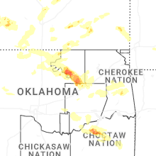

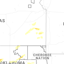


Connect with Interactive Hail Maps