

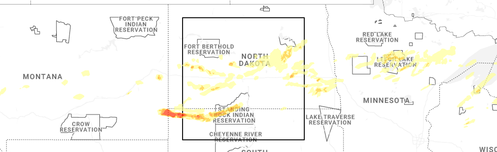
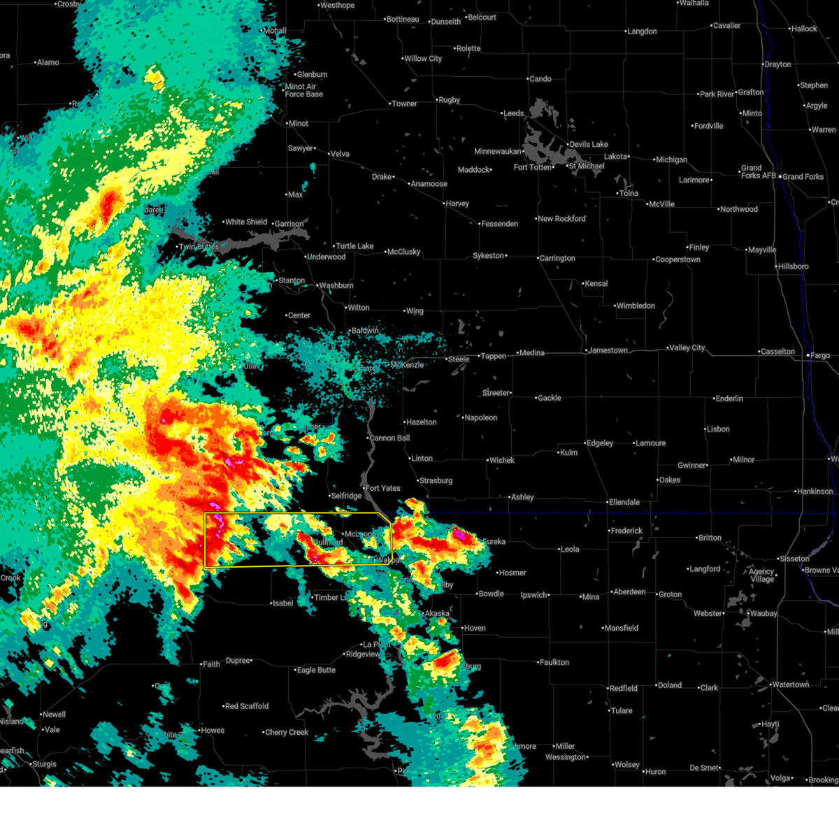
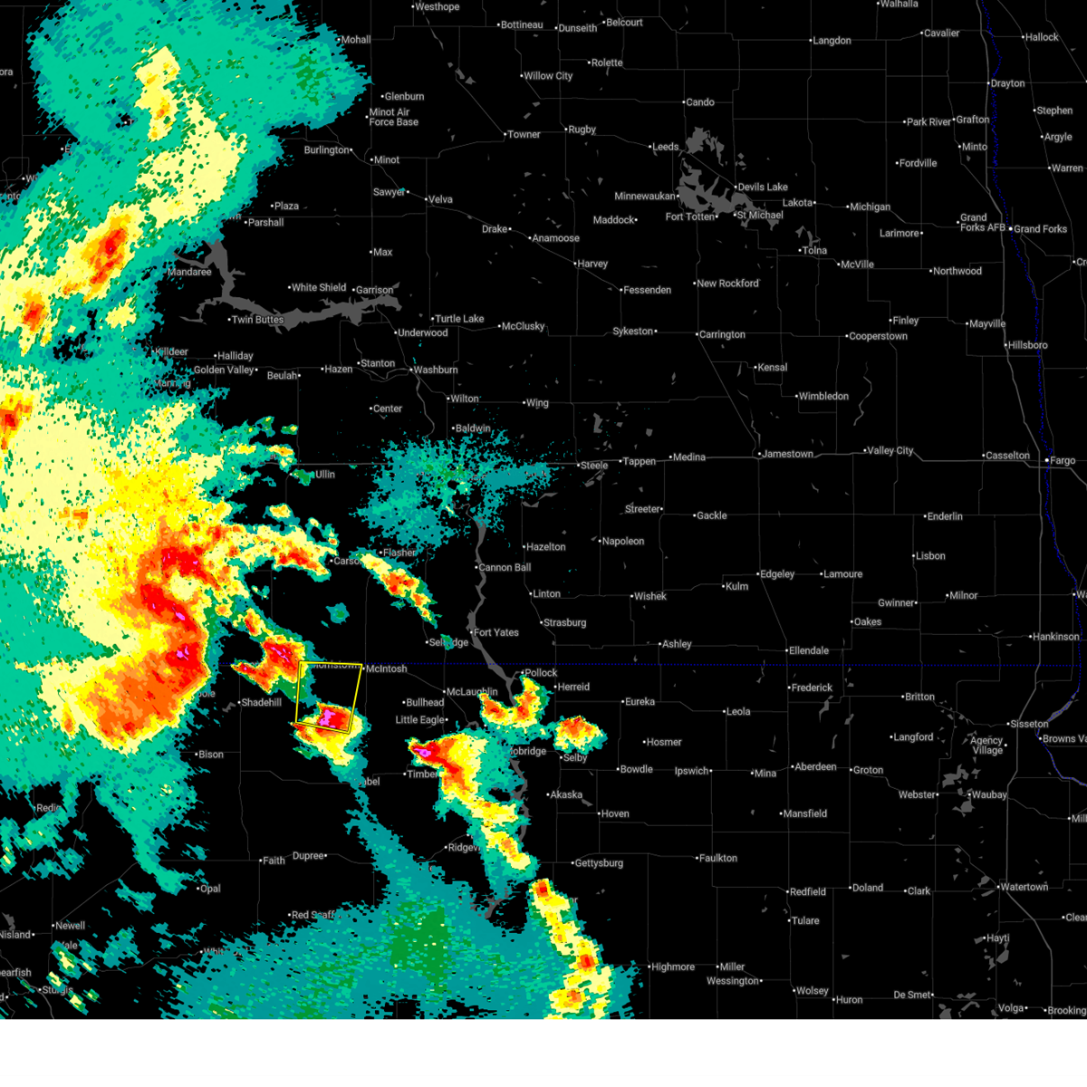
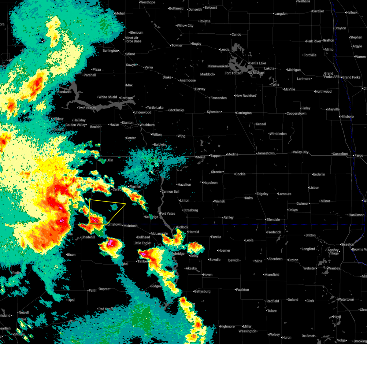
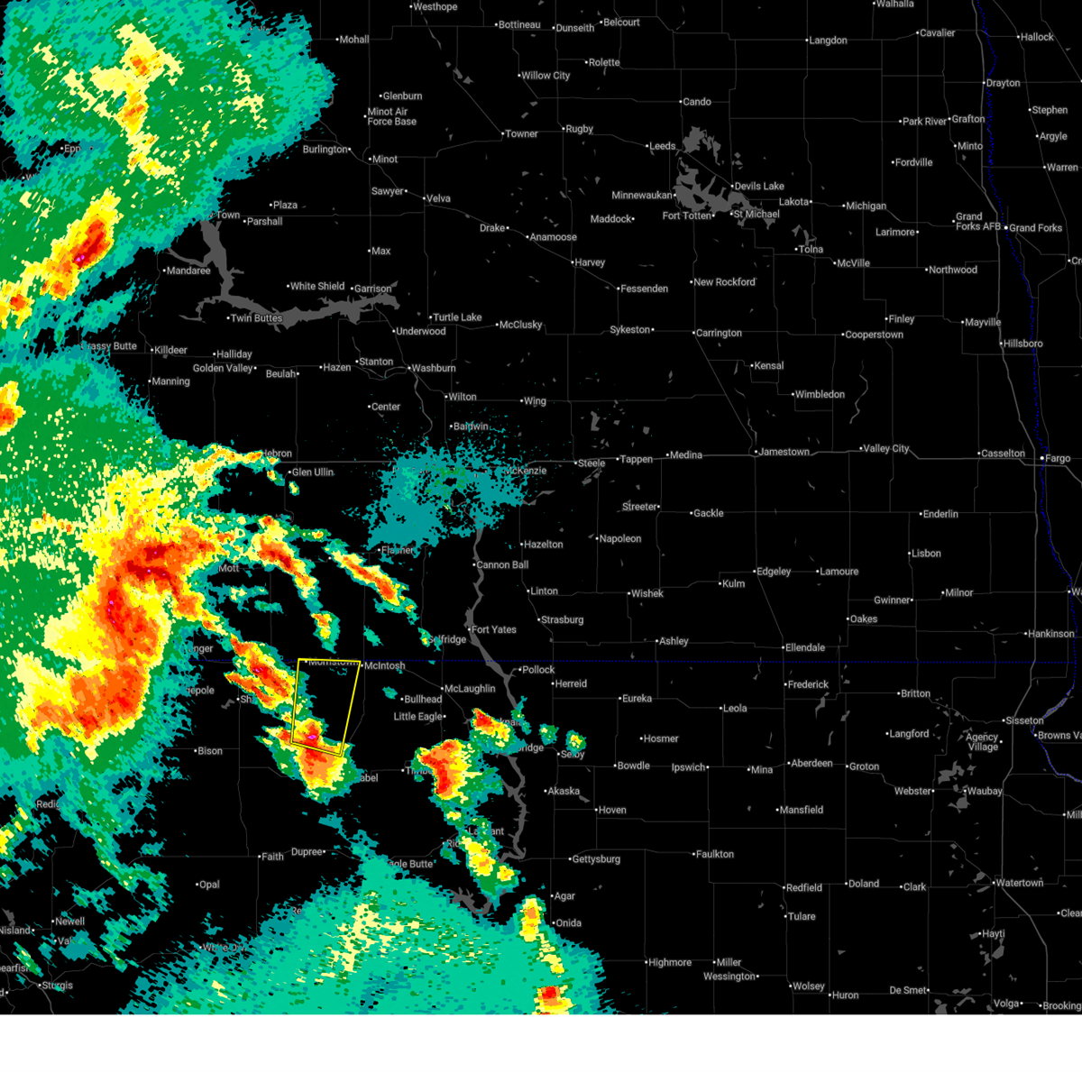
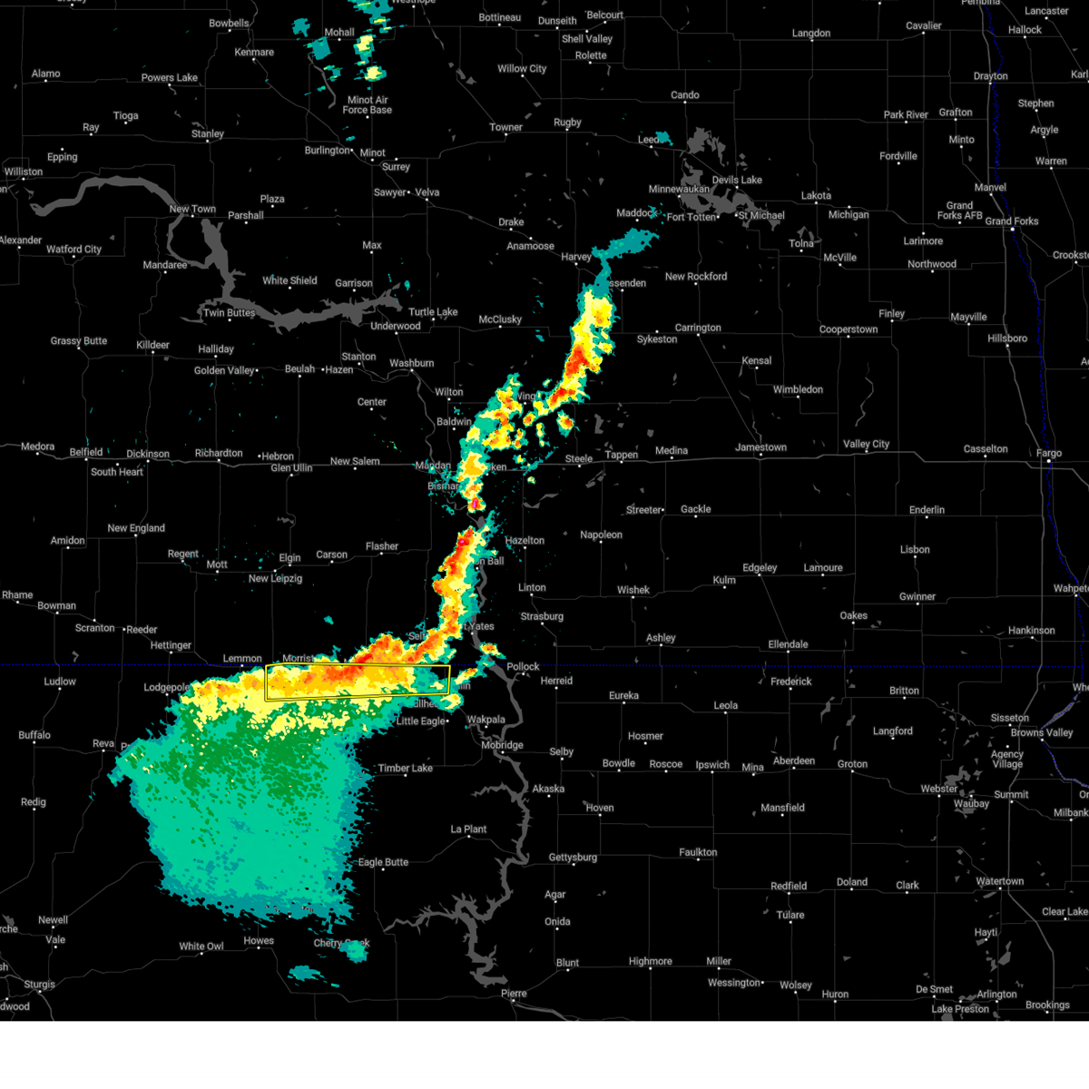
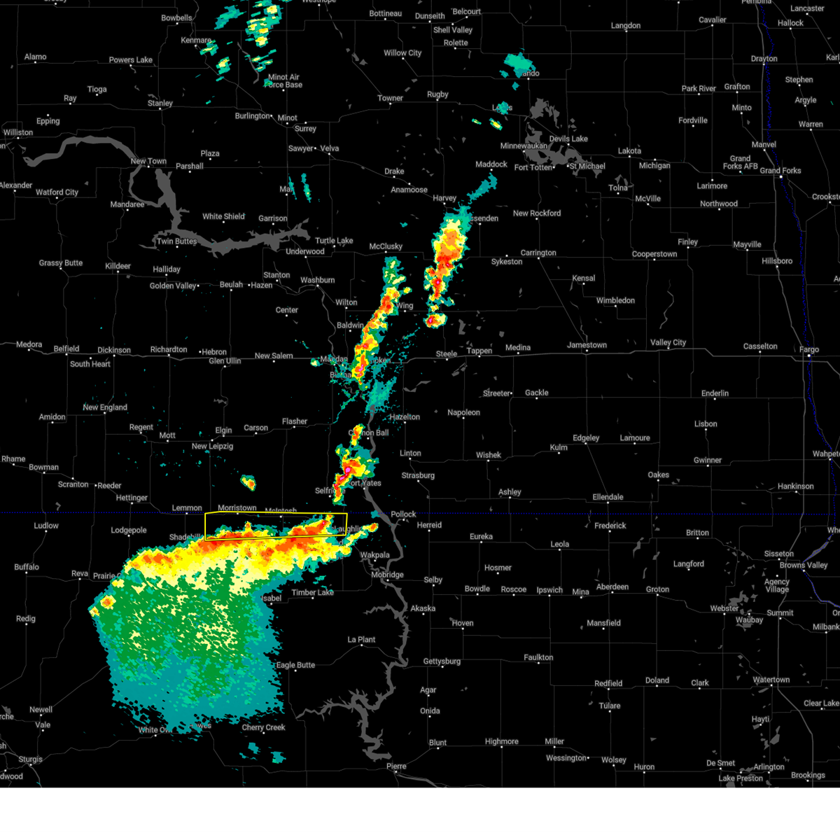
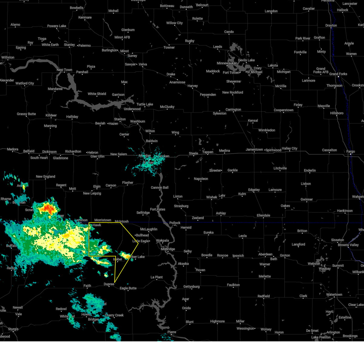
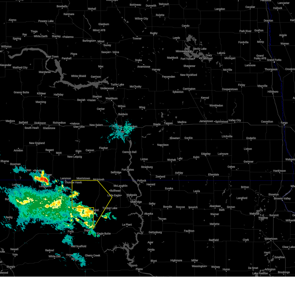
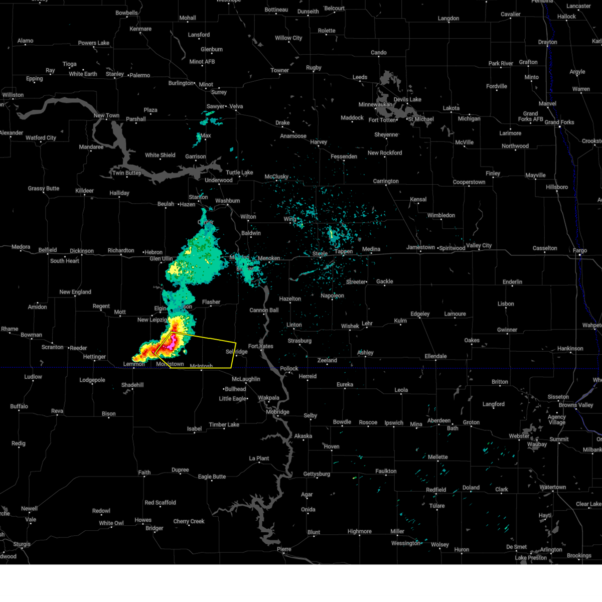
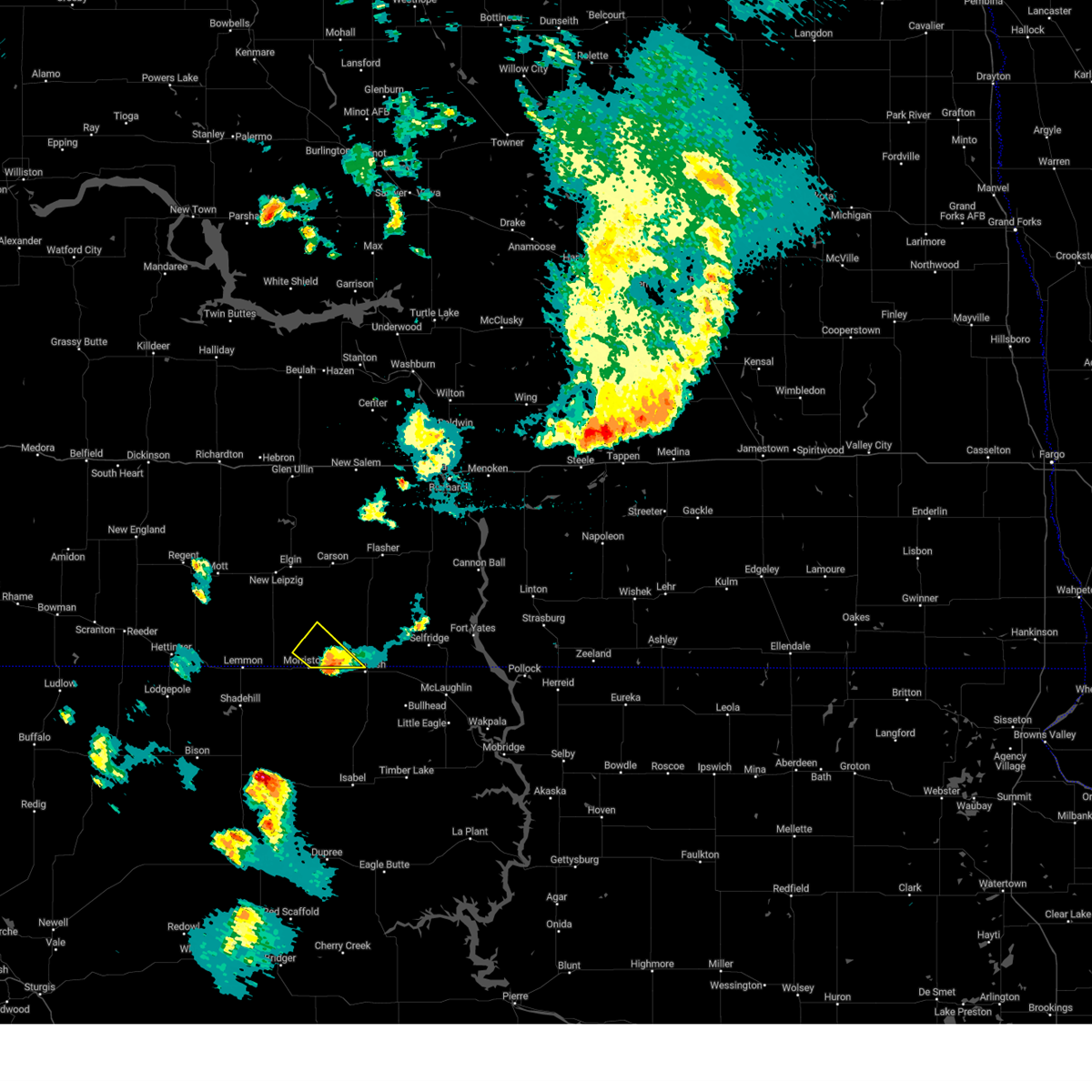
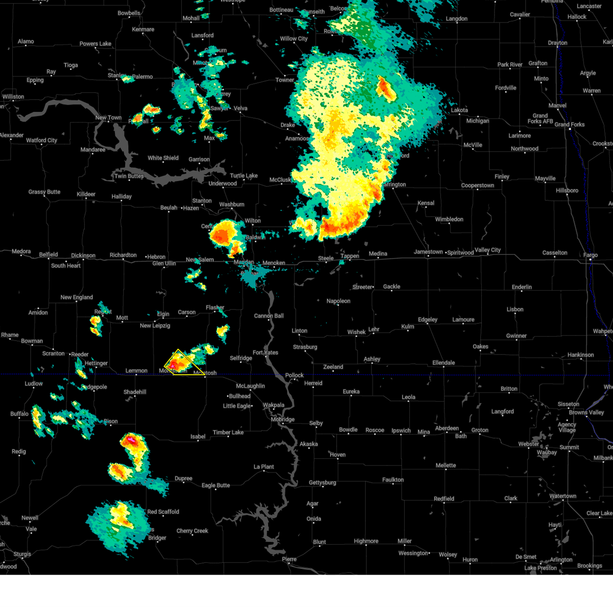
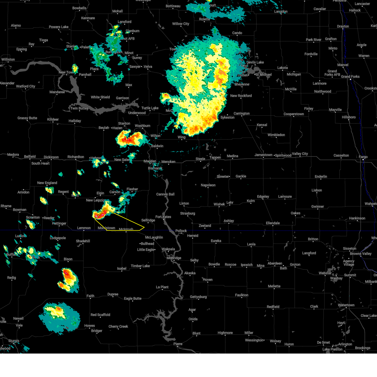
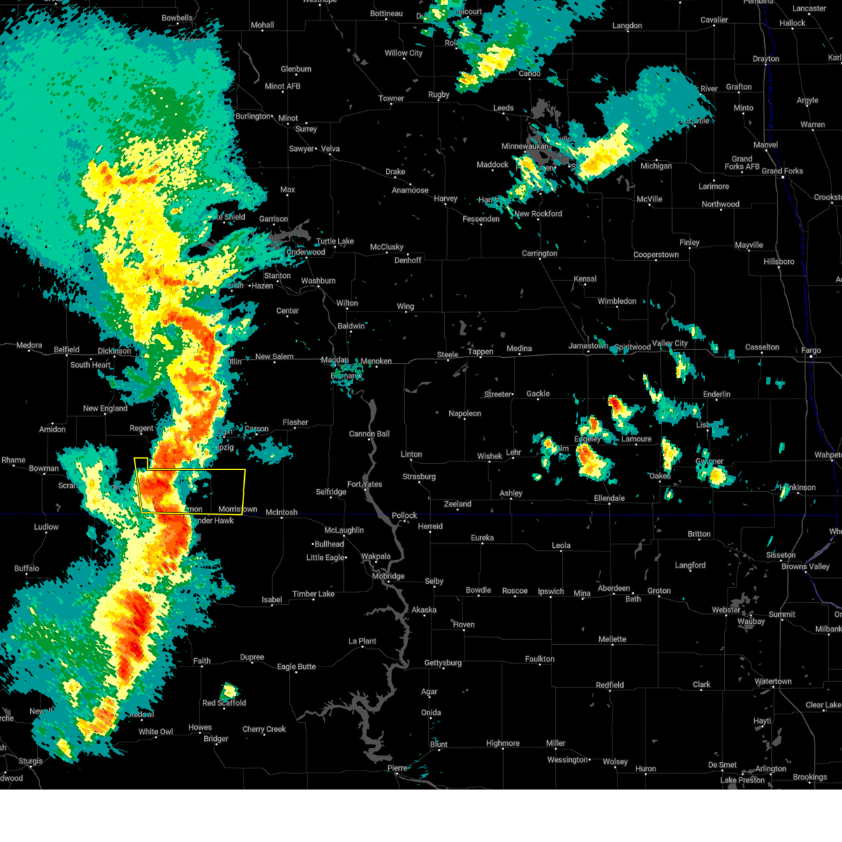
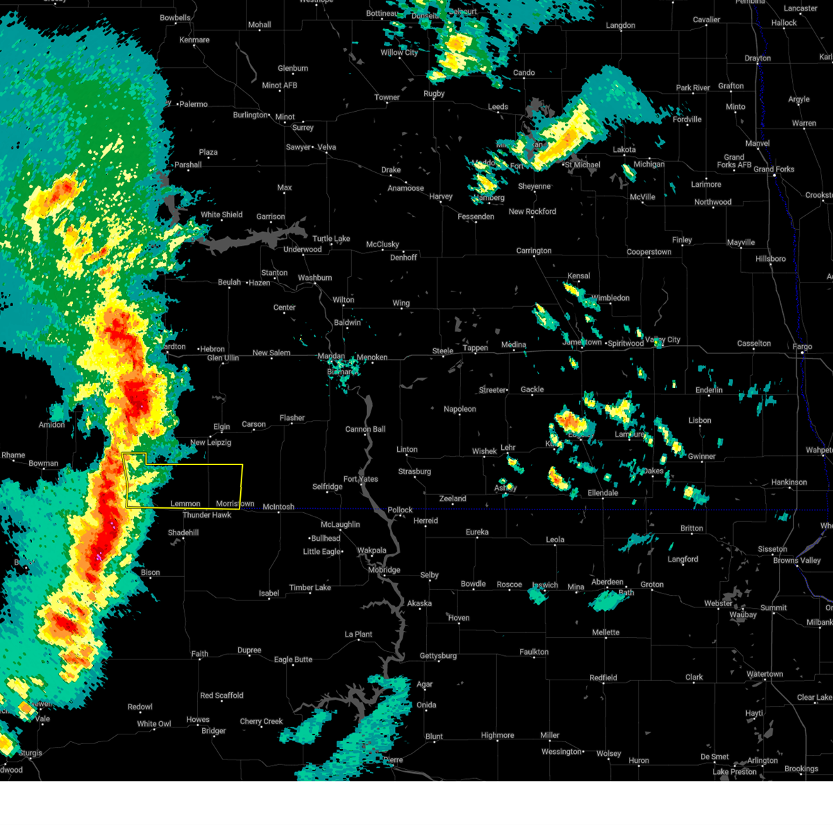
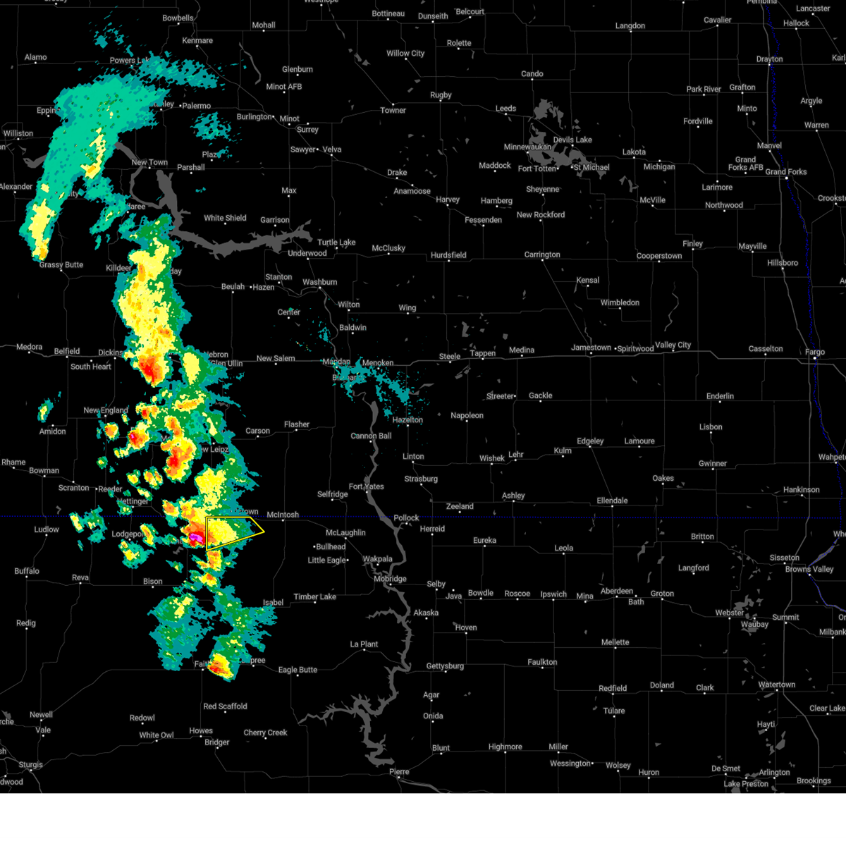
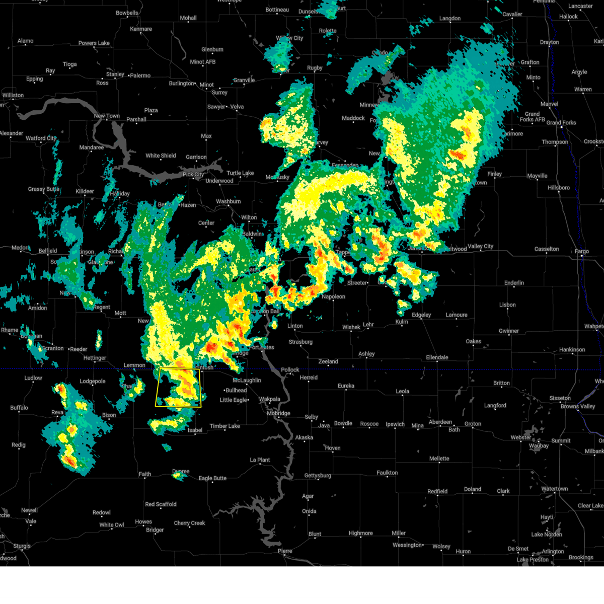
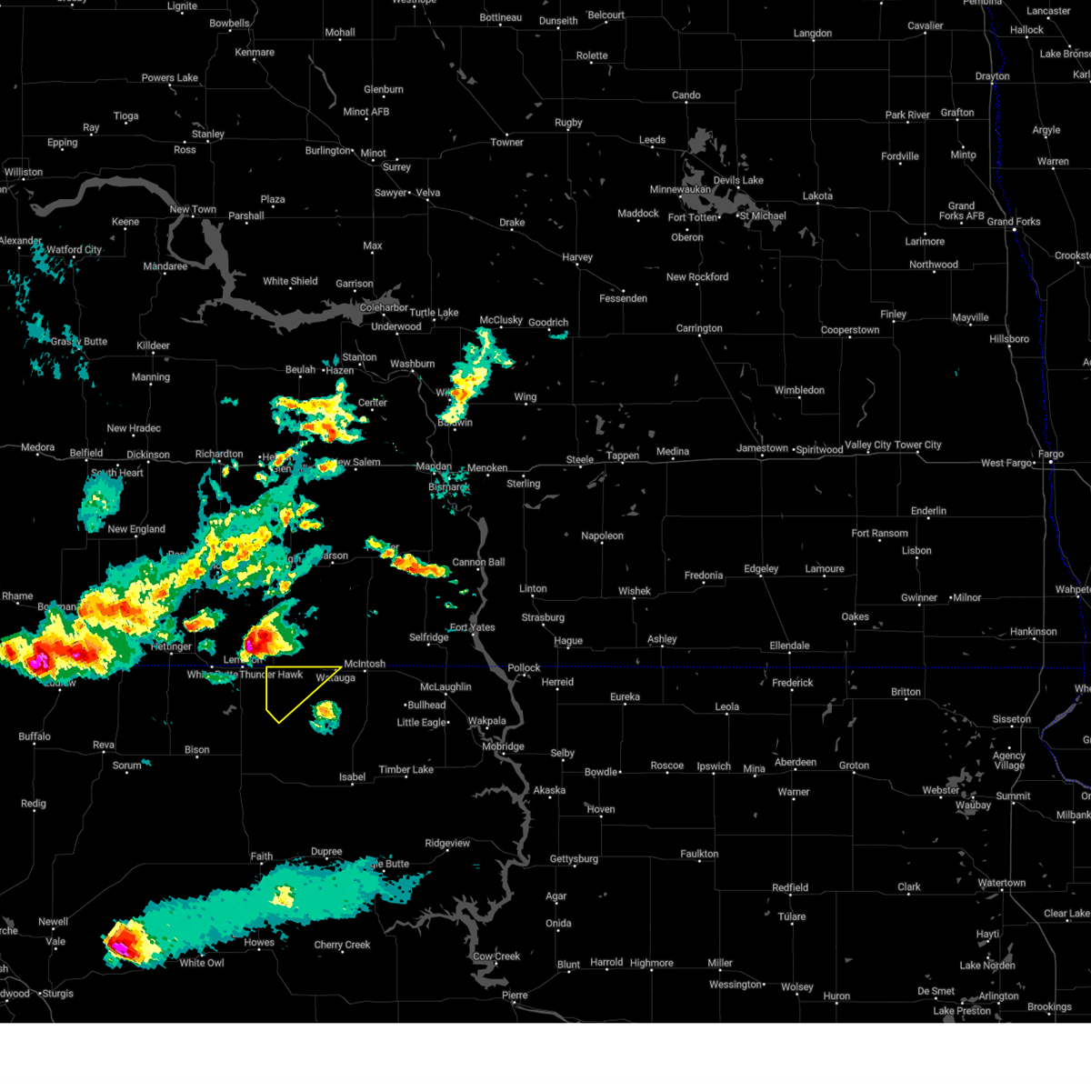
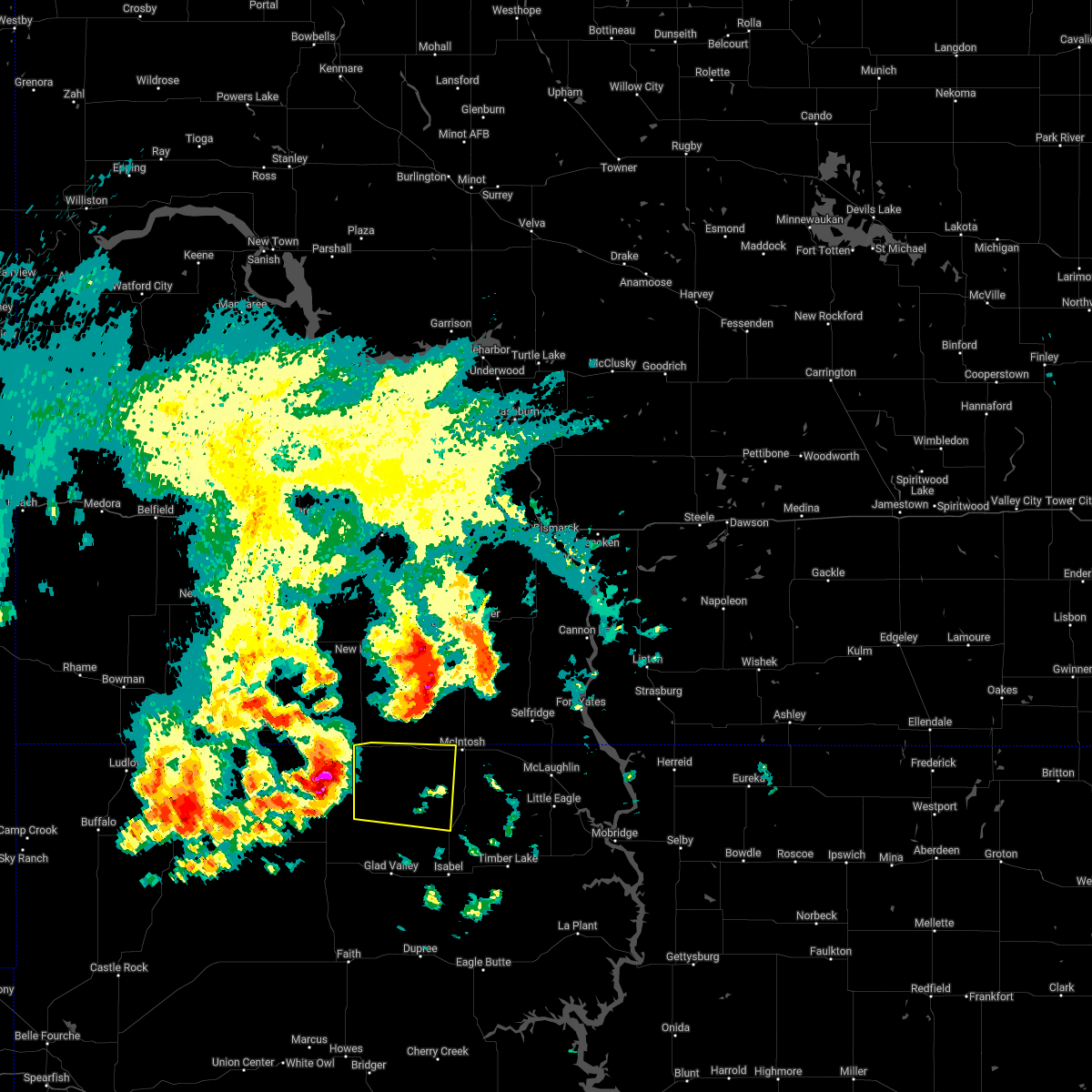
Hail Map for Morristown, SD
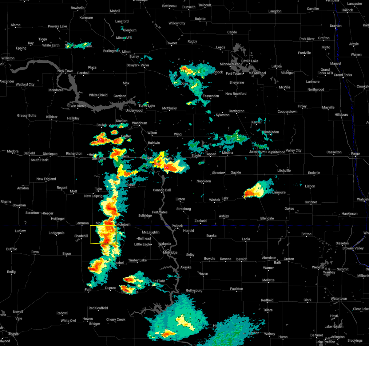
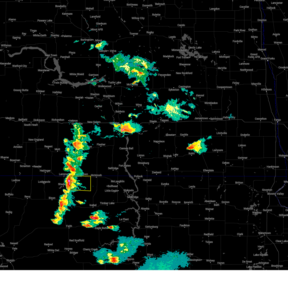
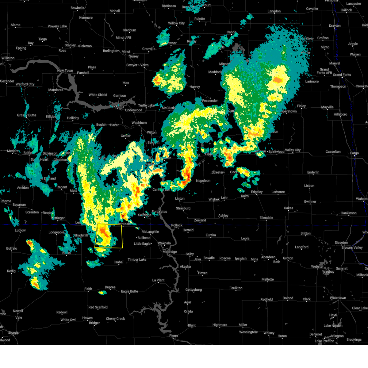
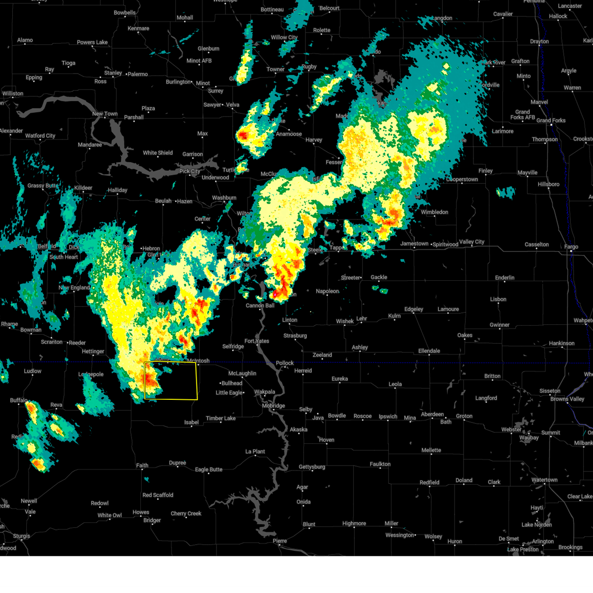
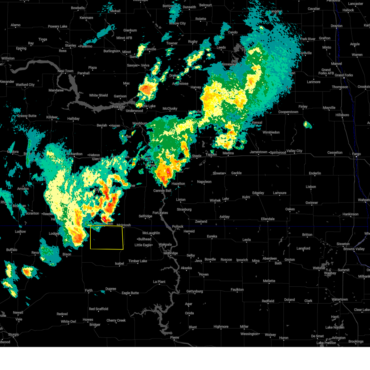
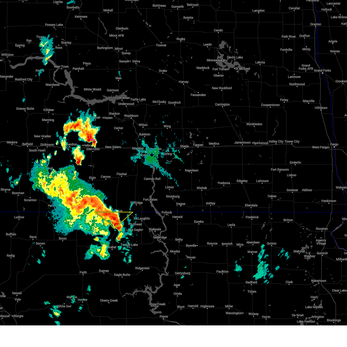
The Morristown, SD area has had 19 reports of on-the-ground hail by trained spotters, and has been under severe weather warnings 22 times during the past 12 months. Doppler radar has detected hail at or near Morristown, SD on 34 occasions, including 3 occasions during the past year.
| Name: | Morristown, SD |
| Where Located: | 75 miles SW of Bismarck, ND |
| Map: | Google Map for Morristown, SD |
| Population: | 67 |
| Housing Units: | 42 |
| More Info: | Search Google for Morristown, SD |
0
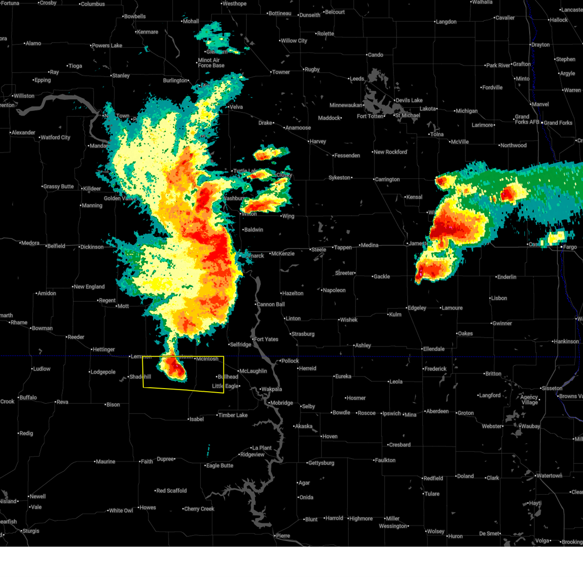
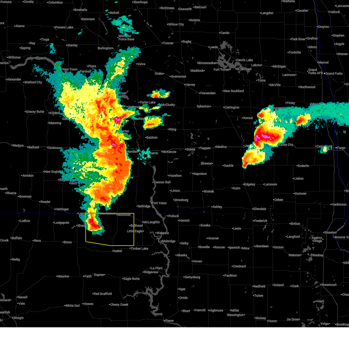
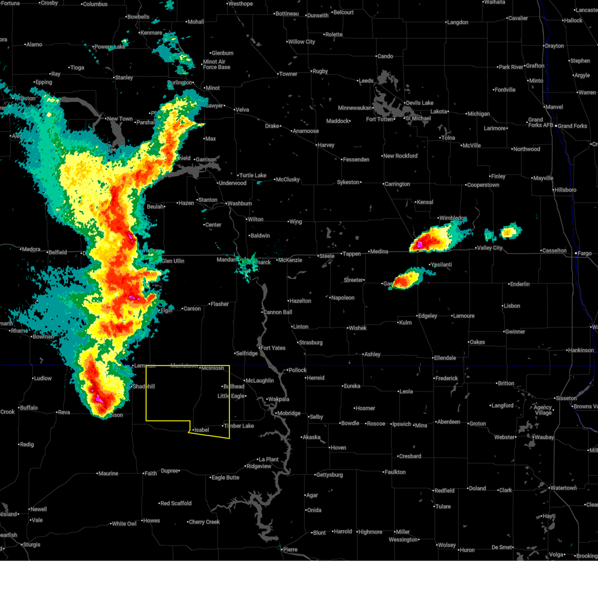
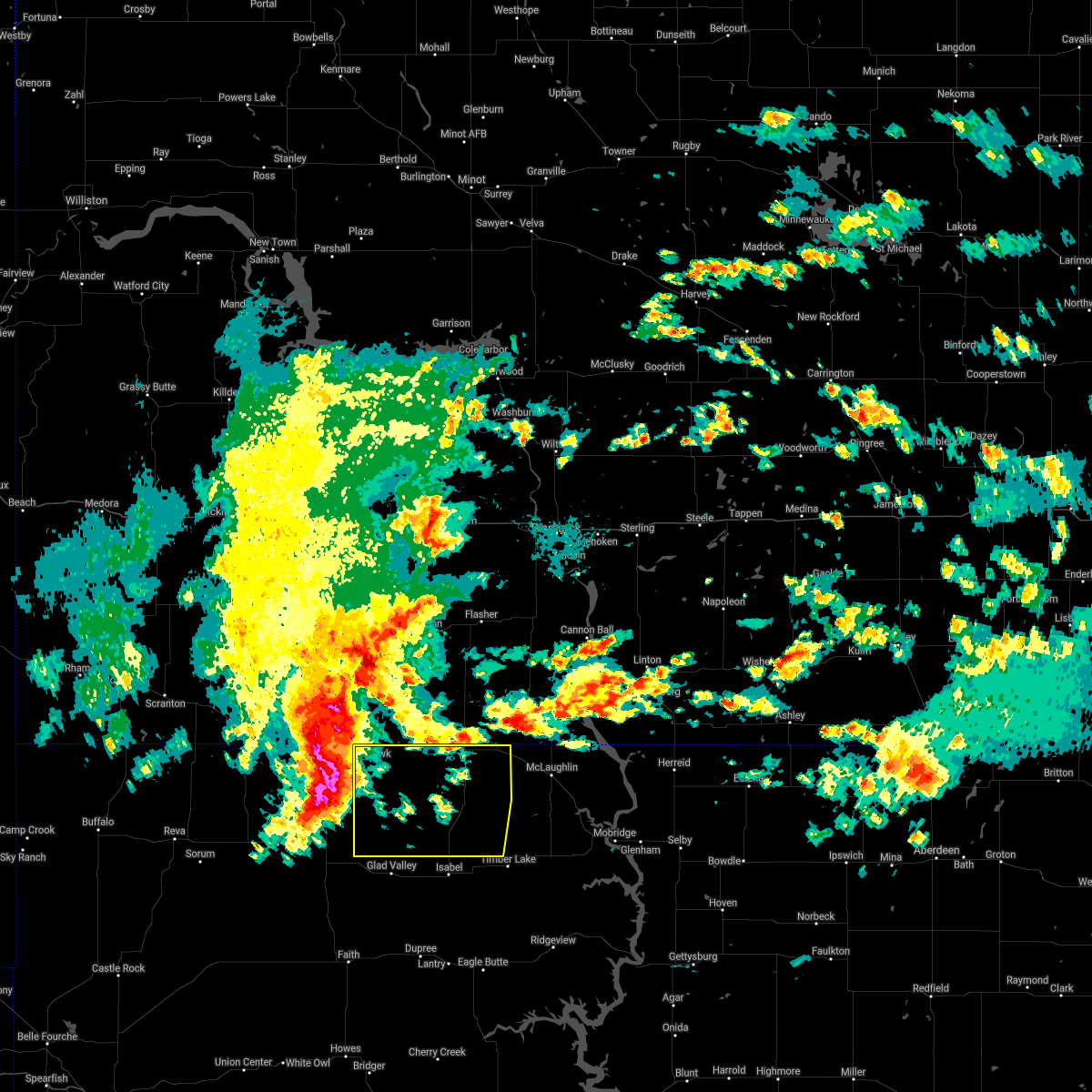
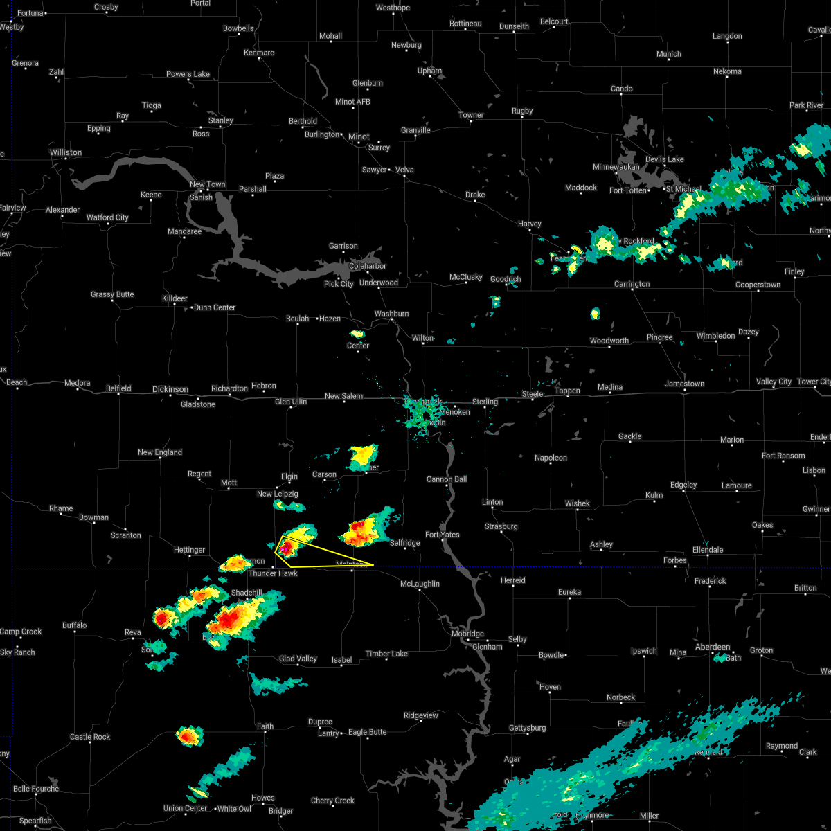
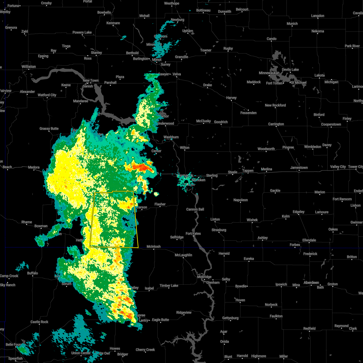
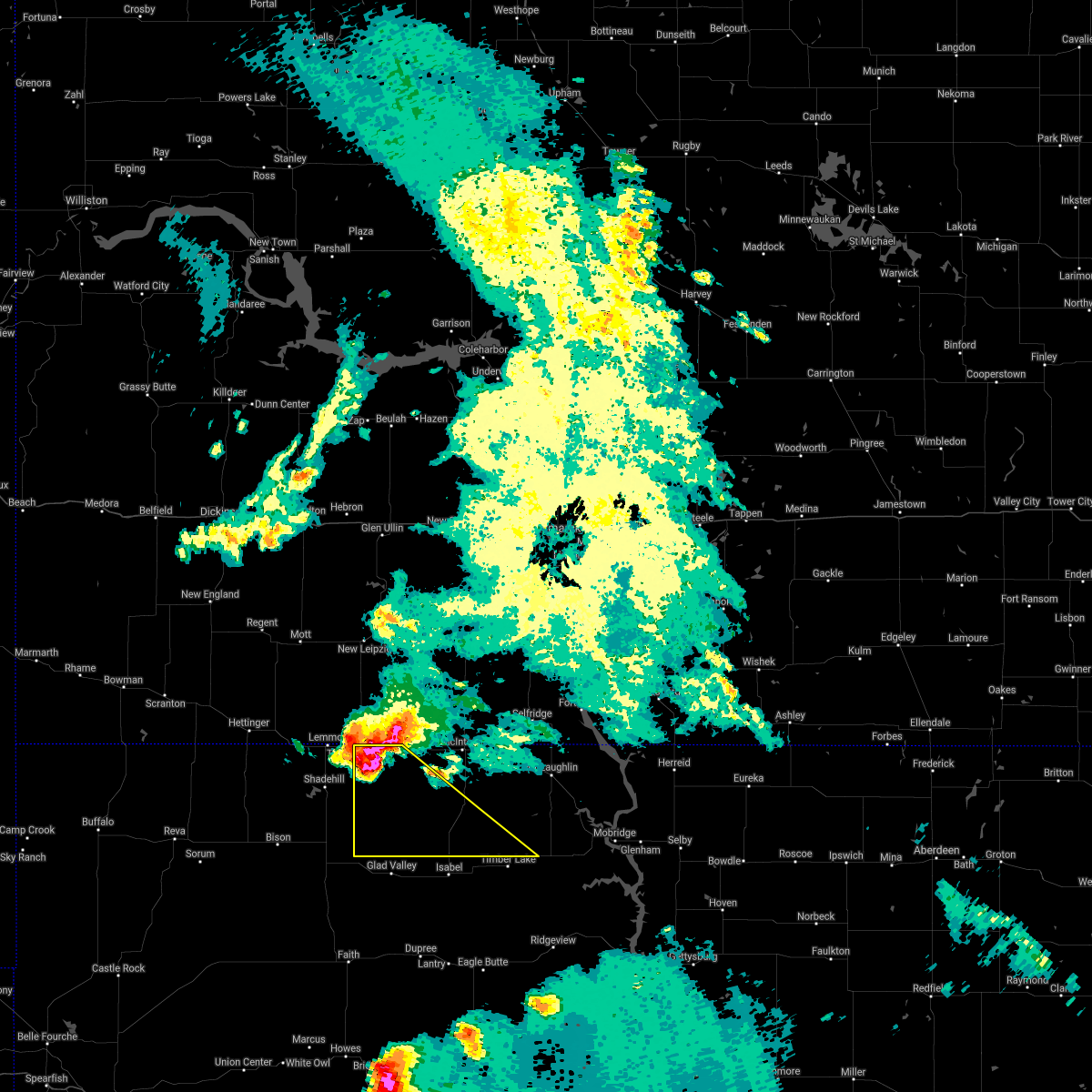
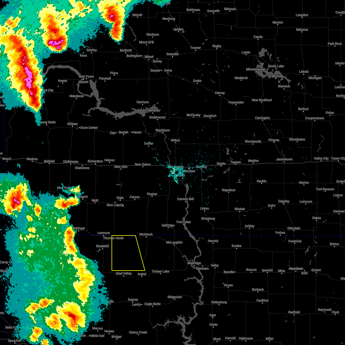
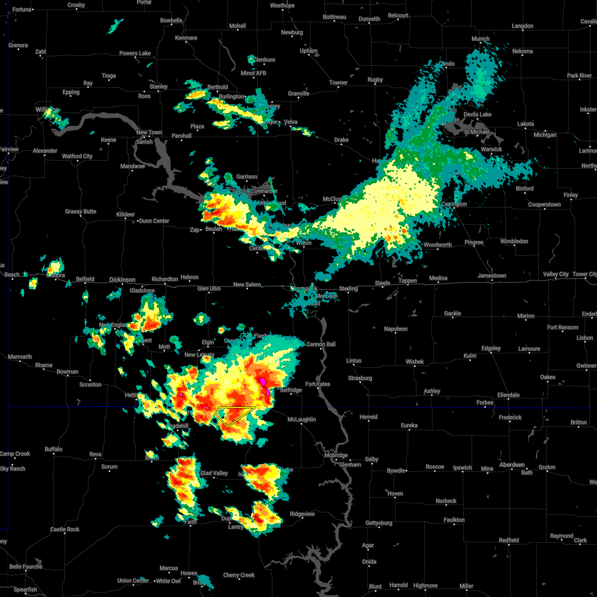
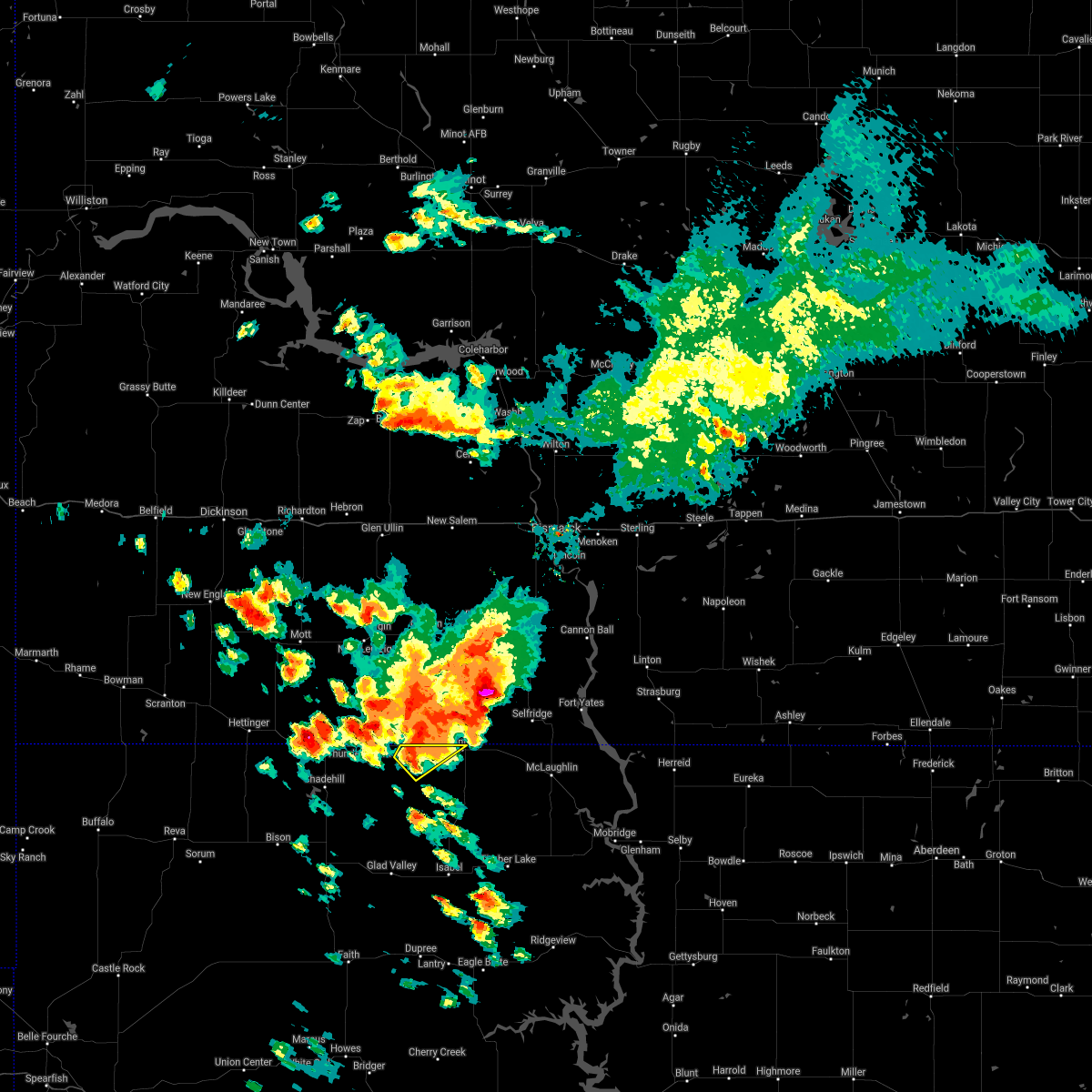
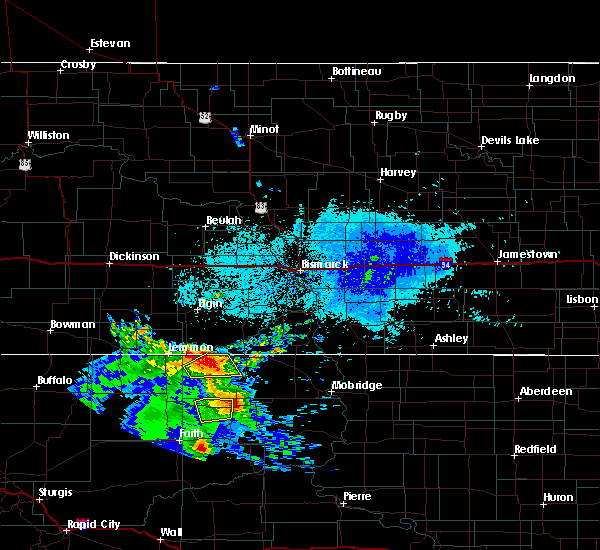
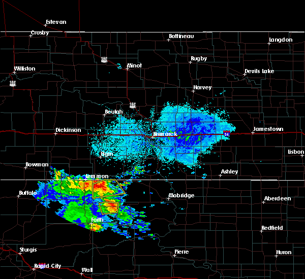
The Top Recent Hail Date for Morristown, SD is Friday, June 20, 2025 (25th out of 34)
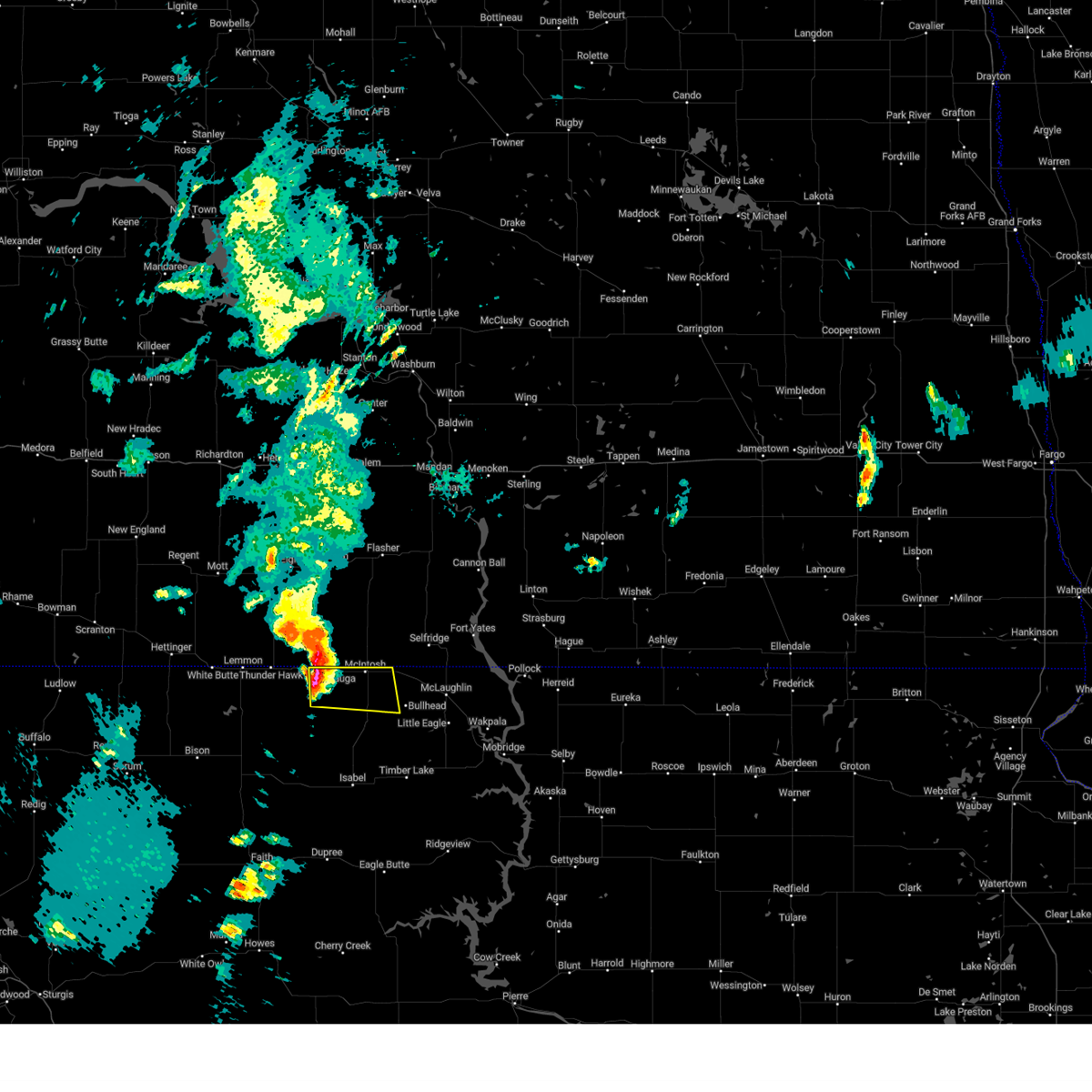
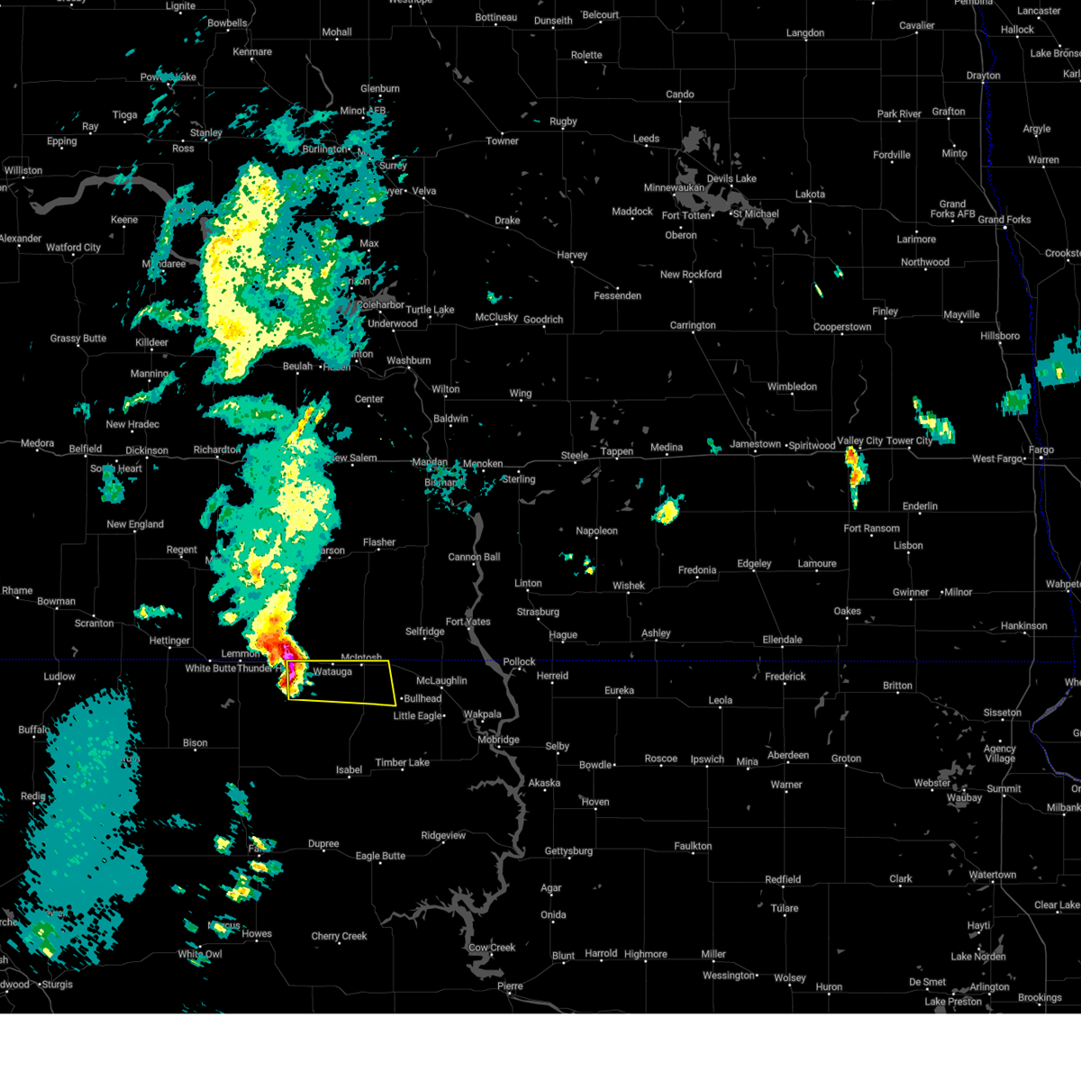
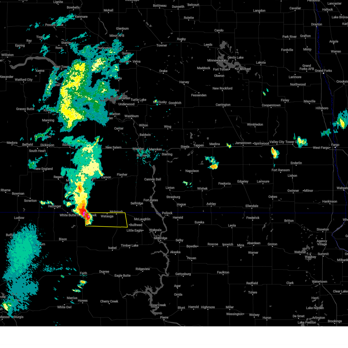
Hail and Wind Damage Spotted near Morristown, SD
| Date / Time | Report Details |
|---|---|
| 6/20/2025 8:08 PM MDT |
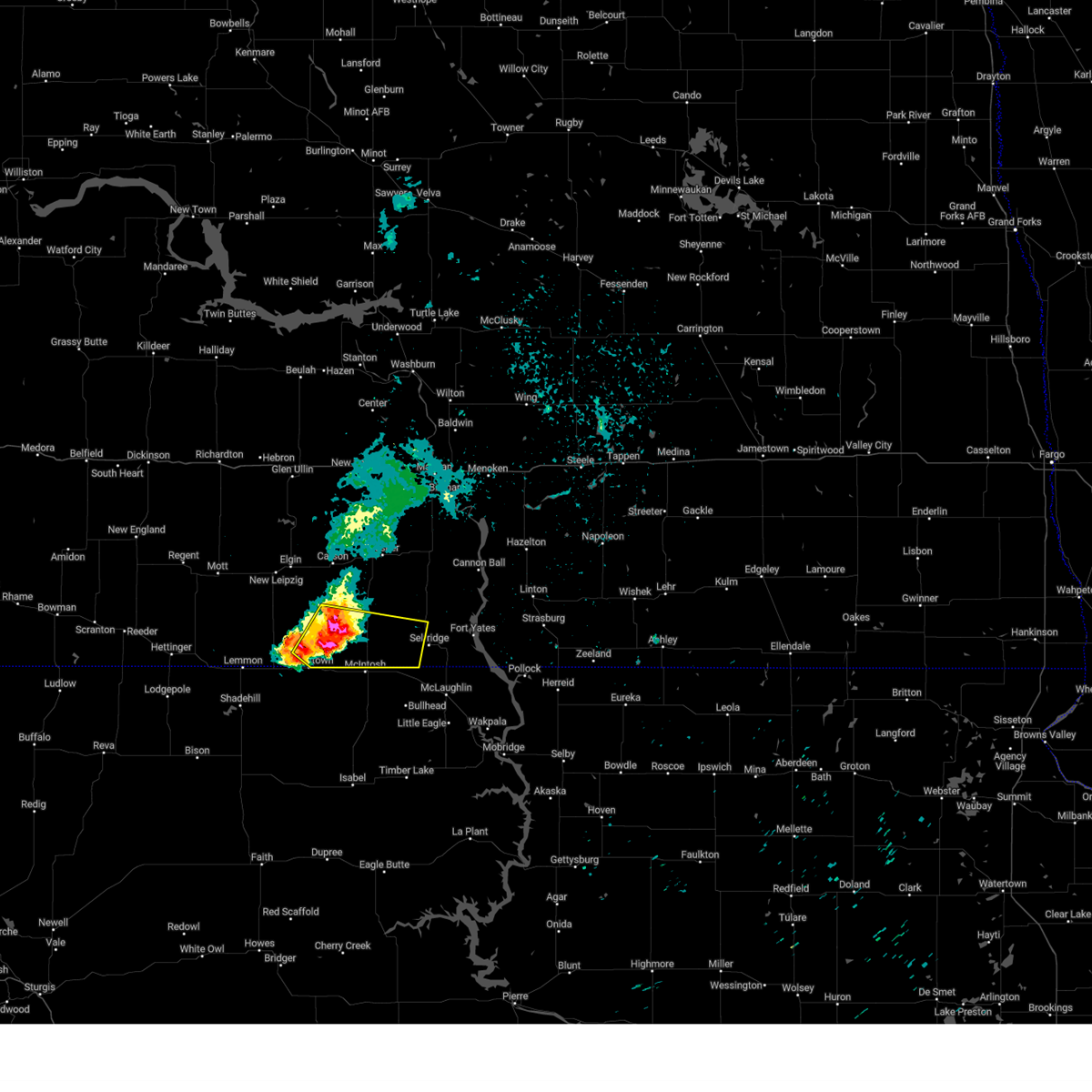
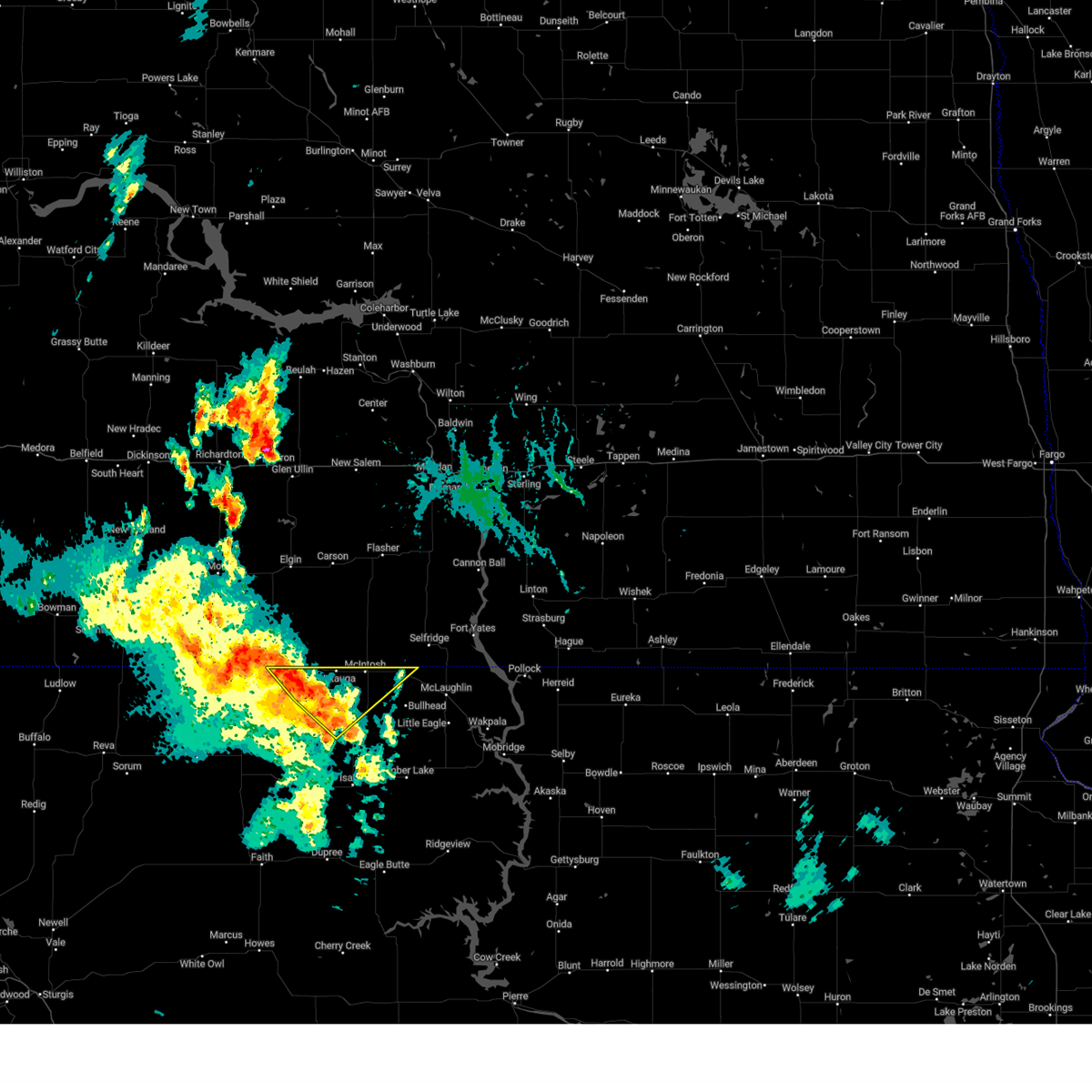
 At 808 pm mdt, a severe thunderstorm was located 7 miles north of firesteel, or 13 miles northwest of timber lake, moving east at 50 mph (radar indicated). Hazards include golf ball size hail and 70 mph wind gusts. People and animals outdoors will be injured. expect hail damage to roofs, siding, windows, and vehicles. expect considerable tree damage. wind damage is also likely to mobile homes, roofs, and outbuildings. Locations impacted include, bullhead, mcintosh, morristown, watauga, keldron, black horse, walker, thunder hawk, klein ranch, and southern standing rock nation. At 808 pm mdt, a severe thunderstorm was located 7 miles north of firesteel, or 13 miles northwest of timber lake, moving east at 50 mph (radar indicated). Hazards include golf ball size hail and 70 mph wind gusts. People and animals outdoors will be injured. expect hail damage to roofs, siding, windows, and vehicles. expect considerable tree damage. wind damage is also likely to mobile homes, roofs, and outbuildings. Locations impacted include, bullhead, mcintosh, morristown, watauga, keldron, black horse, walker, thunder hawk, klein ranch, and southern standing rock nation.
|
| 6/20/2025 7:57 PM MDT |
 At 756 pm mdt, a severe thunderstorm was located 10 miles southwest of klein ranch, or 23 miles northwest of timber lake, moving east at 50 mph (radar indicated). Hazards include tennis ball size hail and 70 mph wind gusts. People and animals outdoors will be injured. expect hail damage to roofs, siding, windows, and vehicles. expect considerable tree damage. wind damage is also likely to mobile homes, roofs, and outbuildings. This severe thunderstorm will remain over mainly rural areas of corson county, including the following locations, southern standing rock nation. At 756 pm mdt, a severe thunderstorm was located 10 miles southwest of klein ranch, or 23 miles northwest of timber lake, moving east at 50 mph (radar indicated). Hazards include tennis ball size hail and 70 mph wind gusts. People and animals outdoors will be injured. expect hail damage to roofs, siding, windows, and vehicles. expect considerable tree damage. wind damage is also likely to mobile homes, roofs, and outbuildings. This severe thunderstorm will remain over mainly rural areas of corson county, including the following locations, southern standing rock nation.
|
| 6/20/2025 7:57 PM MDT |
 the severe thunderstorm warning has been cancelled and is no longer in effect the severe thunderstorm warning has been cancelled and is no longer in effect
|
| 6/20/2025 7:17 PM MDT |
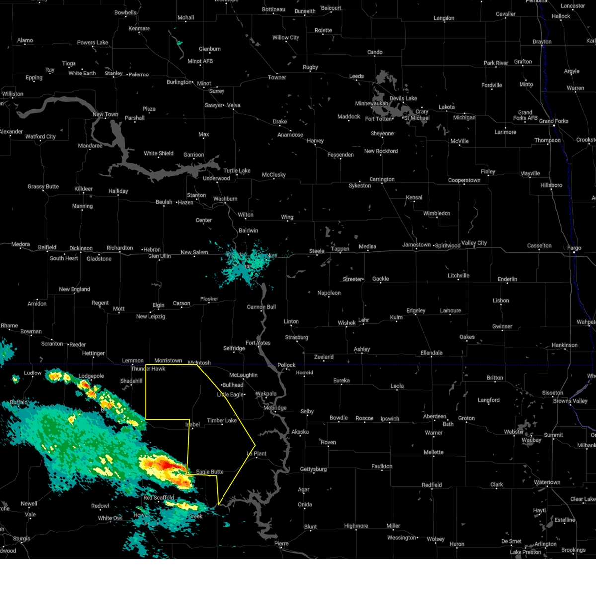
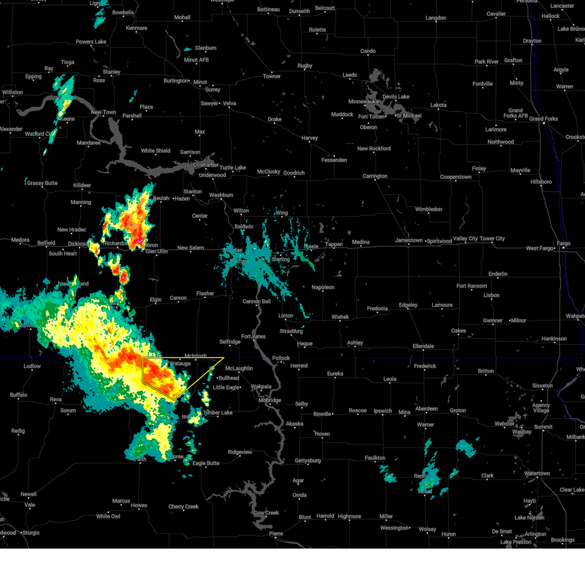
 Svrabr the national weather service in aberdeen has issued a * severe thunderstorm warning for, corson county in north central south dakota, northwestern dewey county in north central south dakota, * until 830 pm mdt. * at 716 pm mdt, a severe thunderstorm was located near shadehill reservoir, or 20 miles south of lemmon, moving east at 50 mph (radar indicated). Hazards include tennis ball size hail and 70 mph wind gusts. People and animals outdoors will be injured. expect hail damage to roofs, siding, windows, and vehicles. expect considerable tree damage. wind damage is also likely to mobile homes, roofs, and outbuildings. this severe thunderstorm will be near, shambo ranch around 735 pm mdt. Other locations in the path of this severe thunderstorm include timber lake. Svrabr the national weather service in aberdeen has issued a * severe thunderstorm warning for, corson county in north central south dakota, northwestern dewey county in north central south dakota, * until 830 pm mdt. * at 716 pm mdt, a severe thunderstorm was located near shadehill reservoir, or 20 miles south of lemmon, moving east at 50 mph (radar indicated). Hazards include tennis ball size hail and 70 mph wind gusts. People and animals outdoors will be injured. expect hail damage to roofs, siding, windows, and vehicles. expect considerable tree damage. wind damage is also likely to mobile homes, roofs, and outbuildings. this severe thunderstorm will be near, shambo ranch around 735 pm mdt. Other locations in the path of this severe thunderstorm include timber lake.
|
| 6/16/2025 12:58 AM MDT |
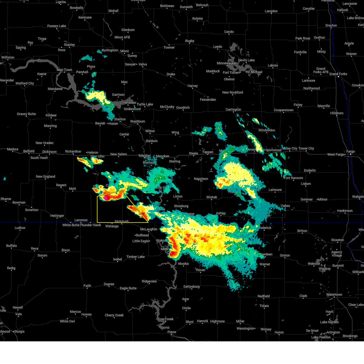
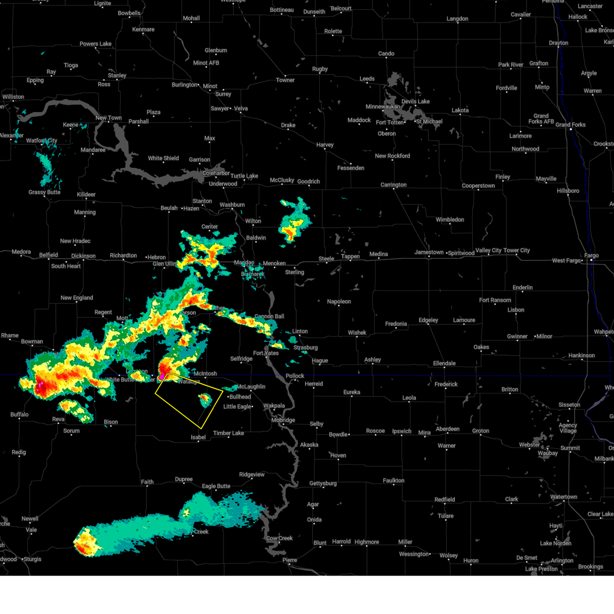
 Svrabr the national weather service in aberdeen has issued a * severe thunderstorm warning for, corson county in north central south dakota, * until 200 am mdt. * at 1258 am mdt, a severe thunderstorm was located 10 miles southwest of watauga, or 26 miles west of bullhead, moving east at 45 mph. this is a destructive storm for bullhead (radar indicated). Hazards include 80 mph wind gusts and penny size hail. Flying debris will be dangerous to those caught without shelter. mobile homes will be heavily damaged. expect considerable damage to roofs, windows, and vehicles. extensive tree damage and power outages are likely. this severe thunderstorm will be near, black horse around 110 am mdt. Other locations in the path of this severe thunderstorm include bullhead, mclaughlin and mahto. Svrabr the national weather service in aberdeen has issued a * severe thunderstorm warning for, corson county in north central south dakota, * until 200 am mdt. * at 1258 am mdt, a severe thunderstorm was located 10 miles southwest of watauga, or 26 miles west of bullhead, moving east at 45 mph. this is a destructive storm for bullhead (radar indicated). Hazards include 80 mph wind gusts and penny size hail. Flying debris will be dangerous to those caught without shelter. mobile homes will be heavily damaged. expect considerable damage to roofs, windows, and vehicles. extensive tree damage and power outages are likely. this severe thunderstorm will be near, black horse around 110 am mdt. Other locations in the path of this severe thunderstorm include bullhead, mclaughlin and mahto.
|
| 6/16/2025 12:31 AM MDT |
 At 1231 am mdt, a severe thunderstorm was located 9 miles south of watauga, or 23 miles west of bullhead, moving northeast at 50 mph (radar indicated). Hazards include 60 mph wind gusts and quarter size hail. Hail damage to vehicles is expected. expect wind damage to roofs, siding, and trees. Locations impacted include, watauga. At 1231 am mdt, a severe thunderstorm was located 9 miles south of watauga, or 23 miles west of bullhead, moving northeast at 50 mph (radar indicated). Hazards include 60 mph wind gusts and quarter size hail. Hail damage to vehicles is expected. expect wind damage to roofs, siding, and trees. Locations impacted include, watauga.
|
| 6/16/2025 12:28 AM MDT |
 Svrbis the national weather service in bismarck has issued a * severe thunderstorm warning for, southwestern sioux county in south central north dakota, southwestern grant county in south central north dakota, * until 100 am mdt. * at 1228 am mdt, a severe thunderstorm was located 5 miles north of keldron, or 16 miles east of lemmon, moving northeast at 40 mph (radar indicated). Hazards include 60 mph wind gusts and half dollar size hail. Hail damage to vehicles is expected. Expect wind damage to roofs, siding, and trees. Svrbis the national weather service in bismarck has issued a * severe thunderstorm warning for, southwestern sioux county in south central north dakota, southwestern grant county in south central north dakota, * until 100 am mdt. * at 1228 am mdt, a severe thunderstorm was located 5 miles north of keldron, or 16 miles east of lemmon, moving northeast at 40 mph (radar indicated). Hazards include 60 mph wind gusts and half dollar size hail. Hail damage to vehicles is expected. Expect wind damage to roofs, siding, and trees.
|
| 6/16/2025 12:13 AM MDT |
 Svrabr the national weather service in aberdeen has issued a * severe thunderstorm warning for, western corson county in north central south dakota, * until 1245 am mdt. * at 1212 am mdt, a severe thunderstorm was located 10 miles northeast of shambo ranch, or 30 miles west of bullhead, moving north at 45 mph (radar indicated). Hazards include 60 mph wind gusts and quarter size hail. Hail damage to vehicles is expected. expect wind damage to roofs, siding, and trees. this severe thunderstorm will be near, watauga around 1230 am mdt. Other locations in the path of this severe thunderstorm include morristown. Svrabr the national weather service in aberdeen has issued a * severe thunderstorm warning for, western corson county in north central south dakota, * until 1245 am mdt. * at 1212 am mdt, a severe thunderstorm was located 10 miles northeast of shambo ranch, or 30 miles west of bullhead, moving north at 45 mph (radar indicated). Hazards include 60 mph wind gusts and quarter size hail. Hail damage to vehicles is expected. expect wind damage to roofs, siding, and trees. this severe thunderstorm will be near, watauga around 1230 am mdt. Other locations in the path of this severe thunderstorm include morristown.
|
| 5/5/2025 7:41 PM MDT |
 the severe thunderstorm warning has been cancelled and is no longer in effect the severe thunderstorm warning has been cancelled and is no longer in effect
|
| 5/5/2025 7:30 PM MDT | Storm damage reported in corson county SD, 7.4 miles NW of Morristown, SD |
| 5/5/2025 7:13 PM MDT |
 Svrabr the national weather service in aberdeen has issued a * severe thunderstorm warning for, northwestern corson county in north central south dakota, * until 800 pm mdt. * at 713 pm mdt, severe thunderstorms were located along a line extending from 9 miles south of thunder hawk to 8 miles northwest of mclaughlin, moving north at 45 mph (radar indicated). Hazards include 60 mph wind gusts. Expect damage to roofs, siding, and trees. Severe thunderstorms will be near, mcintosh, morristown, watauga, keldron, and thunder hawk around 720 pm mdt. Svrabr the national weather service in aberdeen has issued a * severe thunderstorm warning for, northwestern corson county in north central south dakota, * until 800 pm mdt. * at 713 pm mdt, severe thunderstorms were located along a line extending from 9 miles south of thunder hawk to 8 miles northwest of mclaughlin, moving north at 45 mph (radar indicated). Hazards include 60 mph wind gusts. Expect damage to roofs, siding, and trees. Severe thunderstorms will be near, mcintosh, morristown, watauga, keldron, and thunder hawk around 720 pm mdt.
|
| 9/17/2024 10:47 PM MDT |
 the severe thunderstorm warning has been cancelled and is no longer in effect the severe thunderstorm warning has been cancelled and is no longer in effect
|
| 9/17/2024 10:31 PM MDT |
 At 1030 pm mdt, severe thunderstorms were located along a line extending from near thunder hawk to near firesteel to 7 miles southwest of ridgeview, moving northeast at 40 mph (radar indicated). Hazards include 60 mph wind gusts. Expect damage to roofs, siding, and trees. Locations impacted include, morristown, firesteel, keldron, klein ranch, black horse, watauga and mcintosh. At 1030 pm mdt, severe thunderstorms were located along a line extending from near thunder hawk to near firesteel to 7 miles southwest of ridgeview, moving northeast at 40 mph (radar indicated). Hazards include 60 mph wind gusts. Expect damage to roofs, siding, and trees. Locations impacted include, morristown, firesteel, keldron, klein ranch, black horse, watauga and mcintosh.
|
| 9/17/2024 10:04 PM MDT |
 Svrabr the national weather service in aberdeen has issued a * severe thunderstorm warning for, western corson county in north central south dakota, western dewey county in north central south dakota, * until 1100 pm mdt. * at 1003 pm mdt, severe thunderstorms were located along a line extending from 9 miles southeast of shadehill to near bear creek to 13 miles southeast of intersection of highway 63 and bia road 8, moving northeast at 40 mph (radar indicated). Hazards include 60 mph wind gusts and penny size hail. Expect damage to roofs, siding, and trees. severe thunderstorms will be near, eagle butte, isabel, green grass, shambo ranch, and parade around 1010 pm mdt. firesteel around 1020 pm mdt. Other locations in the path of these severe thunderstorms include thunder hawk, little moreau rec area, keldron, timber lake, morristown, klein ranch, white horse, black horse and watauga. Svrabr the national weather service in aberdeen has issued a * severe thunderstorm warning for, western corson county in north central south dakota, western dewey county in north central south dakota, * until 1100 pm mdt. * at 1003 pm mdt, severe thunderstorms were located along a line extending from 9 miles southeast of shadehill to near bear creek to 13 miles southeast of intersection of highway 63 and bia road 8, moving northeast at 40 mph (radar indicated). Hazards include 60 mph wind gusts and penny size hail. Expect damage to roofs, siding, and trees. severe thunderstorms will be near, eagle butte, isabel, green grass, shambo ranch, and parade around 1010 pm mdt. firesteel around 1020 pm mdt. Other locations in the path of these severe thunderstorms include thunder hawk, little moreau rec area, keldron, timber lake, morristown, klein ranch, white horse, black horse and watauga.
|
| 7/29/2024 6:13 PM MDT |
 Svrbis the national weather service in bismarck has issued a * severe thunderstorm warning for, southeastern sioux county in south central north dakota, south central morton county in south central north dakota, southeastern grant county in south central north dakota, * until 800 pm cdt/700 pm mdt/. * at 712 pm cdt/612 pm mdt/, a severe thunderstorm was located 15 miles west of shields, or 34 miles northwest of bullhead, moving northeast at 40 mph (radar indicated). Hazards include 60 mph wind gusts and nickel size hail. expect damage to roofs, siding, and trees Svrbis the national weather service in bismarck has issued a * severe thunderstorm warning for, southeastern sioux county in south central north dakota, south central morton county in south central north dakota, southeastern grant county in south central north dakota, * until 800 pm cdt/700 pm mdt/. * at 712 pm cdt/612 pm mdt/, a severe thunderstorm was located 15 miles west of shields, or 34 miles northwest of bullhead, moving northeast at 40 mph (radar indicated). Hazards include 60 mph wind gusts and nickel size hail. expect damage to roofs, siding, and trees
|
| 7/29/2024 6:10 PM MDT |
 the severe thunderstorm warning has been cancelled and is no longer in effect the severe thunderstorm warning has been cancelled and is no longer in effect
|
| 7/29/2024 5:38 PM MDT |
 Svrabr the national weather service in aberdeen has issued a * severe thunderstorm warning for, northwestern corson county in north central south dakota, * until 630 pm mdt. * at 538 pm mdt, a severe thunderstorm was located 8 miles south of thunder hawk, or 13 miles southeast of lemmon, moving east at 30 mph (radar indicated). Hazards include 60 mph wind gusts and half dollar size hail. Hail damage to vehicles is expected. expect wind damage to roofs, siding, and trees. This severe thunderstorm will remain over mainly rural areas of northwestern corson county. Svrabr the national weather service in aberdeen has issued a * severe thunderstorm warning for, northwestern corson county in north central south dakota, * until 630 pm mdt. * at 538 pm mdt, a severe thunderstorm was located 8 miles south of thunder hawk, or 13 miles southeast of lemmon, moving east at 30 mph (radar indicated). Hazards include 60 mph wind gusts and half dollar size hail. Hail damage to vehicles is expected. expect wind damage to roofs, siding, and trees. This severe thunderstorm will remain over mainly rural areas of northwestern corson county.
|
| 7/29/2024 3:05 AM MDT |
 At 405 am cdt/305 am mdt/, a severe thunderstorm was located 8 miles north of watauga, or 26 miles northwest of bullhead, moving southeast at 30 mph (radar indicated). Hazards include 60 mph wind gusts and half dollar size hail. Hail damage to vehicles is expected. expect wind damage to roofs, siding, and trees. Locations impacted include, standing rock and standing rock nation. At 405 am cdt/305 am mdt/, a severe thunderstorm was located 8 miles north of watauga, or 26 miles northwest of bullhead, moving southeast at 30 mph (radar indicated). Hazards include 60 mph wind gusts and half dollar size hail. Hail damage to vehicles is expected. expect wind damage to roofs, siding, and trees. Locations impacted include, standing rock and standing rock nation.
|
| 7/29/2024 2:52 AM MDT |
 Svrbis the national weather service in bismarck has issued a * severe thunderstorm warning for, southwestern sioux county in south central north dakota, southeastern grant county in south central north dakota, * until 445 am cdt/345 am mdt/. * at 352 am cdt/252 am mdt/, a severe thunderstorm was located 11 miles north of watauga, or 29 miles east of lemmon, moving southeast at 30 mph (radar indicated). Hazards include 60 mph wind gusts and half dollar size hail. Hail damage to vehicles is expected. Expect wind damage to roofs, siding, and trees. Svrbis the national weather service in bismarck has issued a * severe thunderstorm warning for, southwestern sioux county in south central north dakota, southeastern grant county in south central north dakota, * until 445 am cdt/345 am mdt/. * at 352 am cdt/252 am mdt/, a severe thunderstorm was located 11 miles north of watauga, or 29 miles east of lemmon, moving southeast at 30 mph (radar indicated). Hazards include 60 mph wind gusts and half dollar size hail. Hail damage to vehicles is expected. Expect wind damage to roofs, siding, and trees.
|
| 7/13/2024 10:30 PM MDT |
 Svrabr the national weather service in aberdeen has issued a * severe thunderstorm warning for, corson county in north central south dakota, northwestern dewey county in north central south dakota, * until 1130 pm mdt. * at 1029 pm mdt, severe thunderstorms were located along a line extending from thunder hawk to near maurine, moving east at 70 mph (radar indicated). Hazards include 60 mph wind gusts. Expect damage to roofs, siding, and trees. severe thunderstorms will be near, morristown and keldron around 1035 pm mdt. watauga and shambo ranch around 1040 pm mdt. Other locations in the path of these severe thunderstorms include mcintosh, klein ranch, black horse, isabel, walker, bullhead, firesteel, bear creek, lantry, green grass, eagle butte, mclaughlin, timber lake, little eagle, spring lake and little moreau rec area. Svrabr the national weather service in aberdeen has issued a * severe thunderstorm warning for, corson county in north central south dakota, northwestern dewey county in north central south dakota, * until 1130 pm mdt. * at 1029 pm mdt, severe thunderstorms were located along a line extending from thunder hawk to near maurine, moving east at 70 mph (radar indicated). Hazards include 60 mph wind gusts. Expect damage to roofs, siding, and trees. severe thunderstorms will be near, morristown and keldron around 1035 pm mdt. watauga and shambo ranch around 1040 pm mdt. Other locations in the path of these severe thunderstorms include mcintosh, klein ranch, black horse, isabel, walker, bullhead, firesteel, bear creek, lantry, green grass, eagle butte, mclaughlin, timber lake, little eagle, spring lake and little moreau rec area.
|
| 7/12/2024 9:39 PM MDT |
 the severe thunderstorm warning has been cancelled and is no longer in effect the severe thunderstorm warning has been cancelled and is no longer in effect
|
| 7/12/2024 9:22 PM MDT |
 At 921 pm mdt, a severe thunderstorm was located 5 miles northeast of watauga, or 24 miles northwest of bullhead, moving southeast at 30 mph (radar indicated). Hazards include quarter size hail. Damage to vehicles is expected. This severe thunderstorm will remain over mainly rural areas of southwestern sioux and south central grant counties. At 921 pm mdt, a severe thunderstorm was located 5 miles northeast of watauga, or 24 miles northwest of bullhead, moving southeast at 30 mph (radar indicated). Hazards include quarter size hail. Damage to vehicles is expected. This severe thunderstorm will remain over mainly rural areas of southwestern sioux and south central grant counties.
|
| 7/12/2024 8:56 PM MDT |
 Svrbis the national weather service in bismarck has issued a * severe thunderstorm warning for, southwestern sioux county in south central north dakota, southwestern grant county in south central north dakota, * until 1100 pm cdt/1000 pm mdt/. * at 956 pm cdt/856 pm mdt/, a severe thunderstorm was located 11 miles north of morristown, or 23 miles northeast of lemmon, moving southeast at 30 mph (radar indicated). Hazards include 60 mph wind gusts and quarter size hail. Hail damage to vehicles is expected. Expect wind damage to roofs, siding, and trees. Svrbis the national weather service in bismarck has issued a * severe thunderstorm warning for, southwestern sioux county in south central north dakota, southwestern grant county in south central north dakota, * until 1100 pm cdt/1000 pm mdt/. * at 956 pm cdt/856 pm mdt/, a severe thunderstorm was located 11 miles north of morristown, or 23 miles northeast of lemmon, moving southeast at 30 mph (radar indicated). Hazards include 60 mph wind gusts and quarter size hail. Hail damage to vehicles is expected. Expect wind damage to roofs, siding, and trees.
|
| 6/27/2024 8:27 PM MDT |
 The storms which prompted the warning have weakened below severe limits, and no longer pose an immediate threat to life or property. therefore, the warning will be allowed to expire. a severe thunderstorm watch remains in effect until 100 am mdt for north central south dakota. The storms which prompted the warning have weakened below severe limits, and no longer pose an immediate threat to life or property. therefore, the warning will be allowed to expire. a severe thunderstorm watch remains in effect until 100 am mdt for north central south dakota.
|
| 6/27/2024 7:50 PM MDT |
 At 749 pm mdt, severe thunderstorms were located along a line extending from near thunder hawk to 10 miles northwest of shambo ranch to near opal, moving east at 45 mph (radar indicated). Hazards include 60 mph wind gusts and quarter size hail. Hail damage to vehicles is expected. expect wind damage to roofs, siding, and trees. Locations impacted include, morristown, shambo ranch, keldron, watauga, mcintosh, black horse, isabel, klein ranch and bear creek. At 749 pm mdt, severe thunderstorms were located along a line extending from near thunder hawk to 10 miles northwest of shambo ranch to near opal, moving east at 45 mph (radar indicated). Hazards include 60 mph wind gusts and quarter size hail. Hail damage to vehicles is expected. expect wind damage to roofs, siding, and trees. Locations impacted include, morristown, shambo ranch, keldron, watauga, mcintosh, black horse, isabel, klein ranch and bear creek.
|
| 6/27/2024 7:36 PM MDT |
 At 736 pm mdt, severe thunderstorms were located along a line extending from 10 miles southwest of new leipzig to 11 miles northeast of north lemmon to 4 miles east of lemmon, moving east at 45 mph. these are destructive storms (radar indicated). Hazards include 80 mph wind gusts and quarter size hail. Flying debris will be dangerous to those caught without shelter. mobile homes will be heavily damaged. expect considerable damage to roofs, windows, and vehicles. extensive tree damage and power outages are likely. Locations impacted include, morristown, haynes, and north lemmon. At 736 pm mdt, severe thunderstorms were located along a line extending from 10 miles southwest of new leipzig to 11 miles northeast of north lemmon to 4 miles east of lemmon, moving east at 45 mph. these are destructive storms (radar indicated). Hazards include 80 mph wind gusts and quarter size hail. Flying debris will be dangerous to those caught without shelter. mobile homes will be heavily damaged. expect considerable damage to roofs, windows, and vehicles. extensive tree damage and power outages are likely. Locations impacted include, morristown, haynes, and north lemmon.
|
| 6/27/2024 7:28 PM MDT |
 Svrabr the national weather service in aberdeen has issued a * severe thunderstorm warning for, western corson county in north central south dakota, northwestern dewey county in north central south dakota, * until 830 pm mdt. * at 727 pm mdt, severe thunderstorms were located along a line extending from 6 miles northwest of north lemmon to near shadehill reservoir to 8 miles southeast of mud butte, moving east at 45 mph (radar indicated). Hazards include 70 mph wind gusts and quarter size hail. Hail damage to vehicles is expected. expect considerable tree damage. wind damage is also likely to mobile homes, roofs, and outbuildings. severe thunderstorms will be near, thunder hawk around 735 pm mdt. keldron around 745 pm mdt. Other locations in the path of these severe thunderstorms include morristown, shambo ranch, watauga, mcintosh, klein ranch, black horse and isabel. Svrabr the national weather service in aberdeen has issued a * severe thunderstorm warning for, western corson county in north central south dakota, northwestern dewey county in north central south dakota, * until 830 pm mdt. * at 727 pm mdt, severe thunderstorms were located along a line extending from 6 miles northwest of north lemmon to near shadehill reservoir to 8 miles southeast of mud butte, moving east at 45 mph (radar indicated). Hazards include 70 mph wind gusts and quarter size hail. Hail damage to vehicles is expected. expect considerable tree damage. wind damage is also likely to mobile homes, roofs, and outbuildings. severe thunderstorms will be near, thunder hawk around 735 pm mdt. keldron around 745 pm mdt. Other locations in the path of these severe thunderstorms include morristown, shambo ranch, watauga, mcintosh, klein ranch, black horse and isabel.
|
| 6/27/2024 7:04 PM MDT |
 Svrbis the national weather service in bismarck has issued a * severe thunderstorm warning for, southwestern sioux county in south central north dakota, southwestern grant county in south central north dakota, adams county in southwestern north dakota, * until 800 pm mdt. * at 703 pm mdt, severe thunderstorms were located along a line extending from 11 miles south of regent to 7 miles northeast of hettinger to 5 miles southwest of haynes, moving east at 45 mph. these are destructive storms (radar indicated). Hazards include 80 mph wind gusts and quarter size hail. Flying debris will be dangerous to those caught without shelter. mobile homes will be heavily damaged. expect considerable damage to roofs, windows, and vehicles. Extensive tree damage and power outages are likely. Svrbis the national weather service in bismarck has issued a * severe thunderstorm warning for, southwestern sioux county in south central north dakota, southwestern grant county in south central north dakota, adams county in southwestern north dakota, * until 800 pm mdt. * at 703 pm mdt, severe thunderstorms were located along a line extending from 11 miles south of regent to 7 miles northeast of hettinger to 5 miles southwest of haynes, moving east at 45 mph. these are destructive storms (radar indicated). Hazards include 80 mph wind gusts and quarter size hail. Flying debris will be dangerous to those caught without shelter. mobile homes will be heavily damaged. expect considerable damage to roofs, windows, and vehicles. Extensive tree damage and power outages are likely.
|
| 6/10/2024 3:55 PM MDT |
 The storms which prompted the warning have weakened below severe limits, and no longer pose an immediate threat to life or property. therefore, the warning will be allowed to expire. however, gusty winds and heavy rain are still possible with these thunderstorms. to report severe weather, contact your nearest law enforcement agency. they will relay your report to the national weather service aberdeen. The storms which prompted the warning have weakened below severe limits, and no longer pose an immediate threat to life or property. therefore, the warning will be allowed to expire. however, gusty winds and heavy rain are still possible with these thunderstorms. to report severe weather, contact your nearest law enforcement agency. they will relay your report to the national weather service aberdeen.
|
| 6/10/2024 3:35 PM MDT |
 At 334 pm mdt, severe thunderstorms were located along a line extending from near keldron to 8 miles east of shambo ranch to near iron lightning, moving east at 45 mph (radar indicated). Hazards include 60 mph wind gusts. Expect damage to roofs, siding, and trees. Locations impacted include, morristown, watauga, isabel, klein ranch, black horse, mcintosh, firesteel and bear creek. At 334 pm mdt, severe thunderstorms were located along a line extending from near keldron to 8 miles east of shambo ranch to near iron lightning, moving east at 45 mph (radar indicated). Hazards include 60 mph wind gusts. Expect damage to roofs, siding, and trees. Locations impacted include, morristown, watauga, isabel, klein ranch, black horse, mcintosh, firesteel and bear creek.
|
| 6/10/2024 3:03 PM MDT |
 Svrabr the national weather service in aberdeen has issued a * severe thunderstorm warning for, western corson county in north central south dakota, northwestern dewey county in north central south dakota, * until 400 pm mdt. * at 302 pm mdt, severe thunderstorms were located along a line extending from near lemmon to near meadow to 9 miles southwest of usta, moving east at 45 mph (radar indicated). Hazards include 60 mph wind gusts. Expect damage to roofs, siding, and trees. severe thunderstorms will be near, shambo ranch and thunder hawk around 310 pm mdt. keldron around 320 pm mdt. Other locations in the path of these severe thunderstorms include morristown, watauga, isabel, klein ranch and black horse. Svrabr the national weather service in aberdeen has issued a * severe thunderstorm warning for, western corson county in north central south dakota, northwestern dewey county in north central south dakota, * until 400 pm mdt. * at 302 pm mdt, severe thunderstorms were located along a line extending from near lemmon to near meadow to 9 miles southwest of usta, moving east at 45 mph (radar indicated). Hazards include 60 mph wind gusts. Expect damage to roofs, siding, and trees. severe thunderstorms will be near, shambo ranch and thunder hawk around 310 pm mdt. keldron around 320 pm mdt. Other locations in the path of these severe thunderstorms include morristown, watauga, isabel, klein ranch and black horse.
|
| 6/7/2024 6:05 PM MDT | Quarter sized hail reported 12.2 miles N of Morristown, SD |
| 6/3/2024 6:42 PM MDT |
 Svrabr the national weather service in aberdeen has issued a * severe thunderstorm warning for, northwestern corson county in north central south dakota, * until 730 pm mdt. * at 642 pm mdt, a severe thunderstorm was located 8 miles south of thunder hawk, or 11 miles southeast of lemmon, moving east at 30 mph (radar indicated). Hazards include ping pong ball size hail and 60 mph wind gusts. People and animals outdoors will be injured. expect hail damage to roofs, siding, windows, and vehicles. expect wind damage to roofs, siding, and trees. this severe thunderstorm will be near, keldron around 700 pm mdt. Other locations in the path of this severe thunderstorm include morristown. Svrabr the national weather service in aberdeen has issued a * severe thunderstorm warning for, northwestern corson county in north central south dakota, * until 730 pm mdt. * at 642 pm mdt, a severe thunderstorm was located 8 miles south of thunder hawk, or 11 miles southeast of lemmon, moving east at 30 mph (radar indicated). Hazards include ping pong ball size hail and 60 mph wind gusts. People and animals outdoors will be injured. expect hail damage to roofs, siding, windows, and vehicles. expect wind damage to roofs, siding, and trees. this severe thunderstorm will be near, keldron around 700 pm mdt. Other locations in the path of this severe thunderstorm include morristown.
|
| 5/23/2024 6:44 PM MDT |
 At 743 pm cdt/643 pm mdt/, severe thunderstorms were located along a line extending from 11 miles west of heart butte dam to 6 miles south of new leipzig to 12 miles northwest of mcintosh to watauga to 9 miles west of black horse, moving northeast at 35 mph (radar indicated). Hazards include 60 mph wind gusts. Expect damage to roofs, siding, and trees. locations impacted include, mott, elgin, carson, new leipzig, morristown, heart butte dam, burt, raleigh, leith, heil, bentley, st. Gertrude, standing rock, and standing rock nation. At 743 pm cdt/643 pm mdt/, severe thunderstorms were located along a line extending from 11 miles west of heart butte dam to 6 miles south of new leipzig to 12 miles northwest of mcintosh to watauga to 9 miles west of black horse, moving northeast at 35 mph (radar indicated). Hazards include 60 mph wind gusts. Expect damage to roofs, siding, and trees. locations impacted include, mott, elgin, carson, new leipzig, morristown, heart butte dam, burt, raleigh, leith, heil, bentley, st. Gertrude, standing rock, and standing rock nation.
|
| 5/23/2024 6:31 PM MDT |
 At 731 pm cdt/631 pm mdt/, severe thunderstorms were located along a line extending from 12 miles northeast of mott to 9 miles south of new leipzig to 8 miles northeast of morristown to 4 miles southwest of watauga to 12 miles west of black horse, moving northeast at 45 mph (radar indicated). Hazards include 60 mph wind gusts. Expect damage to roofs, siding, and trees. locations impacted include, lemmon, mott, elgin, carson, new leipzig, morristown, north lemmon, heart butte dam, thunder hawk, burt, raleigh, leith, heil, bentley, st. Gertrude, standing rock, and standing rock nation. At 731 pm cdt/631 pm mdt/, severe thunderstorms were located along a line extending from 12 miles northeast of mott to 9 miles south of new leipzig to 8 miles northeast of morristown to 4 miles southwest of watauga to 12 miles west of black horse, moving northeast at 45 mph (radar indicated). Hazards include 60 mph wind gusts. Expect damage to roofs, siding, and trees. locations impacted include, lemmon, mott, elgin, carson, new leipzig, morristown, north lemmon, heart butte dam, thunder hawk, burt, raleigh, leith, heil, bentley, st. Gertrude, standing rock, and standing rock nation.
|
| 5/23/2024 6:15 PM MDT |
 Svrbis the national weather service in bismarck has issued a * severe thunderstorm warning for, southwestern sioux county in south central north dakota, southeastern hettinger county in southwestern north dakota, grant county in south central north dakota, eastern adams county in southwestern north dakota, * until 815 pm cdt/715 pm mdt/. * at 715 pm cdt/615 pm mdt/, severe thunderstorms were located along a line extending from 5 miles east of mott to 12 miles north of north lemmon to near keldron to 14 miles south of morristown to near shambo ranch, moving northeast at 40 mph (radar indicated). Hazards include 60 mph wind gusts and quarter size hail. Hail damage to vehicles is expected. Expect wind damage to roofs, siding, and trees. Svrbis the national weather service in bismarck has issued a * severe thunderstorm warning for, southwestern sioux county in south central north dakota, southeastern hettinger county in southwestern north dakota, grant county in south central north dakota, eastern adams county in southwestern north dakota, * until 815 pm cdt/715 pm mdt/. * at 715 pm cdt/615 pm mdt/, severe thunderstorms were located along a line extending from 5 miles east of mott to 12 miles north of north lemmon to near keldron to 14 miles south of morristown to near shambo ranch, moving northeast at 40 mph (radar indicated). Hazards include 60 mph wind gusts and quarter size hail. Hail damage to vehicles is expected. Expect wind damage to roofs, siding, and trees.
|
| 5/17/2024 6:11 PM MDT |
 The storm which prompted the warning has weakened below severe limits, and no longer poses an immediate threat to life or property. therefore, the warning will be allowed to expire. however, gusty winds are still possible with this thunderstorm. a severe thunderstorm watch remains in effect until 1100 pm mdt for north central south dakota. The storm which prompted the warning has weakened below severe limits, and no longer poses an immediate threat to life or property. therefore, the warning will be allowed to expire. however, gusty winds are still possible with this thunderstorm. a severe thunderstorm watch remains in effect until 1100 pm mdt for north central south dakota.
|
| 5/17/2024 6:01 PM MDT |
 At 601 pm mdt, a severe thunderstorm was located near black horse, or 18 miles west of bullhead, moving east at 45 mph (radar indicated). Hazards include 60 mph wind gusts and penny size hail. Expect damage to roofs, siding, and trees. Locations impacted include, black horse. At 601 pm mdt, a severe thunderstorm was located near black horse, or 18 miles west of bullhead, moving east at 45 mph (radar indicated). Hazards include 60 mph wind gusts and penny size hail. Expect damage to roofs, siding, and trees. Locations impacted include, black horse.
|
| 5/17/2024 5:49 PM MDT |
 At 648 pm cdt/548 pm mdt/, severe thunderstorms were located along a line extending from 5 miles southeast of flasher to 12 miles north of mcintosh to 4 miles west of keldron, south dakota, moving east at 40 mph (radar indicated). Hazards include 60 mph wind gusts and quarter size hail. Hail damage to vehicles is expected. expect wind damage to roofs, siding, and trees. locations impacted include, lemmon, flasher, morristown, north lemmon, shields, thunder hawk, raleigh, leith, st. Gertrude, porcupine, standing rock, and northwestern standing rock nation. At 648 pm cdt/548 pm mdt/, severe thunderstorms were located along a line extending from 5 miles southeast of flasher to 12 miles north of mcintosh to 4 miles west of keldron, south dakota, moving east at 40 mph (radar indicated). Hazards include 60 mph wind gusts and quarter size hail. Hail damage to vehicles is expected. expect wind damage to roofs, siding, and trees. locations impacted include, lemmon, flasher, morristown, north lemmon, shields, thunder hawk, raleigh, leith, st. Gertrude, porcupine, standing rock, and northwestern standing rock nation.
|
| 5/17/2024 5:43 PM MDT |
 At 542 pm mdt, a severe thunderstorm was located 11 miles south of keldron, or 22 miles southeast of lemmon, moving east at 45 mph (radar indicated). Hazards include 60 mph wind gusts and penny size hail. Expect damage to roofs, siding, and trees. Locations impacted include, morristown, watauga, black horse, keldron, and thunder hawk. At 542 pm mdt, a severe thunderstorm was located 11 miles south of keldron, or 22 miles southeast of lemmon, moving east at 45 mph (radar indicated). Hazards include 60 mph wind gusts and penny size hail. Expect damage to roofs, siding, and trees. Locations impacted include, morristown, watauga, black horse, keldron, and thunder hawk.
|
| 5/17/2024 5:26 PM MDT |
 Svrbis the national weather service in bismarck has issued a * severe thunderstorm warning for, western sioux county in south central north dakota, south central morton county in south central north dakota, southern grant county in south central north dakota, eastern adams county in southwestern north dakota, * until 730 pm cdt/630 pm mdt/. * at 625 pm cdt/525 pm mdt/, severe thunderstorms were located along a line extending from 7 miles southeast of carson to 8 miles north of morristown to lemmon, moving northeast at 40 mph (radar indicated). Hazards include 60 mph wind gusts and quarter size hail. Hail damage to vehicles is expected. Expect wind damage to roofs, siding, and trees. Svrbis the national weather service in bismarck has issued a * severe thunderstorm warning for, western sioux county in south central north dakota, south central morton county in south central north dakota, southern grant county in south central north dakota, eastern adams county in southwestern north dakota, * until 730 pm cdt/630 pm mdt/. * at 625 pm cdt/525 pm mdt/, severe thunderstorms were located along a line extending from 7 miles southeast of carson to 8 miles north of morristown to lemmon, moving northeast at 40 mph (radar indicated). Hazards include 60 mph wind gusts and quarter size hail. Hail damage to vehicles is expected. Expect wind damage to roofs, siding, and trees.
|
| 5/17/2024 5:24 PM MDT |
 Svrabr the national weather service in aberdeen has issued a * severe thunderstorm warning for, northwestern corson county in north central south dakota, * until 615 pm mdt. * at 524 pm mdt, a severe thunderstorm was located 8 miles east of shadehill, or 13 miles southeast of lemmon, moving east at 45 mph (radar indicated. this storm has a history of producing severe winds across perkins county). Hazards include 60 mph wind gusts and penny size hail. expect damage to roofs, siding, and trees Svrabr the national weather service in aberdeen has issued a * severe thunderstorm warning for, northwestern corson county in north central south dakota, * until 615 pm mdt. * at 524 pm mdt, a severe thunderstorm was located 8 miles east of shadehill, or 13 miles southeast of lemmon, moving east at 45 mph (radar indicated. this storm has a history of producing severe winds across perkins county). Hazards include 60 mph wind gusts and penny size hail. expect damage to roofs, siding, and trees
|
| 9/4/2023 6:05 PM MDT |
 At 605 pm mdt, severe thunderstorms were located along a line extending from 7 miles north of watauga to near mcintosh to 8 miles northwest of bullhead, moving northeast at 45 mph (radar indicated). Hazards include 70 mph wind gusts and quarter size hail. Hail damage to vehicles is expected. expect considerable tree damage. wind damage is also likely to mobile homes, roofs, and outbuildings. these severe storms will be near, walker around 610 pm mdt. thunderstorm damage threat, considerable hail threat, radar indicated max hail size, 1. 00 in wind threat, radar indicated max wind gust, 70 mph. At 605 pm mdt, severe thunderstorms were located along a line extending from 7 miles north of watauga to near mcintosh to 8 miles northwest of bullhead, moving northeast at 45 mph (radar indicated). Hazards include 70 mph wind gusts and quarter size hail. Hail damage to vehicles is expected. expect considerable tree damage. wind damage is also likely to mobile homes, roofs, and outbuildings. these severe storms will be near, walker around 610 pm mdt. thunderstorm damage threat, considerable hail threat, radar indicated max hail size, 1. 00 in wind threat, radar indicated max wind gust, 70 mph.
|
| 9/4/2023 5:51 PM MDT |
 At 550 pm mdt, severe thunderstorms were located along a line extending from 7 miles north of thunder hawk to near watauga to black horse, moving northeast at 45 mph (public. at 540 pm mdt, a severe thunderstorm wind gust of 70 mph was reported 7 miles south of morristown). Hazards include 70 mph wind gusts. Expect considerable tree damage. damage is likely to mobile homes, roofs, and outbuildings. these severe storms will be near, watauga around 555 pm mdt. mcintosh around 600 pm mdt. other locations in the path of these severe thunderstorms include walker. thunderstorm damage threat, considerable hail threat, radar indicated max hail size, <. 75 in wind threat, observed max wind gust, 70 mph. At 550 pm mdt, severe thunderstorms were located along a line extending from 7 miles north of thunder hawk to near watauga to black horse, moving northeast at 45 mph (public. at 540 pm mdt, a severe thunderstorm wind gust of 70 mph was reported 7 miles south of morristown). Hazards include 70 mph wind gusts. Expect considerable tree damage. damage is likely to mobile homes, roofs, and outbuildings. these severe storms will be near, watauga around 555 pm mdt. mcintosh around 600 pm mdt. other locations in the path of these severe thunderstorms include walker. thunderstorm damage threat, considerable hail threat, radar indicated max hail size, <. 75 in wind threat, observed max wind gust, 70 mph.
|
| 9/4/2023 5:45 PM MDT | Trees downed... lost power and resident remains without power an hour after the storm has passe in corson county SD, 5.3 miles N of Morristown, SD |
| 9/4/2023 5:42 PM MDT |
 At 542 pm mdt, severe thunderstorms were located along a line extending from near thunder hawk to near morristown to 9 miles west of klein ranch, moving northeast at 55 mph (radar indicated). Hazards include 60 mph wind gusts. Expect damage to roofs, siding, and trees. severe thunderstorms will be near, morristown, watauga, and keldron around 545 pm mdt. black horse around 550 pm mdt. mcintosh around 555 pm mdt. other locations in the path of these severe thunderstorms include walker. hail threat, radar indicated max hail size, <. 75 in wind threat, radar indicated max wind gust, 60 mph. At 542 pm mdt, severe thunderstorms were located along a line extending from near thunder hawk to near morristown to 9 miles west of klein ranch, moving northeast at 55 mph (radar indicated). Hazards include 60 mph wind gusts. Expect damage to roofs, siding, and trees. severe thunderstorms will be near, morristown, watauga, and keldron around 545 pm mdt. black horse around 550 pm mdt. mcintosh around 555 pm mdt. other locations in the path of these severe thunderstorms include walker. hail threat, radar indicated max hail size, <. 75 in wind threat, radar indicated max wind gust, 60 mph.
|
| 9/4/2023 5:40 PM MDT | Personal weather statio in corson county SD, 6.7 miles N of Morristown, SD |
| 7/30/2023 8:09 AM MDT |
 At 908 am cdt/808 am mdt/, a severe thunderstorm was located 13 miles south of carson, or 33 miles northeast of lemmon, moving southeast at 35 mph (radar indicated). Hazards include two inch hail. People and animals outdoors will be injured. expect damage to roofs, siding, windows, and vehicles. this severe thunderstorm will remain over mainly rural areas of southwestern sioux and southeastern grant counties, including the following locations, st. gertrude, standing rock and standing rock nation. thunderstorm damage threat, considerable hail threat, radar indicated max hail size, 2. 00 in wind threat, radar indicated max wind gust, <50 mph. At 908 am cdt/808 am mdt/, a severe thunderstorm was located 13 miles south of carson, or 33 miles northeast of lemmon, moving southeast at 35 mph (radar indicated). Hazards include two inch hail. People and animals outdoors will be injured. expect damage to roofs, siding, windows, and vehicles. this severe thunderstorm will remain over mainly rural areas of southwestern sioux and southeastern grant counties, including the following locations, st. gertrude, standing rock and standing rock nation. thunderstorm damage threat, considerable hail threat, radar indicated max hail size, 2. 00 in wind threat, radar indicated max wind gust, <50 mph.
|
| 7/30/2023 8:02 AM MDT |
 At 902 am cdt/802 am mdt/, severe thunderstorms were located along a line extending from 10 miles southeast of carson to 10 miles southeast of elgin, moving southeast at 35 mph (radar indicated). Hazards include quarter size hail. Damage to vehicles is expected. these severe thunderstorms will remain over mainly rural areas of southwestern sioux and southeastern grant counties, including the following locations, standing rock, leith, st. gertrude and standing rock nation. hail threat, radar indicated max hail size, 1. 00 in wind threat, radar indicated max wind gust, <50 mph. At 902 am cdt/802 am mdt/, severe thunderstorms were located along a line extending from 10 miles southeast of carson to 10 miles southeast of elgin, moving southeast at 35 mph (radar indicated). Hazards include quarter size hail. Damage to vehicles is expected. these severe thunderstorms will remain over mainly rural areas of southwestern sioux and southeastern grant counties, including the following locations, standing rock, leith, st. gertrude and standing rock nation. hail threat, radar indicated max hail size, 1. 00 in wind threat, radar indicated max wind gust, <50 mph.
|
| 7/11/2023 7:58 PM MDT |
 At 758 pm mdt, a severe thunderstorm was located 7 miles south of keldron, or 20 miles southeast of lemmon, moving southeast at 35 mph (radar indicated). Hazards include 60 mph wind gusts and half dollar size hail. Hail damage to vehicles is expected. Expect wind damage to roofs, siding, and trees. At 758 pm mdt, a severe thunderstorm was located 7 miles south of keldron, or 20 miles southeast of lemmon, moving southeast at 35 mph (radar indicated). Hazards include 60 mph wind gusts and half dollar size hail. Hail damage to vehicles is expected. Expect wind damage to roofs, siding, and trees.
|
| 7/11/2023 7:33 PM MDT |
 At 733 pm mdt, a severe thunderstorm was located over thunder hawk, or near lemmon, moving southeast at 35 mph (radar indicated). Hazards include 60 mph wind gusts and quarter size hail. Hail damage to vehicles is expected. expect wind damage to roofs, siding, and trees. this severe thunderstorm will be near, keldron around 750 pm mdt. other locations in the path of this severe thunderstorm include morristown. hail threat, radar indicated max hail size, 1. 00 in wind threat, radar indicated max wind gust, 60 mph. At 733 pm mdt, a severe thunderstorm was located over thunder hawk, or near lemmon, moving southeast at 35 mph (radar indicated). Hazards include 60 mph wind gusts and quarter size hail. Hail damage to vehicles is expected. expect wind damage to roofs, siding, and trees. this severe thunderstorm will be near, keldron around 750 pm mdt. other locations in the path of this severe thunderstorm include morristown. hail threat, radar indicated max hail size, 1. 00 in wind threat, radar indicated max wind gust, 60 mph.
|
| 6/21/2023 8:15 PM MDT | Pea size hail and heavy rain. ongoing at the time of the cal in sioux county ND, 7.6 miles WSW of Morristown, SD |
| 6/21/2023 7:59 PM MDT |
 At 759 pm mdt, a severe thunderstorm was located near watauga, or 22 miles west of bullhead, moving east at 30 mph (radar indicated). Hazards include 60 mph wind gusts and quarter size hail. Hail damage to vehicles is expected. expect wind damage to roofs, siding, and trees. locations impacted include, mcintosh, morristown, watauga and standing rock nation. hail threat, radar indicated max hail size, 1. 00 in wind threat, radar indicated max wind gust, 60 mph. At 759 pm mdt, a severe thunderstorm was located near watauga, or 22 miles west of bullhead, moving east at 30 mph (radar indicated). Hazards include 60 mph wind gusts and quarter size hail. Hail damage to vehicles is expected. expect wind damage to roofs, siding, and trees. locations impacted include, mcintosh, morristown, watauga and standing rock nation. hail threat, radar indicated max hail size, 1. 00 in wind threat, radar indicated max wind gust, 60 mph.
|
| 6/21/2023 7:48 PM MDT | Storm damage reported in corson county SD, 6.1 miles N of Morristown, SD |
| 6/21/2023 7:43 PM MDT |
 At 743 pm mdt, a severe thunderstorm was located near morristown, or 22 miles east of lemmon, moving east at 40 mph (radar indicated). Hazards include 60 mph wind gusts and penny size hail. Expect damage to roofs, siding, and trees. locations impacted include, watauga and mcintosh. hail threat, radar indicated max hail size, 0. 75 in wind threat, radar indicated max wind gust, 60 mph. At 743 pm mdt, a severe thunderstorm was located near morristown, or 22 miles east of lemmon, moving east at 40 mph (radar indicated). Hazards include 60 mph wind gusts and penny size hail. Expect damage to roofs, siding, and trees. locations impacted include, watauga and mcintosh. hail threat, radar indicated max hail size, 0. 75 in wind threat, radar indicated max wind gust, 60 mph.
|
| 6/21/2023 7:29 PM MDT |
 At 728 pm mdt, a severe thunderstorm was located near keldron, or 15 miles southeast of lemmon, moving east at 50 mph (radar indicated). Hazards include 60 mph wind gusts and penny size hail. Expect damage to roofs, siding, and trees. this severe thunderstorm will be near, morristown around 735 pm mdt. other locations in the path of this severe thunderstorm include watauga and mcintosh. hail threat, radar indicated max hail size, 0. 75 in wind threat, radar indicated max wind gust, 60 mph. At 728 pm mdt, a severe thunderstorm was located near keldron, or 15 miles southeast of lemmon, moving east at 50 mph (radar indicated). Hazards include 60 mph wind gusts and penny size hail. Expect damage to roofs, siding, and trees. this severe thunderstorm will be near, morristown around 735 pm mdt. other locations in the path of this severe thunderstorm include watauga and mcintosh. hail threat, radar indicated max hail size, 0. 75 in wind threat, radar indicated max wind gust, 60 mph.
|
| 7/5/2022 7:03 AM MDT |
 At 703 am mdt, a severe thunderstorm was located 11 miles south of keldron, or 19 miles southeast of lemmon, moving east at 30 mph (radar indicated). Hazards include ping pong ball size hail and 60 mph wind gusts. People and animals outdoors will be injured. expect hail damage to roofs, siding, windows, and vehicles. expect wind damage to roofs, siding, and trees. locations impacted include, morristown, watauga, keldron and thunder hawk. hail threat, radar indicated max hail size, 1. 50 in wind threat, radar indicated max wind gust, 60 mph. At 703 am mdt, a severe thunderstorm was located 11 miles south of keldron, or 19 miles southeast of lemmon, moving east at 30 mph (radar indicated). Hazards include ping pong ball size hail and 60 mph wind gusts. People and animals outdoors will be injured. expect hail damage to roofs, siding, windows, and vehicles. expect wind damage to roofs, siding, and trees. locations impacted include, morristown, watauga, keldron and thunder hawk. hail threat, radar indicated max hail size, 1. 50 in wind threat, radar indicated max wind gust, 60 mph.
|
| 7/5/2022 6:43 AM MDT |
 At 643 am mdt, a severe thunderstorm was located near shadehill, or 12 miles south of lemmon, moving east at 35 mph (radar indicated). Hazards include golf ball size hail and 60 mph wind gusts. People and animals outdoors will be injured. expect hail damage to roofs, siding, windows, and vehicles. expect wind damage to roofs, siding, and trees. this severe thunderstorm will remain over mainly rural areas of northwestern corson county. thunderstorm damage threat, considerable hail threat, radar indicated max hail size, 1. 75 in wind threat, radar indicated max wind gust, 60 mph. At 643 am mdt, a severe thunderstorm was located near shadehill, or 12 miles south of lemmon, moving east at 35 mph (radar indicated). Hazards include golf ball size hail and 60 mph wind gusts. People and animals outdoors will be injured. expect hail damage to roofs, siding, windows, and vehicles. expect wind damage to roofs, siding, and trees. this severe thunderstorm will remain over mainly rural areas of northwestern corson county. thunderstorm damage threat, considerable hail threat, radar indicated max hail size, 1. 75 in wind threat, radar indicated max wind gust, 60 mph.
|
| 6/29/2022 8:51 PM MDT |
 At 851 pm mdt, a severe thunderstorm was located 11 miles southwest of new leipzig, or 15 miles southwest of elgin, moving east at 40 mph (radar indicated). Hazards include 60 mph wind gusts and penny size hail. Expect damage to roofs, siding, and trees. locations impacted include, mott, elgin, new leipzig, haynes, north lemmon, burt, leith, heil and bentley. hail threat, radar indicated max hail size, 0. 75 in wind threat, radar indicated max wind gust, 60 mph. At 851 pm mdt, a severe thunderstorm was located 11 miles southwest of new leipzig, or 15 miles southwest of elgin, moving east at 40 mph (radar indicated). Hazards include 60 mph wind gusts and penny size hail. Expect damage to roofs, siding, and trees. locations impacted include, mott, elgin, new leipzig, haynes, north lemmon, burt, leith, heil and bentley. hail threat, radar indicated max hail size, 0. 75 in wind threat, radar indicated max wind gust, 60 mph.
|
| 6/29/2022 8:29 PM MDT |
 At 828 pm mdt, a severe thunderstorm was located 12 miles south of mott, moving east at 40 mph (radar indicated). Hazards include 60 mph wind gusts and quarter size hail. Hail damage to vehicles is expected. expect wind damage to roofs, siding, and trees. this severe thunderstorm will remain over mainly rural areas of southwestern sioux, southeastern hettinger, western grant and eastern adams counties, including the following locations, leith, burt, heil and bentley. hail threat, radar indicated max hail size, 1. 00 in wind threat, radar indicated max wind gust, 60 mph. At 828 pm mdt, a severe thunderstorm was located 12 miles south of mott, moving east at 40 mph (radar indicated). Hazards include 60 mph wind gusts and quarter size hail. Hail damage to vehicles is expected. expect wind damage to roofs, siding, and trees. this severe thunderstorm will remain over mainly rural areas of southwestern sioux, southeastern hettinger, western grant and eastern adams counties, including the following locations, leith, burt, heil and bentley. hail threat, radar indicated max hail size, 1. 00 in wind threat, radar indicated max wind gust, 60 mph.
|
| 6/29/2022 7:31 PM MDT |
 At 731 pm mdt, a severe thunderstorm was located 11 miles north of thunder hawk, or 13 miles northeast of lemmon, moving northeast at 30 mph (radar indicated). Hazards include golf ball size hail and 70 mph wind gusts. People and animals outdoors will be injured. expect hail damage to roofs, siding, windows, and vehicles. expect considerable tree damage. wind damage is also likely to mobile homes, roofs, and outbuildings. locations impacted include, elgin, new leipzig, morristown, haynes, north lemmon, leith and bentley. thunderstorm damage threat, considerable hail threat, radar indicated max hail size, 1. 75 in wind threat, radar indicated max wind gust, 70 mph. At 731 pm mdt, a severe thunderstorm was located 11 miles north of thunder hawk, or 13 miles northeast of lemmon, moving northeast at 30 mph (radar indicated). Hazards include golf ball size hail and 70 mph wind gusts. People and animals outdoors will be injured. expect hail damage to roofs, siding, windows, and vehicles. expect considerable tree damage. wind damage is also likely to mobile homes, roofs, and outbuildings. locations impacted include, elgin, new leipzig, morristown, haynes, north lemmon, leith and bentley. thunderstorm damage threat, considerable hail threat, radar indicated max hail size, 1. 75 in wind threat, radar indicated max wind gust, 70 mph.
|
| 6/29/2022 7:24 PM MDT |
 At 723 pm mdt, a severe thunderstorm was located 8 miles northeast of north lemmon, or 9 miles northeast of lemmon, moving northeast at 30 mph (radar indicated). Hazards include 70 mph wind gusts and quarter size hail. Hail damage to vehicles is expected. expect considerable tree damage. wind damage is also likely to mobile homes, roofs, and outbuildings. this severe thunderstorm will remain over mainly rural areas of southwestern sioux, southeastern hettinger, southwestern grant and southeastern adams counties, including the following locations, bentley and leith. thunderstorm damage threat, considerable hail threat, radar indicated max hail size, 1. 00 in wind threat, radar indicated max wind gust, 70 mph. At 723 pm mdt, a severe thunderstorm was located 8 miles northeast of north lemmon, or 9 miles northeast of lemmon, moving northeast at 30 mph (radar indicated). Hazards include 70 mph wind gusts and quarter size hail. Hail damage to vehicles is expected. expect considerable tree damage. wind damage is also likely to mobile homes, roofs, and outbuildings. this severe thunderstorm will remain over mainly rural areas of southwestern sioux, southeastern hettinger, southwestern grant and southeastern adams counties, including the following locations, bentley and leith. thunderstorm damage threat, considerable hail threat, radar indicated max hail size, 1. 00 in wind threat, radar indicated max wind gust, 70 mph.
|
| 8/26/2021 3:11 AM MDT |
 At 310 am mdt, severe thunderstorms were located along a line extending from near morristown to 12 miles west of black horse to near glad valley, moving east at 40 mph (radar indicated). Hazards include 60 mph wind gusts and half dollar size hail. Hail damage to vehicles is expected. expect wind damage to roofs, siding, and trees. locations impacted include, watauga, black horse, klein ranch, mcintosh, walker and bullhead. hail threat, radar indicated max hail size, 1. 25 in wind threat, radar indicated max wind gust, 60 mph. At 310 am mdt, severe thunderstorms were located along a line extending from near morristown to 12 miles west of black horse to near glad valley, moving east at 40 mph (radar indicated). Hazards include 60 mph wind gusts and half dollar size hail. Hail damage to vehicles is expected. expect wind damage to roofs, siding, and trees. locations impacted include, watauga, black horse, klein ranch, mcintosh, walker and bullhead. hail threat, radar indicated max hail size, 1. 25 in wind threat, radar indicated max wind gust, 60 mph.
|
| 8/26/2021 2:47 AM MDT |
 At 247 am mdt, severe thunderstorms were located along a line extending from near thunder hawk to 11 miles east of shadehill to 9 miles southwest of shambo ranch, moving east at 40 mph (radar indicated). Hazards include 60 mph wind gusts and quarter size hail. Hail damage to vehicles is expected. expect wind damage to roofs, siding, and trees. severe thunderstorms will be near, keldron and shambo ranch around 300 am mdt. morristown around 305 am mdt. other locations in the path of these severe thunderstorms include watauga, black horse, klein ranch, mcintosh, walker and bullhead. hail threat, radar indicated max hail size, 1. 00 in wind threat, radar indicated max wind gust, 60 mph. At 247 am mdt, severe thunderstorms were located along a line extending from near thunder hawk to 11 miles east of shadehill to 9 miles southwest of shambo ranch, moving east at 40 mph (radar indicated). Hazards include 60 mph wind gusts and quarter size hail. Hail damage to vehicles is expected. expect wind damage to roofs, siding, and trees. severe thunderstorms will be near, keldron and shambo ranch around 300 am mdt. morristown around 305 am mdt. other locations in the path of these severe thunderstorms include watauga, black horse, klein ranch, mcintosh, walker and bullhead. hail threat, radar indicated max hail size, 1. 00 in wind threat, radar indicated max wind gust, 60 mph.
|
| 7/23/2021 7:54 PM MDT |
 The severe thunderstorm warning for northwestern corson county will expire at 800 pm mdt, the storm which prompted the warning has weakened below severe limits, and no longer poses an immediate threat to life or property. therefore, the warning will be allowed to expire. however gusty winds are still possible with this thunderstorm. a severe thunderstorm watch remains in effect until 100 am mdt for north central south dakota. The severe thunderstorm warning for northwestern corson county will expire at 800 pm mdt, the storm which prompted the warning has weakened below severe limits, and no longer poses an immediate threat to life or property. therefore, the warning will be allowed to expire. however gusty winds are still possible with this thunderstorm. a severe thunderstorm watch remains in effect until 100 am mdt for north central south dakota.
|
| 7/23/2021 7:50 PM MDT |
 At 749 pm mdt, a severe thunderstorm was located over morristown, or 20 miles east of lemmon, moving east at 30 mph (radar indicated). Hazards include 60 mph wind gusts and quarter size hail. Hail damage to vehicles is expected. expect wind damage to roofs, siding, and trees. Locations impacted include, morristown, watauga and keldron. At 749 pm mdt, a severe thunderstorm was located over morristown, or 20 miles east of lemmon, moving east at 30 mph (radar indicated). Hazards include 60 mph wind gusts and quarter size hail. Hail damage to vehicles is expected. expect wind damage to roofs, siding, and trees. Locations impacted include, morristown, watauga and keldron.
|
| 7/23/2021 7:35 PM MDT |
 At 734 pm mdt, a severe thunderstorm was located near thunder hawk, or 12 miles east of lemmon, moving east at 25 mph (trained weather spotters. at 720 pm mdt, quarter sized hail was reported 7 miles east of lemmon). Hazards include 60 mph wind gusts and quarter size hail. Hail damage to vehicles is expected. expect wind damage to roofs, siding, and trees. Locations impacted include, keldron, morristown and watauga. At 734 pm mdt, a severe thunderstorm was located near thunder hawk, or 12 miles east of lemmon, moving east at 25 mph (trained weather spotters. at 720 pm mdt, quarter sized hail was reported 7 miles east of lemmon). Hazards include 60 mph wind gusts and quarter size hail. Hail damage to vehicles is expected. expect wind damage to roofs, siding, and trees. Locations impacted include, keldron, morristown and watauga.
|
| 7/23/2021 7:14 PM MDT |
 At 713 pm mdt, a severe thunderstorm was located 8 miles south of thunder hawk, or 13 miles southeast of lemmon, moving east at 30 mph (radar indicated). Hazards include 60 mph wind gusts and quarter size hail. Hail damage to vehicles is expected. expect wind damage to roofs, siding, and trees. this severe thunderstorm will be near, keldron around 725 pm mdt. Other locations in the path of this severe thunderstorm include morristown and watauga. At 713 pm mdt, a severe thunderstorm was located 8 miles south of thunder hawk, or 13 miles southeast of lemmon, moving east at 30 mph (radar indicated). Hazards include 60 mph wind gusts and quarter size hail. Hail damage to vehicles is expected. expect wind damage to roofs, siding, and trees. this severe thunderstorm will be near, keldron around 725 pm mdt. Other locations in the path of this severe thunderstorm include morristown and watauga.
|
| 7/23/2021 6:31 PM MDT |
 At 730 pm cdt/630 pm mdt/, a severe thunderstorm was located 6 miles north of keldron, or 17 miles east of lemmon, moving southeast at 25 mph (radar indicated). Hazards include 60 mph wind gusts and quarter size hail. Hail damage to vehicles is expected. expect wind damage to roofs, siding, and trees. This severe thunderstorm will remain over mainly rural areas of southwestern sioux and south central grant counties. At 730 pm cdt/630 pm mdt/, a severe thunderstorm was located 6 miles north of keldron, or 17 miles east of lemmon, moving southeast at 25 mph (radar indicated). Hazards include 60 mph wind gusts and quarter size hail. Hail damage to vehicles is expected. expect wind damage to roofs, siding, and trees. This severe thunderstorm will remain over mainly rural areas of southwestern sioux and south central grant counties.
|
| 7/22/2021 6:11 PM MDT |
 The severe thunderstorm warning for southwestern sioux, eastern hettinger, western grant and southeastern adams counties will expire at 615 pm mdt, the storms which prompted the warning have weakened below severe limits, and no longer pose an immediate threat to life or property. therefore, the warning will be allowed to expire. The severe thunderstorm warning for southwestern sioux, eastern hettinger, western grant and southeastern adams counties will expire at 615 pm mdt, the storms which prompted the warning have weakened below severe limits, and no longer pose an immediate threat to life or property. therefore, the warning will be allowed to expire.
|
| 7/22/2021 5:44 PM MDT |
 At 543 pm mdt, severe thunderstorms were located along a line extending from near thunder hawk to faith, moving east at 30 mph (radar indicated). Hazards include 60 mph wind gusts and penny size hail. Expect damage to roofs, siding, and trees. severe thunderstorms will be near, thunder hawk around 550 pm mdt. Other locations in the path of these severe thunderstorms include keldron, morristown, watauga, bear creek, lantry, eagle butte and mcintosh. At 543 pm mdt, severe thunderstorms were located along a line extending from near thunder hawk to faith, moving east at 30 mph (radar indicated). Hazards include 60 mph wind gusts and penny size hail. Expect damage to roofs, siding, and trees. severe thunderstorms will be near, thunder hawk around 550 pm mdt. Other locations in the path of these severe thunderstorms include keldron, morristown, watauga, bear creek, lantry, eagle butte and mcintosh.
|
| 7/22/2021 5:10 PM MDT |
 At 509 pm mdt, severe thunderstorms were located along a line extending from 14 miles northeast of reeder to near hettinger, moving east at 30 mph (radar indicated). Hazards include 60 mph wind gusts and penny size hail. Expect damage to roofs, siding, and trees. severe thunderstorms will be near, haynes around 525 pm mdt. Other locations in the path of these severe thunderstorms include mott and new leipzig. At 509 pm mdt, severe thunderstorms were located along a line extending from 14 miles northeast of reeder to near hettinger, moving east at 30 mph (radar indicated). Hazards include 60 mph wind gusts and penny size hail. Expect damage to roofs, siding, and trees. severe thunderstorms will be near, haynes around 525 pm mdt. Other locations in the path of these severe thunderstorms include mott and new leipzig.
|
| 7/8/2021 9:45 PM MDT |
 At 944 pm mdt, a severe thunderstorm was located near thunder hawk, or 13 miles east of lemmon, moving southeast at 40 mph (radar indicated). Hazards include 60 mph wind gusts and quarter size hail. Hail damage to vehicles is expected. expect wind damage to roofs, siding, and trees. This severe thunderstorm will remain over mainly rural areas of western corson county. At 944 pm mdt, a severe thunderstorm was located near thunder hawk, or 13 miles east of lemmon, moving southeast at 40 mph (radar indicated). Hazards include 60 mph wind gusts and quarter size hail. Hail damage to vehicles is expected. expect wind damage to roofs, siding, and trees. This severe thunderstorm will remain over mainly rural areas of western corson county.
|
| 6/10/2021 10:06 PM MDT |
 At 1005 pm mdt, a severe thunderstorm was located over meadow, or 27 miles south of lemmon, moving northeast at 45 mph (radar indicated). Hazards include 60 mph wind gusts and nickel size hail. Expect damage to roofs, siding, and trees. This severe thunderstorm will remain over mainly rural areas of western corson county. At 1005 pm mdt, a severe thunderstorm was located over meadow, or 27 miles south of lemmon, moving northeast at 45 mph (radar indicated). Hazards include 60 mph wind gusts and nickel size hail. Expect damage to roofs, siding, and trees. This severe thunderstorm will remain over mainly rural areas of western corson county.
|
| 6/8/2021 11:34 PM MDT |
 At 1134 pm mdt, severe thunderstorms were located along a line extending from 9 miles north of keldron to 9 miles southwest of klein ranch to near green grass to 9 miles southeast of intersection of cherry creek and sunnybrook roads, moving northeast at 40 mph (radar indicated). Hazards include 60 mph wind gusts and penny size hail. Expect damage to roofs, siding, and trees. Locations impacted include, klein ranch, black horse, little moreau rec area, eagle butte, timber lake and parade. At 1134 pm mdt, severe thunderstorms were located along a line extending from 9 miles north of keldron to 9 miles southwest of klein ranch to near green grass to 9 miles southeast of intersection of cherry creek and sunnybrook roads, moving northeast at 40 mph (radar indicated). Hazards include 60 mph wind gusts and penny size hail. Expect damage to roofs, siding, and trees. Locations impacted include, klein ranch, black horse, little moreau rec area, eagle butte, timber lake and parade.
|
| 6/8/2021 10:54 PM MDT |
 At 1054 pm mdt, severe thunderstorms were located along a line extending from near shadehill to 7 miles north of iron lightning to near intersection of cherry creek and sunnybrook roads to near bridger, moving northeast at 40 mph (radar indicated). Hazards include 60 mph wind gusts and penny size hail. Expect damage to roofs, siding, and trees. severe thunderstorms will be near, thunder hawk around 1110 pm mdt. Other locations in the path of these severe thunderstorms include lantry, bear creek, keldron, green grass, klein ranch, black horse, eagle butte, timber lake, little moreau rec area and parade. At 1054 pm mdt, severe thunderstorms were located along a line extending from near shadehill to 7 miles north of iron lightning to near intersection of cherry creek and sunnybrook roads to near bridger, moving northeast at 40 mph (radar indicated). Hazards include 60 mph wind gusts and penny size hail. Expect damage to roofs, siding, and trees. severe thunderstorms will be near, thunder hawk around 1110 pm mdt. Other locations in the path of these severe thunderstorms include lantry, bear creek, keldron, green grass, klein ranch, black horse, eagle butte, timber lake, little moreau rec area and parade.
|
| 6/8/2021 4:22 PM MDT |
 The severe thunderstorm warning for northwestern corson county will expire at 430 pm mdt, the storm which prompted the warning has weakened below severe limits, and no longer poses an immediate threat to life or property. therefore, the warning will be allowed to expire. however small hail, gusty winds and heavy rain are still possible with this thunderstorm. The severe thunderstorm warning for northwestern corson county will expire at 430 pm mdt, the storm which prompted the warning has weakened below severe limits, and no longer poses an immediate threat to life or property. therefore, the warning will be allowed to expire. however small hail, gusty winds and heavy rain are still possible with this thunderstorm.
|
| 6/8/2021 4:15 PM MDT |
 At 415 pm mdt, a severe thunderstorm was located over watauga, or 29 miles east of lemmon, moving northeast at 10 mph (radar indicated). Hazards include 60 mph wind gusts and quarter size hail. Hail damage to vehicles is expected. expect wind damage to roofs, siding, and trees. Locations impacted include, watauga and mcintosh. At 415 pm mdt, a severe thunderstorm was located over watauga, or 29 miles east of lemmon, moving northeast at 10 mph (radar indicated). Hazards include 60 mph wind gusts and quarter size hail. Hail damage to vehicles is expected. expect wind damage to roofs, siding, and trees. Locations impacted include, watauga and mcintosh.
|
| 6/8/2021 3:45 PM MDT |
 At 345 pm mdt, a severe thunderstorm was located near watauga, or 26 miles east of lemmon, moving northeast at 10 mph (radar indicated). Hazards include 60 mph wind gusts and half dollar size hail. Hail damage to vehicles is expected. expect wind damage to roofs, siding, and trees. This severe thunderstorm will be near, watauga around 405 pm mdt. At 345 pm mdt, a severe thunderstorm was located near watauga, or 26 miles east of lemmon, moving northeast at 10 mph (radar indicated). Hazards include 60 mph wind gusts and half dollar size hail. Hail damage to vehicles is expected. expect wind damage to roofs, siding, and trees. This severe thunderstorm will be near, watauga around 405 pm mdt.
|
| 8/14/2020 4:01 AM MDT |
 At 400 am mdt, severe thunderstorms were located along a line extending from 4 miles south of new leipzig to 9 miles north of watauga, moving northeast at 50 mph (radar indicated). Hazards include 70 mph wind gusts and half dollar size hail. Hail damage to vehicles is expected. expect considerable tree damage. wind damage is also likely to mobile homes, roofs, and outbuildings. These severe thunderstorms will remain over mainly rural areas of southwestern sioux and southwestern grant counties, including the following locations, leith and heil. At 400 am mdt, severe thunderstorms were located along a line extending from 4 miles south of new leipzig to 9 miles north of watauga, moving northeast at 50 mph (radar indicated). Hazards include 70 mph wind gusts and half dollar size hail. Hail damage to vehicles is expected. expect considerable tree damage. wind damage is also likely to mobile homes, roofs, and outbuildings. These severe thunderstorms will remain over mainly rural areas of southwestern sioux and southwestern grant counties, including the following locations, leith and heil.
|
| 8/14/2020 3:49 AM MDT | Downed trees and power went out. radar estimated tim in corson county SD, 5.3 miles N of Morristown, SD |
| 8/8/2020 4:59 AM MDT |
 The national weather service in aberdeen has issued a * severe thunderstorm warning for. northwestern corson county in north central south dakota. until 545 am mdt. At 458 am mdt, a severe thunderstorm was located 7 miles southeast of morristown, or 25 miles east of lemmon, moving east at 35 mph. The national weather service in aberdeen has issued a * severe thunderstorm warning for. northwestern corson county in north central south dakota. until 545 am mdt. At 458 am mdt, a severe thunderstorm was located 7 miles southeast of morristown, or 25 miles east of lemmon, moving east at 35 mph.
|
| 8/8/2020 4:44 AM MDT |
 At 443 am mdt, a severe thunderstorm was located 8 miles south of keldron, or 19 miles southeast of lemmon, moving northeast at 40 mph (radar indicated). Hazards include 60 mph wind gusts and quarter size hail. Hail damage to vehicles is expected. expect wind damage to roofs, siding, and trees. Locations impacted include, morristown and watauga. At 443 am mdt, a severe thunderstorm was located 8 miles south of keldron, or 19 miles southeast of lemmon, moving northeast at 40 mph (radar indicated). Hazards include 60 mph wind gusts and quarter size hail. Hail damage to vehicles is expected. expect wind damage to roofs, siding, and trees. Locations impacted include, morristown and watauga.
|
| 8/8/2020 4:09 AM MDT |
 At 408 am mdt, a severe thunderstorm was located 11 miles southeast of shadehill, or 19 miles southeast of lemmon, moving northeast at 35 mph (radar indicated). Hazards include 60 mph wind gusts and quarter size hail. Hail damage to vehicles is expected. Expect wind damage to roofs, siding, and trees. At 408 am mdt, a severe thunderstorm was located 11 miles southeast of shadehill, or 19 miles southeast of lemmon, moving northeast at 35 mph (radar indicated). Hazards include 60 mph wind gusts and quarter size hail. Hail damage to vehicles is expected. Expect wind damage to roofs, siding, and trees.
|
| 7/25/2020 4:50 PM MDT | 50-60mph winds with some limb damage. childrens playhouse blown across road. time estimate in corson county SD, 3.9 miles W of Morristown, SD |
| 7/25/2020 4:35 PM MDT | 60-70mph estimate... trees and limbs down. time estimate in corson county SD, 1.1 miles ENE of Morristown, SD |
| 7/25/2020 4:30 PM MDT | Trees and branches knocked down. nickle hail. time estimate in corson county SD, 6.3 miles E of Morristown, SD |
| 7/25/2020 4:07 PM MDT |
 At 406 pm mdt, a severe thunderstorm was located over thunder hawk, or 7 miles east of lemmon, moving east at 45 mph (radar indicated). Hazards include 60 mph wind gusts and half dollar size hail. Hail damage to vehicles is expected. Expect wind damage to roofs, siding, and trees. At 406 pm mdt, a severe thunderstorm was located over thunder hawk, or 7 miles east of lemmon, moving east at 45 mph (radar indicated). Hazards include 60 mph wind gusts and half dollar size hail. Hail damage to vehicles is expected. Expect wind damage to roofs, siding, and trees.
|
| 6/30/2020 4:55 AM MDT |
 At 555 am cdt/455 am mdt/, a severe thunderstorm was located 7 miles north of watauga, or 29 miles southeast of elgin, moving north at 25 mph (radar indicated). Hazards include 70 mph wind gusts and ping pong ball size hail. People and animals outdoors will be injured. expect hail damage to roofs, siding, windows, and vehicles. expect considerable tree damage. wind damage is also likely to mobile homes, roofs, and outbuildings. this severe thunderstorm will remain over mainly rural areas of southwestern sioux and southeastern grant counties, including the following locations, leith, lark, heil, st. Gertrude and raleigh. At 555 am cdt/455 am mdt/, a severe thunderstorm was located 7 miles north of watauga, or 29 miles southeast of elgin, moving north at 25 mph (radar indicated). Hazards include 70 mph wind gusts and ping pong ball size hail. People and animals outdoors will be injured. expect hail damage to roofs, siding, windows, and vehicles. expect considerable tree damage. wind damage is also likely to mobile homes, roofs, and outbuildings. this severe thunderstorm will remain over mainly rural areas of southwestern sioux and southeastern grant counties, including the following locations, leith, lark, heil, st. Gertrude and raleigh.
|
| 6/16/2020 9:09 PM MDT |
 At 908 pm mdt, a severe thunderstorm was located near glad valley, or 20 miles north of dupree, moving northeast at 50 mph (radar indicated). Hazards include 70 mph wind gusts and penny size hail. Expect considerable tree damage. Damage is likely to mobile homes, roofs, and outbuildings. At 908 pm mdt, a severe thunderstorm was located near glad valley, or 20 miles north of dupree, moving northeast at 50 mph (radar indicated). Hazards include 70 mph wind gusts and penny size hail. Expect considerable tree damage. Damage is likely to mobile homes, roofs, and outbuildings.
|
| 6/6/2020 9:12 PM MDT |
 At 912 pm mdt, severe thunderstorms were located along a line extending from 7 miles east of glad valley to near green grass to lake oahe, moving north at 70 mph (radar indicated). Hazards include 70 mph wind gusts and nickel size hail. Expect considerable tree damage. Damage is likely to mobile homes, roofs, and outbuildings. At 912 pm mdt, severe thunderstorms were located along a line extending from 7 miles east of glad valley to near green grass to lake oahe, moving north at 70 mph (radar indicated). Hazards include 70 mph wind gusts and nickel size hail. Expect considerable tree damage. Damage is likely to mobile homes, roofs, and outbuildings.
|
| 6/6/2020 8:24 PM MDT |
 At 823 pm mdt, severe thunderstorms were located along a line extending from near lodgepole to near red scaffold, moving northeast at 60 mph (trained weather spotters). Hazards include 70 mph wind gusts and nickel size hail. Expect considerable tree damage. Damage is likely to mobile homes, roofs, and outbuildings. At 823 pm mdt, severe thunderstorms were located along a line extending from near lodgepole to near red scaffold, moving northeast at 60 mph (trained weather spotters). Hazards include 70 mph wind gusts and nickel size hail. Expect considerable tree damage. Damage is likely to mobile homes, roofs, and outbuildings.
|
| 9/20/2019 11:25 PM MDT |
 At 1124 pm mdt, severe thunderstorms were located along a line extending from near keldron to near klein ranch to near timber lake, moving northeast at 35 mph (trained weather spotters). Hazards include 60 mph wind gusts and penny size hail. Expect damage to roofs, siding, and trees. Locations impacted include, mcintosh, morristown, watauga, keldron, bullhead, black horse, thunder hawk and klein ranch. At 1124 pm mdt, severe thunderstorms were located along a line extending from near keldron to near klein ranch to near timber lake, moving northeast at 35 mph (trained weather spotters). Hazards include 60 mph wind gusts and penny size hail. Expect damage to roofs, siding, and trees. Locations impacted include, mcintosh, morristown, watauga, keldron, bullhead, black horse, thunder hawk and klein ranch.
|
| 9/20/2019 11:08 PM MDT |
 At 1107 pm mdt, severe thunderstorms were located along a line extending from 13 miles east of shadehill to 7 miles southwest of klein ranch to near little moreau rec area, moving northeast at 35 mph (trained weather spotters). Hazards include 60 mph wind gusts and penny size hail. expect damage to roofs, siding, and trees At 1107 pm mdt, severe thunderstorms were located along a line extending from 13 miles east of shadehill to 7 miles southwest of klein ranch to near little moreau rec area, moving northeast at 35 mph (trained weather spotters). Hazards include 60 mph wind gusts and penny size hail. expect damage to roofs, siding, and trees
|
| 7/19/2019 2:41 AM MDT |
 At 240 am mdt, a severe thunderstorm was located near shadehill, or 9 miles south of lemmon, moving east at 40 mph (radar indicated). Hazards include 60 mph wind gusts and quarter size hail. Hail damage to vehicles is expected. Expect wind damage to roofs, siding, and trees. At 240 am mdt, a severe thunderstorm was located near shadehill, or 9 miles south of lemmon, moving east at 40 mph (radar indicated). Hazards include 60 mph wind gusts and quarter size hail. Hail damage to vehicles is expected. Expect wind damage to roofs, siding, and trees.
|
| 7/16/2019 7:17 PM MDT | Quarter sized hail reported 8.8 miles SW of Morristown, SD, quarter sized hail. |
| 7/2/2019 7:41 PM MDT |
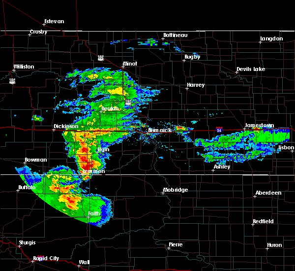 At 741 pm mdt, a severe thunderstorm was located 10 miles north of thunder hawk, or 12 miles northeast of lemmon, moving east at 15 mph (radar indicated). Hazards include 60 mph wind gusts and half dollar size hail. Hail damage to vehicles is expected. expect wind damage to roofs, siding, and trees. This severe thunderstorm will remain over mainly rural areas of southwestern sioux, southwestern grant and southeastern adams counties. At 741 pm mdt, a severe thunderstorm was located 10 miles north of thunder hawk, or 12 miles northeast of lemmon, moving east at 15 mph (radar indicated). Hazards include 60 mph wind gusts and half dollar size hail. Hail damage to vehicles is expected. expect wind damage to roofs, siding, and trees. This severe thunderstorm will remain over mainly rural areas of southwestern sioux, southwestern grant and southeastern adams counties.
|
| 6/27/2019 1:35 AM MDT |
 At 135 am mdt, severe thunderstorms were located along a line extending from 13 miles north of north lemmon to 13 miles north of keldron to 10 miles north of mcintosh, moving north at 35 mph (radar indicated). Hazards include 60 mph wind gusts and nickel size hail. Expect damage to roofs, siding, and trees. locations impacted include, mott, new leipzig, morristown, north lemmon, thunder hawk, burt, st. Gertrude and bentley. At 135 am mdt, severe thunderstorms were located along a line extending from 13 miles north of north lemmon to 13 miles north of keldron to 10 miles north of mcintosh, moving north at 35 mph (radar indicated). Hazards include 60 mph wind gusts and nickel size hail. Expect damage to roofs, siding, and trees. locations impacted include, mott, new leipzig, morristown, north lemmon, thunder hawk, burt, st. Gertrude and bentley.
|
| 6/27/2019 1:19 AM MDT |
 At 118 am mdt, severe thunderstorms were located along a line extending from 9 miles northwest of north lemmon to 9 miles north of keldron to 7 miles north of mcintosh, moving north at 30 mph (radar indicated). Hazards include 60 mph wind gusts and nickel size hail. Expect damage to roofs, siding, and trees. these severe thunderstorms will remain over mainly rural areas of southwestern sioux, southeastern hettinger, southern grant and southeastern adams counties, including the following locations, st. Gertrude, burt and bentley. At 118 am mdt, severe thunderstorms were located along a line extending from 9 miles northwest of north lemmon to 9 miles north of keldron to 7 miles north of mcintosh, moving north at 30 mph (radar indicated). Hazards include 60 mph wind gusts and nickel size hail. Expect damage to roofs, siding, and trees. these severe thunderstorms will remain over mainly rural areas of southwestern sioux, southeastern hettinger, southern grant and southeastern adams counties, including the following locations, st. Gertrude, burt and bentley.
|
| 6/27/2019 1:02 AM MDT |
 At 102 am mdt, severe thunderstorms were located along a line extending from 4 miles east of white butte to 4 miles east of thunder hawk to near watauga, moving north at 35 mph (radar indicated). Hazards include 60 mph wind gusts and nickel size hail. Expect damage to roofs, siding, and trees. severe thunderstorms will be near, mott around 145 am mdt. other locations impacted by these severe thunderstorms include st. Gertrude, burt and bentley. At 102 am mdt, severe thunderstorms were located along a line extending from 4 miles east of white butte to 4 miles east of thunder hawk to near watauga, moving north at 35 mph (radar indicated). Hazards include 60 mph wind gusts and nickel size hail. Expect damage to roofs, siding, and trees. severe thunderstorms will be near, mott around 145 am mdt. other locations impacted by these severe thunderstorms include st. Gertrude, burt and bentley.
|
| 6/27/2019 12:56 AM MDT |
 The severe thunderstorm warning for western corson and northwestern dewey counties will expire at 100 am mdt, the storms which prompted the warning have weakened below severe limits, and have exited the warned area. therefore, the warning will be allowed to expire. however gusty winds are still possible with these thunderstorms. a severe thunderstorm watch remains in effect until 600 am mdt for north central south dakota. The severe thunderstorm warning for western corson and northwestern dewey counties will expire at 100 am mdt, the storms which prompted the warning have weakened below severe limits, and have exited the warned area. therefore, the warning will be allowed to expire. however gusty winds are still possible with these thunderstorms. a severe thunderstorm watch remains in effect until 600 am mdt for north central south dakota.
|
| 6/27/2019 12:40 AM MDT |
 At 1240 am mdt, severe thunderstorms were located along a line extending from near shadehill to 10 miles northeast of shambo ranch to near isabel, moving northeast at 45 mph (radar indicated). Hazards include 60 mph wind gusts and penny size hail. Expect damage to roofs, siding, and trees. Locations impacted include, isabel, morristown, black horse, shambo ranch and klein ranch. At 1240 am mdt, severe thunderstorms were located along a line extending from near shadehill to 10 miles northeast of shambo ranch to near isabel, moving northeast at 45 mph (radar indicated). Hazards include 60 mph wind gusts and penny size hail. Expect damage to roofs, siding, and trees. Locations impacted include, isabel, morristown, black horse, shambo ranch and klein ranch.
|
| 6/27/2019 12:14 AM MDT |
 At 1213 am mdt, severe thunderstorms were located along a line extending from 7 miles west of shadehill reservoir to near shambo ranch to near iron lightning, moving northeast at 50 mph (radar indicated). Hazards include 60 mph wind gusts and nickel size hail. expect damage to roofs, siding, and trees At 1213 am mdt, severe thunderstorms were located along a line extending from 7 miles west of shadehill reservoir to near shambo ranch to near iron lightning, moving northeast at 50 mph (radar indicated). Hazards include 60 mph wind gusts and nickel size hail. expect damage to roofs, siding, and trees
|
| 7/19/2018 6:20 PM MDT | Half Dollar sized hail reported 13.5 miles S of Morristown, SD, greater than one inch diameter hail lasted 3 minutes. |
| 7/7/2018 11:22 PM MDT |
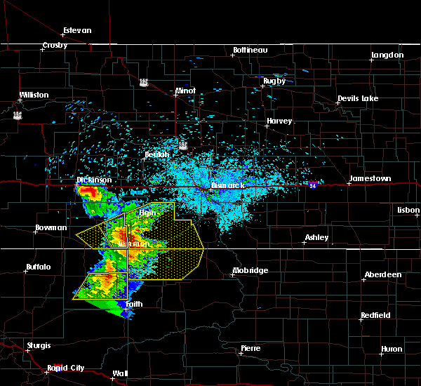 At 1118 pm mdt, severe thunderstorms were located along a line extending from 15 miles north of thunder hawk to near morristown to 7 miles northeast of shambo ranch to near usta, moving east at 50 mph (trained weather spotters. at 1144 pm, a 66 mph wind gust was reported 7 miles south of shadehill). Hazards include 60 mph wind gusts and nickel size hail. Expect damage to roofs, siding, and trees. Locations impacted include, mcintosh, morristown, watauga, keldron, bullhead, black horse, walker, shambo ranch, thunder hawk and klein ranch. At 1118 pm mdt, severe thunderstorms were located along a line extending from 15 miles north of thunder hawk to near morristown to 7 miles northeast of shambo ranch to near usta, moving east at 50 mph (trained weather spotters. at 1144 pm, a 66 mph wind gust was reported 7 miles south of shadehill). Hazards include 60 mph wind gusts and nickel size hail. Expect damage to roofs, siding, and trees. Locations impacted include, mcintosh, morristown, watauga, keldron, bullhead, black horse, walker, shambo ranch, thunder hawk and klein ranch.
|
| 7/7/2018 11:08 PM MDT |
 At 1208 am cdt/1108 pm mdt/, severe thunderstorms were located along a line extending from 8 miles southwest of new leipzig to near keldron, moving northeast at 45 mph (radar indicated). Hazards include 60 mph wind gusts and quarter size hail. Hail damage to vehicles is expected. expect wind damage to roofs, siding, and trees. severe thunderstorms will be near, morristown around 1115 pm mdt. new leipzig around 1120 pm mdt. elgin around 1125 pm mdt. carson around 1140 pm mdt. shields around 100 am cdt. other locations impacted by these severe thunderstorms include heil, st. Gertrude, raleigh, porcupine, burt, leith, lark and bentley. At 1208 am cdt/1108 pm mdt/, severe thunderstorms were located along a line extending from 8 miles southwest of new leipzig to near keldron, moving northeast at 45 mph (radar indicated). Hazards include 60 mph wind gusts and quarter size hail. Hail damage to vehicles is expected. expect wind damage to roofs, siding, and trees. severe thunderstorms will be near, morristown around 1115 pm mdt. new leipzig around 1120 pm mdt. elgin around 1125 pm mdt. carson around 1140 pm mdt. shields around 100 am cdt. other locations impacted by these severe thunderstorms include heil, st. Gertrude, raleigh, porcupine, burt, leith, lark and bentley.
|
| 7/7/2018 10:54 PM MDT |
 At 1053 pm mdt, severe thunderstorms were located along a line extending from 11 miles north of white butte to 6 miles southwest of thunder hawk to near meadow to 11 miles southeast of date, moving east at 50 mph (radar indicated). Hazards include 60 mph wind gusts and nickel size hail. expect damage to roofs, siding, and trees At 1053 pm mdt, severe thunderstorms were located along a line extending from 11 miles north of white butte to 6 miles southwest of thunder hawk to near meadow to 11 miles southeast of date, moving east at 50 mph (radar indicated). Hazards include 60 mph wind gusts and nickel size hail. expect damage to roofs, siding, and trees
|
| 7/3/2018 3:06 AM MDT |
 At 405 am cdt/305 am mdt/, severe thunderstorms were located along a line extending from 10 miles northwest of new salem to 5 miles southeast of elgin to 5 miles southeast of lemmon, moving east at 45 mph. these are very dangerous storms (radar indicated). Hazards include 80 mph wind gusts and quarter size hail. Flying debris will be dangerous to those caught without shelter. mobile homes will be heavily damaged. expect considerable damage to roofs, windows, and vehicles. extensive tree damage and power outages are likely. Locations impacted include, glen ullin, mott, elgin, new salem, hebron, carson, new leipzig, almont, morristown, haynes, heart butte dam, north lemmon, burt, leith, heil and bentley. At 405 am cdt/305 am mdt/, severe thunderstorms were located along a line extending from 10 miles northwest of new salem to 5 miles southeast of elgin to 5 miles southeast of lemmon, moving east at 45 mph. these are very dangerous storms (radar indicated). Hazards include 80 mph wind gusts and quarter size hail. Flying debris will be dangerous to those caught without shelter. mobile homes will be heavily damaged. expect considerable damage to roofs, windows, and vehicles. extensive tree damage and power outages are likely. Locations impacted include, glen ullin, mott, elgin, new salem, hebron, carson, new leipzig, almont, morristown, haynes, heart butte dam, north lemmon, burt, leith, heil and bentley.
|
| 7/3/2018 3:03 AM MDT |
 At 402 am cdt/302 am mdt/, severe thunderstorms were located along a line extending from 10 miles northeast of glen ullin to elgin to near lemmon, moving east at 45 mph (a wind gust of 67 mph was reported at glen ullin airport). Hazards include 70 mph wind gusts and quarter size hail. Hail damage to vehicles is expected. expect considerable tree damage. wind damage is also likely to mobile homes, roofs, and outbuildings. Locations impacted include, hettinger, glen ullin, mott, elgin, new salem, hebron, richardton, carson, gladstone, new leipzig, regent, taylor, almont, morristown, haynes, heart butte dam, north lemmon, burt, bucyrus and leith. At 402 am cdt/302 am mdt/, severe thunderstorms were located along a line extending from 10 miles northeast of glen ullin to elgin to near lemmon, moving east at 45 mph (a wind gust of 67 mph was reported at glen ullin airport). Hazards include 70 mph wind gusts and quarter size hail. Hail damage to vehicles is expected. expect considerable tree damage. wind damage is also likely to mobile homes, roofs, and outbuildings. Locations impacted include, hettinger, glen ullin, mott, elgin, new salem, hebron, richardton, carson, gladstone, new leipzig, regent, taylor, almont, morristown, haynes, heart butte dam, north lemmon, burt, bucyrus and leith.
|
| 7/3/2018 2:38 AM MDT |
 At 337 am cdt/237 am mdt/, severe thunderstorms were located along a line extending from 7 miles northeast of hebron to 9 miles northwest of new leipzig to haynes, moving east at 50 mph (automated systems measured wind gusts up to 60 mph at hettinger airport). Hazards include 60 mph wind gusts and quarter size hail. Hail damage to vehicles is expected. expect wind damage to roofs, siding, and trees. Locations impacted include, hettinger, glen ullin, mott, elgin, new salem, hebron, richardton, carson, gladstone, new leipzig, regent, taylor, almont, morristown, haynes, heart butte dam, north lemmon, burt, bucyrus and leith. At 337 am cdt/237 am mdt/, severe thunderstorms were located along a line extending from 7 miles northeast of hebron to 9 miles northwest of new leipzig to haynes, moving east at 50 mph (automated systems measured wind gusts up to 60 mph at hettinger airport). Hazards include 60 mph wind gusts and quarter size hail. Hail damage to vehicles is expected. expect wind damage to roofs, siding, and trees. Locations impacted include, hettinger, glen ullin, mott, elgin, new salem, hebron, richardton, carson, gladstone, new leipzig, regent, taylor, almont, morristown, haynes, heart butte dam, north lemmon, burt, bucyrus and leith.
|
| 7/3/2018 2:15 AM MDT |
 At 314 am cdt/214 am mdt/, severe thunderstorms were located along a line extending from 6 miles northeast of richardton to 8 miles northwest of mott to 4 miles south of haynes, moving east at 45 mph (radar indicated). Hazards include 60 mph wind gusts and quarter size hail. Hail damage to vehicles is expected. Expect wind damage to roofs, siding, and trees. At 314 am cdt/214 am mdt/, severe thunderstorms were located along a line extending from 6 miles northeast of richardton to 8 miles northwest of mott to 4 miles south of haynes, moving east at 45 mph (radar indicated). Hazards include 60 mph wind gusts and quarter size hail. Hail damage to vehicles is expected. Expect wind damage to roofs, siding, and trees.
|
| 6/28/2018 11:48 PM MDT |
 At 1246 am cdt/1146 pm mdt/, severe thunderstorms were located along a line extending from 4 miles east of glen ullin to near new leipzig to near white butte, moving east at 55 mph (radar indicated). Hazards include 70 mph wind gusts and quarter size hail. Hail damage to vehicles is expected. expect considerable tree damage. wind damage is also likely to mobile homes, roofs, and outbuildings. these severe storms will be near, elgin around 1150 pm mdt. carson and almont around 1200 am mdt. morristown and fish creek dam around 1215 am mdt. other locations impacted by these severe thunderstorms include heil, st. Gertrude, raleigh, burt, leith, lark and bentley. At 1246 am cdt/1146 pm mdt/, severe thunderstorms were located along a line extending from 4 miles east of glen ullin to near new leipzig to near white butte, moving east at 55 mph (radar indicated). Hazards include 70 mph wind gusts and quarter size hail. Hail damage to vehicles is expected. expect considerable tree damage. wind damage is also likely to mobile homes, roofs, and outbuildings. these severe storms will be near, elgin around 1150 pm mdt. carson and almont around 1200 am mdt. morristown and fish creek dam around 1215 am mdt. other locations impacted by these severe thunderstorms include heil, st. Gertrude, raleigh, burt, leith, lark and bentley.
|
| 6/28/2018 11:17 PM MDT |
 At 1215 am cdt/1115 pm mdt/, severe thunderstorms were located along a line extending from near richardton to 5 miles west of mott to 11 miles south of reeder, moving east at 55 mph (radar indicated). Hazards include 70 mph wind gusts and quarter size hail. Hail damage to vehicles is expected. expect considerable tree damage. wind damage is also likely to mobile homes, roofs, and outbuildings. severe thunderstorms will be near, mott around 1125 pm mdt. hettinger and haynes around 1135 pm mdt. glen ullin and new leipzig around 1140 pm mdt. elgin around 1145 pm mdt. north lemmon around 1155 pm mdt. Carson around 1200 am mdt. At 1215 am cdt/1115 pm mdt/, severe thunderstorms were located along a line extending from near richardton to 5 miles west of mott to 11 miles south of reeder, moving east at 55 mph (radar indicated). Hazards include 70 mph wind gusts and quarter size hail. Hail damage to vehicles is expected. expect considerable tree damage. wind damage is also likely to mobile homes, roofs, and outbuildings. severe thunderstorms will be near, mott around 1125 pm mdt. hettinger and haynes around 1135 pm mdt. glen ullin and new leipzig around 1140 pm mdt. elgin around 1145 pm mdt. north lemmon around 1155 pm mdt. Carson around 1200 am mdt.
|
| 6/14/2018 7:09 PM MDT |
 At 708 pm mdt, a severe thunderstorm was located over watauga, or 30 miles east of lemmon, moving northeast at 35 mph (radar indicated). Hazards include 60 mph wind gusts and quarter size hail. Hail damage to vehicles is expected. expect wind damage to roofs, siding, and trees. Locations impacted include, mcintosh, morristown, watauga and keldron. At 708 pm mdt, a severe thunderstorm was located over watauga, or 30 miles east of lemmon, moving northeast at 35 mph (radar indicated). Hazards include 60 mph wind gusts and quarter size hail. Hail damage to vehicles is expected. expect wind damage to roofs, siding, and trees. Locations impacted include, mcintosh, morristown, watauga and keldron.
|
| 6/14/2018 6:39 PM MDT |
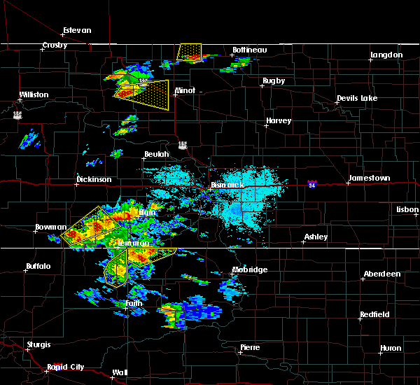 At 639 pm mdt, a severe thunderstorm was located 11 miles south of keldron, or 20 miles southeast of lemmon, moving northeast at 35 mph (radar indicated). Hazards include 60 mph wind gusts and quarter size hail. Hail damage to vehicles is expected. Expect wind damage to roofs, siding, and trees. At 639 pm mdt, a severe thunderstorm was located 11 miles south of keldron, or 20 miles southeast of lemmon, moving northeast at 35 mph (radar indicated). Hazards include 60 mph wind gusts and quarter size hail. Hail damage to vehicles is expected. Expect wind damage to roofs, siding, and trees.
|
| 6/10/2018 7:49 PM MDT |
 At 749 pm mdt, severe thunderstorms were located along a line extending from 5 miles north of elgin to 4 miles north of morristown, moving northeast at 55 mph (radar indicated). Hazards include 60 mph wind gusts and penny size hail. Expect damage to roofs, siding, and trees. Locations impacted include, elgin, carson, new leipzig, morristown, thunder hawk, burt, leith, heil and bentley. At 749 pm mdt, severe thunderstorms were located along a line extending from 5 miles north of elgin to 4 miles north of morristown, moving northeast at 55 mph (radar indicated). Hazards include 60 mph wind gusts and penny size hail. Expect damage to roofs, siding, and trees. Locations impacted include, elgin, carson, new leipzig, morristown, thunder hawk, burt, leith, heil and bentley.
|
| 6/10/2018 7:29 PM MDT |
 The national weather service in bismarck has issued a * severe thunderstorm warning for. southwestern sioux county in south central north dakota. southeastern hettinger county in southwestern north dakota. southwestern grant county in south central north dakota. Southeastern adams county in southwestern north dakota. The national weather service in bismarck has issued a * severe thunderstorm warning for. southwestern sioux county in south central north dakota. southeastern hettinger county in southwestern north dakota. southwestern grant county in south central north dakota. Southeastern adams county in southwestern north dakota.
|
| 6/5/2018 8:38 PM MDT |
 At 838 pm mdt, a severe thunderstorm was located near morristown, or 21 miles east of lemmon, moving southeast at 35 mph (radar indicated). Hazards include 60 mph wind gusts and half dollar size hail. Hail damage to vehicles is expected. Expect wind damage to roofs, siding, and trees. At 838 pm mdt, a severe thunderstorm was located near morristown, or 21 miles east of lemmon, moving southeast at 35 mph (radar indicated). Hazards include 60 mph wind gusts and half dollar size hail. Hail damage to vehicles is expected. Expect wind damage to roofs, siding, and trees.
|
| 5/17/2018 4:57 PM MDT |
 At 557 pm cdt/457 pm mdt/, a severe thunderstorm was located 14 miles south of carson, or 20 miles southeast of elgin, moving northeast at 30 mph (radar indicated). Hazards include 60 mph wind gusts and quarter size hail. Hail damage to vehicles is expected. expect wind damage to roofs, siding, and trees. locations impacted include, morristown, lark, raleigh and st. Gertrude. At 557 pm cdt/457 pm mdt/, a severe thunderstorm was located 14 miles south of carson, or 20 miles southeast of elgin, moving northeast at 30 mph (radar indicated). Hazards include 60 mph wind gusts and quarter size hail. Hail damage to vehicles is expected. expect wind damage to roofs, siding, and trees. locations impacted include, morristown, lark, raleigh and st. Gertrude.
|
| 5/17/2018 4:27 PM MDT |
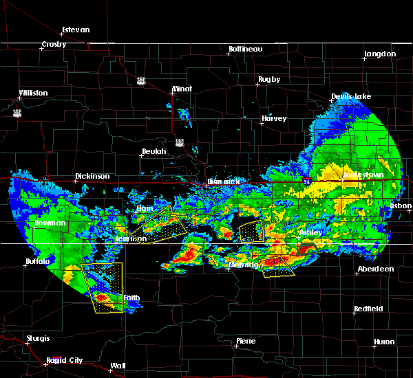 At 527 pm cdt/427 pm mdt/, a severe thunderstorm was located 7 miles north of morristown, or 21 miles east of lemmon, moving northeast at 30 mph (radar indicated). Hazards include 60 mph wind gusts and quarter size hail. Hail damage to vehicles is expected. expect wind damage to roofs, siding, and trees. this severe thunderstorm will remain over mainly rural areas of southwestern sioux and southeastern grant counties, including the following locations: st. Gertrude, raleigh and lark. At 527 pm cdt/427 pm mdt/, a severe thunderstorm was located 7 miles north of morristown, or 21 miles east of lemmon, moving northeast at 30 mph (radar indicated). Hazards include 60 mph wind gusts and quarter size hail. Hail damage to vehicles is expected. expect wind damage to roofs, siding, and trees. this severe thunderstorm will remain over mainly rural areas of southwestern sioux and southeastern grant counties, including the following locations: st. Gertrude, raleigh and lark.
|
| 5/7/2018 6:39 PM MDT |
 At 637 pm mdt, severe thunderstorms were located along a line extending from 6 miles southeast of shadehill to 9 miles east of chance, moving east at 15 mph (radar indicated). Hazards include 70 mph wind gusts and ping pong ball size hail. People and animals outdoors will be injured. expect hail damage to roofs, siding, windows, and vehicles. expect considerable tree damage. Wind damage is also likely to mobile homes, roofs, and outbuildings. At 637 pm mdt, severe thunderstorms were located along a line extending from 6 miles southeast of shadehill to 9 miles east of chance, moving east at 15 mph (radar indicated). Hazards include 70 mph wind gusts and ping pong ball size hail. People and animals outdoors will be injured. expect hail damage to roofs, siding, windows, and vehicles. expect considerable tree damage. Wind damage is also likely to mobile homes, roofs, and outbuildings.
|
| 7/20/2017 7:39 PM MDT |
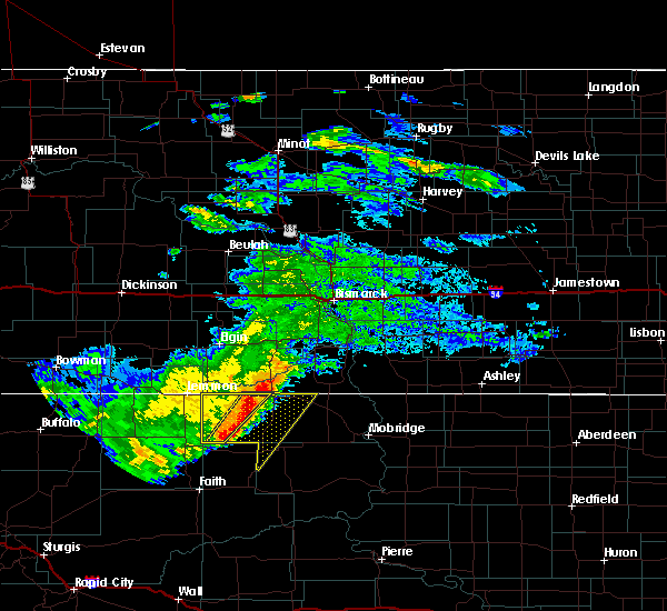 The severe thunderstorm warning for western corson county will expire at 745 pm mdt, the storms which prompted the warning have moved out of the area. therefore the warning will be allowed to expire. however heavy rain is still possible with these thunderstorms. remember, a severe thunderstorm warning still remains in effect for portions of western corson county until 815 pm mdt. The severe thunderstorm warning for western corson county will expire at 745 pm mdt, the storms which prompted the warning have moved out of the area. therefore the warning will be allowed to expire. however heavy rain is still possible with these thunderstorms. remember, a severe thunderstorm warning still remains in effect for portions of western corson county until 815 pm mdt.
|
| 7/20/2017 7:26 PM MDT |
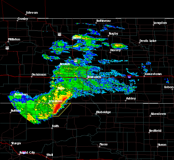 At 725 pm mdt, severe thunderstorms were located along a line extending from 12 miles north of mcintosh to near shambo ranch, moving east at 35 mph (trained weather spotters. at 715 pm mdt, a 60 mph wind gust was reported 17 miles south of keldron). Hazards include 60 mph wind gusts and quarter size hail. Hail damage to vehicles is expected. expect wind damage to roofs, siding, and trees. Locations impacted include, morristown, watauga, shambo ranch, keldron and thunder hawk. At 725 pm mdt, severe thunderstorms were located along a line extending from 12 miles north of mcintosh to near shambo ranch, moving east at 35 mph (trained weather spotters. at 715 pm mdt, a 60 mph wind gust was reported 17 miles south of keldron). Hazards include 60 mph wind gusts and quarter size hail. Hail damage to vehicles is expected. expect wind damage to roofs, siding, and trees. Locations impacted include, morristown, watauga, shambo ranch, keldron and thunder hawk.
|
| 7/20/2017 7:15 PM MDT | 17 miles south of keldro in corson county SD, 17.6 miles NNE of Morristown, SD |
| 7/20/2017 7:12 PM MDT |
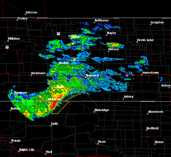 At 711 pm mdt, severe thunderstorms were located along a line extending from 15 miles north of watauga to 7 miles east of meadow, moving east at 35 mph (radar indicated). Hazards include 60 mph wind gusts and quarter size hail. Hail damage to vehicles is expected. expect wind damage to roofs, siding, and trees. Locations impacted include, morristown, watauga, shambo ranch, keldron and thunder hawk. At 711 pm mdt, severe thunderstorms were located along a line extending from 15 miles north of watauga to 7 miles east of meadow, moving east at 35 mph (radar indicated). Hazards include 60 mph wind gusts and quarter size hail. Hail damage to vehicles is expected. expect wind damage to roofs, siding, and trees. Locations impacted include, morristown, watauga, shambo ranch, keldron and thunder hawk.
|
| 7/20/2017 6:56 PM MDT |
 At 655 pm mdt, severe thunderstorms were located along a line extending from 15 miles southeast of elgin to 6 miles north of meadow, moving southeast at 35 mph (radar indicated). Hazards include 60 mph wind gusts and quarter size hail. Hail damage to vehicles is expected. Expect wind damage to roofs, siding, and trees. At 655 pm mdt, severe thunderstorms were located along a line extending from 15 miles southeast of elgin to 6 miles north of meadow, moving southeast at 35 mph (radar indicated). Hazards include 60 mph wind gusts and quarter size hail. Hail damage to vehicles is expected. Expect wind damage to roofs, siding, and trees.
|
| 8/9/2016 9:38 PM MDT |
 At 938 pm mdt, a severe thunderstorm was located 9 miles south of morristown, or 22 miles southeast of lemmon, moving east at 50 mph (radar indicated). Hazards include two inch hail and 70 mph wind gusts. People and animals outdoors will be injured. expect hail damage to roofs, siding, windows, and vehicles. expect considerable tree damage. wind damage is also likely to mobile homes, roofs, and outbuildings. This severe thunderstorm will remain over mainly rural areas of western corson county. At 938 pm mdt, a severe thunderstorm was located 9 miles south of morristown, or 22 miles southeast of lemmon, moving east at 50 mph (radar indicated). Hazards include two inch hail and 70 mph wind gusts. People and animals outdoors will be injured. expect hail damage to roofs, siding, windows, and vehicles. expect considerable tree damage. wind damage is also likely to mobile homes, roofs, and outbuildings. This severe thunderstorm will remain over mainly rural areas of western corson county.
|
| 8/9/2016 9:09 PM MDT |
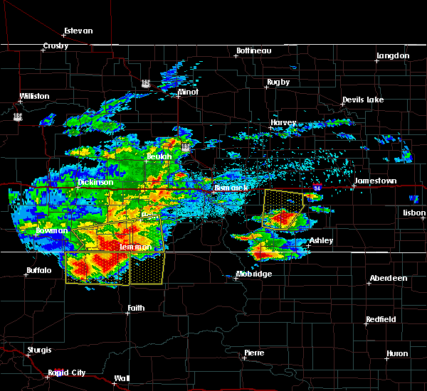 At 909 pm mdt, a severe thunderstorm was located over shadehill, or 10 miles south of lemmon, moving east at 35 mph (radar indicated). Hazards include 70 mph wind gusts and ping pong ball size hail. People and animals outdoors will be injured. expect hail damage to roofs, siding, windows, and vehicles. expect considerable tree damage. wind damage is also likely to mobile homes, roofs, and outbuildings. This severe thunderstorm will be near, watauga around 1000 pm mdt. At 909 pm mdt, a severe thunderstorm was located over shadehill, or 10 miles south of lemmon, moving east at 35 mph (radar indicated). Hazards include 70 mph wind gusts and ping pong ball size hail. People and animals outdoors will be injured. expect hail damage to roofs, siding, windows, and vehicles. expect considerable tree damage. wind damage is also likely to mobile homes, roofs, and outbuildings. This severe thunderstorm will be near, watauga around 1000 pm mdt.
|
| 7/22/2016 4:33 PM MDT |
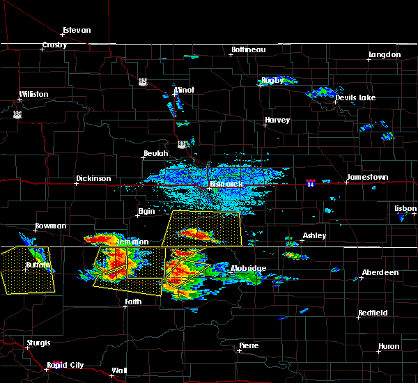 At 432 pm mdt, a severe thunderstorm was located 12 miles east of shadehill, or 18 miles southeast of lemmon, moving east at 25 mph (trained weather spotters). Hazards include 60 mph wind gusts and quarter size hail. Hail damage to vehicles is expected. expect wind damage to roofs, siding, and trees. This severe thunderstorm will remain over mainly rural areas of northwestern dewey and western corson counties. At 432 pm mdt, a severe thunderstorm was located 12 miles east of shadehill, or 18 miles southeast of lemmon, moving east at 25 mph (trained weather spotters). Hazards include 60 mph wind gusts and quarter size hail. Hail damage to vehicles is expected. expect wind damage to roofs, siding, and trees. This severe thunderstorm will remain over mainly rural areas of northwestern dewey and western corson counties.
|
| 7/16/2016 7:50 PM MDT |
 At 750 pm mdt, a severe thunderstorm was located 7 miles northwest of isabel, or 29 miles north of dupree, moving east at 50 mph (radar indicated). Hazards include 70 mph wind gusts. Expect considerable tree damage. damage is likely to mobile homes, roofs, and outbuildings. this severe thunderstorm will be near, firesteel around 800 pm mdt. timber lake around 805 pm mdt. spring lake and glencross around 815 pm mdt. Trail city around 820 pm mdt. At 750 pm mdt, a severe thunderstorm was located 7 miles northwest of isabel, or 29 miles north of dupree, moving east at 50 mph (radar indicated). Hazards include 70 mph wind gusts. Expect considerable tree damage. damage is likely to mobile homes, roofs, and outbuildings. this severe thunderstorm will be near, firesteel around 800 pm mdt. timber lake around 805 pm mdt. spring lake and glencross around 815 pm mdt. Trail city around 820 pm mdt.
|
| 7/16/2016 7:25 PM MDT |
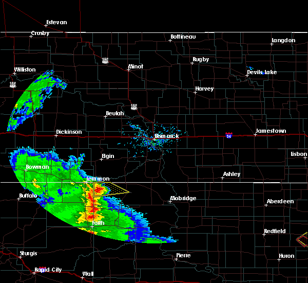 At 724 pm mdt, a severe thunderstorm was located 8 miles south of thunder hawk, or 13 miles southeast of lemmon, moving northeast at 40 mph (radar indicated). Hazards include 60 mph wind gusts and quarter size hail. Hail damage to vehicles is expected. expect wind damage to roofs, siding, and trees. this severe thunderstorm will be near, keldron around 735 pm mdt. Morristown around 740 pm mdt. At 724 pm mdt, a severe thunderstorm was located 8 miles south of thunder hawk, or 13 miles southeast of lemmon, moving northeast at 40 mph (radar indicated). Hazards include 60 mph wind gusts and quarter size hail. Hail damage to vehicles is expected. expect wind damage to roofs, siding, and trees. this severe thunderstorm will be near, keldron around 735 pm mdt. Morristown around 740 pm mdt.
|
| 7/16/2016 3:20 PM MDT | Quarter sized hail reported 9.8 miles NNE of Morristown, SD, nickel to quarter size hail with heavy rain. |
| 7/10/2016 7:57 PM MDT |
 At 757 pm mdt, a severe thunderstorm was located over black horse, or 28 miles west of mclaughlin, moving east at 50 mph (radar indicated). Hazards include quarter size hail. Damage to vehicles is expected. This severe storm will be near, bullhead around 815 pm mdt. At 757 pm mdt, a severe thunderstorm was located over black horse, or 28 miles west of mclaughlin, moving east at 50 mph (radar indicated). Hazards include quarter size hail. Damage to vehicles is expected. This severe storm will be near, bullhead around 815 pm mdt.
|
| 7/10/2016 7:37 PM MDT |
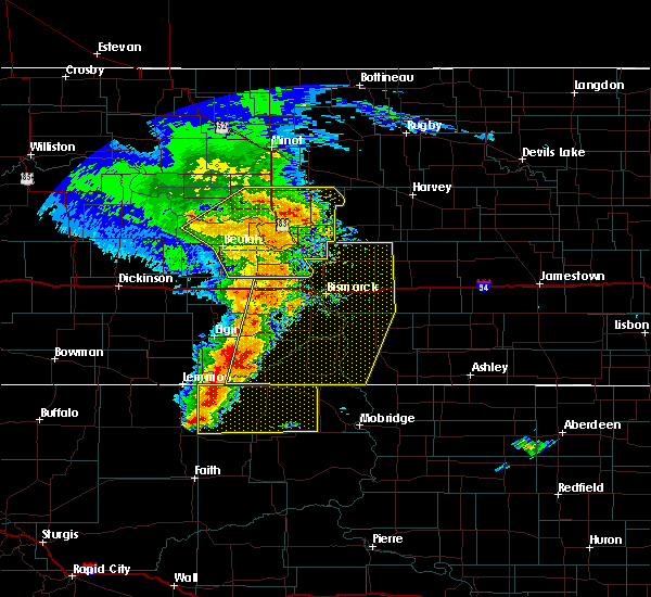 At 737 pm mdt, a severe thunderstorm was located 12 miles west of black horse, or 29 miles southeast of lemmon, moving east at 50 mph (radar indicated). Hazards include golf ball size hail and 60 mph wind gusts. People and animals outdoors will be injured. expect hail damage to roofs, siding, windows, and vehicles. expect wind damage to roofs, siding, and trees. this severe storm will be near, black horse around 750 pm mdt. klein ranch around 755 pm mdt. Bullhead around 810 pm mdt. At 737 pm mdt, a severe thunderstorm was located 12 miles west of black horse, or 29 miles southeast of lemmon, moving east at 50 mph (radar indicated). Hazards include golf ball size hail and 60 mph wind gusts. People and animals outdoors will be injured. expect hail damage to roofs, siding, windows, and vehicles. expect wind damage to roofs, siding, and trees. this severe storm will be near, black horse around 750 pm mdt. klein ranch around 755 pm mdt. Bullhead around 810 pm mdt.
|
| 7/10/2016 7:31 PM MDT |
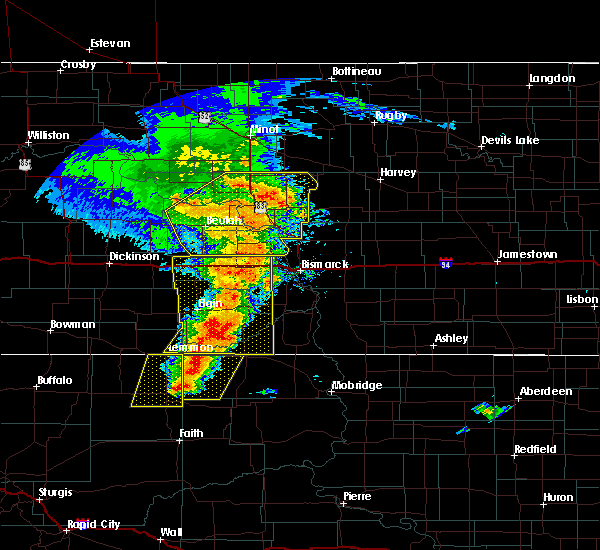 At 730 pm mdt, a severe thunderstorm was located 12 miles north of shambo ranch, or 25 miles southeast of lemmon, moving east at 50 mph (radar indicated). Hazards include golf ball size hail and 60 mph wind gusts. People and animals outdoors will be injured. expect hail damage to roofs, siding, windows, and vehicles. expect wind damage to roofs, siding, and trees. this severe thunderstorm will be near, black horse around 750 pm mdt. klein ranch around 755 pm mdt. Bullhead around 810 pm mdt. At 730 pm mdt, a severe thunderstorm was located 12 miles north of shambo ranch, or 25 miles southeast of lemmon, moving east at 50 mph (radar indicated). Hazards include golf ball size hail and 60 mph wind gusts. People and animals outdoors will be injured. expect hail damage to roofs, siding, windows, and vehicles. expect wind damage to roofs, siding, and trees. this severe thunderstorm will be near, black horse around 750 pm mdt. klein ranch around 755 pm mdt. Bullhead around 810 pm mdt.
|
| 7/10/2016 6:36 PM MDT |
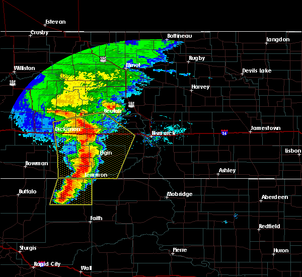 At 633 pm mdt, a severe thunderstorm was located near shadehill reservoir, or 18 miles south of lemmon, moving east at 35 mph (radar indicated). Hazards include 60 mph wind gusts and half dollar size hail. Hail damage to vehicles is expected. expect wind damage to roofs, siding, and trees. This severe thunderstorm will be near, shambo ranch around 710 pm mdt. At 633 pm mdt, a severe thunderstorm was located near shadehill reservoir, or 18 miles south of lemmon, moving east at 35 mph (radar indicated). Hazards include 60 mph wind gusts and half dollar size hail. Hail damage to vehicles is expected. expect wind damage to roofs, siding, and trees. This severe thunderstorm will be near, shambo ranch around 710 pm mdt.
|
| 7/10/2016 5:36 PM MDT |
 At 635 pm cdt/535 pm mdt/, severe thunderstorms were located along a line extending from 5 miles east of south fairfield to 13 miles north of regent to 6 miles east of reeder, moving east at 70 mph (radar indicated). Hazards include two inch hail and 70 mph wind gusts. People and animals outdoors will be injured. expect hail damage to roofs, siding, windows, and vehicles. expect considerable tree damage. Wind damage is also likely to mobile homes, roofs, and outbuildings. At 635 pm cdt/535 pm mdt/, severe thunderstorms were located along a line extending from 5 miles east of south fairfield to 13 miles north of regent to 6 miles east of reeder, moving east at 70 mph (radar indicated). Hazards include two inch hail and 70 mph wind gusts. People and animals outdoors will be injured. expect hail damage to roofs, siding, windows, and vehicles. expect considerable tree damage. Wind damage is also likely to mobile homes, roofs, and outbuildings.
|
| 7/9/2016 7:15 PM MDT | Hen Egg sized hail reported 8.3 miles WSW of Morristown, SD, report from earlier this evening. |
| 7/9/2016 7:00 PM MDT | . in corson county SD, 4.4 miles E of Morristown, SD |
| 7/6/2016 6:38 PM MDT |
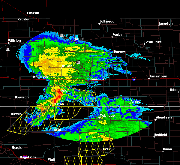 At 637 pm mdt, a severe thunderstorm was located near thunder hawk, or 8 miles east of lemmon, moving east at 50 mph (radar indicated). Hazards include 60 mph wind gusts and penny size hail. Expect damage to roofs. siding. and trees. this severe thunderstorm will be near, keldron around 645 pm mdt. morristown around 650 pm mdt. watauga around 700 pm mdt. Black horse around 710 pm mdt. At 637 pm mdt, a severe thunderstorm was located near thunder hawk, or 8 miles east of lemmon, moving east at 50 mph (radar indicated). Hazards include 60 mph wind gusts and penny size hail. Expect damage to roofs. siding. and trees. this severe thunderstorm will be near, keldron around 645 pm mdt. morristown around 650 pm mdt. watauga around 700 pm mdt. Black horse around 710 pm mdt.
|
| 6/21/2016 8:52 PM MDT |
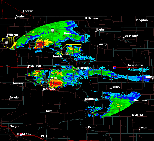 At 852 pm mdt, a severe thunderstorm capable of producing a tornado was located 8 miles north of morristown, or 20 miles northeast of lemmon, moving southeast at 35 mph (radar indicated rotation). Hazards include tornado and half dollar size hail. Flying debris will be dangerous to those caught without shelter. mobile homes will be damaged or destroyed. damage to roofs, windows, and vehicles will occur. tree damage is likely. This dangerous storm will be near, morristown around 900 pm mdt. At 852 pm mdt, a severe thunderstorm capable of producing a tornado was located 8 miles north of morristown, or 20 miles northeast of lemmon, moving southeast at 35 mph (radar indicated rotation). Hazards include tornado and half dollar size hail. Flying debris will be dangerous to those caught without shelter. mobile homes will be damaged or destroyed. damage to roofs, windows, and vehicles will occur. tree damage is likely. This dangerous storm will be near, morristown around 900 pm mdt.
|
| 6/21/2016 8:37 PM MDT |
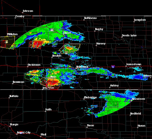 At 837 pm mdt, a severe thunderstorm capable of producing a tornado was located 13 miles north of thunder hawk, or 17 miles northeast of lemmon, moving southeast at 35 mph (radar indicated rotation). Hazards include tornado and ping pong ball size hail. Flying debris will be dangerous to those caught without shelter. mobile homes will be damaged or destroyed. damage to roofs, windows, and vehicles will occur. tree damage is likely. This dangerous storm will be near, morristown around 900 pm mdt. At 837 pm mdt, a severe thunderstorm capable of producing a tornado was located 13 miles north of thunder hawk, or 17 miles northeast of lemmon, moving southeast at 35 mph (radar indicated rotation). Hazards include tornado and ping pong ball size hail. Flying debris will be dangerous to those caught without shelter. mobile homes will be damaged or destroyed. damage to roofs, windows, and vehicles will occur. tree damage is likely. This dangerous storm will be near, morristown around 900 pm mdt.
|
| 5/30/2016 2:53 PM MDT |
 A severe thunderstorm warning remains in effect until 430 pm cdt/330 pm mdt/ for southwestern grant and southwestern sioux counties. at 353 pm cdt/253 pm mdt/. a severe thunderstorm was located 5 miles northeast of thunder hawk. or 13 miles east of lemmon. Moving northeast at 20 mph. A severe thunderstorm warning remains in effect until 430 pm cdt/330 pm mdt/ for southwestern grant and southwestern sioux counties. at 353 pm cdt/253 pm mdt/. a severe thunderstorm was located 5 miles northeast of thunder hawk. or 13 miles east of lemmon. Moving northeast at 20 mph.
|
| 5/30/2016 2:37 PM MDT |
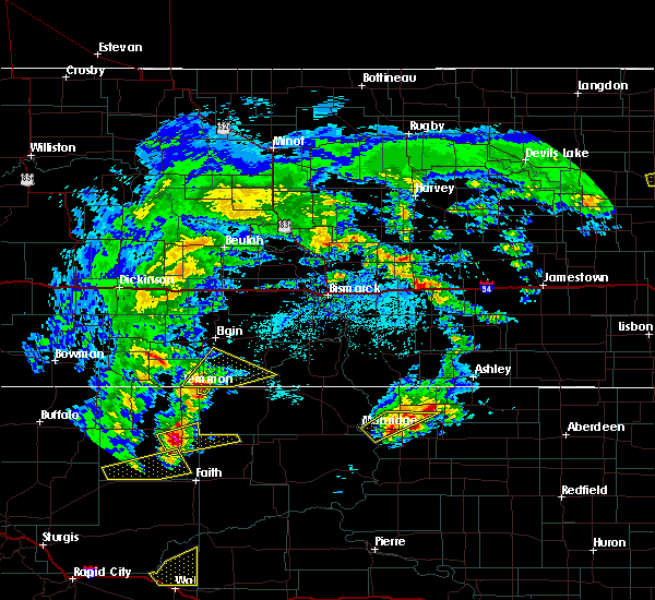 At 337 pm cdt/237 pm mdt/, a severe thunderstorm was located near thunder hawk, or 11 miles east of lemmon, moving northeast at 25 mph (radar indicated). Hazards include 60 mph wind gusts and quarter size hail. Hail damage to vehicles is expected. expect wind damage to roofs, siding, and trees. This severe thunderstorm will remain over mainly rural areas of southwestern grant, southwestern sioux and southeastern adams counties. At 337 pm cdt/237 pm mdt/, a severe thunderstorm was located near thunder hawk, or 11 miles east of lemmon, moving northeast at 25 mph (radar indicated). Hazards include 60 mph wind gusts and quarter size hail. Hail damage to vehicles is expected. expect wind damage to roofs, siding, and trees. This severe thunderstorm will remain over mainly rural areas of southwestern grant, southwestern sioux and southeastern adams counties.
|
| 7/27/2015 9:39 PM CDT |
 At 937 pm cdt /837 pm mdt/, severe thunderstorms were located along a line extending from 5 miles west of glen ullin to 7 miles southwest of almont to 8 miles southeast of carson to 6 miles northeast of mcintosh, moving northeast at 60 mph (radar indicated). Hazards include 60 mph wind gusts and penny size hail. Expect damage to roofs. Siding and trees. At 937 pm cdt /837 pm mdt/, severe thunderstorms were located along a line extending from 5 miles west of glen ullin to 7 miles southwest of almont to 8 miles southeast of carson to 6 miles northeast of mcintosh, moving northeast at 60 mph (radar indicated). Hazards include 60 mph wind gusts and penny size hail. Expect damage to roofs. Siding and trees.
|
| 7/27/2015 7:45 PM MDT |
 At 745 pm mdt, severe thunderstorms were located along a line extending from lemmon to 9 miles southwest of shambo ranch to near thunder butte to 8 miles northwest of cherry creek, moving northeast at 55 mph (radar indicated). Hazards include 60 mph wind gusts and nickel size hail. Expect damage to roofs. siding and trees. severe thunderstorms will be near, shambo ranch and thunder hawk around 755 pm mdt. keldron around 800 pm mdt. morristown around 805 pm mdt. firesteel around 810 pm mdt. little moreau rec area around 815 pm mdt. timber lake, klein ranch and black horse around 820 pm mdt. glencross around 825 pm mdt. Spring lake around 830 pm mdt. At 745 pm mdt, severe thunderstorms were located along a line extending from lemmon to 9 miles southwest of shambo ranch to near thunder butte to 8 miles northwest of cherry creek, moving northeast at 55 mph (radar indicated). Hazards include 60 mph wind gusts and nickel size hail. Expect damage to roofs. siding and trees. severe thunderstorms will be near, shambo ranch and thunder hawk around 755 pm mdt. keldron around 800 pm mdt. morristown around 805 pm mdt. firesteel around 810 pm mdt. little moreau rec area around 815 pm mdt. timber lake, klein ranch and black horse around 820 pm mdt. glencross around 825 pm mdt. Spring lake around 830 pm mdt.
|
| 6/21/2015 11:20 PM MDT |
 At 1120 pm mdt, a severe thunderstorm was located 9 miles south of thunder hawk, or 14 miles southeast of lemmon, moving east at 40 mph (radar indicated). Hazards include 60 mph wind gusts and quarter size hail. Hail damage to vehicles is expected. expect wind damage to roofs, siding and trees. this severe thunderstorm will be near, watauga around 1145 pm mdt. mcintosh and black horse around 1200 am mdt. Bullhead around 1215 am mdt. At 1120 pm mdt, a severe thunderstorm was located 9 miles south of thunder hawk, or 14 miles southeast of lemmon, moving east at 40 mph (radar indicated). Hazards include 60 mph wind gusts and quarter size hail. Hail damage to vehicles is expected. expect wind damage to roofs, siding and trees. this severe thunderstorm will be near, watauga around 1145 pm mdt. mcintosh and black horse around 1200 am mdt. Bullhead around 1215 am mdt.
|
| 6/21/2015 8:27 PM MDT | The severe thunderstorm warning for southwestern grant and southwestern sioux counties will expire at 830 pm mdt, the storm which prompted the warning has weakened below severe limits, and no longer poses an immediate threat to life or property. therefore the warning will be allowed to expire. however heavy rain is still possible with this thunderstorm. a tornado watch remains in effect until 1000 pm mdt for southwestern north dakota. |
| 6/21/2015 8:17 PM MDT |
 At 816 pm mdt, a severe thunderstorm was located 9 miles north of keldron, or 19 miles northeast of lemmon, moving east at 25 mph (radar indicated). Hazards include 60 mph wind gusts and quarter size hail. Hail damage to vehicles is expected. expect wind damage to roofs, siding and trees. locations impacted include, morristown. A tornado watch remains in effect until 1000 pm mdt for southwestern north dakota. At 816 pm mdt, a severe thunderstorm was located 9 miles north of keldron, or 19 miles northeast of lemmon, moving east at 25 mph (radar indicated). Hazards include 60 mph wind gusts and quarter size hail. Hail damage to vehicles is expected. expect wind damage to roofs, siding and trees. locations impacted include, morristown. A tornado watch remains in effect until 1000 pm mdt for southwestern north dakota.
|
| 6/21/2015 7:48 PM MDT |
 At 747 pm mdt, a severe thunderstorm was located 13 miles north of north lemmon, or 14 miles north of lemmon, moving east at 30 mph (radar indicated). Hazards include 60 mph wind gusts and quarter size hail. Hail damage to vehicles is expected. expect wind damage to roofs, siding and trees. locations impacted include, morristown. A tornado watch remains in effect until 1000 pm mdt for southwestern north dakota. At 747 pm mdt, a severe thunderstorm was located 13 miles north of north lemmon, or 14 miles north of lemmon, moving east at 30 mph (radar indicated). Hazards include 60 mph wind gusts and quarter size hail. Hail damage to vehicles is expected. expect wind damage to roofs, siding and trees. locations impacted include, morristown. A tornado watch remains in effect until 1000 pm mdt for southwestern north dakota.
|
| 6/21/2015 7:32 PM MDT |
 At 731 pm mdt, a severe thunderstorm was located 12 miles southeast of mott, moving east at 25 mph (radar indicated). Hazards include 60 mph wind gusts and quarter size hail. Hail damage to vehicles is expected. expect wind damage to roofs, siding and trees. this severe thunderstorm will remain over mainly rural areas of southwestern grant, northeastern adams, southeastern hettinger and southwestern sioux counties. A tornado watch remains in effect until 1000 pm mdt for southwestern north dakota. At 731 pm mdt, a severe thunderstorm was located 12 miles southeast of mott, moving east at 25 mph (radar indicated). Hazards include 60 mph wind gusts and quarter size hail. Hail damage to vehicles is expected. expect wind damage to roofs, siding and trees. this severe thunderstorm will remain over mainly rural areas of southwestern grant, northeastern adams, southeastern hettinger and southwestern sioux counties. A tornado watch remains in effect until 1000 pm mdt for southwestern north dakota.
|
| 3/28/2015 7:58 PM CDT | The national weather service in bismarck has issued a * severe thunderstorm warning for. western emmons county in south central north dakota. grant county in south central north dakota. southern morton county in south central north dakota. Sioux county in south central north dakota. |
| 3/28/2015 6:47 PM MDT | A severe thunderstorm warning remains in effect for southwestern sioux. southeastern hettinger. grant and southeastern adams counties until 715 pm mdt. at 645 pm mdt. severe thunderstorms were located along a line extending from 6 miles southeast of almont to 5 miles west of morristown. Moving east at 50 mph. |
| 3/28/2015 6:27 PM MDT | The national weather service in bismarck has issued a * severe thunderstorm warning for. eastern adams county in southwest north dakota. grant county in south central north dakota. eastern hettinger county in southwest north dakota. Southwestern sioux county in south central north dakota. |
| 8/20/2014 5:30 PM MDT | Quarter sized hail reported 20.2 miles NNE of Morristown, SD |
| 7/23/2013 7:08 PM MDT | Half Dollar sized hail reported 14.7 miles NE of Morristown, SD, half dollar hail with a few a little bigger. |
| 6/21/2013 11:34 AM MDT | Golf Ball sized hail reported 7.8 miles WSW of Morristown, SD, golf ball size hail |
| 6/21/2013 11:25 AM MDT | Baseball sized hail reported 0.2 miles S of Morristown, SD |
| 6/21/2013 11:12 AM MDT | Ping Pong Ball sized hail reported 3.4 miles E of Morristown, SD |
| 5/25/2013 8:11 PM MDT | Half Dollar sized hail reported 17.1 miles N of Morristown, SD, has been hailing for 20 minutes...ground is white. largest stones near half dollar size |
| 5/25/2013 5:30 PM MDT | Golf Ball sized hail reported 10 miles NNE of Morristown, SD, observer reported a few golf ball sized hail stones as the storm moved through |
| 3/26/2012 8:00 PM MDT | Estimated 70 mph winds around 900 p in corson county SD, 10.4 miles NNE of Morristown, SD |
| 1/1/0001 12:00 AM | Branches down. 1.35 of rainfal in corson county SD, 19.1 miles N of Morristown, SD |
| 1/1/0001 12:00 AM | Quarter sized hail reported 0.2 miles S of Morristown, SD, report also mentioned heavy rain and some strong winds...rainfall amount and wind speed unknown |
| 1/1/0001 12:00 AM | Quarter sized hail reported 12.3 miles NNE of Morristown, SD, nssl shave report |
| 1/1/0001 12:00 AM | Golf Ball sized hail reported 1.9 miles N of Morristown, SD, nssl shave report...avg est 1 inch...max est 1.75 inches |
| 1/1/0001 12:00 AM | Golf Ball sized hail reported 1.9 miles NNE of Morristown, SD, nssl shave report |
| 1/1/0001 12:00 AM | Quarter sized hail reported 2.5 miles ENE of Morristown, SD, nssl shave |
| 1/1/0001 12:00 AM | Quarter sized hail reported 9.2 miles NNE of Morristown, SD |
| 1/1/0001 12:00 AM | Half Dollar sized hail reported 13.6 miles NNE of Morristown, SD, nssl shave report |
Hail Maps for Morristown, SD

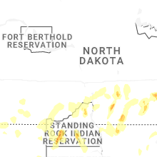

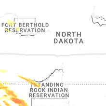


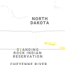


Connect with Interactive Hail Maps