

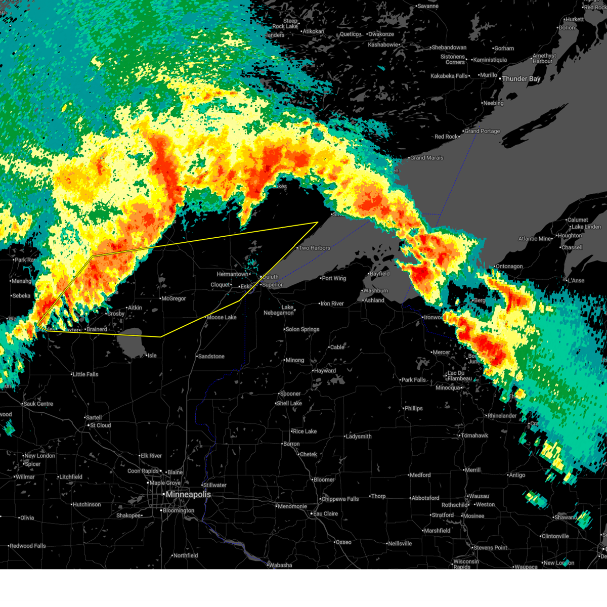
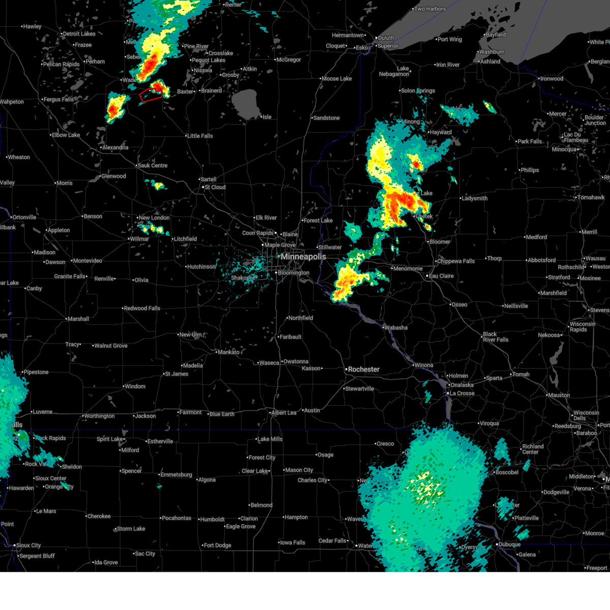
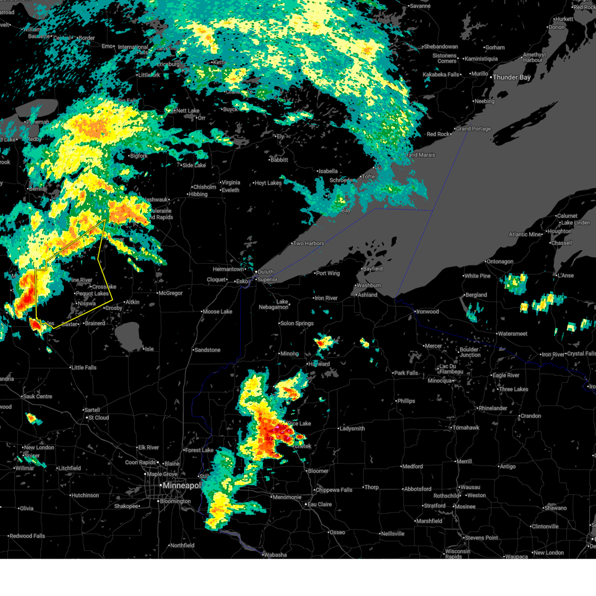
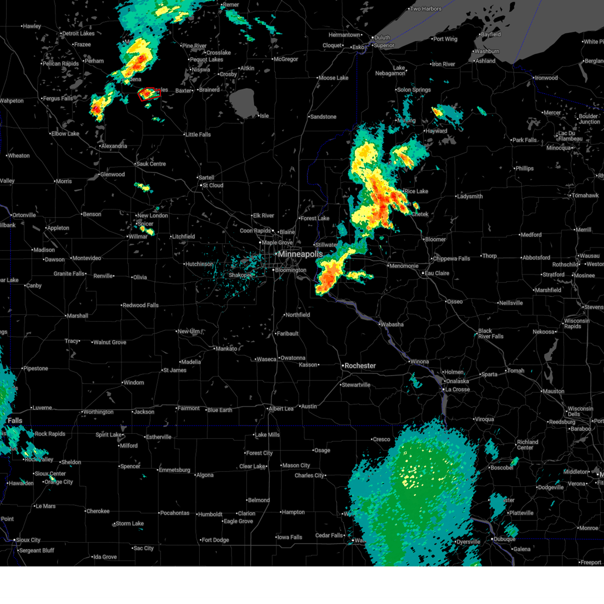
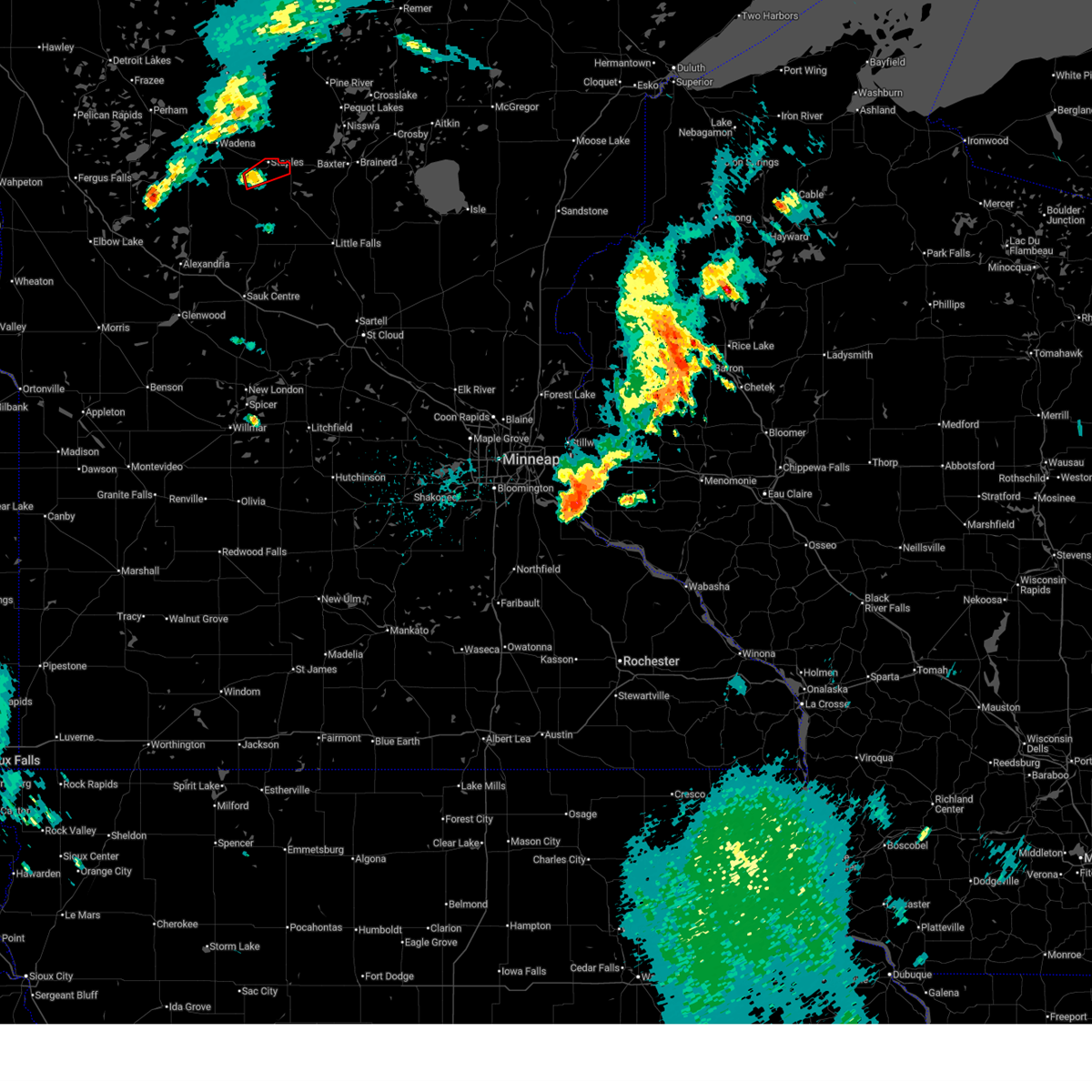
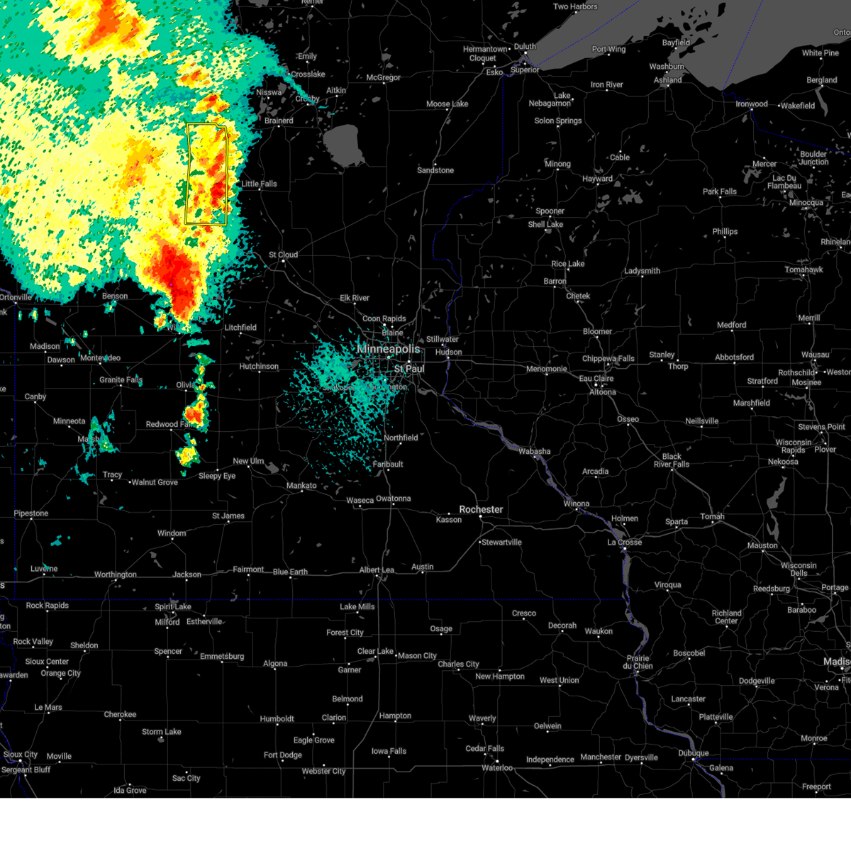
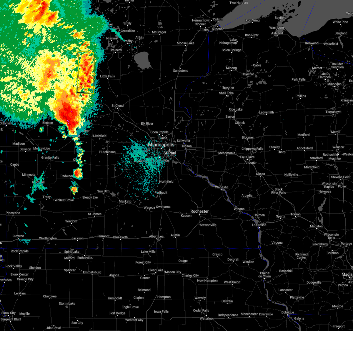
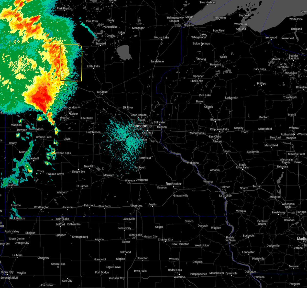
Hail Map for Motley, MN
The Motley, MN area has had 15 reports of on-the-ground hail by trained spotters, and has been under severe weather warnings 16 times during the past 12 months. Doppler radar has detected hail at or near Motley, MN on 48 occasions, including 3 occasions during the past year.
| Name: | Motley, MN |
| Where Located: | 79.5 miles S of Bemidji, MN |
| Map: | Google Map for Motley, MN |
| Population: | 671 |
| Housing Units: | 338 |
| More Info: | Search Google for Motley, MN |
5
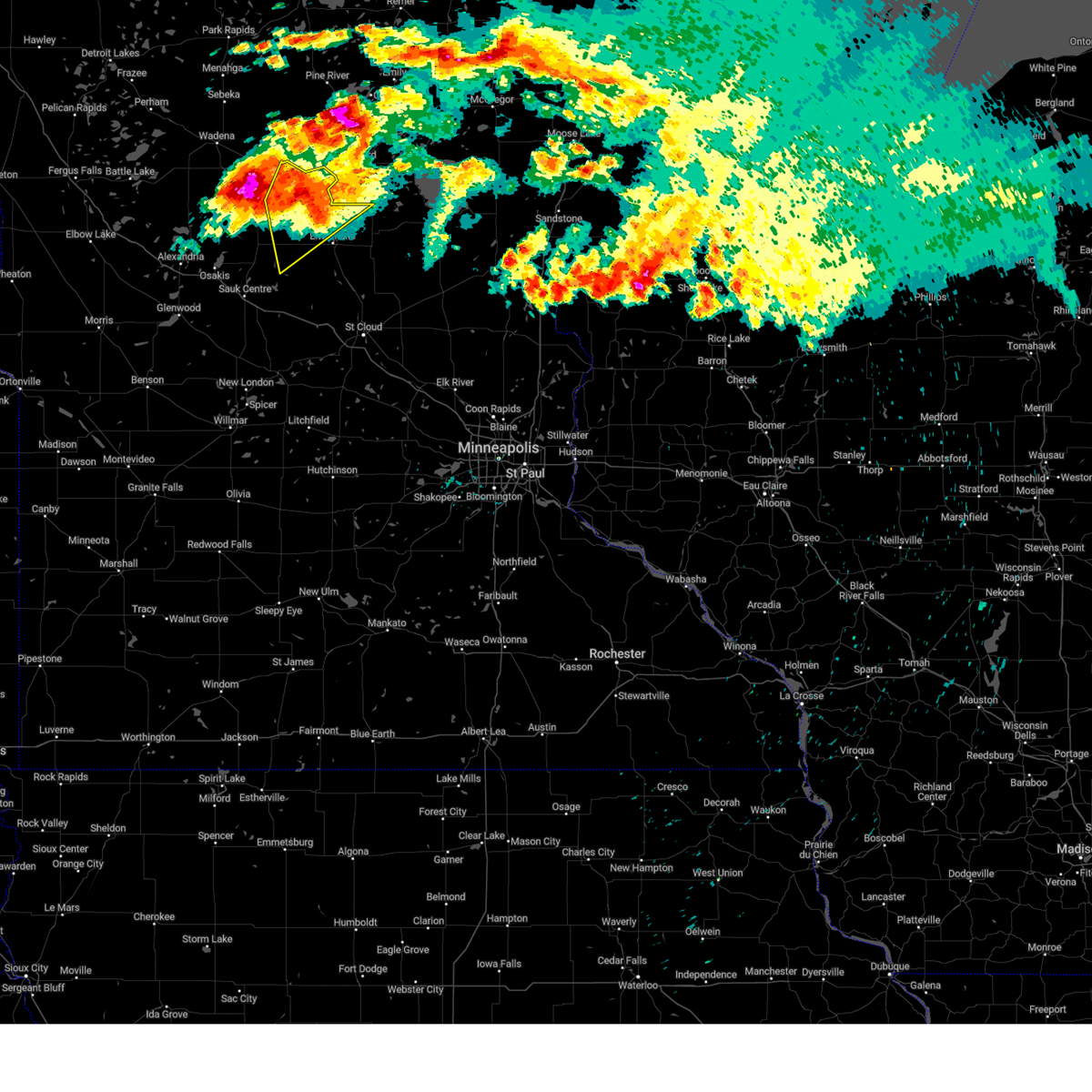
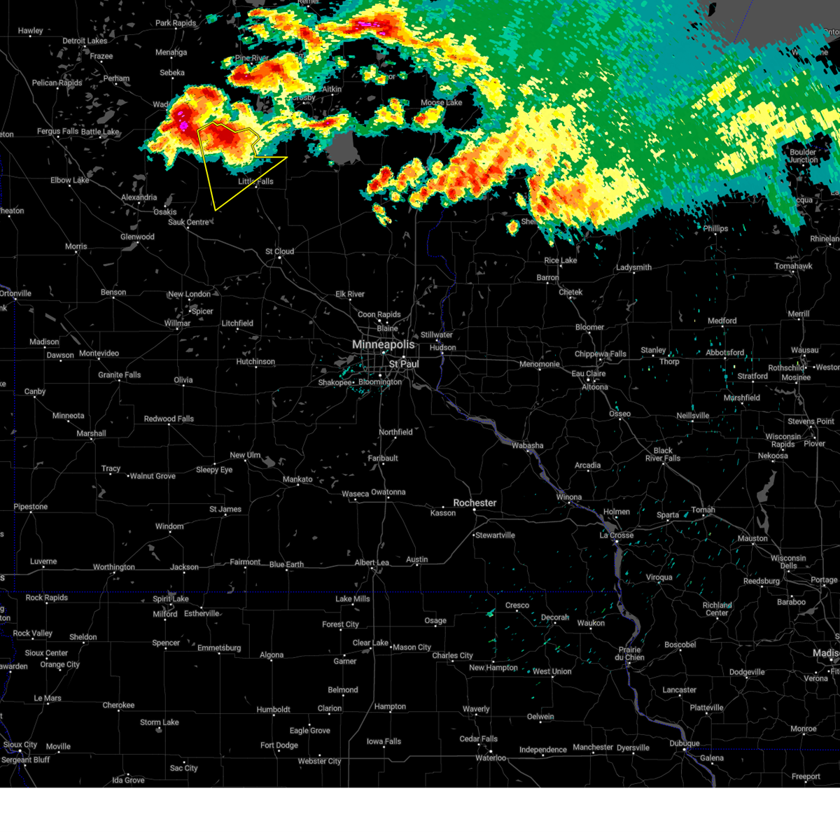
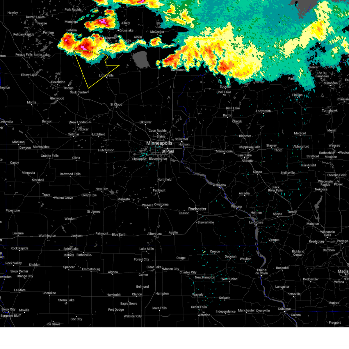
The Top Recent Hail Date for Motley, MN is Saturday, August 3, 2024 (1st out of 48)

Hail and Wind Damage Spotted near Motley, MN
| Date / Time | Report Details |
|---|---|
| 6/21/2025 1:59 AM CDT |
 Svrdlh the national weather service in duluth mn has issued a * severe thunderstorm warning for, southeastern itasca county in north central minnesota, aitkin county in east central minnesota, southern cass county in north central minnesota, northern pine county in east central minnesota, southern st. louis county in northeastern minnesota, carlton county in northeastern minnesota, crow wing county in east central minnesota, southwestern lake county in northeastern minnesota, * until 300 am cdt. * at 159 am cdt, severe thunderstorms were located along a line extending from near pengilly to 6 miles south of swatara to near staples airport, moving east at 55 mph (radar indicated). Hazards include 70 mph wind gusts and penny size hail. Expect considerable tree damage. damage is likely to mobile homes, roofs, and outbuildings. severe thunderstorms will be near, breezy point, pequot lakes, crosslake, nisswa, gull lake, jacobson, and merrifield around 205 am cdt. brainerd, baxter, crosby, ironton, cuyuna, palisade, and cuyuna country state park around 210 am cdt. big sandy lake, deerwood, libby, and savanna portage state park around 215 am cdt. Other locations in the path of these severe thunderstorms include aitkin, floodwood, mcgregor, meadowlands, upper south long lake, tamarack, mille lacs lake, garrison, mille lacs band east lake area, fond du lac band brookston area, cromwell, brookston, canyon and fond du lac band sawyer area. Svrdlh the national weather service in duluth mn has issued a * severe thunderstorm warning for, southeastern itasca county in north central minnesota, aitkin county in east central minnesota, southern cass county in north central minnesota, northern pine county in east central minnesota, southern st. louis county in northeastern minnesota, carlton county in northeastern minnesota, crow wing county in east central minnesota, southwestern lake county in northeastern minnesota, * until 300 am cdt. * at 159 am cdt, severe thunderstorms were located along a line extending from near pengilly to 6 miles south of swatara to near staples airport, moving east at 55 mph (radar indicated). Hazards include 70 mph wind gusts and penny size hail. Expect considerable tree damage. damage is likely to mobile homes, roofs, and outbuildings. severe thunderstorms will be near, breezy point, pequot lakes, crosslake, nisswa, gull lake, jacobson, and merrifield around 205 am cdt. brainerd, baxter, crosby, ironton, cuyuna, palisade, and cuyuna country state park around 210 am cdt. big sandy lake, deerwood, libby, and savanna portage state park around 215 am cdt. Other locations in the path of these severe thunderstorms include aitkin, floodwood, mcgregor, meadowlands, upper south long lake, tamarack, mille lacs lake, garrison, mille lacs band east lake area, fond du lac band brookston area, cromwell, brookston, canyon and fond du lac band sawyer area.
|
| 6/16/2025 4:08 PM CDT |
 The storm which prompted the warning has moved out of the area. therefore, the warning will be allowed to expire. a tornado watch remains in effect until 900 pm cdt monday for a portion of central minnesota. The storm which prompted the warning has moved out of the area. therefore, the warning will be allowed to expire. a tornado watch remains in effect until 900 pm cdt monday for a portion of central minnesota.
|
| 6/16/2025 3:58 PM CDT |
 Svrdlh the national weather service in duluth mn has issued a * severe thunderstorm warning for, southern cass county in north central minnesota, northern crow wing county in east central minnesota, * until 500 pm cdt. * at 358 pm cdt, severe thunderstorms were located along a line extending from near huntersville to 6 miles west of poplar to near motley, moving northeast at 35 mph (radar indicated). Hazards include 60 mph wind gusts and quarter size hail. Hail damage to vehicles is expected. expect wind damage to roofs, siding, and trees. severe thunderstorms will be near, poplar and leader around 405 pm cdt. backus around 415 pm cdt. gull lake around 420 pm cdt. nisswa around 425 pm cdt. pequot lakes and pine river around 430 pm cdt. breezy point and woman lake around 435 pm cdt. crosslake, wabedo, and longville around 445 pm cdt. Other locations impacted by these severe thunderstorms include legionville, lower hay lake, pheasant lake, lake ada, north long lake, upper mission lake, trommald, lake shore, oshawa, and tobique. Svrdlh the national weather service in duluth mn has issued a * severe thunderstorm warning for, southern cass county in north central minnesota, northern crow wing county in east central minnesota, * until 500 pm cdt. * at 358 pm cdt, severe thunderstorms were located along a line extending from near huntersville to 6 miles west of poplar to near motley, moving northeast at 35 mph (radar indicated). Hazards include 60 mph wind gusts and quarter size hail. Hail damage to vehicles is expected. expect wind damage to roofs, siding, and trees. severe thunderstorms will be near, poplar and leader around 405 pm cdt. backus around 415 pm cdt. gull lake around 420 pm cdt. nisswa around 425 pm cdt. pequot lakes and pine river around 430 pm cdt. breezy point and woman lake around 435 pm cdt. crosslake, wabedo, and longville around 445 pm cdt. Other locations impacted by these severe thunderstorms include legionville, lower hay lake, pheasant lake, lake ada, north long lake, upper mission lake, trommald, lake shore, oshawa, and tobique.
|
| 6/16/2025 3:52 PM CDT |
 At 352 pm cdt, a severe thunderstorm capable of producing a tornado was located near staples, or 33 miles northwest of little falls, moving northeast at 30 mph (radar indicated rotation). Hazards include tornado. Flying debris will be dangerous to those caught without shelter. mobile homes will be damaged or destroyed. damage to roofs, windows and vehicles will occur. tree damage is likely. Locations impacted include, staples. At 352 pm cdt, a severe thunderstorm capable of producing a tornado was located near staples, or 33 miles northwest of little falls, moving northeast at 30 mph (radar indicated rotation). Hazards include tornado. Flying debris will be dangerous to those caught without shelter. mobile homes will be damaged or destroyed. damage to roofs, windows and vehicles will occur. tree damage is likely. Locations impacted include, staples.
|
| 6/16/2025 3:42 PM CDT |
 Tormpx the national weather service in the twin cities has issued a * tornado warning for, northeastern todd county in central minnesota, * until 415 pm cdt. * at 342 pm cdt, a confirmed tornado was located 7 miles southwest of staples, or 32 miles northwest of little falls, moving northeast at 30 mph (public confirmed tornado). Hazards include damaging tornado. Flying debris will be dangerous to those caught without shelter. mobile homes will be damaged or destroyed. damage to roofs, windows and vehicles will occur. Tree damage is likely. Tormpx the national weather service in the twin cities has issued a * tornado warning for, northeastern todd county in central minnesota, * until 415 pm cdt. * at 342 pm cdt, a confirmed tornado was located 7 miles southwest of staples, or 32 miles northwest of little falls, moving northeast at 30 mph (public confirmed tornado). Hazards include damaging tornado. Flying debris will be dangerous to those caught without shelter. mobile homes will be damaged or destroyed. damage to roofs, windows and vehicles will occur. Tree damage is likely.
|
| 8/3/2024 7:03 PM CDT |
 At 703 pm cdt, severe thunderstorms were located along a line extending from 7 miles east of outing to 7 miles north of cuyuna to near pillager, moving east at 35 mph (radar indicated). Hazards include 60 mph wind gusts and half dollar size hail. Hail damage to vehicles is expected. expect wind damage to roofs, siding, and trees. Locations impacted include, brainerd, baxter, crosby, ironton, deerwood, cuyuna, cuyuna country state park, crow wing state park, aitkin, saint mathias, south long lake, palisade, upper south long lake, garrison, big sandy lake and mille lacs lake. At 703 pm cdt, severe thunderstorms were located along a line extending from 7 miles east of outing to 7 miles north of cuyuna to near pillager, moving east at 35 mph (radar indicated). Hazards include 60 mph wind gusts and half dollar size hail. Hail damage to vehicles is expected. expect wind damage to roofs, siding, and trees. Locations impacted include, brainerd, baxter, crosby, ironton, deerwood, cuyuna, cuyuna country state park, crow wing state park, aitkin, saint mathias, south long lake, palisade, upper south long lake, garrison, big sandy lake and mille lacs lake.
|
| 8/3/2024 7:03 PM CDT |
 At 703 pm cdt, a severe thunderstorm was located 6 miles northwest of randall, or 16 miles northwest of little falls, moving southeast at 30 mph (trained weather spotters). Hazards include golf ball size hail and 60 mph wind gusts. People and animals outdoors will be injured. expect hail damage to roofs, siding, windows, and vehicles. expect wind damage to roofs, siding, and trees. Locations impacted include, motley, randall, swanville, flensburg, camp ripley, cushing, burtrum, philbrook, camp ripley junction, and crow wing state park. At 703 pm cdt, a severe thunderstorm was located 6 miles northwest of randall, or 16 miles northwest of little falls, moving southeast at 30 mph (trained weather spotters). Hazards include golf ball size hail and 60 mph wind gusts. People and animals outdoors will be injured. expect hail damage to roofs, siding, windows, and vehicles. expect wind damage to roofs, siding, and trees. Locations impacted include, motley, randall, swanville, flensburg, camp ripley, cushing, burtrum, philbrook, camp ripley junction, and crow wing state park.
|
| 8/3/2024 6:50 PM CDT | Golf Ball sized hail reported 3.9 miles NW of Motley, MN, trained spotter reported golf ball sized hail and estimated severe winds approximately 15 miles north of cushing. |
| 8/3/2024 6:49 PM CDT |
 At 649 pm cdt, a severe thunderstorm was located near motley, or 20 miles west of brainerd, moving southeast at 30 mph (trained weather spotters). Hazards include golf ball size hail and 60 mph wind gusts. People and animals outdoors will be injured. expect hail damage to roofs, siding, windows, and vehicles. expect wind damage to roofs, siding, and trees. Locations impacted include, staples, motley, randall, swanville, flensburg, camp ripley, cushing, burtrum, philbrook, camp ripley junction, and crow wing state park. At 649 pm cdt, a severe thunderstorm was located near motley, or 20 miles west of brainerd, moving southeast at 30 mph (trained weather spotters). Hazards include golf ball size hail and 60 mph wind gusts. People and animals outdoors will be injured. expect hail damage to roofs, siding, windows, and vehicles. expect wind damage to roofs, siding, and trees. Locations impacted include, staples, motley, randall, swanville, flensburg, camp ripley, cushing, burtrum, philbrook, camp ripley junction, and crow wing state park.
|
| 8/3/2024 6:41 PM CDT |
 Svrdlh the national weather service in duluth mn has issued a * severe thunderstorm warning for, northwestern aitkin county in east central minnesota, southern cass county in north central minnesota, crow wing county in east central minnesota, * until 730 pm cdt. * at 641 pm cdt, severe thunderstorms were located along a line extending from near outing to near crosslake to near motley, moving east at 35 mph (radar indicated). Hazards include 60 mph wind gusts and half dollar size hail. Hail damage to vehicles is expected. expect wind damage to roofs, siding, and trees. severe thunderstorms will be near, breezy point, pequot lakes, crosslake, nisswa, emily, pillager, fifty lakes, gull lake, and outing around 645 pm cdt. brainerd, baxter, and merrifield around 655 pm cdt. ironton and crow wing state park around 700 pm cdt. Other locations in the path of these severe thunderstorms include crosby, cuyuna, cuyuna country state park, deerwood, saint mathias, aitkin, south long lake and upper south long lake. Svrdlh the national weather service in duluth mn has issued a * severe thunderstorm warning for, northwestern aitkin county in east central minnesota, southern cass county in north central minnesota, crow wing county in east central minnesota, * until 730 pm cdt. * at 641 pm cdt, severe thunderstorms were located along a line extending from near outing to near crosslake to near motley, moving east at 35 mph (radar indicated). Hazards include 60 mph wind gusts and half dollar size hail. Hail damage to vehicles is expected. expect wind damage to roofs, siding, and trees. severe thunderstorms will be near, breezy point, pequot lakes, crosslake, nisswa, emily, pillager, fifty lakes, gull lake, and outing around 645 pm cdt. brainerd, baxter, and merrifield around 655 pm cdt. ironton and crow wing state park around 700 pm cdt. Other locations in the path of these severe thunderstorms include crosby, cuyuna, cuyuna country state park, deerwood, saint mathias, aitkin, south long lake and upper south long lake.
|
| 8/3/2024 6:25 PM CDT |
 Svrmpx the national weather service in the twin cities has issued a * severe thunderstorm warning for, eastern todd county in central minnesota, northwestern morrison county in central minnesota, * until 730 pm cdt. * at 624 pm cdt, a severe thunderstorm was located over staples, or 29 miles west of brainerd, moving southeast at 30 mph (radar indicated). Hazards include golf ball size hail and 60 mph wind gusts. People and animals outdoors will be injured. expect hail damage to roofs, siding, windows, and vehicles. Expect wind damage to roofs, siding, and trees. Svrmpx the national weather service in the twin cities has issued a * severe thunderstorm warning for, eastern todd county in central minnesota, northwestern morrison county in central minnesota, * until 730 pm cdt. * at 624 pm cdt, a severe thunderstorm was located over staples, or 29 miles west of brainerd, moving southeast at 30 mph (radar indicated). Hazards include golf ball size hail and 60 mph wind gusts. People and animals outdoors will be injured. expect hail damage to roofs, siding, windows, and vehicles. Expect wind damage to roofs, siding, and trees.
|
| 8/3/2024 6:00 PM CDT | Svrdlh the national weather service in duluth mn has issued a * severe thunderstorm warning for, southwestern cass county in north central minnesota, southwestern crow wing county in east central minnesota, * until 645 pm cdt. * at 600 pm cdt, a severe thunderstorm was located 7 miles north of verndale, or 37 miles west of brainerd, moving east at 35 mph (radar indicated). Hazards include golf ball size hail and 60 mph wind gusts. People and animals outdoors will be injured. expect hail damage to roofs, siding, windows, and vehicles. Expect wind damage to roofs, siding, and trees. |
| 7/31/2024 2:52 PM CDT |
 The storms which prompted the warning have weakened below severe limits, and have exited the warned area. therefore, the warning will be allowed to expire. however, gusty winds and heavy rain are still possible with these thunderstorms. a severe thunderstorm watch remains in effect until 700 pm cdt for central minnesota. The storms which prompted the warning have weakened below severe limits, and have exited the warned area. therefore, the warning will be allowed to expire. however, gusty winds and heavy rain are still possible with these thunderstorms. a severe thunderstorm watch remains in effect until 700 pm cdt for central minnesota.
|
| 7/31/2024 2:45 PM CDT |
 Svrdlh the national weather service in duluth mn has issued a * severe thunderstorm warning for, cass county in north central minnesota, crow wing county in east central minnesota, * until 345 pm cdt. * at 245 pm cdt, severe thunderstorms were located along a line extending from near pine point to near motley to 6 miles northwest of flensburg, moving northeast at 50 mph (radar indicated). Hazards include 60 mph wind gusts. Expect damage to roofs, siding, and trees. severe thunderstorms will be near, pillager, poplar, gull lake, and leader around 250 pm cdt. baxter, pequot lakes, nisswa, fort ripley, and crow wing state park around 300 pm cdt. brainerd, breezy point, pine river, and saint mathias around 305 pm cdt. Other locations in the path of these severe thunderstorms include backus, merrifield, crosslake, hackensack, walker, fifty lakes, leech lake, south long lake, crosby, emily, ironton, cuyuna country state park, upper south long lake, woman lake, wabedo, cuyuna and longville. Svrdlh the national weather service in duluth mn has issued a * severe thunderstorm warning for, cass county in north central minnesota, crow wing county in east central minnesota, * until 345 pm cdt. * at 245 pm cdt, severe thunderstorms were located along a line extending from near pine point to near motley to 6 miles northwest of flensburg, moving northeast at 50 mph (radar indicated). Hazards include 60 mph wind gusts. Expect damage to roofs, siding, and trees. severe thunderstorms will be near, pillager, poplar, gull lake, and leader around 250 pm cdt. baxter, pequot lakes, nisswa, fort ripley, and crow wing state park around 300 pm cdt. brainerd, breezy point, pine river, and saint mathias around 305 pm cdt. Other locations in the path of these severe thunderstorms include backus, merrifield, crosslake, hackensack, walker, fifty lakes, leech lake, south long lake, crosby, emily, ironton, cuyuna country state park, upper south long lake, woman lake, wabedo, cuyuna and longville.
|
| 7/31/2024 2:44 PM CDT |
 At 244 pm cdt, severe thunderstorms were located along a line extending from 5 miles north of staples airport to 7 miles northwest of randall to near grey eagle, moving east at 40 mph (radar indicated). Hazards include 60 mph wind gusts. Expect damage to roofs, siding, and trees. Locations impacted include, long prairie, staples, browerville, clarissa, staples airport, grey eagle, little sauk, round prairie, burtrum, pleasant beach, philbrook, and long prairie airport. At 244 pm cdt, severe thunderstorms were located along a line extending from 5 miles north of staples airport to 7 miles northwest of randall to near grey eagle, moving east at 40 mph (radar indicated). Hazards include 60 mph wind gusts. Expect damage to roofs, siding, and trees. Locations impacted include, long prairie, staples, browerville, clarissa, staples airport, grey eagle, little sauk, round prairie, burtrum, pleasant beach, philbrook, and long prairie airport.
|
| 7/31/2024 2:22 PM CDT |
 At 222 pm cdt, severe thunderstorms were located along a line extending from wadena to clarissa to near lake osakis, moving northeast at 50 mph (radar indicated). Hazards include 60 mph wind gusts. Expect damage to roofs, siding, and trees. Locations impacted include, long prairie, staples, browerville, clarissa, eagle bend, staples airport, bertha, grey eagle, hewitt, lake osakis, little sauk, and round prairie. At 222 pm cdt, severe thunderstorms were located along a line extending from wadena to clarissa to near lake osakis, moving northeast at 50 mph (radar indicated). Hazards include 60 mph wind gusts. Expect damage to roofs, siding, and trees. Locations impacted include, long prairie, staples, browerville, clarissa, eagle bend, staples airport, bertha, grey eagle, hewitt, lake osakis, little sauk, and round prairie.
|
| 7/31/2024 2:07 PM CDT |
 Svrmpx the national weather service in the twin cities has issued a * severe thunderstorm warning for, todd county in central minnesota, * until 300 pm cdt. * at 205 pm cdt, severe thunderstorms were located along a line extending from near henning to 8 miles northeast of carlos to 8 miles south of alexandria, moving northeast at 55 mph (radar indicated). Hazards include 60 mph wind gusts. expect damage to roofs, siding, and trees Svrmpx the national weather service in the twin cities has issued a * severe thunderstorm warning for, todd county in central minnesota, * until 300 pm cdt. * at 205 pm cdt, severe thunderstorms were located along a line extending from near henning to 8 miles northeast of carlos to 8 miles south of alexandria, moving northeast at 55 mph (radar indicated). Hazards include 60 mph wind gusts. expect damage to roofs, siding, and trees
|
| 6/18/2024 5:59 AM CDT |
 The storms which prompted the warning have weakened. therefore, the warning will be allowed to expire. a severe thunderstorm watch remains in effect until 900 am cdt for north central and east central minnesota. The storms which prompted the warning have weakened. therefore, the warning will be allowed to expire. a severe thunderstorm watch remains in effect until 900 am cdt for north central and east central minnesota.
|
| 6/18/2024 5:52 AM CDT |
 At 552 am cdt, severe thunderstorms were located along a line extending from 10 miles southeast of big falls to near poplar, moving east at 40 mph (radar indicated). Hazards include 60 mph wind gusts and penny size hail. Expect damage to roofs, siding, and trees. Locations impacted include, walker, pequot lakes, pine river, marcell, bigfork, wabedo, hackensack, backus, northome, poplar, longville, effie, bena, federal dam, squaw lake, mizpah, boy river, alvwood, leech lake, and gemmell. At 552 am cdt, severe thunderstorms were located along a line extending from 10 miles southeast of big falls to near poplar, moving east at 40 mph (radar indicated). Hazards include 60 mph wind gusts and penny size hail. Expect damage to roofs, siding, and trees. Locations impacted include, walker, pequot lakes, pine river, marcell, bigfork, wabedo, hackensack, backus, northome, poplar, longville, effie, bena, federal dam, squaw lake, mizpah, boy river, alvwood, leech lake, and gemmell.
|
| 6/18/2024 5:35 AM CDT |
 At 535 am cdt, severe thunderstorms were located along a line extending from near margie to 6 miles east of sebeka, moving east at 40 mph (radar indicated). Hazards include 60 mph wind gusts and nickel size hail. Expect damage to roofs, siding, and trees. Locations impacted include, walker, pequot lakes, pine river, marcell, bigfork, wabedo, hackensack, backus, northome, poplar, longville, effie, bena, federal dam, squaw lake, mizpah, boy river, alvwood, leech lake, and gemmell. At 535 am cdt, severe thunderstorms were located along a line extending from near margie to 6 miles east of sebeka, moving east at 40 mph (radar indicated). Hazards include 60 mph wind gusts and nickel size hail. Expect damage to roofs, siding, and trees. Locations impacted include, walker, pequot lakes, pine river, marcell, bigfork, wabedo, hackensack, backus, northome, poplar, longville, effie, bena, federal dam, squaw lake, mizpah, boy river, alvwood, leech lake, and gemmell.
|
| 6/18/2024 5:26 AM CDT |
 At 526 am cdt, severe thunderstorms were located along a line extending from near margie to sebeka, moving east at 40 mph (radar indicated). Hazards include 60 mph wind gusts and quarter size hail. Hail damage to vehicles is expected. expect wind damage to roofs, siding, and trees. Locations impacted include, walker, squaw lake, margie, lake winnibigoshish, leech lake, oslund, hackensack, bena, federal dam, backus, poplar, inger, effie, woman lake, pine river, bigfork, longville, boy river, ball club, marcell, wabedo, scenic state park and pequot lakes. At 526 am cdt, severe thunderstorms were located along a line extending from near margie to sebeka, moving east at 40 mph (radar indicated). Hazards include 60 mph wind gusts and quarter size hail. Hail damage to vehicles is expected. expect wind damage to roofs, siding, and trees. Locations impacted include, walker, squaw lake, margie, lake winnibigoshish, leech lake, oslund, hackensack, bena, federal dam, backus, poplar, inger, effie, woman lake, pine river, bigfork, longville, boy river, ball club, marcell, wabedo, scenic state park and pequot lakes.
|
| 6/18/2024 5:02 AM CDT |
 Svrdlh the national weather service in duluth mn has issued a * severe thunderstorm warning for, northwestern itasca county in north central minnesota, cass county in north central minnesota, southern koochiching county in north central minnesota, northwestern crow wing county in east central minnesota, * until 600 am cdt. * at 500 am cdt, severe thunderstorms were located along a line extending from 10 miles east of waskish to 11 miles north of new york mills, moving east at 40 mph (radar indicated). Hazards include 60 mph wind gusts and quarter size hail. Hail damage to vehicles is expected. expect wind damage to roofs, siding, and trees. severe thunderstorms will be near, northome around 505 am cdt. mizpah around 510 am cdt. alvwood and gemmell around 515 am cdt. margie, lake winnibigoshish, and leech lake around 520 am cdt. Other locations in the path of these severe thunderstorms include walker, squaw lake, oslund, hackensack, bena and federal dam. Svrdlh the national weather service in duluth mn has issued a * severe thunderstorm warning for, northwestern itasca county in north central minnesota, cass county in north central minnesota, southern koochiching county in north central minnesota, northwestern crow wing county in east central minnesota, * until 600 am cdt. * at 500 am cdt, severe thunderstorms were located along a line extending from 10 miles east of waskish to 11 miles north of new york mills, moving east at 40 mph (radar indicated). Hazards include 60 mph wind gusts and quarter size hail. Hail damage to vehicles is expected. expect wind damage to roofs, siding, and trees. severe thunderstorms will be near, northome around 505 am cdt. mizpah around 510 am cdt. alvwood and gemmell around 515 am cdt. margie, lake winnibigoshish, and leech lake around 520 am cdt. Other locations in the path of these severe thunderstorms include walker, squaw lake, oslund, hackensack, bena and federal dam.
|
| 7/9/2023 7:38 PM CDT | Half Dollar sized hail reported 2.2 miles W of Motley, MN, time estimated by radar. hail was found after the storm passed. damage to vehicles was observed. |
| 7/9/2023 7:38 PM CDT | Golf Ball sized hail reported 3.7 miles WNW of Motley, MN |
| 7/9/2023 7:36 PM CDT |
 At 736 pm cdt, a severe thunderstorm was located over motley, or 19 miles west of brainerd, moving southeast at 30 mph (trained weather spotters. at 729 pm, quarter size hail was reported in motley). Hazards include half dollar size hail. Damage to vehicles is expected. this severe thunderstorm will remain over mainly rural areas of northwestern morrison county, including the following locations, crow wing state park. hail threat, observed max hail size, 1. 25 in wind threat, radar indicated max wind gust, <50 mph. At 736 pm cdt, a severe thunderstorm was located over motley, or 19 miles west of brainerd, moving southeast at 30 mph (trained weather spotters. at 729 pm, quarter size hail was reported in motley). Hazards include half dollar size hail. Damage to vehicles is expected. this severe thunderstorm will remain over mainly rural areas of northwestern morrison county, including the following locations, crow wing state park. hail threat, observed max hail size, 1. 25 in wind threat, radar indicated max wind gust, <50 mph.
|
| 7/9/2023 7:27 PM CDT | Quarter sized hail reported 3.3 miles SE of Motley, MN, average hail size was between nickels and quarters with the largest being quarter-sized. |
| 7/12/2022 4:55 PM CDT |
 At 454 pm cdt, a severe thunderstorm was located near motley, or 25 miles west of brainerd, moving southeast at 30 mph (radar indicated). Hazards include 60 mph wind gusts and quarter size hail. Hail damage to vehicles is expected. Expect wind damage to roofs, siding, and trees. At 454 pm cdt, a severe thunderstorm was located near motley, or 25 miles west of brainerd, moving southeast at 30 mph (radar indicated). Hazards include 60 mph wind gusts and quarter size hail. Hail damage to vehicles is expected. Expect wind damage to roofs, siding, and trees.
|
| 6/24/2022 11:38 PM CDT |
 The severe thunderstorm warning for northern todd county will expire at 1145 pm cdt, the storms which prompted the warning have weakened below severe limits, and no longer pose an immediate threat to life or property. therefore, the warning will be allowed to expire. however gusty winds and heavy rain are still possible with these thunderstorms. a severe thunderstorm watch remains in effect until 300 am cdt for central minnesota. The severe thunderstorm warning for northern todd county will expire at 1145 pm cdt, the storms which prompted the warning have weakened below severe limits, and no longer pose an immediate threat to life or property. therefore, the warning will be allowed to expire. however gusty winds and heavy rain are still possible with these thunderstorms. a severe thunderstorm watch remains in effect until 300 am cdt for central minnesota.
|
| 6/24/2022 11:23 PM CDT |
 At 1123 pm cdt, severe thunderstorms were located along a line extending from near leader to near hewitt to 6 miles southeast of clitherall, moving southeast at 25 mph (radar indicated. at 1105 pm a 59 mph wind gust was reported at wadena). Hazards include 60 mph wind gusts and penny size hail. Expect damage to roofs, siding, and trees. locations impacted include, staples, clarissa, eagle bend, staples airport, bertha, hewitt and philbrook. hail threat, radar indicated max hail size, 0. 75 in wind threat, radar indicated max wind gust, 60 mph. At 1123 pm cdt, severe thunderstorms were located along a line extending from near leader to near hewitt to 6 miles southeast of clitherall, moving southeast at 25 mph (radar indicated. at 1105 pm a 59 mph wind gust was reported at wadena). Hazards include 60 mph wind gusts and penny size hail. Expect damage to roofs, siding, and trees. locations impacted include, staples, clarissa, eagle bend, staples airport, bertha, hewitt and philbrook. hail threat, radar indicated max hail size, 0. 75 in wind threat, radar indicated max wind gust, 60 mph.
|
| 6/24/2022 11:04 PM CDT |
 At 1104 pm cdt, severe thunderstorms were located along a line extending from near walker, to near hackensack, to 7 miles northeast of poplar, to 8 miles north of staples airport, moving east at 55 mph (radar indicated). Hazards include 70 mph wind gusts and quarter size hail. Hail damage to vehicles is expected. expect considerable tree damage. wind damage is also likely to mobile homes, roofs, and outbuildings. these severe storms will be near, pine river and woman lake around 1115 pm cdt. wabedo and longville around 1120 pm cdt. pequot lakes, crosslake and nisswa around 1125 pm cdt. breezy point, fifty lakes and gull lake around 1130 pm cdt. baxter, emily and outing around 1135 pm cdt. brainerd, crosby, cuyuna and merrifield around 1140 pm cdt. swatara and south long lake around 1145 pm cdt. hill city, ironton and upper south long lake around 1150 pm cdt. Other locations impacted by these severe thunderstorms include waukenabo, lower hay lake, pheasant lake, cedar lake, trommald, ten mile lake, lake shore, barrows, brevik and laura lake. At 1104 pm cdt, severe thunderstorms were located along a line extending from near walker, to near hackensack, to 7 miles northeast of poplar, to 8 miles north of staples airport, moving east at 55 mph (radar indicated). Hazards include 70 mph wind gusts and quarter size hail. Hail damage to vehicles is expected. expect considerable tree damage. wind damage is also likely to mobile homes, roofs, and outbuildings. these severe storms will be near, pine river and woman lake around 1115 pm cdt. wabedo and longville around 1120 pm cdt. pequot lakes, crosslake and nisswa around 1125 pm cdt. breezy point, fifty lakes and gull lake around 1130 pm cdt. baxter, emily and outing around 1135 pm cdt. brainerd, crosby, cuyuna and merrifield around 1140 pm cdt. swatara and south long lake around 1145 pm cdt. hill city, ironton and upper south long lake around 1150 pm cdt. Other locations impacted by these severe thunderstorms include waukenabo, lower hay lake, pheasant lake, cedar lake, trommald, ten mile lake, lake shore, barrows, brevik and laura lake.
|
| 6/24/2022 10:59 PM CDT |
 At 1058 pm cdt, severe thunderstorms were located along a line extending from near poplar to near wadena to 5 miles southwest of battle lake, moving southeast at 30 mph (radar indicated). Hazards include 60 mph wind gusts and penny size hail. Expect damage to roofs, siding, and trees. locations impacted include, staples, clarissa, eagle bend, bertha, hewitt and philbrook. hail threat, radar indicated max hail size, 0. 75 in wind threat, radar indicated max wind gust, 60 mph. At 1058 pm cdt, severe thunderstorms were located along a line extending from near poplar to near wadena to 5 miles southwest of battle lake, moving southeast at 30 mph (radar indicated). Hazards include 60 mph wind gusts and penny size hail. Expect damage to roofs, siding, and trees. locations impacted include, staples, clarissa, eagle bend, bertha, hewitt and philbrook. hail threat, radar indicated max hail size, 0. 75 in wind threat, radar indicated max wind gust, 60 mph.
|
| 6/24/2022 10:56 PM CDT |
 At 1056 pm cdt, severe thunderstorms were located along a line extending from walker, to 6 miles west of hackensack, to 7 miles northwest of poplar, to 6 miles northeast of wadena, moving east at 45 mph (radar indicated). Hazards include 70 mph wind gusts and quarter size hail. Hail damage to vehicles is expected. expect considerable tree damage. wind damage is also likely to mobile homes, roofs, and outbuildings. these severe storms will be near, walker and poplar around 1100 pm cdt. hackensack and backus around 1105 pm cdt. pine river and woman lake around 1115 pm cdt. longville and leader around 1120 pm cdt. pequot lakes, wabedo and gull lake around 1125 pm cdt. breezy point, crosslake, nisswa and fifty lakes around 1130 pm cdt. pillager and merrifield around 1135 pm cdt. emily and outing around 1140 pm cdt. Other locations impacted by these severe thunderstorms include waukenabo, lower hay lake, pheasant lake, cedar lake, trommald, ten mile lake, lake shore, barrows, brevik and laura lake. At 1056 pm cdt, severe thunderstorms were located along a line extending from walker, to 6 miles west of hackensack, to 7 miles northwest of poplar, to 6 miles northeast of wadena, moving east at 45 mph (radar indicated). Hazards include 70 mph wind gusts and quarter size hail. Hail damage to vehicles is expected. expect considerable tree damage. wind damage is also likely to mobile homes, roofs, and outbuildings. these severe storms will be near, walker and poplar around 1100 pm cdt. hackensack and backus around 1105 pm cdt. pine river and woman lake around 1115 pm cdt. longville and leader around 1120 pm cdt. pequot lakes, wabedo and gull lake around 1125 pm cdt. breezy point, crosslake, nisswa and fifty lakes around 1130 pm cdt. pillager and merrifield around 1135 pm cdt. emily and outing around 1140 pm cdt. Other locations impacted by these severe thunderstorms include waukenabo, lower hay lake, pheasant lake, cedar lake, trommald, ten mile lake, lake shore, barrows, brevik and laura lake.
|
| 6/24/2022 10:41 PM CDT |
 At 1039 pm cdt, severe thunderstorms were located along a line extending from 7 miles southwest of laporte, to near nevis, to near menahga, to near new york mills, moving east at 50 mph (radar indicated. a wind gust of 61 mph was reported in park rapids at 1032 pm). Hazards include 70 mph wind gusts and quarter size hail. Hail damage to vehicles is expected. expect considerable tree damage. wind damage is also likely to mobile homes, roofs, and outbuildings. these severe storms will be near, walker around 1055 pm cdt. hackensack and poplar around 1100 pm cdt. backus around 1105 pm cdt. pine river and woman lake around 1115 pm cdt. wabedo, longville, leader and gull lake around 1120 pm cdt. pequot lakes, crosslake and nisswa around 1125 pm cdt. breezy point and fifty lakes around 1130 pm cdt. emily, pillager, outing and merrifield around 1135 pm cdt. Other locations impacted by these severe thunderstorms include waukenabo, lower hay lake, pheasant lake, cedar lake, trommald, ten mile lake, lake shore, barrows, brevik and laura lake. At 1039 pm cdt, severe thunderstorms were located along a line extending from 7 miles southwest of laporte, to near nevis, to near menahga, to near new york mills, moving east at 50 mph (radar indicated. a wind gust of 61 mph was reported in park rapids at 1032 pm). Hazards include 70 mph wind gusts and quarter size hail. Hail damage to vehicles is expected. expect considerable tree damage. wind damage is also likely to mobile homes, roofs, and outbuildings. these severe storms will be near, walker around 1055 pm cdt. hackensack and poplar around 1100 pm cdt. backus around 1105 pm cdt. pine river and woman lake around 1115 pm cdt. wabedo, longville, leader and gull lake around 1120 pm cdt. pequot lakes, crosslake and nisswa around 1125 pm cdt. breezy point and fifty lakes around 1130 pm cdt. emily, pillager, outing and merrifield around 1135 pm cdt. Other locations impacted by these severe thunderstorms include waukenabo, lower hay lake, pheasant lake, cedar lake, trommald, ten mile lake, lake shore, barrows, brevik and laura lake.
|
| 6/24/2022 10:40 PM CDT |
 At 1039 pm cdt, severe thunderstorms were located along a line extending from 5 miles east of park rapids to near bluffton to near underwood, moving southeast at 35 mph (radar indicated). Hazards include 60 mph wind gusts and penny size hail. expect damage to roofs, siding, and trees At 1039 pm cdt, severe thunderstorms were located along a line extending from 5 miles east of park rapids to near bluffton to near underwood, moving southeast at 35 mph (radar indicated). Hazards include 60 mph wind gusts and penny size hail. expect damage to roofs, siding, and trees
|
| 6/24/2022 10:26 PM CDT |
 At 1025 pm cdt, severe thunderstorms were located along a line extending from near lake george, to near park rapids, to 6 miles west of menahga, to perham, moving east at 50 mph (radar indicated). Hazards include 70 mph wind gusts and quarter size hail. Hail damage to vehicles is expected. expect considerable tree damage. wind damage is also likely to mobile homes, roofs, and outbuildings. severe thunderstorms will be near, walker around 1050 pm cdt. hackensack around 1055 pm cdt. poplar around 1100 pm cdt. backus and leader around 1105 pm cdt. longville and woman lake around 1110 pm cdt. pine river and wabedo around 1115 pm cdt. pequot lakes and gull lake around 1120 pm cdt. breezy point, crosslake, nisswa and fifty lakes around 1125 pm cdt. Other locations impacted by these severe thunderstorms include waukenabo, lower hay lake, pheasant lake, cedar lake, trommald, ten mile lake, lake shore, barrows, brevik and laura lake. At 1025 pm cdt, severe thunderstorms were located along a line extending from near lake george, to near park rapids, to 6 miles west of menahga, to perham, moving east at 50 mph (radar indicated). Hazards include 70 mph wind gusts and quarter size hail. Hail damage to vehicles is expected. expect considerable tree damage. wind damage is also likely to mobile homes, roofs, and outbuildings. severe thunderstorms will be near, walker around 1050 pm cdt. hackensack around 1055 pm cdt. poplar around 1100 pm cdt. backus and leader around 1105 pm cdt. longville and woman lake around 1110 pm cdt. pine river and wabedo around 1115 pm cdt. pequot lakes and gull lake around 1120 pm cdt. breezy point, crosslake, nisswa and fifty lakes around 1125 pm cdt. Other locations impacted by these severe thunderstorms include waukenabo, lower hay lake, pheasant lake, cedar lake, trommald, ten mile lake, lake shore, barrows, brevik and laura lake.
|
| 6/23/2022 5:21 PM CDT | Ping Pong Ball sized hail reported 7.8 miles N of Motley, MN |
| 6/20/2022 8:03 PM CDT |
 At 803 pm cdt, a severe thunderstorm was located near poplar, or 31 miles south of walker, moving northeast at 45 mph (radar indicated). Hazards include 60 mph wind gusts and penny size hail. Expect damage to roofs, siding, and trees. this severe storm will be near, pine river and backus around 825 pm cdt. other locations impacted by this severe thunderstorm include jenkins, oshawa, lower hay lake, casino, pheasant lake, esterdy, lake ada, chickamaw beach, ten mile lake and big portage lake. hail threat, radar indicated max hail size, 0. 75 in wind threat, radar indicated max wind gust, 60 mph. At 803 pm cdt, a severe thunderstorm was located near poplar, or 31 miles south of walker, moving northeast at 45 mph (radar indicated). Hazards include 60 mph wind gusts and penny size hail. Expect damage to roofs, siding, and trees. this severe storm will be near, pine river and backus around 825 pm cdt. other locations impacted by this severe thunderstorm include jenkins, oshawa, lower hay lake, casino, pheasant lake, esterdy, lake ada, chickamaw beach, ten mile lake and big portage lake. hail threat, radar indicated max hail size, 0. 75 in wind threat, radar indicated max wind gust, 60 mph.
|
| 6/20/2022 7:50 PM CDT |
 At 750 pm cdt, a severe thunderstorm was located over swanville, or 12 miles southwest of little falls, moving northeast at 45 mph (radar indicated). Hazards include 60 mph wind gusts. Expect damage to roofs, siding, and trees. locations impacted include, little falls, long prairie, motley, randall, upsala, swanville, bowlus, flensburg, camp ripley, cushing, sobieski and burtrum. hail threat, radar indicated max hail size, <. 75 in wind threat, radar indicated max wind gust, 60 mph. At 750 pm cdt, a severe thunderstorm was located over swanville, or 12 miles southwest of little falls, moving northeast at 45 mph (radar indicated). Hazards include 60 mph wind gusts. Expect damage to roofs, siding, and trees. locations impacted include, little falls, long prairie, motley, randall, upsala, swanville, bowlus, flensburg, camp ripley, cushing, sobieski and burtrum. hail threat, radar indicated max hail size, <. 75 in wind threat, radar indicated max wind gust, 60 mph.
|
| 6/20/2022 7:49 PM CDT |
 At 748 pm cdt, a severe thunderstorm was located 8 miles northeast of verndale, or 37 miles west of brainerd, moving northeast at 45 mph (radar indicated). Hazards include 60 mph wind gusts and quarter size hail. Hail damage to vehicles is expected. expect wind damage to roofs, siding, and trees. this severe thunderstorm will be near, poplar around 805 pm cdt. pine river and backus around 830 pm cdt. other locations impacted by this severe thunderstorm include jenkins, oshawa, lower hay lake, casino, pheasant lake, esterdy, lake ada, chickamaw beach, ten mile lake and big portage lake. hail threat, radar indicated max hail size, 1. 00 in wind threat, radar indicated max wind gust, 60 mph. At 748 pm cdt, a severe thunderstorm was located 8 miles northeast of verndale, or 37 miles west of brainerd, moving northeast at 45 mph (radar indicated). Hazards include 60 mph wind gusts and quarter size hail. Hail damage to vehicles is expected. expect wind damage to roofs, siding, and trees. this severe thunderstorm will be near, poplar around 805 pm cdt. pine river and backus around 830 pm cdt. other locations impacted by this severe thunderstorm include jenkins, oshawa, lower hay lake, casino, pheasant lake, esterdy, lake ada, chickamaw beach, ten mile lake and big portage lake. hail threat, radar indicated max hail size, 1. 00 in wind threat, radar indicated max wind gust, 60 mph.
|
| 6/20/2022 7:23 PM CDT |
 At 722 pm cdt, a severe thunderstorm was located 6 miles southwest of randall, or 13 miles west of little falls, moving northeast at 55 mph (radar indicated). Hazards include ping pong ball size hail and 60 mph wind gusts. People and animals outdoors will be injured. expect hail damage to roofs, siding, windows, and vehicles. expect wind damage to roofs, siding, and trees. this severe thunderstorm will remain over mainly rural areas of southeastern todd and western morrison counties, including the following locations, philbrook, elmdale, little falls airport, cushing, camp ripley junction, sobieski, burtrum and crow wing state park. hail threat, radar indicated max hail size, 1. 50 in wind threat, radar indicated max wind gust, 60 mph. At 722 pm cdt, a severe thunderstorm was located 6 miles southwest of randall, or 13 miles west of little falls, moving northeast at 55 mph (radar indicated). Hazards include ping pong ball size hail and 60 mph wind gusts. People and animals outdoors will be injured. expect hail damage to roofs, siding, windows, and vehicles. expect wind damage to roofs, siding, and trees. this severe thunderstorm will remain over mainly rural areas of southeastern todd and western morrison counties, including the following locations, philbrook, elmdale, little falls airport, cushing, camp ripley junction, sobieski, burtrum and crow wing state park. hail threat, radar indicated max hail size, 1. 50 in wind threat, radar indicated max wind gust, 60 mph.
|
| 5/30/2022 5:52 PM CDT |
 The tornado warning for northwestern morrison county will expire at 600 pm cdt, the storms which prompted the warning have weakened below severe limits, and no longer appear capable of producing a tornado. therefore, the warning will be allowed to expire. a tornado watch remains in effect until 1000 pm cdt for central minnesota. to report severe weather, contact your nearest law enforcement agency. they will relay your report to the national weather service the twin cities. The tornado warning for northwestern morrison county will expire at 600 pm cdt, the storms which prompted the warning have weakened below severe limits, and no longer appear capable of producing a tornado. therefore, the warning will be allowed to expire. a tornado watch remains in effect until 1000 pm cdt for central minnesota. to report severe weather, contact your nearest law enforcement agency. they will relay your report to the national weather service the twin cities.
|
| 5/30/2022 5:45 PM CDT |
 At 544 pm cdt, a severe thunderstorm was located 8 miles east of poplar, or 24 miles northwest of brainerd, moving northeast at 60 mph (radar indicated). Hazards include 60 mph wind gusts and quarter size hail. Hail damage to vehicles is expected. expect wind damage to roofs, siding, and trees. Locations impacted include, pine river. At 544 pm cdt, a severe thunderstorm was located 8 miles east of poplar, or 24 miles northwest of brainerd, moving northeast at 60 mph (radar indicated). Hazards include 60 mph wind gusts and quarter size hail. Hail damage to vehicles is expected. expect wind damage to roofs, siding, and trees. Locations impacted include, pine river.
|
| 5/30/2022 5:41 PM CDT |
 At 541 pm cdt, severe thunderstorms capable of producing tornadoes were located along a line extending from 7 miles north of pillager to near randall, moving northeast at 60 mph (radar indicated rotation). Hazards include tornado and quarter size hail. Flying debris will be dangerous to those caught without shelter. mobile homes will be damaged or destroyed. damage to roofs, windows, and vehicles will occur. tree damage is likely. These tornadic storms will remain over mainly rural areas of northwestern morrison county, including the following locations, cushing. At 541 pm cdt, severe thunderstorms capable of producing tornadoes were located along a line extending from 7 miles north of pillager to near randall, moving northeast at 60 mph (radar indicated rotation). Hazards include tornado and quarter size hail. Flying debris will be dangerous to those caught without shelter. mobile homes will be damaged or destroyed. damage to roofs, windows, and vehicles will occur. tree damage is likely. These tornadic storms will remain over mainly rural areas of northwestern morrison county, including the following locations, cushing.
|
| 5/30/2022 5:29 PM CDT |
 At 529 pm cdt, severe thunderstorms capable of producing tornadoes were located along a line extending from near staples to 9 miles northeast of browerville to near grey eagle, moving northeast at 55 mph (radar indicated rotation). Hazards include tornado and half dollar size hail. Flying debris will be dangerous to those caught without shelter. mobile homes will be damaged or destroyed. damage to roofs, windows, and vehicles will occur. tree damage is likely. these dangerous storms will be near, staples, motley and staples airport around 535 pm cdt. randall around 550 pm cdt. Other locations impacted by these tornadic storms include philbrook, burtrum, long prairie airport, round prairie, little sauk and cushing. At 529 pm cdt, severe thunderstorms capable of producing tornadoes were located along a line extending from near staples to 9 miles northeast of browerville to near grey eagle, moving northeast at 55 mph (radar indicated rotation). Hazards include tornado and half dollar size hail. Flying debris will be dangerous to those caught without shelter. mobile homes will be damaged or destroyed. damage to roofs, windows, and vehicles will occur. tree damage is likely. these dangerous storms will be near, staples, motley and staples airport around 535 pm cdt. randall around 550 pm cdt. Other locations impacted by these tornadic storms include philbrook, burtrum, long prairie airport, round prairie, little sauk and cushing.
|
| 5/30/2022 5:26 PM CDT |
 At 525 pm cdt, a severe thunderstorm was located over staples airport, or 27 miles west of brainerd, moving northeast at 60 mph (radar indicated). Hazards include 60 mph wind gusts and quarter size hail. Hail damage to vehicles is expected. expect wind damage to roofs, siding, and trees. this severe thunderstorm will be near, leader around 535 pm cdt. poplar around 540 pm cdt. Other locations in the path of this severe thunderstorm include pine river. At 525 pm cdt, a severe thunderstorm was located over staples airport, or 27 miles west of brainerd, moving northeast at 60 mph (radar indicated). Hazards include 60 mph wind gusts and quarter size hail. Hail damage to vehicles is expected. expect wind damage to roofs, siding, and trees. this severe thunderstorm will be near, leader around 535 pm cdt. poplar around 540 pm cdt. Other locations in the path of this severe thunderstorm include pine river.
|
| 5/30/2022 5:17 PM CDT |
 At 517 pm cdt, severe thunderstorms capable of producing a tornado were located along a line extending from browerville to 5 miles south of long prairie, moving northeast at 40 mph (radar indicated rotation). Hazards include tornado and ping pong ball size hail. Flying debris will be dangerous to those caught without shelter. mobile homes will be damaged or destroyed. damage to roofs, windows, and vehicles will occur. tree damage is likely. these dangerous storms will be near, browerville around 520 pm cdt. motley and randall around 550 pm cdt. Other locations impacted by these tornadic storms include philbrook, burtrum, long prairie airport, round prairie, little sauk and cushing. At 517 pm cdt, severe thunderstorms capable of producing a tornado were located along a line extending from browerville to 5 miles south of long prairie, moving northeast at 40 mph (radar indicated rotation). Hazards include tornado and ping pong ball size hail. Flying debris will be dangerous to those caught without shelter. mobile homes will be damaged or destroyed. damage to roofs, windows, and vehicles will occur. tree damage is likely. these dangerous storms will be near, browerville around 520 pm cdt. motley and randall around 550 pm cdt. Other locations impacted by these tornadic storms include philbrook, burtrum, long prairie airport, round prairie, little sauk and cushing.
|
| 5/30/2022 5:09 AM CDT |
 The severe thunderstorm warning for central douglas, todd and western morrison counties will expire at 515 am cdt, the storms which prompted the warning have moved out of the area. therefore, the warning will be allowed to expire. a severe thunderstorm watch remains in effect until 800 am cdt for central and west central minnesota. to report severe weather, contact your nearest law enforcement agency. they will relay your report to the national weather service the twin cities. The severe thunderstorm warning for central douglas, todd and western morrison counties will expire at 515 am cdt, the storms which prompted the warning have moved out of the area. therefore, the warning will be allowed to expire. a severe thunderstorm watch remains in effect until 800 am cdt for central and west central minnesota. to report severe weather, contact your nearest law enforcement agency. they will relay your report to the national weather service the twin cities.
|
| 5/30/2022 5:05 AM CDT |
 At 505 am cdt, severe thunderstorms were located along a line extending from near motley, to 7 miles southeast of south long lake, to near bock, moving northeast at 75 mph (radar indicated). Hazards include 70 mph wind gusts and quarter size hail. Hail damage to vehicles is expected. expect considerable tree damage. wind damage is also likely to mobile homes, roofs, and outbuildings. severe thunderstorms will be near, upper south long lake and south long lake around 510 am cdt. garrison around 515 am cdt. deerwood around 520 am cdt. pequot lakes and pine river around 525 am cdt. other locations in the path of these severe thunderstorms include aitkin, mcgrath, wabedo, palisade, woman lake and longville. thunderstorm damage threat, considerable hail threat, radar indicated max hail size, 1. 00 in wind threat, radar indicated max wind gust, 70 mph. At 505 am cdt, severe thunderstorms were located along a line extending from near motley, to 7 miles southeast of south long lake, to near bock, moving northeast at 75 mph (radar indicated). Hazards include 70 mph wind gusts and quarter size hail. Hail damage to vehicles is expected. expect considerable tree damage. wind damage is also likely to mobile homes, roofs, and outbuildings. severe thunderstorms will be near, upper south long lake and south long lake around 510 am cdt. garrison around 515 am cdt. deerwood around 520 am cdt. pequot lakes and pine river around 525 am cdt. other locations in the path of these severe thunderstorms include aitkin, mcgrath, wabedo, palisade, woman lake and longville. thunderstorm damage threat, considerable hail threat, radar indicated max hail size, 1. 00 in wind threat, radar indicated max wind gust, 70 mph.
|
| 5/30/2022 5:01 AM CDT |
 At 500 am cdt, severe thunderstorms were located along a line extending from randall to 5 miles southwest of parkers prairie, moving north at 65 mph (radar indicated). Hazards include 70 mph wind gusts. Expect considerable tree damage. damage is likely to mobile homes, roofs, and outbuildings. locations impacted include, camp ripley. thunderstorm damage threat, considerable hail threat, radar indicated max hail size, <. 75 in wind threat, radar indicated max wind gust, 70 mph. At 500 am cdt, severe thunderstorms were located along a line extending from randall to 5 miles southwest of parkers prairie, moving north at 65 mph (radar indicated). Hazards include 70 mph wind gusts. Expect considerable tree damage. damage is likely to mobile homes, roofs, and outbuildings. locations impacted include, camp ripley. thunderstorm damage threat, considerable hail threat, radar indicated max hail size, <. 75 in wind threat, radar indicated max wind gust, 70 mph.
|
| 5/30/2022 4:37 AM CDT |
 At 437 am cdt, severe thunderstorms were located along a line extending from near freeport to near lowry, moving north at 50 mph (radar indicated). Hazards include 70 mph wind gusts. Expect considerable tree damage. damage is likely to mobile homes, roofs, and outbuildings. severe thunderstorms will be near, upsala and grey eagle around 445 am cdt. brandon, swanville and flensburg around 455 am cdt. other locations in the path of these severe thunderstorms include randall. thunderstorm damage threat, considerable hail threat, radar indicated max hail size, <. 75 in wind threat, radar indicated max wind gust, 70 mph. At 437 am cdt, severe thunderstorms were located along a line extending from near freeport to near lowry, moving north at 50 mph (radar indicated). Hazards include 70 mph wind gusts. Expect considerable tree damage. damage is likely to mobile homes, roofs, and outbuildings. severe thunderstorms will be near, upsala and grey eagle around 445 am cdt. brandon, swanville and flensburg around 455 am cdt. other locations in the path of these severe thunderstorms include randall. thunderstorm damage threat, considerable hail threat, radar indicated max hail size, <. 75 in wind threat, radar indicated max wind gust, 70 mph.
|
| 5/12/2022 7:39 PM CDT |
 At 739 pm cdt, severe thunderstorms were located along a line extending from near bertha, to grey eagle, to near litchfield, moving northeast at 80 mph (radar indicated). Hazards include 70 mph wind gusts. Expect considerable tree damage. Damage is likely to mobile homes, roofs, and outbuildings. At 739 pm cdt, severe thunderstorms were located along a line extending from near bertha, to grey eagle, to near litchfield, moving northeast at 80 mph (radar indicated). Hazards include 70 mph wind gusts. Expect considerable tree damage. Damage is likely to mobile homes, roofs, and outbuildings.
|
| 5/12/2022 7:31 PM CDT |
 At 731 pm cdt, severe thunderstorms were located along a line extending from near bertha to 5 miles east of long prairie to near avon, moving northeast at 75 mph (radar indicated). Hazards include 70 mph wind gusts. Expect considerable tree damage. damage is likely to mobile homes, roofs, and outbuildings. severe thunderstorms will be near, bertha and hewitt around 735 pm cdt. royalton around 740 pm cdt. staples airport around 745 pm cdt. motley around 750 pm cdt. thunderstorm damage threat, considerable hail threat, radar indicated max hail size, <. 75 in wind threat, radar indicated max wind gust, 70 mph. At 731 pm cdt, severe thunderstorms were located along a line extending from near bertha to 5 miles east of long prairie to near avon, moving northeast at 75 mph (radar indicated). Hazards include 70 mph wind gusts. Expect considerable tree damage. damage is likely to mobile homes, roofs, and outbuildings. severe thunderstorms will be near, bertha and hewitt around 735 pm cdt. royalton around 740 pm cdt. staples airport around 745 pm cdt. motley around 750 pm cdt. thunderstorm damage threat, considerable hail threat, radar indicated max hail size, <. 75 in wind threat, radar indicated max wind gust, 70 mph.
|
| 5/12/2022 2:52 PM CDT | Quarter sized hail reported 1.8 miles S of Motley, MN, report from mping: quarter (1.00 in.). |
| 5/12/2022 2:38 PM CDT | Quarter sized hail reported 1.2 miles SSE of Motley, MN |
| 5/12/2022 2:18 PM CDT | Quarter sized hail reported 2.8 miles SW of Motley, MN, report from mping: quarter (1.00 in.). |
| 8/14/2020 5:02 PM CDT | Report of roof damag in morrison county MN, 7.8 miles N of Motley, MN |
| 8/14/2020 2:02 AM CDT |
 At 201 am cdt, severe thunderstorms were located along a line extending from near longville, to near breezy point, to near pillager, moving east at 45 mph (radar indicated). Hazards include 60 mph wind gusts and quarter size hail. Hail damage to vehicles is expected. expect wind damage to roofs, siding, and trees. Locations impacted include, brainerd, baxter, breezy point, pequot lakes, crosslake, nisswa, pine river, emily, pillager, fifty lakes, remer, wabedo, backus, poplar, longville, boy river, outing, gull lake, leader, and merrifield. At 201 am cdt, severe thunderstorms were located along a line extending from near longville, to near breezy point, to near pillager, moving east at 45 mph (radar indicated). Hazards include 60 mph wind gusts and quarter size hail. Hail damage to vehicles is expected. expect wind damage to roofs, siding, and trees. Locations impacted include, brainerd, baxter, breezy point, pequot lakes, crosslake, nisswa, pine river, emily, pillager, fifty lakes, remer, wabedo, backus, poplar, longville, boy river, outing, gull lake, leader, and merrifield.
|
| 8/14/2020 1:52 AM CDT |
 At 151 am cdt, severe thunderstorms were located along a line extending from near woman lake, to near pequot lakes, to near pillager, moving east at 45 mph (radar indicated). Hazards include 60 mph wind gusts and quarter size hail. Hail damage to vehicles is expected. expect wind damage to roofs, siding, and trees. Locations impacted include, brainerd, baxter, breezy point, pequot lakes, crosslake, nisswa, pine river, emily, pillager, fifty lakes, remer, wabedo, hackensack, backus, poplar, longville, boy river, outing, gull lake, and leader. At 151 am cdt, severe thunderstorms were located along a line extending from near woman lake, to near pequot lakes, to near pillager, moving east at 45 mph (radar indicated). Hazards include 60 mph wind gusts and quarter size hail. Hail damage to vehicles is expected. expect wind damage to roofs, siding, and trees. Locations impacted include, brainerd, baxter, breezy point, pequot lakes, crosslake, nisswa, pine river, emily, pillager, fifty lakes, remer, wabedo, hackensack, backus, poplar, longville, boy river, outing, gull lake, and leader.
|
| 8/14/2020 1:32 AM CDT |
 At 132 am cdt, severe thunderstorms were located along a line extending from near hackensack, to 6 miles northeast of poplar, to staples, moving east at 45 mph (radar indicated). Hazards include 60 mph wind gusts and half dollar size hail. Hail damage to vehicles is expected. expect wind damage to roofs, siding, and trees. Locations impacted include, brainerd, walker, baxter, breezy point, pequot lakes, crosslake, nisswa, pine river, emily, pillager, fifty lakes, remer, wabedo, hackensack, backus, poplar, longville, boy river, outing, and leech lake. At 132 am cdt, severe thunderstorms were located along a line extending from near hackensack, to 6 miles northeast of poplar, to staples, moving east at 45 mph (radar indicated). Hazards include 60 mph wind gusts and half dollar size hail. Hail damage to vehicles is expected. expect wind damage to roofs, siding, and trees. Locations impacted include, brainerd, walker, baxter, breezy point, pequot lakes, crosslake, nisswa, pine river, emily, pillager, fifty lakes, remer, wabedo, hackensack, backus, poplar, longville, boy river, outing, and leech lake.
|
| 8/14/2020 1:11 AM CDT |
 At 111 am cdt, severe thunderstorms were located along a line extending from near nevis, to 6 miles south of huntersville, to near hewitt, moving east at 45 mph (radar indicated). Hazards include 60 mph wind gusts and half dollar size hail. Hail damage to vehicles is expected. Expect wind damage to roofs, siding, and trees. At 111 am cdt, severe thunderstorms were located along a line extending from near nevis, to 6 miles south of huntersville, to near hewitt, moving east at 45 mph (radar indicated). Hazards include 60 mph wind gusts and half dollar size hail. Hail damage to vehicles is expected. Expect wind damage to roofs, siding, and trees.
|
| 7/17/2020 10:35 PM CDT |
 At 1034 pm cdt, severe thunderstorms were located along a line extending from 7 miles northeast of remer, to near hill city, to near swatara, to 6 miles north of cuyuna, to near pillager, moving east at 30 mph. these are very dangerous storms (radar indicated). Hazards include 80 mph wind gusts and nickel size hail. Flying debris will be dangerous to those caught without shelter. mobile homes will be heavily damaged. expect considerable damage to roofs, windows, and vehicles. extensive tree damage and power outages are likely. Locations impacted include, brainerd, grand rapids, big sandy lake, mille lacs lake, baxter, cohasset, crosby, breezy point, aitkin, pequot lakes, crosslake, nisswa, coleraine, emily, swan river, hill city, ironton, deerwood, pillager, and fifty lakes. At 1034 pm cdt, severe thunderstorms were located along a line extending from 7 miles northeast of remer, to near hill city, to near swatara, to 6 miles north of cuyuna, to near pillager, moving east at 30 mph. these are very dangerous storms (radar indicated). Hazards include 80 mph wind gusts and nickel size hail. Flying debris will be dangerous to those caught without shelter. mobile homes will be heavily damaged. expect considerable damage to roofs, windows, and vehicles. extensive tree damage and power outages are likely. Locations impacted include, brainerd, grand rapids, big sandy lake, mille lacs lake, baxter, cohasset, crosby, breezy point, aitkin, pequot lakes, crosslake, nisswa, coleraine, emily, swan river, hill city, ironton, deerwood, pillager, and fifty lakes.
|
| 7/17/2020 10:13 PM CDT |
 At 1012 pm cdt, severe thunderstorms were located along a line extending from near nisswa to motley to clarissa, moving east at 25 mph (law enforcement. at 910 pm cdt, trees and power lines were coming down in staples). Hazards include 70 mph wind gusts. Expect considerable tree damage. damage is likely to mobile homes, roofs, and outbuildings. severe thunderstorms will be near, randall around 1110 pm cdt. Camp ripley around 1115 pm cdt. At 1012 pm cdt, severe thunderstorms were located along a line extending from near nisswa to motley to clarissa, moving east at 25 mph (law enforcement. at 910 pm cdt, trees and power lines were coming down in staples). Hazards include 70 mph wind gusts. Expect considerable tree damage. damage is likely to mobile homes, roofs, and outbuildings. severe thunderstorms will be near, randall around 1110 pm cdt. Camp ripley around 1115 pm cdt.
|
| 7/17/2020 10:09 PM CDT |
 At 1008 pm cdt, severe thunderstorms were located along a line extending from near boy river, to near remer, to near outing, to breezy point, to near staples, moving east at 30 mph. these are very dangerous storms (radar indicated). Hazards include 80 mph wind gusts and nickel size hail. Flying debris will be dangerous to those caught without shelter. mobile homes will be heavily damaged. expect considerable damage to roofs, windows, and vehicles. Extensive tree damage and power outages are likely. At 1008 pm cdt, severe thunderstorms were located along a line extending from near boy river, to near remer, to near outing, to breezy point, to near staples, moving east at 30 mph. these are very dangerous storms (radar indicated). Hazards include 80 mph wind gusts and nickel size hail. Flying debris will be dangerous to those caught without shelter. mobile homes will be heavily damaged. expect considerable damage to roofs, windows, and vehicles. Extensive tree damage and power outages are likely.
|
| 7/17/2020 10:00 PM CDT |
 At 1000 pm cdt, severe thunderstorms were located along a line extending from near staples airport to near bertha, moving east at 30 mph (radar indicated). Hazards include 60 mph wind gusts and quarter size hail. Hail damage to vehicles is expected. expect wind damage to roofs, siding, and trees. These severe storms will be near, browerville around 1020 pm cdt. At 1000 pm cdt, severe thunderstorms were located along a line extending from near staples airport to near bertha, moving east at 30 mph (radar indicated). Hazards include 60 mph wind gusts and quarter size hail. Hail damage to vehicles is expected. expect wind damage to roofs, siding, and trees. These severe storms will be near, browerville around 1020 pm cdt.
|
| 7/17/2020 9:56 PM CDT |
 At 956 pm cdt, a severe thunderstorm was located near leader, or 17 miles northwest of brainerd, moving east at 30 mph (radar indicated). Hazards include 70 mph wind gusts and quarter size hail. Hail damage to vehicles is expected. expect considerable tree damage. wind damage is also likely to mobile homes, roofs, and outbuildings. Locations impacted include, brainerd, baxter, pequot lakes, nisswa, pillager, poplar, leader, gull lake, merrifield, sylvan, lake shore, east gull lake, riverton, trommald, woodrow, legionville, north long lake, crow wing state park, lake hubert, and barrows. At 956 pm cdt, a severe thunderstorm was located near leader, or 17 miles northwest of brainerd, moving east at 30 mph (radar indicated). Hazards include 70 mph wind gusts and quarter size hail. Hail damage to vehicles is expected. expect considerable tree damage. wind damage is also likely to mobile homes, roofs, and outbuildings. Locations impacted include, brainerd, baxter, pequot lakes, nisswa, pillager, poplar, leader, gull lake, merrifield, sylvan, lake shore, east gull lake, riverton, trommald, woodrow, legionville, north long lake, crow wing state park, lake hubert, and barrows.
|
| 7/17/2020 9:34 PM CDT |
 At 934 pm cdt, severe thunderstorms were located along a line extending from near wadena to near hewitt, moving southeast at 40 mph (radar indicated). Hazards include 70 mph wind gusts. Expect considerable tree damage. damage is likely to mobile homes, roofs, and outbuildings. these severe storms will be near, bertha around 945 pm cdt. eagle bend around 950 pm cdt. staples and staples airport around 955 pm cdt. clarissa around 1000 pm cdt. Browerville around 1005 pm cdt. At 934 pm cdt, severe thunderstorms were located along a line extending from near wadena to near hewitt, moving southeast at 40 mph (radar indicated). Hazards include 70 mph wind gusts. Expect considerable tree damage. damage is likely to mobile homes, roofs, and outbuildings. these severe storms will be near, bertha around 945 pm cdt. eagle bend around 950 pm cdt. staples and staples airport around 955 pm cdt. clarissa around 1000 pm cdt. Browerville around 1005 pm cdt.
|
| 7/17/2020 9:26 PM CDT |
 At 926 pm cdt, a severe thunderstorm was located 7 miles southwest of poplar, or 33 miles west of brainerd, moving east at 30 mph (radar indicated). Hazards include 70 mph wind gusts and nickel size hail. Expect considerable tree damage. Damage is likely to mobile homes, roofs, and outbuildings. At 926 pm cdt, a severe thunderstorm was located 7 miles southwest of poplar, or 33 miles west of brainerd, moving east at 30 mph (radar indicated). Hazards include 70 mph wind gusts and nickel size hail. Expect considerable tree damage. Damage is likely to mobile homes, roofs, and outbuildings.
|
| 7/17/2020 9:22 PM CDT |
 At 921 pm cdt, severe thunderstorms were located along a line extending from near bluffton to near deer creek, moving southeast at 40 mph (radar indicated). Hazards include 70 mph wind gusts. Expect considerable tree damage. damage is likely to mobile homes, roofs, and outbuildings. severe thunderstorms will be near, hewitt around 940 pm cdt. bertha around 945 pm cdt. eagle bend around 950 pm cdt. staples, clarissa and staples airport around 955 pm cdt. Browerville around 1005 pm cdt. At 921 pm cdt, severe thunderstorms were located along a line extending from near bluffton to near deer creek, moving southeast at 40 mph (radar indicated). Hazards include 70 mph wind gusts. Expect considerable tree damage. damage is likely to mobile homes, roofs, and outbuildings. severe thunderstorms will be near, hewitt around 940 pm cdt. bertha around 945 pm cdt. eagle bend around 950 pm cdt. staples, clarissa and staples airport around 955 pm cdt. Browerville around 1005 pm cdt.
|
| 7/9/2020 2:09 AM CDT |
 The severe thunderstorm warning for south central cass and northwestern crow wing counties will expire at 215 am cdt, the storm which prompted the warning has weakened below severe limits, and no longer poses an immediate threat to life or property. therefore, the warning will be allowed to expire. however small hail and gusty winds are still possible with this thunderstorm. The severe thunderstorm warning for south central cass and northwestern crow wing counties will expire at 215 am cdt, the storm which prompted the warning has weakened below severe limits, and no longer poses an immediate threat to life or property. therefore, the warning will be allowed to expire. however small hail and gusty winds are still possible with this thunderstorm.
|
| 7/9/2020 1:55 AM CDT |
 At 155 am cdt, a severe thunderstorm was located 7 miles north of pillager, or 16 miles west of brainerd, moving northeast at 45 mph (radar indicated). Hazards include 60 mph wind gusts and quarter size hail. Hail damage to vehicles is expected. Expect wind damage to roofs, siding, and trees. At 155 am cdt, a severe thunderstorm was located 7 miles north of pillager, or 16 miles west of brainerd, moving northeast at 45 mph (radar indicated). Hazards include 60 mph wind gusts and quarter size hail. Hail damage to vehicles is expected. Expect wind damage to roofs, siding, and trees.
|
| 7/8/2020 7:43 PM CDT | Golf Ball sized hail reported 1.8 miles S of Motley, MN |
| 7/8/2020 7:35 PM CDT |
 At 735 pm cdt, severe thunderstorms were located along a line extending from near pillager, to brainerd, moving east at 20 mph (radar indicated). Hazards include ping pong ball size hail and 60 mph wind gusts. People and animals outdoors will be injured. expect hail damage to roofs, siding, windows, and vehicles. expect wind damage to roofs, siding, and trees. Locations impacted include, brainerd, baxter, crosby, nisswa, ironton, deerwood, pillager, cuyuna, gull lake, merrifield, sylvan, lake shore, east gull lake, riverton, trommald, woodrow, legionville, north long lake, crow wing state park, and cuyuna country state park. At 735 pm cdt, severe thunderstorms were located along a line extending from near pillager, to brainerd, moving east at 20 mph (radar indicated). Hazards include ping pong ball size hail and 60 mph wind gusts. People and animals outdoors will be injured. expect hail damage to roofs, siding, windows, and vehicles. expect wind damage to roofs, siding, and trees. Locations impacted include, brainerd, baxter, crosby, nisswa, ironton, deerwood, pillager, cuyuna, gull lake, merrifield, sylvan, lake shore, east gull lake, riverton, trommald, woodrow, legionville, north long lake, crow wing state park, and cuyuna country state park.
|
| 7/8/2020 7:17 PM CDT |
 At 716 pm cdt, a severe thunderstorm was located near pillager, or 15 miles west of brainerd, moving northeast at 30 mph (radar indicated). Hazards include 60 mph wind gusts and quarter size hail. Hail damage to vehicles is expected. expect wind damage to roofs, siding, and trees. Locations impacted include, motley and philbrook. At 716 pm cdt, a severe thunderstorm was located near pillager, or 15 miles west of brainerd, moving northeast at 30 mph (radar indicated). Hazards include 60 mph wind gusts and quarter size hail. Hail damage to vehicles is expected. expect wind damage to roofs, siding, and trees. Locations impacted include, motley and philbrook.
|
| 7/8/2020 7:09 PM CDT | Quarter sized hail reported 1.2 miles SSE of Motley, MN |
| 7/8/2020 7:07 PM CDT |
 At 658 pm cdt, severe thunderstorms were located along a line extending from 7 miles southwest of motley, to near pillager, moving northeast at 20 mph (radar indicated). Hazards include 60 mph wind gusts and half dollar size hail. Hail damage to vehicles is expected. Expect wind damage to roofs, siding, and trees. At 658 pm cdt, severe thunderstorms were located along a line extending from 7 miles southwest of motley, to near pillager, moving northeast at 20 mph (radar indicated). Hazards include 60 mph wind gusts and half dollar size hail. Hail damage to vehicles is expected. Expect wind damage to roofs, siding, and trees.
|
| 7/8/2020 6:59 PM CDT |
 The national weather service in the twin cities has issued a * severe thunderstorm warning for. northeastern todd county in central minnesota. northwestern morrison county in central minnesota. until 730 pm cdt. At 658 pm cdt, a severe thunderstorm was located near motley, or 23. The national weather service in the twin cities has issued a * severe thunderstorm warning for. northeastern todd county in central minnesota. northwestern morrison county in central minnesota. until 730 pm cdt. At 658 pm cdt, a severe thunderstorm was located near motley, or 23.
|
| 7/8/2020 6:58 PM CDT |
 At 658 pm cdt, severe thunderstorms were located along a line extending from 7 miles southwest of motley, to near pillager, moving northeast at 20 mph (radar indicated). Hazards include 60 mph wind gusts and half dollar size hail. Hail damage to vehicles is expected. Expect wind damage to roofs, siding, and trees. At 658 pm cdt, severe thunderstorms were located along a line extending from 7 miles southwest of motley, to near pillager, moving northeast at 20 mph (radar indicated). Hazards include 60 mph wind gusts and half dollar size hail. Hail damage to vehicles is expected. Expect wind damage to roofs, siding, and trees.
|
| 7/8/2020 6:14 AM CDT |
 At 614 am cdt, severe thunderstorms were located along a line extending from 9 miles southwest of backus, to 6 miles west of gull lake, to near randall, moving east at 40 mph (radar indicated). Hazards include 70 mph wind gusts. Expect considerable tree damage. Damage is likely to mobile homes, roofs, and outbuildings. At 614 am cdt, severe thunderstorms were located along a line extending from 9 miles southwest of backus, to 6 miles west of gull lake, to near randall, moving east at 40 mph (radar indicated). Hazards include 70 mph wind gusts. Expect considerable tree damage. Damage is likely to mobile homes, roofs, and outbuildings.
|
| 7/8/2020 6:01 AM CDT |
 At 601 am cdt, severe thunderstorms were located along a line extending from near huntersville, to near leader, to motley, moving east at 40 mph (radar indicated). Hazards include 70 mph wind gusts. Expect considerable tree damage. damage is likely to mobile homes, roofs, and outbuildings. Locations impacted include, pillager, poplar, leader, gull lake, sylvan, east gull lake, casino, esterdy, and crow wing state park. At 601 am cdt, severe thunderstorms were located along a line extending from near huntersville, to near leader, to motley, moving east at 40 mph (radar indicated). Hazards include 70 mph wind gusts. Expect considerable tree damage. damage is likely to mobile homes, roofs, and outbuildings. Locations impacted include, pillager, poplar, leader, gull lake, sylvan, east gull lake, casino, esterdy, and crow wing state park.
|
| 7/8/2020 5:42 AM CDT |
 At 542 am cdt, severe thunderstorms were located along a line extending from near sebeka, to near staples airport, moving east at 40 mph (radar indicated). Hazards include 70 mph wind gusts. Expect considerable tree damage. damage is likely to mobile homes, roofs, and outbuildings. severe thunderstorms will be near, poplar and leader around 610 am cdt. pillager around 615 am cdt. Other locations impacted by these severe thunderstorms include sylvan, casino, esterdy, crow wing state park and east gull lake. At 542 am cdt, severe thunderstorms were located along a line extending from near sebeka, to near staples airport, moving east at 40 mph (radar indicated). Hazards include 70 mph wind gusts. Expect considerable tree damage. damage is likely to mobile homes, roofs, and outbuildings. severe thunderstorms will be near, poplar and leader around 610 am cdt. pillager around 615 am cdt. Other locations impacted by these severe thunderstorms include sylvan, casino, esterdy, crow wing state park and east gull lake.
|
| 4/7/2020 4:15 AM CDT |
 At 413 am cdt, a severe thunderstorm was located near staples airport, or 31 miles west of brainerd, moving east at 35 mph. another strong storm was located near motley and moving east at 35 mph (radar indicated). Hazards include quarter size hail. damage to vehicles is expected At 413 am cdt, a severe thunderstorm was located near staples airport, or 31 miles west of brainerd, moving east at 35 mph. another strong storm was located near motley and moving east at 35 mph (radar indicated). Hazards include quarter size hail. damage to vehicles is expected
|
| 4/7/2020 4:04 AM CDT |
 At 404 am cdt, a severe thunderstorm was located near verndale, or 36 miles west of brainerd, moving east at 35 mph (radar indicated). Hazards include quarter size hail. Damage to vehicles is expected. Locations impacted include, baxter, pequot lakes, nisswa, pillager, poplar, leader, gull lake, sylvan, lake shore, east gull lake, jenkins, casino, esterdy, and crow wing state park. At 404 am cdt, a severe thunderstorm was located near verndale, or 36 miles west of brainerd, moving east at 35 mph (radar indicated). Hazards include quarter size hail. Damage to vehicles is expected. Locations impacted include, baxter, pequot lakes, nisswa, pillager, poplar, leader, gull lake, sylvan, lake shore, east gull lake, jenkins, casino, esterdy, and crow wing state park.
|
| 4/7/2020 3:37 AM CDT |
 At 336 am cdt, a severe thunderstorm was located over wadena, or 39 miles north of alexandria, moving east at 35 mph (radar indicated). Hazards include quarter size hail. damage to vehicles is expected At 336 am cdt, a severe thunderstorm was located over wadena, or 39 miles north of alexandria, moving east at 35 mph (radar indicated). Hazards include quarter size hail. damage to vehicles is expected
|
| 8/20/2019 6:39 AM CDT |
 At 639 am cdt, a severe thunderstorm was located near pequot lakes, or 19 miles northwest of brainerd, moving southeast at 30 mph (radar indicated). Hazards include 60 mph wind gusts and quarter size hail. Hail damage to vehicles is expected. expect wind damage to roofs, siding, and trees. Locations impacted include, brainerd, baxter, crosby, breezy point, pequot lakes, crosslake, nisswa, pine river, ironton, pillager, poplar, fort ripley, leader, gull lake, merrifield, saint mathias, sylvan, lake shore, east gull lake, and mission. At 639 am cdt, a severe thunderstorm was located near pequot lakes, or 19 miles northwest of brainerd, moving southeast at 30 mph (radar indicated). Hazards include 60 mph wind gusts and quarter size hail. Hail damage to vehicles is expected. expect wind damage to roofs, siding, and trees. Locations impacted include, brainerd, baxter, crosby, breezy point, pequot lakes, crosslake, nisswa, pine river, ironton, pillager, poplar, fort ripley, leader, gull lake, merrifield, saint mathias, sylvan, lake shore, east gull lake, and mission.
|
| 8/20/2019 6:27 AM CDT |
 The national weather service in duluth mn has issued a * severe thunderstorm warning for. southwestern cass county in north central minnesota. northwestern crow wing county in east central minnesota. until 700 am cdt. At 626 am cdt, a severe thunderstorm was located near poplar, or. The national weather service in duluth mn has issued a * severe thunderstorm warning for. southwestern cass county in north central minnesota. northwestern crow wing county in east central minnesota. until 700 am cdt. At 626 am cdt, a severe thunderstorm was located near poplar, or.
|
| 8/20/2019 5:49 AM CDT |
 A severe thunderstorm warning remains in effect until 615 am cdt for cass and northwestern crow wing counties. at 549 am cdt, severe thunderstorms were located along a line extending from 9 miles southeast of bemidji, to near akeley, to near sebeka, moving east at 60 mph. hazard. 70 mph wind gusts and quarter size hail. A severe thunderstorm warning remains in effect until 615 am cdt for cass and northwestern crow wing counties. at 549 am cdt, severe thunderstorms were located along a line extending from 9 miles southeast of bemidji, to near akeley, to near sebeka, moving east at 60 mph. hazard. 70 mph wind gusts and quarter size hail.
|
| 8/20/2019 5:40 AM CDT |
 A severe thunderstorm warning remains in effect until 615 am cdt for cass and northwestern crow wing counties. at 539 am cdt, severe thunderstorms were located along a line extending from 7 miles south of wilton, to 7 miles north of nevis, to 9 miles north of new york mills, moving east at 65 mph. These are very dangerous storms. A severe thunderstorm warning remains in effect until 615 am cdt for cass and northwestern crow wing counties. at 539 am cdt, severe thunderstorms were located along a line extending from 7 miles south of wilton, to 7 miles north of nevis, to 9 miles north of new york mills, moving east at 65 mph. These are very dangerous storms.
|
| 8/20/2019 5:26 AM CDT |
 The national weather service in duluth mn has issued a * severe thunderstorm warning for. cass county in north central minnesota. northwestern crow wing county in east central minnesota. until 615 am cdt. At 525 am cdt, severe thunderstorms were located along a line. The national weather service in duluth mn has issued a * severe thunderstorm warning for. cass county in north central minnesota. northwestern crow wing county in east central minnesota. until 615 am cdt. At 525 am cdt, severe thunderstorms were located along a line.
|
| 7/19/2019 3:28 PM CDT |
 At 328 pm cdt, a severe thunderstorm was located near randall, or 13 miles northwest of little falls, moving east at 45 mph (radar indicated). Hazards include two inch hail and 60 mph wind gusts. People and animals outdoors will be injured. expect hail damage to roofs, siding, windows, and vehicles. expect wind damage to roofs, siding, and trees. Locations impacted include, little falls, randall, swanville, flensburg, camp ripley, cushing, sobieski, little falls airport, camp ripley junction and crow wing state park. At 328 pm cdt, a severe thunderstorm was located near randall, or 13 miles northwest of little falls, moving east at 45 mph (radar indicated). Hazards include two inch hail and 60 mph wind gusts. People and animals outdoors will be injured. expect hail damage to roofs, siding, windows, and vehicles. expect wind damage to roofs, siding, and trees. Locations impacted include, little falls, randall, swanville, flensburg, camp ripley, cushing, sobieski, little falls airport, camp ripley junction and crow wing state park.
|
| 7/19/2019 3:19 PM CDT |
 At 319 pm cdt, a severe thunderstorm was located 8 miles northwest of randall, or 18 miles northwest of little falls, moving east at 45 mph (radar indicated). Hazards include two inch hail and 60 mph wind gusts. People and animals outdoors will be injured. expect hail damage to roofs, siding, windows, and vehicles. expect wind damage to roofs, siding, and trees. Locations impacted include, little falls, long prairie, browerville, motley, randall, swanville, flensburg, camp ripley, cushing, sobieski, camp ripley junction and philbrook. At 319 pm cdt, a severe thunderstorm was located 8 miles northwest of randall, or 18 miles northwest of little falls, moving east at 45 mph (radar indicated). Hazards include two inch hail and 60 mph wind gusts. People and animals outdoors will be injured. expect hail damage to roofs, siding, windows, and vehicles. expect wind damage to roofs, siding, and trees. Locations impacted include, little falls, long prairie, browerville, motley, randall, swanville, flensburg, camp ripley, cushing, sobieski, camp ripley junction and philbrook.
|
| 7/19/2019 3:05 PM CDT |
 At 305 pm cdt, a severe thunderstorm was located near clarissa, or 27 miles northwest of little falls, moving east at 40 mph (radar indicated). Hazards include two inch hail and 60 mph wind gusts. People and animals outdoors will be injured. expect hail damage to roofs, siding, windows, and vehicles. Expect wind damage to roofs, siding, and trees. At 305 pm cdt, a severe thunderstorm was located near clarissa, or 27 miles northwest of little falls, moving east at 40 mph (radar indicated). Hazards include two inch hail and 60 mph wind gusts. People and animals outdoors will be injured. expect hail damage to roofs, siding, windows, and vehicles. Expect wind damage to roofs, siding, and trees.
|
| 7/14/2019 6:57 PM CDT |
 At 657 pm cdt, severe thunderstorms were located along a line extending from 7 miles south of pillager to 6 miles northeast of little falls, moving east at 20 mph (radar indicated). Hazards include half dollar size hail. damage to vehicles is expected At 657 pm cdt, severe thunderstorms were located along a line extending from 7 miles south of pillager to 6 miles northeast of little falls, moving east at 20 mph (radar indicated). Hazards include half dollar size hail. damage to vehicles is expected
|
| 6/16/2019 6:57 PM CDT | Tree down on powerline - time estimated from rada in morrison county MN, 8.3 miles NNW of Motley, MN |
| 6/11/2019 4:54 PM CDT |
 At 454 pm cdt, a severe thunderstorm was located 9 miles south of leader, or 24 miles west of brainerd, moving south at around 5 mph (radar indicated). Hazards include 60 mph wind gusts and quarter size hail. Hail damage to vehicles is expected. expect wind damage to roofs, siding, and trees. Locations impacted include, esterdy. At 454 pm cdt, a severe thunderstorm was located 9 miles south of leader, or 24 miles west of brainerd, moving south at around 5 mph (radar indicated). Hazards include 60 mph wind gusts and quarter size hail. Hail damage to vehicles is expected. expect wind damage to roofs, siding, and trees. Locations impacted include, esterdy.
|
| 6/11/2019 4:41 PM CDT |
 At 441 pm cdt, a severe thunderstorm was located 5 miles southwest of leader, or 24 miles west of brainerd, moving south at 5 mph (radar indicated). Hazards include 60 mph wind gusts and quarter size hail. Hail damage to vehicles is expected. expect wind damage to roofs, siding, and trees. Locations impacted include, leader and esterdy. At 441 pm cdt, a severe thunderstorm was located 5 miles southwest of leader, or 24 miles west of brainerd, moving south at 5 mph (radar indicated). Hazards include 60 mph wind gusts and quarter size hail. Hail damage to vehicles is expected. expect wind damage to roofs, siding, and trees. Locations impacted include, leader and esterdy.
|
| 6/11/2019 4:31 PM CDT |
 At 430 pm cdt, a severe thunderstorm was located just south of leader, or 24 miles west of brainerd, moving south at 5 mph (radar indicated). Hazards include 60 mph wind gusts and quarter size hail. Hail damage to vehicles is expected. Expect wind damage to roofs, siding, and trees. At 430 pm cdt, a severe thunderstorm was located just south of leader, or 24 miles west of brainerd, moving south at 5 mph (radar indicated). Hazards include 60 mph wind gusts and quarter size hail. Hail damage to vehicles is expected. Expect wind damage to roofs, siding, and trees.
|
| 6/11/2019 4:13 PM CDT | Quarter sized hail reported 12.9 miles S of Motley, MN, corrects previous hail report from leader. pea to quarter size hail falling with heavy rain. |
| 9/2/2018 6:20 AM CDT |
 At 619 am cdt, severe thunderstorms were located along a line extending from 7 miles east of huntersville, to 8 miles east of leader, moving northeast at 40 mph (radar indicated). Hazards include 60 mph wind gusts and half dollar size hail. Hail damage to vehicles is expected. expect wind damage to roofs, siding, and trees. Locations impacted include, walker, breezy point, pequot lakes, crosslake, nisswa, pine river, pillager, fifty lakes, hackensack, backus, poplar, leader, gull lake, woman lake, leech lake, sylvan, lake shore, east gull lake, oshawa, and jenkins. At 619 am cdt, severe thunderstorms were located along a line extending from 7 miles east of huntersville, to 8 miles east of leader, moving northeast at 40 mph (radar indicated). Hazards include 60 mph wind gusts and half dollar size hail. Hail damage to vehicles is expected. expect wind damage to roofs, siding, and trees. Locations impacted include, walker, breezy point, pequot lakes, crosslake, nisswa, pine river, pillager, fifty lakes, hackensack, backus, poplar, leader, gull lake, woman lake, leech lake, sylvan, lake shore, east gull lake, oshawa, and jenkins.
|
| 9/2/2018 6:13 AM CDT |
 At 612 am cdt, severe thunderstorms were located along a line extending from near huntersville, to 6 miles east of leader, moving northeast at 40 mph (radar indicated). Hazards include quarter size hail. damage to vehicles is expected At 612 am cdt, severe thunderstorms were located along a line extending from near huntersville, to 6 miles east of leader, moving northeast at 40 mph (radar indicated). Hazards include quarter size hail. damage to vehicles is expected
|
| 8/31/2018 6:09 PM CDT |
 At 609 pm cdt, severe thunderstorms were located along a line extending from 7 miles west of backus, to near leader, moving east at 40 mph (radar indicated). Hazards include 60 mph wind gusts and half dollar size hail. Hail damage to vehicles is expected. Expect wind damage to roofs, siding, and trees. At 609 pm cdt, severe thunderstorms were located along a line extending from 7 miles west of backus, to near leader, moving east at 40 mph (radar indicated). Hazards include 60 mph wind gusts and half dollar size hail. Hail damage to vehicles is expected. Expect wind damage to roofs, siding, and trees.
|
| 7/12/2018 3:03 AM CDT |
 At 303 am cdt, severe thunderstorms were located along a line extending from 6 miles southeast of tamarack, to near deerwood, to near pillager, moving southeast at 20 mph (radar indicated). Hazards include 60 mph wind gusts. Expect damage to roofs, siding, and trees. Locations impacted include, brainerd, mille lacs lake, big sandy lake, baxter, crosby, aitkin, nisswa, ironton, deerwood, pillager, mcgregor, malmo, cuyuna, garrison, kettle river, tamarack, fort ripley, upper south long lake, gull lake, and south long lake. At 303 am cdt, severe thunderstorms were located along a line extending from 6 miles southeast of tamarack, to near deerwood, to near pillager, moving southeast at 20 mph (radar indicated). Hazards include 60 mph wind gusts. Expect damage to roofs, siding, and trees. Locations impacted include, brainerd, mille lacs lake, big sandy lake, baxter, crosby, aitkin, nisswa, ironton, deerwood, pillager, mcgregor, malmo, cuyuna, garrison, kettle river, tamarack, fort ripley, upper south long lake, gull lake, and south long lake.
|
| 7/12/2018 2:41 AM CDT |
 At 240 am cdt, severe thunderstorms were located along a line extending from near palisade, to near deerwood, to 6 miles south of leader, moving east at 25 mph. other strong storms were occurring ahead of this line (radar indicated). Hazards include 60 mph wind gusts and penny size hail. expect damage to roofs, siding, and trees At 240 am cdt, severe thunderstorms were located along a line extending from near palisade, to near deerwood, to 6 miles south of leader, moving east at 25 mph. other strong storms were occurring ahead of this line (radar indicated). Hazards include 60 mph wind gusts and penny size hail. expect damage to roofs, siding, and trees
|
| 7/4/2018 7:41 AM CDT |
 The severe thunderstorm warning for cass and crow wing counties will expire at 745 am cdt, the storms which prompted the warning have weakened below severe limits, and no longer pose an immediate threat to life or property. therefore, the warning will be allowed to expire. however gusty winds and heavy rain are still possible with these thunderstorms. The severe thunderstorm warning for cass and crow wing counties will expire at 745 am cdt, the storms which prompted the warning have weakened below severe limits, and no longer pose an immediate threat to life or property. therefore, the warning will be allowed to expire. however gusty winds and heavy rain are still possible with these thunderstorms.
|
| 7/4/2018 7:25 AM CDT |
 At 707 am cdt, severe thunderstorms were located along a line extending from leech lake, to 7 miles south of motley, moving east at 35 mph (radar indicated). Hazards include 60 mph wind gusts and quarter size hail. Hail damage to vehicles is expected. expect wind damage to roofs, siding, and trees. Locations impacted include, brainerd, walker, baxter, crosby, breezy point, pequot lakes, crosslake, nisswa, pine river, emily, ironton, deerwood, pillager, fifty lakes, remer, wabedo, cuyuna, hackensack, backus, and poplar. At 707 am cdt, severe thunderstorms were located along a line extending from leech lake, to 7 miles south of motley, moving east at 35 mph (radar indicated). Hazards include 60 mph wind gusts and quarter size hail. Hail damage to vehicles is expected. expect wind damage to roofs, siding, and trees. Locations impacted include, brainerd, walker, baxter, crosby, breezy point, pequot lakes, crosslake, nisswa, pine river, emily, ironton, deerwood, pillager, fifty lakes, remer, wabedo, cuyuna, hackensack, backus, and poplar.
|
| 7/4/2018 7:07 AM CDT |
 At 707 am cdt, severe thunderstorms were located along a line extending from leech lake, to 7 miles south of motley, moving east at 35 mph (radar indicated). Hazards include 60 mph wind gusts and quarter size hail. Hail damage to vehicles is expected. expect wind damage to roofs, siding, and trees. Locations impacted include, brainerd, walker, baxter, crosby, breezy point, pequot lakes, crosslake, nisswa, pine river, emily, ironton, deerwood, pillager, fifty lakes, remer, wabedo, cuyuna, hackensack, backus, and poplar. At 707 am cdt, severe thunderstorms were located along a line extending from leech lake, to 7 miles south of motley, moving east at 35 mph (radar indicated). Hazards include 60 mph wind gusts and quarter size hail. Hail damage to vehicles is expected. expect wind damage to roofs, siding, and trees. Locations impacted include, brainerd, walker, baxter, crosby, breezy point, pequot lakes, crosslake, nisswa, pine river, emily, ironton, deerwood, pillager, fifty lakes, remer, wabedo, cuyuna, hackensack, backus, and poplar.
|
| 7/4/2018 6:55 AM CDT |
 At 655 am cdt, severe thunderstorms were located along a line extending from near walker, to 8 miles southwest of motley, moving east at 35 mph (radar indicated). Hazards include 60 mph wind gusts and quarter size hail. Hail damage to vehicles is expected. Expect wind damage to roofs, siding, and trees. At 655 am cdt, severe thunderstorms were located along a line extending from near walker, to 8 miles southwest of motley, moving east at 35 mph (radar indicated). Hazards include 60 mph wind gusts and quarter size hail. Hail damage to vehicles is expected. Expect wind damage to roofs, siding, and trees.
|
| 6/30/2018 1:06 AM CDT |
 At 106 am cdt, severe thunderstorms were located along a line extending from near motley to randall to burtrum, moving northeast at 55 mph (radar indicated). Hazards include 60 mph wind gusts and penny size hail. expect damage to roofs, siding, and trees At 106 am cdt, severe thunderstorms were located along a line extending from near motley to randall to burtrum, moving northeast at 55 mph (radar indicated). Hazards include 60 mph wind gusts and penny size hail. expect damage to roofs, siding, and trees
|
| 6/17/2018 12:38 PM CDT | Tree down on a power line and a tree down on u.s. highway 10. time estimate in morrison county MN, 7.1 miles N of Motley, MN |
| 6/17/2018 12:38 PM CDT |
 At 1238 pm cdt, severe thunderstorms were located along a line extending from near motley to 7 miles northwest of swanville, moving east at 30 mph (radar indicated). Hazards include 60 mph wind gusts and quarter size hail. Hail damage to vehicles is expected. expect wind damage to roofs, siding, and trees. these severe storms will be near, flensburg around 1255 pm cdt. little falls and randall around 100 pm cdt. A tornado watch remains in effect until 900 pm cdt for central minnesota. At 1238 pm cdt, severe thunderstorms were located along a line extending from near motley to 7 miles northwest of swanville, moving east at 30 mph (radar indicated). Hazards include 60 mph wind gusts and quarter size hail. Hail damage to vehicles is expected. expect wind damage to roofs, siding, and trees. these severe storms will be near, flensburg around 1255 pm cdt. little falls and randall around 100 pm cdt. A tornado watch remains in effect until 900 pm cdt for central minnesota.
|
| 6/17/2018 12:22 PM CDT |
 At 1222 pm cdt, a severe thunderstorm was located over long prairie, or 24 miles west of little falls, moving east at 35 mph (radar indicated). Hazards include 60 mph wind gusts and half dollar size hail. Hail damage to vehicles is expected. expect wind damage to roofs, siding, and trees. this severe thunderstorm will be near, randall around 1255 pm cdt. Little falls and camp ripley around 100 pm cdt. At 1222 pm cdt, a severe thunderstorm was located over long prairie, or 24 miles west of little falls, moving east at 35 mph (radar indicated). Hazards include 60 mph wind gusts and half dollar size hail. Hail damage to vehicles is expected. expect wind damage to roofs, siding, and trees. this severe thunderstorm will be near, randall around 1255 pm cdt. Little falls and camp ripley around 100 pm cdt.
|
| 6/16/2018 11:56 PM CDT |
 The severe thunderstorm warning for eastern todd and northwestern morrison counties will expire at midnight cdt, the storm which prompted the warning has weakened below severe limits, and no longer poses an immediate threat to life or property. therefore, the warning will be allowed to expire. however gusty winds are still possible with this thunderstorm. a severe thunderstorm watch remains in effect until 500 am cdt for central minnesota. The severe thunderstorm warning for eastern todd and northwestern morrison counties will expire at midnight cdt, the storm which prompted the warning has weakened below severe limits, and no longer poses an immediate threat to life or property. therefore, the warning will be allowed to expire. however gusty winds are still possible with this thunderstorm. a severe thunderstorm watch remains in effect until 500 am cdt for central minnesota.
|
| 6/16/2018 11:49 PM CDT |
 At 1149 pm cdt, a severe thunderstorm was located over randall, or 12 miles northwest of little falls, moving northeast at 40 mph (radar indicated). Hazards include 60 mph wind gusts. Expect damage to roofs, siding, and trees. Locations impacted include, little falls, long prairie, motley, randall, swanville, flensburg, camp ripley, cushing, burtrum, philbrook, camp ripley junction and crow wing state park. At 1149 pm cdt, a severe thunderstorm was located over randall, or 12 miles northwest of little falls, moving northeast at 40 mph (radar indicated). Hazards include 60 mph wind gusts. Expect damage to roofs, siding, and trees. Locations impacted include, little falls, long prairie, motley, randall, swanville, flensburg, camp ripley, cushing, burtrum, philbrook, camp ripley junction and crow wing state park.
|
| 6/16/2018 11:37 PM CDT |
 At 1136 pm cdt, a severe thunderstorm was located 7 miles southeast of browerville, or 17 miles west of little falls, moving northeast at 40 mph (radar indicated). Hazards include 60 mph wind gusts. expect damage to roofs, siding, and trees At 1136 pm cdt, a severe thunderstorm was located 7 miles southeast of browerville, or 17 miles west of little falls, moving northeast at 40 mph (radar indicated). Hazards include 60 mph wind gusts. expect damage to roofs, siding, and trees
|
| 6/6/2018 2:57 AM CDT |
 The severe thunderstorm warning for douglas and todd counties will expire at 300 am cdt, the storms which prompted the warning have weakened below severe limits, and no longer pose an immediate threat to life or property. therefore the warning will be allowed to expire. however wind gusts to 45 mph are still possible with these thunderstorms. a severe thunderstorm watch remains in effect until 600 am cdt for central and west central minnesota. The severe thunderstorm warning for douglas and todd counties will expire at 300 am cdt, the storms which prompted the warning have weakened below severe limits, and no longer pose an immediate threat to life or property. therefore the warning will be allowed to expire. however wind gusts to 45 mph are still possible with these thunderstorms. a severe thunderstorm watch remains in effect until 600 am cdt for central and west central minnesota.
|
| 6/6/2018 2:28 AM CDT |
 At 228 am cdt, severe thunderstorms were located along a line extending from near bertha to near carlos to 6 miles southwest of hoffman, moving east at 45 mph (radar indicated). Hazards include 60 mph wind gusts. Expect damage to roofs, siding, and trees. these severe storms will be near, carlos around 235 am cdt. staples around 240 am cdt. lake osakis around 250 am cdt. long prairie around 300 am cdt. Other locations impacted by these severe thunderstorms include nelson, garfield, melby, miltona, rose city, holmes city, clotho, philbrook and forada. At 228 am cdt, severe thunderstorms were located along a line extending from near bertha to near carlos to 6 miles southwest of hoffman, moving east at 45 mph (radar indicated). Hazards include 60 mph wind gusts. Expect damage to roofs, siding, and trees. these severe storms will be near, carlos around 235 am cdt. staples around 240 am cdt. lake osakis around 250 am cdt. long prairie around 300 am cdt. Other locations impacted by these severe thunderstorms include nelson, garfield, melby, miltona, rose city, holmes city, clotho, philbrook and forada.
|
| 6/6/2018 2:09 AM CDT |
 At 209 am cdt, severe thunderstorms were located along a line extending from near deer creek to near evansville to near herman, moving east at 45 mph (radar indicated). Hazards include 60 mph wind gusts. Expect damage to roofs, siding, and trees. severe thunderstorms will be near, hewitt around 220 am cdt. bertha around 225 am cdt. staples, carlos, and kensington around 235 am cdt. lake osakis around 245 am cdt. long prairie around 300 am cdt. other locations impacted by these severe thunderstorms include alexandria airport, nelson, garfield, melby, miltona, rose city, holmes city, clotho, philbrook and forada. this includes the following highways, interstate 94 in minnesota between mile markers 81 and 119. u. s. highway 10 in minnesota between mile markers 103 and 114, between mile markers 117 and 118, and between mile markers 123 and 125. u. s. Highway 71 between mile markers 185 and 219. At 209 am cdt, severe thunderstorms were located along a line extending from near deer creek to near evansville to near herman, moving east at 45 mph (radar indicated). Hazards include 60 mph wind gusts. Expect damage to roofs, siding, and trees. severe thunderstorms will be near, hewitt around 220 am cdt. bertha around 225 am cdt. staples, carlos, and kensington around 235 am cdt. lake osakis around 245 am cdt. long prairie around 300 am cdt. other locations impacted by these severe thunderstorms include alexandria airport, nelson, garfield, melby, miltona, rose city, holmes city, clotho, philbrook and forada. this includes the following highways, interstate 94 in minnesota between mile markers 81 and 119. u. s. highway 10 in minnesota between mile markers 103 and 114, between mile markers 117 and 118, and between mile markers 123 and 125. u. s. Highway 71 between mile markers 185 and 219.
|
| 5/29/2018 4:05 PM CDT |
 At 405 pm cdt, severe thunderstorms were located along a line extending from near poplar, to near leader, to near pillager, moving north at 35 mph (radar indicated). Hazards include 60 mph wind gusts and nickel size hail. Expect damage to roofs, siding, and trees. Locations impacted include, pine river, poplar, leader, oshawa, chickamaw beach, casino, and esterdy. At 405 pm cdt, severe thunderstorms were located along a line extending from near poplar, to near leader, to near pillager, moving north at 35 mph (radar indicated). Hazards include 60 mph wind gusts and nickel size hail. Expect damage to roofs, siding, and trees. Locations impacted include, pine river, poplar, leader, oshawa, chickamaw beach, casino, and esterdy.
|
| 5/29/2018 3:41 PM CDT |
 At 330 pm cdt, a severe thunderstorm was located near leader, or 28 miles west of brainerd, moving north at 35 mph. other strong to severe storms were located over todd county, moving north at around 40 mph (radar indicated). Hazards include 70 mph wind gusts and quarter size hail. Hail damage to vehicles is expected. expect considerable tree damage. Wind damage is also likely to mobile homes, roofs, and outbuildings. At 330 pm cdt, a severe thunderstorm was located near leader, or 28 miles west of brainerd, moving north at 35 mph. other strong to severe storms were located over todd county, moving north at around 40 mph (radar indicated). Hazards include 70 mph wind gusts and quarter size hail. Hail damage to vehicles is expected. expect considerable tree damage. Wind damage is also likely to mobile homes, roofs, and outbuildings.
|
| 5/29/2018 3:30 PM CDT |
 At 330 pm cdt, a severe thunderstorm was located near leader, or 28 miles west of brainerd, moving north at 35 mph. other strong to severe storms were located over todd county, moving north at around 40 mph (radar indicated). Hazards include 70 mph wind gusts and quarter size hail. Hail damage to vehicles is expected. expect considerable tree damage. Wind damage is also likely to mobile homes, roofs, and outbuildings. At 330 pm cdt, a severe thunderstorm was located near leader, or 28 miles west of brainerd, moving north at 35 mph. other strong to severe storms were located over todd county, moving north at around 40 mph (radar indicated). Hazards include 70 mph wind gusts and quarter size hail. Hail damage to vehicles is expected. expect considerable tree damage. Wind damage is also likely to mobile homes, roofs, and outbuildings.
|
| 9/22/2017 4:41 AM CDT |
 At 441 am cdt, severe thunderstorms were located along a line extending from near staples airport, to near motley, to near pillager, moving northeast at 40 mph (radar indicated). Hazards include 60 mph wind gusts and half dollar size hail. Hail damage to vehicles is expected. expect wind damage to roofs, siding, and trees. Locations impacted include, pillager, leader, gull lake, east gull lake, and casino. At 441 am cdt, severe thunderstorms were located along a line extending from near staples airport, to near motley, to near pillager, moving northeast at 40 mph (radar indicated). Hazards include 60 mph wind gusts and half dollar size hail. Hail damage to vehicles is expected. expect wind damage to roofs, siding, and trees. Locations impacted include, pillager, leader, gull lake, east gull lake, and casino.
|
| 9/22/2017 4:39 AM CDT |
 At 439 am cdt, a severe thunderstorm was located near lennox, or 14 miles southwest of brainerd, moving northeast at 40 mph (radar indicated). Hazards include 60 mph wind gusts and quarter size hail. Hail damage to vehicles is expected. expect wind damage to roofs, siding, and trees. Locations impacted include, motley, philbrook and crow wing state park. At 439 am cdt, a severe thunderstorm was located near lennox, or 14 miles southwest of brainerd, moving northeast at 40 mph (radar indicated). Hazards include 60 mph wind gusts and quarter size hail. Hail damage to vehicles is expected. expect wind damage to roofs, siding, and trees. Locations impacted include, motley, philbrook and crow wing state park.
|
| 9/22/2017 4:35 AM CDT |
 At 435 am cdt, a severe thunderstorm was located over motley, or 22 miles west of brainerd, moving northeast at 45 mph (radar indicated). Hazards include 60 mph wind gusts and half dollar size hail. Hail damage to vehicles is expected. expect wind damage to roofs, siding, and trees. Locations impacted include, pillager, leader, gull lake, east gull lake, and casino. At 435 am cdt, a severe thunderstorm was located over motley, or 22 miles west of brainerd, moving northeast at 45 mph (radar indicated). Hazards include 60 mph wind gusts and half dollar size hail. Hail damage to vehicles is expected. expect wind damage to roofs, siding, and trees. Locations impacted include, pillager, leader, gull lake, east gull lake, and casino.
|
| 9/22/2017 4:31 AM CDT |
 At 431 am cdt, a severe thunderstorm was located over staples, or 30 miles west of brainerd, moving northeast at 35 mph (radar indicated). Hazards include 60 mph wind gusts and quarter size hail. Hail damage to vehicles is expected. expect wind damage to roofs, siding, and trees. this severe storm will be near, staples around 435 am cdt. Staples airport around 440 am cdt. At 431 am cdt, a severe thunderstorm was located over staples, or 30 miles west of brainerd, moving northeast at 35 mph (radar indicated). Hazards include 60 mph wind gusts and quarter size hail. Hail damage to vehicles is expected. expect wind damage to roofs, siding, and trees. this severe storm will be near, staples around 435 am cdt. Staples airport around 440 am cdt.
|
| 9/22/2017 4:28 AM CDT |
 At 428 am cdt, a severe thunderstorm was located over cushing, or 15 miles northwest of little falls, moving northeast at 40 mph (radar indicated). Hazards include 60 mph wind gusts and quarter size hail. Hail damage to vehicles is expected. expect wind damage to roofs, siding, and trees. this severe thunderstorm will remain over mainly rural areas of east central todd and northwestern morrison counties, including the following locations: philbrook, cushing and crow wing state park. this includes u. s. Highway 10 in minnesota between mile markers 114 and 137. At 428 am cdt, a severe thunderstorm was located over cushing, or 15 miles northwest of little falls, moving northeast at 40 mph (radar indicated). Hazards include 60 mph wind gusts and quarter size hail. Hail damage to vehicles is expected. expect wind damage to roofs, siding, and trees. this severe thunderstorm will remain over mainly rural areas of east central todd and northwestern morrison counties, including the following locations: philbrook, cushing and crow wing state park. this includes u. s. Highway 10 in minnesota between mile markers 114 and 137.
|
| 9/22/2017 4:25 AM CDT |
 At 424 am cdt, a severe thunderstorm was located 7 miles south of staples, or 27 miles northwest of little falls, moving northeast at 40 mph (radar indicated). Hazards include 60 mph wind gusts and quarter size hail. Hail damage to vehicles is expected. Expect wind damage to roofs, siding, and trees. At 424 am cdt, a severe thunderstorm was located 7 miles south of staples, or 27 miles northwest of little falls, moving northeast at 40 mph (radar indicated). Hazards include 60 mph wind gusts and quarter size hail. Hail damage to vehicles is expected. Expect wind damage to roofs, siding, and trees.
|
| 9/22/2017 4:14 AM CDT |
 At 414 am cdt, a severe thunderstorm was located near eagle bend, or 29 miles northeast of alexandria, moving northeast at 35 mph (radar indicated). Hazards include 60 mph wind gusts and quarter size hail. Hail damage to vehicles is expected. expect wind damage to roofs, siding, and trees. this severe thunderstorm will be near, staples around 435 am cdt. staples airport around 440 am cdt. other locations impacted by this severe thunderstorm include philbrook. this includes the following highways, u. s. highway 10 in minnesota between mile markers 103 and 114. u. s. Highway 71 between mile markers 196 and 197, and between mile markers 207 and 219. At 414 am cdt, a severe thunderstorm was located near eagle bend, or 29 miles northeast of alexandria, moving northeast at 35 mph (radar indicated). Hazards include 60 mph wind gusts and quarter size hail. Hail damage to vehicles is expected. expect wind damage to roofs, siding, and trees. this severe thunderstorm will be near, staples around 435 am cdt. staples airport around 440 am cdt. other locations impacted by this severe thunderstorm include philbrook. this includes the following highways, u. s. highway 10 in minnesota between mile markers 103 and 114. u. s. Highway 71 between mile markers 196 and 197, and between mile markers 207 and 219.
|
| 9/20/2017 1:21 AM CDT |
 At 119 am cdt, severe thunderstorms were located along a line extending from near staples airport, to fort ripley, to 10 miles southeast of pierz, moving northeast at 70 mph. these are very dangerous storms (radar indicated. several reports of severe wind gusts from observation sites have also been reported with this line of storms). Hazards include 80 mph wind gusts and penny size hail. Flying debris will be dangerous to those caught without shelter. mobile homes will be heavily damaged. expect considerable damage to roofs, windows, and vehicles. Extensive tree damage and power outages are likely. At 119 am cdt, severe thunderstorms were located along a line extending from near staples airport, to fort ripley, to 10 miles southeast of pierz, moving northeast at 70 mph. these are very dangerous storms (radar indicated. several reports of severe wind gusts from observation sites have also been reported with this line of storms). Hazards include 80 mph wind gusts and penny size hail. Flying debris will be dangerous to those caught without shelter. mobile homes will be heavily damaged. expect considerable damage to roofs, windows, and vehicles. Extensive tree damage and power outages are likely.
|
| 9/4/2017 1:29 PM CDT |
 At 128 pm cdt, a severe thunderstorm was located near gull lake, or 14 miles northwest of brainerd, moving southeast at 40 mph (radar indicated). Hazards include 60 mph wind gusts and half dollar size hail. Hail damage to vehicles is expected. expect wind damage to roofs, siding, and trees. this severe storm will be near, pillager around 140 pm cdt. brainerd, baxter and saint mathias around 145 pm cdt. other locations impacted by this severe thunderstorm include lake shore, barrows, lennox, sylvan, casino, north long lake, st. Mathias, crow wing state park, and east gull lake. At 128 pm cdt, a severe thunderstorm was located near gull lake, or 14 miles northwest of brainerd, moving southeast at 40 mph (radar indicated). Hazards include 60 mph wind gusts and half dollar size hail. Hail damage to vehicles is expected. expect wind damage to roofs, siding, and trees. this severe storm will be near, pillager around 140 pm cdt. brainerd, baxter and saint mathias around 145 pm cdt. other locations impacted by this severe thunderstorm include lake shore, barrows, lennox, sylvan, casino, north long lake, st. Mathias, crow wing state park, and east gull lake.
|
| 9/4/2017 1:07 PM CDT |
 At 106 pm cdt, a severe thunderstorm was located near poplar, or 27 miles northwest of brainerd, moving southeast at 40 mph (radar indicated). Hazards include 60 mph wind gusts and half dollar size hail. Hail damage to vehicles is expected. expect wind damage to roofs, siding, and trees. this severe thunderstorm will be near, leader around 115 pm cdt. gull lake around 130 pm cdt. pillager around 140 pm cdt. baxter and saint mathias around 145 pm cdt. other locations impacted by this severe thunderstorm include lake shore, barrows, lennox, sylvan, casino, north long lake, st. Mathias, crow wing state park, and east gull lake. At 106 pm cdt, a severe thunderstorm was located near poplar, or 27 miles northwest of brainerd, moving southeast at 40 mph (radar indicated). Hazards include 60 mph wind gusts and half dollar size hail. Hail damage to vehicles is expected. expect wind damage to roofs, siding, and trees. this severe thunderstorm will be near, leader around 115 pm cdt. gull lake around 130 pm cdt. pillager around 140 pm cdt. baxter and saint mathias around 145 pm cdt. other locations impacted by this severe thunderstorm include lake shore, barrows, lennox, sylvan, casino, north long lake, st. Mathias, crow wing state park, and east gull lake.
|
| 7/17/2017 5:29 PM CDT |
 At 529 pm cdt, a severe thunderstorm was located over clarissa, or 26 miles northeast of alexandria, moving east at 20 mph (radar indicated). Hazards include golf ball size hail and 60 mph wind gusts. People and animals outdoors will be injured. expect hail damage to roofs, siding, windows, and vehicles. expect wind damage to roofs, siding, and trees. this severe thunderstorm will be near, browerville around 540 pm cdt. randall and fort ripley around 630 pm cdt. Other locations impacted by this severe thunderstorm include philbrook, cushing, clotho and crow wing state park. At 529 pm cdt, a severe thunderstorm was located over clarissa, or 26 miles northeast of alexandria, moving east at 20 mph (radar indicated). Hazards include golf ball size hail and 60 mph wind gusts. People and animals outdoors will be injured. expect hail damage to roofs, siding, windows, and vehicles. expect wind damage to roofs, siding, and trees. this severe thunderstorm will be near, browerville around 540 pm cdt. randall and fort ripley around 630 pm cdt. Other locations impacted by this severe thunderstorm include philbrook, cushing, clotho and crow wing state park.
|
| 7/17/2017 4:55 PM CDT | Trees down across hwy 64. report relayed from nws-mpx. time estimated from rada in cass county MN, 10.8 miles S of Motley, MN |
| 7/6/2017 3:42 AM CDT |
 At 340 am cdt, severe thunderstorms were located along a line extending from near woman lake, to near pequot lakes, to near pillager, moving east at 50 mph (radar indicated). Hazards include 60 mph wind gusts and nickel size hail. expect damage to roofs, siding, and trees At 340 am cdt, severe thunderstorms were located along a line extending from near woman lake, to near pequot lakes, to near pillager, moving east at 50 mph (radar indicated). Hazards include 60 mph wind gusts and nickel size hail. expect damage to roofs, siding, and trees
|
| 8/4/2016 3:01 AM CDT |
 At 300 am cdt, severe thunderstorms were located along a line extending from near sylvan to near flensburg, moving east at 45 mph (radar indicated). Hazards include 60 mph wind gusts and nickel size hail. Expect damage to roofs. siding. and trees. these severe storms will be near, crow wing state park around 305 am cdt. little falls around 310 am cdt. Other locations impacted by these severe thunderstorms include sobieski, cushing, little falls airport and camp ripley junction. At 300 am cdt, severe thunderstorms were located along a line extending from near sylvan to near flensburg, moving east at 45 mph (radar indicated). Hazards include 60 mph wind gusts and nickel size hail. Expect damage to roofs. siding. and trees. these severe storms will be near, crow wing state park around 305 am cdt. little falls around 310 am cdt. Other locations impacted by these severe thunderstorms include sobieski, cushing, little falls airport and camp ripley junction.
|
| 8/4/2016 2:50 AM CDT |
 At 249 am cdt, severe thunderstorms were located along a line extending from 7 miles east of wabedo, to 6 miles northeast of leader, to near browerville, moving southeast at 25 mph (radar indicated). Hazards include 70 mph wind gusts and quarter size hail. Hail damage to vehicles is expected. expect considerable tree damage. wind damage is also likely to mobile homes, roofs, and outbuildings. Locations impacted include, baxter, breezy point, pequot lakes, crosslake, nisswa, pine river, emily, hill city, pillager, fifty lakes, gull lake, swatara, leader, outing, sylvan, east gull lake, lake shore, jenkins, thunder lake and chickamaw beach. At 249 am cdt, severe thunderstorms were located along a line extending from 7 miles east of wabedo, to 6 miles northeast of leader, to near browerville, moving southeast at 25 mph (radar indicated). Hazards include 70 mph wind gusts and quarter size hail. Hail damage to vehicles is expected. expect considerable tree damage. wind damage is also likely to mobile homes, roofs, and outbuildings. Locations impacted include, baxter, breezy point, pequot lakes, crosslake, nisswa, pine river, emily, hill city, pillager, fifty lakes, gull lake, swatara, leader, outing, sylvan, east gull lake, lake shore, jenkins, thunder lake and chickamaw beach.
|
| 8/4/2016 2:40 AM CDT |
 At 240 am cdt, severe thunderstorms were located along a line extending from near motley to near long prairie, moving east at 45 mph (radar indicated). Hazards include 60 mph wind gusts and nickel size hail. Expect damage to roofs. siding. and trees. severe thunderstorms will be near, motley around 245 am cdt. swanville around 250 am cdt. flensburg around 255 am cdt. randall around 300 am cdt. little falls and crow wing state park around 305 am cdt. other locations impacted by these severe thunderstorms include cushing, little falls airport, round prairie, long prairie airport, sobieski, philbrook and camp ripley junction. this includes the following highways, u. s. highway 10 in minnesota between mile markers 107 and 153. u. s. Highway 71 between mile markers 181 and 196. At 240 am cdt, severe thunderstorms were located along a line extending from near motley to near long prairie, moving east at 45 mph (radar indicated). Hazards include 60 mph wind gusts and nickel size hail. Expect damage to roofs. siding. and trees. severe thunderstorms will be near, motley around 245 am cdt. swanville around 250 am cdt. flensburg around 255 am cdt. randall around 300 am cdt. little falls and crow wing state park around 305 am cdt. other locations impacted by these severe thunderstorms include cushing, little falls airport, round prairie, long prairie airport, sobieski, philbrook and camp ripley junction. this includes the following highways, u. s. highway 10 in minnesota between mile markers 107 and 153. u. s. Highway 71 between mile markers 181 and 196.
|
| 8/4/2016 2:37 AM CDT |
 At 234 am cdt, severe thunderstorms were located along a line extending from near longville, to near poplar, to near browerville, moving southeast at 25 mph (radar indicated. at 210 am a roof was blown off a building near menagha in wadena county). Hazards include 70 mph wind gusts and quarter size hail. Hail damage to vehicles is expected. expect considerable tree damage. Wind damage is also likely to mobile homes, roofs, and outbuildings. At 234 am cdt, severe thunderstorms were located along a line extending from near longville, to near poplar, to near browerville, moving southeast at 25 mph (radar indicated. at 210 am a roof was blown off a building near menagha in wadena county). Hazards include 70 mph wind gusts and quarter size hail. Hail damage to vehicles is expected. expect considerable tree damage. Wind damage is also likely to mobile homes, roofs, and outbuildings.
|
| 7/21/2016 2:27 AM CDT |
 The severe thunderstorm warning for todd, douglas and northwestern morrison counties will expire at 230 am cdt, the storms which prompted the warning have weakened below severe limits, and no longer pose an immediate threat to life or property. therefore the warning will be allowed to expire. however gusty winds are still possible with these thunderstorms. a severe thunderstorm watch remains in effect until 700 am cdt for central minnesota. The severe thunderstorm warning for todd, douglas and northwestern morrison counties will expire at 230 am cdt, the storms which prompted the warning have weakened below severe limits, and no longer pose an immediate threat to life or property. therefore the warning will be allowed to expire. however gusty winds are still possible with these thunderstorms. a severe thunderstorm watch remains in effect until 700 am cdt for central minnesota.
|
| 7/21/2016 2:06 AM CDT |
 At 206 am cdt, severe thunderstorms were located along a line extending from near emily, to near lastrup, moving east at 55 mph (trained weather spotters). Hazards include 70 mph wind gusts and quarter size hail. Hail damage to vehicles is expected. expect considerable tree damage. wind damage is also likely to mobile homes, roofs, and outbuildings. These severe thunderstorms will remain over mainly rural areas of southern cass, southern aitkin and crow wing counties, including the following locations: glen, pine center, east gull lake, edward lake, wealthwood, gun lake, lennox, chickamaw beach, mission and swanburg. At 206 am cdt, severe thunderstorms were located along a line extending from near emily, to near lastrup, moving east at 55 mph (trained weather spotters). Hazards include 70 mph wind gusts and quarter size hail. Hail damage to vehicles is expected. expect considerable tree damage. wind damage is also likely to mobile homes, roofs, and outbuildings. These severe thunderstorms will remain over mainly rural areas of southern cass, southern aitkin and crow wing counties, including the following locations: glen, pine center, east gull lake, edward lake, wealthwood, gun lake, lennox, chickamaw beach, mission and swanburg.
|
| 7/21/2016 1:51 AM CDT |
 At 151 am cdt, severe thunderstorms were located along a line extending from near motley to near rose city to near campbell, moving southeast at 50 mph (radar indicated). Hazards include 60 mph wind gusts. Expect damage to roofs. siding. and trees. severe thunderstorms will be near, motley and eagle bend around 155 am cdt. clarissa around 200 am cdt. crow wing state park and long prairie around 210 am cdt. randall around 215 am cdt. camp ripley around 220 am cdt. other locations impacted by these severe thunderstorms include garfield, round prairie, nelson, clotho, alexandria airport, rose city, leaf valley, melby, miltona and holmes city. this includes the following highways, interstate 94 in minnesota between mile markers 81 and 117. u. s. highway 10 in minnesota between mile markers 104 and 138. u. s. Highway 71 between mile markers 181 and 219. At 151 am cdt, severe thunderstorms were located along a line extending from near motley to near rose city to near campbell, moving southeast at 50 mph (radar indicated). Hazards include 60 mph wind gusts. Expect damage to roofs. siding. and trees. severe thunderstorms will be near, motley and eagle bend around 155 am cdt. clarissa around 200 am cdt. crow wing state park and long prairie around 210 am cdt. randall around 215 am cdt. camp ripley around 220 am cdt. other locations impacted by these severe thunderstorms include garfield, round prairie, nelson, clotho, alexandria airport, rose city, leaf valley, melby, miltona and holmes city. this includes the following highways, interstate 94 in minnesota between mile markers 81 and 117. u. s. highway 10 in minnesota between mile markers 104 and 138. u. s. Highway 71 between mile markers 181 and 219.
|
| 7/21/2016 1:46 AM CDT |
 At 145 am cdt, severe thunderstorms were located along a line extending from 7 miles west of fifty lakes, to near pillager, moving east at 50 mph (emergency management). Hazards include 70 mph wind gusts and quarter size hail. Hail damage to vehicles is expected. expect considerable tree damage. wind damage is also likely to mobile homes, roofs, and outbuildings. these severe storms will be near, breezy point, crosslake and fifty lakes around 150 am cdt. saint mathias around 155 am cdt. brainerd and emily around 200 am cdt. south long lake and upper south long lake around 205 am cdt. garrison around 215 am cdt. Other locations impacted by these severe thunderstorms include glen, pine center, east gull lake, edward lake, wealthwood, gun lake, lennox, chickamaw beach, mission and swanburg. At 145 am cdt, severe thunderstorms were located along a line extending from 7 miles west of fifty lakes, to near pillager, moving east at 50 mph (emergency management). Hazards include 70 mph wind gusts and quarter size hail. Hail damage to vehicles is expected. expect considerable tree damage. wind damage is also likely to mobile homes, roofs, and outbuildings. these severe storms will be near, breezy point, crosslake and fifty lakes around 150 am cdt. saint mathias around 155 am cdt. brainerd and emily around 200 am cdt. south long lake and upper south long lake around 205 am cdt. garrison around 215 am cdt. Other locations impacted by these severe thunderstorms include glen, pine center, east gull lake, edward lake, wealthwood, gun lake, lennox, chickamaw beach, mission and swanburg.
|
| 7/21/2016 1:34 AM CDT |
 At 132 am cdt, severe thunderstorms were located along a line extending from backus, to near motley, moving east at 80 mph (emergency management). Hazards include 70 mph wind gusts and quarter size hail. Hail damage to vehicles is expected. expect considerable tree damage. wind damage is also likely to mobile homes, roofs, and outbuildings. severe thunderstorms will be near, baxter, breezy point, crosslake, fifty lakes, fort ripley and brainerd around 145 am cdt. emily and saint mathias around 150 am cdt. garrison around 205 am cdt. palisade around 210 am cdt. big sandy lake, mcgregor and libby around 215 am cdt. Other locations impacted by these severe thunderstorms include glen, pine center, east gull lake, edward lake, wealthwood, gun lake, lennox, chickamaw beach, mission and swanburg. At 132 am cdt, severe thunderstorms were located along a line extending from backus, to near motley, moving east at 80 mph (emergency management). Hazards include 70 mph wind gusts and quarter size hail. Hail damage to vehicles is expected. expect considerable tree damage. wind damage is also likely to mobile homes, roofs, and outbuildings. severe thunderstorms will be near, baxter, breezy point, crosslake, fifty lakes, fort ripley and brainerd around 145 am cdt. emily and saint mathias around 150 am cdt. garrison around 205 am cdt. palisade around 210 am cdt. big sandy lake, mcgregor and libby around 215 am cdt. Other locations impacted by these severe thunderstorms include glen, pine center, east gull lake, edward lake, wealthwood, gun lake, lennox, chickamaw beach, mission and swanburg.
|
| 7/11/2016 3:28 AM CDT |
 At 325 am cdt, severe thunderstorms were located along a line extending from 7 miles southwest of boy river to near breezy point to pillager, moving east at 45 mph. these are very dangerous storms (radar indicated). Hazards include 80 mph wind gusts and quarter size hail. Flying debris will be dangerous to those caught without shelter. mobile homes will be heavily damaged. expect considerable damage to roofs, windows, and vehicles. extensive tree damage and power outages are likely. these severe storms will be near, crosslake and longville around 330 am cdt. brainerd and crosby around 345 am cdt. remer and cuyuna around 350 am cdt. aitkin and garrison around 400 am cdt. Other locations impacted by these severe thunderstorms include glen, fifty lakes, pine center, east gull lake, edward lake, wealthwood, washburn lake, lennox, chickamaw beach and mission. At 325 am cdt, severe thunderstorms were located along a line extending from 7 miles southwest of boy river to near breezy point to pillager, moving east at 45 mph. these are very dangerous storms (radar indicated). Hazards include 80 mph wind gusts and quarter size hail. Flying debris will be dangerous to those caught without shelter. mobile homes will be heavily damaged. expect considerable damage to roofs, windows, and vehicles. extensive tree damage and power outages are likely. these severe storms will be near, crosslake and longville around 330 am cdt. brainerd and crosby around 345 am cdt. remer and cuyuna around 350 am cdt. aitkin and garrison around 400 am cdt. Other locations impacted by these severe thunderstorms include glen, fifty lakes, pine center, east gull lake, edward lake, wealthwood, washburn lake, lennox, chickamaw beach and mission.
|
| 7/11/2016 3:12 AM CDT |
 At 311 am cdt, severe thunderstorms were located along a line extending from near walker to near pine river to 7 miles southwest of motley, moving southeast at 55 mph. these are very dangerous storms (radar indicated). Hazards include 80 mph wind gusts and quarter size hail. Flying debris will be dangerous to those caught without shelter. mobile homes will be heavily damaged. expect considerable damage to roofs, windows, and vehicles. extensive tree damage and power outages are likely. these severe storms will be near, pine river around 315 am cdt. breezy point, pequot lakes, nisswa and gull lake around 320 am cdt. wabedo, longville, fort ripley and merrifield around 330 am cdt. ironton around 335 am cdt. crosby, deerwood, remer and cuyuna around 340 am cdt. emily and outing around 345 am cdt. garrison around 350 am cdt. Other locations impacted by these severe thunderstorms include glen, pine center, east gull lake, wealthwood, washburn lake, lennox, chickamaw beach and mission. At 311 am cdt, severe thunderstorms were located along a line extending from near walker to near pine river to 7 miles southwest of motley, moving southeast at 55 mph. these are very dangerous storms (radar indicated). Hazards include 80 mph wind gusts and quarter size hail. Flying debris will be dangerous to those caught without shelter. mobile homes will be heavily damaged. expect considerable damage to roofs, windows, and vehicles. extensive tree damage and power outages are likely. these severe storms will be near, pine river around 315 am cdt. breezy point, pequot lakes, nisswa and gull lake around 320 am cdt. wabedo, longville, fort ripley and merrifield around 330 am cdt. ironton around 335 am cdt. crosby, deerwood, remer and cuyuna around 340 am cdt. emily and outing around 345 am cdt. garrison around 350 am cdt. Other locations impacted by these severe thunderstorms include glen, pine center, east gull lake, wealthwood, washburn lake, lennox, chickamaw beach and mission.
|
| 7/11/2016 2:57 AM CDT |
 At 254 am cdt, severe thunderstorms were located along a line extending from near laporte to 6 miles east of poplar to 6 miles northeast of clarissa, moving southeast at 85 mph. these are very dangerous storms (radar indicated). Hazards include 80 mph wind gusts and quarter size hail. Flying debris will be dangerous to those caught without shelter. mobile homes will be heavily damaged. expect considerable damage to roofs, windows, and vehicles. extensive tree damage and power outages are likely. severe thunderstorms will be near, breezy point, pequot lakes, nisswa and gull lake around 305 am cdt. brainerd, baxter, longville, fort ripley and merrifield around 310 am cdt. crosby, ironton, deerwood, cuyuna at 315 am cdt. remer around 320 am cdt. emily, garrison and outing around 325 am cdt. mille lacs lake, hill city, malmo and swatara around 330 am cdt. palisade around 340 am cdt. other locations impacted by these severe thunderstorms include glen, pine center, east gull lake. Chickamaw beach and mission. At 254 am cdt, severe thunderstorms were located along a line extending from near laporte to 6 miles east of poplar to 6 miles northeast of clarissa, moving southeast at 85 mph. these are very dangerous storms (radar indicated). Hazards include 80 mph wind gusts and quarter size hail. Flying debris will be dangerous to those caught without shelter. mobile homes will be heavily damaged. expect considerable damage to roofs, windows, and vehicles. extensive tree damage and power outages are likely. severe thunderstorms will be near, breezy point, pequot lakes, nisswa and gull lake around 305 am cdt. brainerd, baxter, longville, fort ripley and merrifield around 310 am cdt. crosby, ironton, deerwood, cuyuna at 315 am cdt. remer around 320 am cdt. emily, garrison and outing around 325 am cdt. mille lacs lake, hill city, malmo and swatara around 330 am cdt. palisade around 340 am cdt. other locations impacted by these severe thunderstorms include glen, pine center, east gull lake. Chickamaw beach and mission.
|
| 6/25/2016 3:24 PM CDT |
 At 324 pm cdt, a severe thunderstorm was located near philbrook, or 24 miles west of crow wing state park, moving northeast at 30 mph (radar indicated). Hazards include 60 mph wind gusts. Expect damage to roofs. siding. and trees. this severe storm will be near, staples and staples airport around 335 pm cdt. motley around 345 pm cdt. other locations impacted by this severe thunderstorm include philbrook. A tornado watch remains in effect until 900 pm cdt for central minnesota. At 324 pm cdt, a severe thunderstorm was located near philbrook, or 24 miles west of crow wing state park, moving northeast at 30 mph (radar indicated). Hazards include 60 mph wind gusts. Expect damage to roofs. siding. and trees. this severe storm will be near, staples and staples airport around 335 pm cdt. motley around 345 pm cdt. other locations impacted by this severe thunderstorm include philbrook. A tornado watch remains in effect until 900 pm cdt for central minnesota.
|
| 6/25/2016 3:14 PM CDT |
 At 314 pm cdt, a severe thunderstorm was located near clarissa, or 28 miles west of crow wing state park, moving northeast at 25 mph (radar indicated). Hazards include 60 mph wind gusts and quarter size hail. Hail damage to vehicles is expected. expect wind damage to roofs, siding, and trees. this severe thunderstorm will be near, staples and staples airport around 340 pm cdt. motley around 350 pm cdt. other locations impacted by this severe thunderstorm include philbrook. this includes u. s. highway 10 in minnesota between mile markers 106 and 122. A tornado watch remains in effect until 900 pm cdt for central minnesota. At 314 pm cdt, a severe thunderstorm was located near clarissa, or 28 miles west of crow wing state park, moving northeast at 25 mph (radar indicated). Hazards include 60 mph wind gusts and quarter size hail. Hail damage to vehicles is expected. expect wind damage to roofs, siding, and trees. this severe thunderstorm will be near, staples and staples airport around 340 pm cdt. motley around 350 pm cdt. other locations impacted by this severe thunderstorm include philbrook. this includes u. s. highway 10 in minnesota between mile markers 106 and 122. A tornado watch remains in effect until 900 pm cdt for central minnesota.
|
| 6/19/2016 6:33 PM CDT |
 At 632 pm cdt, a severe thunderstorm capable of producing a tornado was located near gull lake, or 14 miles northwest of brainerd, moving east at 45 mph (weather spotters reported a funnel cloud near gull lake). Hazards include tornado and tennis ball size hail. Flying debris will be dangerous to those caught without shelter. mobile homes will be damaged or destroyed. damage to roofs, windows, and vehicles will occur. tree damage is likely. this dangerous storm will be near, gull lake around 635 pm cdt. baxter and brainerd around 640 pm cdt. pequot lakes, nisswa and merrifield around 645 pm cdt. breezy point around 650 pm cdt. Other locations impacted by this tornadic thunderstorm include east gull lake, edward lake, crow wing state park, sylvan, casino, lake shore, barrows, north long lake, lower whitefish lake and lower hay lake. At 632 pm cdt, a severe thunderstorm capable of producing a tornado was located near gull lake, or 14 miles northwest of brainerd, moving east at 45 mph (weather spotters reported a funnel cloud near gull lake). Hazards include tornado and tennis ball size hail. Flying debris will be dangerous to those caught without shelter. mobile homes will be damaged or destroyed. damage to roofs, windows, and vehicles will occur. tree damage is likely. this dangerous storm will be near, gull lake around 635 pm cdt. baxter and brainerd around 640 pm cdt. pequot lakes, nisswa and merrifield around 645 pm cdt. breezy point around 650 pm cdt. Other locations impacted by this tornadic thunderstorm include east gull lake, edward lake, crow wing state park, sylvan, casino, lake shore, barrows, north long lake, lower whitefish lake and lower hay lake.
|
| 6/19/2016 6:30 PM CDT | Golf Ball sized hail reported 13.8 miles SSW of Motley, MN |
| 6/19/2016 6:21 PM CDT |
 At 620 pm cdt, a severe thunderstorm capable of producing a tornado was located near leader, or 20 miles northwest of brainerd, moving east at 50 mph (radar indicated rotation). Hazards include tornado and tennis ball size hail. Flying debris will be dangerous to those caught without shelter. mobile homes will be damaged or destroyed. damage to roofs, windows, and vehicles will occur. tree damage is likely. this dangerous storm will be near, gull lake around 635 pm cdt. brainerd, baxter, pequot lakes and nisswa around 640 pm cdt. breezy point and merrifield around 645 pm cdt. Other locations impacted by this tornadic thunderstorm include east gull lake, edward lake, crow wing state park, sylvan, casino, lake shore, barrows, esterdy, north long lake and lower whitefish lake. At 620 pm cdt, a severe thunderstorm capable of producing a tornado was located near leader, or 20 miles northwest of brainerd, moving east at 50 mph (radar indicated rotation). Hazards include tornado and tennis ball size hail. Flying debris will be dangerous to those caught without shelter. mobile homes will be damaged or destroyed. damage to roofs, windows, and vehicles will occur. tree damage is likely. this dangerous storm will be near, gull lake around 635 pm cdt. brainerd, baxter, pequot lakes and nisswa around 640 pm cdt. breezy point and merrifield around 645 pm cdt. Other locations impacted by this tornadic thunderstorm include east gull lake, edward lake, crow wing state park, sylvan, casino, lake shore, barrows, esterdy, north long lake and lower whitefish lake.
|
| 6/19/2016 6:10 PM CDT |
 At 610 pm cdt, a severe thunderstorm capable of producing a tornado was located near staples airport, or 28 miles west of brainerd, moving east at 50 mph (radar indicated rotation). Hazards include tornado and tennis ball size hail. Flying debris will be dangerous to those caught without shelter. mobile homes will be damaged or destroyed. damage to roofs, windows, and vehicles will occur. tree damage is likely. this dangerous storm will be near, poplar around 615 pm cdt. leader around 620 pm cdt. gull lake around 635 pm cdt. baxter, pequot lakes and nisswa around 640 pm cdt. brainerd, breezy point and merrifield around 645 pm cdt. Other locations impacted by this tornadic thunderstorm include east gull lake, edward lake, crow wing state park, sylvan, casino, lake shore, barrows, esterdy, north long lake and lower whitefish lake. At 610 pm cdt, a severe thunderstorm capable of producing a tornado was located near staples airport, or 28 miles west of brainerd, moving east at 50 mph (radar indicated rotation). Hazards include tornado and tennis ball size hail. Flying debris will be dangerous to those caught without shelter. mobile homes will be damaged or destroyed. damage to roofs, windows, and vehicles will occur. tree damage is likely. this dangerous storm will be near, poplar around 615 pm cdt. leader around 620 pm cdt. gull lake around 635 pm cdt. baxter, pequot lakes and nisswa around 640 pm cdt. brainerd, breezy point and merrifield around 645 pm cdt. Other locations impacted by this tornadic thunderstorm include east gull lake, edward lake, crow wing state park, sylvan, casino, lake shore, barrows, esterdy, north long lake and lower whitefish lake.
|
| 6/19/2016 5:56 PM CDT |
 At 556 pm cdt, a severe thunderstorm was located near verndale, or 39 miles west of brainerd, moving east at 50 mph (radar indicated). Hazards include ping pong ball size hail and 60 mph wind gusts. People and animals outdoors will be injured. expect hail damage to roofs, siding, windows, and vehicles. expect wind damage to roofs, siding, and trees. this severe thunderstorm will be near, poplar around 615 pm cdt. leader around 620 pm cdt. gull lake around 635 pm cdt. Other locations impacted by this severe thunderstorm include sylvan, casino, esterdy, east gull lake, lake shore and chickamaw beach. At 556 pm cdt, a severe thunderstorm was located near verndale, or 39 miles west of brainerd, moving east at 50 mph (radar indicated). Hazards include ping pong ball size hail and 60 mph wind gusts. People and animals outdoors will be injured. expect hail damage to roofs, siding, windows, and vehicles. expect wind damage to roofs, siding, and trees. this severe thunderstorm will be near, poplar around 615 pm cdt. leader around 620 pm cdt. gull lake around 635 pm cdt. Other locations impacted by this severe thunderstorm include sylvan, casino, esterdy, east gull lake, lake shore and chickamaw beach.
|
| 6/17/2016 11:13 AM CDT |
 The national weather service in the twin cities has issued a * severe thunderstorm warning for. northern todd county in central minnesota. until noon cdt * at 1113 am cdt. a severe thunderstorm was located near eagle bend. or 28 miles northeast of alexandria. Moving east at 30 mph. The national weather service in the twin cities has issued a * severe thunderstorm warning for. northern todd county in central minnesota. until noon cdt * at 1113 am cdt. a severe thunderstorm was located near eagle bend. or 28 miles northeast of alexandria. Moving east at 30 mph.
|
| 8/16/2015 1:18 AM CDT |
 At 117 am cdt, severe thunderstorms were located along a line extending from near wabedo to near pillager, moving east at 35 mph (radar indicated). Hazards include 60 mph wind gusts and half dollar size hail. Hail damage to vehicles is expected. expect wind damage to roofs, siding and trees. these severe storms will be near, wabedo around 125 am cdt. brainerd, emily and outing around 130 am cdt. Other locations impacted by these severe thunderstorms include east gull lake, edward lake, pheasant lake, thunder lake, washburn lake, lennox, lake roosevelt, chickamaw beach, mission and swanburg. At 117 am cdt, severe thunderstorms were located along a line extending from near wabedo to near pillager, moving east at 35 mph (radar indicated). Hazards include 60 mph wind gusts and half dollar size hail. Hail damage to vehicles is expected. expect wind damage to roofs, siding and trees. these severe storms will be near, wabedo around 125 am cdt. brainerd, emily and outing around 130 am cdt. Other locations impacted by these severe thunderstorms include east gull lake, edward lake, pheasant lake, thunder lake, washburn lake, lennox, lake roosevelt, chickamaw beach, mission and swanburg.
|
| 8/16/2015 1:03 AM CDT |
 At 102 am cdt, severe thunderstorms were located along a line extending from 6 miles southwest of woman lake to near motley, moving east at 30 mph (radar indicated). Hazards include 60 mph wind gusts and half dollar size hail. Hail damage to vehicles is expected. expect wind damage to roofs, siding and trees. these severe storms will be near, woman lake around 110 am cdt. longville around 115 am cdt. crosslake and wabedo around 120 am cdt. fifty lakes around 125 am cdt. crow wing state park, baxter, emily, fort ripley, saint mathias and outing around 130 am cdt. Other locations impacted by these severe thunderstorms include east gull lake, edward lake, pheasant lake, thunder lake, washburn lake, lennox, lake roosevelt, chickamaw beach, mission and swanburg. At 102 am cdt, severe thunderstorms were located along a line extending from 6 miles southwest of woman lake to near motley, moving east at 30 mph (radar indicated). Hazards include 60 mph wind gusts and half dollar size hail. Hail damage to vehicles is expected. expect wind damage to roofs, siding and trees. these severe storms will be near, woman lake around 110 am cdt. longville around 115 am cdt. crosslake and wabedo around 120 am cdt. fifty lakes around 125 am cdt. crow wing state park, baxter, emily, fort ripley, saint mathias and outing around 130 am cdt. Other locations impacted by these severe thunderstorms include east gull lake, edward lake, pheasant lake, thunder lake, washburn lake, lennox, lake roosevelt, chickamaw beach, mission and swanburg.
|
| 8/16/2015 12:50 AM CDT |
 At 1249 am cdt, severe thunderstorms were located along a line extending from near hackensack to near staples, moving east at 30 mph (radar indicated). Hazards include 60 mph wind gusts and half dollar size hail. Hail damage to vehicles is expected. expect wind damage to roofs, siding and trees. severe thunderstorms will be near, hackensack and backus around 1255 am cdt. woman lake around 110 am cdt. pillager, wabedo and longville around 115 am cdt. crosslake around 120 am cdt. fifty lakes around 125 am cdt. crow wing state park, baxter, emily, fort ripley, saint mathias and outing around 130 am cdt. Other locations impacted by these severe thunderstorms include east gull lake, edward lake, pheasant lake, thunder lake, washburn lake, lennox, lake roosevelt, chickamaw beach, mission and swanburg. At 1249 am cdt, severe thunderstorms were located along a line extending from near hackensack to near staples, moving east at 30 mph (radar indicated). Hazards include 60 mph wind gusts and half dollar size hail. Hail damage to vehicles is expected. expect wind damage to roofs, siding and trees. severe thunderstorms will be near, hackensack and backus around 1255 am cdt. woman lake around 110 am cdt. pillager, wabedo and longville around 115 am cdt. crosslake around 120 am cdt. fifty lakes around 125 am cdt. crow wing state park, baxter, emily, fort ripley, saint mathias and outing around 130 am cdt. Other locations impacted by these severe thunderstorms include east gull lake, edward lake, pheasant lake, thunder lake, washburn lake, lennox, lake roosevelt, chickamaw beach, mission and swanburg.
|
| 8/13/2015 1:20 AM CDT |
 At 120 am cdt, severe thunderstorms were located along a line extending from near pillager to 7 miles northeast of browerville to near parkers prairie, moving southeast at 45 mph (radar indicated). Hazards include 60 mph wind gusts and quarter size hail. Hail damage to vehicles is expected. expect wind damage to roofs, siding and trees. severe thunderstorms will be near, browerville around 125 am cdt. randall and camp ripley around 140 am cdt. little falls, swanville and flensburg around 150 am cdt. other locations impacted by these severe thunderstorms include burtrum, little sauk, little falls airport, cushing, round prairie, long prairie airport, clotho, sobieski, rose city and philbrook. this includes the following highways, u. s. highway 10 in minnesota between mile markers 115 and 148. u. s. Highway 71 between mile markers 178 and 214. At 120 am cdt, severe thunderstorms were located along a line extending from near pillager to 7 miles northeast of browerville to near parkers prairie, moving southeast at 45 mph (radar indicated). Hazards include 60 mph wind gusts and quarter size hail. Hail damage to vehicles is expected. expect wind damage to roofs, siding and trees. severe thunderstorms will be near, browerville around 125 am cdt. randall and camp ripley around 140 am cdt. little falls, swanville and flensburg around 150 am cdt. other locations impacted by these severe thunderstorms include burtrum, little sauk, little falls airport, cushing, round prairie, long prairie airport, clotho, sobieski, rose city and philbrook. this includes the following highways, u. s. highway 10 in minnesota between mile markers 115 and 148. u. s. Highway 71 between mile markers 178 and 214.
|
| 8/12/2015 8:08 PM CDT | Quarter sized hail reported 17.4 miles SSW of Motley, MN |
| 8/12/2015 7:19 PM CDT |
 At 718 pm cdt, severe thunderstorms were located along a line extending from near hackensack to near backus to 8 miles north of poplar, moving southeast at 50 mph. these are very dangerous storms (radar indicated). Hazards include baseball size hail and 70 mph wind gusts. People and animals outdoors will be severely injured. expect shattered windows, extensive damage to roofs, siding and vehicles. Locations impacted include, walker, breezy point, pequot lakes, crosslake, nisswa, pine river, emily, fifty lakes, hackensack, backus, poplar, gull lake, woman lake, leader, leech lake, east gull lake, lake shore, oshawa, jenkins and ten mile lake. At 718 pm cdt, severe thunderstorms were located along a line extending from near hackensack to near backus to 8 miles north of poplar, moving southeast at 50 mph. these are very dangerous storms (radar indicated). Hazards include baseball size hail and 70 mph wind gusts. People and animals outdoors will be severely injured. expect shattered windows, extensive damage to roofs, siding and vehicles. Locations impacted include, walker, breezy point, pequot lakes, crosslake, nisswa, pine river, emily, fifty lakes, hackensack, backus, poplar, gull lake, woman lake, leader, leech lake, east gull lake, lake shore, oshawa, jenkins and ten mile lake.
|
| 8/12/2015 7:04 PM CDT |
 At 703 pm cdt, severe thunderstorms were located along a line extending from near walker to 6 miles west of hackensack to near huntersville, moving southeast at 50 mph. these are very dangerous storms (radar indicated. at half dollar sized hail was reported in nevis). Hazards include baseball size hail and 70 mph wind gusts. People and animals outdoors will be severely injured. expect shattered windows, extensive damage to roofs, siding and vehicles. these severe storms will be near, hackensack and backus around 715 pm cdt. woman lake around 720 pm cdt. pine river and poplar around 725 pm cdt. breezy point, pequot lakes, crosslake and leader around 730 pm cdt. Other locations impacted by these severe thunderstorms include pontoria, whipholt, east gull lake, pheasant lake, casino, chickamaw beach, lake shore, webb lake, manhattan beach and swanburg. At 703 pm cdt, severe thunderstorms were located along a line extending from near walker to 6 miles west of hackensack to near huntersville, moving southeast at 50 mph. these are very dangerous storms (radar indicated. at half dollar sized hail was reported in nevis). Hazards include baseball size hail and 70 mph wind gusts. People and animals outdoors will be severely injured. expect shattered windows, extensive damage to roofs, siding and vehicles. these severe storms will be near, hackensack and backus around 715 pm cdt. woman lake around 720 pm cdt. pine river and poplar around 725 pm cdt. breezy point, pequot lakes, crosslake and leader around 730 pm cdt. Other locations impacted by these severe thunderstorms include pontoria, whipholt, east gull lake, pheasant lake, casino, chickamaw beach, lake shore, webb lake, manhattan beach and swanburg.
|
| 8/12/2015 6:45 PM CDT |
 At 644 pm cdt, severe thunderstorms were located along a line extending from near laporte to nevis to near park rapids, moving southeast at 50 mph. these are very dangerous storms (radar indicated). Hazards include baseball size hail and 70 mph wind gusts. People and animals outdoors will be severely injured. expect shattered windows, extensive damage to roofs, siding and vehicles. severe thunderstorms will be near, walker around 655 pm cdt. backus around 705 pm cdt. hackensack around 710 pm cdt. woman lake around 715 pm cdt. pine river and poplar around 720 pm cdt. leader around 725 pm cdt. breezy point, pequot lakes, crosslake, nisswa, fifty lakes and gull lake around 730 pm cdt. Other locations impacted by these severe thunderstorms include pontoria, whipholt, east gull lake, pheasant lake, casino, chickamaw beach, lake shore, webb lake, manhattan beach and swanburg. At 644 pm cdt, severe thunderstorms were located along a line extending from near laporte to nevis to near park rapids, moving southeast at 50 mph. these are very dangerous storms (radar indicated). Hazards include baseball size hail and 70 mph wind gusts. People and animals outdoors will be severely injured. expect shattered windows, extensive damage to roofs, siding and vehicles. severe thunderstorms will be near, walker around 655 pm cdt. backus around 705 pm cdt. hackensack around 710 pm cdt. woman lake around 715 pm cdt. pine river and poplar around 720 pm cdt. leader around 725 pm cdt. breezy point, pequot lakes, crosslake, nisswa, fifty lakes and gull lake around 730 pm cdt. Other locations impacted by these severe thunderstorms include pontoria, whipholt, east gull lake, pheasant lake, casino, chickamaw beach, lake shore, webb lake, manhattan beach and swanburg.
|
| 7/24/2015 2:35 AM CDT |
 At 234 am cdt, severe thunderstorms were located along a line extending from near federal dam to near pillager, moving east at 40 mph (radar indicated). Hazards include 60 mph wind gusts and penny size hail. Expect damage to roofs. siding and trees. these severe storms will be near, crow wing state park and federal dam around 240 am cdt. brainerd and boy river around 245 am cdt. other locations impacted by these severe thunderstorms include east gull lake, edward lake, washburn lake, lennox, chickamaw beach, mission, swanburg, esterdy, lower mission lake and mud lake. This includes northern lights casino and white oak casino. At 234 am cdt, severe thunderstorms were located along a line extending from near federal dam to near pillager, moving east at 40 mph (radar indicated). Hazards include 60 mph wind gusts and penny size hail. Expect damage to roofs. siding and trees. these severe storms will be near, crow wing state park and federal dam around 240 am cdt. brainerd and boy river around 245 am cdt. other locations impacted by these severe thunderstorms include east gull lake, edward lake, washburn lake, lennox, chickamaw beach, mission, swanburg, esterdy, lower mission lake and mud lake. This includes northern lights casino and white oak casino.
|
| 7/24/2015 2:21 AM CDT |
 At 221 am cdt, severe thunderstorms were located along a line extending from near leech lake to near pillager, moving east at 40 mph (radar indicated). Hazards include 60 mph wind gusts and penny size hail. Expect damage to roofs. siding and trees. severe thunderstorms will be near, federal dam around 230 am cdt. crow wing state park and leech lake around 235 am cdt. baxter and boy river around 240 am cdt. brainerd and south long lake around 245 am cdt. other locations impacted by these severe thunderstorms include east gull lake, edward lake, washburn lake, lennox, chickamaw beach, mission, swanburg, esterdy, lower mission lake and mud lake. This includes northern lights casino and white oak casino. At 221 am cdt, severe thunderstorms were located along a line extending from near leech lake to near pillager, moving east at 40 mph (radar indicated). Hazards include 60 mph wind gusts and penny size hail. Expect damage to roofs. siding and trees. severe thunderstorms will be near, federal dam around 230 am cdt. crow wing state park and leech lake around 235 am cdt. baxter and boy river around 240 am cdt. brainerd and south long lake around 245 am cdt. other locations impacted by these severe thunderstorms include east gull lake, edward lake, washburn lake, lennox, chickamaw beach, mission, swanburg, esterdy, lower mission lake and mud lake. This includes northern lights casino and white oak casino.
|
| 7/24/2015 2:15 AM CDT |
 At 215 am cdt, severe thunderstorms were located along a line extending from 7 miles northeast of huntersville to near leader, moving east at 40 mph (radar indicated). Hazards include 60 mph wind gusts and penny size hail. Expect damage to roofs. siding and trees. Locations impacted include, backus, poplar, leader, oshawa, casino and esterdy. At 215 am cdt, severe thunderstorms were located along a line extending from 7 miles northeast of huntersville to near leader, moving east at 40 mph (radar indicated). Hazards include 60 mph wind gusts and penny size hail. Expect damage to roofs. siding and trees. Locations impacted include, backus, poplar, leader, oshawa, casino and esterdy.
|
| 7/24/2015 1:59 AM CDT |
 At 158 am cdt, severe thunderstorms were located along a line extending from near huntersville to 6 miles north of verndale, moving east at 40 mph (radar indicated). Hazards include 70 mph wind gusts and nickel size hail. Expect considerable tree damage. damage is likely to mobile homes, roofs and outbuildings. severe thunderstorms will be near, poplar and leader around 225 am cdt. backus around 230 am cdt. Other locations impacted by these severe thunderstorms include casino, oshawa and esterdy. At 158 am cdt, severe thunderstorms were located along a line extending from near huntersville to 6 miles north of verndale, moving east at 40 mph (radar indicated). Hazards include 70 mph wind gusts and nickel size hail. Expect considerable tree damage. damage is likely to mobile homes, roofs and outbuildings. severe thunderstorms will be near, poplar and leader around 225 am cdt. backus around 230 am cdt. Other locations impacted by these severe thunderstorms include casino, oshawa and esterdy.
|
| 7/12/2015 7:21 PM CDT |
 At 719 pm cdt, a severe thunderstorm capable of producing a tornado was located northeast of motley, or 18 miles west of brainerd, moving east at 35 mph (radar indicated rotation. at 715 pm...roof damage on a garage was reported 3 miles nw of motley). Hazards include tornado and golf ball size hail. Flying debris will be dangerous to those caught without shelter. mobile homes will be damaged or destroyed. damage to roofs, windows and vehicles will occur. tree damage is likely. Locations impacted include, pillager, gull lake, sylvan, east gull lake and casino. At 719 pm cdt, a severe thunderstorm capable of producing a tornado was located northeast of motley, or 18 miles west of brainerd, moving east at 35 mph (radar indicated rotation. at 715 pm...roof damage on a garage was reported 3 miles nw of motley). Hazards include tornado and golf ball size hail. Flying debris will be dangerous to those caught without shelter. mobile homes will be damaged or destroyed. damage to roofs, windows and vehicles will occur. tree damage is likely. Locations impacted include, pillager, gull lake, sylvan, east gull lake and casino.
|
| 7/12/2015 7:15 PM CDT | Lost part of garage roo in cass county MN, 3.3 miles SE of Motley, MN |
| 7/12/2015 7:10 PM CDT |
 At 709 pm cdt, a severe thunderstorm capable of producing a tornado was located near motley, or 19 miles west of brainerd, moving east at 40 mph (radar indicated rotation). Hazards include tornado and golf ball size hail. Flying debris will be dangerous to those caught without shelter. mobile homes will be damaged or destroyed. damage to roofs, windows and vehicles will occur. tree damage is likely. Locations impacted include, pillager, gull lake, sylvan, east gull lake and casino. At 709 pm cdt, a severe thunderstorm capable of producing a tornado was located near motley, or 19 miles west of brainerd, moving east at 40 mph (radar indicated rotation). Hazards include tornado and golf ball size hail. Flying debris will be dangerous to those caught without shelter. mobile homes will be damaged or destroyed. damage to roofs, windows and vehicles will occur. tree damage is likely. Locations impacted include, pillager, gull lake, sylvan, east gull lake and casino.
|
| 7/12/2015 7:00 PM CDT |
 At 700 pm cdt, a severe thunderstorm capable of producing a tornado was located over motley, or 22 miles west of brainerd, moving east at 45 mph (radar indicated rotation). Hazards include tornado and half dollar size hail. Flying debris will be dangerous to those caught without shelter. mobile homes will be damaged or destroyed. damage to roofs, windows and vehicles will occur. tree damage is likely. This tornadic thunderstorm will remain over mainly rural areas of northern morrison and northeastern todd counties, including the following locations, cushing, philbrook, harding and camp ripley junction. At 700 pm cdt, a severe thunderstorm capable of producing a tornado was located over motley, or 22 miles west of brainerd, moving east at 45 mph (radar indicated rotation). Hazards include tornado and half dollar size hail. Flying debris will be dangerous to those caught without shelter. mobile homes will be damaged or destroyed. damage to roofs, windows and vehicles will occur. tree damage is likely. This tornadic thunderstorm will remain over mainly rural areas of northern morrison and northeastern todd counties, including the following locations, cushing, philbrook, harding and camp ripley junction.
|
| 7/12/2015 6:57 PM CDT |
 At 657 pm cdt, a severe thunderstorm capable of producing a tornado was located over staples, or 27 miles west of brainerd, moving east at 40 mph (radar indicated rotation). Hazards include tornado and golf ball size hail. Flying debris will be dangerous to those caught without shelter. mobile homes will be damaged or destroyed. damage to roofs, windows and vehicles will occur. Tree damage is likely. At 657 pm cdt, a severe thunderstorm capable of producing a tornado was located over staples, or 27 miles west of brainerd, moving east at 40 mph (radar indicated rotation). Hazards include tornado and golf ball size hail. Flying debris will be dangerous to those caught without shelter. mobile homes will be damaged or destroyed. damage to roofs, windows and vehicles will occur. Tree damage is likely.
|
| 7/26/2014 3:51 PM CDT | Golf Ball sized hail reported 7.9 miles N of Motley, MN |
| 8/26/2013 8:55 PM CDT | Hen Egg sized hail reported 3.9 miles S of Motley, MN |
Hail Maps for Motley, MN


Connect with Interactive Hail Maps