

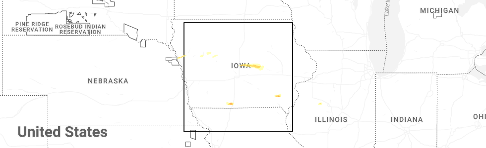
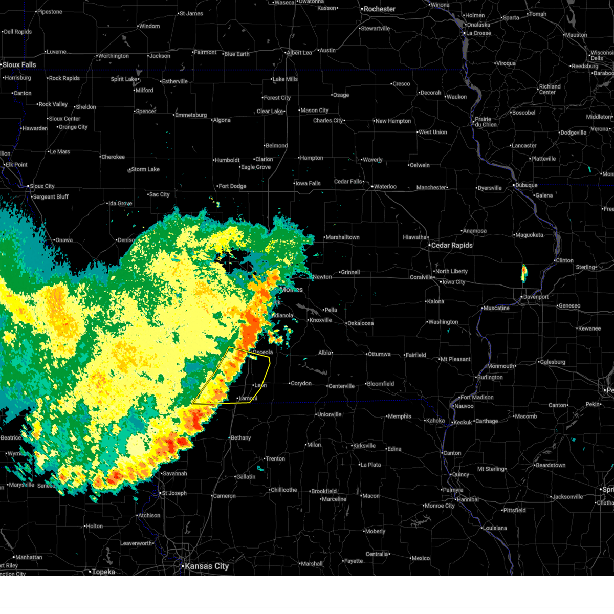
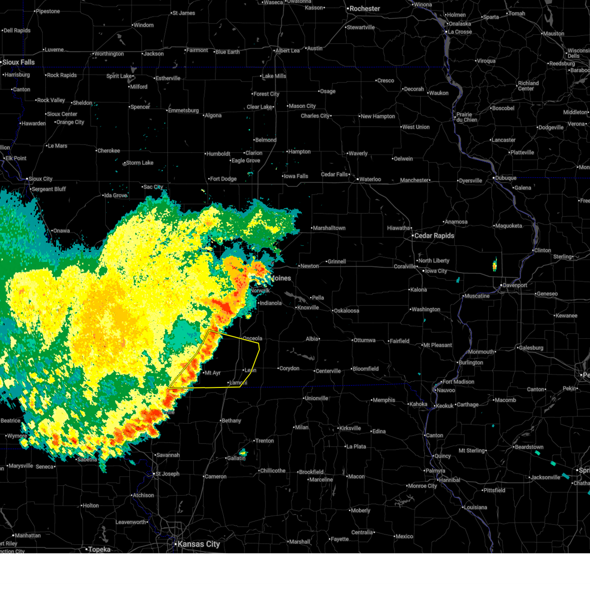
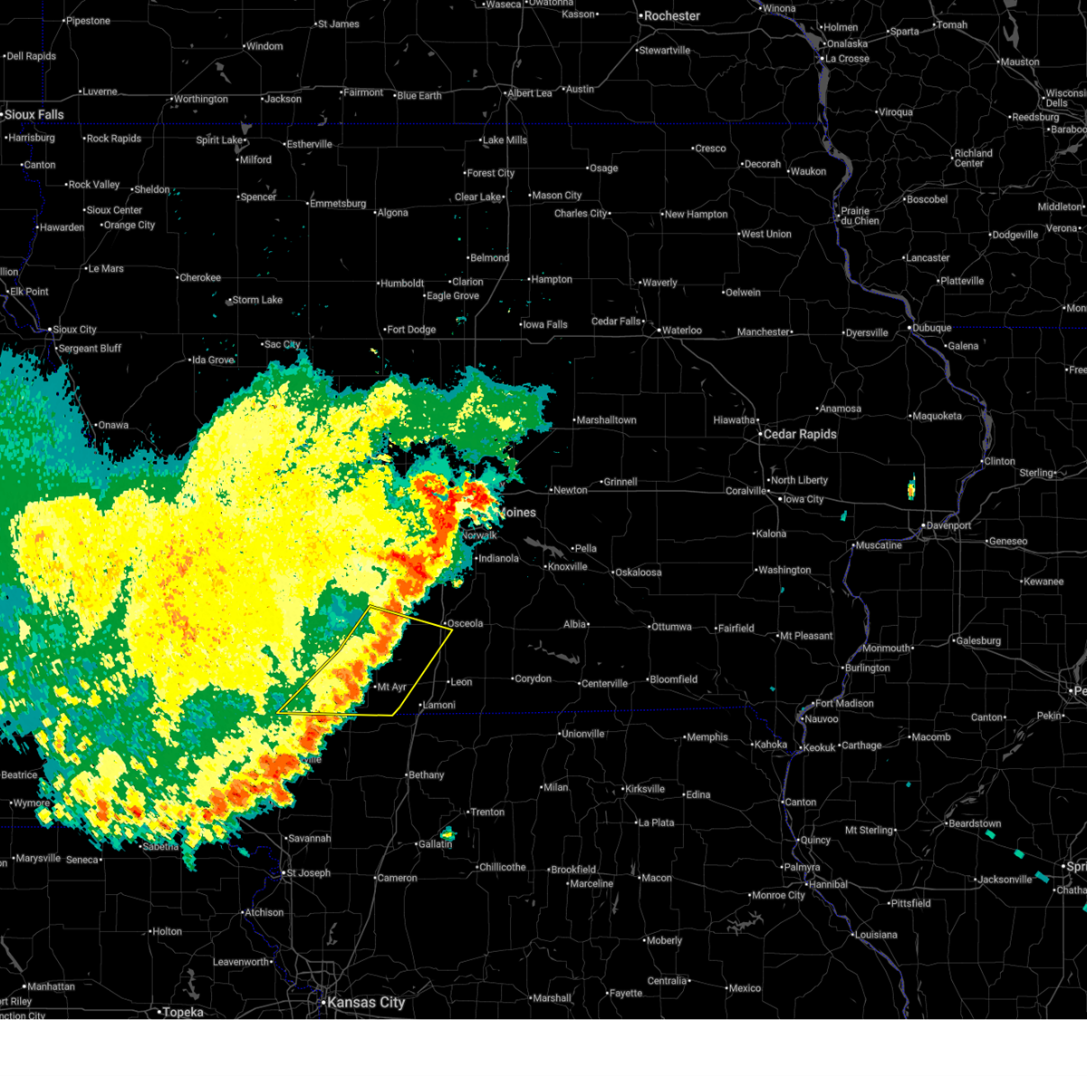
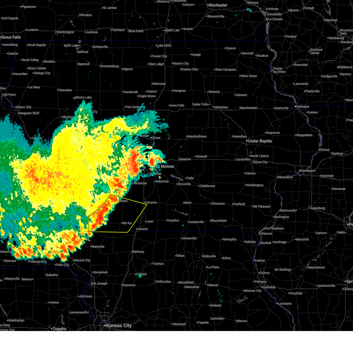
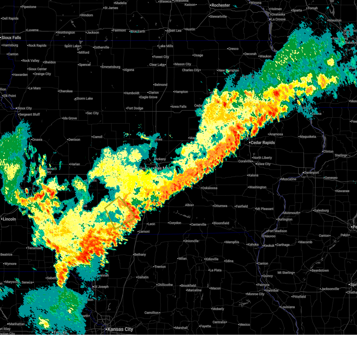
Hail Map for Mount Ayr, IA
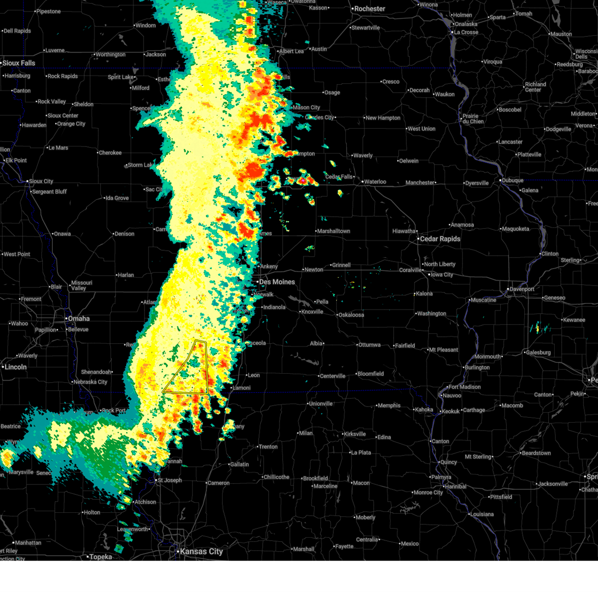
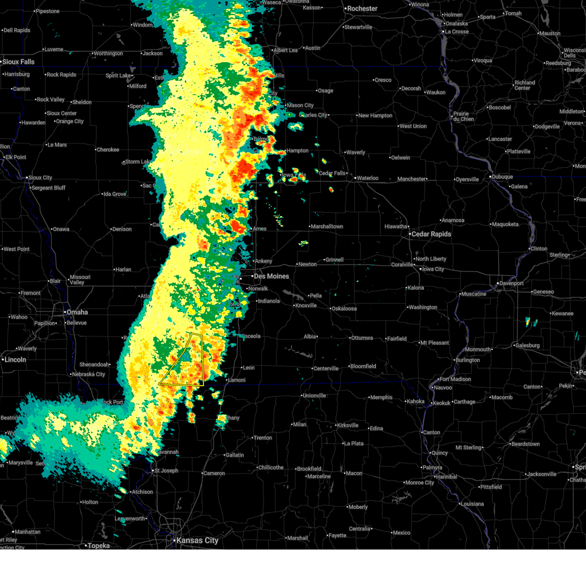
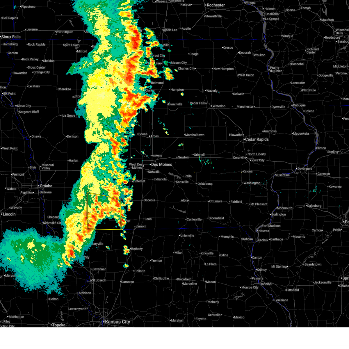
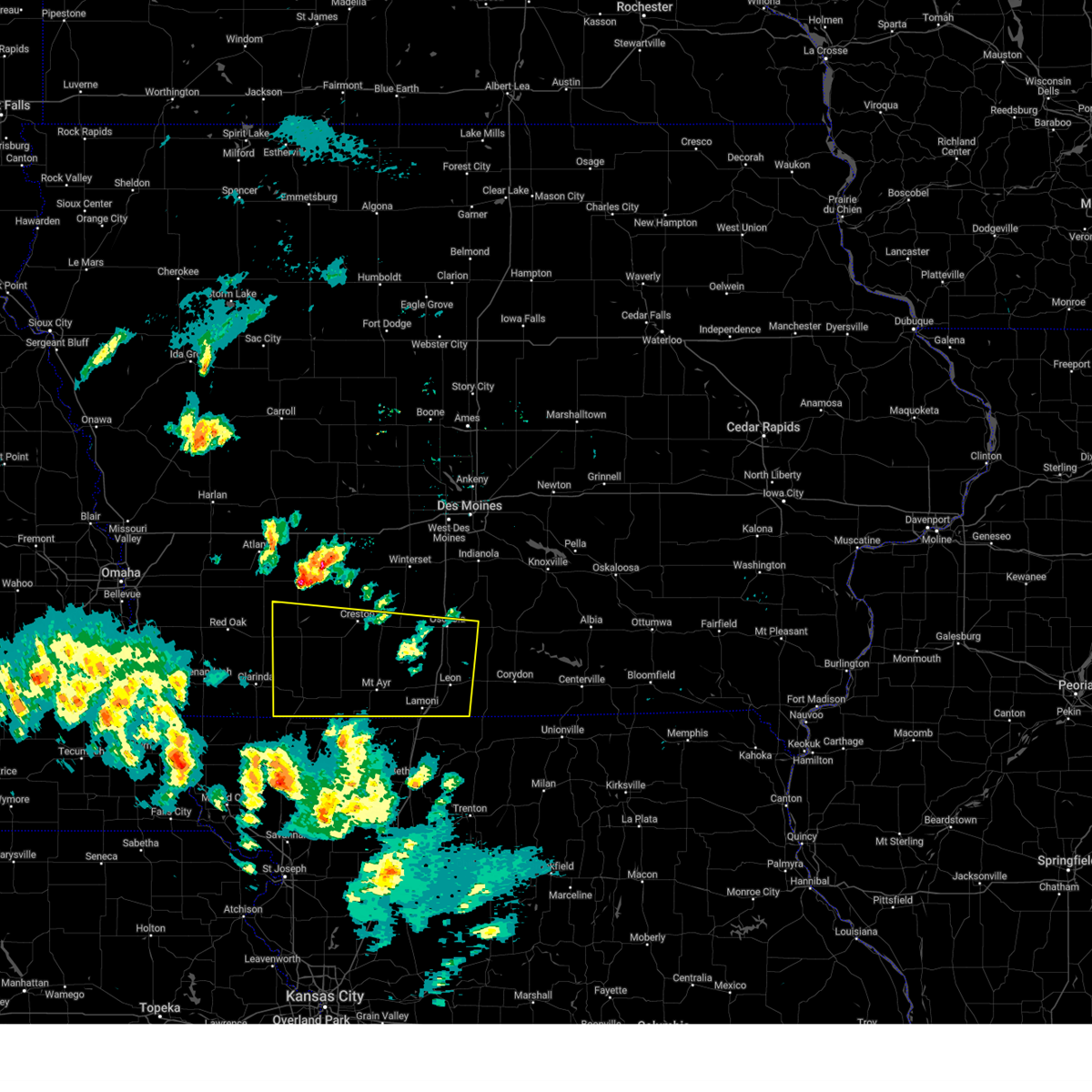
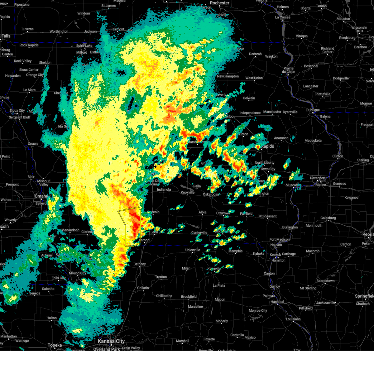
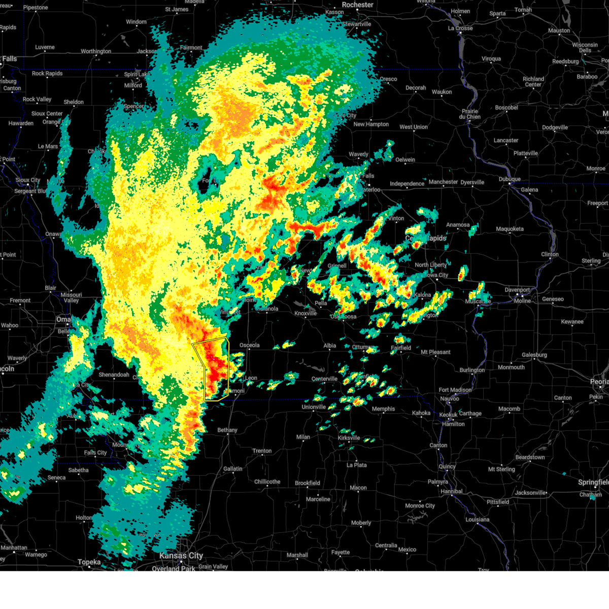
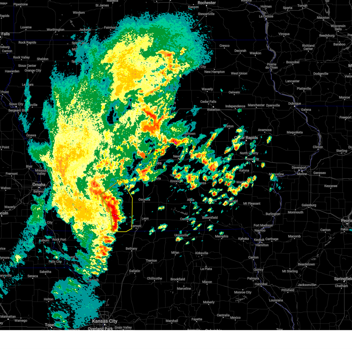
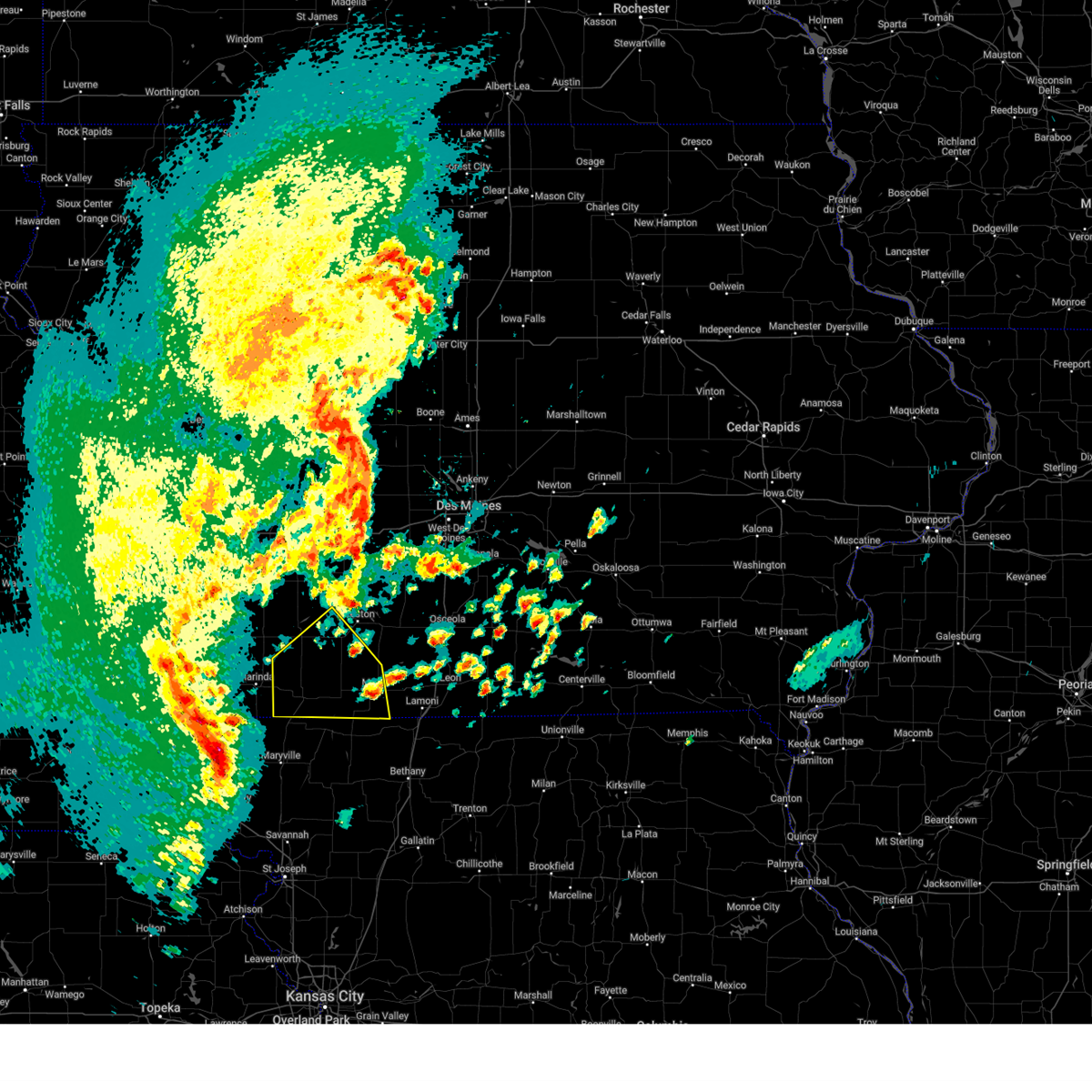
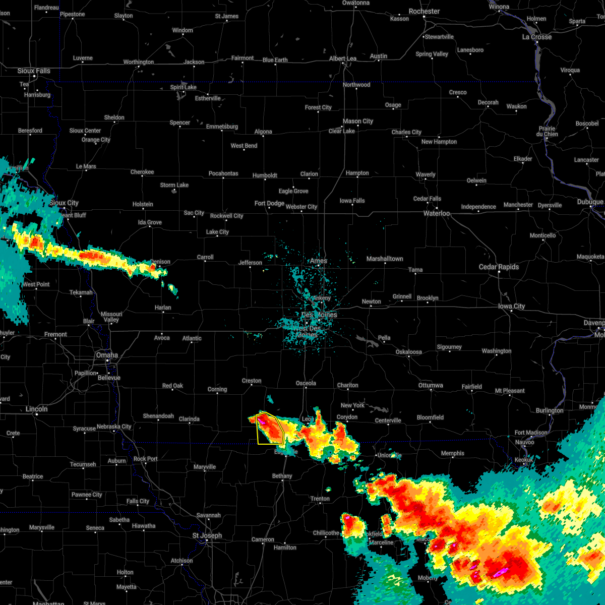
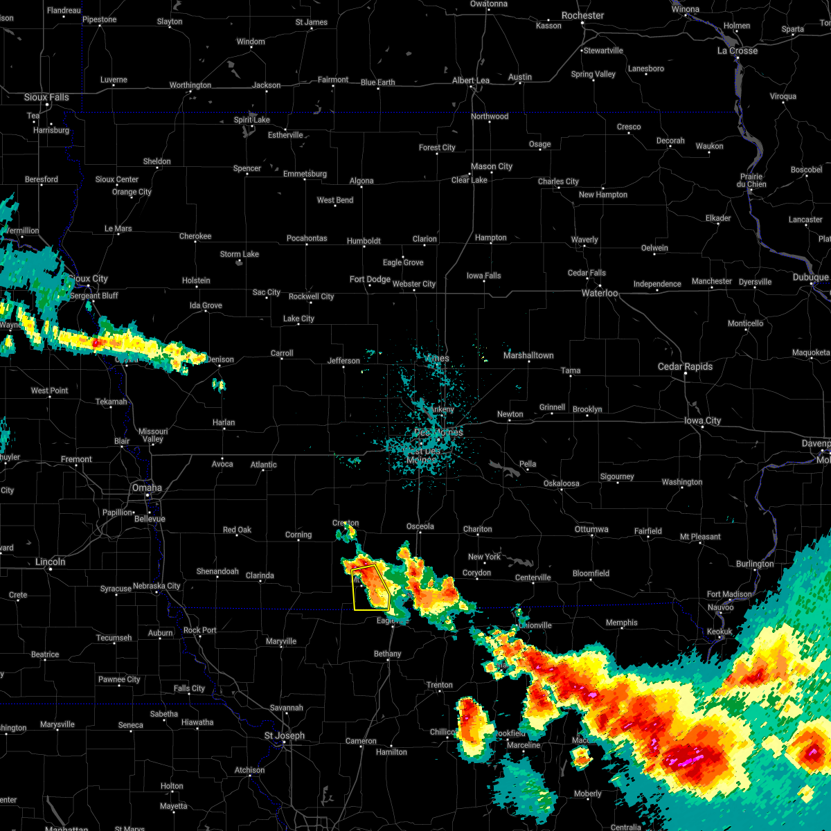
The Mount Ayr, IA area has had 10 reports of on-the-ground hail by trained spotters, and has been under severe weather warnings 25 times during the past 12 months. Doppler radar has detected hail at or near Mount Ayr, IA on 70 occasions, including 2 occasions during the past year.
| Name: | Mount Ayr, IA |
| Where Located: | 68.5 miles SSW of Des Moines, IA |
| Map: | Google Map for Mount Ayr, IA |
| Population: | 1691 |
| Housing Units: | 822 |
| More Info: | Search Google for Mount Ayr, IA |
0
The Top Recent Hail Date for Mount Ayr, IA is Tuesday, April 22, 2025 (60th out of 70)
Hail and Wind Damage Spotted near Mount Ayr, IA
| Date / Time | Report Details |
|---|---|
| 7/10/2025 5:00 AM CDT |
 the severe thunderstorm warning has been cancelled and is no longer in effect the severe thunderstorm warning has been cancelled and is no longer in effect
|
| 7/10/2025 4:52 AM CDT |
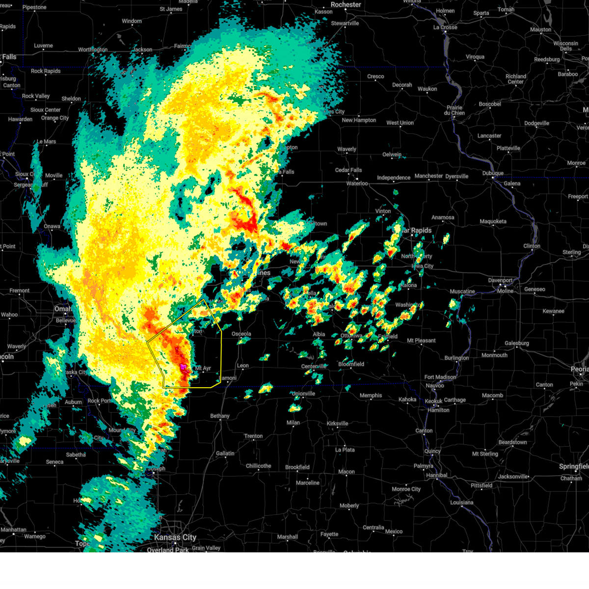
 At 451 am cdt, severe thunderstorms were located along a line extending from near kent to near grant city to conception junction, moving southeast at 40 mph (radar indicated). Hazards include 60 mph wind gusts. Expect damage to roofs, siding, and trees. Locations impacted include, creston, mount ayr, clearfield, diagonal, blockton, redding, shannon city, benton, maloy, delphos, and creston municipal airport. At 451 am cdt, severe thunderstorms were located along a line extending from near kent to near grant city to conception junction, moving southeast at 40 mph (radar indicated). Hazards include 60 mph wind gusts. Expect damage to roofs, siding, and trees. Locations impacted include, creston, mount ayr, clearfield, diagonal, blockton, redding, shannon city, benton, maloy, delphos, and creston municipal airport.
|
| 7/10/2025 4:52 AM CDT |
 the severe thunderstorm warning has been cancelled and is no longer in effect the severe thunderstorm warning has been cancelled and is no longer in effect
|
| 7/10/2025 4:27 AM CDT |
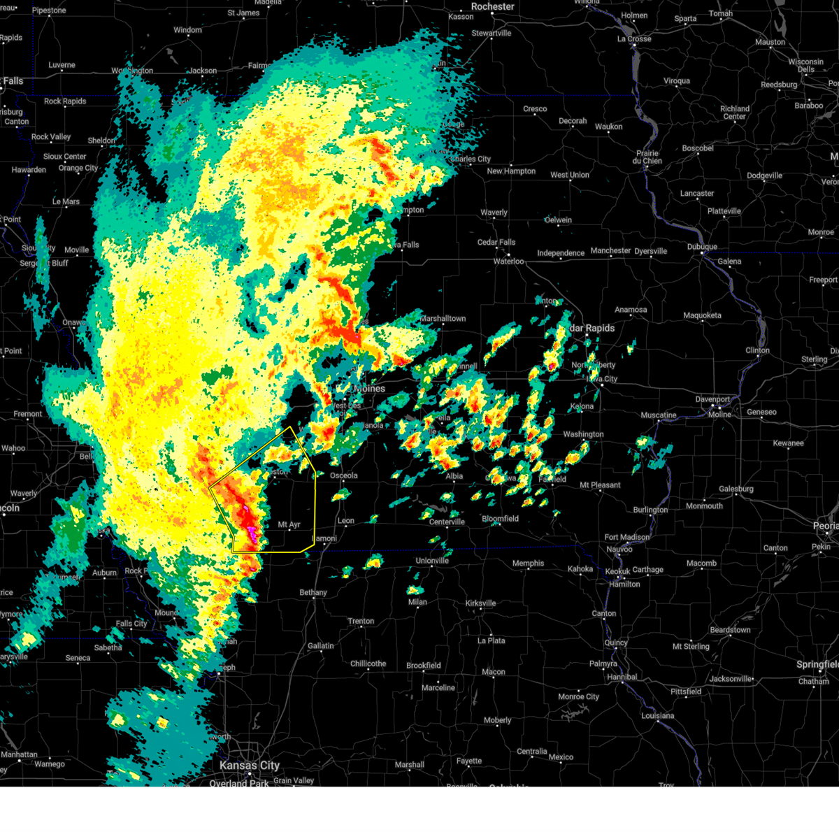
 Svrdmx the national weather service in des moines has issued a * severe thunderstorm warning for, southwestern union county in south central iowa, adams county in southwestern iowa, western ringgold county in south central iowa, taylor county in southwestern iowa, * until 515 am cdt. * at 426 am cdt, severe thunderstorms were located along a line extending from near carbon to near hopkins to 5 miles west of maryville, moving southeast at 40 mph (radar indicated). Hazards include 60 mph wind gusts. expect damage to roofs, siding, and trees Svrdmx the national weather service in des moines has issued a * severe thunderstorm warning for, southwestern union county in south central iowa, adams county in southwestern iowa, western ringgold county in south central iowa, taylor county in southwestern iowa, * until 515 am cdt. * at 426 am cdt, severe thunderstorms were located along a line extending from near carbon to near hopkins to 5 miles west of maryville, moving southeast at 40 mph (radar indicated). Hazards include 60 mph wind gusts. expect damage to roofs, siding, and trees
|
| 7/8/2025 1:16 AM CDT |
 the severe thunderstorm warning has been cancelled and is no longer in effect the severe thunderstorm warning has been cancelled and is no longer in effect
|
| 7/8/2025 1:16 AM CDT |
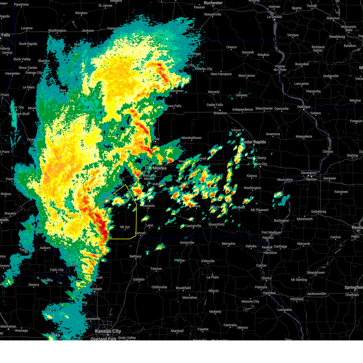
 At 116 am cdt, severe thunderstorms were located along a line extending from osceola to near grand river to near hatfield, moving east at 30 mph (radar indicated). Hazards include 60 mph wind gusts. Expect damage to roofs, siding, and trees. locations impacted include, osceola, leon, mount ayr, lamoni, sun valley lake, lakeside casino, murray, kellerton, grand river, van wert, garden grove, davis city, decatur, tingley, weldon, redding, thayer, ellston, delphos, and beaconsfield. This includes interstate 35 between mile markers 1 and 34. At 116 am cdt, severe thunderstorms were located along a line extending from osceola to near grand river to near hatfield, moving east at 30 mph (radar indicated). Hazards include 60 mph wind gusts. Expect damage to roofs, siding, and trees. locations impacted include, osceola, leon, mount ayr, lamoni, sun valley lake, lakeside casino, murray, kellerton, grand river, van wert, garden grove, davis city, decatur, tingley, weldon, redding, thayer, ellston, delphos, and beaconsfield. This includes interstate 35 between mile markers 1 and 34.
|
| 7/8/2025 12:56 AM CDT |
 Svrdmx the national weather service in des moines has issued a * severe thunderstorm warning for, decatur county in south central iowa, eastern union county in south central iowa, ringgold county in south central iowa, southeastern taylor county in southwestern iowa, southern clarke county in south central iowa, * until 145 am cdt. * at 1254 am cdt, severe thunderstorms were located along a line extending from murray to sun valley lake to near irena, moving southeast at 30 mph (radar indicated). Hazards include 60 mph wind gusts. expect damage to roofs, siding, and trees Svrdmx the national weather service in des moines has issued a * severe thunderstorm warning for, decatur county in south central iowa, eastern union county in south central iowa, ringgold county in south central iowa, southeastern taylor county in southwestern iowa, southern clarke county in south central iowa, * until 145 am cdt. * at 1254 am cdt, severe thunderstorms were located along a line extending from murray to sun valley lake to near irena, moving southeast at 30 mph (radar indicated). Hazards include 60 mph wind gusts. expect damage to roofs, siding, and trees
|
| 7/8/2025 12:52 AM CDT |
 the severe thunderstorm warning has been cancelled and is no longer in effect the severe thunderstorm warning has been cancelled and is no longer in effect
|
| 7/8/2025 12:52 AM CDT |
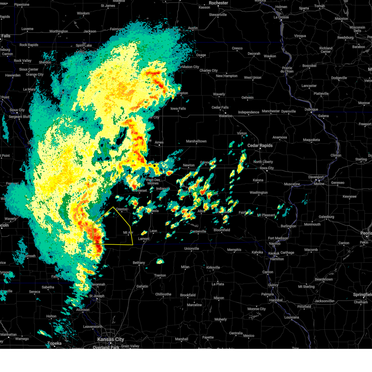
 At 1251 am cdt, severe thunderstorms were located along a line extending from murray to mt ayr municipal airport to 4 miles southeast of parnell, moving southeast at 40 mph (radar indicated). Hazards include 60 mph wind gusts. Expect damage to roofs, siding, and trees. locations impacted include, osceola, mount ayr, bedford, sun valley lake, afton, murray, clearfield, diagonal, kellerton, grand river, blockton, tingley, arispe, redding, shannon city, thayer, ellston, conway, benton, and maloy. This includes interstate 35 between mile markers 27 and 32. At 1251 am cdt, severe thunderstorms were located along a line extending from murray to mt ayr municipal airport to 4 miles southeast of parnell, moving southeast at 40 mph (radar indicated). Hazards include 60 mph wind gusts. Expect damage to roofs, siding, and trees. locations impacted include, osceola, mount ayr, bedford, sun valley lake, afton, murray, clearfield, diagonal, kellerton, grand river, blockton, tingley, arispe, redding, shannon city, thayer, ellston, conway, benton, and maloy. This includes interstate 35 between mile markers 27 and 32.
|
| 7/8/2025 12:22 AM CDT |
 Svrdmx the national weather service in des moines has issued a * severe thunderstorm warning for, northwestern decatur county in south central iowa, union county in south central iowa, southeastern adams county in southwestern iowa, ringgold county in south central iowa, taylor county in southwestern iowa, southwestern clarke county in south central iowa, * until 100 am cdt. * at 1222 am cdt, severe thunderstorms were located along a line extending from near creston to 4 miles north of clearfield to hopkins, moving southeast at 40 mph (radar indicated). Hazards include 60 mph wind gusts. expect damage to roofs, siding, and trees Svrdmx the national weather service in des moines has issued a * severe thunderstorm warning for, northwestern decatur county in south central iowa, union county in south central iowa, southeastern adams county in southwestern iowa, ringgold county in south central iowa, taylor county in southwestern iowa, southwestern clarke county in south central iowa, * until 100 am cdt. * at 1222 am cdt, severe thunderstorms were located along a line extending from near creston to 4 miles north of clearfield to hopkins, moving southeast at 40 mph (radar indicated). Hazards include 60 mph wind gusts. expect damage to roofs, siding, and trees
|
| 6/23/2025 7:40 PM CDT |
 The storm which prompted the warning has weakened below severe limits, and no longer poses an immediate threat to life or property. therefore, the warning will be allowed to expire. however, gusty winds are still possible with this thunderstorm. a severe thunderstorm watch remains in effect until 1000 pm cdt for south central and southwestern iowa. The storm which prompted the warning has weakened below severe limits, and no longer poses an immediate threat to life or property. therefore, the warning will be allowed to expire. however, gusty winds are still possible with this thunderstorm. a severe thunderstorm watch remains in effect until 1000 pm cdt for south central and southwestern iowa.
|
| 6/23/2025 7:23 PM CDT |
 At 722 pm cdt, a severe thunderstorm was located over arispe, or 9 miles southeast of creston, moving northeast at 35 mph (radar indicated). Hazards include 60 mph wind gusts. Expect damage to roofs, siding, and trees. Locations impacted include, creston, mount ayr, lenox, sun valley lake, green valley lake, afton, clearfield, diagonal, tingley, cromwell, arispe, shannon city, kent, ellston, benton, maloy, beaconsfield, creston municipal airport, and green valley lake state park. At 722 pm cdt, a severe thunderstorm was located over arispe, or 9 miles southeast of creston, moving northeast at 35 mph (radar indicated). Hazards include 60 mph wind gusts. Expect damage to roofs, siding, and trees. Locations impacted include, creston, mount ayr, lenox, sun valley lake, green valley lake, afton, clearfield, diagonal, tingley, cromwell, arispe, shannon city, kent, ellston, benton, maloy, beaconsfield, creston municipal airport, and green valley lake state park.
|
| 6/23/2025 6:55 PM CDT | Svrdmx the national weather service in des moines has issued a * severe thunderstorm warning for, southwestern union county in south central iowa, southeastern adams county in southwestern iowa, northern ringgold county in south central iowa, northeastern taylor county in southwestern iowa, * until 745 pm cdt. * at 655 pm cdt, a severe thunderstorm was located near clearfield, or 16 miles southwest of creston, moving northeast at 35 mph (radar indicated). Hazards include 60 mph wind gusts and penny size hail. expect damage to roofs, siding, and trees |
| 3/14/2025 4:45 PM CDT |
 At 445 pm cdt, severe thunderstorms were located along a line extending from near nodaway to near diagonal to 4 miles south of leon, moving north at 65 mph (radar indicated). Hazards include 60 mph wind gusts and nickel size hail. Expect damage to roofs, siding, and trees. locations impacted include, sun valley lake, ellston, pleasanton, creston municipal airport, shannon city, osceola, arispe, green valley lake, nine eagles state park, lamoni municipal airport, green valley lake state park, mt ayr municipal airport, leon, tingley, lake of three fires state park, beaconsfield, redding, sharpsburg, grand river, and afton. This includes interstate 35 between mile markers 2 and 37. At 445 pm cdt, severe thunderstorms were located along a line extending from near nodaway to near diagonal to 4 miles south of leon, moving north at 65 mph (radar indicated). Hazards include 60 mph wind gusts and nickel size hail. Expect damage to roofs, siding, and trees. locations impacted include, sun valley lake, ellston, pleasanton, creston municipal airport, shannon city, osceola, arispe, green valley lake, nine eagles state park, lamoni municipal airport, green valley lake state park, mt ayr municipal airport, leon, tingley, lake of three fires state park, beaconsfield, redding, sharpsburg, grand river, and afton. This includes interstate 35 between mile markers 2 and 37.
|
| 3/14/2025 4:28 PM CDT |
 At 427 pm cdt, severe thunderstorms were located along a line extending from 5 miles south of new market to near irena to near cainsville, moving north at 65 mph (radar indicated). Hazards include 70 mph wind gusts and nickel size hail. Expect considerable tree damage. damage is likely to mobile homes, roofs, and outbuildings. locations impacted include, sun valley lake, ellston, pleasanton, creston municipal airport, shannon city, osceola, arispe, green valley lake, nine eagles state park, lamoni municipal airport, green valley lake state park, mt ayr municipal airport, leon, tingley, lake of three fires state park, beaconsfield, redding, sharpsburg, grand river, and afton. This includes interstate 35 between mile markers 2 and 37. At 427 pm cdt, severe thunderstorms were located along a line extending from 5 miles south of new market to near irena to near cainsville, moving north at 65 mph (radar indicated). Hazards include 70 mph wind gusts and nickel size hail. Expect considerable tree damage. damage is likely to mobile homes, roofs, and outbuildings. locations impacted include, sun valley lake, ellston, pleasanton, creston municipal airport, shannon city, osceola, arispe, green valley lake, nine eagles state park, lamoni municipal airport, green valley lake state park, mt ayr municipal airport, leon, tingley, lake of three fires state park, beaconsfield, redding, sharpsburg, grand river, and afton. This includes interstate 35 between mile markers 2 and 37.
|
| 3/14/2025 4:13 PM CDT |
 Svrdmx the national weather service in des moines has issued a * severe thunderstorm warning for, decatur county in south central iowa, union county in south central iowa, ringgold county in south central iowa, adams county in southwestern iowa, taylor county in southwestern iowa, clarke county in south central iowa, * until 500 pm cdt. * at 412 pm cdt, severe thunderstorms were located along a line extending from 5 miles southwest of pickering to near gentry to near gilman city, moving north at 65 mph (radar indicated). Hazards include 70 mph wind gusts and nickel size hail. Expect considerable tree damage. Damage is likely to mobile homes, roofs, and outbuildings. Svrdmx the national weather service in des moines has issued a * severe thunderstorm warning for, decatur county in south central iowa, union county in south central iowa, ringgold county in south central iowa, adams county in southwestern iowa, taylor county in southwestern iowa, clarke county in south central iowa, * until 500 pm cdt. * at 412 pm cdt, severe thunderstorms were located along a line extending from 5 miles southwest of pickering to near gentry to near gilman city, moving north at 65 mph (radar indicated). Hazards include 70 mph wind gusts and nickel size hail. Expect considerable tree damage. Damage is likely to mobile homes, roofs, and outbuildings.
|
| 10/30/2024 2:53 PM CDT |
 The storms which prompted the warning have weakened below severe limits, and no longer pose an immediate threat to life or property. therefore, the warning will be allowed to expire. a severe thunderstorm watch remains in effect until 700 pm cdt for south central iowa. The storms which prompted the warning have weakened below severe limits, and no longer pose an immediate threat to life or property. therefore, the warning will be allowed to expire. a severe thunderstorm watch remains in effect until 700 pm cdt for south central iowa.
|
| 10/30/2024 2:44 PM CDT |
 At 244 pm cdt, severe thunderstorms were located along a line extending from 5 miles northwest of macksburg to near thayer to 4 miles east of mt ayr municipal airport, moving northeast at 55 mph (radar indicated). Hazards include 60 mph wind gusts. Expect damage to roofs, siding, and trees. Locations impacted include, creston, mount ayr, sun valley lake, afton, lorimor, kellerton, tingley, arispe, shannon city, thayer, ellston, beaconsfield, creston municipal airport, and mt ayr municipal airport. At 244 pm cdt, severe thunderstorms were located along a line extending from 5 miles northwest of macksburg to near thayer to 4 miles east of mt ayr municipal airport, moving northeast at 55 mph (radar indicated). Hazards include 60 mph wind gusts. Expect damage to roofs, siding, and trees. Locations impacted include, creston, mount ayr, sun valley lake, afton, lorimor, kellerton, tingley, arispe, shannon city, thayer, ellston, beaconsfield, creston municipal airport, and mt ayr municipal airport.
|
| 10/30/2024 2:44 PM CDT |
 the severe thunderstorm warning has been cancelled and is no longer in effect the severe thunderstorm warning has been cancelled and is no longer in effect
|
| 10/30/2024 2:32 PM CDT |
 At 231 pm cdt, severe thunderstorms were located along a line extending from near green valley lake state park to shannon city to near delphos, moving northeast at 65 mph (radar indicated). Hazards include 60 mph wind gusts and quarter size hail. Hail damage to vehicles is expected. expect wind damage to roofs, siding, and trees. Locations impacted include, creston, mount ayr, sun valley lake, green valley lake, afton, orient, lorimor, diagonal, kellerton, tingley, macksburg, cromwell, arispe, redding, shannon city, kent, thayer, ellston, benton, and maloy. At 231 pm cdt, severe thunderstorms were located along a line extending from near green valley lake state park to shannon city to near delphos, moving northeast at 65 mph (radar indicated). Hazards include 60 mph wind gusts and quarter size hail. Hail damage to vehicles is expected. expect wind damage to roofs, siding, and trees. Locations impacted include, creston, mount ayr, sun valley lake, green valley lake, afton, orient, lorimor, diagonal, kellerton, tingley, macksburg, cromwell, arispe, redding, shannon city, kent, thayer, ellston, benton, and maloy.
|
| 10/30/2024 2:28 PM CDT |
 At 228 pm cdt, severe thunderstorms were located along a line extending from 6 miles west of green valley lake state park to near shannon city to redding, moving northeast at 55 mph (radar indicated). Hazards include 60 mph wind gusts and quarter size hail. Hail damage to vehicles is expected. expect wind damage to roofs, siding, and trees. Locations impacted include, creston, mount ayr, corning, bedford, lenox, sun valley lake, green valley lake, lake icaria, afton, orient, clearfield, lorimor, diagonal, kellerton, prescott, blockton, gravity, tingley, nodaway, and macksburg. At 228 pm cdt, severe thunderstorms were located along a line extending from 6 miles west of green valley lake state park to near shannon city to redding, moving northeast at 55 mph (radar indicated). Hazards include 60 mph wind gusts and quarter size hail. Hail damage to vehicles is expected. expect wind damage to roofs, siding, and trees. Locations impacted include, creston, mount ayr, corning, bedford, lenox, sun valley lake, green valley lake, lake icaria, afton, orient, clearfield, lorimor, diagonal, kellerton, prescott, blockton, gravity, tingley, nodaway, and macksburg.
|
| 10/30/2024 2:19 PM CDT |
 At 218 pm cdt, severe thunderstorms were located along a line extending from near lake icaria to clearfield to near sheridan, moving northeast at 50 mph (radar indicated). Hazards include ping pong ball size hail and 60 mph wind gusts. People and animals outdoors will be injured. expect hail damage to roofs, siding, windows, and vehicles. expect wind damage to roofs, siding, and trees. Locations impacted include, creston, mount ayr, corning, bedford, lenox, sun valley lake, green valley lake, lake icaria, afton, orient, clearfield, lorimor, diagonal, kellerton, prescott, blockton, gravity, tingley, nodaway, and macksburg. At 218 pm cdt, severe thunderstorms were located along a line extending from near lake icaria to clearfield to near sheridan, moving northeast at 50 mph (radar indicated). Hazards include ping pong ball size hail and 60 mph wind gusts. People and animals outdoors will be injured. expect hail damage to roofs, siding, windows, and vehicles. expect wind damage to roofs, siding, and trees. Locations impacted include, creston, mount ayr, corning, bedford, lenox, sun valley lake, green valley lake, lake icaria, afton, orient, clearfield, lorimor, diagonal, kellerton, prescott, blockton, gravity, tingley, nodaway, and macksburg.
|
| 10/30/2024 2:14 PM CDT |
 Svrdmx the national weather service in des moines has issued a * severe thunderstorm warning for, southwestern madison county in south central iowa, union county in south central iowa, ringgold county in south central iowa, adams county in southwestern iowa, taylor county in southwestern iowa, southeastern adair county in southwestern iowa, * until 300 pm cdt. * at 213 pm cdt, severe thunderstorms were located along a line extending from corning to near conway to near sheridan, moving northeast at 50 mph (radar indicated). Hazards include 60 mph wind gusts and quarter size hail. Hail damage to vehicles is expected. Expect wind damage to roofs, siding, and trees. Svrdmx the national weather service in des moines has issued a * severe thunderstorm warning for, southwestern madison county in south central iowa, union county in south central iowa, ringgold county in south central iowa, adams county in southwestern iowa, taylor county in southwestern iowa, southeastern adair county in southwestern iowa, * until 300 pm cdt. * at 213 pm cdt, severe thunderstorms were located along a line extending from corning to near conway to near sheridan, moving northeast at 50 mph (radar indicated). Hazards include 60 mph wind gusts and quarter size hail. Hail damage to vehicles is expected. Expect wind damage to roofs, siding, and trees.
|
| 10/30/2024 1:58 PM CDT |
 At 158 pm cdt, severe thunderstorms were located along a line extending from near villisca to near gravity to 5 miles east of pickering, moving northeast at 50 mph (radar indicated). Hazards include 60 mph wind gusts and quarter size hail. Hail damage to vehicles is expected. expect wind damage to roofs, siding, and trees. Locations impacted include, mount ayr, corning, bedford, lenox, new market, clearfield, diagonal, prescott, blockton, gravity, cromwell, sharpsburg, redding, shannon city, kent, conway, benton, maloy, delphos, and lake of three fires state park. At 158 pm cdt, severe thunderstorms were located along a line extending from near villisca to near gravity to 5 miles east of pickering, moving northeast at 50 mph (radar indicated). Hazards include 60 mph wind gusts and quarter size hail. Hail damage to vehicles is expected. expect wind damage to roofs, siding, and trees. Locations impacted include, mount ayr, corning, bedford, lenox, new market, clearfield, diagonal, prescott, blockton, gravity, cromwell, sharpsburg, redding, shannon city, kent, conway, benton, maloy, delphos, and lake of three fires state park.
|
| 10/30/2024 1:33 PM CDT |
 Svrdmx the national weather service in des moines has issued a * severe thunderstorm warning for, southwestern union county in south central iowa, ringgold county in south central iowa, eastern adams county in southwestern iowa, taylor county in southwestern iowa, * until 215 pm cdt. * at 133 pm cdt, severe thunderstorms were located along a line extending from 4 miles south of shenandoah to near blanchard to near skidmore, moving east at 60 mph (radar indicated). Hazards include 70 mph wind gusts and quarter size hail. Hail damage to vehicles is expected. expect considerable tree damage. Wind damage is also likely to mobile homes, roofs, and outbuildings. Svrdmx the national weather service in des moines has issued a * severe thunderstorm warning for, southwestern union county in south central iowa, ringgold county in south central iowa, eastern adams county in southwestern iowa, taylor county in southwestern iowa, * until 215 pm cdt. * at 133 pm cdt, severe thunderstorms were located along a line extending from 4 miles south of shenandoah to near blanchard to near skidmore, moving east at 60 mph (radar indicated). Hazards include 70 mph wind gusts and quarter size hail. Hail damage to vehicles is expected. expect considerable tree damage. Wind damage is also likely to mobile homes, roofs, and outbuildings.
|
| 6/25/2024 11:44 PM CDT |
 the severe thunderstorm warning has been cancelled and is no longer in effect the severe thunderstorm warning has been cancelled and is no longer in effect
|
| 6/25/2024 11:25 PM CDT |
 At 1124 pm cdt, a severe thunderstorm was located over shannon city, or 12 miles north of mount ayr, moving southeast at 45 mph (radar indicated). Hazards include 60 mph wind gusts and nickel size hail. Expect damage to roofs, siding, and trees. locations impacted include, leon, mount ayr, lamoni, lenox, sun valley lake, clearfield, diagonal, kellerton, grand river, van wert, davis city, decatur city, tingley, sharpsburg, pleasanton, ellston, benton, conway, beaconsfield, and nine eagles state park. This includes interstate 35 between mile markers 3 and 24. At 1124 pm cdt, a severe thunderstorm was located over shannon city, or 12 miles north of mount ayr, moving southeast at 45 mph (radar indicated). Hazards include 60 mph wind gusts and nickel size hail. Expect damage to roofs, siding, and trees. locations impacted include, leon, mount ayr, lamoni, lenox, sun valley lake, clearfield, diagonal, kellerton, grand river, van wert, davis city, decatur city, tingley, sharpsburg, pleasanton, ellston, benton, conway, beaconsfield, and nine eagles state park. This includes interstate 35 between mile markers 3 and 24.
|
| 6/25/2024 11:25 PM CDT |
 the severe thunderstorm warning has been cancelled and is no longer in effect the severe thunderstorm warning has been cancelled and is no longer in effect
|
| 6/25/2024 10:56 PM CDT |
 Svrdmx the national weather service in des moines has issued a * severe thunderstorm warning for, decatur county in south central iowa, southern union county in south central iowa, ringgold county in south central iowa, adams county in southwestern iowa, northern taylor county in southwestern iowa, southwestern clarke county in south central iowa, * until midnight cdt. * at 1055 pm cdt, a severe thunderstorm was located over corning, moving southeast at 45 mph (radar indicated). Hazards include 60 mph wind gusts and nickel size hail. expect damage to roofs, siding, and trees Svrdmx the national weather service in des moines has issued a * severe thunderstorm warning for, decatur county in south central iowa, southern union county in south central iowa, ringgold county in south central iowa, adams county in southwestern iowa, northern taylor county in southwestern iowa, southwestern clarke county in south central iowa, * until midnight cdt. * at 1055 pm cdt, a severe thunderstorm was located over corning, moving southeast at 45 mph (radar indicated). Hazards include 60 mph wind gusts and nickel size hail. expect damage to roofs, siding, and trees
|
| 6/25/2024 10:16 PM CDT |
 Svrdmx the national weather service in des moines has issued a * severe thunderstorm warning for, western decatur county in south central iowa, southern union county in south central iowa, ringgold county in south central iowa, adams county in southwestern iowa, northern taylor county in southwestern iowa, southwestern clarke county in south central iowa, * until 1100 pm cdt. * at 1016 pm cdt, a cluster of severe thunderstorms were located 5 miles southwest of beaconsfield, or 6 miles northeast of mount ayr, moving east at 20 mph (radar indicated). Hazards include 60 mph wind gusts and quarter size hail. Hail damage to vehicles is expected. Expect wind damage to roofs, siding, and trees. Svrdmx the national weather service in des moines has issued a * severe thunderstorm warning for, western decatur county in south central iowa, southern union county in south central iowa, ringgold county in south central iowa, adams county in southwestern iowa, northern taylor county in southwestern iowa, southwestern clarke county in south central iowa, * until 1100 pm cdt. * at 1016 pm cdt, a cluster of severe thunderstorms were located 5 miles southwest of beaconsfield, or 6 miles northeast of mount ayr, moving east at 20 mph (radar indicated). Hazards include 60 mph wind gusts and quarter size hail. Hail damage to vehicles is expected. Expect wind damage to roofs, siding, and trees.
|
| 5/21/2024 3:42 PM CDT |
 At 341 pm cdt, a severe thunderstorm capable of producing a tornado was located over maloy, or 10 miles west of mount ayr, moving northeast at 40 mph (radar indicated rotation). Hazards include tornado and quarter size hail. Flying debris will be dangerous to those caught without shelter. mobile homes will be damaged or destroyed. damage to roofs, windows, and vehicles will occur. tree damage is likely. this dangerous storm will be near, benton around 345 pm cdt. diagonal around 350 pm cdt. shannon city around 400 pm cdt. tingley and arispe around 405 pm cdt. Other locations impacted by this tornadic thunderstorm include delphos, arispe, ellston, tingley, diagonal, maloy, shannon city, benton, and redding. At 341 pm cdt, a severe thunderstorm capable of producing a tornado was located over maloy, or 10 miles west of mount ayr, moving northeast at 40 mph (radar indicated rotation). Hazards include tornado and quarter size hail. Flying debris will be dangerous to those caught without shelter. mobile homes will be damaged or destroyed. damage to roofs, windows, and vehicles will occur. tree damage is likely. this dangerous storm will be near, benton around 345 pm cdt. diagonal around 350 pm cdt. shannon city around 400 pm cdt. tingley and arispe around 405 pm cdt. Other locations impacted by this tornadic thunderstorm include delphos, arispe, ellston, tingley, diagonal, maloy, shannon city, benton, and redding.
|
| 5/21/2024 3:42 PM CDT |
 the tornado warning has been cancelled and is no longer in effect the tornado warning has been cancelled and is no longer in effect
|
| 5/21/2024 3:33 PM CDT |
 Tordmx the national weather service in des moines has issued a * tornado warning for, south central union county in south central iowa, central ringgold county in south central iowa, southeastern taylor county in southwestern iowa, * until 415 pm cdt. * at 332 pm cdt, a severe thunderstorm capable of producing a tornado was located over blockton, or 12 miles east of bedford, moving northeast at 40 mph (radar indicated rotation). Hazards include tornado and quarter size hail. Flying debris will be dangerous to those caught without shelter. mobile homes will be damaged or destroyed. damage to roofs, windows, and vehicles will occur. tree damage is likely. this dangerous storm will be near, benton and maloy around 340 pm cdt. diagonal around 350 pm cdt. shannon city around 400 pm cdt. tingley around 405 pm cdt. Other locations impacted by this tornadic thunderstorm include delphos, arispe, ellston, tingley, diagonal, maloy, shannon city, benton, blockton, and athelstan. Tordmx the national weather service in des moines has issued a * tornado warning for, south central union county in south central iowa, central ringgold county in south central iowa, southeastern taylor county in southwestern iowa, * until 415 pm cdt. * at 332 pm cdt, a severe thunderstorm capable of producing a tornado was located over blockton, or 12 miles east of bedford, moving northeast at 40 mph (radar indicated rotation). Hazards include tornado and quarter size hail. Flying debris will be dangerous to those caught without shelter. mobile homes will be damaged or destroyed. damage to roofs, windows, and vehicles will occur. tree damage is likely. this dangerous storm will be near, benton and maloy around 340 pm cdt. diagonal around 350 pm cdt. shannon city around 400 pm cdt. tingley around 405 pm cdt. Other locations impacted by this tornadic thunderstorm include delphos, arispe, ellston, tingley, diagonal, maloy, shannon city, benton, blockton, and athelstan.
|
| 5/20/2024 12:14 AM CDT |
 Svrdmx the national weather service in des moines has issued a * severe thunderstorm warning for, western decatur county in south central iowa, union county in south central iowa, ringgold county in south central iowa, clarke county in south central iowa, * until 100 am cdt. * at 1213 am cdt, a severe thunderstorm was located over mt ayr municipal airport, or over mount ayr, moving north at 45 mph (radar indicated). Hazards include 60 mph wind gusts and penny size hail. expect damage to roofs, siding, and trees Svrdmx the national weather service in des moines has issued a * severe thunderstorm warning for, western decatur county in south central iowa, union county in south central iowa, ringgold county in south central iowa, clarke county in south central iowa, * until 100 am cdt. * at 1213 am cdt, a severe thunderstorm was located over mt ayr municipal airport, or over mount ayr, moving north at 45 mph (radar indicated). Hazards include 60 mph wind gusts and penny size hail. expect damage to roofs, siding, and trees
|
| 4/30/2024 6:17 PM CDT |
 Svrdmx the national weather service in des moines has issued a * severe thunderstorm warning for, western union county in south central iowa, adams county in southwestern iowa, northwestern ringgold county in south central iowa, taylor county in southwestern iowa, * until 700 pm cdt. * at 617 pm cdt, a severe thunderstorm was located near new market, or 5 miles northwest of bedford, moving east at 40 mph (radar indicated). Hazards include 60 mph wind gusts and half dollar size hail. Hail damage to vehicles is expected. Expect wind damage to roofs, siding, and trees. Svrdmx the national weather service in des moines has issued a * severe thunderstorm warning for, western union county in south central iowa, adams county in southwestern iowa, northwestern ringgold county in south central iowa, taylor county in southwestern iowa, * until 700 pm cdt. * at 617 pm cdt, a severe thunderstorm was located near new market, or 5 miles northwest of bedford, moving east at 40 mph (radar indicated). Hazards include 60 mph wind gusts and half dollar size hail. Hail damage to vehicles is expected. Expect wind damage to roofs, siding, and trees.
|
| 4/30/2024 5:45 PM CDT |
 Svrdmx the national weather service in des moines has issued a * severe thunderstorm warning for, northern decatur county in south central iowa, southeastern union county in south central iowa, northeastern ringgold county in south central iowa, western clarke county in south central iowa, * until 630 pm cdt. * at 545 pm cdt, a severe thunderstorm was located over tingley, or 9 miles north of mount ayr, moving east at 40 mph (radar indicated). Hazards include 60 mph wind gusts and quarter size hail. Hail damage to vehicles is expected. Expect wind damage to roofs, siding, and trees. Svrdmx the national weather service in des moines has issued a * severe thunderstorm warning for, northern decatur county in south central iowa, southeastern union county in south central iowa, northeastern ringgold county in south central iowa, western clarke county in south central iowa, * until 630 pm cdt. * at 545 pm cdt, a severe thunderstorm was located over tingley, or 9 miles north of mount ayr, moving east at 40 mph (radar indicated). Hazards include 60 mph wind gusts and quarter size hail. Hail damage to vehicles is expected. Expect wind damage to roofs, siding, and trees.
|
| 4/30/2024 5:27 PM CDT |
 At 526 pm cdt, a severe thunderstorm was located over clearfield, or 13 miles northwest of mount ayr, moving northeast at 40 mph (radar indicated). Hazards include 60 mph wind gusts and half dollar size hail. Hail damage to vehicles is expected. expect wind damage to roofs, siding, and trees. Locations impacted include, mount ayr, lenox, clearfield, diagonal, tingley, arispe, shannon city, and benton. At 526 pm cdt, a severe thunderstorm was located over clearfield, or 13 miles northwest of mount ayr, moving northeast at 40 mph (radar indicated). Hazards include 60 mph wind gusts and half dollar size hail. Hail damage to vehicles is expected. expect wind damage to roofs, siding, and trees. Locations impacted include, mount ayr, lenox, clearfield, diagonal, tingley, arispe, shannon city, and benton.
|
| 4/30/2024 5:13 PM CDT |
 At 513 pm cdt, a severe thunderstorm was located over conway, or 8 miles northeast of bedford, moving east at 45 mph (radar indicated). Hazards include golf ball size hail and 60 mph wind gusts. People and animals outdoors will be injured. expect hail damage to roofs, siding, windows, and vehicles. expect wind damage to roofs, siding, and trees. Locations impacted include, mount ayr, lenox, clearfield, diagonal, tingley, arispe, sharpsburg, shannon city, conway, benton, maloy, delphos, lake of three fires state park, and mt ayr municipal airport. At 513 pm cdt, a severe thunderstorm was located over conway, or 8 miles northeast of bedford, moving east at 45 mph (radar indicated). Hazards include golf ball size hail and 60 mph wind gusts. People and animals outdoors will be injured. expect hail damage to roofs, siding, windows, and vehicles. expect wind damage to roofs, siding, and trees. Locations impacted include, mount ayr, lenox, clearfield, diagonal, tingley, arispe, sharpsburg, shannon city, conway, benton, maloy, delphos, lake of three fires state park, and mt ayr municipal airport.
|
| 4/30/2024 5:07 PM CDT |
 Svrdmx the national weather service in des moines has issued a * severe thunderstorm warning for, southwestern union county in south central iowa, southeastern adams county in southwestern iowa, northern ringgold county in south central iowa, taylor county in southwestern iowa, * until 545 pm cdt. * at 506 pm cdt, a severe thunderstorm was located over lake of three fires state park, or over bedford, moving northeast at 40 mph (radar indicated). Hazards include 60 mph wind gusts and half dollar size hail. Hail damage to vehicles is expected. Expect wind damage to roofs, siding, and trees. Svrdmx the national weather service in des moines has issued a * severe thunderstorm warning for, southwestern union county in south central iowa, southeastern adams county in southwestern iowa, northern ringgold county in south central iowa, taylor county in southwestern iowa, * until 545 pm cdt. * at 506 pm cdt, a severe thunderstorm was located over lake of three fires state park, or over bedford, moving northeast at 40 mph (radar indicated). Hazards include 60 mph wind gusts and half dollar size hail. Hail damage to vehicles is expected. Expect wind damage to roofs, siding, and trees.
|
| 4/26/2024 8:03 PM CDT | Tea Cup sized hail reported 0.4 miles NE of Mount Ayr, IA |
| 4/26/2024 7:58 PM CDT |
 Tordmx the national weather service in des moines has issued a * tornado warning for, northwestern decatur county in south central iowa, southeastern union county in south central iowa, northeastern ringgold county in south central iowa, clarke county in south central iowa, * until 845 pm cdt. * at 757 pm cdt, a severe thunderstorm capable of producing a tornado was located near kellerton, or 6 miles northeast of mount ayr, moving northeast at 45 mph (radar indicated rotation). Hazards include tornado and hail up to two inches in diameter. Flying debris will be dangerous to those caught without shelter. mobile homes will be damaged or destroyed. damage to roofs, windows, and vehicles will occur. tree damage is likely. this dangerous storm will be near, sun valley lake, grand river, ellston, and beaconsfield around 805 pm cdt. van wert around 820 pm cdt. osceola around 825 pm cdt. woodburn around 835 pm cdt. other locations impacted by this tornadic thunderstorm include ellston, beaconsfield, grand river, murray, murray roadside rest area, woodburn, and van wert. This includes interstate 35 between mile markers 23 and 41. Tordmx the national weather service in des moines has issued a * tornado warning for, northwestern decatur county in south central iowa, southeastern union county in south central iowa, northeastern ringgold county in south central iowa, clarke county in south central iowa, * until 845 pm cdt. * at 757 pm cdt, a severe thunderstorm capable of producing a tornado was located near kellerton, or 6 miles northeast of mount ayr, moving northeast at 45 mph (radar indicated rotation). Hazards include tornado and hail up to two inches in diameter. Flying debris will be dangerous to those caught without shelter. mobile homes will be damaged or destroyed. damage to roofs, windows, and vehicles will occur. tree damage is likely. this dangerous storm will be near, sun valley lake, grand river, ellston, and beaconsfield around 805 pm cdt. van wert around 820 pm cdt. osceola around 825 pm cdt. woodburn around 835 pm cdt. other locations impacted by this tornadic thunderstorm include ellston, beaconsfield, grand river, murray, murray roadside rest area, woodburn, and van wert. This includes interstate 35 between mile markers 23 and 41.
|
| 4/26/2024 7:47 PM CDT |
 At 747 pm cdt, a confirmed tornado was located over mt ayr municipal airport, or over mount ayr, moving northeast at 35 mph (weather spotters confirmed tornado). Hazards include damaging tornado and ping pong ball size hail. Flying debris will be dangerous to those caught without shelter. mobile homes will be damaged or destroyed. damage to roofs, windows, and vehicles will occur. tree damage is likely. Locations impacted include, mount ayr, sun valley lake, kellerton, ellston, beaconsfield, and mt ayr municipal airport. At 747 pm cdt, a confirmed tornado was located over mt ayr municipal airport, or over mount ayr, moving northeast at 35 mph (weather spotters confirmed tornado). Hazards include damaging tornado and ping pong ball size hail. Flying debris will be dangerous to those caught without shelter. mobile homes will be damaged or destroyed. damage to roofs, windows, and vehicles will occur. tree damage is likely. Locations impacted include, mount ayr, sun valley lake, kellerton, ellston, beaconsfield, and mt ayr municipal airport.
|
| 4/26/2024 7:45 PM CDT | Tea Cup sized hail reported 0.4 miles NE of Mount Ayr, IA, corrects previous hail report from mount ayr. |
| 4/26/2024 7:34 PM CDT |
 At 734 pm cdt, a confirmed tornado was located near redding, or 8 miles southwest of mount ayr, moving northeast at 40 mph (weather spotters confirmed tornado). Hazards include damaging tornado and quarter size hail. Flying debris will be dangerous to those caught without shelter. mobile homes will be damaged or destroyed. damage to roofs, windows, and vehicles will occur. tree damage is likely. Locations impacted include, mount ayr, sun valley lake, kellerton, redding, ellston, delphos, beaconsfield, and mt ayr municipal airport. At 734 pm cdt, a confirmed tornado was located near redding, or 8 miles southwest of mount ayr, moving northeast at 40 mph (weather spotters confirmed tornado). Hazards include damaging tornado and quarter size hail. Flying debris will be dangerous to those caught without shelter. mobile homes will be damaged or destroyed. damage to roofs, windows, and vehicles will occur. tree damage is likely. Locations impacted include, mount ayr, sun valley lake, kellerton, redding, ellston, delphos, beaconsfield, and mt ayr municipal airport.
|
| 4/26/2024 7:21 PM CDT |
 Tordmx the national weather service in des moines has issued a * tornado warning for, ringgold county in south central iowa, * until 800 pm cdt. * at 721 pm cdt, a severe thunderstorm capable of producing a tornado was located over irena, or 15 miles southwest of mount ayr, moving northeast at 45 mph (radar indicated rotation). Hazards include tornado and quarter size hail. Flying debris will be dangerous to those caught without shelter. mobile homes will be damaged or destroyed. damage to roofs, windows, and vehicles will occur. Tree damage is likely. Tordmx the national weather service in des moines has issued a * tornado warning for, ringgold county in south central iowa, * until 800 pm cdt. * at 721 pm cdt, a severe thunderstorm capable of producing a tornado was located over irena, or 15 miles southwest of mount ayr, moving northeast at 45 mph (radar indicated rotation). Hazards include tornado and quarter size hail. Flying debris will be dangerous to those caught without shelter. mobile homes will be damaged or destroyed. damage to roofs, windows, and vehicles will occur. Tree damage is likely.
|
| 7/17/2023 6:43 AM CDT |
 The severe thunderstorm warning for southeastern union and northern ringgold counties will expire at 645 am cdt, the storm which prompted the warning has weakened below severe limits, and no longer poses an immediate threat to life or property. therefore, the warning will be allowed to expire. however small hail is still possible with this thunderstorm. The severe thunderstorm warning for southeastern union and northern ringgold counties will expire at 645 am cdt, the storm which prompted the warning has weakened below severe limits, and no longer poses an immediate threat to life or property. therefore, the warning will be allowed to expire. however small hail is still possible with this thunderstorm.
|
| 7/17/2023 6:35 AM CDT |
 At 634 am cdt, a severe thunderstorm was located near diagonal, or 6 miles north of mount ayr, moving southeast at 45 mph (radar indicated). Hazards include quarter size hail. Damage to vehicles is expected. locations impacted include, mount ayr, diagonal, tingley, ellston, benton, delphos and mt ayr municipal airport. hail threat, radar indicated max hail size, 1. 00 in wind threat, radar indicated max wind gust, <50 mph. At 634 am cdt, a severe thunderstorm was located near diagonal, or 6 miles north of mount ayr, moving southeast at 45 mph (radar indicated). Hazards include quarter size hail. Damage to vehicles is expected. locations impacted include, mount ayr, diagonal, tingley, ellston, benton, delphos and mt ayr municipal airport. hail threat, radar indicated max hail size, 1. 00 in wind threat, radar indicated max wind gust, <50 mph.
|
| 7/17/2023 6:27 AM CDT |
 At 626 am cdt, a severe thunderstorm was located near shannon city, or 12 miles south of creston, moving southeast at 45 mph (radar indicated). Hazards include quarter size hail. Damage to vehicles is expected. locations impacted include, mount ayr, diagonal, tingley, arispe, shannon city, ellston, benton, delphos, beaconsfield and mt ayr municipal airport. hail threat, radar indicated max hail size, 1. 00 in wind threat, radar indicated max wind gust, <50 mph. At 626 am cdt, a severe thunderstorm was located near shannon city, or 12 miles south of creston, moving southeast at 45 mph (radar indicated). Hazards include quarter size hail. Damage to vehicles is expected. locations impacted include, mount ayr, diagonal, tingley, arispe, shannon city, ellston, benton, delphos, beaconsfield and mt ayr municipal airport. hail threat, radar indicated max hail size, 1. 00 in wind threat, radar indicated max wind gust, <50 mph.
|
| 7/17/2023 6:14 AM CDT |
 At 614 am cdt, a severe thunderstorm was located near creston municipal airport, or 5 miles southwest of creston, moving southeast at 50 mph (radar indicated). Hazards include quarter size hail. damage to vehicles is expected At 614 am cdt, a severe thunderstorm was located near creston municipal airport, or 5 miles southwest of creston, moving southeast at 50 mph (radar indicated). Hazards include quarter size hail. damage to vehicles is expected
|
| 7/12/2023 7:22 AM CDT |
 At 720 am cdt, severe thunderstorms were located along a line extending from 4 miles east of orient to near kent to near yorktown, moving southeast at 65 mph (radar indicated). Hazards include 60 mph wind gusts. expect damage to roofs, siding, and trees At 720 am cdt, severe thunderstorms were located along a line extending from 4 miles east of orient to near kent to near yorktown, moving southeast at 65 mph (radar indicated). Hazards include 60 mph wind gusts. expect damage to roofs, siding, and trees
|
| 6/30/2023 7:10 AM CDT |
 At 709 am cdt, severe thunderstorms were located along a line extending from macksburg to lamoni, moving east at 50 mph (law enforcement). Hazards include 70 mph wind gusts and quarter size hail. Hail damage to vehicles is expected. expect considerable tree damage. wind damage is also likely to mobile homes, roofs, and outbuildings. these severe storms will be near, davis city around 715 am cdt. leon, decatur city, pleasanton and nine eagles state park around 720 am cdt. other locations in the path of these severe thunderstorms include east peru, truro, avenue of the saints event center, st. charles, bevington, st. marys, clio, allerton, indianola, corydon, lake ahquabi state park and otter creek county park. this includes interstate 35 between mile markers 1 and 56. thunderstorm damage threat, considerable hail threat, radar indicated max hail size, 1. 00 in wind threat, observed max wind gust, 70 mph. At 709 am cdt, severe thunderstorms were located along a line extending from macksburg to lamoni, moving east at 50 mph (law enforcement). Hazards include 70 mph wind gusts and quarter size hail. Hail damage to vehicles is expected. expect considerable tree damage. wind damage is also likely to mobile homes, roofs, and outbuildings. these severe storms will be near, davis city around 715 am cdt. leon, decatur city, pleasanton and nine eagles state park around 720 am cdt. other locations in the path of these severe thunderstorms include east peru, truro, avenue of the saints event center, st. charles, bevington, st. marys, clio, allerton, indianola, corydon, lake ahquabi state park and otter creek county park. this includes interstate 35 between mile markers 1 and 56. thunderstorm damage threat, considerable hail threat, radar indicated max hail size, 1. 00 in wind threat, observed max wind gust, 70 mph.
|
| 6/30/2023 7:04 AM CDT |
 At 703 am cdt, severe thunderstorms were located along a line extending from near macksburg to near lamoni, moving east at 50 mph (law enforcement). Hazards include 60 mph wind gusts and quarter size hail. Hail damage to vehicles is expected. expect wind damage to roofs, siding, and trees. severe thunderstorms will be near, lamoni municipal airport around 710 am cdt. lorimor, davis city, decatur city and nine eagles state park around 715 am cdt. leon and pleasanton around 720 am cdt. other locations in the path of these severe thunderstorms include truro, east peru, avenue of the saints event center, st. charles, new virginia, st. marys, bevington, clio, allerton and lake ahquabi state park. this includes interstate 35 between mile markers 1 and 56. hail threat, radar indicated max hail size, 1. 00 in wind threat, observed max wind gust, 60 mph. At 703 am cdt, severe thunderstorms were located along a line extending from near macksburg to near lamoni, moving east at 50 mph (law enforcement). Hazards include 60 mph wind gusts and quarter size hail. Hail damage to vehicles is expected. expect wind damage to roofs, siding, and trees. severe thunderstorms will be near, lamoni municipal airport around 710 am cdt. lorimor, davis city, decatur city and nine eagles state park around 715 am cdt. leon and pleasanton around 720 am cdt. other locations in the path of these severe thunderstorms include truro, east peru, avenue of the saints event center, st. charles, new virginia, st. marys, bevington, clio, allerton and lake ahquabi state park. this includes interstate 35 between mile markers 1 and 56. hail threat, radar indicated max hail size, 1. 00 in wind threat, observed max wind gust, 60 mph.
|
| 6/30/2023 6:49 AM CDT |
 At 648 am cdt, severe thunderstorms were located along a line extending from bridgewater to benton, moving northeast at 30 mph (law enforcement). Hazards include 60 mph wind gusts and quarter size hail. Hail damage to vehicles is expected. expect wind damage to roofs, siding, and trees. locations impacted include, fontanelle, diagonal, mount ayr, orient, nodaway park, mt ayr municipal airport, greenfield, shannon city, greenfield municipal airport, tingley, ellston, sun valley lake and beaconsfield. hail threat, radar indicated max hail size, 1. 00 in wind threat, observed max wind gust, 60 mph. At 648 am cdt, severe thunderstorms were located along a line extending from bridgewater to benton, moving northeast at 30 mph (law enforcement). Hazards include 60 mph wind gusts and quarter size hail. Hail damage to vehicles is expected. expect wind damage to roofs, siding, and trees. locations impacted include, fontanelle, diagonal, mount ayr, orient, nodaway park, mt ayr municipal airport, greenfield, shannon city, greenfield municipal airport, tingley, ellston, sun valley lake and beaconsfield. hail threat, radar indicated max hail size, 1. 00 in wind threat, observed max wind gust, 60 mph.
|
| 6/30/2023 6:14 AM CDT |
 At 613 am cdt, severe thunderstorms were located along a line extending from 7 miles east of grant to 4 miles northwest of athelstan, moving northeast at 30 mph (radar indicated). Hazards include 60 mph wind gusts and quarter size hail. Hail damage to vehicles is expected. expect wind damage to roofs, siding, and trees. severe thunderstorms will be near, blockton around 625 am cdt. redding around 630 am cdt. other locations in the path of these severe thunderstorms include bridgewater, maloy, benton, delphos, mount ayr, diagonal, mt ayr municipal airport, orient, nodaway park, greenfield, shannon city, greenfield municipal airport and tingley. hail threat, radar indicated max hail size, 1. 00 in wind threat, radar indicated max wind gust, 60 mph. At 613 am cdt, severe thunderstorms were located along a line extending from 7 miles east of grant to 4 miles northwest of athelstan, moving northeast at 30 mph (radar indicated). Hazards include 60 mph wind gusts and quarter size hail. Hail damage to vehicles is expected. expect wind damage to roofs, siding, and trees. severe thunderstorms will be near, blockton around 625 am cdt. redding around 630 am cdt. other locations in the path of these severe thunderstorms include bridgewater, maloy, benton, delphos, mount ayr, diagonal, mt ayr municipal airport, orient, nodaway park, greenfield, shannon city, greenfield municipal airport and tingley. hail threat, radar indicated max hail size, 1. 00 in wind threat, radar indicated max wind gust, 60 mph.
|
| 6/29/2023 8:54 AM CDT |
 At 853 am cdt, severe thunderstorms were located along a line extending from 5 miles south of lake anita state park to near kent to blockton, moving east at 55 mph (radar indicated). Hazards include 60 mph wind gusts and penny size hail. expect damage to roofs, siding, and trees At 853 am cdt, severe thunderstorms were located along a line extending from 5 miles south of lake anita state park to near kent to blockton, moving east at 55 mph (radar indicated). Hazards include 60 mph wind gusts and penny size hail. expect damage to roofs, siding, and trees
|
| 4/19/2023 9:56 PM CDT | Quarter sized hail reported 0.9 miles ENE of Mount Ayr, IA |
| 4/4/2023 5:48 PM CDT |
 At 547 pm cdt, a severe thunderstorm was located over diagonal, or 9 miles northwest of mount ayr, moving northeast at 50 mph (radar indicated). Hazards include 60 mph wind gusts and half dollar size hail. Hail damage to vehicles is expected. expect wind damage to roofs, siding, and trees. locations impacted include, arispe, ellston, afton, thayer, murray, lorimor and murray roadside rest area. hail threat, radar indicated max hail size, 1. 25 in wind threat, radar indicated max wind gust, 60 mph. At 547 pm cdt, a severe thunderstorm was located over diagonal, or 9 miles northwest of mount ayr, moving northeast at 50 mph (radar indicated). Hazards include 60 mph wind gusts and half dollar size hail. Hail damage to vehicles is expected. expect wind damage to roofs, siding, and trees. locations impacted include, arispe, ellston, afton, thayer, murray, lorimor and murray roadside rest area. hail threat, radar indicated max hail size, 1. 25 in wind threat, radar indicated max wind gust, 60 mph.
|
| 4/4/2023 5:35 PM CDT |
 At 535 pm cdt, a severe thunderstorm was located near clearfield, or 12 miles west of mount ayr, moving northeast at 50 mph (radar indicated). Hazards include 60 mph wind gusts and half dollar size hail. Hail damage to vehicles is expected. expect wind damage to roofs, siding, and trees. this severe thunderstorm will be near, diagonal around 545 pm cdt. tingley and shannon city around 555 pm cdt. other locations in the path of this severe thunderstorm include arispe, ellston, afton, thayer, murray, lorimor and murray roadside rest area. hail threat, radar indicated max hail size, 1. 25 in wind threat, radar indicated max wind gust, 60 mph. At 535 pm cdt, a severe thunderstorm was located near clearfield, or 12 miles west of mount ayr, moving northeast at 50 mph (radar indicated). Hazards include 60 mph wind gusts and half dollar size hail. Hail damage to vehicles is expected. expect wind damage to roofs, siding, and trees. this severe thunderstorm will be near, diagonal around 545 pm cdt. tingley and shannon city around 555 pm cdt. other locations in the path of this severe thunderstorm include arispe, ellston, afton, thayer, murray, lorimor and murray roadside rest area. hail threat, radar indicated max hail size, 1. 25 in wind threat, radar indicated max wind gust, 60 mph.
|
| 3/31/2023 12:40 PM CDT | Golf Ball sized hail reported 5.2 miles N of Mount Ayr, IA, relayed by who-tv13 in des moines. |
| 5/17/2022 4:45 PM CDT |
 At 445 pm cdt, a severe thunderstorm was located near irena, or 11 miles southwest of mount ayr, moving east at 45 mph (radar indicated). Hazards include 60 mph wind gusts and quarter size hail. Hail damage to vehicles is expected. Expect wind damage to roofs, siding, and trees. At 445 pm cdt, a severe thunderstorm was located near irena, or 11 miles southwest of mount ayr, moving east at 45 mph (radar indicated). Hazards include 60 mph wind gusts and quarter size hail. Hail damage to vehicles is expected. Expect wind damage to roofs, siding, and trees.
|
| 4/23/2022 7:11 PM CDT |
 At 711 pm cdt, severe thunderstorms were located along a line extending from 10 miles west of sun valley lake to 6 miles southeast of mount ayr to 8 miles east of irena, moving northeast at 55 mph (radar indicated). Hazards include 60 mph wind gusts and penny size hail. expect damage to roofs, siding, and trees At 711 pm cdt, severe thunderstorms were located along a line extending from 10 miles west of sun valley lake to 6 miles southeast of mount ayr to 8 miles east of irena, moving northeast at 55 mph (radar indicated). Hazards include 60 mph wind gusts and penny size hail. expect damage to roofs, siding, and trees
|
| 12/15/2021 5:57 PM CST |
 At 556 pm cst, severe thunderstorms were located along a line extending from near winterset to 6 miles west of lamoni, moving east at 55 mph (trained weather spotters). Hazards include 70 mph wind gusts. Expect considerable tree damage. damage is likely to mobile homes, roofs, and outbuildings. Locations impacted include, creston, osceola, leon, mount ayr, lamoni, lenox, sun valley lake, green valley lake, lakeside casino, afton, murray, new virginia, clearfield, lorimor, diagonal, kellerton, grand river, van wert, davis city and woodburn. At 556 pm cst, severe thunderstorms were located along a line extending from near winterset to 6 miles west of lamoni, moving east at 55 mph (trained weather spotters). Hazards include 70 mph wind gusts. Expect considerable tree damage. damage is likely to mobile homes, roofs, and outbuildings. Locations impacted include, creston, osceola, leon, mount ayr, lamoni, lenox, sun valley lake, green valley lake, lakeside casino, afton, murray, new virginia, clearfield, lorimor, diagonal, kellerton, grand river, van wert, davis city and woodburn.
|
| 7/9/2021 10:45 PM CDT |
 At 1044 pm cdt, a severe thunderstorm was located south of mount ayr, moving southeast at 20 mph (radar indicated). Hazards include 60 mph wind gusts and quarter size hail. Hail damage to vehicles is expected. expect wind damage to roofs, siding, and trees. Locations impacted include, delphos. At 1044 pm cdt, a severe thunderstorm was located south of mount ayr, moving southeast at 20 mph (radar indicated). Hazards include 60 mph wind gusts and quarter size hail. Hail damage to vehicles is expected. expect wind damage to roofs, siding, and trees. Locations impacted include, delphos.
|
| 7/9/2021 10:36 PM CDT |
 At 1036 pm cdt, a severe thunderstorm was located just southeast of mount ayr, moving southeast at 20 mph (radar indicated). Hazards include 60 mph wind gusts and quarter size hail. Hail damage to vehicles is expected. expect wind damage to roofs, siding, and trees. Locations impacted include, mount ayr, benton, delphos and mt ayr municipal airport. At 1036 pm cdt, a severe thunderstorm was located just southeast of mount ayr, moving southeast at 20 mph (radar indicated). Hazards include 60 mph wind gusts and quarter size hail. Hail damage to vehicles is expected. expect wind damage to roofs, siding, and trees. Locations impacted include, mount ayr, benton, delphos and mt ayr municipal airport.
|
| 7/9/2021 10:25 PM CDT |
 At 1025 pm cdt, a severe thunderstorm was located over mount ayr, and is nearly stationary (trained weather spotters reported ping pong size hail at 10:24pm in mt ayr). Hazards include ping pong ball size hail and 60 mph wind gusts. People and animals outdoors will be injured. expect hail damage to roofs, siding, windows, and vehicles. expect wind damage to roofs, siding, and trees. This severe thunderstorm will remain over mainly rural areas of central ringgold county, including the following locations, mt ayr municipal airport, delphos and benton. At 1025 pm cdt, a severe thunderstorm was located over mount ayr, and is nearly stationary (trained weather spotters reported ping pong size hail at 10:24pm in mt ayr). Hazards include ping pong ball size hail and 60 mph wind gusts. People and animals outdoors will be injured. expect hail damage to roofs, siding, windows, and vehicles. expect wind damage to roofs, siding, and trees. This severe thunderstorm will remain over mainly rural areas of central ringgold county, including the following locations, mt ayr municipal airport, delphos and benton.
|
| 7/9/2021 10:24 PM CDT | Ping Pong Ball sized hail reported 0.9 miles ENE of Mount Ayr, IA |
| 7/9/2021 10:21 PM CDT |
 At 1020 pm cdt, a severe thunderstorm was located over mount ayr, moving southeast at 10 mph (radar indicated). Hazards include ping pong ball size hail and 60 mph wind gusts. People and animals outdoors will be injured. expect hail damage to roofs, siding, windows, and vehicles. expect wind damage to roofs, siding, and trees. This severe thunderstorm will be near, mount ayr around 1025 pm cdt. At 1020 pm cdt, a severe thunderstorm was located over mount ayr, moving southeast at 10 mph (radar indicated). Hazards include ping pong ball size hail and 60 mph wind gusts. People and animals outdoors will be injured. expect hail damage to roofs, siding, windows, and vehicles. expect wind damage to roofs, siding, and trees. This severe thunderstorm will be near, mount ayr around 1025 pm cdt.
|
| 7/9/2021 10:13 PM CDT |
 At 1013 pm cdt, a severe thunderstorm was located just north of mount ayr, moving south at 20 mph (radar indicated). Hazards include 60 mph wind gusts and quarter size hail. Hail damage to vehicles is expected. expect wind damage to roofs, siding, and trees. Locations impacted include, mount ayr and mt ayr municipal airport. At 1013 pm cdt, a severe thunderstorm was located just north of mount ayr, moving south at 20 mph (radar indicated). Hazards include 60 mph wind gusts and quarter size hail. Hail damage to vehicles is expected. expect wind damage to roofs, siding, and trees. Locations impacted include, mount ayr and mt ayr municipal airport.
|
| 7/9/2021 9:59 PM CDT |
 At 937 pm cdt, a severe thunderstorm was located north of mount ayr, moving south at 25 mph (radar indicated). Hazards include 60 mph wind gusts and quarter size hail. Hail damage to vehicles is expected. expect wind damage to roofs, siding, and trees. This severe thunderstorm will be near, mount ayr around 945 pm cdt. At 937 pm cdt, a severe thunderstorm was located north of mount ayr, moving south at 25 mph (radar indicated). Hazards include 60 mph wind gusts and quarter size hail. Hail damage to vehicles is expected. expect wind damage to roofs, siding, and trees. This severe thunderstorm will be near, mount ayr around 945 pm cdt.
|
| 7/9/2021 9:38 PM CDT |
 At 937 pm cdt, a severe thunderstorm was located north of mount ayr, moving south at 25 mph (radar indicated). Hazards include 60 mph wind gusts and quarter size hail. Hail damage to vehicles is expected. expect wind damage to roofs, siding, and trees. This severe thunderstorm will be near, mount ayr around 945 pm cdt. At 937 pm cdt, a severe thunderstorm was located north of mount ayr, moving south at 25 mph (radar indicated). Hazards include 60 mph wind gusts and quarter size hail. Hail damage to vehicles is expected. expect wind damage to roofs, siding, and trees. This severe thunderstorm will be near, mount ayr around 945 pm cdt.
|
| 10/12/2020 12:41 AM CDT |
 At 1231 am cdt, severe thunderstorms were located along a line extending from near lakeside casino to 10 miles southeast of irena, moving east at 45 mph (radar indicated). Hazards include 60 mph wind gusts. Expect damage to roofs, siding, and trees. Locations impacted include, osceola, leon, mount ayr, lamoni, sun valley lake, lakeside casino, afton, murray, new virginia, truro, lorimor, diagonal, kellerton, grand river, van wert, garden grove, davis city, woodburn, decatur city and tingley. At 1231 am cdt, severe thunderstorms were located along a line extending from near lakeside casino to 10 miles southeast of irena, moving east at 45 mph (radar indicated). Hazards include 60 mph wind gusts. Expect damage to roofs, siding, and trees. Locations impacted include, osceola, leon, mount ayr, lamoni, sun valley lake, lakeside casino, afton, murray, new virginia, truro, lorimor, diagonal, kellerton, grand river, van wert, garden grove, davis city, woodburn, decatur city and tingley.
|
| 10/12/2020 12:31 AM CDT |
 At 1231 am cdt, severe thunderstorms were located along a line extending from near lakeside casino to 10 miles southeast of irena, moving east at 45 mph (radar indicated). Hazards include 60 mph wind gusts. Expect damage to roofs, siding, and trees. Locations impacted include, osceola, leon, mount ayr, lamoni, sun valley lake, lakeside casino, afton, murray, new virginia, truro, lorimor, diagonal, kellerton, grand river, van wert, garden grove, davis city, woodburn, decatur city and tingley. At 1231 am cdt, severe thunderstorms were located along a line extending from near lakeside casino to 10 miles southeast of irena, moving east at 45 mph (radar indicated). Hazards include 60 mph wind gusts. Expect damage to roofs, siding, and trees. Locations impacted include, osceola, leon, mount ayr, lamoni, sun valley lake, lakeside casino, afton, murray, new virginia, truro, lorimor, diagonal, kellerton, grand river, van wert, garden grove, davis city, woodburn, decatur city and tingley.
|
| 10/12/2020 12:20 AM CDT |
 At 1219 am cdt, severe thunderstorms were located along a line extending from 12 miles west of lakeside casino to near grant city, moving east at 45 mph (radar indicated). Hazards include 60 mph wind gusts. Expect damage to roofs, siding, and trees. Locations impacted include, creston, osceola, greenfield, leon, mount ayr, lamoni, sun valley lake, green valley lake, lakeside casino, afton, murray, new virginia, truro, orient, lorimor, diagonal, kellerton, grand river, van wert and garden grove. At 1219 am cdt, severe thunderstorms were located along a line extending from 12 miles west of lakeside casino to near grant city, moving east at 45 mph (radar indicated). Hazards include 60 mph wind gusts. Expect damage to roofs, siding, and trees. Locations impacted include, creston, osceola, greenfield, leon, mount ayr, lamoni, sun valley lake, green valley lake, lakeside casino, afton, murray, new virginia, truro, orient, lorimor, diagonal, kellerton, grand river, van wert and garden grove.
|
| 10/11/2020 11:52 PM CDT |
 At 1152 pm cdt, severe thunderstorms were located along a line extending from near green valley lake to 7 miles west of athelstan, moving east at 50 mph (trained weather spotters). Hazards include 60 mph wind gusts. expect damage to roofs, siding, and trees At 1152 pm cdt, severe thunderstorms were located along a line extending from near green valley lake to 7 miles west of athelstan, moving east at 50 mph (trained weather spotters). Hazards include 60 mph wind gusts. expect damage to roofs, siding, and trees
|
| 9/7/2020 8:17 PM CDT |
 At 817 pm cdt, a severe thunderstorm was located near mount ayr, moving northeast at 35 mph (radar indicated). Hazards include 60 mph wind gusts and quarter size hail. Hail damage to vehicles is expected. Expect wind damage to roofs, siding, and trees. At 817 pm cdt, a severe thunderstorm was located near mount ayr, moving northeast at 35 mph (radar indicated). Hazards include 60 mph wind gusts and quarter size hail. Hail damage to vehicles is expected. Expect wind damage to roofs, siding, and trees.
|
| 6/3/2020 6:49 AM CDT |
 At 649 am cdt, a severe thunderstorm was located near mount ayr, moving southeast at 20 mph (radar indicated). Hazards include quarter size hail. Damage to vehicles is expected. Locations impacted include, mount ayr, blockton, redding, benton, maloy, delphos, athelstan and mt ayr municipal airport. At 649 am cdt, a severe thunderstorm was located near mount ayr, moving southeast at 20 mph (radar indicated). Hazards include quarter size hail. Damage to vehicles is expected. Locations impacted include, mount ayr, blockton, redding, benton, maloy, delphos, athelstan and mt ayr municipal airport.
|
| 6/3/2020 6:42 AM CDT |
 The severe thunderstorm warning for northern ringgold county will expire at 645 am cdt, the storm which prompted the warning has weakened below severe limits, and no longer poses an immediate threat to life or property. therefore, the warning will be allowed to expire. however small hail is still possible with this thunderstorm. remember, a severe thunderstorm warning still remains in effect for southern ringgold county until 715 am cdt. The severe thunderstorm warning for northern ringgold county will expire at 645 am cdt, the storm which prompted the warning has weakened below severe limits, and no longer poses an immediate threat to life or property. therefore, the warning will be allowed to expire. however small hail is still possible with this thunderstorm. remember, a severe thunderstorm warning still remains in effect for southern ringgold county until 715 am cdt.
|
| 6/3/2020 6:32 AM CDT |
 At 632 am cdt, a severe thunderstorm was located near mount ayr, moving southeast at 20 mph (radar indicated). Hazards include quarter size hail. Damage to vehicles is expected. Locations impacted include, mount ayr, sun valley lake, diagonal, kellerton, tingley, ellston, beaconsfield and mt ayr municipal airport. At 632 am cdt, a severe thunderstorm was located near mount ayr, moving southeast at 20 mph (radar indicated). Hazards include quarter size hail. Damage to vehicles is expected. Locations impacted include, mount ayr, sun valley lake, diagonal, kellerton, tingley, ellston, beaconsfield and mt ayr municipal airport.
|
| 6/3/2020 6:26 AM CDT |
 At 626 am cdt, a severe thunderstorm was located 10 miles southeast of lenox, or 11 miles west of mount ayr, moving southeast at 15 mph (radar indicated). Hazards include quarter size hail. damage to vehicles is expected At 626 am cdt, a severe thunderstorm was located 10 miles southeast of lenox, or 11 miles west of mount ayr, moving southeast at 15 mph (radar indicated). Hazards include quarter size hail. damage to vehicles is expected
|
| 6/3/2020 6:02 AM CDT |
 At 601 am cdt, a severe thunderstorm was located 10 miles south of creston, moving east at 15 mph (radar indicated). Hazards include 60 mph wind gusts and quarter size hail. Hail damage to vehicles is expected. Expect wind damage to roofs, siding, and trees. At 601 am cdt, a severe thunderstorm was located 10 miles south of creston, moving east at 15 mph (radar indicated). Hazards include 60 mph wind gusts and quarter size hail. Hail damage to vehicles is expected. Expect wind damage to roofs, siding, and trees.
|
| 6/26/2019 1:08 AM CDT |
 At 108 am cdt, a severe thunderstorm was located 7 miles northeast of lenox, or 10 miles south of creston, moving southeast at 25 mph (radar indicated). Hazards include ping pong ball size hail. People and animals outdoors will be injured. expect damage to roofs, siding, windows, and vehicles. Locations impacted include, sun valley lake, diagonal, tingley, arispe, shannon city, kent, ellston and creston municipal airport. At 108 am cdt, a severe thunderstorm was located 7 miles northeast of lenox, or 10 miles south of creston, moving southeast at 25 mph (radar indicated). Hazards include ping pong ball size hail. People and animals outdoors will be injured. expect damage to roofs, siding, windows, and vehicles. Locations impacted include, sun valley lake, diagonal, tingley, arispe, shannon city, kent, ellston and creston municipal airport.
|
| 6/26/2019 1:00 AM CDT |
 At 100 am cdt, a severe thunderstorm was located near lenox, or 9 miles southwest of creston, moving southeast at 25 mph (radar indicated). Hazards include ping pong ball size hail. People and animals outdoors will be injured. Expect damage to roofs, siding, windows, and vehicles. At 100 am cdt, a severe thunderstorm was located near lenox, or 9 miles southwest of creston, moving southeast at 25 mph (radar indicated). Hazards include ping pong ball size hail. People and animals outdoors will be injured. Expect damage to roofs, siding, windows, and vehicles.
|
| 6/26/2019 12:41 AM CDT |
 At 1241 am cdt, a severe thunderstorm was located near sun valley lake, or 9 miles northeast of mount ayr, moving southeast at 25 mph (radar indicated). Hazards include golf ball size hail. People and animals outdoors will be injured. expect damage to roofs, siding, windows, and vehicles. Locations impacted include, creston, mount ayr, sun valley lake, afton, diagonal, tingley, cromwell, arispe, shannon city, kent, ellston, creston municipal airport and mt ayr municipal airport. At 1241 am cdt, a severe thunderstorm was located near sun valley lake, or 9 miles northeast of mount ayr, moving southeast at 25 mph (radar indicated). Hazards include golf ball size hail. People and animals outdoors will be injured. expect damage to roofs, siding, windows, and vehicles. Locations impacted include, creston, mount ayr, sun valley lake, afton, diagonal, tingley, cromwell, arispe, shannon city, kent, ellston, creston municipal airport and mt ayr municipal airport.
|
| 6/26/2019 12:10 AM CDT |
 At 1210 am cdt, a severe thunderstorm was located 8 miles south of creston, moving southeast at 25 mph (radar indicated). Hazards include golf ball size hail. People and animals outdoors will be injured. Expect damage to roofs, siding, windows, and vehicles. At 1210 am cdt, a severe thunderstorm was located 8 miles south of creston, moving southeast at 25 mph (radar indicated). Hazards include golf ball size hail. People and animals outdoors will be injured. Expect damage to roofs, siding, windows, and vehicles.
|
| 6/25/2019 10:44 PM CDT |
 At 1044 pm cdt, a severe thunderstorm was located near mount ayr, moving southeast at 35 mph (radar indicated). Hazards include 60 mph wind gusts and quarter size hail. Hail damage to vehicles is expected. Expect wind damage to roofs, siding, and trees. At 1044 pm cdt, a severe thunderstorm was located near mount ayr, moving southeast at 35 mph (radar indicated). Hazards include 60 mph wind gusts and quarter size hail. Hail damage to vehicles is expected. Expect wind damage to roofs, siding, and trees.
|
| 6/25/2019 10:33 PM CDT |
 At 1027 pm cdt, a severe thunderstorm was located near sun valley lake, or 12 miles east of mount ayr, moving southeast at 30 mph. additional storms near beaconsfield, diagonal and east of grantasena will move southeast through the warned area. frequent lightning and heavy rainfall will also occur with these storms (radar indicated). Hazards include quarter size hail. Damage to vehicles is expected. locations impacted include, creston, osceola, leon, mount ayr, corning, lamoni, sun valley lake, green valley lake, lake icaria, lakeside casino, afton, murray, clearfield, diagonal, kellerton, prescott, grand river, van wert, davis city and decatur city. This includes interstate 35 between mile markers 1 and 34. At 1027 pm cdt, a severe thunderstorm was located near sun valley lake, or 12 miles east of mount ayr, moving southeast at 30 mph. additional storms near beaconsfield, diagonal and east of grantasena will move southeast through the warned area. frequent lightning and heavy rainfall will also occur with these storms (radar indicated). Hazards include quarter size hail. Damage to vehicles is expected. locations impacted include, creston, osceola, leon, mount ayr, corning, lamoni, sun valley lake, green valley lake, lake icaria, lakeside casino, afton, murray, clearfield, diagonal, kellerton, prescott, grand river, van wert, davis city and decatur city. This includes interstate 35 between mile markers 1 and 34.
|
| 6/25/2019 10:18 PM CDT |
 At 1016 pm cdt, a severe thunderstorm was located near sun valley lake, or 14 miles northeast of mount ayr, moving southeast at 30 mph. additional storms near murray, shannon city, lenox, and south of masena will move southeast through the warned area. frequent lightning and heavy rainfall will occur with these storms (radar indicated). Hazards include quarter size hail. Damage to vehicles is expected. locations impacted include, creston, osceola, leon, mount ayr, corning, lamoni, lenox, sun valley lake, green valley lake, lake icaria, lakeside casino, afton, murray, clearfield, diagonal, kellerton, prescott, grand river, van wert and davis city. This includes interstate 35 between mile markers 1 and 34. At 1016 pm cdt, a severe thunderstorm was located near sun valley lake, or 14 miles northeast of mount ayr, moving southeast at 30 mph. additional storms near murray, shannon city, lenox, and south of masena will move southeast through the warned area. frequent lightning and heavy rainfall will occur with these storms (radar indicated). Hazards include quarter size hail. Damage to vehicles is expected. locations impacted include, creston, osceola, leon, mount ayr, corning, lamoni, lenox, sun valley lake, green valley lake, lake icaria, lakeside casino, afton, murray, clearfield, diagonal, kellerton, prescott, grand river, van wert and davis city. This includes interstate 35 between mile markers 1 and 34.
|
| 6/25/2019 10:05 PM CDT |
 At 1001 pm cdt, a severe thunderstorm was located near sun valley lake, or 11 miles northeast of mount ayr, moving southeast at 30 mph. additional storms near shannon city, lenox, and south of masena will move southeast through the warned area. frequent lightning and heavy rainfall will occur with these storms (radar indicated). Hazards include ping pong ball size hail. People and animals outdoors will be injured. Expect damage to roofs, siding, windows, and vehicles. At 1001 pm cdt, a severe thunderstorm was located near sun valley lake, or 11 miles northeast of mount ayr, moving southeast at 30 mph. additional storms near shannon city, lenox, and south of masena will move southeast through the warned area. frequent lightning and heavy rainfall will occur with these storms (radar indicated). Hazards include ping pong ball size hail. People and animals outdoors will be injured. Expect damage to roofs, siding, windows, and vehicles.
|
| 6/25/2019 6:23 PM CDT |
 At 623 pm cdt, a severe thunderstorm was located near mount ayr, moving east at 35 mph (radar indicated). Hazards include 60 mph wind gusts and quarter size hail. Hail damage to vehicles is expected. Expect wind damage to roofs, siding, and trees. At 623 pm cdt, a severe thunderstorm was located near mount ayr, moving east at 35 mph (radar indicated). Hazards include 60 mph wind gusts and quarter size hail. Hail damage to vehicles is expected. Expect wind damage to roofs, siding, and trees.
|
| 5/28/2019 7:40 AM CDT |
 The severe thunderstorm warning for western decatur, southeastern union, eastern ringgold and southwestern clarke counties will expire at 745 am cdt, the storm which prompted the warning has moved out of the area. therefore, the warning will be allowed to expire. a severe thunderstorm watch remains in effect until 1100 am cdt for south central iowa. The severe thunderstorm warning for western decatur, southeastern union, eastern ringgold and southwestern clarke counties will expire at 745 am cdt, the storm which prompted the warning has moved out of the area. therefore, the warning will be allowed to expire. a severe thunderstorm watch remains in effect until 1100 am cdt for south central iowa.
|
| 5/28/2019 7:23 AM CDT |
 At 723 am cdt, a severe thunderstorm was located over sun valley lake, or 10 miles northeast of mount ayr, moving east at 45 mph (radar indicated). Hazards include 60 mph wind gusts and half dollar size hail. Hail damage to vehicles is expected. expect wind damage to roofs, siding, and trees. locations impacted include, mount ayr, lamoni, sun valley lake, kellerton, grand river, tingley, arispe, shannon city, ellston, beaconsfield, lamoni municipal airport and mt ayr municipal airport. This includes interstate 35 near mile marker 5. At 723 am cdt, a severe thunderstorm was located over sun valley lake, or 10 miles northeast of mount ayr, moving east at 45 mph (radar indicated). Hazards include 60 mph wind gusts and half dollar size hail. Hail damage to vehicles is expected. expect wind damage to roofs, siding, and trees. locations impacted include, mount ayr, lamoni, sun valley lake, kellerton, grand river, tingley, arispe, shannon city, ellston, beaconsfield, lamoni municipal airport and mt ayr municipal airport. This includes interstate 35 near mile marker 5.
|
| 5/28/2019 7:20 AM CDT | Quarter sized hail reported 8 miles S of Mount Ayr, IA |
| 5/28/2019 7:12 AM CDT |
 At 712 am cdt, a severe thunderstorm was located near mount ayr, moving east at 45 mph (radar indicated). Hazards include 60 mph wind gusts and half dollar size hail. Hail damage to vehicles is expected. expect wind damage to roofs, siding, and trees. locations impacted include, mount ayr, lamoni, sun valley lake, diagonal, kellerton, grand river, tingley, arispe, shannon city, ellston, benton, maloy, delphos, beaconsfield, lamoni municipal airport and mt ayr municipal airport. This includes interstate 35 near mile marker 5. At 712 am cdt, a severe thunderstorm was located near mount ayr, moving east at 45 mph (radar indicated). Hazards include 60 mph wind gusts and half dollar size hail. Hail damage to vehicles is expected. expect wind damage to roofs, siding, and trees. locations impacted include, mount ayr, lamoni, sun valley lake, diagonal, kellerton, grand river, tingley, arispe, shannon city, ellston, benton, maloy, delphos, beaconsfield, lamoni municipal airport and mt ayr municipal airport. This includes interstate 35 near mile marker 5.
|
| 5/28/2019 6:57 AM CDT |
 At 657 am cdt, a severe thunderstorm was located 8 miles southeast of lenox, or 12 miles west of mount ayr, moving east at 45 mph (radar indicated). Hazards include golf ball size hail and 60 mph wind gusts. People and animals outdoors will be injured. expect hail damage to roofs, siding, windows, and vehicles. Expect wind damage to roofs, siding, and trees. At 657 am cdt, a severe thunderstorm was located 8 miles southeast of lenox, or 12 miles west of mount ayr, moving east at 45 mph (radar indicated). Hazards include golf ball size hail and 60 mph wind gusts. People and animals outdoors will be injured. expect hail damage to roofs, siding, windows, and vehicles. Expect wind damage to roofs, siding, and trees.
|
| 5/28/2019 6:50 AM CDT |
 At 649 am cdt, a severe thunderstorm was located 7 miles south of lenox, or 10 miles northeast of bedford, moving east at 45 mph (radar indicated). Hazards include golf ball size hail and 60 mph wind gusts. People and animals outdoors will be injured. expect hail damage to roofs, siding, windows, and vehicles. expect wind damage to roofs, siding, and trees. Locations impacted include, mount ayr, bedford, lenox, clearfield, diagonal, blockton, gravity, sharpsburg, redding, shannon city, kent, conway, benton, maloy, delphos, lake of three fires state park and bedford municipal airport. At 649 am cdt, a severe thunderstorm was located 7 miles south of lenox, or 10 miles northeast of bedford, moving east at 45 mph (radar indicated). Hazards include golf ball size hail and 60 mph wind gusts. People and animals outdoors will be injured. expect hail damage to roofs, siding, windows, and vehicles. expect wind damage to roofs, siding, and trees. Locations impacted include, mount ayr, bedford, lenox, clearfield, diagonal, blockton, gravity, sharpsburg, redding, shannon city, kent, conway, benton, maloy, delphos, lake of three fires state park and bedford municipal airport.
|
| 5/28/2019 6:38 AM CDT |
 At 637 am cdt, a severe thunderstorm was located near bedford, moving east at 45 mph (radar indicated). Hazards include two inch hail and 60 mph wind gusts. People and animals outdoors will be injured. expect hail damage to roofs, siding, windows, and vehicles. expect wind damage to roofs, siding, and trees. Locations impacted include, mount ayr, bedford, lenox, new market, clearfield, diagonal, blockton, gravity, nodaway, sharpsburg, redding, shannon city, kent, conway, benton, maloy, delphos, athelstan, lake of three fires state park and bedford municipal airport. At 637 am cdt, a severe thunderstorm was located near bedford, moving east at 45 mph (radar indicated). Hazards include two inch hail and 60 mph wind gusts. People and animals outdoors will be injured. expect hail damage to roofs, siding, windows, and vehicles. expect wind damage to roofs, siding, and trees. Locations impacted include, mount ayr, bedford, lenox, new market, clearfield, diagonal, blockton, gravity, nodaway, sharpsburg, redding, shannon city, kent, conway, benton, maloy, delphos, athelstan, lake of three fires state park and bedford municipal airport.
|
| 5/28/2019 6:31 AM CDT |
 At 630 am cdt, a severe thunderstorm was located 8 miles northwest of bedford, moving east at 45 mph (radar indicated). Hazards include ping pong ball size hail and 60 mph wind gusts. People and animals outdoors will be injured. expect hail damage to roofs, siding, windows, and vehicles. expect wind damage to roofs, siding, and trees. Locations impacted include, mount ayr, bedford, lenox, new market, clearfield, diagonal, blockton, gravity, nodaway, sharpsburg, redding, shannon city, kent, conway, benton, maloy, delphos, athelstan, lake of three fires state park and bedford municipal airport. At 630 am cdt, a severe thunderstorm was located 8 miles northwest of bedford, moving east at 45 mph (radar indicated). Hazards include ping pong ball size hail and 60 mph wind gusts. People and animals outdoors will be injured. expect hail damage to roofs, siding, windows, and vehicles. expect wind damage to roofs, siding, and trees. Locations impacted include, mount ayr, bedford, lenox, new market, clearfield, diagonal, blockton, gravity, nodaway, sharpsburg, redding, shannon city, kent, conway, benton, maloy, delphos, athelstan, lake of three fires state park and bedford municipal airport.
|
| 5/28/2019 6:19 AM CDT |
 The national weather service in des moines has issued a * severe thunderstorm warning for. southwestern union county in south central iowa. southern adams county in southwestern iowa. western ringgold county in south central iowa. Taylor county in southwestern iowa. The national weather service in des moines has issued a * severe thunderstorm warning for. southwestern union county in south central iowa. southern adams county in southwestern iowa. western ringgold county in south central iowa. Taylor county in southwestern iowa.
|
| 5/27/2019 5:56 AM CDT |
 At 555 am cdt, severe thunderstorms were located along a line extending from 6 miles northwest of green valley lake to near mount ayr, moving northeast at 50 mph (radar indicated). Hazards include 60 mph wind gusts. Expect damage to roofs, siding, and trees. locations impacted include, creston, mount ayr, sun valley lake, green valley lake, afton, orient, diagonal, kellerton, grand river, decatur city, tingley, macksburg, cromwell, arispe, shannon city, kent, thayer, ellston, beaconsfield and creston municipal airport. This includes interstate 35 between mile markers 11 and 15. At 555 am cdt, severe thunderstorms were located along a line extending from 6 miles northwest of green valley lake to near mount ayr, moving northeast at 50 mph (radar indicated). Hazards include 60 mph wind gusts. Expect damage to roofs, siding, and trees. locations impacted include, creston, mount ayr, sun valley lake, green valley lake, afton, orient, diagonal, kellerton, grand river, decatur city, tingley, macksburg, cromwell, arispe, shannon city, kent, thayer, ellston, beaconsfield and creston municipal airport. This includes interstate 35 between mile markers 11 and 15.
|
| 5/27/2019 5:35 AM CDT |
 At 534 am cdt, severe thunderstorms were located along a line extending from lake icaria to near irena, moving northeast at 50 mph (radar indicated). Hazards include 60 mph wind gusts. expect damage to roofs, siding, and trees At 534 am cdt, severe thunderstorms were located along a line extending from lake icaria to near irena, moving northeast at 50 mph (radar indicated). Hazards include 60 mph wind gusts. expect damage to roofs, siding, and trees
|
| 5/24/2019 5:57 AM CDT |
 At 557 am cdt, severe thunderstorms were located along a line extending from near greenfield to 6 miles west of mount ayr, moving east at 60 mph (radar indicated). Hazards include 60 mph wind gusts. expect damage to roofs, siding, and trees At 557 am cdt, severe thunderstorms were located along a line extending from near greenfield to 6 miles west of mount ayr, moving east at 60 mph (radar indicated). Hazards include 60 mph wind gusts. expect damage to roofs, siding, and trees
|
| 9/18/2018 3:54 PM CDT |
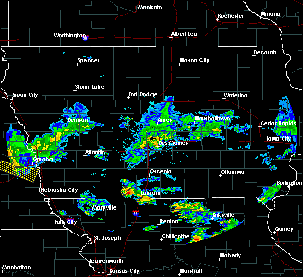 At 354 pm cdt, a severe thunderstorm was located over mount ayr, moving southeast at 25 mph (radar indicated). Hazards include 60 mph wind gusts and quarter size hail. Hail damage to vehicles is expected. expect wind damage to roofs, siding, and trees. Locations impacted include, mount ayr and mt ayr municipal airport. At 354 pm cdt, a severe thunderstorm was located over mount ayr, moving southeast at 25 mph (radar indicated). Hazards include 60 mph wind gusts and quarter size hail. Hail damage to vehicles is expected. expect wind damage to roofs, siding, and trees. Locations impacted include, mount ayr and mt ayr municipal airport.
|
| 9/18/2018 3:40 PM CDT |
 At 340 pm cdt, a severe thunderstorm was located near mount ayr, moving southeast at 20 mph (radar indicated). Hazards include 60 mph wind gusts and half dollar size hail. Hail damage to vehicles is expected. expect wind damage to roofs, siding, and trees. Locations impacted include, mount ayr, diagonal, benton, delphos and mt ayr municipal airport. At 340 pm cdt, a severe thunderstorm was located near mount ayr, moving southeast at 20 mph (radar indicated). Hazards include 60 mph wind gusts and half dollar size hail. Hail damage to vehicles is expected. expect wind damage to roofs, siding, and trees. Locations impacted include, mount ayr, diagonal, benton, delphos and mt ayr municipal airport.
|
| 9/18/2018 3:33 PM CDT |
 At 332 pm cdt, a severe thunderstorm was located 8 miles northwest of mount ayr, moving southeast at 20 mph (radar indicated). Hazards include ping pong ball size hail and 60 mph wind gusts. People and animals outdoors will be injured. expect hail damage to roofs, siding, windows, and vehicles. expect wind damage to roofs, siding, and trees. Locations impacted include, mount ayr, diagonal, redding, benton, maloy, delphos and mt ayr municipal airport. At 332 pm cdt, a severe thunderstorm was located 8 miles northwest of mount ayr, moving southeast at 20 mph (radar indicated). Hazards include ping pong ball size hail and 60 mph wind gusts. People and animals outdoors will be injured. expect hail damage to roofs, siding, windows, and vehicles. expect wind damage to roofs, siding, and trees. Locations impacted include, mount ayr, diagonal, redding, benton, maloy, delphos and mt ayr municipal airport.
|
| 9/18/2018 3:22 PM CDT |
 At 322 pm cdt, a severe thunderstorm was located 9 miles southeast of lenox, or 11 miles northwest of mount ayr, moving east at 25 mph (radar indicated). Hazards include ping pong ball size hail and 60 mph wind gusts. People and animals outdoors will be injured. expect hail damage to roofs, siding, windows, and vehicles. Expect wind damage to roofs, siding, and trees. At 322 pm cdt, a severe thunderstorm was located 9 miles southeast of lenox, or 11 miles northwest of mount ayr, moving east at 25 mph (radar indicated). Hazards include ping pong ball size hail and 60 mph wind gusts. People and animals outdoors will be injured. expect hail damage to roofs, siding, windows, and vehicles. Expect wind damage to roofs, siding, and trees.
|
| 6/28/2018 12:04 PM CDT |
 At 1202 pm cdt, severe thunderstorms were located along a line extending from 8 miles north of lakeside casino to 8 miles southwest of osceola to 7 miles east of mount ayr, moving southeast at 55 mph (trained weather spotters. these storms have produced widespread 60 to 70 mph wind gusts with widespread wind damage). Hazards include 70 mph wind gusts and nickel size hail. Expect considerable tree damage. Damage is likely to mobile homes, roofs, and outbuildings. At 1202 pm cdt, severe thunderstorms were located along a line extending from 8 miles north of lakeside casino to 8 miles southwest of osceola to 7 miles east of mount ayr, moving southeast at 55 mph (trained weather spotters. these storms have produced widespread 60 to 70 mph wind gusts with widespread wind damage). Hazards include 70 mph wind gusts and nickel size hail. Expect considerable tree damage. Damage is likely to mobile homes, roofs, and outbuildings.
|
| 6/28/2018 11:57 AM CDT |
 At 1156 am cdt, severe thunderstorms were located along a line extending from near winterset to 9 miles northwest of lakeside casino to near sun valley lake, moving southeast at 60 mph (trained weather spotters. numerous reports of wind damage have occurred with these storms). Hazards include 70 mph wind gusts and nickel size hail. Expect considerable tree damage. damage is likely to mobile homes, roofs, and outbuildings. locations impacted include, creston, winterset, osceola, mount ayr, stuart, sun valley lake, green valley lake, lakeside casino, avenue of the saints event center, afton, murray, st. charles, truro, orient, lorimor, diagonal, kellerton, grand river, tingley and patterson. This includes interstate 35 between mile markers 29 and 43. At 1156 am cdt, severe thunderstorms were located along a line extending from near winterset to 9 miles northwest of lakeside casino to near sun valley lake, moving southeast at 60 mph (trained weather spotters. numerous reports of wind damage have occurred with these storms). Hazards include 70 mph wind gusts and nickel size hail. Expect considerable tree damage. damage is likely to mobile homes, roofs, and outbuildings. locations impacted include, creston, winterset, osceola, mount ayr, stuart, sun valley lake, green valley lake, lakeside casino, avenue of the saints event center, afton, murray, st. charles, truro, orient, lorimor, diagonal, kellerton, grand river, tingley and patterson. This includes interstate 35 between mile markers 29 and 43.
|
| 6/28/2018 11:37 AM CDT |
 At 1137 am cdt, severe thunderstorms were located along a line extending from 6 miles southwest of earlham to 10 miles northeast of green valley lake to near lenox, moving southeast at 60 mph (trained weather spotters. large branches down and winds estimated near 70 mph in greenfield. power out). Hazards include 70 mph wind gusts and nickel size hail. Expect considerable tree damage. damage is likely to mobile homes, roofs, and outbuildings. locations impacted include, creston, winterset, osceola, greenfield, mount ayr, stuart, lenox, sun valley lake, green valley lake, lakeside casino, avenue of the saints event center, lake icaria, afton, murray, st. charles, truro, orient, clearfield, lorimor and diagonal. This includes interstate 35 between mile markers 29 and 42. At 1137 am cdt, severe thunderstorms were located along a line extending from 6 miles southwest of earlham to 10 miles northeast of green valley lake to near lenox, moving southeast at 60 mph (trained weather spotters. large branches down and winds estimated near 70 mph in greenfield. power out). Hazards include 70 mph wind gusts and nickel size hail. Expect considerable tree damage. damage is likely to mobile homes, roofs, and outbuildings. locations impacted include, creston, winterset, osceola, greenfield, mount ayr, stuart, lenox, sun valley lake, green valley lake, lakeside casino, avenue of the saints event center, lake icaria, afton, murray, st. charles, truro, orient, clearfield, lorimor and diagonal. This includes interstate 35 between mile markers 29 and 42.
|
| 6/28/2018 11:26 AM CDT |
 At 1125 am cdt, severe thunderstorms were located along a line extending from 7 miles northwest of stuart to greenfield to near corning, moving southeast at 60 mph (trained weather spotters. these storms have a history of wind damage). Hazards include 70 mph wind gusts and nickel size hail. Expect considerable tree damage. Damage is likely to mobile homes, roofs, and outbuildings. At 1125 am cdt, severe thunderstorms were located along a line extending from 7 miles northwest of stuart to greenfield to near corning, moving southeast at 60 mph (trained weather spotters. these storms have a history of wind damage). Hazards include 70 mph wind gusts and nickel size hail. Expect considerable tree damage. Damage is likely to mobile homes, roofs, and outbuildings.
|
| 6/25/2018 5:42 PM CDT |
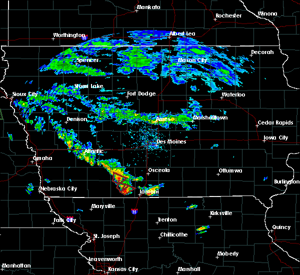 At 542 pm cdt, a severe thunderstorm capable of producing a tornado was located over mount ayr, moving northeast at 20 mph (radar indicated rotation). Hazards include tornado. Flying debris will be dangerous to those caught without shelter. mobile homes will be damaged or destroyed. damage to roofs, windows, and vehicles will occur. tree damage is likely. This tornadic thunderstorm will remain over mainly rural areas of eastern ringgold county, including the following locations, mt ayr municipal airport. At 542 pm cdt, a severe thunderstorm capable of producing a tornado was located over mount ayr, moving northeast at 20 mph (radar indicated rotation). Hazards include tornado. Flying debris will be dangerous to those caught without shelter. mobile homes will be damaged or destroyed. damage to roofs, windows, and vehicles will occur. tree damage is likely. This tornadic thunderstorm will remain over mainly rural areas of eastern ringgold county, including the following locations, mt ayr municipal airport.
|
| 6/25/2018 5:33 PM CDT |
 At 532 pm cdt, a severe thunderstorm capable of producing a tornado was located just northwest of mount ayr, moving northeast at 20 mph (radar indicated rotation). Hazards include tornado. Flying debris will be dangerous to those caught without shelter. mobile homes will be damaged or destroyed. damage to roofs, windows, and vehicles will occur. tree damage is likely. Locations impacted include, mount ayr and diagonal. At 532 pm cdt, a severe thunderstorm capable of producing a tornado was located just northwest of mount ayr, moving northeast at 20 mph (radar indicated rotation). Hazards include tornado. Flying debris will be dangerous to those caught without shelter. mobile homes will be damaged or destroyed. damage to roofs, windows, and vehicles will occur. tree damage is likely. Locations impacted include, mount ayr and diagonal.
|
| 6/25/2018 5:26 PM CDT |
 At 526 pm cdt, a severe thunderstorm capable of producing a tornado was located near mount ayr, moving northeast at 20 mph (radar indicated rotation). Hazards include tornado. Flying debris will be dangerous to those caught without shelter. mobile homes will be damaged or destroyed. damage to roofs, windows, and vehicles will occur. tree damage is likely. this dangerous storm will be near, mount ayr around 545 pm cdt. Other locations impacted by this tornadic thunderstorm include mt ayr municipal airport. At 526 pm cdt, a severe thunderstorm capable of producing a tornado was located near mount ayr, moving northeast at 20 mph (radar indicated rotation). Hazards include tornado. Flying debris will be dangerous to those caught without shelter. mobile homes will be damaged or destroyed. damage to roofs, windows, and vehicles will occur. tree damage is likely. this dangerous storm will be near, mount ayr around 545 pm cdt. Other locations impacted by this tornadic thunderstorm include mt ayr municipal airport.
|
| 6/25/2018 5:19 PM CDT |
 At 519 pm cdt, a confirmed tornado was located near mount ayr, moving northeast at 20 mph (weather spotters confirmed tornado). Hazards include damaging tornado. Flying debris will be dangerous to those caught without shelter. mobile homes will be damaged or destroyed. damage to roofs, windows, and vehicles will occur. Tree damage is likely. At 519 pm cdt, a confirmed tornado was located near mount ayr, moving northeast at 20 mph (weather spotters confirmed tornado). Hazards include damaging tornado. Flying debris will be dangerous to those caught without shelter. mobile homes will be damaged or destroyed. damage to roofs, windows, and vehicles will occur. Tree damage is likely.
|
| 6/11/2018 1:13 AM CDT |
 At 113 am cdt, severe thunderstorms were located along a line extending from near leon to near mount ayr, moving southeast at 20 mph (radar indicated). Hazards include 60 mph wind gusts and nickel size hail. Expect damage to roofs, siding, and trees. locations impacted include, leon, mount ayr, lamoni, kellerton, grand river, davis city, decatur city, pleasanton, ellston, beaconsfield, nine eagles state park, lamoni municipal airport and mt ayr municipal airport. This includes interstate 35 between mile markers 1 and 20. At 113 am cdt, severe thunderstorms were located along a line extending from near leon to near mount ayr, moving southeast at 20 mph (radar indicated). Hazards include 60 mph wind gusts and nickel size hail. Expect damage to roofs, siding, and trees. locations impacted include, leon, mount ayr, lamoni, kellerton, grand river, davis city, decatur city, pleasanton, ellston, beaconsfield, nine eagles state park, lamoni municipal airport and mt ayr municipal airport. This includes interstate 35 between mile markers 1 and 20.
|
| 6/11/2018 12:43 AM CDT |
 At 1243 am cdt, severe thunderstorms were located along a line extending from near leon to 6 miles north of mount ayr, moving southeast at 20 mph (radar indicated). Hazards include 60 mph wind gusts and nickel size hail. expect damage to roofs, siding, and trees At 1243 am cdt, severe thunderstorms were located along a line extending from near leon to 6 miles north of mount ayr, moving southeast at 20 mph (radar indicated). Hazards include 60 mph wind gusts and nickel size hail. expect damage to roofs, siding, and trees
|
| 5/2/2018 8:56 PM CDT |
 At 856 pm cdt, severe thunderstorms were located along a line extending from 8 miles northeast of lenox to 7 miles southeast of mount ayr, moving northeast at 55 mph (radar indicated). Hazards include 60 mph wind gusts. Expect damage to roofs, siding, and trees. locations impacted include, creston, leon, mount ayr, lamoni, sun valley lake, afton, diagonal, kellerton, grand river, van wert, garden grove, davis city, decatur city, tingley, weldon, arispe, shannon city, thayer, ellston and benton. this includes interstate 35 between mile markers 1 and 27. A tornado watch remains in effect until 100 am cdt for south central iowa. At 856 pm cdt, severe thunderstorms were located along a line extending from 8 miles northeast of lenox to 7 miles southeast of mount ayr, moving northeast at 55 mph (radar indicated). Hazards include 60 mph wind gusts. Expect damage to roofs, siding, and trees. locations impacted include, creston, leon, mount ayr, lamoni, sun valley lake, afton, diagonal, kellerton, grand river, van wert, garden grove, davis city, decatur city, tingley, weldon, arispe, shannon city, thayer, ellston and benton. this includes interstate 35 between mile markers 1 and 27. A tornado watch remains in effect until 100 am cdt for south central iowa.
|
| 5/2/2018 8:43 PM CDT |
 At 842 pm cdt, severe thunderstorms were located along a line extending from near lenox to 6 miles southeast of irena, moving northeast at 55 mph (radar indicated). Hazards include 60 mph wind gusts. expect damage to roofs, siding, and trees At 842 pm cdt, severe thunderstorms were located along a line extending from near lenox to 6 miles southeast of irena, moving northeast at 55 mph (radar indicated). Hazards include 60 mph wind gusts. expect damage to roofs, siding, and trees
|
| 5/2/2018 6:37 PM CDT |
 At 637 pm cdt, a severe thunderstorm was located near lenox, or 12 miles northeast of bedford, moving northeast at 20 mph (radar indicated). Hazards include 60 mph wind gusts and quarter size hail. Hail damage to vehicles is expected. expect wind damage to roofs, siding, and trees. locations impacted include, mount ayr, bedford, lenox, new market, clearfield, diagonal, gravity, tingley, arispe, sharpsburg, shannon city, conway, benton, maloy, delphos, lake of three fires state park, bedford municipal airport and mt ayr municipal airport. A tornado watch remains in effect until 100 am cdt for south central and southwestern iowa. At 637 pm cdt, a severe thunderstorm was located near lenox, or 12 miles northeast of bedford, moving northeast at 20 mph (radar indicated). Hazards include 60 mph wind gusts and quarter size hail. Hail damage to vehicles is expected. expect wind damage to roofs, siding, and trees. locations impacted include, mount ayr, bedford, lenox, new market, clearfield, diagonal, gravity, tingley, arispe, sharpsburg, shannon city, conway, benton, maloy, delphos, lake of three fires state park, bedford municipal airport and mt ayr municipal airport. A tornado watch remains in effect until 100 am cdt for south central and southwestern iowa.
|
| 5/2/2018 6:15 PM CDT |
 The national weather service in des moines has issued a * severe thunderstorm warning for. southwestern union county in south central iowa. ringgold county in south central iowa. taylor county in southwestern iowa. Until 700 pm cdt. The national weather service in des moines has issued a * severe thunderstorm warning for. southwestern union county in south central iowa. ringgold county in south central iowa. taylor county in southwestern iowa. Until 700 pm cdt.
|
| 6/28/2017 4:05 PM CDT |
 At 904 pm cdt, a severe thunderstorm was located near mount ayr, moving northeast at 40 mph (radar indicated). Hazards include 60 mph wind gusts and quarter size hail. Hail damage to vehicles is expected. expect wind damage to roofs, siding, and trees. locations impacted include, mount ayr, diagonal, shannon city, benton, maloy, delphos and mt ayr municipal airport. A tornado watch remains in effect until 1000 pm cdt for south central iowa. At 904 pm cdt, a severe thunderstorm was located near mount ayr, moving northeast at 40 mph (radar indicated). Hazards include 60 mph wind gusts and quarter size hail. Hail damage to vehicles is expected. expect wind damage to roofs, siding, and trees. locations impacted include, mount ayr, diagonal, shannon city, benton, maloy, delphos and mt ayr municipal airport. A tornado watch remains in effect until 1000 pm cdt for south central iowa.
|
| 6/28/2017 3:57 PM CDT |
 At 856 pm cdt, a severe thunderstorm was located 8 miles west of mount ayr, moving east at 45 mph (radar indicated). Hazards include ping pong ball size hail and 60 mph wind gusts. at 8:34pm, trained weather spotters reported golf ball sized hail 2 miles southeast of bedford. People and animals outdoors will be injured. expect hail damage to roofs, siding, windows, and vehicles. expect wind damage to roofs, siding, and trees. locations impacted include, mount ayr, clearfield, diagonal, blockton, sharpsburg, redding, shannon city, benton, conway, maloy, delphos and mt ayr municipal airport. A tornado watch remains in effect until 1000 pm cdt for south central and southwestern iowa. At 856 pm cdt, a severe thunderstorm was located 8 miles west of mount ayr, moving east at 45 mph (radar indicated). Hazards include ping pong ball size hail and 60 mph wind gusts. at 8:34pm, trained weather spotters reported golf ball sized hail 2 miles southeast of bedford. People and animals outdoors will be injured. expect hail damage to roofs, siding, windows, and vehicles. expect wind damage to roofs, siding, and trees. locations impacted include, mount ayr, clearfield, diagonal, blockton, sharpsburg, redding, shannon city, benton, conway, maloy, delphos and mt ayr municipal airport. A tornado watch remains in effect until 1000 pm cdt for south central and southwestern iowa.
|
| 6/28/2017 3:38 PM CDT |
 At 838 pm cdt, a severe thunderstorm was located near bedford, moving northeast at 40 mph (radar indicated). Hazards include 60 mph wind gusts and half dollar size hail. Hail damage to vehicles is expected. Expect wind damage to roofs, siding, and trees. At 838 pm cdt, a severe thunderstorm was located near bedford, moving northeast at 40 mph (radar indicated). Hazards include 60 mph wind gusts and half dollar size hail. Hail damage to vehicles is expected. Expect wind damage to roofs, siding, and trees.
|
| 6/28/2017 1:10 PM CDT |
 At 610 pm cdt, a severe thunderstorm was located 7 miles east of mount ayr, moving east at 20 mph (radar indicated). Hazards include 60 mph wind gusts and quarter size hail. Hail damage to vehicles is expected. expect wind damage to roofs, siding, and trees. locations impacted include, mount ayr, sun valley lake, diagonal, kellerton, blockton, tingley, redding, ellston, benton, maloy, delphos, athelstan, beaconsfield, bedford municipal airport and mt ayr municipal airport. A tornado watch remains in effect until 1000 pm cdt for south central and southwestern iowa. At 610 pm cdt, a severe thunderstorm was located 7 miles east of mount ayr, moving east at 20 mph (radar indicated). Hazards include 60 mph wind gusts and quarter size hail. Hail damage to vehicles is expected. expect wind damage to roofs, siding, and trees. locations impacted include, mount ayr, sun valley lake, diagonal, kellerton, blockton, tingley, redding, ellston, benton, maloy, delphos, athelstan, beaconsfield, bedford municipal airport and mt ayr municipal airport. A tornado watch remains in effect until 1000 pm cdt for south central and southwestern iowa.
|
| 6/28/2017 12:39 PM CDT |
 At 539 pm cdt, a severe thunderstorm was located near mount ayr, moving east at 20 mph (radar indicated). Hazards include 60 mph wind gusts and quarter size hail. Hail damage to vehicles is expected. Expect wind damage to roofs, siding, and trees. At 539 pm cdt, a severe thunderstorm was located near mount ayr, moving east at 20 mph (radar indicated). Hazards include 60 mph wind gusts and quarter size hail. Hail damage to vehicles is expected. Expect wind damage to roofs, siding, and trees.
|
| 6/16/2017 10:19 PM CDT |
 At 1019 pm cdt, severe thunderstorms were located along a line extending from 6 miles northwest of sun valley lake to near irena, moving east at 45 mph (radar indicated). Hazards include 60 mph wind gusts. expect damage to roofs, siding, and trees At 1019 pm cdt, severe thunderstorms were located along a line extending from 6 miles northwest of sun valley lake to near irena, moving east at 45 mph (radar indicated). Hazards include 60 mph wind gusts. expect damage to roofs, siding, and trees
|
| 6/16/2017 9:37 PM CDT |
 At 937 pm cdt, severe thunderstorms were located along a line extending from lake icaria to near hopkins, moving southeast at 45 mph (radar indicated). Hazards include 60 mph wind gusts. expect damage to roofs, siding, and trees At 937 pm cdt, severe thunderstorms were located along a line extending from lake icaria to near hopkins, moving southeast at 45 mph (radar indicated). Hazards include 60 mph wind gusts. expect damage to roofs, siding, and trees
|
| 5/16/2017 11:37 PM CDT |
 At 1136 pm cdt, a severe thunderstorm was located 7 miles northwest of sun valley lake, or 13 miles southeast of creston, moving northeast at 50 mph (radar indicated). Hazards include 60 mph wind gusts. Expect damage to roofs, siding, and trees. Locations impacted include, mount ayr, sun valley lake, afton, lorimor, diagonal, tingley, arispe, shannon city, thayer, ellston and beaconsfield. At 1136 pm cdt, a severe thunderstorm was located 7 miles northwest of sun valley lake, or 13 miles southeast of creston, moving northeast at 50 mph (radar indicated). Hazards include 60 mph wind gusts. Expect damage to roofs, siding, and trees. Locations impacted include, mount ayr, sun valley lake, afton, lorimor, diagonal, tingley, arispe, shannon city, thayer, ellston and beaconsfield.
|
| 5/16/2017 11:19 PM CDT |
 At 1118 pm cdt, a severe thunderstorm was located 8 miles southeast of lenox, or 11 miles northwest of mount ayr, moving northeast at 45 mph (radar indicated). Hazards include 60 mph wind gusts and penny size hail. expect damage to roofs, siding, and trees At 1118 pm cdt, a severe thunderstorm was located 8 miles southeast of lenox, or 11 miles northwest of mount ayr, moving northeast at 45 mph (radar indicated). Hazards include 60 mph wind gusts and penny size hail. expect damage to roofs, siding, and trees
|
| 8/24/2016 1:20 AM CDT |
 At 120 am cdt, a severe thunderstorm was located 7 miles east of sun valley lake, or 13 miles northwest of leon, moving east at 40 mph (radar indicated). Hazards include 60 mph wind gusts. Expect damage to roofs. siding. and trees. Locations impacted include, leon, mount ayr, sun valley lake, diagonal, kellerton, grand river, van wert, garden grove, decatur city, tingley, weldon, arispe, shannon city, ellston, benton, le roy, beaconsfield and mt ayr municipal airport. At 120 am cdt, a severe thunderstorm was located 7 miles east of sun valley lake, or 13 miles northwest of leon, moving east at 40 mph (radar indicated). Hazards include 60 mph wind gusts. Expect damage to roofs. siding. and trees. Locations impacted include, leon, mount ayr, sun valley lake, diagonal, kellerton, grand river, van wert, garden grove, decatur city, tingley, weldon, arispe, shannon city, ellston, benton, le roy, beaconsfield and mt ayr municipal airport.
|
| 8/24/2016 12:59 AM CDT |
 At 1259 am cdt, a severe thunderstorm was located near sun valley lake, or 9 miles northeast of mount ayr, moving east at 50 mph (radar indicated). Hazards include 60 mph wind gusts. Expect damage to roofs. siding. And trees. At 1259 am cdt, a severe thunderstorm was located near sun valley lake, or 9 miles northeast of mount ayr, moving east at 50 mph (radar indicated). Hazards include 60 mph wind gusts. Expect damage to roofs. siding. And trees.
|
| 7/7/2016 4:37 AM CDT |
 At 437 am cdt, severe thunderstorms were located along a line extending from 7 miles southwest of creston to 9 miles north of mount ayr to near irena, moving east at 45 mph (radar indicated). Hazards include 60 mph wind gusts. Expect damage to roofs. siding. and trees. these severe storms will be near, sun valley lake around 455 am cdt. Other locations impacted by these severe thunderstorms include kent, maloy, delphos, benton, beaconsfield, ellston, mt ayr municipal airport, kellerton, redding and diagonal. At 437 am cdt, severe thunderstorms were located along a line extending from 7 miles southwest of creston to 9 miles north of mount ayr to near irena, moving east at 45 mph (radar indicated). Hazards include 60 mph wind gusts. Expect damage to roofs. siding. and trees. these severe storms will be near, sun valley lake around 455 am cdt. Other locations impacted by these severe thunderstorms include kent, maloy, delphos, benton, beaconsfield, ellston, mt ayr municipal airport, kellerton, redding and diagonal.
|
| 7/7/2016 4:14 AM CDT |
 At 413 am cdt, severe thunderstorms were located along a line extending from near corning to near lenox to 6 miles east of hopkins, moving east at 45 mph (radar indicated). Hazards include 60 mph wind gusts. Expect damage to roofs. siding. And trees. At 413 am cdt, severe thunderstorms were located along a line extending from near corning to near lenox to 6 miles east of hopkins, moving east at 45 mph (radar indicated). Hazards include 60 mph wind gusts. Expect damage to roofs. siding. And trees.
|
| 7/7/2016 4:00 AM CDT |
 At 400 am cdt, severe thunderstorms were located along a line extending from near lenox to near hopkins, moving east at 55 mph (radar indicated). Hazards include 60 mph wind gusts and penny size hail. Expect damage to roofs. siding. and trees. these severe storms will be near, lenox around 410 am cdt. athelstan around 415 am cdt. Other locations impacted by these severe thunderstorms include sharpsburg, maloy, delphos, benton, gravity, redding, diagonal, blockton, new market and lake of three fires state park. At 400 am cdt, severe thunderstorms were located along a line extending from near lenox to near hopkins, moving east at 55 mph (radar indicated). Hazards include 60 mph wind gusts and penny size hail. Expect damage to roofs. siding. and trees. these severe storms will be near, lenox around 410 am cdt. athelstan around 415 am cdt. Other locations impacted by these severe thunderstorms include sharpsburg, maloy, delphos, benton, gravity, redding, diagonal, blockton, new market and lake of three fires state park.
|
| 7/7/2016 3:33 AM CDT |
 At 332 am cdt, severe thunderstorms were located along a line extending from near villisca to near blanchard, moving east at 60 mph (radar indicated). Hazards include 60 mph wind gusts and penny size hail. Expect damage to roofs. siding. and trees. severe thunderstorms will be near, lenox around 355 am cdt. bedford around 400 am cdt. athelstan around 405 am cdt. Other locations impacted by these severe thunderstorms include sharpsburg, maloy, delphos, benton, gravity, redding, diagonal, blockton, new market and lake of three fires state park. At 332 am cdt, severe thunderstorms were located along a line extending from near villisca to near blanchard, moving east at 60 mph (radar indicated). Hazards include 60 mph wind gusts and penny size hail. Expect damage to roofs. siding. and trees. severe thunderstorms will be near, lenox around 355 am cdt. bedford around 400 am cdt. athelstan around 405 am cdt. Other locations impacted by these severe thunderstorms include sharpsburg, maloy, delphos, benton, gravity, redding, diagonal, blockton, new market and lake of three fires state park.
|
| 6/26/2016 1:39 AM CDT |
 The severe thunderstorm warning for eastern ringgold county will expire at 145 am cdt, the storm which prompted the warning has weakened below severe limits, and has exited the warned area. therefore, the warning will be allowed to expire. The severe thunderstorm warning for eastern ringgold county will expire at 145 am cdt, the storm which prompted the warning has weakened below severe limits, and has exited the warned area. therefore, the warning will be allowed to expire.
|
| 6/26/2016 1:35 AM CDT |
 At 135 am cdt, a severe thunderstorm was located near mount ayr, moving east at 50 mph (radar indicated). Hazards include 60 mph wind gusts. Expect damage to roofs. siding. and trees. Locations impacted include, mount ayr, sun valley lake, kellerton, tingley, ellston, beaconsfield and mt ayr municipal airport. At 135 am cdt, a severe thunderstorm was located near mount ayr, moving east at 50 mph (radar indicated). Hazards include 60 mph wind gusts. Expect damage to roofs. siding. and trees. Locations impacted include, mount ayr, sun valley lake, kellerton, tingley, ellston, beaconsfield and mt ayr municipal airport.
|
| 6/26/2016 1:06 AM CDT |
 At 105 am cdt, a severe thunderstorm was located 9 miles west of mount ayr, moving east at 30 mph (radar indicated). Hazards include 60 mph wind gusts and quarter size hail. Hail damage to vehicles is expected. Expect wind damage to roofs, siding, and trees. At 105 am cdt, a severe thunderstorm was located 9 miles west of mount ayr, moving east at 30 mph (radar indicated). Hazards include 60 mph wind gusts and quarter size hail. Hail damage to vehicles is expected. Expect wind damage to roofs, siding, and trees.
|
| 4/27/2016 5:42 PM CDT |
 At 542 pm cdt, severe thunderstorms were located along a line extending from 9 miles southeast of creston to 6 miles west of sun valley lake to 7 miles northeast of mount ayr, moving north at 45 mph (radar indicated). Hazards include 60 mph wind gusts and quarter size hail. Hail damage to vehicles is expected. Expect wind damage to roofs, siding, and trees. At 542 pm cdt, severe thunderstorms were located along a line extending from 9 miles southeast of creston to 6 miles west of sun valley lake to 7 miles northeast of mount ayr, moving north at 45 mph (radar indicated). Hazards include 60 mph wind gusts and quarter size hail. Hail damage to vehicles is expected. Expect wind damage to roofs, siding, and trees.
|
| 11/11/2015 2:23 PM CST |
 At 223 pm cst, a severe thunderstorm was located 5 miles southeast of mount ayr, moving northeast at 70 mph (radar indicated). Hazards include 70 mph wind gusts. Expect considerable tree damage. Damage is likely to mobile homes, roofs and outbuildings. At 223 pm cst, a severe thunderstorm was located 5 miles southeast of mount ayr, moving northeast at 70 mph (radar indicated). Hazards include 70 mph wind gusts. Expect considerable tree damage. Damage is likely to mobile homes, roofs and outbuildings.
|
| 11/11/2015 2:12 PM CST | Power lines down. trees down. took west part of their big machine shed. possible tornado based on rada in ringgold county IA, 3.6 miles ESE of Mount Ayr, IA |
| 11/11/2015 2:10 PM CST |
 At 209 pm cst, a severe thunderstorm was located 7 miles west of mount ayr, moving northeast at 60 mph (radar indicated). Hazards include 60 mph wind gusts and nickel size hail. Expect damage to roofs. Siding and trees. At 209 pm cst, a severe thunderstorm was located 7 miles west of mount ayr, moving northeast at 60 mph (radar indicated). Hazards include 60 mph wind gusts and nickel size hail. Expect damage to roofs. Siding and trees.
|
| 8/22/2015 9:48 PM CDT |
 At 948 pm cdt, a severe thunderstorm was located 5 miles southeast of mount ayr, moving east at 35 mph (radar indicated). Hazards include quarter size hail. Damage to vehicles is expected. locations impacted include, mount ayr, benton, maloy, delphos and mt ayr municipal airport. A tornado watch remains in effect until midnight cdt for south central iowa. At 948 pm cdt, a severe thunderstorm was located 5 miles southeast of mount ayr, moving east at 35 mph (radar indicated). Hazards include quarter size hail. Damage to vehicles is expected. locations impacted include, mount ayr, benton, maloy, delphos and mt ayr municipal airport. A tornado watch remains in effect until midnight cdt for south central iowa.
|
| 8/22/2015 9:13 PM CDT |
 At 913 pm cdt, a severe thunderstorm was located 7 miles east of bedford, moving east at 35 mph (radar indicated). Hazards include quarter size hail. damage to vehicles is expected At 913 pm cdt, a severe thunderstorm was located 7 miles east of bedford, moving east at 35 mph (radar indicated). Hazards include quarter size hail. damage to vehicles is expected
|
| 8/2/2015 8:23 PM CDT |
 At 823 pm cdt, severe thunderstorms were located along a line extending from 6 miles northeast of mount ayr to 10 miles southeast of lenox, moving southeast at 30 mph (radar indicated). Hazards include 60 mph wind gusts and quarter size hail. Hail damage to vehicles is expected. expect wind damage to roofs, siding and trees. Locations impacted include, mount ayr, lenox, clearfield, diagonal, blockton, tingley, redding, ellston, benton, maloy, delphos and mt ayr municipal airport. At 823 pm cdt, severe thunderstorms were located along a line extending from 6 miles northeast of mount ayr to 10 miles southeast of lenox, moving southeast at 30 mph (radar indicated). Hazards include 60 mph wind gusts and quarter size hail. Hail damage to vehicles is expected. expect wind damage to roofs, siding and trees. Locations impacted include, mount ayr, lenox, clearfield, diagonal, blockton, tingley, redding, ellston, benton, maloy, delphos and mt ayr municipal airport.
|
| 8/2/2015 7:56 PM CDT |
 At 755 pm cdt, severe thunderstorms were located along a line extending from 7 miles south of creston to near lenox, moving southeast at 30 mph (radar indicated). Hazards include 60 mph wind gusts and quarter size hail. Hail damage to vehicles is expected. Expect wind damage to roofs, siding and trees. At 755 pm cdt, severe thunderstorms were located along a line extending from 7 miles south of creston to near lenox, moving southeast at 30 mph (radar indicated). Hazards include 60 mph wind gusts and quarter size hail. Hail damage to vehicles is expected. Expect wind damage to roofs, siding and trees.
|
| 7/28/2015 10:31 PM CDT |
 At 1030 pm cdt, a severe thunderstorm was located 6 miles south of mount ayr, moving east at 30 mph (radar indicated). Hazards include 60 mph wind gusts. Expect damage to roofs. siding and trees. Locations impacted include, mount ayr, sun valley lake, diagonal, kellerton, redding, ellston, benton, maloy, delphos, beaconsfield and mt ayr municipal airport. At 1030 pm cdt, a severe thunderstorm was located 6 miles south of mount ayr, moving east at 30 mph (radar indicated). Hazards include 60 mph wind gusts. Expect damage to roofs. siding and trees. Locations impacted include, mount ayr, sun valley lake, diagonal, kellerton, redding, ellston, benton, maloy, delphos, beaconsfield and mt ayr municipal airport.
|
| 7/28/2015 10:14 PM CDT |
 At 1014 pm cdt, a severe thunderstorm was located 6 miles north of irena, or 11 miles southwest of mount ayr, moving east at 35 mph (radar indicated). Hazards include 60 mph wind gusts. Expect damage to roofs. Siding and trees. At 1014 pm cdt, a severe thunderstorm was located 6 miles north of irena, or 11 miles southwest of mount ayr, moving east at 35 mph (radar indicated). Hazards include 60 mph wind gusts. Expect damage to roofs. Siding and trees.
|
| 7/25/2015 2:57 AM CDT |
 At 255 am cdt, severe thunderstorms were located along a line extending from 7 miles north of lenox to 7 miles west of grant city, moving east at 30 mph (radar indicated). Hazards include quarter size hail. Damage to vehicles is expected. These severe thunderstorms will remain over mainly rural areas of ringgold, taylor, southern union and southern adams counties, including the following locations, sharpsburg, diagonal, new market, tingley, benton, gravity, clearfield, shannon city, arispe and maloy. At 255 am cdt, severe thunderstorms were located along a line extending from 7 miles north of lenox to 7 miles west of grant city, moving east at 30 mph (radar indicated). Hazards include quarter size hail. Damage to vehicles is expected. These severe thunderstorms will remain over mainly rural areas of ringgold, taylor, southern union and southern adams counties, including the following locations, sharpsburg, diagonal, new market, tingley, benton, gravity, clearfield, shannon city, arispe and maloy.
|
| 7/25/2015 2:30 AM CDT |
 At 230 am cdt, severe thunderstorms were located along a line extending from 8 miles west of corning to 5 miles southwest of hopkins, moving east at 35 mph (radar indicated). Hazards include 60 mph wind gusts and quarter size hail. Hail damage to vehicles is expected. expect wind damage to roofs, siding and trees. severe thunderstorms will be near, corning and lake icaria around 245 am cdt. lenox around 300 am cdt. creston around 315 am cdt. Other locations impacted by these severe thunderstorms include sharpsburg, diagonal, new market, prescott, cromwell, tingley, benton, gravity, clearfield and shannon city. At 230 am cdt, severe thunderstorms were located along a line extending from 8 miles west of corning to 5 miles southwest of hopkins, moving east at 35 mph (radar indicated). Hazards include 60 mph wind gusts and quarter size hail. Hail damage to vehicles is expected. expect wind damage to roofs, siding and trees. severe thunderstorms will be near, corning and lake icaria around 245 am cdt. lenox around 300 am cdt. creston around 315 am cdt. Other locations impacted by these severe thunderstorms include sharpsburg, diagonal, new market, prescott, cromwell, tingley, benton, gravity, clearfield and shannon city.
|
| 6/21/2015 7:06 PM CDT |
 At 706 pm cdt, a severe thunderstorm was located 6 miles south of mount ayr, moving southeast at 25 mph (radar indicated). Hazards include ping pong ball size hail. People and animals outdoors will be injured. expect damage to roofs, siding, windows and vehicles. locations impacted include, mount ayr, lamoni, kellerton, grand river, beaconsfield, lamoni municipal airport and mt ayr municipal airport. This includes interstate 35 between mile markers 1 and 8. At 706 pm cdt, a severe thunderstorm was located 6 miles south of mount ayr, moving southeast at 25 mph (radar indicated). Hazards include ping pong ball size hail. People and animals outdoors will be injured. expect damage to roofs, siding, windows and vehicles. locations impacted include, mount ayr, lamoni, kellerton, grand river, beaconsfield, lamoni municipal airport and mt ayr municipal airport. This includes interstate 35 between mile markers 1 and 8.
|
| 6/21/2015 6:40 PM CDT |
 At 639 pm cdt, a severe thunderstorm was located 5 miles west of mount ayr, moving east at 30 mph (radar indicated). Hazards include quarter size hail. damage to vehicles is expected At 639 pm cdt, a severe thunderstorm was located 5 miles west of mount ayr, moving east at 30 mph (radar indicated). Hazards include quarter size hail. damage to vehicles is expected
|
| 6/3/2014 7:00 PM CDT | Half Dollar sized hail reported 0.9 miles ENE of Mount Ayr, IA, time estimated from radar. spotter also reports window well covers have holes punched in the from the hail along with holes punched in window screens. |
| 6/3/2014 5:20 PM CDT | Hen Egg sized hail reported 9.3 miles N of Mount Ayr, IA |
| 6/16/2012 2:35 PM CDT | Quarter sized hail reported 0.4 miles NE of Mount Ayr, IA, trained spotter reports mostly pea to nickel sized hail with some quarters mixed in. time estimated. |
| 6/16/2012 2:35 PM CDT | Quarter sized hail reported 0.5 miles SE of Mount Ayr, IA, trained spotter reported mostly pea to nickel sized hail with a few quarters. time estimated. |
Hail Maps for Mount Ayr, IA


Connect with Interactive Hail Maps