

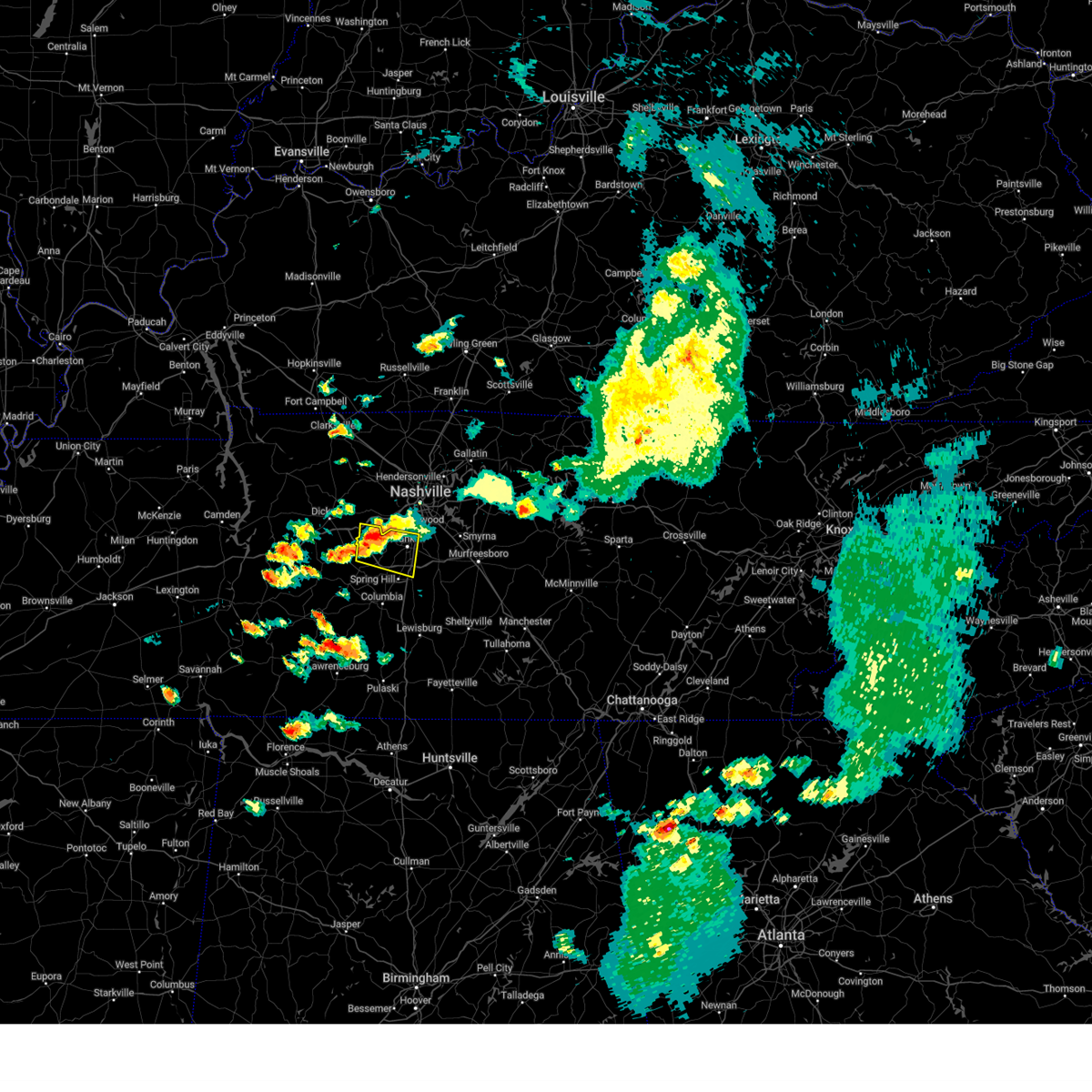
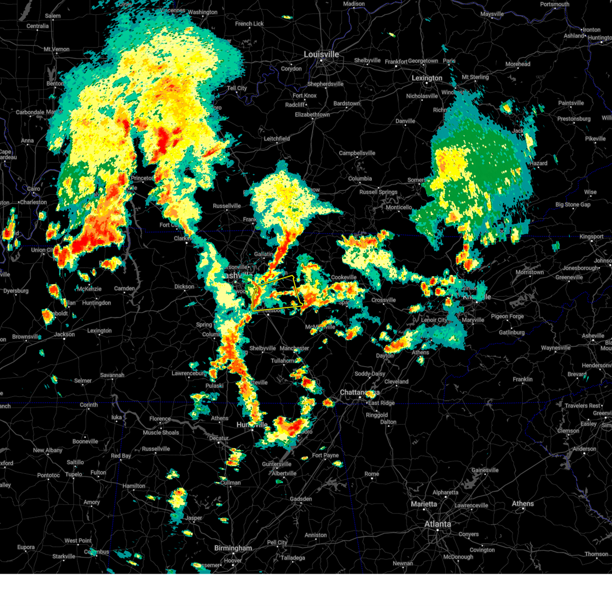
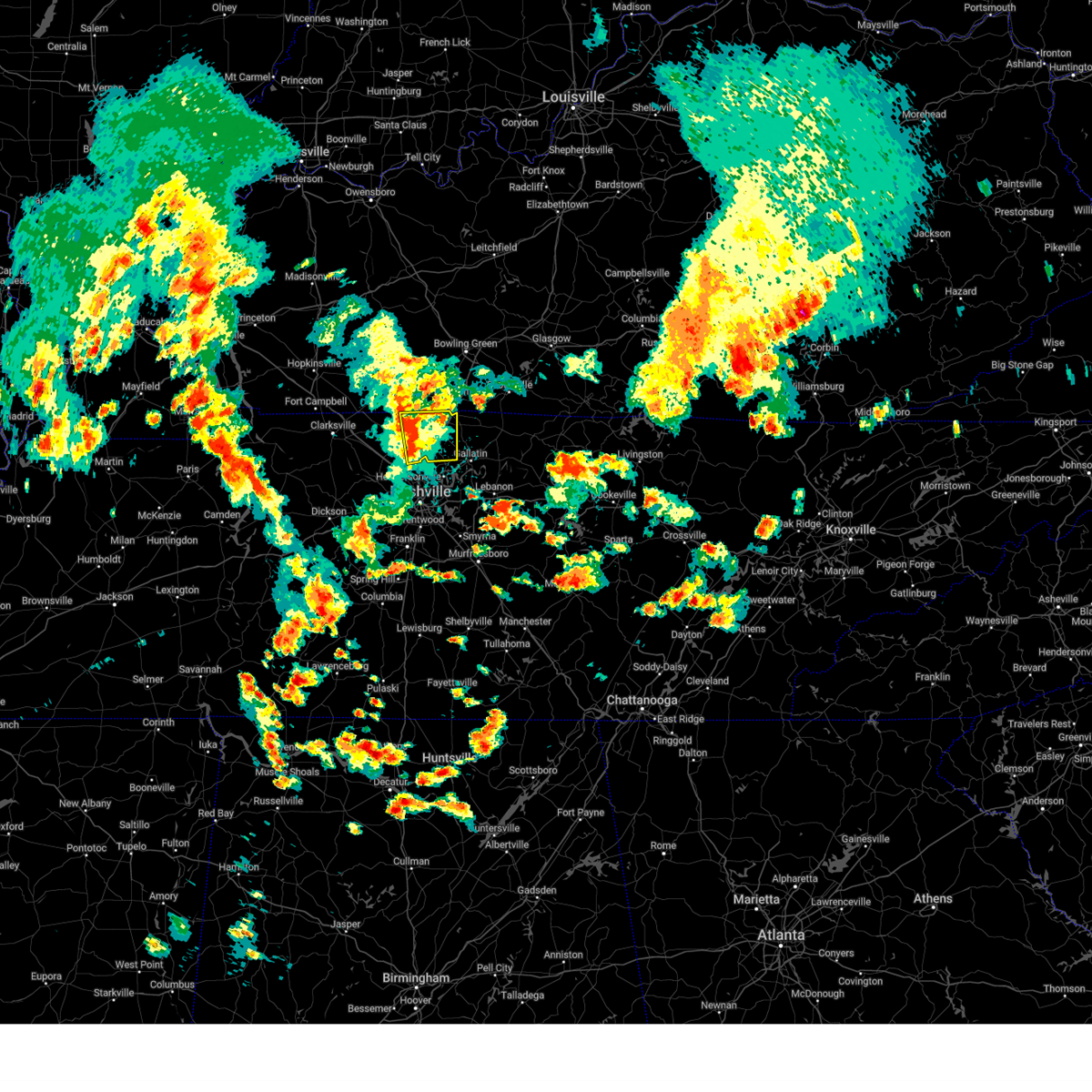
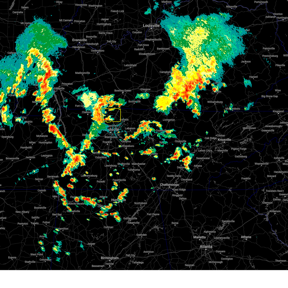
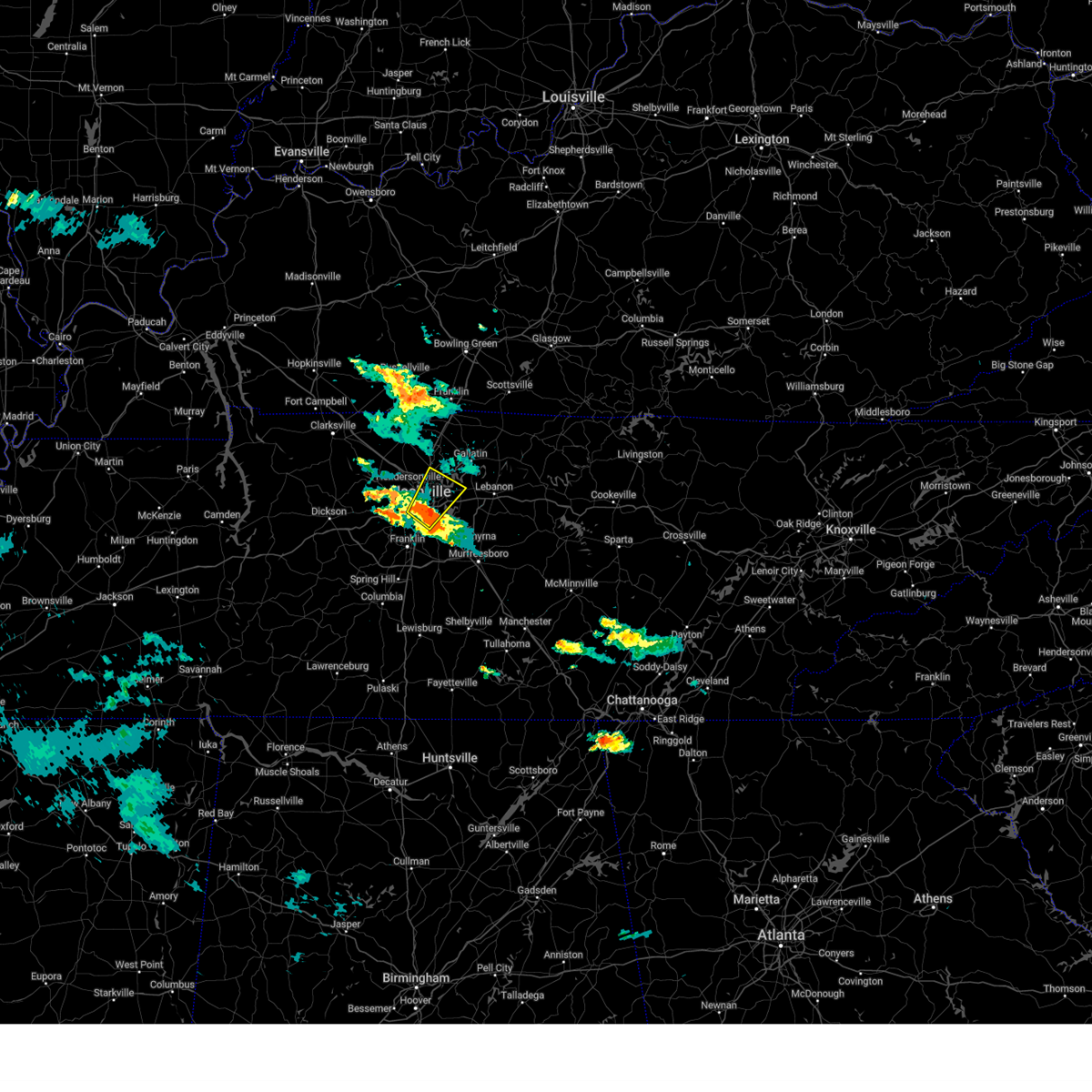
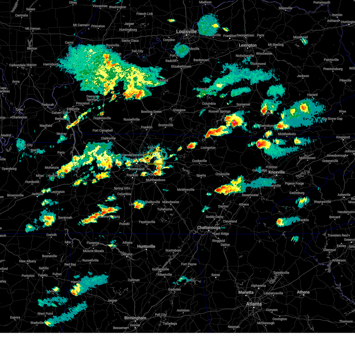
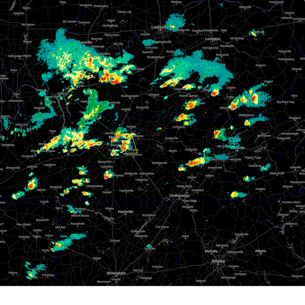
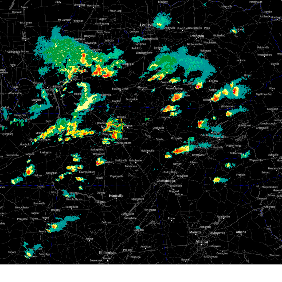
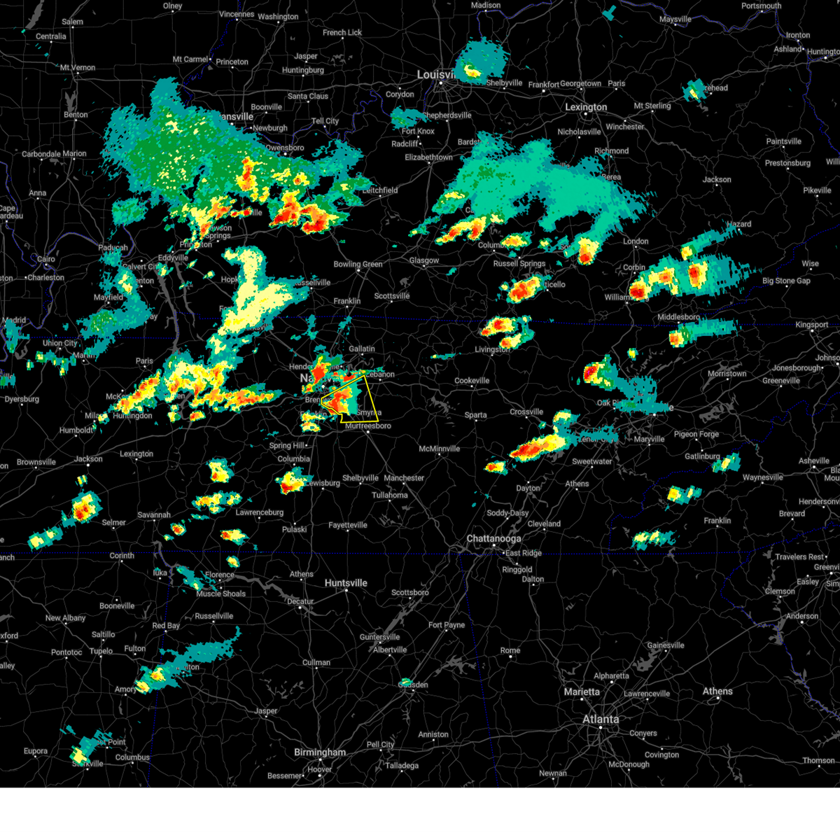
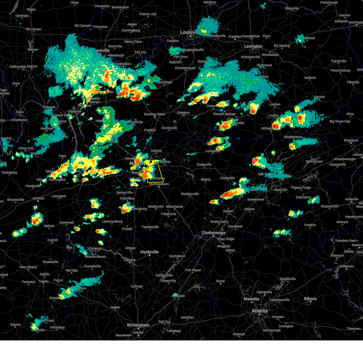
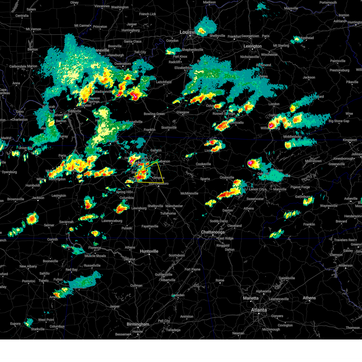
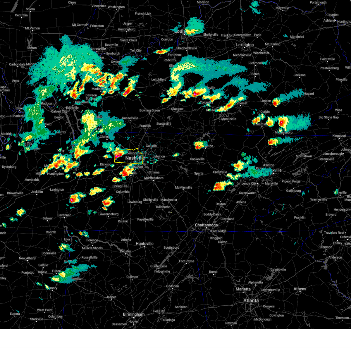
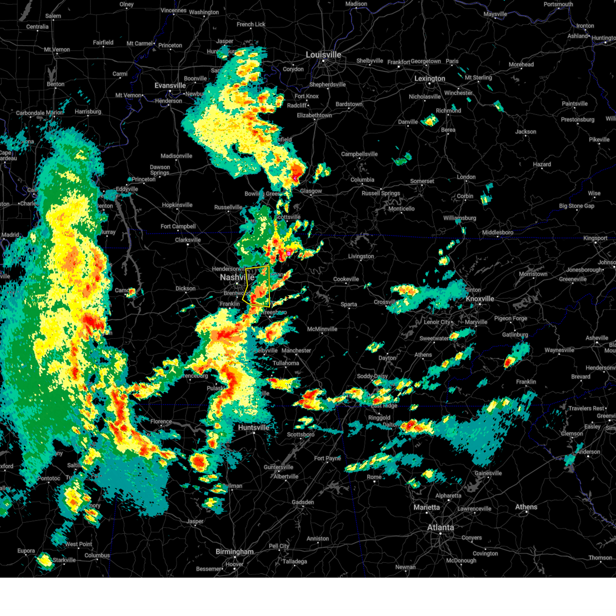
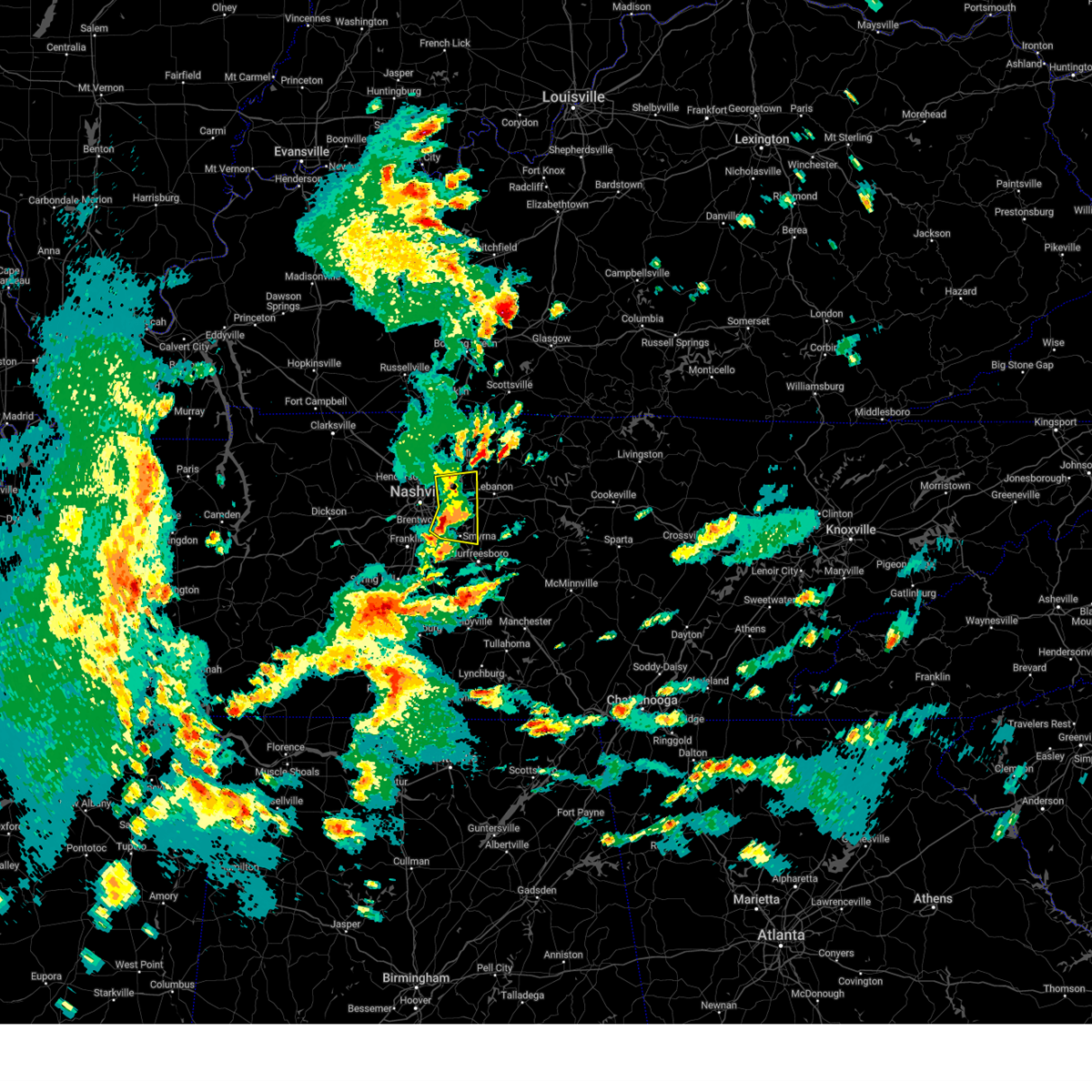
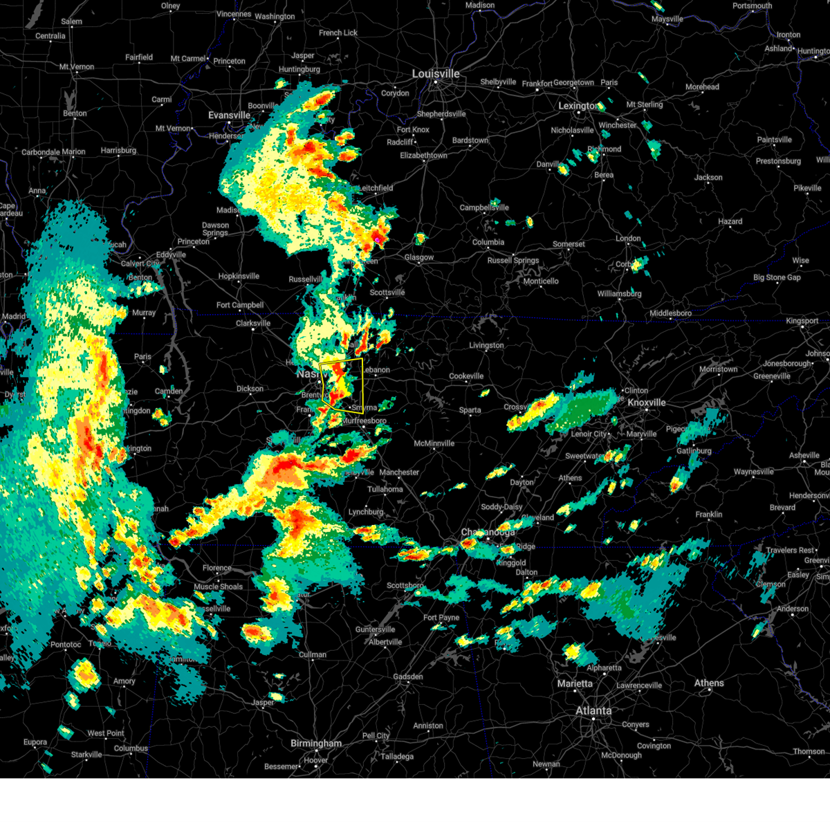
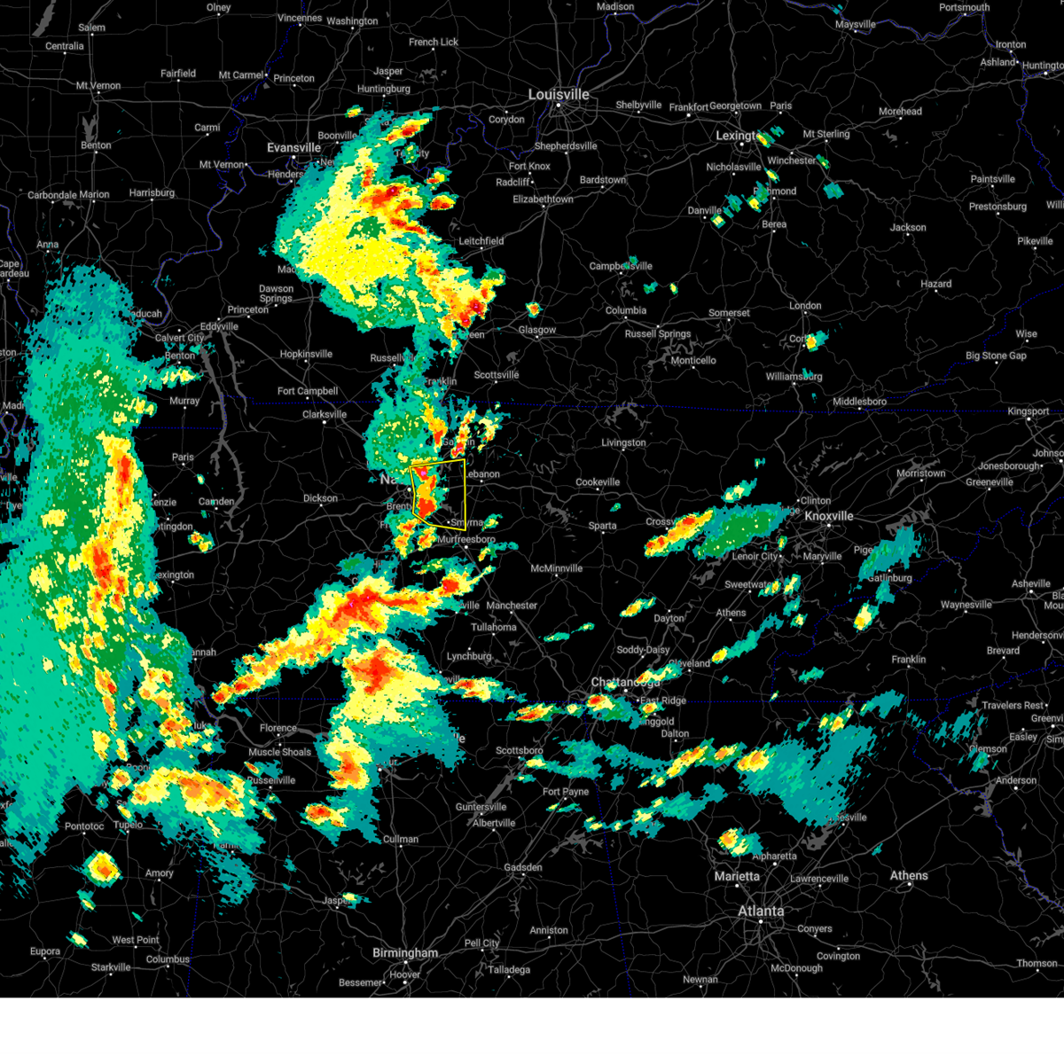
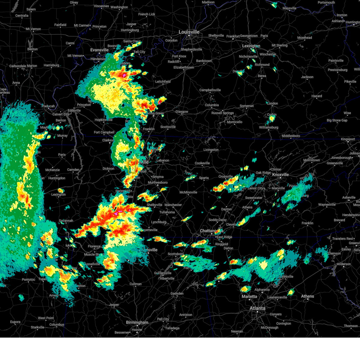
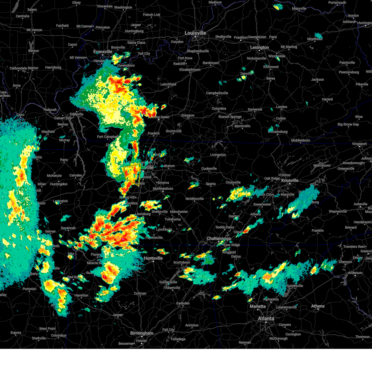
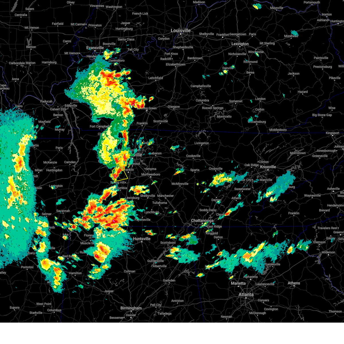
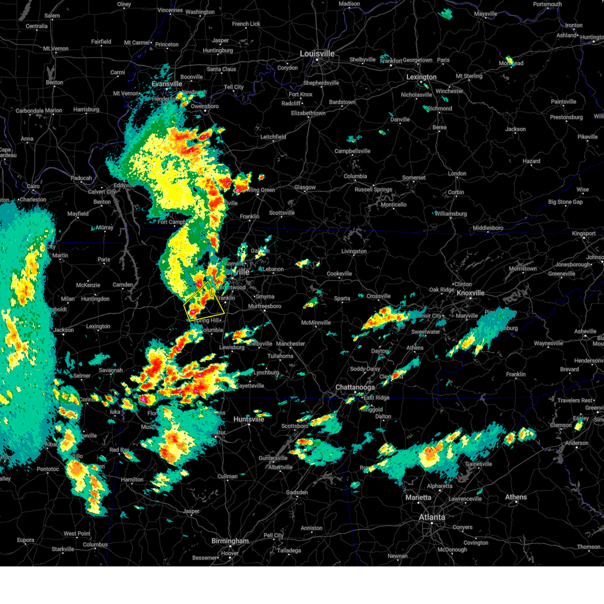
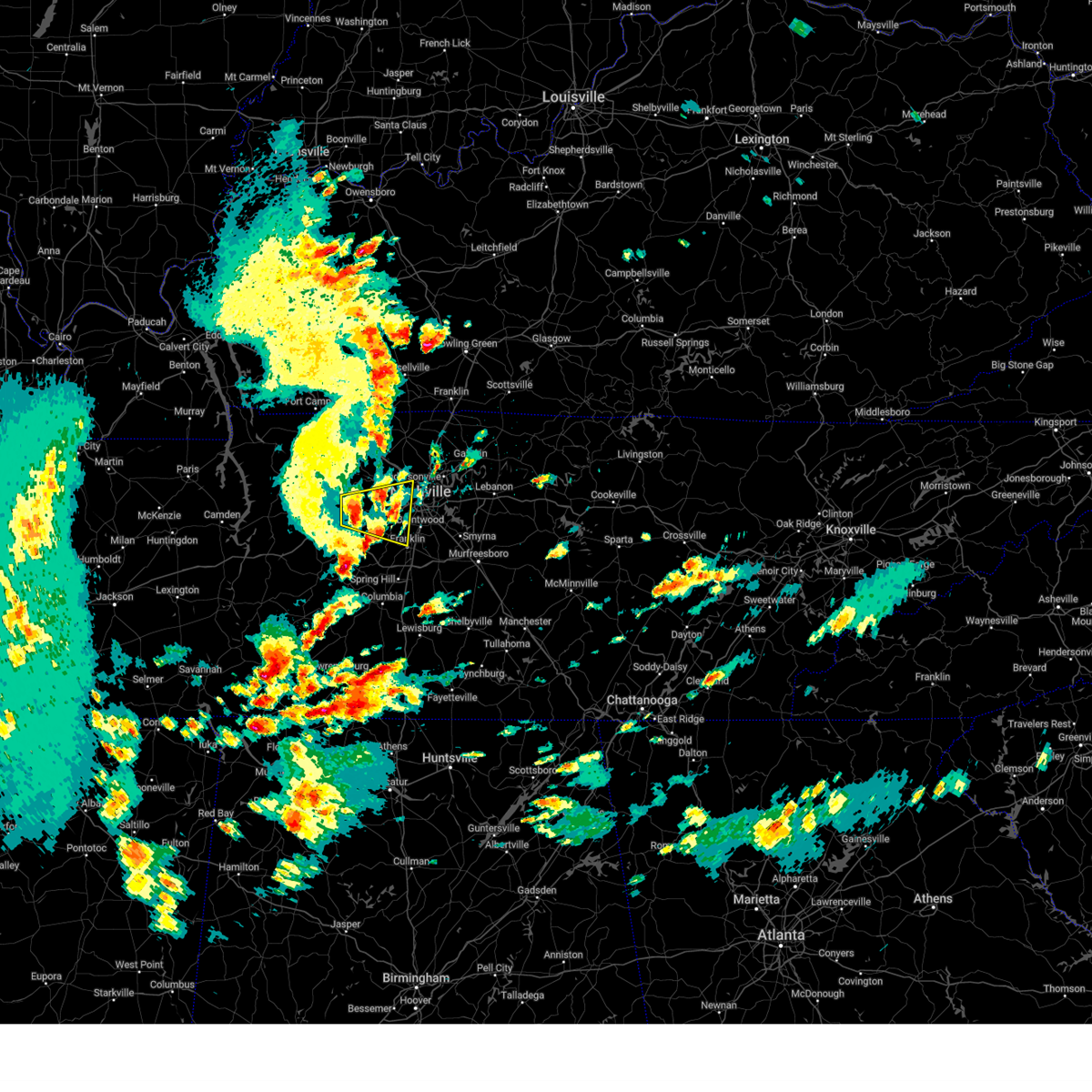
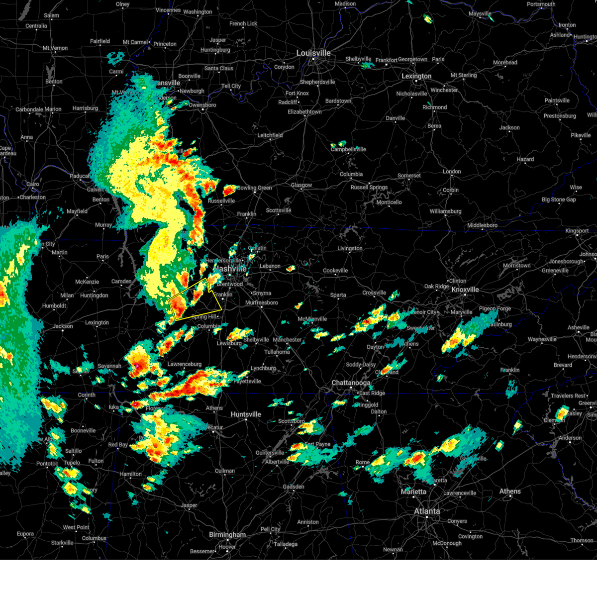
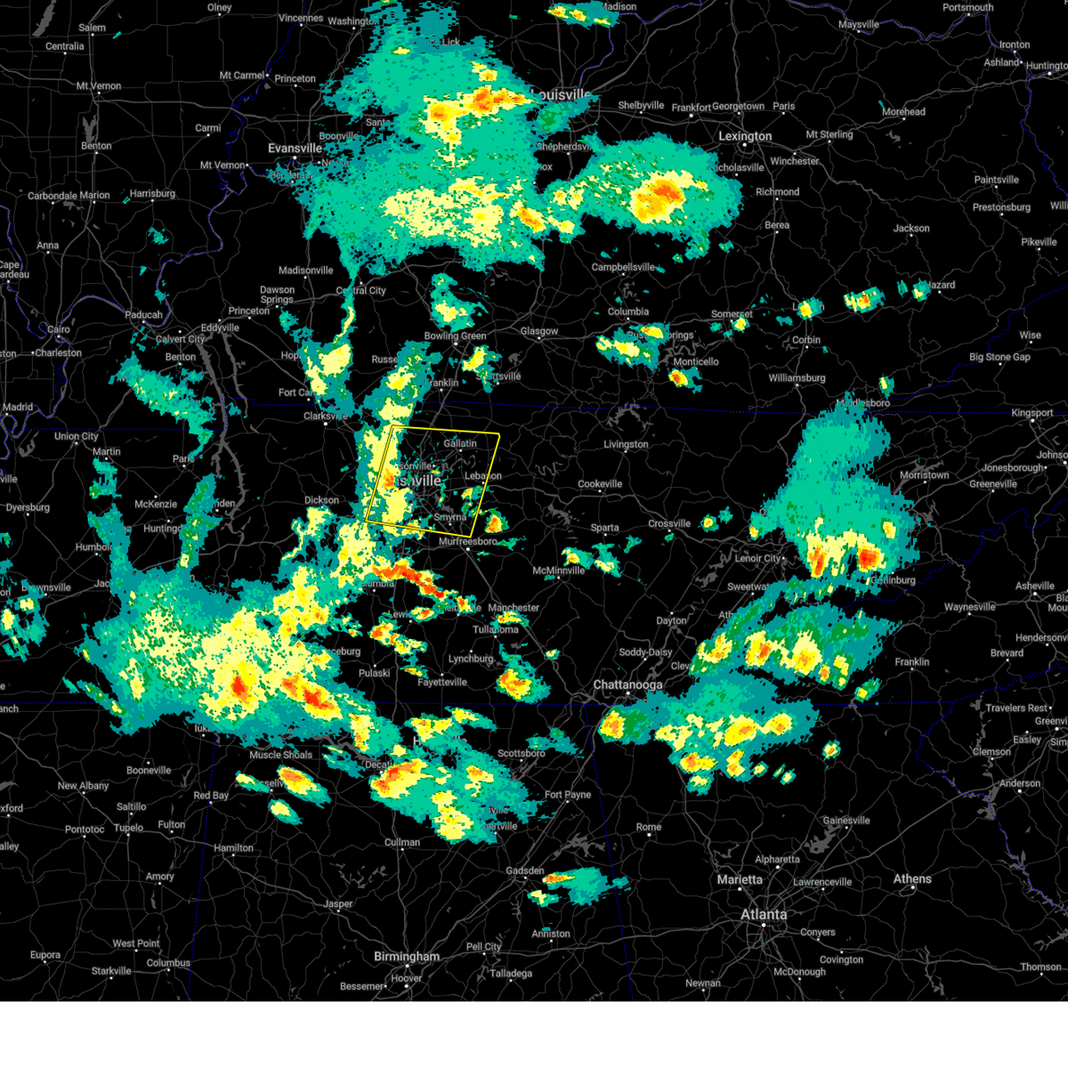
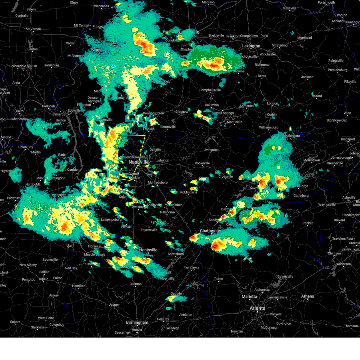
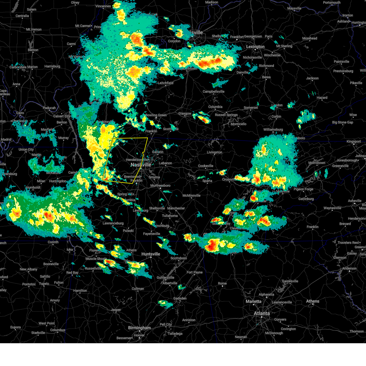
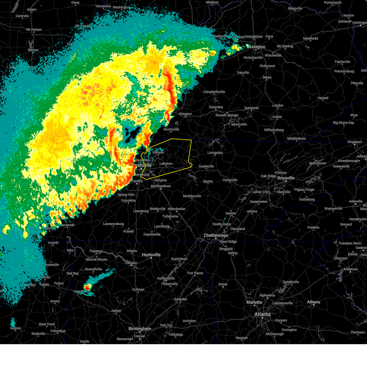
Hail Map for Nashville, TN
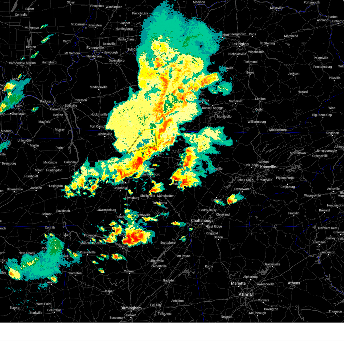
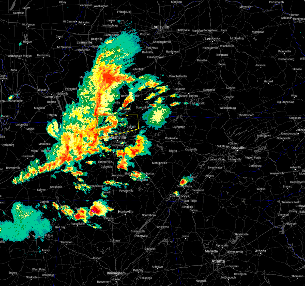
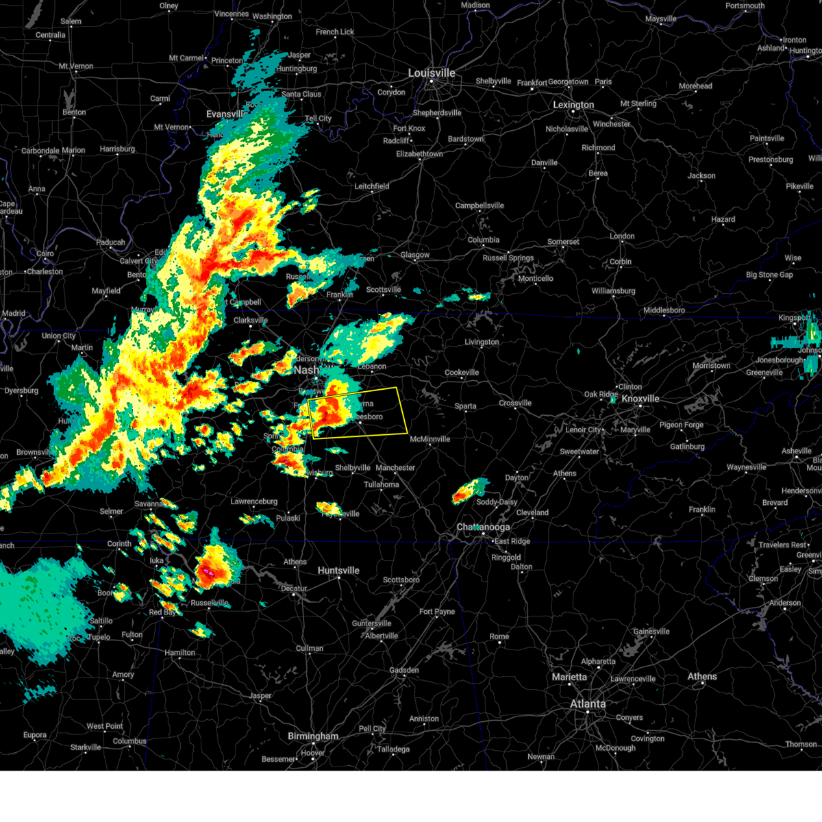
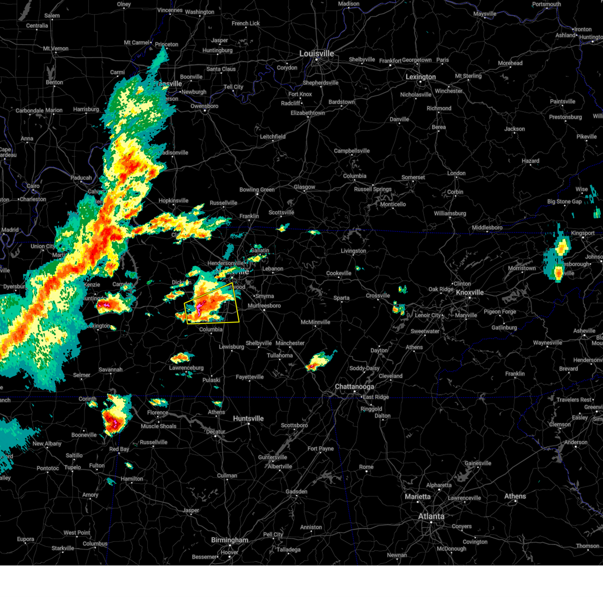
The Nashville, TN area has had 69 reports of on-the-ground hail by trained spotters, and has been under severe weather warnings 246 times during the past 12 months. Doppler radar has detected hail at or near Nashville, TN on 204 occasions, including 17 occasions during the past year.
| Name: | Nashville, TN |
| Where Located: | 4.5 miles NNE of Nashville, TN |
| Map: | Google Map for Nashville, TN |
| Population: | 601222 |
| Housing Units: | 272622 |
| More Info: | Search Google for Nashville, TN |
2
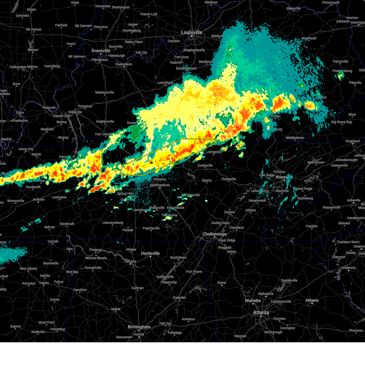
The Top Recent Hail Date for Nashville, TN is Wednesday, April 2, 2025 (6th out of 204)

Hail and Wind Damage Spotted near Nashville, TN
| Date / Time | Report Details |
|---|---|
| 6/18/2025 8:03 PM CDT | Svrohx the national weather service in nashville has issued a * severe thunderstorm warning for, central davidson county in middle tennessee, sumner county in middle tennessee, northwestern wilson county in middle tennessee, southeastern cheatham county in middle tennessee, southeastern robertson county in middle tennessee, * until 830 pm cdt. * at 802 pm cdt, severe thunderstorms were located along a line extending from near portland to near millersville to pegram, moving east at 50 mph (radar indicated). Hazards include 60 mph wind gusts. expect damage to roofs, siding, and trees |
| 6/18/2025 7:40 PM CDT | Svrohx the national weather service in nashville has issued a * severe thunderstorm warning for, northwestern davidson county in middle tennessee, central dickson county in middle tennessee, cheatham county in middle tennessee, southwestern robertson county in middle tennessee, * until 815 pm cdt. * at 739 pm cdt, severe thunderstorms were located along a line extending from 6 miles southwest of coopertown to near dickson, moving east at 35 mph (radar indicated). Hazards include 60 mph wind gusts and penny size hail. expect damage to roofs, siding, and trees |
| 6/18/2025 7:39 PM CDT | Svrohx the national weather service in nashville has issued a * severe thunderstorm warning for, northwestern davidson county in middle tennessee, central dickson county in middle tennessee, cheatham county in middle tennessee, southwestern robertson county in middle tennessee, * until 815 pm cdt. * at 739 pm cdt, severe thunderstorms were located along a line extending from 6 miles southwest of coopertown to near dickson, moving east at 50 mph (radar indicated). Hazards include 60 mph wind gusts and penny size hail. expect damage to roofs, siding, and trees |
| 6/6/2025 7:54 PM CDT |
 the severe thunderstorm warning has been cancelled and is no longer in effect the severe thunderstorm warning has been cancelled and is no longer in effect
|
| 6/6/2025 7:41 PM CDT | Svrohx the national weather service in nashville has issued a * severe thunderstorm warning for, western williamson county in middle tennessee, * until 830 pm cdt. * at 740 pm cdt, a severe thunderstorm was located near fairview, or 11 miles southeast of dickson, moving east at 30 mph (radar indicated). Hazards include 60 mph wind gusts and quarter size hail. Hail damage to vehicles is expected. Expect wind damage to roofs, siding, and trees. |
| 6/6/2025 3:40 PM CDT |
 Svrohx the national weather service in nashville has issued a * severe thunderstorm warning for, northern rutherford county in middle tennessee, southern wilson county in middle tennessee, north central cannon county in middle tennessee, * until 430 pm cdt. * at 339 pm cdt, a severe thunderstorm was located over smyrna, or 10 miles northwest of murfreesboro, moving east at 40 mph (radar indicated). Hazards include 60 mph wind gusts and penny size hail. expect damage to roofs, siding, and trees Svrohx the national weather service in nashville has issued a * severe thunderstorm warning for, northern rutherford county in middle tennessee, southern wilson county in middle tennessee, north central cannon county in middle tennessee, * until 430 pm cdt. * at 339 pm cdt, a severe thunderstorm was located over smyrna, or 10 miles northwest of murfreesboro, moving east at 40 mph (radar indicated). Hazards include 60 mph wind gusts and penny size hail. expect damage to roofs, siding, and trees
|
| 6/6/2025 2:44 PM CDT |
 At 244 pm cdt, a severe thunderstorm was located near springfield, moving east at 35 mph (radar indicated). Hazards include 60 mph wind gusts and nickel size hail. Expect damage to roofs, siding, and trees. locations impacted include, springfield, white house, millersville, greenbrier, ridgetop, cross plains, orlinda, and mitchellville. This includes interstate 65 between mile markers 102 and 120. At 244 pm cdt, a severe thunderstorm was located near springfield, moving east at 35 mph (radar indicated). Hazards include 60 mph wind gusts and nickel size hail. Expect damage to roofs, siding, and trees. locations impacted include, springfield, white house, millersville, greenbrier, ridgetop, cross plains, orlinda, and mitchellville. This includes interstate 65 between mile markers 102 and 120.
|
| 6/6/2025 2:23 PM CDT |
 Svrohx the national weather service in nashville has issued a * severe thunderstorm warning for, northwestern sumner county in middle tennessee, robertson county in middle tennessee, * until 300 pm cdt. * at 222 pm cdt, a severe thunderstorm was located 9 miles northwest of coopertown, or 11 miles west of springfield, moving east at 45 mph (radar indicated). Hazards include 60 mph wind gusts and nickel size hail. expect damage to roofs, siding, and trees Svrohx the national weather service in nashville has issued a * severe thunderstorm warning for, northwestern sumner county in middle tennessee, robertson county in middle tennessee, * until 300 pm cdt. * at 222 pm cdt, a severe thunderstorm was located 9 miles northwest of coopertown, or 11 miles west of springfield, moving east at 45 mph (radar indicated). Hazards include 60 mph wind gusts and nickel size hail. expect damage to roofs, siding, and trees
|
| 5/20/2025 6:34 PM CDT |
 the severe thunderstorm warning has been cancelled and is no longer in effect the severe thunderstorm warning has been cancelled and is no longer in effect
|
| 5/20/2025 6:33 PM CDT |
 At 633 pm cdt, severe thunderstorms were located along a line extending from near hartsville to near thompson's station, moving east at 55 mph (radar indicated). Hazards include 60 mph wind gusts and quarter size hail. Hail damage to vehicles is expected. expect wind damage to roofs, siding, and trees. Locations impacted include, franklin, madison, murfreesboro, nolensville, hermitage, belle meade, hartsville, thompson's station, la vergne, dickerson chapel recreation area, triune, natchez trace at highway 96, hendersonville, cedars of lebanon state park, berry hill, mount juliet, leipers fork, smyrna, oak hill, and green hill. At 633 pm cdt, severe thunderstorms were located along a line extending from near hartsville to near thompson's station, moving east at 55 mph (radar indicated). Hazards include 60 mph wind gusts and quarter size hail. Hail damage to vehicles is expected. expect wind damage to roofs, siding, and trees. Locations impacted include, franklin, madison, murfreesboro, nolensville, hermitage, belle meade, hartsville, thompson's station, la vergne, dickerson chapel recreation area, triune, natchez trace at highway 96, hendersonville, cedars of lebanon state park, berry hill, mount juliet, leipers fork, smyrna, oak hill, and green hill.
|
| 5/20/2025 6:33 PM CDT |
 the severe thunderstorm warning has been cancelled and is no longer in effect the severe thunderstorm warning has been cancelled and is no longer in effect
|
| 5/20/2025 6:07 PM CDT | At 607 pm cdt, severe thunderstorms were located along a line extending from near portland to near hendersonville, moving east at 50 mph (radar indicated). Hazards include 60 mph wind gusts and quarter size hail. Hail damage to vehicles is expected. expect wind damage to roofs, siding, and trees. Locations impacted include, portland, ridgetop, bethpage, goodlettsville, mitchellville, oak grove, millersville, gallatin, white house, bledsoe creek state park, cottontown, hendersonville, cross plains, and orlinda. |
| 5/20/2025 6:07 PM CDT | the severe thunderstorm warning has been cancelled and is no longer in effect |
| 5/20/2025 6:06 PM CDT | Svrohx the national weather service in nashville has issued a * severe thunderstorm warning for, davidson county in middle tennessee, central rutherford county in middle tennessee, north central maury county in middle tennessee, southeastern sumner county in middle tennessee, williamson county in middle tennessee, wilson county in middle tennessee, south central cheatham county in middle tennessee, southwestern trousdale county in middle tennessee, east central hickman county in middle tennessee, * until 700 pm cdt. * at 606 pm cdt, severe thunderstorms were located along a line extending from near hendersonville to centerville, moving east at 50 mph (radar indicated). Hazards include 60 mph wind gusts and quarter size hail. Hail damage to vehicles is expected. Expect wind damage to roofs, siding, and trees. |
| 5/20/2025 5:50 PM CDT | Tree down on home in the joelton area. time estimated by rada in davidson county TN, 8.5 miles SE of Nashville, TN |
| 5/20/2025 5:34 PM CDT | At 533 pm cdt, a severe thunderstorm was located near walterhill, or 8 miles northeast of murfreesboro, moving east at 40 mph (radar indicated). Hazards include ping pong ball size hail and 60 mph wind gusts. People and animals outdoors will be injured. expect hail damage to roofs, siding, windows, and vehicles. expect wind damage to roofs, siding, and trees. Locations impacted include, lascassas, murfreesboro, nolensville, walterhill, brentwood, la vergne, triune, cedars of lebanon state park, auburntown, eagleville, woodbury, rockvale, smyrna, milton, readyville, and franklin. |
| 5/20/2025 5:30 PM CDT |
 Svrohx the national weather service in nashville has issued a * severe thunderstorm warning for, northwestern davidson county in middle tennessee, northeastern dickson county in middle tennessee, eastern montgomery county in middle tennessee, sumner county in middle tennessee, cheatham county in middle tennessee, robertson county in middle tennessee, * until 645 pm cdt. * at 530 pm cdt, severe thunderstorms were located along a line extending from elkton to ashland city, moving east at 45 mph (radar indicated). Hazards include 60 mph wind gusts and quarter size hail. Hail damage to vehicles is expected. Expect wind damage to roofs, siding, and trees. Svrohx the national weather service in nashville has issued a * severe thunderstorm warning for, northwestern davidson county in middle tennessee, northeastern dickson county in middle tennessee, eastern montgomery county in middle tennessee, sumner county in middle tennessee, cheatham county in middle tennessee, robertson county in middle tennessee, * until 645 pm cdt. * at 530 pm cdt, severe thunderstorms were located along a line extending from elkton to ashland city, moving east at 45 mph (radar indicated). Hazards include 60 mph wind gusts and quarter size hail. Hail damage to vehicles is expected. Expect wind damage to roofs, siding, and trees.
|
| 5/20/2025 4:49 PM CDT |
 Svrohx the national weather service in nashville has issued a * severe thunderstorm warning for, southeastern davidson county in middle tennessee, rutherford county in middle tennessee, eastern williamson county in middle tennessee, southeastern wilson county in middle tennessee, northwestern cannon county in middle tennessee, * until 545 pm cdt. * at 448 pm cdt, a severe thunderstorm was located near nolensville, or 7 miles southeast of franklin, moving east at 45 mph. this is a destructive storm for williamson and rutherford counties (trained weather spotters. at 445 pm cdt...numerous reports of golfball to tennis ball size hail were received in franklin). Hazards include baseball size hail and 60 mph wind gusts. People and animals outdoors will be severely injured. Expect shattered windows, extensive damage to roofs, siding, and vehicles. Svrohx the national weather service in nashville has issued a * severe thunderstorm warning for, southeastern davidson county in middle tennessee, rutherford county in middle tennessee, eastern williamson county in middle tennessee, southeastern wilson county in middle tennessee, northwestern cannon county in middle tennessee, * until 545 pm cdt. * at 448 pm cdt, a severe thunderstorm was located near nolensville, or 7 miles southeast of franklin, moving east at 45 mph. this is a destructive storm for williamson and rutherford counties (trained weather spotters. at 445 pm cdt...numerous reports of golfball to tennis ball size hail were received in franklin). Hazards include baseball size hail and 60 mph wind gusts. People and animals outdoors will be severely injured. Expect shattered windows, extensive damage to roofs, siding, and vehicles.
|
| 5/20/2025 4:36 PM CDT | the severe thunderstorm warning has been cancelled and is no longer in effect |
| 5/20/2025 4:36 PM CDT | At 436 pm cdt, a severe thunderstorm was located near franklin, moving east at 40 mph. this is a destructive storm for williamson county (radar indicated). Hazards include baseball size hail and 60 mph wind gusts. People and animals outdoors will be severely injured. expect shattered windows, extensive damage to roofs, siding, and vehicles. Locations impacted include, franklin, thompson's station, brentwood, and spring hill. |
| 5/20/2025 4:30 PM CDT | the severe thunderstorm warning has been cancelled and is no longer in effect |
| 5/20/2025 4:30 PM CDT | At 429 pm cdt, a severe thunderstorm was located near leipers fork, or 8 miles southwest of franklin, moving east at 40 mph (radar indicated). Hazards include golf ball size hail and 60 mph wind gusts. People and animals outdoors will be injured. expect hail damage to roofs, siding, windows, and vehicles. expect wind damage to roofs, siding, and trees. Locations impacted include, franklin, spring hill, thompson's station, brentwood, leipers fork, natchez trace at highway 96, forest hills, and oak hill. |
| 5/20/2025 4:12 PM CDT |
 At 411 pm cdt, a severe thunderstorm was located 11 miles southwest of fairview, or 12 miles east of centerville, moving east at 40 mph. this is a destructive storm for eastern hickman county and williamson county (public. at 407 pm cdt...golfball size hail and blown down trees were reported in centerville with this storm). Hazards include baseball size hail and 70 mph wind gusts. People and animals outdoors will be severely injured. expect shattered windows, extensive damage to roofs, siding, and vehicles. Locations impacted include, franklin, santa fe, fairview, forest hills, spring hill, thompson's station, brentwood, primm springs, leipers fork, oak hill, natchez trace at highway 96, and belle meade. At 411 pm cdt, a severe thunderstorm was located 11 miles southwest of fairview, or 12 miles east of centerville, moving east at 40 mph. this is a destructive storm for eastern hickman county and williamson county (public. at 407 pm cdt...golfball size hail and blown down trees were reported in centerville with this storm). Hazards include baseball size hail and 70 mph wind gusts. People and animals outdoors will be severely injured. expect shattered windows, extensive damage to roofs, siding, and vehicles. Locations impacted include, franklin, santa fe, fairview, forest hills, spring hill, thompson's station, brentwood, primm springs, leipers fork, oak hill, natchez trace at highway 96, and belle meade.
|
| 5/20/2025 4:12 PM CDT |
 the severe thunderstorm warning has been cancelled and is no longer in effect the severe thunderstorm warning has been cancelled and is no longer in effect
|
| 5/20/2025 4:04 PM CDT | At 404 pm cdt, a severe thunderstorm was located near centerville, moving east at 35 mph (radar indicated). Hazards include tennis ball size hail and 70 mph wind gusts. People and animals outdoors will be injured. expect hail damage to roofs, siding, windows, and vehicles. expect considerable tree damage. wind damage is also likely to mobile homes, roofs, and outbuildings. Locations impacted include, franklin, forest hills, bon aqua, spring hill, thompson's station, brentwood, primm springs, lyles, bellevue, natchez trace at highway 96, santa fe, fairview, leipers fork, oak hill, belle meade, and centerville. |
| 5/20/2025 3:56 PM CDT | Svrohx the national weather service in nashville has issued a * severe thunderstorm warning for, southwestern davidson county in middle tennessee, southeastern dickson county in middle tennessee, northern maury county in middle tennessee, williamson county in middle tennessee, eastern hickman county in middle tennessee, * until 500 pm cdt. * at 356 pm cdt, a severe thunderstorm was located near centerville, moving east at 40 mph (radar indicated). Hazards include golf ball size hail and 70 mph wind gusts. People and animals outdoors will be injured. expect hail damage to roofs, siding, windows, and vehicles. expect considerable tree damage. Wind damage is also likely to mobile homes, roofs, and outbuildings. |
| 5/19/2025 7:13 PM CDT | the severe thunderstorm warning has been cancelled and is no longer in effect |
| 5/19/2025 6:58 PM CDT | 10...000 customers without power in the berry hill are in davidson county TN, 7.6 miles N of Nashville, TN |
| 5/19/2025 6:55 PM CDT |
 Svrohx the national weather service in nashville has issued a * severe thunderstorm warning for, central davidson county in middle tennessee, southwestern sumner county in middle tennessee, west central wilson county in middle tennessee, * until 730 pm cdt. * at 652 pm cdt, a severe thunderstorm was located near nashville, moving northeast at 20 mph (radar indicated). Hazards include 60 mph wind gusts and quarter size hail. Hail damage to vehicles is expected. Expect wind damage to roofs, siding, and trees. Svrohx the national weather service in nashville has issued a * severe thunderstorm warning for, central davidson county in middle tennessee, southwestern sumner county in middle tennessee, west central wilson county in middle tennessee, * until 730 pm cdt. * at 652 pm cdt, a severe thunderstorm was located near nashville, moving northeast at 20 mph (radar indicated). Hazards include 60 mph wind gusts and quarter size hail. Hail damage to vehicles is expected. Expect wind damage to roofs, siding, and trees.
|
| 5/16/2025 11:35 PM CDT |
 At 1135 pm cdt, severe thunderstorms were located along a line extending from 6 miles east of celina to forest hills, moving east at 55 mph (radar indicated). Hazards include 60 mph wind gusts and quarter size hail. Hail damage to vehicles is expected. expect wind damage to roofs, siding, and trees. locations impacted include, red boiling springs, madison, hermitage, belle meade, hartsville, moss, pleasant shade, gallatin, bledsoe creek state park, dickerson chapel recreation area, hendersonville, berry hill, mount juliet, boles, oak hill, green hill, forest hills, celina, bethpage, and goodlettsville. this includes the following highways, interstate 40 between mile markers 186 and 235. interstate 65 between mile markers 75 and 98. interstate 24 between mile markers 38 and 57. Interstate 840 near mile marker 76. At 1135 pm cdt, severe thunderstorms were located along a line extending from 6 miles east of celina to forest hills, moving east at 55 mph (radar indicated). Hazards include 60 mph wind gusts and quarter size hail. Hail damage to vehicles is expected. expect wind damage to roofs, siding, and trees. locations impacted include, red boiling springs, madison, hermitage, belle meade, hartsville, moss, pleasant shade, gallatin, bledsoe creek state park, dickerson chapel recreation area, hendersonville, berry hill, mount juliet, boles, oak hill, green hill, forest hills, celina, bethpage, and goodlettsville. this includes the following highways, interstate 40 between mile markers 186 and 235. interstate 65 between mile markers 75 and 98. interstate 24 between mile markers 38 and 57. Interstate 840 near mile marker 76.
|
| 5/16/2025 11:35 PM CDT |
 the severe thunderstorm warning has been cancelled and is no longer in effect the severe thunderstorm warning has been cancelled and is no longer in effect
|
| 5/16/2025 11:28 PM CDT | Svrohx the national weather service in nashville has issued a * severe thunderstorm warning for, overton county in middle tennessee, pickett county in middle tennessee, smith county in middle tennessee, jackson county in middle tennessee, central wilson county in middle tennessee, southeastern clay county in middle tennessee, central putnam county in middle tennessee, fentress county in middle tennessee, * until 1230 am cdt. * at 1128 pm cdt, severe thunderstorms were located along a line extending from near sunnybrook to near lebanon, moving east at 75 mph (radar indicated). Hazards include 60 mph wind gusts and quarter size hail. Hail damage to vehicles is expected. Expect wind damage to roofs, siding, and trees. |
| 5/16/2025 11:08 PM CDT |
 the severe thunderstorm warning has been cancelled and is no longer in effect the severe thunderstorm warning has been cancelled and is no longer in effect
|
| 5/16/2025 11:08 PM CDT |
 At 1107 pm cdt, severe thunderstorms were located along a line extending from near red boiling springs to near burns, moving east at 55 mph (radar indicated). Hazards include 60 mph wind gusts and quarter size hail. Hail damage to vehicles is expected. expect wind damage to roofs, siding, and trees. locations impacted include, charlotte, black jack, hartsville, moss, pleasant shade, millersville, gallatin, bledsoe creek state park, dickerson chapel recreation area, hendersonville, cottontown, mount juliet, westmoreland, white bluff, forest hills, cheatham dam, goodlettsville, dixon springs, oak grove, and nashville. this includes the following highways, interstate 40 between mile markers 186 and 235. interstate 65 between mile markers 75 and 121. interstate 24 between mile markers 22 and 57. Interstate 840 near mile marker 76. At 1107 pm cdt, severe thunderstorms were located along a line extending from near red boiling springs to near burns, moving east at 55 mph (radar indicated). Hazards include 60 mph wind gusts and quarter size hail. Hail damage to vehicles is expected. expect wind damage to roofs, siding, and trees. locations impacted include, charlotte, black jack, hartsville, moss, pleasant shade, millersville, gallatin, bledsoe creek state park, dickerson chapel recreation area, hendersonville, cottontown, mount juliet, westmoreland, white bluff, forest hills, cheatham dam, goodlettsville, dixon springs, oak grove, and nashville. this includes the following highways, interstate 40 between mile markers 186 and 235. interstate 65 between mile markers 75 and 121. interstate 24 between mile markers 22 and 57. Interstate 840 near mile marker 76.
|
| 5/16/2025 10:40 PM CDT | Svrohx the national weather service in nashville has issued a * severe thunderstorm warning for, northern smith county in middle tennessee, southern montgomery county in middle tennessee, sumner county in middle tennessee, southeastern stewart county in middle tennessee, houston county in middle tennessee, northern wilson county in middle tennessee, cheatham county in middle tennessee, clay county in middle tennessee, northern humphreys county in middle tennessee, robertson county in middle tennessee, davidson county in middle tennessee, dickson county in middle tennessee, northern jackson county in middle tennessee, macon county in middle tennessee, trousdale county in middle tennessee, * until 1145 pm cdt. * at 1040 pm cdt, severe thunderstorms were located along a line extending from near westmoreland to near mcewen, moving east at 55 mph (radar indicated). Hazards include 60 mph wind gusts and quarter size hail. Hail damage to vehicles is expected. Expect wind damage to roofs, siding, and trees. |
| 5/16/2025 10:28 PM CDT | At 1028 pm cdt, severe thunderstorms were located along a line extending from 11 miles northwest of portland to near tennessee ridge, moving east at 60 mph (radar indicated). Hazards include 60 mph wind gusts and quarter size hail. Hail damage to vehicles is expected. expect wind damage to roofs, siding, and trees. locations impacted include, clarksville, charlotte, black jack, palmyra, tennessee ridge, greenbrier, orlinda, erin, pleasant view, cedar hill, houston county airport, ashland city, cunningham, cumberland city, cheatham dam, adams, woodlawn, cross plains, springfield, and vanleer. this includes the following highways, interstate 65 between mile markers 109 and 121. Interstate 24 between mile markers 1 and 31. |
| 5/16/2025 9:55 PM CDT | Svrohx the national weather service in nashville has issued a * severe thunderstorm warning for, northern dickson county in middle tennessee, montgomery county in middle tennessee, stewart county in middle tennessee, houston county in middle tennessee, northern cheatham county in middle tennessee, northeastern humphreys county in middle tennessee, robertson county in middle tennessee, * until 1100 pm cdt. * at 955 pm cdt, severe thunderstorms were located along a line extending from near guthrie to near routon, moving east at 60 mph (radar indicated). Hazards include 60 mph wind gusts and quarter size hail. Hail damage to vehicles is expected. Expect wind damage to roofs, siding, and trees. |
| 5/8/2025 5:52 PM CDT | the severe thunderstorm warning has been cancelled and is no longer in effect |
| 5/8/2025 5:47 PM CDT | At 547 pm cdt, a severe thunderstorm was located near smyrna, or 10 miles west of murfreesboro, moving east at 35 mph (radar indicated). Hazards include 60 mph wind gusts and quarter size hail. Hail damage to vehicles is expected. expect wind damage to roofs, siding, and trees. locations impacted include, cedars of lebanon state park, lascassas, walterhill, smyrna, milton, la vergne, murfreesboro, and nolensville. this includes the following highways, interstate 24 between mile markers 64 and 77. Interstate 840 between mile markers 46 and 65. |
| 5/8/2025 5:47 PM CDT | the severe thunderstorm warning has been cancelled and is no longer in effect |
| 5/8/2025 5:32 PM CDT | Svrohx the national weather service in nashville has issued a * severe thunderstorm warning for, southeastern davidson county in middle tennessee, northern rutherford county in middle tennessee, northeastern williamson county in middle tennessee, southwestern wilson county in middle tennessee, * until 615 pm cdt. * at 531 pm cdt, a severe thunderstorm was located near nolensville, or 8 miles east of franklin, moving east at 40 mph (radar indicated). Hazards include 60 mph wind gusts and quarter size hail. Hail damage to vehicles is expected. Expect wind damage to roofs, siding, and trees. |
| 5/8/2025 4:37 PM CDT |
 the severe thunderstorm warning has been cancelled and is no longer in effect the severe thunderstorm warning has been cancelled and is no longer in effect
|
| 5/8/2025 4:25 PM CDT |
 the severe thunderstorm warning has been cancelled and is no longer in effect the severe thunderstorm warning has been cancelled and is no longer in effect
|
| 5/8/2025 4:25 PM CDT |
 At 425 pm cdt, a severe thunderstorm was located over mount juliet, or 10 miles southwest of gallatin, moving east at 25 mph (radar indicated). Hazards include 60 mph wind gusts and quarter size hail. Hail damage to vehicles is expected. expect wind damage to roofs, siding, and trees. locations impacted include, hendersonville, green hill, lebanon, mount juliet, and belinda city. this includes the following highways, interstate 40 between mile markers 223 and 240. Interstate 840 between mile markers 75 and 76. At 425 pm cdt, a severe thunderstorm was located over mount juliet, or 10 miles southwest of gallatin, moving east at 25 mph (radar indicated). Hazards include 60 mph wind gusts and quarter size hail. Hail damage to vehicles is expected. expect wind damage to roofs, siding, and trees. locations impacted include, hendersonville, green hill, lebanon, mount juliet, and belinda city. this includes the following highways, interstate 40 between mile markers 223 and 240. Interstate 840 between mile markers 75 and 76.
|
| 5/8/2025 4:13 PM CDT | Svrohx the national weather service in nashville has issued a * severe thunderstorm warning for, east central davidson county in middle tennessee, southeastern sumner county in middle tennessee, northwestern wilson county in middle tennessee, * until 500 pm cdt. * at 413 pm cdt, a severe thunderstorm was located over lakewood, or 9 miles east of nashville, moving east at 25 mph (radar indicated). Hazards include 60 mph wind gusts and quarter size hail. Hail damage to vehicles is expected. Expect wind damage to roofs, siding, and trees. |
| 5/8/2025 4:05 PM CDT |
 At 404 pm cdt, a severe thunderstorm was located over rural hill, or 12 miles southwest of lebanon, moving east at 30 mph (radar indicated). Hazards include 60 mph wind gusts and nickel size hail. Expect damage to roofs, siding, and trees. locations impacted include, walterhill, rural hill, la vergne, percy priest lake, smyrna, gladeville, belinda city, mount juliet, murfreesboro, and lebanon. this includes the following highways, interstate 40 between mile markers 224 and 231. interstate 24 between mile markers 65 and 71. Interstate 840 between mile markers 56 and 72. At 404 pm cdt, a severe thunderstorm was located over rural hill, or 12 miles southwest of lebanon, moving east at 30 mph (radar indicated). Hazards include 60 mph wind gusts and nickel size hail. Expect damage to roofs, siding, and trees. locations impacted include, walterhill, rural hill, la vergne, percy priest lake, smyrna, gladeville, belinda city, mount juliet, murfreesboro, and lebanon. this includes the following highways, interstate 40 between mile markers 224 and 231. interstate 24 between mile markers 65 and 71. Interstate 840 between mile markers 56 and 72.
|
| 5/8/2025 4:04 PM CDT |
 At 403 pm cdt, a severe thunderstorm was located over lakewood, or 7 miles northeast of nashville, moving east at 30 mph (radar indicated). Hazards include 60 mph wind gusts and quarter size hail. Hail damage to vehicles is expected. expect wind damage to roofs, siding, and trees. locations impacted include, green hill, madison, hermitage, rural hill, gallatin, nashville, belinda city, lakewood, hendersonville, mount juliet, old hickory, percy priest lake, gladeville, goodlettsville, and lebanon. this includes the following highways, interstate 40 between mile markers 205 and 231. interstate 65 between mile markers 82 and 88, near mile marker 91, and between mile markers 95 and 96. Interstate 24 between mile markers 47 and 52. At 403 pm cdt, a severe thunderstorm was located over lakewood, or 7 miles northeast of nashville, moving east at 30 mph (radar indicated). Hazards include 60 mph wind gusts and quarter size hail. Hail damage to vehicles is expected. expect wind damage to roofs, siding, and trees. locations impacted include, green hill, madison, hermitage, rural hill, gallatin, nashville, belinda city, lakewood, hendersonville, mount juliet, old hickory, percy priest lake, gladeville, goodlettsville, and lebanon. this includes the following highways, interstate 40 between mile markers 205 and 231. interstate 65 between mile markers 82 and 88, near mile marker 91, and between mile markers 95 and 96. Interstate 24 between mile markers 47 and 52.
|
| 5/8/2025 4:03 PM CDT | Quarter sized hail reported 3.7 miles W of Nashville, TN, tspotter report shows 1 inch hail near mcgavock pike and briley parkway. |
| 5/8/2025 3:58 PM CDT | Tree down on riverside drive near inglewood elementary schoo in davidson county TN, 2.8 miles NW of Nashville, TN |
| 5/8/2025 3:57 PM CDT | Quarter sized hail reported 2 miles NW of Nashville, TN, quarter sized hail in inglewood tn. |
| 5/8/2025 3:56 PM CDT | Quarter sized hail reported 2.1 miles N of Nashville, TN, up to one inch hail on cahal ave. |
| 5/8/2025 3:55 PM CDT | A tree fell through the roof of a home on lichey ave. time estimated from rada in davidson county TN, 2.1 miles N of Nashville, TN |
| 5/8/2025 3:55 PM CDT | Quarter sized hail reported 2.1 miles N of Nashville, TN, half inch to one inch hail at ellington parkway and trinity ln. |
| 5/8/2025 3:54 PM CDT | Tspotter report showed a large tree down at cleveland park in east nashville. time estimated from rada in davidson county TN, 2.7 miles N of Nashville, TN |
| 5/8/2025 3:52 PM CDT | Tree down near the intersection of joseph ave and douglas av in davidson county TN, 2.9 miles NNE of Nashville, TN |
| 5/8/2025 3:51 PM CDT |
 At 351 pm cdt, a severe thunderstorm was located near madison, or near nashville, moving east at 30 mph (radar indicated). Hazards include 60 mph wind gusts and quarter size hail. Hail damage to vehicles is expected. expect wind damage to roofs, siding, and trees. locations impacted include, green hill, madison, hermitage, goodlettsville, bells bend, rural hill, gallatin, nashville, whites creek, belinda city, lakewood, hendersonville, mount juliet, old hickory, percy priest lake, gladeville, millersville, and lebanon. this includes the following highways, interstate 40 between mile markers 203 and 231. interstate 65 between mile markers 82 and 99. Interstate 24 between mile markers 39 and 52. At 351 pm cdt, a severe thunderstorm was located near madison, or near nashville, moving east at 30 mph (radar indicated). Hazards include 60 mph wind gusts and quarter size hail. Hail damage to vehicles is expected. expect wind damage to roofs, siding, and trees. locations impacted include, green hill, madison, hermitage, goodlettsville, bells bend, rural hill, gallatin, nashville, whites creek, belinda city, lakewood, hendersonville, mount juliet, old hickory, percy priest lake, gladeville, millersville, and lebanon. this includes the following highways, interstate 40 between mile markers 203 and 231. interstate 65 between mile markers 82 and 99. Interstate 24 between mile markers 39 and 52.
|
| 5/8/2025 3:48 PM CDT |
 the severe thunderstorm warning has been cancelled and is no longer in effect the severe thunderstorm warning has been cancelled and is no longer in effect
|
| 5/8/2025 3:48 PM CDT |
 At 348 pm cdt, a severe thunderstorm was located near nolensville, or 10 miles northeast of franklin, moving east at 30 mph (radar indicated). Hazards include 60 mph wind gusts and quarter size hail. Hail damage to vehicles is expected. expect wind damage to roofs, siding, and trees. locations impacted include, walterhill, rural hill, la vergne, antioch, belinda city, mount juliet, percy priest lake, smyrna, gladeville, oak hill, nolensville, brentwood, murfreesboro, and lebanon. this includes the following highways, interstate 40 between mile markers 217 and 218, and between mile markers 222 and 231. interstate 65 between mile markers 75 and 78. interstate 24 between mile markers 54 and 71. Interstate 840 between mile markers 56 and 72. At 348 pm cdt, a severe thunderstorm was located near nolensville, or 10 miles northeast of franklin, moving east at 30 mph (radar indicated). Hazards include 60 mph wind gusts and quarter size hail. Hail damage to vehicles is expected. expect wind damage to roofs, siding, and trees. locations impacted include, walterhill, rural hill, la vergne, antioch, belinda city, mount juliet, percy priest lake, smyrna, gladeville, oak hill, nolensville, brentwood, murfreesboro, and lebanon. this includes the following highways, interstate 40 between mile markers 217 and 218, and between mile markers 222 and 231. interstate 65 between mile markers 75 and 78. interstate 24 between mile markers 54 and 71. Interstate 840 between mile markers 56 and 72.
|
| 5/8/2025 3:38 PM CDT |
 Svrohx the national weather service in nashville has issued a * severe thunderstorm warning for, southeastern davidson county in middle tennessee, northwestern rutherford county in middle tennessee, northeastern williamson county in middle tennessee, southwestern wilson county in middle tennessee, * until 430 pm cdt. * at 338 pm cdt, a severe thunderstorm was located over brentwood, or near franklin, moving east at 25 mph (radar indicated). Hazards include 60 mph wind gusts and half dollar size hail. Hail damage to vehicles is expected. Expect wind damage to roofs, siding, and trees. Svrohx the national weather service in nashville has issued a * severe thunderstorm warning for, southeastern davidson county in middle tennessee, northwestern rutherford county in middle tennessee, northeastern williamson county in middle tennessee, southwestern wilson county in middle tennessee, * until 430 pm cdt. * at 338 pm cdt, a severe thunderstorm was located over brentwood, or near franklin, moving east at 25 mph (radar indicated). Hazards include 60 mph wind gusts and half dollar size hail. Hail damage to vehicles is expected. Expect wind damage to roofs, siding, and trees.
|
| 5/8/2025 3:37 PM CDT |
 Svrohx the national weather service in nashville has issued a * severe thunderstorm warning for, central davidson county in middle tennessee, southwestern sumner county in middle tennessee, northwestern wilson county in middle tennessee, * until 415 pm cdt. * at 337 pm cdt, a severe thunderstorm was located near joelton, or 7 miles east of ashland city, moving east at 30 mph (radar indicated). Hazards include 60 mph wind gusts and quarter size hail. Hail damage to vehicles is expected. Expect wind damage to roofs, siding, and trees. Svrohx the national weather service in nashville has issued a * severe thunderstorm warning for, central davidson county in middle tennessee, southwestern sumner county in middle tennessee, northwestern wilson county in middle tennessee, * until 415 pm cdt. * at 337 pm cdt, a severe thunderstorm was located near joelton, or 7 miles east of ashland city, moving east at 30 mph (radar indicated). Hazards include 60 mph wind gusts and quarter size hail. Hail damage to vehicles is expected. Expect wind damage to roofs, siding, and trees.
|
| 5/8/2025 3:27 PM CDT | At 327 pm cdt, a severe thunderstorm was located near franklin, moving east at 25 mph (radar indicated). Hazards include 60 mph wind gusts and quarter size hail. Hail damage to vehicles is expected. expect wind damage to roofs, siding, and trees. locations impacted include, franklin, berry hill, forest hills, nolensville, belle meade, brentwood, nashville, bellevue, antioch, and oak hill. this includes the following highways, interstate 40 between mile markers 196 and 197, and between mile markers 209 and 215. interstate 65 between mile markers 65 and 82. Interstate 24 between mile markers 48 and 63. |
| 5/8/2025 3:20 PM CDT | the severe thunderstorm warning has been cancelled and is no longer in effect |
| 5/8/2025 3:20 PM CDT | At 320 pm cdt, a severe thunderstorm was located over ashland city, moving east at 30 mph (radar indicated). Hazards include 60 mph wind gusts and quarter size hail. Hail damage to vehicles is expected. expect wind damage to roofs, siding, and trees. locations impacted include, madison, beaman park, old hickory, bells bend, ashland city, nashville, whites creek, joelton, lakewood, goodlettsville, and hendersonville. this includes the following highways, interstate 40 between mile markers 202 and 218. interstate 65 between mile markers 81 and 97. Interstate 24 between mile markers 30 and 52. |
| 5/8/2025 3:07 PM CDT |
 Svrohx the national weather service in nashville has issued a * severe thunderstorm warning for, central davidson county in middle tennessee, northeastern dickson county in middle tennessee, central cheatham county in middle tennessee, * until 345 pm cdt. * at 307 pm cdt, a severe thunderstorm was located near ashland city, moving east at 30 mph (radar indicated). Hazards include 60 mph wind gusts and quarter size hail. Hail damage to vehicles is expected. Expect wind damage to roofs, siding, and trees. Svrohx the national weather service in nashville has issued a * severe thunderstorm warning for, central davidson county in middle tennessee, northeastern dickson county in middle tennessee, central cheatham county in middle tennessee, * until 345 pm cdt. * at 307 pm cdt, a severe thunderstorm was located near ashland city, moving east at 30 mph (radar indicated). Hazards include 60 mph wind gusts and quarter size hail. Hail damage to vehicles is expected. Expect wind damage to roofs, siding, and trees.
|
| 5/8/2025 3:06 PM CDT | Svrohx the national weather service in nashville has issued a * severe thunderstorm warning for, southwestern davidson county in middle tennessee, northern williamson county in middle tennessee, * until 345 pm cdt. * at 306 pm cdt, a severe thunderstorm was located 7 miles east of fairview, or 8 miles west of franklin, moving east at 30 mph (radar indicated). Hazards include 60 mph wind gusts and quarter size hail. Hail damage to vehicles is expected. Expect wind damage to roofs, siding, and trees. |
| 5/2/2025 1:53 PM CDT |
 The storm which prompted the warning has weakened below severe limits, and no longer poses an immediate threat to life or property. therefore, the warning will be allowed to expire. however, small hail and gusty winds are still possible with this thunderstorm. a severe thunderstorm watch remains in effect until 500 pm cdt for middle tennessee. The storm which prompted the warning has weakened below severe limits, and no longer poses an immediate threat to life or property. therefore, the warning will be allowed to expire. however, small hail and gusty winds are still possible with this thunderstorm. a severe thunderstorm watch remains in effect until 500 pm cdt for middle tennessee.
|
| 5/2/2025 1:41 PM CDT |
 At 140 pm cdt, a severe thunderstorm was located near rural hill, or 14 miles southwest of lebanon, moving east at 30 mph (radar indicated). Hazards include 60 mph wind gusts and half dollar size hail. Hail damage to vehicles is expected. expect wind damage to roofs, siding, and trees. locations impacted include, green hill, hermitage, rural hill, la vergne, antioch, belinda city, lakewood, hendersonville, mount juliet, old hickory, percy priest lake, smyrna, gladeville, walterhill, and lebanon. this includes the following highways, interstate 40 between mile markers 217 and 231. interstate 24 between mile markers 57 and 67. Interstate 840 between mile markers 58 and 71. At 140 pm cdt, a severe thunderstorm was located near rural hill, or 14 miles southwest of lebanon, moving east at 30 mph (radar indicated). Hazards include 60 mph wind gusts and half dollar size hail. Hail damage to vehicles is expected. expect wind damage to roofs, siding, and trees. locations impacted include, green hill, hermitage, rural hill, la vergne, antioch, belinda city, lakewood, hendersonville, mount juliet, old hickory, percy priest lake, smyrna, gladeville, walterhill, and lebanon. this includes the following highways, interstate 40 between mile markers 217 and 231. interstate 24 between mile markers 57 and 67. Interstate 840 between mile markers 58 and 71.
|
| 5/2/2025 1:40 PM CDT | Half Dollar sized hail reported 10.7 miles NNW of Nashville, TN, tspotter photo received of 1.25 inch hail in nashboro village. |
| 5/2/2025 1:38 PM CDT | Quarter sized hail reported 14.1 miles NNW of Nashville, TN, quarter size hail reported along i-24 near antioch. |
| 5/2/2025 1:34 PM CDT |
 At 134 pm cdt, a severe thunderstorm was located near la vergne, or 12 miles southeast of nashville, moving east at 30 mph (radar indicated). Hazards include 60 mph wind gusts and half dollar size hail. Hail damage to vehicles is expected. expect wind damage to roofs, siding, and trees. locations impacted include, green hill, madison, hermitage, rural hill, la vergne, antioch, belinda city, lakewood, hendersonville, mount juliet, old hickory, percy priest lake, smyrna, gladeville, walterhill, nolensville, goodlettsville, and lebanon. this includes the following highways, interstate 40 between mile markers 212 and 231. interstate 65 between mile markers 90 and 93. interstate 24 between mile markers 52 and 67. Interstate 840 between mile markers 58 and 71. At 134 pm cdt, a severe thunderstorm was located near la vergne, or 12 miles southeast of nashville, moving east at 30 mph (radar indicated). Hazards include 60 mph wind gusts and half dollar size hail. Hail damage to vehicles is expected. expect wind damage to roofs, siding, and trees. locations impacted include, green hill, madison, hermitage, rural hill, la vergne, antioch, belinda city, lakewood, hendersonville, mount juliet, old hickory, percy priest lake, smyrna, gladeville, walterhill, nolensville, goodlettsville, and lebanon. this includes the following highways, interstate 40 between mile markers 212 and 231. interstate 65 between mile markers 90 and 93. interstate 24 between mile markers 52 and 67. Interstate 840 between mile markers 58 and 71.
|
| 5/2/2025 1:30 PM CDT | Quarter sized hail reported 15.1 miles NNW of Nashville, TN |
| 5/2/2025 1:30 PM CDT |
 the severe thunderstorm warning has been cancelled and is no longer in effect the severe thunderstorm warning has been cancelled and is no longer in effect
|
| 5/2/2025 1:30 PM CDT |
 At 130 pm cdt, a severe thunderstorm was located over antioch, or 10 miles southeast of nashville, moving east at 30 mph (radar indicated). Hazards include 60 mph wind gusts and quarter size hail. Hail damage to vehicles is expected. expect wind damage to roofs, siding, and trees. locations impacted include, green hill, madison, hermitage, rural hill, la vergne, antioch, belinda city, lakewood, hendersonville, mount juliet, old hickory, percy priest lake, smyrna, gladeville, walterhill, nolensville, goodlettsville, and lebanon. this includes the following highways, interstate 40 between mile markers 212 and 231. interstate 65 between mile markers 90 and 93. interstate 24 between mile markers 52 and 67. Interstate 840 between mile markers 58 and 71. At 130 pm cdt, a severe thunderstorm was located over antioch, or 10 miles southeast of nashville, moving east at 30 mph (radar indicated). Hazards include 60 mph wind gusts and quarter size hail. Hail damage to vehicles is expected. expect wind damage to roofs, siding, and trees. locations impacted include, green hill, madison, hermitage, rural hill, la vergne, antioch, belinda city, lakewood, hendersonville, mount juliet, old hickory, percy priest lake, smyrna, gladeville, walterhill, nolensville, goodlettsville, and lebanon. this includes the following highways, interstate 40 between mile markers 212 and 231. interstate 65 between mile markers 90 and 93. interstate 24 between mile markers 52 and 67. Interstate 840 between mile markers 58 and 71.
|
| 5/2/2025 1:27 PM CDT | Quarter sized hail reported 9.7 miles N of Nashville, TN, photo of quarter size hail received. |
| 5/2/2025 1:18 PM CDT | Photo received of trees down on belmont campus near belmont blvd and ashwood av in davidson county TN, 7.3 miles NNE of Nashville, TN |
| 5/2/2025 1:18 PM CDT | Svrohx the national weather service in nashville has issued a * severe thunderstorm warning for, southeastern davidson county in middle tennessee, northwestern rutherford county in middle tennessee, south central sumner county in middle tennessee, northeastern williamson county in middle tennessee, western wilson county in middle tennessee, * until 200 pm cdt. * at 118 pm cdt, a severe thunderstorm was located over oak hill, or 7 miles south of nashville, moving east at 30 mph (radar indicated). Hazards include 60 mph wind gusts and quarter size hail. Hail damage to vehicles is expected. Expect wind damage to roofs, siding, and trees. |
| 5/2/2025 1:13 PM CDT |
 the severe thunderstorm warning has been cancelled and is no longer in effect the severe thunderstorm warning has been cancelled and is no longer in effect
|
| 5/2/2025 1:12 PM CDT |
 The storm which prompted the warning has weakened below severe limits, and no longer poses an immediate threat to life or property. therefore, the warning will be allowed to expire. a severe thunderstorm watch remains in effect until 500 pm cdt for middle tennessee. The storm which prompted the warning has weakened below severe limits, and no longer poses an immediate threat to life or property. therefore, the warning will be allowed to expire. a severe thunderstorm watch remains in effect until 500 pm cdt for middle tennessee.
|
| 5/2/2025 1:11 PM CDT |
 the severe thunderstorm warning has been cancelled and is no longer in effect the severe thunderstorm warning has been cancelled and is no longer in effect
|
| 5/2/2025 1:11 PM CDT |
 At 110 pm cdt, a severe thunderstorm was located near bellevue, or 12 miles northwest of franklin, moving east at 25 mph (radar indicated). Hazards include 60 mph wind gusts and quarter size hail. Hail damage to vehicles is expected. expect wind damage to roofs, siding, and trees. locations impacted include, bellevue, beaman park, belle meade, bells bend, and forest hills. This includes interstate 40 between mile markers 195 and 204. At 110 pm cdt, a severe thunderstorm was located near bellevue, or 12 miles northwest of franklin, moving east at 25 mph (radar indicated). Hazards include 60 mph wind gusts and quarter size hail. Hail damage to vehicles is expected. expect wind damage to roofs, siding, and trees. locations impacted include, bellevue, beaman park, belle meade, bells bend, and forest hills. This includes interstate 40 between mile markers 195 and 204.
|
| 5/2/2025 1:02 PM CDT |
 At 102 pm cdt, a severe thunderstorm was located over pegram, or 12 miles south of ashland city, moving east at 25 mph (radar indicated). Hazards include 60 mph wind gusts and quarter size hail. Hail damage to vehicles is expected. expect wind damage to roofs, siding, and trees. locations impacted include, kingston springs, beaman park, belle meade, bells bend, bellevue, pegram, natchez trace at highway 96, forest hills, ashland city, franklin, and brentwood. This includes interstate 40 between mile markers 186 and 204. At 102 pm cdt, a severe thunderstorm was located over pegram, or 12 miles south of ashland city, moving east at 25 mph (radar indicated). Hazards include 60 mph wind gusts and quarter size hail. Hail damage to vehicles is expected. expect wind damage to roofs, siding, and trees. locations impacted include, kingston springs, beaman park, belle meade, bells bend, bellevue, pegram, natchez trace at highway 96, forest hills, ashland city, franklin, and brentwood. This includes interstate 40 between mile markers 186 and 204.
|
| 5/2/2025 1:02 PM CDT |
 the severe thunderstorm warning has been cancelled and is no longer in effect the severe thunderstorm warning has been cancelled and is no longer in effect
|
| 5/2/2025 1:01 PM CDT |
 the severe thunderstorm warning has been cancelled and is no longer in effect the severe thunderstorm warning has been cancelled and is no longer in effect
|
| 5/2/2025 1:01 PM CDT |
 At 101 pm cdt, a severe thunderstorm was located near fairview, or 12 miles west of franklin, moving east at 35 mph (radar indicated). Hazards include 60 mph wind gusts and quarter size hail. Hail damage to vehicles is expected. expect wind damage to roofs, siding, and trees. locations impacted include, fairview, leipers fork, natchez trace at highway 96, and thompson's station. This includes interstate 840 between mile markers 7 and 28. At 101 pm cdt, a severe thunderstorm was located near fairview, or 12 miles west of franklin, moving east at 35 mph (radar indicated). Hazards include 60 mph wind gusts and quarter size hail. Hail damage to vehicles is expected. expect wind damage to roofs, siding, and trees. locations impacted include, fairview, leipers fork, natchez trace at highway 96, and thompson's station. This includes interstate 840 between mile markers 7 and 28.
|
| 5/2/2025 12:52 PM CDT |
 At 1252 pm cdt, a severe thunderstorm was located over kingston springs, or 12 miles east of dickson, moving east at 25 mph (radar indicated). Hazards include 60 mph wind gusts and quarter size hail. Hail damage to vehicles is expected. expect wind damage to roofs, siding, and trees. locations impacted include, kingston springs, beaman park, belle meade, bells bend, white bluff, bellevue, natchez trace at highway 96, pegram, forest hills, ashland city, franklin, and brentwood. This includes interstate 40 between mile markers 179 and 204. At 1252 pm cdt, a severe thunderstorm was located over kingston springs, or 12 miles east of dickson, moving east at 25 mph (radar indicated). Hazards include 60 mph wind gusts and quarter size hail. Hail damage to vehicles is expected. expect wind damage to roofs, siding, and trees. locations impacted include, kingston springs, beaman park, belle meade, bells bend, white bluff, bellevue, natchez trace at highway 96, pegram, forest hills, ashland city, franklin, and brentwood. This includes interstate 40 between mile markers 179 and 204.
|
| 5/2/2025 12:49 PM CDT |
 At 1249 pm cdt, a severe thunderstorm was located near fairview, or 13 miles southeast of dickson, moving east at 35 mph (radar indicated). Hazards include 60 mph wind gusts and quarter size hail. Hail damage to vehicles is expected. expect wind damage to roofs, siding, and trees. locations impacted include, fairview, kingston springs, primm springs, leipers fork, natchez trace at highway 96, pegram, and thompson's station. this includes the following highways, interstate 40 between mile markers 181 and 190. Interstate 840 between mile markers 3 and 28. At 1249 pm cdt, a severe thunderstorm was located near fairview, or 13 miles southeast of dickson, moving east at 35 mph (radar indicated). Hazards include 60 mph wind gusts and quarter size hail. Hail damage to vehicles is expected. expect wind damage to roofs, siding, and trees. locations impacted include, fairview, kingston springs, primm springs, leipers fork, natchez trace at highway 96, pegram, and thompson's station. this includes the following highways, interstate 40 between mile markers 181 and 190. Interstate 840 between mile markers 3 and 28.
|
| 5/2/2025 12:43 PM CDT |
 Svrohx the national weather service in nashville has issued a * severe thunderstorm warning for, southwestern davidson county in middle tennessee, southeastern dickson county in middle tennessee, northwestern williamson county in middle tennessee, southeastern cheatham county in middle tennessee, * until 130 pm cdt. * at 1243 pm cdt, a severe thunderstorm was located over white bluff, or 9 miles east of dickson, moving east at 25 mph (radar indicated). Hazards include 60 mph wind gusts and quarter size hail. Hail damage to vehicles is expected. Expect wind damage to roofs, siding, and trees. Svrohx the national weather service in nashville has issued a * severe thunderstorm warning for, southwestern davidson county in middle tennessee, southeastern dickson county in middle tennessee, northwestern williamson county in middle tennessee, southeastern cheatham county in middle tennessee, * until 130 pm cdt. * at 1243 pm cdt, a severe thunderstorm was located over white bluff, or 9 miles east of dickson, moving east at 25 mph (radar indicated). Hazards include 60 mph wind gusts and quarter size hail. Hail damage to vehicles is expected. Expect wind damage to roofs, siding, and trees.
|
| 5/2/2025 12:29 PM CDT |
 Svrohx the national weather service in nashville has issued a * severe thunderstorm warning for, southeastern dickson county in middle tennessee, north central maury county in middle tennessee, northwestern williamson county in middle tennessee, south central cheatham county in middle tennessee, northeastern hickman county in middle tennessee, * until 115 pm cdt. * at 1229 pm cdt, a severe thunderstorm was located near centerville, moving east at 35 mph (radar indicated). Hazards include 60 mph wind gusts and quarter size hail. Hail damage to vehicles is expected. Expect wind damage to roofs, siding, and trees. Svrohx the national weather service in nashville has issued a * severe thunderstorm warning for, southeastern dickson county in middle tennessee, north central maury county in middle tennessee, northwestern williamson county in middle tennessee, south central cheatham county in middle tennessee, northeastern hickman county in middle tennessee, * until 115 pm cdt. * at 1229 pm cdt, a severe thunderstorm was located near centerville, moving east at 35 mph (radar indicated). Hazards include 60 mph wind gusts and quarter size hail. Hail damage to vehicles is expected. Expect wind damage to roofs, siding, and trees.
|
| 4/10/2025 5:59 PM CDT |
 At 558 pm cdt, severe thunderstorms were located along a line extending from near hartsville to 8 miles southeast of murfreesboro, moving east at 35 mph (radar indicated). Hazards include 60 mph wind gusts. Expect damage to roofs, siding, and trees. locations impacted include, gordonsville, hartsville, pleasant shade, la vergne, gallatin, bledsoe creek state park, dickerson chapel recreation area, liberty, cedars of lebanon state park, carthage, auburntown, center hill lake, mount juliet, alexandria, smyrna, edgar evins state park, south carthage, lascassas, tuckers crossroads, and hickman. this includes the following highways, interstate 40 between mile markers 225 and 267. interstate 24 between mile markers 66 and 73. Interstate 840 between mile markers 54 and 76. At 558 pm cdt, severe thunderstorms were located along a line extending from near hartsville to 8 miles southeast of murfreesboro, moving east at 35 mph (radar indicated). Hazards include 60 mph wind gusts. Expect damage to roofs, siding, and trees. locations impacted include, gordonsville, hartsville, pleasant shade, la vergne, gallatin, bledsoe creek state park, dickerson chapel recreation area, liberty, cedars of lebanon state park, carthage, auburntown, center hill lake, mount juliet, alexandria, smyrna, edgar evins state park, south carthage, lascassas, tuckers crossroads, and hickman. this includes the following highways, interstate 40 between mile markers 225 and 267. interstate 24 between mile markers 66 and 73. Interstate 840 between mile markers 54 and 76.
|
| 4/10/2025 5:59 PM CDT |
 the severe thunderstorm warning has been cancelled and is no longer in effect the severe thunderstorm warning has been cancelled and is no longer in effect
|
| 4/10/2025 5:41 PM CDT | Bna aso in davidson county TN, 8.4 miles NW of Nashville, TN |
| 4/10/2025 5:41 PM CDT | Svrohx the national weather service in nashville has issued a * severe thunderstorm warning for, smith county in middle tennessee, southeastern davidson county in middle tennessee, western de kalb county in middle tennessee, northern rutherford county in middle tennessee, southern sumner county in middle tennessee, northeastern williamson county in middle tennessee, wilson county in middle tennessee, southern macon county in middle tennessee, trousdale county in middle tennessee, northern cannon county in middle tennessee, * until 630 pm cdt. * at 541 pm cdt, severe thunderstorms were located along a line extending from 6 miles northeast of gallatin to near murfreesboro, moving east at 35 mph (radar indicated). Hazards include 60 mph wind gusts. expect damage to roofs, siding, and trees |
| 4/10/2025 5:31 PM CDT |
 the severe thunderstorm warning has been cancelled and is no longer in effect the severe thunderstorm warning has been cancelled and is no longer in effect
|
| 4/10/2025 5:31 PM CDT |
 At 531 pm cdt, severe thunderstorms were located along a line extending from 6 miles east of white house to near antioch, moving east at 45 mph (emergency management). Hazards include 60 mph wind gusts. Expect damage to roofs, siding, and trees. locations impacted include, madison, nolensville, hermitage, belle meade, la vergne, millersville, gallatin, bledsoe creek state park, hendersonville, greenbrier, berry hill, cottontown, mount juliet, smyrna, oak hill, green hill, forest hills, ridgetop, bethpage, and goodlettsville. this includes the following highways, interstate 40 between mile markers 201 and 238. interstate 65 between mile markers 69 and 110. interstate 24 between mile markers 36 and 70. Interstate 840 between mile markers 56 and 76. At 531 pm cdt, severe thunderstorms were located along a line extending from 6 miles east of white house to near antioch, moving east at 45 mph (emergency management). Hazards include 60 mph wind gusts. Expect damage to roofs, siding, and trees. locations impacted include, madison, nolensville, hermitage, belle meade, la vergne, millersville, gallatin, bledsoe creek state park, hendersonville, greenbrier, berry hill, cottontown, mount juliet, smyrna, oak hill, green hill, forest hills, ridgetop, bethpage, and goodlettsville. this includes the following highways, interstate 40 between mile markers 201 and 238. interstate 65 between mile markers 69 and 110. interstate 24 between mile markers 36 and 70. Interstate 840 between mile markers 56 and 76.
|
| 4/10/2025 5:30 PM CDT | Mesonet station 0679w vanderbilt universit in davidson county TN, 6.9 miles NNE of Nashville, TN |
| 4/10/2025 5:29 PM CDT |
 Svrohx the national weather service in nashville has issued a * severe thunderstorm warning for, northeastern marshall county in middle tennessee, rutherford county in middle tennessee, northeastern maury county in middle tennessee, eastern williamson county in middle tennessee, northern bedford county in middle tennessee, * until 615 pm cdt. * at 529 pm cdt, a severe thunderstorm was located near franklin, moving east at 30 mph (radar indicated). Hazards include 60 mph wind gusts. expect damage to roofs, siding, and trees Svrohx the national weather service in nashville has issued a * severe thunderstorm warning for, northeastern marshall county in middle tennessee, rutherford county in middle tennessee, northeastern maury county in middle tennessee, eastern williamson county in middle tennessee, northern bedford county in middle tennessee, * until 615 pm cdt. * at 529 pm cdt, a severe thunderstorm was located near franklin, moving east at 30 mph (radar indicated). Hazards include 60 mph wind gusts. expect damage to roofs, siding, and trees
|
| 4/10/2025 5:24 PM CDT |
 At 524 pm cdt, severe thunderstorms were located along a line extending from near white house to near brentwood, moving east at 45 mph (emergency management). Hazards include 60 mph wind gusts. Expect damage to roofs, siding, and trees. locations impacted include, madison, nolensville, hermitage, belle meade, la vergne, millersville, gallatin, bledsoe creek state park, hendersonville, greenbrier, berry hill, cottontown, mount juliet, smyrna, oak hill, green hill, forest hills, ridgetop, bethpage, and goodlettsville. this includes the following highways, interstate 40 between mile markers 191 and 238. interstate 65 between mile markers 70 and 110. interstate 24 between mile markers 29 and 70. Interstate 840 between mile markers 56 and 76. At 524 pm cdt, severe thunderstorms were located along a line extending from near white house to near brentwood, moving east at 45 mph (emergency management). Hazards include 60 mph wind gusts. Expect damage to roofs, siding, and trees. locations impacted include, madison, nolensville, hermitage, belle meade, la vergne, millersville, gallatin, bledsoe creek state park, hendersonville, greenbrier, berry hill, cottontown, mount juliet, smyrna, oak hill, green hill, forest hills, ridgetop, bethpage, and goodlettsville. this includes the following highways, interstate 40 between mile markers 191 and 238. interstate 65 between mile markers 70 and 110. interstate 24 between mile markers 29 and 70. Interstate 840 between mile markers 56 and 76.
|
| 4/10/2025 5:16 PM CDT | Tree down on donelson pik in davidson county TN, 6.8 miles NW of Nashville, TN |
| 4/10/2025 5:15 PM CDT | Tree across road and power line in davidson county TN, 2.7 miles N of Nashville, TN |
| 4/10/2025 5:14 PM CDT | At john c tune airpor in davidson county TN, 8.3 miles ENE of Nashville, TN |
| 4/10/2025 5:14 PM CDT | Power line down near hillsboro h in davidson county TN, 8.8 miles NNE of Nashville, TN |
| 4/10/2025 5:13 PM CDT | Tree blocking woodlawn driv in davidson county TN, 8.3 miles NE of Nashville, TN |
| 4/10/2025 5:13 PM CDT | Multiple trees down on old hickory blvd in bells ben in davidson county TN, 8.6 miles E of Nashville, TN |
| 4/10/2025 5:10 PM CDT | Large tree snapped on kimpalong d in davidson county TN, 8.3 miles NE of Nashville, TN |
| 4/10/2025 5:05 PM CDT |
 Svrohx the national weather service in nashville has issued a * severe thunderstorm warning for, davidson county in middle tennessee, northwestern rutherford county in middle tennessee, southern sumner county in middle tennessee, northeastern williamson county in middle tennessee, western wilson county in middle tennessee, southeastern cheatham county in middle tennessee, western trousdale county in middle tennessee, southeastern robertson county in middle tennessee, * until 545 pm cdt. * at 504 pm cdt, severe thunderstorms were located along a line extending from near springfield to near pegram, moving east at 45 mph (radar indicated). Hazards include 60 mph wind gusts. expect damage to roofs, siding, and trees Svrohx the national weather service in nashville has issued a * severe thunderstorm warning for, davidson county in middle tennessee, northwestern rutherford county in middle tennessee, southern sumner county in middle tennessee, northeastern williamson county in middle tennessee, western wilson county in middle tennessee, southeastern cheatham county in middle tennessee, western trousdale county in middle tennessee, southeastern robertson county in middle tennessee, * until 545 pm cdt. * at 504 pm cdt, severe thunderstorms were located along a line extending from near springfield to near pegram, moving east at 45 mph (radar indicated). Hazards include 60 mph wind gusts. expect damage to roofs, siding, and trees
|
| 4/10/2025 5:01 PM CDT |
 At 501 pm cdt, severe thunderstorms were located along a line extending from 8 miles south of russellville to near fairview, moving east at 45 mph (radar indicated). Hazards include 60 mph wind gusts. Expect damage to roofs, siding, and trees. locations impacted include, belle meade, natchez trace at highway 96, greenbrier, fairview, orlinda, pleasant view, cedar hill, ashland city, white bluff, ridgetop, cheatham dam, adams, bells bend, whites creek, bellevue, pegram, kingston springs, beaman park, springfield, and coopertown. this includes the following highways, interstate 40 between mile markers 172 and 207. interstate 65 between mile markers 85 and 86. interstate 24 between mile markers 11 and 44. Interstate 840 between mile markers 1 and 4. At 501 pm cdt, severe thunderstorms were located along a line extending from 8 miles south of russellville to near fairview, moving east at 45 mph (radar indicated). Hazards include 60 mph wind gusts. Expect damage to roofs, siding, and trees. locations impacted include, belle meade, natchez trace at highway 96, greenbrier, fairview, orlinda, pleasant view, cedar hill, ashland city, white bluff, ridgetop, cheatham dam, adams, bells bend, whites creek, bellevue, pegram, kingston springs, beaman park, springfield, and coopertown. this includes the following highways, interstate 40 between mile markers 172 and 207. interstate 65 between mile markers 85 and 86. interstate 24 between mile markers 11 and 44. Interstate 840 between mile markers 1 and 4.
|
| 4/10/2025 5:01 PM CDT |
 the severe thunderstorm warning has been cancelled and is no longer in effect the severe thunderstorm warning has been cancelled and is no longer in effect
|
| 4/10/2025 4:36 PM CDT |
 Svrohx the national weather service in nashville has issued a * severe thunderstorm warning for, western davidson county in middle tennessee, dickson county in middle tennessee, eastern montgomery county in middle tennessee, northwestern williamson county in middle tennessee, cheatham county in middle tennessee, northeastern hickman county in middle tennessee, robertson county in middle tennessee, * until 515 pm cdt. * at 434 pm cdt, severe thunderstorms were located along a line extending from near elkton to 7 miles southwest of dickson, moving east at 45 mph (radar indicated). Hazards include 60 mph wind gusts. expect damage to roofs, siding, and trees Svrohx the national weather service in nashville has issued a * severe thunderstorm warning for, western davidson county in middle tennessee, dickson county in middle tennessee, eastern montgomery county in middle tennessee, northwestern williamson county in middle tennessee, cheatham county in middle tennessee, northeastern hickman county in middle tennessee, robertson county in middle tennessee, * until 515 pm cdt. * at 434 pm cdt, severe thunderstorms were located along a line extending from near elkton to 7 miles southwest of dickson, moving east at 45 mph (radar indicated). Hazards include 60 mph wind gusts. expect damage to roofs, siding, and trees
|
| 4/5/2025 5:24 PM CDT | the severe thunderstorm warning has been cancelled and is no longer in effect |
| 4/5/2025 5:24 PM CDT | At 524 pm cdt, severe thunderstorms were located along a line extending from 6 miles west of westmoreland to 7 miles southwest of hartsville to near rural hill, moving east at 60 mph (radar indicated). Hazards include 70 mph wind gusts and quarter size hail. Hail damage to vehicles is expected. expect considerable tree damage. wind damage is also likely to mobile homes, roofs, and outbuildings. locations impacted include, red boiling springs, gordonsville, hartsville, pleasant shade, millersville, gallatin, bledsoe creek state park, dickerson chapel recreation area, hendersonville, carthage, cottontown, mount juliet, westmoreland, south carthage, green hill, tuckers crossroads, bethpage, rural hill, dixon springs, and oak grove. this includes the following highways, interstate 40 between mile markers 223 and 260. interstate 65 between mile markers 102 and 103. Interstate 840 between mile markers 66 and 76. |
| 4/5/2025 5:12 PM CDT | the tornado warning has been cancelled and is no longer in effect |
| 4/5/2025 5:12 PM CDT | At 512 pm cdt, a severe thunderstorm capable of producing a tornado was located over gallatin, moving northeast at 55 mph (radar indicated rotation). Hazards include tornado. Flying debris will be dangerous to those caught without shelter. mobile homes will be damaged or destroyed. damage to roofs, windows, and vehicles will occur. tree damage is likely. this tornadic thunderstorm will remain over mainly rural areas of southwestern sumner and northwestern wilson counties, including the following locations, green hill. This includes interstate 65 between mile markers 98 and 103. |
| 4/5/2025 5:05 PM CDT | Bna gusted to 58 kt in davidson county TN, 4.3 miles NNE of Nashville, TN |
| 4/5/2025 5:00 PM CDT | Large tree branches snapped and laying in parking lot at rivergate mal in davidson county TN, 5.8 miles SSW of Nashville, TN |
| 4/5/2025 5:00 PM CDT | Downed stop lights along gallatin rd with damage to road sign in davidson county TN, 6.1 miles SW of Nashville, TN |
| 4/5/2025 5:00 PM CDT | Powerline pole snapped and structure damage on robinson rd. service van also blown over from win in davidson county TN, 5.7 miles WSW of Nashville, TN |
| 4/5/2025 5:00 PM CDT |
 Svrohx the national weather service in nashville has issued a * severe thunderstorm warning for, smith county in middle tennessee, eastern davidson county in middle tennessee, northwestern rutherford county in middle tennessee, sumner county in middle tennessee, wilson county in middle tennessee, macon county in middle tennessee, trousdale county in middle tennessee, * until 600 pm cdt. * at 500 pm cdt, severe thunderstorms were located along a line extending from millersville to lakewood to brentwood, moving east at 60 mph (radar indicated). Hazards include 70 mph wind gusts and quarter size hail. Hail damage to vehicles is expected. expect considerable tree damage. Wind damage is also likely to mobile homes, roofs, and outbuildings. Svrohx the national weather service in nashville has issued a * severe thunderstorm warning for, smith county in middle tennessee, eastern davidson county in middle tennessee, northwestern rutherford county in middle tennessee, sumner county in middle tennessee, wilson county in middle tennessee, macon county in middle tennessee, trousdale county in middle tennessee, * until 600 pm cdt. * at 500 pm cdt, severe thunderstorms were located along a line extending from millersville to lakewood to brentwood, moving east at 60 mph (radar indicated). Hazards include 70 mph wind gusts and quarter size hail. Hail damage to vehicles is expected. expect considerable tree damage. Wind damage is also likely to mobile homes, roofs, and outbuildings.
|
| 4/5/2025 4:58 PM CDT | Tree reported down on a powerline at the corner of diane road and williams ave in madison. time approximated by rada in davidson county TN, 3.1 miles SSW of Nashville, TN |
| 4/5/2025 4:56 PM CDT | A tree was reported down onto a shell gas station next to zanies on 8th avenue in nashville. time approximated by rada in davidson county TN, 7 miles NNE of Nashville, TN |
| 4/5/2025 4:56 PM CDT | the tornado warning has been cancelled and is no longer in effect |
| 4/5/2025 4:56 PM CDT | At 456 pm cdt, a severe thunderstorm capable of producing a tornado was located over madison, or 7 miles north of nashville, moving northeast at 60 mph (radar indicated rotation). Hazards include tornado. Flying debris will be dangerous to those caught without shelter. mobile homes will be damaged or destroyed. damage to roofs, windows, and vehicles will occur. tree damage is likely. this dangerous storm will be near, lakewood, hendersonville, goodlettsville, and old hickory around 500 pm cdt. gallatin around 505 pm cdt. other locations impacted by this tornadic thunderstorm include green hill and whites creek. this includes the following highways, interstate 40 between mile markers 207 and 209. interstate 65 between mile markers 85 and 103. Interstate 24 between mile markers 35 and 49. |
| 4/5/2025 4:54 PM CDT | Large tree reported down on powerlines on clarendon ave at richland creek. time approximated by rada in davidson county TN, 10.1 miles NE of Nashville, TN |
| 4/5/2025 4:54 PM CDT | At 454 pm cdt, severe thunderstorms were located along a line extending from near ridgetop to near nashville to near franklin, moving northeast at 60 mph (radar indicated). Hazards include 70 mph wind gusts and half dollar size hail. Hail damage to vehicles is expected. expect considerable tree damage. wind damage is also likely to mobile homes, roofs, and outbuildings. locations impacted include, madison, hermitage, belle meade, natchez trace at highway 96, berry hill, ashland city, oak hill, forest hills, ridgetop, bells bend, brentwood, nashville, whites creek, bellevue, antioch, lakewood, beaman park, old hickory, percy priest lake, and joelton. this includes the following highways, interstate 40 between mile markers 193 and 222. interstate 65 between mile markers 70 and 97. Interstate 24 between mile markers 29 and 62. |
| 4/5/2025 4:50 PM CDT | Trees down in haynes par in davidson county TN, 4.3 miles NNE of Nashville, TN |
| 4/5/2025 4:48 PM CDT | Large tree down blocking cleeces ferry rd. and old hickory blv in davidson county TN, 4.3 miles NNE of Nashville, TN |
| 4/5/2025 4:46 PM CDT | Large tree down on power lines just past richland creek on clarendon av in davidson county TN, 10.7 miles NNE of Nashville, TN |
| 4/5/2025 4:46 PM CDT | Torohx the national weather service in nashville has issued a * tornado warning for, davidson county in middle tennessee, southwestern sumner county in middle tennessee, northwestern wilson county in middle tennessee, southeastern cheatham county in middle tennessee, * until 530 pm cdt. * at 446 pm cdt, a severe thunderstorm capable of producing a tornado was located 7 miles south of joelton, or 7 miles northwest of nashville, moving northeast at 60 mph (radar indicated rotation). Hazards include tornado. Flying debris will be dangerous to those caught without shelter. mobile homes will be damaged or destroyed. damage to roofs, windows, and vehicles will occur. tree damage is likely. this dangerous storm will be near, madison, hendersonville, and goodlettsville around 455 pm cdt. lakewood and old hickory around 500 pm cdt. gallatin around 505 pm cdt. other locations impacted by this tornadic thunderstorm include green hill, berry hill, whites creek, beaman park, and bells bend. this includes the following highways, interstate 40 between mile markers 197 and 233. interstate 65 between mile markers 81 and 103. Interstate 24 between mile markers 34 and 52. |
| 4/5/2025 4:43 PM CDT |
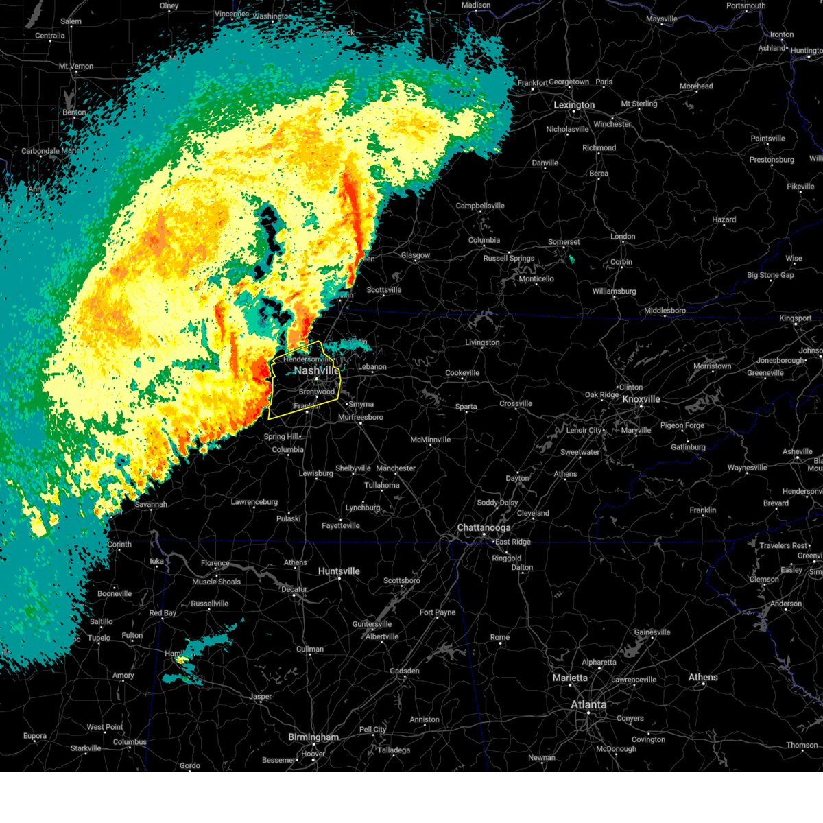 At 443 pm cdt, severe thunderstorms were located along a line extending from near coopertown to near belle meade to near fairview, moving northeast at 70 mph (radar indicated). Hazards include 70 mph wind gusts and half dollar size hail. Hail damage to vehicles is expected. expect considerable tree damage. wind damage is also likely to mobile homes, roofs, and outbuildings. locations impacted include, madison, hermitage, belle meade, natchez trace at highway 96, fairview, berry hill, ashland city, oak hill, forest hills, ridgetop, bells bend, brentwood, nashville, whites creek, bellevue, antioch, lakewood, pegram, kingston springs, and beaman park. this includes the following highways, interstate 40 between mile markers 182 and 222. interstate 65 between mile markers 70 and 97. interstate 24 between mile markers 29 and 62. Interstate 840 between mile markers 7 and 12. At 443 pm cdt, severe thunderstorms were located along a line extending from near coopertown to near belle meade to near fairview, moving northeast at 70 mph (radar indicated). Hazards include 70 mph wind gusts and half dollar size hail. Hail damage to vehicles is expected. expect considerable tree damage. wind damage is also likely to mobile homes, roofs, and outbuildings. locations impacted include, madison, hermitage, belle meade, natchez trace at highway 96, fairview, berry hill, ashland city, oak hill, forest hills, ridgetop, bells bend, brentwood, nashville, whites creek, bellevue, antioch, lakewood, pegram, kingston springs, and beaman park. this includes the following highways, interstate 40 between mile markers 182 and 222. interstate 65 between mile markers 70 and 97. interstate 24 between mile markers 29 and 62. Interstate 840 between mile markers 7 and 12.
|
| 4/5/2025 4:43 PM CDT |
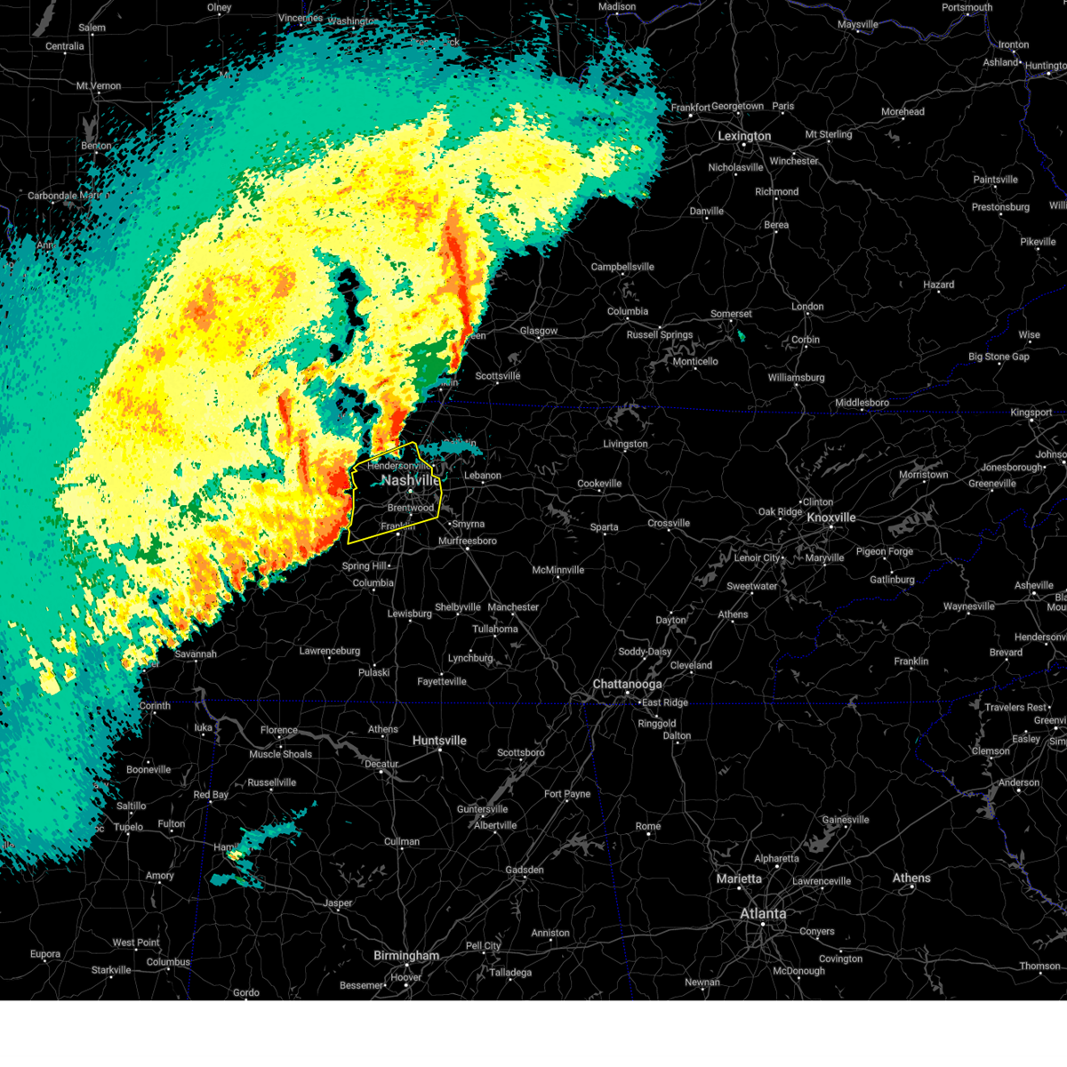 the severe thunderstorm warning has been cancelled and is no longer in effect the severe thunderstorm warning has been cancelled and is no longer in effect
|
| 4/5/2025 4:34 PM CDT |
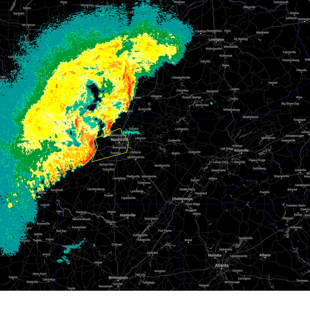 At 433 pm cdt, severe thunderstorms were located along a line extending from near ashland city to kingston springs to 11 miles east of centerville, moving east at 50 mph (radar indicated). Hazards include 70 mph wind gusts and half dollar size hail. Hail damage to vehicles is expected. expect considerable tree damage. wind damage is also likely to mobile homes, roofs, and outbuildings. locations impacted include, madison, bon aqua, hermitage, belle meade, natchez trace at highway 96, fairview, berry hill, ashland city, white bluff, oak hill, forest hills, ridgetop, bells bend, brentwood, lyles, nashville, whites creek, bellevue, antioch, and lakewood. this includes the following highways, interstate 40 between mile markers 174 and 222. interstate 65 between mile markers 67 and 97. interstate 24 between mile markers 29 and 63. Interstate 840 between mile markers 1 and 14. At 433 pm cdt, severe thunderstorms were located along a line extending from near ashland city to kingston springs to 11 miles east of centerville, moving east at 50 mph (radar indicated). Hazards include 70 mph wind gusts and half dollar size hail. Hail damage to vehicles is expected. expect considerable tree damage. wind damage is also likely to mobile homes, roofs, and outbuildings. locations impacted include, madison, bon aqua, hermitage, belle meade, natchez trace at highway 96, fairview, berry hill, ashland city, white bluff, oak hill, forest hills, ridgetop, bells bend, brentwood, lyles, nashville, whites creek, bellevue, antioch, and lakewood. this includes the following highways, interstate 40 between mile markers 174 and 222. interstate 65 between mile markers 67 and 97. interstate 24 between mile markers 29 and 63. Interstate 840 between mile markers 1 and 14.
|
| 4/5/2025 4:29 PM CDT | the severe thunderstorm warning has been cancelled and is no longer in effect |
| 4/5/2025 4:21 PM CDT |
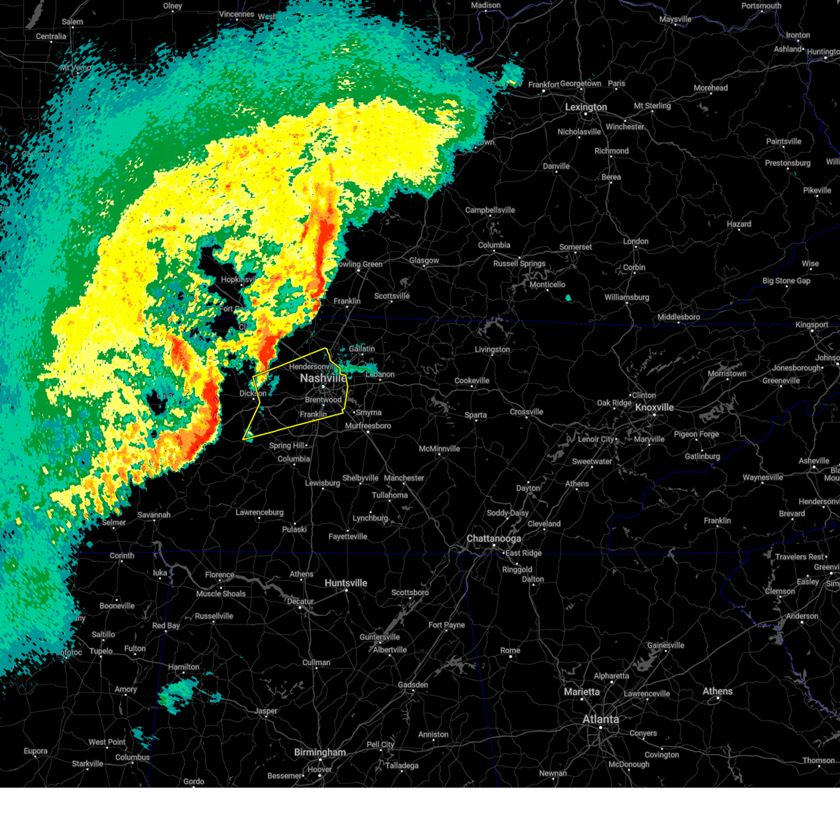 Svrohx the national weather service in nashville has issued a * severe thunderstorm warning for, davidson county in middle tennessee, eastern dickson county in middle tennessee, northern williamson county in middle tennessee, cheatham county in middle tennessee, northeastern hickman county in middle tennessee, south central robertson county in middle tennessee, * until 515 pm cdt. * at 420 pm cdt, severe thunderstorms were located along a line extending from 10 miles north of dickson to near white bluff to centerville, moving northeast at 65 mph (radar indicated). Hazards include 70 mph wind gusts and quarter size hail. Hail damage to vehicles is expected. expect considerable tree damage. Wind damage is also likely to mobile homes, roofs, and outbuildings. Svrohx the national weather service in nashville has issued a * severe thunderstorm warning for, davidson county in middle tennessee, eastern dickson county in middle tennessee, northern williamson county in middle tennessee, cheatham county in middle tennessee, northeastern hickman county in middle tennessee, south central robertson county in middle tennessee, * until 515 pm cdt. * at 420 pm cdt, severe thunderstorms were located along a line extending from 10 miles north of dickson to near white bluff to centerville, moving northeast at 65 mph (radar indicated). Hazards include 70 mph wind gusts and quarter size hail. Hail damage to vehicles is expected. expect considerable tree damage. Wind damage is also likely to mobile homes, roofs, and outbuildings.
|
| 4/5/2025 4:08 PM CDT | At 408 pm cdt, a severe thunderstorm was located 8 miles northwest of ashland city, moving northeast at 45 mph (radar indicated). Hazards include 60 mph wind gusts and penny size hail. Expect damage to roofs, siding, and trees. locations impacted include, greenbrier, pleasant view, ridgetop, cedar hill, springfield, coopertown, joelton, goodlettsville, ashland city, and millersville. this includes the following highways, interstate 65 between mile markers 105 and 106. Interstate 24 between mile markers 14 and 38. |
| 4/5/2025 4:08 PM CDT | the severe thunderstorm warning has been cancelled and is no longer in effect |
| 4/5/2025 3:55 PM CDT |
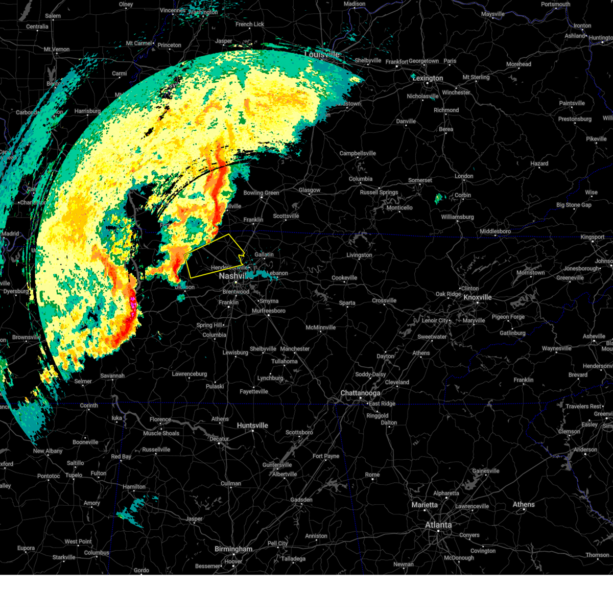 Svrohx the national weather service in nashville has issued a * severe thunderstorm warning for, northwestern davidson county in middle tennessee, northeastern dickson county in middle tennessee, southeastern montgomery county in middle tennessee, northern cheatham county in middle tennessee, central robertson county in middle tennessee, * until 500 pm cdt. * at 355 pm cdt, a severe thunderstorm was located 12 miles north of white bluff, or 12 miles west of ashland city, moving northeast at 50 mph (radar indicated). Hazards include 60 mph wind gusts and penny size hail. expect damage to roofs, siding, and trees Svrohx the national weather service in nashville has issued a * severe thunderstorm warning for, northwestern davidson county in middle tennessee, northeastern dickson county in middle tennessee, southeastern montgomery county in middle tennessee, northern cheatham county in middle tennessee, central robertson county in middle tennessee, * until 500 pm cdt. * at 355 pm cdt, a severe thunderstorm was located 12 miles north of white bluff, or 12 miles west of ashland city, moving northeast at 50 mph (radar indicated). Hazards include 60 mph wind gusts and penny size hail. expect damage to roofs, siding, and trees
|
| 4/4/2025 3:02 PM CDT | Svrohx the national weather service in nashville has issued a * severe thunderstorm warning for, central sumner county in middle tennessee, southeastern robertson county in middle tennessee, * until 345 pm cdt. * at 302 pm cdt, a severe thunderstorm was located near millersville, or 11 miles west of gallatin, moving northeast at 35 mph (radar indicated). Hazards include 60 mph wind gusts and quarter size hail. Hail damage to vehicles is expected. Expect wind damage to roofs, siding, and trees. |
| 4/3/2025 6:54 PM CDT |
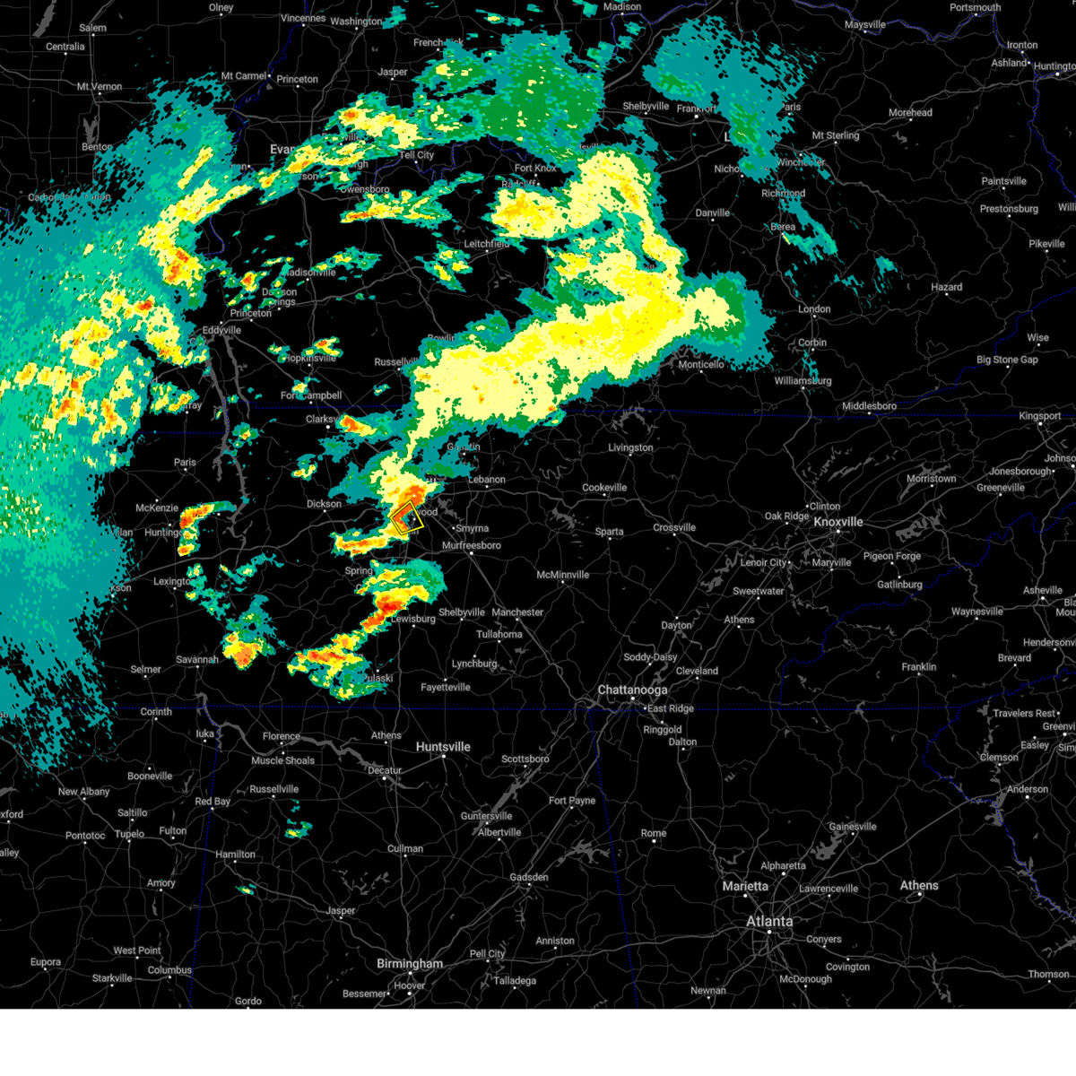 The storm which prompted the warning has weakened below severe limits, and no longer poses an immediate threat to life or property. therefore, the warning will be allowed to expire. a tornado watch remains in effect until 1000 pm cdt for middle tennessee. The storm which prompted the warning has weakened below severe limits, and no longer poses an immediate threat to life or property. therefore, the warning will be allowed to expire. a tornado watch remains in effect until 1000 pm cdt for middle tennessee.
|
| 4/3/2025 6:50 PM CDT |
 At 650 pm cdt, a severe thunderstorm was located over forest hills, or near nashville, moving northeast at 40 mph (radar indicated). Hazards include 60 mph wind gusts and penny size hail. Expect damage to roofs, siding, and trees. locations impacted include, forest hills, oak hill, brentwood, belle meade, and franklin. This includes interstate 65 between mile markers 70 and 75. At 650 pm cdt, a severe thunderstorm was located over forest hills, or near nashville, moving northeast at 40 mph (radar indicated). Hazards include 60 mph wind gusts and penny size hail. Expect damage to roofs, siding, and trees. locations impacted include, forest hills, oak hill, brentwood, belle meade, and franklin. This includes interstate 65 between mile markers 70 and 75.
|
| 4/3/2025 6:36 PM CDT |
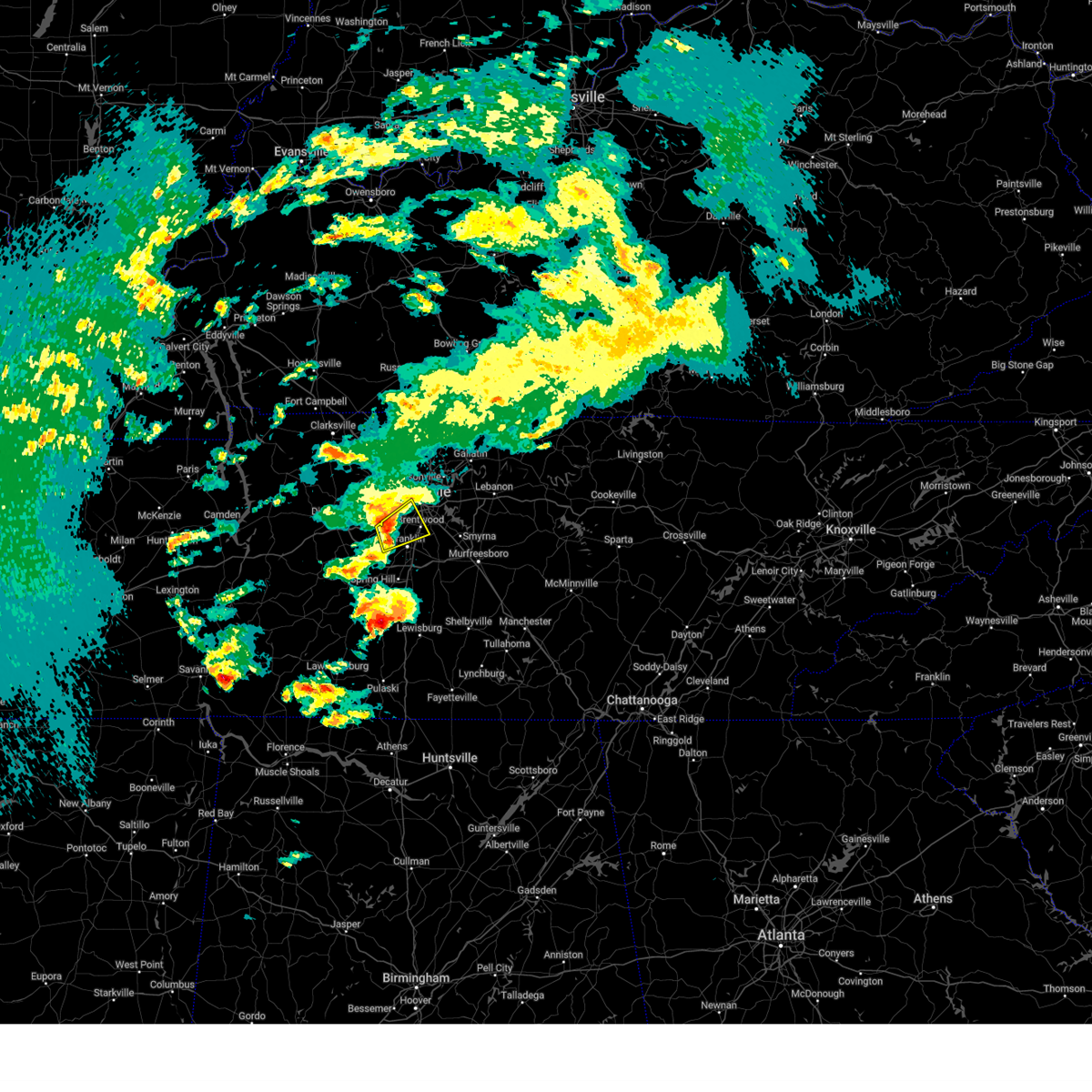 the severe thunderstorm warning has been cancelled and is no longer in effect the severe thunderstorm warning has been cancelled and is no longer in effect
|
| 4/3/2025 6:36 PM CDT |
 At 635 pm cdt, a severe thunderstorm was located near bellevue, or 10 miles northwest of franklin, moving northeast at 40 mph (radar indicated). Hazards include 60 mph wind gusts and penny size hail. Expect damage to roofs, siding, and trees. locations impacted include, forest hills, belle meade, brentwood, bellevue, oak hill, natchez trace at highway 96, and franklin. this includes the following highways, interstate 40 between mile markers 194 and 205. Interstate 65 between mile markers 70 and 75. At 635 pm cdt, a severe thunderstorm was located near bellevue, or 10 miles northwest of franklin, moving northeast at 40 mph (radar indicated). Hazards include 60 mph wind gusts and penny size hail. Expect damage to roofs, siding, and trees. locations impacted include, forest hills, belle meade, brentwood, bellevue, oak hill, natchez trace at highway 96, and franklin. this includes the following highways, interstate 40 between mile markers 194 and 205. Interstate 65 between mile markers 70 and 75.
|
| 4/3/2025 6:21 PM CDT |
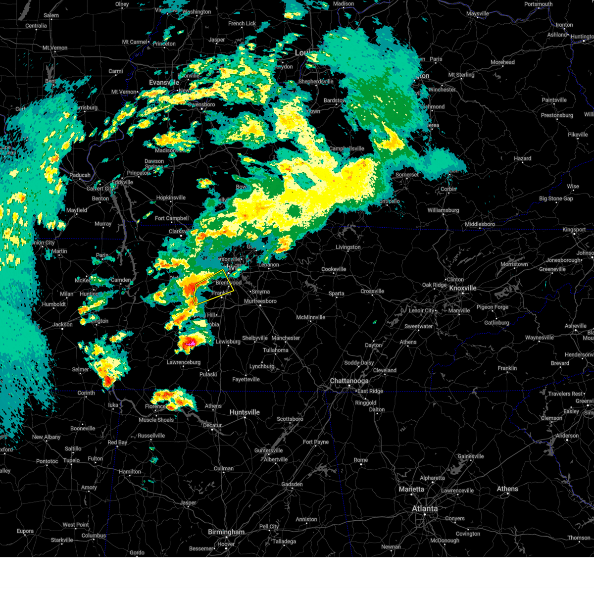 Svrohx the national weather service in nashville has issued a * severe thunderstorm warning for, southwestern davidson county in middle tennessee, northwestern williamson county in middle tennessee, south central cheatham county in middle tennessee, * until 700 pm cdt. * at 621 pm cdt, a severe thunderstorm was located over fairview, or 14 miles southeast of dickson, moving northeast at 40 mph (radar indicated). Hazards include 60 mph wind gusts and penny size hail. expect damage to roofs, siding, and trees Svrohx the national weather service in nashville has issued a * severe thunderstorm warning for, southwestern davidson county in middle tennessee, northwestern williamson county in middle tennessee, south central cheatham county in middle tennessee, * until 700 pm cdt. * at 621 pm cdt, a severe thunderstorm was located over fairview, or 14 miles southeast of dickson, moving northeast at 40 mph (radar indicated). Hazards include 60 mph wind gusts and penny size hail. expect damage to roofs, siding, and trees
|
| 4/3/2025 4:55 PM CDT |
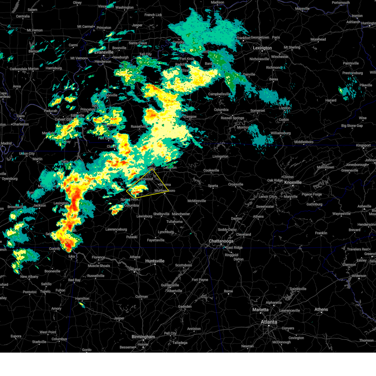 the severe thunderstorm warning has been cancelled and is no longer in effect the severe thunderstorm warning has been cancelled and is no longer in effect
|
| 4/3/2025 4:55 PM CDT |
 At 455 pm cdt, a severe thunderstorm was located over franklin, moving northeast at 60 mph (radar indicated). Hazards include 60 mph wind gusts and quarter size hail. Hail damage to vehicles is expected. expect wind damage to roofs, siding, and trees. locations impacted include, franklin, forest hills, nolensville, hermitage, thompson's station, brentwood, la vergne, antioch, triune, berry hill, leipers fork, percy priest lake, smyrna, oak hill, murfreesboro, rural hill, walterhill, belle meade, and spring hill. this includes the following highways, interstate 40 between mile markers 212 and 221. interstate 65 between mile markers 57 and 81. interstate 24 between mile markers 52 and 76. Interstate 840 between mile markers 13 and 62. At 455 pm cdt, a severe thunderstorm was located over franklin, moving northeast at 60 mph (radar indicated). Hazards include 60 mph wind gusts and quarter size hail. Hail damage to vehicles is expected. expect wind damage to roofs, siding, and trees. locations impacted include, franklin, forest hills, nolensville, hermitage, thompson's station, brentwood, la vergne, antioch, triune, berry hill, leipers fork, percy priest lake, smyrna, oak hill, murfreesboro, rural hill, walterhill, belle meade, and spring hill. this includes the following highways, interstate 40 between mile markers 212 and 221. interstate 65 between mile markers 57 and 81. interstate 24 between mile markers 52 and 76. Interstate 840 between mile markers 13 and 62.
|
| 4/3/2025 4:39 PM CDT |
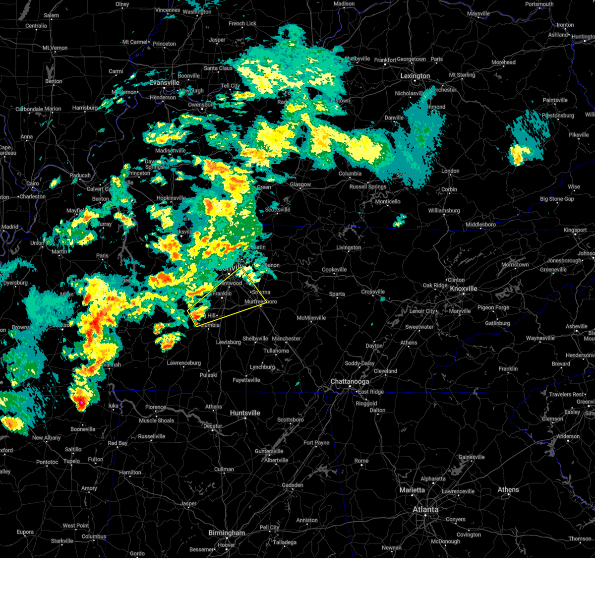 Svrohx the national weather service in nashville has issued a * severe thunderstorm warning for, southeastern davidson county in middle tennessee, northwestern rutherford county in middle tennessee, northern maury county in middle tennessee, williamson county in middle tennessee, east central hickman county in middle tennessee, * until 515 pm cdt. * at 438 pm cdt, a severe thunderstorm was located 10 miles west of spring hill, or 10 miles north of columbia, moving northeast at 60 mph (radar indicated). Hazards include 60 mph wind gusts and quarter size hail. Hail damage to vehicles is expected. Expect wind damage to roofs, siding, and trees. Svrohx the national weather service in nashville has issued a * severe thunderstorm warning for, southeastern davidson county in middle tennessee, northwestern rutherford county in middle tennessee, northern maury county in middle tennessee, williamson county in middle tennessee, east central hickman county in middle tennessee, * until 515 pm cdt. * at 438 pm cdt, a severe thunderstorm was located 10 miles west of spring hill, or 10 miles north of columbia, moving northeast at 60 mph (radar indicated). Hazards include 60 mph wind gusts and quarter size hail. Hail damage to vehicles is expected. Expect wind damage to roofs, siding, and trees.
|
| 4/3/2025 4:18 PM CDT | the tornado warning has been cancelled and is no longer in effect |
| 4/3/2025 4:06 PM CDT |
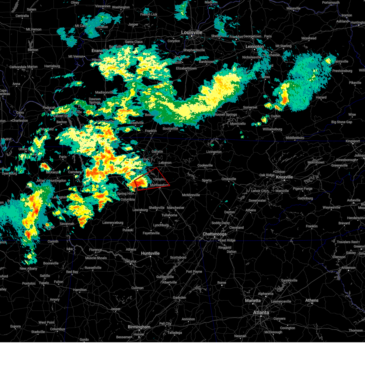 Torohx the national weather service in nashville has issued a * tornado warning for, southeastern davidson county in middle tennessee, northern rutherford county in middle tennessee, northeastern williamson county in middle tennessee, southwestern wilson county in middle tennessee, * until 430 pm cdt. * at 406 pm cdt, a severe thunderstorm capable of producing a tornado was located near franklin, moving northeast at 45 mph (radar indicated rotation). Hazards include tornado and quarter size hail. Flying debris will be dangerous to those caught without shelter. mobile homes will be damaged or destroyed. damage to roofs, windows, and vehicles will occur. tree damage is likely. this dangerous storm will be near, franklin and nolensville around 410 pm cdt. la vergne and smyrna around 415 pm cdt. other locations impacted by this tornadic thunderstorm include triune, lascassas, and gladeville. this includes the following highways, interstate 65 between mile markers 59 and 72. interstate 24 between mile markers 58 and 77. Interstate 840 between mile markers 31 and 69. Torohx the national weather service in nashville has issued a * tornado warning for, southeastern davidson county in middle tennessee, northern rutherford county in middle tennessee, northeastern williamson county in middle tennessee, southwestern wilson county in middle tennessee, * until 430 pm cdt. * at 406 pm cdt, a severe thunderstorm capable of producing a tornado was located near franklin, moving northeast at 45 mph (radar indicated rotation). Hazards include tornado and quarter size hail. Flying debris will be dangerous to those caught without shelter. mobile homes will be damaged or destroyed. damage to roofs, windows, and vehicles will occur. tree damage is likely. this dangerous storm will be near, franklin and nolensville around 410 pm cdt. la vergne and smyrna around 415 pm cdt. other locations impacted by this tornadic thunderstorm include triune, lascassas, and gladeville. this includes the following highways, interstate 65 between mile markers 59 and 72. interstate 24 between mile markers 58 and 77. Interstate 840 between mile markers 31 and 69.
|
| 4/3/2025 3:57 PM CDT |
 At 357 pm cdt, a severe thunderstorm capable of producing a tornado was located near thompson's station, or 7 miles south of franklin, moving northeast at 50 mph (radar indicated rotation). Hazards include tornado and two inch hail. Flying debris will be dangerous to those caught without shelter. mobile homes will be damaged or destroyed. damage to roofs, windows, and vehicles will occur. tree damage is likely. this dangerous storm will be near, nolensville around 405 pm cdt. other locations impacted by this tornadic thunderstorm include triune. this includes the following highways, interstate 65 between mile markers 54 and 68. Interstate 840 between mile markers 22 and 46. At 357 pm cdt, a severe thunderstorm capable of producing a tornado was located near thompson's station, or 7 miles south of franklin, moving northeast at 50 mph (radar indicated rotation). Hazards include tornado and two inch hail. Flying debris will be dangerous to those caught without shelter. mobile homes will be damaged or destroyed. damage to roofs, windows, and vehicles will occur. tree damage is likely. this dangerous storm will be near, nolensville around 405 pm cdt. other locations impacted by this tornadic thunderstorm include triune. this includes the following highways, interstate 65 between mile markers 54 and 68. Interstate 840 between mile markers 22 and 46.
|
| 4/3/2025 3:57 PM CDT |
 the tornado warning has been cancelled and is no longer in effect the tornado warning has been cancelled and is no longer in effect
|
| 4/3/2025 3:53 PM CDT |
 the severe thunderstorm warning has been cancelled and is no longer in effect the severe thunderstorm warning has been cancelled and is no longer in effect
|
| 4/3/2025 3:53 PM CDT |
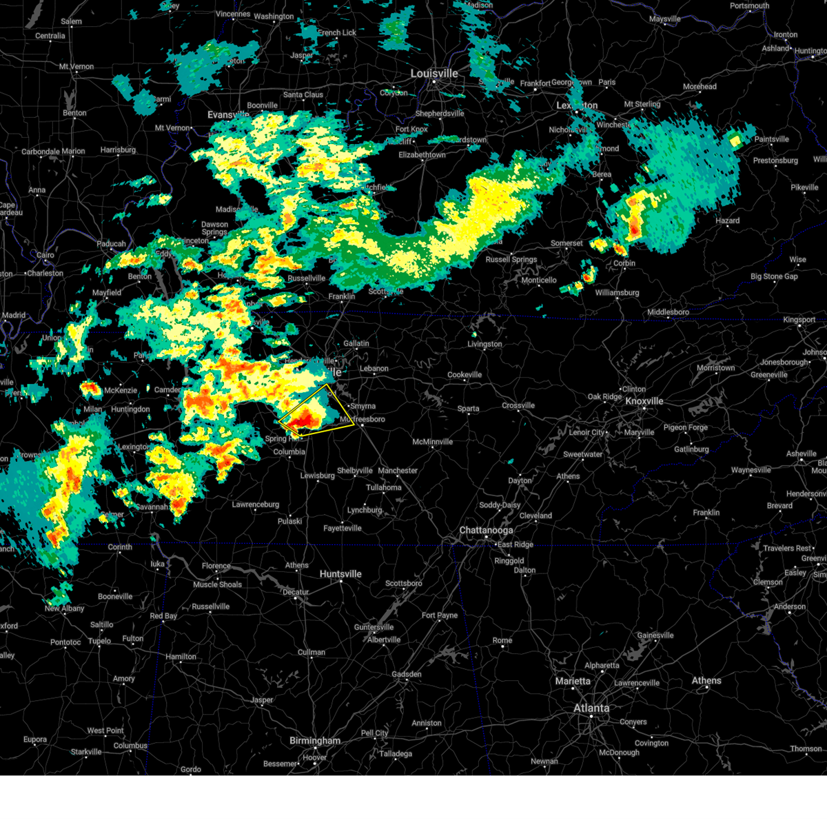 At 352 pm cdt, a severe thunderstorm was located over franklin, moving northeast at 50 mph (radar indicated). Hazards include two inch hail and 60 mph wind gusts. People and animals outdoors will be injured. expect hail damage to roofs, siding, windows, and vehicles. expect wind damage to roofs, siding, and trees. locations impacted include, franklin, nolensville, thompson's station, brentwood, leipers fork, antioch, oak hill, triune, forest hills, spring hill, smyrna, and la vergne. this includes the following highways, interstate 65 between mile markers 56 and 79. interstate 24 between mile markers 53 and 65. Interstate 840 between mile markers 14 and 18, and between mile markers 21 and 51. At 352 pm cdt, a severe thunderstorm was located over franklin, moving northeast at 50 mph (radar indicated). Hazards include two inch hail and 60 mph wind gusts. People and animals outdoors will be injured. expect hail damage to roofs, siding, windows, and vehicles. expect wind damage to roofs, siding, and trees. locations impacted include, franklin, nolensville, thompson's station, brentwood, leipers fork, antioch, oak hill, triune, forest hills, spring hill, smyrna, and la vergne. this includes the following highways, interstate 65 between mile markers 56 and 79. interstate 24 between mile markers 53 and 65. Interstate 840 between mile markers 14 and 18, and between mile markers 21 and 51.
|
| 4/3/2025 3:43 PM CDT |
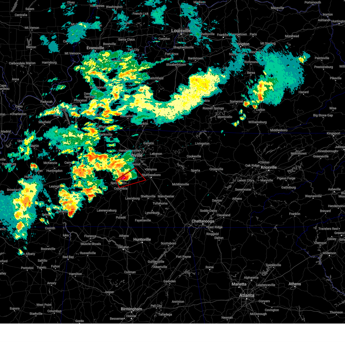 Torohx the national weather service in nashville has issued a * tornado warning for, west central rutherford county in middle tennessee, northeastern maury county in middle tennessee, southeastern williamson county in middle tennessee, * until 415 pm cdt. * at 343 pm cdt, a severe thunderstorm capable of producing a tornado was located near spring hill, or 9 miles north of columbia, moving northeast at 50 mph (radar indicated rotation). Hazards include tornado and hail up to two inches in diameter. Flying debris will be dangerous to those caught without shelter. mobile homes will be damaged or destroyed. damage to roofs, windows, and vehicles will occur. tree damage is likely. this dangerous storm will be near, thompson's station and spring hill around 350 pm cdt. nolensville around 405 pm cdt. other locations impacted by this tornadic thunderstorm include triune. this includes the following highways, interstate 65 between mile markers 51 and 69. Interstate 840 between mile markers 18 and 46. Torohx the national weather service in nashville has issued a * tornado warning for, west central rutherford county in middle tennessee, northeastern maury county in middle tennessee, southeastern williamson county in middle tennessee, * until 415 pm cdt. * at 343 pm cdt, a severe thunderstorm capable of producing a tornado was located near spring hill, or 9 miles north of columbia, moving northeast at 50 mph (radar indicated rotation). Hazards include tornado and hail up to two inches in diameter. Flying debris will be dangerous to those caught without shelter. mobile homes will be damaged or destroyed. damage to roofs, windows, and vehicles will occur. tree damage is likely. this dangerous storm will be near, thompson's station and spring hill around 350 pm cdt. nolensville around 405 pm cdt. other locations impacted by this tornadic thunderstorm include triune. this includes the following highways, interstate 65 between mile markers 51 and 69. Interstate 840 between mile markers 18 and 46.
|
| 4/3/2025 3:32 PM CDT |
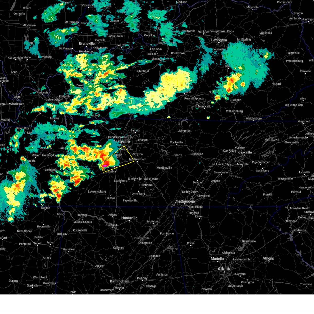 At 332 pm cdt, a severe thunderstorm was located 10 miles west of spring hill, or 12 miles north of columbia, moving northeast at 50 mph (radar indicated). Hazards include two inch hail and 60 mph wind gusts. People and animals outdoors will be injured. expect hail damage to roofs, siding, windows, and vehicles. expect wind damage to roofs, siding, and trees. locations impacted include, franklin, nolensville, spring hill, thompson's station, brentwood, antioch, triune, santa fe, leipers fork, oak hill, forest hills, smyrna, la vergne, and columbia. this includes the following highways, interstate 65 between mile markers 53 and 79. interstate 24 between mile markers 53 and 65. Interstate 840 between mile markers 13 and 51. At 332 pm cdt, a severe thunderstorm was located 10 miles west of spring hill, or 12 miles north of columbia, moving northeast at 50 mph (radar indicated). Hazards include two inch hail and 60 mph wind gusts. People and animals outdoors will be injured. expect hail damage to roofs, siding, windows, and vehicles. expect wind damage to roofs, siding, and trees. locations impacted include, franklin, nolensville, spring hill, thompson's station, brentwood, antioch, triune, santa fe, leipers fork, oak hill, forest hills, smyrna, la vergne, and columbia. this includes the following highways, interstate 65 between mile markers 53 and 79. interstate 24 between mile markers 53 and 65. Interstate 840 between mile markers 13 and 51.
|
| 4/3/2025 3:32 PM CDT |
 the severe thunderstorm warning has been cancelled and is no longer in effect the severe thunderstorm warning has been cancelled and is no longer in effect
|
| 4/3/2025 3:26 PM CDT |
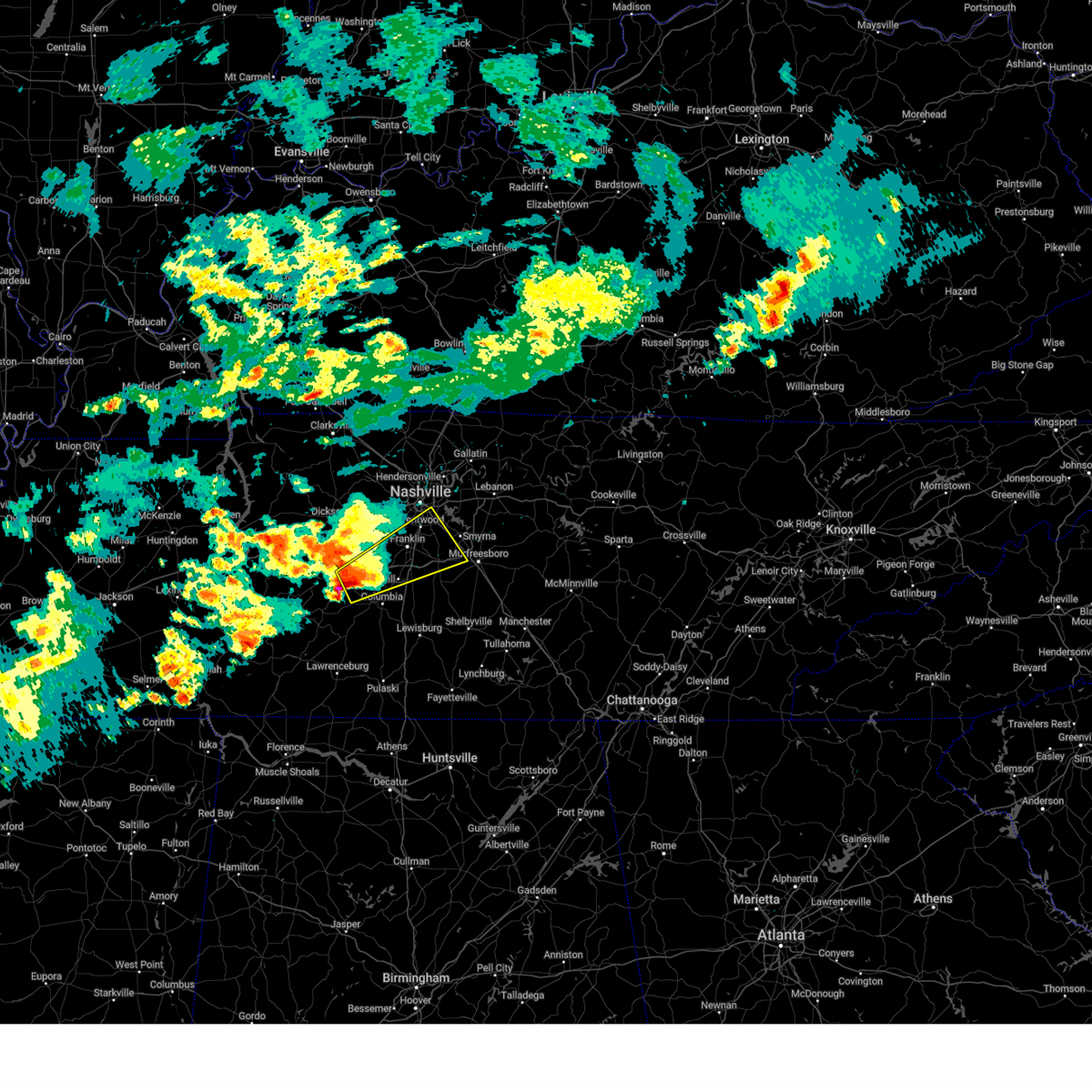 Svrohx the national weather service in nashville has issued a * severe thunderstorm warning for, south central davidson county in middle tennessee, west central rutherford county in middle tennessee, northern maury county in middle tennessee, williamson county in middle tennessee, east central hickman county in middle tennessee, * until 415 pm cdt. * at 325 pm cdt, a severe thunderstorm was located 12 miles northwest of columbia, moving northeast at 50 mph (radar indicated). Hazards include 60 mph wind gusts and half dollar size hail. Hail damage to vehicles is expected. Expect wind damage to roofs, siding, and trees. Svrohx the national weather service in nashville has issued a * severe thunderstorm warning for, south central davidson county in middle tennessee, west central rutherford county in middle tennessee, northern maury county in middle tennessee, williamson county in middle tennessee, east central hickman county in middle tennessee, * until 415 pm cdt. * at 325 pm cdt, a severe thunderstorm was located 12 miles northwest of columbia, moving northeast at 50 mph (radar indicated). Hazards include 60 mph wind gusts and half dollar size hail. Hail damage to vehicles is expected. Expect wind damage to roofs, siding, and trees.
|
| 4/3/2025 6:49 AM CDT |
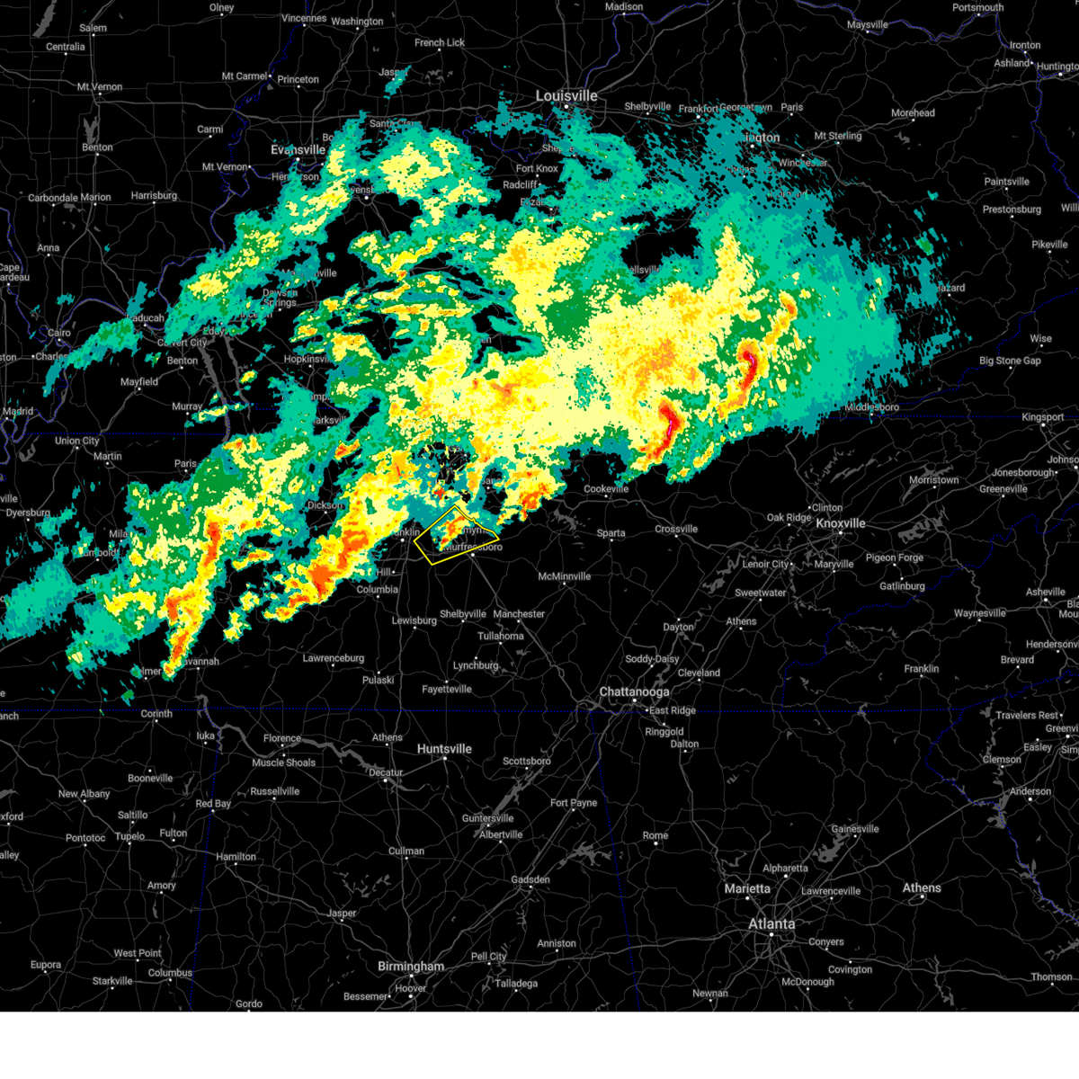 the severe thunderstorm warning has been cancelled and is no longer in effect the severe thunderstorm warning has been cancelled and is no longer in effect
|
| 4/3/2025 6:38 AM CDT |
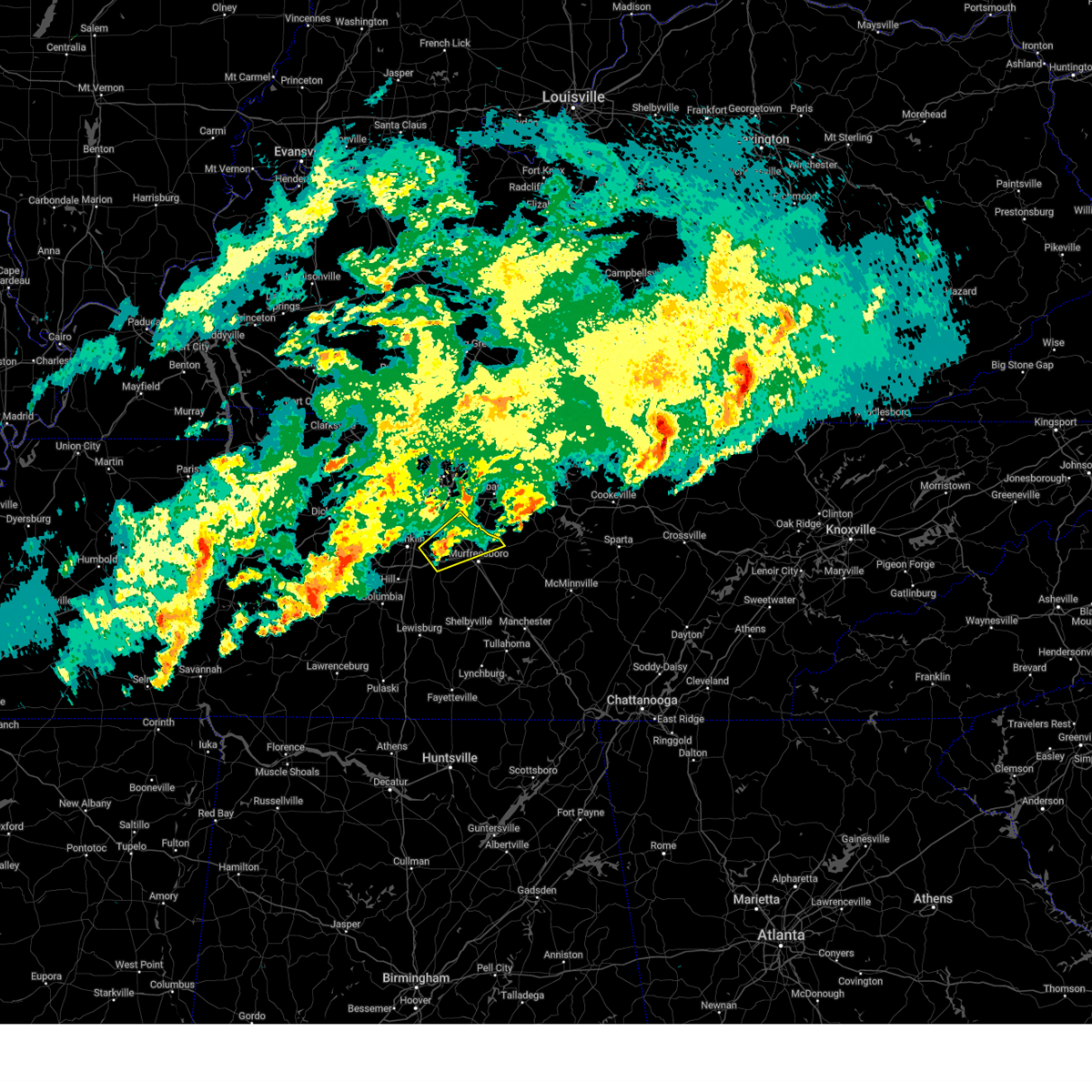 At 637 am cdt, a severe thunderstorm was located near nolensville, or 12 miles east of franklin, moving northeast at 45 mph (radar indicated). Hazards include 60 mph wind gusts and quarter size hail. Hail damage to vehicles is expected. expect wind damage to roofs, siding, and trees. locations impacted include, lascassas, nolensville, walterhill, la vergne, smyrna, triune, rural hill, murfreesboro, franklin, and brentwood. this includes the following highways, interstate 24 between mile markers 62 and 76. Interstate 840 between mile markers 39 and 65. At 637 am cdt, a severe thunderstorm was located near nolensville, or 12 miles east of franklin, moving northeast at 45 mph (radar indicated). Hazards include 60 mph wind gusts and quarter size hail. Hail damage to vehicles is expected. expect wind damage to roofs, siding, and trees. locations impacted include, lascassas, nolensville, walterhill, la vergne, smyrna, triune, rural hill, murfreesboro, franklin, and brentwood. this includes the following highways, interstate 24 between mile markers 62 and 76. Interstate 840 between mile markers 39 and 65.
|
| 4/3/2025 6:27 AM CDT |
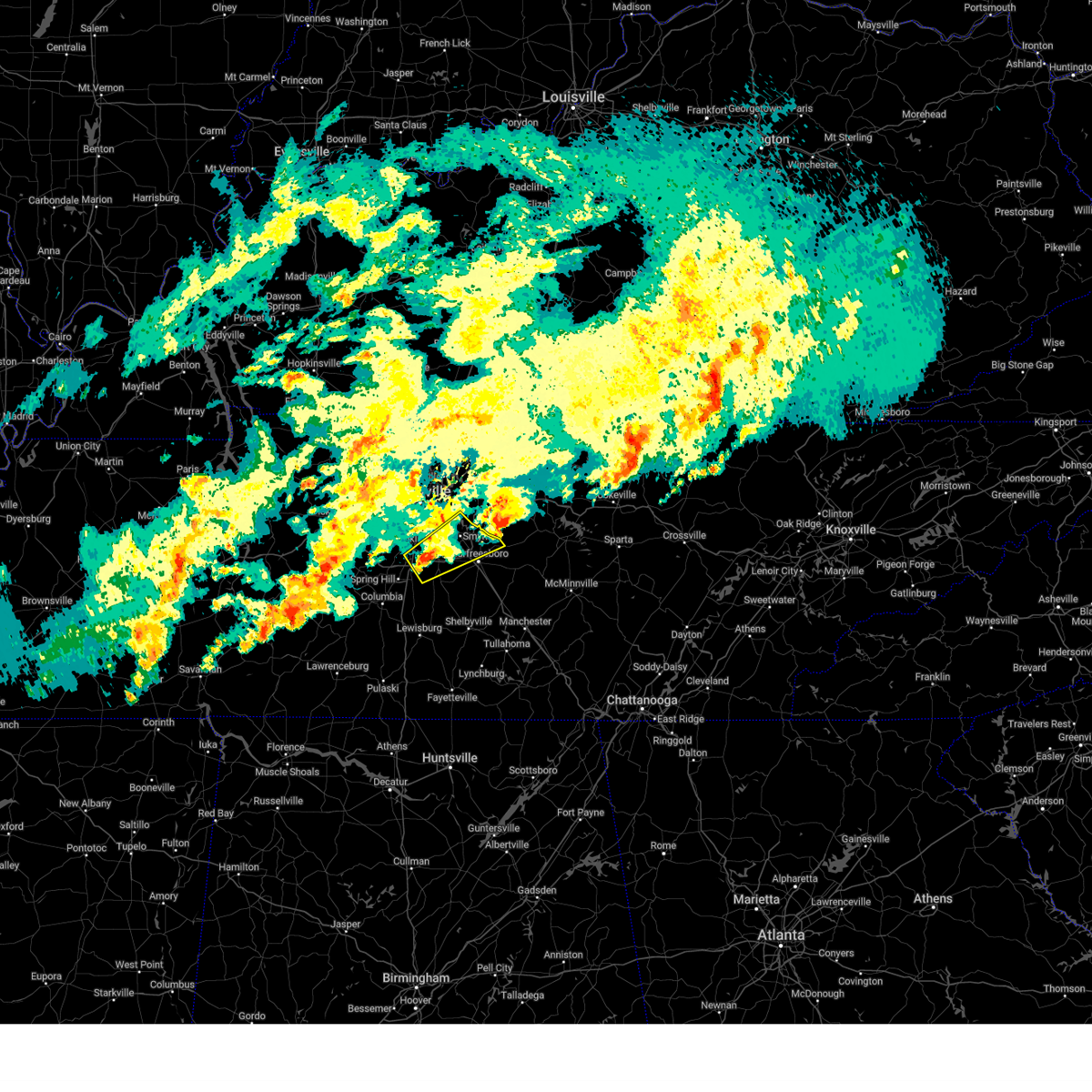 Svrohx the national weather service in nashville has issued a * severe thunderstorm warning for, southeastern davidson county in middle tennessee, northern rutherford county in middle tennessee, southeastern williamson county in middle tennessee, * until 700 am cdt. * at 627 am cdt, a severe thunderstorm was located 7 miles southeast of franklin, moving northeast at 45 mph (radar indicated). Hazards include 60 mph wind gusts and quarter size hail. Hail damage to vehicles is expected. Expect wind damage to roofs, siding, and trees. Svrohx the national weather service in nashville has issued a * severe thunderstorm warning for, southeastern davidson county in middle tennessee, northern rutherford county in middle tennessee, southeastern williamson county in middle tennessee, * until 700 am cdt. * at 627 am cdt, a severe thunderstorm was located 7 miles southeast of franklin, moving northeast at 45 mph (radar indicated). Hazards include 60 mph wind gusts and quarter size hail. Hail damage to vehicles is expected. Expect wind damage to roofs, siding, and trees.
|
| 4/3/2025 6:17 AM CDT |
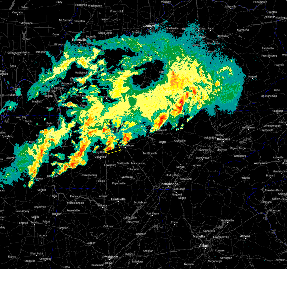 the severe thunderstorm warning has been cancelled and is no longer in effect the severe thunderstorm warning has been cancelled and is no longer in effect
|
| 4/3/2025 6:17 AM CDT |
 At 617 am cdt, a severe thunderstorm was located near thompson's station, or 9 miles south of franklin, moving northeast at 45 mph (radar indicated). Hazards include 60 mph wind gusts and quarter size hail. Hail damage to vehicles is expected. expect wind damage to roofs, siding, and trees. locations impacted include, nolensville, thompson's station, triune, spring hill, franklin, brentwood, and smyrna. this includes the following highways, interstate 65 between mile markers 53 and 64. Interstate 840 between mile markers 27 and 47. At 617 am cdt, a severe thunderstorm was located near thompson's station, or 9 miles south of franklin, moving northeast at 45 mph (radar indicated). Hazards include 60 mph wind gusts and quarter size hail. Hail damage to vehicles is expected. expect wind damage to roofs, siding, and trees. locations impacted include, nolensville, thompson's station, triune, spring hill, franklin, brentwood, and smyrna. this includes the following highways, interstate 65 between mile markers 53 and 64. Interstate 840 between mile markers 27 and 47.
|
| 4/3/2025 6:05 AM CDT |
 Svrohx the national weather service in nashville has issued a * severe thunderstorm warning for, west central rutherford county in middle tennessee, northeastern maury county in middle tennessee, eastern williamson county in middle tennessee, * until 630 am cdt. * at 605 am cdt, a severe thunderstorm was located over spring hill, or 9 miles northeast of columbia, moving northeast at 45 mph (radar indicated). Hazards include 60 mph wind gusts and quarter size hail. Hail damage to vehicles is expected. Expect wind damage to roofs, siding, and trees. Svrohx the national weather service in nashville has issued a * severe thunderstorm warning for, west central rutherford county in middle tennessee, northeastern maury county in middle tennessee, eastern williamson county in middle tennessee, * until 630 am cdt. * at 605 am cdt, a severe thunderstorm was located over spring hill, or 9 miles northeast of columbia, moving northeast at 45 mph (radar indicated). Hazards include 60 mph wind gusts and quarter size hail. Hail damage to vehicles is expected. Expect wind damage to roofs, siding, and trees.
|
| 4/3/2025 6:02 AM CDT |
 At 602 am cdt, a severe thunderstorm was located near smyrna, or 7 miles northwest of murfreesboro, moving northeast at 45 mph (radar indicated). Hazards include 60 mph wind gusts and quarter size hail. Hail damage to vehicles is expected. expect wind damage to roofs, siding, and trees. locations impacted include, cedars of lebanon state park, lascassas, murfreesboro, walterhill, smyrna, milton, gladeville, la vergne, lebanon, and nolensville. this includes the following highways, interstate 24 between mile markers 65 and 80. Interstate 840 between mile markers 45 and 76. At 602 am cdt, a severe thunderstorm was located near smyrna, or 7 miles northwest of murfreesboro, moving northeast at 45 mph (radar indicated). Hazards include 60 mph wind gusts and quarter size hail. Hail damage to vehicles is expected. expect wind damage to roofs, siding, and trees. locations impacted include, cedars of lebanon state park, lascassas, murfreesboro, walterhill, smyrna, milton, gladeville, la vergne, lebanon, and nolensville. this includes the following highways, interstate 24 between mile markers 65 and 80. Interstate 840 between mile markers 45 and 76.
|
| 4/3/2025 6:02 AM CDT |
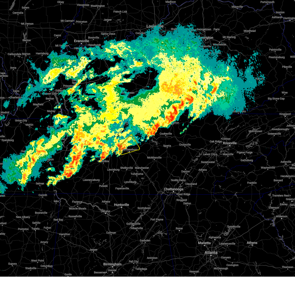 the severe thunderstorm warning has been cancelled and is no longer in effect the severe thunderstorm warning has been cancelled and is no longer in effect
|
| 4/3/2025 5:41 AM CDT |
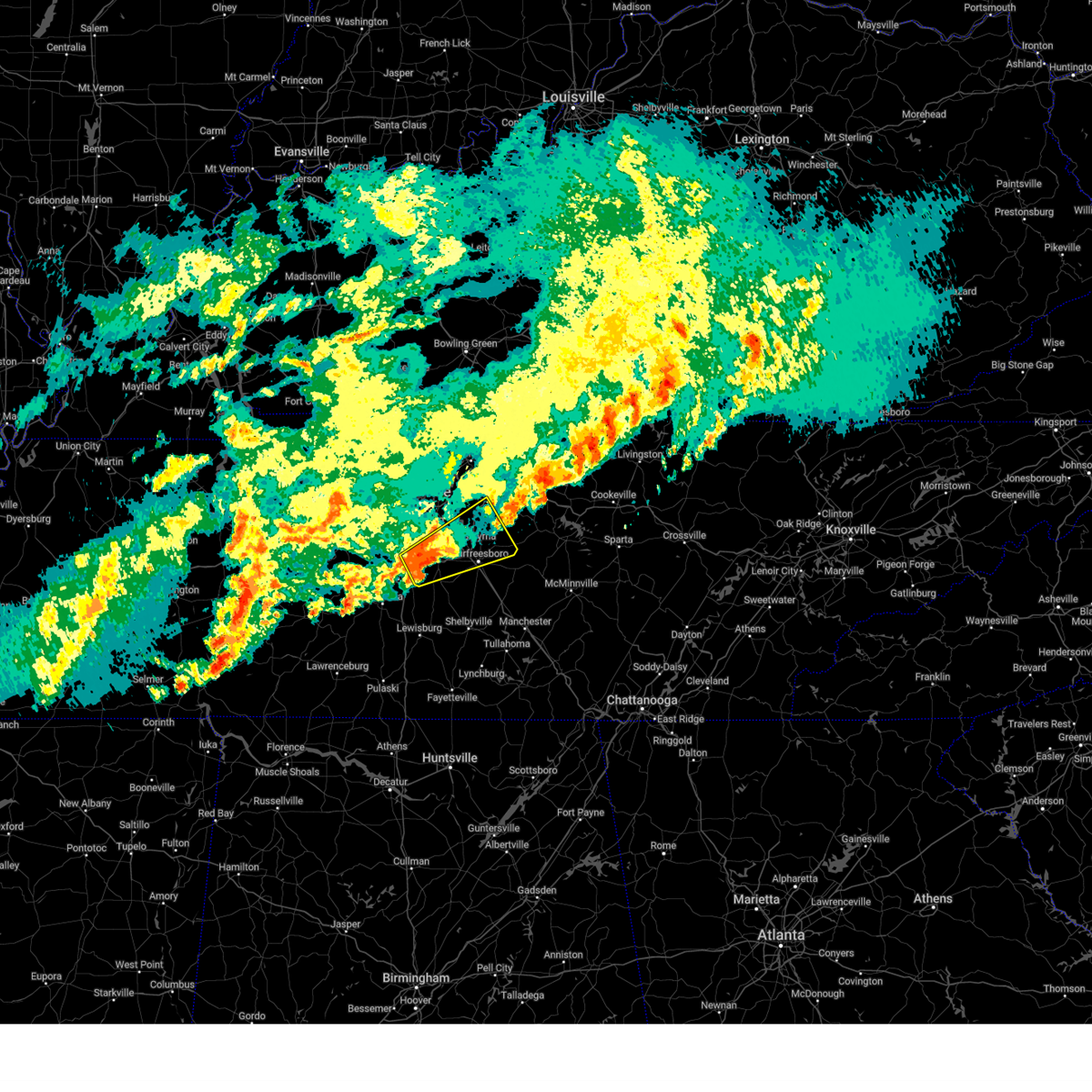 Svrohx the national weather service in nashville has issued a * severe thunderstorm warning for, southeastern davidson county in middle tennessee, central rutherford county in middle tennessee, eastern williamson county in middle tennessee, southwestern wilson county in middle tennessee, * until 630 am cdt. * at 540 am cdt, a severe thunderstorm was located 8 miles east of thompson's station, or 8 miles southeast of franklin, moving northeast at 40 mph (radar indicated). Hazards include 60 mph wind gusts and quarter size hail. Hail damage to vehicles is expected. Expect wind damage to roofs, siding, and trees. Svrohx the national weather service in nashville has issued a * severe thunderstorm warning for, southeastern davidson county in middle tennessee, central rutherford county in middle tennessee, eastern williamson county in middle tennessee, southwestern wilson county in middle tennessee, * until 630 am cdt. * at 540 am cdt, a severe thunderstorm was located 8 miles east of thompson's station, or 8 miles southeast of franklin, moving northeast at 40 mph (radar indicated). Hazards include 60 mph wind gusts and quarter size hail. Hail damage to vehicles is expected. Expect wind damage to roofs, siding, and trees.
|
| 4/3/2025 4:57 AM CDT |
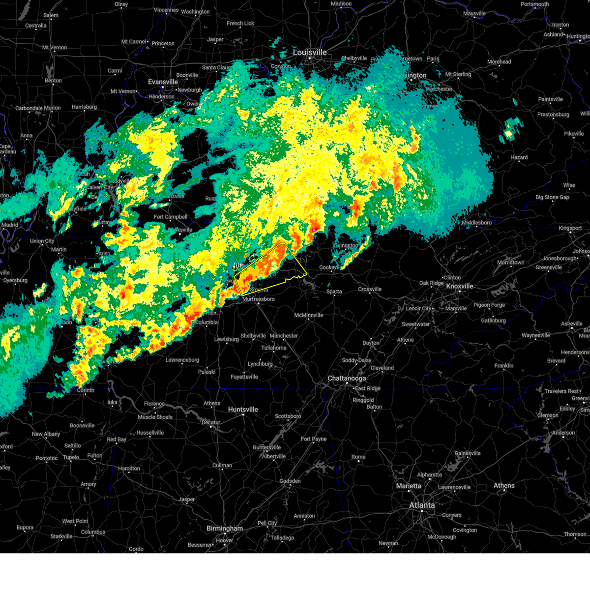 Svrohx the national weather service in nashville has issued a * severe thunderstorm warning for, smith county in middle tennessee, southeastern davidson county in middle tennessee, northwestern rutherford county in middle tennessee, wilson county in middle tennessee, trousdale county in middle tennessee, * until 545 am cdt. * at 456 am cdt, a severe thunderstorm was located over la vergne, or 15 miles northwest of murfreesboro, moving northeast at 50 mph (radar indicated). Hazards include 60 mph wind gusts and quarter size hail. Hail damage to vehicles is expected. Expect wind damage to roofs, siding, and trees. Svrohx the national weather service in nashville has issued a * severe thunderstorm warning for, smith county in middle tennessee, southeastern davidson county in middle tennessee, northwestern rutherford county in middle tennessee, wilson county in middle tennessee, trousdale county in middle tennessee, * until 545 am cdt. * at 456 am cdt, a severe thunderstorm was located over la vergne, or 15 miles northwest of murfreesboro, moving northeast at 50 mph (radar indicated). Hazards include 60 mph wind gusts and quarter size hail. Hail damage to vehicles is expected. Expect wind damage to roofs, siding, and trees.
|
| 4/3/2025 4:49 AM CDT |
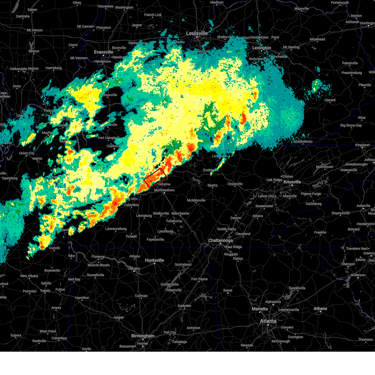 At 449 am cdt, a severe thunderstorm capable of producing a tornado was located over la vergne, or 14 miles southeast of nashville, moving northeast at 55 mph (radar indicated rotation). Hazards include tornado and ping pong ball size hail. Flying debris will be dangerous to those caught without shelter. mobile homes will be damaged or destroyed. damage to roofs, windows, and vehicles will occur. tree damage is likely. this dangerous storm will be near, la vergne, rural hill, and smyrna around 455 am cdt. mount juliet around 500 am cdt. other locations impacted by this tornadic thunderstorm include gladeville and percy priest lake. this includes the following highways, interstate 40 between mile markers 223 and 230. interstate 65 near mile marker 75. interstate 24 between mile markers 55 and 66. Interstate 840 between mile markers 65 and 72. At 449 am cdt, a severe thunderstorm capable of producing a tornado was located over la vergne, or 14 miles southeast of nashville, moving northeast at 55 mph (radar indicated rotation). Hazards include tornado and ping pong ball size hail. Flying debris will be dangerous to those caught without shelter. mobile homes will be damaged or destroyed. damage to roofs, windows, and vehicles will occur. tree damage is likely. this dangerous storm will be near, la vergne, rural hill, and smyrna around 455 am cdt. mount juliet around 500 am cdt. other locations impacted by this tornadic thunderstorm include gladeville and percy priest lake. this includes the following highways, interstate 40 between mile markers 223 and 230. interstate 65 near mile marker 75. interstate 24 between mile markers 55 and 66. Interstate 840 between mile markers 65 and 72.
|
| 4/3/2025 4:35 AM CDT |
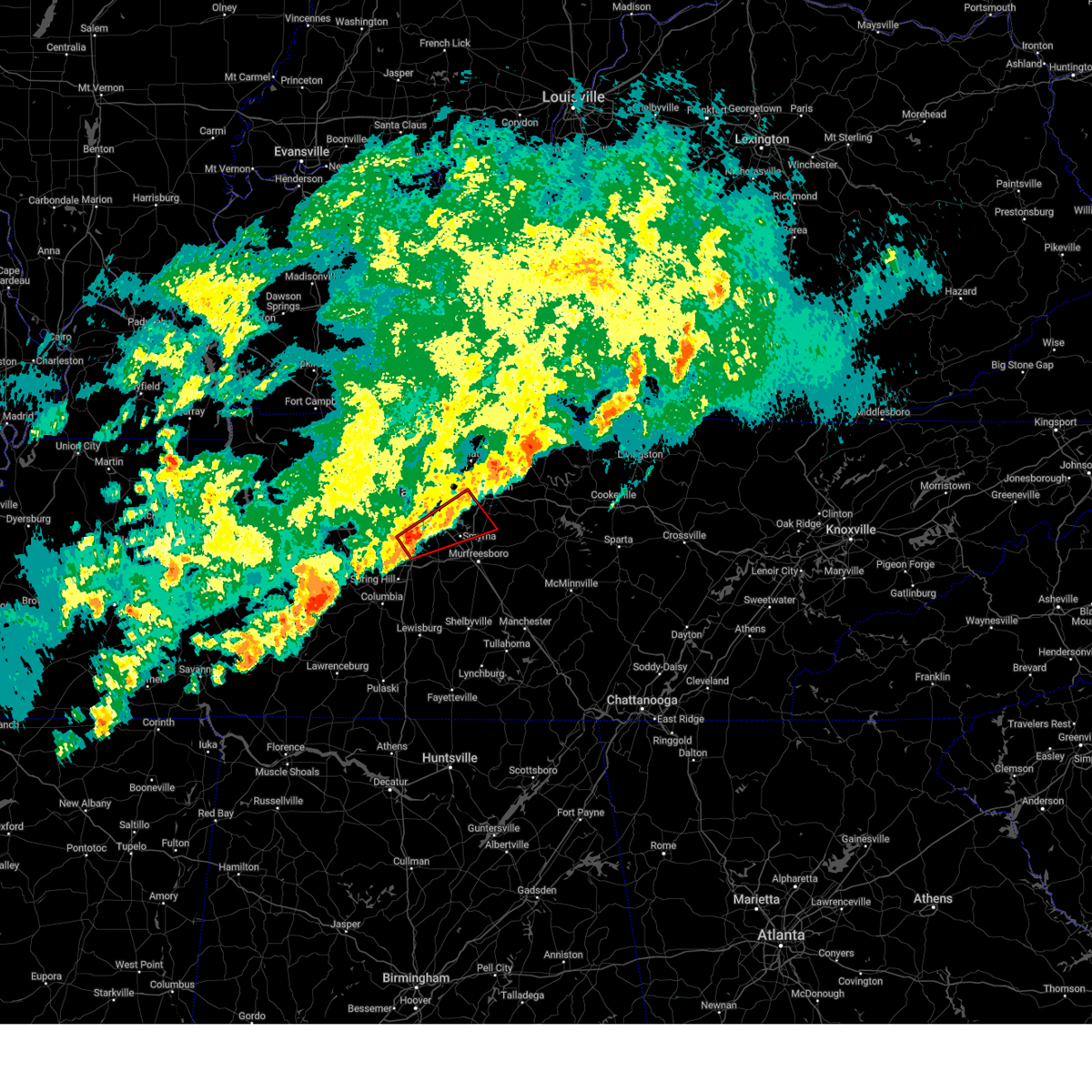 Torohx the national weather service in nashville has issued a * tornado warning for, southeastern davidson county in middle tennessee, northwestern rutherford county in middle tennessee, northeastern williamson county in middle tennessee, southwestern wilson county in middle tennessee, * until 500 am cdt. * at 435 am cdt, a severe thunderstorm capable of producing a tornado was located near brentwood, or near franklin, moving northeast at 55 mph (radar indicated rotation). Hazards include tornado and ping pong ball size hail. Flying debris will be dangerous to those caught without shelter. mobile homes will be damaged or destroyed. damage to roofs, windows, and vehicles will occur. tree damage is likely. this dangerous storm will be near, nolensville and brentwood around 440 am cdt. la vergne and antioch around 445 am cdt. rural hill and smyrna around 450 am cdt. other locations impacted by this tornadic thunderstorm include cedars of lebanon state park, gladeville, and percy priest lake. this includes the following highways, interstate 40 between mile markers 222 and 230. interstate 65 between mile markers 62 and 75. interstate 24 between mile markers 55 and 69. Interstate 840 between mile markers 60 and 72. Torohx the national weather service in nashville has issued a * tornado warning for, southeastern davidson county in middle tennessee, northwestern rutherford county in middle tennessee, northeastern williamson county in middle tennessee, southwestern wilson county in middle tennessee, * until 500 am cdt. * at 435 am cdt, a severe thunderstorm capable of producing a tornado was located near brentwood, or near franklin, moving northeast at 55 mph (radar indicated rotation). Hazards include tornado and ping pong ball size hail. Flying debris will be dangerous to those caught without shelter. mobile homes will be damaged or destroyed. damage to roofs, windows, and vehicles will occur. tree damage is likely. this dangerous storm will be near, nolensville and brentwood around 440 am cdt. la vergne and antioch around 445 am cdt. rural hill and smyrna around 450 am cdt. other locations impacted by this tornadic thunderstorm include cedars of lebanon state park, gladeville, and percy priest lake. this includes the following highways, interstate 40 between mile markers 222 and 230. interstate 65 between mile markers 62 and 75. interstate 24 between mile markers 55 and 69. Interstate 840 between mile markers 60 and 72.
|
| 4/3/2025 4:27 AM CDT |
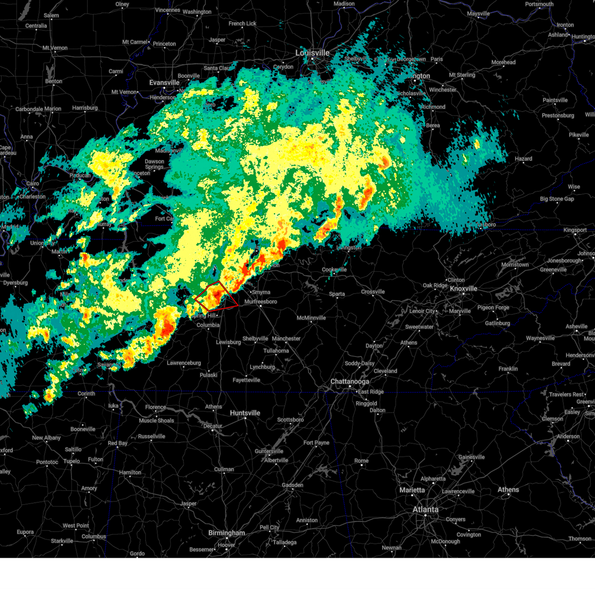 the tornado warning has been cancelled and is no longer in effect the tornado warning has been cancelled and is no longer in effect
|
| 4/3/2025 4:27 AM CDT |
 At 426 am cdt, a severe thunderstorm capable of producing a tornado was located near franklin, moving northeast at 55 mph (radar indicated rotation). Hazards include tornado and quarter size hail. Flying debris will be dangerous to those caught without shelter. mobile homes will be damaged or destroyed. damage to roofs, windows, and vehicles will occur. tree damage is likely. this dangerous storm will be near, forest hills, franklin, and brentwood around 430 am cdt. other locations impacted by this tornadic thunderstorm include natchez trace at highway 96 and leipers fork. this includes the following highways, interstate 65 between mile markers 60 and 70. Interstate 840 between mile markers 9 and 31, and between mile markers 39 and 40. At 426 am cdt, a severe thunderstorm capable of producing a tornado was located near franklin, moving northeast at 55 mph (radar indicated rotation). Hazards include tornado and quarter size hail. Flying debris will be dangerous to those caught without shelter. mobile homes will be damaged or destroyed. damage to roofs, windows, and vehicles will occur. tree damage is likely. this dangerous storm will be near, forest hills, franklin, and brentwood around 430 am cdt. other locations impacted by this tornadic thunderstorm include natchez trace at highway 96 and leipers fork. this includes the following highways, interstate 65 between mile markers 60 and 70. Interstate 840 between mile markers 9 and 31, and between mile markers 39 and 40.
|
| 4/3/2025 4:27 AM CDT |
 At 427 am cdt, severe thunderstorms were located along a line extending from near lafayette to near antioch, moving east at 40 mph (radar indicated). Hazards include 60 mph wind gusts and nickel size hail. Expect damage to roofs, siding, and trees. locations impacted include, madison, hermitage, hartsville, gallatin, bledsoe creek state park, dickerson chapel recreation area, hendersonville, carthage, berry hill, mount juliet, south carthage, green hill, tuckers crossroads, bethpage, rural hill, dixon springs, nashville, antioch, belinda city, and lakewood. this includes the following highways, interstate 40 between mile markers 207 and 247. interstate 65 between mile markers 79 and 92. interstate 24 between mile markers 44 and 61. Interstate 840 between mile markers 68 and 76. At 427 am cdt, severe thunderstorms were located along a line extending from near lafayette to near antioch, moving east at 40 mph (radar indicated). Hazards include 60 mph wind gusts and nickel size hail. Expect damage to roofs, siding, and trees. locations impacted include, madison, hermitage, hartsville, gallatin, bledsoe creek state park, dickerson chapel recreation area, hendersonville, carthage, berry hill, mount juliet, south carthage, green hill, tuckers crossroads, bethpage, rural hill, dixon springs, nashville, antioch, belinda city, and lakewood. this includes the following highways, interstate 40 between mile markers 207 and 247. interstate 65 between mile markers 79 and 92. interstate 24 between mile markers 44 and 61. Interstate 840 between mile markers 68 and 76.
|
| 4/3/2025 4:17 AM CDT | At 417 am cdt, a severe thunderstorm capable of producing a tornado was located 7 miles south of fairview, or 13 miles west of franklin, moving northeast at 55 mph (radar indicated rotation). Hazards include tornado and quarter size hail. Flying debris will be dangerous to those caught without shelter. mobile homes will be damaged or destroyed. damage to roofs, windows, and vehicles will occur. tree damage is likely. this dangerous storm will be near, franklin around 425 am cdt. brentwood around 430 am cdt. forest hills around 435 am cdt. other locations impacted by this tornadic thunderstorm include natchez trace at highway 96 and leipers fork. this includes the following highways, interstate 40 between mile markers 193 and 200. interstate 65 between mile markers 58 and 71. Interstate 840 between mile markers 7 and 32, and between mile markers 39 and 40. |
| 4/3/2025 4:09 AM CDT |
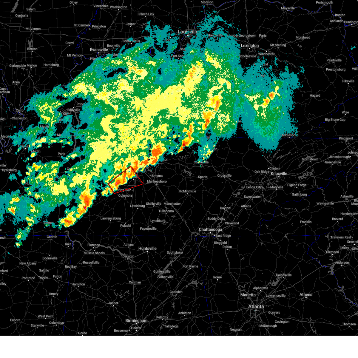 Torohx the national weather service in nashville has issued a * tornado warning for, southwestern davidson county in middle tennessee, northwestern maury county in middle tennessee, williamson county in middle tennessee, east central hickman county in middle tennessee, * until 445 am cdt. * at 409 am cdt, a severe thunderstorm capable of producing a tornado was located 12 miles south of fairview, or 15 miles east of centerville, moving northeast at 50 mph (radar indicated rotation). Hazards include tornado and quarter size hail. Flying debris will be dangerous to those caught without shelter. mobile homes will be damaged or destroyed. damage to roofs, windows, and vehicles will occur. tree damage is likely. this dangerous storm will be near, franklin around 425 am cdt. brentwood around 430 am cdt. forest hills around 435 am cdt. other locations impacted by this tornadic thunderstorm include santa fe, primm springs, leipers fork, and natchez trace at highway 96. this includes the following highways, interstate 40 between mile markers 193 and 200. interstate 65 between mile markers 58 and 71. Interstate 840 between mile markers 6 and 32, and between mile markers 39 and 40. Torohx the national weather service in nashville has issued a * tornado warning for, southwestern davidson county in middle tennessee, northwestern maury county in middle tennessee, williamson county in middle tennessee, east central hickman county in middle tennessee, * until 445 am cdt. * at 409 am cdt, a severe thunderstorm capable of producing a tornado was located 12 miles south of fairview, or 15 miles east of centerville, moving northeast at 50 mph (radar indicated rotation). Hazards include tornado and quarter size hail. Flying debris will be dangerous to those caught without shelter. mobile homes will be damaged or destroyed. damage to roofs, windows, and vehicles will occur. tree damage is likely. this dangerous storm will be near, franklin around 425 am cdt. brentwood around 430 am cdt. forest hills around 435 am cdt. other locations impacted by this tornadic thunderstorm include santa fe, primm springs, leipers fork, and natchez trace at highway 96. this includes the following highways, interstate 40 between mile markers 193 and 200. interstate 65 between mile markers 58 and 71. Interstate 840 between mile markers 6 and 32, and between mile markers 39 and 40.
|
| 4/3/2025 4:07 AM CDT |
 Svrohx the national weather service in nashville has issued a * severe thunderstorm warning for, northwestern smith county in middle tennessee, southeastern davidson county in middle tennessee, southeastern sumner county in middle tennessee, wilson county in middle tennessee, western macon county in middle tennessee, trousdale county in middle tennessee, * until 500 am cdt. * at 407 am cdt, a severe thunderstorm was located over hermitage, or 9 miles east of nashville, moving northeast at 50 mph (radar indicated). Hazards include 60 mph wind gusts and quarter size hail. Hail damage to vehicles is expected. Expect wind damage to roofs, siding, and trees. Svrohx the national weather service in nashville has issued a * severe thunderstorm warning for, northwestern smith county in middle tennessee, southeastern davidson county in middle tennessee, southeastern sumner county in middle tennessee, wilson county in middle tennessee, western macon county in middle tennessee, trousdale county in middle tennessee, * until 500 am cdt. * at 407 am cdt, a severe thunderstorm was located over hermitage, or 9 miles east of nashville, moving northeast at 50 mph (radar indicated). Hazards include 60 mph wind gusts and quarter size hail. Hail damage to vehicles is expected. Expect wind damage to roofs, siding, and trees.
|
| 4/3/2025 4:03 AM CDT |
 the tornado warning has been cancelled and is no longer in effect the tornado warning has been cancelled and is no longer in effect
|
| 4/3/2025 3:56 AM CDT |
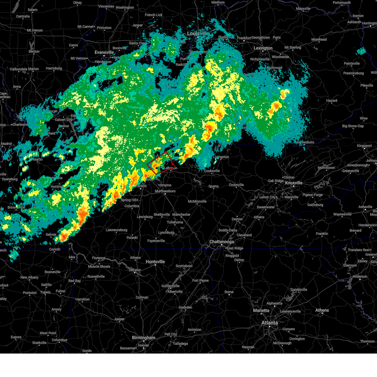 Torohx the national weather service in nashville has issued a * tornado warning for, northeastern davidson county in middle tennessee, southern sumner county in middle tennessee, northwestern wilson county in middle tennessee, * until 430 am cdt. * at 356 am cdt, a severe thunderstorm capable of producing a tornado was located over lakewood, or 11 miles northeast of nashville, moving northeast at 45 mph (radar indicated rotation). Hazards include tornado and quarter size hail. Flying debris will be dangerous to those caught without shelter. mobile homes will be damaged or destroyed. damage to roofs, windows, and vehicles will occur. tree damage is likely. this dangerous storm will be near, mount juliet, hendersonville, and gallatin around 400 am cdt. other locations impacted by this tornadic thunderstorm include green hill and bledsoe creek state park. this includes the following highways, interstate 40 between mile markers 221 and 226. Interstate 65 between mile markers 95 and 97. Torohx the national weather service in nashville has issued a * tornado warning for, northeastern davidson county in middle tennessee, southern sumner county in middle tennessee, northwestern wilson county in middle tennessee, * until 430 am cdt. * at 356 am cdt, a severe thunderstorm capable of producing a tornado was located over lakewood, or 11 miles northeast of nashville, moving northeast at 45 mph (radar indicated rotation). Hazards include tornado and quarter size hail. Flying debris will be dangerous to those caught without shelter. mobile homes will be damaged or destroyed. damage to roofs, windows, and vehicles will occur. tree damage is likely. this dangerous storm will be near, mount juliet, hendersonville, and gallatin around 400 am cdt. other locations impacted by this tornadic thunderstorm include green hill and bledsoe creek state park. this includes the following highways, interstate 40 between mile markers 221 and 226. Interstate 65 between mile markers 95 and 97.
|
| 4/3/2025 3:50 AM CDT | At 350 am cdt, a severe thunderstorm capable of producing a tornado was located over forest hills, or 8 miles southwest of nashville, moving northeast at 45 mph (radar indicated rotation). Hazards include tornado and quarter size hail. Flying debris will be dangerous to those caught without shelter. mobile homes will be damaged or destroyed. damage to roofs, windows, and vehicles will occur. tree damage is likely. this dangerous storm will be near, forest hills, oak hill, and brentwood around 355 am cdt. antioch around 400 am cdt. other locations impacted by this tornadic thunderstorm include berry hill. this includes the following highways, interstate 40 between mile markers 197 and 218. interstate 65 between mile markers 66 and 86. Interstate 24 between mile markers 47 and 63. |
| 4/3/2025 3:49 AM CDT | the tornado warning has been cancelled and is no longer in effect |
| 4/3/2025 3:49 AM CDT | At 348 am cdt, a severe thunderstorm capable of producing a tornado was located over lakewood, or 9 miles northeast of nashville, moving northeast at 50 mph (radar indicated rotation). Hazards include tornado and quarter size hail. Flying debris will be dangerous to those caught without shelter. mobile homes will be damaged or destroyed. damage to roofs, windows, and vehicles will occur. tree damage is likely. this dangerous storm will be near, mount juliet, hendersonville, and gallatin around 355 am cdt. other locations impacted by this tornadic thunderstorm include green hill, percy priest lake, whites creek, and berry hill. this includes the following highways, interstate 40 between mile markers 211 and 229. interstate 65 between mile markers 86 and 97. Interstate 24 between mile markers 40 and 59. |
| 4/3/2025 3:46 AM CDT | Quarter sized hail reported 14.4 miles NE of Nashville, TN, tspotter report of quarter size hail near kroger on highway 70. time radar estimated. |
| 4/3/2025 3:38 AM CDT |
 Torohx the national weather service in nashville has issued a * tornado warning for, southern davidson county in middle tennessee, northern williamson county in middle tennessee, * until 415 am cdt. * at 338 am cdt, a severe thunderstorm capable of producing a tornado was located near fairview, or 10 miles northwest of franklin, moving northeast at 45 mph (radar indicated rotation). Hazards include tornado and quarter size hail. Flying debris will be dangerous to those caught without shelter. mobile homes will be damaged or destroyed. damage to roofs, windows, and vehicles will occur. tree damage is likely. this dangerous storm will be near, forest hills, brentwood, bellevue, and belle meade around 345 am cdt. oak hill around 350 am cdt. other locations impacted by this tornadic thunderstorm include berry hill and natchez trace at highway 96. this includes the following highways, interstate 40 between mile markers 192 and 218. interstate 65 between mile markers 66 and 86. Interstate 24 between mile markers 47 and 63. Torohx the national weather service in nashville has issued a * tornado warning for, southern davidson county in middle tennessee, northern williamson county in middle tennessee, * until 415 am cdt. * at 338 am cdt, a severe thunderstorm capable of producing a tornado was located near fairview, or 10 miles northwest of franklin, moving northeast at 45 mph (radar indicated rotation). Hazards include tornado and quarter size hail. Flying debris will be dangerous to those caught without shelter. mobile homes will be damaged or destroyed. damage to roofs, windows, and vehicles will occur. tree damage is likely. this dangerous storm will be near, forest hills, brentwood, bellevue, and belle meade around 345 am cdt. oak hill around 350 am cdt. other locations impacted by this tornadic thunderstorm include berry hill and natchez trace at highway 96. this includes the following highways, interstate 40 between mile markers 192 and 218. interstate 65 between mile markers 66 and 86. Interstate 24 between mile markers 47 and 63.
|
| 4/3/2025 3:33 AM CDT |
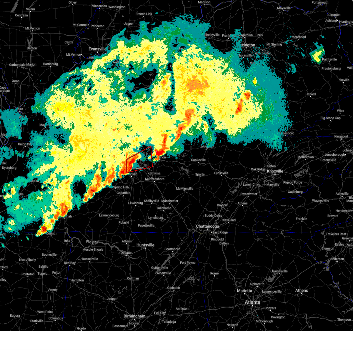 Torohx the national weather service in nashville has issued a * tornado warning for, davidson county in middle tennessee, southwestern sumner county in middle tennessee, north central williamson county in middle tennessee, northwestern wilson county in middle tennessee, * until 400 am cdt. * at 333 am cdt, a severe thunderstorm capable of producing a tornado was located over belle meade, or near nashville, moving northeast at 45 mph (radar indicated rotation). Hazards include tornado and quarter size hail. Flying debris will be dangerous to those caught without shelter. mobile homes will be damaged or destroyed. damage to roofs, windows, and vehicles will occur. tree damage is likely. this dangerous storm will be near, nashville and oak hill around 340 am cdt. lakewood, mount juliet, hendersonville, hermitage, and old hickory around 350 am cdt. other locations impacted by this tornadic thunderstorm include green hill, berry hill, percy priest lake, whites creek, and bells bend. this includes the following highways, interstate 40 between mile markers 195 and 229. interstate 65 between mile markers 74 and 97. Interstate 24 between mile markers 40 and 59. Torohx the national weather service in nashville has issued a * tornado warning for, davidson county in middle tennessee, southwestern sumner county in middle tennessee, north central williamson county in middle tennessee, northwestern wilson county in middle tennessee, * until 400 am cdt. * at 333 am cdt, a severe thunderstorm capable of producing a tornado was located over belle meade, or near nashville, moving northeast at 45 mph (radar indicated rotation). Hazards include tornado and quarter size hail. Flying debris will be dangerous to those caught without shelter. mobile homes will be damaged or destroyed. damage to roofs, windows, and vehicles will occur. tree damage is likely. this dangerous storm will be near, nashville and oak hill around 340 am cdt. lakewood, mount juliet, hendersonville, hermitage, and old hickory around 350 am cdt. other locations impacted by this tornadic thunderstorm include green hill, berry hill, percy priest lake, whites creek, and bells bend. this includes the following highways, interstate 40 between mile markers 195 and 229. interstate 65 between mile markers 74 and 97. Interstate 24 between mile markers 40 and 59.
|
| 4/3/2025 3:23 AM CDT |
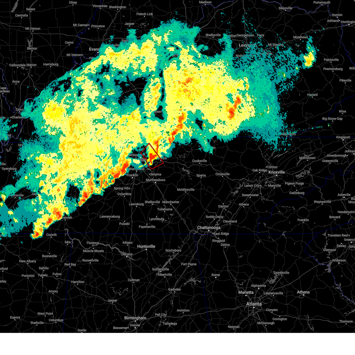 At 322 am cdt, a severe thunderstorm capable of producing a tornado was located over mount juliet, or 10 miles west of lebanon, moving northeast at 45 mph (radar indicated rotation). Hazards include tornado and golf ball size hail. Flying debris will be dangerous to those caught without shelter. mobile homes will be damaged or destroyed. damage to roofs, windows, and vehicles will occur. tree damage is likely. locations impacted include, hendersonville, green hill, lebanon, cottontown, mount juliet, rural hill, gallatin, gladeville, belinda city, goodlettsville, and lakewood. this includes the following highways, interstate 40 between mile markers 223 and 240. Interstate 840 between mile markers 69 and 76. At 322 am cdt, a severe thunderstorm capable of producing a tornado was located over mount juliet, or 10 miles west of lebanon, moving northeast at 45 mph (radar indicated rotation). Hazards include tornado and golf ball size hail. Flying debris will be dangerous to those caught without shelter. mobile homes will be damaged or destroyed. damage to roofs, windows, and vehicles will occur. tree damage is likely. locations impacted include, hendersonville, green hill, lebanon, cottontown, mount juliet, rural hill, gallatin, gladeville, belinda city, goodlettsville, and lakewood. this includes the following highways, interstate 40 between mile markers 223 and 240. Interstate 840 between mile markers 69 and 76.
|
| 4/3/2025 3:23 AM CDT |
 the tornado warning has been cancelled and is no longer in effect the tornado warning has been cancelled and is no longer in effect
|
| 4/3/2025 3:23 AM CDT |
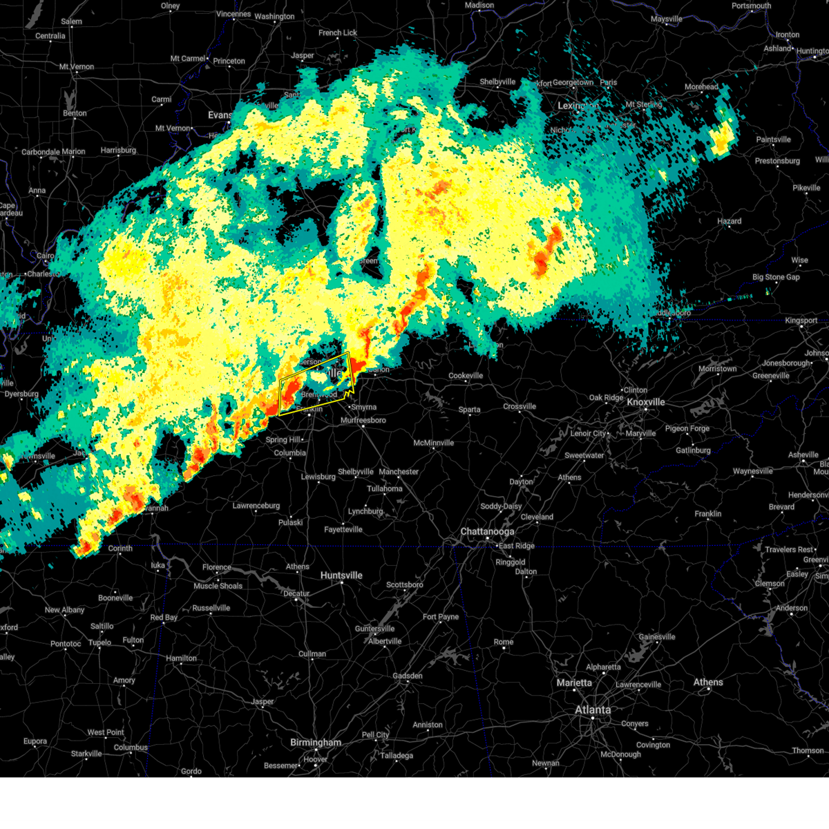 Svrohx the national weather service in nashville has issued a * severe thunderstorm warning for, davidson county in middle tennessee, southwestern sumner county in middle tennessee, northwestern williamson county in middle tennessee, west central wilson county in middle tennessee, southeastern cheatham county in middle tennessee, * until 400 am cdt. * at 323 am cdt, a severe thunderstorm was located near pegram, or 13 miles south of ashland city, moving northeast at 45 mph (radar indicated). Hazards include 60 mph wind gusts and quarter size hail. Hail damage to vehicles is expected. Expect wind damage to roofs, siding, and trees. Svrohx the national weather service in nashville has issued a * severe thunderstorm warning for, davidson county in middle tennessee, southwestern sumner county in middle tennessee, northwestern williamson county in middle tennessee, west central wilson county in middle tennessee, southeastern cheatham county in middle tennessee, * until 400 am cdt. * at 323 am cdt, a severe thunderstorm was located near pegram, or 13 miles south of ashland city, moving northeast at 45 mph (radar indicated). Hazards include 60 mph wind gusts and quarter size hail. Hail damage to vehicles is expected. Expect wind damage to roofs, siding, and trees.
|
| 4/3/2025 3:14 AM CDT |
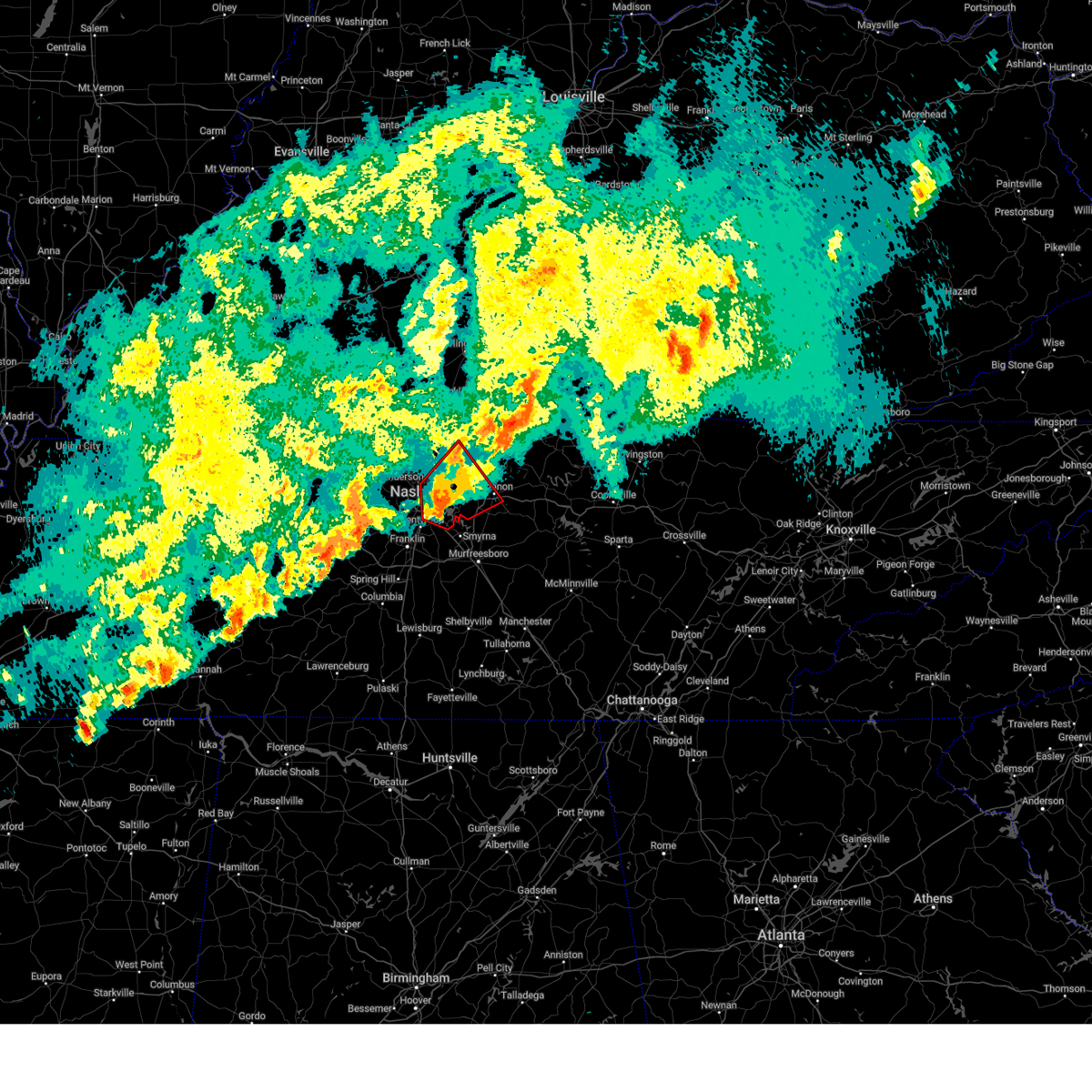 At 314 am cdt, a severe thunderstorm capable of producing a tornado was located over hermitage, or 8 miles east of nashville, moving northeast at 45 mph (radar indicated rotation). Hazards include tornado and golf ball size hail. Flying debris will be dangerous to those caught without shelter. mobile homes will be damaged or destroyed. damage to roofs, windows, and vehicles will occur. tree damage is likely. locations impacted include, green hill, madison, hermitage, rural hill, gallatin, antioch, belinda city, lakewood, hendersonville, lebanon, berry hill, cottontown, mount juliet, old hickory, percy priest lake, gladeville, goodlettsville, oak hill, and la vergne. this includes the following highways, interstate 40 between mile markers 211 and 240. interstate 65 between mile markers 77 and 81, and between mile markers 87 and 97. interstate 24 between mile markers 47 and 60. Interstate 840 between mile markers 69 and 76. At 314 am cdt, a severe thunderstorm capable of producing a tornado was located over hermitage, or 8 miles east of nashville, moving northeast at 45 mph (radar indicated rotation). Hazards include tornado and golf ball size hail. Flying debris will be dangerous to those caught without shelter. mobile homes will be damaged or destroyed. damage to roofs, windows, and vehicles will occur. tree damage is likely. locations impacted include, green hill, madison, hermitage, rural hill, gallatin, antioch, belinda city, lakewood, hendersonville, lebanon, berry hill, cottontown, mount juliet, old hickory, percy priest lake, gladeville, goodlettsville, oak hill, and la vergne. this includes the following highways, interstate 40 between mile markers 211 and 240. interstate 65 between mile markers 77 and 81, and between mile markers 87 and 97. interstate 24 between mile markers 47 and 60. Interstate 840 between mile markers 69 and 76.
|
| 4/3/2025 3:04 AM CDT |
 At 303 am cdt, a severe thunderstorm capable of producing a tornado was located over oak hill, or near nashville, moving northeast at 45 mph (radar indicated rotation). Hazards include tornado and golf ball size hail. Flying debris will be dangerous to those caught without shelter. mobile homes will be damaged or destroyed. damage to roofs, windows, and vehicles will occur. tree damage is likely. locations impacted include, madison, hermitage, belle meade, gallatin, hendersonville, berry hill, cottontown, mount juliet, oak hill, green hill, forest hills, goodlettsville, rural hill, nashville, whites creek, antioch, belinda city, lakewood, lebanon, and old hickory. this includes the following highways, interstate 40 between mile markers 202 and 240. interstate 65 between mile markers 74 and 100. interstate 24 between mile markers 39 and 62. Interstate 840 between mile markers 69 and 76. At 303 am cdt, a severe thunderstorm capable of producing a tornado was located over oak hill, or near nashville, moving northeast at 45 mph (radar indicated rotation). Hazards include tornado and golf ball size hail. Flying debris will be dangerous to those caught without shelter. mobile homes will be damaged or destroyed. damage to roofs, windows, and vehicles will occur. tree damage is likely. locations impacted include, madison, hermitage, belle meade, gallatin, hendersonville, berry hill, cottontown, mount juliet, oak hill, green hill, forest hills, goodlettsville, rural hill, nashville, whites creek, antioch, belinda city, lakewood, lebanon, and old hickory. this includes the following highways, interstate 40 between mile markers 202 and 240. interstate 65 between mile markers 74 and 100. interstate 24 between mile markers 39 and 62. Interstate 840 between mile markers 69 and 76.
|
| 4/3/2025 3:04 AM CDT |
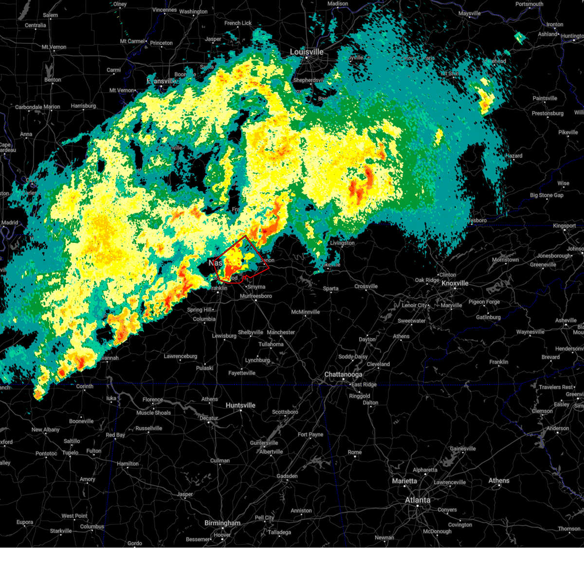 the tornado warning has been cancelled and is no longer in effect the tornado warning has been cancelled and is no longer in effect
|
| 4/3/2025 3:02 AM CDT | Tspotter report of a tree that fell on a house on old tusculum rd. time radar estimate in davidson county TN, 12.9 miles NNW of Nashville, TN |
| 4/3/2025 2:54 AM CDT |
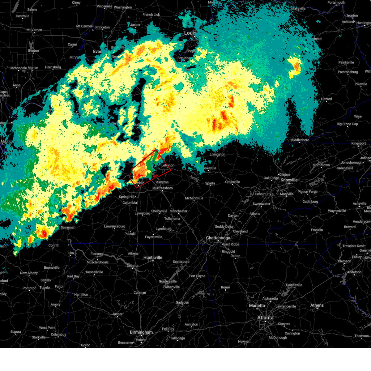 Torohx the national weather service in nashville has issued a * tornado warning for, davidson county in middle tennessee, southwestern sumner county in middle tennessee, northeastern williamson county in middle tennessee, northwestern wilson county in middle tennessee, * until 345 am cdt. * at 254 am cdt, a severe thunderstorm capable of producing a tornado was located over forest hills, or 8 miles north of franklin, moving northeast at 45 mph (radar indicated rotation). Hazards include tornado and golf ball size hail. Flying debris will be dangerous to those caught without shelter. mobile homes will be damaged or destroyed. damage to roofs, windows, and vehicles will occur. Tree damage is likely. Torohx the national weather service in nashville has issued a * tornado warning for, davidson county in middle tennessee, southwestern sumner county in middle tennessee, northeastern williamson county in middle tennessee, northwestern wilson county in middle tennessee, * until 345 am cdt. * at 254 am cdt, a severe thunderstorm capable of producing a tornado was located over forest hills, or 8 miles north of franklin, moving northeast at 45 mph (radar indicated rotation). Hazards include tornado and golf ball size hail. Flying debris will be dangerous to those caught without shelter. mobile homes will be damaged or destroyed. damage to roofs, windows, and vehicles will occur. Tree damage is likely.
|
| 4/3/2025 2:43 AM CDT |
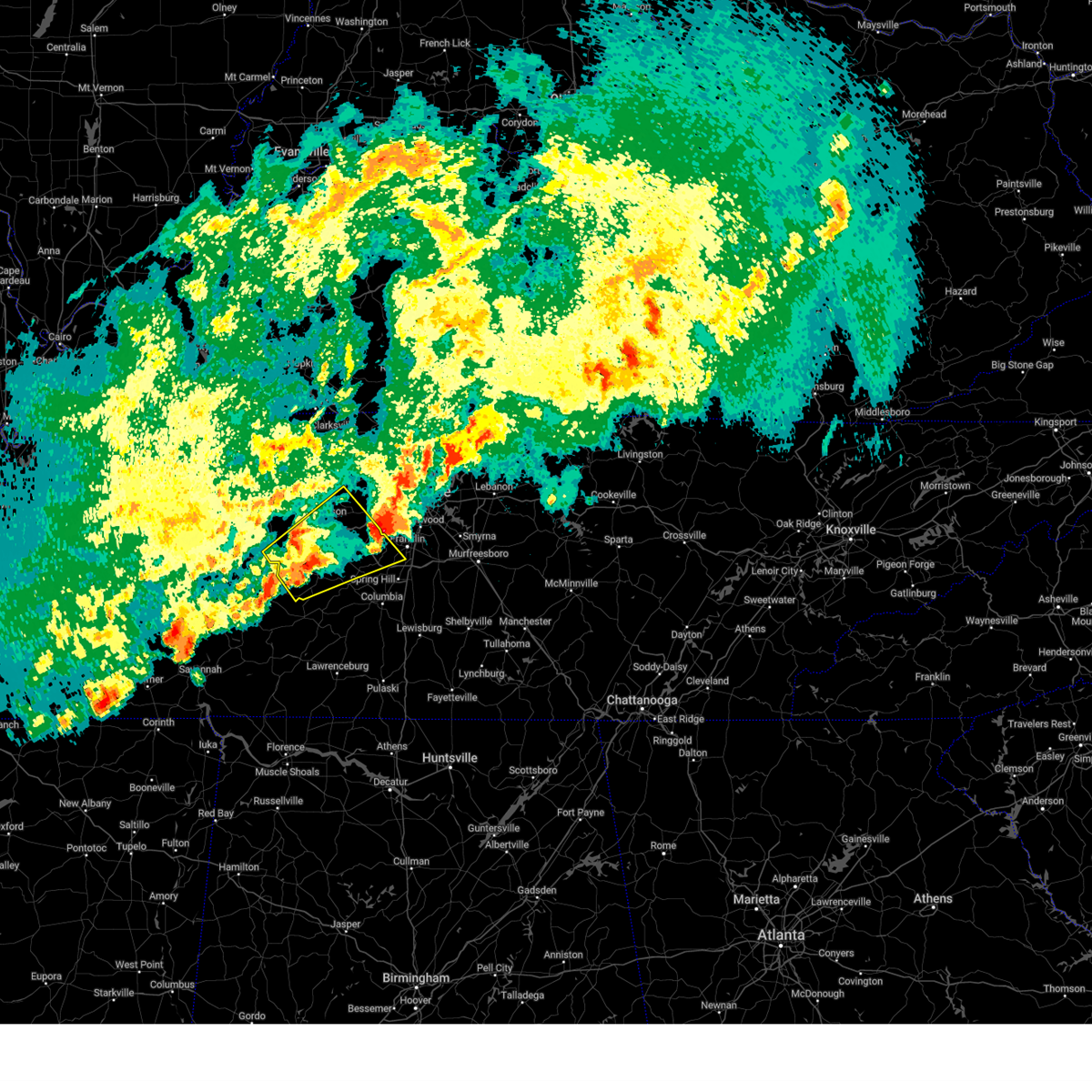 Svrohx the national weather service in nashville has issued a * severe thunderstorm warning for, southern dickson county in middle tennessee, north central maury county in middle tennessee, northwestern williamson county in middle tennessee, south central cheatham county in middle tennessee, southeastern humphreys county in middle tennessee, hickman county in middle tennessee, * until 345 am cdt. * at 243 am cdt, a severe thunderstorm was located near centerville, moving northeast at 45 mph (radar indicated). Hazards include 60 mph wind gusts and quarter size hail. Hail damage to vehicles is expected. Expect wind damage to roofs, siding, and trees. Svrohx the national weather service in nashville has issued a * severe thunderstorm warning for, southern dickson county in middle tennessee, north central maury county in middle tennessee, northwestern williamson county in middle tennessee, south central cheatham county in middle tennessee, southeastern humphreys county in middle tennessee, hickman county in middle tennessee, * until 345 am cdt. * at 243 am cdt, a severe thunderstorm was located near centerville, moving northeast at 45 mph (radar indicated). Hazards include 60 mph wind gusts and quarter size hail. Hail damage to vehicles is expected. Expect wind damage to roofs, siding, and trees.
|
| 4/3/2025 2:39 AM CDT | The storm which prompted the warning has weakened below severe limits, and no longer poses an immediate threat to life or property. therefore, the warning will be allowed to expire. a tornado watch remains in effect until 600 am cdt for middle tennessee. |
| 4/3/2025 2:36 AM CDT | Torohx the national weather service in nashville has issued a * tornado warning for, davidson county in middle tennessee, williamson county in middle tennessee, southeastern cheatham county in middle tennessee, * until 300 am cdt. * at 236 am cdt, a severe thunderstorm capable of producing a tornado was located over fairview, or 13 miles west of franklin, moving northeast at 70 mph (radar indicated rotation). Hazards include tornado and quarter size hail. Flying debris will be dangerous to those caught without shelter. mobile homes will be damaged or destroyed. damage to roofs, windows, and vehicles will occur. Tree damage is likely. |
| 4/3/2025 2:30 AM CDT |
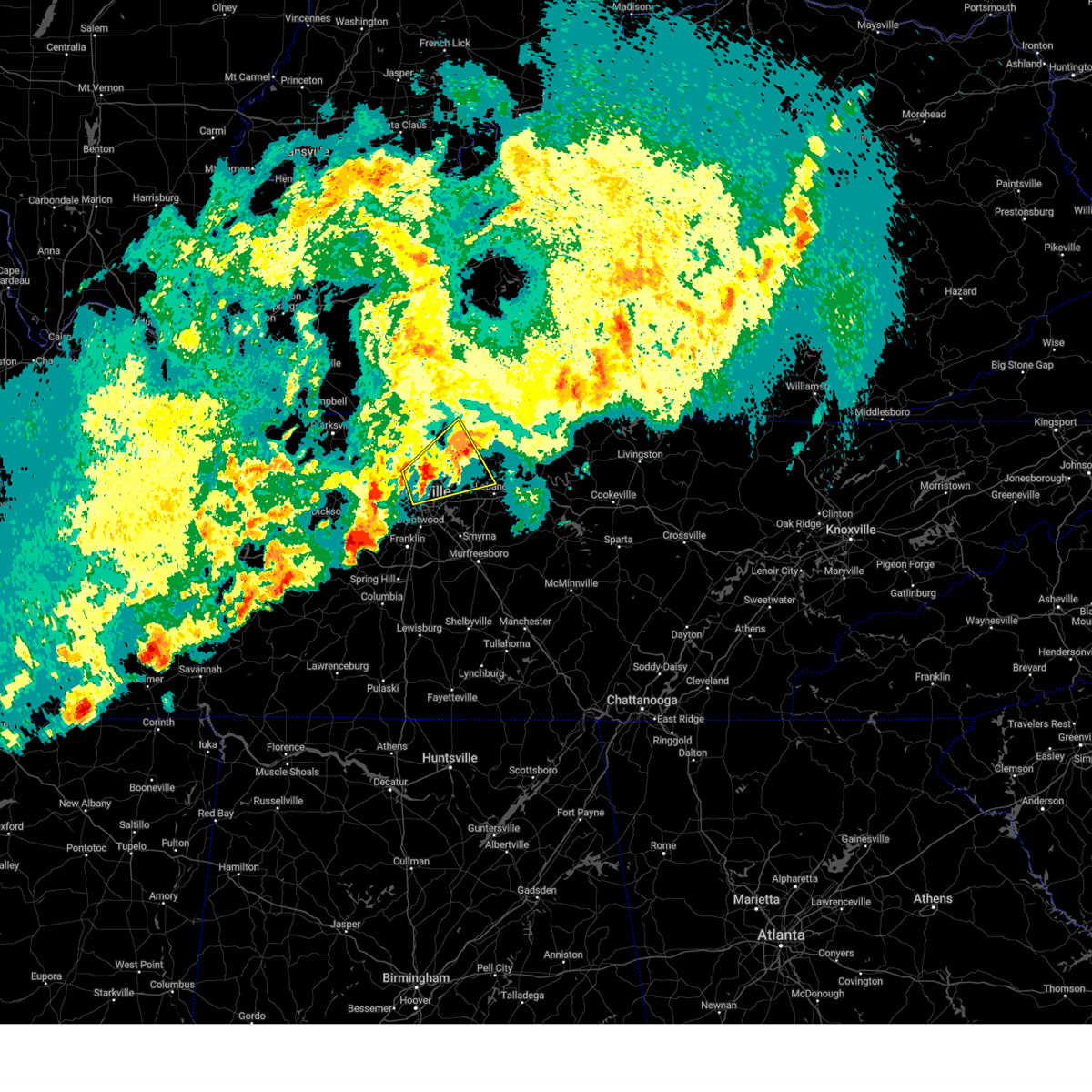 the severe thunderstorm warning has been cancelled and is no longer in effect the severe thunderstorm warning has been cancelled and is no longer in effect
|
| 4/3/2025 2:30 AM CDT |
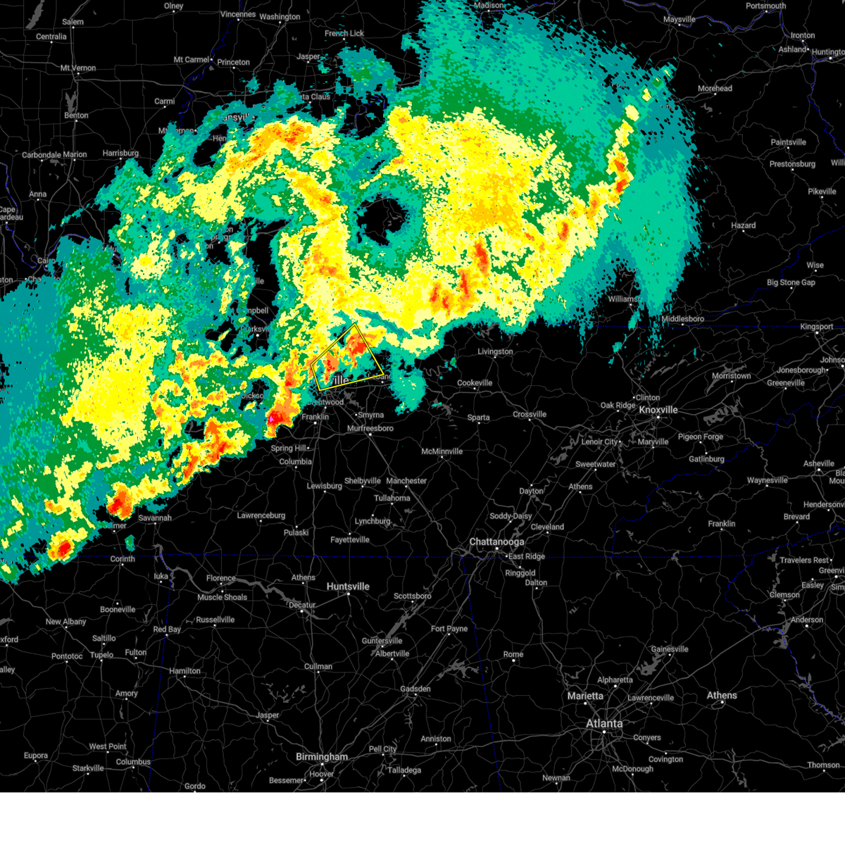 At 229 am cdt, a severe thunderstorm was located near gallatin, moving northeast at 45 mph (radar indicated). Hazards include 60 mph wind gusts and quarter size hail. Hail damage to vehicles is expected. expect wind damage to roofs, siding, and trees. locations impacted include, green hill, madison, portland, ridgetop, hermitage, goodlettsville, millersville, gallatin, nashville, white house, whites creek, lakewood, hendersonville, cottontown, old hickory, joelton, mount juliet, greenbrier, cross plains, and lebanon. this includes the following highways, interstate 40 between mile markers 206 and 208. interstate 65 between mile markers 85 and 112. Interstate 24 between mile markers 34 and 49. At 229 am cdt, a severe thunderstorm was located near gallatin, moving northeast at 45 mph (radar indicated). Hazards include 60 mph wind gusts and quarter size hail. Hail damage to vehicles is expected. expect wind damage to roofs, siding, and trees. locations impacted include, green hill, madison, portland, ridgetop, hermitage, goodlettsville, millersville, gallatin, nashville, white house, whites creek, lakewood, hendersonville, cottontown, old hickory, joelton, mount juliet, greenbrier, cross plains, and lebanon. this includes the following highways, interstate 40 between mile markers 206 and 208. interstate 65 between mile markers 85 and 112. Interstate 24 between mile markers 34 and 49.
|
| 4/3/2025 2:16 AM CDT | At 216 am cdt, a severe thunderstorm was located over goodlettsville, or 12 miles northeast of nashville, moving northeast at 45 mph (radar indicated). Hazards include 60 mph wind gusts and quarter size hail. Hail damage to vehicles is expected. expect wind damage to roofs, siding, and trees. locations impacted include, madison, portland, hermitage, belle meade, millersville, gallatin, hendersonville, greenbrier, berry hill, cottontown, mount juliet, ashland city, green hill, ridgetop, goodlettsville, bells bend, nashville, white house, whites creek, and bellevue. this includes the following highways, interstate 40 between mile markers 195 and 226. interstate 65 between mile markers 80 and 113. Interstate 24 between mile markers 31 and 52. |
| 4/3/2025 2:16 AM CDT | the severe thunderstorm warning has been cancelled and is no longer in effect |
| 4/3/2025 2:00 AM CDT | Svrohx the national weather service in nashville has issued a * severe thunderstorm warning for, davidson county in middle tennessee, east central dickson county in middle tennessee, western sumner county in middle tennessee, northwestern williamson county in middle tennessee, northwestern wilson county in middle tennessee, cheatham county in middle tennessee, southeastern robertson county in middle tennessee, * until 245 am cdt. * at 200 am cdt, a severe thunderstorm was located near joelton, or 8 miles northwest of nashville, moving northeast at 45 mph (radar indicated). Hazards include 60 mph wind gusts and quarter size hail. Hail damage to vehicles is expected. Expect wind damage to roofs, siding, and trees. |
| 4/3/2025 1:32 AM CDT |
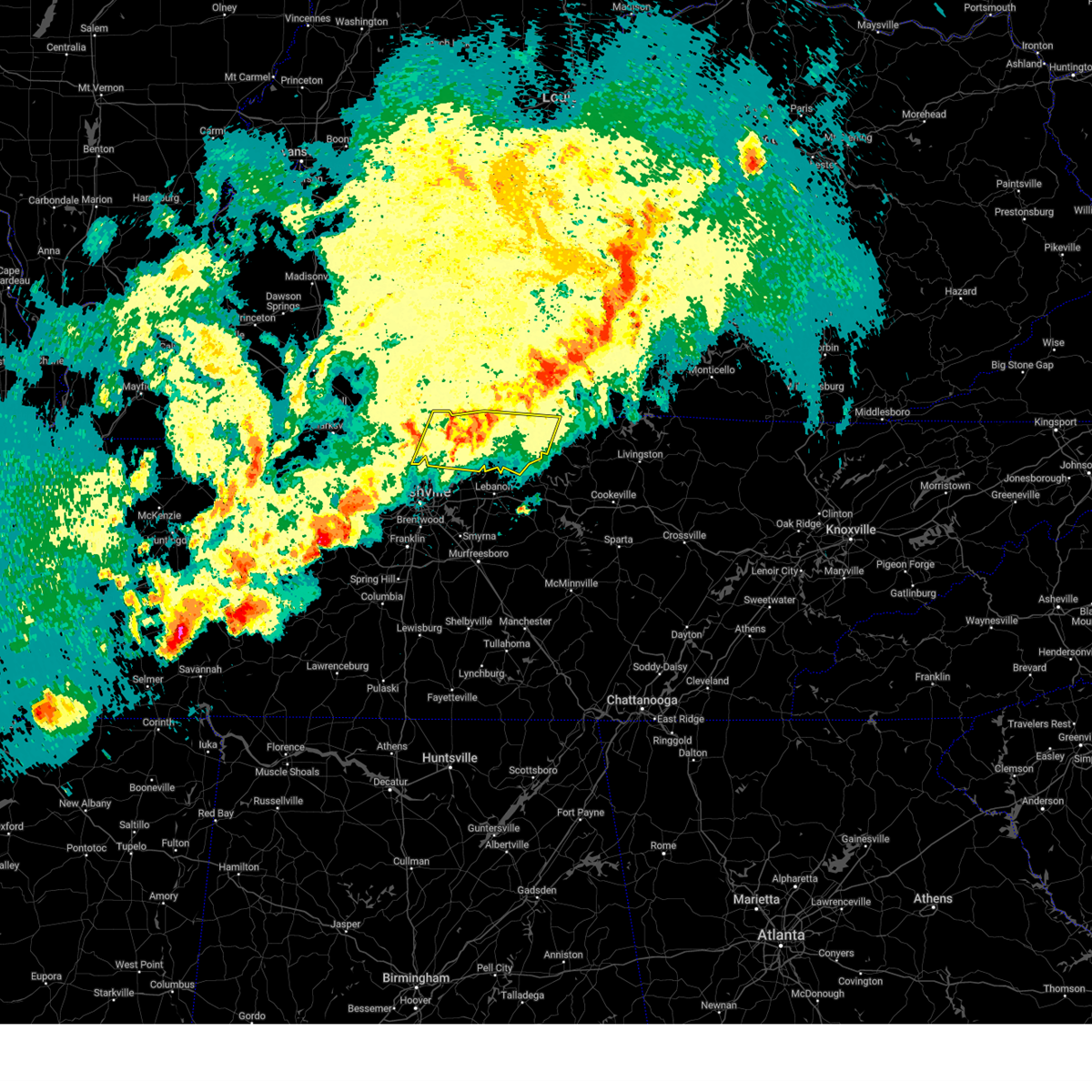 the severe thunderstorm warning has been cancelled and is no longer in effect the severe thunderstorm warning has been cancelled and is no longer in effect
|
| 4/3/2025 1:21 AM CDT | Svrohx the national weather service in nashville has issued a * severe thunderstorm warning for, davidson county in middle tennessee, dickson county in middle tennessee, northwestern williamson county in middle tennessee, cheatham county in middle tennessee, northeastern hickman county in middle tennessee, * until 200 am cdt. * at 121 am cdt, a severe thunderstorm was located over dickson, moving northeast at 50 mph (radar indicated). Hazards include 60 mph wind gusts and quarter size hail. Hail damage to vehicles is expected. Expect wind damage to roofs, siding, and trees. |
| 4/3/2025 12:54 AM CDT |
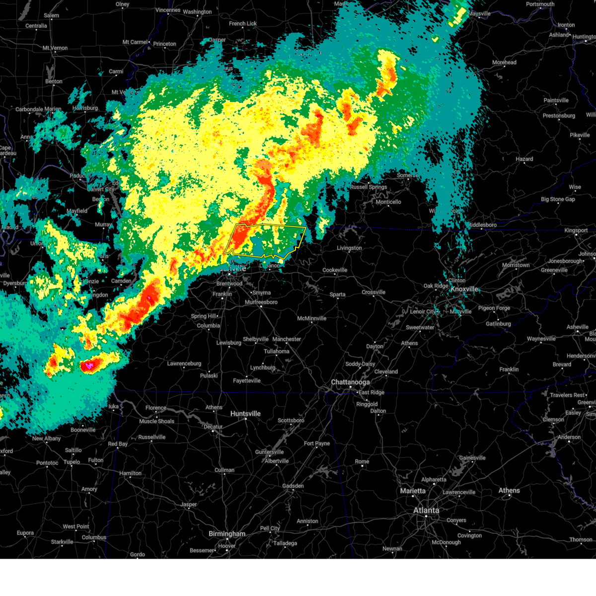 Svrohx the national weather service in nashville has issued a * severe thunderstorm warning for, sumner county in middle tennessee, macon county in middle tennessee, trousdale county in middle tennessee, eastern robertson county in middle tennessee, * until 200 am cdt. * at 1254 am cdt, severe thunderstorms were located along a line extending from 7 miles north of portland to near joelton, moving east at 45 mph (radar indicated). Hazards include 60 mph wind gusts and nickel size hail. expect damage to roofs, siding, and trees Svrohx the national weather service in nashville has issued a * severe thunderstorm warning for, sumner county in middle tennessee, macon county in middle tennessee, trousdale county in middle tennessee, eastern robertson county in middle tennessee, * until 200 am cdt. * at 1254 am cdt, severe thunderstorms were located along a line extending from 7 miles north of portland to near joelton, moving east at 45 mph (radar indicated). Hazards include 60 mph wind gusts and nickel size hail. expect damage to roofs, siding, and trees
|
| 4/3/2025 12:46 AM CDT |
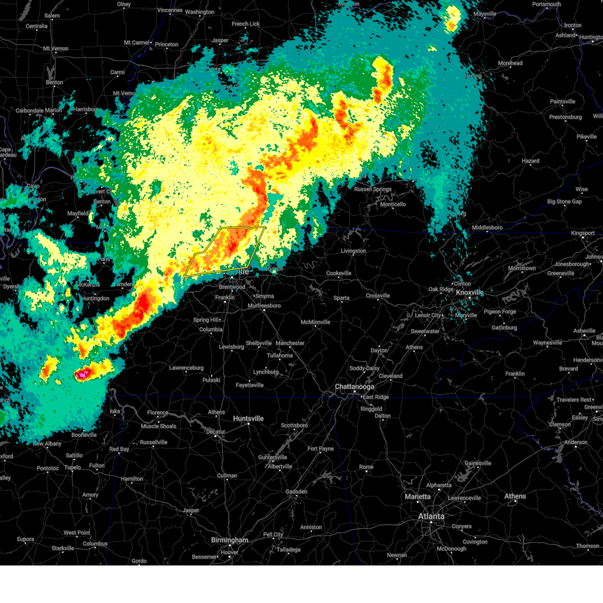 At 1246 am cdt, severe thunderstorms were located along a line extending from 9 miles north of portland to near ashland city, moving east at 50 mph (radar indicated). Hazards include 60 mph wind gusts and quarter size hail. Hail damage to vehicles is expected. expect wind damage to roofs, siding, and trees. locations impacted include, madison, charlotte, portland, ridgetop, cheatham dam, goodlettsville, mitchellville, millersville, white house, whites creek, hendersonville, greenbrier, cottontown, orlinda, pleasant view, cross plains, beaman park, springfield, old hickory, and ashland city. this includes the following highways, interstate 65 between mile markers 91 and 121. Interstate 24 between mile markers 20 and 43. At 1246 am cdt, severe thunderstorms were located along a line extending from 9 miles north of portland to near ashland city, moving east at 50 mph (radar indicated). Hazards include 60 mph wind gusts and quarter size hail. Hail damage to vehicles is expected. expect wind damage to roofs, siding, and trees. locations impacted include, madison, charlotte, portland, ridgetop, cheatham dam, goodlettsville, mitchellville, millersville, white house, whites creek, hendersonville, greenbrier, cottontown, orlinda, pleasant view, cross plains, beaman park, springfield, old hickory, and ashland city. this includes the following highways, interstate 65 between mile markers 91 and 121. Interstate 24 between mile markers 20 and 43.
|
| 4/3/2025 12:32 AM CDT | the severe thunderstorm warning has been cancelled and is no longer in effect |
| 4/3/2025 12:32 AM CDT | At 1231 am cdt, severe thunderstorms were located along a line extending from 8 miles north of cross plains to 7 miles northwest of white bluff, moving east at 50 mph (radar indicated). Hazards include 60 mph wind gusts and quarter size hail. Hail damage to vehicles is expected. expect wind damage to roofs, siding, and trees. locations impacted include, madison, charlotte, portland, millersville, hendersonville, greenbrier, cottontown, orlinda, pleasant view, cedar hill, ashland city, white bluff, ridgetop, cheatham dam, goodlettsville, adams, mitchellville, bells bend, nashville, and white house. this includes the following highways, interstate 40 between mile markers 201 and 212. interstate 65 between mile markers 82 and 121. Interstate 24 between mile markers 18 and 49. |
| 4/3/2025 12:07 AM CDT |
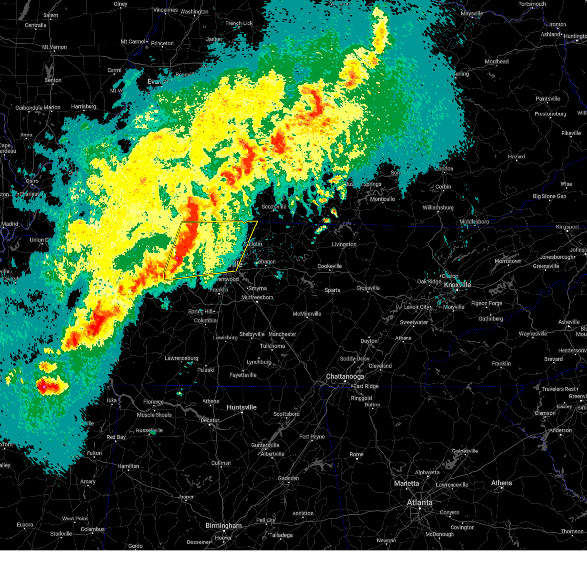 Svrohx the national weather service in nashville has issued a * severe thunderstorm warning for, central davidson county in middle tennessee, dickson county in middle tennessee, eastern montgomery county in middle tennessee, western sumner county in middle tennessee, cheatham county in middle tennessee, robertson county in middle tennessee, * until 100 am cdt. * at 1206 am cdt, severe thunderstorms were located along a line extending from near guthrie to 8 miles northwest of dickson, moving east at 50 mph (radar indicated). Hazards include 60 mph wind gusts and quarter size hail. Hail damage to vehicles is expected. Expect wind damage to roofs, siding, and trees. Svrohx the national weather service in nashville has issued a * severe thunderstorm warning for, central davidson county in middle tennessee, dickson county in middle tennessee, eastern montgomery county in middle tennessee, western sumner county in middle tennessee, cheatham county in middle tennessee, robertson county in middle tennessee, * until 100 am cdt. * at 1206 am cdt, severe thunderstorms were located along a line extending from near guthrie to 8 miles northwest of dickson, moving east at 50 mph (radar indicated). Hazards include 60 mph wind gusts and quarter size hail. Hail damage to vehicles is expected. Expect wind damage to roofs, siding, and trees.
|
| 4/2/2025 6:40 PM CDT | At 640 pm cdt, a severe thunderstorm was located over millersville, or 10 miles southeast of springfield, moving northeast at 50 mph (radar indicated). Hazards include 60 mph wind gusts and quarter size hail. Hail damage to vehicles is expected. expect wind damage to roofs, siding, and trees. locations impacted include, greenbrier, cottontown, cross plains, millersville, white house, ridgetop, orlinda, and goodlettsville. This includes interstate 65 between mile markers 101 and 114. |
| 4/2/2025 6:40 PM CDT | the severe thunderstorm warning has been cancelled and is no longer in effect |
| 4/2/2025 6:27 PM CDT |
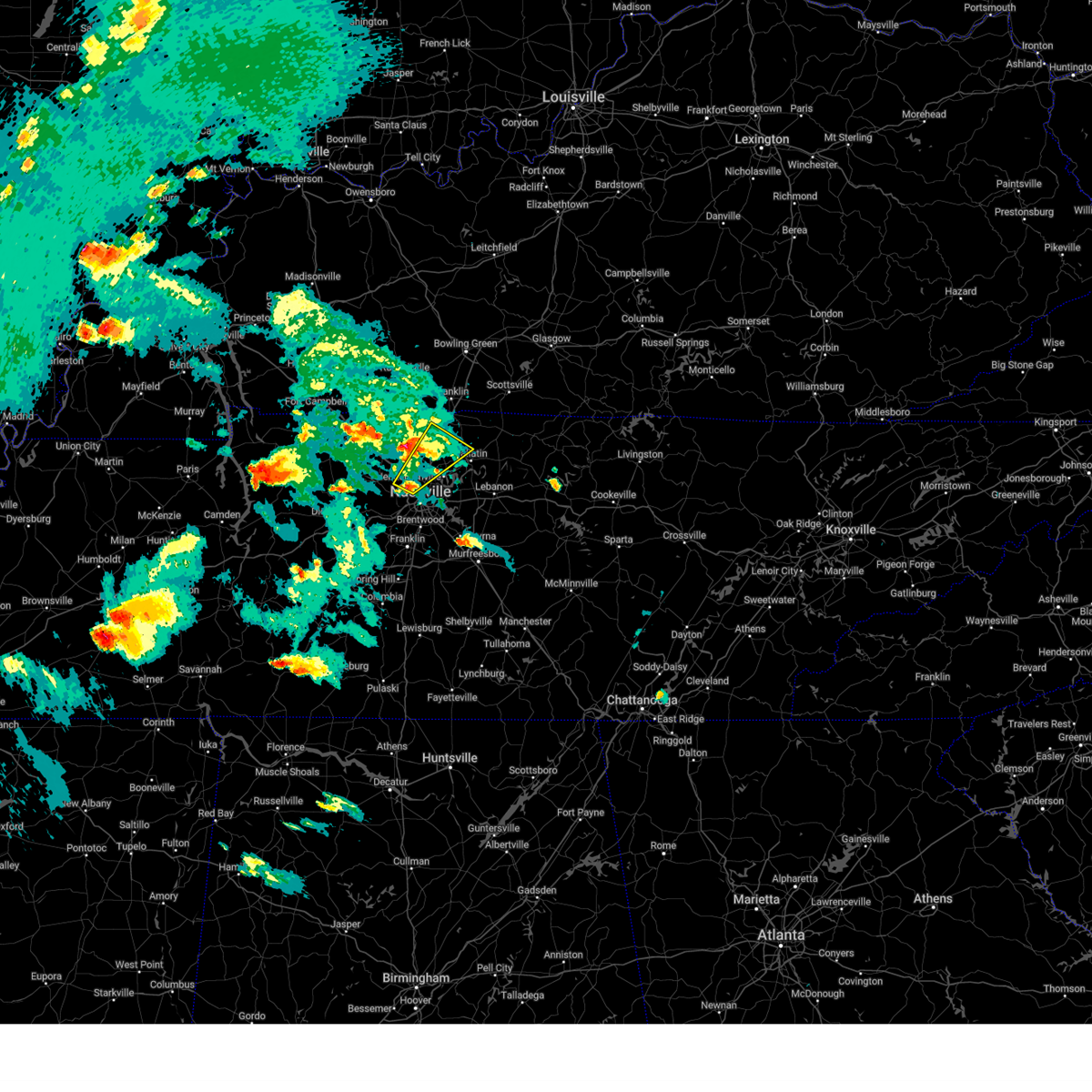 Svrohx the national weather service in nashville has issued a * severe thunderstorm warning for, northwestern davidson county in middle tennessee, southwestern sumner county in middle tennessee, eastern robertson county in middle tennessee, * until 715 pm cdt. * at 627 pm cdt, a severe thunderstorm was located over joelton, or 8 miles north of nashville, moving northeast at 50 mph (radar indicated). Hazards include 60 mph wind gusts and quarter size hail. Hail damage to vehicles is expected. Expect wind damage to roofs, siding, and trees. Svrohx the national weather service in nashville has issued a * severe thunderstorm warning for, northwestern davidson county in middle tennessee, southwestern sumner county in middle tennessee, eastern robertson county in middle tennessee, * until 715 pm cdt. * at 627 pm cdt, a severe thunderstorm was located over joelton, or 8 miles north of nashville, moving northeast at 50 mph (radar indicated). Hazards include 60 mph wind gusts and quarter size hail. Hail damage to vehicles is expected. Expect wind damage to roofs, siding, and trees.
|
| 4/2/2025 6:21 PM CDT |
 Svrohx the national weather service in nashville has issued a * severe thunderstorm warning for, northwestern sumner county in middle tennessee, robertson county in middle tennessee, * until 700 pm cdt. * at 621 pm cdt, a severe thunderstorm was located near coopertown, or near springfield, moving northeast at 45 mph (radar indicated). Hazards include golf ball size hail and 60 mph wind gusts. People and animals outdoors will be injured. expect hail damage to roofs, siding, windows, and vehicles. Expect wind damage to roofs, siding, and trees. Svrohx the national weather service in nashville has issued a * severe thunderstorm warning for, northwestern sumner county in middle tennessee, robertson county in middle tennessee, * until 700 pm cdt. * at 621 pm cdt, a severe thunderstorm was located near coopertown, or near springfield, moving northeast at 45 mph (radar indicated). Hazards include golf ball size hail and 60 mph wind gusts. People and animals outdoors will be injured. expect hail damage to roofs, siding, windows, and vehicles. Expect wind damage to roofs, siding, and trees.
|
| 4/2/2025 6:19 PM CDT |
 At 619 pm cdt, a severe thunderstorm was located over coopertown, or 7 miles southwest of springfield, moving northeast at 45 mph (radar indicated). Hazards include golf ball size hail and 60 mph wind gusts. People and animals outdoors will be injured. expect hail damage to roofs, siding, windows, and vehicles. expect wind damage to roofs, siding, and trees. locations impacted include, greenbrier, millersville, coopertown, ridgetop, springfield, and white house. this includes the following highways, interstate 65 between mile markers 101 and 106. Interstate 24 between mile markers 32 and 33. At 619 pm cdt, a severe thunderstorm was located over coopertown, or 7 miles southwest of springfield, moving northeast at 45 mph (radar indicated). Hazards include golf ball size hail and 60 mph wind gusts. People and animals outdoors will be injured. expect hail damage to roofs, siding, windows, and vehicles. expect wind damage to roofs, siding, and trees. locations impacted include, greenbrier, millersville, coopertown, ridgetop, springfield, and white house. this includes the following highways, interstate 65 between mile markers 101 and 106. Interstate 24 between mile markers 32 and 33.
|
| 4/2/2025 6:19 PM CDT |
 the severe thunderstorm warning has been cancelled and is no longer in effect the severe thunderstorm warning has been cancelled and is no longer in effect
|
| 4/2/2025 6:01 PM CDT |
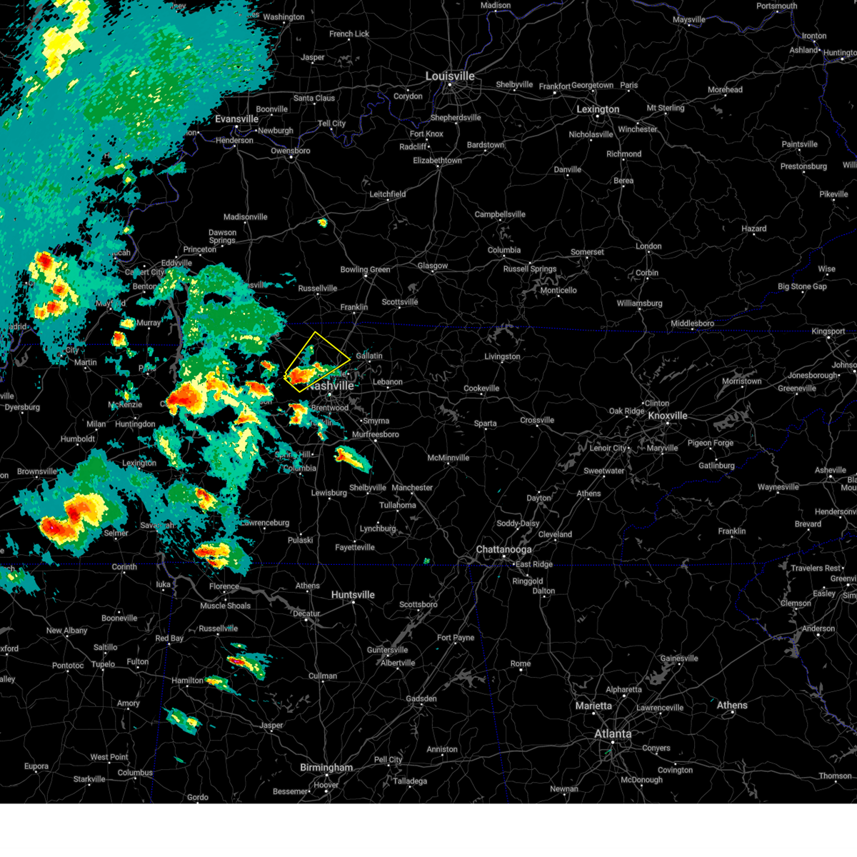 Svrohx the national weather service in nashville has issued a * severe thunderstorm warning for, northwestern davidson county in middle tennessee, west central sumner county in middle tennessee, northeastern cheatham county in middle tennessee, southern robertson county in middle tennessee, * until 630 pm cdt. * at 600 pm cdt, a severe thunderstorm was located near ashland city, moving northeast at 45 mph (radar indicated). Hazards include golf ball size hail and 60 mph wind gusts. People and animals outdoors will be injured. expect hail damage to roofs, siding, windows, and vehicles. Expect wind damage to roofs, siding, and trees. Svrohx the national weather service in nashville has issued a * severe thunderstorm warning for, northwestern davidson county in middle tennessee, west central sumner county in middle tennessee, northeastern cheatham county in middle tennessee, southern robertson county in middle tennessee, * until 630 pm cdt. * at 600 pm cdt, a severe thunderstorm was located near ashland city, moving northeast at 45 mph (radar indicated). Hazards include golf ball size hail and 60 mph wind gusts. People and animals outdoors will be injured. expect hail damage to roofs, siding, windows, and vehicles. Expect wind damage to roofs, siding, and trees.
|
| 4/2/2025 5:58 PM CDT | the severe thunderstorm warning has been cancelled and is no longer in effect |
| 4/2/2025 5:58 PM CDT | At 557 pm cdt, a severe thunderstorm was located near ashland city, moving northeast at 45 mph (radar indicated). Hazards include two inch hail and 60 mph wind gusts. People and animals outdoors will be injured. expect hail damage to roofs, siding, windows, and vehicles. expect wind damage to roofs, siding, and trees. locations impacted include, ashland city, pleasant view, beaman park, and joelton. This includes interstate 24 between mile markers 29 and 34. |
| 4/2/2025 5:49 PM CDT |
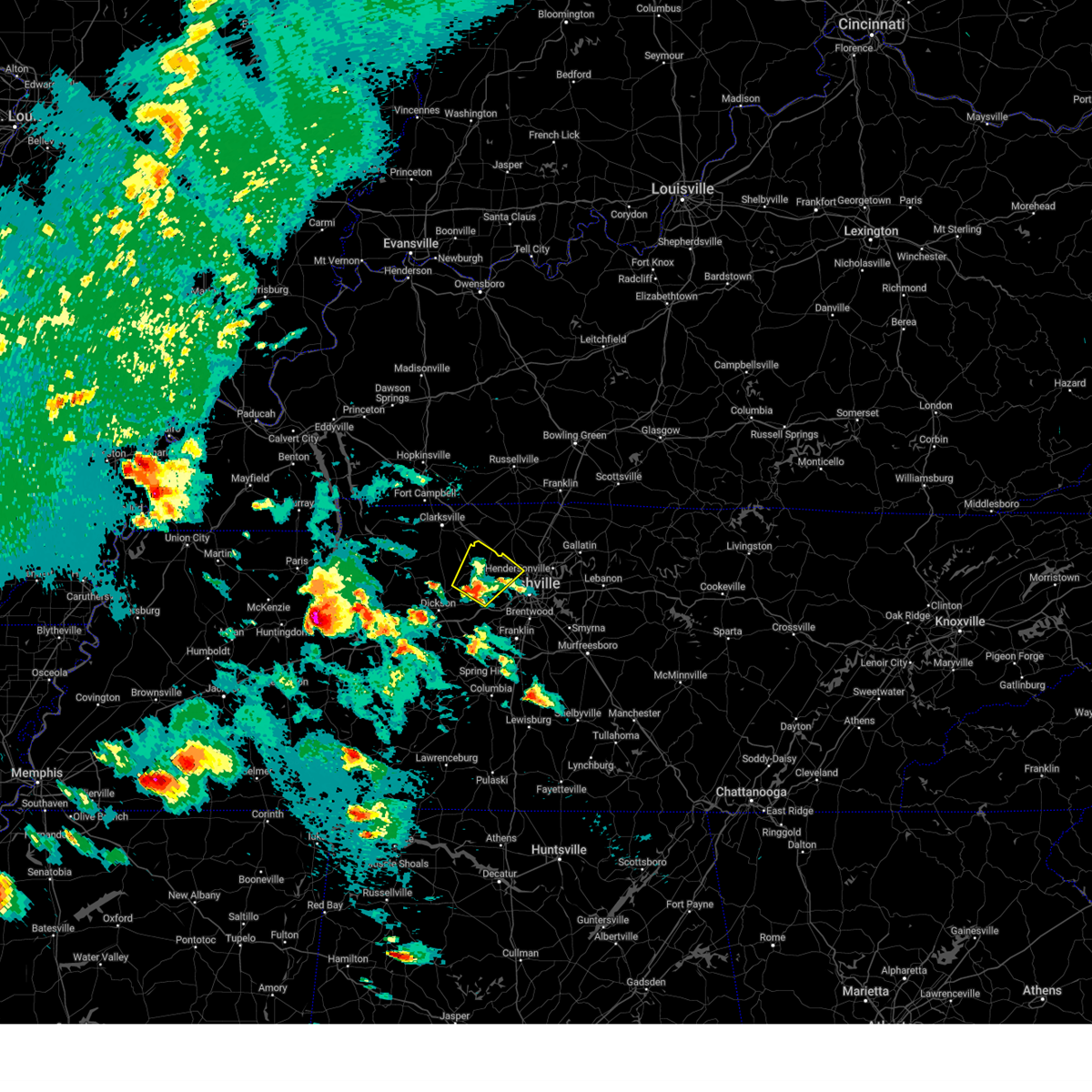 At 549 pm cdt, a severe thunderstorm was located near ashland city, moving northeast at 45 mph (radar indicated). Hazards include 60 mph wind gusts and quarter size hail. Hail damage to vehicles is expected. expect wind damage to roofs, siding, and trees. locations impacted include, pleasant view, cheatham dam, beaman park, ashland city, joelton, pegram, and kingston springs. This includes interstate 24 between mile markers 29 and 34. At 549 pm cdt, a severe thunderstorm was located near ashland city, moving northeast at 45 mph (radar indicated). Hazards include 60 mph wind gusts and quarter size hail. Hail damage to vehicles is expected. expect wind damage to roofs, siding, and trees. locations impacted include, pleasant view, cheatham dam, beaman park, ashland city, joelton, pegram, and kingston springs. This includes interstate 24 between mile markers 29 and 34.
|
| 4/2/2025 5:40 PM CDT |
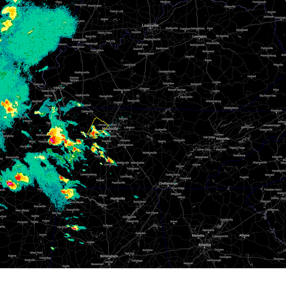 Svrohx the national weather service in nashville has issued a * severe thunderstorm warning for, northwestern davidson county in middle tennessee, eastern dickson county in middle tennessee, cheatham county in middle tennessee, * until 615 pm cdt. * at 540 pm cdt, a severe thunderstorm was located over white bluff, or 9 miles northeast of dickson, moving northeast at 45 mph (radar indicated). Hazards include 60 mph wind gusts and quarter size hail. Hail damage to vehicles is expected. Expect wind damage to roofs, siding, and trees. Svrohx the national weather service in nashville has issued a * severe thunderstorm warning for, northwestern davidson county in middle tennessee, eastern dickson county in middle tennessee, cheatham county in middle tennessee, * until 615 pm cdt. * at 540 pm cdt, a severe thunderstorm was located over white bluff, or 9 miles northeast of dickson, moving northeast at 45 mph (radar indicated). Hazards include 60 mph wind gusts and quarter size hail. Hail damage to vehicles is expected. Expect wind damage to roofs, siding, and trees.
|
| 3/30/2025 11:47 PM CDT |
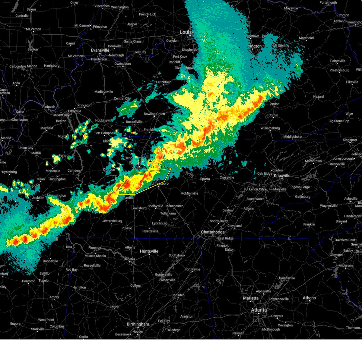 At 1147 pm cdt, severe thunderstorms were located along a line extending from near rural hill to near nolensville to 8 miles west of spring hill, moving east at 50 mph (radar indicated). Hazards include 60 mph wind gusts and quarter size hail. Hail damage to vehicles is expected. expect wind damage to roofs, siding, and trees. locations impacted include, franklin, lascassas, nolensville, spring hill, walterhill, thompson's station, brentwood, la vergne, antioch, triune, cedars of lebanon state park, santa fe, leipers fork, smyrna, forest hills, oak hill, murfreesboro, and columbia. this includes the following highways, interstate 65 between mile markers 51 and 75. interstate 24 between mile markers 57 and 76. Interstate 840 between mile markers 14 and 69. At 1147 pm cdt, severe thunderstorms were located along a line extending from near rural hill to near nolensville to 8 miles west of spring hill, moving east at 50 mph (radar indicated). Hazards include 60 mph wind gusts and quarter size hail. Hail damage to vehicles is expected. expect wind damage to roofs, siding, and trees. locations impacted include, franklin, lascassas, nolensville, spring hill, walterhill, thompson's station, brentwood, la vergne, antioch, triune, cedars of lebanon state park, santa fe, leipers fork, smyrna, forest hills, oak hill, murfreesboro, and columbia. this includes the following highways, interstate 65 between mile markers 51 and 75. interstate 24 between mile markers 57 and 76. Interstate 840 between mile markers 14 and 69.
|
| 3/30/2025 11:41 PM CDT |
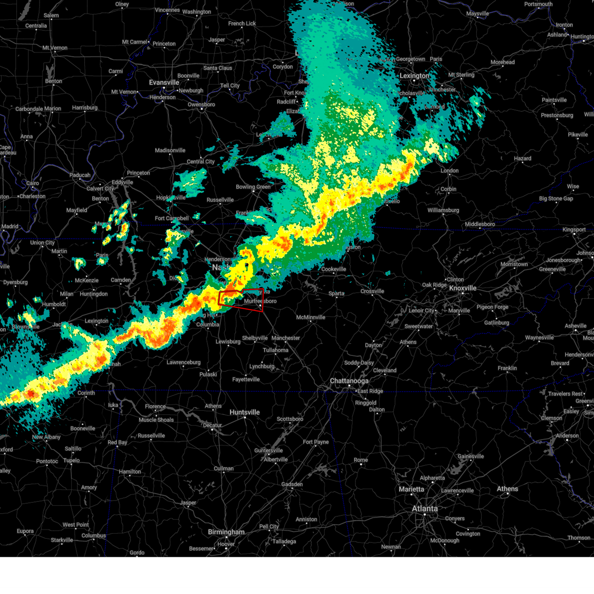 Torohx the national weather service in nashville has issued a * tornado warning for, central rutherford county in middle tennessee, northeastern williamson county in middle tennessee, * until 1230 am cdt. * at 1140 pm cdt, a severe thunderstorm capable of producing a tornado was located over franklin, moving east at 40 mph (radar indicated rotation). Hazards include tornado. Flying debris will be dangerous to those caught without shelter. mobile homes will be damaged or destroyed. damage to roofs, windows, and vehicles will occur. tree damage is likely. this dangerous storm will be near, franklin, nolensville, and brentwood around 1145 pm cdt. smyrna around 1155 pm cdt. murfreesboro around 1205 am cdt. walterhill around 1215 am cdt. other locations impacted by this tornadic thunderstorm include triune. this includes the following highways, interstate 65 between mile markers 61 and 70. interstate 24 between mile markers 64 and 83. Interstate 840 between mile markers 38 and 62. Torohx the national weather service in nashville has issued a * tornado warning for, central rutherford county in middle tennessee, northeastern williamson county in middle tennessee, * until 1230 am cdt. * at 1140 pm cdt, a severe thunderstorm capable of producing a tornado was located over franklin, moving east at 40 mph (radar indicated rotation). Hazards include tornado. Flying debris will be dangerous to those caught without shelter. mobile homes will be damaged or destroyed. damage to roofs, windows, and vehicles will occur. tree damage is likely. this dangerous storm will be near, franklin, nolensville, and brentwood around 1145 pm cdt. smyrna around 1155 pm cdt. murfreesboro around 1205 am cdt. walterhill around 1215 am cdt. other locations impacted by this tornadic thunderstorm include triune. this includes the following highways, interstate 65 between mile markers 61 and 70. interstate 24 between mile markers 64 and 83. Interstate 840 between mile markers 38 and 62.
|
| 3/30/2025 11:21 PM CDT |
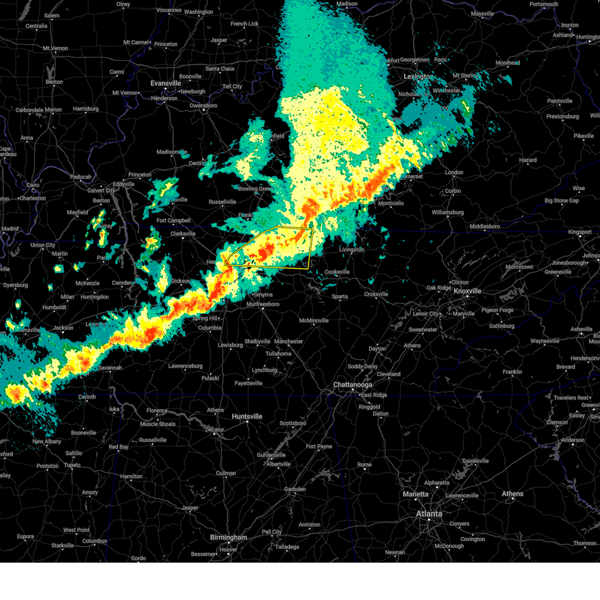 At 1121 pm cdt, a severe thunderstorm was located near lafayette, moving east at 45 mph (radar indicated). Hazards include 70 mph wind gusts and penny size hail. Expect considerable tree damage. damage is likely to mobile homes, roofs, and outbuildings. locations impacted include, red boiling springs, bethpage, goodlettsville, hartsville, dixon springs, oak grove, pleasant shade, millersville, gallatin, bledsoe creek state park, dickerson chapel recreation area, hendersonville, carthage, cottontown, lafayette, westmoreland, south carthage, white house, and mount juliet. this includes the following highways, interstate 65 between mile markers 93 and 102. Interstate 24 between mile markers 38 and 41. At 1121 pm cdt, a severe thunderstorm was located near lafayette, moving east at 45 mph (radar indicated). Hazards include 70 mph wind gusts and penny size hail. Expect considerable tree damage. damage is likely to mobile homes, roofs, and outbuildings. locations impacted include, red boiling springs, bethpage, goodlettsville, hartsville, dixon springs, oak grove, pleasant shade, millersville, gallatin, bledsoe creek state park, dickerson chapel recreation area, hendersonville, carthage, cottontown, lafayette, westmoreland, south carthage, white house, and mount juliet. this includes the following highways, interstate 65 between mile markers 93 and 102. Interstate 24 between mile markers 38 and 41.
|
| 3/30/2025 11:21 PM CDT |
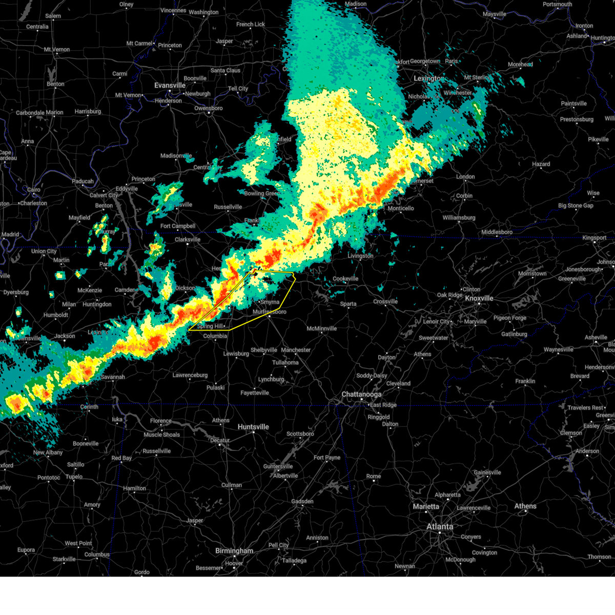 Svrohx the national weather service in nashville has issued a * severe thunderstorm warning for, southeastern davidson county in middle tennessee, northern rutherford county in middle tennessee, northern maury county in middle tennessee, williamson county in middle tennessee, wilson county in middle tennessee, east central hickman county in middle tennessee, * until 1215 am cdt. * at 1121 pm cdt, severe thunderstorms were located along a line extending from near madison to 8 miles northwest of thompson's station to near centerville, moving east at 50 mph (radar indicated). Hazards include 70 mph wind gusts and quarter size hail. Hail damage to vehicles is expected. expect considerable tree damage. Wind damage is also likely to mobile homes, roofs, and outbuildings. Svrohx the national weather service in nashville has issued a * severe thunderstorm warning for, southeastern davidson county in middle tennessee, northern rutherford county in middle tennessee, northern maury county in middle tennessee, williamson county in middle tennessee, wilson county in middle tennessee, east central hickman county in middle tennessee, * until 1215 am cdt. * at 1121 pm cdt, severe thunderstorms were located along a line extending from near madison to 8 miles northwest of thompson's station to near centerville, moving east at 50 mph (radar indicated). Hazards include 70 mph wind gusts and quarter size hail. Hail damage to vehicles is expected. expect considerable tree damage. Wind damage is also likely to mobile homes, roofs, and outbuildings.
|
| 3/30/2025 11:21 PM CDT |
 the severe thunderstorm warning has been cancelled and is no longer in effect the severe thunderstorm warning has been cancelled and is no longer in effect
|
| 3/30/2025 11:16 PM CDT |
 the severe thunderstorm warning has been cancelled and is no longer in effect the severe thunderstorm warning has been cancelled and is no longer in effect
|
| 3/30/2025 11:16 PM CDT |
 At 1115 pm cdt, severe thunderstorms were located along a line extending from near joelton to near fairview to near centerville, moving east at 40 mph (radar indicated). Hazards include 70 mph wind gusts and quarter size hail. Hail damage to vehicles is expected. expect considerable tree damage. wind damage is also likely to mobile homes, roofs, and outbuildings. locations impacted include, madison, bon aqua, belle meade, primm springs, natchez trace at highway 96, fairview, berry hill, ashland city, white bluff, leipers fork, nunnelly, oak hill, dickson, forest hills, bells bend, lyles, nashville, whites creek, bellevue, and lakewood. this includes the following highways, interstate 40 between mile markers 165 and 215. interstate 65 between mile markers 77 and 92. interstate 24 between mile markers 41 and 53. Interstate 840 between mile markers 1 and 17. At 1115 pm cdt, severe thunderstorms were located along a line extending from near joelton to near fairview to near centerville, moving east at 40 mph (radar indicated). Hazards include 70 mph wind gusts and quarter size hail. Hail damage to vehicles is expected. expect considerable tree damage. wind damage is also likely to mobile homes, roofs, and outbuildings. locations impacted include, madison, bon aqua, belle meade, primm springs, natchez trace at highway 96, fairview, berry hill, ashland city, white bluff, leipers fork, nunnelly, oak hill, dickson, forest hills, bells bend, lyles, nashville, whites creek, bellevue, and lakewood. this includes the following highways, interstate 40 between mile markers 165 and 215. interstate 65 between mile markers 77 and 92. interstate 24 between mile markers 41 and 53. Interstate 840 between mile markers 1 and 17.
|
| 3/30/2025 11:16 PM CDT |
 the tornado warning has been cancelled and is no longer in effect the tornado warning has been cancelled and is no longer in effect
|
| 3/30/2025 11:16 PM CDT |
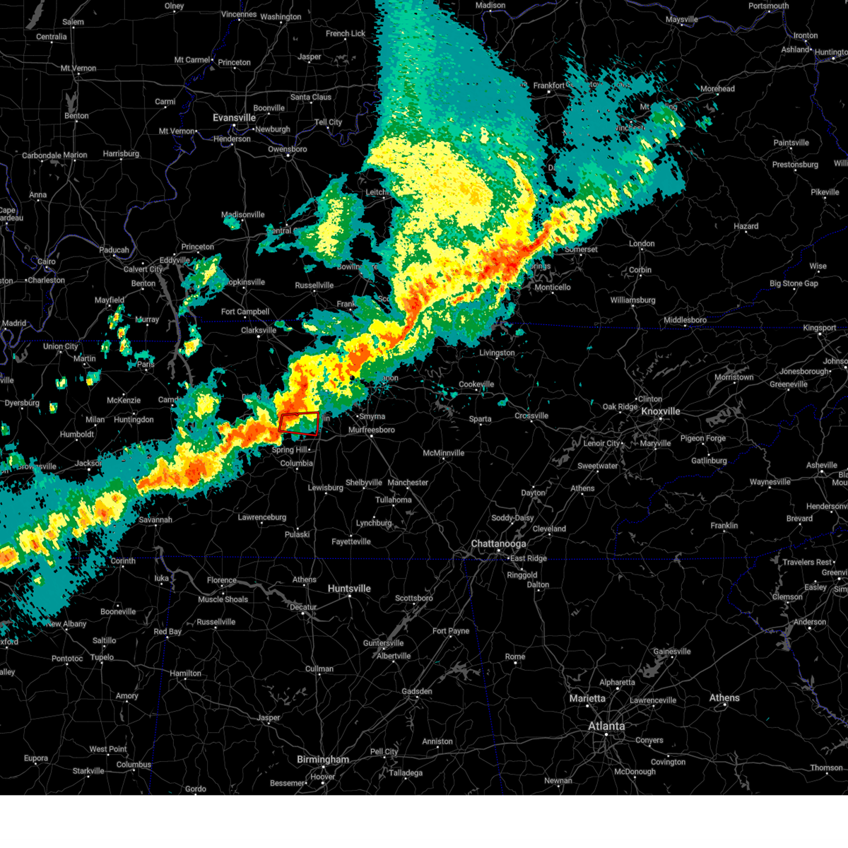 At 1116 pm cdt, a severe thunderstorm capable of producing a tornado was located near fairview, or 12 miles west of franklin, moving east at 45 mph (radar indicated rotation). Hazards include tornado. Flying debris will be dangerous to those caught without shelter. mobile homes will be damaged or destroyed. damage to roofs, windows, and vehicles will occur. tree damage is likely. this dangerous storm will be near, franklin around 1125 pm cdt. other locations impacted by this tornadic thunderstorm include natchez trace at highway 96 and leipers fork. This includes interstate 840 between mile markers 9 and 14. At 1116 pm cdt, a severe thunderstorm capable of producing a tornado was located near fairview, or 12 miles west of franklin, moving east at 45 mph (radar indicated rotation). Hazards include tornado. Flying debris will be dangerous to those caught without shelter. mobile homes will be damaged or destroyed. damage to roofs, windows, and vehicles will occur. tree damage is likely. this dangerous storm will be near, franklin around 1125 pm cdt. other locations impacted by this tornadic thunderstorm include natchez trace at highway 96 and leipers fork. This includes interstate 840 between mile markers 9 and 14.
|
| 3/30/2025 11:06 PM CDT |
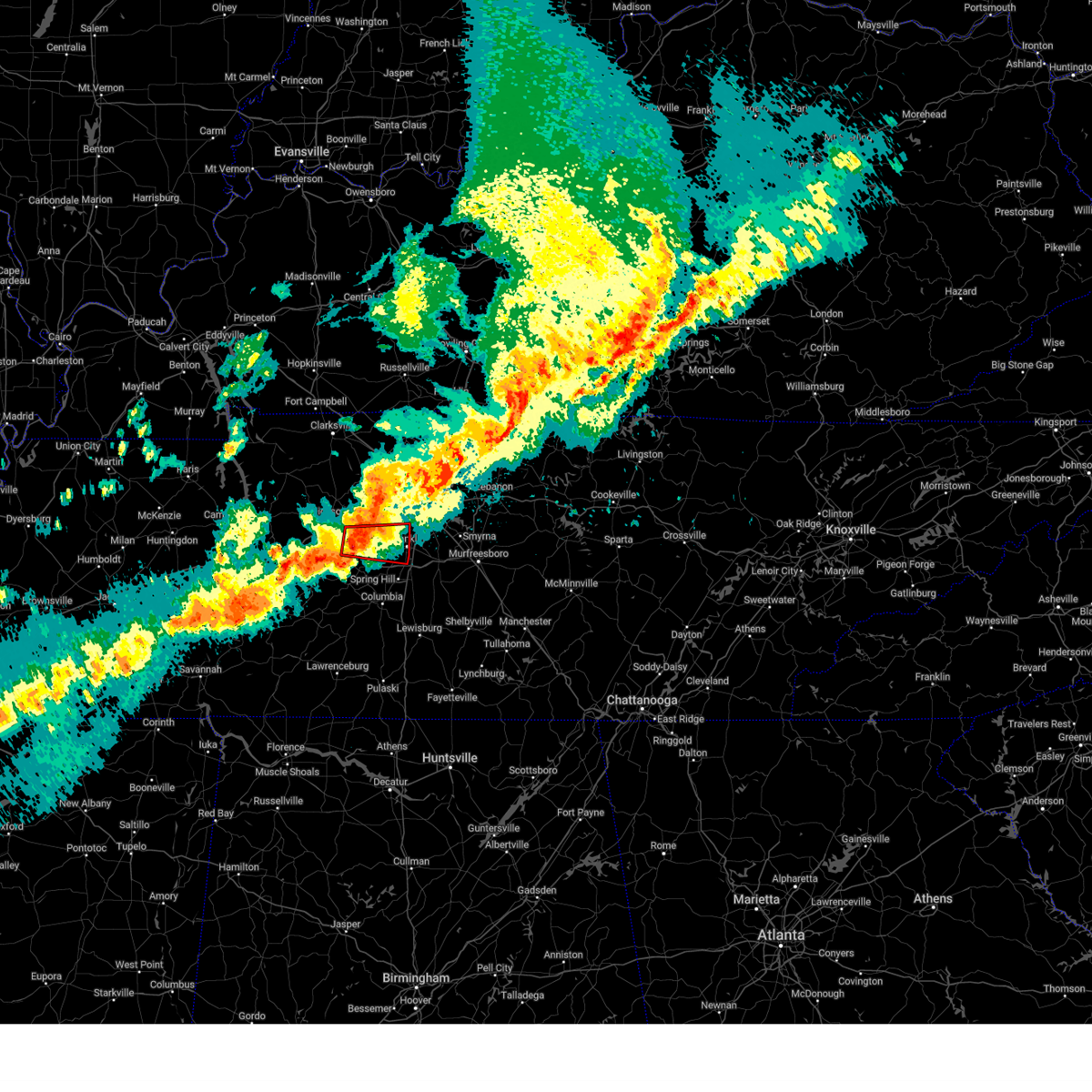 At 1106 pm cdt, a severe thunderstorm capable of producing a tornado was located near fairview, or 12 miles southeast of dickson, moving east at 45 mph (radar indicated rotation). Hazards include tornado. Flying debris will be dangerous to those caught without shelter. mobile homes will be damaged or destroyed. damage to roofs, windows, and vehicles will occur. tree damage is likely. this dangerous storm will be near, fairview around 1110 pm cdt. franklin around 1120 pm cdt. other locations impacted by this tornadic thunderstorm include natchez trace at highway 96 and leipers fork. this includes the following highways, interstate 40 between mile markers 176 and 182. Interstate 840 between mile markers 1 and 16. At 1106 pm cdt, a severe thunderstorm capable of producing a tornado was located near fairview, or 12 miles southeast of dickson, moving east at 45 mph (radar indicated rotation). Hazards include tornado. Flying debris will be dangerous to those caught without shelter. mobile homes will be damaged or destroyed. damage to roofs, windows, and vehicles will occur. tree damage is likely. this dangerous storm will be near, fairview around 1110 pm cdt. franklin around 1120 pm cdt. other locations impacted by this tornadic thunderstorm include natchez trace at highway 96 and leipers fork. this includes the following highways, interstate 40 between mile markers 176 and 182. Interstate 840 between mile markers 1 and 16.
|
| 3/30/2025 10:53 PM CDT |
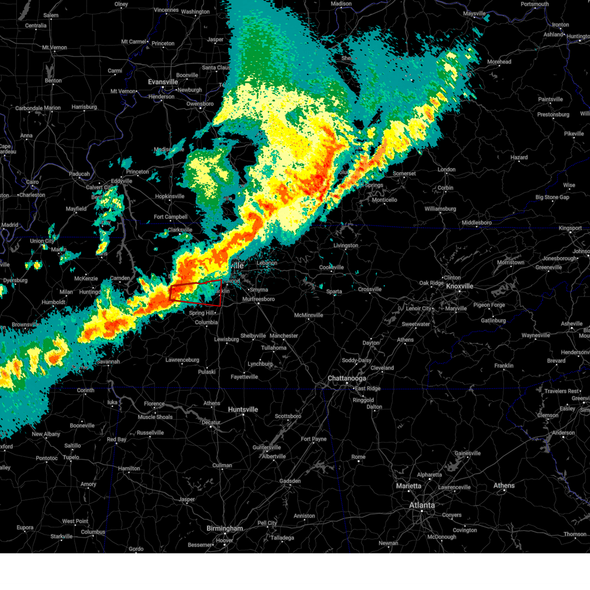 Torohx the national weather service in nashville has issued a * tornado warning for, southwestern davidson county in middle tennessee, southeastern dickson county in middle tennessee, northwestern williamson county in middle tennessee, northeastern hickman county in middle tennessee, * until 1145 pm cdt. * at 1052 pm cdt, a severe thunderstorm capable of producing a tornado was located 7 miles southwest of burns, or 8 miles south of dickson, moving east at 50 mph (radar indicated rotation). Hazards include tornado. Flying debris will be dangerous to those caught without shelter. mobile homes will be damaged or destroyed. damage to roofs, windows, and vehicles will occur. tree damage is likely. this dangerous storm will be near, fairview around 1105 pm cdt. franklin around 1120 pm cdt. other locations impacted by this tornadic thunderstorm include leipers fork, lyles, bon aqua, and natchez trace at highway 96. this includes the following highways, interstate 40 between mile markers 165 and 184. Interstate 840 between mile markers 1 and 17, and near mile marker 28. Torohx the national weather service in nashville has issued a * tornado warning for, southwestern davidson county in middle tennessee, southeastern dickson county in middle tennessee, northwestern williamson county in middle tennessee, northeastern hickman county in middle tennessee, * until 1145 pm cdt. * at 1052 pm cdt, a severe thunderstorm capable of producing a tornado was located 7 miles southwest of burns, or 8 miles south of dickson, moving east at 50 mph (radar indicated rotation). Hazards include tornado. Flying debris will be dangerous to those caught without shelter. mobile homes will be damaged or destroyed. damage to roofs, windows, and vehicles will occur. tree damage is likely. this dangerous storm will be near, fairview around 1105 pm cdt. franklin around 1120 pm cdt. other locations impacted by this tornadic thunderstorm include leipers fork, lyles, bon aqua, and natchez trace at highway 96. this includes the following highways, interstate 40 between mile markers 165 and 184. Interstate 840 between mile markers 1 and 17, and near mile marker 28.
|
| 3/30/2025 10:45 PM CDT |
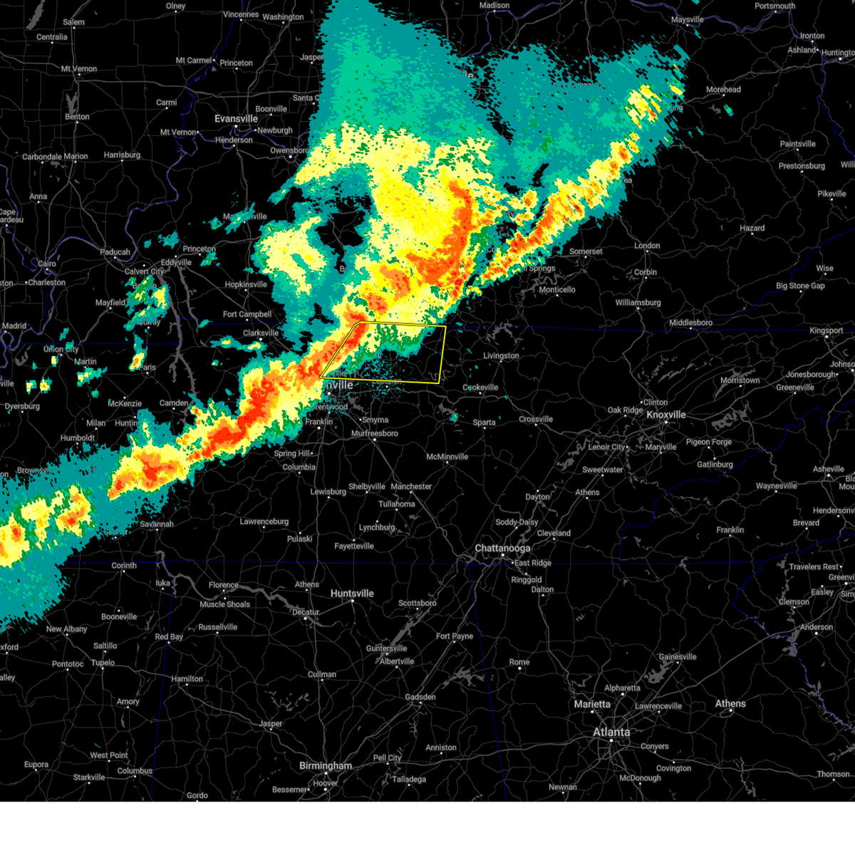 Svrohx the national weather service in nashville has issued a * severe thunderstorm warning for, northern smith county in middle tennessee, northeastern davidson county in middle tennessee, sumner county in middle tennessee, northern wilson county in middle tennessee, macon county in middle tennessee, trousdale county in middle tennessee, southeastern robertson county in middle tennessee, * until 1145 pm cdt. * at 1044 pm cdt, a severe thunderstorm was located over portland, or 13 miles north of gallatin, moving east at 55 mph (radar indicated). Hazards include 70 mph wind gusts and penny size hail. Expect considerable tree damage. Damage is likely to mobile homes, roofs, and outbuildings. Svrohx the national weather service in nashville has issued a * severe thunderstorm warning for, northern smith county in middle tennessee, northeastern davidson county in middle tennessee, sumner county in middle tennessee, northern wilson county in middle tennessee, macon county in middle tennessee, trousdale county in middle tennessee, southeastern robertson county in middle tennessee, * until 1145 pm cdt. * at 1044 pm cdt, a severe thunderstorm was located over portland, or 13 miles north of gallatin, moving east at 55 mph (radar indicated). Hazards include 70 mph wind gusts and penny size hail. Expect considerable tree damage. Damage is likely to mobile homes, roofs, and outbuildings.
|
| 3/30/2025 10:41 PM CDT |
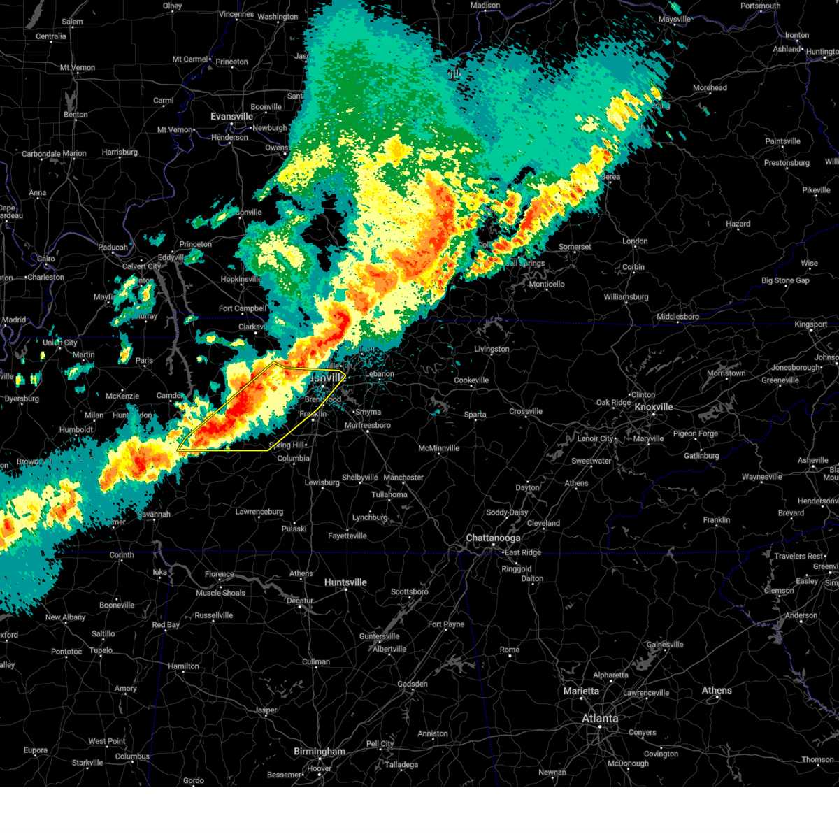 Svrohx the national weather service in nashville has issued a * severe thunderstorm warning for, central davidson county in middle tennessee, dickson county in middle tennessee, northwestern maury county in middle tennessee, northwestern williamson county in middle tennessee, southern cheatham county in middle tennessee, northern perry county in middle tennessee, southeastern humphreys county in middle tennessee, hickman county in middle tennessee, * until 1145 pm cdt. * at 1040 pm cdt, severe thunderstorms were located along a line extending from 8 miles north of white bluff to 7 miles southwest of dickson to 9 miles north of linden, moving east at 40 mph (radar indicated). Hazards include 60 mph wind gusts and quarter size hail. Hail damage to vehicles is expected. Expect wind damage to roofs, siding, and trees. Svrohx the national weather service in nashville has issued a * severe thunderstorm warning for, central davidson county in middle tennessee, dickson county in middle tennessee, northwestern maury county in middle tennessee, northwestern williamson county in middle tennessee, southern cheatham county in middle tennessee, northern perry county in middle tennessee, southeastern humphreys county in middle tennessee, hickman county in middle tennessee, * until 1145 pm cdt. * at 1040 pm cdt, severe thunderstorms were located along a line extending from 8 miles north of white bluff to 7 miles southwest of dickson to 9 miles north of linden, moving east at 40 mph (radar indicated). Hazards include 60 mph wind gusts and quarter size hail. Hail damage to vehicles is expected. Expect wind damage to roofs, siding, and trees.
|
| 3/30/2025 10:36 PM CDT |
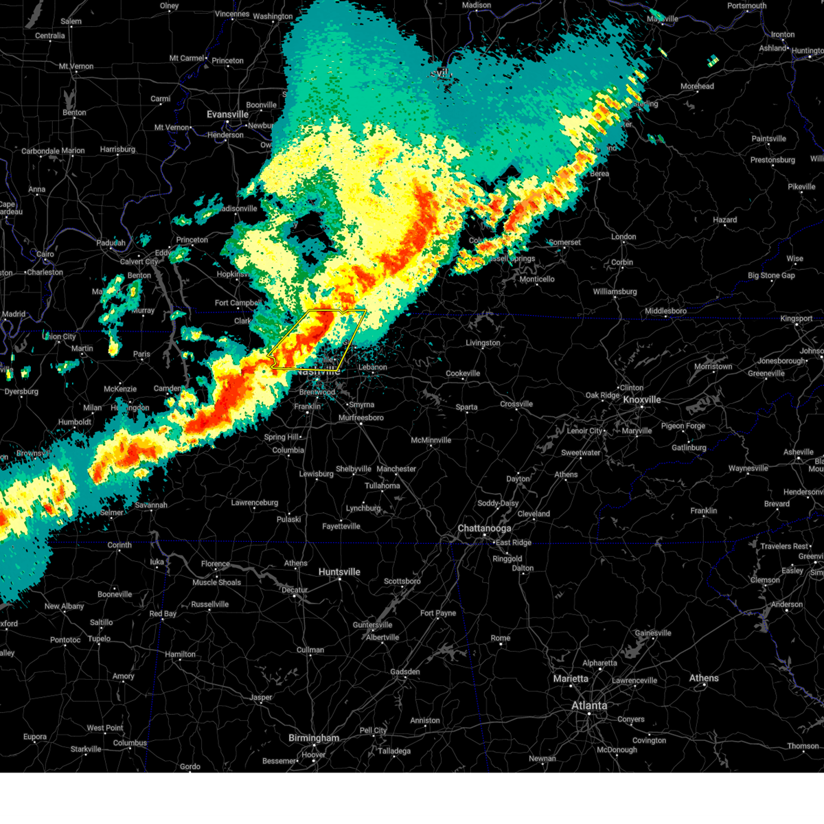 At 1036 pm cdt, severe thunderstorms were located along a line extending from near portland to near ashland city, moving east at 40 mph (radar indicated). Hazards include 60 mph wind gusts and penny size hail. Expect damage to roofs, siding, and trees. locations impacted include, madison, portland, ridgetop, goodlettsville, mitchellville, millersville, white house, whites creek, lakewood, hendersonville, greenbrier, cottontown, orlinda, pleasant view, cross plains, beaman park, springfield, old hickory, ashland city, and coopertown. this includes the following highways, interstate 65 between mile markers 89 and 121. Interstate 24 between mile markers 20 and 44. At 1036 pm cdt, severe thunderstorms were located along a line extending from near portland to near ashland city, moving east at 40 mph (radar indicated). Hazards include 60 mph wind gusts and penny size hail. Expect damage to roofs, siding, and trees. locations impacted include, madison, portland, ridgetop, goodlettsville, mitchellville, millersville, white house, whites creek, lakewood, hendersonville, greenbrier, cottontown, orlinda, pleasant view, cross plains, beaman park, springfield, old hickory, ashland city, and coopertown. this includes the following highways, interstate 65 between mile markers 89 and 121. Interstate 24 between mile markers 20 and 44.
|
| 3/30/2025 10:06 PM CDT |
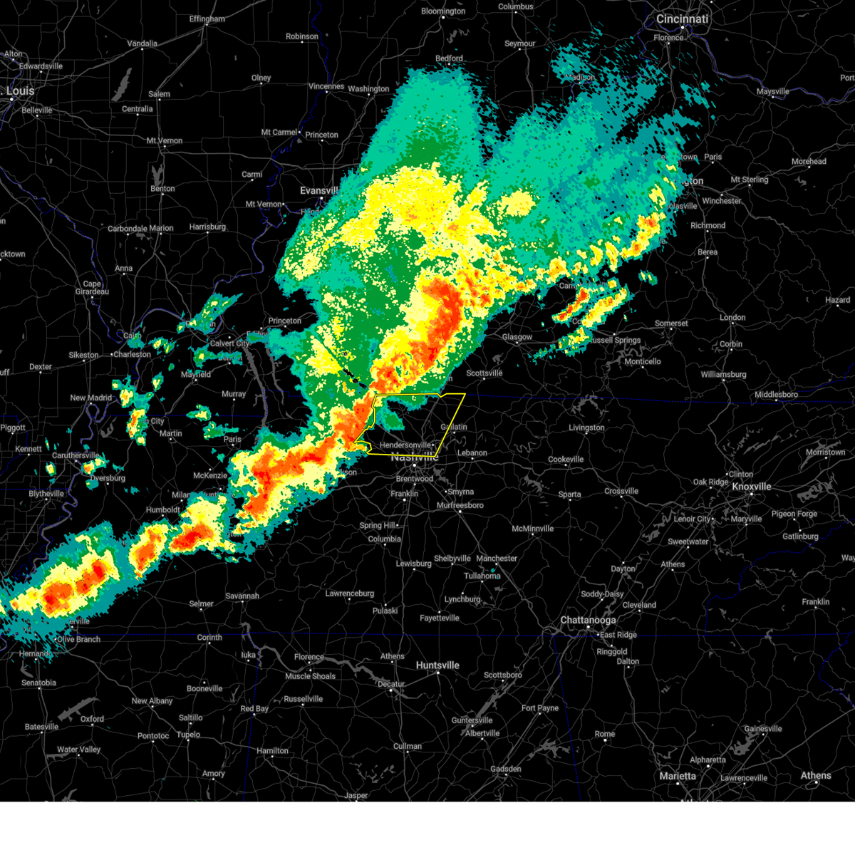 Svrohx the national weather service in nashville has issued a * severe thunderstorm warning for, northern davidson county in middle tennessee, western sumner county in middle tennessee, northern cheatham county in middle tennessee, robertson county in middle tennessee, * until 1100 pm cdt. * at 1005 pm cdt, severe thunderstorms were located along a line extending from 6 miles east of guthrie to 14 miles north of white bluff, moving east at 55 mph (radar indicated). Hazards include 60 mph wind gusts and penny size hail. expect damage to roofs, siding, and trees Svrohx the national weather service in nashville has issued a * severe thunderstorm warning for, northern davidson county in middle tennessee, western sumner county in middle tennessee, northern cheatham county in middle tennessee, robertson county in middle tennessee, * until 1100 pm cdt. * at 1005 pm cdt, severe thunderstorms were located along a line extending from 6 miles east of guthrie to 14 miles north of white bluff, moving east at 55 mph (radar indicated). Hazards include 60 mph wind gusts and penny size hail. expect damage to roofs, siding, and trees
|
| 3/23/2025 6:39 PM CDT |
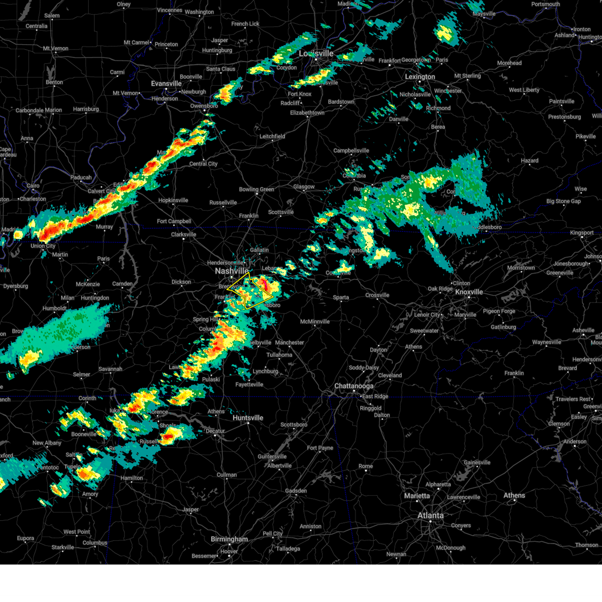 The storm which prompted the warning has moved out of the area. therefore, the warning will be allowed to expire. a tornado watch remains in effect until 1100 pm cdt for middle tennessee. The storm which prompted the warning has moved out of the area. therefore, the warning will be allowed to expire. a tornado watch remains in effect until 1100 pm cdt for middle tennessee.
|
| 3/23/2025 6:33 PM CDT |
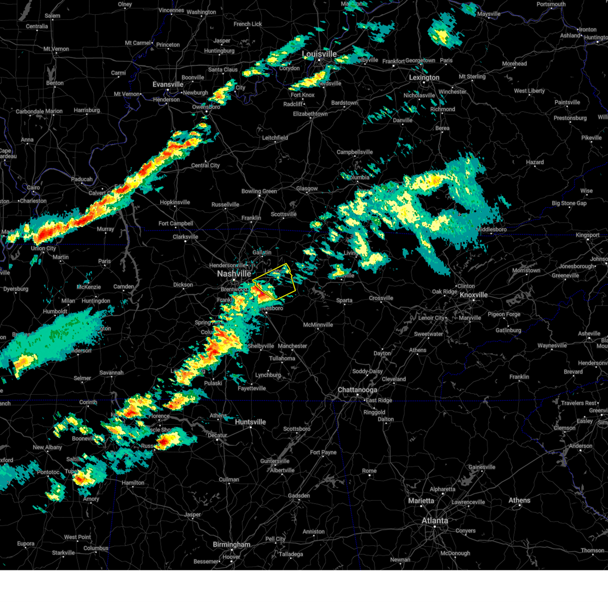 Svrohx the national weather service in nashville has issued a * severe thunderstorm warning for, wilson county in middle tennessee, * until 715 pm cdt. * at 633 pm cdt, a severe thunderstorm was located near rural hill, or 12 miles southwest of lebanon, moving northeast at 50 mph (radar indicated). Hazards include 60 mph wind gusts and quarter size hail. Hail damage to vehicles is expected. Expect wind damage to roofs, siding, and trees. Svrohx the national weather service in nashville has issued a * severe thunderstorm warning for, wilson county in middle tennessee, * until 715 pm cdt. * at 633 pm cdt, a severe thunderstorm was located near rural hill, or 12 miles southwest of lebanon, moving northeast at 50 mph (radar indicated). Hazards include 60 mph wind gusts and quarter size hail. Hail damage to vehicles is expected. Expect wind damage to roofs, siding, and trees.
|
| 3/23/2025 6:27 PM CDT |
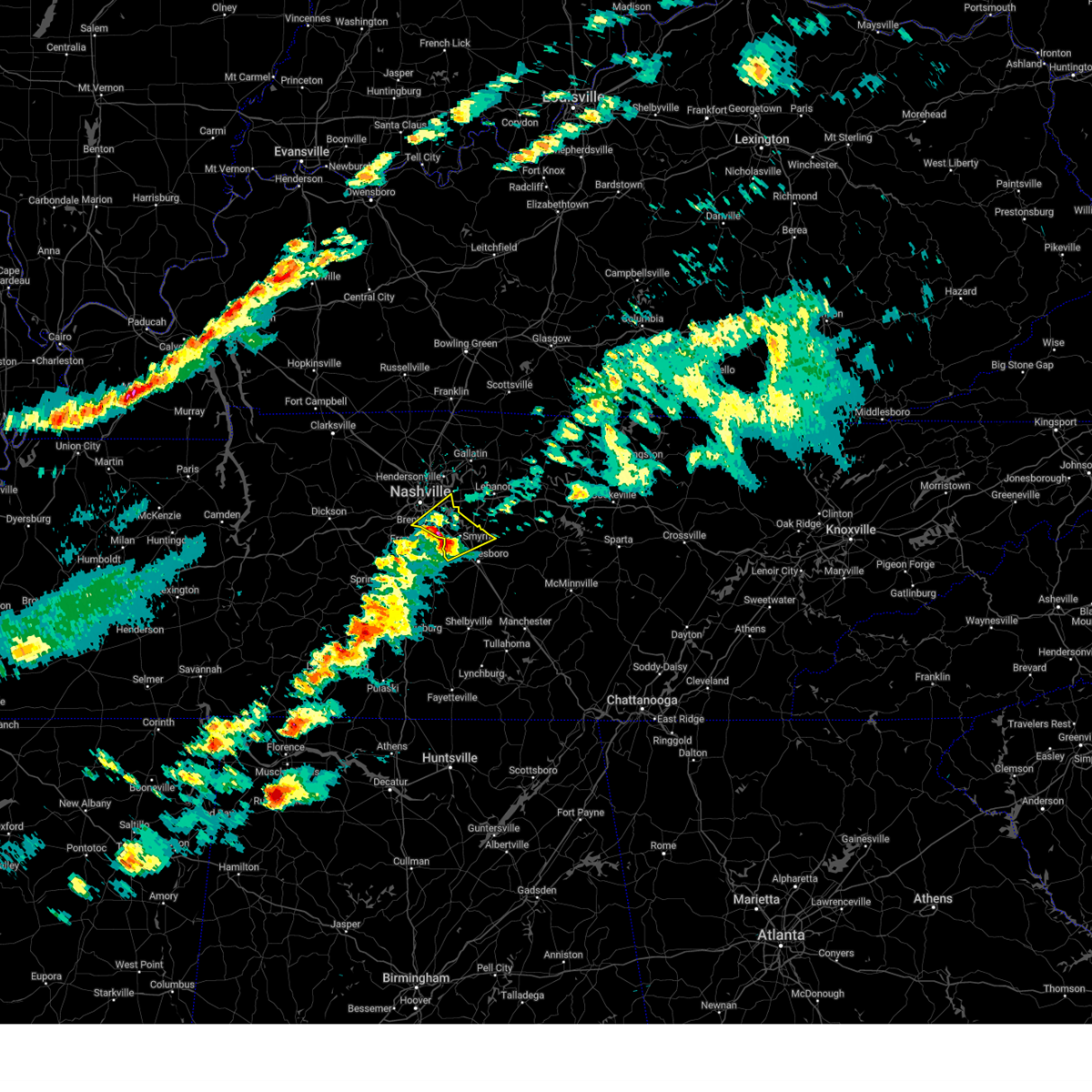 the severe thunderstorm warning has been cancelled and is no longer in effect the severe thunderstorm warning has been cancelled and is no longer in effect
|
| 3/23/2025 6:27 PM CDT |
 At 626 pm cdt, a severe thunderstorm was located over la vergne, or 14 miles northwest of murfreesboro, moving northeast at 50 mph (radar indicated). Hazards include 60 mph wind gusts and quarter size hail. Hail damage to vehicles is expected. expect wind damage to roofs, siding, and trees. locations impacted include, walterhill, la vergne, percy priest lake, antioch, smyrna, oak hill, rural hill, forest hills, nolensville, and brentwood. this includes the following highways, interstate 40 between mile markers 216 and 222. interstate 65 between mile markers 75 and 78. interstate 24 between mile markers 54 and 73. Interstate 840 near mile marker 46, and between mile markers 56 and 65. At 626 pm cdt, a severe thunderstorm was located over la vergne, or 14 miles northwest of murfreesboro, moving northeast at 50 mph (radar indicated). Hazards include 60 mph wind gusts and quarter size hail. Hail damage to vehicles is expected. expect wind damage to roofs, siding, and trees. locations impacted include, walterhill, la vergne, percy priest lake, antioch, smyrna, oak hill, rural hill, forest hills, nolensville, and brentwood. this includes the following highways, interstate 40 between mile markers 216 and 222. interstate 65 between mile markers 75 and 78. interstate 24 between mile markers 54 and 73. Interstate 840 near mile marker 46, and between mile markers 56 and 65.
|
| 3/23/2025 6:17 PM CDT |
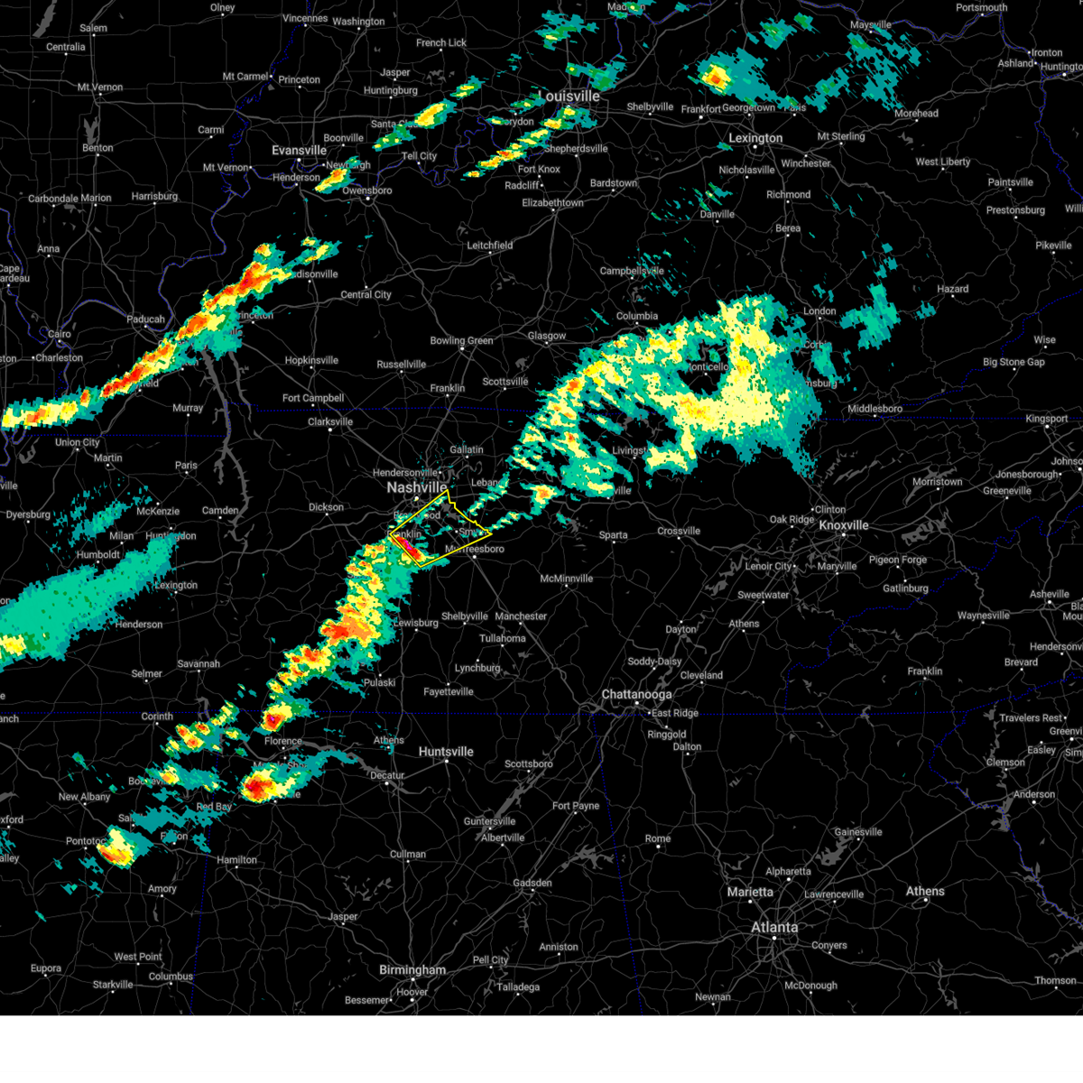 At 617 pm cdt, a severe thunderstorm was located near nolensville, or near franklin, moving northeast at 50 mph (radar indicated). Hazards include 60 mph wind gusts and quarter size hail. Hail damage to vehicles is expected. expect wind damage to roofs, siding, and trees. locations impacted include, franklin, nolensville, walterhill, brentwood, la vergne, percy priest lake, antioch, smyrna, oak hill, triune, rural hill, and forest hills. this includes the following highways, interstate 40 between mile markers 216 and 222. interstate 65 between mile markers 62 and 78. interstate 24 between mile markers 54 and 73. Interstate 840 between mile markers 34 and 46, and between mile markers 56 and 65. At 617 pm cdt, a severe thunderstorm was located near nolensville, or near franklin, moving northeast at 50 mph (radar indicated). Hazards include 60 mph wind gusts and quarter size hail. Hail damage to vehicles is expected. expect wind damage to roofs, siding, and trees. locations impacted include, franklin, nolensville, walterhill, brentwood, la vergne, percy priest lake, antioch, smyrna, oak hill, triune, rural hill, and forest hills. this includes the following highways, interstate 40 between mile markers 216 and 222. interstate 65 between mile markers 62 and 78. interstate 24 between mile markers 54 and 73. Interstate 840 between mile markers 34 and 46, and between mile markers 56 and 65.
|
| 3/23/2025 6:02 PM CDT |
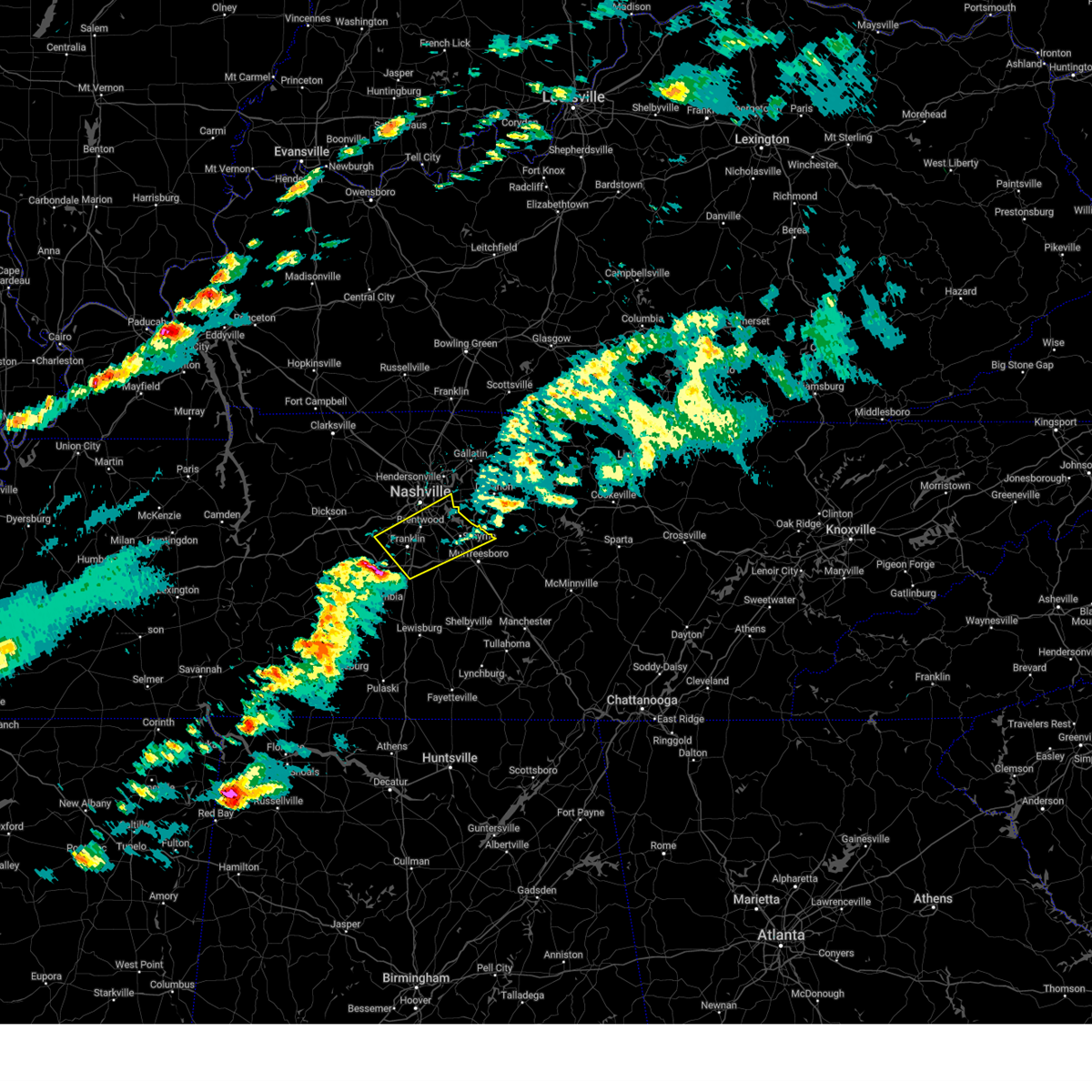 Svrohx the national weather service in nashville has issued a * severe thunderstorm warning for, southern davidson county in middle tennessee, northwestern rutherford county in middle tennessee, central williamson county in middle tennessee, * until 645 pm cdt. * at 601 pm cdt, a severe thunderstorm was located near thompson's station, or 10 miles southwest of franklin, moving northeast at 50 mph (radar indicated). Hazards include 60 mph wind gusts and quarter size hail. Hail damage to vehicles is expected. Expect wind damage to roofs, siding, and trees. Svrohx the national weather service in nashville has issued a * severe thunderstorm warning for, southern davidson county in middle tennessee, northwestern rutherford county in middle tennessee, central williamson county in middle tennessee, * until 645 pm cdt. * at 601 pm cdt, a severe thunderstorm was located near thompson's station, or 10 miles southwest of franklin, moving northeast at 50 mph (radar indicated). Hazards include 60 mph wind gusts and quarter size hail. Hail damage to vehicles is expected. Expect wind damage to roofs, siding, and trees.
|
| 3/19/2025 10:43 PM CDT |
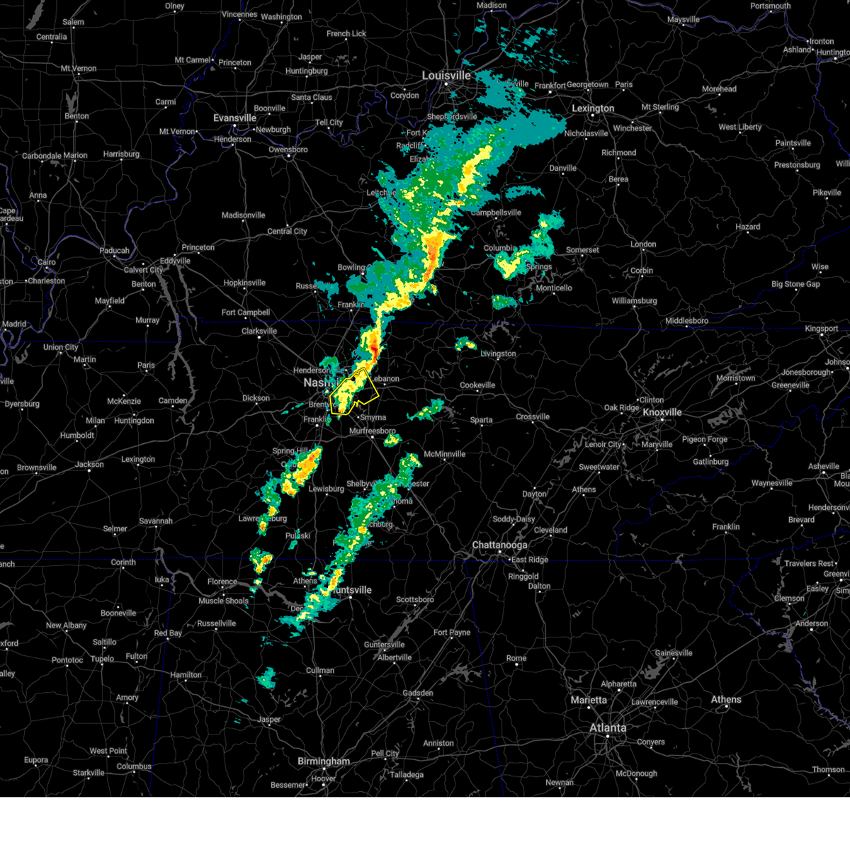 the severe thunderstorm warning has been cancelled and is no longer in effect the severe thunderstorm warning has been cancelled and is no longer in effect
|
| 3/19/2025 10:35 PM CDT |
 At 1034 pm cdt, a severe thunderstorm was located over antioch, or 8 miles southeast of nashville, moving northeast at 60 mph (radar indicated). Hazards include 60 mph wind gusts and penny size hail. Expect damage to roofs, siding, and trees. locations impacted include, green hill, hermitage, rural hill, antioch, belinda city, mount juliet, percy priest lake, gladeville, lakewood, berry hill, la vergne, lebanon, and hendersonville. this includes the following highways, interstate 40 between mile markers 213 and 233. interstate 24 between mile markers 52 and 63. Interstate 840 between mile markers 69 and 74. At 1034 pm cdt, a severe thunderstorm was located over antioch, or 8 miles southeast of nashville, moving northeast at 60 mph (radar indicated). Hazards include 60 mph wind gusts and penny size hail. Expect damage to roofs, siding, and trees. locations impacted include, green hill, hermitage, rural hill, antioch, belinda city, mount juliet, percy priest lake, gladeville, lakewood, berry hill, la vergne, lebanon, and hendersonville. this includes the following highways, interstate 40 between mile markers 213 and 233. interstate 24 between mile markers 52 and 63. Interstate 840 between mile markers 69 and 74.
|
| 3/19/2025 10:35 PM CDT |
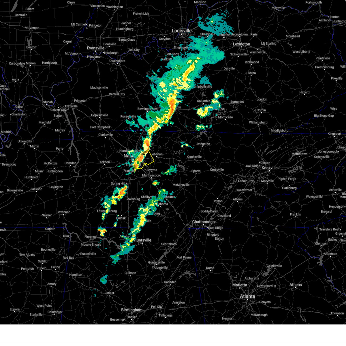 the severe thunderstorm warning has been cancelled and is no longer in effect the severe thunderstorm warning has been cancelled and is no longer in effect
|
| 3/19/2025 10:23 PM CDT |
 Svrohx the national weather service in nashville has issued a * severe thunderstorm warning for, southeastern davidson county in middle tennessee, northeastern williamson county in middle tennessee, northwestern wilson county in middle tennessee, * until 1100 pm cdt. * at 1023 pm cdt, a severe thunderstorm was located near brentwood, or near franklin, moving northeast at 60 mph (radar indicated). Hazards include 60 mph wind gusts and penny size hail. expect damage to roofs, siding, and trees Svrohx the national weather service in nashville has issued a * severe thunderstorm warning for, southeastern davidson county in middle tennessee, northeastern williamson county in middle tennessee, northwestern wilson county in middle tennessee, * until 1100 pm cdt. * at 1023 pm cdt, a severe thunderstorm was located near brentwood, or near franklin, moving northeast at 60 mph (radar indicated). Hazards include 60 mph wind gusts and penny size hail. expect damage to roofs, siding, and trees
|
| 3/19/2025 10:20 PM CDT |
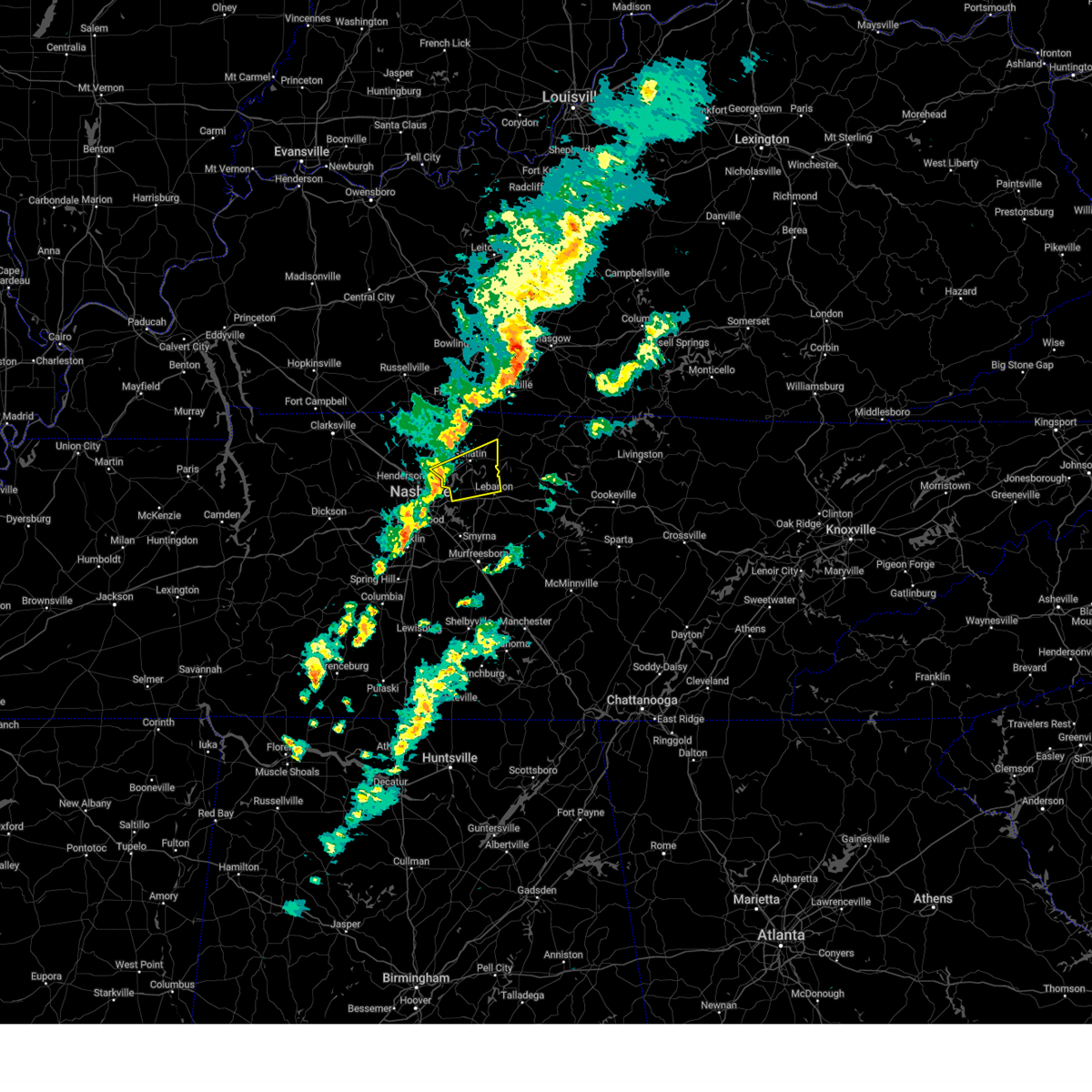 Svrohx the national weather service in nashville has issued a * severe thunderstorm warning for, southern sumner county in middle tennessee, northwestern wilson county in middle tennessee, * until 1045 pm cdt. * at 1020 pm cdt, a severe thunderstorm was located over lakewood, or 7 miles northeast of nashville, moving northeast at 60 mph (radar indicated). Hazards include 60 mph wind gusts and penny size hail. expect damage to roofs, siding, and trees Svrohx the national weather service in nashville has issued a * severe thunderstorm warning for, southern sumner county in middle tennessee, northwestern wilson county in middle tennessee, * until 1045 pm cdt. * at 1020 pm cdt, a severe thunderstorm was located over lakewood, or 7 miles northeast of nashville, moving northeast at 60 mph (radar indicated). Hazards include 60 mph wind gusts and penny size hail. expect damage to roofs, siding, and trees
|
| 3/19/2025 10:16 PM CDT |
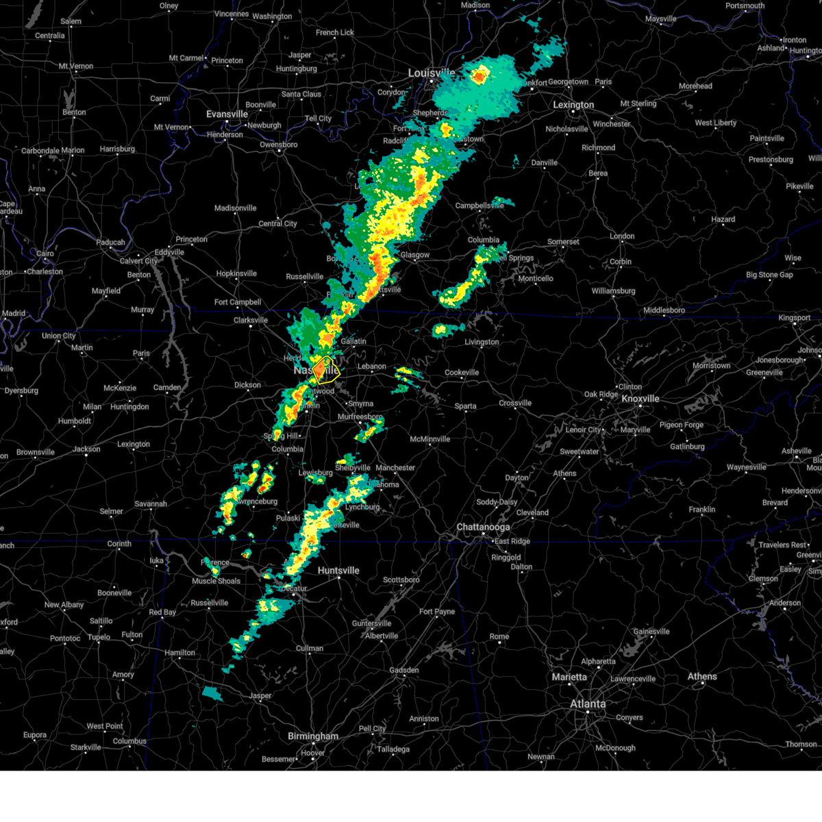 At 1015 pm cdt, a severe thunderstorm was located over madison, or near nashville, moving northeast at 60 mph (radar indicated). Hazards include 60 mph wind gusts and penny size hail. Expect damage to roofs, siding, and trees. locations impacted include, madison, hermitage, old hickory, nashville, lakewood, berry hill, goodlettsville, and hendersonville. this includes the following highways, interstate 40 between mile markers 211 and 220. interstate 65 between mile markers 86 and 96. Interstate 24 between mile markers 43 and 52. At 1015 pm cdt, a severe thunderstorm was located over madison, or near nashville, moving northeast at 60 mph (radar indicated). Hazards include 60 mph wind gusts and penny size hail. Expect damage to roofs, siding, and trees. locations impacted include, madison, hermitage, old hickory, nashville, lakewood, berry hill, goodlettsville, and hendersonville. this includes the following highways, interstate 40 between mile markers 211 and 220. interstate 65 between mile markers 86 and 96. Interstate 24 between mile markers 43 and 52.
|
| 3/19/2025 10:09 PM CDT |
 the severe thunderstorm warning has been cancelled and is no longer in effect the severe thunderstorm warning has been cancelled and is no longer in effect
|
| 3/19/2025 10:09 PM CDT |
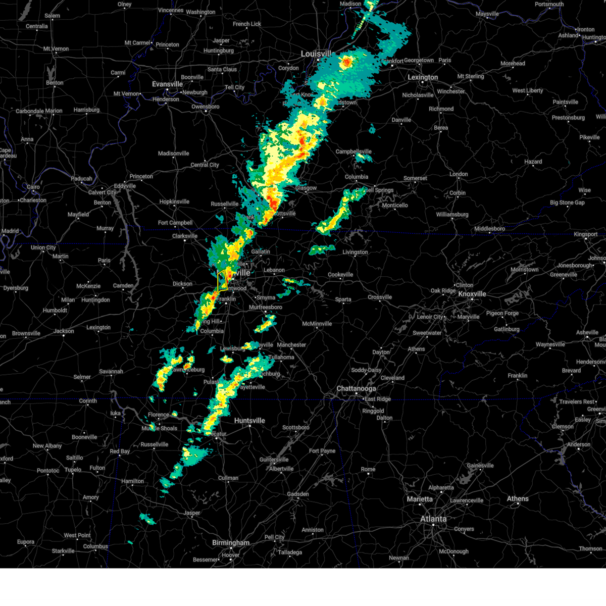 At 1009 pm cdt, a severe thunderstorm was located over belle meade, or near nashville, moving northeast at 55 mph (radar indicated). Hazards include 60 mph wind gusts and penny size hail. Expect damage to roofs, siding, and trees. locations impacted include, bellevue, bells bend, belle meade, and forest hills. This includes interstate 40 between mile markers 196 and 203. At 1009 pm cdt, a severe thunderstorm was located over belle meade, or near nashville, moving northeast at 55 mph (radar indicated). Hazards include 60 mph wind gusts and penny size hail. Expect damage to roofs, siding, and trees. locations impacted include, bellevue, bells bend, belle meade, and forest hills. This includes interstate 40 between mile markers 196 and 203.
|
| 3/19/2025 10:02 PM CDT |
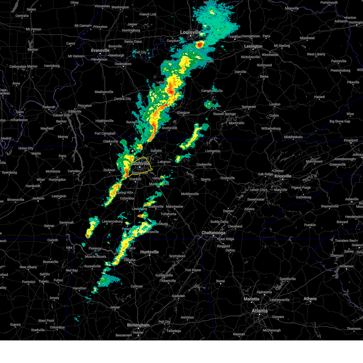 Svrohx the national weather service in nashville has issued a * severe thunderstorm warning for, davidson county in middle tennessee, * until 1030 pm cdt. * at 1002 pm cdt, a severe thunderstorm was located near bellevue, or 8 miles west of nashville, moving northeast at 60 mph (radar indicated). Hazards include 60 mph wind gusts and penny size hail. expect damage to roofs, siding, and trees Svrohx the national weather service in nashville has issued a * severe thunderstorm warning for, davidson county in middle tennessee, * until 1030 pm cdt. * at 1002 pm cdt, a severe thunderstorm was located near bellevue, or 8 miles west of nashville, moving northeast at 60 mph (radar indicated). Hazards include 60 mph wind gusts and penny size hail. expect damage to roofs, siding, and trees
|
| 3/19/2025 9:53 PM CDT |
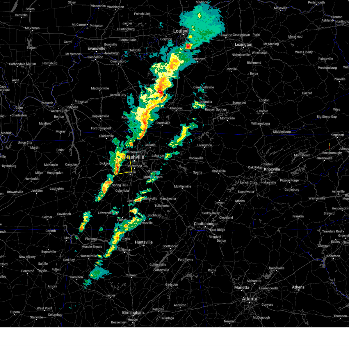 the severe thunderstorm warning has been cancelled and is no longer in effect the severe thunderstorm warning has been cancelled and is no longer in effect
|
| 3/19/2025 9:53 PM CDT |
 At 951 pm cdt, a severe thunderstorm was located over fairview, or 12 miles east of dickson, moving northeast at 55 mph (radar indicated). Hazards include 60 mph wind gusts and penny size hail. Expect damage to roofs, siding, and trees. locations impacted include, fairview, kingston springs, belle meade, bells bend, bellevue, natchez trace at highway 96, pegram, forest hills, and brentwood. This includes interstate 40 between mile markers 183 and 203. At 951 pm cdt, a severe thunderstorm was located over fairview, or 12 miles east of dickson, moving northeast at 55 mph (radar indicated). Hazards include 60 mph wind gusts and penny size hail. Expect damage to roofs, siding, and trees. locations impacted include, fairview, kingston springs, belle meade, bells bend, bellevue, natchez trace at highway 96, pegram, forest hills, and brentwood. This includes interstate 40 between mile markers 183 and 203.
|
| 3/19/2025 9:33 PM CDT |
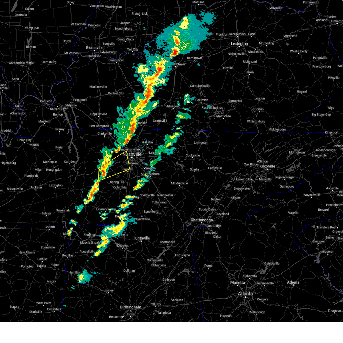 Svrohx the national weather service in nashville has issued a * severe thunderstorm warning for, southwestern davidson county in middle tennessee, southeastern dickson county in middle tennessee, northwestern williamson county in middle tennessee, southeastern cheatham county in middle tennessee, northeastern hickman county in middle tennessee, * until 1015 pm cdt. * at 933 pm cdt, a severe thunderstorm was located near centerville, moving northeast at 55 mph (radar indicated). Hazards include 60 mph wind gusts and penny size hail. expect damage to roofs, siding, and trees Svrohx the national weather service in nashville has issued a * severe thunderstorm warning for, southwestern davidson county in middle tennessee, southeastern dickson county in middle tennessee, northwestern williamson county in middle tennessee, southeastern cheatham county in middle tennessee, northeastern hickman county in middle tennessee, * until 1015 pm cdt. * at 933 pm cdt, a severe thunderstorm was located near centerville, moving northeast at 55 mph (radar indicated). Hazards include 60 mph wind gusts and penny size hail. expect damage to roofs, siding, and trees
|
| 9/24/2024 7:35 PM CDT |
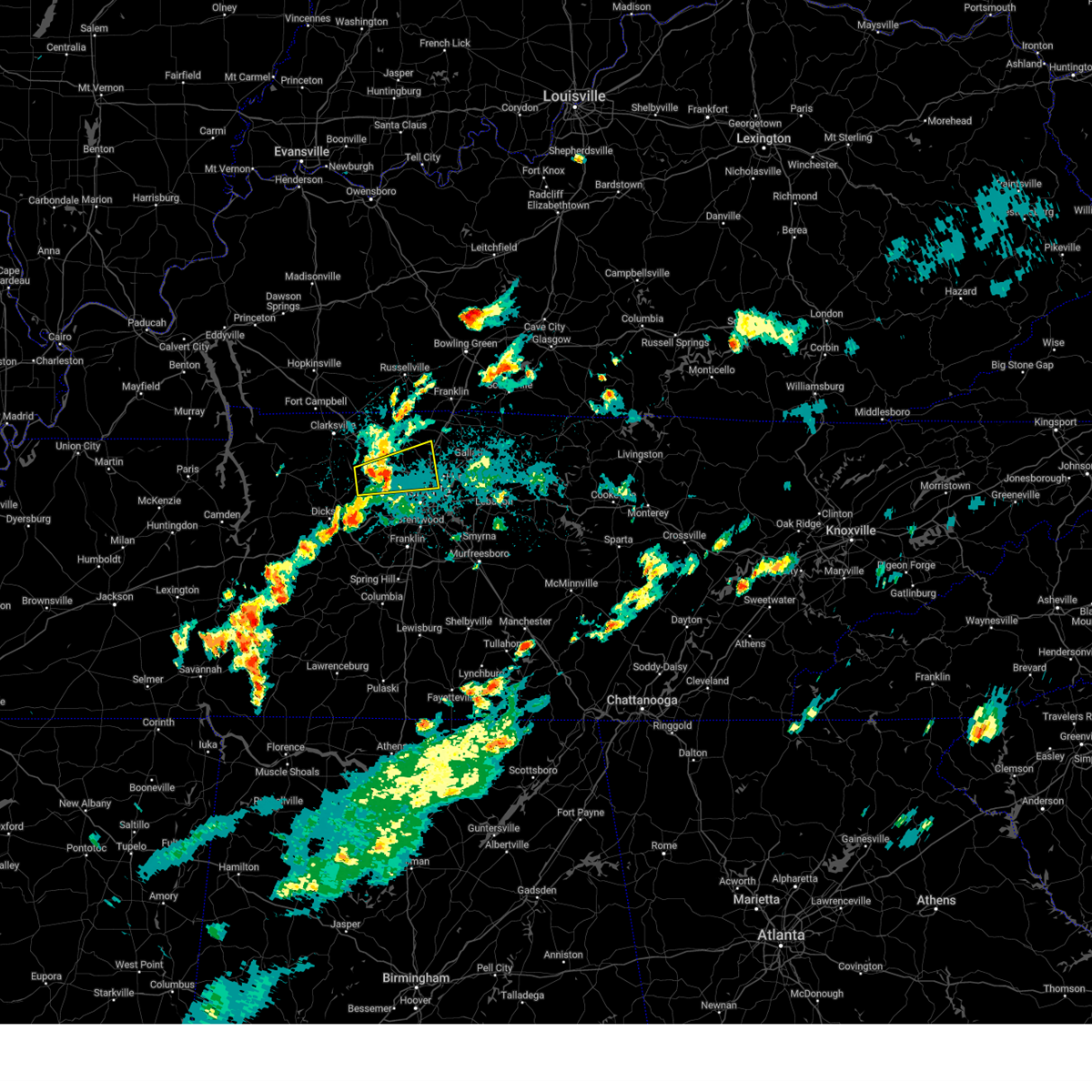 the severe thunderstorm warning has been cancelled and is no longer in effect the severe thunderstorm warning has been cancelled and is no longer in effect
|
| 9/24/2024 7:18 PM CDT |
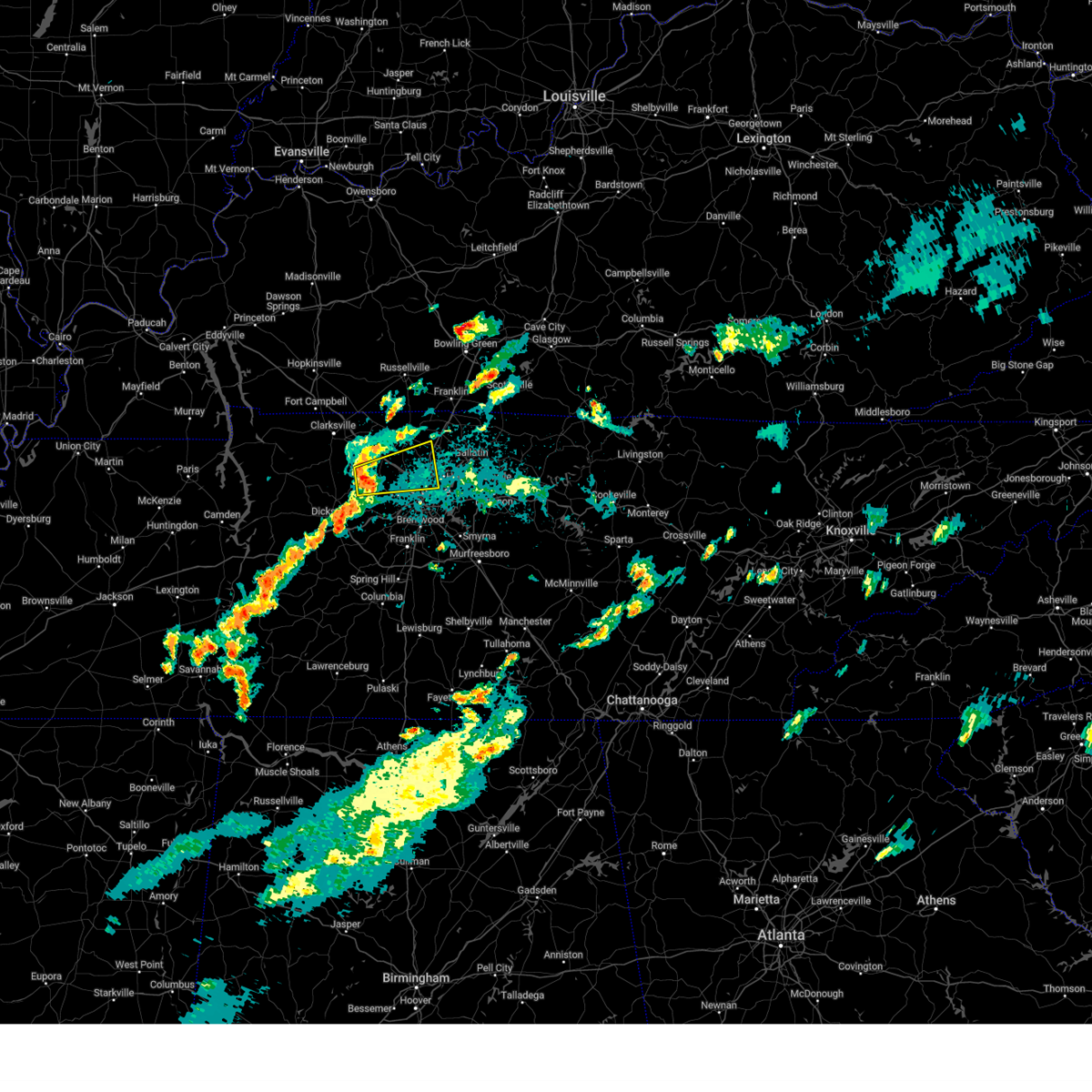 Svrohx the national weather service in nashville has issued a * severe thunderstorm warning for, northwestern davidson county in middle tennessee, northeastern dickson county in middle tennessee, west central sumner county in middle tennessee, central cheatham county in middle tennessee, south central robertson county in middle tennessee, * until 800 pm cdt. * at 718 pm cdt, a severe thunderstorm was located near ashland city, moving east at 30 mph (radar indicated). Hazards include 60 mph wind gusts. expect damage to roofs, siding, and trees Svrohx the national weather service in nashville has issued a * severe thunderstorm warning for, northwestern davidson county in middle tennessee, northeastern dickson county in middle tennessee, west central sumner county in middle tennessee, central cheatham county in middle tennessee, south central robertson county in middle tennessee, * until 800 pm cdt. * at 718 pm cdt, a severe thunderstorm was located near ashland city, moving east at 30 mph (radar indicated). Hazards include 60 mph wind gusts. expect damage to roofs, siding, and trees
|
| 9/24/2024 3:25 PM CDT |
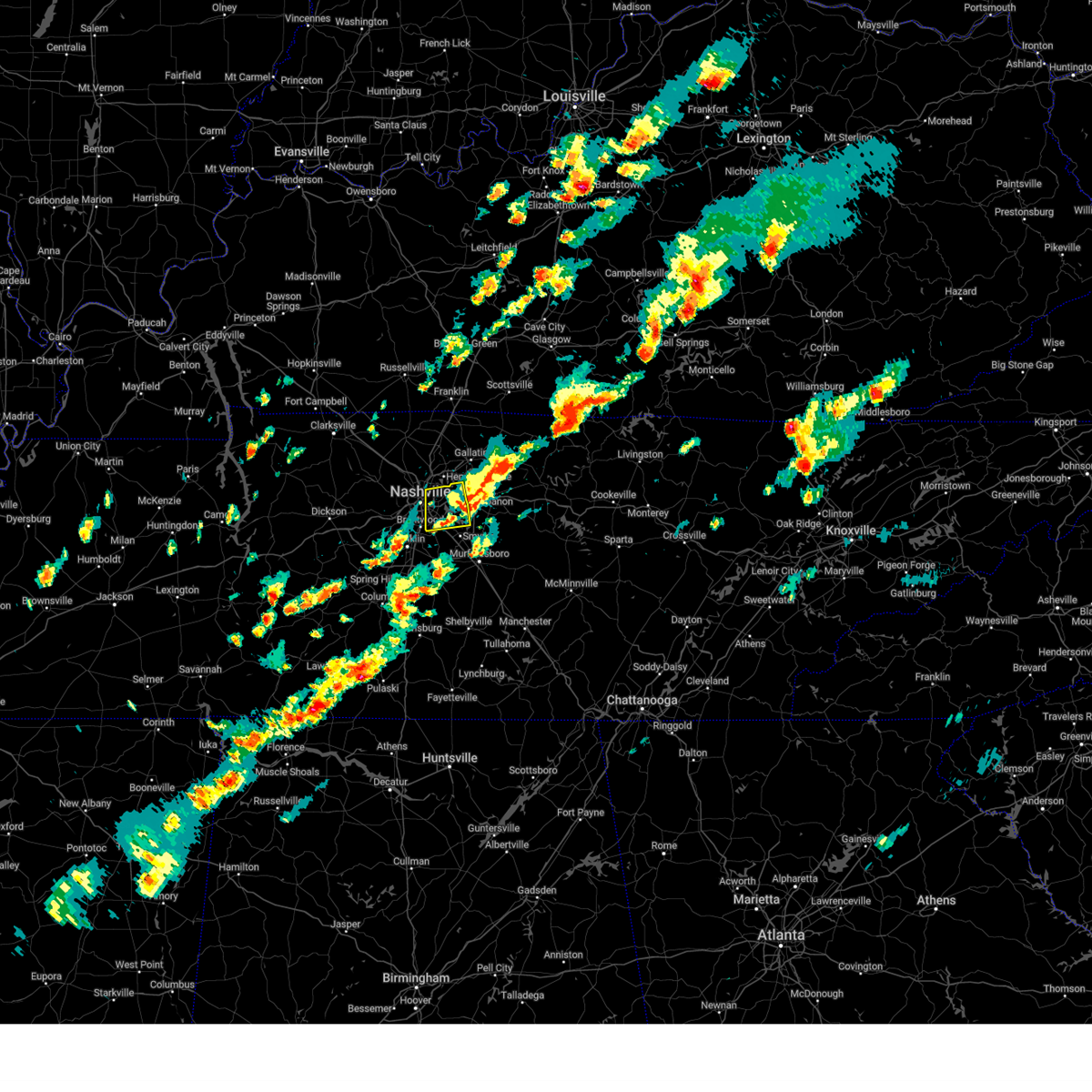 The storm which prompted the warning has moved out of the area. therefore, the warning will be allowed to expire. however, gusty winds are still possible with this thunderstorm. a severe thunderstorm watch remains in effect until 700 pm cdt for middle tennessee. The storm which prompted the warning has moved out of the area. therefore, the warning will be allowed to expire. however, gusty winds are still possible with this thunderstorm. a severe thunderstorm watch remains in effect until 700 pm cdt for middle tennessee.
|
| 9/24/2024 3:13 PM CDT |
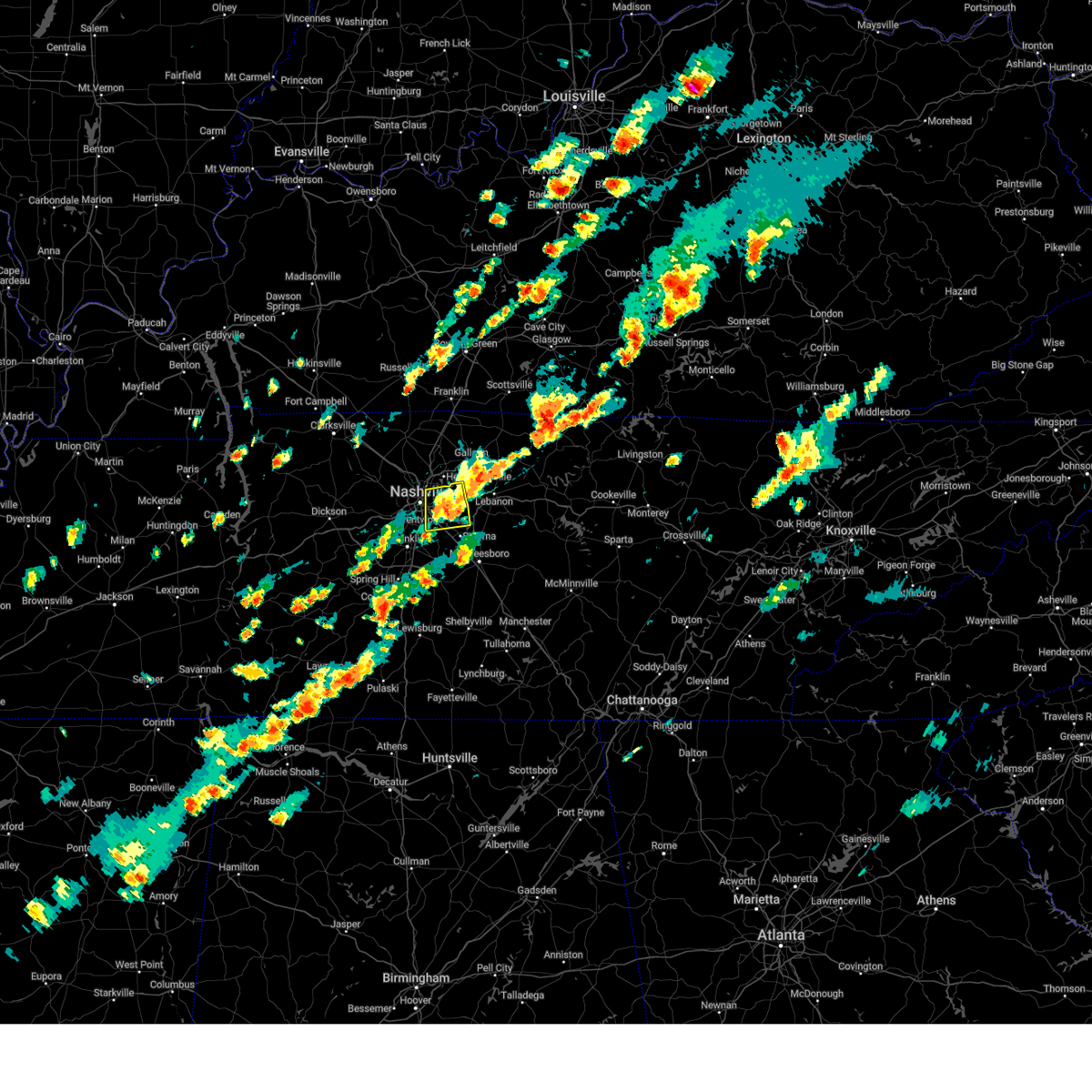 the severe thunderstorm warning has been cancelled and is no longer in effect the severe thunderstorm warning has been cancelled and is no longer in effect
|
| 9/24/2024 3:13 PM CDT |
 At 312 pm cdt, a severe thunderstorm was located over hermitage, or 9 miles east of nashville, moving east at 30 mph (radar indicated). Hazards include 60 mph wind gusts and quarter size hail. Hail damage to vehicles is expected. expect wind damage to roofs, siding, and trees. locations impacted include, hendersonville, la vergne, mount juliet, lakewood, hermitage, rural hill, antioch, belinda city, green hill, and percy priest lake. this includes the following highways, interstate 40 between mile markers 212 and 227. Interstate 24 between mile markers 52 and 61. At 312 pm cdt, a severe thunderstorm was located over hermitage, or 9 miles east of nashville, moving east at 30 mph (radar indicated). Hazards include 60 mph wind gusts and quarter size hail. Hail damage to vehicles is expected. expect wind damage to roofs, siding, and trees. locations impacted include, hendersonville, la vergne, mount juliet, lakewood, hermitage, rural hill, antioch, belinda city, green hill, and percy priest lake. this includes the following highways, interstate 40 between mile markers 212 and 227. Interstate 24 between mile markers 52 and 61.
|
| 9/24/2024 3:03 PM CDT | Measured wind gust of 69 mph at bn in davidson county TN, 9 miles NNW of Nashville, TN |
| 9/24/2024 2:57 PM CDT | A couple trees down on harding place near i-2 in davidson county TN, 10.1 miles NNW of Nashville, TN |
| 9/24/2024 2:56 PM CDT | Tree down on veritas s in davidson county TN, 9 miles N of Nashville, TN |
| 9/24/2024 2:55 PM CDT | Delayed report from social media. several trees down in the crieve hall are in davidson county TN, 11.7 miles N of Nashville, TN |
| 9/24/2024 2:53 PM CDT | Tree blown down on i-65 near harding plac in davidson county TN, 10.4 miles N of Nashville, TN |
| 9/24/2024 2:51 PM CDT |
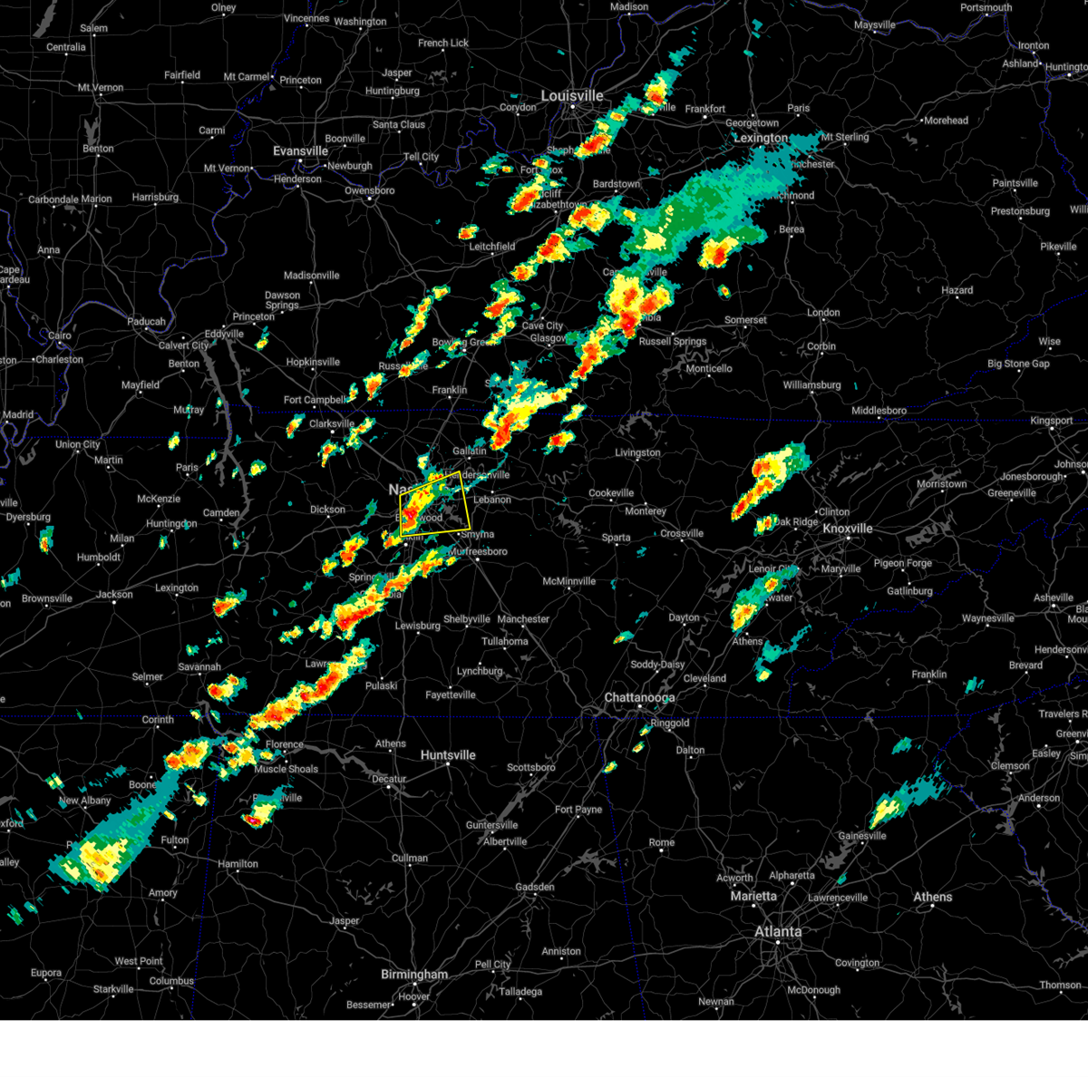 At 251 pm cdt, a severe thunderstorm was located over oak hill, or near nashville, moving east at 30 mph (radar indicated). Hazards include 60 mph wind gusts and half dollar size hail. Hail damage to vehicles is expected. expect wind damage to roofs, siding, and trees. locations impacted include, nashville, hendersonville, smyrna, brentwood, la vergne, mount juliet, nolensville, forest hills, oak hill, belle meade, lakewood, hermitage, rural hill, antioch, belinda city, old hickory, berry hill, green hill, and percy priest lake. this includes the following highways, interstate 40 between mile markers 201 and 227. interstate 65 between mile markers 71 and 90. Interstate 24 between mile markers 47 and 64. At 251 pm cdt, a severe thunderstorm was located over oak hill, or near nashville, moving east at 30 mph (radar indicated). Hazards include 60 mph wind gusts and half dollar size hail. Hail damage to vehicles is expected. expect wind damage to roofs, siding, and trees. locations impacted include, nashville, hendersonville, smyrna, brentwood, la vergne, mount juliet, nolensville, forest hills, oak hill, belle meade, lakewood, hermitage, rural hill, antioch, belinda city, old hickory, berry hill, green hill, and percy priest lake. this includes the following highways, interstate 40 between mile markers 201 and 227. interstate 65 between mile markers 71 and 90. Interstate 24 between mile markers 47 and 64.
|
| 9/24/2024 2:46 PM CDT |
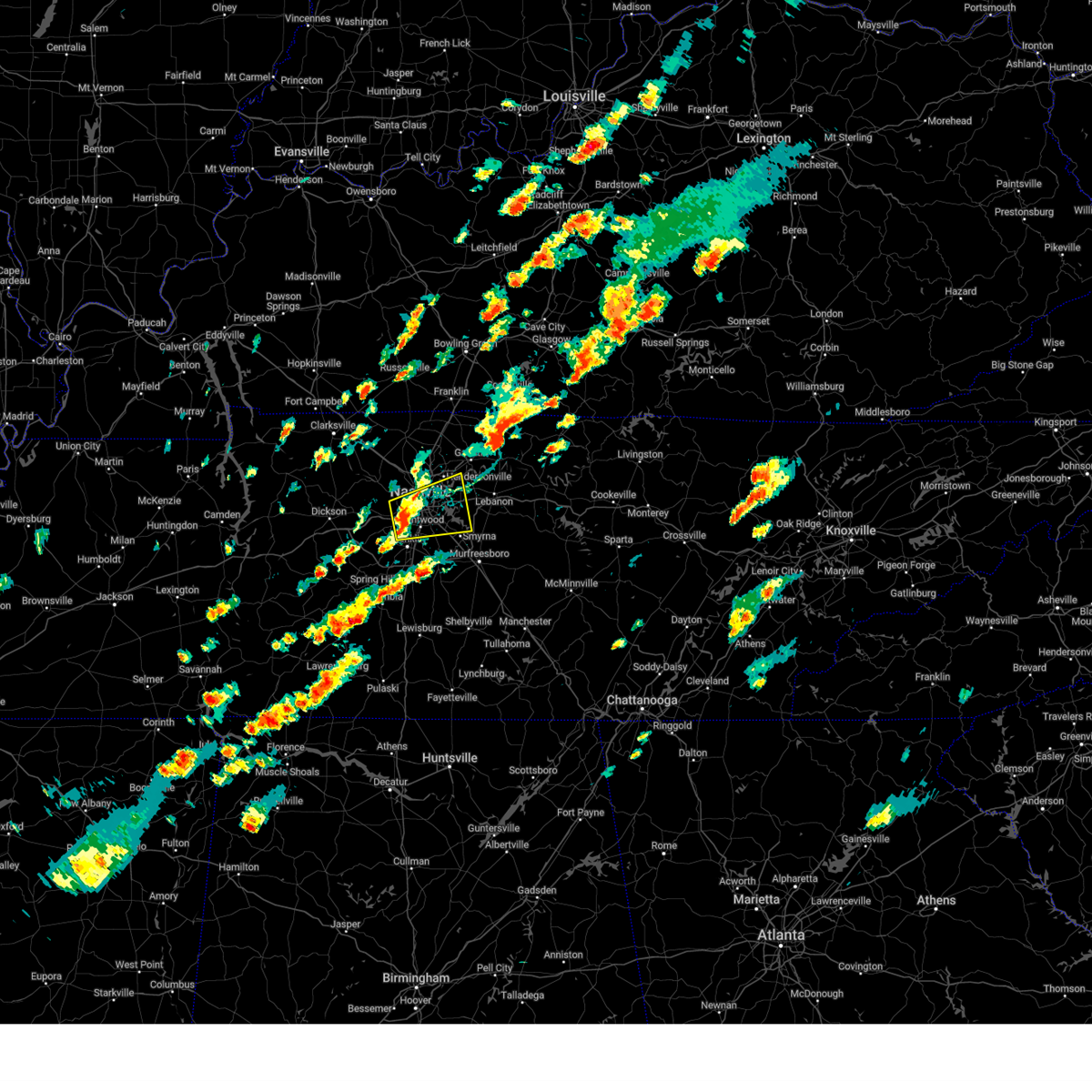 Svrohx the national weather service in nashville has issued a * severe thunderstorm warning for, davidson county in middle tennessee, northwestern rutherford county in middle tennessee, south central sumner county in middle tennessee, northeastern williamson county in middle tennessee, northwestern wilson county in middle tennessee, * until 330 pm cdt. * at 245 pm cdt, a severe thunderstorm was located over belle meade, or 7 miles southwest of nashville, moving east at 30 mph (radar indicated). Hazards include 60 mph wind gusts and quarter size hail. Hail damage to vehicles is expected. Expect wind damage to roofs, siding, and trees. Svrohx the national weather service in nashville has issued a * severe thunderstorm warning for, davidson county in middle tennessee, northwestern rutherford county in middle tennessee, south central sumner county in middle tennessee, northeastern williamson county in middle tennessee, northwestern wilson county in middle tennessee, * until 330 pm cdt. * at 245 pm cdt, a severe thunderstorm was located over belle meade, or 7 miles southwest of nashville, moving east at 30 mph (radar indicated). Hazards include 60 mph wind gusts and quarter size hail. Hail damage to vehicles is expected. Expect wind damage to roofs, siding, and trees.
|
| 9/24/2024 2:42 PM CDT | Multiple reports of trees down in the belle meade are in davidson county TN, 11 miles NNE of Nashville, TN |
| 9/24/2024 2:25 PM CDT |
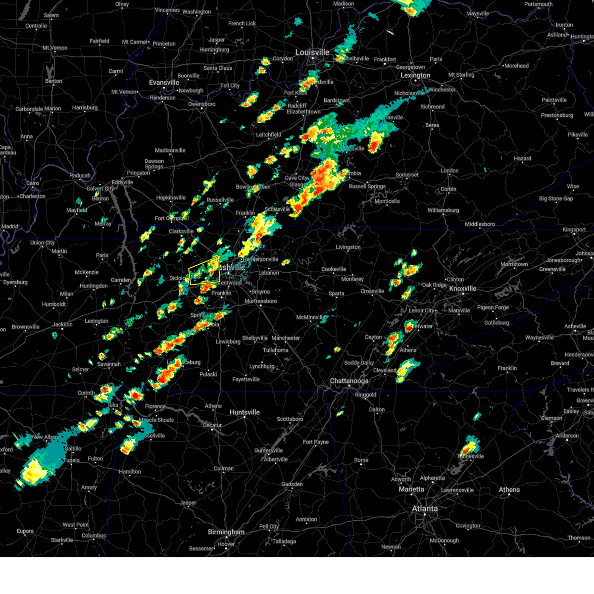 The storm which prompted the warning has weakened below severe limits, and no longer poses an immediate threat to life or property. therefore, the warning will be allowed to expire. a severe thunderstorm watch remains in effect until 700 pm cdt for middle tennessee. The storm which prompted the warning has weakened below severe limits, and no longer poses an immediate threat to life or property. therefore, the warning will be allowed to expire. a severe thunderstorm watch remains in effect until 700 pm cdt for middle tennessee.
|
| 9/24/2024 2:12 PM CDT |
 The storm which prompted the warning has weakened below severe limits, and no longer poses an immediate threat to life or property. therefore, the warning will be allowed to expire. a severe thunderstorm watch remains in effect until 700 pm cdt for middle tennessee. The storm which prompted the warning has weakened below severe limits, and no longer poses an immediate threat to life or property. therefore, the warning will be allowed to expire. a severe thunderstorm watch remains in effect until 700 pm cdt for middle tennessee.
|
| 9/24/2024 2:05 PM CDT |
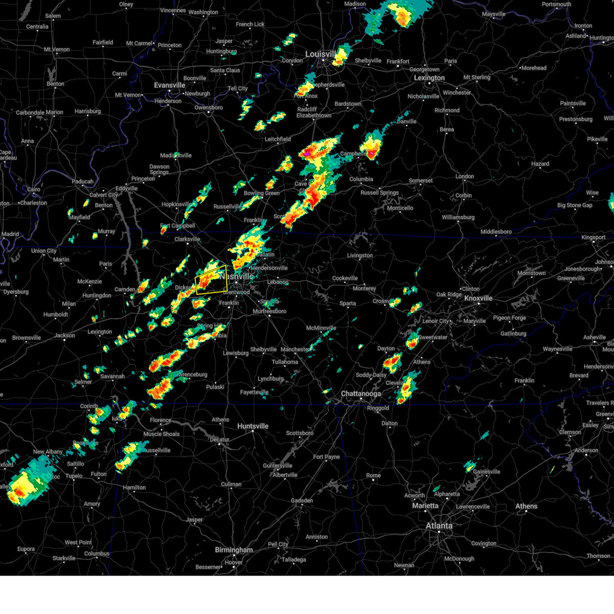 At 205 pm cdt, a severe thunderstorm was located near white bluff, or 9 miles southwest of ashland city, moving east at 35 mph (radar indicated). Hazards include 60 mph wind gusts and penny size hail. Expect damage to roofs, siding, and trees. locations impacted include, ashland city, white bluff, kingston springs, pegram, beaman park, and bells bend. This includes interstate 40 between mile markers 186 and 201. At 205 pm cdt, a severe thunderstorm was located near white bluff, or 9 miles southwest of ashland city, moving east at 35 mph (radar indicated). Hazards include 60 mph wind gusts and penny size hail. Expect damage to roofs, siding, and trees. locations impacted include, ashland city, white bluff, kingston springs, pegram, beaman park, and bells bend. This includes interstate 40 between mile markers 186 and 201.
|
| 9/24/2024 1:57 PM CDT |
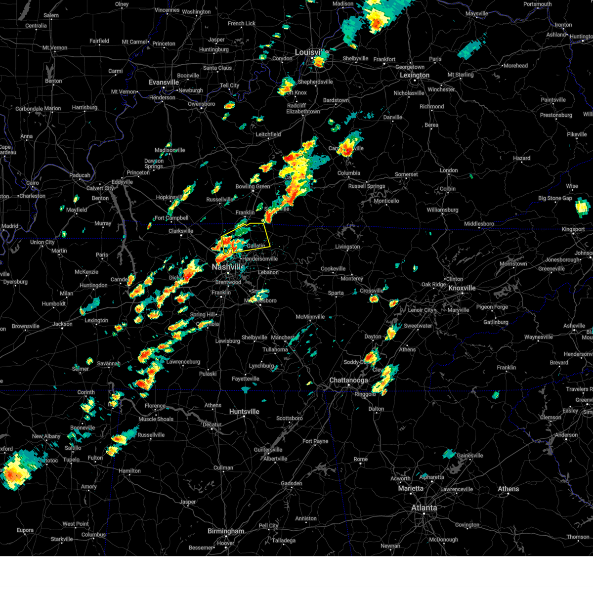 Svrohx the national weather service in nashville has issued a * severe thunderstorm warning for, sumner county in middle tennessee, eastern robertson county in middle tennessee, * until 230 pm cdt. * at 157 pm cdt, a severe thunderstorm was located near white house, or 7 miles east of springfield, moving northeast at 35 mph (radar indicated). Hazards include 60 mph wind gusts and penny size hail. expect damage to roofs, siding, and trees Svrohx the national weather service in nashville has issued a * severe thunderstorm warning for, sumner county in middle tennessee, eastern robertson county in middle tennessee, * until 230 pm cdt. * at 157 pm cdt, a severe thunderstorm was located near white house, or 7 miles east of springfield, moving northeast at 35 mph (radar indicated). Hazards include 60 mph wind gusts and penny size hail. expect damage to roofs, siding, and trees
|
| 9/24/2024 1:48 PM CDT |
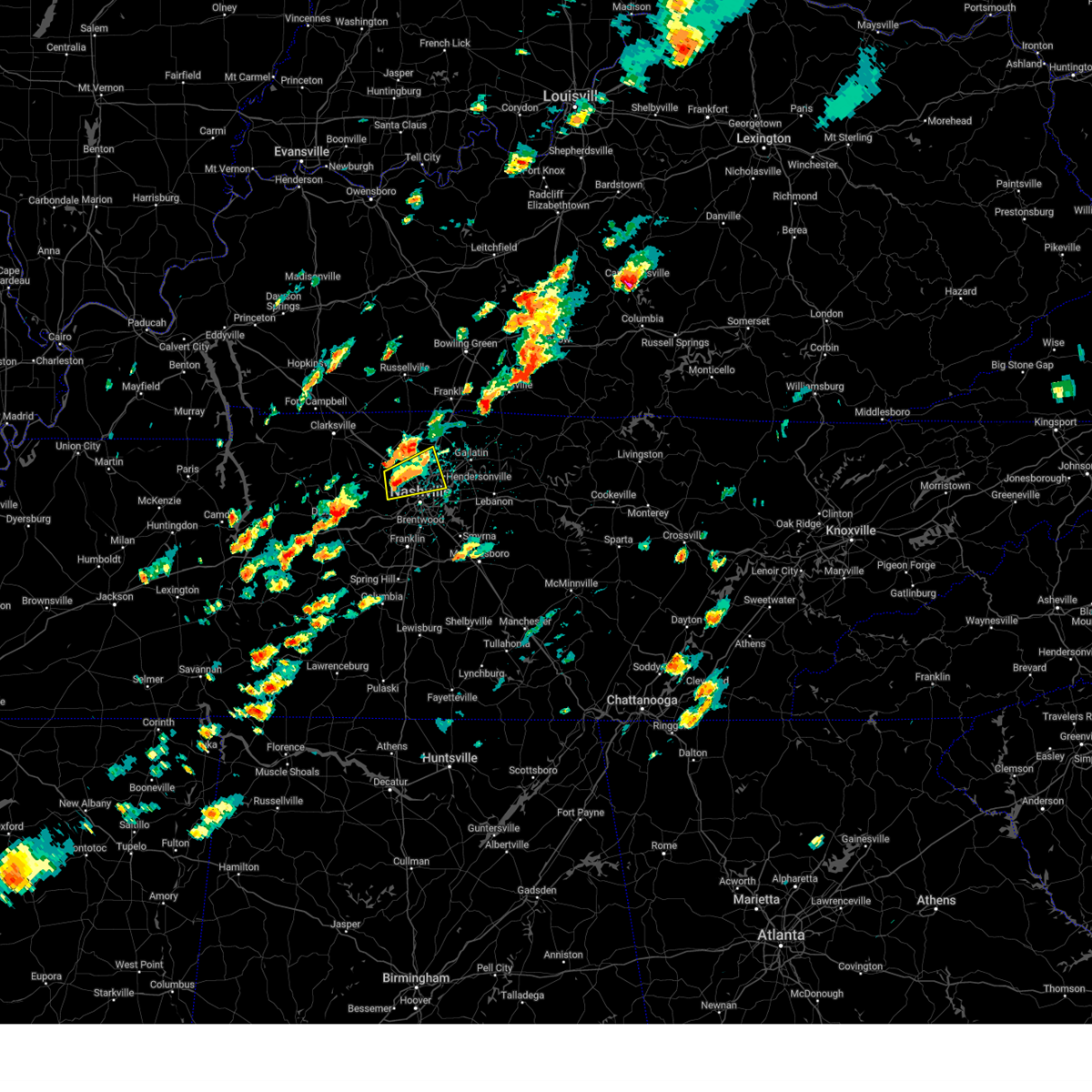 At 148 pm cdt, a severe thunderstorm was located near joelton, or near ashland city, moving northeast at 35 mph (radar indicated). Hazards include 60 mph wind gusts and quarter size hail. Hail damage to vehicles is expected. expect wind damage to roofs, siding, and trees. locations impacted include, ashland city, madison, hendersonville, goodlettsville, millersville, greenbrier, lakewood, ridgetop, old hickory, joelton, beaman park, and whites creek. this includes the following highways, interstate 65 between mile markers 88 and 106. Interstate 24 between mile markers 30 and 44. At 148 pm cdt, a severe thunderstorm was located near joelton, or near ashland city, moving northeast at 35 mph (radar indicated). Hazards include 60 mph wind gusts and quarter size hail. Hail damage to vehicles is expected. expect wind damage to roofs, siding, and trees. locations impacted include, ashland city, madison, hendersonville, goodlettsville, millersville, greenbrier, lakewood, ridgetop, old hickory, joelton, beaman park, and whites creek. this includes the following highways, interstate 65 between mile markers 88 and 106. Interstate 24 between mile markers 30 and 44.
|
| 9/24/2024 1:47 PM CDT |
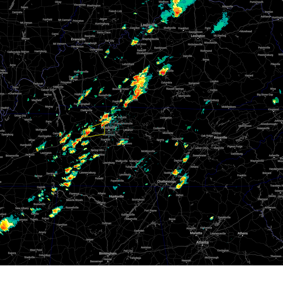 Svrohx the national weather service in nashville has issued a * severe thunderstorm warning for, northwestern davidson county in middle tennessee, southeastern dickson county in middle tennessee, southeastern cheatham county in middle tennessee, * until 230 pm cdt. * at 147 pm cdt, a severe thunderstorm was located near dickson, moving east at 35 mph (radar indicated). Hazards include 60 mph wind gusts and quarter size hail. Hail damage to vehicles is expected. Expect wind damage to roofs, siding, and trees. Svrohx the national weather service in nashville has issued a * severe thunderstorm warning for, northwestern davidson county in middle tennessee, southeastern dickson county in middle tennessee, southeastern cheatham county in middle tennessee, * until 230 pm cdt. * at 147 pm cdt, a severe thunderstorm was located near dickson, moving east at 35 mph (radar indicated). Hazards include 60 mph wind gusts and quarter size hail. Hail damage to vehicles is expected. Expect wind damage to roofs, siding, and trees.
|
| 9/24/2024 1:40 PM CDT |
 At 140 pm cdt, a severe thunderstorm was located over coopertown, or near springfield, moving northeast at 35 mph (radar indicated). Hazards include 60 mph wind gusts and penny size hail. Expect damage to roofs, siding, and trees. locations impacted include, springfield, white house, millersville, greenbrier, coopertown, ridgetop, cross plains, pleasant view, and orlinda. this includes the following highways, interstate 65 between mile markers 103 and 111. Interstate 24 between mile markers 24 and 31. At 140 pm cdt, a severe thunderstorm was located over coopertown, or near springfield, moving northeast at 35 mph (radar indicated). Hazards include 60 mph wind gusts and penny size hail. Expect damage to roofs, siding, and trees. locations impacted include, springfield, white house, millersville, greenbrier, coopertown, ridgetop, cross plains, pleasant view, and orlinda. this includes the following highways, interstate 65 between mile markers 103 and 111. Interstate 24 between mile markers 24 and 31.
|
| 9/24/2024 1:33 PM CDT |
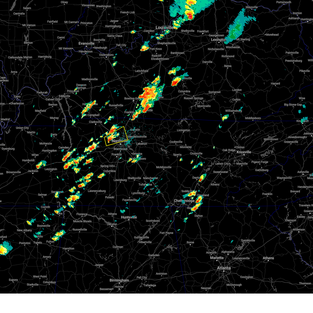 Svrohx the national weather service in nashville has issued a * severe thunderstorm warning for, northern davidson county in middle tennessee, southwestern sumner county in middle tennessee, eastern cheatham county in middle tennessee, southeastern robertson county in middle tennessee, * until 215 pm cdt. * at 133 pm cdt, a severe thunderstorm was located over ashland city, moving northeast at 35 mph (radar indicated). Hazards include 60 mph wind gusts and quarter size hail. Hail damage to vehicles is expected. Expect wind damage to roofs, siding, and trees. Svrohx the national weather service in nashville has issued a * severe thunderstorm warning for, northern davidson county in middle tennessee, southwestern sumner county in middle tennessee, eastern cheatham county in middle tennessee, southeastern robertson county in middle tennessee, * until 215 pm cdt. * at 133 pm cdt, a severe thunderstorm was located over ashland city, moving northeast at 35 mph (radar indicated). Hazards include 60 mph wind gusts and quarter size hail. Hail damage to vehicles is expected. Expect wind damage to roofs, siding, and trees.
|
| 9/24/2024 1:24 PM CDT |
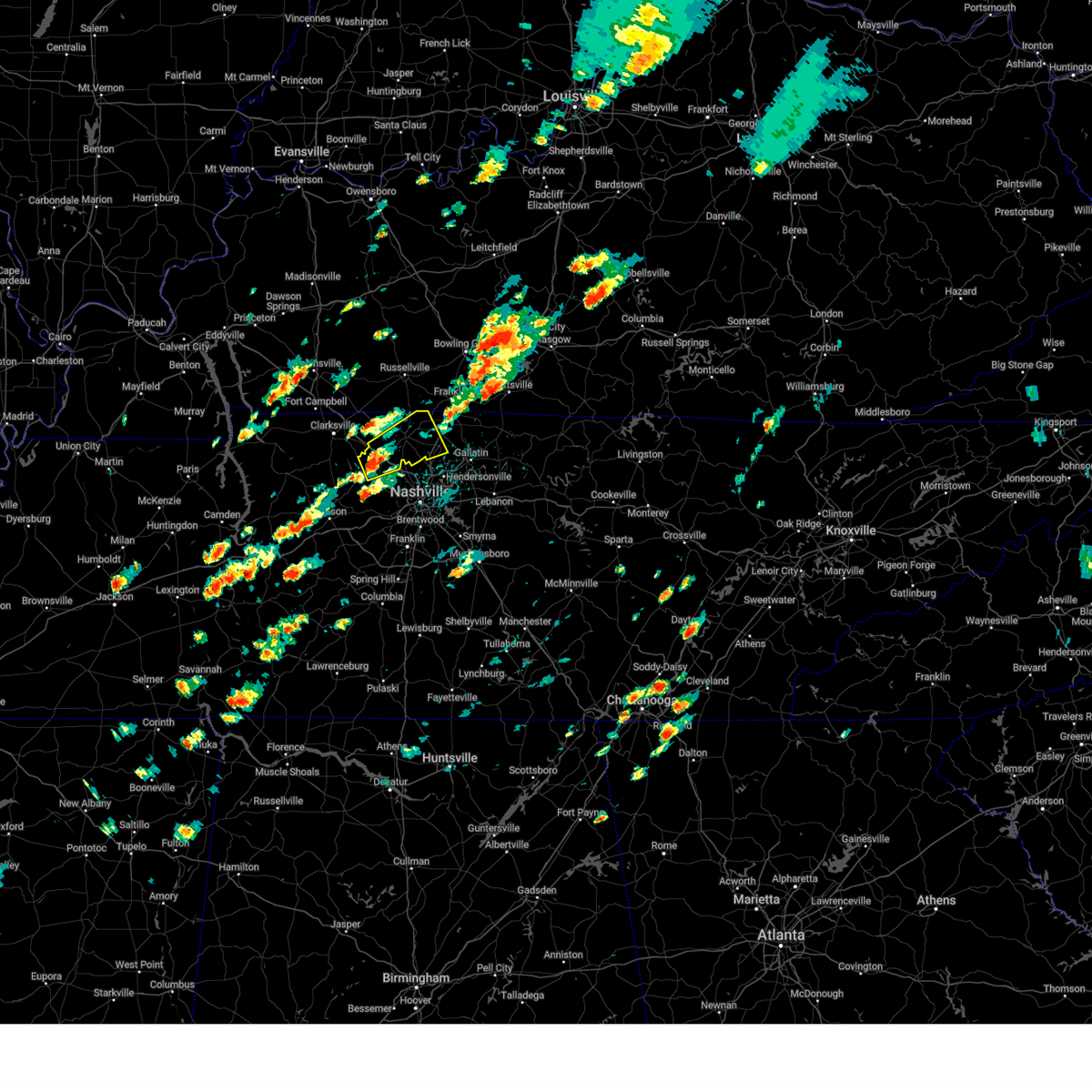 Svrohx the national weather service in nashville has issued a * severe thunderstorm warning for, west central sumner county in middle tennessee, northeastern cheatham county in middle tennessee, robertson county in middle tennessee, * until 200 pm cdt. * at 124 pm cdt, a severe thunderstorm was located near coopertown, or 9 miles north of ashland city, moving northeast at 35 mph (radar indicated). Hazards include 60 mph wind gusts and penny size hail. expect damage to roofs, siding, and trees Svrohx the national weather service in nashville has issued a * severe thunderstorm warning for, west central sumner county in middle tennessee, northeastern cheatham county in middle tennessee, robertson county in middle tennessee, * until 200 pm cdt. * at 124 pm cdt, a severe thunderstorm was located near coopertown, or 9 miles north of ashland city, moving northeast at 35 mph (radar indicated). Hazards include 60 mph wind gusts and penny size hail. expect damage to roofs, siding, and trees
|
| 8/17/2024 10:31 PM CDT |
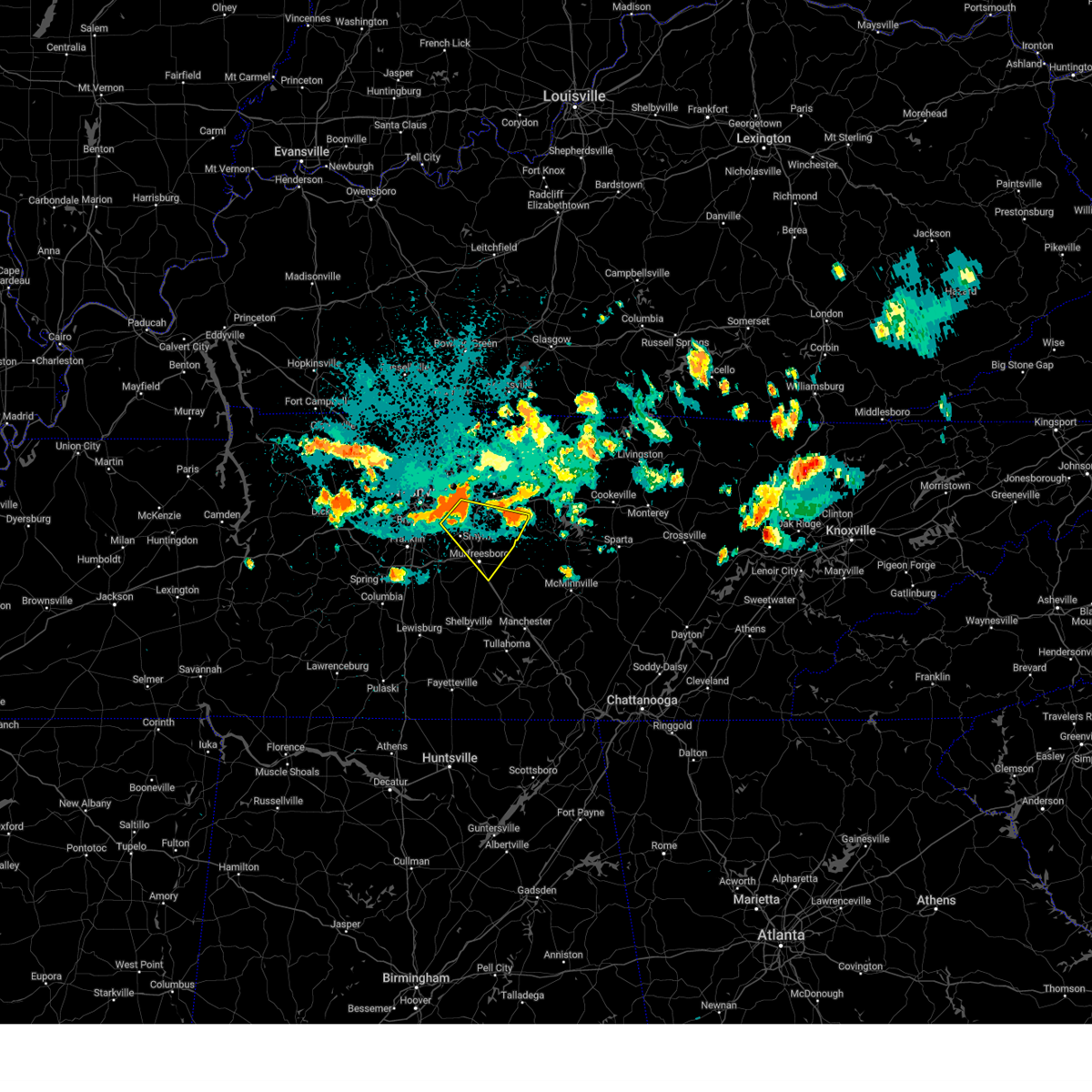 Svrohx the national weather service in nashville has issued a * severe thunderstorm warning for, southeastern davidson county in middle tennessee, central rutherford county in middle tennessee, southern wilson county in middle tennessee, * until 1100 pm cdt. * at 1030 pm cdt, a severe thunderstorm was located near la vergne, or 13 miles southwest of lebanon, moving southeast at 40 mph (radar indicated). Hazards include 60 mph wind gusts. expect damage to roofs, siding, and trees Svrohx the national weather service in nashville has issued a * severe thunderstorm warning for, southeastern davidson county in middle tennessee, central rutherford county in middle tennessee, southern wilson county in middle tennessee, * until 1100 pm cdt. * at 1030 pm cdt, a severe thunderstorm was located near la vergne, or 13 miles southwest of lebanon, moving southeast at 40 mph (radar indicated). Hazards include 60 mph wind gusts. expect damage to roofs, siding, and trees
|
| 8/17/2024 10:15 PM CDT | Tspotter report of trees down on juarez dr in hermitag in davidson county TN, 8 miles WNW of Nashville, TN |
| 8/17/2024 10:05 PM CDT | Tree snapped blocking 7th ave n behind the farmers marke in davidson county TN, 4.5 miles NNE of Nashville, TN |
| 8/17/2024 9:56 PM CDT |
 the severe thunderstorm warning has been cancelled and is no longer in effect the severe thunderstorm warning has been cancelled and is no longer in effect
|
| 8/17/2024 9:56 PM CDT |
 At 956 pm cdt, a severe thunderstorm was located near ridgetop, or 11 miles southeast of springfield, moving southeast at 25 mph (radar indicated). Hazards include 60 mph wind gusts and penny size hail. Expect damage to roofs, siding, and trees. locations impacted include, gallatin, madison, hendersonville, goodlettsville, millersville, lakewood, ridgetop, and old hickory. this includes the following highways, interstate 65 between mile markers 91 and 103. Interstate 24 between mile markers 37 and 39. At 956 pm cdt, a severe thunderstorm was located near ridgetop, or 11 miles southeast of springfield, moving southeast at 25 mph (radar indicated). Hazards include 60 mph wind gusts and penny size hail. Expect damage to roofs, siding, and trees. locations impacted include, gallatin, madison, hendersonville, goodlettsville, millersville, lakewood, ridgetop, and old hickory. this includes the following highways, interstate 65 between mile markers 91 and 103. Interstate 24 between mile markers 37 and 39.
|
| 8/17/2024 9:49 PM CDT |
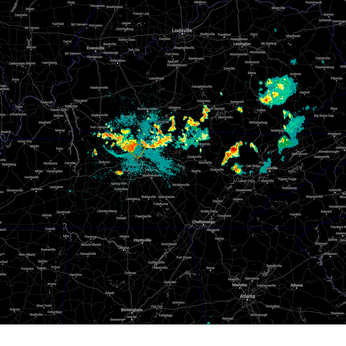 Svrohx the national weather service in nashville has issued a * severe thunderstorm warning for, northeastern davidson county in middle tennessee, southwestern sumner county in middle tennessee, south central robertson county in middle tennessee, * until 1015 pm cdt. * at 949 pm cdt, a severe thunderstorm was located over ridgetop, or 8 miles south of springfield, moving southeast at 25 mph (radar indicated). Hazards include 60 mph wind gusts and penny size hail. expect damage to roofs, siding, and trees Svrohx the national weather service in nashville has issued a * severe thunderstorm warning for, northeastern davidson county in middle tennessee, southwestern sumner county in middle tennessee, south central robertson county in middle tennessee, * until 1015 pm cdt. * at 949 pm cdt, a severe thunderstorm was located over ridgetop, or 8 miles south of springfield, moving southeast at 25 mph (radar indicated). Hazards include 60 mph wind gusts and penny size hail. expect damage to roofs, siding, and trees
|
| 8/1/2024 10:13 PM CDT |
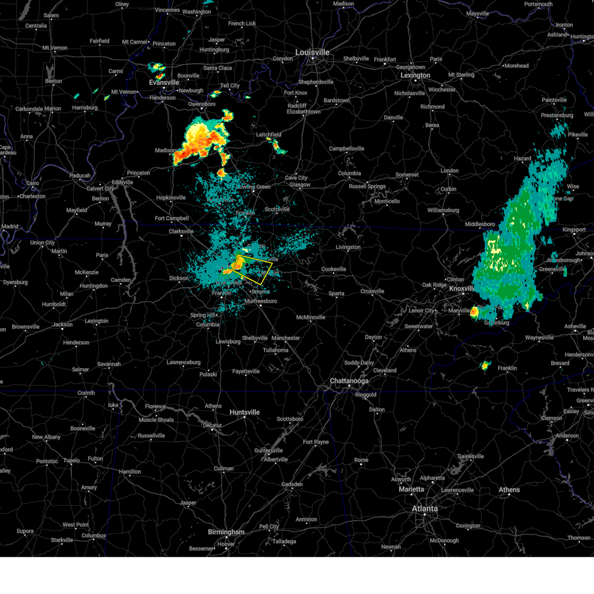 At 1013 pm cdt, a severe thunderstorm was located over lakewood, or 11 miles northeast of nashville, moving east at 30 mph (radar indicated). Hazards include 60 mph wind gusts. Expect damage to roofs, siding, and trees. locations impacted include, lebanon, hendersonville, mount juliet, lakewood, hermitage, old hickory, rural hill, belinda city, green hill, and gladeville. this includes the following highways, interstate 40 between mile markers 219 and 237. Interstate 840 between mile markers 67 and 76. At 1013 pm cdt, a severe thunderstorm was located over lakewood, or 11 miles northeast of nashville, moving east at 30 mph (radar indicated). Hazards include 60 mph wind gusts. Expect damage to roofs, siding, and trees. locations impacted include, lebanon, hendersonville, mount juliet, lakewood, hermitage, old hickory, rural hill, belinda city, green hill, and gladeville. this includes the following highways, interstate 40 between mile markers 219 and 237. Interstate 840 between mile markers 67 and 76.
|
| 8/1/2024 9:54 PM CDT |
 Svrohx the national weather service in nashville has issued a * severe thunderstorm warning for, northeastern davidson county in middle tennessee, southwestern sumner county in middle tennessee, northwestern wilson county in middle tennessee, * until 1030 pm cdt. * at 954 pm cdt, a severe thunderstorm was located over madison, or 8 miles north of nashville, moving east at 30 mph (radar indicated). Hazards include 60 mph wind gusts. expect damage to roofs, siding, and trees Svrohx the national weather service in nashville has issued a * severe thunderstorm warning for, northeastern davidson county in middle tennessee, southwestern sumner county in middle tennessee, northwestern wilson county in middle tennessee, * until 1030 pm cdt. * at 954 pm cdt, a severe thunderstorm was located over madison, or 8 miles north of nashville, moving east at 30 mph (radar indicated). Hazards include 60 mph wind gusts. expect damage to roofs, siding, and trees
|
| 7/30/2024 10:52 PM CDT | Tree and power lines down on barnes r in davidson county TN, 14.1 miles NNW of Nashville, TN |
| 7/30/2024 10:34 PM CDT |
 the severe thunderstorm warning has been cancelled and is no longer in effect the severe thunderstorm warning has been cancelled and is no longer in effect
|
| 7/30/2024 10:34 PM CDT |
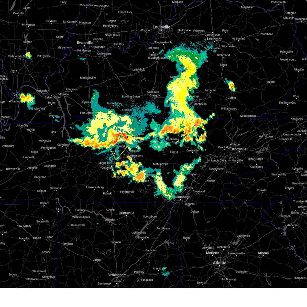 At 1034 pm cdt, a severe thunderstorm was located over nashville, moving southeast at 40 mph (radar indicated). Hazards include 60 mph wind gusts. Expect damage to roofs, siding, and trees. locations impacted include, franklin, nashville, brentwood, nolensville, forest hills, oak hill, belle meade, bellevue, antioch, berry hill, bells bend, and percy priest lake. this includes the following highways, interstate 40 between mile markers 194 and 220. interstate 65 between mile markers 59 and 92. interstate 24 between mile markers 43 and 62. Interstate 840 between mile markers 31 and 32. At 1034 pm cdt, a severe thunderstorm was located over nashville, moving southeast at 40 mph (radar indicated). Hazards include 60 mph wind gusts. Expect damage to roofs, siding, and trees. locations impacted include, franklin, nashville, brentwood, nolensville, forest hills, oak hill, belle meade, bellevue, antioch, berry hill, bells bend, and percy priest lake. this includes the following highways, interstate 40 between mile markers 194 and 220. interstate 65 between mile markers 59 and 92. interstate 24 between mile markers 43 and 62. Interstate 840 between mile markers 31 and 32.
|
| 7/30/2024 10:19 PM CDT |
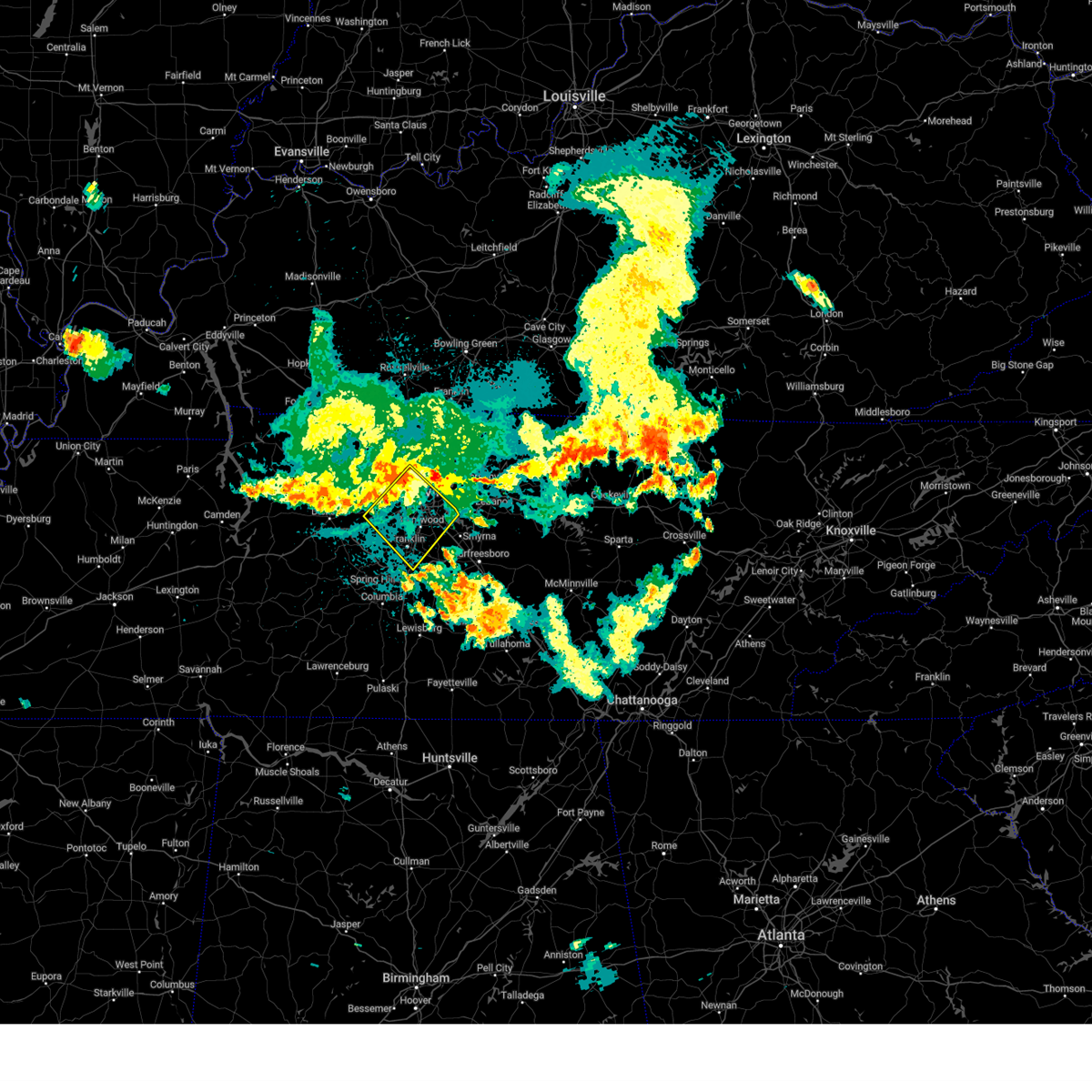 Svrohx the national weather service in nashville has issued a * severe thunderstorm warning for, davidson county in middle tennessee, northeastern williamson county in middle tennessee, southeastern cheatham county in middle tennessee, * until 1100 pm cdt. * at 1019 pm cdt, severe thunderstorms were located along a line extending from near joelton to pegram, moving southeast at 30 mph (radar indicated). Hazards include 70 mph wind gusts. Expect considerable tree damage. Damage is likely to mobile homes, roofs, and outbuildings. Svrohx the national weather service in nashville has issued a * severe thunderstorm warning for, davidson county in middle tennessee, northeastern williamson county in middle tennessee, southeastern cheatham county in middle tennessee, * until 1100 pm cdt. * at 1019 pm cdt, severe thunderstorms were located along a line extending from near joelton to pegram, moving southeast at 30 mph (radar indicated). Hazards include 70 mph wind gusts. Expect considerable tree damage. Damage is likely to mobile homes, roofs, and outbuildings.
|
| 7/30/2024 9:55 PM CDT |
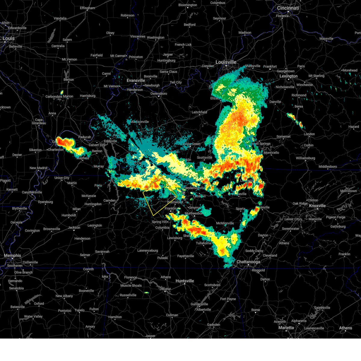 Svrohx the national weather service in nashville has issued a * severe thunderstorm warning for, western davidson county in middle tennessee, eastern dickson county in middle tennessee, northwestern williamson county in middle tennessee, cheatham county in middle tennessee, northeastern hickman county in middle tennessee, southwestern robertson county in middle tennessee, * until 1030 pm cdt. * at 954 pm cdt, severe thunderstorms were located along a line extending from near coopertown to charlotte, moving southeast at 30 mph (radar indicated). Hazards include 70 mph wind gusts and penny size hail. Expect considerable tree damage. Damage is likely to mobile homes, roofs, and outbuildings. Svrohx the national weather service in nashville has issued a * severe thunderstorm warning for, western davidson county in middle tennessee, eastern dickson county in middle tennessee, northwestern williamson county in middle tennessee, cheatham county in middle tennessee, northeastern hickman county in middle tennessee, southwestern robertson county in middle tennessee, * until 1030 pm cdt. * at 954 pm cdt, severe thunderstorms were located along a line extending from near coopertown to charlotte, moving southeast at 30 mph (radar indicated). Hazards include 70 mph wind gusts and penny size hail. Expect considerable tree damage. Damage is likely to mobile homes, roofs, and outbuildings.
|
| 7/30/2024 8:35 PM CDT | Tree fell onto house causing heavy damage at mcalpine and gallatin pik in davidson county TN, 1.6 miles WNW of Nashville, TN |
| 7/30/2024 8:35 PM CDT | Several trees down in inglewood including at riverwood and brush hill r in davidson county TN, 2 miles NW of Nashville, TN |
| 7/30/2024 7:41 PM CDT |
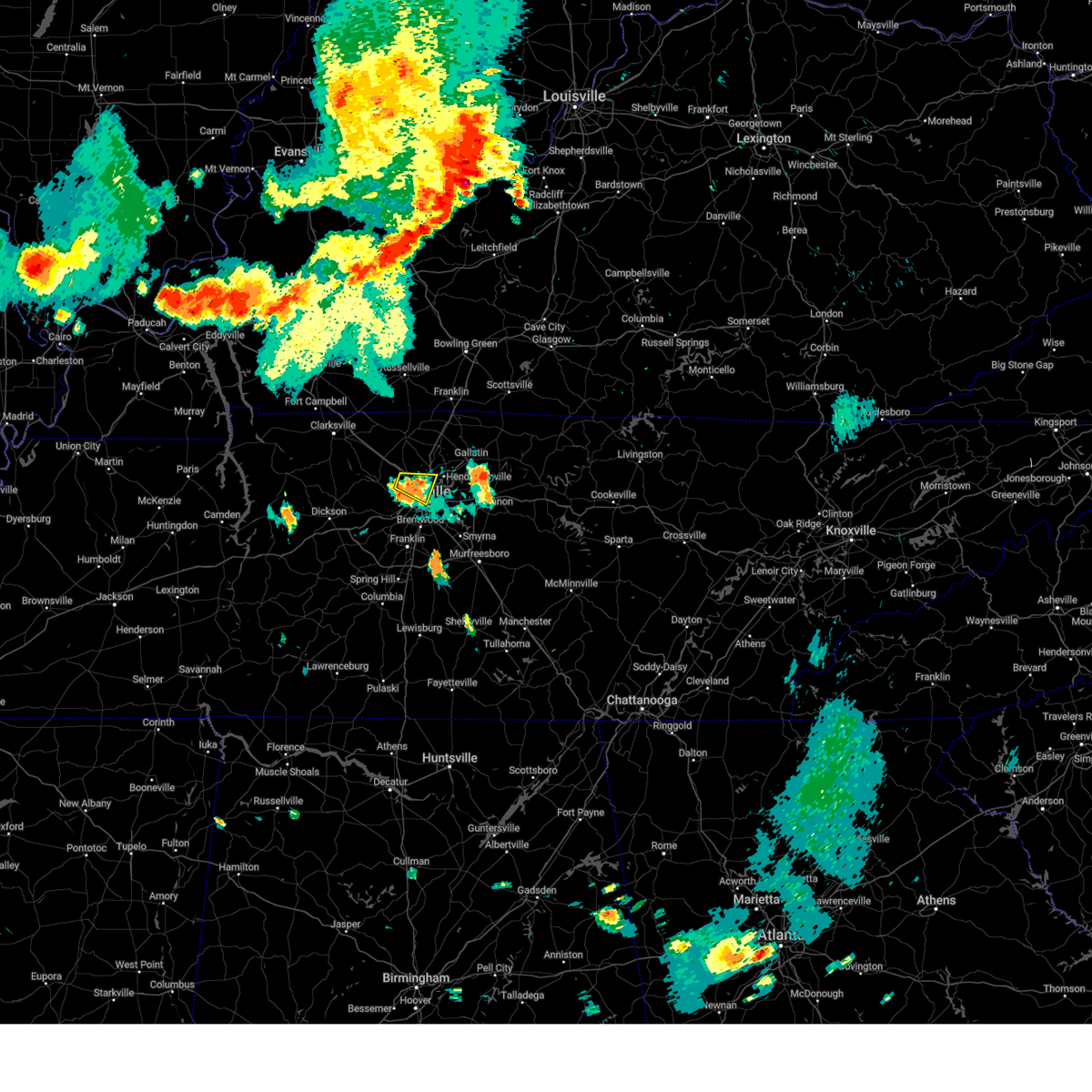 the severe thunderstorm warning has been cancelled and is no longer in effect the severe thunderstorm warning has been cancelled and is no longer in effect
|
| 7/30/2024 7:36 PM CDT |
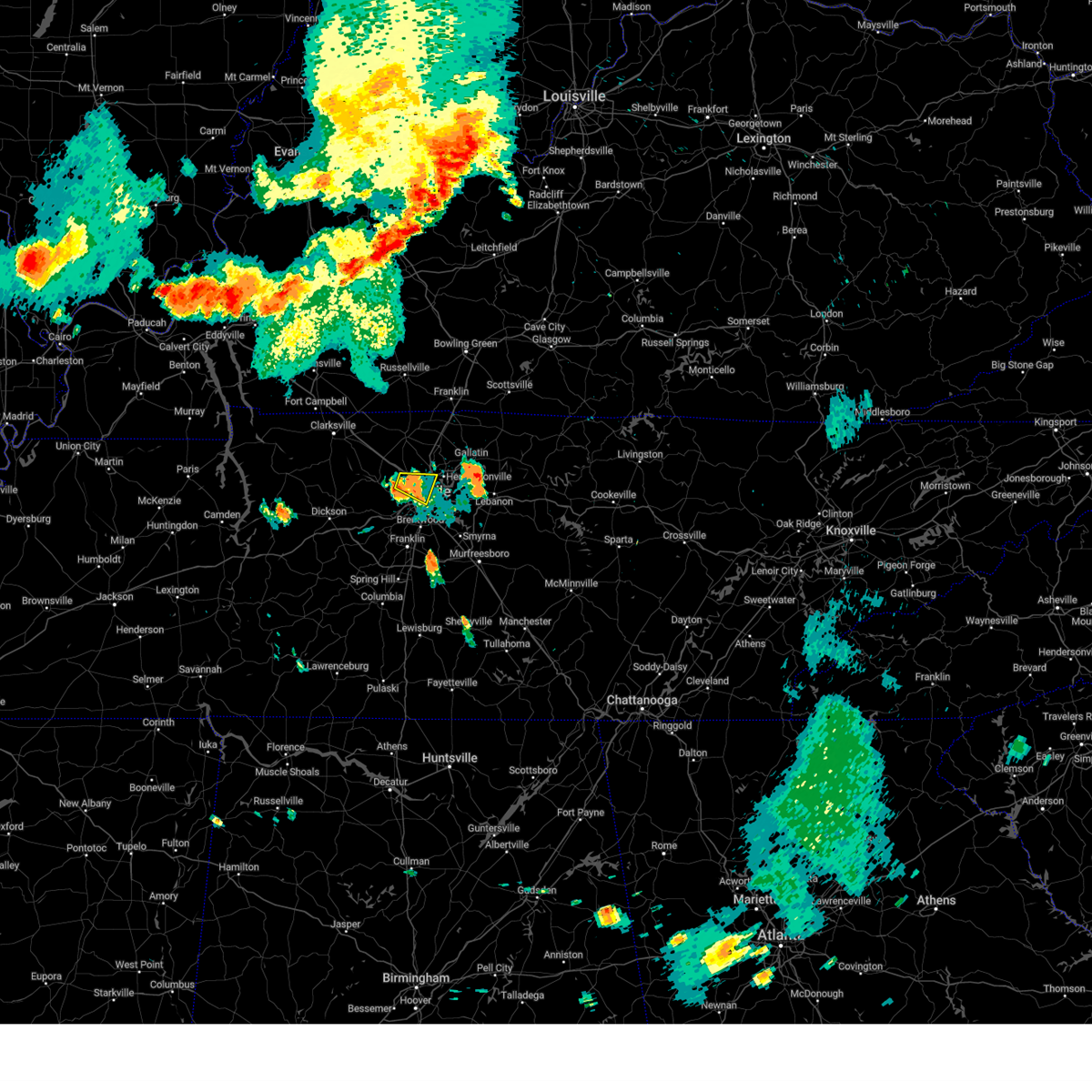 At 735 pm cdt, a severe thunderstorm was located 5 miles south of joelton, moving east at 5 mph (radar indicated). Hazards include 60 mph wind gusts and penny size hail. Expect damage to roofs, siding, and trees. locations impacted include, nashville, madison, goodlettsville, joelton, whites creek, and beaman park. this includes the following highways, interstate 65 between mile markers 85 and 96. Interstate 24 between mile markers 38 and 49. At 735 pm cdt, a severe thunderstorm was located 5 miles south of joelton, moving east at 5 mph (radar indicated). Hazards include 60 mph wind gusts and penny size hail. Expect damage to roofs, siding, and trees. locations impacted include, nashville, madison, goodlettsville, joelton, whites creek, and beaman park. this includes the following highways, interstate 65 between mile markers 85 and 96. Interstate 24 between mile markers 38 and 49.
|
| 7/30/2024 7:21 PM CDT | Svrohx the national weather service in nashville has issued a * severe thunderstorm warning for, northwestern davidson county in middle tennessee, * until 800 pm cdt. * at 721 pm cdt, a severe thunderstorm was located over joelton, or 9 miles northwest of nashville, moving east at 5 mph (radar indicated). Hazards include 60 mph wind gusts and quarter size hail. Hail damage to vehicles is expected. Expect wind damage to roofs, siding, and trees. |
| 7/30/2024 7:00 PM CDT | Trees down at clay lick rd and i-2 in davidson county TN, 7.5 miles SSE of Nashville, TN |
| 7/30/2024 6:57 PM CDT | Svrohx the national weather service in nashville has issued a * severe thunderstorm warning for, northern davidson county in middle tennessee, southwestern sumner county in middle tennessee, south central robertson county in middle tennessee, * until 730 pm cdt. * at 656 pm cdt, a severe thunderstorms were located over joelton, or 9 miles northwest of nashville, moving southeast at 5 mph. another severe thunderstorm was located over goodlettsville, moving southeast at 5 mph (radar indicated). Hazards include 60 mph wind gusts and quarter size hail. Hail damage to vehicles is expected. Expect wind damage to roofs, siding, and trees. |
| 7/30/2024 6:52 PM CDT | Tspotter report of trees down on bear hollow road. also small hai in davidson county TN, 8.5 miles SE of Nashville, TN |
| 7/30/2024 3:42 PM CDT |
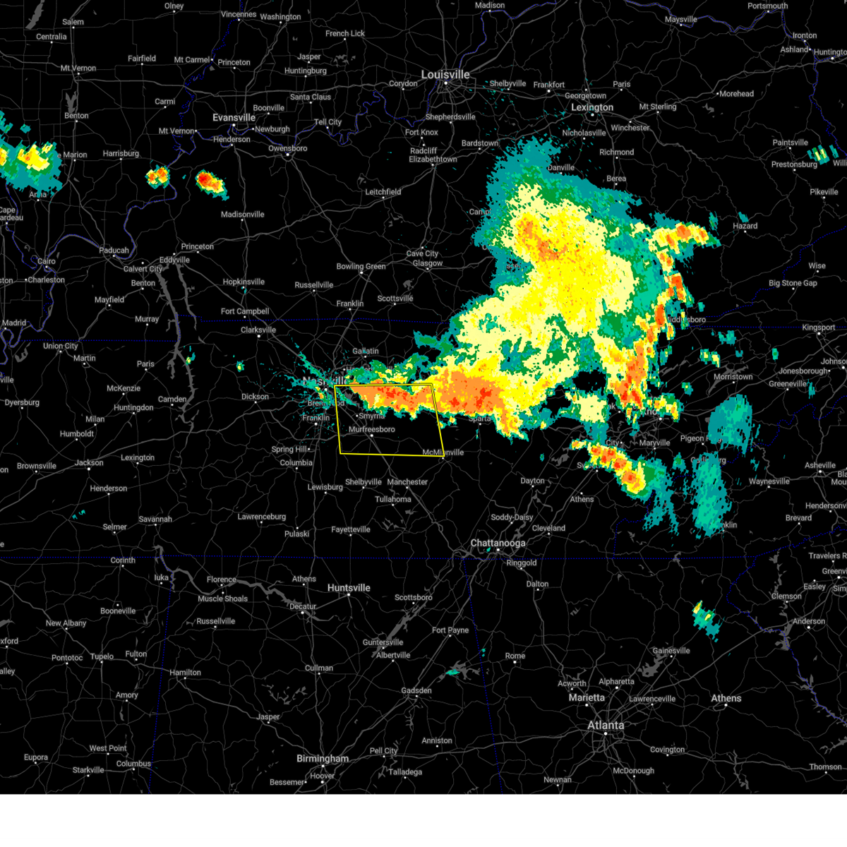 Svrohx the national weather service in nashville has issued a * severe thunderstorm warning for, southwestern smith county in middle tennessee, southeastern davidson county in middle tennessee, western de kalb county in middle tennessee, rutherford county in middle tennessee, northwestern warren county in middle tennessee, east central williamson county in middle tennessee, wilson county in middle tennessee, cannon county in middle tennessee, * until 430 pm cdt. * at 342 pm cdt, severe thunderstorms were located along a line extending from percy priest lake to alexandria, moving south at 40 mph (radar indicated). Hazards include 60 mph wind gusts and quarter size hail. Hail damage to vehicles is expected. Expect wind damage to roofs, siding, and trees. Svrohx the national weather service in nashville has issued a * severe thunderstorm warning for, southwestern smith county in middle tennessee, southeastern davidson county in middle tennessee, western de kalb county in middle tennessee, rutherford county in middle tennessee, northwestern warren county in middle tennessee, east central williamson county in middle tennessee, wilson county in middle tennessee, cannon county in middle tennessee, * until 430 pm cdt. * at 342 pm cdt, severe thunderstorms were located along a line extending from percy priest lake to alexandria, moving south at 40 mph (radar indicated). Hazards include 60 mph wind gusts and quarter size hail. Hail damage to vehicles is expected. Expect wind damage to roofs, siding, and trees.
|
| 7/30/2024 3:38 PM CDT |
 At 337 pm cdt, severe thunderstorms were located along a line extending from near baxter to near rural hill, moving southeast at 40 mph (radar indicated). Hazards include 60 mph wind gusts and quarter size hail. Hail damage to vehicles is expected. expect wind damage to roofs, siding, and trees. locations impacted include, lebanon, carthage, mount juliet, watertown, gordonsville, rural hill, belinda city, hickman, south carthage, alexandria, green hill, tuckers crossroads, cedars of lebanon state park, center hill lake, gladeville, and edgar evins state park. this includes the following highways, interstate 40 between mile markers 224 and 267. Interstate 840 between mile markers 67 and 76. At 337 pm cdt, severe thunderstorms were located along a line extending from near baxter to near rural hill, moving southeast at 40 mph (radar indicated). Hazards include 60 mph wind gusts and quarter size hail. Hail damage to vehicles is expected. expect wind damage to roofs, siding, and trees. locations impacted include, lebanon, carthage, mount juliet, watertown, gordonsville, rural hill, belinda city, hickman, south carthage, alexandria, green hill, tuckers crossroads, cedars of lebanon state park, center hill lake, gladeville, and edgar evins state park. this includes the following highways, interstate 40 between mile markers 224 and 267. Interstate 840 between mile markers 67 and 76.
|
| 7/30/2024 3:38 PM CDT |
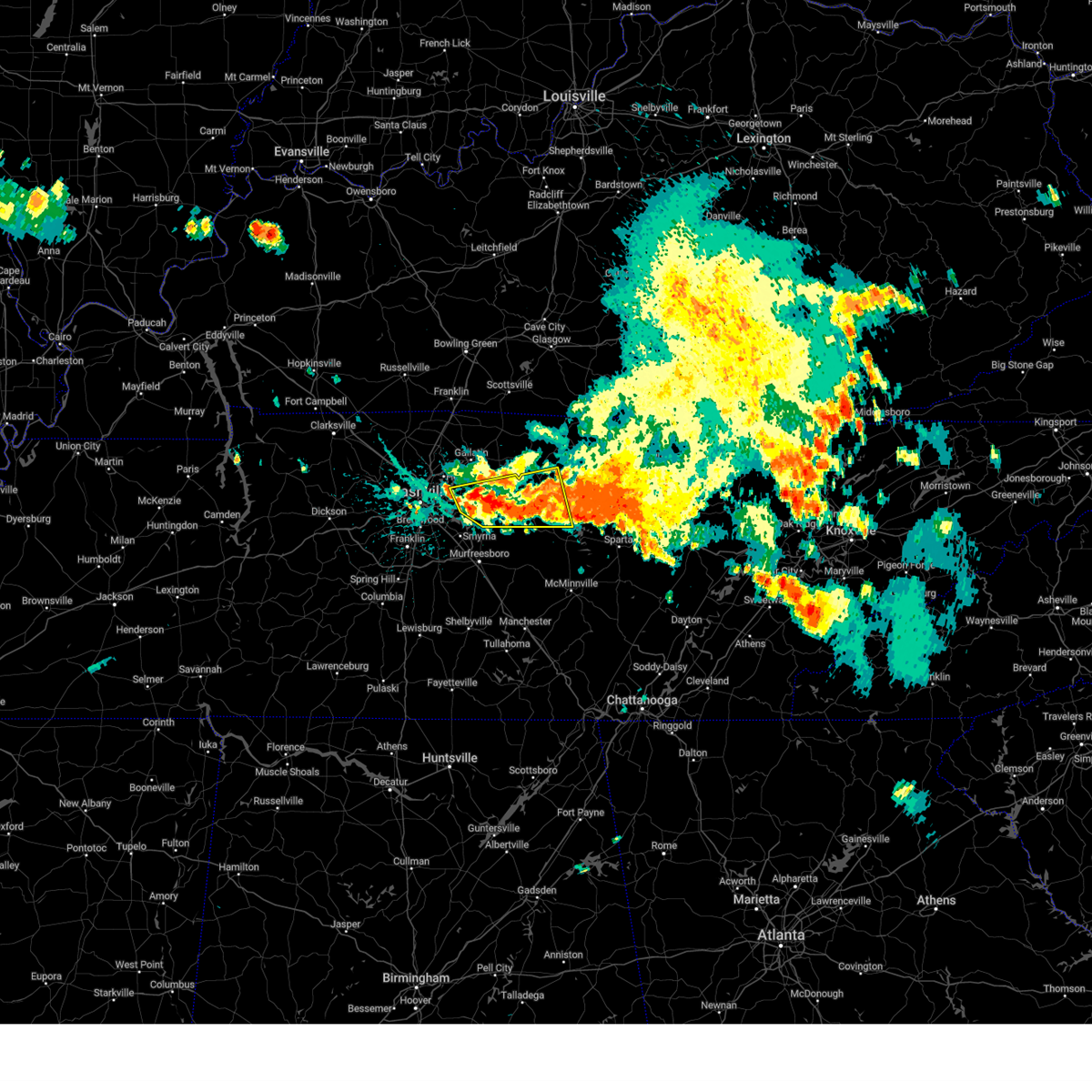 the severe thunderstorm warning has been cancelled and is no longer in effect the severe thunderstorm warning has been cancelled and is no longer in effect
|
| 7/30/2024 3:02 PM CDT |
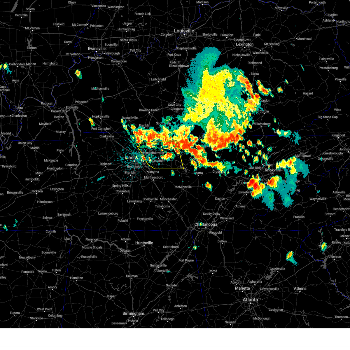 Svrohx the national weather service in nashville has issued a * severe thunderstorm warning for, smith county in middle tennessee, northwestern de kalb county in middle tennessee, southern sumner county in middle tennessee, wilson county in middle tennessee, southwestern macon county in middle tennessee, trousdale county in middle tennessee, * until 400 pm cdt. * at 302 pm cdt, severe thunderstorms were located along a line extending from red boiling springs to near white house, moving southeast at 30 mph (radar indicated). Hazards include 60 mph wind gusts and quarter size hail. Hail damage to vehicles is expected. Expect wind damage to roofs, siding, and trees. Svrohx the national weather service in nashville has issued a * severe thunderstorm warning for, smith county in middle tennessee, northwestern de kalb county in middle tennessee, southern sumner county in middle tennessee, wilson county in middle tennessee, southwestern macon county in middle tennessee, trousdale county in middle tennessee, * until 400 pm cdt. * at 302 pm cdt, severe thunderstorms were located along a line extending from red boiling springs to near white house, moving southeast at 30 mph (radar indicated). Hazards include 60 mph wind gusts and quarter size hail. Hail damage to vehicles is expected. Expect wind damage to roofs, siding, and trees.
|
| 7/29/2024 1:49 PM CDT |
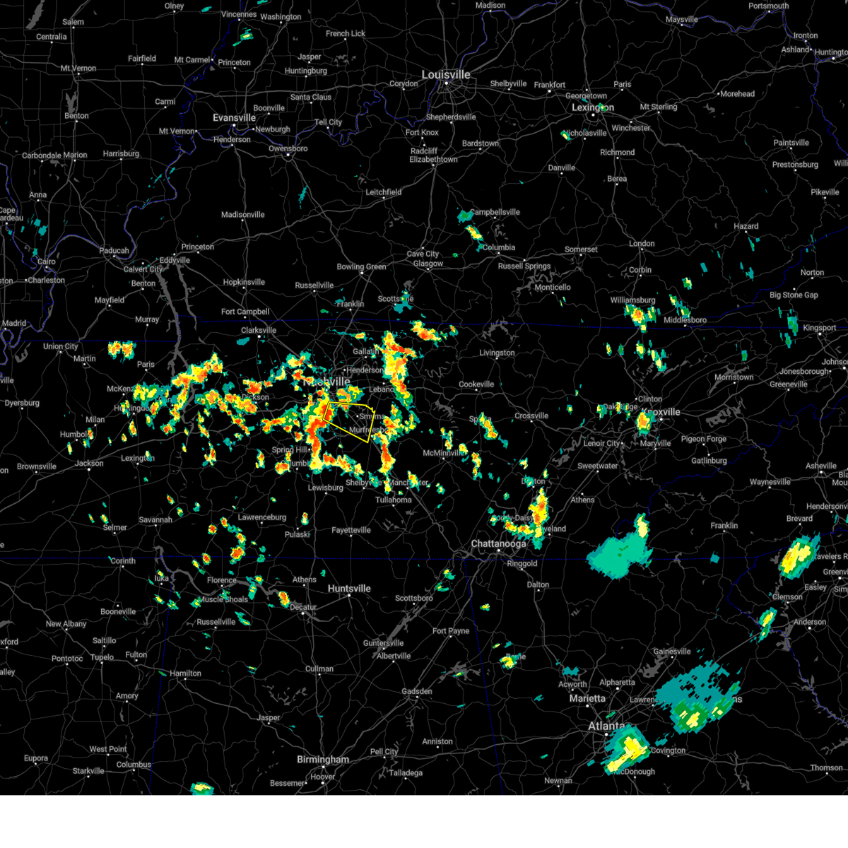 Svrohx the national weather service in nashville has issued a * severe thunderstorm warning for, southeastern davidson county in middle tennessee, northwestern rutherford county in middle tennessee, northeastern williamson county in middle tennessee, * until 230 pm cdt. * at 149 pm cdt, a severe thunderstorm was located over brentwood, or 7 miles northeast of franklin, moving east at 30 mph (radar indicated). Hazards include 60 mph wind gusts. expect damage to roofs, siding, and trees Svrohx the national weather service in nashville has issued a * severe thunderstorm warning for, southeastern davidson county in middle tennessee, northwestern rutherford county in middle tennessee, northeastern williamson county in middle tennessee, * until 230 pm cdt. * at 149 pm cdt, a severe thunderstorm was located over brentwood, or 7 miles northeast of franklin, moving east at 30 mph (radar indicated). Hazards include 60 mph wind gusts. expect damage to roofs, siding, and trees
|
| 7/4/2024 6:23 PM CDT |
 The storm which prompted the warning has weakened below severe limits, and no longer poses an immediate threat to life or property. therefore, the warning will be allowed to expire. The storm which prompted the warning has weakened below severe limits, and no longer poses an immediate threat to life or property. therefore, the warning will be allowed to expire.
|
| 7/4/2024 6:17 PM CDT |
 At 616 pm cdt, a severe thunderstorm was located near greenbrier, or near springfield, moving southeast at 20 mph (trained weather spotters). Hazards include 60 mph wind gusts. Expect damage to roofs, siding, and trees. locations impacted include, springfield, hendersonville, goodlettsville, white house, millersville, greenbrier, ridgetop, cross plains, and cottontown. This includes interstate 65 between mile markers 100 and 112. At 616 pm cdt, a severe thunderstorm was located near greenbrier, or near springfield, moving southeast at 20 mph (trained weather spotters). Hazards include 60 mph wind gusts. Expect damage to roofs, siding, and trees. locations impacted include, springfield, hendersonville, goodlettsville, white house, millersville, greenbrier, ridgetop, cross plains, and cottontown. This includes interstate 65 between mile markers 100 and 112.
|
| 7/4/2024 5:59 PM CDT |
 Svrohx the national weather service in nashville has issued a * severe thunderstorm warning for, western sumner county in middle tennessee, central robertson county in middle tennessee, * until 630 pm cdt. * at 559 pm cdt, a severe thunderstorm was located near springfield, moving east at 30 mph (radar indicated). Hazards include 60 mph wind gusts. expect damage to roofs, siding, and trees Svrohx the national weather service in nashville has issued a * severe thunderstorm warning for, western sumner county in middle tennessee, central robertson county in middle tennessee, * until 630 pm cdt. * at 559 pm cdt, a severe thunderstorm was located near springfield, moving east at 30 mph (radar indicated). Hazards include 60 mph wind gusts. expect damage to roofs, siding, and trees
|
| 6/26/2024 5:13 PM CDT | Facebook report of tree snapped on garland driv in wilson county TN, 9.9 miles W of Nashville, TN |
| 6/26/2024 5:13 PM CDT |
 At 512 pm cdt, severe thunderstorms were located along a line extending from millersville to rural hill, moving northeast at 35 mph (radar indicated). Hazards include 60 mph wind gusts. Expect damage to roofs, siding, and trees. locations impacted include, gallatin, lebanon, madison, hendersonville, smyrna, la vergne, mount juliet, goodlettsville, white house, millersville, greenbrier, lakewood, ridgetop, cross plains, hermitage, rural hill, belinda city, old hickory, orlinda, and green hill. this includes the following highways, interstate 40 between mile markers 219 and 242. interstate 65 between mile markers 92 and 118. Interstate 840 between mile markers 64 and 76. At 512 pm cdt, severe thunderstorms were located along a line extending from millersville to rural hill, moving northeast at 35 mph (radar indicated). Hazards include 60 mph wind gusts. Expect damage to roofs, siding, and trees. locations impacted include, gallatin, lebanon, madison, hendersonville, smyrna, la vergne, mount juliet, goodlettsville, white house, millersville, greenbrier, lakewood, ridgetop, cross plains, hermitage, rural hill, belinda city, old hickory, orlinda, and green hill. this includes the following highways, interstate 40 between mile markers 219 and 242. interstate 65 between mile markers 92 and 118. Interstate 840 between mile markers 64 and 76.
|
| 6/26/2024 5:11 PM CDT | Facebook video of a tree snapped on luree lan in davidson county TN, 7.8 miles WNW of Nashville, TN |
| 6/26/2024 5:08 PM CDT | Tspotter report of a tree and powerline down at andrew jackson and weber drive in hermitage. power outages reported. time estimated via rada in davidson county TN, 8.4 miles WNW of Nashville, TN |
| 6/26/2024 5:03 PM CDT | Downed trees reported near donelson pike and i-40. time estimate in davidson county TN, 7.8 miles NW of Nashville, TN |
| 6/26/2024 5:01 PM CDT | Corrects previous tstm wnd dmg report from 4 n antioch. downburst reported at bna along hangar lane. these strong winds knocked over temporary construction signs along in davidson county TN, 8.7 miles NNW of Nashville, TN |
| 6/26/2024 4:58 PM CDT | Tspotter report of a large tree branch downed at a residence near shelby park in east nashville. time estimated via rada in davidson county TN, 4.4 miles NNW of Nashville, TN |
| 6/26/2024 4:56 PM CDT |
 Svrohx the national weather service in nashville has issued a * severe thunderstorm warning for, eastern davidson county in middle tennessee, northwestern rutherford county in middle tennessee, western sumner county in middle tennessee, western wilson county in middle tennessee, eastern robertson county in middle tennessee, * until 530 pm cdt. * at 456 pm cdt, severe thunderstorms were located along a line extending from near joelton to la vergne, moving northeast at 35 mph (radar indicated). Hazards include 60 mph wind gusts. expect damage to roofs, siding, and trees Svrohx the national weather service in nashville has issued a * severe thunderstorm warning for, eastern davidson county in middle tennessee, northwestern rutherford county in middle tennessee, western sumner county in middle tennessee, western wilson county in middle tennessee, eastern robertson county in middle tennessee, * until 530 pm cdt. * at 456 pm cdt, severe thunderstorms were located along a line extending from near joelton to la vergne, moving northeast at 35 mph (radar indicated). Hazards include 60 mph wind gusts. expect damage to roofs, siding, and trees
|
| 6/26/2024 4:52 PM CDT | Social media report of a downed tree in crieve hall. time estimated via rada in davidson county TN, 8.7 miles NNW of Nashville, TN |
| 6/26/2024 4:47 PM CDT |
 At 447 pm cdt, severe thunderstorms were located along a line extending from west nashville to smyrna, moving northeast at 35 mph (radar indicated). Hazards include 60 mph wind gusts. Expect damage to roofs, siding, and trees. locations impacted include, murfreesboro, franklin, nashville, madison, smyrna, brentwood, la vergne, nolensville, forest hills, oak hill, belle meade, bellevue, antioch, walterhill, berry hill, bells bend, whites creek, triune, and percy priest lake. this includes the following highways, interstate 40 between mile markers 197 and 220. interstate 65 between mile markers 68 and 93. interstate 24 between mile markers 38 and 74. Interstate 840 between mile markers 39 and 49, and between mile markers 56 and 61. At 447 pm cdt, severe thunderstorms were located along a line extending from west nashville to smyrna, moving northeast at 35 mph (radar indicated). Hazards include 60 mph wind gusts. Expect damage to roofs, siding, and trees. locations impacted include, murfreesboro, franklin, nashville, madison, smyrna, brentwood, la vergne, nolensville, forest hills, oak hill, belle meade, bellevue, antioch, walterhill, berry hill, bells bend, whites creek, triune, and percy priest lake. this includes the following highways, interstate 40 between mile markers 197 and 220. interstate 65 between mile markers 68 and 93. interstate 24 between mile markers 38 and 74. Interstate 840 between mile markers 39 and 49, and between mile markers 56 and 61.
|
| 6/26/2024 4:31 PM CDT |
 Svrohx the national weather service in nashville has issued a * severe thunderstorm warning for, davidson county in middle tennessee, northwestern rutherford county in middle tennessee, eastern williamson county in middle tennessee, * until 500 pm cdt. * at 430 pm cdt, severe thunderstorms were located along a line extending from near bellevue to thompson's station, moving northeast at 40 mph (radar indicated). Hazards include 60 mph wind gusts. expect damage to roofs, siding, and trees Svrohx the national weather service in nashville has issued a * severe thunderstorm warning for, davidson county in middle tennessee, northwestern rutherford county in middle tennessee, eastern williamson county in middle tennessee, * until 500 pm cdt. * at 430 pm cdt, severe thunderstorms were located along a line extending from near bellevue to thompson's station, moving northeast at 40 mph (radar indicated). Hazards include 60 mph wind gusts. expect damage to roofs, siding, and trees
|
| 6/16/2024 8:51 PM CDT |
 The storm which prompted the warning has weakened below severe limits, and no longer poses an immediate threat to life or property. therefore, the warning will be allowed to expire. however, gusty winds are still possible with this thunderstorm. The storm which prompted the warning has weakened below severe limits, and no longer poses an immediate threat to life or property. therefore, the warning will be allowed to expire. however, gusty winds are still possible with this thunderstorm.
|
| 6/16/2024 8:44 PM CDT |
 At 843 pm cdt, a severe thunderstorm was located over hendersonville, or 11 miles southwest of gallatin, moving north at 25 mph (radar indicated). Hazards include 60 mph wind gusts. Expect damage to roofs, siding, and trees. locations impacted include, gallatin, madison, hendersonville, mount juliet, goodlettsville, millersville, lakewood, old hickory, and green hill. This includes interstate 65 between mile markers 90 and 100. At 843 pm cdt, a severe thunderstorm was located over hendersonville, or 11 miles southwest of gallatin, moving north at 25 mph (radar indicated). Hazards include 60 mph wind gusts. Expect damage to roofs, siding, and trees. locations impacted include, gallatin, madison, hendersonville, mount juliet, goodlettsville, millersville, lakewood, old hickory, and green hill. This includes interstate 65 between mile markers 90 and 100.
|
| 6/16/2024 8:34 PM CDT |
 Svrohx the national weather service in nashville has issued a * severe thunderstorm warning for, northeastern davidson county in middle tennessee, southwestern sumner county in middle tennessee, northwestern wilson county in middle tennessee, * until 900 pm cdt. * at 833 pm cdt, a severe thunderstorm was located over old hickory, or 10 miles northeast of nashville, moving north at 30 mph (radar indicated). Hazards include 60 mph wind gusts. expect damage to roofs, siding, and trees Svrohx the national weather service in nashville has issued a * severe thunderstorm warning for, northeastern davidson county in middle tennessee, southwestern sumner county in middle tennessee, northwestern wilson county in middle tennessee, * until 900 pm cdt. * at 833 pm cdt, a severe thunderstorm was located over old hickory, or 10 miles northeast of nashville, moving north at 30 mph (radar indicated). Hazards include 60 mph wind gusts. expect damage to roofs, siding, and trees
|
| 5/26/2024 10:40 PM CDT |
 At 1040 pm cdt, severe thunderstorms were located along a line extending from adairville, kentucky to near clarksville to near paris landing state park, moving southeast at 40 mph (radar indicated). Hazards include 60 mph wind gusts and quarter size hail. Hail damage to vehicles is expected. expect wind damage to roofs, siding, and trees. locations impacted include, clarksville, springfield, dover, erin, white house, millersville, greenbrier, coopertown, ridgetop, cross plains, tennessee ridge, big rock, pleasant view, orlinda, adams, cedar hill, cumberland city, palmyra, woodlawn, and land between the lakes. this includes the following highways, interstate 65 between mile markers 105 and 121. Interstate 24 between mile markers 1 and 26. At 1040 pm cdt, severe thunderstorms were located along a line extending from adairville, kentucky to near clarksville to near paris landing state park, moving southeast at 40 mph (radar indicated). Hazards include 60 mph wind gusts and quarter size hail. Hail damage to vehicles is expected. expect wind damage to roofs, siding, and trees. locations impacted include, clarksville, springfield, dover, erin, white house, millersville, greenbrier, coopertown, ridgetop, cross plains, tennessee ridge, big rock, pleasant view, orlinda, adams, cedar hill, cumberland city, palmyra, woodlawn, and land between the lakes. this includes the following highways, interstate 65 between mile markers 105 and 121. Interstate 24 between mile markers 1 and 26.
|
| 5/26/2024 10:00 PM CDT |
 Svrohx the national weather service in nashville has issued a * severe thunderstorm warning for, montgomery county in middle tennessee, stewart county in middle tennessee, northern houston county in middle tennessee, northwestern cheatham county in middle tennessee, robertson county in middle tennessee, * until 1100 pm cdt. * at 959 pm cdt, severe thunderstorms were located along a line extending from lewisburg, kentucky to near the land between the lakes, moving southeast at 40 mph (radar indicated). Hazards include 60 mph wind gusts and quarter size hail. Hail damage to vehicles is expected. Expect wind damage to roofs, siding, and trees. Svrohx the national weather service in nashville has issued a * severe thunderstorm warning for, montgomery county in middle tennessee, stewart county in middle tennessee, northern houston county in middle tennessee, northwestern cheatham county in middle tennessee, robertson county in middle tennessee, * until 1100 pm cdt. * at 959 pm cdt, severe thunderstorms were located along a line extending from lewisburg, kentucky to near the land between the lakes, moving southeast at 40 mph (radar indicated). Hazards include 60 mph wind gusts and quarter size hail. Hail damage to vehicles is expected. Expect wind damage to roofs, siding, and trees.
|
| 5/26/2024 3:25 PM CDT |
 the severe thunderstorm warning has been cancelled and is no longer in effect the severe thunderstorm warning has been cancelled and is no longer in effect
|
| 5/26/2024 3:25 PM CDT |
 At 324 pm cdt, a severe thunderstorm was located near nolensville, or 10 miles east of franklin, moving east at 40 mph (radar indicated). Hazards include 60 mph wind gusts and quarter size hail. Hail damage to vehicles is expected. expect wind damage to roofs, siding, and trees. locations impacted include, franklin, smyrna, brentwood, la vergne, and nolensville. this includes the following highways, interstate 65 between mile markers 63 and 72. Interstate 24 between mile markers 66 and 70. At 324 pm cdt, a severe thunderstorm was located near nolensville, or 10 miles east of franklin, moving east at 40 mph (radar indicated). Hazards include 60 mph wind gusts and quarter size hail. Hail damage to vehicles is expected. expect wind damage to roofs, siding, and trees. locations impacted include, franklin, smyrna, brentwood, la vergne, and nolensville. this includes the following highways, interstate 65 between mile markers 63 and 72. Interstate 24 between mile markers 66 and 70.
|
| 5/26/2024 3:15 PM CDT |
 At 315 pm cdt, a severe thunderstorm was located over franklin, moving east at 35 mph (radar indicated). Hazards include golf ball size hail and 60 mph wind gusts. People and animals outdoors will be injured. expect hail damage to roofs, siding, windows, and vehicles. expect wind damage to roofs, siding, and trees. locations impacted include, franklin, smyrna, brentwood, la vergne, nolensville, forest hills, oak hill, antioch, leipers fork, percy priest lake, and natchez trace at highway 96. this includes the following highways, interstate 65 between mile markers 63 and 78. Interstate 24 between mile markers 55 and 70. At 315 pm cdt, a severe thunderstorm was located over franklin, moving east at 35 mph (radar indicated). Hazards include golf ball size hail and 60 mph wind gusts. People and animals outdoors will be injured. expect hail damage to roofs, siding, windows, and vehicles. expect wind damage to roofs, siding, and trees. locations impacted include, franklin, smyrna, brentwood, la vergne, nolensville, forest hills, oak hill, antioch, leipers fork, percy priest lake, and natchez trace at highway 96. this includes the following highways, interstate 65 between mile markers 63 and 78. Interstate 24 between mile markers 55 and 70.
|
| 5/26/2024 3:06 PM CDT |
 At 306 pm cdt, a severe thunderstorm was located near franklin, moving east at 30 mph (radar indicated). Hazards include golf ball size hail and 60 mph wind gusts. People and animals outdoors will be injured. expect hail damage to roofs, siding, windows, and vehicles. expect wind damage to roofs, siding, and trees. locations impacted include, franklin, nashville, hendersonville, smyrna, brentwood, la vergne, nolensville, forest hills, oak hill, belle meade, lakewood, hermitage, bellevue, antioch, fairview, old hickory, berry hill, natchez trace at highway 96, leipers fork, and percy priest lake. this includes the following highways, interstate 40 between mile markers 195 and 198, and between mile markers 205 and 222. interstate 65 between mile markers 63 and 86. Interstate 24 between mile markers 47 and 70. At 306 pm cdt, a severe thunderstorm was located near franklin, moving east at 30 mph (radar indicated). Hazards include golf ball size hail and 60 mph wind gusts. People and animals outdoors will be injured. expect hail damage to roofs, siding, windows, and vehicles. expect wind damage to roofs, siding, and trees. locations impacted include, franklin, nashville, hendersonville, smyrna, brentwood, la vergne, nolensville, forest hills, oak hill, belle meade, lakewood, hermitage, bellevue, antioch, fairview, old hickory, berry hill, natchez trace at highway 96, leipers fork, and percy priest lake. this includes the following highways, interstate 40 between mile markers 195 and 198, and between mile markers 205 and 222. interstate 65 between mile markers 63 and 86. Interstate 24 between mile markers 47 and 70.
|
| 5/26/2024 3:06 PM CDT |
 the severe thunderstorm warning has been cancelled and is no longer in effect the severe thunderstorm warning has been cancelled and is no longer in effect
|
| 5/26/2024 2:56 PM CDT |
 Svrohx the national weather service in nashville has issued a * severe thunderstorm warning for, davidson county in middle tennessee, northwestern rutherford county in middle tennessee, williamson county in middle tennessee, south central cheatham county in middle tennessee, * until 345 pm cdt. * at 255 pm cdt, a severe thunderstorm was located near fairview, or 10 miles west of franklin, moving east at 35 mph (radar indicated). Hazards include golf ball size hail and 60 mph wind gusts. People and animals outdoors will be injured. expect hail damage to roofs, siding, windows, and vehicles. Expect wind damage to roofs, siding, and trees. Svrohx the national weather service in nashville has issued a * severe thunderstorm warning for, davidson county in middle tennessee, northwestern rutherford county in middle tennessee, williamson county in middle tennessee, south central cheatham county in middle tennessee, * until 345 pm cdt. * at 255 pm cdt, a severe thunderstorm was located near fairview, or 10 miles west of franklin, moving east at 35 mph (radar indicated). Hazards include golf ball size hail and 60 mph wind gusts. People and animals outdoors will be injured. expect hail damage to roofs, siding, windows, and vehicles. Expect wind damage to roofs, siding, and trees.
|
| 5/26/2024 2:49 PM CDT |
 At 249 pm cdt, a severe thunderstorm was located over fairview, or 12 miles west of franklin, moving east at 35 mph (radar indicated). Hazards include golf ball size hail and 60 mph wind gusts. People and animals outdoors will be injured. expect hail damage to roofs, siding, windows, and vehicles. expect wind damage to roofs, siding, and trees. locations impacted include, franklin, ashland city, kingston springs, pegram, fairview, bellevue, and natchez trace at highway 96. this includes the following highways, interstate 40 between mile markers 178 and 198. Interstate 840 between mile markers 1 and 13. At 249 pm cdt, a severe thunderstorm was located over fairview, or 12 miles west of franklin, moving east at 35 mph (radar indicated). Hazards include golf ball size hail and 60 mph wind gusts. People and animals outdoors will be injured. expect hail damage to roofs, siding, windows, and vehicles. expect wind damage to roofs, siding, and trees. locations impacted include, franklin, ashland city, kingston springs, pegram, fairview, bellevue, and natchez trace at highway 96. this includes the following highways, interstate 40 between mile markers 178 and 198. Interstate 840 between mile markers 1 and 13.
|
| 5/26/2024 2:48 PM CDT |
 At 248 pm cdt, severe thunderstorms were located along a line extending from near lafayette to near franklin, moving east at 50 mph (radar indicated). Hazards include 60 mph wind gusts and nickel size hail. Expect damage to roofs, siding, and trees. locations impacted include, murfreesboro, franklin, lebanon, hartsville, nashville, hendersonville, smyrna, brentwood, la vergne, mount juliet, nolensville, forest hills, oak hill, belle meade, kingston springs, lakewood, pegram, hermitage, fairview, and walterhill. this includes the following highways, interstate 40 between mile markers 182 and 243. interstate 65 between mile markers 67 and 87. interstate 24 between mile markers 47 and 71. Interstate 840 between mile markers 56 and 76. At 248 pm cdt, severe thunderstorms were located along a line extending from near lafayette to near franklin, moving east at 50 mph (radar indicated). Hazards include 60 mph wind gusts and nickel size hail. Expect damage to roofs, siding, and trees. locations impacted include, murfreesboro, franklin, lebanon, hartsville, nashville, hendersonville, smyrna, brentwood, la vergne, mount juliet, nolensville, forest hills, oak hill, belle meade, kingston springs, lakewood, pegram, hermitage, fairview, and walterhill. this includes the following highways, interstate 40 between mile markers 182 and 243. interstate 65 between mile markers 67 and 87. interstate 24 between mile markers 47 and 71. Interstate 840 between mile markers 56 and 76.
|
| 5/26/2024 2:48 PM CDT |
 the severe thunderstorm warning has been cancelled and is no longer in effect the severe thunderstorm warning has been cancelled and is no longer in effect
|
| 5/26/2024 2:35 PM CDT |
 At 234 pm cdt, a severe thunderstorm was located near fairview, or 9 miles southeast of dickson, moving east at 35 mph (radar indicated). Hazards include ping pong ball size hail and 60 mph wind gusts. People and animals outdoors will be injured. expect hail damage to roofs, siding, windows, and vehicles. expect wind damage to roofs, siding, and trees. locations impacted include, franklin, dickson, ashland city, white bluff, kingston springs, pegram, burns, fairview, bellevue, bon aqua, lyles, and natchez trace at highway 96. this includes the following highways, interstate 40 between mile markers 169 and 198. Interstate 840 between mile markers 1 and 13. At 234 pm cdt, a severe thunderstorm was located near fairview, or 9 miles southeast of dickson, moving east at 35 mph (radar indicated). Hazards include ping pong ball size hail and 60 mph wind gusts. People and animals outdoors will be injured. expect hail damage to roofs, siding, windows, and vehicles. expect wind damage to roofs, siding, and trees. locations impacted include, franklin, dickson, ashland city, white bluff, kingston springs, pegram, burns, fairview, bellevue, bon aqua, lyles, and natchez trace at highway 96. this includes the following highways, interstate 40 between mile markers 169 and 198. Interstate 840 between mile markers 1 and 13.
|
| 5/26/2024 2:33 PM CDT |
 At 233 pm cdt, severe thunderstorms were located along a line extending from near westmoreland to near fairview, moving east at 50 mph (radar indicated). Hazards include 60 mph wind gusts and nickel size hail. Expect damage to roofs, siding, and trees. locations impacted include, murfreesboro, franklin, gallatin, lebanon, lafayette, hartsville, nashville, madison, hendersonville, smyrna, brentwood, la vergne, mount juliet, goodlettsville, nolensville, forest hills, oak hill, belle meade, kingston springs, and lakewood. this includes the following highways, interstate 40 between mile markers 182 and 243. interstate 65 between mile markers 67 and 95. interstate 24 between mile markers 41 and 71. Interstate 840 between mile markers 56 and 76. At 233 pm cdt, severe thunderstorms were located along a line extending from near westmoreland to near fairview, moving east at 50 mph (radar indicated). Hazards include 60 mph wind gusts and nickel size hail. Expect damage to roofs, siding, and trees. locations impacted include, murfreesboro, franklin, gallatin, lebanon, lafayette, hartsville, nashville, madison, hendersonville, smyrna, brentwood, la vergne, mount juliet, goodlettsville, nolensville, forest hills, oak hill, belle meade, kingston springs, and lakewood. this includes the following highways, interstate 40 between mile markers 182 and 243. interstate 65 between mile markers 67 and 95. interstate 24 between mile markers 41 and 71. Interstate 840 between mile markers 56 and 76.
|
| 5/26/2024 2:18 PM CDT |
 At 218 pm cdt, severe thunderstorms were located along a line extending from 7 miles southwest of westmoreland to near burns, moving east at 50 mph (radar indicated). Hazards include 60 mph wind gusts and nickel size hail. Expect damage to roofs, siding, and trees. locations impacted include, murfreesboro, franklin, gallatin, lebanon, ashland city, lafayette, hartsville, nashville, madison, hendersonville, smyrna, brentwood, la vergne, mount juliet, goodlettsville, millersville, nolensville, forest hills, oak hill, and belle meade. this includes the following highways, interstate 40 between mile markers 182 and 243. interstate 65 between mile markers 67 and 101. interstate 24 between mile markers 33 and 71. Interstate 840 between mile markers 56 and 76. At 218 pm cdt, severe thunderstorms were located along a line extending from 7 miles southwest of westmoreland to near burns, moving east at 50 mph (radar indicated). Hazards include 60 mph wind gusts and nickel size hail. Expect damage to roofs, siding, and trees. locations impacted include, murfreesboro, franklin, gallatin, lebanon, ashland city, lafayette, hartsville, nashville, madison, hendersonville, smyrna, brentwood, la vergne, mount juliet, goodlettsville, millersville, nolensville, forest hills, oak hill, and belle meade. this includes the following highways, interstate 40 between mile markers 182 and 243. interstate 65 between mile markers 67 and 101. interstate 24 between mile markers 33 and 71. Interstate 840 between mile markers 56 and 76.
|
| 5/26/2024 2:18 PM CDT |
 the severe thunderstorm warning has been cancelled and is no longer in effect the severe thunderstorm warning has been cancelled and is no longer in effect
|
| 5/26/2024 2:17 PM CDT |
 Svrohx the national weather service in nashville has issued a * severe thunderstorm warning for, southwestern davidson county in middle tennessee, southern dickson county in middle tennessee, northwestern williamson county in middle tennessee, southeastern cheatham county in middle tennessee, northeastern hickman county in middle tennessee, * until 300 pm cdt. * at 216 pm cdt, a severe thunderstorm was located 7 miles southwest of dickson, moving east at 35 mph (radar indicated). Hazards include 60 mph wind gusts and quarter size hail. Hail damage to vehicles is expected. Expect wind damage to roofs, siding, and trees. Svrohx the national weather service in nashville has issued a * severe thunderstorm warning for, southwestern davidson county in middle tennessee, southern dickson county in middle tennessee, northwestern williamson county in middle tennessee, southeastern cheatham county in middle tennessee, northeastern hickman county in middle tennessee, * until 300 pm cdt. * at 216 pm cdt, a severe thunderstorm was located 7 miles southwest of dickson, moving east at 35 mph (radar indicated). Hazards include 60 mph wind gusts and quarter size hail. Hail damage to vehicles is expected. Expect wind damage to roofs, siding, and trees.
|
| 5/26/2024 2:04 PM CDT |
 the severe thunderstorm warning has been cancelled and is no longer in effect the severe thunderstorm warning has been cancelled and is no longer in effect
|
| 5/26/2024 2:04 PM CDT |
 At 204 pm cdt, severe thunderstorms were located along a line extending from near coopertown to near white bluff to near dickson, moving east at 50 mph (radar indicated). Hazards include 60 mph wind gusts and nickel size hail. Expect damage to roofs, siding, and trees. locations impacted include, springfield, dickson, ashland city, coopertown, white bluff, kingston springs, pegram, burns, pleasant view, charlotte, cedar hill, and cheatham dam. this includes the following highways, interstate 40 between mile markers 161 and 181, and between mile markers 185 and 191. interstate 24 between mile markers 19 and 31. Interstate 840 between mile markers 1 and 6. At 204 pm cdt, severe thunderstorms were located along a line extending from near coopertown to near white bluff to near dickson, moving east at 50 mph (radar indicated). Hazards include 60 mph wind gusts and nickel size hail. Expect damage to roofs, siding, and trees. locations impacted include, springfield, dickson, ashland city, coopertown, white bluff, kingston springs, pegram, burns, pleasant view, charlotte, cedar hill, and cheatham dam. this includes the following highways, interstate 40 between mile markers 161 and 181, and between mile markers 185 and 191. interstate 24 between mile markers 19 and 31. Interstate 840 between mile markers 1 and 6.
|
| 5/26/2024 1:55 PM CDT |
 the severe thunderstorm warning has been cancelled and is no longer in effect the severe thunderstorm warning has been cancelled and is no longer in effect
|
| 5/26/2024 1:55 PM CDT |
 At 154 pm cdt, severe thunderstorms were located along a line extending from 8 miles northwest of coopertown to near ashland city to near dickson, moving east at 45 mph (radar indicated). Hazards include 60 mph wind gusts and nickel size hail. Expect damage to roofs, siding, and trees. locations impacted include, springfield, dickson, ashland city, coopertown, white bluff, kingston springs, pegram, mcewen, burns, pleasant view, charlotte, adams, vanleer, cedar hill, slayden, and cheatham dam. this includes the following highways, interstate 40 between mile markers 161 and 181, and between mile markers 185 and 191. interstate 24 between mile markers 18 and 31. Interstate 840 between mile markers 1 and 6. At 154 pm cdt, severe thunderstorms were located along a line extending from 8 miles northwest of coopertown to near ashland city to near dickson, moving east at 45 mph (radar indicated). Hazards include 60 mph wind gusts and nickel size hail. Expect damage to roofs, siding, and trees. locations impacted include, springfield, dickson, ashland city, coopertown, white bluff, kingston springs, pegram, mcewen, burns, pleasant view, charlotte, adams, vanleer, cedar hill, slayden, and cheatham dam. this includes the following highways, interstate 40 between mile markers 161 and 181, and between mile markers 185 and 191. interstate 24 between mile markers 18 and 31. Interstate 840 between mile markers 1 and 6.
|
| 5/26/2024 1:53 PM CDT |
 Svrohx the national weather service in nashville has issued a * severe thunderstorm warning for, davidson county in middle tennessee, northwestern rutherford county in middle tennessee, sumner county in middle tennessee, northern williamson county in middle tennessee, wilson county in middle tennessee, cheatham county in middle tennessee, western macon county in middle tennessee, trousdale county in middle tennessee, robertson county in middle tennessee, * until 300 pm cdt. * at 153 pm cdt, severe thunderstorms were located along a line extending from near springfield to 6 miles west of dickson, moving east at 50 mph (radar indicated). Hazards include 60 mph wind gusts and nickel size hail. expect damage to roofs, siding, and trees Svrohx the national weather service in nashville has issued a * severe thunderstorm warning for, davidson county in middle tennessee, northwestern rutherford county in middle tennessee, sumner county in middle tennessee, northern williamson county in middle tennessee, wilson county in middle tennessee, cheatham county in middle tennessee, western macon county in middle tennessee, trousdale county in middle tennessee, robertson county in middle tennessee, * until 300 pm cdt. * at 153 pm cdt, severe thunderstorms were located along a line extending from near springfield to 6 miles west of dickson, moving east at 50 mph (radar indicated). Hazards include 60 mph wind gusts and nickel size hail. expect damage to roofs, siding, and trees
|
| 5/26/2024 1:40 PM CDT |
 At 140 pm cdt, severe thunderstorms were located along a line extending from 8 miles southeast of clarksville to 12 miles north of white bluff to near mcewen, moving east at 50 mph (radar indicated). Hazards include 60 mph wind gusts and nickel size hail. Expect damage to roofs, siding, and trees. locations impacted include, springfield, dickson, ashland city, waverly, clarksville, coopertown, white bluff, kingston springs, pegram, mcewen, burns, pleasant view, charlotte, adams, vanleer, cedar hill, slayden, cheatham dam, and cunningham. this includes the following highways, interstate 40 between mile markers 161 and 181, and between mile markers 185 and 191. interstate 24 between mile markers 11 and 31. Interstate 840 between mile markers 1 and 6. At 140 pm cdt, severe thunderstorms were located along a line extending from 8 miles southeast of clarksville to 12 miles north of white bluff to near mcewen, moving east at 50 mph (radar indicated). Hazards include 60 mph wind gusts and nickel size hail. Expect damage to roofs, siding, and trees. locations impacted include, springfield, dickson, ashland city, waverly, clarksville, coopertown, white bluff, kingston springs, pegram, mcewen, burns, pleasant view, charlotte, adams, vanleer, cedar hill, slayden, cheatham dam, and cunningham. this includes the following highways, interstate 40 between mile markers 161 and 181, and between mile markers 185 and 191. interstate 24 between mile markers 11 and 31. Interstate 840 between mile markers 1 and 6.
|
| 5/26/2024 1:37 PM CDT |
 At 137 pm cdt, a severe thunderstorm was located near white house, or 7 miles east of springfield, moving east at 40 mph (radar indicated). Hazards include 60 mph wind gusts and quarter size hail. Hail damage to vehicles is expected. expect wind damage to roofs, siding, and trees. locations impacted include, springfield, white house, millersville, greenbrier, westmoreland, ridgetop, cross plains, portland, orlinda, mitchellville, bethpage, oak grove, and cottontown. This includes interstate 65 between mile markers 103 and 120. At 137 pm cdt, a severe thunderstorm was located near white house, or 7 miles east of springfield, moving east at 40 mph (radar indicated). Hazards include 60 mph wind gusts and quarter size hail. Hail damage to vehicles is expected. expect wind damage to roofs, siding, and trees. locations impacted include, springfield, white house, millersville, greenbrier, westmoreland, ridgetop, cross plains, portland, orlinda, mitchellville, bethpage, oak grove, and cottontown. This includes interstate 65 between mile markers 103 and 120.
|
| 5/26/2024 1:26 PM CDT |
 At 126 pm cdt, a severe thunderstorm was located near springfield, moving east at 40 mph (emergency management). Hazards include ping pong ball size hail and 60 mph wind gusts. People and animals outdoors will be injured. expect hail damage to roofs, siding, windows, and vehicles. expect wind damage to roofs, siding, and trees. locations impacted include, springfield, white house, millersville, greenbrier, coopertown, westmoreland, ridgetop, cross plains, portland, orlinda, mitchellville, bethpage, oak grove, and cottontown. This includes interstate 65 between mile markers 103 and 120. At 126 pm cdt, a severe thunderstorm was located near springfield, moving east at 40 mph (emergency management). Hazards include ping pong ball size hail and 60 mph wind gusts. People and animals outdoors will be injured. expect hail damage to roofs, siding, windows, and vehicles. expect wind damage to roofs, siding, and trees. locations impacted include, springfield, white house, millersville, greenbrier, coopertown, westmoreland, ridgetop, cross plains, portland, orlinda, mitchellville, bethpage, oak grove, and cottontown. This includes interstate 65 between mile markers 103 and 120.
|
| 5/26/2024 1:25 PM CDT |
 the severe thunderstorm warning has been cancelled and is no longer in effect the severe thunderstorm warning has been cancelled and is no longer in effect
|
| 5/26/2024 1:25 PM CDT |
 At 125 pm cdt, severe thunderstorms were located along a line extending from 10 miles southwest of clarksville to 9 miles east of erin to waverly, moving east at 45 mph (radar indicated). Hazards include 60 mph wind gusts and nickel size hail. Expect damage to roofs, siding, and trees. locations impacted include, clarksville, springfield, dickson, ashland city, waverly, camden, erin, coopertown, white bluff, kingston springs, pegram, new johnsonville, mcewen, burns, pleasant view, charlotte, adams, vanleer, cedar hill, and cumberland city. this includes the following highways, interstate 40 between mile markers 161 and 181, and between mile markers 185 and 191. interstate 24 between mile markers 7 and 31. Interstate 840 between mile markers 1 and 6. At 125 pm cdt, severe thunderstorms were located along a line extending from 10 miles southwest of clarksville to 9 miles east of erin to waverly, moving east at 45 mph (radar indicated). Hazards include 60 mph wind gusts and nickel size hail. Expect damage to roofs, siding, and trees. locations impacted include, clarksville, springfield, dickson, ashland city, waverly, camden, erin, coopertown, white bluff, kingston springs, pegram, new johnsonville, mcewen, burns, pleasant view, charlotte, adams, vanleer, cedar hill, and cumberland city. this includes the following highways, interstate 40 between mile markers 161 and 181, and between mile markers 185 and 191. interstate 24 between mile markers 7 and 31. Interstate 840 between mile markers 1 and 6.
|
| 5/26/2024 1:18 PM CDT |
 At 117 pm cdt, a severe thunderstorm was located near springfield, moving east at 40 mph (emergency management). Hazards include ping pong ball size hail and 60 mph wind gusts. People and animals outdoors will be injured. expect hail damage to roofs, siding, windows, and vehicles. expect wind damage to roofs, siding, and trees. locations impacted include, springfield, white house, millersville, greenbrier, coopertown, westmoreland, ridgetop, cross plains, portland, orlinda, adams, cedar hill, mitchellville, bethpage, oak grove, and cottontown. this includes the following highways, interstate 65 between mile markers 103 and 120. Interstate 24 between mile markers 18 and 26. At 117 pm cdt, a severe thunderstorm was located near springfield, moving east at 40 mph (emergency management). Hazards include ping pong ball size hail and 60 mph wind gusts. People and animals outdoors will be injured. expect hail damage to roofs, siding, windows, and vehicles. expect wind damage to roofs, siding, and trees. locations impacted include, springfield, white house, millersville, greenbrier, coopertown, westmoreland, ridgetop, cross plains, portland, orlinda, adams, cedar hill, mitchellville, bethpage, oak grove, and cottontown. this includes the following highways, interstate 65 between mile markers 103 and 120. Interstate 24 between mile markers 18 and 26.
|
| 5/26/2024 1:14 PM CDT |
 Svrohx the national weather service in nashville has issued a * severe thunderstorm warning for, dickson county in middle tennessee, montgomery county in middle tennessee, southeastern stewart county in middle tennessee, houston county in middle tennessee, cheatham county in middle tennessee, humphreys county in middle tennessee, northeastern hickman county in middle tennessee, western robertson county in middle tennessee, * until 215 pm cdt. * at 114 pm cdt, severe thunderstorms were located along a line extending from 11 miles northeast of tennessee ridge to near erin to near new johnsonville, moving east at 45 mph (radar indicated). Hazards include 60 mph wind gusts and nickel size hail. expect damage to roofs, siding, and trees Svrohx the national weather service in nashville has issued a * severe thunderstorm warning for, dickson county in middle tennessee, montgomery county in middle tennessee, southeastern stewart county in middle tennessee, houston county in middle tennessee, cheatham county in middle tennessee, humphreys county in middle tennessee, northeastern hickman county in middle tennessee, western robertson county in middle tennessee, * until 215 pm cdt. * at 114 pm cdt, severe thunderstorms were located along a line extending from 11 miles northeast of tennessee ridge to near erin to near new johnsonville, moving east at 45 mph (radar indicated). Hazards include 60 mph wind gusts and nickel size hail. expect damage to roofs, siding, and trees
|
| 5/26/2024 1:11 PM CDT |
 Svrohx the national weather service in nashville has issued a * severe thunderstorm warning for, northern sumner county in middle tennessee, robertson county in middle tennessee, * until 215 pm cdt. * at 110 pm cdt, a severe thunderstorm was located 7 miles north of coopertown, or 8 miles west of springfield, moving east at 40 mph (radar indicated). Hazards include 60 mph wind gusts and quarter size hail. Hail damage to vehicles is expected. Expect wind damage to roofs, siding, and trees. Svrohx the national weather service in nashville has issued a * severe thunderstorm warning for, northern sumner county in middle tennessee, robertson county in middle tennessee, * until 215 pm cdt. * at 110 pm cdt, a severe thunderstorm was located 7 miles north of coopertown, or 8 miles west of springfield, moving east at 40 mph (radar indicated). Hazards include 60 mph wind gusts and quarter size hail. Hail damage to vehicles is expected. Expect wind damage to roofs, siding, and trees.
|
| 5/26/2024 10:17 AM CDT |
 the severe thunderstorm warning has been cancelled and is no longer in effect the severe thunderstorm warning has been cancelled and is no longer in effect
|
| 5/26/2024 10:17 AM CDT |
 At 1017 am cdt, severe thunderstorms were located along a line extending from near scottsville to near portland to near greenbrier, moving east at 65 mph (radar indicated). Hazards include 60 mph wind gusts and nickel size hail. Expect damage to roofs, siding, and trees. locations impacted include, gallatin, lebanon, springfield, lafayette, carthage, hartsville, hendersonville, mount juliet, goodlettsville, white house, millersville, greenbrier, coopertown, westmoreland, ridgetop, cross plains, red boiling springs, portland, pleasant view, and south carthage. this includes the following highways, interstate 65 between mile markers 98 and 121. Interstate 24 between mile markers 18 and 28. At 1017 am cdt, severe thunderstorms were located along a line extending from near scottsville to near portland to near greenbrier, moving east at 65 mph (radar indicated). Hazards include 60 mph wind gusts and nickel size hail. Expect damage to roofs, siding, and trees. locations impacted include, gallatin, lebanon, springfield, lafayette, carthage, hartsville, hendersonville, mount juliet, goodlettsville, white house, millersville, greenbrier, coopertown, westmoreland, ridgetop, cross plains, red boiling springs, portland, pleasant view, and south carthage. this includes the following highways, interstate 65 between mile markers 98 and 121. Interstate 24 between mile markers 18 and 28.
|
| 5/26/2024 10:01 AM CDT |
 the severe thunderstorm warning has been cancelled and is no longer in effect the severe thunderstorm warning has been cancelled and is no longer in effect
|
| 5/26/2024 10:01 AM CDT |
 At 1000 am cdt, severe thunderstorms were located along a line extending from 12 miles north of portland to near white house to 9 miles southeast of clarksville, moving east at 65 mph (radar indicated). Hazards include 70 mph wind gusts and nickel size hail. Expect considerable tree damage. damage is likely to mobile homes, roofs, and outbuildings. locations impacted include, clarksville, gallatin, lebanon, springfield, ashland city, lafayette, carthage, hartsville, madison, hendersonville, mount juliet, goodlettsville, white house, millersville, greenbrier, coopertown, lakewood, westmoreland, ridgetop, and cross plains. this includes the following highways, interstate 65 between mile markers 92 and 121. Interstate 24 between mile markers 1 and 42. At 1000 am cdt, severe thunderstorms were located along a line extending from 12 miles north of portland to near white house to 9 miles southeast of clarksville, moving east at 65 mph (radar indicated). Hazards include 70 mph wind gusts and nickel size hail. Expect considerable tree damage. damage is likely to mobile homes, roofs, and outbuildings. locations impacted include, clarksville, gallatin, lebanon, springfield, ashland city, lafayette, carthage, hartsville, madison, hendersonville, mount juliet, goodlettsville, white house, millersville, greenbrier, coopertown, lakewood, westmoreland, ridgetop, and cross plains. this includes the following highways, interstate 65 between mile markers 92 and 121. Interstate 24 between mile markers 1 and 42.
|
| 5/26/2024 9:51 AM CDT |
 Svrohx the national weather service in nashville has issued a * severe thunderstorm warning for, smith county in middle tennessee, northern davidson county in middle tennessee, northeastern dickson county in middle tennessee, montgomery county in middle tennessee, sumner county in middle tennessee, southeastern stewart county in middle tennessee, northern wilson county in middle tennessee, northeastern houston county in middle tennessee, northern cheatham county in middle tennessee, macon county in middle tennessee, trousdale county in middle tennessee, robertson county in middle tennessee, * until 1045 am cdt. * at 951 am cdt, severe thunderstorms were located along a line extending from 12 miles north of cross plains to near coopertown to 13 miles northeast of erin, moving east at 65 mph (radar indicated). Hazards include 70 mph wind gusts and nickel size hail. Expect considerable tree damage. Damage is likely to mobile homes, roofs, and outbuildings. Svrohx the national weather service in nashville has issued a * severe thunderstorm warning for, smith county in middle tennessee, northern davidson county in middle tennessee, northeastern dickson county in middle tennessee, montgomery county in middle tennessee, sumner county in middle tennessee, southeastern stewart county in middle tennessee, northern wilson county in middle tennessee, northeastern houston county in middle tennessee, northern cheatham county in middle tennessee, macon county in middle tennessee, trousdale county in middle tennessee, robertson county in middle tennessee, * until 1045 am cdt. * at 951 am cdt, severe thunderstorms were located along a line extending from 12 miles north of cross plains to near coopertown to 13 miles northeast of erin, moving east at 65 mph (radar indicated). Hazards include 70 mph wind gusts and nickel size hail. Expect considerable tree damage. Damage is likely to mobile homes, roofs, and outbuildings.
|
| 5/26/2024 9:04 AM CDT |
 Svrohx the national weather service in nashville has issued a * severe thunderstorm warning for, montgomery county in middle tennessee, southeastern stewart county in middle tennessee, northeastern houston county in middle tennessee, northern cheatham county in middle tennessee, robertson county in middle tennessee, * until 1000 am cdt. * at 904 am cdt, severe thunderstorms were located along a line extending from 7 miles west of fort campbell to near big rock to near paris landing state park, moving east at 60 mph (radar indicated). Hazards include 70 mph wind gusts and nickel size hail. Expect considerable tree damage. Damage is likely to mobile homes, roofs, and outbuildings. Svrohx the national weather service in nashville has issued a * severe thunderstorm warning for, montgomery county in middle tennessee, southeastern stewart county in middle tennessee, northeastern houston county in middle tennessee, northern cheatham county in middle tennessee, robertson county in middle tennessee, * until 1000 am cdt. * at 904 am cdt, severe thunderstorms were located along a line extending from 7 miles west of fort campbell to near big rock to near paris landing state park, moving east at 60 mph (radar indicated). Hazards include 70 mph wind gusts and nickel size hail. Expect considerable tree damage. Damage is likely to mobile homes, roofs, and outbuildings.
|
| 5/14/2024 4:49 PM CDT |
 Svrohx the national weather service in nashville has issued a * severe thunderstorm warning for, marshall county in middle tennessee, southwestern rutherford county in middle tennessee, eastern maury county in middle tennessee, eastern williamson county in middle tennessee, bedford county in middle tennessee, * until 515 pm cdt. * at 449 pm cdt, severe thunderstorms were located along a line extending from near thompson's station to 8 miles west of petersburg, moving northeast at 45 mph (radar indicated). Hazards include 60 mph wind gusts and penny size hail. expect damage to roofs, siding, and trees Svrohx the national weather service in nashville has issued a * severe thunderstorm warning for, marshall county in middle tennessee, southwestern rutherford county in middle tennessee, eastern maury county in middle tennessee, eastern williamson county in middle tennessee, bedford county in middle tennessee, * until 515 pm cdt. * at 449 pm cdt, severe thunderstorms were located along a line extending from near thompson's station to 8 miles west of petersburg, moving northeast at 45 mph (radar indicated). Hazards include 60 mph wind gusts and penny size hail. expect damage to roofs, siding, and trees
|
| 5/14/2024 3:58 PM CDT |
 Svrohx the national weather service in nashville has issued a * severe thunderstorm warning for, southeastern dickson county in middle tennessee, north central maury county in middle tennessee, northwestern williamson county in middle tennessee, northeastern hickman county in middle tennessee, * until 445 pm cdt. * at 358 pm cdt, a severe thunderstorm was located 13 miles south of fairview, or 13 miles northwest of columbia, moving north at 20 mph (radar indicated). Hazards include quarter size hail. damage to vehicles is expected Svrohx the national weather service in nashville has issued a * severe thunderstorm warning for, southeastern dickson county in middle tennessee, north central maury county in middle tennessee, northwestern williamson county in middle tennessee, northeastern hickman county in middle tennessee, * until 445 pm cdt. * at 358 pm cdt, a severe thunderstorm was located 13 miles south of fairview, or 13 miles northwest of columbia, moving north at 20 mph (radar indicated). Hazards include quarter size hail. damage to vehicles is expected
|
| 5/9/2024 2:42 AM CDT |
 the severe thunderstorm warning has been cancelled and is no longer in effect the severe thunderstorm warning has been cancelled and is no longer in effect
|
| 5/9/2024 2:41 AM CDT |
 The storm which prompted the warning has weakened below severe limits, and no longer poses an immediate threat to life or property. therefore, the warning will be allowed to expire. however, gusty winds and heavy rain are still possible with this thunderstorm. a tornado watch remains in effect until 300 am cdt for middle tennessee. The storm which prompted the warning has weakened below severe limits, and no longer poses an immediate threat to life or property. therefore, the warning will be allowed to expire. however, gusty winds and heavy rain are still possible with this thunderstorm. a tornado watch remains in effect until 300 am cdt for middle tennessee.
|
| 5/9/2024 2:36 AM CDT |
 At 235 am cdt, a severe thunderstorm was located near fairview, or 9 miles southeast of dickson, moving east at 45 mph (radar indicated). Hazards include 60 mph wind gusts and penny size hail. Expect damage to roofs, siding, and trees. locations impacted include, franklin, columbia, dickson, centerville, spring hill, forest hills, white bluff, kingston springs, thompson's station, pegram, burns, bellevue, fairview, bon aqua, bells bend, primm springs, lyles, natchez trace at highway 96, santa fe, and hampshire. this includes the following highways, interstate 40 between mile markers 165 and 202. interstate 65 between mile markers 48 and 63. Interstate 840 between mile markers 1 and 32. At 235 am cdt, a severe thunderstorm was located near fairview, or 9 miles southeast of dickson, moving east at 45 mph (radar indicated). Hazards include 60 mph wind gusts and penny size hail. Expect damage to roofs, siding, and trees. locations impacted include, franklin, columbia, dickson, centerville, spring hill, forest hills, white bluff, kingston springs, thompson's station, pegram, burns, bellevue, fairview, bon aqua, bells bend, primm springs, lyles, natchez trace at highway 96, santa fe, and hampshire. this includes the following highways, interstate 40 between mile markers 165 and 202. interstate 65 between mile markers 48 and 63. Interstate 840 between mile markers 1 and 32.
|
| 5/9/2024 2:27 AM CDT |
 At 226 am cdt, a severe thunderstorm was located near nolensville, or 8 miles east of franklin, moving east at 45 mph (radar indicated). Hazards include 60 mph wind gusts and penny size hail. Expect damage to roofs, siding, and trees. locations impacted include, franklin, columbia, smyrna, brentwood, la vergne, spring hill, nolensville, oak hill, thompson's station, eagleville, triune, rockvale, and leipers fork. this includes the following highways, interstate 65 between mile markers 51 and 74. interstate 24 between mile markers 59 and 74. Interstate 840 between mile markers 19 and 52. At 226 am cdt, a severe thunderstorm was located near nolensville, or 8 miles east of franklin, moving east at 45 mph (radar indicated). Hazards include 60 mph wind gusts and penny size hail. Expect damage to roofs, siding, and trees. locations impacted include, franklin, columbia, smyrna, brentwood, la vergne, spring hill, nolensville, oak hill, thompson's station, eagleville, triune, rockvale, and leipers fork. this includes the following highways, interstate 65 between mile markers 51 and 74. interstate 24 between mile markers 59 and 74. Interstate 840 between mile markers 19 and 52.
|
| 5/9/2024 2:17 AM CDT |
 Svrohx the national weather service in nashville has issued a * severe thunderstorm warning for, southwestern davidson county in middle tennessee, northern lewis county in middle tennessee, southern dickson county in middle tennessee, northern maury county in middle tennessee, williamson county in middle tennessee, south central cheatham county in middle tennessee, hickman county in middle tennessee, * until 300 am cdt. * at 216 am cdt, a severe thunderstorm was located 8 miles northwest of centerville, moving east at 45 mph (radar indicated). Hazards include 60 mph wind gusts and penny size hail. expect damage to roofs, siding, and trees Svrohx the national weather service in nashville has issued a * severe thunderstorm warning for, southwestern davidson county in middle tennessee, northern lewis county in middle tennessee, southern dickson county in middle tennessee, northern maury county in middle tennessee, williamson county in middle tennessee, south central cheatham county in middle tennessee, hickman county in middle tennessee, * until 300 am cdt. * at 216 am cdt, a severe thunderstorm was located 8 miles northwest of centerville, moving east at 45 mph (radar indicated). Hazards include 60 mph wind gusts and penny size hail. expect damage to roofs, siding, and trees
|
| 5/9/2024 1:59 AM CDT |
 Svrohx the national weather service in nashville has issued a * severe thunderstorm warning for, southern davidson county in middle tennessee, western rutherford county in middle tennessee, northern maury county in middle tennessee, williamson county in middle tennessee, * until 245 am cdt. * at 158 am cdt, a severe thunderstorm was located 10 miles south of fairview, or 15 miles north of columbia, moving east at 40 mph (radar indicated). Hazards include 60 mph wind gusts and penny size hail. expect damage to roofs, siding, and trees Svrohx the national weather service in nashville has issued a * severe thunderstorm warning for, southern davidson county in middle tennessee, western rutherford county in middle tennessee, northern maury county in middle tennessee, williamson county in middle tennessee, * until 245 am cdt. * at 158 am cdt, a severe thunderstorm was located 10 miles south of fairview, or 15 miles north of columbia, moving east at 40 mph (radar indicated). Hazards include 60 mph wind gusts and penny size hail. expect damage to roofs, siding, and trees
|
| 5/9/2024 1:44 AM CDT |
 the severe thunderstorm warning has been cancelled and is no longer in effect the severe thunderstorm warning has been cancelled and is no longer in effect
|
| 5/9/2024 1:32 AM CDT |
 At 131 am cdt, a severe thunderstorm was located near goodlettsville, or 9 miles north of nashville, moving northeast at 40 mph (radar indicated). Hazards include 60 mph wind gusts and quarter size hail. Hail damage to vehicles is expected. expect wind damage to roofs, siding, and trees. locations impacted include, gallatin, madison, hendersonville, mount juliet, goodlettsville, white house, millersville, greenbrier, lakewood, ridgetop, old hickory, joelton, cottontown, and green hill. this includes the following highways, interstate 65 between mile markers 89 and 105. Interstate 24 between mile markers 33 and 43. At 131 am cdt, a severe thunderstorm was located near goodlettsville, or 9 miles north of nashville, moving northeast at 40 mph (radar indicated). Hazards include 60 mph wind gusts and quarter size hail. Hail damage to vehicles is expected. expect wind damage to roofs, siding, and trees. locations impacted include, gallatin, madison, hendersonville, mount juliet, goodlettsville, white house, millersville, greenbrier, lakewood, ridgetop, old hickory, joelton, cottontown, and green hill. this includes the following highways, interstate 65 between mile markers 89 and 105. Interstate 24 between mile markers 33 and 43.
|
| 5/9/2024 1:21 AM CDT |
 the severe thunderstorm warning has been cancelled and is no longer in effect the severe thunderstorm warning has been cancelled and is no longer in effect
|
| 5/9/2024 1:21 AM CDT |
 At 121 am cdt, a severe thunderstorm was located near joelton, or 8 miles east of ashland city, moving northeast at 40 mph (radar indicated). Hazards include 60 mph wind gusts and half dollar size hail. Hail damage to vehicles is expected. expect wind damage to roofs, siding, and trees. locations impacted include, gallatin, madison, hendersonville, mount juliet, goodlettsville, white house, millersville, greenbrier, lakewood, ridgetop, old hickory, joelton, whites creek, cottontown, beaman park, and green hill. this includes the following highways, interstate 65 between mile markers 88 and 105. Interstate 24 between mile markers 32 and 44. At 121 am cdt, a severe thunderstorm was located near joelton, or 8 miles east of ashland city, moving northeast at 40 mph (radar indicated). Hazards include 60 mph wind gusts and half dollar size hail. Hail damage to vehicles is expected. expect wind damage to roofs, siding, and trees. locations impacted include, gallatin, madison, hendersonville, mount juliet, goodlettsville, white house, millersville, greenbrier, lakewood, ridgetop, old hickory, joelton, whites creek, cottontown, beaman park, and green hill. this includes the following highways, interstate 65 between mile markers 88 and 105. Interstate 24 between mile markers 32 and 44.
|
| 5/9/2024 1:14 AM CDT |
 Svrohx the national weather service in nashville has issued a * severe thunderstorm warning for, northern davidson county in middle tennessee, southwestern sumner county in middle tennessee, northwestern wilson county in middle tennessee, northeastern cheatham county in middle tennessee, southeastern robertson county in middle tennessee, * until 200 am cdt. * at 114 am cdt, a severe thunderstorm was located near ashland city, moving northeast at 40 mph (radar indicated). Hazards include 60 mph wind gusts and quarter size hail. Hail damage to vehicles is expected. Expect wind damage to roofs, siding, and trees. Svrohx the national weather service in nashville has issued a * severe thunderstorm warning for, northern davidson county in middle tennessee, southwestern sumner county in middle tennessee, northwestern wilson county in middle tennessee, northeastern cheatham county in middle tennessee, southeastern robertson county in middle tennessee, * until 200 am cdt. * at 114 am cdt, a severe thunderstorm was located near ashland city, moving northeast at 40 mph (radar indicated). Hazards include 60 mph wind gusts and quarter size hail. Hail damage to vehicles is expected. Expect wind damage to roofs, siding, and trees.
|
| 5/8/2024 6:11 PM CDT |
 Svrohx the national weather service in nashville has issued a * severe thunderstorm warning for, western smith county in middle tennessee, east central davidson county in middle tennessee, southern sumner county in middle tennessee, wilson county in middle tennessee, trousdale county in middle tennessee, * until 645 pm cdt. * at 610 pm cdt, a severe thunderstorm was located near hendersonville, or 9 miles southwest of gallatin, moving east at 45 mph (radar indicated). Hazards include 60 mph wind gusts and quarter size hail. Hail damage to vehicles is expected. Expect wind damage to roofs, siding, and trees. Svrohx the national weather service in nashville has issued a * severe thunderstorm warning for, western smith county in middle tennessee, east central davidson county in middle tennessee, southern sumner county in middle tennessee, wilson county in middle tennessee, trousdale county in middle tennessee, * until 645 pm cdt. * at 610 pm cdt, a severe thunderstorm was located near hendersonville, or 9 miles southwest of gallatin, moving east at 45 mph (radar indicated). Hazards include 60 mph wind gusts and quarter size hail. Hail damage to vehicles is expected. Expect wind damage to roofs, siding, and trees.
|
| 5/8/2024 6:03 PM CDT | Quarter sized hail reported 2.8 miles NW of Nashville, TN |
| 5/8/2024 6:03 PM CDT |
 At 602 pm cdt, a severe thunderstorm was located near hendersonville, or 9 miles southwest of gallatin, moving east at 50 mph (radar indicated). Hazards include 60 mph wind gusts and quarter size hail. Hail damage to vehicles is expected. expect wind damage to roofs, siding, and trees. locations impacted include, gallatin, nashville, madison, hendersonville, mount juliet, goodlettsville, millersville, lakewood, ridgetop, hermitage, rural hill, old hickory, berry hill, green hill, whites creek, and percy priest lake. this includes the following highways, interstate 40 between mile markers 206 and 225. interstate 65 between mile markers 81 and 103. Interstate 24 between mile markers 36 and 53. At 602 pm cdt, a severe thunderstorm was located near hendersonville, or 9 miles southwest of gallatin, moving east at 50 mph (radar indicated). Hazards include 60 mph wind gusts and quarter size hail. Hail damage to vehicles is expected. expect wind damage to roofs, siding, and trees. locations impacted include, gallatin, nashville, madison, hendersonville, mount juliet, goodlettsville, millersville, lakewood, ridgetop, hermitage, rural hill, old hickory, berry hill, green hill, whites creek, and percy priest lake. this includes the following highways, interstate 40 between mile markers 206 and 225. interstate 65 between mile markers 81 and 103. Interstate 24 between mile markers 36 and 53.
|
| 5/8/2024 6:03 PM CDT |
 the severe thunderstorm warning has been cancelled and is no longer in effect the severe thunderstorm warning has been cancelled and is no longer in effect
|
| 5/8/2024 5:50 PM CDT |
 At 549 pm cdt, a severe thunderstorm was located over madison, or near nashville, moving east at 50 mph (radar indicated). Hazards include 60 mph wind gusts and quarter size hail. Hail damage to vehicles is expected. expect wind damage to roofs, siding, and trees. locations impacted include, gallatin, nashville, madison, hendersonville, mount juliet, goodlettsville, millersville, greenbrier, lakewood, ridgetop, hermitage, rural hill, old hickory, joelton, berry hill, green hill, bells bend, whites creek, beaman park, and percy priest lake. this includes the following highways, interstate 40 between mile markers 202 and 225. interstate 65 between mile markers 81 and 103. Interstate 24 between mile markers 29 and 53. At 549 pm cdt, a severe thunderstorm was located over madison, or near nashville, moving east at 50 mph (radar indicated). Hazards include 60 mph wind gusts and quarter size hail. Hail damage to vehicles is expected. expect wind damage to roofs, siding, and trees. locations impacted include, gallatin, nashville, madison, hendersonville, mount juliet, goodlettsville, millersville, greenbrier, lakewood, ridgetop, hermitage, rural hill, old hickory, joelton, berry hill, green hill, bells bend, whites creek, beaman park, and percy priest lake. this includes the following highways, interstate 40 between mile markers 202 and 225. interstate 65 between mile markers 81 and 103. Interstate 24 between mile markers 29 and 53.
|
| 5/8/2024 5:41 PM CDT |
 At 540 pm cdt, a severe thunderstorm was located near coopertown, or 7 miles northeast of ashland city, moving east at 40 mph (radar indicated). Hazards include ping pong ball size hail and 60 mph wind gusts. People and animals outdoors will be injured. expect hail damage to roofs, siding, windows, and vehicles. expect wind damage to roofs, siding, and trees. locations impacted include, ashland city, coopertown, joelton, pleasant view, whites creek, and beaman park. This includes interstate 24 between mile markers 24 and 37. At 540 pm cdt, a severe thunderstorm was located near coopertown, or 7 miles northeast of ashland city, moving east at 40 mph (radar indicated). Hazards include ping pong ball size hail and 60 mph wind gusts. People and animals outdoors will be injured. expect hail damage to roofs, siding, windows, and vehicles. expect wind damage to roofs, siding, and trees. locations impacted include, ashland city, coopertown, joelton, pleasant view, whites creek, and beaman park. This includes interstate 24 between mile markers 24 and 37.
|
| 5/8/2024 5:41 PM CDT |
 the severe thunderstorm warning has been cancelled and is no longer in effect the severe thunderstorm warning has been cancelled and is no longer in effect
|
| 5/8/2024 5:35 PM CDT |
 the tornado warning has been cancelled and is no longer in effect the tornado warning has been cancelled and is no longer in effect
|
| 5/8/2024 5:33 PM CDT |
 Svrohx the national weather service in nashville has issued a * severe thunderstorm warning for, davidson county in middle tennessee, southwestern sumner county in middle tennessee, west central wilson county in middle tennessee, northeastern cheatham county in middle tennessee, south central robertson county in middle tennessee, * until 615 pm cdt. * at 533 pm cdt, a severe thunderstorm was located near ashland city, moving east at 50 mph (radar indicated). Hazards include ping pong ball size hail and 60 mph wind gusts. People and animals outdoors will be injured. expect hail damage to roofs, siding, windows, and vehicles. Expect wind damage to roofs, siding, and trees. Svrohx the national weather service in nashville has issued a * severe thunderstorm warning for, davidson county in middle tennessee, southwestern sumner county in middle tennessee, west central wilson county in middle tennessee, northeastern cheatham county in middle tennessee, south central robertson county in middle tennessee, * until 615 pm cdt. * at 533 pm cdt, a severe thunderstorm was located near ashland city, moving east at 50 mph (radar indicated). Hazards include ping pong ball size hail and 60 mph wind gusts. People and animals outdoors will be injured. expect hail damage to roofs, siding, windows, and vehicles. Expect wind damage to roofs, siding, and trees.
|
| 5/8/2024 5:32 PM CDT |
 At 531 pm cdt, a severe thunderstorm was located near ashland city, moving east at 40 mph (radar indicated). Hazards include ping pong ball size hail and 60 mph wind gusts. People and animals outdoors will be injured. expect hail damage to roofs, siding, windows, and vehicles. expect wind damage to roofs, siding, and trees. locations impacted include, springfield, ashland city, coopertown, joelton, pleasant view, cheatham dam, beaman park, and whites creek. This includes interstate 24 between mile markers 21 and 37. At 531 pm cdt, a severe thunderstorm was located near ashland city, moving east at 40 mph (radar indicated). Hazards include ping pong ball size hail and 60 mph wind gusts. People and animals outdoors will be injured. expect hail damage to roofs, siding, windows, and vehicles. expect wind damage to roofs, siding, and trees. locations impacted include, springfield, ashland city, coopertown, joelton, pleasant view, cheatham dam, beaman park, and whites creek. This includes interstate 24 between mile markers 21 and 37.
|
| 5/8/2024 5:23 PM CDT |
 Torohx the national weather service in nashville has issued a * tornado warning for, northeastern davidson county in middle tennessee, southwestern sumner county in middle tennessee, southeastern robertson county in middle tennessee, * until 600 pm cdt. * at 522 pm cdt, a severe thunderstorm capable of producing a tornado was located near greenbrier, or 7 miles south of springfield, moving east at 30 mph (radar indicated rotation). Hazards include tornado and quarter size hail. Flying debris will be dangerous to those caught without shelter. mobile homes will be damaged or destroyed. damage to roofs, windows, and vehicles will occur. Tree damage is likely. Torohx the national weather service in nashville has issued a * tornado warning for, northeastern davidson county in middle tennessee, southwestern sumner county in middle tennessee, southeastern robertson county in middle tennessee, * until 600 pm cdt. * at 522 pm cdt, a severe thunderstorm capable of producing a tornado was located near greenbrier, or 7 miles south of springfield, moving east at 30 mph (radar indicated rotation). Hazards include tornado and quarter size hail. Flying debris will be dangerous to those caught without shelter. mobile homes will be damaged or destroyed. damage to roofs, windows, and vehicles will occur. Tree damage is likely.
|
| 5/8/2024 5:14 PM CDT |
 Svrohx the national weather service in nashville has issued a * severe thunderstorm warning for, northwestern davidson county in middle tennessee, northeastern dickson county in middle tennessee, cheatham county in middle tennessee, southwestern robertson county in middle tennessee, * until 600 pm cdt. * at 514 pm cdt, a severe thunderstorm was located 10 miles north of white bluff, or 12 miles west of ashland city, moving east at 40 mph (radar indicated). Hazards include ping pong ball size hail and 60 mph wind gusts. People and animals outdoors will be injured. expect hail damage to roofs, siding, windows, and vehicles. Expect wind damage to roofs, siding, and trees. Svrohx the national weather service in nashville has issued a * severe thunderstorm warning for, northwestern davidson county in middle tennessee, northeastern dickson county in middle tennessee, cheatham county in middle tennessee, southwestern robertson county in middle tennessee, * until 600 pm cdt. * at 514 pm cdt, a severe thunderstorm was located 10 miles north of white bluff, or 12 miles west of ashland city, moving east at 40 mph (radar indicated). Hazards include ping pong ball size hail and 60 mph wind gusts. People and animals outdoors will be injured. expect hail damage to roofs, siding, windows, and vehicles. Expect wind damage to roofs, siding, and trees.
|
| 5/8/2024 5:10 PM CDT |
 At 510 pm cdt, a severe thunderstorm capable of producing a tornado was located over coopertown, moving east at 25 mph (weather spotters reported a funnel cloud). Hazards include tornado and quarter size hail. Flying debris will be dangerous to those caught without shelter. mobile homes will be damaged or destroyed. damage to roofs, windows, and vehicles will occur. tree damage is likely. this dangerous storm will be near, springfield, greenbrier, and coopertown around 515 pm cdt. ridgetop around 520 pm cdt. millersville around 525 pm cdt. other locations impacted by this tornadic thunderstorm include pleasant view and cedar hill. This includes interstate 24 between mile markers 18 and 26. At 510 pm cdt, a severe thunderstorm capable of producing a tornado was located over coopertown, moving east at 25 mph (weather spotters reported a funnel cloud). Hazards include tornado and quarter size hail. Flying debris will be dangerous to those caught without shelter. mobile homes will be damaged or destroyed. damage to roofs, windows, and vehicles will occur. tree damage is likely. this dangerous storm will be near, springfield, greenbrier, and coopertown around 515 pm cdt. ridgetop around 520 pm cdt. millersville around 525 pm cdt. other locations impacted by this tornadic thunderstorm include pleasant view and cedar hill. This includes interstate 24 between mile markers 18 and 26.
|
| 5/8/2024 5:00 PM CDT |
 Torohx the national weather service in nashville has issued a * tornado warning for, north central cheatham county in middle tennessee, central robertson county in middle tennessee, * until 530 pm cdt. * at 459 pm cdt, a severe thunderstorm capable of producing a tornado was located near coopertown, or 9 miles west of springfield, moving east at 25 mph (radar indicated rotation). Hazards include tornado and quarter size hail. Flying debris will be dangerous to those caught without shelter. mobile homes will be damaged or destroyed. damage to roofs, windows, and vehicles will occur. tree damage is likely. this dangerous storm will be near, coopertown around 505 pm cdt. springfield around 510 pm cdt. other locations impacted by this tornadic thunderstorm include pleasant view and cedar hill. This includes interstate 24 between mile markers 18 and 26. Torohx the national weather service in nashville has issued a * tornado warning for, north central cheatham county in middle tennessee, central robertson county in middle tennessee, * until 530 pm cdt. * at 459 pm cdt, a severe thunderstorm capable of producing a tornado was located near coopertown, or 9 miles west of springfield, moving east at 25 mph (radar indicated rotation). Hazards include tornado and quarter size hail. Flying debris will be dangerous to those caught without shelter. mobile homes will be damaged or destroyed. damage to roofs, windows, and vehicles will occur. tree damage is likely. this dangerous storm will be near, coopertown around 505 pm cdt. springfield around 510 pm cdt. other locations impacted by this tornadic thunderstorm include pleasant view and cedar hill. This includes interstate 24 between mile markers 18 and 26.
|
| 5/8/2024 4:57 PM CDT |
 At 456 pm cdt, a severe thunderstorm was located 9 miles northwest of ashland city, moving northeast at 70 mph (radar indicated). Hazards include 60 mph wind gusts and quarter size hail. Hail damage to vehicles is expected. expect wind damage to roofs, siding, and trees. locations impacted include, dickson, ashland city, erin, white bluff, kingston springs, pegram, mcewen, tennessee ridge, pleasant view, charlotte, vanleer, slayden, cheatham dam, and cunningham. This includes interstate 24 between mile markers 16 and 17. At 456 pm cdt, a severe thunderstorm was located 9 miles northwest of ashland city, moving northeast at 70 mph (radar indicated). Hazards include 60 mph wind gusts and quarter size hail. Hail damage to vehicles is expected. expect wind damage to roofs, siding, and trees. locations impacted include, dickson, ashland city, erin, white bluff, kingston springs, pegram, mcewen, tennessee ridge, pleasant view, charlotte, vanleer, slayden, cheatham dam, and cunningham. This includes interstate 24 between mile markers 16 and 17.
|
| 5/8/2024 4:54 PM CDT |
 At 454 pm cdt, a severe thunderstorm was located over springfield, moving northeast at 30 mph (radar indicated). Hazards include golf ball size hail and 60 mph wind gusts. People and animals outdoors will be injured. expect hail damage to roofs, siding, windows, and vehicles. expect wind damage to roofs, siding, and trees. locations impacted include, springfield, white house, millersville, greenbrier, coopertown, ridgetop, and cross plains. This includes interstate 65 between mile markers 105 and 110. At 454 pm cdt, a severe thunderstorm was located over springfield, moving northeast at 30 mph (radar indicated). Hazards include golf ball size hail and 60 mph wind gusts. People and animals outdoors will be injured. expect hail damage to roofs, siding, windows, and vehicles. expect wind damage to roofs, siding, and trees. locations impacted include, springfield, white house, millersville, greenbrier, coopertown, ridgetop, and cross plains. This includes interstate 65 between mile markers 105 and 110.
|
| 5/8/2024 4:47 PM CDT |
 At 446 pm cdt, a severe thunderstorm was located over coopertown, or near springfield, moving northeast at 30 mph (radar indicated). Hazards include 60 mph wind gusts and quarter size hail. Hail damage to vehicles is expected. expect wind damage to roofs, siding, and trees. locations impacted include, springfield, white house, millersville, greenbrier, coopertown, ridgetop, and cross plains. This includes interstate 65 between mile markers 105 and 110. At 446 pm cdt, a severe thunderstorm was located over coopertown, or near springfield, moving northeast at 30 mph (radar indicated). Hazards include 60 mph wind gusts and quarter size hail. Hail damage to vehicles is expected. expect wind damage to roofs, siding, and trees. locations impacted include, springfield, white house, millersville, greenbrier, coopertown, ridgetop, and cross plains. This includes interstate 65 between mile markers 105 and 110.
|
| 5/8/2024 4:47 PM CDT |
 the severe thunderstorm warning has been cancelled and is no longer in effect the severe thunderstorm warning has been cancelled and is no longer in effect
|
| 5/8/2024 4:37 PM CDT |
 Svrohx the national weather service in nashville has issued a * severe thunderstorm warning for, north central davidson county in middle tennessee, northeastern cheatham county in middle tennessee, central robertson county in middle tennessee, * until 515 pm cdt. * at 437 pm cdt, a severe thunderstorm was located over coopertown, or 9 miles southwest of springfield, moving northeast at 30 mph (radar indicated). Hazards include 60 mph wind gusts and quarter size hail. Hail damage to vehicles is expected. Expect wind damage to roofs, siding, and trees. Svrohx the national weather service in nashville has issued a * severe thunderstorm warning for, north central davidson county in middle tennessee, northeastern cheatham county in middle tennessee, central robertson county in middle tennessee, * until 515 pm cdt. * at 437 pm cdt, a severe thunderstorm was located over coopertown, or 9 miles southwest of springfield, moving northeast at 30 mph (radar indicated). Hazards include 60 mph wind gusts and quarter size hail. Hail damage to vehicles is expected. Expect wind damage to roofs, siding, and trees.
|
| 5/8/2024 4:30 PM CDT |
 Svrohx the national weather service in nashville has issued a * severe thunderstorm warning for, dickson county in middle tennessee, southern montgomery county in middle tennessee, houston county in middle tennessee, central cheatham county in middle tennessee, northern humphreys county in middle tennessee, * until 515 pm cdt. * at 429 pm cdt, a severe thunderstorm was located near mcewen, or 9 miles south of erin, moving northeast at 70 mph (radar indicated). Hazards include 60 mph wind gusts and quarter size hail. Hail damage to vehicles is expected. Expect wind damage to roofs, siding, and trees. Svrohx the national weather service in nashville has issued a * severe thunderstorm warning for, dickson county in middle tennessee, southern montgomery county in middle tennessee, houston county in middle tennessee, central cheatham county in middle tennessee, northern humphreys county in middle tennessee, * until 515 pm cdt. * at 429 pm cdt, a severe thunderstorm was located near mcewen, or 9 miles south of erin, moving northeast at 70 mph (radar indicated). Hazards include 60 mph wind gusts and quarter size hail. Hail damage to vehicles is expected. Expect wind damage to roofs, siding, and trees.
|
| 5/8/2024 2:24 PM CDT |
 At 223 pm cdt, a severe thunderstorm was located near joelton, or 7 miles east of ashland city, moving east at 25 mph (public). Hazards include 60 mph wind gusts and quarter size hail. Hail damage to vehicles is expected. expect wind damage to roofs, siding, and trees. locations impacted include, madison, goodlettsville, greenbrier, lakewood, ridgetop, joelton, beaman park, and whites creek. this includes the following highways, interstate 65 between mile markers 88 and 96. Interstate 24 between mile markers 32 and 44. At 223 pm cdt, a severe thunderstorm was located near joelton, or 7 miles east of ashland city, moving east at 25 mph (public). Hazards include 60 mph wind gusts and quarter size hail. Hail damage to vehicles is expected. expect wind damage to roofs, siding, and trees. locations impacted include, madison, goodlettsville, greenbrier, lakewood, ridgetop, joelton, beaman park, and whites creek. this includes the following highways, interstate 65 between mile markers 88 and 96. Interstate 24 between mile markers 32 and 44.
|
| 5/8/2024 2:24 PM CDT |
 the severe thunderstorm warning has been cancelled and is no longer in effect the severe thunderstorm warning has been cancelled and is no longer in effect
|
| 5/8/2024 2:10 PM CDT |
 Svrohx the national weather service in nashville has issued a * severe thunderstorm warning for, northern davidson county in middle tennessee, east central cheatham county in middle tennessee, south central robertson county in middle tennessee, * until 245 pm cdt. * at 210 pm cdt, a severe thunderstorm was located near ashland city, moving northeast at 25 mph (radar indicated). Hazards include 60 mph wind gusts and quarter size hail. Hail damage to vehicles is expected. Expect wind damage to roofs, siding, and trees. Svrohx the national weather service in nashville has issued a * severe thunderstorm warning for, northern davidson county in middle tennessee, east central cheatham county in middle tennessee, south central robertson county in middle tennessee, * until 245 pm cdt. * at 210 pm cdt, a severe thunderstorm was located near ashland city, moving northeast at 25 mph (radar indicated). Hazards include 60 mph wind gusts and quarter size hail. Hail damage to vehicles is expected. Expect wind damage to roofs, siding, and trees.
|
| 5/8/2024 6:17 AM CDT |
 At 617 am cdt, severe thunderstorms were located along a line extending from near portland to near greenbrier, moving east at 40 mph (radar indicated). Hazards include 60 mph wind gusts and quarter size hail. Hail damage to vehicles is expected. expect wind damage to roofs, siding, and trees. locations impacted include, springfield, hendersonville, goodlettsville, white house, millersville, greenbrier, ridgetop, cross plains, orlinda, and cottontown. This includes interstate 65 between mile markers 99 and 118. At 617 am cdt, severe thunderstorms were located along a line extending from near portland to near greenbrier, moving east at 40 mph (radar indicated). Hazards include 60 mph wind gusts and quarter size hail. Hail damage to vehicles is expected. expect wind damage to roofs, siding, and trees. locations impacted include, springfield, hendersonville, goodlettsville, white house, millersville, greenbrier, ridgetop, cross plains, orlinda, and cottontown. This includes interstate 65 between mile markers 99 and 118.
|
| 5/8/2024 5:55 AM CDT |
 Svrohx the national weather service in nashville has issued a * severe thunderstorm warning for, western sumner county in middle tennessee, central robertson county in middle tennessee, * until 630 am cdt. * at 555 am cdt, a severe thunderstorm was located near springfield, moving southeast at 40 mph (radar indicated). Hazards include 60 mph wind gusts and quarter size hail. Hail damage to vehicles is expected. Expect wind damage to roofs, siding, and trees. Svrohx the national weather service in nashville has issued a * severe thunderstorm warning for, western sumner county in middle tennessee, central robertson county in middle tennessee, * until 630 am cdt. * at 555 am cdt, a severe thunderstorm was located near springfield, moving southeast at 40 mph (radar indicated). Hazards include 60 mph wind gusts and quarter size hail. Hail damage to vehicles is expected. Expect wind damage to roofs, siding, and trees.
|
| 5/6/2024 4:30 PM CDT |
 At 429 pm cdt, a severe thunderstorm was located near rural hill, or 10 miles southwest of lebanon, moving east at 40 mph (radar indicated). Hazards include 60 mph wind gusts and quarter size hail. Hail damage to vehicles is expected. expect wind damage to roofs, siding, and trees. locations impacted include, la vergne, mount juliet, watertown, rural hill, cedars of lebanon state park, and gladeville. This includes interstate 840 between mile markers 64 and 74. At 429 pm cdt, a severe thunderstorm was located near rural hill, or 10 miles southwest of lebanon, moving east at 40 mph (radar indicated). Hazards include 60 mph wind gusts and quarter size hail. Hail damage to vehicles is expected. expect wind damage to roofs, siding, and trees. locations impacted include, la vergne, mount juliet, watertown, rural hill, cedars of lebanon state park, and gladeville. This includes interstate 840 between mile markers 64 and 74.
|
| 5/6/2024 4:18 PM CDT |
 Svrohx the national weather service in nashville has issued a * severe thunderstorm warning for, southeastern davidson county in middle tennessee, north central rutherford county in middle tennessee, southern wilson county in middle tennessee, * until 500 pm cdt. * at 417 pm cdt, a severe thunderstorm was located near antioch, or 10 miles southeast of nashville, moving east at 40 mph (radar indicated). Hazards include 60 mph wind gusts and quarter size hail. Hail damage to vehicles is expected. Expect wind damage to roofs, siding, and trees. Svrohx the national weather service in nashville has issued a * severe thunderstorm warning for, southeastern davidson county in middle tennessee, north central rutherford county in middle tennessee, southern wilson county in middle tennessee, * until 500 pm cdt. * at 417 pm cdt, a severe thunderstorm was located near antioch, or 10 miles southeast of nashville, moving east at 40 mph (radar indicated). Hazards include 60 mph wind gusts and quarter size hail. Hail damage to vehicles is expected. Expect wind damage to roofs, siding, and trees.
|
| 5/6/2024 3:06 PM CDT |
 Svrohx the national weather service in nashville has issued a * severe thunderstorm warning for, northwestern williamson county in middle tennessee, * until 345 pm cdt. * at 306 pm cdt, a severe thunderstorm was located near fairview, or 15 miles west of franklin, moving east at 20 mph (radar indicated). Hazards include 60 mph wind gusts and quarter size hail. Hail damage to vehicles is expected. Expect wind damage to roofs, siding, and trees. Svrohx the national weather service in nashville has issued a * severe thunderstorm warning for, northwestern williamson county in middle tennessee, * until 345 pm cdt. * at 306 pm cdt, a severe thunderstorm was located near fairview, or 15 miles west of franklin, moving east at 20 mph (radar indicated). Hazards include 60 mph wind gusts and quarter size hail. Hail damage to vehicles is expected. Expect wind damage to roofs, siding, and trees.
|
| 4/18/2024 6:58 PM CDT |
 At 657 pm cdt, a severe thunderstorm was located over coopertown, or near springfield, moving northeast at 35 mph (radar indicated). Hazards include 60 mph wind gusts and quarter size hail. Hail damage to vehicles is expected. expect wind damage to roofs, siding, and trees. locations impacted include, springfield, greenbrier, coopertown, cross plains, pleasant view, orlinda, and black jack. this includes the following highways, interstate 65 between mile markers 116 and 121. Interstate 24 between mile markers 25 and 27. At 657 pm cdt, a severe thunderstorm was located over coopertown, or near springfield, moving northeast at 35 mph (radar indicated). Hazards include 60 mph wind gusts and quarter size hail. Hail damage to vehicles is expected. expect wind damage to roofs, siding, and trees. locations impacted include, springfield, greenbrier, coopertown, cross plains, pleasant view, orlinda, and black jack. this includes the following highways, interstate 65 between mile markers 116 and 121. Interstate 24 between mile markers 25 and 27.
|
| 4/18/2024 6:58 PM CDT |
 the severe thunderstorm warning has been cancelled and is no longer in effect the severe thunderstorm warning has been cancelled and is no longer in effect
|
| 4/18/2024 6:50 PM CDT |
 Svrohx the national weather service in nashville has issued a * severe thunderstorm warning for, northeastern cheatham county in middle tennessee, robertson county in middle tennessee, * until 730 pm cdt. * at 650 pm cdt, a severe thunderstorm was located near coopertown, or 8 miles northeast of ashland city, moving northeast at 35 mph (radar indicated). Hazards include 60 mph wind gusts and quarter size hail. Hail damage to vehicles is expected. Expect wind damage to roofs, siding, and trees. Svrohx the national weather service in nashville has issued a * severe thunderstorm warning for, northeastern cheatham county in middle tennessee, robertson county in middle tennessee, * until 730 pm cdt. * at 650 pm cdt, a severe thunderstorm was located near coopertown, or 8 miles northeast of ashland city, moving northeast at 35 mph (radar indicated). Hazards include 60 mph wind gusts and quarter size hail. Hail damage to vehicles is expected. Expect wind damage to roofs, siding, and trees.
|
| 4/2/2024 6:37 PM CDT |
 The storm which prompted the warning has weakened below severe limits, and no longer poses an immediate threat to life or property. therefore, the warning will be allowed to expire. however, small hail and gusty winds are still possible with this thunderstorm and a special weather statement for strong thunderstorms is in effect. . a tornado watch remains in effect until 900 pm cdt for middle tennessee. The storm which prompted the warning has weakened below severe limits, and no longer poses an immediate threat to life or property. therefore, the warning will be allowed to expire. however, small hail and gusty winds are still possible with this thunderstorm and a special weather statement for strong thunderstorms is in effect. . a tornado watch remains in effect until 900 pm cdt for middle tennessee.
|
| 4/2/2024 6:19 PM CDT |
 At 619 pm cdt, a severe thunderstorm was located near greenbrier, or near springfield, moving east at 50 mph (radar indicated). Hazards include 60 mph wind gusts and penny size hail. Expect damage to roofs, siding, and trees. locations impacted include, springfield, white house, millersville, greenbrier, ridgetop, cross plains, portland, orlinda, cottontown, and black jack. This includes interstate 65 between mile markers 102 and 121. At 619 pm cdt, a severe thunderstorm was located near greenbrier, or near springfield, moving east at 50 mph (radar indicated). Hazards include 60 mph wind gusts and penny size hail. Expect damage to roofs, siding, and trees. locations impacted include, springfield, white house, millersville, greenbrier, ridgetop, cross plains, portland, orlinda, cottontown, and black jack. This includes interstate 65 between mile markers 102 and 121.
|
| 4/2/2024 6:19 PM CDT |
 the severe thunderstorm warning has been cancelled and is no longer in effect the severe thunderstorm warning has been cancelled and is no longer in effect
|
| 4/2/2024 6:07 PM CDT |
 Svrohx the national weather service in nashville has issued a * severe thunderstorm warning for, north central davidson county in middle tennessee, northwestern sumner county in middle tennessee, northeastern cheatham county in middle tennessee, robertson county in middle tennessee, * until 645 pm cdt. * at 607 pm cdt, a severe thunderstorm was located over coopertown, or near springfield, moving east at 50 mph (radar indicated). Hazards include 60 mph wind gusts and penny size hail. expect damage to roofs, siding, and trees Svrohx the national weather service in nashville has issued a * severe thunderstorm warning for, north central davidson county in middle tennessee, northwestern sumner county in middle tennessee, northeastern cheatham county in middle tennessee, robertson county in middle tennessee, * until 645 pm cdt. * at 607 pm cdt, a severe thunderstorm was located over coopertown, or near springfield, moving east at 50 mph (radar indicated). Hazards include 60 mph wind gusts and penny size hail. expect damage to roofs, siding, and trees
|
| 4/2/2024 11:43 AM CDT | Large trees uprooted on hill rd near granbery elementary schoo in davidson county TN, 12.4 miles N of Nashville, TN |
| 3/14/2024 10:10 PM CDT |
 the severe thunderstorm warning has been cancelled and is no longer in effect the severe thunderstorm warning has been cancelled and is no longer in effect
|
| 3/14/2024 9:59 PM CDT |
 Svrohx the national weather service in nashville has issued a * severe thunderstorm warning for, northwestern davidson county in middle tennessee, southeastern cheatham county in middle tennessee, south central robertson county in middle tennessee, * until 1045 pm cdt. * at 959 pm cdt, a severe thunderstorm was located over ashland city, moving northeast at 40 mph (radar indicated). Hazards include 60 mph wind gusts and quarter size hail. Hail damage to vehicles is expected. Expect wind damage to roofs, siding, and trees. Svrohx the national weather service in nashville has issued a * severe thunderstorm warning for, northwestern davidson county in middle tennessee, southeastern cheatham county in middle tennessee, south central robertson county in middle tennessee, * until 1045 pm cdt. * at 959 pm cdt, a severe thunderstorm was located over ashland city, moving northeast at 40 mph (radar indicated). Hazards include 60 mph wind gusts and quarter size hail. Hail damage to vehicles is expected. Expect wind damage to roofs, siding, and trees.
|
| 3/14/2024 9:33 PM CDT |
 Svrohx the national weather service in nashville has issued a * severe thunderstorm warning for, southwestern davidson county in middle tennessee, central williamson county in middle tennessee, * until 1000 pm cdt. * at 932 pm cdt, a severe thunderstorm was located near thompson's station, or near franklin, moving northeast at 55 mph (radar indicated). Hazards include 60 mph wind gusts and penny size hail. expect damage to roofs, siding, and trees Svrohx the national weather service in nashville has issued a * severe thunderstorm warning for, southwestern davidson county in middle tennessee, central williamson county in middle tennessee, * until 1000 pm cdt. * at 932 pm cdt, a severe thunderstorm was located near thompson's station, or near franklin, moving northeast at 55 mph (radar indicated). Hazards include 60 mph wind gusts and penny size hail. expect damage to roofs, siding, and trees
|
| 12/9/2023 5:00 PM CST |
 At 459 pm cst, a confirmed large and destructive tornado was located near hendersonville, or near gallatin, moving east at 40 mph. tornado emergency for gallatin and hendersonville. this is a particularly dangerous situation. take cover now! (radar confirmed tornado). Hazards include deadly tornado. You are in a life-threatening situation. flying debris may be deadly to those caught without shelter. mobile homes will be destroyed. considerable damage to homes, businesses, and vehicles is likely and complete destruction is possible. the tornado will be near, gallatin around 505 pm cst. other locations impacted by this tornadic thunderstorm include bledsoe creek state park, cottontown, and green hill. This includes interstate 65 between mile markers 98 and 102. At 459 pm cst, a confirmed large and destructive tornado was located near hendersonville, or near gallatin, moving east at 40 mph. tornado emergency for gallatin and hendersonville. this is a particularly dangerous situation. take cover now! (radar confirmed tornado). Hazards include deadly tornado. You are in a life-threatening situation. flying debris may be deadly to those caught without shelter. mobile homes will be destroyed. considerable damage to homes, businesses, and vehicles is likely and complete destruction is possible. the tornado will be near, gallatin around 505 pm cst. other locations impacted by this tornadic thunderstorm include bledsoe creek state park, cottontown, and green hill. This includes interstate 65 between mile markers 98 and 102.
|
| 12/9/2023 4:53 PM CST |
 At 452 pm cst, a confirmed large and destructive tornado was located over hendersonville, or 10 miles southwest of gallatin, moving east at 40 mph. tornado emergency for gallatin and hendersonville. this is a particularly dangerous situation. take cover now! (radar confirmed tornado). Hazards include deadly tornado. You are in a life-threatening situation. flying debris may be deadly to those caught without shelter. mobile homes will be destroyed. considerable damage to homes, businesses, and vehicles is likely and complete destruction is possible. the tornado will be near, gallatin and hendersonville around 500 pm cst. other locations impacted by this tornadic thunderstorm include green hill, bledsoe creek state park, and cottontown. This includes interstate 65 between mile markers 91 and 102. At 452 pm cst, a confirmed large and destructive tornado was located over hendersonville, or 10 miles southwest of gallatin, moving east at 40 mph. tornado emergency for gallatin and hendersonville. this is a particularly dangerous situation. take cover now! (radar confirmed tornado). Hazards include deadly tornado. You are in a life-threatening situation. flying debris may be deadly to those caught without shelter. mobile homes will be destroyed. considerable damage to homes, businesses, and vehicles is likely and complete destruction is possible. the tornado will be near, gallatin and hendersonville around 500 pm cst. other locations impacted by this tornadic thunderstorm include green hill, bledsoe creek state park, and cottontown. This includes interstate 65 between mile markers 91 and 102.
|
| 12/9/2023 4:49 PM CST |
 At 448 pm cst, a confirmed large and extremely dangerous tornado was located over old hickory, or 10 miles northeast of nashville, moving east at 40 mph. this is a particularly dangerous situation. take cover now! (radar confirmed tornado). Hazards include damaging tornado. You are in a life-threatening situation. flying debris may be deadly to those caught without shelter. mobile homes will be destroyed. considerable damage to homes, businesses, and vehicles is likely and complete destruction is possible. the tornado will be near, gallatin and hendersonville around 455 pm cst. other locations impacted by this tornadic thunderstorm include green hill, bledsoe creek state park, and cottontown. this includes the following highways, interstate 65 between mile markers 88 and 102. Interstate 24 between mile markers 41 and 44. At 448 pm cst, a confirmed large and extremely dangerous tornado was located over old hickory, or 10 miles northeast of nashville, moving east at 40 mph. this is a particularly dangerous situation. take cover now! (radar confirmed tornado). Hazards include damaging tornado. You are in a life-threatening situation. flying debris may be deadly to those caught without shelter. mobile homes will be destroyed. considerable damage to homes, businesses, and vehicles is likely and complete destruction is possible. the tornado will be near, gallatin and hendersonville around 455 pm cst. other locations impacted by this tornadic thunderstorm include green hill, bledsoe creek state park, and cottontown. this includes the following highways, interstate 65 between mile markers 88 and 102. Interstate 24 between mile markers 41 and 44.
|
| 12/9/2023 4:36 PM CST |
 At 436 pm cst, a confirmed large and extremely dangerous tornado was located near joelton, or near nashville, moving east at 40 mph. this is a particularly dangerous situation. take cover now! (radar confirmed tornado). Hazards include damaging tornado. You are in a life-threatening situation. flying debris may be deadly to those caught without shelter. mobile homes will be destroyed. considerable damage to homes, businesses, and vehicles is likely and complete destruction is possible. the tornado will be near, madison and goodlettsville around 440 pm cst. hendersonville and old hickory around 445 pm cst. lakewood around 450 pm cst. gallatin around 455 pm cst. other locations impacted by this tornadic thunderstorm include green hill, bledsoe creek state park, cottontown, and whites creek. this includes the following highways, interstate 40 between mile markers 203 and 209. interstate 65 between mile markers 85 and 102. Interstate 24 between mile markers 32 and 49. At 436 pm cst, a confirmed large and extremely dangerous tornado was located near joelton, or near nashville, moving east at 40 mph. this is a particularly dangerous situation. take cover now! (radar confirmed tornado). Hazards include damaging tornado. You are in a life-threatening situation. flying debris may be deadly to those caught without shelter. mobile homes will be destroyed. considerable damage to homes, businesses, and vehicles is likely and complete destruction is possible. the tornado will be near, madison and goodlettsville around 440 pm cst. hendersonville and old hickory around 445 pm cst. lakewood around 450 pm cst. gallatin around 455 pm cst. other locations impacted by this tornadic thunderstorm include green hill, bledsoe creek state park, cottontown, and whites creek. this includes the following highways, interstate 40 between mile markers 203 and 209. interstate 65 between mile markers 85 and 102. Interstate 24 between mile markers 32 and 49.
|
| 12/9/2023 4:30 PM CST |
 At 430 pm cst, a confirmed large and extremely dangerous tornado was located near joelton, or 7 miles east of ashland city, moving east at 40 mph. this is a particularly dangerous situation. take cover now! (radar confirmed tornado). Hazards include damaging tornado. You are in a life-threatening situation. flying debris may be deadly to those caught without shelter. mobile homes will be destroyed. considerable damage to homes, businesses, and vehicles is likely and complete destruction is possible. the tornado will be near, madison and goodlettsville around 440 pm cst. other locations impacted by this tornadic thunderstorm include beaman park, whites creek, and bells bend. this includes the following highways, interstate 40 between mile markers 202 and 209, and near mile marker 211. interstate 65 between mile markers 85 and 97. Interstate 24 between mile markers 32 and 49. At 430 pm cst, a confirmed large and extremely dangerous tornado was located near joelton, or 7 miles east of ashland city, moving east at 40 mph. this is a particularly dangerous situation. take cover now! (radar confirmed tornado). Hazards include damaging tornado. You are in a life-threatening situation. flying debris may be deadly to those caught without shelter. mobile homes will be destroyed. considerable damage to homes, businesses, and vehicles is likely and complete destruction is possible. the tornado will be near, madison and goodlettsville around 440 pm cst. other locations impacted by this tornadic thunderstorm include beaman park, whites creek, and bells bend. this includes the following highways, interstate 40 between mile markers 202 and 209, and near mile marker 211. interstate 65 between mile markers 85 and 97. Interstate 24 between mile markers 32 and 49.
|
| 12/9/2023 4:27 PM CST |
 At 427 pm cst, a confirmed large and extremely dangerous tornado was located near ashland city, moving east at 40 mph. this is a particularly dangerous situation. take cover now! (radar confirmed tornado). Hazards include damaging tornado. You are in a life-threatening situation. flying debris may be deadly to those caught without shelter. mobile homes will be destroyed. considerable damage to homes, businesses, and vehicles is likely and complete destruction is possible. the tornado will be near, madison and goodlettsville around 440 pm cst. other locations impacted by this tornadic thunderstorm include beaman park, whites creek, and bells bend. this includes the following highways, interstate 40 between mile markers 202 and 209, and near mile marker 211. interstate 65 between mile markers 85 and 97. Interstate 24 between mile markers 30 and 49. At 427 pm cst, a confirmed large and extremely dangerous tornado was located near ashland city, moving east at 40 mph. this is a particularly dangerous situation. take cover now! (radar confirmed tornado). Hazards include damaging tornado. You are in a life-threatening situation. flying debris may be deadly to those caught without shelter. mobile homes will be destroyed. considerable damage to homes, businesses, and vehicles is likely and complete destruction is possible. the tornado will be near, madison and goodlettsville around 440 pm cst. other locations impacted by this tornadic thunderstorm include beaman park, whites creek, and bells bend. this includes the following highways, interstate 40 between mile markers 202 and 209, and near mile marker 211. interstate 65 between mile markers 85 and 97. Interstate 24 between mile markers 30 and 49.
|
| 12/9/2023 4:18 PM CST |
 At 418 pm cst, a severe thunderstorm capable of producing a tornado was located over springfield, moving east at 35 mph (radar indicated rotation). Hazards include tornado. Flying debris will be dangerous to those caught without shelter. mobile homes will be damaged or destroyed. damage to roofs, windows, and vehicles will occur. tree damage is likely. this dangerous storm will be near, springfield and greenbrier around 425 pm cst. white house and cross plains around 430 pm cst. other locations impacted by this tornadic thunderstorm include orlinda. This includes interstate 65 between mile markers 105 and 109. At 418 pm cst, a severe thunderstorm capable of producing a tornado was located over springfield, moving east at 35 mph (radar indicated rotation). Hazards include tornado. Flying debris will be dangerous to those caught without shelter. mobile homes will be damaged or destroyed. damage to roofs, windows, and vehicles will occur. tree damage is likely. this dangerous storm will be near, springfield and greenbrier around 425 pm cst. white house and cross plains around 430 pm cst. other locations impacted by this tornadic thunderstorm include orlinda. This includes interstate 65 between mile markers 105 and 109.
|
| 12/9/2023 4:17 PM CST |
 At 417 pm cst, a confirmed large and extremely dangerous tornado was located over ashland city, moving east at 40 mph. this is a particularly dangerous situation. take cover now! (radar confirmed tornado). Hazards include damaging tornado. You are in a life-threatening situation. flying debris may be deadly to those caught without shelter. mobile homes will be destroyed. considerable damage to homes, businesses, and vehicles is likely and complete destruction is possible. the tornado will be near, ashland city around 420 pm cst. joelton around 430 pm cst. goodlettsville around 440 pm cst. other locations impacted by this tornadic thunderstorm include beaman park, whites creek, and bells bend. this includes the following highways, interstate 40 between mile markers 201 and 211. interstate 65 between mile markers 85 and 97. Interstate 24 between mile markers 30 and 49. At 417 pm cst, a confirmed large and extremely dangerous tornado was located over ashland city, moving east at 40 mph. this is a particularly dangerous situation. take cover now! (radar confirmed tornado). Hazards include damaging tornado. You are in a life-threatening situation. flying debris may be deadly to those caught without shelter. mobile homes will be destroyed. considerable damage to homes, businesses, and vehicles is likely and complete destruction is possible. the tornado will be near, ashland city around 420 pm cst. joelton around 430 pm cst. goodlettsville around 440 pm cst. other locations impacted by this tornadic thunderstorm include beaman park, whites creek, and bells bend. this includes the following highways, interstate 40 between mile markers 201 and 211. interstate 65 between mile markers 85 and 97. Interstate 24 between mile markers 30 and 49.
|
| 12/9/2023 4:09 PM CST |
 At 409 pm cst, a confirmed large and extremely dangerous tornado was located near white bluff, or 8 miles southwest of ashland city, moving east at 40 mph. this is a particularly dangerous situation. take cover now! (radar confirmed tornado). Hazards include damaging tornado. You are in a life-threatening situation. flying debris may be deadly to those caught without shelter. mobile homes will be destroyed. considerable damage to homes, businesses, and vehicles is likely and complete destruction is possible. the tornado will be near, ashland city around 415 pm cst. joelton around 430 pm cst. other locations impacted by this tornadic thunderstorm include beaman park, whites creek, and bells bend. this includes the following highways, interstate 40 between mile markers 201 and 211. interstate 65 between mile markers 85 and 97. Interstate 24 between mile markers 30 and 49. At 409 pm cst, a confirmed large and extremely dangerous tornado was located near white bluff, or 8 miles southwest of ashland city, moving east at 40 mph. this is a particularly dangerous situation. take cover now! (radar confirmed tornado). Hazards include damaging tornado. You are in a life-threatening situation. flying debris may be deadly to those caught without shelter. mobile homes will be destroyed. considerable damage to homes, businesses, and vehicles is likely and complete destruction is possible. the tornado will be near, ashland city around 415 pm cst. joelton around 430 pm cst. other locations impacted by this tornadic thunderstorm include beaman park, whites creek, and bells bend. this includes the following highways, interstate 40 between mile markers 201 and 211. interstate 65 between mile markers 85 and 97. Interstate 24 between mile markers 30 and 49.
|
| 12/9/2023 4:05 PM CST |
 At 405 pm cst, a severe thunderstorm capable of producing a tornado was located near coopertown, or 9 miles southwest of springfield, moving east at 35 mph (radar indicated rotation). Hazards include tornado. Flying debris will be dangerous to those caught without shelter. mobile homes will be damaged or destroyed. damage to roofs, windows, and vehicles will occur. tree damage is likely. this dangerous storm will be near, springfield and coopertown around 410 pm cst. greenbrier around 420 pm cst. other locations impacted by this tornadic thunderstorm include pleasant view and orlinda. this includes the following highways, interstate 65 between mile markers 105 and 109. Interstate 24 between mile markers 20 and 30. At 405 pm cst, a severe thunderstorm capable of producing a tornado was located near coopertown, or 9 miles southwest of springfield, moving east at 35 mph (radar indicated rotation). Hazards include tornado. Flying debris will be dangerous to those caught without shelter. mobile homes will be damaged or destroyed. damage to roofs, windows, and vehicles will occur. tree damage is likely. this dangerous storm will be near, springfield and coopertown around 410 pm cst. greenbrier around 420 pm cst. other locations impacted by this tornadic thunderstorm include pleasant view and orlinda. this includes the following highways, interstate 65 between mile markers 105 and 109. Interstate 24 between mile markers 20 and 30.
|
| 12/9/2023 4:01 PM CST |
 At 401 pm cst, a severe thunderstorm capable of producing a tornado was located over white bluff, or 9 miles northeast of dickson, moving east at 55 mph (radar indicated rotation). Hazards include tornado. Flying debris will be dangerous to those caught without shelter. mobile homes will be damaged or destroyed. damage to roofs, windows, and vehicles will occur. tree damage is likely. this dangerous storm will be near, white bluff around 405 pm cst. ashland city and pegram around 410 pm cst. This includes interstate 40 between mile markers 185 and 191. At 401 pm cst, a severe thunderstorm capable of producing a tornado was located over white bluff, or 9 miles northeast of dickson, moving east at 55 mph (radar indicated rotation). Hazards include tornado. Flying debris will be dangerous to those caught without shelter. mobile homes will be damaged or destroyed. damage to roofs, windows, and vehicles will occur. tree damage is likely. this dangerous storm will be near, white bluff around 405 pm cst. ashland city and pegram around 410 pm cst. This includes interstate 40 between mile markers 185 and 191.
|
| 12/9/2023 3:54 PM CST |
 At 354 pm cst, a severe thunderstorm capable of producing a tornado was located 9 miles northwest of ashland city, moving east at 35 mph (radar indicated rotation). Hazards include tornado. Flying debris will be dangerous to those caught without shelter. mobile homes will be damaged or destroyed. damage to roofs, windows, and vehicles will occur. tree damage is likely. this dangerous storm will be near, coopertown around 400 pm cst. other locations impacted by this tornadic thunderstorm include pleasant view. This includes interstate 24 between mile markers 16 and 32. At 354 pm cst, a severe thunderstorm capable of producing a tornado was located 9 miles northwest of ashland city, moving east at 35 mph (radar indicated rotation). Hazards include tornado. Flying debris will be dangerous to those caught without shelter. mobile homes will be damaged or destroyed. damage to roofs, windows, and vehicles will occur. tree damage is likely. this dangerous storm will be near, coopertown around 400 pm cst. other locations impacted by this tornadic thunderstorm include pleasant view. This includes interstate 24 between mile markers 16 and 32.
|
| 12/9/2023 3:52 PM CST |
 At 352 pm cst, a severe thunderstorm was located near mcewen, or 8 miles southeast of waverly, moving east at 50 mph (radar indicated). Hazards include 60 mph wind gusts and nickel size hail. expect damage to roofs, siding, and trees At 352 pm cst, a severe thunderstorm was located near mcewen, or 8 miles southeast of waverly, moving east at 50 mph (radar indicated). Hazards include 60 mph wind gusts and nickel size hail. expect damage to roofs, siding, and trees
|
| 12/9/2023 3:44 PM CST |
 At 343 pm cst, a severe thunderstorm capable of producing a tornado was located near dickson, moving east at 50 mph (radar indicated rotation). Hazards include tornado. Flying debris will be dangerous to those caught without shelter. mobile homes will be damaged or destroyed. damage to roofs, windows, and vehicles will occur. tree damage is likely. this dangerous storm will be near, dickson and burns around 350 pm cst. white bluff around 355 pm cst. pegram around 405 pm cst. ashland city around 410 pm cst. other locations impacted by this tornadic thunderstorm include charlotte. This includes interstate 40 between mile markers 185 and 191. At 343 pm cst, a severe thunderstorm capable of producing a tornado was located near dickson, moving east at 50 mph (radar indicated rotation). Hazards include tornado. Flying debris will be dangerous to those caught without shelter. mobile homes will be damaged or destroyed. damage to roofs, windows, and vehicles will occur. tree damage is likely. this dangerous storm will be near, dickson and burns around 350 pm cst. white bluff around 355 pm cst. pegram around 405 pm cst. ashland city around 410 pm cst. other locations impacted by this tornadic thunderstorm include charlotte. This includes interstate 40 between mile markers 185 and 191.
|
| 12/9/2023 3:38 PM CST |
 At 338 pm cst, a tornado producing storm was located 15 miles northwest of white bluff, or 16 miles west of ashland city, moving east at 35 mph (radar confirmed tornado). Hazards include damaging tornado. Flying debris will be dangerous to those caught without shelter. mobile homes will be damaged or destroyed. damage to roofs, windows, and vehicles will occur. tree damage is likely. this tornadic storm will be near, coopertown around 405 pm cst. other locations impacted by this tornadic thunderstorm include pleasant view and cheatham dam. This includes interstate 24 between mile markers 17 and 32. At 338 pm cst, a tornado producing storm was located 15 miles northwest of white bluff, or 16 miles west of ashland city, moving east at 35 mph (radar confirmed tornado). Hazards include damaging tornado. Flying debris will be dangerous to those caught without shelter. mobile homes will be damaged or destroyed. damage to roofs, windows, and vehicles will occur. tree damage is likely. this tornadic storm will be near, coopertown around 405 pm cst. other locations impacted by this tornadic thunderstorm include pleasant view and cheatham dam. This includes interstate 24 between mile markers 17 and 32.
|
| 8/13/2023 3:40 PM CDT | Nes reports 9259 customers without powe in davidson county TN, 4.3 miles NNE of Nashville, TN |
| 8/13/2023 3:40 PM CDT | Tspotter photo of a tree down on swinging bridge rd in old hickor in davidson county TN, 5.9 miles SW of Nashville, TN |
| 8/13/2023 3:28 PM CDT | Tspotter photo of a tree down at asheford crossing in antioc in davidson county TN, 15.1 miles NNW of Nashville, TN |
| 8/13/2023 3:27 PM CDT |
 At 326 pm cdt, severe thunderstorms were located along a line extending from near greenbrier to near brentwood, moving east at 40 mph (radar indicated). Hazards include 60 mph wind gusts. Expect damage to roofs, siding, and trees. locations impacted include, murfreesboro, franklin, gallatin, lebanon, springfield, nashville, madison, hendersonville, smyrna, brentwood, la vergne, mount juliet, goodlettsville, white house, millersville, greenbrier, nolensville, forest hills, oak hill and coopertown. this includes the following highways, interstate 40 between mile markers 192 and 232. interstate 65 between mile markers 63 and 109. interstate 24 near mile marker 28, and between mile markers 32 and 74. interstate 840 between mile markers 53 and 72. hail threat, radar indicated max hail size, <. 75 in wind threat, radar indicated max wind gust, 60 mph. At 326 pm cdt, severe thunderstorms were located along a line extending from near greenbrier to near brentwood, moving east at 40 mph (radar indicated). Hazards include 60 mph wind gusts. Expect damage to roofs, siding, and trees. locations impacted include, murfreesboro, franklin, gallatin, lebanon, springfield, nashville, madison, hendersonville, smyrna, brentwood, la vergne, mount juliet, goodlettsville, white house, millersville, greenbrier, nolensville, forest hills, oak hill and coopertown. this includes the following highways, interstate 40 between mile markers 192 and 232. interstate 65 between mile markers 63 and 109. interstate 24 near mile marker 28, and between mile markers 32 and 74. interstate 840 between mile markers 53 and 72. hail threat, radar indicated max hail size, <. 75 in wind threat, radar indicated max wind gust, 60 mph.
|
| 8/13/2023 3:24 PM CDT | Tree down on carport in glenclif in davidson county TN, 10.4 miles WNW of Nashville, TN |
| 8/13/2023 3:22 PM CDT | Tspotter photo of a tree down on power line in east nashvill in davidson county TN, 4.1 miles N of Nashville, TN |
| 8/13/2023 3:21 PM CDT | Tspotter photo of a large tree down blocking abbay driv in davidson county TN, 10.4 miles N of Nashville, TN |
| 8/13/2023 3:20 PM CDT | Tspotter photo of tree down behind southern hills medical cente in davidson county TN, 10.5 miles N of Nashville, TN |
| 8/13/2023 3:17 PM CDT | Tspotter photo of a tree down in 12 sout in davidson county TN, 7.8 miles NNE of Nashville, TN |
| 8/13/2023 3:16 PM CDT | Large oak tree down blocking robin rd in oak hil in davidson county TN, 8.4 miles N of Nashville, TN |
| 8/13/2023 3:13 PM CDT |
 At 312 pm cdt, severe thunderstorms were located along a line extending from 6 miles southwest of coopertown to 8 miles west of franklin, moving east at 40 mph (radar indicated). Hazards include 60 mph wind gusts. Expect damage to roofs, siding, and trees. locations impacted include, murfreesboro, franklin, gallatin, lebanon, springfield, ashland city, nashville, madison, hendersonville, smyrna, brentwood, la vergne, mount juliet, goodlettsville, white house, millersville, greenbrier, nolensville, forest hills and oak hill. this includes the following highways, interstate 40 between mile markers 182 and 232. interstate 65 between mile markers 63 and 109. interstate 24 between mile markers 22 and 74. interstate 840 between mile markers 7 and 16, and between mile markers 53 and 72. hail threat, radar indicated max hail size, <. 75 in wind threat, radar indicated max wind gust, 60 mph. At 312 pm cdt, severe thunderstorms were located along a line extending from 6 miles southwest of coopertown to 8 miles west of franklin, moving east at 40 mph (radar indicated). Hazards include 60 mph wind gusts. Expect damage to roofs, siding, and trees. locations impacted include, murfreesboro, franklin, gallatin, lebanon, springfield, ashland city, nashville, madison, hendersonville, smyrna, brentwood, la vergne, mount juliet, goodlettsville, white house, millersville, greenbrier, nolensville, forest hills and oak hill. this includes the following highways, interstate 40 between mile markers 182 and 232. interstate 65 between mile markers 63 and 109. interstate 24 between mile markers 22 and 74. interstate 840 between mile markers 7 and 16, and between mile markers 53 and 72. hail threat, radar indicated max hail size, <. 75 in wind threat, radar indicated max wind gust, 60 mph.
|
| 8/13/2023 3:01 PM CDT | Tspotter photo of a tree down on hwy 70s near the lakes apartments in bellevu in davidson county TN, 13.5 miles NE of Nashville, TN |
| 8/13/2023 2:57 PM CDT |
 At 257 pm cdt, severe thunderstorms were located along a line extending from 10 miles northwest of ashland city to near fairview, moving east at 40 mph (radar indicated). Hazards include 60 mph wind gusts. expect damage to roofs, siding, and trees At 257 pm cdt, severe thunderstorms were located along a line extending from 10 miles northwest of ashland city to near fairview, moving east at 40 mph (radar indicated). Hazards include 60 mph wind gusts. expect damage to roofs, siding, and trees
|
| 8/13/2023 2:45 PM CDT |
 At 245 pm cdt, severe thunderstorms were located along a line extending from oak grove to 9 miles north of white bluff to 9 miles northeast of centerville, moving east at 40 mph (radar indicated). Hazards include 60 mph wind gusts. Expect damage to roofs, siding, and trees. locations impacted include, clarksville, springfield, dickson, oak grove, ashland city, centerville, fort campbell, coopertown, white bluff, kingston springs, pegram, burns, guthrie, fairview, pleasant view, charlotte, adams, vanleer, cedar hill and slayden. this includes the following highways, interstate 40 between mile markers 152 and 159, and between mile markers 161 and 191. interstate 24 between mile markers 1 and 31. interstate 840 between mile markers 1 and 14. hail threat, radar indicated max hail size, <. 75 in wind threat, radar indicated max wind gust, 60 mph. At 245 pm cdt, severe thunderstorms were located along a line extending from oak grove to 9 miles north of white bluff to 9 miles northeast of centerville, moving east at 40 mph (radar indicated). Hazards include 60 mph wind gusts. Expect damage to roofs, siding, and trees. locations impacted include, clarksville, springfield, dickson, oak grove, ashland city, centerville, fort campbell, coopertown, white bluff, kingston springs, pegram, burns, guthrie, fairview, pleasant view, charlotte, adams, vanleer, cedar hill and slayden. this includes the following highways, interstate 40 between mile markers 152 and 159, and between mile markers 161 and 191. interstate 24 between mile markers 1 and 31. interstate 840 between mile markers 1 and 14. hail threat, radar indicated max hail size, <. 75 in wind threat, radar indicated max wind gust, 60 mph.
|
| 8/13/2023 2:09 PM CDT |
 At 209 pm cdt, severe thunderstorms were located along a line extending from near big rock to mcewen to hurricane mills, moving east at 50 mph (radar indicated). Hazards include 60 mph wind gusts. expect damage to roofs, siding, and trees At 209 pm cdt, severe thunderstorms were located along a line extending from near big rock to mcewen to hurricane mills, moving east at 50 mph (radar indicated). Hazards include 60 mph wind gusts. expect damage to roofs, siding, and trees
|
| 8/12/2023 11:49 AM CDT |
 At 1148 am cdt, severe thunderstorms were located along a line extending from gallatin to near franklin, moving east at 30 mph (radar indicated). Hazards include 60 mph wind gusts. expect damage to roofs, siding, and trees At 1148 am cdt, severe thunderstorms were located along a line extending from gallatin to near franklin, moving east at 30 mph (radar indicated). Hazards include 60 mph wind gusts. expect damage to roofs, siding, and trees
|
| 8/12/2023 11:45 AM CDT | Tspotter report of tree down in williams grove area of brentwoo in davidson county TN, 14.5 miles N of Nashville, TN |
| 8/12/2023 11:42 AM CDT | Tspotter video of tree down on house in the 1600 block of 5th ave in germantow in davidson county TN, 3.9 miles NNE of Nashville, TN |
| 8/12/2023 11:39 AM CDT |
 At 1138 am cdt, severe thunderstorms were located along a line extending from nashville to 7 miles east of fairview, moving east at 40 mph (radar indicated). Hazards include 60 mph wind gusts. Expect damage to roofs, siding, and trees. locations impacted include, franklin, brentwood, nolensville, forest hills, oak hill, belle meade, fairview, bellevue, antioch, berry hill, bells bend and natchez trace at highway 96. this includes the following highways, interstate 40 between mile markers 193 and 206, and between mile markers 209 and 214. interstate 65 between mile markers 64 and 82. interstate 24 between mile markers 52 and 59. hail threat, radar indicated max hail size, <. 75 in wind threat, radar indicated max wind gust, 60 mph. At 1138 am cdt, severe thunderstorms were located along a line extending from nashville to 7 miles east of fairview, moving east at 40 mph (radar indicated). Hazards include 60 mph wind gusts. Expect damage to roofs, siding, and trees. locations impacted include, franklin, brentwood, nolensville, forest hills, oak hill, belle meade, fairview, bellevue, antioch, berry hill, bells bend and natchez trace at highway 96. this includes the following highways, interstate 40 between mile markers 193 and 206, and between mile markers 209 and 214. interstate 65 between mile markers 64 and 82. interstate 24 between mile markers 52 and 59. hail threat, radar indicated max hail size, <. 75 in wind threat, radar indicated max wind gust, 60 mph.
|
| 8/12/2023 11:37 AM CDT |
 At 1136 am cdt, severe thunderstorms were located along a line extending from 6 miles northwest of gallatin to near hermitage, moving east at 35 mph (radar indicated). Hazards include 60 mph wind gusts. Expect damage to roofs, siding, and trees. locations impacted include, gallatin, lebanon, nashville, madison, hendersonville, mount juliet, goodlettsville, white house, millersville, lakewood, hermitage, rural hill, belinda city, old hickory, green hill, whites creek, cottontown and percy priest lake. this includes the following highways, interstate 40 between mile markers 207 and 208, and between mile markers 215 and 230. interstate 65 between mile markers 85 and 101. interstate 24 between mile markers 39 and 49. hail threat, radar indicated max hail size, <. 75 in wind threat, radar indicated max wind gust, 60 mph. At 1136 am cdt, severe thunderstorms were located along a line extending from 6 miles northwest of gallatin to near hermitage, moving east at 35 mph (radar indicated). Hazards include 60 mph wind gusts. Expect damage to roofs, siding, and trees. locations impacted include, gallatin, lebanon, nashville, madison, hendersonville, mount juliet, goodlettsville, white house, millersville, lakewood, hermitage, rural hill, belinda city, old hickory, green hill, whites creek, cottontown and percy priest lake. this includes the following highways, interstate 40 between mile markers 207 and 208, and between mile markers 215 and 230. interstate 65 between mile markers 85 and 101. interstate 24 between mile markers 39 and 49. hail threat, radar indicated max hail size, <. 75 in wind threat, radar indicated max wind gust, 60 mph.
|
| 8/12/2023 11:20 AM CDT | Corrected for wrong time in previous report. tspotter photo of trees down across roads in whites cree in davidson county TN, 5 miles SE of Nashville, TN |
| 8/12/2023 11:19 AM CDT |
 At 1118 am cdt, severe thunderstorms were located along a line extending from near greenbrier to near joelton, moving east at 35 mph (radar indicated). Hazards include 60 mph wind gusts. Expect damage to roofs, siding, and trees. locations impacted include, gallatin, lebanon, springfield, nashville, madison, hendersonville, mount juliet, goodlettsville, white house, millersville, greenbrier, lakewood, ridgetop, hermitage, rural hill, belinda city, old hickory, joelton, green hill and whites creek. this includes the following highways, interstate 40 between mile markers 207 and 208, and between mile markers 215 and 230. interstate 65 between mile markers 85 and 108. interstate 24 between mile markers 33 and 49. hail threat, radar indicated max hail size, <. 75 in wind threat, radar indicated max wind gust, 60 mph. At 1118 am cdt, severe thunderstorms were located along a line extending from near greenbrier to near joelton, moving east at 35 mph (radar indicated). Hazards include 60 mph wind gusts. Expect damage to roofs, siding, and trees. locations impacted include, gallatin, lebanon, springfield, nashville, madison, hendersonville, mount juliet, goodlettsville, white house, millersville, greenbrier, lakewood, ridgetop, hermitage, rural hill, belinda city, old hickory, joelton, green hill and whites creek. this includes the following highways, interstate 40 between mile markers 207 and 208, and between mile markers 215 and 230. interstate 65 between mile markers 85 and 108. interstate 24 between mile markers 33 and 49. hail threat, radar indicated max hail size, <. 75 in wind threat, radar indicated max wind gust, 60 mph.
|
| 8/12/2023 11:09 AM CDT |
 At 1109 am cdt, a severe thunderstorm was located near dickson, moving east at 40 mph (radar indicated). Hazards include 60 mph wind gusts. expect damage to roofs, siding, and trees At 1109 am cdt, a severe thunderstorm was located near dickson, moving east at 40 mph (radar indicated). Hazards include 60 mph wind gusts. expect damage to roofs, siding, and trees
|
| 8/12/2023 11:07 AM CDT |
 At 1106 am cdt, a severe thunderstorm was located near joelton, or 8 miles northeast of ashland city, moving east at 35 mph (radar indicated). Hazards include 60 mph wind gusts. expect damage to roofs, siding, and trees At 1106 am cdt, a severe thunderstorm was located near joelton, or 8 miles northeast of ashland city, moving east at 35 mph (radar indicated). Hazards include 60 mph wind gusts. expect damage to roofs, siding, and trees
|
| 8/12/2023 10:20 AM CDT | Tspotter photo of trees down across roads in whites cree in davidson county TN, 5 miles SE of Nashville, TN |
| 7/29/2023 5:18 PM CDT | Twitter pictures of tree/limbs down near the nashville zoo. time estimated via rada in davidson county TN, 9.7 miles N of Nashville, TN |
| 7/20/2023 1:27 PM CDT |
 At 125 pm cdt, a severe thunderstorm was located near lebanon, moving southeast at 45 mph. this is a destructive storm for the lebanon and watertown areas (radar indicated). Hazards include 80 mph wind gusts and nickel size hail. Flying debris will be dangerous to those caught without shelter. mobile homes will be heavily damaged. expect considerable damage to roofs, windows, and vehicles. extensive tree damage and power outages are likely. locations impacted include, lebanon, carthage, hartsville, hendersonville, la vergne, mount juliet, watertown, gordonsville, rural hill, belinda city, walterhill, hickman, south carthage, auburntown, green hill, lascassas, tuckers crossroads, dickerson chapel recreation area, cedars of lebanon state park and milton. this includes the following highways, interstate 40 between mile markers 224 and 265. interstate 840 between mile markers 63 and 76. thunderstorm damage threat, destructive hail threat, radar indicated max hail size, 0. 88 in wind threat, radar indicated max wind gust, 80 mph. At 125 pm cdt, a severe thunderstorm was located near lebanon, moving southeast at 45 mph. this is a destructive storm for the lebanon and watertown areas (radar indicated). Hazards include 80 mph wind gusts and nickel size hail. Flying debris will be dangerous to those caught without shelter. mobile homes will be heavily damaged. expect considerable damage to roofs, windows, and vehicles. extensive tree damage and power outages are likely. locations impacted include, lebanon, carthage, hartsville, hendersonville, la vergne, mount juliet, watertown, gordonsville, rural hill, belinda city, walterhill, hickman, south carthage, auburntown, green hill, lascassas, tuckers crossroads, dickerson chapel recreation area, cedars of lebanon state park and milton. this includes the following highways, interstate 40 between mile markers 224 and 265. interstate 840 between mile markers 63 and 76. thunderstorm damage threat, destructive hail threat, radar indicated max hail size, 0. 88 in wind threat, radar indicated max wind gust, 80 mph.
|
| 7/20/2023 1:25 PM CDT | Tspotter photo of large tree down blocking hwy 100 at old harding pik in davidson county TN, 17.4 miles NE of Nashville, TN |
| 7/20/2023 1:21 PM CDT |
 The severe thunderstorm warning for northwestern davidson, dickson, cheatham, northeastern hickman and southwestern robertson counties will expire at 130 pm cdt, the storms which prompted the warning have weakened below severe limits, and no longer pose an immediate threat to life or property. therefore, the warning will be allowed to expire. however gusty winds and heavy rain are still possible with these thunderstorms. a severe thunderstorm watch remains in effect until 700 pm cdt for middle tennessee. The severe thunderstorm warning for northwestern davidson, dickson, cheatham, northeastern hickman and southwestern robertson counties will expire at 130 pm cdt, the storms which prompted the warning have weakened below severe limits, and no longer pose an immediate threat to life or property. therefore, the warning will be allowed to expire. however gusty winds and heavy rain are still possible with these thunderstorms. a severe thunderstorm watch remains in effect until 700 pm cdt for middle tennessee.
|
| 7/20/2023 1:11 PM CDT |
 At 110 pm cdt, a severe thunderstorm was located near mount juliet, or 7 miles west of lebanon, moving southeast at 45 mph. this is a destructive storm for the mount juliet and lebanon areas (radar indicated). Hazards include 80 mph wind gusts and nickel size hail. Flying debris will be dangerous to those caught without shelter. mobile homes will be heavily damaged. expect considerable damage to roofs, windows, and vehicles. Extensive tree damage and power outages are likely. At 110 pm cdt, a severe thunderstorm was located near mount juliet, or 7 miles west of lebanon, moving southeast at 45 mph. this is a destructive storm for the mount juliet and lebanon areas (radar indicated). Hazards include 80 mph wind gusts and nickel size hail. Flying debris will be dangerous to those caught without shelter. mobile homes will be heavily damaged. expect considerable damage to roofs, windows, and vehicles. Extensive tree damage and power outages are likely.
|
| 7/20/2023 1:03 PM CDT |
 At 102 pm cdt, severe thunderstorms were located along a line extending from 8 miles west of coopertown to 9 miles north of dickson, moving southeast at 35 mph (radar indicated). Hazards include 60 mph wind gusts and penny size hail. Expect damage to roofs, siding, and trees. locations impacted include, dickson, ashland city, nashville, madison, forest hills, coopertown, white bluff, belle meade, kingston springs, lakewood, pegram, burns, bellevue, joelton, pleasant view, charlotte, vanleer, slayden, cheatham dam and bells bend. this includes the following highways, interstate 40 between mile markers 171 and 181, and between mile markers 185 and 211. interstate 65 between mile markers 82 and 93. interstate 24 between mile markers 18 and 49. interstate 840 between mile markers 1 and 5. hail threat, radar indicated max hail size, 0. 75 in wind threat, radar indicated max wind gust, 60 mph. At 102 pm cdt, severe thunderstorms were located along a line extending from 8 miles west of coopertown to 9 miles north of dickson, moving southeast at 35 mph (radar indicated). Hazards include 60 mph wind gusts and penny size hail. Expect damage to roofs, siding, and trees. locations impacted include, dickson, ashland city, nashville, madison, forest hills, coopertown, white bluff, belle meade, kingston springs, lakewood, pegram, burns, bellevue, joelton, pleasant view, charlotte, vanleer, slayden, cheatham dam and bells bend. this includes the following highways, interstate 40 between mile markers 171 and 181, and between mile markers 185 and 211. interstate 65 between mile markers 82 and 93. interstate 24 between mile markers 18 and 49. interstate 840 between mile markers 1 and 5. hail threat, radar indicated max hail size, 0. 75 in wind threat, radar indicated max wind gust, 60 mph.
|
| 7/20/2023 1:01 PM CDT |
 At 101 pm cdt, a severe thunderstorm was located near hendersonville, or 7 miles southwest of gallatin, moving southeast at 45 mph (radar indicated). Hazards include 70 mph wind gusts and nickel size hail. Expect considerable tree damage. damage is likely to mobile homes, roofs, and outbuildings. locations impacted include, gallatin, madison, hendersonville, mount juliet, goodlettsville, white house, millersville, greenbrier, lakewood, ridgetop, hermitage, old hickory, rural hill, green hill, bledsoe creek state park and cottontown. this includes the following highways, interstate 40 between mile markers 220 and 226. interstate 65 between mile markers 91 and 110. interstate 24 between mile markers 36 and 39. thunderstorm damage threat, considerable hail threat, radar indicated max hail size, 0. 88 in wind threat, radar indicated max wind gust, 70 mph. At 101 pm cdt, a severe thunderstorm was located near hendersonville, or 7 miles southwest of gallatin, moving southeast at 45 mph (radar indicated). Hazards include 70 mph wind gusts and nickel size hail. Expect considerable tree damage. damage is likely to mobile homes, roofs, and outbuildings. locations impacted include, gallatin, madison, hendersonville, mount juliet, goodlettsville, white house, millersville, greenbrier, lakewood, ridgetop, hermitage, old hickory, rural hill, green hill, bledsoe creek state park and cottontown. this includes the following highways, interstate 40 between mile markers 220 and 226. interstate 65 between mile markers 91 and 110. interstate 24 between mile markers 36 and 39. thunderstorm damage threat, considerable hail threat, radar indicated max hail size, 0. 88 in wind threat, radar indicated max wind gust, 70 mph.
|
| 7/20/2023 1:00 PM CDT |
 At 1259 pm cdt, a severe thunderstorm was located over hendersonville, or 9 miles west of gallatin, moving southeast at 45 mph (radar indicated). Hazards include 70 mph wind gusts and nickel size hail. Expect considerable tree damage. damage is likely to mobile homes, roofs, and outbuildings. locations impacted include, gallatin, lebanon, nashville, madison, hendersonville, mount juliet, goodlettsville, white house, millersville, greenbrier, lakewood, ridgetop, cross plains, hermitage, belinda city, old hickory, joelton, rural hill, bledsoe creek state park and cottontown. this includes the following highways, interstate 40 between mile markers 207 and 231. interstate 65 between mile markers 82 and 116. interstate 24 between mile markers 35 and 55. thunderstorm damage threat, considerable hail threat, radar indicated max hail size, 0. 88 in wind threat, radar indicated max wind gust, 70 mph. At 1259 pm cdt, a severe thunderstorm was located over hendersonville, or 9 miles west of gallatin, moving southeast at 45 mph (radar indicated). Hazards include 70 mph wind gusts and nickel size hail. Expect considerable tree damage. damage is likely to mobile homes, roofs, and outbuildings. locations impacted include, gallatin, lebanon, nashville, madison, hendersonville, mount juliet, goodlettsville, white house, millersville, greenbrier, lakewood, ridgetop, cross plains, hermitage, belinda city, old hickory, joelton, rural hill, bledsoe creek state park and cottontown. this includes the following highways, interstate 40 between mile markers 207 and 231. interstate 65 between mile markers 82 and 116. interstate 24 between mile markers 35 and 55. thunderstorm damage threat, considerable hail threat, radar indicated max hail size, 0. 88 in wind threat, radar indicated max wind gust, 70 mph.
|
| 7/20/2023 12:51 PM CDT |
 At 1250 pm cdt, severe thunderstorms were located along a line extending from 9 miles southeast of clarksville to 11 miles east of erin, moving southeast at 35 mph (radar indicated). Hazards include 60 mph wind gusts and penny size hail. expect damage to roofs, siding, and trees At 1250 pm cdt, severe thunderstorms were located along a line extending from 9 miles southeast of clarksville to 11 miles east of erin, moving southeast at 35 mph (radar indicated). Hazards include 60 mph wind gusts and penny size hail. expect damage to roofs, siding, and trees
|
| 7/20/2023 12:41 PM CDT |
 At 1241 pm cdt, a severe thunderstorm was located over greenbrier, or near springfield, moving southeast at 50 mph. this is a destructive storm for the greenbrier area (radar indicated). Hazards include 80 mph wind gusts and nickel size hail. Flying debris will be dangerous to those caught without shelter. mobile homes will be heavily damaged. expect considerable damage to roofs, windows, and vehicles. Extensive tree damage and power outages are likely. At 1241 pm cdt, a severe thunderstorm was located over greenbrier, or near springfield, moving southeast at 50 mph. this is a destructive storm for the greenbrier area (radar indicated). Hazards include 80 mph wind gusts and nickel size hail. Flying debris will be dangerous to those caught without shelter. mobile homes will be heavily damaged. expect considerable damage to roofs, windows, and vehicles. Extensive tree damage and power outages are likely.
|
| 7/20/2023 12:36 PM CDT |
 At 1236 pm cdt, a severe thunderstorm was located over springfield, moving southeast at 45 mph (radar indicated). Hazards include 70 mph wind gusts and nickel size hail. Expect considerable tree damage. Damage is likely to mobile homes, roofs, and outbuildings. At 1236 pm cdt, a severe thunderstorm was located over springfield, moving southeast at 45 mph (radar indicated). Hazards include 70 mph wind gusts and nickel size hail. Expect considerable tree damage. Damage is likely to mobile homes, roofs, and outbuildings.
|
| 7/20/2023 12:31 PM CDT |
 At 1231 pm cdt, a severe thunderstorm was located near coopertown, or near springfield, moving southeast at 45 mph (radar indicated). Hazards include 70 mph wind gusts and nickel size hail. Expect considerable tree damage. damage is likely to mobile homes, roofs, and outbuildings. locations impacted include, clarksville, springfield, greenbrier, coopertown, cross plains, guthrie, pleasant view, orlinda, adams and cedar hill. this includes interstate 24 between mile markers 1 and 31. thunderstorm damage threat, considerable hail threat, radar indicated max hail size, 0. 88 in wind threat, radar indicated max wind gust, 70 mph. At 1231 pm cdt, a severe thunderstorm was located near coopertown, or near springfield, moving southeast at 45 mph (radar indicated). Hazards include 70 mph wind gusts and nickel size hail. Expect considerable tree damage. damage is likely to mobile homes, roofs, and outbuildings. locations impacted include, clarksville, springfield, greenbrier, coopertown, cross plains, guthrie, pleasant view, orlinda, adams and cedar hill. this includes interstate 24 between mile markers 1 and 31. thunderstorm damage threat, considerable hail threat, radar indicated max hail size, 0. 88 in wind threat, radar indicated max wind gust, 70 mph.
|
| 7/20/2023 12:16 PM CDT |
 At 1216 pm cdt, a severe thunderstorm was located near guthrie, or 8 miles east of clarksville, moving southeast at 45 mph (radar indicated). Hazards include 70 mph wind gusts and nickel size hail. Expect considerable tree damage. damage is likely to mobile homes, roofs, and outbuildings. locations impacted include, clarksville, springfield, oak grove, fort campbell, greenbrier, coopertown, cross plains, guthrie, pleasant view, orlinda, adams and cedar hill. this includes interstate 24 between mile markers 1 and 31. thunderstorm damage threat, considerable hail threat, radar indicated max hail size, 0. 88 in wind threat, radar indicated max wind gust, 70 mph. At 1216 pm cdt, a severe thunderstorm was located near guthrie, or 8 miles east of clarksville, moving southeast at 45 mph (radar indicated). Hazards include 70 mph wind gusts and nickel size hail. Expect considerable tree damage. damage is likely to mobile homes, roofs, and outbuildings. locations impacted include, clarksville, springfield, oak grove, fort campbell, greenbrier, coopertown, cross plains, guthrie, pleasant view, orlinda, adams and cedar hill. this includes interstate 24 between mile markers 1 and 31. thunderstorm damage threat, considerable hail threat, radar indicated max hail size, 0. 88 in wind threat, radar indicated max wind gust, 70 mph.
|
| 7/20/2023 12:11 PM CDT |
 At 1210 pm cdt, a severe thunderstorm was located near guthrie, or near clarksville, moving southeast at 45 mph (radar indicated). Hazards include 60 mph wind gusts and nickel size hail. expect damage to roofs, siding, and trees At 1210 pm cdt, a severe thunderstorm was located near guthrie, or near clarksville, moving southeast at 45 mph (radar indicated). Hazards include 60 mph wind gusts and nickel size hail. expect damage to roofs, siding, and trees
|
| 7/18/2023 4:43 PM CDT |
 At 443 pm cdt, severe thunderstorms were located along a line extending from near westmoreland to near lebanon to la vergne, moving east at 50 mph (radar indicated). Hazards include 60 mph wind gusts and penny size hail. Expect damage to roofs, siding, and trees. locations impacted include, murfreesboro, gallatin, lebanon, lafayette, carthage, hartsville, smyrna, la vergne, mount juliet, westmoreland, watertown, gordonsville, red boiling springs, walterhill, rural hill, belinda city, hickman, south carthage, alexandria and liberty. this includes the following highways, interstate 40 between mile markers 223 and 264. interstate 840 between mile markers 58 and 76. hail threat, radar indicated max hail size, 0. 75 in wind threat, radar indicated max wind gust, 60 mph. At 443 pm cdt, severe thunderstorms were located along a line extending from near westmoreland to near lebanon to la vergne, moving east at 50 mph (radar indicated). Hazards include 60 mph wind gusts and penny size hail. Expect damage to roofs, siding, and trees. locations impacted include, murfreesboro, gallatin, lebanon, lafayette, carthage, hartsville, smyrna, la vergne, mount juliet, westmoreland, watertown, gordonsville, red boiling springs, walterhill, rural hill, belinda city, hickman, south carthage, alexandria and liberty. this includes the following highways, interstate 40 between mile markers 223 and 264. interstate 840 between mile markers 58 and 76. hail threat, radar indicated max hail size, 0. 75 in wind threat, radar indicated max wind gust, 60 mph.
|
| 7/18/2023 4:41 PM CDT |
 At 440 pm cdt, severe thunderstorms were located along a line extending from near murfreesboro to 14 miles southeast of spring hill to 11 miles north of pulaski, moving southeast at 50 mph (radar indicated). Hazards include 60 mph wind gusts and penny size hail. Expect damage to roofs, siding, and trees. locations impacted include, murfreesboro, franklin, columbia, shelbyville, lewisburg, smyrna, brentwood, la vergne, spring hill, nolensville, thompson`s station, petersburg, chapel hill, cornersville, wartrace, eagleville, bell buckle, culleoka, fosterville and triune. this includes the following highways, interstate 65 between mile markers 23 and 64. interstate 24 between mile markers 64 and 95. interstate 840 between mile markers 29 and 58. hail threat, radar indicated max hail size, 0. 75 in wind threat, radar indicated max wind gust, 60 mph. At 440 pm cdt, severe thunderstorms were located along a line extending from near murfreesboro to 14 miles southeast of spring hill to 11 miles north of pulaski, moving southeast at 50 mph (radar indicated). Hazards include 60 mph wind gusts and penny size hail. Expect damage to roofs, siding, and trees. locations impacted include, murfreesboro, franklin, columbia, shelbyville, lewisburg, smyrna, brentwood, la vergne, spring hill, nolensville, thompson`s station, petersburg, chapel hill, cornersville, wartrace, eagleville, bell buckle, culleoka, fosterville and triune. this includes the following highways, interstate 65 between mile markers 23 and 64. interstate 24 between mile markers 64 and 95. interstate 840 between mile markers 29 and 58. hail threat, radar indicated max hail size, 0. 75 in wind threat, radar indicated max wind gust, 60 mph.
|
| 7/18/2023 4:28 PM CDT |
 At 428 pm cdt, severe thunderstorms were located along a line extending from 7 miles northwest of westmoreland to near lebanon to antioch, moving east at 50 mph (radar indicated). Hazards include 60 mph wind gusts and penny size hail. Expect damage to roofs, siding, and trees. locations impacted include, murfreesboro, gallatin, lebanon, lafayette, carthage, hartsville, nashville, hendersonville, smyrna, la vergne, mount juliet, lakewood, westmoreland, watertown, gordonsville, red boiling springs, hermitage, walterhill, rural hill and belinda city. this includes the following highways, interstate 40 between mile markers 207 and 264. interstate 65 between mile markers 82 and 88. interstate 24 between mile markers 47 and 54. interstate 840 between mile markers 58 and 76. hail threat, radar indicated max hail size, 0. 75 in wind threat, radar indicated max wind gust, 60 mph. At 428 pm cdt, severe thunderstorms were located along a line extending from 7 miles northwest of westmoreland to near lebanon to antioch, moving east at 50 mph (radar indicated). Hazards include 60 mph wind gusts and penny size hail. Expect damage to roofs, siding, and trees. locations impacted include, murfreesboro, gallatin, lebanon, lafayette, carthage, hartsville, nashville, hendersonville, smyrna, la vergne, mount juliet, lakewood, westmoreland, watertown, gordonsville, red boiling springs, hermitage, walterhill, rural hill and belinda city. this includes the following highways, interstate 40 between mile markers 207 and 264. interstate 65 between mile markers 82 and 88. interstate 24 between mile markers 47 and 54. interstate 840 between mile markers 58 and 76. hail threat, radar indicated max hail size, 0. 75 in wind threat, radar indicated max wind gust, 60 mph.
|
| 7/18/2023 4:27 PM CDT |
 At 427 pm cdt, severe thunderstorms were located along a line extending from near la vergne to 7 miles east of spring hill to near mount pleasant, moving southeast at 45 mph (radar indicated). Hazards include 60 mph wind gusts and penny size hail. Expect damage to roofs, siding, and trees. locations impacted include, murfreesboro, franklin, columbia, shelbyville, lewisburg, nashville, smyrna, brentwood, la vergne, spring hill, nolensville, forest hills, mount pleasant, oak hill, belle meade, thompson`s station, petersburg, antioch, walterhill and chapel hill. this includes the following highways, interstate 40 between mile markers 206 and 217. interstate 65 between mile markers 23 and 88. interstate 24 between mile markers 44 and 95. interstate 840 between mile markers 22 and 61. hail threat, radar indicated max hail size, 0. 75 in wind threat, radar indicated max wind gust, 60 mph. At 427 pm cdt, severe thunderstorms were located along a line extending from near la vergne to 7 miles east of spring hill to near mount pleasant, moving southeast at 45 mph (radar indicated). Hazards include 60 mph wind gusts and penny size hail. Expect damage to roofs, siding, and trees. locations impacted include, murfreesboro, franklin, columbia, shelbyville, lewisburg, nashville, smyrna, brentwood, la vergne, spring hill, nolensville, forest hills, mount pleasant, oak hill, belle meade, thompson`s station, petersburg, antioch, walterhill and chapel hill. this includes the following highways, interstate 40 between mile markers 206 and 217. interstate 65 between mile markers 23 and 88. interstate 24 between mile markers 44 and 95. interstate 840 between mile markers 22 and 61. hail threat, radar indicated max hail size, 0. 75 in wind threat, radar indicated max wind gust, 60 mph.
|
| 7/18/2023 4:13 PM CDT |
 At 413 pm cdt, severe thunderstorms were located along a line extending from 7 miles northeast of portland to near hendersonville to forest hills, moving east at 50 mph (radar indicated). Hazards include 60 mph wind gusts and penny size hail. expect damage to roofs, siding, and trees At 413 pm cdt, severe thunderstorms were located along a line extending from 7 miles northeast of portland to near hendersonville to forest hills, moving east at 50 mph (radar indicated). Hazards include 60 mph wind gusts and penny size hail. expect damage to roofs, siding, and trees
|
| 7/18/2023 4:11 PM CDT |
 At 411 pm cdt, severe thunderstorms were located along a line extending from near nashville to near franklin to 6 miles northwest of mount pleasant, moving southeast at 45 mph (radar indicated). Hazards include 60 mph wind gusts and penny size hail. expect damage to roofs, siding, and trees At 411 pm cdt, severe thunderstorms were located along a line extending from near nashville to near franklin to 6 miles northwest of mount pleasant, moving southeast at 45 mph (radar indicated). Hazards include 60 mph wind gusts and penny size hail. expect damage to roofs, siding, and trees
|
| 7/18/2023 3:55 PM CDT |
 At 355 pm cdt, severe thunderstorms were located along a line extending from near thompson`s station to 7 miles north of mount pleasant to 9 miles west of hohenwald, moving southeast at 55 mph (radar indicated). Hazards include 60 mph wind gusts and penny size hail. Expect damage to roofs, siding, and trees. locations impacted include, franklin, columbia, dickson, hohenwald, centerville, linden, spring hill, mount pleasant, white bluff, kingston springs, thompson`s station, pegram, burns, fairview, lobelville, gordonsburg, kimmins, bon aqua, primm springs and natchez trace at highway 96. this includes the following highways, interstate 40 between mile markers 166 and 192. interstate 65 between mile markers 50 and 63. interstate 840 between mile markers 1 and 32. hail threat, radar indicated max hail size, 0. 75 in wind threat, radar indicated max wind gust, 60 mph. At 355 pm cdt, severe thunderstorms were located along a line extending from near thompson`s station to 7 miles north of mount pleasant to 9 miles west of hohenwald, moving southeast at 55 mph (radar indicated). Hazards include 60 mph wind gusts and penny size hail. Expect damage to roofs, siding, and trees. locations impacted include, franklin, columbia, dickson, hohenwald, centerville, linden, spring hill, mount pleasant, white bluff, kingston springs, thompson`s station, pegram, burns, fairview, lobelville, gordonsburg, kimmins, bon aqua, primm springs and natchez trace at highway 96. this includes the following highways, interstate 40 between mile markers 166 and 192. interstate 65 between mile markers 50 and 63. interstate 840 between mile markers 1 and 32. hail threat, radar indicated max hail size, 0. 75 in wind threat, radar indicated max wind gust, 60 mph.
|
| 7/18/2023 3:45 PM CDT | Large tree down in backyard of home in east nashvill in davidson county TN, 3.5 miles NNW of Nashville, TN |
| 7/18/2023 3:44 PM CDT | Trees down on power lines on davidson road in belle mead in davidson county TN, 10.3 miles NE of Nashville, TN |
| 7/18/2023 3:43 PM CDT | Tspotter report of trees and power lines down in madiso in davidson county TN, 3.3 miles SW of Nashville, TN |
| 7/18/2023 3:43 PM CDT |
 At 343 pm cdt, severe thunderstorms were located along a line extending from near cross plains to near nashville to burns, moving east at 50 mph (radar indicated). Hazards include 70 mph wind gusts and quarter size hail. Hail damage to vehicles is expected. expect considerable tree damage. wind damage is also likely to mobile homes, roofs, and outbuildings. locations impacted include, franklin, gallatin, lebanon, springfield, ashland city, nashville, madison, hendersonville, smyrna, brentwood, la vergne, mount juliet, goodlettsville, white house, millersville, greenbrier, nolensville, forest hills, oak hill and coopertown. this includes the following highways, interstate 40 between mile markers 191 and 243. interstate 65 between mile markers 66 and 121. interstate 24 between mile markers 31 and 65. interstate 840 between mile markers 64 and 76. thunderstorm damage threat, considerable hail threat, radar indicated max hail size, 1. 00 in wind threat, radar indicated max wind gust, 70 mph. At 343 pm cdt, severe thunderstorms were located along a line extending from near cross plains to near nashville to burns, moving east at 50 mph (radar indicated). Hazards include 70 mph wind gusts and quarter size hail. Hail damage to vehicles is expected. expect considerable tree damage. wind damage is also likely to mobile homes, roofs, and outbuildings. locations impacted include, franklin, gallatin, lebanon, springfield, ashland city, nashville, madison, hendersonville, smyrna, brentwood, la vergne, mount juliet, goodlettsville, white house, millersville, greenbrier, nolensville, forest hills, oak hill and coopertown. this includes the following highways, interstate 40 between mile markers 191 and 243. interstate 65 between mile markers 66 and 121. interstate 24 between mile markers 31 and 65. interstate 840 between mile markers 64 and 76. thunderstorm damage threat, considerable hail threat, radar indicated max hail size, 1. 00 in wind threat, radar indicated max wind gust, 70 mph.
|
| 7/18/2023 3:40 PM CDT | Tspotter report of tree down on house in bellevue near james lawson high schoo in davidson county TN, 16.3 miles NE of Nashville, TN |
| 7/18/2023 3:30 PM CDT | Tspotter photo showed small tree snapped in joelto in davidson county TN, 8.9 miles SE of Nashville, TN |
| 7/18/2023 3:30 PM CDT |
 At 329 pm cdt, severe thunderstorms were located along a line extending from 6 miles north of springfield to 6 miles southeast of ashland city to 9 miles southwest of dickson, moving southeast at 50 mph (radar indicated). Hazards include 70 mph wind gusts and penny size hail. Expect considerable tree damage. damage is likely to mobile homes, roofs, and outbuildings. locations impacted include, springfield, dickson, ashland city, waverly, camden, coopertown, white bluff, new johnsonville, mcewen, burns, hurricane mills, pleasant view, charlotte, adams, vanleer, cedar hill, slayden, cheatham dam and i-40 near the tennessee river. this includes the following highways, interstate 40 near mile marker 136. interstate 24 between mile markers 18 and 31. thunderstorm damage threat, considerable hail threat, radar indicated max hail size, 0. 75 in wind threat, radar indicated max wind gust, 70 mph. At 329 pm cdt, severe thunderstorms were located along a line extending from 6 miles north of springfield to 6 miles southeast of ashland city to 9 miles southwest of dickson, moving southeast at 50 mph (radar indicated). Hazards include 70 mph wind gusts and penny size hail. Expect considerable tree damage. damage is likely to mobile homes, roofs, and outbuildings. locations impacted include, springfield, dickson, ashland city, waverly, camden, coopertown, white bluff, new johnsonville, mcewen, burns, hurricane mills, pleasant view, charlotte, adams, vanleer, cedar hill, slayden, cheatham dam and i-40 near the tennessee river. this includes the following highways, interstate 40 near mile marker 136. interstate 24 between mile markers 18 and 31. thunderstorm damage threat, considerable hail threat, radar indicated max hail size, 0. 75 in wind threat, radar indicated max wind gust, 70 mph.
|
| 7/18/2023 3:21 PM CDT |
 At 320 pm cdt, severe thunderstorms were located along a line extending from 10 miles south of russellville to near ashland city to 7 miles northeast of mcewen, moving east at 50 mph (radar indicated). Hazards include 70 mph wind gusts and penny size hail. Expect considerable tree damage. Damage is likely to mobile homes, roofs, and outbuildings. At 320 pm cdt, severe thunderstorms were located along a line extending from 10 miles south of russellville to near ashland city to 7 miles northeast of mcewen, moving east at 50 mph (radar indicated). Hazards include 70 mph wind gusts and penny size hail. Expect considerable tree damage. Damage is likely to mobile homes, roofs, and outbuildings.
|
| 7/18/2023 3:16 PM CDT |
 At 315 pm cdt, severe thunderstorms were located along a line extending from 6 miles east of guthrie to 6 miles west of ashland city to near mcewen, moving southeast at 55 mph (radar indicated). Hazards include 70 mph wind gusts and penny size hail. Expect considerable tree damage. damage is likely to mobile homes, roofs, and outbuildings. locations impacted include, springfield, dickson, ashland city, waverly, camden, erin, clarksville, coopertown, white bluff, new johnsonville, mcewen, burns, tennessee ridge, hurricane mills, pleasant view, charlotte, adams, vanleer, cedar hill and cumberland city. this includes the following highways, interstate 40 near mile marker 136. interstate 24 between mile markers 7 and 31. thunderstorm damage threat, considerable hail threat, radar indicated max hail size, 0. 75 in wind threat, radar indicated max wind gust, 70 mph. At 315 pm cdt, severe thunderstorms were located along a line extending from 6 miles east of guthrie to 6 miles west of ashland city to near mcewen, moving southeast at 55 mph (radar indicated). Hazards include 70 mph wind gusts and penny size hail. Expect considerable tree damage. damage is likely to mobile homes, roofs, and outbuildings. locations impacted include, springfield, dickson, ashland city, waverly, camden, erin, clarksville, coopertown, white bluff, new johnsonville, mcewen, burns, tennessee ridge, hurricane mills, pleasant view, charlotte, adams, vanleer, cedar hill and cumberland city. this includes the following highways, interstate 40 near mile marker 136. interstate 24 between mile markers 7 and 31. thunderstorm damage threat, considerable hail threat, radar indicated max hail size, 0. 75 in wind threat, radar indicated max wind gust, 70 mph.
|
| 7/18/2023 3:12 PM CDT |
 At 311 pm cdt, severe thunderstorms were located along a line extending from 14 miles northwest of white bluff to near mcewen to near camden, moving southeast at 55 mph (radar indicated). Hazards include 70 mph wind gusts and penny size hail. Expect considerable tree damage. Damage is likely to mobile homes, roofs, and outbuildings. At 311 pm cdt, severe thunderstorms were located along a line extending from 14 miles northwest of white bluff to near mcewen to near camden, moving southeast at 55 mph (radar indicated). Hazards include 70 mph wind gusts and penny size hail. Expect considerable tree damage. Damage is likely to mobile homes, roofs, and outbuildings.
|
| 7/18/2023 2:57 PM CDT |
 At 256 pm cdt, severe thunderstorms were located along a line extending from near pembroke to 13 miles south of clarksville to 8 miles northwest of waverly, moving southeast at 50 mph (radar indicated). Hazards include 70 mph wind gusts and penny size hail. Expect considerable tree damage. damage is likely to mobile homes, roofs, and outbuildings. locations impacted include, clarksville, springfield, dickson, ashland city, waverly, camden, dover, erin, coopertown, white bluff, new johnsonville, mcewen, burns, guthrie, tennessee ridge, hurricane mills, pleasant view, charlotte, adams and vanleer. this includes the following highways, interstate 40 between mile markers 134 and 136. interstate 24 between mile markers 1 and 31. thunderstorm damage threat, considerable hail threat, radar indicated max hail size, 0. 75 in wind threat, radar indicated max wind gust, 70 mph. At 256 pm cdt, severe thunderstorms were located along a line extending from near pembroke to 13 miles south of clarksville to 8 miles northwest of waverly, moving southeast at 50 mph (radar indicated). Hazards include 70 mph wind gusts and penny size hail. Expect considerable tree damage. damage is likely to mobile homes, roofs, and outbuildings. locations impacted include, clarksville, springfield, dickson, ashland city, waverly, camden, dover, erin, coopertown, white bluff, new johnsonville, mcewen, burns, guthrie, tennessee ridge, hurricane mills, pleasant view, charlotte, adams and vanleer. this includes the following highways, interstate 40 between mile markers 134 and 136. interstate 24 between mile markers 1 and 31. thunderstorm damage threat, considerable hail threat, radar indicated max hail size, 0. 75 in wind threat, radar indicated max wind gust, 70 mph.
|
| 7/18/2023 2:40 PM CDT |
 At 240 pm cdt, severe thunderstorms were located along a line extending from hopkinsville to 11 miles northeast of erin to springville, moving southeast at 50 mph (radar indicated). Hazards include 70 mph wind gusts and penny size hail. Expect considerable tree damage. Damage is likely to mobile homes, roofs, and outbuildings. At 240 pm cdt, severe thunderstorms were located along a line extending from hopkinsville to 11 miles northeast of erin to springville, moving southeast at 50 mph (radar indicated). Hazards include 70 mph wind gusts and penny size hail. Expect considerable tree damage. Damage is likely to mobile homes, roofs, and outbuildings.
|
| 7/8/2023 4:23 PM CDT |
 The severe thunderstorm warning for northeastern davidson, southwestern sumner and northwestern wilson counties will expire at 430 pm cdt, the storm which prompted the warning has weakened below severe limits, and no longer poses an immediate threat to life or property. therefore, the warning will be allowed to expire. The severe thunderstorm warning for northeastern davidson, southwestern sumner and northwestern wilson counties will expire at 430 pm cdt, the storm which prompted the warning has weakened below severe limits, and no longer poses an immediate threat to life or property. therefore, the warning will be allowed to expire.
|
| 7/8/2023 4:22 PM CDT |
 The severe thunderstorm warning for central davidson county will expire at 430 pm cdt, the storm which prompted the warning has weakened below severe limits, and no longer poses an immediate threat to life or property. therefore, the warning will be allowed to expire. The severe thunderstorm warning for central davidson county will expire at 430 pm cdt, the storm which prompted the warning has weakened below severe limits, and no longer poses an immediate threat to life or property. therefore, the warning will be allowed to expire.
|
| 7/8/2023 4:12 PM CDT |
 At 412 pm cdt, a severe thunderstorm was located over kingston springs, or 12 miles south of ashland city, moving southeast at 10 mph (radar indicated). Hazards include 60 mph wind gusts. expect damage to roofs, siding, and trees At 412 pm cdt, a severe thunderstorm was located over kingston springs, or 12 miles south of ashland city, moving southeast at 10 mph (radar indicated). Hazards include 60 mph wind gusts. expect damage to roofs, siding, and trees
|
| 7/8/2023 4:00 PM CDT |
 At 400 pm cdt, a severe thunderstorm was located over hendersonville, or 11 miles southwest of gallatin, moving southeast at 15 mph (radar indicated). Hazards include 60 mph wind gusts and penny size hail. expect damage to roofs, siding, and trees At 400 pm cdt, a severe thunderstorm was located over hendersonville, or 11 miles southwest of gallatin, moving southeast at 15 mph (radar indicated). Hazards include 60 mph wind gusts and penny size hail. expect damage to roofs, siding, and trees
|
| 7/8/2023 3:54 PM CDT |
 At 353 pm cdt, a severe thunderstorm was located near nashville, moving south at 30 mph (radar indicated). Hazards include 60 mph wind gusts. expect damage to roofs, siding, and trees At 353 pm cdt, a severe thunderstorm was located near nashville, moving south at 30 mph (radar indicated). Hazards include 60 mph wind gusts. expect damage to roofs, siding, and trees
|
| 7/8/2023 3:35 PM CDT |
 At 335 pm cdt, a severe thunderstorm was located over ridgetop, or 9 miles southeast of springfield, moving southeast at 20 mph (radar indicated). Hazards include 60 mph wind gusts and penny size hail. expect damage to roofs, siding, and trees At 335 pm cdt, a severe thunderstorm was located over ridgetop, or 9 miles southeast of springfield, moving southeast at 20 mph (radar indicated). Hazards include 60 mph wind gusts and penny size hail. expect damage to roofs, siding, and trees
|
| 7/8/2023 3:26 PM CDT |
 At 326 pm cdt, a severe thunderstorm was located over greenbrier, or near springfield, moving east at 30 mph (trained weather spotters). Hazards include 60 mph wind gusts and penny size hail. Expect damage to roofs, siding, and trees. locations impacted include, springfield, millersville, greenbrier, coopertown, ridgetop, cross plains, joelton and pleasant view. this includes interstate 24 between mile markers 24 and 37. hail threat, radar indicated max hail size, 0. 75 in wind threat, radar indicated max wind gust, 60 mph. At 326 pm cdt, a severe thunderstorm was located over greenbrier, or near springfield, moving east at 30 mph (trained weather spotters). Hazards include 60 mph wind gusts and penny size hail. Expect damage to roofs, siding, and trees. locations impacted include, springfield, millersville, greenbrier, coopertown, ridgetop, cross plains, joelton and pleasant view. this includes interstate 24 between mile markers 24 and 37. hail threat, radar indicated max hail size, 0. 75 in wind threat, radar indicated max wind gust, 60 mph.
|
| 7/8/2023 3:13 PM CDT |
 At 312 pm cdt, a severe thunderstorm was located near springfield, moving east at 30 mph (radar indicated). Hazards include 60 mph wind gusts. expect damage to roofs, siding, and trees At 312 pm cdt, a severe thunderstorm was located near springfield, moving east at 30 mph (radar indicated). Hazards include 60 mph wind gusts. expect damage to roofs, siding, and trees
|
| 7/6/2023 3:58 PM CDT |
 At 358 pm cdt, a severe thunderstorm was located over oak hill, or near nashville, moving southeast at 30 mph (radar indicated). Hazards include 60 mph wind gusts. expect damage to roofs, siding, and trees At 358 pm cdt, a severe thunderstorm was located over oak hill, or near nashville, moving southeast at 30 mph (radar indicated). Hazards include 60 mph wind gusts. expect damage to roofs, siding, and trees
|
| 7/2/2023 6:06 PM CDT |
 The severe thunderstorm warning for northern dickson, southeastern montgomery and northern cheatham counties will expire at 615 pm cdt, the storm which prompted the warning has weakened below severe limits, and no longer poses an immediate threat to life or property. therefore, the warning will be allowed to expire. however small hail and gusty winds are still possible with this thunderstorm and a special weather statement for strong thunderstorms is still in effect. a severe thunderstorm watch remains in effect until 800 pm cdt for middle tennessee. The severe thunderstorm warning for northern dickson, southeastern montgomery and northern cheatham counties will expire at 615 pm cdt, the storm which prompted the warning has weakened below severe limits, and no longer poses an immediate threat to life or property. therefore, the warning will be allowed to expire. however small hail and gusty winds are still possible with this thunderstorm and a special weather statement for strong thunderstorms is still in effect. a severe thunderstorm watch remains in effect until 800 pm cdt for middle tennessee.
|
| 7/2/2023 5:59 PM CDT |
 At 559 pm cdt, a severe thunderstorm was located 11 miles northwest of white bluff, or 11 miles north of dickson, moving northeast at 50 mph (radar indicated). Hazards include 60 mph wind gusts and nickel size hail. Expect damage to roofs, siding, and trees. locations impacted include, ashland city, charlotte, vanleer, slayden and cheatham dam. hail threat, radar indicated max hail size, 0. 88 in wind threat, radar indicated max wind gust, 60 mph. At 559 pm cdt, a severe thunderstorm was located 11 miles northwest of white bluff, or 11 miles north of dickson, moving northeast at 50 mph (radar indicated). Hazards include 60 mph wind gusts and nickel size hail. Expect damage to roofs, siding, and trees. locations impacted include, ashland city, charlotte, vanleer, slayden and cheatham dam. hail threat, radar indicated max hail size, 0. 88 in wind threat, radar indicated max wind gust, 60 mph.
|
| 7/2/2023 5:49 PM CDT |
 At 548 pm cdt, a severe thunderstorm was located 8 miles northwest of dickson, moving northeast at 50 mph (radar indicated). Hazards include 60 mph wind gusts and quarter size hail. Hail damage to vehicles is expected. Expect wind damage to roofs, siding, and trees. At 548 pm cdt, a severe thunderstorm was located 8 miles northwest of dickson, moving northeast at 50 mph (radar indicated). Hazards include 60 mph wind gusts and quarter size hail. Hail damage to vehicles is expected. Expect wind damage to roofs, siding, and trees.
|
| 7/1/2023 1:53 PM CDT | Asos station kbna nashville intl airpor in davidson county TN, 8.7 miles NNW of Nashville, TN |
| 7/1/2023 1:51 PM CDT |
 At 151 pm cdt, severe thunderstorms were located along a line extending from 6 miles southwest of westmoreland to near walterhill, moving east at 50 mph (trained weather spotters). Hazards include 70 mph wind gusts and penny size hail. Expect considerable tree damage. damage is likely to mobile homes, roofs, and outbuildings. locations impacted include, murfreesboro, gallatin, lebanon, hendersonville, smyrna, la vergne, mount juliet, goodlettsville, millersville, walterhill, rural hill, belinda city, green hill, bledsoe creek state park, cedars of lebanon state park and gladeville. this includes the following highways, interstate 40 between mile markers 224 and 242. interstate 65 between mile markers 101 and 103. interstate 24 between mile markers 64 and 82. interstate 840 between mile markers 46 and 76. thunderstorm damage threat, considerable hail threat, radar indicated max hail size, 0. 75 in wind threat, observed max wind gust, 70 mph. At 151 pm cdt, severe thunderstorms were located along a line extending from 6 miles southwest of westmoreland to near walterhill, moving east at 50 mph (trained weather spotters). Hazards include 70 mph wind gusts and penny size hail. Expect considerable tree damage. damage is likely to mobile homes, roofs, and outbuildings. locations impacted include, murfreesboro, gallatin, lebanon, hendersonville, smyrna, la vergne, mount juliet, goodlettsville, millersville, walterhill, rural hill, belinda city, green hill, bledsoe creek state park, cedars of lebanon state park and gladeville. this includes the following highways, interstate 40 between mile markers 224 and 242. interstate 65 between mile markers 101 and 103. interstate 24 between mile markers 64 and 82. interstate 840 between mile markers 46 and 76. thunderstorm damage threat, considerable hail threat, radar indicated max hail size, 0. 75 in wind threat, observed max wind gust, 70 mph.
|
| 7/1/2023 1:45 PM CDT | Corrects previous tstm wnd dmg report from 2 s inglewood. large limb down near franklin avenue and scott avenu in davidson county TN, 3.7 miles NNW of Nashville, TN |
| 7/1/2023 1:43 PM CDT |
 At 142 pm cdt, a severe thunderstorm was located near portland, or 8 miles north of gallatin, moving east at 45 mph (radar indicated). Hazards include 60 mph wind gusts. Expect damage to roofs, siding, and trees. locations impacted include, gallatin, hendersonville, goodlettsville, white house, millersville, cross plains, portland, orlinda, mitchellville, bethpage, oak grove, bledsoe creek state park and cottontown. this includes interstate 65 between mile markers 99 and 121. hail threat, radar indicated max hail size, <. 75 in wind threat, radar indicated max wind gust, 60 mph. At 142 pm cdt, a severe thunderstorm was located near portland, or 8 miles north of gallatin, moving east at 45 mph (radar indicated). Hazards include 60 mph wind gusts. Expect damage to roofs, siding, and trees. locations impacted include, gallatin, hendersonville, goodlettsville, white house, millersville, cross plains, portland, orlinda, mitchellville, bethpage, oak grove, bledsoe creek state park and cottontown. this includes interstate 65 between mile markers 99 and 121. hail threat, radar indicated max hail size, <. 75 in wind threat, radar indicated max wind gust, 60 mph.
|
| 7/1/2023 1:40 PM CDT |
 At 140 pm cdt, severe thunderstorms were located along a line extending from 6 miles north of gallatin to near murfreesboro, moving east at 50 mph (radar indicated). Hazards include 70 mph wind gusts and penny size hail. Expect considerable tree damage. damage is likely to mobile homes, roofs, and outbuildings. locations impacted include, murfreesboro, franklin, gallatin, lebanon, nashville, madison, hendersonville, smyrna, brentwood, la vergne, mount juliet, goodlettsville, millersville, nolensville, oak hill, lakewood, ridgetop, hermitage, walterhill and rural hill. this includes the following highways, interstate 40 between mile markers 210 and 242. interstate 65 between mile markers 77 and 82, and between mile markers 86 and 103. interstate 24 between mile markers 43 and 82. interstate 840 between mile markers 36 and 76. thunderstorm damage threat, considerable hail threat, radar indicated max hail size, 0. 75 in wind threat, radar indicated max wind gust, 70 mph. At 140 pm cdt, severe thunderstorms were located along a line extending from 6 miles north of gallatin to near murfreesboro, moving east at 50 mph (radar indicated). Hazards include 70 mph wind gusts and penny size hail. Expect considerable tree damage. damage is likely to mobile homes, roofs, and outbuildings. locations impacted include, murfreesboro, franklin, gallatin, lebanon, nashville, madison, hendersonville, smyrna, brentwood, la vergne, mount juliet, goodlettsville, millersville, nolensville, oak hill, lakewood, ridgetop, hermitage, walterhill and rural hill. this includes the following highways, interstate 40 between mile markers 210 and 242. interstate 65 between mile markers 77 and 82, and between mile markers 86 and 103. interstate 24 between mile markers 43 and 82. interstate 840 between mile markers 36 and 76. thunderstorm damage threat, considerable hail threat, radar indicated max hail size, 0. 75 in wind threat, radar indicated max wind gust, 70 mph.
|
| 7/1/2023 1:29 PM CDT |
 At 129 pm cdt, a severe thunderstorm was located over white house, or 12 miles east of springfield, moving east at 45 mph (radar indicated). Hazards include 60 mph wind gusts. expect damage to roofs, siding, and trees At 129 pm cdt, a severe thunderstorm was located over white house, or 12 miles east of springfield, moving east at 45 mph (radar indicated). Hazards include 60 mph wind gusts. expect damage to roofs, siding, and trees
|
| 7/1/2023 1:27 PM CDT | Corrects previous tstm wnd dmg report from 2 nnw lakewood. photo received via twitter of large limbs and sidings of a house scattered throughout neighborhood near 10th in davidson county TN, 6.2 miles WSW of Nashville, TN |
| 7/1/2023 1:27 PM CDT |
 At 126 pm cdt, severe thunderstorms were located along a line extending from white house to 6 miles south of nolensville, moving east at 50 mph (radar indicated). Hazards include 70 mph wind gusts and penny size hail. Expect considerable tree damage. damage is likely to mobile homes, roofs, and outbuildings. locations impacted include, murfreesboro, franklin, gallatin, lebanon, nashville, madison, hendersonville, smyrna, brentwood, la vergne, spring hill, mount juliet, goodlettsville, millersville, nolensville, forest hills, oak hill, belle meade, lakewood and thompson`s station. this includes the following highways, interstate 40 between mile markers 199 and 242. interstate 65 between mile markers 56 and 103. interstate 24 between mile markers 34 and 82. interstate 840 between mile markers 25 and 76. thunderstorm damage threat, considerable hail threat, radar indicated max hail size, 0. 75 in wind threat, radar indicated max wind gust, 70 mph. At 126 pm cdt, severe thunderstorms were located along a line extending from white house to 6 miles south of nolensville, moving east at 50 mph (radar indicated). Hazards include 70 mph wind gusts and penny size hail. Expect considerable tree damage. damage is likely to mobile homes, roofs, and outbuildings. locations impacted include, murfreesboro, franklin, gallatin, lebanon, nashville, madison, hendersonville, smyrna, brentwood, la vergne, spring hill, mount juliet, goodlettsville, millersville, nolensville, forest hills, oak hill, belle meade, lakewood and thompson`s station. this includes the following highways, interstate 40 between mile markers 199 and 242. interstate 65 between mile markers 56 and 103. interstate 24 between mile markers 34 and 82. interstate 840 between mile markers 25 and 76. thunderstorm damage threat, considerable hail threat, radar indicated max hail size, 0. 75 in wind threat, radar indicated max wind gust, 70 mph.
|
| 7/1/2023 1:24 PM CDT | Corrects previous tstm wnd dmg report from 1 sse inglewood. photo received via twitter of tree fallen on house along porter avenue. time estimated on rada in davidson county TN, 2.8 miles NW of Nashville, TN |
| 7/1/2023 1:24 PM CDT | Corrects previous tstm wnd dmg report from 1 sse berry hill. photo received via twitter of tree snapped in half along thompson lane. time estimated on rada in davidson county TN, 8.3 miles N of Nashville, TN |
| 7/1/2023 1:21 PM CDT | Photo received via twitter of large limbs and tree down. time estimated on rada in davidson county TN, 6.7 miles NW of Nashville, TN |
| 7/1/2023 1:21 PM CDT | Corrects previous tstm wnd dmg report from 3 sw hermitage. photo received via twitter of large limbs and tree down near old lebanon pike and benson road. time estimated in davidson county TN, 6.3 miles NW of Nashville, TN |
| 7/1/2023 1:21 PM CDT | Corrects previous tstm wnd dmg report from 3 ssw antioch. photo received via twitter of large tree down near home along upper mill drive. estimated time on rada in davidson county TN, 15.1 miles NNW of Nashville, TN |
| 7/1/2023 1:21 PM CDT | Corrects previous tstm wnd dmg report from 1 se nashville. photo received via twitter of large limbs down blocking 2nd avenue. report also states that some telephone li in davidson county TN, 5.6 miles N of Nashville, TN |
| 7/1/2023 1:21 PM CDT | Corrects previous tstm wnd dmg report from 1 n inglewood. report via twitter stating a tree is down on power lines and the roadway is blocked along saunders avenue. tim in davidson county TN, 1.4 miles W of Nashville, TN |
| 7/1/2023 1:21 PM CDT | Corrects previous tstm wnd dmg report from 2 sw inglewood. photo received via twitter of tree down along ellington parkway. time estimated on rada in davidson county TN, 2.8 miles N of Nashville, TN |
| 7/1/2023 1:21 PM CDT | Corrects previous tstm wnd dmg report from 1 nnw oak hill. report via twitter of branches down and power out near battery lane and lealand lane. time estimated on radar in davidson county TN, 9.8 miles NNE of Nashville, TN |
| 7/1/2023 1:21 PM CDT | Corrects previous tstm wnd dmg report from 2 ssw nashville. tree fallen on house near grand avenue and 18th avenue in davidson county TN, 6 miles NNE of Nashville, TN |
| 7/1/2023 1:19 PM CDT | Trees down across neighborhood. time estimated on rada in davidson county TN, 11 miles N of Nashville, TN |
| 7/1/2023 1:19 PM CDT | Corrects previous tstm wnd dmg report from 3 sw nashville. large limb down near 37th ave and sentinel drive. time estimated on rada in davidson county TN, 7.5 miles NE of Nashville, TN |
| 7/1/2023 1:19 PM CDT | Corrects previous tstm wnd dmg report from 2 w berry hill. tree down at hillsboro pike and golf club lane. time estimated on rada in davidson county TN, 8.2 miles NNE of Nashville, TN |
| 7/1/2023 1:19 PM CDT | Corrects previous tstm wnd dmg report from 1 e berry hill. photo received via twitter of fallen tree on fence along peachtree street. time estimated on rada in davidson county TN, 7.6 miles N of Nashville, TN |
| 7/1/2023 1:16 PM CDT | Corrects previous tstm wnd dmg report from 5 wnw belle meade. trees down near old charlotte pike. time estimated on rada in davidson county TN, 12.8 miles NE of Nashville, TN |
| 7/1/2023 1:16 PM CDT |
 At 116 pm cdt, a severe thunderstorm was located over greenbrier, or near springfield, moving east at 45 mph (radar indicated). Hazards include 60 mph wind gusts and penny size hail. Expect damage to roofs, siding, and trees. locations impacted include, springfield, hendersonville, goodlettsville, white house, millersville, greenbrier, coopertown, ridgetop, cross plains, pleasant view, orlinda, cedar hill and cottontown. this includes the following highways, interstate 65 between mile markers 98 and 118. interstate 24 between mile markers 25 and 32. hail threat, radar indicated max hail size, 0. 75 in wind threat, radar indicated max wind gust, 60 mph. At 116 pm cdt, a severe thunderstorm was located over greenbrier, or near springfield, moving east at 45 mph (radar indicated). Hazards include 60 mph wind gusts and penny size hail. Expect damage to roofs, siding, and trees. locations impacted include, springfield, hendersonville, goodlettsville, white house, millersville, greenbrier, coopertown, ridgetop, cross plains, pleasant view, orlinda, cedar hill and cottontown. this includes the following highways, interstate 65 between mile markers 98 and 118. interstate 24 between mile markers 25 and 32. hail threat, radar indicated max hail size, 0. 75 in wind threat, radar indicated max wind gust, 60 mph.
|
| 7/1/2023 1:14 PM CDT | Corrects previous tstm wnd dmg report from 2 w berry hill. tree down at intersection at hillsboro pike and woodmont boulevard. time estimated on rada in davidson county TN, 8.8 miles NNE of Nashville, TN |
| 7/1/2023 1:14 PM CDT | Corrects previous tstm wnd dmg report from 3 sw antioch. photo received via twitter of tree down along gauphin place. time estimated on rada in davidson county TN, 14.7 miles N of Nashville, TN |
| 7/1/2023 1:14 PM CDT | Corrects previous tstm wnd dmg report from 2 e oak hill. photo via twitter. treetop down on house near bramblewood drive and trousdale drive. time estimated on rada in davidson county TN, 11 miles N of Nashville, TN |
| 7/1/2023 1:14 PM CDT | Photo received via twitter of patio furniture blown over. time estimated on rada in davidson county TN, 10.4 miles NNE of Nashville, TN |
| 7/1/2023 1:14 PM CDT | Corrects previous tstm wnd dmg report from 4 w nashville. large tree down near centennial boulevard and pennsylvania avenue. time estimated on rada in davidson county TN, 7.1 miles NE of Nashville, TN |
| 7/1/2023 1:14 PM CDT |
 At 112 pm cdt, severe thunderstorms were located along a line extending from near greenbrier to near thompson`s station, moving east at 50 mph (radar indicated). Hazards include 70 mph wind gusts and penny size hail. Expect considerable tree damage. Damage is likely to mobile homes, roofs, and outbuildings. At 112 pm cdt, severe thunderstorms were located along a line extending from near greenbrier to near thompson`s station, moving east at 50 mph (radar indicated). Hazards include 70 mph wind gusts and penny size hail. Expect considerable tree damage. Damage is likely to mobile homes, roofs, and outbuildings.
|
| 7/1/2023 1:11 PM CDT | Corrects previous tstm wnd dmg report from 3 sw belle meade. large tree down near highway 100 and harpeth trace drive. time estimated on rada in davidson county TN, 13.7 miles NE of Nashville, TN |
| 7/1/2023 1:11 PM CDT | Corrects previous tstm wnd dmg report from 6 w belle meade. photo received via twitter. limbs and trees down along charlotte pike. time estimated on rada in davidson county TN, 14.5 miles NE of Nashville, TN |
| 7/1/2023 1:11 PM CDT | Corrects previous tstm wnd dmg report from 2 ene belle meade. photo received of multiple trees down on a power line near green hills village. time estimated on rada in davidson county TN, 9 miles NNE of Nashville, TN |
| 7/1/2023 1:11 PM CDT | Corrects previous tstm wnd dmg report from 2 w belle meade. video received via twitter of a large tree falling on a power line near jocelyn hollow road. time estimated in davidson county TN, 12.1 miles NE of Nashville, TN |
| 7/1/2023 1:11 PM CDT | Corrects previous tstm wnd dmg report from 1 nnw forest hills. trees down across neighborhood near hillsboro road and castlewood ct. time estimated on rada in davidson county TN, 12 miles NNE of Nashville, TN |
| 7/1/2023 1:09 PM CDT | Large tree down. time estimated on rada in davidson county TN, 13.7 miles NE of Nashville, TN |
| 7/1/2023 1:08 PM CDT | Photo received via twitter. limbs and trees down. time estimated on rada in davidson county TN, 14.1 miles NE of Nashville, TN |
| 7/1/2023 1:08 PM CDT | Large tree down. time estimated on rada in davidson county TN, 7.1 miles NE of Nashville, TN |
| 7/1/2023 1:00 PM CDT |
 At 100 pm cdt, a severe thunderstorm was located near coopertown, or 11 miles north of ashland city, moving east at 45 mph (radar indicated). Hazards include 60 mph wind gusts and penny size hail. expect damage to roofs, siding, and trees At 100 pm cdt, a severe thunderstorm was located near coopertown, or 11 miles north of ashland city, moving east at 45 mph (radar indicated). Hazards include 60 mph wind gusts and penny size hail. expect damage to roofs, siding, and trees
|
| 7/1/2023 12:52 PM CDT |
 At 1251 pm cdt, severe thunderstorms were located along a line extending from 8 miles northwest of ashland city to near kingston springs to 9 miles south of fairview, moving east at 70 mph (radar indicated). Hazards include 70 mph wind gusts and nickel size hail. Expect considerable tree damage. Damage is likely to mobile homes, roofs, and outbuildings. At 1251 pm cdt, severe thunderstorms were located along a line extending from 8 miles northwest of ashland city to near kingston springs to 9 miles south of fairview, moving east at 70 mph (radar indicated). Hazards include 70 mph wind gusts and nickel size hail. Expect considerable tree damage. Damage is likely to mobile homes, roofs, and outbuildings.
|
| 6/30/2023 9:09 PM CDT |
 The severe thunderstorm warning for southeastern davidson, central rutherford, east central williamson and southwestern wilson counties will expire at 915 pm cdt, the storm which prompted the warning has weakened below severe limits, and no longer poses an immediate threat to life or property. therefore, the warning will be allowed to expire. however small hail, gusty winds and heavy rain are still possible with this thunderstorm. a severe thunderstorm watch remains in effect until 1100 pm cdt for middle tennessee. The severe thunderstorm warning for southeastern davidson, central rutherford, east central williamson and southwestern wilson counties will expire at 915 pm cdt, the storm which prompted the warning has weakened below severe limits, and no longer poses an immediate threat to life or property. therefore, the warning will be allowed to expire. however small hail, gusty winds and heavy rain are still possible with this thunderstorm. a severe thunderstorm watch remains in effect until 1100 pm cdt for middle tennessee.
|
| 6/30/2023 9:00 PM CDT | Corrects previous tstm wnd dmg report from 3 sw antioch. a couple trees down in lenox villag in davidson county TN, 14.7 miles N of Nashville, TN |
| 6/30/2023 8:52 PM CDT | A couple trees down in lenox villag in davidson county TN, 14.7 miles N of Nashville, TN |
| 6/30/2023 8:51 PM CDT |
 At 851 pm cdt, a severe thunderstorm was located over smyrna, or 10 miles northwest of murfreesboro, moving south at 35 mph (radar indicated). Hazards include 70 mph wind gusts and quarter size hail. Hail damage to vehicles is expected. expect considerable tree damage. wind damage is also likely to mobile homes, roofs, and outbuildings. locations impacted include, murfreesboro, smyrna, la vergne, nolensville, walterhill, eagleville and triune. this includes the following highways, interstate 24 between mile markers 59 and 83. interstate 840 between mile markers 41 and 68. thunderstorm damage threat, considerable hail threat, radar indicated max hail size, 1. 00 in wind threat, radar indicated max wind gust, 70 mph. At 851 pm cdt, a severe thunderstorm was located over smyrna, or 10 miles northwest of murfreesboro, moving south at 35 mph (radar indicated). Hazards include 70 mph wind gusts and quarter size hail. Hail damage to vehicles is expected. expect considerable tree damage. wind damage is also likely to mobile homes, roofs, and outbuildings. locations impacted include, murfreesboro, smyrna, la vergne, nolensville, walterhill, eagleville and triune. this includes the following highways, interstate 24 between mile markers 59 and 83. interstate 840 between mile markers 41 and 68. thunderstorm damage threat, considerable hail threat, radar indicated max hail size, 1. 00 in wind threat, radar indicated max wind gust, 70 mph.
|
| 6/30/2023 8:43 PM CDT | Corrects previous tstm wnd dmg report from 3 ne antioch. tree fell on car near long hunter lane and nashboro boulevard. time estimated on rada in davidson county TN, 11.6 miles NNW of Nashville, TN |
| 6/30/2023 8:41 PM CDT |
 At 841 pm cdt, a severe thunderstorm was located near joelton, or near ashland city, moving south at 15 mph (radar indicated). Hazards include 60 mph wind gusts and quarter size hail. Hail damage to vehicles is expected. Expect wind damage to roofs, siding, and trees. At 841 pm cdt, a severe thunderstorm was located near joelton, or near ashland city, moving south at 15 mph (radar indicated). Hazards include 60 mph wind gusts and quarter size hail. Hail damage to vehicles is expected. Expect wind damage to roofs, siding, and trees.
|
| 6/30/2023 8:38 PM CDT |
 At 837 pm cdt, a severe thunderstorm was located over rural hill, or 14 miles southwest of lebanon, moving south at 35 mph (radar indicated). Hazards include 60 mph wind gusts and quarter size hail. Hail damage to vehicles is expected. Expect wind damage to roofs, siding, and trees. At 837 pm cdt, a severe thunderstorm was located over rural hill, or 14 miles southwest of lebanon, moving south at 35 mph (radar indicated). Hazards include 60 mph wind gusts and quarter size hail. Hail damage to vehicles is expected. Expect wind damage to roofs, siding, and trees.
|
| 6/30/2023 8:30 PM CDT |
 At 829 pm cdt, a severe thunderstorm was located over hendersonville, or 9 miles southwest of gallatin, moving south at 35 mph (radar indicated). Hazards include 70 mph wind gusts and quarter size hail. Hail damage to vehicles is expected. expect considerable tree damage. wind damage is also likely to mobile homes, roofs, and outbuildings. locations impacted include, gallatin, lebanon, madison, hendersonville, mount juliet, goodlettsville, millersville, lakewood, old hickory, hermitage and green hill. this includes interstate 65 between mile markers 92 and 102. thunderstorm damage threat, considerable hail threat, radar indicated max hail size, 1. 00 in wind threat, radar indicated max wind gust, 70 mph. At 829 pm cdt, a severe thunderstorm was located over hendersonville, or 9 miles southwest of gallatin, moving south at 35 mph (radar indicated). Hazards include 70 mph wind gusts and quarter size hail. Hail damage to vehicles is expected. expect considerable tree damage. wind damage is also likely to mobile homes, roofs, and outbuildings. locations impacted include, gallatin, lebanon, madison, hendersonville, mount juliet, goodlettsville, millersville, lakewood, old hickory, hermitage and green hill. this includes interstate 65 between mile markers 92 and 102. thunderstorm damage threat, considerable hail threat, radar indicated max hail size, 1. 00 in wind threat, radar indicated max wind gust, 70 mph.
|
| 6/30/2023 8:28 PM CDT | Corrects previous tstm wnd dmg report from 3 w nashville. large tree down blocking dr walter s davis road. time estimated on rada in davidson county TN, 5.9 miles NE of Nashville, TN |
| 6/30/2023 8:24 PM CDT | At 824 pm cdt, a severe thunderstorm was located near hendersonville, or near gallatin, moving southeast at 30 mph (radar indicated). Hazards include 60 mph wind gusts and quarter size hail. Hail damage to vehicles is expected. expect wind damage to roofs, siding, and trees. locations impacted include, gallatin, lebanon, springfield, madison, hendersonville, mount juliet, goodlettsville, white house, millersville, greenbrier, lakewood, ridgetop, hermitage, old hickory, green hill, bledsoe creek state park and cottontown. this includes interstate 65 between mile markers 92 and 108. hail threat, radar indicated max hail size, 1. 00 in wind threat, radar indicated max wind gust, 60 mph. |
| 6/30/2023 8:22 PM CDT | At 821 pm cdt, a severe thunderstorm was located over joelton, or 10 miles northeast of ashland city, moving southeast at 25 mph (radar indicated). Hazards include 60 mph wind gusts and quarter size hail. Hail damage to vehicles is expected. Expect wind damage to roofs, siding, and trees. |
| 6/30/2023 8:11 PM CDT |
 At 811 pm cdt, a severe thunderstorm was located near white house, or 7 miles northwest of gallatin, moving southeast at 30 mph (radar indicated). Hazards include 60 mph wind gusts and quarter size hail. Hail damage to vehicles is expected. Expect wind damage to roofs, siding, and trees. At 811 pm cdt, a severe thunderstorm was located near white house, or 7 miles northwest of gallatin, moving southeast at 30 mph (radar indicated). Hazards include 60 mph wind gusts and quarter size hail. Hail damage to vehicles is expected. Expect wind damage to roofs, siding, and trees.
|
| 6/30/2023 7:56 PM CDT |
 At 756 pm cdt, a severe thunderstorm was located over cross plains, or 9 miles east of springfield, moving southeast at 35 mph (radar indicated). Hazards include 70 mph wind gusts and quarter size hail. Hail damage to vehicles is expected. expect considerable tree damage. wind damage is also likely to mobile homes, roofs, and outbuildings. locations impacted include, springfield, white house, millersville, greenbrier, ridgetop, cross plains, orlinda, cottontown and black jack. this includes interstate 65 between mile markers 101 and 121. thunderstorm damage threat, considerable hail threat, radar indicated max hail size, 1. 00 in wind threat, radar indicated max wind gust, 70 mph. At 756 pm cdt, a severe thunderstorm was located over cross plains, or 9 miles east of springfield, moving southeast at 35 mph (radar indicated). Hazards include 70 mph wind gusts and quarter size hail. Hail damage to vehicles is expected. expect considerable tree damage. wind damage is also likely to mobile homes, roofs, and outbuildings. locations impacted include, springfield, white house, millersville, greenbrier, ridgetop, cross plains, orlinda, cottontown and black jack. this includes interstate 65 between mile markers 101 and 121. thunderstorm damage threat, considerable hail threat, radar indicated max hail size, 1. 00 in wind threat, radar indicated max wind gust, 70 mph.
|
| 6/30/2023 7:39 PM CDT |
 At 739 pm cdt, a severe thunderstorm was located near springfield, moving southeast at 35 mph (radar indicated). Hazards include 70 mph wind gusts and ping pong ball size hail. People and animals outdoors will be injured. expect hail damage to roofs, siding, windows, and vehicles. expect considerable tree damage. wind damage is also likely to mobile homes, roofs, and outbuildings. locations impacted include, springfield, white house, millersville, greenbrier, coopertown, ridgetop, cross plains, orlinda, adams, cedar hill, cottontown and black jack. this includes interstate 65 between mile markers 101 and 121. thunderstorm damage threat, considerable hail threat, radar indicated max hail size, 1. 50 in wind threat, radar indicated max wind gust, 70 mph. At 739 pm cdt, a severe thunderstorm was located near springfield, moving southeast at 35 mph (radar indicated). Hazards include 70 mph wind gusts and ping pong ball size hail. People and animals outdoors will be injured. expect hail damage to roofs, siding, windows, and vehicles. expect considerable tree damage. wind damage is also likely to mobile homes, roofs, and outbuildings. locations impacted include, springfield, white house, millersville, greenbrier, coopertown, ridgetop, cross plains, orlinda, adams, cedar hill, cottontown and black jack. this includes interstate 65 between mile markers 101 and 121. thunderstorm damage threat, considerable hail threat, radar indicated max hail size, 1. 50 in wind threat, radar indicated max wind gust, 70 mph.
|
| 6/30/2023 7:34 PM CDT |
 At 734 pm cdt, a severe thunderstorm was located 9 miles north of springfield, moving southeast at 35 mph (radar indicated). Hazards include ping pong ball size hail and 60 mph wind gusts. People and animals outdoors will be injured. expect hail damage to roofs, siding, windows, and vehicles. Expect wind damage to roofs, siding, and trees. At 734 pm cdt, a severe thunderstorm was located 9 miles north of springfield, moving southeast at 35 mph (radar indicated). Hazards include ping pong ball size hail and 60 mph wind gusts. People and animals outdoors will be injured. expect hail damage to roofs, siding, windows, and vehicles. Expect wind damage to roofs, siding, and trees.
|
| 6/29/2023 1:33 PM CDT |
 At 133 pm cdt, severe thunderstorms were located along a line extending from 7 miles west of franklin to near nolensville to walterhill, moving southeast at 45 mph (radar indicated). Hazards include 60 mph wind gusts. expect damage to roofs, siding, and trees At 133 pm cdt, severe thunderstorms were located along a line extending from 7 miles west of franklin to near nolensville to walterhill, moving southeast at 45 mph (radar indicated). Hazards include 60 mph wind gusts. expect damage to roofs, siding, and trees
|
| 6/29/2023 1:10 PM CDT | Large tree down on car on 1st av in davidson county TN, 5.5 miles N of Nashville, TN |
| 6/29/2023 12:35 PM CDT | Tree down in driveway on shelby st in old hickor in davidson county TN, 5.5 miles WSW of Nashville, TN |
| 6/29/2023 12:25 PM CDT |
 At 1224 pm cdt, a severe thunderstorm was located near gallatin, moving south at 25 mph (radar indicated). Hazards include 60 mph wind gusts and penny size hail. expect damage to roofs, siding, and trees At 1224 pm cdt, a severe thunderstorm was located near gallatin, moving south at 25 mph (radar indicated). Hazards include 60 mph wind gusts and penny size hail. expect damage to roofs, siding, and trees
|
| 6/29/2023 11:30 AM CDT |
 At 1129 am cdt, severe thunderstorms were located along a line extending from near memphis junction to 6 miles southwest of russellville, moving south at 35 mph (radar indicated). Hazards include 60 mph wind gusts and nickel size hail. expect damage to roofs, siding, and trees At 1129 am cdt, severe thunderstorms were located along a line extending from near memphis junction to 6 miles southwest of russellville, moving south at 35 mph (radar indicated). Hazards include 60 mph wind gusts and nickel size hail. expect damage to roofs, siding, and trees
|
| 6/26/2023 1:24 AM CDT |
 At 124 am cdt, a severe thunderstorm was located 7 miles southwest of westmoreland, or 10 miles northeast of gallatin, moving east at 50 mph (radar indicated). Hazards include 60 mph wind gusts and quarter size hail. Hail damage to vehicles is expected. expect wind damage to roofs, siding, and trees. locations impacted include, gallatin, hendersonville, goodlettsville, white house, millersville, cross plains, portland, orlinda, cottontown, bethpage, oak grove and bledsoe creek state park. this includes interstate 65 between mile markers 98 and 118. hail threat, radar indicated max hail size, 1. 00 in wind threat, radar indicated max wind gust, 60 mph. At 124 am cdt, a severe thunderstorm was located 7 miles southwest of westmoreland, or 10 miles northeast of gallatin, moving east at 50 mph (radar indicated). Hazards include 60 mph wind gusts and quarter size hail. Hail damage to vehicles is expected. expect wind damage to roofs, siding, and trees. locations impacted include, gallatin, hendersonville, goodlettsville, white house, millersville, cross plains, portland, orlinda, cottontown, bethpage, oak grove and bledsoe creek state park. this includes interstate 65 between mile markers 98 and 118. hail threat, radar indicated max hail size, 1. 00 in wind threat, radar indicated max wind gust, 60 mph.
|
| 6/26/2023 1:08 AM CDT |
 At 108 am cdt, a severe thunderstorm was located 7 miles southeast of portland, or 11 miles north of gallatin, moving east at 60 mph (radar indicated). Hazards include 60 mph wind gusts and quarter size hail. Hail damage to vehicles is expected. Expect wind damage to roofs, siding, and trees. At 108 am cdt, a severe thunderstorm was located 7 miles southeast of portland, or 11 miles north of gallatin, moving east at 60 mph (radar indicated). Hazards include 60 mph wind gusts and quarter size hail. Hail damage to vehicles is expected. Expect wind damage to roofs, siding, and trees.
|
| 6/11/2023 6:08 PM CDT |
 At 607 pm cdt, a severe thunderstorm was located near belinda city, or near lebanon, moving northeast at 55 mph (radar indicated). Hazards include 60 mph wind gusts and penny size hail. Expect damage to roofs, siding, and trees. locations impacted include, gallatin, lebanon, nashville, hendersonville, la vergne, mount juliet, oak hill, lakewood, hermitage, rural hill, antioch, belinda city, old hickory, berry hill, green hill, tuckers crossroads, bethpage, bledsoe creek state park, dickerson chapel recreation area and percy priest lake. this includes the following highways, interstate 40 between mile markers 205 and 248. interstate 65 between mile markers 75 and 88. interstate 24 between mile markers 47 and 62. interstate 840 between mile markers 68 and 76. hail threat, radar indicated max hail size, 0. 75 in wind threat, radar indicated max wind gust, 60 mph. At 607 pm cdt, a severe thunderstorm was located near belinda city, or near lebanon, moving northeast at 55 mph (radar indicated). Hazards include 60 mph wind gusts and penny size hail. Expect damage to roofs, siding, and trees. locations impacted include, gallatin, lebanon, nashville, hendersonville, la vergne, mount juliet, oak hill, lakewood, hermitage, rural hill, antioch, belinda city, old hickory, berry hill, green hill, tuckers crossroads, bethpage, bledsoe creek state park, dickerson chapel recreation area and percy priest lake. this includes the following highways, interstate 40 between mile markers 205 and 248. interstate 65 between mile markers 75 and 88. interstate 24 between mile markers 47 and 62. interstate 840 between mile markers 68 and 76. hail threat, radar indicated max hail size, 0. 75 in wind threat, radar indicated max wind gust, 60 mph.
|
| 6/11/2023 5:51 PM CDT | Photo received via facebook of damage caused by a large fallen tree at eastwood greene apartment in davidson county TN, 2.9 miles NNW of Nashville, TN |
| 6/11/2023 5:43 PM CDT |
 At 543 pm cdt, a severe thunderstorm was located over oak hill, or 7 miles south of nashville, moving northeast at 55 mph (radar indicated). Hazards include 60 mph wind gusts and penny size hail. expect damage to roofs, siding, and trees At 543 pm cdt, a severe thunderstorm was located over oak hill, or 7 miles south of nashville, moving northeast at 55 mph (radar indicated). Hazards include 60 mph wind gusts and penny size hail. expect damage to roofs, siding, and trees
|
| 6/11/2023 5:05 PM CDT | Photo received via facebook of roof damage at a home caused by a large fallen tre in davidson county TN, 11.8 miles N of Nashville, TN |
| 6/11/2023 4:17 PM CDT | Trees down completely blocking the roa in davidson county TN, 8.1 miles W of Nashville, TN |
| 6/11/2023 4:00 PM CDT |
 At 400 pm cdt, a severe thunderstorm was located over lakewood, or 11 miles northeast of nashville, moving east at 25 mph (radar indicated). Hazards include 60 mph wind gusts and quarter size hail. Hail damage to vehicles is expected. Expect wind damage to roofs, siding, and trees. At 400 pm cdt, a severe thunderstorm was located over lakewood, or 11 miles northeast of nashville, moving east at 25 mph (radar indicated). Hazards include 60 mph wind gusts and quarter size hail. Hail damage to vehicles is expected. Expect wind damage to roofs, siding, and trees.
|
| 6/11/2023 3:58 PM CDT | Quarter sized hail reported 6 miles WSW of Nashville, TN, twitter photo of quarter sized hail at old hickory country club. |
| 6/11/2023 3:53 PM CDT |
 At 352 pm cdt, a severe thunderstorm was located over madison, or 8 miles northeast of nashville, moving east at 30 mph (radar indicated). Hazards include 60 mph wind gusts and nickel size hail. Expect damage to roofs, siding, and trees. locations impacted include, madison, hendersonville, goodlettsville, lakewood and old hickory. this includes interstate 65 between mile markers 91 and 97. hail threat, radar indicated max hail size, 0. 88 in wind threat, radar indicated max wind gust, 60 mph. At 352 pm cdt, a severe thunderstorm was located over madison, or 8 miles northeast of nashville, moving east at 30 mph (radar indicated). Hazards include 60 mph wind gusts and nickel size hail. Expect damage to roofs, siding, and trees. locations impacted include, madison, hendersonville, goodlettsville, lakewood and old hickory. this includes interstate 65 between mile markers 91 and 97. hail threat, radar indicated max hail size, 0. 88 in wind threat, radar indicated max wind gust, 60 mph.
|
| 6/11/2023 3:40 PM CDT |
 At 340 pm cdt, a severe thunderstorm was located near joelton, or near nashville, moving east at 30 mph (radar indicated). Hazards include 60 mph wind gusts and nickel size hail. Expect damage to roofs, siding, and trees. locations impacted include, madison, hendersonville, goodlettsville, lakewood, old hickory and whites creek. hail threat, radar indicated max hail size, 0. 88 in wind threat, radar indicated max wind gust, 60 mph. At 340 pm cdt, a severe thunderstorm was located near joelton, or near nashville, moving east at 30 mph (radar indicated). Hazards include 60 mph wind gusts and nickel size hail. Expect damage to roofs, siding, and trees. locations impacted include, madison, hendersonville, goodlettsville, lakewood, old hickory and whites creek. hail threat, radar indicated max hail size, 0. 88 in wind threat, radar indicated max wind gust, 60 mph.
|
| 6/11/2023 3:33 PM CDT |
 At 332 pm cdt, a severe thunderstorm was located near joelton, or near ashland city, moving east at 30 mph (radar indicated). Hazards include 60 mph wind gusts and quarter size hail. Hail damage to vehicles is expected. expect wind damage to roofs, siding, and trees. locations impacted include, madison, hendersonville, goodlettsville, millersville, lakewood, old hickory, joelton, beaman park, bells bend, whites creek and green hill. hail threat, radar indicated max hail size, 1. 00 in wind threat, radar indicated max wind gust, 60 mph. At 332 pm cdt, a severe thunderstorm was located near joelton, or near ashland city, moving east at 30 mph (radar indicated). Hazards include 60 mph wind gusts and quarter size hail. Hail damage to vehicles is expected. expect wind damage to roofs, siding, and trees. locations impacted include, madison, hendersonville, goodlettsville, millersville, lakewood, old hickory, joelton, beaman park, bells bend, whites creek and green hill. hail threat, radar indicated max hail size, 1. 00 in wind threat, radar indicated max wind gust, 60 mph.
|
| 6/11/2023 3:21 PM CDT |
 At 320 pm cdt, a severe thunderstorm was located near ashland city, moving east at 30 mph (radar indicated). Hazards include 60 mph wind gusts and half dollar size hail. Hail damage to vehicles is expected. Expect wind damage to roofs, siding, and trees. At 320 pm cdt, a severe thunderstorm was located near ashland city, moving east at 30 mph (radar indicated). Hazards include 60 mph wind gusts and half dollar size hail. Hail damage to vehicles is expected. Expect wind damage to roofs, siding, and trees.
|
| 6/11/2023 2:59 PM CDT |
 At 259 pm cdt, a severe thunderstorm was located near white bluff, or 10 miles southwest of ashland city, moving east at 35 mph (radar indicated). Hazards include ping pong ball size hail and 60 mph wind gusts. People and animals outdoors will be injured. expect hail damage to roofs, siding, windows, and vehicles. Expect wind damage to roofs, siding, and trees. At 259 pm cdt, a severe thunderstorm was located near white bluff, or 10 miles southwest of ashland city, moving east at 35 mph (radar indicated). Hazards include ping pong ball size hail and 60 mph wind gusts. People and animals outdoors will be injured. expect hail damage to roofs, siding, windows, and vehicles. Expect wind damage to roofs, siding, and trees.
|
| 6/4/2023 4:25 PM CDT | Twitter photo showed a tree blown down onto the driveway of a home in bellevu in davidson county TN, 15.1 miles NE of Nashville, TN |
| 6/4/2023 4:20 PM CDT |
 At 420 pm cdt, a severe thunderstorm was located over bellevue, or 11 miles southwest of nashville, moving southwest at 10 mph (radar indicated). Hazards include 60 mph wind gusts and quarter size hail. Hail damage to vehicles is expected. Expect wind damage to roofs, siding, and trees. At 420 pm cdt, a severe thunderstorm was located over bellevue, or 11 miles southwest of nashville, moving southwest at 10 mph (radar indicated). Hazards include 60 mph wind gusts and quarter size hail. Hail damage to vehicles is expected. Expect wind damage to roofs, siding, and trees.
|
| 5/7/2023 6:51 PM CDT |
 At 651 pm cdt, a severe thunderstorm was located over smyrna, or 10 miles northwest of murfreesboro, moving east at 40 mph (radar indicated). Hazards include quarter size hail. Damage to vehicles is expected. locations impacted include, murfreesboro, smyrna, la vergne, nolensville, walterhill, antioch, cedars of lebanon state park, lascassas, milton and triune. this includes the following highways, interstate 24 between mile markers 59 and 79. interstate 840 between mile markers 45 and 68. hail threat, radar indicated max hail size, 1. 00 in wind threat, radar indicated max wind gust, <50 mph. At 651 pm cdt, a severe thunderstorm was located over smyrna, or 10 miles northwest of murfreesboro, moving east at 40 mph (radar indicated). Hazards include quarter size hail. Damage to vehicles is expected. locations impacted include, murfreesboro, smyrna, la vergne, nolensville, walterhill, antioch, cedars of lebanon state park, lascassas, milton and triune. this includes the following highways, interstate 24 between mile markers 59 and 79. interstate 840 between mile markers 45 and 68. hail threat, radar indicated max hail size, 1. 00 in wind threat, radar indicated max wind gust, <50 mph.
|
| 5/7/2023 6:38 PM CDT |
 At 637 pm cdt, a severe thunderstorm was located over nolensville, or 8 miles east of franklin, moving east at 40 mph (radar indicated). Hazards include quarter size hail. damage to vehicles is expected At 637 pm cdt, a severe thunderstorm was located over nolensville, or 8 miles east of franklin, moving east at 40 mph (radar indicated). Hazards include quarter size hail. damage to vehicles is expected
|
| 4/5/2023 4:58 PM CDT |
 The severe thunderstorm warning for southern sumner and northwestern wilson counties will expire at 500 pm cdt, the storm which prompted the warning has weakened below severe limits, and has exited the warned area. therefore, the warning will be allowed to expire. a severe thunderstorm watch remains in effect until 900 pm cdt for middle tennessee. The severe thunderstorm warning for southern sumner and northwestern wilson counties will expire at 500 pm cdt, the storm which prompted the warning has weakened below severe limits, and has exited the warned area. therefore, the warning will be allowed to expire. a severe thunderstorm watch remains in effect until 900 pm cdt for middle tennessee.
|
| 4/5/2023 4:27 PM CDT |
 The severe thunderstorm warning for southwestern davidson and northern williamson counties will expire at 430 pm cdt, the storm which prompted the warning has moved out of the area. therefore, the warning will be allowed to expire. a severe thunderstorm watch remains in effect until 900 pm cdt for middle tennessee. The severe thunderstorm warning for southwestern davidson and northern williamson counties will expire at 430 pm cdt, the storm which prompted the warning has moved out of the area. therefore, the warning will be allowed to expire. a severe thunderstorm watch remains in effect until 900 pm cdt for middle tennessee.
|
| 4/5/2023 4:24 PM CDT |
 At 424 pm cdt, a severe thunderstorm was located near hendersonville, or near gallatin, moving east at 50 mph (radar indicated). Hazards include 60 mph wind gusts and penny size hail. expect damage to roofs, siding, and trees At 424 pm cdt, a severe thunderstorm was located near hendersonville, or near gallatin, moving east at 50 mph (radar indicated). Hazards include 60 mph wind gusts and penny size hail. expect damage to roofs, siding, and trees
|
| 4/5/2023 4:07 PM CDT | Tree downed near cleveland park in north nashville. report courtesy of tspotte in davidson county TN, 2.7 miles N of Nashville, TN |
| 4/5/2023 4:06 PM CDT |
 At 406 pm cdt, a severe thunderstorm was located near madison, or near nashville, moving east at 55 mph (radar indicated). Hazards include 60 mph wind gusts and penny size hail. expect damage to roofs, siding, and trees At 406 pm cdt, a severe thunderstorm was located near madison, or near nashville, moving east at 55 mph (radar indicated). Hazards include 60 mph wind gusts and penny size hail. expect damage to roofs, siding, and trees
|
| 4/5/2023 4:05 PM CDT | Awos station kjwn nashville john tune airpor in davidson county TN, 8.3 miles ENE of Nashville, TN |
| 4/5/2023 4:04 PM CDT |
 At 403 pm cdt, a severe thunderstorm was located near joelton, or 7 miles northwest of nashville, moving northeast at 50 mph (radar indicated). Hazards include 60 mph wind gusts and penny size hail. Expect damage to roofs, siding, and trees. locations impacted include, nashville, belle meade, joelton, whites creek, beaman park and bells bend. this includes the following highways, interstate 40 between mile markers 197 and 211. interstate 65 between mile markers 85 and 88. interstate 24 between mile markers 38 and 49. hail threat, radar indicated max hail size, 0. 75 in wind threat, radar indicated max wind gust, 60 mph. At 403 pm cdt, a severe thunderstorm was located near joelton, or 7 miles northwest of nashville, moving northeast at 50 mph (radar indicated). Hazards include 60 mph wind gusts and penny size hail. Expect damage to roofs, siding, and trees. locations impacted include, nashville, belle meade, joelton, whites creek, beaman park and bells bend. this includes the following highways, interstate 40 between mile markers 197 and 211. interstate 65 between mile markers 85 and 88. interstate 24 between mile markers 38 and 49. hail threat, radar indicated max hail size, 0. 75 in wind threat, radar indicated max wind gust, 60 mph.
|
| 4/5/2023 3:50 PM CDT |
 At 350 pm cdt, a severe thunderstorm was located near fairview, or 16 miles southeast of dickson, moving northeast at 50 mph (radar indicated). Hazards include 60 mph wind gusts and nickel size hail. expect damage to roofs, siding, and trees At 350 pm cdt, a severe thunderstorm was located near fairview, or 16 miles southeast of dickson, moving northeast at 50 mph (radar indicated). Hazards include 60 mph wind gusts and nickel size hail. expect damage to roofs, siding, and trees
|
| 4/5/2023 3:47 PM CDT |
 At 347 pm cdt, a severe thunderstorm was located near pegram, or 7 miles south of ashland city, moving northeast at 50 mph (radar indicated). Hazards include 60 mph wind gusts and nickel size hail. expect damage to roofs, siding, and trees At 347 pm cdt, a severe thunderstorm was located near pegram, or 7 miles south of ashland city, moving northeast at 50 mph (radar indicated). Hazards include 60 mph wind gusts and nickel size hail. expect damage to roofs, siding, and trees
|
| 3/24/2023 11:00 PM CDT | Large cedar tree blown dow in davidson county TN, 3.8 miles SW of Nashville, TN |
| 3/24/2023 10:59 PM CDT |
 At 1058 pm cdt, severe thunderstorms were located along a line extending from near lakewood to la vergne to 12 miles east of spring hill, moving northeast at 70 mph (radar indicated). Hazards include 70 mph wind gusts. Expect considerable tree damage. Damage is likely to mobile homes, roofs, and outbuildings. At 1058 pm cdt, severe thunderstorms were located along a line extending from near lakewood to la vergne to 12 miles east of spring hill, moving northeast at 70 mph (radar indicated). Hazards include 70 mph wind gusts. Expect considerable tree damage. Damage is likely to mobile homes, roofs, and outbuildings.
|
| 3/24/2023 10:53 PM CDT | Tree fell on house on youngs lane near trinity lane in north nashvill in davidson county TN, 4.2 miles ENE of Nashville, TN |
| 3/24/2023 10:52 PM CDT |
 At 1052 pm cdt, severe thunderstorms were located along a line extending from 6 miles south of russellville to near springfield to near madison, moving east at 65 mph (radar indicated). Hazards include 70 mph wind gusts. Expect considerable tree damage. damage is likely to mobile homes, roofs, and outbuildings. locations impacted include, gallatin, springfield, goodlettsville, white house, millersville, greenbrier, coopertown, ridgetop, cross plains, portland, joelton, orlinda, mitchellville, cottontown and black jack. this includes the following highways, interstate 65 between mile markers 98 and 121. interstate 24 between mile markers 32 and 39. thunderstorm damage threat, considerable hail threat, radar indicated max hail size, <. 75 in wind threat, radar indicated max wind gust, 70 mph. At 1052 pm cdt, severe thunderstorms were located along a line extending from 6 miles south of russellville to near springfield to near madison, moving east at 65 mph (radar indicated). Hazards include 70 mph wind gusts. Expect considerable tree damage. damage is likely to mobile homes, roofs, and outbuildings. locations impacted include, gallatin, springfield, goodlettsville, white house, millersville, greenbrier, coopertown, ridgetop, cross plains, portland, joelton, orlinda, mitchellville, cottontown and black jack. this includes the following highways, interstate 65 between mile markers 98 and 121. interstate 24 between mile markers 32 and 39. thunderstorm damage threat, considerable hail threat, radar indicated max hail size, <. 75 in wind threat, radar indicated max wind gust, 70 mph.
|
| 3/24/2023 10:51 PM CDT | *** 1 inj *** tree down on house on bess court north off of ocala drive in southeast davidson county. one minor injury reporte in davidson county TN, 12.9 miles NNW of Nashville, TN |
| 3/24/2023 10:50 PM CDT | #tspotter report of a large tree downed in mcferrin park. time is estimated based on rada in davidson county TN, 3.5 miles NNE of Nashville, TN |
| 3/24/2023 10:45 PM CDT |
 At 1044 pm cdt, severe thunderstorms were located along a line extending from near nashville to near brentwood to 6 miles south of spring hill, moving east at 55 mph (radar indicated). Hazards include 70 mph wind gusts and nickel size hail. Expect considerable tree damage. damage is likely to mobile homes, roofs, and outbuildings. locations impacted include, murfreesboro, franklin, columbia, gallatin, lebanon, nashville, madison, hendersonville, smyrna, brentwood, la vergne, spring hill, mount juliet, goodlettsville, nolensville, forest hills, oak hill, belle meade, lakewood and thompson`s station. thunderstorm damage threat, considerable hail threat, radar indicated max hail size, 0. 88 in wind threat, radar indicated max wind gust, 70 mph. At 1044 pm cdt, severe thunderstorms were located along a line extending from near nashville to near brentwood to 6 miles south of spring hill, moving east at 55 mph (radar indicated). Hazards include 70 mph wind gusts and nickel size hail. Expect considerable tree damage. damage is likely to mobile homes, roofs, and outbuildings. locations impacted include, murfreesboro, franklin, columbia, gallatin, lebanon, nashville, madison, hendersonville, smyrna, brentwood, la vergne, spring hill, mount juliet, goodlettsville, nolensville, forest hills, oak hill, belle meade, lakewood and thompson`s station. thunderstorm damage threat, considerable hail threat, radar indicated max hail size, 0. 88 in wind threat, radar indicated max wind gust, 70 mph.
|
| 3/24/2023 10:40 PM CDT | Large tree downed and blocking the road near the intersection of harding pike and white bridge road in belle meade. time is estimated based on rada in davidson county TN, 8.7 miles NE of Nashville, TN |
| 3/24/2023 10:35 PM CDT |
 At 1034 pm cdt, severe thunderstorms were located along a line extending from near guthrie to 9 miles west of coopertown to near ashland city, moving east at 65 mph (radar indicated). Hazards include 70 mph wind gusts. Expect considerable tree damage. Damage is likely to mobile homes, roofs, and outbuildings. At 1034 pm cdt, severe thunderstorms were located along a line extending from near guthrie to 9 miles west of coopertown to near ashland city, moving east at 65 mph (radar indicated). Hazards include 70 mph wind gusts. Expect considerable tree damage. Damage is likely to mobile homes, roofs, and outbuildings.
|
| 3/24/2023 10:22 PM CDT |
 At 1022 pm cdt, severe thunderstorms were located along a line extending from near pegram to 7 miles southeast of fairview to near mount pleasant, moving east at 60 mph (radar indicated). Hazards include 70 mph wind gusts and nickel size hail. Expect considerable tree damage. Damage is likely to mobile homes, roofs, and outbuildings. At 1022 pm cdt, severe thunderstorms were located along a line extending from near pegram to 7 miles southeast of fairview to near mount pleasant, moving east at 60 mph (radar indicated). Hazards include 70 mph wind gusts and nickel size hail. Expect considerable tree damage. Damage is likely to mobile homes, roofs, and outbuildings.
|
| 3/24/2023 10:18 PM CDT |
 At 1017 pm cdt, severe thunderstorms were located along a line extending from near white bluff to 8 miles south of fairview to 7 miles northwest of mount pleasant, moving east at 70 mph (radar indicated). Hazards include 70 mph wind gusts and quarter size hail. Hail damage to vehicles is expected. expect considerable tree damage. wind damage is also likely to mobile homes, roofs, and outbuildings. locations impacted include, dickson, centerville, white bluff, kingston springs, pegram, burns, fairview, charlotte, gordonsburg, bon aqua, primm springs, lyles, santa fe, hampshire, williamsport and leipers fork. this includes the following highways, interstate 40 between mile markers 166 and 191. interstate 840 between mile markers 1 and 19. thunderstorm damage threat, considerable hail threat, radar indicated max hail size, 1. 00 in wind threat, radar indicated max wind gust, 70 mph. At 1017 pm cdt, severe thunderstorms were located along a line extending from near white bluff to 8 miles south of fairview to 7 miles northwest of mount pleasant, moving east at 70 mph (radar indicated). Hazards include 70 mph wind gusts and quarter size hail. Hail damage to vehicles is expected. expect considerable tree damage. wind damage is also likely to mobile homes, roofs, and outbuildings. locations impacted include, dickson, centerville, white bluff, kingston springs, pegram, burns, fairview, charlotte, gordonsburg, bon aqua, primm springs, lyles, santa fe, hampshire, williamsport and leipers fork. this includes the following highways, interstate 40 between mile markers 166 and 191. interstate 840 between mile markers 1 and 19. thunderstorm damage threat, considerable hail threat, radar indicated max hail size, 1. 00 in wind threat, radar indicated max wind gust, 70 mph.
|
| 3/24/2023 10:08 PM CDT |
 At 1007 pm cdt, severe thunderstorms were located along a line extending from near dickson to 6 miles east of centerville to 6 miles east of hohenwald, moving east at 70 mph (radar indicated). Hazards include 70 mph wind gusts and quarter size hail. Hail damage to vehicles is expected. expect considerable tree damage. wind damage is also likely to mobile homes, roofs, and outbuildings. locations impacted include, dickson, hohenwald, centerville, white bluff, kingston springs, pegram, burns, fairview, charlotte, gordonsburg, kimmins, bon aqua, primm springs, lyles, santa fe, pinewood, hampshire, williamsport, leipers fork and nunnelly. this includes the following highways, interstate 40 between mile markers 158 and 191. interstate 840 between mile markers 1 and 19. thunderstorm damage threat, considerable hail threat, radar indicated max hail size, 1. 00 in wind threat, radar indicated max wind gust, 70 mph. At 1007 pm cdt, severe thunderstorms were located along a line extending from near dickson to 6 miles east of centerville to 6 miles east of hohenwald, moving east at 70 mph (radar indicated). Hazards include 70 mph wind gusts and quarter size hail. Hail damage to vehicles is expected. expect considerable tree damage. wind damage is also likely to mobile homes, roofs, and outbuildings. locations impacted include, dickson, hohenwald, centerville, white bluff, kingston springs, pegram, burns, fairview, charlotte, gordonsburg, kimmins, bon aqua, primm springs, lyles, santa fe, pinewood, hampshire, williamsport, leipers fork and nunnelly. this includes the following highways, interstate 40 between mile markers 158 and 191. interstate 840 between mile markers 1 and 19. thunderstorm damage threat, considerable hail threat, radar indicated max hail size, 1. 00 in wind threat, radar indicated max wind gust, 70 mph.
|
| 3/24/2023 9:55 PM CDT |
 At 954 pm cdt, severe thunderstorms were located along a line extending from 6 miles south of mcewen to 9 miles southwest of centerville to 8 miles west of hohenwald, moving east at 80 mph (radar indicated). Hazards include 60 mph wind gusts and quarter size hail. Hail damage to vehicles is expected. Expect wind damage to roofs, siding, and trees. At 954 pm cdt, severe thunderstorms were located along a line extending from 6 miles south of mcewen to 9 miles southwest of centerville to 8 miles west of hohenwald, moving east at 80 mph (radar indicated). Hazards include 60 mph wind gusts and quarter size hail. Hail damage to vehicles is expected. Expect wind damage to roofs, siding, and trees.
|
| 3/3/2023 11:49 AM CST |
 At 1148 am cst, a severe thunderstorm was located near portland, or 9 miles north of gallatin, moving northeast at 65 mph (radar indicated). Hazards include 70 mph wind gusts. Expect considerable tree damage. Damage is likely to mobile homes, roofs, and outbuildings. At 1148 am cst, a severe thunderstorm was located near portland, or 9 miles north of gallatin, moving northeast at 65 mph (radar indicated). Hazards include 70 mph wind gusts. Expect considerable tree damage. Damage is likely to mobile homes, roofs, and outbuildings.
|
| 3/3/2023 11:46 AM CST |
 At 1145 am cst, severe thunderstorms were located along a line extending from near mount juliet to smyrna to 7 miles west of murfreesboro, moving northeast at 70 mph (radar indicated). Hazards include 70 mph wind gusts. Expect considerable tree damage. damage is likely to mobile homes, roofs, and outbuildings. locations impacted include, murfreesboro, gallatin, lebanon, hendersonville, smyrna, la vergne, mount juliet, nolensville, lakewood, watertown, hermitage, walterhill, rural hill, belinda city, old hickory, green hill, lascassas, tuckers crossroads, bledsoe creek state park and dickerson chapel recreation area. this includes the following highways, interstate 40 between mile markers 218 and 247. interstate 24 between mile markers 62 and 80. interstate 840 between mile markers 46 and 76. thunderstorm damage threat, considerable hail threat, radar indicated max hail size, <. 75 in wind threat, radar indicated max wind gust, 70 mph. At 1145 am cst, severe thunderstorms were located along a line extending from near mount juliet to smyrna to 7 miles west of murfreesboro, moving northeast at 70 mph (radar indicated). Hazards include 70 mph wind gusts. Expect considerable tree damage. damage is likely to mobile homes, roofs, and outbuildings. locations impacted include, murfreesboro, gallatin, lebanon, hendersonville, smyrna, la vergne, mount juliet, nolensville, lakewood, watertown, hermitage, walterhill, rural hill, belinda city, old hickory, green hill, lascassas, tuckers crossroads, bledsoe creek state park and dickerson chapel recreation area. this includes the following highways, interstate 40 between mile markers 218 and 247. interstate 24 between mile markers 62 and 80. interstate 840 between mile markers 46 and 76. thunderstorm damage threat, considerable hail threat, radar indicated max hail size, <. 75 in wind threat, radar indicated max wind gust, 70 mph.
|
| 3/3/2023 11:37 AM CST |
 At 1135 am cst, a severe thunderstorm was located near goodlettsville, or 9 miles north of nashville, moving northeast at 65 mph (radar indicated). Hazards include 70 mph wind gusts. Expect considerable tree damage. damage is likely to mobile homes, roofs, and outbuildings. locations impacted include, springfield, nashville, madison, hendersonville, goodlettsville, white house, millersville, greenbrier, ridgetop and whites creek. this includes the following highways, interstate 40 between mile markers 207 and 210. interstate 65 between mile markers 85 and 108. interstate 24 between mile markers 37 and 49. thunderstorm damage threat, considerable hail threat, radar indicated max hail size, <. 75 in wind threat, radar indicated max wind gust, 70 mph. At 1135 am cst, a severe thunderstorm was located near goodlettsville, or 9 miles north of nashville, moving northeast at 65 mph (radar indicated). Hazards include 70 mph wind gusts. Expect considerable tree damage. damage is likely to mobile homes, roofs, and outbuildings. locations impacted include, springfield, nashville, madison, hendersonville, goodlettsville, white house, millersville, greenbrier, ridgetop and whites creek. this includes the following highways, interstate 40 between mile markers 207 and 210. interstate 65 between mile markers 85 and 108. interstate 24 between mile markers 37 and 49. thunderstorm damage threat, considerable hail threat, radar indicated max hail size, <. 75 in wind threat, radar indicated max wind gust, 70 mph.
|
| 3/3/2023 11:28 AM CST |
 At 1128 am cst, severe thunderstorms were located along a line extending from near franklin to 8 miles east of thompson`s station to 11 miles north of lewisburg, moving northeast at 65 mph (radar indicated). Hazards include 70 mph wind gusts. Expect considerable tree damage. Damage is likely to mobile homes, roofs, and outbuildings. At 1128 am cst, severe thunderstorms were located along a line extending from near franklin to 8 miles east of thompson`s station to 11 miles north of lewisburg, moving northeast at 65 mph (radar indicated). Hazards include 70 mph wind gusts. Expect considerable tree damage. Damage is likely to mobile homes, roofs, and outbuildings.
|
| 3/3/2023 11:24 AM CST | Structure collapse called in. tree fallen straight through home. verified on radar at 11:24a in davidson county TN, 5.1 miles NE of Nashville, TN |
| 3/3/2023 11:20 AM CST |
 At 1119 am cst, a severe thunderstorm was located over bellevue, or 10 miles southwest of nashville, moving northeast at 65 mph (radar indicated). Hazards include 70 mph wind gusts. Expect considerable tree damage. Damage is likely to mobile homes, roofs, and outbuildings. At 1119 am cst, a severe thunderstorm was located over bellevue, or 10 miles southwest of nashville, moving northeast at 65 mph (radar indicated). Hazards include 70 mph wind gusts. Expect considerable tree damage. Damage is likely to mobile homes, roofs, and outbuildings.
|
| 2/16/2023 3:14 PM CST |
 At 313 pm cst, a severe thunderstorm was located near madison, or near nashville, moving east at 40 mph (radar indicated). Hazards include 60 mph wind gusts. Expect damage to roofs, siding, and trees. locations impacted include, nashville, madison, goodlettsville, belle meade and berry hill. hail threat, radar indicated max hail size, <. 75 in wind threat, radar indicated max wind gust, 60 mph. At 313 pm cst, a severe thunderstorm was located near madison, or near nashville, moving east at 40 mph (radar indicated). Hazards include 60 mph wind gusts. Expect damage to roofs, siding, and trees. locations impacted include, nashville, madison, goodlettsville, belle meade and berry hill. hail threat, radar indicated max hail size, <. 75 in wind threat, radar indicated max wind gust, 60 mph.
|
| 2/16/2023 2:59 PM CST |
 At 259 pm cst, a severe thunderstorm was located near belle meade, or 7 miles west of nashville, moving east at 40 mph (radar indicated). Hazards include 60 mph wind gusts. expect damage to roofs, siding, and trees At 259 pm cst, a severe thunderstorm was located near belle meade, or 7 miles west of nashville, moving east at 40 mph (radar indicated). Hazards include 60 mph wind gusts. expect damage to roofs, siding, and trees
|
| 1/12/2023 1:55 PM CST |
 The severe thunderstorm warning for southwestern smith, southeastern davidson, northwestern de kalb, northwestern rutherford and southern wilson counties will expire at 200 pm cst, the storm which prompted the warning has weakened below severe limits, and no longer poses an immediate threat to life or property. therefore, the warning will be allowed to expire. however small hail is still possible with this thunderstorm. The severe thunderstorm warning for southwestern smith, southeastern davidson, northwestern de kalb, northwestern rutherford and southern wilson counties will expire at 200 pm cst, the storm which prompted the warning has weakened below severe limits, and no longer poses an immediate threat to life or property. therefore, the warning will be allowed to expire. however small hail is still possible with this thunderstorm.
|
| 1/12/2023 1:36 PM CST |
 At 135 pm cst, a severe thunderstorm was located over la vergne, or 15 miles southwest of lebanon, moving east at 45 mph (radar indicated). Hazards include 60 mph wind gusts and half dollar size hail. Hail damage to vehicles is expected. expect wind damage to roofs, siding, and trees. locations impacted include, lebanon, smyrna, la vergne, mount juliet, watertown, rural hill, walterhill, alexandria, cedars of lebanon state park, tuckers crossroads, percy priest lake and gladeville. this includes the following highways, interstate 40 between mile markers 235 and 254. interstate 24 between mile markers 63 and 67. interstate 840 between mile markers 60 and 76. hail threat, observed max hail size, 1. 25 in wind threat, radar indicated max wind gust, 60 mph. At 135 pm cst, a severe thunderstorm was located over la vergne, or 15 miles southwest of lebanon, moving east at 45 mph (radar indicated). Hazards include 60 mph wind gusts and half dollar size hail. Hail damage to vehicles is expected. expect wind damage to roofs, siding, and trees. locations impacted include, lebanon, smyrna, la vergne, mount juliet, watertown, rural hill, walterhill, alexandria, cedars of lebanon state park, tuckers crossroads, percy priest lake and gladeville. this includes the following highways, interstate 40 between mile markers 235 and 254. interstate 24 between mile markers 63 and 67. interstate 840 between mile markers 60 and 76. hail threat, observed max hail size, 1. 25 in wind threat, radar indicated max wind gust, 60 mph.
|
| 1/12/2023 1:22 PM CST | Quarter sized hail reported 10.1 miles NNW of Nashville, TN, quarter size hail falling at the corner of harding pike and i-24. time estimated by radar. |
| 1/12/2023 1:20 PM CST |
 At 120 pm cst, a severe thunderstorm was located near antioch, or 9 miles northeast of franklin, moving east at 60 mph (radar indicated). Hazards include 60 mph wind gusts and half dollar size hail. Hail damage to vehicles is expected. Expect wind damage to roofs, siding, and trees. At 120 pm cst, a severe thunderstorm was located near antioch, or 9 miles northeast of franklin, moving east at 60 mph (radar indicated). Hazards include 60 mph wind gusts and half dollar size hail. Hail damage to vehicles is expected. Expect wind damage to roofs, siding, and trees.
|
| 1/12/2023 1:19 PM CST | Half Dollar sized hail reported 13.1 miles N of Nashville, TN, twitter photo of half-dollar size hail at nippers corner. |
| 1/12/2023 1:19 PM CST | Ping Pong Ball sized hail reported 13.1 miles N of Nashville, TN, twitter photo showing up to ping pong ball sized hail in nippers corner. time estimated via radar. |
| 1/12/2023 1:19 PM CST | Quarter sized hail reported 13.1 miles N of Nashville, TN, quarter size hail in nippers corner. time estimated by radar. |
| 1/3/2023 6:20 AM CST |
 At 616 am cst, a severe thunderstorm was located near springfield, moving northeast at 60 mph (radar indicated). Hazards include 60 mph wind gusts. Expect damage to roofs, siding, and trees. locations impacted include, springfield, coopertown, cross plains, pleasant view, orlinda, adams and cedar hill. this includes interstate 24 between mile markers 18 and 28. hail threat, radar indicated max hail size, <. 75 in wind threat, radar indicated max wind gust, 60 mph. At 616 am cst, a severe thunderstorm was located near springfield, moving northeast at 60 mph (radar indicated). Hazards include 60 mph wind gusts. Expect damage to roofs, siding, and trees. locations impacted include, springfield, coopertown, cross plains, pleasant view, orlinda, adams and cedar hill. this includes interstate 24 between mile markers 18 and 28. hail threat, radar indicated max hail size, <. 75 in wind threat, radar indicated max wind gust, 60 mph.
|
| 1/3/2023 6:08 AM CST |
 At 607 am cst, a severe thunderstorm was located near coopertown, or 10 miles southwest of springfield, moving northeast at 75 mph (radar indicated). Hazards include 60 mph wind gusts. expect damage to roofs, siding, and trees At 607 am cst, a severe thunderstorm was located near coopertown, or 10 miles southwest of springfield, moving northeast at 75 mph (radar indicated). Hazards include 60 mph wind gusts. expect damage to roofs, siding, and trees
|
| 11/29/2022 6:29 PM CST |
 At 628 pm cst, a severe thunderstorm was located near joelton, or 9 miles south of springfield, moving northeast at 65 mph (radar indicated). Hazards include 60 mph wind gusts and quarter size hail. Hail damage to vehicles is expected. Expect wind damage to roofs, siding, and trees. At 628 pm cst, a severe thunderstorm was located near joelton, or 9 miles south of springfield, moving northeast at 65 mph (radar indicated). Hazards include 60 mph wind gusts and quarter size hail. Hail damage to vehicles is expected. Expect wind damage to roofs, siding, and trees.
|
| 11/29/2022 6:17 PM CST |
 At 616 pm cst, a severe thunderstorm was located over ashland city, moving northeast at 65 mph (trained weather spotters). Hazards include ping pong ball size hail and 60 mph wind gusts. People and animals outdoors will be injured. expect hail damage to roofs, siding, windows, and vehicles. expect wind damage to roofs, siding, and trees. locations impacted include, springfield, ashland city, hendersonville, goodlettsville, millersville, greenbrier, coopertown, ridgetop, joelton, pleasant view, beaman park and whites creek. this includes the following highways, interstate 65 between mile markers 96 and 105. interstate 24 between mile markers 23 and 41. hail threat, observed max hail size, 1. 50 in wind threat, radar indicated max wind gust, 60 mph. At 616 pm cst, a severe thunderstorm was located over ashland city, moving northeast at 65 mph (trained weather spotters). Hazards include ping pong ball size hail and 60 mph wind gusts. People and animals outdoors will be injured. expect hail damage to roofs, siding, windows, and vehicles. expect wind damage to roofs, siding, and trees. locations impacted include, springfield, ashland city, hendersonville, goodlettsville, millersville, greenbrier, coopertown, ridgetop, joelton, pleasant view, beaman park and whites creek. this includes the following highways, interstate 65 between mile markers 96 and 105. interstate 24 between mile markers 23 and 41. hail threat, observed max hail size, 1. 50 in wind threat, radar indicated max wind gust, 60 mph.
|
| 11/29/2022 6:06 PM CST |
 At 606 pm cst, a severe thunderstorm was located over white bluff, or 10 miles northeast of dickson, moving northeast at 65 mph (radar indicated). Hazards include 60 mph wind gusts and half dollar size hail. Hail damage to vehicles is expected. Expect wind damage to roofs, siding, and trees. At 606 pm cst, a severe thunderstorm was located over white bluff, or 10 miles northeast of dickson, moving northeast at 65 mph (radar indicated). Hazards include 60 mph wind gusts and half dollar size hail. Hail damage to vehicles is expected. Expect wind damage to roofs, siding, and trees.
|
| 11/29/2022 5:45 PM CST |
 At 545 pm cst, a severe thunderstorm was located 8 miles northwest of centerville, moving northeast at 65 mph (radar indicated). Hazards include 60 mph wind gusts and half dollar size hail. Hail damage to vehicles is expected. Expect wind damage to roofs, siding, and trees. At 545 pm cst, a severe thunderstorm was located 8 miles northwest of centerville, moving northeast at 65 mph (radar indicated). Hazards include 60 mph wind gusts and half dollar size hail. Hail damage to vehicles is expected. Expect wind damage to roofs, siding, and trees.
|
| 10/12/2022 4:52 PM CDT |
 The severe thunderstorm warning for southeastern davidson, northwestern rutherford and eastern williamson counties will expire at 500 pm cdt, the storms which prompted the warning have moved out of the area. therefore, the warning will be allowed to expire. however gusty winds and heavy rain are still possible with these thunderstorms. a severe thunderstorm watch remains in effect until 1000 pm cdt for middle tennessee. remember, a severe thunderstorm warning still remains in effect for portions of rutherford county. The severe thunderstorm warning for southeastern davidson, northwestern rutherford and eastern williamson counties will expire at 500 pm cdt, the storms which prompted the warning have moved out of the area. therefore, the warning will be allowed to expire. however gusty winds and heavy rain are still possible with these thunderstorms. a severe thunderstorm watch remains in effect until 1000 pm cdt for middle tennessee. remember, a severe thunderstorm warning still remains in effect for portions of rutherford county.
|
| 10/12/2022 4:41 PM CDT |
 At 441 pm cdt, a severe thunderstorm was located over lakewood, or 11 miles southwest of gallatin, moving east at 40 mph (radar indicated). Hazards include 60 mph wind gusts and penny size hail. expect damage to roofs, siding, and trees At 441 pm cdt, a severe thunderstorm was located over lakewood, or 11 miles southwest of gallatin, moving east at 40 mph (radar indicated). Hazards include 60 mph wind gusts and penny size hail. expect damage to roofs, siding, and trees
|
| 10/12/2022 4:32 PM CDT | Tree fell on a house in east nashville near mas tacos with siding damage on the hous in davidson county TN, 2.8 miles N of Nashville, TN |
| 10/12/2022 4:30 PM CDT |
 At 430 pm cdt, severe thunderstorms were located along a line extending from near nashville to 7 miles southeast of franklin, moving east at 40 mph (radar indicated). Hazards include 60 mph wind gusts and penny size hail. Expect damage to roofs, siding, and trees. locations impacted include, franklin, nashville, smyrna, brentwood, la vergne, nolensville, forest hills, oak hill, hermitage, antioch, rural hill, berry hill, triune, percy priest lake and green hill. this includes the following highways, interstate 40 between mile markers 206 and 222. interstate 65 between mile markers 69 and 87. interstate 24 between mile markers 47 and 72. Interstate 840 between mile markers 33 and 51. At 430 pm cdt, severe thunderstorms were located along a line extending from near nashville to 7 miles southeast of franklin, moving east at 40 mph (radar indicated). Hazards include 60 mph wind gusts and penny size hail. Expect damage to roofs, siding, and trees. locations impacted include, franklin, nashville, smyrna, brentwood, la vergne, nolensville, forest hills, oak hill, hermitage, antioch, rural hill, berry hill, triune, percy priest lake and green hill. this includes the following highways, interstate 40 between mile markers 206 and 222. interstate 65 between mile markers 69 and 87. interstate 24 between mile markers 47 and 72. Interstate 840 between mile markers 33 and 51.
|
| 10/12/2022 4:20 PM CDT |
 At 419 pm cdt, severe thunderstorms were located along a line extending from near belle meade to near thompson`s station, moving east at 35 mph (radar indicated). Hazards include 70 mph wind gusts and penny size hail. Expect considerable tree damage. Damage is likely to mobile homes, roofs, and outbuildings. At 419 pm cdt, severe thunderstorms were located along a line extending from near belle meade to near thompson`s station, moving east at 35 mph (radar indicated). Hazards include 70 mph wind gusts and penny size hail. Expect considerable tree damage. Damage is likely to mobile homes, roofs, and outbuildings.
|
| 10/12/2022 4:20 PM CDT |
 The tornado warning for southwestern davidson, north central williamson and south central cheatham counties will expire at 430 pm cdt, the tornado threat has diminished. however, large hail and damaging winds remain likely and a severe thunderstorm warning remains in effect for the area. however gusty winds are still possible with this thunderstorm. a severe thunderstorm watch remains in effect until 1000 pm cdt for middle tennessee. The tornado warning for southwestern davidson, north central williamson and south central cheatham counties will expire at 430 pm cdt, the tornado threat has diminished. however, large hail and damaging winds remain likely and a severe thunderstorm warning remains in effect for the area. however gusty winds are still possible with this thunderstorm. a severe thunderstorm watch remains in effect until 1000 pm cdt for middle tennessee.
|
| 10/12/2022 4:09 PM CDT |
 At 408 pm cdt, a severe squall line capable of producing both tornadoes and extensive straight line wind damage was located near bellevue, or 12 miles northwest of franklin, moving east at 40 mph (radar indicated rotation). Hazards include tornado. Flying debris will be dangerous to those caught without shelter. mobile homes will be damaged or destroyed. damage to roofs, windows, and vehicles will occur. tree damage is likely. these dangerous storms will be near, franklin, forest hills and belle meade around 420 pm cdt. brentwood around 425 pm cdt. other locations impacted by this tornadic thunderstorm include natchez trace at highway 96 and bells bend. This includes interstate 40 between mile markers 191 and 204. At 408 pm cdt, a severe squall line capable of producing both tornadoes and extensive straight line wind damage was located near bellevue, or 12 miles northwest of franklin, moving east at 40 mph (radar indicated rotation). Hazards include tornado. Flying debris will be dangerous to those caught without shelter. mobile homes will be damaged or destroyed. damage to roofs, windows, and vehicles will occur. tree damage is likely. these dangerous storms will be near, franklin, forest hills and belle meade around 420 pm cdt. brentwood around 425 pm cdt. other locations impacted by this tornadic thunderstorm include natchez trace at highway 96 and bells bend. This includes interstate 40 between mile markers 191 and 204.
|
| 10/12/2022 3:54 PM CDT |
 At 354 pm cdt, severe thunderstorms capable of producing both tornadoes and extensive straight line wind damage were located near white bluff, or 10 miles east of dickson, moving east at 40 mph (radar indicated rotation). Hazards include tornado. Flying debris will be dangerous to those caught without shelter. mobile homes will be damaged or destroyed. damage to roofs, windows, and vehicles will occur. tree damage is likely. these dangerous storms will be near, kingston springs around 400 pm cdt. pegram around 405 pm cdt. bellevue around 415 pm cdt. franklin, forest hills and belle meade around 420 pm cdt. brentwood around 425 pm cdt. other locations impacted by this tornadic thunderstorm include natchez trace at highway 96 and bells bend. this includes the following highways, interstate 40 between mile markers 178 and 204. Interstate 840 between mile markers 3 and 4, and between mile markers 7 and 10. At 354 pm cdt, severe thunderstorms capable of producing both tornadoes and extensive straight line wind damage were located near white bluff, or 10 miles east of dickson, moving east at 40 mph (radar indicated rotation). Hazards include tornado. Flying debris will be dangerous to those caught without shelter. mobile homes will be damaged or destroyed. damage to roofs, windows, and vehicles will occur. tree damage is likely. these dangerous storms will be near, kingston springs around 400 pm cdt. pegram around 405 pm cdt. bellevue around 415 pm cdt. franklin, forest hills and belle meade around 420 pm cdt. brentwood around 425 pm cdt. other locations impacted by this tornadic thunderstorm include natchez trace at highway 96 and bells bend. this includes the following highways, interstate 40 between mile markers 178 and 204. Interstate 840 between mile markers 3 and 4, and between mile markers 7 and 10.
|
| 10/12/2022 3:52 PM CDT |
 At 352 pm cdt, severe thunderstorms were located along a line extending from near white bluff to 10 miles east of centerville, moving east at 40 mph (radar indicated). Hazards include 60 mph wind gusts and nickel size hail. Expect damage to roofs, siding, and trees. locations impacted include, ashland city, white bluff, kingston springs, pegram, burns, fairview, bellevue, bells bend, primm springs, leipers fork and natchez trace at highway 96. this includes the following highways, interstate 40 between mile markers 176 and 202. Interstate 840 between mile markers 1 and 23. At 352 pm cdt, severe thunderstorms were located along a line extending from near white bluff to 10 miles east of centerville, moving east at 40 mph (radar indicated). Hazards include 60 mph wind gusts and nickel size hail. Expect damage to roofs, siding, and trees. locations impacted include, ashland city, white bluff, kingston springs, pegram, burns, fairview, bellevue, bells bend, primm springs, leipers fork and natchez trace at highway 96. this includes the following highways, interstate 40 between mile markers 176 and 202. Interstate 840 between mile markers 1 and 23.
|
| 10/12/2022 3:36 PM CDT |
 At 336 pm cdt, severe thunderstorms were located along a line extending from 7 miles north of dickson to centerville, moving east at 40 mph (radar indicated). Hazards include 60 mph wind gusts and nickel size hail. expect damage to roofs, siding, and trees At 336 pm cdt, severe thunderstorms were located along a line extending from 7 miles north of dickson to centerville, moving east at 40 mph (radar indicated). Hazards include 60 mph wind gusts and nickel size hail. expect damage to roofs, siding, and trees
|
| 8/29/2022 3:02 PM CDT |
 At 301 pm cdt, a severe thunderstorm was located over goodlettsville, or 12 miles southeast of springfield, moving east at 10 mph (radar indicated). Hazards include 60 mph wind gusts. Expect damage to roofs, siding, and trees. locations impacted include, madison, hendersonville, goodlettsville, white house, millersville, greenbrier, ridgetop and whites creek. this includes the following highways, interstate 65 between mile markers 92 and 110. interstate 24 between mile markers 36 and 42. hail threat, radar indicated max hail size, <. 75 in wind threat, radar indicated max wind gust, 60 mph. At 301 pm cdt, a severe thunderstorm was located over goodlettsville, or 12 miles southeast of springfield, moving east at 10 mph (radar indicated). Hazards include 60 mph wind gusts. Expect damage to roofs, siding, and trees. locations impacted include, madison, hendersonville, goodlettsville, white house, millersville, greenbrier, ridgetop and whites creek. this includes the following highways, interstate 65 between mile markers 92 and 110. interstate 24 between mile markers 36 and 42. hail threat, radar indicated max hail size, <. 75 in wind threat, radar indicated max wind gust, 60 mph.
|
| 8/29/2022 2:50 PM CDT |
 At 250 pm cdt, a severe thunderstorm was located near ridgetop, or 11 miles southeast of springfield, moving east at 15 mph (radar indicated). Hazards include 60 mph wind gusts. expect damage to roofs, siding, and trees At 250 pm cdt, a severe thunderstorm was located near ridgetop, or 11 miles southeast of springfield, moving east at 15 mph (radar indicated). Hazards include 60 mph wind gusts. expect damage to roofs, siding, and trees
|
| 8/9/2022 4:42 PM CDT |
 At 441 pm cdt, a severe thunderstorm was located over belinda city, or 8 miles west of lebanon, moving northeast at 20 mph (radar indicated). Hazards include 60 mph wind gusts. expect damage to roofs, siding, and trees At 441 pm cdt, a severe thunderstorm was located over belinda city, or 8 miles west of lebanon, moving northeast at 20 mph (radar indicated). Hazards include 60 mph wind gusts. expect damage to roofs, siding, and trees
|
| 8/6/2022 2:30 PM CDT | Additional trees down in the sunset view neighborhood. report via twitter... time estimated by rada in davidson county TN, 4.7 miles WNW of Nashville, TN |
| 7/28/2022 4:11 PM CDT |
 The severe thunderstorm warning for southwestern davidson and northeastern williamson counties will expire at 415 pm cdt, the storm which prompted the warning has weakened below severe limits, and no longer poses an immediate threat to life or property. therefore, the warning will be allowed to expire. The severe thunderstorm warning for southwestern davidson and northeastern williamson counties will expire at 415 pm cdt, the storm which prompted the warning has weakened below severe limits, and no longer poses an immediate threat to life or property. therefore, the warning will be allowed to expire.
|
| 7/28/2022 3:45 PM CDT |
 At 345 pm cdt, a severe thunderstorm was located near forest hills, or near franklin, moving east at 30 mph (radar indicated). Hazards include 60 mph wind gusts and quarter size hail. Hail damage to vehicles is expected. expect wind damage to roofs, siding, and trees. locations impacted include, franklin, brentwood, nolensville, forest hills, oak hill, belle meade, bellevue, antioch and berry hill. this includes the following highways, interstate 40 between mile markers 195 and 197, and between mile markers 209 and 214. interstate 65 between mile markers 66 and 82. interstate 24 between mile markers 49 and 59. hail threat, radar indicated max hail size, 1. 00 in wind threat, radar indicated max wind gust, 60 mph. At 345 pm cdt, a severe thunderstorm was located near forest hills, or near franklin, moving east at 30 mph (radar indicated). Hazards include 60 mph wind gusts and quarter size hail. Hail damage to vehicles is expected. expect wind damage to roofs, siding, and trees. locations impacted include, franklin, brentwood, nolensville, forest hills, oak hill, belle meade, bellevue, antioch and berry hill. this includes the following highways, interstate 40 between mile markers 195 and 197, and between mile markers 209 and 214. interstate 65 between mile markers 66 and 82. interstate 24 between mile markers 49 and 59. hail threat, radar indicated max hail size, 1. 00 in wind threat, radar indicated max wind gust, 60 mph.
|
| 7/28/2022 3:32 PM CDT |
 At 331 pm cdt, a severe thunderstorm was located near fairview, or 9 miles west of franklin, moving east at 30 mph (radar indicated). Hazards include 60 mph wind gusts and quarter size hail. Hail damage to vehicles is expected. Expect wind damage to roofs, siding, and trees. At 331 pm cdt, a severe thunderstorm was located near fairview, or 9 miles west of franklin, moving east at 30 mph (radar indicated). Hazards include 60 mph wind gusts and quarter size hail. Hail damage to vehicles is expected. Expect wind damage to roofs, siding, and trees.
|
| 7/26/2022 2:50 PM CDT |
 The severe thunderstorm warning for central davidson, northeastern dickson, southern sumner, northwestern wilson, cheatham and southeastern robertson counties will expire at 300 pm cdt, the storms which prompted the warning have weakened below severe limits, and no longer pose an immediate threat to life or property. therefore, the warning will be allowed to expire. to report severe weather, contact your nearest law enforcement agency. they will relay your report to the national weather service nashville. The severe thunderstorm warning for central davidson, northeastern dickson, southern sumner, northwestern wilson, cheatham and southeastern robertson counties will expire at 300 pm cdt, the storms which prompted the warning have weakened below severe limits, and no longer pose an immediate threat to life or property. therefore, the warning will be allowed to expire. to report severe weather, contact your nearest law enforcement agency. they will relay your report to the national weather service nashville.
|
| 7/26/2022 2:12 PM CDT |
 At 211 pm cdt, severe thunderstorms were located along a line extending from near springfield to near vanleen, moving southeast at 30 mph (radar indicated). Hazards include 60 mph wind gusts. expect damage to roofs, siding, and trees At 211 pm cdt, severe thunderstorms were located along a line extending from near springfield to near vanleen, moving southeast at 30 mph (radar indicated). Hazards include 60 mph wind gusts. expect damage to roofs, siding, and trees
|
| 7/21/2022 2:30 AM CDT |
 At 230 am cdt, a severe thunderstorm was located near belinda city, or near lebanon, moving east at 40 mph (radar indicated). Hazards include 60 mph wind gusts. expect damage to roofs, siding, and trees At 230 am cdt, a severe thunderstorm was located near belinda city, or near lebanon, moving east at 40 mph (radar indicated). Hazards include 60 mph wind gusts. expect damage to roofs, siding, and trees
|
| 7/21/2022 1:47 AM CDT |
 At 146 am cdt, a severe thunderstorm was located near joelton, or 8 miles north of nashville, moving east at 35 mph (radar indicated). Hazards include 60 mph wind gusts. Expect damage to roofs, siding, and trees. locations impacted include, madison, hendersonville, goodlettsville, millersville, lakewood, hermitage, old hickory, joelton, whites creek and green hill. this includes the following highways, interstate 40 between mile markers 218 and 221. interstate 65 between mile markers 87 and 99. interstate 24 between mile markers 34 and 44. hail threat, radar indicated max hail size, <. 75 in wind threat, radar indicated max wind gust, 60 mph. At 146 am cdt, a severe thunderstorm was located near joelton, or 8 miles north of nashville, moving east at 35 mph (radar indicated). Hazards include 60 mph wind gusts. Expect damage to roofs, siding, and trees. locations impacted include, madison, hendersonville, goodlettsville, millersville, lakewood, hermitage, old hickory, joelton, whites creek and green hill. this includes the following highways, interstate 40 between mile markers 218 and 221. interstate 65 between mile markers 87 and 99. interstate 24 between mile markers 34 and 44. hail threat, radar indicated max hail size, <. 75 in wind threat, radar indicated max wind gust, 60 mph.
|
| 7/21/2022 1:23 AM CDT |
 At 123 am cdt, a severe thunderstorm was located near ashland city, moving east at 35 mph (radar indicated). Hazards include 60 mph wind gusts. expect damage to roofs, siding, and trees At 123 am cdt, a severe thunderstorm was located near ashland city, moving east at 35 mph (radar indicated). Hazards include 60 mph wind gusts. expect damage to roofs, siding, and trees
|
| 7/12/2022 6:33 PM CDT |
 At 632 pm cdt, a severe thunderstorm was located over nolensville, or 12 miles east of franklin, moving southeast at 10 mph (trained weather spotters. at 628 pm cdt...quarter size hail was reported in nolensville with this storm). Hazards include 60 mph wind gusts and half dollar size hail. Hail damage to vehicles is expected. expect wind damage to roofs, siding, and trees. locations impacted include, murfreesboro, smyrna, la vergne, nolensville, walterhill, rockvale and triune. this includes the following highways, interstate 24 between mile markers 67 and 80. interstate 840 between mile markers 43 and 59. hail threat, observed max hail size, 1. 25 in wind threat, radar indicated max wind gust, 60 mph. At 632 pm cdt, a severe thunderstorm was located over nolensville, or 12 miles east of franklin, moving southeast at 10 mph (trained weather spotters. at 628 pm cdt...quarter size hail was reported in nolensville with this storm). Hazards include 60 mph wind gusts and half dollar size hail. Hail damage to vehicles is expected. expect wind damage to roofs, siding, and trees. locations impacted include, murfreesboro, smyrna, la vergne, nolensville, walterhill, rockvale and triune. this includes the following highways, interstate 24 between mile markers 67 and 80. interstate 840 between mile markers 43 and 59. hail threat, observed max hail size, 1. 25 in wind threat, radar indicated max wind gust, 60 mph.
|
| 7/12/2022 6:18 PM CDT |
 At 618 pm cdt, a severe thunderstorm was located over nolensville, or 11 miles east of franklin, moving southeast at 15 mph (radar indicated). Hazards include 60 mph wind gusts and quarter size hail. Hail damage to vehicles is expected. Expect wind damage to roofs, siding, and trees. At 618 pm cdt, a severe thunderstorm was located over nolensville, or 11 miles east of franklin, moving southeast at 15 mph (radar indicated). Hazards include 60 mph wind gusts and quarter size hail. Hail damage to vehicles is expected. Expect wind damage to roofs, siding, and trees.
|
| 7/9/2022 3:17 AM CDT |
 At 316 am cdt, a severe thunderstorm was located near murfreesboro, moving southeast at 40 mph (radar indicated). Hazards include 60 mph wind gusts. Expect damage to roofs, siding, and trees. locations impacted include, murfreesboro, woodbury, smyrna, la vergne, nolensville, walterhill, rural hill, auburntown, lascassas, christiana, fosterville, triune, cedars of lebanon state park, rockvale, milton, gladeville and readyville. this includes the following highways, interstate 24 between mile markers 64 and 93. interstate 840 between mile markers 42 and 72. hail threat, radar indicated max hail size, <. 75 in wind threat, radar indicated max wind gust, 60 mph. At 316 am cdt, a severe thunderstorm was located near murfreesboro, moving southeast at 40 mph (radar indicated). Hazards include 60 mph wind gusts. Expect damage to roofs, siding, and trees. locations impacted include, murfreesboro, woodbury, smyrna, la vergne, nolensville, walterhill, rural hill, auburntown, lascassas, christiana, fosterville, triune, cedars of lebanon state park, rockvale, milton, gladeville and readyville. this includes the following highways, interstate 24 between mile markers 64 and 93. interstate 840 between mile markers 42 and 72. hail threat, radar indicated max hail size, <. 75 in wind threat, radar indicated max wind gust, 60 mph.
|
| 7/9/2022 2:54 AM CDT |
 At 254 am cdt, a severe thunderstorm was located over rural hill, or 12 miles southwest of lebanon, moving south at 25 mph (radar indicated). Hazards include 60 mph wind gusts. expect damage to roofs, siding, and trees At 254 am cdt, a severe thunderstorm was located over rural hill, or 12 miles southwest of lebanon, moving south at 25 mph (radar indicated). Hazards include 60 mph wind gusts. expect damage to roofs, siding, and trees
|
| 7/7/2022 2:29 PM CDT |
 At 229 pm cdt, a severe thunderstorm was located over millersville, or 11 miles southeast of springfield, moving east at 15 mph (radar indicated). Hazards include 60 mph wind gusts and penny size hail. Expect damage to roofs, siding, and trees. locations impacted include, springfield, hendersonville, goodlettsville, white house, millersville, greenbrier, coopertown, ridgetop, joelton and cottontown. this includes the following highways, interstate 65 between mile markers 95 and 110. interstate 24 between mile markers 33 and 39. hail threat, radar indicated max hail size, 0. 75 in wind threat, radar indicated max wind gust, 60 mph. At 229 pm cdt, a severe thunderstorm was located over millersville, or 11 miles southeast of springfield, moving east at 15 mph (radar indicated). Hazards include 60 mph wind gusts and penny size hail. Expect damage to roofs, siding, and trees. locations impacted include, springfield, hendersonville, goodlettsville, white house, millersville, greenbrier, coopertown, ridgetop, joelton and cottontown. this includes the following highways, interstate 65 between mile markers 95 and 110. interstate 24 between mile markers 33 and 39. hail threat, radar indicated max hail size, 0. 75 in wind threat, radar indicated max wind gust, 60 mph.
|
| 7/7/2022 2:13 PM CDT |
 At 213 pm cdt, a severe thunderstorm was located over ridgetop, or 7 miles southeast of springfield, moving east at 15 mph (radar indicated). Hazards include 60 mph wind gusts and penny size hail. expect damage to roofs, siding, and trees At 213 pm cdt, a severe thunderstorm was located over ridgetop, or 7 miles southeast of springfield, moving east at 15 mph (radar indicated). Hazards include 60 mph wind gusts and penny size hail. expect damage to roofs, siding, and trees
|
| 7/7/2022 1:43 PM CDT |
 At 142 pm cdt, a severe thunderstorm was located over nolensville, or 10 miles east of franklin, moving east at 10 mph (radar indicated). Hazards include 60 mph wind gusts and penny size hail. Expect damage to roofs, siding, and trees. locations impacted include, franklin, smyrna, brentwood, la vergne, nolensville and triune. this includes the following highways, interstate 24 between mile markers 63 and 72. interstate 840 between mile markers 39 and 49, and near mile marker 60. hail threat, radar indicated max hail size, 0. 75 in wind threat, radar indicated max wind gust, 60 mph. At 142 pm cdt, a severe thunderstorm was located over nolensville, or 10 miles east of franklin, moving east at 10 mph (radar indicated). Hazards include 60 mph wind gusts and penny size hail. Expect damage to roofs, siding, and trees. locations impacted include, franklin, smyrna, brentwood, la vergne, nolensville and triune. this includes the following highways, interstate 24 between mile markers 63 and 72. interstate 840 between mile markers 39 and 49, and near mile marker 60. hail threat, radar indicated max hail size, 0. 75 in wind threat, radar indicated max wind gust, 60 mph.
|
| 7/7/2022 1:25 PM CDT |
 At 125 pm cdt, a severe thunderstorm was located over nolensville, or 7 miles east of franklin, moving southeast at 10 mph (radar indicated). Hazards include 60 mph wind gusts and penny size hail. expect damage to roofs, siding, and trees At 125 pm cdt, a severe thunderstorm was located over nolensville, or 7 miles east of franklin, moving southeast at 10 mph (radar indicated). Hazards include 60 mph wind gusts and penny size hail. expect damage to roofs, siding, and trees
|
| 6/17/2022 10:40 AM CDT |
 At 1040 am cdt, severe thunderstorms were located along a line extending from 7 miles southeast of belinda city to thompson`s station to 8 miles east of centerville, moving southeast at 40 mph (radar indicated). Hazards include 60 mph wind gusts and half dollar size hail. Hail damage to vehicles is expected. expect wind damage to roofs, siding, and trees. locations impacted include, murfreesboro, franklin, columbia, lebanon, centerville, smyrna, brentwood, la vergne, spring hill, mount juliet, nolensville, forest hills, oak hill, thompson`s station, walterhill, rural hill, antioch, belinda city, eagleville and primm springs. hail threat, radar indicated max hail size, 1. 25 in wind threat, radar indicated max wind gust, 60 mph. At 1040 am cdt, severe thunderstorms were located along a line extending from 7 miles southeast of belinda city to thompson`s station to 8 miles east of centerville, moving southeast at 40 mph (radar indicated). Hazards include 60 mph wind gusts and half dollar size hail. Hail damage to vehicles is expected. expect wind damage to roofs, siding, and trees. locations impacted include, murfreesboro, franklin, columbia, lebanon, centerville, smyrna, brentwood, la vergne, spring hill, mount juliet, nolensville, forest hills, oak hill, thompson`s station, walterhill, rural hill, antioch, belinda city, eagleville and primm springs. hail threat, radar indicated max hail size, 1. 25 in wind threat, radar indicated max wind gust, 60 mph.
|
| 6/17/2022 10:27 AM CDT |
 At 1026 am cdt, severe thunderstorms were located along a line extending from belinda city to 7 miles northwest of thompson`s station to near centerville, moving southeast at 40 mph (radar indicated). Hazards include 60 mph wind gusts. expect damage to roofs, siding, and trees At 1026 am cdt, severe thunderstorms were located along a line extending from belinda city to 7 miles northwest of thompson`s station to near centerville, moving southeast at 40 mph (radar indicated). Hazards include 60 mph wind gusts. expect damage to roofs, siding, and trees
|
| 6/17/2022 10:23 AM CDT | Tspotter report and photo of a large tree snapped in crieve hal in davidson county TN, 11 miles N of Nashville, TN |
| 6/17/2022 10:20 AM CDT | Numerous tree branches and some trees down in the belle meade and oak hill area in davidson county TN, 10.5 miles N of Nashville, TN |
| 6/17/2022 10:18 AM CDT | Trees down in parking lot of summit hospita in davidson county TN, 8.8 miles WNW of Nashville, TN |
| 6/17/2022 10:17 AM CDT | Tree split on 21st avenue between linden ave and sunset p in davidson county TN, 7.3 miles NNE of Nashville, TN |
| 6/17/2022 10:10 AM CDT | Quarter sized hail reported 2 miles NW of Nashville, TN, tspotter photo of quarter size hail in inglewood. |
| 6/17/2022 10:09 AM CDT | Tree down in donelson between two rivers pkwy and lebanon pik in davidson county TN, 5.4 miles NW of Nashville, TN |
| 6/17/2022 10:02 AM CDT |
 At 1001 am cdt, severe thunderstorms were located along a line extending from portland to nashville, moving east at 50 mph (radar indicated). Hazards include 60 mph wind gusts. expect damage to roofs, siding, and trees At 1001 am cdt, severe thunderstorms were located along a line extending from portland to nashville, moving east at 50 mph (radar indicated). Hazards include 60 mph wind gusts. expect damage to roofs, siding, and trees
|
| 6/17/2022 10:01 AM CDT | Corrects previous tstm wnd dmg report from 2 wsw inglewood. twitter photo showed tree... power line and power pole down blocking queen av in davidson county TN, 1.4 miles N of Nashville, TN |
| 6/17/2022 9:58 AM CDT |
 At 956 am cdt, severe thunderstorms were located along a line extending from near ashland city to near white bluff to near mcewen, moving south at 60 mph (radar indicated). Hazards include 60 mph wind gusts. expect damage to roofs, siding, and trees At 956 am cdt, severe thunderstorms were located along a line extending from near ashland city to near white bluff to near mcewen, moving south at 60 mph (radar indicated). Hazards include 60 mph wind gusts. expect damage to roofs, siding, and trees
|
| 6/17/2022 9:57 AM CDT | 50 ft tree snapped in joelto in davidson county TN, 8.9 miles SE of Nashville, TN |
| 6/17/2022 9:53 AM CDT | Tree down on clarksville pike at new hope r in cheatham county TN, 12.8 miles SE of Nashville, TN |
| 6/17/2022 9:35 AM CDT |
 At 935 am cdt, severe thunderstorms were located along a line extending from 10 miles west of coopertown to 11 miles southeast of clarksville to near tennessee ridge, moving southeast at 55 mph (radar indicated). Hazards include 60 mph wind gusts. expect damage to roofs, siding, and trees At 935 am cdt, severe thunderstorms were located along a line extending from 10 miles west of coopertown to 11 miles southeast of clarksville to near tennessee ridge, moving southeast at 55 mph (radar indicated). Hazards include 60 mph wind gusts. expect damage to roofs, siding, and trees
|
| 6/7/2022 1:13 AM CDT |
 At 113 am cdt, severe thunderstorms were located along a line extending from portland to millersville, moving east at 25 mph (radar indicated). Hazards include 60 mph wind gusts and quarter size hail. Hail damage to vehicles is expected. Expect wind damage to roofs, siding, and trees. At 113 am cdt, severe thunderstorms were located along a line extending from portland to millersville, moving east at 25 mph (radar indicated). Hazards include 60 mph wind gusts and quarter size hail. Hail damage to vehicles is expected. Expect wind damage to roofs, siding, and trees.
|
| 6/7/2022 1:03 AM CDT |
 At 102 am cdt, a severe thunderstorm capable of producing a tornado was located over white house, or 9 miles east of springfield, moving east at 25 mph (radar indicated rotation). Hazards include tornado. Flying debris will be dangerous to those caught without shelter. mobile homes will be damaged or destroyed. damage to roofs, windows, and vehicles will occur. tree damage is likely. this dangerous storm will be near, portland around 130 am cdt. other locations impacted by this tornadic thunderstorm include cottontown. This includes interstate 65 between mile markers 103 and 115. At 102 am cdt, a severe thunderstorm capable of producing a tornado was located over white house, or 9 miles east of springfield, moving east at 25 mph (radar indicated rotation). Hazards include tornado. Flying debris will be dangerous to those caught without shelter. mobile homes will be damaged or destroyed. damage to roofs, windows, and vehicles will occur. tree damage is likely. this dangerous storm will be near, portland around 130 am cdt. other locations impacted by this tornadic thunderstorm include cottontown. This includes interstate 65 between mile markers 103 and 115.
|
| 6/7/2022 12:49 AM CDT |
 At 1248 am cdt, a severe thunderstorm capable of producing a tornado was located near springfield, moving east at 30 mph (radar indicated rotation). Hazards include tornado. Flying debris will be dangerous to those caught without shelter. mobile homes will be damaged or destroyed. damage to roofs, windows, and vehicles will occur. tree damage is likely. this dangerous storm will be near, millersville around 100 am cdt. cross plains around 105 am cdt. white house around 110 am cdt. portland around 115 am cdt. other locations impacted by this tornadic thunderstorm include cottontown, orlinda, mitchellville and black jack. This includes interstate 65 between mile markers 103 and 120. At 1248 am cdt, a severe thunderstorm capable of producing a tornado was located near springfield, moving east at 30 mph (radar indicated rotation). Hazards include tornado. Flying debris will be dangerous to those caught without shelter. mobile homes will be damaged or destroyed. damage to roofs, windows, and vehicles will occur. tree damage is likely. this dangerous storm will be near, millersville around 100 am cdt. cross plains around 105 am cdt. white house around 110 am cdt. portland around 115 am cdt. other locations impacted by this tornadic thunderstorm include cottontown, orlinda, mitchellville and black jack. This includes interstate 65 between mile markers 103 and 120.
|
| 6/6/2022 4:46 PM CDT |
 At 446 pm cdt, a severe thunderstorm was located over joelton, or 10 miles northeast of ashland city, moving east at 30 mph (radar indicated). Hazards include 60 mph wind gusts and quarter size hail. Hail damage to vehicles is expected. expect wind damage to roofs, siding, and trees. locations impacted include, ashland city, madison, goodlettsville, greenbrier, coopertown, ridgetop, joelton, beaman park and whites creek. this includes the following highways, interstate 65 between mile markers 92 and 95. interstate 24 between mile markers 28 and 42. hail threat, radar indicated max hail size, 1. 00 in wind threat, radar indicated max wind gust, 60 mph. At 446 pm cdt, a severe thunderstorm was located over joelton, or 10 miles northeast of ashland city, moving east at 30 mph (radar indicated). Hazards include 60 mph wind gusts and quarter size hail. Hail damage to vehicles is expected. expect wind damage to roofs, siding, and trees. locations impacted include, ashland city, madison, goodlettsville, greenbrier, coopertown, ridgetop, joelton, beaman park and whites creek. this includes the following highways, interstate 65 between mile markers 92 and 95. interstate 24 between mile markers 28 and 42. hail threat, radar indicated max hail size, 1. 00 in wind threat, radar indicated max wind gust, 60 mph.
|
| 6/6/2022 4:21 PM CDT |
 At 420 pm cdt, a severe thunderstorm was located near ashland city, moving east at 30 mph (radar indicated). Hazards include 60 mph wind gusts and quarter size hail. Hail damage to vehicles is expected. Expect wind damage to roofs, siding, and trees. At 420 pm cdt, a severe thunderstorm was located near ashland city, moving east at 30 mph (radar indicated). Hazards include 60 mph wind gusts and quarter size hail. Hail damage to vehicles is expected. Expect wind damage to roofs, siding, and trees.
|
| 5/6/2022 2:22 PM CDT |
 The severe thunderstorm warning for southern davidson, northwestern rutherford and west central wilson counties will expire at 230 pm cdt, the storms which prompted the warning have moved out of the area. therefore, the warning will be allowed to expire. to report severe weather, contact your nearest law enforcement agency. they will relay your report to the national weather service nashville. The severe thunderstorm warning for southern davidson, northwestern rutherford and west central wilson counties will expire at 230 pm cdt, the storms which prompted the warning have moved out of the area. therefore, the warning will be allowed to expire. to report severe weather, contact your nearest law enforcement agency. they will relay your report to the national weather service nashville.
|
| 5/6/2022 2:17 PM CDT |
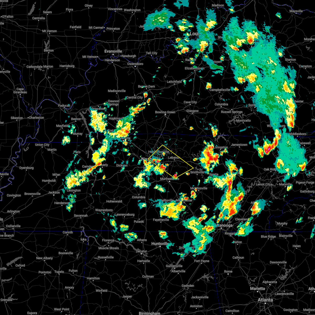 At 217 pm cdt, severe thunderstorms were located along a line extending from near madison to 6 miles east of walterhill, moving northeast at 35 mph (radar indicated). Hazards include 60 mph wind gusts and quarter size hail. Hail damage to vehicles is expected. Expect wind damage to roofs, siding, and trees. At 217 pm cdt, severe thunderstorms were located along a line extending from near madison to 6 miles east of walterhill, moving northeast at 35 mph (radar indicated). Hazards include 60 mph wind gusts and quarter size hail. Hail damage to vehicles is expected. Expect wind damage to roofs, siding, and trees.
|
| 5/6/2022 2:10 PM CDT | Large tree branch on power line causing power outag in davidson county TN, 12.6 miles NNW of Nashville, TN |
| 5/6/2022 2:09 PM CDT |
 At 208 pm cdt, severe thunderstorms were located along a line extending from nashville to near rural hill, moving northeast at 35 mph (radar indicated). Hazards include 60 mph wind gusts and quarter size hail. Hail damage to vehicles is expected. expect wind damage to roofs, siding, and trees. locations impacted include, nashville, la vergne, mount juliet, forest hills, oak hill, belle meade, hermitage, rural hill, antioch, belinda city, berry hill, percy priest lake and gladeville. this includes the following highways, interstate 40 between mile markers 199 and 227. interstate 65 between mile markers 77 and 92. interstate 24 between mile markers 43 and 64. interstate 840 between mile markers 67 and 72. hail threat, radar indicated max hail size, 1. 00 in wind threat, radar indicated max wind gust, 60 mph. At 208 pm cdt, severe thunderstorms were located along a line extending from nashville to near rural hill, moving northeast at 35 mph (radar indicated). Hazards include 60 mph wind gusts and quarter size hail. Hail damage to vehicles is expected. expect wind damage to roofs, siding, and trees. locations impacted include, nashville, la vergne, mount juliet, forest hills, oak hill, belle meade, hermitage, rural hill, antioch, belinda city, berry hill, percy priest lake and gladeville. this includes the following highways, interstate 40 between mile markers 199 and 227. interstate 65 between mile markers 77 and 92. interstate 24 between mile markers 43 and 64. interstate 840 between mile markers 67 and 72. hail threat, radar indicated max hail size, 1. 00 in wind threat, radar indicated max wind gust, 60 mph.
|
| 5/6/2022 1:55 PM CDT |
 At 155 pm cdt, severe thunderstorms were located along a line extending from near bellevue to near antioch, moving northeast at 25 mph (radar indicated). Hazards include 60 mph wind gusts and quarter size hail. Hail damage to vehicles is expected. Expect wind damage to roofs, siding, and trees. At 155 pm cdt, severe thunderstorms were located along a line extending from near bellevue to near antioch, moving northeast at 25 mph (radar indicated). Hazards include 60 mph wind gusts and quarter size hail. Hail damage to vehicles is expected. Expect wind damage to roofs, siding, and trees.
|
| 5/5/2022 4:49 PM CDT | Tree down and fencing damaged on anderson road in antioc in davidson county TN, 13.4 miles NW of Nashville, TN |
| 4/13/2022 8:11 PM CDT |
 At 810 pm cdt, severe thunderstorms were located along a line extending from 7 miles northeast of lebanon to 8 miles southwest of murfreesboro, moving east at 65 mph (radar indicated). Hazards include 70 mph wind gusts. Expect considerable tree damage. damage is likely to mobile homes, roofs, and outbuildings. locations impacted include, murfreesboro, gallatin, lebanon, woodbury, carthage, hendersonville, smyrna, la vergne, mount juliet, watertown, gordonsville, walterhill, rural hill, belinda city, hickman, south carthage, alexandria, eagleville, dowelltown and liberty. this includes the following highways, interstate 40 between mile markers 223 and 263. interstate 24 between mile markers 65 and 91. Interstate 840 between mile markers 46 and 76. At 810 pm cdt, severe thunderstorms were located along a line extending from 7 miles northeast of lebanon to 8 miles southwest of murfreesboro, moving east at 65 mph (radar indicated). Hazards include 70 mph wind gusts. Expect considerable tree damage. damage is likely to mobile homes, roofs, and outbuildings. locations impacted include, murfreesboro, gallatin, lebanon, woodbury, carthage, hendersonville, smyrna, la vergne, mount juliet, watertown, gordonsville, walterhill, rural hill, belinda city, hickman, south carthage, alexandria, eagleville, dowelltown and liberty. this includes the following highways, interstate 40 between mile markers 223 and 263. interstate 24 between mile markers 65 and 91. Interstate 840 between mile markers 46 and 76.
|
| 4/13/2022 7:59 PM CDT | Report from mping: 3-inch tree limbs broken; power poles broke in davidson county TN, 7.3 miles WNW of Nashville, TN |
| 4/13/2022 7:57 PM CDT | Report from mping: 1-inch tree limbs broken; shingles blown of in davidson county TN, 9.8 miles NW of Nashville, TN |
| 4/13/2022 7:52 PM CDT | 56 knots gust reported at kbn in davidson county TN, 4.3 miles NNE of Nashville, TN |
| 4/13/2022 7:52 PM CDT |
 At 752 pm cdt, severe thunderstorms were located along a line extending from hendersonville to 6 miles east of spring hill, moving east at 65 mph (radar indicated). Hazards include 70 mph wind gusts. Expect considerable tree damage. Damage is likely to mobile homes, roofs, and outbuildings. At 752 pm cdt, severe thunderstorms were located along a line extending from hendersonville to 6 miles east of spring hill, moving east at 65 mph (radar indicated). Hazards include 70 mph wind gusts. Expect considerable tree damage. Damage is likely to mobile homes, roofs, and outbuildings.
|
| 4/13/2022 7:49 PM CDT |
 At 749 pm cdt, severe thunderstorms were located along a line extending from near joelton to near oak hill to near franklin, moving east at 65 mph (radar indicated). Hazards include 70 mph wind gusts. Expect considerable tree damage. damage is likely to mobile homes, roofs, and outbuildings. locations impacted include, franklin, columbia, nashville, madison, hendersonville, brentwood, spring hill, goodlettsville, nolensville, forest hills, oak hill, belle meade, lakewood, thompson`s station, hermitage, bellevue, antioch, old hickory, joelton and berry hill. this includes the following highways, interstate 40 between mile markers 196 and 223. interstate 65 between mile markers 51 and 98. interstate 24 between mile markers 35 and 63. interstate 840 between mile markers 22 and 42. thunderstorm damage threat, considerable hail threat, radar indicated max hail size, <. 75 in wind threat, radar indicated max wind gust, 70 mph. At 749 pm cdt, severe thunderstorms were located along a line extending from near joelton to near oak hill to near franklin, moving east at 65 mph (radar indicated). Hazards include 70 mph wind gusts. Expect considerable tree damage. damage is likely to mobile homes, roofs, and outbuildings. locations impacted include, franklin, columbia, nashville, madison, hendersonville, brentwood, spring hill, goodlettsville, nolensville, forest hills, oak hill, belle meade, lakewood, thompson`s station, hermitage, bellevue, antioch, old hickory, joelton and berry hill. this includes the following highways, interstate 40 between mile markers 196 and 223. interstate 65 between mile markers 51 and 98. interstate 24 between mile markers 35 and 63. interstate 840 between mile markers 22 and 42. thunderstorm damage threat, considerable hail threat, radar indicated max hail size, <. 75 in wind threat, radar indicated max wind gust, 70 mph.
|
| 4/13/2022 7:33 PM CDT |
 At 732 pm cdt, severe thunderstorms were located along a line extending from near ashland city to near pegram to 10 miles south of fairview, moving east at 65 mph (radar indicated). Hazards include 70 mph wind gusts. Expect considerable tree damage. damage is likely to mobile homes, roofs, and outbuildings. locations impacted include, franklin, columbia, dickson, ashland city, nashville, madison, hendersonville, brentwood, la vergne, spring hill, goodlettsville, nolensville, forest hills, oak hill, white bluff, belle meade, kingston springs, lakewood, thompson`s station and pegram. this includes the following highways, interstate 40 between mile markers 173 and 223. interstate 65 between mile markers 51 and 98. interstate 24 between mile markers 36 and 63. interstate 840 between mile markers 1 and 42. thunderstorm damage threat, considerable hail threat, radar indicated max hail size, <. 75 in wind threat, radar indicated max wind gust, 70 mph. At 732 pm cdt, severe thunderstorms were located along a line extending from near ashland city to near pegram to 10 miles south of fairview, moving east at 65 mph (radar indicated). Hazards include 70 mph wind gusts. Expect considerable tree damage. damage is likely to mobile homes, roofs, and outbuildings. locations impacted include, franklin, columbia, dickson, ashland city, nashville, madison, hendersonville, brentwood, la vergne, spring hill, goodlettsville, nolensville, forest hills, oak hill, white bluff, belle meade, kingston springs, lakewood, thompson`s station and pegram. this includes the following highways, interstate 40 between mile markers 173 and 223. interstate 65 between mile markers 51 and 98. interstate 24 between mile markers 36 and 63. interstate 840 between mile markers 1 and 42. thunderstorm damage threat, considerable hail threat, radar indicated max hail size, <. 75 in wind threat, radar indicated max wind gust, 70 mph.
|
| 4/13/2022 7:16 PM CDT |
 At 716 pm cdt, severe thunderstorms were located along a line extending from 7 miles north of dickson to near burns to centerville, moving east at 65 mph (radar indicated). Hazards include 70 mph wind gusts. Expect considerable tree damage. Damage is likely to mobile homes, roofs, and outbuildings. At 716 pm cdt, severe thunderstorms were located along a line extending from 7 miles north of dickson to near burns to centerville, moving east at 65 mph (radar indicated). Hazards include 70 mph wind gusts. Expect considerable tree damage. Damage is likely to mobile homes, roofs, and outbuildings.
|
| 4/13/2022 6:43 PM CDT |
 At 643 pm cdt, severe thunderstorms were located along a line extending from 13 miles west of scottsville to near portland to near nashville, moving east at 60 mph (radar indicated). Hazards include 60 mph wind gusts. Expect damage to roofs, siding, and trees. locations impacted include, gallatin, springfield, hendersonville, goodlettsville, white house, millersville, greenbrier, coopertown, ridgetop, cross plains, portland, pleasant view, orlinda, adams, cedar hill, mitchellville, oak grove, cottontown and black jack. this includes the following highways, interstate 65 between mile markers 98 and 121. interstate 24 between mile markers 18 and 33. hail threat, radar indicated max hail size, <. 75 in wind threat, radar indicated max wind gust, 60 mph. At 643 pm cdt, severe thunderstorms were located along a line extending from 13 miles west of scottsville to near portland to near nashville, moving east at 60 mph (radar indicated). Hazards include 60 mph wind gusts. Expect damage to roofs, siding, and trees. locations impacted include, gallatin, springfield, hendersonville, goodlettsville, white house, millersville, greenbrier, coopertown, ridgetop, cross plains, portland, pleasant view, orlinda, adams, cedar hill, mitchellville, oak grove, cottontown and black jack. this includes the following highways, interstate 65 between mile markers 98 and 121. interstate 24 between mile markers 18 and 33. hail threat, radar indicated max hail size, <. 75 in wind threat, radar indicated max wind gust, 60 mph.
|
| 4/13/2022 6:13 PM CDT |
 At 613 pm cdt, severe thunderstorms were located along a line extending from 11 miles south of russellville to 8 miles northwest of coopertown to near dickson, moving east at 60 mph (radar indicated). Hazards include 60 mph wind gusts. expect damage to roofs, siding, and trees At 613 pm cdt, severe thunderstorms were located along a line extending from 11 miles south of russellville to 8 miles northwest of coopertown to near dickson, moving east at 60 mph (radar indicated). Hazards include 60 mph wind gusts. expect damage to roofs, siding, and trees
|
| 4/12/2022 7:31 AM CDT |
 At 730 am cdt, a severe thunderstorm was located near smyrna, or 12 miles northwest of murfreesboro, moving east at 30 mph (radar indicated). Hazards include quarter size hail. damage to vehicles is expected At 730 am cdt, a severe thunderstorm was located near smyrna, or 12 miles northwest of murfreesboro, moving east at 30 mph (radar indicated). Hazards include quarter size hail. damage to vehicles is expected
|
| 3/30/2022 9:29 PM CDT |
 At 928 pm cdt, a severe thunderstorm was located over old hickory, or 10 miles northeast of nashville, moving northeast at 70 mph (radar indicated). Hazards include 60 mph wind gusts. expect damage to roofs, siding, and trees At 928 pm cdt, a severe thunderstorm was located over old hickory, or 10 miles northeast of nashville, moving northeast at 70 mph (radar indicated). Hazards include 60 mph wind gusts. expect damage to roofs, siding, and trees
|
| 3/30/2022 9:19 PM CDT |
 At 919 pm cdt, a severe thunderstorm was located over oak hill, moving northeast at 60 mph (radar indicated). Hazards include 60 mph wind gusts. Expect damage to roofs, siding, and trees. locations impacted include, franklin, nashville, brentwood, nolensville, forest hills, oak hill, belle meade, antioch, rural hill, berry hill and percy priest lake. this includes the following highways, interstate 40 between mile markers 201 and 220. interstate 65 between mile markers 64 and 93. interstate 24 between mile markers 42 and 61. hail threat, radar indicated max hail size, <. 75 in wind threat, radar indicated max wind gust, 60 mph. At 919 pm cdt, a severe thunderstorm was located over oak hill, moving northeast at 60 mph (radar indicated). Hazards include 60 mph wind gusts. Expect damage to roofs, siding, and trees. locations impacted include, franklin, nashville, brentwood, nolensville, forest hills, oak hill, belle meade, antioch, rural hill, berry hill and percy priest lake. this includes the following highways, interstate 40 between mile markers 201 and 220. interstate 65 between mile markers 64 and 93. interstate 24 between mile markers 42 and 61. hail threat, radar indicated max hail size, <. 75 in wind threat, radar indicated max wind gust, 60 mph.
|
| 3/30/2022 9:03 PM CDT |
 At 903 pm cdt, a severe thunderstorm was located near thompson`s station, or 7 miles west of franklin, moving northeast at 60 mph (radar indicated). Hazards include 60 mph wind gusts. expect damage to roofs, siding, and trees At 903 pm cdt, a severe thunderstorm was located near thompson`s station, or 7 miles west of franklin, moving northeast at 60 mph (radar indicated). Hazards include 60 mph wind gusts. expect damage to roofs, siding, and trees
|
| 2/22/2022 9:11 AM CST |
 At 911 am cst, a severe thunderstorm was located over springfield, moving east at 55 mph (radar indicated). Hazards include 60 mph wind gusts. Expect damage to roofs, siding, and trees. locations impacted include, gallatin, springfield, goodlettsville, white house, millersville, greenbrier, coopertown, ridgetop, cross plains, portland, orlinda, mitchellville, black jack and cottontown. this includes the following highways, interstate 65 between mile markers 99 and 121. interstate 24 near mile marker 26. hail threat, radar indicated max hail size, <. 75 in wind threat, radar indicated max wind gust, 60 mph. At 911 am cst, a severe thunderstorm was located over springfield, moving east at 55 mph (radar indicated). Hazards include 60 mph wind gusts. Expect damage to roofs, siding, and trees. locations impacted include, gallatin, springfield, goodlettsville, white house, millersville, greenbrier, coopertown, ridgetop, cross plains, portland, orlinda, mitchellville, black jack and cottontown. this includes the following highways, interstate 65 between mile markers 99 and 121. interstate 24 near mile marker 26. hail threat, radar indicated max hail size, <. 75 in wind threat, radar indicated max wind gust, 60 mph.
|
| 2/22/2022 8:59 AM CST |
 At 858 am cst, a severe thunderstorm was located near coopertown, or 12 miles north of ashland city, moving east at 55 mph (radar indicated). Hazards include 60 mph wind gusts. expect damage to roofs, siding, and trees At 858 am cst, a severe thunderstorm was located near coopertown, or 12 miles north of ashland city, moving east at 55 mph (radar indicated). Hazards include 60 mph wind gusts. expect damage to roofs, siding, and trees
|
| 1/1/2022 1:02 PM CST |
 At 101 pm cst, severe thunderstorms were located along a line extending from 6 miles south of scottsville to forest hills, moving northeast at 50 mph (radar indicated). Hazards include 60 mph wind gusts. expect damage to roofs, siding, and trees At 101 pm cst, severe thunderstorms were located along a line extending from 6 miles south of scottsville to forest hills, moving northeast at 50 mph (radar indicated). Hazards include 60 mph wind gusts. expect damage to roofs, siding, and trees
|
| 1/1/2022 12:56 PM CST |
 At 1255 pm cst, a severe thunderstorm capable of producing a tornado was located over centerville, moving east at 70 mph (radar indicated rotation). Hazards include tornado. Flying debris will be dangerous to those caught without shelter. mobile homes will be damaged or destroyed. damage to roofs, windows, and vehicles will occur. tree damage is likely. this dangerous storm will be near, fairview around 115 pm cst. other locations impacted by this tornadic thunderstorm include nunnelly, primm springs and lyles. This includes interstate 840 between mile markers 5 and 19. At 1255 pm cst, a severe thunderstorm capable of producing a tornado was located over centerville, moving east at 70 mph (radar indicated rotation). Hazards include tornado. Flying debris will be dangerous to those caught without shelter. mobile homes will be damaged or destroyed. damage to roofs, windows, and vehicles will occur. tree damage is likely. this dangerous storm will be near, fairview around 115 pm cst. other locations impacted by this tornadic thunderstorm include nunnelly, primm springs and lyles. This includes interstate 840 between mile markers 5 and 19.
|
| 1/1/2022 12:37 PM CST | Tree down against home in madison near donna dr and norman d in davidson county TN, 2.9 miles SW of Nashville, TN |
| 1/1/2022 12:33 PM CST | Trees and limbs reported down near old hickory blvd and dickerson pik in davidson county TN, 2.8 miles S of Nashville, TN |
| 12/11/2021 3:30 AM CST | Trees and power lines were blown down across nashville area. around 80...000 customers lost powe in davidson county TN, 4.3 miles NNE of Nashville, TN |
| 12/11/2021 3:28 AM CST | Nashville intl airport asos measured a peak wind gust of 78 mph. this is the third highest wind gust ever measured at the airpor in davidson county TN, 8.4 miles NW of Nashville, TN |
| 12/6/2021 5:31 AM CST |
 At 530 am cst, severe thunderstorms were located along a line extending from portland to old hickory to near bellevue, moving east at 45 mph (radar indicated). Hazards include 60 mph wind gusts. Expect damage to roofs, siding, and trees. locations impacted include, gallatin, lebanon, nashville, madison, hendersonville, mount juliet, goodlettsville, white house, millersville, forest hills, oak hill, belle meade, lakewood, westmoreland, portland, hermitage, rural hill, antioch, belinda city and old hickory. this includes the following highways, interstate 40 between mile markers 203 and 234. interstate 65 between mile markers 77 and 100. interstate 24 between mile markers 42 and 59. hail threat, radar indicated max hail size, <. 75 in wind threat, radar indicated max wind gust, 60 mph. At 530 am cst, severe thunderstorms were located along a line extending from portland to old hickory to near bellevue, moving east at 45 mph (radar indicated). Hazards include 60 mph wind gusts. Expect damage to roofs, siding, and trees. locations impacted include, gallatin, lebanon, nashville, madison, hendersonville, mount juliet, goodlettsville, white house, millersville, forest hills, oak hill, belle meade, lakewood, westmoreland, portland, hermitage, rural hill, antioch, belinda city and old hickory. this includes the following highways, interstate 40 between mile markers 203 and 234. interstate 65 between mile markers 77 and 100. interstate 24 between mile markers 42 and 59. hail threat, radar indicated max hail size, <. 75 in wind threat, radar indicated max wind gust, 60 mph.
|
| 12/6/2021 5:09 AM CST |
 At 508 am cst, severe thunderstorms were located along a line extending from cross plains to joelton to white bluff, moving east at 55 mph (radar indicated). Hazards include 60 mph wind gusts. expect damage to roofs, siding, and trees At 508 am cst, severe thunderstorms were located along a line extending from cross plains to joelton to white bluff, moving east at 55 mph (radar indicated). Hazards include 60 mph wind gusts. expect damage to roofs, siding, and trees
|
| 12/6/2021 5:01 AM CST |
 At 500 am cst, severe thunderstorms were located along a line extending from adairville to ashland city to dickson, moving east at 55 mph (radar indicated). Hazards include 60 mph wind gusts. Expect damage to roofs, siding, and trees. locations impacted include, springfield, ashland city, coopertown, kingston springs, pegram, pleasant view, charlotte, adams, vanleer, cedar hill and cheatham dam. This includes interstate 24 between mile markers 20 and 31. At 500 am cst, severe thunderstorms were located along a line extending from adairville to ashland city to dickson, moving east at 55 mph (radar indicated). Hazards include 60 mph wind gusts. Expect damage to roofs, siding, and trees. locations impacted include, springfield, ashland city, coopertown, kingston springs, pegram, pleasant view, charlotte, adams, vanleer, cedar hill and cheatham dam. This includes interstate 24 between mile markers 20 and 31.
|
| 12/6/2021 4:39 AM CST |
 At 439 am cst, severe thunderstorms were located along a line extending from clarksville to erin, moving east at 55 mph (radar indicated). Hazards include 60 mph wind gusts. expect damage to roofs, siding, and trees At 439 am cst, severe thunderstorms were located along a line extending from clarksville to erin, moving east at 55 mph (radar indicated). Hazards include 60 mph wind gusts. expect damage to roofs, siding, and trees
|
| 8/26/2021 6:59 PM CDT |
 At 659 pm cdt, a severe thunderstorm was located over nashville, and is nearly stationary (radar indicated). Hazards include 60 mph wind gusts. expect damage to roofs, siding, and trees At 659 pm cdt, a severe thunderstorm was located over nashville, and is nearly stationary (radar indicated). Hazards include 60 mph wind gusts. expect damage to roofs, siding, and trees
|
| 8/18/2021 6:55 PM CDT |
 The severe thunderstorm warning for southeastern davidson, northwestern rutherford and eastern williamson counties will expire at 700 pm cdt, the storm which prompted the warning has weakened below severe limits, and no longer poses an immediate threat to life or property. therefore, the warning will be allowed to expire. however gusty winds and heavy rain are still possible with this thunderstorm. The severe thunderstorm warning for southeastern davidson, northwestern rutherford and eastern williamson counties will expire at 700 pm cdt, the storm which prompted the warning has weakened below severe limits, and no longer poses an immediate threat to life or property. therefore, the warning will be allowed to expire. however gusty winds and heavy rain are still possible with this thunderstorm.
|
| 8/18/2021 6:28 PM CDT |
 At 628 pm cdt, a severe thunderstorm was located near franklin, moving northeast at 25 mph (radar indicated). Hazards include 60 mph wind gusts. expect damage to roofs, siding, and trees At 628 pm cdt, a severe thunderstorm was located near franklin, moving northeast at 25 mph (radar indicated). Hazards include 60 mph wind gusts. expect damage to roofs, siding, and trees
|
| 7/31/2021 10:45 PM CDT |
 At 1045 pm cdt, severe thunderstorms were located along a line extending from forest hills to near spring hill, moving southeast at 45 mph (radar indicated). Hazards include 60 mph wind gusts. Expect damage to roofs, siding, and trees. locations impacted include, franklin, brentwood, spring hill, nolensville, forest hills, oak hill, belle meade, thompson`s station, bellevue, antioch, bells bend, natchez trace at highway 96 and leipers fork. this includes the following highways, interstate 40 between mile markers 195 and 203. interstate 65 between mile markers 50 and 79. interstate 24 between mile markers 57 and 60. Interstate 840 between mile markers 19 and 40. At 1045 pm cdt, severe thunderstorms were located along a line extending from forest hills to near spring hill, moving southeast at 45 mph (radar indicated). Hazards include 60 mph wind gusts. Expect damage to roofs, siding, and trees. locations impacted include, franklin, brentwood, spring hill, nolensville, forest hills, oak hill, belle meade, thompson`s station, bellevue, antioch, bells bend, natchez trace at highway 96 and leipers fork. this includes the following highways, interstate 40 between mile markers 195 and 203. interstate 65 between mile markers 50 and 79. interstate 24 between mile markers 57 and 60. Interstate 840 between mile markers 19 and 40.
|
| 7/31/2021 10:39 PM CDT | Tspotter report of a tree down at the entrance of shelby park on 19t in davidson county TN, 4.2 miles NNW of Nashville, TN |
| 7/31/2021 10:33 PM CDT |
 At 1032 pm cdt, severe thunderstorms were located along a line extending from pegram to leipers fork, moving southeast at 50 mph (radar indicated). Hazards include 60 mph wind gusts. Expect damage to roofs, siding, and trees. locations impacted include, franklin, brentwood, spring hill, nolensville, forest hills, oak hill, belle meade, kingston springs, thompson`s station, pegram, bellevue, antioch, fairview, bells bend, natchez trace at highway 96 and leipers fork. this includes the following highways, interstate 40 between mile markers 182 and 203. interstate 65 between mile markers 50 and 79. interstate 24 between mile markers 57 and 60. Interstate 840 between mile markers 7 and 40. At 1032 pm cdt, severe thunderstorms were located along a line extending from pegram to leipers fork, moving southeast at 50 mph (radar indicated). Hazards include 60 mph wind gusts. Expect damage to roofs, siding, and trees. locations impacted include, franklin, brentwood, spring hill, nolensville, forest hills, oak hill, belle meade, kingston springs, thompson`s station, pegram, bellevue, antioch, fairview, bells bend, natchez trace at highway 96 and leipers fork. this includes the following highways, interstate 40 between mile markers 182 and 203. interstate 65 between mile markers 50 and 79. interstate 24 between mile markers 57 and 60. Interstate 840 between mile markers 7 and 40.
|
| 7/31/2021 10:19 PM CDT |
 At 1018 pm cdt, severe thunderstorms were located along a line extending from white bluff to near fairview, moving southeast at 50 mph (radar indicated). Hazards include 60 mph wind gusts. expect damage to roofs, siding, and trees At 1018 pm cdt, severe thunderstorms were located along a line extending from white bluff to near fairview, moving southeast at 50 mph (radar indicated). Hazards include 60 mph wind gusts. expect damage to roofs, siding, and trees
|
| 7/31/2021 9:14 PM CDT |
 At 913 pm cdt, a severe thunderstorm was located near nolensville, or 9 miles northeast of franklin, moving southeast at 25 mph (radar indicated). Hazards include 60 mph wind gusts and penny size hail. Expect damage to roofs, siding, and trees. locations impacted include, franklin, smyrna, brentwood, la vergne, nolensville, antioch and triune. this includes the following highways, interstate 65 near mile marker 72. interstate 24 between mile markers 58 and 72. Interstate 840 between mile markers 39 and 47, and between mile markers 59 and 60. At 913 pm cdt, a severe thunderstorm was located near nolensville, or 9 miles northeast of franklin, moving southeast at 25 mph (radar indicated). Hazards include 60 mph wind gusts and penny size hail. Expect damage to roofs, siding, and trees. locations impacted include, franklin, smyrna, brentwood, la vergne, nolensville, antioch and triune. this includes the following highways, interstate 65 near mile marker 72. interstate 24 between mile markers 58 and 72. Interstate 840 between mile markers 39 and 47, and between mile markers 59 and 60.
|
| 7/31/2021 8:57 PM CDT |
 At 856 pm cdt, a severe thunderstorm was located near brentwood, or 8 miles northeast of franklin, moving southeast at 25 mph (radar indicated). Hazards include 60 mph wind gusts and penny size hail. expect damage to roofs, siding, and trees At 856 pm cdt, a severe thunderstorm was located near brentwood, or 8 miles northeast of franklin, moving southeast at 25 mph (radar indicated). Hazards include 60 mph wind gusts and penny size hail. expect damage to roofs, siding, and trees
|
| 7/31/2021 8:44 PM CDT | Delayed report...tspotter report of multiple mature trees down on lealand lane between battery and stonewall from first round of storm in davidson county TN, 9.8 miles NNE of Nashville, TN |
| 7/31/2021 8:43 PM CDT |
 At 841 pm cdt, a severe thunderstorm was located over belle meade, moving southeast at 25 mph (public. the public reported dime size hail on white bridge road with this storm). Hazards include 60 mph wind gusts and dime size hail. Expect damage to roofs, siding, and trees. locations impacted include, nashville, brentwood, nolensville, forest hills, oak hill, belle meade, antioch, bellevue, berry hill and percy priest lake. this includes the following highways, interstate 40 between mile markers 198 and 218. interstate 65 between mile markers 71 and 88. Interstate 24 between mile markers 47 and 62. At 841 pm cdt, a severe thunderstorm was located over belle meade, moving southeast at 25 mph (public. the public reported dime size hail on white bridge road with this storm). Hazards include 60 mph wind gusts and dime size hail. Expect damage to roofs, siding, and trees. locations impacted include, nashville, brentwood, nolensville, forest hills, oak hill, belle meade, antioch, bellevue, berry hill and percy priest lake. this includes the following highways, interstate 40 between mile markers 198 and 218. interstate 65 between mile markers 71 and 88. Interstate 24 between mile markers 47 and 62.
|
| 7/31/2021 8:42 PM CDT | Trees uprooted and some small hail. trees on a house and the roa in davidson county TN, 10.5 miles N of Nashville, TN |
| 7/31/2021 8:30 PM CDT | Several trees down in bells bend at 3964-4001 old hickory blvd in davidson county TN, 10.2 miles ENE of Nashville, TN |
| 7/31/2021 8:27 PM CDT |
 At 826 pm cdt, a severe thunderstorm was located near nashville, moving southeast at 25 mph (radar indicated). Hazards include 60 mph wind gusts and penny size hail. Expect damage to roofs, siding, and trees. locations impacted include, nashville, mount juliet, oak hill, belle meade, hermitage, antioch, rural hill, berry hill and percy priest lake. those in downtown nashville and attending nissan stadium are in the path of this storm and should prepare for imminent dangerous weather conditions. seek shelter now! this includes the following highways, interstate 40 between mile markers 206 and 226. interstate 65 between mile markers 77 and 88, and between mile markers 90 and 91. Interstate 24 between mile markers 47 and 62. At 826 pm cdt, a severe thunderstorm was located near nashville, moving southeast at 25 mph (radar indicated). Hazards include 60 mph wind gusts and penny size hail. Expect damage to roofs, siding, and trees. locations impacted include, nashville, mount juliet, oak hill, belle meade, hermitage, antioch, rural hill, berry hill and percy priest lake. those in downtown nashville and attending nissan stadium are in the path of this storm and should prepare for imminent dangerous weather conditions. seek shelter now! this includes the following highways, interstate 40 between mile markers 206 and 226. interstate 65 between mile markers 77 and 88, and between mile markers 90 and 91. Interstate 24 between mile markers 47 and 62.
|
| 7/31/2021 8:24 PM CDT |
 At 822 pm cdt, a severe thunderstorm was located 7 miles southeast of ashland city, moving southeast at 25 mph (radar indicated). Hazards include 60 mph wind gusts and quarter size hail. Hail damage to vehicles is expected. Expect wind damage to roofs, siding, and trees. At 822 pm cdt, a severe thunderstorm was located 7 miles southeast of ashland city, moving southeast at 25 mph (radar indicated). Hazards include 60 mph wind gusts and quarter size hail. Hail damage to vehicles is expected. Expect wind damage to roofs, siding, and trees.
|
| 7/31/2021 8:12 PM CDT |
 At 811 pm cdt, a severe thunderstorm was located over bordeaux, or just northwest of downtown nashville, moving southeast at 25 mph (radar indicated). Hazards include 60 mph wind gusts and penny size hail. Expect damage to roofs, siding, and trees. locations impacted include, nashville, mount juliet, oak hill, belle meade, hermitage, antioch, rural hill, berry hill, bells bend, percy priest lake and whites creek. those in downtown nashville and attending nissan stadium are in the path of this storm and should prepare for imminent dangerous weather conditions. seek shelter now! this includes the following highways, interstate 40 between mile markers 202 and 226. interstate 65 between mile markers 77 and 91. Interstate 24 between mile markers 41 and 62. At 811 pm cdt, a severe thunderstorm was located over bordeaux, or just northwest of downtown nashville, moving southeast at 25 mph (radar indicated). Hazards include 60 mph wind gusts and penny size hail. Expect damage to roofs, siding, and trees. locations impacted include, nashville, mount juliet, oak hill, belle meade, hermitage, antioch, rural hill, berry hill, bells bend, percy priest lake and whites creek. those in downtown nashville and attending nissan stadium are in the path of this storm and should prepare for imminent dangerous weather conditions. seek shelter now! this includes the following highways, interstate 40 between mile markers 202 and 226. interstate 65 between mile markers 77 and 91. Interstate 24 between mile markers 41 and 62.
|
| 7/31/2021 7:58 PM CDT |
 At 757 pm cdt, a severe thunderstorm was located near joelton, or 7 miles northwest of nashville, moving southeast at 25 mph (radar indicated). Hazards include 60 mph wind gusts and penny size hail. expect damage to roofs, siding, and trees At 757 pm cdt, a severe thunderstorm was located near joelton, or 7 miles northwest of nashville, moving southeast at 25 mph (radar indicated). Hazards include 60 mph wind gusts and penny size hail. expect damage to roofs, siding, and trees
|
| 7/31/2021 7:03 PM CDT |
 At 703 pm cdt, a severe thunderstorm was located near springfield, moving east at 30 mph (radar indicated). Hazards include 60 mph wind gusts and penny size hail. expect damage to roofs, siding, and trees At 703 pm cdt, a severe thunderstorm was located near springfield, moving east at 30 mph (radar indicated). Hazards include 60 mph wind gusts and penny size hail. expect damage to roofs, siding, and trees
|
| 7/26/2021 3:25 PM CDT | Damage to home siding... outbuilding destroyed... a/c unit pushed off foundation. microburst signature... but 40 mph max from radar. damage concentrated on hudson roa in davidson county TN, 5.3 miles W of Nashville, TN |
| 6/21/2021 2:54 PM CDT |
 At 253 pm cdt, a severe thunderstorm was located near ashland city, moving east at 40 mph (radar indicated). Hazards include 60 mph wind gusts. Expect damage to roofs, siding, and trees. locations impacted include, ashland city, nashville, goodlettsville, forest hills, oak hill, belle meade, kingston springs, pegram, joelton, berry hill, bells bend, whites creek and beaman park. this includes the following highways, interstate 40 between mile markers 197 and 213. interstate 65 between mile markers 77 and 93. Interstate 24 between mile markers 29 and 53. At 253 pm cdt, a severe thunderstorm was located near ashland city, moving east at 40 mph (radar indicated). Hazards include 60 mph wind gusts. Expect damage to roofs, siding, and trees. locations impacted include, ashland city, nashville, goodlettsville, forest hills, oak hill, belle meade, kingston springs, pegram, joelton, berry hill, bells bend, whites creek and beaman park. this includes the following highways, interstate 40 between mile markers 197 and 213. interstate 65 between mile markers 77 and 93. Interstate 24 between mile markers 29 and 53.
|
| 6/21/2021 2:36 PM CDT |
 At 235 pm cdt, a severe thunderstorm was located 8 miles west of ashland city, moving east at 40 mph (radar indicated). Hazards include 60 mph wind gusts. expect damage to roofs, siding, and trees At 235 pm cdt, a severe thunderstorm was located 8 miles west of ashland city, moving east at 40 mph (radar indicated). Hazards include 60 mph wind gusts. expect damage to roofs, siding, and trees
|
| 5/6/2021 6:06 PM CDT |
 At 606 pm cdt, severe thunderstorms were located along a line extending from hartsville to 11 miles southeast of spring hill, moving east at 40 mph (radar indicated). Hazards include 60 mph wind gusts. Expect damage to roofs, siding, and trees. locations impacted include, murfreesboro, lebanon, smyrna, la vergne, mount juliet, watertown, walterhill, rural hill, eagleville, lascassas, tuckers crossroads, christiana, dixon springs, dickerson chapel recreation area, cedars of lebanon state park, rockvale and gladeville. this includes the following highways, interstate 40 between mile markers 229 and 249. interstate 24 between mile markers 66 and 88. Interstate 840 between mile markers 46 and 76. At 606 pm cdt, severe thunderstorms were located along a line extending from hartsville to 11 miles southeast of spring hill, moving east at 40 mph (radar indicated). Hazards include 60 mph wind gusts. Expect damage to roofs, siding, and trees. locations impacted include, murfreesboro, lebanon, smyrna, la vergne, mount juliet, watertown, walterhill, rural hill, eagleville, lascassas, tuckers crossroads, christiana, dixon springs, dickerson chapel recreation area, cedars of lebanon state park, rockvale and gladeville. this includes the following highways, interstate 40 between mile markers 229 and 249. interstate 24 between mile markers 66 and 88. Interstate 840 between mile markers 46 and 76.
|
| 5/6/2021 5:48 PM CDT | Large limbs down near elm hill and mccovock pike. #tspotter in davidson county TN, 6.9 miles NW of Nashville, TN |
| 5/6/2021 5:42 PM CDT |
 At 542 pm cdt, severe thunderstorms were located along a line extending from near gallatin to near columbia, moving east at 40 mph (radar indicated). Hazards include 60 mph wind gusts. expect damage to roofs, siding, and trees At 542 pm cdt, severe thunderstorms were located along a line extending from near gallatin to near columbia, moving east at 40 mph (radar indicated). Hazards include 60 mph wind gusts. expect damage to roofs, siding, and trees
|
| 5/6/2021 5:34 PM CDT |
 At 534 pm cdt, severe thunderstorms were located along a line extending from 7 miles east of gallatin to 10 miles south of nolensville, moving east at 55 mph (radar indicated). Hazards include 60 mph wind gusts. Expect damage to roofs, siding, and trees. locations impacted include, murfreesboro, franklin, gallatin, lebanon, nashville, hartsville, madison, hendersonville, smyrna, brentwood, la vergne, spring hill, mount juliet, goodlettsville, millersville, nolensville, forest hills, oak hill, belle meade and lakewood. this includes the following highways, interstate 40 between mile markers 203 and 248. interstate 65 between mile markers 53 and 102. interstate 24 between mile markers 38 and 87. Interstate 840 between mile markers 18 and 76. At 534 pm cdt, severe thunderstorms were located along a line extending from 7 miles east of gallatin to 10 miles south of nolensville, moving east at 55 mph (radar indicated). Hazards include 60 mph wind gusts. Expect damage to roofs, siding, and trees. locations impacted include, murfreesboro, franklin, gallatin, lebanon, nashville, hartsville, madison, hendersonville, smyrna, brentwood, la vergne, spring hill, mount juliet, goodlettsville, millersville, nolensville, forest hills, oak hill, belle meade and lakewood. this includes the following highways, interstate 40 between mile markers 203 and 248. interstate 65 between mile markers 53 and 102. interstate 24 between mile markers 38 and 87. Interstate 840 between mile markers 18 and 76.
|
| 5/6/2021 5:19 PM CDT |
 A severe thunderstorm warning remains in effect until 530 pm cdt for sumner and eastern robertson counties. at 518 pm cdt, severe thunderstorms were located along a line extending from 7 miles north of portland to near white house to near goodlettsville, moving east at 35 mph. hazard. 60 mph wind gusts. A severe thunderstorm warning remains in effect until 530 pm cdt for sumner and eastern robertson counties. at 518 pm cdt, severe thunderstorms were located along a line extending from 7 miles north of portland to near white house to near goodlettsville, moving east at 35 mph. hazard. 60 mph wind gusts.
|
| 5/6/2021 5:09 PM CDT |
 At 508 pm cdt, severe thunderstorms were located along a line extending from near greenbrier to 10 miles south of fairview, moving east at 55 mph (radar indicated). Hazards include 60 mph wind gusts. expect damage to roofs, siding, and trees At 508 pm cdt, severe thunderstorms were located along a line extending from near greenbrier to 10 miles south of fairview, moving east at 55 mph (radar indicated). Hazards include 60 mph wind gusts. expect damage to roofs, siding, and trees
|
| 5/6/2021 4:59 PM CDT |
 At 459 pm cdt, severe thunderstorms were located along a line extending from 6 miles west of coopertown to near burns to 10 miles west of centerville, moving east at 45 mph (radar indicated). Hazards include 60 mph wind gusts. Expect damage to roofs, siding, and trees. locations impacted include, dickson, ashland city, centerville, coopertown, white bluff, kingston springs, pegram, burns, fairview, pleasant view, charlotte, bon aqua, cheatham dam, primm springs, lyles, pinewood and nunnelly. this includes the following highways, interstate 40 between mile markers 160 and 191. interstate 24 between mile markers 21 and 31. Interstate 840 between mile markers 1 and 11. At 459 pm cdt, severe thunderstorms were located along a line extending from 6 miles west of coopertown to near burns to 10 miles west of centerville, moving east at 45 mph (radar indicated). Hazards include 60 mph wind gusts. Expect damage to roofs, siding, and trees. locations impacted include, dickson, ashland city, centerville, coopertown, white bluff, kingston springs, pegram, burns, fairview, pleasant view, charlotte, bon aqua, cheatham dam, primm springs, lyles, pinewood and nunnelly. this includes the following highways, interstate 40 between mile markers 160 and 191. interstate 24 between mile markers 21 and 31. Interstate 840 between mile markers 1 and 11.
|
| 5/6/2021 4:56 PM CDT |
 At 456 pm cdt, severe thunderstorms were located along a line extending from 10 miles southeast of russellville to near springfield to near coopertown, moving east at 35 mph (radar indicated). Hazards include 60 mph wind gusts. expect damage to roofs, siding, and trees At 456 pm cdt, severe thunderstorms were located along a line extending from 10 miles southeast of russellville to near springfield to near coopertown, moving east at 35 mph (radar indicated). Hazards include 60 mph wind gusts. expect damage to roofs, siding, and trees
|
| 5/6/2021 4:44 PM CDT |
 At 443 pm cdt, severe thunderstorms were located along a line extending from 12 miles south of clarksville to 7 miles northwest of dickson to 13 miles north of linden, moving east at 45 mph (radar indicated). Hazards include 60 mph wind gusts. expect damage to roofs, siding, and trees At 443 pm cdt, severe thunderstorms were located along a line extending from 12 miles south of clarksville to 7 miles northwest of dickson to 13 miles north of linden, moving east at 45 mph (radar indicated). Hazards include 60 mph wind gusts. expect damage to roofs, siding, and trees
|
| 5/4/2021 6:24 AM CDT |
 The tornado warning for southwestern sumner county will expire at 630 am cdt, the tornado warning that was previously in effect has been reissued for sumner county. please refer to that bulletin for the latest severe weather information. a severe thunderstorm watch remains in effect until 1100 am cdt for middle tennessee. The tornado warning for southwestern sumner county will expire at 630 am cdt, the tornado warning that was previously in effect has been reissued for sumner county. please refer to that bulletin for the latest severe weather information. a severe thunderstorm watch remains in effect until 1100 am cdt for middle tennessee.
|
| 5/4/2021 6:16 AM CDT |
 At 615 am cdt, severe thunderstorms were located along a line extending from near portland to forest hills, moving east at 45 mph (radar indicated). Hazards include 60 mph wind gusts and penny size hail. expect damage to roofs, siding, and trees At 615 am cdt, severe thunderstorms were located along a line extending from near portland to forest hills, moving east at 45 mph (radar indicated). Hazards include 60 mph wind gusts and penny size hail. expect damage to roofs, siding, and trees
|
| 5/4/2021 6:13 AM CDT |
 At 613 am cdt, a severe thunderstorm capable of producing a tornado was located over goodlettsville, or 11 miles west of gallatin, moving east at 45 mph (radar indicated rotation). Hazards include tornado. Flying debris will be dangerous to those caught without shelter. mobile homes will be damaged or destroyed. damage to roofs, windows, and vehicles will occur. tree damage is likely. locations impacted include, hendersonville, goodlettsville and millersville. This includes interstate 65 between mile markers 98 and 101. At 613 am cdt, a severe thunderstorm capable of producing a tornado was located over goodlettsville, or 11 miles west of gallatin, moving east at 45 mph (radar indicated rotation). Hazards include tornado. Flying debris will be dangerous to those caught without shelter. mobile homes will be damaged or destroyed. damage to roofs, windows, and vehicles will occur. tree damage is likely. locations impacted include, hendersonville, goodlettsville and millersville. This includes interstate 65 between mile markers 98 and 101.
|
| 5/4/2021 6:07 AM CDT |
 At 606 am cdt, a severe thunderstorm capable of producing a tornado was located over goodlettsville, or 11 miles southeast of springfield, moving east at 45 mph (radar indicated rotation). Hazards include tornado. Flying debris will be dangerous to those caught without shelter. mobile homes will be damaged or destroyed. damage to roofs, windows, and vehicles will occur. tree damage is likely. locations impacted include, hendersonville, goodlettsville, millersville and ridgetop. This includes interstate 65 between mile markers 95 and 102. At 606 am cdt, a severe thunderstorm capable of producing a tornado was located over goodlettsville, or 11 miles southeast of springfield, moving east at 45 mph (radar indicated rotation). Hazards include tornado. Flying debris will be dangerous to those caught without shelter. mobile homes will be damaged or destroyed. damage to roofs, windows, and vehicles will occur. tree damage is likely. locations impacted include, hendersonville, goodlettsville, millersville and ridgetop. This includes interstate 65 between mile markers 95 and 102.
|
| 5/4/2021 6:05 AM CDT |
 At 605 am cdt, severe thunderstorms were located along a line extending from near cross plains to bellevue, moving east at 40 mph (radar indicated). Hazards include 70 mph wind gusts and penny size hail. Expect considerable tree damage. damage is likely to mobile homes, roofs, and outbuildings. locations impacted include, springfield, nashville, madison, hendersonville, goodlettsville, white house, millersville, greenbrier, forest hills, oak hill, belle meade, lakewood, ridgetop, cross plains, portland, hermitage, bellevue, old hickory, joelton and orlinda. this includes the following highways, interstate 40 between mile markers 194 and 218. interstate 65 between mile markers 77 and 121. Interstate 24 between mile markers 34 and 57. At 605 am cdt, severe thunderstorms were located along a line extending from near cross plains to bellevue, moving east at 40 mph (radar indicated). Hazards include 70 mph wind gusts and penny size hail. Expect considerable tree damage. damage is likely to mobile homes, roofs, and outbuildings. locations impacted include, springfield, nashville, madison, hendersonville, goodlettsville, white house, millersville, greenbrier, forest hills, oak hill, belle meade, lakewood, ridgetop, cross plains, portland, hermitage, bellevue, old hickory, joelton and orlinda. this includes the following highways, interstate 40 between mile markers 194 and 218. interstate 65 between mile markers 77 and 121. Interstate 24 between mile markers 34 and 57.
|
| 5/4/2021 5:56 AM CDT |
 At 556 am cdt, a severe thunderstorm capable of producing a tornado was located over joelton, or 9 miles south of springfield, moving east at 50 mph (radar indicated rotation). Hazards include tornado. Flying debris will be dangerous to those caught without shelter. mobile homes will be damaged or destroyed. damage to roofs, windows, and vehicles will occur. Tree damage is likely. At 556 am cdt, a severe thunderstorm capable of producing a tornado was located over joelton, or 9 miles south of springfield, moving east at 50 mph (radar indicated rotation). Hazards include tornado. Flying debris will be dangerous to those caught without shelter. mobile homes will be damaged or destroyed. damage to roofs, windows, and vehicles will occur. Tree damage is likely.
|
| 5/4/2021 5:39 AM CDT |
 At 539 am cdt, severe thunderstorms were located along a line extending from 9 miles east of guthrie to near white bluff, moving east at 45 mph (radar indicated). Hazards include 60 mph wind gusts and penny size hail. expect damage to roofs, siding, and trees At 539 am cdt, severe thunderstorms were located along a line extending from 9 miles east of guthrie to near white bluff, moving east at 45 mph (radar indicated). Hazards include 60 mph wind gusts and penny size hail. expect damage to roofs, siding, and trees
|
| 3/28/2021 12:13 AM CDT |
 The severe thunderstorm warning for southeastern davidson, north central rutherford and west central wilson counties will expire at 1215 am cdt, the storm which prompted the warning has weakened below severe limits, and no longer poses an immediate threat to life or property. therefore, the warning will be allowed to expire. however small hail and gusty winds are still possible with this thunderstorm. The severe thunderstorm warning for southeastern davidson, north central rutherford and west central wilson counties will expire at 1215 am cdt, the storm which prompted the warning has weakened below severe limits, and no longer poses an immediate threat to life or property. therefore, the warning will be allowed to expire. however small hail and gusty winds are still possible with this thunderstorm.
|
| 3/28/2021 12:02 AM CDT |
 At 1201 am cdt, a severe thunderstorm was located over antioch, or 10 miles southeast of nashville, moving east at 40 mph (radar indicated). Hazards include 60 mph wind gusts and quarter size hail. Hail damage to vehicles is expected. expect wind damage to roofs, siding, and trees. Locations impacted include, la vergne, mount juliet, oak hill, hermitage, rural hill, antioch, green hill and percy priest lake. At 1201 am cdt, a severe thunderstorm was located over antioch, or 10 miles southeast of nashville, moving east at 40 mph (radar indicated). Hazards include 60 mph wind gusts and quarter size hail. Hail damage to vehicles is expected. expect wind damage to roofs, siding, and trees. Locations impacted include, la vergne, mount juliet, oak hill, hermitage, rural hill, antioch, green hill and percy priest lake.
|
| 3/27/2021 11:44 PM CDT |
 At 1144 pm cdt, a severe thunderstorm was located over forest hills, or near franklin, moving east at 40 mph (radar indicated). Hazards include 60 mph wind gusts and quarter size hail. Hail damage to vehicles is expected. Expect wind damage to roofs, siding, and trees. At 1144 pm cdt, a severe thunderstorm was located over forest hills, or near franklin, moving east at 40 mph (radar indicated). Hazards include 60 mph wind gusts and quarter size hail. Hail damage to vehicles is expected. Expect wind damage to roofs, siding, and trees.
|
| 3/27/2021 10:54 PM CDT |
 The severe thunderstorm warning for southern davidson, northwestern rutherford and northeastern williamson counties will expire at 1100 pm cdt, the storm which prompted the warning has weakened below severe limits, and no longer poses an immediate threat to life or property. therefore, the warning will be allowed to expire. The severe thunderstorm warning for southern davidson, northwestern rutherford and northeastern williamson counties will expire at 1100 pm cdt, the storm which prompted the warning has weakened below severe limits, and no longer poses an immediate threat to life or property. therefore, the warning will be allowed to expire.
|
| 3/27/2021 10:43 PM CDT |
 At 1043 pm cdt, a severe thunderstorm was located over brentwood, or near franklin, moving northeast at 55 mph (radar indicated). Hazards include 60 mph wind gusts and penny size hail. Expect damage to roofs, siding, and trees. locations impacted include, franklin, smyrna, brentwood, la vergne, nolensville, forest hills, oak hill, belle meade, antioch, berry hill and natchez trace at highway 96. this includes the following highways, interstate 40 between mile markers 212 and 218. interstate 65 between mile markers 63 and 81. Interstate 24 between mile markers 52 and 70. At 1043 pm cdt, a severe thunderstorm was located over brentwood, or near franklin, moving northeast at 55 mph (radar indicated). Hazards include 60 mph wind gusts and penny size hail. Expect damage to roofs, siding, and trees. locations impacted include, franklin, smyrna, brentwood, la vergne, nolensville, forest hills, oak hill, belle meade, antioch, berry hill and natchez trace at highway 96. this includes the following highways, interstate 40 between mile markers 212 and 218. interstate 65 between mile markers 63 and 81. Interstate 24 between mile markers 52 and 70.
|
| 3/27/2021 10:29 PM CDT |
 At 1029 pm cdt, a severe thunderstorm was located 7 miles northwest of thompson`s station, or 9 miles southwest of franklin, moving northeast at 55 mph (radar indicated). Hazards include 60 mph wind gusts and penny size hail. expect damage to roofs, siding, and trees At 1029 pm cdt, a severe thunderstorm was located 7 miles northwest of thompson`s station, or 9 miles southwest of franklin, moving northeast at 55 mph (radar indicated). Hazards include 60 mph wind gusts and penny size hail. expect damage to roofs, siding, and trees
|
| 3/27/2021 10:12 PM CDT |
 At 1011 pm cdt, a severe thunderstorm was located 10 miles southwest of fairview, or 14 miles east of centerville, moving east at 30 mph (radar indicated). Hazards include 60 mph wind gusts and quarter size hail. Hail damage to vehicles is expected. expect wind damage to roofs, siding, and trees. locations impacted include, franklin, thompson`s station, fairview, primm springs, leipers fork and natchez trace at highway 96. this includes the following highways, interstate 65 between mile markers 57 and 68. Interstate 840 between mile markers 7 and 32. At 1011 pm cdt, a severe thunderstorm was located 10 miles southwest of fairview, or 14 miles east of centerville, moving east at 30 mph (radar indicated). Hazards include 60 mph wind gusts and quarter size hail. Hail damage to vehicles is expected. expect wind damage to roofs, siding, and trees. locations impacted include, franklin, thompson`s station, fairview, primm springs, leipers fork and natchez trace at highway 96. this includes the following highways, interstate 65 between mile markers 57 and 68. Interstate 840 between mile markers 7 and 32.
|
| 3/27/2021 9:59 PM CDT |
 The national weather service in nashville has issued a * severe thunderstorm warning for. northern maury county in middle tennessee. central williamson county in middle tennessee. eastern hickman county in middle tennessee. Until 1030 pm cdt. The national weather service in nashville has issued a * severe thunderstorm warning for. northern maury county in middle tennessee. central williamson county in middle tennessee. eastern hickman county in middle tennessee. Until 1030 pm cdt.
|
| 3/27/2021 8:36 AM CDT |
 The severe thunderstorm warning for western rutherford, northeastern maury and eastern williamson counties will expire at 845 am cdt, the storm which prompted the warning has weakened below severe limits, and no longer poses an immediate threat to life or property. therefore, the warning will be allowed to expire. however heavy rain is still possible with this thunderstorm. The severe thunderstorm warning for western rutherford, northeastern maury and eastern williamson counties will expire at 845 am cdt, the storm which prompted the warning has weakened below severe limits, and no longer poses an immediate threat to life or property. therefore, the warning will be allowed to expire. however heavy rain is still possible with this thunderstorm.
|
| 3/27/2021 8:02 AM CDT |
 At 801 am cdt, a severe thunderstorm was located over thompson`s station, or 10 miles south of franklin, moving east at 45 mph (radar indicated). Hazards include 60 mph wind gusts and quarter size hail. Hail damage to vehicles is expected. Expect wind damage to roofs, siding, and trees. At 801 am cdt, a severe thunderstorm was located over thompson`s station, or 10 miles south of franklin, moving east at 45 mph (radar indicated). Hazards include 60 mph wind gusts and quarter size hail. Hail damage to vehicles is expected. Expect wind damage to roofs, siding, and trees.
|
| 3/27/2021 7:21 AM CDT |
 At 721 am cdt, a severe thunderstorm was located over nolensville, or 10 miles northeast of franklin, moving east at 45 mph (radar indicated). Hazards include 60 mph wind gusts and nickel size hail. expect damage to roofs, siding, and trees At 721 am cdt, a severe thunderstorm was located over nolensville, or 10 miles northeast of franklin, moving east at 45 mph (radar indicated). Hazards include 60 mph wind gusts and nickel size hail. expect damage to roofs, siding, and trees
|
| 3/27/2021 6:56 AM CDT |
 At 656 am cdt, severe thunderstorms were located along a line extending from near ashland city to 12 miles east of centerville, moving east at 35 mph (radar indicated). Hazards include 60 mph wind gusts and quarter size hail. Hail damage to vehicles is expected. expect wind damage to roofs, siding, and trees. locations impacted include, franklin, ashland city, nashville, madison, hendersonville, brentwood, spring hill, goodlettsville, millersville, nolensville, forest hills, oak hill, belle meade, kingston springs, lakewood, thompson`s station, pegram, hermitage, fairview and bellevue. this includes the following highways, interstate 40 between mile markers 183 and 219. interstate 65 between mile markers 54 and 101. interstate 24 between mile markers 32 and 59. Interstate 840 between mile markers 8 and 39. At 656 am cdt, severe thunderstorms were located along a line extending from near ashland city to 12 miles east of centerville, moving east at 35 mph (radar indicated). Hazards include 60 mph wind gusts and quarter size hail. Hail damage to vehicles is expected. expect wind damage to roofs, siding, and trees. locations impacted include, franklin, ashland city, nashville, madison, hendersonville, brentwood, spring hill, goodlettsville, millersville, nolensville, forest hills, oak hill, belle meade, kingston springs, lakewood, thompson`s station, pegram, hermitage, fairview and bellevue. this includes the following highways, interstate 40 between mile markers 183 and 219. interstate 65 between mile markers 54 and 101. interstate 24 between mile markers 32 and 59. Interstate 840 between mile markers 8 and 39.
|
| 3/27/2021 6:49 AM CDT |
 At 649 am cdt, a severe thunderstorm was located near antioch, or 8 miles southeast of nashville, moving northeast at 40 mph (radar indicated). Hazards include quarter size hail. Damage to vehicles is expected. locations impacted include, gallatin, lebanon, hendersonville, la vergne, mount juliet, forest hills, oak hill, belle meade, lakewood, hermitage, rural hill, antioch, belinda city, berry hill, green hill, percy priest lake, gladeville and bledsoe creek state park. this includes the following highways, interstate 40 between mile markers 210 and 242. interstate 65 between mile markers 75 and 82. interstate 24 between mile markers 49 and 63. Interstate 840 between mile markers 68 and 76. At 649 am cdt, a severe thunderstorm was located near antioch, or 8 miles southeast of nashville, moving northeast at 40 mph (radar indicated). Hazards include quarter size hail. Damage to vehicles is expected. locations impacted include, gallatin, lebanon, hendersonville, la vergne, mount juliet, forest hills, oak hill, belle meade, lakewood, hermitage, rural hill, antioch, belinda city, berry hill, green hill, percy priest lake, gladeville and bledsoe creek state park. this includes the following highways, interstate 40 between mile markers 210 and 242. interstate 65 between mile markers 75 and 82. interstate 24 between mile markers 49 and 63. Interstate 840 between mile markers 68 and 76.
|
| 3/27/2021 6:48 AM CDT | Quarter sized hail reported 12.6 miles NNW of Nashville, TN, reported on anderson road |
| 3/27/2021 6:42 AM CDT |
 At 642 am cdt, severe thunderstorms were located along a line extending from 7 miles north of white bluff to near centerville, moving east at 35 mph (radar indicated). Hazards include 60 mph wind gusts and quarter size hail. Hail damage to vehicles is expected. Expect wind damage to roofs, siding, and trees. At 642 am cdt, severe thunderstorms were located along a line extending from 7 miles north of white bluff to near centerville, moving east at 35 mph (radar indicated). Hazards include 60 mph wind gusts and quarter size hail. Hail damage to vehicles is expected. Expect wind damage to roofs, siding, and trees.
|
| 3/27/2021 6:38 AM CDT |
 At 638 am cdt, a severe thunderstorm was located over oak hill, or 7 miles south of nashville, moving northeast at 40 mph (radar indicated). Hazards include quarter size hail. damage to vehicles is expected At 638 am cdt, a severe thunderstorm was located over oak hill, or 7 miles south of nashville, moving northeast at 40 mph (radar indicated). Hazards include quarter size hail. damage to vehicles is expected
|
| 3/27/2021 6:30 AM CDT |
 At 630 am cdt, severe thunderstorms were located along a line extending from charlotte to 9 miles west of centerville, moving east at 40 mph (radar indicated). Hazards include 60 mph wind gusts and half dollar size hail. Hail damage to vehicles is expected. expect wind damage to roofs, siding, and trees. locations impacted include, dickson, white bluff, kingston springs, pegram, mcewen, burns, charlotte, bon aqua, pinewood, lyles and bucksnort. this includes the following highways, interstate 40 between mile markers 148 and 189. Interstate 840 between mile markers 1 and 7. At 630 am cdt, severe thunderstorms were located along a line extending from charlotte to 9 miles west of centerville, moving east at 40 mph (radar indicated). Hazards include 60 mph wind gusts and half dollar size hail. Hail damage to vehicles is expected. expect wind damage to roofs, siding, and trees. locations impacted include, dickson, white bluff, kingston springs, pegram, mcewen, burns, charlotte, bon aqua, pinewood, lyles and bucksnort. this includes the following highways, interstate 40 between mile markers 148 and 189. Interstate 840 between mile markers 1 and 7.
|
| 3/27/2021 6:28 AM CDT |
 At 628 am cdt, a severe thunderstorm was located near brentwood, moving northeast at 35 mph (radar indicated). Hazards include quarter size hail. Damage to vehicles is expected. locations impacted include, franklin, brentwood, forest hills, oak hill, belle meade, antioch and berry hill. this includes the following highways, interstate 40 between mile markers 210 and 214. interstate 65 between mile markers 68 and 82. Interstate 24 between mile markers 49 and 62. At 628 am cdt, a severe thunderstorm was located near brentwood, moving northeast at 35 mph (radar indicated). Hazards include quarter size hail. Damage to vehicles is expected. locations impacted include, franklin, brentwood, forest hills, oak hill, belle meade, antioch and berry hill. this includes the following highways, interstate 40 between mile markers 210 and 214. interstate 65 between mile markers 68 and 82. Interstate 24 between mile markers 49 and 62.
|
| 3/27/2021 6:17 AM CDT |
 At 617 am cdt, a severe thunderstorm was located near hurricane mills, or 10 miles southeast of waverly, moving northeast at 45 mph (radar indicated). Hazards include 60 mph wind gusts and half dollar size hail. Hail damage to vehicles is expected. Expect wind damage to roofs, siding, and trees. At 617 am cdt, a severe thunderstorm was located near hurricane mills, or 10 miles southeast of waverly, moving northeast at 45 mph (radar indicated). Hazards include 60 mph wind gusts and half dollar size hail. Hail damage to vehicles is expected. Expect wind damage to roofs, siding, and trees.
|
| 3/27/2021 6:13 AM CDT |
 At 613 am cdt, a severe thunderstorm was located near fairview, or 11 miles west of franklin, moving northeast at 35 mph (radar indicated). Hazards include quarter size hail. damage to vehicles is expected At 613 am cdt, a severe thunderstorm was located near fairview, or 11 miles west of franklin, moving northeast at 35 mph (radar indicated). Hazards include quarter size hail. damage to vehicles is expected
|
| 3/25/2021 8:24 PM CDT |
 At 823 pm cdt, a severe thunderstorm capable of producing a tornado was located near walterhill, or 11 miles north of murfreesboro, moving east at 50 mph (radar indicated rotation). Hazards include tornado and quarter size hail. Flying debris will be dangerous to those caught without shelter. mobile homes will be damaged or destroyed. damage to roofs, windows, and vehicles will occur. tree damage is likely. locations impacted include, smyrna, la vergne, watertown, walterhill, alexandria, cedars of lebanon state park and gladeville. this includes the following highways, interstate 40 between mile markers 247 and 255. Interstate 840 between mile markers 59 and 70. At 823 pm cdt, a severe thunderstorm capable of producing a tornado was located near walterhill, or 11 miles north of murfreesboro, moving east at 50 mph (radar indicated rotation). Hazards include tornado and quarter size hail. Flying debris will be dangerous to those caught without shelter. mobile homes will be damaged or destroyed. damage to roofs, windows, and vehicles will occur. tree damage is likely. locations impacted include, smyrna, la vergne, watertown, walterhill, alexandria, cedars of lebanon state park and gladeville. this includes the following highways, interstate 40 between mile markers 247 and 255. Interstate 840 between mile markers 59 and 70.
|
| 3/25/2021 8:13 PM CDT |
 At 813 pm cdt, a severe thunderstorm capable of producing a tornado was located near la vergne, or 13 miles southeast of nashville, moving east at 45 mph (radar indicated rotation). Hazards include tornado and quarter size hail. Flying debris will be dangerous to those caught without shelter. mobile homes will be damaged or destroyed. damage to roofs, windows, and vehicles will occur. Tree damage is likely. At 813 pm cdt, a severe thunderstorm capable of producing a tornado was located near la vergne, or 13 miles southeast of nashville, moving east at 45 mph (radar indicated rotation). Hazards include tornado and quarter size hail. Flying debris will be dangerous to those caught without shelter. mobile homes will be damaged or destroyed. damage to roofs, windows, and vehicles will occur. Tree damage is likely.
|
| 3/25/2021 8:06 PM CDT |
 At 806 pm cdt, a severe thunderstorm was located near nolensville, or 10 miles northeast of franklin, moving northeast at 55 mph (radar indicated). Hazards include 60 mph wind gusts and quarter size hail. Hail damage to vehicles is expected. expect wind damage to roofs, siding, and trees. locations impacted include, brentwood, la vergne, nolensville, oak hill, antioch and percy priest lake. this includes the following highways, interstate 65 between mile markers 72 and 75. Interstate 24 between mile markers 56 and 63. At 806 pm cdt, a severe thunderstorm was located near nolensville, or 10 miles northeast of franklin, moving northeast at 55 mph (radar indicated). Hazards include 60 mph wind gusts and quarter size hail. Hail damage to vehicles is expected. expect wind damage to roofs, siding, and trees. locations impacted include, brentwood, la vergne, nolensville, oak hill, antioch and percy priest lake. this includes the following highways, interstate 65 between mile markers 72 and 75. Interstate 24 between mile markers 56 and 63.
|
| 3/25/2021 7:52 PM CDT |
 At 751 pm cdt, a severe thunderstorm was located near franklin, moving northeast at 55 mph (radar indicated). Hazards include 60 mph wind gusts. expect damage to roofs, siding, and trees At 751 pm cdt, a severe thunderstorm was located near franklin, moving northeast at 55 mph (radar indicated). Hazards include 60 mph wind gusts. expect damage to roofs, siding, and trees
|
| 3/25/2021 5:22 PM CDT | Large trees down in east nashville off of riverside and carte in davidson county TN, 4.1 miles N of Nashville, TN |
| 3/25/2021 5:09 PM CDT | Large trees down across shelby in east nashvill in davidson county TN, 4.1 miles N of Nashville, TN |
| 3/25/2021 5:07 PM CDT | Tspotter report of a large tree down on a home off of elliott and invernes in davidson county TN, 7.7 miles N of Nashville, TN |
| 3/25/2021 5:00 PM CDT | Ping Pong Ball sized hail reported 4.2 miles NE of Nashville, TN, tspotter report of hail near the intersection of brightwood ave. lombardy ave. |
| 3/25/2021 4:59 PM CDT | Tspotter report of multiple large trees down on burrus/porsha in inglewood between curdwood and broadmoo in davidson county TN, 2 miles NW of Nashville, TN |
| 3/25/2021 4:57 PM CDT | Tspotter report of trees down in green hills at shackleford & granny white. power lines taken down by tree in davidson county TN, 9.6 miles NNE of Nashville, TN |
| 3/25/2021 4:54 PM CDT | Damage to office in marshall & bruce printing co on davidson st in east nashville. window broken with damage inside the office. likely caused by a combination of hail a in davidson county TN, 4.8 miles N of Nashville, TN |
| 3/25/2021 4:52 PM CDT |
 The severe thunderstorm warning for northeastern davidson, central sumner and northwestern wilson counties will expire at 500 pm cdt, the storm which prompted the warning has moved out of the area. therefore, the warning will be allowed to expire. a tornado watch remains in effect until 1100 pm cdt for middle tennessee. The severe thunderstorm warning for northeastern davidson, central sumner and northwestern wilson counties will expire at 500 pm cdt, the storm which prompted the warning has moved out of the area. therefore, the warning will be allowed to expire. a tornado watch remains in effect until 1100 pm cdt for middle tennessee.
|
| 3/25/2021 4:51 PM CDT | Trees down in the shelby park are in davidson county TN, 4.4 miles NNW of Nashville, TN |
| 3/25/2021 4:49 PM CDT | Large tree down on 19th and eastsid in davidson county TN, 4.2 miles N of Nashville, TN |
| 3/25/2021 4:41 PM CDT | Tree limbs and power lines down near rosebank elementary schoo in davidson county TN, 4 miles NNW of Nashville, TN |
| 3/25/2021 4:39 PM CDT | Half Dollar sized hail reported 0.3 miles W of Nashville, TN, spotter report of half dollar hail on maplewood trace by maplewood high school. |
| 3/25/2021 4:38 PM CDT |
 At 437 pm cdt, a severe thunderstorm was located over lakewood, or 7 miles northeast of nashville, moving northeast at 75 mph (trained weather spotters). Hazards include 60 mph wind gusts and half dollar size hail. Hail damage to vehicles is expected. expect wind damage to roofs, siding, and trees. locations impacted include, gallatin, madison, hendersonville, mount juliet, goodlettsville, white house, millersville, lakewood, portland, hermitage, old hickory, green hill, bledsoe creek state park and cottontown. sumner county covid-19 vaccine will also be impacted. this includes the following highways, interstate 40 between mile markers 214 and 222. interstate 65 between mile markers 86 and 98. Interstate 24 between mile markers 43 and 48. At 437 pm cdt, a severe thunderstorm was located over lakewood, or 7 miles northeast of nashville, moving northeast at 75 mph (trained weather spotters). Hazards include 60 mph wind gusts and half dollar size hail. Hail damage to vehicles is expected. expect wind damage to roofs, siding, and trees. locations impacted include, gallatin, madison, hendersonville, mount juliet, goodlettsville, white house, millersville, lakewood, portland, hermitage, old hickory, green hill, bledsoe creek state park and cottontown. sumner county covid-19 vaccine will also be impacted. this includes the following highways, interstate 40 between mile markers 214 and 222. interstate 65 between mile markers 86 and 98. Interstate 24 between mile markers 43 and 48.
|
| 3/25/2021 4:35 PM CDT | Half Dollar sized hail reported 9.6 miles NNE of Nashville, TN, tspotter report of large hail next to a quarter in green hills. estimated half dollar. |
| 3/25/2021 4:30 PM CDT | Ping Pong Ball sized hail reported 9.6 miles NNE of Nashville, TN, tspotter 1.5" hail report from green hills |
| 3/25/2021 4:30 PM CDT | Half Dollar sized hail reported 12.6 miles NNE of Nashville, TN, tspotter report of 1.25 inch hail in forest hills |
| 3/25/2021 4:23 PM CDT |
 At 423 pm cdt, a severe thunderstorm was located near forest hills, or near franklin, moving northeast at 75 mph (trained weather spotters). Hazards include golf ball size hail and 70 mph wind gusts. People and animals outdoors will be injured. expect hail damage to roofs, siding, windows, and vehicles. expect considerable tree damage. Wind damage is also likely to mobile homes, roofs, and outbuildings. At 423 pm cdt, a severe thunderstorm was located near forest hills, or near franklin, moving northeast at 75 mph (trained weather spotters). Hazards include golf ball size hail and 70 mph wind gusts. People and animals outdoors will be injured. expect hail damage to roofs, siding, windows, and vehicles. expect considerable tree damage. Wind damage is also likely to mobile homes, roofs, and outbuildings.
|
| 3/25/2021 4:09 PM CDT |
 At 409 pm cdt, a severe thunderstorm was located 7 miles west of thompson`s station, or 12 miles southwest of franklin, moving northeast at 80 mph (radar indicated). Hazards include 70 mph wind gusts and ping pong ball size hail. People and animals outdoors will be injured. expect hail damage to roofs, siding, windows, and vehicles. expect considerable tree damage. wind damage is also likely to mobile homes, roofs, and outbuildings. locations impacted include, franklin, columbia, brentwood, spring hill, forest hills, oak hill, belle meade, thompson`s station, bellevue, leipers fork and natchez trace at highway 96. this includes the following highways, interstate 40 between mile markers 196 and 200. interstate 65 between mile markers 62 and 74. Interstate 840 between mile markers 14 and 28. At 409 pm cdt, a severe thunderstorm was located 7 miles west of thompson`s station, or 12 miles southwest of franklin, moving northeast at 80 mph (radar indicated). Hazards include 70 mph wind gusts and ping pong ball size hail. People and animals outdoors will be injured. expect hail damage to roofs, siding, windows, and vehicles. expect considerable tree damage. wind damage is also likely to mobile homes, roofs, and outbuildings. locations impacted include, franklin, columbia, brentwood, spring hill, forest hills, oak hill, belle meade, thompson`s station, bellevue, leipers fork and natchez trace at highway 96. this includes the following highways, interstate 40 between mile markers 196 and 200. interstate 65 between mile markers 62 and 74. Interstate 840 between mile markers 14 and 28.
|
| 3/25/2021 4:01 PM CDT |
 At 401 pm cdt, a severe thunderstorm was located near columbia, moving northeast at 80 mph (radar indicated). Hazards include 60 mph wind gusts and quarter size hail. Hail damage to vehicles is expected. Expect wind damage to roofs, siding, and trees. At 401 pm cdt, a severe thunderstorm was located near columbia, moving northeast at 80 mph (radar indicated). Hazards include 60 mph wind gusts and quarter size hail. Hail damage to vehicles is expected. Expect wind damage to roofs, siding, and trees.
|
| 2/28/2021 7:32 PM CST |
 At 732 pm cst, severe thunderstorms were located along a line extending from near greenbrier to near kingston springs, moving east at 65 mph (radar indicated). Hazards include 60 mph wind gusts. expect damage to roofs, siding, and trees At 732 pm cst, severe thunderstorms were located along a line extending from near greenbrier to near kingston springs, moving east at 65 mph (radar indicated). Hazards include 60 mph wind gusts. expect damage to roofs, siding, and trees
|
| 2/28/2021 7:20 PM CST |
 At 719 pm cst, severe thunderstorms were located along a line extending from coopertown to near kingston springs, moving east at 65 mph (radar indicated). Hazards include 60 mph wind gusts. Expect damage to roofs, siding, and trees. locations impacted include, springfield, dickson, ashland city, nashville, madison, goodlettsville, coopertown, white bluff, belle meade, kingston springs, pegram, burns, joelton, pleasant view, charlotte, berry hill, cheatham dam, bells bend, whites creek and beaman park. this includes the following highways, interstate 40 between mile markers 186 and 193, and between mile markers 197 and 214. interstate 65 between mile markers 80 and 93. Interstate 24 between mile markers 21 and 53. At 719 pm cst, severe thunderstorms were located along a line extending from coopertown to near kingston springs, moving east at 65 mph (radar indicated). Hazards include 60 mph wind gusts. Expect damage to roofs, siding, and trees. locations impacted include, springfield, dickson, ashland city, nashville, madison, goodlettsville, coopertown, white bluff, belle meade, kingston springs, pegram, burns, joelton, pleasant view, charlotte, berry hill, cheatham dam, bells bend, whites creek and beaman park. this includes the following highways, interstate 40 between mile markers 186 and 193, and between mile markers 197 and 214. interstate 65 between mile markers 80 and 93. Interstate 24 between mile markers 21 and 53.
|
| 2/28/2021 7:15 PM CST |
 At 715 pm cst, severe thunderstorms were located along a line extending from near westmoreland to near gallatin to millersville, moving east at 45 mph (radar indicated). Hazards include 60 mph wind gusts. expect damage to roofs, siding, and trees At 715 pm cst, severe thunderstorms were located along a line extending from near westmoreland to near gallatin to millersville, moving east at 45 mph (radar indicated). Hazards include 60 mph wind gusts. expect damage to roofs, siding, and trees
|
| 2/28/2021 7:06 PM CST |
 At 706 pm cst, severe thunderstorms were located along a line extending from 11 miles northwest of ashland city to dickson, moving east at 65 mph (radar indicated). Hazards include 60 mph wind gusts. expect damage to roofs, siding, and trees At 706 pm cst, severe thunderstorms were located along a line extending from 11 miles northwest of ashland city to dickson, moving east at 65 mph (radar indicated). Hazards include 60 mph wind gusts. expect damage to roofs, siding, and trees
|
| 2/28/2021 6:48 PM CST |
 At 647 pm cst, a severe thunderstorm was located near springfield, moving east at 55 mph (radar indicated). Hazards include 60 mph wind gusts and penny size hail. expect damage to roofs, siding, and trees At 647 pm cst, a severe thunderstorm was located near springfield, moving east at 55 mph (radar indicated). Hazards include 60 mph wind gusts and penny size hail. expect damage to roofs, siding, and trees
|
| 10/23/2020 6:06 PM CDT |
 At 605 pm cdt, a severe thunderstorm was located over pegram, or 10 miles south of ashland city, moving east at 25 mph (radar indicated). Hazards include 60 mph wind gusts and penny size hail. expect damage to roofs, siding, and trees At 605 pm cdt, a severe thunderstorm was located over pegram, or 10 miles south of ashland city, moving east at 25 mph (radar indicated). Hazards include 60 mph wind gusts and penny size hail. expect damage to roofs, siding, and trees
|
| 10/23/2020 4:47 PM CDT |
 At 447 pm cdt, a severe thunderstorm was located 12 miles west of ashland city, moving east at 30 mph (radar indicated). Hazards include 60 mph wind gusts and quarter size hail. Hail damage to vehicles is expected. Expect wind damage to roofs, siding, and trees. At 447 pm cdt, a severe thunderstorm was located 12 miles west of ashland city, moving east at 30 mph (radar indicated). Hazards include 60 mph wind gusts and quarter size hail. Hail damage to vehicles is expected. Expect wind damage to roofs, siding, and trees.
|
| 9/1/2020 5:45 PM CDT |
 At 545 pm cdt, a severe thunderstorm was located near rural hill, or 12 miles east of nashville, moving northeast at 30 mph (radar indicated). Hazards include 60 mph wind gusts. Expect damage to roofs, siding, and trees. locations impacted include, lebanon, mount juliet, belinda city, rural hill, green hill and gladeville. this includes the following highways, interstate 40 between mile markers 223 and 231. Interstate 840 between mile markers 67 and 75. At 545 pm cdt, a severe thunderstorm was located near rural hill, or 12 miles east of nashville, moving northeast at 30 mph (radar indicated). Hazards include 60 mph wind gusts. Expect damage to roofs, siding, and trees. locations impacted include, lebanon, mount juliet, belinda city, rural hill, green hill and gladeville. this includes the following highways, interstate 40 between mile markers 223 and 231. Interstate 840 between mile markers 67 and 75.
|
| 9/1/2020 5:21 PM CDT |
 At 521 pm cdt, a severe thunderstorm was located over nolensville, or 11 miles east of franklin, moving northeast at 30 mph (radar indicated). Hazards include 60 mph wind gusts. expect damage to roofs, siding, and trees At 521 pm cdt, a severe thunderstorm was located over nolensville, or 11 miles east of franklin, moving northeast at 30 mph (radar indicated). Hazards include 60 mph wind gusts. expect damage to roofs, siding, and trees
|
| 9/1/2020 5:12 PM CDT |
 At 512 pm cdt, a severe thunderstorm was located 9 miles south of nolensville, or 12 miles southeast of franklin, moving northeast at 30 mph (radar indicated). Hazards include 60 mph wind gusts. Expect damage to roofs, siding, and trees. locations impacted include, murfreesboro, franklin, smyrna, brentwood, la vergne, nolensville, eagleville, triune and rockvale. this includes the following highways, interstate 24 between mile markers 68 and 78. Interstate 840 between mile markers 32 and 56. At 512 pm cdt, a severe thunderstorm was located 9 miles south of nolensville, or 12 miles southeast of franklin, moving northeast at 30 mph (radar indicated). Hazards include 60 mph wind gusts. Expect damage to roofs, siding, and trees. locations impacted include, murfreesboro, franklin, smyrna, brentwood, la vergne, nolensville, eagleville, triune and rockvale. this includes the following highways, interstate 24 between mile markers 68 and 78. Interstate 840 between mile markers 32 and 56.
|
| 9/1/2020 4:57 PM CDT |
 The national weather service in nashville has issued a * severe thunderstorm warning for. southwestern rutherford county in middle tennessee. eastern williamson county in middle tennessee. until 530 pm cdt. At 456 pm cdt, a severe thunderstorm was located 10 miles east of. The national weather service in nashville has issued a * severe thunderstorm warning for. southwestern rutherford county in middle tennessee. eastern williamson county in middle tennessee. until 530 pm cdt. At 456 pm cdt, a severe thunderstorm was located 10 miles east of.
|
| 9/1/2020 4:22 PM CDT |
 At 421 pm cdt, a severe thunderstorm was located near fairview, or 15 miles southeast of dickson, moving northeast at 55 mph (radar indicated). Hazards include 60 mph wind gusts. expect damage to roofs, siding, and trees At 421 pm cdt, a severe thunderstorm was located near fairview, or 15 miles southeast of dickson, moving northeast at 55 mph (radar indicated). Hazards include 60 mph wind gusts. expect damage to roofs, siding, and trees
|
| 8/28/2020 1:38 PM CDT |
 At 138 pm cdt, severe thunderstorms were located along a line extending from near hendersonville to smyrna, moving northeast at 35 mph (radar indicated). Hazards include 60 mph wind gusts. Expect damage to roofs, siding, and trees. locations impacted include, gallatin, lebanon, hendersonville, smyrna, la vergne, mount juliet, lakewood, hermitage, rural hill, belinda city, green hill, bledsoe creek state park, percy priest lake and gladeville. this includes the following highways, interstate 40 between mile markers 219 and 237. interstate 24 between mile markers 63 and 70. Interstate 840 between mile markers 60 and 76. At 138 pm cdt, severe thunderstorms were located along a line extending from near hendersonville to smyrna, moving northeast at 35 mph (radar indicated). Hazards include 60 mph wind gusts. Expect damage to roofs, siding, and trees. locations impacted include, gallatin, lebanon, hendersonville, smyrna, la vergne, mount juliet, lakewood, hermitage, rural hill, belinda city, green hill, bledsoe creek state park, percy priest lake and gladeville. this includes the following highways, interstate 40 between mile markers 219 and 237. interstate 24 between mile markers 63 and 70. Interstate 840 between mile markers 60 and 76.
|
| 8/28/2020 1:22 PM CDT |
 At 122 pm cdt, severe thunderstorms were located along a line extending from near madison to near nolensville, moving northeast at 40 mph (radar indicated). Hazards include 60 mph wind gusts. expect damage to roofs, siding, and trees At 122 pm cdt, severe thunderstorms were located along a line extending from near madison to near nolensville, moving northeast at 40 mph (radar indicated). Hazards include 60 mph wind gusts. expect damage to roofs, siding, and trees
|
| 8/28/2020 1:13 PM CDT |
 At 112 pm cdt, severe thunderstorms were located along a line extending from near belle meade to near thompson`s station, moving northeast at 40 mph (radar indicated). Hazards include 60 mph wind gusts. Expect damage to roofs, siding, and trees. locations impacted include, franklin, brentwood, nolensville, forest hills, oak hill, belle meade, lakewood, thompson`s station, antioch and berry hill. this includes the following highways, interstate 40 between mile markers 210 and 218. interstate 65 between mile markers 56 and 82. interstate 24 between mile markers 52 and 61. Interstate 840 between mile markers 28 and 40. At 112 pm cdt, severe thunderstorms were located along a line extending from near belle meade to near thompson`s station, moving northeast at 40 mph (radar indicated). Hazards include 60 mph wind gusts. Expect damage to roofs, siding, and trees. locations impacted include, franklin, brentwood, nolensville, forest hills, oak hill, belle meade, lakewood, thompson`s station, antioch and berry hill. this includes the following highways, interstate 40 between mile markers 210 and 218. interstate 65 between mile markers 56 and 82. interstate 24 between mile markers 52 and 61. Interstate 840 between mile markers 28 and 40.
|
| 8/28/2020 1:10 PM CDT | Trees down in davidson county TN, 3.1 miles SSE of Nashville, TN |
| 8/28/2020 1:07 PM CDT |
 The tornado warning for northeastern davidson county will expire at 115 pm cdt, the tornado threat has diminished and the tornado warning has been cancelled. however, damaging winds remain likely and a severe thunderstorm warning remains in effect for the area. a tornado watch remains in effect until 400 pm cdt for middle tennessee. The tornado warning for northeastern davidson county will expire at 115 pm cdt, the tornado threat has diminished and the tornado warning has been cancelled. however, damaging winds remain likely and a severe thunderstorm warning remains in effect for the area. a tornado watch remains in effect until 400 pm cdt for middle tennessee.
|
| 8/28/2020 1:06 PM CDT |
 At 106 pm cdt, severe thunderstorms were located along a line extending from near belle meade to thompson`s station, moving northeast at 45 mph (radar indicated). Hazards include 60 mph wind gusts. Expect damage to roofs, siding, and trees. locations impacted include, franklin, brentwood, spring hill, nolensville, forest hills, oak hill, belle meade, lakewood, thompson`s station, antioch and berry hill. this includes the following highways, interstate 40 between mile markers 210 and 218. interstate 65 between mile markers 54 and 82. interstate 24 between mile markers 52 and 61. Interstate 840 between mile markers 24 and 40. At 106 pm cdt, severe thunderstorms were located along a line extending from near belle meade to thompson`s station, moving northeast at 45 mph (radar indicated). Hazards include 60 mph wind gusts. Expect damage to roofs, siding, and trees. locations impacted include, franklin, brentwood, spring hill, nolensville, forest hills, oak hill, belle meade, lakewood, thompson`s station, antioch and berry hill. this includes the following highways, interstate 40 between mile markers 210 and 218. interstate 65 between mile markers 54 and 82. interstate 24 between mile markers 52 and 61. Interstate 840 between mile markers 24 and 40.
|
| 8/28/2020 1:03 PM CDT |
 At 102 pm cdt, a severe thunderstorm was located near madison, or 8 miles north of nashville, moving northeast at 45 mph (radar indicated. at 1255 pm cdt, a wind gust of 48 mph was measured at john tune airport with these storms). Hazards include 60 mph wind gusts. Expect damage to roofs, siding, and trees. locations impacted include, nashville, madison, goodlettsville, greenbrier, belle meade, lakewood, bellevue, joelton, old hickory, beaman park, bells bend and whites creek. this includes the following highways, interstate 40 between mile markers 196 and 209. interstate 65 between mile markers 85 and 95. Interstate 24 between mile markers 33 and 49. At 102 pm cdt, a severe thunderstorm was located near madison, or 8 miles north of nashville, moving northeast at 45 mph (radar indicated. at 1255 pm cdt, a wind gust of 48 mph was measured at john tune airport with these storms). Hazards include 60 mph wind gusts. Expect damage to roofs, siding, and trees. locations impacted include, nashville, madison, goodlettsville, greenbrier, belle meade, lakewood, bellevue, joelton, old hickory, beaman park, bells bend and whites creek. this includes the following highways, interstate 40 between mile markers 196 and 209. interstate 65 between mile markers 85 and 95. Interstate 24 between mile markers 33 and 49.
|
| 8/28/2020 12:59 PM CDT |
 At 1258 pm cdt, a severe thunderstorm capable of producing a tornado was located near bordeaux, or over northwest nashville, moving northeast at 40 mph (radar indicated rotation). Hazards include tornado. Flying debris will be dangerous to those caught without shelter. mobile homes will be damaged or destroyed. damage to roofs, windows, and vehicles will occur. tree damage is likely. this dangerous storm will be near, madison around 110 pm cdt. lakewood around 115 pm cdt. goodlettsville around 120 pm cdt. other locations impacted by this tornadic thunderstorm include whites creek. this includes the following highways, interstate 65 between mile markers 88 and 95. Interstate 24 between mile markers 37 and 44. At 1258 pm cdt, a severe thunderstorm capable of producing a tornado was located near bordeaux, or over northwest nashville, moving northeast at 40 mph (radar indicated rotation). Hazards include tornado. Flying debris will be dangerous to those caught without shelter. mobile homes will be damaged or destroyed. damage to roofs, windows, and vehicles will occur. tree damage is likely. this dangerous storm will be near, madison around 110 pm cdt. lakewood around 115 pm cdt. goodlettsville around 120 pm cdt. other locations impacted by this tornadic thunderstorm include whites creek. this includes the following highways, interstate 65 between mile markers 88 and 95. Interstate 24 between mile markers 37 and 44.
|
| 8/28/2020 12:54 PM CDT |
 At 1254 pm cdt, severe thunderstorms were located along a line extending from bellevue to near spring hill, moving northeast at 45 mph (radar indicated). Hazards include 60 mph wind gusts. expect damage to roofs, siding, and trees At 1254 pm cdt, severe thunderstorms were located along a line extending from bellevue to near spring hill, moving northeast at 45 mph (radar indicated). Hazards include 60 mph wind gusts. expect damage to roofs, siding, and trees
|
| 8/28/2020 12:47 PM CDT |
 At 1247 pm cdt, a severe thunderstorm capable of producing a tornado was located near pegram, or 7 miles southeast of ashland city, moving northeast at 40 mph (radar indicated rotation). Hazards include tornado. Flying debris will be dangerous to those caught without shelter. mobile homes will be damaged or destroyed. damage to roofs, windows, and vehicles will occur. tree damage is likely. this dangerous storm will be near, joelton around 105 pm cdt. madison around 110 pm cdt. goodlettsville around 115 pm cdt. other locations impacted by this tornadic thunderstorm include beaman park, whites creek and bells bend. this includes the following highways, interstate 65 between mile markers 85 and 95. Interstate 24 between mile markers 35 and 47. At 1247 pm cdt, a severe thunderstorm capable of producing a tornado was located near pegram, or 7 miles southeast of ashland city, moving northeast at 40 mph (radar indicated rotation). Hazards include tornado. Flying debris will be dangerous to those caught without shelter. mobile homes will be damaged or destroyed. damage to roofs, windows, and vehicles will occur. tree damage is likely. this dangerous storm will be near, joelton around 105 pm cdt. madison around 110 pm cdt. goodlettsville around 115 pm cdt. other locations impacted by this tornadic thunderstorm include beaman park, whites creek and bells bend. this includes the following highways, interstate 65 between mile markers 85 and 95. Interstate 24 between mile markers 35 and 47.
|
| 8/28/2020 12:40 PM CDT |
 At 1239 pm cdt, a severe thunderstorm was located over pegram, or 10 miles south of ashland city, moving northeast at 45 mph (radar indicated). Hazards include 60 mph wind gusts. expect damage to roofs, siding, and trees At 1239 pm cdt, a severe thunderstorm was located over pegram, or 10 miles south of ashland city, moving northeast at 45 mph (radar indicated). Hazards include 60 mph wind gusts. expect damage to roofs, siding, and trees
|
| 8/28/2020 12:34 PM CDT |
 At 1234 pm cdt, severe thunderstorms were located along a line extending from near white bluff to near fairview, moving northeast at 45 mph (radar indicated). Hazards include 60 mph wind gusts. Expect damage to roofs, siding, and trees. locations impacted include, ashland city, kingston springs, pegram, fairview and natchez trace at highway 96. This includes interstate 40 between mile markers 183 and 196. At 1234 pm cdt, severe thunderstorms were located along a line extending from near white bluff to near fairview, moving northeast at 45 mph (radar indicated). Hazards include 60 mph wind gusts. Expect damage to roofs, siding, and trees. locations impacted include, ashland city, kingston springs, pegram, fairview and natchez trace at highway 96. This includes interstate 40 between mile markers 183 and 196.
|
| 8/28/2020 12:25 PM CDT |
 At 1225 pm cdt, severe thunderstorms were located along a line extending from near white bluff to near fairview, moving northeast at 40 mph (radar indicated). Hazards include 60 mph wind gusts. Expect damage to roofs, siding, and trees. locations impacted include, ashland city, white bluff, kingston springs, pegram, burns, fairview and natchez trace at highway 96. this includes the following highways, interstate 40 between mile markers 178 and 196. Interstate 840 between mile markers 9 and 11. At 1225 pm cdt, severe thunderstorms were located along a line extending from near white bluff to near fairview, moving northeast at 40 mph (radar indicated). Hazards include 60 mph wind gusts. Expect damage to roofs, siding, and trees. locations impacted include, ashland city, white bluff, kingston springs, pegram, burns, fairview and natchez trace at highway 96. this includes the following highways, interstate 40 between mile markers 178 and 196. Interstate 840 between mile markers 9 and 11.
|
| 8/28/2020 12:22 PM CDT |
 At 1221 pm cdt, a severe thunderstorm capable of producing a tornado was located near fairview, or 12 miles southeast of dickson, moving northeast at 45 mph (radar indicated rotation). Hazards include tornado. Flying debris will be dangerous to those caught without shelter. mobile homes will be damaged or destroyed. damage to roofs, windows, and vehicles will occur. tree damage is likely. this dangerous storm will be near, fairview around 1225 pm cdt. kingston springs around 1235 pm cdt. other locations impacted by this tornadic thunderstorm include natchez trace at highway 96. this includes the following highways, interstate 40 between mile markers 182 and 188. Interstate 840 between mile markers 7 and 9. At 1221 pm cdt, a severe thunderstorm capable of producing a tornado was located near fairview, or 12 miles southeast of dickson, moving northeast at 45 mph (radar indicated rotation). Hazards include tornado. Flying debris will be dangerous to those caught without shelter. mobile homes will be damaged or destroyed. damage to roofs, windows, and vehicles will occur. tree damage is likely. this dangerous storm will be near, fairview around 1225 pm cdt. kingston springs around 1235 pm cdt. other locations impacted by this tornadic thunderstorm include natchez trace at highway 96. this includes the following highways, interstate 40 between mile markers 182 and 188. Interstate 840 between mile markers 7 and 9.
|
| 8/28/2020 12:14 PM CDT |
 At 1214 pm cdt, a severe thunderstorm capable of producing a tornado was located 8 miles southwest of fairview, or 12 miles southeast of dickson, moving northeast at 45 mph (radar indicated rotation). Hazards include tornado. Flying debris will be dangerous to those caught without shelter. mobile homes will be damaged or destroyed. damage to roofs, windows, and vehicles will occur. tree damage is likely. this dangerous storm will be near, fairview around 1225 pm cdt. kingston springs around 1235 pm cdt. other locations impacted by this tornadic thunderstorm include lyles, natchez trace at highway 96 and bon aqua. this includes the following highways, interstate 40 between mile markers 177 and 188. Interstate 840 between mile markers 1 and 12. At 1214 pm cdt, a severe thunderstorm capable of producing a tornado was located 8 miles southwest of fairview, or 12 miles southeast of dickson, moving northeast at 45 mph (radar indicated rotation). Hazards include tornado. Flying debris will be dangerous to those caught without shelter. mobile homes will be damaged or destroyed. damage to roofs, windows, and vehicles will occur. tree damage is likely. this dangerous storm will be near, fairview around 1225 pm cdt. kingston springs around 1235 pm cdt. other locations impacted by this tornadic thunderstorm include lyles, natchez trace at highway 96 and bon aqua. this includes the following highways, interstate 40 between mile markers 177 and 188. Interstate 840 between mile markers 1 and 12.
|
| 8/28/2020 12:13 PM CDT |
 At 1212 pm cdt, severe thunderstorms were located along a line extending from near burns to 10 miles southeast of centerville, moving northeast at 45 mph (radar indicated). Hazards include 60 mph wind gusts. expect damage to roofs, siding, and trees At 1212 pm cdt, severe thunderstorms were located along a line extending from near burns to 10 miles southeast of centerville, moving northeast at 45 mph (radar indicated). Hazards include 60 mph wind gusts. expect damage to roofs, siding, and trees
|
| 8/12/2020 2:56 PM CDT |
 The severe thunderstorm warning for central rutherford county will expire at 300 pm cdt, the storm which prompted the warning has weakened below severe limits, and has exited the warned area. therefore, the warning will be allowed to expire. however gusty winds and heavy rain are still possible with this thunderstorm. The severe thunderstorm warning for central rutherford county will expire at 300 pm cdt, the storm which prompted the warning has weakened below severe limits, and has exited the warned area. therefore, the warning will be allowed to expire. however gusty winds and heavy rain are still possible with this thunderstorm.
|
| 8/12/2020 2:38 PM CDT |
 At 237 pm cdt, a severe thunderstorm was located near smyrna, or near murfreesboro, moving north at 10 mph (radar indicated). Hazards include 60 mph wind gusts and quarter size hail. Hail damage to vehicles is expected. Expect wind damage to roofs, siding, and trees. At 237 pm cdt, a severe thunderstorm was located near smyrna, or near murfreesboro, moving north at 10 mph (radar indicated). Hazards include 60 mph wind gusts and quarter size hail. Hail damage to vehicles is expected. Expect wind damage to roofs, siding, and trees.
|
| 8/12/2020 1:24 PM CDT | Tree down on eastland ave near 16th and 17th st in davidson county TN, 3.5 miles NNW of Nashville, TN |
| 8/12/2020 1:24 PM CDT | Power line down on greenwood ave in davidson county TN, 2.9 miles NNW of Nashville, TN |
| 8/12/2020 1:22 PM CDT |
 At 122 pm cdt, a severe thunderstorm was located near hermitage, or 8 miles east of nashville, and is nearly stationary (radar indicated). Hazards include 60 mph wind gusts and quarter size hail. Hail damage to vehicles is expected. Expect wind damage to roofs, siding, and trees. At 122 pm cdt, a severe thunderstorm was located near hermitage, or 8 miles east of nashville, and is nearly stationary (radar indicated). Hazards include 60 mph wind gusts and quarter size hail. Hail damage to vehicles is expected. Expect wind damage to roofs, siding, and trees.
|
| 8/3/2020 6:00 PM CDT | Photo showed a tree blown down onto a house on central pike east of tulip grove road in hermitage in davidson county TN, 10.1 miles WNW of Nashville, TN |
| 7/21/2020 3:42 PM CDT |
 At 341 pm cdt, a severe thunderstorm was located over oak hill, or 8 miles northeast of franklin, moving north at 10 mph (radar indicated). Hazards include 60 mph wind gusts. expect damage to roofs, siding, and trees At 341 pm cdt, a severe thunderstorm was located over oak hill, or 8 miles northeast of franklin, moving north at 10 mph (radar indicated). Hazards include 60 mph wind gusts. expect damage to roofs, siding, and trees
|
| 7/20/2020 6:41 PM CDT |
 At 641 pm cdt, a severe thunderstorm was located over lebanon, moving northeast at 55 mph (radar indicated). Hazards include 60 mph wind gusts and penny size hail. expect damage to roofs, siding, and trees At 641 pm cdt, a severe thunderstorm was located over lebanon, moving northeast at 55 mph (radar indicated). Hazards include 60 mph wind gusts and penny size hail. expect damage to roofs, siding, and trees
|
| 7/20/2020 6:14 PM CDT |
 At 613 pm cdt, a severe thunderstorm was located over belinda city, or 7 miles west of lebanon, moving east at 15 mph (radar indicated). Hazards include 60 mph wind gusts and penny size hail. Expect damage to roofs, siding, and trees. locations impacted include, gallatin, lebanon, hendersonville, mount juliet, rural hill, belinda city, green hill, percy priest lake, bledsoe creek state park, dickerson chapel recreation area and gladeville. this includes the following highways, interstate 40 between mile markers 221 and 244. Interstate 840 between mile markers 70 and 76. At 613 pm cdt, a severe thunderstorm was located over belinda city, or 7 miles west of lebanon, moving east at 15 mph (radar indicated). Hazards include 60 mph wind gusts and penny size hail. Expect damage to roofs, siding, and trees. locations impacted include, gallatin, lebanon, hendersonville, mount juliet, rural hill, belinda city, green hill, percy priest lake, bledsoe creek state park, dickerson chapel recreation area and gladeville. this includes the following highways, interstate 40 between mile markers 221 and 244. Interstate 840 between mile markers 70 and 76.
|
| 7/20/2020 6:10 PM CDT |
 At 610 pm cdt, a severe thunderstorm was located over belinda city, or 9 miles west of lebanon, moving east at 15 mph (radar indicated). Hazards include 60 mph wind gusts and penny size hail. expect damage to roofs, siding, and trees At 610 pm cdt, a severe thunderstorm was located over belinda city, or 9 miles west of lebanon, moving east at 15 mph (radar indicated). Hazards include 60 mph wind gusts and penny size hail. expect damage to roofs, siding, and trees
|
| 7/12/2020 4:14 AM CDT |
 At 413 am cdt, a severe thunderstorm was located near dickson, moving south at 45 mph (radar indicated). Hazards include 60 mph wind gusts and nickel size hail. expect damage to roofs, siding, and trees At 413 am cdt, a severe thunderstorm was located near dickson, moving south at 45 mph (radar indicated). Hazards include 60 mph wind gusts and nickel size hail. expect damage to roofs, siding, and trees
|
| 5/25/2020 4:40 PM CDT |
 The severe thunderstorm warning for northeastern davidson and southwestern sumner counties will expire at 445 pm cdt, the storm which prompted the warning has weakened below severe limits, and has exited the warned area. therefore, the warning will be allowed to expire. The severe thunderstorm warning for northeastern davidson and southwestern sumner counties will expire at 445 pm cdt, the storm which prompted the warning has weakened below severe limits, and has exited the warned area. therefore, the warning will be allowed to expire.
|
| 5/25/2020 4:32 PM CDT |
 At 431 pm cdt, a severe thunderstorm was located over goodlettsville, or 11 miles northeast of nashville, moving northwest at 25 mph (radar indicated). Hazards include 60 mph wind gusts. Expect damage to roofs, siding, and trees. locations impacted include, hendersonville, goodlettsville, lakewood, hermitage, old hickory and green hill. This includes interstate 65 between mile markers 95 and 98. At 431 pm cdt, a severe thunderstorm was located over goodlettsville, or 11 miles northeast of nashville, moving northwest at 25 mph (radar indicated). Hazards include 60 mph wind gusts. Expect damage to roofs, siding, and trees. locations impacted include, hendersonville, goodlettsville, lakewood, hermitage, old hickory and green hill. This includes interstate 65 between mile markers 95 and 98.
|
| 5/25/2020 4:11 PM CDT | Large branch off tree near central pike and tulip grove road in hermitage in davidson county TN, 9.6 miles WNW of Nashville, TN |
| 5/25/2020 4:11 PM CDT |
 At 411 pm cdt, a severe thunderstorm was located over hermitage, or 10 miles east of nashville, moving northwest at 25 mph (radar indicated). Hazards include 60 mph wind gusts. expect damage to roofs, siding, and trees At 411 pm cdt, a severe thunderstorm was located over hermitage, or 10 miles east of nashville, moving northwest at 25 mph (radar indicated). Hazards include 60 mph wind gusts. expect damage to roofs, siding, and trees
|
| 5/22/2020 7:06 PM CDT |
 At 706 pm cdt, a severe thunderstorm was located 8 miles southwest of fairview, or 14 miles east of centerville, moving east at 25 mph (radar indicated). Hazards include 60 mph wind gusts. expect damage to roofs, siding, and trees At 706 pm cdt, a severe thunderstorm was located 8 miles southwest of fairview, or 14 miles east of centerville, moving east at 25 mph (radar indicated). Hazards include 60 mph wind gusts. expect damage to roofs, siding, and trees
|
| 5/3/2020 5:03 PM CDT |
 At 503 pm cdt, severe thunderstorms were located along a line extending from 13 miles south of memphis junction to 8 miles east of portland to near gallatin, moving northeast at 65 mph. these are very dangerous storms (radar indicated). Hazards include 80 mph wind gusts and nickel size hail. Flying debris will be dangerous to those caught without shelter. mobile homes will be heavily damaged. expect considerable damage to roofs, windows, and vehicles. extensive tree damage and power outages are likely. Locations impacted include, gallatin, lebanon, springfield, hartsville, hendersonville, mount juliet, goodlettsville, white house, millersville, lakewood, westmoreland, cross plains, portland, hermitage, belinda city, old hickory, orlinda, mitchellville, bledsoe creek state park and dickerson chapel recreation area. At 503 pm cdt, severe thunderstorms were located along a line extending from 13 miles south of memphis junction to 8 miles east of portland to near gallatin, moving northeast at 65 mph. these are very dangerous storms (radar indicated). Hazards include 80 mph wind gusts and nickel size hail. Flying debris will be dangerous to those caught without shelter. mobile homes will be heavily damaged. expect considerable damage to roofs, windows, and vehicles. extensive tree damage and power outages are likely. Locations impacted include, gallatin, lebanon, springfield, hartsville, hendersonville, mount juliet, goodlettsville, white house, millersville, lakewood, westmoreland, cross plains, portland, hermitage, belinda city, old hickory, orlinda, mitchellville, bledsoe creek state park and dickerson chapel recreation area.
|
| 5/3/2020 4:51 PM CDT | Tree fell onto a car on shute lane near brandywine in davidson county TN, 8.1 miles W of Nashville, TN |
| 5/3/2020 4:49 PM CDT |
 At 448 pm cdt, severe thunderstorms were located along a line extending from near nashville to near brentwood to 6 miles east of thompson`s station, moving east at 65 mph (radar indicated). Hazards include 70 mph wind gusts and penny size hail. Expect considerable tree damage. Damage is likely to mobile homes, roofs, and outbuildings. At 448 pm cdt, severe thunderstorms were located along a line extending from near nashville to near brentwood to 6 miles east of thompson`s station, moving east at 65 mph (radar indicated). Hazards include 70 mph wind gusts and penny size hail. Expect considerable tree damage. Damage is likely to mobile homes, roofs, and outbuildings.
|
| 5/3/2020 4:48 PM CDT | Tree on house in the bonnas neighborhood in hermitage in davidson county TN, 7.1 miles W of Nashville, TN |
| 5/3/2020 4:47 PM CDT | Storm damage reported in davidson county TN, 4.3 miles NNE of Nashville, TN |
| 5/3/2020 4:47 PM CDT |
 A severe thunderstorm warning remains in effect until 500 pm cdt for southeastern davidson. north central marshall. northwestern rutherford. northeastern maury and eastern williamson counties. At 446 pm cdt, severe thunderstorms were located along a line extending from hermitage to near nolensville to near thompson`s station, moving east at 60 mph. A severe thunderstorm warning remains in effect until 500 pm cdt for southeastern davidson. north central marshall. northwestern rutherford. northeastern maury and eastern williamson counties. At 446 pm cdt, severe thunderstorms were located along a line extending from hermitage to near nolensville to near thompson`s station, moving east at 60 mph.
|
| 5/3/2020 4:46 PM CDT | *** 1 inj *** falling tree injured hiker near percy priest lake in davidson county TN, 15.8 miles NW of Nashville, TN |
| 5/3/2020 4:44 PM CDT | Four corners marina was damaged as well as several boats in davidson county TN, 11.2 miles NW of Nashville, TN |
| 5/3/2020 4:44 PM CDT | Nashville airport asos measured a wind gust of 62 knots / 71 mph in davidson county TN, 8.7 miles NNW of Nashville, TN |
| 5/3/2020 4:43 PM CDT |
 At 443 pm cdt, severe thunderstorms were located along a line extending from near springfield to near white house to near hermitage, moving northeast at 65 mph (radar indicated). Hazards include 60 mph wind gusts and nickel size hail. expect damage to roofs, siding, and trees At 443 pm cdt, severe thunderstorms were located along a line extending from near springfield to near white house to near hermitage, moving northeast at 65 mph (radar indicated). Hazards include 60 mph wind gusts and nickel size hail. expect damage to roofs, siding, and trees
|
| 5/3/2020 4:40 PM CDT | Tree down in yard of home of nws employee in davidson county TN, 2.1 miles N of Nashville, TN |
| 5/3/2020 4:35 PM CDT | Numerous trees and power lines down across nashville. over 130000 customers without powe in davidson county TN, 4.3 miles NNE of Nashville, TN |
| 5/3/2020 4:35 PM CDT | Historic 200 year old oak tree blown down at jt moore middle school in davidson county TN, 9.9 miles NNE of Nashville, TN |
| 5/3/2020 4:22 PM CDT |
 At 422 pm cdt, severe thunderstorms were located along a line extending from 6 miles north of white bluff to near burns to near centerville, moving east at 45 mph (radar indicated). Hazards include 70 mph wind gusts and penny size hail. Expect considerable tree damage. damage is likely to mobile homes, roofs, and outbuildings. locations impacted include, dickson, white bluff, kingston springs, pegram, burns, fairview, bon aqua, primm springs and lyles. this includes the following highways, interstate 40 between mile markers 174 and 190. Interstate 840 between mile markers 1 and 12. At 422 pm cdt, severe thunderstorms were located along a line extending from 6 miles north of white bluff to near burns to near centerville, moving east at 45 mph (radar indicated). Hazards include 70 mph wind gusts and penny size hail. Expect considerable tree damage. damage is likely to mobile homes, roofs, and outbuildings. locations impacted include, dickson, white bluff, kingston springs, pegram, burns, fairview, bon aqua, primm springs and lyles. this includes the following highways, interstate 40 between mile markers 174 and 190. Interstate 840 between mile markers 1 and 12.
|
| 5/3/2020 4:17 PM CDT |
 At 417 pm cdt, severe thunderstorms were located along a line extending from near white bluff to near fairview to 8 miles east of centerville, moving east at 60 mph (radar indicated). Hazards include 70 mph wind gusts and penny size hail. Expect considerable tree damage. Damage is likely to mobile homes, roofs, and outbuildings. At 417 pm cdt, severe thunderstorms were located along a line extending from near white bluff to near fairview to 8 miles east of centerville, moving east at 60 mph (radar indicated). Hazards include 70 mph wind gusts and penny size hail. Expect considerable tree damage. Damage is likely to mobile homes, roofs, and outbuildings.
|
| 5/3/2020 4:11 PM CDT |
 At 411 pm cdt, severe thunderstorms were located along a line extending from near oak grove to 14 miles west of ashland city to near white bluff, moving east at 60 mph (radar indicated). Hazards include 70 mph wind gusts and penny size hail. Expect considerable tree damage. Damage is likely to mobile homes, roofs, and outbuildings. At 411 pm cdt, severe thunderstorms were located along a line extending from near oak grove to 14 miles west of ashland city to near white bluff, moving east at 60 mph (radar indicated). Hazards include 70 mph wind gusts and penny size hail. Expect considerable tree damage. Damage is likely to mobile homes, roofs, and outbuildings.
|
| 5/3/2020 3:54 PM CDT |
 At 354 pm cdt, severe thunderstorms were located along a line extending from 8 miles southeast of erin to 6 miles south of mcewen to 8 miles south of hurricane mills, moving east at 45 mph (radar indicated). Hazards include 70 mph wind gusts and penny size hail. Expect considerable tree damage. Damage is likely to mobile homes, roofs, and outbuildings. At 354 pm cdt, severe thunderstorms were located along a line extending from 8 miles southeast of erin to 6 miles south of mcewen to 8 miles south of hurricane mills, moving east at 45 mph (radar indicated). Hazards include 70 mph wind gusts and penny size hail. Expect considerable tree damage. Damage is likely to mobile homes, roofs, and outbuildings.
|
| 4/12/2020 4:53 PM CDT |
 At 452 pm cdt, severe thunderstorms were located along a line extending from bellevue to near spring hill, moving northeast at 65 mph (radar indicated). Hazards include 60 mph wind gusts. expect damage to roofs, siding, and trees At 452 pm cdt, severe thunderstorms were located along a line extending from bellevue to near spring hill, moving northeast at 65 mph (radar indicated). Hazards include 60 mph wind gusts. expect damage to roofs, siding, and trees
|
| 4/8/2020 10:14 PM CDT |
 At 1014 pm cdt, severe thunderstorms were located along a line extending from near belinda city to near antioch, moving southeast at 30 mph (radar indicated). Hazards include 60 mph wind gusts and nickel size hail. expect damage to roofs, siding, and trees At 1014 pm cdt, severe thunderstorms were located along a line extending from near belinda city to near antioch, moving southeast at 30 mph (radar indicated). Hazards include 60 mph wind gusts and nickel size hail. expect damage to roofs, siding, and trees
|
| 4/8/2020 10:02 PM CDT |
 At 1001 pm cdt, severe thunderstorms were located along a line extending from 7 miles southwest of westmoreland to near hendersonville, moving east at 50 mph (radar indicated). Hazards include 70 mph wind gusts and quarter size hail. Hail damage to vehicles is expected. expect considerable tree damage. wind damage is also likely to mobile homes, roofs, and outbuildings. locations impacted include, gallatin, lebanon, hendersonville, mount juliet, goodlettsville, westmoreland, portland, cottontown, bethpage, oak grove and bledsoe creek state park. this includes the following highways, interstate 40 between mile markers 229 and 233. Interstate 65 between mile markers 95 and 96. At 1001 pm cdt, severe thunderstorms were located along a line extending from 7 miles southwest of westmoreland to near hendersonville, moving east at 50 mph (radar indicated). Hazards include 70 mph wind gusts and quarter size hail. Hail damage to vehicles is expected. expect considerable tree damage. wind damage is also likely to mobile homes, roofs, and outbuildings. locations impacted include, gallatin, lebanon, hendersonville, mount juliet, goodlettsville, westmoreland, portland, cottontown, bethpage, oak grove and bledsoe creek state park. this includes the following highways, interstate 40 between mile markers 229 and 233. Interstate 65 between mile markers 95 and 96.
|
| 4/8/2020 9:41 PM CDT |
 At 940 pm cdt, severe thunderstorms were located along a line extending from near coopertown to near ashland city to 9 miles northwest of white bluff, moving southeast at 55 mph (radar indicated). Hazards include 60 mph wind gusts and quarter size hail. Hail damage to vehicles is expected. Expect wind damage to roofs, siding, and trees. At 940 pm cdt, severe thunderstorms were located along a line extending from near coopertown to near ashland city to 9 miles northwest of white bluff, moving southeast at 55 mph (radar indicated). Hazards include 60 mph wind gusts and quarter size hail. Hail damage to vehicles is expected. Expect wind damage to roofs, siding, and trees.
|
| 4/8/2020 9:36 PM CDT |
 At 936 pm cdt, severe thunderstorms were located along a line extending from near cross plains to near greenbrier, moving east at 50 mph (radar indicated). Hazards include 70 mph wind gusts and quarter size hail. Hail damage to vehicles is expected. expect considerable tree damage. Wind damage is also likely to mobile homes, roofs, and outbuildings. At 936 pm cdt, severe thunderstorms were located along a line extending from near cross plains to near greenbrier, moving east at 50 mph (radar indicated). Hazards include 70 mph wind gusts and quarter size hail. Hail damage to vehicles is expected. expect considerable tree damage. Wind damage is also likely to mobile homes, roofs, and outbuildings.
|
| 4/8/2020 9:17 PM CDT |
 At 916 pm cdt, severe thunderstorms were located along a line extending from 6 miles southeast of guthrie to 8 miles south of clarksville to 14 miles east of erin, moving east at 60 mph (radar indicated). Hazards include 60 mph wind gusts and quarter size hail. Hail damage to vehicles is expected. Expect wind damage to roofs, siding, and trees. At 916 pm cdt, severe thunderstorms were located along a line extending from 6 miles southeast of guthrie to 8 miles south of clarksville to 14 miles east of erin, moving east at 60 mph (radar indicated). Hazards include 60 mph wind gusts and quarter size hail. Hail damage to vehicles is expected. Expect wind damage to roofs, siding, and trees.
|
| 4/8/2020 5:48 PM CDT | Quarter sized hail reported 7.8 miles WNW of Nashville, TN, picture of 1" hail. |
| 3/28/2020 10:54 PM CDT |
 At 1053 pm cdt, severe thunderstorms were located along a line extending from cumberland furnace to near burns, moving east at 55 mph (radar indicated). Hazards include 60 mph wind gusts and penny size hail. expect damage to roofs, siding, and trees At 1053 pm cdt, severe thunderstorms were located along a line extending from cumberland furnace to near burns, moving east at 55 mph (radar indicated). Hazards include 60 mph wind gusts and penny size hail. expect damage to roofs, siding, and trees
|
| 3/3/2020 3:47 AM CST |
 At 347 am cst, a severe thunderstorm was located near ashland city, moving east at 60 mph (radar indicated). Hazards include 60 mph wind gusts. expect damage to roofs, siding, and trees At 347 am cst, a severe thunderstorm was located near ashland city, moving east at 60 mph (radar indicated). Hazards include 60 mph wind gusts. expect damage to roofs, siding, and trees
|
| 3/3/2020 1:21 AM CST |
 At 120 am cst, a severe thunderstorm was located 8 miles west of carthage, moving east at 55 mph (national weather service employee reported 60 mph winds with this storm). Hazards include 60 mph wind gusts and quarter size hail. Hail damage to vehicles is expected. expect wind damage to roofs, siding, and trees. locations impacted include, gallatin, lebanon, hartsville, hendersonville, mount juliet, goodlettsville, millersville, belinda city, tuckers crossroads, dixon springs, bledsoe creek state park and dickerson chapel recreation area. this includes the following highways, interstate 40 between mile markers 226 and 256. interstate 65 between mile markers 98 and 100. Interstate 840 between mile markers 72 and 76. At 120 am cst, a severe thunderstorm was located 8 miles west of carthage, moving east at 55 mph (national weather service employee reported 60 mph winds with this storm). Hazards include 60 mph wind gusts and quarter size hail. Hail damage to vehicles is expected. expect wind damage to roofs, siding, and trees. locations impacted include, gallatin, lebanon, hartsville, hendersonville, mount juliet, goodlettsville, millersville, belinda city, tuckers crossroads, dixon springs, bledsoe creek state park and dickerson chapel recreation area. this includes the following highways, interstate 40 between mile markers 226 and 256. interstate 65 between mile markers 98 and 100. Interstate 840 between mile markers 72 and 76.
|
| 3/3/2020 1:19 AM CST | A 60 mph wind gust recorded at the nws offic in davidson county TN, 6.2 miles WSW of Nashville, TN |
| 3/3/2020 1:13 AM CST |
 At 112 am cst, a severe thunderstorm was located near lebanon, moving east at 55 mph (radar indicated). Hazards include golf ball size hail and 60 mph wind gusts. People and animals outdoors will be injured. expect hail damage to roofs, siding, windows, and vehicles. expect wind damage to roofs, siding, and trees. locations impacted include, gallatin, lebanon, hartsville, madison, hendersonville, mount juliet, goodlettsville, millersville, lakewood, hermitage, belinda city, old hickory, tuckers crossroads, dixon springs, bledsoe creek state park and dickerson chapel recreation area. this includes the following highways, interstate 40 between mile markers 220 and 256. interstate 65 between mile markers 87 and 100. interstate 24 between mile markers 40 and 44. Interstate 840 between mile markers 72 and 76. At 112 am cst, a severe thunderstorm was located near lebanon, moving east at 55 mph (radar indicated). Hazards include golf ball size hail and 60 mph wind gusts. People and animals outdoors will be injured. expect hail damage to roofs, siding, windows, and vehicles. expect wind damage to roofs, siding, and trees. locations impacted include, gallatin, lebanon, hartsville, madison, hendersonville, mount juliet, goodlettsville, millersville, lakewood, hermitage, belinda city, old hickory, tuckers crossroads, dixon springs, bledsoe creek state park and dickerson chapel recreation area. this includes the following highways, interstate 40 between mile markers 220 and 256. interstate 65 between mile markers 87 and 100. interstate 24 between mile markers 40 and 44. Interstate 840 between mile markers 72 and 76.
|
| 3/3/2020 12:53 AM CST |
 At 1253 am cst, a confirmed large and extremely dangerous tornado was located over hermitage, or 10 miles east of nashville, moving east at 45 mph. this is a particularly dangerous situation. take cover now! (radar confirmed tornado). Hazards include damaging tornado. You are in a life-threatening situation. flying debris may be deadly to those caught without shelter. mobile homes will be destroyed. considerable damage to homes, businesses, and vehicles is likely and complete destruction is possible. the tornado will be near, belinda city around 100 am cst. lebanon around 105 am cst. this includes the following highways, interstate 40 between mile markers 218 and 243. Interstate 840 between mile markers 73 and 76. At 1253 am cst, a confirmed large and extremely dangerous tornado was located over hermitage, or 10 miles east of nashville, moving east at 45 mph. this is a particularly dangerous situation. take cover now! (radar confirmed tornado). Hazards include damaging tornado. You are in a life-threatening situation. flying debris may be deadly to those caught without shelter. mobile homes will be destroyed. considerable damage to homes, businesses, and vehicles is likely and complete destruction is possible. the tornado will be near, belinda city around 100 am cst. lebanon around 105 am cst. this includes the following highways, interstate 40 between mile markers 218 and 243. Interstate 840 between mile markers 73 and 76.
|
| 3/3/2020 12:46 AM CST |
 At 1245 am cst, a severe thunderstorm was located over madison, or near nashville, moving east at 55 mph (radar indicated). Hazards include golf ball size hail and 60 mph wind gusts. People and animals outdoors will be injured. expect hail damage to roofs, siding, windows, and vehicles. Expect wind damage to roofs, siding, and trees. At 1245 am cst, a severe thunderstorm was located over madison, or near nashville, moving east at 55 mph (radar indicated). Hazards include golf ball size hail and 60 mph wind gusts. People and animals outdoors will be injured. expect hail damage to roofs, siding, windows, and vehicles. Expect wind damage to roofs, siding, and trees.
|
| 3/3/2020 12:45 AM CST |
 At 1245 am cst, a confirmed large and extremely dangerous tornado was located near nashville, moving east at 45 mph. this is a particularly dangerous situation. take cover now! (nws employee confirmed tornado). Hazards include damaging tornado. You are in a life-threatening situation. flying debris may be deadly to those caught without shelter. mobile homes will be destroyed. considerable damage to homes, businesses, and vehicles is likely and complete destruction is possible. the tornado will be near, lakewood, hermitage and old hickory around 1250 am cst. mount juliet and rural hill around 100 am cst. other locations impacted by this tornadic thunderstorm include berry hill and percy priest lake. this includes the following highways, interstate 40 between mile markers 208 and 225. interstate 65 between mile markers 81 and 92. Interstate 24 between mile markers 42 and 53. At 1245 am cst, a confirmed large and extremely dangerous tornado was located near nashville, moving east at 45 mph. this is a particularly dangerous situation. take cover now! (nws employee confirmed tornado). Hazards include damaging tornado. You are in a life-threatening situation. flying debris may be deadly to those caught without shelter. mobile homes will be destroyed. considerable damage to homes, businesses, and vehicles is likely and complete destruction is possible. the tornado will be near, lakewood, hermitage and old hickory around 1250 am cst. mount juliet and rural hill around 100 am cst. other locations impacted by this tornadic thunderstorm include berry hill and percy priest lake. this includes the following highways, interstate 40 between mile markers 208 and 225. interstate 65 between mile markers 81 and 92. Interstate 24 between mile markers 42 and 53.
|
| 3/3/2020 12:38 AM CST |
 At 1238 am cst, a confirmed large and extremely dangerous tornado was located near nashville, moving east at 45 mph. this is a particularly dangerous situation. take cover now! (radar confirmed tornado). Hazards include damaging tornado. You are in a life-threatening situation. flying debris may be deadly to those caught without shelter. mobile homes will be destroyed. considerable damage to homes, businesses, and vehicles is likely and complete destruction is possible. the tornado will be near, madison around 1250 am cst. lakewood, hermitage and old hickory around 1255 am cst. rural hill around 100 am cst. mount juliet around 105 am cst. other locations impacted by this tornadic thunderstorm include berry hill, percy priest lake and bells bend. this includes the following highways, interstate 40 between mile markers 201 and 225. interstate 65 between mile markers 81 and 92. Interstate 24 between mile markers 43 and 53. At 1238 am cst, a confirmed large and extremely dangerous tornado was located near nashville, moving east at 45 mph. this is a particularly dangerous situation. take cover now! (radar confirmed tornado). Hazards include damaging tornado. You are in a life-threatening situation. flying debris may be deadly to those caught without shelter. mobile homes will be destroyed. considerable damage to homes, businesses, and vehicles is likely and complete destruction is possible. the tornado will be near, madison around 1250 am cst. lakewood, hermitage and old hickory around 1255 am cst. rural hill around 100 am cst. mount juliet around 105 am cst. other locations impacted by this tornadic thunderstorm include berry hill, percy priest lake and bells bend. this includes the following highways, interstate 40 between mile markers 201 and 225. interstate 65 between mile markers 81 and 92. Interstate 24 between mile markers 43 and 53.
|
| 3/3/2020 12:35 AM CST |
 At 1235 am cst, a severe thunderstorm capable of producing a tornado was located near nashville, moving east at 45 mph (radar indicated rotation). Hazards include tornado and half dollar size hail. Flying debris will be dangerous to those caught without shelter. mobile homes will be damaged or destroyed. damage to roofs, windows, and vehicles will occur. tree damage is likely. this dangerous storm will be near, nashville around 1240 am cst. madison around 1250 am cst. lakewood, hermitage and old hickory around 1255 am cst. mount juliet and rural hill around 100 am cst. other locations impacted by this tornadic thunderstorm include berry hill, percy priest lake and bells bend. this includes the following highways, interstate 40 between mile markers 201 and 225. interstate 65 between mile markers 81 and 92. Interstate 24 between mile markers 43 and 53. At 1235 am cst, a severe thunderstorm capable of producing a tornado was located near nashville, moving east at 45 mph (radar indicated rotation). Hazards include tornado and half dollar size hail. Flying debris will be dangerous to those caught without shelter. mobile homes will be damaged or destroyed. damage to roofs, windows, and vehicles will occur. tree damage is likely. this dangerous storm will be near, nashville around 1240 am cst. madison around 1250 am cst. lakewood, hermitage and old hickory around 1255 am cst. mount juliet and rural hill around 100 am cst. other locations impacted by this tornadic thunderstorm include berry hill, percy priest lake and bells bend. this includes the following highways, interstate 40 between mile markers 201 and 225. interstate 65 between mile markers 81 and 92. Interstate 24 between mile markers 43 and 53.
|
| 3/3/2020 12:19 AM CST |
 At 1219 am cst, a severe thunderstorm was located near ashland city, moving east at 45 mph (trained weather spotters). Hazards include tennis ball size hail and 60 mph wind gusts. People and animals outdoors will be injured. expect hail damage to roofs, siding, windows, and vehicles. expect wind damage to roofs, siding, and trees. locations impacted include, ashland city, nashville, madison, hendersonville, mount juliet, goodlettsville, millersville, belle meade, lakewood, hermitage, old hickory, joelton, rural hill, berry hill, bells bend, whites creek, beaman park and percy priest lake. this includes the following highways, interstate 40 between mile markers 200 and 225. interstate 65 between mile markers 80 and 101. Interstate 24 between mile markers 31 and 53. At 1219 am cst, a severe thunderstorm was located near ashland city, moving east at 45 mph (trained weather spotters). Hazards include tennis ball size hail and 60 mph wind gusts. People and animals outdoors will be injured. expect hail damage to roofs, siding, windows, and vehicles. expect wind damage to roofs, siding, and trees. locations impacted include, ashland city, nashville, madison, hendersonville, mount juliet, goodlettsville, millersville, belle meade, lakewood, hermitage, old hickory, joelton, rural hill, berry hill, bells bend, whites creek, beaman park and percy priest lake. this includes the following highways, interstate 40 between mile markers 200 and 225. interstate 65 between mile markers 80 and 101. Interstate 24 between mile markers 31 and 53.
|
| 3/3/2020 12:11 AM CST |
 At 1210 am cst, a severe thunderstorm was located near white bluff, or 7 miles southwest of ashland city, moving east at 55 mph (radar indicated). Hazards include 60 mph wind gusts and half dollar size hail. Hail damage to vehicles is expected. Expect wind damage to roofs, siding, and trees. At 1210 am cst, a severe thunderstorm was located near white bluff, or 7 miles southwest of ashland city, moving east at 55 mph (radar indicated). Hazards include 60 mph wind gusts and half dollar size hail. Hail damage to vehicles is expected. Expect wind damage to roofs, siding, and trees.
|
| 1/14/2020 1:24 AM CST |
 At 124 am cst, a severe thunderstorm was located near fairview, or 15 miles west of franklin, moving northeast at 55 mph (radar indicated). Hazards include 60 mph wind gusts. Expect damage to roofs, siding, and trees. locations impacted include, franklin, forest hills, belle meade, kingston springs, pegram, fairview, bellevue, bells bend, leipers fork and natchez trace at highway 96. this includes the following highways, interstate 40 between mile markers 182 and 202. Interstate 840 between mile markers 7 and 14. At 124 am cst, a severe thunderstorm was located near fairview, or 15 miles west of franklin, moving northeast at 55 mph (radar indicated). Hazards include 60 mph wind gusts. Expect damage to roofs, siding, and trees. locations impacted include, franklin, forest hills, belle meade, kingston springs, pegram, fairview, bellevue, bells bend, leipers fork and natchez trace at highway 96. this includes the following highways, interstate 40 between mile markers 182 and 202. Interstate 840 between mile markers 7 and 14.
|
| 1/14/2020 1:13 AM CST |
 At 113 am cst, a severe thunderstorm was located 8 miles south of burns, or 11 miles southeast of dickson, moving east at 55 mph (radar indicated). Hazards include 60 mph wind gusts and penny size hail. expect damage to roofs, siding, and trees At 113 am cst, a severe thunderstorm was located 8 miles south of burns, or 11 miles southeast of dickson, moving east at 55 mph (radar indicated). Hazards include 60 mph wind gusts and penny size hail. expect damage to roofs, siding, and trees
|
| 1/11/2020 10:06 AM CST |
 The severe thunderstorm warning for marshall, northwestern rutherford, southeastern maury, southeastern williamson and eastern giles counties will expire at 1015 am cst, the storms which prompted the warning have weakened below severe limits, and have exited the warned area. therefore, the warning will be allowed to expire. a tornado watch remains in effect until 100 pm cst for middle tennessee. The severe thunderstorm warning for marshall, northwestern rutherford, southeastern maury, southeastern williamson and eastern giles counties will expire at 1015 am cst, the storms which prompted the warning have weakened below severe limits, and have exited the warned area. therefore, the warning will be allowed to expire. a tornado watch remains in effect until 100 pm cst for middle tennessee.
|
| 1/11/2020 10:00 AM CST |
 At 1000 am cst, severe thunderstorms were located along a line extending from near la vergne to 7 miles northeast of pulaski, moving northeast at 30 mph (radar indicated). Hazards include 60 mph wind gusts. Expect damage to roofs, siding, and trees. locations impacted include, lewisburg, pulaski, smyrna, nolensville, chapel hill, cornersville, eagleville, frankewing, farmington and triune. this includes the following highways, interstate 65 between mile markers 8 and 37. interstate 24 between mile markers 66 and 71. Interstate 840 between mile markers 35 and 48. At 1000 am cst, severe thunderstorms were located along a line extending from near la vergne to 7 miles northeast of pulaski, moving northeast at 30 mph (radar indicated). Hazards include 60 mph wind gusts. Expect damage to roofs, siding, and trees. locations impacted include, lewisburg, pulaski, smyrna, nolensville, chapel hill, cornersville, eagleville, frankewing, farmington and triune. this includes the following highways, interstate 65 between mile markers 8 and 37. interstate 24 between mile markers 66 and 71. Interstate 840 between mile markers 35 and 48.
|
| 1/11/2020 9:46 AM CST |
 At 946 am cst, severe thunderstorms were located along a line extending from 8 miles southeast of portland to near gallatin, moving northeast at 65 mph (radar indicated). Hazards include 60 mph wind gusts. Expect damage to roofs, siding, and trees. Locations impacted include, gallatin, hendersonville, mount juliet, lakewood, hermitage and old hickory. At 946 am cst, severe thunderstorms were located along a line extending from 8 miles southeast of portland to near gallatin, moving northeast at 65 mph (radar indicated). Hazards include 60 mph wind gusts. Expect damage to roofs, siding, and trees. Locations impacted include, gallatin, hendersonville, mount juliet, lakewood, hermitage and old hickory.
|
| 1/11/2020 9:44 AM CST |
 At 944 am cst, severe thunderstorms were located along a line extending from gallatin to la vergne, moving northeast at 60 mph (radar indicated). Hazards include 60 mph wind gusts. Expect damage to roofs, siding, and trees. Locations impacted include, smyrna, brentwood, la vergne, mount juliet, nolensville, lakewood, hermitage, rural hill, antioch, belinda city and percy priest lake. At 944 am cst, severe thunderstorms were located along a line extending from gallatin to la vergne, moving northeast at 60 mph (radar indicated). Hazards include 60 mph wind gusts. Expect damage to roofs, siding, and trees. Locations impacted include, smyrna, brentwood, la vergne, mount juliet, nolensville, lakewood, hermitage, rural hill, antioch, belinda city and percy priest lake.
|
| 1/11/2020 9:43 AM CST |
 At 942 am cst, severe thunderstorms were located along a line extending from near nolensville to near pulaski, moving northeast at 30 mph (radar indicated). Hazards include 60 mph wind gusts. expect damage to roofs, siding, and trees At 942 am cst, severe thunderstorms were located along a line extending from near nolensville to near pulaski, moving northeast at 30 mph (radar indicated). Hazards include 60 mph wind gusts. expect damage to roofs, siding, and trees
|
| 1/11/2020 9:30 AM CST | Tree down on jones ave in davidson county TN, 4.1 miles N of Nashville, TN |
| 1/11/2020 9:29 AM CST |
 At 928 am cst, severe thunderstorms were located along a line extending from millersville to near nashville, moving northeast at 65 mph (radar indicated). Hazards include 60 mph wind gusts. expect damage to roofs, siding, and trees At 928 am cst, severe thunderstorms were located along a line extending from millersville to near nashville, moving northeast at 65 mph (radar indicated). Hazards include 60 mph wind gusts. expect damage to roofs, siding, and trees
|
| 1/11/2020 9:22 AM CST |
 At 921 am cst, severe thunderstorms were located along a line extending from nashville to thompson`s station, moving northeast at 60 mph (radar indicated). Hazards include 60 mph wind gusts. expect damage to roofs, siding, and trees At 921 am cst, severe thunderstorms were located along a line extending from nashville to thompson`s station, moving northeast at 60 mph (radar indicated). Hazards include 60 mph wind gusts. expect damage to roofs, siding, and trees
|
| 1/11/2020 9:13 AM CST |
 At 911 am cst, severe thunderstorms were located along a line extending from near bellevue to 6 miles west of spring hill, moving northeast at 45 mph (radar indicated). Hazards include 60 mph wind gusts. Expect damage to roofs, siding, and trees. locations impacted include, franklin, forest hills, belle meade, thompson`s station, bellevue, santa fe, leipers fork and natchez trace at highway 96. this includes the following highways, interstate 40 between mile markers 195 and 197. Interstate 840 between mile markers 14 and 28. At 911 am cst, severe thunderstorms were located along a line extending from near bellevue to 6 miles west of spring hill, moving northeast at 45 mph (radar indicated). Hazards include 60 mph wind gusts. Expect damage to roofs, siding, and trees. locations impacted include, franklin, forest hills, belle meade, thompson`s station, bellevue, santa fe, leipers fork and natchez trace at highway 96. this includes the following highways, interstate 40 between mile markers 195 and 197. Interstate 840 between mile markers 14 and 28.
|
| 1/11/2020 8:53 AM CST |
 At 852 am cst, severe thunderstorms were located along a line extending from 9 miles southwest of kingston springs to 8 miles northwest of mount pleasant, moving northeast at 45 mph (radar indicated). Hazards include 60 mph wind gusts. expect damage to roofs, siding, and trees At 852 am cst, severe thunderstorms were located along a line extending from 9 miles southwest of kingston springs to 8 miles northwest of mount pleasant, moving northeast at 45 mph (radar indicated). Hazards include 60 mph wind gusts. expect damage to roofs, siding, and trees
|
| 1/11/2020 8:25 AM CST |
 At 824 am cst, severe thunderstorms were located along a line extending from near coopertown to 7 miles southeast of burns, moving northeast at 30 mph (radar indicated). Hazards include 60 mph wind gusts. expect damage to roofs, siding, and trees At 824 am cst, severe thunderstorms were located along a line extending from near coopertown to 7 miles southeast of burns, moving northeast at 30 mph (radar indicated). Hazards include 60 mph wind gusts. expect damage to roofs, siding, and trees
|
| 1/11/2020 8:08 AM CST |
 At 808 am cst, severe thunderstorms were located along a line extending from near elkton to 10 miles north of dickson, moving northeast at 60 mph (radar indicated). Hazards include 60 mph wind gusts. Expect damage to roofs, siding, and trees. locations impacted include, clarksville, springfield, ashland city, greenbrier, coopertown, pleasant view, charlotte, adams, vanleer, cedar hill, slayden, cheatham dam and cunningham. This includes interstate 24 between mile markers 1 and 31. At 808 am cst, severe thunderstorms were located along a line extending from near elkton to 10 miles north of dickson, moving northeast at 60 mph (radar indicated). Hazards include 60 mph wind gusts. Expect damage to roofs, siding, and trees. locations impacted include, clarksville, springfield, ashland city, greenbrier, coopertown, pleasant view, charlotte, adams, vanleer, cedar hill, slayden, cheatham dam and cunningham. This includes interstate 24 between mile markers 1 and 31.
|
| 1/11/2020 7:42 AM CST |
 At 742 am cst, severe thunderstorms were located along a line extending from near mcewen to 11 miles west of centerville to 9 miles northwest of waynesboro, moving northeast at 45 mph (radar indicated). Hazards include 60 mph wind gusts. expect damage to roofs, siding, and trees At 742 am cst, severe thunderstorms were located along a line extending from near mcewen to 11 miles west of centerville to 9 miles northwest of waynesboro, moving northeast at 45 mph (radar indicated). Hazards include 60 mph wind gusts. expect damage to roofs, siding, and trees
|
| 1/11/2020 7:40 AM CST |
 At 739 am cst, severe thunderstorms were located along a line extending from fort campbell north to near waverly, moving northeast at 40 mph (radar indicated). Hazards include 60 mph wind gusts. expect damage to roofs, siding, and trees At 739 am cst, severe thunderstorms were located along a line extending from fort campbell north to near waverly, moving northeast at 40 mph (radar indicated). Hazards include 60 mph wind gusts. expect damage to roofs, siding, and trees
|
| 9/10/2019 5:42 PM CDT | Tree downed down the street from crieve hall elementary schoo in davidson county TN, 10.4 miles N of Nashville, TN |
| 9/10/2019 5:30 PM CDT |
 At 530 pm cdt, a severe thunderstorm was located over hendersonville, or 11 miles southwest of gallatin, moving southeast at 25 mph (radar indicated). Hazards include 60 mph wind gusts. Expect damage to roofs, siding, and trees. locations impacted include, madison, hendersonville, mount juliet, goodlettsville, lakewood and old hickory. This includes interstate 65 near mile marker 92, and between mile markers 95 and 96. At 530 pm cdt, a severe thunderstorm was located over hendersonville, or 11 miles southwest of gallatin, moving southeast at 25 mph (radar indicated). Hazards include 60 mph wind gusts. Expect damage to roofs, siding, and trees. locations impacted include, madison, hendersonville, mount juliet, goodlettsville, lakewood and old hickory. This includes interstate 65 near mile marker 92, and between mile markers 95 and 96.
|
| 9/10/2019 5:24 PM CDT | Tree downed down the street from crieve hall elementary schoo in davidson county TN, 10.4 miles N of Nashville, TN |
| 9/10/2019 5:18 PM CDT |
 At 518 pm cdt, a severe thunderstorm was located over lakewood, or 10 miles northeast of nashville, moving east at 15 mph (radar indicated). Hazards include 60 mph wind gusts. expect damage to roofs, siding, and trees At 518 pm cdt, a severe thunderstorm was located over lakewood, or 10 miles northeast of nashville, moving east at 15 mph (radar indicated). Hazards include 60 mph wind gusts. expect damage to roofs, siding, and trees
|
| 9/10/2019 5:15 PM CDT | At least 5 trees snapped at or adjacent to old hickory country clu in davidson county TN, 8.7 miles W of Nashville, TN |
| 9/10/2019 5:07 PM CDT |
 A severe thunderstorm warning remains in effect until 515 pm cdt for southeastern davidson county. at 506 pm cdt, a severe thunderstorm was located near hermitage, or near nashville, moving northeast at 20 mph. hazard. 60 mph wind gusts. source. Radar indicated. A severe thunderstorm warning remains in effect until 515 pm cdt for southeastern davidson county. at 506 pm cdt, a severe thunderstorm was located near hermitage, or near nashville, moving northeast at 20 mph. hazard. 60 mph wind gusts. source. Radar indicated.
|
| 9/10/2019 4:56 PM CDT | Tree down near hadley and 16th in davidson county TN, 6.2 miles WSW of Nashville, TN |
| 9/10/2019 4:42 PM CDT | Trees and power lines down near i-65 and franklin r in davidson county TN, 4.3 miles NNE of Nashville, TN |
| 9/10/2019 4:41 PM CDT |
 The national weather service in nashville has issued a * severe thunderstorm warning for. central davidson county in middle tennessee. northeastern williamson county in middle tennessee. until 515 pm cdt. At 440 pm cdt, a severe thunderstorm was located near oak hill, or. The national weather service in nashville has issued a * severe thunderstorm warning for. central davidson county in middle tennessee. northeastern williamson county in middle tennessee. until 515 pm cdt. At 440 pm cdt, a severe thunderstorm was located near oak hill, or.
|
| 8/20/2019 3:30 PM CDT | A 10 inch diameter tree was blwon down in the lockland springs communit in davidson county TN, 3.5 miles NNW of Nashville, TN |
| 8/20/2019 3:30 PM CDT | Power lines were knocked down and a power pole was snapped near the intersection of douglas and stainback in east nashvill in davidson county TN, 2.9 miles NNE of Nashville, TN |
| 8/20/2019 3:30 PM CDT | Numerous limbs were blown down in and around shelby par in davidson county TN, 4.6 miles NNW of Nashville, TN |
| 8/20/2019 3:15 PM CDT | Roof damage occurred to a business with part of a roof blown onto lebanon pik in davidson county TN, 5.7 miles NNW of Nashville, TN |
| 8/13/2019 4:15 PM CDT | Report of a large tree down on linwood drive near natchez trace blocking one lan in davidson county TN, 9.8 miles NNE of Nashville, TN |
| 8/13/2019 4:14 PM CDT | Tree down blocking belle meade blvd near bonaventure place in davidson county TN, 9.2 miles NE of Nashville, TN |
| 8/13/2019 4:06 PM CDT |
 The national weather service in nashville has issued a * severe thunderstorm warning for. southern davidson county in middle tennessee. northeastern williamson county in middle tennessee. until 430 pm cdt. At 406 pm cdt, a severe thunderstorm was located near bellevue, or. The national weather service in nashville has issued a * severe thunderstorm warning for. southern davidson county in middle tennessee. northeastern williamson county in middle tennessee. until 430 pm cdt. At 406 pm cdt, a severe thunderstorm was located near bellevue, or.
|
| 8/13/2019 4:00 PM CDT |
 At 400 pm cdt, severe thunderstorms were located along a line extending from 6 miles north of walterhill to near thompson`s station, moving east at 35 mph (radar indicated). Hazards include 60 mph wind gusts. expect damage to roofs, siding, and trees At 400 pm cdt, severe thunderstorms were located along a line extending from 6 miles north of walterhill to near thompson`s station, moving east at 35 mph (radar indicated). Hazards include 60 mph wind gusts. expect damage to roofs, siding, and trees
|
| 8/13/2019 3:35 PM CDT |
 At 335 pm cdt, a severe thunderstorm was located over antioch, or 9 miles south of nashville, moving east at 30 mph (radar indicated). Hazards include 60 mph wind gusts. expect damage to roofs, siding, and trees At 335 pm cdt, a severe thunderstorm was located over antioch, or 9 miles south of nashville, moving east at 30 mph (radar indicated). Hazards include 60 mph wind gusts. expect damage to roofs, siding, and trees
|
| 8/13/2019 3:32 PM CDT |
 At 332 pm cdt, a severe thunderstorm was located near lebanon, moving east at 35 mph (radar indicated). Hazards include 60 mph wind gusts and nickel size hail. expect damage to roofs, siding, and trees At 332 pm cdt, a severe thunderstorm was located near lebanon, moving east at 35 mph (radar indicated). Hazards include 60 mph wind gusts and nickel size hail. expect damage to roofs, siding, and trees
|
| 8/13/2019 3:29 PM CDT |
 At 329 pm cdt, a severe thunderstorm was located near antioch, or near nashville, moving east at 30 mph (radar indicated). Hazards include 60 mph wind gusts and nickel size hail. Expect damage to roofs, siding, and trees. Locations impacted include, nashville, forest hills, oak hill, antioch, berry hill and percy priest lake. At 329 pm cdt, a severe thunderstorm was located near antioch, or near nashville, moving east at 30 mph (radar indicated). Hazards include 60 mph wind gusts and nickel size hail. Expect damage to roofs, siding, and trees. Locations impacted include, nashville, forest hills, oak hill, antioch, berry hill and percy priest lake.
|
| 8/13/2019 3:27 PM CDT | Tspotter report of a tree down across hill road in front of granbery elementar in davidson county TN, 9.8 miles NNE of Nashville, TN |
| 8/13/2019 3:24 PM CDT | Twitter report of a tree down on charlotte pike before nashville wes in davidson county TN, 9.3 miles NE of Nashville, TN |
| 8/13/2019 3:19 PM CDT | Tspotter report of tree damage in crieve hal in davidson county TN, 11.7 miles N of Nashville, TN |
| 8/13/2019 3:19 PM CDT |
 At 308 pm cdt, a severe thunderstorm was located near belle meade, or near nashville, moving east at 30 mph (radar indicated). Hazards include 60 mph wind gusts and nickel size hail. expect damage to roofs, siding, and trees At 308 pm cdt, a severe thunderstorm was located near belle meade, or near nashville, moving east at 30 mph (radar indicated). Hazards include 60 mph wind gusts and nickel size hail. expect damage to roofs, siding, and trees
|
| 8/13/2019 3:16 PM CDT | Tree down blocking caldwell lane between caldwell ct and general bate dr in davidson county TN, 8.4 miles N of Nashville, TN |
| 8/13/2019 3:12 PM CDT | Facebook report of tree branches and debris on river rd leaving nashvill in davidson county TN, 14.5 miles ENE of Nashville, TN |
| 8/13/2019 3:10 PM CDT | Twitter report of a tree down on charlotte pike before nashville wes in davidson county TN, 9.3 miles NE of Nashville, TN |
| 8/13/2019 3:09 PM CDT |
 At 308 pm cdt, a severe thunderstorm was located near belle meade, or near nashville, moving east at 30 mph (radar indicated). Hazards include 60 mph wind gusts and nickel size hail. expect damage to roofs, siding, and trees At 308 pm cdt, a severe thunderstorm was located near belle meade, or near nashville, moving east at 30 mph (radar indicated). Hazards include 60 mph wind gusts and nickel size hail. expect damage to roofs, siding, and trees
|
| 8/13/2019 3:05 PM CDT |
 At 305 pm cdt, a severe thunderstorm was located near white house, or 9 miles east of springfield, moving east at 45 mph (radar indicated). Hazards include 60 mph wind gusts and nickel size hail. Expect damage to roofs, siding, and trees. locations impacted include, springfield, white house, millersville, greenbrier, ridgetop, cross plains and orlinda. This includes interstate 65 between mile markers 102 and 117. At 305 pm cdt, a severe thunderstorm was located near white house, or 9 miles east of springfield, moving east at 45 mph (radar indicated). Hazards include 60 mph wind gusts and nickel size hail. Expect damage to roofs, siding, and trees. locations impacted include, springfield, white house, millersville, greenbrier, ridgetop, cross plains and orlinda. This includes interstate 65 between mile markers 102 and 117.
|
| 8/13/2019 3:00 PM CDT |
 The national weather service in nashville has issued a * severe thunderstorm warning for. northwestern sumner county in middle tennessee. central robertson county in middle tennessee. until 345 pm cdt. At 259 pm cdt, a severe thunderstorm was located near springfield,. The national weather service in nashville has issued a * severe thunderstorm warning for. northwestern sumner county in middle tennessee. central robertson county in middle tennessee. until 345 pm cdt. At 259 pm cdt, a severe thunderstorm was located near springfield,.
|
| 8/6/2019 8:37 PM CDT | Tree down in sylvan park in davidson county TN, 5.5 miles NE of Nashville, TN |
| 8/6/2019 8:34 PM CDT |
 At 834 pm cdt, severe thunderstorms were located along a line extending from near lebanon to near forest hills, moving southeast at 40 mph (radar indicated). Hazards include 60 mph wind gusts and penny size hail. expect damage to roofs, siding, and trees At 834 pm cdt, severe thunderstorms were located along a line extending from near lebanon to near forest hills, moving southeast at 40 mph (radar indicated). Hazards include 60 mph wind gusts and penny size hail. expect damage to roofs, siding, and trees
|
| 8/6/2019 8:30 PM CDT | Tree on car in davidson county TN, 6.8 miles NW of Nashville, TN |
| 8/6/2019 8:26 PM CDT | Tree down across graylynn drive in davidson county TN, 6.4 miles NW of Nashville, TN |
| 8/6/2019 8:21 PM CDT | Trees down in davidson county TN, 5.5 miles WSW of Nashville, TN |
| 8/6/2019 7:58 PM CDT |
 The national weather service in nashville has issued a * severe thunderstorm warning for. central davidson county in middle tennessee. southern sumner county in middle tennessee. central wilson county in middle tennessee. East central cheatham county in middle tennessee. The national weather service in nashville has issued a * severe thunderstorm warning for. central davidson county in middle tennessee. southern sumner county in middle tennessee. central wilson county in middle tennessee. East central cheatham county in middle tennessee.
|
| 8/6/2019 7:26 PM CDT |
 At 726 pm cdt, a severe thunderstorm was located near guthrie, or 11 miles south of elkton, moving southeast at 50 mph (radar indicated). Hazards include 60 mph wind gusts and penny size hail. expect damage to roofs, siding, and trees At 726 pm cdt, a severe thunderstorm was located near guthrie, or 11 miles south of elkton, moving southeast at 50 mph (radar indicated). Hazards include 60 mph wind gusts and penny size hail. expect damage to roofs, siding, and trees
|
| 6/27/2019 6:31 PM CDT |
 At 630 pm cdt, severe thunderstorms were located along a line extending from near springfield to 7 miles southwest of westmoreland, moving north at 30 mph (radar indicated). Hazards include 60 mph wind gusts and penny size hail. Expect damage to roofs, siding, and trees. locations impacted include, gallatin, white house, millersville, greenbrier, ridgetop, cross plains, portland, orlinda, cottontown, bethpage, oak grove and bledsoe creek state park. This includes interstate 65 between mile markers 101 and 120. At 630 pm cdt, severe thunderstorms were located along a line extending from near springfield to 7 miles southwest of westmoreland, moving north at 30 mph (radar indicated). Hazards include 60 mph wind gusts and penny size hail. Expect damage to roofs, siding, and trees. locations impacted include, gallatin, white house, millersville, greenbrier, ridgetop, cross plains, portland, orlinda, cottontown, bethpage, oak grove and bledsoe creek state park. This includes interstate 65 between mile markers 101 and 120.
|
| 6/27/2019 6:15 PM CDT | Estimated 65 mph wind gus in davidson county TN, 6.2 miles WSW of Nashville, TN |
| 6/27/2019 6:05 PM CDT |
 At 605 pm cdt, severe thunderstorms were located along a line extending from near millersville to near lebanon, moving north at 35 mph (radar indicated). Hazards include 60 mph wind gusts and penny size hail. expect damage to roofs, siding, and trees At 605 pm cdt, severe thunderstorms were located along a line extending from near millersville to near lebanon, moving north at 35 mph (radar indicated). Hazards include 60 mph wind gusts and penny size hail. expect damage to roofs, siding, and trees
|
| 6/27/2019 6:03 PM CDT | Tree blown down across mccrory lan in davidson county TN, 5.5 miles NE of Nashville, TN |
| 6/27/2019 5:55 PM CDT |
 At 554 pm cdt, severe thunderstorms were located along a line extending from 7 miles southeast of ashland city to near rural hill, moving north at 30 mph (radar indicated). Hazards include 60 mph wind gusts and nickel size hail. Expect damage to roofs, siding, and trees. locations impacted include, nashville, madison, la vergne, mount juliet, goodlettsville, forest hills, oak hill, belle meade, lakewood, hermitage, rural hill, bellevue, antioch, belinda city, old hickory, joelton, berry hill, bells bend, whites creek and beaman park. this includes the following highways, interstate 40 between mile markers 195 and 230. interstate 65 between mile markers 75 and 97. Interstate 24 between mile markers 32 and 63. At 554 pm cdt, severe thunderstorms were located along a line extending from 7 miles southeast of ashland city to near rural hill, moving north at 30 mph (radar indicated). Hazards include 60 mph wind gusts and nickel size hail. Expect damage to roofs, siding, and trees. locations impacted include, nashville, madison, la vergne, mount juliet, goodlettsville, forest hills, oak hill, belle meade, lakewood, hermitage, rural hill, bellevue, antioch, belinda city, old hickory, joelton, berry hill, bells bend, whites creek and beaman park. this includes the following highways, interstate 40 between mile markers 195 and 230. interstate 65 between mile markers 75 and 97. Interstate 24 between mile markers 32 and 63.
|
| 6/27/2019 5:41 PM CDT |
 At 540 pm cdt, a severe thunderstorm was located over pegram, or 11 miles south of ashland city, moving north at 35 mph (radar indicated). Hazards include 60 mph wind gusts. expect damage to roofs, siding, and trees At 540 pm cdt, a severe thunderstorm was located over pegram, or 11 miles south of ashland city, moving north at 35 mph (radar indicated). Hazards include 60 mph wind gusts. expect damage to roofs, siding, and trees
|
| 6/27/2019 5:33 PM CDT |
 At 533 pm cdt, severe thunderstorms were located along a line extending from near bellevue to la vergne, moving north at 30 mph (radar indicated). Hazards include 60 mph wind gusts and quarter size hail. Hail damage to vehicles is expected. Expect wind damage to roofs, siding, and trees. At 533 pm cdt, severe thunderstorms were located along a line extending from near bellevue to la vergne, moving north at 30 mph (radar indicated). Hazards include 60 mph wind gusts and quarter size hail. Hail damage to vehicles is expected. Expect wind damage to roofs, siding, and trees.
|
| 6/22/2019 4:53 PM CDT |
 The severe thunderstorm warning for davidson, southwestern sumner, northwestern wilson and south central robertson counties will expire at 500 pm cdt, the storms which prompted the warning have moved out of the area. therefore, the warning will be allowed to expire. to report severe weather, contact your nearest law enforcement agency. they will relay your report to the national weather service nashville. The severe thunderstorm warning for davidson, southwestern sumner, northwestern wilson and south central robertson counties will expire at 500 pm cdt, the storms which prompted the warning have moved out of the area. therefore, the warning will be allowed to expire. to report severe weather, contact your nearest law enforcement agency. they will relay your report to the national weather service nashville.
|
| 6/22/2019 4:52 PM CDT |
 At 452 pm cdt, severe thunderstorms were located along a line extending from near gallatin to brentwood, moving southeast at 40 mph (radar indicated). Hazards include 60 mph wind gusts. expect damage to roofs, siding, and trees At 452 pm cdt, severe thunderstorms were located along a line extending from near gallatin to brentwood, moving southeast at 40 mph (radar indicated). Hazards include 60 mph wind gusts. expect damage to roofs, siding, and trees
|
| 6/22/2019 4:50 PM CDT | Tree down on power line on chandler road in hermitage in davidson county TN, 8.6 miles WNW of Nashville, TN |
| 6/22/2019 4:43 PM CDT | Large tree limbs down in oak hill area in davidson county TN, 8.4 miles N of Nashville, TN |
| 6/22/2019 4:27 PM CDT |
 At 426 pm cdt, severe thunderstorms were located along a line extending from millersville to west nashville, moving southeast at 40 mph (radar indicated. these storms have a history of producing wind damage in the clarksville area). Hazards include 70 mph wind gusts. Expect considerable tree damage. damage is likely to mobile homes, roofs, and outbuildings. locations impacted include, nashville, madison, hendersonville, mount juliet, goodlettsville, millersville, greenbrier, forest hills, oak hill, belle meade, lakewood, ridgetop, hermitage, antioch, old hickory, joelton, rural hill, berry hill, bells bend and whites creek. this includes the following highways, interstate 40 between mile markers 200 and 227. interstate 65 between mile markers 77 and 102. Interstate 24 between mile markers 33 and 62. At 426 pm cdt, severe thunderstorms were located along a line extending from millersville to west nashville, moving southeast at 40 mph (radar indicated. these storms have a history of producing wind damage in the clarksville area). Hazards include 70 mph wind gusts. Expect considerable tree damage. damage is likely to mobile homes, roofs, and outbuildings. locations impacted include, nashville, madison, hendersonville, mount juliet, goodlettsville, millersville, greenbrier, forest hills, oak hill, belle meade, lakewood, ridgetop, hermitage, antioch, old hickory, joelton, rural hill, berry hill, bells bend and whites creek. this includes the following highways, interstate 40 between mile markers 200 and 227. interstate 65 between mile markers 77 and 102. Interstate 24 between mile markers 33 and 62.
|
| 6/22/2019 4:20 PM CDT |
 At 419 pm cdt, severe thunderstorms were located along a line extending from ridgetop to 8 miles southeast of ashland city, moving east at 40 mph (radar indicated. at 420 pm cdt, winds up to 65 mph were estimated in springfield with these storms). Hazards include 70 mph wind gusts. Expect considerable tree damage. damage is likely to mobile homes, roofs, and outbuildings. locations impacted include, springfield, ashland city, nashville, madison, hendersonville, mount juliet, goodlettsville, millersville, greenbrier, forest hills, oak hill, coopertown, belle meade, lakewood, ridgetop, hermitage, antioch, old hickory, joelton and rural hill. this includes the following highways, interstate 40 between mile markers 200 and 227. interstate 65 between mile markers 77 and 102. Interstate 24 between mile markers 24 and 62. At 419 pm cdt, severe thunderstorms were located along a line extending from ridgetop to 8 miles southeast of ashland city, moving east at 40 mph (radar indicated. at 420 pm cdt, winds up to 65 mph were estimated in springfield with these storms). Hazards include 70 mph wind gusts. Expect considerable tree damage. damage is likely to mobile homes, roofs, and outbuildings. locations impacted include, springfield, ashland city, nashville, madison, hendersonville, mount juliet, goodlettsville, millersville, greenbrier, forest hills, oak hill, coopertown, belle meade, lakewood, ridgetop, hermitage, antioch, old hickory, joelton and rural hill. this includes the following highways, interstate 40 between mile markers 200 and 227. interstate 65 between mile markers 77 and 102. Interstate 24 between mile markers 24 and 62.
|
| 6/22/2019 4:07 PM CDT |
 The national weather service in nashville has issued a * severe thunderstorm warning for. davidson county in middle tennessee. southwestern sumner county in middle tennessee. northwestern wilson county in middle tennessee. Northeastern cheatham county in middle tennessee. The national weather service in nashville has issued a * severe thunderstorm warning for. davidson county in middle tennessee. southwestern sumner county in middle tennessee. northwestern wilson county in middle tennessee. Northeastern cheatham county in middle tennessee.
|
| 6/22/2019 3:58 PM CDT |
 At 357 pm cdt, a severe thunderstorm was located near coopertown, or 10 miles north of ashland city, moving southeast at 45 mph (trained spotter reported. at 345 pm cdt...winds up to 60 mph and power outages were reported in clarksville with this storm). Hazards include 70 mph wind gusts. Expect considerable tree damage. damage is likely to mobile homes, roofs, and outbuildings. locations impacted include, springfield, ashland city, coopertown, pleasant view, adams and cedar hill. This includes interstate 24 between mile markers 13 and 31. At 357 pm cdt, a severe thunderstorm was located near coopertown, or 10 miles north of ashland city, moving southeast at 45 mph (trained spotter reported. at 345 pm cdt...winds up to 60 mph and power outages were reported in clarksville with this storm). Hazards include 70 mph wind gusts. Expect considerable tree damage. damage is likely to mobile homes, roofs, and outbuildings. locations impacted include, springfield, ashland city, coopertown, pleasant view, adams and cedar hill. This includes interstate 24 between mile markers 13 and 31.
|
| 6/22/2019 3:41 PM CDT |
 At 340 pm cdt, a severe thunderstorm was located near clarksville, moving southeast at 45 mph. a wind gust of 52 mph was measured at the clarksville airport with this storms (radar indicated). Hazards include 60 mph wind gusts. expect damage to roofs, siding, and trees At 340 pm cdt, a severe thunderstorm was located near clarksville, moving southeast at 45 mph. a wind gust of 52 mph was measured at the clarksville airport with this storms (radar indicated). Hazards include 60 mph wind gusts. expect damage to roofs, siding, and trees
|
| 6/21/2019 8:29 PM CDT | Trees down at opry mills in davidson county TN, 3.9 miles WNW of Nashville, TN |
| 6/21/2019 8:14 PM CDT | Trees down across eastern portions of the county in davidson county TN, 4.3 miles NNE of Nashville, TN |
| 6/21/2019 8:13 PM CDT |
 At 813 pm cdt, a severe thunderstorm capable of producing a tornado was located near rural hill, or 14 miles southwest of lebanon, moving east at 40 mph (radar indicated rotation). Hazards include tornado. Flying debris will be dangerous to those caught without shelter. mobile homes will be damaged or destroyed. damage to roofs, windows, and vehicles will occur. tree damage is likely. this dangerous storm will be near, walterhill around 825 pm cdt. other locations impacted by this tornadic thunderstorm include cedars of lebanon state park, lascassas, milton and gladeville. This includes interstate 840 between mile markers 62 and 71. At 813 pm cdt, a severe thunderstorm capable of producing a tornado was located near rural hill, or 14 miles southwest of lebanon, moving east at 40 mph (radar indicated rotation). Hazards include tornado. Flying debris will be dangerous to those caught without shelter. mobile homes will be damaged or destroyed. damage to roofs, windows, and vehicles will occur. tree damage is likely. this dangerous storm will be near, walterhill around 825 pm cdt. other locations impacted by this tornadic thunderstorm include cedars of lebanon state park, lascassas, milton and gladeville. This includes interstate 840 between mile markers 62 and 71.
|
| 6/21/2019 8:07 PM CDT |
 At 807 pm cdt, a severe thunderstorm capable of producing a tornado was located near rural hill, or 14 miles southeast of nashville, moving east at 45 mph (radar indicated rotation). Hazards include tornado. Flying debris will be dangerous to those caught without shelter. mobile homes will be damaged or destroyed. damage to roofs, windows, and vehicles will occur. tree damage is likely. this dangerous storm will be near, walterhill around 825 pm cdt. watertown around 840 pm cdt. other locations impacted by this tornadic thunderstorm include cedars of lebanon state park, percy priest lake, lascassas, milton and gladeville. this includes the following highways, interstate 24 between mile markers 62 and 65. Interstate 840 between mile markers 59 and 71. At 807 pm cdt, a severe thunderstorm capable of producing a tornado was located near rural hill, or 14 miles southeast of nashville, moving east at 45 mph (radar indicated rotation). Hazards include tornado. Flying debris will be dangerous to those caught without shelter. mobile homes will be damaged or destroyed. damage to roofs, windows, and vehicles will occur. tree damage is likely. this dangerous storm will be near, walterhill around 825 pm cdt. watertown around 840 pm cdt. other locations impacted by this tornadic thunderstorm include cedars of lebanon state park, percy priest lake, lascassas, milton and gladeville. this includes the following highways, interstate 24 between mile markers 62 and 65. Interstate 840 between mile markers 59 and 71.
|
| 6/21/2019 8:05 PM CDT |
 The national weather service in nashville has issued a * severe thunderstorm warning for. southeastern davidson county in middle tennessee. central marshall county in middle tennessee. rutherford county in middle tennessee. Central maury county in middle tennessee. The national weather service in nashville has issued a * severe thunderstorm warning for. southeastern davidson county in middle tennessee. central marshall county in middle tennessee. rutherford county in middle tennessee. Central maury county in middle tennessee.
|
| 6/21/2019 8:01 PM CDT | Tree over road with power lines down on tulip grove rd just north of old lebanon dirt r in davidson county TN, 9.6 miles WNW of Nashville, TN |
| 6/21/2019 8:01 PM CDT | Large tree over saundersville rd. near wyntergrace farm rd. blocking traffi in davidson county TN, 8.7 miles W of Nashville, TN |
| 6/21/2019 7:57 PM CDT | Trees and powerlines down western half of count in davidson county TN, 4.3 miles NNE of Nashville, TN |
| 6/21/2019 7:57 PM CDT |
 At 741 pm cdt, severe thunderstorms were located along a line extending from near portland to near greenbrier to near joelton, moving east at 30 mph. these are very dangerous storms (radar indicated). Hazards include spotter reports of 80 mph wind gusts and half dollar size hail. Flying debris will be dangerous to those caught without shelter. mobile homes will be heavily damaged. expect considerable damage to roofs, windows, and vehicles. extensive tree damage and power outages are likely. locations impacted include, gallatin, lebanon, springfield, madison, hendersonville, mount juliet, goodlettsville, white house, millersville, greenbrier, coopertown, lakewood, westmoreland, ridgetop, cross plains, portland, hermitage, rural hill, belinda city and old hickory. this includes the following highways, interstate 40 between mile markers 217 and 234. interstate 65 between mile markers 86 and 121. interstate 24 between mile markers 22 and 47. Interstate 840 between mile markers 68 and 69, and near mile marker 71. At 741 pm cdt, severe thunderstorms were located along a line extending from near portland to near greenbrier to near joelton, moving east at 30 mph. these are very dangerous storms (radar indicated). Hazards include spotter reports of 80 mph wind gusts and half dollar size hail. Flying debris will be dangerous to those caught without shelter. mobile homes will be heavily damaged. expect considerable damage to roofs, windows, and vehicles. extensive tree damage and power outages are likely. locations impacted include, gallatin, lebanon, springfield, madison, hendersonville, mount juliet, goodlettsville, white house, millersville, greenbrier, coopertown, lakewood, westmoreland, ridgetop, cross plains, portland, hermitage, rural hill, belinda city and old hickory. this includes the following highways, interstate 40 between mile markers 217 and 234. interstate 65 between mile markers 86 and 121. interstate 24 between mile markers 22 and 47. Interstate 840 between mile markers 68 and 69, and near mile marker 71.
|
| 6/21/2019 7:44 PM CDT |
 At 744 pm cdt, severe thunderstorms were located along a line extending from near joelton to near pegram to 6 miles southeast of burns, moving southeast at 45 mph (radar indicated). Hazards include 60 mph wind gusts and nickel size hail. Expect damage to roofs, siding, and trees. locations impacted include, franklin, ashland city, nashville, madison, smyrna, brentwood, la vergne, spring hill, mount juliet, nolensville, forest hills, oak hill, white bluff, belle meade, kingston springs, lakewood, thompson`s station, pegram, hermitage and fairview. this includes the following highways, interstate 40 between mile markers 174 and 228. interstate 65 between mile markers 55 and 93. interstate 24 between mile markers 34 and 69. Interstate 840 between mile markers 1 and 35, and between mile markers 66 and 72. At 744 pm cdt, severe thunderstorms were located along a line extending from near joelton to near pegram to 6 miles southeast of burns, moving southeast at 45 mph (radar indicated). Hazards include 60 mph wind gusts and nickel size hail. Expect damage to roofs, siding, and trees. locations impacted include, franklin, ashland city, nashville, madison, smyrna, brentwood, la vergne, spring hill, mount juliet, nolensville, forest hills, oak hill, white bluff, belle meade, kingston springs, lakewood, thompson`s station, pegram, hermitage and fairview. this includes the following highways, interstate 40 between mile markers 174 and 228. interstate 65 between mile markers 55 and 93. interstate 24 between mile markers 34 and 69. Interstate 840 between mile markers 1 and 35, and between mile markers 66 and 72.
|
| 6/21/2019 7:41 PM CDT |
 At 741 pm cdt, severe thunderstorms were located along a line extending from near portland to near greenbrier to near joelton, moving east at 30 mph. these are very dangerous storms (radar indicated). Hazards include spotter reports of 80 mph wind gusts and half dollar size hail. Flying debris will be dangerous to those caught without shelter. mobile homes will be heavily damaged. expect considerable damage to roofs, windows, and vehicles. extensive tree damage and power outages are likely. locations impacted include, gallatin, lebanon, springfield, madison, hendersonville, mount juliet, goodlettsville, white house, millersville, greenbrier, coopertown, lakewood, westmoreland, ridgetop, cross plains, portland, hermitage, rural hill, belinda city and old hickory. this includes the following highways, interstate 40 between mile markers 217 and 234. interstate 65 between mile markers 86 and 121. interstate 24 between mile markers 22 and 47. Interstate 840 between mile markers 68 and 69, and near mile marker 71. At 741 pm cdt, severe thunderstorms were located along a line extending from near portland to near greenbrier to near joelton, moving east at 30 mph. these are very dangerous storms (radar indicated). Hazards include spotter reports of 80 mph wind gusts and half dollar size hail. Flying debris will be dangerous to those caught without shelter. mobile homes will be heavily damaged. expect considerable damage to roofs, windows, and vehicles. extensive tree damage and power outages are likely. locations impacted include, gallatin, lebanon, springfield, madison, hendersonville, mount juliet, goodlettsville, white house, millersville, greenbrier, coopertown, lakewood, westmoreland, ridgetop, cross plains, portland, hermitage, rural hill, belinda city and old hickory. this includes the following highways, interstate 40 between mile markers 217 and 234. interstate 65 between mile markers 86 and 121. interstate 24 between mile markers 22 and 47. Interstate 840 between mile markers 68 and 69, and near mile marker 71.
|
| 6/21/2019 7:29 PM CDT |
 At 728 pm cdt, severe thunderstorms were located along a line extending from near coopertown to near white bluff to near dickson, moving southeast at 45 mph (radar indicated). Hazards include 60 mph wind gusts and nickel size hail. expect damage to roofs, siding, and trees At 728 pm cdt, severe thunderstorms were located along a line extending from near coopertown to near white bluff to near dickson, moving southeast at 45 mph (radar indicated). Hazards include 60 mph wind gusts and nickel size hail. expect damage to roofs, siding, and trees
|
| 6/21/2019 7:29 PM CDT |
 At 729 pm cdt, severe thunderstorms were located along a line extending from 9 miles northwest of cross plains to springfield to near coopertown, moving east at 30 mph (radar indicated). Hazards include 70 mph wind gusts and ping pong ball size hail. People and animals outdoors will be injured. expect hail damage to roofs, siding, windows, and vehicles. expect considerable tree damage. Wind damage is also likely to mobile homes, roofs, and outbuildings. At 729 pm cdt, severe thunderstorms were located along a line extending from 9 miles northwest of cross plains to springfield to near coopertown, moving east at 30 mph (radar indicated). Hazards include 70 mph wind gusts and ping pong ball size hail. People and animals outdoors will be injured. expect hail damage to roofs, siding, windows, and vehicles. expect considerable tree damage. Wind damage is also likely to mobile homes, roofs, and outbuildings.
|
| 6/21/2019 7:07 PM CDT |
 At 707 pm cdt, severe thunderstorms were located along a line extending from near guthrie to 10 miles southeast of clarksville to 11 miles northeast of mcewen, moving southeast at 50 mph (radar indicated). Hazards include 70 mph wind gusts and quarter size hail. Hail damage to vehicles is expected. expect considerable tree damage. wind damage is also likely to mobile homes, roofs, and outbuildings. locations impacted include, springfield, ashland city, coopertown, white bluff, pleasant view, charlotte, adams, cedar hill, slayden, cheatham dam and cunningham. This includes interstate 24 between mile markers 6 and 31. At 707 pm cdt, severe thunderstorms were located along a line extending from near guthrie to 10 miles southeast of clarksville to 11 miles northeast of mcewen, moving southeast at 50 mph (radar indicated). Hazards include 70 mph wind gusts and quarter size hail. Hail damage to vehicles is expected. expect considerable tree damage. wind damage is also likely to mobile homes, roofs, and outbuildings. locations impacted include, springfield, ashland city, coopertown, white bluff, pleasant view, charlotte, adams, cedar hill, slayden, cheatham dam and cunningham. This includes interstate 24 between mile markers 6 and 31.
|
| 6/21/2019 6:56 PM CDT |
 At 656 pm cdt, severe thunderstorms were located along a line extending from near guthrie to near clarksville to near erin, moving southeast at 50 mph (radar indicated). Hazards include 60 mph wind gusts and quarter size hail. Hail damage to vehicles is expected. Expect wind damage to roofs, siding, and trees. At 656 pm cdt, severe thunderstorms were located along a line extending from near guthrie to near clarksville to near erin, moving southeast at 50 mph (radar indicated). Hazards include 60 mph wind gusts and quarter size hail. Hail damage to vehicles is expected. Expect wind damage to roofs, siding, and trees.
|
| 6/20/2019 3:40 AM CDT |
 At 340 am cdt, a severe thunderstorm was located near franklin, moving northeast at 40 mph (radar indicated). Hazards include 60 mph wind gusts. Expect damage to roofs, siding, and trees. Locations impacted include, franklin, brentwood, nolensville and triune. At 340 am cdt, a severe thunderstorm was located near franklin, moving northeast at 40 mph (radar indicated). Hazards include 60 mph wind gusts. Expect damage to roofs, siding, and trees. Locations impacted include, franklin, brentwood, nolensville and triune.
|
| 6/20/2019 3:28 AM CDT |
 At 328 am cdt, a severe thunderstorm was located over spring hill, or 11 miles southwest of franklin, moving northeast at 40 mph (radar indicated). Hazards include 70 mph wind gusts. Expect considerable tree damage. Damage is likely to mobile homes, roofs, and outbuildings. At 328 am cdt, a severe thunderstorm was located over spring hill, or 11 miles southwest of franklin, moving northeast at 40 mph (radar indicated). Hazards include 70 mph wind gusts. Expect considerable tree damage. Damage is likely to mobile homes, roofs, and outbuildings.
|
| 6/19/2019 9:20 PM CDT | Large tree down in farmingdale subdivision in rutherford county TN, 18.4 miles NNW of Nashville, TN |
| 6/19/2019 8:23 PM CDT |
 At 823 pm cdt, severe thunderstorms were located along a line extending from watertown to near thompson`s station, moving east at 30 mph (radar indicated). Hazards include 70 mph wind gusts and quarter size hail. Hail damage to vehicles is expected. expect considerable tree damage. wind damage is also likely to mobile homes, roofs, and outbuildings. locations impacted include, murfreesboro, franklin, smyrna, brentwood, la vergne, spring hill, nolensville, thompson`s station, watertown, walterhill, eagleville, auburntown, lascassas, triune, cedars of lebanon state park, leipers fork and milton. this includes the following highways, interstate 65 between mile markers 55 and 72. interstate 24 between mile markers 60 and 81. Interstate 840 between mile markers 10 and 70. At 823 pm cdt, severe thunderstorms were located along a line extending from watertown to near thompson`s station, moving east at 30 mph (radar indicated). Hazards include 70 mph wind gusts and quarter size hail. Hail damage to vehicles is expected. expect considerable tree damage. wind damage is also likely to mobile homes, roofs, and outbuildings. locations impacted include, murfreesboro, franklin, smyrna, brentwood, la vergne, spring hill, nolensville, thompson`s station, watertown, walterhill, eagleville, auburntown, lascassas, triune, cedars of lebanon state park, leipers fork and milton. this includes the following highways, interstate 65 between mile markers 55 and 72. interstate 24 between mile markers 60 and 81. Interstate 840 between mile markers 10 and 70.
|
| 6/19/2019 8:16 PM CDT |
 At 815 pm cdt, severe thunderstorms were located along a line extending from near watertown to thompson`s station, moving east at 35 mph. these storms have produced numerous reports of quarter size hail and blown down trees in the southern nashville metro area (radar indicated). Hazards include 60 mph wind gusts and quarter size hail. Hail damage to vehicles is expected. expect wind damage to roofs, siding, and trees. locations impacted include, murfreesboro, franklin, smyrna, brentwood, la vergne, spring hill, nolensville, thompson`s station, watertown, walterhill, eagleville, auburntown, lascassas, triune, cedars of lebanon state park, leipers fork and milton. this includes the following highways, interstate 65 between mile markers 55 and 72. interstate 24 between mile markers 60 and 81. Interstate 840 between mile markers 10 and 70. At 815 pm cdt, severe thunderstorms were located along a line extending from near watertown to thompson`s station, moving east at 35 mph. these storms have produced numerous reports of quarter size hail and blown down trees in the southern nashville metro area (radar indicated). Hazards include 60 mph wind gusts and quarter size hail. Hail damage to vehicles is expected. expect wind damage to roofs, siding, and trees. locations impacted include, murfreesboro, franklin, smyrna, brentwood, la vergne, spring hill, nolensville, thompson`s station, watertown, walterhill, eagleville, auburntown, lascassas, triune, cedars of lebanon state park, leipers fork and milton. this includes the following highways, interstate 65 between mile markers 55 and 72. interstate 24 between mile markers 60 and 81. Interstate 840 between mile markers 10 and 70.
|
| 6/19/2019 7:58 PM CDT |
 At 757 pm cdt, severe thunderstorms were located along a line extending from near rural hill to nolensville to leipers fork, moving east at 30 mph (radar indicated. at 756 pm cdt...numerous reports of quarter size hail were received from brentwood with these storms). Hazards include 60 mph wind gusts and quarter size hail. Hail damage to vehicles is expected. Expect wind damage to roofs, siding, and trees. At 757 pm cdt, severe thunderstorms were located along a line extending from near rural hill to nolensville to leipers fork, moving east at 30 mph (radar indicated. at 756 pm cdt...numerous reports of quarter size hail were received from brentwood with these storms). Hazards include 60 mph wind gusts and quarter size hail. Hail damage to vehicles is expected. Expect wind damage to roofs, siding, and trees.
|
| 6/19/2019 7:47 PM CDT |
 At 746 pm cdt, several severe thunderstorms were located along a line extending from rural hill to near fairview, moving east at 30 mph (public. at 740 pm cdt...half dollar size hail was reported in brentwood with these storms). Hazards include 60 mph wind gusts and quarter size hail. Hail damage to vehicles is expected. expect wind damage to roofs, siding, and trees. locations impacted include, franklin, smyrna, brentwood, la vergne, mount juliet, nolensville, forest hills, oak hill, belle meade, rural hill, antioch, berry hill and percy priest lake. this includes the following highways, interstate 40 between mile markers 210 and 227. interstate 65 between mile markers 68 and 82. interstate 24 between mile markers 52 and 68. Interstate 840 between mile markers 59 and 62. At 746 pm cdt, several severe thunderstorms were located along a line extending from rural hill to near fairview, moving east at 30 mph (public. at 740 pm cdt...half dollar size hail was reported in brentwood with these storms). Hazards include 60 mph wind gusts and quarter size hail. Hail damage to vehicles is expected. expect wind damage to roofs, siding, and trees. locations impacted include, franklin, smyrna, brentwood, la vergne, mount juliet, nolensville, forest hills, oak hill, belle meade, rural hill, antioch, berry hill and percy priest lake. this includes the following highways, interstate 40 between mile markers 210 and 227. interstate 65 between mile markers 68 and 82. interstate 24 between mile markers 52 and 68. Interstate 840 between mile markers 59 and 62.
|
| 6/19/2019 7:45 PM CDT | Large tree uprooted in duncanwood subdivision in davidson county TN, 9.6 miles NNE of Nashville, TN |
| 6/19/2019 7:34 PM CDT |
 At 732 pm cdt, severe thunderstorms were located along a line extending from near antioch to fairview, moving east at 30 mph (radar indicated). Hazards include 60 mph wind gusts and nickel size hail. expect damage to roofs, siding, and trees At 732 pm cdt, severe thunderstorms were located along a line extending from near antioch to fairview, moving east at 30 mph (radar indicated). Hazards include 60 mph wind gusts and nickel size hail. expect damage to roofs, siding, and trees
|
| 6/19/2019 7:28 PM CDT | 3 trees down on mccall st near nolensville pike in davidson county TN, 9 miles N of Nashville, TN |
| 6/19/2019 7:25 PM CDT | Large tree down in davidson county TN, 9.1 miles NNE of Nashville, TN |
| 6/19/2019 7:22 PM CDT | Large tree down in davidson county TN, 8.8 miles NNE of Nashville, TN |
| 6/19/2019 7:22 PM CDT | Numerous trees down in the area of lipscomb university in davidson county TN, 8.6 miles NNE of Nashville, TN |
| 6/19/2019 7:20 PM CDT | Fireworks tent thrown near hillsboro hs in davidson county TN, 9.6 miles NNE of Nashville, TN |
| 6/19/2019 7:07 PM CDT |
 At 707 pm cdt, a severe thunderstorm was located over burns, moving east at 40 mph (radar indicated). Hazards include 60 mph wind gusts and quarter size hail. Hail damage to vehicles is expected. expect wind damage to roofs, siding, and trees. locations impacted include, dickson, white bluff, kingston springs, pegram, burns and fairview. this includes the following highways, interstate 40 between mile markers 168 and 190. Interstate 840 between mile markers 1 and 4. At 707 pm cdt, a severe thunderstorm was located over burns, moving east at 40 mph (radar indicated). Hazards include 60 mph wind gusts and quarter size hail. Hail damage to vehicles is expected. expect wind damage to roofs, siding, and trees. locations impacted include, dickson, white bluff, kingston springs, pegram, burns and fairview. this includes the following highways, interstate 40 between mile markers 168 and 190. Interstate 840 between mile markers 1 and 4.
|
| 6/19/2019 6:55 PM CDT |
 At 655 pm cdt, a severe thunderstorm was located near dickson, moving east at 40 mph (radar indicated). Hazards include 60 mph wind gusts and quarter size hail. Hail damage to vehicles is expected. Expect wind damage to roofs, siding, and trees. At 655 pm cdt, a severe thunderstorm was located near dickson, moving east at 40 mph (radar indicated). Hazards include 60 mph wind gusts and quarter size hail. Hail damage to vehicles is expected. Expect wind damage to roofs, siding, and trees.
|
| 5/2/2019 12:03 PM CDT |
 At 1203 pm cdt, a severe thunderstorm was located 11 miles south of nolensville, or 14 miles west of murfreesboro, moving north at 20 mph (radar indicated). Hazards include 60 mph wind gusts and quarter size hail. Hail damage to vehicles is expected. Expect wind damage to roofs, siding, and trees. At 1203 pm cdt, a severe thunderstorm was located 11 miles south of nolensville, or 14 miles west of murfreesboro, moving north at 20 mph (radar indicated). Hazards include 60 mph wind gusts and quarter size hail. Hail damage to vehicles is expected. Expect wind damage to roofs, siding, and trees.
|
| 4/7/2019 4:00 PM CDT |
 At 359 pm cdt, severe thunderstorms were located along a line extending from 6 miles south of white bluff to 12 miles southwest of fairview, moving northeast at 45 mph (radar indicated). Hazards include 60 mph wind gusts. Expect damage to roofs, siding, and trees. Locations impacted include, spring hill, kingston springs, thompson`s station, pegram, fairview, leipers fork and natchez trace at highway 96. At 359 pm cdt, severe thunderstorms were located along a line extending from 6 miles south of white bluff to 12 miles southwest of fairview, moving northeast at 45 mph (radar indicated). Hazards include 60 mph wind gusts. Expect damage to roofs, siding, and trees. Locations impacted include, spring hill, kingston springs, thompson`s station, pegram, fairview, leipers fork and natchez trace at highway 96.
|
| 4/7/2019 3:48 PM CDT |
 At 347 pm cdt, severe thunderstorms were located along a line extending from near burns to 10 miles east of centerville, moving northeast at 45 mph (radar indicated). Hazards include 60 mph wind gusts. expect damage to roofs, siding, and trees At 347 pm cdt, severe thunderstorms were located along a line extending from near burns to 10 miles east of centerville, moving northeast at 45 mph (radar indicated). Hazards include 60 mph wind gusts. expect damage to roofs, siding, and trees
|
| 3/30/2019 6:46 PM CDT |
 At 646 pm cdt, severe thunderstorms were located along a line extending from near portland to madison, moving east at 65 mph (radar indicated). Hazards include 60 mph wind gusts. expect damage to roofs, siding, and trees At 646 pm cdt, severe thunderstorms were located along a line extending from near portland to madison, moving east at 65 mph (radar indicated). Hazards include 60 mph wind gusts. expect damage to roofs, siding, and trees
|
| 3/30/2019 6:14 PM CDT |
 At 613 pm cdt, severe thunderstorms were located along a line extending from near ashland city to 9 miles south of white bluff, moving east at 60 mph (radar indicated). Hazards include 60 mph wind gusts. expect damage to roofs, siding, and trees At 613 pm cdt, severe thunderstorms were located along a line extending from near ashland city to 9 miles south of white bluff, moving east at 60 mph (radar indicated). Hazards include 60 mph wind gusts. expect damage to roofs, siding, and trees
|
| 2/6/2019 8:12 PM CST |
 At 812 pm cst, a severe thunderstorm capable of producing a tornado was located over pegram, or 14 miles south of ashland city, moving east at 40 mph (radar indicated rotation). Hazards include tornado. Flying debris will be dangerous to those caught without shelter. mobile homes will be damaged or destroyed. damage to roofs, windows, and vehicles will occur. tree damage is likely. this tornadic thunderstorm will remain over mainly rural areas of southwestern davidson, northwestern williamson and south central cheatham counties. This includes interstate 40 between mile markers 182 and 197. At 812 pm cst, a severe thunderstorm capable of producing a tornado was located over pegram, or 14 miles south of ashland city, moving east at 40 mph (radar indicated rotation). Hazards include tornado. Flying debris will be dangerous to those caught without shelter. mobile homes will be damaged or destroyed. damage to roofs, windows, and vehicles will occur. tree damage is likely. this tornadic thunderstorm will remain over mainly rural areas of southwestern davidson, northwestern williamson and south central cheatham counties. This includes interstate 40 between mile markers 182 and 197.
|
| 2/6/2019 7:58 PM CST |
 At 758 pm cst, a severe thunderstorm capable of producing a tornado was located near white bluff, or 9 miles east of dickson, moving east at 40 mph (radar indicated rotation). Hazards include tornado. Flying debris will be dangerous to those caught without shelter. mobile homes will be damaged or destroyed. damage to roofs, windows, and vehicles will occur. tree damage is likely. this dangerous storm will be near, kingston springs and fairview around 805 pm cst. pegram around 815 pm cst. other locations impacted by this tornadic thunderstorm include natchez trace at highway 96. this includes the following highways, interstate 40 between mile markers 177 and 197. Interstate 840 between mile markers 1 and 3. At 758 pm cst, a severe thunderstorm capable of producing a tornado was located near white bluff, or 9 miles east of dickson, moving east at 40 mph (radar indicated rotation). Hazards include tornado. Flying debris will be dangerous to those caught without shelter. mobile homes will be damaged or destroyed. damage to roofs, windows, and vehicles will occur. tree damage is likely. this dangerous storm will be near, kingston springs and fairview around 805 pm cst. pegram around 815 pm cst. other locations impacted by this tornadic thunderstorm include natchez trace at highway 96. this includes the following highways, interstate 40 between mile markers 177 and 197. Interstate 840 between mile markers 1 and 3.
|
| 12/31/2018 2:51 PM CST |
 At 250 pm cst, severe thunderstorms were located along a line extending from 9 miles northeast of scottsville to near mount juliet, moving northeast at 70 mph (radar indicated). Hazards include 60 mph wind gusts. Expect damage to roofs, siding, and trees. Locations impacted include, murfreesboro, franklin, gallatin, lebanon, lafayette, hartsville, hendersonville, smyrna, brentwood, la vergne, mount juliet, nolensville, westmoreland, hermitage, walterhill, rural hill, antioch, belinda city, bethpage and oak grove. At 250 pm cst, severe thunderstorms were located along a line extending from 9 miles northeast of scottsville to near mount juliet, moving northeast at 70 mph (radar indicated). Hazards include 60 mph wind gusts. Expect damage to roofs, siding, and trees. Locations impacted include, murfreesboro, franklin, gallatin, lebanon, lafayette, hartsville, hendersonville, smyrna, brentwood, la vergne, mount juliet, nolensville, westmoreland, hermitage, walterhill, rural hill, antioch, belinda city, bethpage and oak grove.
|
| 12/31/2018 2:40 PM CST | Picture of a fence piece down. most likely from a tree falling on i in davidson county TN, 13.1 miles N of Nashville, TN |
| 12/31/2018 2:38 PM CST | A spotter reported a tree down on marriot roa in davidson county TN, 4.3 miles NNE of Nashville, TN |
| 12/31/2018 2:25 PM CST |
 At 224 pm cst, severe thunderstorms were located along a line extending from portland to near franklin, moving northeast at 60 mph (radar indicated). Hazards include 60 mph wind gusts. expect damage to roofs, siding, and trees At 224 pm cst, severe thunderstorms were located along a line extending from portland to near franklin, moving northeast at 60 mph (radar indicated). Hazards include 60 mph wind gusts. expect damage to roofs, siding, and trees
|
| 12/31/2018 2:13 PM CST | Two trees down on power lines at poplar creek road and griffith road in davidson county in davidson county TN, 16.9 miles NE of Nashville, TN |
| 12/31/2018 1:57 PM CST |
 At 157 pm cst, severe thunderstorms were located along a line extending from 6 miles north of springfield to 11 miles southwest of fairview, moving east at 55 mph (radar indicated). Hazards include 60 mph wind gusts. expect damage to roofs, siding, and trees At 157 pm cst, severe thunderstorms were located along a line extending from 6 miles north of springfield to 11 miles southwest of fairview, moving east at 55 mph (radar indicated). Hazards include 60 mph wind gusts. expect damage to roofs, siding, and trees
|
| 11/6/2018 12:24 AM CST |
 The tornado warning for northwestern rutherford county will expire at 1230 am cst, the tornado warning that was previously in effect has been reissued for rutherford county. please refer to that bulletin for the latest severe weather information. a tornado watch remains in effect until 300 am cst for middle tennessee. The tornado warning for northwestern rutherford county will expire at 1230 am cst, the tornado warning that was previously in effect has been reissued for rutherford county. please refer to that bulletin for the latest severe weather information. a tornado watch remains in effect until 300 am cst for middle tennessee.
|
| 11/6/2018 12:02 AM CST |
 At 1202 am cst, a confirmed tornado was located near nolensville, or 11 miles west of murfreesboro, moving northeast at 50 mph (radar confirmed tornado). Hazards include damaging tornado. Flying debris will be dangerous to those caught without shelter. mobile homes will be damaged or destroyed. damage to roofs, windows, and vehicles will occur. tree damage is likely. locations impacted include, smyrna, la vergne, nolensville and walterhill. this includes the following highways, interstate 24 between mile markers 66 and 73. Interstate 840 between mile markers 46 and 49, and between mile markers 57 and 63. At 1202 am cst, a confirmed tornado was located near nolensville, or 11 miles west of murfreesboro, moving northeast at 50 mph (radar confirmed tornado). Hazards include damaging tornado. Flying debris will be dangerous to those caught without shelter. mobile homes will be damaged or destroyed. damage to roofs, windows, and vehicles will occur. tree damage is likely. locations impacted include, smyrna, la vergne, nolensville and walterhill. this includes the following highways, interstate 24 between mile markers 66 and 73. Interstate 840 between mile markers 46 and 49, and between mile markers 57 and 63.
|
| 11/5/2018 11:59 PM CST |
 At 1159 pm cst, a severe thunderstorm capable of producing a tornado was located near nolensville, or 12 miles east of franklin, moving northeast at 40 mph (radar indicated rotation). Hazards include tornado. Flying debris will be dangerous to those caught without shelter. mobile homes will be damaged or destroyed. damage to roofs, windows, and vehicles will occur. Tree damage is likely. At 1159 pm cst, a severe thunderstorm capable of producing a tornado was located near nolensville, or 12 miles east of franklin, moving northeast at 40 mph (radar indicated rotation). Hazards include tornado. Flying debris will be dangerous to those caught without shelter. mobile homes will be damaged or destroyed. damage to roofs, windows, and vehicles will occur. Tree damage is likely.
|
| 11/5/2018 11:55 PM CST |
 At 1155 pm cst, a severe thunderstorm was located over nolensville, or 10 miles east of franklin, moving northeast at 50 mph (radar indicated). Hazards include 70 mph wind gusts. Expect considerable tree damage. Damage is likely to mobile homes, roofs, and outbuildings. At 1155 pm cst, a severe thunderstorm was located over nolensville, or 10 miles east of franklin, moving northeast at 50 mph (radar indicated). Hazards include 70 mph wind gusts. Expect considerable tree damage. Damage is likely to mobile homes, roofs, and outbuildings.
|
| 11/5/2018 10:03 PM CST |
 At 1003 pm cst, a severe thunderstorm capable of producing a tornado was located near ridgetop, or 9 miles southeast of springfield, moving east at 45 mph (radar indicated rotation). Hazards include tornado. Flying debris will be dangerous to those caught without shelter. mobile homes will be damaged or destroyed. damage to roofs, windows, and vehicles will occur. tree damage is likely. locations impacted include, gallatin, goodlettsville, white house, millersville, greenbrier, ridgetop, cross plains and cottontown. This includes interstate 65 between mile markers 99 and 116. At 1003 pm cst, a severe thunderstorm capable of producing a tornado was located near ridgetop, or 9 miles southeast of springfield, moving east at 45 mph (radar indicated rotation). Hazards include tornado. Flying debris will be dangerous to those caught without shelter. mobile homes will be damaged or destroyed. damage to roofs, windows, and vehicles will occur. tree damage is likely. locations impacted include, gallatin, goodlettsville, white house, millersville, greenbrier, ridgetop, cross plains and cottontown. This includes interstate 65 between mile markers 99 and 116.
|
| 11/5/2018 9:55 PM CST |
 At 955 pm cst, a severe thunderstorm capable of producing a tornado was located over pleasant view, or 8 miles southwest of springfield, moving east at 50 mph (radar indicated rotation). Hazards include tornado. Flying debris will be dangerous to those caught without shelter. mobile homes will be damaged or destroyed. damage to roofs, windows, and vehicles will occur. Tree damage is likely. At 955 pm cst, a severe thunderstorm capable of producing a tornado was located over pleasant view, or 8 miles southwest of springfield, moving east at 50 mph (radar indicated rotation). Hazards include tornado. Flying debris will be dangerous to those caught without shelter. mobile homes will be damaged or destroyed. damage to roofs, windows, and vehicles will occur. Tree damage is likely.
|
| 9/1/2018 5:39 PM CDT |
 At 538 pm cdt, a severe thunderstorm was located over joelton, or 10 miles east of ashland city, moving northwest at 20 mph (radar indicated). Hazards include 60 mph wind gusts and nickel size hail. expect damage to roofs, siding, and trees At 538 pm cdt, a severe thunderstorm was located over joelton, or 10 miles east of ashland city, moving northwest at 20 mph (radar indicated). Hazards include 60 mph wind gusts and nickel size hail. expect damage to roofs, siding, and trees
|
| 8/30/2018 5:52 PM CDT |
 At 552 pm cdt, a severe thunderstorm was located over greenbrier, or 7 miles southeast of springfield, moving north at 10 mph (radar indicated). Hazards include 60 mph wind gusts. expect damage to roofs, siding, and trees At 552 pm cdt, a severe thunderstorm was located over greenbrier, or 7 miles southeast of springfield, moving north at 10 mph (radar indicated). Hazards include 60 mph wind gusts. expect damage to roofs, siding, and trees
|
| 8/30/2018 5:14 PM CDT |
 At 513 pm cdt, a severe thunderstorm was located near goodlettsville, or 11 miles north of nashville, moving north at 5 mph (radar indicated). Hazards include 60 mph wind gusts. expect damage to roofs, siding, and trees At 513 pm cdt, a severe thunderstorm was located near goodlettsville, or 11 miles north of nashville, moving north at 5 mph (radar indicated). Hazards include 60 mph wind gusts. expect damage to roofs, siding, and trees
|
| 8/8/2018 10:08 AM CDT | Tree fell onto a house in northwestern nashville. no injuries reporte in davidson county TN, 4.9 miles ENE of Nashville, TN |
| 7/6/2018 12:37 PM CDT | Several trees down in the bellshire area including one on brick church pik in davidson county TN, 3.1 miles SSE of Nashville, TN |
| 7/6/2018 11:47 AM CDT | Tspotter report of tree down in oak hill. time estimated based on rada in davidson county TN, 10.5 miles N of Nashville, TN |
| 6/27/2018 5:25 PM CDT |
 At 524 pm cdt, a severe thunderstorm was located over belinda city, or 9 miles southwest of lebanon, moving east at 40 mph (trained weather spotters). Hazards include 70 mph wind gusts. Expect considerable tree damage. Damage is likely to mobile homes, roofs, and outbuildings. At 524 pm cdt, a severe thunderstorm was located over belinda city, or 9 miles southwest of lebanon, moving east at 40 mph (trained weather spotters). Hazards include 70 mph wind gusts. Expect considerable tree damage. Damage is likely to mobile homes, roofs, and outbuildings.
|
| 6/27/2018 5:04 PM CDT | Several trees down on bell road with photos confirming the damage in antioc in davidson county TN, 12.6 miles NNW of Nashville, TN |
| 6/27/2018 4:41 PM CDT |
 The severe thunderstorm warning for northeastern dickson, southeastern montgomery, northern cheatham and southwestern robertson counties will expire at 445 pm cdt, the storm which prompted the warning has weakened below severe limits, and no longer poses an immediate threat to life or property. therefore, the warning will be allowed to expire. The severe thunderstorm warning for northeastern dickson, southeastern montgomery, northern cheatham and southwestern robertson counties will expire at 445 pm cdt, the storm which prompted the warning has weakened below severe limits, and no longer poses an immediate threat to life or property. therefore, the warning will be allowed to expire.
|
| 6/27/2018 4:33 PM CDT |
 At 433 pm cdt, a severe thunderstorm was located 9 miles northwest of ashland city, moving east at 30 mph (public). Hazards include quarter size hail. Damage to vehicles is expected. locations impacted include, ashland city, coopertown, pleasant view and cheatham dam. This includes interstate 24 between mile markers 17 and 29. At 433 pm cdt, a severe thunderstorm was located 9 miles northwest of ashland city, moving east at 30 mph (public). Hazards include quarter size hail. Damage to vehicles is expected. locations impacted include, ashland city, coopertown, pleasant view and cheatham dam. This includes interstate 24 between mile markers 17 and 29.
|
| 6/27/2018 4:17 PM CDT |
 At 417 pm cdt, a severe thunderstorm was located 13 miles south of clarksville, moving east at 30 mph (radar indicated). Hazards include 60 mph wind gusts and quarter size hail. Hail damage to vehicles is expected. Expect wind damage to roofs, siding, and trees. At 417 pm cdt, a severe thunderstorm was located 13 miles south of clarksville, moving east at 30 mph (radar indicated). Hazards include 60 mph wind gusts and quarter size hail. Hail damage to vehicles is expected. Expect wind damage to roofs, siding, and trees.
|
| 6/27/2018 4:05 PM CDT |
 At 404 pm cdt, a severe thunderstorm was located near dickson, moving east at 25 mph (radar indicated. at 355 pm cdt, the dickson airport measured a wind gust of 52 mph with this storm). Hazards include 60 mph wind gusts. expect damage to roofs, siding, and trees At 404 pm cdt, a severe thunderstorm was located near dickson, moving east at 25 mph (radar indicated. at 355 pm cdt, the dickson airport measured a wind gust of 52 mph with this storm). Hazards include 60 mph wind gusts. expect damage to roofs, siding, and trees
|
| 6/17/2018 4:08 PM CDT | Several trees and power lines down in the sunset view neighborhood near opry mills mall in davidson county TN, 4.7 miles WNW of Nashville, TN |
| 6/17/2018 4:05 PM CDT | A tree fell on two cars on hayden drive and a fallen tree limb knocked down power lines on cahal avenue in davidson county TN, 3.7 miles NW of Nashville, TN |
| 6/17/2018 4:05 PM CDT | Several trees and power lines reportedly down in the rosebank area of east nashville in davidson county TN, 3.7 miles NNW of Nashville, TN |
| 6/17/2018 3:58 PM CDT |
 At 358 pm cdt, a severe thunderstorm was located over hermitage, or 7 miles east of nashville, moving northwest at 10 mph (radar indicated). Hazards include 60 mph wind gusts and quarter size hail. Hail damage to vehicles is expected. Expect wind damage to roofs, siding, and trees. At 358 pm cdt, a severe thunderstorm was located over hermitage, or 7 miles east of nashville, moving northwest at 10 mph (radar indicated). Hazards include 60 mph wind gusts and quarter size hail. Hail damage to vehicles is expected. Expect wind damage to roofs, siding, and trees.
|
| 6/17/2018 3:10 PM CDT | Several twitter photos of large tree limbs down including one on a car near old hickory blvd and nolensville roa in davidson county TN, 12.6 miles NNW of Nashville, TN |
| 6/16/2018 7:29 PM CDT |
 At 729 pm cdt, a severe thunderstorm was located over belle meade, or near nashville, and is nearly stationary (radar indicated). Hazards include 60 mph wind gusts and quarter size hail. Hail damage to vehicles is expected. expect wind damage to roofs, siding, and trees. locations impacted include, forest hills, oak hill, belle meade and berry hill. this includes the following highways, interstate 40 mile marker 198 and near mile marker 205. Interstate 65 between mile markers 75 and 81. At 729 pm cdt, a severe thunderstorm was located over belle meade, or near nashville, and is nearly stationary (radar indicated). Hazards include 60 mph wind gusts and quarter size hail. Hail damage to vehicles is expected. expect wind damage to roofs, siding, and trees. locations impacted include, forest hills, oak hill, belle meade and berry hill. this includes the following highways, interstate 40 mile marker 198 and near mile marker 205. Interstate 65 between mile markers 75 and 81.
|
| 6/16/2018 7:18 PM CDT | Quarter sized hail reported 7.3 miles NNE of Nashville, TN, spotter report 1 inch hail. |
| 6/16/2018 7:15 PM CDT | Several trees down blocking woodmont blvd between estes road and hillsboro pike in davidson county TN, 9 miles NNE of Nashville, TN |
| 6/16/2018 7:09 PM CDT |
 At 709 pm cdt, a severe thunderstorm was located over belle meade, or near nashville, and is nearly stationary (radar indicated). Hazards include 60 mph wind gusts and quarter size hail. Hail damage to vehicles is expected. Expect wind damage to roofs, siding, and trees. At 709 pm cdt, a severe thunderstorm was located over belle meade, or near nashville, and is nearly stationary (radar indicated). Hazards include 60 mph wind gusts and quarter size hail. Hail damage to vehicles is expected. Expect wind damage to roofs, siding, and trees.
|
| 6/15/2018 5:54 PM CDT |
 The severe thunderstorm warning for central davidson county will expire at 600 pm cdt, the severe thunderstorm that produce large hail and gusty winds was weakening. therefore, the warning will be allowed to expire. however small hail and gusty winds are still possible with this thunderstorm. The severe thunderstorm warning for central davidson county will expire at 600 pm cdt, the severe thunderstorm that produce large hail and gusty winds was weakening. therefore, the warning will be allowed to expire. however small hail and gusty winds are still possible with this thunderstorm.
|
| 6/15/2018 5:47 PM CDT | Quarter sized hail reported 4.3 miles NNE of Nashville, TN, report of dime to quarter size hail at 65 and fern street. |
| 6/15/2018 5:45 PM CDT | Quarter sized hail reported 4.3 miles NNE of Nashville, TN, picture of quarter size hail near trinity and dickerson. |
| 6/15/2018 5:34 PM CDT | Picture of a limb down on jefferson street near fisk universit in davidson county TN, 4.3 miles NNE of Nashville, TN |
| 6/15/2018 5:31 PM CDT | Picture of a limb down on music row towards wedgewoo in davidson county TN, 4.3 miles NNE of Nashville, TN |
| 6/15/2018 5:31 PM CDT | A power pole was snapped on brick church pik in davidson county TN, 1.5 miles ENE of Nashville, TN |
| 6/15/2018 5:31 PM CDT |
 At 531 pm cdt, a severe thunderstorm was located over nashville, north of downtown, and was nearly stationary (radar indicated). Hazards include 60 mph wind gusts and quarter size hail. Hail damage to vehicles is expected. Expect wind damage to roofs, siding, and trees. At 531 pm cdt, a severe thunderstorm was located over nashville, north of downtown, and was nearly stationary (radar indicated). Hazards include 60 mph wind gusts and quarter size hail. Hail damage to vehicles is expected. Expect wind damage to roofs, siding, and trees.
|
| 6/15/2018 5:05 PM CDT | Tree down in the road on sentinel drive and half of a tree down in the yard of a home on 37th avenue in sylvan heights in davidson county TN, 6.9 miles NE of Nashville, TN |
| 6/10/2018 6:07 PM CDT |
 At 607 pm cdt, a severe thunderstorm was located near pegram, or 10 miles south of ashland city, moving south at 15 mph (radar indicated). Hazards include 60 mph wind gusts and nickel size hail. Expect damage to roofs, siding, and trees. locations impacted include, kingston springs, pegram and bellevue. This includes interstate 40 between mile markers 188 and 200. At 607 pm cdt, a severe thunderstorm was located near pegram, or 10 miles south of ashland city, moving south at 15 mph (radar indicated). Hazards include 60 mph wind gusts and nickel size hail. Expect damage to roofs, siding, and trees. locations impacted include, kingston springs, pegram and bellevue. This includes interstate 40 between mile markers 188 and 200.
|
| 6/10/2018 5:51 PM CDT |
 At 551 pm cdt, a severe thunderstorm was located near pegram, or 7 miles south of ashland city, moving south at 15 mph (radar indicated). Hazards include 60 mph wind gusts and nickel size hail. expect damage to roofs, siding, and trees At 551 pm cdt, a severe thunderstorm was located near pegram, or 7 miles south of ashland city, moving south at 15 mph (radar indicated). Hazards include 60 mph wind gusts and nickel size hail. expect damage to roofs, siding, and trees
|
| 6/10/2018 7:27 AM CDT | Tree snapped in ellington agricultural center. time estimated based on rada in davidson county TN, 11.7 miles N of Nashville, TN |
| 5/20/2018 5:52 PM CDT |
 At 552 pm cdt, a severe thunderstorm was located near goodlettsville, or 10 miles north of nashville, moving north at 5 mph (radar indicated). Hazards include 60 mph wind gusts and quarter size hail. Hail damage to vehicles is expected. Expect wind damage to roofs, siding, and trees. At 552 pm cdt, a severe thunderstorm was located near goodlettsville, or 10 miles north of nashville, moving north at 5 mph (radar indicated). Hazards include 60 mph wind gusts and quarter size hail. Hail damage to vehicles is expected. Expect wind damage to roofs, siding, and trees.
|
| 5/20/2018 5:33 PM CDT |
 At 532 pm cdt, a severe thunderstorm was located over belle meade, or near nashville, and is nearly stationary (trained weather spotters). Hazards include 60 mph wind gusts and quarter size hail. Hail damage to vehicles is expected. expect wind damage to roofs, siding, and trees. locations impacted include, franklin, brentwood, forest hills, oak hill, belle meade, bellevue and natchez trace at highway 96. this includes the following highways, interstate 40 between mile markers 193 and 202. interstate 65 between mile markers 64 and 79. Interstate 24 near mile marker 56. At 532 pm cdt, a severe thunderstorm was located over belle meade, or near nashville, and is nearly stationary (trained weather spotters). Hazards include 60 mph wind gusts and quarter size hail. Hail damage to vehicles is expected. expect wind damage to roofs, siding, and trees. locations impacted include, franklin, brentwood, forest hills, oak hill, belle meade, bellevue and natchez trace at highway 96. this includes the following highways, interstate 40 between mile markers 193 and 202. interstate 65 between mile markers 64 and 79. Interstate 24 near mile marker 56.
|
| 5/20/2018 5:20 PM CDT | Quarter sized hail reported 3.2 miles WSW of Nashville, TN, hail of marble to quarter size in goodlettsville. |
| 5/20/2018 5:16 PM CDT | Gas station awning was damaged at the intersection of old hickory blvd and hwy 7 in davidson county TN, 14.5 miles NE of Nashville, TN |
| 5/20/2018 5:15 PM CDT | A large tree snapped and fell on a house causing roof damage on cross timbers d in davidson county TN, 13.8 miles NE of Nashville, TN |
| 5/20/2018 5:15 PM CDT | Numerous trees blown down in the belle meade... green hills and bellevue area. in green hills... trees were blown down at the intersection of estes rd and woodlawn driv in davidson county TN, 9.2 miles NE of Nashville, TN |
| 5/20/2018 5:13 PM CDT | Amateur radio operator reports numerous trees down in the blackburn avenue area of belle meade in davidson county TN, 11.9 miles NNE of Nashville, TN |
| 5/20/2018 5:12 PM CDT | Quarter sized hail reported 4.2 miles ENE of Nashville, TN, received a twitter report with a picture of 1 inch hail. time estimated from radar. |
| 5/20/2018 5:09 PM CDT |
 At 509 pm cdt, a severe thunderstorm was located near fairview, or near franklin, moving north at 10 mph (radar indicated). Hazards include 60 mph wind gusts and quarter size hail. Hail damage to vehicles is expected. Expect wind damage to roofs, siding, and trees. At 509 pm cdt, a severe thunderstorm was located near fairview, or near franklin, moving north at 10 mph (radar indicated). Hazards include 60 mph wind gusts and quarter size hail. Hail damage to vehicles is expected. Expect wind damage to roofs, siding, and trees.
|
| 5/20/2018 4:52 PM CDT |
 At 452 pm cdt, a severe thunderstorm was located over nashville, and is nearly stationary (radar indicated). Hazards include 60 mph wind gusts and quarter size hail. Hail damage to vehicles is expected. Expect wind damage to roofs, siding, and trees. At 452 pm cdt, a severe thunderstorm was located over nashville, and is nearly stationary (radar indicated). Hazards include 60 mph wind gusts and quarter size hail. Hail damage to vehicles is expected. Expect wind damage to roofs, siding, and trees.
|
| 4/14/2018 8:32 AM CDT | Report of two trees leaning on wires. one is on lauderdale road... the other is on bear road. time is estimated from rada in davidson county TN, 8.3 miles NE of Nashville, TN |
| 4/14/2018 8:29 AM CDT |
 At 828 am cdt, a severe thunderstorm was located near madison, or 8 miles north of nashville, moving southeast at 45 mph (radar indicated). Hazards include 60 mph wind gusts. Expect damage to roofs, siding, and trees. locations impacted include, gallatin, madison, hendersonville, goodlettsville, millersville, lakewood, ridgetop, old hickory, hermitage and whites creek. this includes the following highways, interstate 40 between mile markers 215 and 221. interstate 65 between mile markers 87 and 103. Interstate 24 between mile markers 38 and 47. At 828 am cdt, a severe thunderstorm was located near madison, or 8 miles north of nashville, moving southeast at 45 mph (radar indicated). Hazards include 60 mph wind gusts. Expect damage to roofs, siding, and trees. locations impacted include, gallatin, madison, hendersonville, goodlettsville, millersville, lakewood, ridgetop, old hickory, hermitage and whites creek. this includes the following highways, interstate 40 between mile markers 215 and 221. interstate 65 between mile markers 87 and 103. Interstate 24 between mile markers 38 and 47.
|
| 4/14/2018 8:12 AM CDT |
 At 812 am cdt, a severe thunderstorm was located near coopertown, or 9 miles northeast of ashland city, moving southeast at 45 mph (radar indicated). Hazards include 60 mph wind gusts. expect damage to roofs, siding, and trees At 812 am cdt, a severe thunderstorm was located near coopertown, or 9 miles northeast of ashland city, moving southeast at 45 mph (radar indicated). Hazards include 60 mph wind gusts. expect damage to roofs, siding, and trees
|
| 4/3/2018 9:13 PM CDT |
 At 913 pm cdt, severe thunderstorms were located along a line extending from 10 miles east of guthrie to kingston springs, moving east at 65 mph (radar indicated). Hazards include 60 mph wind gusts and penny size hail. Expect damage to roofs, siding, and trees. Locations impacted include, springfield, ashland city, coopertown, kingston springs, pegram, joelton, pleasant view, cedar hill, beaman park and bells bend. At 913 pm cdt, severe thunderstorms were located along a line extending from 10 miles east of guthrie to kingston springs, moving east at 65 mph (radar indicated). Hazards include 60 mph wind gusts and penny size hail. Expect damage to roofs, siding, and trees. Locations impacted include, springfield, ashland city, coopertown, kingston springs, pegram, joelton, pleasant view, cedar hill, beaman park and bells bend.
|
| 4/3/2018 9:13 PM CDT |
 At 913 pm cdt, a severe thunderstorm was located near rural hill, or 15 miles southwest of lebanon, moving northeast at 50 mph (radar indicated). Hazards include 60 mph wind gusts and penny size hail. expect damage to roofs, siding, and trees At 913 pm cdt, a severe thunderstorm was located near rural hill, or 15 miles southwest of lebanon, moving northeast at 50 mph (radar indicated). Hazards include 60 mph wind gusts and penny size hail. expect damage to roofs, siding, and trees
|
| 4/3/2018 9:00 PM CDT | Tree blocking road in south nashville at wallace rd in davidson county TN, 9 miles N of Nashville, TN |
| 4/3/2018 8:56 PM CDT | Trees down on haywood lane and keeley dr in davidson county TN, 4.3 miles NNE of Nashville, TN |
| 4/3/2018 8:54 PM CDT |
 At 853 pm cdt, severe thunderstorms were located along a line extending from near clarksville to near dickson, moving east at 60 mph (radar indicated). Hazards include 60 mph wind gusts and penny size hail. expect damage to roofs, siding, and trees At 853 pm cdt, severe thunderstorms were located along a line extending from near clarksville to near dickson, moving east at 60 mph (radar indicated). Hazards include 60 mph wind gusts and penny size hail. expect damage to roofs, siding, and trees
|
| 4/3/2018 8:48 PM CDT | Numerous trees down in antioch in davidson county TN, 13.5 miles NNW of Nashville, TN |
| 4/3/2018 8:43 PM CDT |
 At 843 pm cdt, a severe thunderstorm was located 10 miles southwest of fairview, or 17 miles west of franklin, moving northeast at 55 mph (radar indicated). Hazards include 60 mph wind gusts and nickel size hail. expect damage to roofs, siding, and trees At 843 pm cdt, a severe thunderstorm was located 10 miles southwest of fairview, or 17 miles west of franklin, moving northeast at 55 mph (radar indicated). Hazards include 60 mph wind gusts and nickel size hail. expect damage to roofs, siding, and trees
|
| 4/3/2018 8:41 PM CDT |
 At 841 pm cdt, a severe thunderstorm was located over oak hill, or 8 miles north of franklin, moving northeast at 55 mph (radar indicated). Hazards include 60 mph wind gusts and nickel size hail. expect damage to roofs, siding, and trees At 841 pm cdt, a severe thunderstorm was located over oak hill, or 8 miles north of franklin, moving northeast at 55 mph (radar indicated). Hazards include 60 mph wind gusts and nickel size hail. expect damage to roofs, siding, and trees
|
| 3/28/2018 11:22 PM CDT |
 At 1121 pm cdt, a severe thunderstorm was located near nolensville, or near franklin, moving northeast at 40 mph (radar indicated). Hazards include 60 mph wind gusts. Expect damage to roofs, siding, and trees. Locations impacted include, murfreesboro, franklin, smyrna, brentwood, la vergne, nolensville, oak hill, antioch, percy priest lake and triune. At 1121 pm cdt, a severe thunderstorm was located near nolensville, or near franklin, moving northeast at 40 mph (radar indicated). Hazards include 60 mph wind gusts. Expect damage to roofs, siding, and trees. Locations impacted include, murfreesboro, franklin, smyrna, brentwood, la vergne, nolensville, oak hill, antioch, percy priest lake and triune.
|
| 3/28/2018 11:07 PM CDT |
 At 1106 pm cdt, a severe thunderstorm was located near franklin, moving northeast at 50 mph (radar indicated). Hazards include 60 mph wind gusts. expect damage to roofs, siding, and trees At 1106 pm cdt, a severe thunderstorm was located near franklin, moving northeast at 50 mph (radar indicated). Hazards include 60 mph wind gusts. expect damage to roofs, siding, and trees
|
| 2/24/2018 11:12 PM CST |
 At 1111 pm cst, severe thunderstorms were located along a line extending from 6 miles south of tompkinsville to 12 miles south of nolensville, moving east at 45 mph (radar indicated). Hazards include 60 mph wind gusts. Expect damage to roofs, siding, and trees. locations impacted include, murfreesboro, lebanon, lafayette, carthage, celina, gainesboro, hartsville, smyrna, la vergne, spring hill, mount juliet, nolensville, thompson`s station, watertown, gordonsville, red boiling springs, walterhill, rural hill, belinda city and hickman. A tornado watch remains in effect until 200 am cst for middle tennessee. At 1111 pm cst, severe thunderstorms were located along a line extending from 6 miles south of tompkinsville to 12 miles south of nolensville, moving east at 45 mph (radar indicated). Hazards include 60 mph wind gusts. Expect damage to roofs, siding, and trees. locations impacted include, murfreesboro, lebanon, lafayette, carthage, celina, gainesboro, hartsville, smyrna, la vergne, spring hill, mount juliet, nolensville, thompson`s station, watertown, gordonsville, red boiling springs, walterhill, rural hill, belinda city and hickman. A tornado watch remains in effect until 200 am cst for middle tennessee.
|
| 2/24/2018 10:41 PM CST |
 At 1041 pm cst, severe thunderstorms were located along a line extending from 6 miles north of lafayette to near spring hill, moving east at 45 mph (radar indicated). Hazards include 60 mph wind gusts. expect damage to roofs, siding, and trees At 1041 pm cst, severe thunderstorms were located along a line extending from 6 miles north of lafayette to near spring hill, moving east at 45 mph (radar indicated). Hazards include 60 mph wind gusts. expect damage to roofs, siding, and trees
|
| 2/24/2018 10:34 PM CST |
 At 1034 pm cst, a severe thunderstorm was located near fairview, or near franklin, moving east at 55 mph (radar indicated). Hazards include 60 mph wind gusts. Expect damage to roofs, siding, and trees. locations impacted include, franklin, columbia, brentwood, spring hill, nolensville, forest hills, oak hill, belle meade, thompson`s station, antioch, fairview, bellevue, primm springs, natchez trace at highway 96, triune, santa fe, williamsport and leipers fork. A tornado watch remains in effect until 200 am cst for middle tennessee. At 1034 pm cst, a severe thunderstorm was located near fairview, or near franklin, moving east at 55 mph (radar indicated). Hazards include 60 mph wind gusts. Expect damage to roofs, siding, and trees. locations impacted include, franklin, columbia, brentwood, spring hill, nolensville, forest hills, oak hill, belle meade, thompson`s station, antioch, fairview, bellevue, primm springs, natchez trace at highway 96, triune, santa fe, williamsport and leipers fork. A tornado watch remains in effect until 200 am cst for middle tennessee.
|
| 2/24/2018 10:33 PM CST |
 At 1032 pm cst, a severe thunderstorm was located over gallatin, moving east at 55 mph (radar indicated). Hazards include 60 mph wind gusts. Expect damage to roofs, siding, and trees. locations impacted include, gallatin, lebanon, nashville, madison, hendersonville, brentwood, mount juliet, goodlettsville, millersville, forest hills, oak hill, belle meade, lakewood, ridgetop, hermitage, rural hill, bellevue, antioch, belinda city and old hickory. A tornado watch remains in effect until 200 am cst for middle tennessee. At 1032 pm cst, a severe thunderstorm was located over gallatin, moving east at 55 mph (radar indicated). Hazards include 60 mph wind gusts. Expect damage to roofs, siding, and trees. locations impacted include, gallatin, lebanon, nashville, madison, hendersonville, brentwood, mount juliet, goodlettsville, millersville, forest hills, oak hill, belle meade, lakewood, ridgetop, hermitage, rural hill, bellevue, antioch, belinda city and old hickory. A tornado watch remains in effect until 200 am cst for middle tennessee.
|
| 2/24/2018 10:22 PM CST |
 At 1021 pm cst, a severe thunderstorm was located 12 miles southwest of fairview, or 16 miles north of columbia, moving east at 55 mph (trained weather spotters). Hazards include 60 mph wind gusts. Expect damage to roofs, siding, and trees. locations impacted include, franklin, columbia, centerville, brentwood, la vergne, spring hill, nolensville, forest hills, oak hill, belle meade, thompson`s station, antioch, fairview, bellevue, bon aqua, kimmins, primm springs, lyles, natchez trace at highway 96 and triune. A tornado watch remains in effect until 200 am cst for middle tennessee. At 1021 pm cst, a severe thunderstorm was located 12 miles southwest of fairview, or 16 miles north of columbia, moving east at 55 mph (trained weather spotters). Hazards include 60 mph wind gusts. Expect damage to roofs, siding, and trees. locations impacted include, franklin, columbia, centerville, brentwood, la vergne, spring hill, nolensville, forest hills, oak hill, belle meade, thompson`s station, antioch, fairview, bellevue, bon aqua, kimmins, primm springs, lyles, natchez trace at highway 96 and triune. A tornado watch remains in effect until 200 am cst for middle tennessee.
|
| 2/24/2018 10:17 PM CST |
 At 1016 pm cst, a severe thunderstorm was located over madison, or 7 miles north of nashville, moving east at 55 mph (radar indicated). Hazards include 60 mph wind gusts. Expect damage to roofs, siding, and trees. locations impacted include, gallatin, lebanon, ashland city, nashville, madison, hendersonville, brentwood, mount juliet, goodlettsville, millersville, forest hills, oak hill, white bluff, belle meade, kingston springs, lakewood, pegram, ridgetop, hermitage and rural hill. A tornado watch remains in effect until 200 am cst for middle tennessee. At 1016 pm cst, a severe thunderstorm was located over madison, or 7 miles north of nashville, moving east at 55 mph (radar indicated). Hazards include 60 mph wind gusts. Expect damage to roofs, siding, and trees. locations impacted include, gallatin, lebanon, ashland city, nashville, madison, hendersonville, brentwood, mount juliet, goodlettsville, millersville, forest hills, oak hill, white bluff, belle meade, kingston springs, lakewood, pegram, ridgetop, hermitage and rural hill. A tornado watch remains in effect until 200 am cst for middle tennessee.
|
| 2/24/2018 10:15 PM CST |
 At 1014 pm cst, a severe thunderstorm was located 8 miles southwest of westmoreland, or 9 miles northeast of gallatin, moving east at 35 mph (radar indicated). Hazards include 60 mph wind gusts and penny size hail. Expect damage to roofs, siding, and trees. this severe storm will be near, hartsville and westmoreland around 1030 pm cst. other locations impacted by this severe thunderstorm include oak grove, bledsoe creek state park, cottontown and bethpage. A tornado watch remains in effect until 200 am cst for middle tennessee. At 1014 pm cst, a severe thunderstorm was located 8 miles southwest of westmoreland, or 9 miles northeast of gallatin, moving east at 35 mph (radar indicated). Hazards include 60 mph wind gusts and penny size hail. Expect damage to roofs, siding, and trees. this severe storm will be near, hartsville and westmoreland around 1030 pm cst. other locations impacted by this severe thunderstorm include oak grove, bledsoe creek state park, cottontown and bethpage. A tornado watch remains in effect until 200 am cst for middle tennessee.
|
| 2/24/2018 10:07 PM CST |
 At 1007 pm cst, a severe thunderstorm was located near centerville, moving east at 55 mph (radar indicated). Hazards include 60 mph wind gusts. expect damage to roofs, siding, and trees At 1007 pm cst, a severe thunderstorm was located near centerville, moving east at 55 mph (radar indicated). Hazards include 60 mph wind gusts. expect damage to roofs, siding, and trees
|
| 2/24/2018 9:59 PM CST |
 At 958 pm cst, a severe thunderstorm was located near white house, or 10 miles northwest of gallatin, moving east at 35 mph (radar indicated). Hazards include 60 mph wind gusts and penny size hail. Expect damage to roofs, siding, and trees. this severe thunderstorm will be near, gallatin around 1010 pm cst. hartsville and westmoreland around 1030 pm cst. other locations impacted by this severe thunderstorm include oak grove, bledsoe creek state park, cottontown and bethpage. A tornado watch remains in effect until 200 am cst for middle tennessee. At 958 pm cst, a severe thunderstorm was located near white house, or 10 miles northwest of gallatin, moving east at 35 mph (radar indicated). Hazards include 60 mph wind gusts and penny size hail. Expect damage to roofs, siding, and trees. this severe thunderstorm will be near, gallatin around 1010 pm cst. hartsville and westmoreland around 1030 pm cst. other locations impacted by this severe thunderstorm include oak grove, bledsoe creek state park, cottontown and bethpage. A tornado watch remains in effect until 200 am cst for middle tennessee.
|
| 2/24/2018 9:59 PM CST |
 At 959 pm cst, a severe thunderstorm was located near ashland city, moving east at 55 mph (radar indicated). Hazards include 60 mph wind gusts. expect damage to roofs, siding, and trees At 959 pm cst, a severe thunderstorm was located near ashland city, moving east at 55 mph (radar indicated). Hazards include 60 mph wind gusts. expect damage to roofs, siding, and trees
|
| 2/24/2018 9:34 PM CST |
 At 933 pm cst, a severe thunderstorm was located over springfield, moving east at 50 mph (radar indicated). Hazards include 60 mph wind gusts. expect damage to roofs, siding, and trees At 933 pm cst, a severe thunderstorm was located over springfield, moving east at 50 mph (radar indicated). Hazards include 60 mph wind gusts. expect damage to roofs, siding, and trees
|
| 11/18/2017 5:00 PM CST |
 At 459 pm cst, a confirmed tornado was located near rural hill, or 11 miles southwest of lebanon, moving east at 45 mph (radar confirmed tornado). Hazards include damaging tornado. Flying debris will be dangerous to those caught without shelter. mobile homes will be damaged or destroyed. damage to roofs, windows, and vehicles will occur. tree damage is likely. this tornado will be near, watertown around 525 pm cst. Other locations impacted by this tornadic thunderstorm include cedars of lebanon state park, gladeville and tuckers crossroads. At 459 pm cst, a confirmed tornado was located near rural hill, or 11 miles southwest of lebanon, moving east at 45 mph (radar confirmed tornado). Hazards include damaging tornado. Flying debris will be dangerous to those caught without shelter. mobile homes will be damaged or destroyed. damage to roofs, windows, and vehicles will occur. tree damage is likely. this tornado will be near, watertown around 525 pm cst. Other locations impacted by this tornadic thunderstorm include cedars of lebanon state park, gladeville and tuckers crossroads.
|
| 11/18/2017 4:53 PM CST |
 At 453 pm cst, a severe thunderstorm capable of producing a tornado was located near rural hill, or 14 miles southeast of nashville, moving east at 50 mph (radar indicated rotation). Hazards include tornado. Flying debris will be dangerous to those caught without shelter. mobile homes will be damaged or destroyed. damage to roofs, windows, and vehicles will occur. tree damage is likely. this dangerous storm will be near, watertown around 525 pm cst. Other locations impacted by this tornadic thunderstorm include cedars of lebanon state park, percy priest lake, tuckers crossroads and gladeville. At 453 pm cst, a severe thunderstorm capable of producing a tornado was located near rural hill, or 14 miles southeast of nashville, moving east at 50 mph (radar indicated rotation). Hazards include tornado. Flying debris will be dangerous to those caught without shelter. mobile homes will be damaged or destroyed. damage to roofs, windows, and vehicles will occur. tree damage is likely. this dangerous storm will be near, watertown around 525 pm cst. Other locations impacted by this tornadic thunderstorm include cedars of lebanon state park, percy priest lake, tuckers crossroads and gladeville.
|
| 11/18/2017 4:38 PM CST |
 At 438 pm cst, severe thunderstorms were located along a line extending from portland to thompson`s station, moving east at 50 mph (radar indicated). Hazards include 70 mph wind gusts. Expect considerable tree damage. damage is likely to mobile homes, roofs, and outbuildings. Locations impacted include, murfreesboro, franklin, gallatin, lebanon, springfield, nashville, madison, hendersonville, smyrna, brentwood, la vergne, spring hill, mount juliet, goodlettsville, white house, millersville, greenbrier, nolensville, forest hills and oak hill. At 438 pm cst, severe thunderstorms were located along a line extending from portland to thompson`s station, moving east at 50 mph (radar indicated). Hazards include 70 mph wind gusts. Expect considerable tree damage. damage is likely to mobile homes, roofs, and outbuildings. Locations impacted include, murfreesboro, franklin, gallatin, lebanon, springfield, nashville, madison, hendersonville, smyrna, brentwood, la vergne, spring hill, mount juliet, goodlettsville, white house, millersville, greenbrier, nolensville, forest hills and oak hill.
|
| 11/18/2017 4:34 PM CST | Multiple trees down on union hill roa in davidson county TN, 9.3 miles SE of Nashville, TN |
| 11/18/2017 4:31 PM CST | Multiple trees and wires down on margie driv in davidson county TN, 8.5 miles SE of Nashville, TN |
| 11/18/2017 4:31 PM CST | Roof ripped off a house on gary roa in davidson county TN, 9.1 miles SE of Nashville, TN |
| 11/18/2017 4:30 PM CST | Six trees blown down in yard of home at 3429 binkley road in joelton in davidson county TN, 8.9 miles SE of Nashville, TN |
| 11/18/2017 4:27 PM CST | Tree down blocking old clarksville pike and another tree down blocking onramp to i-24 at exit 31 in cheatham county TN, 12.8 miles SE of Nashville, TN |
| 11/18/2017 4:26 PM CST | Tspotter report of a roof torn off a barn on johns roa in cheatham county TN, 12.8 miles SE of Nashville, TN |
| 11/18/2017 4:25 PM CST |
 At 424 pm cst, severe thunderstorms were located along a line extending from cross plains to leiper`s fork, moving east at 50 mph (radar indicated). Hazards include 70 mph wind gusts. Expect considerable tree damage. Damage is likely to mobile homes, roofs, and outbuildings. At 424 pm cst, severe thunderstorms were located along a line extending from cross plains to leiper`s fork, moving east at 50 mph (radar indicated). Hazards include 70 mph wind gusts. Expect considerable tree damage. Damage is likely to mobile homes, roofs, and outbuildings.
|
| 11/18/2017 4:23 PM CST | Tspotter report of multiple trees and power lines down on old clarksville pik in cheatham county TN, 12 miles ESE of Nashville, TN |
| 11/18/2017 4:12 PM CST |
 At 412 pm cst, severe thunderstorms were located along a line extending from cedar hill to fairview, moving east at 60 mph (radar indicated). Hazards include 70 mph wind gusts. Expect considerable tree damage. damage is likely to mobile homes, roofs, and outbuildings. Locations impacted include, franklin, springfield, dickson, ashland city, clarksville, brentwood, greenbrier, forest hills, coopertown, white bluff, belle meade, kingston springs, pegram, ridgetop, cross plains, burns, fairview, bellevue, joelton and pleasant view. At 412 pm cst, severe thunderstorms were located along a line extending from cedar hill to fairview, moving east at 60 mph (radar indicated). Hazards include 70 mph wind gusts. Expect considerable tree damage. damage is likely to mobile homes, roofs, and outbuildings. Locations impacted include, franklin, springfield, dickson, ashland city, clarksville, brentwood, greenbrier, forest hills, coopertown, white bluff, belle meade, kingston springs, pegram, ridgetop, cross plains, burns, fairview, bellevue, joelton and pleasant view.
|
| 11/18/2017 4:00 PM CST |
 At 359 pm cst, severe thunderstorms were located along a line extending from guthrie to centerville, moving east at 60 mph (radar indicated). Hazards include 70 mph wind gusts. Expect considerable tree damage. Damage is likely to mobile homes, roofs, and outbuildings. At 359 pm cst, severe thunderstorms were located along a line extending from guthrie to centerville, moving east at 60 mph (radar indicated). Hazards include 70 mph wind gusts. Expect considerable tree damage. Damage is likely to mobile homes, roofs, and outbuildings.
|
| 11/6/2017 10:21 PM CST |
 The severe thunderstorm warning for southeastern davidson and northeastern williamson counties will expire at 1030 pm cst, the storm which prompted the warning has weakened below severe limits, and no longer poses an immediate threat to life or property. therefore the warning will be allowed to expire. however small hail and gusty winds are still possible with this thunderstorm. The severe thunderstorm warning for southeastern davidson and northeastern williamson counties will expire at 1030 pm cst, the storm which prompted the warning has weakened below severe limits, and no longer poses an immediate threat to life or property. therefore the warning will be allowed to expire. however small hail and gusty winds are still possible with this thunderstorm.
|
| 11/6/2017 10:12 PM CST |
 At 1012 pm cst, a severe thunderstorm was located near brentwood, moving east at 35 mph (radar indicated). Hazards include 60 mph wind gusts and penny size hail. Expect damage to roofs, siding, and trees. Locations impacted include, franklin, brentwood, nolensville, forest hills, oak hill, belle meade, bellevue, antioch and triune. At 1012 pm cst, a severe thunderstorm was located near brentwood, moving east at 35 mph (radar indicated). Hazards include 60 mph wind gusts and penny size hail. Expect damage to roofs, siding, and trees. Locations impacted include, franklin, brentwood, nolensville, forest hills, oak hill, belle meade, bellevue, antioch and triune.
|
| 11/6/2017 9:59 PM CST |
 At 958 pm cst, a severe thunderstorm was located over grassland, or 7 miles northwest of franklin, moving east at 35 mph (radar indicated). Hazards include 60 mph wind gusts and penny size hail. expect damage to roofs, siding, and trees At 958 pm cst, a severe thunderstorm was located over grassland, or 7 miles northwest of franklin, moving east at 35 mph (radar indicated). Hazards include 60 mph wind gusts and penny size hail. expect damage to roofs, siding, and trees
|
| 9/19/2017 3:49 PM CDT |
 At 349 pm cdt, a severe thunderstorm was located near nolensville, or 9 miles east of franklin, moving southeast at 15 mph (trained weather spotters). Hazards include 60 mph wind gusts and nickel size hail. Expect damage to roofs, siding, and trees. Locations impacted include, franklin, smyrna, brentwood, la vergne, nolensville, forest hills, oak hill, belle meade, bellevue, antioch, berry hill and triune. At 349 pm cdt, a severe thunderstorm was located near nolensville, or 9 miles east of franklin, moving southeast at 15 mph (trained weather spotters). Hazards include 60 mph wind gusts and nickel size hail. Expect damage to roofs, siding, and trees. Locations impacted include, franklin, smyrna, brentwood, la vergne, nolensville, forest hills, oak hill, belle meade, bellevue, antioch, berry hill and triune.
|
| 9/19/2017 3:28 PM CDT |
 At 327 pm cdt, a severe thunderstorm was located near oak hill, or 8 miles northeast of franklin, moving southeast at 20 mph (radar indicated). Hazards include 60 mph wind gusts and quarter size hail. Hail damage to vehicles is expected. Expect wind damage to roofs, siding, and trees. At 327 pm cdt, a severe thunderstorm was located near oak hill, or 8 miles northeast of franklin, moving southeast at 20 mph (radar indicated). Hazards include 60 mph wind gusts and quarter size hail. Hail damage to vehicles is expected. Expect wind damage to roofs, siding, and trees.
|
| 9/19/2017 3:20 PM CDT | 2 foot diameter tree down in crieve hall area. time estimated by rada in davidson county TN, 11.7 miles N of Nashville, TN |
| 9/19/2017 3:20 PM CDT | 70-80 trees down in crieve hall/oak hill neighborhood. some trees were snapped...others uprooted. also power outages. time estimated by rada in davidson county TN, 4.3 miles NNE of Nashville, TN |
| 9/19/2017 3:13 PM CDT |
 At 312 pm cdt, a severe thunderstorm was located near antioch, or 11 miles northeast of franklin, moving southeast at 20 mph (radar indicated). Hazards include 60 mph wind gusts and quarter size hail. Hail damage to vehicles is expected. expect wind damage to roofs, siding, and trees. Locations impacted include, franklin, brentwood, nolensville, forest hills, oak hill, belle meade, antioch and berry hill. At 312 pm cdt, a severe thunderstorm was located near antioch, or 11 miles northeast of franklin, moving southeast at 20 mph (radar indicated). Hazards include 60 mph wind gusts and quarter size hail. Hail damage to vehicles is expected. expect wind damage to roofs, siding, and trees. Locations impacted include, franklin, brentwood, nolensville, forest hills, oak hill, belle meade, antioch and berry hill.
|
| 9/19/2017 2:56 PM CDT |
 At 255 pm cdt, a severe thunderstorm was located over oak hill, or near nashville, moving southeast at 20 mph (radar indicated). Hazards include 60 mph wind gusts and quarter size hail. Hail damage to vehicles is expected. Expect wind damage to roofs, siding, and trees. At 255 pm cdt, a severe thunderstorm was located over oak hill, or near nashville, moving southeast at 20 mph (radar indicated). Hazards include 60 mph wind gusts and quarter size hail. Hail damage to vehicles is expected. Expect wind damage to roofs, siding, and trees.
|
| 8/31/2017 11:53 PM CDT |
 At 1152 pm cdt, a severe thunderstorm capable of producing a tornado was located near nashville, moving north at 20 mph (radar indicated rotation). Hazards include tornado. Flying debris will be dangerous to those caught without shelter. mobile homes will be damaged or destroyed. damage to roofs, windows, and vehicles will occur. tree damage is likely. this dangerous storm will be near, madison around 1205 am cdt. Other locations impacted by this tornadic thunderstorm include whites creek. At 1152 pm cdt, a severe thunderstorm capable of producing a tornado was located near nashville, moving north at 20 mph (radar indicated rotation). Hazards include tornado. Flying debris will be dangerous to those caught without shelter. mobile homes will be damaged or destroyed. damage to roofs, windows, and vehicles will occur. tree damage is likely. this dangerous storm will be near, madison around 1205 am cdt. Other locations impacted by this tornadic thunderstorm include whites creek.
|
| 8/31/2017 11:37 PM CDT |
 At 1136 pm cdt, a severe thunderstorm was located near joelton, or 8 miles east of ashland city, moving northwest at 20 mph (radar indicated). Hazards include 60 mph wind gusts. Expect damage to roofs, siding, and trees. Locations impacted include, ashland city, joelton, whites creek and beaman park. At 1136 pm cdt, a severe thunderstorm was located near joelton, or 8 miles east of ashland city, moving northwest at 20 mph (radar indicated). Hazards include 60 mph wind gusts. Expect damage to roofs, siding, and trees. Locations impacted include, ashland city, joelton, whites creek and beaman park.
|
| 8/31/2017 11:20 PM CDT | Several trees reportedly uprooted on drakes branch road near ashland city highway. possible tornad in davidson county TN, 6 miles ENE of Nashville, TN |
| 8/31/2017 11:17 PM CDT |
 At 1116 pm cdt, a severe thunderstorm was located near nashville, moving northwest at 20 mph (radar indicated). Hazards include 60 mph wind gusts. expect damage to roofs, siding, and trees At 1116 pm cdt, a severe thunderstorm was located near nashville, moving northwest at 20 mph (radar indicated). Hazards include 60 mph wind gusts. expect damage to roofs, siding, and trees
|
| 8/31/2017 10:20 PM CDT | Tree fell on a car on east trinity lane in davidson county TN, 2.2 miles NNW of Nashville, TN |
| 8/31/2017 6:44 PM CDT |
 At 644 pm cdt, a severe thunderstorm capable of producing a tornado was located near goodlettsville, or 10 miles north of nashville, moving northwest at 10 mph (radar indicated rotation). Hazards include tornado. Flying debris will be dangerous to those caught without shelter. mobile homes will be damaged or destroyed. damage to roofs, windows, and vehicles will occur. tree damage is likely. This dangerous storm will be near, millersville, greenbrier and ridgetop around 700 pm cdt. At 644 pm cdt, a severe thunderstorm capable of producing a tornado was located near goodlettsville, or 10 miles north of nashville, moving northwest at 10 mph (radar indicated rotation). Hazards include tornado. Flying debris will be dangerous to those caught without shelter. mobile homes will be damaged or destroyed. damage to roofs, windows, and vehicles will occur. tree damage is likely. This dangerous storm will be near, millersville, greenbrier and ridgetop around 700 pm cdt.
|
| 8/31/2017 6:20 PM CDT |
 At 619 pm cdt, a severe thunderstorm capable of producing a tornado was located near madison, or 7 miles north of nashville, moving north at 15 mph (radar indicated rotation). Hazards include tornado. Flying debris will be dangerous to those caught without shelter. mobile homes will be damaged or destroyed. damage to roofs, windows, and vehicles will occur. tree damage is likely. Locations impacted include, joelton and whites creek. At 619 pm cdt, a severe thunderstorm capable of producing a tornado was located near madison, or 7 miles north of nashville, moving north at 15 mph (radar indicated rotation). Hazards include tornado. Flying debris will be dangerous to those caught without shelter. mobile homes will be damaged or destroyed. damage to roofs, windows, and vehicles will occur. tree damage is likely. Locations impacted include, joelton and whites creek.
|
| 8/31/2017 5:57 PM CDT |
 At 556 pm cdt, a severe thunderstorm capable of producing a tornado was located near nashville, moving northwest at 15 mph (radar indicated rotation). Hazards include tornado. Flying debris will be dangerous to those caught without shelter. mobile homes will be damaged or destroyed. damage to roofs, windows, and vehicles will occur. tree damage is likely. this dangerous storm will be near, joelton around 625 pm cdt. Other locations impacted by this tornadic thunderstorm include beaman park and whites creek. At 556 pm cdt, a severe thunderstorm capable of producing a tornado was located near nashville, moving northwest at 15 mph (radar indicated rotation). Hazards include tornado. Flying debris will be dangerous to those caught without shelter. mobile homes will be damaged or destroyed. damage to roofs, windows, and vehicles will occur. tree damage is likely. this dangerous storm will be near, joelton around 625 pm cdt. Other locations impacted by this tornadic thunderstorm include beaman park and whites creek.
|
| 8/22/2017 6:12 PM CDT |
 At 612 pm cdt, a severe thunderstorm was located over millersville, or 12 miles southeast of springfield, moving east at 35 mph (radar indicated). Hazards include 60 mph wind gusts. expect damage to roofs, siding, and trees At 612 pm cdt, a severe thunderstorm was located over millersville, or 12 miles southeast of springfield, moving east at 35 mph (radar indicated). Hazards include 60 mph wind gusts. expect damage to roofs, siding, and trees
|
| 7/23/2017 6:30 PM CDT | Tree down and blocking sawyer brown road in bellevue in davidson county TN, 9.3 miles NE of Nashville, TN |
| 7/5/2017 9:38 PM CDT |
 At 938 pm cdt, severe thunderstorms were located along a line extending from 7 miles northwest of kingston springs to near fairview to 11 miles northeast of centerville, moving east at 35 mph (radar indicated). Hazards include 60 mph wind gusts. expect damage to roofs, siding, and trees At 938 pm cdt, severe thunderstorms were located along a line extending from 7 miles northwest of kingston springs to near fairview to 11 miles northeast of centerville, moving east at 35 mph (radar indicated). Hazards include 60 mph wind gusts. expect damage to roofs, siding, and trees
|
| 7/3/2017 12:45 PM CDT | Unconfirmed damage to four corners marina. dock e reportedly was caved in at the front and a pedestrian dock fell apar in davidson county TN, 16.2 miles NW of Nashville, TN |
| 7/3/2017 12:45 PM CDT |
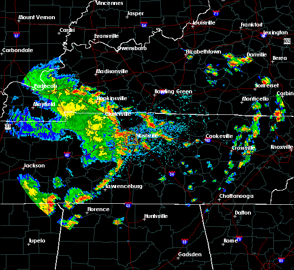 At 1244 pm cdt, a severe thunderstorm was located near belle meade, or near nashville, moving east at 45 mph (radar indicated). Hazards include 60 mph wind gusts. Expect damage to roofs, siding, and trees. Locations impacted include, nashville, forest hills, oak hill, belle meade, bellevue, berry hill, bells bend and whites creek. At 1244 pm cdt, a severe thunderstorm was located near belle meade, or near nashville, moving east at 45 mph (radar indicated). Hazards include 60 mph wind gusts. Expect damage to roofs, siding, and trees. Locations impacted include, nashville, forest hills, oak hill, belle meade, bellevue, berry hill, bells bend and whites creek.
|
| 7/3/2017 12:27 PM CDT |
 The national weather service in nashville has issued a * severe thunderstorm warning for. southwestern davidson county in middle tennessee. east central dickson county in middle tennessee. southeastern cheatham county in middle tennessee. Until 100 pm cdt. The national weather service in nashville has issued a * severe thunderstorm warning for. southwestern davidson county in middle tennessee. east central dickson county in middle tennessee. southeastern cheatham county in middle tennessee. Until 100 pm cdt.
|
| 7/2/2017 4:20 PM CDT |
 At 418 pm cdt, a severe thunderstorm was located over belle meade, or 7 miles southwest of nashville, moving east at 20 mph (radar indicated). Hazards include 60 mph wind gusts. Expect damage to roofs, siding, and trees. Locations impacted include, franklin, brentwood, forest hills, oak hill, belle meade, bellevue and berry hill. At 418 pm cdt, a severe thunderstorm was located over belle meade, or 7 miles southwest of nashville, moving east at 20 mph (radar indicated). Hazards include 60 mph wind gusts. Expect damage to roofs, siding, and trees. Locations impacted include, franklin, brentwood, forest hills, oak hill, belle meade, bellevue and berry hill.
|
| 7/2/2017 4:06 PM CDT | Image of a tree split. also several reports of pea size hai in davidson county TN, 17.7 miles ENE of Nashville, TN |
| 7/2/2017 4:02 PM CDT |
 At 402 pm cdt, a severe thunderstorm was located near bellevue, or 11 miles west of nashville, moving east at 20 mph (radar indicated). Hazards include 60 mph wind gusts. expect damage to roofs, siding, and trees At 402 pm cdt, a severe thunderstorm was located near bellevue, or 11 miles west of nashville, moving east at 20 mph (radar indicated). Hazards include 60 mph wind gusts. expect damage to roofs, siding, and trees
|
| 7/2/2017 3:57 PM CDT | Several large trees down in the riverwalk are in davidson county TN, 17.2 miles NE of Nashville, TN |
| 7/2/2017 3:55 PM CDT | Image of a tree split. also several reports of pea size hail. time estimated based on rada in davidson county TN, 17.7 miles ENE of Nashville, TN |
| 7/1/2017 5:20 PM CDT |
 At 519 pm cdt, a severe thunderstorm was located near fairview, or 13 miles west of franklin, moving east at 40 mph (radar indicated). Hazards include 60 mph wind gusts. Expect damage to roofs, siding, and trees. Locations impacted include, franklin, brentwood, spring hill, thompson`s station, fairview, thompsons station, leipers fork and natchez trace at highway 96. At 519 pm cdt, a severe thunderstorm was located near fairview, or 13 miles west of franklin, moving east at 40 mph (radar indicated). Hazards include 60 mph wind gusts. Expect damage to roofs, siding, and trees. Locations impacted include, franklin, brentwood, spring hill, thompson`s station, fairview, thompsons station, leipers fork and natchez trace at highway 96.
|
| 7/1/2017 5:11 PM CDT |
 At 511 pm cdt, a severe thunderstorm was located 11 miles west of fairview, or 15 miles southeast of dickson, moving east at 40 mph (radar indicated). Hazards include 60 mph wind gusts. expect damage to roofs, siding, and trees At 511 pm cdt, a severe thunderstorm was located 11 miles west of fairview, or 15 miles southeast of dickson, moving east at 40 mph (radar indicated). Hazards include 60 mph wind gusts. expect damage to roofs, siding, and trees
|
| 6/18/2017 1:11 PM CDT | Large branch snapped off tree in crieve hall in davidson county TN, 13.1 miles N of Nashville, TN |
| 5/27/2017 8:04 PM CDT |
 At 803 pm cdt, a severe thunderstorm was located 9 miles southeast of burns, or 12 miles southeast of dickson, moving east at 35 mph (radar indicated). Hazards include 70 mph wind gusts and quarter size hail. Hail damage to vehicles is expected. expect considerable tree damage. wind damage is also likely to mobile homes, roofs, and outbuildings. locations impacted include, franklin, dickson, ashland city, centerville, nashville, brentwood, spring hill, nolensville, forest hills, oak hill, coopertown, white bluff, belle meade, kingston springs, thompson`s station, pegram, mcewen, burns, hurricane mills and fairview. Nashville sounds baseball will also be impacted. At 803 pm cdt, a severe thunderstorm was located 9 miles southeast of burns, or 12 miles southeast of dickson, moving east at 35 mph (radar indicated). Hazards include 70 mph wind gusts and quarter size hail. Hail damage to vehicles is expected. expect considerable tree damage. wind damage is also likely to mobile homes, roofs, and outbuildings. locations impacted include, franklin, dickson, ashland city, centerville, nashville, brentwood, spring hill, nolensville, forest hills, oak hill, coopertown, white bluff, belle meade, kingston springs, thompson`s station, pegram, mcewen, burns, hurricane mills and fairview. Nashville sounds baseball will also be impacted.
|
| 5/27/2017 7:52 PM CDT |
 At 752 pm cdt, a severe thunderstorm was located near gordonsville, or 9 miles southwest of carthage, moving east at 70 mph (radar indicated). Hazards include 70 mph wind gusts and quarter size hail. Hail damage to vehicles is expected. expect considerable tree damage. wind damage is also likely to mobile homes, roofs, and outbuildings. Locations impacted include, murfreesboro, franklin, cookeville, smithville, woodbury, carthage, smyrna, brentwood, la vergne, nolensville, oak hill, algood, watertown, baxter, gordonsville, walterhill, antioch, rural hill, hickman and south carthage. At 752 pm cdt, a severe thunderstorm was located near gordonsville, or 9 miles southwest of carthage, moving east at 70 mph (radar indicated). Hazards include 70 mph wind gusts and quarter size hail. Hail damage to vehicles is expected. expect considerable tree damage. wind damage is also likely to mobile homes, roofs, and outbuildings. Locations impacted include, murfreesboro, franklin, cookeville, smithville, woodbury, carthage, smyrna, brentwood, la vergne, nolensville, oak hill, algood, watertown, baxter, gordonsville, walterhill, antioch, rural hill, hickman and south carthage.
|
| 5/27/2017 7:49 PM CDT |
 At 749 pm cdt, a severe thunderstorm was located near burns, or 9 miles southeast of dickson, moving east at 70 mph (radar indicated). Hazards include 70 mph wind gusts and quarter size hail. Hail damage to vehicles is expected. expect considerable tree damage. Wind damage is also likely to mobile homes, roofs, and outbuildings. At 749 pm cdt, a severe thunderstorm was located near burns, or 9 miles southeast of dickson, moving east at 70 mph (radar indicated). Hazards include 70 mph wind gusts and quarter size hail. Hail damage to vehicles is expected. expect considerable tree damage. Wind damage is also likely to mobile homes, roofs, and outbuildings.
|
| 5/27/2017 7:47 PM CDT |
 At 746 pm cdt, a severe thunderstorm was located near watertown, or 10 miles southeast of lebanon, moving east at 70 mph (radar indicated). Hazards include 70 mph wind gusts and quarter size hail. Hail damage to vehicles is expected. expect considerable tree damage. Wind damage is also likely to mobile homes, roofs, and outbuildings. At 746 pm cdt, a severe thunderstorm was located near watertown, or 10 miles southeast of lebanon, moving east at 70 mph (radar indicated). Hazards include 70 mph wind gusts and quarter size hail. Hail damage to vehicles is expected. expect considerable tree damage. Wind damage is also likely to mobile homes, roofs, and outbuildings.
|
| 5/27/2017 7:36 PM CDT |
 At 735 pm cdt, a severe thunderstorm was located over antioch, or 10 miles southeast of nashville, moving east at 40 mph (radar indicated). Hazards include 70 mph wind gusts and quarter size hail. Hail damage to vehicles is expected. expect considerable tree damage. wind damage is also likely to mobile homes, roofs, and outbuildings. Locations impacted include, murfreesboro, franklin, lebanon, smyrna, brentwood, la vergne, mount juliet, nolensville, forest hills, oak hill, belle meade, kingston springs, thompson`s station, pegram, watertown, walterhill, rural hill, bellevue, antioch and belinda city. At 735 pm cdt, a severe thunderstorm was located over antioch, or 10 miles southeast of nashville, moving east at 40 mph (radar indicated). Hazards include 70 mph wind gusts and quarter size hail. Hail damage to vehicles is expected. expect considerable tree damage. wind damage is also likely to mobile homes, roofs, and outbuildings. Locations impacted include, murfreesboro, franklin, lebanon, smyrna, brentwood, la vergne, mount juliet, nolensville, forest hills, oak hill, belle meade, kingston springs, thompson`s station, pegram, watertown, walterhill, rural hill, bellevue, antioch and belinda city.
|
| 5/27/2017 7:31 PM CDT |
 At 730 pm cdt, a severe thunderstorm was located over hartsville, moving east at 45 mph (radar indicated). Hazards include 70 mph wind gusts and quarter size hail. Hail damage to vehicles is expected. expect considerable tree damage. wind damage is also likely to mobile homes, roofs, and outbuildings. Locations impacted include, gallatin, lafayette, hartsville, hendersonville, westmoreland, cottontown, bethpage, dixon springs, oak grove, bledsoe creek state park and dickerson chapel recreation area. At 730 pm cdt, a severe thunderstorm was located over hartsville, moving east at 45 mph (radar indicated). Hazards include 70 mph wind gusts and quarter size hail. Hail damage to vehicles is expected. expect considerable tree damage. wind damage is also likely to mobile homes, roofs, and outbuildings. Locations impacted include, gallatin, lafayette, hartsville, hendersonville, westmoreland, cottontown, bethpage, dixon springs, oak grove, bledsoe creek state park and dickerson chapel recreation area.
|
| 5/27/2017 7:20 PM CDT |
 At 720 pm cdt, a severe thunderstorm was located over dickson, moving southeast at 55 mph (radar indicated). Hazards include 70 mph wind gusts and quarter size hail. Hail damage to vehicles is expected. expect considerable tree damage. Wind damage is also likely to mobile homes, roofs, and outbuildings. At 720 pm cdt, a severe thunderstorm was located over dickson, moving southeast at 55 mph (radar indicated). Hazards include 70 mph wind gusts and quarter size hail. Hail damage to vehicles is expected. expect considerable tree damage. Wind damage is also likely to mobile homes, roofs, and outbuildings.
|
| 5/27/2017 7:18 PM CDT |
 At 718 pm cdt, a severe thunderstorm was located over nashville, moving southeast at 60 mph (radar indicated). Hazards include 70 mph wind gusts and quarter size hail. Hail damage to vehicles is expected. expect considerable tree damage. Wind damage is also likely to mobile homes, roofs, and outbuildings. At 718 pm cdt, a severe thunderstorm was located over nashville, moving southeast at 60 mph (radar indicated). Hazards include 70 mph wind gusts and quarter size hail. Hail damage to vehicles is expected. expect considerable tree damage. Wind damage is also likely to mobile homes, roofs, and outbuildings.
|
| 5/27/2017 7:15 PM CDT |
 At 715 pm cdt, a severe thunderstorm was located over gallatin, moving east at 50 mph (radar indicated). Hazards include 70 mph wind gusts and quarter size hail. Hail damage to vehicles is expected. expect considerable tree damage. Wind damage is also likely to mobile homes, roofs, and outbuildings. At 715 pm cdt, a severe thunderstorm was located over gallatin, moving east at 50 mph (radar indicated). Hazards include 70 mph wind gusts and quarter size hail. Hail damage to vehicles is expected. expect considerable tree damage. Wind damage is also likely to mobile homes, roofs, and outbuildings.
|
| 5/27/2017 7:03 PM CDT |
 At 703 pm cdt, a severe thunderstorm was located near greenbrier, or near springfield, moving northeast at 45 mph (radar indicated). Hazards include 70 mph wind gusts and quarter size hail. Hail damage to vehicles is expected. expect considerable tree damage. wind damage is also likely to mobile homes, roofs, and outbuildings. Locations impacted include, springfield, ashland city, goodlettsville, millersville, greenbrier, coopertown, ridgetop, cross plains, pleasant view and orlinda. At 703 pm cdt, a severe thunderstorm was located near greenbrier, or near springfield, moving northeast at 45 mph (radar indicated). Hazards include 70 mph wind gusts and quarter size hail. Hail damage to vehicles is expected. expect considerable tree damage. wind damage is also likely to mobile homes, roofs, and outbuildings. Locations impacted include, springfield, ashland city, goodlettsville, millersville, greenbrier, coopertown, ridgetop, cross plains, pleasant view and orlinda.
|
| 5/27/2017 6:51 PM CDT |
 At 651 pm cdt, a severe thunderstorm was located near greenbrier, or 7 miles east of springfield, moving southeast at 45 mph (radar indicated). Hazards include 70 mph wind gusts and quarter size hail. Hail damage to vehicles is expected. expect considerable tree damage. Wind damage is also likely to mobile homes, roofs, and outbuildings. At 651 pm cdt, a severe thunderstorm was located near greenbrier, or 7 miles east of springfield, moving southeast at 45 mph (radar indicated). Hazards include 70 mph wind gusts and quarter size hail. Hail damage to vehicles is expected. expect considerable tree damage. Wind damage is also likely to mobile homes, roofs, and outbuildings.
|
| 5/27/2017 6:44 PM CDT |
 At 644 pm cdt, a line of severe thunderstorm was centered near ashland city, moving southeast at 55 mph (radar indicated). Hazards include 70 mph wind gusts and quarter size hail. Hail damage to vehicles is expected. expect considerable tree damage. Wind damage is also likely to mobile homes, roofs, and outbuildings. At 644 pm cdt, a line of severe thunderstorm was centered near ashland city, moving southeast at 55 mph (radar indicated). Hazards include 70 mph wind gusts and quarter size hail. Hail damage to vehicles is expected. expect considerable tree damage. Wind damage is also likely to mobile homes, roofs, and outbuildings.
|
| 5/27/2017 6:38 PM CDT |
 At 638 pm cdt, a severe thunderstorm was located near coopertown, or 7 miles west of springfield, moving east at 30 mph (radar indicated). Hazards include 70 mph wind gusts and quarter size hail. Hail damage to vehicles is expected. expect considerable tree damage. Wind damage is also likely to mobile homes, roofs, and outbuildings. At 638 pm cdt, a severe thunderstorm was located near coopertown, or 7 miles west of springfield, moving east at 30 mph (radar indicated). Hazards include 70 mph wind gusts and quarter size hail. Hail damage to vehicles is expected. expect considerable tree damage. Wind damage is also likely to mobile homes, roofs, and outbuildings.
|
| 5/27/2017 4:13 PM CDT |
 At 413 pm cdt, a severe thunderstorm was located over kingston springs, or 15 miles east of dickson, moving east at 30 mph (trained weather spotters). Hazards include quarter size hail. damage to vehicles is expected At 413 pm cdt, a severe thunderstorm was located over kingston springs, or 15 miles east of dickson, moving east at 30 mph (trained weather spotters). Hazards include quarter size hail. damage to vehicles is expected
|
| 5/20/2017 4:16 PM CDT |
 At 416 pm cdt, a severe thunderstorm was located over forest hills, or 7 miles north of franklin, moving northeast at 50 mph (radar indicated). Hazards include 60 mph wind gusts. Expect damage to roofs, siding, and trees. Locations impacted include, franklin, nashville, brentwood, forest hills, oak hill, belle meade, bellevue, antioch and berry hill. At 416 pm cdt, a severe thunderstorm was located over forest hills, or 7 miles north of franklin, moving northeast at 50 mph (radar indicated). Hazards include 60 mph wind gusts. Expect damage to roofs, siding, and trees. Locations impacted include, franklin, nashville, brentwood, forest hills, oak hill, belle meade, bellevue, antioch and berry hill.
|
| 5/20/2017 4:07 PM CDT |
 At 407 pm cdt, a severe thunderstorm was located near fairview, or near franklin, moving northeast at 50 mph (radar indicated). Hazards include 60 mph wind gusts. expect damage to roofs, siding, and trees At 407 pm cdt, a severe thunderstorm was located near fairview, or near franklin, moving northeast at 50 mph (radar indicated). Hazards include 60 mph wind gusts. expect damage to roofs, siding, and trees
|
| 5/20/2017 4:00 PM CDT |
 At 359 pm cdt, a severe thunderstorm was located over fairview, or 10 miles northwest of franklin, moving northeast at 50 mph (radar indicated). Hazards include 60 mph wind gusts. Expect damage to roofs, siding, and trees. Locations impacted include, brentwood, forest hills, belle meade, kingston springs, pegram, fairview, bellevue, leipers fork and natchez trace at highway 96. At 359 pm cdt, a severe thunderstorm was located over fairview, or 10 miles northwest of franklin, moving northeast at 50 mph (radar indicated). Hazards include 60 mph wind gusts. Expect damage to roofs, siding, and trees. Locations impacted include, brentwood, forest hills, belle meade, kingston springs, pegram, fairview, bellevue, leipers fork and natchez trace at highway 96.
|
| 5/20/2017 3:58 PM CDT |
 At 358 pm cdt, a severe thunderstorm was located near springfield, moving northeast at 50 mph (radar indicated). Hazards include 60 mph wind gusts. Expect damage to roofs, siding, and trees. Locations impacted include, springfield, white house, millersville, greenbrier, coopertown, ridgetop, joelton and pleasant view. At 358 pm cdt, a severe thunderstorm was located near springfield, moving northeast at 50 mph (radar indicated). Hazards include 60 mph wind gusts. Expect damage to roofs, siding, and trees. Locations impacted include, springfield, white house, millersville, greenbrier, coopertown, ridgetop, joelton and pleasant view.
|
| 5/20/2017 3:50 PM CDT | Small limbs were blown down at percy warner park. winds were estimated at 45 mp in davidson county TN, 14.5 miles NE of Nashville, TN |
| 5/20/2017 3:44 PM CDT |
 At 344 pm cdt, a severe thunderstorm was located 11 miles southwest of fairview, or 17 miles west of franklin, moving northeast at 50 mph (radar indicated). Hazards include 60 mph wind gusts. expect damage to roofs, siding, and trees At 344 pm cdt, a severe thunderstorm was located 11 miles southwest of fairview, or 17 miles west of franklin, moving northeast at 50 mph (radar indicated). Hazards include 60 mph wind gusts. expect damage to roofs, siding, and trees
|
| 5/20/2017 3:41 PM CDT |
 At 341 pm cdt, a severe thunderstorm was located over ashland city, moving northeast at 50 mph (radar indicated). Hazards include 60 mph wind gusts. expect damage to roofs, siding, and trees At 341 pm cdt, a severe thunderstorm was located over ashland city, moving northeast at 50 mph (radar indicated). Hazards include 60 mph wind gusts. expect damage to roofs, siding, and trees
|
| 5/20/2017 3:36 PM CDT |
 At 335 pm cdt, a severe thunderstorm was located over ashland city, moving northeast at 55 mph (radar indicated). Hazards include 60 mph wind gusts. Expect damage to roofs, siding, and trees. Locations impacted include, ashland city. At 335 pm cdt, a severe thunderstorm was located over ashland city, moving northeast at 55 mph (radar indicated). Hazards include 60 mph wind gusts. Expect damage to roofs, siding, and trees. Locations impacted include, ashland city.
|
| 5/20/2017 3:22 PM CDT |
 At 321 pm cdt, a severe thunderstorm was located over white bluff, or 9 miles east of dickson, moving northeast at 55 mph (radar indicated). Hazards include 60 mph wind gusts. expect damage to roofs, siding, and trees At 321 pm cdt, a severe thunderstorm was located over white bluff, or 9 miles east of dickson, moving northeast at 55 mph (radar indicated). Hazards include 60 mph wind gusts. expect damage to roofs, siding, and trees
|
| 4/30/2017 3:38 PM CDT |
 At 338 pm cdt, severe thunderstorms were located along a line extending from near rural hill to 6 miles south of nolensville, moving northeast at 35 mph (radar indicated). Hazards include 60 mph wind gusts. Expect damage to roofs, siding, and trees. locations impacted include, murfreesboro, lebanon, smyrna, la vergne, mount juliet, walterhill, rural hill, belinda city, cedars of lebanon state park and gladeville. A tornado watch remains in effect until 700 pm cdt for middle tennessee. At 338 pm cdt, severe thunderstorms were located along a line extending from near rural hill to 6 miles south of nolensville, moving northeast at 35 mph (radar indicated). Hazards include 60 mph wind gusts. Expect damage to roofs, siding, and trees. locations impacted include, murfreesboro, lebanon, smyrna, la vergne, mount juliet, walterhill, rural hill, belinda city, cedars of lebanon state park and gladeville. A tornado watch remains in effect until 700 pm cdt for middle tennessee.
|
| 4/30/2017 3:21 PM CDT |
 At 321 pm cdt, severe thunderstorms were located along a line extending from near millersville to near mount juliet, moving northeast at 50 mph (radar indicated). Hazards include 60 mph wind gusts. Expect damage to roofs, siding, and trees. locations impacted include, gallatin, lebanon, hendersonville, mount juliet, white house, lakewood, hermitage, cottontown, percy priest lake and bledsoe creek state park. A tornado watch remains in effect until 700 pm cdt for middle tennessee. At 321 pm cdt, severe thunderstorms were located along a line extending from near millersville to near mount juliet, moving northeast at 50 mph (radar indicated). Hazards include 60 mph wind gusts. Expect damage to roofs, siding, and trees. locations impacted include, gallatin, lebanon, hendersonville, mount juliet, white house, lakewood, hermitage, cottontown, percy priest lake and bledsoe creek state park. A tornado watch remains in effect until 700 pm cdt for middle tennessee.
|
| 4/30/2017 3:14 PM CDT |
 At 312 pm cdt, severe thunderstorms were located along a line extending from near hermitage to 9 miles east of spring hill, moving northeast at 30 mph (radar indicated. several trees in williamson county have been snapped or downed by this line of storms). Hazards include 60 mph wind gusts. expect damage to roofs, siding, and trees At 312 pm cdt, severe thunderstorms were located along a line extending from near hermitage to 9 miles east of spring hill, moving northeast at 30 mph (radar indicated. several trees in williamson county have been snapped or downed by this line of storms). Hazards include 60 mph wind gusts. expect damage to roofs, siding, and trees
|
| 4/30/2017 3:07 PM CDT |
 At 306 pm cdt, severe thunderstorms were located along a line extending from near antioch to near nolensville, moving northeast at 40 mph (radar indicated. this line of storms has a history of producing damaging wind gusts in franklin and southeastern davidson county). Hazards include 70 mph wind gusts. Expect considerable tree damage. damage is likely to mobile homes, roofs, and outbuildings. locations impacted include, franklin, smyrna, brentwood, la vergne, nolensville, oak hill, antioch, eagleville, berry hill, percy priest lake and triune. A tornado watch remains in effect until 700 pm cdt for middle tennessee. At 306 pm cdt, severe thunderstorms were located along a line extending from near antioch to near nolensville, moving northeast at 40 mph (radar indicated. this line of storms has a history of producing damaging wind gusts in franklin and southeastern davidson county). Hazards include 70 mph wind gusts. Expect considerable tree damage. damage is likely to mobile homes, roofs, and outbuildings. locations impacted include, franklin, smyrna, brentwood, la vergne, nolensville, oak hill, antioch, eagleville, berry hill, percy priest lake and triune. A tornado watch remains in effect until 700 pm cdt for middle tennessee.
|
| 4/30/2017 3:04 PM CDT | Large tree uprooted on fairway drive in donelson in davidson county TN, 5.4 miles NW of Nashville, TN |
| 4/30/2017 3:04 PM CDT |
 At 304 pm cdt, severe thunderstorms were located along a line extending from near madison to near antioch, moving northeast at 50 mph (radar indicated). Hazards include 70 mph wind gusts. Expect considerable tree damage. Damage is likely to mobile homes, roofs, and outbuildings. At 304 pm cdt, severe thunderstorms were located along a line extending from near madison to near antioch, moving northeast at 50 mph (radar indicated). Hazards include 70 mph wind gusts. Expect considerable tree damage. Damage is likely to mobile homes, roofs, and outbuildings.
|
| 4/30/2017 3:03 PM CDT | Large tree down across essex avenue at riverside drive in davidson county TN, 2.8 miles NW of Nashville, TN |
| 4/30/2017 3:00 PM CDT | Spotter reported two trees snapped in crieve hall on kincannon road in davidson county TN, 9 miles N of Nashville, TN |
| 4/30/2017 2:59 PM CDT | Tree in road on ezell pike near post office in davidson county TN, 10.1 miles NNW of Nashville, TN |
| 4/30/2017 2:57 PM CDT | Tspotter photo of large tree branch down on fence between the gulch and music row in davidson county TN, 5.8 miles NNE of Nashville, TN |
| 4/30/2017 2:56 PM CDT | Tree down across fieldcrest drive at montclair drive in davidson county TN, 11 miles N of Nashville, TN |
| 4/30/2017 2:55 PM CDT | Tree...power pole and lines down across harding place at milner drive in davidson county TN, 10.4 miles N of Nashville, TN |
| 4/30/2017 2:48 PM CDT |
 At 247 pm cdt, severe thunderstorms were located along a line extending from near brentwood to near spring hill, moving northeast at 40 mph (radar indicated). Hazards include 70 mph wind gusts. Expect considerable tree damage. Damage is likely to mobile homes, roofs, and outbuildings. At 247 pm cdt, severe thunderstorms were located along a line extending from near brentwood to near spring hill, moving northeast at 40 mph (radar indicated). Hazards include 70 mph wind gusts. Expect considerable tree damage. Damage is likely to mobile homes, roofs, and outbuildings.
|
| 4/23/2017 12:03 PM CDT | Large tree blocking northbound harding pike at davidson road. time estimated based on rada in davidson county TN, 10.1 miles NE of Nashville, TN |
| 4/18/2017 4:18 PM CDT | A few trees down and damage to a backstop at a baseball field at rotary park in hermitag in davidson county TN, 8.7 miles W of Nashville, TN |
| 4/18/2017 4:08 PM CDT | A few trees down in the donelson area including one which fell on a house in the stanford estates neighborhoo in davidson county TN, 5 miles WNW of Nashville, TN |
| 4/18/2017 4:03 PM CDT | A tspotter report showed a large tree that fell on a parked car at music ro in davidson county TN, 5.4 miles NNE of Nashville, TN |
| 3/27/2017 6:14 PM CDT |
 At 614 pm cdt, a severe thunderstorm was located 9 miles southwest of fairview, or 15 miles west of franklin, moving east at 40 mph (radar indicated). Hazards include 60 mph wind gusts and penny size hail. Expect damage to roofs, siding, and trees. Locations impacted include, columbia, spring hill, thompson`s station, fairview, leipers fork and natchez trace at highway 96. At 614 pm cdt, a severe thunderstorm was located 9 miles southwest of fairview, or 15 miles west of franklin, moving east at 40 mph (radar indicated). Hazards include 60 mph wind gusts and penny size hail. Expect damage to roofs, siding, and trees. Locations impacted include, columbia, spring hill, thompson`s station, fairview, leipers fork and natchez trace at highway 96.
|
| 3/27/2017 5:45 PM CDT |
 At 545 pm cdt, a severe thunderstorm was located 7 miles north of centerville, moving east at 40 mph (radar indicated). Hazards include 60 mph wind gusts and quarter size hail. Hail damage to vehicles is expected. Expect wind damage to roofs, siding, and trees. At 545 pm cdt, a severe thunderstorm was located 7 miles north of centerville, moving east at 40 mph (radar indicated). Hazards include 60 mph wind gusts and quarter size hail. Hail damage to vehicles is expected. Expect wind damage to roofs, siding, and trees.
|
| 3/27/2017 4:38 PM CDT |
 At 437 pm cdt, a severe thunderstorm was located over belinda city, or 8 miles west of lebanon, moving northeast at 45 mph (radar indicated). Hazards include 60 mph wind gusts and penny size hail. Expect damage to roofs, siding, and trees. Locations impacted include, gallatin, lebanon, hendersonville, mount juliet, rural hill, belinda city, dickerson chapel recreation area and gladeville. At 437 pm cdt, a severe thunderstorm was located over belinda city, or 8 miles west of lebanon, moving northeast at 45 mph (radar indicated). Hazards include 60 mph wind gusts and penny size hail. Expect damage to roofs, siding, and trees. Locations impacted include, gallatin, lebanon, hendersonville, mount juliet, rural hill, belinda city, dickerson chapel recreation area and gladeville.
|
| 3/27/2017 4:19 PM CDT |
 At 419 pm cdt, a severe thunderstorm was located over la vergne, or 14 miles northwest of murfreesboro, moving northeast at 45 mph (radar indicated). Hazards include 60 mph wind gusts and penny size hail. expect damage to roofs, siding, and trees At 419 pm cdt, a severe thunderstorm was located over la vergne, or 14 miles northwest of murfreesboro, moving northeast at 45 mph (radar indicated). Hazards include 60 mph wind gusts and penny size hail. expect damage to roofs, siding, and trees
|
| 3/27/2017 4:08 PM CDT |
 At 408 pm cdt, a severe thunderstorm was located near nolensville, or 10 miles east of franklin, moving north at 45 mph (radar indicated). Hazards include 60 mph wind gusts and nickel size hail. Expect damage to roofs, siding, and trees. Locations impacted include, smyrna, brentwood, la vergne, nolensville and triune. At 408 pm cdt, a severe thunderstorm was located near nolensville, or 10 miles east of franklin, moving north at 45 mph (radar indicated). Hazards include 60 mph wind gusts and nickel size hail. Expect damage to roofs, siding, and trees. Locations impacted include, smyrna, brentwood, la vergne, nolensville and triune.
|
| 3/27/2017 4:07 PM CDT |
 At 406 pm cdt, a severe thunderstorm was located over hendersonville, or 8 miles west of gallatin, moving northeast at 50 mph (emergency management). Hazards include 60 mph wind gusts and quarter size hail. Hail damage to vehicles is expected. expect wind damage to roofs, siding, and trees. Locations impacted include, gallatin, madison, hendersonville, mount juliet, goodlettsville, white house, millersville, lakewood, cross plains, hermitage, old hickory, orlinda, bledsoe creek state park and cottontown. At 406 pm cdt, a severe thunderstorm was located over hendersonville, or 8 miles west of gallatin, moving northeast at 50 mph (emergency management). Hazards include 60 mph wind gusts and quarter size hail. Hail damage to vehicles is expected. expect wind damage to roofs, siding, and trees. Locations impacted include, gallatin, madison, hendersonville, mount juliet, goodlettsville, white house, millersville, lakewood, cross plains, hermitage, old hickory, orlinda, bledsoe creek state park and cottontown.
|
| 3/27/2017 3:56 PM CDT | A tree fell on a house on lemont d in davidson county TN, 0.8 miles SSW of Nashville, TN |
| 3/27/2017 3:55 PM CDT |
 At 354 pm cdt, a severe thunderstorm was located 10 miles east of spring hill, or 14 miles south of franklin, moving north at 45 mph (radar indicated). Hazards include 60 mph wind gusts and quarter size hail. Hail damage to vehicles is expected. Expect wind damage to roofs, siding, and trees. At 354 pm cdt, a severe thunderstorm was located 10 miles east of spring hill, or 14 miles south of franklin, moving north at 45 mph (radar indicated). Hazards include 60 mph wind gusts and quarter size hail. Hail damage to vehicles is expected. Expect wind damage to roofs, siding, and trees.
|
| 3/27/2017 3:53 PM CDT |
 The severe thunderstorm warning for central davidson county will expire at 400 pm cdt, the storm which prompted the warning has been replaced with a new severe thunderstorm warning. a severe thunderstorm watch remains in effect until 1000 pm cdt for middle tennessee. remember, a severe thunderstorm warning still remains in effect for davidson county until 415 pm cdt. The severe thunderstorm warning for central davidson county will expire at 400 pm cdt, the storm which prompted the warning has been replaced with a new severe thunderstorm warning. a severe thunderstorm watch remains in effect until 1000 pm cdt for middle tennessee. remember, a severe thunderstorm warning still remains in effect for davidson county until 415 pm cdt.
|
| 3/27/2017 3:52 PM CDT | A tspotter report showed a large tree that clipped a house when it fell on pennock av in davidson county TN, 2.7 miles N of Nashville, TN |
| 3/27/2017 3:52 PM CDT |
 At 352 pm cdt, a severe thunderstorm was located near nashville, moving northeast at 50 mph (radar indicated). Hazards include 70 mph wind gusts and quarter size hail. Hail damage to vehicles is expected. expect considerable tree damage. Wind damage is also likely to mobile homes, roofs, and outbuildings. At 352 pm cdt, a severe thunderstorm was located near nashville, moving northeast at 50 mph (radar indicated). Hazards include 70 mph wind gusts and quarter size hail. Hail damage to vehicles is expected. expect considerable tree damage. Wind damage is also likely to mobile homes, roofs, and outbuildings.
|
| 3/27/2017 3:50 PM CDT | Measured at wtvf-tv in downtown nashville in davidson county TN, 4.3 miles NNE of Nashville, TN |
| 3/27/2017 3:48 PM CDT | A tree fell on a house on cephas stree in davidson county TN, 4.1 miles NE of Nashville, TN |
| 3/27/2017 3:48 PM CDT | Tspotter reports showed multiple trees down on west end near the vanderbilt campu in davidson county TN, 6.3 miles NNE of Nashville, TN |
| 3/27/2017 3:47 PM CDT | A large tree fell on multiple parked cars at acklen park dr and fairmont d in davidson county TN, 7.2 miles NNE of Nashville, TN |
| 3/27/2017 3:45 PM CDT | Occurred at wsmv-tv west of downtown nashville in davidson county TN, 4.3 miles NNE of Nashville, TN |
| 3/27/2017 3:43 PM CDT |
 At 343 pm cdt, a severe thunderstorm was located over belle meade, or near nashville, moving northeast at 50 mph (radar indicated). Hazards include 70 mph wind gusts and nickel size hail. Expect considerable tree damage. damage is likely to mobile homes, roofs, and outbuildings. Locations impacted include, nashville, madison, brentwood, forest hills, oak hill, belle meade, lakewood, bellevue, joelton, berry hill, bells bend, whites creek and beaman park. At 343 pm cdt, a severe thunderstorm was located over belle meade, or near nashville, moving northeast at 50 mph (radar indicated). Hazards include 70 mph wind gusts and nickel size hail. Expect considerable tree damage. damage is likely to mobile homes, roofs, and outbuildings. Locations impacted include, nashville, madison, brentwood, forest hills, oak hill, belle meade, lakewood, bellevue, joelton, berry hill, bells bend, whites creek and beaman park.
|
| 3/27/2017 3:41 PM CDT | A tree fell on a moving vehicle on hobbs rd in green hills. no injuries were reporte in davidson county TN, 9.5 miles NNE of Nashville, TN |
| 3/27/2017 3:39 PM CDT | Tree down at harding place and northumberland in davidson county TN, 10.1 miles NNE of Nashville, TN |
| 3/27/2017 3:39 PM CDT | Tree down on abbot martin r in davidson county TN, 9.5 miles NNE of Nashville, TN |
| 3/27/2017 3:36 PM CDT |
 At 336 pm cdt, a severe thunderstorm was located over bellevue, or 9 miles northwest of franklin, moving northeast at 50 mph (radar indicated). Hazards include 60 mph wind gusts and quarter size hail. Hail damage to vehicles is expected. Expect wind damage to roofs, siding, and trees. At 336 pm cdt, a severe thunderstorm was located over bellevue, or 9 miles northwest of franklin, moving northeast at 50 mph (radar indicated). Hazards include 60 mph wind gusts and quarter size hail. Hail damage to vehicles is expected. Expect wind damage to roofs, siding, and trees.
|
| 3/27/2017 3:34 PM CDT | Trees down at temple rd. and highway 100 in bellevue in davidson county TN, 16.1 miles NE of Nashville, TN |
| 3/27/2017 3:31 PM CDT | Tree down at sneed rd and temple r in williamson county TN, 19.9 miles NE of Nashville, TN |
| 3/21/2017 4:51 PM CDT |
 At 450 pm cdt, severe thunderstorms were located along a line extending from smyrna to 6 miles southwest of murfreesboro, moving east at 35 mph (radar indicated). Hazards include 70 mph wind gusts and nickel size hail. Expect considerable tree damage. Damage is likely to mobile homes, roofs, and outbuildings. At 450 pm cdt, severe thunderstorms were located along a line extending from smyrna to 6 miles southwest of murfreesboro, moving east at 35 mph (radar indicated). Hazards include 70 mph wind gusts and nickel size hail. Expect considerable tree damage. Damage is likely to mobile homes, roofs, and outbuildings.
|
| 3/21/2017 4:42 PM CDT |
 At 442 pm cdt, severe thunderstorms were located along a line extending from la vergne to 10 miles west of murfreesboro, moving east at 35 mph (radar indicated). Hazards include 60 mph wind gusts and nickel size hail. expect damage to roofs, siding, and trees At 442 pm cdt, severe thunderstorms were located along a line extending from la vergne to 10 miles west of murfreesboro, moving east at 35 mph (radar indicated). Hazards include 60 mph wind gusts and nickel size hail. expect damage to roofs, siding, and trees
|
| 3/21/2017 4:09 PM CDT | Trees down on powerlines in bellevue... powerlines on the ground in davidson county TN, 9.6 miles ENE of Nashville, TN |
| 3/9/2017 11:18 PM CST |
 At 1118 pm cst, a severe thunderstorm was located 11 miles south of nolensville, or 14 miles southeast of franklin, moving east at 50 mph (radar indicated). Hazards include 60 mph wind gusts. expect damage to roofs, siding, and trees At 1118 pm cst, a severe thunderstorm was located 11 miles south of nolensville, or 14 miles southeast of franklin, moving east at 50 mph (radar indicated). Hazards include 60 mph wind gusts. expect damage to roofs, siding, and trees
|
| 3/9/2017 11:03 PM CST |
 At 1103 pm cst, a severe thunderstorm was located near thompson`s station, or near franklin, moving east at 50 mph (radar indicated). Hazards include 60 mph wind gusts. expect damage to roofs, siding, and trees At 1103 pm cst, a severe thunderstorm was located near thompson`s station, or near franklin, moving east at 50 mph (radar indicated). Hazards include 60 mph wind gusts. expect damage to roofs, siding, and trees
|
| 3/9/2017 11:00 PM CST |
 At 1100 pm cst, a severe thunderstorm was located over brentwood, or 7 miles northeast of franklin, moving east at 55 mph (radar indicated). Hazards include 60 mph wind gusts. Expect damage to roofs, siding, and trees. Locations impacted include, franklin, brentwood, nolensville, forest hills, oak hill, thompson`s station, antioch, berry hill, percy priest lake and leipers fork. At 1100 pm cst, a severe thunderstorm was located over brentwood, or 7 miles northeast of franklin, moving east at 55 mph (radar indicated). Hazards include 60 mph wind gusts. Expect damage to roofs, siding, and trees. Locations impacted include, franklin, brentwood, nolensville, forest hills, oak hill, thompson`s station, antioch, berry hill, percy priest lake and leipers fork.
|
| 3/9/2017 10:54 PM CST | A trained spotter in the greenhills area reported trees dow in davidson county TN, 9.6 miles NNE of Nashville, TN |
| 3/9/2017 10:52 PM CST |
 At 1052 pm cst, a severe thunderstorm was located over bellevue, or 8 miles northwest of franklin, moving east at 55 mph (radar indicated). Hazards include 60 mph wind gusts. expect damage to roofs, siding, and trees At 1052 pm cst, a severe thunderstorm was located over bellevue, or 8 miles northwest of franklin, moving east at 55 mph (radar indicated). Hazards include 60 mph wind gusts. expect damage to roofs, siding, and trees
|
| 3/9/2017 10:44 PM CST |
 At 1044 pm cst, a severe thunderstorm was located near belle meade, or near nashville, moving east at 55 mph (radar indicated). Hazards include 60 mph wind gusts. Expect damage to roofs, siding, and trees. Locations impacted include, ashland city, nashville, brentwood, goodlettsville, forest hills, oak hill, coopertown, white bluff, belle meade, kingston springs, pegram, ridgetop, burns, bellevue, fairview, joelton, pleasant view, berry hill, bon aqua and bells bend. At 1044 pm cst, a severe thunderstorm was located near belle meade, or near nashville, moving east at 55 mph (radar indicated). Hazards include 60 mph wind gusts. Expect damage to roofs, siding, and trees. Locations impacted include, ashland city, nashville, brentwood, goodlettsville, forest hills, oak hill, coopertown, white bluff, belle meade, kingston springs, pegram, ridgetop, burns, bellevue, fairview, joelton, pleasant view, berry hill, bon aqua and bells bend.
|
| 3/9/2017 10:32 PM CST |
 At 1032 pm cst, a severe thunderstorm was located near kingston springs, or 7 miles southwest of ashland city, moving east at 55 mph (radar indicated). Hazards include 60 mph wind gusts. expect damage to roofs, siding, and trees At 1032 pm cst, a severe thunderstorm was located near kingston springs, or 7 miles southwest of ashland city, moving east at 55 mph (radar indicated). Hazards include 60 mph wind gusts. expect damage to roofs, siding, and trees
|
| 3/9/2017 9:26 PM CST |
 At 926 pm cst, a severe thunderstorm was located over belinda city, or 11 miles west of lebanon, moving east at 35 mph (radar indicated). Hazards include 60 mph wind gusts and quarter size hail. Hail damage to vehicles is expected. expect wind damage to roofs, siding, and trees. Locations impacted include, mount juliet, belinda city, hermitage, rural hill and gladeville. At 926 pm cst, a severe thunderstorm was located over belinda city, or 11 miles west of lebanon, moving east at 35 mph (radar indicated). Hazards include 60 mph wind gusts and quarter size hail. Hail damage to vehicles is expected. expect wind damage to roofs, siding, and trees. Locations impacted include, mount juliet, belinda city, hermitage, rural hill and gladeville.
|
| 3/9/2017 9:16 PM CST |
 At 915 pm cst, a severe thunderstorm was located near antioch, or 7 miles southeast of nashville, moving east at 20 mph (radar indicated). Hazards include 60 mph wind gusts and quarter size hail. Hail damage to vehicles is expected. Expect wind damage to roofs, siding, and trees. At 915 pm cst, a severe thunderstorm was located near antioch, or 7 miles southeast of nashville, moving east at 20 mph (radar indicated). Hazards include 60 mph wind gusts and quarter size hail. Hail damage to vehicles is expected. Expect wind damage to roofs, siding, and trees.
|
| 3/9/2017 8:42 PM CST |
 At 842 pm cst, a severe thunderstorm was located over madison, or near nashville, moving northeast at 45 mph (radar indicated). Hazards include 60 mph wind gusts and quarter size hail. Hail damage to vehicles is expected. Expect wind damage to roofs, siding, and trees. At 842 pm cst, a severe thunderstorm was located over madison, or near nashville, moving northeast at 45 mph (radar indicated). Hazards include 60 mph wind gusts and quarter size hail. Hail damage to vehicles is expected. Expect wind damage to roofs, siding, and trees.
|
| 3/9/2017 8:40 PM CST | Quarter sized hail reported 4.7 miles ESE of Nashville, TN, twitter report of greater than 1 hail in fontanel. |
| 3/9/2017 8:30 PM CST |
 At 830 pm cst, a severe thunderstorm was located 7 miles southwest of joelton, or 8 miles northwest of nashville, moving northeast at 55 mph (radar indicated). Hazards include 60 mph wind gusts and quarter size hail. Hail damage to vehicles is expected. expect wind damage to roofs, siding, and trees. Locations impacted include, ashland city, nashville, joelton, whites creek, beaman park and bells bend. At 830 pm cst, a severe thunderstorm was located 7 miles southwest of joelton, or 8 miles northwest of nashville, moving northeast at 55 mph (radar indicated). Hazards include 60 mph wind gusts and quarter size hail. Hail damage to vehicles is expected. expect wind damage to roofs, siding, and trees. Locations impacted include, ashland city, nashville, joelton, whites creek, beaman park and bells bend.
|
| 3/9/2017 8:14 PM CST |
 At 814 pm cst, a severe thunderstorm was located near white bluff, or 11 miles southwest of ashland city, moving northeast at 55 mph (radar indicated). Hazards include 60 mph wind gusts and quarter size hail. Hail damage to vehicles is expected. Expect wind damage to roofs, siding, and trees. At 814 pm cst, a severe thunderstorm was located near white bluff, or 11 miles southwest of ashland city, moving northeast at 55 mph (radar indicated). Hazards include 60 mph wind gusts and quarter size hail. Hail damage to vehicles is expected. Expect wind damage to roofs, siding, and trees.
|
| 3/1/2017 7:17 AM CST |
 At 716 am cst, a severe thunderstorm capable of producing a tornado was located over la vergne, or 14 miles northwest of murfreesboro, moving east at 70 mph (radar indicated rotation. at 7:08am damage was reported at cool springs galleria ). Hazards include tornado. Flying debris will be dangerous to those caught without shelter. mobile homes will be damaged or destroyed. damage to roofs, windows, and vehicles will occur. tree damage is likely. this dangerous storm will be near, walterhill around 725 am cst. Other locations impacted by this tornadic thunderstorm include cedars of lebanon state park, gladeville and lascassas. At 716 am cst, a severe thunderstorm capable of producing a tornado was located over la vergne, or 14 miles northwest of murfreesboro, moving east at 70 mph (radar indicated rotation. at 7:08am damage was reported at cool springs galleria ). Hazards include tornado. Flying debris will be dangerous to those caught without shelter. mobile homes will be damaged or destroyed. damage to roofs, windows, and vehicles will occur. tree damage is likely. this dangerous storm will be near, walterhill around 725 am cst. Other locations impacted by this tornadic thunderstorm include cedars of lebanon state park, gladeville and lascassas.
|
| 3/1/2017 7:15 AM CST | Damage to structure and boats was shown in a video from four corners marina. time estimated by rada in davidson county TN, 16.2 miles NW of Nashville, TN |
| 3/1/2017 7:12 AM CST | Ema reports trees and power poles downi in southeast davidson county on pettus roa in davidson county TN, 15.9 miles NNW of Nashville, TN |
| 3/1/2017 7:11 AM CST |
 At 710 am cst, a severe thunderstorm capable of producing a tornado was located near nolensville, or 10 miles northeast of franklin, moving east at 65 mph (radar indicated rotation. at 7:08 damage at cool spring galleria was reported). Hazards include tornado. Flying debris will be dangerous to those caught without shelter. mobile homes will be damaged or destroyed. damage to roofs, windows, and vehicles will occur. tree damage is likely. this dangerous storm will be near, smyrna and la vergne around 720 am cst. walterhill around 725 am cst. Other locations impacted by this tornadic thunderstorm include cedars of lebanon state park, gladeville and lascassas. At 710 am cst, a severe thunderstorm capable of producing a tornado was located near nolensville, or 10 miles northeast of franklin, moving east at 65 mph (radar indicated rotation. at 7:08 damage at cool spring galleria was reported). Hazards include tornado. Flying debris will be dangerous to those caught without shelter. mobile homes will be damaged or destroyed. damage to roofs, windows, and vehicles will occur. tree damage is likely. this dangerous storm will be near, smyrna and la vergne around 720 am cst. walterhill around 725 am cst. Other locations impacted by this tornadic thunderstorm include cedars of lebanon state park, gladeville and lascassas.
|
| 3/1/2017 7:10 AM CST | Estimated wind gust to 60 mph on the i-40 overpass at the stones rive in davidson county TN, 8.6 miles WNW of Nashville, TN |
| 3/1/2017 7:09 AM CST | Roof damage/gas leak at dupont middle tennessee in davidson county TN, 6.2 miles WSW of Nashville, TN |
| 3/1/2017 7:06 AM CST | Facebook post of damage to house and out building on morningside drive. time estimated from rada in davidson county TN, 0.7 miles NNE of Nashville, TN |
| 3/1/2017 7:05 AM CST | Emergency manager reported trees and power lines down... along with a car possible being flipped. time estimated by rada in davidson county TN, 9.6 miles NE of Nashville, TN |
| 3/1/2017 7:03 AM CST |
 At 702 am cst, a severe thunderstorm capable of producing a tornado was located over franklin, moving east at 70 mph (radar indicated rotation). Hazards include tornado. Flying debris will be dangerous to those caught without shelter. mobile homes will be damaged or destroyed. damage to roofs, windows, and vehicles will occur. tree damage is likely. this dangerous storm will be near, brentwood around 705 am cst. nolensville and antioch around 710 am cst. smyrna and la vergne around 720 am cst. walterhill around 725 am cst. Other locations impacted by this tornadic thunderstorm include cedars of lebanon state park, gladeville and lascassas. At 702 am cst, a severe thunderstorm capable of producing a tornado was located over franklin, moving east at 70 mph (radar indicated rotation). Hazards include tornado. Flying debris will be dangerous to those caught without shelter. mobile homes will be damaged or destroyed. damage to roofs, windows, and vehicles will occur. tree damage is likely. this dangerous storm will be near, brentwood around 705 am cst. nolensville and antioch around 710 am cst. smyrna and la vergne around 720 am cst. walterhill around 725 am cst. Other locations impacted by this tornadic thunderstorm include cedars of lebanon state park, gladeville and lascassas.
|
| 3/1/2017 6:55 AM CST |
 At 654 am cst, severe thunderstorms were located along a line extending from near springfield to near oak hill to near thompson`s station, moving east at 65 mph (radar indicated). Hazards include 70 mph wind gusts and nickel size hail. Expect considerable tree damage. Damage is likely to mobile homes, roofs, and outbuildings. At 654 am cst, severe thunderstorms were located along a line extending from near springfield to near oak hill to near thompson`s station, moving east at 65 mph (radar indicated). Hazards include 70 mph wind gusts and nickel size hail. Expect considerable tree damage. Damage is likely to mobile homes, roofs, and outbuildings.
|
| 3/1/2017 6:54 AM CST | Nwschat report of trees that fell near the vanderbuilt football stadium and landed on two vehicles. time estimated by rada in davidson county TN, 6.9 miles NNE of Nashville, TN |
| 3/1/2017 6:48 AM CST | Emergency manager reported trees and power lines down... along with a car possible being flipped. time estimated by rada in davidson county TN, 9.6 miles NE of Nashville, TN |
| 3/1/2017 6:39 AM CST |
 At 638 am cst, severe thunderstorms were located along a line extending from 12 miles south of clarksville to white bluff to near centerville, moving east at 70 mph (radar indicated). Hazards include 70 mph wind gusts and quarter size hail. Hail damage to vehicles is expected. expect considerable tree damage. wind damage is also likely to mobile homes, roofs, and outbuildings. locations impacted include, franklin, springfield, dickson, ashland city, centerville, nashville, brentwood, goodlettsville, greenbrier, forest hills, oak hill, coopertown, white bluff, belle meade, kingston springs, pegram, ridgetop, burns, fairview and bellevue. A tornado watch remains in effect until 1000 am cst for middle tennessee. At 638 am cst, severe thunderstorms were located along a line extending from 12 miles south of clarksville to white bluff to near centerville, moving east at 70 mph (radar indicated). Hazards include 70 mph wind gusts and quarter size hail. Hail damage to vehicles is expected. expect considerable tree damage. wind damage is also likely to mobile homes, roofs, and outbuildings. locations impacted include, franklin, springfield, dickson, ashland city, centerville, nashville, brentwood, goodlettsville, greenbrier, forest hills, oak hill, coopertown, white bluff, belle meade, kingston springs, pegram, ridgetop, burns, fairview and bellevue. A tornado watch remains in effect until 1000 am cst for middle tennessee.
|
| 3/1/2017 6:24 AM CST |
 At 624 am cst, severe thunderstorms were located along a line extending from 8 miles east of erin to near dickson to 11 miles west of centerville, moving east at 70 mph (radar indicated). Hazards include 70 mph wind gusts. Expect considerable tree damage. Damage is likely to mobile homes, roofs, and outbuildings. At 624 am cst, severe thunderstorms were located along a line extending from 8 miles east of erin to near dickson to 11 miles west of centerville, moving east at 70 mph (radar indicated). Hazards include 70 mph wind gusts. Expect considerable tree damage. Damage is likely to mobile homes, roofs, and outbuildings.
|
| 2/7/2017 10:41 AM CST |
 The national weather service in nashville has issued a * severe thunderstorm warning for. western smith county in middle tennessee. rutherford county in middle tennessee. southeastern sumner county in middle tennessee. Wilson county in middle tennessee. The national weather service in nashville has issued a * severe thunderstorm warning for. western smith county in middle tennessee. rutherford county in middle tennessee. southeastern sumner county in middle tennessee. Wilson county in middle tennessee.
|
| 2/7/2017 10:25 AM CST |
 At 1024 am cst, severe thunderstorms were located along a line extending from hendersonville to thompson`s station, moving east at 50 mph (radar indicated). Hazards include 60 mph wind gusts and penny size hail. Expect damage to roofs, siding, and trees. Locations impacted include, murfreesboro, franklin, gallatin, lebanon, nashville, madison, hendersonville, smyrna, brentwood, la vergne, spring hill, mount juliet, goodlettsville, millersville, nolensville, forest hills, oak hill, belle meade, lakewood and thompson`s station. At 1024 am cst, severe thunderstorms were located along a line extending from hendersonville to thompson`s station, moving east at 50 mph (radar indicated). Hazards include 60 mph wind gusts and penny size hail. Expect damage to roofs, siding, and trees. Locations impacted include, murfreesboro, franklin, gallatin, lebanon, nashville, madison, hendersonville, smyrna, brentwood, la vergne, spring hill, mount juliet, goodlettsville, millersville, nolensville, forest hills, oak hill, belle meade, lakewood and thompson`s station.
|
| 2/7/2017 10:16 AM CST | Tree blown down on old glenrose avenue between i-24 and briley parkway in davidson county TN, 7.8 miles NNW of Nashville, TN |
| 2/7/2017 10:11 AM CST |
 At 1010 am cst, severe thunderstorms were located along a line extending from near joelton to near franklin, moving east at 50 mph (radar indicated). Hazards include 70 mph wind gusts. Expect considerable tree damage. Damage is likely to mobile homes, roofs, and outbuildings. At 1010 am cst, severe thunderstorms were located along a line extending from near joelton to near franklin, moving east at 50 mph (radar indicated). Hazards include 70 mph wind gusts. Expect considerable tree damage. Damage is likely to mobile homes, roofs, and outbuildings.
|
| 2/7/2017 10:10 AM CST | One tree reported dow in davidson county TN, 7.7 miles N of Nashville, TN |
| 2/7/2017 9:54 AM CST | One tree reported dow in davidson county TN, 16.3 miles NE of Nashville, TN |
| 2/7/2017 9:53 AM CST |
 At 952 am cst, severe thunderstorms were located along a line extending from near ashland city to bon aqua, moving east at 45 mph (radar indicated). Hazards include 60 mph wind gusts and penny size hail. Expect damage to roofs, siding, and trees. Locations impacted include, franklin, ashland city, nashville, madison, brentwood, spring hill, forest hills, oak hill, belle meade, kingston springs, thompson`s station, pegram, bellevue, fairview, berry hill, thompsons station, bells bend, primm springs, whites creek and natchez trace at highway 96. At 952 am cst, severe thunderstorms were located along a line extending from near ashland city to bon aqua, moving east at 45 mph (radar indicated). Hazards include 60 mph wind gusts and penny size hail. Expect damage to roofs, siding, and trees. Locations impacted include, franklin, ashland city, nashville, madison, brentwood, spring hill, forest hills, oak hill, belle meade, kingston springs, thompson`s station, pegram, bellevue, fairview, berry hill, thompsons station, bells bend, primm springs, whites creek and natchez trace at highway 96.
|
| 2/7/2017 9:44 AM CST |
 At 944 am cst, severe thunderstorms were located along a line extending from ashland city to bon aqua, moving east at 50 mph (radar indicated). Hazards include 60 mph wind gusts and penny size hail. expect damage to roofs, siding, and trees At 944 am cst, severe thunderstorms were located along a line extending from ashland city to bon aqua, moving east at 50 mph (radar indicated). Hazards include 60 mph wind gusts and penny size hail. expect damage to roofs, siding, and trees
|
| 12/28/2016 5:23 PM CST |
 At 522 pm cst, a severe thunderstorm was located near joelton, or 9 miles south of springfield, moving northeast at 60 mph (radar indicated). Hazards include 60 mph wind gusts and quarter size hail. Hail damage to vehicles is expected. expect wind damage to roofs, siding, and trees. Locations impacted include, springfield, goodlettsville, millersville, greenbrier, coopertown, ridgetop, joelton and whites creek. At 522 pm cst, a severe thunderstorm was located near joelton, or 9 miles south of springfield, moving northeast at 60 mph (radar indicated). Hazards include 60 mph wind gusts and quarter size hail. Hail damage to vehicles is expected. expect wind damage to roofs, siding, and trees. Locations impacted include, springfield, goodlettsville, millersville, greenbrier, coopertown, ridgetop, joelton and whites creek.
|
| 12/28/2016 5:16 PM CST |
 At 516 pm cst, a severe thunderstorm was located near ashland city, moving northeast at 60 mph (radar indicated). Hazards include 60 mph wind gusts and quarter size hail. Hail damage to vehicles is expected. expect wind damage to roofs, siding, and trees. Locations impacted include, springfield, ashland city, goodlettsville, millersville, greenbrier, coopertown, ridgetop, joelton, pleasant view, beaman park and whites creek. At 516 pm cst, a severe thunderstorm was located near ashland city, moving northeast at 60 mph (radar indicated). Hazards include 60 mph wind gusts and quarter size hail. Hail damage to vehicles is expected. expect wind damage to roofs, siding, and trees. Locations impacted include, springfield, ashland city, goodlettsville, millersville, greenbrier, coopertown, ridgetop, joelton, pleasant view, beaman park and whites creek.
|
| 12/28/2016 5:02 PM CST |
 At 502 pm cst, a severe thunderstorm was located 8 miles north of white bluff, or 9 miles west of ashland city, moving northeast at 60 mph (radar indicated). Hazards include 60 mph wind gusts and quarter size hail. Hail damage to vehicles is expected. Expect wind damage to roofs, siding, and trees. At 502 pm cst, a severe thunderstorm was located 8 miles north of white bluff, or 9 miles west of ashland city, moving northeast at 60 mph (radar indicated). Hazards include 60 mph wind gusts and quarter size hail. Hail damage to vehicles is expected. Expect wind damage to roofs, siding, and trees.
|
| 12/17/2016 11:19 PM CST |
 At 1119 pm cst, a severe thunderstorm was located near mount juliet, or 9 miles southwest of gallatin, moving northeast at 40 mph (radar indicated). Hazards include 60 mph wind gusts. expect damage to roofs, siding, and trees At 1119 pm cst, a severe thunderstorm was located near mount juliet, or 9 miles southwest of gallatin, moving northeast at 40 mph (radar indicated). Hazards include 60 mph wind gusts. expect damage to roofs, siding, and trees
|
| 12/17/2016 11:15 PM CST | A tree was blown down on a car with occupants inside on saundersville rd. power lines down as wel in davidson county TN, 6.2 miles WSW of Nashville, TN |
| 11/28/2016 6:49 PM CST |
 At 648 pm cst, severe thunderstorms were located along a line extending from near westmoreland to castalian springs to near la vergne, moving east at 45 mph (radar indicated). Hazards include 60 mph wind gusts. Expect damage to roofs. siding. and trees. Locations impacted include, gallatin, lebanon, lafayette, hartsville, smyrna, la vergne, mount juliet, westmoreland, belinda city, walterhill, dickerson chapel recreation area, bledsoe creek state park, cedars of lebanon state park, tuckers crossroads, gladeville and bethpage. At 648 pm cst, severe thunderstorms were located along a line extending from near westmoreland to castalian springs to near la vergne, moving east at 45 mph (radar indicated). Hazards include 60 mph wind gusts. Expect damage to roofs. siding. and trees. Locations impacted include, gallatin, lebanon, lafayette, hartsville, smyrna, la vergne, mount juliet, westmoreland, belinda city, walterhill, dickerson chapel recreation area, bledsoe creek state park, cedars of lebanon state park, tuckers crossroads, gladeville and bethpage.
|
| 11/28/2016 6:34 PM CST |
 At 634 pm cst, severe thunderstorms were located along a line extending from portland to near antioch, moving east at 40 mph (radar indicated). Hazards include 60 mph wind gusts. Expect damage to roofs. siding. And trees. At 634 pm cst, severe thunderstorms were located along a line extending from portland to near antioch, moving east at 40 mph (radar indicated). Hazards include 60 mph wind gusts. Expect damage to roofs. siding. And trees.
|
| 11/28/2016 6:15 PM CST | Tree down on belmont blvd between glen echo and woodmont in davidson county TN, 7 miles NNE of Nashville, TN |
| 11/28/2016 6:13 PM CST |
 At 612 pm cst, severe thunderstorms were located along a line extending from goodlettsville to near leipers fork, moving east at 40 mph (radar indicated). Hazards include 60 mph wind gusts. Expect damage to roofs. siding. and trees. Locations impacted include, franklin, gallatin, nashville, madison, hendersonville, brentwood, la vergne, mount juliet, goodlettsville, nolensville, forest hills, oak hill, belle meade, lakewood, thompson`s station, hermitage, joelton, bellevue, old hickory and antioch. At 612 pm cst, severe thunderstorms were located along a line extending from goodlettsville to near leipers fork, moving east at 40 mph (radar indicated). Hazards include 60 mph wind gusts. Expect damage to roofs. siding. and trees. Locations impacted include, franklin, gallatin, nashville, madison, hendersonville, brentwood, la vergne, mount juliet, goodlettsville, nolensville, forest hills, oak hill, belle meade, lakewood, thompson`s station, hermitage, joelton, bellevue, old hickory and antioch.
|
| 11/28/2016 6:01 PM CST |
 At 600 pm cst, severe thunderstorms were located along a line extending from joelton to fairview, moving east at 45 mph (radar indicated). Hazards include 60 mph wind gusts. Expect damage to roofs. siding. And trees. At 600 pm cst, severe thunderstorms were located along a line extending from joelton to fairview, moving east at 45 mph (radar indicated). Hazards include 60 mph wind gusts. Expect damage to roofs. siding. And trees.
|
| 9/10/2016 5:06 PM CDT |
 At 504 pm cdt, severe thunderstorms were located along a line extending from near belinda city to franklin, moving east at 40 mph (trained spotter repored and radar indicated. at 455pm, several trees have been blown down with these storms. a wind gust of 51 mph was also measured at nashville international airport with these storms). Hazards include 60 mph wind gusts. Expect damage to roofs. siding. and trees. Locations impacted include, murfreesboro, franklin, lebanon, smyrna, brentwood, la vergne, mount juliet, nolensville, oak hill, hermitage, belinda city, walterhill, rural hill, antioch, berry hill, cedars of lebanon state park, tuckers crossroads, percy priest lake, triune and gladeville. At 504 pm cdt, severe thunderstorms were located along a line extending from near belinda city to franklin, moving east at 40 mph (trained spotter repored and radar indicated. at 455pm, several trees have been blown down with these storms. a wind gust of 51 mph was also measured at nashville international airport with these storms). Hazards include 60 mph wind gusts. Expect damage to roofs. siding. and trees. Locations impacted include, murfreesboro, franklin, lebanon, smyrna, brentwood, la vergne, mount juliet, nolensville, oak hill, hermitage, belinda city, walterhill, rural hill, antioch, berry hill, cedars of lebanon state park, tuckers crossroads, percy priest lake, triune and gladeville.
|
| 9/10/2016 4:55 PM CDT |
 At 454 pm cdt, severe thunderstorms were located along a line extending from near gallatin to near franklin, moving east at 35 mph (trained weather spotters. at 450 pm...several trees have been reportedly blown down by these storms). Hazards include 60 mph wind gusts and pea size hail. Expect damage to roofs. siding. and trees. locations impacted include, franklin, nashville, madison, hendersonville, brentwood, goodlettsville, millersville, forest hills, oak hill, belle meade, lakewood, hermitage, bellevue, old hickory, berry hill and natchez trace at highway 96. The vanderbilt stadium and the tennessee state fair in nashville will also be impacted. At 454 pm cdt, severe thunderstorms were located along a line extending from near gallatin to near franklin, moving east at 35 mph (trained weather spotters. at 450 pm...several trees have been reportedly blown down by these storms). Hazards include 60 mph wind gusts and pea size hail. Expect damage to roofs. siding. and trees. locations impacted include, franklin, nashville, madison, hendersonville, brentwood, goodlettsville, millersville, forest hills, oak hill, belle meade, lakewood, hermitage, bellevue, old hickory, berry hill and natchez trace at highway 96. The vanderbilt stadium and the tennessee state fair in nashville will also be impacted.
|
| 9/10/2016 4:50 PM CDT |
 At 450 pm cdt, severe thunderstorms were located along a line extending from hermitage to near franklin, moving east at 40 mph (radar indicated). Hazards include 60 mph wind gusts and pea size hail. Expect damage to roofs. siding. And trees. At 450 pm cdt, severe thunderstorms were located along a line extending from hermitage to near franklin, moving east at 40 mph (radar indicated). Hazards include 60 mph wind gusts and pea size hail. Expect damage to roofs. siding. And trees.
|
| 9/10/2016 4:45 PM CDT | Tree down on car at 18th avenue south and magnolia. no injurie in davidson county TN, 6.7 miles NNE of Nashville, TN |
| 9/10/2016 4:44 PM CDT |
 At 443 pm cdt, severe thunderstorms were located along a line extending from near hendersonville to near bellevue, moving east at 35 mph (radar indicated). Hazards include 65 mph wind gusts and half inch size hail. Expect damage to roofs. siding. and trees. locations impacted include, franklin, nashville, madison, hendersonville, brentwood, goodlettsville, millersville, forest hills, oak hill, belle meade, lakewood, hermitage, bellevue, old hickory, berry hill, whites creek, bells bend and natchez trace at highway 96. The vanderbilt stadium and the tennessee state fair in nashville will also be impacted. At 443 pm cdt, severe thunderstorms were located along a line extending from near hendersonville to near bellevue, moving east at 35 mph (radar indicated). Hazards include 65 mph wind gusts and half inch size hail. Expect damage to roofs. siding. and trees. locations impacted include, franklin, nashville, madison, hendersonville, brentwood, goodlettsville, millersville, forest hills, oak hill, belle meade, lakewood, hermitage, bellevue, old hickory, berry hill, whites creek, bells bend and natchez trace at highway 96. The vanderbilt stadium and the tennessee state fair in nashville will also be impacted.
|
| 9/10/2016 4:40 PM CDT | Large tree branch down at andrew jackson pkwy and highland view road in hermitage in davidson county TN, 8.2 miles W of Nashville, TN |
| 9/10/2016 4:40 PM CDT | Large tree limb down at foothill drive and murfreesboro road in davidson county TN, 7.1 miles NNW of Nashville, TN |
| 9/10/2016 4:36 PM CDT |
 At 435 pm cdt, severe thunderstorms were located along a line extending from goodlettsville to near fairview, moving east at 35 mph (public. at 433 pm...trees were blown down in fairview with these storms). Hazards include 60 mph wind gusts and half inch size hail. Expect damage to roofs. siding. and trees. locations impacted include, franklin, nashville, madison, hendersonville, brentwood, goodlettsville, millersville, forest hills, oak hill, belle meade, kingston springs, lakewood, pegram, hermitage, bellevue, old hickory, fairview, berry hill, whites creek and bells bend. The vanderbilt stadium and the tennessee state fair in nashville will also be impacted. At 435 pm cdt, severe thunderstorms were located along a line extending from goodlettsville to near fairview, moving east at 35 mph (public. at 433 pm...trees were blown down in fairview with these storms). Hazards include 60 mph wind gusts and half inch size hail. Expect damage to roofs. siding. and trees. locations impacted include, franklin, nashville, madison, hendersonville, brentwood, goodlettsville, millersville, forest hills, oak hill, belle meade, kingston springs, lakewood, pegram, hermitage, bellevue, old hickory, fairview, berry hill, whites creek and bells bend. The vanderbilt stadium and the tennessee state fair in nashville will also be impacted.
|
| 9/10/2016 4:35 PM CDT | Small tree snapped and numerous tents blown over on vanderbilt university campus in davidson county TN, 6 miles NNE of Nashville, TN |
| 9/10/2016 4:28 PM CDT |
 At 428 pm cdt, severe thunderstorms were located along a line extending from near goodlettsville to near kingston springs, moving east at 35 mph (radar indicated). Hazards include 60 mph wind gusts and penny size hail. Expect damage to roofs. siding. And trees. At 428 pm cdt, severe thunderstorms were located along a line extending from near goodlettsville to near kingston springs, moving east at 35 mph (radar indicated). Hazards include 60 mph wind gusts and penny size hail. Expect damage to roofs. siding. And trees.
|
| 8/27/2016 4:27 PM CDT |
 At 427 pm cdt, severe thunderstorms were located along a line extending from near pegram to 11 miles southwest of fairview, moving northwest at 20 mph (radar indicated). Hazards include 60 mph wind gusts and penny size hail. Expect damage to roofs. siding. And trees. At 427 pm cdt, severe thunderstorms were located along a line extending from near pegram to 11 miles southwest of fairview, moving northwest at 20 mph (radar indicated). Hazards include 60 mph wind gusts and penny size hail. Expect damage to roofs. siding. And trees.
|
| 8/27/2016 4:19 PM CDT |
 At 419 pm cdt, a severe thunderstorm was located over pegram, or 11 miles south of ashland city, moving northwest at 15 mph (radar indicated). Hazards include 60 mph wind gusts. Expect damage to roofs. siding. and trees. Locations impacted include, ashland city, belle meade, kingston springs, pegram, bellevue, beaman park, natchez trace at highway 96 and bells bend. At 419 pm cdt, a severe thunderstorm was located over pegram, or 11 miles south of ashland city, moving northwest at 15 mph (radar indicated). Hazards include 60 mph wind gusts. Expect damage to roofs. siding. and trees. Locations impacted include, ashland city, belle meade, kingston springs, pegram, bellevue, beaman park, natchez trace at highway 96 and bells bend.
|
| 8/27/2016 4:10 PM CDT | Large tree limb blown down in bellevu in davidson county TN, 13.3 miles NE of Nashville, TN |
| 8/27/2016 4:08 PM CDT |
 At 407 pm cdt, a severe thunderstorm was located over bellevue, or 12 miles southwest of nashville, moving northwest at 15 mph (radar indicated). Hazards include 60 mph wind gusts. Expect damage to roofs. siding. and trees. Locations impacted include, ashland city, nashville, forest hills, oak hill, belle meade, kingston springs, pegram, bellevue, berry hill, beaman park, bells bend and natchez trace at highway 96. At 407 pm cdt, a severe thunderstorm was located over bellevue, or 12 miles southwest of nashville, moving northwest at 15 mph (radar indicated). Hazards include 60 mph wind gusts. Expect damage to roofs. siding. and trees. Locations impacted include, ashland city, nashville, forest hills, oak hill, belle meade, kingston springs, pegram, bellevue, berry hill, beaman park, bells bend and natchez trace at highway 96.
|
| 8/27/2016 4:06 PM CDT |
 At 406 pm cdt, a severe thunderstorm was located near goodlettsville, or 11 miles northeast of nashville, moving northwest at 30 mph (radar indicated). Hazards include 60 mph wind gusts. Expect damage to roofs. siding. and trees. Locations impacted include, madison, hendersonville, goodlettsville, millersville, lakewood and old hickory. At 406 pm cdt, a severe thunderstorm was located near goodlettsville, or 11 miles northeast of nashville, moving northwest at 30 mph (radar indicated). Hazards include 60 mph wind gusts. Expect damage to roofs. siding. and trees. Locations impacted include, madison, hendersonville, goodlettsville, millersville, lakewood and old hickory.
|
| 8/27/2016 4:04 PM CDT | 6-8 inch diameter tree down at iroquois steeplechase in davidson county TN, 14.2 miles NE of Nashville, TN |
| 8/27/2016 3:48 PM CDT |
 At 348 pm cdt, a severe thunderstorm was located near mount juliet, or 9 miles south of gallatin, moving northwest at 30 mph (radar indicated). Hazards include 60 mph wind gusts. Expect damage to roofs. siding. and trees. Locations impacted include, gallatin, lebanon, madison, hendersonville, mount juliet, goodlettsville, millersville, lakewood, hermitage, old hickory and belinda city. At 348 pm cdt, a severe thunderstorm was located near mount juliet, or 9 miles south of gallatin, moving northwest at 30 mph (radar indicated). Hazards include 60 mph wind gusts. Expect damage to roofs. siding. and trees. Locations impacted include, gallatin, lebanon, madison, hendersonville, mount juliet, goodlettsville, millersville, lakewood, hermitage, old hickory and belinda city.
|
| 8/27/2016 3:44 PM CDT |
 At 344 pm cdt, an area of severe thunderstorms was centered over forest hills, or 8 miles north of franklin, moving northwest at 15 mph (radar indicated). Hazards include 60 mph wind gusts. Expect damage to roofs. siding. And trees. At 344 pm cdt, an area of severe thunderstorms was centered over forest hills, or 8 miles north of franklin, moving northwest at 15 mph (radar indicated). Hazards include 60 mph wind gusts. Expect damage to roofs. siding. And trees.
|
| 8/27/2016 3:31 PM CDT |
 The national weather service in nashville has issued a * severe thunderstorm warning for. northeastern davidson county in middle tennessee. southwestern sumner county in middle tennessee. northwestern wilson county in middle tennessee. Until 415 pm cdt. The national weather service in nashville has issued a * severe thunderstorm warning for. northeastern davidson county in middle tennessee. southwestern sumner county in middle tennessee. northwestern wilson county in middle tennessee. Until 415 pm cdt.
|
| 8/20/2016 4:01 PM CDT |
 At 401 pm cdt, a severe thunderstorm was located near franklin, moving east at 45 mph (radar indicated). Hazards include 60 mph wind gusts. Expect damage to roofs. siding. And trees. At 401 pm cdt, a severe thunderstorm was located near franklin, moving east at 45 mph (radar indicated). Hazards include 60 mph wind gusts. Expect damage to roofs. siding. And trees.
|
| 8/3/2016 3:40 PM CDT | Small tree blown down onto front porch of home on belgium drive at belgium court in hermitage in davidson county TN, 8.9 miles WNW of Nashville, TN |
| 8/1/2016 6:07 PM CDT |
 At 607 pm cdt, a severe thunderstorm was located near fairview, or 13 miles west of franklin, moving east at 35 mph (radar indicated). Hazards include 60 mph wind gusts. Expect damage to roofs. siding. and trees. Locations impacted include, fairview, natchez trace at highway 96 and leipers fork. At 607 pm cdt, a severe thunderstorm was located near fairview, or 13 miles west of franklin, moving east at 35 mph (radar indicated). Hazards include 60 mph wind gusts. Expect damage to roofs. siding. and trees. Locations impacted include, fairview, natchez trace at highway 96 and leipers fork.
|
| 8/1/2016 5:49 PM CDT |
 At 548 pm cdt, a severe thunderstorm was located near burns, or 9 miles southeast of dickson, moving east at 35 mph (radar indicated). Hazards include 60 mph wind gusts. Expect damage to roofs. siding. And trees. At 548 pm cdt, a severe thunderstorm was located near burns, or 9 miles southeast of dickson, moving east at 35 mph (radar indicated). Hazards include 60 mph wind gusts. Expect damage to roofs. siding. And trees.
|
| 7/22/2016 6:25 PM CDT | The severe thunderstorm warning for western davidson and southeastern cheatham counties will expire at 630 pm cdt, the storm which prompted the warning has weakened below severe limits, and no longer poses an immediate threat to life or property. therefore the warning will be allowed to expire. however heavy rain is still possible with this thunderstorm. |
| 7/22/2016 6:15 PM CDT | Multiple reports of trees down across west nashvill in davidson county TN, 7.1 miles NE of Nashville, TN |
| 7/22/2016 6:15 PM CDT | Multiple reports of trees down across west nashvill in davidson county TN, 7.1 miles NE of Nashville, TN |
| 7/22/2016 6:15 PM CDT | Snapped pine tree on basswood avenue at rock harbor condo in davidson county TN, 8.9 miles ENE of Nashville, TN |
| 7/22/2016 6:11 PM CDT |
 At 611 pm cdt, a severe thunderstorm was located over belle meade, or near nashville, and is nearly stationary (radar indicated). Hazards include 60 mph wind gusts and quarter size hail. Hail damage to vehicles is expected. expect wind damage to roofs, siding, and trees. Locations impacted include, ashland city, nashville, forest hills, oak hill, belle meade, pegram, bellevue, berry hill, beaman park, whites creek and bells bend. At 611 pm cdt, a severe thunderstorm was located over belle meade, or near nashville, and is nearly stationary (radar indicated). Hazards include 60 mph wind gusts and quarter size hail. Hail damage to vehicles is expected. expect wind damage to roofs, siding, and trees. Locations impacted include, ashland city, nashville, forest hills, oak hill, belle meade, pegram, bellevue, berry hill, beaman park, whites creek and bells bend.
|
| 7/22/2016 6:00 PM CDT | Report of large tree branches dow in davidson county TN, 8.9 miles NE of Nashville, TN |
| 7/22/2016 5:53 PM CDT |
 At 553 pm cdt, a severe thunderstorm was located near belle meade, or near nashville, moving northwest at 5 mph (radar indicated). Hazards include 60 mph wind gusts and quarter size hail. Hail damage to vehicles is expected. Expect wind damage to roofs, siding, and trees. At 553 pm cdt, a severe thunderstorm was located near belle meade, or near nashville, moving northwest at 5 mph (radar indicated). Hazards include 60 mph wind gusts and quarter size hail. Hail damage to vehicles is expected. Expect wind damage to roofs, siding, and trees.
|
| 7/19/2016 4:18 PM CDT | Twitter photo of tree blown down in bells bend in davidson county TN, 10.6 miles ENE of Nashville, TN |
| 7/14/2016 12:17 PM CDT | A picture of a fallen tree was posted to office facebook pag in davidson county TN, 8.5 miles SE of Nashville, TN |
| 7/14/2016 12:13 PM CDT |
 At 1212 pm cdt, a severe thunderstorm was located over joelton, or 10 miles east of ashland city, moving east at 25 mph (radar indicated). Hazards include 60 mph wind gusts and quarter size hail. Hail damage to vehicles is expected. expect wind damage to roofs, siding, and trees. Locations impacted include, springfield, madison, hendersonville, goodlettsville, white house, millersville, greenbrier, coopertown, ridgetop, joelton, old hickory, beaman park and whites creek. At 1212 pm cdt, a severe thunderstorm was located over joelton, or 10 miles east of ashland city, moving east at 25 mph (radar indicated). Hazards include 60 mph wind gusts and quarter size hail. Hail damage to vehicles is expected. expect wind damage to roofs, siding, and trees. Locations impacted include, springfield, madison, hendersonville, goodlettsville, white house, millersville, greenbrier, coopertown, ridgetop, joelton, old hickory, beaman park and whites creek.
|
| 7/14/2016 11:57 AM CDT |
 At 1156 am cdt, a severe thunderstorm was located near ashland city, moving east at 30 mph (radar indicated). Hazards include 60 mph wind gusts and quarter size hail. Hail damage to vehicles is expected. Expect wind damage to roofs, siding, and trees. At 1156 am cdt, a severe thunderstorm was located near ashland city, moving east at 30 mph (radar indicated). Hazards include 60 mph wind gusts and quarter size hail. Hail damage to vehicles is expected. Expect wind damage to roofs, siding, and trees.
|
| 7/8/2016 9:22 PM CDT |
 The severe thunderstorm warning for southwestern davidson and northern williamson counties will expire at 930 pm cdt, the storm which prompted the warning has moved out of the area. therefore the warning will be allowed to expire. a severe thunderstorm watch remains in effect until midnight cdt for middle tennessee. The severe thunderstorm warning for southwestern davidson and northern williamson counties will expire at 930 pm cdt, the storm which prompted the warning has moved out of the area. therefore the warning will be allowed to expire. a severe thunderstorm watch remains in effect until midnight cdt for middle tennessee.
|
| 7/8/2016 9:13 PM CDT | Nashville international airport measured a wind gust of 51 knots / 59 mph in davidson county TN, 8.7 miles NNW of Nashville, TN |
| 7/8/2016 9:10 PM CDT |
 At 909 pm cdt, severe thunderstorms were located along a line extending from lafayette to thompson`s station, moving east at 60 mph (trained weather spotters. numerous trees and power lines have been blown down with these storms all across the nashville metro area). Hazards include 70 mph wind gusts and quarter size hail. Hail damage to vehicles is expected. expect considerable tree damage. wind damage is also likely to mobile homes, roofs, and outbuildings. Locations impacted include, murfreesboro, franklin, gallatin, lebanon, lafayette, carthage, hartsville, nashville, madison, hendersonville, smyrna, brentwood, la vergne, spring hill, mount juliet, goodlettsville, white house, nolensville, forest hills and oak hill. At 909 pm cdt, severe thunderstorms were located along a line extending from lafayette to thompson`s station, moving east at 60 mph (trained weather spotters. numerous trees and power lines have been blown down with these storms all across the nashville metro area). Hazards include 70 mph wind gusts and quarter size hail. Hail damage to vehicles is expected. expect considerable tree damage. wind damage is also likely to mobile homes, roofs, and outbuildings. Locations impacted include, murfreesboro, franklin, gallatin, lebanon, lafayette, carthage, hartsville, nashville, madison, hendersonville, smyrna, brentwood, la vergne, spring hill, mount juliet, goodlettsville, white house, nolensville, forest hills and oak hill.
|
| 7/8/2016 9:08 PM CDT | Trees down in the woodbine area... blocking ennis roa in davidson county TN, 4.3 miles NNE of Nashville, TN |
| 7/8/2016 9:06 PM CDT |
 At 905 pm cdt, severe thunderstorms were located along a line extending from westmoreland to near thompson`s station, moving east at 45 mph (trained spotters. at 9 pm cdt...60 mph winds were estimated at the nws nashville office in old hickory. numerous trees and power lines have been blown down with these storms across the nashville metro area). Hazards include 60 mph wind gusts and quarter size hail. Hail damage to vehicles is expected. expect wind damage to roofs, siding, and trees. Locations impacted include, murfreesboro, franklin, gallatin, lebanon, lafayette, carthage, hartsville, nashville, madison, hendersonville, smyrna, brentwood, la vergne, spring hill, mount juliet, goodlettsville, white house, nolensville, forest hills and oak hill. At 905 pm cdt, severe thunderstorms were located along a line extending from westmoreland to near thompson`s station, moving east at 45 mph (trained spotters. at 9 pm cdt...60 mph winds were estimated at the nws nashville office in old hickory. numerous trees and power lines have been blown down with these storms across the nashville metro area). Hazards include 60 mph wind gusts and quarter size hail. Hail damage to vehicles is expected. expect wind damage to roofs, siding, and trees. Locations impacted include, murfreesboro, franklin, gallatin, lebanon, lafayette, carthage, hartsville, nashville, madison, hendersonville, smyrna, brentwood, la vergne, spring hill, mount juliet, goodlettsville, white house, nolensville, forest hills and oak hill.
|
| 7/8/2016 9:05 PM CDT | Power lines down at iroquois apartments in bellevue in davidson county TN, 13.5 miles NE of Nashville, TN |
| 7/8/2016 9:03 PM CDT | Nashville airport asos measured a peak wind gust of 52 knots / 60 mph in davidson county TN, 8.7 miles NNW of Nashville, TN |
| 7/8/2016 9:02 PM CDT | Trees down along mcgavock pike...est wind gust 72 mph in davidson county TN, 4.3 miles NNE of Nashville, TN |
| 7/8/2016 9:01 PM CDT | Nws employee reported 60 mph wind gust at nws offic in davidson county TN, 6.2 miles WSW of Nashville, TN |
| 7/8/2016 9:00 PM CDT | Two 12 inch trees down and power outage at harding place and tampa driv in davidson county TN, 4.3 miles NNE of Nashville, TN |
| 7/8/2016 9:00 PM CDT | Large tree down on shute court in the brandywine point neighborhoo in davidson county TN, 6.2 miles WSW of Nashville, TN |
| 7/8/2016 8:58 PM CDT |
 At 858 pm cdt, a severe thunderstorm was located near fairview, or 12 miles northwest of franklin, moving east at 20 mph. this is a very dangerous storm (radar indicated). Hazards include 80 mph wind gusts and quarter size hail. Flying debris will be dangerous to those caught without shelter. mobile homes will be heavily damaged. expect considerable damage to roofs, windows, and vehicles. Extensive tree damage and power outages are likely. At 858 pm cdt, a severe thunderstorm was located near fairview, or 12 miles northwest of franklin, moving east at 20 mph. this is a very dangerous storm (radar indicated). Hazards include 80 mph wind gusts and quarter size hail. Flying debris will be dangerous to those caught without shelter. mobile homes will be heavily damaged. expect considerable damage to roofs, windows, and vehicles. Extensive tree damage and power outages are likely.
|
| 7/8/2016 8:53 PM CDT | In downtown nashville at nissan stadium 30-40 mph wind gusts blew over tents at nashville glow ru in davidson county TN, 4.3 miles NNE of Nashville, TN |
| 7/8/2016 8:50 PM CDT | Tree and power line down at 1708 northview avenue in east nashville in davidson county TN, 2.2 miles NNW of Nashville, TN |
| 7/8/2016 8:50 PM CDT |
 At 849 pm cdt, severe thunderstorms were located along a line extending from portland to near thompson`s station, moving east at 55 mph (radar indicated). Hazards include 60 mph wind gusts and quarter size hail. Hail damage to vehicles is expected. Expect wind damage to roofs, siding, and trees. At 849 pm cdt, severe thunderstorms were located along a line extending from portland to near thompson`s station, moving east at 55 mph (radar indicated). Hazards include 60 mph wind gusts and quarter size hail. Hail damage to vehicles is expected. Expect wind damage to roofs, siding, and trees.
|
| 7/8/2016 8:43 PM CDT |
 At 843 pm cdt, severe thunderstorms were located along a line extending from near portland to near fairview, moving east at 55 mph (radar indicated). Hazards include 60 mph wind gusts and quarter size hail. Hail damage to vehicles is expected. expect wind damage to roofs, siding, and trees. Locations impacted include, franklin, gallatin, springfield, ashland city, nashville, madison, hendersonville, brentwood, goodlettsville, white house, millersville, greenbrier, forest hills, oak hill, coopertown, white bluff, belle meade, kingston springs, lakewood and pegram. At 843 pm cdt, severe thunderstorms were located along a line extending from near portland to near fairview, moving east at 55 mph (radar indicated). Hazards include 60 mph wind gusts and quarter size hail. Hail damage to vehicles is expected. expect wind damage to roofs, siding, and trees. Locations impacted include, franklin, gallatin, springfield, ashland city, nashville, madison, hendersonville, brentwood, goodlettsville, white house, millersville, greenbrier, forest hills, oak hill, coopertown, white bluff, belle meade, kingston springs, lakewood and pegram.
|
| 7/8/2016 8:25 PM CDT |
 At 824 pm cdt, severe thunderstorms were located along a line extending from 1springfield to near white bluff, moving east at 45 mph (radar indicated). Hazards include 60 mph wind gusts and quarter size hail. Hail damage to vehicles is expected. Expect wind damage to roofs, siding, and trees. At 824 pm cdt, severe thunderstorms were located along a line extending from 1springfield to near white bluff, moving east at 45 mph (radar indicated). Hazards include 60 mph wind gusts and quarter size hail. Hail damage to vehicles is expected. Expect wind damage to roofs, siding, and trees.
|
| 7/8/2016 8:17 PM CDT |
 At 816 pm cdt, a severe thunderstorm was located 9 miles south of burns, or 10 miles northeast of centerville, moving east at 25 mph (radar indicated). Hazards include 60 mph wind gusts and quarter size hail. Hail damage to vehicles is expected. Expect wind damage to roofs, siding, and trees. At 816 pm cdt, a severe thunderstorm was located 9 miles south of burns, or 10 miles northeast of centerville, moving east at 25 mph (radar indicated). Hazards include 60 mph wind gusts and quarter size hail. Hail damage to vehicles is expected. Expect wind damage to roofs, siding, and trees.
|
| 7/7/2016 3:13 PM CDT |
 At 312 pm cdt, a severe thunderstorm was located near millersville, or 10 miles west of gallatin, moving southeast at 40 mph (radar indicated). Hazards include 60 mph wind gusts and penny size hail. Expect damage to roofs. siding. And trees. At 312 pm cdt, a severe thunderstorm was located near millersville, or 10 miles west of gallatin, moving southeast at 40 mph (radar indicated). Hazards include 60 mph wind gusts and penny size hail. Expect damage to roofs. siding. And trees.
|
| 7/7/2016 3:03 PM CDT |
 At 301 pm cdt, a severe thunderstorm was located near white house, or 9 miles northwest of gallatin, moving east at 45 mph (radar indicated. this storm has a history of wind damage in northwest robertson county). Hazards include 60 mph wind gusts and penny size hail. Expect damage to roofs. siding. and trees. Locations impacted include, gallatin, springfield, hendersonville, goodlettsville, white house, millersville, greenbrier, coopertown, ridgetop, cross plains, portland, orlinda, cedar hill, mitchellville, cottontown and oak grove. At 301 pm cdt, a severe thunderstorm was located near white house, or 9 miles northwest of gallatin, moving east at 45 mph (radar indicated. this storm has a history of wind damage in northwest robertson county). Hazards include 60 mph wind gusts and penny size hail. Expect damage to roofs. siding. and trees. Locations impacted include, gallatin, springfield, hendersonville, goodlettsville, white house, millersville, greenbrier, coopertown, ridgetop, cross plains, portland, orlinda, cedar hill, mitchellville, cottontown and oak grove.
|
| 7/7/2016 2:38 PM CDT |
 At 238 pm cdt, a severe thunderstorm was located near springfield, moving east at 50 mph (radar indicated). Hazards include 60 mph wind gusts and penny size hail. Expect damage to roofs. siding. And trees. At 238 pm cdt, a severe thunderstorm was located near springfield, moving east at 50 mph (radar indicated). Hazards include 60 mph wind gusts and penny size hail. Expect damage to roofs. siding. And trees.
|
| 7/7/2016 5:02 AM CDT |
 At 501 am cdt, a severe thunderstorm was located near antioch, or near nashville, moving southeast at 50 mph (radar indicated). Hazards include 60 mph wind gusts. Expect damage to roofs. siding. and trees. Locations impacted include, forest hills, oak hill, hermitage, antioch, berry hill and percy priest lake. At 501 am cdt, a severe thunderstorm was located near antioch, or near nashville, moving southeast at 50 mph (radar indicated). Hazards include 60 mph wind gusts. Expect damage to roofs. siding. and trees. Locations impacted include, forest hills, oak hill, hermitage, antioch, berry hill and percy priest lake.
|
| 7/7/2016 4:47 AM CDT |
 At 447 am cdt, a severe thunderstorm was located near joelton, or 7 miles northwest of nashville, moving southeast at 45 mph (radar indicated). Hazards include 60 mph wind gusts. Expect damage to roofs. siding. And trees. At 447 am cdt, a severe thunderstorm was located near joelton, or 7 miles northwest of nashville, moving southeast at 45 mph (radar indicated). Hazards include 60 mph wind gusts. Expect damage to roofs. siding. And trees.
|
| 7/7/2016 2:27 AM CDT |
 At 227 am cdt, a severe thunderstorm was located near madison, or near nashville, moving southeast at 35 mph (radar indicated). Hazards include quarter size hail. Damage to vehicles is expected. Locations impacted include, nashville, madison, hendersonville, goodlettsville, millersville, greenbrier, coopertown, belle meade, ridgetop, joelton, pleasant view, beaman park and whites creek. At 227 am cdt, a severe thunderstorm was located near madison, or near nashville, moving southeast at 35 mph (radar indicated). Hazards include quarter size hail. Damage to vehicles is expected. Locations impacted include, nashville, madison, hendersonville, goodlettsville, millersville, greenbrier, coopertown, belle meade, ridgetop, joelton, pleasant view, beaman park and whites creek.
|
| 7/7/2016 2:11 AM CDT |
 At 210 am cdt, a severe thunderstorm was located near coopertown, or 9 miles northeast of ashland city, moving southeast at 35 mph (radar indicated). Hazards include quarter size hail. damage to vehicles is expected At 210 am cdt, a severe thunderstorm was located near coopertown, or 9 miles northeast of ashland city, moving southeast at 35 mph (radar indicated). Hazards include quarter size hail. damage to vehicles is expected
|
| 7/6/2016 4:37 PM CDT |
 At 437 pm cdt, severe thunderstorms were located along a line extending from near brentwood to near centerville, moving southeast at 35 mph (radar indicated). Hazards include 60 mph wind gusts and penny size hail. Expect damage to roofs. siding. and trees. Locations impacted include, franklin, centerville, brentwood, nolensville, forest hills, oak hill, thompson`s station, fairview, primm springs, bon aqua, nunnelly, lyles, leipers fork and natchez trace at highway 96. At 437 pm cdt, severe thunderstorms were located along a line extending from near brentwood to near centerville, moving southeast at 35 mph (radar indicated). Hazards include 60 mph wind gusts and penny size hail. Expect damage to roofs. siding. and trees. Locations impacted include, franklin, centerville, brentwood, nolensville, forest hills, oak hill, thompson`s station, fairview, primm springs, bon aqua, nunnelly, lyles, leipers fork and natchez trace at highway 96.
|
| 7/6/2016 4:36 PM CDT | Picture received via twitter of a large tree broken. tree might not of been that health in davidson county TN, 6.3 miles NNE of Nashville, TN |
| 7/6/2016 4:36 PM CDT | Multiple reports of trees down across the cit in davidson county TN, 4.3 miles NNE of Nashville, TN |
| 7/6/2016 4:35 PM CDT |
 At 435 pm cdt, severe thunderstorms were located along a line extending from celina to near rural hill, moving east at 60 mph (radar indicated). Hazards include 60 mph wind gusts and penny size hail. Expect damage to roofs. siding. and trees. Locations impacted include, gallatin, lebanon, lafayette, hartsville, nashville, madison, hendersonville, mount juliet, goodlettsville, forest hills, oak hill, belle meade, lakewood, hermitage, belinda city, bellevue, old hickory, antioch, rural hill and berry hill. At 435 pm cdt, severe thunderstorms were located along a line extending from celina to near rural hill, moving east at 60 mph (radar indicated). Hazards include 60 mph wind gusts and penny size hail. Expect damage to roofs. siding. and trees. Locations impacted include, gallatin, lebanon, lafayette, hartsville, nashville, madison, hendersonville, mount juliet, goodlettsville, forest hills, oak hill, belle meade, lakewood, hermitage, belinda city, bellevue, old hickory, antioch, rural hill and berry hill.
|
| 7/6/2016 4:33 PM CDT |
 At 433 pm cdt, severe thunderstorms were located along a line extending from carthage to near brentwood, moving east at 40 mph (radar indicated). Hazards include 60 mph wind gusts and penny size hail. Expect damage to roofs. siding. And trees. At 433 pm cdt, severe thunderstorms were located along a line extending from carthage to near brentwood, moving east at 40 mph (radar indicated). Hazards include 60 mph wind gusts and penny size hail. Expect damage to roofs. siding. And trees.
|
| 7/6/2016 4:20 PM CDT |
 At 419 pm cdt, severe thunderstorms were located along a line extending from lafayette to oak hill, moving east at 55 mph (radar indicated). Hazards include 60 mph wind gusts and penny size hail. Expect damage to roofs. siding. and trees. Locations impacted include, gallatin, lebanon, lafayette, hartsville, nashville, madison, hendersonville, mount juliet, goodlettsville, white house, millersville, forest hills, oak hill, belle meade, lakewood, westmoreland, hermitage, belinda city, bellevue and old hickory. At 419 pm cdt, severe thunderstorms were located along a line extending from lafayette to oak hill, moving east at 55 mph (radar indicated). Hazards include 60 mph wind gusts and penny size hail. Expect damage to roofs. siding. and trees. Locations impacted include, gallatin, lebanon, lafayette, hartsville, nashville, madison, hendersonville, mount juliet, goodlettsville, white house, millersville, forest hills, oak hill, belle meade, lakewood, westmoreland, hermitage, belinda city, bellevue and old hickory.
|
| 7/6/2016 4:19 PM CDT | Picture received via twitter of a large tree broken in reservoir park. tree might not of been that health in davidson county TN, 6.3 miles NNE of Nashville, TN |
| 7/6/2016 4:15 PM CDT |
 At 414 pm cdt, severe thunderstorms were located along a line extending from near bellevue to near centerville, moving east at 30 mph (radar indicated). Hazards include 60 mph wind gusts and penny size hail. Expect damage to roofs. siding. And trees. At 414 pm cdt, severe thunderstorms were located along a line extending from near bellevue to near centerville, moving east at 30 mph (radar indicated). Hazards include 60 mph wind gusts and penny size hail. Expect damage to roofs. siding. And trees.
|
| 7/6/2016 4:13 PM CDT | Two trees down on andrew jackson pkwy...one at highland view and another at old lebanon dirt road in davidson county TN, 8.6 miles WNW of Nashville, TN |
| 7/6/2016 4:10 PM CDT | 12 trees down across the city of nashville in davidson county TN, 4.3 miles NNE of Nashville, TN |
| 7/6/2016 4:06 PM CDT |
 At 406 pm cdt, severe thunderstorms were located along a line extending from westmoreland to bellevue, moving east at 50 mph (radar indicated and spotter reported. at 350 pm cdt...trees were blown down in cross plains and ashland city with these storms. at 404 pm cdt, dime size hail was reported near portland). Hazards include 60 mph wind gusts and penny size hail. Expect damage to roofs. siding. and trees. Locations impacted include, gallatin, lebanon, springfield, lafayette, hartsville, nashville, madison, hendersonville, mount juliet, goodlettsville, white house, millersville, greenbrier, forest hills, oak hill, belle meade, lakewood, westmoreland, pegram and ridgetop. At 406 pm cdt, severe thunderstorms were located along a line extending from westmoreland to bellevue, moving east at 50 mph (radar indicated and spotter reported. at 350 pm cdt...trees were blown down in cross plains and ashland city with these storms. at 404 pm cdt, dime size hail was reported near portland). Hazards include 60 mph wind gusts and penny size hail. Expect damage to roofs. siding. and trees. Locations impacted include, gallatin, lebanon, springfield, lafayette, hartsville, nashville, madison, hendersonville, mount juliet, goodlettsville, white house, millersville, greenbrier, forest hills, oak hill, belle meade, lakewood, westmoreland, pegram and ridgetop.
|
| 7/6/2016 3:56 PM CDT |
 At 355 pm cdt, severe thunderstorms were located along a line extending from 8 miles northwest of westmoreland to pegram, moving east at 55 mph (radar indicated). Hazards include 60 mph wind gusts and penny size hail. Expect damage to roofs. siding. And trees. At 355 pm cdt, severe thunderstorms were located along a line extending from 8 miles northwest of westmoreland to pegram, moving east at 55 mph (radar indicated). Hazards include 60 mph wind gusts and penny size hail. Expect damage to roofs. siding. And trees.
|
| 7/6/2016 3:51 PM CDT |
 At 350 pm cdt, severe thunderstorms were located along a line extending from springfield to kingston springs, moving east at 40 mph (radar indicated). Hazards include 60 mph wind gusts and penny size hail. Expect damage to roofs. siding. and trees. Locations impacted include, springfield, dickson, ashland city, coopertown, white bluff, kingston springs, pegram, pleasant view, charlotte, adams and cedar hill. At 350 pm cdt, severe thunderstorms were located along a line extending from springfield to kingston springs, moving east at 40 mph (radar indicated). Hazards include 60 mph wind gusts and penny size hail. Expect damage to roofs. siding. and trees. Locations impacted include, springfield, dickson, ashland city, coopertown, white bluff, kingston springs, pegram, pleasant view, charlotte, adams and cedar hill.
|
| 7/6/2016 3:37 PM CDT |
 At 336 pm cdt, severe thunderstorms were located along a line extending from guthrie to near dickson, moving east at 45 mph (radar indicated). Hazards include 60 mph wind gusts and penny size hail. Expect damage to roofs. siding. and trees. Locations impacted include, springfield, dickson, ashland city, coopertown, white bluff, kingston springs, pegram, pleasant view, charlotte, adams, cedar hill and cheatham dam. At 336 pm cdt, severe thunderstorms were located along a line extending from guthrie to near dickson, moving east at 45 mph (radar indicated). Hazards include 60 mph wind gusts and penny size hail. Expect damage to roofs. siding. and trees. Locations impacted include, springfield, dickson, ashland city, coopertown, white bluff, kingston springs, pegram, pleasant view, charlotte, adams, cedar hill and cheatham dam.
|
| 7/6/2016 3:25 PM CDT |
 At 324 pm cdt, severe thunderstorms were located along a line extending from guthrie to near dickson, moving east at 45 mph (radar indicated and law enforcement reported. at 311 pm cdt, a wind gust of 54 mph was measured at clarksville outlaw field with these storms. in addition, numerous trees have been blown down across montgomery and stewart counties with these storms). Hazards include 60 mph wind gusts and penny size hail. Expect damage to roofs. siding. and trees. Locations impacted include, clarksville, springfield, dickson, ashland city, coopertown, white bluff, kingston springs, pegram, mcewen, burns, pleasant view, charlotte, adams, vanleer, cedar hill, slayden, cheatham dam and cunningham. At 324 pm cdt, severe thunderstorms were located along a line extending from guthrie to near dickson, moving east at 45 mph (radar indicated and law enforcement reported. at 311 pm cdt, a wind gust of 54 mph was measured at clarksville outlaw field with these storms. in addition, numerous trees have been blown down across montgomery and stewart counties with these storms). Hazards include 60 mph wind gusts and penny size hail. Expect damage to roofs. siding. and trees. Locations impacted include, clarksville, springfield, dickson, ashland city, coopertown, white bluff, kingston springs, pegram, mcewen, burns, pleasant view, charlotte, adams, vanleer, cedar hill, slayden, cheatham dam and cunningham.
|
| 7/6/2016 3:15 PM CDT |
 At 314 pm cdt, severe thunderstorms were located along a line extending from near oak grove to mcewen, moving east at 40 mph (radar indicated. at 300 pm cdt...numerous trees were reported down in stewart county with these storms). Hazards include 60 mph wind gusts and penny size hail. Expect damage to roofs. siding. And trees. At 314 pm cdt, severe thunderstorms were located along a line extending from near oak grove to mcewen, moving east at 40 mph (radar indicated. at 300 pm cdt...numerous trees were reported down in stewart county with these storms). Hazards include 60 mph wind gusts and penny size hail. Expect damage to roofs. siding. And trees.
|
| 7/6/2016 2:08 PM CDT | Reports that power poles broken in hal in davidson county TN, 8.1 miles NNW of Nashville, TN |
| 7/4/2016 6:40 PM CDT | Facebook photo of a large tree limb down on a home between old hickory blvd and nolensville road. also twitter report of a tree limb down on dustin lane at battery lane in davidson county TN, 13.2 miles N of Nashville, TN |
| 7/4/2016 3:29 PM CDT | Several trees down around 4402 andrew jackson pkwy in hermitage. picture of limbs down in green hil in davidson county TN, 8.2 miles W of Nashville, TN |
| 7/4/2016 2:37 PM CDT | Several tree limbs down and one tree down. time estimated by rada in davidson county TN, 9.3 miles W of Nashville, TN |
| 6/28/2016 5:29 PM CDT |
 At 528 pm cdt, a severe thunderstorm was located near nolensville, or 11 miles northeast of franklin, moving south at 30 mph (trained weather spotters. at 516 pm...several trees were reportedly blown down with this storm. nashville international airport measured a wind gust of 51 mph with this storm). Hazards include 60 mph wind gusts and penny size hail. Expect damage to roofs. siding. and trees. Locations impacted include, murfreesboro, franklin, smyrna, brentwood, la vergne, nolensville, oak hill, antioch, triune and percy priest lake. At 528 pm cdt, a severe thunderstorm was located near nolensville, or 11 miles northeast of franklin, moving south at 30 mph (trained weather spotters. at 516 pm...several trees were reportedly blown down with this storm. nashville international airport measured a wind gust of 51 mph with this storm). Hazards include 60 mph wind gusts and penny size hail. Expect damage to roofs. siding. and trees. Locations impacted include, murfreesboro, franklin, smyrna, brentwood, la vergne, nolensville, oak hill, antioch, triune and percy priest lake.
|
| 6/28/2016 5:20 PM CDT | *** 1 inj *** a large tree fell onto a car on waikiki blvd at richards road in antioch. one woman in the vehicle reportedly suffered minor injurie in davidson county TN, 11.8 miles NNW of Nashville, TN |
| 6/28/2016 5:20 PM CDT |
 At 519 pm cdt, a severe thunderstorm was located over antioch, or 9 miles southeast of nashville, moving south at 25 mph (trained weather spotters. at 515 pm...spotters reported several trees blown down in east nashville). Hazards include 60 mph wind gusts and penny size hail. Expect damage to roofs. siding. and trees. Locations impacted include, murfreesboro, franklin, nashville, smyrna, brentwood, la vergne, nolensville, oak hill, hermitage, antioch, berry hill, percy priest lake and triune. At 519 pm cdt, a severe thunderstorm was located over antioch, or 9 miles southeast of nashville, moving south at 25 mph (trained weather spotters. at 515 pm...spotters reported several trees blown down in east nashville). Hazards include 60 mph wind gusts and penny size hail. Expect damage to roofs. siding. and trees. Locations impacted include, murfreesboro, franklin, nashville, smyrna, brentwood, la vergne, nolensville, oak hill, hermitage, antioch, berry hill, percy priest lake and triune.
|
| 6/28/2016 5:18 PM CDT | Large tree uprooted onto a house in the hillbrook area in davidson county TN, 10.8 miles NNW of Nashville, TN |
| 6/28/2016 5:17 PM CDT | A few trees down in the antioch are in davidson county TN, 12.6 miles NNW of Nashville, TN |
| 6/28/2016 5:11 PM CDT | Shingles blown off the roof of a home in east nashville in davidson county TN, 4.1 miles N of Nashville, TN |
| 6/28/2016 5:11 PM CDT |
 At 510 pm cdt, a severe thunderstorm was located near nashville international airport, or near donelson, moving south at 25 mph (radar indicated and public reported. at 505 pm cdt...the public reported penny size hail and trees down in the east nashville and opryland areas). Hazards include 60 mph wind gusts and penny size hail. Expect damage to roofs. siding. And trees. At 510 pm cdt, a severe thunderstorm was located near nashville international airport, or near donelson, moving south at 25 mph (radar indicated and public reported. at 505 pm cdt...the public reported penny size hail and trees down in the east nashville and opryland areas). Hazards include 60 mph wind gusts and penny size hail. Expect damage to roofs. siding. And trees.
|
| 6/28/2016 5:05 PM CDT | Several twitter reports of trees down in inglewood area in davidson county TN, 3.7 miles NNW of Nashville, TN |
| 6/28/2016 5:03 PM CDT | Large tree limbs down and power outages across inglewood area in davidson county TN, 3.3 miles NW of Nashville, TN |
| 6/28/2016 4:59 PM CDT | Large tree down in front yard of home at 912 curdwood blvd in inglewood in davidson county TN, 1.6 miles WNW of Nashville, TN |
| 6/28/2016 4:55 PM CDT | Two trees down across bellevue road near wildwood place in bellevue. time estimate in davidson county TN, 14.2 miles NE of Nashville, TN |
| 6/26/2016 9:53 PM CDT |
 The severe thunderstorm warning for southern sumner and northwestern wilson counties will expire at 1000 pm cdt, the storm which prompted the warning has weakened below severe limits, and has exited the warned area. therefore the warning will be allowed to expire. The severe thunderstorm warning for southern sumner and northwestern wilson counties will expire at 1000 pm cdt, the storm which prompted the warning has weakened below severe limits, and has exited the warned area. therefore the warning will be allowed to expire.
|
| 6/26/2016 9:27 PM CDT |
 At 927 pm cdt, a severe thunderstorm was located near hendersonville, or near gallatin, moving northeast at 20 mph (radar indicated). Hazards include 60 mph wind gusts. Expect damage to roofs. siding. And trees. At 927 pm cdt, a severe thunderstorm was located near hendersonville, or near gallatin, moving northeast at 20 mph (radar indicated). Hazards include 60 mph wind gusts. Expect damage to roofs. siding. And trees.
|
| 6/24/2016 2:45 AM CDT | Several trees downed across count in davidson county TN, 4.3 miles NNE of Nashville, TN |
| 6/24/2016 12:34 AM CDT | Treee on a house at 1105 38th avenue nort in davidson county TN, 8.2 miles E of Nashville, TN |
| 6/16/2016 7:24 PM CDT |
 The severe thunderstorm warning for southwestern sumner and northwestern wilson counties will expire at 730 pm cdt, the storm which prompted the warning has moved out of the area. therefore the warning will be allowed to expire. The severe thunderstorm warning for southwestern sumner and northwestern wilson counties will expire at 730 pm cdt, the storm which prompted the warning has moved out of the area. therefore the warning will be allowed to expire.
|
| 6/16/2016 7:09 PM CDT |
 At 709 pm cdt, a severe thunderstorm was located over mount juliet, or 9 miles south of gallatin, moving south at 30 mph (radar indicated). Hazards include 60 mph wind gusts. Expect damage to roofs. siding. and trees. Locations impacted include, gallatin, lebanon, hendersonville, mount juliet, goodlettsville, millersville and lakewood. At 709 pm cdt, a severe thunderstorm was located over mount juliet, or 9 miles south of gallatin, moving south at 30 mph (radar indicated). Hazards include 60 mph wind gusts. Expect damage to roofs. siding. and trees. Locations impacted include, gallatin, lebanon, hendersonville, mount juliet, goodlettsville, millersville and lakewood.
|
| 6/16/2016 7:08 PM CDT |
 At 708 pm cdt, a severe thunderstorm was located near hendersonville, or 7 miles southwest of gallatin, moving south at 30 mph (radar indicated). Hazards include 60 mph wind gusts. Expect damage to roofs. siding. And trees. At 708 pm cdt, a severe thunderstorm was located near hendersonville, or 7 miles southwest of gallatin, moving south at 30 mph (radar indicated). Hazards include 60 mph wind gusts. Expect damage to roofs. siding. And trees.
|
| 6/16/2016 6:55 PM CDT |
 At 654 pm cdt, a severe thunderstorm was located near gallatin, moving south at 30 mph (radar indicated). Hazards include 60 mph wind gusts. Expect damage to roofs. siding. and trees. Locations impacted include, gallatin, lebanon, hendersonville, mount juliet, goodlettsville, white house, millersville, lakewood and cottontown. At 654 pm cdt, a severe thunderstorm was located near gallatin, moving south at 30 mph (radar indicated). Hazards include 60 mph wind gusts. Expect damage to roofs. siding. and trees. Locations impacted include, gallatin, lebanon, hendersonville, mount juliet, goodlettsville, white house, millersville, lakewood and cottontown.
|
| 6/16/2016 6:38 PM CDT |
 At 638 pm cdt, a severe thunderstorm was located near white house, or 8 miles northwest of gallatin, moving south at 30 mph (radar indicated). Hazards include 60 mph wind gusts. Expect damage to roofs. siding. And trees. At 638 pm cdt, a severe thunderstorm was located near white house, or 8 miles northwest of gallatin, moving south at 30 mph (radar indicated). Hazards include 60 mph wind gusts. Expect damage to roofs. siding. And trees.
|
| 6/15/2016 5:13 PM CDT | Numerous trees and limbs down in brandywine subdivision in davidson county TN, 8.1 miles W of Nashville, TN |
| 6/15/2016 4:49 PM CDT |
 At 449 pm cdt, a severe thunderstorm was located 8 miles west of murfreesboro, moving southeast at 50 mph (radar indicated). Hazards include 60 mph wind gusts. Expect damage to roofs. siding. and trees. Locations impacted include, murfreesboro, smyrna, la vergne, nolensville, eagleville, triune and rockvale. At 449 pm cdt, a severe thunderstorm was located 8 miles west of murfreesboro, moving southeast at 50 mph (radar indicated). Hazards include 60 mph wind gusts. Expect damage to roofs. siding. and trees. Locations impacted include, murfreesboro, smyrna, la vergne, nolensville, eagleville, triune and rockvale.
|
| 6/15/2016 4:40 PM CDT |
 At 439 pm cdt, a severe thunderstorm was located near walterhill, or 11 miles north of murfreesboro, moving southeast at 45 mph (radar indicated). Hazards include 60 mph wind gusts. Expect damage to roofs. siding. and trees. Locations impacted include, murfreesboro, lebanon, smyrna, la vergne, mount juliet, watertown, belinda city, walterhill, rural hill, antioch, dickerson chapel recreation area, cedars of lebanon state park, tuckers crossroads, percy priest lake, gladeville and lascassas. At 439 pm cdt, a severe thunderstorm was located near walterhill, or 11 miles north of murfreesboro, moving southeast at 45 mph (radar indicated). Hazards include 60 mph wind gusts. Expect damage to roofs. siding. and trees. Locations impacted include, murfreesboro, lebanon, smyrna, la vergne, mount juliet, watertown, belinda city, walterhill, rural hill, antioch, dickerson chapel recreation area, cedars of lebanon state park, tuckers crossroads, percy priest lake, gladeville and lascassas.
|
| 6/15/2016 4:32 PM CDT |
 At 432 pm cdt, a severe thunderstorm was located near nolensville, or 7 miles east of franklin, moving southeast at 50 mph (radar indicated). Hazards include 60 mph wind gusts. Expect damage to roofs. siding. And trees. At 432 pm cdt, a severe thunderstorm was located near nolensville, or 7 miles east of franklin, moving southeast at 50 mph (radar indicated). Hazards include 60 mph wind gusts. Expect damage to roofs. siding. And trees.
|
| 6/15/2016 4:24 PM CDT |
 At 423 pm cdt, a severe thunderstorm was located over mount juliet, or 11 miles west of lebanon, moving southeast at 45 mph (radar indicated). Hazards include 60 mph wind gusts. Expect damage to roofs. siding. And trees. At 423 pm cdt, a severe thunderstorm was located over mount juliet, or 11 miles west of lebanon, moving southeast at 45 mph (radar indicated). Hazards include 60 mph wind gusts. Expect damage to roofs. siding. And trees.
|
| 6/15/2016 4:15 PM CDT | Image of a one-foot diameter tree downed in davidson county TN, 7.8 miles WNW of Nashville, TN |
| 6/15/2016 4:14 PM CDT | Image of a tree down at metro center in davidson county TN, 2.5 miles NE of Nashville, TN |
| 6/15/2016 4:14 PM CDT | Tree down on a house in tulip grove area of hermitage in davidson county TN, 8.8 miles W of Nashville, TN |
| 6/15/2016 4:13 PM CDT | Numerous trees and limbs down in brandywine subdivision in davidson county TN, 8.1 miles W of Nashville, TN |
| 6/15/2016 4:12 PM CDT | Large tree down in donelson in davidson county TN, 6.7 miles NW of Nashville, TN |
| 6/15/2016 4:10 PM CDT | Numerous trees down in crieve hall area with some on roads in davidson county TN, 11 miles N of Nashville, TN |
| 6/15/2016 4:09 PM CDT | Image of a large tree downed in davidson county TN, 9 miles N of Nashville, TN |
| 6/15/2016 4:07 PM CDT |
 At 405 pm cdt, severe thunderstorms were located along a line extending from portland to goodlettsville to 6 miles northwest of belle meade, moving southeast at 35 mph (radar indicated). Hazards include 60 mph wind gusts. Expect damage to roofs. siding. and trees. Locations impacted include, gallatin, lebanon, springfield, nashville, madison, hendersonville, mount juliet, goodlettsville, white house, millersville, greenbrier, forest hills, oak hill, coopertown, belle meade, lakewood, westmoreland, ridgetop, cross plains and portland. At 405 pm cdt, severe thunderstorms were located along a line extending from portland to goodlettsville to 6 miles northwest of belle meade, moving southeast at 35 mph (radar indicated). Hazards include 60 mph wind gusts. Expect damage to roofs. siding. and trees. Locations impacted include, gallatin, lebanon, springfield, nashville, madison, hendersonville, mount juliet, goodlettsville, white house, millersville, greenbrier, forest hills, oak hill, coopertown, belle meade, lakewood, westmoreland, ridgetop, cross plains and portland.
|
| 6/15/2016 4:06 PM CDT | Small to medium size tree blown down in davidson county TN, 3.3 miles SW of Nashville, TN |
| 6/15/2016 4:05 PM CDT | Up to 18000 power outages reported across nes service area including opry mills mall and green hills mall. nashville fire department responded to 62 calls of downed tre in davidson county TN, 4.3 miles NNE of Nashville, TN |
| 6/15/2016 4:05 PM CDT | Video shows a tree falling onto a building in east nashville in davidson county TN, 4.1 miles N of Nashville, TN |
| 6/15/2016 4:02 PM CDT | Tree fell onto a house at 1327 pierce road in madison knocking down power lines and trapping a woman inside. no injurie in davidson county TN, 4.3 miles SW of Nashville, TN |
| 6/15/2016 4:02 PM CDT | Reports of tree limbs and trees down in the green hills area in davidson county TN, 10.1 miles NE of Nashville, TN |
| 6/15/2016 4:00 PM CDT | Damage to an awning at vanderbilt university in davidson county TN, 7.2 miles NNE of Nashville, TN |
| 6/15/2016 4:00 PM CDT | Tree limbs knocked down power lines which caused a fire at the nashville community cares rehab facility on hospital road in davidson county TN, 6.3 miles ENE of Nashville, TN |
| 6/15/2016 4:00 PM CDT | Tree down on rosa parks blvd near mainstream drive in davidson county TN, 4.5 miles NE of Nashville, TN |
| 6/15/2016 3:55 PM CDT | *** 1 inj *** a 3-story scaffold collapsed at a water tower construction site on morrow road. report indicates victim fell 70 fee in davidson county TN, 7.2 miles NE of Nashville, TN |
| 6/15/2016 3:52 PM CDT |
 At 351 pm cdt, severe thunderstorms were located along a line extending from 6 miles west of cross plains to near joelton, moving east at 40 mph (radar indicated). Hazards include 60 mph wind gusts. Expect damage to roofs. siding. And trees. At 351 pm cdt, severe thunderstorms were located along a line extending from 6 miles west of cross plains to near joelton, moving east at 40 mph (radar indicated). Hazards include 60 mph wind gusts. Expect damage to roofs. siding. And trees.
|
| 6/15/2016 3:37 PM CDT |
 At 337 pm cdt, severe thunderstorms were located along a line extending from 6 miles northwest of springfield to near coopertown, moving east at 55 mph (trained weather spotters). Hazards include 70 mph wind gusts. Expect considerable tree damage. damage is likely to mobile homes, roofs, and outbuildings. Locations impacted include, springfield, clarksville, white house, millersville, greenbrier, coopertown, ridgetop, cross plains, joelton, pleasant view, orlinda, adams, cedar hill, whites creek and black jack. At 337 pm cdt, severe thunderstorms were located along a line extending from 6 miles northwest of springfield to near coopertown, moving east at 55 mph (trained weather spotters). Hazards include 70 mph wind gusts. Expect considerable tree damage. damage is likely to mobile homes, roofs, and outbuildings. Locations impacted include, springfield, clarksville, white house, millersville, greenbrier, coopertown, ridgetop, cross plains, joelton, pleasant view, orlinda, adams, cedar hill, whites creek and black jack.
|
| 6/15/2016 3:29 PM CDT |
 At 328 pm cdt, severe thunderstorms were located along a line extending from near mcewen to 8 miles west of ashland city, moving southeast at 40 mph (radar indicated). Hazards include 60 mph wind gusts. Expect damage to roofs. siding. And trees. At 328 pm cdt, severe thunderstorms were located along a line extending from near mcewen to 8 miles west of ashland city, moving southeast at 40 mph (radar indicated). Hazards include 60 mph wind gusts. Expect damage to roofs. siding. And trees.
|
| 6/15/2016 3:24 PM CDT |
 At 323 pm cdt, severe thunderstorms were located along a line extending from near guthrie to 9 miles southeast of clarksville, moving east at 45 mph (emergency management). Hazards include 70 mph wind gusts. Expect considerable tree damage. Damage is likely to mobile homes, roofs, and outbuildings. At 323 pm cdt, severe thunderstorms were located along a line extending from near guthrie to 9 miles southeast of clarksville, moving east at 45 mph (emergency management). Hazards include 70 mph wind gusts. Expect considerable tree damage. Damage is likely to mobile homes, roofs, and outbuildings.
|
| 6/3/2016 9:16 PM CDT |
 At 916 pm cdt, a severe thunderstorm was located over nolensville, or 7 miles east of franklin, moving northeast at 20 mph (radar indicated). Hazards include 60 mph wind gusts and quarter size hail. Hail damage to vehicles is expected. expect wind damage to roofs, siding, and trees. Locations impacted include, franklin, smyrna, brentwood, la vergne and nolensville. At 916 pm cdt, a severe thunderstorm was located over nolensville, or 7 miles east of franklin, moving northeast at 20 mph (radar indicated). Hazards include 60 mph wind gusts and quarter size hail. Hail damage to vehicles is expected. expect wind damage to roofs, siding, and trees. Locations impacted include, franklin, smyrna, brentwood, la vergne and nolensville.
|
| 6/3/2016 9:02 PM CDT |
 At 901 pm cdt, a severe thunderstorm was located near franklin, moving northeast at 20 mph (radar indicated). Hazards include 60 mph wind gusts and quarter size hail. Hail damage to vehicles is expected. Expect wind damage to roofs, siding, and trees. At 901 pm cdt, a severe thunderstorm was located near franklin, moving northeast at 20 mph (radar indicated). Hazards include 60 mph wind gusts and quarter size hail. Hail damage to vehicles is expected. Expect wind damage to roofs, siding, and trees.
|
| 5/26/2016 4:19 PM CDT |
 At 419 pm cdt, a severe thunderstorm was located near coopertown, or 7 miles south of springfield, moving northeast at 20 mph (radar indicated). Hazards include 60 mph wind gusts and quarter size hail. Hail damage to vehicles is expected. expect wind damage to roofs, siding, and trees. Locations impacted include, springfield, millersville, greenbrier, coopertown, ridgetop, joelton and pleasant view. At 419 pm cdt, a severe thunderstorm was located near coopertown, or 7 miles south of springfield, moving northeast at 20 mph (radar indicated). Hazards include 60 mph wind gusts and quarter size hail. Hail damage to vehicles is expected. expect wind damage to roofs, siding, and trees. Locations impacted include, springfield, millersville, greenbrier, coopertown, ridgetop, joelton and pleasant view.
|
| 5/26/2016 4:06 PM CDT |
 At 406 pm cdt, a severe thunderstorm was located near coopertown, or 7 miles northeast of ashland city, moving northeast at 20 mph (radar indicated). Hazards include 60 mph wind gusts and quarter size hail. Hail damage to vehicles is expected. Expect wind damage to roofs, siding, and trees. At 406 pm cdt, a severe thunderstorm was located near coopertown, or 7 miles northeast of ashland city, moving northeast at 20 mph (radar indicated). Hazards include 60 mph wind gusts and quarter size hail. Hail damage to vehicles is expected. Expect wind damage to roofs, siding, and trees.
|
| 5/12/2016 2:06 PM CDT | Storm damage reported in davidson county TN, 4.4 miles NNW of Nashville, TN |
| 5/12/2016 1:40 PM CDT | Several tree limbs down around shelby park in davidson county TN, 4.2 miles N of Nashville, TN |
| 5/12/2016 1:39 PM CDT |
 At 139 pm cdt, a severe thunderstorm was located over nashville, moving northeast at 30 mph (radar indicated). Hazards include 70 mph wind gusts and penny size hail. Expect considerable tree damage. Damage is likely to mobile homes, roofs, and outbuildings. At 139 pm cdt, a severe thunderstorm was located over nashville, moving northeast at 30 mph (radar indicated). Hazards include 70 mph wind gusts and penny size hail. Expect considerable tree damage. Damage is likely to mobile homes, roofs, and outbuildings.
|
| 5/12/2016 1:38 PM CDT | Trees and powerlines down at the corner of meridian and cleveland s in davidson county TN, 3.5 miles NNE of Nashville, TN |
| 5/12/2016 1:35 PM CDT | Tree down at vantage way and french landing dr in davidson county TN, 4.2 miles NE of Nashville, TN |
| 5/12/2016 1:34 PM CDT | Tree down on 3rd ave sout in davidson county TN, 4.9 miles N of Nashville, TN |
| 5/12/2016 1:34 PM CDT | A dozen trees down across the county. 2300 people without powe in davidson county TN, 4.3 miles NNE of Nashville, TN |
| 5/12/2016 1:34 PM CDT | Tree down at vantage way and french landing dr in davidson county TN, 4.2 miles NE of Nashville, TN |
| 5/12/2016 1:32 PM CDT |
 At 132 pm cdt, a severe thunderstorm was located over nashville, moving northeast at 55 mph (radar indicated). Hazards include 60 mph wind gusts and penny size hail. Expect damage to roofs. siding. and trees. Locations impacted include, nashville, madison, goodlettsville, belle meade, joelton, old hickory, beaman park, whites creek and bells bend. At 132 pm cdt, a severe thunderstorm was located over nashville, moving northeast at 55 mph (radar indicated). Hazards include 60 mph wind gusts and penny size hail. Expect damage to roofs. siding. and trees. Locations impacted include, nashville, madison, goodlettsville, belle meade, joelton, old hickory, beaman park, whites creek and bells bend.
|
| 5/12/2016 1:13 PM CDT |
 At 113 pm cdt, a severe thunderstorm was located near bellevue, or 10 miles west of nashville, moving northeast at 40 mph (radar indicated). Hazards include 60 mph wind gusts and penny size hail. Expect damage to roofs. siding. And trees. At 113 pm cdt, a severe thunderstorm was located near bellevue, or 10 miles west of nashville, moving northeast at 40 mph (radar indicated). Hazards include 60 mph wind gusts and penny size hail. Expect damage to roofs. siding. And trees.
|
| 5/11/2016 1:00 AM CDT |
 At 1259 am cdt, a severe thunderstorm was located 8 miles west of watertown, or 9 miles south of lebanon, moving southeast at 25 mph (radar indicated). Hazards include ping pong ball size hail and 60 mph wind gusts. People and animals outdoors will be injured. expect hail damage to roofs, siding, windows, and vehicles. expect wind damage to roofs, siding, and trees. Locations impacted include, lebanon, la vergne, watertown, walterhill, rural hill, cedars of lebanon state park, gladeville and lascassas. At 1259 am cdt, a severe thunderstorm was located 8 miles west of watertown, or 9 miles south of lebanon, moving southeast at 25 mph (radar indicated). Hazards include ping pong ball size hail and 60 mph wind gusts. People and animals outdoors will be injured. expect hail damage to roofs, siding, windows, and vehicles. expect wind damage to roofs, siding, and trees. Locations impacted include, lebanon, la vergne, watertown, walterhill, rural hill, cedars of lebanon state park, gladeville and lascassas.
|
| 5/11/2016 12:44 AM CDT |
 At 1244 am cdt, a severe thunderstorm was located near gladeville, moving southeast at 25 mph (radar indicated). Hazards include ping pong ball size hail and 60 mph wind gusts. People and animals outdoors will be injured. expect hail damage to roofs, siding, windows, and vehicles. Expect wind damage to roofs, siding, and trees. At 1244 am cdt, a severe thunderstorm was located near gladeville, moving southeast at 25 mph (radar indicated). Hazards include ping pong ball size hail and 60 mph wind gusts. People and animals outdoors will be injured. expect hail damage to roofs, siding, windows, and vehicles. Expect wind damage to roofs, siding, and trees.
|
| 5/11/2016 12:37 AM CDT |
 At 1237 am cdt, a severe thunderstorm was located near belinda city, or 7 miles southwest of lebanon, moving southeast at 25 mph (radar indicated). Hazards include ping pong ball size hail and 60 mph wind gusts. People and animals outdoors will be injured. expect hail damage to roofs, siding, windows, and vehicles. expect wind damage to roofs, siding, and trees. Locations impacted include, lebanon, mount juliet, watertown, belinda city, rural hill, walterhill, cedars of lebanon state park, gladeville and lascassas. At 1237 am cdt, a severe thunderstorm was located near belinda city, or 7 miles southwest of lebanon, moving southeast at 25 mph (radar indicated). Hazards include ping pong ball size hail and 60 mph wind gusts. People and animals outdoors will be injured. expect hail damage to roofs, siding, windows, and vehicles. expect wind damage to roofs, siding, and trees. Locations impacted include, lebanon, mount juliet, watertown, belinda city, rural hill, walterhill, cedars of lebanon state park, gladeville and lascassas.
|
| 5/11/2016 12:32 AM CDT |
 At 1232 am cdt, a severe thunderstorm was located over belinda city, or 8 miles southwest of lebanon, moving southeast at 25 mph (radar indicated). Hazards include 60 mph wind gusts and quarter size hail. Hail damage to vehicles is expected. expect wind damage to roofs, siding, and trees. Locations impacted include, lebanon, mount juliet, watertown, belinda city, rural hill, walterhill, cedars of lebanon state park, gladeville and lascassas. At 1232 am cdt, a severe thunderstorm was located over belinda city, or 8 miles southwest of lebanon, moving southeast at 25 mph (radar indicated). Hazards include 60 mph wind gusts and quarter size hail. Hail damage to vehicles is expected. expect wind damage to roofs, siding, and trees. Locations impacted include, lebanon, mount juliet, watertown, belinda city, rural hill, walterhill, cedars of lebanon state park, gladeville and lascassas.
|
| 5/11/2016 12:18 AM CDT |
 At 1218 am cdt, a severe thunderstorm was located over belinda city, or 9 miles west of lebanon, moving southeast at 25 mph (radar indicated). Hazards include 60 mph wind gusts and quarter size hail. Hail damage to vehicles is expected. Expect wind damage to roofs, siding, and trees. At 1218 am cdt, a severe thunderstorm was located over belinda city, or 9 miles west of lebanon, moving southeast at 25 mph (radar indicated). Hazards include 60 mph wind gusts and quarter size hail. Hail damage to vehicles is expected. Expect wind damage to roofs, siding, and trees.
|
| 5/10/2016 11:45 PM CDT |
 At 1145 pm cdt, severe thunderstorms were located along a line extending from 6 miles northeast of mount juliet to belinda city to near hermitage, moving southeast at 40 mph (radar indicated). Hazards include 60 mph wind gusts and quarter size hail. Hail damage to vehicles is expected. Expect wind damage to roofs, siding, and trees. At 1145 pm cdt, severe thunderstorms were located along a line extending from 6 miles northeast of mount juliet to belinda city to near hermitage, moving southeast at 40 mph (radar indicated). Hazards include 60 mph wind gusts and quarter size hail. Hail damage to vehicles is expected. Expect wind damage to roofs, siding, and trees.
|
| 5/10/2016 11:40 PM CDT | Tennis Ball sized hail reported 7.8 miles WNW of Nashville, TN, tennis ball size hail near andrew jackson pkwy in hrmitage caused damage to cars and cracked a window. |
| 5/10/2016 11:40 PM CDT | Quarter sized hail reported 7.8 miles WNW of Nashville, TN, twitter report of 1 inch hail at hermitage |
| 5/10/2016 11:40 PM CDT | Hen Egg sized hail reported 7.8 miles WNW of Nashville, TN, picture of 2 inch diameter hail was posted on facebook. |
| 5/10/2016 11:39 PM CDT | Golf Ball sized hail reported 6.2 miles WSW of Nashville, TN |
| 5/10/2016 11:38 PM CDT |
 At 1137 pm cdt, severe thunderstorms were located along a line extending from 6 miles southeast of gallatin to mount juliet to near hermitage, moving southeast at 20 mph (radar indicated). Hazards include golf ball size hail and 60 mph wind gusts. People and animals outdoors will be injured. expect hail damage to roofs, siding, windows, and vehicles. expect wind damage to roofs, siding, and trees. Locations impacted include, gallatin, lebanon, nashville, madison, hendersonville, mount juliet, goodlettsville, millersville, lakewood, hermitage, belinda city, old hickory, rural hill, bledsoe creek state park, whites creek, percy priest lake and gladeville. At 1137 pm cdt, severe thunderstorms were located along a line extending from 6 miles southeast of gallatin to mount juliet to near hermitage, moving southeast at 20 mph (radar indicated). Hazards include golf ball size hail and 60 mph wind gusts. People and animals outdoors will be injured. expect hail damage to roofs, siding, windows, and vehicles. expect wind damage to roofs, siding, and trees. Locations impacted include, gallatin, lebanon, nashville, madison, hendersonville, mount juliet, goodlettsville, millersville, lakewood, hermitage, belinda city, old hickory, rural hill, bledsoe creek state park, whites creek, percy priest lake and gladeville.
|
| 5/10/2016 11:11 PM CDT |
 At 1110 pm cdt, severe thunderstorms were located along a line extending from near gallatin to near old hickory to near joelton, moving east at 30 mph (radar indicated). Hazards include golf ball size hail and 60 mph wind gusts. People and animals outdoors will be injured. expect hail damage to roofs, siding, windows, and vehicles. Expect wind damage to roofs, siding, and trees. At 1110 pm cdt, severe thunderstorms were located along a line extending from near gallatin to near old hickory to near joelton, moving east at 30 mph (radar indicated). Hazards include golf ball size hail and 60 mph wind gusts. People and animals outdoors will be injured. expect hail damage to roofs, siding, windows, and vehicles. Expect wind damage to roofs, siding, and trees.
|
| 5/10/2016 11:01 PM CDT |
 At 1101 pm cdt, severe thunderstorms were located along a line extending from near joelton to near millersville, moving east at 30 mph (radar indicated). Hazards include golf ball size hail and 60 mph wind gusts. People and animals outdoors will be injured. expect hail damage to roofs, siding, windows, and vehicles. expect wind damage to roofs, siding, and trees. Locations impacted include, springfield, ashland city, hendersonville, goodlettsville, white house, millersville, greenbrier, coopertown, ridgetop, joelton, pleasant view and cottontown. At 1101 pm cdt, severe thunderstorms were located along a line extending from near joelton to near millersville, moving east at 30 mph (radar indicated). Hazards include golf ball size hail and 60 mph wind gusts. People and animals outdoors will be injured. expect hail damage to roofs, siding, windows, and vehicles. expect wind damage to roofs, siding, and trees. Locations impacted include, springfield, ashland city, hendersonville, goodlettsville, white house, millersville, greenbrier, coopertown, ridgetop, joelton, pleasant view and cottontown.
|
| 5/10/2016 10:51 PM CDT |
 At 1050 pm cdt, severe thunderstorms were located along a line extending from near coopertown to millersville, moving east at 35 mph (radar indicated). Hazards include golf ball size hail. People and animals outdoors will be injured. Expect damage to roofs, siding, windows, and vehicles. At 1050 pm cdt, severe thunderstorms were located along a line extending from near coopertown to millersville, moving east at 35 mph (radar indicated). Hazards include golf ball size hail. People and animals outdoors will be injured. Expect damage to roofs, siding, windows, and vehicles.
|
| 5/10/2016 10:33 PM CDT | Trees down at 7335 harper road in joelton in davidson county TN, 11.5 miles SE of Nashville, TN |
| 5/10/2016 10:30 PM CDT | Golf Ball sized hail reported 12.5 miles SSE of Nashville, TN, golfball hail in extreme southern robertson county... just north of davidson county line. |
| 5/10/2016 10:24 PM CDT |
 At 1023 pm cdt, a severe thunderstorm was located over coopertown, or 8 miles south of springfield, moving east at 25 mph (radar indicated). Hazards include golf ball size hail. People and animals outdoors will be injured. expect damage to roofs, siding, windows, and vehicles. locations impacted include, springfield, hendersonville, goodlettsville, white house, millersville, greenbrier, coopertown, ridgetop and pleasant view. several reports of golf ball hail have been received from people along interstate 24 near pleasant view. A tornado watch remains in effect until 1100 pm cdt for central tennessee. At 1023 pm cdt, a severe thunderstorm was located over coopertown, or 8 miles south of springfield, moving east at 25 mph (radar indicated). Hazards include golf ball size hail. People and animals outdoors will be injured. expect damage to roofs, siding, windows, and vehicles. locations impacted include, springfield, hendersonville, goodlettsville, white house, millersville, greenbrier, coopertown, ridgetop and pleasant view. several reports of golf ball hail have been received from people along interstate 24 near pleasant view. A tornado watch remains in effect until 1100 pm cdt for central tennessee.
|
| 5/10/2016 10:14 PM CDT |
 At 1014 pm cdt, a severe thunderstorm was located over coopertown, or 8 miles northeast of ashland city, moving east at 25 mph (radar indicated). Hazards include golf ball size hail. People and animals outdoors will be injured. Expect damage to roofs, siding, windows, and vehicles. At 1014 pm cdt, a severe thunderstorm was located over coopertown, or 8 miles northeast of ashland city, moving east at 25 mph (radar indicated). Hazards include golf ball size hail. People and animals outdoors will be injured. Expect damage to roofs, siding, windows, and vehicles.
|
| 5/10/2016 9:51 PM CDT |
 At 951 pm cdt, a severe thunderstorm was located 7 miles west of coopertown, or 8 miles north of ashland city, moving east at 35 mph (radar indicated). Hazards include 60 mph wind gusts and quarter size hail. Hail damage to vehicles is expected. Expect wind damage to roofs, siding, and trees. At 951 pm cdt, a severe thunderstorm was located 7 miles west of coopertown, or 8 miles north of ashland city, moving east at 35 mph (radar indicated). Hazards include 60 mph wind gusts and quarter size hail. Hail damage to vehicles is expected. Expect wind damage to roofs, siding, and trees.
|
| 5/4/2016 5:13 PM CDT |
 At 512 pm cdt, a severe thunderstorm was located 8 miles east of rural hill, or 9 miles south of lebanon, moving southeast at 40 mph (radar indicated. the public reported a few trees snapped from this storm in davidson county). Hazards include 60 mph wind gusts and penny size hail. Expect damage to roofs. siding. and trees. Locations impacted include, lebanon, mount juliet, watertown, belinda city, rural hill, cedars of lebanon state park and gladeville. At 512 pm cdt, a severe thunderstorm was located 8 miles east of rural hill, or 9 miles south of lebanon, moving southeast at 40 mph (radar indicated. the public reported a few trees snapped from this storm in davidson county). Hazards include 60 mph wind gusts and penny size hail. Expect damage to roofs. siding. and trees. Locations impacted include, lebanon, mount juliet, watertown, belinda city, rural hill, cedars of lebanon state park and gladeville.
|
| 5/4/2016 5:01 PM CDT |
 At 501 pm cdt, a severe thunderstorm was located over belinda city, or 8 miles west of lebanon, moving southeast at 40 mph (radar indicated). Hazards include 60 mph wind gusts and penny size hail. Expect damage to roofs. siding. And trees. At 501 pm cdt, a severe thunderstorm was located over belinda city, or 8 miles west of lebanon, moving southeast at 40 mph (radar indicated). Hazards include 60 mph wind gusts and penny size hail. Expect damage to roofs. siding. And trees.
|
| 5/4/2016 4:51 PM CDT | Tree snapped onto power line on big horn drive in hermitage in davidson county TN, 9.5 miles WNW of Nashville, TN |
| 5/4/2016 4:49 PM CDT | A few trees down in the hermitage area in davidson county TN, 7.8 miles WNW of Nashville, TN |
| 5/4/2016 4:47 PM CDT |
 At 447 pm cdt, a severe thunderstorm was located over lakewood, or 11 miles northeast of nashville, moving southeast at 35 mph (radar indicated). Hazards include 60 mph wind gusts and nickel size hail. Expect damage to roofs. siding. and trees. Locations impacted include, gallatin, lebanon, madison, hendersonville, mount juliet, goodlettsville, millersville, lakewood, hermitage, belinda city, old hickory, rural hill and percy priest lake. At 447 pm cdt, a severe thunderstorm was located over lakewood, or 11 miles northeast of nashville, moving southeast at 35 mph (radar indicated). Hazards include 60 mph wind gusts and nickel size hail. Expect damage to roofs. siding. and trees. Locations impacted include, gallatin, lebanon, madison, hendersonville, mount juliet, goodlettsville, millersville, lakewood, hermitage, belinda city, old hickory, rural hill and percy priest lake.
|
| 5/4/2016 4:40 PM CDT | Picture of a tree snapped at shelby avenu in davidson county TN, 4.4 miles NNW of Nashville, TN |
| 5/4/2016 4:36 PM CDT |
 At 435 pm cdt, a severe thunderstorm was located over goodlettsville, or 11 miles northeast of nashville, moving southeast at 40 mph (radar indicated). Hazards include 60 mph wind gusts and nickel size hail. Expect damage to roofs. siding. And trees. At 435 pm cdt, a severe thunderstorm was located over goodlettsville, or 11 miles northeast of nashville, moving southeast at 40 mph (radar indicated). Hazards include 60 mph wind gusts and nickel size hail. Expect damage to roofs. siding. And trees.
|
| 5/1/2016 6:02 PM CDT |
 At 602 pm cdt, a severe thunderstorm was located near franklin, moving east at 20 mph (radar indicated). Hazards include 60 mph wind gusts and quarter size hail. Hail damage to vehicles is expected. expect wind damage to roofs, siding, and trees. Locations impacted include, franklin and brentwood. At 602 pm cdt, a severe thunderstorm was located near franklin, moving east at 20 mph (radar indicated). Hazards include 60 mph wind gusts and quarter size hail. Hail damage to vehicles is expected. expect wind damage to roofs, siding, and trees. Locations impacted include, franklin and brentwood.
|
| 5/1/2016 5:47 PM CDT |
 At 546 pm cdt, a severe thunderstorm was located over fairview, or 8 miles northwest of franklin, moving east at 25 mph (radar indicated). Hazards include 60 mph wind gusts and quarter size hail. Hail damage to vehicles is expected. expect wind damage to roofs, siding, and trees. Locations impacted include, franklin, brentwood, natchez trace at highway 96 and leipers fork. At 546 pm cdt, a severe thunderstorm was located over fairview, or 8 miles northwest of franklin, moving east at 25 mph (radar indicated). Hazards include 60 mph wind gusts and quarter size hail. Hail damage to vehicles is expected. expect wind damage to roofs, siding, and trees. Locations impacted include, franklin, brentwood, natchez trace at highway 96 and leipers fork.
|
| 5/1/2016 5:39 PM CDT |
 At 539 pm cdt, a severe thunderstorm was located over fairview, or 11 miles west of franklin, moving east at 25 mph (radar indicated). Hazards include 60 mph wind gusts and quarter size hail. Hail damage to vehicles is expected. Expect wind damage to roofs, siding, and trees. At 539 pm cdt, a severe thunderstorm was located over fairview, or 11 miles west of franklin, moving east at 25 mph (radar indicated). Hazards include 60 mph wind gusts and quarter size hail. Hail damage to vehicles is expected. Expect wind damage to roofs, siding, and trees.
|
| 5/1/2016 5:26 PM CDT |
 At 525 pm cdt, a severe thunderstorm was located near pegram, or 14 miles northwest of franklin, moving east at 25 mph (radar indicated). Hazards include 60 mph wind gusts and quarter size hail. Hail damage to vehicles is expected. expect wind damage to roofs, siding, and trees. Locations impacted include, brentwood, forest hills, belle meade, kingston springs, pegram, fairview, bellevue, natchez trace at highway 96 and bells bend. At 525 pm cdt, a severe thunderstorm was located near pegram, or 14 miles northwest of franklin, moving east at 25 mph (radar indicated). Hazards include 60 mph wind gusts and quarter size hail. Hail damage to vehicles is expected. expect wind damage to roofs, siding, and trees. Locations impacted include, brentwood, forest hills, belle meade, kingston springs, pegram, fairview, bellevue, natchez trace at highway 96 and bells bend.
|
| 5/1/2016 5:11 PM CDT |
 At 510 pm cdt, a severe thunderstorm was located near kingston springs, or 13 miles east of dickson, moving east at 30 mph (radar indicated). Hazards include 60 mph wind gusts and quarter size hail. Hail damage to vehicles is expected. Expect wind damage to roofs, siding, and trees. At 510 pm cdt, a severe thunderstorm was located near kingston springs, or 13 miles east of dickson, moving east at 30 mph (radar indicated). Hazards include 60 mph wind gusts and quarter size hail. Hail damage to vehicles is expected. Expect wind damage to roofs, siding, and trees.
|
| 5/1/2016 4:42 PM CDT | The severe thunderstorm warning for southwestern robertson and northeastern cheatham counties will expire at 445 pm cdt, the storm which prompted the warning has weakened below severe limits, and no longer poses an immediate threat to life or property. therefore the warning will be allowed to expire. however small hail and gusty winds are still possible with this thunderstorm. a severe thunderstorm watch remains in effect until 800 pm cdt for middle tennessee. |
| 5/1/2016 4:30 PM CDT |
 At 430 pm cdt, a severe thunderstorm was located over coopertown, or 7 miles southwest of springfield, moving east at 25 mph (radar indicated). Hazards include 60 mph wind gusts and nickel size hail. Expect damage to roofs. siding. and trees. Locations impacted include, springfield, coopertown, pleasant view and cedar hill. At 430 pm cdt, a severe thunderstorm was located over coopertown, or 7 miles southwest of springfield, moving east at 25 mph (radar indicated). Hazards include 60 mph wind gusts and nickel size hail. Expect damage to roofs. siding. and trees. Locations impacted include, springfield, coopertown, pleasant view and cedar hill.
|
| 5/1/2016 4:09 PM CDT |
 At 408 pm cdt, a severe thunderstorm was located 9 miles west of coopertown, or 13 miles north of ashland city, moving east at 25 mph (radar indicated). Hazards include 60 mph wind gusts and quarter size hail. Hail damage to vehicles is expected. Expect wind damage to roofs, siding, and trees. At 408 pm cdt, a severe thunderstorm was located 9 miles west of coopertown, or 13 miles north of ashland city, moving east at 25 mph (radar indicated). Hazards include 60 mph wind gusts and quarter size hail. Hail damage to vehicles is expected. Expect wind damage to roofs, siding, and trees.
|
| 4/6/2016 5:32 PM CDT |
 At 531 pm cdt, a severe thunderstorm was located over gallatin, moving northeast at 50 mph (radar indicated. several reports of damage including large trees have fallen in the wind). Hazards include 60 mph wind gusts. Expect damage to roofs. siding. and trees. Locations impacted include, gallatin, lebanon, hendersonville, mount juliet, dickerson chapel recreation area and bledsoe creek state park. At 531 pm cdt, a severe thunderstorm was located over gallatin, moving northeast at 50 mph (radar indicated. several reports of damage including large trees have fallen in the wind). Hazards include 60 mph wind gusts. Expect damage to roofs. siding. and trees. Locations impacted include, gallatin, lebanon, hendersonville, mount juliet, dickerson chapel recreation area and bledsoe creek state park.
|
| 4/6/2016 5:23 PM CDT |
 At 523 pm cdt, a severe thunderstorm was located near hendersonville, or near gallatin, moving northeast at 50 mph (radar indicated). Hazards include 60 mph wind gusts. Expect damage to roofs. siding. and trees. Locations impacted include, gallatin, lebanon, hendersonville, mount juliet, dickerson chapel recreation area and bledsoe creek state park. At 523 pm cdt, a severe thunderstorm was located near hendersonville, or near gallatin, moving northeast at 50 mph (radar indicated). Hazards include 60 mph wind gusts. Expect damage to roofs. siding. and trees. Locations impacted include, gallatin, lebanon, hendersonville, mount juliet, dickerson chapel recreation area and bledsoe creek state park.
|
| 4/6/2016 5:18 PM CDT | Large tree limb in excess of one foot in diameter snapped and blocking lane of traffic on andrew jackson pkw in davidson county TN, 7.8 miles WNW of Nashville, TN |
| 4/6/2016 5:16 PM CDT | Large tree down in green hills... just southwest of downtown nashvill in davidson county TN, 8.3 miles NE of Nashville, TN |
| 4/6/2016 5:15 PM CDT | Tree down across power lines in rayon cit in davidson county TN, 6.4 miles WSW of Nashville, TN |
| 4/6/2016 5:10 PM CDT | Wind shattered glass in revolving door at fifth third cente in davidson county TN, 4.3 miles NNE of Nashville, TN |
| 4/6/2016 5:05 PM CDT | Tree reportedly blown down onto rumours east restaurant in east nashville in davidson county TN, 3.4 miles N of Nashville, TN |
| 4/6/2016 5:05 PM CDT | Tree fell onto and destroyed a mobile home on dickerson pike in davidson county TN, 1.6 miles NNE of Nashville, TN |
| 4/6/2016 5:04 PM CDT | Large tree fell on car at 14th st and and davidson st. time radar estimate in davidson county TN, 4.1 miles N of Nashville, TN |
| 4/6/2016 5:04 PM CDT |
 At 503 pm cdt, a severe thunderstorm was located over nashville, moving northeast at 50 mph (radar indicated). Hazards include 60 mph wind gusts. Expect damage to roofs. siding. And trees. At 503 pm cdt, a severe thunderstorm was located over nashville, moving northeast at 50 mph (radar indicated). Hazards include 60 mph wind gusts. Expect damage to roofs. siding. And trees.
|
| 4/6/2016 4:48 PM CDT | 69 mph wind gust measured and trees were blown down at highway 100 and s harpeth rd in davidson county TN, 20.2 miles NE of Nashville, TN |
| 3/31/2016 4:37 PM CDT |
 At 436 pm cdt, severe thunderstorms were located along a line extending from 11 miles northwest of ashland city to near white bluff to near dickson, moving northeast at 55 mph (radar indicated). Hazards include 60 mph wind gusts and penny size hail. Expect damage to roofs. siding. And trees. At 436 pm cdt, severe thunderstorms were located along a line extending from 11 miles northwest of ashland city to near white bluff to near dickson, moving northeast at 55 mph (radar indicated). Hazards include 60 mph wind gusts and penny size hail. Expect damage to roofs. siding. And trees.
|
| 12/23/2015 8:24 PM CST | At 823 pm cst, a severe thunderstorm capable of producing a tornado was located over pegram, or 10 miles south of ashland city, moving northeast at 55 mph (radar indicated rotation). Hazards include tornado. Flying debris will be dangerous to those caught without shelter. mobile homes will be damaged or destroyed. damage to roofs, windows and vehicles will occur. tree damage is likely. this dangerous storm will be near, belle meade around 835 pm cst. nashville, oak hill and joelton around 840 pm cst. madison around 845 pm cst. Other locations impacted by this tornadic thunderstorm include beaman park, whites creek, bells bend and berry hill. |
| 12/23/2015 8:17 PM CST | The national weather service in nashville has issued a * tornado warning for. central davidson county in middle tennessee. southeastern cheatham county in middle tennessee. east central dickson county in middle tennessee. Until 845 pm cst. |
| 12/23/2015 8:12 PM CST | At 812 pm cst, a severe thunderstorm was located over kingston springs, or 9 miles south of ashland city, moving northeast at 55 mph (radar indicated). Hazards include 60 mph wind gusts and penny size hail. Expect damage to roofs. Siding and trees. |
| 12/23/2015 7:47 PM CST | At 747 pm cst, a severe thunderstorm capable of producing a tornado was located near nashville, moving northeast at 30 mph (radar indicated rotation). Hazards include tornado. Flying debris will be dangerous to those caught without shelter. mobile homes will be damaged or destroyed. damage to roofs, windows and vehicles will occur. tree damage is likely. This dangerous storm will be near, mount juliet around 800 pm cst. |
| 12/23/2015 7:37 PM CST | The tornado warning for north central williamson and southwestern davidson counties will expire at 745 pm cst, the storm which prompted the warning has moved out of the area. therefore the warning will be allowed to expire. a tornado watch remains in effect until 1100 pm cst for central tennessee. |
| 12/23/2015 7:30 PM CST | At 730 pm cst, a severe thunderstorm capable of producing a tornado was located over belle meade, or near nashville, moving northeast at 30 mph (radar indicated rotation). Hazards include tornado. Flying debris will be dangerous to those caught without shelter. mobile homes will be damaged or destroyed. damage to roofs, windows and vehicles will occur. tree damage is likely. this dangerous storm will be near, nashville around 740 pm cst. madison around 750 pm cst. lakewood, hermitage and old hickory around 755 pm cst. mount juliet, rural hill and belinda city around 800 pm cst. Other locations impacted by this tornadic thunderstorm include percy priest lake and berry hill. |
| 12/23/2015 7:20 PM CST | At 719 pm cst, a severe thunderstorm capable of producing a tornado was located over bellevue, or 10 miles northwest of franklin, moving northeast at 40 mph (radar indicated rotation). Hazards include tornado. Flying debris will be dangerous to those caught without shelter. mobile homes will be damaged or destroyed. damage to roofs, windows and vehicles will occur. tree damage is likely. this dangerous storm will be near, brentwood and forest hills around 725 pm cst. belle meade around 730 pm cst. oak hill around 735 pm cst. Other locations impacted by this tornadic thunderstorm include natchez trace at highway 96, bells bend and berry hill. |
| 12/23/2015 7:11 PM CST | At 710 pm cst, a severe thunderstorm capable of producing a tornado was located over fairview, or 9 miles west of franklin, moving northeast at 65 mph (radar indicated rotation). Hazards include tornado. Flying debris will be dangerous to those caught without shelter. mobile homes will be damaged or destroyed. damage to roofs, windows and vehicles will occur. tree damage is likely. this dangerous storm will be near, franklin around 720 pm cst. Other locations impacted by this tornadic thunderstorm include natchez trace at highway 96. |
| 12/23/2015 7:08 PM CST | At 707 pm cst, a severe thunderstorm capable of producing a tornado was located near fairview, or 12 miles west of franklin, moving northeast at 40 mph (radar indicated rotation). Hazards include tornado. Flying debris will be dangerous to those caught without shelter. mobile homes will be damaged or destroyed. damage to roofs, windows and vehicles will occur. tree damage is likely. this dangerous storm will be near, bellevue around 720 pm cst. brentwood around 725 pm cst. forest hills and belle meade around 730 pm cst. oak hill around 735 pm cst. Other locations impacted by this tornadic thunderstorm include natchez trace at highway 96, bells bend and berry hill. |
| 12/23/2015 6:58 PM CST | At 658 pm cst, a severe thunderstorm capable of producing a tornado was located 11 miles east of centerville, moving northeast at 55 mph (radar indicated rotation. this storm has a history of producing damage in perry county). Hazards include tornado. Flying debris will be dangerous to those caught without shelter. mobile homes will be damaged or destroyed. damage to roofs, windows and vehicles will occur. tree damage is likely. this dangerous storm will be near, fairview around 710 pm cst. franklin around 725 pm cst. Other locations impacted by this tornadic thunderstorm include natchez trace at highway 96, primm springs and leipers fork. |
| 10/9/2015 1:57 PM CDT | An aluminum storage shed was blown across the street and overturned onto cars near 3rd and lindsley in downtown nashville. the glass door to a nearby business was also in davidson county TN, 4.3 miles NNE of Nashville, TN |
| 8/19/2015 3:21 PM CDT |
 At 320 pm cdt, a severe thunderstorm was located over antioch, or 11 miles southeast of nashville, moving northeast at 30 mph (radar indicated). Hazards include 60 mph wind gusts. Expect damage to roofs. siding and trees. this severe storm will be near, smyrna, la vergne and rural hill around 330 pm cdt. Other locations impacted by this severe thunderstorm include percy priest lake. At 320 pm cdt, a severe thunderstorm was located over antioch, or 11 miles southeast of nashville, moving northeast at 30 mph (radar indicated). Hazards include 60 mph wind gusts. Expect damage to roofs. siding and trees. this severe storm will be near, smyrna, la vergne and rural hill around 330 pm cdt. Other locations impacted by this severe thunderstorm include percy priest lake.
|
| 8/19/2015 3:05 PM CDT |
 At 304 pm cdt, a severe thunderstorm was located over brentwood, or near franklin, moving northeast at 30 mph (radar indicated). Hazards include 60 mph wind gusts. Expect damage to roofs. siding and trees. this severe thunderstorm will be near, nolensville around 315 pm cdt. antioch around 320 pm cdt. smyrna, la vergne and rural hill around 330 pm cdt. Other locations impacted by this severe thunderstorm include percy priest lake. At 304 pm cdt, a severe thunderstorm was located over brentwood, or near franklin, moving northeast at 30 mph (radar indicated). Hazards include 60 mph wind gusts. Expect damage to roofs. siding and trees. this severe thunderstorm will be near, nolensville around 315 pm cdt. antioch around 320 pm cdt. smyrna, la vergne and rural hill around 330 pm cdt. Other locations impacted by this severe thunderstorm include percy priest lake.
|
| 8/15/2015 1:07 PM CDT | Quarter sized hail reported 7.6 miles NE of Nashville, TN, quarter size hail was reported in sylvan park. |
| 8/15/2015 1:06 PM CDT |
 At 104 pm cdt, a severe thunderstorm was located over nashville, moving north at 5 mph (radar indicated. at 100 pm...nickel size hail was reported in the sylvan park area). Hazards include 60 mph wind gusts and nickel size hail. Expect damage to roofs. siding and trees. Locations impacted include, nashville, forest hills, oak hill, belle meade, bellevue, berry hill and bells bend. At 104 pm cdt, a severe thunderstorm was located over nashville, moving north at 5 mph (radar indicated. at 100 pm...nickel size hail was reported in the sylvan park area). Hazards include 60 mph wind gusts and nickel size hail. Expect damage to roofs. siding and trees. Locations impacted include, nashville, forest hills, oak hill, belle meade, bellevue, berry hill and bells bend.
|
| 8/15/2015 1:01 PM CDT |
 At 100 pm cdt, a severe thunderstorm was located near nashville, moving north at 5 mph (radar indicated). Hazards include 60 mph wind gusts and nickel size hail. Expect damage to roofs. siding and trees. Locations impacted include, nashville, forest hills, oak hill, belle meade, bellevue, berry hill and bells bend. At 100 pm cdt, a severe thunderstorm was located near nashville, moving north at 5 mph (radar indicated). Hazards include 60 mph wind gusts and nickel size hail. Expect damage to roofs. siding and trees. Locations impacted include, nashville, forest hills, oak hill, belle meade, bellevue, berry hill and bells bend.
|
| 8/15/2015 12:52 PM CDT |
 At 1251 pm cdt, a severe thunderstorm was located over belle meade, or near nashville, moving north at 5 mph (radar indicated). Hazards include 60 mph wind gusts and nickel size hail. Expect damage to roofs. Siding and trees. At 1251 pm cdt, a severe thunderstorm was located over belle meade, or near nashville, moving north at 5 mph (radar indicated). Hazards include 60 mph wind gusts and nickel size hail. Expect damage to roofs. Siding and trees.
|
| 7/28/2015 4:38 PM CDT |
 At 436 pm cdt, a severe thunderstorm was located over nolensville, or 12 miles east of franklin, moving south at 30 mph (radar indicated). Hazards include 60 mph wind gusts and penny size hail. Expect damage to roofs. siding and trees. this severe thunderstorm will be near, almaville around 445 pm cdt. Other locations impacted by this severe thunderstorm include rockvale, eagleville and triune. At 436 pm cdt, a severe thunderstorm was located over nolensville, or 12 miles east of franklin, moving south at 30 mph (radar indicated). Hazards include 60 mph wind gusts and penny size hail. Expect damage to roofs. siding and trees. this severe thunderstorm will be near, almaville around 445 pm cdt. Other locations impacted by this severe thunderstorm include rockvale, eagleville and triune.
|
| 7/28/2015 4:30 PM CDT | Tree snapped in antioch in davidson county TN, 12.6 miles NNW of Nashville, TN |
| 7/28/2015 4:30 PM CDT |
 At 430 pm cdt, a severe thunderstorm was located over la vergne, or 14 miles northeast of franklin, moving south at 30 mph (radar indicated). Hazards include 60 mph wind gusts and penny size hail. Expect damage to roofs. siding and trees. this severe storm will be near, smyrna and nolensville around 435 pm cdt. Murfreesboro around 445 pm cdt. At 430 pm cdt, a severe thunderstorm was located over la vergne, or 14 miles northeast of franklin, moving south at 30 mph (radar indicated). Hazards include 60 mph wind gusts and penny size hail. Expect damage to roofs. siding and trees. this severe storm will be near, smyrna and nolensville around 435 pm cdt. Murfreesboro around 445 pm cdt.
|
| 7/28/2015 4:25 PM CDT | Trees and power lines down at glendale lane at lealand lane in davidson county TN, 9.8 miles NNE of Nashville, TN |
| 7/28/2015 4:21 PM CDT |
 At 420 pm cdt, a severe thunderstorm was located near rural hill, or 11 miles east of nashville, moving south at 20 mph (radar indicated). Hazards include 60 mph wind gusts and penny size hail. Expect damage to roofs. siding and trees. this severe storm will be near, antioch and rural hill around 425 pm cdt. Other locations impacted by this severe thunderstorm include berry hill and percy priest lake. At 420 pm cdt, a severe thunderstorm was located near rural hill, or 11 miles east of nashville, moving south at 20 mph (radar indicated). Hazards include 60 mph wind gusts and penny size hail. Expect damage to roofs. siding and trees. this severe storm will be near, antioch and rural hill around 425 pm cdt. Other locations impacted by this severe thunderstorm include berry hill and percy priest lake.
|
| 7/28/2015 4:20 PM CDT | Tree branches blown down near nashville zoo in davidson county TN, 7.8 miles NNW of Nashville, TN |
| 7/28/2015 4:20 PM CDT | Two trees and power lines blown down on granny white pike near jt moore middle school in davidson county TN, 9.3 miles NNE of Nashville, TN |
| 7/28/2015 4:18 PM CDT | 70 mph wind gusts currently near the hamilton church area of murfreesboro road in southeast davidson count in davidson county TN, 12.2 miles NNW of Nashville, TN |
| 7/28/2015 4:15 PM CDT | Trees and power lines down in woodland pointe area off bell road in davidson county TN, 9.9 miles NW of Nashville, TN |
| 7/28/2015 4:15 PM CDT | Large tree limb blown down in donelson in davidson county TN, 6.9 miles NNW of Nashville, TN |
| 7/28/2015 4:12 PM CDT |
 At 411 pm cdt, a severe thunderstorm was located near antioch, or 9 miles southeast of nashville, moving south at 25 mph (radar indicated). Hazards include 60 mph wind gusts and penny size hail. Expect damage to roofs. siding and trees. this severe thunderstorm will be near, antioch and rural hill around 415 pm cdt. la vergne around 420 pm cdt. nolensville around 425 pm cdt. smyrna around 430 pm cdt. murfreesboro around 445 pm cdt. Other locations impacted by this severe thunderstorm include berry hill and percy priest lake. At 411 pm cdt, a severe thunderstorm was located near antioch, or 9 miles southeast of nashville, moving south at 25 mph (radar indicated). Hazards include 60 mph wind gusts and penny size hail. Expect damage to roofs. siding and trees. this severe thunderstorm will be near, antioch and rural hill around 415 pm cdt. la vergne around 420 pm cdt. nolensville around 425 pm cdt. smyrna around 430 pm cdt. murfreesboro around 445 pm cdt. Other locations impacted by this severe thunderstorm include berry hill and percy priest lake.
|
| 7/28/2015 4:10 PM CDT | Large tree blown down at stewarts ferry pike and lebanon pike in donelson in davidson county TN, 6.7 miles NW of Nashville, TN |
| 7/28/2015 4:07 PM CDT | Power line down blocking elm hill pike near i-40. report via tspotter in davidson county TN, 7.6 miles WNW of Nashville, TN |
| 7/28/2015 4:05 PM CDT | Trees blown down in old hickory in davidson county TN, 6.2 miles WSW of Nashville, TN |
| 7/28/2015 4:00 PM CDT | Large tree snapped on anderson lane at myatt drive in davidson county TN, 4.6 miles SW of Nashville, TN |
| 7/28/2015 4:00 PM CDT | Large tree down in backyard of home at 915 broadmorr drive in inglewood in davidson county TN, 1.4 miles W of Nashville, TN |
| 7/28/2015 3:57 PM CDT |
 The national weather service in nashville has issued a * severe thunderstorm warning for. west central wilson county in middle tennessee. eastern davidson county in middle tennessee. southwestern sumner county in middle tennessee. Until 430 pm cdt. The national weather service in nashville has issued a * severe thunderstorm warning for. west central wilson county in middle tennessee. eastern davidson county in middle tennessee. southwestern sumner county in middle tennessee. Until 430 pm cdt.
|
| 7/28/2015 3:46 PM CDT |
 At 345 pm cdt, a severe thunderstorm was located near hendersonville, or 9 miles west of gallatin, moving southeast at 20 mph (radar indicated). Hazards include 60 mph wind gusts and penny size hail. Expect damage to roofs. siding and trees. this severe storm will be near, hendersonville around 350 pm cdt. madison around 355 pm cdt. mount juliet, lakewood, old hickory and hermitage around 400 pm cdt. Other locations impacted by this severe thunderstorm include cottontown. At 345 pm cdt, a severe thunderstorm was located near hendersonville, or 9 miles west of gallatin, moving southeast at 20 mph (radar indicated). Hazards include 60 mph wind gusts and penny size hail. Expect damage to roofs. siding and trees. this severe storm will be near, hendersonville around 350 pm cdt. madison around 355 pm cdt. mount juliet, lakewood, old hickory and hermitage around 400 pm cdt. Other locations impacted by this severe thunderstorm include cottontown.
|
| 7/28/2015 3:27 PM CDT |
 At 326 pm cdt, a severe thunderstorm was located near millersville, or 10 miles west of gallatin, moving southeast at 25 mph (radar indicated). Hazards include 60 mph wind gusts and penny size hail. Expect damage to roofs. siding and trees. this severe thunderstorm will be near, hendersonville around 335 pm cdt. madison around 340 pm cdt. lakewood and old hickory around 345 pm cdt. mount juliet around 350 pm cdt. hermitage around 355 pm cdt. lebanon around 400 pm cdt. Other locations impacted by this severe thunderstorm include cottontown. At 326 pm cdt, a severe thunderstorm was located near millersville, or 10 miles west of gallatin, moving southeast at 25 mph (radar indicated). Hazards include 60 mph wind gusts and penny size hail. Expect damage to roofs. siding and trees. this severe thunderstorm will be near, hendersonville around 335 pm cdt. madison around 340 pm cdt. lakewood and old hickory around 345 pm cdt. mount juliet around 350 pm cdt. hermitage around 355 pm cdt. lebanon around 400 pm cdt. Other locations impacted by this severe thunderstorm include cottontown.
|
| 7/14/2015 3:54 PM CDT | Tree down on residence along lavergne lane in davidson county TN, 16.9 miles NW of Nashville, TN |
| 7/14/2015 3:35 PM CDT |
 At 334 pm cdt, a severe thunderstorm was located over murfreesboro, moving east at 25 mph (radar indicated). Hazards include 60 mph wind gusts and quarter size hail. Hail damage to vehicles is expected. expect wind damage to roofs, siding and trees. This severe thunderstorm will remain over mainly rural areas of southern wilson, cannon and rutherford counties, including the following locations, christiana, fosterville, readyville, auburntown, milton, bradyville, cedars of lebanon state park, gladeville and lascassas. At 334 pm cdt, a severe thunderstorm was located over murfreesboro, moving east at 25 mph (radar indicated). Hazards include 60 mph wind gusts and quarter size hail. Hail damage to vehicles is expected. expect wind damage to roofs, siding and trees. This severe thunderstorm will remain over mainly rural areas of southern wilson, cannon and rutherford counties, including the following locations, christiana, fosterville, readyville, auburntown, milton, bradyville, cedars of lebanon state park, gladeville and lascassas.
|
| 7/14/2015 3:20 PM CDT |
 At 320 pm cdt, a severe thunderstorm was located near la vergne, or 15 miles southeast of nashville, moving east at 50 mph (radar indicated). Hazards include 60 mph wind gusts and quarter size hail. Hail damage to vehicles is expected. expect wind damage to roofs, siding and trees. This severe thunderstorm will remain over mainly rural areas of southeastern davidson county, including the following locations, percy priest lake. At 320 pm cdt, a severe thunderstorm was located near la vergne, or 15 miles southeast of nashville, moving east at 50 mph (radar indicated). Hazards include 60 mph wind gusts and quarter size hail. Hail damage to vehicles is expected. expect wind damage to roofs, siding and trees. This severe thunderstorm will remain over mainly rural areas of southeastern davidson county, including the following locations, percy priest lake.
|
| 7/14/2015 3:18 PM CDT | Trees and power lines down at the woodmont blvd and valley brook road and along alabama ave in west nashville in davidson county TN, 8.3 miles NE of Nashville, TN |
| 7/14/2015 3:18 PM CDT | Trees and pwer lines down at the woodmont blvd and valley brook road and along alabama ave in west nashville in davidson county TN, 8.3 miles NE of Nashville, TN |
| 7/14/2015 3:10 PM CDT | Tree down on a church on 9th avenue south in davidson county TN, 7 miles NNE of Nashville, TN |
| 7/14/2015 3:08 PM CDT | 2 homes damaged by fallen trees on marengo lane in davidson county TN, 8.4 miles N of Nashville, TN |
| 7/14/2015 3:07 PM CDT | Three to four homes damaged by uprooted large trees in the belle meade and forest hills area in davidson county TN, 11.6 miles NNE of Nashville, TN |
| 7/14/2015 3:07 PM CDT | Numerous trees and power lines down along the west end corridor in midtown nashville...including one tree on vanderbilt campu in davidson county TN, 7.2 miles NNE of Nashville, TN |
| 7/14/2015 3:06 PM CDT |
 The severe thunderstorm warning for southwestern davidson, northwestern williamson and southeastern cheatham counties will expire at 315 pm cdt, the storm which prompted the warning has moved out of the area. therefore the warning will be allowed to expire, but a new warning has been issued. a severe thunderstorm watch remains in effect until 900 pm cdt for middle tennessee. The severe thunderstorm warning for southwestern davidson, northwestern williamson and southeastern cheatham counties will expire at 315 pm cdt, the storm which prompted the warning has moved out of the area. therefore the warning will be allowed to expire, but a new warning has been issued. a severe thunderstorm watch remains in effect until 900 pm cdt for middle tennessee.
|
| 7/14/2015 3:05 PM CDT |
 At 304 pm cdt, a severe thunderstorm was located over nashville, moving east at 45 mph (radar indicated). Hazards include 70 mph wind gusts and quarter size hail. Hail damage to vehicles is expected. expect considerable tree damage. wind damage is also likely to mobile homes, roofs and outbuildings. this severe storm will be near, madison around 310 pm cdt. lakewood, antioch and old hickory around 315 pm cdt. hermitage around 320 pm cdt. rural hill around 325 pm cdt. la vergne around 330 pm cdt. Other locations impacted by this severe thunderstorm include whites creek, bells bend, berry hill and percy priest lake. At 304 pm cdt, a severe thunderstorm was located over nashville, moving east at 45 mph (radar indicated). Hazards include 70 mph wind gusts and quarter size hail. Hail damage to vehicles is expected. expect considerable tree damage. wind damage is also likely to mobile homes, roofs and outbuildings. this severe storm will be near, madison around 310 pm cdt. lakewood, antioch and old hickory around 315 pm cdt. hermitage around 320 pm cdt. rural hill around 325 pm cdt. la vergne around 330 pm cdt. Other locations impacted by this severe thunderstorm include whites creek, bells bend, berry hill and percy priest lake.
|
| 7/14/2015 3:03 PM CDT | Widespread wind damage occurred across southwest nashville. trees were blown down and blocked all westbound lanes of west end avenue near i-440. a tree was blown down a in davidson county TN, 9.2 miles NNE of Nashville, TN |
| 7/14/2015 3:00 PM CDT |
 At 259 pm cdt, a severe thunderstorm was located near belle meade, moving east at 45 mph (radar indicated). Hazards include 60 mph wind gusts and quarter size hail. Hail damage to vehicles is expected. expect wind damage to roofs, siding and trees. this severe thunderstorm will be near, nashville around 305 pm cdt. oak hill around 310 pm cdt. antioch and old hickory around 315 pm cdt. lakewood and hermitage around 320 pm cdt. rural hill around 325 pm cdt. la vergne around 330 pm cdt. Other locations impacted by this severe thunderstorm include whites creek, bells bend, berry hill and percy priest lake. At 259 pm cdt, a severe thunderstorm was located near belle meade, moving east at 45 mph (radar indicated). Hazards include 60 mph wind gusts and quarter size hail. Hail damage to vehicles is expected. expect wind damage to roofs, siding and trees. this severe thunderstorm will be near, nashville around 305 pm cdt. oak hill around 310 pm cdt. antioch and old hickory around 315 pm cdt. lakewood and hermitage around 320 pm cdt. rural hill around 325 pm cdt. la vergne around 330 pm cdt. Other locations impacted by this severe thunderstorm include whites creek, bells bend, berry hill and percy priest lake.
|
| 7/14/2015 2:56 PM CDT | Quarter sized hail reported 14.2 miles NE of Nashville, TN, one inch plus hail reported in riverwalk subdivision in bellevue |
| 7/14/2015 2:56 PM CDT |
 At 255 pm cdt, a severe thunderstorm was located over nolensville, or 10 miles east of franklin, moving east at 30 mph (radar indicated). Hazards include 60 mph wind gusts and quarter size hail. Hail damage to vehicles is expected. expect wind damage to roofs, siding and trees. this severe thunderstorm will be near, murfreesboro around 315 pm cdt. Other locations impacted by this severe thunderstorm include lascassas, triune and christiana. At 255 pm cdt, a severe thunderstorm was located over nolensville, or 10 miles east of franklin, moving east at 30 mph (radar indicated). Hazards include 60 mph wind gusts and quarter size hail. Hail damage to vehicles is expected. expect wind damage to roofs, siding and trees. this severe thunderstorm will be near, murfreesboro around 315 pm cdt. Other locations impacted by this severe thunderstorm include lascassas, triune and christiana.
|
| 7/14/2015 2:50 PM CDT |
 At 250 pm cdt, a severe thunderstorm was located over pegram, or 11 miles south of ashland city, moving east at 40 mph (radar indicated). Hazards include 60 mph wind gusts and quarter size hail. Hail damage to vehicles is expected. expect wind damage to roofs, siding and trees. this severe storm will be near, bellevue around 300 pm cdt. brentwood, forest hills and belle meade around 305 pm cdt. Other locations impacted by this severe thunderstorm include natchez trace at highway 96, bells bend and leipers fork. At 250 pm cdt, a severe thunderstorm was located over pegram, or 11 miles south of ashland city, moving east at 40 mph (radar indicated). Hazards include 60 mph wind gusts and quarter size hail. Hail damage to vehicles is expected. expect wind damage to roofs, siding and trees. this severe storm will be near, bellevue around 300 pm cdt. brentwood, forest hills and belle meade around 305 pm cdt. Other locations impacted by this severe thunderstorm include natchez trace at highway 96, bells bend and leipers fork.
|
| 7/14/2015 2:45 PM CDT |
 At 243 pm cdt, a severe thunderstorm was located near brentwood, moving east at 25 mph (radar indicated. at 230 pm cdt...tennis ball size hail was reported with this storm near brentwood). Hazards include 60 mph wind gusts and half dollar size hail. Hail damage to vehicles is expected. expect wind damage to roofs, siding and trees. this severe storm will be near, nolensville around 250 pm cdt. Other locations impacted by this severe thunderstorm include triune. At 243 pm cdt, a severe thunderstorm was located near brentwood, moving east at 25 mph (radar indicated. at 230 pm cdt...tennis ball size hail was reported with this storm near brentwood). Hazards include 60 mph wind gusts and half dollar size hail. Hail damage to vehicles is expected. expect wind damage to roofs, siding and trees. this severe storm will be near, nolensville around 250 pm cdt. Other locations impacted by this severe thunderstorm include triune.
|
| 7/14/2015 2:41 PM CDT |
 At 241 pm cdt, a severe thunderstorm was located over white bluff, or 11 miles east of dickson, moving east at 30 mph (radar indicated). Hazards include 60 mph wind gusts and quarter size hail. Hail damage to vehicles is expected. expect wind damage to roofs, siding and trees. this severe thunderstorm will be near, fairview and kingston springs around 250 pm cdt. pegram around 255 pm cdt. franklin, brentwood, forest hills, belle meade and bellevue around 315 pm cdt. Other locations impacted by this severe thunderstorm include natchez trace at highway 96, bells bend and leipers fork. At 241 pm cdt, a severe thunderstorm was located over white bluff, or 11 miles east of dickson, moving east at 30 mph (radar indicated). Hazards include 60 mph wind gusts and quarter size hail. Hail damage to vehicles is expected. expect wind damage to roofs, siding and trees. this severe thunderstorm will be near, fairview and kingston springs around 250 pm cdt. pegram around 255 pm cdt. franklin, brentwood, forest hills, belle meade and bellevue around 315 pm cdt. Other locations impacted by this severe thunderstorm include natchez trace at highway 96, bells bend and leipers fork.
|
| 7/14/2015 2:31 PM CDT |
 At 230 pm cdt, a severe thunderstorm was located over brentwood, moving east at 20 mph (public reported golf ball size hail at old natchez golf course in franklin). Hazards include golf ball size hail and 60 mph wind gusts. People and animals outdoors will be injured. expect hail damage to roofs, siding, windows and vehicles. expect wind damage to roofs, siding and trees. this severe thunderstorm will be near, brentwood around 235 pm cdt. nolensville and antioch around 250 pm cdt. Other locations impacted by this severe thunderstorm include triune. At 230 pm cdt, a severe thunderstorm was located over brentwood, moving east at 20 mph (public reported golf ball size hail at old natchez golf course in franklin). Hazards include golf ball size hail and 60 mph wind gusts. People and animals outdoors will be injured. expect hail damage to roofs, siding, windows and vehicles. expect wind damage to roofs, siding and trees. this severe thunderstorm will be near, brentwood around 235 pm cdt. nolensville and antioch around 250 pm cdt. Other locations impacted by this severe thunderstorm include triune.
|
| 7/14/2015 2:28 PM CDT | Quarter sized hail reported 13.3 miles NE of Nashville, TN, quarter plus sized hail reported at percy warner park |
| 7/14/2015 2:16 PM CDT |
 At 216 pm cdt, a severe thunderstorm was located over bellevue, or 8 miles northwest of franklin, moving east at 20 mph (radar indicated). Hazards include 60 mph wind gusts and quarter size hail. Hail damage to vehicles is expected. expect wind damage to roofs, siding and trees. this severe thunderstorm will be near, belle meade around 220 pm cdt. brentwood and forest hills around 225 pm cdt. franklin around 230 pm cdt. oak hill around 235 pm cdt. nolensville and antioch around 245 pm cdt. Other locations impacted by this severe thunderstorm include natchez trace at highway 96, triune and berry hill. At 216 pm cdt, a severe thunderstorm was located over bellevue, or 8 miles northwest of franklin, moving east at 20 mph (radar indicated). Hazards include 60 mph wind gusts and quarter size hail. Hail damage to vehicles is expected. expect wind damage to roofs, siding and trees. this severe thunderstorm will be near, belle meade around 220 pm cdt. brentwood and forest hills around 225 pm cdt. franklin around 230 pm cdt. oak hill around 235 pm cdt. nolensville and antioch around 245 pm cdt. Other locations impacted by this severe thunderstorm include natchez trace at highway 96, triune and berry hill.
|
| 7/2/2015 5:30 PM CDT | Shingles blown from a house and two trees blown down at 4600 block of brownleaf driv in davidson county TN, 6.2 miles WSW of Nashville, TN |
| 7/2/2015 1:06 AM CDT |
 The severe thunderstorm warning for southeastern davidson county will expire at 115 am cdt, the storm which prompted the warning has weakened below severe limits, and no longer pose an immediate threat to life or property. therefore the warning will be allowed to expire. however heavy rain is still possible with this thunderstorm. The severe thunderstorm warning for southeastern davidson county will expire at 115 am cdt, the storm which prompted the warning has weakened below severe limits, and no longer pose an immediate threat to life or property. therefore the warning will be allowed to expire. however heavy rain is still possible with this thunderstorm.
|
| 7/2/2015 12:52 AM CDT |
 At 1251 am cdt, a severe thunderstorm was located over oak hill, moving east at 25 mph (radar indicated. at 1240 am cdt...pea size hail fell for 6 minutes in belle meade with this storm). Hazards include 60 mph wind gusts and quarter size hail. Hail damage to vehicles is expected. expect wind damage to roofs, siding and trees. this severe storm will be near, antioch around 110 am cdt. la vergne and rural hill around 115 am cdt. Other locations impacted by this severe thunderstorm include berry hill and percy priest lake. At 1251 am cdt, a severe thunderstorm was located over oak hill, moving east at 25 mph (radar indicated. at 1240 am cdt...pea size hail fell for 6 minutes in belle meade with this storm). Hazards include 60 mph wind gusts and quarter size hail. Hail damage to vehicles is expected. expect wind damage to roofs, siding and trees. this severe storm will be near, antioch around 110 am cdt. la vergne and rural hill around 115 am cdt. Other locations impacted by this severe thunderstorm include berry hill and percy priest lake.
|
| 7/2/2015 12:45 AM CDT |
 At 1244 am cdt, a severe thunderstorm was located over forest hills, or 7 miles southwest of nashville, moving east at 25 mph (radar indicated). Hazards include 60 mph wind gusts and quarter size hail. Hail damage to vehicles is expected. expect wind damage to roofs, siding and trees. this severe thunderstorm will be near, oak hill around 1255 am cdt. antioch around 110 am cdt. la vergne and rural hill around 115 am cdt. Other locations impacted by this severe thunderstorm include berry hill and percy priest lake. At 1244 am cdt, a severe thunderstorm was located over forest hills, or 7 miles southwest of nashville, moving east at 25 mph (radar indicated). Hazards include 60 mph wind gusts and quarter size hail. Hail damage to vehicles is expected. expect wind damage to roofs, siding and trees. this severe thunderstorm will be near, oak hill around 1255 am cdt. antioch around 110 am cdt. la vergne and rural hill around 115 am cdt. Other locations impacted by this severe thunderstorm include berry hill and percy priest lake.
|
| 7/1/2015 12:29 PM CDT |
 At 1229 pm cdt, a severe thunderstorm was located over old hickory, or 9 miles northeast of nashville, moving east at 45 mph (radar indicated). Hazards include 60 mph wind gusts. Expect damage to roofs. siding and trees. this severe storm will be near, mount juliet around 1240 pm cdt. Lebanon, belinda city and rural hill around 1245 pm cdt. At 1229 pm cdt, a severe thunderstorm was located over old hickory, or 9 miles northeast of nashville, moving east at 45 mph (radar indicated). Hazards include 60 mph wind gusts. Expect damage to roofs. siding and trees. this severe storm will be near, mount juliet around 1240 pm cdt. Lebanon, belinda city and rural hill around 1245 pm cdt.
|
| 7/1/2015 12:18 PM CDT |
 At 1217 pm cdt, a severe thunderstorm was located near goodlettsville, or 10 miles north of nashville, moving east at 45 mph (radar indicated). Hazards include 60 mph wind gusts. Expect damage to roofs. siding and trees. this severe thunderstorm will be near, old hickory around 1225 pm cdt. hendersonville, lakewood and hermitage around 1230 pm cdt. mount juliet around 1235 pm cdt. lebanon and belinda city around 1240 pm cdt. Other locations impacted by this severe thunderstorm include whites creek. At 1217 pm cdt, a severe thunderstorm was located near goodlettsville, or 10 miles north of nashville, moving east at 45 mph (radar indicated). Hazards include 60 mph wind gusts. Expect damage to roofs. siding and trees. this severe thunderstorm will be near, old hickory around 1225 pm cdt. hendersonville, lakewood and hermitage around 1230 pm cdt. mount juliet around 1235 pm cdt. lebanon and belinda city around 1240 pm cdt. Other locations impacted by this severe thunderstorm include whites creek.
|
| 7/1/2015 12:12 PM CDT | Large tree down on clarksville pike in davidson county TN, 6.6 miles ESE of Nashville, TN |
| 6/29/2015 7:30 PM CDT |
 At 729 pm cdt, a severe thunderstorm was located near ashland city, moving east at 30 mph (radar indicated). Hazards include 60 mph wind gusts and quarter size hail. Hail damage to vehicles is expected. expect wind damage to roofs, siding and trees. this severe storm will be near, nashville-davidson (balance) around 800 pm cdt. Other locations impacted by this severe thunderstorm include beaman park and pleasant view. At 729 pm cdt, a severe thunderstorm was located near ashland city, moving east at 30 mph (radar indicated). Hazards include 60 mph wind gusts and quarter size hail. Hail damage to vehicles is expected. expect wind damage to roofs, siding and trees. this severe storm will be near, nashville-davidson (balance) around 800 pm cdt. Other locations impacted by this severe thunderstorm include beaman park and pleasant view.
|
| 6/29/2015 7:16 PM CDT |
 At 715 pm cdt, a severe thunderstorm was located 8 miles northwest of ashland city, moving east at 30 mph (radar indicated). Hazards include 60 mph wind gusts and quarter size hail. Hail damage to vehicles is expected. expect wind damage to roofs, siding and trees. this severe thunderstorm will be near, ashland city around 735 pm cdt. joelton around 755 pm cdt. nashville-davidson (balance) around 800 pm cdt. Other locations impacted by this severe thunderstorm include beaman park, pleasant view and cheatham dam. At 715 pm cdt, a severe thunderstorm was located 8 miles northwest of ashland city, moving east at 30 mph (radar indicated). Hazards include 60 mph wind gusts and quarter size hail. Hail damage to vehicles is expected. expect wind damage to roofs, siding and trees. this severe thunderstorm will be near, ashland city around 735 pm cdt. joelton around 755 pm cdt. nashville-davidson (balance) around 800 pm cdt. Other locations impacted by this severe thunderstorm include beaman park, pleasant view and cheatham dam.
|
| 6/8/2015 4:58 PM CDT | At 456 pm cdt, a severe thunderstorm was located 5 miles southeast of nolensville, and moving east at 30 mph (radar indicated). Hazards include 60 mph wind gusts and quarter size hail. Hail damage to vehicles is expected. expect wind damage to roofs, siding and trees. the severe thunderstorm will be near, smyrna around 505 pm cdt. Murfreesboro and walterhill around 515 pm cdt. |
| 6/8/2015 4:39 PM CDT | At 437 pm cdt, a severe thunderstorm was located 5 miles southeast of franklin, and moving east at 30 mph (radar indicated). Hazards include 60 mph wind gusts and quarter size hail. Hail damage to vehicles is expected. expect wind damage to roofs, siding and trees. the severe thunderstorm will be near, nolensville around 450 pm cdt. smyrna around 505 pm cdt. murfreesboro and walterhill around 515 pm cdt. Other locations in the warning include triune. |
| 6/8/2015 4:10 PM CDT | At 408 pm cdt, a severe thunderstorm was located 7 miles southeast of fairview, and moving east at 30 mph (radar indicated). Hazards include 60 mph wind gusts and quarter size hail. Hail damage to vehicles is expected. expect wind damage to roofs, siding and trees. the severe thunderstorm will be near, franklin around 425 pm cdt. Brentwood around 435 pm cdt. |
| 6/8/2015 2:59 PM CDT |
 At 256 pm cdt, a severe thunderstorm was located 5 miles northeast of white bluff, and moving east at 35 mph (radar indicated). Hazards include 60 mph wind gusts and quarter size hail. Hail damage to vehicles is expected. expect wind damage to roofs, siding and trees. the severe thunderstorm will be near, pegram around 305 pm cdt. bellevue around 320 pm cdt. belle meade around 325 pm cdt. nashville and oak hill around 335 pm cdt. other locations in the warning include bells bend and berry hill. Those attending the country music festival are in the path of this storm and should prepare for dangerous weather conditions. At 256 pm cdt, a severe thunderstorm was located 5 miles northeast of white bluff, and moving east at 35 mph (radar indicated). Hazards include 60 mph wind gusts and quarter size hail. Hail damage to vehicles is expected. expect wind damage to roofs, siding and trees. the severe thunderstorm will be near, pegram around 305 pm cdt. bellevue around 320 pm cdt. belle meade around 325 pm cdt. nashville and oak hill around 335 pm cdt. other locations in the warning include bells bend and berry hill. Those attending the country music festival are in the path of this storm and should prepare for dangerous weather conditions.
|
| 6/8/2015 2:55 PM CDT |
 At 251 pm cdt, a severe thunderstorm was located 5 miles northeast of ashland city, and moving east at 30 mph (radar indicated). Hazards include ping pong ball size hail and 60 mph wind gusts. People and animals outdoors will be injured. expect hail damage to roofs, siding, windows and vehicles. expect wind damage to roofs, siding and trees. the severe thunderstorm will be near, joelton around 305 pm cdt. ridgetop around 315 pm cdt. Other locations in the warning include whites creek. At 251 pm cdt, a severe thunderstorm was located 5 miles northeast of ashland city, and moving east at 30 mph (radar indicated). Hazards include ping pong ball size hail and 60 mph wind gusts. People and animals outdoors will be injured. expect hail damage to roofs, siding, windows and vehicles. expect wind damage to roofs, siding and trees. the severe thunderstorm will be near, joelton around 305 pm cdt. ridgetop around 315 pm cdt. Other locations in the warning include whites creek.
|
| 6/8/2015 2:41 PM CDT |
 At 238 pm cdt, a severe thunderstorm was located near ashland city, and moving east at 30 mph (radar indicated). Hazards include ping pong ball size hail and 60 mph wind gusts. People and animals outdoors will be injured. expect hail damage to roofs, siding, windows and vehicles. expect wind damage to roofs, siding and trees. the severe thunderstorm will be near, joelton around 305 pm cdt. ridgetop around 310 pm cdt. Other locations in the warning include beaman park and whites creek. At 238 pm cdt, a severe thunderstorm was located near ashland city, and moving east at 30 mph (radar indicated). Hazards include ping pong ball size hail and 60 mph wind gusts. People and animals outdoors will be injured. expect hail damage to roofs, siding, windows and vehicles. expect wind damage to roofs, siding and trees. the severe thunderstorm will be near, joelton around 305 pm cdt. ridgetop around 310 pm cdt. Other locations in the warning include beaman park and whites creek.
|
| 6/8/2015 2:35 PM CDT |
 At 233 pm cdt, a severe thunderstorm was located near ashland city, and moving east at 40 mph (radar indicated). Hazards include ping pong ball size hail and 60 mph wind gusts. People and animals outdoors will be injured. expect hail damage to roofs, siding, windows and vehicles. expect wind damage to roofs, siding and trees. the severe thunderstorm will be near, joelton around 245 pm cdt. Other locations in the warning include beaman park. At 233 pm cdt, a severe thunderstorm was located near ashland city, and moving east at 40 mph (radar indicated). Hazards include ping pong ball size hail and 60 mph wind gusts. People and animals outdoors will be injured. expect hail damage to roofs, siding, windows and vehicles. expect wind damage to roofs, siding and trees. the severe thunderstorm will be near, joelton around 245 pm cdt. Other locations in the warning include beaman park.
|
| 6/8/2015 2:27 PM CDT | The severe thunderstorm warning for east central montgomery, extreme north central davidson, northern cheatham and southwestern robertson counties will expire at 230 pm cdt, the storm which prompted the warning has weakened below severe limits, and no longer poses an immediate threat to life or property. |
| 6/8/2015 2:20 PM CDT |
 At 218 pm cdt, a severe thunderstorm was located 11 miles west of ashland city, and moving east at 40 mph (radar indicated). Hazards include 60 mph wind gusts and quarter size hail. Hail damage to vehicles is expected. expect wind damage to roofs, siding and trees. the severe thunderstorm will be near, ashland city around 235 pm cdt. joelton around 245 pm cdt. Other locations in the warning include beaman park. At 218 pm cdt, a severe thunderstorm was located 11 miles west of ashland city, and moving east at 40 mph (radar indicated). Hazards include 60 mph wind gusts and quarter size hail. Hail damage to vehicles is expected. expect wind damage to roofs, siding and trees. the severe thunderstorm will be near, ashland city around 235 pm cdt. joelton around 245 pm cdt. Other locations in the warning include beaman park.
|
| 6/8/2015 2:15 PM CDT |
 At 212 pm cdt, a severe thunderstorm was located 6 miles southwest of springfield, and moving east at 30 mph (radar indicated). Hazards include 60 mph wind gusts and quarter size hail. Hail damage to vehicles is expected. expect wind damage to roofs, siding and trees. The severe thunderstorm will be near, springfield around 225 pm cdt. At 212 pm cdt, a severe thunderstorm was located 6 miles southwest of springfield, and moving east at 30 mph (radar indicated). Hazards include 60 mph wind gusts and quarter size hail. Hail damage to vehicles is expected. expect wind damage to roofs, siding and trees. The severe thunderstorm will be near, springfield around 225 pm cdt.
|
| 6/8/2015 1:59 PM CDT |
 At 156 pm cdt, a severe thunderstorm was located 12 miles north of ashland city, and moving east at 30 mph (radar indicated). Hazards include 60 mph wind gusts and quarter size hail. Hail damage to vehicles is expected. expect wind damage to roofs, siding and trees. The severe thunderstorm will be near, springfield around 220 pm cdt. At 156 pm cdt, a severe thunderstorm was located 12 miles north of ashland city, and moving east at 30 mph (radar indicated). Hazards include 60 mph wind gusts and quarter size hail. Hail damage to vehicles is expected. expect wind damage to roofs, siding and trees. The severe thunderstorm will be near, springfield around 220 pm cdt.
|
| 6/8/2015 1:56 PM CDT |
 At 154 pm cdt, a severe thunderstorm was located near white house, and moving east at 30 mph (radar indicated). Hazards include 60 mph wind gusts and quarter size hail. Hail damage to vehicles is expected. expect wind damage to roofs, siding and trees. the severe thunderstorm will be near, gallatin around 220 pm cdt. Other locations in the warning include cottontown. At 154 pm cdt, a severe thunderstorm was located near white house, and moving east at 30 mph (radar indicated). Hazards include 60 mph wind gusts and quarter size hail. Hail damage to vehicles is expected. expect wind damage to roofs, siding and trees. the severe thunderstorm will be near, gallatin around 220 pm cdt. Other locations in the warning include cottontown.
|
| 6/8/2015 1:29 PM CDT |
 At 128 pm cdt, a severe thunderstorm was located near springfield, and moving east at 40 mph (radar indicated). Hazards include 60 mph wind gusts and quarter size hail. Hail damage to vehicles is expected. expect wind damage to roofs, siding and trees. the severe thunderstorm will be near, greenbrier around 135 pm cdt. ridgetop around 140 pm cdt. cross plains and millersville around 145 pm cdt. white house around 150 pm cdt. Other locations in the warning include cottontown. At 128 pm cdt, a severe thunderstorm was located near springfield, and moving east at 40 mph (radar indicated). Hazards include 60 mph wind gusts and quarter size hail. Hail damage to vehicles is expected. expect wind damage to roofs, siding and trees. the severe thunderstorm will be near, greenbrier around 135 pm cdt. ridgetop around 140 pm cdt. cross plains and millersville around 145 pm cdt. white house around 150 pm cdt. Other locations in the warning include cottontown.
|
| 6/8/2015 1:21 PM CDT |
 At 117 pm cdt, a severe thunderstorm was located 11 miles west of springfield, and moving east at 40 mph (radar indicated). Hazards include 60 mph wind gusts and quarter size hail. Hail damage to vehicles is expected. expect wind damage to roofs, siding and trees. The severe thunderstorm will be near, springfield around 130 pm cdt. At 117 pm cdt, a severe thunderstorm was located 11 miles west of springfield, and moving east at 40 mph (radar indicated). Hazards include 60 mph wind gusts and quarter size hail. Hail damage to vehicles is expected. expect wind damage to roofs, siding and trees. The severe thunderstorm will be near, springfield around 130 pm cdt.
|
| 6/8/2015 12:56 PM CDT |
 At 1253 pm cdt, a severe thunderstorm was located near clarksville, and moving east at 40 mph (radar indicated). Hazards include 60 mph wind gusts and quarter size hail. Hail damage to vehicles is expected. expect wind damage to roofs, siding and trees. the severe thunderstorm will be near, springfield around 130 pm cdt. Other locations in the warning include adams and cedar hill. At 1253 pm cdt, a severe thunderstorm was located near clarksville, and moving east at 40 mph (radar indicated). Hazards include 60 mph wind gusts and quarter size hail. Hail damage to vehicles is expected. expect wind damage to roofs, siding and trees. the severe thunderstorm will be near, springfield around 130 pm cdt. Other locations in the warning include adams and cedar hill.
|
| 5/30/2015 5:49 PM CDT | At 547 pm cdt, a severe thunderstorm was located near springfield, and moving northeast at 55 mph (radar indicated). Hazards include 60 mph wind gusts and quarter size hail. Hail damage to vehicles is expected. expect wind damage to roofs, siding and trees. the severe thunderstorm will be near, cross plains around 555 pm cdt. Other locations in the warning include orlinda. |
| 5/27/2015 1:31 PM CDT | At 129 pm cdt, a severe thunderstorm was located near hermitage, and moving east at 30 mph (radar indicated). Hazards include 60 mph wind gusts. Expect damage to roofs. siding and trees. The severe thunderstorm will be near, mount juliet and belinda city around 145 pm cdt. |
| 5/27/2015 1:27 PM CDT | Tree on a car on eastland ave. power outages/power lines down across all of davidson count in davidson county TN, 4.1 miles N of Nashville, TN |
| 5/27/2015 1:12 PM CDT | At 110 pm cdt, a severe thunderstorm was located near belle meade, and moving east at 25 mph (radar indicated). Hazards include 60 mph wind gusts and quarter size hail. Hail damage to vehicles is expected. expect wind damage to roofs, siding and trees. the severe thunderstorm will be near, oak hill around 120 pm cdt. nashville around 125 pm cdt. antioch around 130 pm cdt. hermitage and mount juliet around 145 pm cdt. Other locations in the warning include berry hill and percy priest lake. |
| 5/27/2015 1:02 PM CDT | At 1259 pm cdt, a severe thunderstorm was located near bellevue, and moving east at 30 mph (radar indicated). Hazards include quarter size hail. Damage to vehicles is expected. the severe thunderstorm will be near, belle meade and forest hills around 110 pm cdt. oak hill around 115 pm cdt. nashville around 120 pm cdt. antioch around 125 pm cdt. hermitage around 140 pm cdt. mount juliet and belinda city around 145 pm cdt. Other locations in the warning include berry hill and percy priest lake. |
| 5/25/2015 10:50 AM CDT | A tree fell on a power line and caused six electric meters to be ripped off houses. the tree that fell was rotted at the botto in davidson county TN, 13.8 miles N of Nashville, TN |
| 5/17/2015 5:20 PM CDT | At 518 pm cdt, a severe thunderstorm was located 6 miles northeast of hendersonville, and moving northeast at 35 mph (radar indicated). Hazards include 60 mph wind gusts. Expect damage to roofs. siding and trees. the severe thunderstorm will be near, gallatin around 525 pm cdt. other locations in the warning include cottontown. 75in. |
| 5/17/2015 5:10 PM CDT | At 507 pm cdt, a severe thunderstorm was located near hendersonville, and moving northeast at 35 mph (radar indicated). Hazards include 60 mph wind gusts. Expect damage to roofs. siding and trees. the severe thunderstorm will be near, gallatin around 525 pm cdt. other locations in the warning include cottontown. 75in. |
| 4/20/2015 1:22 AM CDT | At 121 am cdt, a severe thunderstorm was located near hendersonville, and moving east at 45 mph (radar indicated). Hazards include 60 mph wind gusts. Expect damage to roofs. siding and trees. the severe thunderstorm will be near, gallatin around 130 am cdt. 75in. |
| 4/20/2015 1:14 AM CDT | At 110 am cdt, a severe thunderstorm was located near old hickory, and moving east at 45 mph (radar indicated). Hazards include 60 mph wind gusts. Expect damage to roofs. siding and trees. the severe thunderstorm will be near, mount juliet around 120 am cdt. lebanon around 130 am cdt. 75in. |
| 4/20/2015 1:06 AM CDT | At 102 am cdt, a severe thunderstorm was located 10 miles southeast of fairview, and moving east at 50 mph (radar indicated). Hazards include 60 mph wind gusts and penny size hail. Expect damage to roofs. siding and trees. the severe thunderstorm will be near, franklin around 115 am cdt. 0. 75in. |
| 4/20/2015 1:05 AM CDT | Trees and power lines down along tuckahoe rd in madison in davidson county TN, 3.3 miles SW of Nashville, TN |
| 4/20/2015 1:05 AM CDT | Tree fell on trailer in davidson county TN, 3.3 miles SW of Nashville, TN |
| 4/20/2015 1:04 AM CDT | At 102 am cdt, a severe thunderstorm was located near madison, and moving east at 40 mph (radar indicated). Hazards include 60 mph wind gusts. Expect damage to roofs. siding and trees. 75in. |
| 4/20/2015 1:02 AM CDT | At 100 am cdt, a severe thunderstorm was located near madison, and moving east at 45 mph (radar indicated). Hazards include 60 mph wind gusts. Expect damage to roofs. siding and trees. the severe thunderstorm will be near, old hickory and hermitage around 110 am cdt. hendersonville around 115 am cdt. mount juliet around 120 am cdt. gallatin around 125 am cdt. lebanon around 130 am cdt. other locations in the warning include bledsoe creek state park. 75in. |
| 4/20/2015 12:55 AM CDT | Trees down in davidson county TN, 8.5 miles SE of Nashville, TN |
| 4/20/2015 12:55 AM CDT | At 1252 am cdt, a severe thunderstorm was located 6 miles southwest of joelton, and moving east at 40 mph (radar indicated). Hazards include 60 mph wind gusts. Expect damage to roofs. siding and trees. the severe thunderstorm will be near, joelton and nashville around 100 am cdt. other locations in the warning include whites creek. 75in. |
| 4/20/2015 12:49 AM CDT | At 1247 am cdt, a severe thunderstorm was located 6 miles southeast of ashland city, and moving east at 45 mph (radar indicated). Hazards include 60 mph wind gusts and penny size hail. Expect damage to roofs. siding and trees. the severe thunderstorm will be near, joelton and nashville around 100 am cdt. madison around 105 am cdt. other locations in the warning include beaman park and whites creek. 0. 75in. |
| 4/20/2015 12:43 AM CDT | At 1241 am cdt, a severe thunderstorm was located 11 miles east of centerville, and moving east at 50 mph (radar indicated). Hazards include 60 mph wind gusts and penny size hail. Expect damage to roofs. siding and trees. the severe thunderstorm will be near, franklin around 110 am cdt. other locations in the warning include leipers fork and natchez trace at highway 96. 0. 75in. |
| 4/20/2015 12:39 AM CDT | At 1236 am cdt, a severe thunderstorm was located 7 miles northeast of white bluff, and moving northeast at 40 mph (radar indicated). Hazards include 60 mph wind gusts and penny size hail. Expect damage to roofs. siding and trees. the severe thunderstorm will be near, ashland city around 1245 am cdt. joelton around 100 am cdt. ridgetop and greenbrier around 110 am cdt. other locations in the warning include beaman park and whites creek. 0. 75in. |
| 4/19/2015 3:58 PM CDT | At 351 pm cdt, a severe thunderstorm was located 5 miles west of gallatin, and moving northeast at 45 mph (radar indicated). Hazards include 60 mph wind gusts and penny size hail. Expect damage to roofs. siding and trees. the severe thunderstorm will affect mainly rural areas of northwestern wilson and sumner counties. 0. 75in. |
| 4/19/2015 3:40 PM CDT | Delayed report from sunday afternoon. outbuilding destroyed with sheet metal blown into trees in rayon cit in davidson county TN, 6 miles WSW of Nashville, TN |
| 4/19/2015 3:37 PM CDT | Tree blocking pennington bend road near grace church in davidson county TN, 3.1 miles W of Nashville, TN |
| 4/19/2015 3:37 PM CDT | Tree blocking pennington bend road near grace church in davidson county TN, 4.3 miles NNE of Nashville, TN |
| 4/19/2015 3:33 PM CDT | Electrical wires and a few trees down in east nashville. time estimated based on rada in davidson county TN, 2.1 miles N of Nashville, TN |
| 4/19/2015 3:33 PM CDT | this alert has expired |
| 4/15/2015 7:58 PM CDT | The severe thunderstorm warning for southeastern davidson and northwestern rutherford counties will expire at 800 pm cdt. the storm which prompted the warning has weakened below severe limits. And no longer poses an immediate threat to life or property. |
| 4/15/2015 7:43 PM CDT | A severe thunderstorm warning remains in effect for southeastern davidson and northwestern rutherford counties until 800 pm cdt. at 743 pm cdt. a severe thunderstorm was located near antioch. and moving east at 15 mph. hazard. 60 mph wind gusts and quarter size hail. source. Radar indicated. |
| 4/15/2015 7:28 PM CDT | Three trees down with up to 4000 people without power south of antioc in davidson county TN, 14.9 miles NNW of Nashville, TN |
| 4/15/2015 7:22 PM CDT | The national weather service in nashville has issued a * severe thunderstorm warning for. southeastern davidson county in middle tennessee. northwestern rutherford county in middle tennessee. northeastern williamson county in middle tennessee. Until 800 pm cdt. |
| 4/10/2015 2:54 AM CDT | The national weather service in nashville has issued a * severe thunderstorm warning for. southern macon county in middle tennessee. western smith county in middle tennessee. trousdale county in middle tennessee. Wilson county in middle tennessee. |
| 4/10/2015 2:39 AM CDT | A severe thunderstorm warning remains in effect for northeastern maury. southeastern davidson. western wilson. eastern williamson and northwestern rutherford counties until 300 am cdt. at 238 am cdt. severe thunderstorms were located along a line extending from nolensville to spring hill. And moving northeast at 60 mph. |
| 4/10/2015 2:23 AM CDT | The national weather service in nashville has issued a * severe thunderstorm warning for. southern davidson county in middle tennessee. northern maury county in middle tennessee. northwestern rutherford county in middle tennessee. Williamson county in middle tennessee. |
| 4/3/2015 5:54 PM CDT | A severe thunderstorm warning remains in effect for southeastern davidson. eastern williamson and western rutherford counties until 615 pm cdt. at 551 pm cdt. a severe thunderstorm was located near nolensville. and moving east at 45 mph. hazard. 60 mph wind gusts and quarter size hail. |
| 4/3/2015 5:35 PM CDT | A severe thunderstorm warning remains in effect for western wilson county until 545 pm cdt. at 532 pm cdt. a severe thunderstorm was located 6 miles southwest of lebanon. and moving east at 40 mph. hazard. 60 mph wind gusts and quarter size hail. source. Public. |
| 4/3/2015 5:28 PM CDT | The national weather service in nashville has issued a * severe thunderstorm warning for. southern davidson county in middle tennessee. rutherford county in middle tennessee. williamson county in middle tennessee. Until 615 pm cdt. |
| 4/3/2015 4:26 PM CST | Thunderstorm wind damage on hillwood in west nashville in davidson county TN, 7.6 miles ENE of Nashville, TN |
| 4/3/2015 5:20 PM CDT | A severe thunderstorm warning remains in effect for central davidson. western wilson and south central sumner counties until 545 pm cdt. at 518 pm cdt. a severe thunderstorm was located near nashville. and moving east at 50 mph. hazard. 60 mph wind gusts and quarter size hail. |
| 4/3/2015 4:19 PM CST | Quarter sized hail reported 4.3 miles NNE of Nashville, TN, i-24 at briley pkwy |
| 4/3/2015 5:18 PM CDT | A severe thunderstorm warning remains in effect for central davidson. western wilson and south central sumner counties until 545 pm cdt. at 515 pm cdt. a severe thunderstorm was located near nashville. and moving east at 50 mph. hazard. 60 mph wind gusts and quarter size hail. |
| 4/3/2015 5:14 PM CDT | A tornado warning remains in effect for northern wilson. southwestern trousdale and south central sumner counties until 530 pm cdt. at 510 pm cdt. a severe thunderstorm capable of producing a tornado was located near mount juliet. and moving east at 50 mph. hazard. Tornado and quarter size hail. |
| 4/3/2015 4:12 PM CST | Tree across granny white pike at shackleford road in davidson county TN, 9.3 miles NNE of Nashville, TN |
| 4/3/2015 4:10 PM CST | Tree fell onto and crushed part of house in green hills in davidson county TN, 9.4 miles NNE of Nashville, TN |
| 4/3/2015 4:04 PM CST | Trees and sign damage at the terry lane and hartwell driv in davidson county TN, 8.9 miles WNW of Nashville, TN |
| 4/3/2015 4:02 PM CST | Power line across roadway in 4000 block of saundersville road in davidson county TN, 8.7 miles W of Nashville, TN |
| 4/3/2015 5:02 PM CDT | The national weather service in nashville has issued a * severe thunderstorm warning for. davidson county in middle tennessee. south central sumner county in middle tennessee. western wilson county in middle tennessee. Until 545 pm cdt. |
| 4/3/2015 5:00 PM CDT | The national weather service in nashville has issued a * tornado warning for. east central davidson county in middle tennessee. southern sumner county in middle tennessee. southwestern trousdale county in middle tennessee. Northern wilson county in middle tennessee. |
| 4/3/2015 3:59 PM CST | Tree and power lines were blown down and blocked ocoee trail in davidson county TN, 5.9 miles W of Nashville, TN |
| 4/3/2015 4:56 PM CDT | The national weather service in nashville has issued a * severe thunderstorm warning for. northeastern davidson county in middle tennessee. southern sumner county in middle tennessee. western trousdale county in middle tennessee. Northern wilson county in middle tennessee. |
| 4/3/2015 3:50 PM CST | Numerous trees down county wide especially in northwest davidson county and hillsboro areas in davidson county TN, 5 miles SE of Nashville, TN |
| 4/3/2015 4:46 PM CDT | A severe thunderstorm warning remains in effect for northern davidson. northwestern wilson. southwestern sumner and south central robertson counties until 500 pm cdt. at 443 pm cdt. a severe thunderstorm was located near joelton. and moving east at 50 mph. hazard. 60 mph wind gusts and quarter size hail. |
| 4/3/2015 4:33 PM CDT | The national weather service in nashville has issued a * severe thunderstorm warning for. northern cheatham county in middle tennessee. northern davidson county in middle tennessee. south central robertson county in middle tennessee. Southwestern sumner county in middle tennessee. |
| 4/2/2015 4:37 PM CDT | A severe thunderstorm warning remains in effect for western davidson and north central williamson counties until 445 pm cdt. at 434 pm cdt. a severe thunderstorm was located near nashville. and moving northeast at 50 mph. hazard. 60 mph wind gusts and nickel size hail. source. Radar indicated. |
| 4/2/2015 4:09 PM CDT | The national weather service in nashville has issued a * severe thunderstorm warning for. south central cheatham county in middle tennessee. western davidson county in middle tennessee. northern williamson county in middle tennessee. Until 445 pm cdt. |
| 10/13/2014 6:22 PM CDT | Report via facebook shows a tree snapped on jefferson stree in davidson county TN, 4.3 miles NNE of Nashville, TN |
| 10/6/2014 3:52 PM CDT | Quarter sized hail reported 8.9 miles N of Nashville, TN, quarter size hail reported at 648 grassmere park - nashville zoo |
| 10/6/2014 3:50 PM CDT | Quarter sized hail reported 8.9 miles N of Nashville, TN, quarter sized hail reported by ema at crieve hall and oak hill. |
| 10/3/2014 2:26 AM CDT | Wsmv-tv reported a 66 mph wind gust at tennessee state university in davidson county TN, 5.5 miles NE of Nashville, TN |
| 8/23/2014 5:15 PM CDT | Numerous large trees and branches down at brentridge apartments on bell rd. a stop sign was also snapped in hal in davidson county TN, 12.6 miles NNW of Nashville, TN |
| 8/20/2014 3:50 PM CDT | Tree fell on a car in davidson county TN, 12.6 miles NNW of Nashville, TN |
| 8/20/2014 3:49 PM CDT | Porch blown off and 3 homes damaged along couchville pik in davidson county TN, 14.6 miles NNW of Nashville, TN |
| 8/20/2014 1:45 PM CDT | Several trees were blown down and some signs were damaged near the intersection of old hickory blvd and lebanon r in davidson county TN, 7.8 miles WNW of Nashville, TN |
| 8/20/2014 1:35 PM CDT | Several trees were blown down and some signs were damaged near the intersection of old hickory blvd and lebanon rd. other trees and power lines were blown down on andre in davidson county TN, 7.8 miles WNW of Nashville, TN |
| 7/27/2014 10:15 PM CDT | Tree down in jackson valley subdivision in davidson county TN, 16.3 miles NNW of Nashville, TN |
| 7/27/2014 9:50 PM CDT | Tree down at tulip grove rd and chandler rd in davidson county TN, 9.5 miles WNW of Nashville, TN |
| 7/27/2014 9:50 PM CDT | Tree down at chandler road and old lebanon dirt road in hermitage in davidson county TN, 8.6 miles WNW of Nashville, TN |
| 7/27/2014 9:40 PM CDT | A tree was snapped and fell onto a carport badly damaging the carport and the two cars under i in davidson county TN, 0.9 miles W of Nashville, TN |
| 7/27/2014 9:15 PM CDT | Tree down on lickton pike in davidson county TN, 7.1 miles S of Nashville, TN |
| 6/20/2014 5:08 PM CDT | Multiple trees down... 3000 plus without power in davidson county TN, 6 miles WSW of Nashville, TN |
| 6/20/2014 4:32 PM CDT | Tree on a powerline on catskill road in davidson county TN, 6.2 miles WSW of Nashville, TN |
| 6/20/2014 4:25 PM CDT | Multiple trees down... 3000 plus without power in davidson county TN, 6 miles WSW of Nashville, TN |
| 6/7/2014 6:25 PM CDT | Emergency manager reports at least a dozen trees down across the county with over 5000 residents without power. some downed power lines were live or ho in davidson county TN, 4.3 miles NNE of Nashville, TN |
| 5/14/2014 1:30 PM CDT | A tree was blown down at a daycare center on lebanon road in donelson. limbs were blown down across the donelson area. winds were estimated around 50 mp in davidson county TN, 5.1 miles NW of Nashville, TN |
| 4/3/2014 1:01 AM CDT | Half Dollar sized hail reported 12.6 miles NNW of Nashville, TN, numerous reports from facebook and twitter of hail ranging from pea up to half dollar size in antioch and near the nashville airport |
| 2/20/2014 8:40 PM CST | 16 inch diameter tree partially blocking union hill road at lickton pike in davidson county TN, 8.5 miles SE of Nashville, TN |
| 2/20/2014 7:56 PM CST | Tree down on temple road south of highway 100 in davidson county TN, 14.2 miles NE of Nashville, TN |
| 12/21/2013 9:44 PM CST | Large tree down at 13700 block of old hickory blvd in the cane ridge area. tree downed a power line and transforme in davidson county TN, 16.9 miles NNW of Nashville, TN |
| 12/21/2013 9:27 PM CST | 62 mph wind gust reported from tennessee state university with their weather system on weatherbu in davidson county TN, 4.3 miles NNE of Nashville, TN |
| 12/21/2013 9:23 PM CST | Wall of unfinished building collapsed and shingles blown off a home at corner of lindsley and academy plac in davidson county TN, 5.6 miles N of Nashville, TN |
| 12/21/2013 9:15 PM CST | Brick wall blown out of building blocking the road on whites creek pike and dickerson road in davidson county TN, 4.3 miles NNE of Nashville, TN |
| 12/21/2013 9:13 PM CST | Mulitple reports of trees down across the count in davidson county TN, 4.3 miles NNE of Nashville, TN |
| 12/21/2013 9:13 PM CST | Reports of power outages in bellevue in davidson county TN, 13.5 miles NNE of Nashville, TN |
| 12/21/2013 9:02 PM CST | Large tree down at the corner of union hill rd and whites creek p in davidson county TN, 8.5 miles SE of Nashville, TN |
| 11/17/2013 6:55 PM CST | Trees down on brick church pike and quail ridge pike north of nashville in davidson county TN, 2.5 miles SSE of Nashville, TN |
| 10/31/2013 10:47 PM CDT | Several power lines down mainly across southeastern davidson county...including 21st ave... hamilton and martin... country hill road... pennsylvania... franklin and nor in davidson county TN, 7 miles NNW of Nashville, TN |
| 10/31/2013 10:47 PM CDT | Several power lines down mainly across southeastern davidson county in davidson county TN, 7 miles NNW of Nashville, TN |
| 8/23/2013 3:18 PM CDT | 10 inch diameter tree down on car at woodland and 16th street east of nashville in davidson county TN, 4.1 miles N of Nashville, TN |
| 7/18/2013 3:10 PM CDT | Tree snapped and power line down on briggs avenue in south nashville in davidson county TN, 9.1 miles N of Nashville, TN |
| 7/18/2013 3:06 PM CDT | Report of trees down at 14624 old hickroy blvd and at the intersection of smithsprings and anderson roads in davidson county TN, 12.6 miles NNW of Nashville, TN |
| 7/18/2013 2:47 PM CDT | Tree down at exit 221 on i-40 west in davidson county TN, 7.8 miles WNW of Nashville, TN |
| 7/10/2013 7:37 PM CDT | 2 inch limb blocking i-40w ramp at exit 221 old hickory blvd in davidson county TN, 8.6 miles WNW of Nashville, TN |
| 7/10/2013 6:10 PM CDT | Trees and limbs down on ewing drive in davidson county TN, 1.4 miles E of Nashville, TN |
| 6/20/2013 2:37 PM CDT | One tree down in davidson county TN, 9.7 miles NNW of Nashville, TN |
| 6/10/2013 2:46 PM CDT | Downed trees reported in antioch around i-24 and blue hole road in davidson county TN, 12.6 miles NNW of Nashville, TN |
| 6/10/2013 2:23 PM CDT | Tree blown down in downtown nashvill in davidson county TN, 4.3 miles NNE of Nashville, TN |
| 6/7/2013 3:55 PM CDT | Damage to awning at mapco station on neelys bend road in davidson county TN, 3.3 miles SW of Nashville, TN |
| 6/1/2013 4:20 PM CDT | Tree down at 206 elm street in nashville in davidson county TN, 4.9 miles N of Nashville, TN |
| 6/1/2013 4:15 PM CDT | Tree down on powerline in davidson county TN, 3.3 miles SW of Nashville, TN |
| 6/1/2013 4:15 PM CDT | Tree down on lickton pike in madison in davidson county TN, 3.4 miles SW of Nashville, TN |
| 6/1/2013 4:00 PM CDT | Tree down on powerline in davidson county TN, 14.2 miles NE of Nashville, TN |
| 5/21/2013 10:03 PM CDT | Power lines down on gowen road in west nashville in davidson county TN, 11.9 miles NE of Nashville, TN |
| 5/21/2013 12:35 PM CDT | Over 25 reports of trees and powerlines down citywide reported from oem in davidson county TN, 4.3 miles NNE of Nashville, TN |
| 4/24/2013 7:55 AM CDT | A tree fell onto a car and is completely blocking clay lick road in joelton. another tree fell across sycamore creek road. reported via newschannel5 facebook pag in davidson county TN, 6.6 miles SSE of Nashville, TN |
| 4/24/2013 7:55 AM CDT | A tree fell onto a car and is completely blocking clay lick road. reported by newschannel5 facebook pag in davidson county TN, 6.6 miles SSE of Nashville, TN |
| 4/19/2013 12:38 AM CDT | A tree was reported blown down at brook hollow and georgetown r in davidson county TN, 7.6 miles ENE of Nashville, TN |
| 1/30/2013 3:40 AM CST | Multiple trees down and roof damage at 1410 ardee rd in inglewood in davidson county TN, 4.1 miles N of Nashville, TN |
| 1/30/2013 3:14 AM CST | An nws storm survey noted scattered downburst wind damage up to 1 mile south of the ef0 east nashville tornado. scattered trees...tree limbs...and fences were blown dow in davidson county TN, 2.2 miles NNW of Nashville, TN |
| 1/30/2013 3:09 AM CST | Tree down across jocelyn hollow r in davidson county TN, 11.7 miles NE of Nashville, TN |
| 1/30/2013 3:08 AM CST | Large tree and power line down in west nashville along foundry dr and robertson r in davidson county TN, 8.5 miles NE of Nashville, TN |
| 1/30/2013 3:07 AM CST | *** 1 fatal *** man was reportedly killed taking shelter in a shed on abernathy roa in davidson county TN, 5.2 miles ENE of Nashville, TN |
| 11/3/2012 5:33 PM CDT | Trees down along hwy 100 west of bellevue in davidson county TN, 16.4 miles NE of Nashville, TN |
| 9/5/2012 6:15 PM CDT | Multiple trees down on james robertson parkway. reported by em in davidson county TN, 4.3 miles NNE of Nashville, TN |
| 8/25/2012 3:01 PM CDT | Public report of damage to docks at elm hill marina due to wind and rain. dock employee also reported minor damage to few docked boats at marina. estimated winds of 30- in davidson county TN, 16.3 miles NW of Nashville, TN |
| 8/16/2012 10:50 PM CDT | Trees down in the nashville area including sterling street and robertson r in davidson county TN, 4.3 miles NNE of Nashville, TN |
| 8/16/2012 10:50 PM CDT | Two boat docks were destroyed at four corners marina on percy priest lak in davidson county TN, 16.7 miles NW of Nashville, TN |
| 8/16/2012 10:50 PM CDT | Trees were blown down at lakeland drive and ironwood driv in davidson county TN, 10.5 miles NNW of Nashville, TN |
| 8/16/2012 10:35 PM CDT | 2 large trees split and numerous limbs broken in the shelby avenue are in davidson county TN, 4.3 miles NNE of Nashville, TN |
| 8/16/2012 10:27 PM CDT | *** 2 inj *** two people were injured and transported to the hospital after a tree fell on their car on anderson land in madiso in davidson county TN, 5.5 miles WSW of Nashville, TN |
| 8/13/2012 11:00 AM CDT | Tree blown down on topeka drive in hermitage in davidson county TN, 8.8 miles W of Nashville, TN |
| 8/13/2012 10:55 AM CDT | Tree blown down at lebanon road and stewarts ferry pike in hermitage in davidson county TN, 6.8 miles WNW of Nashville, TN |
| 8/13/2012 10:48 AM CDT | Two trees were downed near the fedex world service center at 127 athens way in nashvill in davidson county TN, 2.1 miles WNW of Nashville, TN |
| 8/1/2012 5:47 PM CDT | Sizeable branch ripped off tree near music ro in davidson county TN, 4.9 miles N of Nashville, TN |
| 8/1/2012 5:39 PM CDT | Multiple trees and power lines down in bordeau in davidson county TN, 9 miles NE of Nashville, TN |
| 8/1/2012 5:32 PM CDT | Multiple trees and power lines down in bordeau in davidson county TN, 9 miles NE of Nashville, TN |
| 7/19/2012 10:30 PM CDT | Power line down...and sparking...in east nashvill in davidson county TN, 4.3 miles NNE of Nashville, TN |
| 7/19/2012 10:29 PM CDT | Numerous trees and power lines blown down across davidson county in davidson county TN, 12.4 miles N of Nashville, TN |
| 7/19/2012 10:15 PM CDT | Two trees blown down along lebanon pike at highland view road in hermitage in davidson county TN, 8.2 miles W of Nashville, TN |
| 7/19/2012 9:43 PM CDT | Around a dozen trees were blown down. shute lane was blocked by fallen tree in davidson county TN, 8.1 miles W of Nashville, TN |
| 7/19/2012 9:40 PM CDT | Several trees snapped and blown down in joelton in davidson county TN, 8.5 miles SE of Nashville, TN |
| 7/18/2012 10:42 PM CDT | Pole down on tyne blvd in davidson county TN, 11.6 miles NNE of Nashville, TN |
| 7/18/2012 10:12 PM CDT | Tree down in the bellevue/riverwalk area in davidson county TN, 12.2 miles NE of Nashville, TN |
| 7/8/2012 10:30 PM CDT | Delayed report from sunday 7/8. numerous trees and large tree limbs blown down in hermitage along old hickory blvd and in donelson on lebanon road and stewarts ferry pi in davidson county TN, 8 miles WNW of Nashville, TN |
| 7/8/2012 5:28 PM CDT | Numerous traffic light wires were downed and power out at intersections in west nashvill in davidson county TN, 4.3 miles NNE of Nashville, TN |
| 7/8/2012 5:16 PM CDT | At 201 grizzard avenue...a tree knocked down wires...and at 401 springview drive...a tree fell onto power line in davidson county TN, 4.3 miles NNE of Nashville, TN |
| 7/8/2012 4:20 PM CDT | Public report of 2 trees down on maplewood trace near briley parkway and i6 in davidson county TN, 1.5 miles ENE of Nashville, TN |
| 7/6/2012 3:45 PM CDT | Trees were blown down in west nashville including one that fell on a home on futura drive in davidson county TN, 7.2 miles NE of Nashville, TN |
| 7/2/2012 2:30 PM CDT | Steeple and siding was blown off first baptist church in joelton with debris blown into parking lot next door. report via tspotter and facebook with time estimate in davidson county TN, 8.5 miles SE of Nashville, TN |
| 7/2/2012 1:30 PM CDT | Power lines were blown down in davidson county TN, 18 miles NE of Nashville, TN |
| 5/31/2012 8:24 PM CDT | Tree fell on 4 cars at 860 murfreesboro pike. report by metro nashville oe in davidson county TN, 6.5 miles NNW of Nashville, TN |
| 5/31/2012 8:24 PM CDT | Tree fell on 4 cars at 860 murfreesboro pike. report by metro nashville oe in davidson county TN, 9.3 miles W of Nashville, TN |
| 5/31/2012 8:20 PM CDT | Numerous trees blown down just west of nashville airport including on radford drive...catina drive...and drummond drive in davidson county TN, 7.3 miles NNW of Nashville, TN |
| 5/31/2012 8:20 PM CDT | Two trees blown down on radford drive in davidson county TN, 7.3 miles NNW of Nashville, TN |
| 5/31/2012 8:15 PM CDT | Multiple trees and power lines down in metro nashville. reported by nashville oe in davidson county TN, 4.3 miles NNE of Nashville, TN |
| 5/31/2012 8:15 PM CDT | Tree fell on 4 cars at 860 murfreesboro pike in hermitage. report from metro oe in davidson county TN, 9.3 miles W of Nashville, TN |
| 5/19/2012 6:54 PM CDT | Tree blown down in east brentwood in davidson county TN, 15.2 miles N of Nashville, TN |
| 5/6/2012 4:36 PM CDT | Small trees down at 8th and wedgewood in davidson county TN, 4.3 miles NNE of Nashville, TN |
| 5/6/2012 4:33 PM CDT | Quarter sized hail reported 4.3 miles NNE of Nashville, TN, downtown near the corner of 2nd and peabody |
| 4/26/2012 7:39 PM CDT | Quarter sized hail reported 4.3 miles NNE of Nashville, TN, at the intersection of nolensville road and rosedale road a mixture of quarter and smaller size hail was reported. |
| 3/17/2012 2:15 PM CDT | Half Dollar sized hail reported 12 miles SE of Nashville, TN, reported between pleasant view and joelton |
| 3/17/2012 2:15 PM CDT | Large tree reportedly blown down between pleasant view and joelton in cheatham county TN, 12 miles SE of Nashville, TN |
| 3/17/2012 2:15 PM CDT | Large tree reportedly blown down between plesant view and joelton in cheatham county TN, 12 miles SE of Nashville, TN |
| 3/2/2012 4:18 PM CST | Golf Ball sized hail reported 11.1 miles WNW of Nashville, TN |
| 3/2/2012 4:16 PM CST | Quarter sized hail reported 7.8 miles NNW of Nashville, TN, trained spotter reports quarter sized hail in antioch. |
| 3/2/2012 4:10 PM CST | Ping Pong Ball sized hail reported 7.6 miles N of Nashville, TN |
| 3/2/2012 4:10 PM CST | Golf Ball sized hail reported 4.3 miles NNE of Nashville, TN, golfball hail at 23rd avenue and patterson in nashville. |
| 3/2/2012 4:10 PM CST | Golf Ball sized hail reported 7 miles NNW of Nashville, TN, numerous reports of golfball size hail around the nashville airport. |
| 3/2/2012 4:10 PM CST | Hen Egg sized hail reported 7.7 miles N of Nashville, TN |
| 3/2/2012 4:08 PM CST | Quarter sized hail reported 4.3 miles NNE of Nashville, TN |
| 3/2/2012 4:07 PM CST | Golf Ball sized hail reported 4.3 miles NNE of Nashville, TN |
| 3/2/2012 4:06 PM CST | Half Dollar sized hail reported 4.8 miles NNE of Nashville, TN, half dollar sized hail reported 1 m w of nashville. |
| 3/2/2012 4:06 PM CST | Golf Ball sized hail reported 8.4 miles N of Nashville, TN, golf ball sized hail reported at lipscomb university. |
| 3/2/2012 4:04 PM CST | Quarter sized hail reported 11 miles NE of Nashville, TN |
| 3/2/2012 4:03 PM CST | Quarter sized hail reported 4.2 miles N of Nashville, TN, trained spotter reported quarter sized hail 1 m e of nashville. |
| 3/2/2012 4:03 PM CST | Golf Ball sized hail reported 4.3 miles NNE of Nashville, TN, hail up to golfball size reported at the nashville emeregency operations center. at least two dozen vehicles damaged. |
| 3/2/2012 4:00 PM CST | Ping Pong Ball sized hail reported 10.7 miles NNE of Nashville, TN, report of ping pong sized hail in bellevue. |
| 3/2/2012 4:00 PM CST | Golf Ball sized hail reported 9.8 miles NNE of Nashville, TN, hail broke house windows |
| 3/2/2012 3:56 PM CST | Golf Ball sized hail reported 14.5 miles NE of Nashville, TN, golfball sized hail reported on interstate 40 and exit 196 in bellevue. |
| 3/2/2012 3:55 PM CST | Golf Ball sized hail reported 10.1 miles NE of Nashville, TN, spotter reportede golfball hail at bellevue,in southwest davidson county. |
| 1/1/0001 12:00 AM | A few trees were downed across the count in davidson county TN, 4.3 miles NNE of Nashville, TN |
| 1/1/0001 12:00 AM | Emergency mngr reported multiple trees down and several hundred without power county-wide due to high wind in davidson county TN, 4.3 miles NNE of Nashville, TN |
| 1/1/0001 12:00 AM | Trees blown down on dr. d. b. todd jr in davidson county TN, 4.3 miles NNE of Nashville, TN |
| 1/1/0001 12:00 AM | A large tree limb was blocking the road near the intersection of firefly and lebanon dirt roa in davidson county TN, 11.1 miles WNW of Nashville, TN |
| 1/1/0001 12:00 AM | A large tree limb was downed and was also blocking the road near the intersection of firefly and lebanon dirt roa in davidson county TN, 11.1 miles WNW of Nashville, TN |
| 6/15/2011 5:05 PM CDT | Hen Egg sized hail reported 4.3 miles NNE of Nashville, TN, 2 inch hail at mccabe golf course in downtown nashville. |
| 1/1/0001 12:00 AM | Quarter sized hail reported 9.3 miles NE of Nashville, TN, observed near charlotte pike and annex drive |
| 1/1/0001 12:00 AM | Quarter sized hail reported 9.1 miles ESE of Nashville, TN |
| 6/15/2011 3:20 PM CDT | Hen Egg sized hail reported 4.3 miles NNE of Nashville, TN, hail occurred at harding road and interstate 24. |
| 6/15/2011 3:15 PM CDT | Tennis Ball sized hail reported 8.4 miles N of Nashville, TN, observed at crieve hall in nashville |
| 1/1/0001 12:00 AM | Spotter believed winds caused by wet microburs in davidson county TN, 10.5 miles NNW of Nashville, TN |
| 6/15/2011 12:05 PM CDT | Quarter sized hail reported 4.3 miles NNE of Nashville, TN, spotter rpt quarter sized hail |
| 1/1/0001 12:00 AM | Golf Ball sized hail reported 1.6 miles ESE of Nashville, TN |
| 5/24/2011 5:00 AM CDT | Trees down in madison in davidson county TN, 2.5 miles W of Nashville, TN |
| 1/1/0001 12:00 AM | Near opry mills in davidson county TN, 2 miles NW of Nashville, TN |
| 5/24/2011 4:55 AM CDT | Half Dollar sized hail reported 2 miles NW of Nashville, TN, near opry mills |
| 5/24/2011 4:50 AM CDT | East nashville...40+ trees down. numerous powerpoles dow in davidson county TN, 4.1 miles N of Nashville, TN |
| 1/1/0001 12:00 AM | A tree and powerlines reported down on richardson avenue in davidson county TN, 5.5 miles NE of Nashville, TN |
| 1/1/0001 12:00 AM | A few trees were downed in hermitag in davidson county TN, 5.1 miles NW of Nashville, TN |
| 1/1/0001 12:00 AM | Trees and power lines...along with damage to a section of a roof of a building...near the intersection of polk avenue and fesslers lan in davidson county TN, 6.2 miles N of Nashville, TN |
| 1/1/0001 12:00 AM | A large tree limb fell on a power line in west nashvill in davidson county TN, 6.4 miles E of Nashville, TN |
| 1/1/0001 12:00 AM | Bna asos measured 58 mph wind gust. altimeter spiked from 29.49 inches to 29.6 in davidson county TN, 4.3 miles NNE of Nashville, TN |
| 1/1/0001 12:00 AM | Several reports of trees down in davidson county including one tree down on a hous in davidson county TN, 4.3 miles NNE of Nashville, TN |
| 1/1/0001 12:00 AM | Ema reports a dozen..or so...trees down across davidson count in davidson county TN, 4.3 miles NNE of Nashville, TN |
| 1/1/0001 12:00 AM | In downtown nashville at elm st and 4th...structural wind damage to a building...some bricks and pieces of the roof were blown of in davidson county TN, 4.3 miles NNE of Nashville, TN |
| 1/1/0001 12:00 AM | Railroad signal gate blown down at stewarts ferry and mc campbell r in davidson county TN, 7.8 miles NNW of Nashville, TN |
| 1/1/0001 12:00 AM | Public reports 1-2 foot diameter trees snapped in half near clover bottom mansion on lebanon road intersection with disspayne driv in davidson county TN, 4.8 miles NNW of Nashville, TN |
| 1/1/0001 12:00 AM | About 30 homes damaged by fallen trees across davidson county reported by police and fire officials. hardest hit area is near percy priest lak in davidson county TN, 4.3 miles NNE of Nashville, TN |
| 1/1/0001 12:00 AM | Large pine tree down and blocking one lane of shute lan in davidson county TN, 6.2 miles WSW of Nashville, TN |
| 1/1/0001 12:00 AM | Tree down on house on petway avenue in east nashville in davidson county TN, 4.3 miles NNE of Nashville, TN |
| 1/1/0001 12:00 AM | 4 inch tree down and estimated 65 mph winds in davidson county TN, 9.1 miles WNW of Nashville, TN |
| 1/1/0001 12:00 AM | Trees down near edmonson and macmurry and near harding in davidson county TN, 2.1 miles N of Nashville, TN |
| 1/1/0001 12:00 AM | Multiple power lines down along lebanon rd. power outages to area neighborhood in davidson county TN, 5.1 miles NW of Nashville, TN |
Hail Maps for Nashville, TN
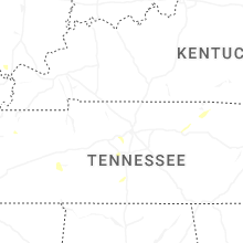


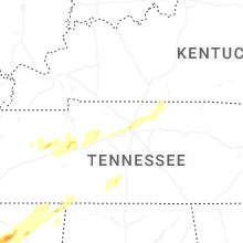


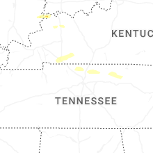


Connect with Interactive Hail Maps