

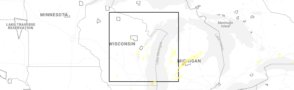
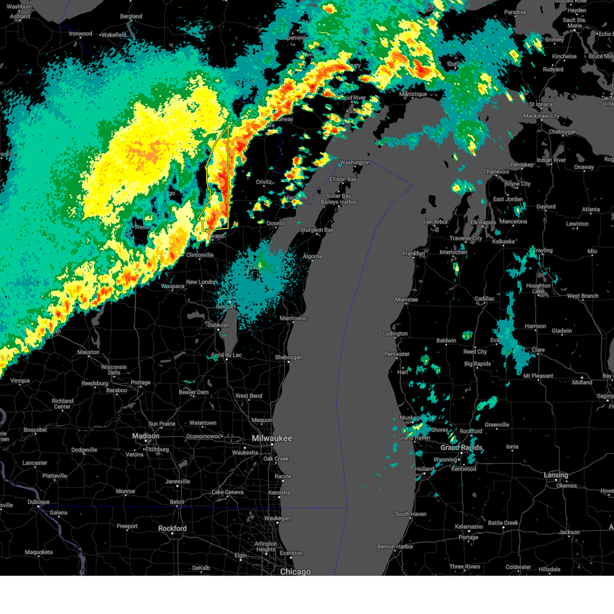
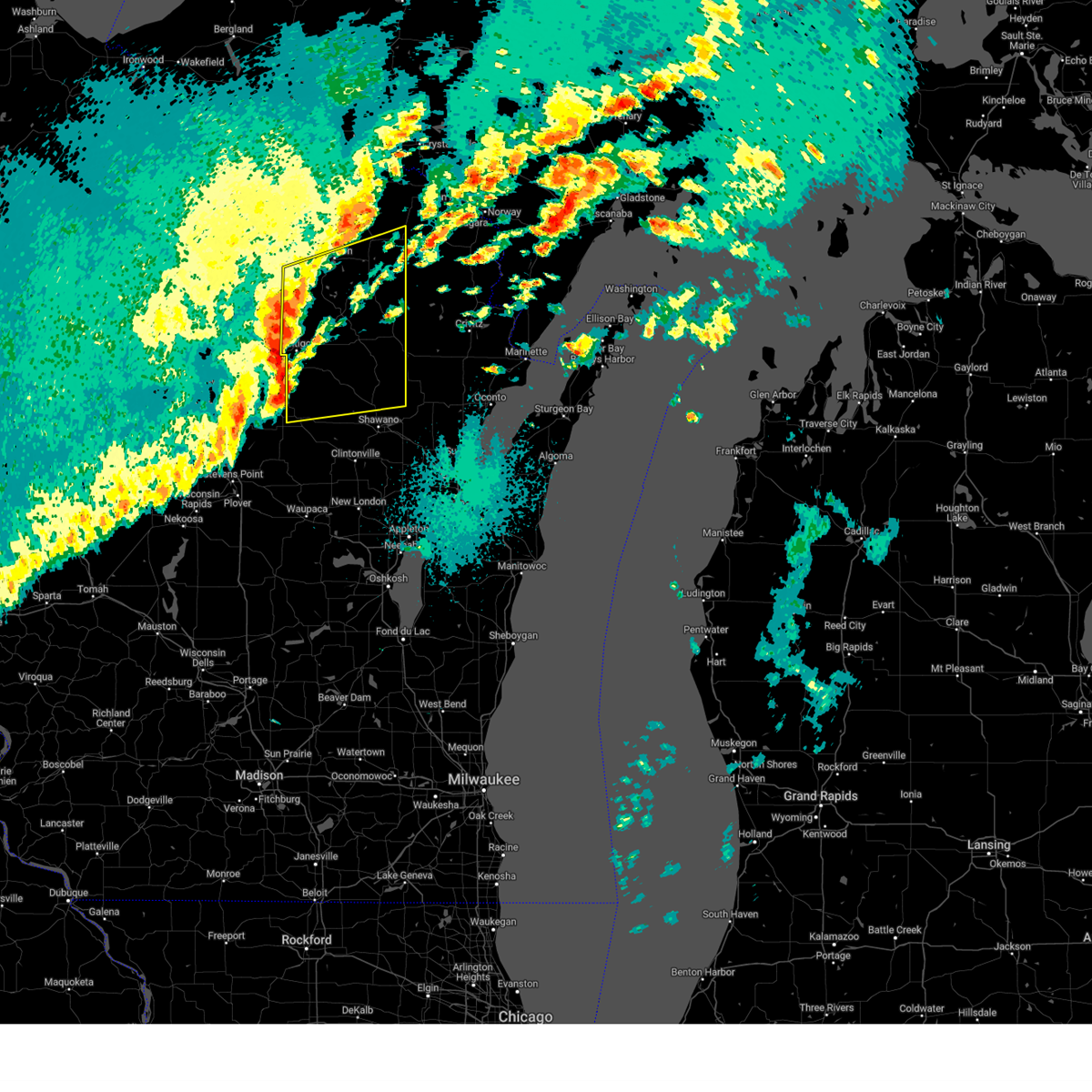
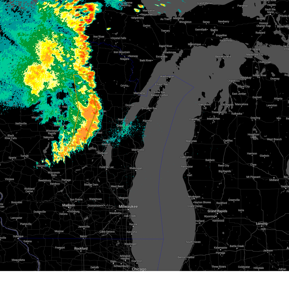
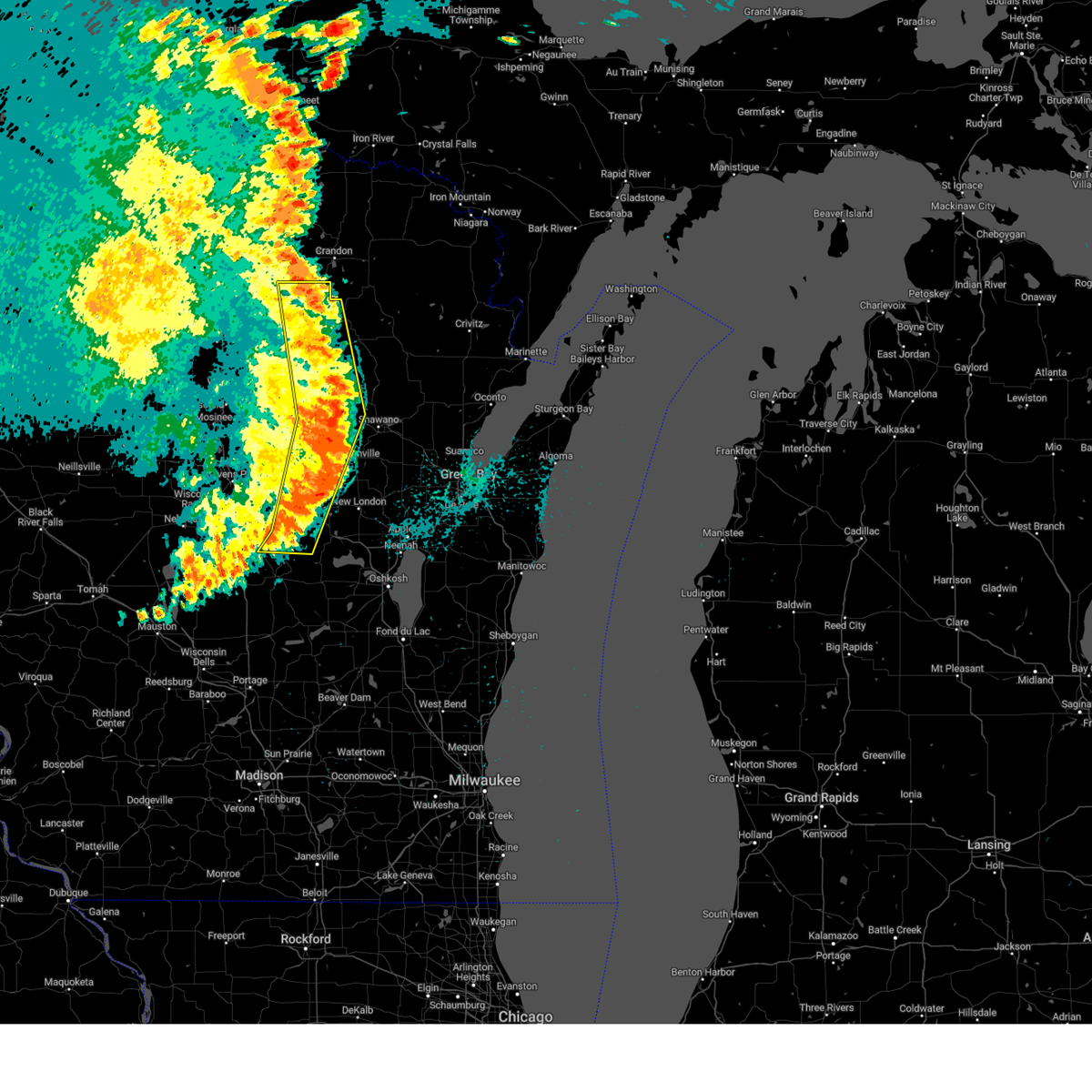
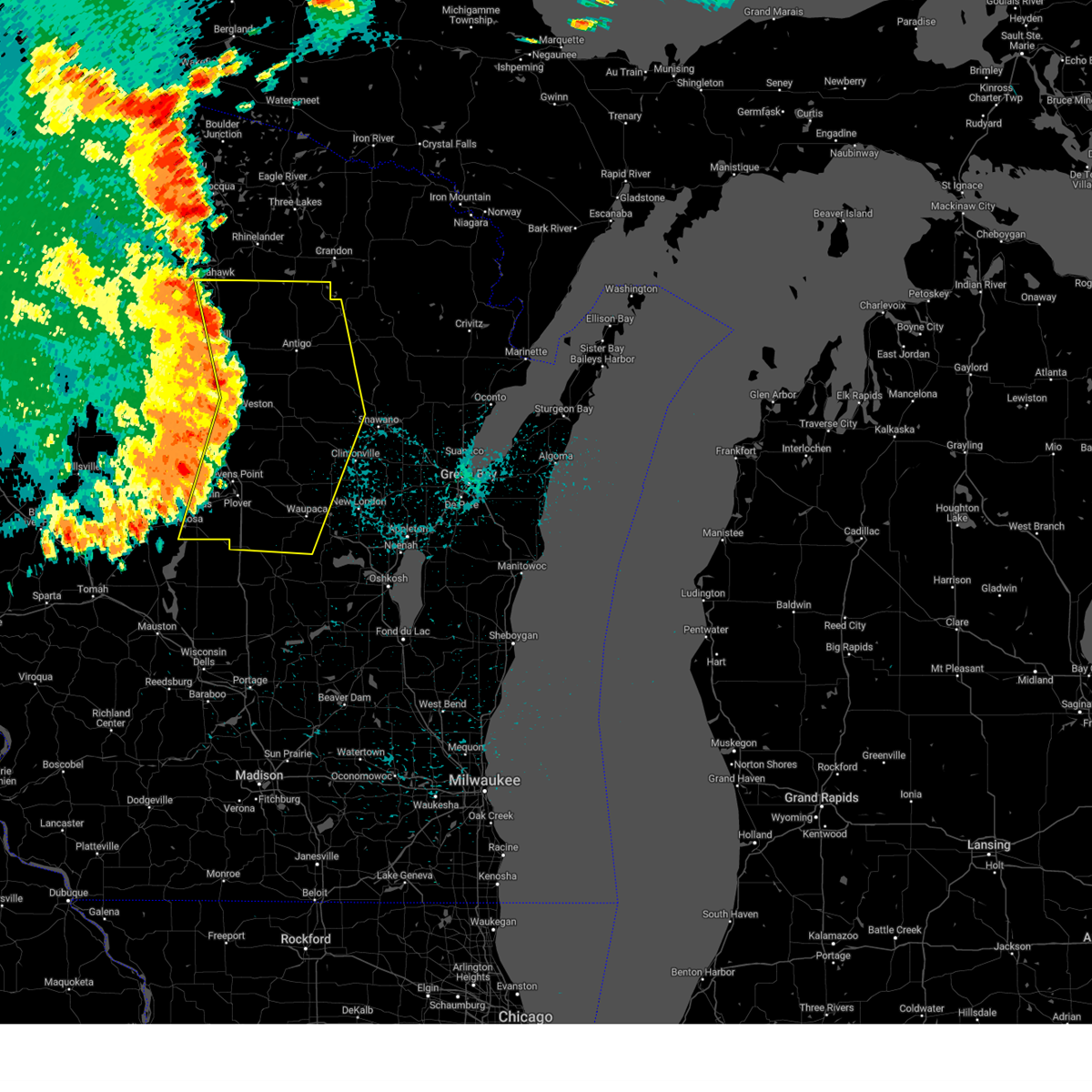
Hail Map for Neopit, WI
The Neopit, WI area has had 0 reports of on-the-ground hail by trained spotters, and has been under severe weather warnings 26 times during the past 12 months. Doppler radar has detected hail at or near Neopit, WI on 33 occasions, including 2 occasions during the past year.
| Name: | Neopit, WI |
| Where Located: | 51.6 miles NW of Green Bay, WI |
| Map: | Google Map for Neopit, WI |
| Population: | 690 |
| Housing Units: | 222 |
| More Info: | Search Google for Neopit, WI |
1
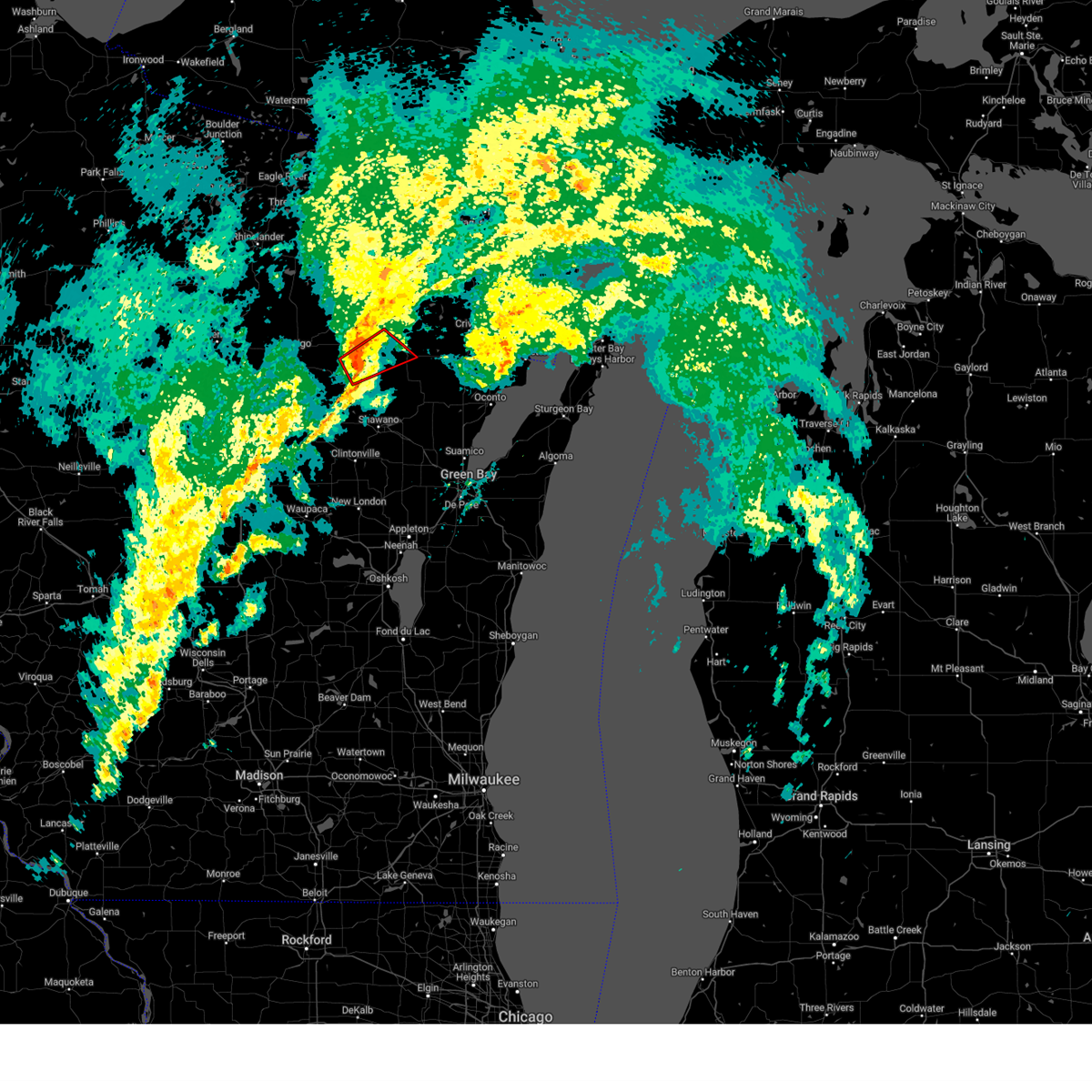
The Top Recent Hail Date for Neopit, WI is Friday, May 16, 2025 (13th out of 33)
Hail and Wind Damage Spotted near Neopit, WI
| Date / Time | Report Details |
|---|---|
| 6/3/2025 5:05 PM CDT |
 the tornado warning has been cancelled and is no longer in effect the tornado warning has been cancelled and is no longer in effect
|
| 6/3/2025 4:53 PM CDT |
 Torgrb the national weather service in green bay has issued a * tornado warning for, northeastern menominee county in northeastern wisconsin, central oconto county in northeastern wisconsin, southeastern langlade county in north central wisconsin, * until 545 pm cdt. * at 452 pm cdt, a severe thunderstorm capable of producing a tornado was located near big smokey falls, or 21 miles north of shawano, moving northeast at 35 mph (radar indicated rotation). Hazards include tornado. Flying debris will be dangerous to those caught without shelter. mobile homes will be damaged or destroyed. damage to roofs, windows, and vehicles will occur. tree damage is likely. this dangerous storm will be near, gardner dam scout camp around 500 pm cdt. mountain around 510 pm cdt. Other locations impacted by this tornadic thunderstorm include boulder lake campground. Torgrb the national weather service in green bay has issued a * tornado warning for, northeastern menominee county in northeastern wisconsin, central oconto county in northeastern wisconsin, southeastern langlade county in north central wisconsin, * until 545 pm cdt. * at 452 pm cdt, a severe thunderstorm capable of producing a tornado was located near big smokey falls, or 21 miles north of shawano, moving northeast at 35 mph (radar indicated rotation). Hazards include tornado. Flying debris will be dangerous to those caught without shelter. mobile homes will be damaged or destroyed. damage to roofs, windows, and vehicles will occur. tree damage is likely. this dangerous storm will be near, gardner dam scout camp around 500 pm cdt. mountain around 510 pm cdt. Other locations impacted by this tornadic thunderstorm include boulder lake campground.
|
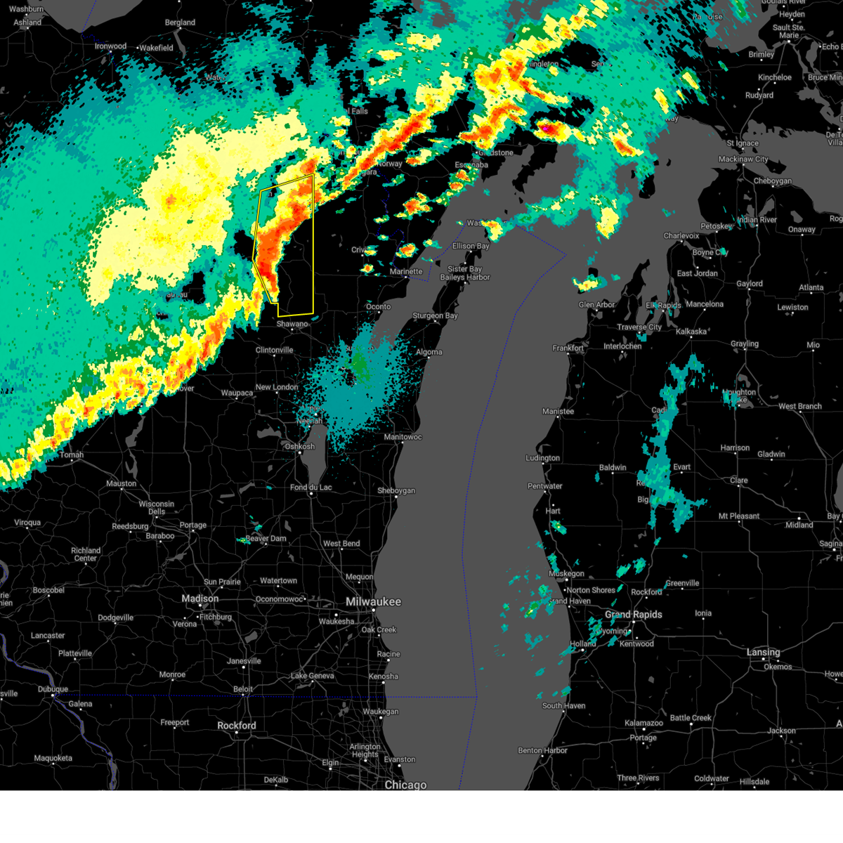
| 5/16/2025 2:30 PM CDT | the severe thunderstorm warning has been cancelled and is no longer in effect |
| 5/16/2025 2:30 PM CDT | At 230 pm cdt, a severe thunderstorm was located near neopit, or 18 miles southeast of antigo, moving northeast at 40 mph (radar indicated). Hazards include 60 mph wind gusts and quarter size hail. Hail damage to vehicles is expected. expect wind damage to roofs, siding, and trees. Locations impacted include, mountain, white lake, gardner dam scout camp, big smokey falls, bear paw scout camp, neopit, langlade, boot lake campground, lake noseum, upper bass lake, boulder lake campground, zoar, lily, elton, and hollister. |
| 5/16/2025 2:07 PM CDT |
 Svrgrb the national weather service in green bay has issued a * severe thunderstorm warning for, menominee county in northeastern wisconsin, northwestern oconto county in northeastern wisconsin, southeastern langlade county in north central wisconsin, northwestern shawano county in northeastern wisconsin, * until 300 pm cdt. * at 207 pm cdt, a severe thunderstorm was located 8 miles east of wittenberg, or 20 miles south of antigo, moving northeast at 40 mph (radar indicated). Hazards include 60 mph wind gusts and quarter size hail. Hail damage to vehicles is expected. Expect wind damage to roofs, siding, and trees. Svrgrb the national weather service in green bay has issued a * severe thunderstorm warning for, menominee county in northeastern wisconsin, northwestern oconto county in northeastern wisconsin, southeastern langlade county in north central wisconsin, northwestern shawano county in northeastern wisconsin, * until 300 pm cdt. * at 207 pm cdt, a severe thunderstorm was located 8 miles east of wittenberg, or 20 miles south of antigo, moving northeast at 40 mph (radar indicated). Hazards include 60 mph wind gusts and quarter size hail. Hail damage to vehicles is expected. Expect wind damage to roofs, siding, and trees.
|
| 4/28/2025 10:41 PM CDT |
 The storms which prompted the warning have moved out of the area. therefore, the severe thunderstorm warning will be allowed to expire. a tornado watch remains in effect until 200 am cdt for north central and northeastern wisconsin. The storms which prompted the warning have moved out of the area. therefore, the severe thunderstorm warning will be allowed to expire. a tornado watch remains in effect until 200 am cdt for north central and northeastern wisconsin.
|
| 4/28/2025 10:36 PM CDT |
 the severe thunderstorm warning has been cancelled and is no longer in effect the severe thunderstorm warning has been cancelled and is no longer in effect
|
| 4/28/2025 10:36 PM CDT |
 At 1035 pm cdt, severe thunderstorms were located along a line extending from 7 miles west of goodman to near south branch, moving northeast at 55 mph (radar indicated). Hazards include 60 mph wind gusts and quarter size hail. Hail damage to vehicles is expected. expect wind damage to roofs, siding, and trees. these severe storms will be near, mountain and mccaslin mountain natural area around 1040 pm cdt. other locations impacted by these severe thunderstorms include boot lake campground, intersection of hwy 55 and county m, blackwell, boulder lake campground, st. Joseph lake, lakewood, townsend, wabeno, fredenberg lake, and armstrong creek. At 1035 pm cdt, severe thunderstorms were located along a line extending from 7 miles west of goodman to near south branch, moving northeast at 55 mph (radar indicated). Hazards include 60 mph wind gusts and quarter size hail. Hail damage to vehicles is expected. expect wind damage to roofs, siding, and trees. these severe storms will be near, mountain and mccaslin mountain natural area around 1040 pm cdt. other locations impacted by these severe thunderstorms include boot lake campground, intersection of hwy 55 and county m, blackwell, boulder lake campground, st. Joseph lake, lakewood, townsend, wabeno, fredenberg lake, and armstrong creek.
|
| 4/28/2025 10:23 PM CDT |
 At 1023 pm cdt, severe thunderstorms were located along a line extending from 7 miles southeast of north otter creek natural area to near big smokey falls, moving northeast at 55 mph (radar indicated). Hazards include 60 mph wind gusts and quarter size hail. Hail damage to vehicles is expected. expect wind damage to roofs, siding, and trees. these severe storms will be near, mountain, mccaslin mountain natural area, and south branch around 1030 pm cdt. Other locations impacted by these severe thunderstorms include boot lake campground, blackwell, otter springs recreation area, upper bass lake, choate, lily, elton, wabeno, bear lake campground, and pickerel. At 1023 pm cdt, severe thunderstorms were located along a line extending from 7 miles southeast of north otter creek natural area to near big smokey falls, moving northeast at 55 mph (radar indicated). Hazards include 60 mph wind gusts and quarter size hail. Hail damage to vehicles is expected. expect wind damage to roofs, siding, and trees. these severe storms will be near, mountain, mccaslin mountain natural area, and south branch around 1030 pm cdt. Other locations impacted by these severe thunderstorms include boot lake campground, blackwell, otter springs recreation area, upper bass lake, choate, lily, elton, wabeno, bear lake campground, and pickerel.
|
| 4/28/2025 10:23 PM CDT |
 the severe thunderstorm warning has been cancelled and is no longer in effect the severe thunderstorm warning has been cancelled and is no longer in effect
|
| 4/28/2025 10:17 PM CDT |
 At 1016 pm cdt, a severe squall line capable of producing both tornadoes and extensive straight line wind damage was located along a line extending from near white lake to neopit, moving east at 55 mph (radar indicated rotation). Hazards include tornado. Flying debris will be dangerous to those caught without shelter. mobile homes will be damaged or destroyed. damage to roofs, windows, and vehicles will occur. tree damage is likely. these dangerous storms will be near, white lake, neopit, gardner dam scout camp, and big smokey falls around 1020 pm cdt. mountain and south branch around 1030 pm cdt. bear paw scout camp around 1035 pm cdt. other locations impacted by these tornadic storms include boot lake campground, lake noseum, intersection of hwy 55 and county m, breed, upper bass lake, boulder lake campground, hayes, langlade, zoar, and st. Joseph lake. At 1016 pm cdt, a severe squall line capable of producing both tornadoes and extensive straight line wind damage was located along a line extending from near white lake to neopit, moving east at 55 mph (radar indicated rotation). Hazards include tornado. Flying debris will be dangerous to those caught without shelter. mobile homes will be damaged or destroyed. damage to roofs, windows, and vehicles will occur. tree damage is likely. these dangerous storms will be near, white lake, neopit, gardner dam scout camp, and big smokey falls around 1020 pm cdt. mountain and south branch around 1030 pm cdt. bear paw scout camp around 1035 pm cdt. other locations impacted by these tornadic storms include boot lake campground, lake noseum, intersection of hwy 55 and county m, breed, upper bass lake, boulder lake campground, hayes, langlade, zoar, and st. Joseph lake.
|
| 4/28/2025 10:17 PM CDT |
 the tornado warning has been cancelled and is no longer in effect the tornado warning has been cancelled and is no longer in effect
|
| 4/28/2025 10:15 PM CDT |
 the severe thunderstorm warning has been cancelled and is no longer in effect the severe thunderstorm warning has been cancelled and is no longer in effect
|
| 4/28/2025 10:15 PM CDT |
 At 1014 pm cdt, severe thunderstorms were located along a line extending from near woodlawn to near neopit, moving east at 60 mph (radar indicated). Hazards include 60 mph wind gusts and quarter size hail. Hail damage to vehicles is expected. expect wind damage to roofs, siding, and trees. these severe storms will be near, white lake, carter, neopit, gardner dam scout camp, and big smokey falls around 1020 pm cdt. south branch around 1025 pm cdt. mountain and mccaslin mountain natural area around 1030 pm cdt. Other locations impacted by these severe thunderstorms include boot lake campground, lake noseum, mattoon, polar, blackwell, otter springs recreation area, upper bass lake, choate, peters marsh wildlife area, and lily. At 1014 pm cdt, severe thunderstorms were located along a line extending from near woodlawn to near neopit, moving east at 60 mph (radar indicated). Hazards include 60 mph wind gusts and quarter size hail. Hail damage to vehicles is expected. expect wind damage to roofs, siding, and trees. these severe storms will be near, white lake, carter, neopit, gardner dam scout camp, and big smokey falls around 1020 pm cdt. south branch around 1025 pm cdt. mountain and mccaslin mountain natural area around 1030 pm cdt. Other locations impacted by these severe thunderstorms include boot lake campground, lake noseum, mattoon, polar, blackwell, otter springs recreation area, upper bass lake, choate, peters marsh wildlife area, and lily.
|
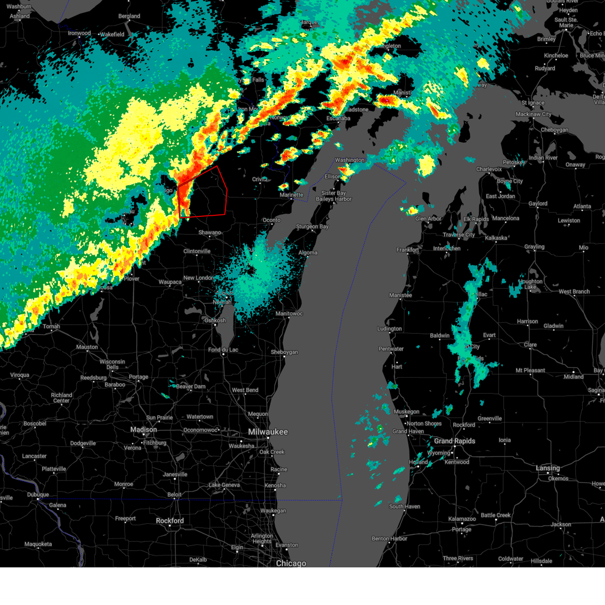
| 4/28/2025 10:06 PM CDT |
 Torgrb the national weather service in green bay has issued a * tornado warning for, menominee county in northeastern wisconsin, northern oconto county in northeastern wisconsin, southeastern langlade county in north central wisconsin, western shawano county in northeastern wisconsin, * until 1045 pm cdt. * at 1006 pm cdt, severe thunderstorms capable of producing both tornadoes and extensive straight line wind damage were located along a line extending from near antigo to 11 miles west of neopit to 8 miles northeast of wittenberg, moving east at 50 mph (radar indicated rotation). Hazards include tornado. Flying debris will be dangerous to those caught without shelter. mobile homes will be damaged or destroyed. damage to roofs, windows, and vehicles will occur. tree damage is likely. these dangerous storms will be near, neopit around 1010 pm cdt. white lake around 1020 pm cdt. gardner dam scout camp around 1025 pm cdt. big smokey falls around 1030 pm cdt. mountain around 1040 pm cdt. Other locations impacted by these tornadic storms include boot lake campground, shepley, lake noseum, intersection of hwy 55 and county m, elmhurst, breed, mattoon, polar, phlox, and upper bass lake. Torgrb the national weather service in green bay has issued a * tornado warning for, menominee county in northeastern wisconsin, northern oconto county in northeastern wisconsin, southeastern langlade county in north central wisconsin, western shawano county in northeastern wisconsin, * until 1045 pm cdt. * at 1006 pm cdt, severe thunderstorms capable of producing both tornadoes and extensive straight line wind damage were located along a line extending from near antigo to 11 miles west of neopit to 8 miles northeast of wittenberg, moving east at 50 mph (radar indicated rotation). Hazards include tornado. Flying debris will be dangerous to those caught without shelter. mobile homes will be damaged or destroyed. damage to roofs, windows, and vehicles will occur. tree damage is likely. these dangerous storms will be near, neopit around 1010 pm cdt. white lake around 1020 pm cdt. gardner dam scout camp around 1025 pm cdt. big smokey falls around 1030 pm cdt. mountain around 1040 pm cdt. Other locations impacted by these tornadic storms include boot lake campground, shepley, lake noseum, intersection of hwy 55 and county m, elmhurst, breed, mattoon, polar, phlox, and upper bass lake.
|
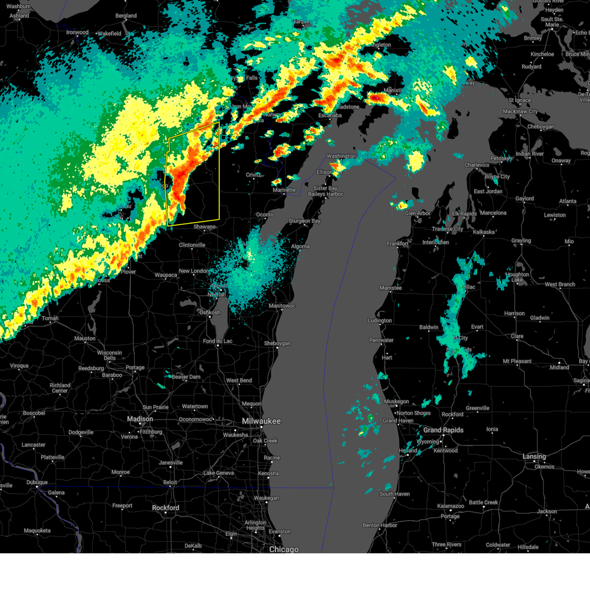
| 4/28/2025 9:59 PM CDT |
 Svrgrb the national weather service in green bay has issued a * severe thunderstorm warning for, southern forest county in northeastern wisconsin, southeastern oneida county in north central wisconsin, menominee county in northeastern wisconsin, northern oconto county in northeastern wisconsin, langlade county in north central wisconsin, western shawano county in northeastern wisconsin, * until 1045 pm cdt. * at 958 pm cdt, severe thunderstorms were located along a line extending from 6 miles north of veterans memorial county park to near wittenberg, moving northeast at 55 mph (radar indicated). Hazards include 60 mph wind gusts and quarter size hail. Hail damage to vehicles is expected. expect wind damage to roofs, siding, and trees. severe thunderstorms will be near, pearson and ma ka ja wan scout reservation around 1005 pm cdt. neopit and woodlawn around 1010 pm cdt. crandon and white lake around 1015 pm cdt. gardner dam scout camp around 1020 pm cdt. carter around 1025 pm cdt. big smokey falls around 1030 pm cdt. mountain and mccaslin mountain natural area around 1035 pm cdt. Other locations impacted by these severe thunderstorms include lake noseum, mattoon, polar, otter springs recreation area, choate, birnamwood, deerbrook, bear lake campground, pickerel, and koepenick. Svrgrb the national weather service in green bay has issued a * severe thunderstorm warning for, southern forest county in northeastern wisconsin, southeastern oneida county in north central wisconsin, menominee county in northeastern wisconsin, northern oconto county in northeastern wisconsin, langlade county in north central wisconsin, western shawano county in northeastern wisconsin, * until 1045 pm cdt. * at 958 pm cdt, severe thunderstorms were located along a line extending from 6 miles north of veterans memorial county park to near wittenberg, moving northeast at 55 mph (radar indicated). Hazards include 60 mph wind gusts and quarter size hail. Hail damage to vehicles is expected. expect wind damage to roofs, siding, and trees. severe thunderstorms will be near, pearson and ma ka ja wan scout reservation around 1005 pm cdt. neopit and woodlawn around 1010 pm cdt. crandon and white lake around 1015 pm cdt. gardner dam scout camp around 1020 pm cdt. carter around 1025 pm cdt. big smokey falls around 1030 pm cdt. mountain and mccaslin mountain natural area around 1035 pm cdt. Other locations impacted by these severe thunderstorms include lake noseum, mattoon, polar, otter springs recreation area, choate, birnamwood, deerbrook, bear lake campground, pickerel, and koepenick.
|
| 8/27/2024 12:13 AM CDT |
 The storms which prompted the warning have moved out of the area. therefore, the warning will be allowed to expire. however, heavy rain is still possible with these thunderstorms. a severe thunderstorm watch remains in effect until 400 am cdt for central, north central and northeastern wisconsin. remember, a severe thunderstorm warning still remains in effect for portions of these counties until 1245 am. The storms which prompted the warning have moved out of the area. therefore, the warning will be allowed to expire. however, heavy rain is still possible with these thunderstorms. a severe thunderstorm watch remains in effect until 400 am cdt for central, north central and northeastern wisconsin. remember, a severe thunderstorm warning still remains in effect for portions of these counties until 1245 am.
|
| 8/27/2024 12:00 AM CDT |
 At 1159 pm cdt, severe thunderstorms were located along a line extending from near ma ka ja wan scout reservation to 6 miles southwest of keshena to 6 miles south of waupaca, moving east at 45 mph (radar indicated). Hazards include 60 mph wind gusts. Expect damage to roofs, siding, and trees. Locations impacted include, antigo, waupaca, wittenberg, pearson, hartman creek state park, veterans memorial county park, chain o' lakes-king, neopit, ma ka ja wan scout reservation, and manawa. At 1159 pm cdt, severe thunderstorms were located along a line extending from near ma ka ja wan scout reservation to 6 miles southwest of keshena to 6 miles south of waupaca, moving east at 45 mph (radar indicated). Hazards include 60 mph wind gusts. Expect damage to roofs, siding, and trees. Locations impacted include, antigo, waupaca, wittenberg, pearson, hartman creek state park, veterans memorial county park, chain o' lakes-king, neopit, ma ka ja wan scout reservation, and manawa.
|
| 8/27/2024 12:00 AM CDT |
 the severe thunderstorm warning has been cancelled and is no longer in effect the severe thunderstorm warning has been cancelled and is no longer in effect
|
| 8/26/2024 11:53 PM CDT |
 Svrgrb the national weather service in green bay has issued a * severe thunderstorm warning for, southern forest county in northeastern wisconsin, menominee county in northeastern wisconsin, northern winnebago county in east central wisconsin, northeastern waushara county in central wisconsin, waupaca county in northeastern wisconsin, oconto county in northeastern wisconsin, outagamie county in northeastern wisconsin, central langlade county in north central wisconsin, shawano county in northeastern wisconsin, * until 1245 am cdt. * at 1153 pm cdt, severe thunderstorms were located along a line extending from near crandon to near shawano to near napowan scout camp, moving east at 55 mph (radar indicated). Hazards include 60 mph wind gusts and penny size hail. expect damage to roofs, siding, and trees Svrgrb the national weather service in green bay has issued a * severe thunderstorm warning for, southern forest county in northeastern wisconsin, menominee county in northeastern wisconsin, northern winnebago county in east central wisconsin, northeastern waushara county in central wisconsin, waupaca county in northeastern wisconsin, oconto county in northeastern wisconsin, outagamie county in northeastern wisconsin, central langlade county in north central wisconsin, shawano county in northeastern wisconsin, * until 1245 am cdt. * at 1153 pm cdt, severe thunderstorms were located along a line extending from near crandon to near shawano to near napowan scout camp, moving east at 55 mph (radar indicated). Hazards include 60 mph wind gusts and penny size hail. expect damage to roofs, siding, and trees
|
| 8/26/2024 11:08 PM CDT |
 Svrgrb the national weather service in green bay has issued a * severe thunderstorm warning for, southeastern wood county in central wisconsin, portage county in central wisconsin, eastern lincoln county in north central wisconsin, eastern marathon county in central wisconsin, western menominee county in northeastern wisconsin, northern waushara county in central wisconsin, waupaca county in northeastern wisconsin, langlade county in north central wisconsin, western shawano county in northeastern wisconsin, * until 1215 am cdt. * at 1108 pm cdt, severe thunderstorms were located along a line extending from near gilbert to near weston to lake wazeecha, moving east at 45 mph (radar indicated). Hazards include 60 mph wind gusts. expect damage to roofs, siding, and trees Svrgrb the national weather service in green bay has issued a * severe thunderstorm warning for, southeastern wood county in central wisconsin, portage county in central wisconsin, eastern lincoln county in north central wisconsin, eastern marathon county in central wisconsin, western menominee county in northeastern wisconsin, northern waushara county in central wisconsin, waupaca county in northeastern wisconsin, langlade county in north central wisconsin, western shawano county in northeastern wisconsin, * until 1215 am cdt. * at 1108 pm cdt, severe thunderstorms were located along a line extending from near gilbert to near weston to lake wazeecha, moving east at 45 mph (radar indicated). Hazards include 60 mph wind gusts. expect damage to roofs, siding, and trees
|
| 7/13/2024 4:44 PM CDT |
 The storms which prompted the warning have weakened below severe limits, and no longer pose an immediate threat to life or property. therefore, the warning will be allowed to expire. however, gusty winds are still possible with these thunderstorms. a severe thunderstorm watch remains in effect until 1000 pm cdt for northeastern wisconsin. The storms which prompted the warning have weakened below severe limits, and no longer pose an immediate threat to life or property. therefore, the warning will be allowed to expire. however, gusty winds are still possible with these thunderstorms. a severe thunderstorm watch remains in effect until 1000 pm cdt for northeastern wisconsin.
|
| 7/13/2024 4:31 PM CDT |
 At 431 pm cdt, severe thunderstorms were located along a line extending from near gardner dam scout camp to 10 miles west of neopit, moving east at 20 mph (radar indicated). Hazards include 60 mph wind gusts and penny size hail. Expect damage to roofs, siding, and trees. these severe storms will be near, neopit around 435 pm cdt. Other locations impacted by these severe thunderstorms include lake noseum, upper bass lake, mattoon, and zoar. At 431 pm cdt, severe thunderstorms were located along a line extending from near gardner dam scout camp to 10 miles west of neopit, moving east at 20 mph (radar indicated). Hazards include 60 mph wind gusts and penny size hail. Expect damage to roofs, siding, and trees. these severe storms will be near, neopit around 435 pm cdt. Other locations impacted by these severe thunderstorms include lake noseum, upper bass lake, mattoon, and zoar.
|
| 7/13/2024 4:31 PM CDT |
 the severe thunderstorm warning has been cancelled and is no longer in effect the severe thunderstorm warning has been cancelled and is no longer in effect
|
| 7/13/2024 4:20 PM CDT |
 At 420 pm cdt, severe thunderstorms were located along a line extending from white lake to 10 miles north of wittenberg, moving east at 20 mph (radar indicated). Hazards include 60 mph wind gusts and penny size hail. Expect damage to roofs, siding, and trees. these severe storms will be near, white lake, neopit, and gardner dam scout camp around 425 pm cdt. Other locations impacted by these severe thunderstorms include lake noseum, elton, mattoon, phlox, upper bass lake, boulder lake campground, langlade, and zoar. At 420 pm cdt, severe thunderstorms were located along a line extending from white lake to 10 miles north of wittenberg, moving east at 20 mph (radar indicated). Hazards include 60 mph wind gusts and penny size hail. Expect damage to roofs, siding, and trees. these severe storms will be near, white lake, neopit, and gardner dam scout camp around 425 pm cdt. Other locations impacted by these severe thunderstorms include lake noseum, elton, mattoon, phlox, upper bass lake, boulder lake campground, langlade, and zoar.
|
| 7/13/2024 4:01 PM CDT |
 Svrgrb the national weather service in green bay has issued a * severe thunderstorm warning for, northwestern menominee county in northeastern wisconsin, northern oconto county in northeastern wisconsin, southeastern langlade county in north central wisconsin, western shawano county in northeastern wisconsin, * until 445 pm cdt. * at 401 pm cdt, severe thunderstorms were located along a line extending from near white lake to 10 miles south of antigo, moving east at 25 mph (radar indicated). Hazards include 60 mph wind gusts and penny size hail. Expect damage to roofs, siding, and trees. severe thunderstorms will be near, white lake around 405 pm cdt. neopit and gardner dam scout camp around 425 pm cdt. Other locations impacted by these severe thunderstorms include bryant, aniwa, lake noseum, elmhurst, mattoon, polar, phlox, upper bass lake, boulder lake campground, and langlade. Svrgrb the national weather service in green bay has issued a * severe thunderstorm warning for, northwestern menominee county in northeastern wisconsin, northern oconto county in northeastern wisconsin, southeastern langlade county in north central wisconsin, western shawano county in northeastern wisconsin, * until 445 pm cdt. * at 401 pm cdt, severe thunderstorms were located along a line extending from near white lake to 10 miles south of antigo, moving east at 25 mph (radar indicated). Hazards include 60 mph wind gusts and penny size hail. Expect damage to roofs, siding, and trees. severe thunderstorms will be near, white lake around 405 pm cdt. neopit and gardner dam scout camp around 425 pm cdt. Other locations impacted by these severe thunderstorms include bryant, aniwa, lake noseum, elmhurst, mattoon, polar, phlox, upper bass lake, boulder lake campground, and langlade.
|
| 5/21/2024 9:17 PM CDT |
 The storms which prompted the warning have moved out of the warned area. therefore, the warning will be allowed to expire. a tornado watch remains in effect until midnight cdt for central, north central, northeastern and east central wisconsin. remember, a severe thunderstorm warning still remains in effect for eastern menominee, eastern shawano, eastern outagamie, eastern winnebago counties. The storms which prompted the warning have moved out of the warned area. therefore, the warning will be allowed to expire. a tornado watch remains in effect until midnight cdt for central, north central, northeastern and east central wisconsin. remember, a severe thunderstorm warning still remains in effect for eastern menominee, eastern shawano, eastern outagamie, eastern winnebago counties.
|
| 5/21/2024 8:52 PM CDT |
 At 851 pm cdt, a severe squall line capable of producing both tornadoes and extensive straight line wind damage was located along a line extending from 9 miles west of crandon to near pearson to 9 miles northwest of neopit, moving northeast at 65 mph (radar indicated rotation). Hazards include tornado. Flying debris will be dangerous to those caught without shelter. mobile homes will be damaged or destroyed. damage to roofs, windows, and vehicles will occur. tree damage is likely. these dangerous storms will be near, crandon, pearson, and ma ka ja wan scout reservation around 855 pm cdt. white lake and woodlawn around 900 pm cdt. north otter creek natural area around 905 pm cdt. Other locations impacted by these tornadic storms include bryant, boot lake campground, lake noseum, post lake, polar, phlox, otter springs recreation area, lawrence lake natural area, pelican lake, and nashville. At 851 pm cdt, a severe squall line capable of producing both tornadoes and extensive straight line wind damage was located along a line extending from 9 miles west of crandon to near pearson to 9 miles northwest of neopit, moving northeast at 65 mph (radar indicated rotation). Hazards include tornado. Flying debris will be dangerous to those caught without shelter. mobile homes will be damaged or destroyed. damage to roofs, windows, and vehicles will occur. tree damage is likely. these dangerous storms will be near, crandon, pearson, and ma ka ja wan scout reservation around 855 pm cdt. white lake and woodlawn around 900 pm cdt. north otter creek natural area around 905 pm cdt. Other locations impacted by these tornadic storms include bryant, boot lake campground, lake noseum, post lake, polar, phlox, otter springs recreation area, lawrence lake natural area, pelican lake, and nashville.
|
| 5/21/2024 8:52 PM CDT |
 the tornado warning has been cancelled and is no longer in effect the tornado warning has been cancelled and is no longer in effect
|
| 5/21/2024 8:41 PM CDT |
 At 840 pm cdt, a severe squall line capable of producing both tornadoes and extensive straight line wind damage was located along a line extending from 6 miles south of rhinelander to 7 miles northwest of veterans memorial county park to near antigo to 8 miles northeast of wittenberg, moving northeast at 60 mph (radar indicated rotation). Hazards include tornado. Flying debris will be dangerous to those caught without shelter. mobile homes will be damaged or destroyed. damage to roofs, windows, and vehicles will occur. tree damage is likely. these dangerous storms will be near, neopit, pearson, veterans memorial county park, and ma ka ja wan scout reservation around 845 pm cdt. crandon, white lake, and woodlawn around 855 pm cdt. north otter creek natural area and gardner dam scout camp around 900 pm cdt. Other locations impacted by these tornadic storms include gagen, boot lake campground, lake noseum, mattoon, kelly lynn bog natural area, post lake, polar, kempster, otter springs recreation area, and upper bass lake. At 840 pm cdt, a severe squall line capable of producing both tornadoes and extensive straight line wind damage was located along a line extending from 6 miles south of rhinelander to 7 miles northwest of veterans memorial county park to near antigo to 8 miles northeast of wittenberg, moving northeast at 60 mph (radar indicated rotation). Hazards include tornado. Flying debris will be dangerous to those caught without shelter. mobile homes will be damaged or destroyed. damage to roofs, windows, and vehicles will occur. tree damage is likely. these dangerous storms will be near, neopit, pearson, veterans memorial county park, and ma ka ja wan scout reservation around 845 pm cdt. crandon, white lake, and woodlawn around 855 pm cdt. north otter creek natural area and gardner dam scout camp around 900 pm cdt. Other locations impacted by these tornadic storms include gagen, boot lake campground, lake noseum, mattoon, kelly lynn bog natural area, post lake, polar, kempster, otter springs recreation area, and upper bass lake.
|
| 5/21/2024 8:41 PM CDT |
 the tornado warning has been cancelled and is no longer in effect the tornado warning has been cancelled and is no longer in effect
|
| 5/21/2024 8:38 PM CDT |
 At 837 pm cdt, severe thunderstorms were located along a line extending from near antigo to 7 miles east of wittenberg to near napowan scout camp, moving east at 60 mph (radar indicated). Hazards include 70 mph wind gusts. Expect considerable tree damage. damage is likely to mobile homes, roofs, and outbuildings. Locations impacted include, appleton, oshkosh, shawano, antigo, waupaca, wautoma, menasha, new london, clintonville, and redgranite. At 837 pm cdt, severe thunderstorms were located along a line extending from near antigo to 7 miles east of wittenberg to near napowan scout camp, moving east at 60 mph (radar indicated). Hazards include 70 mph wind gusts. Expect considerable tree damage. damage is likely to mobile homes, roofs, and outbuildings. Locations impacted include, appleton, oshkosh, shawano, antigo, waupaca, wautoma, menasha, new london, clintonville, and redgranite.
|
| 5/21/2024 8:38 PM CDT |
 the severe thunderstorm warning has been cancelled and is no longer in effect the severe thunderstorm warning has been cancelled and is no longer in effect
|
| 5/21/2024 8:36 PM CDT |
 the tornado warning has been cancelled and is no longer in effect the tornado warning has been cancelled and is no longer in effect
|
| 5/21/2024 8:36 PM CDT |
 At 836 pm cdt, a severe squall line capable of producing both tornadoes and extensive straight line wind damage was located along a line extending from near harrison to 7 miles east of parrish to near antigo to 6 miles north of wittenberg, moving northeast at 65 mph (radar indicated rotation). Hazards include tornado. Flying debris will be dangerous to those caught without shelter. mobile homes will be damaged or destroyed. damage to roofs, windows, and vehicles will occur. tree damage is likely. these dangerous storms will be near, antigo, rhinelander, and veterans memorial county park around 840 pm cdt. neopit, pearson, and ma ka ja wan scout reservation around 845 pm cdt. crandon and white lake around 850 pm cdt. woodlawn and gardner dam scout camp around 855 pm cdt. north otter creek natural area around 900 pm cdt. Other locations impacted by these tornadic storms include gagen, lake noseum, mattoon, kelly lynn bog natural area, polar, otter springs recreation area, choate, birnamwood, deerbrook, and otter lake campground. At 836 pm cdt, a severe squall line capable of producing both tornadoes and extensive straight line wind damage was located along a line extending from near harrison to 7 miles east of parrish to near antigo to 6 miles north of wittenberg, moving northeast at 65 mph (radar indicated rotation). Hazards include tornado. Flying debris will be dangerous to those caught without shelter. mobile homes will be damaged or destroyed. damage to roofs, windows, and vehicles will occur. tree damage is likely. these dangerous storms will be near, antigo, rhinelander, and veterans memorial county park around 840 pm cdt. neopit, pearson, and ma ka ja wan scout reservation around 845 pm cdt. crandon and white lake around 850 pm cdt. woodlawn and gardner dam scout camp around 855 pm cdt. north otter creek natural area around 900 pm cdt. Other locations impacted by these tornadic storms include gagen, lake noseum, mattoon, kelly lynn bog natural area, polar, otter springs recreation area, choate, birnamwood, deerbrook, and otter lake campground.
|
| 5/21/2024 8:29 PM CDT |
 Torgrb the national weather service in green bay has issued a * tornado warning for, northeastern lincoln county in north central wisconsin, southwestern forest county in northeastern wisconsin, eastern marathon county in central wisconsin, southeastern oneida county in north central wisconsin, northern menominee county in northeastern wisconsin, northern oconto county in northeastern wisconsin, langlade county in north central wisconsin, western shawano county in northeastern wisconsin, * until 915 pm cdt. * at 829 pm cdt, severe thunderstorms capable of producing both tornadoes and extensive straight line wind damage were located along a line extending from near harrison to 7 miles south of parrish to near antigo to near wittenberg, moving northeast at 60 mph (radar indicated rotation). Hazards include tornado. Flying debris will be dangerous to those caught without shelter. mobile homes will be damaged or destroyed. damage to roofs, windows, and vehicles will occur. tree damage is likely. these dangerous storms will be near, antigo, harrison, and parrish around 835 pm cdt. veterans memorial county park around 840 pm cdt. neopit, pearson, and ma ka ja wan scout reservation around 845 pm cdt. crandon, white lake, and woodlawn around 855 pm cdt. north otter creek natural area and gardner dam scout camp around 900 pm cdt. Other locations impacted by these tornadic storms include gagen, lake noseum, ackley wildlife area, mattoon, kelly lynn bog natural area, polar, otter springs recreation area, choate, birnamwood, and bavaria. Torgrb the national weather service in green bay has issued a * tornado warning for, northeastern lincoln county in north central wisconsin, southwestern forest county in northeastern wisconsin, eastern marathon county in central wisconsin, southeastern oneida county in north central wisconsin, northern menominee county in northeastern wisconsin, northern oconto county in northeastern wisconsin, langlade county in north central wisconsin, western shawano county in northeastern wisconsin, * until 915 pm cdt. * at 829 pm cdt, severe thunderstorms capable of producing both tornadoes and extensive straight line wind damage were located along a line extending from near harrison to 7 miles south of parrish to near antigo to near wittenberg, moving northeast at 60 mph (radar indicated rotation). Hazards include tornado. Flying debris will be dangerous to those caught without shelter. mobile homes will be damaged or destroyed. damage to roofs, windows, and vehicles will occur. tree damage is likely. these dangerous storms will be near, antigo, harrison, and parrish around 835 pm cdt. veterans memorial county park around 840 pm cdt. neopit, pearson, and ma ka ja wan scout reservation around 845 pm cdt. crandon, white lake, and woodlawn around 855 pm cdt. north otter creek natural area and gardner dam scout camp around 900 pm cdt. Other locations impacted by these tornadic storms include gagen, lake noseum, ackley wildlife area, mattoon, kelly lynn bog natural area, polar, otter springs recreation area, choate, birnamwood, and bavaria.
|
| 5/21/2024 8:18 PM CDT |
 Svrgrb the national weather service in green bay has issued a * severe thunderstorm warning for, eastern portage county in central wisconsin, eastern marathon county in central wisconsin, menominee county in northeastern wisconsin, winnebago county in east central wisconsin, waushara county in central wisconsin, waupaca county in northeastern wisconsin, western outagamie county in northeastern wisconsin, southern langlade county in north central wisconsin, shawano county in northeastern wisconsin, * until 915 pm cdt. * at 817 pm cdt, severe thunderstorms were located along a line extending from 12 miles northeast of wausau to near bevent to 7 miles southwest of plainfield, moving east at 60 mph (radar indicated). Hazards include 70 mph wind gusts. Expect considerable tree damage. Damage is likely to mobile homes, roofs, and outbuildings. Svrgrb the national weather service in green bay has issued a * severe thunderstorm warning for, eastern portage county in central wisconsin, eastern marathon county in central wisconsin, menominee county in northeastern wisconsin, winnebago county in east central wisconsin, waushara county in central wisconsin, waupaca county in northeastern wisconsin, western outagamie county in northeastern wisconsin, southern langlade county in north central wisconsin, shawano county in northeastern wisconsin, * until 915 pm cdt. * at 817 pm cdt, severe thunderstorms were located along a line extending from 12 miles northeast of wausau to near bevent to 7 miles southwest of plainfield, moving east at 60 mph (radar indicated). Hazards include 70 mph wind gusts. Expect considerable tree damage. Damage is likely to mobile homes, roofs, and outbuildings.
|
| 7/27/2023 8:19 PM CDT |
 At 818 pm cdt, severe thunderstorms were located along a line extending from near bear paw scout camp to near south branch to 6 miles south of big smokey falls to near keshena to 6 miles northwest of embarrass, moving southeast at 50 mph (radar indicated). Hazards include 60 mph wind gusts and penny size hail. Expect damage to roofs, siding, and trees. these severe storms will be near, gillett around 830 pm cdt. navarino wildlife area around 835 pm cdt. other locations impacted by these severe thunderstorms include college of menominee nation, lake noseum, underhill, breed, mattoon, upper bass lake, hayes, birnamwood, eland and hickory corners. hail threat, radar indicated max hail size, 0. 75 in wind threat, radar indicated max wind gust, 60 mph. At 818 pm cdt, severe thunderstorms were located along a line extending from near bear paw scout camp to near south branch to 6 miles south of big smokey falls to near keshena to 6 miles northwest of embarrass, moving southeast at 50 mph (radar indicated). Hazards include 60 mph wind gusts and penny size hail. Expect damage to roofs, siding, and trees. these severe storms will be near, gillett around 830 pm cdt. navarino wildlife area around 835 pm cdt. other locations impacted by these severe thunderstorms include college of menominee nation, lake noseum, underhill, breed, mattoon, upper bass lake, hayes, birnamwood, eland and hickory corners. hail threat, radar indicated max hail size, 0. 75 in wind threat, radar indicated max wind gust, 60 mph.
|
| 7/27/2023 8:04 PM CDT |
 At 804 pm cdt, severe thunderstorms were located along a line extending from near gardner dam scout camp to near neopit to 10 miles southwest of big smokey falls to 11 miles east of wittenberg, moving southeast at 40 mph (radar indicated). Hazards include 60 mph wind gusts and quarter size hail. Hail damage to vehicles is expected. expect wind damage to roofs, siding, and trees. these severe storms will be near, mountain and big smokey falls around 810 pm cdt. south branch around 815 pm cdt. shawano and keshena around 825 pm cdt. legend lake around 830 pm cdt. gillett and navarino wildlife area around 835 pm cdt. Other locations impacted by these severe thunderstorms include college of menominee nation, lake noseum, underhill, breed, mattoon, polar, upper bass lake, hayes, birnamwood and eland. At 804 pm cdt, severe thunderstorms were located along a line extending from near gardner dam scout camp to near neopit to 10 miles southwest of big smokey falls to 11 miles east of wittenberg, moving southeast at 40 mph (radar indicated). Hazards include 60 mph wind gusts and quarter size hail. Hail damage to vehicles is expected. expect wind damage to roofs, siding, and trees. these severe storms will be near, mountain and big smokey falls around 810 pm cdt. south branch around 815 pm cdt. shawano and keshena around 825 pm cdt. legend lake around 830 pm cdt. gillett and navarino wildlife area around 835 pm cdt. Other locations impacted by these severe thunderstorms include college of menominee nation, lake noseum, underhill, breed, mattoon, polar, upper bass lake, hayes, birnamwood and eland.
|
| 7/27/2023 7:43 PM CDT |
 At 743 pm cdt, severe thunderstorms were located along a line extending from 7 miles south of pearson to near antigo to 11 miles west of neopit to 6 miles north of wittenberg, moving southeast at 50 mph (radar indicated). Hazards include 60 mph wind gusts and quarter size hail. Hail damage to vehicles is expected. expect wind damage to roofs, siding, and trees. severe thunderstorms will be near, white lake and neopit around 755 pm cdt. gardner dam scout camp around 800 pm cdt. mountain, keshena and big smokey falls around 810 pm cdt. shawano and south branch around 815 pm cdt. legend lake and navarino wildlife area around 825 pm cdt. gillett around 830 pm cdt. Other locations impacted by these severe thunderstorms include college of menominee nation, lake noseum, underhill, breed, mattoon, polar, upper bass lake, hayes, peters marsh wildlife area and birnamwood. At 743 pm cdt, severe thunderstorms were located along a line extending from 7 miles south of pearson to near antigo to 11 miles west of neopit to 6 miles north of wittenberg, moving southeast at 50 mph (radar indicated). Hazards include 60 mph wind gusts and quarter size hail. Hail damage to vehicles is expected. expect wind damage to roofs, siding, and trees. severe thunderstorms will be near, white lake and neopit around 755 pm cdt. gardner dam scout camp around 800 pm cdt. mountain, keshena and big smokey falls around 810 pm cdt. shawano and south branch around 815 pm cdt. legend lake and navarino wildlife area around 825 pm cdt. gillett around 830 pm cdt. Other locations impacted by these severe thunderstorms include college of menominee nation, lake noseum, underhill, breed, mattoon, polar, upper bass lake, hayes, peters marsh wildlife area and birnamwood.
|
| 8/3/2022 12:00 AM CDT |
 At 1200 am cdt, a severe thunderstorm was located 13 miles northeast of weston, or 13 miles southwest of antigo, moving southeast at 45 mph (radar indicated). Hazards include 60 mph wind gusts and penny size hail. expect damage to roofs, siding, and trees At 1200 am cdt, a severe thunderstorm was located 13 miles northeast of weston, or 13 miles southwest of antigo, moving southeast at 45 mph (radar indicated). Hazards include 60 mph wind gusts and penny size hail. expect damage to roofs, siding, and trees
|
| 6/15/2022 5:58 PM CDT |
 At 557 pm cdt, severe thunderstorms were located along a line extending from 6 miles northwest of neopit to near big smokey falls to near new london, moving northeast at 55 mph (radar indicated). Hazards include 70 mph wind gusts. Expect considerable tree damage. damage is likely to mobile homes, roofs, and outbuildings. severe thunderstorms will be near, white lake, south branch and big smokey falls around 605 pm cdt. gardner dam scout camp around 610 pm cdt. mountain and bear paw scout camp around 615 pm cdt. other locations in the path of these severe thunderstorms include navarino wildlife area. thunderstorm damage threat, considerable hail threat, radar indicated max hail size, <. 75 in wind threat, radar indicated max wind gust, 70 mph. At 557 pm cdt, severe thunderstorms were located along a line extending from 6 miles northwest of neopit to near big smokey falls to near new london, moving northeast at 55 mph (radar indicated). Hazards include 70 mph wind gusts. Expect considerable tree damage. damage is likely to mobile homes, roofs, and outbuildings. severe thunderstorms will be near, white lake, south branch and big smokey falls around 605 pm cdt. gardner dam scout camp around 610 pm cdt. mountain and bear paw scout camp around 615 pm cdt. other locations in the path of these severe thunderstorms include navarino wildlife area. thunderstorm damage threat, considerable hail threat, radar indicated max hail size, <. 75 in wind threat, radar indicated max wind gust, 70 mph.
|
| 6/15/2022 5:48 PM CDT |
 At 548 pm cdt, severe thunderstorms were located along a line extending from 10 miles northeast of wittenberg to 8 miles south of neopit to 10 miles northwest of new london, moving northeast at 70 mph (trained weather spotters). Hazards include 70 mph wind gusts. Expect considerable tree damage. damage is likely to mobile homes, roofs, and outbuildings. Locations impacted include, shawano, waupaca, new london, clintonville, fremont, embarrass, big smokey falls, hartman creek state park, navarino wildlife area and south branch. At 548 pm cdt, severe thunderstorms were located along a line extending from 10 miles northeast of wittenberg to 8 miles south of neopit to 10 miles northwest of new london, moving northeast at 70 mph (trained weather spotters). Hazards include 70 mph wind gusts. Expect considerable tree damage. damage is likely to mobile homes, roofs, and outbuildings. Locations impacted include, shawano, waupaca, new london, clintonville, fremont, embarrass, big smokey falls, hartman creek state park, navarino wildlife area and south branch.
|
| 6/15/2022 5:41 PM CDT |
 At 541 pm cdt, a severe thunderstorm capable of producing a tornado was located near wittenberg, or 20 miles south of antigo, moving northeast at 50 mph (radar indicated rotation). Hazards include tornado. Flying debris will be dangerous to those caught without shelter. mobile homes will be damaged or destroyed. damage to roofs, windows, and vehicles will occur. tree damage is likely. This dangerous storm will be near, neopit around 600 pm cdt. At 541 pm cdt, a severe thunderstorm capable of producing a tornado was located near wittenberg, or 20 miles south of antigo, moving northeast at 50 mph (radar indicated rotation). Hazards include tornado. Flying debris will be dangerous to those caught without shelter. mobile homes will be damaged or destroyed. damage to roofs, windows, and vehicles will occur. tree damage is likely. This dangerous storm will be near, neopit around 600 pm cdt.
|
| 6/15/2022 5:33 PM CDT |
 At 533 pm cdt, severe thunderstorms were located along a line extending from near wittenberg to 12 miles east of bevent to near chain o` lakes-king, moving northeast at 60 mph (radar indicated). Hazards include 70 mph wind gusts. Expect considerable tree damage. damage is likely to mobile homes, roofs, and outbuildings. Locations impacted include, neopit, clintonville, keshena, embarrass, south branch, big smokey falls, legend lake and navarino wildlife area. At 533 pm cdt, severe thunderstorms were located along a line extending from near wittenberg to 12 miles east of bevent to near chain o` lakes-king, moving northeast at 60 mph (radar indicated). Hazards include 70 mph wind gusts. Expect considerable tree damage. damage is likely to mobile homes, roofs, and outbuildings. Locations impacted include, neopit, clintonville, keshena, embarrass, south branch, big smokey falls, legend lake and navarino wildlife area.
|
| 6/15/2022 5:22 PM CDT |
 At 522 pm cdt, severe thunderstorms were located along a line extending from near bevent to 12 miles southwest of wittenberg to 7 miles southwest of hartman creek state park, moving northeast at 55 mph (radar indicated). Hazards include 60 mph wind gusts. Expect damage to roofs, siding, and trees. severe thunderstorms will be near, chain o` lakes-king around 530 pm cdt. waupaca and wittenberg around 535 pm cdt. other locations in the path of these severe thunderstorms include shawano, neopit, clintonville, keshena, big smokey falls, legend lake, south branch and navarino wildlife area. hail threat, radar indicated max hail size, <. 75 in wind threat, radar indicated max wind gust, 60 mph. At 522 pm cdt, severe thunderstorms were located along a line extending from near bevent to 12 miles southwest of wittenberg to 7 miles southwest of hartman creek state park, moving northeast at 55 mph (radar indicated). Hazards include 60 mph wind gusts. Expect damage to roofs, siding, and trees. severe thunderstorms will be near, chain o` lakes-king around 530 pm cdt. waupaca and wittenberg around 535 pm cdt. other locations in the path of these severe thunderstorms include shawano, neopit, clintonville, keshena, big smokey falls, legend lake, south branch and navarino wildlife area. hail threat, radar indicated max hail size, <. 75 in wind threat, radar indicated max wind gust, 60 mph.
|
| 5/19/2022 7:24 PM CDT |
 The severe thunderstorm warning for southwestern menominee and western shawano counties will expire at 730 pm cdt, the storm which prompted the warning has weakened below severe limits, and no longer poses an immediate threat to life or property. therefore, the warning will be allowed to expire. however gusty winds are still possible with this thunderstorm. to report severe weather, contact your nearest law enforcement agency. they will relay your report to the national weather service green bay. The severe thunderstorm warning for southwestern menominee and western shawano counties will expire at 730 pm cdt, the storm which prompted the warning has weakened below severe limits, and no longer poses an immediate threat to life or property. therefore, the warning will be allowed to expire. however gusty winds are still possible with this thunderstorm. to report severe weather, contact your nearest law enforcement agency. they will relay your report to the national weather service green bay.
|
| 5/19/2022 7:14 PM CDT |
 At 714 pm cdt, a severe thunderstorm was located near neopit, or 18 miles northwest of shawano, moving east at 50 mph (radar indicated). Hazards include 60 mph wind gusts. Expect damage to roofs, siding, and trees. locations impacted include, neopit, red river, gresham, bowler, lyndhurst, middle village and zoar. hail threat, radar indicated max hail size, <. 75 in wind threat, radar indicated max wind gust, 60 mph. At 714 pm cdt, a severe thunderstorm was located near neopit, or 18 miles northwest of shawano, moving east at 50 mph (radar indicated). Hazards include 60 mph wind gusts. Expect damage to roofs, siding, and trees. locations impacted include, neopit, red river, gresham, bowler, lyndhurst, middle village and zoar. hail threat, radar indicated max hail size, <. 75 in wind threat, radar indicated max wind gust, 60 mph.
|
| 5/19/2022 7:06 PM CDT |
 At 706 pm cdt, a severe thunderstorm was located 8 miles northeast of wittenberg, or 15 miles south of antigo, moving east at 45 mph (radar indicated). Hazards include 60 mph wind gusts. Expect damage to roofs, siding, and trees. locations impacted include, neopit, red river, gresham, mattoon, bowler, shepley, lyndhurst, middle village and zoar. hail threat, radar indicated max hail size, <. 75 in wind threat, radar indicated max wind gust, 60 mph. At 706 pm cdt, a severe thunderstorm was located 8 miles northeast of wittenberg, or 15 miles south of antigo, moving east at 45 mph (radar indicated). Hazards include 60 mph wind gusts. Expect damage to roofs, siding, and trees. locations impacted include, neopit, red river, gresham, mattoon, bowler, shepley, lyndhurst, middle village and zoar. hail threat, radar indicated max hail size, <. 75 in wind threat, radar indicated max wind gust, 60 mph.
|
| 5/19/2022 6:56 PM CDT |
 At 656 pm cdt, a severe thunderstorm was located 7 miles north of wittenberg, or 14 miles south of antigo, moving east at 45 mph (radar indicated). Hazards include 60 mph wind gusts. expect damage to roofs, siding, and trees At 656 pm cdt, a severe thunderstorm was located 7 miles north of wittenberg, or 14 miles south of antigo, moving east at 45 mph (radar indicated). Hazards include 60 mph wind gusts. expect damage to roofs, siding, and trees
|
| 5/12/2022 3:43 PM CDT |
 At 343 pm cdt, a severe thunderstorm was located over big smokey falls, or 19 miles north of shawano, moving northeast at 35 mph (radar indicated). Hazards include quarter size hail. damage to vehicles is expected At 343 pm cdt, a severe thunderstorm was located over big smokey falls, or 19 miles north of shawano, moving northeast at 35 mph (radar indicated). Hazards include quarter size hail. damage to vehicles is expected
|
| 5/12/2022 3:27 PM CDT |
 The severe thunderstorm warning for northwestern menominee, south central langlade and western shawano counties will expire at 330 pm cdt, the storm which prompted the warning has weakened below severe limits, and no longer poses an immediate threat to life or property. therefore, the warning will be allowed to expire. however small hail and heavy rain are still possible with these thunderstorms. a severe thunderstorm watch remains in effect until 900 pm cdt for north central and northeastern wisconsin. to report severe weather, contact your nearest law enforcement agency. they will relay your report to the national weather service green bay. The severe thunderstorm warning for northwestern menominee, south central langlade and western shawano counties will expire at 330 pm cdt, the storm which prompted the warning has weakened below severe limits, and no longer poses an immediate threat to life or property. therefore, the warning will be allowed to expire. however small hail and heavy rain are still possible with these thunderstorms. a severe thunderstorm watch remains in effect until 900 pm cdt for north central and northeastern wisconsin. to report severe weather, contact your nearest law enforcement agency. they will relay your report to the national weather service green bay.
|
| 5/12/2022 3:08 PM CDT |
 At 307 pm cdt, a cluster of severe thunderstorms were moving northeast at 25 mph (radar indicated). Hazards include quarter size hail. Damage to vehicles is expected. locations impacted include, antigo, wittenberg, neopit, polar, birnamwood, mattoon, bowler, aniwa, eland and shepley. hail threat, radar indicated max hail size, 1. 00 in wind threat, radar indicated max wind gust, <50 mph. At 307 pm cdt, a cluster of severe thunderstorms were moving northeast at 25 mph (radar indicated). Hazards include quarter size hail. Damage to vehicles is expected. locations impacted include, antigo, wittenberg, neopit, polar, birnamwood, mattoon, bowler, aniwa, eland and shepley. hail threat, radar indicated max hail size, 1. 00 in wind threat, radar indicated max wind gust, <50 mph.
|
| 5/12/2022 3:03 PM CDT |
 At 302 pm cdt, a severe thunderstorm was located near mountain, or 27 miles east of antigo, moving northeast at 40 mph (radar indicated). Hazards include quarter size hail. Damage to vehicles is expected. locations impacted include, mountain, white lake, gardner dam scout camp, neopit, langlade, boot lake campground, elton, upper bass lake and boulder lake campground. hail threat, radar indicated max hail size, 1. 00 in wind threat, radar indicated max wind gust, <50 mph. At 302 pm cdt, a severe thunderstorm was located near mountain, or 27 miles east of antigo, moving northeast at 40 mph (radar indicated). Hazards include quarter size hail. Damage to vehicles is expected. locations impacted include, mountain, white lake, gardner dam scout camp, neopit, langlade, boot lake campground, elton, upper bass lake and boulder lake campground. hail threat, radar indicated max hail size, 1. 00 in wind threat, radar indicated max wind gust, <50 mph.
|
| 5/12/2022 2:44 PM CDT |
 At 244 pm cdt, a cluster of severe thunderstorms were moving northeast at 30 mph (radar indicated). Hazards include quarter size hail. damage to vehicles is expected At 244 pm cdt, a cluster of severe thunderstorms were moving northeast at 30 mph (radar indicated). Hazards include quarter size hail. damage to vehicles is expected
|
| 5/12/2022 2:37 PM CDT |
 At 237 pm cdt, a severe thunderstorm was located near white lake, or 18 miles east of antigo, moving northeast at 20 mph (radar indicated). Hazards include quarter size hail. damage to vehicles is expected At 237 pm cdt, a severe thunderstorm was located near white lake, or 18 miles east of antigo, moving northeast at 20 mph (radar indicated). Hazards include quarter size hail. damage to vehicles is expected
|
| 12/15/2021 11:25 PM CST |
 The severe thunderstorm warning for southern forest, menominee, north central waupaca, northern oconto, eastern langlade and western shawano counties will expire at 1130 pm cst, the storms which prompted the warning have weakened below severe limits, and no longer pose an immediate threat to life or property. therefore, the warning will be allowed to expire. however, gusty winds are still possible with these thunderstorms. a severe thunderstorm watch remains in effect until 100 am cst for north central and northeastern wisconsin. The severe thunderstorm warning for southern forest, menominee, north central waupaca, northern oconto, eastern langlade and western shawano counties will expire at 1130 pm cst, the storms which prompted the warning have weakened below severe limits, and no longer pose an immediate threat to life or property. therefore, the warning will be allowed to expire. however, gusty winds are still possible with these thunderstorms. a severe thunderstorm watch remains in effect until 100 am cst for north central and northeastern wisconsin.
|
| 12/15/2021 11:08 PM CST |
 At 1108 pm cst, severe thunderstorms were located along a line extending from 6 miles northwest of north otter creek natural area to near crandon to 6 miles west of white lake to near wittenberg, moving northeast at 45 mph (radar indicated). Hazards include 60 mph wind gusts. Expect damage to roofs, siding, and trees. locations impacted include, crandon, neopit, carter, gardner dam scout camp and mccaslin mountain natural area. hail threat, radar indicated max hail size, <. 75 in wind threat, radar indicated max wind gust, 60 mph. At 1108 pm cst, severe thunderstorms were located along a line extending from 6 miles northwest of north otter creek natural area to near crandon to 6 miles west of white lake to near wittenberg, moving northeast at 45 mph (radar indicated). Hazards include 60 mph wind gusts. Expect damage to roofs, siding, and trees. locations impacted include, crandon, neopit, carter, gardner dam scout camp and mccaslin mountain natural area. hail threat, radar indicated max hail size, <. 75 in wind threat, radar indicated max wind gust, 60 mph.
|
| 12/15/2021 10:45 PM CST |
 At 1045 pm cst, severe thunderstorms were located along a line extending from 10 miles northeast of parrish to near veterans memorial county park to 10 miles north of wittenberg to 10 miles south of bevent, moving northeast at 65 mph (radar indicated). Hazards include 70 mph wind gusts. Expect considerable tree damage. damage is likely to mobile homes, roofs, and outbuildings. severe thunderstorms will be near, antigo and veterans memorial county park around 1050 pm cst. ma ka ja wan scout reservation and pearson around 1055 pm cst. crandon, woodlawn and neopit around 1100 pm cst. white lake around 1105 pm cst. Other locations in the path of these severe thunderstorms include gardner dam scout camp, mountain, keshena, mccaslin mountain natural area, big smokey falls, south branch and legend lake. At 1045 pm cst, severe thunderstorms were located along a line extending from 10 miles northeast of parrish to near veterans memorial county park to 10 miles north of wittenberg to 10 miles south of bevent, moving northeast at 65 mph (radar indicated). Hazards include 70 mph wind gusts. Expect considerable tree damage. damage is likely to mobile homes, roofs, and outbuildings. severe thunderstorms will be near, antigo and veterans memorial county park around 1050 pm cst. ma ka ja wan scout reservation and pearson around 1055 pm cst. crandon, woodlawn and neopit around 1100 pm cst. white lake around 1105 pm cst. Other locations in the path of these severe thunderstorms include gardner dam scout camp, mountain, keshena, mccaslin mountain natural area, big smokey falls, south branch and legend lake.
|
| 8/11/2021 1:42 PM CDT |
 At 142 pm cdt, severe thunderstorms were located along a line extending from 7 miles northwest of white lake to near antigo to 14 miles northeast of weston, moving east at 40 mph (radar indicated). Hazards include 60 mph wind gusts and penny size hail. Expect damage to roofs, siding, and trees. locations impacted include, antigo, white lake, neopit, langlade, polar, freeman, mattoon, aniwa, bryant and lake noseum. hail threat, radar indicated max hail size, 0. 75 in wind threat, radar indicated max wind gust, 60 mph. At 142 pm cdt, severe thunderstorms were located along a line extending from 7 miles northwest of white lake to near antigo to 14 miles northeast of weston, moving east at 40 mph (radar indicated). Hazards include 60 mph wind gusts and penny size hail. Expect damage to roofs, siding, and trees. locations impacted include, antigo, white lake, neopit, langlade, polar, freeman, mattoon, aniwa, bryant and lake noseum. hail threat, radar indicated max hail size, 0. 75 in wind threat, radar indicated max wind gust, 60 mph.
|
| 8/11/2021 1:40 PM CDT |
 At 140 pm cdt, a severe thunderstorm was located 9 miles east of wittenberg, or 18 miles west of shawano, moving east at 50 mph (radar indicated). Hazards include 60 mph wind gusts and nickel size hail. Expect damage to roofs, siding, and trees. locations impacted include, shawano, legend lake, keshena, neopit, red river, pella, tigerton, gresham, bowler and college of menominee nation. hail threat, radar indicated max hail size, 0. 88 in wind threat, radar indicated max wind gust, 60 mph. At 140 pm cdt, a severe thunderstorm was located 9 miles east of wittenberg, or 18 miles west of shawano, moving east at 50 mph (radar indicated). Hazards include 60 mph wind gusts and nickel size hail. Expect damage to roofs, siding, and trees. locations impacted include, shawano, legend lake, keshena, neopit, red river, pella, tigerton, gresham, bowler and college of menominee nation. hail threat, radar indicated max hail size, 0. 88 in wind threat, radar indicated max wind gust, 60 mph.
|
| 8/11/2021 1:33 PM CDT |
 At 133 pm cdt, severe thunderstorms were located along a line extending from 8 miles south of ma ka ja wan scout reservation to near antigo to 8 miles northeast of weston, moving east at 45 mph (radar indicated). Hazards include 60 mph wind gusts and quarter size hail. Hail damage to vehicles is expected. expect wind damage to roofs, siding, and trees. Locations impacted include, wausau, antigo, white lake, pearson, neopit, veterans memorial county park, ma ka ja wan scout reservation, langlade, polar and neva. At 133 pm cdt, severe thunderstorms were located along a line extending from 8 miles south of ma ka ja wan scout reservation to near antigo to 8 miles northeast of weston, moving east at 45 mph (radar indicated). Hazards include 60 mph wind gusts and quarter size hail. Hail damage to vehicles is expected. expect wind damage to roofs, siding, and trees. Locations impacted include, wausau, antigo, white lake, pearson, neopit, veterans memorial county park, ma ka ja wan scout reservation, langlade, polar and neva.
|
| 8/11/2021 1:24 PM CDT |
 At 123 pm cdt, a severe thunderstorm was located near wittenberg, or 21 miles northeast of stevens point, moving east at 50 mph (radar indicated). Hazards include 60 mph wind gusts and nickel size hail. expect damage to roofs, siding, and trees At 123 pm cdt, a severe thunderstorm was located near wittenberg, or 21 miles northeast of stevens point, moving east at 50 mph (radar indicated). Hazards include 60 mph wind gusts and nickel size hail. expect damage to roofs, siding, and trees
|
| 8/11/2021 1:20 PM CDT |
 At 119 pm cdt, a severe thunderstorm was located near antigo, moving east at 50 mph. other storms were located across marathon and lincoln counties (radar indicated). Hazards include 60 mph wind gusts and quarter size hail. Hail damage to vehicles is expected. Expect wind damage to roofs, siding, and trees. At 119 pm cdt, a severe thunderstorm was located near antigo, moving east at 50 mph. other storms were located across marathon and lincoln counties (radar indicated). Hazards include 60 mph wind gusts and quarter size hail. Hail damage to vehicles is expected. Expect wind damage to roofs, siding, and trees.
|
| 7/27/2021 12:15 AM CDT |
 At 1214 am cdt, severe thunderstorms were located along a line extending from near crivitz to near navarino wildlife area, moving east at 60 mph (law enforcement). Hazards include 70 mph wind gusts and penny size hail. Expect considerable tree damage. damage is likely to mobile homes, roofs, and outbuildings. these severe storms will be near, crivitz around 1220 am cdt. pulaski around 1230 am cdt. marinette around 1235 am cdt. menominee around 1240 am cdt. Other locations impacted by these severe thunderstorms include college of menominee nation, breed, hayes, tigerton, high falls reservoir, hickory corners, whitcomb, mcclintock county park, caldron falls reservoir and frazer corners. At 1214 am cdt, severe thunderstorms were located along a line extending from near crivitz to near navarino wildlife area, moving east at 60 mph (law enforcement). Hazards include 70 mph wind gusts and penny size hail. Expect considerable tree damage. damage is likely to mobile homes, roofs, and outbuildings. these severe storms will be near, crivitz around 1220 am cdt. pulaski around 1230 am cdt. marinette around 1235 am cdt. menominee around 1240 am cdt. Other locations impacted by these severe thunderstorms include college of menominee nation, breed, hayes, tigerton, high falls reservoir, hickory corners, whitcomb, mcclintock county park, caldron falls reservoir and frazer corners.
|
| 7/26/2021 11:49 PM CDT |
 At 1148 pm cdt, severe thunderstorms were located along a line extending from 7 miles north of mccaslin mountain natural area to near wittenberg to near mosinee, moving southeast at 35 mph (law enforcement. at 1132 pm 58 mph winds were measured at the wausau airport). Hazards include 70 mph wind gusts and penny size hail. Expect considerable tree damage. damage is likely to mobile homes, roofs, and outbuildings. Locations impacted include, wausaukee, crivitz and navarino wildlife area. At 1148 pm cdt, severe thunderstorms were located along a line extending from 7 miles north of mccaslin mountain natural area to near wittenberg to near mosinee, moving southeast at 35 mph (law enforcement. at 1132 pm 58 mph winds were measured at the wausau airport). Hazards include 70 mph wind gusts and penny size hail. Expect considerable tree damage. damage is likely to mobile homes, roofs, and outbuildings. Locations impacted include, wausaukee, crivitz and navarino wildlife area.
|
| 7/26/2021 11:33 PM CDT |
 At 1132 pm cdt, severe thunderstorms were located along a line extending from 9 miles north of carter to 8 miles southwest of antigo to near rib mountain, moving east at 55 mph (law enforcement). Hazards include 60 mph wind gusts and penny size hail. expect damage to roofs, siding, and trees At 1132 pm cdt, severe thunderstorms were located along a line extending from 9 miles north of carter to 8 miles southwest of antigo to near rib mountain, moving east at 55 mph (law enforcement). Hazards include 60 mph wind gusts and penny size hail. expect damage to roofs, siding, and trees
|
| 4/6/2021 6:19 PM CDT |
 At 619 pm cdt, a severe thunderstorm was located near white lake, or 15 miles east of antigo, moving northeast at 25 mph (radar indicated). Hazards include quarter size hail. Damage to vehicles is expected. this severe thunderstorm will be near, white lake around 630 pm cdt. gardner dam scout camp around 635 pm cdt. mountain around 700 pm cdt. Other locations impacted by this severe thunderstorm include boot lake campground, townsend, elton, upper bass lake, boulder lake campground, hollister, langlade, lakewood, crooked lake and zoar. At 619 pm cdt, a severe thunderstorm was located near white lake, or 15 miles east of antigo, moving northeast at 25 mph (radar indicated). Hazards include quarter size hail. Damage to vehicles is expected. this severe thunderstorm will be near, white lake around 630 pm cdt. gardner dam scout camp around 635 pm cdt. mountain around 700 pm cdt. Other locations impacted by this severe thunderstorm include boot lake campground, townsend, elton, upper bass lake, boulder lake campground, hollister, langlade, lakewood, crooked lake and zoar.
|
| 9/26/2020 3:35 PM CDT |
 At 335 pm cdt, a severe thunderstorm was located over big smokey falls, or 17 miles north of shawano, moving northeast at 60 mph (radar indicated). Hazards include quarter size hail. Damage to vehicles is expected. locations impacted include, bear paw scout camp, big smokey falls, south branch, neopit, breed, intersection of hwy 55 and county m, fredenberg lake, st. Joseph lake and middle village. At 335 pm cdt, a severe thunderstorm was located over big smokey falls, or 17 miles north of shawano, moving northeast at 60 mph (radar indicated). Hazards include quarter size hail. Damage to vehicles is expected. locations impacted include, bear paw scout camp, big smokey falls, south branch, neopit, breed, intersection of hwy 55 and county m, fredenberg lake, st. Joseph lake and middle village.
|
| 9/26/2020 3:22 PM CDT |
 At 322 pm cdt, a severe thunderstorm was located near neopit, or 18 miles southeast of antigo, moving northeast at 55 mph (radar indicated). Hazards include quarter size hail. Damage to vehicles is expected. Locations impacted include, mountain, white lake, big smokey falls, bear paw scout camp, gardner dam scout camp, neopit, south branch, langlade, polar and townsend. At 322 pm cdt, a severe thunderstorm was located near neopit, or 18 miles southeast of antigo, moving northeast at 55 mph (radar indicated). Hazards include quarter size hail. Damage to vehicles is expected. Locations impacted include, mountain, white lake, big smokey falls, bear paw scout camp, gardner dam scout camp, neopit, south branch, langlade, polar and townsend.
|
| 9/26/2020 3:12 PM CDT |
 At 311 pm cdt, a severe thunderstorm was located 10 miles southeast of antigo, moving east at 65 mph (radar indicated). Hazards include half dollar size hail. Damage to vehicles is expected. Locations impacted include, antigo, wittenberg, mountain, white lake, big smokey falls, bear paw scout camp, gardner dam scout camp, neopit, south branch and langlade. At 311 pm cdt, a severe thunderstorm was located 10 miles southeast of antigo, moving east at 65 mph (radar indicated). Hazards include half dollar size hail. Damage to vehicles is expected. Locations impacted include, antigo, wittenberg, mountain, white lake, big smokey falls, bear paw scout camp, gardner dam scout camp, neopit, south branch and langlade.
|
| 9/26/2020 3:00 PM CDT |
 At 259 pm cdt, a severe thunderstorm was located 10 miles northwest of wittenberg, or 14 miles southwest of antigo, moving northeast at 60 mph (radar indicated). Hazards include quarter size hail. damage to vehicles is expected At 259 pm cdt, a severe thunderstorm was located 10 miles northwest of wittenberg, or 14 miles southwest of antigo, moving northeast at 60 mph (radar indicated). Hazards include quarter size hail. damage to vehicles is expected
|
| 7/19/2020 2:41 AM CDT |
 At 241 am cdt, severe thunderstorms were located along a line extending from 10 miles east of antigo to 6 miles southwest of white lake to near neopit, moving east at 60 mph (radar indicated). Hazards include 70 mph wind gusts and nickel size hail. Expect considerable tree damage. damage is likely to mobile homes, roofs, and outbuildings. these severe storms will be near, white lake, gardner dam scout camp and big smokey falls around 250 am cdt. south branch around 255 am cdt. mountain around 300 am cdt. bear paw scout camp around 305 am cdt. Other locations impacted by these severe thunderstorms include boot lake campground, lake noseum, breed, mattoon, polar, kempster, upper bass lake, choate, peters marsh wildlife area and lily. At 241 am cdt, severe thunderstorms were located along a line extending from 10 miles east of antigo to 6 miles southwest of white lake to near neopit, moving east at 60 mph (radar indicated). Hazards include 70 mph wind gusts and nickel size hail. Expect considerable tree damage. damage is likely to mobile homes, roofs, and outbuildings. these severe storms will be near, white lake, gardner dam scout camp and big smokey falls around 250 am cdt. south branch around 255 am cdt. mountain around 300 am cdt. bear paw scout camp around 305 am cdt. Other locations impacted by these severe thunderstorms include boot lake campground, lake noseum, breed, mattoon, polar, kempster, upper bass lake, choate, peters marsh wildlife area and lily.
|
| 7/19/2020 2:34 AM CDT |
 At 233 am cdt, severe thunderstorms were located along a line extending from near antigo to 11 miles southwest of white lake to 8 miles northwest of neopit, moving east at 60 mph (radar indicated). Hazards include 70 mph wind gusts and nickel size hail. Expect considerable tree damage. damage is likely to mobile homes, roofs, and outbuildings. these severe storms will be near, neopit around 240 am cdt. white lake around 245 am cdt. gardner dam scout camp and big smokey falls around 250 am cdt. south branch around 255 am cdt. mountain around 300 am cdt. bear paw scout camp around 305 am cdt. Other locations impacted by these severe thunderstorms include aniwa, boot lake campground, lake noseum, breed, ackley wildlife area, mattoon, polar, kempster, ormsby and upper bass lake. At 233 am cdt, severe thunderstorms were located along a line extending from near antigo to 11 miles southwest of white lake to 8 miles northwest of neopit, moving east at 60 mph (radar indicated). Hazards include 70 mph wind gusts and nickel size hail. Expect considerable tree damage. damage is likely to mobile homes, roofs, and outbuildings. these severe storms will be near, neopit around 240 am cdt. white lake around 245 am cdt. gardner dam scout camp and big smokey falls around 250 am cdt. south branch around 255 am cdt. mountain around 300 am cdt. bear paw scout camp around 305 am cdt. Other locations impacted by these severe thunderstorms include aniwa, boot lake campground, lake noseum, breed, ackley wildlife area, mattoon, polar, kempster, ormsby and upper bass lake.
|
| 7/19/2020 2:22 AM CDT |
 At 222 am cdt, severe thunderstorms were located along a line extending from near antigo to 18 miles south of veterans memorial county park to 14 miles north of wittenberg, moving east at 60 mph (radar indicated). Hazards include 60 mph wind gusts. expect damage to roofs, siding, and trees At 222 am cdt, severe thunderstorms were located along a line extending from near antigo to 18 miles south of veterans memorial county park to 14 miles north of wittenberg, moving east at 60 mph (radar indicated). Hazards include 60 mph wind gusts. expect damage to roofs, siding, and trees
|
| 7/18/2020 6:23 AM CDT |
 At 621 am cdt, severe thunderstorms were located along a line extending from near wausaukee to near legend lake, moving east at 50 mph (radar indicated). Hazards include 60 mph wind gusts. Expect damage to roofs, siding, and trees. these severe thunderstorms will remain over mainly rural areas of menominee, northern oconto and southeastern langlade counties, including the following locations, boot lake campground, intersection of hwy 55 and county m, breed, upper bass lake, boulder lake campground, hayes, langlade, zoar, st. joseph lake and lakewood. Another severe thunderstorm warning is in effect until 715 am cdt for oconto county. At 621 am cdt, severe thunderstorms were located along a line extending from near wausaukee to near legend lake, moving east at 50 mph (radar indicated). Hazards include 60 mph wind gusts. Expect damage to roofs, siding, and trees. these severe thunderstorms will remain over mainly rural areas of menominee, northern oconto and southeastern langlade counties, including the following locations, boot lake campground, intersection of hwy 55 and county m, breed, upper bass lake, boulder lake campground, hayes, langlade, zoar, st. joseph lake and lakewood. Another severe thunderstorm warning is in effect until 715 am cdt for oconto county.
|
| 7/18/2020 5:53 AM CDT |
 At 553 am cdt, a severe thunderstorm was located 7 miles south of ma ka ja wan scout reservation, or 12 miles northeast of antigo, moving east at 40 mph (radar indicated). Hazards include 60 mph wind gusts. Expect damage to roofs, siding, and trees. this severe thunderstorm will be near, white lake around 605 am cdt. carter around 615 am cdt. mountain around 625 am cdt. mccaslin mountain natural area and bear paw scout camp around 630 am cdt. Other locations impacted by this severe thunderstorm include boot lake campground, lake noseum, breed, mattoon, polar, post lake, kempster, blackwell, upper bass lake and hayes. At 553 am cdt, a severe thunderstorm was located 7 miles south of ma ka ja wan scout reservation, or 12 miles northeast of antigo, moving east at 40 mph (radar indicated). Hazards include 60 mph wind gusts. Expect damage to roofs, siding, and trees. this severe thunderstorm will be near, white lake around 605 am cdt. carter around 615 am cdt. mountain around 625 am cdt. mccaslin mountain natural area and bear paw scout camp around 630 am cdt. Other locations impacted by this severe thunderstorm include boot lake campground, lake noseum, breed, mattoon, polar, post lake, kempster, blackwell, upper bass lake and hayes.
|
| 8/5/2019 6:25 PM CDT |
 The severe thunderstorm warning for east central marathon, central menominee and western shawano counties will expire at 630 pm cdt, the storms which prompted the warning have moved out of the area. therefore, the warning will be allowed to expire. however gusty winds are still possible with these thunderstorms. a severe thunderstorm watch remains in effect until 1000 pm cdt for central and northeastern wisconsin. remember, a severe thunderstorm warning still remains in effect for eastern menominee county and eastern shawano county. The severe thunderstorm warning for east central marathon, central menominee and western shawano counties will expire at 630 pm cdt, the storms which prompted the warning have moved out of the area. therefore, the warning will be allowed to expire. however gusty winds are still possible with these thunderstorms. a severe thunderstorm watch remains in effect until 1000 pm cdt for central and northeastern wisconsin. remember, a severe thunderstorm warning still remains in effect for eastern menominee county and eastern shawano county.
|
| 8/5/2019 6:21 PM CDT |
 At 620 pm cdt, severe thunderstorms were located along a line extending from near gardner dam scout camp to 6 miles northwest of clintonville, moving east at 40 mph (radar indicated). Hazards include 60 mph wind gusts. expect damage to roofs, siding, and trees At 620 pm cdt, severe thunderstorms were located along a line extending from near gardner dam scout camp to 6 miles northwest of clintonville, moving east at 40 mph (radar indicated). Hazards include 60 mph wind gusts. expect damage to roofs, siding, and trees
|
| 8/5/2019 6:13 PM CDT |
 At 613 pm cdt, severe thunderstorms were located along a line extending from near neopit to 8 miles southeast of wittenberg, moving southeast at 45 mph (radar indicated). Hazards include 60 mph wind gusts. Expect damage to roofs, siding, and trees. Locations impacted include, wittenberg, big smokey falls, neopit, tigerton, gresham, bowler, eland, elderon, shepley and intersection of hwy 55 and county m. At 613 pm cdt, severe thunderstorms were located along a line extending from near neopit to 8 miles southeast of wittenberg, moving southeast at 45 mph (radar indicated). Hazards include 60 mph wind gusts. Expect damage to roofs, siding, and trees. Locations impacted include, wittenberg, big smokey falls, neopit, tigerton, gresham, bowler, eland, elderon, shepley and intersection of hwy 55 and county m.
|
| 8/5/2019 5:57 PM CDT |
 At 534 pm cdt, severe thunderstorms were located along a line extending from near antigo to weston, moving east at 45 mph (radar indicated). Hazards include 60 mph wind gusts. expect damage to roofs, siding, and trees At 534 pm cdt, severe thunderstorms were located along a line extending from near antigo to weston, moving east at 45 mph (radar indicated). Hazards include 60 mph wind gusts. expect damage to roofs, siding, and trees
|
| 8/5/2019 5:35 PM CDT |
 The national weather service in green bay has issued a * severe thunderstorm warning for. northeastern marathon county in central wisconsin. menominee county in northeastern wisconsin. southwestern langlade county in north central wisconsin. Western shawano county in northeastern wisconsin. The national weather service in green bay has issued a * severe thunderstorm warning for. northeastern marathon county in central wisconsin. menominee county in northeastern wisconsin. southwestern langlade county in north central wisconsin. Western shawano county in northeastern wisconsin.
|
| 8/5/2019 5:35 PM CDT |
 At 534 pm cdt, severe thunderstorms were located along a line extending from near antigo to weston, moving east at 45 mph (radar indicated). Hazards include 60 mph wind gusts. expect damage to roofs, siding, and trees At 534 pm cdt, severe thunderstorms were located along a line extending from near antigo to weston, moving east at 45 mph (radar indicated). Hazards include 60 mph wind gusts. expect damage to roofs, siding, and trees
|
| 8/5/2019 3:11 PM CDT |
 The severe thunderstorm warning for northern menominee, central oconto, southeastern langlade and western shawano counties will expire at 315 pm cdt, the storms which prompted the warning have moved out of the area. therefore, the warning will be allowed to expire. a severe thunderstorm watch remains in effect until 1000 pm cdt for central, north central and northeastern wisconsin. The severe thunderstorm warning for northern menominee, central oconto, southeastern langlade and western shawano counties will expire at 315 pm cdt, the storms which prompted the warning have moved out of the area. therefore, the warning will be allowed to expire. a severe thunderstorm watch remains in effect until 1000 pm cdt for central, north central and northeastern wisconsin.
|
| 8/5/2019 2:54 PM CDT |
 At 253 pm cdt, severe thunderstorms were located along a line extending from 6 miles south of bear paw scout camp to big smokey falls to 6 miles south of neopit to 8 miles east of wittenberg, moving southeast at 35 mph (radar indicated). Hazards include 60 mph wind gusts. expect damage to roofs, siding, and trees At 253 pm cdt, severe thunderstorms were located along a line extending from 6 miles south of bear paw scout camp to big smokey falls to 6 miles south of neopit to 8 miles east of wittenberg, moving southeast at 35 mph (radar indicated). Hazards include 60 mph wind gusts. expect damage to roofs, siding, and trees
|
| 8/5/2019 2:45 PM CDT |
 At 244 pm cdt, severe thunderstorms were located along a line extending from near gardner dam scout camp to 9 miles southwest of neopit to near wittenberg, moving southeast at 35 mph. the strongest winds are currently affecting southwest menominee and northwest shawano counties (radar indicated). Hazards include 60 mph wind gusts. Expect damage to roofs, siding, and trees. Locations impacted include, wittenberg, white lake, gardner dam scout camp, big smokey falls, neopit, langlade, birnamwood, tigerton, mattoon and bowler. At 244 pm cdt, severe thunderstorms were located along a line extending from near gardner dam scout camp to 9 miles southwest of neopit to near wittenberg, moving southeast at 35 mph. the strongest winds are currently affecting southwest menominee and northwest shawano counties (radar indicated). Hazards include 60 mph wind gusts. Expect damage to roofs, siding, and trees. Locations impacted include, wittenberg, white lake, gardner dam scout camp, big smokey falls, neopit, langlade, birnamwood, tigerton, mattoon and bowler.
|
| 8/5/2019 2:26 PM CDT |
 At 225 pm cdt, severe thunderstorms were located along a line extending from 8 miles northwest of white lake to 10 miles south of antigo to near bevent, moving southeast at 35 mph (radar indicated). Hazards include 60 mph wind gusts. Expect damage to roofs, siding, and trees. Locations impacted include, antigo, bevent, wittenberg, mountain, white lake, big smokey falls, gardner dam scout camp, neopit, langlade and ringle. At 225 pm cdt, severe thunderstorms were located along a line extending from 8 miles northwest of white lake to 10 miles south of antigo to near bevent, moving southeast at 35 mph (radar indicated). Hazards include 60 mph wind gusts. Expect damage to roofs, siding, and trees. Locations impacted include, antigo, bevent, wittenberg, mountain, white lake, big smokey falls, gardner dam scout camp, neopit, langlade and ringle.
|
| 8/5/2019 2:08 PM CDT |
 At 208 pm cdt, severe thunderstorms were located along a line extending from near pearson to 10 miles southwest of antigo to near weston, moving southeast at 20 mph (radar indicated). Hazards include 60 mph wind gusts. expect damage to roofs, siding, and trees At 208 pm cdt, severe thunderstorms were located along a line extending from near pearson to 10 miles southwest of antigo to near weston, moving southeast at 20 mph (radar indicated). Hazards include 60 mph wind gusts. expect damage to roofs, siding, and trees
|
| 7/20/2019 12:10 PM CDT |
 The severe thunderstorm warning for menominee, oconto and eastern shawano counties will expire at 1215 pm cdt, the storms which prompted the warning have weakened. therefore, the warning will be allowed to expire. owever gusty winds and heavy rain are still possible with these thunderstorms. a severe thunderstorm watch remains in effect until 400 pm cdt for northeastern wisconsin. The severe thunderstorm warning for menominee, oconto and eastern shawano counties will expire at 1215 pm cdt, the storms which prompted the warning have weakened. therefore, the warning will be allowed to expire. owever gusty winds and heavy rain are still possible with these thunderstorms. a severe thunderstorm watch remains in effect until 400 pm cdt for northeastern wisconsin.
|
| 7/20/2019 11:53 AM CDT |
 At 1153 am cdt, severe thunderstorms were located along a line extending from near south branch to near gillett to 7 miles north of pulaski to 6 miles southwest of bellevue town to high cliff state park, moving northeast at 55 mph (radar indicated). Hazards include 70 mph wind gusts and penny size hail. Expect considerable tree damage. damage is likely to mobile homes, roofs, and outbuildings. these severe storms will be near, gillett and south branch around 1155 am cdt. other locations impacted by these severe thunderstorms include college of menominee nation, lake noseum, cullen, underhill, breed, sobieski, upper bass lake, south chase, hayes and pensaukee. People at pulaski community park should seek safe shelter immediately!. At 1153 am cdt, severe thunderstorms were located along a line extending from near south branch to near gillett to 7 miles north of pulaski to 6 miles southwest of bellevue town to high cliff state park, moving northeast at 55 mph (radar indicated). Hazards include 70 mph wind gusts and penny size hail. Expect considerable tree damage. damage is likely to mobile homes, roofs, and outbuildings. these severe storms will be near, gillett and south branch around 1155 am cdt. other locations impacted by these severe thunderstorms include college of menominee nation, lake noseum, cullen, underhill, breed, sobieski, upper bass lake, south chase, hayes and pensaukee. People at pulaski community park should seek safe shelter immediately!.
|
| 7/20/2019 11:35 AM CDT |
 At 1135 am cdt, severe thunderstorms were located along a line extending from near keshena to near navarino wildlife area to 9 miles west of pulaski to 6 miles southeast of kaukauna to central lake winnebago, moving northeast at 55 mph (radar indicated). Hazards include 60 mph wind gusts and penny size hail. Expect damage to roofs, siding, and trees. severe thunderstorms will be near, big smokey falls, keshena and legend lake around 1140 am cdt. pulaski and south branch around 1145 am cdt. gillett around 1150 am cdt. oconto around 1210 pm cdt. other locations impacted by these severe thunderstorms include college of menominee nation, lake noseum, cullen, underhill, breed, sobieski, upper bass lake, south chase, hayes and pensaukee. People at pulaski community park should seek safe shelter immediately!. At 1135 am cdt, severe thunderstorms were located along a line extending from near keshena to near navarino wildlife area to 9 miles west of pulaski to 6 miles southeast of kaukauna to central lake winnebago, moving northeast at 55 mph (radar indicated). Hazards include 60 mph wind gusts and penny size hail. Expect damage to roofs, siding, and trees. severe thunderstorms will be near, big smokey falls, keshena and legend lake around 1140 am cdt. pulaski and south branch around 1145 am cdt. gillett around 1150 am cdt. oconto around 1210 pm cdt. other locations impacted by these severe thunderstorms include college of menominee nation, lake noseum, cullen, underhill, breed, sobieski, upper bass lake, south chase, hayes and pensaukee. People at pulaski community park should seek safe shelter immediately!.
|
| 7/19/2019 8:44 PM CDT |
 At 842 pm cdt, severe thunderstorms were located along a line extending from 11 miles east of north otter creek natural area to mountain to near big smokey falls to 7 miles northeast of wittenberg, moving east at 70 mph. these are very dangerous storms (radar indicated). Hazards include 90 mph wind gusts and quarter size hail. You are in a life-threatening situation. flying debris may be deadly to those caught without shelter. mobile homes will be heavily damaged or destroyed. homes and businesses will have substantial roof and window damage. expect extensive tree damage and power outages. Locations impacted include, marinette, shawano, crandon, menominee, oconto, gillett, crivitz, mountain, wausaukee and pound. At 842 pm cdt, severe thunderstorms were located along a line extending from 11 miles east of north otter creek natural area to mountain to near big smokey falls to 7 miles northeast of wittenberg, moving east at 70 mph. these are very dangerous storms (radar indicated). Hazards include 90 mph wind gusts and quarter size hail. You are in a life-threatening situation. flying debris may be deadly to those caught without shelter. mobile homes will be heavily damaged or destroyed. homes and businesses will have substantial roof and window damage. expect extensive tree damage and power outages. Locations impacted include, marinette, shawano, crandon, menominee, oconto, gillett, crivitz, mountain, wausaukee and pound.
|
| 7/19/2019 8:43 PM CDT |
 At 842 pm cdt, severe thunderstorms were located along a line extending from 12 miles north of wittenberg to near bevent to 6 miles north of stevens point to near pittsville, moving east at 45 mph (radar indicated). Hazards include 70 mph wind gusts and quarter size hail. Hail damage to vehicles is expected. expect considerable tree damage. wind damage is also likely to mobile homes, roofs, and outbuildings. these severe storms will be near, stevens point, whiting and bevent around 850 pm cdt. wittenberg and lake wazeecha around 900 pm cdt. amherst around 905 pm cdt. neopit around 910 pm cdt. other locations impacted by these severe thunderstorms include schmidt corner, mattoon, coddington, birnamwood, tigerton, kellner, ellis, whitcomb, nelsonville and iola. People at lake wazeecha should seek safe shelter immediately!. At 842 pm cdt, severe thunderstorms were located along a line extending from 12 miles north of wittenberg to near bevent to 6 miles north of stevens point to near pittsville, moving east at 45 mph (radar indicated). Hazards include 70 mph wind gusts and quarter size hail. Hail damage to vehicles is expected. expect considerable tree damage. wind damage is also likely to mobile homes, roofs, and outbuildings. these severe storms will be near, stevens point, whiting and bevent around 850 pm cdt. wittenberg and lake wazeecha around 900 pm cdt. amherst around 905 pm cdt. neopit around 910 pm cdt. other locations impacted by these severe thunderstorms include schmidt corner, mattoon, coddington, birnamwood, tigerton, kellner, ellis, whitcomb, nelsonville and iola. People at lake wazeecha should seek safe shelter immediately!.
|
| 7/19/2019 8:33 PM CDT |
 At 832 pm cdt, severe thunderstorms were located along a line extending from near north otter creek natural area to near white lake to 8 miles northwest of neopit to 10 miles northwest of wittenberg, moving east at 70 mph. these are very dangerous storms (radar indicated). Hazards include 80 mph wind gusts and quarter size hail. Flying debris will be dangerous to those caught without shelter. mobile homes will be heavily damaged. expect considerable damage to roofs, windows, and vehicles. extensive tree damage and power outages are likely. Locations impacted include, wausau, marinette, shawano, antigo, crandon, weston, menominee, oconto, gillett and crivitz. At 832 pm cdt, severe thunderstorms were located along a line extending from near north otter creek natural area to near white lake to 8 miles northwest of neopit to 10 miles northwest of wittenberg, moving east at 70 mph. these are very dangerous storms (radar indicated). Hazards include 80 mph wind gusts and quarter size hail. Flying debris will be dangerous to those caught without shelter. mobile homes will be heavily damaged. expect considerable damage to roofs, windows, and vehicles. extensive tree damage and power outages are likely. Locations impacted include, wausau, marinette, shawano, antigo, crandon, weston, menominee, oconto, gillett and crivitz.
|
| 7/19/2019 8:23 PM CDT |
 At 823 pm cdt, severe thunderstorms were located along a line extending from 8 miles northeast of wausau to near rib mountain to 9 miles southwest of mosinee to 8 miles west of pittsville, moving east at 45 mph (radar indicated). Hazards include 70 mph wind gusts and quarter size hail. Hail damage to vehicles is expected. expect considerable tree damage. wind damage is also likely to mobile homes, roofs, and outbuildings. severe thunderstorms will be near, weston and mosinee around 830 pm cdt. stevens point and whiting around 845 pm cdt. bevent around 850 pm cdt. wisconsin rapids around 855 pm cdt. wittenberg and lake wazeecha around 900 pm cdt. amherst and neopit around 905 pm cdt. other locations impacted by these severe thunderstorms include schmidt corner, north wood county park, mattoon, moon, coddington, blenker, birnamwood, tigerton, kellner and ellis. People at lake wazeecha should seek safe shelter immediately!. At 823 pm cdt, severe thunderstorms were located along a line extending from 8 miles northeast of wausau to near rib mountain to 9 miles southwest of mosinee to 8 miles west of pittsville, moving east at 45 mph (radar indicated). Hazards include 70 mph wind gusts and quarter size hail. Hail damage to vehicles is expected. expect considerable tree damage. wind damage is also likely to mobile homes, roofs, and outbuildings. severe thunderstorms will be near, weston and mosinee around 830 pm cdt. stevens point and whiting around 845 pm cdt. bevent around 850 pm cdt. wisconsin rapids around 855 pm cdt. wittenberg and lake wazeecha around 900 pm cdt. amherst and neopit around 905 pm cdt. other locations impacted by these severe thunderstorms include schmidt corner, north wood county park, mattoon, moon, coddington, blenker, birnamwood, tigerton, kellner and ellis. People at lake wazeecha should seek safe shelter immediately!.
|
| 7/19/2019 8:19 PM CDT |
 A severe thunderstorm warning remains in effect until 915 pm cdt for southern forest. northeastern marathon. marinette. southeastern oneida. menominee. oconto. langlade and shawano counties. At 818 pm cdt, severe thunderstorms were located along a line extending from 7 miles northwest of crandon to near veterans memorial. A severe thunderstorm warning remains in effect until 915 pm cdt for southern forest. northeastern marathon. marinette. southeastern oneida. menominee. oconto. langlade and shawano counties. At 818 pm cdt, severe thunderstorms were located along a line extending from 7 miles northwest of crandon to near veterans memorial.
|
| 7/19/2019 8:12 PM CDT |
 At 811 pm cdt, severe thunderstorms were located along a line extending from 9 miles northwest of crandon to near veterans memorial county park to 7 miles west of wausau, moving east at 70 mph. these are very dangerous storms (radar indicated). Hazards include 80 mph wind gusts and ping pong ball size hail. Flying debris will be dangerous to those caught without shelter. mobile homes will be heavily damaged. expect considerable damage to roofs, windows, and vehicles. Extensive tree damage and power outages are likely. At 811 pm cdt, severe thunderstorms were located along a line extending from 9 miles northwest of crandon to near veterans memorial county park to 7 miles west of wausau, moving east at 70 mph. these are very dangerous storms (radar indicated). Hazards include 80 mph wind gusts and ping pong ball size hail. Flying debris will be dangerous to those caught without shelter. mobile homes will be heavily damaged. expect considerable damage to roofs, windows, and vehicles. Extensive tree damage and power outages are likely.
|
| 10/3/2018 7:53 PM CDT |
 At 753 pm cdt, a severe thunderstorm capable of producing a tornado was located 10 miles southwest of neopit, or 16 miles west of shawano, moving east at 50 mph (radar indicated rotation). Hazards include tornado. Flying debris will be dangerous to those caught without shelter. mobile homes will be damaged or destroyed. damage to roofs, windows, and vehicles will occur. tree damage is likely. this dangerous storm will be near, keshena around 810 pm cdt. legend lake around 815 pm cdt. Other locations impacted by this tornadic thunderstorm include college of menominee nation, tilleda, middle village, lyndhurst, gresham and bowler. At 753 pm cdt, a severe thunderstorm capable of producing a tornado was located 10 miles southwest of neopit, or 16 miles west of shawano, moving east at 50 mph (radar indicated rotation). Hazards include tornado. Flying debris will be dangerous to those caught without shelter. mobile homes will be damaged or destroyed. damage to roofs, windows, and vehicles will occur. tree damage is likely. this dangerous storm will be near, keshena around 810 pm cdt. legend lake around 815 pm cdt. Other locations impacted by this tornadic thunderstorm include college of menominee nation, tilleda, middle village, lyndhurst, gresham and bowler.
|
| 10/3/2018 7:44 PM CDT |
 At 744 pm cdt, a severe thunderstorm capable of producing a tornado was located near wittenberg, or 22 miles south of antigo, moving east at 50 mph (weather spotters reported funnel cloud). Hazards include tornado and quarter size hail. Flying debris will be dangerous to those caught without shelter. mobile homes will be damaged or destroyed. damage to roofs, windows, and vehicles will occur. tree damage is likely. this dangerous storm will be near, keshena around 810 pm cdt. legend lake around 815 pm cdt. Other locations impacted by this tornadic thunderstorm include college of menominee nation, shepley, whitcomb, tilleda, lyndhurst, gresham, middle village and bowler. At 744 pm cdt, a severe thunderstorm capable of producing a tornado was located near wittenberg, or 22 miles south of antigo, moving east at 50 mph (weather spotters reported funnel cloud). Hazards include tornado and quarter size hail. Flying debris will be dangerous to those caught without shelter. mobile homes will be damaged or destroyed. damage to roofs, windows, and vehicles will occur. tree damage is likely. this dangerous storm will be near, keshena around 810 pm cdt. legend lake around 815 pm cdt. Other locations impacted by this tornadic thunderstorm include college of menominee nation, shepley, whitcomb, tilleda, lyndhurst, gresham, middle village and bowler.
|
| 10/3/2018 7:29 PM CDT |
 At 728 pm cdt, a severe thunderstorm was located near neopit, or 16 miles north of shawano, moving east at 35 mph (radar indicated). Hazards include 60 mph wind gusts and quarter size hail. Hail damage to vehicles is expected. Expect wind damage to roofs, siding, and trees. At 728 pm cdt, a severe thunderstorm was located near neopit, or 16 miles north of shawano, moving east at 35 mph (radar indicated). Hazards include 60 mph wind gusts and quarter size hail. Hail damage to vehicles is expected. Expect wind damage to roofs, siding, and trees.
|
| 10/3/2018 7:19 PM CDT |
 At 718 pm cdt, a severe thunderstorm capable of producing a tornado was located near neopit, or 16 miles southeast of antigo, moving east at 50 mph (radar indicated rotation). Hazards include tornado and quarter size hail. Flying debris will be dangerous to those caught without shelter. mobile homes will be damaged or destroyed. damage to roofs, windows, and vehicles will occur. tree damage is likely. This tornadic thunderstorm will remain over mainly rural areas of central menominee county, including the following locations, zoar, upper bass lake and middle village. At 718 pm cdt, a severe thunderstorm capable of producing a tornado was located near neopit, or 16 miles southeast of antigo, moving east at 50 mph (radar indicated rotation). Hazards include tornado and quarter size hail. Flying debris will be dangerous to those caught without shelter. mobile homes will be damaged or destroyed. damage to roofs, windows, and vehicles will occur. tree damage is likely. This tornadic thunderstorm will remain over mainly rural areas of central menominee county, including the following locations, zoar, upper bass lake and middle village.
|
| 10/3/2018 7:07 PM CDT |
 At 706 pm cdt, a severe thunderstorm capable of producing a tornado was located 11 miles south of antigo, moving east at 50 mph (radar indicated rotation). Hazards include tornado and quarter size hail. Flying debris will be dangerous to those caught without shelter. mobile homes will be damaged or destroyed. damage to roofs, windows, and vehicles will occur. tree damage is likely. this dangerous storm will be near, neopit around 720 pm cdt. Other locations impacted by this tornadic thunderstorm include middle village, upper bass lake, mattoon, zoar and phlox. At 706 pm cdt, a severe thunderstorm capable of producing a tornado was located 11 miles south of antigo, moving east at 50 mph (radar indicated rotation). Hazards include tornado and quarter size hail. Flying debris will be dangerous to those caught without shelter. mobile homes will be damaged or destroyed. damage to roofs, windows, and vehicles will occur. tree damage is likely. this dangerous storm will be near, neopit around 720 pm cdt. Other locations impacted by this tornadic thunderstorm include middle village, upper bass lake, mattoon, zoar and phlox.
|
| 10/3/2018 7:00 PM CDT |
 At 700 pm cdt, a severe thunderstorm was located 11 miles north of wittenberg, or 11 miles south of antigo, moving east at 60 mph (radar indicated). Hazards include 70 mph wind gusts and quarter size hail. Hail damage to vehicles is expected. expect considerable tree damage. wind damage is also likely to mobile homes, roofs, and outbuildings. locations impacted include, white lake, keshena, neopit, legend lake, norrie, birnamwood, gresham, hatley, mattoon and bowler. A tornado watch remains in effect until 1100 pm cdt for central, north central and northeastern wisconsin. At 700 pm cdt, a severe thunderstorm was located 11 miles north of wittenberg, or 11 miles south of antigo, moving east at 60 mph (radar indicated). Hazards include 70 mph wind gusts and quarter size hail. Hail damage to vehicles is expected. expect considerable tree damage. wind damage is also likely to mobile homes, roofs, and outbuildings. locations impacted include, white lake, keshena, neopit, legend lake, norrie, birnamwood, gresham, hatley, mattoon and bowler. A tornado watch remains in effect until 1100 pm cdt for central, north central and northeastern wisconsin.
|
| 10/3/2018 6:56 PM CDT |
 At 655 pm cdt, a severe thunderstorm was located 11 miles northwest of wittenberg, or 14 miles south of antigo, moving east at 55 mph (radar indicated). Hazards include 60 mph wind gusts and quarter size hail. Hail damage to vehicles is expected. Expect wind damage to roofs, siding, and trees. At 655 pm cdt, a severe thunderstorm was located 11 miles northwest of wittenberg, or 14 miles south of antigo, moving east at 55 mph (radar indicated). Hazards include 60 mph wind gusts and quarter size hail. Hail damage to vehicles is expected. Expect wind damage to roofs, siding, and trees.
|
| 7/1/2018 12:55 PM CDT |
 The severe thunderstorm warning for southwestern menominee and western shawano counties will expire at 100 pm cdt, the storm which prompted the warning has moved out of the area. therefore, the warning will be allowed to expire. a tornado watch remains in effect until 700 pm cdt for northeastern wisconsin. The severe thunderstorm warning for southwestern menominee and western shawano counties will expire at 100 pm cdt, the storm which prompted the warning has moved out of the area. therefore, the warning will be allowed to expire. a tornado watch remains in effect until 700 pm cdt for northeastern wisconsin.
|
| 7/1/2018 12:48 PM CDT |
 At 1247 pm cdt, a severe thunderstorm was located 11 miles east of wittenberg, or 16 miles west of shawano, moving northeast at 30 mph (radar indicated). Hazards include 60 mph wind gusts and quarter size hail. Hail damage to vehicles is expected. expect wind damage to roofs, siding, and trees. locations impacted include, neopit, marion, gresham, bowler, shepley, tilleda, lyndhurst, leopolis and caroline. A tornado watch remains in effect until 700 pm cdt for northeastern wisconsin. At 1247 pm cdt, a severe thunderstorm was located 11 miles east of wittenberg, or 16 miles west of shawano, moving northeast at 30 mph (radar indicated). Hazards include 60 mph wind gusts and quarter size hail. Hail damage to vehicles is expected. expect wind damage to roofs, siding, and trees. locations impacted include, neopit, marion, gresham, bowler, shepley, tilleda, lyndhurst, leopolis and caroline. A tornado watch remains in effect until 700 pm cdt for northeastern wisconsin.
|
| 7/1/2018 12:42 PM CDT |
 At 1241 pm cdt, a severe thunderstorm was located near mountain, or 24 miles north of shawano, moving northeast at 25 mph (radar indicated). Hazards include two inch hail and 60 mph wind gusts. People and animals outdoors will be injured. expect hail damage to roofs, siding, windows, and vehicles. expect wind damage to roofs, siding, and trees. locations impacted include, mountain, legend lake, keshena, neopit, breed, suring, intersection of hwy 55 and county m, white potato lake, hayes and crooked lake. A tornado watch remains in effect until 700 pm cdt for north central and northeastern wisconsin. At 1241 pm cdt, a severe thunderstorm was located near mountain, or 24 miles north of shawano, moving northeast at 25 mph (radar indicated). Hazards include two inch hail and 60 mph wind gusts. People and animals outdoors will be injured. expect hail damage to roofs, siding, windows, and vehicles. expect wind damage to roofs, siding, and trees. locations impacted include, mountain, legend lake, keshena, neopit, breed, suring, intersection of hwy 55 and county m, white potato lake, hayes and crooked lake. A tornado watch remains in effect until 700 pm cdt for north central and northeastern wisconsin.
|
| 7/1/2018 12:38 PM CDT |
 At 1237 pm cdt, a severe thunderstorm was located near mountain, or 23 miles north of shawano, moving northeast at 30 mph (radar indicated). Hazards include 60 mph wind gusts and quarter size hail. Hail damage to vehicles is expected. expect wind damage to roofs, siding, and trees. locations impacted include, mountain, legend lake, keshena, neopit, breed, suring, intersection of hwy 55 and county m, white potato lake, hayes and crooked lake. A tornado watch remains in effect until 700 pm cdt for north central and northeastern wisconsin. At 1237 pm cdt, a severe thunderstorm was located near mountain, or 23 miles north of shawano, moving northeast at 30 mph (radar indicated). Hazards include 60 mph wind gusts and quarter size hail. Hail damage to vehicles is expected. expect wind damage to roofs, siding, and trees. locations impacted include, mountain, legend lake, keshena, neopit, breed, suring, intersection of hwy 55 and county m, white potato lake, hayes and crooked lake. A tornado watch remains in effect until 700 pm cdt for north central and northeastern wisconsin.
|
| 7/1/2018 12:30 PM CDT |
 At 1230 pm cdt, a severe thunderstorm was located 12 miles south of wittenberg, or 21 miles north of waupaca, moving northeast at 35 mph (radar indicated). Hazards include ping pong ball size hail and 60 mph wind gusts. People and animals outdoors will be injured. expect hail damage to roofs, siding, windows, and vehicles. expect wind damage to roofs, siding, and trees. locations impacted include, neopit, marion, tigerton, gresham, bowler, big falls, shepley, split rock, lyndhurst and caroline. A tornado watch remains in effect until 700 pm cdt for northeastern wisconsin. At 1230 pm cdt, a severe thunderstorm was located 12 miles south of wittenberg, or 21 miles north of waupaca, moving northeast at 35 mph (radar indicated). Hazards include ping pong ball size hail and 60 mph wind gusts. People and animals outdoors will be injured. expect hail damage to roofs, siding, windows, and vehicles. expect wind damage to roofs, siding, and trees. locations impacted include, neopit, marion, tigerton, gresham, bowler, big falls, shepley, split rock, lyndhurst and caroline. A tornado watch remains in effect until 700 pm cdt for northeastern wisconsin.
|
| 7/1/2018 12:25 PM CDT | Damage in the area of dells creek rd. time estimated by rada in menominee county WI, 6.1 miles WSW of Neopit, WI |
| 7/1/2018 12:23 PM CDT |
 At 1223 pm cdt, a severe thunderstorm was located 8 miles north of legend lake, or 16 miles north of shawano, moving northeast at 30 mph (radar indicated). Hazards include 60 mph wind gusts and quarter size hail. Hail damage to vehicles is expected. Expect wind damage to roofs, siding, and trees. At 1223 pm cdt, a severe thunderstorm was located 8 miles north of legend lake, or 16 miles north of shawano, moving northeast at 30 mph (radar indicated). Hazards include 60 mph wind gusts and quarter size hail. Hail damage to vehicles is expected. Expect wind damage to roofs, siding, and trees.
|
| 7/1/2018 12:10 PM CDT |
 At 1209 pm cdt, a severe thunderstorm was located 10 miles northeast of amherst, or 17 miles north of waupaca, moving northeast at 40 mph (radar indicated). Hazards include 60 mph wind gusts and quarter size hail. Hail damage to vehicles is expected. Expect wind damage to roofs, siding, and trees. At 1209 pm cdt, a severe thunderstorm was located 10 miles northeast of amherst, or 17 miles north of waupaca, moving northeast at 40 mph (radar indicated). Hazards include 60 mph wind gusts and quarter size hail. Hail damage to vehicles is expected. Expect wind damage to roofs, siding, and trees.
|
| 6/17/2018 9:00 PM CDT |
 At 859 pm cdt, severe thunderstorms were located along a line extending from 7 miles northwest of legend lake to keshena to 10 miles northwest of embarrass, moving east at 45 mph (radar indicated). Hazards include 60 mph wind gusts. Expect damage to roofs, siding, and trees. these severe storms will be near, keshena around 905 pm cdt. legend lake around 910 pm cdt. shawano and gillett around 915 pm cdt. Other locations impacted by these severe thunderstorms include college of menominee nation, underhill, breed, hayes, zachow, tigerton, lunds, hickory corners, whitcomb and thornton. At 859 pm cdt, severe thunderstorms were located along a line extending from 7 miles northwest of legend lake to keshena to 10 miles northwest of embarrass, moving east at 45 mph (radar indicated). Hazards include 60 mph wind gusts. Expect damage to roofs, siding, and trees. these severe storms will be near, keshena around 905 pm cdt. legend lake around 910 pm cdt. shawano and gillett around 915 pm cdt. Other locations impacted by these severe thunderstorms include college of menominee nation, underhill, breed, hayes, zachow, tigerton, lunds, hickory corners, whitcomb and thornton.
|
| 6/17/2018 8:44 PM CDT |
 At 844 pm cdt, severe thunderstorms were located along a line extending from 7 miles southwest of white lake to near neopit to 7 miles southeast of wittenberg, moving east at 50 mph (radar indicated). Hazards include 70 mph wind gusts. Expect considerable tree damage. damage is likely to mobile homes, roofs, and outbuildings. these severe storms will be near, white lake around 850 pm cdt. keshena around 855 pm cdt. legend lake around 900 pm cdt. shawano and mountain around 905 pm cdt. gillett around 910 pm cdt. Other locations impacted by these severe thunderstorms include college of menominee nation, breed, mattoon, polar, hayes, birnamwood, tigerton, hickory corners, whitcomb and frazer corners. At 844 pm cdt, severe thunderstorms were located along a line extending from 7 miles southwest of white lake to near neopit to 7 miles southeast of wittenberg, moving east at 50 mph (radar indicated). Hazards include 70 mph wind gusts. Expect considerable tree damage. damage is likely to mobile homes, roofs, and outbuildings. these severe storms will be near, white lake around 850 pm cdt. keshena around 855 pm cdt. legend lake around 900 pm cdt. shawano and mountain around 905 pm cdt. gillett around 910 pm cdt. Other locations impacted by these severe thunderstorms include college of menominee nation, breed, mattoon, polar, hayes, birnamwood, tigerton, hickory corners, whitcomb and frazer corners.
|
| 6/17/2018 8:24 PM CDT |
 At 816 pm cdt, severe thunderstorms were located along a line extending from 12 miles southwest of antigo to 12 miles northwest of wittenberg to 7 miles west of bevent, moving east at 65 mph (radar indicated). Hazards include 70 mph wind gusts. Expect considerable tree damage. Damage is likely to mobile homes, roofs, and outbuildings. At 816 pm cdt, severe thunderstorms were located along a line extending from 12 miles southwest of antigo to 12 miles northwest of wittenberg to 7 miles west of bevent, moving east at 65 mph (radar indicated). Hazards include 70 mph wind gusts. Expect considerable tree damage. Damage is likely to mobile homes, roofs, and outbuildings.
|
| 6/17/2018 8:16 PM CDT |
 At 816 pm cdt, severe thunderstorms were located along a line extending from 12 miles southwest of antigo to 12 miles northwest of wittenberg to 7 miles west of bevent, moving east at 65 mph (radar indicated). Hazards include 70 mph wind gusts. Expect considerable tree damage. Damage is likely to mobile homes, roofs, and outbuildings. At 816 pm cdt, severe thunderstorms were located along a line extending from 12 miles southwest of antigo to 12 miles northwest of wittenberg to 7 miles west of bevent, moving east at 65 mph (radar indicated). Hazards include 70 mph wind gusts. Expect considerable tree damage. Damage is likely to mobile homes, roofs, and outbuildings.
|
| 6/16/2017 9:46 PM CDT |
 At 946 pm cdt, severe thunderstorms were located along a line extending from 9 miles south of mountain to 7 miles east of shawano to near navarino wildlife area, moving east at 35 mph (radar indicated). Hazards include 60 mph wind gusts. Expect damage to roofs, siding, and trees. Locations impacted include, shawano, clintonville, pulaski, gillett, embarrass, navarino wildlife area, legend lake, keshena, neopit and belle plaine. At 946 pm cdt, severe thunderstorms were located along a line extending from 9 miles south of mountain to 7 miles east of shawano to near navarino wildlife area, moving east at 35 mph (radar indicated). Hazards include 60 mph wind gusts. Expect damage to roofs, siding, and trees. Locations impacted include, shawano, clintonville, pulaski, gillett, embarrass, navarino wildlife area, legend lake, keshena, neopit and belle plaine.
|
| 6/16/2017 9:31 PM CDT |
 At 931 pm cdt, severe thunderstorms were located along a line extending from 9 miles south of mountain to near randolph, moving east at 30 mph (radar indicated). Hazards include 60 mph wind gusts. Expect damage to roofs, siding, and trees. these severe storms will be near, clintonville around 1000 pm cdt. embarrass around 1005 pm cdt. shawano and navarino wildlife area around 1015 pm cdt. Other locations impacted by these severe thunderstorms include college of menominee nation, schmidt corner, underhill, breed, hofa park, hayes, landstad, zachow, tigerton and hickory corners. At 931 pm cdt, severe thunderstorms were located along a line extending from 9 miles south of mountain to near randolph, moving east at 30 mph (radar indicated). Hazards include 60 mph wind gusts. Expect damage to roofs, siding, and trees. these severe storms will be near, clintonville around 1000 pm cdt. embarrass around 1005 pm cdt. shawano and navarino wildlife area around 1015 pm cdt. Other locations impacted by these severe thunderstorms include college of menominee nation, schmidt corner, underhill, breed, hofa park, hayes, landstad, zachow, tigerton and hickory corners.
|
| 6/16/2017 9:17 PM CDT |
 At 916 pm cdt, severe thunderstorms were located along a line extending from 8 miles northeast of neopit to 8 miles northwest of randolph, moving east at 40 mph (radar indicated). Hazards include 60 mph wind gusts. Expect damage to roofs, siding, and trees. severe thunderstorms will be near, clintonville around 950 pm cdt. embarrass around 955 pm cdt. shawano and navarino wildlife area around 1005 pm cdt. Other locations impacted by these severe thunderstorms include college of menominee nation, schmidt corner, underhill, breed, hofa park, hayes, landstad, zachow, tigerton and hickory corners. At 916 pm cdt, severe thunderstorms were located along a line extending from 8 miles northeast of neopit to 8 miles northwest of randolph, moving east at 40 mph (radar indicated). Hazards include 60 mph wind gusts. Expect damage to roofs, siding, and trees. severe thunderstorms will be near, clintonville around 950 pm cdt. embarrass around 955 pm cdt. shawano and navarino wildlife area around 1005 pm cdt. Other locations impacted by these severe thunderstorms include college of menominee nation, schmidt corner, underhill, breed, hofa park, hayes, landstad, zachow, tigerton and hickory corners.
|
| 6/14/2017 2:25 PM CDT |
 The severe thunderstorm warning for menominee and central shawano counties will expire at 230 pm cdt, the storm which prompted the warning has moved out of the area. therefore the warning will be allowed to expire. however small hail is still possible with this thunderstorm. a severe thunderstorm watch remains in effect until 800 pm cdt for north central and northeastern wisconsin. The severe thunderstorm warning for menominee and central shawano counties will expire at 230 pm cdt, the storm which prompted the warning has moved out of the area. therefore the warning will be allowed to expire. however small hail is still possible with this thunderstorm. a severe thunderstorm watch remains in effect until 800 pm cdt for north central and northeastern wisconsin.
|
| 6/14/2017 2:06 PM CDT |
 At 205 pm cdt, a severe thunderstorm was located over neopit, or 18 miles southeast of antigo, moving northeast at 20 mph (radar indicated). Hazards include 60 mph wind gusts and penny size hail. Expect damage to roofs, siding, and trees. Locations impacted include, legend lake, keshena, neopit, college of menominee nation, intersection of hwy 55 and county m, middle village, upper bass lake and zoar. At 205 pm cdt, a severe thunderstorm was located over neopit, or 18 miles southeast of antigo, moving northeast at 20 mph (radar indicated). Hazards include 60 mph wind gusts and penny size hail. Expect damage to roofs, siding, and trees. Locations impacted include, legend lake, keshena, neopit, college of menominee nation, intersection of hwy 55 and county m, middle village, upper bass lake and zoar.
|
| 6/14/2017 2:02 PM CDT |
 At 150 pm cdt, law enforcement reported a tornado had briefly touched down 5 miles west of keshena moving northeast at 20 mph (law enforcement confirmed tornado). Hazards include damaging tornado. Flying debris will be dangerous to those caught without shelter. mobile homes will be damaged or destroyed. damage to roofs, windows, and vehicles will occur. tree damage is likely. this tornado will be near, keshena around 205 pm cdt. legend lake around 215 pm cdt. Other locations impacted by this tornadic thunderstorm include intersection of hwy 55 and county m and middle village. At 150 pm cdt, law enforcement reported a tornado had briefly touched down 5 miles west of keshena moving northeast at 20 mph (law enforcement confirmed tornado). Hazards include damaging tornado. Flying debris will be dangerous to those caught without shelter. mobile homes will be damaged or destroyed. damage to roofs, windows, and vehicles will occur. tree damage is likely. this tornado will be near, keshena around 205 pm cdt. legend lake around 215 pm cdt. Other locations impacted by this tornadic thunderstorm include intersection of hwy 55 and county m and middle village.
|
| 6/14/2017 1:54 PM CDT |
 At 154 pm cdt, a severe thunderstorm was located near neopit, or 20 miles northwest of shawano, moving northeast at 35 mph (radar indicated). Hazards include 60 mph wind gusts and penny size hail. Expect damage to roofs, siding, and trees. This severe thunderstorm will remain over mainly rural areas of menominee and western shawano counties, including the following locations: college of menominee nation, intersection of hwy 55 and county m, gresham, mattoon, middle village, upper bass lake and zoar. At 154 pm cdt, a severe thunderstorm was located near neopit, or 20 miles northwest of shawano, moving northeast at 35 mph (radar indicated). Hazards include 60 mph wind gusts and penny size hail. Expect damage to roofs, siding, and trees. This severe thunderstorm will remain over mainly rural areas of menominee and western shawano counties, including the following locations: college of menominee nation, intersection of hwy 55 and county m, gresham, mattoon, middle village, upper bass lake and zoar.
|
| 6/14/2017 1:52 PM CDT |
 At 151 pm cdt, a severe thunderstorm capable of producing a tornado was located near keshena, or 9 miles northwest of shawano, moving east at 20 mph (radar indicated rotation). Hazards include tornado. Flying debris will be dangerous to those caug0ht without shelter. mobile homes will be damaged or destroyed. damage to roofs, windows, and vehicles will occur. tree damage is likely. this dangerous storm will be near, keshena around 205 pm cdt. legend lake around 215 pm cdt. Other locations impacted by this tornadic thunderstorm include middle village and intersection of hwy 55 and county m. At 151 pm cdt, a severe thunderstorm capable of producing a tornado was located near keshena, or 9 miles northwest of shawano, moving east at 20 mph (radar indicated rotation). Hazards include tornado. Flying debris will be dangerous to those caug0ht without shelter. mobile homes will be damaged or destroyed. damage to roofs, windows, and vehicles will occur. tree damage is likely. this dangerous storm will be near, keshena around 205 pm cdt. legend lake around 215 pm cdt. Other locations impacted by this tornadic thunderstorm include middle village and intersection of hwy 55 and county m.
|
| 6/14/2017 1:45 PM CDT |
 At 144 pm cdt, a severe thunderstorm capable of producing a tornado was located near keshena, or 11 miles northwest of shawano, moving east at 20 mph (radar indicated rotation). Hazards include tornado. Flying debris will be dangerous to those caught without shelter. mobile homes will be damaged or destroyed. damage to roofs, windows, and vehicles will occur. tree damage is likely. this dangerous storm will be near, keshena around 205 pm cdt. legend lake around 215 pm cdt. Other locations impacted by this tornadic thunderstorm include college of menominee nation, middle village, intersection of hwy 55 and county m and gresham. At 144 pm cdt, a severe thunderstorm capable of producing a tornado was located near keshena, or 11 miles northwest of shawano, moving east at 20 mph (radar indicated rotation). Hazards include tornado. Flying debris will be dangerous to those caught without shelter. mobile homes will be damaged or destroyed. damage to roofs, windows, and vehicles will occur. tree damage is likely. this dangerous storm will be near, keshena around 205 pm cdt. legend lake around 215 pm cdt. Other locations impacted by this tornadic thunderstorm include college of menominee nation, middle village, intersection of hwy 55 and county m and gresham.
|
| 6/14/2017 1:31 PM CDT |
 At 131 pm cdt, a severe thunderstorm was located near neopit, or 18 miles northwest of shawano, moving northeast at 35 mph (radar indicated). Hazards include 60 mph wind gusts and penny size hail. Expect damage to roofs, siding, and trees. this severe storm will be near, neopit around 140 pm cdt. Other locations impacted by this severe thunderstorm include college of menominee nation, shepley, intersection of hwy 55 and county m, lyndhurst, gresham, mattoon, middle village, upper bass lake, bowler and zoar. At 131 pm cdt, a severe thunderstorm was located near neopit, or 18 miles northwest of shawano, moving northeast at 35 mph (radar indicated). Hazards include 60 mph wind gusts and penny size hail. Expect damage to roofs, siding, and trees. this severe storm will be near, neopit around 140 pm cdt. Other locations impacted by this severe thunderstorm include college of menominee nation, shepley, intersection of hwy 55 and county m, lyndhurst, gresham, mattoon, middle village, upper bass lake, bowler and zoar.
|
| 6/14/2017 1:23 PM CDT |
 At 123 pm cdt, a severe thunderstorm was located 8 miles northeast of wittenberg, or 20 miles south of antigo, moving northeast at 30 mph (radar indicated). Hazards include 60 mph wind gusts and quarter size hail. Hail damage to vehicles is expected. expect wind damage to roofs, siding, and trees. this severe thunderstorm will be near, neopit around 145 pm cdt. Other locations impacted by this severe thunderstorm include college of menominee nation, shepley, intersection of hwy 55 and county m, lyndhurst, gresham, mattoon, middle village, upper bass lake, red river and bowler. At 123 pm cdt, a severe thunderstorm was located 8 miles northeast of wittenberg, or 20 miles south of antigo, moving northeast at 30 mph (radar indicated). Hazards include 60 mph wind gusts and quarter size hail. Hail damage to vehicles is expected. expect wind damage to roofs, siding, and trees. this severe thunderstorm will be near, neopit around 145 pm cdt. Other locations impacted by this severe thunderstorm include college of menominee nation, shepley, intersection of hwy 55 and county m, lyndhurst, gresham, mattoon, middle village, upper bass lake, red river and bowler.
|
| 6/11/2017 9:49 PM CDT |
 At 949 pm cdt, severe thunderstorms were located along a line extending from 6 miles southwest of white lake to 7 miles west of neopit, moving east at 50 mph (radar indicated). Hazards include 60 mph wind gusts and penny size hail. Expect damage to roofs, siding, and trees. Locations impacted include, neopit, mattoon, upper bass lake and zoar. At 949 pm cdt, severe thunderstorms were located along a line extending from 6 miles southwest of white lake to 7 miles west of neopit, moving east at 50 mph (radar indicated). Hazards include 60 mph wind gusts and penny size hail. Expect damage to roofs, siding, and trees. Locations impacted include, neopit, mattoon, upper bass lake and zoar.
|
| 6/11/2017 9:43 PM CDT |
 At 943 pm cdt, severe thunderstorms were located along a line extending from 7 miles east of antigo to 9 miles north of wittenberg, moving east at 50 mph (radar indicated). Hazards include 60 mph wind gusts and penny size hail. Expect damage to roofs, siding, and trees. Locations impacted include, antigo, neopit, birnamwood, mattoon, bowler, aniwa, glandon, elmhurst, hogarty and phlox. At 943 pm cdt, severe thunderstorms were located along a line extending from 7 miles east of antigo to 9 miles north of wittenberg, moving east at 50 mph (radar indicated). Hazards include 60 mph wind gusts and penny size hail. Expect damage to roofs, siding, and trees. Locations impacted include, antigo, neopit, birnamwood, mattoon, bowler, aniwa, glandon, elmhurst, hogarty and phlox.
|
| 6/11/2017 9:29 PM CDT |
 At 928 pm cdt, severe thunderstorms were located along a line extending from near antigo to 10 miles northwest of wittenberg, moving east at 50 mph (radar indicated). Hazards include 60 mph wind gusts and penny size hail. Expect damage to roofs, siding, and trees. Locations impacted include, wausau, antigo, neopit, birnamwood, mattoon, bowler, aniwa, brokaw, glandon and elmhurst. At 928 pm cdt, severe thunderstorms were located along a line extending from near antigo to 10 miles northwest of wittenberg, moving east at 50 mph (radar indicated). Hazards include 60 mph wind gusts and penny size hail. Expect damage to roofs, siding, and trees. Locations impacted include, wausau, antigo, neopit, birnamwood, mattoon, bowler, aniwa, brokaw, glandon and elmhurst.
|
| 6/11/2017 9:27 PM CDT |
 At 926 pm cdt, severe thunderstorms were located along a line extending from near antigo to near rib mountain, moving east at 50 mph (radar indicated). Hazards include 60 mph wind gusts and penny size hail. Expect damage to roofs, siding, and trees. these severe storms will be near, antigo around 930 pm cdt. neopit around 1015 pm cdt. Other locations impacted by these severe thunderstorms include aniwa, shepley, glandon, ringle, elmhurst, mattoon, phlox, nutterville, upper bass lake and zoar. At 926 pm cdt, severe thunderstorms were located along a line extending from near antigo to near rib mountain, moving east at 50 mph (radar indicated). Hazards include 60 mph wind gusts and penny size hail. Expect damage to roofs, siding, and trees. these severe storms will be near, antigo around 930 pm cdt. neopit around 1015 pm cdt. Other locations impacted by these severe thunderstorms include aniwa, shepley, glandon, ringle, elmhurst, mattoon, phlox, nutterville, upper bass lake and zoar.
|
| 6/11/2017 9:11 PM CDT |
 At 911 pm cdt, severe thunderstorms were located along a line extending from 12 miles west of antigo to 6 miles southwest of rib mountain, moving east at 50 mph (radar indicated). Hazards include 60 mph wind gusts and penny size hail. Expect damage to roofs, siding, and trees. severe thunderstorms will be near, antigo and weston around 925 pm cdt. neopit around 1010 pm cdt. Other locations impacted by these severe thunderstorms include aniwa, edgar, mattoon, little chicago, upper bass lake, birnamwood, eland, rib falls, hogarty and norrie. At 911 pm cdt, severe thunderstorms were located along a line extending from 12 miles west of antigo to 6 miles southwest of rib mountain, moving east at 50 mph (radar indicated). Hazards include 60 mph wind gusts and penny size hail. Expect damage to roofs, siding, and trees. severe thunderstorms will be near, antigo and weston around 925 pm cdt. neopit around 1010 pm cdt. Other locations impacted by these severe thunderstorms include aniwa, edgar, mattoon, little chicago, upper bass lake, birnamwood, eland, rib falls, hogarty and norrie.
|
| 6/11/2017 1:11 PM CDT |
 At 110 pm cdt, severe thunderstorms were located along a line extending from 15 miles west of wausaukee to 7 miles southeast of mountain to 12 miles southwest of pound to gillett to near shawano, moving east at 55 mph. radar indicated rotation in central oconto county (radar indicated). Hazards include 70 mph wind gusts and quarter size hail. Hail damage to vehicles is expected. expect considerable tree damage. wind damage is also likely to mobile homes, roofs, and outbuildings. these severe storms will be near, wausaukee and pound around 125 pm cdt. crivitz around 130 pm cdt. marinette and oconto around 140 pm cdt. menominee around 145 pm cdt. other locations impacted by these severe thunderstorms include college of menominee nation, breed, hayes, high falls reservoir, hickory corners, caldron falls reservoir, belle plaine, bonduel, lake noquebay and intersection of hwy 55 and county m. those attending the porterfield country music festival or copperfest are in the path of these storms and should prepare for dangerous weather conditions. Seek shelter now!. At 110 pm cdt, severe thunderstorms were located along a line extending from 15 miles west of wausaukee to 7 miles southeast of mountain to 12 miles southwest of pound to gillett to near shawano, moving east at 55 mph. radar indicated rotation in central oconto county (radar indicated). Hazards include 70 mph wind gusts and quarter size hail. Hail damage to vehicles is expected. expect considerable tree damage. wind damage is also likely to mobile homes, roofs, and outbuildings. these severe storms will be near, wausaukee and pound around 125 pm cdt. crivitz around 130 pm cdt. marinette and oconto around 140 pm cdt. menominee around 145 pm cdt. other locations impacted by these severe thunderstorms include college of menominee nation, breed, hayes, high falls reservoir, hickory corners, caldron falls reservoir, belle plaine, bonduel, lake noquebay and intersection of hwy 55 and county m. those attending the porterfield country music festival or copperfest are in the path of these storms and should prepare for dangerous weather conditions. Seek shelter now!.
|
| 6/11/2017 12:59 PM CDT |
 At 1257 pm cdt, severe thunderstorms were located along a line extending from 9 miles east of carter to near mountain to 9 miles northeast of keshena to legend lake to 6 miles west of shawano, moving east at 65 mph. radar was indicating some rotation in eastern menominee county and northern oconto county (radar indicated). Hazards include 70 mph wind gusts and quarter size hail. Hail damage to vehicles is expected. expect considerable tree damage. wind damage is also likely to mobile homes, roofs, and outbuildings. locations impacted include, marinette, shawano, menominee, oconto, gillett, crivitz, mountain, wausaukee, pound and white lake. those attending copperfest or the portfield country music festival are in the path of these storms and should prepare for dangerous weather conditions. Seek shelter now!. At 1257 pm cdt, severe thunderstorms were located along a line extending from 9 miles east of carter to near mountain to 9 miles northeast of keshena to legend lake to 6 miles west of shawano, moving east at 65 mph. radar was indicating some rotation in eastern menominee county and northern oconto county (radar indicated). Hazards include 70 mph wind gusts and quarter size hail. Hail damage to vehicles is expected. expect considerable tree damage. wind damage is also likely to mobile homes, roofs, and outbuildings. locations impacted include, marinette, shawano, menominee, oconto, gillett, crivitz, mountain, wausaukee, pound and white lake. those attending copperfest or the portfield country music festival are in the path of these storms and should prepare for dangerous weather conditions. Seek shelter now!.
|
| 6/11/2017 12:48 PM CDT |
 At 1248 pm cdt, severe thunderstorms were located along a line extending from near carter to near neopit to 10 miles southeast of wittenberg, moving east at 55 mph (radar indicated). Hazards include 70 mph wind gusts and quarter size hail. Hail damage to vehicles is expected. expect considerable tree damage. Wind damage is also likely to mobile homes, roofs, and outbuildings. At 1248 pm cdt, severe thunderstorms were located along a line extending from near carter to near neopit to 10 miles southeast of wittenberg, moving east at 55 mph (radar indicated). Hazards include 70 mph wind gusts and quarter size hail. Hail damage to vehicles is expected. expect considerable tree damage. Wind damage is also likely to mobile homes, roofs, and outbuildings.
|
| 6/11/2017 12:46 PM CDT |
 At 1245 pm cdt, severe thunderstorms were located along a line extending from 9 miles west of iron river to near tipler to near carter to near white lake to near neopit, moving east at 55 mph (radar indicated). Hazards include 70 mph wind gusts and quarter size hail. Hail damage to vehicles is expected. expect considerable tree damage. wind damage is also likely to mobile homes, roofs, and outbuildings. Locations impacted include, crandon, wittenberg, white lake, neopit, langlade, laona, freeman, gresham, argonne and mattoon. At 1245 pm cdt, severe thunderstorms were located along a line extending from 9 miles west of iron river to near tipler to near carter to near white lake to near neopit, moving east at 55 mph (radar indicated). Hazards include 70 mph wind gusts and quarter size hail. Hail damage to vehicles is expected. expect considerable tree damage. wind damage is also likely to mobile homes, roofs, and outbuildings. Locations impacted include, crandon, wittenberg, white lake, neopit, langlade, laona, freeman, gresham, argonne and mattoon.
|
| 6/11/2017 12:34 PM CDT |
 At 1232 pm cdt, severe thunderstorms were located along a line extending from near phelps to 13 miles west of popple river to 7 miles northeast of pearson to 8 miles east of antigo to 8 miles northeast of wittenberg, moving northeast at 60 mph. a tornado warning remains in effect for langlade county until 1245 pm cdt (radar indicated). Hazards include 70 mph wind gusts and quarter size hail. Hail damage to vehicles is expected. expect considerable tree damage. wind damage is also likely to mobile homes, roofs, and outbuildings. Locations impacted include, antigo, crandon, eagle river, weston, mosinee, phelps, bevent, wittenberg, white lake and pearson. At 1232 pm cdt, severe thunderstorms were located along a line extending from near phelps to 13 miles west of popple river to 7 miles northeast of pearson to 8 miles east of antigo to 8 miles northeast of wittenberg, moving northeast at 60 mph. a tornado warning remains in effect for langlade county until 1245 pm cdt (radar indicated). Hazards include 70 mph wind gusts and quarter size hail. Hail damage to vehicles is expected. expect considerable tree damage. wind damage is also likely to mobile homes, roofs, and outbuildings. Locations impacted include, antigo, crandon, eagle river, weston, mosinee, phelps, bevent, wittenberg, white lake and pearson.
|
| 6/11/2017 12:21 PM CDT |
 At 1220 pm cdt, severe thunderstorms were located along a line extending from 10 miles east of boulder junction to 10 miles south of eagle river to near pearson to near antigo to 9 miles east of weston to near mosinee, moving east at 55 mph. a tornado warning is in effect for langlade county until 1245 pm cdt (radar indicated). Hazards include 70 mph wind gusts and quarter size hail. Hail damage to vehicles is expected. expect considerable tree damage. wind damage is also likely to mobile homes, roofs, and outbuildings. Locations impacted include, wausau, antigo, rhinelander, crandon, eagle river, weston, rib mountain, mosinee, phelps and bevent. At 1220 pm cdt, severe thunderstorms were located along a line extending from 10 miles east of boulder junction to 10 miles south of eagle river to near pearson to near antigo to 9 miles east of weston to near mosinee, moving east at 55 mph. a tornado warning is in effect for langlade county until 1245 pm cdt (radar indicated). Hazards include 70 mph wind gusts and quarter size hail. Hail damage to vehicles is expected. expect considerable tree damage. wind damage is also likely to mobile homes, roofs, and outbuildings. Locations impacted include, wausau, antigo, rhinelander, crandon, eagle river, weston, rib mountain, mosinee, phelps and bevent.
|
| 6/11/2017 12:11 PM CDT |
 At 1209 pm cdt, severe thunderstorms were located along a line extending from near boulder junction to near rhinelander to 6 miles east of parrish to 9 miles east of merrill to 6 miles west of mosinee, moving east at 55 mph. the strongest winds are expected in southwest langlade and northeast marathon counties. rotation was evident in far southeast lincoln county, so a brief tornado is possible in western langlade county (radar indicated). Hazards include 70 mph wind gusts and quarter size hail. Hail damage to vehicles is expected. expect considerable tree damage. wind damage is also likely to mobile homes, roofs, and outbuildings. Locations impacted include, wausau, antigo, rhinelander, crandon, eagle river, weston, merrill, rib mountain, mosinee and lac du flambeau. At 1209 pm cdt, severe thunderstorms were located along a line extending from near boulder junction to near rhinelander to 6 miles east of parrish to 9 miles east of merrill to 6 miles west of mosinee, moving east at 55 mph. the strongest winds are expected in southwest langlade and northeast marathon counties. rotation was evident in far southeast lincoln county, so a brief tornado is possible in western langlade county (radar indicated). Hazards include 70 mph wind gusts and quarter size hail. Hail damage to vehicles is expected. expect considerable tree damage. wind damage is also likely to mobile homes, roofs, and outbuildings. Locations impacted include, wausau, antigo, rhinelander, crandon, eagle river, weston, merrill, rib mountain, mosinee and lac du flambeau.
|
| 6/11/2017 11:59 AM CDT |
 At 1158 am cdt, severe thunderstorms were located along a line extending from near lac du flambeau to 6 miles northwest of woodboro to near parrish to 9 miles northeast of marshfield, moving east at 55 mph (radar indicated). Hazards include 70 mph wind gusts and quarter size hail. Hail damage to vehicles is expected. expect considerable tree damage. Wind damage is also likely to mobile homes, roofs, and outbuildings. At 1158 am cdt, severe thunderstorms were located along a line extending from near lac du flambeau to 6 miles northwest of woodboro to near parrish to 9 miles northeast of marshfield, moving east at 55 mph (radar indicated). Hazards include 70 mph wind gusts and quarter size hail. Hail damage to vehicles is expected. expect considerable tree damage. Wind damage is also likely to mobile homes, roofs, and outbuildings.
|
| 5/17/2017 10:29 PM CDT |
 At 1029 pm cdt, a severe thunderstorm was located near legend lake, or 13 miles north of shawano, moving northeast at 65 mph (radar indicated). Hazards include 70 mph wind gusts and quarter size hail. Hail damage to vehicles is expected. expect considerable tree damage. Wind damage is also likely to mobile homes, roofs, and outbuildings. At 1029 pm cdt, a severe thunderstorm was located near legend lake, or 13 miles north of shawano, moving northeast at 65 mph (radar indicated). Hazards include 70 mph wind gusts and quarter size hail. Hail damage to vehicles is expected. expect considerable tree damage. Wind damage is also likely to mobile homes, roofs, and outbuildings.
|
| 5/17/2017 9:03 PM CDT |
 At 902 pm cdt, a severe thunderstorm was located near white lake, or 21 miles east of antigo, moving northeast at 55 mph (radar indicated). Hazards include 60 mph wind gusts and quarter size hail. Hail damage to vehicles is expected. Expect wind damage to roofs, siding, and trees. At 902 pm cdt, a severe thunderstorm was located near white lake, or 21 miles east of antigo, moving northeast at 55 mph (radar indicated). Hazards include 60 mph wind gusts and quarter size hail. Hail damage to vehicles is expected. Expect wind damage to roofs, siding, and trees.
|
| 5/17/2017 8:50 PM CDT |
 At 849 pm cdt, a severe thunderstorm was located near white lake, or 13 miles east of antigo, moving northeast at45 mph (radar indicated). Hazards include 60 mph wind gusts and quarter size hail. Hail damage to vehicles is expected. expect wind damage to roofs, siding, and trees. locations impacted include, antigo, legend lake, keshena, neopit, polar, tigerton, gresham, mattoon, bowler and bryant. A tornado watch remains in effect until 100 am cdt for north central and northeastern wisconsin. At 849 pm cdt, a severe thunderstorm was located near white lake, or 13 miles east of antigo, moving northeast at45 mph (radar indicated). Hazards include 60 mph wind gusts and quarter size hail. Hail damage to vehicles is expected. expect wind damage to roofs, siding, and trees. locations impacted include, antigo, legend lake, keshena, neopit, polar, tigerton, gresham, mattoon, bowler and bryant. A tornado watch remains in effect until 100 am cdt for north central and northeastern wisconsin.
|
| 5/17/2017 8:32 PM CDT |
 At 831 pm cdt, a severe thunderstorm was located 9 miles north of wittenberg, or 14 miles south of antigo, moving northeast at 45 mph (radar indicated). Hazards include 60 mph wind gusts and penny size hail. Expect damage to roofs, siding, and trees. locations impacted include, antigo, wittenberg, legend lake, keshena, neopit, polar, birnamwood, tigerton, gresham and mattoon. A tornado watch remains in effect until 1100 pm cdt for north central and northeastern wisconsin. At 831 pm cdt, a severe thunderstorm was located 9 miles north of wittenberg, or 14 miles south of antigo, moving northeast at 45 mph (radar indicated). Hazards include 60 mph wind gusts and penny size hail. Expect damage to roofs, siding, and trees. locations impacted include, antigo, wittenberg, legend lake, keshena, neopit, polar, birnamwood, tigerton, gresham and mattoon. A tornado watch remains in effect until 1100 pm cdt for north central and northeastern wisconsin.
|
| 5/17/2017 8:18 PM CDT |
 At 817 pm cdt, a severe thunderstorm was located near wittenberg, or 22 miles south of antigo, moving northeast at 60 mph (radar indicated). Hazards include 60 mph wind gusts and penny size hail. Expect damage to roofs, siding, and trees. locations impacted include, antigo, randolph, bevent, wittenberg, legend lake, keshena, neopit, ringle, red river and polar. A tornado watch remains in effect until 1100 pm cdt for central, north central and northeastern wisconsin. At 817 pm cdt, a severe thunderstorm was located near wittenberg, or 22 miles south of antigo, moving northeast at 60 mph (radar indicated). Hazards include 60 mph wind gusts and penny size hail. Expect damage to roofs, siding, and trees. locations impacted include, antigo, randolph, bevent, wittenberg, legend lake, keshena, neopit, ringle, red river and polar. A tornado watch remains in effect until 1100 pm cdt for central, north central and northeastern wisconsin.
|
| 5/17/2017 7:59 PM CDT |
 At 759 pm cdt, a severe thunderstorm was located over bevent, or 17 miles northeast of stevens point, moving northeast at 55 mph (radar indicated). Hazards include 60 mph wind gusts and penny size hail. expect damage to roofs, siding, and trees At 759 pm cdt, a severe thunderstorm was located over bevent, or 17 miles northeast of stevens point, moving northeast at 55 mph (radar indicated). Hazards include 60 mph wind gusts and penny size hail. expect damage to roofs, siding, and trees
|
| 5/17/2017 4:26 PM CDT |
 The severe thunderstorm warning for northwestern menominee, southeastern langlade and western shawano counties will expire at 430 pm cdt, the storm which prompted the warning has weakened below severe limits, and no longer poses an immediate threat to life or property. therefore, the warning will be allowed to expire. however small hail is still possible with this thunderstorm. a tornado watch remains in effect until 1100 pm cdt for north central and northeastern wisconsin. The severe thunderstorm warning for northwestern menominee, southeastern langlade and western shawano counties will expire at 430 pm cdt, the storm which prompted the warning has weakened below severe limits, and no longer poses an immediate threat to life or property. therefore, the warning will be allowed to expire. however small hail is still possible with this thunderstorm. a tornado watch remains in effect until 1100 pm cdt for north central and northeastern wisconsin.
|
| 5/17/2017 4:18 PM CDT |
 At 417 pm cdt, a severe thunderstorm was located near neopit, or 17 miles east of antigo, moving northeast at 40 mph (radar indicated). Hazards include 60 mph wind gusts and quarter size hail. Hail damage to vehicles is expected. expect wind damage to roofs, siding, and trees. locations impacted include, white lake, neopit, langlade, polar, mattoon, bowler, elton, phlox, upper bass lake and zoar. A tornado watch remains in effect until 1100 pm cdt for north central and northeastern wisconsin. At 417 pm cdt, a severe thunderstorm was located near neopit, or 17 miles east of antigo, moving northeast at 40 mph (radar indicated). Hazards include 60 mph wind gusts and quarter size hail. Hail damage to vehicles is expected. expect wind damage to roofs, siding, and trees. locations impacted include, white lake, neopit, langlade, polar, mattoon, bowler, elton, phlox, upper bass lake and zoar. A tornado watch remains in effect until 1100 pm cdt for north central and northeastern wisconsin.
|
| 5/17/2017 4:05 PM CDT |
 At 404 pm cdt, a severe thunderstorm was located 8 miles west of neopit, or 14 miles southeast of antigo, moving northeast at 40 mph (radar indicated). Hazards include 60 mph wind gusts and quarter size hail. Hail damage to vehicles is expected. expect wind damage to roofs, siding, and trees. locations impacted include, white lake, neopit, langlade, polar, birnamwood, tigerton, mattoon and bowler. A tornado watch remains in effect until 1100 pm cdt for north central and northeastern wisconsin. At 404 pm cdt, a severe thunderstorm was located 8 miles west of neopit, or 14 miles southeast of antigo, moving northeast at 40 mph (radar indicated). Hazards include 60 mph wind gusts and quarter size hail. Hail damage to vehicles is expected. expect wind damage to roofs, siding, and trees. locations impacted include, white lake, neopit, langlade, polar, birnamwood, tigerton, mattoon and bowler. A tornado watch remains in effect until 1100 pm cdt for north central and northeastern wisconsin.
|
| 5/17/2017 3:49 PM CDT |
 The national weather service in green bay has issued a * severe thunderstorm warning for. northwestern menominee county in northeastern wisconsin. southeastern langlade county in north central wisconsin. western shawano county in northeastern wisconsin. Until 430 pm cdt. The national weather service in green bay has issued a * severe thunderstorm warning for. northwestern menominee county in northeastern wisconsin. southeastern langlade county in north central wisconsin. western shawano county in northeastern wisconsin. Until 430 pm cdt.
|
| 4/10/2017 1:23 AM CDT |
 At 121 am cdt, severe thunderstorms were located along a line extending from 7 miles southwest of antigo to near wittenberg, moving east at 60 mph (radar indicated). Hazards include 60 mph wind gusts and penny size hail. Expect damage to roofs, siding, and trees. severe thunderstorms will be near, wittenberg around 125 am cdt. neopit around 140 am cdt. embarrass around 150 am cdt. shawano around 155 am cdt. legend lake around 200 am cdt. other locations impacted by these severe thunderstorms include college of menominee nation, aniwa, elderon, mattoon, pike lake, upper bass lake, holt, birnamwood, tigerton and eland. This warning extends the warning already in effect for marathon county. At 121 am cdt, severe thunderstorms were located along a line extending from 7 miles southwest of antigo to near wittenberg, moving east at 60 mph (radar indicated). Hazards include 60 mph wind gusts and penny size hail. Expect damage to roofs, siding, and trees. severe thunderstorms will be near, wittenberg around 125 am cdt. neopit around 140 am cdt. embarrass around 150 am cdt. shawano around 155 am cdt. legend lake around 200 am cdt. other locations impacted by these severe thunderstorms include college of menominee nation, aniwa, elderon, mattoon, pike lake, upper bass lake, holt, birnamwood, tigerton and eland. This warning extends the warning already in effect for marathon county.
|
| 8/4/2016 1:01 PM CDT |
 At 100 pm cdt, severe thunderstorms were located along a line extending from 6 miles northeast of crandon to 10 miles northeast of pearson to 7 miles southwest of carter to near white lake to 6 miles southeast of wittenberg, moving east-northeast at 50 mph (radar indicated). Hazards include 60 mph wind gusts and penny size hail. Expect damage to roofs. siding. and trees. Locations impacted include, shawano, crandon, white lake, carter, neopit, legend lake, keshena, langlade, belle plaine and red river. At 100 pm cdt, severe thunderstorms were located along a line extending from 6 miles northeast of crandon to 10 miles northeast of pearson to 7 miles southwest of carter to near white lake to 6 miles southeast of wittenberg, moving east-northeast at 50 mph (radar indicated). Hazards include 60 mph wind gusts and penny size hail. Expect damage to roofs. siding. and trees. Locations impacted include, shawano, crandon, white lake, carter, neopit, legend lake, keshena, langlade, belle plaine and red river.
|
| 8/4/2016 12:52 PM CDT | Trees dow in menominee county WI, 2.2 miles SE of Neopit, WI |
| 8/4/2016 12:44 PM CDT |
 At 1243 pm cdt, severe thunderstorms were located along a line extending from 7 miles southwest of crandon to near pearson to 7 miles east of antigo to 11 miles west of neopit to 7 miles east of bevent, moving northeast at 45 mph (radar indicated). Hazards include 60 mph wind gusts and penny size hail. Expect damage to roofs. siding. And trees. At 1243 pm cdt, severe thunderstorms were located along a line extending from 7 miles southwest of crandon to near pearson to 7 miles east of antigo to 11 miles west of neopit to 7 miles east of bevent, moving northeast at 45 mph (radar indicated). Hazards include 60 mph wind gusts and penny size hail. Expect damage to roofs. siding. And trees.
|
| 7/21/2016 7:44 AM CDT |
 At 742 am cdt, severe thunderstorms were located along a line extending from 8 miles west of crivitz to near gillett to 11 miles northwest of clintonville, moving east at 45 mph (radar indicated). Hazards include 70 mph wind gusts and nickel size hail. Expect considerable tree damage. damage is likely to mobile homes, roofs, and outbuildings. these severe storms will be near, gillett around 745 am cdt. navarino wildlife area around 805 am cdt. oconto around 810 am cdt. pulaski around 820 am cdt. Other locations impacted by these severe thunderstorms include shepley, college of menominee nation, pella, sobieski, stiles, navarino, abrams, whitcomb, lena and tigerton. At 742 am cdt, severe thunderstorms were located along a line extending from 8 miles west of crivitz to near gillett to 11 miles northwest of clintonville, moving east at 45 mph (radar indicated). Hazards include 70 mph wind gusts and nickel size hail. Expect considerable tree damage. damage is likely to mobile homes, roofs, and outbuildings. these severe storms will be near, gillett around 745 am cdt. navarino wildlife area around 805 am cdt. oconto around 810 am cdt. pulaski around 820 am cdt. Other locations impacted by these severe thunderstorms include shepley, college of menominee nation, pella, sobieski, stiles, navarino, abrams, whitcomb, lena and tigerton.
|
| 7/21/2016 7:24 AM CDT |
 At 724 am cdt, severe thunderstorms were located along a line extending from 7 miles north of mountain to 8 miles east of neopit to 6 miles east of bevent, moving southeast at 50 mph (radar indicated). Hazards include 70 mph wind gusts and nickel size hail. Expect considerable tree damage. damage is likely to mobile homes, roofs, and outbuildings. these severe storms will be near, mountain and keshena around 730 am cdt. legend lake around 740 am cdt. gillett around 745 am cdt. oconto around 815 am cdt. Other locations impacted by these severe thunderstorms include shepley, boulder lake campground, townsend, college of menominee nation, pella, sobieski, zoar, stiles, navarino and abrams. At 724 am cdt, severe thunderstorms were located along a line extending from 7 miles north of mountain to 8 miles east of neopit to 6 miles east of bevent, moving southeast at 50 mph (radar indicated). Hazards include 70 mph wind gusts and nickel size hail. Expect considerable tree damage. damage is likely to mobile homes, roofs, and outbuildings. these severe storms will be near, mountain and keshena around 730 am cdt. legend lake around 740 am cdt. gillett around 745 am cdt. oconto around 815 am cdt. Other locations impacted by these severe thunderstorms include shepley, boulder lake campground, townsend, college of menominee nation, pella, sobieski, zoar, stiles, navarino and abrams.
|
| 6/10/2016 7:29 PM CDT |
 At 728 pm cdt, severe thunderstorms were located along a line extending from 7 miles northwest of bay shore park to 8 miles west of keshena, moving southeast at 20 mph (radar indicated). Hazards include 60 mph wind gusts. Expect damage to roofs. siding. And trees. At 728 pm cdt, severe thunderstorms were located along a line extending from 7 miles northwest of bay shore park to 8 miles west of keshena, moving southeast at 20 mph (radar indicated). Hazards include 60 mph wind gusts. Expect damage to roofs. siding. And trees.
|
| 6/10/2016 7:16 PM CDT |
 At 716 pm cdt, severe thunderstorms were located along a line extending from near neopit to 9 miles southeast of wittenberg, moving southeast at 25 mph (radar indicated). Hazards include 70 mph wind gusts. Expect considerable tree damage. damage is likely to mobile homes, roofs, and outbuildings. Locations impacted include, neopit, gresham, bowler, middle village, lyndhurst, zoar and tilleda. At 716 pm cdt, severe thunderstorms were located along a line extending from near neopit to 9 miles southeast of wittenberg, moving southeast at 25 mph (radar indicated). Hazards include 70 mph wind gusts. Expect considerable tree damage. damage is likely to mobile homes, roofs, and outbuildings. Locations impacted include, neopit, gresham, bowler, middle village, lyndhurst, zoar and tilleda.
|
| 6/10/2016 7:12 PM CDT |
 At 712 pm cdt, severe thunderstorms were located along a line extending from near shawano to near wittenberg, moving southeast at 20 mph (radar indicated). Hazards include 60 mph wind gusts. Expect damage to roofs. siding. and trees. Locations impacted include, neopit, gresham, bowler, middle village, lyndhurst, zoar and tilleda. At 712 pm cdt, severe thunderstorms were located along a line extending from near shawano to near wittenberg, moving southeast at 20 mph (radar indicated). Hazards include 60 mph wind gusts. Expect damage to roofs. siding. and trees. Locations impacted include, neopit, gresham, bowler, middle village, lyndhurst, zoar and tilleda.
|
| 6/10/2016 7:00 PM CDT |
 At 700 pm cdt, severe thunderstorms were located along a line extending from keshena to 8 miles northwest of wittenberg, moving southeast at 20 mph (radar indicated). Hazards include 60 mph wind gusts. Expect damage to roofs. siding. and trees. locations impacted include, wittenberg, neopit, birnamwood, gresham, mattoon, bowler, eland, middle village, shepley and lyndhurst. A tornado watch remains in effect until 900 pm cdt for north central wisconsin. At 700 pm cdt, severe thunderstorms were located along a line extending from keshena to 8 miles northwest of wittenberg, moving southeast at 20 mph (radar indicated). Hazards include 60 mph wind gusts. Expect damage to roofs. siding. and trees. locations impacted include, wittenberg, neopit, birnamwood, gresham, mattoon, bowler, eland, middle village, shepley and lyndhurst. A tornado watch remains in effect until 900 pm cdt for north central wisconsin.
|
| 6/10/2016 6:55 PM CDT |
 The severe thunderstorm warning for eastern menominee and central oconto counties will expire at 700 pm cdt, the storms which prompted the warning continues to impact eastern menominee and central oconto counties. a new severe thunderstorm warning has been issued. a tornado watch remains in effect until 900 pm cdt for north central wisconsin. a severe thunderstorm watch remains in effect until 100 am cdt for northeastern wisconsin. remember, a severe thunderstorm warning still remains in effect for eastern menominee and central oconto counties. The severe thunderstorm warning for eastern menominee and central oconto counties will expire at 700 pm cdt, the storms which prompted the warning continues to impact eastern menominee and central oconto counties. a new severe thunderstorm warning has been issued. a tornado watch remains in effect until 900 pm cdt for north central wisconsin. a severe thunderstorm watch remains in effect until 100 am cdt for northeastern wisconsin. remember, a severe thunderstorm warning still remains in effect for eastern menominee and central oconto counties.
|
| 6/10/2016 6:43 PM CDT |
 At 642 pm cdt, severe thunderstorms were located along a line extending from near keshena to 11 miles east of weston, moving southeast at 20 mph (radar indicated). Hazards include 60 mph wind gusts and penny size hail. Expect damage to roofs. siding. And trees. At 642 pm cdt, severe thunderstorms were located along a line extending from near keshena to 11 miles east of weston, moving southeast at 20 mph (radar indicated). Hazards include 60 mph wind gusts and penny size hail. Expect damage to roofs. siding. And trees.
|
| 6/10/2016 6:33 PM CDT |
 At 632 pm cdt, severe thunderstorms were located along a line extending from 7 miles southeast of mountain to 11 miles northeast of wittenberg, moving east at 30 mph (radar indicated). Hazards include 60 mph wind gusts. Expect damage to roofs. siding. and trees. locations impacted include, antigo, neopit, mattoon, bowler, aniwa, phlox, upper bass lake, zoar, elmhurst and middle village. A tornado watch remains in effect until 900 pm cdt for north central wisconsin. At 632 pm cdt, severe thunderstorms were located along a line extending from 7 miles southeast of mountain to 11 miles northeast of wittenberg, moving east at 30 mph (radar indicated). Hazards include 60 mph wind gusts. Expect damage to roofs. siding. and trees. locations impacted include, antigo, neopit, mattoon, bowler, aniwa, phlox, upper bass lake, zoar, elmhurst and middle village. A tornado watch remains in effect until 900 pm cdt for north central wisconsin.
|
| 6/10/2016 6:30 PM CDT |
 At 629 pm cdt, severe thunderstorms were located along a line extending from 8 miles southeast of pound to 8 miles west of neopit, moving southeast at 40 mph (radar indicated). Hazards include 60 mph wind gusts. Expect damage to roofs. siding. And trees. At 629 pm cdt, severe thunderstorms were located along a line extending from 8 miles southeast of pound to 8 miles west of neopit, moving southeast at 40 mph (radar indicated). Hazards include 60 mph wind gusts. Expect damage to roofs. siding. And trees.
|
| 6/10/2016 6:12 PM CDT |
 At 612 pm cdt, severe thunderstorms were located along a line extending from near mountain to 10 miles southwest of antigo, moving east at 30 mph (radar indicated). Hazards include ping pong ball size hail and 60 mph wind gusts. People and animals outdoors will be injured. expect hail damage to roofs, siding, windows, and vehicles. expect wind damage to roofs, siding, and trees. locations impacted include, antigo, neopit, mattoon, bowler, aniwa, phlox, upper bass lake, zoar, elmhurst and middle village. A tornado watch remains in effect until 900 pm cdt for north central wisconsin. At 612 pm cdt, severe thunderstorms were located along a line extending from near mountain to 10 miles southwest of antigo, moving east at 30 mph (radar indicated). Hazards include ping pong ball size hail and 60 mph wind gusts. People and animals outdoors will be injured. expect hail damage to roofs, siding, windows, and vehicles. expect wind damage to roofs, siding, and trees. locations impacted include, antigo, neopit, mattoon, bowler, aniwa, phlox, upper bass lake, zoar, elmhurst and middle village. A tornado watch remains in effect until 900 pm cdt for north central wisconsin.
|
| 6/10/2016 6:06 PM CDT |
 At 606 pm cdt, severe thunderstorms were located along a line extending from near mountain to 11 miles southwest of antigo, moving southeast at 40 mph (radar indicated). Hazards include 60 mph wind gusts and quarter size hail. Hail damage to vehicles is expected. expect wind damage to roofs, siding, and trees. locations impacted include, antigo, neopit, mattoon, bowler, aniwa, phlox, upper bass lake, zoar, elmhurst and middle village. A tornado watch remains in effect until 900 pm cdt for north central wisconsin. At 606 pm cdt, severe thunderstorms were located along a line extending from near mountain to 11 miles southwest of antigo, moving southeast at 40 mph (radar indicated). Hazards include 60 mph wind gusts and quarter size hail. Hail damage to vehicles is expected. expect wind damage to roofs, siding, and trees. locations impacted include, antigo, neopit, mattoon, bowler, aniwa, phlox, upper bass lake, zoar, elmhurst and middle village. A tornado watch remains in effect until 900 pm cdt for north central wisconsin.
|
| 6/10/2016 5:51 PM CDT |
 At 550 pm cdt, severe thunderstorms were located along a line extending from 9 miles northwest of white lake to 12 miles southwest of antigo, moving southeast at 35 mph (radar indicated). Hazards include 60 mph wind gusts and quarter size hail. Hail damage to vehicles is expected. Expect wind damage to roofs, siding, and trees. At 550 pm cdt, severe thunderstorms were located along a line extending from 9 miles northwest of white lake to 12 miles southwest of antigo, moving southeast at 35 mph (radar indicated). Hazards include 60 mph wind gusts and quarter size hail. Hail damage to vehicles is expected. Expect wind damage to roofs, siding, and trees.
|
| 6/5/2016 5:01 PM CDT |
 At 458 pm cdt, severe thunderstorms were located along a line extending from neopit to split rock to iola, moving east at 60 mph (trained weather spotters). Hazards include 70 mph wind gusts and nickel size hail. Expect considerable tree damage. damage is likely to mobile homes, roofs, and outbuildings. Locations impacted include, randolph, neopit, tigerton, rosholt, bowler, big falls, norske, shepley, schmidt corner and whitcomb. At 458 pm cdt, severe thunderstorms were located along a line extending from neopit to split rock to iola, moving east at 60 mph (trained weather spotters). Hazards include 70 mph wind gusts and nickel size hail. Expect considerable tree damage. damage is likely to mobile homes, roofs, and outbuildings. Locations impacted include, randolph, neopit, tigerton, rosholt, bowler, big falls, norske, shepley, schmidt corner and whitcomb.
|
| 6/5/2016 4:52 PM CDT |
 At 451 pm cdt, severe thunderstorms were located along a line extending from near neopit to near randolph, moving southeast at 50 mph (radar indicated). Hazards include 70 mph wind gusts and nickel size hail. Expect considerable tree damage. damage is likely to mobile homes, roofs, and outbuildings. these severe storms will be near, neopit around 505 pm cdt. Other locations impacted by these severe thunderstorms include norske, shepley, bowler, galloway, zoar, schmidt corner, big falls, elderon, rosholt and shantytown. At 451 pm cdt, severe thunderstorms were located along a line extending from near neopit to near randolph, moving southeast at 50 mph (radar indicated). Hazards include 70 mph wind gusts and nickel size hail. Expect considerable tree damage. damage is likely to mobile homes, roofs, and outbuildings. these severe storms will be near, neopit around 505 pm cdt. Other locations impacted by these severe thunderstorms include norske, shepley, bowler, galloway, zoar, schmidt corner, big falls, elderon, rosholt and shantytown.
|
| 6/5/2016 4:40 PM CDT |
 At 439 pm cdt, severe thunderstorms were located along a line extending from 8 miles southeast of antigo to 9 miles south of mosinee, moving southeast at 50 mph (radar indicated). Hazards include 60 mph wind gusts and nickel size hail. Expect damage to roofs. siding. and trees. these severe storms will be near, neopit around 455 pm cdt. randolph around 505 pm cdt. Other locations impacted by these severe thunderstorms include shepley, aniwa, peplin, galloway, zoar, schmidt corner, elmhurst, big falls, knowlton and rocky corners. At 439 pm cdt, severe thunderstorms were located along a line extending from 8 miles southeast of antigo to 9 miles south of mosinee, moving southeast at 50 mph (radar indicated). Hazards include 60 mph wind gusts and nickel size hail. Expect damage to roofs. siding. and trees. these severe storms will be near, neopit around 455 pm cdt. randolph around 505 pm cdt. Other locations impacted by these severe thunderstorms include shepley, aniwa, peplin, galloway, zoar, schmidt corner, elmhurst, big falls, knowlton and rocky corners.
|
| 6/5/2016 4:27 PM CDT |
 At 427 pm cdt, severe thunderstorms were located along a line extending from 6 miles southwest of antigo to 8 miles southwest of mosinee, moving east at 55 mph (radar indicated). Hazards include 60 mph wind gusts and nickel size hail. Expect damage to roofs. siding. And trees. At 427 pm cdt, severe thunderstorms were located along a line extending from 6 miles southwest of antigo to 8 miles southwest of mosinee, moving east at 55 mph (radar indicated). Hazards include 60 mph wind gusts and nickel size hail. Expect damage to roofs. siding. And trees.
|
| 8/14/2015 3:54 PM CDT |
 At 353 pm cdt, a severe thunderstorm was located near legend lake, or 12 miles north of shawano, moving southeast at 35 mph (radar indicated). Hazards include 60 mph wind gusts and quarter size hail. Hail damage to vehicles is expected. expect wind damage to roofs, siding and trees. Locations impacted include, gillett, legend lake, neopit, keshena, underhill, spruce, breed, lena, suring, hayes, hickory corners, intersection of hwy 55 and county m and middle village. At 353 pm cdt, a severe thunderstorm was located near legend lake, or 12 miles north of shawano, moving southeast at 35 mph (radar indicated). Hazards include 60 mph wind gusts and quarter size hail. Hail damage to vehicles is expected. expect wind damage to roofs, siding and trees. Locations impacted include, gillett, legend lake, neopit, keshena, underhill, spruce, breed, lena, suring, hayes, hickory corners, intersection of hwy 55 and county m and middle village.
|
| 8/14/2015 3:40 PM CDT |
 At 338 pm cdt, a severe thunderstorm was located 7 miles southeast of white lake, or 21 miles north of shawano, moving southeast at 35 mph (radar indicated). Hazards include 60 mph wind gusts and quarter size hail. Hail damage to vehicles is expected. Expect wind damage to roofs, siding and trees. At 338 pm cdt, a severe thunderstorm was located 7 miles southeast of white lake, or 21 miles north of shawano, moving southeast at 35 mph (radar indicated). Hazards include 60 mph wind gusts and quarter size hail. Hail damage to vehicles is expected. Expect wind damage to roofs, siding and trees.
|
| 7/18/2015 5:01 AM CDT |
 At 501 am cdt, severe thunderstorms were located along a line extending from 6 miles west of neopit to 8 miles northeast of amherst to 6 miles south of hartman creek state park to near redgranite, moving east at 40 mph (radar indicated). Hazards include 60 mph wind gusts and nickel size hail. Expect damage to roofs. siding and trees. Locations impacted include, waupaca, wautoma, berlin, redgranite, wittenberg, amherst, fremont, hartman creek state park, neopit, chain o` lakes-king, silver lake, weyauwega, pine river, royalton, manawa, iola, marion, dakota, mount morris and saxeville. At 501 am cdt, severe thunderstorms were located along a line extending from 6 miles west of neopit to 8 miles northeast of amherst to 6 miles south of hartman creek state park to near redgranite, moving east at 40 mph (radar indicated). Hazards include 60 mph wind gusts and nickel size hail. Expect damage to roofs. siding and trees. Locations impacted include, waupaca, wautoma, berlin, redgranite, wittenberg, amherst, fremont, hartman creek state park, neopit, chain o` lakes-king, silver lake, weyauwega, pine river, royalton, manawa, iola, marion, dakota, mount morris and saxeville.
|
| 7/18/2015 4:45 AM CDT |
 At 444 am cdt, severe thunderstorms were located along a line extending from 11 miles south of antigo to near amherst to near plainfield to near wautoma, moving southeast at 45 mph (radar indicated). Hazards include 60 mph wind gusts and nickel size hail. Expect damage to roofs. siding and trees. Locations impacted include, stevens point, antigo, waupaca, wautoma, berlin, redgranite, randolph, whiting, bevent, wittenberg, amherst, plainfield, fremont, hartman creek state park, neopit, chain o` lakes-king, plover, stockton, silver lake and weyauwega. At 444 am cdt, severe thunderstorms were located along a line extending from 11 miles south of antigo to near amherst to near plainfield to near wautoma, moving southeast at 45 mph (radar indicated). Hazards include 60 mph wind gusts and nickel size hail. Expect damage to roofs. siding and trees. Locations impacted include, stevens point, antigo, waupaca, wautoma, berlin, redgranite, randolph, whiting, bevent, wittenberg, amherst, plainfield, fremont, hartman creek state park, neopit, chain o` lakes-king, plover, stockton, silver lake and weyauwega.
|
| 7/18/2015 4:40 AM CDT |
 At 440 am cdt, severe thunderstorms were located along a line extending from 8 miles west of neopit to 8 miles southeast of randolph to near hartman creek state park to near wautoma, moving east at 40 mph (radar indicated). Hazards include 60 mph wind gusts and nickel size hail. Expect damage to roofs. siding and trees. Locations impacted include, wausau, stevens point, wisconsin rapids, antigo, waupaca, wautoma, weston, rib mountain, berlin, mosinee, redgranite, randolph, whiting, bevent, wittenberg, amherst, plainfield, fremont, hartman creek state park and neopit. At 440 am cdt, severe thunderstorms were located along a line extending from 8 miles west of neopit to 8 miles southeast of randolph to near hartman creek state park to near wautoma, moving east at 40 mph (radar indicated). Hazards include 60 mph wind gusts and nickel size hail. Expect damage to roofs. siding and trees. Locations impacted include, wausau, stevens point, wisconsin rapids, antigo, waupaca, wautoma, weston, rib mountain, berlin, mosinee, redgranite, randolph, whiting, bevent, wittenberg, amherst, plainfield, fremont, hartman creek state park and neopit.
|
| 7/18/2015 4:33 AM CDT |
 At 432 am cdt, severe thunderstorms were located along a line extending from 9 miles southeast of antigo to near randolph to near hartman creek state park to near wautoma, moving east around 40 mph (radar indicated). Hazards include 60 mph wind gusts and nickel size hail. Expect damage to roofs. siding and trees. Locations impacted include, wausau, stevens point, wisconsin rapids, antigo, waupaca, wautoma, weston, rib mountain, berlin, mosinee, redgranite, randolph, whiting, bevent, wittenberg, amherst, plainfield, fremont, hartman creek state park and neopit. At 432 am cdt, severe thunderstorms were located along a line extending from 9 miles southeast of antigo to near randolph to near hartman creek state park to near wautoma, moving east around 40 mph (radar indicated). Hazards include 60 mph wind gusts and nickel size hail. Expect damage to roofs. siding and trees. Locations impacted include, wausau, stevens point, wisconsin rapids, antigo, waupaca, wautoma, weston, rib mountain, berlin, mosinee, redgranite, randolph, whiting, bevent, wittenberg, amherst, plainfield, fremont, hartman creek state park and neopit.
|
| 7/18/2015 4:15 AM CDT |
 At 414 am cdt, severe thunderstorms were located along a line extending from 7 miles southeast of merrill to 8 miles west of whiting to near adams, moving east at 40 mph (radar indicated). Hazards include 60 mph wind gusts and nickel size hail. Expect damage to roofs. siding and trees. severe thunderstorms will be near, stevens point and whiting around 430 am cdt. amherst around 445 am cdt. antigo around 450 am cdt. hartman creek state park around 455 am cdt. chain o` lakes-king around 500 am cdt. waupaca and neopit around 510 am cdt. other locations impacted by these severe thunderstorms include elderon, custer, marion, meehan, rudolph, hatley, elmhurst, lyndhurst, symco and phlox. People camping for the wisconsin aquaskier tournament should seek safe shelter immediately!. At 414 am cdt, severe thunderstorms were located along a line extending from 7 miles southeast of merrill to 8 miles west of whiting to near adams, moving east at 40 mph (radar indicated). Hazards include 60 mph wind gusts and nickel size hail. Expect damage to roofs. siding and trees. severe thunderstorms will be near, stevens point and whiting around 430 am cdt. amherst around 445 am cdt. antigo around 450 am cdt. hartman creek state park around 455 am cdt. chain o` lakes-king around 500 am cdt. waupaca and neopit around 510 am cdt. other locations impacted by these severe thunderstorms include elderon, custer, marion, meehan, rudolph, hatley, elmhurst, lyndhurst, symco and phlox. People camping for the wisconsin aquaskier tournament should seek safe shelter immediately!.
|
| 7/13/2015 6:32 PM CDT |
 At 632 pm cdt, a severe thunderstorm was located near neopit, or 14 miles southeast of antigo, moving east at 25 mph (radar indicated). Hazards include 60 mph wind gusts and quarter size hail. Hail damage to vehicles is expected. expect wind damage to roofs, siding and trees. Locations impacted include, neopit, gresham, upper bass lake, zoar and middle village. At 632 pm cdt, a severe thunderstorm was located near neopit, or 14 miles southeast of antigo, moving east at 25 mph (radar indicated). Hazards include 60 mph wind gusts and quarter size hail. Hail damage to vehicles is expected. expect wind damage to roofs, siding and trees. Locations impacted include, neopit, gresham, upper bass lake, zoar and middle village.
|
| 7/13/2015 6:11 PM CDT |
 At 611 pm cdt, a severe thunderstorm was located 7 miles southeast of antigo, moving east at 25 mph (radar indicated). Hazards include 60 mph wind gusts and quarter size hail. Hail damage to vehicles is expected. Expect wind damage to roofs, siding and trees. At 611 pm cdt, a severe thunderstorm was located 7 miles southeast of antigo, moving east at 25 mph (radar indicated). Hazards include 60 mph wind gusts and quarter size hail. Hail damage to vehicles is expected. Expect wind damage to roofs, siding and trees.
|
| 5/17/2015 3:54 PM CDT | At 350 pm cdt, a severe thunderstorm capable of producing a tornado was located 5 miles east of neopit, and moving northeast at 30 mph (radar indicated rotation). Hazards include tornado. Flying debris will be dangerous to those caught without shelter. mobile homes will be damaged or destroyed. damage to roofs, windows and vehicles will occur. tree damage is likely. locations impacted include, intersection of hwy 55 and county m. Radar indicated. |
| 5/17/2015 3:46 PM CDT | At 342 pm cdt, a severe thunderstorm capable of producing a tornado was located near middle village, and moving northeast at 30 mph (radar indicated rotation). Hazards include tornado. Flying debris will be dangerous to those caught without shelter. mobile homes will be damaged or destroyed. damage to roofs, windows and vehicles will occur. tree damage is likely. this dangerous storm will affect middle village and rural areas of menominee county, including the intersection of hwy 55 and county m. Radar indicated. |
| 5/17/2015 3:40 PM CDT | At 337 pm cdt, a severe thunderstorm capable of producing a tornado was located 5 miles south of neopit, and moving northeast at 30 mph (radar indicated rotation). Hazards include tornado. Flying debris will be dangerous to those caught without shelter. mobile homes will be damaged or destroyed. damage to roofs, windows and vehicles will occur. tree damage is likely. this dangerous storm will be near, middle village around 345 pm. other locations in the warning include the intersection of hwy 55 and county m. Radar indicated. |
| 5/17/2015 3:32 PM CDT | At 329 pm cdt, a severe thunderstorm capable of producing a tornado was located 9 miles south of neopit, and moving northeast at 35 mph (radar indicated rotation). Hazards include tornado. Flying debris will be dangerous to those caught without shelter. mobile homes will be damaged or destroyed. damage to roofs, windows and vehicles will occur. tree damage is likely. this dangerous storm will be near, neopit around 340 pm cdt. other locations in the warning include middle village and intersection of hwy 55 and county m. Radar indicated. |
| 1/1/0001 12:00 AM | Trees down on highway 47 and highway m in menominee county WI, 0.8 miles WNW of Neopit, WI |
Hail Maps for Neopit, WI
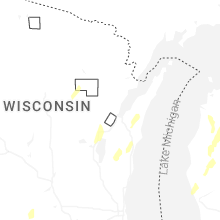


Connect with Interactive Hail Maps