

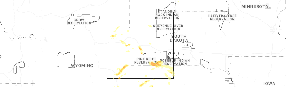
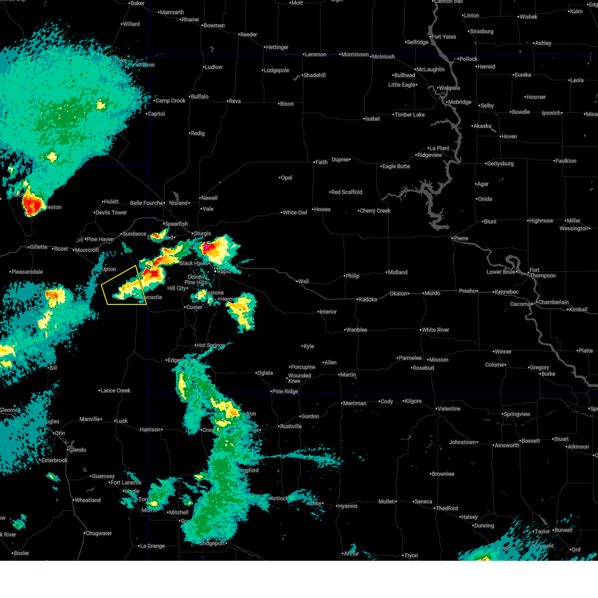
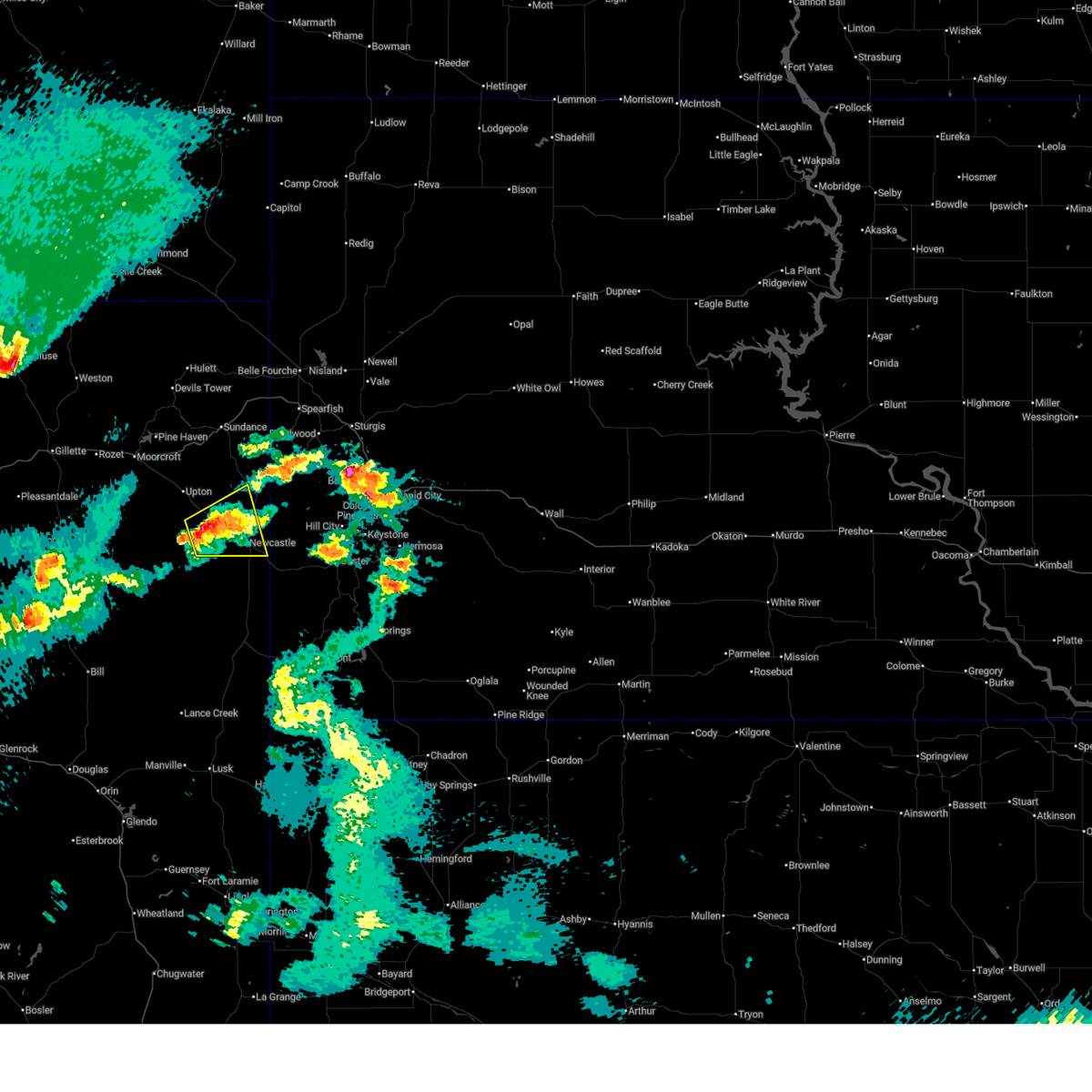
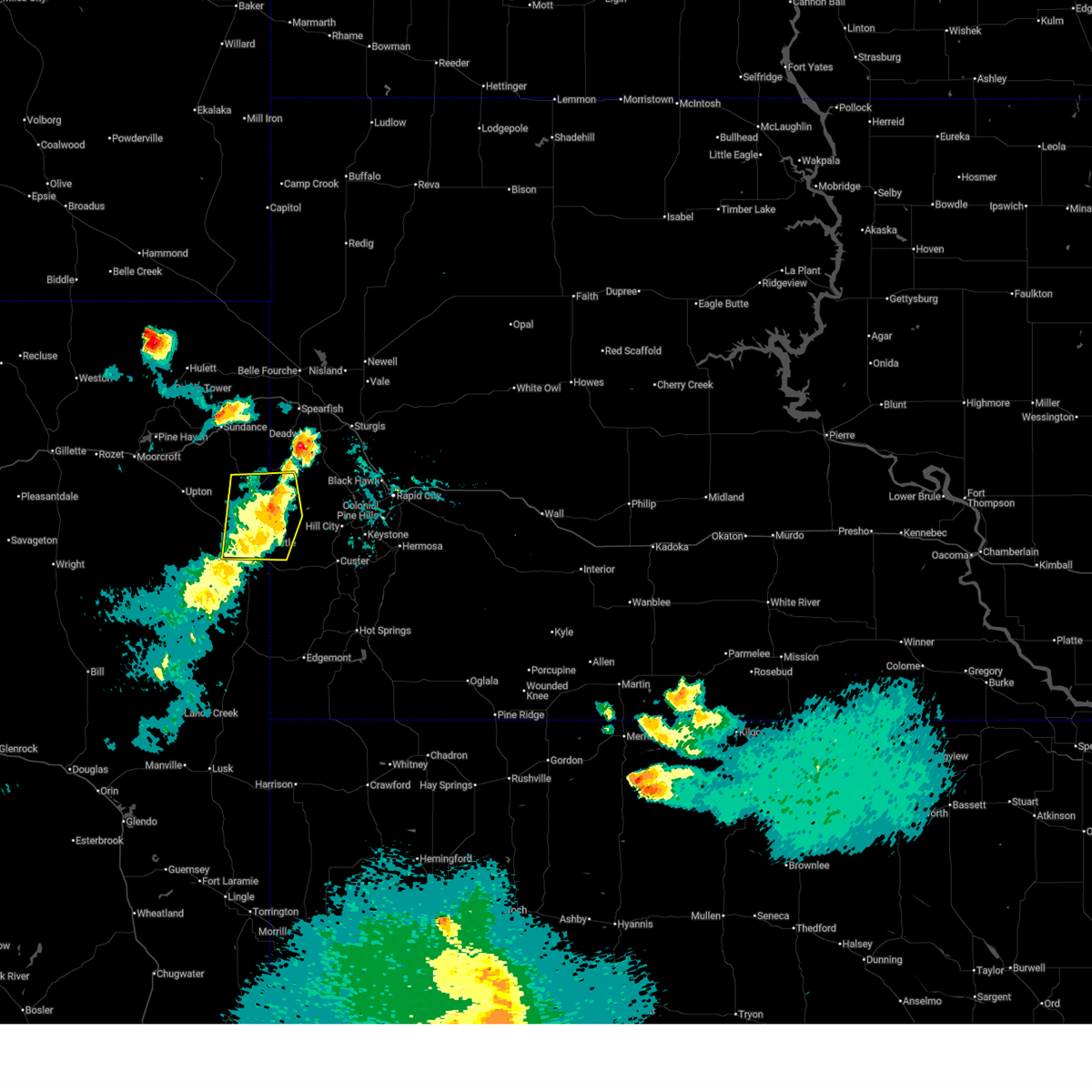
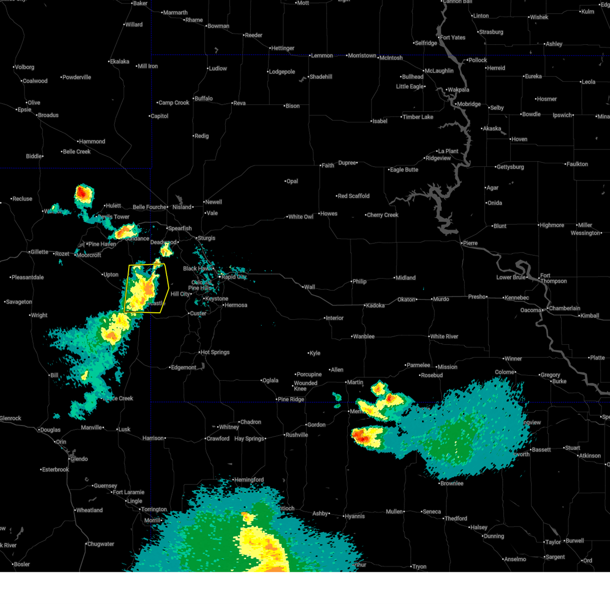
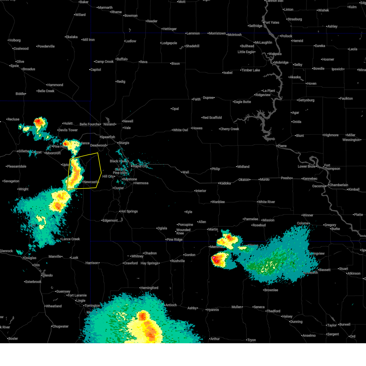
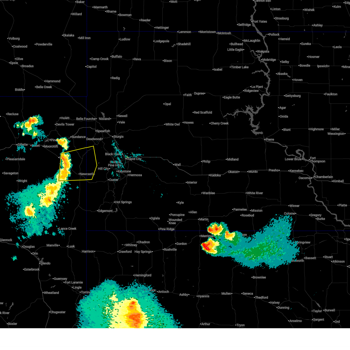
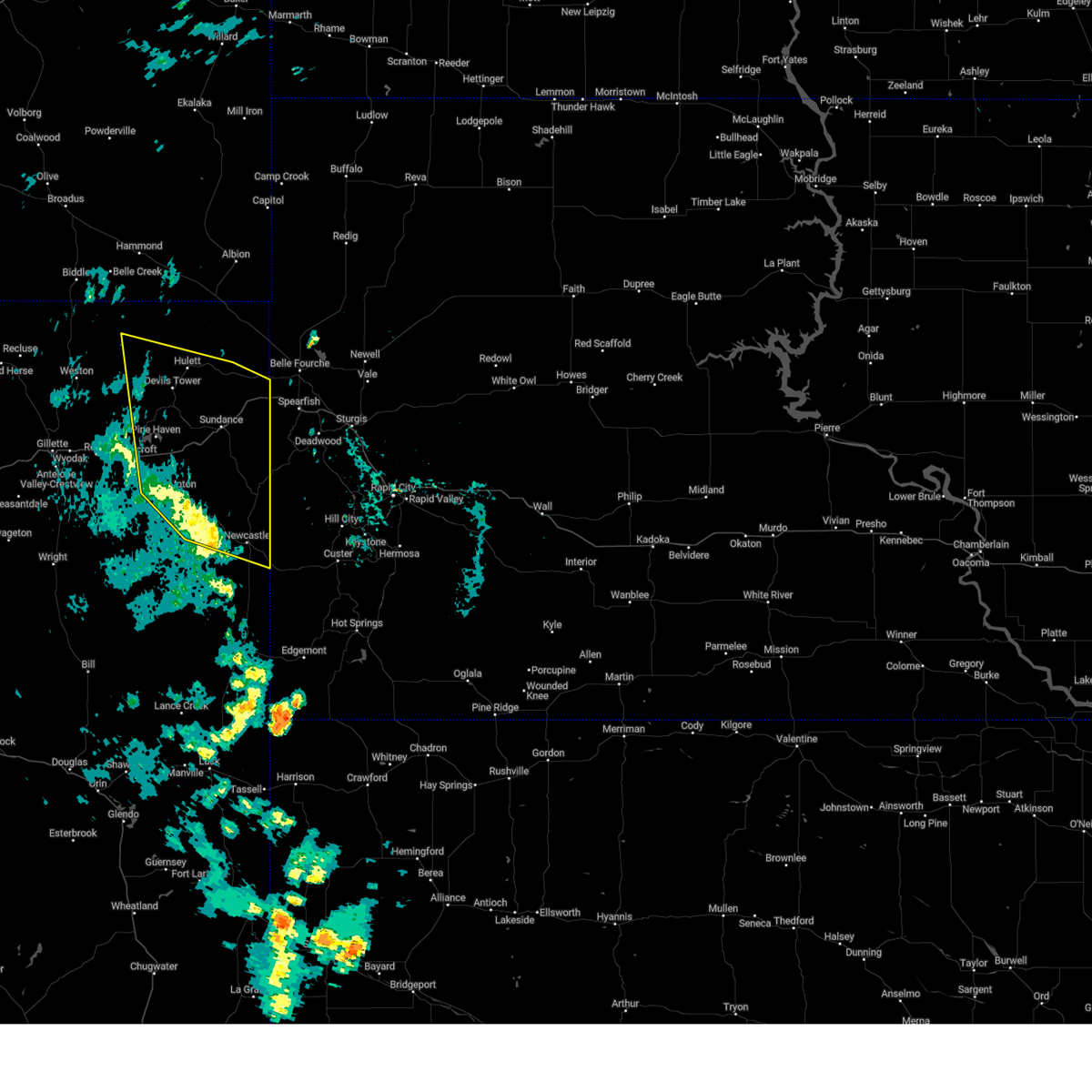
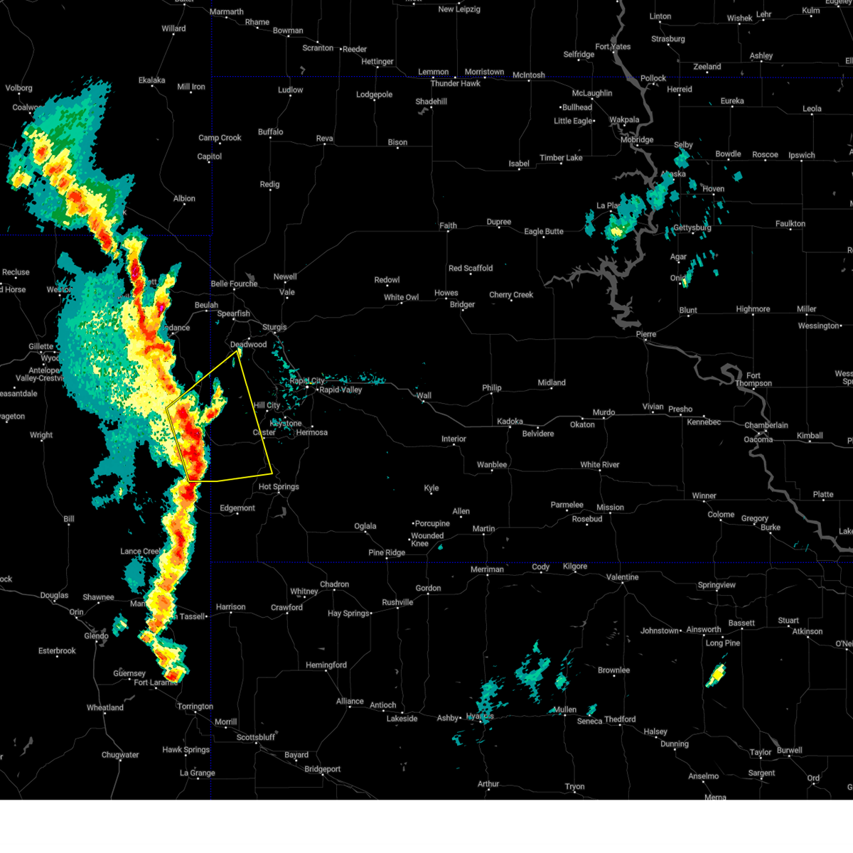
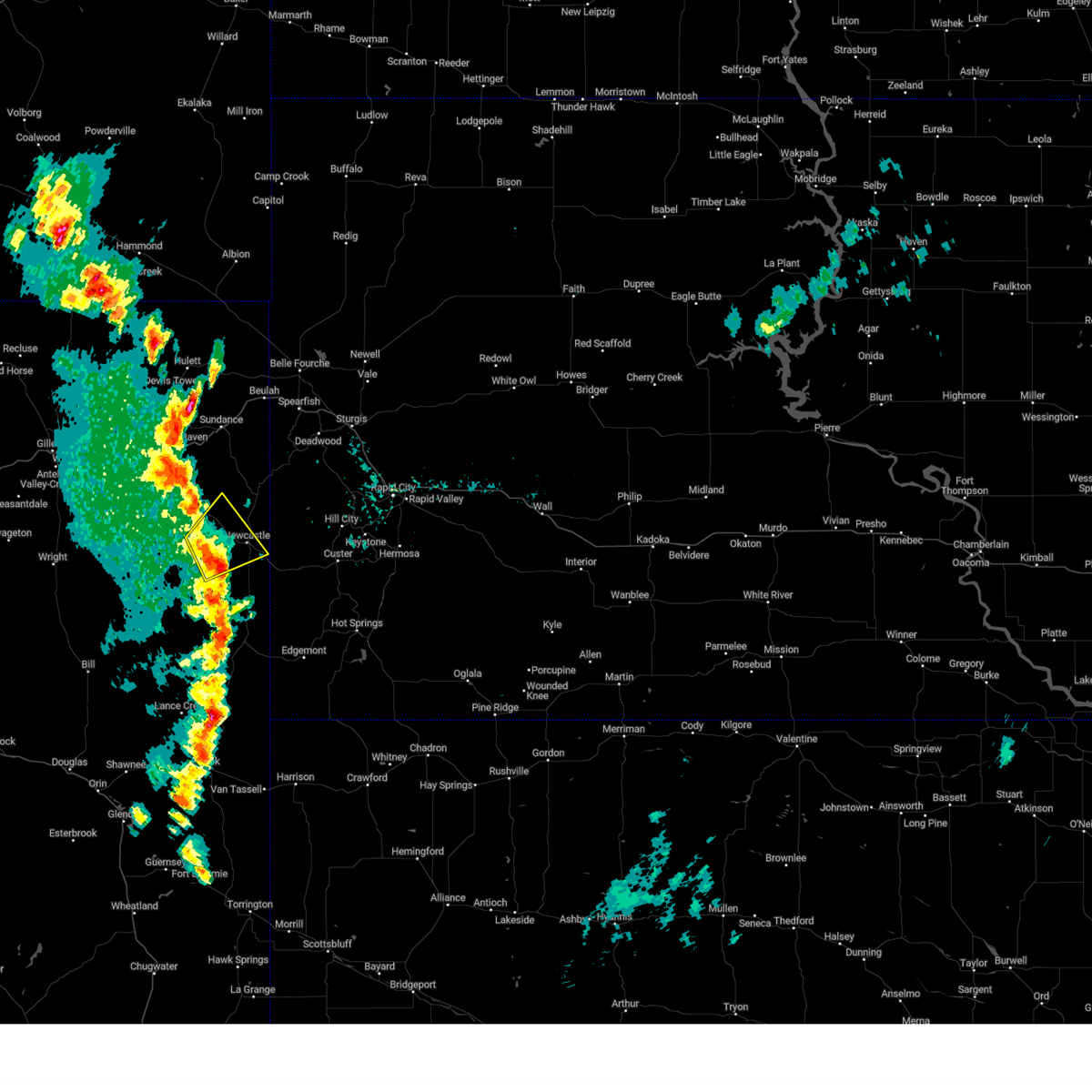
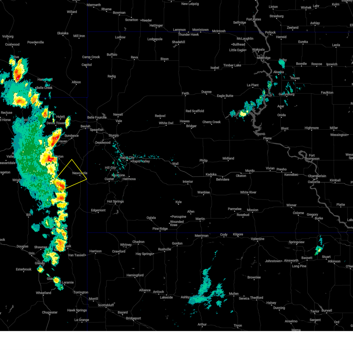
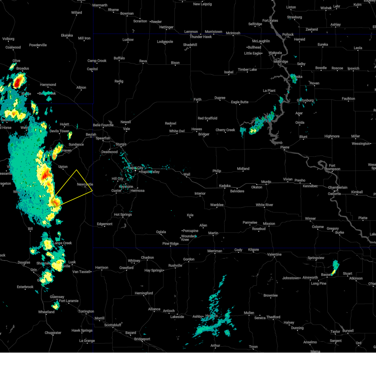
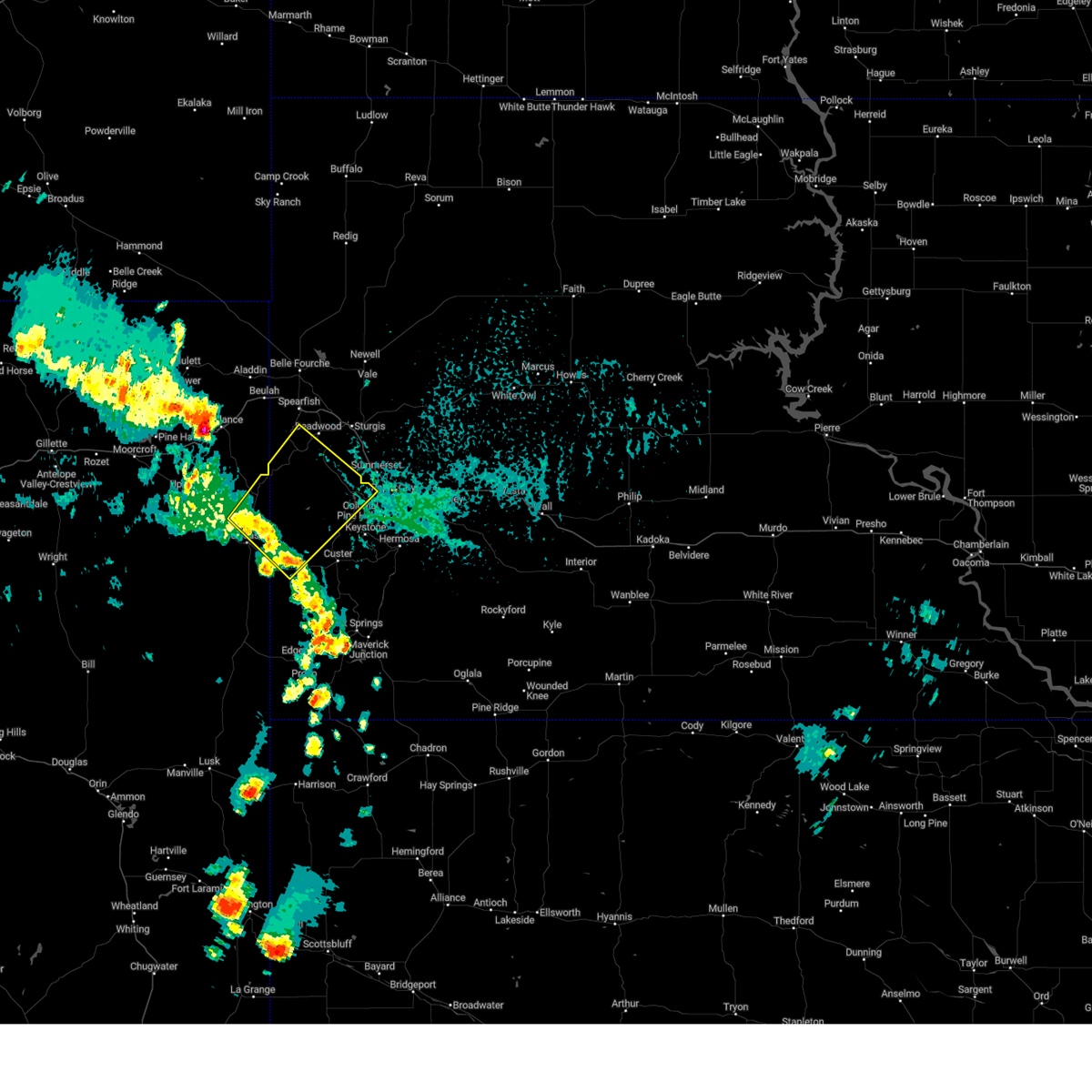
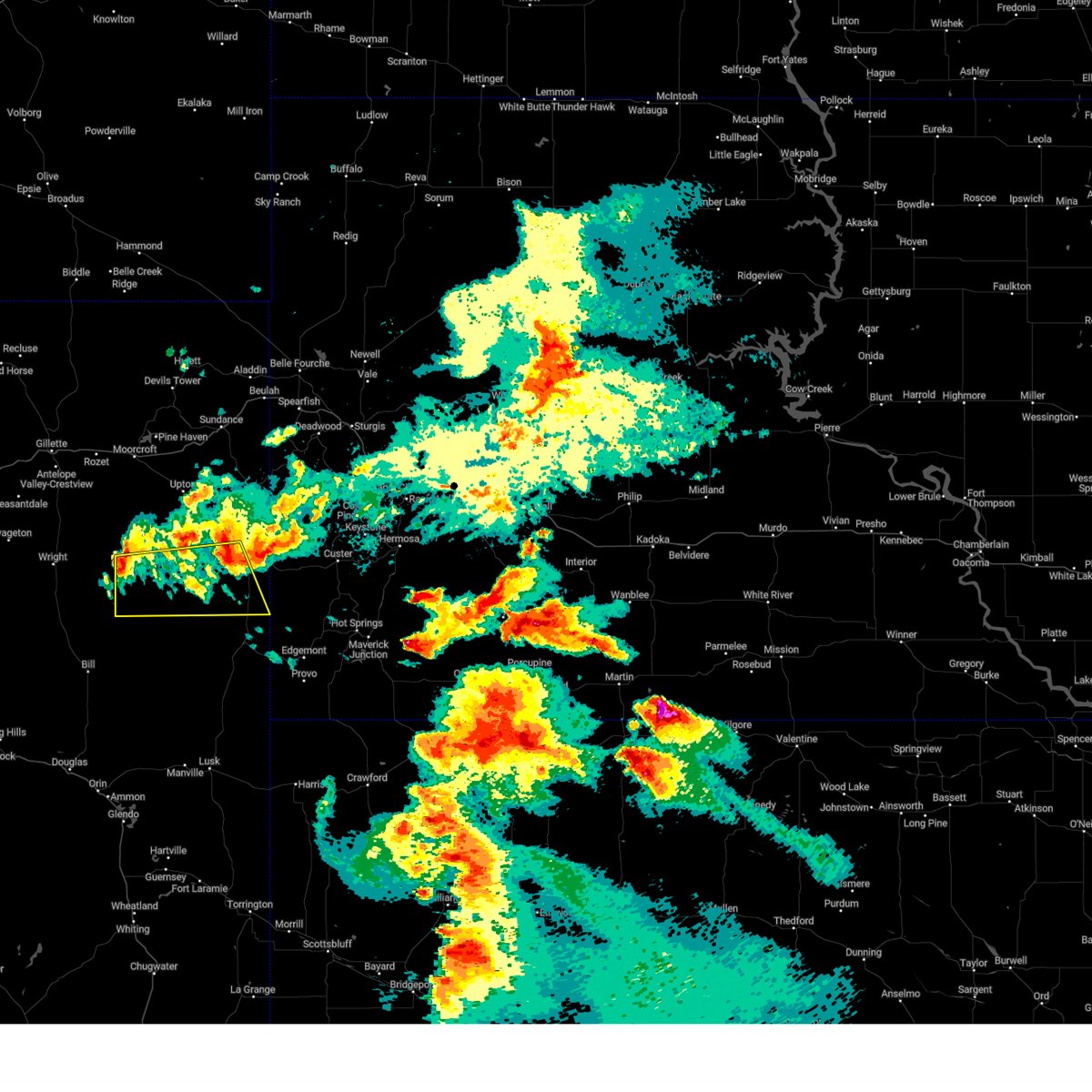
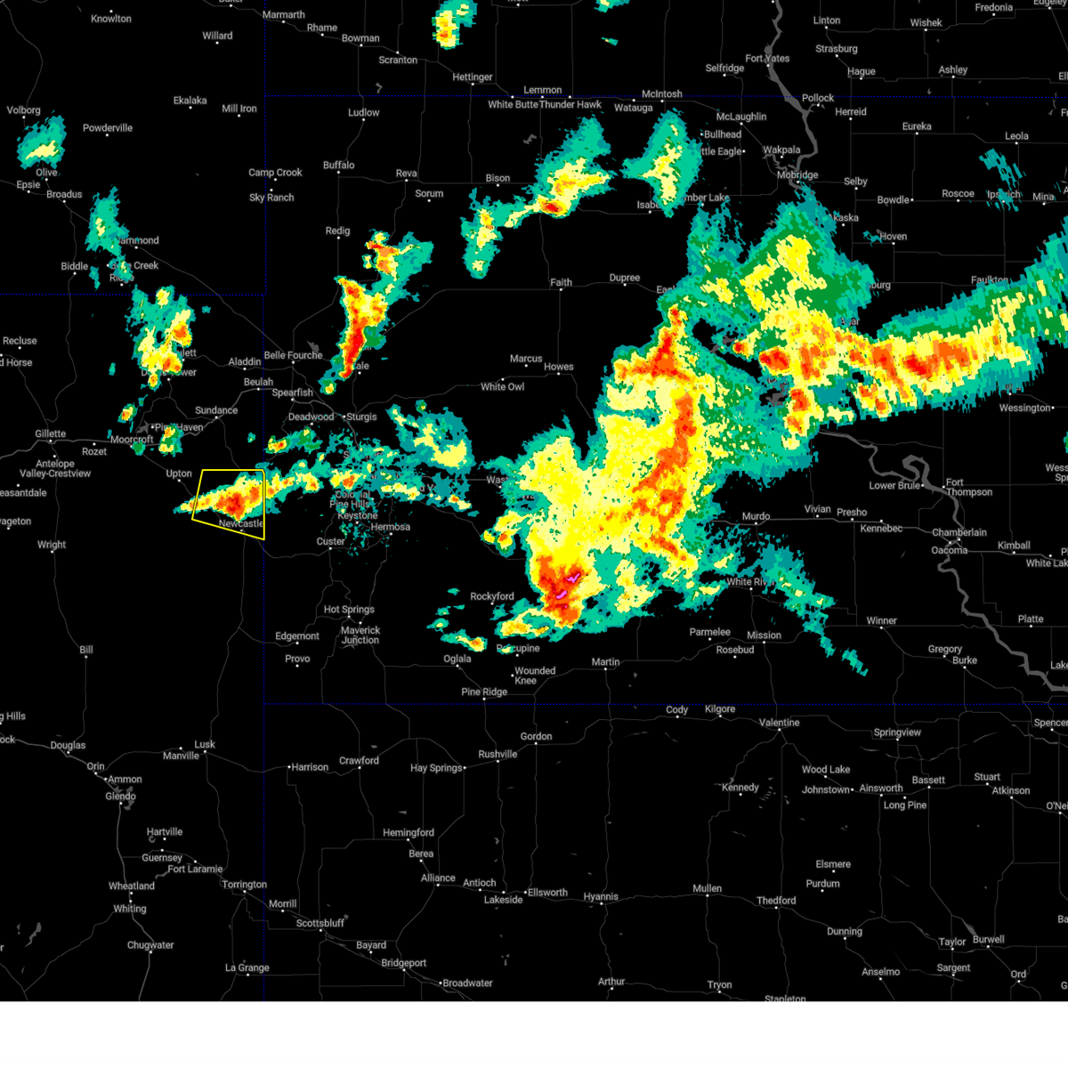
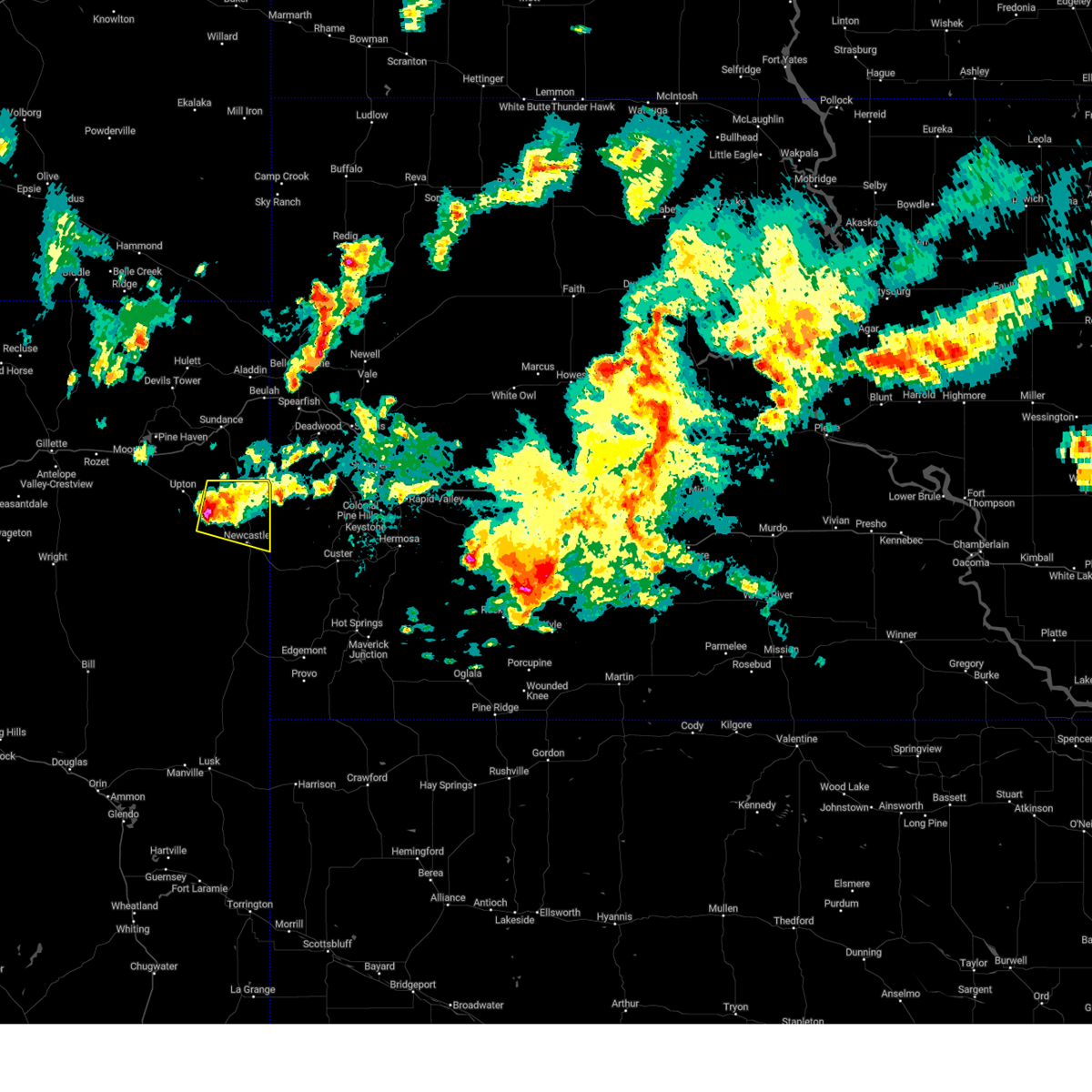
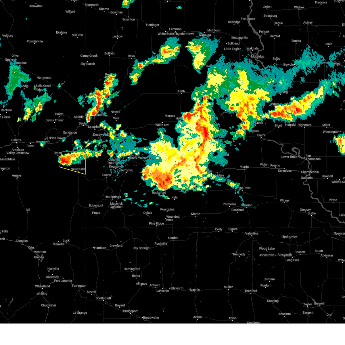
Hail Map for Newcastle, WY
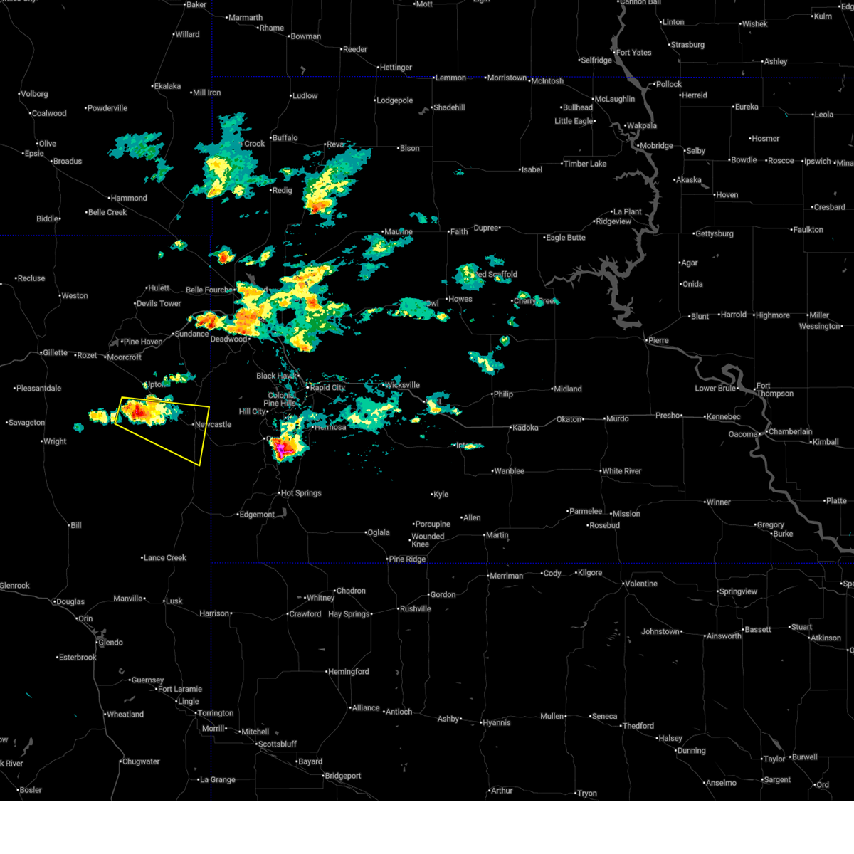
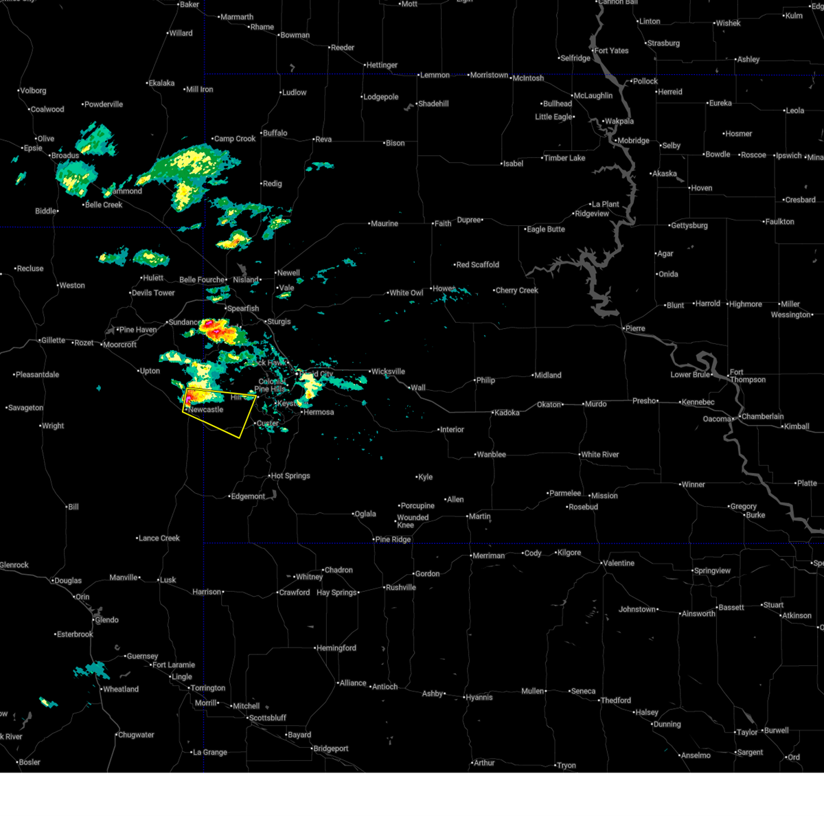
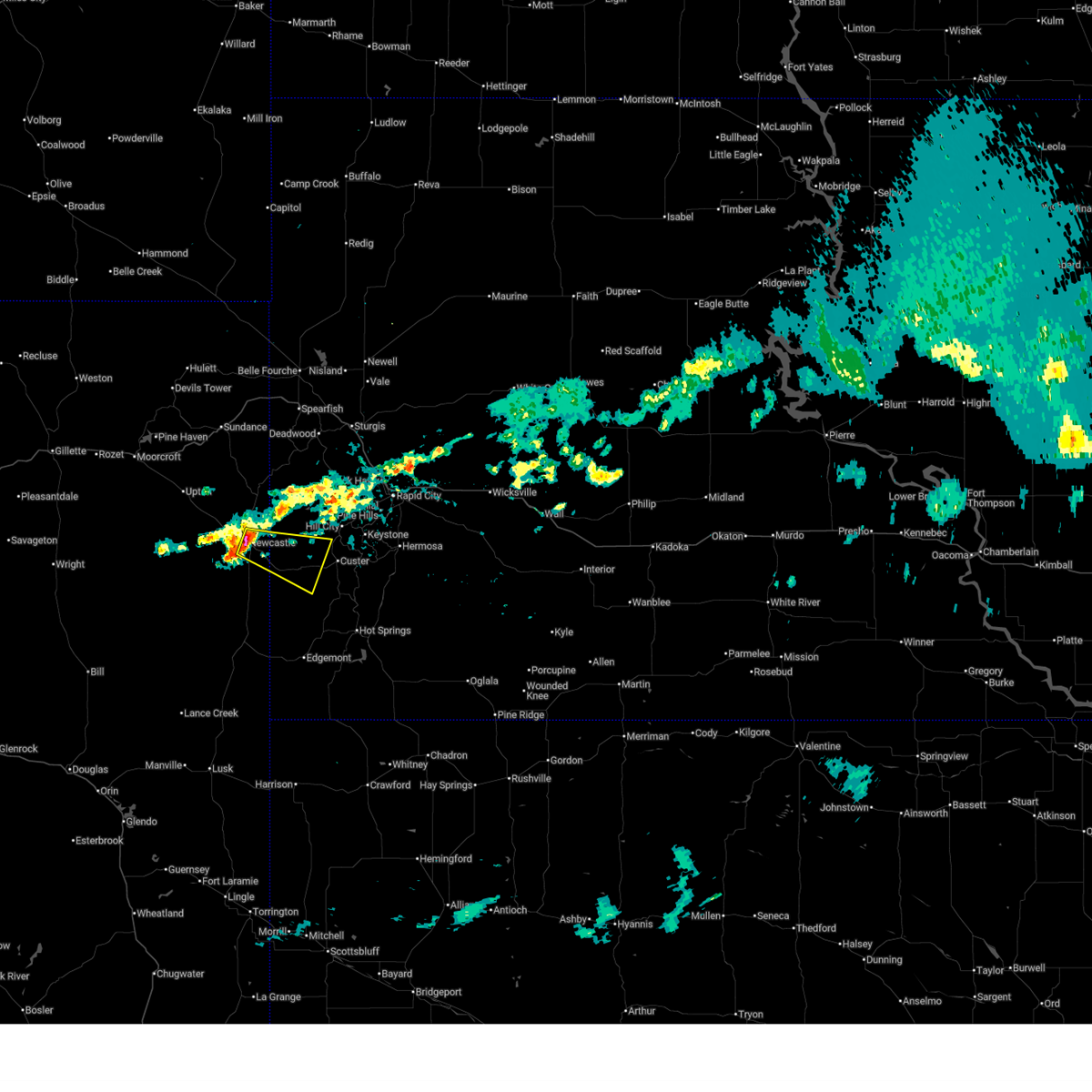
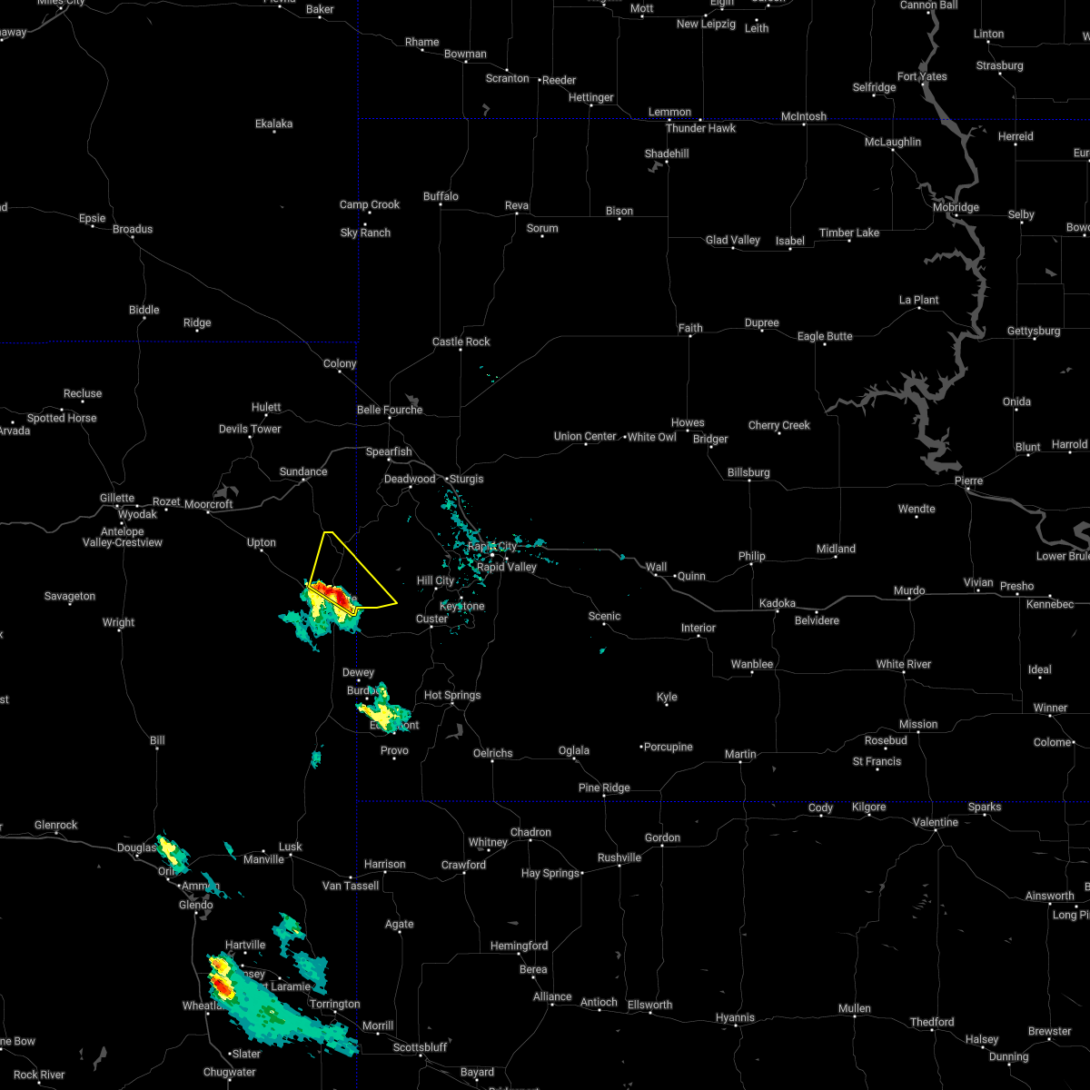
The Newcastle, WY area has had 88 reports of on-the-ground hail by trained spotters, and has been under severe weather warnings 16 times during the past 12 months. Doppler radar has detected hail at or near Newcastle, WY on 67 occasions, including 3 occasions during the past year.
| Name: | Newcastle, WY |
| Where Located: | 51.5 miles WSW of Rapid City, SD |
| Map: | Google Map for Newcastle, WY |
| Population: | 3532 |
| Housing Units: | 1663 |
| More Info: | Search Google for Newcastle, WY |
0
The Top Recent Hail Date for Newcastle, WY is Sunday, July 6, 2025 (46th out of 67)
Hail and Wind Damage Spotted near Newcastle, WY
| Date / Time | Report Details |
|---|---|
| 7/4/2025 8:44 PM MDT | Storm damage reported in weston county WY, 12.7 miles N of Newcastle, WY |
| 7/4/2025 8:06 PM MDT | Storm damage reported in weston county WY, 35.4 miles ENE of Newcastle, WY |
| 6/29/2025 4:13 PM MDT | Quarter sized hail reported 11.3 miles N of Newcastle, WY |
| 6/29/2025 3:40 PM MDT | At 340 pm mdt, a severe thunderstorm was located 7 miles south of osage, or 8 miles west of newcastle, moving east at 25 mph (radar indicated). Hazards include 60 mph wind gusts and quarter size hail. Hail damage to vehicles is expected. expect wind damage to roofs, siding, and trees. Locations impacted include, newcastle and osage. |
| 6/29/2025 3:18 PM MDT |
 Svrunr the national weather service in rapid city has issued a * severe thunderstorm warning for, central weston county in northeastern wyoming, * until 415 pm mdt. * at 318 pm mdt, a severe thunderstorm was located 8 miles southwest of osage, or 17 miles west of newcastle, moving east at 25 mph (radar indicated). Hazards include 60 mph wind gusts and quarter size hail. Hail damage to vehicles is expected. Expect wind damage to roofs, siding, and trees. Svrunr the national weather service in rapid city has issued a * severe thunderstorm warning for, central weston county in northeastern wyoming, * until 415 pm mdt. * at 318 pm mdt, a severe thunderstorm was located 8 miles southwest of osage, or 17 miles west of newcastle, moving east at 25 mph (radar indicated). Hazards include 60 mph wind gusts and quarter size hail. Hail damage to vehicles is expected. Expect wind damage to roofs, siding, and trees.
|
| 6/29/2025 2:00 PM MDT | Storm damage reported in weston county WY, 3.1 miles SSW of Newcastle, WY |
| 6/29/2025 1:56 PM MDT |
 Svrunr the national weather service in rapid city has issued a * severe thunderstorm warning for, northwestern custer county in southwestern south dakota, western pennington county in west central south dakota, east central weston county in northeastern wyoming, * until 300 pm mdt. * at 156 pm mdt, a severe thunderstorm was located 5 miles northeast of newcastle, moving east at 25 mph (radar indicated). Hazards include 60 mph wind gusts and half dollar size hail. Hail damage to vehicles is expected. Expect wind damage to roofs, siding, and trees. Svrunr the national weather service in rapid city has issued a * severe thunderstorm warning for, northwestern custer county in southwestern south dakota, western pennington county in west central south dakota, east central weston county in northeastern wyoming, * until 300 pm mdt. * at 156 pm mdt, a severe thunderstorm was located 5 miles northeast of newcastle, moving east at 25 mph (radar indicated). Hazards include 60 mph wind gusts and half dollar size hail. Hail damage to vehicles is expected. Expect wind damage to roofs, siding, and trees.
|
| 6/29/2025 5:32 AM MDT |
 Svrunr the national weather service in rapid city has issued a * severe thunderstorm warning for, northwestern custer county in southwestern south dakota, southwestern pennington county in west central south dakota, east central weston county in northeastern wyoming, * until 615 am mdt. * at 531 am mdt, a severe thunderstorm was located near newcastle, moving east at 30 mph. multiple reports of hail of quarter sized or larger have recently been received (public). Hazards include quarter size hail. Damage to vehicles is expected. this severe thunderstorm will be near, elk mountain lookout around 535 am mdt. jewel cave national monument around 540 am mdt. Bear mountain lookout around 550 am mdt. Svrunr the national weather service in rapid city has issued a * severe thunderstorm warning for, northwestern custer county in southwestern south dakota, southwestern pennington county in west central south dakota, east central weston county in northeastern wyoming, * until 615 am mdt. * at 531 am mdt, a severe thunderstorm was located near newcastle, moving east at 30 mph. multiple reports of hail of quarter sized or larger have recently been received (public). Hazards include quarter size hail. Damage to vehicles is expected. this severe thunderstorm will be near, elk mountain lookout around 535 am mdt. jewel cave national monument around 540 am mdt. Bear mountain lookout around 550 am mdt.
|
| 6/29/2025 5:31 AM MDT | Half Dollar sized hail reported 0.7 miles W of Newcastle, WY |
| 6/29/2025 5:28 AM MDT | Quarter sized hail reported 0.9 miles SW of Newcastle, WY |
| 6/16/2025 8:24 PM MDT |
 The storm which prompted the warning has weakened below severe limits, and has exited the warned area. therefore, the warning will be allowed to expire. The storm which prompted the warning has weakened below severe limits, and has exited the warned area. therefore, the warning will be allowed to expire.
|
| 6/16/2025 7:57 PM MDT |
 Svrunr the national weather service in rapid city has issued a * severe thunderstorm warning for, northeastern weston county in northeastern wyoming, * until 830 pm mdt. * at 757 pm mdt, a severe thunderstorm was located 5 miles southwest of osage, or 13 miles west of newcastle, moving east at 25 mph (radar indicated). Hazards include 60 mph wind gusts and quarter size hail. Hail damage to vehicles is expected. expect wind damage to roofs, siding, and trees. This severe thunderstorm will be near, newcastle and osage around 800 pm mdt. Svrunr the national weather service in rapid city has issued a * severe thunderstorm warning for, northeastern weston county in northeastern wyoming, * until 830 pm mdt. * at 757 pm mdt, a severe thunderstorm was located 5 miles southwest of osage, or 13 miles west of newcastle, moving east at 25 mph (radar indicated). Hazards include 60 mph wind gusts and quarter size hail. Hail damage to vehicles is expected. expect wind damage to roofs, siding, and trees. This severe thunderstorm will be near, newcastle and osage around 800 pm mdt.
|
| 6/15/2025 7:22 PM MDT |
 the severe thunderstorm warning has been cancelled and is no longer in effect the severe thunderstorm warning has been cancelled and is no longer in effect
|
| 6/15/2025 7:10 PM MDT |
 the severe thunderstorm warning has been cancelled and is no longer in effect the severe thunderstorm warning has been cancelled and is no longer in effect
|
| 6/15/2025 7:10 PM MDT |
 At 710 pm mdt, severe thunderstorms were located along a line extending from 2 miles west of buckhorn to 4 miles west of moon to 5 miles south of newcastle, moving east at 35 mph (radar indicated). Hazards include 60 mph wind gusts. Expect damage to roofs, siding, and trees. These severe storms will be near, moon, buckhorn, redbank spring campground, crooks tower, and mallo camp around 715 pm mdt. At 710 pm mdt, severe thunderstorms were located along a line extending from 2 miles west of buckhorn to 4 miles west of moon to 5 miles south of newcastle, moving east at 35 mph (radar indicated). Hazards include 60 mph wind gusts. Expect damage to roofs, siding, and trees. These severe storms will be near, moon, buckhorn, redbank spring campground, crooks tower, and mallo camp around 715 pm mdt.
|
| 6/15/2025 6:56 PM MDT |
 At 656 pm mdt, severe thunderstorms were located along a line extending from 5 miles south of inyan kara mountain to 6 miles northwest of newcastle to 15 miles south of osage, moving east at 30 mph (radar indicated). Hazards include 60 mph wind gusts. Expect damage to roofs, siding, and trees. these severe storms will be near, newcastle, moon, buckhorn, four corners, redbank spring campground, and mallo camp around 700 pm mdt. Other locations in the path of these severe thunderstorms include o'neil pass and crooks tower. At 656 pm mdt, severe thunderstorms were located along a line extending from 5 miles south of inyan kara mountain to 6 miles northwest of newcastle to 15 miles south of osage, moving east at 30 mph (radar indicated). Hazards include 60 mph wind gusts. Expect damage to roofs, siding, and trees. these severe storms will be near, newcastle, moon, buckhorn, four corners, redbank spring campground, and mallo camp around 700 pm mdt. Other locations in the path of these severe thunderstorms include o'neil pass and crooks tower.
|
| 6/15/2025 6:42 PM MDT |
 Svrunr the national weather service in rapid city has issued a * severe thunderstorm warning for, northwestern custer county in southwestern south dakota, southwestern lawrence county in west central south dakota, west central pennington county in west central south dakota, northeastern weston county in northeastern wyoming, southeastern crook county in northeastern wyoming, * until 745 pm mdt. * at 642 pm mdt, severe thunderstorms were located along a line extending from 8 miles southwest of inyan kara mountain to 4 miles south of osage to 10 miles east of clareton, moving east at 30 mph (radar indicated). Hazards include 60 mph wind gusts and quarter size hail. Hail damage to vehicles is expected. expect wind damage to roofs, siding, and trees. severe thunderstorms will be near, newcastle around 645 pm mdt. four corners around 650 pm mdt. buckhorn and mallo camp around 655 pm mdt. moon and redbank spring campground around 700 pm mdt. o'neil pass around 705 pm mdt. Crooks tower around 710 pm mdt. Svrunr the national weather service in rapid city has issued a * severe thunderstorm warning for, northwestern custer county in southwestern south dakota, southwestern lawrence county in west central south dakota, west central pennington county in west central south dakota, northeastern weston county in northeastern wyoming, southeastern crook county in northeastern wyoming, * until 745 pm mdt. * at 642 pm mdt, severe thunderstorms were located along a line extending from 8 miles southwest of inyan kara mountain to 4 miles south of osage to 10 miles east of clareton, moving east at 30 mph (radar indicated). Hazards include 60 mph wind gusts and quarter size hail. Hail damage to vehicles is expected. expect wind damage to roofs, siding, and trees. severe thunderstorms will be near, newcastle around 645 pm mdt. four corners around 650 pm mdt. buckhorn and mallo camp around 655 pm mdt. moon and redbank spring campground around 700 pm mdt. o'neil pass around 705 pm mdt. Crooks tower around 710 pm mdt.
|
| 9/17/2024 4:47 PM MDT |
 Svrunr the national weather service in rapid city has issued a * severe thunderstorm warning for, northeastern weston county in northeastern wyoming, crook county in northeastern wyoming, * until 545 pm mdt. * at 447 pm mdt, severe thunderstorms were located along a line extending from 8 miles west of upton to 6 miles northwest of osage to 8 miles west of newcastle, moving north at 45 mph (radar indicated). Hazards include 60 mph wind gusts. expect damage to roofs, siding, and trees Svrunr the national weather service in rapid city has issued a * severe thunderstorm warning for, northeastern weston county in northeastern wyoming, crook county in northeastern wyoming, * until 545 pm mdt. * at 447 pm mdt, severe thunderstorms were located along a line extending from 8 miles west of upton to 6 miles northwest of osage to 8 miles west of newcastle, moving north at 45 mph (radar indicated). Hazards include 60 mph wind gusts. expect damage to roofs, siding, and trees
|
| 8/26/2024 2:30 PM MDT | Storm damage reported in weston county WY, 3.1 miles SSW of Newcastle, WY |
| 8/26/2024 2:28 PM MDT |
 Svrunr the national weather service in rapid city has issued a * severe thunderstorm warning for, western custer county in southwestern south dakota, southwestern lawrence county in west central south dakota, southwestern pennington county in west central south dakota, southeastern weston county in northeastern wyoming, * until 315 pm mdt. * at 227 pm mdt, severe thunderstorms were located along a line extending from 5 miles south of inyan kara mountain to 5 miles west of dewey, moving northeast at 40 mph (radar indicated). Hazards include 70 mph wind gusts and quarter size hail. Hail damage to vehicles is expected. expect considerable tree damage. wind damage is also likely to mobile homes, roofs, and outbuildings. severe thunderstorms will be near, newcastle, dewey, moon, four corners, mallo camp, redbank spring campground, elk mountain lookout, and jewel cave national monument around 235 pm mdt. deerfield, flag mountain, crooks tower, bear mountain lookout, and deerfield reservoir around 245 pm mdt. Other locations in the path of these severe thunderstorms include black fox campground and medicine mountain. Svrunr the national weather service in rapid city has issued a * severe thunderstorm warning for, western custer county in southwestern south dakota, southwestern lawrence county in west central south dakota, southwestern pennington county in west central south dakota, southeastern weston county in northeastern wyoming, * until 315 pm mdt. * at 227 pm mdt, severe thunderstorms were located along a line extending from 5 miles south of inyan kara mountain to 5 miles west of dewey, moving northeast at 40 mph (radar indicated). Hazards include 70 mph wind gusts and quarter size hail. Hail damage to vehicles is expected. expect considerable tree damage. wind damage is also likely to mobile homes, roofs, and outbuildings. severe thunderstorms will be near, newcastle, dewey, moon, four corners, mallo camp, redbank spring campground, elk mountain lookout, and jewel cave national monument around 235 pm mdt. deerfield, flag mountain, crooks tower, bear mountain lookout, and deerfield reservoir around 245 pm mdt. Other locations in the path of these severe thunderstorms include black fox campground and medicine mountain.
|
| 8/26/2024 2:20 PM MDT | Storm damage reported in weston county WY, 0.9 miles SW of Newcastle, WY |
| 8/26/2024 2:14 PM MDT |
 At 213 pm mdt, a severe thunderstorm was located 7 miles southwest of newcastle, moving northeast at 45 mph (radar indicated). Hazards include 70 mph wind gusts and quarter size hail. Hail damage to vehicles is expected. expect considerable tree damage. wind damage is also likely to mobile homes, roofs, and outbuildings. Locations impacted include, newcastle. At 213 pm mdt, a severe thunderstorm was located 7 miles southwest of newcastle, moving northeast at 45 mph (radar indicated). Hazards include 70 mph wind gusts and quarter size hail. Hail damage to vehicles is expected. expect considerable tree damage. wind damage is also likely to mobile homes, roofs, and outbuildings. Locations impacted include, newcastle.
|
| 8/26/2024 2:00 PM MDT | Storm damage reported in weston county WY, 24.7 miles ENE of Newcastle, WY |
| 8/26/2024 1:59 PM MDT |
 At 159 pm mdt, a severe thunderstorm was located 7 miles east of clareton, or 18 miles southwest of newcastle, moving northeast at 45 mph (radar indicated). Hazards include 70 mph wind gusts and quarter size hail. Hail damage to vehicles is expected. expect considerable tree damage. wind damage is also likely to mobile homes, roofs, and outbuildings. This severe storm will be near, newcastle around 205 pm mdt. At 159 pm mdt, a severe thunderstorm was located 7 miles east of clareton, or 18 miles southwest of newcastle, moving northeast at 45 mph (radar indicated). Hazards include 70 mph wind gusts and quarter size hail. Hail damage to vehicles is expected. expect considerable tree damage. wind damage is also likely to mobile homes, roofs, and outbuildings. This severe storm will be near, newcastle around 205 pm mdt.
|
| 8/26/2024 1:45 PM MDT |
 Svrunr the national weather service in rapid city has issued a * severe thunderstorm warning for, central weston county in northeastern wyoming, * until 230 pm mdt. * at 145 pm mdt, a severe thunderstorm was located 4 miles southwest of clareton, or 29 miles southwest of newcastle, moving northeast at 45 mph (radar indicated). Hazards include 70 mph wind gusts and quarter size hail. Hail damage to vehicles is expected. expect considerable tree damage. wind damage is also likely to mobile homes, roofs, and outbuildings. this severe thunderstorm will be near, clareton around 150 pm mdt. Newcastle around 205 pm mdt. Svrunr the national weather service in rapid city has issued a * severe thunderstorm warning for, central weston county in northeastern wyoming, * until 230 pm mdt. * at 145 pm mdt, a severe thunderstorm was located 4 miles southwest of clareton, or 29 miles southwest of newcastle, moving northeast at 45 mph (radar indicated). Hazards include 70 mph wind gusts and quarter size hail. Hail damage to vehicles is expected. expect considerable tree damage. wind damage is also likely to mobile homes, roofs, and outbuildings. this severe thunderstorm will be near, clareton around 150 pm mdt. Newcastle around 205 pm mdt.
|
| 7/19/2024 3:26 PM MDT | Storm damage reported in weston county WY, 16.2 miles SSW of Newcastle, WY |
| 7/6/2024 3:35 PM MDT | Time estimated from radar in weston county WY, 12.7 miles N of Newcastle, WY |
| 6/30/2024 6:52 PM MDT | Storm damage reported in weston county WY, 1.7 miles NNE of Newcastle, WY |
| 6/30/2024 6:35 PM MDT |
 Svrunr the national weather service in rapid city has issued a * severe thunderstorm warning for, northwestern custer county in southwestern south dakota, southwestern pennington county in west central south dakota, east central weston county in northeastern wyoming, * until 730 pm mdt. * at 634 pm mdt, a severe thunderstorm was located 6 miles southeast of newcastle, moving northeast at 35 mph (radar indicated). Hazards include 70 mph wind gusts. Expect considerable tree damage. damage is likely to mobile homes, roofs, and outbuildings. this severe thunderstorm will be near, newcastle, moon, and elk mountain lookout around 640 pm mdt. jewel cave national monument around 645 pm mdt. redbank spring campground and bear mountain lookout around 650 pm mdt. deerfield, medicine mountain, and deerfield reservoir around 655 pm mdt. Flag mountain around 705 pm mdt. Svrunr the national weather service in rapid city has issued a * severe thunderstorm warning for, northwestern custer county in southwestern south dakota, southwestern pennington county in west central south dakota, east central weston county in northeastern wyoming, * until 730 pm mdt. * at 634 pm mdt, a severe thunderstorm was located 6 miles southeast of newcastle, moving northeast at 35 mph (radar indicated). Hazards include 70 mph wind gusts. Expect considerable tree damage. damage is likely to mobile homes, roofs, and outbuildings. this severe thunderstorm will be near, newcastle, moon, and elk mountain lookout around 640 pm mdt. jewel cave national monument around 645 pm mdt. redbank spring campground and bear mountain lookout around 650 pm mdt. deerfield, medicine mountain, and deerfield reservoir around 655 pm mdt. Flag mountain around 705 pm mdt.
|
| 6/30/2024 6:32 PM MDT |
 At 631 pm mdt, a severe thunderstorm was located 7 miles west of elk mountain lookout, or 9 miles south of newcastle, moving northeast at 35 mph (trained weather spotters. around 6:30 pm, a 72 mph wind gust was reported about 6 miles south of newcastle). Hazards include 70 mph wind gusts. Expect considerable tree damage. damage is likely to mobile homes, roofs, and outbuildings. Locations impacted include, newcastle. At 631 pm mdt, a severe thunderstorm was located 7 miles west of elk mountain lookout, or 9 miles south of newcastle, moving northeast at 35 mph (trained weather spotters. around 6:30 pm, a 72 mph wind gust was reported about 6 miles south of newcastle). Hazards include 70 mph wind gusts. Expect considerable tree damage. damage is likely to mobile homes, roofs, and outbuildings. Locations impacted include, newcastle.
|
| 6/30/2024 6:21 PM MDT | Storm damage reported in weston county WY, 4.4 miles NNW of Newcastle, WY |
| 6/30/2024 6:21 PM MDT | Storm damage reported in weston county WY, 4.4 miles NNW of Newcastle, WY |
| 6/30/2024 6:11 PM MDT | Storm damage reported in weston county WY, 19.9 miles NE of Newcastle, WY |
| 6/30/2024 5:58 PM MDT |
 Svrunr the national weather service in rapid city has issued a * severe thunderstorm warning for, southeastern weston county in northeastern wyoming, * until 645 pm mdt. * at 558 pm mdt, a severe thunderstorm was located 5 miles northwest of morrisey, or 24 miles southwest of newcastle, moving northeast at 30 mph (radar indicated). Hazards include 60 mph wind gusts and penny size hail. Expect damage to roofs, siding, and trees. this severe thunderstorm will be near, morrisey around 605 pm mdt. Newcastle around 630 pm mdt. Svrunr the national weather service in rapid city has issued a * severe thunderstorm warning for, southeastern weston county in northeastern wyoming, * until 645 pm mdt. * at 558 pm mdt, a severe thunderstorm was located 5 miles northwest of morrisey, or 24 miles southwest of newcastle, moving northeast at 30 mph (radar indicated). Hazards include 60 mph wind gusts and penny size hail. Expect damage to roofs, siding, and trees. this severe thunderstorm will be near, morrisey around 605 pm mdt. Newcastle around 630 pm mdt.
|
| 6/30/2024 5:32 PM MDT | Storm damage reported in weston county WY, 31.5 miles NE of Newcastle, WY |
| 6/30/2024 5:09 PM MDT | Storm damage reported in weston county WY, 35.4 miles ENE of Newcastle, WY |
| 6/10/2024 2:50 PM MDT |
 Svrunr the national weather service in rapid city has issued a * severe thunderstorm warning for, southwestern meade county in west central south dakota, northwestern custer county in southwestern south dakota, southern lawrence county in west central south dakota, southwestern pennington county in west central south dakota, northeastern weston county in northeastern wyoming, * until 330 pm mdt. * at 250 pm mdt, severe thunderstorms were located along a line extending from 3 miles north of crooks tower to 5 miles northeast of newcastle, moving east at 40 mph (radar indicated). Hazards include 60 mph wind gusts and quarter size hail. Hail damage to vehicles is expected. expect wind damage to roofs, siding, and trees. severe thunderstorms will be near, rochford, flag mountain, moon, deerfield, black fox campground, crooks tower, redbank spring campground, roubaix lake, and deerfield reservoir around 255 pm mdt. mystic around 300 pm mdt. Nemo, silver city, medicine mountain, bear mountain lookout, and pactola reservoir around 305 pm mdt. Svrunr the national weather service in rapid city has issued a * severe thunderstorm warning for, southwestern meade county in west central south dakota, northwestern custer county in southwestern south dakota, southern lawrence county in west central south dakota, southwestern pennington county in west central south dakota, northeastern weston county in northeastern wyoming, * until 330 pm mdt. * at 250 pm mdt, severe thunderstorms were located along a line extending from 3 miles north of crooks tower to 5 miles northeast of newcastle, moving east at 40 mph (radar indicated). Hazards include 60 mph wind gusts and quarter size hail. Hail damage to vehicles is expected. expect wind damage to roofs, siding, and trees. severe thunderstorms will be near, rochford, flag mountain, moon, deerfield, black fox campground, crooks tower, redbank spring campground, roubaix lake, and deerfield reservoir around 255 pm mdt. mystic around 300 pm mdt. Nemo, silver city, medicine mountain, bear mountain lookout, and pactola reservoir around 305 pm mdt.
|
| 6/10/2024 2:49 PM MDT | Storm damage reported in weston county WY, 16.2 miles SSW of Newcastle, WY |
| 9/4/2023 2:00 PM MDT |
 At 200 pm mdt, severe thunderstorms were located along a line extending from 5 miles south of four corners to 3 miles north of jewel cave national monument, moving northeast at 50 mph (radar indicated). Hazards include 70 mph wind gusts and penny size hail. Expect considerable tree damage. damage is likely to mobile homes, roofs, and outbuildings. severe thunderstorms will be near, medicine mountain, mallo camp, redbank spring campground, and bear mountain lookout around 205 pm mdt. flag mountain, deerfield, and deerfield reservoir around 210 pm mdt. hill city, crooks tower, and black fox campground around 215 pm mdt. rochford and mystic around 220 pm mdt. other locations in the path of these severe thunderstorms include silver city, roubaix lake, pactola reservoir, johnson siding, nemo and hisega. thunderstorm damage threat, considerable hail threat, radar indicated max hail size, 0. 75 in wind threat, radar indicated max wind gust, 70 mph. At 200 pm mdt, severe thunderstorms were located along a line extending from 5 miles south of four corners to 3 miles north of jewel cave national monument, moving northeast at 50 mph (radar indicated). Hazards include 70 mph wind gusts and penny size hail. Expect considerable tree damage. damage is likely to mobile homes, roofs, and outbuildings. severe thunderstorms will be near, medicine mountain, mallo camp, redbank spring campground, and bear mountain lookout around 205 pm mdt. flag mountain, deerfield, and deerfield reservoir around 210 pm mdt. hill city, crooks tower, and black fox campground around 215 pm mdt. rochford and mystic around 220 pm mdt. other locations in the path of these severe thunderstorms include silver city, roubaix lake, pactola reservoir, johnson siding, nemo and hisega. thunderstorm damage threat, considerable hail threat, radar indicated max hail size, 0. 75 in wind threat, radar indicated max wind gust, 70 mph.
|
| 9/4/2023 1:54 PM MDT | Storm damage reported in custer county SD, 13.9 miles NW of Newcastle, WY |
| 9/4/2023 1:44 PM MDT | Storm damage reported in custer county SD, 13.9 miles NW of Newcastle, WY |
| 8/3/2023 7:38 PM MDT |
 The severe thunderstorm warning for east central weston county will expire at 745 pm mdt, the storm which prompted the warning has weakened below severe limits, and no longer poses an immediate threat to life or property. therefore, the warning will be allowed to expire. however small hail and heavy rain are still possible with this thunderstorm. The severe thunderstorm warning for east central weston county will expire at 745 pm mdt, the storm which prompted the warning has weakened below severe limits, and no longer poses an immediate threat to life or property. therefore, the warning will be allowed to expire. however small hail and heavy rain are still possible with this thunderstorm.
|
| 8/3/2023 7:30 PM MDT |
 At 729 pm mdt, a severe thunderstorm was located 4 miles southwest of moon, or 7 miles northeast of newcastle, moving north at 30 mph (radar indicated). Hazards include 60 mph wind gusts and quarter size hail. Hail damage to vehicles is expected. expect wind damage to roofs, siding, and trees. locations impacted include, newcastle. hail threat, radar indicated max hail size, 1. 00 in wind threat, radar indicated max wind gust, 60 mph. At 729 pm mdt, a severe thunderstorm was located 4 miles southwest of moon, or 7 miles northeast of newcastle, moving north at 30 mph (radar indicated). Hazards include 60 mph wind gusts and quarter size hail. Hail damage to vehicles is expected. expect wind damage to roofs, siding, and trees. locations impacted include, newcastle. hail threat, radar indicated max hail size, 1. 00 in wind threat, radar indicated max wind gust, 60 mph.
|
| 8/3/2023 7:18 PM MDT |
 At 717 pm mdt, a severe thunderstorm was located 4 miles east of newcastle, moving north at 30 mph (radar indicated). Hazards include 60 mph wind gusts and half dollar size hail. Hail damage to vehicles is expected. expect wind damage to roofs, siding, and trees. locations impacted include, moon. hail threat, radar indicated max hail size, 1. 25 in wind threat, radar indicated max wind gust, 60 mph. At 717 pm mdt, a severe thunderstorm was located 4 miles east of newcastle, moving north at 30 mph (radar indicated). Hazards include 60 mph wind gusts and half dollar size hail. Hail damage to vehicles is expected. expect wind damage to roofs, siding, and trees. locations impacted include, moon. hail threat, radar indicated max hail size, 1. 25 in wind threat, radar indicated max wind gust, 60 mph.
|
| 8/3/2023 7:01 PM MDT |
 At 701 pm mdt, a severe thunderstorm was located 5 miles west of elk mountain lookout, or 7 miles southeast of newcastle, moving north at 30 mph (radar indicated). Hazards include ping pong ball size hail and 60 mph wind gusts. People and animals outdoors will be injured. expect hail damage to roofs, siding, windows, and vehicles. expect wind damage to roofs, siding, and trees. this severe thunderstorm will be near, newcastle around 705 pm mdt. moon around 720 pm mdt. hail threat, radar indicated max hail size, 1. 50 in wind threat, radar indicated max wind gust, 60 mph. At 701 pm mdt, a severe thunderstorm was located 5 miles west of elk mountain lookout, or 7 miles southeast of newcastle, moving north at 30 mph (radar indicated). Hazards include ping pong ball size hail and 60 mph wind gusts. People and animals outdoors will be injured. expect hail damage to roofs, siding, windows, and vehicles. expect wind damage to roofs, siding, and trees. this severe thunderstorm will be near, newcastle around 705 pm mdt. moon around 720 pm mdt. hail threat, radar indicated max hail size, 1. 50 in wind threat, radar indicated max wind gust, 60 mph.
|
| 7/30/2023 8:54 PM MDT | Storm damage reported in custer county SD, 13.9 miles NW of Newcastle, WY |
| 7/30/2023 8:30 PM MDT |
 At 830 pm mdt, a severe thunderstorm was located near elk mountain lookout, or 9 miles southeast of newcastle, moving southeast at 20 mph (radar indicated). Hazards include golf ball size hail and 60 mph wind gusts. People and animals outdoors will be injured. expect hail damage to roofs, siding, windows, and vehicles. expect wind damage to roofs, siding, and trees. locations impacted include, newcastle and elk mountain lookout. thunderstorm damage threat, considerable hail threat, radar indicated max hail size, 1. 75 in wind threat, radar indicated max wind gust, 60 mph. At 830 pm mdt, a severe thunderstorm was located near elk mountain lookout, or 9 miles southeast of newcastle, moving southeast at 20 mph (radar indicated). Hazards include golf ball size hail and 60 mph wind gusts. People and animals outdoors will be injured. expect hail damage to roofs, siding, windows, and vehicles. expect wind damage to roofs, siding, and trees. locations impacted include, newcastle and elk mountain lookout. thunderstorm damage threat, considerable hail threat, radar indicated max hail size, 1. 75 in wind threat, radar indicated max wind gust, 60 mph.
|
| 7/30/2023 8:29 PM MDT |
 At 828 pm mdt, severe thunderstorms were located along a line extending from 6 miles southwest of newcastle to 9 miles northwest of rochelle, moving southeast at 20 mph (radar indicated). Hazards include hail up to golf ball size and 60 mph wind gusts. People and animals outdoors will be injured. expect hail damage to roofs, siding, windows, and vehicles. expect wind damage to roofs, siding, and trees. severe thunderstorms will be near, newcastle around 835 pm mdt. thunderstorm damage threat, considerable hail threat, radar indicated max hail size, 1. 75 in wind threat, radar indicated max wind gust, 60 mph. At 828 pm mdt, severe thunderstorms were located along a line extending from 6 miles southwest of newcastle to 9 miles northwest of rochelle, moving southeast at 20 mph (radar indicated). Hazards include hail up to golf ball size and 60 mph wind gusts. People and animals outdoors will be injured. expect hail damage to roofs, siding, windows, and vehicles. expect wind damage to roofs, siding, and trees. severe thunderstorms will be near, newcastle around 835 pm mdt. thunderstorm damage threat, considerable hail threat, radar indicated max hail size, 1. 75 in wind threat, radar indicated max wind gust, 60 mph.
|
| 7/30/2023 8:05 PM MDT |
 At 805 pm mdt, a severe thunderstorm was located near newcastle, moving south at 20 mph (radar indicated). Hazards include 60 mph wind gusts and quarter size hail. Hail damage to vehicles is expected. expect wind damage to roofs, siding, and trees. locations impacted include, elk mountain lookout. hail threat, radar indicated max hail size, 1. 00 in wind threat, radar indicated max wind gust, 60 mph. At 805 pm mdt, a severe thunderstorm was located near newcastle, moving south at 20 mph (radar indicated). Hazards include 60 mph wind gusts and quarter size hail. Hail damage to vehicles is expected. expect wind damage to roofs, siding, and trees. locations impacted include, elk mountain lookout. hail threat, radar indicated max hail size, 1. 00 in wind threat, radar indicated max wind gust, 60 mph.
|
| 7/30/2023 7:42 PM MDT |
 At 742 pm mdt, a severe thunderstorm was located 6 miles north of newcastle, moving south at 20 mph (radar indicated). Hazards include tennis ball size hail and 60 mph wind gusts. People and animals outdoors will be injured. expect hail damage to roofs, siding, windows, and vehicles. expect wind damage to roofs, siding, and trees. this severe thunderstorm will be near, newcastle around 755 pm mdt. other locations in the path of this severe thunderstorm include elk mountain lookout. thunderstorm damage threat, considerable hail threat, radar indicated max hail size, 2. 50 in wind threat, radar indicated max wind gust, 60 mph. At 742 pm mdt, a severe thunderstorm was located 6 miles north of newcastle, moving south at 20 mph (radar indicated). Hazards include tennis ball size hail and 60 mph wind gusts. People and animals outdoors will be injured. expect hail damage to roofs, siding, windows, and vehicles. expect wind damage to roofs, siding, and trees. this severe thunderstorm will be near, newcastle around 755 pm mdt. other locations in the path of this severe thunderstorm include elk mountain lookout. thunderstorm damage threat, considerable hail threat, radar indicated max hail size, 2. 50 in wind threat, radar indicated max wind gust, 60 mph.
|
| 7/30/2023 7:12 PM MDT |
 At 712 pm mdt, severe thunderstorms were located along a line extending from 4 miles southwest of four corners to 15 miles west of upton, moving southeast at 30 mph (radar indicated). Hazards include golf ball size hail and 60 mph wind gusts. People and animals outdoors will be injured. expect hail damage to roofs, siding, windows, and vehicles. expect wind damage to roofs, siding, and trees. severe thunderstorms will be near, four corners around 715 pm mdt. mallo camp around 720 pm mdt. other locations in the path of these severe thunderstorms include redbank spring campground, moon, elk mountain lookout, clareton and jewel cave national monument. thunderstorm damage threat, considerable hail threat, radar indicated max hail size, 1. 75 in wind threat, radar indicated max wind gust, 60 mph. At 712 pm mdt, severe thunderstorms were located along a line extending from 4 miles southwest of four corners to 15 miles west of upton, moving southeast at 30 mph (radar indicated). Hazards include golf ball size hail and 60 mph wind gusts. People and animals outdoors will be injured. expect hail damage to roofs, siding, windows, and vehicles. expect wind damage to roofs, siding, and trees. severe thunderstorms will be near, four corners around 715 pm mdt. mallo camp around 720 pm mdt. other locations in the path of these severe thunderstorms include redbank spring campground, moon, elk mountain lookout, clareton and jewel cave national monument. thunderstorm damage threat, considerable hail threat, radar indicated max hail size, 1. 75 in wind threat, radar indicated max wind gust, 60 mph.
|
| 7/24/2023 9:20 PM MDT |
 At 920 pm mdt, severe thunderstorms were located along a line extending from 7 miles southwest of newcastle to 4 miles east of mule creek junction to 17 miles southwest of provo, moving northeast at 40 mph (radar indicated). Hazards include 60 mph wind gusts. Expect damage to roofs, siding, and trees. severe thunderstorms will be near, newcastle around 925 pm mdt. burdock around 930 pm mdt. dewey around 935 pm mdt. other locations in the path of these severe thunderstorms include provo, moon, rumford, deerfield, argyle, deerfield reservoir, bear mountain lookout, pringle, medicine mountain, wind cave national park and cascade falls. hail threat, radar indicated max hail size, <. 75 in wind threat, radar indicated max wind gust, 60 mph. At 920 pm mdt, severe thunderstorms were located along a line extending from 7 miles southwest of newcastle to 4 miles east of mule creek junction to 17 miles southwest of provo, moving northeast at 40 mph (radar indicated). Hazards include 60 mph wind gusts. Expect damage to roofs, siding, and trees. severe thunderstorms will be near, newcastle around 925 pm mdt. burdock around 930 pm mdt. dewey around 935 pm mdt. other locations in the path of these severe thunderstorms include provo, moon, rumford, deerfield, argyle, deerfield reservoir, bear mountain lookout, pringle, medicine mountain, wind cave national park and cascade falls. hail threat, radar indicated max hail size, <. 75 in wind threat, radar indicated max wind gust, 60 mph.
|
| 7/17/2023 8:15 PM MDT | Ping Pong Ball sized hail reported 12.3 miles NW of Newcastle, WY, time estimated from radar. |
| 7/17/2023 8:03 PM MDT |
 At 803 pm mdt, a severe thunderstorm was located 5 miles northwest of elk mountain lookout, or 6 miles southeast of newcastle, moving east at 40 mph (radar indicated). Hazards include golf ball size hail and 60 mph wind gusts. People and animals outdoors will be injured. expect hail damage to roofs, siding, windows, and vehicles. expect wind damage to roofs, siding, and trees. locations impacted include, moon, bear mountain lookout, medicine mountain, jewel cave national monument and elk mountain lookout. thunderstorm damage threat, considerable hail threat, radar indicated max hail size, 1. 75 in wind threat, radar indicated max wind gust, 60 mph. At 803 pm mdt, a severe thunderstorm was located 5 miles northwest of elk mountain lookout, or 6 miles southeast of newcastle, moving east at 40 mph (radar indicated). Hazards include golf ball size hail and 60 mph wind gusts. People and animals outdoors will be injured. expect hail damage to roofs, siding, windows, and vehicles. expect wind damage to roofs, siding, and trees. locations impacted include, moon, bear mountain lookout, medicine mountain, jewel cave national monument and elk mountain lookout. thunderstorm damage threat, considerable hail threat, radar indicated max hail size, 1. 75 in wind threat, radar indicated max wind gust, 60 mph.
|
| 7/17/2023 8:00 PM MDT | Half Dollar sized hail reported 0.7 miles W of Newcastle, WY, mping report |
| 7/17/2023 8:00 PM MDT | Quarter sized hail reported 2.9 miles SSW of Newcastle, WY, quarter size hail lasting for about 5-7 minutes |
| 7/17/2023 7:59 PM MDT | Quarter sized hail reported 0.9 miles SW of Newcastle, WY, lots of hail coating the ground. |
| 7/17/2023 7:54 PM MDT |
 At 754 pm mdt, a severe thunderstorm was located over newcastle, moving east at 45 mph (radar indicated). Hazards include golf ball size hail and 60 mph wind gusts. People and animals outdoors will be injured. expect hail damage to roofs, siding, windows, and vehicles. expect wind damage to roofs, siding, and trees. locations impacted include, newcastle, moon, bear mountain lookout, medicine mountain, jewel cave national monument and elk mountain lookout. thunderstorm damage threat, considerable hail threat, radar indicated max hail size, 1. 75 in wind threat, radar indicated max wind gust, 60 mph. At 754 pm mdt, a severe thunderstorm was located over newcastle, moving east at 45 mph (radar indicated). Hazards include golf ball size hail and 60 mph wind gusts. People and animals outdoors will be injured. expect hail damage to roofs, siding, windows, and vehicles. expect wind damage to roofs, siding, and trees. locations impacted include, newcastle, moon, bear mountain lookout, medicine mountain, jewel cave national monument and elk mountain lookout. thunderstorm damage threat, considerable hail threat, radar indicated max hail size, 1. 75 in wind threat, radar indicated max wind gust, 60 mph.
|
| 7/17/2023 7:49 PM MDT |
 At 748 pm mdt, a severe thunderstorm was located 4 miles west of newcastle, moving east at 45 mph (radar indicated). Hazards include ping pong ball size hail and 60 mph wind gusts. People and animals outdoors will be injured. expect hail damage to roofs, siding, windows, and vehicles. expect wind damage to roofs, siding, and trees. locations impacted include, elk mountain lookout and jewel cave national monument. hail threat, radar indicated max hail size, 1. 50 in wind threat, radar indicated max wind gust, 60 mph. At 748 pm mdt, a severe thunderstorm was located 4 miles west of newcastle, moving east at 45 mph (radar indicated). Hazards include ping pong ball size hail and 60 mph wind gusts. People and animals outdoors will be injured. expect hail damage to roofs, siding, windows, and vehicles. expect wind damage to roofs, siding, and trees. locations impacted include, elk mountain lookout and jewel cave national monument. hail threat, radar indicated max hail size, 1. 50 in wind threat, radar indicated max wind gust, 60 mph.
|
| 7/17/2023 7:39 PM MDT |
 At 739 pm mdt, a severe thunderstorm was located 5 miles south of osage, or 13 miles west of newcastle, moving east at 40 mph (radar indicated). Hazards include 60 mph wind gusts and half dollar size hail. Hail damage to vehicles is expected. expect wind damage to roofs, siding, and trees. this severe thunderstorm will be near, newcastle around 755 pm mdt. other locations in the path of this severe thunderstorm include elk mountain lookout and jewel cave national monument. hail threat, radar indicated max hail size, 1. 25 in wind threat, radar indicated max wind gust, 60 mph. At 739 pm mdt, a severe thunderstorm was located 5 miles south of osage, or 13 miles west of newcastle, moving east at 40 mph (radar indicated). Hazards include 60 mph wind gusts and half dollar size hail. Hail damage to vehicles is expected. expect wind damage to roofs, siding, and trees. this severe thunderstorm will be near, newcastle around 755 pm mdt. other locations in the path of this severe thunderstorm include elk mountain lookout and jewel cave national monument. hail threat, radar indicated max hail size, 1. 25 in wind threat, radar indicated max wind gust, 60 mph.
|
| 7/11/2023 11:56 PM MDT |
 The severe thunderstorm warning for northeastern weston county will expire at midnight mdt, the storm which prompted the warning has weakened below severe limits, and no longer poses an immediate threat to life or property. therefore, the warning will be allowed to expire. however small hail is still possible with this thunderstorm. The severe thunderstorm warning for northeastern weston county will expire at midnight mdt, the storm which prompted the warning has weakened below severe limits, and no longer poses an immediate threat to life or property. therefore, the warning will be allowed to expire. however small hail is still possible with this thunderstorm.
|
| 7/11/2023 11:37 PM MDT |
 At 1136 pm mdt, a severe thunderstorm was located 4 miles east of osage, or 12 miles northwest of newcastle, moving east at 25 mph (radar indicated). Hazards include tennis ball size hail and 60 mph wind gusts. People and animals outdoors will be injured. expect hail damage to roofs, siding, windows, and vehicles. expect wind damage to roofs, siding, and trees. locations impacted include, newcastle, osage, four corners, buckhorn and mallo camp. thunderstorm damage threat, considerable hail threat, radar indicated max hail size, 2. 50 in wind threat, radar indicated max wind gust, 60 mph. At 1136 pm mdt, a severe thunderstorm was located 4 miles east of osage, or 12 miles northwest of newcastle, moving east at 25 mph (radar indicated). Hazards include tennis ball size hail and 60 mph wind gusts. People and animals outdoors will be injured. expect hail damage to roofs, siding, windows, and vehicles. expect wind damage to roofs, siding, and trees. locations impacted include, newcastle, osage, four corners, buckhorn and mallo camp. thunderstorm damage threat, considerable hail threat, radar indicated max hail size, 2. 50 in wind threat, radar indicated max wind gust, 60 mph.
|
| 7/11/2023 11:30 PM MDT |
 At 1130 pm mdt, a severe thunderstorm was located near osage, or 14 miles northwest of newcastle, moving east at 25 mph (radar indicated). Hazards include golf ball size hail and 60 mph wind gusts. People and animals outdoors will be injured. expect hail damage to roofs, siding, windows, and vehicles. expect wind damage to roofs, siding, and trees. locations impacted include, newcastle, osage, four corners, buckhorn and mallo camp. thunderstorm damage threat, considerable hail threat, radar indicated max hail size, 1. 75 in wind threat, radar indicated max wind gust, 60 mph. At 1130 pm mdt, a severe thunderstorm was located near osage, or 14 miles northwest of newcastle, moving east at 25 mph (radar indicated). Hazards include golf ball size hail and 60 mph wind gusts. People and animals outdoors will be injured. expect hail damage to roofs, siding, windows, and vehicles. expect wind damage to roofs, siding, and trees. locations impacted include, newcastle, osage, four corners, buckhorn and mallo camp. thunderstorm damage threat, considerable hail threat, radar indicated max hail size, 1. 75 in wind threat, radar indicated max wind gust, 60 mph.
|
| 7/11/2023 11:04 PM MDT |
 At 1104 pm mdt, a severe thunderstorm was located 3 miles south of upton, or 23 miles northwest of newcastle, moving east at 25 mph (radar indicated). Hazards include 60 mph wind gusts and half dollar size hail. Hail damage to vehicles is expected. Expect wind damage to roofs, siding, and trees. At 1104 pm mdt, a severe thunderstorm was located 3 miles south of upton, or 23 miles northwest of newcastle, moving east at 25 mph (radar indicated). Hazards include 60 mph wind gusts and half dollar size hail. Hail damage to vehicles is expected. Expect wind damage to roofs, siding, and trees.
|
| 7/8/2023 4:40 PM MDT | Golf Ball sized hail reported 40.9 miles NE of Newcastle, WY, lasted 5-10 minutes. |
| 7/3/2023 9:42 PM MDT | Quarter sized hail reported 0.9 miles SW of Newcastle, WY, mostly marble hail with a few quarters |
| 7/3/2023 9:30 PM MDT |
 At 929 pm mdt, severe thunderstorms were located along a line extending from 8 miles southwest of newcastle to 6 miles northeast of edgemont to 7 miles east of ardmore, moving northeast at 40 mph (radar indicated). Hazards include 60 mph wind gusts and quarter size hail. Hail damage to vehicles is expected. expect wind damage to roofs, siding, and trees. severe thunderstorms will be near, argyle and cottonwood springs dam around 945 pm mdt. Other locations in the path of these severe thunderstorms include hot springs, cold brook reservoir, pringle, wind cave national park, oelrichs, moon, buffalo gap, smithwick, redbank spring campground, hay canyon butte, buffalo corrals, deerfield, deerfield reservoir and flag mountain. At 929 pm mdt, severe thunderstorms were located along a line extending from 8 miles southwest of newcastle to 6 miles northeast of edgemont to 7 miles east of ardmore, moving northeast at 40 mph (radar indicated). Hazards include 60 mph wind gusts and quarter size hail. Hail damage to vehicles is expected. expect wind damage to roofs, siding, and trees. severe thunderstorms will be near, argyle and cottonwood springs dam around 945 pm mdt. Other locations in the path of these severe thunderstorms include hot springs, cold brook reservoir, pringle, wind cave national park, oelrichs, moon, buffalo gap, smithwick, redbank spring campground, hay canyon butte, buffalo corrals, deerfield, deerfield reservoir and flag mountain.
|
| 6/23/2023 8:39 PM MDT | Storm damage reported in custer county SD, 13.9 miles NW of Newcastle, WY |
| 6/23/2023 7:35 PM MDT | Golf Ball sized hail reported 34.3 miles ENE of Newcastle, WY |
| 6/20/2023 9:58 PM MDT |
 At 958 pm mdt, severe thunderstorms were located along a line extending from 4 miles east of inyan kara mountain to 2 miles south of four corners to 5 miles south of newcastle, moving east at 30 mph (radar indicated). Hazards include 60 mph wind gusts and quarter size hail. Hail damage to vehicles is expected. expect wind damage to roofs, siding, and trees. severe thunderstorms will be near, four corners and mallo camp around 1005 pm mdt. buckhorn and redbank spring campground around 1010 pm mdt. other locations in the path of these severe thunderstorms include deerfield, moon, crooks tower, o`neil pass, deerfield reservoir, flag mountain, black fox campground, rochford, cheyenne crossing, bear mountain lookout and medicine mountain. hail threat, radar indicated max hail size, 1. 00 in wind threat, radar indicated max wind gust, 60 mph. At 958 pm mdt, severe thunderstorms were located along a line extending from 4 miles east of inyan kara mountain to 2 miles south of four corners to 5 miles south of newcastle, moving east at 30 mph (radar indicated). Hazards include 60 mph wind gusts and quarter size hail. Hail damage to vehicles is expected. expect wind damage to roofs, siding, and trees. severe thunderstorms will be near, four corners and mallo camp around 1005 pm mdt. buckhorn and redbank spring campground around 1010 pm mdt. other locations in the path of these severe thunderstorms include deerfield, moon, crooks tower, o`neil pass, deerfield reservoir, flag mountain, black fox campground, rochford, cheyenne crossing, bear mountain lookout and medicine mountain. hail threat, radar indicated max hail size, 1. 00 in wind threat, radar indicated max wind gust, 60 mph.
|
| 6/20/2023 9:45 PM MDT |
 At 944 pm mdt, severe thunderstorms were located along a line extending from 4 miles northwest of inyan kara mountain to 6 miles northeast of osage to 4 miles west of newcastle, moving east at 30 mph (radar indicated). Hazards include 60 mph wind gusts and half dollar size hail. Hail damage to vehicles is expected. expect wind damage to roofs, siding, and trees. locations impacted include, newcastle, osage, four corners, buckhorn, moskee, inyan kara mountain and mallo camp. hail threat, radar indicated max hail size, 1. 25 in wind threat, radar indicated max wind gust, 60 mph. At 944 pm mdt, severe thunderstorms were located along a line extending from 4 miles northwest of inyan kara mountain to 6 miles northeast of osage to 4 miles west of newcastle, moving east at 30 mph (radar indicated). Hazards include 60 mph wind gusts and half dollar size hail. Hail damage to vehicles is expected. expect wind damage to roofs, siding, and trees. locations impacted include, newcastle, osage, four corners, buckhorn, moskee, inyan kara mountain and mallo camp. hail threat, radar indicated max hail size, 1. 25 in wind threat, radar indicated max wind gust, 60 mph.
|
| 6/20/2023 9:41 PM MDT |
 At 941 pm mdt, a severe thunderstorm was located 7 miles northeast of osage, or 13 miles north of newcastle, moving east at 35 mph (radar indicated). Hazards include ping pong ball size hail and 60 mph wind gusts. People and animals outdoors will be injured. expect hail damage to roofs, siding, windows, and vehicles. expect wind damage to roofs, siding, and trees. locations impacted include, four corners, buckhorn and mallo camp. hail threat, radar indicated max hail size, 1. 50 in wind threat, radar indicated max wind gust, 60 mph. At 941 pm mdt, a severe thunderstorm was located 7 miles northeast of osage, or 13 miles north of newcastle, moving east at 35 mph (radar indicated). Hazards include ping pong ball size hail and 60 mph wind gusts. People and animals outdoors will be injured. expect hail damage to roofs, siding, windows, and vehicles. expect wind damage to roofs, siding, and trees. locations impacted include, four corners, buckhorn and mallo camp. hail threat, radar indicated max hail size, 1. 50 in wind threat, radar indicated max wind gust, 60 mph.
|
| 6/20/2023 9:24 PM MDT |
 At 924 pm mdt, a severe thunderstorm was located 4 miles west of osage, or 17 miles northwest of newcastle, moving east at 35 mph (radar indicated). Hazards include ping pong ball size hail and 60 mph wind gusts. People and animals outdoors will be injured. expect hail damage to roofs, siding, windows, and vehicles. expect wind damage to roofs, siding, and trees. this severe thunderstorm will be near, osage around 930 pm mdt. other locations in the path of this severe thunderstorm include four corners, buckhorn and mallo camp. hail threat, radar indicated max hail size, 1. 50 in wind threat, radar indicated max wind gust, 60 mph. At 924 pm mdt, a severe thunderstorm was located 4 miles west of osage, or 17 miles northwest of newcastle, moving east at 35 mph (radar indicated). Hazards include ping pong ball size hail and 60 mph wind gusts. People and animals outdoors will be injured. expect hail damage to roofs, siding, windows, and vehicles. expect wind damage to roofs, siding, and trees. this severe thunderstorm will be near, osage around 930 pm mdt. other locations in the path of this severe thunderstorm include four corners, buckhorn and mallo camp. hail threat, radar indicated max hail size, 1. 50 in wind threat, radar indicated max wind gust, 60 mph.
|
| 5/27/2023 6:02 PM MDT | Storm damage reported in weston county WY, 16.2 miles SSW of Newcastle, WY |
| 5/27/2023 5:46 PM MDT | Storm damage reported in weston county WY, 16.2 miles SSW of Newcastle, WY |
| 5/27/2023 5:46 PM MDT |
 At 546 pm mdt, severe thunderstorms were located along a line extending from 2 miles southwest of moskee to 4 miles northeast of mallo camp to 2 miles northeast of elk mountain lookout, moving northeast at 45 mph (radar indicated). Hazards include 60 mph wind gusts. Expect damage to roofs, siding, and trees. severe thunderstorms will be near, moskee, buckhorn, crooks tower and o`neil pass around 550 pm mdt. black fox campground around 555 pm mdt. cement ridge lookout and iron creek lake around 600 pm mdt. cheyenne crossing, terry peak, bear mountain lookout, savoy and roughlock falls around 605 pm mdt. other locations in the path of these severe thunderstorms include lead, deadwood, central city, brownsville, crow peak, medicine mountain, spearfish canyon, bridal veil falls, deerfield, galena, flag mountain, deerfield reservoir, spearfish, apple springs, whitewood, saint onge, silver city, rochford and mystic. this includes interstate 90 in south dakota between mile markers 1 and 28. hail threat, radar indicated max hail size, <. 75 in wind threat, radar indicated max wind gust, 60 mph. At 546 pm mdt, severe thunderstorms were located along a line extending from 2 miles southwest of moskee to 4 miles northeast of mallo camp to 2 miles northeast of elk mountain lookout, moving northeast at 45 mph (radar indicated). Hazards include 60 mph wind gusts. Expect damage to roofs, siding, and trees. severe thunderstorms will be near, moskee, buckhorn, crooks tower and o`neil pass around 550 pm mdt. black fox campground around 555 pm mdt. cement ridge lookout and iron creek lake around 600 pm mdt. cheyenne crossing, terry peak, bear mountain lookout, savoy and roughlock falls around 605 pm mdt. other locations in the path of these severe thunderstorms include lead, deadwood, central city, brownsville, crow peak, medicine mountain, spearfish canyon, bridal veil falls, deerfield, galena, flag mountain, deerfield reservoir, spearfish, apple springs, whitewood, saint onge, silver city, rochford and mystic. this includes interstate 90 in south dakota between mile markers 1 and 28. hail threat, radar indicated max hail size, <. 75 in wind threat, radar indicated max wind gust, 60 mph.
|
| 5/27/2023 5:35 PM MDT | Storm damage reported in weston county WY, 5.7 miles ESE of Newcastle, WY |
| 4/18/2023 6:06 PM MDT | Storm damage reported in custer county SD, 13.9 miles NW of Newcastle, WY |
| 9/8/2022 5:06 PM MDT | Time estimated from rada in weston county WY, 5.7 miles ESE of Newcastle, WY |
| 7/8/2022 7:34 PM MDT |
 At 733 pm mdt, a severe thunderstorm was located 6 miles west of moon, or 8 miles northeast of newcastle, moving northeast at 30 mph (public reported 1.25 inch hail in downtown newcastle at 724 pm mdt ). Hazards include 60 mph wind gusts and half dollar size hail. Hail damage to vehicles is expected. expect wind damage to roofs, siding, and trees. locations impacted include, moon, four corners and redbank spring campground. hail threat, observed max hail size, 1. 25 in wind threat, radar indicated max wind gust, 60 mph. At 733 pm mdt, a severe thunderstorm was located 6 miles west of moon, or 8 miles northeast of newcastle, moving northeast at 30 mph (public reported 1.25 inch hail in downtown newcastle at 724 pm mdt ). Hazards include 60 mph wind gusts and half dollar size hail. Hail damage to vehicles is expected. expect wind damage to roofs, siding, and trees. locations impacted include, moon, four corners and redbank spring campground. hail threat, observed max hail size, 1. 25 in wind threat, radar indicated max wind gust, 60 mph.
|
| 7/8/2022 7:30 PM MDT | Ping Pong Ball sized hail reported 3.7 miles SSW of Newcastle, WY |
| 7/8/2022 7:24 PM MDT | Half Dollar sized hail reported 0.7 miles W of Newcastle, WY |
| 7/8/2022 7:20 PM MDT |
 At 719 pm mdt, a severe thunderstorm was located 2 miles west northwest of newcastle, moving northeast at 30 mph (radar indicated). Hazards include 60 mph wind gusts and quarter size hail. Hail damage to vehicles is expected. expect wind damage to roofs, siding, and trees. locations impacted include, newcastle, osage, moon, four corners and redbank spring campground. hail threat, radar indicated max hail size, 1. 00 in wind threat, radar indicated max wind gust, 60 mph. At 719 pm mdt, a severe thunderstorm was located 2 miles west northwest of newcastle, moving northeast at 30 mph (radar indicated). Hazards include 60 mph wind gusts and quarter size hail. Hail damage to vehicles is expected. expect wind damage to roofs, siding, and trees. locations impacted include, newcastle, osage, moon, four corners and redbank spring campground. hail threat, radar indicated max hail size, 1. 00 in wind threat, radar indicated max wind gust, 60 mph.
|
| 7/8/2022 7:06 PM MDT |
 At 705 pm mdt, a severe thunderstorm was located 8 miles west of newcastle, moving northeast at 30 mph (radar indicated). Hazards include 60 mph wind gusts and quarter size hail. Hail damage to vehicles is expected. Expect wind damage to roofs, siding, and trees. At 705 pm mdt, a severe thunderstorm was located 8 miles west of newcastle, moving northeast at 30 mph (radar indicated). Hazards include 60 mph wind gusts and quarter size hail. Hail damage to vehicles is expected. Expect wind damage to roofs, siding, and trees.
|
| 7/4/2022 7:43 PM MDT |
 At 743 pm mdt, a severe thunderstorm was located 3 miles south of newcastle, moving east at 20 mph (radar indicated). Hazards include 60 mph wind gusts and half dollar size hail. Hail damage to vehicles is expected. Expect wind damage to roofs, siding, and trees. At 743 pm mdt, a severe thunderstorm was located 3 miles south of newcastle, moving east at 20 mph (radar indicated). Hazards include 60 mph wind gusts and half dollar size hail. Hail damage to vehicles is expected. Expect wind damage to roofs, siding, and trees.
|
| 7/4/2022 7:27 PM MDT |
 At 727 pm mdt, a severe thunderstorm was located over redbank spring campground, or 13 miles northeast of newcastle, moving northeast at 30 mph (radar indicated). Hazards include golf ball size hail and 60 mph wind gusts. People and animals outdoors will be injured. expect hail damage to roofs, siding, windows, and vehicles. expect wind damage to roofs, siding, and trees. locations impacted include, newcastle, flag mountain, moon, four corners, buckhorn, deerfield, deerfield reservoir, o`neil pass, medicine mountain, redbank spring campground, crooks tower, mallo camp and black fox campground. thunderstorm damage threat, considerable hail threat, radar indicated max hail size, 1. 75 in wind threat, radar indicated max wind gust, 60 mph. At 727 pm mdt, a severe thunderstorm was located over redbank spring campground, or 13 miles northeast of newcastle, moving northeast at 30 mph (radar indicated). Hazards include golf ball size hail and 60 mph wind gusts. People and animals outdoors will be injured. expect hail damage to roofs, siding, windows, and vehicles. expect wind damage to roofs, siding, and trees. locations impacted include, newcastle, flag mountain, moon, four corners, buckhorn, deerfield, deerfield reservoir, o`neil pass, medicine mountain, redbank spring campground, crooks tower, mallo camp and black fox campground. thunderstorm damage threat, considerable hail threat, radar indicated max hail size, 1. 75 in wind threat, radar indicated max wind gust, 60 mph.
|
| 7/4/2022 7:12 PM MDT |
 At 711 pm mdt, a severe thunderstorm was located 4 miles north of newcastle, moving northeast at 30 mph (radar indicated). Hazards include up to golf ball size hail and 60 mph wind gusts. People and animals outdoors will be injured. expect hail damage to roofs, siding, windows, and vehicles. expect wind damage to roofs, siding, and trees. locations impacted include, newcastle, flag mountain, moon, four corners, buckhorn, deerfield, deerfield reservoir, o`neil pass, medicine mountain, redbank spring campground, crooks tower, mallo camp and black fox campground. thunderstorm damage threat, considerable hail threat, radar indicated max hail size, 1. 75 in wind threat, radar indicated max wind gust, 60 mph. At 711 pm mdt, a severe thunderstorm was located 4 miles north of newcastle, moving northeast at 30 mph (radar indicated). Hazards include up to golf ball size hail and 60 mph wind gusts. People and animals outdoors will be injured. expect hail damage to roofs, siding, windows, and vehicles. expect wind damage to roofs, siding, and trees. locations impacted include, newcastle, flag mountain, moon, four corners, buckhorn, deerfield, deerfield reservoir, o`neil pass, medicine mountain, redbank spring campground, crooks tower, mallo camp and black fox campground. thunderstorm damage threat, considerable hail threat, radar indicated max hail size, 1. 75 in wind threat, radar indicated max wind gust, 60 mph.
|
| 7/4/2022 7:00 PM MDT | Quarter sized hail reported 0.9 miles SW of Newcastle, WY |
| 7/4/2022 6:52 PM MDT |
 At 651 pm mdt, a severe thunderstorm was located 7 miles west of newcastle, moving northeast at 30 mph (radar indicated). Hazards include ping pong ball size hail and 60 mph wind gusts. People and animals outdoors will be injured. expect hail damage to roofs, siding, windows, and vehicles. Expect wind damage to roofs, siding, and trees. At 651 pm mdt, a severe thunderstorm was located 7 miles west of newcastle, moving northeast at 30 mph (radar indicated). Hazards include ping pong ball size hail and 60 mph wind gusts. People and animals outdoors will be injured. expect hail damage to roofs, siding, windows, and vehicles. Expect wind damage to roofs, siding, and trees.
|
| 7/4/2022 6:27 PM MDT | Ping Pong Ball sized hail reported 23.9 miles ENE of Newcastle, WY, time estimated via radar |
| 7/4/2022 6:20 PM MDT | Quarter sized hail reported 24.7 miles ENE of Newcastle, WY |
| 7/4/2022 5:45 PM MDT | Half Dollar sized hail reported 8.2 miles S of Newcastle, WY |
| 7/4/2022 5:43 PM MDT |
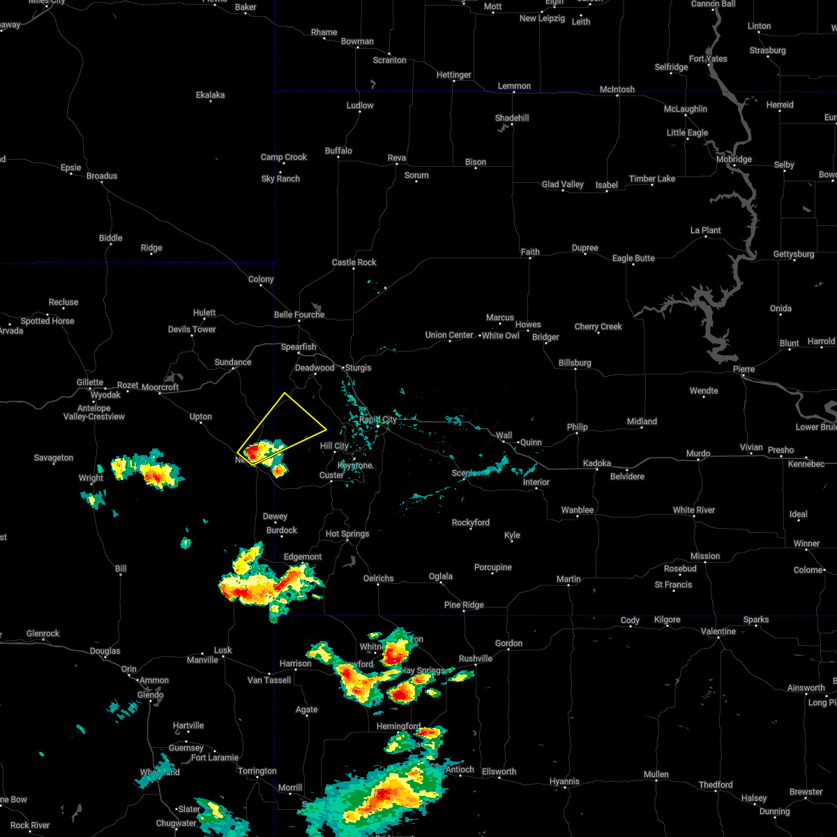 At 543 pm mdt, a severe thunderstorm was located 7 miles west of moon, or 8 miles north of newcastle, moving northeast at 30 mph (radar indicated). Hazards include golf ball size hail and 60 mph wind gusts. People and animals outdoors will be injured. expect hail damage to roofs, siding, windows, and vehicles. expect wind damage to roofs, siding, and trees. locations impacted include, flag mountain, moon, four corners, buckhorn, deerfield, mystic, deerfield reservoir, crooks tower, mallo camp, o`neil pass, black fox campground and redbank spring campground. thunderstorm damage threat, considerable hail threat, radar indicated max hail size, 1. 75 in wind threat, radar indicated max wind gust, 60 mph. At 543 pm mdt, a severe thunderstorm was located 7 miles west of moon, or 8 miles north of newcastle, moving northeast at 30 mph (radar indicated). Hazards include golf ball size hail and 60 mph wind gusts. People and animals outdoors will be injured. expect hail damage to roofs, siding, windows, and vehicles. expect wind damage to roofs, siding, and trees. locations impacted include, flag mountain, moon, four corners, buckhorn, deerfield, mystic, deerfield reservoir, crooks tower, mallo camp, o`neil pass, black fox campground and redbank spring campground. thunderstorm damage threat, considerable hail threat, radar indicated max hail size, 1. 75 in wind threat, radar indicated max wind gust, 60 mph.
|
| 7/4/2022 5:30 PM MDT |
 At 530 pm mdt, a severe thunderstorm was located 3 miles northwest of newcastle, moving northeast at 30 mph (radar indicated). Hazards include ping pong ball size hail and 60 mph wind gusts. People and animals outdoors will be injured. expect hail damage to roofs, siding, windows, and vehicles. Expect wind damage to roofs, siding, and trees. At 530 pm mdt, a severe thunderstorm was located 3 miles northwest of newcastle, moving northeast at 30 mph (radar indicated). Hazards include ping pong ball size hail and 60 mph wind gusts. People and animals outdoors will be injured. expect hail damage to roofs, siding, windows, and vehicles. Expect wind damage to roofs, siding, and trees.
|
| 7/2/2022 6:51 PM MDT |
 At 651 pm mdt, severe thunderstorms were located along a line extending from 5 miles north of elk mountain lookout to 5 miles north of dewey to near mule creek junction, moving east at 30 mph (radar indicated). Hazards include 60 mph wind gusts and quarter size hail. Hail damage to vehicles is expected. expect wind damage to roofs, siding, and trees. these severe storms will be near, dewey and elk mountain lookout around 655 pm mdt. other locations in the path of these severe thunderstorms include jewel cave national monument, burdock, custer, edgemont, argyle, crazy horse memorial, northwestern custer state park, sylvan lake and black elk peak. hail threat, radar indicated max hail size, 1. 00 in wind threat, radar indicated max wind gust, 60 mph. At 651 pm mdt, severe thunderstorms were located along a line extending from 5 miles north of elk mountain lookout to 5 miles north of dewey to near mule creek junction, moving east at 30 mph (radar indicated). Hazards include 60 mph wind gusts and quarter size hail. Hail damage to vehicles is expected. expect wind damage to roofs, siding, and trees. these severe storms will be near, dewey and elk mountain lookout around 655 pm mdt. other locations in the path of these severe thunderstorms include jewel cave national monument, burdock, custer, edgemont, argyle, crazy horse memorial, northwestern custer state park, sylvan lake and black elk peak. hail threat, radar indicated max hail size, 1. 00 in wind threat, radar indicated max wind gust, 60 mph.
|
| 7/2/2022 6:48 PM MDT |
 At 647 pm mdt, severe thunderstorms were located along a line extending from 5 miles south of sundance to 6 miles southeast of inyan kara mountain to 2 miles southeast of redbank spring campground, moving east at 45 mph (radar indicated). Hazards include 60 mph wind gusts. Expect damage to roofs, siding, and trees. locations impacted include, deerfield, deerfield reservoir, redbank spring campground, flag mountain, rochford, o`neil pass, cement ridge lookout, mystic, crooks tower, cheyenne crossing, iron creek lake, roughlock falls, savoy, black fox campground, crow peak, bridal veil falls, spearfish canyon, terry peak, spearfish, lead, deadwood and central city. this includes interstate 90 in south dakota between mile markers 8 and 15. hail threat, radar indicated max hail size, <. 75 in wind threat, radar indicated max wind gust, 60 mph. At 647 pm mdt, severe thunderstorms were located along a line extending from 5 miles south of sundance to 6 miles southeast of inyan kara mountain to 2 miles southeast of redbank spring campground, moving east at 45 mph (radar indicated). Hazards include 60 mph wind gusts. Expect damage to roofs, siding, and trees. locations impacted include, deerfield, deerfield reservoir, redbank spring campground, flag mountain, rochford, o`neil pass, cement ridge lookout, mystic, crooks tower, cheyenne crossing, iron creek lake, roughlock falls, savoy, black fox campground, crow peak, bridal veil falls, spearfish canyon, terry peak, spearfish, lead, deadwood and central city. this includes interstate 90 in south dakota between mile markers 8 and 15. hail threat, radar indicated max hail size, <. 75 in wind threat, radar indicated max wind gust, 60 mph.
|
| 7/2/2022 6:35 PM MDT |
 At 635 pm mdt, severe thunderstorms were located along a line extending from 7 miles west of newcastle to 8 miles northwest of dewey to 7 miles west of mule creek junction, moving east at 35 mph (radar indicated). Hazards include 60 mph wind gusts and quarter size hail. Hail damage to vehicles is expected. expect wind damage to roofs, siding, and trees. severe thunderstorms will be near, dewey and elk mountain lookout around 645 pm mdt. other locations in the path of these severe thunderstorms include burdock and argyle. hail threat, radar indicated max hail size, 1. 00 in wind threat, radar indicated max wind gust, 60 mph. At 635 pm mdt, severe thunderstorms were located along a line extending from 7 miles west of newcastle to 8 miles northwest of dewey to 7 miles west of mule creek junction, moving east at 35 mph (radar indicated). Hazards include 60 mph wind gusts and quarter size hail. Hail damage to vehicles is expected. expect wind damage to roofs, siding, and trees. severe thunderstorms will be near, dewey and elk mountain lookout around 645 pm mdt. other locations in the path of these severe thunderstorms include burdock and argyle. hail threat, radar indicated max hail size, 1. 00 in wind threat, radar indicated max wind gust, 60 mph.
|
| 7/2/2022 6:21 PM MDT |
 At 620 pm mdt, a severe thunderstorm was located 7 miles south of upton, or 22 miles northwest of newcastle, moving northeast at 55 mph (radar indicated). Hazards include 60 mph wind gusts. Expect damage to roofs, siding, and trees. this severe thunderstorm will be near, osage around 630 pm mdt. other locations in the path of this severe thunderstorm include buckhorn, four corners, mallo camp, o`neil pass, crooks tower, black fox campground, cheyenne crossing, terry peak, lead, deadwood and central city. this includes interstate 90 in south dakota between mile markers 8 and 15. hail threat, radar indicated max hail size, <. 75 in wind threat, radar indicated max wind gust, 60 mph. At 620 pm mdt, a severe thunderstorm was located 7 miles south of upton, or 22 miles northwest of newcastle, moving northeast at 55 mph (radar indicated). Hazards include 60 mph wind gusts. Expect damage to roofs, siding, and trees. this severe thunderstorm will be near, osage around 630 pm mdt. other locations in the path of this severe thunderstorm include buckhorn, four corners, mallo camp, o`neil pass, crooks tower, black fox campground, cheyenne crossing, terry peak, lead, deadwood and central city. this includes interstate 90 in south dakota between mile markers 8 and 15. hail threat, radar indicated max hail size, <. 75 in wind threat, radar indicated max wind gust, 60 mph.
|
| 7/1/2022 4:20 PM MDT | Pea sized or slightly bigger hail in weston county WY, 12.8 miles NNE of Newcastle, WY |
| 7/1/2022 4:02 PM MDT |
 At 402 pm mdt, a severe thunderstorm was located 12 miles southwest of newcastle, moving east at 30 mph (radar indicated). Hazards include ping pong ball size hail and 60 mph wind gusts. People and animals outdoors will be injured. expect hail damage to roofs, siding, windows, and vehicles. expect wind damage to roofs, siding, and trees. this severe thunderstorm will remain over mainly rural areas of southeastern weston county, south of newcastle between highway 85 and state highway 450. hail threat, radar indicated max hail size, 1. 50 in wind threat, radar indicated max wind gust, 60 mph. At 402 pm mdt, a severe thunderstorm was located 12 miles southwest of newcastle, moving east at 30 mph (radar indicated). Hazards include ping pong ball size hail and 60 mph wind gusts. People and animals outdoors will be injured. expect hail damage to roofs, siding, windows, and vehicles. expect wind damage to roofs, siding, and trees. this severe thunderstorm will remain over mainly rural areas of southeastern weston county, south of newcastle between highway 85 and state highway 450. hail threat, radar indicated max hail size, 1. 50 in wind threat, radar indicated max wind gust, 60 mph.
|
| 7/1/2022 3:48 PM MDT |
 At 348 pm mdt, a severe thunderstorm was located 8 miles northeast of clareton, or 18 miles west of newcastle, moving southeast at 25 mph (radar indicated). Hazards include golf ball size hail and 60 mph wind gusts. People and animals outdoors will be injured. expect hail damage to roofs, siding, windows, and vehicles. expect wind damage to roofs, siding, and trees. locations impacted include, newcastle. thunderstorm damage threat, considerable hail threat, radar indicated max hail size, 1. 75 in wind threat, radar indicated max wind gust, 60 mph. At 348 pm mdt, a severe thunderstorm was located 8 miles northeast of clareton, or 18 miles west of newcastle, moving southeast at 25 mph (radar indicated). Hazards include golf ball size hail and 60 mph wind gusts. People and animals outdoors will be injured. expect hail damage to roofs, siding, windows, and vehicles. expect wind damage to roofs, siding, and trees. locations impacted include, newcastle. thunderstorm damage threat, considerable hail threat, radar indicated max hail size, 1. 75 in wind threat, radar indicated max wind gust, 60 mph.
|
| 7/1/2022 3:42 PM MDT |
 At 341 pm mdt, a severe thunderstorm was located 10 miles northeast of clareton, or 18 miles west of newcastle, moving east at 30 mph (radar indicated). Hazards include 60 mph wind gusts and half dollar size hail. Hail damage to vehicles is expected. Expect wind damage to roofs, siding, and trees. At 341 pm mdt, a severe thunderstorm was located 10 miles northeast of clareton, or 18 miles west of newcastle, moving east at 30 mph (radar indicated). Hazards include 60 mph wind gusts and half dollar size hail. Hail damage to vehicles is expected. Expect wind damage to roofs, siding, and trees.
|
| 6/20/2022 2:52 PM MDT |
 At 252 pm mdt, severe thunderstorms were located along a line extending from 5 miles northwest of newcastle to 6 miles west of elk mountain lookout to near dewey, moving east at 40 mph (radar indicated). Hazards include 60 mph wind gusts and quarter size hail. Hail damage to vehicles is expected. expect wind damage to roofs, siding, and trees. locations impacted include, dewey, elk mountain lookout, moon, redbank spring campground and jewel cave national monument. hail threat, radar indicated max hail size, 1. 00 in wind threat, radar indicated max wind gust, 60 mph. At 252 pm mdt, severe thunderstorms were located along a line extending from 5 miles northwest of newcastle to 6 miles west of elk mountain lookout to near dewey, moving east at 40 mph (radar indicated). Hazards include 60 mph wind gusts and quarter size hail. Hail damage to vehicles is expected. expect wind damage to roofs, siding, and trees. locations impacted include, dewey, elk mountain lookout, moon, redbank spring campground and jewel cave national monument. hail threat, radar indicated max hail size, 1. 00 in wind threat, radar indicated max wind gust, 60 mph.
|
| 6/20/2022 2:30 PM MDT |
 At 229 pm mdt, severe thunderstorms were located along a line extending from 7 miles south of osage to 10 miles southwest of newcastle to 2 miles southeast of morrisey, moving northeast at 35 mph (radar indicated). Hazards include 60 mph wind gusts and quarter size hail. Hail damage to vehicles is expected. expect wind damage to roofs, siding, and trees. severe thunderstorms will be near, newcastle around 245 pm mdt. other locations in the path of these severe thunderstorms include dewey, elk mountain lookout, moon, mallo camp, redbank spring campground and jewel cave national monument. hail threat, radar indicated max hail size, 1. 00 in wind threat, radar indicated max wind gust, 60 mph. At 229 pm mdt, severe thunderstorms were located along a line extending from 7 miles south of osage to 10 miles southwest of newcastle to 2 miles southeast of morrisey, moving northeast at 35 mph (radar indicated). Hazards include 60 mph wind gusts and quarter size hail. Hail damage to vehicles is expected. expect wind damage to roofs, siding, and trees. severe thunderstorms will be near, newcastle around 245 pm mdt. other locations in the path of these severe thunderstorms include dewey, elk mountain lookout, moon, mallo camp, redbank spring campground and jewel cave national monument. hail threat, radar indicated max hail size, 1. 00 in wind threat, radar indicated max wind gust, 60 mph.
|
| 6/11/2022 10:13 PM MDT |
 At 1013 pm mdt, a severe thunderstorm was located 3 miles west of moon, or 9 miles northeast of newcastle, moving southeast at 50 mph (radar indicated). Hazards include golf ball size hail and 70 mph wind gusts. People and animals outdoors will be injured. expect hail damage to roofs, siding, windows, and vehicles. expect considerable tree damage. wind damage is also likely to mobile homes, roofs, and outbuildings. Locations impacted include, bear mountain lookout, medicine mountain, jewel cave national monument, crazy horse memorial, custer, northwestern custer state park, sylvan lake and stockade lake. At 1013 pm mdt, a severe thunderstorm was located 3 miles west of moon, or 9 miles northeast of newcastle, moving southeast at 50 mph (radar indicated). Hazards include golf ball size hail and 70 mph wind gusts. People and animals outdoors will be injured. expect hail damage to roofs, siding, windows, and vehicles. expect considerable tree damage. wind damage is also likely to mobile homes, roofs, and outbuildings. Locations impacted include, bear mountain lookout, medicine mountain, jewel cave national monument, crazy horse memorial, custer, northwestern custer state park, sylvan lake and stockade lake.
|
| 6/11/2022 9:59 PM MDT |
 At 958 pm mdt, a severe thunderstorm was located 6 miles southwest of four corners, or 12 miles north of newcastle, moving east at 55 mph (radar indicated). Hazards include golf ball size hail and 70 mph wind gusts. People and animals outdoors will be injured. expect hail damage to roofs, siding, windows, and vehicles. expect considerable tree damage. wind damage is also likely to mobile homes, roofs, and outbuildings. this severe thunderstorm will be near, moon and redbank spring campground around 1015 pm mdt. Other locations in the path of this severe thunderstorm include medicine mountain, bear mountain lookout, hill city, crazy horse memorial, custer, sylvan lake, northwestern custer state park, black elk peak, palmer gulch resort, horse thief lake, keystone, mount rushmore national memorial and stockade lake. At 958 pm mdt, a severe thunderstorm was located 6 miles southwest of four corners, or 12 miles north of newcastle, moving east at 55 mph (radar indicated). Hazards include golf ball size hail and 70 mph wind gusts. People and animals outdoors will be injured. expect hail damage to roofs, siding, windows, and vehicles. expect considerable tree damage. wind damage is also likely to mobile homes, roofs, and outbuildings. this severe thunderstorm will be near, moon and redbank spring campground around 1015 pm mdt. Other locations in the path of this severe thunderstorm include medicine mountain, bear mountain lookout, hill city, crazy horse memorial, custer, sylvan lake, northwestern custer state park, black elk peak, palmer gulch resort, horse thief lake, keystone, mount rushmore national memorial and stockade lake.
|
| 6/11/2022 9:52 PM MDT | Storm damage reported in weston county WY, 16.2 miles SSW of Newcastle, WY |
| 4/22/2022 7:19 PM MDT | Storm damage reported in custer county SD, 13.9 miles NW of Newcastle, WY |
| 7/13/2021 9:58 PM MDT |
 At 957 pm mdt, severe thunderstorms were located along a line extending from 2 miles north of tilford to roubaix lake to 7 miles northeast of osage, moving southeast at 35 mph (radar indicated). Hazards include 60 mph wind gusts. Expect damage to roofs, siding, and trees. severe thunderstorms will be near, rochford, tilford, roubaix lake and dalton lake around 1005 pm mdt. summerset, nemo, piedmont and mystic around 1010 pm mdt. newcastle, silver city and pactola reservoir around 1015 pm mdt. other locations in the path of these severe thunderstorms include black hawk, johnson siding, moon, hisega, ellsworth air force base, sheridan lake, rapid city, rapid valley, box elder, rockerville, keystone wye, keystone, bear country, reptile gardens and elk mountain lookout. This includes interstate 90 in south dakota between mile markers 35 and 80. At 957 pm mdt, severe thunderstorms were located along a line extending from 2 miles north of tilford to roubaix lake to 7 miles northeast of osage, moving southeast at 35 mph (radar indicated). Hazards include 60 mph wind gusts. Expect damage to roofs, siding, and trees. severe thunderstorms will be near, rochford, tilford, roubaix lake and dalton lake around 1005 pm mdt. summerset, nemo, piedmont and mystic around 1010 pm mdt. newcastle, silver city and pactola reservoir around 1015 pm mdt. other locations in the path of these severe thunderstorms include black hawk, johnson siding, moon, hisega, ellsworth air force base, sheridan lake, rapid city, rapid valley, box elder, rockerville, keystone wye, keystone, bear country, reptile gardens and elk mountain lookout. This includes interstate 90 in south dakota between mile markers 35 and 80.
|
| 7/9/2021 7:45 PM MDT |
 At 745 pm mdt, a severe thunderstorm was located over elk mountain lookout, or 11 miles southeast of newcastle, moving southeast at 45 mph (radar indicated). Hazards include golf ball size hail and 60 mph wind gusts. People and animals outdoors will be injured. expect hail damage to roofs, siding, windows, and vehicles. expect wind damage to roofs, siding, and trees. Locations impacted include, jewel cave national monument. At 745 pm mdt, a severe thunderstorm was located over elk mountain lookout, or 11 miles southeast of newcastle, moving southeast at 45 mph (radar indicated). Hazards include golf ball size hail and 60 mph wind gusts. People and animals outdoors will be injured. expect hail damage to roofs, siding, windows, and vehicles. expect wind damage to roofs, siding, and trees. Locations impacted include, jewel cave national monument.
|
| 7/9/2021 7:35 PM MDT | Storm damage reported in weston county WY, 5.7 miles ESE of Newcastle, WY |
| 7/9/2021 7:34 PM MDT |
 At 734 pm mdt, a severe thunderstorm was located 3 miles southeast of newcastle, moving southeast at 50 mph (radar indicated). Hazards include golf ball size hail and 60 mph wind gusts. People and animals outdoors will be injured. expect hail damage to roofs, siding, windows, and vehicles. expect wind damage to roofs, siding, and trees. this severe storm will be near, elk mountain lookout around 745 pm mdt. Other locations in the path of this severe thunderstorm include jewel cave national monument. At 734 pm mdt, a severe thunderstorm was located 3 miles southeast of newcastle, moving southeast at 50 mph (radar indicated). Hazards include golf ball size hail and 60 mph wind gusts. People and animals outdoors will be injured. expect hail damage to roofs, siding, windows, and vehicles. expect wind damage to roofs, siding, and trees. this severe storm will be near, elk mountain lookout around 745 pm mdt. Other locations in the path of this severe thunderstorm include jewel cave national monument.
|
| 7/9/2021 7:30 PM MDT | Storm damage reported in weston county WY, 32.4 miles NE of Newcastle, WY |
| 7/9/2021 7:30 PM MDT | Storm damage reported in weston county WY, 5.2 miles ESE of Newcastle, WY |
| 7/9/2021 7:30 PM MDT | Quarter sized hail reported 0.9 miles E of Newcastle, WY |
| 7/9/2021 7:25 PM MDT |
 At 725 pm mdt, a severe thunderstorm was located 5 miles northwest of newcastle, moving southeast at 50 mph (radar indicated). Hazards include 60 mph wind gusts and half dollar size hail. Hail damage to vehicles is expected. expect wind damage to roofs, siding, and trees. this severe thunderstorm will be near, newcastle around 730 pm mdt. elk mountain lookout around 745 pm mdt. Other locations in the path of this severe thunderstorm include jewel cave national monument. At 725 pm mdt, a severe thunderstorm was located 5 miles northwest of newcastle, moving southeast at 50 mph (radar indicated). Hazards include 60 mph wind gusts and half dollar size hail. Hail damage to vehicles is expected. expect wind damage to roofs, siding, and trees. this severe thunderstorm will be near, newcastle around 730 pm mdt. elk mountain lookout around 745 pm mdt. Other locations in the path of this severe thunderstorm include jewel cave national monument.
|
| 7/9/2021 7:20 PM MDT |
 At 720 pm mdt, a severe thunderstorm was located 3 miles east of osage, or 10 miles northwest of newcastle, moving southeast at 50 mph (radar indicated). Hazards include 60 mph wind gusts and quarter size hail. Hail damage to vehicles is expected. expect wind damage to roofs, siding, and trees. Locations impacted include, newcastle, osage and four corners. At 720 pm mdt, a severe thunderstorm was located 3 miles east of osage, or 10 miles northwest of newcastle, moving southeast at 50 mph (radar indicated). Hazards include 60 mph wind gusts and quarter size hail. Hail damage to vehicles is expected. expect wind damage to roofs, siding, and trees. Locations impacted include, newcastle, osage and four corners.
|
| 7/9/2021 7:05 PM MDT |
 At 705 pm mdt, a severe thunderstorm was located 4 miles southeast of upton, or 22 miles northwest of newcastle, moving southeast at 55 mph (radar indicated). Hazards include 60 mph wind gusts and quarter size hail. Hail damage to vehicles is expected. expect wind damage to roofs, siding, and trees. Locations impacted include, osage and newcastle. At 705 pm mdt, a severe thunderstorm was located 4 miles southeast of upton, or 22 miles northwest of newcastle, moving southeast at 55 mph (radar indicated). Hazards include 60 mph wind gusts and quarter size hail. Hail damage to vehicles is expected. expect wind damage to roofs, siding, and trees. Locations impacted include, osage and newcastle.
|
| 7/9/2021 6:49 PM MDT |
 At 649 pm mdt, a severe thunderstorm was located 8 miles southeast of moorcroft, or 30 miles southwest of sundance, moving southeast at 50 mph (radar indicated). Hazards include 60 mph wind gusts and quarter size hail. Hail damage to vehicles is expected. expect wind damage to roofs, siding, and trees. this severe thunderstorm will be near, upton around 705 pm mdt. other locations in the path of this severe thunderstorm include osage and newcastle. This includes interstate 90 in wyoming between mile markers 155 and 157. At 649 pm mdt, a severe thunderstorm was located 8 miles southeast of moorcroft, or 30 miles southwest of sundance, moving southeast at 50 mph (radar indicated). Hazards include 60 mph wind gusts and quarter size hail. Hail damage to vehicles is expected. expect wind damage to roofs, siding, and trees. this severe thunderstorm will be near, upton around 705 pm mdt. other locations in the path of this severe thunderstorm include osage and newcastle. This includes interstate 90 in wyoming between mile markers 155 and 157.
|
| 7/7/2021 7:13 PM MDT |
 At 712 pm mdt, a severe thunderstorm was located 8 miles west of inyan kara mountain, or 14 miles southwest of sundance, moving east at 30 mph (radar indicated). Hazards include 60 mph wind gusts and quarter size hail. Hail damage to vehicles is expected. expect wind damage to roofs, siding, and trees. Locations impacted include, inyan kara mountain, moskee and buckhorn. At 712 pm mdt, a severe thunderstorm was located 8 miles west of inyan kara mountain, or 14 miles southwest of sundance, moving east at 30 mph (radar indicated). Hazards include 60 mph wind gusts and quarter size hail. Hail damage to vehicles is expected. expect wind damage to roofs, siding, and trees. Locations impacted include, inyan kara mountain, moskee and buckhorn.
|
| 7/7/2021 6:54 PM MDT |
 At 654 pm mdt, a severe thunderstorm was located 6 miles northwest of upton, or 22 miles southwest of sundance, moving east at 30 mph (radar indicated). Hazards include 60 mph wind gusts and quarter size hail. Hail damage to vehicles is expected. expect wind damage to roofs, siding, and trees. this severe thunderstorm will be near, upton around 705 pm mdt. Other locations in the path of this severe thunderstorm include inyan kara mountain, four corners, buckhorn and mallo camp. At 654 pm mdt, a severe thunderstorm was located 6 miles northwest of upton, or 22 miles southwest of sundance, moving east at 30 mph (radar indicated). Hazards include 60 mph wind gusts and quarter size hail. Hail damage to vehicles is expected. expect wind damage to roofs, siding, and trees. this severe thunderstorm will be near, upton around 705 pm mdt. Other locations in the path of this severe thunderstorm include inyan kara mountain, four corners, buckhorn and mallo camp.
|
| 7/5/2021 5:20 PM MDT |
 The severe thunderstorm warning for northwestern custer, west central pennington and east central weston counties will expire at 530 pm mdt, the storm which prompted the warning has moved out of the area. therefore, the warning will be allowed to expire. however gusty winds and heavy rain are still possible with this thunderstorm. The severe thunderstorm warning for northwestern custer, west central pennington and east central weston counties will expire at 530 pm mdt, the storm which prompted the warning has moved out of the area. therefore, the warning will be allowed to expire. however gusty winds and heavy rain are still possible with this thunderstorm.
|
| 7/5/2021 5:09 PM MDT |
 At 509 pm mdt, a severe thunderstorm was located 5 miles northwest of jewel cave national monument, or 14 miles west of custer, moving northeast at 40 mph (radar indicated). Hazards include 60 mph wind gusts and penny size hail. Expect damage to roofs, siding, and trees. Locations impacted include, bear mountain lookout. At 509 pm mdt, a severe thunderstorm was located 5 miles northwest of jewel cave national monument, or 14 miles west of custer, moving northeast at 40 mph (radar indicated). Hazards include 60 mph wind gusts and penny size hail. Expect damage to roofs, siding, and trees. Locations impacted include, bear mountain lookout.
|
| 7/5/2021 5:03 PM MDT | Storm damage reported in custer county SD, 13.9 miles NW of Newcastle, WY |
| 7/5/2021 4:54 PM MDT |
 At 453 pm mdt, a severe thunderstorm was located 5 miles northwest of elk mountain lookout, or 6 miles southeast of newcastle, moving northeast at 45 mph (radar indicated). Hazards include 60 mph wind gusts and nickel size hail. Expect damage to roofs, siding, and trees. this severe thunderstorm will be near, moon around 505 pm mdt. redbank spring campground around 510 pm mdt. Other locations in the path of this severe thunderstorm include bear mountain lookout. At 453 pm mdt, a severe thunderstorm was located 5 miles northwest of elk mountain lookout, or 6 miles southeast of newcastle, moving northeast at 45 mph (radar indicated). Hazards include 60 mph wind gusts and nickel size hail. Expect damage to roofs, siding, and trees. this severe thunderstorm will be near, moon around 505 pm mdt. redbank spring campground around 510 pm mdt. Other locations in the path of this severe thunderstorm include bear mountain lookout.
|
| 7/2/2021 7:56 PM MDT | Storm damage reported in weston county WY, 16.2 miles SSW of Newcastle, WY |
| 6/14/2021 11:09 PM MDT | Quarter sized hail reported 3.1 miles SSW of Newcastle, WY |
| 6/14/2021 11:01 PM MDT |
 At 1101 pm mdt, a severe thunderstorm was located 4 miles east of newcastle, moving southeast at 25 mph (radar indicated). Hazards include 60 mph wind gusts and half dollar size hail. Hail damage to vehicles is expected. Expect wind damage to roofs, siding, and trees. At 1101 pm mdt, a severe thunderstorm was located 4 miles east of newcastle, moving southeast at 25 mph (radar indicated). Hazards include 60 mph wind gusts and half dollar size hail. Hail damage to vehicles is expected. Expect wind damage to roofs, siding, and trees.
|
| 6/14/2021 10:52 PM MDT | Storm damage reported in weston county WY, 3.1 miles SSW of Newcastle, WY |
| 6/14/2021 10:41 PM MDT |
 At 1041 pm mdt, a severe thunderstorm was located 3 miles north of newcastle, moving southeast at 20 mph (radar indicated). Hazards include half dollar size hail. Damage to vehicles is expected. Locations impacted include, newcastle. At 1041 pm mdt, a severe thunderstorm was located 3 miles north of newcastle, moving southeast at 20 mph (radar indicated). Hazards include half dollar size hail. Damage to vehicles is expected. Locations impacted include, newcastle.
|
| 6/14/2021 10:23 PM MDT |
 At 1022 pm mdt, a severe thunderstorm was located 6 miles northwest of newcastle, moving southeast at 35 mph (radar indicated). Hazards include half dollar size hail. Damage to vehicles is expected. This severe thunderstorm will be near, newcastle around 1030 pm mdt. At 1022 pm mdt, a severe thunderstorm was located 6 miles northwest of newcastle, moving southeast at 35 mph (radar indicated). Hazards include half dollar size hail. Damage to vehicles is expected. This severe thunderstorm will be near, newcastle around 1030 pm mdt.
|
| 6/13/2021 6:37 PM MDT |
 At 635 pm mdt, a severe thunderstorm was located 9 miles south of osage, or 13 miles west of newcastle, moving southeast at 5 mph (radar indicated). Hazards include quarter size hail. Damage to vehicles is expected. Locations impacted include, rural areas of weston county west of newcastle. At 635 pm mdt, a severe thunderstorm was located 9 miles south of osage, or 13 miles west of newcastle, moving southeast at 5 mph (radar indicated). Hazards include quarter size hail. Damage to vehicles is expected. Locations impacted include, rural areas of weston county west of newcastle.
|
| 6/13/2021 6:00 PM MDT |
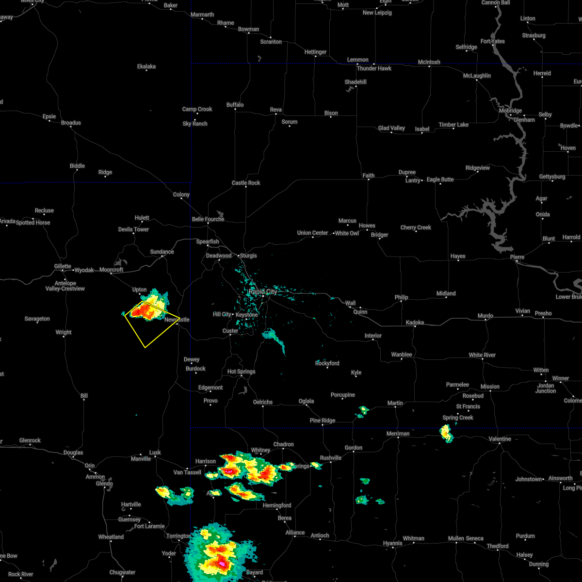 At 559 pm mdt, a severe thunderstorm was located 8 miles southwest of osage, or 15 miles west of newcastle, moving southeast at 10 mph (radar indicated). Hazards include ping pong ball size hail. People and animals outdoors will be injured. expect damage to roofs, siding, windows, and vehicles. This severe thunderstorm will remain over mainly rural areas of central weston county, southwest of osage and newcastle. At 559 pm mdt, a severe thunderstorm was located 8 miles southwest of osage, or 15 miles west of newcastle, moving southeast at 10 mph (radar indicated). Hazards include ping pong ball size hail. People and animals outdoors will be injured. expect damage to roofs, siding, windows, and vehicles. This severe thunderstorm will remain over mainly rural areas of central weston county, southwest of osage and newcastle.
|
| 5/26/2021 4:57 PM MDT | Quarter sized hail reported 18.6 miles S of Newcastle, WY |
| 4/26/2021 7:00 PM MDT | Half Dollar sized hail reported 23.9 miles NE of Newcastle, WY |
| 8/29/2020 7:18 PM MDT | Storm damage reported in weston county WY, 16.2 miles SSW of Newcastle, WY |
| 8/6/2020 7:15 PM MDT | Pea hail in weston county WY, 22.9 miles ENE of Newcastle, WY |
| 7/20/2020 3:20 PM MDT | Quarter sized hail reported 12.4 miles S of Newcastle, WY |
| 7/19/2020 6:42 PM MDT | Storm damage reported in weston county WY, 16.2 miles SSW of Newcastle, WY |
| 7/5/2020 7:39 PM MDT | Storm damage reported in custer county SD, 13.9 miles NW of Newcastle, WY |
| 7/5/2020 7:29 PM MDT | Storm damage reported in custer county SD, 13.9 miles NW of Newcastle, WY |
| 7/5/2020 7:20 PM MDT |
 At 719 pm mdt, severe thunderstorms were located along a line extending from 5 miles northeast of osage to 5 miles north of elk mountain lookout to 7 miles northeast of dewey, moving northeast at 45 mph (radar indicated). Hazards include 70 mph wind gusts and quarter size hail. Hail damage to vehicles is expected. expect considerable tree damage. Wind damage is also likely to mobile homes, roofs, and outbuildings. At 719 pm mdt, severe thunderstorms were located along a line extending from 5 miles northeast of osage to 5 miles north of elk mountain lookout to 7 miles northeast of dewey, moving northeast at 45 mph (radar indicated). Hazards include 70 mph wind gusts and quarter size hail. Hail damage to vehicles is expected. expect considerable tree damage. Wind damage is also likely to mobile homes, roofs, and outbuildings.
|
| 7/5/2020 7:19 PM MDT | Storm damage reported in custer county SD, 13.9 miles NW of Newcastle, WY |
| 7/2/2020 1:30 PM MDT |
 At 130 pm mdt, a severe thunderstorm was located 4 miles northeast of newcastle, moving east at 10 mph (law enforcement). Hazards include ping pong ball size hail. People and animals outdoors will be injured. expect damage to roofs, siding, windows, and vehicles. This severe storm will be near, moon around 220 pm mdt. At 130 pm mdt, a severe thunderstorm was located 4 miles northeast of newcastle, moving east at 10 mph (law enforcement). Hazards include ping pong ball size hail. People and animals outdoors will be injured. expect damage to roofs, siding, windows, and vehicles. This severe storm will be near, moon around 220 pm mdt.
|
| 7/2/2020 1:28 PM MDT | Golf Ball sized hail reported 3.7 miles SSW of Newcastle, WY |
| 7/2/2020 1:21 PM MDT | Ping Pong Ball sized hail reported 0.9 miles SW of Newcastle, WY |
| 7/2/2020 1:20 PM MDT |
 At 120 pm mdt, a severe thunderstorm was located 3 miles northeast of newcastle, moving east at 10 mph (radar indicated). Hazards include ping pong ball size hail. People and animals outdoors will be injured. expect damage to roofs, siding, windows, and vehicles. This severe thunderstorm will be near, moon around 215 pm mdt. At 120 pm mdt, a severe thunderstorm was located 3 miles northeast of newcastle, moving east at 10 mph (radar indicated). Hazards include ping pong ball size hail. People and animals outdoors will be injured. expect damage to roofs, siding, windows, and vehicles. This severe thunderstorm will be near, moon around 215 pm mdt.
|
| 6/6/2020 6:00 PM MDT |
 At 600 pm mdt, severe thunderstorms were located along a line extending from 3 miles northwest of medicine mountain to near cement ridge lookout to 4 miles east of lightning flat, moving northeast at 65 mph (radar indicated). Hazards include 70 mph wind gusts. Expect considerable tree damage. damage is likely to mobile homes, roofs, and outbuildings. these severe storms will be near, iron creek lake, roughlock falls and savoy around 605 pm mdt. crow peak and spearfish canyon around 610 pm mdt. northwestern spearfish around 615 pm mdt. this includes, interstate 90 in south dakota between mile markers 1 and 9. Interstate 90 in wyoming between mile markers 166 and 207. At 600 pm mdt, severe thunderstorms were located along a line extending from 3 miles northwest of medicine mountain to near cement ridge lookout to 4 miles east of lightning flat, moving northeast at 65 mph (radar indicated). Hazards include 70 mph wind gusts. Expect considerable tree damage. damage is likely to mobile homes, roofs, and outbuildings. these severe storms will be near, iron creek lake, roughlock falls and savoy around 605 pm mdt. crow peak and spearfish canyon around 610 pm mdt. northwestern spearfish around 615 pm mdt. this includes, interstate 90 in south dakota between mile markers 1 and 9. Interstate 90 in wyoming between mile markers 166 and 207.
|
| 6/6/2020 5:52 PM MDT | Storm damage reported in weston county WY, 16.2 miles SSW of Newcastle, WY |
| 6/6/2020 5:44 PM MDT | Storm damage reported in custer county SD, 13.9 miles NW of Newcastle, WY |
| 6/6/2020 5:42 PM MDT |
 At 542 pm mdt, severe thunderstorms were located along a line extending from 3 miles east of dewey to 7 miles northeast of osage to 2 miles northeast of oshoto, moving northeast at 70 mph (radar indicated). Hazards include 70 mph wind gusts. Expect considerable tree damage. damage is likely to mobile homes, roofs, and outbuildings. these severe storms will be near, oshoto around 545 pm mdt. new haven, buckhorn and four corners around 550 pm mdt. jewel cave national monument and o`neil pass around 555 pm mdt. moskee around 600 pm mdt. cement ridge lookout, iron creek lake, roughlock falls and savoy around 605 pm mdt. crow peak, bridal veil falls and spearfish canyon around 610 pm mdt. northwestern spearfish and beulah around 615 pm mdt. this includes, interstate 90 in south dakota between mile markers 1 and 9. Interstate 90 in wyoming between mile markers 149 and 207. At 542 pm mdt, severe thunderstorms were located along a line extending from 3 miles east of dewey to 7 miles northeast of osage to 2 miles northeast of oshoto, moving northeast at 70 mph (radar indicated). Hazards include 70 mph wind gusts. Expect considerable tree damage. damage is likely to mobile homes, roofs, and outbuildings. these severe storms will be near, oshoto around 545 pm mdt. new haven, buckhorn and four corners around 550 pm mdt. jewel cave national monument and o`neil pass around 555 pm mdt. moskee around 600 pm mdt. cement ridge lookout, iron creek lake, roughlock falls and savoy around 605 pm mdt. crow peak, bridal veil falls and spearfish canyon around 610 pm mdt. northwestern spearfish and beulah around 615 pm mdt. this includes, interstate 90 in south dakota between mile markers 1 and 9. Interstate 90 in wyoming between mile markers 149 and 207.
|
| 6/6/2020 5:38 PM MDT | Storm damage reported in weston county WY, 21.4 miles NE of Newcastle, WY |
| 6/6/2020 5:35 PM MDT | Storm damage reported in weston county WY, 5.7 miles ESE of Newcastle, WY |
| 6/6/2020 5:15 PM MDT | Storm damage reported in weston county WY, 30.8 miles ENE of Newcastle, WY |
| 6/6/2020 5:15 PM MDT |
 At 515 pm mdt, severe thunderstorms were located along a line extending from 8 miles northeast of lusk to 5 miles southeast of clareton to 8 miles south of moorcroft, moving northeast at 55 mph (radar indicated). Hazards include 70 mph wind gusts. Expect considerable tree damage. damage is likely to mobile homes, roofs, and outbuildings. these severe storms will be near, clareton around 520 pm mdt. moorcroft around 525 pm mdt. keyhole reservoir around 530 pm mdt. pine haven around 535 pm mdt. newcastle around 540 pm mdt. devils tower junction around 545 pm mdt. provo, moon and warren peak around 555 pm mdt. edgemont, four corners, cook lake, mallo camp and redbank spring campground around 600 pm mdt. this includes, interstate 90 in south dakota between mile markers 1 and 9. Interstate 90 in wyoming between mile markers 149 and 207. At 515 pm mdt, severe thunderstorms were located along a line extending from 8 miles northeast of lusk to 5 miles southeast of clareton to 8 miles south of moorcroft, moving northeast at 55 mph (radar indicated). Hazards include 70 mph wind gusts. Expect considerable tree damage. damage is likely to mobile homes, roofs, and outbuildings. these severe storms will be near, clareton around 520 pm mdt. moorcroft around 525 pm mdt. keyhole reservoir around 530 pm mdt. pine haven around 535 pm mdt. newcastle around 540 pm mdt. devils tower junction around 545 pm mdt. provo, moon and warren peak around 555 pm mdt. edgemont, four corners, cook lake, mallo camp and redbank spring campground around 600 pm mdt. this includes, interstate 90 in south dakota between mile markers 1 and 9. Interstate 90 in wyoming between mile markers 149 and 207.
|
| 6/6/2020 5:09 PM MDT |
 At 509 pm mdt, severe thunderstorms were located along a line extending from 6 miles northeast of lusk to 12 miles south of clareton to 13 miles southwest of moorcroft, moving north at 100 mph (radar indicated). Hazards include 70 mph wind gusts. Expect considerable tree damage. damage is likely to mobile homes, roofs, and outbuildings. severe thunderstorms will be near, moorcroft and clareton around 515 pm mdt. keyhole reservoir around 520 pm mdt. carlile around 525 pm mdt. osage and oshoto around 530 pm mdt. upton and new haven around 535 pm mdt. dewey and inyan kara mountain around 540 pm mdt. sundance around 545 pm mdt. elk mountain lookout and warren peak around 550 pm mdt. this includes, interstate 90 in south dakota between mile markers 1 and 9. Interstate 90 in wyoming between mile markers 149 and 207. At 509 pm mdt, severe thunderstorms were located along a line extending from 6 miles northeast of lusk to 12 miles south of clareton to 13 miles southwest of moorcroft, moving north at 100 mph (radar indicated). Hazards include 70 mph wind gusts. Expect considerable tree damage. damage is likely to mobile homes, roofs, and outbuildings. severe thunderstorms will be near, moorcroft and clareton around 515 pm mdt. keyhole reservoir around 520 pm mdt. carlile around 525 pm mdt. osage and oshoto around 530 pm mdt. upton and new haven around 535 pm mdt. dewey and inyan kara mountain around 540 pm mdt. sundance around 545 pm mdt. elk mountain lookout and warren peak around 550 pm mdt. this includes, interstate 90 in south dakota between mile markers 1 and 9. Interstate 90 in wyoming between mile markers 149 and 207.
|
| 6/6/2020 5:08 PM MDT | Storm damage reported in weston county WY, 38.9 miles ENE of Newcastle, WY |
| 6/4/2020 8:52 PM MDT |
 The severe thunderstorm warning for east central weston county will expire at 900 pm mdt, the storm which prompted the warning has moved out of the area. therefore, the warning will be allowed to expire. a severe thunderstorm watch remains in effect until 1000 pm mdt for southwestern and west central south dakota. to report severe weather, contact your nearest law enforcement agency. they will relay your report to the national weather service rapid city. The severe thunderstorm warning for east central weston county will expire at 900 pm mdt, the storm which prompted the warning has moved out of the area. therefore, the warning will be allowed to expire. a severe thunderstorm watch remains in effect until 1000 pm mdt for southwestern and west central south dakota. to report severe weather, contact your nearest law enforcement agency. they will relay your report to the national weather service rapid city.
|
| 6/4/2020 8:31 PM MDT |
 At 831 pm mdt, a severe thunderstorm was located 5 miles southwest of newcastle, moving southeast at 45 mph (radar indicated). Hazards include half dollar size hail. Damage to vehicles is expected. This severe storm will be near, newcastle around 835 pm mdt. At 831 pm mdt, a severe thunderstorm was located 5 miles southwest of newcastle, moving southeast at 45 mph (radar indicated). Hazards include half dollar size hail. Damage to vehicles is expected. This severe storm will be near, newcastle around 835 pm mdt.
|
| 6/4/2020 8:13 PM MDT |
 At 813 pm mdt, a severe thunderstorm was located 9 miles southwest of osage, or 18 miles west of newcastle, moving southeast at 45 mph (radar indicated). Hazards include 60 mph wind gusts and half dollar size hail. Hail damage to vehicles is expected. expect wind damage to roofs, siding, and trees. This severe storm will be near, newcastle around 835 pm mdt. At 813 pm mdt, a severe thunderstorm was located 9 miles southwest of osage, or 18 miles west of newcastle, moving southeast at 45 mph (radar indicated). Hazards include 60 mph wind gusts and half dollar size hail. Hail damage to vehicles is expected. expect wind damage to roofs, siding, and trees. This severe storm will be near, newcastle around 835 pm mdt.
|
| 6/4/2020 7:58 PM MDT |
 At 758 pm mdt, a severe thunderstorm was located 12 miles southwest of upton, or 29 miles west of newcastle, moving southeast at 45 mph (radar indicated). Hazards include 60 mph wind gusts and half dollar size hail. Hail damage to vehicles is expected. expect wind damage to roofs, siding, and trees. This severe storm will be near, newcastle around 835 pm mdt. At 758 pm mdt, a severe thunderstorm was located 12 miles southwest of upton, or 29 miles west of newcastle, moving southeast at 45 mph (radar indicated). Hazards include 60 mph wind gusts and half dollar size hail. Hail damage to vehicles is expected. expect wind damage to roofs, siding, and trees. This severe storm will be near, newcastle around 835 pm mdt.
|
| 6/4/2020 7:43 PM MDT |
 At 743 pm mdt, a severe thunderstorm was located 15 miles south of moorcroft, or 28 miles southeast of gillette, moving southeast at 45 mph (radar indicated). Hazards include 60 mph wind gusts and half dollar size hail. Hail damage to vehicles is expected. expect wind damage to roofs, siding, and trees. This severe thunderstorm will be near, newcastle around 835 pm mdt. At 743 pm mdt, a severe thunderstorm was located 15 miles south of moorcroft, or 28 miles southeast of gillette, moving southeast at 45 mph (radar indicated). Hazards include 60 mph wind gusts and half dollar size hail. Hail damage to vehicles is expected. expect wind damage to roofs, siding, and trees. This severe thunderstorm will be near, newcastle around 835 pm mdt.
|
| 5/31/2020 4:03 PM MDT |
 At 403 pm mdt, a severe thunderstorm was located 3 miles south of newcastle, moving east at 30 mph (radar indicated). Hazards include 60 mph wind gusts and quarter size hail. Hail damage to vehicles is expected. expect wind damage to roofs, siding, and trees. This severe storm will be near, elk mountain lookout around 415 pm mdt. At 403 pm mdt, a severe thunderstorm was located 3 miles south of newcastle, moving east at 30 mph (radar indicated). Hazards include 60 mph wind gusts and quarter size hail. Hail damage to vehicles is expected. expect wind damage to roofs, siding, and trees. This severe storm will be near, elk mountain lookout around 415 pm mdt.
|
| 5/31/2020 3:45 PM MDT |
 At 345 pm mdt, a severe thunderstorm was located 8 miles southwest of newcastle, moving east at 25 mph (radar indicated). Hazards include ping pong ball size hail and 60 mph wind gusts. People and animals outdoors will be injured. expect hail damage to roofs, siding, windows, and vehicles. expect wind damage to roofs, siding, and trees. this severe thunderstorm will be near, newcastle around 400 pm mdt. elk mountain lookout around 415 pm mdt. Moon around 430 pm mdt. At 345 pm mdt, a severe thunderstorm was located 8 miles southwest of newcastle, moving east at 25 mph (radar indicated). Hazards include ping pong ball size hail and 60 mph wind gusts. People and animals outdoors will be injured. expect hail damage to roofs, siding, windows, and vehicles. expect wind damage to roofs, siding, and trees. this severe thunderstorm will be near, newcastle around 400 pm mdt. elk mountain lookout around 415 pm mdt. Moon around 430 pm mdt.
|
| 5/20/2020 5:47 PM MDT | Pea hail and lots of wind in weston county WY, 0.9 miles SW of Newcastle, WY |
| 5/20/2020 5:44 PM MDT | Storm damage reported in custer county SD, 13.9 miles NW of Newcastle, WY |
| 5/20/2020 5:42 PM MDT |
 At 541 pm mdt, severe thunderstorms were located along a line extending from 4 miles northeast of upton to 6 miles north of newcastle to 5 miles northwest of elk mountain lookout, moving northeast at 40 mph (radar indicated). Hazards include 60 mph wind gusts and quarter size hail. Hail damage to vehicles is expected. Expect wind damage to roofs, siding, and trees. At 541 pm mdt, severe thunderstorms were located along a line extending from 4 miles northeast of upton to 6 miles north of newcastle to 5 miles northwest of elk mountain lookout, moving northeast at 40 mph (radar indicated). Hazards include 60 mph wind gusts and quarter size hail. Hail damage to vehicles is expected. Expect wind damage to roofs, siding, and trees.
|
| 5/20/2020 5:33 PM MDT |
 At 532 pm mdt, severe thunderstorms were located along a line extending from 6 miles southeast of upton to 6 miles west of newcastle to 8 miles west of elk mountain lookout, moving northeast at 40 mph (radar indicated). Hazards include 60 mph wind gusts and quarter size hail. Hail damage to vehicles is expected. expect wind damage to roofs, siding, and trees. These severe storms will be near, newcastle around 540 pm mdt. At 532 pm mdt, severe thunderstorms were located along a line extending from 6 miles southeast of upton to 6 miles west of newcastle to 8 miles west of elk mountain lookout, moving northeast at 40 mph (radar indicated). Hazards include 60 mph wind gusts and quarter size hail. Hail damage to vehicles is expected. expect wind damage to roofs, siding, and trees. These severe storms will be near, newcastle around 540 pm mdt.
|
| 5/20/2020 5:22 PM MDT | Delayed report from black hills social media weather report group in weston county WY, 7 miles N of Newcastle, WY |
| 5/20/2020 5:18 PM MDT |
 At 518 pm mdt, severe thunderstorms were located along a line extending from 11 miles west of osage to 12 miles west of newcastle to 7 miles northeast of morrisey, moving northeast at 40 mph (radar indicated). Hazards include 60 mph wind gusts and penny size hail. Expect damage to roofs, siding, and trees. these severe storms will be near, newcastle around 530 pm mdt. Osage around 535 pm mdt. At 518 pm mdt, severe thunderstorms were located along a line extending from 11 miles west of osage to 12 miles west of newcastle to 7 miles northeast of morrisey, moving northeast at 40 mph (radar indicated). Hazards include 60 mph wind gusts and penny size hail. Expect damage to roofs, siding, and trees. these severe storms will be near, newcastle around 530 pm mdt. Osage around 535 pm mdt.
|
| 5/20/2020 5:06 PM MDT |
 At 506 pm mdt, severe thunderstorms were located along a line extending from 17 miles southwest of osage to 6 miles east of clareton to near morrisey, moving northeast at 40 mph (radar indicated). Hazards include 60 mph wind gusts and penny size hail. Expect damage to roofs, siding, and trees. These severe storms will be near, newcastle and osage around 535 pm mdt. At 506 pm mdt, severe thunderstorms were located along a line extending from 17 miles southwest of osage to 6 miles east of clareton to near morrisey, moving northeast at 40 mph (radar indicated). Hazards include 60 mph wind gusts and penny size hail. Expect damage to roofs, siding, and trees. These severe storms will be near, newcastle and osage around 535 pm mdt.
|
| 5/20/2020 5:00 PM MDT | Quarter sized hail reported 30.3 miles ENE of Newcastle, WY, 1/2" to 1" of rain. strongest wind was right when the storm got there. |
| 5/20/2020 5:00 PM MDT | 1/2" to 1" of rain. strongest wind was right when the storm got ther in weston county WY, 30.3 miles ENE of Newcastle, WY |
| 5/20/2020 4:47 PM MDT |
 At 447 pm mdt, severe thunderstorms were located along a line extending from 13 miles north of rochelle to 8 miles south of clareton to 12 miles southwest of morrisey, moving northeast at 40 mph (radar indicated). Hazards include 60 mph wind gusts and nickel size hail. Expect damage to roofs, siding, and trees. severe thunderstorms will be near, clareton around 500 pm mdt. morrisey around 505 pm mdt. osage around 525 pm mdt. Newcastle around 535 pm mdt. At 447 pm mdt, severe thunderstorms were located along a line extending from 13 miles north of rochelle to 8 miles south of clareton to 12 miles southwest of morrisey, moving northeast at 40 mph (radar indicated). Hazards include 60 mph wind gusts and nickel size hail. Expect damage to roofs, siding, and trees. severe thunderstorms will be near, clareton around 500 pm mdt. morrisey around 505 pm mdt. osage around 525 pm mdt. Newcastle around 535 pm mdt.
|
| 5/3/2020 5:19 PM MDT |
 The national weather service in rapid city has issued a * severe thunderstorm warning for. northwestern custer county in southwestern south dakota. west central pennington county in west central south dakota. northeastern weston county in northeastern wyoming. Until 600 pm mdt. The national weather service in rapid city has issued a * severe thunderstorm warning for. northwestern custer county in southwestern south dakota. west central pennington county in west central south dakota. northeastern weston county in northeastern wyoming. Until 600 pm mdt.
|
| 5/3/2020 5:19 PM MDT |
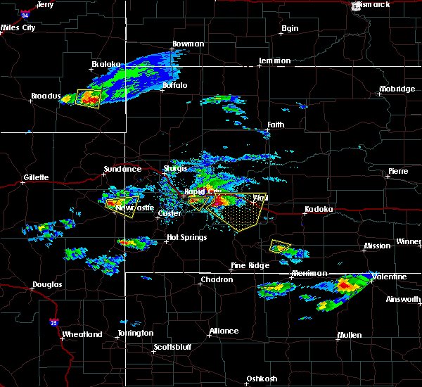 At 519 pm mdt, a severe thunderstorm was located 6 miles east of osage, or 10 miles northwest of newcastle, moving southeast at 25 mph (radar indicated). Hazards include ping pong ball size hail and 60 mph wind gusts. People and animals outdoors will be injured. expect hail damage to roofs, siding, windows, and vehicles. expect wind damage to roofs, siding, and trees. This severe thunderstorm will be near, moon and redbank spring campground around 550 pm mdt. At 519 pm mdt, a severe thunderstorm was located 6 miles east of osage, or 10 miles northwest of newcastle, moving southeast at 25 mph (radar indicated). Hazards include ping pong ball size hail and 60 mph wind gusts. People and animals outdoors will be injured. expect hail damage to roofs, siding, windows, and vehicles. expect wind damage to roofs, siding, and trees. This severe thunderstorm will be near, moon and redbank spring campground around 550 pm mdt.
|
| 8/25/2019 8:05 PM MDT | Quarter sized hail reported 12.8 miles NNE of Newcastle, WY |
| 8/25/2019 8:05 PM MDT | Storm damage reported in weston county WY, 12.8 miles NNE of Newcastle, WY |
| 8/17/2019 2:27 PM MDT | Golf Ball sized hail reported 7.7 miles N of Newcastle, WY |
| 8/17/2019 1:50 PM MDT |
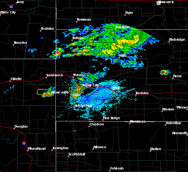 At 119 pm mdt, a severe thunderstorm was located 7 miles west of osage, or 18 miles west of newcastle, moving southeast at 15 mph (radar indicated). Hazards include 60 mph wind gusts and half dollar size hail. Hail damage to vehicles is expected. expect wind damage to roofs, siding, and trees. Locations impacted include, newcastle and osage. At 119 pm mdt, a severe thunderstorm was located 7 miles west of osage, or 18 miles west of newcastle, moving southeast at 15 mph (radar indicated). Hazards include 60 mph wind gusts and half dollar size hail. Hail damage to vehicles is expected. expect wind damage to roofs, siding, and trees. Locations impacted include, newcastle and osage.
|
| 8/17/2019 1:19 PM MDT |
 At 119 pm mdt, a severe thunderstorm was located 7 miles west of osage, or 18 miles west of newcastle, moving southeast at 15 mph (radar indicated). Hazards include 60 mph wind gusts and half dollar size hail. Hail damage to vehicles is expected. expect wind damage to roofs, siding, and trees. Locations impacted include, newcastle and osage. At 119 pm mdt, a severe thunderstorm was located 7 miles west of osage, or 18 miles west of newcastle, moving southeast at 15 mph (radar indicated). Hazards include 60 mph wind gusts and half dollar size hail. Hail damage to vehicles is expected. expect wind damage to roofs, siding, and trees. Locations impacted include, newcastle and osage.
|
| 8/17/2019 12:58 PM MDT |
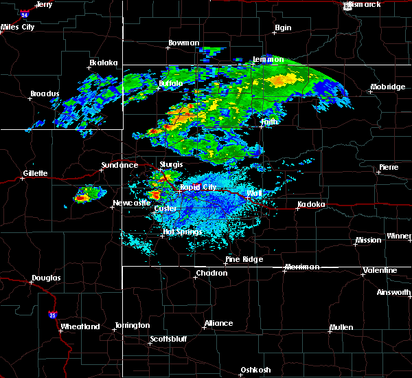 At 1258 pm mdt, a severe thunderstorm was located 9 miles south of upton, or 22 miles west of newcastle, moving east at 20 mph (radar indicated). Hazards include ping pong ball size hail and 60 mph wind gusts. People and animals outdoors will be injured. expect hail damage to roofs, siding, windows, and vehicles. Expect wind damage to roofs, siding, and trees. At 1258 pm mdt, a severe thunderstorm was located 9 miles south of upton, or 22 miles west of newcastle, moving east at 20 mph (radar indicated). Hazards include ping pong ball size hail and 60 mph wind gusts. People and animals outdoors will be injured. expect hail damage to roofs, siding, windows, and vehicles. Expect wind damage to roofs, siding, and trees.
|
| 8/15/2019 12:15 AM MDT | Ping Pong Ball sized hail reported 21.4 miles NE of Newcastle, WY, hail lasted for 20 minutes. wind driven hail broke some windows on a residence. |
| 8/14/2019 11:54 PM MDT |
 At 1154 pm mdt, a severe thunderstorm was located 8 miles northeast of clareton, or 21 miles west of newcastle, moving southeast at 30 mph (radar indicated). Hazards include two inch hail and 60 mph wind gusts. People and animals outdoors will be injured. expect hail damage to roofs, siding, windows, and vehicles. expect wind damage to roofs, siding, and trees. Locations impacted include, newcastle, morrisey and clareton. At 1154 pm mdt, a severe thunderstorm was located 8 miles northeast of clareton, or 21 miles west of newcastle, moving southeast at 30 mph (radar indicated). Hazards include two inch hail and 60 mph wind gusts. People and animals outdoors will be injured. expect hail damage to roofs, siding, windows, and vehicles. expect wind damage to roofs, siding, and trees. Locations impacted include, newcastle, morrisey and clareton.
|
| 8/14/2019 11:38 PM MDT |
 At 1138 pm mdt, a severe thunderstorm was located 12 miles north of clareton, or 26 miles west of newcastle, moving southeast at 30 mph (radar indicated). Hazards include golf ball size hail and 60 mph wind gusts. People and animals outdoors will be injured. expect hail damage to roofs, siding, windows, and vehicles. expect wind damage to roofs, siding, and trees. Locations impacted include, newcastle, morrisey and clareton. At 1138 pm mdt, a severe thunderstorm was located 12 miles north of clareton, or 26 miles west of newcastle, moving southeast at 30 mph (radar indicated). Hazards include golf ball size hail and 60 mph wind gusts. People and animals outdoors will be injured. expect hail damage to roofs, siding, windows, and vehicles. expect wind damage to roofs, siding, and trees. Locations impacted include, newcastle, morrisey and clareton.
|
| 8/14/2019 11:23 PM MDT |
 At 1123 pm mdt, a severe thunderstorm was located 14 miles southwest of upton, or 32 miles west of newcastle, moving southeast at 30 mph (radar indicated). Hazards include ping pong ball size hail and 60 mph wind gusts. People and animals outdoors will be injured. expect hail damage to roofs, siding, windows, and vehicles. Expect wind damage to roofs, siding, and trees. At 1123 pm mdt, a severe thunderstorm was located 14 miles southwest of upton, or 32 miles west of newcastle, moving southeast at 30 mph (radar indicated). Hazards include ping pong ball size hail and 60 mph wind gusts. People and animals outdoors will be injured. expect hail damage to roofs, siding, windows, and vehicles. Expect wind damage to roofs, siding, and trees.
|
| 8/10/2019 6:21 PM MDT |
 At 621 pm mdt, a severe thunderstorm capable of producing a tornado was located near newcastle, and is nearly stationary (radar indicated rotation). Hazards include tornado and half dollar size hail. Flying debris will be dangerous to those caught without shelter. mobile homes will be damaged or destroyed. damage to roofs, windows, and vehicles will occur. tree damage is likely. This dangerous storm will be near, newcastle around 625 pm mdt. At 621 pm mdt, a severe thunderstorm capable of producing a tornado was located near newcastle, and is nearly stationary (radar indicated rotation). Hazards include tornado and half dollar size hail. Flying debris will be dangerous to those caught without shelter. mobile homes will be damaged or destroyed. damage to roofs, windows, and vehicles will occur. tree damage is likely. This dangerous storm will be near, newcastle around 625 pm mdt.
|
| 8/10/2019 6:18 PM MDT |
 The national weather service in rapid city has issued a * tornado warning for. east central weston county in northeastern wyoming. until 700 pm mdt. At 617 pm mdt, a severe thunderstorm capable of producing a tornado was located near newcastle, moving east at 15 mph. The national weather service in rapid city has issued a * tornado warning for. east central weston county in northeastern wyoming. until 700 pm mdt. At 617 pm mdt, a severe thunderstorm capable of producing a tornado was located near newcastle, moving east at 15 mph.
|
| 8/10/2019 6:16 PM MDT | Quarter sized hail reported 0.9 miles SW of Newcastle, WY |
| 8/10/2019 6:13 PM MDT |
 The national weather service in rapid city has issued a * severe thunderstorm warning for. northwestern custer county in southwestern south dakota. west central pennington county in west central south dakota. east central weston county in northeastern wyoming. Until 715 pm mdt. The national weather service in rapid city has issued a * severe thunderstorm warning for. northwestern custer county in southwestern south dakota. west central pennington county in west central south dakota. east central weston county in northeastern wyoming. Until 715 pm mdt.
|
| 8/10/2019 6:13 PM MDT |
 At 613 pm mdt, a severe thunderstorm was located over newcastle, moving east at 25 mph (radar indicated). Hazards include 60 mph wind gusts and half dollar size hail. Hail damage to vehicles is expected. Expect wind damage to roofs, siding, and trees. At 613 pm mdt, a severe thunderstorm was located over newcastle, moving east at 25 mph (radar indicated). Hazards include 60 mph wind gusts and half dollar size hail. Hail damage to vehicles is expected. Expect wind damage to roofs, siding, and trees.
|
| 8/4/2019 9:25 PM MDT |
 The severe thunderstorm warning for northeastern weston county will expire at 930 pm mdt, the storm which prompted the warning has weakened below severe limits, and no longer poses an immediate threat to life or property. therefore, the warning will be allowed to expire. however small hail, gusty winds and heavy rain are still possible with this thunderstorm. The severe thunderstorm warning for northeastern weston county will expire at 930 pm mdt, the storm which prompted the warning has weakened below severe limits, and no longer poses an immediate threat to life or property. therefore, the warning will be allowed to expire. however small hail, gusty winds and heavy rain are still possible with this thunderstorm.
|
| 8/4/2019 9:23 PM MDT | Storm damage reported in weston county WY, 11.4 miles SSE of Newcastle, WY |
| 8/4/2019 9:08 PM MDT |
 At 907 pm mdt, a severe thunderstorm was located near osage, or 11 miles northwest of newcastle, moving east at 30 mph (radar indicated). Hazards include 60 mph wind gusts and quarter size hail. Hail damage to vehicles is expected. expect wind damage to roofs, siding, and trees. Locations impacted include, newcastle, osage, four corners, buckhorn and mallo camp. At 907 pm mdt, a severe thunderstorm was located near osage, or 11 miles northwest of newcastle, moving east at 30 mph (radar indicated). Hazards include 60 mph wind gusts and quarter size hail. Hail damage to vehicles is expected. expect wind damage to roofs, siding, and trees. Locations impacted include, newcastle, osage, four corners, buckhorn and mallo camp.
|
| 8/4/2019 8:49 PM MDT |
 The national weather service in rapid city has issued a * severe thunderstorm warning for. northeastern weston county in northeastern wyoming. until 930 pm mdt. At 848 pm mdt, a severe thunderstorm was located 6 miles west of osage, or 19 miles northwest of newcastle, moving east at 35 mph. The national weather service in rapid city has issued a * severe thunderstorm warning for. northeastern weston county in northeastern wyoming. until 930 pm mdt. At 848 pm mdt, a severe thunderstorm was located 6 miles west of osage, or 19 miles northwest of newcastle, moving east at 35 mph.
|
| 8/3/2019 6:38 PM MDT | Quarter sized hail reported 13.1 miles ESE of Newcastle, WY |
| 8/3/2019 6:35 PM MDT |
 At 634 pm mdt, a severe thunderstorm was located 11 miles south of osage, or 11 miles west of newcastle, moving southeast at 20 mph (radar indicated). Hazards include 60 mph wind gusts and quarter size hail. Hail damage to vehicles is expected. expect wind damage to roofs, siding, and trees. locations impacted include, newcastle. This includes highway 450 southwest of newcastle. At 634 pm mdt, a severe thunderstorm was located 11 miles south of osage, or 11 miles west of newcastle, moving southeast at 20 mph (radar indicated). Hazards include 60 mph wind gusts and quarter size hail. Hail damage to vehicles is expected. expect wind damage to roofs, siding, and trees. locations impacted include, newcastle. This includes highway 450 southwest of newcastle.
|
| 8/3/2019 6:18 PM MDT |
 The national weather service in rapid city has issued a * severe thunderstorm warning for. southeastern weston county in northeastern wyoming. until 715 pm mdt. At 617 pm mdt, a severe thunderstorm was located 6 miles southwest of osage, or 14 miles west of newcastle, moving southeast at 20. The national weather service in rapid city has issued a * severe thunderstorm warning for. southeastern weston county in northeastern wyoming. until 715 pm mdt. At 617 pm mdt, a severe thunderstorm was located 6 miles southwest of osage, or 14 miles west of newcastle, moving southeast at 20.
|
| 7/31/2019 1:06 AM MDT |
 At 106 am mdt, a severe thunderstorm was located 5 miles northwest of upton, or 24 miles southwest of sundance, moving east at 30 mph (radar indicated). Hazards include golf ball size hail and 60 mph wind gusts. People and animals outdoors will be injured. expect hail damage to roofs, siding, windows, and vehicles. Expect wind damage to roofs, siding, and trees. At 106 am mdt, a severe thunderstorm was located 5 miles northwest of upton, or 24 miles southwest of sundance, moving east at 30 mph (radar indicated). Hazards include golf ball size hail and 60 mph wind gusts. People and animals outdoors will be injured. expect hail damage to roofs, siding, windows, and vehicles. Expect wind damage to roofs, siding, and trees.
|
| 7/30/2019 5:13 PM MDT |
 At 513 pm mdt, a severe thunderstorm was located over newcastle, moving east at 30 mph (radar indicated). Hazards include 60 mph wind gusts and half dollar size hail. Hail damage to vehicles is expected. Expect wind damage to roofs, siding, and trees. At 513 pm mdt, a severe thunderstorm was located over newcastle, moving east at 30 mph (radar indicated). Hazards include 60 mph wind gusts and half dollar size hail. Hail damage to vehicles is expected. Expect wind damage to roofs, siding, and trees.
|
| 7/30/2019 5:05 PM MDT | Half Dollar sized hail reported 4.8 miles ESE of Newcastle, WY |
| 7/30/2019 5:03 PM MDT |
 At 503 pm mdt, a severe thunderstorm was located near newcastle, moving east at 30 mph (radar indicated). Hazards include 60 mph wind gusts and half dollar size hail. Hail damage to vehicles is expected. expect wind damage to roofs, siding, and trees. Locations impacted include, newcastle. At 503 pm mdt, a severe thunderstorm was located near newcastle, moving east at 30 mph (radar indicated). Hazards include 60 mph wind gusts and half dollar size hail. Hail damage to vehicles is expected. expect wind damage to roofs, siding, and trees. Locations impacted include, newcastle.
|
| 7/30/2019 4:53 PM MDT |
 At 453 pm mdt, a severe thunderstorm was located 6 miles southeast of osage, or 8 miles northwest of newcastle, moving east at 30 mph (radar indicated). Hazards include golf ball size hail and 60 mph wind gusts. People and animals outdoors will be injured. expect hail damage to roofs, siding, windows, and vehicles. expect wind damage to roofs, siding, and trees. Locations impacted include, newcastle and osage. At 453 pm mdt, a severe thunderstorm was located 6 miles southeast of osage, or 8 miles northwest of newcastle, moving east at 30 mph (radar indicated). Hazards include golf ball size hail and 60 mph wind gusts. People and animals outdoors will be injured. expect hail damage to roofs, siding, windows, and vehicles. expect wind damage to roofs, siding, and trees. Locations impacted include, newcastle and osage.
|
| 7/30/2019 4:40 PM MDT |
 At 440 pm mdt, a severe thunderstorm was located near osage, or 14 miles northwest of newcastle, moving east at 30 mph (radar indicated). Hazards include golf ball size hail and 60 mph wind gusts. People and animals outdoors will be injured. expect hail damage to roofs, siding, windows, and vehicles. expect wind damage to roofs, siding, and trees. Locations impacted include, newcastle and osage. At 440 pm mdt, a severe thunderstorm was located near osage, or 14 miles northwest of newcastle, moving east at 30 mph (radar indicated). Hazards include golf ball size hail and 60 mph wind gusts. People and animals outdoors will be injured. expect hail damage to roofs, siding, windows, and vehicles. expect wind damage to roofs, siding, and trees. Locations impacted include, newcastle and osage.
|
| 7/30/2019 4:32 PM MDT |
 At 414 pm mdt, a severe thunderstorm was located 7 miles south of upton, or 25 miles northwest of newcastle, moving east at 30 mph (radar indicated). Hazards include 60 mph wind gusts and half dollar size hail. Hail damage to vehicles is expected. Expect wind damage to roofs, siding, and trees. At 414 pm mdt, a severe thunderstorm was located 7 miles south of upton, or 25 miles northwest of newcastle, moving east at 30 mph (radar indicated). Hazards include 60 mph wind gusts and half dollar size hail. Hail damage to vehicles is expected. Expect wind damage to roofs, siding, and trees.
|
| 7/30/2019 4:14 PM MDT |
 At 414 pm mdt, a severe thunderstorm was located 7 miles south of upton, or 25 miles northwest of newcastle, moving east at 30 mph (radar indicated). Hazards include 60 mph wind gusts and half dollar size hail. Hail damage to vehicles is expected. Expect wind damage to roofs, siding, and trees. At 414 pm mdt, a severe thunderstorm was located 7 miles south of upton, or 25 miles northwest of newcastle, moving east at 30 mph (radar indicated). Hazards include 60 mph wind gusts and half dollar size hail. Hail damage to vehicles is expected. Expect wind damage to roofs, siding, and trees.
|
| 7/24/2019 6:20 PM MDT | Estimated 50-60 mph wind gust in weston county WY, 16.2 miles SSW of Newcastle, WY |
| 7/23/2019 4:48 PM MDT | Ping Pong Ball sized hail reported 43.5 miles ENE of Newcastle, WY |
| 7/17/2019 6:53 PM MDT | Quarter sized hail reported 19 miles SSW of Newcastle, WY |
| 7/15/2019 7:14 PM MDT | Storm damage reported in weston county WY, 18.5 miles SSW of Newcastle, WY |
| 7/15/2019 7:00 PM MDT | Winds lasted until about 725 pm mdt. tree branches were broken... wood on the deck was broken... and screen door had damag in weston county WY, 16.3 miles SSW of Newcastle, WY |
| 7/15/2019 6:55 PM MDT | Storm damage reported in weston county WY, 5.2 miles ESE of Newcastle, WY |
| 7/9/2019 2:20 PM MDT |
 At 219 pm mdt, a severe thunderstorm was located 13 miles south of moorcroft, or 30 miles southeast of gillette, moving east at 50 mph (radar indicated). Hazards include 70 mph wind gusts and quarter size hail. Hail damage to vehicles is expected. expect considerable tree damage. wind damage is also likely to mobile homes, roofs, and outbuildings. Locations impacted include, newcastle, upton, osage and four corners. At 219 pm mdt, a severe thunderstorm was located 13 miles south of moorcroft, or 30 miles southeast of gillette, moving east at 50 mph (radar indicated). Hazards include 70 mph wind gusts and quarter size hail. Hail damage to vehicles is expected. expect considerable tree damage. wind damage is also likely to mobile homes, roofs, and outbuildings. Locations impacted include, newcastle, upton, osage and four corners.
|
| 7/9/2019 2:04 PM MDT |
 At 204 pm mdt, a severe thunderstorm was located 12 miles south of rozet, or 19 miles southeast of gillette, moving east at 50 mph (radar indicated). Hazards include 70 mph wind gusts and ping pong ball size hail. People and animals outdoors will be injured. expect hail damage to roofs, siding, windows, and vehicles. expect considerable tree damage. Wind damage is also likely to mobile homes, roofs, and outbuildings. At 204 pm mdt, a severe thunderstorm was located 12 miles south of rozet, or 19 miles southeast of gillette, moving east at 50 mph (radar indicated). Hazards include 70 mph wind gusts and ping pong ball size hail. People and animals outdoors will be injured. expect hail damage to roofs, siding, windows, and vehicles. expect considerable tree damage. Wind damage is also likely to mobile homes, roofs, and outbuildings.
|
| 7/5/2019 4:58 PM MDT |
 The severe thunderstorm warning for northeastern weston county will expire at 500 pm mdt, the storm which prompted the warning has weakened below severe limits and no longer poses an immediate threat to life or property. therefore, the warning will be allowed to expire. however, hail up to penny size, gusty winds, and heavy rain are still possible with this thunderstorm. a severe thunderstorm watch remains in effect until 900 pm mdt for southwestern and west central south dakota, and northeastern wyoming. The severe thunderstorm warning for northeastern weston county will expire at 500 pm mdt, the storm which prompted the warning has weakened below severe limits and no longer poses an immediate threat to life or property. therefore, the warning will be allowed to expire. however, hail up to penny size, gusty winds, and heavy rain are still possible with this thunderstorm. a severe thunderstorm watch remains in effect until 900 pm mdt for southwestern and west central south dakota, and northeastern wyoming.
|
| 7/5/2019 4:26 PM MDT |
 At 426 pm mdt, a severe thunderstorm was located 3 miles east of osage, or 11 miles northwest of newcastle, moving east at 30 mph (radar indicated). Hazards include ping pong ball size hail and 60 mph wind gusts. People and animals outdoors will be injured. expect hail damage to roofs, siding, windows, and vehicles. expect wind damage to roofs, siding, and trees. Locations impacted include, newcastle and osage. At 426 pm mdt, a severe thunderstorm was located 3 miles east of osage, or 11 miles northwest of newcastle, moving east at 30 mph (radar indicated). Hazards include ping pong ball size hail and 60 mph wind gusts. People and animals outdoors will be injured. expect hail damage to roofs, siding, windows, and vehicles. expect wind damage to roofs, siding, and trees. Locations impacted include, newcastle and osage.
|
| 7/5/2019 4:11 PM MDT |
 At 410 pm mdt, a severe thunderstorm was located over osage, or 15 miles northwest of newcastle, moving east at 30 mph (radar indicated). Hazards include ping pong ball size hail and 60 mph wind gusts. People and animals outdoors will be injured. expect hail damage to roofs, siding, windows, and vehicles. Expect wind damage to roofs, siding, and trees. At 410 pm mdt, a severe thunderstorm was located over osage, or 15 miles northwest of newcastle, moving east at 30 mph (radar indicated). Hazards include ping pong ball size hail and 60 mph wind gusts. People and animals outdoors will be injured. expect hail damage to roofs, siding, windows, and vehicles. Expect wind damage to roofs, siding, and trees.
|
| 7/4/2019 8:07 PM MDT |
 At 806 pm mdt, severe thunderstorms were located along a line extending from 7 miles southwest of inyan kara mountain to 4 miles west of newcastle to 4 miles northwest of morrisey, moving northeast at 30 mph (trained weather spotters). Hazards include 70 mph wind gusts and quarter size hail. Hail damage to vehicles is expected. expect considerable tree damage. wind damage is also likely to mobile homes, roofs, and outbuildings. Locations impacted include, newcastle and morrisey. At 806 pm mdt, severe thunderstorms were located along a line extending from 7 miles southwest of inyan kara mountain to 4 miles west of newcastle to 4 miles northwest of morrisey, moving northeast at 30 mph (trained weather spotters). Hazards include 70 mph wind gusts and quarter size hail. Hail damage to vehicles is expected. expect considerable tree damage. wind damage is also likely to mobile homes, roofs, and outbuildings. Locations impacted include, newcastle and morrisey.
|
| 7/4/2019 8:02 PM MDT |
 At 801 pm mdt, severe thunderstorms were located along a line extending from 6 miles southeast of osage to 5 miles west of morrisey, moving east at 40 mph. a 69 mph wind gust was recently observed west of newcastle (radar indicated). Hazards include 70 mph wind gusts. Expect considerable tree damage. Damage is likely to mobile homes, roofs, and outbuildings. At 801 pm mdt, severe thunderstorms were located along a line extending from 6 miles southeast of osage to 5 miles west of morrisey, moving east at 40 mph. a 69 mph wind gust was recently observed west of newcastle (radar indicated). Hazards include 70 mph wind gusts. Expect considerable tree damage. Damage is likely to mobile homes, roofs, and outbuildings.
|
| 7/4/2019 7:55 PM MDT | Storm damage reported in weston county WY, 5.2 miles ESE of Newcastle, WY |
| 7/4/2019 7:51 PM MDT |
 At 750 pm mdt, severe thunderstorms were located along a line extending from 6 miles southeast of upton to 9 miles west of newcastle to 7 miles west of morrisey, moving northeast at 45 mph. 60 mph winds were recently reported 9 miles south southwest of clareton (trained weather spotters). Hazards include 70 mph wind gusts and penny size hail. Expect considerable tree damage. damage is likely to mobile homes, roofs, and outbuildings. Locations impacted include, newcastle, upton, osage and morrisey. At 750 pm mdt, severe thunderstorms were located along a line extending from 6 miles southeast of upton to 9 miles west of newcastle to 7 miles west of morrisey, moving northeast at 45 mph. 60 mph winds were recently reported 9 miles south southwest of clareton (trained weather spotters). Hazards include 70 mph wind gusts and penny size hail. Expect considerable tree damage. damage is likely to mobile homes, roofs, and outbuildings. Locations impacted include, newcastle, upton, osage and morrisey.
|
| 7/4/2019 7:45 PM MDT | Storm damage reported in weston county WY, 32.4 miles NE of Newcastle, WY |
| 7/4/2019 7:39 PM MDT |
 At 739 pm mdt, severe thunderstorms were located along a line extending from 9 miles south of upton to 6 miles northeast of clareton to 13 miles southeast of rochelle, moving northeast at 35 mph (radar indicated). Hazards include 70 mph wind gusts. Expect considerable tree damage. damage is likely to mobile homes, roofs, and outbuildings. Locations impacted include, newcastle, upton, osage, clareton and morrisey. At 739 pm mdt, severe thunderstorms were located along a line extending from 9 miles south of upton to 6 miles northeast of clareton to 13 miles southeast of rochelle, moving northeast at 35 mph (radar indicated). Hazards include 70 mph wind gusts. Expect considerable tree damage. damage is likely to mobile homes, roofs, and outbuildings. Locations impacted include, newcastle, upton, osage, clareton and morrisey.
|
| 7/4/2019 7:17 PM MDT |
 At 717 pm mdt, severe thunderstorms were located along a line extending from 21 miles northwest of clareton to 4 miles southeast of rochelle, moving northeast at 25 mph. a 71 mph wind gust was recently observed southwest of clareton (radar indicated). Hazards include 70 mph wind gusts. Expect considerable tree damage. Damage is likely to mobile homes, roofs, and outbuildings. At 717 pm mdt, severe thunderstorms were located along a line extending from 21 miles northwest of clareton to 4 miles southeast of rochelle, moving northeast at 25 mph. a 71 mph wind gust was recently observed southwest of clareton (radar indicated). Hazards include 70 mph wind gusts. Expect considerable tree damage. Damage is likely to mobile homes, roofs, and outbuildings.
|
| 6/30/2019 12:32 PM MDT | Quarter sized hail reported 35 miles ENE of Newcastle, WY |
| 6/30/2019 12:21 PM MDT | Quarter sized hail reported 9.9 miles SSE of Newcastle, WY |
| 6/25/2019 4:55 PM MDT | Quarter sized hail reported 29.3 miles NE of Newcastle, WY |
| 6/25/2019 4:16 PM MDT | Quarter sized hail reported 38.2 miles ENE of Newcastle, WY |
| 6/19/2019 9:35 PM MDT |
 The severe thunderstorm warning for southeastern weston county will expire at 945 pm mdt, the storms which prompted the warning have weakened below severe limits, and no longer pose an immediate threat to life or property. therefore, the warning will be allowed to expire. however gusty winds are still possible with these thunderstorms. to report severe weather, contact your nearest law enforcement agency. they will relay your report to the national weather service rapid city. The severe thunderstorm warning for southeastern weston county will expire at 945 pm mdt, the storms which prompted the warning have weakened below severe limits, and no longer pose an immediate threat to life or property. therefore, the warning will be allowed to expire. however gusty winds are still possible with these thunderstorms. to report severe weather, contact your nearest law enforcement agency. they will relay your report to the national weather service rapid city.
|
| 6/19/2019 9:25 PM MDT |
 At 925 pm mdt, severe thunderstorms were located along a line extending from 7 miles west of moon to 3 miles southwest of newcastle to 6 miles east of clareton, moving east at 50 mph (radar indicated). Hazards include 60 mph wind gusts. Expect damage to roofs, siding, and trees. Locations impacted include, newcastle. At 925 pm mdt, severe thunderstorms were located along a line extending from 7 miles west of moon to 3 miles southwest of newcastle to 6 miles east of clareton, moving east at 50 mph (radar indicated). Hazards include 60 mph wind gusts. Expect damage to roofs, siding, and trees. Locations impacted include, newcastle.
|
| 6/19/2019 9:20 PM MDT | Storm damage reported in weston county WY, 34.5 miles ENE of Newcastle, WY |
| 6/19/2019 9:12 PM MDT | Quarter sized hail reported 38.9 miles ENE of Newcastle, WY |
| 6/19/2019 9:12 PM MDT |
 At 912 pm mdt, severe thunderstorms were located along a line extending from 2 miles east of osage to 13 miles west of newcastle to 5 miles northwest of clareton, moving east at 55 mph (radar indicated). Hazards include 60 mph wind gusts and penny size hail. Expect damage to roofs, siding, and trees. Locations impacted include, newcastle and osage. At 912 pm mdt, severe thunderstorms were located along a line extending from 2 miles east of osage to 13 miles west of newcastle to 5 miles northwest of clareton, moving east at 55 mph (radar indicated). Hazards include 60 mph wind gusts and penny size hail. Expect damage to roofs, siding, and trees. Locations impacted include, newcastle and osage.
|
| 6/19/2019 9:05 PM MDT | Storm damage reported in weston county WY, 31 miles E of Newcastle, WY |
| 6/19/2019 8:59 PM MDT |
 At 858 pm mdt, severe thunderstorms were located along a line extending from 7 miles south of upton to 12 miles north of clareton to 10 miles northwest of rochelle, moving east at 50 mph (radar indicated). Hazards include 60 mph wind gusts and quarter size hail. Hail damage to vehicles is expected. Expect wind damage to roofs, siding, and trees. At 858 pm mdt, severe thunderstorms were located along a line extending from 7 miles south of upton to 12 miles north of clareton to 10 miles northwest of rochelle, moving east at 50 mph (radar indicated). Hazards include 60 mph wind gusts and quarter size hail. Hail damage to vehicles is expected. Expect wind damage to roofs, siding, and trees.
|
| 6/1/2019 9:22 PM MDT |
 The severe thunderstorm warning for east central weston county will expire at 930 pm mdt, the storm which prompted the warning has weakened below severe limits and no longer poses an immediate threat to life or property. therefore, the warning will be allowed to expire. however, small hail, gusty winds, and heavy rain are still possible with this thunderstorm. The severe thunderstorm warning for east central weston county will expire at 930 pm mdt, the storm which prompted the warning has weakened below severe limits and no longer poses an immediate threat to life or property. therefore, the warning will be allowed to expire. however, small hail, gusty winds, and heavy rain are still possible with this thunderstorm.
|
| 6/1/2019 8:59 PM MDT |
 At 843 pm mdt, a severe thunderstorm was located 11 miles southwest of newcastle, moving northeast at 20 mph (radar indicated). Hazards include quarter size hail. damage to vehicles is expected At 843 pm mdt, a severe thunderstorm was located 11 miles southwest of newcastle, moving northeast at 20 mph (radar indicated). Hazards include quarter size hail. damage to vehicles is expected
|
| 6/1/2019 8:43 PM MDT |
 At 843 pm mdt, a severe thunderstorm was located 11 miles southwest of newcastle, moving northeast at 20 mph (radar indicated). Hazards include quarter size hail. damage to vehicles is expected At 843 pm mdt, a severe thunderstorm was located 11 miles southwest of newcastle, moving northeast at 20 mph (radar indicated). Hazards include quarter size hail. damage to vehicles is expected
|
| 6/1/2019 8:30 PM MDT | Quarter sized hail reported 17.3 miles ENE of Newcastle, WY, time estimated from radar |
| 6/1/2019 8:13 PM MDT | Ping Pong Ball sized hail reported 22.7 miles ENE of Newcastle, WY, quarter to ping pong ball sized hail |
| 8/3/2018 8:06 PM MDT |
 At 805 pm mdt, severe thunderstorms were located along a line extending from 3 miles west of colony to 4 miles southeast of moskee to 10 miles southwest of newcastle, moving east at 45 mph (radar indicated. quarter sized hail and strong wind gusts were reported 3 miles east of hulett at 745 pm mdt). Hazards include 60 mph wind gusts and quarter size hail. Hail damage to vehicles is expected. expect wind damage to roofs, siding, and trees. locations impacted include, spearfish, belle fourche, newcastle, lead, sundance, deadwood, osage, saint onge, central city, colony, beulah, fruitdale, alva, aladdin, flag mountain, moon, moskee, four corners, buckhorn and deerfield. this includes, interstate 90 in south dakota between mile markers 1 and 23. Interstate 90 in wyoming between mile markers 179 and 207. At 805 pm mdt, severe thunderstorms were located along a line extending from 3 miles west of colony to 4 miles southeast of moskee to 10 miles southwest of newcastle, moving east at 45 mph (radar indicated. quarter sized hail and strong wind gusts were reported 3 miles east of hulett at 745 pm mdt). Hazards include 60 mph wind gusts and quarter size hail. Hail damage to vehicles is expected. expect wind damage to roofs, siding, and trees. locations impacted include, spearfish, belle fourche, newcastle, lead, sundance, deadwood, osage, saint onge, central city, colony, beulah, fruitdale, alva, aladdin, flag mountain, moon, moskee, four corners, buckhorn and deerfield. this includes, interstate 90 in south dakota between mile markers 1 and 23. Interstate 90 in wyoming between mile markers 179 and 207.
|
| 8/3/2018 7:52 PM MDT |
 At 747 pm mdt, severe thunderstorms were located along a line extending from 9 miles west of colony to 7 miles east of clareton, moving east at 45 mph (radar indicated. at 746 pm mdt, 60 mph wind gusts were reported at 10 miles southeast of devils tower). Hazards include 60 mph wind gusts and quarter size hail. Hail damage to vehicles is expected. expect wind damage to roofs, siding, and trees. locations impacted include, spearfish, belle fourche, newcastle, lead, sundance, deadwood, upton, hulett, osage, saint onge, central city, colony, beulah, fruitdale, alva, aladdin, moon, moskee, deerfield and cheyenne crossing. this includes, interstate 90 in south dakota between mile markers 1 and 23. Interstate 90 in wyoming between mile markers 163 and 207. At 747 pm mdt, severe thunderstorms were located along a line extending from 9 miles west of colony to 7 miles east of clareton, moving east at 45 mph (radar indicated. at 746 pm mdt, 60 mph wind gusts were reported at 10 miles southeast of devils tower). Hazards include 60 mph wind gusts and quarter size hail. Hail damage to vehicles is expected. expect wind damage to roofs, siding, and trees. locations impacted include, spearfish, belle fourche, newcastle, lead, sundance, deadwood, upton, hulett, osage, saint onge, central city, colony, beulah, fruitdale, alva, aladdin, moon, moskee, deerfield and cheyenne crossing. this includes, interstate 90 in south dakota between mile markers 1 and 23. Interstate 90 in wyoming between mile markers 163 and 207.
|
| 8/3/2018 7:29 PM MDT |
 At 728 pm mdt, severe thunderstorms were located along a line extending from 10 miles northwest of alva to 7 miles west of clareton, moving east at 50 mph (radar indicated). Hazards include 60 mph wind gusts and quarter size hail. Hail damage to vehicles is expected. Expect wind damage to roofs, siding, and trees. At 728 pm mdt, severe thunderstorms were located along a line extending from 10 miles northwest of alva to 7 miles west of clareton, moving east at 50 mph (radar indicated). Hazards include 60 mph wind gusts and quarter size hail. Hail damage to vehicles is expected. Expect wind damage to roofs, siding, and trees.
|
| 1/1/0001 12:00 AM | Golf Ball sized hail reported 8.9 miles S of Newcastle, WY |
| 1/1/0001 12:00 AM | Quarter sized hail reported 12.4 miles ENE of Newcastle, WY |
| 7/21/2018 7:55 PM MDT | At least 60 mph gusts... sustained 40-50 mph in weston county WY, 3.7 miles SSW of Newcastle, WY |
| 7/21/2018 7:55 PM MDT | Storm damage reported in weston county WY, 5.2 miles ESE of Newcastle, WY |
| 7/21/2018 7:52 PM MDT |
 The severe thunderstorm warning for northeastern weston county will expire at 800 pm mdt, the storm which prompted the warning has weakened below severe limits, and no longer poses an immediate threat to life or property. therefore, the warning will be allowed to expire. however heavy rain is still possible with this thunderstorm. a severe thunderstorm watch remains in effect until 1100 pm mdt for southwestern and west central south dakota, and northeastern wyoming. The severe thunderstorm warning for northeastern weston county will expire at 800 pm mdt, the storm which prompted the warning has weakened below severe limits, and no longer poses an immediate threat to life or property. therefore, the warning will be allowed to expire. however heavy rain is still possible with this thunderstorm. a severe thunderstorm watch remains in effect until 1100 pm mdt for southwestern and west central south dakota, and northeastern wyoming.
|
| 7/21/2018 7:41 PM MDT |
 At 741 pm mdt, a severe thunderstorm was located 3 miles north of newcastle, moving east at 40 mph (radar indicated). Hazards include 60 mph wind gusts and penny size hail. Expect damage to roofs, siding, and trees. Locations impacted include, newcastle, osage, four corners and mallo camp. At 741 pm mdt, a severe thunderstorm was located 3 miles north of newcastle, moving east at 40 mph (radar indicated). Hazards include 60 mph wind gusts and penny size hail. Expect damage to roofs, siding, and trees. Locations impacted include, newcastle, osage, four corners and mallo camp.
|
| 7/21/2018 7:16 PM MDT |
 At 716 pm mdt, a severe thunderstorm was located 11 miles southwest of osage, or 18 miles west of newcastle, moving east at 40 mph (radar indicated). Hazards include 60 mph wind gusts and penny size hail. expect damage to roofs, siding, and trees At 716 pm mdt, a severe thunderstorm was located 11 miles southwest of osage, or 18 miles west of newcastle, moving east at 40 mph (radar indicated). Hazards include 60 mph wind gusts and penny size hail. expect damage to roofs, siding, and trees
|
| 7/17/2018 7:14 PM MDT | Storm damage reported in weston county WY, 38.2 miles ENE of Newcastle, WY |
| 7/3/2018 8:23 PM MDT |
 At 823 pm mdt, severe thunderstorms were located along a line extending from near newcastle to 2 miles southwest of elk mountain lookout to 9 miles southeast of morrisey, moving northeast at 40 mph (radar indicated). Hazards include 60 mph wind gusts. expect damage to roofs, siding, and trees At 823 pm mdt, severe thunderstorms were located along a line extending from near newcastle to 2 miles southwest of elk mountain lookout to 9 miles southeast of morrisey, moving northeast at 40 mph (radar indicated). Hazards include 60 mph wind gusts. expect damage to roofs, siding, and trees
|
| 5/27/2018 8:20 PM MDT | Storm damage reported in custer county SD, 13.9 miles NW of Newcastle, WY |
| 7/17/2017 4:45 PM MDT | 0.70 of rain in about 30 minutes in weston county WY, 22.6 miles ENE of Newcastle, WY |
| 6/28/2017 7:08 PM MDT | Quarter sized hail reported 0.7 miles W of Newcastle, WY |
| 6/28/2017 1:00 PM MDT |
 The national weather service in rapid city has issued a * severe thunderstorm warning for. northwestern custer county in southwestern south dakota. west central pennington county in west central south dakota. northeastern weston county in northeastern wyoming. Until 745 pm mdt. The national weather service in rapid city has issued a * severe thunderstorm warning for. northwestern custer county in southwestern south dakota. west central pennington county in west central south dakota. northeastern weston county in northeastern wyoming. Until 745 pm mdt.
|
| 6/28/2017 1:00 PM MDT |
 At 659 pm mdt, a severe thunderstorm was located near newcastle, moving northeast at 30 mph (radar indicated). Hazards include 60 mph wind gusts and quarter size hail. Hail damage to vehicles is expected. Expect wind damage to roofs, siding, and trees. At 659 pm mdt, a severe thunderstorm was located near newcastle, moving northeast at 30 mph (radar indicated). Hazards include 60 mph wind gusts and quarter size hail. Hail damage to vehicles is expected. Expect wind damage to roofs, siding, and trees.
|
| 6/27/2017 4:44 PM MDT | Storm damage reported in custer county SD, 13.9 miles NW of Newcastle, WY |
| 5/15/2017 7:23 PM MDT |
 At 723 pm mdt, a severe thunderstorm was located near osage, or 12 miles west of newcastle, moving east at 30 mph (radar indicated). Hazards include ping pong ball size hail and 60 mph wind gusts. People and animals outdoors will be injured. expect hail damage to roofs, siding, windows, and vehicles. Expect wind damage to roofs, siding, and trees. At 723 pm mdt, a severe thunderstorm was located near osage, or 12 miles west of newcastle, moving east at 30 mph (radar indicated). Hazards include ping pong ball size hail and 60 mph wind gusts. People and animals outdoors will be injured. expect hail damage to roofs, siding, windows, and vehicles. Expect wind damage to roofs, siding, and trees.
|
| 5/15/2017 7:20 PM MDT | Quarter sized hail reported 21.4 miles NE of Newcastle, WY |
| 5/15/2017 6:35 PM MDT | Quarter sized hail reported 30.5 miles E of Newcastle, WY |
| 9/23/2016 5:43 PM MDT | Storm damage reported in custer county SD, 13.9 miles NW of Newcastle, WY |
| 9/14/2016 6:42 PM MDT |
 The severe thunderstorm warning for southeastern weston county will expire at 645 pm mdt, the storms which prompted the warning have weakened below severe limits, and have exited the warned area. therefore the warning will be allowed to expire. The severe thunderstorm warning for southeastern weston county will expire at 645 pm mdt, the storms which prompted the warning have weakened below severe limits, and have exited the warned area. therefore the warning will be allowed to expire.
|
| 9/14/2016 6:20 PM MDT |
 At 620 pm mdt, severe thunderstorms were located along a line extending from near upton to 9 miles south of osage to near elk mountain lookout, moving northeast at 35 mph (radar indicated). Hazards include 60 mph wind gusts. Expect damage to roofs. siding. and trees. Locations impacted include, newcastle. At 620 pm mdt, severe thunderstorms were located along a line extending from near upton to 9 miles south of osage to near elk mountain lookout, moving northeast at 35 mph (radar indicated). Hazards include 60 mph wind gusts. Expect damage to roofs. siding. and trees. Locations impacted include, newcastle.
|
| 9/14/2016 6:03 PM MDT |
 At 603 pm mdt, severe thunderstorms were located along a line extending from 8 miles southwest of upton to 7 miles east of clareton to near dewey, moving northeast at 25 mph (radar indicated). Hazards include 60 mph wind gusts and penny size hail. Expect damage to roofs. siding. and trees. Locations impacted include, newcastle, clareton and morrisey. At 603 pm mdt, severe thunderstorms were located along a line extending from 8 miles southwest of upton to 7 miles east of clareton to near dewey, moving northeast at 25 mph (radar indicated). Hazards include 60 mph wind gusts and penny size hail. Expect damage to roofs. siding. and trees. Locations impacted include, newcastle, clareton and morrisey.
|
| 9/14/2016 5:50 PM MDT | Storm damage reported in weston county WY, 32.4 miles NE of Newcastle, WY |
| 9/14/2016 5:41 PM MDT |
 At 541 pm mdt, severe thunderstorms were located along a line extending from near clareton to 11 miles west of morrisey to near mule creek junction, moving north at 35 mph (radar indicated). Hazards include 60 mph wind gusts and quarter size hail. Hail damage to vehicles is expected. Expect wind damage to roofs, siding, and trees. At 541 pm mdt, severe thunderstorms were located along a line extending from near clareton to 11 miles west of morrisey to near mule creek junction, moving north at 35 mph (radar indicated). Hazards include 60 mph wind gusts and quarter size hail. Hail damage to vehicles is expected. Expect wind damage to roofs, siding, and trees.
|
| 8/10/2016 8:10 PM MDT | Ping Pong Ball sized hail reported 22 miles ENE of Newcastle, WY |
| 8/10/2016 7:55 PM MDT | Tennis Ball sized hail reported 24.7 miles ENE of Newcastle, WY |
| 8/10/2016 7:30 PM MDT | Golf Ball sized hail reported 38.9 miles ENE of Newcastle, WY, hail was mostly quarter size with larger stones golf ball size. |
| 8/10/2016 7:25 PM MDT | Quarter sized hail reported 44.7 miles ENE of Newcastle, WY |
| 8/9/2016 4:30 PM MDT |
 At 430 pm mdt, a severe thunderstorm was located near newcastle, moving northeast at 35 mph (radar indicated). Hazards include quarter size hail. Damage to vehicles is expected. Locations impacted include, newcastle. At 430 pm mdt, a severe thunderstorm was located near newcastle, moving northeast at 35 mph (radar indicated). Hazards include quarter size hail. Damage to vehicles is expected. Locations impacted include, newcastle.
|
| 8/9/2016 4:12 PM MDT |
 At 412 pm mdt, a severe thunderstorm was located 9 miles west of newcastle, moving northeast at 35 mph (radar indicated). Hazards include ping pong ball size hail and 60 mph wind gusts. People and animals outdoors will be injured. expect hail damage to roofs, siding, windows, and vehicles. expect wind damage to roofs, siding, and trees. Locations impacted include, newcastle. At 412 pm mdt, a severe thunderstorm was located 9 miles west of newcastle, moving northeast at 35 mph (radar indicated). Hazards include ping pong ball size hail and 60 mph wind gusts. People and animals outdoors will be injured. expect hail damage to roofs, siding, windows, and vehicles. expect wind damage to roofs, siding, and trees. Locations impacted include, newcastle.
|
| 8/9/2016 3:59 PM MDT |
 At 359 pm mdt, a severe thunderstorm was located 9 miles east of clareton, or 17 miles southwest of newcastle, moving northeast at 30 mph (radar indicated). Hazards include golf ball size hail and 60 mph wind gusts. People and animals outdoors will be injured. expect hail damage to roofs, siding, windows, and vehicles. Expect wind damage to roofs, siding, and trees. At 359 pm mdt, a severe thunderstorm was located 9 miles east of clareton, or 17 miles southwest of newcastle, moving northeast at 30 mph (radar indicated). Hazards include golf ball size hail and 60 mph wind gusts. People and animals outdoors will be injured. expect hail damage to roofs, siding, windows, and vehicles. Expect wind damage to roofs, siding, and trees.
|
| 8/8/2016 4:30 PM MDT | Quarter sized hail reported 24.7 miles ENE of Newcastle, WY |
| 7/30/2016 7:56 PM MDT | Quarter sized hail reported 3.7 miles SSW of Newcastle, WY, wind guts to 60 mph |
| 7/30/2016 7:38 PM MDT |
 At 738 pm mdt, a severe thunderstorm was located over moon, or 9 miles northeast of newcastle, moving southeast at 40 mph (radar indicated). Hazards include 60 mph wind gusts and quarter size hail. Hail damage to vehicles is expected. Expect wind damage to roofs, siding, and trees. At 738 pm mdt, a severe thunderstorm was located over moon, or 9 miles northeast of newcastle, moving southeast at 40 mph (radar indicated). Hazards include 60 mph wind gusts and quarter size hail. Hail damage to vehicles is expected. Expect wind damage to roofs, siding, and trees.
|
| 7/30/2016 7:33 PM MDT | Storm damage reported in weston county WY, 10.1 miles SSE of Newcastle, WY |
| 7/18/2016 4:35 PM MDT |
 At 435 pm mdt, severe thunderstorms were located along a line extending from 9 miles west of dewey to near edgemont, moving northeast at 40 mph (radar indicated). Hazards include 70 mph wind gusts and nickel size hail. Expect considerable tree damage. damage is likely to mobile homes, roofs, and outbuildings. Locations impacted include, newcastle, custer, edgemont, dewey, pringle, sanator, argyle, custer state park, stockade lake, jewel cave national monument, custer park game lodge, wind cave visitors center, wind cave national park and blue bell. At 435 pm mdt, severe thunderstorms were located along a line extending from 9 miles west of dewey to near edgemont, moving northeast at 40 mph (radar indicated). Hazards include 70 mph wind gusts and nickel size hail. Expect considerable tree damage. damage is likely to mobile homes, roofs, and outbuildings. Locations impacted include, newcastle, custer, edgemont, dewey, pringle, sanator, argyle, custer state park, stockade lake, jewel cave national monument, custer park game lodge, wind cave visitors center, wind cave national park and blue bell.
|
| 7/18/2016 4:16 PM MDT |
 At 416 pm mdt, a severe thunderstorm was located 7 miles southeast of mule creek junction, or 14 miles west of edgemont, moving northeast at 45 mph (radar indicated). Hazards include 70 mph wind gusts and half dollar size hail. Hail damage to vehicles is expected. expect considerable tree damage. Wind damage is also likely to mobile homes, roofs, and outbuildings. At 416 pm mdt, a severe thunderstorm was located 7 miles southeast of mule creek junction, or 14 miles west of edgemont, moving northeast at 45 mph (radar indicated). Hazards include 70 mph wind gusts and half dollar size hail. Hail damage to vehicles is expected. expect considerable tree damage. Wind damage is also likely to mobile homes, roofs, and outbuildings.
|
| 7/16/2016 5:00 PM MDT | Storm damage reported in custer county SD, 13.9 miles NW of Newcastle, WY |
| 7/6/2016 3:35 PM MDT | Storm damage reported in weston county WY, 11.2 miles NNW of Newcastle, WY |
| 6/28/2016 3:16 PM MDT |
 At 316 pm mdt, severe thunderstorms were located along a line extending from near newcastle to 6 miles north of clareton, moving southeast at 30 mph (radar indicated). Hazards include 60 mph wind gusts and quarter size hail. Hail damage to vehicles is expected. expect wind damage to roofs, siding, and trees. Locations impacted include, newcastle and clareton. At 316 pm mdt, severe thunderstorms were located along a line extending from near newcastle to 6 miles north of clareton, moving southeast at 30 mph (radar indicated). Hazards include 60 mph wind gusts and quarter size hail. Hail damage to vehicles is expected. expect wind damage to roofs, siding, and trees. Locations impacted include, newcastle and clareton.
|
| 6/28/2016 2:53 PM MDT |
 At 252 pm mdt, severe thunderstorms were located along a line extending from near osage to 18 miles north of rochelle, moving southeast at 25 mph (radar indicated). Hazards include ping pong ball size hail and 60 mph wind gusts. People and animals outdoors will be injured. expect hail damage to roofs, siding, windows, and vehicles. Expect wind damage to roofs, siding, and trees. At 252 pm mdt, severe thunderstorms were located along a line extending from near osage to 18 miles north of rochelle, moving southeast at 25 mph (radar indicated). Hazards include ping pong ball size hail and 60 mph wind gusts. People and animals outdoors will be injured. expect hail damage to roofs, siding, windows, and vehicles. Expect wind damage to roofs, siding, and trees.
|
| 6/23/2016 9:06 PM MDT |
 At 905 pm mdt, a severe thunderstorm was located near newcastle, moving east at 20 mph (radar indicated). Hazards include 60 mph wind gusts. Expect damage to roofs. siding. and trees. Locations impacted include, newcastle and moon. At 905 pm mdt, a severe thunderstorm was located near newcastle, moving east at 20 mph (radar indicated). Hazards include 60 mph wind gusts. Expect damage to roofs. siding. and trees. Locations impacted include, newcastle and moon.
|
| 6/23/2016 8:47 PM MDT | Storm damage reported in weston county WY, 0.9 miles E of Newcastle, WY |
| 6/23/2016 8:45 PM MDT |
 At 844 pm mdt, a severe thunderstorm was located over newcastle, moving east at 20 mph (radar indicated). Hazards include 60 mph wind gusts and nickel size hail. Expect damage to roofs. siding. And trees. At 844 pm mdt, a severe thunderstorm was located over newcastle, moving east at 20 mph (radar indicated). Hazards include 60 mph wind gusts and nickel size hail. Expect damage to roofs. siding. And trees.
|
| 8/26/2015 8:48 PM MDT |
 At 847 pm mdt, a severe thunderstorm was located 7 miles southwest of moon, or 7 miles east of newcastle, moving northeast at 25 mph (radar indicated). Hazards include 60 mph wind gusts and nickel size hail. Expect damage to roofs. Siding and trees. At 847 pm mdt, a severe thunderstorm was located 7 miles southwest of moon, or 7 miles east of newcastle, moving northeast at 25 mph (radar indicated). Hazards include 60 mph wind gusts and nickel size hail. Expect damage to roofs. Siding and trees.
|
| 8/26/2015 8:41 PM MDT |
 At 841 pm mdt, a severe thunderstorm was located over newcastle, moving northeast at 25 mph (radar indicated). Hazards include 60 mph wind gusts and nickel size hail. Expect damage to roofs. siding and trees. Locations impacted include, newcastle. At 841 pm mdt, a severe thunderstorm was located over newcastle, moving northeast at 25 mph (radar indicated). Hazards include 60 mph wind gusts and nickel size hail. Expect damage to roofs. siding and trees. Locations impacted include, newcastle.
|
| 8/26/2015 8:30 PM MDT |
 At 829 pm mdt, a severe thunderstorm was located near newcastle, moving northeast at 30 mph (radar indicated). Hazards include 60 mph wind gusts and nickel size hail. Expect damage to roofs. siding and trees. Locations impacted include, newcastle. At 829 pm mdt, a severe thunderstorm was located near newcastle, moving northeast at 30 mph (radar indicated). Hazards include 60 mph wind gusts and nickel size hail. Expect damage to roofs. siding and trees. Locations impacted include, newcastle.
|
| 8/26/2015 8:14 PM MDT |
 At 814 pm mdt, a severe thunderstorm was located 12 miles east of clareton, or 14 miles southwest of newcastle, moving northeast at 30 mph (radar indicated). Hazards include 60 mph wind gusts and nickel size hail. Expect damage to roofs. Siding and trees. At 814 pm mdt, a severe thunderstorm was located 12 miles east of clareton, or 14 miles southwest of newcastle, moving northeast at 30 mph (radar indicated). Hazards include 60 mph wind gusts and nickel size hail. Expect damage to roofs. Siding and trees.
|
| 8/17/2015 8:03 PM MDT |
 At 802 pm mdt, severe thunderstorms were located along a line extending from near pine haven to 16 miles north of rochelle, moving east at 35 mph (radar indicated). Hazards include 60 mph wind gusts and nickel size hail. a 60 mph wind gust was reported 14 ssw of rozet around 734 pm mdt. Expect damage to roofs. siding and trees. locations impacted include, upton, moorcroft, osage and inyan kara mountain. This includes interstate 90 in wyoming between mile markers 155 and 172, and between mile markers 177 and 179. At 802 pm mdt, severe thunderstorms were located along a line extending from near pine haven to 16 miles north of rochelle, moving east at 35 mph (radar indicated). Hazards include 60 mph wind gusts and nickel size hail. a 60 mph wind gust was reported 14 ssw of rozet around 734 pm mdt. Expect damage to roofs. siding and trees. locations impacted include, upton, moorcroft, osage and inyan kara mountain. This includes interstate 90 in wyoming between mile markers 155 and 172, and between mile markers 177 and 179.
|
| 8/17/2015 7:30 PM MDT |
 At 729 pm mdt, severe thunderstorms were located along a line extending from near rozet to 7 miles northeast of reno junction, moving east at 35 mph (radar indicated). Hazards include 60 mph wind gusts and nickel size hail. Expect damage to roofs. Siding and trees. At 729 pm mdt, severe thunderstorms were located along a line extending from near rozet to 7 miles northeast of reno junction, moving east at 35 mph (radar indicated). Hazards include 60 mph wind gusts and nickel size hail. Expect damage to roofs. Siding and trees.
|
| 8/5/2015 6:54 PM MDT |
 At 652 pm mdt, severe thunderstorms were located along a line extending from near newcastle to near argyle, moving northeast at 40 mph (radar indicated. at 630 pm...a 60 mph wind gust was reported 14 miles southwest of downtown newcastle). Hazards include 60 mph wind gusts. Expect damage to roofs. siding and trees. these severe storms will be near, pringle, moon and southwestern wind cave national park around 705 pm mdt. wind cave visitors center around 710 pm mdt. Sanator around 715 pm mdt. At 652 pm mdt, severe thunderstorms were located along a line extending from near newcastle to near argyle, moving northeast at 40 mph (radar indicated. at 630 pm...a 60 mph wind gust was reported 14 miles southwest of downtown newcastle). Hazards include 60 mph wind gusts. Expect damage to roofs. siding and trees. these severe storms will be near, pringle, moon and southwestern wind cave national park around 705 pm mdt. wind cave visitors center around 710 pm mdt. Sanator around 715 pm mdt.
|
| 8/5/2015 6:30 PM MDT | Storm damage reported in weston county WY, 13.5 miles NE of Newcastle, WY |
| 8/5/2015 6:21 PM MDT |
 At 621 pm mdt, severe thunderstorms were located along a line extending from 7 miles east of clareton to 6 miles northeast of mule creek junction, moving northeast at 35 mph (radar indicated). Hazards include 60 mph wind gusts. Expect damage to roofs. siding and trees. severe thunderstorms will be near, dewey around 635 pm mdt. newcastle around 650 pm mdt. jewell cave national monument around 705 pm mdt. Sanator around 715 pm mdt. At 621 pm mdt, severe thunderstorms were located along a line extending from 7 miles east of clareton to 6 miles northeast of mule creek junction, moving northeast at 35 mph (radar indicated). Hazards include 60 mph wind gusts. Expect damage to roofs. siding and trees. severe thunderstorms will be near, dewey around 635 pm mdt. newcastle around 650 pm mdt. jewell cave national monument around 705 pm mdt. Sanator around 715 pm mdt.
|
| 7/27/2015 4:07 PM MDT |
 At 407 pm mdt, a severe thunderstorm was located 7 miles west of jewell cave national monument, or 13 miles southeast of newcastle, moving northeast at 40 mph (radar indicated). Hazards include tennis ball size hail and 60 mph wind gusts. People and animals outdoors will be injured. expect hail damage to roofs, siding, windows and vehicles. expect wind damage to roofs, siding and trees. this severe storm will be near, jewell cave national monument around 415 pm mdt. Custer, crazy horse memorial and northwestern custer state park around 430 pm mdt. At 407 pm mdt, a severe thunderstorm was located 7 miles west of jewell cave national monument, or 13 miles southeast of newcastle, moving northeast at 40 mph (radar indicated). Hazards include tennis ball size hail and 60 mph wind gusts. People and animals outdoors will be injured. expect hail damage to roofs, siding, windows and vehicles. expect wind damage to roofs, siding and trees. this severe storm will be near, jewell cave national monument around 415 pm mdt. Custer, crazy horse memorial and northwestern custer state park around 430 pm mdt.
|
| 7/27/2015 3:45 PM MDT | Storm damage reported in weston county WY, 13.5 miles NE of Newcastle, WY |
| 7/27/2015 3:33 PM MDT |
 At 332 pm mdt, a severe thunderstorm was located 9 miles northeast of morrisey, or 15 miles southwest of newcastle, moving northeast at 35 mph (radar indicated). Hazards include 60 mph wind gusts and quarter size hail. Hail damage to vehicles is expected. Expect wind damage to roofs, siding and trees. At 332 pm mdt, a severe thunderstorm was located 9 miles northeast of morrisey, or 15 miles southwest of newcastle, moving northeast at 35 mph (radar indicated). Hazards include 60 mph wind gusts and quarter size hail. Hail damage to vehicles is expected. Expect wind damage to roofs, siding and trees.
|
| 7/24/2015 7:14 PM MDT | Quarter sized hail reported 0.7 miles W of Newcastle, WY |
| 7/24/2015 7:10 PM MDT |
 At 710 pm mdt, a severe thunderstorm was located near newcastle, moving east at 20 mph. this is a very dangerous storm (radar indicated). Hazards include baseball size hail and 70 mph wind gusts. People and animals outdoors will be severely injured. Expect shattered windows, extensive damage to roofs, siding and vehicles. At 710 pm mdt, a severe thunderstorm was located near newcastle, moving east at 20 mph. this is a very dangerous storm (radar indicated). Hazards include baseball size hail and 70 mph wind gusts. People and animals outdoors will be severely injured. Expect shattered windows, extensive damage to roofs, siding and vehicles.
|
| 7/24/2015 6:51 PM MDT |
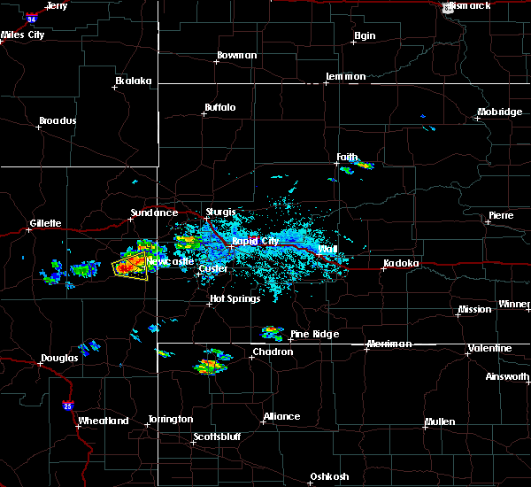 At 651 pm mdt, a severe thunderstorm was located 11 miles south of osage, or 14 miles west of newcastle, moving east at 15 mph. this is a very dangerous storm (radar indicated). Hazards include baseball size hail and 60 mph wind gusts. People and animals outdoors will be severely injured. expect shattered windows, extensive damage to roofs, siding and vehicles. Locations impacted include, newcastle. At 651 pm mdt, a severe thunderstorm was located 11 miles south of osage, or 14 miles west of newcastle, moving east at 15 mph. this is a very dangerous storm (radar indicated). Hazards include baseball size hail and 60 mph wind gusts. People and animals outdoors will be severely injured. expect shattered windows, extensive damage to roofs, siding and vehicles. Locations impacted include, newcastle.
|
| 7/24/2015 6:33 PM MDT |
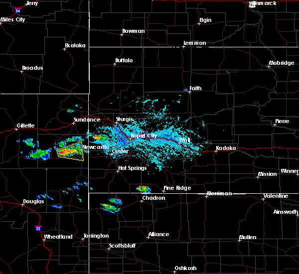 At 633 pm mdt, a severe thunderstorm was located 7 miles northeast of clareton, or 20 miles west of newcastle, moving east at 20 mph (radar indicated). Hazards include ping pong ball size hail and 60 mph wind gusts. People and animals outdoors will be injured. expect hail damage to roofs, siding, windows and vehicles. Expect wind damage to roofs, siding and trees. At 633 pm mdt, a severe thunderstorm was located 7 miles northeast of clareton, or 20 miles west of newcastle, moving east at 20 mph (radar indicated). Hazards include ping pong ball size hail and 60 mph wind gusts. People and animals outdoors will be injured. expect hail damage to roofs, siding, windows and vehicles. Expect wind damage to roofs, siding and trees.
|
| 7/15/2015 6:32 PM MDT | Quarter sized hail reported 30.5 miles N of Newcastle, WY, strong winds and heavy rain. wind speed unknown. |
| 7/1/2015 10:20 PM MDT | Storm damage reported in weston county WY, 4.6 miles SW of Newcastle, WY |
| 7/1/2015 10:14 PM MDT |
 At 1014 pm mdt, a severe thunderstorm was located near newcastle, moving southeast at 45 mph (radar indicated). Hazards include 70 mph wind gusts and quarter size hail. Hail damage to vehicles is expected. expect considerable tree damage. wind damage is also likely to mobile homes, roofs and outbuildings. Locations impacted include, newcastle, custer, dewey, pringle, moon, four corners, sanator, deerfield, argyle, jewell cave national monument, sylvan lake, custer state park, center lake, stockade lake, crazy horse memorial, harney peak, blue bell, deerfield reservoir, mount rushmore national memorial and western wind cave national park. At 1014 pm mdt, a severe thunderstorm was located near newcastle, moving southeast at 45 mph (radar indicated). Hazards include 70 mph wind gusts and quarter size hail. Hail damage to vehicles is expected. expect considerable tree damage. wind damage is also likely to mobile homes, roofs and outbuildings. Locations impacted include, newcastle, custer, dewey, pringle, moon, four corners, sanator, deerfield, argyle, jewell cave national monument, sylvan lake, custer state park, center lake, stockade lake, crazy horse memorial, harney peak, blue bell, deerfield reservoir, mount rushmore national memorial and western wind cave national park.
|
| 7/1/2015 10:06 PM MDT |
 At 1006 pm mdt, a severe thunderstorm was located near osage, or 8 miles northwest of newcastle, moving southeast at 45 mph (radar indicated). Hazards include 60 mph wind gusts and quarter size hail. Hail damage to vehicles is expected. Expect wind damage to roofs, siding and trees. At 1006 pm mdt, a severe thunderstorm was located near osage, or 8 miles northwest of newcastle, moving southeast at 45 mph (radar indicated). Hazards include 60 mph wind gusts and quarter size hail. Hail damage to vehicles is expected. Expect wind damage to roofs, siding and trees.
|
| 6/24/2015 2:23 AM MDT | Quarter sized hail reported 0.7 miles W of Newcastle, WY |
| 6/24/2015 2:01 AM MDT |
 At 200 am mdt, severe thunderstorms were located along a line extending from near four corners to 11 miles east of clareton, moving southeast at 35 mph (radar indicated). Hazards include two inch hail and 60 mph wind gusts. People and animals outdoors will be injured. expect hail damage to roofs, siding, windows and vehicles. Expect wind damage to roofs, siding and trees. At 200 am mdt, severe thunderstorms were located along a line extending from near four corners to 11 miles east of clareton, moving southeast at 35 mph (radar indicated). Hazards include two inch hail and 60 mph wind gusts. People and animals outdoors will be injured. expect hail damage to roofs, siding, windows and vehicles. Expect wind damage to roofs, siding and trees.
|
| 6/20/2015 11:24 PM MDT |
 At 1123 pm mdt, a severe thunderstorm was located over upton, or 24 miles northwest of newcastle, moving east at 40 mph (radar indicated). Hazards include half dollar size hail. damage to vehicles is expected At 1123 pm mdt, a severe thunderstorm was located over upton, or 24 miles northwest of newcastle, moving east at 40 mph (radar indicated). Hazards include half dollar size hail. damage to vehicles is expected
|
| 6/20/2015 5:55 PM MDT | Quarter sized hail reported 11.2 miles NNW of Newcastle, WY |
| 6/20/2015 5:45 PM MDT | Tennis Ball sized hail reported 16 miles N of Newcastle, WY |
| 6/20/2015 5:42 PM MDT | Golf Ball sized hail reported 12.8 miles NNE of Newcastle, WY |
| 6/20/2015 5:40 PM MDT |
 At 539 pm mdt, a severe thunderstorm was located 10 miles northeast of morrisey, or 14 miles south of newcastle, moving southeast at 40 mph (radar indicated). Hazards include tennis ball size hail and 60 mph wind gusts. People and animals outdoors will be injured. expect hail damage to roofs, siding, windows and vehicles. Expect wind damage to roofs, siding and trees. At 539 pm mdt, a severe thunderstorm was located 10 miles northeast of morrisey, or 14 miles south of newcastle, moving southeast at 40 mph (radar indicated). Hazards include tennis ball size hail and 60 mph wind gusts. People and animals outdoors will be injured. expect hail damage to roofs, siding, windows and vehicles. Expect wind damage to roofs, siding and trees.
|
| 6/20/2015 5:34 PM MDT |
 At 533 pm mdt, a severe thunderstorm was located 11 miles southwest of newcastle, moving southeast at 35 mph (radar indicated). Hazards include tennis ball size hail and 60 mph wind gusts. People and animals outdoors will be injured. expect hail damage to roofs, siding, windows and vehicles. expect wind damage to roofs, siding and trees. Locations impacted include, newcastle. At 533 pm mdt, a severe thunderstorm was located 11 miles southwest of newcastle, moving southeast at 35 mph (radar indicated). Hazards include tennis ball size hail and 60 mph wind gusts. People and animals outdoors will be injured. expect hail damage to roofs, siding, windows and vehicles. expect wind damage to roofs, siding and trees. Locations impacted include, newcastle.
|
| 6/20/2015 5:28 PM MDT |
 At 528 pm mdt, a severe thunderstorm was located 8 miles southwest of newcastle, moving southeast at 50 mph (radar indicated). Hazards include tennis ball size hail and 60 mph wind gusts. People and animals outdoors will be injured. expect hail damage to roofs, siding, windows and vehicles. expect wind damage to roofs, siding and trees. Locations impacted include, newcastle. At 528 pm mdt, a severe thunderstorm was located 8 miles southwest of newcastle, moving southeast at 50 mph (radar indicated). Hazards include tennis ball size hail and 60 mph wind gusts. People and animals outdoors will be injured. expect hail damage to roofs, siding, windows and vehicles. expect wind damage to roofs, siding and trees. Locations impacted include, newcastle.
|
| 6/20/2015 5:19 PM MDT |
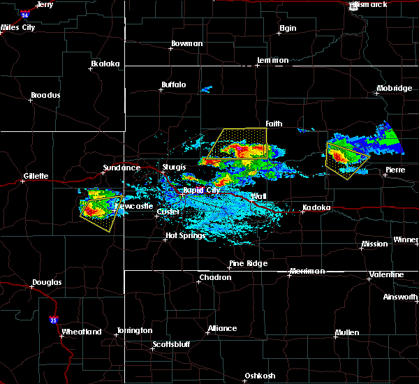 At 518 pm mdt, a severe thunderstorm was located 9 miles southwest of osage, or 14 miles west of newcastle, moving east at 30 mph (radar indicated). Hazards include tennis ball size hail and 60 mph wind gusts. People and animals outdoors will be injured. expect hail damage to roofs, siding, windows and vehicles. expect wind damage to roofs, siding and trees. Locations impacted include, newcastle and osage. At 518 pm mdt, a severe thunderstorm was located 9 miles southwest of osage, or 14 miles west of newcastle, moving east at 30 mph (radar indicated). Hazards include tennis ball size hail and 60 mph wind gusts. People and animals outdoors will be injured. expect hail damage to roofs, siding, windows and vehicles. expect wind damage to roofs, siding and trees. Locations impacted include, newcastle and osage.
|
| 6/20/2015 5:07 PM MDT |
 At 507 pm mdt, a severe thunderstorm was located 12 miles southwest of osage, or 20 miles west of newcastle, moving east at 30 mph (radar indicated). Hazards include golf ball size hail and 60 mph wind gusts. People and animals outdoors will be injured. expect hail damage to roofs, siding, windows and vehicles. expect wind damage to roofs, siding and trees. Locations impacted include, newcastle, osage, clareton and morrisey. At 507 pm mdt, a severe thunderstorm was located 12 miles southwest of osage, or 20 miles west of newcastle, moving east at 30 mph (radar indicated). Hazards include golf ball size hail and 60 mph wind gusts. People and animals outdoors will be injured. expect hail damage to roofs, siding, windows and vehicles. expect wind damage to roofs, siding and trees. Locations impacted include, newcastle, osage, clareton and morrisey.
|
| 6/20/2015 4:58 PM MDT |
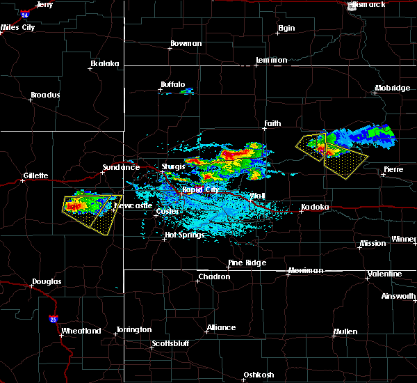 At 457 pm mdt, a severe thunderstorm was located 13 miles north of clareton, or 25 miles west of newcastle, moving east at 30 mph (radar indicated). Hazards include ping pong ball size hail and 60 mph wind gusts. People and animals outdoors will be injured. expect hail damage to roofs, siding, windows and vehicles. Expect wind damage to roofs, siding and trees. At 457 pm mdt, a severe thunderstorm was located 13 miles north of clareton, or 25 miles west of newcastle, moving east at 30 mph (radar indicated). Hazards include ping pong ball size hail and 60 mph wind gusts. People and animals outdoors will be injured. expect hail damage to roofs, siding, windows and vehicles. Expect wind damage to roofs, siding and trees.
|
| 6/17/2015 11:00 PM MDT |
 At 1100 pm mdt, severe thunderstorms were located along a line extending from 7 miles northwest of argyle to near dull center, moving southeast at 45 mph (radar indicated). Hazards include 60 mph wind gusts and quarter size hail. Hail damage to vehicles is expected. expect wind damage to roofs, siding and trees. Locations impacted include, newcastle, dewey, morrisey, clareton, rochelle, argyle and jewell cave national monument. At 1100 pm mdt, severe thunderstorms were located along a line extending from 7 miles northwest of argyle to near dull center, moving southeast at 45 mph (radar indicated). Hazards include 60 mph wind gusts and quarter size hail. Hail damage to vehicles is expected. expect wind damage to roofs, siding and trees. Locations impacted include, newcastle, dewey, morrisey, clareton, rochelle, argyle and jewell cave national monument.
|
| 6/17/2015 10:28 PM MDT |
 At 1028 pm mdt, severe thunderstorms were located along a line extending from near moon to 12 miles west of rochelle, moving southeast at 45 mph (radar indicated). Hazards include 60 mph wind gusts and half dollar size hail. Hail damage to vehicles is expected. Expect wind damage to roofs, siding and trees. At 1028 pm mdt, severe thunderstorms were located along a line extending from near moon to 12 miles west of rochelle, moving southeast at 45 mph (radar indicated). Hazards include 60 mph wind gusts and half dollar size hail. Hail damage to vehicles is expected. Expect wind damage to roofs, siding and trees.
|
| 6/17/2015 10:15 PM MDT | Storm damage reported in weston county WY, 5.2 miles ESE of Newcastle, WY |
| 6/17/2015 10:12 PM MDT |
 At 1012 pm mdt, a severe thunderstorm was located near osage, or 9 miles northwest of newcastle, moving southeast at 45 mph (radar indicated). Hazards include 60 mph wind gusts and half dollar size hail. Hail damage to vehicles is expected. expect wind damage to roofs, siding and trees. Locations impacted include, newcastle, upton, osage and clareton. At 1012 pm mdt, a severe thunderstorm was located near osage, or 9 miles northwest of newcastle, moving southeast at 45 mph (radar indicated). Hazards include 60 mph wind gusts and half dollar size hail. Hail damage to vehicles is expected. expect wind damage to roofs, siding and trees. Locations impacted include, newcastle, upton, osage and clareton.
|
| 6/17/2015 9:49 PM MDT |
 At 948 pm mdt, a severe thunderstorm was located 7 miles southwest of upton, or 29 miles northwest of newcastle, moving southeast at 40 mph (radar indicated). Hazards include 60 mph wind gusts and quarter size hail. Hail damage to vehicles is expected. Expect wind damage to roofs, siding and trees. At 948 pm mdt, a severe thunderstorm was located 7 miles southwest of upton, or 29 miles northwest of newcastle, moving southeast at 40 mph (radar indicated). Hazards include 60 mph wind gusts and quarter size hail. Hail damage to vehicles is expected. Expect wind damage to roofs, siding and trees.
|
| 6/14/2015 3:44 AM MDT |
 At 343 am mdt, a severe thunderstorm was located near newcastle, moving east at 35 mph (radar indicated). Hazards include ping pong ball size hail and 60 mph wind gusts. People and animals outdoors will be injured. expect hail damage to roofs, siding, windows and vehicles. Expect wind damage to roofs, siding and trees. At 343 am mdt, a severe thunderstorm was located near newcastle, moving east at 35 mph (radar indicated). Hazards include ping pong ball size hail and 60 mph wind gusts. People and animals outdoors will be injured. expect hail damage to roofs, siding, windows and vehicles. Expect wind damage to roofs, siding and trees.
|
| 6/4/2015 2:54 AM MDT | The severe thunderstorm warning for southwestern pennington, western custer and eastern weston counties will expire at 300 am mdt, the storms which prompted the warning have weakened below severe limits, and no longer pose an immediate threat to life or property. therefore the warning will be allowed to expire. however gusty winds are still possible with these thunderstorms. |
| 6/4/2015 2:54 AM MDT | The severe thunderstorm warning for southwestern pennington, western custer and eastern weston counties will expire at 300 am mdt, the storms which prompted the warning have weakened below severe limits, and no longer pose an immediate threat to life or property. therefore the warning will be allowed to expire. however gusty winds are still possible with these thunderstorms. |
| 6/4/2015 2:33 AM MDT | At 231 am mdt, severe thunderstorms were located along a line extending from 7 miles north of deerfield to near deerfield reservoir to near jewell cave national monument, moving east at 50 mph (radar indicated. at 220 am...64 mph winds were measured at elk mountain near the wyoming south dakota border). Hazards include 60 mph wind gusts. Expect damage to roofs. siding and trees. Locations impacted include, newcastle, dewey, morrisey, moon, four corners, deerfield, jewell cave national monument and deerfield reservoir. |
| 6/4/2015 2:33 AM MDT | At 231 am mdt, severe thunderstorms were located along a line extending from 7 miles north of deerfield to near deerfield reservoir to near jewell cave national monument, moving east at 50 mph (radar indicated. at 220 am...64 mph winds were measured at elk mountain near the wyoming south dakota border). Hazards include 60 mph wind gusts. Expect damage to roofs. siding and trees. Locations impacted include, newcastle, dewey, morrisey, moon, four corners, deerfield, jewell cave national monument and deerfield reservoir. |
| 6/4/2015 1:54 AM MDT | At 153 am mdt, severe thunderstorms were located along a line extending from near osage to near newcastle to near morrisey, moving east at 35 mph (radar indicated). Hazards include 60 mph wind gusts. Expect damage to roofs. Siding and trees. |
| 6/4/2015 1:54 AM MDT | At 153 am mdt, severe thunderstorms were located along a line extending from near osage to near newcastle to near morrisey, moving east at 35 mph (radar indicated). Hazards include 60 mph wind gusts. Expect damage to roofs. Siding and trees. |
| 7/22/2014 6:50 PM MDT | Tennis Ball sized hail reported 3.7 miles SSW of Newcastle, WY, knocked bark off trees... dents in car... and rain gauge destroyed |
| 6/26/2014 6:15 PM MDT | Quarter sized hail reported 12.8 miles NNE of Newcastle, WY |
| 6/25/2014 6:07 PM MDT | Quarter sized hail reported 31.8 miles N of Newcastle, WY |
| 6/21/2014 7:30 PM MDT | Quarter sized hail reported 22.7 miles S of Newcastle, WY |
| 6/3/2014 4:42 PM MDT | Storm damage reported in weston county WY, 17.5 miles SSW of Newcastle, WY |
| 6/3/2014 3:50 PM MDT | Storm damage reported in weston county WY, 17.5 miles SSW of Newcastle, WY |
| 5/18/2014 6:17 PM MDT | Quarter sized hail reported 23.9 miles NE of Newcastle, WY |
| 5/18/2014 6:05 PM MDT | Golf Ball sized hail reported 23.8 miles ENE of Newcastle, WY |
| 5/18/2014 5:50 PM MDT | Baseball sized hail reported 30.5 miles ENE of Newcastle, WY |
| 5/18/2014 5:36 PM MDT | Half Dollar sized hail reported 30.8 miles ENE of Newcastle, WY |
| 9/8/2013 7:25 PM MDT | Storm damage reported in weston county WY, 13.5 miles NE of Newcastle, WY |
| 8/7/2013 5:48 PM MDT | Golf Ball sized hail reported 21.7 miles SSW of Newcastle, WY |
| 7/22/2013 7:46 PM MDT | Golf Ball sized hail reported 16.1 miles SSW of Newcastle, WY |
| 7/22/2013 7:40 PM MDT | Golf Ball sized hail reported 21.7 miles SSW of Newcastle, WY |
| 7/22/2013 6:27 PM MDT | Quarter sized hail reported 14.3 miles SSW of Newcastle, WY |
| 7/22/2013 6:27 PM MDT | Ping Pong Ball sized hail reported 14.3 miles SSW of Newcastle, WY, windows in home broken |
| 7/22/2013 6:27 PM MDT | Quarter sized hail reported 16.3 miles SSW of Newcastle, WY |
| 5/27/2013 4:45 PM MDT | Golf Ball sized hail reported 0.7 miles W of Newcastle, WY |
| 5/27/2013 4:43 PM MDT | Ping Pong Ball sized hail reported 0.9 miles E of Newcastle, WY |
| 5/17/2013 8:45 PM MDT | Quarter sized hail reported 30.8 miles ENE of Newcastle, WY |
| 7/21/2012 6:00 PM MDT | Quarter sized hail reported 21.7 miles SSW of Newcastle, WY, hail covered road about 6 inches |
| 7/5/2012 6:10 PM MDT | Half Dollar sized hail reported 25 miles ENE of Newcastle, WY |
| 1/1/0001 12:00 AM | Several reports of d in weston county WY, 0.7 miles W of Newcastle, WY |
| 1/1/0001 12:00 AM | Quarter sized hail reported 38.2 miles ENE of Newcastle, WY |
| 1/1/0001 12:00 AM | Quarter sized hail reported 27.9 miles ENE of Newcastle, WY |
| 1/1/0001 12:00 AM | Quarter sized hail reported 37.1 miles ENE of Newcastle, WY |
| 1/1/0001 12:00 AM | Quarter sized hail reported 38.2 miles ENE of Newcastle, WY, dime and quarters. |
| 1/1/0001 12:00 AM | Tennis Ball sized hail reported 42.2 miles E of Newcastle, WY, storm chaser measured 2.5 inch hail stones after the storm passed. event time based on radar signature. |
| 1/1/0001 12:00 AM | Tea Cup sized hail reported 42.2 miles E of Newcastle, WY |
| 1/1/0001 12:00 AM | Quarter sized hail reported 38.2 miles ENE of Newcastle, WY, could hear hail roar to the south. |
| 1/1/0001 12:00 AM | Quarter sized hail reported 24 miles SSE of Newcastle, WY, 0.75 inches of rain with storm |
| 1/1/0001 12:00 AM | Quarter sized hail reported 23.9 miles NE of Newcastle, WY, lasted five minutes |
| 1/1/0001 12:00 AM | Ping Pong Ball sized hail reported 31.8 miles NE of Newcastle, WY |
| 1/1/0001 12:00 AM | Quarter sized hail reported 9.6 miles S of Newcastle, WY |
| 1/1/0001 12:00 AM | Quarter sized hail reported 43.4 miles ENE of Newcastle, WY, heavy rain accompanied hail last night. |
| 1/1/0001 12:00 AM | Ping Pong Ball sized hail reported 0.7 miles W of Newcastle, WY |
Hail Maps for Newcastle, WY


Connect with Interactive Hail Maps