

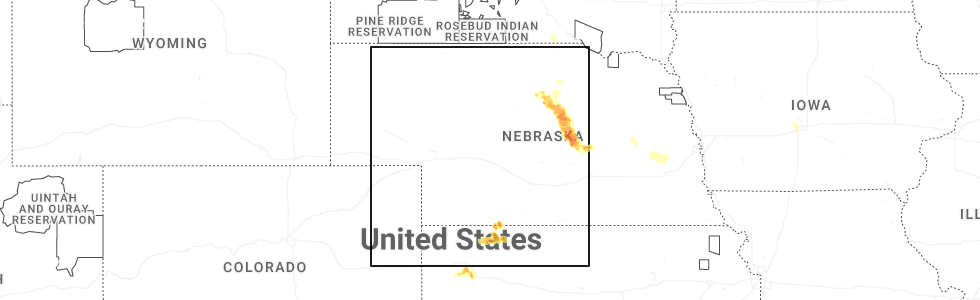
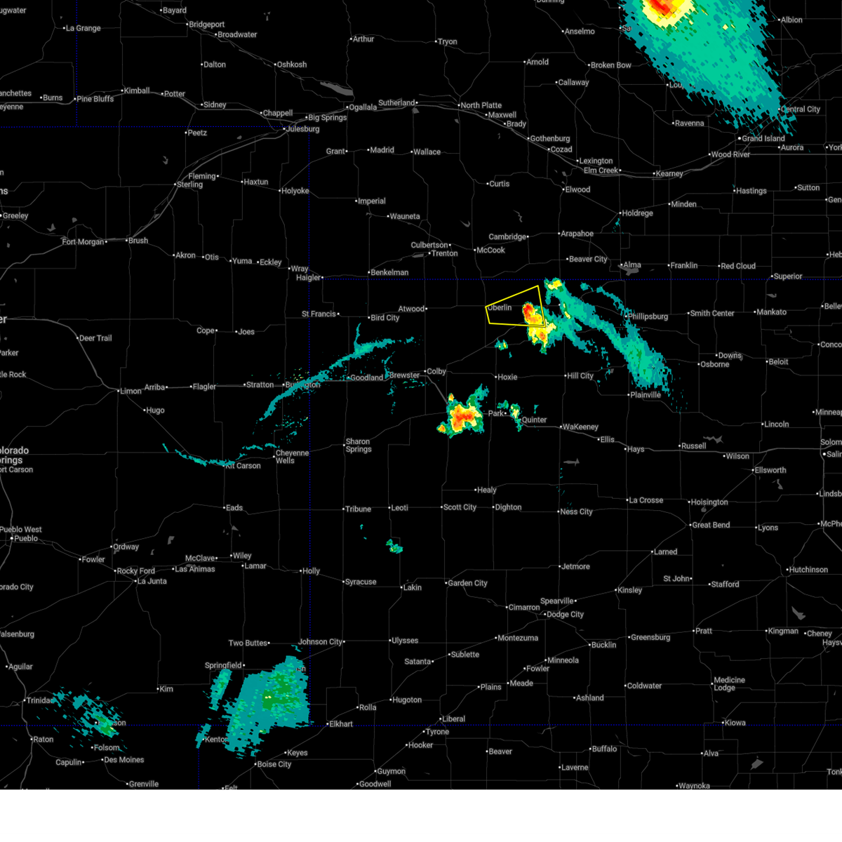
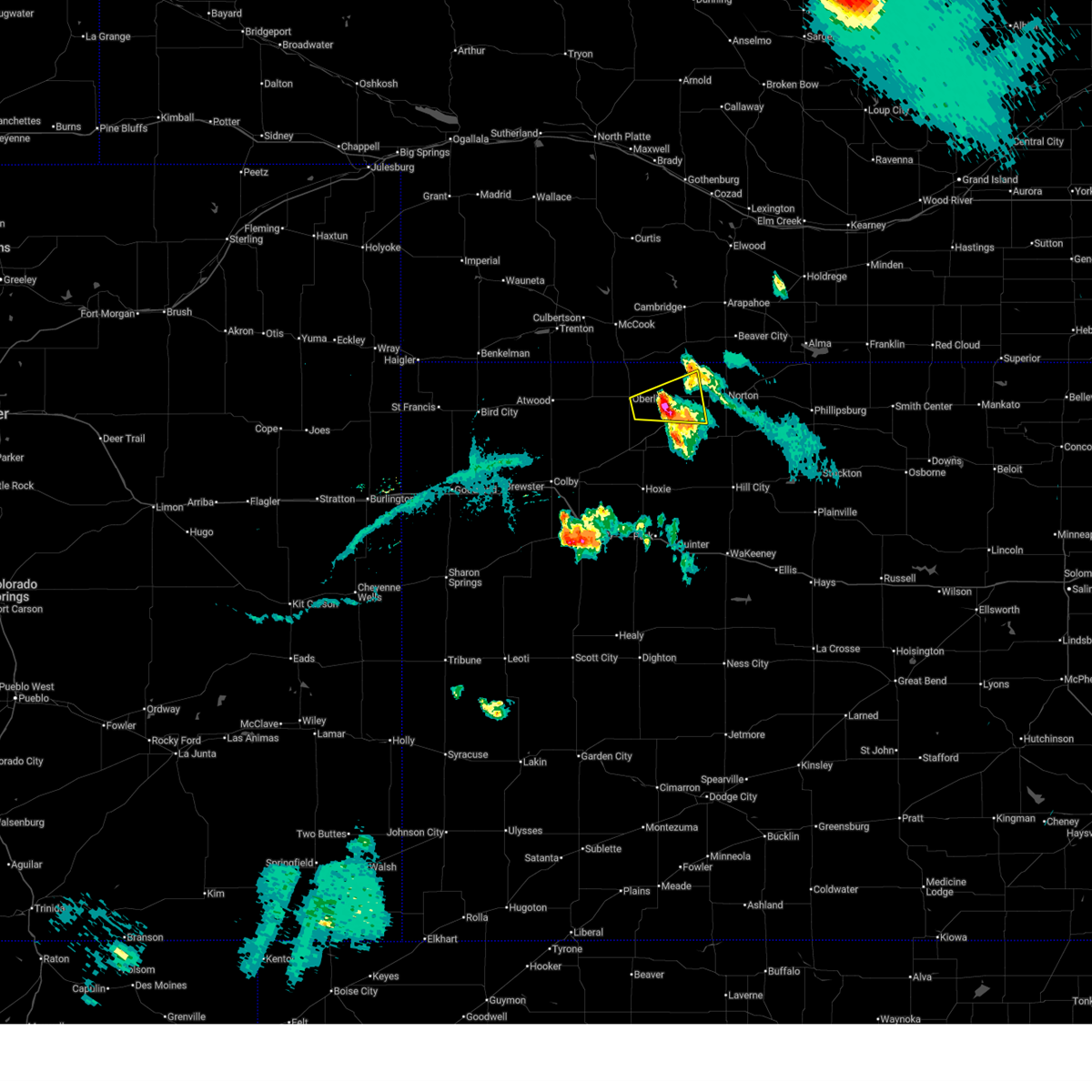
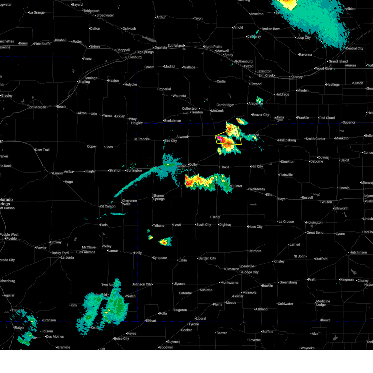
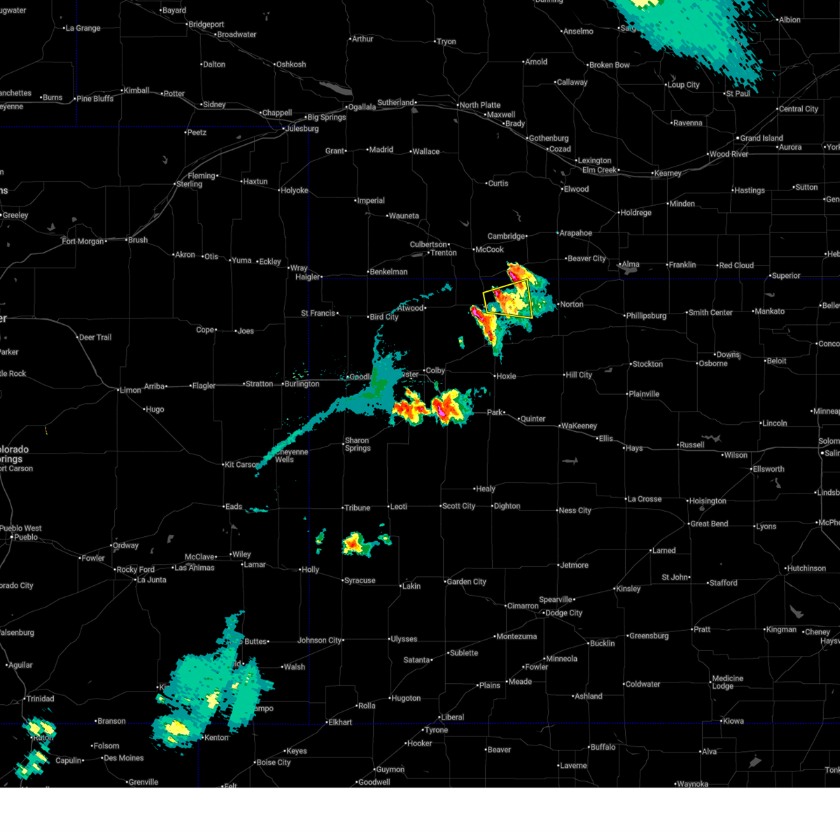
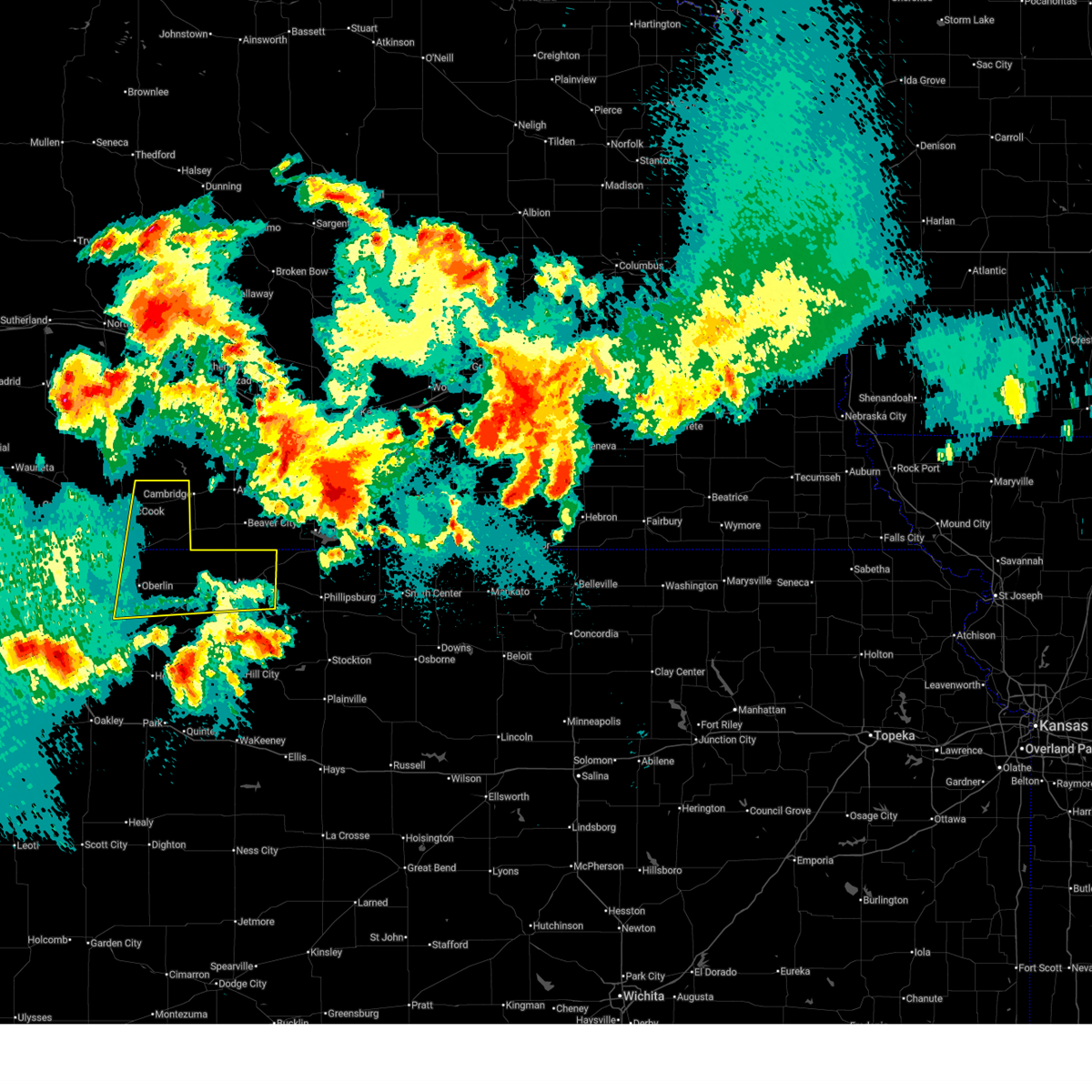
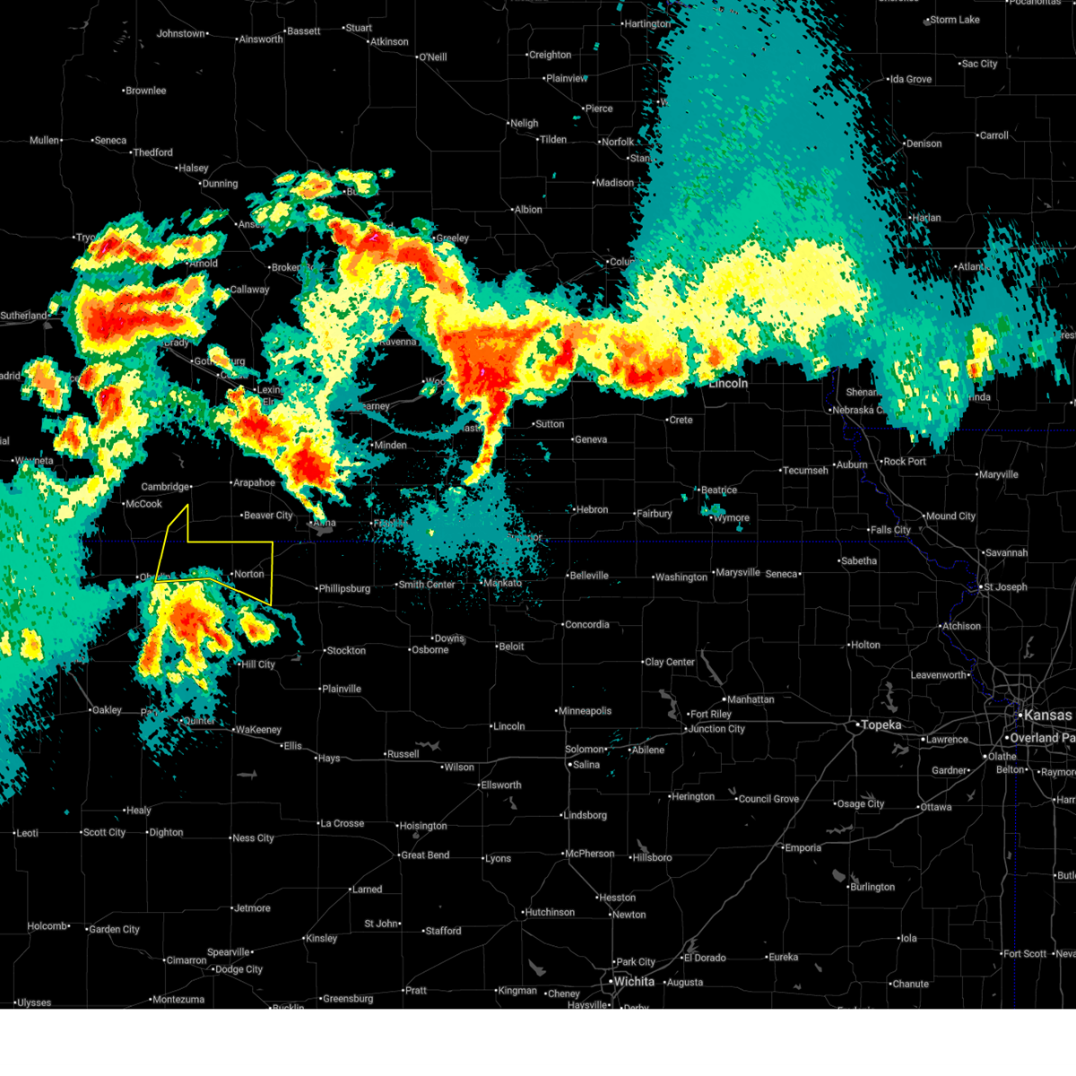
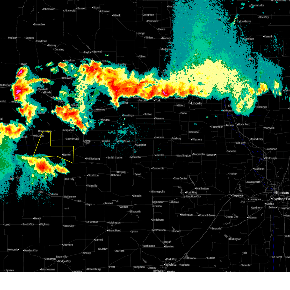
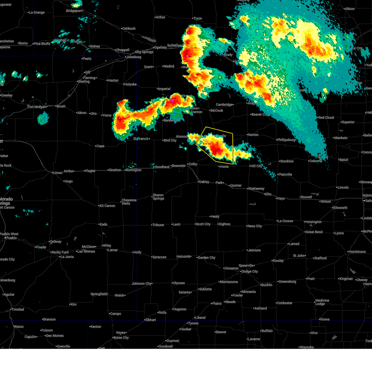
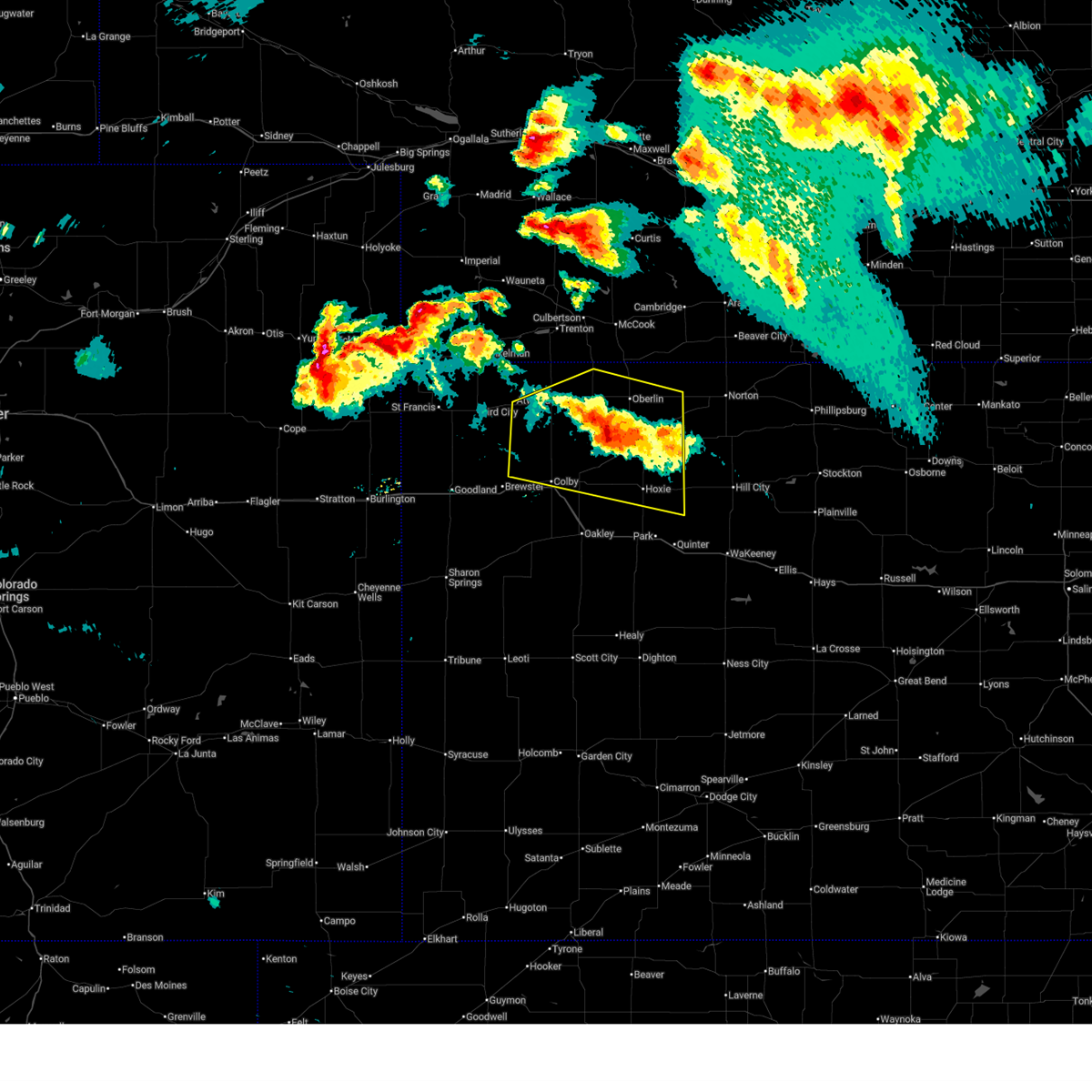
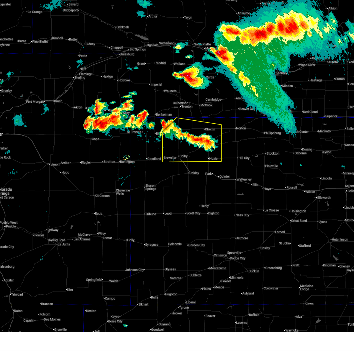
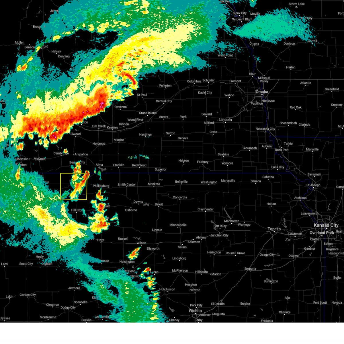
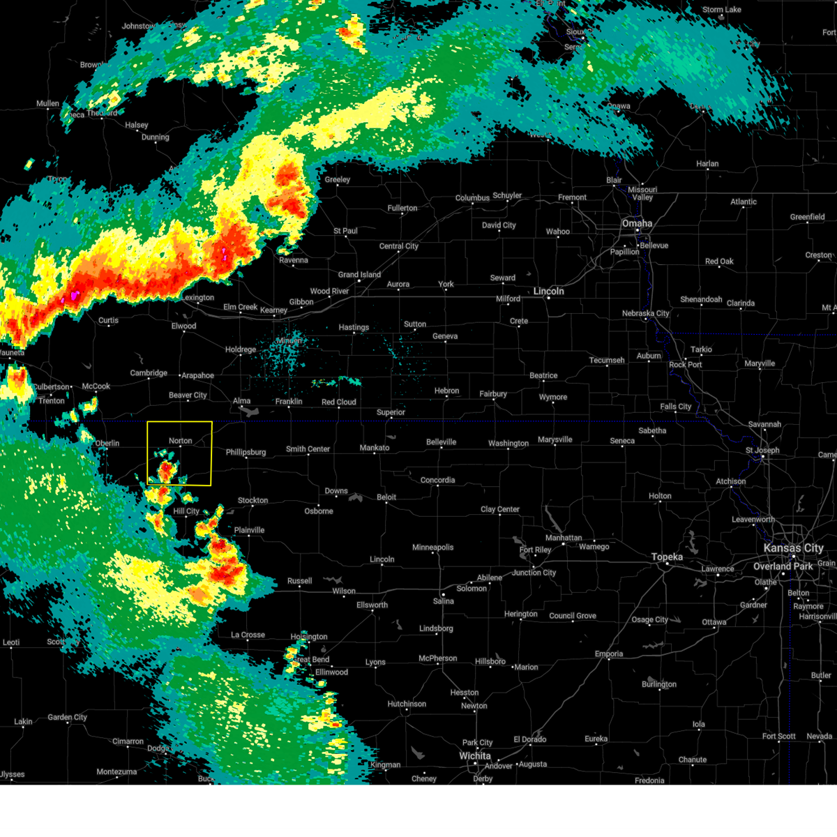
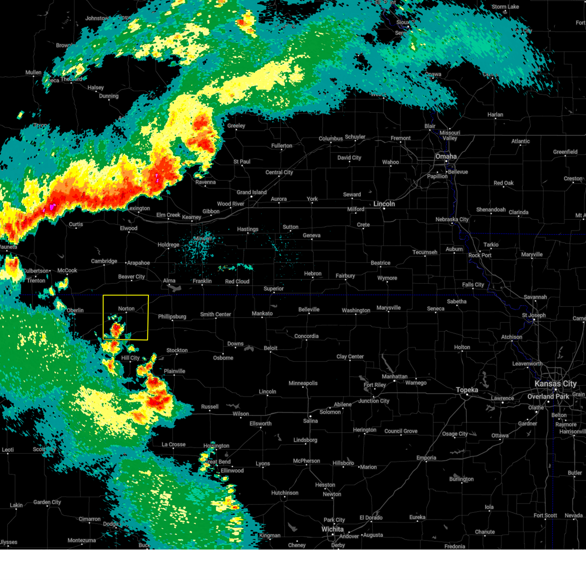
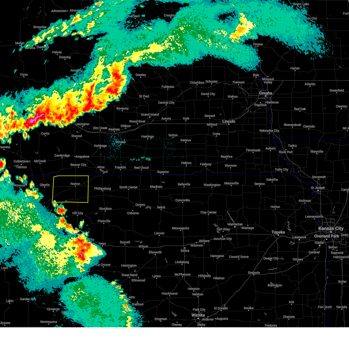
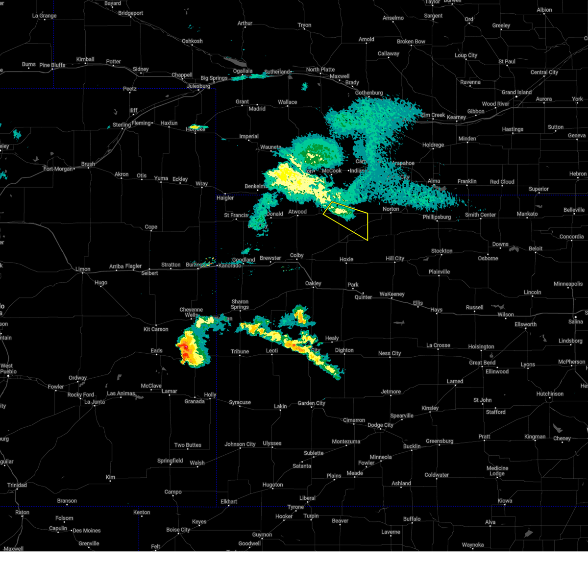
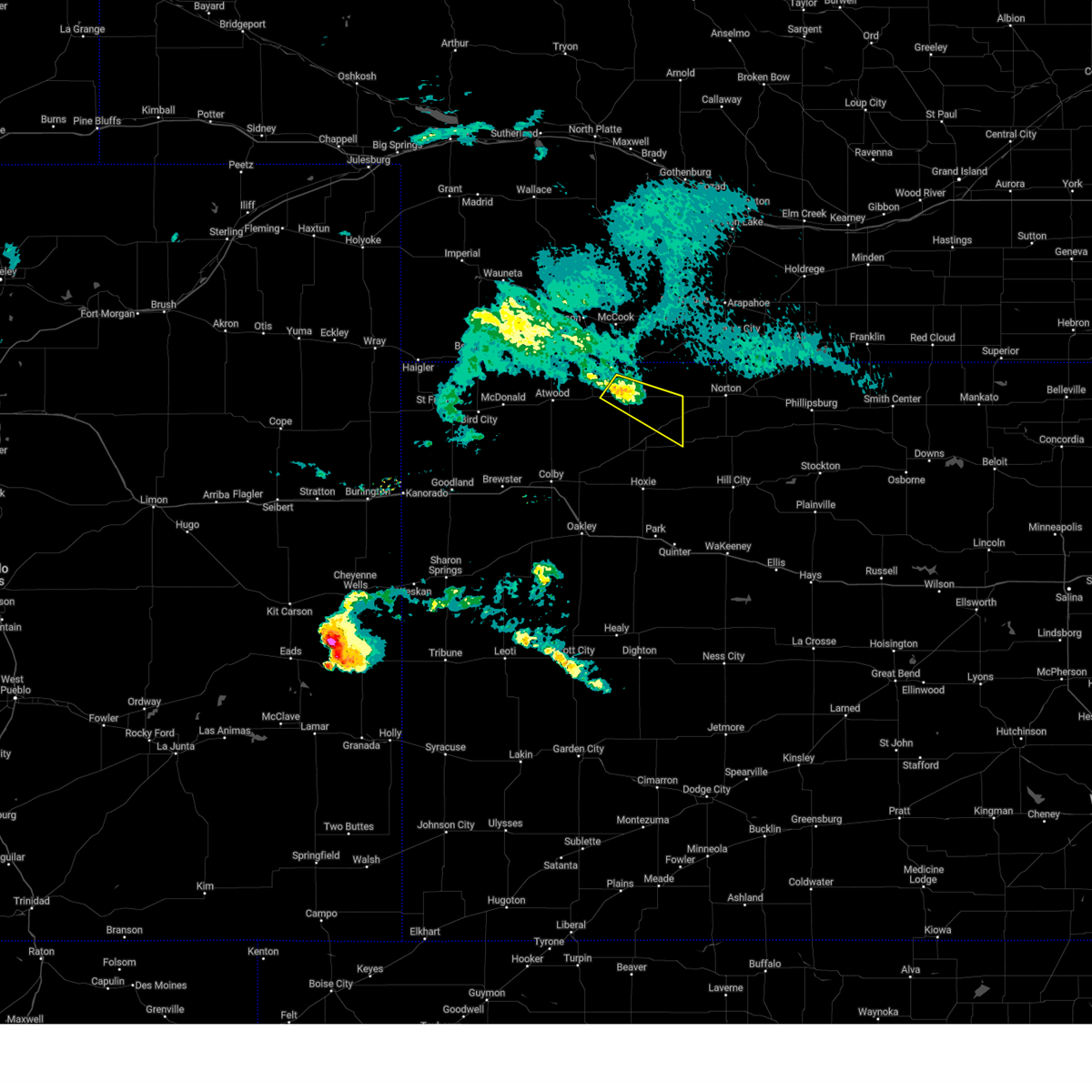
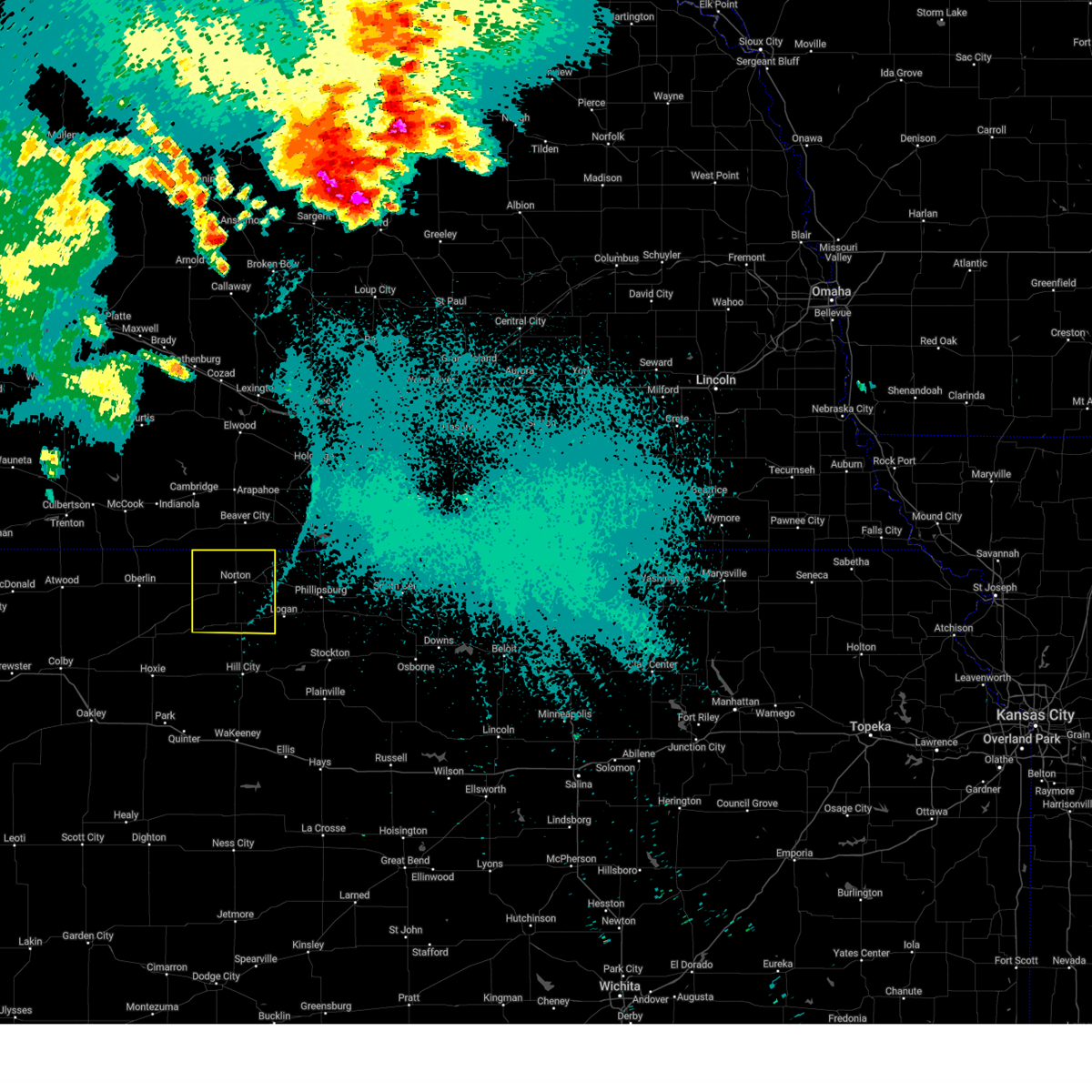
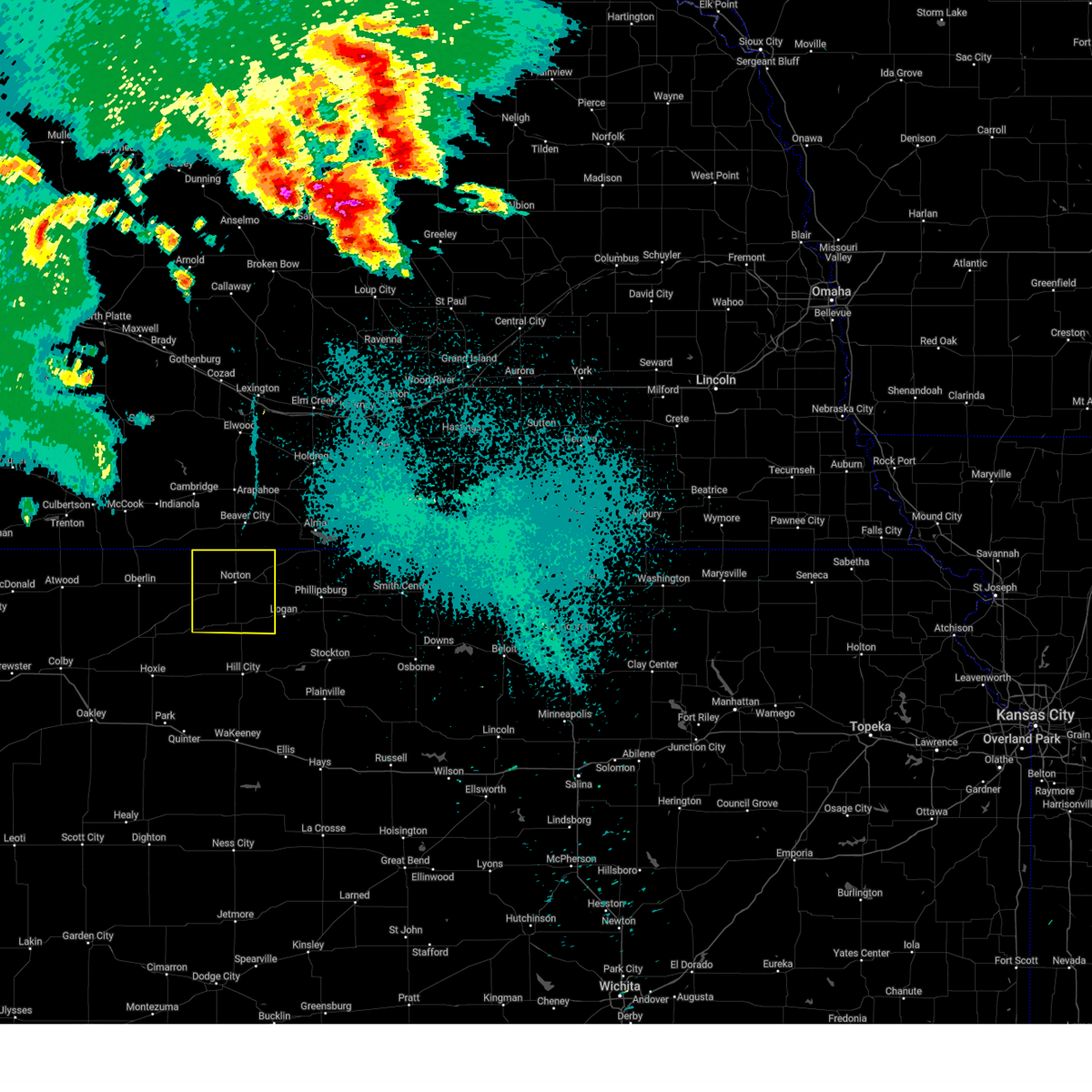
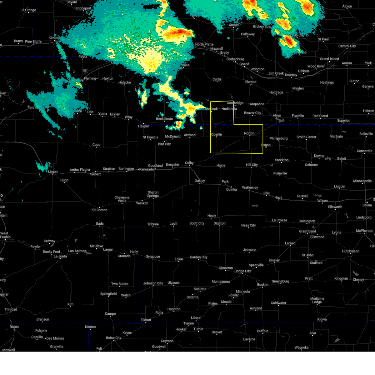
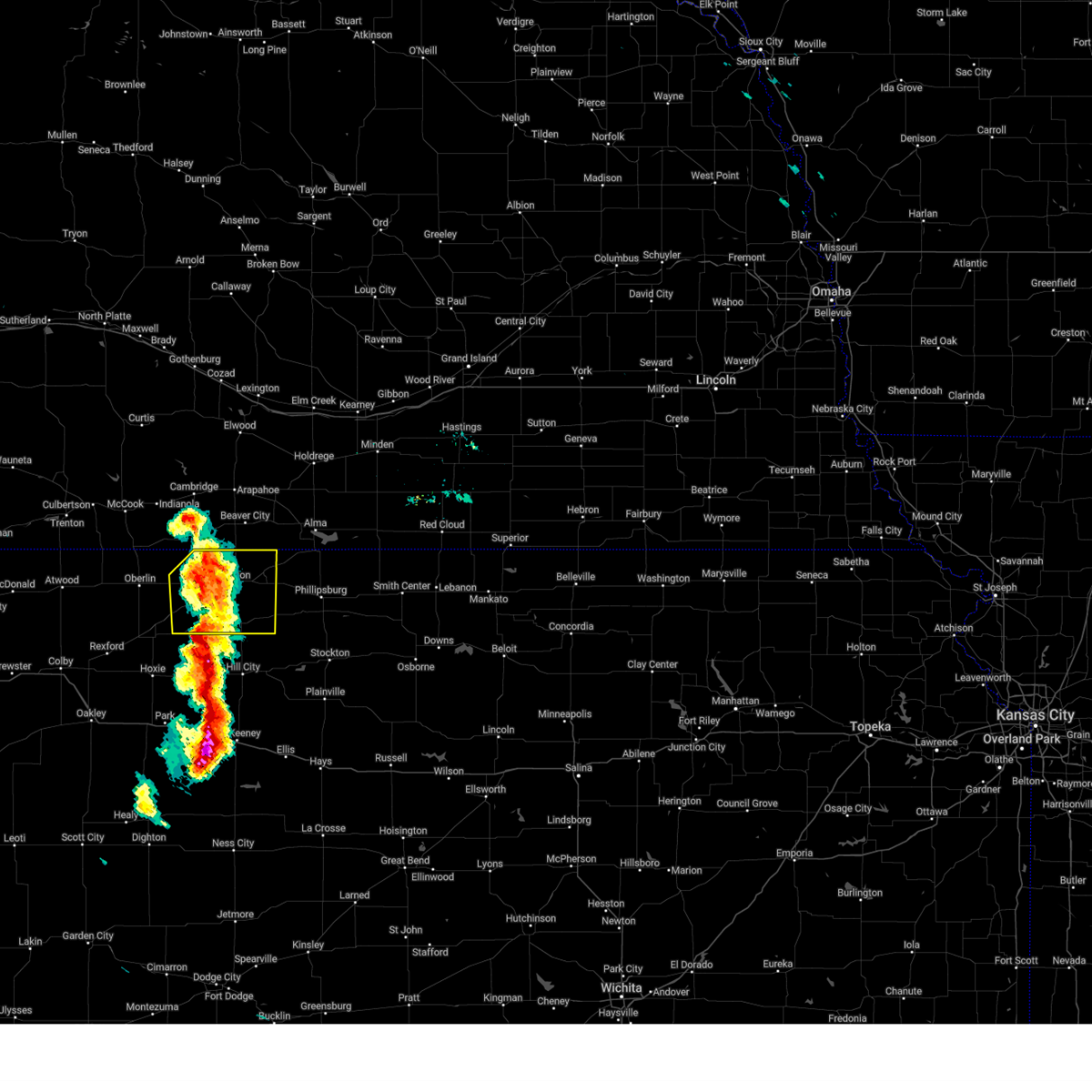
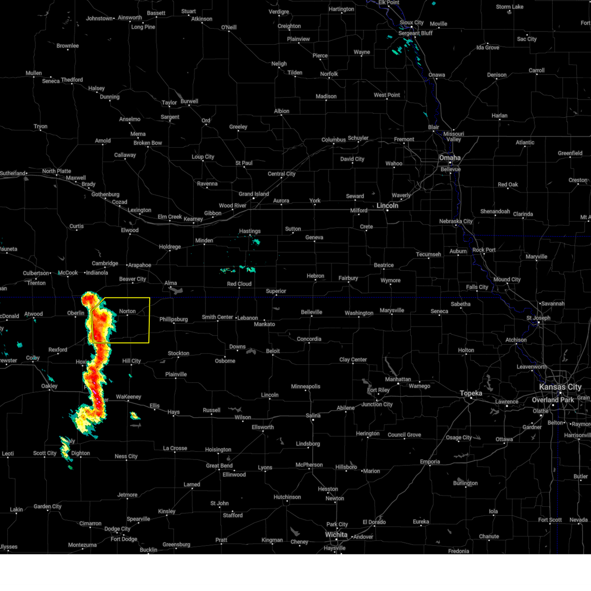
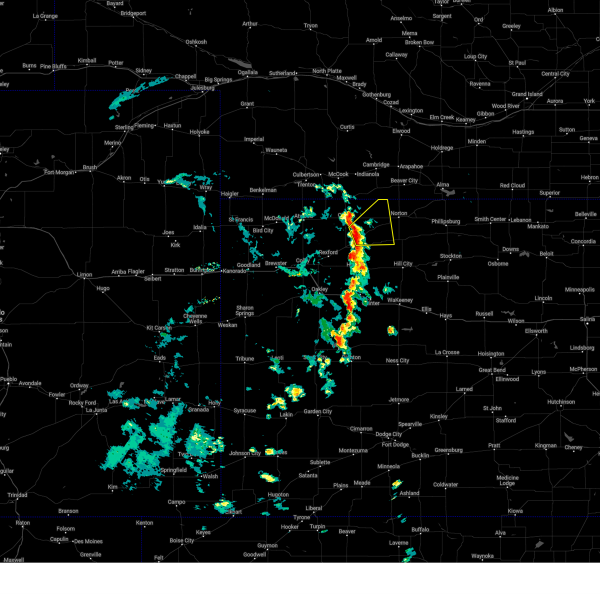
Hail Map for Norcatur, KS
The Norcatur, KS area has had 16 reports of on-the-ground hail by trained spotters, and has been under severe weather warnings 28 times during the past 12 months. Doppler radar has detected hail at or near Norcatur, KS on 97 occasions, including 3 occasions during the past year.
| Name: | Norcatur, KS |
| Where Located: | 54.8 miles ENE of Colby, KS |
| Map: | Google Map for Norcatur, KS |
| Population: | 151 |
| Housing Units: | 101 |
| More Info: | Search Google for Norcatur, KS |
0
The Top Recent Hail Date for Norcatur, KS is Thursday, June 19, 2025 (49th out of 97)
Hail and Wind Damage Spotted near Norcatur, KS
| Date / Time | Report Details |
|---|---|
| 6/19/2025 8:23 PM CDT |
 The storm which prompted the warning has weakened below severe limits, and no longer poses an immediate threat to life or property. therefore, the warning will be allowed to expire. however, small hail and gusty winds are still possible with this thunderstorm. to report severe weather, contact your nearest law enforcement agency. they will relay your report to the national weather service goodland. The storm which prompted the warning has weakened below severe limits, and no longer poses an immediate threat to life or property. therefore, the warning will be allowed to expire. however, small hail and gusty winds are still possible with this thunderstorm. to report severe weather, contact your nearest law enforcement agency. they will relay your report to the national weather service goodland.
|
| 6/19/2025 8:03 PM CDT |
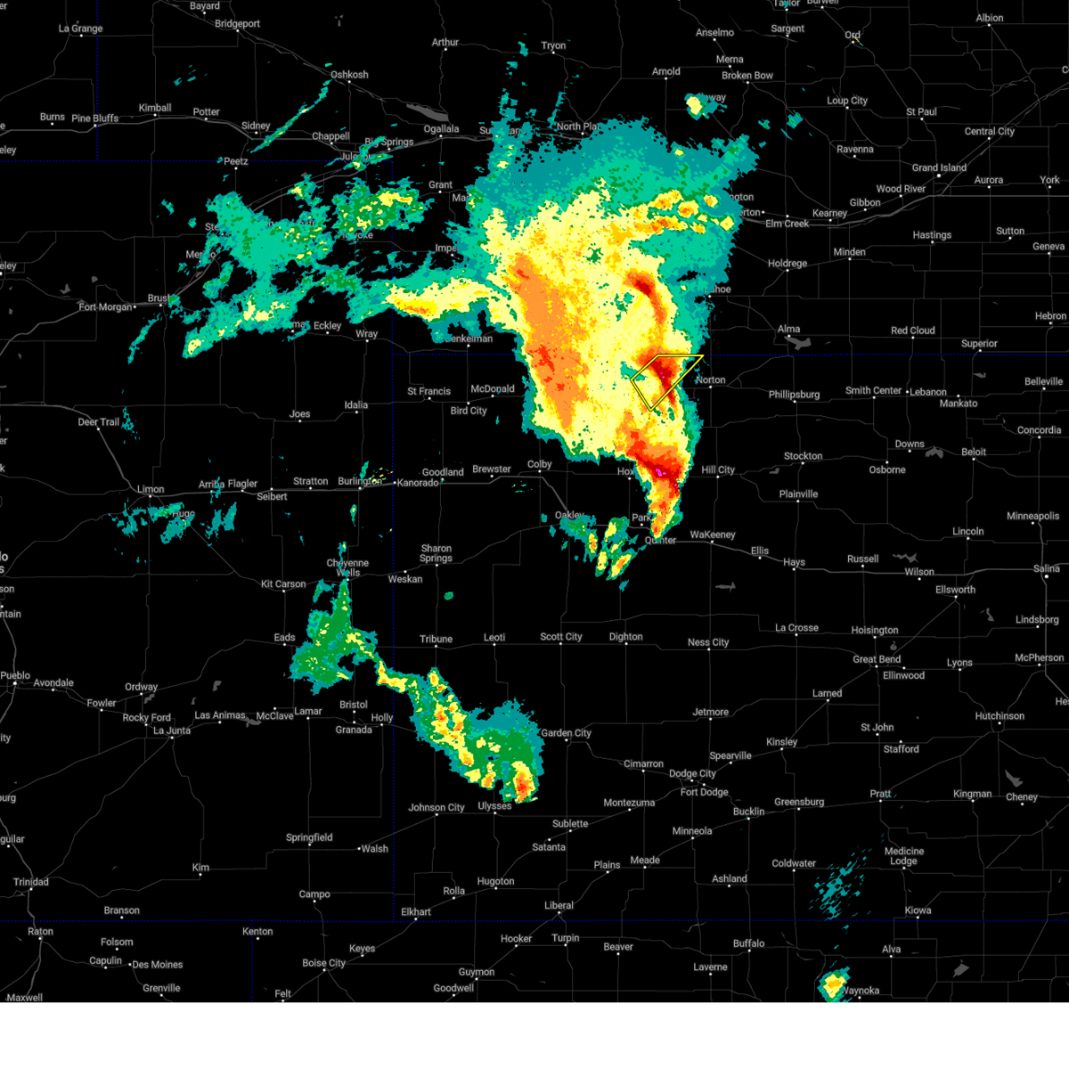
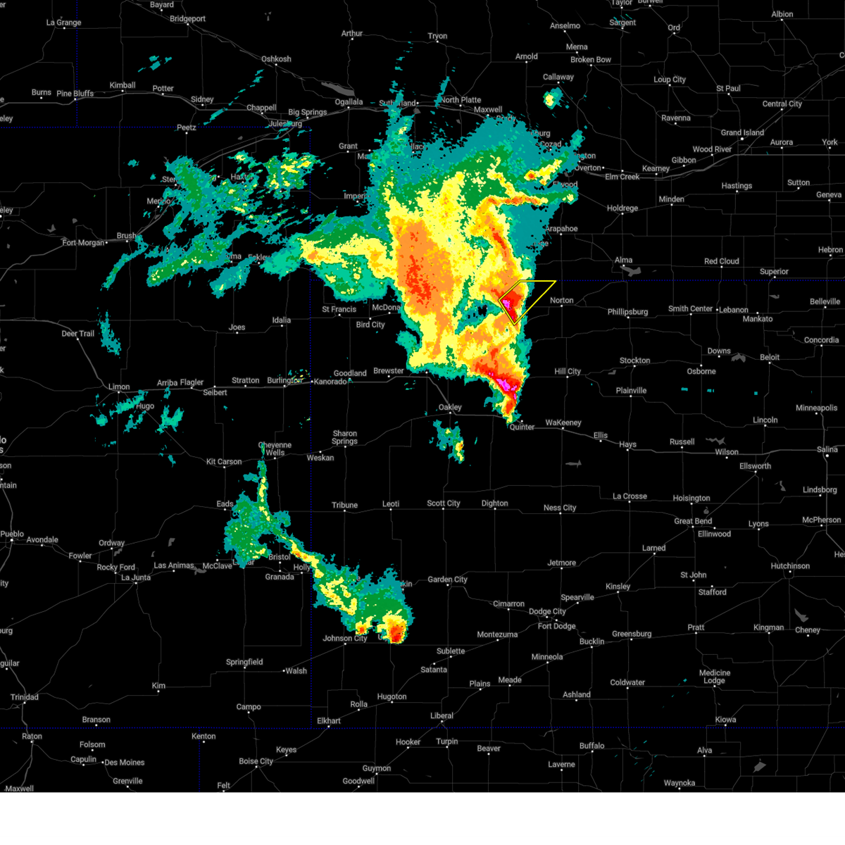
 At 801 pm cdt, a severe thunderstorm was located 6 miles north of jennings, or 12 miles east of oberlin, moving east at 20 mph (emergency management). Hazards include ping pong ball size hail and 60 mph wind gusts. People and animals outdoors will be injured. expect hail damage to roofs, siding, windows, and vehicles. expect wind damage to roofs, siding, and trees. Locations impacted include, oberlin, norcatur, clayton, kanona, and reager. At 801 pm cdt, a severe thunderstorm was located 6 miles north of jennings, or 12 miles east of oberlin, moving east at 20 mph (emergency management). Hazards include ping pong ball size hail and 60 mph wind gusts. People and animals outdoors will be injured. expect hail damage to roofs, siding, windows, and vehicles. expect wind damage to roofs, siding, and trees. Locations impacted include, oberlin, norcatur, clayton, kanona, and reager.
|
| 6/19/2025 7:45 PM CDT |
 Svrgld the national weather service in goodland has issued a * severe thunderstorm warning for, northwestern norton county in northwestern kansas, east central decatur county in northwestern kansas, * until 830 pm cdt. * at 744 pm cdt, a severe thunderstorm was located 6 miles southeast of oberlin, moving east at 20 mph (emergency management. at 644 pm 60 mph winds and quarter size hail was reported south of oberlin). Hazards include ping pong ball size hail and 60 mph wind gusts. People and animals outdoors will be injured. expect hail damage to roofs, siding, windows, and vehicles. Expect wind damage to roofs, siding, and trees. Svrgld the national weather service in goodland has issued a * severe thunderstorm warning for, northwestern norton county in northwestern kansas, east central decatur county in northwestern kansas, * until 830 pm cdt. * at 744 pm cdt, a severe thunderstorm was located 6 miles southeast of oberlin, moving east at 20 mph (emergency management. at 644 pm 60 mph winds and quarter size hail was reported south of oberlin). Hazards include ping pong ball size hail and 60 mph wind gusts. People and animals outdoors will be injured. expect hail damage to roofs, siding, windows, and vehicles. Expect wind damage to roofs, siding, and trees.
|
| 6/19/2025 7:15 PM CDT |
 At 715 pm cdt, a severe thunderstorm was located 8 miles south of danbury, or 8 miles northeast of oberlin, moving northeast at 15 mph (radar indicated). Hazards include 60 mph wind gusts and quarter size hail. Hail damage to vehicles is expected. expect wind damage to roofs, siding, and trees. Locations impacted include, oberlin, norcatur, and kanona. At 715 pm cdt, a severe thunderstorm was located 8 miles south of danbury, or 8 miles northeast of oberlin, moving northeast at 15 mph (radar indicated). Hazards include 60 mph wind gusts and quarter size hail. Hail damage to vehicles is expected. expect wind damage to roofs, siding, and trees. Locations impacted include, oberlin, norcatur, and kanona.
|
| 6/19/2025 7:03 PM CDT |
 Svrgld the national weather service in goodland has issued a * severe thunderstorm warning for, west central norton county in northwestern kansas, northeastern decatur county in northwestern kansas, * until 730 pm cdt. * at 703 pm cdt, a severe thunderstorm was located 4 miles east of oberlin, moving east at 15 mph (radar indicated). Hazards include 60 mph wind gusts and quarter size hail. Hail damage to vehicles is expected. expect wind damage to roofs, siding, and trees. This severe thunderstorm will remain over mainly rural areas of west central norton and northeastern decatur counties, including the following locations, kanona. Svrgld the national weather service in goodland has issued a * severe thunderstorm warning for, west central norton county in northwestern kansas, northeastern decatur county in northwestern kansas, * until 730 pm cdt. * at 703 pm cdt, a severe thunderstorm was located 4 miles east of oberlin, moving east at 15 mph (radar indicated). Hazards include 60 mph wind gusts and quarter size hail. Hail damage to vehicles is expected. expect wind damage to roofs, siding, and trees. This severe thunderstorm will remain over mainly rural areas of west central norton and northeastern decatur counties, including the following locations, kanona.
|
| 6/16/2025 10:48 PM CDT |
 Svrgld the national weather service in goodland has issued a * severe thunderstorm warning for, norton county in northwestern kansas, decatur county in northwestern kansas, red willow county in southwestern nebraska, * until 1145 pm cdt. * at 1048 pm cdt, severe thunderstorms were located along a line extending from 7 miles south of oberlin to 7 miles east of norcatur to near prairie view, moving northeast at 25 mph (radar indicated). Hazards include 60 mph wind gusts. Expect damage to roofs, siding, and trees. Severe thunderstorms will be near, norton, oberlin, almena, and norcatur around 1055 pm cdt. Svrgld the national weather service in goodland has issued a * severe thunderstorm warning for, norton county in northwestern kansas, decatur county in northwestern kansas, red willow county in southwestern nebraska, * until 1145 pm cdt. * at 1048 pm cdt, severe thunderstorms were located along a line extending from 7 miles south of oberlin to 7 miles east of norcatur to near prairie view, moving northeast at 25 mph (radar indicated). Hazards include 60 mph wind gusts. Expect damage to roofs, siding, and trees. Severe thunderstorms will be near, norton, oberlin, almena, and norcatur around 1055 pm cdt.
|
| 6/16/2025 10:38 PM CDT | Pws-kksnorca in decatur county KS, 0.4 miles NNE of Norcatur, KS |
| 6/16/2025 10:35 PM CDT |
 At 1034 pm cdt, severe thunderstorms were located along a line extending from 9 miles south of danbury to 5 miles northeast of norton to 5 miles north of speed, moving east-northeast at 35 mph (radar indicated). Hazards include 60 mph wind gusts. Expect damage to roofs, siding, and trees. Locations impacted include, norton and almena. At 1034 pm cdt, severe thunderstorms were located along a line extending from 9 miles south of danbury to 5 miles northeast of norton to 5 miles north of speed, moving east-northeast at 35 mph (radar indicated). Hazards include 60 mph wind gusts. Expect damage to roofs, siding, and trees. Locations impacted include, norton and almena.
|
| 6/16/2025 10:09 PM CDT |
 Svrgld the national weather service in goodland has issued a * severe thunderstorm warning for, northern norton county in northwestern kansas, northern decatur county in northwestern kansas, eastern red willow county in southwestern nebraska, * until 1045 pm cdt. * at 1008 pm cdt, severe thunderstorms were located along a line extending from 4 miles northeast of oberlin to 3 miles northwest of norton to 4 miles north of logan, moving northeast at 45 mph (automated weather stations. a 63 mph wind gust was recorded at oberlin at 955 pm cdt). Hazards include 60 mph wind gusts and quarter size hail. Hail damage to vehicles is expected. expect wind damage to roofs, siding, and trees. severe thunderstorms will be near, almena around 1015 pm cdt. Danbury and lebanon around 1020 pm cdt. Svrgld the national weather service in goodland has issued a * severe thunderstorm warning for, northern norton county in northwestern kansas, northern decatur county in northwestern kansas, eastern red willow county in southwestern nebraska, * until 1045 pm cdt. * at 1008 pm cdt, severe thunderstorms were located along a line extending from 4 miles northeast of oberlin to 3 miles northwest of norton to 4 miles north of logan, moving northeast at 45 mph (automated weather stations. a 63 mph wind gust was recorded at oberlin at 955 pm cdt). Hazards include 60 mph wind gusts and quarter size hail. Hail damage to vehicles is expected. expect wind damage to roofs, siding, and trees. severe thunderstorms will be near, almena around 1015 pm cdt. Danbury and lebanon around 1020 pm cdt.
|
| 6/16/2025 9:53 PM CDT |
 the severe thunderstorm warning has been cancelled and is no longer in effect the severe thunderstorm warning has been cancelled and is no longer in effect
|
| 6/16/2025 9:53 PM CDT |
 At 952 pm cdt, a severe thunderstorm was located near dresden, or 15 miles north of hoxie, moving east at 35 mph (radar indicated). Hazards include 60 mph wind gusts and quarter size hail. Hail damage to vehicles is expected. expect wind damage to roofs, siding, and trees. Locations impacted include, jennings. At 952 pm cdt, a severe thunderstorm was located near dresden, or 15 miles north of hoxie, moving east at 35 mph (radar indicated). Hazards include 60 mph wind gusts and quarter size hail. Hail damage to vehicles is expected. expect wind damage to roofs, siding, and trees. Locations impacted include, jennings.
|
| 6/16/2025 9:29 PM CDT |
 Svrgld the national weather service in goodland has issued a * severe thunderstorm warning for, northern thomas county in northwestern kansas, sheridan county in northwestern kansas, rawlins county in northwestern kansas, decatur county in northwestern kansas, * until 1015 pm cdt. * at 928 pm cdt, severe thunderstorms were located along a line extending from 6 miles south of atwood to 11 miles northwest of morland, moving southeast at 20 mph (radar indicated). Hazards include 60 mph wind gusts and quarter size hail. Hail damage to vehicles is expected. expect wind damage to roofs, siding, and trees. Severe thunderstorms will be near, selden around 935 pm cdt. Svrgld the national weather service in goodland has issued a * severe thunderstorm warning for, northern thomas county in northwestern kansas, sheridan county in northwestern kansas, rawlins county in northwestern kansas, decatur county in northwestern kansas, * until 1015 pm cdt. * at 928 pm cdt, severe thunderstorms were located along a line extending from 6 miles south of atwood to 11 miles northwest of morland, moving southeast at 20 mph (radar indicated). Hazards include 60 mph wind gusts and quarter size hail. Hail damage to vehicles is expected. expect wind damage to roofs, siding, and trees. Severe thunderstorms will be near, selden around 935 pm cdt.
|
| 6/16/2025 9:08 PM CDT |
 At 908 pm cdt, severe thunderstorms were located along a line extending from 3 miles southwest of atwood to 8 miles southeast of dresden, moving east at 15 mph (radar indicated). Hazards include 70 mph wind gusts and half dollar size hail. Hail damage to vehicles is expected. expect considerable tree damage. wind damage is also likely to mobile homes, roofs, and outbuildings. Locations impacted include, atwood and dresden. At 908 pm cdt, severe thunderstorms were located along a line extending from 3 miles southwest of atwood to 8 miles southeast of dresden, moving east at 15 mph (radar indicated). Hazards include 70 mph wind gusts and half dollar size hail. Hail damage to vehicles is expected. expect considerable tree damage. wind damage is also likely to mobile homes, roofs, and outbuildings. Locations impacted include, atwood and dresden.
|
| 6/16/2025 8:52 PM CDT | Svrgld the national weather service in goodland has issued a * severe thunderstorm warning for, thomas county in northwestern kansas, northern sheridan county in northwestern kansas, rawlins county in northwestern kansas, decatur county in northwestern kansas, * until 930 pm cdt. * at 851 pm cdt, severe thunderstorms were located along a line extending from 7 miles west of atwood to 5 miles southeast of dresden, moving east at 15 mph (radar indicated). Hazards include 70 mph wind gusts and quarter size hail. Hail damage to vehicles is expected. expect considerable tree damage. wind damage is also likely to mobile homes, roofs, and outbuildings. Severe thunderstorms will be near, atwood and dresden around 855 pm cdt. |
| 6/2/2025 9:25 PM CDT |
 The storm which prompted the warning has moved out of the area. therefore, the warning will be allowed to expire. a severe thunderstorm watch remains in effect until 1000 pm cdt for northwestern kansas. The storm which prompted the warning has moved out of the area. therefore, the warning will be allowed to expire. a severe thunderstorm watch remains in effect until 1000 pm cdt for northwestern kansas.
|
| 6/2/2025 8:53 PM CDT |
 the severe thunderstorm warning has been cancelled and is no longer in effect the severe thunderstorm warning has been cancelled and is no longer in effect
|
| 6/2/2025 8:53 PM CDT |
 At 853 pm cdt, a severe thunderstorm was located 7 miles north of lenora, or 9 miles southwest of norton, moving northeast at 25 mph (radar indicated). Hazards include 60 mph wind gusts and quarter size hail. Hail damage to vehicles is expected. expect wind damage to roofs, siding, and trees. this severe storm will be near, norton around 905 pm cdt. almena around 925 pm cdt. Other locations impacted by this severe thunderstorm include densmore, reager, new almelo, and calvert. At 853 pm cdt, a severe thunderstorm was located 7 miles north of lenora, or 9 miles southwest of norton, moving northeast at 25 mph (radar indicated). Hazards include 60 mph wind gusts and quarter size hail. Hail damage to vehicles is expected. expect wind damage to roofs, siding, and trees. this severe storm will be near, norton around 905 pm cdt. almena around 925 pm cdt. Other locations impacted by this severe thunderstorm include densmore, reager, new almelo, and calvert.
|
| 6/2/2025 8:36 PM CDT |
 Svrgld the national weather service in goodland has issued a * severe thunderstorm warning for, norton county in northwestern kansas, eastern decatur county in northwestern kansas, * until 930 pm cdt. * at 835 pm cdt, a severe thunderstorm was located 6 miles east of clayton, or 12 miles southwest of norton, moving northeast at 40 mph (public. 60 mph winds were reported in hoxie). Hazards include 60 mph wind gusts. Expect damage to roofs, siding, and trees. This severe thunderstorm will be near, norton around 850 pm cdt. Svrgld the national weather service in goodland has issued a * severe thunderstorm warning for, norton county in northwestern kansas, eastern decatur county in northwestern kansas, * until 930 pm cdt. * at 835 pm cdt, a severe thunderstorm was located 6 miles east of clayton, or 12 miles southwest of norton, moving northeast at 40 mph (public. 60 mph winds were reported in hoxie). Hazards include 60 mph wind gusts. Expect damage to roofs, siding, and trees. This severe thunderstorm will be near, norton around 850 pm cdt.
|
| 5/23/2025 9:45 PM CDT |
 the severe thunderstorm warning has been cancelled and is no longer in effect the severe thunderstorm warning has been cancelled and is no longer in effect
|
| 5/23/2025 9:33 PM CDT |
 Svrgld the national weather service in goodland has issued a * severe thunderstorm warning for, central decatur county in northwestern kansas, * until 1015 pm cdt. * at 933 pm cdt, a severe thunderstorm was located near oberlin, moving east at 30 mph (emergency management. at 0930 pm cdt, quarter sized hail was reported 6 miles west of oberlin). Hazards include 60 mph wind gusts and quarter size hail. Hail damage to vehicles is expected. expect wind damage to roofs, siding, and trees. this severe thunderstorm will be near, oberlin around 940 pm cdt. Other locations impacted by this severe thunderstorm include kanona. Svrgld the national weather service in goodland has issued a * severe thunderstorm warning for, central decatur county in northwestern kansas, * until 1015 pm cdt. * at 933 pm cdt, a severe thunderstorm was located near oberlin, moving east at 30 mph (emergency management. at 0930 pm cdt, quarter sized hail was reported 6 miles west of oberlin). Hazards include 60 mph wind gusts and quarter size hail. Hail damage to vehicles is expected. expect wind damage to roofs, siding, and trees. this severe thunderstorm will be near, oberlin around 940 pm cdt. Other locations impacted by this severe thunderstorm include kanona.
|
| 5/14/2025 10:21 PM CDT |
 The storms which prompted the warning have moved out of the area. therefore, the warning will be allowed to expire. however, gusty winds are still possible with these thunderstorms and a high wind warning is now in effect. The storms which prompted the warning have moved out of the area. therefore, the warning will be allowed to expire. however, gusty winds are still possible with these thunderstorms and a high wind warning is now in effect.
|
| 5/14/2025 9:58 PM CDT |
 the severe thunderstorm warning has been cancelled and is no longer in effect the severe thunderstorm warning has been cancelled and is no longer in effect
|
| 5/14/2025 9:58 PM CDT |
 At 958 pm cdt, severe thunderstorms were located along a line extending from 6 miles north of wilsonville to 8 miles west of norton to 8 miles north of morland, moving east at 45 mph (radar indicated). Hazards include 70 mph wind gusts. Expect considerable tree damage. damage is likely to mobile homes, roofs, and outbuildings. these severe storms will be near, norton and lenora around 1005 pm cdt. edmond around 1010 pm cdt. almena around 1015 pm cdt. Other locations impacted by these severe thunderstorms include densmore, reager, new almelo, and calvert. At 958 pm cdt, severe thunderstorms were located along a line extending from 6 miles north of wilsonville to 8 miles west of norton to 8 miles north of morland, moving east at 45 mph (radar indicated). Hazards include 70 mph wind gusts. Expect considerable tree damage. damage is likely to mobile homes, roofs, and outbuildings. these severe storms will be near, norton and lenora around 1005 pm cdt. edmond around 1010 pm cdt. almena around 1015 pm cdt. Other locations impacted by these severe thunderstorms include densmore, reager, new almelo, and calvert.
|
| 5/14/2025 9:26 PM CDT |
 Svrgld the national weather service in goodland has issued a * severe thunderstorm warning for, norton county in northwestern kansas, decatur county in northwestern kansas, red willow county in southwestern nebraska, * until 1030 pm cdt. * at 923 pm cdt, severe thunderstorms were located along a line extending from 5 miles northeast of mccook to near oberlin to selden, moving east at 55 mph. winds are occurring well in advance of any storms as an outflow boundary rapidly moves across the area (public). Hazards include 70 mph wind gusts. Expect considerable tree damage. damage is likely to mobile homes, roofs, and outbuildings. severe thunderstorms will be near, indianola, danbury, and dresden around 930 pm cdt. bartley, jennings, and lebanon around 935 pm cdt. norcatur and clayton around 940 pm cdt. lenora around 950 pm cdt. norton around 955 pm cdt. edmond around 1000 pm cdt. almena around 1005 pm cdt. Other locations impacted by these severe thunderstorms include leoville, new almelo, densmore, cedar bluffs, kanona, reager, and calvert. Svrgld the national weather service in goodland has issued a * severe thunderstorm warning for, norton county in northwestern kansas, decatur county in northwestern kansas, red willow county in southwestern nebraska, * until 1030 pm cdt. * at 923 pm cdt, severe thunderstorms were located along a line extending from 5 miles northeast of mccook to near oberlin to selden, moving east at 55 mph. winds are occurring well in advance of any storms as an outflow boundary rapidly moves across the area (public). Hazards include 70 mph wind gusts. Expect considerable tree damage. damage is likely to mobile homes, roofs, and outbuildings. severe thunderstorms will be near, indianola, danbury, and dresden around 930 pm cdt. bartley, jennings, and lebanon around 935 pm cdt. norcatur and clayton around 940 pm cdt. lenora around 950 pm cdt. norton around 955 pm cdt. edmond around 1000 pm cdt. almena around 1005 pm cdt. Other locations impacted by these severe thunderstorms include leoville, new almelo, densmore, cedar bluffs, kanona, reager, and calvert.
|
| 10/21/2024 4:40 PM CDT | Quarter sized hail reported 9 miles SW of Norcatur, KS, dime to quarter sized hail reported with ground turning white from hail coverage. hail fell for a duration of 5 minutes. |
| 9/16/2024 7:37 PM CDT |
 the severe thunderstorm warning has been cancelled and is no longer in effect the severe thunderstorm warning has been cancelled and is no longer in effect
|
| 9/16/2024 7:13 PM CDT |
 Svrgld the national weather service in goodland has issued a * severe thunderstorm warning for, norton county in northwestern kansas, southeastern decatur county in northwestern kansas, * until 800 pm cdt. * at 712 pm cdt, a severe thunderstorm was located near norcatur, or 13 miles west of norton, moving northeast at 40 mph (radar indicated). Hazards include 60 mph wind gusts. Expect damage to roofs, siding, and trees. This severe thunderstorm will remain over mainly rural areas of norton and southeastern decatur counties, including the following locations, densmore, reager, new almelo, and calvert. Svrgld the national weather service in goodland has issued a * severe thunderstorm warning for, norton county in northwestern kansas, southeastern decatur county in northwestern kansas, * until 800 pm cdt. * at 712 pm cdt, a severe thunderstorm was located near norcatur, or 13 miles west of norton, moving northeast at 40 mph (radar indicated). Hazards include 60 mph wind gusts. Expect damage to roofs, siding, and trees. This severe thunderstorm will remain over mainly rural areas of norton and southeastern decatur counties, including the following locations, densmore, reager, new almelo, and calvert.
|
| 9/16/2024 6:52 PM CDT |
 Svrgld the national weather service in goodland has issued a * severe thunderstorm warning for, western norton county in northwestern kansas, southeastern decatur county in northwestern kansas, * until 715 pm cdt. * at 652 pm cdt, a severe thunderstorm was located near jennings, or 12 miles southeast of oberlin, moving northeast at 35 mph (radar indicated). Hazards include 60 mph wind gusts. Expect damage to roofs, siding, and trees. this severe thunderstorm will be near, jennings around 655 pm cdt. Norcatur around 705 pm cdt. Svrgld the national weather service in goodland has issued a * severe thunderstorm warning for, western norton county in northwestern kansas, southeastern decatur county in northwestern kansas, * until 715 pm cdt. * at 652 pm cdt, a severe thunderstorm was located near jennings, or 12 miles southeast of oberlin, moving northeast at 35 mph (radar indicated). Hazards include 60 mph wind gusts. Expect damage to roofs, siding, and trees. this severe thunderstorm will be near, jennings around 655 pm cdt. Norcatur around 705 pm cdt.
|
| 7/19/2024 5:21 PM CDT |
 the severe thunderstorm warning has been cancelled and is no longer in effect the severe thunderstorm warning has been cancelled and is no longer in effect
|
| 7/19/2024 5:01 PM CDT |
 Svrgld the national weather service in goodland has issued a * severe thunderstorm warning for, southwestern norton county in northwestern kansas, southeastern decatur county in northwestern kansas, * until 545 pm cdt. * at 501 pm cdt, a severe thunderstorm was located 6 miles north of jennings, or 13 miles east of oberlin, moving south at 15 mph (public). Hazards include 60 mph wind gusts and quarter size hail. Hail damage to vehicles is expected. expect wind damage to roofs, siding, and trees. This severe thunderstorm will be near, jennings around 510 pm cdt. Svrgld the national weather service in goodland has issued a * severe thunderstorm warning for, southwestern norton county in northwestern kansas, southeastern decatur county in northwestern kansas, * until 545 pm cdt. * at 501 pm cdt, a severe thunderstorm was located 6 miles north of jennings, or 13 miles east of oberlin, moving south at 15 mph (public). Hazards include 60 mph wind gusts and quarter size hail. Hail damage to vehicles is expected. expect wind damage to roofs, siding, and trees. This severe thunderstorm will be near, jennings around 510 pm cdt.
|
| 7/6/2024 3:34 PM CDT |
 the severe thunderstorm warning has been cancelled and is no longer in effect the severe thunderstorm warning has been cancelled and is no longer in effect
|
| 7/6/2024 3:34 PM CDT |
 At 333 pm cdt, a severe thunderstorm was located 4 miles east of clayton, or 12 miles southwest of norton, moving east at 30 mph (radar indicated). Hazards include ping pong ball size hail and 60 mph wind gusts. People and animals outdoors will be injured. expect hail damage to roofs, siding, windows, and vehicles. expect wind damage to roofs, siding, and trees. this severe storm will be near, norton around 350 pm cdt. Other locations impacted by this severe thunderstorm include reager. At 333 pm cdt, a severe thunderstorm was located 4 miles east of clayton, or 12 miles southwest of norton, moving east at 30 mph (radar indicated). Hazards include ping pong ball size hail and 60 mph wind gusts. People and animals outdoors will be injured. expect hail damage to roofs, siding, windows, and vehicles. expect wind damage to roofs, siding, and trees. this severe storm will be near, norton around 350 pm cdt. Other locations impacted by this severe thunderstorm include reager.
|
| 7/6/2024 3:15 PM CDT |
 Svrgld the national weather service in goodland has issued a * severe thunderstorm warning for, southwestern norton county in northwestern kansas, southeastern decatur county in northwestern kansas, * until 400 pm cdt. * at 314 pm cdt, a severe thunderstorm was located near jennings, or 15 miles southeast of oberlin, moving east at 40 mph (radar indicated). Hazards include ping pong ball size hail and 60 mph wind gusts. People and animals outdoors will be injured. expect hail damage to roofs, siding, windows, and vehicles. expect wind damage to roofs, siding, and trees. this severe thunderstorm will be near, clayton around 320 pm cdt. Other locations in the path of this severe thunderstorm include norton. Svrgld the national weather service in goodland has issued a * severe thunderstorm warning for, southwestern norton county in northwestern kansas, southeastern decatur county in northwestern kansas, * until 400 pm cdt. * at 314 pm cdt, a severe thunderstorm was located near jennings, or 15 miles southeast of oberlin, moving east at 40 mph (radar indicated). Hazards include ping pong ball size hail and 60 mph wind gusts. People and animals outdoors will be injured. expect hail damage to roofs, siding, windows, and vehicles. expect wind damage to roofs, siding, and trees. this severe thunderstorm will be near, clayton around 320 pm cdt. Other locations in the path of this severe thunderstorm include norton.
|
| 7/6/2024 2:56 PM CDT |
 At 255 pm cdt, a severe thunderstorm was located 5 miles northwest of dresden, or 10 miles south of oberlin, moving east at 30 mph (radar indicated). Hazards include 60 mph wind gusts and half dollar size hail. Hail damage to vehicles is expected. expect wind damage to roofs, siding, and trees. this severe storm will be near, dresden around 300 pm cdt. jennings around 310 pm cdt. Other locations impacted by this severe thunderstorm include kanona and leoville. At 255 pm cdt, a severe thunderstorm was located 5 miles northwest of dresden, or 10 miles south of oberlin, moving east at 30 mph (radar indicated). Hazards include 60 mph wind gusts and half dollar size hail. Hail damage to vehicles is expected. expect wind damage to roofs, siding, and trees. this severe storm will be near, dresden around 300 pm cdt. jennings around 310 pm cdt. Other locations impacted by this severe thunderstorm include kanona and leoville.
|
| 6/7/2024 7:02 PM CDT |
 At 702 pm cdt, severe thunderstorms were located along a line extending from 7 miles south of beaver city to 7 miles south of edmond, moving east at 35 mph (public). Hazards include tennis ball size hail and 60 mph wind gusts. People and animals outdoors will be injured. expect hail damage to roofs, siding, windows, and vehicles. expect wind damage to roofs, siding, and trees. these severe storms will be near, almena around 705 pm cdt. Other locations impacted by these severe thunderstorms include densmore, reager, new almelo, and calvert. At 702 pm cdt, severe thunderstorms were located along a line extending from 7 miles south of beaver city to 7 miles south of edmond, moving east at 35 mph (public). Hazards include tennis ball size hail and 60 mph wind gusts. People and animals outdoors will be injured. expect hail damage to roofs, siding, windows, and vehicles. expect wind damage to roofs, siding, and trees. these severe storms will be near, almena around 705 pm cdt. Other locations impacted by these severe thunderstorms include densmore, reager, new almelo, and calvert.
|
| 6/7/2024 6:47 PM CDT |
 the severe thunderstorm warning has been cancelled and is no longer in effect the severe thunderstorm warning has been cancelled and is no longer in effect
|
| 6/7/2024 6:47 PM CDT |
 At 646 pm cdt, severe thunderstorms were located along a line extending from 7 miles south of hendley to 6 miles south of lenora, moving east at 35 mph (public). Hazards include tennis ball size hail and 60 mph wind gusts. People and animals outdoors will be injured. expect hail damage to roofs, siding, windows, and vehicles. expect wind damage to roofs, siding, and trees. these severe storms will be near, norton and edmond around 650 pm cdt. almena around 705 pm cdt. Other locations impacted by these severe thunderstorms include densmore, reager, new almelo, and calvert. At 646 pm cdt, severe thunderstorms were located along a line extending from 7 miles south of hendley to 6 miles south of lenora, moving east at 35 mph (public). Hazards include tennis ball size hail and 60 mph wind gusts. People and animals outdoors will be injured. expect hail damage to roofs, siding, windows, and vehicles. expect wind damage to roofs, siding, and trees. these severe storms will be near, norton and edmond around 650 pm cdt. almena around 705 pm cdt. Other locations impacted by these severe thunderstorms include densmore, reager, new almelo, and calvert.
|
| 6/7/2024 6:35 PM CDT | Tennis Ball sized hail reported 1.7 miles S of Norcatur, KS, delayed report via social media. lime to duck egg/tennis ball sized hail occurred at the location. over an hour after the storm hail was melted to quarter sized or larg |
| 6/7/2024 6:30 PM CDT | Ping Pong Ball sized hail reported 0.4 miles NNE of Norcatur, KS, reported via social media. time estimated via radar. |
| 6/7/2024 6:29 PM CDT | Half Dollar sized hail reported 0.3 miles SSE of Norcatur, KS, report from mping: half dollar (1.25 in.). |
| 6/7/2024 6:25 PM CDT |
 Svrgld the national weather service in goodland has issued a * severe thunderstorm warning for, norton county in northwestern kansas, northeastern sheridan county in northwestern kansas, eastern decatur county in northwestern kansas, northern graham county in northwestern kansas, southeastern red willow county in southwestern nebraska, * until 730 pm cdt. * at 624 pm cdt, severe thunderstorms were located along a line extending from 4 miles southeast of lebanon to 11 miles southwest of lenora, moving east at 35 mph (public reports of ping pong to tennis ball sized hail with these storms near dresden). Hazards include tennis ball size hail and 60 mph wind gusts. People and animals outdoors will be injured. expect hail damage to roofs, siding, windows, and vehicles. expect wind damage to roofs, siding, and trees. severe thunderstorms will be near, lenora around 635 pm cdt. Other locations in the path of these severe thunderstorms include norton, edmond and almena. Svrgld the national weather service in goodland has issued a * severe thunderstorm warning for, norton county in northwestern kansas, northeastern sheridan county in northwestern kansas, eastern decatur county in northwestern kansas, northern graham county in northwestern kansas, southeastern red willow county in southwestern nebraska, * until 730 pm cdt. * at 624 pm cdt, severe thunderstorms were located along a line extending from 4 miles southeast of lebanon to 11 miles southwest of lenora, moving east at 35 mph (public reports of ping pong to tennis ball sized hail with these storms near dresden). Hazards include tennis ball size hail and 60 mph wind gusts. People and animals outdoors will be injured. expect hail damage to roofs, siding, windows, and vehicles. expect wind damage to roofs, siding, and trees. severe thunderstorms will be near, lenora around 635 pm cdt. Other locations in the path of these severe thunderstorms include norton, edmond and almena.
|
| 6/7/2024 6:24 PM CDT | Hen Egg sized hail reported 2.3 miles E of Norcatur, KS, delayed report of 2 inch hail 2 w of norcatur. |
| 6/7/2024 6:22 PM CDT | Ping Pong Ball sized hail reported 6.6 miles E of Norcatur, KS, quarter to ping pong sized hail reported by dispatch from spotters east of oberlin. |
| 6/7/2024 6:21 PM CDT |
 At 620 pm cdt, severe thunderstorms were located along a line extending from 8 miles east of oberlin to near dresden, moving east at 25 mph (public has reported ping pong to tennis ball sized hail around dresden). Hazards include tennis ball size hail and 60 mph wind gusts. People and animals outdoors will be injured. expect hail damage to roofs, siding, windows, and vehicles. expect wind damage to roofs, siding, and trees. these severe storms will be near, jennings around 625 pm cdt. norcatur around 635 pm cdt. Other locations impacted by these severe thunderstorms include kanona and leoville. At 620 pm cdt, severe thunderstorms were located along a line extending from 8 miles east of oberlin to near dresden, moving east at 25 mph (public has reported ping pong to tennis ball sized hail around dresden). Hazards include tennis ball size hail and 60 mph wind gusts. People and animals outdoors will be injured. expect hail damage to roofs, siding, windows, and vehicles. expect wind damage to roofs, siding, and trees. these severe storms will be near, jennings around 625 pm cdt. norcatur around 635 pm cdt. Other locations impacted by these severe thunderstorms include kanona and leoville.
|
| 6/7/2024 6:14 PM CDT |
 At 613 pm cdt, severe thunderstorms were located along a line extending from 5 miles east of oberlin to near dresden, moving east at 25 mph (radar indicated). Hazards include 60 mph wind gusts and half dollar size hail. Hail damage to vehicles is expected. expect wind damage to roofs, siding, and trees. these severe storms will be near, jennings around 620 pm cdt. norcatur around 635 pm cdt. Other locations impacted by these severe thunderstorms include kanona and leoville. At 613 pm cdt, severe thunderstorms were located along a line extending from 5 miles east of oberlin to near dresden, moving east at 25 mph (radar indicated). Hazards include 60 mph wind gusts and half dollar size hail. Hail damage to vehicles is expected. expect wind damage to roofs, siding, and trees. these severe storms will be near, jennings around 620 pm cdt. norcatur around 635 pm cdt. Other locations impacted by these severe thunderstorms include kanona and leoville.
|
| 6/7/2024 5:53 PM CDT |
 Svrgld the national weather service in goodland has issued a * severe thunderstorm warning for, decatur county in northwestern kansas, * until 645 pm cdt. * at 553 pm cdt, severe thunderstorms were located along a line extending from 3 miles southwest of oberlin to near selden, moving east at 25 mph (radar indicated). Hazards include ping pong ball size hail and 60 mph wind gusts. People and animals outdoors will be injured. expect hail damage to roofs, siding, windows, and vehicles. expect wind damage to roofs, siding, and trees. severe thunderstorms will be near, oberlin around 600 pm cdt. dresden around 605 pm cdt. Other locations in the path of these severe thunderstorms include jennings. Svrgld the national weather service in goodland has issued a * severe thunderstorm warning for, decatur county in northwestern kansas, * until 645 pm cdt. * at 553 pm cdt, severe thunderstorms were located along a line extending from 3 miles southwest of oberlin to near selden, moving east at 25 mph (radar indicated). Hazards include ping pong ball size hail and 60 mph wind gusts. People and animals outdoors will be injured. expect hail damage to roofs, siding, windows, and vehicles. expect wind damage to roofs, siding, and trees. severe thunderstorms will be near, oberlin around 600 pm cdt. dresden around 605 pm cdt. Other locations in the path of these severe thunderstorms include jennings.
|
| 6/2/2024 9:41 PM CDT |
 the severe thunderstorm warning has been cancelled and is no longer in effect the severe thunderstorm warning has been cancelled and is no longer in effect
|
| 6/2/2024 9:33 PM CDT |
 At 932 pm cdt, severe thunderstorms were located along a line extending from 8 miles south of woodruff to 7 miles south of edmond to 9 miles southeast of hoxie, moving east at 40 mph (radar indicated). Hazards include 60 mph wind gusts and nickel size hail. Expect damage to roofs, siding, and trees. these severe storms will be near, hill city and morland around 940 pm cdt. bogue around 955 pm cdt. other locations impacted by these severe thunderstorms include leoville, new almelo, seguin, studley, densmore, angelus, and penokee. This includes interstate 70 in kansas between mile markers 83 and 113. At 932 pm cdt, severe thunderstorms were located along a line extending from 8 miles south of woodruff to 7 miles south of edmond to 9 miles southeast of hoxie, moving east at 40 mph (radar indicated). Hazards include 60 mph wind gusts and nickel size hail. Expect damage to roofs, siding, and trees. these severe storms will be near, hill city and morland around 940 pm cdt. bogue around 955 pm cdt. other locations impacted by these severe thunderstorms include leoville, new almelo, seguin, studley, densmore, angelus, and penokee. This includes interstate 70 in kansas between mile markers 83 and 113.
|
| 6/2/2024 9:33 PM CDT |
 the severe thunderstorm warning has been cancelled and is no longer in effect the severe thunderstorm warning has been cancelled and is no longer in effect
|
| 6/2/2024 9:14 PM CDT |
 Svrgld the national weather service in goodland has issued a * severe thunderstorm warning for, northeastern thomas county in northwestern kansas, norton county in northwestern kansas, sheridan county in northwestern kansas, southeastern rawlins county in northwestern kansas, decatur county in northwestern kansas, eastern gove county in west central kansas, graham county in northwestern kansas, * until 1000 pm cdt. * at 913 pm cdt, severe thunderstorms were located along a line extending from 3 miles southeast of almena to 6 miles south of lenora to 9 miles southwest of hoxie, moving southeast at 40 mph (mesonet. at 0908 pm cdt, a 58 mph wind gust was reported near new almelo). Hazards include 60 mph wind gusts and quarter size hail. Hail damage to vehicles is expected. expect wind damage to roofs, siding, and trees. severe thunderstorms will be near, morland and edmond around 920 pm cdt. hill city and park around 925 pm cdt. quinter and bogue around 935 pm cdt. other locations impacted by these severe thunderstorms include new almelo, halford, seguin, studley, kanona, reager, and calvert. This includes interstate 70 in kansas between mile markers 83 and 113. Svrgld the national weather service in goodland has issued a * severe thunderstorm warning for, northeastern thomas county in northwestern kansas, norton county in northwestern kansas, sheridan county in northwestern kansas, southeastern rawlins county in northwestern kansas, decatur county in northwestern kansas, eastern gove county in west central kansas, graham county in northwestern kansas, * until 1000 pm cdt. * at 913 pm cdt, severe thunderstorms were located along a line extending from 3 miles southeast of almena to 6 miles south of lenora to 9 miles southwest of hoxie, moving southeast at 40 mph (mesonet. at 0908 pm cdt, a 58 mph wind gust was reported near new almelo). Hazards include 60 mph wind gusts and quarter size hail. Hail damage to vehicles is expected. expect wind damage to roofs, siding, and trees. severe thunderstorms will be near, morland and edmond around 920 pm cdt. hill city and park around 925 pm cdt. quinter and bogue around 935 pm cdt. other locations impacted by these severe thunderstorms include new almelo, halford, seguin, studley, kanona, reager, and calvert. This includes interstate 70 in kansas between mile markers 83 and 113.
|
| 5/23/2024 10:55 PM CDT |
 Svrgld the national weather service in goodland has issued a * severe thunderstorm warning for, norton county in northwestern kansas, southeastern decatur county in northwestern kansas, * until 1130 pm cdt. * at 1055 pm cdt, severe thunderstorms were located along a line extending from 10 miles north of norton to 6 miles east of norcatur to 3 miles southeast of dresden, moving east at 50 mph (radar indicated). Hazards include 60 mph wind gusts and penny size hail. Expect damage to roofs, siding, and trees. severe thunderstorms will be near, norton and clayton around 1100 pm cdt. almena around 1105 pm cdt. lenora around 1110 pm cdt. Other locations in the path of these severe thunderstorms include edmond. Svrgld the national weather service in goodland has issued a * severe thunderstorm warning for, norton county in northwestern kansas, southeastern decatur county in northwestern kansas, * until 1130 pm cdt. * at 1055 pm cdt, severe thunderstorms were located along a line extending from 10 miles north of norton to 6 miles east of norcatur to 3 miles southeast of dresden, moving east at 50 mph (radar indicated). Hazards include 60 mph wind gusts and penny size hail. Expect damage to roofs, siding, and trees. severe thunderstorms will be near, norton and clayton around 1100 pm cdt. almena around 1105 pm cdt. lenora around 1110 pm cdt. Other locations in the path of these severe thunderstorms include edmond.
|
| 5/23/2024 10:47 PM CDT |
 the severe thunderstorm warning has been cancelled and is no longer in effect the severe thunderstorm warning has been cancelled and is no longer in effect
|
| 5/23/2024 10:47 PM CDT |
 At 1045 pm cdt, severe thunderstorms were located along a line extending from 10 miles south of wilsonville to 5 miles northeast of norcatur to near dresden, moving east at 55 mph (radar indicated. wind gusts of 60 mph were measured near oberlin as this line of storms moved through). Hazards include 60 mph wind gusts and nickel size hail. Expect damage to roofs, siding, and trees. these severe storms will be near, jennings and clayton around 1050 pm cdt. norton around 1055 pm cdt. lenora around 1105 pm cdt. Other locations impacted by these severe thunderstorms include kanona, reager, new almelo, and leoville. At 1045 pm cdt, severe thunderstorms were located along a line extending from 10 miles south of wilsonville to 5 miles northeast of norcatur to near dresden, moving east at 55 mph (radar indicated. wind gusts of 60 mph were measured near oberlin as this line of storms moved through). Hazards include 60 mph wind gusts and nickel size hail. Expect damage to roofs, siding, and trees. these severe storms will be near, jennings and clayton around 1050 pm cdt. norton around 1055 pm cdt. lenora around 1105 pm cdt. Other locations impacted by these severe thunderstorms include kanona, reager, new almelo, and leoville.
|
| 5/23/2024 10:26 PM CDT |
 At 1025 pm cdt, severe thunderstorms were located along a line extending from 6 miles northeast of oberlin to 9 miles northwest of dresden, moving east at 30 mph (radar indicated). Hazards include 60 mph wind gusts and quarter size hail. Hail damage to vehicles is expected. expect wind damage to roofs, siding, and trees. these severe storms will be near, jennings around 1045 pm cdt. norcatur around 1050 pm cdt. clayton around 1055 pm cdt. Other locations impacted by these severe thunderstorms include cedar bluffs, kanona, reager, traer, new almelo, and leoville. At 1025 pm cdt, severe thunderstorms were located along a line extending from 6 miles northeast of oberlin to 9 miles northwest of dresden, moving east at 30 mph (radar indicated). Hazards include 60 mph wind gusts and quarter size hail. Hail damage to vehicles is expected. expect wind damage to roofs, siding, and trees. these severe storms will be near, jennings around 1045 pm cdt. norcatur around 1050 pm cdt. clayton around 1055 pm cdt. Other locations impacted by these severe thunderstorms include cedar bluffs, kanona, reager, traer, new almelo, and leoville.
|
| 5/23/2024 10:26 PM CDT |
 the severe thunderstorm warning has been cancelled and is no longer in effect the severe thunderstorm warning has been cancelled and is no longer in effect
|
| 5/23/2024 10:13 PM CDT |
 Svrgld the national weather service in goodland has issued a * severe thunderstorm warning for, norton county in northwestern kansas, eastern rawlins county in northwestern kansas, decatur county in northwestern kansas, southern red willow county in southwestern nebraska, * until 1100 pm cdt. * at 1012 pm cdt, severe thunderstorms were located along a line extending from 7 miles southeast of herndon to 12 miles north of rexford, moving east at 35 mph (radar indicated). Hazards include 60 mph wind gusts and quarter size hail. Hail damage to vehicles is expected. expect wind damage to roofs, siding, and trees. severe thunderstorms will be near, oberlin around 1020 pm cdt. Other locations in the path of these severe thunderstorms include dresden and jennings. Svrgld the national weather service in goodland has issued a * severe thunderstorm warning for, norton county in northwestern kansas, eastern rawlins county in northwestern kansas, decatur county in northwestern kansas, southern red willow county in southwestern nebraska, * until 1100 pm cdt. * at 1012 pm cdt, severe thunderstorms were located along a line extending from 7 miles southeast of herndon to 12 miles north of rexford, moving east at 35 mph (radar indicated). Hazards include 60 mph wind gusts and quarter size hail. Hail damage to vehicles is expected. expect wind damage to roofs, siding, and trees. severe thunderstorms will be near, oberlin around 1020 pm cdt. Other locations in the path of these severe thunderstorms include dresden and jennings.
|
| 5/6/2024 12:04 PM CDT |
 At 1204 pm cdt, a severe thunderstorm was located 8 miles west of norton, moving northeast at 65 mph (radar indicated). Hazards include 60 mph wind gusts and half dollar size hail. Hail damage to vehicles is expected. expect wind damage to roofs, siding, and trees. This severe thunderstorm will remain over mainly rural areas of northern norton county, including the following locations, reager and calvert. At 1204 pm cdt, a severe thunderstorm was located 8 miles west of norton, moving northeast at 65 mph (radar indicated). Hazards include 60 mph wind gusts and half dollar size hail. Hail damage to vehicles is expected. expect wind damage to roofs, siding, and trees. This severe thunderstorm will remain over mainly rural areas of northern norton county, including the following locations, reager and calvert.
|
| 5/6/2024 12:04 PM CDT |
 the severe thunderstorm warning has been cancelled and is no longer in effect the severe thunderstorm warning has been cancelled and is no longer in effect
|
| 5/6/2024 11:41 AM CDT |
 Svrgld the national weather service in goodland has issued a * severe thunderstorm warning for, northern norton county in northwestern kansas, northeastern decatur county in northwestern kansas, * until 1245 pm cdt. * at 1141 am cdt, a severe thunderstorm was located near clayton, or 17 miles east of oberlin, moving northeast at 50 mph (radar indicated). Hazards include 60 mph wind gusts and half dollar size hail. Hail damage to vehicles is expected. expect wind damage to roofs, siding, and trees. This severe thunderstorm will be near, norcatur and clayton around 1145 am cdt. Svrgld the national weather service in goodland has issued a * severe thunderstorm warning for, northern norton county in northwestern kansas, northeastern decatur county in northwestern kansas, * until 1245 pm cdt. * at 1141 am cdt, a severe thunderstorm was located near clayton, or 17 miles east of oberlin, moving northeast at 50 mph (radar indicated). Hazards include 60 mph wind gusts and half dollar size hail. Hail damage to vehicles is expected. expect wind damage to roofs, siding, and trees. This severe thunderstorm will be near, norcatur and clayton around 1145 am cdt.
|
| 5/3/2024 9:29 PM CDT |
 At 929 pm cdt, severe thunderstorms were located along a line extending from 5 miles southwest of orleans to near edmond to 5 miles northwest of morland, moving east at 60 mph (radar indicated). Hazards include 60 mph wind gusts and quarter size hail. Hail damage to vehicles is expected. expect wind damage to roofs, siding, and trees. these severe storms will be near, edmond around 935 pm cdt. hill city around 940 pm cdt. bogue around 950 pm cdt. nicodemus around 955 pm cdt. Other locations impacted by these severe thunderstorms include leoville, new almelo, studley, densmore, penokee, reager, and saint peter. At 929 pm cdt, severe thunderstorms were located along a line extending from 5 miles southwest of orleans to near edmond to 5 miles northwest of morland, moving east at 60 mph (radar indicated). Hazards include 60 mph wind gusts and quarter size hail. Hail damage to vehicles is expected. expect wind damage to roofs, siding, and trees. these severe storms will be near, edmond around 935 pm cdt. hill city around 940 pm cdt. bogue around 950 pm cdt. nicodemus around 955 pm cdt. Other locations impacted by these severe thunderstorms include leoville, new almelo, studley, densmore, penokee, reager, and saint peter.
|
| 5/3/2024 9:08 PM CDT |
 Svrgld the national weather service in goodland has issued a * severe thunderstorm warning for, norton county in northwestern kansas, sheridan county in northwestern kansas, decatur county in northwestern kansas, graham county in northwestern kansas, * until 1015 pm cdt. * at 908 pm cdt, severe thunderstorms were located along a line extending from 8 miles south of beaver city to 8 miles southeast of jennings to near hoxie, moving east at 60 mph (radar indicated). Hazards include 60 mph wind gusts and quarter size hail. Hail damage to vehicles is expected. expect wind damage to roofs, siding, and trees. severe thunderstorms will be near, norton and lenora around 915 pm cdt. almena around 920 pm cdt. Edmond around 925 pm cdt. Svrgld the national weather service in goodland has issued a * severe thunderstorm warning for, norton county in northwestern kansas, sheridan county in northwestern kansas, decatur county in northwestern kansas, graham county in northwestern kansas, * until 1015 pm cdt. * at 908 pm cdt, severe thunderstorms were located along a line extending from 8 miles south of beaver city to 8 miles southeast of jennings to near hoxie, moving east at 60 mph (radar indicated). Hazards include 60 mph wind gusts and quarter size hail. Hail damage to vehicles is expected. expect wind damage to roofs, siding, and trees. severe thunderstorms will be near, norton and lenora around 915 pm cdt. almena around 920 pm cdt. Edmond around 925 pm cdt.
|
| 5/1/2024 11:41 PM CDT |
 The storms which prompted the warning have moved out of the area. therefore, the warning will be allowed to expire. however, small hail, gusty winds and heavy rain are still possible with these thunderstorms. a tornado watch remains in effect until midnight cdt for west central kansas. a severe thunderstorm watch remains in effect until 200 am cdt for northwestern kansas. to report severe weather, contact your nearest law enforcement agency. they will relay your report to the national weather service goodland. remember, a severe thunderstorm warning still remains in effect for norton and graham counties until 12 am ct. The storms which prompted the warning have moved out of the area. therefore, the warning will be allowed to expire. however, small hail, gusty winds and heavy rain are still possible with these thunderstorms. a tornado watch remains in effect until midnight cdt for west central kansas. a severe thunderstorm watch remains in effect until 200 am cdt for northwestern kansas. to report severe weather, contact your nearest law enforcement agency. they will relay your report to the national weather service goodland. remember, a severe thunderstorm warning still remains in effect for norton and graham counties until 12 am ct.
|
| 5/1/2024 11:03 PM CDT |
 At 1102 pm cdt, severe thunderstorms were located along a line extending from 3 miles southeast of clayton to 4 miles southwest of lenora to near morland, moving northeast at 50 mph (automated weather station near lenora reported a 63 mph gust at 11 pm ct). Hazards include 70 mph wind gusts and ping pong ball size hail. People and animals outdoors will be injured. expect hail damage to roofs, siding, windows, and vehicles. expect considerable tree damage. wind damage is also likely to mobile homes, roofs, and outbuildings. these severe storms will be near, lenora and morland around 1105 pm cdt. hill city and edmond around 1115 pm cdt. norton around 1120 pm cdt. Other locations impacted by these severe thunderstorms include new almelo, studley, densmore, penokee, reager, saint peter, and tasco. At 1102 pm cdt, severe thunderstorms were located along a line extending from 3 miles southeast of clayton to 4 miles southwest of lenora to near morland, moving northeast at 50 mph (automated weather station near lenora reported a 63 mph gust at 11 pm ct). Hazards include 70 mph wind gusts and ping pong ball size hail. People and animals outdoors will be injured. expect hail damage to roofs, siding, windows, and vehicles. expect considerable tree damage. wind damage is also likely to mobile homes, roofs, and outbuildings. these severe storms will be near, lenora and morland around 1105 pm cdt. hill city and edmond around 1115 pm cdt. norton around 1120 pm cdt. Other locations impacted by these severe thunderstorms include new almelo, studley, densmore, penokee, reager, saint peter, and tasco.
|
| 5/1/2024 10:40 PM CDT |
 Svrgld the national weather service in goodland has issued a * severe thunderstorm warning for, norton county in northwestern kansas, eastern sheridan county in northwestern kansas, eastern decatur county in northwestern kansas, western graham county in northwestern kansas, * until 1145 pm cdt. * at 1039 pm cdt, severe thunderstorms were located along a line extending from near dresden to 8 miles northeast of hoxie to 8 miles north of park, moving northeast at 35 mph (automated weather stations near tasco have reported 70 mph wind gusts). Hazards include 70 mph wind gusts and ping pong ball size hail. People and animals outdoors will be injured. expect hail damage to roofs, siding, windows, and vehicles. expect considerable tree damage. wind damage is also likely to mobile homes, roofs, and outbuildings. severe thunderstorms will be near, dresden around 1045 pm cdt. jennings around 1050 pm cdt. Other locations in the path of these severe thunderstorms include clayton, morland, lenora, norton and edmond. Svrgld the national weather service in goodland has issued a * severe thunderstorm warning for, norton county in northwestern kansas, eastern sheridan county in northwestern kansas, eastern decatur county in northwestern kansas, western graham county in northwestern kansas, * until 1145 pm cdt. * at 1039 pm cdt, severe thunderstorms were located along a line extending from near dresden to 8 miles northeast of hoxie to 8 miles north of park, moving northeast at 35 mph (automated weather stations near tasco have reported 70 mph wind gusts). Hazards include 70 mph wind gusts and ping pong ball size hail. People and animals outdoors will be injured. expect hail damage to roofs, siding, windows, and vehicles. expect considerable tree damage. wind damage is also likely to mobile homes, roofs, and outbuildings. severe thunderstorms will be near, dresden around 1045 pm cdt. jennings around 1050 pm cdt. Other locations in the path of these severe thunderstorms include clayton, morland, lenora, norton and edmond.
|
| 4/27/2024 8:10 PM CDT |
 The storm which prompted the warning has weakened below severe limits, and no longer poses an immediate threat to life or property. therefore, the warning will be allowed to expire. however, small hail and heavy rain are still possible with this thunderstorm. a severe thunderstorm watch remains in effect until 900 pm cdt for northwestern kansas. The storm which prompted the warning has weakened below severe limits, and no longer poses an immediate threat to life or property. therefore, the warning will be allowed to expire. however, small hail and heavy rain are still possible with this thunderstorm. a severe thunderstorm watch remains in effect until 900 pm cdt for northwestern kansas.
|
| 4/27/2024 7:58 PM CDT |
 At 757 pm cdt, a severe thunderstorm was located near norcatur, or 15 miles west of norton, moving northeast at 45 mph (radar indicated). Hazards include 60 mph wind gusts and quarter size hail. Hail damage to vehicles is expected. expect wind damage to roofs, siding, and trees. This severe thunderstorm will remain over mainly rural areas of northwestern norton and northeastern decatur counties. At 757 pm cdt, a severe thunderstorm was located near norcatur, or 15 miles west of norton, moving northeast at 45 mph (radar indicated). Hazards include 60 mph wind gusts and quarter size hail. Hail damage to vehicles is expected. expect wind damage to roofs, siding, and trees. This severe thunderstorm will remain over mainly rural areas of northwestern norton and northeastern decatur counties.
|
| 4/27/2024 7:51 PM CDT |
 At 751 pm cdt, a severe thunderstorm was located near norcatur, or 14 miles east of oberlin, moving northeast at 45 mph (radar indicated). Hazards include 60 mph wind gusts and quarter size hail. Hail damage to vehicles is expected. expect wind damage to roofs, siding, and trees. this severe storm will be near, norcatur around 755 pm cdt. Other locations impacted by this severe thunderstorm include kanona and leoville. At 751 pm cdt, a severe thunderstorm was located near norcatur, or 14 miles east of oberlin, moving northeast at 45 mph (radar indicated). Hazards include 60 mph wind gusts and quarter size hail. Hail damage to vehicles is expected. expect wind damage to roofs, siding, and trees. this severe storm will be near, norcatur around 755 pm cdt. Other locations impacted by this severe thunderstorm include kanona and leoville.
|
| 4/27/2024 7:37 PM CDT |
 Svrgld the national weather service in goodland has issued a * severe thunderstorm warning for, northwestern norton county in northwestern kansas, eastern decatur county in northwestern kansas, * until 815 pm cdt. * at 737 pm cdt, a severe thunderstorm was located 7 miles northwest of jennings, or 8 miles southeast of oberlin, moving northeast at 30 mph (radar indicated). Hazards include 60 mph wind gusts and half dollar size hail. Hail damage to vehicles is expected. expect wind damage to roofs, siding, and trees. This severe thunderstorm will be near, norcatur around 755 pm cdt. Svrgld the national weather service in goodland has issued a * severe thunderstorm warning for, northwestern norton county in northwestern kansas, eastern decatur county in northwestern kansas, * until 815 pm cdt. * at 737 pm cdt, a severe thunderstorm was located 7 miles northwest of jennings, or 8 miles southeast of oberlin, moving northeast at 30 mph (radar indicated). Hazards include 60 mph wind gusts and half dollar size hail. Hail damage to vehicles is expected. expect wind damage to roofs, siding, and trees. This severe thunderstorm will be near, norcatur around 755 pm cdt.
|
| 4/25/2024 9:00 PM CDT |
 At 900 pm cdt, a severe thunderstorm was located 10 miles northwest of morland, or 15 miles northeast of hoxie, moving northeast at 35 mph (public reported golf ball size hail in morland). Hazards include two inch hail and 60 mph wind gusts. People and animals outdoors will be injured. expect hail damage to roofs, siding, windows, and vehicles. expect wind damage to roofs, siding, and trees. Locations impacted include, norton, almena, lenora, norcatur, jennings, clayton, and edmond. At 900 pm cdt, a severe thunderstorm was located 10 miles northwest of morland, or 15 miles northeast of hoxie, moving northeast at 35 mph (public reported golf ball size hail in morland). Hazards include two inch hail and 60 mph wind gusts. People and animals outdoors will be injured. expect hail damage to roofs, siding, windows, and vehicles. expect wind damage to roofs, siding, and trees. Locations impacted include, norton, almena, lenora, norcatur, jennings, clayton, and edmond.
|
| 4/25/2024 8:49 PM CDT |
 Svrgld the national weather service in goodland has issued a * severe thunderstorm warning for, norton county in northwestern kansas, northeastern sheridan county in northwestern kansas, southeastern decatur county in northwestern kansas, northern graham county in northwestern kansas, * until 945 pm cdt. * at 848 pm cdt, a severe thunderstorm was located 10 miles northeast of hoxie, moving north at 45 mph (public). Hazards include ping pong ball size hail and 60 mph wind gusts. People and animals outdoors will be injured. expect hail damage to roofs, siding, windows, and vehicles. Expect wind damage to roofs, siding, and trees. Svrgld the national weather service in goodland has issued a * severe thunderstorm warning for, norton county in northwestern kansas, northeastern sheridan county in northwestern kansas, southeastern decatur county in northwestern kansas, northern graham county in northwestern kansas, * until 945 pm cdt. * at 848 pm cdt, a severe thunderstorm was located 10 miles northeast of hoxie, moving north at 45 mph (public). Hazards include ping pong ball size hail and 60 mph wind gusts. People and animals outdoors will be injured. expect hail damage to roofs, siding, windows, and vehicles. Expect wind damage to roofs, siding, and trees.
|
| 4/25/2024 8:27 PM CDT |
 the tornado warning has been cancelled and is no longer in effect the tornado warning has been cancelled and is no longer in effect
|
| 4/25/2024 8:15 PM CDT |
 Torgld the national weather service in goodland has issued a * tornado warning for, northwestern norton county in northwestern kansas, eastern decatur county in northwestern kansas, southeastern red willow county in southwestern nebraska, * until 845 pm cdt. * at 814 pm cdt, a severe thunderstorm capable of producing a tornado was located near jennings, or 16 miles southeast of oberlin, moving north at 60 mph (radar indicated rotation). Hazards include tornado and quarter size hail. Flying debris will be dangerous to those caught without shelter. mobile homes will be damaged or destroyed. damage to roofs, windows, and vehicles will occur. tree damage is likely. This dangerous storm will be near, norcatur and clayton around 820 pm cdt. Torgld the national weather service in goodland has issued a * tornado warning for, northwestern norton county in northwestern kansas, eastern decatur county in northwestern kansas, southeastern red willow county in southwestern nebraska, * until 845 pm cdt. * at 814 pm cdt, a severe thunderstorm capable of producing a tornado was located near jennings, or 16 miles southeast of oberlin, moving north at 60 mph (radar indicated rotation). Hazards include tornado and quarter size hail. Flying debris will be dangerous to those caught without shelter. mobile homes will be damaged or destroyed. damage to roofs, windows, and vehicles will occur. tree damage is likely. This dangerous storm will be near, norcatur and clayton around 820 pm cdt.
|
| 4/25/2024 8:04 PM CDT |
 Svrgld the national weather service in goodland has issued a * severe thunderstorm warning for, norton county in northwestern kansas, northeastern sheridan county in northwestern kansas, southeastern decatur county in northwestern kansas, northwestern graham county in northwestern kansas, * until 830 pm cdt. * at 804 pm cdt, a severe thunderstorm was located 11 miles south of jennings, or 16 miles northeast of hoxie, moving north at 70 mph (radar indicated). Hazards include 60 mph wind gusts and quarter size hail. Hail damage to vehicles is expected. expect wind damage to roofs, siding, and trees. This severe thunderstorm will be near, clayton around 815 pm cdt. Svrgld the national weather service in goodland has issued a * severe thunderstorm warning for, norton county in northwestern kansas, northeastern sheridan county in northwestern kansas, southeastern decatur county in northwestern kansas, northwestern graham county in northwestern kansas, * until 830 pm cdt. * at 804 pm cdt, a severe thunderstorm was located 11 miles south of jennings, or 16 miles northeast of hoxie, moving north at 70 mph (radar indicated). Hazards include 60 mph wind gusts and quarter size hail. Hail damage to vehicles is expected. expect wind damage to roofs, siding, and trees. This severe thunderstorm will be near, clayton around 815 pm cdt.
|
| 3/24/2024 6:26 PM CDT |
 The tornado threat has diminished and the tornado warning has been cancelled. however, large hail and damaging winds remain likely and a severe thunderstorm warning remains in effect for the area. however, gusty winds and heavy rain are still possible with this thunderstorm. to report severe weather, contact your nearest law enforcement agency. they will relay your report to the national weather service goodland. remember, a severe thunderstorm warning still remains in effect for southern decatur and norton counties through 6:45pm ct. The tornado threat has diminished and the tornado warning has been cancelled. however, large hail and damaging winds remain likely and a severe thunderstorm warning remains in effect for the area. however, gusty winds and heavy rain are still possible with this thunderstorm. to report severe weather, contact your nearest law enforcement agency. they will relay your report to the national weather service goodland. remember, a severe thunderstorm warning still remains in effect for southern decatur and norton counties through 6:45pm ct.
|
| 3/24/2024 6:19 PM CDT |
 At 619 pm cdt, a severe thunderstorm capable of producing a tornado was located over clayton, or 17 miles southwest of norton, moving northeast at 20 mph (radar indicated rotation). Hazards include tornado and quarter size hail. Flying debris will be dangerous to those caught without shelter. mobile homes will be damaged or destroyed. damage to roofs, windows, and vehicles will occur. tree damage is likely. This dangerous storm will be near, clayton around 625 pm cdt. At 619 pm cdt, a severe thunderstorm capable of producing a tornado was located over clayton, or 17 miles southwest of norton, moving northeast at 20 mph (radar indicated rotation). Hazards include tornado and quarter size hail. Flying debris will be dangerous to those caught without shelter. mobile homes will be damaged or destroyed. damage to roofs, windows, and vehicles will occur. tree damage is likely. This dangerous storm will be near, clayton around 625 pm cdt.
|
| 3/24/2024 6:12 PM CDT |
 At 612 pm cdt, a severe thunderstorm capable of producing a tornado was located near clayton, or 18 miles southeast of oberlin, moving northeast at 20 mph (radar indicated rotation). Hazards include tornado and quarter size hail. Flying debris will be dangerous to those caught without shelter. mobile homes will be damaged or destroyed. damage to roofs, windows, and vehicles will occur. tree damage is likely. This dangerous storm will be near, clayton around 615 pm cdt. At 612 pm cdt, a severe thunderstorm capable of producing a tornado was located near clayton, or 18 miles southeast of oberlin, moving northeast at 20 mph (radar indicated rotation). Hazards include tornado and quarter size hail. Flying debris will be dangerous to those caught without shelter. mobile homes will be damaged or destroyed. damage to roofs, windows, and vehicles will occur. tree damage is likely. This dangerous storm will be near, clayton around 615 pm cdt.
|
| 3/24/2024 6:03 PM CDT |
 Torgld the national weather service in goodland has issued a * tornado warning for, southwestern norton county in northwestern kansas, southeastern decatur county in northwestern kansas, * until 630 pm cdt. * at 603 pm cdt, a severe thunderstorm capable of producing a tornado was located 4 miles south of jennings, or 18 miles southeast of oberlin, moving northeast at 20 mph (radar indicated rotation). Hazards include tornado and quarter size hail. Flying debris will be dangerous to those caught without shelter. mobile homes will be damaged or destroyed. damage to roofs, windows, and vehicles will occur. tree damage is likely. This dangerous storm will be near, jennings around 610 pm cdt. Torgld the national weather service in goodland has issued a * tornado warning for, southwestern norton county in northwestern kansas, southeastern decatur county in northwestern kansas, * until 630 pm cdt. * at 603 pm cdt, a severe thunderstorm capable of producing a tornado was located 4 miles south of jennings, or 18 miles southeast of oberlin, moving northeast at 20 mph (radar indicated rotation). Hazards include tornado and quarter size hail. Flying debris will be dangerous to those caught without shelter. mobile homes will be damaged or destroyed. damage to roofs, windows, and vehicles will occur. tree damage is likely. This dangerous storm will be near, jennings around 610 pm cdt.
|
| 10/3/2023 4:40 PM CDT |
 At 439 pm cdt, a severe thunderstorm was located 8 miles north of norton, moving northeast at 35 mph (public. numerous reports of two inch hail west of norton). Hazards include two inch hail and 70 mph wind gusts. People and animals outdoors will be injured. expect hail damage to roofs, siding, windows, and vehicles. expect considerable tree damage. wind damage is also likely to mobile homes, roofs, and outbuildings. Locations impacted include, norton, almena, norcatur, clayton, reager, and calvert. At 439 pm cdt, a severe thunderstorm was located 8 miles north of norton, moving northeast at 35 mph (public. numerous reports of two inch hail west of norton). Hazards include two inch hail and 70 mph wind gusts. People and animals outdoors will be injured. expect hail damage to roofs, siding, windows, and vehicles. expect considerable tree damage. wind damage is also likely to mobile homes, roofs, and outbuildings. Locations impacted include, norton, almena, norcatur, clayton, reager, and calvert.
|
| 10/3/2023 4:29 PM CDT |
 At 428 pm cdt, a severe thunderstorm was located 5 miles northwest of norton, moving northeast at 35 mph (public reported two inch hail south norton). Hazards include two inch hail and 70 mph wind gusts. People and animals outdoors will be injured. expect hail damage to roofs, siding, windows, and vehicles. expect considerable tree damage. wind damage is also likely to mobile homes, roofs, and outbuildings. Locations impacted include, norton, almena, norcatur, clayton, reager, and calvert. At 428 pm cdt, a severe thunderstorm was located 5 miles northwest of norton, moving northeast at 35 mph (public reported two inch hail south norton). Hazards include two inch hail and 70 mph wind gusts. People and animals outdoors will be injured. expect hail damage to roofs, siding, windows, and vehicles. expect considerable tree damage. wind damage is also likely to mobile homes, roofs, and outbuildings. Locations impacted include, norton, almena, norcatur, clayton, reager, and calvert.
|
| 10/3/2023 4:23 PM CDT |
 At 422 pm cdt, a severe thunderstorm was located 7 miles west of norton, moving northeast at 35 mph (mesonet. a personal weather station near norcatur reported a 65 mph wind gust). Hazards include 70 mph wind gusts and quarter size hail. Hail damage to vehicles is expected. expect considerable tree damage. wind damage is also likely to mobile homes, roofs, and outbuildings. Locations impacted include, norton, almena, norcatur, clayton, reager, and calvert. At 422 pm cdt, a severe thunderstorm was located 7 miles west of norton, moving northeast at 35 mph (mesonet. a personal weather station near norcatur reported a 65 mph wind gust). Hazards include 70 mph wind gusts and quarter size hail. Hail damage to vehicles is expected. expect considerable tree damage. wind damage is also likely to mobile homes, roofs, and outbuildings. Locations impacted include, norton, almena, norcatur, clayton, reager, and calvert.
|
| 10/3/2023 4:14 PM CDT | Site kksnorca2 reports 65 mph wind gus in decatur county KS, 0.3 miles SSE of Norcatur, KS |
| 10/3/2023 4:14 PM CDT | Social media report with pictures of healthy tree uproote in decatur county KS, 0.5 miles WSW of Norcatur, KS |
| 10/3/2023 4:08 PM CDT |
 At 408 pm cdt, a severe thunderstorm was located near clayton, or 13 miles southwest of norton, moving northeast at 35 mph (radar indicated). Hazards include 60 mph wind gusts and quarter size hail. Hail damage to vehicles is expected. expect wind damage to roofs, siding, and trees. This severe thunderstorm will remain over mainly rural areas of norton and east central decatur counties, including the following locations, reager and calvert. At 408 pm cdt, a severe thunderstorm was located near clayton, or 13 miles southwest of norton, moving northeast at 35 mph (radar indicated). Hazards include 60 mph wind gusts and quarter size hail. Hail damage to vehicles is expected. expect wind damage to roofs, siding, and trees. This severe thunderstorm will remain over mainly rural areas of norton and east central decatur counties, including the following locations, reager and calvert.
|
| 10/3/2023 3:59 PM CDT |
 At 359 pm cdt, a severe thunderstorm was located 8 miles east of oberlin, moving northeast at 40 mph (radar indicated). Hazards include 60 mph wind gusts and quarter size hail. Hail damage to vehicles is expected. expect wind damage to roofs, siding, and trees. Locations impacted include, oberlin, norcatur, jennings, clayton, dresden, traer, and cedar bluffs. At 359 pm cdt, a severe thunderstorm was located 8 miles east of oberlin, moving northeast at 40 mph (radar indicated). Hazards include 60 mph wind gusts and quarter size hail. Hail damage to vehicles is expected. expect wind damage to roofs, siding, and trees. Locations impacted include, oberlin, norcatur, jennings, clayton, dresden, traer, and cedar bluffs.
|
| 10/3/2023 3:42 PM CDT |
 At 342 pm cdt, a severe thunderstorm was located 5 miles west of dresden, or 13 miles south of oberlin, moving northeast at 40 mph (radar indicated). Hazards include 60 mph wind gusts and quarter size hail. Hail damage to vehicles is expected. expect wind damage to roofs, siding, and trees. This severe thunderstorm will remain over mainly rural areas of southwestern norton and decatur counties, including the following locations, kanona, traer, and cedar bluffs. At 342 pm cdt, a severe thunderstorm was located 5 miles west of dresden, or 13 miles south of oberlin, moving northeast at 40 mph (radar indicated). Hazards include 60 mph wind gusts and quarter size hail. Hail damage to vehicles is expected. expect wind damage to roofs, siding, and trees. This severe thunderstorm will remain over mainly rural areas of southwestern norton and decatur counties, including the following locations, kanona, traer, and cedar bluffs.
|
| 9/21/2023 9:47 PM CDT |
 At 947 pm cdt, a severe thunderstorm was located over norton, moving east at 20 mph (radar indicated). Hazards include 60 mph wind gusts and half dollar size hail. Hail damage to vehicles is expected. expect wind damage to roofs, siding, and trees. this severe thunderstorm will remain over mainly rural areas of northern norton county, including the following locations, reager and calvert. hail threat, radar indicated max hail size, 1. 25 in wind threat, radar indicated max wind gust, 60 mph. At 947 pm cdt, a severe thunderstorm was located over norton, moving east at 20 mph (radar indicated). Hazards include 60 mph wind gusts and half dollar size hail. Hail damage to vehicles is expected. expect wind damage to roofs, siding, and trees. this severe thunderstorm will remain over mainly rural areas of northern norton county, including the following locations, reager and calvert. hail threat, radar indicated max hail size, 1. 25 in wind threat, radar indicated max wind gust, 60 mph.
|
| 9/21/2023 9:13 PM CDT |
 At 913 pm cdt, a severe thunderstorm was located 6 miles northwest of norton, moving southeast at 10 mph (radar indicated). Hazards include 60 mph wind gusts and half dollar size hail. Hail damage to vehicles is expected. expect wind damage to roofs, siding, and trees. this severe thunderstorm will be near, norton around 925 pm cdt. hail threat, radar indicated max hail size, 1. 25 in wind threat, radar indicated max wind gust, 60 mph. At 913 pm cdt, a severe thunderstorm was located 6 miles northwest of norton, moving southeast at 10 mph (radar indicated). Hazards include 60 mph wind gusts and half dollar size hail. Hail damage to vehicles is expected. expect wind damage to roofs, siding, and trees. this severe thunderstorm will be near, norton around 925 pm cdt. hail threat, radar indicated max hail size, 1. 25 in wind threat, radar indicated max wind gust, 60 mph.
|
| 9/21/2023 7:31 PM CDT |
 At 731 pm cdt, a severe thunderstorm was located near lebanon, or 16 miles northeast of oberlin, moving east at 15 mph (trained weather spotters). Hazards include golf ball size hail and 60 mph wind gusts. People and animals outdoors will be injured. expect hail damage to roofs, siding, windows, and vehicles. expect wind damage to roofs, siding, and trees. this severe storm will be near, lebanon around 735 pm cdt. thunderstorm damage threat, considerable hail threat, observed max hail size, 1. 75 in wind threat, radar indicated max wind gust, 60 mph. At 731 pm cdt, a severe thunderstorm was located near lebanon, or 16 miles northeast of oberlin, moving east at 15 mph (trained weather spotters). Hazards include golf ball size hail and 60 mph wind gusts. People and animals outdoors will be injured. expect hail damage to roofs, siding, windows, and vehicles. expect wind damage to roofs, siding, and trees. this severe storm will be near, lebanon around 735 pm cdt. thunderstorm damage threat, considerable hail threat, observed max hail size, 1. 75 in wind threat, radar indicated max wind gust, 60 mph.
|
| 9/21/2023 7:13 PM CDT |
 At 712 pm cdt, a severe thunderstorm was located over danbury, or 15 miles northeast of oberlin, moving northeast at 10 mph (trained weather spotters). Hazards include golf ball size hail and 60 mph wind gusts. People and animals outdoors will be injured. expect hail damage to roofs, siding, windows, and vehicles. expect wind damage to roofs, siding, and trees. this severe storm will be near, danbury around 720 pm cdt. lebanon around 735 pm cdt. other locations impacted by this severe thunderstorm include traer and cedar bluffs. thunderstorm damage threat, considerable hail threat, observed max hail size, 1. 75 in wind threat, radar indicated max wind gust, 60 mph. At 712 pm cdt, a severe thunderstorm was located over danbury, or 15 miles northeast of oberlin, moving northeast at 10 mph (trained weather spotters). Hazards include golf ball size hail and 60 mph wind gusts. People and animals outdoors will be injured. expect hail damage to roofs, siding, windows, and vehicles. expect wind damage to roofs, siding, and trees. this severe storm will be near, danbury around 720 pm cdt. lebanon around 735 pm cdt. other locations impacted by this severe thunderstorm include traer and cedar bluffs. thunderstorm damage threat, considerable hail threat, observed max hail size, 1. 75 in wind threat, radar indicated max wind gust, 60 mph.
|
| 9/21/2023 6:59 PM CDT |
 At 659 pm cdt, a severe thunderstorm was located near danbury, or 14 miles north of oberlin, moving northeast at 20 mph (radar indicated). Hazards include ping pong ball size hail and 60 mph wind gusts. People and animals outdoors will be injured. expect hail damage to roofs, siding, windows, and vehicles. expect wind damage to roofs, siding, and trees. this severe thunderstorm will be near, danbury around 705 pm cdt. hail threat, radar indicated max hail size, 1. 50 in wind threat, radar indicated max wind gust, 60 mph. At 659 pm cdt, a severe thunderstorm was located near danbury, or 14 miles north of oberlin, moving northeast at 20 mph (radar indicated). Hazards include ping pong ball size hail and 60 mph wind gusts. People and animals outdoors will be injured. expect hail damage to roofs, siding, windows, and vehicles. expect wind damage to roofs, siding, and trees. this severe thunderstorm will be near, danbury around 705 pm cdt. hail threat, radar indicated max hail size, 1. 50 in wind threat, radar indicated max wind gust, 60 mph.
|
| 8/25/2023 6:20 PM CDT |
 At 620 pm cdt, a severe thunderstorm was located over almena, or 10 miles east of norton, moving east at 55 mph (mesonet... numnerous 60 to 70 mph wind gusts have been recorded with this storm). Hazards include 70 mph wind gusts and quarter size hail. Hail damage to vehicles is expected. expect considerable tree damage. wind damage is also likely to mobile homes, roofs, and outbuildings. locations impacted include, norton, almena, norcatur, clayton, reager and calvert. thunderstorm damage threat, considerable hail threat, radar indicated max hail size, 1. 00 in wind threat, radar indicated max wind gust, 70 mph. At 620 pm cdt, a severe thunderstorm was located over almena, or 10 miles east of norton, moving east at 55 mph (mesonet... numnerous 60 to 70 mph wind gusts have been recorded with this storm). Hazards include 70 mph wind gusts and quarter size hail. Hail damage to vehicles is expected. expect considerable tree damage. wind damage is also likely to mobile homes, roofs, and outbuildings. locations impacted include, norton, almena, norcatur, clayton, reager and calvert. thunderstorm damage threat, considerable hail threat, radar indicated max hail size, 1. 00 in wind threat, radar indicated max wind gust, 70 mph.
|
| 8/25/2023 6:11 PM CDT |
 The severe thunderstorm warning for northeastern decatur county will expire at 615 pm cdt, the storm which prompted the warning has moved out of the area. therefore, the warning will be allowed to expire. however gusty winds are still possible with this thunderstorm. to report severe weather, contact your nearest law enforcement agency. they will relay your report to the national weather service goodland. The severe thunderstorm warning for northeastern decatur county will expire at 615 pm cdt, the storm which prompted the warning has moved out of the area. therefore, the warning will be allowed to expire. however gusty winds are still possible with this thunderstorm. to report severe weather, contact your nearest law enforcement agency. they will relay your report to the national weather service goodland.
|
| 8/25/2023 6:08 PM CDT |
 At 607 pm cdt, a severe thunderstorm was located over norton, moving east at 55 mph (mesonet. an automated weather station reported a 70 mph wind gust near prarie dog state park). Hazards include 70 mph wind gusts and quarter size hail. Hail damage to vehicles is expected. expect considerable tree damage. wind damage is also likely to mobile homes, roofs, and outbuildings. locations impacted include, norton, almena, norcatur, clayton, reager and calvert. thunderstorm damage threat, considerable hail threat, radar indicated max hail size, 1. 00 in wind threat, radar indicated max wind gust, 70 mph. At 607 pm cdt, a severe thunderstorm was located over norton, moving east at 55 mph (mesonet. an automated weather station reported a 70 mph wind gust near prarie dog state park). Hazards include 70 mph wind gusts and quarter size hail. Hail damage to vehicles is expected. expect considerable tree damage. wind damage is also likely to mobile homes, roofs, and outbuildings. locations impacted include, norton, almena, norcatur, clayton, reager and calvert. thunderstorm damage threat, considerable hail threat, radar indicated max hail size, 1. 00 in wind threat, radar indicated max wind gust, 70 mph.
|
| 8/25/2023 6:06 PM CDT |
 At 605 pm cdt, a severe thunderstorm was located 6 miles west of norton, moving east at 30 mph (radar indicated). Hazards include 60 mph wind gusts and quarter size hail. Hail damage to vehicles is expected. expect wind damage to roofs, siding, and trees. locations impacted include, norcatur. hail threat, radar indicated max hail size, 1. 00 in wind threat, radar indicated max wind gust, 60 mph. At 605 pm cdt, a severe thunderstorm was located 6 miles west of norton, moving east at 30 mph (radar indicated). Hazards include 60 mph wind gusts and quarter size hail. Hail damage to vehicles is expected. expect wind damage to roofs, siding, and trees. locations impacted include, norcatur. hail threat, radar indicated max hail size, 1. 00 in wind threat, radar indicated max wind gust, 60 mph.
|
| 8/25/2023 6:02 PM CDT |
 At 602 pm cdt, a severe thunderstorm was located 6 miles southwest of norton, moving east at 40 mph (radar indicated). Hazards include 60 mph wind gusts and quarter size hail. Hail damage to vehicles is expected. expect wind damage to roofs, siding, and trees. locations impacted include, norton, almena, norcatur, clayton, reager and calvert. hail threat, radar indicated max hail size, 1. 00 in wind threat, radar indicated max wind gust, 60 mph. At 602 pm cdt, a severe thunderstorm was located 6 miles southwest of norton, moving east at 40 mph (radar indicated). Hazards include 60 mph wind gusts and quarter size hail. Hail damage to vehicles is expected. expect wind damage to roofs, siding, and trees. locations impacted include, norton, almena, norcatur, clayton, reager and calvert. hail threat, radar indicated max hail size, 1. 00 in wind threat, radar indicated max wind gust, 60 mph.
|
| 8/25/2023 5:52 PM CDT |
 At 552 pm cdt, a severe thunderstorm was located 4 miles southeast of norcatur, or 13 miles west of norton, moving east at 35 mph (radar indicated). Hazards include 60 mph wind gusts and half dollar size hail. Hail damage to vehicles is expected. expect wind damage to roofs, siding, and trees. locations impacted include, norcatur and kanona. hail threat, radar indicated max hail size, 1. 25 in wind threat, radar indicated max wind gust, 60 mph. At 552 pm cdt, a severe thunderstorm was located 4 miles southeast of norcatur, or 13 miles west of norton, moving east at 35 mph (radar indicated). Hazards include 60 mph wind gusts and half dollar size hail. Hail damage to vehicles is expected. expect wind damage to roofs, siding, and trees. locations impacted include, norcatur and kanona. hail threat, radar indicated max hail size, 1. 25 in wind threat, radar indicated max wind gust, 60 mph.
|
| 8/25/2023 5:34 PM CDT |
 At 534 pm cdt, a severe thunderstorm was located 7 miles west of norcatur, or 11 miles east of oberlin, moving southeast at 35 mph (trained weather spotters have reported golf ball size hail with this storm). Hazards include golf ball size hail and 60 mph wind gusts. People and animals outdoors will be injured. expect hail damage to roofs, siding, windows, and vehicles. expect wind damage to roofs, siding, and trees. locations impacted include, norcatur. thunderstorm damage threat, considerable hail threat, radar indicated max hail size, 1. 75 in wind threat, radar indicated max wind gust, 60 mph. At 534 pm cdt, a severe thunderstorm was located 7 miles west of norcatur, or 11 miles east of oberlin, moving southeast at 35 mph (trained weather spotters have reported golf ball size hail with this storm). Hazards include golf ball size hail and 60 mph wind gusts. People and animals outdoors will be injured. expect hail damage to roofs, siding, windows, and vehicles. expect wind damage to roofs, siding, and trees. locations impacted include, norcatur. thunderstorm damage threat, considerable hail threat, radar indicated max hail size, 1. 75 in wind threat, radar indicated max wind gust, 60 mph.
|
| 8/25/2023 5:24 PM CDT |
 At 524 pm cdt, a severe thunderstorm was located near norcatur, or 14 miles east of oberlin, moving east at 55 mph (radar indicated). Hazards include 60 mph wind gusts and quarter size hail. Hail damage to vehicles is expected. Expect wind damage to roofs, siding, and trees. At 524 pm cdt, a severe thunderstorm was located near norcatur, or 14 miles east of oberlin, moving east at 55 mph (radar indicated). Hazards include 60 mph wind gusts and quarter size hail. Hail damage to vehicles is expected. Expect wind damage to roofs, siding, and trees.
|
| 8/25/2023 5:09 PM CDT |
 At 508 pm cdt, a severe thunderstorm was located 4 miles west of oberlin, moving east at 30 mph (trained weather spotters reported golf ball size hail 8 wnw of oberlin). Hazards include golf ball size hail and 60 mph wind gusts. People and animals outdoors will be injured. expect hail damage to roofs, siding, windows, and vehicles. expect wind damage to roofs, siding, and trees. this severe thunderstorm will be near, oberlin around 520 pm cdt. other locations in the path of this severe thunderstorm include norcatur. thunderstorm damage threat, considerable hail threat, radar indicated max hail size, 1. 75 in wind threat, radar indicated max wind gust, 60 mph. At 508 pm cdt, a severe thunderstorm was located 4 miles west of oberlin, moving east at 30 mph (trained weather spotters reported golf ball size hail 8 wnw of oberlin). Hazards include golf ball size hail and 60 mph wind gusts. People and animals outdoors will be injured. expect hail damage to roofs, siding, windows, and vehicles. expect wind damage to roofs, siding, and trees. this severe thunderstorm will be near, oberlin around 520 pm cdt. other locations in the path of this severe thunderstorm include norcatur. thunderstorm damage threat, considerable hail threat, radar indicated max hail size, 1. 75 in wind threat, radar indicated max wind gust, 60 mph.
|
| 8/7/2023 6:49 PM CDT |
 At 648 pm cdt, a severe thunderstorm was located 6 miles north of norcatur, or 14 miles northwest of norton, moving southeast at 25 mph (radar indicated). Hazards include 60 mph wind gusts and half dollar size hail. Hail damage to vehicles is expected. expect wind damage to roofs, siding, and trees. locations impacted include, norton, norcatur, clayton and reager. hail threat, radar indicated max hail size, 1. 25 in wind threat, radar indicated max wind gust, 60 mph. At 648 pm cdt, a severe thunderstorm was located 6 miles north of norcatur, or 14 miles northwest of norton, moving southeast at 25 mph (radar indicated). Hazards include 60 mph wind gusts and half dollar size hail. Hail damage to vehicles is expected. expect wind damage to roofs, siding, and trees. locations impacted include, norton, norcatur, clayton and reager. hail threat, radar indicated max hail size, 1. 25 in wind threat, radar indicated max wind gust, 60 mph.
|
| 8/7/2023 6:23 PM CDT |
 At 623 pm cdt, a severe thunderstorm was located over lebanon, or 21 miles northeast of oberlin, moving southeast at 25 mph (radar indicated). Hazards include ping pong ball size hail and 60 mph wind gusts. People and animals outdoors will be injured. expect hail damage to roofs, siding, windows, and vehicles. Expect wind damage to roofs, siding, and trees. At 623 pm cdt, a severe thunderstorm was located over lebanon, or 21 miles northeast of oberlin, moving southeast at 25 mph (radar indicated). Hazards include ping pong ball size hail and 60 mph wind gusts. People and animals outdoors will be injured. expect hail damage to roofs, siding, windows, and vehicles. Expect wind damage to roofs, siding, and trees.
|
| 8/5/2023 7:52 PM CDT |
 At 752 pm cdt, a severe thunderstorm was located 5 miles east of oberlin, moving east at 25 mph (radar indicated). Hazards include 60 mph wind gusts. Expect damage to roofs, siding, and trees. this severe thunderstorm will be near, jennings around 810 pm cdt. other locations in the path of this severe thunderstorm include norcatur and clayton. hail threat, radar indicated max hail size, <. 75 in wind threat, radar indicated max wind gust, 60 mph. At 752 pm cdt, a severe thunderstorm was located 5 miles east of oberlin, moving east at 25 mph (radar indicated). Hazards include 60 mph wind gusts. Expect damage to roofs, siding, and trees. this severe thunderstorm will be near, jennings around 810 pm cdt. other locations in the path of this severe thunderstorm include norcatur and clayton. hail threat, radar indicated max hail size, <. 75 in wind threat, radar indicated max wind gust, 60 mph.
|
| 8/5/2023 7:40 PM CDT |
 The severe thunderstorm warning for western norton, northeastern sheridan, southern decatur and northwestern graham counties will expire at 745 pm cdt, the severe thunderstorm which prompted the warning has weakened. therefore, the warning will be allowed to expire. however small hail, gusty winds and heavy rain are still possible with this thunderstorm. a severe thunderstorm watch remains in effect until 100 am cdt for northwestern kansas. The severe thunderstorm warning for western norton, northeastern sheridan, southern decatur and northwestern graham counties will expire at 745 pm cdt, the severe thunderstorm which prompted the warning has weakened. therefore, the warning will be allowed to expire. however small hail, gusty winds and heavy rain are still possible with this thunderstorm. a severe thunderstorm watch remains in effect until 100 am cdt for northwestern kansas.
|
| 8/5/2023 7:27 PM CDT |
 At 727 pm cdt, a severe thunderstorm was located over jennings, or 17 miles southeast of oberlin, moving east at 20 mph (radar indicated). Hazards include ping pong ball size hail and 60 mph wind gusts. People and animals outdoors will be injured. expect hail damage to roofs, siding, windows, and vehicles. expect wind damage to roofs, siding, and trees. locations impacted include, lenora, norcatur, jennings, clayton, dresden, leoville and new almelo. hail threat, radar indicated max hail size, 1. 50 in wind threat, radar indicated max wind gust, 60 mph. At 727 pm cdt, a severe thunderstorm was located over jennings, or 17 miles southeast of oberlin, moving east at 20 mph (radar indicated). Hazards include ping pong ball size hail and 60 mph wind gusts. People and animals outdoors will be injured. expect hail damage to roofs, siding, windows, and vehicles. expect wind damage to roofs, siding, and trees. locations impacted include, lenora, norcatur, jennings, clayton, dresden, leoville and new almelo. hail threat, radar indicated max hail size, 1. 50 in wind threat, radar indicated max wind gust, 60 mph.
|
| 8/5/2023 7:08 PM CDT |
 At 708 pm cdt, a severe thunderstorm was located near dresden, or 13 miles southeast of oberlin, moving east at 15 mph (radar indicated). Hazards include golf ball size hail and 60 mph wind gusts. People and animals outdoors will be injured. expect hail damage to roofs, siding, windows, and vehicles. expect wind damage to roofs, siding, and trees. locations impacted include, lenora, norcatur, jennings, clayton, dresden, leoville and new almelo. thunderstorm damage threat, considerable hail threat, radar indicated max hail size, 1. 75 in wind threat, radar indicated max wind gust, 60 mph. At 708 pm cdt, a severe thunderstorm was located near dresden, or 13 miles southeast of oberlin, moving east at 15 mph (radar indicated). Hazards include golf ball size hail and 60 mph wind gusts. People and animals outdoors will be injured. expect hail damage to roofs, siding, windows, and vehicles. expect wind damage to roofs, siding, and trees. locations impacted include, lenora, norcatur, jennings, clayton, dresden, leoville and new almelo. thunderstorm damage threat, considerable hail threat, radar indicated max hail size, 1. 75 in wind threat, radar indicated max wind gust, 60 mph.
|
| 8/5/2023 6:55 PM CDT |
 At 654 pm cdt, a severe thunderstorm was located over clayton, or 16 miles west of norton, moving east at 25 mph (radar indicated). Hazards include 60 mph wind gusts and half dollar size hail. Hail damage to vehicles is expected. expect wind damage to roofs, siding, and trees. locations impacted include, lenora, norcatur, jennings, clayton, dresden, leoville and new almelo. hail threat, radar indicated max hail size, 1. 25 in wind threat, radar indicated max wind gust, 60 mph. At 654 pm cdt, a severe thunderstorm was located over clayton, or 16 miles west of norton, moving east at 25 mph (radar indicated). Hazards include 60 mph wind gusts and half dollar size hail. Hail damage to vehicles is expected. expect wind damage to roofs, siding, and trees. locations impacted include, lenora, norcatur, jennings, clayton, dresden, leoville and new almelo. hail threat, radar indicated max hail size, 1. 25 in wind threat, radar indicated max wind gust, 60 mph.
|
| 8/5/2023 6:43 PM CDT |
 At 643 pm cdt, a severe thunderstorm was located 4 miles south of dresden, or 13 miles north of hoxie, moving east at 20 mph (radar indicated). Hazards include ping pong ball size hail and 60 mph wind gusts. People and animals outdoors will be injured. expect hail damage to roofs, siding, windows, and vehicles. Expect wind damage to roofs, siding, and trees. At 643 pm cdt, a severe thunderstorm was located 4 miles south of dresden, or 13 miles north of hoxie, moving east at 20 mph (radar indicated). Hazards include ping pong ball size hail and 60 mph wind gusts. People and animals outdoors will be injured. expect hail damage to roofs, siding, windows, and vehicles. Expect wind damage to roofs, siding, and trees.
|
| 7/26/2023 9:36 PM CDT |
 At 835 pm mdt/935 pm cdt/, severe thunderstorms were located along a line extending from 8 miles north of ludell to 9 miles north of gem to 5 miles south of colby, moving east at 45 mph (mesonet. at 931 pm cdt, a 60 mph wind gust was reported near atwood). Hazards include 60 mph wind gusts. Expect damage to roofs, siding, and trees. these severe storms will be near, rexford, herndon and gem around 950 pm cdt. selden and menlo around 1000 pm cdt. dresden around 1010 pm cdt. hoxie and jennings around 1020 pm cdt. other locations impacted by these severe thunderstorms include blakeman, mingo, leoville, traer, halford, seguin and cedar bluffs. this includes interstate 70 in kansas between mile markers 36 and 67. hail threat, radar indicated max hail size, <. 75 in wind threat, observed max wind gust, 60 mph. At 835 pm mdt/935 pm cdt/, severe thunderstorms were located along a line extending from 8 miles north of ludell to 9 miles north of gem to 5 miles south of colby, moving east at 45 mph (mesonet. at 931 pm cdt, a 60 mph wind gust was reported near atwood). Hazards include 60 mph wind gusts. Expect damage to roofs, siding, and trees. these severe storms will be near, rexford, herndon and gem around 950 pm cdt. selden and menlo around 1000 pm cdt. dresden around 1010 pm cdt. hoxie and jennings around 1020 pm cdt. other locations impacted by these severe thunderstorms include blakeman, mingo, leoville, traer, halford, seguin and cedar bluffs. this includes interstate 70 in kansas between mile markers 36 and 67. hail threat, radar indicated max hail size, <. 75 in wind threat, observed max wind gust, 60 mph.
|
| 7/26/2023 9:23 PM CDT |
 At 822 pm mdt/922 pm cdt/, severe thunderstorms were located along a line extending from 12 miles south of stratton to 13 miles north of colby to near levant, moving east at 55 mph (radar indicated). Hazards include 60 mph wind gusts. Expect damage to roofs, siding, and trees. these storms have a history of producing 60 to 65 mph wind gusts. severe thunderstorms will be near, colby around 930 pm cdt. gem and ludell around 940 pm cdt. rexford around 945 pm cdt. herndon and menlo around 950 pm cdt. selden around 955 pm cdt. oberlin around 1005 pm cdt. hoxie around 1010 pm cdt. norcatur and clayton around 1025 pm cdt. other locations impacted by these severe thunderstorms include blakeman, mingo, leoville, traer, halford, seguin and cedar bluffs. this includes interstate 70 in kansas between mile markers 36 and 66. hail threat, radar indicated max hail size, <. 75 in wind threat, radar indicated max wind gust, 60 mph. At 822 pm mdt/922 pm cdt/, severe thunderstorms were located along a line extending from 12 miles south of stratton to 13 miles north of colby to near levant, moving east at 55 mph (radar indicated). Hazards include 60 mph wind gusts. Expect damage to roofs, siding, and trees. these storms have a history of producing 60 to 65 mph wind gusts. severe thunderstorms will be near, colby around 930 pm cdt. gem and ludell around 940 pm cdt. rexford around 945 pm cdt. herndon and menlo around 950 pm cdt. selden around 955 pm cdt. oberlin around 1005 pm cdt. hoxie around 1010 pm cdt. norcatur and clayton around 1025 pm cdt. other locations impacted by these severe thunderstorms include blakeman, mingo, leoville, traer, halford, seguin and cedar bluffs. this includes interstate 70 in kansas between mile markers 36 and 66. hail threat, radar indicated max hail size, <. 75 in wind threat, radar indicated max wind gust, 60 mph.
|
| 7/22/2023 9:37 PM CDT |
 At 937 pm cdt, a severe thunderstorm was located 7 miles west of norton, moving south at 30 mph (radar indicated). Hazards include 60 mph wind gusts and quarter size hail. Hail damage to vehicles is expected. Expect wind damage to roofs, siding, and trees. At 937 pm cdt, a severe thunderstorm was located 7 miles west of norton, moving south at 30 mph (radar indicated). Hazards include 60 mph wind gusts and quarter size hail. Hail damage to vehicles is expected. Expect wind damage to roofs, siding, and trees.
|
| 7/22/2023 6:36 PM CDT |
 At 636 pm cdt, a severe thunderstorm was located 5 miles north of jennings, or 13 miles east of oberlin, moving south at 25 mph (trained weather spotters reported golf ball size hail in clayton). Hazards include two inch hail and 60 mph wind gusts. People and animals outdoors will be injured. expect hail damage to roofs, siding, windows, and vehicles. expect wind damage to roofs, siding, and trees. locations impacted include, norcatur, jennings, clayton and kanona. thunderstorm damage threat, considerable hail threat, radar indicated max hail size, 2. 00 in wind threat, radar indicated max wind gust, 60 mph. At 636 pm cdt, a severe thunderstorm was located 5 miles north of jennings, or 13 miles east of oberlin, moving south at 25 mph (trained weather spotters reported golf ball size hail in clayton). Hazards include two inch hail and 60 mph wind gusts. People and animals outdoors will be injured. expect hail damage to roofs, siding, windows, and vehicles. expect wind damage to roofs, siding, and trees. locations impacted include, norcatur, jennings, clayton and kanona. thunderstorm damage threat, considerable hail threat, radar indicated max hail size, 2. 00 in wind threat, radar indicated max wind gust, 60 mph.
|
| 7/22/2023 6:35 PM CDT |
 At 634 pm cdt, a severe thunderstorm was located 5 miles southeast of clayton, or 16 miles southwest of norton, moving south at 20 mph (trained spotters reported golf ball size hail in clayton). Hazards include golf ball size hail and 60 mph wind gusts. People and animals outdoors will be injured. expect hail damage to roofs, siding, windows, and vehicles. expect wind damage to roofs, siding, and trees. locations impacted include, lenora, norcatur, clayton, reager and new almelo. thunderstorm damage threat, considerable hail threat, radar indicated max hail size, 1. 75 in wind threat, radar indicated max wind gust, 60 mph. At 634 pm cdt, a severe thunderstorm was located 5 miles southeast of clayton, or 16 miles southwest of norton, moving south at 20 mph (trained spotters reported golf ball size hail in clayton). Hazards include golf ball size hail and 60 mph wind gusts. People and animals outdoors will be injured. expect hail damage to roofs, siding, windows, and vehicles. expect wind damage to roofs, siding, and trees. locations impacted include, lenora, norcatur, clayton, reager and new almelo. thunderstorm damage threat, considerable hail threat, radar indicated max hail size, 1. 75 in wind threat, radar indicated max wind gust, 60 mph.
|
| 7/22/2023 6:22 PM CDT |
 At 622 pm cdt, a severe thunderstorm was located 6 miles west of norcatur, or 11 miles east of oberlin, moving south at 25 mph (public. public reported quarter size hail in norcatur). Hazards include 60 mph wind gusts and quarter size hail. Hail damage to vehicles is expected. expect wind damage to roofs, siding, and trees. locations impacted include, norcatur, jennings, clayton and kanona. hail threat, radar indicated max hail size, 1. 00 in wind threat, radar indicated max wind gust, 60 mph. At 622 pm cdt, a severe thunderstorm was located 6 miles west of norcatur, or 11 miles east of oberlin, moving south at 25 mph (public. public reported quarter size hail in norcatur). Hazards include 60 mph wind gusts and quarter size hail. Hail damage to vehicles is expected. expect wind damage to roofs, siding, and trees. locations impacted include, norcatur, jennings, clayton and kanona. hail threat, radar indicated max hail size, 1. 00 in wind threat, radar indicated max wind gust, 60 mph.
|
| 7/22/2023 6:21 PM CDT | Golf Ball sized hail reported 0.4 miles NNE of Norcatur, KS, via social media. |
| 7/22/2023 6:21 PM CDT |
 At 621 pm cdt, a severe thunderstorm was located over clayton, or 15 miles southwest of norton, moving south at 20 mph (public. public reported quarter size hail in norcatur). Hazards include 60 mph wind gusts and quarter size hail. Hail damage to vehicles is expected. Expect wind damage to roofs, siding, and trees. At 621 pm cdt, a severe thunderstorm was located over clayton, or 15 miles southwest of norton, moving south at 20 mph (public. public reported quarter size hail in norcatur). Hazards include 60 mph wind gusts and quarter size hail. Hail damage to vehicles is expected. Expect wind damage to roofs, siding, and trees.
|
| 7/22/2023 6:19 PM CDT | Golf Ball sized hail reported 0.7 miles ESE of Norcatur, KS, obtained from social media. |
| 7/22/2023 6:18 PM CDT | Quarter sized hail reported 0.3 miles SSE of Norcatur, KS |
| 7/22/2023 6:18 PM CDT |
 At 618 pm cdt, a severe thunderstorm was located 7 miles west of norcatur, or 11 miles east of oberlin, moving south at 25 mph (radar indicated). Hazards include 60 mph wind gusts and quarter size hail. Hail damage to vehicles is expected. expect wind damage to roofs, siding, and trees. locations impacted include, norcatur, jennings, clayton and kanona. hail threat, radar indicated max hail size, 1. 00 in wind threat, radar indicated max wind gust, 60 mph. At 618 pm cdt, a severe thunderstorm was located 7 miles west of norcatur, or 11 miles east of oberlin, moving south at 25 mph (radar indicated). Hazards include 60 mph wind gusts and quarter size hail. Hail damage to vehicles is expected. expect wind damage to roofs, siding, and trees. locations impacted include, norcatur, jennings, clayton and kanona. hail threat, radar indicated max hail size, 1. 00 in wind threat, radar indicated max wind gust, 60 mph.
|
| 7/22/2023 6:13 PM CDT |
 At 613 pm cdt, a severe thunderstorm was located 9 miles northwest of norcatur, or 10 miles northeast of oberlin, moving south at 25 mph (radar indicated). Hazards include 60 mph wind gusts and quarter size hail. Hail damage to vehicles is expected. expect wind damage to roofs, siding, and trees. locations impacted include, norcatur, jennings, clayton and kanona. hail threat, radar indicated max hail size, 1. 00 in wind threat, radar indicated max wind gust, 60 mph. At 613 pm cdt, a severe thunderstorm was located 9 miles northwest of norcatur, or 10 miles northeast of oberlin, moving south at 25 mph (radar indicated). Hazards include 60 mph wind gusts and quarter size hail. Hail damage to vehicles is expected. expect wind damage to roofs, siding, and trees. locations impacted include, norcatur, jennings, clayton and kanona. hail threat, radar indicated max hail size, 1. 00 in wind threat, radar indicated max wind gust, 60 mph.
|
| 7/22/2023 5:57 PM CDT |
 At 556 pm cdt, a severe thunderstorm was located 4 miles south of danbury, or 12 miles northeast of oberlin, moving south at 25 mph (radar indicated). Hazards include 60 mph wind gusts and quarter size hail. Hail damage to vehicles is expected. Expect wind damage to roofs, siding, and trees. At 556 pm cdt, a severe thunderstorm was located 4 miles south of danbury, or 12 miles northeast of oberlin, moving south at 25 mph (radar indicated). Hazards include 60 mph wind gusts and quarter size hail. Hail damage to vehicles is expected. Expect wind damage to roofs, siding, and trees.
|
| 7/14/2023 11:58 AM CDT |
 The severe thunderstorm warning for northern norton county will expire at noon cdt, the storm which prompted the warning has moved out of the area. therefore, the warning will be allowed to expire. however gusty winds and heavy rain are still possible with this thunderstorm. a severe thunderstorm watch remains in effect until 300 pm cdt for northwestern kansas. to report severe weather, contact your nearest law enforcement agency. they will relay your report to the national weather service goodland. The severe thunderstorm warning for northern norton county will expire at noon cdt, the storm which prompted the warning has moved out of the area. therefore, the warning will be allowed to expire. however gusty winds and heavy rain are still possible with this thunderstorm. a severe thunderstorm watch remains in effect until 300 pm cdt for northwestern kansas. to report severe weather, contact your nearest law enforcement agency. they will relay your report to the national weather service goodland.
|
| 7/14/2023 11:55 AM CDT |
 The severe thunderstorm warning for northeastern decatur county will expire at noon cdt, the storm which prompted the warning has moved out of the area. therefore, the warning will be allowed to expire. a severe thunderstorm watch remains in effect until 300 pm cdt for northwestern kansas. to report severe weather, contact your nearest law enforcement agency. they will relay your report to the national weather service goodland. The severe thunderstorm warning for northeastern decatur county will expire at noon cdt, the storm which prompted the warning has moved out of the area. therefore, the warning will be allowed to expire. a severe thunderstorm watch remains in effect until 300 pm cdt for northwestern kansas. to report severe weather, contact your nearest law enforcement agency. they will relay your report to the national weather service goodland.
|
| 7/14/2023 11:43 AM CDT |
 At 1143 am cdt, a severe thunderstorm was located 7 miles east of norcatur, or 8 miles west of norton, moving southeast at 40 mph (radar indicated). Hazards include 60 mph wind gusts and quarter size hail. Hail damage to vehicles is expected. expect wind damage to roofs, siding, and trees. locations impacted include, oberlin, norcatur, clayton and kanona. hail threat, radar indicated max hail size, 1. 00 in wind threat, radar indicated max wind gust, 60 mph. At 1143 am cdt, a severe thunderstorm was located 7 miles east of norcatur, or 8 miles west of norton, moving southeast at 40 mph (radar indicated). Hazards include 60 mph wind gusts and quarter size hail. Hail damage to vehicles is expected. expect wind damage to roofs, siding, and trees. locations impacted include, oberlin, norcatur, clayton and kanona. hail threat, radar indicated max hail size, 1. 00 in wind threat, radar indicated max wind gust, 60 mph.
|
| 7/14/2023 11:43 AM CDT |
 At 1142 am cdt, a severe thunderstorm was located near almena, or 12 miles east of norton, moving southeast at 30 mph. an additonal storm located was located over norcatur moving into western norton county (radar indicated). Hazards include 60 mph wind gusts and quarter size hail. Hail damage to vehicles is expected. expect wind damage to roofs, siding, and trees. locations impacted include, norton, almena, norcatur, reager and calvert. hail threat, radar indicated max hail size, 1. 00 in wind threat, radar indicated max wind gust, 60 mph. At 1142 am cdt, a severe thunderstorm was located near almena, or 12 miles east of norton, moving southeast at 30 mph. an additonal storm located was located over norcatur moving into western norton county (radar indicated). Hazards include 60 mph wind gusts and quarter size hail. Hail damage to vehicles is expected. expect wind damage to roofs, siding, and trees. locations impacted include, norton, almena, norcatur, reager and calvert. hail threat, radar indicated max hail size, 1. 00 in wind threat, radar indicated max wind gust, 60 mph.
|
| 7/14/2023 11:38 AM CDT |
 At 1137 am cdt, a severe thunderstorm was located 5 miles northeast of norcatur, or 13 miles west of norton, moving southeast at 40 mph (radar indicated). Hazards include 60 mph wind gusts and quarter size hail. Hail damage to vehicles is expected. expect wind damage to roofs, siding, and trees. this severe thunderstorm will remain over mainly rural areas of northeastern decatur county, including the following locations, kanona. hail threat, radar indicated max hail size, 1. 00 in wind threat, radar indicated max wind gust, 60 mph. At 1137 am cdt, a severe thunderstorm was located 5 miles northeast of norcatur, or 13 miles west of norton, moving southeast at 40 mph (radar indicated). Hazards include 60 mph wind gusts and quarter size hail. Hail damage to vehicles is expected. expect wind damage to roofs, siding, and trees. this severe thunderstorm will remain over mainly rural areas of northeastern decatur county, including the following locations, kanona. hail threat, radar indicated max hail size, 1. 00 in wind threat, radar indicated max wind gust, 60 mph.
|
| 7/14/2023 11:24 AM CDT |
 At 1123 am cdt, a severe thunderstorm was located 5 miles northwest of almena, or 9 miles northeast of norton, moving southeast at 50 mph. an additional storm was locarted over danbury and moving into western norton county (radar indicated). Hazards include 70 mph wind gusts and ping pong ball size hail. People and animals outdoors will be injured. expect hail damage to roofs, siding, windows, and vehicles. expect considerable tree damage. wind damage is also likely to mobile homes, roofs, and outbuildings. locations impacted include, norton, almena, norcatur, reager and calvert. thunderstorm damage threat, considerable hail threat, radar indicated max hail size, 1. 50 in wind threat, radar indicated max wind gust, 70 mph. At 1123 am cdt, a severe thunderstorm was located 5 miles northwest of almena, or 9 miles northeast of norton, moving southeast at 50 mph. an additional storm was locarted over danbury and moving into western norton county (radar indicated). Hazards include 70 mph wind gusts and ping pong ball size hail. People and animals outdoors will be injured. expect hail damage to roofs, siding, windows, and vehicles. expect considerable tree damage. wind damage is also likely to mobile homes, roofs, and outbuildings. locations impacted include, norton, almena, norcatur, reager and calvert. thunderstorm damage threat, considerable hail threat, radar indicated max hail size, 1. 50 in wind threat, radar indicated max wind gust, 70 mph.
|
| 7/14/2023 11:17 AM CDT |
 At 1117 am cdt, a severe thunderstorm was located near danbury, or 14 miles northeast of oberlin, moving southeast at 40 mph (radar indicated). Hazards include 60 mph wind gusts and quarter size hail. Hail damage to vehicles is expected. expect wind damage to roofs, siding, and trees. this severe thunderstorm will be near, lebanon around 1120 am cdt. norcatur around 1135 am cdt. hail threat, radar indicated max hail size, 1. 00 in wind threat, radar indicated max wind gust, 60 mph. At 1117 am cdt, a severe thunderstorm was located near danbury, or 14 miles northeast of oberlin, moving southeast at 40 mph (radar indicated). Hazards include 60 mph wind gusts and quarter size hail. Hail damage to vehicles is expected. expect wind damage to roofs, siding, and trees. this severe thunderstorm will be near, lebanon around 1120 am cdt. norcatur around 1135 am cdt. hail threat, radar indicated max hail size, 1. 00 in wind threat, radar indicated max wind gust, 60 mph.
|
| 7/14/2023 11:04 AM CDT |
 At 1103 am cdt, a severe thunderstorm was located 7 miles southeast of hendley, or 14 miles north of norton, moving southeast at 45 mph (radar indicated. nickel size hail and 60 mph winds were reported in wilsonville). Hazards include 60 mph wind gusts and half dollar size hail. Hail damage to vehicles is expected. expect wind damage to roofs, siding, and trees. locations impacted include, norton, almena, norcatur, reager and calvert. hail threat, radar indicated max hail size, 1. 25 in wind threat, radar indicated max wind gust, 60 mph. At 1103 am cdt, a severe thunderstorm was located 7 miles southeast of hendley, or 14 miles north of norton, moving southeast at 45 mph (radar indicated. nickel size hail and 60 mph winds were reported in wilsonville). Hazards include 60 mph wind gusts and half dollar size hail. Hail damage to vehicles is expected. expect wind damage to roofs, siding, and trees. locations impacted include, norton, almena, norcatur, reager and calvert. hail threat, radar indicated max hail size, 1. 25 in wind threat, radar indicated max wind gust, 60 mph.
|
| 7/14/2023 10:55 AM CDT |
 At 1054 am cdt, a severe thunderstorm was located near hendley, or 18 miles north of norton, moving southeast at 45 mph. another intensiftying storm was located south of mccook moving southeast (radar indicated). Hazards include 60 mph wind gusts and half dollar size hail. Hail damage to vehicles is expected. Expect wind damage to roofs, siding, and trees. At 1054 am cdt, a severe thunderstorm was located near hendley, or 18 miles north of norton, moving southeast at 45 mph. another intensiftying storm was located south of mccook moving southeast (radar indicated). Hazards include 60 mph wind gusts and half dollar size hail. Hail damage to vehicles is expected. Expect wind damage to roofs, siding, and trees.
|
| 6/30/2023 6:40 PM CDT |
 At 640 pm cdt, a severe thunderstorm was located 9 miles west of morland, or 10 miles east of hoxie, moving east at 30 mph (radar indicated). Hazards include 60 mph wind gusts and half dollar size hail. Hail damage to vehicles is expected. expect wind damage to roofs, siding, and trees. locations impacted include, norton, lenora, morland, norcatur, jennings, clayton and new almelo. hail threat, radar indicated max hail size, 1. 25 in wind threat, radar indicated max wind gust, 60 mph. At 640 pm cdt, a severe thunderstorm was located 9 miles west of morland, or 10 miles east of hoxie, moving east at 30 mph (radar indicated). Hazards include 60 mph wind gusts and half dollar size hail. Hail damage to vehicles is expected. expect wind damage to roofs, siding, and trees. locations impacted include, norton, lenora, morland, norcatur, jennings, clayton and new almelo. hail threat, radar indicated max hail size, 1. 25 in wind threat, radar indicated max wind gust, 60 mph.
|
| 6/30/2023 6:28 PM CDT |
 At 628 pm cdt, a severe thunderstorm was located 4 miles east of hoxie, moving east at 30 mph (radar indicated). Hazards include 60 mph wind gusts and half dollar size hail. Hail damage to vehicles is expected. expect wind damage to roofs, siding, and trees. locations impacted include, norton, oberlin, hoxie, lenora, selden, morland and norcatur. hail threat, radar indicated max hail size, 1. 25 in wind threat, radar indicated max wind gust, 60 mph. At 628 pm cdt, a severe thunderstorm was located 4 miles east of hoxie, moving east at 30 mph (radar indicated). Hazards include 60 mph wind gusts and half dollar size hail. Hail damage to vehicles is expected. expect wind damage to roofs, siding, and trees. locations impacted include, norton, oberlin, hoxie, lenora, selden, morland and norcatur. hail threat, radar indicated max hail size, 1. 25 in wind threat, radar indicated max wind gust, 60 mph.
|
| 6/30/2023 6:09 PM CDT |
 At 609 pm cdt, a severe thunderstorm was located 4 miles west of hoxie, moving east at 30 mph (radar indicated). Hazards include 70 mph wind gusts and ping pong ball size hail. People and animals outdoors will be injured. expect hail damage to roofs, siding, windows, and vehicles. expect considerable tree damage. wind damage is also likely to mobile homes, roofs, and outbuildings. locations impacted include, norton, oberlin, hoxie, grainfield, grinnell, lenora and selden. this includes interstate 70 in kansas between mile markers 81 and 103. thunderstorm damage threat, considerable hail threat, radar indicated max hail size, 1. 50 in wind threat, radar indicated max wind gust, 70 mph. At 609 pm cdt, a severe thunderstorm was located 4 miles west of hoxie, moving east at 30 mph (radar indicated). Hazards include 70 mph wind gusts and ping pong ball size hail. People and animals outdoors will be injured. expect hail damage to roofs, siding, windows, and vehicles. expect considerable tree damage. wind damage is also likely to mobile homes, roofs, and outbuildings. locations impacted include, norton, oberlin, hoxie, grainfield, grinnell, lenora and selden. this includes interstate 70 in kansas between mile markers 81 and 103. thunderstorm damage threat, considerable hail threat, radar indicated max hail size, 1. 50 in wind threat, radar indicated max wind gust, 70 mph.
|
| 6/30/2023 5:50 PM CDT |
 At 549 pm cdt, a severe thunderstorm was located over menlo, or 14 miles west of hoxie, moving east at 30 mph. an additional severe storm was located south of oberlin (radar indicated). Hazards include golf ball size hail and 70 mph wind gusts. People and animals outdoors will be injured. expect hail damage to roofs, siding, windows, and vehicles. expect considerable tree damage. Wind damage is also likely to mobile homes, roofs, and outbuildings. At 549 pm cdt, a severe thunderstorm was located over menlo, or 14 miles west of hoxie, moving east at 30 mph. an additional severe storm was located south of oberlin (radar indicated). Hazards include golf ball size hail and 70 mph wind gusts. People and animals outdoors will be injured. expect hail damage to roofs, siding, windows, and vehicles. expect considerable tree damage. Wind damage is also likely to mobile homes, roofs, and outbuildings.
|
| 6/29/2023 3:26 AM CDT |
 At 325 am cdt, a severe thunderstorm was located near norton, moving east at 45 mph (radar indicated). Hazards include golf ball size hail and 60 mph wind gusts. People and animals outdoors will be injured. expect hail damage to roofs, siding, windows, and vehicles. expect wind damage to roofs, siding, and trees. locations impacted include, norton, almena, norcatur, clayton, reager and calvert. thunderstorm damage threat, considerable hail threat, radar indicated max hail size, 1. 75 in wind threat, radar indicated max wind gust, 60 mph. At 325 am cdt, a severe thunderstorm was located near norton, moving east at 45 mph (radar indicated). Hazards include golf ball size hail and 60 mph wind gusts. People and animals outdoors will be injured. expect hail damage to roofs, siding, windows, and vehicles. expect wind damage to roofs, siding, and trees. locations impacted include, norton, almena, norcatur, clayton, reager and calvert. thunderstorm damage threat, considerable hail threat, radar indicated max hail size, 1. 75 in wind threat, radar indicated max wind gust, 60 mph.
|
| 6/29/2023 3:16 AM CDT |
 At 315 am cdt, a severe thunderstorm was located 6 miles northeast of norcatur, or 12 miles northwest of norton, moving east at 30 mph (radar indicated). Hazards include golf ball size hail and 60 mph wind gusts. People and animals outdoors will be injured. expect hail damage to roofs, siding, windows, and vehicles. expect wind damage to roofs, siding, and trees. locations impacted include, norton, almena, norcatur, clayton, reager and calvert. thunderstorm damage threat, considerable hail threat, radar indicated max hail size, 1. 75 in wind threat, radar indicated max wind gust, 60 mph. At 315 am cdt, a severe thunderstorm was located 6 miles northeast of norcatur, or 12 miles northwest of norton, moving east at 30 mph (radar indicated). Hazards include golf ball size hail and 60 mph wind gusts. People and animals outdoors will be injured. expect hail damage to roofs, siding, windows, and vehicles. expect wind damage to roofs, siding, and trees. locations impacted include, norton, almena, norcatur, clayton, reager and calvert. thunderstorm damage threat, considerable hail threat, radar indicated max hail size, 1. 75 in wind threat, radar indicated max wind gust, 60 mph.
|
| 6/29/2023 3:10 AM CDT |
 At 310 am cdt, a severe thunderstorm was located 4 miles north of norcatur, or 17 miles west of norton, moving east at 35 mph (radar indicated). Hazards include golf ball size hail and 60 mph wind gusts. People and animals outdoors will be injured. expect hail damage to roofs, siding, windows, and vehicles. expect wind damage to roofs, siding, and trees. locations impacted include, norton, almena, norcatur, clayton, kanona, reager and calvert. thunderstorm damage threat, considerable hail threat, radar indicated max hail size, 1. 75 in wind threat, radar indicated max wind gust, 60 mph. At 310 am cdt, a severe thunderstorm was located 4 miles north of norcatur, or 17 miles west of norton, moving east at 35 mph (radar indicated). Hazards include golf ball size hail and 60 mph wind gusts. People and animals outdoors will be injured. expect hail damage to roofs, siding, windows, and vehicles. expect wind damage to roofs, siding, and trees. locations impacted include, norton, almena, norcatur, clayton, kanona, reager and calvert. thunderstorm damage threat, considerable hail threat, radar indicated max hail size, 1. 75 in wind threat, radar indicated max wind gust, 60 mph.
|
| 6/29/2023 3:01 AM CDT |
 At 301 am cdt, a severe thunderstorm was located 7 miles south of danbury, or 10 miles northeast of oberlin, moving east at 30 mph (radar indicated). Hazards include golf ball size hail and 70 mph wind gusts. People and animals outdoors will be injured. expect hail damage to roofs, siding, windows, and vehicles. expect considerable tree damage. wind damage is also likely to mobile homes, roofs, and outbuildings. locations impacted include, norton, oberlin, almena, norcatur, clayton, cedar bluffs and kanona. thunderstorm damage threat, considerable hail threat, radar indicated max hail size, 1. 75 in wind threat, radar indicated max wind gust, 70 mph. At 301 am cdt, a severe thunderstorm was located 7 miles south of danbury, or 10 miles northeast of oberlin, moving east at 30 mph (radar indicated). Hazards include golf ball size hail and 70 mph wind gusts. People and animals outdoors will be injured. expect hail damage to roofs, siding, windows, and vehicles. expect considerable tree damage. wind damage is also likely to mobile homes, roofs, and outbuildings. locations impacted include, norton, oberlin, almena, norcatur, clayton, cedar bluffs and kanona. thunderstorm damage threat, considerable hail threat, radar indicated max hail size, 1. 75 in wind threat, radar indicated max wind gust, 70 mph.
|
| 6/29/2023 2:45 AM CDT |
 At 244 am cdt, a severe thunderstorm was located 8 miles north of oberlin, moving east at 30 mph (radar indicated). Hazards include golf ball size hail and 70 mph wind gusts. People and animals outdoors will be injured. expect hail damage to roofs, siding, windows, and vehicles. expect considerable tree damage. Wind damage is also likely to mobile homes, roofs, and outbuildings. At 244 am cdt, a severe thunderstorm was located 8 miles north of oberlin, moving east at 30 mph (radar indicated). Hazards include golf ball size hail and 70 mph wind gusts. People and animals outdoors will be injured. expect hail damage to roofs, siding, windows, and vehicles. expect considerable tree damage. Wind damage is also likely to mobile homes, roofs, and outbuildings.
|
| 5/28/2023 7:57 PM CDT |
 The severe thunderstorm warning for central norton county will expire at 800 pm cdt, the severe thunderstorm which prompted the warning has moved out of the warned area. therefore, the warning will be allowed to expire. remember, a severe thunderstorm warning still remains in effect for norton county until 900 pm cdt. The severe thunderstorm warning for central norton county will expire at 800 pm cdt, the severe thunderstorm which prompted the warning has moved out of the warned area. therefore, the warning will be allowed to expire. remember, a severe thunderstorm warning still remains in effect for norton county until 900 pm cdt.
|
| 5/28/2023 7:42 PM CDT |
 At 741 pm cdt, a severe thunderstorm was located 5 miles southwest of norton, moving south at 10 mph (radar indicated). Hazards include ping pong ball size hail and 60 mph wind gusts. People and animals outdoors will be injured. expect hail damage to roofs, siding, windows, and vehicles. expect wind damage to roofs, siding, and trees. locations impacted include, norton, clayton, reager and calvert. hail threat, radar indicated max hail size, 1. 50 in wind threat, radar indicated max wind gust, 60 mph. At 741 pm cdt, a severe thunderstorm was located 5 miles southwest of norton, moving south at 10 mph (radar indicated). Hazards include ping pong ball size hail and 60 mph wind gusts. People and animals outdoors will be injured. expect hail damage to roofs, siding, windows, and vehicles. expect wind damage to roofs, siding, and trees. locations impacted include, norton, clayton, reager and calvert. hail threat, radar indicated max hail size, 1. 50 in wind threat, radar indicated max wind gust, 60 mph.
|
| 5/28/2023 7:29 PM CDT |
 At 728 pm cdt, a severe thunderstorm was located 5 miles northwest of norton, moving east at 15 mph (radar indicated). Hazards include ping pong ball size hail and 60 mph wind gusts. People and animals outdoors will be injured. expect hail damage to roofs, siding, windows, and vehicles. expect wind damage to roofs, siding, and trees. locations impacted include, norton, almena, norcatur, clayton, reager and calvert. hail threat, radar indicated max hail size, 1. 50 in wind threat, radar indicated max wind gust, 60 mph. At 728 pm cdt, a severe thunderstorm was located 5 miles northwest of norton, moving east at 15 mph (radar indicated). Hazards include ping pong ball size hail and 60 mph wind gusts. People and animals outdoors will be injured. expect hail damage to roofs, siding, windows, and vehicles. expect wind damage to roofs, siding, and trees. locations impacted include, norton, almena, norcatur, clayton, reager and calvert. hail threat, radar indicated max hail size, 1. 50 in wind threat, radar indicated max wind gust, 60 mph.
|
| 5/28/2023 7:06 PM CDT |
 At 705 pm cdt, a severe thunderstorm was located 7 miles east of norcatur, or 9 miles west of norton, moving east at 15 mph (radar indicated). Hazards include 60 mph wind gusts and half dollar size hail. Hail damage to vehicles is expected. Expect wind damage to roofs, siding, and trees. At 705 pm cdt, a severe thunderstorm was located 7 miles east of norcatur, or 9 miles west of norton, moving east at 15 mph (radar indicated). Hazards include 60 mph wind gusts and half dollar size hail. Hail damage to vehicles is expected. Expect wind damage to roofs, siding, and trees.
|
| 5/10/2023 6:46 PM CDT |
 At 645 pm cdt, a severe thunderstorm was located 9 miles northeast of oberlin, moving north at 25 mph (radar indicated. at 638 pm cdt, penny sized hail was reported 3 miles northeast of kanona). Hazards include 60 mph wind gusts and quarter size hail. Hail damage to vehicles is expected. expect wind damage to roofs, siding, and trees. locations impacted include, oberlin, norcatur, danbury, lebanon, cedar bluffs and kanona. hail threat, observed max hail size, 1. 00 in wind threat, radar indicated max wind gust, 60 mph. At 645 pm cdt, a severe thunderstorm was located 9 miles northeast of oberlin, moving north at 25 mph (radar indicated. at 638 pm cdt, penny sized hail was reported 3 miles northeast of kanona). Hazards include 60 mph wind gusts and quarter size hail. Hail damage to vehicles is expected. expect wind damage to roofs, siding, and trees. locations impacted include, oberlin, norcatur, danbury, lebanon, cedar bluffs and kanona. hail threat, observed max hail size, 1. 00 in wind threat, radar indicated max wind gust, 60 mph.
|
| 5/10/2023 6:35 PM CDT |
 At 634 pm cdt, a severe thunderstorm was located 7 miles east of oberlin, moving north at 45 mph (radar indicated). Hazards include 60 mph wind gusts and quarter size hail. Hail damage to vehicles is expected. expect wind damage to roofs, siding, and trees. locations impacted include, danbury. hail threat, radar indicated max hail size, 1. 00 in wind threat, radar indicated max wind gust, 60 mph. At 634 pm cdt, a severe thunderstorm was located 7 miles east of oberlin, moving north at 45 mph (radar indicated). Hazards include 60 mph wind gusts and quarter size hail. Hail damage to vehicles is expected. expect wind damage to roofs, siding, and trees. locations impacted include, danbury. hail threat, radar indicated max hail size, 1. 00 in wind threat, radar indicated max wind gust, 60 mph.
|
| 5/10/2023 6:06 PM CDT |
 At 606 pm cdt, a severe thunderstorm was located 5 miles south of oberlin, moving northeast at 25 mph (radar indicated). Hazards include 60 mph wind gusts and quarter size hail. Hail damage to vehicles is expected. expect wind damage to roofs, siding, and trees. this severe thunderstorm will be near, oberlin around 620 pm cdt. other locations in the path of this severe thunderstorm include danbury and lebanon. hail threat, radar indicated max hail size, 1. 00 in wind threat, radar indicated max wind gust, 60 mph. At 606 pm cdt, a severe thunderstorm was located 5 miles south of oberlin, moving northeast at 25 mph (radar indicated). Hazards include 60 mph wind gusts and quarter size hail. Hail damage to vehicles is expected. expect wind damage to roofs, siding, and trees. this severe thunderstorm will be near, oberlin around 620 pm cdt. other locations in the path of this severe thunderstorm include danbury and lebanon. hail threat, radar indicated max hail size, 1. 00 in wind threat, radar indicated max wind gust, 60 mph.
|
| 5/10/2023 6:00 PM CDT |
 At 600 pm cdt, a severe thunderstorm capable of producing a tornado was located 5 miles west of jennings, or 11 miles southeast of oberlin, moving northeast at 15 mph (radar indicated rotation). Hazards include tornado and quarter size hail. Flying debris will be dangerous to those caught without shelter. mobile homes will be damaged or destroyed. damage to roofs, windows, and vehicles will occur. Tree damage is likely. At 600 pm cdt, a severe thunderstorm capable of producing a tornado was located 5 miles west of jennings, or 11 miles southeast of oberlin, moving northeast at 15 mph (radar indicated rotation). Hazards include tornado and quarter size hail. Flying debris will be dangerous to those caught without shelter. mobile homes will be damaged or destroyed. damage to roofs, windows, and vehicles will occur. Tree damage is likely.
|
| 5/9/2023 9:33 AM CDT |
 At 932 am cdt, a severe thunderstorm was located 4 miles south of jennings, or 19 miles southeast of oberlin, moving east at 15 mph (public reported a 60 mph wind gust near norton at 9:20am ct). Hazards include ping pong ball size hail and 60 mph wind gusts. People and animals outdoors will be injured. expect hail damage to roofs, siding, windows, and vehicles. expect wind damage to roofs, siding, and trees. locations impacted include, norton, almena, lenora, selden, norcatur, jennings and clayton. hail threat, radar indicated max hail size, 1. 50 in wind threat, radar indicated max wind gust, 60 mph. At 932 am cdt, a severe thunderstorm was located 4 miles south of jennings, or 19 miles southeast of oberlin, moving east at 15 mph (public reported a 60 mph wind gust near norton at 9:20am ct). Hazards include ping pong ball size hail and 60 mph wind gusts. People and animals outdoors will be injured. expect hail damage to roofs, siding, windows, and vehicles. expect wind damage to roofs, siding, and trees. locations impacted include, norton, almena, lenora, selden, norcatur, jennings and clayton. hail threat, radar indicated max hail size, 1. 50 in wind threat, radar indicated max wind gust, 60 mph.
|
| 5/9/2023 9:16 AM CDT |
 At 916 am cdt, a severe thunderstorm was located over dresden, or 15 miles southeast of oberlin, moving southeast at 40 mph (radar indicated). Hazards include ping pong ball size hail and 60 mph wind gusts. People and animals outdoors will be injured. expect hail damage to roofs, siding, windows, and vehicles. expect wind damage to roofs, siding, and trees. locations impacted include, norton, almena, lenora, selden, norcatur, jennings and clayton. hail threat, radar indicated max hail size, 1. 50 in wind threat, radar indicated max wind gust, 60 mph. At 916 am cdt, a severe thunderstorm was located over dresden, or 15 miles southeast of oberlin, moving southeast at 40 mph (radar indicated). Hazards include ping pong ball size hail and 60 mph wind gusts. People and animals outdoors will be injured. expect hail damage to roofs, siding, windows, and vehicles. expect wind damage to roofs, siding, and trees. locations impacted include, norton, almena, lenora, selden, norcatur, jennings and clayton. hail threat, radar indicated max hail size, 1. 50 in wind threat, radar indicated max wind gust, 60 mph.
|
| 5/9/2023 8:50 AM CDT |
 At 849 am cdt, a severe thunderstorm was located 6 miles southeast of oberlin, moving east at 15 mph (public reported golf ball size hail in oberlin). Hazards include golf ball size hail and 60 mph wind gusts. People and animals outdoors will be injured. expect hail damage to roofs, siding, windows, and vehicles. expect wind damage to roofs, siding, and trees. locations impacted include, norton, almena, lenora, selden, norcatur, jennings and clayton. thunderstorm damage threat, considerable hail threat, radar indicated max hail size, 1. 75 in wind threat, radar indicated max wind gust, 60 mph. At 849 am cdt, a severe thunderstorm was located 6 miles southeast of oberlin, moving east at 15 mph (public reported golf ball size hail in oberlin). Hazards include golf ball size hail and 60 mph wind gusts. People and animals outdoors will be injured. expect hail damage to roofs, siding, windows, and vehicles. expect wind damage to roofs, siding, and trees. locations impacted include, norton, almena, lenora, selden, norcatur, jennings and clayton. thunderstorm damage threat, considerable hail threat, radar indicated max hail size, 1. 75 in wind threat, radar indicated max wind gust, 60 mph.
|
| 5/9/2023 8:44 AM CDT |
 At 843 am cdt, a a large area of severe thunderstorms was located 4 miles southeast of oberlin, moving east at 15 mph (radar indicated). Hazards include golf ball size hail and 60 mph wind gusts. People and animals outdoors will be injured. expect hail damage to roofs, siding, windows, and vehicles. Expect wind damage to roofs, siding, and trees. At 843 am cdt, a a large area of severe thunderstorms was located 4 miles southeast of oberlin, moving east at 15 mph (radar indicated). Hazards include golf ball size hail and 60 mph wind gusts. People and animals outdoors will be injured. expect hail damage to roofs, siding, windows, and vehicles. Expect wind damage to roofs, siding, and trees.
|
| 5/7/2023 6:39 PM CDT |
 At 639 pm cdt, a severe thunderstorm was located 4 miles south of lenora, or 14 miles northwest of hill city, moving east at 45 mph (radar indicated). Hazards include two inch hail and 70 mph wind gusts. People and animals outdoors will be injured. expect hail damage to roofs, siding, windows, and vehicles. expect considerable tree damage. wind damage is also likely to mobile homes, roofs, and outbuildings. locations impacted include, edmond. thunderstorm damage threat, considerable hail threat, radar indicated max hail size, 2. 00 in wind threat, radar indicated max wind gust, 70 mph. At 639 pm cdt, a severe thunderstorm was located 4 miles south of lenora, or 14 miles northwest of hill city, moving east at 45 mph (radar indicated). Hazards include two inch hail and 70 mph wind gusts. People and animals outdoors will be injured. expect hail damage to roofs, siding, windows, and vehicles. expect considerable tree damage. wind damage is also likely to mobile homes, roofs, and outbuildings. locations impacted include, edmond. thunderstorm damage threat, considerable hail threat, radar indicated max hail size, 2. 00 in wind threat, radar indicated max wind gust, 70 mph.
|
| 5/7/2023 6:21 PM CDT |
 At 620 pm cdt, a severe thunderstorm was located 8 miles south of jennings, or 17 miles northeast of hoxie, moving east at 45 mph (radar indicated). Hazards include 70 mph wind gusts and ping pong ball size hail. People and animals outdoors will be injured. expect hail damage to roofs, siding, windows, and vehicles. expect considerable tree damage. wind damage is also likely to mobile homes, roofs, and outbuildings. this severe thunderstorm will be near, lenora around 640 pm cdt. other locations in the path of this severe thunderstorm include edmond. thunderstorm damage threat, considerable hail threat, radar indicated max hail size, 1. 50 in wind threat, radar indicated max wind gust, 70 mph. At 620 pm cdt, a severe thunderstorm was located 8 miles south of jennings, or 17 miles northeast of hoxie, moving east at 45 mph (radar indicated). Hazards include 70 mph wind gusts and ping pong ball size hail. People and animals outdoors will be injured. expect hail damage to roofs, siding, windows, and vehicles. expect considerable tree damage. wind damage is also likely to mobile homes, roofs, and outbuildings. this severe thunderstorm will be near, lenora around 640 pm cdt. other locations in the path of this severe thunderstorm include edmond. thunderstorm damage threat, considerable hail threat, radar indicated max hail size, 1. 50 in wind threat, radar indicated max wind gust, 70 mph.
|
| 5/7/2023 6:16 PM CDT |
 At 616 pm cdt, a severe thunderstorm was located 5 miles south of dresden, or 13 miles north of hoxie, moving east at 35 mph (radar indicated). Hazards include golf ball size hail and 70 mph wind gusts. People and animals outdoors will be injured. expect hail damage to roofs, siding, windows, and vehicles. expect considerable tree damage. wind damage is also likely to mobile homes, roofs, and outbuildings. locations impacted include, oberlin, selden, norcatur, jennings, clayton, dresden and leoville. thunderstorm damage threat, considerable hail threat, radar indicated max hail size, 1. 75 in wind threat, radar indicated max wind gust, 70 mph. At 616 pm cdt, a severe thunderstorm was located 5 miles south of dresden, or 13 miles north of hoxie, moving east at 35 mph (radar indicated). Hazards include golf ball size hail and 70 mph wind gusts. People and animals outdoors will be injured. expect hail damage to roofs, siding, windows, and vehicles. expect considerable tree damage. wind damage is also likely to mobile homes, roofs, and outbuildings. locations impacted include, oberlin, selden, norcatur, jennings, clayton, dresden and leoville. thunderstorm damage threat, considerable hail threat, radar indicated max hail size, 1. 75 in wind threat, radar indicated max wind gust, 70 mph.
|
| 5/7/2023 6:09 PM CDT |
 At 608 pm cdt, a severe thunderstorm was located 5 miles east of selden, or 13 miles north of hoxie, moving east at 35 mph (mesonet site near selden reported a 65 mph wind gust at 5:59pm ct). Hazards include golf ball size hail and 70 mph wind gusts. People and animals outdoors will be injured. expect hail damage to roofs, siding, windows, and vehicles. expect considerable tree damage. wind damage is also likely to mobile homes, roofs, and outbuildings. locations impacted include, oberlin, selden, norcatur, jennings, clayton, dresden and leoville. thunderstorm damage threat, considerable hail threat, radar indicated max hail size, 1. 75 in wind threat, radar indicated max wind gust, 70 mph. At 608 pm cdt, a severe thunderstorm was located 5 miles east of selden, or 13 miles north of hoxie, moving east at 35 mph (mesonet site near selden reported a 65 mph wind gust at 5:59pm ct). Hazards include golf ball size hail and 70 mph wind gusts. People and animals outdoors will be injured. expect hail damage to roofs, siding, windows, and vehicles. expect considerable tree damage. wind damage is also likely to mobile homes, roofs, and outbuildings. locations impacted include, oberlin, selden, norcatur, jennings, clayton, dresden and leoville. thunderstorm damage threat, considerable hail threat, radar indicated max hail size, 1. 75 in wind threat, radar indicated max wind gust, 70 mph.
|
| 5/7/2023 6:04 PM CDT |
 At 603 pm cdt, a severe thunderstorm was located over selden, or 14 miles north of hoxie, moving east at 40 mph (mesonet site near selden reported a 65 mph wind gust). Hazards include 70 mph wind gusts and quarter size hail. Hail damage to vehicles is expected. expect considerable tree damage. wind damage is also likely to mobile homes, roofs, and outbuildings. locations impacted include, oberlin, selden, norcatur, jennings, clayton, dresden and leoville. thunderstorm damage threat, considerable hail threat, radar indicated max hail size, 1. 00 in wind threat, radar indicated max wind gust, 70 mph. At 603 pm cdt, a severe thunderstorm was located over selden, or 14 miles north of hoxie, moving east at 40 mph (mesonet site near selden reported a 65 mph wind gust). Hazards include 70 mph wind gusts and quarter size hail. Hail damage to vehicles is expected. expect considerable tree damage. wind damage is also likely to mobile homes, roofs, and outbuildings. locations impacted include, oberlin, selden, norcatur, jennings, clayton, dresden and leoville. thunderstorm damage threat, considerable hail threat, radar indicated max hail size, 1. 00 in wind threat, radar indicated max wind gust, 70 mph.
|
| 5/7/2023 5:43 PM CDT |
 At 542 pm cdt, a severe thunderstorm was located 13 miles north of rexford, or 15 miles southeast of atwood, moving east at 35 mph (radar indicated). Hazards include 60 mph wind gusts and quarter size hail. Hail damage to vehicles is expected. Expect wind damage to roofs, siding, and trees. At 542 pm cdt, a severe thunderstorm was located 13 miles north of rexford, or 15 miles southeast of atwood, moving east at 35 mph (radar indicated). Hazards include 60 mph wind gusts and quarter size hail. Hail damage to vehicles is expected. Expect wind damage to roofs, siding, and trees.
|
| 9/2/2022 5:51 PM CDT |
 At 551 pm cdt, a severe thunderstorm was located 7 miles west of norcatur, or 10 miles east of oberlin, moving south at 15 mph (radar indicated). Hazards include 60 mph wind gusts and quarter size hail. Hail damage to vehicles is expected. expect wind damage to roofs, siding, and trees. locations impacted include, norcatur, jennings, clayton and kanona. hail threat, radar indicated max hail size, 1. 00 in wind threat, radar indicated max wind gust, 60 mph. At 551 pm cdt, a severe thunderstorm was located 7 miles west of norcatur, or 10 miles east of oberlin, moving south at 15 mph (radar indicated). Hazards include 60 mph wind gusts and quarter size hail. Hail damage to vehicles is expected. expect wind damage to roofs, siding, and trees. locations impacted include, norcatur, jennings, clayton and kanona. hail threat, radar indicated max hail size, 1. 00 in wind threat, radar indicated max wind gust, 60 mph.
|
| 9/2/2022 5:46 PM CDT |
 At 546 pm cdt, a severe thunderstorm was located 7 miles west of norcatur, or 10 miles east of oberlin, moving south at 15 mph (radar indicated). Hazards include 60 mph wind gusts and quarter size hail. Hail damage to vehicles is expected. expect wind damage to roofs, siding, and trees. locations impacted include, norcatur, jennings, clayton and kanona. hail threat, radar indicated max hail size, 1. 00 in wind threat, radar indicated max wind gust, 60 mph. At 546 pm cdt, a severe thunderstorm was located 7 miles west of norcatur, or 10 miles east of oberlin, moving south at 15 mph (radar indicated). Hazards include 60 mph wind gusts and quarter size hail. Hail damage to vehicles is expected. expect wind damage to roofs, siding, and trees. locations impacted include, norcatur, jennings, clayton and kanona. hail threat, radar indicated max hail size, 1. 00 in wind threat, radar indicated max wind gust, 60 mph.
|
| 9/2/2022 5:27 PM CDT |
 At 526 pm cdt, a severe thunderstorm was located 8 miles southeast of danbury, or 12 miles northeast of oberlin, moving south at 15 mph (radar indicated). Hazards include 60 mph wind gusts and quarter size hail. Hail damage to vehicles is expected. Expect wind damage to roofs, siding, and trees. At 526 pm cdt, a severe thunderstorm was located 8 miles southeast of danbury, or 12 miles northeast of oberlin, moving south at 15 mph (radar indicated). Hazards include 60 mph wind gusts and quarter size hail. Hail damage to vehicles is expected. Expect wind damage to roofs, siding, and trees.
|
| 7/23/2022 4:28 PM CDT | Storm damage reported in decatur county KS, 9.8 miles SSE of Norcatur, KS |
| 6/10/2022 12:29 AM CDT |
 At 1228 am cdt, a severe thunderstorm was located 7 miles southwest of norton, moving southeast at 20 mph (radar indicated). Hazards include quarter size hail. damage to vehicles is expected At 1228 am cdt, a severe thunderstorm was located 7 miles southwest of norton, moving southeast at 20 mph (radar indicated). Hazards include quarter size hail. damage to vehicles is expected
|
| 6/9/2022 10:22 PM CDT |
 At 1022 pm cdt, a severe thunderstorm was located 9 miles north of norcatur, or 14 miles northwest of norton, moving southeast at 30 mph (radar indicated). Hazards include 60 mph wind gusts and quarter size hail. Hail damage to vehicles is expected. expect wind damage to roofs, siding, and trees. this severe storm will be near, norton around 1050 pm cdt. edmond around 1115 pm cdt. other locations impacted by this severe thunderstorm include reager and calvert. hail threat, radar indicated max hail size, 1. 00 in wind threat, radar indicated max wind gust, 60 mph. At 1022 pm cdt, a severe thunderstorm was located 9 miles north of norcatur, or 14 miles northwest of norton, moving southeast at 30 mph (radar indicated). Hazards include 60 mph wind gusts and quarter size hail. Hail damage to vehicles is expected. expect wind damage to roofs, siding, and trees. this severe storm will be near, norton around 1050 pm cdt. edmond around 1115 pm cdt. other locations impacted by this severe thunderstorm include reager and calvert. hail threat, radar indicated max hail size, 1. 00 in wind threat, radar indicated max wind gust, 60 mph.
|
| 6/9/2022 10:03 PM CDT |
 At 1002 pm cdt, a severe thunderstorm was located over lebanon, or 20 miles southeast of mccook, moving southeast at 30 mph (radar indicated). Hazards include 60 mph wind gusts and quarter size hail. Hail damage to vehicles is expected. expect wind damage to roofs, siding, and trees. this severe thunderstorm will be near, norton around 1050 pm cdt. edmond around 1115 pm cdt. other locations impacted by this severe thunderstorm include reager and calvert. hail threat, radar indicated max hail size, 1. 00 in wind threat, radar indicated max wind gust, 60 mph. At 1002 pm cdt, a severe thunderstorm was located over lebanon, or 20 miles southeast of mccook, moving southeast at 30 mph (radar indicated). Hazards include 60 mph wind gusts and quarter size hail. Hail damage to vehicles is expected. expect wind damage to roofs, siding, and trees. this severe thunderstorm will be near, norton around 1050 pm cdt. edmond around 1115 pm cdt. other locations impacted by this severe thunderstorm include reager and calvert. hail threat, radar indicated max hail size, 1. 00 in wind threat, radar indicated max wind gust, 60 mph.
|
| 6/7/2022 9:38 PM CDT |
 At 938 pm cdt, severe thunderstorms were located along a line extending from 3 miles north of lenora to 12 miles north of morland, moving southeast at 30 mph (radar indicated. at 915 pm cdt...tennis ball size hail was reported 2 miles north of jennings). Hazards include golf ball size hail and 70 mph wind gusts. People and animals outdoors will be injured. expect hail damage to roofs, siding, windows, and vehicles. expect considerable tree damage. wind damage is also likely to mobile homes, roofs, and outbuildings. locations impacted include, hill city, lenora, morland, norcatur, bogue, jennings and clayton. thunderstorm damage threat, considerable hail threat, radar indicated max hail size, 1. 75 in wind threat, radar indicated max wind gust, 70 mph. At 938 pm cdt, severe thunderstorms were located along a line extending from 3 miles north of lenora to 12 miles north of morland, moving southeast at 30 mph (radar indicated. at 915 pm cdt...tennis ball size hail was reported 2 miles north of jennings). Hazards include golf ball size hail and 70 mph wind gusts. People and animals outdoors will be injured. expect hail damage to roofs, siding, windows, and vehicles. expect considerable tree damage. wind damage is also likely to mobile homes, roofs, and outbuildings. locations impacted include, hill city, lenora, morland, norcatur, bogue, jennings and clayton. thunderstorm damage threat, considerable hail threat, radar indicated max hail size, 1. 75 in wind threat, radar indicated max wind gust, 70 mph.
|
| 6/7/2022 9:18 PM CDT |
 At 917 pm cdt, severe thunderstorms were located along a line extending from 3 miles southwest of norcatur to 6 miles south of jennings, moving southeast at 50 mph (trained weather spotters. at 915 pm cdt...tennis ball size hail was reported 2 miles north of jennings). Hazards include tennis ball size hail and 70 mph wind gusts. People and animals outdoors will be injured. expect hail damage to roofs, siding, windows, and vehicles. expect considerable tree damage. wind damage is also likely to mobile homes, roofs, and outbuildings. Locations impacted include, lenora, hill city, edmond, bogue and nicodemus. At 917 pm cdt, severe thunderstorms were located along a line extending from 3 miles southwest of norcatur to 6 miles south of jennings, moving southeast at 50 mph (trained weather spotters. at 915 pm cdt...tennis ball size hail was reported 2 miles north of jennings). Hazards include tennis ball size hail and 70 mph wind gusts. People and animals outdoors will be injured. expect hail damage to roofs, siding, windows, and vehicles. expect considerable tree damage. wind damage is also likely to mobile homes, roofs, and outbuildings. Locations impacted include, lenora, hill city, edmond, bogue and nicodemus.
|
| 6/7/2022 9:10 PM CDT |
 At 909 pm cdt, severe thunderstorms were located along a line extending from 6 miles west of norcatur to 3 miles southwest of jennings, moving southeast at 50 mph (trained weather spotters. at 855 pm mdt...golf ball size hail was reported in oberlin. in addition, a 69 mph wind gust was reported 7 miles northeast of oberlin. blowing dust has been reported as well in southeast decatur county). Hazards include tennis ball size hail and 70 mph wind gusts. People and animals outdoors will be injured. expect hail damage to roofs, siding, windows, and vehicles. expect considerable tree damage. wind damage is also likely to mobile homes, roofs, and outbuildings. severe thunderstorms will be near, clayton around 920 pm cdt. Other locations in the path of these severe thunderstorms include lenora, edmond, hill city, bogue and nicodemus. At 909 pm cdt, severe thunderstorms were located along a line extending from 6 miles west of norcatur to 3 miles southwest of jennings, moving southeast at 50 mph (trained weather spotters. at 855 pm mdt...golf ball size hail was reported in oberlin. in addition, a 69 mph wind gust was reported 7 miles northeast of oberlin. blowing dust has been reported as well in southeast decatur county). Hazards include tennis ball size hail and 70 mph wind gusts. People and animals outdoors will be injured. expect hail damage to roofs, siding, windows, and vehicles. expect considerable tree damage. wind damage is also likely to mobile homes, roofs, and outbuildings. severe thunderstorms will be near, clayton around 920 pm cdt. Other locations in the path of these severe thunderstorms include lenora, edmond, hill city, bogue and nicodemus.
|
| 6/7/2022 9:07 PM CDT |
 At 907 pm cdt, severe thunderstorms were located along a line extending from 7 miles west of norcatur to 3 miles east of dresden, moving southeast at 50 mph (trained weather spotters. at 855 pm mdt...golf ball size hai was reported in oberlin. in addition, a 69 mph wind gust was reported 7 miles northeast of oberlin. blowing dust has been reported as well in southeast decatur county). Hazards include tennis ball size hail and 70 mph wind gusts. People and animals outdoors will be injured. expect hail damage to roofs, siding, windows, and vehicles. expect considerable tree damage. wind damage is also likely to mobile homes, roofs, and outbuildings. severe thunderstorms will be near, jennings around 910 pm cdt. norcatur around 915 pm cdt. clayton around 920 pm cdt. Other locations in the path of these severe thunderstorms include lenora, morland, edmond, hill city, bogue and nicodemus. At 907 pm cdt, severe thunderstorms were located along a line extending from 7 miles west of norcatur to 3 miles east of dresden, moving southeast at 50 mph (trained weather spotters. at 855 pm mdt...golf ball size hai was reported in oberlin. in addition, a 69 mph wind gust was reported 7 miles northeast of oberlin. blowing dust has been reported as well in southeast decatur county). Hazards include tennis ball size hail and 70 mph wind gusts. People and animals outdoors will be injured. expect hail damage to roofs, siding, windows, and vehicles. expect considerable tree damage. wind damage is also likely to mobile homes, roofs, and outbuildings. severe thunderstorms will be near, jennings around 910 pm cdt. norcatur around 915 pm cdt. clayton around 920 pm cdt. Other locations in the path of these severe thunderstorms include lenora, morland, edmond, hill city, bogue and nicodemus.
|
| 6/7/2022 9:00 PM CDT |
 At 900 pm cdt, severe thunderstorms were located along a line extending from 10 miles south of danbury to 6 miles south of oberlin, moving southeast at 40 mph. these are destructive storms for decatur county (law enforcement. at 855 pm cdt...golf ball size hail was reported in oberlin. the airport in oberlin also reported wind gusts to 55 mph). Hazards include baseball size hail and 70 mph wind gusts. People and animals outdoors will be severely injured. expect shattered windows, extensive damage to roofs, siding, and vehicles. Locations impacted include, oberlin, norcatur, jennings, clayton, dresden, leoville and kanona. At 900 pm cdt, severe thunderstorms were located along a line extending from 10 miles south of danbury to 6 miles south of oberlin, moving southeast at 40 mph. these are destructive storms for decatur county (law enforcement. at 855 pm cdt...golf ball size hail was reported in oberlin. the airport in oberlin also reported wind gusts to 55 mph). Hazards include baseball size hail and 70 mph wind gusts. People and animals outdoors will be severely injured. expect shattered windows, extensive damage to roofs, siding, and vehicles. Locations impacted include, oberlin, norcatur, jennings, clayton, dresden, leoville and kanona.
|
| 6/7/2022 8:50 PM CDT |
 At 850 pm cdt, severe thunderstorms were located along a line extending from 7 miles southwest of danbury to 3 miles southwest of oberlin, moving southeast at 40 mph. these are destructive storms for decatur county (radar indicated). Hazards include baseball size hail and 70 mph wind gusts. People and animals outdoors will be severely injured. expect shattered windows, extensive damage to roofs, siding, and vehicles. Locations impacted include, oberlin, norcatur, danbury, jennings, clayton, dresden and leoville. At 850 pm cdt, severe thunderstorms were located along a line extending from 7 miles southwest of danbury to 3 miles southwest of oberlin, moving southeast at 40 mph. these are destructive storms for decatur county (radar indicated). Hazards include baseball size hail and 70 mph wind gusts. People and animals outdoors will be severely injured. expect shattered windows, extensive damage to roofs, siding, and vehicles. Locations impacted include, oberlin, norcatur, danbury, jennings, clayton, dresden and leoville.
|
| 6/7/2022 8:44 PM CDT |
 At 843 pm cdt, severe thunderstorms were located along a line extending from 8 miles southwest of danbury to 5 miles west of oberlin, moving southeast at 50 mph (radar indicated). Hazards include two inch hail and 70 mph wind gusts. People and animals outdoors will be injured. expect hail damage to roofs, siding, windows, and vehicles. expect considerable tree damage. wind damage is also likely to mobile homes, roofs, and outbuildings. Locations impacted include, oberlin, jennings, dresden, norcatur and clayton. At 843 pm cdt, severe thunderstorms were located along a line extending from 8 miles southwest of danbury to 5 miles west of oberlin, moving southeast at 50 mph (radar indicated). Hazards include two inch hail and 70 mph wind gusts. People and animals outdoors will be injured. expect hail damage to roofs, siding, windows, and vehicles. expect considerable tree damage. wind damage is also likely to mobile homes, roofs, and outbuildings. Locations impacted include, oberlin, jennings, dresden, norcatur and clayton.
|
| 6/7/2022 8:19 PM CDT |
 At 819 pm cdt, severe thunderstorms were located along a line extending from culbertson to 10 miles northwest of herndon, moving southeast at 40 mph (trained weather spotters. at 809 pm cdt...golf ball size hail was reported at trenton dam). Hazards include two inch hail and 70 mph wind gusts. People and animals outdoors will be injured. expect hail damage to roofs, siding, windows, and vehicles. expect considerable tree damage. wind damage is also likely to mobile homes, roofs, and outbuildings. severe thunderstorms will be near, mccook and herndon around 835 pm cdt. Other locations in the path of these severe thunderstorms include oberlin, danbury, lebanon, norcatur, jennings and dresden. At 819 pm cdt, severe thunderstorms were located along a line extending from culbertson to 10 miles northwest of herndon, moving southeast at 40 mph (trained weather spotters. at 809 pm cdt...golf ball size hail was reported at trenton dam). Hazards include two inch hail and 70 mph wind gusts. People and animals outdoors will be injured. expect hail damage to roofs, siding, windows, and vehicles. expect considerable tree damage. wind damage is also likely to mobile homes, roofs, and outbuildings. severe thunderstorms will be near, mccook and herndon around 835 pm cdt. Other locations in the path of these severe thunderstorms include oberlin, danbury, lebanon, norcatur, jennings and dresden.
|
| 6/7/2022 8:16 PM CDT |
 At 816 pm cdt, severe thunderstorms were located along a line extending from near culbertson to 10 miles southeast of trenton, moving southeast at 40 mph (radar indicated. at 809 pm cdt...golf ball size hail was reported at trenton dam). Hazards include two inch hail and 70 mph wind gusts. People and animals outdoors will be injured. expect hail damage to roofs, siding, windows, and vehicles. expect considerable tree damage. wind damage is also likely to mobile homes, roofs, and outbuildings. severe thunderstorms will be near, mccook around 830 pm cdt. herndon around 835 pm cdt. Other locations in the path of these severe thunderstorms include oberlin, danbury, norcatur, jennings and dresden. At 816 pm cdt, severe thunderstorms were located along a line extending from near culbertson to 10 miles southeast of trenton, moving southeast at 40 mph (radar indicated. at 809 pm cdt...golf ball size hail was reported at trenton dam). Hazards include two inch hail and 70 mph wind gusts. People and animals outdoors will be injured. expect hail damage to roofs, siding, windows, and vehicles. expect considerable tree damage. wind damage is also likely to mobile homes, roofs, and outbuildings. severe thunderstorms will be near, mccook around 830 pm cdt. herndon around 835 pm cdt. Other locations in the path of these severe thunderstorms include oberlin, danbury, norcatur, jennings and dresden.
|
| 6/6/2022 12:37 AM CDT |
 At 1237 am cdt, a severe thunderstorm was located near clayton, or 16 miles east of oberlin, moving south at 20 mph (radar indicated). Hazards include quarter size hail. Damage to vehicles is expected. locations impacted include, lenora, norcatur, jennings, clayton, reager and new almelo. hail threat, radar indicated max hail size, 1. 00 in wind threat, radar indicated max wind gust, <50 mph. At 1237 am cdt, a severe thunderstorm was located near clayton, or 16 miles east of oberlin, moving south at 20 mph (radar indicated). Hazards include quarter size hail. Damage to vehicles is expected. locations impacted include, lenora, norcatur, jennings, clayton, reager and new almelo. hail threat, radar indicated max hail size, 1. 00 in wind threat, radar indicated max wind gust, <50 mph.
|
| 6/6/2022 12:23 AM CDT |
 At 1223 am cdt, a severe thunderstorm was located 4 miles west of norcatur, or 14 miles east of oberlin, moving south at 20 mph (radar indicated). Hazards include ping pong ball size hail. People and animals outdoors will be injured. expect damage to roofs, siding, windows, and vehicles. locations impacted include, lenora, norcatur, jennings, clayton, new almelo, kanona and reager. hail threat, radar indicated max hail size, 1. 50 in wind threat, radar indicated max wind gust, <50 mph. At 1223 am cdt, a severe thunderstorm was located 4 miles west of norcatur, or 14 miles east of oberlin, moving south at 20 mph (radar indicated). Hazards include ping pong ball size hail. People and animals outdoors will be injured. expect damage to roofs, siding, windows, and vehicles. locations impacted include, lenora, norcatur, jennings, clayton, new almelo, kanona and reager. hail threat, radar indicated max hail size, 1. 50 in wind threat, radar indicated max wind gust, <50 mph.
|
| 6/6/2022 12:10 AM CDT |
 At 1209 am cdt, a severe thunderstorm was located 7 miles northwest of norcatur, or 14 miles northeast of oberlin, moving southeast at 20 mph (radar indicated). Hazards include ping pong ball size hail. People and animals outdoors will be injured. expect damage to roofs, siding, windows, and vehicles. locations impacted include, lenora, norcatur, jennings, clayton, dresden, new almelo and kanona. hail threat, radar indicated max hail size, 1. 50 in wind threat, radar indicated max wind gust, <50 mph. At 1209 am cdt, a severe thunderstorm was located 7 miles northwest of norcatur, or 14 miles northeast of oberlin, moving southeast at 20 mph (radar indicated). Hazards include ping pong ball size hail. People and animals outdoors will be injured. expect damage to roofs, siding, windows, and vehicles. locations impacted include, lenora, norcatur, jennings, clayton, dresden, new almelo and kanona. hail threat, radar indicated max hail size, 1. 50 in wind threat, radar indicated max wind gust, <50 mph.
|
| 6/5/2022 11:56 PM CDT |
 At 1156 pm cdt, a severe thunderstorm was located 4 miles southwest of lebanon, or 15 miles northeast of oberlin, moving south at 20 mph (radar indicated). Hazards include ping pong ball size hail. People and animals outdoors will be injured. Expect damage to roofs, siding, windows, and vehicles. At 1156 pm cdt, a severe thunderstorm was located 4 miles southwest of lebanon, or 15 miles northeast of oberlin, moving south at 20 mph (radar indicated). Hazards include ping pong ball size hail. People and animals outdoors will be injured. Expect damage to roofs, siding, windows, and vehicles.
|
| 6/5/2022 9:00 PM CDT |
 At 900 pm cdt, a severe thunderstorm was located 6 miles north of oberlin, moving south at 25 mph (radar indicated). Hazards include 60 mph wind gusts and quarter size hail. Hail damage to vehicles is expected. expect wind damage to roofs, siding, and trees. locations impacted include, oberlin. hail threat, radar indicated max hail size, 1. 00 in wind threat, radar indicated max wind gust, 60 mph. At 900 pm cdt, a severe thunderstorm was located 6 miles north of oberlin, moving south at 25 mph (radar indicated). Hazards include 60 mph wind gusts and quarter size hail. Hail damage to vehicles is expected. expect wind damage to roofs, siding, and trees. locations impacted include, oberlin. hail threat, radar indicated max hail size, 1. 00 in wind threat, radar indicated max wind gust, 60 mph.
|
| 6/5/2022 8:30 PM CDT |
 At 830 pm cdt, a severe thunderstorm was located 4 miles northwest of danbury, or 12 miles southeast of mccook, moving southeast at 25 mph (radar indicated). Hazards include ping pong ball size hail and 60 mph wind gusts. People and animals outdoors will be injured. expect hail damage to roofs, siding, windows, and vehicles. expect wind damage to roofs, siding, and trees. this severe thunderstorm will be near, danbury around 840 pm cdt. lebanon around 850 pm cdt. other locations in the path of this severe thunderstorm include norcatur. hail threat, radar indicated max hail size, 1. 50 in wind threat, radar indicated max wind gust, 60 mph. At 830 pm cdt, a severe thunderstorm was located 4 miles northwest of danbury, or 12 miles southeast of mccook, moving southeast at 25 mph (radar indicated). Hazards include ping pong ball size hail and 60 mph wind gusts. People and animals outdoors will be injured. expect hail damage to roofs, siding, windows, and vehicles. expect wind damage to roofs, siding, and trees. this severe thunderstorm will be near, danbury around 840 pm cdt. lebanon around 850 pm cdt. other locations in the path of this severe thunderstorm include norcatur. hail threat, radar indicated max hail size, 1. 50 in wind threat, radar indicated max wind gust, 60 mph.
|
| 6/4/2022 9:21 PM CDT |
 At 921 pm cdt, a severe thunderstorm was located near jennings, or 18 miles southeast of oberlin, moving south at 40 mph (radar indicated). Hazards include 70 mph wind gusts and ping pong ball size hail. People and animals outdoors will be injured. expect hail damage to roofs, siding, windows, and vehicles. expect considerable tree damage. wind damage is also likely to mobile homes, roofs, and outbuildings. locations impacted include, oberlin, lenora, norcatur, jennings, clayton, dresden and leoville. thunderstorm damage threat, considerable hail threat, radar indicated max hail size, 1. 50 in wind threat, radar indicated max wind gust, 70 mph. At 921 pm cdt, a severe thunderstorm was located near jennings, or 18 miles southeast of oberlin, moving south at 40 mph (radar indicated). Hazards include 70 mph wind gusts and ping pong ball size hail. People and animals outdoors will be injured. expect hail damage to roofs, siding, windows, and vehicles. expect considerable tree damage. wind damage is also likely to mobile homes, roofs, and outbuildings. locations impacted include, oberlin, lenora, norcatur, jennings, clayton, dresden and leoville. thunderstorm damage threat, considerable hail threat, radar indicated max hail size, 1. 50 in wind threat, radar indicated max wind gust, 70 mph.
|
| 6/4/2022 9:11 PM CDT |
 At 911 pm cdt, a severe thunderstorm was located 4 miles north of jennings, or 13 miles southeast of oberlin, moving south at 40 mph (radar indicated). Hazards include 70 mph wind gusts and ping pong ball size hail. People and animals outdoors will be injured. expect hail damage to roofs, siding, windows, and vehicles. expect considerable tree damage. wind damage is also likely to mobile homes, roofs, and outbuildings. locations impacted include, oberlin, lenora, norcatur, jennings, clayton, edmond and dresden. thunderstorm damage threat, considerable hail threat, radar indicated max hail size, 1. 50 in wind threat, radar indicated max wind gust, 70 mph. At 911 pm cdt, a severe thunderstorm was located 4 miles north of jennings, or 13 miles southeast of oberlin, moving south at 40 mph (radar indicated). Hazards include 70 mph wind gusts and ping pong ball size hail. People and animals outdoors will be injured. expect hail damage to roofs, siding, windows, and vehicles. expect considerable tree damage. wind damage is also likely to mobile homes, roofs, and outbuildings. locations impacted include, oberlin, lenora, norcatur, jennings, clayton, edmond and dresden. thunderstorm damage threat, considerable hail threat, radar indicated max hail size, 1. 50 in wind threat, radar indicated max wind gust, 70 mph.
|
| 6/4/2022 9:00 PM CDT |
 At 900 pm cdt, a severe thunderstorm was located 7 miles west of norcatur, or 10 miles east of oberlin, moving south at 40 mph (radar indicated). Hazards include ping pong ball size hail and 60 mph wind gusts. People and animals outdoors will be injured. expect hail damage to roofs, siding, windows, and vehicles. expect wind damage to roofs, siding, and trees. locations impacted include, oberlin, lenora, norcatur, jennings, clayton, edmond and dresden. hail threat, radar indicated max hail size, 1. 50 in wind threat, radar indicated max wind gust, 60 mph. At 900 pm cdt, a severe thunderstorm was located 7 miles west of norcatur, or 10 miles east of oberlin, moving south at 40 mph (radar indicated). Hazards include ping pong ball size hail and 60 mph wind gusts. People and animals outdoors will be injured. expect hail damage to roofs, siding, windows, and vehicles. expect wind damage to roofs, siding, and trees. locations impacted include, oberlin, lenora, norcatur, jennings, clayton, edmond and dresden. hail threat, radar indicated max hail size, 1. 50 in wind threat, radar indicated max wind gust, 60 mph.
|
| 6/4/2022 8:51 PM CDT | Site huff weather statio in decatur county KS, 10.2 miles SE of Norcatur, KS |
| 6/4/2022 8:41 PM CDT |
 At 841 pm cdt, a severe thunderstorm was located near danbury, or 15 miles northeast of oberlin, moving south at 40 mph (radar indicated). Hazards include golf ball size hail and 60 mph wind gusts. People and animals outdoors will be injured. expect hail damage to roofs, siding, windows, and vehicles. Expect wind damage to roofs, siding, and trees. At 841 pm cdt, a severe thunderstorm was located near danbury, or 15 miles northeast of oberlin, moving south at 40 mph (radar indicated). Hazards include golf ball size hail and 60 mph wind gusts. People and animals outdoors will be injured. expect hail damage to roofs, siding, windows, and vehicles. Expect wind damage to roofs, siding, and trees.
|
| 5/17/2022 6:28 PM CDT |
 The severe thunderstorm warning for western norton, northern sheridan and southeastern decatur counties will expire at 630 pm cdt, the storms which prompted the warning have weakened below severe limits, and no longer pose an immediate threat to life or property. therefore, the warning will be allowed to expire. a severe thunderstorm watch remains in effect until midnight cdt for northwestern kansas. to report severe weather, contact your nearest law enforcement agency. they will relay your report to the national weather service goodland. remember, a severe thunderstorm warning still remains in effect for eastern portions of sheridan county untill 7pm cdt!. The severe thunderstorm warning for western norton, northern sheridan and southeastern decatur counties will expire at 630 pm cdt, the storms which prompted the warning have weakened below severe limits, and no longer pose an immediate threat to life or property. therefore, the warning will be allowed to expire. a severe thunderstorm watch remains in effect until midnight cdt for northwestern kansas. to report severe weather, contact your nearest law enforcement agency. they will relay your report to the national weather service goodland. remember, a severe thunderstorm warning still remains in effect for eastern portions of sheridan county untill 7pm cdt!.
|
| 5/17/2022 6:12 PM CDT |
 At 612 pm cdt, severe thunderstorms were located along a line extending from 8 miles northwest of norton to 3 miles north of jennings to 3 miles west of dresden, moving south at 10 mph (radar indicated). Hazards include 60 mph wind gusts and quarter size hail. Hail damage to vehicles is expected. expect wind damage to roofs, siding, and trees. locations impacted include, norton, selden, norcatur, jennings, clayton, dresden and leoville. hail threat, radar indicated max hail size, 1. 00 in wind threat, radar indicated max wind gust, 60 mph. At 612 pm cdt, severe thunderstorms were located along a line extending from 8 miles northwest of norton to 3 miles north of jennings to 3 miles west of dresden, moving south at 10 mph (radar indicated). Hazards include 60 mph wind gusts and quarter size hail. Hail damage to vehicles is expected. expect wind damage to roofs, siding, and trees. locations impacted include, norton, selden, norcatur, jennings, clayton, dresden and leoville. hail threat, radar indicated max hail size, 1. 00 in wind threat, radar indicated max wind gust, 60 mph.
|
| 5/17/2022 5:54 PM CDT |
 At 554 pm cdt, severe thunderstorms were located along a line extending from 9 miles northwest of norton to 6 miles north of jennings to 5 miles northwest of dresden, moving south at 10 mph (radar indicated). Hazards include 60 mph wind gusts and quarter size hail. Hail damage to vehicles is expected. expect wind damage to roofs, siding, and trees. locations impacted include, norton, selden, norcatur, jennings, clayton, dresden and leoville. hail threat, radar indicated max hail size, 1. 00 in wind threat, radar indicated max wind gust, 60 mph. At 554 pm cdt, severe thunderstorms were located along a line extending from 9 miles northwest of norton to 6 miles north of jennings to 5 miles northwest of dresden, moving south at 10 mph (radar indicated). Hazards include 60 mph wind gusts and quarter size hail. Hail damage to vehicles is expected. expect wind damage to roofs, siding, and trees. locations impacted include, norton, selden, norcatur, jennings, clayton, dresden and leoville. hail threat, radar indicated max hail size, 1. 00 in wind threat, radar indicated max wind gust, 60 mph.
|
| 5/17/2022 5:41 PM CDT |
 At 540 pm cdt, severe thunderstorms were located along a line extending from 10 miles south of wilsonville to 7 miles west of norcatur to 6 miles northwest of dresden, moving south at 10 mph (radar indicated). Hazards include 60 mph wind gusts and quarter size hail. Hail damage to vehicles is expected. Expect wind damage to roofs, siding, and trees. At 540 pm cdt, severe thunderstorms were located along a line extending from 10 miles south of wilsonville to 7 miles west of norcatur to 6 miles northwest of dresden, moving south at 10 mph (radar indicated). Hazards include 60 mph wind gusts and quarter size hail. Hail damage to vehicles is expected. Expect wind damage to roofs, siding, and trees.
|
| 4/23/2022 2:09 AM CDT |
 At 209 am cdt, severe thunderstorms were located along a line extending from 8 miles southwest of norton to 3 miles south of morland to 7 miles north of pendennis, moving east at 50 mph (radar indicated). Hazards include 70 mph wind gusts and quarter size hail. Hail damage to vehicles is expected. expect considerable tree damage. wind damage is also likely to mobile homes, roofs, and outbuildings. locations impacted include, norton, edmond, hill city and bogue. This includes interstate 70 in kansas between mile markers 96 and 112. At 209 am cdt, severe thunderstorms were located along a line extending from 8 miles southwest of norton to 3 miles south of morland to 7 miles north of pendennis, moving east at 50 mph (radar indicated). Hazards include 70 mph wind gusts and quarter size hail. Hail damage to vehicles is expected. expect considerable tree damage. wind damage is also likely to mobile homes, roofs, and outbuildings. locations impacted include, norton, edmond, hill city and bogue. This includes interstate 70 in kansas between mile markers 96 and 112.
|
| 4/23/2022 1:41 AM CDT |
 At 141 am cdt, severe thunderstorms were located along a line extending from 3 miles northeast of jennings to 6 miles southeast of hoxie to 9 miles north of healy, moving east at 70 mph (radar indicated). Hazards include 70 mph wind gusts and quarter size hail. Hail damage to vehicles is expected. expect considerable tree damage. wind damage is also likely to mobile homes, roofs, and outbuildings. severe thunderstorms will be near, norcatur, jennings and clayton around 145 am cdt. lenora and morland around 155 am cdt. edmond around 200 am cdt. This includes interstate 70 in kansas between mile markers 89 and 112. At 141 am cdt, severe thunderstorms were located along a line extending from 3 miles northeast of jennings to 6 miles southeast of hoxie to 9 miles north of healy, moving east at 70 mph (radar indicated). Hazards include 70 mph wind gusts and quarter size hail. Hail damage to vehicles is expected. expect considerable tree damage. wind damage is also likely to mobile homes, roofs, and outbuildings. severe thunderstorms will be near, norcatur, jennings and clayton around 145 am cdt. lenora and morland around 155 am cdt. edmond around 200 am cdt. This includes interstate 70 in kansas between mile markers 89 and 112.
|
| 4/23/2022 1:41 AM CDT |
 At 141 am cdt, severe thunderstorms capable of producing both tornadoes and extensive straight line wind damage were located 5 miles north of jennings, or 13 miles east of oberlin, moving northeast at 75 mph (radar indicated rotation). Hazards include tornado and quarter size hail. Flying debris will be dangerous to those caught without shelter. mobile homes will be damaged or destroyed. damage to roofs, windows, and vehicles will occur. tree damage is likely. these dangerous storms will be near, norcatur around 145 am cdt. Other locations impacted by this tornadic thunderstorm include reager. At 141 am cdt, severe thunderstorms capable of producing both tornadoes and extensive straight line wind damage were located 5 miles north of jennings, or 13 miles east of oberlin, moving northeast at 75 mph (radar indicated rotation). Hazards include tornado and quarter size hail. Flying debris will be dangerous to those caught without shelter. mobile homes will be damaged or destroyed. damage to roofs, windows, and vehicles will occur. tree damage is likely. these dangerous storms will be near, norcatur around 145 am cdt. Other locations impacted by this tornadic thunderstorm include reager.
|
| 8/30/2021 8:28 PM CDT |
 The severe thunderstorm warning for decatur county will expire at 830 pm cdt, the storm which prompted the warning has weakened below severe limits, and no longer poses an immediate threat to life or property. therefore, the warning will be allowed to expire. The severe thunderstorm warning for decatur county will expire at 830 pm cdt, the storm which prompted the warning has weakened below severe limits, and no longer poses an immediate threat to life or property. therefore, the warning will be allowed to expire.
|
| 8/30/2021 8:14 PM CDT |
 At 814 pm cdt, a severe thunderstorm was located 6 miles northwest of jennings, or 9 miles southeast of oberlin, moving east at 30 mph (radar indicated). Hazards include 60 mph wind gusts and nickel size hail. Expect damage to roofs, siding, and trees. locations impacted include, jennings and clayton. hail threat, radar indicated max hail size, 0. 88 in wind threat, radar indicated max wind gust, 60 mph. At 814 pm cdt, a severe thunderstorm was located 6 miles northwest of jennings, or 9 miles southeast of oberlin, moving east at 30 mph (radar indicated). Hazards include 60 mph wind gusts and nickel size hail. Expect damage to roofs, siding, and trees. locations impacted include, jennings and clayton. hail threat, radar indicated max hail size, 0. 88 in wind threat, radar indicated max wind gust, 60 mph.
|
| 8/30/2021 7:57 PM CDT |
 At 756 pm cdt, a severe thunderstorm was located 5 miles southwest of oberlin, moving east at 30 mph (radar indicated). Hazards include 60 mph wind gusts and nickel size hail. Expect damage to roofs, siding, and trees. this severe thunderstorm will be near, oberlin around 805 pm cdt. dresden around 815 pm cdt. other locations in the path of this severe thunderstorm include jennings and clayton. hail threat, radar indicated max hail size, 0. 88 in wind threat, radar indicated max wind gust, 60 mph. At 756 pm cdt, a severe thunderstorm was located 5 miles southwest of oberlin, moving east at 30 mph (radar indicated). Hazards include 60 mph wind gusts and nickel size hail. Expect damage to roofs, siding, and trees. this severe thunderstorm will be near, oberlin around 805 pm cdt. dresden around 815 pm cdt. other locations in the path of this severe thunderstorm include jennings and clayton. hail threat, radar indicated max hail size, 0. 88 in wind threat, radar indicated max wind gust, 60 mph.
|
| 7/18/2021 11:25 AM CDT |
 The severe thunderstorm warning for southwestern norton county will expire at 1130 am cdt, the storm which prompted the warning has weakened below severe limits, and no longer poses an immediate threat to life or property. therefore, the warning will be allowed to expire. however small hail and gusty winds to 55 mph are still possible with this thunderstorm. The severe thunderstorm warning for southwestern norton county will expire at 1130 am cdt, the storm which prompted the warning has weakened below severe limits, and no longer poses an immediate threat to life or property. therefore, the warning will be allowed to expire. however small hail and gusty winds to 55 mph are still possible with this thunderstorm.
|
| 7/18/2021 11:10 AM CDT |
 At 1109 am cdt, a severe thunderstorm was located near jennings, or 13 miles southeast of oberlin, moving south at 30 mph (radar indicated). Hazards include 60 mph wind gusts and quarter size hail. Hail damage to vehicles is expected. expect wind damage to roofs, siding, and trees. Locations impacted include, dresden. At 1109 am cdt, a severe thunderstorm was located near jennings, or 13 miles southeast of oberlin, moving south at 30 mph (radar indicated). Hazards include 60 mph wind gusts and quarter size hail. Hail damage to vehicles is expected. expect wind damage to roofs, siding, and trees. Locations impacted include, dresden.
|
| 7/18/2021 11:07 AM CDT |
 At 1107 am cdt, a severe thunderstorm was located near clayton, or 15 miles southwest of norton, moving south at 35 mph (radar indicated). Hazards include 60 mph wind gusts and half dollar size hail. Hail damage to vehicles is expected. expect wind damage to roofs, siding, and trees. This severe thunderstorm will be near, lenora around 1120 am cdt. At 1107 am cdt, a severe thunderstorm was located near clayton, or 15 miles southwest of norton, moving south at 35 mph (radar indicated). Hazards include 60 mph wind gusts and half dollar size hail. Hail damage to vehicles is expected. expect wind damage to roofs, siding, and trees. This severe thunderstorm will be near, lenora around 1120 am cdt.
|
| 7/18/2021 10:57 AM CDT |
 At 1056 am cdt, a severe thunderstorm was located 7 miles west of norcatur, or 10 miles east of oberlin, moving south at 20 mph (radar indicated). Hazards include 70 mph wind gusts and quarter size hail. Hail damage to vehicles is expected. expect considerable tree damage. wind damage is also likely to mobile homes, roofs, and outbuildings. Locations impacted include, oberlin, norcatur, clayton and kanona. At 1056 am cdt, a severe thunderstorm was located 7 miles west of norcatur, or 10 miles east of oberlin, moving south at 20 mph (radar indicated). Hazards include 70 mph wind gusts and quarter size hail. Hail damage to vehicles is expected. expect considerable tree damage. wind damage is also likely to mobile homes, roofs, and outbuildings. Locations impacted include, oberlin, norcatur, clayton and kanona.
|
| 7/18/2021 10:55 AM CDT |
 At 1054 am cdt, a severe thunderstorm was located 7 miles west of norcatur, or 11 miles east of oberlin, moving south at 30 mph (radar indicated). Hazards include 70 mph wind gusts and quarter size hail. Hail damage to vehicles is expected. expect considerable tree damage. wind damage is also likely to mobile homes, roofs, and outbuildings. this severe thunderstorm will be near, jennings around 1110 am cdt. Other locations in the path of this severe thunderstorm include dresden. At 1054 am cdt, a severe thunderstorm was located 7 miles west of norcatur, or 11 miles east of oberlin, moving south at 30 mph (radar indicated). Hazards include 70 mph wind gusts and quarter size hail. Hail damage to vehicles is expected. expect considerable tree damage. wind damage is also likely to mobile homes, roofs, and outbuildings. this severe thunderstorm will be near, jennings around 1110 am cdt. Other locations in the path of this severe thunderstorm include dresden.
|
| 7/18/2021 10:44 AM CDT |
 At 1043 am cdt, a severe thunderstorm was located 7 miles northwest of norcatur, or 13 miles northeast of oberlin, moving south at 20 mph (radar indicated). Hazards include 60 mph wind gusts and quarter size hail. Hail damage to vehicles is expected. expect wind damage to roofs, siding, and trees. Locations impacted include, oberlin, norcatur, clayton and kanona. At 1043 am cdt, a severe thunderstorm was located 7 miles northwest of norcatur, or 13 miles northeast of oberlin, moving south at 20 mph (radar indicated). Hazards include 60 mph wind gusts and quarter size hail. Hail damage to vehicles is expected. expect wind damage to roofs, siding, and trees. Locations impacted include, oberlin, norcatur, clayton and kanona.
|
| 7/18/2021 10:31 AM CDT |
 At 1029 am cdt, a severe thunderstorm was located 5 miles south of lebanon, or 17 miles northeast of oberlin, moving south at 20 mph (spotter reported near lebanon). Hazards include 60 mph wind gusts and half dollar size hail. Hail damage to vehicles is expected. expect wind damage to roofs, siding, and trees. Locations impacted include, oberlin, norcatur, danbury, lebanon, clayton and kanona. At 1029 am cdt, a severe thunderstorm was located 5 miles south of lebanon, or 17 miles northeast of oberlin, moving south at 20 mph (spotter reported near lebanon). Hazards include 60 mph wind gusts and half dollar size hail. Hail damage to vehicles is expected. expect wind damage to roofs, siding, and trees. Locations impacted include, oberlin, norcatur, danbury, lebanon, clayton and kanona.
|
| 7/18/2021 10:20 AM CDT |
 At 1019 am cdt, a severe thunderstorm was located near lebanon, or 20 miles northeast of oberlin, moving south at 20 mph (radar indicated). Hazards include 60 mph wind gusts and quarter size hail. Hail damage to vehicles is expected. Expect wind damage to roofs, siding, and trees. At 1019 am cdt, a severe thunderstorm was located near lebanon, or 20 miles northeast of oberlin, moving south at 20 mph (radar indicated). Hazards include 60 mph wind gusts and quarter size hail. Hail damage to vehicles is expected. Expect wind damage to roofs, siding, and trees.
|
| 6/19/2021 9:39 PM CDT |
 At 938 pm cdt, severe thunderstorms were located along a line extending from 4 miles southwest of medicine creek reservoir state recreation area to 9 miles south of wilsonville to near lenora, moving east at 35 mph (radar indicated). Hazards include 70 mph wind gusts and quarter size hail. Hail damage to vehicles is expected. expect considerable tree damage. wind damage is also likely to mobile homes, roofs, and outbuildings. Locations impacted include, mccook, norton, oberlin, indianola, almena, bartley and lenora. At 938 pm cdt, severe thunderstorms were located along a line extending from 4 miles southwest of medicine creek reservoir state recreation area to 9 miles south of wilsonville to near lenora, moving east at 35 mph (radar indicated). Hazards include 70 mph wind gusts and quarter size hail. Hail damage to vehicles is expected. expect considerable tree damage. wind damage is also likely to mobile homes, roofs, and outbuildings. Locations impacted include, mccook, norton, oberlin, indianola, almena, bartley and lenora.
|
| 6/19/2021 9:09 PM CDT |
 At 909 pm cdt, severe thunderstorms were located along a line extending from 9 miles north of mccook to 5 miles south of danbury to 4 miles southeast of dresden, moving east at 35 mph (radar indicated). Hazards include 70 mph wind gusts. Expect considerable tree damage. damage is likely to mobile homes, roofs, and outbuildings. Locations impacted include, jennings, lebanon, indianola, bartley, lenora, edmond and almena. At 909 pm cdt, severe thunderstorms were located along a line extending from 9 miles north of mccook to 5 miles south of danbury to 4 miles southeast of dresden, moving east at 35 mph (radar indicated). Hazards include 70 mph wind gusts. Expect considerable tree damage. damage is likely to mobile homes, roofs, and outbuildings. Locations impacted include, jennings, lebanon, indianola, bartley, lenora, edmond and almena.
|
| 6/19/2021 8:54 PM CDT |
 At 853 pm cdt, severe thunderstorms were located along a line extending from 7 miles northeast of culbertson to 8 miles north of oberlin to 3 miles northeast of selden, moving east at 35 mph (radar indicated). Hazards include 60 mph wind gusts. Expect damage to roofs, siding, and trees. severe thunderstorms will be near, mccook, danbury and dresden around 905 pm cdt. Other locations in the path of these severe thunderstorms include jennings, lebanon, indianola, bartley, lenora, edmond and almena. At 853 pm cdt, severe thunderstorms were located along a line extending from 7 miles northeast of culbertson to 8 miles north of oberlin to 3 miles northeast of selden, moving east at 35 mph (radar indicated). Hazards include 60 mph wind gusts. Expect damage to roofs, siding, and trees. severe thunderstorms will be near, mccook, danbury and dresden around 905 pm cdt. Other locations in the path of these severe thunderstorms include jennings, lebanon, indianola, bartley, lenora, edmond and almena.
|
| 6/19/2021 8:34 PM CDT |
 At 834 pm cdt, severe thunderstorms were located along a line extending from 12 miles southwest of stockville to 12 miles north of gem, moving east at 45 mph. these are very dangerous storms (public). Hazards include 80 mph wind gusts. Flying debris will be dangerous to those caught without shelter. mobile homes will be heavily damaged. expect considerable damage to roofs, windows, and vehicles. extensive tree damage and power outages are likely. Locations impacted include, mccook, oberlin, atwood, trenton, culbertson, indianola and palisade. At 834 pm cdt, severe thunderstorms were located along a line extending from 12 miles southwest of stockville to 12 miles north of gem, moving east at 45 mph. these are very dangerous storms (public). Hazards include 80 mph wind gusts. Flying debris will be dangerous to those caught without shelter. mobile homes will be heavily damaged. expect considerable damage to roofs, windows, and vehicles. extensive tree damage and power outages are likely. Locations impacted include, mccook, oberlin, atwood, trenton, culbertson, indianola and palisade.
|
| 6/19/2021 7:32 PM CDT |
 At 731 pm cdt, severe thunderstorms were located along a line extending from near wauneta to 14 miles south of st. francis, moving east at 45 mph. these are very dangerous storms (public reported eight to ten inch diameter tree limbs blown down in benkelman). Hazards include 80 mph wind gusts. Flying debris will be dangerous to those caught without shelter. mobile homes will be heavily damaged. expect considerable damage to roofs, windows, and vehicles. extensive tree damage and power outages are likely. Locations impacted include, mccook, oberlin, atwood, trenton, culbertson, indianola and palisade. At 731 pm cdt, severe thunderstorms were located along a line extending from near wauneta to 14 miles south of st. francis, moving east at 45 mph. these are very dangerous storms (public reported eight to ten inch diameter tree limbs blown down in benkelman). Hazards include 80 mph wind gusts. Flying debris will be dangerous to those caught without shelter. mobile homes will be heavily damaged. expect considerable damage to roofs, windows, and vehicles. extensive tree damage and power outages are likely. Locations impacted include, mccook, oberlin, atwood, trenton, culbertson, indianola and palisade.
|
| 6/19/2021 7:29 PM CDT |
 At 729 pm cdt, severe thunderstorms were located along a line extending from near wauneta to 14 miles south of st. francis, moving east at 45 mph. these are very dangerous storms (public). Hazards include 80 mph wind gusts. Flying debris will be dangerous to those caught without shelter. mobile homes will be heavily damaged. expect considerable damage to roofs, windows, and vehicles. Extensive tree damage and power outages are likely. At 729 pm cdt, severe thunderstorms were located along a line extending from near wauneta to 14 miles south of st. francis, moving east at 45 mph. these are very dangerous storms (public). Hazards include 80 mph wind gusts. Flying debris will be dangerous to those caught without shelter. mobile homes will be heavily damaged. expect considerable damage to roofs, windows, and vehicles. Extensive tree damage and power outages are likely.
|
| 6/19/2021 7:29 PM CDT |
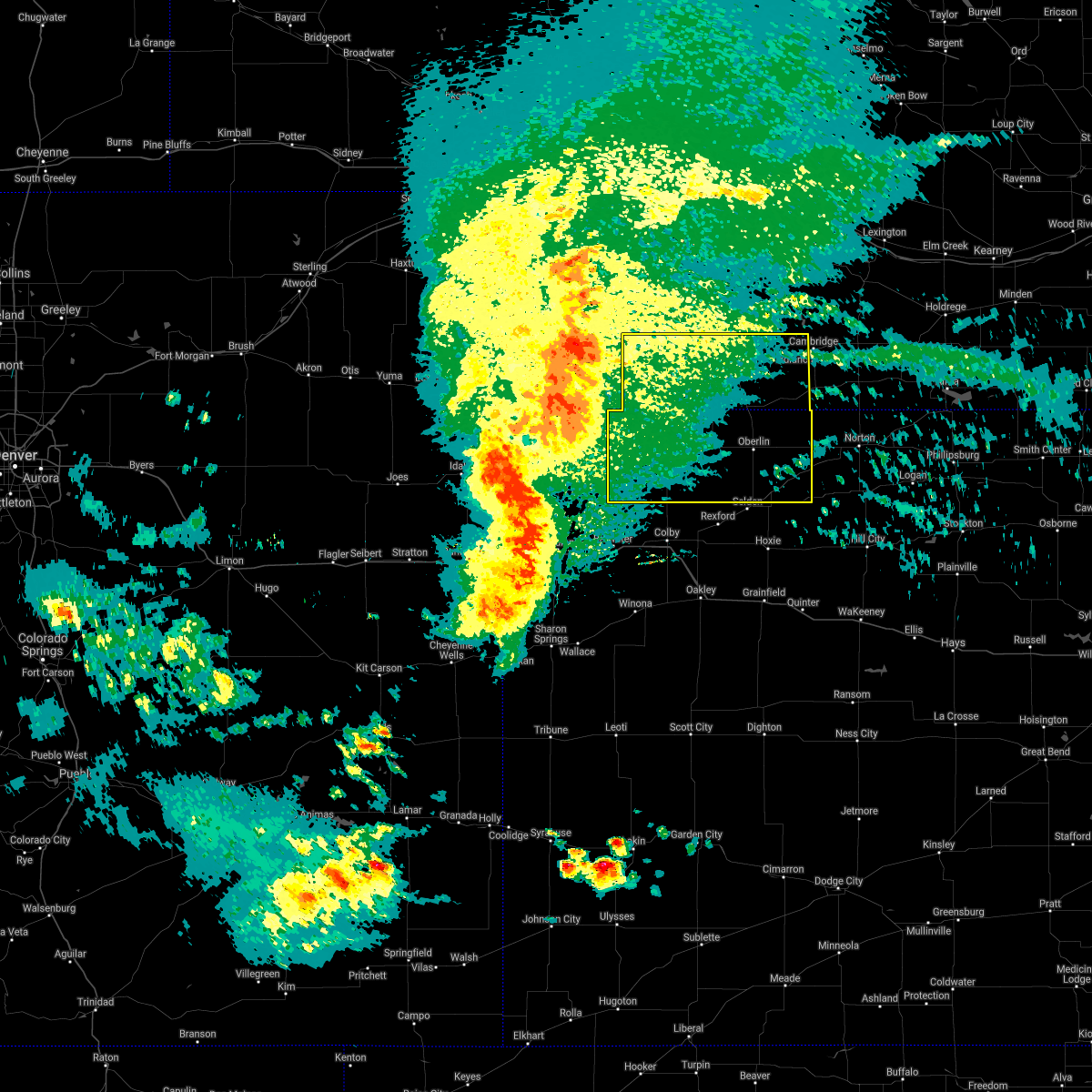 At 729 pm cdt, severe thunderstorms were located along a line extending from near wauneta to 14 miles south of st. francis, moving east at 45 mph. these are very dangerous storms (public). Hazards include 80 mph wind gusts. Flying debris will be dangerous to those caught without shelter. mobile homes will be heavily damaged. expect considerable damage to roofs, windows, and vehicles. Extensive tree damage and power outages are likely. At 729 pm cdt, severe thunderstorms were located along a line extending from near wauneta to 14 miles south of st. francis, moving east at 45 mph. these are very dangerous storms (public). Hazards include 80 mph wind gusts. Flying debris will be dangerous to those caught without shelter. mobile homes will be heavily damaged. expect considerable damage to roofs, windows, and vehicles. Extensive tree damage and power outages are likely.
|
| 5/2/2021 8:23 PM CDT |
 At 823 pm cdt, severe thunderstorms were located along a line extending from 10 miles south of hendley to near lenora, moving east at 15 mph (radar indicated). Hazards include 60 mph wind gusts and quarter size hail. Hail damage to vehicles is expected. expect wind damage to roofs, siding, and trees. Locations impacted include, norton, almena, lenora, norcatur, clayton, edmond and new almelo. At 823 pm cdt, severe thunderstorms were located along a line extending from 10 miles south of hendley to near lenora, moving east at 15 mph (radar indicated). Hazards include 60 mph wind gusts and quarter size hail. Hail damage to vehicles is expected. expect wind damage to roofs, siding, and trees. Locations impacted include, norton, almena, lenora, norcatur, clayton, edmond and new almelo.
|
| 5/2/2021 8:01 PM CDT |
 At 751 pm cdt, severe thunderstorms were located along a line extending from 3 miles south of lebanon to 4 miles southwest of dresden, moving east at 45 mph (weather instrument). Hazards include 55 mph wind gusts. Expect damage to roofs, siding, and trees. Locations impacted include, norton, oberlin, almena, lenora, norcatur, jennings and clayton. At 751 pm cdt, severe thunderstorms were located along a line extending from 3 miles south of lebanon to 4 miles southwest of dresden, moving east at 45 mph (weather instrument). Hazards include 55 mph wind gusts. Expect damage to roofs, siding, and trees. Locations impacted include, norton, oberlin, almena, lenora, norcatur, jennings and clayton.
|
| 5/2/2021 7:52 PM CDT |
 At 751 pm cdt, severe thunderstorms were located along a line extending from 3 miles south of lebanon to 4 miles southwest of dresden, moving east at 45 mph (weather instrument). Hazards include 55 mph wind gusts. Expect damage to roofs, siding, and trees. Locations impacted include, norton, oberlin, almena, lenora, norcatur, jennings and clayton. At 751 pm cdt, severe thunderstorms were located along a line extending from 3 miles south of lebanon to 4 miles southwest of dresden, moving east at 45 mph (weather instrument). Hazards include 55 mph wind gusts. Expect damage to roofs, siding, and trees. Locations impacted include, norton, oberlin, almena, lenora, norcatur, jennings and clayton.
|
| 5/2/2021 7:33 PM CDT |
 At 732 pm cdt, severe thunderstorms were located along a line extending from 7 miles west of danbury to 8 miles north of rexford, moving east at 50 mph (mesonet at oberlin). Hazards include 70 mph wind gusts. Expect considerable tree damage. Damage is likely to mobile homes, roofs, and outbuildings. At 732 pm cdt, severe thunderstorms were located along a line extending from 7 miles west of danbury to 8 miles north of rexford, moving east at 50 mph (mesonet at oberlin). Hazards include 70 mph wind gusts. Expect considerable tree damage. Damage is likely to mobile homes, roofs, and outbuildings.
|
| 8/16/2020 6:43 PM CDT |
 At 540 pm mdt/640 pm cdt/, severe thunderstorms were located along a line extending from 8 miles south of yuma to 10 miles north of bonny reservoir to 14 miles north of goodland to 9 miles north of brewster to 6 miles southeast of rexford to 6 miles northwest of hill city, moving south at 20 to 30 mph. the strongest storm within the line was progressing southward from cheyenne county, kansas into sherman county, kansas (these storms have a history of producing quarter to golf ball size hail and wind gusts up to 65 mph). Hazards include quarter to golf ball size hail and 70 mph wind gusts. People and animals outdoors will be injured. expect hail damage to roofs, siding, windows, and vehicles. expect considerable tree damage. wind damage is also likely to mobile homes, roofs, and outbuildings. locations impacted include, colby, goodland, burlington, yuma, norton, wray and oberlin. this includes the following highways, interstate 70 in kansas between mile markers 0 and 74. interstate 70 in colorado between mile markers 391 and 450. Highway 385 between mile markers 170 and 269. At 540 pm mdt/640 pm cdt/, severe thunderstorms were located along a line extending from 8 miles south of yuma to 10 miles north of bonny reservoir to 14 miles north of goodland to 9 miles north of brewster to 6 miles southeast of rexford to 6 miles northwest of hill city, moving south at 20 to 30 mph. the strongest storm within the line was progressing southward from cheyenne county, kansas into sherman county, kansas (these storms have a history of producing quarter to golf ball size hail and wind gusts up to 65 mph). Hazards include quarter to golf ball size hail and 70 mph wind gusts. People and animals outdoors will be injured. expect hail damage to roofs, siding, windows, and vehicles. expect considerable tree damage. wind damage is also likely to mobile homes, roofs, and outbuildings. locations impacted include, colby, goodland, burlington, yuma, norton, wray and oberlin. this includes the following highways, interstate 70 in kansas between mile markers 0 and 74. interstate 70 in colorado between mile markers 391 and 450. Highway 385 between mile markers 170 and 269.
|
| 8/16/2020 6:28 PM CDT |
 At 523 pm mdt/623 pm cdt/, severe thunderstorms were located along a line extending from 8 miles southwest of eckley to 12 miles south of bird city to 9 miles southeast of lenora, moving south at 25 mph. the strongest storm within the line was located in southern cheyenne county kansas, moving southward into sherman county, kansas (these storms have a history of producing quarter to golf ball size hail and wind gusts up to 65 mph). Hazards include quarter to golf ball size hail and 70 mph wind gusts. People and animals outdoors will be injured. expect hail damage to roofs, siding, windows, and vehicles. expect considerable tree damage. wind damage is also likely to mobile homes, roofs, and outbuildings. locations impacted include, colby, goodland, burlington, yuma, norton, wray and oberlin. this includes the following highways, interstate 70 in kansas between mile markers 0 and 74. interstate 70 in colorado between mile markers 391 and 450. Highway 385 between mile markers 170 and 269. At 523 pm mdt/623 pm cdt/, severe thunderstorms were located along a line extending from 8 miles southwest of eckley to 12 miles south of bird city to 9 miles southeast of lenora, moving south at 25 mph. the strongest storm within the line was located in southern cheyenne county kansas, moving southward into sherman county, kansas (these storms have a history of producing quarter to golf ball size hail and wind gusts up to 65 mph). Hazards include quarter to golf ball size hail and 70 mph wind gusts. People and animals outdoors will be injured. expect hail damage to roofs, siding, windows, and vehicles. expect considerable tree damage. wind damage is also likely to mobile homes, roofs, and outbuildings. locations impacted include, colby, goodland, burlington, yuma, norton, wray and oberlin. this includes the following highways, interstate 70 in kansas between mile markers 0 and 74. interstate 70 in colorado between mile markers 391 and 450. Highway 385 between mile markers 170 and 269.
|
| 8/16/2020 6:11 PM CDT |
 At 507 pm mdt/607 pm cdt/, severe thunderstorms were located along a line extending from 7 miles southeast of yuma to 11 miles south of bird city to 3 miles southwest of edmond, moving south at 15 mph. the strongest storm within the line was located in central cheyenne county, kansas moving south toward sherman county, kansas (these storms have a history of producing quarter to golf ball size hail and wind gusts up to 65 mph). Hazards include quarter to golf ball size hail and 70 mph wind gusts. People and animals outdoors will be injured. expect hail damage to roofs, siding, windows, and vehicles. expect considerable tree damage. wind damage is also likely to mobile homes, roofs, and outbuildings. locations impacted include, colby, goodland, burlington, yuma, norton, wray and oberlin. this includes the following highways, interstate 70 in kansas between mile markers 0 and 74. interstate 70 in colorado between mile markers 391 and 450. Highway 385 between mile markers 170 and 269. At 507 pm mdt/607 pm cdt/, severe thunderstorms were located along a line extending from 7 miles southeast of yuma to 11 miles south of bird city to 3 miles southwest of edmond, moving south at 15 mph. the strongest storm within the line was located in central cheyenne county, kansas moving south toward sherman county, kansas (these storms have a history of producing quarter to golf ball size hail and wind gusts up to 65 mph). Hazards include quarter to golf ball size hail and 70 mph wind gusts. People and animals outdoors will be injured. expect hail damage to roofs, siding, windows, and vehicles. expect considerable tree damage. wind damage is also likely to mobile homes, roofs, and outbuildings. locations impacted include, colby, goodland, burlington, yuma, norton, wray and oberlin. this includes the following highways, interstate 70 in kansas between mile markers 0 and 74. interstate 70 in colorado between mile markers 391 and 450. Highway 385 between mile markers 170 and 269.
|
| 8/16/2020 5:54 PM CDT |
 At 453 pm mdt/553 pm cdt/, severe thunderstorms were located along a line extending from 9 miles east of bonny reservoir to 6 miles west of logan, moving south at 15 mph (radar indicated). Hazards include two inch hail and 70 mph wind gusts. People and animals outdoors will be injured. expect hail damage to roofs, siding, windows, and vehicles. expect considerable tree damage. Wind damage is also likely to mobile homes, roofs, and outbuildings. At 453 pm mdt/553 pm cdt/, severe thunderstorms were located along a line extending from 9 miles east of bonny reservoir to 6 miles west of logan, moving south at 15 mph (radar indicated). Hazards include two inch hail and 70 mph wind gusts. People and animals outdoors will be injured. expect hail damage to roofs, siding, windows, and vehicles. expect considerable tree damage. Wind damage is also likely to mobile homes, roofs, and outbuildings.
|
| 8/16/2020 5:22 PM CDT |
 At 421 pm mdt/521 pm cdt/, severe thunderstorms were located along a line extending from 7 miles south of hendley to 3 miles northwest of haigler, moving south at 5 mph (spotters have reported hail 1 to 2 inches in size). Hazards include two inch hail and 70 mph wind gusts. People and animals outdoors will be injured. expect hail damage to roofs, siding, windows, and vehicles. expect considerable tree damage. wind damage is also likely to mobile homes, roofs, and outbuildings. locations impacted include, mccook, norton, oberlin, st. Francis, atwood, benkelman and trenton. At 421 pm mdt/521 pm cdt/, severe thunderstorms were located along a line extending from 7 miles south of hendley to 3 miles northwest of haigler, moving south at 5 mph (spotters have reported hail 1 to 2 inches in size). Hazards include two inch hail and 70 mph wind gusts. People and animals outdoors will be injured. expect hail damage to roofs, siding, windows, and vehicles. expect considerable tree damage. wind damage is also likely to mobile homes, roofs, and outbuildings. locations impacted include, mccook, norton, oberlin, st. Francis, atwood, benkelman and trenton.
|
| 8/16/2020 5:04 PM CDT |
 At 404 pm mdt/504 pm cdt/, severe thunderstorms were located along a line extending from 5 miles south of hendley to 4 miles northwest of haigler, moving south at 5 mph (radar indicated). Hazards include two inch hail and 70 mph wind gusts. People and animals outdoors will be injured. expect hail damage to roofs, siding, windows, and vehicles. expect considerable tree damage. Wind damage is also likely to mobile homes, roofs, and outbuildings. At 404 pm mdt/504 pm cdt/, severe thunderstorms were located along a line extending from 5 miles south of hendley to 4 miles northwest of haigler, moving south at 5 mph (radar indicated). Hazards include two inch hail and 70 mph wind gusts. People and animals outdoors will be injured. expect hail damage to roofs, siding, windows, and vehicles. expect considerable tree damage. Wind damage is also likely to mobile homes, roofs, and outbuildings.
|
| 8/16/2020 4:34 PM CDT |
 At 334 pm mdt/434 pm cdt/, severe thunderstorms were located along a line extending from 10 miles north of mccook to 6 miles north of benkelman, moving south at 15 mph (trained weather spotters). Hazards include 60 mph wind gusts and half dollar size hail. Hail damage to vehicles is expected. expect wind damage to roofs, siding, and trees. Locations impacted include, mccook, oberlin, atwood, benkelman, trenton, culbertson and indianola. At 334 pm mdt/434 pm cdt/, severe thunderstorms were located along a line extending from 10 miles north of mccook to 6 miles north of benkelman, moving south at 15 mph (trained weather spotters). Hazards include 60 mph wind gusts and half dollar size hail. Hail damage to vehicles is expected. expect wind damage to roofs, siding, and trees. Locations impacted include, mccook, oberlin, atwood, benkelman, trenton, culbertson and indianola.
|
| 8/16/2020 4:20 PM CDT |
 At 319 pm mdt/419 pm cdt/, severe thunderstorms were located along a line extending from 13 miles southwest of stockville to 10 miles north of benkelman, moving south at 15 mph (trained weather spotters have reported hail size ranging as big as a half inch up to golf ball). Hazards include 60 mph wind gusts and half dollar size hail. Hail damage to vehicles is expected. Expect wind damage to roofs, siding, and trees. At 319 pm mdt/419 pm cdt/, severe thunderstorms were located along a line extending from 13 miles southwest of stockville to 10 miles north of benkelman, moving south at 15 mph (trained weather spotters have reported hail size ranging as big as a half inch up to golf ball). Hazards include 60 mph wind gusts and half dollar size hail. Hail damage to vehicles is expected. Expect wind damage to roofs, siding, and trees.
|
| 8/5/2020 10:37 PM CDT |
 The severe thunderstorm warning for decatur county will expire at 1045 pm cdt, the storm which prompted the warning has weakened below severe limits, and no longer poses an immediate threat to life or property. therefore, the warning will be allowed to expire. however gusty winds are still possible with this thunderstorm. The severe thunderstorm warning for decatur county will expire at 1045 pm cdt, the storm which prompted the warning has weakened below severe limits, and no longer poses an immediate threat to life or property. therefore, the warning will be allowed to expire. however gusty winds are still possible with this thunderstorm.
|
| 8/5/2020 10:08 PM CDT |
 At 1008 pm cdt, a severe thunderstorm was located over oberlin, moving southeast at 45 mph (trained weather spotters in herndon). Hazards include 60 mph wind gusts. Expect damage to roofs, siding, and trees. Locations impacted include, oberlin, norcatur, jennings, clayton, traer, cedar bluffs and kanona. At 1008 pm cdt, a severe thunderstorm was located over oberlin, moving southeast at 45 mph (trained weather spotters in herndon). Hazards include 60 mph wind gusts. Expect damage to roofs, siding, and trees. Locations impacted include, oberlin, norcatur, jennings, clayton, traer, cedar bluffs and kanona.
|
| 8/5/2020 9:55 PM CDT |
 At 954 pm cdt, a severe thunderstorm was located 4 miles east of herndon, or 10 miles northwest of oberlin, moving east at 40 mph (trained weather spotters in herndon). Hazards include 60 mph wind gusts. expect damage to roofs, siding, and trees At 954 pm cdt, a severe thunderstorm was located 4 miles east of herndon, or 10 miles northwest of oberlin, moving east at 40 mph (trained weather spotters in herndon). Hazards include 60 mph wind gusts. expect damage to roofs, siding, and trees
|
| 7/20/2020 9:28 PM CDT |
 At 926 pm cdt, severe thunderstorms were located along a line extending from 4 miles southwest of oberlin to 7 miles east of bonny reservoir, moving south at 35 mph (these storms have a history of producing quarter size hail and damaging winds). Hazards include 60 mph wind gusts and quarter size hail. Hail damage to vehicles is expected. expect wind damage to roofs, siding, and trees. locations impacted include, oberlin, st. Francis, atwood, bird city, mcdonald, norcatur and herndon. At 926 pm cdt, severe thunderstorms were located along a line extending from 4 miles southwest of oberlin to 7 miles east of bonny reservoir, moving south at 35 mph (these storms have a history of producing quarter size hail and damaging winds). Hazards include 60 mph wind gusts and quarter size hail. Hail damage to vehicles is expected. expect wind damage to roofs, siding, and trees. locations impacted include, oberlin, st. Francis, atwood, bird city, mcdonald, norcatur and herndon.
|
| 7/20/2020 9:17 PM CDT |
 At 815 pm mdt/915 pm cdt/, severe thunderstorms were located along a line extending from 5 miles northwest of oberlin to 10 miles northeast of bonny reservoir, moving south at 30 mph (these storms have a history of producing quarter size hail and damaging winds). Hazards include 60 mph wind gusts and quarter size hail. Hail damage to vehicles is expected. expect wind damage to roofs, siding, and trees. locations impacted include, oberlin, st. Francis, atwood, benkelman, bird city, mcdonald and haigler. At 815 pm mdt/915 pm cdt/, severe thunderstorms were located along a line extending from 5 miles northwest of oberlin to 10 miles northeast of bonny reservoir, moving south at 30 mph (these storms have a history of producing quarter size hail and damaging winds). Hazards include 60 mph wind gusts and quarter size hail. Hail damage to vehicles is expected. expect wind damage to roofs, siding, and trees. locations impacted include, oberlin, st. Francis, atwood, benkelman, bird city, mcdonald and haigler.
|
| 7/20/2020 9:09 PM CDT |
 At 808 pm mdt/908 pm cdt/, severe thunderstorms were located along a line extending from 8 miles northwest of oberlin to 12 miles west of st. francis, moving south at 25 mph (these storms have a history of producing quarter size hail and damaging winds). Hazards include 60 mph wind gusts and quarter size hail. Hail damage to vehicles is expected. expect wind damage to roofs, siding, and trees. locations impacted include, oberlin, st. Francis, atwood, benkelman, trenton, bird city and stratton. At 808 pm mdt/908 pm cdt/, severe thunderstorms were located along a line extending from 8 miles northwest of oberlin to 12 miles west of st. francis, moving south at 25 mph (these storms have a history of producing quarter size hail and damaging winds). Hazards include 60 mph wind gusts and quarter size hail. Hail damage to vehicles is expected. expect wind damage to roofs, siding, and trees. locations impacted include, oberlin, st. Francis, atwood, benkelman, trenton, bird city and stratton.
|
| 7/20/2020 8:48 PM CDT |
 At 746 pm mdt/846 pm cdt/, severe thunderstorms were located along a line extending from 6 miles west of danbury to 7 miles southwest of haigler, moving south at 25 mph (these storms have a history of producing quarter size hail and damaging winds). Hazards include 60 mph wind gusts and quarter size hail. Hail damage to vehicles is expected. expect wind damage to roofs, siding, and trees. locations impacted include, mccook, oberlin, st. Francis, atwood, benkelman, trenton and culbertson. At 746 pm mdt/846 pm cdt/, severe thunderstorms were located along a line extending from 6 miles west of danbury to 7 miles southwest of haigler, moving south at 25 mph (these storms have a history of producing quarter size hail and damaging winds). Hazards include 60 mph wind gusts and quarter size hail. Hail damage to vehicles is expected. expect wind damage to roofs, siding, and trees. locations impacted include, mccook, oberlin, st. Francis, atwood, benkelman, trenton and culbertson.
|
| 7/20/2020 8:29 PM CDT |
 At 729 pm mdt/829 pm cdt/, severe thunderstorms were located along a line extending from 4 miles northeast of mccook to 5 miles northwest of haigler, moving south at 25 mph (these storms have a history of producing quarter size hail and damaging winds). Hazards include 60 mph wind gusts and quarter size hail. Hail damage to vehicles is expected. Expect wind damage to roofs, siding, and trees. At 729 pm mdt/829 pm cdt/, severe thunderstorms were located along a line extending from 4 miles northeast of mccook to 5 miles northwest of haigler, moving south at 25 mph (these storms have a history of producing quarter size hail and damaging winds). Hazards include 60 mph wind gusts and quarter size hail. Hail damage to vehicles is expected. Expect wind damage to roofs, siding, and trees.
|
| 7/13/2020 11:31 PM CDT |
 At 1131 pm cdt, severe thunderstorms were located along a line extending from 3 miles southwest of beaver city to 7 miles southwest of norton, moving east at 35 mph (radar indicated). Hazards include 70 mph wind gusts and quarter size hail. Hail damage to vehicles is expected. expect considerable tree damage. wind damage is also likely to mobile homes, roofs, and outbuildings. Locations impacted include, norton, almena, lenora, norcatur, clayton, edmond and new almelo. At 1131 pm cdt, severe thunderstorms were located along a line extending from 3 miles southwest of beaver city to 7 miles southwest of norton, moving east at 35 mph (radar indicated). Hazards include 70 mph wind gusts and quarter size hail. Hail damage to vehicles is expected. expect considerable tree damage. wind damage is also likely to mobile homes, roofs, and outbuildings. Locations impacted include, norton, almena, lenora, norcatur, clayton, edmond and new almelo.
|
| 7/13/2020 11:07 PM CDT |
 At 1107 pm cdt, severe thunderstorms were located along a line extending from near wilsonville to 7 miles west of norcatur, moving east at 40 mph (radar indicated). Hazards include 70 mph wind gusts and quarter size hail. Hail damage to vehicles is expected. expect considerable tree damage. Wind damage is also likely to mobile homes, roofs, and outbuildings. At 1107 pm cdt, severe thunderstorms were located along a line extending from near wilsonville to 7 miles west of norcatur, moving east at 40 mph (radar indicated). Hazards include 70 mph wind gusts and quarter size hail. Hail damage to vehicles is expected. expect considerable tree damage. Wind damage is also likely to mobile homes, roofs, and outbuildings.
|
| 7/13/2020 10:54 PM CDT |
 At 1052 pm cdt, severe thunderstorms were located along a line extending from near cambridge to 7 miles southeast of danbury to 12 miles southwest of oberlin, moving east at 30 mph. these are very dangerous storms (trained weather spotters. at 1028 pm cdt, a 79 mph wind gust was reported at the mccook airport. at 1035 pm cdt, a 58 mph wind gust was reported in oberlin). Hazards include 80 mph wind gusts and quarter size hail. Flying debris will be dangerous to those caught without shelter. mobile homes will be heavily damaged. expect considerable damage to roofs, windows, and vehicles. extensive tree damage and power outages are likely. Locations impacted include, oberlin, indianola, bartley, norcatur, danbury, jennings and lebanon. At 1052 pm cdt, severe thunderstorms were located along a line extending from near cambridge to 7 miles southeast of danbury to 12 miles southwest of oberlin, moving east at 30 mph. these are very dangerous storms (trained weather spotters. at 1028 pm cdt, a 79 mph wind gust was reported at the mccook airport. at 1035 pm cdt, a 58 mph wind gust was reported in oberlin). Hazards include 80 mph wind gusts and quarter size hail. Flying debris will be dangerous to those caught without shelter. mobile homes will be heavily damaged. expect considerable damage to roofs, windows, and vehicles. extensive tree damage and power outages are likely. Locations impacted include, oberlin, indianola, bartley, norcatur, danbury, jennings and lebanon.
|
| 7/13/2020 10:30 PM CDT |
 At 1030 pm cdt, severe thunderstorms were located along a line extending from 3 miles northeast of indianola to 6 miles north of oberlin to 10 miles southeast of atwood, moving east at 55 mph. these are very dangerous storms (trained weather spotters. at 1028 pm cdt, a 79 mph wind gust was reported at the mccook airport). Hazards include 80 mph wind gusts and quarter size hail. Flying debris will be dangerous to those caught without shelter. mobile homes will be heavily damaged. expect considerable damage to roofs, windows, and vehicles. extensive tree damage and power outages are likely. Locations impacted include, mccook, oberlin, indianola, bartley, norcatur, danbury and jennings. At 1030 pm cdt, severe thunderstorms were located along a line extending from 3 miles northeast of indianola to 6 miles north of oberlin to 10 miles southeast of atwood, moving east at 55 mph. these are very dangerous storms (trained weather spotters. at 1028 pm cdt, a 79 mph wind gust was reported at the mccook airport). Hazards include 80 mph wind gusts and quarter size hail. Flying debris will be dangerous to those caught without shelter. mobile homes will be heavily damaged. expect considerable damage to roofs, windows, and vehicles. extensive tree damage and power outages are likely. Locations impacted include, mccook, oberlin, indianola, bartley, norcatur, danbury and jennings.
|
| 7/13/2020 10:14 PM CDT |
 At 1011 pm cdt, severe thunderstorms were located along a line extending from 4 miles northwest of mccook to 3 miles southwest of herndon to 12 miles southeast of mcdonald, moving east at 55 mph (trained weather spotters. at 948 pm cdt, a 62 mph wind gust was reported in trenton, nebraska. a 65 mph wind gusts was also reported in ludell, kansas at 1004 pm cdt). Hazards include 60 mph wind gusts and quarter size hail. Hail damage to vehicles is expected. Expect wind damage to roofs, siding, and trees. At 1011 pm cdt, severe thunderstorms were located along a line extending from 4 miles northwest of mccook to 3 miles southwest of herndon to 12 miles southeast of mcdonald, moving east at 55 mph (trained weather spotters. at 948 pm cdt, a 62 mph wind gust was reported in trenton, nebraska. a 65 mph wind gusts was also reported in ludell, kansas at 1004 pm cdt). Hazards include 60 mph wind gusts and quarter size hail. Hail damage to vehicles is expected. Expect wind damage to roofs, siding, and trees.
|
| 7/8/2020 10:48 PM CDT |
 At 1047 pm cdt, severe thunderstorms were located along a line extending from 4 miles east of woodruff to near long island to 6 miles west of norton to 4 miles east of oberlin, moving southeast at 40 mph (radar indicated). Hazards include 60 mph wind gusts. Expect damage to roofs, siding, and trees. Locations impacted include, norton, oberlin, almena, bartley, lenora, norcatur and danbury. At 1047 pm cdt, severe thunderstorms were located along a line extending from 4 miles east of woodruff to near long island to 6 miles west of norton to 4 miles east of oberlin, moving southeast at 40 mph (radar indicated). Hazards include 60 mph wind gusts. Expect damage to roofs, siding, and trees. Locations impacted include, norton, oberlin, almena, bartley, lenora, norcatur and danbury.
|
| 7/8/2020 10:33 PM CDT |
 At 1031 pm cdt, severe thunderstorms were located along a line extending from 3 miles southwest of orleans to 7 miles north of almena to 6 miles north of norcatur to 7 miles southeast of herndon, moving southeast at 40 mph (radar indicated. at 10:23 cdt, a 63 mph wind gust was reported at mccook, nebraska). Hazards include 60 mph wind gusts. Expect damage to roofs, siding, and trees. Locations impacted include, mccook, norton, oberlin, indianola, almena, bartley and lenora. At 1031 pm cdt, severe thunderstorms were located along a line extending from 3 miles southwest of orleans to 7 miles north of almena to 6 miles north of norcatur to 7 miles southeast of herndon, moving southeast at 40 mph (radar indicated. at 10:23 cdt, a 63 mph wind gust was reported at mccook, nebraska). Hazards include 60 mph wind gusts. Expect damage to roofs, siding, and trees. Locations impacted include, mccook, norton, oberlin, indianola, almena, bartley and lenora.
|
| 7/8/2020 10:11 PM CDT |
 At 1011 pm cdt, severe thunderstorms were located along a line extending from 4 miles southeast of edison to near hendley to 4 miles southwest of lebanon to near herndon, moving southeast at 35 mph (radar indicated). Hazards include 60 mph wind gusts. expect damage to roofs, siding, and trees At 1011 pm cdt, severe thunderstorms were located along a line extending from 4 miles southeast of edison to near hendley to 4 miles southwest of lebanon to near herndon, moving southeast at 35 mph (radar indicated). Hazards include 60 mph wind gusts. expect damage to roofs, siding, and trees
|
| 7/2/2020 7:37 PM CDT |
 At 737 pm cdt, severe thunderstorms were located along a line extending from near bartley to 5 miles east of hoxie, moving east at 40 mph (trained weather spotters). Hazards include 70 mph wind gusts and quarter size hail. Hail damage to vehicles is expected. expect considerable tree damage. wind damage is also likely to mobile homes, roofs, and outbuildings. Locations impacted include, mccook, oberlin, hoxie, indianola, bartley, selden and norcatur. At 737 pm cdt, severe thunderstorms were located along a line extending from near bartley to 5 miles east of hoxie, moving east at 40 mph (trained weather spotters). Hazards include 70 mph wind gusts and quarter size hail. Hail damage to vehicles is expected. expect considerable tree damage. wind damage is also likely to mobile homes, roofs, and outbuildings. Locations impacted include, mccook, oberlin, hoxie, indianola, bartley, selden and norcatur.
|
| 7/2/2020 7:26 PM CDT |
 At 725 pm cdt, severe thunderstorms were located along a line extending from indianola to near hoxie, moving east at 40 mph (trained weather spotters). Hazards include 70 mph wind gusts and quarter size hail. Hail damage to vehicles is expected. expect considerable tree damage. wind damage is also likely to mobile homes, roofs, and outbuildings. locations impacted include, mccook, colby, oberlin, hoxie, atwood, trenton and brewster. People attending downtown atwood should seek safe shelter immediately! this includes interstate 70 in kansas between mile markers 36 and 74. At 725 pm cdt, severe thunderstorms were located along a line extending from indianola to near hoxie, moving east at 40 mph (trained weather spotters). Hazards include 70 mph wind gusts and quarter size hail. Hail damage to vehicles is expected. expect considerable tree damage. wind damage is also likely to mobile homes, roofs, and outbuildings. locations impacted include, mccook, colby, oberlin, hoxie, atwood, trenton and brewster. People attending downtown atwood should seek safe shelter immediately! this includes interstate 70 in kansas between mile markers 36 and 74.
|
| 7/2/2020 7:03 PM CDT |
 At 703 pm cdt, severe thunderstorms were located along a line extending from 8 miles north of culbertson to near levant, moving east at 40 mph (trained weather spotters). Hazards include 70 mph wind gusts and quarter size hail. Hail damage to vehicles is expected. expect considerable tree damage. wind damage is also likely to mobile homes, roofs, and outbuildings. locations impacted include, mccook, colby, oberlin, hoxie, atwood, trenton and brewster. This includes interstate 70 in kansas between mile markers 36 and 74. At 703 pm cdt, severe thunderstorms were located along a line extending from 8 miles north of culbertson to near levant, moving east at 40 mph (trained weather spotters). Hazards include 70 mph wind gusts and quarter size hail. Hail damage to vehicles is expected. expect considerable tree damage. wind damage is also likely to mobile homes, roofs, and outbuildings. locations impacted include, mccook, colby, oberlin, hoxie, atwood, trenton and brewster. This includes interstate 70 in kansas between mile markers 36 and 74.
|
| 7/2/2020 6:51 PM CDT |
 At 551 pm mdt/651 pm cdt/, severe thunderstorms were located along a line extending from 9 miles northwest of culbertson to 3 miles east of brewster, moving east at 40 mph (storm chaser 2 miles south of culbertson). Hazards include 74 mph wind gusts. Expect considerable tree damage. damage is likely to mobile homes, roofs, and outbuildings. locations impacted include, mccook, colby, oberlin, hoxie, atwood, trenton and brewster. This includes interstate 70 in kansas between mile markers 22 and 74. At 551 pm mdt/651 pm cdt/, severe thunderstorms were located along a line extending from 9 miles northwest of culbertson to 3 miles east of brewster, moving east at 40 mph (storm chaser 2 miles south of culbertson). Hazards include 74 mph wind gusts. Expect considerable tree damage. damage is likely to mobile homes, roofs, and outbuildings. locations impacted include, mccook, colby, oberlin, hoxie, atwood, trenton and brewster. This includes interstate 70 in kansas between mile markers 22 and 74.
|
| 7/2/2020 6:49 PM CDT |
 At 548 pm mdt/648 pm cdt/, severe thunderstorms were located along a line extending from 9 miles east of palisade to near brewster, moving east at 40 mph (mesonet). Hazards include 63 mph wind gusts measured six miles north of ludell. Expect damage to roofs, siding, and trees. locations impacted include, mccook, colby, oberlin, hoxie, atwood, trenton and brewster. This includes interstate 70 in kansas between mile markers 22 and 74. At 548 pm mdt/648 pm cdt/, severe thunderstorms were located along a line extending from 9 miles east of palisade to near brewster, moving east at 40 mph (mesonet). Hazards include 63 mph wind gusts measured six miles north of ludell. Expect damage to roofs, siding, and trees. locations impacted include, mccook, colby, oberlin, hoxie, atwood, trenton and brewster. This includes interstate 70 in kansas between mile markers 22 and 74.
|
| 7/2/2020 6:43 PM CDT |
 At 543 pm mdt/643 pm cdt/, severe thunderstorms were located along a line extending from 7 miles east of palisade to near brewster, moving east at 40 mph (radar indicated). Hazards include 70 mph wind gusts and half dollar size hail. Hail damage to vehicles is expected. expect considerable tree damage. Wind damage is also likely to mobile homes, roofs, and outbuildings. At 543 pm mdt/643 pm cdt/, severe thunderstorms were located along a line extending from 7 miles east of palisade to near brewster, moving east at 40 mph (radar indicated). Hazards include 70 mph wind gusts and half dollar size hail. Hail damage to vehicles is expected. expect considerable tree damage. Wind damage is also likely to mobile homes, roofs, and outbuildings.
|
| 6/4/2020 8:24 PM CDT |
 At 823 pm cdt, severe thunderstorms were located along a line extending from near wilsonville to 6 miles west of norton to 10 miles northwest of edmond to 4 miles southwest of lenora, moving east at 40 mph (trained weather spotters reported 60-70 mph wind in jennings. radar estimated hail over one inch across southern decatur county). Hazards include 70 mph wind gusts and half dollar size hail. Hail damage to vehicles is expected. expect considerable tree damage. wind damage is also likely to mobile homes, roofs, and outbuildings. Locations impacted include, norton, oberlin, almena, lenora, norcatur, danbury and jennings. At 823 pm cdt, severe thunderstorms were located along a line extending from near wilsonville to 6 miles west of norton to 10 miles northwest of edmond to 4 miles southwest of lenora, moving east at 40 mph (trained weather spotters reported 60-70 mph wind in jennings. radar estimated hail over one inch across southern decatur county). Hazards include 70 mph wind gusts and half dollar size hail. Hail damage to vehicles is expected. expect considerable tree damage. wind damage is also likely to mobile homes, roofs, and outbuildings. Locations impacted include, norton, oberlin, almena, lenora, norcatur, danbury and jennings.
|
| 6/4/2020 8:10 PM CDT |
 At 809 pm cdt, severe thunderstorms were located along a line extending from 3 miles northwest of lebanon to near norcatur to near clayton to 8 miles southeast of jennings, moving east at 40 mph (trained weather spotters reported blowing dust and tree limb damage). Hazards include 60 mph wind gusts. expect damage to roofs, siding, and trees At 809 pm cdt, severe thunderstorms were located along a line extending from 3 miles northwest of lebanon to near norcatur to near clayton to 8 miles southeast of jennings, moving east at 40 mph (trained weather spotters reported blowing dust and tree limb damage). Hazards include 60 mph wind gusts. expect damage to roofs, siding, and trees
|
| 6/4/2020 7:56 PM CDT |
 At 754 pm cdt, severe thunderstorms were located along a line extending from 4 miles southeast of mccook to 3 miles west of danbury to 9 miles west of norcatur to 5 miles north of jennings to near dresden, moving east at 35 mph (trained weather spotters have reported ongoing one quarter mile visibility with blowing dirt near dresden, ks). Hazards include 60 mph wind gusts. Expect damage to roofs, siding, and trees. Locations impacted include, mccook, oberlin, indianola, bartley, norcatur, danbury and jennings. At 754 pm cdt, severe thunderstorms were located along a line extending from 4 miles southeast of mccook to 3 miles west of danbury to 9 miles west of norcatur to 5 miles north of jennings to near dresden, moving east at 35 mph (trained weather spotters have reported ongoing one quarter mile visibility with blowing dirt near dresden, ks). Hazards include 60 mph wind gusts. Expect damage to roofs, siding, and trees. Locations impacted include, mccook, oberlin, indianola, bartley, norcatur, danbury and jennings.
|
| 6/4/2020 7:23 PM CDT |
 At 722 pm cdt, severe thunderstorms were located along a line extending from 7 miles southeast of trenton to 4 miles north of herndon to 9 miles west of oberlin to 8 miles north of rexford, moving northeast at 35 mph (fire department officials observed near zero visibility with blowing dirt that is ongoing at herndon, ks along with estimated 60 mph wind gusts). Hazards include 60 mph wind gusts. expect damage to roofs, siding, and trees At 722 pm cdt, severe thunderstorms were located along a line extending from 7 miles southeast of trenton to 4 miles north of herndon to 9 miles west of oberlin to 8 miles north of rexford, moving northeast at 35 mph (fire department officials observed near zero visibility with blowing dirt that is ongoing at herndon, ks along with estimated 60 mph wind gusts). Hazards include 60 mph wind gusts. expect damage to roofs, siding, and trees
|
| 8/29/2019 7:47 PM CDT |
 At 746 pm cdt, severe thunderstorms were located along a line extending from 4 miles northeast of clayton to near jennings to 6 miles south of dresden to 4 miles north of menlo, moving southeast at 35 mph (radar indicated). Hazards include tennis ball size hail and 70 mph wind gusts. People and animals outdoors will be injured. expect hail damage to roofs, siding, windows, and vehicles. expect considerable tree damage. wind damage is also likely to mobile homes, roofs, and outbuildings. Locations impacted include, oberlin, hoxie, lenora, rexford, selden, norcatur and jennings. At 746 pm cdt, severe thunderstorms were located along a line extending from 4 miles northeast of clayton to near jennings to 6 miles south of dresden to 4 miles north of menlo, moving southeast at 35 mph (radar indicated). Hazards include tennis ball size hail and 70 mph wind gusts. People and animals outdoors will be injured. expect hail damage to roofs, siding, windows, and vehicles. expect considerable tree damage. wind damage is also likely to mobile homes, roofs, and outbuildings. Locations impacted include, oberlin, hoxie, lenora, rexford, selden, norcatur and jennings.
|
| 8/29/2019 7:36 PM CDT |
 At 734 pm cdt, severe thunderstorms were located along a line extending from near norcatur to 3 miles northwest of jennings to 3 miles southwest of dresden to near rexford, moving southeast at 20 mph (radar indicated. at 725 pm cdt 68 mph wind gusts were measured in oberlin. quarter size hail and torrential rainfall were also reported in oberlin). Hazards include two inch hail and 70 mph wind gusts. People and animals outdoors will be injured. expect hail damage to roofs, siding, windows, and vehicles. expect considerable tree damage. wind damage is also likely to mobile homes, roofs, and outbuildings. Locations impacted include, oberlin, hoxie, lenora, rexford, selden, norcatur and jennings. At 734 pm cdt, severe thunderstorms were located along a line extending from near norcatur to 3 miles northwest of jennings to 3 miles southwest of dresden to near rexford, moving southeast at 20 mph (radar indicated. at 725 pm cdt 68 mph wind gusts were measured in oberlin. quarter size hail and torrential rainfall were also reported in oberlin). Hazards include two inch hail and 70 mph wind gusts. People and animals outdoors will be injured. expect hail damage to roofs, siding, windows, and vehicles. expect considerable tree damage. wind damage is also likely to mobile homes, roofs, and outbuildings. Locations impacted include, oberlin, hoxie, lenora, rexford, selden, norcatur and jennings.
|
| 8/29/2019 7:27 PM CDT |
 At 727 pm cdt, severe thunderstorms were located along a line extending from 4 miles northwest of norcatur to 6 miles northwest of jennings to 4 miles west of dresden to 4 miles northwest of rexford, moving southeast at 20 mph (radar indicated. at 725 pm cdt spotters measured 68 mph winds in oberlin). Hazards include two inch hail and 70 mph wind gusts. People and animals outdoors will be injured. expect hail damage to roofs, siding, windows, and vehicles. expect considerable tree damage. Wind damage is also likely to mobile homes, roofs, and outbuildings. At 727 pm cdt, severe thunderstorms were located along a line extending from 4 miles northwest of norcatur to 6 miles northwest of jennings to 4 miles west of dresden to 4 miles northwest of rexford, moving southeast at 20 mph (radar indicated. at 725 pm cdt spotters measured 68 mph winds in oberlin). Hazards include two inch hail and 70 mph wind gusts. People and animals outdoors will be injured. expect hail damage to roofs, siding, windows, and vehicles. expect considerable tree damage. Wind damage is also likely to mobile homes, roofs, and outbuildings.
|
| 8/29/2019 7:19 PM CDT |
 At 718 pm cdt, severe thunderstorms were located along a line extending from 7 miles south of lebanon to 5 miles east of oberlin to 10 miles south of herndon, moving southeast at 45 mph (radar indicated). Hazards include two inch hail and 70 mph wind gusts. People and animals outdoors will be injured. expect hail damage to roofs, siding, windows, and vehicles. expect considerable tree damage. wind damage is also likely to mobile homes, roofs, and outbuildings. Locations impacted include, oberlin, norcatur, herndon, jennings, clayton, dresden and leoville. At 718 pm cdt, severe thunderstorms were located along a line extending from 7 miles south of lebanon to 5 miles east of oberlin to 10 miles south of herndon, moving southeast at 45 mph (radar indicated). Hazards include two inch hail and 70 mph wind gusts. People and animals outdoors will be injured. expect hail damage to roofs, siding, windows, and vehicles. expect considerable tree damage. wind damage is also likely to mobile homes, roofs, and outbuildings. Locations impacted include, oberlin, norcatur, herndon, jennings, clayton, dresden and leoville.
|
| 8/29/2019 7:08 PM CDT |
 A severe thunderstorm warning remains in effect until 730 pm cdt for eastern rawlins. decatur and southern red willow counties. at 708 pm cdt, severe thunderstorms were located along a line extending from near danbury to 7 miles north of oberlin to 6 miles south of herndon, moving southeast at 30 mph. These are very dangerous storms. A severe thunderstorm warning remains in effect until 730 pm cdt for eastern rawlins. decatur and southern red willow counties. at 708 pm cdt, severe thunderstorms were located along a line extending from near danbury to 7 miles north of oberlin to 6 miles south of herndon, moving southeast at 30 mph. These are very dangerous storms.
|
| 8/29/2019 7:08 PM CDT |
 At 648 pm cdt, severe thunderstorms were located along a line extending from 3 miles southeast of mccook to 13 miles west of danbury to 4 miles west of herndon, moving southeast at 30 mph. these are very dangerous storms (radar indicated). Hazards include 80 mph wind gusts and tennis ball size hail. Flying debris will be dangerous to those caught without shelter. mobile homes will be heavily damaged. expect considerable damage to roofs, windows, and vehicles. extensive tree damage and power outages are likely. Locations impacted include, mccook, oberlin, atwood, culbertson, indianola, bartley and norcatur. At 648 pm cdt, severe thunderstorms were located along a line extending from 3 miles southeast of mccook to 13 miles west of danbury to 4 miles west of herndon, moving southeast at 30 mph. these are very dangerous storms (radar indicated). Hazards include 80 mph wind gusts and tennis ball size hail. Flying debris will be dangerous to those caught without shelter. mobile homes will be heavily damaged. expect considerable damage to roofs, windows, and vehicles. extensive tree damage and power outages are likely. Locations impacted include, mccook, oberlin, atwood, culbertson, indianola, bartley and norcatur.
|
| 8/29/2019 6:48 PM CDT |
 At 648 pm cdt, severe thunderstorms were located along a line extending from 3 miles southeast of mccook to 13 miles west of danbury to 4 miles west of herndon, moving southeast at 30 mph. these are very dangerous storms (radar indicated). Hazards include 80 mph wind gusts and tennis ball size hail. Flying debris will be dangerous to those caught without shelter. mobile homes will be heavily damaged. expect considerable damage to roofs, windows, and vehicles. extensive tree damage and power outages are likely. Locations impacted include, mccook, oberlin, atwood, culbertson, indianola, bartley and norcatur. At 648 pm cdt, severe thunderstorms were located along a line extending from 3 miles southeast of mccook to 13 miles west of danbury to 4 miles west of herndon, moving southeast at 30 mph. these are very dangerous storms (radar indicated). Hazards include 80 mph wind gusts and tennis ball size hail. Flying debris will be dangerous to those caught without shelter. mobile homes will be heavily damaged. expect considerable damage to roofs, windows, and vehicles. extensive tree damage and power outages are likely. Locations impacted include, mccook, oberlin, atwood, culbertson, indianola, bartley and norcatur.
|
| 8/29/2019 6:42 PM CDT |
 At 641 pm cdt, severe thunderstorms were located along a line extending from near mccook to 13 miles southeast of culbertson to 6 miles west of herndon, moving southeast at 30 mph. these are very dangerous storms (radar indicated). Hazards include 80 mph wind gusts and two inch hail. Flying debris will be dangerous to those caught without shelter. mobile homes will be heavily damaged. expect considerable damage to roofs, windows, and vehicles. extensive tree damage and power outages are likely. Locations impacted include, mccook, oberlin, atwood, culbertson, indianola, bartley and norcatur. At 641 pm cdt, severe thunderstorms were located along a line extending from near mccook to 13 miles southeast of culbertson to 6 miles west of herndon, moving southeast at 30 mph. these are very dangerous storms (radar indicated). Hazards include 80 mph wind gusts and two inch hail. Flying debris will be dangerous to those caught without shelter. mobile homes will be heavily damaged. expect considerable damage to roofs, windows, and vehicles. extensive tree damage and power outages are likely. Locations impacted include, mccook, oberlin, atwood, culbertson, indianola, bartley and norcatur.
|
| 8/29/2019 6:30 PM CDT |
 At 629 pm cdt, a severe thunderstorm was located 11 miles north of herndon, or 12 miles southwest of mccook, moving southeast at 30 mph (this storm has a history of producing golf ball size hail and damaging winds). Hazards include golf ball size hail and 70 mph wind gusts. People and animals outdoors will be injured. expect hail damage to roofs, siding, windows, and vehicles. expect considerable tree damage. wind damage is also likely to mobile homes, roofs, and outbuildings. Locations impacted include, mccook, oberlin, atwood, culbertson, indianola, bartley and norcatur. At 629 pm cdt, a severe thunderstorm was located 11 miles north of herndon, or 12 miles southwest of mccook, moving southeast at 30 mph (this storm has a history of producing golf ball size hail and damaging winds). Hazards include golf ball size hail and 70 mph wind gusts. People and animals outdoors will be injured. expect hail damage to roofs, siding, windows, and vehicles. expect considerable tree damage. wind damage is also likely to mobile homes, roofs, and outbuildings. Locations impacted include, mccook, oberlin, atwood, culbertson, indianola, bartley and norcatur.
|
| 8/29/2019 6:16 PM CDT |
 At 616 pm cdt, a severe thunderstorm was located 10 miles south of culbertson, or 11 miles southeast of trenton, moving southeast at 35 mph (radar indicated). Hazards include two inch hail and 70 mph wind gusts. People and animals outdoors will be injured. expect hail damage to roofs, siding, windows, and vehicles. expect considerable tree damage. Wind damage is also likely to mobile homes, roofs, and outbuildings. At 616 pm cdt, a severe thunderstorm was located 10 miles south of culbertson, or 11 miles southeast of trenton, moving southeast at 35 mph (radar indicated). Hazards include two inch hail and 70 mph wind gusts. People and animals outdoors will be injured. expect hail damage to roofs, siding, windows, and vehicles. expect considerable tree damage. Wind damage is also likely to mobile homes, roofs, and outbuildings.
|
| 8/29/2019 6:16 PM CDT |
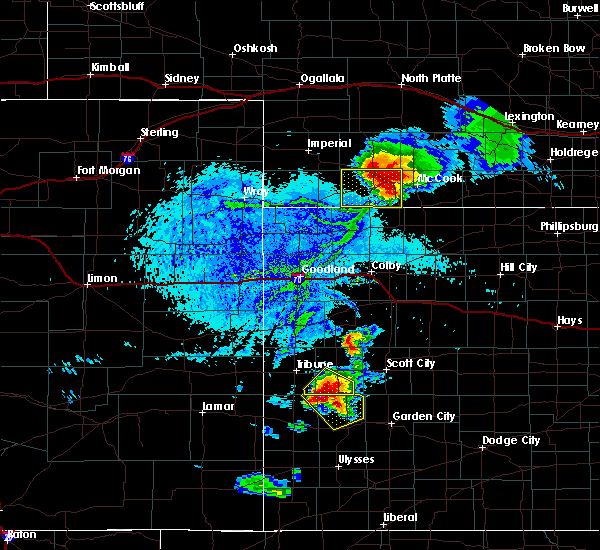 At 616 pm cdt, a severe thunderstorm was located 10 miles south of culbertson, or 11 miles southeast of trenton, moving southeast at 35 mph (radar indicated). Hazards include two inch hail and 70 mph wind gusts. People and animals outdoors will be injured. expect hail damage to roofs, siding, windows, and vehicles. expect considerable tree damage. Wind damage is also likely to mobile homes, roofs, and outbuildings. At 616 pm cdt, a severe thunderstorm was located 10 miles south of culbertson, or 11 miles southeast of trenton, moving southeast at 35 mph (radar indicated). Hazards include two inch hail and 70 mph wind gusts. People and animals outdoors will be injured. expect hail damage to roofs, siding, windows, and vehicles. expect considerable tree damage. Wind damage is also likely to mobile homes, roofs, and outbuildings.
|
| 8/13/2019 5:25 PM CDT |
 At 525 pm cdt, a severe thunderstorm was located 7 miles east of oberlin, moving southeast at 15 mph. this is a very dangerous storm (radar indicated). Hazards include 80 mph wind gusts and quarter size hail. Flying debris will be dangerous to those caught without shelter. mobile homes will be heavily damaged. expect considerable damage to roofs, windows, and vehicles. Extensive tree damage and power outages are likely. At 525 pm cdt, a severe thunderstorm was located 7 miles east of oberlin, moving southeast at 15 mph. this is a very dangerous storm (radar indicated). Hazards include 80 mph wind gusts and quarter size hail. Flying debris will be dangerous to those caught without shelter. mobile homes will be heavily damaged. expect considerable damage to roofs, windows, and vehicles. Extensive tree damage and power outages are likely.
|
| 8/11/2019 11:59 PM CDT |
 At 1159 pm cdt, severe thunderstorms were located along a line extending from near danbury to near grainfield, moving east at 10 mph (radar indicated). Hazards include 60 mph wind gusts and quarter size hail. Hail damage to vehicles is expected. expect wind damage to roofs, siding, and trees. Locations impacted include, norton, hill city, almena, lenora, morland, norcatur and bogue. At 1159 pm cdt, severe thunderstorms were located along a line extending from near danbury to near grainfield, moving east at 10 mph (radar indicated). Hazards include 60 mph wind gusts and quarter size hail. Hail damage to vehicles is expected. expect wind damage to roofs, siding, and trees. Locations impacted include, norton, hill city, almena, lenora, morland, norcatur and bogue.
|
| 8/11/2019 11:29 PM CDT |
 At 1129 pm cdt, severe thunderstorms were located along a line extending from 6 miles west of danbury to near grainfield, moving east at 10 mph (radar indicated). Hazards include 60 mph wind gusts and quarter size hail. Hail damage to vehicles is expected. Expect wind damage to roofs, siding, and trees. At 1129 pm cdt, severe thunderstorms were located along a line extending from 6 miles west of danbury to near grainfield, moving east at 10 mph (radar indicated). Hazards include 60 mph wind gusts and quarter size hail. Hail damage to vehicles is expected. Expect wind damage to roofs, siding, and trees.
|
| 8/11/2019 10:55 PM CDT |
 The national weather service in goodland has issued a * severe thunderstorm warning for. eastern thomas county in northwestern kansas. southwestern norton county in northwestern kansas. eastern logan county in west central kansas. Sheridan county in northwestern kansas. The national weather service in goodland has issued a * severe thunderstorm warning for. eastern thomas county in northwestern kansas. southwestern norton county in northwestern kansas. eastern logan county in west central kansas. Sheridan county in northwestern kansas.
|
| 8/11/2019 10:03 PM CDT |
 At 1002 pm cdt, severe thunderstorms were located along a line extending from 5 miles north of danbury to 4 miles northeast of gove, moving east at 25 mph (radar indicated). Hazards include 70 mph wind gusts and quarter size hail. Hail damage to vehicles is expected. expect considerable tree damage. Wind damage is also likely to mobile homes, roofs, and outbuildings. At 1002 pm cdt, severe thunderstorms were located along a line extending from 5 miles north of danbury to 4 miles northeast of gove, moving east at 25 mph (radar indicated). Hazards include 70 mph wind gusts and quarter size hail. Hail damage to vehicles is expected. expect considerable tree damage. Wind damage is also likely to mobile homes, roofs, and outbuildings.
|
| 8/11/2019 12:22 AM CDT |
 At 1221 am cdt, severe thunderstorms were located along a line extending from 7 miles southeast of lebanon to 7 miles northeast of wakeeney, moving east at 40 mph (radar indicated). Hazards include 60 mph wind gusts and penny size hail. Expect damage to roofs, siding, and trees. Locations impacted include, norton, oberlin, hill city, almena, lenora, morland and norcatur. At 1221 am cdt, severe thunderstorms were located along a line extending from 7 miles southeast of lebanon to 7 miles northeast of wakeeney, moving east at 40 mph (radar indicated). Hazards include 60 mph wind gusts and penny size hail. Expect damage to roofs, siding, and trees. Locations impacted include, norton, oberlin, hill city, almena, lenora, morland and norcatur.
|
| 8/11/2019 12:06 AM CDT |
 At 1206 am cdt, severe thunderstorms were located along a line extending from 4 miles south of lebanon to 3 miles northwest of wakeeney, moving east at 45 mph (radar indicated). Hazards include 60 mph wind gusts and quarter size hail. Hail damage to vehicles is expected. Expect wind damage to roofs, siding, and trees. At 1206 am cdt, severe thunderstorms were located along a line extending from 4 miles south of lebanon to 3 miles northwest of wakeeney, moving east at 45 mph (radar indicated). Hazards include 60 mph wind gusts and quarter size hail. Hail damage to vehicles is expected. Expect wind damage to roofs, siding, and trees.
|
| 6/21/2019 12:21 AM CDT |
 The severe thunderstorm warning for western norton and southeastern decatur counties will expire at 1230 am cdt, the storm which prompted the warning has weakened below severe limits, and no longer poses an immediate threat to life or property. therefore, the warning will be allowed to expire. however gusty winds are still possible with this thunderstorm. a severe thunderstorm watch remains in effect until 400 am cdt for northwestern kansas. The severe thunderstorm warning for western norton and southeastern decatur counties will expire at 1230 am cdt, the storm which prompted the warning has weakened below severe limits, and no longer poses an immediate threat to life or property. therefore, the warning will be allowed to expire. however gusty winds are still possible with this thunderstorm. a severe thunderstorm watch remains in effect until 400 am cdt for northwestern kansas.
|
| 6/21/2019 12:01 AM CDT |
 At 1200 am cdt, a severe thunderstorm was located near clayton, or 13 miles southwest of norton, moving northeast at 30 mph (radar indicated). Hazards include 60 mph wind gusts and penny size hail. expect damage to roofs, siding, and trees At 1200 am cdt, a severe thunderstorm was located near clayton, or 13 miles southwest of norton, moving northeast at 30 mph (radar indicated). Hazards include 60 mph wind gusts and penny size hail. expect damage to roofs, siding, and trees
|
| 6/20/2019 11:16 PM CDT |
 At 1116 pm cdt, severe thunderstorms were located along a line extending from 5 miles east of medicine creek reservoir state recreation area to near norcatur, moving northeast at 45 mph (radar indicated). Hazards include 60 mph wind gusts and quarter size hail. Hail damage to vehicles is expected. expect wind damage to roofs, siding, and trees. Locations impacted include, norton, norcatur, danbury, jennings, lebanon, clayton and kanona. At 1116 pm cdt, severe thunderstorms were located along a line extending from 5 miles east of medicine creek reservoir state recreation area to near norcatur, moving northeast at 45 mph (radar indicated). Hazards include 60 mph wind gusts and quarter size hail. Hail damage to vehicles is expected. expect wind damage to roofs, siding, and trees. Locations impacted include, norton, norcatur, danbury, jennings, lebanon, clayton and kanona.
|
| 6/20/2019 10:39 PM CDT |
 At 1039 pm cdt, severe thunderstorms were located along a line extending from 3 miles north of mccook to 7 miles northwest of selden, moving northeast at 40 mph (radar indicated). Hazards include 60 mph wind gusts and quarter size hail. Hail damage to vehicles is expected. Expect wind damage to roofs, siding, and trees. At 1039 pm cdt, severe thunderstorms were located along a line extending from 3 miles north of mccook to 7 miles northwest of selden, moving northeast at 40 mph (radar indicated). Hazards include 60 mph wind gusts and quarter size hail. Hail damage to vehicles is expected. Expect wind damage to roofs, siding, and trees.
|
| 6/3/2019 10:58 PM CDT |
 At 1058 pm cdt, severe thunderstorms were located along a line extending from 4 miles northwest of almena to 7 miles southeast of morland, moving east at 40 mph (radar indicated). Hazards include 60 mph wind gusts and half dollar size hail. Hail damage to vehicles is expected. expect wind damage to roofs, siding, and trees. Locations impacted include, norton, hill city, almena, lenora, morland, norcatur and bogue. At 1058 pm cdt, severe thunderstorms were located along a line extending from 4 miles northwest of almena to 7 miles southeast of morland, moving east at 40 mph (radar indicated). Hazards include 60 mph wind gusts and half dollar size hail. Hail damage to vehicles is expected. expect wind damage to roofs, siding, and trees. Locations impacted include, norton, hill city, almena, lenora, morland, norcatur and bogue.
|
| 6/3/2019 10:41 PM CDT |
 At 1041 pm cdt, severe thunderstorms were located along a line extending from 8 miles northeast of norcatur to 8 miles northeast of park, moving east at 35 mph (radar indicated). Hazards include 60 mph wind gusts and penny size hail. expect damage to roofs, siding, and trees At 1041 pm cdt, severe thunderstorms were located along a line extending from 8 miles northeast of norcatur to 8 miles northeast of park, moving east at 35 mph (radar indicated). Hazards include 60 mph wind gusts and penny size hail. expect damage to roofs, siding, and trees
|
| 5/26/2019 6:04 PM CDT |
 At 604 pm cdt, a severe thunderstorm was located near norton, moving northeast at 45 mph (radar indicated). Hazards include 60 mph wind gusts and nickel size hail. Expect damage to roofs, siding, and trees. locations impacted include, norton, almena, norcatur, clayton, reager and calvert. A tornado watch remains in effect until 1000 pm cdt for northwestern kansas. At 604 pm cdt, a severe thunderstorm was located near norton, moving northeast at 45 mph (radar indicated). Hazards include 60 mph wind gusts and nickel size hail. Expect damage to roofs, siding, and trees. locations impacted include, norton, almena, norcatur, clayton, reager and calvert. A tornado watch remains in effect until 1000 pm cdt for northwestern kansas.
|
| 5/26/2019 5:56 PM CDT |
 The severe thunderstorm warning for northeastern sheridan and southeastern decatur counties will expire at 600 pm cdt, the storm which prompted the warning is moving out of the warned area. therefore, the warning will be allowed to expire. a tornado watch remains in effect until 1000 pm cdt for northwestern kansas. The severe thunderstorm warning for northeastern sheridan and southeastern decatur counties will expire at 600 pm cdt, the storm which prompted the warning is moving out of the warned area. therefore, the warning will be allowed to expire. a tornado watch remains in effect until 1000 pm cdt for northwestern kansas.
|
| 5/26/2019 5:51 PM CDT |
 At 550 pm cdt, a severe thunderstorm was located 6 miles east of clayton, or 12 miles southwest of norton, moving northeast at 45 mph (radar indicated). Hazards include 70 mph wind gusts and quarter size hail. Hail damage to vehicles is expected. expect considerable tree damage. wind damage is also likely to mobile homes, roofs, and outbuildings. locations impacted include, norton, almena, lenora, norcatur, clayton, edmond and new almelo. A tornado watch remains in effect until 1000 pm cdt for northwestern kansas. At 550 pm cdt, a severe thunderstorm was located 6 miles east of clayton, or 12 miles southwest of norton, moving northeast at 45 mph (radar indicated). Hazards include 70 mph wind gusts and quarter size hail. Hail damage to vehicles is expected. expect considerable tree damage. wind damage is also likely to mobile homes, roofs, and outbuildings. locations impacted include, norton, almena, lenora, norcatur, clayton, edmond and new almelo. A tornado watch remains in effect until 1000 pm cdt for northwestern kansas.
|
| 5/26/2019 5:46 PM CDT |
 At 546 pm cdt, a severe thunderstorm was located near clayton, or 16 miles southwest of norton, moving northeast at 45 mph (radar indicated). Hazards include 70 mph wind gusts and quarter size hail. Hail damage to vehicles is expected. expect considerable tree damage. wind damage is also likely to mobile homes, roofs, and outbuildings. locations impacted include, norcatur, jennings, clayton, dresden, kanona and leoville. A tornado watch remains in effect until 1000 pm cdt for northwestern kansas. At 546 pm cdt, a severe thunderstorm was located near clayton, or 16 miles southwest of norton, moving northeast at 45 mph (radar indicated). Hazards include 70 mph wind gusts and quarter size hail. Hail damage to vehicles is expected. expect considerable tree damage. wind damage is also likely to mobile homes, roofs, and outbuildings. locations impacted include, norcatur, jennings, clayton, dresden, kanona and leoville. A tornado watch remains in effect until 1000 pm cdt for northwestern kansas.
|
| 5/26/2019 5:34 PM CDT |
 At 534 pm cdt, a severe thunderstorm was located 5 miles south of jennings, or 19 miles northeast of hoxie, moving east at 50 mph (radar indicated). Hazards include 70 mph wind gusts and quarter size hail. Hail damage to vehicles is expected. expect considerable tree damage. wind damage is also likely to mobile homes, roofs, and outbuildings. locations impacted include, hoxie, selden, norcatur, jennings, clayton, dresden and leoville. A tornado watch remains in effect until 1000 pm cdt for northwestern kansas. At 534 pm cdt, a severe thunderstorm was located 5 miles south of jennings, or 19 miles northeast of hoxie, moving east at 50 mph (radar indicated). Hazards include 70 mph wind gusts and quarter size hail. Hail damage to vehicles is expected. expect considerable tree damage. wind damage is also likely to mobile homes, roofs, and outbuildings. locations impacted include, hoxie, selden, norcatur, jennings, clayton, dresden and leoville. A tornado watch remains in effect until 1000 pm cdt for northwestern kansas.
|
| 5/26/2019 5:32 PM CDT |
 At 532 pm cdt, a severe thunderstorm was located 5 miles south of jennings, or 18 miles northeast of hoxie, moving northeast at 45 mph (radar indicated). Hazards include 70 mph wind gusts and quarter size hail. Hail damage to vehicles is expected. expect considerable tree damage. Wind damage is also likely to mobile homes, roofs, and outbuildings. At 532 pm cdt, a severe thunderstorm was located 5 miles south of jennings, or 18 miles northeast of hoxie, moving northeast at 45 mph (radar indicated). Hazards include 70 mph wind gusts and quarter size hail. Hail damage to vehicles is expected. expect considerable tree damage. Wind damage is also likely to mobile homes, roofs, and outbuildings.
|
| 5/26/2019 5:25 PM CDT |
 At 525 pm cdt, a severe thunderstorm was located near dresden, or 14 miles north of hoxie, moving northeast at 40 mph (radar indicated). Hazards include 70 mph wind gusts and nickel size hail. Expect considerable tree damage. damage is likely to mobile homes, roofs, and outbuildings. locations impacted include, hoxie, selden, norcatur, jennings, clayton, dresden and leoville. A tornado watch remains in effect until 1000 pm cdt for northwestern kansas. At 525 pm cdt, a severe thunderstorm was located near dresden, or 14 miles north of hoxie, moving northeast at 40 mph (radar indicated). Hazards include 70 mph wind gusts and nickel size hail. Expect considerable tree damage. damage is likely to mobile homes, roofs, and outbuildings. locations impacted include, hoxie, selden, norcatur, jennings, clayton, dresden and leoville. A tornado watch remains in effect until 1000 pm cdt for northwestern kansas.
|
| 5/26/2019 5:13 PM CDT |
 At 513 pm cdt, a severe thunderstorm was located 4 miles southwest of selden, or 12 miles northwest of hoxie, moving northeast at 45 mph (radar indicated). Hazards include 70 mph wind gusts and nickel size hail. Expect considerable tree damage. Damage is likely to mobile homes, roofs, and outbuildings. At 513 pm cdt, a severe thunderstorm was located 4 miles southwest of selden, or 12 miles northwest of hoxie, moving northeast at 45 mph (radar indicated). Hazards include 70 mph wind gusts and nickel size hail. Expect considerable tree damage. Damage is likely to mobile homes, roofs, and outbuildings.
|
| 7/28/2018 11:12 PM CDT |
 At 1112 pm cdt, a severe thunderstorm was located 4 miles east of clayton, or 11 miles southwest of norton, moving southeast at 20 mph (radar indicated). Hazards include 70 mph wind gusts and quarter size hail. Hail damage to vehicles is expected. expect considerable tree damage. Wind damage is also likely to mobile homes, roofs, and outbuildings. At 1112 pm cdt, a severe thunderstorm was located 4 miles east of clayton, or 11 miles southwest of norton, moving southeast at 20 mph (radar indicated). Hazards include 70 mph wind gusts and quarter size hail. Hail damage to vehicles is expected. expect considerable tree damage. Wind damage is also likely to mobile homes, roofs, and outbuildings.
|
| 1/1/0001 12:00 AM | Report via images on facebook of damage to a wooden barn... minor flooding... and pea-sized hai in decatur county KS, 11.3 miles SE of Norcatur, KS |
| 7/26/2018 7:49 PM CDT |
 At 749 pm cdt, a severe thunderstorm was located 6 miles northwest of clayton, or 13 miles east of oberlin, moving south at 45 mph (radar indicated). Hazards include 70 mph wind gusts and quarter size hail. Hail damage to vehicles is expected. expect considerable tree damage. Wind damage is also likely to mobile homes, roofs, and outbuildings. At 749 pm cdt, a severe thunderstorm was located 6 miles northwest of clayton, or 13 miles east of oberlin, moving south at 45 mph (radar indicated). Hazards include 70 mph wind gusts and quarter size hail. Hail damage to vehicles is expected. expect considerable tree damage. Wind damage is also likely to mobile homes, roofs, and outbuildings.
|
| 6/30/2018 10:38 PM CDT |
 At 943 pm cdt, a severe thunderstorm was located 5 miles south of clayton, or 19 miles southwest of norton, moving northeast at 50 mph (radar indicated). Hazards include 60 mph wind gusts. expect damage to roofs, siding, and trees At 943 pm cdt, a severe thunderstorm was located 5 miles south of clayton, or 19 miles southwest of norton, moving northeast at 50 mph (radar indicated). Hazards include 60 mph wind gusts. expect damage to roofs, siding, and trees
|
| 6/30/2018 10:08 PM CDT |
 The severe thunderstorm warning for decatur county will expire at 1015 pm cdt, the severe thunderstorm which prompted the warning has weakened. therefore, the warning will be allowed to expire. however gusty winds are still possible with this thunderstorm. a severe thunderstorm watch remains in effect until midnight cdt for northwestern kansas. The severe thunderstorm warning for decatur county will expire at 1015 pm cdt, the severe thunderstorm which prompted the warning has weakened. therefore, the warning will be allowed to expire. however gusty winds are still possible with this thunderstorm. a severe thunderstorm watch remains in effect until midnight cdt for northwestern kansas.
|
| 6/30/2018 9:44 PM CDT |
 The national weather service in goodland has issued a * severe thunderstorm warning for. norton county in northwestern kansas. until 1045 pm cdt. At 943 pm cdt, a severe thunderstorm was located 5 miles south of clayton, or 19 miles southwest of norton, moving northeast at 50. The national weather service in goodland has issued a * severe thunderstorm warning for. norton county in northwestern kansas. until 1045 pm cdt. At 943 pm cdt, a severe thunderstorm was located 5 miles south of clayton, or 19 miles southwest of norton, moving northeast at 50.
|
| 6/30/2018 9:16 PM CDT |
 At 916 pm cdt, a severe thunderstorm was located 4 miles north of gem, or 9 miles northeast of colby, moving northeast at 60 mph (radar indicated). Hazards include 70 mph wind gusts and quarter size hail. Hail damage to vehicles is expected. expect considerable tree damage. Wind damage is also likely to mobile homes, roofs, and outbuildings. At 916 pm cdt, a severe thunderstorm was located 4 miles north of gem, or 9 miles northeast of colby, moving northeast at 60 mph (radar indicated). Hazards include 70 mph wind gusts and quarter size hail. Hail damage to vehicles is expected. expect considerable tree damage. Wind damage is also likely to mobile homes, roofs, and outbuildings.
|
| 6/30/2018 9:11 PM CDT |
 At 911 pm cdt, a severe thunderstorm was located 5 miles east of oberlin, moving northeast at 55 mph (radar indicated). Hazards include 60 mph wind gusts and quarter size hail. Hail damage to vehicles is expected. Expect wind damage to roofs, siding, and trees. At 911 pm cdt, a severe thunderstorm was located 5 miles east of oberlin, moving northeast at 55 mph (radar indicated). Hazards include 60 mph wind gusts and quarter size hail. Hail damage to vehicles is expected. Expect wind damage to roofs, siding, and trees.
|
| 6/29/2018 11:09 PM CDT |
 At 1109 pm cdt, a severe thunderstorm was located 4 miles east of norcatur, or 11 miles west of norton, moving northeast at 30 mph (radar indicated). Hazards include 60 mph wind gusts. Expect damage to roofs, siding, and trees. Locations impacted include, norcatur and reager. At 1109 pm cdt, a severe thunderstorm was located 4 miles east of norcatur, or 11 miles west of norton, moving northeast at 30 mph (radar indicated). Hazards include 60 mph wind gusts. Expect damage to roofs, siding, and trees. Locations impacted include, norcatur and reager.
|
| 6/29/2018 11:01 PM CDT |
 At 1100 pm cdt, a severe thunderstorm was located over clayton, or 15 miles west of norton, moving east at 35 mph (radar indicated). Hazards include 60 mph wind gusts and quarter size hail. Hail damage to vehicles is expected. expect wind damage to roofs, siding, and trees. Locations impacted include, norcatur, clayton and reager. At 1100 pm cdt, a severe thunderstorm was located over clayton, or 15 miles west of norton, moving east at 35 mph (radar indicated). Hazards include 60 mph wind gusts and quarter size hail. Hail damage to vehicles is expected. expect wind damage to roofs, siding, and trees. Locations impacted include, norcatur, clayton and reager.
|
| 6/29/2018 10:50 PM CDT |
 At 1050 pm cdt, a severe thunderstorm was located over clayton, or 16 miles west of norton, moving east at 35 mph (radar indicated). Hazards include 60 mph wind gusts and quarter size hail. Hail damage to vehicles is expected. expect wind damage to roofs, siding, and trees. Locations impacted include, norcatur, jennings, clayton, reager and kanona. At 1050 pm cdt, a severe thunderstorm was located over clayton, or 16 miles west of norton, moving east at 35 mph (radar indicated). Hazards include 60 mph wind gusts and quarter size hail. Hail damage to vehicles is expected. expect wind damage to roofs, siding, and trees. Locations impacted include, norcatur, jennings, clayton, reager and kanona.
|
| 6/29/2018 10:38 PM CDT |
 At 1038 pm cdt, a severe thunderstorm was located 4 miles northwest of jennings, or 11 miles southeast of oberlin, moving east at 25 mph (radar indicated). Hazards include 60 mph wind gusts and half dollar size hail. Hail damage to vehicles is expected. Expect wind damage to roofs, siding, and trees. At 1038 pm cdt, a severe thunderstorm was located 4 miles northwest of jennings, or 11 miles southeast of oberlin, moving east at 25 mph (radar indicated). Hazards include 60 mph wind gusts and half dollar size hail. Hail damage to vehicles is expected. Expect wind damage to roofs, siding, and trees.
|
| 6/24/2018 8:15 PM CDT |
 At 814 pm cdt, severe thunderstorms were located along a line extending from 4 miles north of almena to 4 miles southwest of hill city to 3 miles north of arnold, moving east at 55 mph (radar indicated). Hazards include 60 mph wind gusts. Expect damage to roofs, siding, and trees. locations impacted include, norton, hill city, quinter, almena, lenora, morland and norcatur. This includes interstate 70 in kansas between mile markers 102 and 112. At 814 pm cdt, severe thunderstorms were located along a line extending from 4 miles north of almena to 4 miles southwest of hill city to 3 miles north of arnold, moving east at 55 mph (radar indicated). Hazards include 60 mph wind gusts. Expect damage to roofs, siding, and trees. locations impacted include, norton, hill city, quinter, almena, lenora, morland and norcatur. This includes interstate 70 in kansas between mile markers 102 and 112.
|
| 6/24/2018 7:53 PM CDT |
 At 753 pm cdt, severe thunderstorms were located along a line extending from 10 miles north of norton to near morland to 5 miles northeast of pendennis, moving east at 35 mph (radar indicated). Hazards include 70 mph wind gusts. Expect considerable tree damage. Damage is likely to mobile homes, roofs, and outbuildings. At 753 pm cdt, severe thunderstorms were located along a line extending from 10 miles north of norton to near morland to 5 miles northeast of pendennis, moving east at 35 mph (radar indicated). Hazards include 70 mph wind gusts. Expect considerable tree damage. Damage is likely to mobile homes, roofs, and outbuildings.
|
| 6/24/2018 7:40 PM CDT |
 At 739 pm cdt, severe thunderstorms were located along a line extending from 5 miles northeast of norcatur to 9 miles east of hoxie to 4 miles east of gove, moving east at 35 mph (radar indicated). Hazards include 70 mph wind gusts. Expect considerable tree damage. damage is likely to mobile homes, roofs, and outbuildings. locations impacted include, norton, hill city, hoxie, quinter, grainfield, grinnell and gove. This includes interstate 70 in kansas between mile markers 85 and 113. At 739 pm cdt, severe thunderstorms were located along a line extending from 5 miles northeast of norcatur to 9 miles east of hoxie to 4 miles east of gove, moving east at 35 mph (radar indicated). Hazards include 70 mph wind gusts. Expect considerable tree damage. damage is likely to mobile homes, roofs, and outbuildings. locations impacted include, norton, hill city, hoxie, quinter, grainfield, grinnell and gove. This includes interstate 70 in kansas between mile markers 85 and 113.
|
| 6/24/2018 7:25 PM CDT |
 At 725 pm cdt, severe thunderstorms were located along a line extending from 6 miles northwest of norcatur to near hoxie to 4 miles west of gove, moving east at 35 mph (radar indicated). Hazards include 70 mph wind gusts and quarter size hail. Hail damage to vehicles is expected. expect considerable tree damage. wind damage is also likely to mobile homes, roofs, and outbuildings. locations impacted include, norton, oakley, oberlin, hill city, hoxie, quinter and grainfield. This includes interstate 70 in kansas between mile markers 73 and 113. At 725 pm cdt, severe thunderstorms were located along a line extending from 6 miles northwest of norcatur to near hoxie to 4 miles west of gove, moving east at 35 mph (radar indicated). Hazards include 70 mph wind gusts and quarter size hail. Hail damage to vehicles is expected. expect considerable tree damage. wind damage is also likely to mobile homes, roofs, and outbuildings. locations impacted include, norton, oakley, oberlin, hill city, hoxie, quinter and grainfield. This includes interstate 70 in kansas between mile markers 73 and 113.
|
| 6/24/2018 7:12 PM CDT |
 At 711 pm cdt, severe thunderstorms were located along a line extending from 6 miles north of oberlin to near menlo to 10 miles south of oakley, moving east at 45 mph (radar indicated). Hazards include 70 mph wind gusts and quarter size hail. Hail damage to vehicles is expected. expect considerable tree damage. wind damage is also likely to mobile homes, roofs, and outbuildings. locations impacted include, norton, oakley, oberlin, hill city, hoxie, quinter and grainfield. This includes interstate 70 in kansas between mile markers 73 and 113. At 711 pm cdt, severe thunderstorms were located along a line extending from 6 miles north of oberlin to near menlo to 10 miles south of oakley, moving east at 45 mph (radar indicated). Hazards include 70 mph wind gusts and quarter size hail. Hail damage to vehicles is expected. expect considerable tree damage. wind damage is also likely to mobile homes, roofs, and outbuildings. locations impacted include, norton, oakley, oberlin, hill city, hoxie, quinter and grainfield. This includes interstate 70 in kansas between mile markers 73 and 113.
|
| 6/24/2018 7:00 PM CDT |
 At 659 pm cdt, severe thunderstorms were located along a line extending from 6 miles north of oberlin to near menlo to 9 miles south of oakley, moving east at 50 mph (radar indicated). Hazards include 60 mph wind gusts and quarter size hail. Hail damage to vehicles is expected. Expect wind damage to roofs, siding, and trees. At 659 pm cdt, severe thunderstorms were located along a line extending from 6 miles north of oberlin to near menlo to 9 miles south of oakley, moving east at 50 mph (radar indicated). Hazards include 60 mph wind gusts and quarter size hail. Hail damage to vehicles is expected. Expect wind damage to roofs, siding, and trees.
|
| 5/24/2018 7:56 PM CDT |
 The severe thunderstorm warning for west central norton and southeastern decatur counties will expire at 800 pm cdt, the storm which prompted the warning has weakened below severe limits, and no longer poses an immediate threat to life or property. therefore the warning will be allowed to expire. The severe thunderstorm warning for west central norton and southeastern decatur counties will expire at 800 pm cdt, the storm which prompted the warning has weakened below severe limits, and no longer poses an immediate threat to life or property. therefore the warning will be allowed to expire.
|
| 5/24/2018 7:32 PM CDT |
 At 732 pm cdt, a severe thunderstorm was located 7 miles north of jennings, or 11 miles east of oberlin, moving northeast at 5 mph (radar indicated). Hazards include 60 mph wind gusts and quarter size hail. Hail damage to vehicles is expected. expect wind damage to roofs, siding, and trees. Locations impacted include, norcatur, jennings, clayton and kanona. At 732 pm cdt, a severe thunderstorm was located 7 miles north of jennings, or 11 miles east of oberlin, moving northeast at 5 mph (radar indicated). Hazards include 60 mph wind gusts and quarter size hail. Hail damage to vehicles is expected. expect wind damage to roofs, siding, and trees. Locations impacted include, norcatur, jennings, clayton and kanona.
|
| 5/24/2018 7:08 PM CDT |
 At 708 pm cdt, a severe thunderstorm was located 6 miles northwest of clayton, or 13 miles east of oberlin, moving northeast at 10 mph (radar indicated). Hazards include 60 mph wind gusts and quarter size hail. Hail damage to vehicles is expected. Expect wind damage to roofs, siding, and trees. At 708 pm cdt, a severe thunderstorm was located 6 miles northwest of clayton, or 13 miles east of oberlin, moving northeast at 10 mph (radar indicated). Hazards include 60 mph wind gusts and quarter size hail. Hail damage to vehicles is expected. Expect wind damage to roofs, siding, and trees.
|
| 3/23/2018 7:44 PM CDT |
 At 742 pm cdt, a severe thunderstorm was located 5 miles southwest of norton, moving east at 45 mph. this storm has a history of producing quarter size hail near norcatur (radar indicated). Hazards include 60 mph wind gusts and quarter size hail. Hail damage to vehicles is expected. expect wind damage to roofs, siding, and trees. Locations impacted include, norton, lenora, norcatur, clayton, edmond, reager and calvert. At 742 pm cdt, a severe thunderstorm was located 5 miles southwest of norton, moving east at 45 mph. this storm has a history of producing quarter size hail near norcatur (radar indicated). Hazards include 60 mph wind gusts and quarter size hail. Hail damage to vehicles is expected. expect wind damage to roofs, siding, and trees. Locations impacted include, norton, lenora, norcatur, clayton, edmond, reager and calvert.
|
| 3/23/2018 7:40 PM CDT | Half Dollar sized hail reported 3.1 miles W of Norcatur, KS |
| 3/23/2018 7:35 PM CDT | Quarter sized hail reported 0.4 miles NNE of Norcatur, KS |
| 3/23/2018 7:31 PM CDT |
 At 731 pm cdt, a severe thunderstorm was located near norcatur, or 12 miles west of norton, moving east at 55 mph (radar indicated). Hazards include 60 mph wind gusts and quarter size hail. Hail damage to vehicles is expected. expect wind damage to roofs, siding, and trees. Locations impacted include, norton, lenora, norcatur, jennings, clayton, edmond and reager. At 731 pm cdt, a severe thunderstorm was located near norcatur, or 12 miles west of norton, moving east at 55 mph (radar indicated). Hazards include 60 mph wind gusts and quarter size hail. Hail damage to vehicles is expected. expect wind damage to roofs, siding, and trees. Locations impacted include, norton, lenora, norcatur, jennings, clayton, edmond and reager.
|
| 3/23/2018 7:23 PM CDT |
 At 722 pm cdt, a severe thunderstorm was located 7 miles west of norcatur, or 11 miles east of oberlin, moving east at 45 mph (radar indicated). Hazards include quarter size hail and wind gusts up to 55 mph. hail damage to vehicles is expected At 722 pm cdt, a severe thunderstorm was located 7 miles west of norcatur, or 11 miles east of oberlin, moving east at 45 mph (radar indicated). Hazards include quarter size hail and wind gusts up to 55 mph. hail damage to vehicles is expected
|
| 10/2/2017 10:35 PM CDT |
 The severe thunderstorm warning for northwestern norton and southeastern decatur counties will expire at 1045 pm cdt, the severe thunderstorm which prompted the warning has moved out of the warned area. therefore, the warning will be allowed to expire. a tornado watch remains in effect until 1100 pm cdt for northwestern kansas. The severe thunderstorm warning for northwestern norton and southeastern decatur counties will expire at 1045 pm cdt, the severe thunderstorm which prompted the warning has moved out of the warned area. therefore, the warning will be allowed to expire. a tornado watch remains in effect until 1100 pm cdt for northwestern kansas.
|
| 10/2/2017 10:28 PM CDT |
 At 1028 pm cdt, a severe thunderstorm was located 4 miles west of norcatur, or 14 miles east of oberlin, moving northeast at 50 mph (radar indicated). Hazards include 60 mph wind gusts and quarter size hail. Hail damage to vehicles is expected. expect wind damage to roofs, siding, and trees. locations impacted include, norcatur and jennings. A tornado watch remains in effect until 1100 pm cdt for northwestern kansas. At 1028 pm cdt, a severe thunderstorm was located 4 miles west of norcatur, or 14 miles east of oberlin, moving northeast at 50 mph (radar indicated). Hazards include 60 mph wind gusts and quarter size hail. Hail damage to vehicles is expected. expect wind damage to roofs, siding, and trees. locations impacted include, norcatur and jennings. A tornado watch remains in effect until 1100 pm cdt for northwestern kansas.
|
| 10/2/2017 10:17 PM CDT |
 At 1016 pm cdt, a severe thunderstorm was located 7 miles north of dresden, or 8 miles southeast of oberlin, moving northeast at 50 mph (radar indicated). Hazards include 60 mph wind gusts and quarter size hail. Hail damage to vehicles is expected. expect wind damage to roofs, siding, and trees. locations impacted include, norcatur, jennings, dresden, leoville and kanona. A tornado watch remains in effect until 1100 pm cdt for northwestern kansas. At 1016 pm cdt, a severe thunderstorm was located 7 miles north of dresden, or 8 miles southeast of oberlin, moving northeast at 50 mph (radar indicated). Hazards include 60 mph wind gusts and quarter size hail. Hail damage to vehicles is expected. expect wind damage to roofs, siding, and trees. locations impacted include, norcatur, jennings, dresden, leoville and kanona. A tornado watch remains in effect until 1100 pm cdt for northwestern kansas.
|
| 10/2/2017 10:02 PM CDT |
 At 1002 pm cdt, a severe thunderstorm was located near selden, or 16 miles south of oberlin, moving northeast at 50 mph (radar indicated). Hazards include 60 mph wind gusts and quarter size hail. Hail damage to vehicles is expected. Expect wind damage to roofs, siding, and trees. At 1002 pm cdt, a severe thunderstorm was located near selden, or 16 miles south of oberlin, moving northeast at 50 mph (radar indicated). Hazards include 60 mph wind gusts and quarter size hail. Hail damage to vehicles is expected. Expect wind damage to roofs, siding, and trees.
|
| 10/1/2017 10:13 PM CDT |
 The severe thunderstorm warning for norton, sheridan, southeastern decatur and northwestern graham counties will expire at 1015 pm cdt, the storms which prompted the warning have weakened below severe limits, and no longer pose an immediate threat to life or property. therefore the warning will be allowed to expire. however gusty winds and heavy rain are still possible with these thunderstorms. a tornado watch remains in effect until 1100 pm cdt for northwestern and west central kansas. The severe thunderstorm warning for norton, sheridan, southeastern decatur and northwestern graham counties will expire at 1015 pm cdt, the storms which prompted the warning have weakened below severe limits, and no longer pose an immediate threat to life or property. therefore the warning will be allowed to expire. however gusty winds and heavy rain are still possible with these thunderstorms. a tornado watch remains in effect until 1100 pm cdt for northwestern and west central kansas.
|
| 10/1/2017 9:57 PM CDT |
 A severe thunderstorm warning remains in effect until 1015 pm cdt for norton. sheridan. southeastern decatur and northwestern graham counties. At 956 pm cdt, severe thunderstorms were located along a line extending from near norton to 11 miles northeast of hoxie to 6 miles east of menlo, moving east at 35 mph. A severe thunderstorm warning remains in effect until 1015 pm cdt for norton. sheridan. southeastern decatur and northwestern graham counties. At 956 pm cdt, severe thunderstorms were located along a line extending from near norton to 11 miles northeast of hoxie to 6 miles east of menlo, moving east at 35 mph.
|
| 10/1/2017 9:36 PM CDT |
 At 935 pm cdt, severe thunderstorms were located along a line extending from near norcatur to 4 miles southeast of selden to 5 miles southwest of menlo, moving east at 40 mph (radar indicated). Hazards include 60 mph wind gusts and half dollar size hail. Hail damage to vehicles is expected. Expect wind damage to roofs, siding, and trees. At 935 pm cdt, severe thunderstorms were located along a line extending from near norcatur to 4 miles southeast of selden to 5 miles southwest of menlo, moving east at 40 mph (radar indicated). Hazards include 60 mph wind gusts and half dollar size hail. Hail damage to vehicles is expected. Expect wind damage to roofs, siding, and trees.
|
| 9/15/2017 8:25 PM CDT |
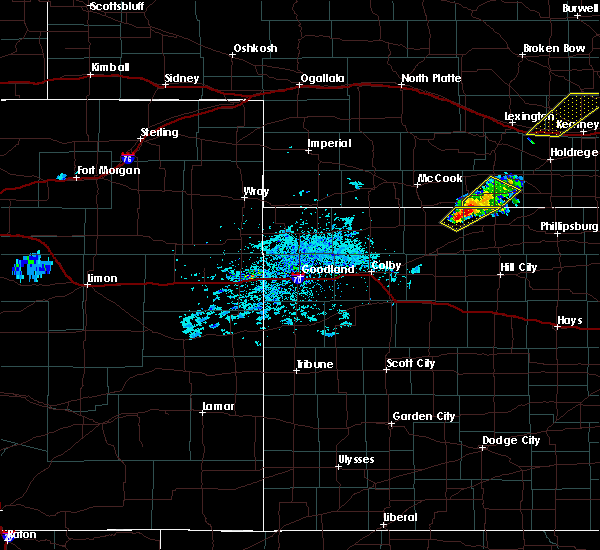 At 825 pm cdt, a severe thunderstorm was located 8 miles north of norcatur, or 16 miles northwest of norton, moving northeast at 25 mph (radar indicated). Hazards include 60 mph wind gusts and quarter size hail. Hail damage to vehicles is expected. expect wind damage to roofs, siding, and trees. Locations impacted include, norcatur. At 825 pm cdt, a severe thunderstorm was located 8 miles north of norcatur, or 16 miles northwest of norton, moving northeast at 25 mph (radar indicated). Hazards include 60 mph wind gusts and quarter size hail. Hail damage to vehicles is expected. expect wind damage to roofs, siding, and trees. Locations impacted include, norcatur.
|
| 9/15/2017 8:14 PM CDT |
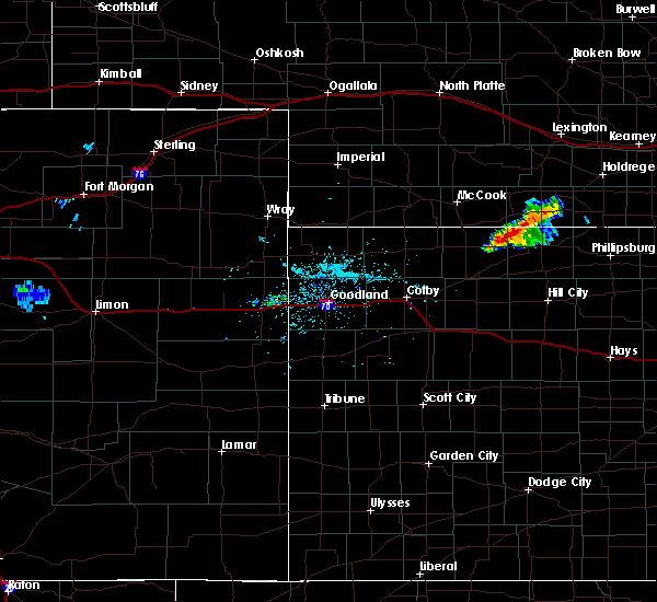 At 814 pm cdt, a severe thunderstorm was located 6 miles north of norcatur, or 16 miles west of norton, moving northeast at 35 mph (radar indicated). Hazards include 60 mph wind gusts and half dollar size hail. Hail damage to vehicles is expected. Expect wind damage to roofs, siding, and trees. At 814 pm cdt, a severe thunderstorm was located 6 miles north of norcatur, or 16 miles west of norton, moving northeast at 35 mph (radar indicated). Hazards include 60 mph wind gusts and half dollar size hail. Hail damage to vehicles is expected. Expect wind damage to roofs, siding, and trees.
|
| 8/2/2017 8:50 PM CDT |
 At 850 pm cdt, a severe thunderstorm was located over danbury, or 15 miles northeast of oberlin, moving southeast at 25 mph (radar indicated). Hazards include 60 mph wind gusts and quarter size hail. Hail damage to vehicles is expected. expect wind damage to roofs, siding, and trees. Locations impacted include, norcatur, danbury, lebanon and cedar bluffs. At 850 pm cdt, a severe thunderstorm was located over danbury, or 15 miles northeast of oberlin, moving southeast at 25 mph (radar indicated). Hazards include 60 mph wind gusts and quarter size hail. Hail damage to vehicles is expected. expect wind damage to roofs, siding, and trees. Locations impacted include, norcatur, danbury, lebanon and cedar bluffs.
|
| 8/2/2017 8:31 PM CDT |
 At 831 pm cdt, a severe thunderstorm was located 7 miles northwest of danbury, or 9 miles southeast of mccook, moving east at 20 mph (radar indicated). Hazards include 60 mph wind gusts and half dollar size hail. Hail damage to vehicles is expected. Expect wind damage to roofs, siding, and trees. At 831 pm cdt, a severe thunderstorm was located 7 miles northwest of danbury, or 9 miles southeast of mccook, moving east at 20 mph (radar indicated). Hazards include 60 mph wind gusts and half dollar size hail. Hail damage to vehicles is expected. Expect wind damage to roofs, siding, and trees.
|
| 7/13/2017 12:29 AM CDT |
 At 1229 am cdt, a severe thunderstorm was located 4 miles southwest of dresden, or 16 miles south of oberlin, moving northeast at 20 mph (radar indicated). Hazards include 60 mph wind gusts and penny size hail. Expect damage to roofs, siding, and trees. Locations impacted include, norcatur, jennings, clayton, dresden, kanona and reager. At 1229 am cdt, a severe thunderstorm was located 4 miles southwest of dresden, or 16 miles south of oberlin, moving northeast at 20 mph (radar indicated). Hazards include 60 mph wind gusts and penny size hail. Expect damage to roofs, siding, and trees. Locations impacted include, norcatur, jennings, clayton, dresden, kanona and reager.
|
| 7/13/2017 12:13 AM CDT |
 At 1213 am cdt, a severe thunderstorm was located over selden, or 13 miles northwest of hoxie, moving northeast at 20 mph (radar indicated). Hazards include 60 mph wind gusts and penny size hail. expect damage to roofs, siding, and trees At 1213 am cdt, a severe thunderstorm was located over selden, or 13 miles northwest of hoxie, moving northeast at 20 mph (radar indicated). Hazards include 60 mph wind gusts and penny size hail. expect damage to roofs, siding, and trees
|
| 7/2/2017 11:00 PM CDT |
 At 1100 pm cdt, severe thunderstorms were located along a line extending from near long island to 7 miles northwest of hill city to 4 miles west of hoxie, moving east at 35 mph (radar indicated). Hazards include 70 mph wind gusts and quarter size hail. Hail damage to vehicles is expected. expect considerable tree damage. Wind damage is also likely to mobile homes, roofs, and outbuildings. At 1100 pm cdt, severe thunderstorms were located along a line extending from near long island to 7 miles northwest of hill city to 4 miles west of hoxie, moving east at 35 mph (radar indicated). Hazards include 70 mph wind gusts and quarter size hail. Hail damage to vehicles is expected. expect considerable tree damage. Wind damage is also likely to mobile homes, roofs, and outbuildings.
|
| 7/2/2017 10:47 PM CDT |
 At 1046 pm cdt, severe thunderstorms were located along a line extending from near long island to 6 miles south of lenora to 7 miles east of menlo, moving southeast at 45 mph. these are very dangerous storms (radar indicated). Hazards include 80 mph wind gusts and quarter size hail. Flying debris will be dangerous to those caught without shelter. mobile homes will be heavily damaged. expect considerable damage to roofs, windows, and vehicles. extensive tree damage and power outages are likely. Locations impacted include, norton, oberlin, hill city, hoxie, almena, lenora and rexford. At 1046 pm cdt, severe thunderstorms were located along a line extending from near long island to 6 miles south of lenora to 7 miles east of menlo, moving southeast at 45 mph. these are very dangerous storms (radar indicated). Hazards include 80 mph wind gusts and quarter size hail. Flying debris will be dangerous to those caught without shelter. mobile homes will be heavily damaged. expect considerable damage to roofs, windows, and vehicles. extensive tree damage and power outages are likely. Locations impacted include, norton, oberlin, hill city, hoxie, almena, lenora and rexford.
|
| 7/2/2017 9:58 PM CDT |
 At 957 pm cdt, severe thunderstorms were located along a line extending from near beaver city to 7 miles south of danbury to near ludell, moving southeast at 45 mph. these are very dangerous storms (radar indicated). Hazards include 80 mph wind gusts and quarter size hail. Flying debris will be dangerous to those caught without shelter. mobile homes will be heavily damaged. expect considerable damage to roofs, windows, and vehicles. Extensive tree damage and power outages are likely. At 957 pm cdt, severe thunderstorms were located along a line extending from near beaver city to 7 miles south of danbury to near ludell, moving southeast at 45 mph. these are very dangerous storms (radar indicated). Hazards include 80 mph wind gusts and quarter size hail. Flying debris will be dangerous to those caught without shelter. mobile homes will be heavily damaged. expect considerable damage to roofs, windows, and vehicles. Extensive tree damage and power outages are likely.
|
| 7/2/2017 9:43 PM CDT |
 At 941 pm cdt, a severe thunderstorm was located 6 miles southeast of indianola, or 14 miles east of mccook, moving south at 25 mph. this is a very dangerous storm (radar indicated. at 936 pm cdt, a spotter 8 miles south southeast of culbertson reported a 59 mph wind gust). Hazards include 80 mph wind gusts and quarter size hail. Flying debris will be dangerous to those caught without shelter. mobile homes will be heavily damaged. expect considerable damage to roofs, windows, and vehicles. extensive tree damage and power outages are likely. Locations impacted include, mccook, oberlin, indianola, bartley, norcatur, danbury and lebanon. At 941 pm cdt, a severe thunderstorm was located 6 miles southeast of indianola, or 14 miles east of mccook, moving south at 25 mph. this is a very dangerous storm (radar indicated. at 936 pm cdt, a spotter 8 miles south southeast of culbertson reported a 59 mph wind gust). Hazards include 80 mph wind gusts and quarter size hail. Flying debris will be dangerous to those caught without shelter. mobile homes will be heavily damaged. expect considerable damage to roofs, windows, and vehicles. extensive tree damage and power outages are likely. Locations impacted include, mccook, oberlin, indianola, bartley, norcatur, danbury and lebanon.
|
| 7/2/2017 9:01 PM CDT |
 At 900 pm cdt, a severe thunderstorm was located near medicine creek reservoir state recreation area, or 18 miles southeast of curtis, moving south at 55 mph. this is a very dangerous storm (radar indicated). Hazards include 80 mph wind gusts and quarter size hail. Flying debris will be dangerous to those caught without shelter. mobile homes will be heavily damaged. expect considerable damage to roofs, windows, and vehicles. Extensive tree damage and power outages are likely. At 900 pm cdt, a severe thunderstorm was located near medicine creek reservoir state recreation area, or 18 miles southeast of curtis, moving south at 55 mph. this is a very dangerous storm (radar indicated). Hazards include 80 mph wind gusts and quarter size hail. Flying debris will be dangerous to those caught without shelter. mobile homes will be heavily damaged. expect considerable damage to roofs, windows, and vehicles. Extensive tree damage and power outages are likely.
|
| 6/29/2017 3:25 PM CDT |
 At 825 pm cdt, a severe thunderstorm was located 6 miles southeast of lebanon, or 19 miles northwest of norton, moving east at 25 mph (radar indicated). Hazards include two inch hail and 60 mph wind gusts. People and animals outdoors will be injured. expect hail damage to roofs, siding, windows, and vehicles. expect wind damage to roofs, siding, and trees. Locations impacted include, norton, norcatur and reager. At 825 pm cdt, a severe thunderstorm was located 6 miles southeast of lebanon, or 19 miles northwest of norton, moving east at 25 mph (radar indicated). Hazards include two inch hail and 60 mph wind gusts. People and animals outdoors will be injured. expect hail damage to roofs, siding, windows, and vehicles. expect wind damage to roofs, siding, and trees. Locations impacted include, norton, norcatur and reager.
|
| 6/29/2017 3:18 PM CDT |
 At 818 pm cdt, a severe thunderstorm was located 5 miles south of lebanon, or 17 miles northeast of oberlin, moving east at 30 mph (radar indicated). Hazards include ping pong ball size hail and 60 mph wind gusts. People and animals outdoors will be injured. expect hail damage to roofs, siding, windows, and vehicles. Expect wind damage to roofs, siding, and trees. At 818 pm cdt, a severe thunderstorm was located 5 miles south of lebanon, or 17 miles northeast of oberlin, moving east at 30 mph (radar indicated). Hazards include ping pong ball size hail and 60 mph wind gusts. People and animals outdoors will be injured. expect hail damage to roofs, siding, windows, and vehicles. Expect wind damage to roofs, siding, and trees.
|
| 5/9/2017 11:43 PM CDT |
 At 1143 pm cdt, severe thunderstorms were located along a line extending from 7 miles southwest of danbury to near dresden, moving east at 30 mph (trained weather spotters). Hazards include 70 mph wind gusts and quarter size hail. Hail damage to vehicles is expected. expect considerable tree damage. Wind damage is also likely to mobile homes, roofs, and outbuildings. At 1143 pm cdt, severe thunderstorms were located along a line extending from 7 miles southwest of danbury to near dresden, moving east at 30 mph (trained weather spotters). Hazards include 70 mph wind gusts and quarter size hail. Hail damage to vehicles is expected. expect considerable tree damage. Wind damage is also likely to mobile homes, roofs, and outbuildings.
|
| 9/3/2016 6:45 PM CDT |
 At 644 pm cdt, a severe thunderstorm was located 4 miles southeast of jennings, or 20 miles southeast of oberlin, moving northeast at 15 mph (radar indicated). Hazards include golf ball size hail and 60 mph wind gusts. People and animals outdoors will be injured. expect hail damage to roofs, siding, windows, and vehicles. Expect wind damage to roofs, siding, and trees. At 644 pm cdt, a severe thunderstorm was located 4 miles southeast of jennings, or 20 miles southeast of oberlin, moving northeast at 15 mph (radar indicated). Hazards include golf ball size hail and 60 mph wind gusts. People and animals outdoors will be injured. expect hail damage to roofs, siding, windows, and vehicles. Expect wind damage to roofs, siding, and trees.
|
| 8/19/2016 4:28 AM CDT |
 The severe thunderstorm warning for northeastern decatur, northwestern norton and southeastern red willow counties will expire at 430 am cdt, the storm which prompted the warning has weakened below severe limits, and no longer pose an immediate threat to life or property. therefore the warning will be allowed to expire. however gusty winds and heavy rain are still possible with this thunderstorm. The severe thunderstorm warning for northeastern decatur, northwestern norton and southeastern red willow counties will expire at 430 am cdt, the storm which prompted the warning has weakened below severe limits, and no longer pose an immediate threat to life or property. therefore the warning will be allowed to expire. however gusty winds and heavy rain are still possible with this thunderstorm.
|
| 8/19/2016 4:17 AM CDT |
 At 416 am cdt, a severe thunderstorm was located 5 miles northeast of norcatur, or 11 miles west of norton, moving east at 30 mph (radar indicated). Hazards include 60 mph wind gusts and quarter size hail. Hail damage to vehicles is expected. expect wind damage to roofs, siding, and trees. Locations impacted include, norton, norcatur, lebanon, clayton and reager. At 416 am cdt, a severe thunderstorm was located 5 miles northeast of norcatur, or 11 miles west of norton, moving east at 30 mph (radar indicated). Hazards include 60 mph wind gusts and quarter size hail. Hail damage to vehicles is expected. expect wind damage to roofs, siding, and trees. Locations impacted include, norton, norcatur, lebanon, clayton and reager.
|
| 8/19/2016 3:59 AM CDT |
 At 359 am cdt, severe thunderstorms were located along a line extending from 3 miles northeast of danbury to 3 miles northwest of clayton, moving east at 15 mph (radar indicated). Hazards include 60 mph wind gusts and quarter size hail. Hail damage to vehicles is expected. expect wind damage to roofs, siding, and trees. Locations impacted include, norton, norcatur, danbury, lebanon, clayton and reager. At 359 am cdt, severe thunderstorms were located along a line extending from 3 miles northeast of danbury to 3 miles northwest of clayton, moving east at 15 mph (radar indicated). Hazards include 60 mph wind gusts and quarter size hail. Hail damage to vehicles is expected. expect wind damage to roofs, siding, and trees. Locations impacted include, norton, norcatur, danbury, lebanon, clayton and reager.
|
| 8/19/2016 3:41 AM CDT |
 At 340 am cdt, severe thunderstorms were located along a line extending from 4 miles northwest of danbury to 4 miles northwest of clayton, moving northeast at 15 mph (radar indicated). Hazards include 60 mph wind gusts and quarter size hail. Hail damage to vehicles is expected. Expect wind damage to roofs, siding, and trees. At 340 am cdt, severe thunderstorms were located along a line extending from 4 miles northwest of danbury to 4 miles northwest of clayton, moving northeast at 15 mph (radar indicated). Hazards include 60 mph wind gusts and quarter size hail. Hail damage to vehicles is expected. Expect wind damage to roofs, siding, and trees.
|
| 8/19/2016 3:34 AM CDT |
 At 334 am cdt, severe thunderstorms were located along a line extending from 6 miles northwest of danbury to 5 miles southwest of norcatur, moving northeast at 10 mph (radar indicated). Hazards include 60 mph wind gusts and quarter size hail. Hail damage to vehicles is expected. expect wind damage to roofs, siding, and trees. Locations impacted include, indianola, bartley, norcatur, danbury, lebanon, kanona and reager. At 334 am cdt, severe thunderstorms were located along a line extending from 6 miles northwest of danbury to 5 miles southwest of norcatur, moving northeast at 10 mph (radar indicated). Hazards include 60 mph wind gusts and quarter size hail. Hail damage to vehicles is expected. expect wind damage to roofs, siding, and trees. Locations impacted include, indianola, bartley, norcatur, danbury, lebanon, kanona and reager.
|
| 8/19/2016 3:19 AM CDT |
 At 319 am cdt, severe thunderstorms were located along a line extending from 8 miles south of mccook to 4 miles northwest of clayton, moving northeast at 15 mph (radar indicated). Hazards include 60 mph wind gusts and quarter size hail. Hail damage to vehicles is expected. Expect wind damage to roofs, siding, and trees. At 319 am cdt, severe thunderstorms were located along a line extending from 8 miles south of mccook to 4 miles northwest of clayton, moving northeast at 15 mph (radar indicated). Hazards include 60 mph wind gusts and quarter size hail. Hail damage to vehicles is expected. Expect wind damage to roofs, siding, and trees.
|
| 7/28/2016 3:56 PM CDT |
 The severe thunderstorm warning for northwestern norton county will expire at 400 pm cdt, this warning has been replaced by a new severe thunderstorm warning for norton county until 430 pm cdt. repeating, a severe thunderstorm warning remains in effect for norton county until 430 pm cdt. a severe thunderstorm watch remains in effect until 1100 pm cdt for northwestern kansas. to report severe weather, contact your nearest law enforcement agency. they will relay your report to the national weather service goodland. The severe thunderstorm warning for northwestern norton county will expire at 400 pm cdt, this warning has been replaced by a new severe thunderstorm warning for norton county until 430 pm cdt. repeating, a severe thunderstorm warning remains in effect for norton county until 430 pm cdt. a severe thunderstorm watch remains in effect until 1100 pm cdt for northwestern kansas. to report severe weather, contact your nearest law enforcement agency. they will relay your report to the national weather service goodland.
|
| 7/28/2016 3:53 PM CDT |
 The severe thunderstorm warning for eastern decatur and eastern red willow counties will expire at 400 pm cdt, the storms which prompted the warning have moved out of the area. therefore the warning will be allowed to expire. however gusty winds and heavy rain are still possible with these thunderstorms. a severe thunderstorm watch remains in effect until 1100 pm cdt for northwestern kansas. remember, a severe thunderstorm warning still remains in effect for extreme eastern decatur county until 430 pm cdt. repeating a severe thunderstorm warning remains in effect for extreme eastern decatur county. The severe thunderstorm warning for eastern decatur and eastern red willow counties will expire at 400 pm cdt, the storms which prompted the warning have moved out of the area. therefore the warning will be allowed to expire. however gusty winds and heavy rain are still possible with these thunderstorms. a severe thunderstorm watch remains in effect until 1100 pm cdt for northwestern kansas. remember, a severe thunderstorm warning still remains in effect for extreme eastern decatur county until 430 pm cdt. repeating a severe thunderstorm warning remains in effect for extreme eastern decatur county.
|
| 7/28/2016 3:51 PM CDT |
 At 351 pm cdt, severe thunderstorms were located along a line extending from near holbrook to 9 miles northeast of norcatur to near jennings, moving east at 50 mph (radar indicated). Hazards include 60 mph wind gusts and penny size hail. Expect damage to roofs. siding. And trees. At 351 pm cdt, severe thunderstorms were located along a line extending from near holbrook to 9 miles northeast of norcatur to near jennings, moving east at 50 mph (radar indicated). Hazards include 60 mph wind gusts and penny size hail. Expect damage to roofs. siding. And trees.
|
| 7/28/2016 3:42 PM CDT |
 At 342 pm cdt, severe thunderstorms were located along a line extending from 5 miles southeast of cambridge to 4 miles northwest of clayton, moving east at 55 mph (radar indicated. at 330 pm cdt 62 mph winds were measured at the oberlin airport). Hazards include 60 mph wind gusts and quarter size hail. Hail damage to vehicles is expected. expect wind damage to roofs, siding, and trees. Locations impacted include, norton, norcatur, clayton and reager. At 342 pm cdt, severe thunderstorms were located along a line extending from 5 miles southeast of cambridge to 4 miles northwest of clayton, moving east at 55 mph (radar indicated. at 330 pm cdt 62 mph winds were measured at the oberlin airport). Hazards include 60 mph wind gusts and quarter size hail. Hail damage to vehicles is expected. expect wind damage to roofs, siding, and trees. Locations impacted include, norton, norcatur, clayton and reager.
|
| 7/28/2016 3:39 PM CDT |
 At 338 pm cdt, severe thunderstorms were located along a line extending from 6 miles southeast of bartley to 7 miles northwest of jennings, moving east at 55 mph (radar indicated. at 330 pm cdt...62 mph winds were measured at the oberlin airport). Hazards include 60 mph wind gusts and quarter size hail. Hail damage to vehicles is expected. expect wind damage to roofs, siding, and trees. Locations impacted include, oberlin, indianola, bartley, norcatur, danbury, jennings and lebanon. At 338 pm cdt, severe thunderstorms were located along a line extending from 6 miles southeast of bartley to 7 miles northwest of jennings, moving east at 55 mph (radar indicated. at 330 pm cdt...62 mph winds were measured at the oberlin airport). Hazards include 60 mph wind gusts and quarter size hail. Hail damage to vehicles is expected. expect wind damage to roofs, siding, and trees. Locations impacted include, oberlin, indianola, bartley, norcatur, danbury, jennings and lebanon.
|
| 7/28/2016 3:32 PM CDT |
 At 331 pm cdt, severe thunderstorms were located along a line extending from 6 miles south of cambridge to 5 miles south of oberlin, moving east at 55 mph (radar indicated. at 330 pm cdt...62 mph wind gusts were measured at the oberlin airport). Hazards include 60 mph wind gusts and quarter size hail. Hail damage to vehicles is expected. expect wind damage to roofs, siding, and trees. Locations impacted include, mccook, oberlin, indianola, bartley, norcatur, danbury and jennings. At 331 pm cdt, severe thunderstorms were located along a line extending from 6 miles south of cambridge to 5 miles south of oberlin, moving east at 55 mph (radar indicated. at 330 pm cdt...62 mph wind gusts were measured at the oberlin airport). Hazards include 60 mph wind gusts and quarter size hail. Hail damage to vehicles is expected. expect wind damage to roofs, siding, and trees. Locations impacted include, mccook, oberlin, indianola, bartley, norcatur, danbury and jennings.
|
| 7/28/2016 3:27 PM CDT |
 At 326 pm cdt, severe thunderstorms were located along a line extending from 3 miles southeast of cambridge to near oberlin, moving east at 60 mph (radar indicated). Hazards include 60 mph wind gusts and quarter size hail. Hail damage to vehicles is expected. Expect wind damage to roofs, siding, and trees. At 326 pm cdt, severe thunderstorms were located along a line extending from 3 miles southeast of cambridge to near oberlin, moving east at 60 mph (radar indicated). Hazards include 60 mph wind gusts and quarter size hail. Hail damage to vehicles is expected. Expect wind damage to roofs, siding, and trees.
|
| 7/28/2016 3:20 PM CDT |
 At 320 pm cdt, severe thunderstorms were located along a line extending from 3 miles west of cambridge to 6 miles northwest of oberlin, moving east at 60 mph (radar indicated). Hazards include 60 mph wind gusts and quarter size hail. Hail damage to vehicles is expected. expect wind damage to roofs, siding, and trees. Locations impacted include, mccook, oberlin, indianola, bartley, norcatur, danbury and jennings. At 320 pm cdt, severe thunderstorms were located along a line extending from 3 miles west of cambridge to 6 miles northwest of oberlin, moving east at 60 mph (radar indicated). Hazards include 60 mph wind gusts and quarter size hail. Hail damage to vehicles is expected. expect wind damage to roofs, siding, and trees. Locations impacted include, mccook, oberlin, indianola, bartley, norcatur, danbury and jennings.
|
| 7/28/2016 3:09 PM CDT |
 At 309 pm cdt, severe thunderstorms were located along a line extending from 3 miles north of indianola to near herndon, moving east at 60 mph (radar indicated). Hazards include 60 mph wind gusts and quarter size hail. Hail damage to vehicles is expected. Expect wind damage to roofs, siding, and trees. At 309 pm cdt, severe thunderstorms were located along a line extending from 3 miles north of indianola to near herndon, moving east at 60 mph (radar indicated). Hazards include 60 mph wind gusts and quarter size hail. Hail damage to vehicles is expected. Expect wind damage to roofs, siding, and trees.
|
| 7/13/2016 5:47 AM CDT |
 At 547 am cdt, a severe thunderstorm was located 5 miles northeast of norton, moving east at 55 mph (radar indicated). Hazards include 60 mph wind gusts. Expect damage to roofs. siding. and trees. Locations impacted include, norton, almena, norcatur, clayton, calvert and reager. At 547 am cdt, a severe thunderstorm was located 5 miles northeast of norton, moving east at 55 mph (radar indicated). Hazards include 60 mph wind gusts. Expect damage to roofs. siding. and trees. Locations impacted include, norton, almena, norcatur, clayton, calvert and reager.
|
| 7/13/2016 5:34 AM CDT |
 At 534 am cdt, a severe thunderstorm was located 7 miles west of norton, moving east at 55 mph (radar indicated). Hazards include 65 mph wind gusts. Expect damage to roofs. siding. And trees. At 534 am cdt, a severe thunderstorm was located 7 miles west of norton, moving east at 55 mph (radar indicated). Hazards include 65 mph wind gusts. Expect damage to roofs. siding. And trees.
|
| 7/5/2016 6:04 PM CDT |
 At 604 pm cdt, severe thunderstorms were located along a line extending from 5 miles north of norcatur to 3 miles southwest of oberlin, moving east at 10 mph (radar indicated). Hazards include 60 mph wind gusts and quarter size hail. Hail damage to vehicles is expected. expect wind damage to roofs, siding, and trees. Locations impacted include, oberlin, norcatur, jennings, clayton and kanona. At 604 pm cdt, severe thunderstorms were located along a line extending from 5 miles north of norcatur to 3 miles southwest of oberlin, moving east at 10 mph (radar indicated). Hazards include 60 mph wind gusts and quarter size hail. Hail damage to vehicles is expected. expect wind damage to roofs, siding, and trees. Locations impacted include, oberlin, norcatur, jennings, clayton and kanona.
|
| 7/5/2016 5:42 PM CDT |
 At 542 pm cdt, a severe thunderstorm was located 7 miles east of oberlin, moving southeast at 20 mph (radar indicated). Hazards include ping pong ball size hail and 60 mph wind gusts. People and animals outdoors will be injured. expect hail damage to roofs, siding, windows, and vehicles. Expect wind damage to roofs, siding, and trees. At 542 pm cdt, a severe thunderstorm was located 7 miles east of oberlin, moving southeast at 20 mph (radar indicated). Hazards include ping pong ball size hail and 60 mph wind gusts. People and animals outdoors will be injured. expect hail damage to roofs, siding, windows, and vehicles. Expect wind damage to roofs, siding, and trees.
|
| 7/5/2016 5:37 PM CDT |
 At 537 pm cdt, a severe thunderstorm was located 7 miles east of oberlin, moving east at 20 mph (radar indicated). Hazards include golf ball size hail and 60 mph wind gusts. People and animals outdoors will be injured. expect hail damage to roofs, siding, windows, and vehicles. expect wind damage to roofs, siding, and trees. Locations impacted include, norcatur. At 537 pm cdt, a severe thunderstorm was located 7 miles east of oberlin, moving east at 20 mph (radar indicated). Hazards include golf ball size hail and 60 mph wind gusts. People and animals outdoors will be injured. expect hail damage to roofs, siding, windows, and vehicles. expect wind damage to roofs, siding, and trees. Locations impacted include, norcatur.
|
| 7/5/2016 5:28 PM CDT |
 At 528 pm cdt, a severe thunderstorm was located 8 miles northeast of oberlin, moving east at 20 mph (radar indicated). Hazards include 60 mph wind gusts and quarter size hail. Hail damage to vehicles is expected. expect wind damage to roofs, siding, and trees. Locations impacted include, norcatur. At 528 pm cdt, a severe thunderstorm was located 8 miles northeast of oberlin, moving east at 20 mph (radar indicated). Hazards include 60 mph wind gusts and quarter size hail. Hail damage to vehicles is expected. expect wind damage to roofs, siding, and trees. Locations impacted include, norcatur.
|
| 7/5/2016 5:14 PM CDT |
 At 513 pm cdt, a severe thunderstorm was located 7 miles south of danbury, or 11 miles northeast of oberlin, moving east at 20 mph (radar indicated). Hazards include 60 mph wind gusts and quarter size hail. Hail damage to vehicles is expected. Expect wind damage to roofs, siding, and trees. At 513 pm cdt, a severe thunderstorm was located 7 miles south of danbury, or 11 miles northeast of oberlin, moving east at 20 mph (radar indicated). Hazards include 60 mph wind gusts and quarter size hail. Hail damage to vehicles is expected. Expect wind damage to roofs, siding, and trees.
|
| 6/28/2016 11:15 PM CDT |
 At 1115 pm cdt, severe thunderstorms were located along a line extending from 6 miles north of danbury to 10 miles northwest of brewster, moving south at 30 mph (wind gusts measured at atwood airport). Hazards include 60 mph wind gusts and nickel size hail. Expect damage to roofs. siding. and trees. Locations impacted include, mccook, oberlin, atwood, trenton, culbertson, indianola and bartley. At 1115 pm cdt, severe thunderstorms were located along a line extending from 6 miles north of danbury to 10 miles northwest of brewster, moving south at 30 mph (wind gusts measured at atwood airport). Hazards include 60 mph wind gusts and nickel size hail. Expect damage to roofs. siding. and trees. Locations impacted include, mccook, oberlin, atwood, trenton, culbertson, indianola and bartley.
|
| 6/28/2016 11:08 PM CDT |
 At 1107 pm cdt, severe thunderstorms were located along a line extending from near indianola to 13 miles south of mcdonald, moving south at 70 mph (radar indicated). Hazards include 70 mph wind gusts and nickel size hail. Expect considerable tree damage. Damage is likely to mobile homes, roofs, and outbuildings. At 1107 pm cdt, severe thunderstorms were located along a line extending from near indianola to 13 miles south of mcdonald, moving south at 70 mph (radar indicated). Hazards include 70 mph wind gusts and nickel size hail. Expect considerable tree damage. Damage is likely to mobile homes, roofs, and outbuildings.
|
| 6/9/2016 7:32 PM CDT |
 At 731 pm cdt, a severe thunderstorm was located 5 miles southeast of oberlin, moving northeast at 5 mph (radar indicated). Hazards include 60 mph wind gusts and quarter size hail. Hail damage to vehicles is expected. Expect wind damage to roofs, siding, and trees. At 731 pm cdt, a severe thunderstorm was located 5 miles southeast of oberlin, moving northeast at 5 mph (radar indicated). Hazards include 60 mph wind gusts and quarter size hail. Hail damage to vehicles is expected. Expect wind damage to roofs, siding, and trees.
|
| 5/30/2016 8:54 PM CDT |
 The severe thunderstorm warning for western gove, decatur, east central wallace, southeastern rawlins, thomas, logan, western norton, western sheridan and eastern red willow counties will expire at 800 pm mdt/900 pm cdt/, the storms which prompted the warning have moved out of the area. therefore the warning will be allowed to expire. however gusty winds and heavy rain are still possible with these thunderstorms. a severe thunderstorm watch remains in effect until 900 pm mdt/1000 pm cdt/ for northwestern kansas, and southwestern nebraska. The severe thunderstorm warning for western gove, decatur, east central wallace, southeastern rawlins, thomas, logan, western norton, western sheridan and eastern red willow counties will expire at 800 pm mdt/900 pm cdt/, the storms which prompted the warning have moved out of the area. therefore the warning will be allowed to expire. however gusty winds and heavy rain are still possible with these thunderstorms. a severe thunderstorm watch remains in effect until 900 pm mdt/1000 pm cdt/ for northwestern kansas, and southwestern nebraska.
|
| 5/30/2016 8:20 PM CDT |
 At 719 pm mdt/819 pm cdt/, severe thunderstorms were located along a line extending from 4 miles northeast of bartley to near oberlin to 3 miles northwest of colby to 5 miles northeast of winona to 8 miles southwest of russell springs, moving east at 50 mph (radar indicated). Hazards include 60 mph wind gusts and quarter size hail. Hail damage to vehicles is expected. expect wind damage to roofs, siding, and trees. locations impacted include, colby, norton, oakley, oberlin, grinnell, levant and indianola. This includes interstate 70 in kansas between mile markers 37 and 93. At 719 pm mdt/819 pm cdt/, severe thunderstorms were located along a line extending from 4 miles northeast of bartley to near oberlin to 3 miles northwest of colby to 5 miles northeast of winona to 8 miles southwest of russell springs, moving east at 50 mph (radar indicated). Hazards include 60 mph wind gusts and quarter size hail. Hail damage to vehicles is expected. expect wind damage to roofs, siding, and trees. locations impacted include, colby, norton, oakley, oberlin, grinnell, levant and indianola. This includes interstate 70 in kansas between mile markers 37 and 93.
|
| 5/30/2016 8:07 PM CDT |
 At 707 pm mdt/807 pm cdt/, severe thunderstorms were located along a line extending from 5 miles north of indianola to 6 miles northwest of oberlin to 7 miles northeast of brewster to 3 miles northwest of winona to 9 miles southeast of wallace, moving east at 35 mph (radar indicated). Hazards include 60 mph wind gusts and quarter size hail. Hail damage to vehicles is expected. Expect wind damage to roofs, siding, and trees. At 707 pm mdt/807 pm cdt/, severe thunderstorms were located along a line extending from 5 miles north of indianola to 6 miles northwest of oberlin to 7 miles northeast of brewster to 3 miles northwest of winona to 9 miles southeast of wallace, moving east at 35 mph (radar indicated). Hazards include 60 mph wind gusts and quarter size hail. Hail damage to vehicles is expected. Expect wind damage to roofs, siding, and trees.
|
| 5/26/2016 10:10 PM CDT |
 The severe thunderstorm warning for graham, eastern decatur and norton counties will expire at 1015 pm cdt, the storms which prompted the warning have weakened below severe limits, and no longer pose an immediate threat to life or property. therefore the warning will be allowed to expire. however heavy rain and gusty winds of up to 50 mph are still possible with these thunderstorms. The severe thunderstorm warning for graham, eastern decatur and norton counties will expire at 1015 pm cdt, the storms which prompted the warning have weakened below severe limits, and no longer pose an immediate threat to life or property. therefore the warning will be allowed to expire. however heavy rain and gusty winds of up to 50 mph are still possible with these thunderstorms.
|
| 5/26/2016 9:27 PM CDT |
 At 927 pm cdt, severe thunderstorms were located along a line extending from 8 miles southeast of danbury to near lenora to near morland, moving east at 45 mph (radar indicated). Hazards include 60 mph wind gusts. Expect damage to roofs. siding. And trees. At 927 pm cdt, severe thunderstorms were located along a line extending from 8 miles southeast of danbury to near lenora to near morland, moving east at 45 mph (radar indicated). Hazards include 60 mph wind gusts. Expect damage to roofs. siding. And trees.
|
| 5/26/2016 8:39 PM CDT |
 At 838 pm cdt, severe thunderstorms were located along a line extending from 8 miles east of oberlin to near park, moving northeast at 30 mph (radar indicated). Hazards include 70 mph wind gusts. Expect considerable tree damage. Damage is likely to mobile homes, roofs, and outbuildings. At 838 pm cdt, severe thunderstorms were located along a line extending from 8 miles east of oberlin to near park, moving northeast at 30 mph (radar indicated). Hazards include 70 mph wind gusts. Expect considerable tree damage. Damage is likely to mobile homes, roofs, and outbuildings.
|
| 5/10/2016 5:47 PM CDT |
 At 547 pm cdt, a severe thunderstorm was located 7 miles southwest of norton, moving northeast at 35 mph (radar indicated). Hazards include 60 mph wind gusts and quarter size hail. Hail damage to vehicles is expected. expect wind damage to roofs, siding, and trees. Locations impacted include, clayton and reager. At 547 pm cdt, a severe thunderstorm was located 7 miles southwest of norton, moving northeast at 35 mph (radar indicated). Hazards include 60 mph wind gusts and quarter size hail. Hail damage to vehicles is expected. expect wind damage to roofs, siding, and trees. Locations impacted include, clayton and reager.
|
| 5/10/2016 5:36 PM CDT |
 At 536 pm cdt, a severe thunderstorm was located near clayton, or 13 miles southwest of norton, moving northeast at 35 mph (radar indicated). Hazards include 60 mph wind gusts and quarter size hail. Hail damage to vehicles is expected. expect wind damage to roofs, siding, and trees. Locations impacted include, norcatur, clayton and reager. At 536 pm cdt, a severe thunderstorm was located near clayton, or 13 miles southwest of norton, moving northeast at 35 mph (radar indicated). Hazards include 60 mph wind gusts and quarter size hail. Hail damage to vehicles is expected. expect wind damage to roofs, siding, and trees. Locations impacted include, norcatur, clayton and reager.
|
| 5/10/2016 5:18 PM CDT |
 At 517 pm cdt, a severe thunderstorm was located over jennings, or 14 miles southeast of oberlin, moving northeast at 35 mph (radar indicated). Hazards include 60 mph wind gusts and quarter size hail. Hail damage to vehicles is expected. Expect wind damage to roofs, siding, and trees. At 517 pm cdt, a severe thunderstorm was located over jennings, or 14 miles southeast of oberlin, moving northeast at 35 mph (radar indicated). Hazards include 60 mph wind gusts and quarter size hail. Hail damage to vehicles is expected. Expect wind damage to roofs, siding, and trees.
|
| 5/7/2016 10:18 PM CDT |
 At 1018 pm cdt, a severe thunderstorm was located 5 miles southeast of clayton, or 14 miles southwest of norton, moving north at 55 mph (radar indicated). Hazards include two inch hail and 60 mph wind gusts. People and animals outdoors will be injured. expect hail damage to roofs, siding, windows, and vehicles. expect wind damage to roofs, siding, and trees. Locations impacted include, norton, norcatur, clayton and reager. At 1018 pm cdt, a severe thunderstorm was located 5 miles southeast of clayton, or 14 miles southwest of norton, moving north at 55 mph (radar indicated). Hazards include two inch hail and 60 mph wind gusts. People and animals outdoors will be injured. expect hail damage to roofs, siding, windows, and vehicles. expect wind damage to roofs, siding, and trees. Locations impacted include, norton, norcatur, clayton and reager.
|
| 5/7/2016 10:04 PM CDT |
 At 1004 pm cdt, a severe thunderstorm was located 10 miles southwest of lenora, or 19 miles northeast of hoxie, moving north at 55 mph (radar indicated). Hazards include golf ball size hail and 60 mph wind gusts. People and animals outdoors will be injured. expect hail damage to roofs, siding, windows, and vehicles. expect wind damage to roofs, siding, and trees. Locations impacted include, norton, lenora, norcatur, clayton, new almelo and reager. At 1004 pm cdt, a severe thunderstorm was located 10 miles southwest of lenora, or 19 miles northeast of hoxie, moving north at 55 mph (radar indicated). Hazards include golf ball size hail and 60 mph wind gusts. People and animals outdoors will be injured. expect hail damage to roofs, siding, windows, and vehicles. expect wind damage to roofs, siding, and trees. Locations impacted include, norton, lenora, norcatur, clayton, new almelo and reager.
|
| 5/7/2016 9:58 PM CDT |
 At 957 pm cdt, a severe thunderstorm was located 8 miles northwest of morland, or 16 miles northeast of hoxie, moving northeast at 65 mph (radar indicated). Hazards include ping pong ball size hail and 60 mph wind gusts. People and animals outdoors will be injured. expect hail damage to roofs, siding, windows, and vehicles. Expect wind damage to roofs, siding, and trees. At 957 pm cdt, a severe thunderstorm was located 8 miles northwest of morland, or 16 miles northeast of hoxie, moving northeast at 65 mph (radar indicated). Hazards include ping pong ball size hail and 60 mph wind gusts. People and animals outdoors will be injured. expect hail damage to roofs, siding, windows, and vehicles. Expect wind damage to roofs, siding, and trees.
|
| 5/7/2016 9:25 PM CDT | Ping Pong Ball sized hail reported 0.4 miles NNE of Norcatur, KS |
| 5/7/2016 9:25 PM CDT |
 At 925 pm cdt, a severe thunderstorm was located near norcatur, or 12 miles west of norton, moving north at 45 mph (radar indicated). Hazards include 60 mph wind gusts and quarter size hail. Hail damage to vehicles is expected. expect wind damage to roofs, siding, and trees. Locations impacted include, norcatur and reager. At 925 pm cdt, a severe thunderstorm was located near norcatur, or 12 miles west of norton, moving north at 45 mph (radar indicated). Hazards include 60 mph wind gusts and quarter size hail. Hail damage to vehicles is expected. expect wind damage to roofs, siding, and trees. Locations impacted include, norcatur and reager.
|
| 5/7/2016 9:10 PM CDT |
 At 910 pm cdt, a severe thunderstorm was located 6 miles southeast of clayton, or 15 miles southwest of norton, moving northeast at 55 mph (radar indicated). Hazards include 60 mph wind gusts and quarter size hail. Hail damage to vehicles is expected. expect wind damage to roofs, siding, and trees. Locations impacted include, norcatur, clayton and reager. At 910 pm cdt, a severe thunderstorm was located 6 miles southeast of clayton, or 15 miles southwest of norton, moving northeast at 55 mph (radar indicated). Hazards include 60 mph wind gusts and quarter size hail. Hail damage to vehicles is expected. expect wind damage to roofs, siding, and trees. Locations impacted include, norcatur, clayton and reager.
|
| 5/7/2016 8:57 PM CDT |
 At 856 pm cdt, a severe thunderstorm was located 12 miles south of jennings, or 16 miles northeast of hoxie, moving northeast at 55 mph (trained weather spotters. at 856 pm cdt...quarter size hail was reported 7 miles north of tasco). Hazards include ping pong ball size hail and 60 mph wind gusts. People and animals outdoors will be injured. expect hail damage to roofs, siding, windows, and vehicles. Expect wind damage to roofs, siding, and trees. At 856 pm cdt, a severe thunderstorm was located 12 miles south of jennings, or 16 miles northeast of hoxie, moving northeast at 55 mph (trained weather spotters. at 856 pm cdt...quarter size hail was reported 7 miles north of tasco). Hazards include ping pong ball size hail and 60 mph wind gusts. People and animals outdoors will be injured. expect hail damage to roofs, siding, windows, and vehicles. Expect wind damage to roofs, siding, and trees.
|
| 11/16/2015 7:12 PM CST |
 At 712 pm cst, severe thunderstorms were located along a line extending from 4 miles southeast of norcatur to 4 miles west of lenora, moving northeast at 40 mph (radar indicated). Hazards include 60 mph wind gusts and quarter size hail. Hail damage to vehicles is expected. expect wind damage to roofs, siding and trees. locations impacted include, lenora, norcatur, clayton, new almelo and reager. A tornado watch remains in effect until 1000 pm cst for northwestern kansas. At 712 pm cst, severe thunderstorms were located along a line extending from 4 miles southeast of norcatur to 4 miles west of lenora, moving northeast at 40 mph (radar indicated). Hazards include 60 mph wind gusts and quarter size hail. Hail damage to vehicles is expected. expect wind damage to roofs, siding and trees. locations impacted include, lenora, norcatur, clayton, new almelo and reager. A tornado watch remains in effect until 1000 pm cst for northwestern kansas.
|
| 11/16/2015 6:59 PM CST |
 At 659 pm cst, severe thunderstorms were located along a line extending from 3 miles west of clayton to 9 miles southeast of jennings, moving northeast at 40 mph (radar indicated). Hazards include 60 mph wind gusts and quarter size hail. Hail damage to vehicles is expected. Expect wind damage to roofs, siding and trees. At 659 pm cst, severe thunderstorms were located along a line extending from 3 miles west of clayton to 9 miles southeast of jennings, moving northeast at 40 mph (radar indicated). Hazards include 60 mph wind gusts and quarter size hail. Hail damage to vehicles is expected. Expect wind damage to roofs, siding and trees.
|
| 11/16/2015 6:36 PM CST |
 At 635 pm cst, a severe thunderstorm was located over dresden, or 16 miles north of hoxie, moving northeast at 40 mph (radar indicated). Hazards include 60 mph wind gusts and half dollar size hail. Hail damage to vehicles is expected. expect wind damage to roofs, siding and trees. locations impacted include, norcatur, jennings, clayton, dresden and leoville. A tornado watch remains in effect until 1000 pm cst for northwestern kansas. At 635 pm cst, a severe thunderstorm was located over dresden, or 16 miles north of hoxie, moving northeast at 40 mph (radar indicated). Hazards include 60 mph wind gusts and half dollar size hail. Hail damage to vehicles is expected. expect wind damage to roofs, siding and trees. locations impacted include, norcatur, jennings, clayton, dresden and leoville. A tornado watch remains in effect until 1000 pm cst for northwestern kansas.
|
| 11/16/2015 6:25 PM CST |
 At 624 pm cst, a severe thunderstorm was located near selden, or 11 miles north of hoxie, moving northeast at 40 mph (trained weather spotters. at 615 pm cst...quarter size hail was reported 7 miles south of selden). Hazards include 60 mph wind gusts and half dollar size hail. Hail damage to vehicles is expected. expect wind damage to roofs, siding and trees. locations impacted include, selden, norcatur, jennings, clayton, dresden and leoville. A tornado watch remains in effect until 1000 pm cst for northwestern kansas. At 624 pm cst, a severe thunderstorm was located near selden, or 11 miles north of hoxie, moving northeast at 40 mph (trained weather spotters. at 615 pm cst...quarter size hail was reported 7 miles south of selden). Hazards include 60 mph wind gusts and half dollar size hail. Hail damage to vehicles is expected. expect wind damage to roofs, siding and trees. locations impacted include, selden, norcatur, jennings, clayton, dresden and leoville. A tornado watch remains in effect until 1000 pm cst for northwestern kansas.
|
| 11/16/2015 6:20 PM CST |
 At 620 pm cst, a severe thunderstorm was located 4 miles south of selden, or 10 miles northwest of hoxie, moving northeast at 40 mph (trained weather spotters. at 615 pm cst...quarter size hail was reported 7 south of selden). Hazards include 60 mph wind gusts and half dollar size hail. Hail damage to vehicles is expected. Expect wind damage to roofs, siding and trees. At 620 pm cst, a severe thunderstorm was located 4 miles south of selden, or 10 miles northwest of hoxie, moving northeast at 40 mph (trained weather spotters. at 615 pm cst...quarter size hail was reported 7 south of selden). Hazards include 60 mph wind gusts and half dollar size hail. Hail damage to vehicles is expected. Expect wind damage to roofs, siding and trees.
|
| 9/10/2015 6:16 PM CDT |
 At 616 pm cdt, a severe thunderstorm was located 7 miles east of norcatur, or 8 miles west of norton, moving southeast at 50 mph (radar indicated). Hazards include golf ball size hail and 70 mph wind gusts. People and animals outdoors will be injured. expect hail damage to roofs, siding, windows and vehicles. expect considerable tree damage. wind damage is also likely to mobile homes, roofs and outbuildings. Locations impacted include, norton, lenora, norcatur, clayton, edmond, densmore, reager and new almelo. At 616 pm cdt, a severe thunderstorm was located 7 miles east of norcatur, or 8 miles west of norton, moving southeast at 50 mph (radar indicated). Hazards include golf ball size hail and 70 mph wind gusts. People and animals outdoors will be injured. expect hail damage to roofs, siding, windows and vehicles. expect considerable tree damage. wind damage is also likely to mobile homes, roofs and outbuildings. Locations impacted include, norton, lenora, norcatur, clayton, edmond, densmore, reager and new almelo.
|
| 9/10/2015 6:02 PM CDT |
 At 602 pm cdt, a severe thunderstorm was located 8 miles north of norcatur, or 16 miles northwest of norton, moving southeast at 50 mph (radar indicated). Hazards include ping pong ball size hail. People and animals outdoors will be injured. Expect damage to roofs, siding, windows and vehicles. At 602 pm cdt, a severe thunderstorm was located 8 miles north of norcatur, or 16 miles northwest of norton, moving southeast at 50 mph (radar indicated). Hazards include ping pong ball size hail. People and animals outdoors will be injured. Expect damage to roofs, siding, windows and vehicles.
|
| 8/8/2015 12:49 AM CDT |
 At 1249 am cdt, a severe thunderstorm was located near prairie view, or 14 miles east of norton, moving northeast at 15 mph (radar indicated). Hazards include 60 mph wind gusts and quarter size hail. Hail damage to vehicles is expected. expect wind damage to roofs, siding and trees. Locations impacted include, norton, almena, lenora, norcatur, edmond, calvert, densmore and reager. At 1249 am cdt, a severe thunderstorm was located near prairie view, or 14 miles east of norton, moving northeast at 15 mph (radar indicated). Hazards include 60 mph wind gusts and quarter size hail. Hail damage to vehicles is expected. expect wind damage to roofs, siding and trees. Locations impacted include, norton, almena, lenora, norcatur, edmond, calvert, densmore and reager.
|
| 8/8/2015 12:27 AM CDT |
 At 1227 am cdt, a severe thunderstorm was located 4 miles south of almena, or 9 miles east of norton, moving northeast at 15 mph (radar indicated). Hazards include 60 mph wind gusts and quarter size hail. Hail damage to vehicles is expected. Expect wind damage to roofs, siding and trees. At 1227 am cdt, a severe thunderstorm was located 4 miles south of almena, or 9 miles east of norton, moving northeast at 15 mph (radar indicated). Hazards include 60 mph wind gusts and quarter size hail. Hail damage to vehicles is expected. Expect wind damage to roofs, siding and trees.
|
| 8/7/2015 10:04 PM CDT |
 At 1004 pm cdt, severe thunderstorms were located along a line extending from 10 miles north of norton to 3 miles northeast of voda, moving east at 35 mph (radar indicated). Hazards include 70 mph wind gusts and quarter size hail. Hail damage to vehicles is expected. expect considerable tree damage. Wind damage is also likely to mobile homes, roofs and outbuildings. At 1004 pm cdt, severe thunderstorms were located along a line extending from 10 miles north of norton to 3 miles northeast of voda, moving east at 35 mph (radar indicated). Hazards include 70 mph wind gusts and quarter size hail. Hail damage to vehicles is expected. expect considerable tree damage. Wind damage is also likely to mobile homes, roofs and outbuildings.
|
| 8/7/2015 9:27 PM CDT |
 At 927 pm cdt, severe thunderstorms were located along a line extending from 5 miles northeast of herndon to 5 miles northeast of park, moving north at 25 mph (radar indicated). Hazards include 70 mph wind gusts and quarter size hail. Hail damage to vehicles is expected. expect considerable tree damage. wind damage is also likely to mobile homes, roofs and outbuildings. locations impacted include, norton, oberlin, hill city, hoxie, quinter, grainfield, lenora, selden, morland and norcatur. This includes interstate 70 in kansas between mile markers 95 and 113. At 927 pm cdt, severe thunderstorms were located along a line extending from 5 miles northeast of herndon to 5 miles northeast of park, moving north at 25 mph (radar indicated). Hazards include 70 mph wind gusts and quarter size hail. Hail damage to vehicles is expected. expect considerable tree damage. wind damage is also likely to mobile homes, roofs and outbuildings. locations impacted include, norton, oberlin, hill city, hoxie, quinter, grainfield, lenora, selden, morland and norcatur. This includes interstate 70 in kansas between mile markers 95 and 113.
|
| 8/7/2015 9:09 PM CDT |
 At 908 pm cdt, severe thunderstorms were located along a line extending from 6 miles south of herndon to 7 miles southwest of quinter, moving northeast at 30 mph (radar indicated). Hazards include 70 mph wind gusts and quarter size hail. Hail damage to vehicles is expected. expect considerable tree damage. Wind damage is also likely to mobile homes, roofs and outbuildings. At 908 pm cdt, severe thunderstorms were located along a line extending from 6 miles south of herndon to 7 miles southwest of quinter, moving northeast at 30 mph (radar indicated). Hazards include 70 mph wind gusts and quarter size hail. Hail damage to vehicles is expected. expect considerable tree damage. Wind damage is also likely to mobile homes, roofs and outbuildings.
|
| 8/4/2015 3:51 PM CDT |
 At 351 pm cdt, a severe thunderstorm was located 9 miles northeast of oberlin, moving east at 30 mph (radar indicated). Hazards include 60 mph wind gusts and quarter size hail. Hail damage to vehicles is expected. expect wind damage to roofs, siding and trees. Locations impacted include, oberlin, norcatur, kanona, traer and cedar bluffs. At 351 pm cdt, a severe thunderstorm was located 9 miles northeast of oberlin, moving east at 30 mph (radar indicated). Hazards include 60 mph wind gusts and quarter size hail. Hail damage to vehicles is expected. expect wind damage to roofs, siding and trees. Locations impacted include, oberlin, norcatur, kanona, traer and cedar bluffs.
|
| 8/4/2015 3:36 PM CDT |
 At 335 pm cdt, a severe thunderstorm was located 7 miles north of oberlin, moving east at 30 mph (radar indicated). Hazards include 60 mph wind gusts and quarter size hail. Hail damage to vehicles is expected. Expect wind damage to roofs, siding and trees. At 335 pm cdt, a severe thunderstorm was located 7 miles north of oberlin, moving east at 30 mph (radar indicated). Hazards include 60 mph wind gusts and quarter size hail. Hail damage to vehicles is expected. Expect wind damage to roofs, siding and trees.
|
| 7/23/2015 11:31 PM CDT |
 At 1131 pm cdt, a severe thunderstorm was located 4 miles north of norcatur, or 15 miles west of norton, moving east at 35 mph (radar indicated). Hazards include quarter size hail. Damage to vehicles is expected. Locations impacted include, norcatur, jennings, clayton, kanona and reager. At 1131 pm cdt, a severe thunderstorm was located 4 miles north of norcatur, or 15 miles west of norton, moving east at 35 mph (radar indicated). Hazards include quarter size hail. Damage to vehicles is expected. Locations impacted include, norcatur, jennings, clayton, kanona and reager.
|
| 7/23/2015 11:20 PM CDT |
 At 1120 pm cdt, a severe thunderstorm was located 8 miles west of norcatur, or 9 miles east of oberlin, moving east at 40 mph (radar indicated). Hazards include quarter size hail. Damage to vehicles is expected. Locations impacted include, norcatur, jennings, clayton, kanona and reager. At 1120 pm cdt, a severe thunderstorm was located 8 miles west of norcatur, or 9 miles east of oberlin, moving east at 40 mph (radar indicated). Hazards include quarter size hail. Damage to vehicles is expected. Locations impacted include, norcatur, jennings, clayton, kanona and reager.
|
| 7/23/2015 11:04 PM CDT |
 At 1104 pm cdt, severe thunderstorms were located along a line extending from 6 miles southeast of lebanon to 8 miles northeast of oberlin, moving southeast at 20 mph (radar indicated). Hazards include half dollar size hail. Damage to vehicles is expected. Locations impacted include, norcatur, jennings, clayton, kanona and reager. At 1104 pm cdt, severe thunderstorms were located along a line extending from 6 miles southeast of lebanon to 8 miles northeast of oberlin, moving southeast at 20 mph (radar indicated). Hazards include half dollar size hail. Damage to vehicles is expected. Locations impacted include, norcatur, jennings, clayton, kanona and reager.
|
| 7/23/2015 11:01 PM CDT |
 At 1100 pm cdt, severe thunderstorms were located along a line extending from 4 miles southeast of lebanon to 6 miles northeast of oberlin, moving southeast at 20 mph (radar indicated). Hazards include golf ball size hail. People and animals outdoors will be injured. expect damage to roofs, siding, windows and vehicles. Locations impacted include, norcatur, jennings, clayton, kanona and reager. At 1100 pm cdt, severe thunderstorms were located along a line extending from 4 miles southeast of lebanon to 6 miles northeast of oberlin, moving southeast at 20 mph (radar indicated). Hazards include golf ball size hail. People and animals outdoors will be injured. expect damage to roofs, siding, windows and vehicles. Locations impacted include, norcatur, jennings, clayton, kanona and reager.
|
| 7/23/2015 10:49 PM CDT |
 At 1049 pm cdt, severe thunderstorms were located along a line extending from near lebanon to 4 miles north of oberlin, moving southeast at 25 mph (radar indicated). Hazards include golf ball size hail. People and animals outdoors will be injured. Expect damage to roofs, siding, windows and vehicles. At 1049 pm cdt, severe thunderstorms were located along a line extending from near lebanon to 4 miles north of oberlin, moving southeast at 25 mph (radar indicated). Hazards include golf ball size hail. People and animals outdoors will be injured. Expect damage to roofs, siding, windows and vehicles.
|
| 7/10/2015 9:53 PM CDT |
 At 953 pm cdt, a severe thunderstorm was located over danbury, or 15 miles southeast of mccook, moving southeast at 20 mph (radar indicated). Hazards include 70 mph wind gusts and half dollar size hail. Hail damage to vehicles is expected. expect considerable tree damage. wind damage is also likely to mobile homes, roofs and outbuildings. Locations impacted include, norcatur, danbury and lebanon. At 953 pm cdt, a severe thunderstorm was located over danbury, or 15 miles southeast of mccook, moving southeast at 20 mph (radar indicated). Hazards include 70 mph wind gusts and half dollar size hail. Hail damage to vehicles is expected. expect considerable tree damage. wind damage is also likely to mobile homes, roofs and outbuildings. Locations impacted include, norcatur, danbury and lebanon.
|
| 7/10/2015 9:45 PM CDT |
 At 944 pm cdt, a severe thunderstorm was located near danbury, or 13 miles southeast of mccook, moving southeast at 20 mph (trained weather spotters). Hazards include 60 mph wind gusts and quarter size hail. Hail damage to vehicles is expected. expect wind damage to roofs, siding and trees. Locations impacted include, norcatur, danbury and lebanon. At 944 pm cdt, a severe thunderstorm was located near danbury, or 13 miles southeast of mccook, moving southeast at 20 mph (trained weather spotters). Hazards include 60 mph wind gusts and quarter size hail. Hail damage to vehicles is expected. expect wind damage to roofs, siding and trees. Locations impacted include, norcatur, danbury and lebanon.
|
| 7/10/2015 9:41 PM CDT |
 The national weather service in goodland has issued a * severe thunderstorm warning for. northeastern decatur county in northwestern kansas. southeastern red willow county in southwestern nebraska. until 1030 pm cdt * at 940 pm cdt. A severe thunderstorm was located near. The national weather service in goodland has issued a * severe thunderstorm warning for. northeastern decatur county in northwestern kansas. southeastern red willow county in southwestern nebraska. until 1030 pm cdt * at 940 pm cdt. A severe thunderstorm was located near.
|
| 7/10/2015 9:41 PM CDT |
 At 940 pm cdt, a severe thunderstorm was located near danbury, or 14 miles southeast of mccook, moving southeast at 20 mph. this warning replaces the previous severe thunderstorm warning for red willow county (radar indicated). Hazards include 60 mph wind gusts and quarter size hail. Hail damage to vehicles is expected. Expect wind damage to roofs, siding and trees. At 940 pm cdt, a severe thunderstorm was located near danbury, or 14 miles southeast of mccook, moving southeast at 20 mph. this warning replaces the previous severe thunderstorm warning for red willow county (radar indicated). Hazards include 60 mph wind gusts and quarter size hail. Hail damage to vehicles is expected. Expect wind damage to roofs, siding and trees.
|
| 6/4/2015 11:01 PM CDT | At 1101 pm cdt, a severe thunderstorm was located 5 miles southeast of lebanon, or 20 miles northwest of norton, moving southeast at 15 mph (radar indicated). Hazards include 60 mph wind gusts and half dollar size hail. Hail damage to vehicles is expected. Expect wind damage to roofs, siding and trees. |
| 6/4/2015 11:01 PM CDT | At 1101 pm cdt, a severe thunderstorm was located 5 miles southeast of lebanon, or 20 miles northwest of norton, moving southeast at 15 mph (radar indicated). Hazards include 60 mph wind gusts and half dollar size hail. Hail damage to vehicles is expected. Expect wind damage to roofs, siding and trees. |
| 6/4/2015 9:03 PM CDT | At 903 pm cdt, a severe thunderstorm was located 8 miles northwest of selden, or 13 miles southwest of oberlin, moving northeast at 15 mph (radar indicated). Hazards include golf ball size hail and 60 mph wind gusts. People and animals outdoors will be injured. expect hail damage to roofs, siding, windows and vehicles. Expect wind damage to roofs, siding and trees. |
| 6/4/2015 4:45 AM CDT | At 445 am cdt, a severe thunderstorm was located 7 miles southwest of danbury, or 8 miles north of oberlin, moving northeast at 55 mph (radar indicated). Hazards include ping pong ball size hail and 60 mph wind gusts. People and animals outdoors will be injured. expect hail damage to roofs, siding, windows and vehicles. Expect wind damage to roofs, siding and trees. |
| 6/4/2015 4:45 AM CDT | At 445 am cdt, a severe thunderstorm was located 7 miles southwest of danbury, or 8 miles north of oberlin, moving northeast at 55 mph (radar indicated). Hazards include ping pong ball size hail and 60 mph wind gusts. People and animals outdoors will be injured. expect hail damage to roofs, siding, windows and vehicles. Expect wind damage to roofs, siding and trees. |
| 5/15/2015 11:44 PM CDT | At 1144 pm cdt, severe thunderstorms were located along a line extending from near norcatur to 11 miles northwest of morland, moving northeast at 50 mph (radar indicated). Hazards include quarter size hail. Damage to vehicles is expected. locations impacted include, lenora, norcatur, jennings, clayton, reager, new almelo and tasco. 1. 00in. |
| 5/15/2015 11:30 PM CDT | At 1129 pm cdt, severe thunderstorms were located along a line extending from 4 miles south of jennings to 7 miles east of hoxie, moving northeast at 45 mph (radar indicated). Hazards include half dollar size hail. damage to vehicles is expected |
| 6/14/2013 3:30 PM CDT | Quarter sized hail reported 9.9 miles S of Norcatur, KS |
| 1/1/0001 12:00 AM | Golf Ball sized hail reported 0.4 miles NNE of Norcatur, KS |
| 1/1/0001 12:00 AM | Quarter sized hail reported 0.4 miles NNE of Norcatur, KS |
| 1/1/0001 12:00 AM | Tennis Ball sized hail reported 1.2 miles ENE of Norcatur, KS |
| 1/1/0001 12:00 AM | Storm damage reported in decatur county KS, 1 miles S of Norcatur, KS |
Hail Maps for Norcatur, KS
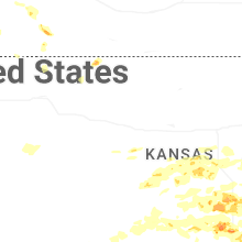


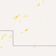


Connect with Interactive Hail Maps