

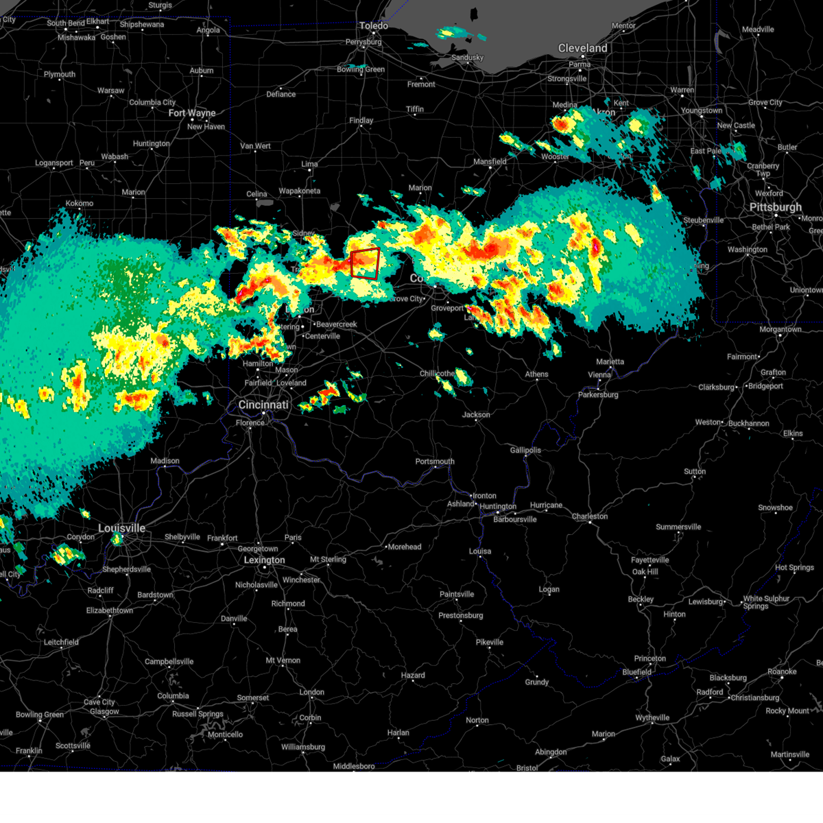
Hail Map for North Lewisburg, OH
The North Lewisburg, OH area has had 4 reports of on-the-ground hail by trained spotters, and has been under severe weather warnings 34 times during the past 12 months. Doppler radar has detected hail at or near North Lewisburg, OH on 31 occasions, including 1 occasion during the past year.
| Name: | North Lewisburg, OH |
| Where Located: | 34.5 miles WNW of Columbus, OH |
| Map: | Google Map for North Lewisburg, OH |
| Population: | 1490 |
| Housing Units: | 679 |
| More Info: | Search Google for North Lewisburg, OH |
0
The Top Recent Hail Date for North Lewisburg, OH is Tuesday, August 6, 2024 (20th out of 31)

Hail and Wind Damage Spotted near North Lewisburg, OH
| Date / Time | Report Details |
|---|---|
| 6/25/2025 4:48 PM EDT | Svriln the national weather service in wilmington has issued a * severe thunderstorm warning for, central champaign county in west central ohio, * until 515 pm edt. * at 448 pm edt, a severe thunderstorm was located over urbana, moving east at 20 mph (radar indicated). Hazards include 60 mph wind gusts and penny size hail. expect damage to trees and power lines |
| 6/18/2025 7:45 PM EDT |
 The storms which prompted the warning have moved out of the area. therefore, the warning has been allowed to expire. a severe thunderstorm watch remains in effect until 1000 pm edt for central and west central ohio. please report previous wind damage or hail to the national weather service by going to our website at weather.gov/iln and submitting your report via social media. The storms which prompted the warning have moved out of the area. therefore, the warning has been allowed to expire. a severe thunderstorm watch remains in effect until 1000 pm edt for central and west central ohio. please report previous wind damage or hail to the national weather service by going to our website at weather.gov/iln and submitting your report via social media.
|
| 6/18/2025 7:31 PM EDT |
 At 730 pm edt, severe thunderstorms were located along a line extending from near marseilles to near mechanicsburg, moving east at 60 mph (radar indicated). Hazards include 60 mph wind gusts. Expect damage to trees and power lines. Locations impacted include, urbana, north lewisburg, forest, west mansfield, mount victory, ridgeway, woodstock, valley hi, cable, raymond, westville, pickrelltown, byhalia, middleburg, pfeiffer, hepburn, pottersburg, mingo, kennard, and east liberty. At 730 pm edt, severe thunderstorms were located along a line extending from near marseilles to near mechanicsburg, moving east at 60 mph (radar indicated). Hazards include 60 mph wind gusts. Expect damage to trees and power lines. Locations impacted include, urbana, north lewisburg, forest, west mansfield, mount victory, ridgeway, woodstock, valley hi, cable, raymond, westville, pickrelltown, byhalia, middleburg, pfeiffer, hepburn, pottersburg, mingo, kennard, and east liberty.
|
| 6/18/2025 7:31 PM EDT |
 the severe thunderstorm warning has been cancelled and is no longer in effect the severe thunderstorm warning has been cancelled and is no longer in effect
|
| 6/18/2025 7:14 PM EDT |
 the severe thunderstorm warning has been cancelled and is no longer in effect the severe thunderstorm warning has been cancelled and is no longer in effect
|
| 6/18/2025 7:14 PM EDT |
 At 714 pm edt, severe thunderstorms were located along a line extending from 6 miles southeast of alger to 6 miles west of northridge, moving east at 35 mph (radar indicated). Hazards include 60 mph wind gusts. Expect damage to trees and power lines. locations impacted include, bellefontaine, urbana, kenton, ada, st. Paris, west liberty, north lewisburg, forest, de graff, dunkirk, alger, belle center, west mansfield, chippewa park, northwood, blanchard, roundhead, mount victory, christiansburg, and rushsylvania. At 714 pm edt, severe thunderstorms were located along a line extending from 6 miles southeast of alger to 6 miles west of northridge, moving east at 35 mph (radar indicated). Hazards include 60 mph wind gusts. Expect damage to trees and power lines. locations impacted include, bellefontaine, urbana, kenton, ada, st. Paris, west liberty, north lewisburg, forest, de graff, dunkirk, alger, belle center, west mansfield, chippewa park, northwood, blanchard, roundhead, mount victory, christiansburg, and rushsylvania.
|
| 6/18/2025 6:43 PM EDT | Svriln the national weather service in wilmington has issued a * severe thunderstorm warning for, eastern shelby county in west central ohio, champaign county in west central ohio, logan county in west central ohio, western union county in central ohio, hardin county in west central ohio, northeastern auglaize county in west central ohio, northeastern miami county in west central ohio, * until 745 pm edt. * at 642 pm edt, severe thunderstorms were located along a line extending from cridersville to near tipp city, moving east at 35 mph (emergency management. at 620 pm structural damage was reported near montezuma in mercer county). Hazards include 60 mph wind gusts. expect damage to trees and power lines |
| 5/16/2025 9:40 PM EDT | The storms which prompted the warning have moved out of the area. therefore, the warning will be allowed to expire. however, a severe thunderstorm warning still exists in portions of logan, champaign, clark, madison and union counties. a tornado watch remains in effect until 300 am edt for central and west central ohio. please report previous wind damage or hail to the national weather service by going to our website at weather.gov/iln and submitting your report via social media. |
| 5/16/2025 9:32 PM EDT |
 At 932 pm edt, severe thunderstorms were located along a line extending from near dunkirk to urbana, moving east northeast at 45 mph (radar indicated). Hazards include 60 mph wind gusts. Expect damage to trees and power lines. locations impacted include, cable, mechanicsburg, new jerusalem, zanesfield, hustead, state route 4 at state route 161, south vienna, choctaw lake, woodstock, powhattan, selma, pottersburg, catawba station, kennard, south charleston, west liberty, west mansfield, east liberty, valley hi, and buck creek state park. This includes i-70 in ohio between mile markers 53 and 73. At 932 pm edt, severe thunderstorms were located along a line extending from near dunkirk to urbana, moving east northeast at 45 mph (radar indicated). Hazards include 60 mph wind gusts. Expect damage to trees and power lines. locations impacted include, cable, mechanicsburg, new jerusalem, zanesfield, hustead, state route 4 at state route 161, south vienna, choctaw lake, woodstock, powhattan, selma, pottersburg, catawba station, kennard, south charleston, west liberty, west mansfield, east liberty, valley hi, and buck creek state park. This includes i-70 in ohio between mile markers 53 and 73.
|
| 5/16/2025 9:26 PM EDT | Svriln the national weather service in wilmington has issued a * severe thunderstorm warning for, eastern champaign county in west central ohio, franklin county in central ohio, southeastern logan county in west central ohio, northern pickaway county in central ohio, delaware county in central ohio, eastern clark county in west central ohio, union county in central ohio, madison county in central ohio, * until 1030 pm edt. * at 926 pm edt, severe thunderstorms were located along a line extending from near west mansfield to near south charleston, moving east at 50 mph (radar indicated). Hazards include 60 mph wind gusts. expect damage to trees and power lines |
| 5/16/2025 9:16 PM EDT | At 914 pm edt, severe thunderstorms were located along a line extending from 6 miles east of waynesfield to 6 miles northeast of new carlisle, moving east northeast at 50 mph (radar indicated). Hazards include 60 mph wind gusts. Expect damage to trees and power lines. locations impacted include, new jerusalem, south vienna, choctaw lake, woodstock, selma, millerstown, kiser lake state park, south charleston, terre haute, dialton, west mansfield, east liberty, st. paris, buck creek state park, logansville, north lewisburg, harmony, lisbon, pickrelltown, and lippincott. This includes i-70 in ohio between mile markers 45 and 73. |
| 5/16/2025 9:16 PM EDT | the severe thunderstorm warning has been cancelled and is no longer in effect |
| 5/16/2025 8:56 PM EDT | Svriln the national weather service in wilmington has issued a * severe thunderstorm warning for, eastern shelby county in west central ohio, champaign county in west central ohio, logan county in west central ohio, northern greene county in west central ohio, clark county in west central ohio, northeastern montgomery county in west central ohio, western union county in central ohio, western madison county in central ohio, eastern miami county in west central ohio, * until 945 pm edt. * at 855 pm edt, severe thunderstorms were located along a line extending from near jackson center to huber heights, moving east northeast at 50 mph (radar indicated). Hazards include 60 mph wind gusts. expect damage to trees and power lines |
| 4/29/2025 2:28 PM EDT |
 The storm which prompted the warning has moved out of the area. therefore, the warning will be allowed to expire. a severe thunderstorm watch remains in effect until 700 pm edt for central, southwestern and west central ohio. please report previous wind damage or hail to the national weather service by going to our website at weather.gov/iln and submitting your report via social media. remember, a severe thunderstorm warning still remains in effect for parts of clinton and warren counties. The storm which prompted the warning has moved out of the area. therefore, the warning will be allowed to expire. a severe thunderstorm watch remains in effect until 700 pm edt for central, southwestern and west central ohio. please report previous wind damage or hail to the national weather service by going to our website at weather.gov/iln and submitting your report via social media. remember, a severe thunderstorm warning still remains in effect for parts of clinton and warren counties.
|
| 4/29/2025 2:22 PM EDT |
 At 222 pm edt, a severe thunderstorm was located near west jefferson, moving east at 45 mph (radar indicated). Hazards include 60 mph wind gusts and penny size hail. Expect damage to trees and power lines. locations impacted include, paintersville, cable, mechanicsburg, fort ancient, rosemoor, lumberton, south vienna, oakland, woodstock, selma, catawba station, kennard, gladstone, south charleston, kingman, interstate 71 at us route 68, brighton, north lewisburg, new jasper, and lisbon. this includes the following interstates, i-70 in ohio between mile markers 65 and 70. I-71 in ohio between mile markers 35 and 61. At 222 pm edt, a severe thunderstorm was located near west jefferson, moving east at 45 mph (radar indicated). Hazards include 60 mph wind gusts and penny size hail. Expect damage to trees and power lines. locations impacted include, paintersville, cable, mechanicsburg, fort ancient, rosemoor, lumberton, south vienna, oakland, woodstock, selma, catawba station, kennard, gladstone, south charleston, kingman, interstate 71 at us route 68, brighton, north lewisburg, new jasper, and lisbon. this includes the following interstates, i-70 in ohio between mile markers 65 and 70. I-71 in ohio between mile markers 35 and 61.
|
| 4/29/2025 2:13 PM EDT |
 At 213 pm edt, a severe thunderstorm was located near choctaw lake, moving east at 60 mph (radar indicated). Hazards include 60 mph wind gusts and penny size hail. Expect damage to trees and power lines. locations impacted include, paintersville, fort ancient, rosemoor, lumberton, south vienna, oakland, woodstock, selma, corwin, genntown, oldtown, gladstone, caesar creek state park, yellow springs, south charleston, greene county airport, kingman, oregonia, buck creek state park, and kings mills. this includes the following interstates, i-70 in ohio between mile markers 54 and 70. I-71 in ohio between mile markers 23 and 61. At 213 pm edt, a severe thunderstorm was located near choctaw lake, moving east at 60 mph (radar indicated). Hazards include 60 mph wind gusts and penny size hail. Expect damage to trees and power lines. locations impacted include, paintersville, fort ancient, rosemoor, lumberton, south vienna, oakland, woodstock, selma, corwin, genntown, oldtown, gladstone, caesar creek state park, yellow springs, south charleston, greene county airport, kingman, oregonia, buck creek state park, and kings mills. this includes the following interstates, i-70 in ohio between mile markers 54 and 70. I-71 in ohio between mile markers 23 and 61.
|
| 4/29/2025 2:03 PM EDT |
 the severe thunderstorm warning has been cancelled and is no longer in effect the severe thunderstorm warning has been cancelled and is no longer in effect
|
| 4/29/2025 2:03 PM EDT |
 At 202 pm edt, a severe thunderstorm was located near choctaw lake, moving east at 60 mph (radar indicated). Hazards include 60 mph wind gusts and penny size hail. Expect damage to trees and power lines. locations impacted include, paintersville, state route 63 at state route 741, fort ancient, rosemoor, lumberton, south vienna, pekin, corwin, kiser lake state park, wright-patterson afb, oldtown, gladstone, caesar creek state park, yellow springs, new carlisle, dialton, hunter, north lewisburg, harmony, and lisbon. this includes the following interstates, i-70 in ohio between mile markers 42 and 70. i-71 in ohio between mile markers 23 and 61. I-75 in ohio between mile markers 30 and 32. At 202 pm edt, a severe thunderstorm was located near choctaw lake, moving east at 60 mph (radar indicated). Hazards include 60 mph wind gusts and penny size hail. Expect damage to trees and power lines. locations impacted include, paintersville, state route 63 at state route 741, fort ancient, rosemoor, lumberton, south vienna, pekin, corwin, kiser lake state park, wright-patterson afb, oldtown, gladstone, caesar creek state park, yellow springs, new carlisle, dialton, hunter, north lewisburg, harmony, and lisbon. this includes the following interstates, i-70 in ohio between mile markers 42 and 70. i-71 in ohio between mile markers 23 and 61. I-75 in ohio between mile markers 30 and 32.
|
| 4/29/2025 1:56 PM EDT |
 At 156 pm edt, a severe thunderstorm was located over springfield, moving east at 60 mph (radar indicated). Hazards include 60 mph wind gusts and penny size hail. Expect damage to trees and power lines. locations impacted include, paintersville, franklin, casstown, state route 63 at state route 741, fort ancient, rosemoor, beckett ridge, lumberton, south vienna, pekin, corwin, kiser lake state park, wright-patterson afb, oldtown, gladstone, caesar creek state park, yellow springs, new carlisle, dialton, and hunter. this includes the following interstates, i-70 in ohio between mile markers 41 and 70. i-71 in ohio between mile markers 22 and 61. I-75 in ohio between mile markers 17 and 45. At 156 pm edt, a severe thunderstorm was located over springfield, moving east at 60 mph (radar indicated). Hazards include 60 mph wind gusts and penny size hail. Expect damage to trees and power lines. locations impacted include, paintersville, franklin, casstown, state route 63 at state route 741, fort ancient, rosemoor, beckett ridge, lumberton, south vienna, pekin, corwin, kiser lake state park, wright-patterson afb, oldtown, gladstone, caesar creek state park, yellow springs, new carlisle, dialton, and hunter. this includes the following interstates, i-70 in ohio between mile markers 41 and 70. i-71 in ohio between mile markers 22 and 61. I-75 in ohio between mile markers 17 and 45.
|
| 4/29/2025 1:33 PM EDT |
 Svriln the national weather service in wilmington has issued a * severe thunderstorm warning for, north central hamilton county in southwestern ohio, champaign county in west central ohio, eastern butler county in southwestern ohio, warren county in southwestern ohio, northwestern clinton county in southwestern ohio, greene county in west central ohio, clark county in west central ohio, eastern montgomery county in west central ohio, eastern miami county in west central ohio, * until 230 pm edt. * at 133 pm edt, a severe thunderstorm was located near trotwood, moving east at 60 mph (radar indicated). Hazards include 60 mph wind gusts and nickel size hail. expect damage to trees and power lines Svriln the national weather service in wilmington has issued a * severe thunderstorm warning for, north central hamilton county in southwestern ohio, champaign county in west central ohio, eastern butler county in southwestern ohio, warren county in southwestern ohio, northwestern clinton county in southwestern ohio, greene county in west central ohio, clark county in west central ohio, eastern montgomery county in west central ohio, eastern miami county in west central ohio, * until 230 pm edt. * at 133 pm edt, a severe thunderstorm was located near trotwood, moving east at 60 mph (radar indicated). Hazards include 60 mph wind gusts and nickel size hail. expect damage to trees and power lines
|
| 3/19/2025 11:42 PM EDT |
 The storm which prompted the warning has moved out of the area. therefore, the warning will be allowed to expire. however, gusty winds and heavy rain are still possible with this thunderstorm. please report previous wind damage or hail to the national weather service by going to our website at weather.gov/iln and submitting your report via social media. The storm which prompted the warning has moved out of the area. therefore, the warning will be allowed to expire. however, gusty winds and heavy rain are still possible with this thunderstorm. please report previous wind damage or hail to the national weather service by going to our website at weather.gov/iln and submitting your report via social media.
|
| 3/19/2025 11:36 PM EDT |
 At 1136 pm edt, a severe thunderstorm was located near north lewisburg, moving northeast at 65 mph (radar indicated). Hazards include 60 mph wind gusts. Expect damage to trees and power lines. locations impacted include, cable, mechanicsburg, new jerusalem, zanesfield, south vienna, powhattan, catawba station, kennard, west mansfield, east liberty, valley hi, buck creek state park, north lewisburg, harmony, pickrelltown, middleburg, urbana, northridge, catawba, and mingo. This includes i-70 in ohio between mile markers 54 and 68. At 1136 pm edt, a severe thunderstorm was located near north lewisburg, moving northeast at 65 mph (radar indicated). Hazards include 60 mph wind gusts. Expect damage to trees and power lines. locations impacted include, cable, mechanicsburg, new jerusalem, zanesfield, south vienna, powhattan, catawba station, kennard, west mansfield, east liberty, valley hi, buck creek state park, north lewisburg, harmony, pickrelltown, middleburg, urbana, northridge, catawba, and mingo. This includes i-70 in ohio between mile markers 54 and 68.
|
| 3/19/2025 11:20 PM EDT |
 At 1120 pm edt, a severe thunderstorm was located over west liberty, moving northeast at 65 mph (radar indicated). Hazards include 60 mph wind gusts. Expect damage to trees and power lines. locations impacted include, green meadows, cable, mechanicsburg, thackery, westville, new jerusalem, zanesfield, enon, south vienna, powhattan, mcmorran, millerstown, catawba station, kennard, terre haute, west liberty, dialton, west mansfield, east liberty, and valley hi. This includes i-70 in ohio between mile markers 45 and 68. At 1120 pm edt, a severe thunderstorm was located over west liberty, moving northeast at 65 mph (radar indicated). Hazards include 60 mph wind gusts. Expect damage to trees and power lines. locations impacted include, green meadows, cable, mechanicsburg, thackery, westville, new jerusalem, zanesfield, enon, south vienna, powhattan, mcmorran, millerstown, catawba station, kennard, terre haute, west liberty, dialton, west mansfield, east liberty, and valley hi. This includes i-70 in ohio between mile markers 45 and 68.
|
| 3/19/2025 11:20 PM EDT |
 the severe thunderstorm warning has been cancelled and is no longer in effect the severe thunderstorm warning has been cancelled and is no longer in effect
|
| 3/19/2025 11:06 PM EDT |
 Svriln the national weather service in wilmington has issued a * severe thunderstorm warning for, champaign county in west central ohio, logan county in west central ohio, northwestern greene county in west central ohio, clark county in west central ohio, * until 1145 pm edt. * at 1105 pm edt, a severe thunderstorm was located near st. paris, moving northeast at 65 mph (radar indicated). Hazards include 60 mph wind gusts. expect damage to trees and power lines Svriln the national weather service in wilmington has issued a * severe thunderstorm warning for, champaign county in west central ohio, logan county in west central ohio, northwestern greene county in west central ohio, clark county in west central ohio, * until 1145 pm edt. * at 1105 pm edt, a severe thunderstorm was located near st. paris, moving northeast at 65 mph (radar indicated). Hazards include 60 mph wind gusts. expect damage to trees and power lines
|
| 3/15/2025 8:01 AM EDT | the severe thunderstorm warning has been cancelled and is no longer in effect |
| 3/15/2025 7:52 AM EDT |
 At 751 am edt, severe thunderstorms were located along a line extending from west mansfield to northridge, moving east at 45 mph (radar indicated). Hazards include 60 mph wind gusts. Expect damage to trees and power lines. locations impacted include, cable, new jerusalem, zanesfield, south vienna, powhattan, catawba station, kennard, west mansfield, east liberty, valley hi, buck creek state park, donnelsville, north lewisburg, harmony, pickrelltown, lippincott, middleburg, urbana, snyderville, and northridge. This includes i-70 in ohio between mile markers 49 and 68. At 751 am edt, severe thunderstorms were located along a line extending from west mansfield to northridge, moving east at 45 mph (radar indicated). Hazards include 60 mph wind gusts. Expect damage to trees and power lines. locations impacted include, cable, new jerusalem, zanesfield, south vienna, powhattan, catawba station, kennard, west mansfield, east liberty, valley hi, buck creek state park, donnelsville, north lewisburg, harmony, pickrelltown, lippincott, middleburg, urbana, snyderville, and northridge. This includes i-70 in ohio between mile markers 49 and 68.
|
| 3/15/2025 7:40 AM EDT |
 the severe thunderstorm warning has been cancelled and is no longer in effect the severe thunderstorm warning has been cancelled and is no longer in effect
|
| 3/15/2025 7:40 AM EDT |
 At 739 am edt, severe thunderstorms were located along a line extending from near bellefontaine to near new carlisle, moving northeast at 60 mph (radar indicated). Hazards include 60 mph wind gusts. Expect damage to trees and power lines. locations impacted include, cable, thackery, westville, new jerusalem, zanesfield, south vienna, powhattan, millerstown, catawba station, kennard, terre haute, state route 41 at state route 235, west liberty, dialton, west mansfield, east liberty, valley hi, buck creek state park, north hampton, and donnelsville. This includes i-70 in ohio between mile markers 48 and 68. At 739 am edt, severe thunderstorms were located along a line extending from near bellefontaine to near new carlisle, moving northeast at 60 mph (radar indicated). Hazards include 60 mph wind gusts. Expect damage to trees and power lines. locations impacted include, cable, thackery, westville, new jerusalem, zanesfield, south vienna, powhattan, millerstown, catawba station, kennard, terre haute, state route 41 at state route 235, west liberty, dialton, west mansfield, east liberty, valley hi, buck creek state park, north hampton, and donnelsville. This includes i-70 in ohio between mile markers 48 and 68.
|
| 3/15/2025 7:29 AM EDT |
 Svriln the national weather service in wilmington has issued a * severe thunderstorm warning for, champaign county in west central ohio, southern logan county in west central ohio, clark county in west central ohio, northeastern montgomery county in west central ohio, southeastern miami county in west central ohio, * until 815 am edt. * at 728 am edt, severe thunderstorms were located along a line extending from near de graff to near vandalia, moving east at 45 mph (radar indicated). Hazards include 60 mph wind gusts. expect damage to trees and power lines Svriln the national weather service in wilmington has issued a * severe thunderstorm warning for, champaign county in west central ohio, southern logan county in west central ohio, clark county in west central ohio, northeastern montgomery county in west central ohio, southeastern miami county in west central ohio, * until 815 am edt. * at 728 am edt, severe thunderstorms were located along a line extending from near de graff to near vandalia, moving east at 45 mph (radar indicated). Hazards include 60 mph wind gusts. expect damage to trees and power lines
|
| 8/6/2024 7:41 PM EDT |
 The storm which prompted the warning has weakened below severe limits and has exited the warned area. therefore, the warning will be allowed to expire. however, gusty winds and heavy rain are still possible with this thunderstorm. please report previous wind damage or hail to the national weather service by going to our website at weather.gov/iln and submitting your report via social media. The storm which prompted the warning has weakened below severe limits and has exited the warned area. therefore, the warning will be allowed to expire. however, gusty winds and heavy rain are still possible with this thunderstorm. please report previous wind damage or hail to the national weather service by going to our website at weather.gov/iln and submitting your report via social media.
|
| 8/6/2024 7:29 PM EDT |
 At 729 pm edt, a severe thunderstorm was located over north lewisburg, moving southeast at 20 mph (radar indicated). Hazards include 60 mph wind gusts and penny size hail. Expect damage to trees and power lines. locations impacted include, marysville, sidney, bellefontaine, west liberty, north lewisburg, de graff, hardin, milford center, quincy, port jefferson, woodstock, valley hi, zanesfield, pottersburg, pemberton, east liberty, logansville, pickrelltown, lake loramie state park, and middleburg. This includes i-75 in ohio between mile markers 91 and 98. At 729 pm edt, a severe thunderstorm was located over north lewisburg, moving southeast at 20 mph (radar indicated). Hazards include 60 mph wind gusts and penny size hail. Expect damage to trees and power lines. locations impacted include, marysville, sidney, bellefontaine, west liberty, north lewisburg, de graff, hardin, milford center, quincy, port jefferson, woodstock, valley hi, zanesfield, pottersburg, pemberton, east liberty, logansville, pickrelltown, lake loramie state park, and middleburg. This includes i-75 in ohio between mile markers 91 and 98.
|
| 8/6/2024 7:04 PM EDT |
 At 703 pm edt, a severe thunderstorm was located near bellefontaine, moving southeast at 20 mph (radar indicated). Hazards include 60 mph wind gusts and penny size hail. Expect damage to trees and power lines. locations impacted include, marysville, sidney, bellefontaine, west liberty, anna, north lewisburg, jackson center, russells point, de graff, botkins, lakeview, belle center, west mansfield, chippewa park, hardin, northwood, milford center, quincy, rushsylvania, and huntsville. This includes i-75 in ohio between mile markers 91 and 105. At 703 pm edt, a severe thunderstorm was located near bellefontaine, moving southeast at 20 mph (radar indicated). Hazards include 60 mph wind gusts and penny size hail. Expect damage to trees and power lines. locations impacted include, marysville, sidney, bellefontaine, west liberty, anna, north lewisburg, jackson center, russells point, de graff, botkins, lakeview, belle center, west mansfield, chippewa park, hardin, northwood, milford center, quincy, rushsylvania, and huntsville. This includes i-75 in ohio between mile markers 91 and 105.
|
| 8/6/2024 6:53 PM EDT |
 Svriln the national weather service in wilmington has issued a * severe thunderstorm warning for, shelby county in west central ohio, northern champaign county in west central ohio, logan county in west central ohio, southwestern union county in central ohio, * until 745 pm edt. * at 653 pm edt, a severe thunderstorm was located over bellefontaine, moving southeast at 20 mph (radar indicated). Hazards include 60 mph wind gusts and penny size hail. expect damage to trees and power lines Svriln the national weather service in wilmington has issued a * severe thunderstorm warning for, shelby county in west central ohio, northern champaign county in west central ohio, logan county in west central ohio, southwestern union county in central ohio, * until 745 pm edt. * at 653 pm edt, a severe thunderstorm was located over bellefontaine, moving southeast at 20 mph (radar indicated). Hazards include 60 mph wind gusts and penny size hail. expect damage to trees and power lines
|
| 6/25/2024 12:38 PM EDT |
 The storm which prompted the warning has weakened below severe limits and no longer poses an immediate threat to life or property. therefore, the warning will be allowed to expire. please report previous wind damage or hail to the national weather service by going to our website at weather.gov/iln and submitting your report via social media. The storm which prompted the warning has weakened below severe limits and no longer poses an immediate threat to life or property. therefore, the warning will be allowed to expire. please report previous wind damage or hail to the national weather service by going to our website at weather.gov/iln and submitting your report via social media.
|
| 6/25/2024 12:28 PM EDT |
 the severe thunderstorm warning has been cancelled and is no longer in effect the severe thunderstorm warning has been cancelled and is no longer in effect
|
| 6/25/2024 12:28 PM EDT |
 At 1227 pm edt, a severe thunderstorm was located near north lewisburg, moving southeast at 35 mph (radar indicated). Hazards include 60 mph wind gusts and quarter size hail. Minor hail damage to vehicles is possible. expect wind damage to trees and power lines. Locations impacted include, marysville, urbana, mechanicsburg, north lewisburg, milford center, woodstock, unionville center, mutual, cable, rosedale, state route 4 at state route 161, watkins, chuckery, and new dover. At 1227 pm edt, a severe thunderstorm was located near north lewisburg, moving southeast at 35 mph (radar indicated). Hazards include 60 mph wind gusts and quarter size hail. Minor hail damage to vehicles is possible. expect wind damage to trees and power lines. Locations impacted include, marysville, urbana, mechanicsburg, north lewisburg, milford center, woodstock, unionville center, mutual, cable, rosedale, state route 4 at state route 161, watkins, chuckery, and new dover.
|
| 6/25/2024 12:15 PM EDT |
 At 1215 pm edt, a severe thunderstorm was located near north lewisburg, moving southeast at 35 mph (radar indicated). Hazards include 60 mph wind gusts and quarter size hail. Minor hail damage to vehicles is possible. expect wind damage to trees and power lines. Locations impacted include, marysville, urbana, west liberty, mechanicsburg, north lewisburg, milford center, woodstock, unionville center, valley hi, mutual, cable, raymond, pickrelltown, lippincott, rosedale, middleburg, state route 4 at state route 161, mingo, pottersburg, and watkins. At 1215 pm edt, a severe thunderstorm was located near north lewisburg, moving southeast at 35 mph (radar indicated). Hazards include 60 mph wind gusts and quarter size hail. Minor hail damage to vehicles is possible. expect wind damage to trees and power lines. Locations impacted include, marysville, urbana, west liberty, mechanicsburg, north lewisburg, milford center, woodstock, unionville center, valley hi, mutual, cable, raymond, pickrelltown, lippincott, rosedale, middleburg, state route 4 at state route 161, mingo, pottersburg, and watkins.
|
| 6/25/2024 11:59 AM EDT |
 Svriln the national weather service in wilmington has issued a * severe thunderstorm warning for, eastern champaign county in west central ohio, southeastern logan county in west central ohio, southern union county in central ohio, north central madison county in central ohio, * until 1245 pm edt. * at 1159 am edt, a severe thunderstorm was located over bellefontaine, moving southeast at 35 mph (radar indicated). Hazards include 60 mph wind gusts and quarter size hail. Minor hail damage to vehicles is possible. Expect wind damage to trees and power lines. Svriln the national weather service in wilmington has issued a * severe thunderstorm warning for, eastern champaign county in west central ohio, southeastern logan county in west central ohio, southern union county in central ohio, north central madison county in central ohio, * until 1245 pm edt. * at 1159 am edt, a severe thunderstorm was located over bellefontaine, moving southeast at 35 mph (radar indicated). Hazards include 60 mph wind gusts and quarter size hail. Minor hail damage to vehicles is possible. Expect wind damage to trees and power lines.
|
| 5/7/2024 9:28 PM EDT |
 Toriln the national weather service in wilmington has issued a * tornado warning for, central champaign county in west central ohio, southeastern logan county in west central ohio, * until 1000 pm edt. * at 928 pm edt, a severe thunderstorm capable of producing a tornado was located near st. paris, moving east at 40 mph (radar indicated rotation). Hazards include tornado and quarter size hail. Flying debris will be dangerous to those caught without shelter. mobile homes will be damaged or destroyed. damage to roofs, windows, and vehicles will occur. Tree damage is likely. Toriln the national weather service in wilmington has issued a * tornado warning for, central champaign county in west central ohio, southeastern logan county in west central ohio, * until 1000 pm edt. * at 928 pm edt, a severe thunderstorm capable of producing a tornado was located near st. paris, moving east at 40 mph (radar indicated rotation). Hazards include tornado and quarter size hail. Flying debris will be dangerous to those caught without shelter. mobile homes will be damaged or destroyed. damage to roofs, windows, and vehicles will occur. Tree damage is likely.
|
| 4/17/2024 4:43 PM EDT |
 However, additional severe thunderstorm warnings remain in effect for portions of union, madison, and champaign counties. a tornado watch remains in effect until 700 pm edt for central and west central ohio. please report previous wind damage or hail to the national weather service by going to our website at weather.gov/iln and submitting your report via social media. However, additional severe thunderstorm warnings remain in effect for portions of union, madison, and champaign counties. a tornado watch remains in effect until 700 pm edt for central and west central ohio. please report previous wind damage or hail to the national weather service by going to our website at weather.gov/iln and submitting your report via social media.
|
| 4/17/2024 4:16 PM EDT |
 At 416 pm edt, a severe thunderstorm was located near urbana, moving east at 45 mph (radar indicated). Hazards include 60 mph wind gusts and quarter size hail. Minor hail damage to vehicles is possible. expect wind damage to trees and power lines. locations impacted include, urbana, st. Paris, mechanicsburg, north lewisburg, milford center, christiansburg, woodstock, mutual, cable, thackery, westville, lippincott, rosedale, powhattan, millerstown, mingo, pottersburg, and kennard. At 416 pm edt, a severe thunderstorm was located near urbana, moving east at 45 mph (radar indicated). Hazards include 60 mph wind gusts and quarter size hail. Minor hail damage to vehicles is possible. expect wind damage to trees and power lines. locations impacted include, urbana, st. Paris, mechanicsburg, north lewisburg, milford center, christiansburg, woodstock, mutual, cable, thackery, westville, lippincott, rosedale, powhattan, millerstown, mingo, pottersburg, and kennard.
|
| 4/17/2024 4:02 PM EDT |
 Svriln the national weather service in wilmington has issued a * severe thunderstorm warning for, champaign county in west central ohio, southwestern union county in central ohio, north central madison county in central ohio, * until 445 pm edt. * at 402 pm edt, a severe thunderstorm was located near st. paris, moving east at 45 mph (radar indicated). Hazards include 60 mph wind gusts and quarter size hail. Minor hail damage to vehicles is possible. Expect wind damage to trees and power lines. Svriln the national weather service in wilmington has issued a * severe thunderstorm warning for, champaign county in west central ohio, southwestern union county in central ohio, north central madison county in central ohio, * until 445 pm edt. * at 402 pm edt, a severe thunderstorm was located near st. paris, moving east at 45 mph (radar indicated). Hazards include 60 mph wind gusts and quarter size hail. Minor hail damage to vehicles is possible. Expect wind damage to trees and power lines.
|
| 3/14/2024 10:01 PM EDT |
 the tornado warning has been cancelled and is no longer in effect the tornado warning has been cancelled and is no longer in effect
|
| 3/14/2024 9:42 PM EDT |
 Toriln the national weather service in wilmington has issued a * tornado warning for, southeastern champaign county in west central ohio, * until 1015 pm edt. * at 942 pm edt, a severe thunderstorm capable of producing a tornado was located over urbana, moving east at 30 mph (radar indicated rotation). Hazards include tornado. Flying debris will be dangerous to those caught without shelter. mobile homes will be damaged or destroyed. damage to roofs, windows, and vehicles will occur. Tree damage is likely. Toriln the national weather service in wilmington has issued a * tornado warning for, southeastern champaign county in west central ohio, * until 1015 pm edt. * at 942 pm edt, a severe thunderstorm capable of producing a tornado was located over urbana, moving east at 30 mph (radar indicated rotation). Hazards include tornado. Flying debris will be dangerous to those caught without shelter. mobile homes will be damaged or destroyed. damage to roofs, windows, and vehicles will occur. Tree damage is likely.
|
| 8/24/2023 3:11 AM EDT |
 At 310 am edt, a severe thunderstorm was located over marysville, moving south at 30 mph (radar indicated). Hazards include 60 mph wind gusts. Expect damage to trees and power lines. locations impacted include, dublin, delaware, marysville, plain city, north lewisburg, west mansfield, new california, milford center, shawnee hills, ostrander, woodstock, magnetic springs, unionville center, valley hi, cable, raymond, broadway, and warrensburg. hail threat, radar indicated max hail size, <. 75 in wind threat, radar indicated max wind gust, 60 mph. At 310 am edt, a severe thunderstorm was located over marysville, moving south at 30 mph (radar indicated). Hazards include 60 mph wind gusts. Expect damage to trees and power lines. locations impacted include, dublin, delaware, marysville, plain city, north lewisburg, west mansfield, new california, milford center, shawnee hills, ostrander, woodstock, magnetic springs, unionville center, valley hi, cable, raymond, broadway, and warrensburg. hail threat, radar indicated max hail size, <. 75 in wind threat, radar indicated max wind gust, 60 mph.
|
| 8/24/2023 2:51 AM EDT |
 At 250 am edt, a severe thunderstorm was located near richwood, moving south at 35 mph (radar indicated). Hazards include 60 mph wind gusts. Expect damage to trees and power lines. locations impacted include, dublin, delaware, marysville, plain city, richwood, north lewisburg, west mansfield, new california, radnor, milford center, shawnee hills, ostrander, woodstock, magnetic springs, unionville center, valley hi, cable, raymond, delaware state park, and new jerusalem. hail threat, radar indicated max hail size, <. 75 in wind threat, radar indicated max wind gust, 60 mph. At 250 am edt, a severe thunderstorm was located near richwood, moving south at 35 mph (radar indicated). Hazards include 60 mph wind gusts. Expect damage to trees and power lines. locations impacted include, dublin, delaware, marysville, plain city, richwood, north lewisburg, west mansfield, new california, radnor, milford center, shawnee hills, ostrander, woodstock, magnetic springs, unionville center, valley hi, cable, raymond, delaware state park, and new jerusalem. hail threat, radar indicated max hail size, <. 75 in wind threat, radar indicated max wind gust, 60 mph.
|
| 8/24/2023 2:38 AM EDT |
 At 238 am edt, a severe thunderstorm was located near richwood, moving south at 30 mph (radar indicated). Hazards include 60 mph wind gusts. expect damage to trees and power lines At 238 am edt, a severe thunderstorm was located near richwood, moving south at 30 mph (radar indicated). Hazards include 60 mph wind gusts. expect damage to trees and power lines
|
| 7/29/2023 4:50 AM EDT |
 At 450 am edt, a severe thunderstorm was located near urbana, moving southeast at 30 mph (radar indicated). Hazards include 60 mph wind gusts. Expect damage to trees and power lines. locations impacted include, springfield, urbana, new carlisle, north lewisburg, north hampton, tremont city, mutual, cable, thackery, buck creek state park, westville, powhattan, mingo, catawba station, kennard, terre haute, new moorefield, lawrenceville and dialton. hail threat, radar indicated max hail size, <. 75 in wind threat, radar indicated max wind gust, 60 mph. At 450 am edt, a severe thunderstorm was located near urbana, moving southeast at 30 mph (radar indicated). Hazards include 60 mph wind gusts. Expect damage to trees and power lines. locations impacted include, springfield, urbana, new carlisle, north lewisburg, north hampton, tremont city, mutual, cable, thackery, buck creek state park, westville, powhattan, mingo, catawba station, kennard, terre haute, new moorefield, lawrenceville and dialton. hail threat, radar indicated max hail size, <. 75 in wind threat, radar indicated max wind gust, 60 mph.
|
| 7/29/2023 4:23 AM EDT |
 At 423 am edt, severe thunderstorms were located along a line extending from near de graff to near troy, moving east at 50 mph (radar indicated). Hazards include 60 mph wind gusts. expect damage to trees and power lines At 423 am edt, severe thunderstorms were located along a line extending from near de graff to near troy, moving east at 50 mph (radar indicated). Hazards include 60 mph wind gusts. expect damage to trees and power lines
|
| 7/20/2023 8:27 PM EDT |
 At 827 pm edt, a severe thunderstorm was located near marysville, moving east at 35 mph (radar indicated). Hazards include 60 mph wind gusts and quarter size hail. Minor hail damage to vehicles is possible. Expect wind damage to trees and power lines. At 827 pm edt, a severe thunderstorm was located near marysville, moving east at 35 mph (radar indicated). Hazards include 60 mph wind gusts and quarter size hail. Minor hail damage to vehicles is possible. Expect wind damage to trees and power lines.
|
| 7/20/2023 8:21 PM EDT |
 The tornado warning for east central champaign, southeastern logan counties in west central ohio and southwestern union counties in central ohio will expire at 830 pm edt, the storm which prompted the warning has weakened below severe limits, and has exited the warned area. therefore, the warning will be allowed to expire. a severe thunderstorm watch remains in effect until 1100 pm edt for central and west central ohio. please report previous tornadoes, wind damage or hail to the national weather service by going to our website at weather.gov/iln and submitting your report via social media. remember, a severe thunderstorm warning still remains in effect for southeastern madison county until 8:45 pm. The tornado warning for east central champaign, southeastern logan counties in west central ohio and southwestern union counties in central ohio will expire at 830 pm edt, the storm which prompted the warning has weakened below severe limits, and has exited the warned area. therefore, the warning will be allowed to expire. a severe thunderstorm watch remains in effect until 1100 pm edt for central and west central ohio. please report previous tornadoes, wind damage or hail to the national weather service by going to our website at weather.gov/iln and submitting your report via social media. remember, a severe thunderstorm warning still remains in effect for southeastern madison county until 8:45 pm.
|
| 7/20/2023 8:12 PM EDT |
 At 811 pm edt, a severe thunderstorm capable of producing a tornado was located over north lewisburg, moving east at 25 mph (radar indicated rotation). Hazards include tornado and quarter size hail. Flying debris will be dangerous to those caught without shelter. mobile homes will be damaged or destroyed. damage to roofs, windows, and vehicles will occur. tree damage is likely. Locations impacted include, marysville, north lewisburg, milford center, woodstock, unionville center and pottersburg. At 811 pm edt, a severe thunderstorm capable of producing a tornado was located over north lewisburg, moving east at 25 mph (radar indicated rotation). Hazards include tornado and quarter size hail. Flying debris will be dangerous to those caught without shelter. mobile homes will be damaged or destroyed. damage to roofs, windows, and vehicles will occur. tree damage is likely. Locations impacted include, marysville, north lewisburg, milford center, woodstock, unionville center and pottersburg.
|
| 7/20/2023 8:09 PM EDT |
 The severe thunderstorm warning for northeastern champaign, southeastern logan counties in west central ohio and southwestern union counties in central ohio will expire at 815 pm edt, the storm which prompted the warning has moved out of the area. therefore, the warning will be allowed to expire. a severe thunderstorm watch remains in effect until 1100 pm edt for central and west central ohio. please report previous wind damage or hail to the national weather service by going to our website at weather.gov/iln and submitting your report via social media. remember, a tornado warning still remains in effect for central and southern madison county until 8:30 pm edt. The severe thunderstorm warning for northeastern champaign, southeastern logan counties in west central ohio and southwestern union counties in central ohio will expire at 815 pm edt, the storm which prompted the warning has moved out of the area. therefore, the warning will be allowed to expire. a severe thunderstorm watch remains in effect until 1100 pm edt for central and west central ohio. please report previous wind damage or hail to the national weather service by going to our website at weather.gov/iln and submitting your report via social media. remember, a tornado warning still remains in effect for central and southern madison county until 8:30 pm edt.
|
| 7/20/2023 8:01 PM EDT |
 At 801 pm edt, a severe thunderstorm capable of producing a tornado was located over north lewisburg, moving east at 25 mph (radar indicated rotation). Hazards include tornado and quarter size hail. Flying debris will be dangerous to those caught without shelter. mobile homes will be damaged or destroyed. damage to roofs, windows, and vehicles will occur. Tree damage is likely. At 801 pm edt, a severe thunderstorm capable of producing a tornado was located over north lewisburg, moving east at 25 mph (radar indicated rotation). Hazards include tornado and quarter size hail. Flying debris will be dangerous to those caught without shelter. mobile homes will be damaged or destroyed. damage to roofs, windows, and vehicles will occur. Tree damage is likely.
|
| 7/20/2023 7:42 PM EDT |
 At 742 pm edt, a severe thunderstorm was located near west liberty, moving east at 30 mph (radar indicated). Hazards include 60 mph wind gusts and quarter size hail. Minor hail damage to vehicles is possible. expect wind damage to trees and power lines. locations impacted include, bellefontaine, urbana, west liberty, north lewisburg, west mansfield, milford center, woodstock, valley hi, zanesfield, cable, raymond, new jerusalem, pickrelltown, lippincott, middleburg, mingo, pottersburg, kennard and east liberty. hail threat, radar indicated max hail size, 1. 00 in wind threat, radar indicated max wind gust, 60 mph. At 742 pm edt, a severe thunderstorm was located near west liberty, moving east at 30 mph (radar indicated). Hazards include 60 mph wind gusts and quarter size hail. Minor hail damage to vehicles is possible. expect wind damage to trees and power lines. locations impacted include, bellefontaine, urbana, west liberty, north lewisburg, west mansfield, milford center, woodstock, valley hi, zanesfield, cable, raymond, new jerusalem, pickrelltown, lippincott, middleburg, mingo, pottersburg, kennard and east liberty. hail threat, radar indicated max hail size, 1. 00 in wind threat, radar indicated max wind gust, 60 mph.
|
| 7/20/2023 7:26 PM EDT |
 At 726 pm edt, a severe thunderstorm was located near west liberty, moving east at 30 mph (radar indicated). Hazards include 60 mph wind gusts and quarter size hail. Minor hail damage to vehicles is possible. Expect wind damage to trees and power lines. At 726 pm edt, a severe thunderstorm was located near west liberty, moving east at 30 mph (radar indicated). Hazards include 60 mph wind gusts and quarter size hail. Minor hail damage to vehicles is possible. Expect wind damage to trees and power lines.
|
| 1/19/2023 5:20 PM EST |
 The severe thunderstorm warning for eastern champaign, southeastern logan and northeastern clark counties in west central ohio, north central madison and southwestern union counties in central ohio will expire at 530 pm est, the storm which prompted the warning has weakened below severe limits, and has exited the warned area. therefore, the warning will be allowed to expire. a severe thunderstorm watch remains in effect until 700 pm est for central and west central ohio. please report previous wind damage or hail to the national weather service by going to our website at weather.gov/iln and submitting your report via social media. The severe thunderstorm warning for eastern champaign, southeastern logan and northeastern clark counties in west central ohio, north central madison and southwestern union counties in central ohio will expire at 530 pm est, the storm which prompted the warning has weakened below severe limits, and has exited the warned area. therefore, the warning will be allowed to expire. a severe thunderstorm watch remains in effect until 700 pm est for central and west central ohio. please report previous wind damage or hail to the national weather service by going to our website at weather.gov/iln and submitting your report via social media.
|
| 1/19/2023 5:06 PM EST |
 At 506 pm est, a severe thunderstorm was located over mechanicsburg, moving northeast at 45 mph (radar indicated). Hazards include 60 mph wind gusts. Expect damage to trees and power lines. locations impacted include, marysville, mechanicsburg, north lewisburg, choctaw lake, milford center, south vienna, woodstock, catawba, unionville center, cable, raymond, broadway, rosedale, middleburg, resaca, pottersburg, chuckery and plumwood. hail threat, radar indicated max hail size, <. 75 in wind threat, radar indicated max wind gust, 60 mph. At 506 pm est, a severe thunderstorm was located over mechanicsburg, moving northeast at 45 mph (radar indicated). Hazards include 60 mph wind gusts. Expect damage to trees and power lines. locations impacted include, marysville, mechanicsburg, north lewisburg, choctaw lake, milford center, south vienna, woodstock, catawba, unionville center, cable, raymond, broadway, rosedale, middleburg, resaca, pottersburg, chuckery and plumwood. hail threat, radar indicated max hail size, <. 75 in wind threat, radar indicated max wind gust, 60 mph.
|
| 1/19/2023 4:53 PM EST |
 At 453 pm est, a severe thunderstorm was located near urbana, moving northeast at 45 mph (radar indicated). Hazards include 60 mph wind gusts. Expect damage to trees and power lines. locations impacted include, springfield, marysville, urbana, west liberty, mechanicsburg, north lewisburg, choctaw lake, harmony, milford center, south vienna, tremont city, woodstock, catawba, unionville center, mutual, cable, raymond, westville, broadway and rosedale. hail threat, radar indicated max hail size, <. 75 in wind threat, radar indicated max wind gust, 60 mph. At 453 pm est, a severe thunderstorm was located near urbana, moving northeast at 45 mph (radar indicated). Hazards include 60 mph wind gusts. Expect damage to trees and power lines. locations impacted include, springfield, marysville, urbana, west liberty, mechanicsburg, north lewisburg, choctaw lake, harmony, milford center, south vienna, tremont city, woodstock, catawba, unionville center, mutual, cable, raymond, westville, broadway and rosedale. hail threat, radar indicated max hail size, <. 75 in wind threat, radar indicated max wind gust, 60 mph.
|
| 1/19/2023 4:43 PM EST |
 At 442 pm est, a severe thunderstorm was located near springfield, moving northeast at 45 mph (radar indicated). Hazards include 60 mph wind gusts. expect damage to trees and power lines At 442 pm est, a severe thunderstorm was located near springfield, moving northeast at 45 mph (radar indicated). Hazards include 60 mph wind gusts. expect damage to trees and power lines
|
| 7/23/2022 11:21 AM EDT | Medium-sized branch down. photo verified. time estimated from rada in champaign county OH, 0.1 miles SW of North Lewisburg, OH |
| 7/23/2022 11:13 AM EDT |
 At 1112 am edt, severe thunderstorms were located along a line extending from west mansfield to springfield, moving east at 40 mph (radar indicated). Hazards include 60 mph wind gusts and penny size hail. expect damage to trees and power lines At 1112 am edt, severe thunderstorms were located along a line extending from west mansfield to springfield, moving east at 40 mph (radar indicated). Hazards include 60 mph wind gusts and penny size hail. expect damage to trees and power lines
|
| 7/23/2022 10:53 AM EDT |
 At 1052 am edt, severe thunderstorms were located along a line extending from belle center to st. paris, moving east at 50 mph (radar indicated). Hazards include 60 mph wind gusts and penny size hail. Expect damage to trees and power lines. locations impacted include, springfield, bellefontaine, urbana, new carlisle, st. paris, west liberty, mechanicsburg, north lewisburg, russells point, de graff, lakeview, belle center, west mansfield, chippewa park, northwood, quincy, christiansburg, rushsylvania, north hampton and huntsville. hail threat, radar indicated max hail size, 0. 75 in wind threat, radar indicated max wind gust, 60 mph. At 1052 am edt, severe thunderstorms were located along a line extending from belle center to st. paris, moving east at 50 mph (radar indicated). Hazards include 60 mph wind gusts and penny size hail. Expect damage to trees and power lines. locations impacted include, springfield, bellefontaine, urbana, new carlisle, st. paris, west liberty, mechanicsburg, north lewisburg, russells point, de graff, lakeview, belle center, west mansfield, chippewa park, northwood, quincy, christiansburg, rushsylvania, north hampton and huntsville. hail threat, radar indicated max hail size, 0. 75 in wind threat, radar indicated max wind gust, 60 mph.
|
| 7/23/2022 10:37 AM EDT |
 At 1036 am edt, severe thunderstorms were located along a line extending from near lakeview to near piqua, moving east at 55 mph (radar indicated). Hazards include 60 mph wind gusts and penny size hail. expect damage to trees and power lines At 1036 am edt, severe thunderstorms were located along a line extending from near lakeview to near piqua, moving east at 55 mph (radar indicated). Hazards include 60 mph wind gusts and penny size hail. expect damage to trees and power lines
|
| 6/14/2022 12:43 AM EDT |
 The severe thunderstorm warning for eastern champaign county in west central ohio and union counties in central ohio will expire at 1245 am edt, the storm which prompted the warning has moved out of the area. therefore, the warning will be allowed to expire. however gusty winds and heavy rain are still possible with this thunderstorm. a severe thunderstorm watch remains in effect until 300 am edt for central and west central ohio. please report previous wind damage or hail to the national weather service by going to our website at weather.gov/iln and submitting your report via social media. The severe thunderstorm warning for eastern champaign county in west central ohio and union counties in central ohio will expire at 1245 am edt, the storm which prompted the warning has moved out of the area. therefore, the warning will be allowed to expire. however gusty winds and heavy rain are still possible with this thunderstorm. a severe thunderstorm watch remains in effect until 300 am edt for central and west central ohio. please report previous wind damage or hail to the national weather service by going to our website at weather.gov/iln and submitting your report via social media.
|
| 6/14/2022 12:39 AM EDT |
 At 1238 am edt, a severe thunderstorm was located near plain city, moving southeast at 45 mph (radar indicated). Hazards include 70 mph wind gusts and nickel size hail. Expect considerable tree damage. damage is likely to mobile homes, roofs, and outbuildings. locations impacted include, marysville, urbana, richwood, mechanicsburg, north lewisburg, milford center, woodstock, mutual, cable, raymond, byhalia, broadway, state route 4 at state route 161, powhattan, pharisburg, mingo, pottersburg, catawba station, somersville and kennard. thunderstorm damage threat, considerable hail threat, radar indicated max hail size, 0. 88 in wind threat, radar indicated max wind gust, 70 mph. At 1238 am edt, a severe thunderstorm was located near plain city, moving southeast at 45 mph (radar indicated). Hazards include 70 mph wind gusts and nickel size hail. Expect considerable tree damage. damage is likely to mobile homes, roofs, and outbuildings. locations impacted include, marysville, urbana, richwood, mechanicsburg, north lewisburg, milford center, woodstock, mutual, cable, raymond, byhalia, broadway, state route 4 at state route 161, powhattan, pharisburg, mingo, pottersburg, catawba station, somersville and kennard. thunderstorm damage threat, considerable hail threat, radar indicated max hail size, 0. 88 in wind threat, radar indicated max wind gust, 70 mph.
|
| 6/14/2022 12:24 AM EDT |
 At 1224 am edt, a severe thunderstorm was located near north lewisburg, moving southeast at 45 mph (radar indicated). Hazards include 70 mph wind gusts and nickel size hail. Expect considerable tree damage. damage is likely to mobile homes, roofs, and outbuildings. locations impacted include, marysville, bellefontaine, urbana, richwood, st. paris, west liberty, mechanicsburg, north lewisburg, west mansfield, milford center, rushsylvania, ridgeway, woodstock, valley hi, zanesfield, mutual, cable, thackery, raymond and westville. thunderstorm damage threat, considerable hail threat, radar indicated max hail size, 0. 88 in wind threat, radar indicated max wind gust, 70 mph. At 1224 am edt, a severe thunderstorm was located near north lewisburg, moving southeast at 45 mph (radar indicated). Hazards include 70 mph wind gusts and nickel size hail. Expect considerable tree damage. damage is likely to mobile homes, roofs, and outbuildings. locations impacted include, marysville, bellefontaine, urbana, richwood, st. paris, west liberty, mechanicsburg, north lewisburg, west mansfield, milford center, rushsylvania, ridgeway, woodstock, valley hi, zanesfield, mutual, cable, thackery, raymond and westville. thunderstorm damage threat, considerable hail threat, radar indicated max hail size, 0. 88 in wind threat, radar indicated max wind gust, 70 mph.
|
| 6/14/2022 12:13 AM EDT |
 At 1213 am edt, a severe thunderstorm was located near west liberty, moving southeast at 45 mph (radar indicated). Hazards include 70 mph wind gusts and nickel size hail. Expect considerable tree damage. damage is likely to mobile homes, roofs, and outbuildings. locations impacted include, marysville, bellefontaine, urbana, kenton, richwood, st. paris, west liberty, mechanicsburg, north lewisburg, de graff, west mansfield, northwood, milford center, quincy, mount victory, rushsylvania, ridgeway, woodstock, valley hi and zanesfield. thunderstorm damage threat, considerable hail threat, radar indicated max hail size, 0. 88 in wind threat, radar indicated max wind gust, 70 mph. At 1213 am edt, a severe thunderstorm was located near west liberty, moving southeast at 45 mph (radar indicated). Hazards include 70 mph wind gusts and nickel size hail. Expect considerable tree damage. damage is likely to mobile homes, roofs, and outbuildings. locations impacted include, marysville, bellefontaine, urbana, kenton, richwood, st. paris, west liberty, mechanicsburg, north lewisburg, de graff, west mansfield, northwood, milford center, quincy, mount victory, rushsylvania, ridgeway, woodstock, valley hi and zanesfield. thunderstorm damage threat, considerable hail threat, radar indicated max hail size, 0. 88 in wind threat, radar indicated max wind gust, 70 mph.
|
| 6/14/2022 12:03 AM EDT |
 At 1203 am edt, a severe thunderstorm was located near west liberty, moving southeast at 45 mph (radar indicated). Hazards include 70 mph wind gusts and nickel size hail. Expect considerable tree damage. damage is likely to mobile homes, roofs, and outbuildings. locations impacted include, marysville, sidney, bellefontaine, urbana, kenton, richwood, st. paris, newport, west liberty, mechanicsburg, north lewisburg, de graff, west mansfield, hardin, northwood, milford center, quincy, mount victory, rushsylvania and ridgeway. this includes i-75 in ohio between mile markers 85 and 93. thunderstorm damage threat, considerable hail threat, radar indicated max hail size, 0. 88 in wind threat, radar indicated max wind gust, 70 mph. At 1203 am edt, a severe thunderstorm was located near west liberty, moving southeast at 45 mph (radar indicated). Hazards include 70 mph wind gusts and nickel size hail. Expect considerable tree damage. damage is likely to mobile homes, roofs, and outbuildings. locations impacted include, marysville, sidney, bellefontaine, urbana, kenton, richwood, st. paris, newport, west liberty, mechanicsburg, north lewisburg, de graff, west mansfield, hardin, northwood, milford center, quincy, mount victory, rushsylvania and ridgeway. this includes i-75 in ohio between mile markers 85 and 93. thunderstorm damage threat, considerable hail threat, radar indicated max hail size, 0. 88 in wind threat, radar indicated max wind gust, 70 mph.
|
| 6/13/2022 11:49 PM EDT | At 1149 pm edt, a severe thunderstorm was located near jackson center, moving southeast at 45 mph (radar indicated). Hazards include 70 mph wind gusts and penny size hail. Expect considerable tree damage. Damage is likely to mobile homes, roofs, and outbuildings. |
| 6/8/2022 7:09 PM EDT |
 The tornado warning for northeastern champaign county in west central ohio, northern madison and southwestern union counties in central ohio will expire at 715 pm edt, a new tornado warning has been issued for portions of union and delaware counties until 730 pm. a tornado watch remains in effect until 1000 pm edt for central and west central ohio. please report previous tornadoes, wind damage or hail to the national weather service by going to our website at weather.gov/iln and submitting your report via social media. The tornado warning for northeastern champaign county in west central ohio, northern madison and southwestern union counties in central ohio will expire at 715 pm edt, a new tornado warning has been issued for portions of union and delaware counties until 730 pm. a tornado watch remains in effect until 1000 pm edt for central and west central ohio. please report previous tornadoes, wind damage or hail to the national weather service by going to our website at weather.gov/iln and submitting your report via social media.
|
| 6/8/2022 6:54 PM EDT |
 At 654 pm edt, a severe thunderstorm capable of producing a tornado was located near north lewisburg, moving east at 35 mph (radar indicated rotation). Hazards include tornado. Flying debris will be dangerous to those caught without shelter. mobile homes will be damaged or destroyed. damage to roofs, windows, and vehicles will occur. tree damage is likely. Locations impacted include, north lewisburg, milford center, woodstock, cable, state route 4 at state route 161 and mingo. At 654 pm edt, a severe thunderstorm capable of producing a tornado was located near north lewisburg, moving east at 35 mph (radar indicated rotation). Hazards include tornado. Flying debris will be dangerous to those caught without shelter. mobile homes will be damaged or destroyed. damage to roofs, windows, and vehicles will occur. tree damage is likely. Locations impacted include, north lewisburg, milford center, woodstock, cable, state route 4 at state route 161 and mingo.
|
| 6/8/2022 6:45 PM EDT |
 At 645 pm edt, a severe thunderstorm capable of producing a tornado was located near west liberty, moving east at 35 mph (radar indicated rotation). Hazards include tornado. Flying debris will be dangerous to those caught without shelter. mobile homes will be damaged or destroyed. damage to roofs, windows, and vehicles will occur. Tree damage is likely. At 645 pm edt, a severe thunderstorm capable of producing a tornado was located near west liberty, moving east at 35 mph (radar indicated rotation). Hazards include tornado. Flying debris will be dangerous to those caught without shelter. mobile homes will be damaged or destroyed. damage to roofs, windows, and vehicles will occur. Tree damage is likely.
|
| 5/21/2022 5:21 PM EDT |
 At 521 pm edt, a severe thunderstorm was located 7 miles north of west mansfield, moving northeast at 50 mph (radar indicated). Hazards include 60 mph wind gusts and quarter size hail. Minor hail damage to vehicles is possible. expect wind damage to trees and power lines. locations impacted include, bellefontaine, urbana, kenton, st. paris, west liberty, mechanicsburg, north lewisburg, russells point, de graff, lakeview, belle center, west mansfield, chippewa park, northwood, roundhead, quincy, mount victory, christiansburg, rushsylvania and huntsville. hail threat, radar indicated max hail size, 1. 00 in wind threat, radar indicated max wind gust, 60 mph. At 521 pm edt, a severe thunderstorm was located 7 miles north of west mansfield, moving northeast at 50 mph (radar indicated). Hazards include 60 mph wind gusts and quarter size hail. Minor hail damage to vehicles is possible. expect wind damage to trees and power lines. locations impacted include, bellefontaine, urbana, kenton, st. paris, west liberty, mechanicsburg, north lewisburg, russells point, de graff, lakeview, belle center, west mansfield, chippewa park, northwood, roundhead, quincy, mount victory, christiansburg, rushsylvania and huntsville. hail threat, radar indicated max hail size, 1. 00 in wind threat, radar indicated max wind gust, 60 mph.
|
| 5/21/2022 4:48 PM EDT |
 At 448 pm edt, a severe thunderstorm was located over sidney, moving northeast at 25 mph (radar indicated). Hazards include 60 mph wind gusts and quarter size hail. Minor hail damage to vehicles is possible. Expect wind damage to trees and power lines. At 448 pm edt, a severe thunderstorm was located over sidney, moving northeast at 25 mph (radar indicated). Hazards include 60 mph wind gusts and quarter size hail. Minor hail damage to vehicles is possible. Expect wind damage to trees and power lines.
|
| 7/12/2021 9:09 PM EDT |
 The severe thunderstorm warning for eastern champaign county will expire at 915 pm edt, the storm which prompted the warning has weakened below severe limits, and no longer poses an immediate threat to life or property. therefore, the warning will be allowed to expire. however heavy rain is still possible with this thunderstorm. please report previous wind damage or hail to the national weather service by going to our website at weather.gov/iln and submitting your report via social media. The severe thunderstorm warning for eastern champaign county will expire at 915 pm edt, the storm which prompted the warning has weakened below severe limits, and no longer poses an immediate threat to life or property. therefore, the warning will be allowed to expire. however heavy rain is still possible with this thunderstorm. please report previous wind damage or hail to the national weather service by going to our website at weather.gov/iln and submitting your report via social media.
|
| 7/12/2021 9:01 PM EDT |
 At 901 pm edt, a severe thunderstorm was located over urbana, moving northeast at 30 mph (radar indicated). Hazards include 60 mph wind gusts and penny size hail. Expect damage to trees and power lines. Locations impacted include, urbana, north lewisburg, woodstock, mutual, cable, mingo, kennard and powhattan. At 901 pm edt, a severe thunderstorm was located over urbana, moving northeast at 30 mph (radar indicated). Hazards include 60 mph wind gusts and penny size hail. Expect damage to trees and power lines. Locations impacted include, urbana, north lewisburg, woodstock, mutual, cable, mingo, kennard and powhattan.
|
| 7/12/2021 8:50 PM EDT |
 At 850 pm edt, a severe thunderstorm was located near urbana, moving northeast at 30 mph (radar indicated). Hazards include 60 mph wind gusts. expect damage to trees and power lines At 850 pm edt, a severe thunderstorm was located near urbana, moving northeast at 30 mph (radar indicated). Hazards include 60 mph wind gusts. expect damage to trees and power lines
|
| 6/29/2021 5:32 PM EDT |
 At 532 pm edt, a severe thunderstorm was located near urbana, moving northeast at 30 mph (radar indicated). Hazards include 60 mph wind gusts and quarter size hail. Minor hail damage to vehicles is possible. expect wind damage to trees and power lines. Locations impacted include, urbana, mutual, mechanicsburg, north lewisburg, milford center, woodstock, cable, raymond, broadway, middleburg, powhattan, mingo, pottersburg, catawba station, kennard and east liberty. At 532 pm edt, a severe thunderstorm was located near urbana, moving northeast at 30 mph (radar indicated). Hazards include 60 mph wind gusts and quarter size hail. Minor hail damage to vehicles is possible. expect wind damage to trees and power lines. Locations impacted include, urbana, mutual, mechanicsburg, north lewisburg, milford center, woodstock, cable, raymond, broadway, middleburg, powhattan, mingo, pottersburg, catawba station, kennard and east liberty.
|
| 6/29/2021 5:23 PM EDT |
 At 522 pm edt, a severe thunderstorm was located 4 miles south of urbana, moving northeast at 20 mph (radar indicated). Hazards include 60 mph wind gusts and quarter size hail. Minor hail damage to vehicles is possible. expect wind damage to trees and power lines. Locations impacted include, powhattan, mutual, urbana, mechanicsburg, north lewisburg, milford center, tremont city, woodstock, catawba, cable, raymond, broadway, middleburg, mingo, pottersburg, catawba station and kennard. At 522 pm edt, a severe thunderstorm was located 4 miles south of urbana, moving northeast at 20 mph (radar indicated). Hazards include 60 mph wind gusts and quarter size hail. Minor hail damage to vehicles is possible. expect wind damage to trees and power lines. Locations impacted include, powhattan, mutual, urbana, mechanicsburg, north lewisburg, milford center, tremont city, woodstock, catawba, cable, raymond, broadway, middleburg, mingo, pottersburg, catawba station and kennard.
|
| 6/29/2021 5:12 PM EDT |
 At 511 pm edt, a severe thunderstorm was located over north lewisburg, moving northeast at 30 mph. another severe thunderstorm was located over powhattan (radar indicated). Hazards include 60 mph wind gusts and quarter size hail. Minor hail damage to vehicles is possible. Expect wind damage to trees and power lines. At 511 pm edt, a severe thunderstorm was located over north lewisburg, moving northeast at 30 mph. another severe thunderstorm was located over powhattan (radar indicated). Hazards include 60 mph wind gusts and quarter size hail. Minor hail damage to vehicles is possible. Expect wind damage to trees and power lines.
|
| 11/15/2020 11:37 AM EST |
 At 1137 am est, severe thunderstorms were located along a line extending from near upper sandusky to mechanicsburg, moving northeast at 70 mph (radar indicated). Hazards include 60 mph wind gusts. Expect damage to trees and power lines. Locations impacted include, urbana, mechanicsburg, north lewisburg, west mansfield, mount victory, ridgeway, woodstock, valley hi, mutual, cable, raymond, pickrelltown, byhalia, middleburg, pfeiffer, powhattan, hepburn, mingo, pottersburg and catawba station. At 1137 am est, severe thunderstorms were located along a line extending from near upper sandusky to mechanicsburg, moving northeast at 70 mph (radar indicated). Hazards include 60 mph wind gusts. Expect damage to trees and power lines. Locations impacted include, urbana, mechanicsburg, north lewisburg, west mansfield, mount victory, ridgeway, woodstock, valley hi, mutual, cable, raymond, pickrelltown, byhalia, middleburg, pfeiffer, powhattan, hepburn, mingo, pottersburg and catawba station.
|
| 11/15/2020 11:25 AM EST |
 At 1124 am est, severe thunderstorms were located along a line extending from near vanlue to near urbana, moving northeast at 55 mph (radar indicated). Hazards include 60 mph wind gusts. Expect damage to trees and power lines. locations impacted include, bellefontaine, urbana, kenton, st. Paris, west liberty, mechanicsburg, north lewisburg, forest, dunkirk, belle center, west mansfield, northwood, blanchard, mount victory, rushsylvania, huntsville, ridgeway, woodstock, valley hi and zanesfield. At 1124 am est, severe thunderstorms were located along a line extending from near vanlue to near urbana, moving northeast at 55 mph (radar indicated). Hazards include 60 mph wind gusts. Expect damage to trees and power lines. locations impacted include, bellefontaine, urbana, kenton, st. Paris, west liberty, mechanicsburg, north lewisburg, forest, dunkirk, belle center, west mansfield, northwood, blanchard, mount victory, rushsylvania, huntsville, ridgeway, woodstock, valley hi and zanesfield.
|
| 11/15/2020 11:09 AM EST |
 At 1109 am est, severe thunderstorms were located along a line extending from near dunkirk to near new carlisle, moving northeast at 55 mph (radar indicated). Hazards include 60 mph wind gusts. expect damage to trees and power lines At 1109 am est, severe thunderstorms were located along a line extending from near dunkirk to near new carlisle, moving northeast at 55 mph (radar indicated). Hazards include 60 mph wind gusts. expect damage to trees and power lines
|
| 10/12/2020 8:50 PM EDT |
 The severe thunderstorm warning for champaign and northern clark counties will expire at 900 pm edt, the storm which prompted the warning has weakened below severe limits, and no longer poses an immediate threat to life or property. therefore, the warning will be allowed to expire. please report previous wind damage or hail to the national weather service by going to our website at weather.gov/iln and submitting your report via social media. The severe thunderstorm warning for champaign and northern clark counties will expire at 900 pm edt, the storm which prompted the warning has weakened below severe limits, and no longer poses an immediate threat to life or property. therefore, the warning will be allowed to expire. please report previous wind damage or hail to the national weather service by going to our website at weather.gov/iln and submitting your report via social media.
|
| 10/12/2020 8:38 PM EDT |
 At 838 pm edt, a severe thunderstorm was located near urbana, moving east at 45 mph (radar indicated). Hazards include 60 mph wind gusts. Expect damage to trees and power lines. locations impacted include, springfield, urbana, new carlisle, st. Paris, mechanicsburg, north lewisburg, christiansburg, north hampton, tremont city, woodstock, catawba, mutual, cable, thackery, westville, powhattan, millerstown, catawba station, kennard and terre haute. At 838 pm edt, a severe thunderstorm was located near urbana, moving east at 45 mph (radar indicated). Hazards include 60 mph wind gusts. Expect damage to trees and power lines. locations impacted include, springfield, urbana, new carlisle, st. Paris, mechanicsburg, north lewisburg, christiansburg, north hampton, tremont city, woodstock, catawba, mutual, cable, thackery, westville, powhattan, millerstown, catawba station, kennard and terre haute.
|
| 10/12/2020 8:12 PM EDT |
 At 812 pm edt, a severe thunderstorm was located over tipp city, moving east at 45 mph (radar indicated). Hazards include 60 mph wind gusts. expect damage to trees and power lines At 812 pm edt, a severe thunderstorm was located over tipp city, moving east at 45 mph (radar indicated). Hazards include 60 mph wind gusts. expect damage to trees and power lines
|
| 6/10/2020 5:34 PM EDT |
 At 534 pm edt, a severe thunderstorm was located near north lewisburg, moving northeast at 35 mph (radar indicated). Hazards include 60 mph wind gusts. Expect damage to trees and power lines. Locations impacted include, marysville, richwood, mechanicsburg, north lewisburg, milford center, woodstock, magnetic springs, unionville center, raymond, broadway, rosedale, state route 4 at state route 161, pharisburg, watkins, pottersburg, somersville, chuckery, essex and new dover. At 534 pm edt, a severe thunderstorm was located near north lewisburg, moving northeast at 35 mph (radar indicated). Hazards include 60 mph wind gusts. Expect damage to trees and power lines. Locations impacted include, marysville, richwood, mechanicsburg, north lewisburg, milford center, woodstock, magnetic springs, unionville center, raymond, broadway, rosedale, state route 4 at state route 161, pharisburg, watkins, pottersburg, somersville, chuckery, essex and new dover.
|
| 6/10/2020 5:23 PM EDT | Large tree down. photo posted on social media. time esimated from rada in champaign county OH, 3.9 miles ENE of North Lewisburg, OH |
| 6/10/2020 5:13 PM EDT |
 At 513 pm edt, a severe thunderstorm was located near urbana, moving northeast at 35 mph (radar indicated). Hazards include 60 mph wind gusts. expect damage to trees and power lines At 513 pm edt, a severe thunderstorm was located near urbana, moving northeast at 35 mph (radar indicated). Hazards include 60 mph wind gusts. expect damage to trees and power lines
|
| 6/4/2020 12:16 PM EDT |
 At 1216 pm edt, a severe thunderstorm was located near north lewisburg, moving east at 25 mph (radar indicated). Hazards include 60 mph wind gusts and half dollar size hail. Minor hail damage to vehicles is possible. expect wind damage to trees and power lines. Locations impacted include, dublin, delaware, marysville, powell, plain city, mechanicsburg, north lewisburg, new california, milford center, shawnee hills, ostrander, woodstock, magnetic springs, unionville center, rosedale, state route 4 at state route 161, us route 33 at us route 42, warrensburg, pottersburg and columbus zoo. At 1216 pm edt, a severe thunderstorm was located near north lewisburg, moving east at 25 mph (radar indicated). Hazards include 60 mph wind gusts and half dollar size hail. Minor hail damage to vehicles is possible. expect wind damage to trees and power lines. Locations impacted include, dublin, delaware, marysville, powell, plain city, mechanicsburg, north lewisburg, new california, milford center, shawnee hills, ostrander, woodstock, magnetic springs, unionville center, rosedale, state route 4 at state route 161, us route 33 at us route 42, warrensburg, pottersburg and columbus zoo.
|
| 6/4/2020 12:13 PM EDT |
 The severe thunderstorm warning for northeastern champaign, southeastern logan counties in west central ohio and southwestern union counties in central ohio will expire at 1215 pm edt, the storm which prompted the warning is moving to the northeast. a new warning is effect for those locations downstream. this warning will be allowed to expire. please report previous wind damage or hail to the national weather service by going to our website at weather.gov/iln and submitting your report via social media. The severe thunderstorm warning for northeastern champaign, southeastern logan counties in west central ohio and southwestern union counties in central ohio will expire at 1215 pm edt, the storm which prompted the warning is moving to the northeast. a new warning is effect for those locations downstream. this warning will be allowed to expire. please report previous wind damage or hail to the national weather service by going to our website at weather.gov/iln and submitting your report via social media.
|
| 6/4/2020 12:10 PM EDT |
 At 1210 pm edt, a severe thunderstorm was located near north lewisburg, moving east at 25 mph (radar indicated). Hazards include 60 mph wind gusts and quarter size hail. Minor hail damage to vehicles is possible. Expect wind damage to trees and power lines. At 1210 pm edt, a severe thunderstorm was located near north lewisburg, moving east at 25 mph (radar indicated). Hazards include 60 mph wind gusts and quarter size hail. Minor hail damage to vehicles is possible. Expect wind damage to trees and power lines.
|
| 6/4/2020 12:01 PM EDT |
 At 1201 pm edt, a severe thunderstorm was located over north lewisburg, moving east at 25 mph (trained weather spotters). Hazards include 60 mph wind gusts and half dollar size hail. Minor hail damage to vehicles is possible. expect wind damage to trees and power lines. Locations impacted include, marysville, north lewisburg, milford center, woodstock, cable, raymond, mingo, pottersburg, broadway, middleburg and state route 4 at state route 161. At 1201 pm edt, a severe thunderstorm was located over north lewisburg, moving east at 25 mph (trained weather spotters). Hazards include 60 mph wind gusts and half dollar size hail. Minor hail damage to vehicles is possible. expect wind damage to trees and power lines. Locations impacted include, marysville, north lewisburg, milford center, woodstock, cable, raymond, mingo, pottersburg, broadway, middleburg and state route 4 at state route 161.
|
| 6/4/2020 11:53 AM EDT |
 At 1152 am edt, a severe thunderstorm was located near north lewisburg, moving northeast at 25 mph (radar indicated). Hazards include 60 mph wind gusts and quarter size hail. Minor hail damage to vehicles is possible. expect wind damage to trees and power lines. Locations impacted include, marysville, urbana, west liberty, north lewisburg, milford center, woodstock, cable, raymond, pickrelltown, lippincott, broadway, middleburg, state route 4 at state route 161, mingo, pottersburg, kennard and east liberty. At 1152 am edt, a severe thunderstorm was located near north lewisburg, moving northeast at 25 mph (radar indicated). Hazards include 60 mph wind gusts and quarter size hail. Minor hail damage to vehicles is possible. expect wind damage to trees and power lines. Locations impacted include, marysville, urbana, west liberty, north lewisburg, milford center, woodstock, cable, raymond, pickrelltown, lippincott, broadway, middleburg, state route 4 at state route 161, mingo, pottersburg, kennard and east liberty.
|
| 6/4/2020 11:42 AM EDT |
 At 1142 am edt, a severe thunderstorm was located near urbana, moving east at 25 mph (radar indicated). Hazards include 60 mph wind gusts and quarter size hail. Minor hail damage to vehicles is possible. expect wind damage to trees and power lines. Locations impacted include, marysville, urbana, west liberty, north lewisburg, milford center, woodstock, cable, raymond, pickrelltown, lippincott, broadway, middleburg, state route 4 at state route 161, mingo, pottersburg, kennard and east liberty. At 1142 am edt, a severe thunderstorm was located near urbana, moving east at 25 mph (radar indicated). Hazards include 60 mph wind gusts and quarter size hail. Minor hail damage to vehicles is possible. expect wind damage to trees and power lines. Locations impacted include, marysville, urbana, west liberty, north lewisburg, milford center, woodstock, cable, raymond, pickrelltown, lippincott, broadway, middleburg, state route 4 at state route 161, mingo, pottersburg, kennard and east liberty.
|
| 6/4/2020 11:32 AM EDT |
 At 1132 am edt, a severe thunderstorm was located near urbana, moving northeast at 25 mph (radar indicated). Hazards include 60 mph wind gusts and quarter size hail. Minor hail damage to vehicles is possible. Expect wind damage to trees and power lines. At 1132 am edt, a severe thunderstorm was located near urbana, moving northeast at 25 mph (radar indicated). Hazards include 60 mph wind gusts and quarter size hail. Minor hail damage to vehicles is possible. Expect wind damage to trees and power lines.
|
| 5/14/2020 5:21 PM EDT |
 At 521 pm edt, severe thunderstorms were located along a line extending from north lewisburg to mechanicsburg to near springfield, moving east at 50 mph (radar indicated). Hazards include 60 mph wind gusts. Expect damage to trees and power lines. locations impacted include, springfield, marysville, urbana, plain city, west jefferson, mechanicsburg, north lewisburg, choctaw lake, new california, milford center, woodstock, catawba, unionville center, mutual, cable, rosedale, state route 4 at state route 161, resaca, powhattan and pottersburg. This includes i-70 in ohio between mile markers 63 and 64, and between mile markers 79 and 82. At 521 pm edt, severe thunderstorms were located along a line extending from north lewisburg to mechanicsburg to near springfield, moving east at 50 mph (radar indicated). Hazards include 60 mph wind gusts. Expect damage to trees and power lines. locations impacted include, springfield, marysville, urbana, plain city, west jefferson, mechanicsburg, north lewisburg, choctaw lake, new california, milford center, woodstock, catawba, unionville center, mutual, cable, rosedale, state route 4 at state route 161, resaca, powhattan and pottersburg. This includes i-70 in ohio between mile markers 63 and 64, and between mile markers 79 and 82.
|
| 5/14/2020 5:03 PM EDT |
 At 503 pm edt, severe thunderstorms were located along a line extending from near st. paris to 6 miles west of urbana to near new carlisle, moving east at 65 mph (radar indicated). Hazards include 60 mph wind gusts. expect damage to trees and power lines At 503 pm edt, severe thunderstorms were located along a line extending from near st. paris to 6 miles west of urbana to near new carlisle, moving east at 65 mph (radar indicated). Hazards include 60 mph wind gusts. expect damage to trees and power lines
|
| 5/10/2020 4:23 PM EDT |
 The severe thunderstorm warning for eastern champaign, clark and northeastern greene counties will expire at 430 pm edt, the storms which prompted the warning have moved out of the area. therefore, the warning will be allowed to expire. an additional severe thunderstorm warning remains in effect for eastern greene county until 445 pm. please report previous wind damage or hail to the national weather service by going to our website at weather.gov/iln and submitting your report via social media. The severe thunderstorm warning for eastern champaign, clark and northeastern greene counties will expire at 430 pm edt, the storms which prompted the warning have moved out of the area. therefore, the warning will be allowed to expire. an additional severe thunderstorm warning remains in effect for eastern greene county until 445 pm. please report previous wind damage or hail to the national weather service by going to our website at weather.gov/iln and submitting your report via social media.
|
| 5/10/2020 4:07 PM EDT |
 At 406 pm edt, severe thunderstorms were located along a line extending from near north lewisburg to near south charleston, moving east at 55 mph (radar indicated). Hazards include 60 mph wind gusts. Expect damage to trees and power lines. locations impacted include, springfield, urbana, yellow springs, south charleston, mechanicsburg, north lewisburg, harmony, lisbon, brighton, south vienna, tremont city, woodstock, catawba, clifton, mutual, cable, hustead, powhattan, selma and catawba station. This includes i-70 in ohio between mile markers 51 and 70. At 406 pm edt, severe thunderstorms were located along a line extending from near north lewisburg to near south charleston, moving east at 55 mph (radar indicated). Hazards include 60 mph wind gusts. Expect damage to trees and power lines. locations impacted include, springfield, urbana, yellow springs, south charleston, mechanicsburg, north lewisburg, harmony, lisbon, brighton, south vienna, tremont city, woodstock, catawba, clifton, mutual, cable, hustead, powhattan, selma and catawba station. This includes i-70 in ohio between mile markers 51 and 70.
|
| 5/10/2020 3:57 PM EDT |
 At 356 pm edt, severe thunderstorms were located along a line extending from near west liberty to near yellow springs, moving east at 55 mph (radar indicated). Hazards include 60 mph wind gusts. Expect damage to trees and power lines. locations impacted include, springfield, fairborn, bellefontaine, urbana, new carlisle, yellow springs, wright-patterson afb, northridge, enon, st. paris, west liberty, south charleston, mechanicsburg, north lewisburg, de graff, harmony, lisbon, brighton, north hampton and south vienna. This includes i-70 in ohio between mile markers 43 and 70. At 356 pm edt, severe thunderstorms were located along a line extending from near west liberty to near yellow springs, moving east at 55 mph (radar indicated). Hazards include 60 mph wind gusts. Expect damage to trees and power lines. locations impacted include, springfield, fairborn, bellefontaine, urbana, new carlisle, yellow springs, wright-patterson afb, northridge, enon, st. paris, west liberty, south charleston, mechanicsburg, north lewisburg, de graff, harmony, lisbon, brighton, north hampton and south vienna. This includes i-70 in ohio between mile markers 43 and 70.
|
| 5/10/2020 3:44 PM EDT |
 At 344 pm edt, severe thunderstorms were located along a line extending from near de graff to wright-patterson afb, moving east at 45 mph (radar indicated). Hazards include 60 mph wind gusts. Expect damage to trees and power lines. locations impacted include, dayton, springfield, huber heights, fairborn, vandalia, bellefontaine, urbana, tipp city, new carlisle, yellow springs, wright-patterson afb, northridge, enon, st. paris, west liberty, south charleston, mechanicsburg, north lewisburg, de graff and brown. this includes the following interstates, i-70 in ohio between mile markers 33 and 70. I-75 in ohio between mile markers 56 and 69. At 344 pm edt, severe thunderstorms were located along a line extending from near de graff to wright-patterson afb, moving east at 45 mph (radar indicated). Hazards include 60 mph wind gusts. Expect damage to trees and power lines. locations impacted include, dayton, springfield, huber heights, fairborn, vandalia, bellefontaine, urbana, tipp city, new carlisle, yellow springs, wright-patterson afb, northridge, enon, st. paris, west liberty, south charleston, mechanicsburg, north lewisburg, de graff and brown. this includes the following interstates, i-70 in ohio between mile markers 33 and 70. I-75 in ohio between mile markers 56 and 69.
|
| 5/10/2020 3:30 PM EDT |
 At 330 pm edt, severe thunderstorms were located along a line extending from near sidney to near northridge, moving east at 55 mph (radar indicated). Hazards include 60 mph wind gusts. expect damage to trees and power lines At 330 pm edt, severe thunderstorms were located along a line extending from near sidney to near northridge, moving east at 55 mph (radar indicated). Hazards include 60 mph wind gusts. expect damage to trees and power lines
|
| 4/8/2020 2:02 AM EDT |
 At 201 am edt, a severe thunderstorm was located near new california, moving east at 70 mph (radar indicated). Hazards include 60 mph wind gusts and penny size hail. Expect damage to trees and power lines. Locations impacted include, dublin, delaware, marysville, powell, plain city, richwood, west liberty, north lewisburg, new california, radnor, milford center, shawnee hills, ostrander, woodstock, magnetic springs, unionville center, valley hi, zanesfield, cable and us route 33 at us route 42. At 201 am edt, a severe thunderstorm was located near new california, moving east at 70 mph (radar indicated). Hazards include 60 mph wind gusts and penny size hail. Expect damage to trees and power lines. Locations impacted include, dublin, delaware, marysville, powell, plain city, richwood, west liberty, north lewisburg, new california, radnor, milford center, shawnee hills, ostrander, woodstock, magnetic springs, unionville center, valley hi, zanesfield, cable and us route 33 at us route 42.
|
| 4/8/2020 1:44 AM EDT |
 At 144 am edt, a severe thunderstorm was located near bellefontaine, moving east at 55 mph (radar indicated). Hazards include 60 mph wind gusts and penny size hail. expect damage to trees and power lines At 144 am edt, a severe thunderstorm was located near bellefontaine, moving east at 55 mph (radar indicated). Hazards include 60 mph wind gusts and penny size hail. expect damage to trees and power lines
|
| 7/16/2019 5:08 PM EDT |
 At 508 pm edt, severe thunderstorms were located along a line extending from near bellefontaine to near north lewisburg, moving northeast at 40 mph (radar indicated). Hazards include 60 mph wind gusts. expect damage to trees and power lines At 508 pm edt, severe thunderstorms were located along a line extending from near bellefontaine to near north lewisburg, moving northeast at 40 mph (radar indicated). Hazards include 60 mph wind gusts. expect damage to trees and power lines
|
| 6/27/2019 1:52 PM EDT |
 At 152 pm edt, a severe thunderstorm was located near north lewisburg, moving east at 15 mph (radar indicated). Hazards include 60 mph wind gusts and penny size hail. Expect damage to trees and power lines. Locations impacted include, urbana, mechanicsburg, mutual, cable, westville, mingo, catawba station, kennard, lippincott, powhattan and terre haute. At 152 pm edt, a severe thunderstorm was located near north lewisburg, moving east at 15 mph (radar indicated). Hazards include 60 mph wind gusts and penny size hail. Expect damage to trees and power lines. Locations impacted include, urbana, mechanicsburg, mutual, cable, westville, mingo, catawba station, kennard, lippincott, powhattan and terre haute.
|
| 6/27/2019 1:38 PM EDT |
 At 137 pm edt, a severe thunderstorm was located near cable, moving east at 20 mph (radar indicated). Hazards include 60 mph wind gusts and penny size hail. Expect damage to trees and power lines. Locations impacted include, urbana, mechanicsburg, mutual, cable, westville, mingo, catawba station, kennard, lippincott, powhattan and terre haute. At 137 pm edt, a severe thunderstorm was located near cable, moving east at 20 mph (radar indicated). Hazards include 60 mph wind gusts and penny size hail. Expect damage to trees and power lines. Locations impacted include, urbana, mechanicsburg, mutual, cable, westville, mingo, catawba station, kennard, lippincott, powhattan and terre haute.
|
| 6/27/2019 1:28 PM EDT |
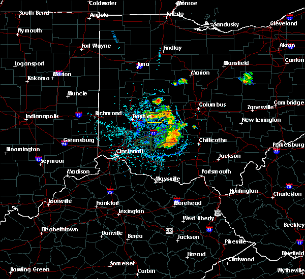 At 127 pm edt, a severe thunderstorm was located over urbana, moving east at 25 mph (radar indicated). Hazards include 60 mph wind gusts and penny size hail. expect damage to trees and power lines At 127 pm edt, a severe thunderstorm was located over urbana, moving east at 25 mph (radar indicated). Hazards include 60 mph wind gusts and penny size hail. expect damage to trees and power lines
|
| 5/27/2019 11:08 PM EDT |
 The tornado warning for northeastern champaign, southeastern logan counties in west central ohio and west central union counties in central ohio will expire at 1115 pm edt, the storm which prompted the warning has moved out of the area. therefore, the warning will be allowed to expire. a tornado watch remains in effect until 200 am edt for central and west central ohio. please report previous tornadoes, wind damage or hail to the national weather service by going to our website at weather.gov/iln and submitting your report via social media. The tornado warning for northeastern champaign, southeastern logan counties in west central ohio and west central union counties in central ohio will expire at 1115 pm edt, the storm which prompted the warning has moved out of the area. therefore, the warning will be allowed to expire. a tornado watch remains in effect until 200 am edt for central and west central ohio. please report previous tornadoes, wind damage or hail to the national weather service by going to our website at weather.gov/iln and submitting your report via social media.
|
| 5/27/2019 10:49 PM EDT |
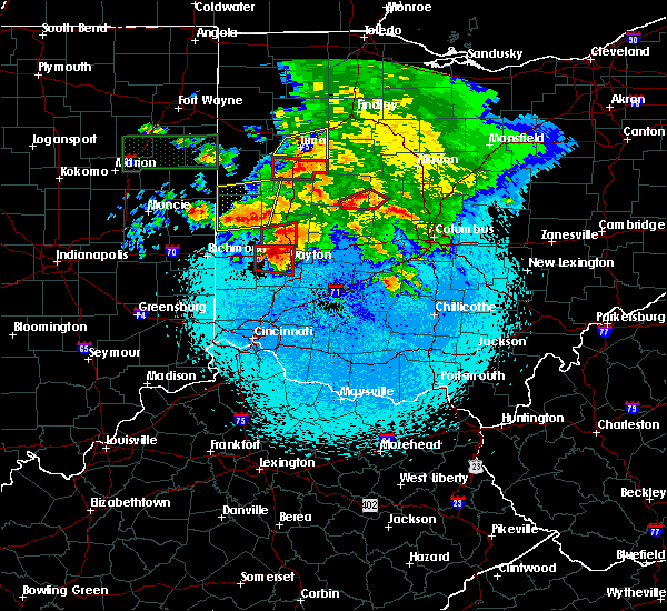 The national weather service in wilmington has issued a * tornado warning for. northeastern champaign county in west central ohio. southeastern logan county in west central ohio. west central union county in central ohio. Until 1115 pm edt. The national weather service in wilmington has issued a * tornado warning for. northeastern champaign county in west central ohio. southeastern logan county in west central ohio. west central union county in central ohio. Until 1115 pm edt.
|
| 4/14/2019 3:40 PM EDT | Several large trees and power pole down. everything fell in a northeast direction. photo verified from social media. time estimated from rada in champaign county OH, 0.1 miles SW of North Lewisburg, OH |
| 4/14/2019 3:35 PM EDT |
 At 335 pm edt, a severe thunderstorm was located near north lewisburg, moving northeast at 35 mph (radar indicated). Hazards include 60 mph wind gusts and penny size hail. expect damage to trees and power lines At 335 pm edt, a severe thunderstorm was located near north lewisburg, moving northeast at 35 mph (radar indicated). Hazards include 60 mph wind gusts and penny size hail. expect damage to trees and power lines
|
| 7/31/2018 9:04 PM EDT |
 At 904 pm edt, a severe thunderstorm capable of producing a tornado was located near west liberty, moving northeast at 20 mph (radar indicated rotation). Hazards include tornado. Flying debris will be dangerous to those caught without shelter. mobile homes will be damaged or destroyed. damage to roofs, windows, and vehicles will occur. Tree damage is likely. At 904 pm edt, a severe thunderstorm capable of producing a tornado was located near west liberty, moving northeast at 20 mph (radar indicated rotation). Hazards include tornado. Flying debris will be dangerous to those caught without shelter. mobile homes will be damaged or destroyed. damage to roofs, windows, and vehicles will occur. Tree damage is likely.
|
| 7/21/2017 8:40 AM EDT |
 The severe thunderstorm warning for southern shelby, champaign, southern logan, northern fayette, northeastern clinton, clark, eastern greene, madison and northeastern miami counties will expire at 845 am edt, the storms which prompted the warning have weakened below severe limits, and no longer pose an immediate threat to life or property. therefore, the warning will be allowed to expire. however gusty winds are still possible with these thunderstorms. please report previous wind damage or hail to the national weather service by going to our website at weather.gov/iln and submitting your report via social media. The severe thunderstorm warning for southern shelby, champaign, southern logan, northern fayette, northeastern clinton, clark, eastern greene, madison and northeastern miami counties will expire at 845 am edt, the storms which prompted the warning have weakened below severe limits, and no longer pose an immediate threat to life or property. therefore, the warning will be allowed to expire. however gusty winds are still possible with these thunderstorms. please report previous wind damage or hail to the national weather service by going to our website at weather.gov/iln and submitting your report via social media.
|
| 7/21/2017 8:22 AM EDT |
 At 821 am edt, severe thunderstorms were located along a line extending from sidney to near jeffersonville, moving east at 65 mph (radar indicated). Hazards include 60 mph wind gusts. Expect damage to trees and power lines. locations impacted include, springfield, sidney, piqua, washington court house, urbana, london, new carlisle, yellow springs, west jefferson, cedarville, enon, st. paris, jamestown, west liberty, south charleston, mechanicsburg, north lewisburg, fort loramie, de graff and jeffersonville. this includes the following interstates, i-70 in ohio between mile markers 47 and 81. i-71 in ohio between mile markers 53 and 81. I-75 in ohio between mile markers 84 and 99. At 821 am edt, severe thunderstorms were located along a line extending from sidney to near jeffersonville, moving east at 65 mph (radar indicated). Hazards include 60 mph wind gusts. Expect damage to trees and power lines. locations impacted include, springfield, sidney, piqua, washington court house, urbana, london, new carlisle, yellow springs, west jefferson, cedarville, enon, st. paris, jamestown, west liberty, south charleston, mechanicsburg, north lewisburg, fort loramie, de graff and jeffersonville. this includes the following interstates, i-70 in ohio between mile markers 47 and 81. i-71 in ohio between mile markers 53 and 81. I-75 in ohio between mile markers 84 and 99.
|
| 7/21/2017 8:08 AM EDT |
 At 808 am edt, severe thunderstorms were located along a line extending from near newport to 7 miles south of xenia, moving east at 65 mph (radar indicated). Hazards include 60 mph wind gusts. expect damage to trees and power lines At 808 am edt, severe thunderstorms were located along a line extending from near newport to 7 miles south of xenia, moving east at 65 mph (radar indicated). Hazards include 60 mph wind gusts. expect damage to trees and power lines
|
| 7/21/2017 7:28 AM EDT |
 At 728 am edt, severe thunderstorms were located along a line extending from 6 miles west of minster to near carlisle, moving east at 55 mph (radar indicated). Hazards include 60 mph wind gusts. expect damage to trees and power lines At 728 am edt, severe thunderstorms were located along a line extending from 6 miles west of minster to near carlisle, moving east at 55 mph (radar indicated). Hazards include 60 mph wind gusts. expect damage to trees and power lines
|
| 6/13/2017 9:28 PM EDT |
 The severe thunderstorm warning for east central champaign county in west central ohio, northeastern madison and southern union counties in central ohio will expire at 930 pm edt, the storm which prompted the warning has weakened below severe limits, and no longer poses an immediate threat to life or property. therefore, the warning will be allowed to expire. however gusty winds are still possible with this thunderstorm. please report previous wind damage or hail to the national weather service by going to our website at weather.gov/iln and submitting your report via social media. The severe thunderstorm warning for east central champaign county in west central ohio, northeastern madison and southern union counties in central ohio will expire at 930 pm edt, the storm which prompted the warning has weakened below severe limits, and no longer poses an immediate threat to life or property. therefore, the warning will be allowed to expire. however gusty winds are still possible with this thunderstorm. please report previous wind damage or hail to the national weather service by going to our website at weather.gov/iln and submitting your report via social media.
|
| 6/13/2017 9:22 PM EDT |
 At 921 pm edt, a severe thunderstorm was located near marysville, moving southeast at 30 mph (radar indicated). Hazards include 60 mph wind gusts and quarter size hail. Hail damage to vehicles is expected. expect wind damage to roofs, siding, and trees. locations impacted include, marysville, plain city, mechanicsburg, north lewisburg, new california, milford center, woodstock, raymond, amity, rosedale, watkins, pottersburg and plumwood. This includes i-70 in ohio near mile marker 83. At 921 pm edt, a severe thunderstorm was located near marysville, moving southeast at 30 mph (radar indicated). Hazards include 60 mph wind gusts and quarter size hail. Hail damage to vehicles is expected. expect wind damage to roofs, siding, and trees. locations impacted include, marysville, plain city, mechanicsburg, north lewisburg, new california, milford center, woodstock, raymond, amity, rosedale, watkins, pottersburg and plumwood. This includes i-70 in ohio near mile marker 83.
|
| 6/13/2017 9:05 PM EDT |
 At 904 pm edt, a severe thunderstorm was located over north lewisburg, moving southeast at 30 mph (radar indicated). Hazards include 60 mph wind gusts and quarter size hail. Hail damage to vehicles is expected. expect wind damage to roofs, siding, and trees. locations impacted include, marysville, plain city, mechanicsburg, north lewisburg, new california, milford center, woodstock, raymond, amity, rosedale, middleburg, watkins, pottersburg and kennard. This includes i-70 in ohio near mile marker 83. At 904 pm edt, a severe thunderstorm was located over north lewisburg, moving southeast at 30 mph (radar indicated). Hazards include 60 mph wind gusts and quarter size hail. Hail damage to vehicles is expected. expect wind damage to roofs, siding, and trees. locations impacted include, marysville, plain city, mechanicsburg, north lewisburg, new california, milford center, woodstock, raymond, amity, rosedale, middleburg, watkins, pottersburg and kennard. This includes i-70 in ohio near mile marker 83.
|
| 6/13/2017 8:41 PM EDT |
 At 841 pm edt, a severe thunderstorm was located near west liberty, moving southeast at 30 mph (radar indicated). Hazards include 60 mph wind gusts and quarter size hail. Hail damage to vehicles is expected. Expect wind damage to roofs, siding, and trees. At 841 pm edt, a severe thunderstorm was located near west liberty, moving southeast at 30 mph (radar indicated). Hazards include 60 mph wind gusts and quarter size hail. Hail damage to vehicles is expected. Expect wind damage to roofs, siding, and trees.
|
| 3/1/2017 5:27 AM EST |
 At 526 am est, severe thunderstorms were located along a line extending from 7 miles north of new california to beavercreek, moving east at 50 mph (radar indicated). Hazards include 60 mph wind gusts. Expect damage to roofs, siding, and trees. locations impacted include, springfield, beavercreek, dublin, delaware, fairborn, xenia, marysville, urbana, london, yellow springs, wright-patterson afb, northridge, plain city, cedarville, enon, jamestown, south charleston, mechanicsburg, north lewisburg and choctaw lake. this includes i-70 in ohio between mile markers 44 and 79. A tornado watch remains in effect until 700 am est for central and west central ohio. At 526 am est, severe thunderstorms were located along a line extending from 7 miles north of new california to beavercreek, moving east at 50 mph (radar indicated). Hazards include 60 mph wind gusts. Expect damage to roofs, siding, and trees. locations impacted include, springfield, beavercreek, dublin, delaware, fairborn, xenia, marysville, urbana, london, yellow springs, wright-patterson afb, northridge, plain city, cedarville, enon, jamestown, south charleston, mechanicsburg, north lewisburg and choctaw lake. this includes i-70 in ohio between mile markers 44 and 79. A tornado watch remains in effect until 700 am est for central and west central ohio.
|
| 3/1/2017 5:12 AM EST |
 At 511 am est, severe thunderstorms were located along a line extending from near north lewisburg to near trotwood, moving southeast at 45 mph (radar indicated. at 510 am...the dayton international airport gusted to 56 mph). Hazards include 60 mph wind gusts. expect damage to roofs, siding, and trees At 511 am est, severe thunderstorms were located along a line extending from near north lewisburg to near trotwood, moving southeast at 45 mph (radar indicated. at 510 am...the dayton international airport gusted to 56 mph). Hazards include 60 mph wind gusts. expect damage to roofs, siding, and trees
|
| 8/27/2016 4:24 PM EDT |
 The severe thunderstorm warning for union county in central ohio, eastern champaign, southeastern logan counties in west central ohio and north central madison counties in central ohio will expire at 430 pm edt, the storm which prompted the warning has weakened and is no longer expected to pose an immediate threat to life or property. therefore the warning will be allowed to expire. however heavy rain is still possible with this thunderstorm. please report previous wind damage or hail to the national weather service by going to our website at weather.gov/iln and submitting your report via social media. The severe thunderstorm warning for union county in central ohio, eastern champaign, southeastern logan counties in west central ohio and north central madison counties in central ohio will expire at 430 pm edt, the storm which prompted the warning has weakened and is no longer expected to pose an immediate threat to life or property. therefore the warning will be allowed to expire. however heavy rain is still possible with this thunderstorm. please report previous wind damage or hail to the national weather service by going to our website at weather.gov/iln and submitting your report via social media.
|
| 8/27/2016 4:15 PM EDT |
 At 414 pm edt, a severe thunderstorm was located near north lewisburg, moving northeast at 40 mph (radar indicated). Hazards include 60 mph wind gusts. Expect damage to roofs. siding. and trees. Locations impacted include, marysville, plain city, mechanicsburg, north lewisburg, west mansfield, new california, milford center, woodstock, unionville center, middleburg, cable, raymond, new dover, pottersburg, rosedale, mingo, state route 4 at state route 161, east liberty, chuckery and pickrelltown. At 414 pm edt, a severe thunderstorm was located near north lewisburg, moving northeast at 40 mph (radar indicated). Hazards include 60 mph wind gusts. Expect damage to roofs. siding. and trees. Locations impacted include, marysville, plain city, mechanicsburg, north lewisburg, west mansfield, new california, milford center, woodstock, unionville center, middleburg, cable, raymond, new dover, pottersburg, rosedale, mingo, state route 4 at state route 161, east liberty, chuckery and pickrelltown.
|
| 8/27/2016 4:06 PM EDT |
 At 405 pm edt, a severe thunderstorm was located over mechanicsburg, moving northeast at 40 mph (radar indicated). Hazards include 60 mph wind gusts. Expect damage to roofs. siding. and trees. Locations impacted include, columbus, dublin, upper arlington, hilliard, marysville, urbana, london, plain city, west jefferson, west liberty, mechanicsburg, north lewisburg, west mansfield, new california, choctaw lake, brighton, milford center, lafayette, woodstock and catawba. At 405 pm edt, a severe thunderstorm was located over mechanicsburg, moving northeast at 40 mph (radar indicated). Hazards include 60 mph wind gusts. Expect damage to roofs. siding. and trees. Locations impacted include, columbus, dublin, upper arlington, hilliard, marysville, urbana, london, plain city, west jefferson, west liberty, mechanicsburg, north lewisburg, west mansfield, new california, choctaw lake, brighton, milford center, lafayette, woodstock and catawba.
|
| 8/27/2016 3:51 PM EDT |
 At 350 pm edt, a severe thunderstorm was located near urbana, moving northeast at 45 mph (radar indicated). Hazards include 60 mph wind gusts. Expect damage to roofs. siding. And trees. At 350 pm edt, a severe thunderstorm was located near urbana, moving northeast at 45 mph (radar indicated). Hazards include 60 mph wind gusts. Expect damage to roofs. siding. And trees.
|
| 8/20/2016 8:08 PM EDT |
 The tornado warning for northeastern champaign and eastern logan counties will expire at 815 pm edt, the tornado threat has diminished and the tornado warning has been cancelled. however, large hail and damaging winds remain likely and a severe thunderstorm warning remains in effect for the area. please report previous tornadoes, wind damage or hail to the national weather service by going to our website at weather.gov/iln and submitting your report via social media. remember, a severe thunderstorm warning still remains in effect for union and logan counties. The tornado warning for northeastern champaign and eastern logan counties will expire at 815 pm edt, the tornado threat has diminished and the tornado warning has been cancelled. however, large hail and damaging winds remain likely and a severe thunderstorm warning remains in effect for the area. please report previous tornadoes, wind damage or hail to the national weather service by going to our website at weather.gov/iln and submitting your report via social media. remember, a severe thunderstorm warning still remains in effect for union and logan counties.
|
| 8/20/2016 7:56 PM EDT |
 At 756 pm edt, a severe thunderstorm capable of producing a tornado was located near bellefontaine, moving east at 30 mph (radar indicated rotation). Hazards include tornado. Flying debris will be dangerous to those caught without shelter. mobile homes will be damaged or destroyed. damage to roofs, windows, and vehicles will occur. tree damage is likely. Locations impacted include, bellefontaine, west liberty, north lewisburg, rushsylvania, valley hi, zanesfield, middleburg, east liberty, pickrelltown and new jerusalem. At 756 pm edt, a severe thunderstorm capable of producing a tornado was located near bellefontaine, moving east at 30 mph (radar indicated rotation). Hazards include tornado. Flying debris will be dangerous to those caught without shelter. mobile homes will be damaged or destroyed. damage to roofs, windows, and vehicles will occur. tree damage is likely. Locations impacted include, bellefontaine, west liberty, north lewisburg, rushsylvania, valley hi, zanesfield, middleburg, east liberty, pickrelltown and new jerusalem.
|
| 8/20/2016 7:42 PM EDT |
 At 741 pm edt, a severe thunderstorm with a history of producing a tornado near de graff, moving east at 30 mph (radar indicated rotation). Hazards include tornado. Flying debris will be dangerous to those caught without shelter. mobile homes will be damaged or destroyed. damage to roofs, windows, and vehicles will occur. Tree damage is likely. At 741 pm edt, a severe thunderstorm with a history of producing a tornado near de graff, moving east at 30 mph (radar indicated rotation). Hazards include tornado. Flying debris will be dangerous to those caught without shelter. mobile homes will be damaged or destroyed. damage to roofs, windows, and vehicles will occur. Tree damage is likely.
|
| 8/20/2016 7:22 PM EDT |
 At 721 pm edt, a severe thunderstorm with the history of producing a tornado was located near de graff, moving east at 25 mph (radar indicated rotation). Hazards include tornado. Flying debris will be dangerous to those caught without shelter. mobile homes will be damaged or destroyed. damage to roofs, windows, and vehicles will occur. Tree damage is likely. At 721 pm edt, a severe thunderstorm with the history of producing a tornado was located near de graff, moving east at 25 mph (radar indicated rotation). Hazards include tornado. Flying debris will be dangerous to those caught without shelter. mobile homes will be damaged or destroyed. damage to roofs, windows, and vehicles will occur. Tree damage is likely.
|
| 6/23/2016 2:41 AM EDT |
 At 240 am edt, severe thunderstorms were located along a line extending from near urbana to fairborn, moving east at 70 mph (radar indicated). Hazards include 70 mph wind gusts and penny size hail. Expect considerable tree damage. Damage is likely to mobile homes, roofs, and outbuildings. At 240 am edt, severe thunderstorms were located along a line extending from near urbana to fairborn, moving east at 70 mph (radar indicated). Hazards include 70 mph wind gusts and penny size hail. Expect considerable tree damage. Damage is likely to mobile homes, roofs, and outbuildings.
|
| 6/23/2016 2:07 AM EDT |
 The severe thunderstorm warning for southern union county in central ohio, northeastern champaign and southeastern logan counties in west central ohio will expire at 215 am edt, the storm which prompted the warning has weakened below severe limits, and no longer poses an immediate threat to life or property. therefore the warning will be allowed to expire. however heavy rain is still possible with this thunderstorm. a tornado watch remains in effect until 500 am edt for west central and central ohio. please report previous wind damage or hail to the national weather service by going to our website at weather.gov/iln and submitting your report via social media. The severe thunderstorm warning for southern union county in central ohio, northeastern champaign and southeastern logan counties in west central ohio will expire at 215 am edt, the storm which prompted the warning has weakened below severe limits, and no longer poses an immediate threat to life or property. therefore the warning will be allowed to expire. however heavy rain is still possible with this thunderstorm. a tornado watch remains in effect until 500 am edt for west central and central ohio. please report previous wind damage or hail to the national weather service by going to our website at weather.gov/iln and submitting your report via social media.
|
| 6/23/2016 1:48 AM EDT |
 At 147 am edt, a severe thunderstorm was located near north lewisburg, moving southeast at 30 mph (radar indicated). Hazards include 60 mph wind gusts. Expect damage to roofs. siding. and trees. locations impacted include, marysville, mechanicsburg, north lewisburg, milford center, woodstock, valley hi, middleburg, raymond, state route 4 at state route 161, new dover, pottersburg, mingo, east liberty and pickrelltown. A tornado watch remains in effect until 500 am edt for west central and central ohio. At 147 am edt, a severe thunderstorm was located near north lewisburg, moving southeast at 30 mph (radar indicated). Hazards include 60 mph wind gusts. Expect damage to roofs. siding. and trees. locations impacted include, marysville, mechanicsburg, north lewisburg, milford center, woodstock, valley hi, middleburg, raymond, state route 4 at state route 161, new dover, pottersburg, mingo, east liberty and pickrelltown. A tornado watch remains in effect until 500 am edt for west central and central ohio.
|
| 6/23/2016 1:29 AM EDT |
 At 128 am edt, a severe thunderstorm was located near bellefontaine, moving southeast at 30 mph (radar indicated). Hazards include 60 mph wind gusts. Expect damage to roofs. siding. And trees. At 128 am edt, a severe thunderstorm was located near bellefontaine, moving southeast at 30 mph (radar indicated). Hazards include 60 mph wind gusts. Expect damage to roofs. siding. And trees.
|
| 12/23/2015 6:09 PM EST | At 609 pm est, radar indicated severe thunderstorms located along a line extending from near west liberty to 7 miles northeast of springfield, moving northeast at 55 mph. storm hazards include, winds to 60 mph, locations impacted include, dublin, marysville, urbana, plain city, richwood, west liberty, mechanicsburg, north lewisburg, milford center, woodstock, catawba, magnetic springs, unionville center, valley hi, mutual, middleburg, powhattan, essex, new dover and pottersburg. |
| 12/23/2015 5:59 PM EST | At 559 pm est, radar indicated severe thunderstorms located along a line extending from 6 miles southwest of west liberty to near springfield, moving northeast at 55 mph. storm hazards include, winds to 60 mph,. |
| 7/17/2015 12:45 PM EDT |
 At 1245 pm edt, radar indicated that the severe thunderstorm had weakened. this storm was located southwest of marysville, moving east at 35 mph. storm hazards include, winds to 60 mph, frequent cloud to ground lightning, very heavy rain which may cause minor flooding, locations impacted include, marysville, plain city, north lewisburg, milford center, woodstock, unionville center, amity, us route 33 at us route 42, chuckery, watkins, state route 4 at state route 161 and new dover. At 1245 pm edt, radar indicated that the severe thunderstorm had weakened. this storm was located southwest of marysville, moving east at 35 mph. storm hazards include, winds to 60 mph, frequent cloud to ground lightning, very heavy rain which may cause minor flooding, locations impacted include, marysville, plain city, north lewisburg, milford center, woodstock, unionville center, amity, us route 33 at us route 42, chuckery, watkins, state route 4 at state route 161 and new dover.
|
| 7/17/2015 12:34 PM EDT |
 At 1234 pm edt, radar indicated a severe thunderstorm located near north lewisburg, moving east at 45 mph. storm hazards include, winds to 60 mph, penny size hail, frequent cloud to ground lightning, very heavy rain which may cause minor flooding,. At 1234 pm edt, radar indicated a severe thunderstorm located near north lewisburg, moving east at 45 mph. storm hazards include, winds to 60 mph, penny size hail, frequent cloud to ground lightning, very heavy rain which may cause minor flooding,.
|
| 7/14/2015 1:40 PM EDT |
 At 140 pm edt, radar indicated severe thunderstorms located along a line extending from near marysville to near urbana, moving east at 55 mph. storm hazards include, winds to 60 mph, penny size hail,. At 140 pm edt, radar indicated severe thunderstorms located along a line extending from near marysville to near urbana, moving east at 55 mph. storm hazards include, winds to 60 mph, penny size hail,.
|
| 5/27/2015 6:42 PM EDT | One tree knocked down on route 28 in logan county OH, 4.2 miles SE of North Lewisburg, OH |
| 5/27/2015 6:41 PM EDT | At 642 pm edt, radar indicated a severe thunderstorm located near mingo, moving east at 30 mph. storm hazards include, quarter size hail,. |
| 4/10/2015 3:27 AM EDT | A severe thunderstorm warning remains in effect until 400 am edt for southeastern montgomery. southern logan. western greene. clark and champaign counties. at 325 am edt. radar continued to indicate severe thunderstorms located along a line extending from westville to greene county airport. Moving northeast at 60 mph. |
| 4/10/2015 3:11 AM EDT | The national weather service in wilmington has issued a * severe thunderstorm warning for. southeastern shelby county in west central ohio. eastern montgomery county in west central ohio. eastern miami county in west central ohio. Southern logan county in west central ohio. |
| 6/29/2012 4:28 PM EDT | Large trees down. power poles snapped. tree on a house. multiple roads blocked. from spotternetwork.org in champaign county OH, 1.3 miles WNW of North Lewisburg, OH |
| 6/29/2012 4:27 PM EDT | Numerous 4 inch plus limbs down. damage to small she in champaign county OH, 0.1 miles SW of North Lewisburg, OH |
| 6/29/2012 4:24 PM EDT | Structural damage. time corrected from am to p in champaign county OH, 0.1 miles SW of North Lewisburg, OH |
| 6/29/2012 4:24 AM EDT | Structural damag in champaign county OH, 0.1 miles SW of North Lewisburg, OH |
| 3/30/2012 6:29 PM EDT | Quarter sized hail reported 4.2 miles E of North Lewisburg, OH |
| 3/18/2012 5:16 PM EDT | Ping Pong Ball sized hail reported 0.1 miles SW of North Lewisburg, OH |
| 3/18/2012 5:14 PM EDT | Ping Pong Ball sized hail reported 0.1 miles SW of North Lewisburg, OH |
| 1/1/0001 12:00 AM | Quarter sized hail reported 0.1 miles SW of North Lewisburg, OH, dime to quarter size hail |
Hail Maps for North Lewisburg, OH


Connect with Interactive Hail Maps