

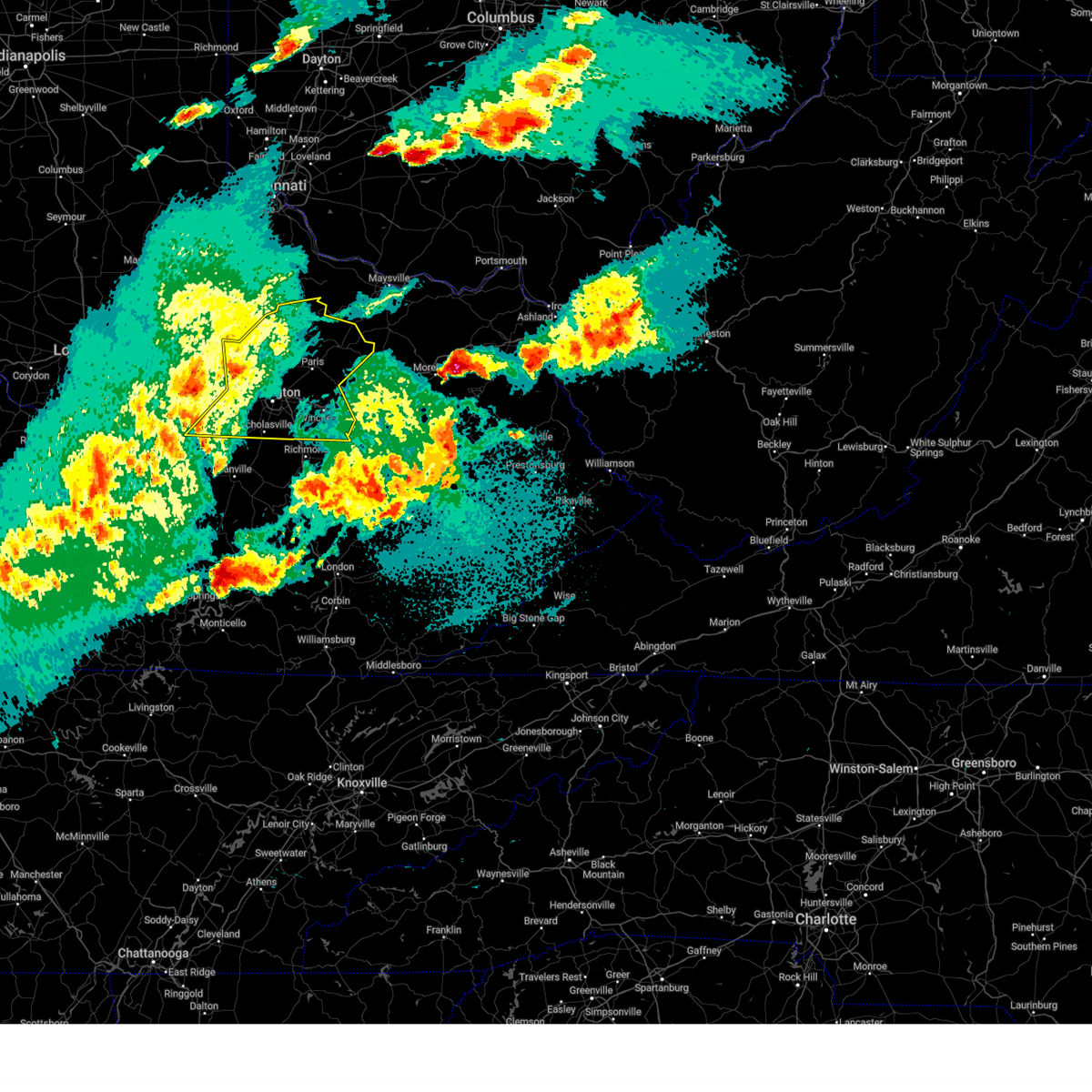
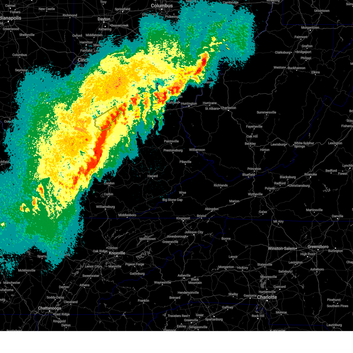
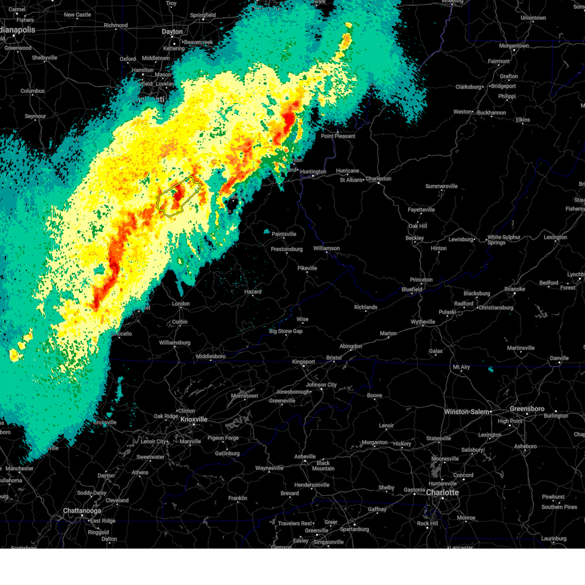
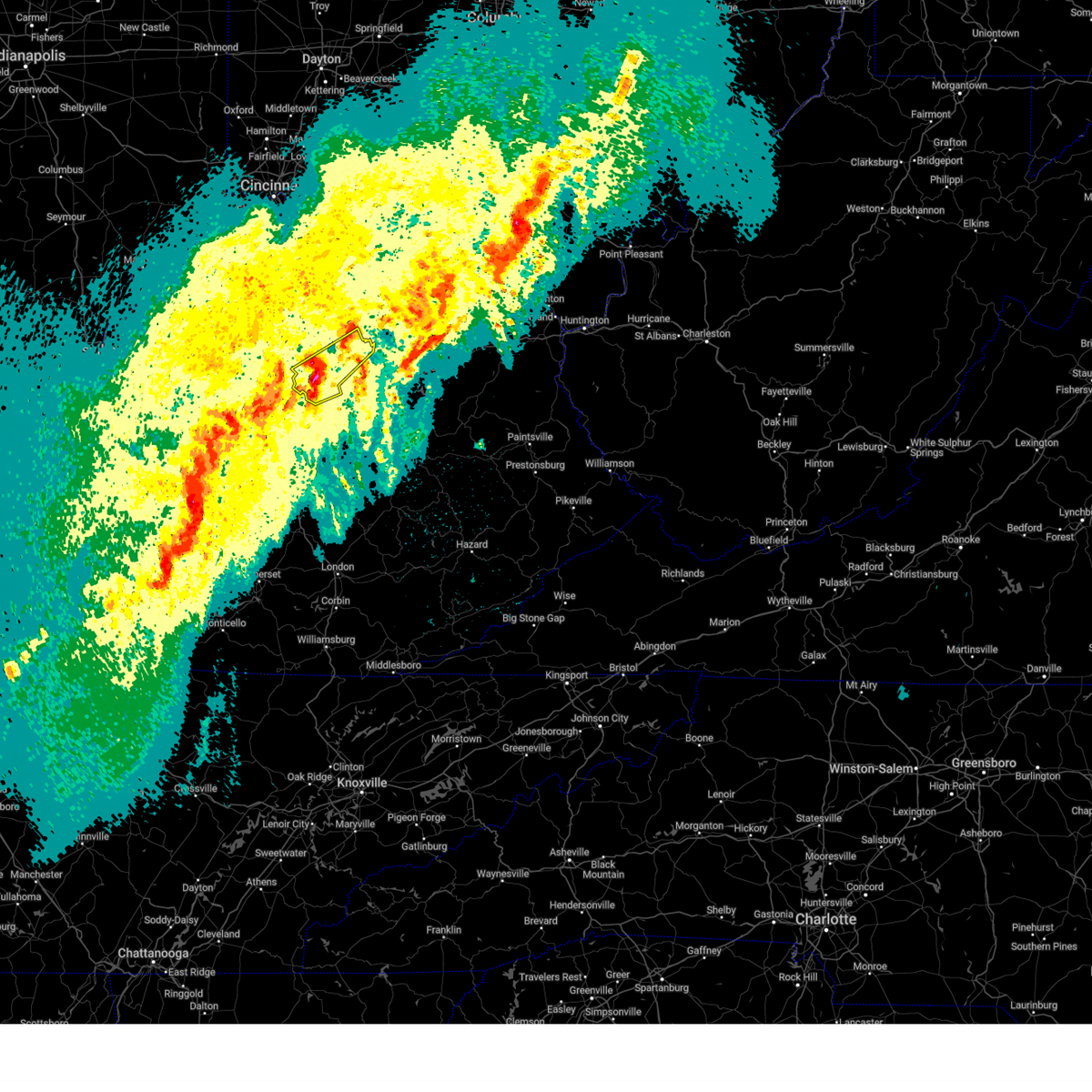
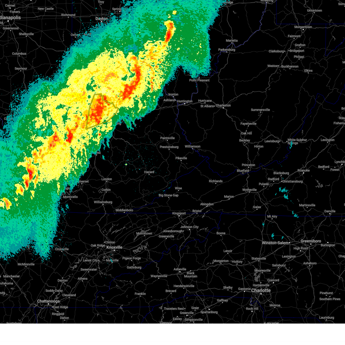
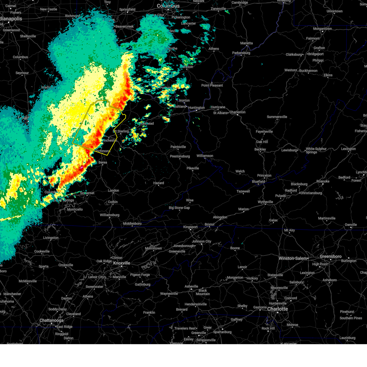
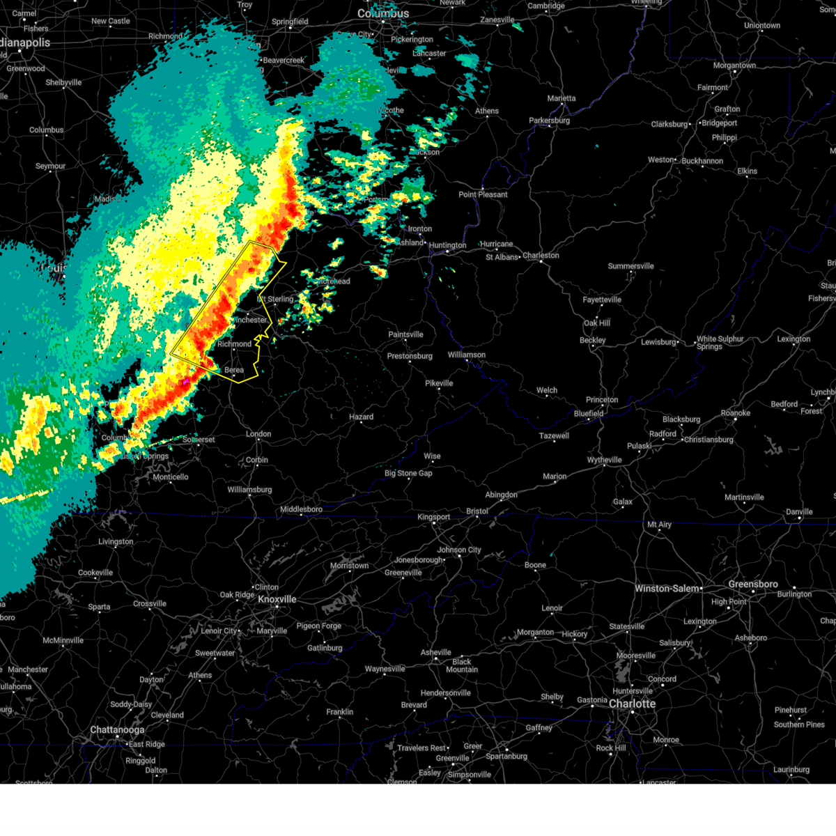
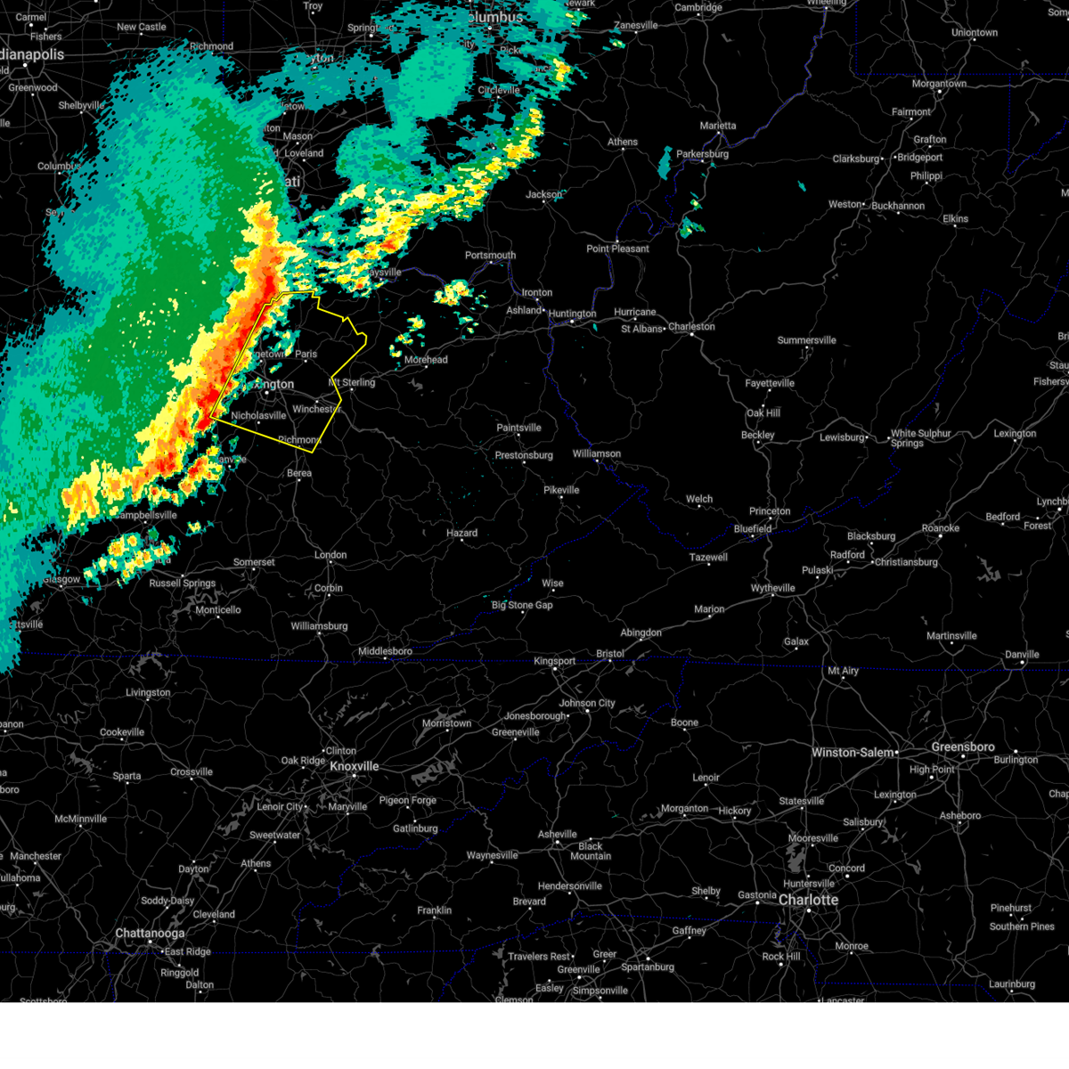
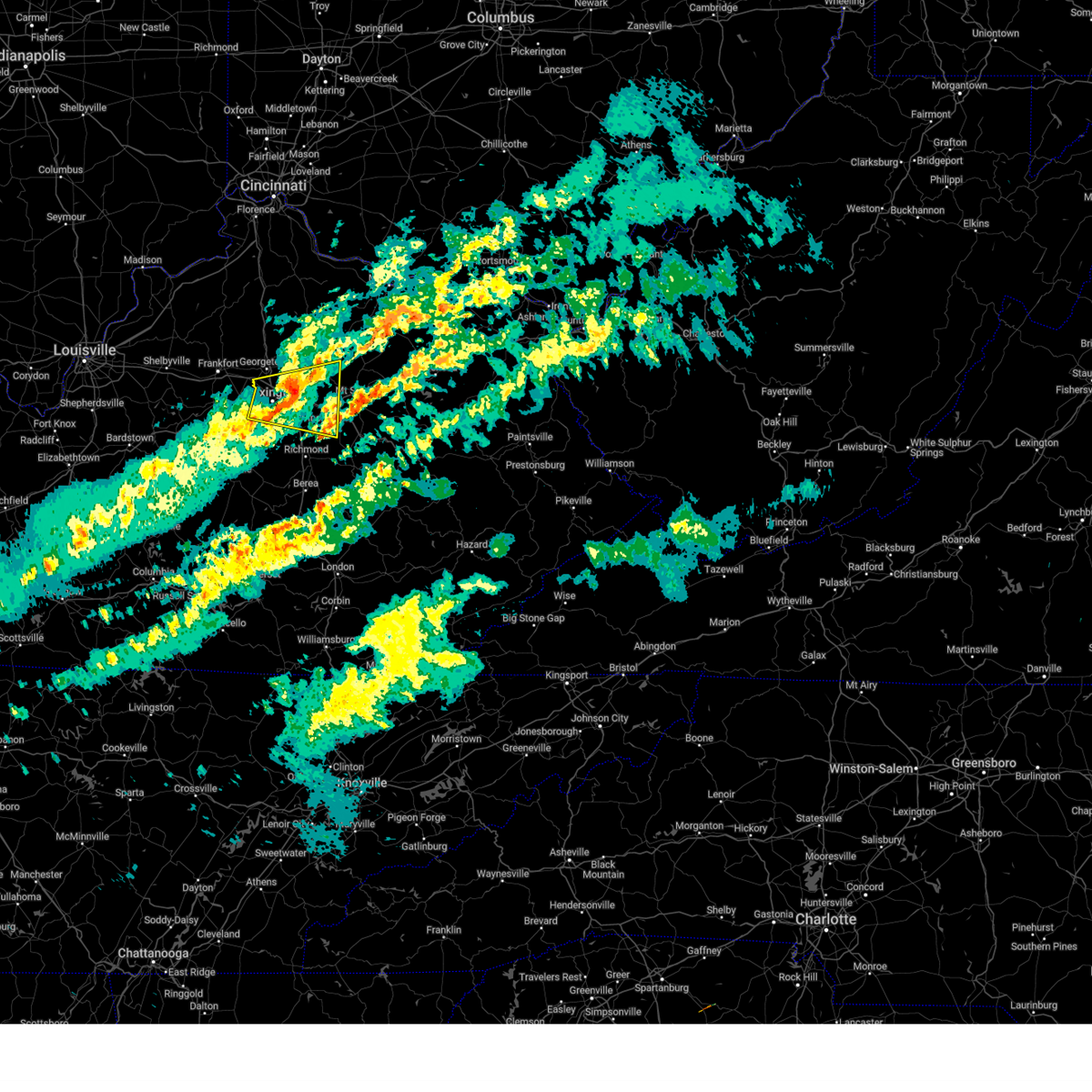
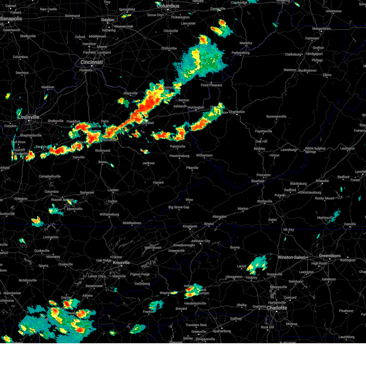
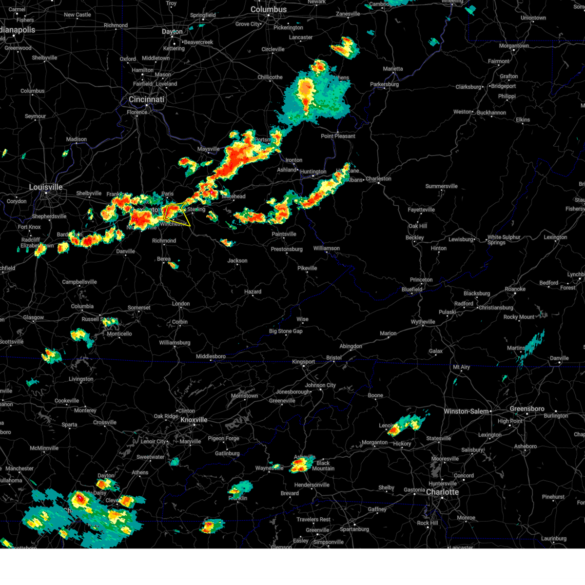
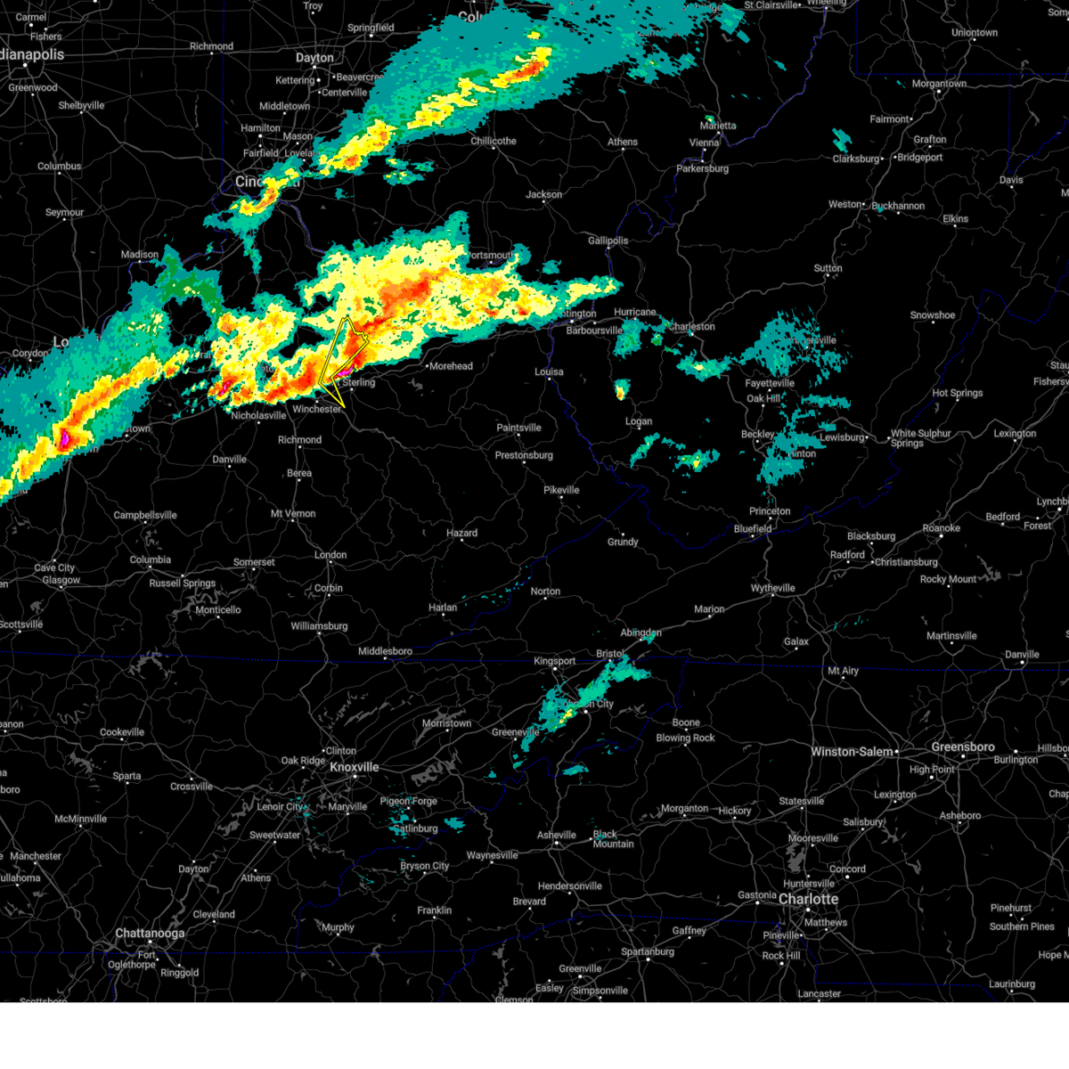
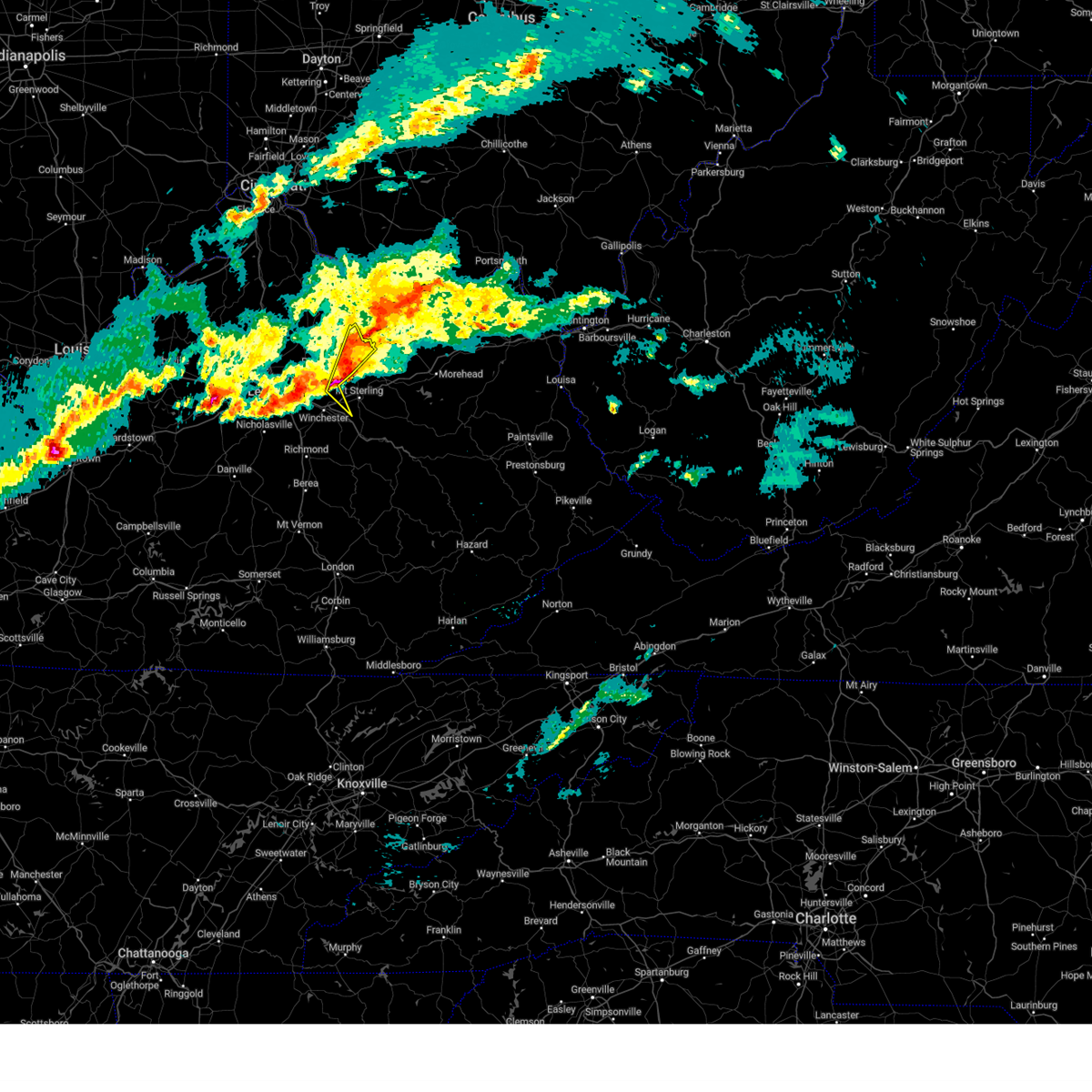
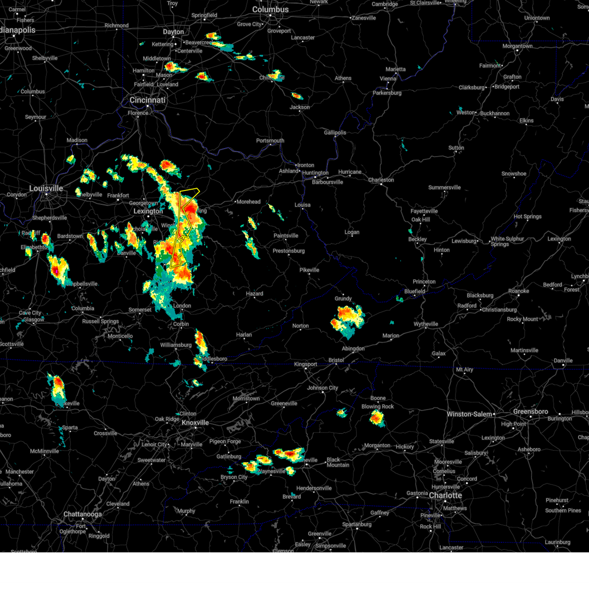
Hail Map for North Middletown, KY
The North Middletown, KY area has had 1 report of on-the-ground hail by trained spotters, and has been under severe weather warnings 36 times during the past 12 months. Doppler radar has detected hail at or near North Middletown, KY on 39 occasions, including 4 occasions during the past year.
| Name: | North Middletown, KY |
| Where Located: | 31.5 miles NNW of Irvine, KY |
| Map: | Google Map for North Middletown, KY |
| Population: | 643 |
| Housing Units: | 272 |
| More Info: | Search Google for North Middletown, KY |
3
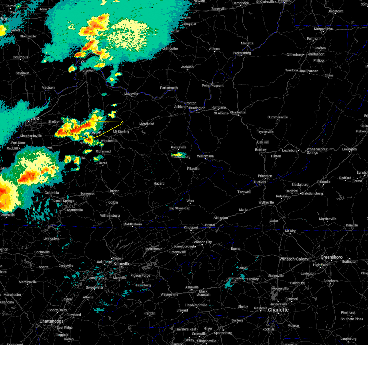
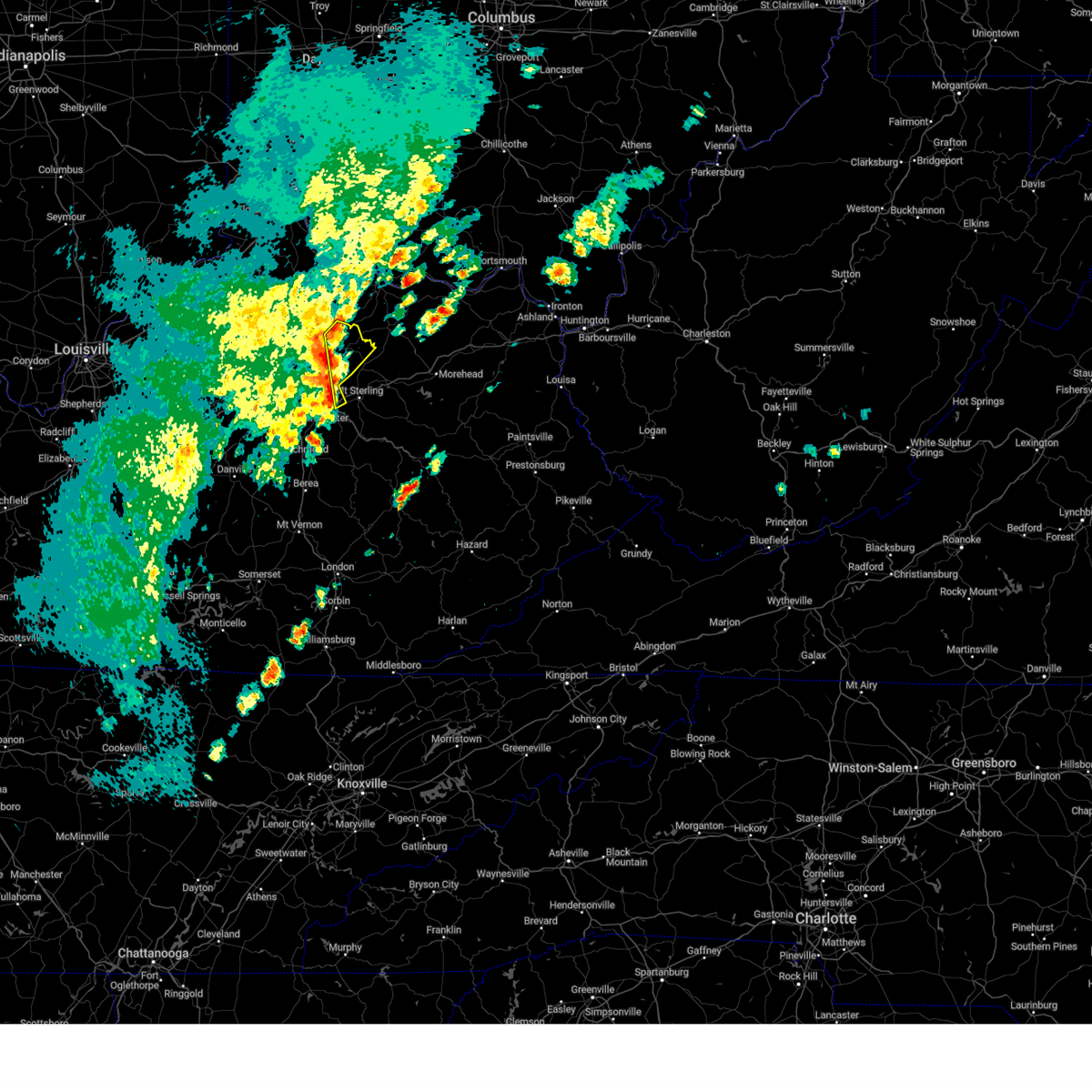
The Top Recent Hail Date for North Middletown, KY is Friday, May 16, 2025 (5th out of 39)

Hail and Wind Damage Spotted near North Middletown, KY
| Date / Time | Report Details |
|---|---|
| 5/16/2025 10:43 PM EDT |
 Svrlmk the national weather service in louisville has issued a * severe thunderstorm warning for, southeastern anderson county in central kentucky, clark county in central kentucky, jessamine county in central kentucky, nicholas county in central kentucky, harrison county in central kentucky, northeastern franklin county in central kentucky, northern mercer county in central kentucky, woodford county in central kentucky, scott county in central kentucky, bourbon county in central kentucky, northeastern washington county in central kentucky, northern madison county in central kentucky, fayette county in central kentucky, * until 1130 pm edt. * at 1042 pm edt, severe thunderstorms were located along a line extending from 8 miles northwest of owenton to 7 miles northwest of lawrenceburg to 12 miles north of springfield, moving east at 70 mph (radar indicated). Hazards include 70 mph wind gusts and penny size hail. Expect considerable tree damage. Damage is likely to mobile homes, roofs, and outbuildings. Svrlmk the national weather service in louisville has issued a * severe thunderstorm warning for, southeastern anderson county in central kentucky, clark county in central kentucky, jessamine county in central kentucky, nicholas county in central kentucky, harrison county in central kentucky, northeastern franklin county in central kentucky, northern mercer county in central kentucky, woodford county in central kentucky, scott county in central kentucky, bourbon county in central kentucky, northeastern washington county in central kentucky, northern madison county in central kentucky, fayette county in central kentucky, * until 1130 pm edt. * at 1042 pm edt, severe thunderstorms were located along a line extending from 8 miles northwest of owenton to 7 miles northwest of lawrenceburg to 12 miles north of springfield, moving east at 70 mph (radar indicated). Hazards include 70 mph wind gusts and penny size hail. Expect considerable tree damage. Damage is likely to mobile homes, roofs, and outbuildings.
|
| 5/16/2025 9:33 PM EDT | Svrlmk the national weather service in louisville has issued a * severe thunderstorm warning for, north central clark county in central kentucky, southeastern bourbon county in central kentucky, southeastern nicholas county in central kentucky, * until 1000 pm edt. * at 933 pm edt, a severe thunderstorm was located near sideview, moving east at 40 mph (radar indicated). Hazards include 60 mph wind gusts and quarter size hail. Hail damage to vehicles is expected. Expect wind damage to roofs, siding, and trees. |
| 5/16/2025 8:45 PM EDT |
 Svrlmk the national weather service in louisville has issued a * severe thunderstorm warning for, northern woodford county in central kentucky, southern scott county in central kentucky, northeastern anderson county in central kentucky, bourbon county in central kentucky, southeastern nicholas county in central kentucky, fayette county in central kentucky, south central franklin county in central kentucky, * until 930 pm edt. * at 845 pm edt, severe thunderstorms were located along a line extending from near lawrenceburg to 6 miles north of versailles to near georgetown, moving east at 45 mph (radar indicated). Hazards include 60 mph wind gusts and quarter size hail. Hail damage to vehicles is expected. Expect wind damage to roofs, siding, and trees. Svrlmk the national weather service in louisville has issued a * severe thunderstorm warning for, northern woodford county in central kentucky, southern scott county in central kentucky, northeastern anderson county in central kentucky, bourbon county in central kentucky, southeastern nicholas county in central kentucky, fayette county in central kentucky, south central franklin county in central kentucky, * until 930 pm edt. * at 845 pm edt, severe thunderstorms were located along a line extending from near lawrenceburg to 6 miles north of versailles to near georgetown, moving east at 45 mph (radar indicated). Hazards include 60 mph wind gusts and quarter size hail. Hail damage to vehicles is expected. Expect wind damage to roofs, siding, and trees.
|
| 4/29/2025 7:38 PM EDT |
 The storm which prompted the warning has moved out of the area. therefore, the warning will be allowed to expire. however, gusty winds and heavy rain are still possible with this thunderstorm. a severe thunderstorm watch remains in effect until 100 am edt for central kentucky. The storm which prompted the warning has moved out of the area. therefore, the warning will be allowed to expire. however, gusty winds and heavy rain are still possible with this thunderstorm. a severe thunderstorm watch remains in effect until 100 am edt for central kentucky.
|
| 4/29/2025 7:17 PM EDT |
 Svrlmk the national weather service in louisville has issued a * severe thunderstorm warning for, southeastern bourbon county in central kentucky, southeastern nicholas county in central kentucky, * until 745 pm edt. * at 717 pm edt, a severe thunderstorm was located near paris, moving east at 40 mph (radar indicated). Hazards include 60 mph wind gusts. expect damage to roofs, siding, and trees Svrlmk the national weather service in louisville has issued a * severe thunderstorm warning for, southeastern bourbon county in central kentucky, southeastern nicholas county in central kentucky, * until 745 pm edt. * at 717 pm edt, a severe thunderstorm was located near paris, moving east at 40 mph (radar indicated). Hazards include 60 mph wind gusts. expect damage to roofs, siding, and trees
|
| 4/3/2025 3:29 AM EDT |
 The storm which prompted the warning has moved out of the area. therefore, the warning will be allowed to expire. however, gusty winds are still possible with this thunderstorm. a tornado watch remains in effect until 700 am edt for central kentucky. The storm which prompted the warning has moved out of the area. therefore, the warning will be allowed to expire. however, gusty winds are still possible with this thunderstorm. a tornado watch remains in effect until 700 am edt for central kentucky.
|
| 4/3/2025 3:01 AM EDT |
 At 301 am edt, a severe thunderstorm was located near carlisle, moving northeast at 65 mph (radar indicated). Hazards include 60 mph wind gusts and quarter size hail. Hail damage to vehicles is expected. expect wind damage to roofs, siding, and trees. Locations impacted include, paris, carlisle, millersburg, north middletown, blacks crossroads, hutchison, renick, stony point, judianne estates, and moorefield. At 301 am edt, a severe thunderstorm was located near carlisle, moving northeast at 65 mph (radar indicated). Hazards include 60 mph wind gusts and quarter size hail. Hail damage to vehicles is expected. expect wind damage to roofs, siding, and trees. Locations impacted include, paris, carlisle, millersburg, north middletown, blacks crossroads, hutchison, renick, stony point, judianne estates, and moorefield.
|
| 4/3/2025 2:49 AM EDT |
 At 249 am edt, a severe thunderstorm was located near paris, moving northeast at 75 mph (radar indicated). Hazards include 60 mph wind gusts and quarter size hail. Hail damage to vehicles is expected. expect wind damage to roofs, siding, and trees. Locations impacted include, paris, carlisle, millersburg, north middletown, blacks crossroads, hutchison, renick, stony point, judianne estates, and moorefield. At 249 am edt, a severe thunderstorm was located near paris, moving northeast at 75 mph (radar indicated). Hazards include 60 mph wind gusts and quarter size hail. Hail damage to vehicles is expected. expect wind damage to roofs, siding, and trees. Locations impacted include, paris, carlisle, millersburg, north middletown, blacks crossroads, hutchison, renick, stony point, judianne estates, and moorefield.
|
| 4/3/2025 2:49 AM EDT |
 the severe thunderstorm warning has been cancelled and is no longer in effect the severe thunderstorm warning has been cancelled and is no longer in effect
|
| 4/3/2025 2:40 AM EDT | Svrlmk the national weather service in louisville has issued a * severe thunderstorm warning for, northwestern clark county in central kentucky, bourbon county in central kentucky, nicholas county in central kentucky, central fayette county in central kentucky, * until 330 am edt. * at 239 am edt, a severe thunderstorm was located over bryan station, moving northeast at 65 mph (radar indicated). Hazards include 60 mph wind gusts and penny size hail. expect damage to roofs, siding, and trees |
| 4/3/2025 2:24 AM EDT | The storms which prompted the warning have weakened below severe limits, and have exited the warned area. therefore, the warning will be allowed to expire. a tornado watch remains in effect until 700 am edt for central kentucky. |
| 4/3/2025 2:22 AM EDT |
 the severe thunderstorm warning has been cancelled and is no longer in effect the severe thunderstorm warning has been cancelled and is no longer in effect
|
| 4/3/2025 2:22 AM EDT |
 At 222 am edt, severe thunderstorms were located along a line extending from brooksville to near fairview to near paris, moving northeast at 95 mph (radar indicated). Hazards include 60 mph wind gusts. Expect damage to roofs, siding, and trees. Locations impacted include, paris, cynthiana, carlisle, millersburg, north middletown, blacks crossroads, ellisville, stony point, colville, and broadwell. At 222 am edt, severe thunderstorms were located along a line extending from brooksville to near fairview to near paris, moving northeast at 95 mph (radar indicated). Hazards include 60 mph wind gusts. Expect damage to roofs, siding, and trees. Locations impacted include, paris, cynthiana, carlisle, millersburg, north middletown, blacks crossroads, ellisville, stony point, colville, and broadwell.
|
| 4/3/2025 2:16 AM EDT |
 At 216 am edt, severe thunderstorms were located along a line extending from 8 miles southwest of brooksville to near carlisle to near bryan station, moving northeast at 95 mph (radar indicated). Hazards include 60 mph wind gusts. Expect damage to roofs, siding, and trees. Locations impacted include, lexington, paris, cynthiana, carlisle, thoroughbred acres, northland, bryan station, u k arboretum, chevy chase, and breckinridge. At 216 am edt, severe thunderstorms were located along a line extending from 8 miles southwest of brooksville to near carlisle to near bryan station, moving northeast at 95 mph (radar indicated). Hazards include 60 mph wind gusts. Expect damage to roofs, siding, and trees. Locations impacted include, lexington, paris, cynthiana, carlisle, thoroughbred acres, northland, bryan station, u k arboretum, chevy chase, and breckinridge.
|
| 4/3/2025 2:16 AM EDT |
 the severe thunderstorm warning has been cancelled and is no longer in effect the severe thunderstorm warning has been cancelled and is no longer in effect
|
| 4/3/2025 2:07 AM EDT | the severe thunderstorm warning has been cancelled and is no longer in effect |
| 4/3/2025 2:07 AM EDT | At 207 am edt, severe thunderstorms were located along a line extending from 10 miles south of falmouth to near paris to dunbar high school, moving northeast at 95 mph (radar indicated). Hazards include 60 mph wind gusts. Expect damage to roofs, siding, and trees. Locations impacted include, lexington, georgetown, paris, cynthiana, carlisle, cardinal hill, bryan station, chevy chase, meadowthorpe, and dunbar high school. |
| 4/3/2025 1:59 AM EDT | Svrlmk the national weather service in louisville has issued a * severe thunderstorm warning for, north central mercer county in central kentucky, woodford county in central kentucky, scott county in central kentucky, east central anderson county in central kentucky, northwestern jessamine county in central kentucky, bourbon county in central kentucky, nicholas county in central kentucky, fayette county in central kentucky, harrison county in central kentucky, eastern franklin county in central kentucky, * until 230 am edt. * at 158 am edt, severe thunderstorms were located along a line extending from 14 miles south of williamstown to near georgetown to 9 miles south of versailles, moving northeast at 95 mph (radar indicated). Hazards include 60 mph wind gusts. expect damage to roofs, siding, and trees |
| 3/30/2025 11:43 PM EDT | At 1142 pm edt, severe thunderstorms were located along a line extending from near tollesboro to near winchester, moving east at 60 mph (radar indicated). Hazards include 60 mph wind gusts and penny size hail. Expect damage to roofs, siding, and trees. Locations impacted include, lexington, richmond, winchester, lancaster, carlisle, harris ferry, mccreary, berea, north middletown, and goffs corner. |
| 3/30/2025 11:43 PM EDT | the severe thunderstorm warning has been cancelled and is no longer in effect |
| 3/30/2025 11:28 PM EDT |
 The storms which prompted the warning have moved out of the area. therefore, the warning will be allowed to expire. another warning has been issued downstream. a tornado watch remains in effect until 100 am edt for central kentucky. The storms which prompted the warning have moved out of the area. therefore, the warning will be allowed to expire. another warning has been issued downstream. a tornado watch remains in effect until 100 am edt for central kentucky.
|
| 3/30/2025 11:27 PM EDT |
 Svrlmk the national weather service in louisville has issued a * severe thunderstorm warning for, southeastern mercer county in central kentucky, garrard county in central kentucky, clark county in central kentucky, jessamine county in central kentucky, bourbon county in central kentucky, northeastern boyle county in central kentucky, nicholas county in central kentucky, madison county in central kentucky, fayette county in central kentucky, southeastern harrison county in central kentucky, * until midnight edt. * at 1127 pm edt, severe thunderstorms were located along a line extending from near fairview to 6 miles southeast of veterans park, moving east at 60 mph (radar indicated). Hazards include 60 mph wind gusts and penny size hail. expect damage to roofs, siding, and trees Svrlmk the national weather service in louisville has issued a * severe thunderstorm warning for, southeastern mercer county in central kentucky, garrard county in central kentucky, clark county in central kentucky, jessamine county in central kentucky, bourbon county in central kentucky, northeastern boyle county in central kentucky, nicholas county in central kentucky, madison county in central kentucky, fayette county in central kentucky, southeastern harrison county in central kentucky, * until midnight edt. * at 1127 pm edt, severe thunderstorms were located along a line extending from near fairview to 6 miles southeast of veterans park, moving east at 60 mph (radar indicated). Hazards include 60 mph wind gusts and penny size hail. expect damage to roofs, siding, and trees
|
| 3/30/2025 10:50 PM EDT |
 Svrlmk the national weather service in louisville has issued a * severe thunderstorm warning for, northeastern mercer county in central kentucky, woodford county in central kentucky, scott county in central kentucky, east central anderson county in central kentucky, clark county in central kentucky, jessamine county in central kentucky, bourbon county in central kentucky, nicholas county in central kentucky, northern madison county in central kentucky, fayette county in central kentucky, harrison county in central kentucky, * until 1130 pm edt. * at 1050 pm edt, severe thunderstorms were located along a line extending from 10 miles northwest of cynthiana to near georgetown to near lawrenceburg, moving east at 60 mph (radar indicated). Hazards include 60 mph wind gusts and nickel size hail. expect damage to roofs, siding, and trees Svrlmk the national weather service in louisville has issued a * severe thunderstorm warning for, northeastern mercer county in central kentucky, woodford county in central kentucky, scott county in central kentucky, east central anderson county in central kentucky, clark county in central kentucky, jessamine county in central kentucky, bourbon county in central kentucky, nicholas county in central kentucky, northern madison county in central kentucky, fayette county in central kentucky, harrison county in central kentucky, * until 1130 pm edt. * at 1050 pm edt, severe thunderstorms were located along a line extending from 10 miles northwest of cynthiana to near georgetown to near lawrenceburg, moving east at 60 mph (radar indicated). Hazards include 60 mph wind gusts and nickel size hail. expect damage to roofs, siding, and trees
|
| 3/23/2025 9:51 PM EDT |
 The storm which prompted the warning has weakened below severe limits, and no longer poses an immediate threat to life or property. therefore, the warning will be allowed to expire. however, gusty winds and heavy rain are still possible with this thunderstorm. to report severe weather, contact your nearest law enforcement agency. they will relay your report to the national weather service louisville. The storm which prompted the warning has weakened below severe limits, and no longer poses an immediate threat to life or property. therefore, the warning will be allowed to expire. however, gusty winds and heavy rain are still possible with this thunderstorm. to report severe weather, contact your nearest law enforcement agency. they will relay your report to the national weather service louisville.
|
| 3/23/2025 9:44 PM EDT |
 At 944 pm edt, a severe thunderstorm was located over chevy chase, moving east at 60 mph (radar indicated). Hazards include 60 mph wind gusts and nickel size hail. Expect damage to roofs, siding, and trees. Locations impacted include, lexington, nicholasville, winchester, paris, meadowthorpe, dunbar high school, thoroughbred acres, cardinal hill, cadentown, and northland. At 944 pm edt, a severe thunderstorm was located over chevy chase, moving east at 60 mph (radar indicated). Hazards include 60 mph wind gusts and nickel size hail. Expect damage to roofs, siding, and trees. Locations impacted include, lexington, nicholasville, winchester, paris, meadowthorpe, dunbar high school, thoroughbred acres, cardinal hill, cadentown, and northland.
|
| 3/23/2025 9:44 PM EDT |
 the severe thunderstorm warning has been cancelled and is no longer in effect the severe thunderstorm warning has been cancelled and is no longer in effect
|
| 3/23/2025 9:34 PM EDT |
 Svrlmk the national weather service in louisville has issued a * severe thunderstorm warning for, northeastern woodford county in central kentucky, south central scott county in central kentucky, clark county in central kentucky, northern jessamine county in central kentucky, southern bourbon county in central kentucky, northeastern madison county in central kentucky, fayette county in central kentucky, * until 1000 pm edt. * at 934 pm edt, a severe thunderstorm was located near versailles, moving east at 60 mph (radar indicated). Hazards include 60 mph wind gusts and nickel size hail. expect damage to roofs, siding, and trees Svrlmk the national weather service in louisville has issued a * severe thunderstorm warning for, northeastern woodford county in central kentucky, south central scott county in central kentucky, clark county in central kentucky, northern jessamine county in central kentucky, southern bourbon county in central kentucky, northeastern madison county in central kentucky, fayette county in central kentucky, * until 1000 pm edt. * at 934 pm edt, a severe thunderstorm was located near versailles, moving east at 60 mph (radar indicated). Hazards include 60 mph wind gusts and nickel size hail. expect damage to roofs, siding, and trees
|
| 3/16/2025 9:15 AM EDT |
 The storms which prompted the warning have weakened below severe limits, and no longer pose an immediate threat to life or property. therefore, the warning will be allowed to expire. however, 40 to 50 mph wind gusts are still possible with these thunderstorms. The storms which prompted the warning have weakened below severe limits, and no longer pose an immediate threat to life or property. therefore, the warning will be allowed to expire. however, 40 to 50 mph wind gusts are still possible with these thunderstorms.
|
| 3/16/2025 9:03 AM EDT |
 At 901 am edt, severe thunderstorms were located along a line extending from southwest of cynthiana to south of paris, moving northeast at 55 mph (radar indicated). Hazards include 60 mph wind gusts. Expect damage to roofs, siding, and trees. Locations impacted include, paris, cynthiana, millersburg, north middletown, blacks crossroads, hutchison, leesburg, stony point, bunker hill, and colville. At 901 am edt, severe thunderstorms were located along a line extending from southwest of cynthiana to south of paris, moving northeast at 55 mph (radar indicated). Hazards include 60 mph wind gusts. Expect damage to roofs, siding, and trees. Locations impacted include, paris, cynthiana, millersburg, north middletown, blacks crossroads, hutchison, leesburg, stony point, bunker hill, and colville.
|
| 3/16/2025 9:03 AM EDT |
 the severe thunderstorm warning has been cancelled and is no longer in effect the severe thunderstorm warning has been cancelled and is no longer in effect
|
| 3/16/2025 8:46 AM EDT |
 Svrlmk the national weather service in louisville has issued a * severe thunderstorm warning for, southern scott county in central kentucky, bourbon county in central kentucky, southwestern nicholas county in central kentucky, fayette county in central kentucky, southeastern harrison county in central kentucky, * until 915 am edt. * at 845 am edt, severe thunderstorms were located along a line extending from near georgetown to lexington, moving northeast at 55 mph (radar indicated). Hazards include 60 mph wind gusts. expect damage to roofs, siding, and trees Svrlmk the national weather service in louisville has issued a * severe thunderstorm warning for, southern scott county in central kentucky, bourbon county in central kentucky, southwestern nicholas county in central kentucky, fayette county in central kentucky, southeastern harrison county in central kentucky, * until 915 am edt. * at 845 am edt, severe thunderstorms were located along a line extending from near georgetown to lexington, moving northeast at 55 mph (radar indicated). Hazards include 60 mph wind gusts. expect damage to roofs, siding, and trees
|
| 8/17/2024 4:10 PM EDT | The storm which prompted the warning has moved out of the area. therefore, the warning will be allowed to expire. however, gusty winds are still possible with this thunderstorm. |
| 8/17/2024 3:56 PM EDT |
 Svrlmk the national weather service in louisville has issued a * severe thunderstorm warning for, northeastern clark county in central kentucky, southeastern bourbon county in central kentucky, * until 415 pm edt. * at 356 pm edt, a severe thunderstorm was located near grassy lick, moving east at 35 mph. this is a destructive storm for clark county (radar indicated). Hazards include 80 mph wind gusts. Flying debris will be dangerous to those caught without shelter. mobile homes will be heavily damaged. expect considerable damage to roofs, windows, and vehicles. Extensive tree damage and power outages are likely. Svrlmk the national weather service in louisville has issued a * severe thunderstorm warning for, northeastern clark county in central kentucky, southeastern bourbon county in central kentucky, * until 415 pm edt. * at 356 pm edt, a severe thunderstorm was located near grassy lick, moving east at 35 mph. this is a destructive storm for clark county (radar indicated). Hazards include 80 mph wind gusts. Flying debris will be dangerous to those caught without shelter. mobile homes will be heavily damaged. expect considerable damage to roofs, windows, and vehicles. Extensive tree damage and power outages are likely.
|
| 8/17/2024 3:50 PM EDT |
 At 349 pm edt, a severe thunderstorm was located near winchester, moving east at 35 mph (radar indicated). Hazards include 60 mph wind gusts and quarter size hail. Hail damage to vehicles is expected. expect wind damage to roofs, siding, and trees. Locations impacted include, winchester, north middletown, pretty run, constant station, renick, stony point, judianne estates, silver lake, thomson, and colby. At 349 pm edt, a severe thunderstorm was located near winchester, moving east at 35 mph (radar indicated). Hazards include 60 mph wind gusts and quarter size hail. Hail damage to vehicles is expected. expect wind damage to roofs, siding, and trees. Locations impacted include, winchester, north middletown, pretty run, constant station, renick, stony point, judianne estates, silver lake, thomson, and colby.
|
| 8/17/2024 3:50 PM EDT |
 the severe thunderstorm warning has been cancelled and is no longer in effect the severe thunderstorm warning has been cancelled and is no longer in effect
|
| 8/17/2024 3:37 PM EDT | Svrlmk the national weather service in louisville has issued a * severe thunderstorm warning for, northern clark county in central kentucky, southeastern bourbon county in central kentucky, east central fayette county in central kentucky, * until 400 pm edt. * at 337 pm edt, a severe thunderstorm was located near bryan station, moving east at 35 mph (radar indicated). Hazards include 60 mph wind gusts and quarter size hail. Hail damage to vehicles is expected. Expect wind damage to roofs, siding, and trees. |
| 5/26/2024 1:56 PM EDT |
 The storms which prompted the warning have moved out of the area. therefore, the warning will be allowed to expire. a tornado watch remains in effect until 400 pm edt for central kentucky. a severe thunderstorm watch remains in effect until 800 pm edt for central kentucky. The storms which prompted the warning have moved out of the area. therefore, the warning will be allowed to expire. a tornado watch remains in effect until 400 pm edt for central kentucky. a severe thunderstorm watch remains in effect until 800 pm edt for central kentucky.
|
| 5/26/2024 1:49 PM EDT |
 At 148 pm edt, severe thunderstorms were located along a line extending from 10 miles south of brooksville to doe creek, moving east at 40 mph (radar indicated). Hazards include 60 mph wind gusts. Expect damage to roofs, siding, and trees. Locations impacted include, richmond, winchester, paris, cynthiana, carlisle, harris ferry, breckinridge, berea, millersburg, and north middletown. At 148 pm edt, severe thunderstorms were located along a line extending from 10 miles south of brooksville to doe creek, moving east at 40 mph (radar indicated). Hazards include 60 mph wind gusts. Expect damage to roofs, siding, and trees. Locations impacted include, richmond, winchester, paris, cynthiana, carlisle, harris ferry, breckinridge, berea, millersburg, and north middletown.
|
| 5/26/2024 1:49 PM EDT |
 the severe thunderstorm warning has been cancelled and is no longer in effect the severe thunderstorm warning has been cancelled and is no longer in effect
|
| 5/26/2024 1:11 PM EDT |
 Svrlmk the national weather service in louisville has issued a * severe thunderstorm warning for, northeastern lincoln county in central kentucky, eastern scott county in central kentucky, eastern garrard county in central kentucky, clark county in central kentucky, eastern jessamine county in central kentucky, bourbon county in central kentucky, nicholas county in central kentucky, madison county in central kentucky, fayette county in central kentucky, harrison county in central kentucky, * until 200 pm edt. * at 111 pm edt, severe thunderstorms were located along a line extending from 12 miles west of cynthiana to near boone, moving east at 40 mph (radar indicated). Hazards include 60 mph wind gusts. expect damage to roofs, siding, and trees Svrlmk the national weather service in louisville has issued a * severe thunderstorm warning for, northeastern lincoln county in central kentucky, eastern scott county in central kentucky, eastern garrard county in central kentucky, clark county in central kentucky, eastern jessamine county in central kentucky, bourbon county in central kentucky, nicholas county in central kentucky, madison county in central kentucky, fayette county in central kentucky, harrison county in central kentucky, * until 200 pm edt. * at 111 pm edt, severe thunderstorms were located along a line extending from 12 miles west of cynthiana to near boone, moving east at 40 mph (radar indicated). Hazards include 60 mph wind gusts. expect damage to roofs, siding, and trees
|
| 5/26/2024 1:03 PM EDT |
 At 102 pm edt, a severe thunderstorm was located near thoroughbred acres, moving northeast at 60 mph (radar indicated). Hazards include 70 mph wind gusts. Expect considerable tree damage. damage is likely to mobile homes, roofs, and outbuildings. Locations impacted include, lexington, richmond, georgetown, frankfort, nicholasville, winchester, danville, lawrenceburg, versailles, and paris. At 102 pm edt, a severe thunderstorm was located near thoroughbred acres, moving northeast at 60 mph (radar indicated). Hazards include 70 mph wind gusts. Expect considerable tree damage. damage is likely to mobile homes, roofs, and outbuildings. Locations impacted include, lexington, richmond, georgetown, frankfort, nicholasville, winchester, danville, lawrenceburg, versailles, and paris.
|
| 5/26/2024 12:22 PM EDT |
 Svrlmk the national weather service in louisville has issued a * severe thunderstorm warning for, eastern anderson county in central kentucky, garrard county in central kentucky, clark county in central kentucky, jessamine county in central kentucky, nicholas county in central kentucky, harrison county in central kentucky, franklin county in central kentucky, northern lincoln county in central kentucky, mercer county in central kentucky, woodford county in central kentucky, scott county in central kentucky, bourbon county in central kentucky, boyle county in central kentucky, madison county in central kentucky, fayette county in central kentucky, * until 115 pm edt. * at 1222 pm edt, a severe thunderstorm was located 14 miles southwest of lawrenceburg, moving northeast at 60 mph (radar indicated). Hazards include 70 mph wind gusts. Expect considerable tree damage. Damage is likely to mobile homes, roofs, and outbuildings. Svrlmk the national weather service in louisville has issued a * severe thunderstorm warning for, eastern anderson county in central kentucky, garrard county in central kentucky, clark county in central kentucky, jessamine county in central kentucky, nicholas county in central kentucky, harrison county in central kentucky, franklin county in central kentucky, northern lincoln county in central kentucky, mercer county in central kentucky, woodford county in central kentucky, scott county in central kentucky, bourbon county in central kentucky, boyle county in central kentucky, madison county in central kentucky, fayette county in central kentucky, * until 115 pm edt. * at 1222 pm edt, a severe thunderstorm was located 14 miles southwest of lawrenceburg, moving northeast at 60 mph (radar indicated). Hazards include 70 mph wind gusts. Expect considerable tree damage. Damage is likely to mobile homes, roofs, and outbuildings.
|
| 4/2/2024 9:35 AM EDT |
 the tornado warning has been cancelled and is no longer in effect the tornado warning has been cancelled and is no longer in effect
|
| 4/2/2024 9:35 AM EDT |
 At 935 am edt, a severe squall line capable of producing both tornadoes and extensive straight line wind damage was located along a line extending from near sideview to near winchester, moving east at 55 mph (radar indicated rotation). Hazards include tornado. Flying debris will be dangerous to those caught without shelter. mobile homes will be damaged or destroyed. damage to roofs, windows, and vehicles will occur. tree damage is likely. these dangerous storms will be near, winchester around 940 am edt. Other locations impacted by these tornadic storms include goffs corner, constant station, renick, lyndale, bunker hill, judianne estates, locust grove, hunt, flanagan, and colby. At 935 am edt, a severe squall line capable of producing both tornadoes and extensive straight line wind damage was located along a line extending from near sideview to near winchester, moving east at 55 mph (radar indicated rotation). Hazards include tornado. Flying debris will be dangerous to those caught without shelter. mobile homes will be damaged or destroyed. damage to roofs, windows, and vehicles will occur. tree damage is likely. these dangerous storms will be near, winchester around 940 am edt. Other locations impacted by these tornadic storms include goffs corner, constant station, renick, lyndale, bunker hill, judianne estates, locust grove, hunt, flanagan, and colby.
|
| 4/2/2024 9:32 AM EDT |
 Torlmk the national weather service in louisville has issued a * tornado warning for, clark county in central kentucky, southeastern bourbon county in central kentucky, southeastern fayette county in central kentucky, * until 1000 am edt. * at 932 am edt, severe thunderstorms capable of producing both tornadoes and extensive straight line wind damage were located along a line extending from near sideview to near winchester, moving east at 55 mph (radar indicated rotation). Hazards include tornado. Flying debris will be dangerous to those caught without shelter. mobile homes will be damaged or destroyed. damage to roofs, windows, and vehicles will occur. tree damage is likely. these dangerous storms will be near, winchester around 935 am edt. Other locations impacted by these tornadic storms include goffs corner, constant station, renick, lyndale, bunker hill, tebbs, judianne estates, locust grove, hunt, and flanagan. Torlmk the national weather service in louisville has issued a * tornado warning for, clark county in central kentucky, southeastern bourbon county in central kentucky, southeastern fayette county in central kentucky, * until 1000 am edt. * at 932 am edt, severe thunderstorms capable of producing both tornadoes and extensive straight line wind damage were located along a line extending from near sideview to near winchester, moving east at 55 mph (radar indicated rotation). Hazards include tornado. Flying debris will be dangerous to those caught without shelter. mobile homes will be damaged or destroyed. damage to roofs, windows, and vehicles will occur. tree damage is likely. these dangerous storms will be near, winchester around 935 am edt. Other locations impacted by these tornadic storms include goffs corner, constant station, renick, lyndale, bunker hill, tebbs, judianne estates, locust grove, hunt, and flanagan.
|
| 3/6/2024 10:06 AM EST |
 Torlmk the national weather service in louisville has issued a * this is a test message. tornado warning for, meade county in central kentucky, larue county in central kentucky, jessamine county in central kentucky, nicholas county in central kentucky, adair county in south central kentucky, bourbon county in central kentucky, warren county in south central kentucky, cumberland county in south central kentucky, henry county in central kentucky, russell county in south central kentucky, taylor county in central kentucky, jefferson county in central kentucky, hardin county in central kentucky, spencer county in central kentucky, scott county in central kentucky, hancock county in central kentucky, trimble county in central kentucky, monroe county in south central kentucky, metcalfe county in south central kentucky, shelby county in central kentucky, logan county in south central kentucky, nelson county in central kentucky, anderson county in central kentucky, clark county in central kentucky, marion county in central kentucky, simpson county in south central kentucky, grayson county in central kentucky, casey county in central kentucky, franklin county in central kentucky, edmonson county in south central kentucky, lincoln county in central kentucky, woodford county in central kentucky, butler county in south central kentucky, madison county in central kentucky, barren county in south central kentucky, ohio county in central kentucky, oldham county in central kentucky, garrard county in central kentucky, hart county in central kentucky, bullitt county in central kentucky, harrison county in central kentucky, mercer county in central kentucky, clinton county in south central kentucky, green county in central kentucky, allen county in south central kentucky, washington county in central kentucky, boyle county in central kentucky, breckinridge county in central kentucky, fayette county in central kentucky, * this is a test message. until 1030 am est/930 am cst/. * this is a test message. Torlmk the national weather service in louisville has issued a * this is a test message. tornado warning for, meade county in central kentucky, larue county in central kentucky, jessamine county in central kentucky, nicholas county in central kentucky, adair county in south central kentucky, bourbon county in central kentucky, warren county in south central kentucky, cumberland county in south central kentucky, henry county in central kentucky, russell county in south central kentucky, taylor county in central kentucky, jefferson county in central kentucky, hardin county in central kentucky, spencer county in central kentucky, scott county in central kentucky, hancock county in central kentucky, trimble county in central kentucky, monroe county in south central kentucky, metcalfe county in south central kentucky, shelby county in central kentucky, logan county in south central kentucky, nelson county in central kentucky, anderson county in central kentucky, clark county in central kentucky, marion county in central kentucky, simpson county in south central kentucky, grayson county in central kentucky, casey county in central kentucky, franklin county in central kentucky, edmonson county in south central kentucky, lincoln county in central kentucky, woodford county in central kentucky, butler county in south central kentucky, madison county in central kentucky, barren county in south central kentucky, ohio county in central kentucky, oldham county in central kentucky, garrard county in central kentucky, hart county in central kentucky, bullitt county in central kentucky, harrison county in central kentucky, mercer county in central kentucky, clinton county in south central kentucky, green county in central kentucky, allen county in south central kentucky, washington county in central kentucky, boyle county in central kentucky, breckinridge county in central kentucky, fayette county in central kentucky, * this is a test message. until 1030 am est/930 am cst/. * this is a test message.
|
| 2/28/2024 7:23 AM EST |
 The storms which prompted the warning have moved out of the area. therefore, the warning will be allowed to expire. a tornado watch remains in effect until 800 am est for central kentucky. a tornado watch also remains in effect until 900 am est for central kentucky. The storms which prompted the warning have moved out of the area. therefore, the warning will be allowed to expire. a tornado watch remains in effect until 800 am est for central kentucky. a tornado watch also remains in effect until 900 am est for central kentucky.
|
| 2/28/2024 7:18 AM EST |
 At 716 am est, severe thunderstorms were located along a line extending from near bethel to near danville, moving east at 60 mph (public. at 706 am est, one inch hail was reported 4 miles northeast of keene, kentucky). Hazards include 60 mph wind gusts and half dollar size hail. Hail damage to vehicles is expected. expect wind damage to roofs, siding, and trees. Locations impacted include, lexington, richmond, nicholasville, winchester, danville, lancaster, harris ferry, mccreary, berea, and junction city. At 716 am est, severe thunderstorms were located along a line extending from near bethel to near danville, moving east at 60 mph (public. at 706 am est, one inch hail was reported 4 miles northeast of keene, kentucky). Hazards include 60 mph wind gusts and half dollar size hail. Hail damage to vehicles is expected. expect wind damage to roofs, siding, and trees. Locations impacted include, lexington, richmond, nicholasville, winchester, danville, lancaster, harris ferry, mccreary, berea, and junction city.
|
| 2/28/2024 7:13 AM EST |
 At 712 am est, severe thunderstorms were located along a line extending from near paris to 9 miles west of danville, moving east at 40 mph (kentucky mesonet). Hazards include 60 mph wind gusts and half dollar size hail. Hail damage to vehicles is expected. expect wind damage to roofs, siding, and trees. Locations impacted include, lexington, nicholasville, danville, paris, harrodsburg, springfield, meadowthorpe, dunbar high school, thoroughbred acres, and cardinal hill. At 712 am est, severe thunderstorms were located along a line extending from near paris to 9 miles west of danville, moving east at 40 mph (kentucky mesonet). Hazards include 60 mph wind gusts and half dollar size hail. Hail damage to vehicles is expected. expect wind damage to roofs, siding, and trees. Locations impacted include, lexington, nicholasville, danville, paris, harrodsburg, springfield, meadowthorpe, dunbar high school, thoroughbred acres, and cardinal hill.
|
| 2/28/2024 7:09 AM EST |
 Svrlmk the national weather service in louisville has issued a * severe thunderstorm warning for, north central lincoln county in central kentucky, southeastern mercer county in central kentucky, garrard county in central kentucky, clark county in central kentucky, southern jessamine county in central kentucky, southeastern bourbon county in central kentucky, northeastern boyle county in central kentucky, south central nicholas county in central kentucky, madison county in central kentucky, southeastern fayette county in central kentucky, * until 745 am est. * at 709 am est, severe thunderstorms were located along a line extending from near carlisle to 6 miles southwest of harrodsburg, moving east at 60 mph (kentucky mesonet). Hazards include 60 mph wind gusts and half dollar size hail. Hail damage to vehicles is expected. Expect wind damage to roofs, siding, and trees. Svrlmk the national weather service in louisville has issued a * severe thunderstorm warning for, north central lincoln county in central kentucky, southeastern mercer county in central kentucky, garrard county in central kentucky, clark county in central kentucky, southern jessamine county in central kentucky, southeastern bourbon county in central kentucky, northeastern boyle county in central kentucky, south central nicholas county in central kentucky, madison county in central kentucky, southeastern fayette county in central kentucky, * until 745 am est. * at 709 am est, severe thunderstorms were located along a line extending from near carlisle to 6 miles southwest of harrodsburg, moving east at 60 mph (kentucky mesonet). Hazards include 60 mph wind gusts and half dollar size hail. Hail damage to vehicles is expected. Expect wind damage to roofs, siding, and trees.
|
| 2/28/2024 6:55 AM EST |
 At 654 am est, severe thunderstorms were located along a line extending from 7 miles east of georgetown to near springfield, moving east at 40 mph (radar indicated). Hazards include 70 mph wind gusts and ping pong ball size hail. People and animals outdoors will be injured. expect hail damage to roofs, siding, windows, and vehicles. expect considerable tree damage. wind damage is also likely to mobile homes, roofs, and outbuildings. Locations impacted include, lexington, georgetown, nicholasville, danville, versailles, paris, harrodsburg, springfield, cardinal hill, and cadentown. At 654 am est, severe thunderstorms were located along a line extending from 7 miles east of georgetown to near springfield, moving east at 40 mph (radar indicated). Hazards include 70 mph wind gusts and ping pong ball size hail. People and animals outdoors will be injured. expect hail damage to roofs, siding, windows, and vehicles. expect considerable tree damage. wind damage is also likely to mobile homes, roofs, and outbuildings. Locations impacted include, lexington, georgetown, nicholasville, danville, versailles, paris, harrodsburg, springfield, cardinal hill, and cadentown.
|
| 2/28/2024 6:38 AM EST |
 Svrlmk the national weather service in louisville has issued a * severe thunderstorm warning for, mercer county in central kentucky, woodford county in central kentucky, southern scott county in central kentucky, central anderson county in central kentucky, northwestern garrard county in central kentucky, jessamine county in central kentucky, southern bourbon county in central kentucky, washington county in central kentucky, central boyle county in central kentucky, fayette county in central kentucky, * until 730 am est. * at 637 am est, severe thunderstorms were located along a line extending from near georgetown to 6 miles west of springfield, moving east at 40 mph (radar indicated). Hazards include 70 mph wind gusts and ping pong ball size hail. People and animals outdoors will be injured. expect hail damage to roofs, siding, windows, and vehicles. expect considerable tree damage. Wind damage is also likely to mobile homes, roofs, and outbuildings. Svrlmk the national weather service in louisville has issued a * severe thunderstorm warning for, mercer county in central kentucky, woodford county in central kentucky, southern scott county in central kentucky, central anderson county in central kentucky, northwestern garrard county in central kentucky, jessamine county in central kentucky, southern bourbon county in central kentucky, washington county in central kentucky, central boyle county in central kentucky, fayette county in central kentucky, * until 730 am est. * at 637 am est, severe thunderstorms were located along a line extending from near georgetown to 6 miles west of springfield, moving east at 40 mph (radar indicated). Hazards include 70 mph wind gusts and ping pong ball size hail. People and animals outdoors will be injured. expect hail damage to roofs, siding, windows, and vehicles. expect considerable tree damage. Wind damage is also likely to mobile homes, roofs, and outbuildings.
|
| 2/28/2024 6:28 AM EST |
 The storm which prompted the warning has weakened below severe limits, and no longer poses an immediate threat to life or property. therefore, the warning will be allowed to expire. however, small hail and gusty winds are still possible with this thunderstorm. a tornado watch remains in effect until 800 am est for central kentucky. a tornado watch also remains in effect until 900 am est for central kentucky. The storm which prompted the warning has weakened below severe limits, and no longer poses an immediate threat to life or property. therefore, the warning will be allowed to expire. however, small hail and gusty winds are still possible with this thunderstorm. a tornado watch remains in effect until 800 am est for central kentucky. a tornado watch also remains in effect until 900 am est for central kentucky.
|
| 2/28/2024 6:07 AM EST |
 Svrlmk the national weather service in louisville has issued a * severe thunderstorm warning for, northeastern woodford county in central kentucky, southeastern scott county in central kentucky, northwestern clark county in central kentucky, bourbon county in central kentucky, southwestern nicholas county in central kentucky, northern fayette county in central kentucky, * until 630 am est. * at 607 am est, a severe thunderstorm was located near highlands, moving east at 60 mph (radar indicated). Hazards include 60 mph wind gusts and quarter size hail. Hail damage to vehicles is expected. Expect wind damage to roofs, siding, and trees. Svrlmk the national weather service in louisville has issued a * severe thunderstorm warning for, northeastern woodford county in central kentucky, southeastern scott county in central kentucky, northwestern clark county in central kentucky, bourbon county in central kentucky, southwestern nicholas county in central kentucky, northern fayette county in central kentucky, * until 630 am est. * at 607 am est, a severe thunderstorm was located near highlands, moving east at 60 mph (radar indicated). Hazards include 60 mph wind gusts and quarter size hail. Hail damage to vehicles is expected. Expect wind damage to roofs, siding, and trees.
|
| 2/28/2024 5:57 AM EST |
 The storms which prompted the warning have moved out of the area. therefore, the warning will be allowed to expire. a tornado watch remains in effect until 800 am est for central kentucky. a tornado watch also remains in effect until 900 am est for central kentucky. The storms which prompted the warning have moved out of the area. therefore, the warning will be allowed to expire. a tornado watch remains in effect until 800 am est for central kentucky. a tornado watch also remains in effect until 900 am est for central kentucky.
|
| 2/28/2024 5:53 AM EST |
 At 552 am est, severe thunderstorms were located along a line extending from near flemingsburg to winchester, moving east at 50 mph (kentucky mesonet). Hazards include 70 mph wind gusts and nickel size hail. Expect considerable tree damage. damage is likely to mobile homes, roofs, and outbuildings. Locations impacted include, carlisle, north middletown, jackstown, pleasant valley, moorefield, myers, thomson, plum, weston, and sprout. At 552 am est, severe thunderstorms were located along a line extending from near flemingsburg to winchester, moving east at 50 mph (kentucky mesonet). Hazards include 70 mph wind gusts and nickel size hail. Expect considerable tree damage. damage is likely to mobile homes, roofs, and outbuildings. Locations impacted include, carlisle, north middletown, jackstown, pleasant valley, moorefield, myers, thomson, plum, weston, and sprout.
|
| 2/28/2024 5:30 AM EST |
 Svrlmk the national weather service in louisville has issued a * severe thunderstorm warning for, northern clark county in central kentucky, bourbon county in central kentucky, nicholas county in central kentucky, northeastern fayette county in central kentucky, * until 600 am est. * at 530 am est, severe thunderstorms were located along a line extending from 7 miles west of fairview to chevy chase, moving east at 50 mph (kentucky mesonet). Hazards include 70 mph wind gusts. Expect considerable tree damage. Damage is likely to mobile homes, roofs, and outbuildings. Svrlmk the national weather service in louisville has issued a * severe thunderstorm warning for, northern clark county in central kentucky, bourbon county in central kentucky, nicholas county in central kentucky, northeastern fayette county in central kentucky, * until 600 am est. * at 530 am est, severe thunderstorms were located along a line extending from 7 miles west of fairview to chevy chase, moving east at 50 mph (kentucky mesonet). Hazards include 70 mph wind gusts. Expect considerable tree damage. Damage is likely to mobile homes, roofs, and outbuildings.
|
| 8/25/2023 5:54 PM EDT |
 At 554 pm edt, a severe thunderstorm was located near paris, moving southeast at 20 mph (radar indicated). Hazards include 60 mph wind gusts. expect damage to roofs, siding, and trees At 554 pm edt, a severe thunderstorm was located near paris, moving southeast at 20 mph (radar indicated). Hazards include 60 mph wind gusts. expect damage to roofs, siding, and trees
|
| 8/7/2023 1:11 PM EDT |
 At 111 pm edt, a severe thunderstorm was located near cadentown, moving east at 35 mph (radar indicated). Hazards include 60 mph wind gusts. expect damage to roofs, siding, and trees At 111 pm edt, a severe thunderstorm was located near cadentown, moving east at 35 mph (radar indicated). Hazards include 60 mph wind gusts. expect damage to roofs, siding, and trees
|
| 7/18/2023 4:05 PM EDT |
 The severe thunderstorm warning for eastern clark, southeastern bourbon, southeastern nicholas and eastern madison counties will expire at 415 pm edt, the storms which prompted the warning have moved out of the area. therefore, the warning will be allowed to expire. however, gusty winds and heavy rain are still possible with these thunderstorms. The severe thunderstorm warning for eastern clark, southeastern bourbon, southeastern nicholas and eastern madison counties will expire at 415 pm edt, the storms which prompted the warning have moved out of the area. therefore, the warning will be allowed to expire. however, gusty winds and heavy rain are still possible with these thunderstorms.
|
| 7/18/2023 3:57 PM EDT |
 At 357 pm edt, severe thunderstorms were located along a line extending from 7 miles southwest of carlisle to mount sterling to near winston, moving east at 30 mph (radar indicated). Hazards include 60 mph wind gusts and quarter size hail. Hail damage to vehicles is expected. expect wind damage to roofs, siding, and trees. locations impacted include, harris ferry, north middletown, goffs corner, duluth, bighill, panola, mina, moorefield, plum and college hill. hail threat, radar indicated max hail size, 1. 00 in wind threat, radar indicated max wind gust, 60 mph. At 357 pm edt, severe thunderstorms were located along a line extending from 7 miles southwest of carlisle to mount sterling to near winston, moving east at 30 mph (radar indicated). Hazards include 60 mph wind gusts and quarter size hail. Hail damage to vehicles is expected. expect wind damage to roofs, siding, and trees. locations impacted include, harris ferry, north middletown, goffs corner, duluth, bighill, panola, mina, moorefield, plum and college hill. hail threat, radar indicated max hail size, 1. 00 in wind threat, radar indicated max wind gust, 60 mph.
|
| 7/18/2023 3:37 PM EDT |
 At 337 pm edt, severe thunderstorms were located along a line extending from near paris to near sideview to richmond, moving east at 30 mph (radar indicated). Hazards include 60 mph wind gusts and quarter size hail. Hail damage to vehicles is expected. Expect wind damage to roofs, siding, and trees. At 337 pm edt, severe thunderstorms were located along a line extending from near paris to near sideview to richmond, moving east at 30 mph (radar indicated). Hazards include 60 mph wind gusts and quarter size hail. Hail damage to vehicles is expected. Expect wind damage to roofs, siding, and trees.
|
| 5/16/2023 2:12 PM EDT |
 The tornado warning for southeastern bourbon and southeastern nicholas counties will expire at 215 pm edt, the storm which prompted the warning has moved out of the area. gusty winds and heavy rain are still possible with another thunderstorm that is coming in from the west. to report severe weather, contact your nearest law enforcement agency. they will relay your report to the national weather service louisville. The tornado warning for southeastern bourbon and southeastern nicholas counties will expire at 215 pm edt, the storm which prompted the warning has moved out of the area. gusty winds and heavy rain are still possible with another thunderstorm that is coming in from the west. to report severe weather, contact your nearest law enforcement agency. they will relay your report to the national weather service louisville.
|
| 5/16/2023 2:00 PM EDT |
 At 200 pm edt, severe thunderstorms capable of producing both tornadoes and extensive straight line wind damage were located near sideview, moving east at 35 mph (radar indicated rotation). Hazards include tornado. Flying debris will be dangerous to those caught without shelter. mobile homes will be damaged or destroyed. damage to roofs, windows, and vehicles will occur. Tree damage is likely. At 200 pm edt, severe thunderstorms capable of producing both tornadoes and extensive straight line wind damage were located near sideview, moving east at 35 mph (radar indicated rotation). Hazards include tornado. Flying debris will be dangerous to those caught without shelter. mobile homes will be damaged or destroyed. damage to roofs, windows, and vehicles will occur. Tree damage is likely.
|
| 5/16/2023 1:45 PM EDT |
 At 145 pm edt, severe thunderstorms were located along a line extending from near carlisle to 6 miles south of paris, moving east at 25 mph (radar indicated). Hazards include 60 mph wind gusts. Expect damage to roofs, siding, and trees. Locations impacted include, paris, carlisle, millersburg, north middletown, sidville, jackstown, blacks crossroads, hutchison, ellisville, and pleasant valley. At 145 pm edt, severe thunderstorms were located along a line extending from near carlisle to 6 miles south of paris, moving east at 25 mph (radar indicated). Hazards include 60 mph wind gusts. Expect damage to roofs, siding, and trees. Locations impacted include, paris, carlisle, millersburg, north middletown, sidville, jackstown, blacks crossroads, hutchison, ellisville, and pleasant valley.
|
| 5/16/2023 1:32 PM EDT |
 At 131 pm edt, severe thunderstorms were located along a line extending from 6 miles east of cynthiana to near bryan station, moving east at 30 mph (radar indicated). Hazards include 60 mph wind gusts. expect damage to roofs, siding, and trees At 131 pm edt, severe thunderstorms were located along a line extending from 6 miles east of cynthiana to near bryan station, moving east at 30 mph (radar indicated). Hazards include 60 mph wind gusts. expect damage to roofs, siding, and trees
|
| 4/5/2023 7:20 PM EDT |
 The severe thunderstorm warning for northeastern clark, eastern bourbon and nicholas counties will expire at 730 pm edt, the storms which prompted the warning havemoved out of the warned area. therefore, the warning will be allowed to expire. a severe thunderstorm watch remains in effect until 1000 pm edt for central kentucky. The severe thunderstorm warning for northeastern clark, eastern bourbon and nicholas counties will expire at 730 pm edt, the storms which prompted the warning havemoved out of the warned area. therefore, the warning will be allowed to expire. a severe thunderstorm watch remains in effect until 1000 pm edt for central kentucky.
|
| 4/5/2023 6:58 PM EDT |
 The severe thunderstorm warning for clark, bourbon, nicholas, madison, eastern fayette and harrison counties will expire at 700 pm edt, the storms which prompted the warning have moved out of the area. therefore, the warning will be allowed to expire. a severe thunderstorm watch remains in effect until 1000 pm edt for central kentucky. The severe thunderstorm warning for clark, bourbon, nicholas, madison, eastern fayette and harrison counties will expire at 700 pm edt, the storms which prompted the warning have moved out of the area. therefore, the warning will be allowed to expire. a severe thunderstorm watch remains in effect until 1000 pm edt for central kentucky.
|
| 4/5/2023 6:57 PM EDT |
 At 657 pm edt, severe thunderstorms were located along a line extending from 8 miles east of cynthiana to near wades mill, moving northeast at 60 mph (radar indicated). Hazards include 60 mph wind gusts. Expect damage to roofs, siding, and trees. severe thunderstorms will be near, carlisle around 700 pm edt. hail threat, radar indicated max hail size, <. 75 in wind threat, radar indicated max wind gust, 60 mph. At 657 pm edt, severe thunderstorms were located along a line extending from 8 miles east of cynthiana to near wades mill, moving northeast at 60 mph (radar indicated). Hazards include 60 mph wind gusts. Expect damage to roofs, siding, and trees. severe thunderstorms will be near, carlisle around 700 pm edt. hail threat, radar indicated max hail size, <. 75 in wind threat, radar indicated max wind gust, 60 mph.
|
| 4/5/2023 6:42 PM EDT |
 At 642 pm edt, severe thunderstorms were located along a line extending from near cynthiana to 6 miles northwest of winchester to near lancaster, moving east at 45 mph (radar indicated). Hazards include 60 mph wind gusts. Expect damage to roofs, siding, and trees. locations impacted include, lexington, richmond, winchester, paris, cynthiana, carlisle, cadentown, bryan station, harris ferry and breckinridge. hail threat, radar indicated max hail size, <. 75 in wind threat, radar indicated max wind gust, 60 mph. At 642 pm edt, severe thunderstorms were located along a line extending from near cynthiana to 6 miles northwest of winchester to near lancaster, moving east at 45 mph (radar indicated). Hazards include 60 mph wind gusts. Expect damage to roofs, siding, and trees. locations impacted include, lexington, richmond, winchester, paris, cynthiana, carlisle, cadentown, bryan station, harris ferry and breckinridge. hail threat, radar indicated max hail size, <. 75 in wind threat, radar indicated max wind gust, 60 mph.
|
| 4/5/2023 6:39 PM EDT |
 At 638 pm edt, severe thunderstorms were located along a line extending from cynthiana to near bryan station to near lancaster, moving east at 45 mph (radar indicated). Hazards include 60 mph wind gusts. Expect damage to roofs, siding, and trees. locations impacted include, lexington, richmond, georgetown, nicholasville, winchester, danville, paris, cynthiana, lancaster and carlisle. hail threat, radar indicated max hail size, <. 75 in wind threat, radar indicated max wind gust, 60 mph. At 638 pm edt, severe thunderstorms were located along a line extending from cynthiana to near bryan station to near lancaster, moving east at 45 mph (radar indicated). Hazards include 60 mph wind gusts. Expect damage to roofs, siding, and trees. locations impacted include, lexington, richmond, georgetown, nicholasville, winchester, danville, paris, cynthiana, lancaster and carlisle. hail threat, radar indicated max hail size, <. 75 in wind threat, radar indicated max wind gust, 60 mph.
|
| 4/5/2023 6:12 PM EDT |
 At 612 pm edt, severe thunderstorms were located along a line extending from 9 miles northwest of cynthiana to 8 miles southwest of danville, moving east at 50 mph (radar indicated). Hazards include 60 mph wind gusts. expect damage to roofs, siding, and trees At 612 pm edt, severe thunderstorms were located along a line extending from 9 miles northwest of cynthiana to 8 miles southwest of danville, moving east at 50 mph (radar indicated). Hazards include 60 mph wind gusts. expect damage to roofs, siding, and trees
|
| 3/3/2023 3:34 PM EST |
 At 334 pm est, severe thunderstorms were located along a line extending from 14 miles southeast of owenton to near georgetown to cadentown, moving northeast at 60 mph (radar indicated). Hazards include 70 mph wind gusts. Expect considerable tree damage. damage is likely to mobile homes, roofs, and outbuildings. locations impacted include, paris, cynthiana and carlisle. thunderstorm damage threat, considerable hail threat, radar indicated max hail size, <. 75 in wind threat, radar indicated max wind gust, 70 mph. At 334 pm est, severe thunderstorms were located along a line extending from 14 miles southeast of owenton to near georgetown to cadentown, moving northeast at 60 mph (radar indicated). Hazards include 70 mph wind gusts. Expect considerable tree damage. damage is likely to mobile homes, roofs, and outbuildings. locations impacted include, paris, cynthiana and carlisle. thunderstorm damage threat, considerable hail threat, radar indicated max hail size, <. 75 in wind threat, radar indicated max wind gust, 70 mph.
|
| 3/3/2023 3:24 PM EST |
 At 324 pm est, severe thunderstorms were located along a line extending from 12 miles northwest of georgetown to near cardinal hill to near veterans park, moving northeast at 60 mph (radar indicated). Hazards include 70 mph wind gusts. Expect considerable tree damage. damage is likely to mobile homes, roofs, and outbuildings. severe thunderstorms will be near, lexington around 330 pm est. georgetown around 335 pm est. other locations in the path of these severe thunderstorms include paris, cynthiana and carlisle. thunderstorm damage threat, considerable hail threat, radar indicated max hail size, <. 75 in wind threat, radar indicated max wind gust, 70 mph. At 324 pm est, severe thunderstorms were located along a line extending from 12 miles northwest of georgetown to near cardinal hill to near veterans park, moving northeast at 60 mph (radar indicated). Hazards include 70 mph wind gusts. Expect considerable tree damage. damage is likely to mobile homes, roofs, and outbuildings. severe thunderstorms will be near, lexington around 330 pm est. georgetown around 335 pm est. other locations in the path of these severe thunderstorms include paris, cynthiana and carlisle. thunderstorm damage threat, considerable hail threat, radar indicated max hail size, <. 75 in wind threat, radar indicated max wind gust, 70 mph.
|
| 11/29/2022 9:26 PM EST |
 At 925 pm est, a severe thunderstorm was located near paris, moving northeast at 70 mph (radar indicated). Hazards include quarter size hail. Damage to vehicles is expected. locations impacted include, carlisle. hail threat, radar indicated max hail size, 1. 00 in wind threat, radar indicated max wind gust, <50 mph. At 925 pm est, a severe thunderstorm was located near paris, moving northeast at 70 mph (radar indicated). Hazards include quarter size hail. Damage to vehicles is expected. locations impacted include, carlisle. hail threat, radar indicated max hail size, 1. 00 in wind threat, radar indicated max wind gust, <50 mph.
|
| 11/29/2022 9:11 PM EST |
 At 910 pm est, a severe thunderstorm was located over bryan station, moving northeast at 60 mph (radar indicated). Hazards include quarter size hail. Damage to vehicles is expected. this severe thunderstorm will be near, paris around 925 pm est. other locations in the path of this severe thunderstorm include carlisle. hail threat, radar indicated max hail size, 1. 00 in wind threat, radar indicated max wind gust, <50 mph. At 910 pm est, a severe thunderstorm was located over bryan station, moving northeast at 60 mph (radar indicated). Hazards include quarter size hail. Damage to vehicles is expected. this severe thunderstorm will be near, paris around 925 pm est. other locations in the path of this severe thunderstorm include carlisle. hail threat, radar indicated max hail size, 1. 00 in wind threat, radar indicated max wind gust, <50 mph.
|
| 7/6/2022 5:10 PM EDT |
 At 510 pm edt, severe thunderstorms were located along a line extending from reynoldsville to near harris ferry, moving east at 60 mph (radar indicated). Hazards include 70 mph wind gusts and penny size hail. Expect considerable tree damage. damage is likely to mobile homes, roofs, and outbuildings. locations impacted include, winchester, harris ferry, north middletown, goffs corner, lyndale, redhouse, jackson ferry, mina, locust grove and hunt. thunderstorm damage threat, considerable hail threat, radar indicated max hail size, 0. 75 in wind threat, radar indicated max wind gust, 70 mph. At 510 pm edt, severe thunderstorms were located along a line extending from reynoldsville to near harris ferry, moving east at 60 mph (radar indicated). Hazards include 70 mph wind gusts and penny size hail. Expect considerable tree damage. damage is likely to mobile homes, roofs, and outbuildings. locations impacted include, winchester, harris ferry, north middletown, goffs corner, lyndale, redhouse, jackson ferry, mina, locust grove and hunt. thunderstorm damage threat, considerable hail threat, radar indicated max hail size, 0. 75 in wind threat, radar indicated max wind gust, 70 mph.
|
| 7/6/2022 4:54 PM EDT |
 At 453 pm edt, severe thunderstorms were located along a line extending from 7 miles southwest of carlisle to near cadentown, moving east at 30 mph (radar indicated). Hazards include 60 mph wind gusts and penny size hail. Expect damage to roofs, siding, and trees. locations impacted include, lexington, winchester, north middletown, goffs corner, chilesburg, blacks crossroads, renick, lyndale, jackson ferry and stony point. hail threat, radar indicated max hail size, 0. 75 in wind threat, radar indicated max wind gust, 60 mph. At 453 pm edt, severe thunderstorms were located along a line extending from 7 miles southwest of carlisle to near cadentown, moving east at 30 mph (radar indicated). Hazards include 60 mph wind gusts and penny size hail. Expect damage to roofs, siding, and trees. locations impacted include, lexington, winchester, north middletown, goffs corner, chilesburg, blacks crossroads, renick, lyndale, jackson ferry and stony point. hail threat, radar indicated max hail size, 0. 75 in wind threat, radar indicated max wind gust, 60 mph.
|
| 7/6/2022 4:51 PM EDT |
 At 451 pm edt, severe thunderstorms were located along a line extending from paris to near veterans park, moving southeast at 50 mph (radar indicated). Hazards include 60 mph wind gusts and penny size hail. Expect damage to roofs, siding, and trees. these severe thunderstorms will remain over mainly rural areas of bourbon and fayette counties, including the following locations, viley, chilesburg, blacks crossroads, hutchison, coletown, stony point, clintonville, currentsville, brentsville and muir. hail threat, radar indicated max hail size, 0. 75 in wind threat, radar indicated max wind gust, 60 mph. At 451 pm edt, severe thunderstorms were located along a line extending from paris to near veterans park, moving southeast at 50 mph (radar indicated). Hazards include 60 mph wind gusts and penny size hail. Expect damage to roofs, siding, and trees. these severe thunderstorms will remain over mainly rural areas of bourbon and fayette counties, including the following locations, viley, chilesburg, blacks crossroads, hutchison, coletown, stony point, clintonville, currentsville, brentsville and muir. hail threat, radar indicated max hail size, 0. 75 in wind threat, radar indicated max wind gust, 60 mph.
|
| 7/6/2022 4:31 PM EDT |
 At 431 pm edt, severe thunderstorms were located along a line extending from 8 miles northeast of georgetown to near versailles, moving southeast at 30 mph (radar indicated). Hazards include 60 mph wind gusts and penny size hail. Expect damage to roofs, siding, and trees. severe thunderstorms will be near, georgetown around 435 pm edt. paris, dunbar high school and cardinal hill around 445 pm edt. veterans park, fayette mall, u k arboretum and chevy chase around 450 pm edt. other locations in the path of these severe thunderstorms include cadentown. hail threat, radar indicated max hail size, 0. 75 in wind threat, radar indicated max wind gust, 60 mph. At 431 pm edt, severe thunderstorms were located along a line extending from 8 miles northeast of georgetown to near versailles, moving southeast at 30 mph (radar indicated). Hazards include 60 mph wind gusts and penny size hail. Expect damage to roofs, siding, and trees. severe thunderstorms will be near, georgetown around 435 pm edt. paris, dunbar high school and cardinal hill around 445 pm edt. veterans park, fayette mall, u k arboretum and chevy chase around 450 pm edt. other locations in the path of these severe thunderstorms include cadentown. hail threat, radar indicated max hail size, 0. 75 in wind threat, radar indicated max wind gust, 60 mph.
|
| 6/17/2022 12:37 PM EDT |
 The severe thunderstorm warning for clark, central bourbon, nicholas and southeastern harrison counties will expire at 1245 pm edt, the storms which prompted the warning have moved out of the area. therefore, the warning will be allowed to expire. a severe thunderstorm watch remains in effect until 300 pm edt for central kentucky. The severe thunderstorm warning for clark, central bourbon, nicholas and southeastern harrison counties will expire at 1245 pm edt, the storms which prompted the warning have moved out of the area. therefore, the warning will be allowed to expire. a severe thunderstorm watch remains in effect until 300 pm edt for central kentucky.
|
| 6/17/2022 12:26 PM EDT |
 At 1225 pm edt, severe thunderstorms were located along a line extending from near fairview to sharpsburg to near winchester, moving east at 75 mph (radar indicated). Hazards include 60 mph wind gusts and penny size hail. Expect damage to roofs, siding, and trees. locations impacted include, winchester, carlisle, millersburg, north middletown, goffs corner, blacks crossroads, renick, lyndale, jackson ferry and stony point. hail threat, radar indicated max hail size, 0. 75 in wind threat, radar indicated max wind gust, 60 mph. At 1225 pm edt, severe thunderstorms were located along a line extending from near fairview to sharpsburg to near winchester, moving east at 75 mph (radar indicated). Hazards include 60 mph wind gusts and penny size hail. Expect damage to roofs, siding, and trees. locations impacted include, winchester, carlisle, millersburg, north middletown, goffs corner, blacks crossroads, renick, lyndale, jackson ferry and stony point. hail threat, radar indicated max hail size, 0. 75 in wind threat, radar indicated max wind gust, 60 mph.
|
| 6/17/2022 11:59 AM EDT |
 At 1159 am edt, severe thunderstorms were located along a line extending from 7 miles east of owenton to 6 miles northwest of georgetown to near lawrenceburg, moving east at 50 mph (radar indicated). Hazards include 60 mph wind gusts and penny size hail. expect damage to roofs, siding, and trees At 1159 am edt, severe thunderstorms were located along a line extending from 7 miles east of owenton to 6 miles northwest of georgetown to near lawrenceburg, moving east at 50 mph (radar indicated). Hazards include 60 mph wind gusts and penny size hail. expect damage to roofs, siding, and trees
|
| 5/26/2022 5:44 PM EDT |
 At 543 pm edt, a severe thunderstorm was located near winchester, moving northeast at 35 mph (radar indicated). Hazards include 60 mph wind gusts. Expect damage to roofs, siding, and trees. this severe thunderstorm will remain over mainly rural areas of clark and southeastern bourbon counties, including the following locations, goffs corner, pretty run, rightangle, constant station, lyndale, mina, bunker hill, agawam, ruckerville and hunt. hail threat, radar indicated max hail size, <. 75 in wind threat, radar indicated max wind gust, 60 mph. At 543 pm edt, a severe thunderstorm was located near winchester, moving northeast at 35 mph (radar indicated). Hazards include 60 mph wind gusts. Expect damage to roofs, siding, and trees. this severe thunderstorm will remain over mainly rural areas of clark and southeastern bourbon counties, including the following locations, goffs corner, pretty run, rightangle, constant station, lyndale, mina, bunker hill, agawam, ruckerville and hunt. hail threat, radar indicated max hail size, <. 75 in wind threat, radar indicated max wind gust, 60 mph.
|
| 5/26/2022 5:04 PM EDT |
 At 503 pm edt, a severe thunderstorm was located near sideview, moving northeast at 45 mph (radar indicated). Hazards include 60 mph wind gusts. expect damage to roofs, siding, and trees At 503 pm edt, a severe thunderstorm was located near sideview, moving northeast at 45 mph (radar indicated). Hazards include 60 mph wind gusts. expect damage to roofs, siding, and trees
|
| 5/19/2022 10:52 PM EDT |
 At 1051 pm edt, a severe thunderstorm was located over judy, moving northeast at 30 mph (public). Hazards include 60 mph wind gusts and half dollar size hail. Hail damage to vehicles is expected. expect wind damage to roofs, siding, and trees. locations impacted include, north middletown, thomson, plum, bunker hill, hedges and sewell shop. hail threat, observed max hail size, 1. 25 in wind threat, radar indicated max wind gust, 60 mph. At 1051 pm edt, a severe thunderstorm was located over judy, moving northeast at 30 mph (public). Hazards include 60 mph wind gusts and half dollar size hail. Hail damage to vehicles is expected. expect wind damage to roofs, siding, and trees. locations impacted include, north middletown, thomson, plum, bunker hill, hedges and sewell shop. hail threat, observed max hail size, 1. 25 in wind threat, radar indicated max wind gust, 60 mph.
|
| 5/19/2022 10:31 PM EDT |
 At 1030 pm edt, a severe thunderstorm was located near winchester, moving northeast at 30 mph (trained weather spotters). Hazards include golf ball size hail and 60 mph wind gusts. People and animals outdoors will be injured. expect hail damage to roofs, siding, windows, and vehicles. expect wind damage to roofs, siding, and trees. this severe thunderstorm will remain over mainly rural areas of northeastern clark, southeastern bourbon and southern nicholas counties, including the following locations, pretty run, constant station, renick, stony point, bunker hill, judianne estates, clintonville, silver lake, thomson and plum. thunderstorm damage threat, considerable hail threat, observed max hail size, 1. 75 in wind threat, radar indicated max wind gust, 60 mph. At 1030 pm edt, a severe thunderstorm was located near winchester, moving northeast at 30 mph (trained weather spotters). Hazards include golf ball size hail and 60 mph wind gusts. People and animals outdoors will be injured. expect hail damage to roofs, siding, windows, and vehicles. expect wind damage to roofs, siding, and trees. this severe thunderstorm will remain over mainly rural areas of northeastern clark, southeastern bourbon and southern nicholas counties, including the following locations, pretty run, constant station, renick, stony point, bunker hill, judianne estates, clintonville, silver lake, thomson and plum. thunderstorm damage threat, considerable hail threat, observed max hail size, 1. 75 in wind threat, radar indicated max wind gust, 60 mph.
|
| 4/13/2022 9:13 PM EDT |
 At 912 pm edt, severe thunderstorms were located along a line extending from 7 miles south of owenton to 7 miles east of frankfort to near harrodsburg, moving east at 60 mph (radar indicated). Hazards include 70 mph wind gusts and penny size hail. Expect considerable tree damage. damage is likely to mobile homes, roofs, and outbuildings. severe thunderstorms will be near, georgetown and lexington around 925 pm edt. Other locations in the path of these severe thunderstorms include richmond, paris, cynthiana, carlisle and harris ferry. At 912 pm edt, severe thunderstorms were located along a line extending from 7 miles south of owenton to 7 miles east of frankfort to near harrodsburg, moving east at 60 mph (radar indicated). Hazards include 70 mph wind gusts and penny size hail. Expect considerable tree damage. damage is likely to mobile homes, roofs, and outbuildings. severe thunderstorms will be near, georgetown and lexington around 925 pm edt. Other locations in the path of these severe thunderstorms include richmond, paris, cynthiana, carlisle and harris ferry.
|
| 6/13/2021 3:03 PM EDT |
 At 303 pm edt, a severe thunderstorm was located near paris, moving east at 30 mph (radar indicated). Hazards include 60 mph wind gusts and penny size hail. Expect damage to roofs, siding, and trees. This severe thunderstorm will remain over mainly rural areas of bourbon and southern nicholas counties, including the following locations, currentsville, ewalt crossroads, brentsville, jackstown, blacks crossroads, plum, north middletown, kiserton, bunker hill and east union. At 303 pm edt, a severe thunderstorm was located near paris, moving east at 30 mph (radar indicated). Hazards include 60 mph wind gusts and penny size hail. Expect damage to roofs, siding, and trees. This severe thunderstorm will remain over mainly rural areas of bourbon and southern nicholas counties, including the following locations, currentsville, ewalt crossroads, brentsville, jackstown, blacks crossroads, plum, north middletown, kiserton, bunker hill and east union.
|
| 6/3/2021 2:56 PM EDT |
 At 255 pm edt, a severe thunderstorm was located near bryan station, moving east at 35 mph (radar indicated). Hazards include 60 mph wind gusts. Expect damage to roofs, siding, and trees. this severe storm will be near, paris around 305 pm edt. Other locations impacted by this severe thunderstorm include sidville, elmendorf, ruddels mills, hutchison, currentsville, ewalt crossroads, brentsville, loradale, mattoxtown and north middletown. At 255 pm edt, a severe thunderstorm was located near bryan station, moving east at 35 mph (radar indicated). Hazards include 60 mph wind gusts. Expect damage to roofs, siding, and trees. this severe storm will be near, paris around 305 pm edt. Other locations impacted by this severe thunderstorm include sidville, elmendorf, ruddels mills, hutchison, currentsville, ewalt crossroads, brentsville, loradale, mattoxtown and north middletown.
|
| 6/3/2021 2:42 PM EDT |
 At 242 pm edt, a severe thunderstorm was located over highlands, moving east at 35 mph (radar indicated). Hazards include 60 mph wind gusts. Expect damage to roofs, siding, and trees. this severe thunderstorm will be near, thoroughbred acres around 245 pm edt. bryan station around 250 pm edt. Other locations in the path of this severe thunderstorm include paris. At 242 pm edt, a severe thunderstorm was located over highlands, moving east at 35 mph (radar indicated). Hazards include 60 mph wind gusts. Expect damage to roofs, siding, and trees. this severe thunderstorm will be near, thoroughbred acres around 245 pm edt. bryan station around 250 pm edt. Other locations in the path of this severe thunderstorm include paris.
|
| 6/10/2020 5:58 PM EDT |
 At 558 pm edt, severe thunderstorms were located along a line extending from near washington to winchester, moving northeast at 40 mph (radar indicated). Hazards include 60 mph wind gusts. Expect damage to roofs, siding, and trees. Locations impacted include, winchester, carlisle, north middletown, pretty run, jackstown, pleasant valley, sewell shop, moorefield, myers and blue licks springs. At 558 pm edt, severe thunderstorms were located along a line extending from near washington to winchester, moving northeast at 40 mph (radar indicated). Hazards include 60 mph wind gusts. Expect damage to roofs, siding, and trees. Locations impacted include, winchester, carlisle, north middletown, pretty run, jackstown, pleasant valley, sewell shop, moorefield, myers and blue licks springs.
|
| 6/10/2020 5:42 PM EDT |
 At 542 pm edt, severe thunderstorms were located along a line extending from near fairview to 8 miles southwest of winchester, moving northeast at 50 mph (radar indicated). Hazards include 60 mph wind gusts and penny size hail. expect damage to roofs, siding, and trees At 542 pm edt, severe thunderstorms were located along a line extending from near fairview to 8 miles southwest of winchester, moving northeast at 50 mph (radar indicated). Hazards include 60 mph wind gusts and penny size hail. expect damage to roofs, siding, and trees
|
| 6/10/2020 5:23 PM EDT |
 At 523 pm edt, a severe thunderstorm was located near paris, moving northeast at 55 mph (radar indicated). Hazards include 70 mph wind gusts and quarter size hail. Hail damage to vehicles is expected. expect considerable tree damage. wind damage is also likely to mobile homes, roofs, and outbuildings. Locations impacted include, paris, north middletown, blacks crossroads, constant station, renick, stony point, tebbs, judianne estates, clintonville and plum. At 523 pm edt, a severe thunderstorm was located near paris, moving northeast at 55 mph (radar indicated). Hazards include 70 mph wind gusts and quarter size hail. Hail damage to vehicles is expected. expect considerable tree damage. wind damage is also likely to mobile homes, roofs, and outbuildings. Locations impacted include, paris, north middletown, blacks crossroads, constant station, renick, stony point, tebbs, judianne estates, clintonville and plum.
|
| 6/10/2020 5:16 PM EDT |
 At 516 pm edt, a severe thunderstorm was located near bryan station, moving northeast at 50 mph (radar indicated). Hazards include 70 mph wind gusts and quarter size hail. Hail damage to vehicles is expected. expect considerable tree damage. wind damage is also likely to mobile homes, roofs, and outbuildings. Locations impacted include, lexington, winchester, paris, cadentown, north middletown, chilesburg, blacks crossroads, constant station, hutchison and renick. At 516 pm edt, a severe thunderstorm was located near bryan station, moving northeast at 50 mph (radar indicated). Hazards include 70 mph wind gusts and quarter size hail. Hail damage to vehicles is expected. expect considerable tree damage. wind damage is also likely to mobile homes, roofs, and outbuildings. Locations impacted include, lexington, winchester, paris, cadentown, north middletown, chilesburg, blacks crossroads, constant station, hutchison and renick.
|
| 6/10/2020 5:09 PM EDT |
 At 508 pm edt, a severe thunderstorm was located over cadentown, moving northeast at 55 mph (radar indicated). Hazards include 60 mph wind gusts. expect damage to roofs, siding, and trees At 508 pm edt, a severe thunderstorm was located over cadentown, moving northeast at 55 mph (radar indicated). Hazards include 60 mph wind gusts. expect damage to roofs, siding, and trees
|
| 4/8/2020 11:41 PM EDT |
 At 1140 pm edt, severe thunderstorms were located along a line extending from near pecks ridge to near sideview to north of blue grass airport, moving southeast at 45 mph (radar indicated). Hazards include 60 mph wind gusts. expect damage to roofs, siding, and trees At 1140 pm edt, severe thunderstorms were located along a line extending from near pecks ridge to near sideview to north of blue grass airport, moving southeast at 45 mph (radar indicated). Hazards include 60 mph wind gusts. expect damage to roofs, siding, and trees
|
| 4/8/2020 11:08 PM EDT |
 At 1108 pm edt, severe thunderstorms were located along a line extending from 11 miles southeast of falmouth to 10 miles southeast of owenton, moving southeast at 50 mph (radar indicated). Hazards include 60 mph wind gusts and nickel size hail. expect damage to roofs, siding, and trees At 1108 pm edt, severe thunderstorms were located along a line extending from 11 miles southeast of falmouth to 10 miles southeast of owenton, moving southeast at 50 mph (radar indicated). Hazards include 60 mph wind gusts and nickel size hail. expect damage to roofs, siding, and trees
|
| 7/2/2019 7:15 PM EDT |
 At 714 pm edt, severe thunderstorms were from sherburne to 6 miles north of paris, drifting southeast at 5 mph (radar indicated). Hazards include 60 mph wind gusts and penny size hail. expect damage to roofs, siding, and trees At 714 pm edt, severe thunderstorms were from sherburne to 6 miles north of paris, drifting southeast at 5 mph (radar indicated). Hazards include 60 mph wind gusts and penny size hail. expect damage to roofs, siding, and trees
|
| 6/23/2019 7:36 PM EDT |
 The severe thunderstorm warning for northeastern clark and southeastern bourbon counties will expire at 745 pm edt, the storm which prompted the warning are moving out of the area. therefore, the warning will be allowed to expire. however gusty winds are still possible with this thunderstorm. The severe thunderstorm warning for northeastern clark and southeastern bourbon counties will expire at 745 pm edt, the storm which prompted the warning are moving out of the area. therefore, the warning will be allowed to expire. however gusty winds are still possible with this thunderstorm.
|
| 6/23/2019 7:32 PM EDT |
 At 731 pm edt, a severe thunderstorm was located over sideview, moving northeast at 35 mph (radar indicated). Hazards include 60 mph wind gusts. Expect damage to roofs, siding, and trees. at 720 pm edt, the clark county kentucky mesonet station 3 miles northwest of winchester had a 50 mph wind gust. Locations impacted include, winchester, north middletown, pretty run, thomson, hedges, pilot view, sewell shop and little rock. At 731 pm edt, a severe thunderstorm was located over sideview, moving northeast at 35 mph (radar indicated). Hazards include 60 mph wind gusts. Expect damage to roofs, siding, and trees. at 720 pm edt, the clark county kentucky mesonet station 3 miles northwest of winchester had a 50 mph wind gust. Locations impacted include, winchester, north middletown, pretty run, thomson, hedges, pilot view, sewell shop and little rock.
|
| 6/23/2019 7:12 PM EDT |
 The national weather service in louisville has issued a * severe thunderstorm warning for. clark county in central kentucky. southeastern bourbon county in central kentucky. east central fayette county in central kentucky. Until 745 pm edt. The national weather service in louisville has issued a * severe thunderstorm warning for. clark county in central kentucky. southeastern bourbon county in central kentucky. east central fayette county in central kentucky. Until 745 pm edt.
|
| 6/16/2019 6:25 PM EDT |
 At 625 pm edt, a severe thunderstorm was located near carlisle, moving east at 40 mph (radar indicated). Hazards include 60 mph wind gusts and quarter size hail. Hail damage to vehicles is expected. expect wind damage to roofs, siding, and trees. Locations impacted include, paris, carlisle, north middletown, jackstown, blacks crossroads, pleasant valley, stony point, bunker hill, moorefield and myers. At 625 pm edt, a severe thunderstorm was located near carlisle, moving east at 40 mph (radar indicated). Hazards include 60 mph wind gusts and quarter size hail. Hail damage to vehicles is expected. expect wind damage to roofs, siding, and trees. Locations impacted include, paris, carlisle, north middletown, jackstown, blacks crossroads, pleasant valley, stony point, bunker hill, moorefield and myers.
|
| 6/16/2019 6:12 PM EDT |
 At 612 pm edt, a severe thunderstorm was located near paris, moving east at 45 mph (radar indicated). Hazards include 60 mph wind gusts and quarter size hail. Hail damage to vehicles is expected. Expect wind damage to roofs, siding, and trees. At 612 pm edt, a severe thunderstorm was located near paris, moving east at 45 mph (radar indicated). Hazards include 60 mph wind gusts and quarter size hail. Hail damage to vehicles is expected. Expect wind damage to roofs, siding, and trees.
|
| 8/11/2018 6:21 PM EDT |
 At 553 pm edt, a severe thunderstorm was located over paris, moving southeast at 25 mph (radar indicated). Hazards include 60 mph wind gusts and penny size hail. expect damage to roofs, siding, and trees At 553 pm edt, a severe thunderstorm was located over paris, moving southeast at 25 mph (radar indicated). Hazards include 60 mph wind gusts and penny size hail. expect damage to roofs, siding, and trees
|
| 8/11/2018 5:53 PM EDT |
 At 553 pm edt, a severe thunderstorm was located over paris, moving southeast at 25 mph (radar indicated). Hazards include 60 mph wind gusts and penny size hail. expect damage to roofs, siding, and trees At 553 pm edt, a severe thunderstorm was located over paris, moving southeast at 25 mph (radar indicated). Hazards include 60 mph wind gusts and penny size hail. expect damage to roofs, siding, and trees
|
| 8/7/2018 5:49 PM EDT |
 At 549 pm edt, doppler radar indicated a severe thunderstorm capable of producing damaging winds in excess of 60 mph. this storm was located near bryan station, and moving east at 30 mph. penny size hail may also accompany the damaging winds. At 549 pm edt, doppler radar indicated a severe thunderstorm capable of producing damaging winds in excess of 60 mph. this storm was located near bryan station, and moving east at 30 mph. penny size hail may also accompany the damaging winds.
|
| 7/20/2018 4:16 PM EDT |
 At 415 pm edt, a severe thunderstorm was located near paris, moving east at 35 mph (radar indicated). Hazards include 70 mph wind gusts and quarter size hail. Hail damage to vehicles is expected. expect considerable tree damage. wind damage is also likely to mobile homes, roofs, and outbuildings. locations impacted include, paris, carlisle, millersburg, north middletown, blacks crossroads, hutchison, leesburg, ellisville, stony point and colville. isolated wind gusts up to 80 mph are possible. A tornado watch remains in effect until 900 pm edt for central kentucky. At 415 pm edt, a severe thunderstorm was located near paris, moving east at 35 mph (radar indicated). Hazards include 70 mph wind gusts and quarter size hail. Hail damage to vehicles is expected. expect considerable tree damage. wind damage is also likely to mobile homes, roofs, and outbuildings. locations impacted include, paris, carlisle, millersburg, north middletown, blacks crossroads, hutchison, leesburg, ellisville, stony point and colville. isolated wind gusts up to 80 mph are possible. A tornado watch remains in effect until 900 pm edt for central kentucky.
|
| 7/20/2018 4:08 PM EDT |
 At 408 pm edt, a severe thunderstorm was located near paris, moving east at 35 mph (radar indicated). Hazards include 60 mph wind gusts and quarter size hail. Hail damage to vehicles is expected. Expect wind damage to roofs, siding, and trees. At 408 pm edt, a severe thunderstorm was located near paris, moving east at 35 mph (radar indicated). Hazards include 60 mph wind gusts and quarter size hail. Hail damage to vehicles is expected. Expect wind damage to roofs, siding, and trees.
|
| 5/31/2018 4:31 PM EDT |
 At 431 pm edt, severe thunderstorms were located along a line extending from near fairview to cat creek to 6 miles west of blackburn, moving east at 50 mph (radar indicated). Hazards include 60 mph wind gusts. Expect damage to roofs, siding, and trees. Locations impacted include, richmond, winchester, paris, cynthiana, carlisle, harris ferry, breckinridge, millersburg, north middletown and berry. At 431 pm edt, severe thunderstorms were located along a line extending from near fairview to cat creek to 6 miles west of blackburn, moving east at 50 mph (radar indicated). Hazards include 60 mph wind gusts. Expect damage to roofs, siding, and trees. Locations impacted include, richmond, winchester, paris, cynthiana, carlisle, harris ferry, breckinridge, millersburg, north middletown and berry.
|
| 5/31/2018 4:08 PM EDT |
 At 408 pm edt, severe thunderstorms were located along a line extending from 8 miles south of falmouth to near winchester to 7 miles northeast of lancaster, moving east at 50 mph (radar indicated). Hazards include 60 mph wind gusts. expect damage to roofs, siding, and trees At 408 pm edt, severe thunderstorms were located along a line extending from 8 miles south of falmouth to near winchester to 7 miles northeast of lancaster, moving east at 50 mph (radar indicated). Hazards include 60 mph wind gusts. expect damage to roofs, siding, and trees
|
| 4/3/2018 10:23 PM EDT |
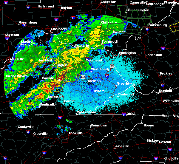 The severe thunderstorm warning for northwestern clark and southeastern bourbon counties will expire at 1030 pm edt, the storm which prompted the warning is moving out of the area. therefore the warning will be allowed to expire. a tornado watch remains in effect until 100 am edt for central kentucky. report severe weather to local law enforcement, post your report to the national weather service louisville facebook page, or tweet your report using hashtag l, m, k, spotter. The severe thunderstorm warning for northwestern clark and southeastern bourbon counties will expire at 1030 pm edt, the storm which prompted the warning is moving out of the area. therefore the warning will be allowed to expire. a tornado watch remains in effect until 100 am edt for central kentucky. report severe weather to local law enforcement, post your report to the national weather service louisville facebook page, or tweet your report using hashtag l, m, k, spotter.
|
| 4/3/2018 9:59 PM EDT |
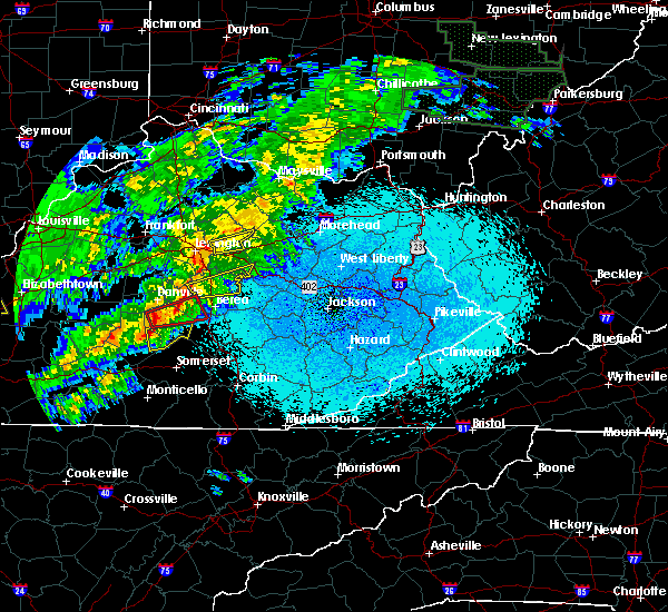 At 959 pm edt, a severe thunderstorm was located 7 miles northwest of winchester, moving east at 55 mph (radar indicated). Hazards include 60 mph wind gusts. expect damage to roofs, siding, and trees At 959 pm edt, a severe thunderstorm was located 7 miles northwest of winchester, moving east at 55 mph (radar indicated). Hazards include 60 mph wind gusts. expect damage to roofs, siding, and trees
|
| 8/22/2017 6:40 PM EDT |
 At 639 pm edt, a severe thunderstorm was located near winchester, moving east at 50 mph (radar indicated). Hazards include 60 mph wind gusts. Expect damage to roofs, siding, and trees. Locations impacted include, lexington, winchester, cadentown, veterans park, bryan station, north middletown, goffs corner, chilesburg, renick and lyndale. At 639 pm edt, a severe thunderstorm was located near winchester, moving east at 50 mph (radar indicated). Hazards include 60 mph wind gusts. Expect damage to roofs, siding, and trees. Locations impacted include, lexington, winchester, cadentown, veterans park, bryan station, north middletown, goffs corner, chilesburg, renick and lyndale.
|
| 8/22/2017 6:27 PM EDT |
 At 626 pm edt, a severe thunderstorm was located over chevy chase, moving east at 50 mph (radar indicated). Hazards include 60 mph wind gusts. expect damage to roofs, siding, and trees At 626 pm edt, a severe thunderstorm was located over chevy chase, moving east at 50 mph (radar indicated). Hazards include 60 mph wind gusts. expect damage to roofs, siding, and trees
|
| 8/2/2017 3:11 PM EDT |
 At 311 pm edt, a severe thunderstorm was located near carlisle, moving east at 15 mph (radar indicated). Hazards include 60 mph wind gusts and penny size hail. expect damage to roofs, siding, and trees At 311 pm edt, a severe thunderstorm was located near carlisle, moving east at 15 mph (radar indicated). Hazards include 60 mph wind gusts and penny size hail. expect damage to roofs, siding, and trees
|
| 6/18/2017 5:31 PM EDT |
 At 530 pm edt, severe thunderstorms were located along a line extending from 12 miles northeast of frankfort to 9 miles northwest of paris to near winchester, moving northeast at 45 mph (radar indicated. numerous trees reported down in lexington). Hazards include 60 mph wind gusts. expect damage to roofs, siding, and trees At 530 pm edt, severe thunderstorms were located along a line extending from 12 miles northeast of frankfort to 9 miles northwest of paris to near winchester, moving northeast at 45 mph (radar indicated. numerous trees reported down in lexington). Hazards include 60 mph wind gusts. expect damage to roofs, siding, and trees
|
| 4/5/2017 7:22 PM EDT |
 At 721 pm edt, severe thunderstorms were located along a line extending from near cynthiana to 9 miles west of carlisle to near bryan station, moving east at 65 mph (radar indicated). Hazards include 70 mph wind gusts and quarter size hail. Hail damage to vehicles is expected. expect considerable tree damage. Wind damage is also likely to mobile homes, roofs, and outbuildings. At 721 pm edt, severe thunderstorms were located along a line extending from near cynthiana to 9 miles west of carlisle to near bryan station, moving east at 65 mph (radar indicated). Hazards include 70 mph wind gusts and quarter size hail. Hail damage to vehicles is expected. expect considerable tree damage. Wind damage is also likely to mobile homes, roofs, and outbuildings.
|
| 3/27/2017 8:08 PM EDT |
 The severe thunderstorm warning for northeastern clark, central bourbon and south central harrison counties will expire at 815 pm edt, the storms which prompted the warning have weakened below severe limits, and have exited the warned area. therefore the warning will be allowed to expire. a severe thunderstorm watch remains in effect until 1100 pm edt for central kentucky. report severe weather to local law enforcement, post your report to the national weather service louisville facebook page, or tweet your report using hashtag l, m, k, spotter. The severe thunderstorm warning for northeastern clark, central bourbon and south central harrison counties will expire at 815 pm edt, the storms which prompted the warning have weakened below severe limits, and have exited the warned area. therefore the warning will be allowed to expire. a severe thunderstorm watch remains in effect until 1100 pm edt for central kentucky. report severe weather to local law enforcement, post your report to the national weather service louisville facebook page, or tweet your report using hashtag l, m, k, spotter.
|
| 3/27/2017 8:04 PM EDT |
 At 803 pm edt, severe thunderstorms were located along a line extending from near cynthiana to near sideview to near wades mill, moving east at 60 mph (radar indicated). Hazards include 60 mph wind gusts. Expect damage to roofs, siding, and trees. Locations impacted include, winchester, paris, north middletown, sidville, pretty run, shawhan, constant station, ruddels mills, leesburg and renick. At 803 pm edt, severe thunderstorms were located along a line extending from near cynthiana to near sideview to near wades mill, moving east at 60 mph (radar indicated). Hazards include 60 mph wind gusts. Expect damage to roofs, siding, and trees. Locations impacted include, winchester, paris, north middletown, sidville, pretty run, shawhan, constant station, ruddels mills, leesburg and renick.
|
| 3/27/2017 7:47 PM EDT |
 At 746 pm edt, severe thunderstorms were located along a line extending from near georgetown to 6 miles east of bryan station to near winchester, moving east at 60 mph (radar indicated). Hazards include 60 mph wind gusts. Expect damage to roofs, siding, and trees. Locations impacted include, lexington, georgetown, winchester, paris, meadowthorpe, thoroughbred acres, cadentown, northland, highlands and bryan station. At 746 pm edt, severe thunderstorms were located along a line extending from near georgetown to 6 miles east of bryan station to near winchester, moving east at 60 mph (radar indicated). Hazards include 60 mph wind gusts. Expect damage to roofs, siding, and trees. Locations impacted include, lexington, georgetown, winchester, paris, meadowthorpe, thoroughbred acres, cadentown, northland, highlands and bryan station.
|
| 3/27/2017 7:30 PM EDT |
 At 729 pm edt, severe thunderstorms were located along a line extending from near frankfort to dunbar high school to near veterans park, moving east at 60 mph (radar indicated). Hazards include 60 mph wind gusts. expect damage to roofs, siding, and trees At 729 pm edt, severe thunderstorms were located along a line extending from near frankfort to dunbar high school to near veterans park, moving east at 60 mph (radar indicated). Hazards include 60 mph wind gusts. expect damage to roofs, siding, and trees
|
| 3/1/2017 8:14 AM EST |
 At 813 am est, severe thunderstorms were located along a line extending from near sideview to 7 miles northwest of richmond, moving east at 70 mph (radar indicated). Hazards include 60 mph wind gusts. expect damage to roofs, siding, and trees At 813 am est, severe thunderstorms were located along a line extending from near sideview to 7 miles northwest of richmond, moving east at 70 mph (radar indicated). Hazards include 60 mph wind gusts. expect damage to roofs, siding, and trees
|
| 3/1/2017 7:48 AM EST |
 At 747 am est, severe thunderstorms were located along a line extending from near lewisburg to near paris, moving east at 60 mph (radar indicated). Hazards include 60 mph wind gusts and penny size hail. Expect damage to roofs, siding, and trees. locations impacted include, paris, carlisle, millersburg, north middletown, blacks crossroads, ellisville, colville, moorefield, currentsville and barefoot. a tornado watch remains in effect until 900 am est for central kentucky. A tornado watch also remains in effect until 1100 am est for central kentucky. At 747 am est, severe thunderstorms were located along a line extending from near lewisburg to near paris, moving east at 60 mph (radar indicated). Hazards include 60 mph wind gusts and penny size hail. Expect damage to roofs, siding, and trees. locations impacted include, paris, carlisle, millersburg, north middletown, blacks crossroads, ellisville, colville, moorefield, currentsville and barefoot. a tornado watch remains in effect until 900 am est for central kentucky. A tornado watch also remains in effect until 1100 am est for central kentucky.
|
| 3/1/2017 7:34 AM EST |
 At 733 am est, severe thunderstorms were located along a line extending from 9 miles northwest of cowan to 8 miles east of georgetown, moving east at 60 mph (radar indicated). Hazards include 60 mph wind gusts and penny size hail. Expect damage to roofs, siding, and trees. locations impacted include, georgetown, paris, cynthiana, carlisle, breckinridge, millersburg, north middletown, berry, blacks crossroads and alberta. a tornado watch remains in effect until 900 am est for central kentucky. A tornado watch also remains in effect until 1100 am est for central kentucky. At 733 am est, severe thunderstorms were located along a line extending from 9 miles northwest of cowan to 8 miles east of georgetown, moving east at 60 mph (radar indicated). Hazards include 60 mph wind gusts and penny size hail. Expect damage to roofs, siding, and trees. locations impacted include, georgetown, paris, cynthiana, carlisle, breckinridge, millersburg, north middletown, berry, blacks crossroads and alberta. a tornado watch remains in effect until 900 am est for central kentucky. A tornado watch also remains in effect until 1100 am est for central kentucky.
|
| 3/1/2017 7:17 AM EST |
 At 717 am est, severe thunderstorms were located along a line extending from 6 miles southeast of falmouth to 9 miles northwest of georgetown, moving east at 65 mph (radar indicated). Hazards include 60 mph wind gusts and quarter size hail. Hail damage to vehicles is expected. Expect wind damage to roofs, siding, and trees. At 717 am est, severe thunderstorms were located along a line extending from 6 miles southeast of falmouth to 9 miles northwest of georgetown, moving east at 65 mph (radar indicated). Hazards include 60 mph wind gusts and quarter size hail. Hail damage to vehicles is expected. Expect wind damage to roofs, siding, and trees.
|
| 3/1/2017 4:11 AM EST |
 At 411 am est, a severe thunderstorm was located near paris, moving east at 65 mph (radar indicated). Hazards include 60 mph wind gusts. expect damage to roofs, siding, and trees At 411 am est, a severe thunderstorm was located near paris, moving east at 65 mph (radar indicated). Hazards include 60 mph wind gusts. expect damage to roofs, siding, and trees
|
| 3/1/2017 3:37 AM EST |
 At 336 am est, a severe thunderstorm was located 7 miles west of paris, moving east at 65 mph (radar indicated). Hazards include 60 mph wind gusts. Expect damage to roofs, siding, and trees. locations impacted include, georgetown, paris, millersburg, north middletown, spindletop estates, blacks crossroads, hutchison, leesburg, colville and broadwell. A tornado watch remains in effect until 500 am est for central kentucky. At 336 am est, a severe thunderstorm was located 7 miles west of paris, moving east at 65 mph (radar indicated). Hazards include 60 mph wind gusts. Expect damage to roofs, siding, and trees. locations impacted include, georgetown, paris, millersburg, north middletown, spindletop estates, blacks crossroads, hutchison, leesburg, colville and broadwell. A tornado watch remains in effect until 500 am est for central kentucky.
|
| 3/1/2017 3:26 AM EST |
 At 325 am est, a severe thunderstorm was located near georgetown, moving east at 55 mph (radar indicated). Hazards include 60 mph wind gusts. expect damage to roofs, siding, and trees At 325 am est, a severe thunderstorm was located near georgetown, moving east at 55 mph (radar indicated). Hazards include 60 mph wind gusts. expect damage to roofs, siding, and trees
|
| 7/8/2016 12:34 PM EDT |
 At 1233 pm edt, severe thunderstorms were located along a line extending from 7 miles southeast of paris to 6 miles southeast of winchester, moving east at 55 mph (radar indicated). Hazards include 60 mph wind gusts. Expect damage to roofs. siding. and trees. Locations impacted include, winchester, north middletown, austerlitz, bunker hill, thomson, kiddville, ruckerville, constant station, renick and hedges. At 1233 pm edt, severe thunderstorms were located along a line extending from 7 miles southeast of paris to 6 miles southeast of winchester, moving east at 55 mph (radar indicated). Hazards include 60 mph wind gusts. Expect damage to roofs. siding. and trees. Locations impacted include, winchester, north middletown, austerlitz, bunker hill, thomson, kiddville, ruckerville, constant station, renick and hedges.
|
| 7/8/2016 12:18 PM EDT |
 At 1218 pm edt, a severe thunderstorm was located near winchester, moving east at 35 mph (radar indicated). Hazards include 60 mph wind gusts. Expect damage to roofs. siding. And trees. At 1218 pm edt, a severe thunderstorm was located near winchester, moving east at 35 mph (radar indicated). Hazards include 60 mph wind gusts. Expect damage to roofs. siding. And trees.
|
| 7/4/2016 1:32 PM EDT |
 At 131 pm edt, a severe thunderstorm was located near sideview, moving east at 35 mph (radar indicated). Hazards include 60 mph wind gusts. Expect damage to roofs. siding. and trees. Locations impacted include, winchester, paris, north middletown, clintonville, old pine grove, thomson, judianne estates, silver lake, constant station and sewell shop. At 131 pm edt, a severe thunderstorm was located near sideview, moving east at 35 mph (radar indicated). Hazards include 60 mph wind gusts. Expect damage to roofs. siding. and trees. Locations impacted include, winchester, paris, north middletown, clintonville, old pine grove, thomson, judianne estates, silver lake, constant station and sewell shop.
|
| 7/4/2016 1:25 PM EDT |
 At 125 pm edt, a severe thunderstorm was located 7 miles south of paris, moving east at 35 mph (radar indicated). Hazards include 60 mph wind gusts. Expect damage to roofs. siding. and trees. Locations impacted include, winchester, paris, north middletown, clintonville, old pine grove, thomson, fenwick, judianne estates, silver lake and constant station. At 125 pm edt, a severe thunderstorm was located 7 miles south of paris, moving east at 35 mph (radar indicated). Hazards include 60 mph wind gusts. Expect damage to roofs. siding. and trees. Locations impacted include, winchester, paris, north middletown, clintonville, old pine grove, thomson, fenwick, judianne estates, silver lake and constant station.
|
| 7/4/2016 1:11 PM EDT |
 At 111 pm edt, a severe thunderstorm was located over bryan station, moving east at 35 mph (radar indicated). Hazards include 60 mph wind gusts. Expect damage to roofs. siding. And trees. At 111 pm edt, a severe thunderstorm was located over bryan station, moving east at 35 mph (radar indicated). Hazards include 60 mph wind gusts. Expect damage to roofs. siding. And trees.
|
| 6/23/2016 5:34 PM EDT |
 At 534 pm edt, severe thunderstorms were located along a line extending from 8 miles southeast of cynthiana to 6 miles south of paris, moving east at 40 mph (radar indicated). Hazards include 60 mph wind gusts and quarter size hail. Hail damage to vehicles is expected. Expect wind damage to roofs, siding, and trees. At 534 pm edt, severe thunderstorms were located along a line extending from 8 miles southeast of cynthiana to 6 miles south of paris, moving east at 40 mph (radar indicated). Hazards include 60 mph wind gusts and quarter size hail. Hail damage to vehicles is expected. Expect wind damage to roofs, siding, and trees.
|
| 6/21/2016 2:31 PM EDT |
 At 231 pm edt, severe thunderstorms were located along a line extending from near sharpsburg to near winchester, moving southeast at 40 mph (radar indicated). Hazards include 60 mph wind gusts and quarter size hail. Hail damage to vehicles is expected. expect wind damage to roofs, siding, and trees. Locations impacted include, winchester, north middletown, old pine grove, thomson, judianne estates, silver lake, ruckerville, moorefield, constant station and sewell shop. At 231 pm edt, severe thunderstorms were located along a line extending from near sharpsburg to near winchester, moving southeast at 40 mph (radar indicated). Hazards include 60 mph wind gusts and quarter size hail. Hail damage to vehicles is expected. expect wind damage to roofs, siding, and trees. Locations impacted include, winchester, north middletown, old pine grove, thomson, judianne estates, silver lake, ruckerville, moorefield, constant station and sewell shop.
|
| 6/21/2016 2:24 PM EDT |
 At 224 pm edt, severe thunderstorms were located along a line extending from near carlisle to near winchester, moving east at 40 mph (radar indicated). Hazards include 60 mph wind gusts and quarter size hail. Hail damage to vehicles is expected. expect wind damage to roofs, siding, and trees. Locations impacted include, lexington, winchester, north middletown, clintonville, old pine grove, thomson, judianne estates, silver lake, ruckerville and moorefield. At 224 pm edt, severe thunderstorms were located along a line extending from near carlisle to near winchester, moving east at 40 mph (radar indicated). Hazards include 60 mph wind gusts and quarter size hail. Hail damage to vehicles is expected. expect wind damage to roofs, siding, and trees. Locations impacted include, lexington, winchester, north middletown, clintonville, old pine grove, thomson, judianne estates, silver lake, ruckerville and moorefield.
|
| 6/21/2016 2:18 PM EDT |
 At 218 pm edt, severe thunderstorms were located along a line extending from near carlisle to near winchester, moving southeast at 40 mph (radar indicated). Hazards include 60 mph wind gusts and quarter size hail. Hail damage to vehicles is expected. expect wind damage to roofs, siding, and trees. Locations impacted include, lexington, winchester, paris, carlisle, millersburg, north middletown, clintonville, ruckerville, moorefield and sewell shop. At 218 pm edt, severe thunderstorms were located along a line extending from near carlisle to near winchester, moving southeast at 40 mph (radar indicated). Hazards include 60 mph wind gusts and quarter size hail. Hail damage to vehicles is expected. expect wind damage to roofs, siding, and trees. Locations impacted include, lexington, winchester, paris, carlisle, millersburg, north middletown, clintonville, ruckerville, moorefield and sewell shop.
|
| 6/21/2016 2:13 PM EDT |
 At 212 pm edt, severe thunderstorms were located along a line extending from 6 miles west of carlisle to near cadentown, moving southeast at 40 mph (radar indicated). Hazards include 60 mph wind gusts and quarter size hail. Hail damage to vehicles is expected. Expect wind damage to roofs, siding, and trees. At 212 pm edt, severe thunderstorms were located along a line extending from 6 miles west of carlisle to near cadentown, moving southeast at 40 mph (radar indicated). Hazards include 60 mph wind gusts and quarter size hail. Hail damage to vehicles is expected. Expect wind damage to roofs, siding, and trees.
|
| 12/23/2015 9:31 PM EST | At 931 pm est, a severe thunderstorm was located over cowan, moving east at 60 mph (radar indicated). Hazards include 60 mph wind gusts. Expect damage to roofs. siding and trees. Locations impacted include, paris, cynthiana, carlisle, millersburg, north middletown, clintonville, morning glory, colville, lair, myers, venus, oddville, moorefield, little rock, ruddels mills, us route 62 at state route 19, currentsville, ellisville, austerlitz and brentsville. |
| 12/23/2015 9:19 PM EST | A severe thunderstorm warning remains in effect until 945 pm est for northern fayette. nicholas. eastern harrison. bourbon and southeastern scott counties. at 919 pm est. a severe thunderstorm was located near carlisle. moving east at 60 mph. hazard. 60 mph wind gusts. |
| 12/23/2015 8:59 PM EST | At 859 pm est, a severe thunderstorm was located near georgetown, moving east at 60 mph (radar indicated). Hazards include 60 mph wind gusts. Expect damage to roofs. Siding and trees. |
| 8/3/2015 8:58 PM EDT |
 At 858 pm edt, a severe thunderstorm was located near paris, moving southeast at 30 mph (radar indicated). Hazards include 60 mph wind gusts and quarter size hail. Hail damage to vehicles is expected. Expect wind damage to roofs, siding and trees. At 858 pm edt, a severe thunderstorm was located near paris, moving southeast at 30 mph (radar indicated). Hazards include 60 mph wind gusts and quarter size hail. Hail damage to vehicles is expected. Expect wind damage to roofs, siding and trees.
|
| 7/13/2015 3:02 PM EDT |
 At 300 pm edt, severe thunderstorms were located along a line extending from bethel to 7 miles south of paris to 5 miles northwest of highlands, and moving southeast at 45 mph (radar indicated). Hazards include 60 mph wind gusts. Expect damage to roofs. Siding and trees. At 300 pm edt, severe thunderstorms were located along a line extending from bethel to 7 miles south of paris to 5 miles northwest of highlands, and moving southeast at 45 mph (radar indicated). Hazards include 60 mph wind gusts. Expect damage to roofs. Siding and trees.
|
| 7/13/2015 2:42 PM EDT |
 At 240 pm edt, severe thunderstorms were located along a line extending from 9 miles northwest of carlisle to cynthiana to 8 miles north of georgetown, and moving southeast at 40 mph (radar indicated). Hazards include 70 mph wind gusts. Expect considerable tree damage. Damage is likely to mobile homes, roofs and outbuildings. At 240 pm edt, severe thunderstorms were located along a line extending from 9 miles northwest of carlisle to cynthiana to 8 miles north of georgetown, and moving southeast at 40 mph (radar indicated). Hazards include 70 mph wind gusts. Expect considerable tree damage. Damage is likely to mobile homes, roofs and outbuildings.
|
| 7/10/2015 12:44 PM EDT |
 At 1240 pm edt, severe thunderstorms were located along a line extending from 12 miles southeast of owenton to paris to 7 miles north of winchester to 7 miles south of winchester, and moving east at 30 mph (radar indicated). Hazards include 60 mph wind gusts. Expect damage to roofs. siding and trees. Locations impacted include, cynthiana, lair, north middletown, ruddels mills, hinton, hunt, franklin, pinchem, blacks crossroads, bloomingdale, haggard, mount zion, rutland, millersburg, cotton branch, little rock, renaker, ruckerville, breckinridge and colville. At 1240 pm edt, severe thunderstorms were located along a line extending from 12 miles southeast of owenton to paris to 7 miles north of winchester to 7 miles south of winchester, and moving east at 30 mph (radar indicated). Hazards include 60 mph wind gusts. Expect damage to roofs. siding and trees. Locations impacted include, cynthiana, lair, north middletown, ruddels mills, hinton, hunt, franklin, pinchem, blacks crossroads, bloomingdale, haggard, mount zion, rutland, millersburg, cotton branch, little rock, renaker, ruckerville, breckinridge and colville.
|
| 7/10/2015 12:19 PM EDT |
 At 1217 pm edt, severe thunderstorms were located along a line extending from 9 miles south of owenton to 7 miles east of georgetown to bryan station to 6 miles west of danville, and moving east at 30 mph (radar indicated). Hazards include 60 mph wind gusts. Expect damage to roofs. Siding and trees. At 1217 pm edt, severe thunderstorms were located along a line extending from 9 miles south of owenton to 7 miles east of georgetown to bryan station to 6 miles west of danville, and moving east at 30 mph (radar indicated). Hazards include 60 mph wind gusts. Expect damage to roofs. Siding and trees.
|
| 6/26/2015 7:24 PM EDT | Several trees down in the eastern portion of the county. pictures from public via media confirm this repor in bourbon county KY, 3.3 miles ESE of North Middletown, KY |
| 6/23/2015 3:18 PM EDT |
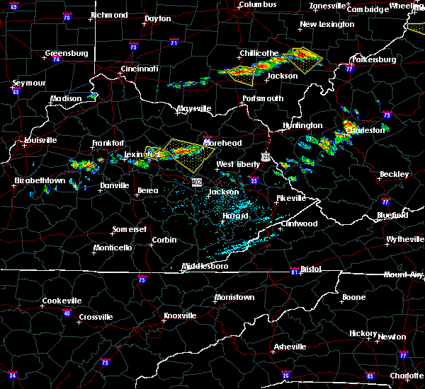 The severe thunderstorm warning for north central clark and southeastern bourbon counties will expire at 325 pm edt/225 pm cdt/, the storm which prompted the warning has weakened and moved out of the warned area. to report severe weather, contact your nearest law enforcement agency. they will relay your report to the national weather service in louisville. The severe thunderstorm warning for north central clark and southeastern bourbon counties will expire at 325 pm edt/225 pm cdt/, the storm which prompted the warning has weakened and moved out of the warned area. to report severe weather, contact your nearest law enforcement agency. they will relay your report to the national weather service in louisville.
|
| 6/23/2015 3:04 PM EDT |
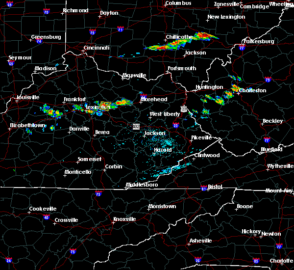 At 303 pm edt, a severe thunderstorm was located 10 miles southeast of paris, and moving east at 25 mph (radar indicated). Hazards include 60 mph wind gusts and quarter size hail. Hail damage to vehicles is expected. Expect wind damage to roofs, siding and trees. At 303 pm edt, a severe thunderstorm was located 10 miles southeast of paris, and moving east at 25 mph (radar indicated). Hazards include 60 mph wind gusts and quarter size hail. Hail damage to vehicles is expected. Expect wind damage to roofs, siding and trees.
|
| 5/11/2015 3:37 PM EDT | At 336 pm edt, a severe thunderstorm was located near winchester, and moving northeast at 35 mph (radar indicated). Hazards include 60 mph wind gusts. Expect damage to roofs. Siding and trees. |
| 4/2/2015 6:33 PM EDT | The severe thunderstorm warning for clark and southeastern bourbon counties will expire at 635 pm edt/535 pm cdt/. the line of storms which prompted the warning is moving out of the warned area. however. Gusty winds and heavy rain are still likely with these thunderstorms. |
| 4/2/2015 6:27 PM EDT | A severe thunderstorm warning remains in effect for clark and southeastern bourbon counties until 635 pm edt. at 625 pm edt. severe thunderstorms were located along a line extending from sharpsburg to camargo to 9 miles southeast of winchester. and moving east at 55 mph. hazard. 60 mph wind gusts and quarter size hail. |
| 4/2/2015 6:17 PM EDT | The national weather service in louisville has issued a * severe thunderstorm warning for. eastern bourbon county in east central kentucky. clark county in east central kentucky. southern nicholas county in east central kentucky. Until 635 pm edt. |
| 6/29/2012 6:50 PM EDT | *** 1 fatal *** tree fell on a man who was trying to clear the road of some limbs that had fallen after a gust front initially moved through the are in clark county KY, 3.2 miles NNW of North Middletown, KY |
| 1/1/0001 12:00 AM | Golf Ball sized hail reported 4 miles NW of North Middletown, KY |
Hail Maps for North Middletown, KY


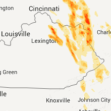


Connect with Interactive Hail Maps