

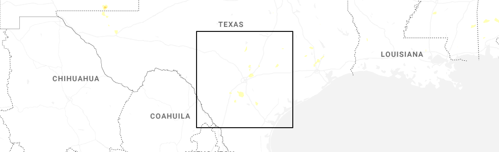
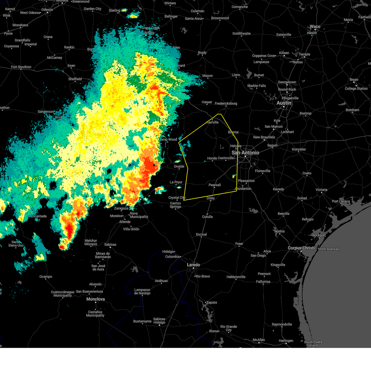
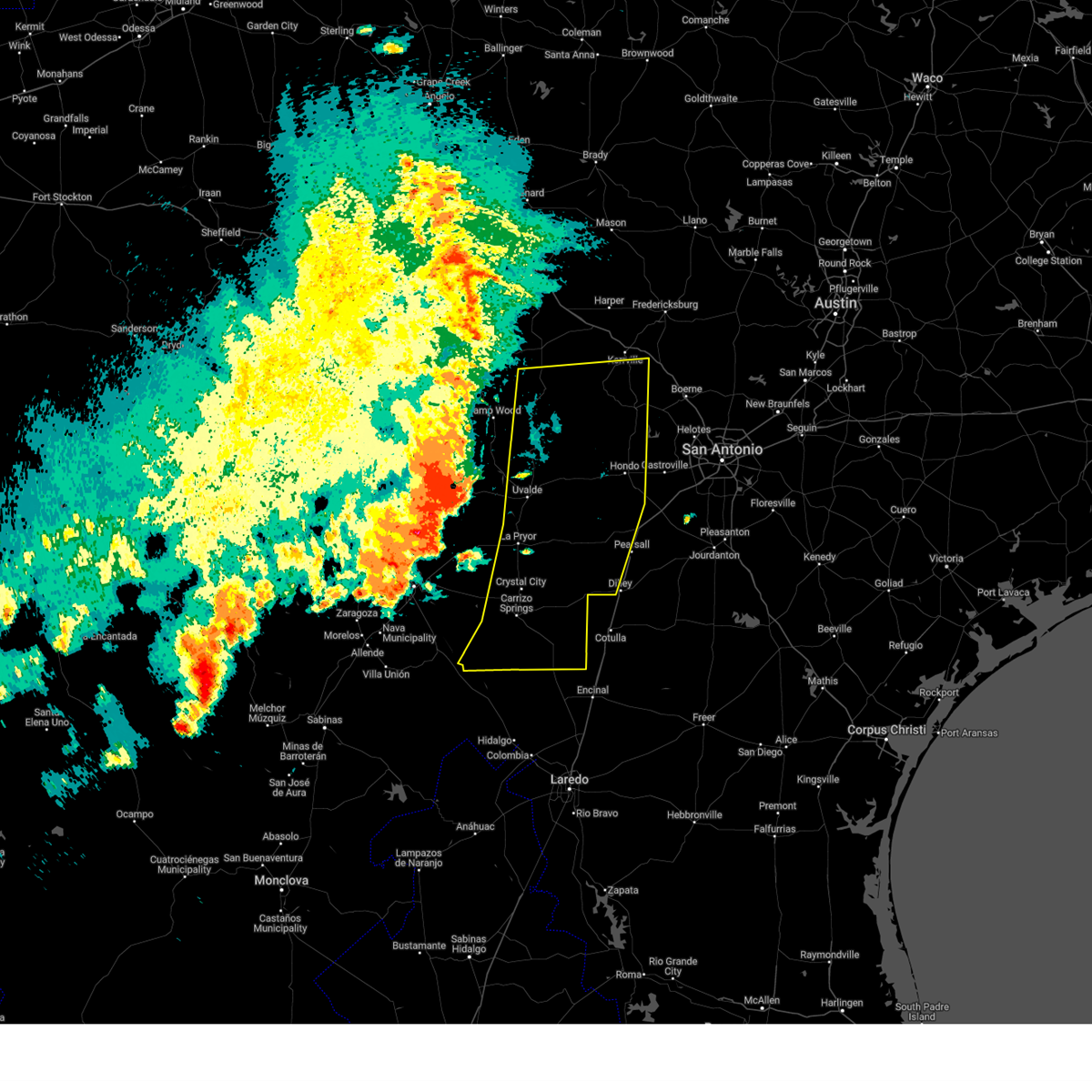
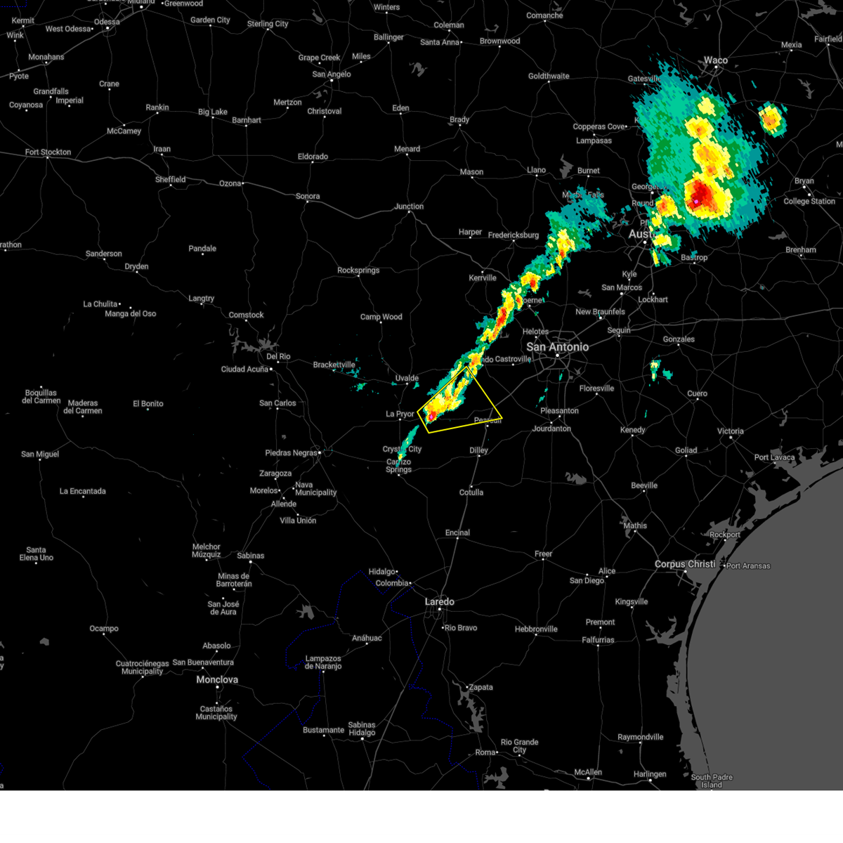
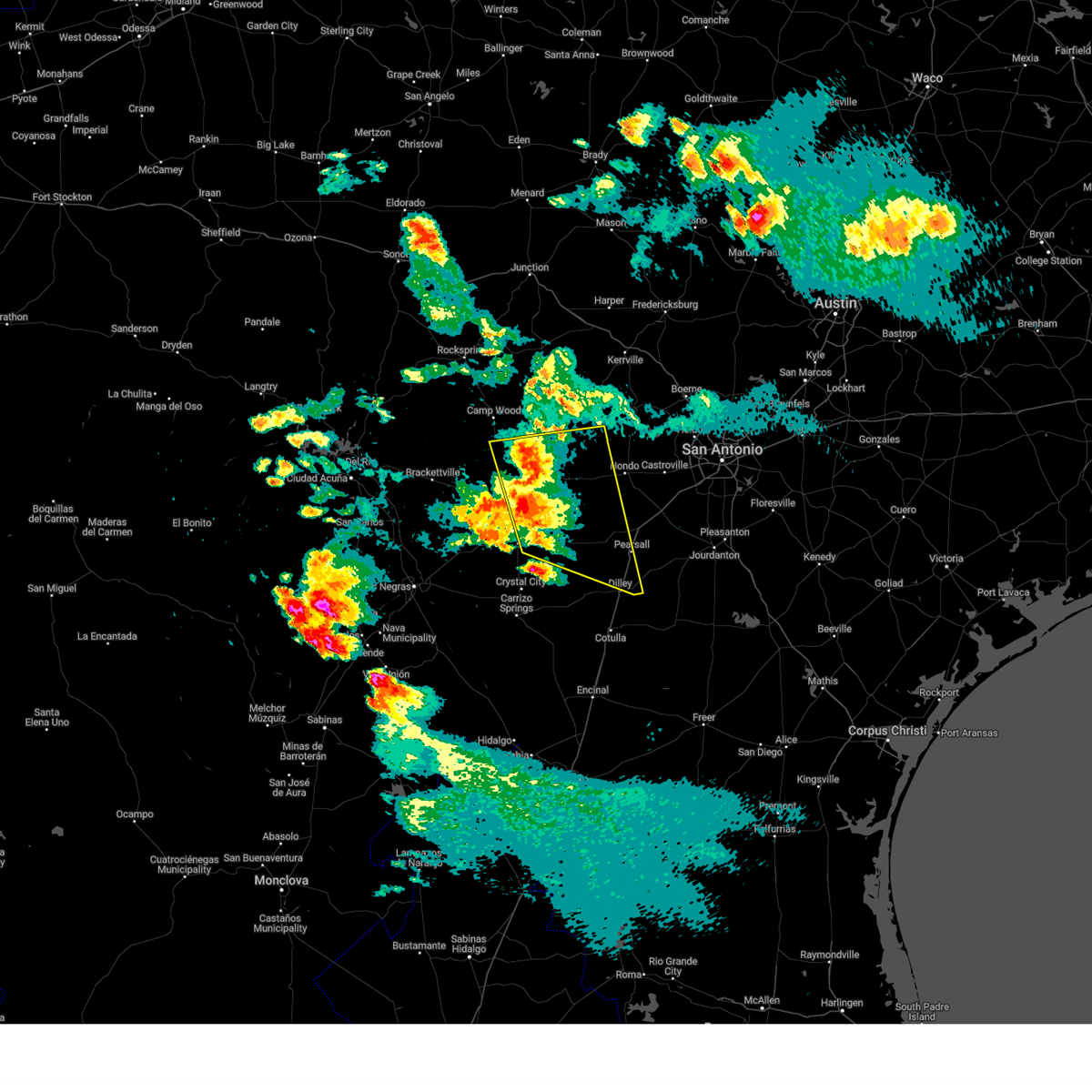
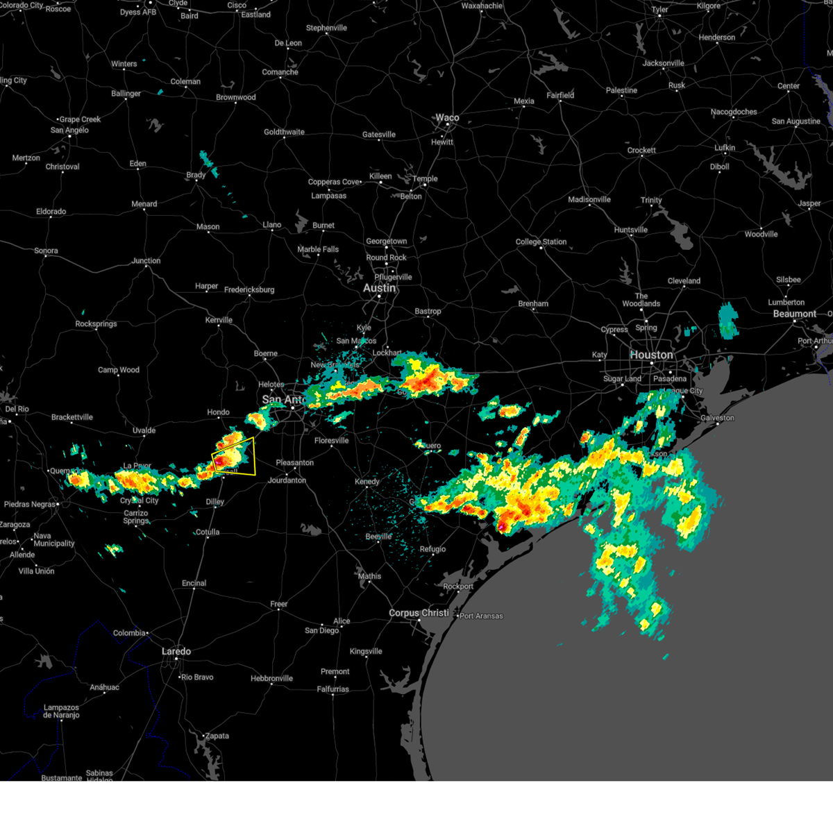
Hail Map for North Pearsall, TX
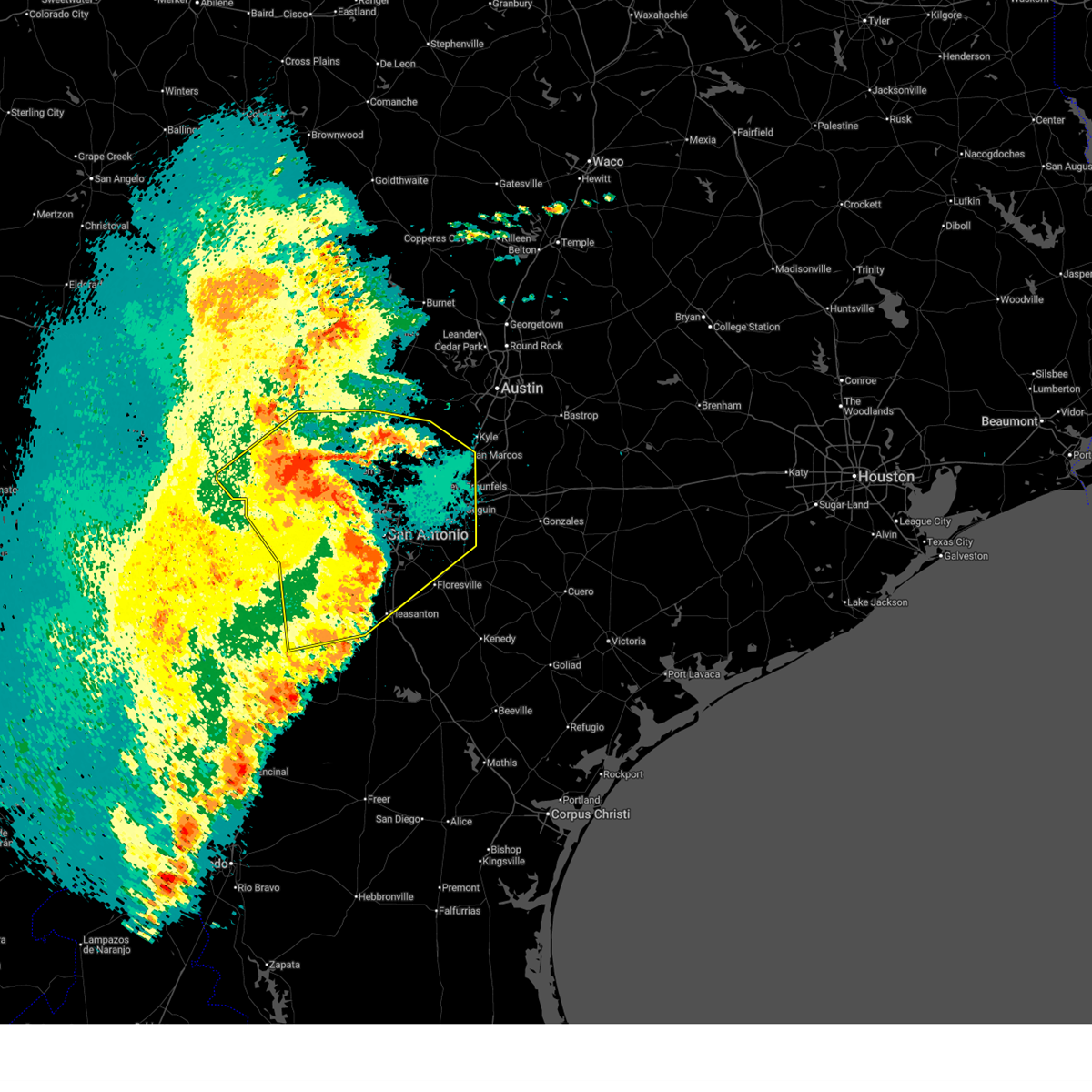
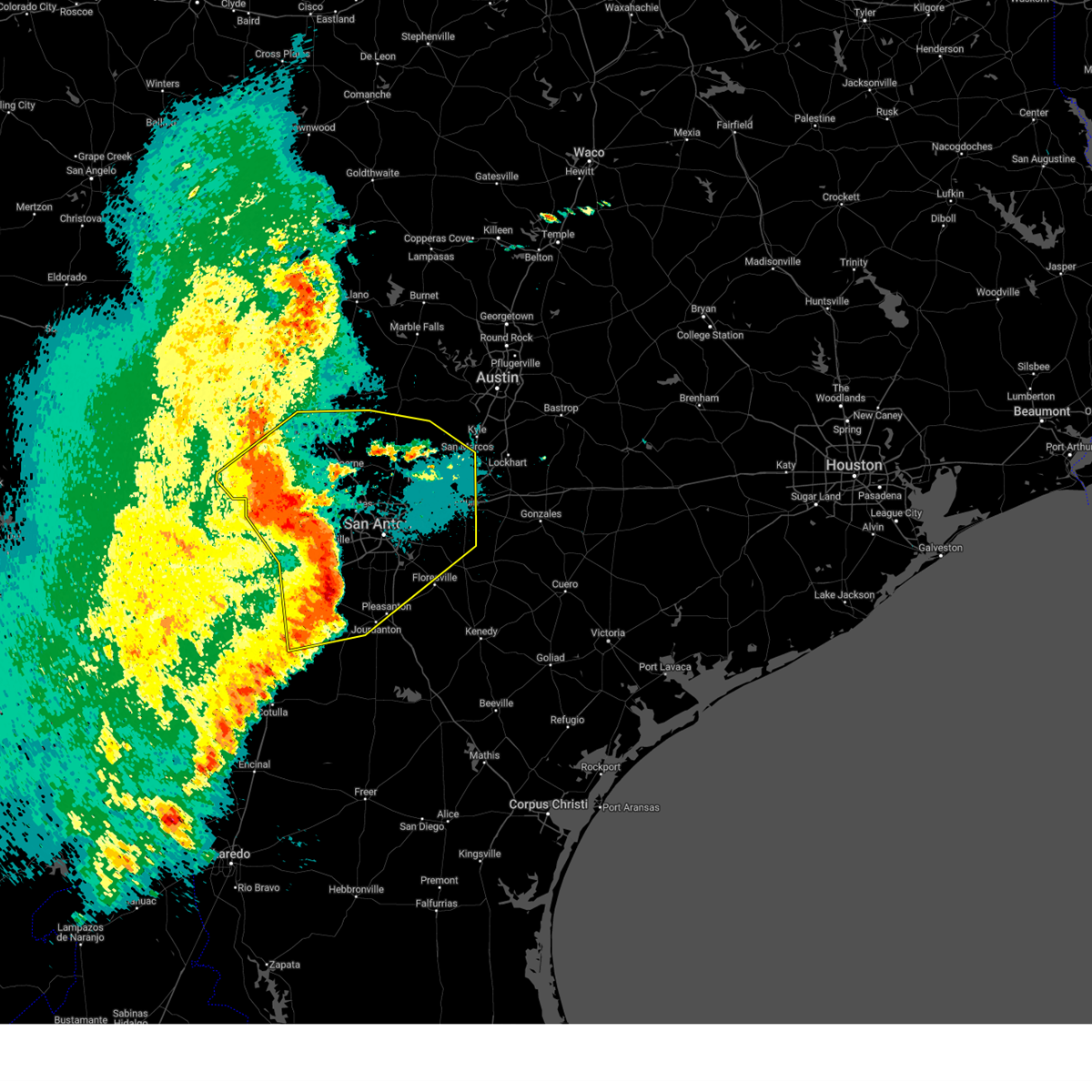
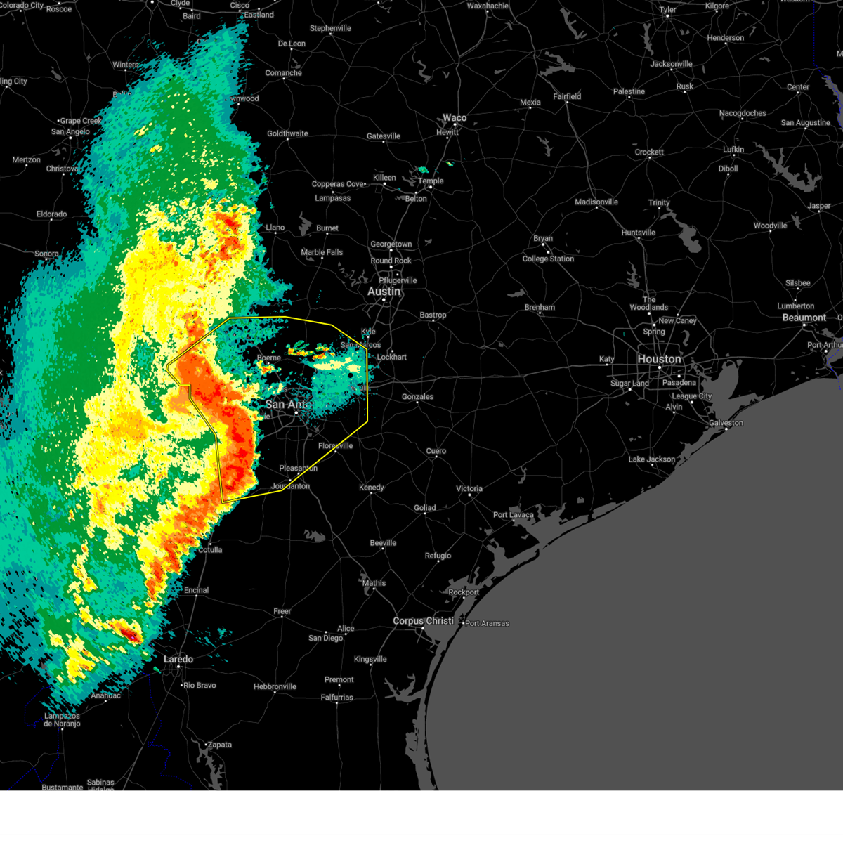
The North Pearsall, TX area has had 0 reports of on-the-ground hail by trained spotters, and has been under severe weather warnings 10 times during the past 12 months. Doppler radar has detected hail at or near North Pearsall, TX on 50 occasions, including 4 occasions during the past year.
| Name: | North Pearsall, TX |
| Where Located: | 50.1 miles SW of San Antonio, TX |
| Map: | Google Map for North Pearsall, TX |
| Population: | 614 |
| Housing Units: | 208 |
| More Info: | Search Google for North Pearsall, TX |
1
The Top Recent Hail Date for North Pearsall, TX is Sunday, June 15, 2025 (15th out of 50)
Hail and Wind Damage Spotted near North Pearsall, TX
| Date / Time | Report Details |
|---|---|
| 6/11/2025 12:53 AM CDT |
 The storms which prompted the warning have weakened below severe limits, and no longer pose an immediate threat to life or property. therefore, the warning will be allowed to expire. a severe thunderstorm watch remains in effect until 200 am cdt for south central texas. The storms which prompted the warning have weakened below severe limits, and no longer pose an immediate threat to life or property. therefore, the warning will be allowed to expire. a severe thunderstorm watch remains in effect until 200 am cdt for south central texas.
|
| 6/11/2025 12:19 AM CDT |
 At 1218 am cdt, severe thunderstorms were located along a line extending from near lakehills to near sea world to near somerset, moving east at 60 mph (radar indicated). Hazards include 60 mph wind gusts and quarter size hail. Hail damage to vehicles is expected. expect wind damage to roofs, siding, and trees. Locations impacted include, san antonio, new braunfels, san marcos, medina, schertz, seguin, cibolo, kerrville, converse, universal city, live oak, boerne, pleasanton, selma, pearsall, hondo, floresville, devine, jourdanton, and poteet. At 1218 am cdt, severe thunderstorms were located along a line extending from near lakehills to near sea world to near somerset, moving east at 60 mph (radar indicated). Hazards include 60 mph wind gusts and quarter size hail. Hail damage to vehicles is expected. expect wind damage to roofs, siding, and trees. Locations impacted include, san antonio, new braunfels, san marcos, medina, schertz, seguin, cibolo, kerrville, converse, universal city, live oak, boerne, pleasanton, selma, pearsall, hondo, floresville, devine, jourdanton, and poteet.
|
| 6/11/2025 12:13 AM CDT |
 The storms which prompted the warning have moved out of the area. therefore, the warning will be allowed to expire. however small hail, gusty winds and heavy rain are still possible with these thunderstorms. a severe thunderstorm watch remains in effect until 200 am cdt for south central texas. remember, a severe thunderstorm warning still remains in effect for portions of medina, bandera, frio, bexar, kendall, kerr, and atascosa. The storms which prompted the warning have moved out of the area. therefore, the warning will be allowed to expire. however small hail, gusty winds and heavy rain are still possible with these thunderstorms. a severe thunderstorm watch remains in effect until 200 am cdt for south central texas. remember, a severe thunderstorm warning still remains in effect for portions of medina, bandera, frio, bexar, kendall, kerr, and atascosa.
|
| 6/11/2025 12:10 AM CDT |
 Svrewx the national weather service in austin san antonio has issued a * severe thunderstorm warning for, medina county in south central texas, bandera county in south central texas, southeastern kerr county in south central texas, southwestern hays county in south central texas, guadalupe county in south central texas, southwestern blanco county in south central texas, northeastern frio county in south central texas, northwestern atascosa county in south central texas, kendall county in south central texas, northwestern wilson county in south central texas, bexar county in south central texas, comal county in south central texas, * until 100 am cdt. * at 1207 am cdt, severe thunderstorms were located along a line extending from near mico to near rio medina to near lytle, moving northeast at 55 mph (radar indicated). Hazards include 60 mph wind gusts and quarter size hail. Hail damage to vehicles is expected. Expect wind damage to roofs, siding, and trees. Svrewx the national weather service in austin san antonio has issued a * severe thunderstorm warning for, medina county in south central texas, bandera county in south central texas, southeastern kerr county in south central texas, southwestern hays county in south central texas, guadalupe county in south central texas, southwestern blanco county in south central texas, northeastern frio county in south central texas, northwestern atascosa county in south central texas, kendall county in south central texas, northwestern wilson county in south central texas, bexar county in south central texas, comal county in south central texas, * until 100 am cdt. * at 1207 am cdt, severe thunderstorms were located along a line extending from near mico to near rio medina to near lytle, moving northeast at 55 mph (radar indicated). Hazards include 60 mph wind gusts and quarter size hail. Hail damage to vehicles is expected. Expect wind damage to roofs, siding, and trees.
|
| 6/10/2025 11:31 PM CDT |
 Svrewx the national weather service in austin san antonio has issued a * severe thunderstorm warning for, medina county in south central texas, bandera county in south central texas, southeastern kerr county in south central texas, eastern uvalde county in south central texas, eastern zavala county in south central texas, frio county in south central texas, northwestern atascosa county in south central texas, southwestern kendall county in south central texas, western bexar county in south central texas, southeastern real county in south central texas, * until 1215 am cdt. * at 1130 pm cdt, severe thunderstorms were located along a line extending from 8 miles east of vanderpool to near hondo to bluff, moving northeast at 35 mph (radar indicated). Hazards include 60 mph wind gusts and quarter size hail. Hail damage to vehicles is expected. Expect wind damage to roofs, siding, and trees. Svrewx the national weather service in austin san antonio has issued a * severe thunderstorm warning for, medina county in south central texas, bandera county in south central texas, southeastern kerr county in south central texas, eastern uvalde county in south central texas, eastern zavala county in south central texas, frio county in south central texas, northwestern atascosa county in south central texas, southwestern kendall county in south central texas, western bexar county in south central texas, southeastern real county in south central texas, * until 1215 am cdt. * at 1130 pm cdt, severe thunderstorms were located along a line extending from 8 miles east of vanderpool to near hondo to bluff, moving northeast at 35 mph (radar indicated). Hazards include 60 mph wind gusts and quarter size hail. Hail damage to vehicles is expected. Expect wind damage to roofs, siding, and trees.
|
| 6/10/2025 11:00 PM CDT |
 At 1100 pm cdt, severe thunderstorms were located along a line extending from 8 miles west of medina to 8 miles south of sabinal to near asherton, moving east at 35 mph (radar indicated). Hazards include 60 mph wind gusts and half dollar size hail. Hail damage to vehicles is expected. expect wind damage to roofs, siding, and trees. Locations impacted include, medina, kerrville, uvalde, pearsall, hondo, crystal city, carrizo springs, dilley, bandera, big wells, leakey, la pryor, tarpley, vanderpool, batesville, sabinal, asherton, north pearsall, chula vista-river spur, and d'hanis. At 1100 pm cdt, severe thunderstorms were located along a line extending from 8 miles west of medina to 8 miles south of sabinal to near asherton, moving east at 35 mph (radar indicated). Hazards include 60 mph wind gusts and half dollar size hail. Hail damage to vehicles is expected. expect wind damage to roofs, siding, and trees. Locations impacted include, medina, kerrville, uvalde, pearsall, hondo, crystal city, carrizo springs, dilley, bandera, big wells, leakey, la pryor, tarpley, vanderpool, batesville, sabinal, asherton, north pearsall, chula vista-river spur, and d'hanis.
|
| 6/10/2025 10:40 PM CDT |
 Svrewx the national weather service in austin san antonio has issued a * severe thunderstorm warning for, medina county in south central texas, bandera county in south central texas, southern kerr county in south central texas, eastern maverick county in south central texas, dimmit county in south central texas, uvalde county in south central texas, zavala county in south central texas, western frio county in south central texas, real county in south central texas, * until 1130 pm cdt. * at 1039 pm cdt, severe thunderstorms were located along a line extending from lost maples state natural area to 6 miles southeast of knippa to 6 miles southwest of carrizo hill, moving east at 35 mph (radar indicated). Hazards include ping pong ball size hail and 60 mph wind gusts. People and animals outdoors will be injured. expect hail damage to roofs, siding, windows, and vehicles. Expect wind damage to roofs, siding, and trees. Svrewx the national weather service in austin san antonio has issued a * severe thunderstorm warning for, medina county in south central texas, bandera county in south central texas, southern kerr county in south central texas, eastern maverick county in south central texas, dimmit county in south central texas, uvalde county in south central texas, zavala county in south central texas, western frio county in south central texas, real county in south central texas, * until 1130 pm cdt. * at 1039 pm cdt, severe thunderstorms were located along a line extending from lost maples state natural area to 6 miles southeast of knippa to 6 miles southwest of carrizo hill, moving east at 35 mph (radar indicated). Hazards include ping pong ball size hail and 60 mph wind gusts. People and animals outdoors will be injured. expect hail damage to roofs, siding, windows, and vehicles. Expect wind damage to roofs, siding, and trees.
|
| 5/6/2025 11:56 AM CDT |
 Svrewx the national weather service in austin san antonio has issued a * severe thunderstorm warning for, southwestern medina county in south central texas, southeastern uvalde county in south central texas, northeastern zavala county in south central texas, northwestern frio county in south central texas, * until 1245 pm cdt. * at 1156 am cdt, a severe thunderstorm was located over batesville, moving northeast at 40 mph (radar indicated). Hazards include 60 mph wind gusts and quarter size hail. Hail damage to vehicles is expected. Expect wind damage to roofs, siding, and trees. Svrewx the national weather service in austin san antonio has issued a * severe thunderstorm warning for, southwestern medina county in south central texas, southeastern uvalde county in south central texas, northeastern zavala county in south central texas, northwestern frio county in south central texas, * until 1245 pm cdt. * at 1156 am cdt, a severe thunderstorm was located over batesville, moving northeast at 40 mph (radar indicated). Hazards include 60 mph wind gusts and quarter size hail. Hail damage to vehicles is expected. Expect wind damage to roofs, siding, and trees.
|
| 5/1/2025 7:54 PM CDT |
 At 754 pm cdt, severe thunderstorms were located along a line extending from 6 miles south of reagan wells to near uvalde estates to near batesville, moving southeast at 10 mph (radar indicated). Hazards include 60 mph wind gusts and quarter size hail. Hail damage to vehicles is expected. expect wind damage to roofs, siding, and trees. Locations impacted include, uvalde, pearsall, dilley, batesville, la pryor, sabinal, north pearsall, knippa, d'hanis, derby, hilltop, concan, washer, uvalde estates, divot, reagan wells, bluff, frio town, and montell. At 754 pm cdt, severe thunderstorms were located along a line extending from 6 miles south of reagan wells to near uvalde estates to near batesville, moving southeast at 10 mph (radar indicated). Hazards include 60 mph wind gusts and quarter size hail. Hail damage to vehicles is expected. expect wind damage to roofs, siding, and trees. Locations impacted include, uvalde, pearsall, dilley, batesville, la pryor, sabinal, north pearsall, knippa, d'hanis, derby, hilltop, concan, washer, uvalde estates, divot, reagan wells, bluff, frio town, and montell.
|
| 5/1/2025 7:37 PM CDT | Svrewx the national weather service in austin san antonio has issued a * severe thunderstorm warning for, western medina county in south central texas, uvalde county in south central texas, northeastern zavala county in south central texas, western frio county in south central texas, * until 830 pm cdt. * at 736 pm cdt, severe thunderstorms were located along a line extending from 6 miles south of reagan wells to near batesville, moving southeast at 30 mph (radar indicated). Hazards include 60 mph wind gusts and quarter size hail. Hail damage to vehicles is expected. Expect wind damage to roofs, siding, and trees. |
| 5/13/2024 11:06 AM CDT |
 At 1105 am cdt, a severe thunderstorm was located over moore, or 7 miles southwest of devine, moving northeast at 35 mph (radar indicated). Hazards include tennis ball size hail and 60 mph wind gusts. People and animals outdoors will be injured. expect hail damage to roofs, siding, windows, and vehicles. expect wind damage to roofs, siding, and trees. Locations impacted include, pearsall, north pearsall, moore, frio town, schattel, bigfoot, three oaks and interstate 35. At 1105 am cdt, a severe thunderstorm was located over moore, or 7 miles southwest of devine, moving northeast at 35 mph (radar indicated). Hazards include tennis ball size hail and 60 mph wind gusts. People and animals outdoors will be injured. expect hail damage to roofs, siding, windows, and vehicles. expect wind damage to roofs, siding, and trees. Locations impacted include, pearsall, north pearsall, moore, frio town, schattel, bigfoot, three oaks and interstate 35.
|
| 5/13/2024 10:52 AM CDT |
 At 1052 am cdt, a severe thunderstorm was located near north pearsall, or 9 miles north of pearsall, moving east at 30 mph (radar indicated). Hazards include tennis ball size hail and 60 mph wind gusts. People and animals outdoors will be injured. expect hail damage to roofs, siding, windows, and vehicles. expect wind damage to roofs, siding, and trees. Locations impacted include, pearsall, north pearsall, moore, bluff, frio town, schattel, bigfoot, and three oaks. At 1052 am cdt, a severe thunderstorm was located near north pearsall, or 9 miles north of pearsall, moving east at 30 mph (radar indicated). Hazards include tennis ball size hail and 60 mph wind gusts. People and animals outdoors will be injured. expect hail damage to roofs, siding, windows, and vehicles. expect wind damage to roofs, siding, and trees. Locations impacted include, pearsall, north pearsall, moore, bluff, frio town, schattel, bigfoot, and three oaks.
|
| 5/13/2024 10:45 AM CDT |
 At 1044 am cdt, a severe thunderstorm was located near yancey, or 12 miles north of pearsall, moving northeast at 20 mph (radar indicated). Hazards include two inch hail and 60 mph wind gusts. People and animals outdoors will be injured. expect hail damage to roofs, siding, windows, and vehicles. expect wind damage to roofs, siding, and trees. locations impacted include, pearsall, north pearsall, moore, bluff, frio town, schattel, bigfoot, three oaks, u. s. 57 and interstate 35. At 1044 am cdt, a severe thunderstorm was located near yancey, or 12 miles north of pearsall, moving northeast at 20 mph (radar indicated). Hazards include two inch hail and 60 mph wind gusts. People and animals outdoors will be injured. expect hail damage to roofs, siding, windows, and vehicles. expect wind damage to roofs, siding, and trees. locations impacted include, pearsall, north pearsall, moore, bluff, frio town, schattel, bigfoot, three oaks, u. s. 57 and interstate 35.
|
| 5/13/2024 10:16 AM CDT |
 Svrewx the national weather service in austin san antonio has issued a * severe thunderstorm warning for, south central medina county in south central texas, northern frio county in south central texas, * until 1115 am cdt. * at 1016 am cdt, a severe thunderstorm was located over frio town, or 14 miles northwest of pearsall, moving northeast at 30 mph (radar indicated). Hazards include 60 mph wind gusts and half dollar size hail. Hail damage to vehicles is expected. Expect wind damage to roofs, siding, and trees. Svrewx the national weather service in austin san antonio has issued a * severe thunderstorm warning for, south central medina county in south central texas, northern frio county in south central texas, * until 1115 am cdt. * at 1016 am cdt, a severe thunderstorm was located over frio town, or 14 miles northwest of pearsall, moving northeast at 30 mph (radar indicated). Hazards include 60 mph wind gusts and half dollar size hail. Hail damage to vehicles is expected. Expect wind damage to roofs, siding, and trees.
|
| 5/5/2024 11:41 AM CDT |
 Svrewx the national weather service in austin san antonio has issued a * severe thunderstorm warning for, southeastern medina county in south central texas, northeastern frio county in south central texas, * until 1245 pm cdt. * at 1141 am cdt, a severe thunderstorm was located near north pearsall, or 9 miles north of pearsall, moving east at 15 mph (radar indicated). Hazards include 60 mph wind gusts and quarter size hail. Hail damage to vehicles is expected. Expect wind damage to roofs, siding, and trees. Svrewx the national weather service in austin san antonio has issued a * severe thunderstorm warning for, southeastern medina county in south central texas, northeastern frio county in south central texas, * until 1245 pm cdt. * at 1141 am cdt, a severe thunderstorm was located near north pearsall, or 9 miles north of pearsall, moving east at 15 mph (radar indicated). Hazards include 60 mph wind gusts and quarter size hail. Hail damage to vehicles is expected. Expect wind damage to roofs, siding, and trees.
|
| 4/9/2024 10:21 PM CDT |
 At 1021 pm cdt, severe thunderstorms were located along a line extending from near yancey to 7 miles south of las vegas, moving east at 30 mph (radar indicated). Hazards include 60 mph wind gusts and half dollar size hail. Hail damage to vehicles is expected. expect wind damage to roofs, siding, and trees. Locations impacted include, pearsall, dilley, big wells, north pearsall, moore, derby, hilltop, bigfoot, divot, las vegas, bluff, frio town, brundage, and three oaks. At 1021 pm cdt, severe thunderstorms were located along a line extending from near yancey to 7 miles south of las vegas, moving east at 30 mph (radar indicated). Hazards include 60 mph wind gusts and half dollar size hail. Hail damage to vehicles is expected. expect wind damage to roofs, siding, and trees. Locations impacted include, pearsall, dilley, big wells, north pearsall, moore, derby, hilltop, bigfoot, divot, las vegas, bluff, frio town, brundage, and three oaks.
|
| 4/9/2024 9:46 PM CDT |
 Svrewx the national weather service in austin san antonio has issued a * severe thunderstorm warning for, northeastern dimmit county in south central texas, eastern zavala county in south central texas, frio county in south central texas, * until 1045 pm cdt. * at 946 pm cdt, severe thunderstorms were located along a line extending from near frio town to asherton, moving east at 30 mph (radar indicated). Hazards include 60 mph wind gusts and quarter size hail. Hail damage to vehicles is expected. Expect wind damage to roofs, siding, and trees. Svrewx the national weather service in austin san antonio has issued a * severe thunderstorm warning for, northeastern dimmit county in south central texas, eastern zavala county in south central texas, frio county in south central texas, * until 1045 pm cdt. * at 946 pm cdt, severe thunderstorms were located along a line extending from near frio town to asherton, moving east at 30 mph (radar indicated). Hazards include 60 mph wind gusts and quarter size hail. Hail damage to vehicles is expected. Expect wind damage to roofs, siding, and trees.
|
| 1/24/2024 1:03 AM CST |
 At 103 am cst, a severe thunderstorm was located over pearsall, moving northeast at 45 mph (radar indicated). Hazards include 60 mph wind gusts and quarter size hail. Hail damage to vehicles is expected. Expect wind damage to roofs, siding, and trees. At 103 am cst, a severe thunderstorm was located over pearsall, moving northeast at 45 mph (radar indicated). Hazards include 60 mph wind gusts and quarter size hail. Hail damage to vehicles is expected. Expect wind damage to roofs, siding, and trees.
|
| 8/22/2023 12:36 PM CDT |
 The tornado warning for west central frio county will expire at 1245 pm cdt, the storm which prompted the warning has weakened below severe limits, and no longer appears capable of producing a tornado. therefore, the warning will be allowed to expire. however gusty winds are still possible with this thunderstorm. The tornado warning for west central frio county will expire at 1245 pm cdt, the storm which prompted the warning has weakened below severe limits, and no longer appears capable of producing a tornado. therefore, the warning will be allowed to expire. however gusty winds are still possible with this thunderstorm.
|
| 8/22/2023 12:24 PM CDT |
 At 1223 pm cdt, a severe thunderstorm capable of producing a tornado was located near pearsall, moving west at 35 mph (radar indicated rotation). Hazards include tornado. Flying debris will be dangerous to those caught without shelter. mobile homes will be damaged or destroyed. damage to roofs, windows, and vehicles will occur. tree damage is likely. This dangerous storm will be near, bluff around 1230 pm cdt. At 1223 pm cdt, a severe thunderstorm capable of producing a tornado was located near pearsall, moving west at 35 mph (radar indicated rotation). Hazards include tornado. Flying debris will be dangerous to those caught without shelter. mobile homes will be damaged or destroyed. damage to roofs, windows, and vehicles will occur. tree damage is likely. This dangerous storm will be near, bluff around 1230 pm cdt.
|
| 8/22/2023 12:13 PM CDT |
 At 1213 pm cdt, a severe thunderstorm capable of producing a tornado was located over north pearsall, or over pearsall, moving west at 40 mph (radar indicated rotation). Hazards include tornado. Flying debris will be dangerous to those caught without shelter. mobile homes will be damaged or destroyed. damage to roofs, windows, and vehicles will occur. Tree damage is likely. At 1213 pm cdt, a severe thunderstorm capable of producing a tornado was located over north pearsall, or over pearsall, moving west at 40 mph (radar indicated rotation). Hazards include tornado. Flying debris will be dangerous to those caught without shelter. mobile homes will be damaged or destroyed. damage to roofs, windows, and vehicles will occur. Tree damage is likely.
|
| 6/4/2023 5:10 PM CDT |
 At 510 pm cdt, a severe thunderstorm was located near moore, or 10 miles northeast of pearsall, moving southeast at 25 mph (radar indicated). Hazards include 60 mph wind gusts and quarter size hail. Hail damage to vehicles is expected. expect wind damage to roofs, siding, and trees. locations impacted include, pearsall, north pearsall, moore, goldfinch, derby, schattel, bigfoot and three oaks. hail threat, radar indicated max hail size, 1. 00 in wind threat, radar indicated max wind gust, 60 mph. At 510 pm cdt, a severe thunderstorm was located near moore, or 10 miles northeast of pearsall, moving southeast at 25 mph (radar indicated). Hazards include 60 mph wind gusts and quarter size hail. Hail damage to vehicles is expected. expect wind damage to roofs, siding, and trees. locations impacted include, pearsall, north pearsall, moore, goldfinch, derby, schattel, bigfoot and three oaks. hail threat, radar indicated max hail size, 1. 00 in wind threat, radar indicated max wind gust, 60 mph.
|
| 6/4/2023 4:55 PM CDT |
 At 455 pm cdt, a severe thunderstorm was located near moore, or 9 miles southwest of devine, moving south at 15 mph (radar indicated). Hazards include ping pong ball size hail and 60 mph wind gusts. People and animals outdoors will be injured. expect hail damage to roofs, siding, windows, and vehicles. Expect wind damage to roofs, siding, and trees. At 455 pm cdt, a severe thunderstorm was located near moore, or 9 miles southwest of devine, moving south at 15 mph (radar indicated). Hazards include ping pong ball size hail and 60 mph wind gusts. People and animals outdoors will be injured. expect hail damage to roofs, siding, windows, and vehicles. Expect wind damage to roofs, siding, and trees.
|
| 6/4/2023 4:40 PM CDT |
 At 440 pm cdt, a severe thunderstorm was located near yancey, or 10 miles west of devine, moving south at 20 mph (radar indicated). Hazards include ping pong ball size hail and 60 mph wind gusts. People and animals outdoors will be injured. expect hail damage to roofs, siding, windows, and vehicles. expect wind damage to roofs, siding, and trees. locations impacted include, pearsall, devine, north pearsall, moore, biry, yancey, bigfoot, schattel and three oaks. hail threat, radar indicated max hail size, 1. 50 in wind threat, radar indicated max wind gust, 60 mph. At 440 pm cdt, a severe thunderstorm was located near yancey, or 10 miles west of devine, moving south at 20 mph (radar indicated). Hazards include ping pong ball size hail and 60 mph wind gusts. People and animals outdoors will be injured. expect hail damage to roofs, siding, windows, and vehicles. expect wind damage to roofs, siding, and trees. locations impacted include, pearsall, devine, north pearsall, moore, biry, yancey, bigfoot, schattel and three oaks. hail threat, radar indicated max hail size, 1. 50 in wind threat, radar indicated max wind gust, 60 mph.
|
| 6/4/2023 4:19 PM CDT |
 At 419 pm cdt, a severe thunderstorm was located over biry, or 9 miles northwest of devine, moving south at 15 mph (radar indicated). Hazards include 60 mph wind gusts and quarter size hail. Hail damage to vehicles is expected. Expect wind damage to roofs, siding, and trees. At 419 pm cdt, a severe thunderstorm was located over biry, or 9 miles northwest of devine, moving south at 15 mph (radar indicated). Hazards include 60 mph wind gusts and quarter size hail. Hail damage to vehicles is expected. Expect wind damage to roofs, siding, and trees.
|
| 6/3/2023 12:50 AM CDT |
 At 1250 am cdt, a severe thunderstorm was located near pearsall, moving east at 35 mph (radar indicated). Hazards include half dollar size hail. Damage to vehicles is expected. locations impacted include, pearsall, dilley, derby and hilltop. hail threat, radar indicated max hail size, 1. 25 in wind threat, radar indicated max wind gust, <50 mph. At 1250 am cdt, a severe thunderstorm was located near pearsall, moving east at 35 mph (radar indicated). Hazards include half dollar size hail. Damage to vehicles is expected. locations impacted include, pearsall, dilley, derby and hilltop. hail threat, radar indicated max hail size, 1. 25 in wind threat, radar indicated max wind gust, <50 mph.
|
| 6/3/2023 12:36 AM CDT |
 At 1235 am cdt, a severe thunderstorm was located near pearsall, moving east at 45 mph (radar indicated). Hazards include ping pong ball size hail and 60 mph wind gusts. People and animals outdoors will be injured. expect hail damage to roofs, siding, windows, and vehicles. expect wind damage to roofs, siding, and trees. locations impacted include, pearsall, dilley, north pearsall, moore, derby, hilltop, divot, bigfoot, bluff, frio town, schattel and three oaks. hail threat, radar indicated max hail size, 1. 50 in wind threat, radar indicated max wind gust, 60 mph. At 1235 am cdt, a severe thunderstorm was located near pearsall, moving east at 45 mph (radar indicated). Hazards include ping pong ball size hail and 60 mph wind gusts. People and animals outdoors will be injured. expect hail damage to roofs, siding, windows, and vehicles. expect wind damage to roofs, siding, and trees. locations impacted include, pearsall, dilley, north pearsall, moore, derby, hilltop, divot, bigfoot, bluff, frio town, schattel and three oaks. hail threat, radar indicated max hail size, 1. 50 in wind threat, radar indicated max wind gust, 60 mph.
|
| 6/3/2023 12:17 AM CDT |
 At 1217 am cdt, a severe thunderstorm was located near frio town, or 12 miles northwest of pearsall, moving southeast at 30 mph (radar indicated). Hazards include tennis ball size hail and 60 mph wind gusts. People and animals outdoors will be injured. expect hail damage to roofs, siding, windows, and vehicles. expect wind damage to roofs, siding, and trees. locations impacted include, pearsall, devine, dilley, lytle, natalia, north pearsall, moore, derby, hilltop, bigfoot, biry, yancey, divot, bluff, frio town, schattel and three oaks. thunderstorm damage threat, considerable hail threat, radar indicated max hail size, 2. 50 in wind threat, radar indicated max wind gust, 60 mph. At 1217 am cdt, a severe thunderstorm was located near frio town, or 12 miles northwest of pearsall, moving southeast at 30 mph (radar indicated). Hazards include tennis ball size hail and 60 mph wind gusts. People and animals outdoors will be injured. expect hail damage to roofs, siding, windows, and vehicles. expect wind damage to roofs, siding, and trees. locations impacted include, pearsall, devine, dilley, lytle, natalia, north pearsall, moore, derby, hilltop, bigfoot, biry, yancey, divot, bluff, frio town, schattel and three oaks. thunderstorm damage threat, considerable hail threat, radar indicated max hail size, 2. 50 in wind threat, radar indicated max wind gust, 60 mph.
|
| 6/2/2023 11:56 PM CDT |
 At 1155 pm cdt, a severe thunderstorm was located 7 miles northwest of frio town, or 14 miles northeast of batesville, moving east at 35 mph (radar indicated). Hazards include tennis ball size hail and 60 mph wind gusts. People and animals outdoors will be injured. expect hail damage to roofs, siding, windows, and vehicles. Expect wind damage to roofs, siding, and trees. At 1155 pm cdt, a severe thunderstorm was located 7 miles northwest of frio town, or 14 miles northeast of batesville, moving east at 35 mph (radar indicated). Hazards include tennis ball size hail and 60 mph wind gusts. People and animals outdoors will be injured. expect hail damage to roofs, siding, windows, and vehicles. Expect wind damage to roofs, siding, and trees.
|
| 6/2/2023 11:15 PM CDT |
 At 1114 pm cdt, a severe thunderstorm was located near uvalde, moving southeast at 35 mph (radar indicated). Hazards include tennis ball size hail and 60 mph wind gusts. People and animals outdoors will be injured. expect hail damage to roofs, siding, windows, and vehicles. Expect wind damage to roofs, siding, and trees. At 1114 pm cdt, a severe thunderstorm was located near uvalde, moving southeast at 35 mph (radar indicated). Hazards include tennis ball size hail and 60 mph wind gusts. People and animals outdoors will be injured. expect hail damage to roofs, siding, windows, and vehicles. Expect wind damage to roofs, siding, and trees.
|
| 5/12/2023 10:52 PM CDT |
 At 1051 pm cdt, severe thunderstorms were located along a line extending from near sabinal to near divot, moving northeast at 50 mph (radar indicated). Hazards include 60 mph wind gusts and penny size hail. Expect damage to roofs, siding, and trees. locations impacted include, pearsall, la pryor, batesville, sabinal, north pearsall, moore, d`hanis, washer, brundage, yancey, divot, loma vista, bluff, frio town and three oaks. hail threat, radar indicated max hail size, 0. 75 in wind threat, radar indicated max wind gust, 60 mph. At 1051 pm cdt, severe thunderstorms were located along a line extending from near sabinal to near divot, moving northeast at 50 mph (radar indicated). Hazards include 60 mph wind gusts and penny size hail. Expect damage to roofs, siding, and trees. locations impacted include, pearsall, la pryor, batesville, sabinal, north pearsall, moore, d`hanis, washer, brundage, yancey, divot, loma vista, bluff, frio town and three oaks. hail threat, radar indicated max hail size, 0. 75 in wind threat, radar indicated max wind gust, 60 mph.
|
| 5/12/2023 10:15 PM CDT |
 At 1014 pm cdt, severe thunderstorms were located along a line extending from 6 miles southwest of washer to near big wells, moving east at 45 mph (radar indicated). Hazards include 60 mph wind gusts and penny size hail. expect damage to roofs, siding, and trees At 1014 pm cdt, severe thunderstorms were located along a line extending from 6 miles southwest of washer to near big wells, moving east at 45 mph (radar indicated). Hazards include 60 mph wind gusts and penny size hail. expect damage to roofs, siding, and trees
|
| 4/28/2023 5:58 PM CDT |
 At 557 pm cdt, a severe thunderstorm was located over pearsall, moving east at 20 mph (radar indicated). Hazards include 60 mph wind gusts and quarter size hail. Hail damage to vehicles is expected. expect wind damage to roofs, siding, and trees. locations impacted include, pearsall, north pearsall, moore, goldfinch, derby, divot, bigfoot, bluff, schattel, three oaks and interstate 35. hail threat, radar indicated max hail size, 1. 00 in wind threat, radar indicated max wind gust, 60 mph. At 557 pm cdt, a severe thunderstorm was located over pearsall, moving east at 20 mph (radar indicated). Hazards include 60 mph wind gusts and quarter size hail. Hail damage to vehicles is expected. expect wind damage to roofs, siding, and trees. locations impacted include, pearsall, north pearsall, moore, goldfinch, derby, divot, bigfoot, bluff, schattel, three oaks and interstate 35. hail threat, radar indicated max hail size, 1. 00 in wind threat, radar indicated max wind gust, 60 mph.
|
| 4/28/2023 5:30 PM CDT |
 At 528 pm cdt, a severe thunderstorm was located near bluff, or 11 miles west of pearsall, moving east at 25 mph. another severe thunderstorm was located 3 miles southwest of moore, moving east at 25 mph (radar indicated). Hazards include 60 mph wind gusts and quarter size hail. Hail damage to vehicles is expected. Expect wind damage to roofs, siding, and trees. At 528 pm cdt, a severe thunderstorm was located near bluff, or 11 miles west of pearsall, moving east at 25 mph. another severe thunderstorm was located 3 miles southwest of moore, moving east at 25 mph (radar indicated). Hazards include 60 mph wind gusts and quarter size hail. Hail damage to vehicles is expected. Expect wind damage to roofs, siding, and trees.
|
| 3/1/2023 11:06 PM CST |
 At 1105 pm cst, a severe thunderstorm was located near goldfinch, or 10 miles southwest of charlotte, moving east at 30 mph. this is a destructive storm for davis (radar indicated). Hazards include three inch hail and 60 mph wind gusts. People and animals outdoors will be severely injured. expect shattered windows, extensive damage to roofs, siding, and vehicles. locations impacted include, pleasanton, pearsall, jourdanton, poteet, charlotte, christine, campbellton, north pearsall, goldfinch, leming, schattel, bigfoot, iuka, graytown, kyote, fashing, davis, coughran, dobrowolski and amphion. thunderstorm damage threat, destructive hail threat, radar indicated max hail size, 3. 00 in wind threat, radar indicated max wind gust, 60 mph. At 1105 pm cst, a severe thunderstorm was located near goldfinch, or 10 miles southwest of charlotte, moving east at 30 mph. this is a destructive storm for davis (radar indicated). Hazards include three inch hail and 60 mph wind gusts. People and animals outdoors will be severely injured. expect shattered windows, extensive damage to roofs, siding, and vehicles. locations impacted include, pleasanton, pearsall, jourdanton, poteet, charlotte, christine, campbellton, north pearsall, goldfinch, leming, schattel, bigfoot, iuka, graytown, kyote, fashing, davis, coughran, dobrowolski and amphion. thunderstorm damage threat, destructive hail threat, radar indicated max hail size, 3. 00 in wind threat, radar indicated max wind gust, 60 mph.
|
| 3/1/2023 10:55 PM CST |
 At 1054 pm cst, a severe thunderstorm was located near goldfinch, or 12 miles southeast of pearsall, moving east at 40 mph. this is a destructive storm for davis (radar indicated). Hazards include softball size hail and 60 mph wind gusts. People and animals outdoors will be severely injured. expect shattered windows, extensive damage to roofs, siding, and vehicles. locations impacted include, pleasanton, pearsall, jourdanton, poteet, charlotte, christine, campbellton, north pearsall, goldfinch, leming, schattel, derby, bigfoot, iuka, graytown, kyote, fashing, davis, coughran and dobrowolski. thunderstorm damage threat, destructive hail threat, radar indicated max hail size, 4. 00 in wind threat, radar indicated max wind gust, 60 mph. At 1054 pm cst, a severe thunderstorm was located near goldfinch, or 12 miles southeast of pearsall, moving east at 40 mph. this is a destructive storm for davis (radar indicated). Hazards include softball size hail and 60 mph wind gusts. People and animals outdoors will be severely injured. expect shattered windows, extensive damage to roofs, siding, and vehicles. locations impacted include, pleasanton, pearsall, jourdanton, poteet, charlotte, christine, campbellton, north pearsall, goldfinch, leming, schattel, derby, bigfoot, iuka, graytown, kyote, fashing, davis, coughran and dobrowolski. thunderstorm damage threat, destructive hail threat, radar indicated max hail size, 4. 00 in wind threat, radar indicated max wind gust, 60 mph.
|
| 3/1/2023 10:40 PM CST |
 At 1040 pm cst, a severe thunderstorm was located near derby, or 7 miles south of pearsall, moving east at 45 mph. this is a destructive storm for derby (radar indicated). Hazards include softball size hail and 60 mph wind gusts. People and animals outdoors will be severely injured. Expect shattered windows, extensive damage to roofs, siding, and vehicles. At 1040 pm cst, a severe thunderstorm was located near derby, or 7 miles south of pearsall, moving east at 45 mph. this is a destructive storm for derby (radar indicated). Hazards include softball size hail and 60 mph wind gusts. People and animals outdoors will be severely injured. Expect shattered windows, extensive damage to roofs, siding, and vehicles.
|
| 3/1/2023 10:29 PM CST |
 At 1029 pm cst, a severe thunderstorm was located near divot, or near dilley, moving east at 60 mph. this is a destructive storm for divot and derby (radar indicated). Hazards include softball size hail and 60 mph wind gusts. People and animals outdoors will be severely injured. expect shattered windows, extensive damage to roofs, siding, and vehicles. locations impacted include, pearsall, dilley, north pearsall, derby, hilltop, divot and bluff. thunderstorm damage threat, destructive hail threat, radar indicated max hail size, 4. 00 in wind threat, radar indicated max wind gust, 60 mph. At 1029 pm cst, a severe thunderstorm was located near divot, or near dilley, moving east at 60 mph. this is a destructive storm for divot and derby (radar indicated). Hazards include softball size hail and 60 mph wind gusts. People and animals outdoors will be severely injured. expect shattered windows, extensive damage to roofs, siding, and vehicles. locations impacted include, pearsall, dilley, north pearsall, derby, hilltop, divot and bluff. thunderstorm damage threat, destructive hail threat, radar indicated max hail size, 4. 00 in wind threat, radar indicated max wind gust, 60 mph.
|
| 3/1/2023 10:20 PM CST |
 At 1018 pm cst, a severe thunderstorm was located near divot, or 12 miles northwest of dilley, moving east at 55 mph. this is a destructive storm for divot and derby (radar indicated). Hazards include softball size hail and 60 mph wind gusts. People and animals outdoors will be severely injured. expect shattered windows, extensive damage to roofs, siding, and vehicles. locations impacted include, pearsall, dilley, north pearsall, derby, hilltop, divot and bluff. thunderstorm damage threat, destructive hail threat, radar indicated max hail size, 4. 00 in wind threat, radar indicated max wind gust, 60 mph. At 1018 pm cst, a severe thunderstorm was located near divot, or 12 miles northwest of dilley, moving east at 55 mph. this is a destructive storm for divot and derby (radar indicated). Hazards include softball size hail and 60 mph wind gusts. People and animals outdoors will be severely injured. expect shattered windows, extensive damage to roofs, siding, and vehicles. locations impacted include, pearsall, dilley, north pearsall, derby, hilltop, divot and bluff. thunderstorm damage threat, destructive hail threat, radar indicated max hail size, 4. 00 in wind threat, radar indicated max wind gust, 60 mph.
|
| 3/1/2023 10:08 PM CST |
 At 1007 pm cst, a severe thunderstorm was located near loma vista, or 14 miles southeast of batesville, moving east at 50 mph. this is a destructive storm for loma vista (radar indicated). Hazards include three inch hail and 60 mph wind gusts. People and animals outdoors will be severely injured. expect shattered windows, extensive damage to roofs, siding, and vehicles. locations impacted include, pearsall, dilley, batesville, north pearsall, derby, hilltop, divot, loma vista, bluff and frio town. thunderstorm damage threat, destructive hail threat, radar indicated max hail size, 3. 00 in wind threat, radar indicated max wind gust, 60 mph. At 1007 pm cst, a severe thunderstorm was located near loma vista, or 14 miles southeast of batesville, moving east at 50 mph. this is a destructive storm for loma vista (radar indicated). Hazards include three inch hail and 60 mph wind gusts. People and animals outdoors will be severely injured. expect shattered windows, extensive damage to roofs, siding, and vehicles. locations impacted include, pearsall, dilley, batesville, north pearsall, derby, hilltop, divot, loma vista, bluff and frio town. thunderstorm damage threat, destructive hail threat, radar indicated max hail size, 3. 00 in wind threat, radar indicated max wind gust, 60 mph.
|
| 3/1/2023 10:03 PM CST |
 At 1003 pm cst, a severe thunderstorm was located over loma vista, or 12 miles south of batesville, moving east at 45 mph. this is a destructive storm for loma vista (radar indicated). Hazards include baseball size hail and 60 mph wind gusts. People and animals outdoors will be severely injured. expect shattered windows, extensive damage to roofs, siding, and vehicles. locations impacted include, pearsall, dilley, batesville, north pearsall, derby, hilltop, divot, loma vista, bluff and frio town. thunderstorm damage threat, destructive hail threat, radar indicated max hail size, 2. 75 in wind threat, radar indicated max wind gust, 60 mph. At 1003 pm cst, a severe thunderstorm was located over loma vista, or 12 miles south of batesville, moving east at 45 mph. this is a destructive storm for loma vista (radar indicated). Hazards include baseball size hail and 60 mph wind gusts. People and animals outdoors will be severely injured. expect shattered windows, extensive damage to roofs, siding, and vehicles. locations impacted include, pearsall, dilley, batesville, north pearsall, derby, hilltop, divot, loma vista, bluff and frio town. thunderstorm damage threat, destructive hail threat, radar indicated max hail size, 2. 75 in wind threat, radar indicated max wind gust, 60 mph.
|
| 3/1/2023 9:59 PM CST |
 At 959 pm cst, a severe thunderstorm was located over loma vista, or 13 miles south of batesville, moving east at 45 mph (radar indicated). Hazards include two inch hail and 60 mph wind gusts. People and animals outdoors will be injured. expect hail damage to roofs, siding, windows, and vehicles. expect wind damage to roofs, siding, and trees. locations impacted include, pearsall, dilley, batesville, north pearsall, derby, hilltop, divot, loma vista, bluff, frio town and brundage. thunderstorm damage threat, considerable hail threat, radar indicated max hail size, 2. 00 in wind threat, radar indicated max wind gust, 60 mph. At 959 pm cst, a severe thunderstorm was located over loma vista, or 13 miles south of batesville, moving east at 45 mph (radar indicated). Hazards include two inch hail and 60 mph wind gusts. People and animals outdoors will be injured. expect hail damage to roofs, siding, windows, and vehicles. expect wind damage to roofs, siding, and trees. locations impacted include, pearsall, dilley, batesville, north pearsall, derby, hilltop, divot, loma vista, bluff, frio town and brundage. thunderstorm damage threat, considerable hail threat, radar indicated max hail size, 2. 00 in wind threat, radar indicated max wind gust, 60 mph.
|
| 3/1/2023 9:53 PM CST |
 At 952 pm cst, a severe thunderstorm was located near loma vista, or 11 miles northeast of crystal city, moving northeast at 50 mph (radar indicated). Hazards include ping pong ball size hail and 60 mph wind gusts. People and animals outdoors will be injured. expect hail damage to roofs, siding, windows, and vehicles. expect wind damage to roofs, siding, and trees. locations impacted include, pearsall, dilley, batesville, north pearsall, derby, hilltop, divot, loma vista, bluff, frio town, las colonias and brundage. hail threat, radar indicated max hail size, 1. 50 in wind threat, radar indicated max wind gust, 60 mph. At 952 pm cst, a severe thunderstorm was located near loma vista, or 11 miles northeast of crystal city, moving northeast at 50 mph (radar indicated). Hazards include ping pong ball size hail and 60 mph wind gusts. People and animals outdoors will be injured. expect hail damage to roofs, siding, windows, and vehicles. expect wind damage to roofs, siding, and trees. locations impacted include, pearsall, dilley, batesville, north pearsall, derby, hilltop, divot, loma vista, bluff, frio town, las colonias and brundage. hail threat, radar indicated max hail size, 1. 50 in wind threat, radar indicated max wind gust, 60 mph.
|
| 3/1/2023 9:46 PM CST |
 At 946 pm cst, a severe thunderstorm was located near las colonias, or near crystal city, moving east at 45 mph (radar indicated). Hazards include 60 mph wind gusts and quarter size hail. Hail damage to vehicles is expected. Expect wind damage to roofs, siding, and trees. At 946 pm cst, a severe thunderstorm was located near las colonias, or near crystal city, moving east at 45 mph (radar indicated). Hazards include 60 mph wind gusts and quarter size hail. Hail damage to vehicles is expected. Expect wind damage to roofs, siding, and trees.
|
| 8/15/2022 2:23 PM CDT |
 At 223 pm cdt, a severe thunderstorm capable of producing a tornado was located near pearsall, moving northwest at 40 mph (radar indicated rotation). Hazards include tornado. Flying debris will be dangerous to those caught without shelter. mobile homes will be damaged or destroyed. damage to roofs, windows, and vehicles will occur. tree damage is likely. Locations impacted include, pearsall, north pearsall, moore and three oaks. At 223 pm cdt, a severe thunderstorm capable of producing a tornado was located near pearsall, moving northwest at 40 mph (radar indicated rotation). Hazards include tornado. Flying debris will be dangerous to those caught without shelter. mobile homes will be damaged or destroyed. damage to roofs, windows, and vehicles will occur. tree damage is likely. Locations impacted include, pearsall, north pearsall, moore and three oaks.
|
| 8/15/2022 2:18 PM CDT |
 At 217 pm cdt, a severe thunderstorm capable of producing a tornado was located near pearsall, moving northwest at 40 mph (radar indicated rotation). Hazards include tornado. Flying debris will be dangerous to those caught without shelter. mobile homes will be damaged or destroyed. damage to roofs, windows, and vehicles will occur. Tree damage is likely. At 217 pm cdt, a severe thunderstorm capable of producing a tornado was located near pearsall, moving northwest at 40 mph (radar indicated rotation). Hazards include tornado. Flying debris will be dangerous to those caught without shelter. mobile homes will be damaged or destroyed. damage to roofs, windows, and vehicles will occur. Tree damage is likely.
|
| 5/25/2022 1:40 AM CDT |
 The severe thunderstorm warning for dewitt, southern karnes, frio, southern atascosa and lavaca counties will expire at 145 am cdt, the storms which prompted the warning have weakened below severe limits, and have exited the warned area. therefore, the warning will be allowed to expire. however gusty winds and heavy rain are still possible with these thunderstorms. a severe thunderstorm watch remains in effect until 300 am cdt for south central texas. a severe thunderstorm watch also remains in effect until 500 am cdt for south central texas. The severe thunderstorm warning for dewitt, southern karnes, frio, southern atascosa and lavaca counties will expire at 145 am cdt, the storms which prompted the warning have weakened below severe limits, and have exited the warned area. therefore, the warning will be allowed to expire. however gusty winds and heavy rain are still possible with these thunderstorms. a severe thunderstorm watch remains in effect until 300 am cdt for south central texas. a severe thunderstorm watch also remains in effect until 500 am cdt for south central texas.
|
| 5/25/2022 1:22 AM CDT |
 At 121 am cdt, severe thunderstorms were located along a line extending from near shiner to near cuero to near runge to near campbellton to 7 miles southeast of derby, moving south at 50 mph (radar indicated). Hazards include 60 mph wind gusts and penny size hail. Expect damage to roofs, siding, and trees. locations impacted include, pearsall, cuero, yoakum, jourdanton, dilley, kenedy, karnes city, hallettsville, yorktown, shiner, charlotte, moulton, christine, campbellton, runge, north pearsall, nordheim, goldfinch, sublime and bluff. hail threat, radar indicated max hail size, 0. 75 in wind threat, radar indicated max wind gust, 60 mph. At 121 am cdt, severe thunderstorms were located along a line extending from near shiner to near cuero to near runge to near campbellton to 7 miles southeast of derby, moving south at 50 mph (radar indicated). Hazards include 60 mph wind gusts and penny size hail. Expect damage to roofs, siding, and trees. locations impacted include, pearsall, cuero, yoakum, jourdanton, dilley, kenedy, karnes city, hallettsville, yorktown, shiner, charlotte, moulton, christine, campbellton, runge, north pearsall, nordheim, goldfinch, sublime and bluff. hail threat, radar indicated max hail size, 0. 75 in wind threat, radar indicated max wind gust, 60 mph.
|
| 5/25/2022 12:55 AM CDT |
 At 1254 am cdt, severe thunderstorms were located along a line extending from 7 miles northeast of gonzales to 8 miles southwest of poth to near pearsall, moving southeast at 45 mph (radar indicated). Hazards include 60 mph wind gusts. Expect damage to roofs, siding, and trees. locations impacted include, pleasanton, pearsall, cuero, gonzales, floresville, yoakum, jourdanton, dilley, poteet, kenedy, karnes city, hallettsville, poth, yorktown, shiner, charlotte, stockdale, moulton, christine and kosciusko. hail threat, radar indicated max hail size, <. 75 in wind threat, radar indicated max wind gust, 60 mph. At 1254 am cdt, severe thunderstorms were located along a line extending from 7 miles northeast of gonzales to 8 miles southwest of poth to near pearsall, moving southeast at 45 mph (radar indicated). Hazards include 60 mph wind gusts. Expect damage to roofs, siding, and trees. locations impacted include, pleasanton, pearsall, cuero, gonzales, floresville, yoakum, jourdanton, dilley, poteet, kenedy, karnes city, hallettsville, poth, yorktown, shiner, charlotte, stockdale, moulton, christine and kosciusko. hail threat, radar indicated max hail size, <. 75 in wind threat, radar indicated max wind gust, 60 mph.
|
| 5/25/2022 12:37 AM CDT |
 At 1237 am cdt, severe thunderstorms were located along a line extending from 6 miles southwest of waelder to 7 miles west of floresville to near bluff, moving southeast at 45 mph (radar indicated). Hazards include 60 mph wind gusts. expect damage to roofs, siding, and trees At 1237 am cdt, severe thunderstorms were located along a line extending from 6 miles southwest of waelder to 7 miles west of floresville to near bluff, moving southeast at 45 mph (radar indicated). Hazards include 60 mph wind gusts. expect damage to roofs, siding, and trees
|
| 5/25/2022 12:30 AM CDT |
 At 1230 am cdt, severe thunderstorms were located along a line extending from near yoakum to 8 miles northwest of nell to 8 miles east of dilley, moving southeast at 40 mph (radar indicated). Hazards include 60 mph wind gusts. Expect damage to roofs, siding, and trees. locations impacted include, san antonio, new braunfels, san marcos, schertz, kyle, seguin, cibolo, universal city, live oak, lockhart, pleasanton, selma, pearsall, hondo, gonzales, floresville, luling, devine, jourdanton and poteet. hail threat, radar indicated max hail size, <. 75 in wind threat, radar indicated max wind gust, 60 mph. At 1230 am cdt, severe thunderstorms were located along a line extending from near yoakum to 8 miles northwest of nell to 8 miles east of dilley, moving southeast at 40 mph (radar indicated). Hazards include 60 mph wind gusts. Expect damage to roofs, siding, and trees. locations impacted include, san antonio, new braunfels, san marcos, schertz, kyle, seguin, cibolo, universal city, live oak, lockhart, pleasanton, selma, pearsall, hondo, gonzales, floresville, luling, devine, jourdanton and poteet. hail threat, radar indicated max hail size, <. 75 in wind threat, radar indicated max wind gust, 60 mph.
|
| 5/25/2022 12:11 AM CDT |
 At 1211 am cdt, severe thunderstorms were located along a line extending from 10 miles east of lockhart to stinson municipal airport to 9 miles north of frio town, moving southeast at 50 mph (radar indicated). Hazards include 60 mph wind gusts and penny size hail. Expect damage to roofs, siding, and trees. locations impacted include, san antonio, new braunfels, san marcos, schertz, kyle, seguin, cibolo, universal city, live oak, lockhart, pleasanton, selma, pearsall, hondo, gonzales, floresville, luling, devine, jourdanton and poteet. hail threat, radar indicated max hail size, 0. 75 in wind threat, radar indicated max wind gust, 60 mph. At 1211 am cdt, severe thunderstorms were located along a line extending from 10 miles east of lockhart to stinson municipal airport to 9 miles north of frio town, moving southeast at 50 mph (radar indicated). Hazards include 60 mph wind gusts and penny size hail. Expect damage to roofs, siding, and trees. locations impacted include, san antonio, new braunfels, san marcos, schertz, kyle, seguin, cibolo, universal city, live oak, lockhart, pleasanton, selma, pearsall, hondo, gonzales, floresville, luling, devine, jourdanton and poteet. hail threat, radar indicated max hail size, 0. 75 in wind threat, radar indicated max wind gust, 60 mph.
|
| 5/24/2022 11:49 PM CDT |
 At 1148 pm cdt, severe thunderstorms were located along a line extending from near martindale to rio medina to sabinal, moving southeast at 40 mph (radar indicated). Hazards include 60 mph wind gusts and nickel size hail. expect damage to roofs, siding, and trees At 1148 pm cdt, severe thunderstorms were located along a line extending from near martindale to rio medina to sabinal, moving southeast at 40 mph (radar indicated). Hazards include 60 mph wind gusts and nickel size hail. expect damage to roofs, siding, and trees
|
| 5/21/2022 10:50 PM CDT |
 At 1049 pm cdt, a severe thunderstorm was located near bluff, or 9 miles northwest of pearsall, and is nearly stationary (radar indicated). Hazards include 60 mph wind gusts and quarter size hail. Hail damage to vehicles is expected. expect wind damage to roofs, siding, and trees. locations impacted include, pearsall, north pearsall, moore, derby, divot, bluff, bigfoot and three oaks. hail threat, radar indicated max hail size, 1. 00 in wind threat, radar indicated max wind gust, 60 mph. At 1049 pm cdt, a severe thunderstorm was located near bluff, or 9 miles northwest of pearsall, and is nearly stationary (radar indicated). Hazards include 60 mph wind gusts and quarter size hail. Hail damage to vehicles is expected. expect wind damage to roofs, siding, and trees. locations impacted include, pearsall, north pearsall, moore, derby, divot, bluff, bigfoot and three oaks. hail threat, radar indicated max hail size, 1. 00 in wind threat, radar indicated max wind gust, 60 mph.
|
| 5/21/2022 10:09 PM CDT |
 At 1009 pm cdt, a severe thunderstorm was located near frio town, or 10 miles northwest of pearsall, and is nearly stationary (radar indicated). Hazards include 60 mph wind gusts and quarter size hail. Hail damage to vehicles is expected. Expect wind damage to roofs, siding, and trees. At 1009 pm cdt, a severe thunderstorm was located near frio town, or 10 miles northwest of pearsall, and is nearly stationary (radar indicated). Hazards include 60 mph wind gusts and quarter size hail. Hail damage to vehicles is expected. Expect wind damage to roofs, siding, and trees.
|
| 5/21/2022 9:55 PM CDT |
 At 955 pm cdt, a severe thunderstorm was located near frio town, or 11 miles northwest of pearsall, moving south at 10 mph (radar indicated). Hazards include ping pong ball size hail and 60 mph wind gusts. People and animals outdoors will be injured. expect hail damage to roofs, siding, windows, and vehicles. expect wind damage to roofs, siding, and trees. locations impacted include, pearsall, batesville, north pearsall, moore, goldfinch, loma vista, bigfoot, bluff, frio town, schattel and three oaks. hail threat, radar indicated max hail size, 1. 50 in wind threat, radar indicated max wind gust, 60 mph. At 955 pm cdt, a severe thunderstorm was located near frio town, or 11 miles northwest of pearsall, moving south at 10 mph (radar indicated). Hazards include ping pong ball size hail and 60 mph wind gusts. People and animals outdoors will be injured. expect hail damage to roofs, siding, windows, and vehicles. expect wind damage to roofs, siding, and trees. locations impacted include, pearsall, batesville, north pearsall, moore, goldfinch, loma vista, bigfoot, bluff, frio town, schattel and three oaks. hail threat, radar indicated max hail size, 1. 50 in wind threat, radar indicated max wind gust, 60 mph.
|
| 5/21/2022 9:38 PM CDT |
 At 938 pm cdt, a severe thunderstorm was located near frio town, or 13 miles northwest of pearsall, moving south at 10 mph (radar indicated). Hazards include ping pong ball size hail and 60 mph wind gusts. People and animals outdoors will be injured. expect hail damage to roofs, siding, windows, and vehicles. expect wind damage to roofs, siding, and trees. locations impacted include, pearsall, batesville, north pearsall, moore, goldfinch, loma vista, bigfoot, bluff, frio town, schattel and three oaks. hail threat, radar indicated max hail size, 1. 50 in wind threat, radar indicated max wind gust, 60 mph. At 938 pm cdt, a severe thunderstorm was located near frio town, or 13 miles northwest of pearsall, moving south at 10 mph (radar indicated). Hazards include ping pong ball size hail and 60 mph wind gusts. People and animals outdoors will be injured. expect hail damage to roofs, siding, windows, and vehicles. expect wind damage to roofs, siding, and trees. locations impacted include, pearsall, batesville, north pearsall, moore, goldfinch, loma vista, bigfoot, bluff, frio town, schattel and three oaks. hail threat, radar indicated max hail size, 1. 50 in wind threat, radar indicated max wind gust, 60 mph.
|
| 5/21/2022 9:10 PM CDT |
 At 909 pm cdt, a severe thunderstorm was located near yancey, or 16 miles south of hondo, moving south at 10 mph (radar indicated). Hazards include ping pong ball size hail and 60 mph wind gusts. People and animals outdoors will be injured. expect hail damage to roofs, siding, windows, and vehicles. Expect wind damage to roofs, siding, and trees. At 909 pm cdt, a severe thunderstorm was located near yancey, or 16 miles south of hondo, moving south at 10 mph (radar indicated). Hazards include ping pong ball size hail and 60 mph wind gusts. People and animals outdoors will be injured. expect hail damage to roofs, siding, windows, and vehicles. Expect wind damage to roofs, siding, and trees.
|
| 4/17/2022 6:29 PM CDT |
 At 629 pm cdt, a severe thunderstorm was located near yancey, or 10 miles west of devine, moving southeast at 30 mph. this is a destructive storm for yancey and moore (trained weather spotters). Hazards include three inch hail and 70 mph wind gusts. People and animals outdoors will be severely injured. expect shattered windows, extensive damage to roofs, siding, and vehicles. locations impacted include, pearsall, devine, charlotte, north pearsall, moore, goldfinch, bigfoot, biry, yancey, schattel, kyote, dobrowolski and three oaks. thunderstorm damage threat, destructive hail threat, observed max hail size, 3. 00 in wind threat, observed max wind gust, 70 mph. At 629 pm cdt, a severe thunderstorm was located near yancey, or 10 miles west of devine, moving southeast at 30 mph. this is a destructive storm for yancey and moore (trained weather spotters). Hazards include three inch hail and 70 mph wind gusts. People and animals outdoors will be severely injured. expect shattered windows, extensive damage to roofs, siding, and vehicles. locations impacted include, pearsall, devine, charlotte, north pearsall, moore, goldfinch, bigfoot, biry, yancey, schattel, kyote, dobrowolski and three oaks. thunderstorm damage threat, destructive hail threat, observed max hail size, 3. 00 in wind threat, observed max wind gust, 70 mph.
|
| 4/17/2022 6:22 PM CDT |
 At 622 pm cdt, a severe thunderstorm was located over yancey, or 12 miles west of devine, moving southeast at 30 mph. this is a destructive storm for yancey and moore (radar indicated). Hazards include baseball size hail and 60 mph wind gusts. People and animals outdoors will be severely injured. Expect shattered windows, extensive damage to roofs, siding, and vehicles. At 622 pm cdt, a severe thunderstorm was located over yancey, or 12 miles west of devine, moving southeast at 30 mph. this is a destructive storm for yancey and moore (radar indicated). Hazards include baseball size hail and 60 mph wind gusts. People and animals outdoors will be severely injured. Expect shattered windows, extensive damage to roofs, siding, and vehicles.
|
| 6/1/2021 2:53 AM CDT |
 The severe thunderstorm warning for eastern zavala and frio counties will expire at 300 am cdt, the storms which prompted the warning have weakened below severe limits, and no longer pose an immediate threat to life or property. therefore, the warning will be allowed to expire. however gusty winds and heavy rain are still possible with these thunderstorms. a severe thunderstorm watch remains in effect until 300 am cdt for south central texas. The severe thunderstorm warning for eastern zavala and frio counties will expire at 300 am cdt, the storms which prompted the warning have weakened below severe limits, and no longer pose an immediate threat to life or property. therefore, the warning will be allowed to expire. however gusty winds and heavy rain are still possible with these thunderstorms. a severe thunderstorm watch remains in effect until 300 am cdt for south central texas.
|
| 6/1/2021 2:42 AM CDT |
 At 242 am cdt, severe thunderstorms were located along a line extending from near frio town to near bluff to 8 miles southwest of divot, moving east at 50 mph (radar indicated). Hazards include 60 mph wind gusts. Expect damage to roofs, siding, and trees. Locations impacted include, pearsall, dilley, batesville, north pearsall, derby, hilltop, divot, loma vista, bluff and frio town. At 242 am cdt, severe thunderstorms were located along a line extending from near frio town to near bluff to 8 miles southwest of divot, moving east at 50 mph (radar indicated). Hazards include 60 mph wind gusts. Expect damage to roofs, siding, and trees. Locations impacted include, pearsall, dilley, batesville, north pearsall, derby, hilltop, divot, loma vista, bluff and frio town.
|
| 6/1/2021 2:16 AM CDT |
 At 216 am cdt, severe thunderstorms were located along a line extending from 6 miles northeast of batesville to 8 miles northwest of woodward to 7 miles south of chaparral wildlife management area, moving east at 25 mph (radar indicated). Hazards include 60 mph wind gusts and penny size hail. Expect damage to roofs, siding, and trees. Locations impacted include, pearsall, dilley, big wells, batesville, north pearsall, derby, hilltop, brundage, chaparral wildlife management area, light, divot, loma vista, gilson groves, catarina, las vegas, bluff and frio town. At 216 am cdt, severe thunderstorms were located along a line extending from 6 miles northeast of batesville to 8 miles northwest of woodward to 7 miles south of chaparral wildlife management area, moving east at 25 mph (radar indicated). Hazards include 60 mph wind gusts and penny size hail. Expect damage to roofs, siding, and trees. Locations impacted include, pearsall, dilley, big wells, batesville, north pearsall, derby, hilltop, brundage, chaparral wildlife management area, light, divot, loma vista, gilson groves, catarina, las vegas, bluff and frio town.
|
| 6/1/2021 1:57 AM CDT |
 At 156 am cdt, severe thunderstorms were located along a line extending from near batesville to 6 miles north of las vegas to 7 miles south of catarina, moving east at 25 mph. these are very dangerous storms (radar indicated). Hazards include 80 mph wind gusts and penny size hail. Flying debris will be dangerous to those caught without shelter. mobile homes will be heavily damaged. expect considerable damage to roofs, windows, and vehicles. Extensive tree damage and power outages are likely. At 156 am cdt, severe thunderstorms were located along a line extending from near batesville to 6 miles north of las vegas to 7 miles south of catarina, moving east at 25 mph. these are very dangerous storms (radar indicated). Hazards include 80 mph wind gusts and penny size hail. Flying debris will be dangerous to those caught without shelter. mobile homes will be heavily damaged. expect considerable damage to roofs, windows, and vehicles. Extensive tree damage and power outages are likely.
|
| 4/29/2021 1:09 AM CDT |
 At 109 am cdt, severe thunderstorms were located along a line extending from 7 miles northwest of frio town to bluff to 8 miles southwest of divot, moving east at 55 mph (radar indicated). Hazards include two inch hail and 70 mph wind gusts. People and animals outdoors will be injured. expect hail damage to roofs, siding, windows, and vehicles. expect considerable tree damage. wind damage is also likely to mobile homes, roofs, and outbuildings. Locations impacted include, pearsall, north pearsall, moore, yancey, bluff, frio town and three oaks. At 109 am cdt, severe thunderstorms were located along a line extending from 7 miles northwest of frio town to bluff to 8 miles southwest of divot, moving east at 55 mph (radar indicated). Hazards include two inch hail and 70 mph wind gusts. People and animals outdoors will be injured. expect hail damage to roofs, siding, windows, and vehicles. expect considerable tree damage. wind damage is also likely to mobile homes, roofs, and outbuildings. Locations impacted include, pearsall, north pearsall, moore, yancey, bluff, frio town and three oaks.
|
| 4/29/2021 1:08 AM CDT |
 At 108 am cdt, a severe squall line capable of producing both tornadoes and extensive straight line wind damage was located near frio town, or 14 miles west of pearsall, moving east at 50 mph (radar indicated rotation). Hazards include tornado and half dollar size hail. Flying debris will be dangerous to those caught without shelter. mobile homes will be damaged or destroyed. damage to roofs, windows, and vehicles will occur. tree damage is likely. Locations impacted include, pearsall, north pearsall, bluff and frio town. At 108 am cdt, a severe squall line capable of producing both tornadoes and extensive straight line wind damage was located near frio town, or 14 miles west of pearsall, moving east at 50 mph (radar indicated rotation). Hazards include tornado and half dollar size hail. Flying debris will be dangerous to those caught without shelter. mobile homes will be damaged or destroyed. damage to roofs, windows, and vehicles will occur. tree damage is likely. Locations impacted include, pearsall, north pearsall, bluff and frio town.
|
| 4/29/2021 12:59 AM CDT |
 At 1259 am cdt, a severe thunderstorm capable of producing a tornado was located 8 miles west of frio town, or 10 miles east of batesville, moving east at 40 mph (radar indicated rotation). Hazards include tornado and hail up to two inches in diameter. Flying debris will be dangerous to those caught without shelter. mobile homes will be damaged or destroyed. damage to roofs, windows, and vehicles will occur. Tree damage is likely. At 1259 am cdt, a severe thunderstorm capable of producing a tornado was located 8 miles west of frio town, or 10 miles east of batesville, moving east at 40 mph (radar indicated rotation). Hazards include tornado and hail up to two inches in diameter. Flying debris will be dangerous to those caught without shelter. mobile homes will be damaged or destroyed. damage to roofs, windows, and vehicles will occur. Tree damage is likely.
|
| 4/29/2021 12:57 AM CDT |
 At 1257 am cdt, severe thunderstorms were located along a line extending from 10 miles southeast of knippa to 8 miles east of batesville to near loma vista, moving east at 45 mph (radar indicated). Hazards include two inch hail and 70 mph wind gusts. People and animals outdoors will be injured. expect hail damage to roofs, siding, windows, and vehicles. expect considerable tree damage. wind damage is also likely to mobile homes, roofs, and outbuildings. Locations impacted include, pearsall, dilley, batesville, north pearsall, moore, derby, hilltop, yancey, divot, bluff, frio town and three oaks. At 1257 am cdt, severe thunderstorms were located along a line extending from 10 miles southeast of knippa to 8 miles east of batesville to near loma vista, moving east at 45 mph (radar indicated). Hazards include two inch hail and 70 mph wind gusts. People and animals outdoors will be injured. expect hail damage to roofs, siding, windows, and vehicles. expect considerable tree damage. wind damage is also likely to mobile homes, roofs, and outbuildings. Locations impacted include, pearsall, dilley, batesville, north pearsall, moore, derby, hilltop, yancey, divot, bluff, frio town and three oaks.
|
| 4/29/2021 12:49 AM CDT |
 At 1249 am cdt, severe thunderstorms were located along a line extending from 7 miles south of knippa to near batesville to near loma vista, moving east at 55 mph (radar indicated). Hazards include ping pong ball size hail and 60 mph wind gusts. People and animals outdoors will be injured. expect hail damage to roofs, siding, windows, and vehicles. expect wind damage to roofs, siding, and trees. Locations impacted include, uvalde, pearsall, dilley, batesville, north pearsall, moore, derby, hilltop, yancey, divot, loma vista, bluff, frio town and three oaks. At 1249 am cdt, severe thunderstorms were located along a line extending from 7 miles south of knippa to near batesville to near loma vista, moving east at 55 mph (radar indicated). Hazards include ping pong ball size hail and 60 mph wind gusts. People and animals outdoors will be injured. expect hail damage to roofs, siding, windows, and vehicles. expect wind damage to roofs, siding, and trees. Locations impacted include, uvalde, pearsall, dilley, batesville, north pearsall, moore, derby, hilltop, yancey, divot, loma vista, bluff, frio town and three oaks.
|
| 4/29/2021 12:36 AM CDT |
 At 1236 am cdt, severe thunderstorms were located along a line extending from near uvalde to 6 miles northwest of batesville to near las colonias, moving east at 55 mph (radar indicated). Hazards include tennis ball size hail and 70 mph wind gusts. People and animals outdoors will be injured. expect hail damage to roofs, siding, windows, and vehicles. expect considerable tree damage. Wind damage is also likely to mobile homes, roofs, and outbuildings. At 1236 am cdt, severe thunderstorms were located along a line extending from near uvalde to 6 miles northwest of batesville to near las colonias, moving east at 55 mph (radar indicated). Hazards include tennis ball size hail and 70 mph wind gusts. People and animals outdoors will be injured. expect hail damage to roofs, siding, windows, and vehicles. expect considerable tree damage. Wind damage is also likely to mobile homes, roofs, and outbuildings.
|
| 5/27/2020 11:50 PM CDT |
 At 1150 pm cdt, a severe thunderstorm was located near pearsall, moving south at 25 mph (radar indicated). Hazards include 60 mph wind gusts and quarter size hail. Hail damage to vehicles is expected. expect wind damage to roofs, siding, and trees. Locations impacted include, pearsall, dilley, north pearsall, derby and hilltop. At 1150 pm cdt, a severe thunderstorm was located near pearsall, moving south at 25 mph (radar indicated). Hazards include 60 mph wind gusts and quarter size hail. Hail damage to vehicles is expected. expect wind damage to roofs, siding, and trees. Locations impacted include, pearsall, dilley, north pearsall, derby and hilltop.
|
| 5/27/2020 11:41 PM CDT |
 At 1141 pm cdt, a severe thunderstorm was located near pearsall, moving southeast at 25 mph (radar indicated). Hazards include 60 mph wind gusts and half dollar size hail. Hail damage to vehicles is expected. expect wind damage to roofs, siding, and trees. Locations impacted include, pearsall, dilley, north pearsall, derby and hilltop. At 1141 pm cdt, a severe thunderstorm was located near pearsall, moving southeast at 25 mph (radar indicated). Hazards include 60 mph wind gusts and half dollar size hail. Hail damage to vehicles is expected. expect wind damage to roofs, siding, and trees. Locations impacted include, pearsall, dilley, north pearsall, derby and hilltop.
|
| 5/27/2020 11:10 PM CDT |
 At 1110 pm cdt, a severe thunderstorm was located near frio town, or 14 miles northwest of pearsall, moving southeast at 30 mph (radar indicated). Hazards include two inch hail and 60 mph wind gusts. People and animals outdoors will be injured. expect hail damage to roofs, siding, windows, and vehicles. Expect wind damage to roofs, siding, and trees. At 1110 pm cdt, a severe thunderstorm was located near frio town, or 14 miles northwest of pearsall, moving southeast at 30 mph (radar indicated). Hazards include two inch hail and 60 mph wind gusts. People and animals outdoors will be injured. expect hail damage to roofs, siding, windows, and vehicles. Expect wind damage to roofs, siding, and trees.
|
| 5/26/2020 12:27 AM CDT |
 The severe thunderstorm warning for south central medina and northeastern frio counties will expire at 1230 am cdt, the storm which prompted the warning has moved out of the area. therefore, the warning will be allowed to expire. a severe thunderstorm watch remains in effect until 400 am cdt for south central texas. The severe thunderstorm warning for south central medina and northeastern frio counties will expire at 1230 am cdt, the storm which prompted the warning has moved out of the area. therefore, the warning will be allowed to expire. a severe thunderstorm watch remains in effect until 400 am cdt for south central texas.
|
| 5/26/2020 12:12 AM CDT |
 At 1212 am cdt, a severe thunderstorm was located near moore, or 7 miles north of pearsall, moving east at 40 mph (radar indicated). Hazards include golf ball size hail and 60 mph wind gusts. People and animals outdoors will be injured. expect hail damage to roofs, siding, windows, and vehicles. expect wind damage to roofs, siding, and trees. Locations impacted include, pearsall, north pearsall, moore, bigfoot, schattel and three oaks. At 1212 am cdt, a severe thunderstorm was located near moore, or 7 miles north of pearsall, moving east at 40 mph (radar indicated). Hazards include golf ball size hail and 60 mph wind gusts. People and animals outdoors will be injured. expect hail damage to roofs, siding, windows, and vehicles. expect wind damage to roofs, siding, and trees. Locations impacted include, pearsall, north pearsall, moore, bigfoot, schattel and three oaks.
|
| 5/25/2020 11:55 PM CDT |
 At 1154 pm cdt, a severe thunderstorm was located near frio town, or 14 miles northwest of pearsall, moving east at 40 mph (radar indicated). Hazards include golf ball size hail and 60 mph wind gusts. People and animals outdoors will be injured. expect hail damage to roofs, siding, windows, and vehicles. expect wind damage to roofs, siding, and trees. Locations impacted include, pearsall, north pearsall, moore, bigfoot, schattel, frio town and three oaks. At 1154 pm cdt, a severe thunderstorm was located near frio town, or 14 miles northwest of pearsall, moving east at 40 mph (radar indicated). Hazards include golf ball size hail and 60 mph wind gusts. People and animals outdoors will be injured. expect hail damage to roofs, siding, windows, and vehicles. expect wind damage to roofs, siding, and trees. Locations impacted include, pearsall, north pearsall, moore, bigfoot, schattel, frio town and three oaks.
|
| 5/25/2020 11:41 PM CDT |
 At 1141 pm cdt, a severe thunderstorm was located near frio town, or 18 miles northeast of batesville, moving east at 40 mph (radar indicated). Hazards include golf ball size hail and 60 mph wind gusts. People and animals outdoors will be injured. expect hail damage to roofs, siding, windows, and vehicles. Expect wind damage to roofs, siding, and trees. At 1141 pm cdt, a severe thunderstorm was located near frio town, or 18 miles northeast of batesville, moving east at 40 mph (radar indicated). Hazards include golf ball size hail and 60 mph wind gusts. People and animals outdoors will be injured. expect hail damage to roofs, siding, windows, and vehicles. Expect wind damage to roofs, siding, and trees.
|
| 5/25/2020 11:38 PM CDT |
 At 1138 pm cdt, a severe thunderstorm was located 7 miles northwest of frio town, or 17 miles northeast of batesville, moving east at 40 mph (radar indicated). Hazards include golf ball size hail. People and animals outdoors will be injured. Expect damage to roofs, siding, windows, and vehicles. At 1138 pm cdt, a severe thunderstorm was located 7 miles northwest of frio town, or 17 miles northeast of batesville, moving east at 40 mph (radar indicated). Hazards include golf ball size hail. People and animals outdoors will be injured. Expect damage to roofs, siding, windows, and vehicles.
|
| 5/24/2020 9:08 PM CDT |
 The tornado warning for central frio county will expire at 915 pm cdt, the storm which prompted the warning has weakened below severe limits, and no longer appears capable of producing a tornado. therefore, the warning will be allowed to expire. a severe thunderstorm watch remains in effect until midnight cdt for south central texas. remember, a severe thunderstorm warning still remains in effect for frio county 10 pm. The tornado warning for central frio county will expire at 915 pm cdt, the storm which prompted the warning has weakened below severe limits, and no longer appears capable of producing a tornado. therefore, the warning will be allowed to expire. a severe thunderstorm watch remains in effect until midnight cdt for south central texas. remember, a severe thunderstorm warning still remains in effect for frio county 10 pm.
|
| 5/24/2020 8:59 PM CDT |
 At 859 pm cdt, severe thunderstorms were located along a line extending from near stinson municipal airport to 7 miles northwest of zella, moving east at 40 mph (radar indicated). Hazards include 60 mph wind gusts and nickel size hail. expect damage to roofs, siding, and trees At 859 pm cdt, severe thunderstorms were located along a line extending from near stinson municipal airport to 7 miles northwest of zella, moving east at 40 mph (radar indicated). Hazards include 60 mph wind gusts and nickel size hail. expect damage to roofs, siding, and trees
|
| 5/24/2020 8:57 PM CDT |
 At 857 pm cdt, a severe thunderstorm capable of producing a tornado was located over pearsall, moving northeast at 10 mph (radar indicated rotation). Hazards include tornado. Flying debris will be dangerous to those caught without shelter. mobile homes will be damaged or destroyed. damage to roofs, windows, and vehicles will occur. tree damage is likely. Locations impacted include, pearsall, north pearsall, moore, and three oaks. At 857 pm cdt, a severe thunderstorm capable of producing a tornado was located over pearsall, moving northeast at 10 mph (radar indicated rotation). Hazards include tornado. Flying debris will be dangerous to those caught without shelter. mobile homes will be damaged or destroyed. damage to roofs, windows, and vehicles will occur. tree damage is likely. Locations impacted include, pearsall, north pearsall, moore, and three oaks.
|
| 5/24/2020 8:46 PM CDT |
 At 846 pm cdt, a severe thunderstorm capable of producing a tornado was located near pearsall, moving northeast at 10 mph (radar indicated rotation). Hazards include tornado. Flying debris will be dangerous to those caught without shelter. mobile homes will be damaged or destroyed. damage to roofs, windows, and vehicles will occur. Tree damage is likely. At 846 pm cdt, a severe thunderstorm capable of producing a tornado was located near pearsall, moving northeast at 10 mph (radar indicated rotation). Hazards include tornado. Flying debris will be dangerous to those caught without shelter. mobile homes will be damaged or destroyed. damage to roofs, windows, and vehicles will occur. Tree damage is likely.
|
| 5/24/2020 8:43 PM CDT |
 At 843 pm cdt, severe thunderstorms were located along a line extending from near horseshoe bay to near live oak to 9 miles southeast of derby, moving east at 60 mph (radar indicated). Hazards include 60 mph wind gusts and quarter size hail. Hail damage to vehicles is expected. expect wind damage to roofs, siding, and trees. Locations impacted include, san antonio, schertz, universal city, live oak, boerne, fredericksburg, pleasanton, selma, pearsall, marble falls, devine, jourdanton, dilley, poteet, castroville, comfort, blanco, charlotte, christine and round mountain. At 843 pm cdt, severe thunderstorms were located along a line extending from near horseshoe bay to near live oak to 9 miles southeast of derby, moving east at 60 mph (radar indicated). Hazards include 60 mph wind gusts and quarter size hail. Hail damage to vehicles is expected. expect wind damage to roofs, siding, and trees. Locations impacted include, san antonio, schertz, universal city, live oak, boerne, fredericksburg, pleasanton, selma, pearsall, marble falls, devine, jourdanton, dilley, poteet, castroville, comfort, blanco, charlotte, christine and round mountain.
|
| 5/24/2020 8:01 PM CDT |
 At 801 pm cdt, a severe thunderstorm capable of producing a tornado was located near pearsall, moving north at 15 mph (radar indicated rotation). Hazards include tornado and quarter size hail. Flying debris will be dangerous to those caught without shelter. mobile homes will be damaged or destroyed. damage to roofs, windows, and vehicles will occur. tree damage is likely. Locations impacted include, pearsall and north pearsall. At 801 pm cdt, a severe thunderstorm capable of producing a tornado was located near pearsall, moving north at 15 mph (radar indicated rotation). Hazards include tornado and quarter size hail. Flying debris will be dangerous to those caught without shelter. mobile homes will be damaged or destroyed. damage to roofs, windows, and vehicles will occur. tree damage is likely. Locations impacted include, pearsall and north pearsall.
|
| 5/24/2020 8:00 PM CDT |
 At 759 pm cdt, severe thunderstorms were located along a line extending from near crabapple to 6 miles east of derby, moving east at 40 mph (radar indicated). Hazards include 60 mph wind gusts and quarter size hail. Hail damage to vehicles is expected. Expect wind damage to roofs, siding, and trees. At 759 pm cdt, severe thunderstorms were located along a line extending from near crabapple to 6 miles east of derby, moving east at 40 mph (radar indicated). Hazards include 60 mph wind gusts and quarter size hail. Hail damage to vehicles is expected. Expect wind damage to roofs, siding, and trees.
|
| 5/24/2020 7:49 PM CDT |
 At 749 pm cdt, a severe thunderstorm capable of producing a tornado was located near derby, or 7 miles southwest of pearsall, moving north at 15 mph (radar indicated rotation). Hazards include tornado and quarter size hail. Flying debris will be dangerous to those caught without shelter. mobile homes will be damaged or destroyed. damage to roofs, windows, and vehicles will occur. Tree damage is likely. At 749 pm cdt, a severe thunderstorm capable of producing a tornado was located near derby, or 7 miles southwest of pearsall, moving north at 15 mph (radar indicated rotation). Hazards include tornado and quarter size hail. Flying debris will be dangerous to those caught without shelter. mobile homes will be damaged or destroyed. damage to roofs, windows, and vehicles will occur. Tree damage is likely.
|
| 5/15/2020 10:43 PM CDT |
 At 1042 pm cdt, a severe thunderstorm was located near charlotte, moving east at 40 mph (radar indicated). Hazards include 60 mph wind gusts and quarter size hail. Hail damage to vehicles is expected. expect wind damage to roofs, siding, and trees. Locations impacted include, san antonio, pearsall, hondo, devine, dilley, castroville, lytle, somerset, natalia, lacoste, north pearsall, moore, goldfinch, hilltop, noonan, quihi, dunlay, pearson, bader, and schattel. At 1042 pm cdt, a severe thunderstorm was located near charlotte, moving east at 40 mph (radar indicated). Hazards include 60 mph wind gusts and quarter size hail. Hail damage to vehicles is expected. expect wind damage to roofs, siding, and trees. Locations impacted include, san antonio, pearsall, hondo, devine, dilley, castroville, lytle, somerset, natalia, lacoste, north pearsall, moore, goldfinch, hilltop, noonan, quihi, dunlay, pearson, bader, and schattel.
|
| 5/15/2020 10:16 PM CDT |
 At 1015 pm cdt, a severe thunderstorm was located near moore, or 9 miles northeast of pearsall, moving east at 40 mph (radar indicated). Hazards include 60 mph wind gusts and penny size hail. Expect damage to roofs, siding, and trees. Locations impacted include, san antonio, pearsall, hondo, devine, dilley, castroville, lytle, somerset, natalia, lacoste, north pearsall, moore, goldfinch, d`hanis, hilltop, noonan, quihi, dunlay, pearson and bader. At 1015 pm cdt, a severe thunderstorm was located near moore, or 9 miles northeast of pearsall, moving east at 40 mph (radar indicated). Hazards include 60 mph wind gusts and penny size hail. Expect damage to roofs, siding, and trees. Locations impacted include, san antonio, pearsall, hondo, devine, dilley, castroville, lytle, somerset, natalia, lacoste, north pearsall, moore, goldfinch, d`hanis, hilltop, noonan, quihi, dunlay, pearson and bader.
|
| 5/15/2020 9:54 PM CDT |
 At 953 pm cdt, a severe thunderstorm was located near frio town, or 16 miles northwest of pearsall, moving east at 40 mph (radar indicated). Hazards include 60 mph wind gusts and penny size hail. expect damage to roofs, siding, and trees At 953 pm cdt, a severe thunderstorm was located near frio town, or 16 miles northwest of pearsall, moving east at 40 mph (radar indicated). Hazards include 60 mph wind gusts and penny size hail. expect damage to roofs, siding, and trees
|
| 4/9/2020 6:03 PM CDT |
 At 603 pm cdt, a severe thunderstorm was located near bluff, or 8 miles west of pearsall, moving northeast at 25 mph (radar indicated). Hazards include 60 mph wind gusts and quarter size hail. Hail damage to vehicles is expected. expect wind damage to roofs, siding, and trees. Locations impacted include, pearsall, north pearsall and bluff. At 603 pm cdt, a severe thunderstorm was located near bluff, or 8 miles west of pearsall, moving northeast at 25 mph (radar indicated). Hazards include 60 mph wind gusts and quarter size hail. Hail damage to vehicles is expected. expect wind damage to roofs, siding, and trees. Locations impacted include, pearsall, north pearsall and bluff.
|
| 4/9/2020 5:46 PM CDT |
 At 546 pm cdt, a severe thunderstorm was located near bluff, or 14 miles west of pearsall, moving northeast at 25 mph (radar indicated). Hazards include 60 mph wind gusts and half dollar size hail. Hail damage to vehicles is expected. Expect wind damage to roofs, siding, and trees. At 546 pm cdt, a severe thunderstorm was located near bluff, or 14 miles west of pearsall, moving northeast at 25 mph (radar indicated). Hazards include 60 mph wind gusts and half dollar size hail. Hail damage to vehicles is expected. Expect wind damage to roofs, siding, and trees.
|
| 3/19/2020 10:54 PM CDT |
 The severe thunderstorm warning for northeastern frio county will expire at 1100 pm cdt, the severe thunderstorm which prompted the warning has weakened and moved out of the warned area. therefore, the warning will be allowed to expire. The severe thunderstorm warning for northeastern frio county will expire at 1100 pm cdt, the severe thunderstorm which prompted the warning has weakened and moved out of the warned area. therefore, the warning will be allowed to expire.
|
| 3/19/2020 10:35 PM CDT |
 At 1035 pm cdt, a severe thunderstorm was located near north pearsall, or near pearsall, moving northeast at 30 mph (radar indicated). Hazards include quarter size hail. Damage to vehicles is expected. Locations impacted include, pearsall, north pearsall, moore, bigfoot, schattel and three oaks. At 1035 pm cdt, a severe thunderstorm was located near north pearsall, or near pearsall, moving northeast at 30 mph (radar indicated). Hazards include quarter size hail. Damage to vehicles is expected. Locations impacted include, pearsall, north pearsall, moore, bigfoot, schattel and three oaks.
|
| 3/19/2020 10:13 PM CDT |
 At 1012 pm cdt, a severe thunderstorm was located over bluff, or 10 miles west of pearsall, moving east at 35 mph (radar indicated). Hazards include ping pong ball size hail and 60 mph wind gusts. People and animals outdoors will be injured. expect hail damage to roofs, siding, windows, and vehicles. Expect wind damage to roofs, siding, and trees. At 1012 pm cdt, a severe thunderstorm was located over bluff, or 10 miles west of pearsall, moving east at 35 mph (radar indicated). Hazards include ping pong ball size hail and 60 mph wind gusts. People and animals outdoors will be injured. expect hail damage to roofs, siding, windows, and vehicles. Expect wind damage to roofs, siding, and trees.
|
| 3/19/2020 9:52 PM CDT |
 At 951 pm cdt, a severe thunderstorm was located 10 miles northeast of loma vista, or 10 miles southeast of batesville, moving east at 30 mph (radar indicated). Hazards include 60 mph wind gusts and half dollar size hail. Hail damage to vehicles is expected. expect wind damage to roofs, siding, and trees. Locations impacted include, pearsall, north pearsall, bluff and derby. At 951 pm cdt, a severe thunderstorm was located 10 miles northeast of loma vista, or 10 miles southeast of batesville, moving east at 30 mph (radar indicated). Hazards include 60 mph wind gusts and half dollar size hail. Hail damage to vehicles is expected. expect wind damage to roofs, siding, and trees. Locations impacted include, pearsall, north pearsall, bluff and derby.
|
| 3/19/2020 9:21 PM CDT |
 At 920 pm cdt, a severe thunderstorm was located 8 miles southwest of batesville, moving east at 40 mph (radar indicated). Hazards include two inch hail and 60 mph wind gusts. People and animals outdoors will be injured. expect hail damage to roofs, siding, windows, and vehicles. Expect wind damage to roofs, siding, and trees. At 920 pm cdt, a severe thunderstorm was located 8 miles southwest of batesville, moving east at 40 mph (radar indicated). Hazards include two inch hail and 60 mph wind gusts. People and animals outdoors will be injured. expect hail damage to roofs, siding, windows, and vehicles. Expect wind damage to roofs, siding, and trees.
|
| 10/16/2019 4:00 AM CDT |
 At 400 am cdt, severe thunderstorms were located along a line extending from 6 miles east of bluff to derby to near dilley, moving east at 35 mph (radar indicated). Hazards include 60 mph wind gusts and quarter size hail. Hail damage to vehicles is expected. Expect wind damage to roofs, siding, and trees. At 400 am cdt, severe thunderstorms were located along a line extending from 6 miles east of bluff to derby to near dilley, moving east at 35 mph (radar indicated). Hazards include 60 mph wind gusts and quarter size hail. Hail damage to vehicles is expected. Expect wind damage to roofs, siding, and trees.
|
| 5/3/2019 9:51 PM CDT |
 At 951 pm cdt, severe thunderstorms were located along a line extending from 7 miles north of runge to 11 miles southwest of falls city to charlotte to near dilley, moving southeast at 35 mph (radar indicated). Hazards include 60 mph wind gusts and penny size hail. Expect damage to roofs, siding, and trees. Locations impacted include, pleasanton, pearsall, floresville, jourdanton, dilley, poteet, kenedy, karnes city, poth, charlotte, christine, campbellton, kosciusko, runge, falls city, north pearsall, goldfinch, cestohowa, schattel and derby. At 951 pm cdt, severe thunderstorms were located along a line extending from 7 miles north of runge to 11 miles southwest of falls city to charlotte to near dilley, moving southeast at 35 mph (radar indicated). Hazards include 60 mph wind gusts and penny size hail. Expect damage to roofs, siding, and trees. Locations impacted include, pleasanton, pearsall, floresville, jourdanton, dilley, poteet, kenedy, karnes city, poth, charlotte, christine, campbellton, kosciusko, runge, falls city, north pearsall, goldfinch, cestohowa, schattel and derby.
|
| 5/3/2019 9:27 PM CDT |
 At 927 pm cdt, severe thunderstorms were located along a line extending from near kosciusko to near schattel to near woodward, moving southeast at 30 mph (radar indicated). Hazards include 60 mph wind gusts and nickel size hail. expect damage to roofs, siding, and trees At 927 pm cdt, severe thunderstorms were located along a line extending from near kosciusko to near schattel to near woodward, moving southeast at 30 mph (radar indicated). Hazards include 60 mph wind gusts and nickel size hail. expect damage to roofs, siding, and trees
|
| 4/17/2019 11:53 PM CDT |
 At 1153 pm cdt, severe thunderstorms were located along a line extending from 6 miles north of sabinal to 9 miles northwest of frio town to near loma vista, moving east at 50 mph (radar indicated). Hazards include 60 mph wind gusts and nickel size hail. expect damage to roofs, siding, and trees At 1153 pm cdt, severe thunderstorms were located along a line extending from 6 miles north of sabinal to 9 miles northwest of frio town to near loma vista, moving east at 50 mph (radar indicated). Hazards include 60 mph wind gusts and nickel size hail. expect damage to roofs, siding, and trees
|
| 4/14/2018 12:04 AM CDT |
 At 1203 am cdt, severe thunderstorms were located along a line extending from near st. hedwig to 7 miles north of light, moving east at 30 mph (radar indicated). Hazards include 60 mph wind gusts and quarter size hail. Hail damage to vehicles is expected. Expect wind damage to roofs, siding, and trees. At 1203 am cdt, severe thunderstorms were located along a line extending from near st. hedwig to 7 miles north of light, moving east at 30 mph (radar indicated). Hazards include 60 mph wind gusts and quarter size hail. Hail damage to vehicles is expected. Expect wind damage to roofs, siding, and trees.
|
| 3/28/2018 12:23 AM CDT |
 At 1223 am cdt, a severe thunderstorm was located near moore, or 8 miles southwest of devine, moving northeast at 45 mph (radar indicated). Hazards include 60 mph wind gusts and half dollar size hail. Hail damage to vehicles is expected. expect wind damage to roofs, siding, and trees. Locations impacted include, moore, bigfoot, schattel and three oaks. At 1223 am cdt, a severe thunderstorm was located near moore, or 8 miles southwest of devine, moving northeast at 45 mph (radar indicated). Hazards include 60 mph wind gusts and half dollar size hail. Hail damage to vehicles is expected. expect wind damage to roofs, siding, and trees. Locations impacted include, moore, bigfoot, schattel and three oaks.
|
| 3/28/2018 12:01 AM CDT |
 At 1201 am cdt, a severe thunderstorm was located over pearsall, moving northeast at 45 mph (radar indicated). Hazards include two inch hail and 60 mph wind gusts. People and animals outdoors will be injured. expect hail damage to roofs, siding, windows, and vehicles. expect wind damage to roofs, siding, and trees. Locations impacted include, pearsall, north pearsall, moore, bigfoot, schattel and three oaks. At 1201 am cdt, a severe thunderstorm was located over pearsall, moving northeast at 45 mph (radar indicated). Hazards include two inch hail and 60 mph wind gusts. People and animals outdoors will be injured. expect hail damage to roofs, siding, windows, and vehicles. expect wind damage to roofs, siding, and trees. Locations impacted include, pearsall, north pearsall, moore, bigfoot, schattel and three oaks.
|
| 3/27/2018 11:52 PM CDT |
 At 1152 pm cdt, a severe thunderstorm was located near derby, or 7 miles southwest of pearsall, moving northeast at 35 mph (radar indicated). Hazards include 60 mph wind gusts and half dollar size hail. Hail damage to vehicles is expected. Expect wind damage to roofs, siding, and trees. At 1152 pm cdt, a severe thunderstorm was located near derby, or 7 miles southwest of pearsall, moving northeast at 35 mph (radar indicated). Hazards include 60 mph wind gusts and half dollar size hail. Hail damage to vehicles is expected. Expect wind damage to roofs, siding, and trees.
|
| 6/4/2017 10:54 PM CDT |
 The severe thunderstorm warning for southeastern medina and northeastern frio counties will expire at 1100 pm cdt, the storm which prompted the warning has weakened below severe limits, and no longer poses an immediate threat to life or property. therefore the warning will be allowed to expire. The severe thunderstorm warning for southeastern medina and northeastern frio counties will expire at 1100 pm cdt, the storm which prompted the warning has weakened below severe limits, and no longer poses an immediate threat to life or property. therefore the warning will be allowed to expire.
|
| 6/4/2017 10:02 PM CDT |
 At 1002 pm cdt, a severe thunderstorm was located near biry, or near hondo, moving south at 30 mph (radar indicated). Hazards include 70 mph wind gusts and quarter size hail. Hail damage to vehicles is expected. expect considerable tree damage. Wind damage is also likely to mobile homes, roofs, and outbuildings. At 1002 pm cdt, a severe thunderstorm was located near biry, or near hondo, moving south at 30 mph (radar indicated). Hazards include 70 mph wind gusts and quarter size hail. Hail damage to vehicles is expected. expect considerable tree damage. Wind damage is also likely to mobile homes, roofs, and outbuildings.
|
| 5/28/2017 7:45 PM CDT |
 At 744 pm cdt, a severe thunderstorm was located near frio town, or 14 miles east of batesville, moving southeast at 20 mph. in addition, another severe thunderstorm was located 3 miles south of knippa and is moving north at 15 mph (radar indicated). Hazards include two inch hail and 70 mph wind gusts. People and animals outdoors will be injured. expect hail damage to roofs, siding, windows, and vehicles. expect considerable tree damage. Wind damage is also likely to mobile homes, roofs, and outbuildings. At 744 pm cdt, a severe thunderstorm was located near frio town, or 14 miles east of batesville, moving southeast at 20 mph. in addition, another severe thunderstorm was located 3 miles south of knippa and is moving north at 15 mph (radar indicated). Hazards include two inch hail and 70 mph wind gusts. People and animals outdoors will be injured. expect hail damage to roofs, siding, windows, and vehicles. expect considerable tree damage. Wind damage is also likely to mobile homes, roofs, and outbuildings.
|
| 5/28/2017 7:00 PM CDT |
 At 700 pm cdt, a severe thunderstorm was located 7 miles north of batesville, moving southwest at 5 mph (radar indicated). Hazards include golf ball size hail and 60 mph wind gusts. People and animals outdoors will be injured. expect hail damage to roofs, siding, windows, and vehicles. expect wind damage to roofs, siding, and trees. Locations impacted include, uvalde, pearsall, hondo, la pryor, batesville, moore, sabinal, knippa, d`hanis, uvalde estates, yancey, frio town, north pearsall and west pearsall. At 700 pm cdt, a severe thunderstorm was located 7 miles north of batesville, moving southwest at 5 mph (radar indicated). Hazards include golf ball size hail and 60 mph wind gusts. People and animals outdoors will be injured. expect hail damage to roofs, siding, windows, and vehicles. expect wind damage to roofs, siding, and trees. Locations impacted include, uvalde, pearsall, hondo, la pryor, batesville, moore, sabinal, knippa, d`hanis, uvalde estates, yancey, frio town, north pearsall and west pearsall.
|
| 5/28/2017 6:36 PM CDT |
 At 636 pm cdt, a severe thunderstorm was located 12 miles northeast of batesville, moving northeast at 10 mph (radar indicated). Hazards include ping pong ball size hail and 60 mph wind gusts. People and animals outdoors will be injured. expect hail damage to roofs, siding, windows, and vehicles. Expect wind damage to roofs, siding, and trees. At 636 pm cdt, a severe thunderstorm was located 12 miles northeast of batesville, moving northeast at 10 mph (radar indicated). Hazards include ping pong ball size hail and 60 mph wind gusts. People and animals outdoors will be injured. expect hail damage to roofs, siding, windows, and vehicles. Expect wind damage to roofs, siding, and trees.
|
| 5/23/2017 5:13 PM CDT |
 At 512 pm cdt, a severe thunderstorm was located 9 miles west of frio town, or 9 miles east of batesville, moving southeast at 30 mph (radar indicated). Hazards include 60 mph wind gusts and half dollar size hail. Hail damage to vehicles is expected. Expect wind damage to roofs, siding, and trees. At 512 pm cdt, a severe thunderstorm was located 9 miles west of frio town, or 9 miles east of batesville, moving southeast at 30 mph (radar indicated). Hazards include 60 mph wind gusts and half dollar size hail. Hail damage to vehicles is expected. Expect wind damage to roofs, siding, and trees.
|
| 5/20/2017 3:55 PM CDT |
 The severe thunderstorm warning for western frio county will expire at 400 pm cdt, the storm which prompted the warning has weakened below severe limits, and no longer poses an immediate threat to life or property. therefore the warning will be allowed to expire. a severe thunderstorm watch remains in effect until 500 pm cdt for south central texas. The severe thunderstorm warning for western frio county will expire at 400 pm cdt, the storm which prompted the warning has weakened below severe limits, and no longer poses an immediate threat to life or property. therefore the warning will be allowed to expire. a severe thunderstorm watch remains in effect until 500 pm cdt for south central texas.
|
| 5/20/2017 3:32 PM CDT |
 At 331 pm cdt, a severe thunderstorm was located near bluff, or 16 miles west of pearsall, moving east at 25 mph (radar indicated). Hazards include two inch hail and 60 mph wind gusts. People and animals outdoors will be injured. expect hail damage to roofs, siding, windows, and vehicles. expect wind damage to roofs, siding, and trees. Locations impacted include, divot, bluff, frio town and north pearsall. At 331 pm cdt, a severe thunderstorm was located near bluff, or 16 miles west of pearsall, moving east at 25 mph (radar indicated). Hazards include two inch hail and 60 mph wind gusts. People and animals outdoors will be injured. expect hail damage to roofs, siding, windows, and vehicles. expect wind damage to roofs, siding, and trees. Locations impacted include, divot, bluff, frio town and north pearsall.
|
| 5/20/2017 3:12 PM CDT |
 At 311 pm cdt, a severe thunderstorm was located 8 miles southeast of batesville, moving east at 20 mph (radar indicated). Hazards include 60 mph wind gusts and half dollar size hail. Hail damage to vehicles is expected. Expect wind damage to roofs, siding, and trees. At 311 pm cdt, a severe thunderstorm was located 8 miles southeast of batesville, moving east at 20 mph (radar indicated). Hazards include 60 mph wind gusts and half dollar size hail. Hail damage to vehicles is expected. Expect wind damage to roofs, siding, and trees.
|
| 5/20/2017 2:07 PM CDT |
 At 207 pm cdt, a severe thunderstorm was located over west pearsall, or near pearsall, moving east at 10 mph (radar indicated). Hazards include 60 mph wind gusts and quarter size hail. Hail damage to vehicles is expected. expect wind damage to roofs, siding, and trees. Locations impacted include, pearsall, moore, west pearsall, derby, north pearsall, divot, bluff and three oaks. At 207 pm cdt, a severe thunderstorm was located over west pearsall, or near pearsall, moving east at 10 mph (radar indicated). Hazards include 60 mph wind gusts and quarter size hail. Hail damage to vehicles is expected. expect wind damage to roofs, siding, and trees. Locations impacted include, pearsall, moore, west pearsall, derby, north pearsall, divot, bluff and three oaks.
|
| 5/20/2017 1:24 PM CDT |
 At 124 pm cdt, a severe thunderstorm was located near bluff, or 9 miles west of pearsall, moving east at 10 mph (radar indicated). Hazards include 60 mph wind gusts and quarter size hail. Hail damage to vehicles is expected. Expect wind damage to roofs, siding, and trees. At 124 pm cdt, a severe thunderstorm was located near bluff, or 9 miles west of pearsall, moving east at 10 mph (radar indicated). Hazards include 60 mph wind gusts and quarter size hail. Hail damage to vehicles is expected. Expect wind damage to roofs, siding, and trees.
|
| 5/20/2017 12:22 PM CDT |
 At 1222 pm cdt, a severe thunderstorm was located near north pearsall, or 8 miles northwest of pearsall, moving east at 10 mph (radar indicated). Hazards include 60 mph wind gusts and quarter size hail. Hail damage to vehicles is expected. Expect wind damage to roofs, siding, and trees. At 1222 pm cdt, a severe thunderstorm was located near north pearsall, or 8 miles northwest of pearsall, moving east at 10 mph (radar indicated). Hazards include 60 mph wind gusts and quarter size hail. Hail damage to vehicles is expected. Expect wind damage to roofs, siding, and trees.
|
| 5/20/2017 11:42 AM CDT |
 At 1142 am cdt, a severe thunderstorm was located near frio town, or 10 miles northwest of pearsall, moving southeast at 15 mph (radar indicated). Hazards include 60 mph wind gusts and quarter size hail. Hail damage to vehicles is expected. expect wind damage to roofs, siding, and trees. Locations impacted include, pearsall, divot, west pearsall, north pearsall, bluff and frio town. At 1142 am cdt, a severe thunderstorm was located near frio town, or 10 miles northwest of pearsall, moving southeast at 15 mph (radar indicated). Hazards include 60 mph wind gusts and quarter size hail. Hail damage to vehicles is expected. expect wind damage to roofs, siding, and trees. Locations impacted include, pearsall, divot, west pearsall, north pearsall, bluff and frio town.
|
| 5/20/2017 11:17 AM CDT |
 At 1117 am cdt, a severe thunderstorm was located over frio town, or 17 miles northwest of pearsall, moving southeast at 15 mph (radar indicated). Hazards include 60 mph wind gusts and quarter size hail. Hail damage to vehicles is expected. Expect wind damage to roofs, siding, and trees. At 1117 am cdt, a severe thunderstorm was located over frio town, or 17 miles northwest of pearsall, moving southeast at 15 mph (radar indicated). Hazards include 60 mph wind gusts and quarter size hail. Hail damage to vehicles is expected. Expect wind damage to roofs, siding, and trees.
|
| 4/2/2017 8:41 AM CDT |
 At 835 am cdt, a line of severe thunderstorms was located 7 miles northwest of north pearsall, or 9 miles north of pearsall, moving east at 30 mph. these storms are producing heavy rains, frequent cloud to ground lightning strikes, strong wind gusts and up to one inch hail size according to radar tools (radar indicated). Hazards include 60 mph wind gusts and quarter size hail. Hail damage to vehicles is expected. expect wind damage to roofs, siding, and trees. locations impacted include, pearsall, hondo, devine, castroville, moore, lytle, natalia, lacoste, goldfinch, d`hanis, noonan, quihi, dunlay, mico, pearson, north pearsall, bader, bluff, schattel and west pearsall. A tornado watch remains in effect until 100 pm cdt for south central texas. At 835 am cdt, a line of severe thunderstorms was located 7 miles northwest of north pearsall, or 9 miles north of pearsall, moving east at 30 mph. these storms are producing heavy rains, frequent cloud to ground lightning strikes, strong wind gusts and up to one inch hail size according to radar tools (radar indicated). Hazards include 60 mph wind gusts and quarter size hail. Hail damage to vehicles is expected. expect wind damage to roofs, siding, and trees. locations impacted include, pearsall, hondo, devine, castroville, moore, lytle, natalia, lacoste, goldfinch, d`hanis, noonan, quihi, dunlay, mico, pearson, north pearsall, bader, bluff, schattel and west pearsall. A tornado watch remains in effect until 100 pm cdt for south central texas.
|
| 4/2/2017 8:13 AM CDT |
 At 812 am cdt, a severe thunderstorm was located over frio town, or 16 miles east of batesville, moving east at 30 mph (radar indicated). Hazards include 60 mph wind gusts and quarter size hail. Hail damage to vehicles is expected. Expect wind damage to roofs, siding, and trees. At 812 am cdt, a severe thunderstorm was located over frio town, or 16 miles east of batesville, moving east at 30 mph (radar indicated). Hazards include 60 mph wind gusts and quarter size hail. Hail damage to vehicles is expected. Expect wind damage to roofs, siding, and trees.
|
| 4/17/2016 6:09 PM CDT |
 The severe thunderstorm warning for northeastern frio county will expire at 615 pm cdt, the storm which prompted the warning has weakened below severe limits, and no longer pose an immediate threat to life or property. therefore the warning will be allowed to expire. however heavy rain is still possible with this thunderstorm. The severe thunderstorm warning for northeastern frio county will expire at 615 pm cdt, the storm which prompted the warning has weakened below severe limits, and no longer pose an immediate threat to life or property. therefore the warning will be allowed to expire. however heavy rain is still possible with this thunderstorm.
|
| 4/17/2016 5:58 PM CDT |
 At 557 pm cdt, a severe thunderstorm was located over north pearsall, or near pearsall, moving north at 20 mph. quarter size hail was observed 3 miles north of pearsall at 550 pm cdt (trained weather spotters). Hazards include 60 mph wind gusts and quarter size hail. Hail damage to vehicles is expected. expect wind damage to roofs, siding, and trees. Locations impacted include, moore, bigfoot, north pearsall, big foot and three oaks. At 557 pm cdt, a severe thunderstorm was located over north pearsall, or near pearsall, moving north at 20 mph. quarter size hail was observed 3 miles north of pearsall at 550 pm cdt (trained weather spotters). Hazards include 60 mph wind gusts and quarter size hail. Hail damage to vehicles is expected. expect wind damage to roofs, siding, and trees. Locations impacted include, moore, bigfoot, north pearsall, big foot and three oaks.
|
| 4/17/2016 5:45 PM CDT |
 At 544 pm cdt, a severe thunderstorm was located over west pearsall, or over pearsall, moving north at 20 mph (radar indicated). Hazards include 60 mph wind gusts and quarter size hail. Hail damage to vehicles is expected. Expect wind damage to roofs, siding, and trees. At 544 pm cdt, a severe thunderstorm was located over west pearsall, or over pearsall, moving north at 20 mph (radar indicated). Hazards include 60 mph wind gusts and quarter size hail. Hail damage to vehicles is expected. Expect wind damage to roofs, siding, and trees.
|
| 4/10/2016 10:56 PM CDT |
 At 1054 pm cdt, a severe thunderstorm was located over frio town, or 15 miles northwest of pearsall, moving east at 45 mph. this storm will move east along highway 57 and fm 140 (radar indicated). Hazards include 60 mph wind gusts and quarter size hail. Hail damage to vehicles is expected. expect wind damage to roofs, siding, and trees. Locations impacted include, pearsall, devine, castroville, moore, lytle, natalia, lacoste, frio town, pearson, yancey, big foot, noonan, goldfinch, north pearsall, west pearsall, biry, schattel, bluff, bigfoot and three oaks. At 1054 pm cdt, a severe thunderstorm was located over frio town, or 15 miles northwest of pearsall, moving east at 45 mph. this storm will move east along highway 57 and fm 140 (radar indicated). Hazards include 60 mph wind gusts and quarter size hail. Hail damage to vehicles is expected. expect wind damage to roofs, siding, and trees. Locations impacted include, pearsall, devine, castroville, moore, lytle, natalia, lacoste, frio town, pearson, yancey, big foot, noonan, goldfinch, north pearsall, west pearsall, biry, schattel, bluff, bigfoot and three oaks.
|
| 4/10/2016 10:38 PM CDT |
 At 1038 pm cdt, a severe thunderstorm was located near batesville, moving east at 40 mph (radar indicated). Hazards include quarter size hail. Damage to vehicles is expected. Locations impacted include, pearsall, devine, castroville, batesville, moore, lytle, natalia, lacoste, dunlay, frio town, pearson, bader, yancey, big foot, noonan, goldfinch, north pearsall, west pearsall, biry and schattel. At 1038 pm cdt, a severe thunderstorm was located near batesville, moving east at 40 mph (radar indicated). Hazards include quarter size hail. Damage to vehicles is expected. Locations impacted include, pearsall, devine, castroville, batesville, moore, lytle, natalia, lacoste, dunlay, frio town, pearson, bader, yancey, big foot, noonan, goldfinch, north pearsall, west pearsall, biry and schattel.
|
| 4/10/2016 10:25 PM CDT |
 At 1023 pm cdt, a severe thunderstorm was located 5 miles northwest of batesville, moving east at 40 mph. this storm is crossing fm 117. this is a very dangerous storm (radar indicated). Hazards include baseball size hail and 60 mph wind gusts. People and animals outdoors will be severely injured. Expect shattered windows, extensive damage to roofs, siding, and vehicles. At 1023 pm cdt, a severe thunderstorm was located 5 miles northwest of batesville, moving east at 40 mph. this storm is crossing fm 117. this is a very dangerous storm (radar indicated). Hazards include baseball size hail and 60 mph wind gusts. People and animals outdoors will be severely injured. Expect shattered windows, extensive damage to roofs, siding, and vehicles.
|
| 3/24/2016 2:54 AM CDT |
 At 254 am cdt, a severe thunderstorm was located near pearsall, moving east at 40 mph (radar indicated). Hazards include 60 mph wind gusts and quarter size hail. Hail damage to vehicles is expected. Expect wind damage to roofs, siding, and trees. At 254 am cdt, a severe thunderstorm was located near pearsall, moving east at 40 mph (radar indicated). Hazards include 60 mph wind gusts and quarter size hail. Hail damage to vehicles is expected. Expect wind damage to roofs, siding, and trees.
|
| 3/8/2016 9:07 PM CST |
 At 907 pm cst, a severe thunderstorm was located near bluff, or 16 miles east of batesville, moving east at 10 mph (radar indicated). Hazards include 60 mph wind gusts and quarter size hail. Hail damage to vehicles is expected. Expect wind damage to roofs, siding, and trees. At 907 pm cst, a severe thunderstorm was located near bluff, or 16 miles east of batesville, moving east at 10 mph (radar indicated). Hazards include 60 mph wind gusts and quarter size hail. Hail damage to vehicles is expected. Expect wind damage to roofs, siding, and trees.
|
| 2/23/2016 1:37 AM CST |
 At 136 am cst, a severe thunderstorm was located over bluff, or 10 miles west of pearsall, moving east at 45 mph (radar indicated). Hazards include 60 mph wind gusts and quarter size hail. Hail damage to vehicles is expected. expect wind damage to roofs, siding, and trees. Locations impacted include, pearsall, dilley, moore, divot, frio town, west pearsall, bluff, derby, north pearsall and three oaks. At 136 am cst, a severe thunderstorm was located over bluff, or 10 miles west of pearsall, moving east at 45 mph (radar indicated). Hazards include 60 mph wind gusts and quarter size hail. Hail damage to vehicles is expected. expect wind damage to roofs, siding, and trees. Locations impacted include, pearsall, dilley, moore, divot, frio town, west pearsall, bluff, derby, north pearsall and three oaks.
|
| 2/23/2016 1:10 AM CST |
 At 109 am cst, severe thunderstorms were located along a line extending from 7 miles east of bigfoot to near charlotte to 10 miles west of christine to near zella, moving east at 50 mph (radar indicated). Hazards include 70 mph wind gusts and quarter size hail. Hail damage to vehicles is expected. expect considerable tree damage. wind damage is also likely to mobile homes, roofs, and outbuildings. Locations impacted include, pearsall, pleasanton, dilley, jourdanton, poteet, charlotte, christine, campbellton, moore, goldfinch, north pearsall, west pearsall, schattel, bigfoot, leming, divot, big foot, bluff, derby and rossville. At 109 am cst, severe thunderstorms were located along a line extending from 7 miles east of bigfoot to near charlotte to 10 miles west of christine to near zella, moving east at 50 mph (radar indicated). Hazards include 70 mph wind gusts and quarter size hail. Hail damage to vehicles is expected. expect considerable tree damage. wind damage is also likely to mobile homes, roofs, and outbuildings. Locations impacted include, pearsall, pleasanton, dilley, jourdanton, poteet, charlotte, christine, campbellton, moore, goldfinch, north pearsall, west pearsall, schattel, bigfoot, leming, divot, big foot, bluff, derby and rossville.
|
| 2/23/2016 12:56 AM CST |
 At 1255 am cst, a severe thunderstorm was located near la pryor, moving southeast at 50 mph (radar indicated). Hazards include 60 mph wind gusts and quarter size hail. Hail damage to vehicles is expected. Expect wind damage to roofs, siding, and trees. At 1255 am cst, a severe thunderstorm was located near la pryor, moving southeast at 50 mph (radar indicated). Hazards include 60 mph wind gusts and quarter size hail. Hail damage to vehicles is expected. Expect wind damage to roofs, siding, and trees.
|
| 2/23/2016 12:41 AM CST |
 At 1240 am cst, severe thunderstorms were located along a line extending from near moore to near pearsall to near dilley to near divot, moving east at 55 mph (radar indicated). Hazards include 70 mph wind gusts and quarter size hail. Hail damage to vehicles is expected. expect considerable tree damage. Wind damage is also likely to mobile homes, roofs, and outbuildings. At 1240 am cst, severe thunderstorms were located along a line extending from near moore to near pearsall to near dilley to near divot, moving east at 55 mph (radar indicated). Hazards include 70 mph wind gusts and quarter size hail. Hail damage to vehicles is expected. expect considerable tree damage. Wind damage is also likely to mobile homes, roofs, and outbuildings.
|
| 2/23/2016 12:36 AM CST |
 At 1234 am cst, severe thunderstorms were located along a line extending from near yancey to near west pearsall to near divot to 9 miles west of dilley, moving southeast at 55 mph. another severe thunderstorm was 15 miles northwest of la pryor, moving southeast at 50 mph (radar indicated). Hazards include 70 mph wind gusts and quarter size hail. Hail damage to vehicles is expected. expect considerable tree damage. wind damage is also likely to mobile homes, roofs, and outbuildings. Locations impacted include, uvalde, pearsall, hondo, crystal city, dilley, big wells, la pryor, batesville, moore, sabinal, frio town, d`hanis, north pearsall, loma vista, west pearsall, knippa, las vegas, divot, yancey and washer. At 1234 am cst, severe thunderstorms were located along a line extending from near yancey to near west pearsall to near divot to 9 miles west of dilley, moving southeast at 55 mph. another severe thunderstorm was 15 miles northwest of la pryor, moving southeast at 50 mph (radar indicated). Hazards include 70 mph wind gusts and quarter size hail. Hail damage to vehicles is expected. expect considerable tree damage. wind damage is also likely to mobile homes, roofs, and outbuildings. Locations impacted include, uvalde, pearsall, hondo, crystal city, dilley, big wells, la pryor, batesville, moore, sabinal, frio town, d`hanis, north pearsall, loma vista, west pearsall, knippa, las vegas, divot, yancey and washer.
|
| 2/22/2016 11:54 PM CST |
 At 1153 pm cst, severe thunderstorms were located along a line extending from near uvalde estates to 7 miles southeast of washer to near la pryor, moving southeast at 45 mph (radar indicated). Hazards include 70 mph wind gusts and quarter size hail. Hail damage to vehicles is expected. expect considerable tree damage. Wind damage is also likely to mobile homes, roofs, and outbuildings. At 1153 pm cst, severe thunderstorms were located along a line extending from near uvalde estates to 7 miles southeast of washer to near la pryor, moving southeast at 45 mph (radar indicated). Hazards include 70 mph wind gusts and quarter size hail. Hail damage to vehicles is expected. expect considerable tree damage. Wind damage is also likely to mobile homes, roofs, and outbuildings.
|
| 5/29/2015 2:07 AM CDT | The severe thunderstorm warning for atascosa, frio and wilson counties will expire at 215 am cdt, the storms which prompted the warning have weakened below severe limits, and exited the warned area. therefore the warning will be allowed to expire. however gusty winds and heavy rain are still possible with these thunderstorms through the next 30 minutes. a severe thunderstorm watch remains in effect until 400 am cdt for south central texas. |
| 5/29/2015 1:34 AM CDT | At 134 am cdt, severe thunderstorms were located along a line extending from 8 miles east of la vernia to near charlotte to 6 miles west of divot, moving southeast at 35 mph (radar indicated). Hazards include 60 mph wind gusts. Expect damage to roofs. siding and trees. locations impacted include, pearsall, pleasanton, floresville, dilley, jourdanton, poteet, poth, charlotte, stockdale, christine, campbellton, kosciusko, moore, lytle, st. Hedwig, la vernia, frio town, goldfinch, north pearsall and west pearsall. |
| 5/29/2015 12:51 AM CDT | At 1248 am cdt, severe thunderstorms were located along a line extending from near new braunfels to near lytle to 9 miles west of frio town, moving south at 35 mph. * an official 61 mph wind gust was reported at lackland air force base at 1240am along with an unofficial hand held anemometer reading of 71 mph in the same vicinity from a local observer (radar indicated). Hazards include 60 mph wind gusts. Expect damage to roofs. Siding and trees. |
| 5/23/2015 8:52 PM CDT | At 851 pm cdt, severe thunderstorms were located along a line extending from zorn to near dilley, moving northeast at 60 mph (radar indicated). Hazards include 60 mph wind gusts and nickel size hail. Expect damage to roofs. siding and trees. locations impacted include, san antonio, new braunfels, seguin, universal city, pearsall, pleasanton, dilley, jourdanton, poteet, charlotte, canyon lake dam, schertz, moore, cibolo, live oak, leon valley, kirby, alamo heights, selma and windcrest. A tornado watch remains in effect until 300 am cdt for south central texas. |
| 5/23/2015 8:32 PM CDT | At 832 pm cdt, severe thunderstorms were located along a line extending from 7 miles south of san antonio to near dilley, moving southeast at 20 mph (radar indicated). Hazards include 60 mph wind gusts. Expect damage to roofs. Siding and trees. |
| 5/23/2015 7:50 PM CDT | At 750 pm cdt, severe thunderstorms were located along a line extending from near lakehills to lacoste to near divot, moving east at 50 mph (radar indicated). Hazards include 60 mph wind gusts. Expect damage to roofs. Siding and trees. |
| 4/27/2015 2:16 AM CDT | At 215 am cdt, severe thunderstorms were located along a line extending from 7 miles southeast of rogers to near palmeto to near stockdale to near floresville to near poteet to 6 miles west of schattel to 8 miles east of dilley, and are nearly stationary (radar indicated). Hazards include 60 mph wind gusts and penny size hail. Expect damage to roofs. siding and trees. locations impacted include, san antonio, austin, new braunfels, pflugerville, san marcos, seguin, taylor, lockhart, pearsall, pleasanton, elgin, gonzales, bastrop, crystal city, floresville, luling, giddings, dilley, jourdanton and smithville. a tornado watch remains in effect until 900 am cdt for south central texas. 0. 75in. |
| 4/27/2015 1:58 AM CDT | At 157 am cdt, severe thunderstorms were located along a line extending from near cameron to 9 miles south of cedar creek to near sutherland springs to near elmendorf to near bigfoot to pearsall to dilley, moving east at 55 mph (radar indicated). Hazards include 60 mph wind gusts and penny size hail. Expect damage to roofs. siding and trees. locations impacted include, san antonio, austin, round rock, new braunfels, cedar park, georgetown, pflugerville, san marcos, seguin, universal city, taylor, lockhart, pearsall, pleasanton, elgin, gonzales, bastrop, crystal city, floresville and luling. a tornado watch remains in effect until 900 am cdt for south central texas. 0. 75in. |
| 4/27/2015 1:54 AM CDT | At 153 am cdt, a severe thunderstorm capable of producing a tornado was located 5 miles west of pearsall, moving east at 50 mph (radar indicated rotation). Hazards include tornado. Flying debris will be dangerous to those caught without shelter. mobile homes will be damaged or destroyed. damage to roofs, windows and vehicles will occur. tree damage is likely. this dangerous storm will be near, pearsall and north pearsall around 200 am cdt. goldfinch and schattel around 215 am cdt. charlotte around 230 am cdt. jourdanton around 240 am cdt. christine around 245 am cdt. other locations impacted by this tornadic thunderstorm include three oaks, coughran, hindes, davis, dobrowolski and amphion. Radar indicated. |
| 4/27/2015 1:38 AM CDT | At 137 am cdt, severe thunderstorms were located along a line extending from near bartlett to zorn to near somerset to moore to 9 miles east of batesville to near brundage, moving east at 50 mph (radar indicated). Hazards include 60 mph wind gusts and penny size hail. Expect damage to roofs. Siding and trees. |
| 4/27/2015 1:24 AM CDT | At 123 am cdt, a severe thunderstorm capable of producing a tornado was located over moore, or 9 miles southwest of devine, moving east at 45 mph (radar indicated rotation). Hazards include tornado and quarter size hail. Flying debris will be dangerous to those caught without shelter. mobile homes will be damaged or destroyed. damage to roofs, windows and vehicles will occur. tree damage is likely. this dangerous storm will be near, devine around 130 am cdt. big foot around 135 am cdt. bigfoot and schattel around 140 am cdt. poteet around 200 am cdt. other locations impacted by this tornadic thunderstorm include rossville, kyote, iuka, amphion, three oaks, dobrowolski and davis. Radar indicated. |
| 4/24/2015 8:59 PM CDT | At 859 pm cdt, a severe thunderstorm was located over pearsall, moving east at 45 mph. this is a very dangerous storm (radar indicated). Hazards include baseball size hail and 60 mph wind gusts. People and animals outdoors will be severely injured. expect shattered windows, extensive damage to roofs, siding and vehicles. locations impacted include, pearsall, moore, divot, west pearsall, big foot, schattel, goldfinch, bigfoot, north pearsall and three oaks. Possible. |
| 4/24/2015 8:48 PM CDT | At 847 pm cdt, a severe thunderstorm was located near bluff, or 8 miles west of pearsall, moving east at 50 mph (radar indicated). Hazards include golf ball size hail and 60 mph wind gusts. People and animals outdoors will be injured. expect hail damage to roofs, siding, windows and vehicles. expect wind damage to roofs, siding and trees. locations impacted include, pearsall, moore, divot, west pearsall, big foot, bluff, schattel, goldfinch, bigfoot, north pearsall, derby and three oaks. 1. 75in. |
| 4/24/2015 8:42 PM CDT | At 842 pm cdt, a severe thunderstorm was located near bluff, or 13 miles northwest of dilley, moving east at 50 mph (radar indicated). Hazards include 60 mph wind gusts and quarter size hail. Hail damage to vehicles is expected. Expect wind damage to roofs, siding and trees. |
Hail Maps for North Pearsall, TX
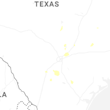
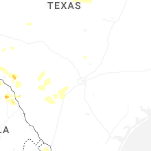
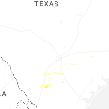


Connect with Interactive Hail Maps