

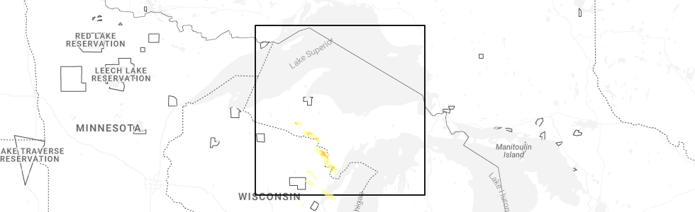
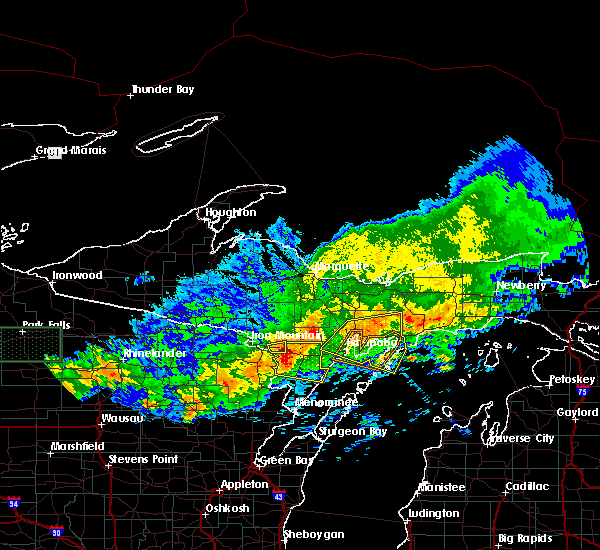
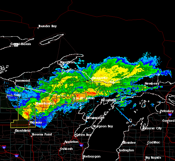
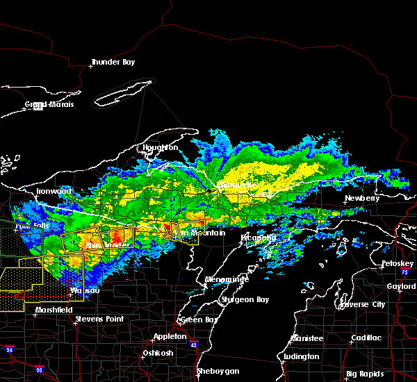
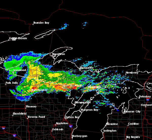
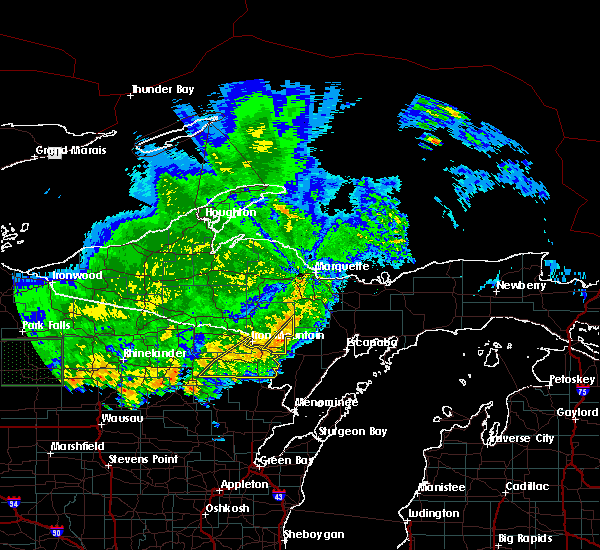
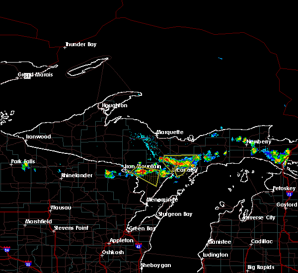
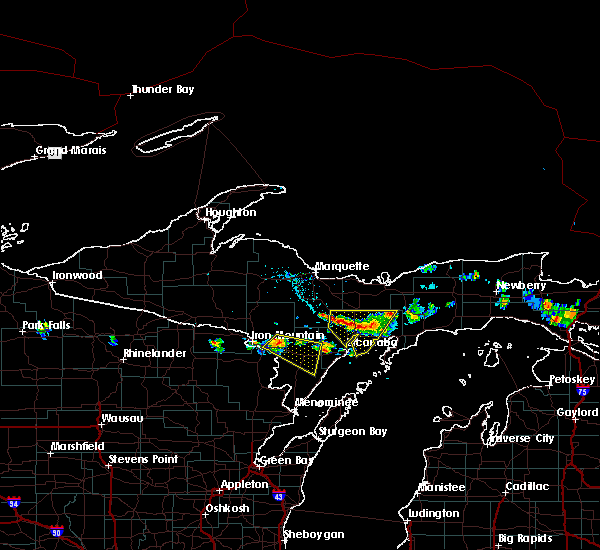
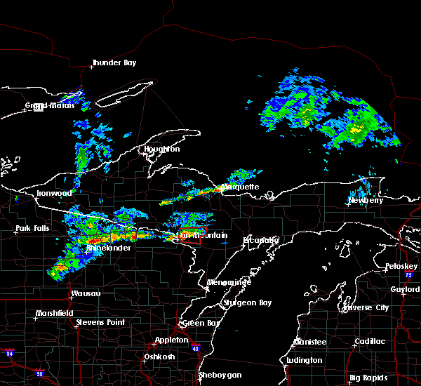
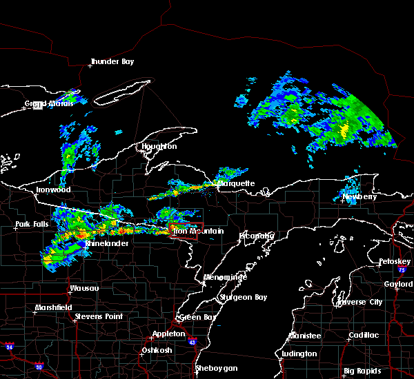
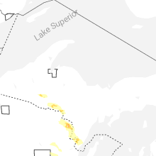
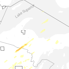
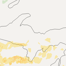
Hail Map for Norway, MI
The Norway, MI area has had 8 reports of on-the-ground hail by trained spotters, and has been under severe weather warnings 3 times during the past 12 months. Doppler radar has detected hail at or near Norway, MI on 29 occasions, including 3 occasions during the past year.
| Name: | Norway, MI |
| Where Located: | 56.6 miles SSW of Marquette, MI |
| Map: | Google Map for Norway, MI |
| Population: | 2845 |
| Housing Units: | 1402 |
| More Info: | Search Google for Norway, MI |
0
The Top Recent Hail Date for Norway, MI is Tuesday, July 8, 2025 (16th out of 29)
Hail and Wind Damage Spotted near Norway, MI
| Date / Time | Report Details |
|---|---|
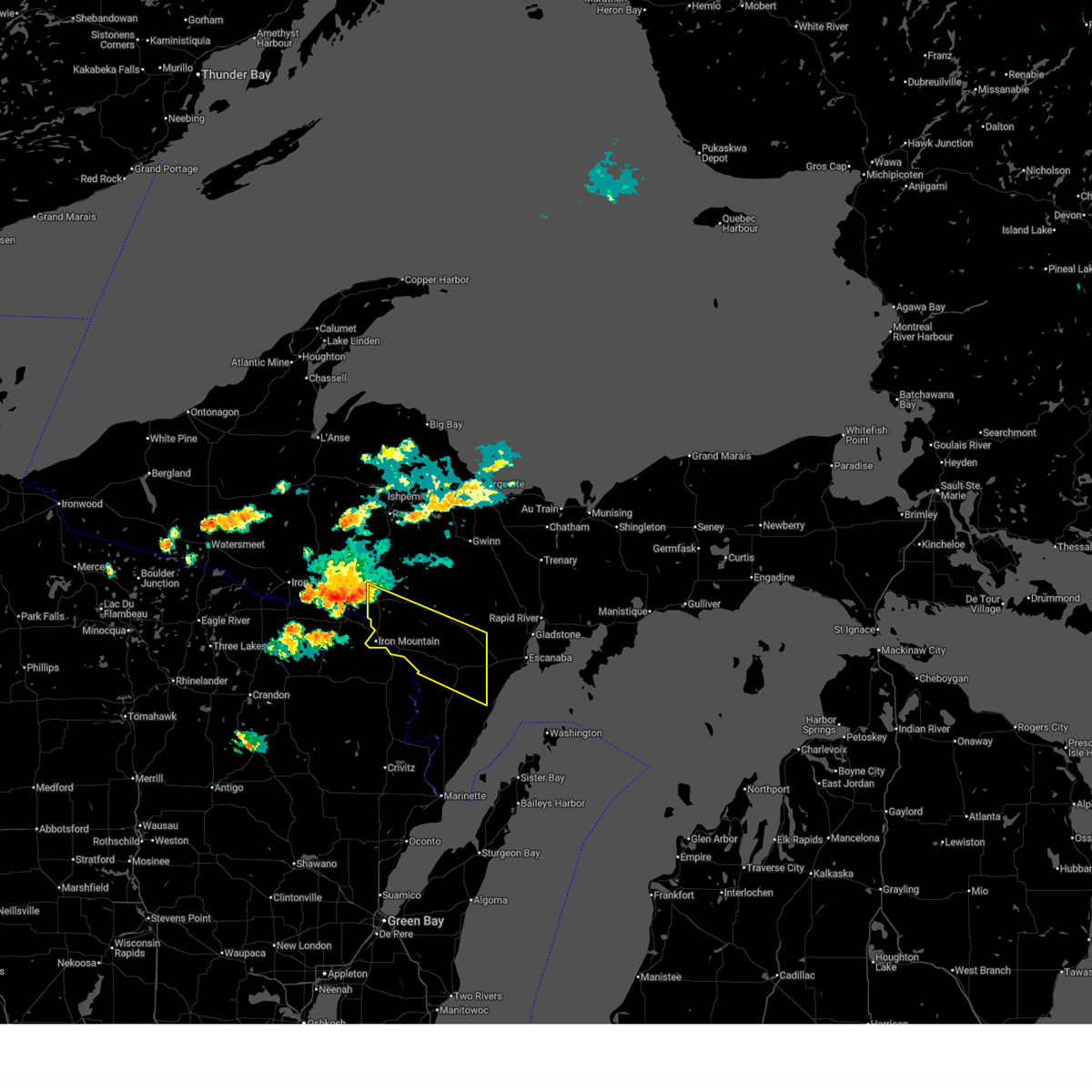
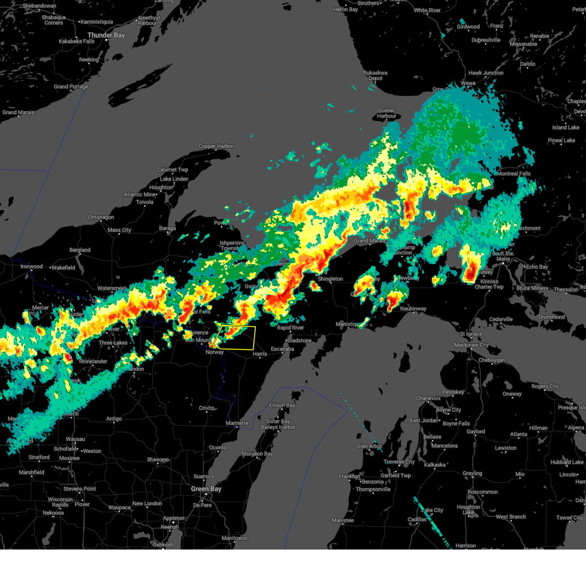
| 7/8/2025 3:46 PM CDT |
 the severe thunderstorm warning has been cancelled and is no longer in effect the severe thunderstorm warning has been cancelled and is no longer in effect
|
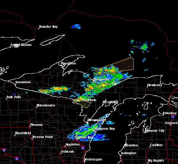
| 7/8/2025 3:31 PM CDT |
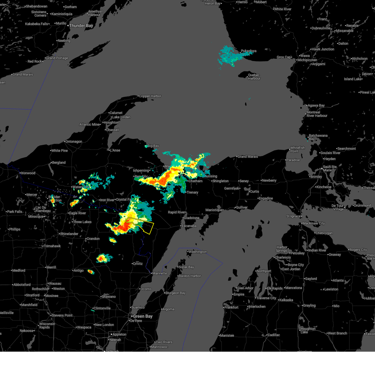
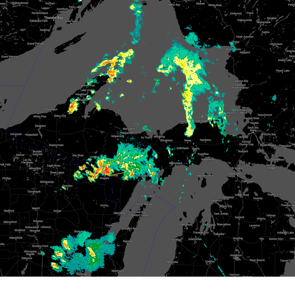
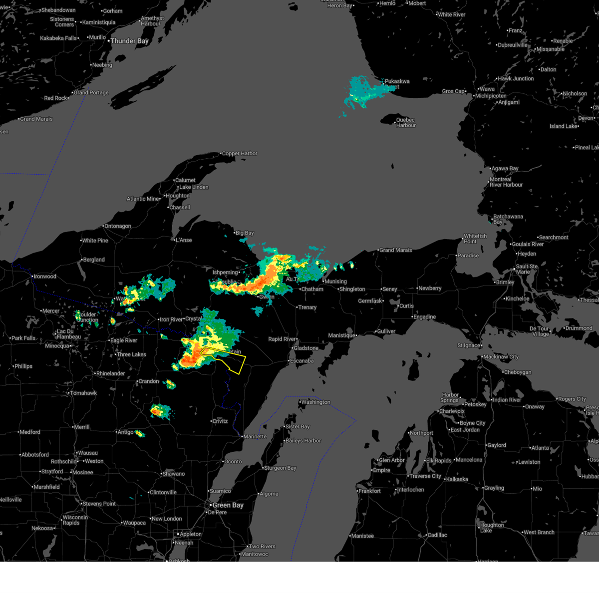 At 330 pm cdt, a severe thunderstorm was located over kingsford, or near iron mountain, moving southeast at 35 mph (radar indicated). Hazards include 60 mph wind gusts and quarter size hail. Hail damage to vehicles is expected. expect wind damage to roofs, siding, and trees. Locations impacted include, iron mountain, kingsford, norway, niagara, waucedah, faithorn, quinnesec, loretto, vulcan, and cunard. At 330 pm cdt, a severe thunderstorm was located over kingsford, or near iron mountain, moving southeast at 35 mph (radar indicated). Hazards include 60 mph wind gusts and quarter size hail. Hail damage to vehicles is expected. expect wind damage to roofs, siding, and trees. Locations impacted include, iron mountain, kingsford, norway, niagara, waucedah, faithorn, quinnesec, loretto, vulcan, and cunard.
|
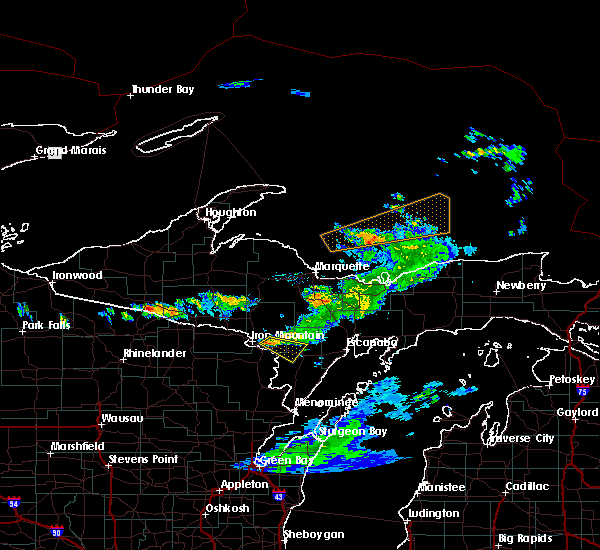
| 7/8/2025 2:55 PM CDT |
 Svrmqt the national weather service in marquette has issued a * severe thunderstorm warning for, southern dickinson county in south central upper michigan, northern menominee county in south central upper michigan, * until 400 pm cdt. * at 254 pm cdt, a severe thunderstorm was located near florence, or 10 miles north of iron mountain, moving southeast at 50 mph (radar indicated). Hazards include 60 mph wind gusts and quarter size hail. Hail damage to vehicles is expected. Expect wind damage to roofs, siding, and trees. Svrmqt the national weather service in marquette has issued a * severe thunderstorm warning for, southern dickinson county in south central upper michigan, northern menominee county in south central upper michigan, * until 400 pm cdt. * at 254 pm cdt, a severe thunderstorm was located near florence, or 10 miles north of iron mountain, moving southeast at 50 mph (radar indicated). Hazards include 60 mph wind gusts and quarter size hail. Hail damage to vehicles is expected. Expect wind damage to roofs, siding, and trees.
|
| 6/17/2024 11:38 AM CDT | Parts of wo old white pines snapped in the storm. pictures show that some of the branches on the snapped off portions were dead... while others were still alive. from f in dickinson county MI, 3 miles N of Norway, MI |
| 5/18/2024 8:57 PM CDT |
 Svrmqt the national weather service in marquette has issued a * severe thunderstorm warning for, southern dickinson county in south central upper michigan, north central menominee county in south central upper michigan, * until 930 pm cdt. * at 857 pm cdt, a severe thunderstorm was located near foster city, or 13 miles east of iron mountain, moving east at 40 mph (radar indicated). Hazards include 60 mph wind gusts and quarter size hail. Hail damage to vehicles is expected. Expect wind damage to roofs, siding, and trees. Svrmqt the national weather service in marquette has issued a * severe thunderstorm warning for, southern dickinson county in south central upper michigan, north central menominee county in south central upper michigan, * until 930 pm cdt. * at 857 pm cdt, a severe thunderstorm was located near foster city, or 13 miles east of iron mountain, moving east at 40 mph (radar indicated). Hazards include 60 mph wind gusts and quarter size hail. Hail damage to vehicles is expected. Expect wind damage to roofs, siding, and trees.
|
| 5/18/2024 8:28 PM CDT |
 Svrmqt the national weather service in marquette has issued a * severe thunderstorm warning for, southern dickinson county in south central upper michigan, * until 900 pm cdt. * at 828 pm cdt, a severe thunderstorm was located over kingsford, or near iron mountain, moving northeast at 40 mph (radar indicated). Hazards include ping pong ball size hail and 60 mph wind gusts. People and animals outdoors will be injured. expect hail damage to roofs, siding, windows, and vehicles. Expect wind damage to roofs, siding, and trees. Svrmqt the national weather service in marquette has issued a * severe thunderstorm warning for, southern dickinson county in south central upper michigan, * until 900 pm cdt. * at 828 pm cdt, a severe thunderstorm was located over kingsford, or near iron mountain, moving northeast at 40 mph (radar indicated). Hazards include ping pong ball size hail and 60 mph wind gusts. People and animals outdoors will be injured. expect hail damage to roofs, siding, windows, and vehicles. Expect wind damage to roofs, siding, and trees.
|
| 8/25/2023 3:20 PM CDT | Image from social media of damage to tree in hardwood... mi. time estimated via rada in dickinson county MI, 15.3 miles SW of Norway, MI |
| 7/10/2023 7:43 PM CDT |
 At 743 pm cdt, a severe thunderstorm was located near la branche, or 23 miles east of iron mountain, moving east at 45 mph (radar indicated). Hazards include quarter size hail. Damage to vehicles is expected. locations impacted include, norway, foster city, la branche, loretto and hardwood. hail threat, radar indicated max hail size, 1. 00 in wind threat, radar indicated max wind gust, <50 mph. At 743 pm cdt, a severe thunderstorm was located near la branche, or 23 miles east of iron mountain, moving east at 45 mph (radar indicated). Hazards include quarter size hail. Damage to vehicles is expected. locations impacted include, norway, foster city, la branche, loretto and hardwood. hail threat, radar indicated max hail size, 1. 00 in wind threat, radar indicated max wind gust, <50 mph.
|
| 7/10/2023 7:30 PM CDT |
 At 729 pm cdt, a severe thunderstorm was located near foster city, or 12 miles east of iron mountain, moving east at 45 mph (radar indicated). Hazards include quarter size hail. Damage to vehicles is expected. locations impacted include, la branche. hail threat, radar indicated max hail size, 1. 00 in wind threat, radar indicated max wind gust, <50 mph. At 729 pm cdt, a severe thunderstorm was located near foster city, or 12 miles east of iron mountain, moving east at 45 mph (radar indicated). Hazards include quarter size hail. Damage to vehicles is expected. locations impacted include, la branche. hail threat, radar indicated max hail size, 1. 00 in wind threat, radar indicated max wind gust, <50 mph.
|
| 7/10/2023 7:08 PM CDT |
 At 707 pm cdt, a severe thunderstorm was located near iron mountain, moving east at 45 mph (radar indicated). Hazards include 60 mph wind gusts and quarter size hail. Hail damage to vehicles is expected. expect wind damage to roofs, siding, and trees. this severe thunderstorm will be near, norway around 720 pm cdt. other locations in the path of this severe thunderstorm include foster city and la branche. hail threat, radar indicated max hail size, 1. 00 in wind threat, radar indicated max wind gust, 60 mph. At 707 pm cdt, a severe thunderstorm was located near iron mountain, moving east at 45 mph (radar indicated). Hazards include 60 mph wind gusts and quarter size hail. Hail damage to vehicles is expected. expect wind damage to roofs, siding, and trees. this severe thunderstorm will be near, norway around 720 pm cdt. other locations in the path of this severe thunderstorm include foster city and la branche. hail threat, radar indicated max hail size, 1. 00 in wind threat, radar indicated max wind gust, 60 mph.
|
| 6/28/2022 3:30 PM CDT |
 At 330 pm cdt, a severe thunderstorm was located over florence, or 10 miles southeast of crystal falls, moving east at 35 mph (radar indicated). Hazards include 60 mph wind gusts and quarter size hail. Hail damage to vehicles is expected. expect wind damage to roofs, siding, and trees. this severe thunderstorm will be near, iron mountain, kingsford and kingsford around 345 pm cdt. other locations in the path of this severe thunderstorm include norway. hail threat, radar indicated max hail size, 1. 00 in wind threat, radar indicated max wind gust, 60 mph. At 330 pm cdt, a severe thunderstorm was located over florence, or 10 miles southeast of crystal falls, moving east at 35 mph (radar indicated). Hazards include 60 mph wind gusts and quarter size hail. Hail damage to vehicles is expected. expect wind damage to roofs, siding, and trees. this severe thunderstorm will be near, iron mountain, kingsford and kingsford around 345 pm cdt. other locations in the path of this severe thunderstorm include norway. hail threat, radar indicated max hail size, 1. 00 in wind threat, radar indicated max wind gust, 60 mph.
|
| 6/24/2022 4:01 PM CDT |
 At 400 pm cdt, severe thunderstorms were located along a line extending from near kingsford to 6 miles southeast of norway, moving east at 15 mph (radar indicated). Hazards include 60 mph wind gusts and quarter size hail. Hail damage to vehicles is expected. expect wind damage to roofs, siding, and trees. severe thunderstorms will be near, norway around 435 pm cdt. other locations impacted by these severe thunderstorms include quinnesec, loretto, waucedah, granite bluff, vulcan, merriman, aurora and niagara. hail threat, radar indicated max hail size, 1. 00 in wind threat, radar indicated max wind gust, 60 mph. At 400 pm cdt, severe thunderstorms were located along a line extending from near kingsford to 6 miles southeast of norway, moving east at 15 mph (radar indicated). Hazards include 60 mph wind gusts and quarter size hail. Hail damage to vehicles is expected. expect wind damage to roofs, siding, and trees. severe thunderstorms will be near, norway around 435 pm cdt. other locations impacted by these severe thunderstorms include quinnesec, loretto, waucedah, granite bluff, vulcan, merriman, aurora and niagara. hail threat, radar indicated max hail size, 1. 00 in wind threat, radar indicated max wind gust, 60 mph.
|
| 6/15/2022 7:20 PM CDT |
 At 720 pm cdt, a severe thunderstorm was located 8 miles south of foster city, or 16 miles east of iron mountain, moving northeast at 35 mph (radar indicated). Hazards include 60 mph wind gusts and quarter size hail. Hail damage to vehicles is expected. expect wind damage to roofs, siding, and trees. this severe thunderstorm will remain over mainly rural areas of southern dickinson and northwestern menominee counties, including the following locations, quinnesec, loretto, waucedah, cunard, vulcan and niagara. hail threat, radar indicated max hail size, 1. 00 in wind threat, radar indicated max wind gust, 60 mph. At 720 pm cdt, a severe thunderstorm was located 8 miles south of foster city, or 16 miles east of iron mountain, moving northeast at 35 mph (radar indicated). Hazards include 60 mph wind gusts and quarter size hail. Hail damage to vehicles is expected. expect wind damage to roofs, siding, and trees. this severe thunderstorm will remain over mainly rural areas of southern dickinson and northwestern menominee counties, including the following locations, quinnesec, loretto, waucedah, cunard, vulcan and niagara. hail threat, radar indicated max hail size, 1. 00 in wind threat, radar indicated max wind gust, 60 mph.
|
| 6/15/2022 7:06 PM CDT |
 At 706 pm cdt, a severe thunderstorm was located near pembine, or 10 miles southeast of iron mountain, moving northeast at 25 mph (radar indicated). Hazards include 60 mph wind gusts and quarter size hail. Hail damage to vehicles is expected. expect wind damage to roofs, siding, and trees. this severe thunderstorm will be near, norway around 725 pm cdt. hail threat, radar indicated max hail size, 1. 00 in wind threat, radar indicated max wind gust, 60 mph. At 706 pm cdt, a severe thunderstorm was located near pembine, or 10 miles southeast of iron mountain, moving northeast at 25 mph (radar indicated). Hazards include 60 mph wind gusts and quarter size hail. Hail damage to vehicles is expected. expect wind damage to roofs, siding, and trees. this severe thunderstorm will be near, norway around 725 pm cdt. hail threat, radar indicated max hail size, 1. 00 in wind threat, radar indicated max wind gust, 60 mph.
|
| 5/12/2022 3:54 PM CDT |
 At 354 pm cdt, a severe thunderstorm was located 7 miles northwest of hermansville, or 18 miles east of iron mountain, moving northeast at 10 mph (radar indicated). Hazards include 60 mph wind gusts and quarter size hail. Hail damage to vehicles is expected. expect wind damage to roofs, siding, and trees. locations impacted include, iron mountain, kingsford, norway, felch, foster city, niagara, waucedah, quinnesec, loretto, vulcan and hardwood. hail threat, radar indicated max hail size, 1. 00 in wind threat, radar indicated max wind gust, 60 mph. At 354 pm cdt, a severe thunderstorm was located 7 miles northwest of hermansville, or 18 miles east of iron mountain, moving northeast at 10 mph (radar indicated). Hazards include 60 mph wind gusts and quarter size hail. Hail damage to vehicles is expected. expect wind damage to roofs, siding, and trees. locations impacted include, iron mountain, kingsford, norway, felch, foster city, niagara, waucedah, quinnesec, loretto, vulcan and hardwood. hail threat, radar indicated max hail size, 1. 00 in wind threat, radar indicated max wind gust, 60 mph.
|
| 5/12/2022 3:47 PM CDT | Quarter sized hail reported 14 miles SSW of Norway, MI, corrects previous hail report from 1 wnw felch. picture via facebook showing hail estimated to be the size of a quarter (coin). |
| 5/12/2022 3:34 PM CDT |
 At 334 pm cdt, a severe thunderstorm was located near norway, or near iron mountain, moving northeast at 15 mph (radar indicated). Hazards include 60 mph wind gusts and quarter size hail. Hail damage to vehicles is expected. Expect wind damage to roofs, siding, and trees. At 334 pm cdt, a severe thunderstorm was located near norway, or near iron mountain, moving northeast at 15 mph (radar indicated). Hazards include 60 mph wind gusts and quarter size hail. Hail damage to vehicles is expected. Expect wind damage to roofs, siding, and trees.
|
| 5/12/2022 2:52 PM CDT |
 At 251 pm cdt, a severe thunderstorm was located near norway, or 12 miles east of iron mountain, moving northeast at 10 mph (radar indicated). Hazards include 60 mph wind gusts and quarter size hail. Hail damage to vehicles is expected. expect wind damage to roofs, siding, and trees. locations impacted include, norway, foster city, niagara, waucedah, quinnesec, loretto, vulcan, hardwood and cunard. hail threat, radar indicated max hail size, 1. 00 in wind threat, radar indicated max wind gust, 60 mph. At 251 pm cdt, a severe thunderstorm was located near norway, or 12 miles east of iron mountain, moving northeast at 10 mph (radar indicated). Hazards include 60 mph wind gusts and quarter size hail. Hail damage to vehicles is expected. expect wind damage to roofs, siding, and trees. locations impacted include, norway, foster city, niagara, waucedah, quinnesec, loretto, vulcan, hardwood and cunard. hail threat, radar indicated max hail size, 1. 00 in wind threat, radar indicated max wind gust, 60 mph.
|
| 5/12/2022 2:32 PM CDT |
 At 232 pm cdt, a severe thunderstorm was located over norway, or 9 miles east of iron mountain, moving northeast at 10 mph (radar indicated). Hazards include 60 mph wind gusts and quarter size hail. Hail damage to vehicles is expected. Expect wind damage to roofs, siding, and trees. At 232 pm cdt, a severe thunderstorm was located over norway, or 9 miles east of iron mountain, moving northeast at 10 mph (radar indicated). Hazards include 60 mph wind gusts and quarter size hail. Hail damage to vehicles is expected. Expect wind damage to roofs, siding, and trees.
|
| 7/26/2021 11:47 PM CDT |
 At 1146 pm cdt, a severe thunderstorm was located over norway, or near iron mountain, moving southeast at 45 mph (radar indicated). Hazards include 60 mph wind gusts and penny size hail. expect damage to roofs, siding, and trees At 1146 pm cdt, a severe thunderstorm was located over norway, or near iron mountain, moving southeast at 45 mph (radar indicated). Hazards include 60 mph wind gusts and penny size hail. expect damage to roofs, siding, and trees
|
| 7/26/2021 11:34 PM CDT |
 At 1132 pm cdt, a severe thunderstorm was located near florence, or 7 miles northwest of iron mountain, moving southeast at 35 mph (radar indicated). Hazards include 60 mph wind gusts and penny size hail. Expect damage to roofs, siding, and trees. Locations impacted include, kingsford, iron mountain, kingsford and norway. At 1132 pm cdt, a severe thunderstorm was located near florence, or 7 miles northwest of iron mountain, moving southeast at 35 mph (radar indicated). Hazards include 60 mph wind gusts and penny size hail. Expect damage to roofs, siding, and trees. Locations impacted include, kingsford, iron mountain, kingsford and norway.
|
| 7/26/2021 10:53 PM CDT |
 At 1053 pm cdt, a severe thunderstorm was located near stambaugh, or near iron river, moving southeast at 35 mph (radar indicated). Hazards include 60 mph wind gusts and penny size hail. Expect damage to roofs, siding, and trees. this severe thunderstorm will be near, crystal falls around 1105 pm cdt. Other locations in the path of this severe thunderstorm include kingsford, iron mountain, kingsford and norway. At 1053 pm cdt, a severe thunderstorm was located near stambaugh, or near iron river, moving southeast at 35 mph (radar indicated). Hazards include 60 mph wind gusts and penny size hail. Expect damage to roofs, siding, and trees. this severe thunderstorm will be near, crystal falls around 1105 pm cdt. Other locations in the path of this severe thunderstorm include kingsford, iron mountain, kingsford and norway.
|
| 6/13/2021 6:47 PM CDT |
 At 646 pm cdt, a severe thunderstorm was located 8 miles north of iron mountain, moving southeast at 60 mph (radar indicated). Hazards include 60 mph wind gusts and pea sized hail. Expect damage to roofs, siding, and trees. Locations impacted include, felch and norway. At 646 pm cdt, a severe thunderstorm was located 8 miles north of iron mountain, moving southeast at 60 mph (radar indicated). Hazards include 60 mph wind gusts and pea sized hail. Expect damage to roofs, siding, and trees. Locations impacted include, felch and norway.
|
| 6/13/2021 6:29 PM CDT |
 At 628 pm cdt, a severe thunderstorm was located over crystal falls, moving southeast at 60 mph (radar indicated). Hazards include 60 mph wind gusts. Expect damage to roofs, siding, and trees. this severe thunderstorm will be near, channing around 635 pm cdt. Other locations in the path of this severe thunderstorm include felch and norway. At 628 pm cdt, a severe thunderstorm was located over crystal falls, moving southeast at 60 mph (radar indicated). Hazards include 60 mph wind gusts. Expect damage to roofs, siding, and trees. this severe thunderstorm will be near, channing around 635 pm cdt. Other locations in the path of this severe thunderstorm include felch and norway.
|
| 6/8/2021 5:57 PM CDT |
 At 556 pm cdt, a severe thunderstorm was located 7 miles southwest of foster city, or 11 miles east of iron mountain, moving south at 15 mph (radar indicated). Hazards include 60 mph wind gusts and quarter size hail. Hail damage to vehicles is expected. expect wind damage to roofs, siding, and trees. Locations impacted include, iron mountain, kingsford, norway, felch, foster city, niagara, waucedah, quinnesec, loretto, vulcan and hardwood. At 556 pm cdt, a severe thunderstorm was located 7 miles southwest of foster city, or 11 miles east of iron mountain, moving south at 15 mph (radar indicated). Hazards include 60 mph wind gusts and quarter size hail. Hail damage to vehicles is expected. expect wind damage to roofs, siding, and trees. Locations impacted include, iron mountain, kingsford, norway, felch, foster city, niagara, waucedah, quinnesec, loretto, vulcan and hardwood.
|
| 6/8/2021 5:36 PM CDT | Dispatcher reports multiple reports of downed trees... power lines... and power outages across dickinson county. we energies outage map indicating outages stretching fr in dickinson county MI, 13.8 miles S of Norway, MI |
| 6/8/2021 5:36 PM CDT |
 At 535 pm cdt, a severe thunderstorm was located over felch, or 14 miles northeast of iron mountain, moving south at 15 mph (radar indicated). Hazards include 60 mph wind gusts and quarter size hail. Hail damage to vehicles is expected. Expect wind damage to roofs, siding, and trees. At 535 pm cdt, a severe thunderstorm was located over felch, or 14 miles northeast of iron mountain, moving south at 15 mph (radar indicated). Hazards include 60 mph wind gusts and quarter size hail. Hail damage to vehicles is expected. Expect wind damage to roofs, siding, and trees.
|
| 6/8/2021 5:29 PM CDT | Report relayed of multiple trees down in the felch area... with one large... healthy tree blocking the roa in dickinson county MI, 14.2 miles SSW of Norway, MI |
| 8/21/2020 4:56 PM CDT |
 At 456 pm cdt, a severe thunderstorm was located over norway, or near iron mountain, moving south at 15 mph (radar indicated). Hazards include 60 mph wind gusts and quarter size hail. Hail damage to vehicles is expected. expect wind damage to roofs, siding, and trees. Locations impacted include, norway, niagara, waucedah, quinnesec, loretto and vulcan. At 456 pm cdt, a severe thunderstorm was located over norway, or near iron mountain, moving south at 15 mph (radar indicated). Hazards include 60 mph wind gusts and quarter size hail. Hail damage to vehicles is expected. expect wind damage to roofs, siding, and trees. Locations impacted include, norway, niagara, waucedah, quinnesec, loretto and vulcan.
|
| 8/21/2020 4:40 PM CDT |
 At 439 pm cdt, a severe thunderstorm was located near iron mountain, moving southeast at 15 mph (radar indicated). Hazards include 60 mph wind gusts and quarter size hail. Hail damage to vehicles is expected. Expect wind damage to roofs, siding, and trees. At 439 pm cdt, a severe thunderstorm was located near iron mountain, moving southeast at 15 mph (radar indicated). Hazards include 60 mph wind gusts and quarter size hail. Hail damage to vehicles is expected. Expect wind damage to roofs, siding, and trees.
|
| 7/19/2020 2:05 AM CDT |
 The national weather service in marquette has issued a * severe thunderstorm warning for. southern dickinson county in south central upper michigan. northwestern delta county in south central upper michigan. northern menominee county in south central upper michigan. Southeastern marquette county in north central upper michigan. The national weather service in marquette has issued a * severe thunderstorm warning for. southern dickinson county in south central upper michigan. northwestern delta county in south central upper michigan. northern menominee county in south central upper michigan. Southeastern marquette county in north central upper michigan.
|
| 7/9/2020 1:39 AM CDT |
 At 139 am cdt, a severe thunderstorm was located near norway, or near iron mountain, moving east at 25 mph (radar indicated). Hazards include 60 mph wind gusts and penny size hail. expect damage to roofs, siding, and trees At 139 am cdt, a severe thunderstorm was located near norway, or near iron mountain, moving east at 25 mph (radar indicated). Hazards include 60 mph wind gusts and penny size hail. expect damage to roofs, siding, and trees
|
| 6/26/2020 5:08 PM CDT |
 At 508 pm cdt, a severe thunderstorm was located near norway, or 10 miles east of iron mountain, moving southeast at 25 mph (radar indicated). Hazards include quarter size hail. Damage to vehicles is expected. Locations impacted include, norway, hermansville, waucedah, loretto, cunard and vulcan. At 508 pm cdt, a severe thunderstorm was located near norway, or 10 miles east of iron mountain, moving southeast at 25 mph (radar indicated). Hazards include quarter size hail. Damage to vehicles is expected. Locations impacted include, norway, hermansville, waucedah, loretto, cunard and vulcan.
|
| 6/26/2020 4:44 PM CDT |
 At 443 pm cdt, a severe thunderstorm was located 4 miles north of iron mountain, moving southeast at 25 mph (radar indicated). Hazards include quarter size hail. damage to vehicles is expected At 443 pm cdt, a severe thunderstorm was located 4 miles north of iron mountain, moving southeast at 25 mph (radar indicated). Hazards include quarter size hail. damage to vehicles is expected
|
| 5/25/2020 7:57 PM CDT |
 The severe thunderstorm warning for southeastern dickinson county will expire at 800 pm cdt, the storm which prompted the warning has weakened below severe limits, and no longer poses an immediate threat to life or property. therefore, the warning will be allowed to expire. The severe thunderstorm warning for southeastern dickinson county will expire at 800 pm cdt, the storm which prompted the warning has weakened below severe limits, and no longer poses an immediate threat to life or property. therefore, the warning will be allowed to expire.
|
| 5/25/2020 7:36 PM CDT |
 At 736 pm cdt, a severe thunderstorm was located near norway, or near iron mountain, moving east at 15 mph (radar indicated). Hazards include 60 mph wind gusts and quarter size hail. Hail damage to vehicles is expected. Expect wind damage to roofs, siding, and trees. At 736 pm cdt, a severe thunderstorm was located near norway, or near iron mountain, moving east at 15 mph (radar indicated). Hazards include 60 mph wind gusts and quarter size hail. Hail damage to vehicles is expected. Expect wind damage to roofs, siding, and trees.
|
| 8/5/2019 2:49 PM CDT | Tree down in neighbors yar in dickinson county MI, 14 miles SSW of Norway, MI |
| 10/3/2018 6:06 PM CDT |
 At 605 pm cdt, a severe thunderstorm was located over norway, or near iron mountain, moving east at 65 mph (radar indicated). Hazards include 70 mph wind gusts. Expect considerable tree damage. damage is likely to mobile homes, roofs, and outbuildings. locations impacted include, iron mountain, kingsford, norway, felch, powers, hermansville, foster city, la branche, wilson, spalding, niagara and aurora. A tornado watch remains in effect until 1100 pm cdt for north central upper and south central upper michigan. At 605 pm cdt, a severe thunderstorm was located over norway, or near iron mountain, moving east at 65 mph (radar indicated). Hazards include 70 mph wind gusts. Expect considerable tree damage. damage is likely to mobile homes, roofs, and outbuildings. locations impacted include, iron mountain, kingsford, norway, felch, powers, hermansville, foster city, la branche, wilson, spalding, niagara and aurora. A tornado watch remains in effect until 1100 pm cdt for north central upper and south central upper michigan.
|
| 10/3/2018 5:47 PM CDT |
 At 546 pm cdt, a severe thunderstorm was located near iron mountain, moving east at 70 mph (radar indicated). Hazards include 70 mph wind gusts. Expect considerable tree damage. Damage is likely to mobile homes, roofs, and outbuildings. At 546 pm cdt, a severe thunderstorm was located near iron mountain, moving east at 70 mph (radar indicated). Hazards include 70 mph wind gusts. Expect considerable tree damage. Damage is likely to mobile homes, roofs, and outbuildings.
|
| 8/1/2018 1:47 PM CDT |
 The national weather service in marquette has issued a * severe thunderstorm warning for. southeastern dickinson county in south central upper michigan. northwestern menominee county in south central upper michigan. until 215 pm cdt. At 147 pm cdt, a severe thunderstorm was located near norway, or 13. The national weather service in marquette has issued a * severe thunderstorm warning for. southeastern dickinson county in south central upper michigan. northwestern menominee county in south central upper michigan. until 215 pm cdt. At 147 pm cdt, a severe thunderstorm was located near norway, or 13.
|
| 6/30/2018 8:48 PM CDT |
 At 848 pm cdt, a severe thunderstorm was located near iron mountain, moving northeast at 40 mph (radar indicated). Hazards include 60 mph wind gusts and penny size hail. expect damage to roofs, siding, and trees At 848 pm cdt, a severe thunderstorm was located near iron mountain, moving northeast at 40 mph (radar indicated). Hazards include 60 mph wind gusts and penny size hail. expect damage to roofs, siding, and trees
|
| 5/26/2018 4:19 PM CDT |
 At 419 pm cdt, a severe thunderstorm was located near norway, or 13 miles east of iron mountain, moving east at 35 mph (radar indicated). Hazards include quarter size hail. damage to vehicles is expected At 419 pm cdt, a severe thunderstorm was located near norway, or 13 miles east of iron mountain, moving east at 35 mph (radar indicated). Hazards include quarter size hail. damage to vehicles is expected
|
| 5/26/2018 3:10 PM CDT | Quarter sized hail reported 15.9 miles SW of Norway, MI, sporadic nickel and quarter size hail near stromberg park. |
| 5/26/2018 3:10 PM CDT | Hen Egg sized hail reported 17 miles SW of Norway, MI, delayed report: location is in helps... mi. |
| 7/6/2017 8:17 PM CDT |
 At 917 pm edt/817 pm cdt/, severe thunderstorms were located along a line extending from near watson to la branche to 6 miles northwest of hermansville, moving east at 45 mph (radar indicated). Hazards include 60 mph wind gusts and nickel size hail. Expect damage to roofs, siding, and trees. locations impacted include, norway, watson, hermansville, foster city, la branche, whitney, waucedah, cornell, loretto, st. Nicholas, hardwood and cunard. At 917 pm edt/817 pm cdt/, severe thunderstorms were located along a line extending from near watson to la branche to 6 miles northwest of hermansville, moving east at 45 mph (radar indicated). Hazards include 60 mph wind gusts and nickel size hail. Expect damage to roofs, siding, and trees. locations impacted include, norway, watson, hermansville, foster city, la branche, whitney, waucedah, cornell, loretto, st. Nicholas, hardwood and cunard.
|
| 7/6/2017 8:07 PM CDT |
 At 907 pm edt/807 pm cdt/, severe thunderstorms were located along a line extending from 12 miles northeast of felch to 6 miles east of foster city to near norway, moving east at 45 mph (radar indicated). Hazards include 60 mph wind gusts and nickel size hail. expect damage to roofs, siding, and trees At 907 pm edt/807 pm cdt/, severe thunderstorms were located along a line extending from 12 miles northeast of felch to 6 miles east of foster city to near norway, moving east at 45 mph (radar indicated). Hazards include 60 mph wind gusts and nickel size hail. expect damage to roofs, siding, and trees
|
| 6/11/2017 9:57 PM CDT |
 At 957 pm cdt, severe thunderstorms were located along a line extending from 7 miles east of norway to 10 miles southwest of hermansville, moving east at 55 mph (radar indicated). Hazards include 60 mph wind gusts and penny size hail. Expect damage to roofs, siding, and trees. Locations impacted include, norway, waucedah, loretto and vulcan. At 957 pm cdt, severe thunderstorms were located along a line extending from 7 miles east of norway to 10 miles southwest of hermansville, moving east at 55 mph (radar indicated). Hazards include 60 mph wind gusts and penny size hail. Expect damage to roofs, siding, and trees. Locations impacted include, norway, waucedah, loretto and vulcan.
|
| 6/11/2017 9:45 PM CDT |
 At 945 pm cdt, severe thunderstorms were located along a line extending from near iron mountain to pembine, moving east at 50 mph (radar indicated). Hazards include 60 mph wind gusts and penny size hail. Expect damage to roofs, siding, and trees. Locations impacted include, iron mountain, kingsford, norway, niagara, aurora, waucedah, quinnesec, loretto and vulcan. At 945 pm cdt, severe thunderstorms were located along a line extending from near iron mountain to pembine, moving east at 50 mph (radar indicated). Hazards include 60 mph wind gusts and penny size hail. Expect damage to roofs, siding, and trees. Locations impacted include, iron mountain, kingsford, norway, niagara, aurora, waucedah, quinnesec, loretto and vulcan.
|
| 6/11/2017 9:22 PM CDT |
 At 922 pm cdt, severe thunderstorms were located along a line extending from near florence to near goodman, moving east at 30 mph (radar indicated). Hazards include 60 mph wind gusts and penny size hail. expect damage to roofs, siding, and trees At 922 pm cdt, severe thunderstorms were located along a line extending from near florence to near goodman, moving east at 30 mph (radar indicated). Hazards include 60 mph wind gusts and penny size hail. expect damage to roofs, siding, and trees
|
| 6/11/2017 8:53 PM CDT |
 At 853 pm cdt, severe thunderstorms were located along a line extending from 8 miles west of felch to near norway, moving east at 35 mph (radar indicated). Hazards include 60 mph wind gusts and penny size hail. Expect damage to roofs, siding, and trees. Locations impacted include, norway, felch, foster city, loretto, hardwood and vulcan. At 853 pm cdt, severe thunderstorms were located along a line extending from 8 miles west of felch to near norway, moving east at 35 mph (radar indicated). Hazards include 60 mph wind gusts and penny size hail. Expect damage to roofs, siding, and trees. Locations impacted include, norway, felch, foster city, loretto, hardwood and vulcan.
|
| 6/11/2017 8:38 PM CDT |
 At 838 pm cdt, severe thunderstorms were located along a line extending from 7 miles northeast of florence to kingsford, moving east at 30 mph (radar indicated). Hazards include 60 mph wind gusts and penny size hail. expect damage to roofs, siding, and trees At 838 pm cdt, severe thunderstorms were located along a line extending from 7 miles northeast of florence to kingsford, moving east at 30 mph (radar indicated). Hazards include 60 mph wind gusts and penny size hail. expect damage to roofs, siding, and trees
|
| 6/11/2017 2:15 PM CDT | Observed 70 foot diseased pine tree that landed on the school fence in norway. small pine tree uprooted at observation site. delayed repor in dickinson county MI, 1.7 miles NNW of Norway, MI |
| 6/11/2017 1:15 PM CDT | Several large trees poplar trees down on old highway 8 south of norway. delayed report via social medi in dickinson county MI, 2.3 miles N of Norway, MI |
| 4/9/2017 8:12 PM CDT |
 At 812 pm cdt, a severe thunderstorm was located near homestead, or 9 miles west of kingsford, moving east at 45 mph (radar indicated). Hazards include quarter size hail. damage to vehicles is expected At 812 pm cdt, a severe thunderstorm was located near homestead, or 9 miles west of kingsford, moving east at 45 mph (radar indicated). Hazards include quarter size hail. damage to vehicles is expected
|
| 10/17/2016 6:48 PM CDT |
 At 648 pm cdt, a severe thunderstorm was located near norway, or 7 miles east of iron mountain, moving northeast at 40 mph (radar indicated). Hazards include 60 mph wind gusts and quarter size hail. Hail damage to vehicles is expected. expect wind damage to roofs, siding, and trees. Locations impacted include, norway, felch, foster city, vulcan, hardwood and loretto. At 648 pm cdt, a severe thunderstorm was located near norway, or 7 miles east of iron mountain, moving northeast at 40 mph (radar indicated). Hazards include 60 mph wind gusts and quarter size hail. Hail damage to vehicles is expected. expect wind damage to roofs, siding, and trees. Locations impacted include, norway, felch, foster city, vulcan, hardwood and loretto.
|
| 10/17/2016 6:36 PM CDT |
 At 636 pm cdt, a severe thunderstorm was located near norway, or near iron mountain, moving northeast at 40 mph (radar indicated). Hazards include 60 mph wind gusts and quarter size hail. Hail damage to vehicles is expected. Expect wind damage to roofs, siding, and trees. At 636 pm cdt, a severe thunderstorm was located near norway, or near iron mountain, moving northeast at 40 mph (radar indicated). Hazards include 60 mph wind gusts and quarter size hail. Hail damage to vehicles is expected. Expect wind damage to roofs, siding, and trees.
|
| 7/21/2016 7:10 AM CDT | Tree down on metropolitan rd. time estimated from rada in dickinson county MI, 13.7 miles S of Norway, MI |
| 7/21/2016 7:04 AM CDT |
 At 703 am cdt, severe thunderstorms were located along a line extending from 8 miles east of witch lake to near iron mountain, moving east at 55 mph (law enforcement. numerous trees and powerlines were reported down across iron county). Hazards include 60 mph wind gusts and penny size hail. Expect damage to roofs. siding and trees. Locations impacted include, iron mountain, kingsford, norway, felch, channing, foster city, sagola, aurora, waucedah, quinnesec, granite bluff, loretto, vulcan, silver lake near channing, hardwood, ralph, merriman and randville. At 703 am cdt, severe thunderstorms were located along a line extending from 8 miles east of witch lake to near iron mountain, moving east at 55 mph (law enforcement. numerous trees and powerlines were reported down across iron county). Hazards include 60 mph wind gusts and penny size hail. Expect damage to roofs. siding and trees. Locations impacted include, iron mountain, kingsford, norway, felch, channing, foster city, sagola, aurora, waucedah, quinnesec, granite bluff, loretto, vulcan, silver lake near channing, hardwood, ralph, merriman and randville.
|
| 7/21/2016 6:40 AM CDT |
 At 639 am cdt, severe thunderstorms were located along a line extending from 9 miles east of u.s. 141 between covington and amasa to near tipler, moving east at 50 mph (law enforcement. these storms have downed numerous trees and powerlines over iron county). Hazards include 70 mph wind gusts and penny size hail. Expect considerable tree damage. Damage is likely to mobile homes, roofs and outbuildings. At 639 am cdt, severe thunderstorms were located along a line extending from 9 miles east of u.s. 141 between covington and amasa to near tipler, moving east at 50 mph (law enforcement. these storms have downed numerous trees and powerlines over iron county). Hazards include 70 mph wind gusts and penny size hail. Expect considerable tree damage. Damage is likely to mobile homes, roofs and outbuildings.
|
| 6/25/2016 10:32 PM CDT |
 At 1032 pm cdt, severe thunderstorms were located along a line extending from 8 miles west of watson to near norway, moving southeast at 40 mph (radar indicated). Hazards include 60 mph wind gusts and penny size hail. Expect damage to roofs. siding and trees. Locations impacted include, norway, foster city, waucedah, vulcan, hardwood and loretto. At 1032 pm cdt, severe thunderstorms were located along a line extending from 8 miles west of watson to near norway, moving southeast at 40 mph (radar indicated). Hazards include 60 mph wind gusts and penny size hail. Expect damage to roofs. siding and trees. Locations impacted include, norway, foster city, waucedah, vulcan, hardwood and loretto.
|
| 6/25/2016 10:10 PM CDT |
 At 1110 pm edt/1010 pm cdt/, severe thunderstorms were located along a line extending from 9 miles northeast of witch lake to 12 miles southeast of squaw lake to 6 miles northwest of felch to homestead, moving east at 45 mph (radar indicated). Hazards include 60 mph wind gusts and penny size hail. Expect damage to roofs. siding and trees. Locations impacted include, iron mountain, kingsford, norway, felch, foster city, aurora, waucedah, quinnesec, granite bluff, loretto, big bass lake, vulcan, hardwood, ralph, merriman and randville. At 1110 pm edt/1010 pm cdt/, severe thunderstorms were located along a line extending from 9 miles northeast of witch lake to 12 miles southeast of squaw lake to 6 miles northwest of felch to homestead, moving east at 45 mph (radar indicated). Hazards include 60 mph wind gusts and penny size hail. Expect damage to roofs. siding and trees. Locations impacted include, iron mountain, kingsford, norway, felch, foster city, aurora, waucedah, quinnesec, granite bluff, loretto, big bass lake, vulcan, hardwood, ralph, merriman and randville.
|
| 6/25/2016 9:42 PM CDT |
 At 1042 pm edt/942 pm cdt/, severe thunderstorms were located along a line extending from near alberta to 9 miles west of squaw lake to crystal falls to near tipler, moving east at 50 mph (radar indicated). Hazards include 60 mph wind gusts and penny size hail. Expect damage to roofs. Siding and trees. At 1042 pm edt/942 pm cdt/, severe thunderstorms were located along a line extending from near alberta to 9 miles west of squaw lake to crystal falls to near tipler, moving east at 50 mph (radar indicated). Hazards include 60 mph wind gusts and penny size hail. Expect damage to roofs. Siding and trees.
|
| 6/10/2016 5:52 PM CDT |
 At 651 pm edt/551 pm cdt/, severe thunderstorms were located along a line extending from 7 miles south of gwinn to near norway, moving east at 55 mph (radar indicated). Hazards include 60 mph wind gusts. Expect damage to roofs. siding and trees. locations impacted include, iron mountain, kingsford, norway, felch, foster city, aurora, ralph, merriman, quinnesec and granite bluff. A tornado watch remains in effect until 1000 pm edt/900 pm cdt/ for central michigan. At 651 pm edt/551 pm cdt/, severe thunderstorms were located along a line extending from 7 miles south of gwinn to near norway, moving east at 55 mph (radar indicated). Hazards include 60 mph wind gusts. Expect damage to roofs. siding and trees. locations impacted include, iron mountain, kingsford, norway, felch, foster city, aurora, ralph, merriman, quinnesec and granite bluff. A tornado watch remains in effect until 1000 pm edt/900 pm cdt/ for central michigan.
|
| 6/10/2016 5:26 PM CDT |
 At 625 pm edt/525 pm cdt/, severe thunderstorms were located along a line extending from near witch lake to 7 miles west of florence, moving east at 45 mph (radar indicated). Hazards include quarter size hail and 60 mph wind gusts. Hail damage to vehicles is expected. Expect wind damage to roofs, siding and trees. At 625 pm edt/525 pm cdt/, severe thunderstorms were located along a line extending from near witch lake to 7 miles west of florence, moving east at 45 mph (radar indicated). Hazards include quarter size hail and 60 mph wind gusts. Hail damage to vehicles is expected. Expect wind damage to roofs, siding and trees.
|
| 8/14/2015 12:47 PM CDT |
 At 1246 pm cdt, a severe thunderstorm was located near hermansville, or 19 miles east of iron mountain, moving east at 35 mph (radar indicated). Hazards include 60 mph wind gusts and quarter size hail. Hail damage to vehicles is expected. expect wind damage to roofs, siding and trees. this severe storm will be near, hermansville around 1255 pm cdt. powers around 100 pm cdt. Other locations impacted by this severe thunderstorm include waucedah, faithorn, nadeau, spalding, loretto, gourley, carney, vulcan, whitney and cunard. At 1246 pm cdt, a severe thunderstorm was located near hermansville, or 19 miles east of iron mountain, moving east at 35 mph (radar indicated). Hazards include 60 mph wind gusts and quarter size hail. Hail damage to vehicles is expected. expect wind damage to roofs, siding and trees. this severe storm will be near, hermansville around 1255 pm cdt. powers around 100 pm cdt. Other locations impacted by this severe thunderstorm include waucedah, faithorn, nadeau, spalding, loretto, gourley, carney, vulcan, whitney and cunard.
|
| 8/14/2015 12:37 PM CDT |
 At 1237 pm cdt, a severe thunderstorm was located near norway, or 13 miles east of iron mountain, moving southeast at 25 mph (radar indicated). Hazards include quarter size hail and 60 mph wind gusts. Hail damage to vehicles is expected. expect wind damage to roofs, siding and trees. this severe thunderstorm will be near, hermansville around 105 pm cdt. powers around 115 pm cdt. Other locations impacted by this severe thunderstorm include waucedah, faithorn, nadeau, spalding, loretto, gourley, carney, vulcan, whitney and cunard. At 1237 pm cdt, a severe thunderstorm was located near norway, or 13 miles east of iron mountain, moving southeast at 25 mph (radar indicated). Hazards include quarter size hail and 60 mph wind gusts. Hail damage to vehicles is expected. expect wind damage to roofs, siding and trees. this severe thunderstorm will be near, hermansville around 105 pm cdt. powers around 115 pm cdt. Other locations impacted by this severe thunderstorm include waucedah, faithorn, nadeau, spalding, loretto, gourley, carney, vulcan, whitney and cunard.
|
| 6/22/2015 7:14 PM CDT |
 At 714 pm cdt, a severe thunderstorm capable of producing a tornado was located 8 miles south of foster city, or 15 miles east of iron mountain, moving east at 40 mph (radar indicated rotation). Hazards include tornado and quarter size hail. Mobile homes will be damaged or destroyed. damage to roofs, windows and vehicles will occur. flying debris will be deadly to people and animals. tree damage is likely. This tornadic thunderstorm will remain over mainly rural areas of southeastern dickinson county, including the following locations, loretto. At 714 pm cdt, a severe thunderstorm capable of producing a tornado was located 8 miles south of foster city, or 15 miles east of iron mountain, moving east at 40 mph (radar indicated rotation). Hazards include tornado and quarter size hail. Mobile homes will be damaged or destroyed. damage to roofs, windows and vehicles will occur. flying debris will be deadly to people and animals. tree damage is likely. This tornadic thunderstorm will remain over mainly rural areas of southeastern dickinson county, including the following locations, loretto.
|
| 6/22/2015 7:07 PM CDT |
 At 707 pm cdt, a severe thunderstorm capable of producing a tornado was located 7 miles northeast of norway, or 12 miles east of iron mountain, moving east at 45 mph (radar indicated rotation). Hazards include tornado and quarter size hail. Mobile homes will be damaged or destroyed. damage to roofs, windows and vehicles will occur. flying debris will be deadly to people and animals. tree damage is likely. This tornadic thunderstorm will remain over mainly rural areas of southeastern dickinson county, including the following locations, hardwood and quinnesec. At 707 pm cdt, a severe thunderstorm capable of producing a tornado was located 7 miles northeast of norway, or 12 miles east of iron mountain, moving east at 45 mph (radar indicated rotation). Hazards include tornado and quarter size hail. Mobile homes will be damaged or destroyed. damage to roofs, windows and vehicles will occur. flying debris will be deadly to people and animals. tree damage is likely. This tornadic thunderstorm will remain over mainly rural areas of southeastern dickinson county, including the following locations, hardwood and quinnesec.
|
| 6/22/2015 6:59 PM CDT |
 At 659 pm cdt, a severe thunderstorm capable of producing a tornado was located 7 miles north of norway, or 7 miles northeast of iron mountain, moving east at 45 mph (radar indicated rotation). Hazards include tornado and quarter size hail. Sporadic damage to mobile homes. roofs and vehicles. this dangerous storm will be near, foster city around 710 pm cdt. Other locations impacted by this tornadic thunderstorm include merriman, hardwood, granite bluff, randville and quinnesec. At 659 pm cdt, a severe thunderstorm capable of producing a tornado was located 7 miles north of norway, or 7 miles northeast of iron mountain, moving east at 45 mph (radar indicated rotation). Hazards include tornado and quarter size hail. Sporadic damage to mobile homes. roofs and vehicles. this dangerous storm will be near, foster city around 710 pm cdt. Other locations impacted by this tornadic thunderstorm include merriman, hardwood, granite bluff, randville and quinnesec.
|
| 6/10/2015 1:59 AM CDT |
 At 158 am cdt, severe thunderstorms were located along a line extending from near iron mountain to 7 miles east of goodman, moving east at 55 mph (radar indicated). Hazards include quarter size hail and 60 mph wind gusts. Hail damage to vehicles is expected. expect wind damage to roofs, siding and trees. severe thunderstorms will be near, norway around 205 am cdt. hermansville around 225 am cdt. powers and la branche around 230 am cdt. stephenson around 235 am cdt. Other locations impacted by these severe thunderstorms include bagley, waucedah, quinnesec, nadeau, ingalls, spalding, loretto, carney, daggett and vulcan. At 158 am cdt, severe thunderstorms were located along a line extending from near iron mountain to 7 miles east of goodman, moving east at 55 mph (radar indicated). Hazards include quarter size hail and 60 mph wind gusts. Hail damage to vehicles is expected. expect wind damage to roofs, siding and trees. severe thunderstorms will be near, norway around 205 am cdt. hermansville around 225 am cdt. powers and la branche around 230 am cdt. stephenson around 235 am cdt. Other locations impacted by these severe thunderstorms include bagley, waucedah, quinnesec, nadeau, ingalls, spalding, loretto, carney, daggett and vulcan.
|
| 5/28/2015 7:46 PM CDT | At 744 pm cdt, a severe thunderstorm was located 5 miles northeast of norway, moving northeast at 20 mph (radar indicated). Hazards include quarter size hail. Damage to vehicles is expected. Locations impacted include, mainly rural locations of southeast dickinson county. |
| 5/28/2015 7:34 PM CDT | Hen Egg sized hail reported 1.1 miles NW of Norway, MI, estimated 2.0 inch hail reported in norway. report via social media. |
| 5/28/2015 7:28 PM CDT | At 726 pm cdt, a severe thunderstorm was located over norway, or 9 miles east of iron mountain, moving northeast at 20 mph (at 725 pm...a cooperative observer in norway at 725 pm cdt reported 1 inch hail with this storm). Hazards include 60 mph wind gusts and half dollar size hail. Hail damage to vehicles is expected. expect wind damage to roofs, siding and trees. Locations impacted include, norway, waucedah, vulcan, quinnesec and loretto. |
| 5/28/2015 7:25 PM CDT | Quarter sized hail reported 1.7 miles NNW of Norway, MI, co-op observer reports quarter sized hail in norway. |
| 5/28/2015 7:22 PM CDT | At 722 pm cdt, a severe thunderstorm was located over norway, or 8 miles southeast of iron mountain, moving northeast at 20 mph (radar indicated). Hazards include half dollar size hail and 60 mph wind gusts. Hail damage to vehicles is expected. Expect wind damage to roofs, siding and trees. |
| 5/28/2015 6:34 PM CDT | At 634 pm cdt, a severe thunderstorm was located near norway, or 11 miles east of iron mountain, moving northeast at 20 mph (radar indicated). Hazards include 60 mph wind gusts and half dollar size hail. Hail damage to vehicles is expected. expect wind damage to roofs, siding and trees. Locations impacted include, norway, felch, waucedah, vulcan, quinnesec and loretto. |
| 5/28/2015 6:21 PM CDT | At 621 pm cdt, a severe thunderstorm was located over norway, or 8 miles east of iron mountain, moving northeast at 20 mph (radar indicated). Hazards include 60 mph wind gusts and half dollar size hail. Hail damage to vehicles is expected. expect wind damage to roofs, siding and trees. Locations impacted include, iron mountain, norway, felch, waucedah, quinnesec, loretto and vulcan. |
| 5/28/2015 6:15 PM CDT | Quarter sized hail reported 1.8 miles WNW of Norway, MI, report via social media. quarter sized hail reported between norway and vulcan. delayed report. |
| 5/28/2015 6:05 PM CDT | At 605 pm cdt, a severe thunderstorm was located over norway, or near iron mountain, moving northeast at 20 mph (radar indicated). Hazards include quarter size hail. damage to vehicles is expected |
| 5/28/2015 4:38 PM CDT | The severe thunderstorm warning for south central dickinson county will expire at 445 pm cdt, the storm which prompted the warning has moved out of the area. therefore the warning will be allowed to expire. |
| 5/28/2015 4:29 PM CDT | At 426 pm cdt, a severe thunderstorm was located near norway, or 8 miles east of iron mountain, moving northeast at 10 mph. Hazards include 60 mph wind gusts and half dollar size hail. reported one inch hail reported near niagra wi at 411 pm cdt. Hail damage to vehicles is expected. expect wind damage to roofs, siding and trees. Locations impacted include, norway and vulcan. |
| 5/28/2015 4:11 PM CDT | At 410 pm cdt, a severe thunderstorm was located near norway moving northeast at 10 mph (radar indicated). Hazards include half dollar size hail and 60 mph wind gusts. Hail damage to vehicles is expected. Expect wind damage to roofs, siding and trees. |
| 7/25/2013 6:15 PM CDT | Several trees reported down around the felch are in dickinson county MI, 14.2 miles SSW of Norway, MI |
| 1/1/0001 12:00 AM | Quarter sized hail reported 15.4 miles SW of Norway, MI |
| 1/1/0001 12:00 AM | Golf Ball sized hail reported 14.2 miles SSW of Norway, MI |
Hail Maps for Norway, MI


Connect with Interactive Hail Maps