

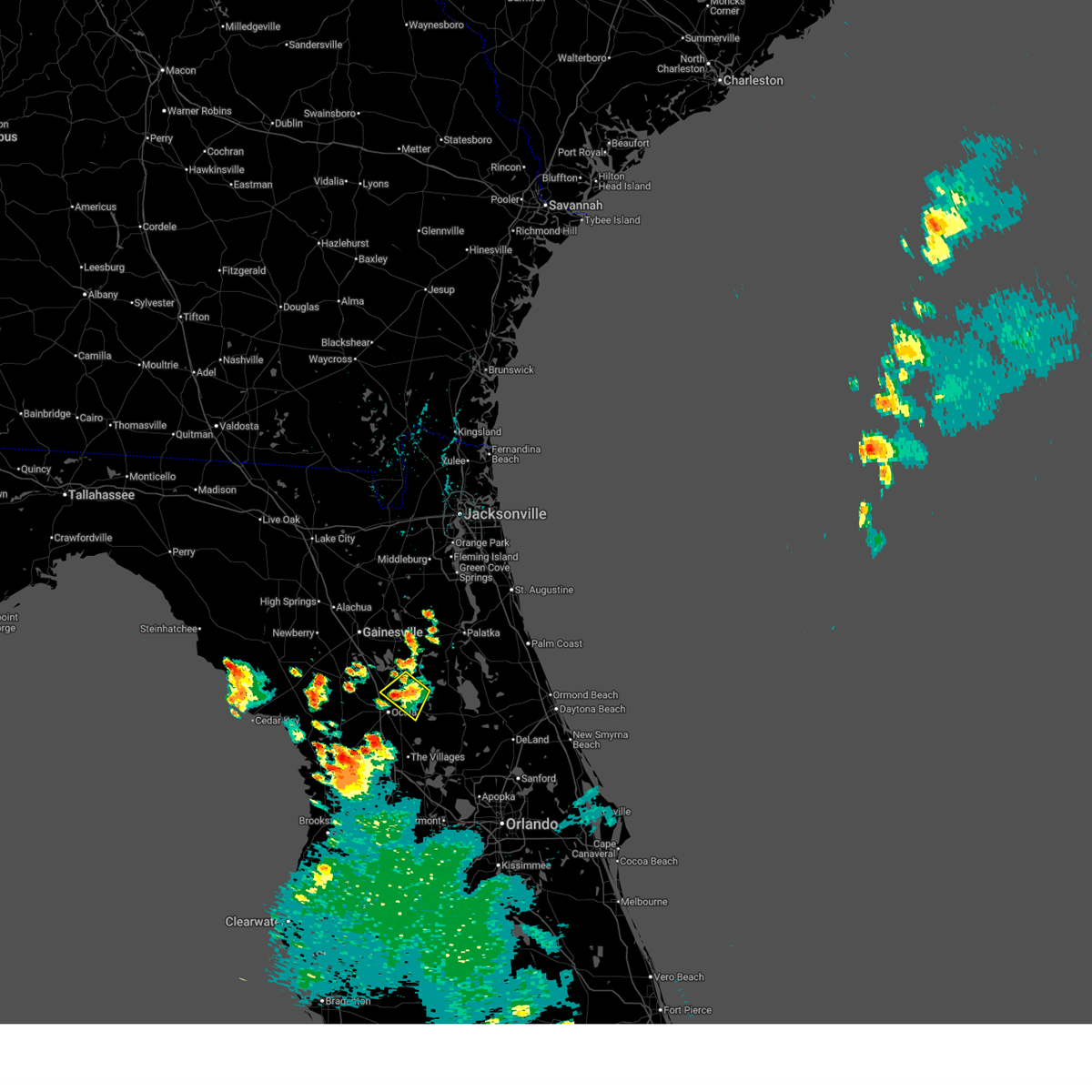
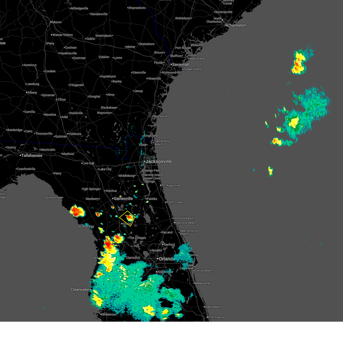
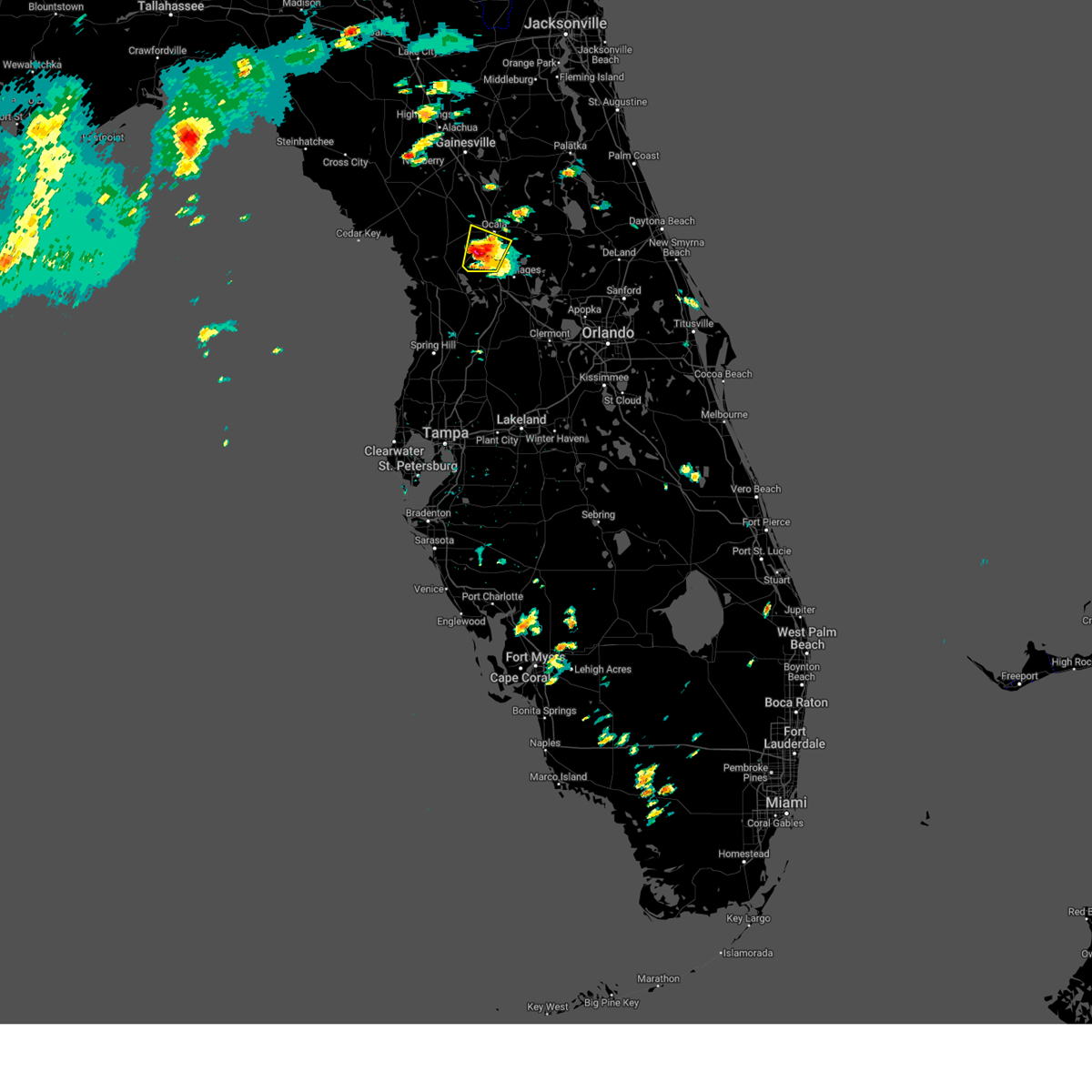
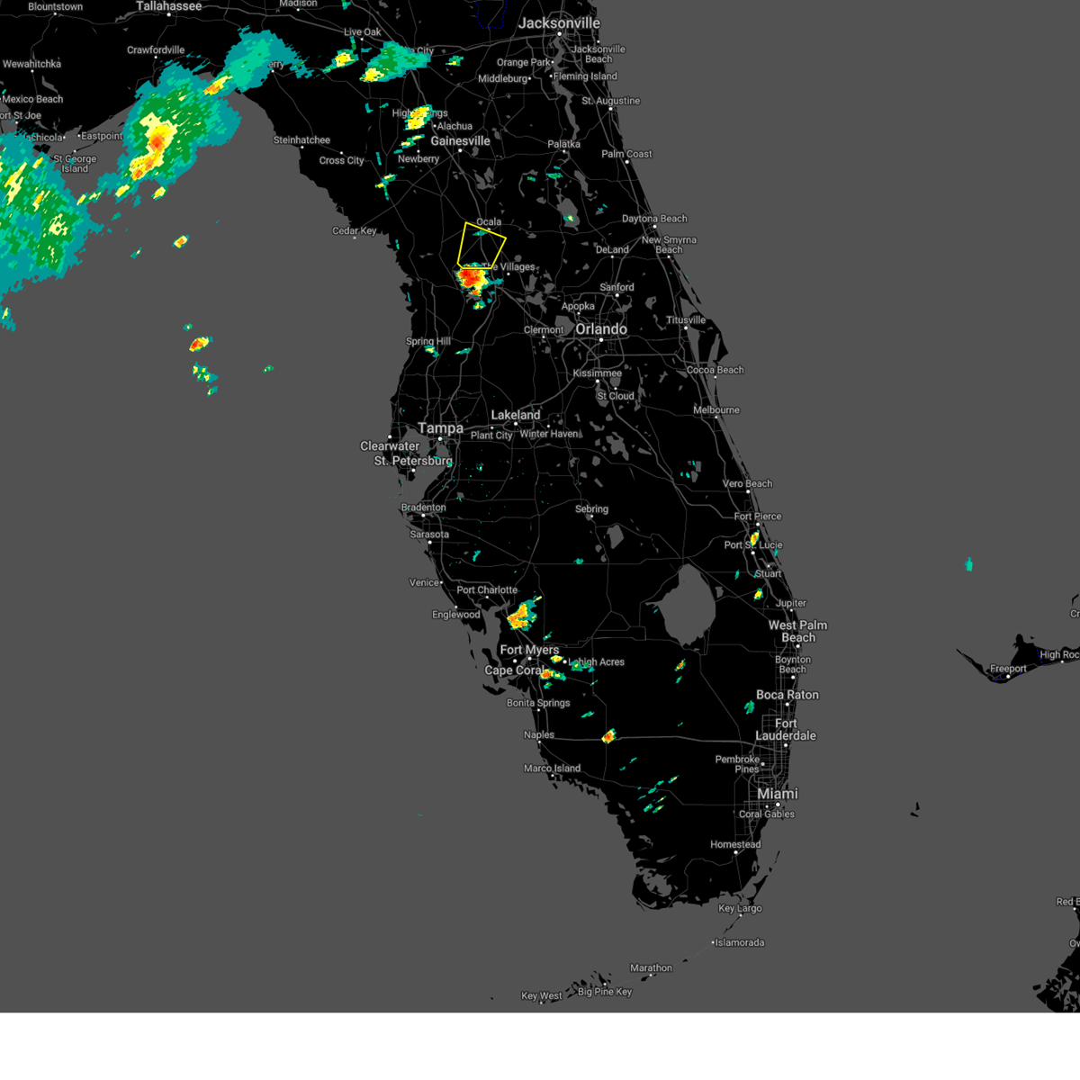
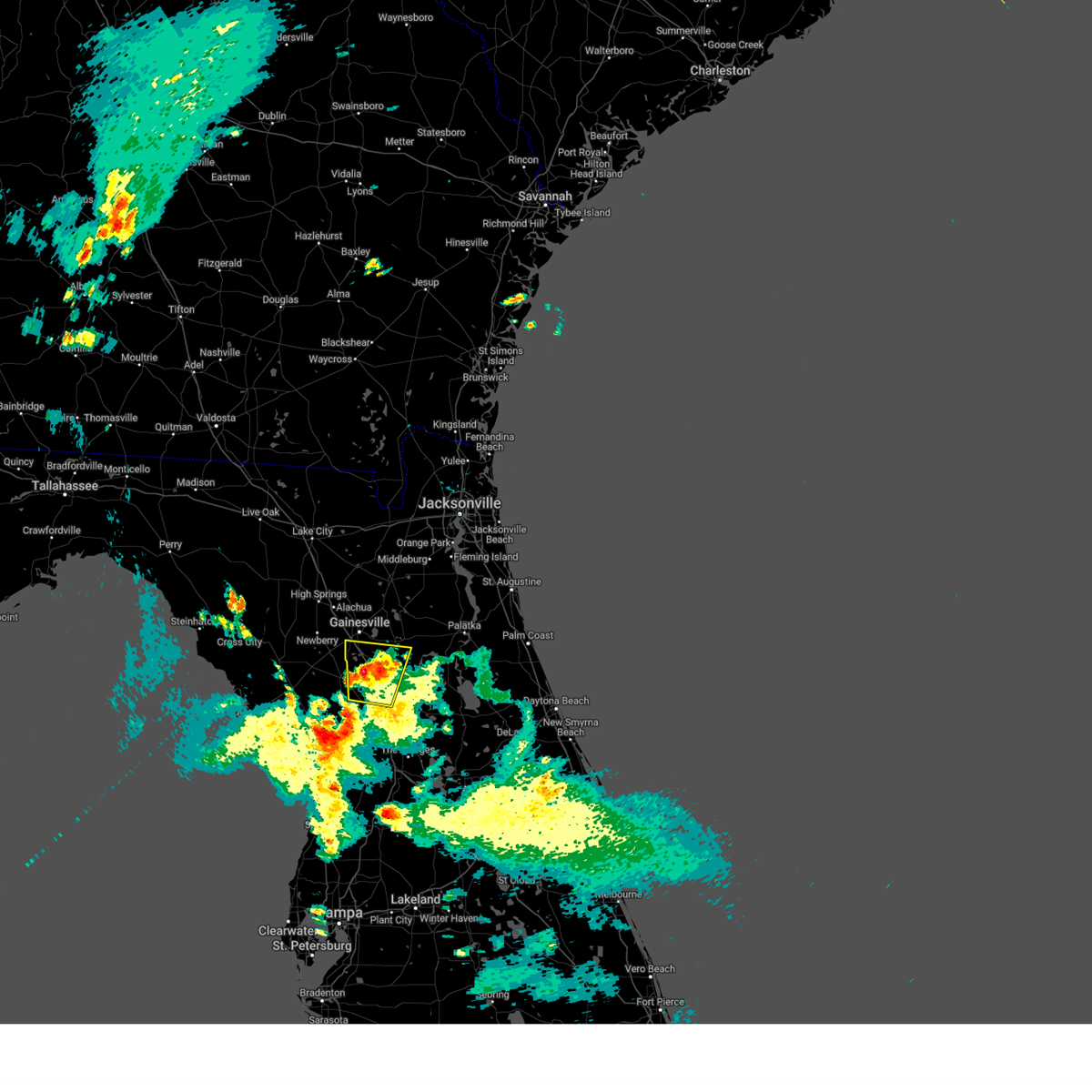
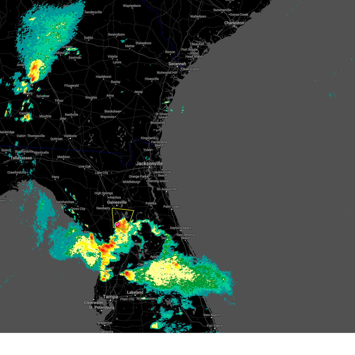
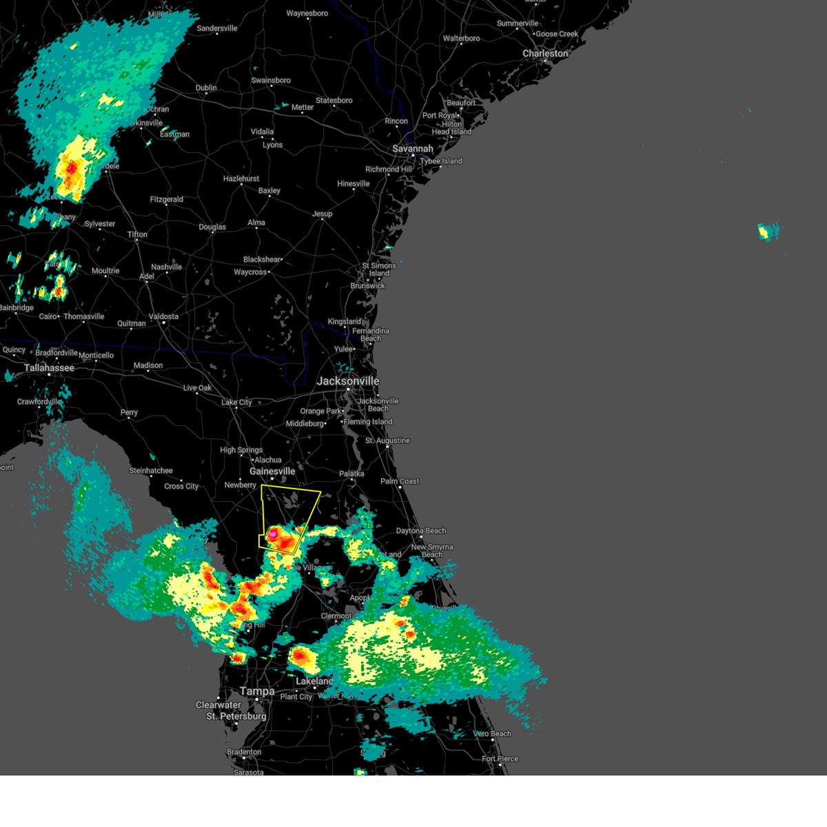
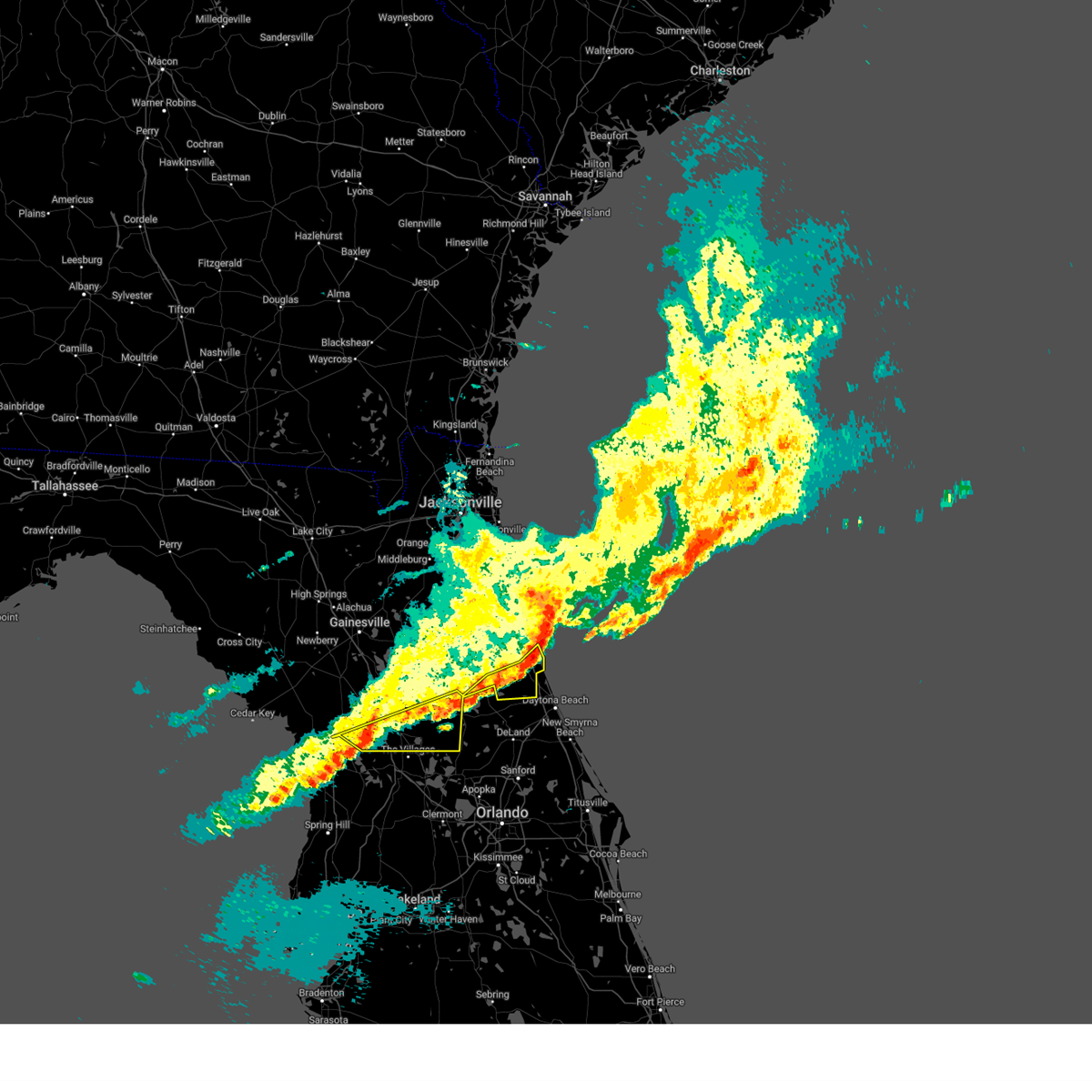
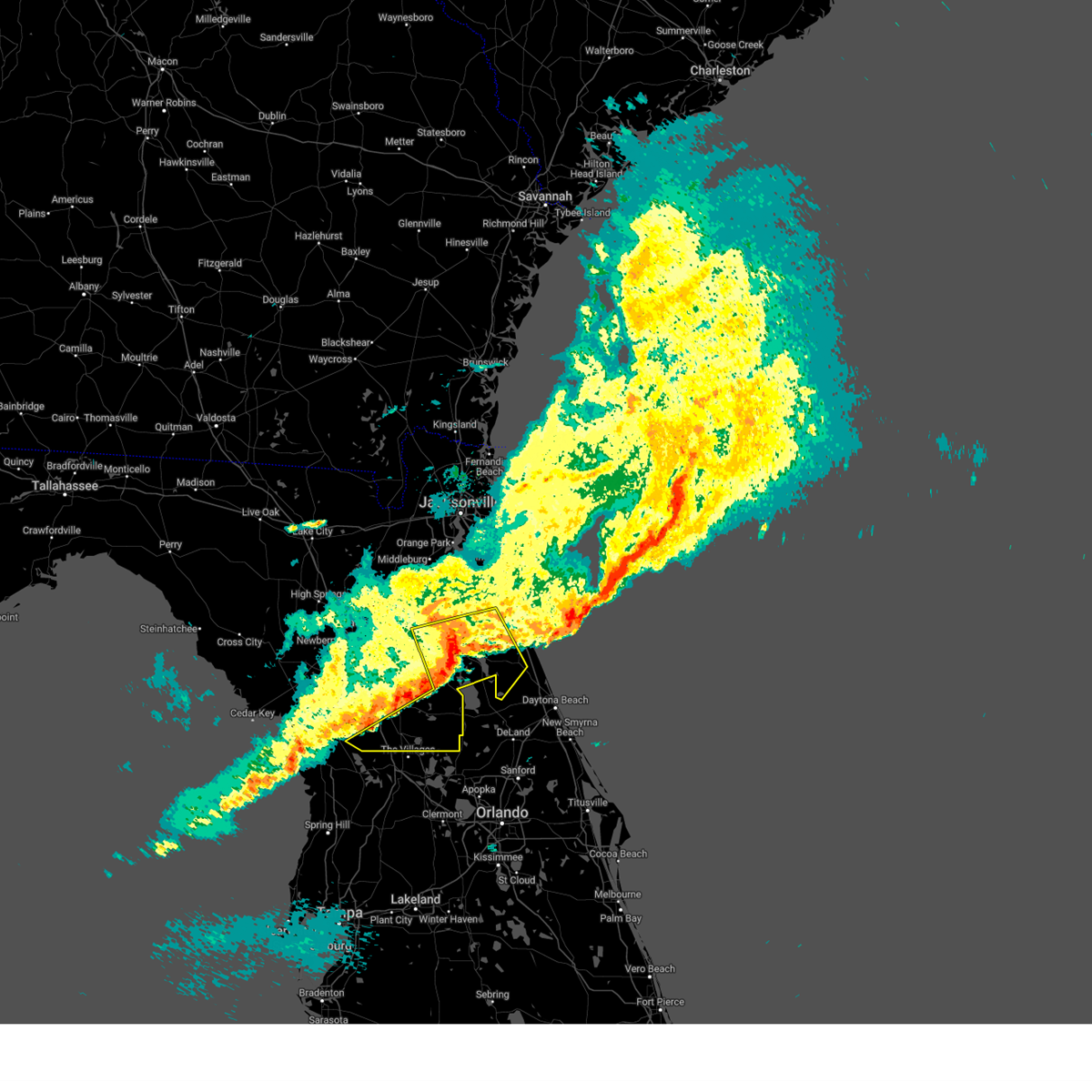
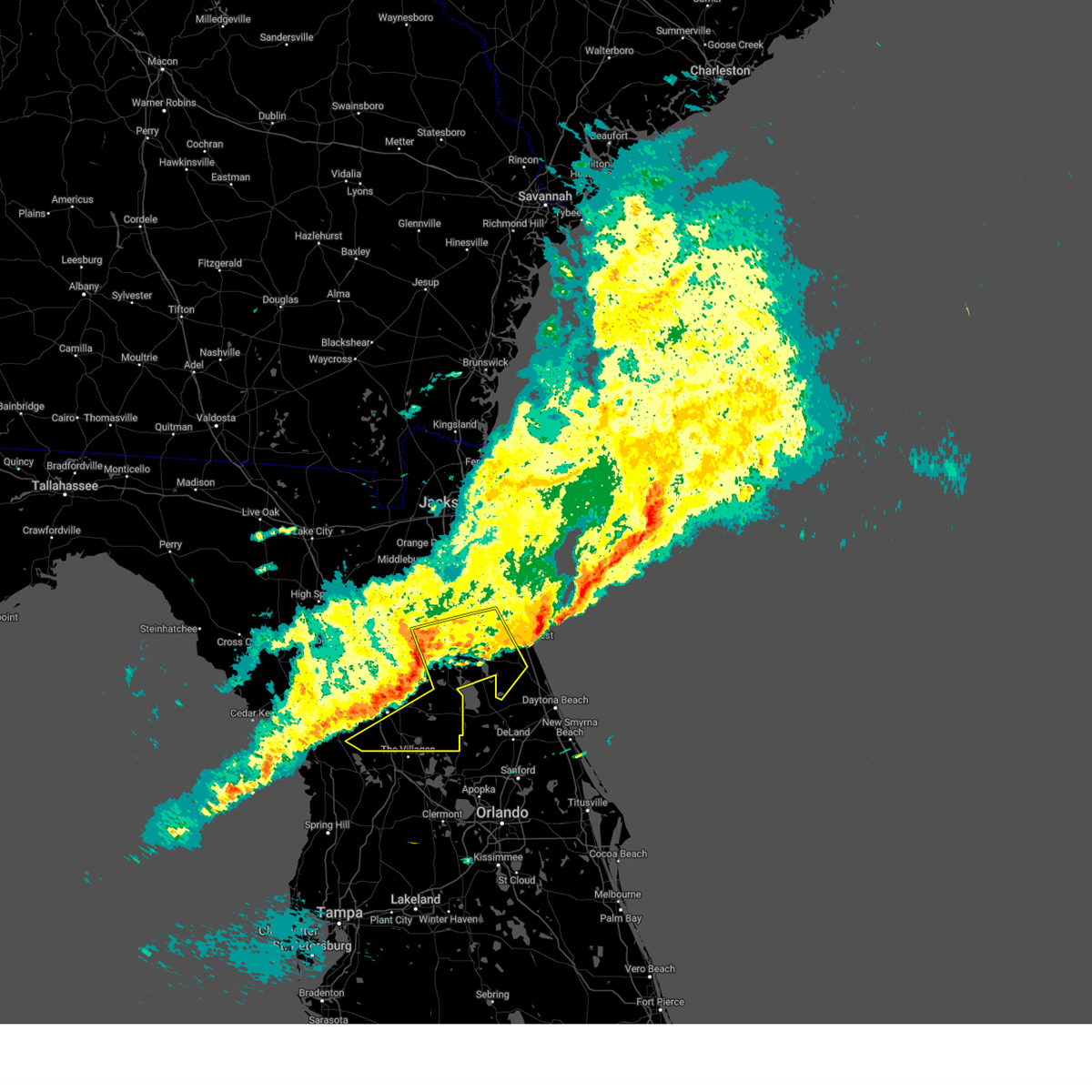
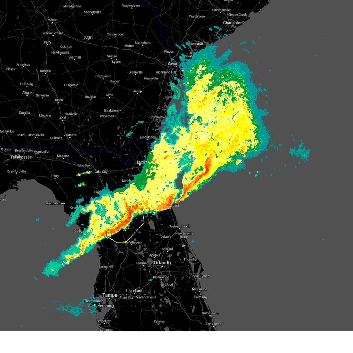
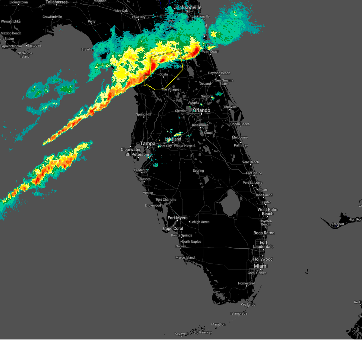
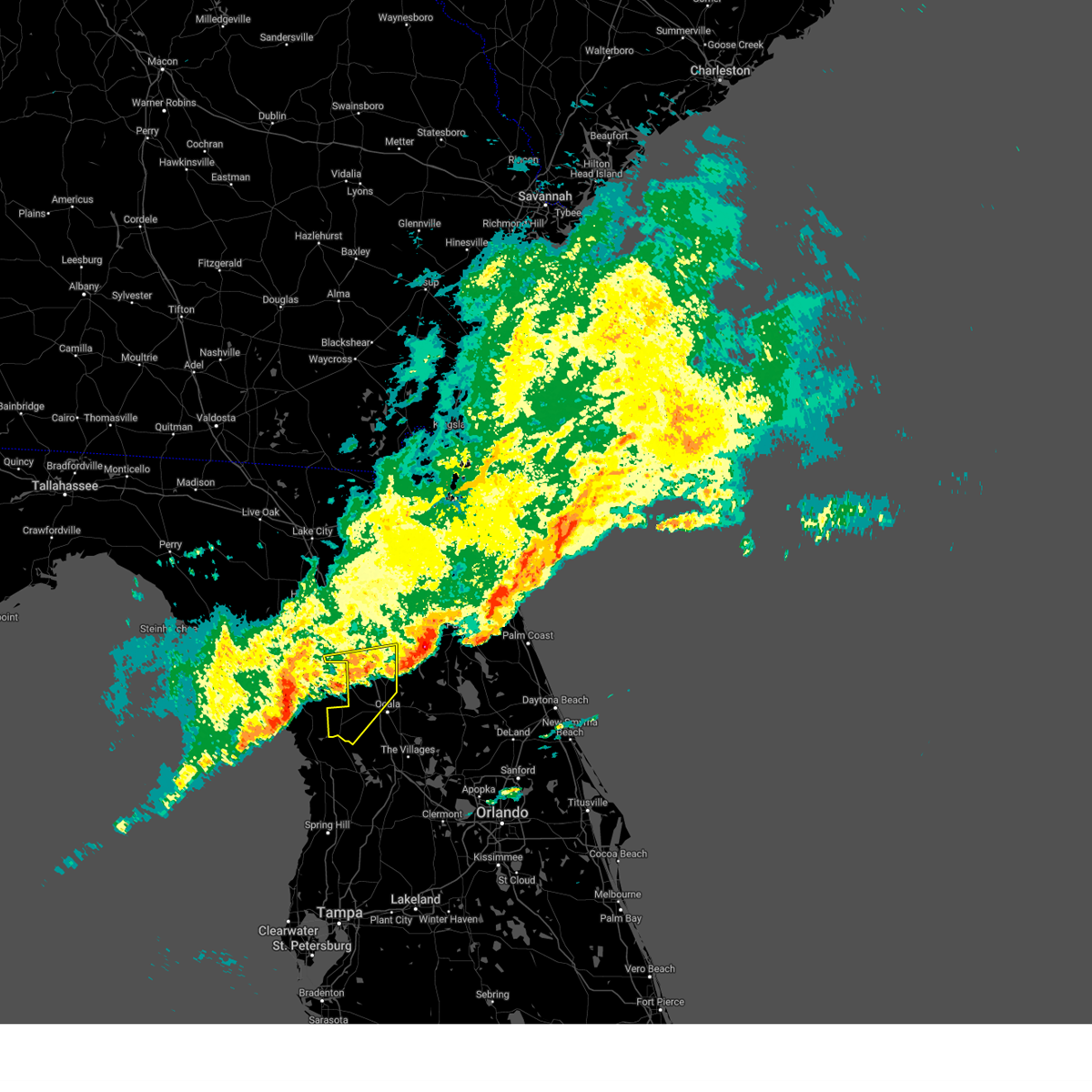
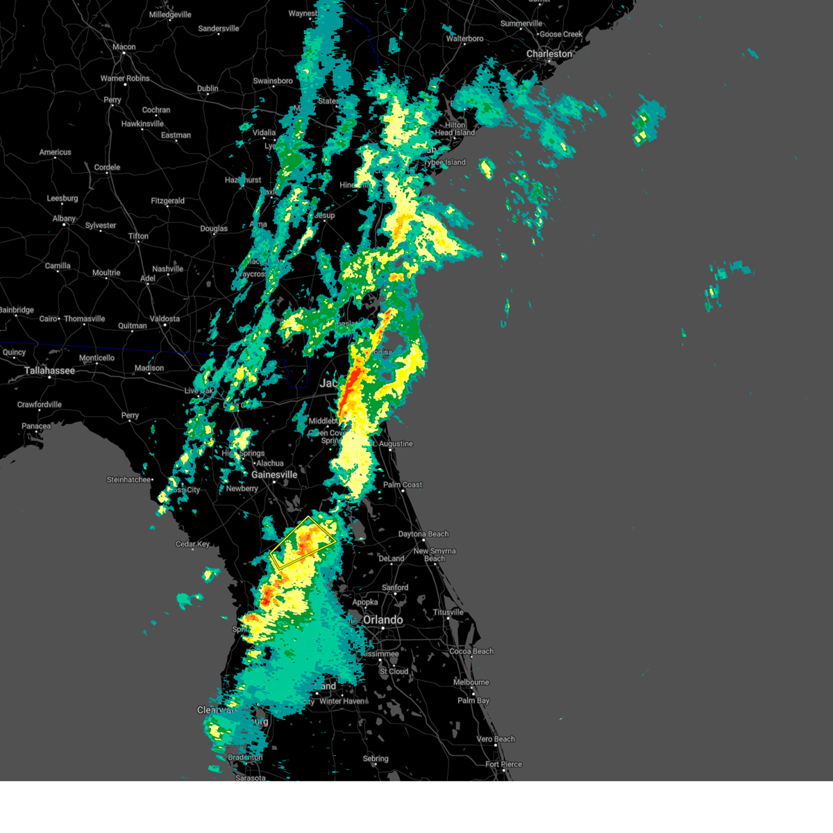
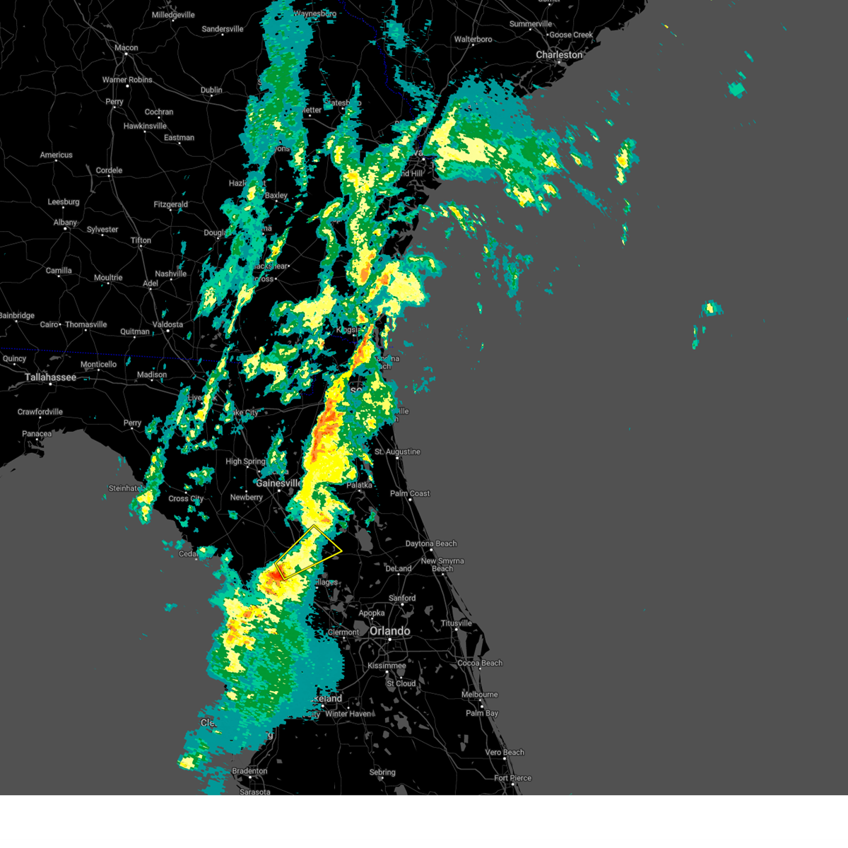
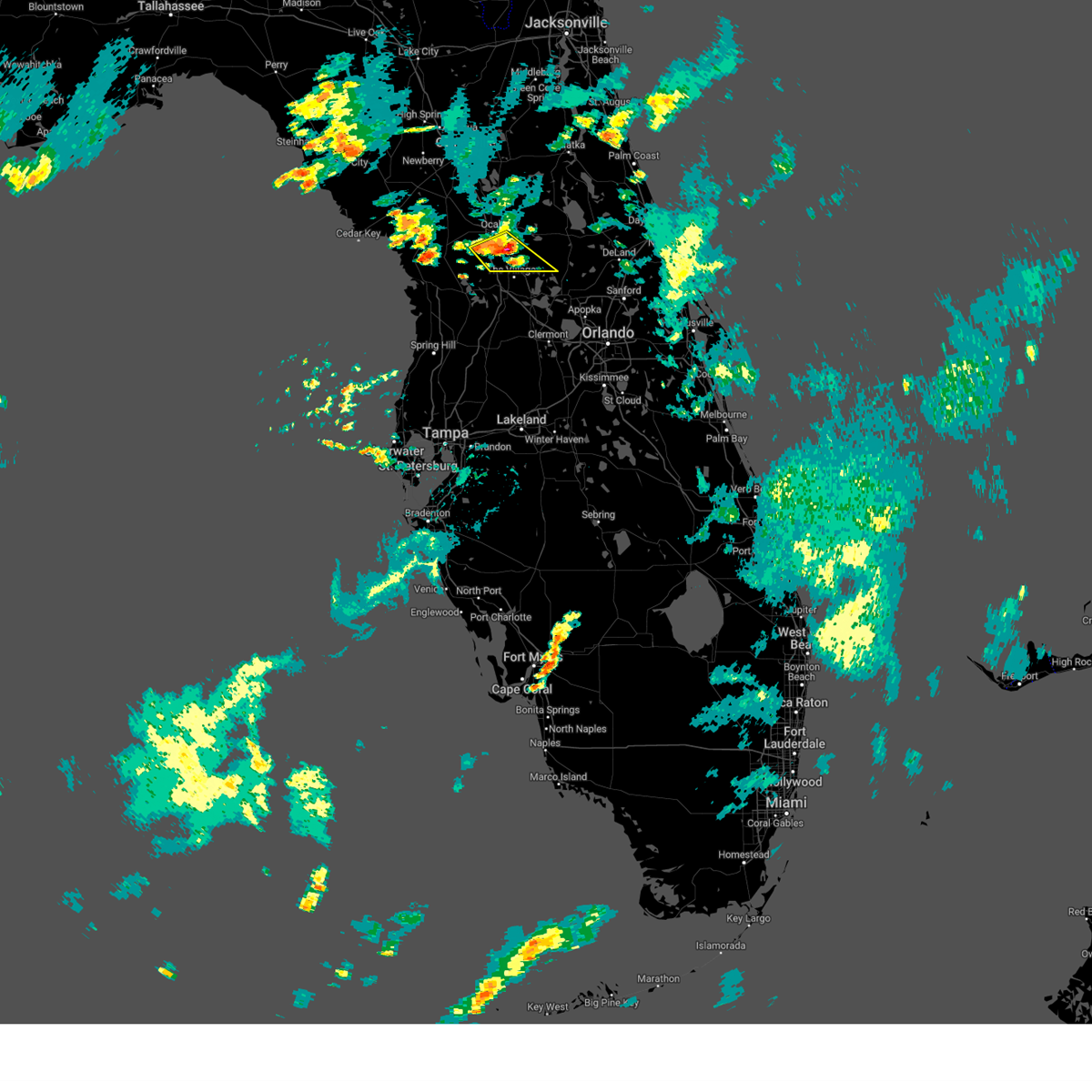
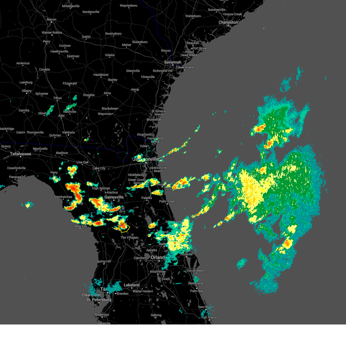
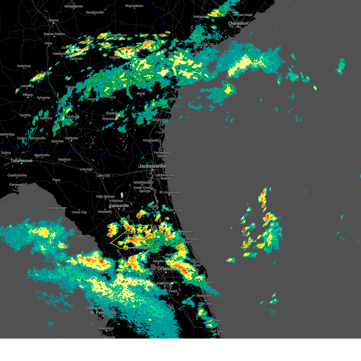
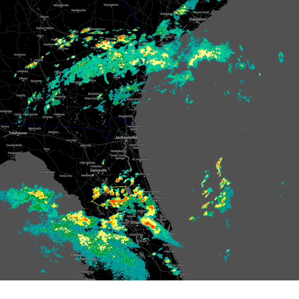
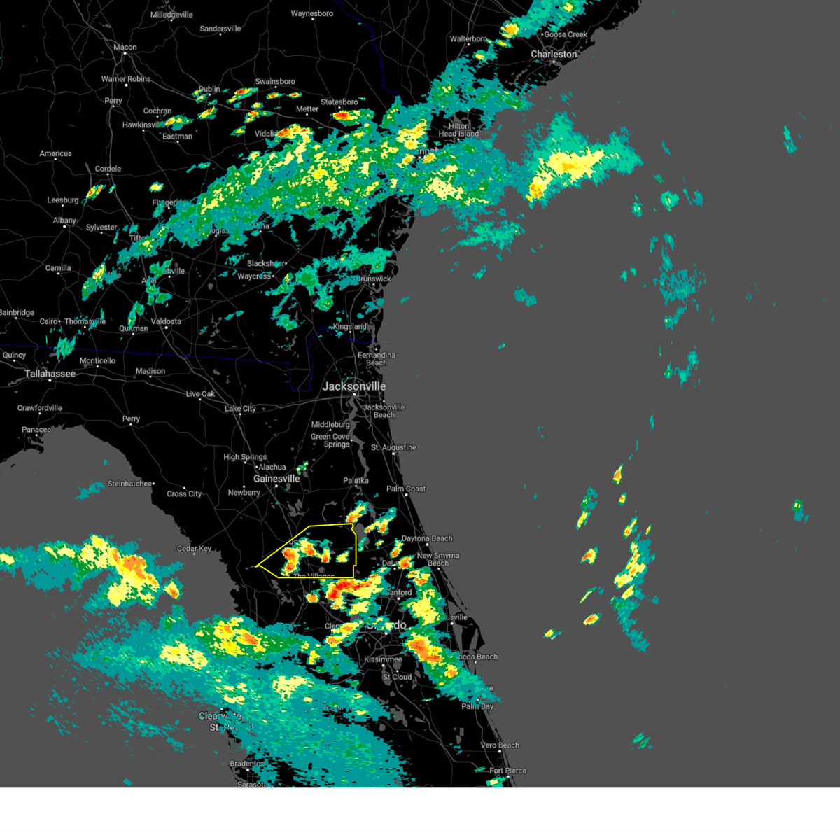
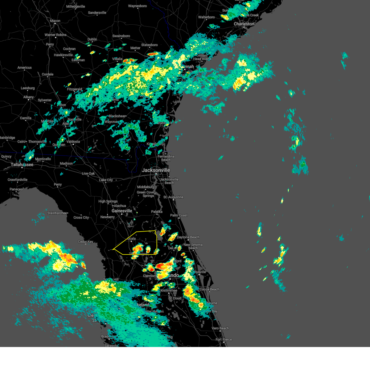
Hail Map for Ocala, FL
The Ocala, FL area has had 14 reports of on-the-ground hail by trained spotters, and has been under severe weather warnings 23 times during the past 12 months. Doppler radar has detected hail at or near Ocala, FL on 71 occasions, including 6 occasions during the past year.
| Name: | Ocala, FL |
| Where Located: | 63.9 miles NW of Orlando, FL |
| Map: | Google Map for Ocala, FL |
| Population: | 56315 |
| Housing Units: | 26764 |
| More Info: | Search Google for Ocala, FL |
1
The Top Recent Hail Date for Ocala, FL is Thursday, May 29, 2025 (8th out of 71)

Hail and Wind Damage Spotted near Ocala, FL
| Date / Time | Report Details |
|---|---|
| 6/20/2025 6:30 PM EDT | County dispatch reported trees down near highway 326. the time of damage was based on rada in marion county FL, 12.9 miles SE of Ocala, FL |
| 6/20/2025 5:54 PM EDT |
 The storm which prompted the warning has weakened below severe limits, and no longer poses an immediate threat to life or property. therefore, the warning will be allowed to expire. however, gusty winds and heavy rain are still possible with this thunderstorm. The storm which prompted the warning has weakened below severe limits, and no longer poses an immediate threat to life or property. therefore, the warning will be allowed to expire. however, gusty winds and heavy rain are still possible with this thunderstorm.
|
| 6/20/2025 5:30 PM EDT | County dispatch reported trees down along county road 316. the time of damage was based on rada in marion county FL, 15.7 miles SW of Ocala, FL |
| 6/20/2025 5:22 PM EDT |
 Svrjax the national weather service in jacksonville has issued a * severe thunderstorm warning for, central marion county in northern florida, * until 600 pm edt. * at 521 pm edt, a severe thunderstorm was located near fort mccoy, and is nearly stationary (radar indicated). Hazards include 60 mph wind gusts and penny size hail. expect damage to roofs, siding, and trees Svrjax the national weather service in jacksonville has issued a * severe thunderstorm warning for, central marion county in northern florida, * until 600 pm edt. * at 521 pm edt, a severe thunderstorm was located near fort mccoy, and is nearly stationary (radar indicated). Hazards include 60 mph wind gusts and penny size hail. expect damage to roofs, siding, and trees
|
| 5/29/2025 3:45 PM EDT | *** 1 fatal *** marion county emergency management reports one fatality resulting from a snapped tree along southwest 46th avenue in ocal in marion county FL, 3.5 miles E of Ocala, FL |
| 5/29/2025 2:59 PM EDT |
 The storm which prompted the warning has weakened below severe limits, and no longer poses an immediate threat to life or property. therefore, the warning will be allowed to expire. however, small hail and gusty winds are still possible with this thunderstorm. The storm which prompted the warning has weakened below severe limits, and no longer poses an immediate threat to life or property. therefore, the warning will be allowed to expire. however, small hail and gusty winds are still possible with this thunderstorm.
|
| 5/29/2025 2:45 PM EDT | *** 1 fatal *** corrects previous tstm wnd dmg report from 2 ene ocala airport. marion county emergency management reports one fatality resulting from a snapped tree al in marion county FL, 3.5 miles E of Ocala, FL |
| 5/29/2025 2:24 PM EDT |
 Svrjax the national weather service in jacksonville has issued a * severe thunderstorm warning for, south central marion county in northern florida, * until 300 pm edt. * at 224 pm edt, a severe thunderstorm was located 11 miles northeast of inverness highlands north, or 12 miles northeast of inverness, moving north at 20 mph (radar indicated). Hazards include 60 mph wind gusts and quarter size hail. Hail damage to vehicles is expected. Expect wind damage to roofs, siding, and trees. Svrjax the national weather service in jacksonville has issued a * severe thunderstorm warning for, south central marion county in northern florida, * until 300 pm edt. * at 224 pm edt, a severe thunderstorm was located 11 miles northeast of inverness highlands north, or 12 miles northeast of inverness, moving north at 20 mph (radar indicated). Hazards include 60 mph wind gusts and quarter size hail. Hail damage to vehicles is expected. Expect wind damage to roofs, siding, and trees.
|
| 5/10/2025 5:27 PM EDT |
 The storm which prompted the warning has weakened below severe limits, and no longer poses an immediate threat to life or property. therefore, the warning will be allowed to expire. however, gusty winds are still possible with this thunderstorm. The storm which prompted the warning has weakened below severe limits, and no longer poses an immediate threat to life or property. therefore, the warning will be allowed to expire. however, gusty winds are still possible with this thunderstorm.
|
| 5/10/2025 5:10 PM EDT |
 At 509 pm edt, a severe thunderstorm was located 9 miles west of sparr, or 11 miles east of williston, moving north at 25 mph (radar indicated). Hazards include 60 mph wind gusts and quarter size hail. Hail damage to vehicles is expected. expect wind damage to roofs, siding, and trees. Locations impacted include, citra, sparr, cross creek, anthony, micanopy, reddick, mcintosh, flemington, lowell, and lochloosa. At 509 pm edt, a severe thunderstorm was located 9 miles west of sparr, or 11 miles east of williston, moving north at 25 mph (radar indicated). Hazards include 60 mph wind gusts and quarter size hail. Hail damage to vehicles is expected. expect wind damage to roofs, siding, and trees. Locations impacted include, citra, sparr, cross creek, anthony, micanopy, reddick, mcintosh, flemington, lowell, and lochloosa.
|
| 5/10/2025 4:53 PM EDT |
 Svrjax the national weather service in jacksonville has issued a * severe thunderstorm warning for, southeastern alachua county in northern florida, western marion county in northern florida, west central putnam county in northeastern florida, * until 530 pm edt. * at 453 pm edt, a severe thunderstorm was located near ocala airport, or 10 miles northeast of rainbow lakes estates, moving north at 25 mph (radar indicated). Hazards include 60 mph wind gusts and quarter size hail. Hail damage to vehicles is expected. Expect wind damage to roofs, siding, and trees. Svrjax the national weather service in jacksonville has issued a * severe thunderstorm warning for, southeastern alachua county in northern florida, western marion county in northern florida, west central putnam county in northeastern florida, * until 530 pm edt. * at 453 pm edt, a severe thunderstorm was located near ocala airport, or 10 miles northeast of rainbow lakes estates, moving north at 25 mph (radar indicated). Hazards include 60 mph wind gusts and quarter size hail. Hail damage to vehicles is expected. Expect wind damage to roofs, siding, and trees.
|
| 3/5/2025 11:20 AM EST | Marion county sheriffs office relayed a report of a large tree falling on a single family home in silver springs. time of damage based on radar dat in marion county FL, 6.2 miles SW of Ocala, FL |
| 1/19/2025 8:15 AM EST |
 Svrjax the national weather service in jacksonville has issued a * severe thunderstorm warning for, southern flagler county in northeastern florida, southern marion county in northern florida, * until 845 am est. * at 814 am est, severe thunderstorms were located along a line extending from 9 miles east of marineland to 7 miles southwest of flagler beach to 7 miles south of lake george to homosassa springs, moving east at 50 mph (radar indicated). Hazards include 60 mph wind gusts and penny size hail. expect damage to roofs, siding, and trees Svrjax the national weather service in jacksonville has issued a * severe thunderstorm warning for, southern flagler county in northeastern florida, southern marion county in northern florida, * until 845 am est. * at 814 am est, severe thunderstorms were located along a line extending from 9 miles east of marineland to 7 miles southwest of flagler beach to 7 miles south of lake george to homosassa springs, moving east at 50 mph (radar indicated). Hazards include 60 mph wind gusts and penny size hail. expect damage to roofs, siding, and trees
|
| 1/19/2025 7:42 AM EST |
 At 742 am est, severe thunderstorms were located along a line extending from near palatka to fruitland to 10 miles southwest of ocala airport, moving east at 70 mph (radar indicated). Hazards include 70 mph wind gusts and quarter size hail. Hail damage to vehicles is expected. expect considerable tree damage. wind damage is also likely to mobile homes, roofs, and outbuildings. Locations impacted include, palatka, bunnell, crescent city, interlachen, pomona park, hastings, east palatka, salt springs, andalusia, and juniper springs. At 742 am est, severe thunderstorms were located along a line extending from near palatka to fruitland to 10 miles southwest of ocala airport, moving east at 70 mph (radar indicated). Hazards include 70 mph wind gusts and quarter size hail. Hail damage to vehicles is expected. expect considerable tree damage. wind damage is also likely to mobile homes, roofs, and outbuildings. Locations impacted include, palatka, bunnell, crescent city, interlachen, pomona park, hastings, east palatka, salt springs, andalusia, and juniper springs.
|
| 1/19/2025 7:33 AM EST | 65 mph wind gust reported near nw 62nd ave and nw 53rd street rd in ocal in marion county FL, 9.7 miles WSW of Ocala, FL |
| 1/19/2025 7:32 AM EST |
 Svrjax the national weather service in jacksonville has issued a * severe thunderstorm warning for, western flagler county in northeastern florida, south central st. johns county in northeastern florida, eastern marion county in northern florida, putnam county in northeastern florida, * until 800 am est. * at 732 am est, severe thunderstorms were located along a line extending from near lake geneva to near fort mccoy to 8 miles southwest of rainbow lakes estates, moving east at 55 mph (radar indicated). Hazards include 70 mph wind gusts and quarter size hail. Hail damage to vehicles is expected. expect considerable tree damage. Wind damage is also likely to mobile homes, roofs, and outbuildings. Svrjax the national weather service in jacksonville has issued a * severe thunderstorm warning for, western flagler county in northeastern florida, south central st. johns county in northeastern florida, eastern marion county in northern florida, putnam county in northeastern florida, * until 800 am est. * at 732 am est, severe thunderstorms were located along a line extending from near lake geneva to near fort mccoy to 8 miles southwest of rainbow lakes estates, moving east at 55 mph (radar indicated). Hazards include 70 mph wind gusts and quarter size hail. Hail damage to vehicles is expected. expect considerable tree damage. Wind damage is also likely to mobile homes, roofs, and outbuildings.
|
| 1/19/2025 7:26 AM EST |
 At 726 am est, severe thunderstorms were located along a line extending from near hawthorne to near fort mccoy to near ocala to near rainbow lakes estates, moving east at 65 mph (radar indicated). Hazards include 70 mph wind gusts and quarter size hail. Hail damage to vehicles is expected. expect considerable tree damage. wind damage is also likely to mobile homes, roofs, and outbuildings. Locations impacted include, ocala, rainbow lakes estates, interlachen, fort mccoy, citra, lynne, lake delancy, sparr, anthony, and silver springs shores. At 726 am est, severe thunderstorms were located along a line extending from near hawthorne to near fort mccoy to near ocala to near rainbow lakes estates, moving east at 65 mph (radar indicated). Hazards include 70 mph wind gusts and quarter size hail. Hail damage to vehicles is expected. expect considerable tree damage. wind damage is also likely to mobile homes, roofs, and outbuildings. Locations impacted include, ocala, rainbow lakes estates, interlachen, fort mccoy, citra, lynne, lake delancy, sparr, anthony, and silver springs shores.
|
| 1/19/2025 7:15 AM EST |
 Svrjax the national weather service in jacksonville has issued a * severe thunderstorm warning for, southeastern alachua county in northern florida, marion county in northern florida, southwestern putnam county in northeastern florida, * until 745 am est. * at 715 am est, severe thunderstorms were located along a line extending from near rochelle to near citra to near rainbow lakes estates, moving east at 65 mph (radar indicated). Hazards include 70 mph wind gusts and quarter size hail. Hail damage to vehicles is expected. expect considerable tree damage. Wind damage is also likely to mobile homes, roofs, and outbuildings. Svrjax the national weather service in jacksonville has issued a * severe thunderstorm warning for, southeastern alachua county in northern florida, marion county in northern florida, southwestern putnam county in northeastern florida, * until 745 am est. * at 715 am est, severe thunderstorms were located along a line extending from near rochelle to near citra to near rainbow lakes estates, moving east at 65 mph (radar indicated). Hazards include 70 mph wind gusts and quarter size hail. Hail damage to vehicles is expected. expect considerable tree damage. Wind damage is also likely to mobile homes, roofs, and outbuildings.
|
| 1/19/2025 6:55 AM EST |
 Svrjax the national weather service in jacksonville has issued a * severe thunderstorm warning for, southern alachua county in northern florida, western marion county in northern florida, * until 730 am est. * at 655 am est, severe thunderstorms were located along a line extending from near bronson to near williston highlands to 18 miles northwest of crystal river airport, moving east at 65 mph (radar indicated). Hazards include 60 mph wind gusts. expect damage to roofs, siding, and trees Svrjax the national weather service in jacksonville has issued a * severe thunderstorm warning for, southern alachua county in northern florida, western marion county in northern florida, * until 730 am est. * at 655 am est, severe thunderstorms were located along a line extending from near bronson to near williston highlands to 18 miles northwest of crystal river airport, moving east at 65 mph (radar indicated). Hazards include 60 mph wind gusts. expect damage to roofs, siding, and trees
|
| 12/11/2024 11:36 AM EST |
 The storm which prompted the warning has weakened below severe limits, and no longer poses an immediate threat to life or property. therefore, the warning will be allowed to expire. however, gusty winds are still possible with this thunderstorm. The storm which prompted the warning has weakened below severe limits, and no longer poses an immediate threat to life or property. therefore, the warning will be allowed to expire. however, gusty winds are still possible with this thunderstorm.
|
| 12/11/2024 11:16 AM EST |
 Svrjax the national weather service in jacksonville has issued a * severe thunderstorm warning for, central marion county in northern florida, * until 1145 am est. * at 1116 am est, a severe thunderstorm was located near ocala airport, or 9 miles southwest of ocala, moving northeast at 60 mph (radar indicated). Hazards include 60 mph wind gusts. expect damage to roofs, siding, and trees Svrjax the national weather service in jacksonville has issued a * severe thunderstorm warning for, central marion county in northern florida, * until 1145 am est. * at 1116 am est, a severe thunderstorm was located near ocala airport, or 9 miles southwest of ocala, moving northeast at 60 mph (radar indicated). Hazards include 60 mph wind gusts. expect damage to roofs, siding, and trees
|
| 8/22/2024 6:30 PM EDT |
 Svrjax the national weather service in jacksonville has issued a * severe thunderstorm warning for, south central marion county in northern florida, * until 730 pm edt. * at 630 pm edt, a severe thunderstorm was located near santos, or 8 miles southeast of ocala, moving southeast at 10 mph (radar indicated). Hazards include 60 mph wind gusts. expect damage to roofs, siding, and trees Svrjax the national weather service in jacksonville has issued a * severe thunderstorm warning for, south central marion county in northern florida, * until 730 pm edt. * at 630 pm edt, a severe thunderstorm was located near santos, or 8 miles southeast of ocala, moving southeast at 10 mph (radar indicated). Hazards include 60 mph wind gusts. expect damage to roofs, siding, and trees
|
| 8/22/2024 5:50 PM EDT | A tree fell on a rv at holiday travel park near ocala. residence was deemed uninhabitable. no injuries were reported. an unknown number of residents were displace in marion county FL, 3 miles ESE of Ocala, FL |
| 8/22/2024 5:48 PM EDT |
 Svrjax the national weather service in jacksonville has issued a * severe thunderstorm warning for, south central marion county in northern florida, * until 630 pm edt. * at 548 pm edt, a severe thunderstorm was located over ocala, moving southeast at 15 mph (radar indicated). Hazards include 60 mph wind gusts. expect damage to roofs, siding, and trees Svrjax the national weather service in jacksonville has issued a * severe thunderstorm warning for, south central marion county in northern florida, * until 630 pm edt. * at 548 pm edt, a severe thunderstorm was located over ocala, moving southeast at 15 mph (radar indicated). Hazards include 60 mph wind gusts. expect damage to roofs, siding, and trees
|
| 8/4/2024 1:38 PM EDT |
 The storms which prompted the warning have weakened below severe limits, and no longer pose an immediate threat to life or property. therefore, the warning will be allowed to expire. however, gusty winds and heavy rain are still possible with these thunderstorms. a tornado watch remains in effect until 800 pm edt for northern and northeastern florida. The storms which prompted the warning have weakened below severe limits, and no longer pose an immediate threat to life or property. therefore, the warning will be allowed to expire. however, gusty winds and heavy rain are still possible with these thunderstorms. a tornado watch remains in effect until 800 pm edt for northern and northeastern florida.
|
| 8/4/2024 1:28 PM EDT |
 At 128 pm edt, severe thunderstorms were located along a line extending from near juniper springs to near lake weir, moving northwest at 40 mph (radar indicated). Hazards include 60 mph wind gusts. Expect damage to roofs, siding, and trees. Locations impacted include, ocala, salt springs, juniper springs, lynne, weirsdale, anthony, ocklawaha, moss bluff, silver springs shores, and lake weir. At 128 pm edt, severe thunderstorms were located along a line extending from near juniper springs to near lake weir, moving northwest at 40 mph (radar indicated). Hazards include 60 mph wind gusts. Expect damage to roofs, siding, and trees. Locations impacted include, ocala, salt springs, juniper springs, lynne, weirsdale, anthony, ocklawaha, moss bluff, silver springs shores, and lake weir.
|
| 8/4/2024 1:07 PM EDT |
 At 107 pm edt, severe thunderstorms were located along a line extending from near pittman to leesburg, moving northwest at 40 mph (radar indicated). Hazards include 60 mph wind gusts. Expect damage to roofs, siding, and trees. Locations impacted include, ocala, salt springs, juniper springs, lynne, weirsdale, anthony, the village of briar meadow, ocklawaha, moss bluff, and silver springs shores. At 107 pm edt, severe thunderstorms were located along a line extending from near pittman to leesburg, moving northwest at 40 mph (radar indicated). Hazards include 60 mph wind gusts. Expect damage to roofs, siding, and trees. Locations impacted include, ocala, salt springs, juniper springs, lynne, weirsdale, anthony, the village of briar meadow, ocklawaha, moss bluff, and silver springs shores.
|
| 8/4/2024 12:53 PM EDT |
 Svrjax the national weather service in jacksonville has issued a * severe thunderstorm warning for, marion county in northern florida, * until 145 pm edt. * at 1252 pm edt, severe thunderstorms were located along a line extending from near mount plymouth to near howey-in-the-hills, moving northwest at 35 mph (radar indicated). Hazards include 60 mph wind gusts. expect damage to roofs, siding, and trees Svrjax the national weather service in jacksonville has issued a * severe thunderstorm warning for, marion county in northern florida, * until 145 pm edt. * at 1252 pm edt, severe thunderstorms were located along a line extending from near mount plymouth to near howey-in-the-hills, moving northwest at 35 mph (radar indicated). Hazards include 60 mph wind gusts. expect damage to roofs, siding, and trees
|
| 7/4/2024 5:54 PM EDT |
 The storm which prompted the warning has weakened below severe limits, and no longer poses an immediate threat to life or property. therefore, the warning will be allowed to expire. however, gusty winds and heavy rain are still likely with this thunderstorm. The storm which prompted the warning has weakened below severe limits, and no longer poses an immediate threat to life or property. therefore, the warning will be allowed to expire. however, gusty winds and heavy rain are still likely with this thunderstorm.
|
| 7/4/2024 5:25 PM EDT |
 Svrjax the national weather service in jacksonville has issued a * severe thunderstorm warning for, south central marion county in northern florida, * until 600 pm edt. * at 525 pm edt, a severe thunderstorm was located near santos, or 7 miles south of ocala, moving southwest at 10 mph (radar indicated). Hazards include 60 mph wind gusts and penny size hail. expect damage to roofs, siding, and trees Svrjax the national weather service in jacksonville has issued a * severe thunderstorm warning for, south central marion county in northern florida, * until 600 pm edt. * at 525 pm edt, a severe thunderstorm was located near santos, or 7 miles south of ocala, moving southwest at 10 mph (radar indicated). Hazards include 60 mph wind gusts and penny size hail. expect damage to roofs, siding, and trees
|
| 6/28/2024 5:53 PM EDT |
 The storm which prompted the warning has weakened below severe limits, and no longer poses an immediate threat to life or property. therefore, the warning will be allowed to expire. however, gusty winds and heavy rain are still possible with this thunderstorm. The storm which prompted the warning has weakened below severe limits, and no longer poses an immediate threat to life or property. therefore, the warning will be allowed to expire. however, gusty winds and heavy rain are still possible with this thunderstorm.
|
| 6/28/2024 5:19 PM EDT |
 Svrjax the national weather service in jacksonville has issued a * severe thunderstorm warning for, south central marion county in northern florida, * until 600 pm edt. * at 519 pm edt, a severe thunderstorm was located 8 miles southwest of santos, or 10 miles south of ocala, moving east at 20 mph (radar indicated). Hazards include 60 mph wind gusts. expect damage to roofs, siding, and trees Svrjax the national weather service in jacksonville has issued a * severe thunderstorm warning for, south central marion county in northern florida, * until 600 pm edt. * at 519 pm edt, a severe thunderstorm was located 8 miles southwest of santos, or 10 miles south of ocala, moving east at 20 mph (radar indicated). Hazards include 60 mph wind gusts. expect damage to roofs, siding, and trees
|
| 6/5/2024 6:10 PM EDT |
 The storm which prompted the warning has weakened below severe limits, and no longer poses an immediate threat to life or property. therefore, the warning will be allowed to expire. however, gusty winds are still possible with this thunderstorm. The storm which prompted the warning has weakened below severe limits, and no longer poses an immediate threat to life or property. therefore, the warning will be allowed to expire. however, gusty winds are still possible with this thunderstorm.
|
| 6/5/2024 5:43 PM EDT |
 Svrjax the national weather service in jacksonville has issued a * severe thunderstorm warning for, south central alachua county in northern florida, northwestern marion county in northern florida, * until 615 pm edt. * at 543 pm edt, a severe thunderstorm was located 7 miles southwest of cross creek, or 10 miles west of citra, moving southeast at 15 mph (radar indicated). Hazards include 60 mph wind gusts and quarter size hail. Hail damage to vehicles is expected. Expect wind damage to roofs, siding, and trees. Svrjax the national weather service in jacksonville has issued a * severe thunderstorm warning for, south central alachua county in northern florida, northwestern marion county in northern florida, * until 615 pm edt. * at 543 pm edt, a severe thunderstorm was located 7 miles southwest of cross creek, or 10 miles west of citra, moving southeast at 15 mph (radar indicated). Hazards include 60 mph wind gusts and quarter size hail. Hail damage to vehicles is expected. Expect wind damage to roofs, siding, and trees.
|
| 5/10/2024 9:59 AM EDT |
 The storms which prompted the warning have moved out of the area. therefore, the warning will be allowed to expire. however, heavy rain is still possible with these thunderstorms. a severe thunderstorm watch remains in effect until noon edt for northern and northeastern florida, and southeastern georgia. The storms which prompted the warning have moved out of the area. therefore, the warning will be allowed to expire. however, heavy rain is still possible with these thunderstorms. a severe thunderstorm watch remains in effect until noon edt for northern and northeastern florida, and southeastern georgia.
|
| 5/10/2024 9:25 AM EDT |
 Svrjax the national weather service in jacksonville has issued a * severe thunderstorm warning for, nassau county in northeastern florida, southeastern alachua county in northern florida, st. johns county in northeastern florida, central marion county in northern florida, putnam county in northeastern florida, clay county in northeastern florida, duval county in northeastern florida, camden county in southeastern georgia, northeastern charlton county in southeastern georgia, * until 1000 am edt. * at 925 am edt, severe thunderstorms were located along a line extending from near kings ferry to near florahome to near williston municipal airport, moving east at 60 mph (radar indicated). Hazards include 60 mph wind gusts and penny size hail. expect damage to roofs, siding, and trees Svrjax the national weather service in jacksonville has issued a * severe thunderstorm warning for, nassau county in northeastern florida, southeastern alachua county in northern florida, st. johns county in northeastern florida, central marion county in northern florida, putnam county in northeastern florida, clay county in northeastern florida, duval county in northeastern florida, camden county in southeastern georgia, northeastern charlton county in southeastern georgia, * until 1000 am edt. * at 925 am edt, severe thunderstorms were located along a line extending from near kings ferry to near florahome to near williston municipal airport, moving east at 60 mph (radar indicated). Hazards include 60 mph wind gusts and penny size hail. expect damage to roofs, siding, and trees
|
| 4/21/2024 9:58 PM EDT |
 The storm which prompted the warning has moved out of the area. therefore, the warning will be allowed to expire. remember, a severe thunderstorm warning still remains in effect for marion county. The storm which prompted the warning has moved out of the area. therefore, the warning will be allowed to expire. remember, a severe thunderstorm warning still remains in effect for marion county.
|
| 4/21/2024 9:47 PM EDT |
 At 947 pm edt, a severe thunderstorm was located near silver springs shores, or near lynne, moving east at 30 mph (radar indicated). Hazards include 60 mph wind gusts. Expect damage to roofs, siding, and trees. Locations impacted include, silver springs shores, santos, and burbank. At 947 pm edt, a severe thunderstorm was located near silver springs shores, or near lynne, moving east at 30 mph (radar indicated). Hazards include 60 mph wind gusts. Expect damage to roofs, siding, and trees. Locations impacted include, silver springs shores, santos, and burbank.
|
| 4/21/2024 9:32 PM EDT |
 Svrjax the national weather service in jacksonville has issued a * severe thunderstorm warning for, central marion county in northern florida, * until 1000 pm edt. * at 931 pm edt, a severe thunderstorm was located over ocala, moving east at 30 mph (radar indicated). Hazards include 60 mph wind gusts. expect damage to roofs, siding, and trees Svrjax the national weather service in jacksonville has issued a * severe thunderstorm warning for, central marion county in northern florida, * until 1000 pm edt. * at 931 pm edt, a severe thunderstorm was located over ocala, moving east at 30 mph (radar indicated). Hazards include 60 mph wind gusts. expect damage to roofs, siding, and trees
|
| 4/11/2024 11:54 AM EDT |
 Svrjax the national weather service in jacksonville has issued a * severe thunderstorm warning for, southeastern marion county in northern florida, * until 1215 pm edt. * at 1153 am edt, a severe thunderstorm was located over silver springs shores, or 7 miles southwest of lynne, moving northeast at 70 mph (radar indicated). Hazards include 70 mph wind gusts. Expect considerable tree damage. Damage is likely to mobile homes, roofs, and outbuildings. Svrjax the national weather service in jacksonville has issued a * severe thunderstorm warning for, southeastern marion county in northern florida, * until 1215 pm edt. * at 1153 am edt, a severe thunderstorm was located over silver springs shores, or 7 miles southwest of lynne, moving northeast at 70 mph (radar indicated). Hazards include 70 mph wind gusts. Expect considerable tree damage. Damage is likely to mobile homes, roofs, and outbuildings.
|
| 4/11/2024 11:34 AM EDT |
 Svrjax the national weather service in jacksonville has issued a * severe thunderstorm warning for, southern marion county in northern florida, * until noon edt. * at 1134 am edt, a severe thunderstorm was located 11 miles south of ocala airport, or 12 miles northeast of inverness, moving northeast at 60 mph (radar indicated). Hazards include 70 mph wind gusts. Expect considerable tree damage. Damage is likely to mobile homes, roofs, and outbuildings. Svrjax the national weather service in jacksonville has issued a * severe thunderstorm warning for, southern marion county in northern florida, * until noon edt. * at 1134 am edt, a severe thunderstorm was located 11 miles south of ocala airport, or 12 miles northeast of inverness, moving northeast at 60 mph (radar indicated). Hazards include 70 mph wind gusts. Expect considerable tree damage. Damage is likely to mobile homes, roofs, and outbuildings.
|
| 4/3/2024 1:55 PM EDT | Variety of storm related damaged relayed by em near nw highway 225a including a snapped water oak tree... and a flipped horse trailer. general time estimated via rada in marion county FL, 9.5 miles SSE of Ocala, FL |
| 4/3/2024 1:50 PM EDT | Skywarn spotter submitted a report of large tree branches down... greater than 4 inches in diameter... near the intersection of nw 15th avenue and nw 85th street in oca in marion county FL, 7.2 miles S of Ocala, FL |
| 3/5/2024 9:54 PM EST |
 Svrjax the national weather service in jacksonville has issued a * severe thunderstorm warning for, north central marion county in northern florida, * until 1030 pm est. * at 954 pm est, a severe thunderstorm was located over ocala airport, or 7 miles west of ocala, moving north at 20 mph (radar indicated). Hazards include 60 mph wind gusts. expect damage to roofs, siding, and trees Svrjax the national weather service in jacksonville has issued a * severe thunderstorm warning for, north central marion county in northern florida, * until 1030 pm est. * at 954 pm est, a severe thunderstorm was located over ocala airport, or 7 miles west of ocala, moving north at 20 mph (radar indicated). Hazards include 60 mph wind gusts. expect damage to roofs, siding, and trees
|
| 2/12/2024 6:48 PM EST |
 At 647 pm est, a severe thunderstorm was located near anthony, or 8 miles northwest of ocala, moving northeast at 55 mph. weak rotation has been detected with this storm (radar indicated). Hazards include 60 mph wind gusts. expect damage to roofs, siding, and trees At 647 pm est, a severe thunderstorm was located near anthony, or 8 miles northwest of ocala, moving northeast at 55 mph. weak rotation has been detected with this storm (radar indicated). Hazards include 60 mph wind gusts. expect damage to roofs, siding, and trees
|
| 1/9/2024 4:01 PM EST |
 At 401 pm est, severe thunderstorms were located along a line extending from near bardin to 9 miles northeast of inverness highlands north, moving east at 45 mph (radar indicated). Hazards include 60 mph wind gusts. expect damage to roofs, siding, and trees At 401 pm est, severe thunderstorms were located along a line extending from near bardin to 9 miles northeast of inverness highlands north, moving east at 45 mph (radar indicated). Hazards include 60 mph wind gusts. expect damage to roofs, siding, and trees
|
| 1/9/2024 3:38 PM EST |
 A severe thunderstorm warning remains in effect until 400 pm est for southeastern alachua. marion. northwestern putnam and southwestern clay counties. At 337 pm est, severe thunderstorms were located along a line extending from melrose to 7 miles north of inverness highlands north, moving east at 35 mph. A severe thunderstorm warning remains in effect until 400 pm est for southeastern alachua. marion. northwestern putnam and southwestern clay counties. At 337 pm est, severe thunderstorms were located along a line extending from melrose to 7 miles north of inverness highlands north, moving east at 35 mph.
|
| 1/9/2024 2:57 PM EST |
 At 257 pm est, severe thunderstorms were located along a line extending from near alachua to 15 miles west of rainbow lakes estates, moving east at 35 mph (radar indicated). Hazards include 60 mph wind gusts. expect damage to roofs, siding, and trees At 257 pm est, severe thunderstorms were located along a line extending from near alachua to 15 miles west of rainbow lakes estates, moving east at 35 mph (radar indicated). Hazards include 60 mph wind gusts. expect damage to roofs, siding, and trees
|
| 1/9/2024 2:09 PM EST |
 At 209 pm est, severe thunderstorms were located along a line extending from near high springs to 20 miles northwest of crystal river airport, moving east at 45 mph (radar indicated). Hazards include 60 mph wind gusts. expect damage to roofs, siding, and trees At 209 pm est, severe thunderstorms were located along a line extending from near high springs to 20 miles northwest of crystal river airport, moving east at 45 mph (radar indicated). Hazards include 60 mph wind gusts. expect damage to roofs, siding, and trees
|
| 10/12/2023 8:40 AM EDT |
 The tornado warning for southwestern marion county will expire at 845 am edt, the storm which prompted the warning has weakened below severe limits, and no longer appears capable of producing a tornado. therefore, the warning will be allowed to expire. however, gusty winds and heavy rain are still possible with this thunderstorm. a tornado watch remains in effect until 900 am edt for northern florida. The tornado warning for southwestern marion county will expire at 845 am edt, the storm which prompted the warning has weakened below severe limits, and no longer appears capable of producing a tornado. therefore, the warning will be allowed to expire. however, gusty winds and heavy rain are still possible with this thunderstorm. a tornado watch remains in effect until 900 am edt for northern florida.
|
| 10/12/2023 8:30 AM EDT |
 At 830 am edt, a severe thunderstorm capable of producing a tornado was located 9 miles southeast of rainbow lakes estates, moving northeast at 45 mph (radar indicated rotation). Hazards include tornado. Flying debris will be dangerous to those caught without shelter. mobile homes will be damaged or destroyed. damage to roofs, windows, and vehicles will occur. tree damage is likely. This tornadic thunderstorm will remain over mainly rural areas of southwestern marion county, including the following locations, dunnellon. At 830 am edt, a severe thunderstorm capable of producing a tornado was located 9 miles southeast of rainbow lakes estates, moving northeast at 45 mph (radar indicated rotation). Hazards include tornado. Flying debris will be dangerous to those caught without shelter. mobile homes will be damaged or destroyed. damage to roofs, windows, and vehicles will occur. tree damage is likely. This tornadic thunderstorm will remain over mainly rural areas of southwestern marion county, including the following locations, dunnellon.
|
| 10/12/2023 3:11 AM EDT |
 At 311 am edt, a severe thunderstorm capable of producing a tornado was located over anthony, or near ocala, moving northeast at 35 mph (radar indicated rotation). Hazards include tornado. Flying debris will be dangerous to those caught without shelter. mobile homes will be damaged or destroyed. damage to roofs, windows, and vehicles will occur. tree damage is likely. this dangerous storm will be near, sparr and anthony around 315 am edt. fort mccoy around 325 am edt. Other locations impacted by this tornadic thunderstorm include burbank. At 311 am edt, a severe thunderstorm capable of producing a tornado was located over anthony, or near ocala, moving northeast at 35 mph (radar indicated rotation). Hazards include tornado. Flying debris will be dangerous to those caught without shelter. mobile homes will be damaged or destroyed. damage to roofs, windows, and vehicles will occur. tree damage is likely. this dangerous storm will be near, sparr and anthony around 315 am edt. fort mccoy around 325 am edt. Other locations impacted by this tornadic thunderstorm include burbank.
|
| 10/12/2023 2:58 AM EDT |
 At 258 am edt, a severe thunderstorm capable of producing a tornado was located over ocala airport, or near ocala, moving northeast at 35 mph (radar indicated rotation). Hazards include tornado. Flying debris will be dangerous to those caught without shelter. mobile homes will be damaged or destroyed. damage to roofs, windows, and vehicles will occur. tree damage is likely. this dangerous storm will be near, ocala and anthony around 305 am edt. sparr around 315 am edt. fort mccoy around 325 am edt. Other locations impacted by this tornadic thunderstorm include burbank. At 258 am edt, a severe thunderstorm capable of producing a tornado was located over ocala airport, or near ocala, moving northeast at 35 mph (radar indicated rotation). Hazards include tornado. Flying debris will be dangerous to those caught without shelter. mobile homes will be damaged or destroyed. damage to roofs, windows, and vehicles will occur. tree damage is likely. this dangerous storm will be near, ocala and anthony around 305 am edt. sparr around 315 am edt. fort mccoy around 325 am edt. Other locations impacted by this tornadic thunderstorm include burbank.
|
| 10/12/2023 2:46 AM EDT |
 At 246 am edt, a severe thunderstorm capable of producing a tornado was located 10 miles southwest of ocala airport, or 10 miles southeast of rainbow lakes estates, moving northeast at 30 mph (radar indicated rotation). Hazards include tornado. Flying debris will be dangerous to those caught without shelter. mobile homes will be damaged or destroyed. damage to roofs, windows, and vehicles will occur. tree damage is likely. Locations impacted include, ocala and ocala airport. At 246 am edt, a severe thunderstorm capable of producing a tornado was located 10 miles southwest of ocala airport, or 10 miles southeast of rainbow lakes estates, moving northeast at 30 mph (radar indicated rotation). Hazards include tornado. Flying debris will be dangerous to those caught without shelter. mobile homes will be damaged or destroyed. damage to roofs, windows, and vehicles will occur. tree damage is likely. Locations impacted include, ocala and ocala airport.
|
| 10/12/2023 2:37 AM EDT |
 At 237 am edt, a severe thunderstorm capable of producing a tornado was located near beverly hills, moving northeast at 30 mph (radar indicated rotation). Hazards include tornado. Flying debris will be dangerous to those caught without shelter. mobile homes will be damaged or destroyed. damage to roofs, windows, and vehicles will occur. tree damage is likely. This tornadic thunderstorm will remain over mainly rural areas of southwestern marion county. At 237 am edt, a severe thunderstorm capable of producing a tornado was located near beverly hills, moving northeast at 30 mph (radar indicated rotation). Hazards include tornado. Flying debris will be dangerous to those caught without shelter. mobile homes will be damaged or destroyed. damage to roofs, windows, and vehicles will occur. tree damage is likely. This tornadic thunderstorm will remain over mainly rural areas of southwestern marion county.
|
| 9/11/2023 4:23 PM EDT |
 The severe thunderstorm warning for northwestern marion county will expire at 430 pm edt, the severe thunderstorm which prompted the warning has weakened. therefore, the warning will be allowed to expire. however, gusty winds and heavy rain are still possible with this thunderstorm. The severe thunderstorm warning for northwestern marion county will expire at 430 pm edt, the severe thunderstorm which prompted the warning has weakened. therefore, the warning will be allowed to expire. however, gusty winds and heavy rain are still possible with this thunderstorm.
|
| 9/11/2023 3:52 PM EDT |
 At 352 pm edt, a severe thunderstorm was located 9 miles northeast of rainbow lakes estates, moving north at 10 mph (radar indicated). Hazards include 60 mph wind gusts and penny size hail. expect damage to roofs, siding, and trees At 352 pm edt, a severe thunderstorm was located 9 miles northeast of rainbow lakes estates, moving north at 10 mph (radar indicated). Hazards include 60 mph wind gusts and penny size hail. expect damage to roofs, siding, and trees
|
| 8/30/2023 6:54 AM EDT |
 At 654 am edt, a severe thunderstorm capable of producing a tornado was located 8 miles southwest of santos, or 10 miles south of ocala, moving northeast at 25 mph (radar indicated rotation). Hazards include tornado. Flying debris will be dangerous to those caught without shelter. mobile homes will be damaged or destroyed. damage to roofs, windows, and vehicles will occur. tree damage is likely. this dangerous storm will be near, ocala around 700 am edt. Santos around 710 am edt. At 654 am edt, a severe thunderstorm capable of producing a tornado was located 8 miles southwest of santos, or 10 miles south of ocala, moving northeast at 25 mph (radar indicated rotation). Hazards include tornado. Flying debris will be dangerous to those caught without shelter. mobile homes will be damaged or destroyed. damage to roofs, windows, and vehicles will occur. tree damage is likely. this dangerous storm will be near, ocala around 700 am edt. Santos around 710 am edt.
|
| 8/16/2023 5:51 PM EDT |
 The severe thunderstorm warning for southwestern marion county will expire at 600 pm edt, the storm which prompted the warning has weakened below severe limits, and no longer poses an immediate threat to life or property. therefore, the warning will be allowed to expire. however, gusty winds and heavy rain are still possible with this thunderstorm. The severe thunderstorm warning for southwestern marion county will expire at 600 pm edt, the storm which prompted the warning has weakened below severe limits, and no longer poses an immediate threat to life or property. therefore, the warning will be allowed to expire. however, gusty winds and heavy rain are still possible with this thunderstorm.
|
| 8/16/2023 5:25 PM EDT |
 At 525 pm edt, a severe thunderstorm was located over ocala airport, or near ocala, moving south at 10 mph (radar indicated). Hazards include 60 mph wind gusts and penny size hail. expect damage to roofs, siding, and trees At 525 pm edt, a severe thunderstorm was located over ocala airport, or near ocala, moving south at 10 mph (radar indicated). Hazards include 60 mph wind gusts and penny size hail. expect damage to roofs, siding, and trees
|
| 8/15/2023 3:14 PM EDT |
 At 314 pm edt, a severe thunderstorm was located near ocala, moving northeast at 15 mph (radar indicated). Hazards include 60 mph wind gusts. expect damage to roofs, siding, and trees At 314 pm edt, a severe thunderstorm was located near ocala, moving northeast at 15 mph (radar indicated). Hazards include 60 mph wind gusts. expect damage to roofs, siding, and trees
|
| 7/19/2023 5:00 PM EDT | A large oak tree was snapped at the trunk and fell across sw 153rd place road. it blocked the entrance to the marion oaks neighborhood. photos were relayed by the media in marion county FL, 12.8 miles NNE of Ocala, FL |
| 6/20/2023 11:17 AM EDT |
 At 1116 am edt, a severe thunderstorm was located over santos, or 7 miles southeast of ocala, moving east at 15 mph (radar indicated). Hazards include 60 mph wind gusts and penny size hail. expect damage to roofs, siding, and trees At 1116 am edt, a severe thunderstorm was located over santos, or 7 miles southeast of ocala, moving east at 15 mph (radar indicated). Hazards include 60 mph wind gusts and penny size hail. expect damage to roofs, siding, and trees
|
| 6/20/2023 9:35 AM EDT |
 The severe thunderstorm warning for central marion county will expire at 945 am edt, the storm which prompted the warning has weakened below severe limits, and no longer poses an immediate threat to life or property. therefore, the warning will be allowed to expire. however gusty winds and heavy rain are still possible with this thunderstorm. The severe thunderstorm warning for central marion county will expire at 945 am edt, the storm which prompted the warning has weakened below severe limits, and no longer poses an immediate threat to life or property. therefore, the warning will be allowed to expire. however gusty winds and heavy rain are still possible with this thunderstorm.
|
| 6/20/2023 9:25 AM EDT | A large oak tree was reported down at a medical plaza on southeast 17th street near 15th avenue. time was estimated by rada in marion county FL, 1.4 miles WNW of Ocala, FL |
| 6/20/2023 9:11 AM EDT |
 At 911 am edt, a severe thunderstorm was located over ocala, moving east at 10 mph (radar indicated). Hazards include 60 mph wind gusts and penny size hail. expect damage to roofs, siding, and trees At 911 am edt, a severe thunderstorm was located over ocala, moving east at 10 mph (radar indicated). Hazards include 60 mph wind gusts and penny size hail. expect damage to roofs, siding, and trees
|
| 6/15/2023 12:27 AM EDT |
 The severe thunderstorm warning for southern marion county will expire at 1230 am edt, the storms which prompted the warning have weakened below severe limits, and no longer pose an immediate threat to life or property. therefore, the warning will be allowed to expire. however gusty winds and heavy rain are still possible with these thunderstorms. a severe thunderstorm watch remains in effect until 100 am edt for northern florida. The severe thunderstorm warning for southern marion county will expire at 1230 am edt, the storms which prompted the warning have weakened below severe limits, and no longer pose an immediate threat to life or property. therefore, the warning will be allowed to expire. however gusty winds and heavy rain are still possible with these thunderstorms. a severe thunderstorm watch remains in effect until 100 am edt for northern florida.
|
| 6/15/2023 12:20 AM EDT |
 At 1220 am edt, severe thunderstorms were located along a line extending from near juniper springs to near moss bluff to 9 miles north of inverness highlands north, moving southeast at 40 mph (radar indicated). Hazards include 60 mph wind gusts. Expect damage to roofs, siding, and trees. locations impacted include, ocala, juniper springs, lynne, weirsdale, the village of briar meadow, ocklawaha, moss bluff, silver springs shores, lake weir and santos. hail threat, radar indicated max hail size, <. 75 in wind threat, radar indicated max wind gust, 60 mph. At 1220 am edt, severe thunderstorms were located along a line extending from near juniper springs to near moss bluff to 9 miles north of inverness highlands north, moving southeast at 40 mph (radar indicated). Hazards include 60 mph wind gusts. Expect damage to roofs, siding, and trees. locations impacted include, ocala, juniper springs, lynne, weirsdale, the village of briar meadow, ocklawaha, moss bluff, silver springs shores, lake weir and santos. hail threat, radar indicated max hail size, <. 75 in wind threat, radar indicated max wind gust, 60 mph.
|
| 6/15/2023 12:05 AM EDT | Marion county 911/dispatch reports a tree downed by strong wind gusts just north of sw 103rd street road. time of damage based on radar dat in marion county FL, 9.7 miles NE of Ocala, FL |
| 6/15/2023 12:02 AM EDT |
 At 1201 am edt, severe thunderstorms were located along a line extending from orange springs to near anthony to 7 miles southeast of rainbow lakes estates, moving southeast at 55 mph (radar indicated). Hazards include 60 mph wind gusts. Expect damage to roofs, siding, and trees. locations impacted include, rainbow lakes estates, citra, sparr, anthony, reddick, lowell and romeo. hail threat, radar indicated max hail size, <. 75 in wind threat, radar indicated max wind gust, 60 mph. At 1201 am edt, severe thunderstorms were located along a line extending from orange springs to near anthony to 7 miles southeast of rainbow lakes estates, moving southeast at 55 mph (radar indicated). Hazards include 60 mph wind gusts. Expect damage to roofs, siding, and trees. locations impacted include, rainbow lakes estates, citra, sparr, anthony, reddick, lowell and romeo. hail threat, radar indicated max hail size, <. 75 in wind threat, radar indicated max wind gust, 60 mph.
|
| 6/14/2023 11:57 PM EDT |
 At 1157 pm edt, severe thunderstorms were located along a line extending from near fort mccoy to near ocala to 7 miles south of rainbow lakes estates, moving southeast at 40 mph (radar indicated). Hazards include 60 mph wind gusts. expect damage to roofs, siding, and trees At 1157 pm edt, severe thunderstorms were located along a line extending from near fort mccoy to near ocala to 7 miles south of rainbow lakes estates, moving southeast at 40 mph (radar indicated). Hazards include 60 mph wind gusts. expect damage to roofs, siding, and trees
|
| 6/14/2023 11:46 PM EDT |
 At 1146 pm edt, severe thunderstorms were located along a line extending from near hawthorne to 7 miles west of citra to 7 miles northwest of rainbow lakes estates, moving east at 40 mph (radar indicated). Hazards include 60 mph wind gusts. Expect damage to roofs, siding, and trees. locations impacted include, rainbow lakes estates, citra, hawthorne, sparr, anthony, rochelle, cross creek, micanopy, reddick and mcintosh. hail threat, radar indicated max hail size, <. 75 in wind threat, radar indicated max wind gust, 60 mph. At 1146 pm edt, severe thunderstorms were located along a line extending from near hawthorne to 7 miles west of citra to 7 miles northwest of rainbow lakes estates, moving east at 40 mph (radar indicated). Hazards include 60 mph wind gusts. Expect damage to roofs, siding, and trees. locations impacted include, rainbow lakes estates, citra, hawthorne, sparr, anthony, rochelle, cross creek, micanopy, reddick and mcintosh. hail threat, radar indicated max hail size, <. 75 in wind threat, radar indicated max wind gust, 60 mph.
|
| 6/14/2023 11:27 PM EDT |
 At 1127 pm edt, severe thunderstorms were located along a line extending from 8 miles east of alachua to near archer to 12 miles southeast of fowlers bluff, moving east at 45 mph (trained weather spotters). Hazards include 70 mph wind gusts. Expect considerable tree damage. Damage is likely to mobile homes, roofs, and outbuildings. At 1127 pm edt, severe thunderstorms were located along a line extending from 8 miles east of alachua to near archer to 12 miles southeast of fowlers bluff, moving east at 45 mph (trained weather spotters). Hazards include 70 mph wind gusts. Expect considerable tree damage. Damage is likely to mobile homes, roofs, and outbuildings.
|
| 6/10/2023 4:30 PM EDT | Tree reported down on private propert in marion county FL, 10.1 miles WNW of Ocala, FL |
| 4/27/2023 9:29 PM EDT |
 At 928 pm edt, severe thunderstorms were located along a line extending from near lake geneva to near anthony, moving east to northeast at 40 mph (radar indicated). Hazards include 60 mph wind gusts. Expect damage to roofs, siding, and trees. locations impacted include, interlachen, keystone heights, melrose, fort mccoy, citra, hawthorne, sparr, florahome, melrose landing and orange heights. hail threat, radar indicated max hail size, <. 75 in wind threat, radar indicated max wind gust, 60 mph. At 928 pm edt, severe thunderstorms were located along a line extending from near lake geneva to near anthony, moving east to northeast at 40 mph (radar indicated). Hazards include 60 mph wind gusts. Expect damage to roofs, siding, and trees. locations impacted include, interlachen, keystone heights, melrose, fort mccoy, citra, hawthorne, sparr, florahome, melrose landing and orange heights. hail threat, radar indicated max hail size, <. 75 in wind threat, radar indicated max wind gust, 60 mph.
|
| 4/27/2023 9:13 PM EDT |
 At 913 pm edt, severe thunderstorms were located along a line extending from near orange heights to near ocala, moving east at 45 mph (radar indicated). Hazards include 60 mph wind gusts. Expect damage to roofs, siding, and trees. locations impacted include, gainesville, interlachen, keystone heights, melrose, fort mccoy, citra, hawthorne, sparr, florahome and melrose landing. hail threat, radar indicated max hail size, <. 75 in wind threat, radar indicated max wind gust, 60 mph. At 913 pm edt, severe thunderstorms were located along a line extending from near orange heights to near ocala, moving east at 45 mph (radar indicated). Hazards include 60 mph wind gusts. Expect damage to roofs, siding, and trees. locations impacted include, gainesville, interlachen, keystone heights, melrose, fort mccoy, citra, hawthorne, sparr, florahome and melrose landing. hail threat, radar indicated max hail size, <. 75 in wind threat, radar indicated max wind gust, 60 mph.
|
| 4/27/2023 8:57 PM EDT |
 At 857 pm edt, severe thunderstorms were located along a line extending from gainesville to 8 miles southeast of williston, moving northeast at 40 mph (radar indicated). Hazards include 60 mph wind gusts. expect damage to roofs, siding, and trees At 857 pm edt, severe thunderstorms were located along a line extending from gainesville to 8 miles southeast of williston, moving northeast at 40 mph (radar indicated). Hazards include 60 mph wind gusts. expect damage to roofs, siding, and trees
|
| 4/26/2023 9:20 PM EDT |
 At 920 pm edt, a severe thunderstorm was located near santos, or 8 miles southwest of ocala, moving southeast at 20 mph (radar indicated). Hazards include 60 mph wind gusts and quarter size hail. Hail damage to vehicles is expected. Expect wind damage to roofs, siding, and trees. At 920 pm edt, a severe thunderstorm was located near santos, or 8 miles southwest of ocala, moving southeast at 20 mph (radar indicated). Hazards include 60 mph wind gusts and quarter size hail. Hail damage to vehicles is expected. Expect wind damage to roofs, siding, and trees.
|
| 4/26/2023 7:56 PM EDT |
 The severe thunderstorm warning for central marion county will expire at 800 pm edt, the storm which prompted the warning has moved out of the area. therefore, the warning will be allowed to expire. a severe thunderstorm watch remains in effect until 900 pm edt for northern florida. to report severe weather, contact your nearest law enforcement agency. they will relay your report to the national weather service jacksonville. remember, a severe thunderstorm warning still remains in effect for north central marion county including burbank and anthony. The severe thunderstorm warning for central marion county will expire at 800 pm edt, the storm which prompted the warning has moved out of the area. therefore, the warning will be allowed to expire. a severe thunderstorm watch remains in effect until 900 pm edt for northern florida. to report severe weather, contact your nearest law enforcement agency. they will relay your report to the national weather service jacksonville. remember, a severe thunderstorm warning still remains in effect for north central marion county including burbank and anthony.
|
| 4/26/2023 7:50 PM EDT | Hen Egg sized hail reported 8.1 miles SSW of Ocala, FL, photos of large hail relayed via social media. largest hailstone was between 2 and 2.25 inches when laid next to measuring tape. |
| 4/26/2023 7:50 PM EDT | Tennis Ball sized hail reported 8.1 miles SSW of Ocala, FL, corrects previous hail report from anthony. photos of large hail relayed via social media. largest hailstone was between 2.5 to 3 inches when laid next to measuring tap |
| 4/26/2023 7:44 PM EDT |
 At 744 pm edt, a severe thunderstorm was located near anthony, or near ocala, moving northeast at 20 mph (radar indicated). Hazards include golf ball size hail and 60 mph wind gusts. People and animals outdoors will be injured. expect hail damage to roofs, siding, windows, and vehicles. Expect wind damage to roofs, siding, and trees. At 744 pm edt, a severe thunderstorm was located near anthony, or near ocala, moving northeast at 20 mph (radar indicated). Hazards include golf ball size hail and 60 mph wind gusts. People and animals outdoors will be injured. expect hail damage to roofs, siding, windows, and vehicles. Expect wind damage to roofs, siding, and trees.
|
| 4/26/2023 7:41 PM EDT |
 The severe thunderstorm warning for south central marion county will expire at 745 pm edt, the storm which prompted the warning has moved out of the area. therefore, the warning will be allowed to expire. a severe thunderstorm watch remains in effect until 900 pm edt for northern florida. to report severe weather, contact your nearest law enforcement agency. they will relay your report to the national weather service jacksonville. remember, a severe thunderstorm warning still remains in effect for ocala until 8pm. The severe thunderstorm warning for south central marion county will expire at 745 pm edt, the storm which prompted the warning has moved out of the area. therefore, the warning will be allowed to expire. a severe thunderstorm watch remains in effect until 900 pm edt for northern florida. to report severe weather, contact your nearest law enforcement agency. they will relay your report to the national weather service jacksonville. remember, a severe thunderstorm warning still remains in effect for ocala until 8pm.
|
| 4/26/2023 7:37 PM EDT |
 At 736 pm edt, a severe thunderstorm was located over ocala, moving northeast at 10 mph (emergency management reported golf ball size hail falling at the emergency operations center in ocala, floria). Hazards include golf ball size hail and 60 mph wind gusts. People and animals outdoors will be injured. expect hail damage to roofs, siding, windows, and vehicles. expect wind damage to roofs, siding, and trees. locations impacted include, ocala and anthony. thunderstorm damage threat, considerable hail threat, observed max hail size, 1. 75 in wind threat, radar indicated max wind gust, 60 mph. At 736 pm edt, a severe thunderstorm was located over ocala, moving northeast at 10 mph (emergency management reported golf ball size hail falling at the emergency operations center in ocala, floria). Hazards include golf ball size hail and 60 mph wind gusts. People and animals outdoors will be injured. expect hail damage to roofs, siding, windows, and vehicles. expect wind damage to roofs, siding, and trees. locations impacted include, ocala and anthony. thunderstorm damage threat, considerable hail threat, observed max hail size, 1. 75 in wind threat, radar indicated max wind gust, 60 mph.
|
| 4/26/2023 7:35 PM EDT | Half Dollar sized hail reported 1.7 miles E of Ocala, FL |
| 4/26/2023 7:30 PM EDT | Golf Ball sized hail reported 1.9 miles ESE of Ocala, FL, em reported golf ball size hail fell at marion county eoc. |
| 4/26/2023 7:24 PM EDT |
 At 724 pm edt, a severe thunderstorm was located over ocala airport, or over ocala, moving northeast at 10 mph (radar indicated). Hazards include 60 mph wind gusts and half dollar size hail. Hail damage to vehicles is expected. Expect wind damage to roofs, siding, and trees. At 724 pm edt, a severe thunderstorm was located over ocala airport, or over ocala, moving northeast at 10 mph (radar indicated). Hazards include 60 mph wind gusts and half dollar size hail. Hail damage to vehicles is expected. Expect wind damage to roofs, siding, and trees.
|
| 4/26/2023 7:21 PM EDT |
 At 721 pm edt, a severe thunderstorm was located near santos, or near ocala, moving east at 10 mph (radar indicated). Hazards include 60 mph wind gusts and quarter size hail. Hail damage to vehicles is expected. expect wind damage to roofs, siding, and trees. locations impacted include, santos. hail threat, radar indicated max hail size, 1. 00 in wind threat, radar indicated max wind gust, 60 mph. At 721 pm edt, a severe thunderstorm was located near santos, or near ocala, moving east at 10 mph (radar indicated). Hazards include 60 mph wind gusts and quarter size hail. Hail damage to vehicles is expected. expect wind damage to roofs, siding, and trees. locations impacted include, santos. hail threat, radar indicated max hail size, 1. 00 in wind threat, radar indicated max wind gust, 60 mph.
|
| 4/26/2023 7:15 PM EDT | Quarter sized hail reported 9 miles NE of Ocala, FL, skywarn spotter reported 1 inch diameter hail falling in the area around sw 68th court in ocala fl. |
| 4/26/2023 6:59 PM EDT |
 At 659 pm edt, a severe thunderstorm was located near ocala airport, or 7 miles southwest of ocala, moving east at 10 mph (radar indicated). Hazards include 60 mph wind gusts and quarter size hail. Hail damage to vehicles is expected. Expect wind damage to roofs, siding, and trees. At 659 pm edt, a severe thunderstorm was located near ocala airport, or 7 miles southwest of ocala, moving east at 10 mph (radar indicated). Hazards include 60 mph wind gusts and quarter size hail. Hail damage to vehicles is expected. Expect wind damage to roofs, siding, and trees.
|
| 9/10/2022 3:06 PM EDT |
 The severe thunderstorm warning for central marion county will expire at 315 pm edt, the storms which prompted the warning have weakened below severe limits, and no longer pose an immediate threat to life or property. therefore, the warning will be allowed to expire. however gusty winds and heavy rain are still possible with these thunderstorms. The severe thunderstorm warning for central marion county will expire at 315 pm edt, the storms which prompted the warning have weakened below severe limits, and no longer pose an immediate threat to life or property. therefore, the warning will be allowed to expire. however gusty winds and heavy rain are still possible with these thunderstorms.
|
| 9/10/2022 2:49 PM EDT |
 At 249 pm edt, severe thunderstorms were located along a line extending from ocala to near silver springs shores, moving north at 35 mph (radar indicated). Hazards include 60 mph wind gusts and penny size hail. Expect damage to roofs, siding, and trees. locations impacted include, ocala, fort mccoy, citra, lynne, sparr, santos, anthony, silver springs shores, ocala airport and reddick. hail threat, radar indicated max hail size, 0. 75 in wind threat, radar indicated max wind gust, 60 mph. At 249 pm edt, severe thunderstorms were located along a line extending from ocala to near silver springs shores, moving north at 35 mph (radar indicated). Hazards include 60 mph wind gusts and penny size hail. Expect damage to roofs, siding, and trees. locations impacted include, ocala, fort mccoy, citra, lynne, sparr, santos, anthony, silver springs shores, ocala airport and reddick. hail threat, radar indicated max hail size, 0. 75 in wind threat, radar indicated max wind gust, 60 mph.
|
| 9/10/2022 2:27 PM EDT |
 At 227 pm edt, severe thunderstorms were located along a line extending from 11 miles southwest of santos to near the villages, moving north at 35 mph (radar indicated). Hazards include 60 mph wind gusts and penny size hail. expect damage to roofs, siding, and trees At 227 pm edt, severe thunderstorms were located along a line extending from 11 miles southwest of santos to near the villages, moving north at 35 mph (radar indicated). Hazards include 60 mph wind gusts and penny size hail. expect damage to roofs, siding, and trees
|
| 9/1/2022 3:07 PM EDT |
 At 306 pm edt, a severe thunderstorm was located near ocala, moving northeast at 15 mph (radar indicated). Hazards include 60 mph wind gusts and penny size hail. expect damage to roofs, siding, and trees At 306 pm edt, a severe thunderstorm was located near ocala, moving northeast at 15 mph (radar indicated). Hazards include 60 mph wind gusts and penny size hail. expect damage to roofs, siding, and trees
|
| 8/21/2022 3:44 PM EDT |
 At 343 pm edt, a severe thunderstorm was located near ocala, moving south at 5 mph (radar indicated). Hazards include 60 mph wind gusts and quarter size hail. Hail damage to vehicles is expected. expect wind damage to roofs, siding, and trees. locations impacted include, ocala, santos, ocala airport, lake weir, silver springs shores, belleview and summerfield. hail threat, radar indicated max hail size, 1. 00 in wind threat, radar indicated max wind gust, 60 mph. At 343 pm edt, a severe thunderstorm was located near ocala, moving south at 5 mph (radar indicated). Hazards include 60 mph wind gusts and quarter size hail. Hail damage to vehicles is expected. expect wind damage to roofs, siding, and trees. locations impacted include, ocala, santos, ocala airport, lake weir, silver springs shores, belleview and summerfield. hail threat, radar indicated max hail size, 1. 00 in wind threat, radar indicated max wind gust, 60 mph.
|
| 8/21/2022 3:33 PM EDT |
 At 333 pm edt, a severe thunderstorm was located over ocala, moving south at 5 mph (radar indicated). Hazards include 60 mph wind gusts and quarter size hail. Hail damage to vehicles is expected. expect wind damage to roofs, siding, and trees. locations impacted include, ocala, santos, ocala airport, lake weir, silver springs shores, belleview and summerfield. hail threat, radar indicated max hail size, 1. 00 in wind threat, radar indicated max wind gust, 60 mph. At 333 pm edt, a severe thunderstorm was located over ocala, moving south at 5 mph (radar indicated). Hazards include 60 mph wind gusts and quarter size hail. Hail damage to vehicles is expected. expect wind damage to roofs, siding, and trees. locations impacted include, ocala, santos, ocala airport, lake weir, silver springs shores, belleview and summerfield. hail threat, radar indicated max hail size, 1. 00 in wind threat, radar indicated max wind gust, 60 mph.
|
| 8/21/2022 3:27 PM EDT |
 At 327 pm edt, a severe thunderstorm was located over ocala, moving south at 5 mph (radar indicated). Hazards include 60 mph wind gusts and quarter size hail. Hail damage to vehicles is expected. Expect wind damage to roofs, siding, and trees. At 327 pm edt, a severe thunderstorm was located over ocala, moving south at 5 mph (radar indicated). Hazards include 60 mph wind gusts and quarter size hail. Hail damage to vehicles is expected. Expect wind damage to roofs, siding, and trees.
|
| 8/17/2022 2:53 PM EDT |
 At 253 pm edt, a severe thunderstorm was located near santos, or 8 miles south of ocala, moving southeast at 20 mph (radar indicated). Hazards include 60 mph wind gusts. Expect damage to roofs, siding, and trees. locations impacted include, santos, ocklawaha, silver springs shores, lake weir, belleview and summerfield. hail threat, radar indicated max hail size, <. 75 in wind threat, radar indicated max wind gust, 60 mph. At 253 pm edt, a severe thunderstorm was located near santos, or 8 miles south of ocala, moving southeast at 20 mph (radar indicated). Hazards include 60 mph wind gusts. Expect damage to roofs, siding, and trees. locations impacted include, santos, ocklawaha, silver springs shores, lake weir, belleview and summerfield. hail threat, radar indicated max hail size, <. 75 in wind threat, radar indicated max wind gust, 60 mph.
|
| 8/17/2022 2:45 PM EDT | Thunderstorm winds downed trees near se 80th and se 42nd sse of ocala and n of belleview. the time of damage was based on rada in marion county FL, 5.9 miles NW of Ocala, FL |
| 8/17/2022 2:33 PM EDT |
 At 233 pm edt, a severe thunderstorm was located near ocala airport, or near ocala, moving east at 30 mph (radar indicated). Hazards include 60 mph wind gusts. expect damage to roofs, siding, and trees At 233 pm edt, a severe thunderstorm was located near ocala airport, or near ocala, moving east at 30 mph (radar indicated). Hazards include 60 mph wind gusts. expect damage to roofs, siding, and trees
|
| 8/5/2022 3:22 PM EDT | Duke energy reported power outages off of ne 45th terrace due to trees and limbs blown down onto powerlines. the time of damage was based on rada in marion county FL, 11.5 miles SSW of Ocala, FL |
| 7/22/2022 8:39 PM EDT |
 The severe thunderstorm warning for southwestern marion county will expire at 845 pm edt, the storm which prompted the warning has weakened below severe limits, and no longer poses an immediate threat to life or property. therefore, the warning will be allowed to expire. however gusty winds are still possible with this thunderstorm. The severe thunderstorm warning for southwestern marion county will expire at 845 pm edt, the storm which prompted the warning has weakened below severe limits, and no longer poses an immediate threat to life or property. therefore, the warning will be allowed to expire. however gusty winds are still possible with this thunderstorm.
|
| 7/22/2022 8:13 PM EDT |
 At 813 pm edt, a severe thunderstorm was located near santos, or 8 miles south of ocala, moving northwest at 15 mph (radar indicated). Hazards include 60 mph wind gusts and penny size hail. expect damage to roofs, siding, and trees At 813 pm edt, a severe thunderstorm was located near santos, or 8 miles south of ocala, moving northwest at 15 mph (radar indicated). Hazards include 60 mph wind gusts and penny size hail. expect damage to roofs, siding, and trees
|
| 7/15/2022 7:20 PM EDT | Marion county emergency management reports multiple downed powerlines in the vicinity of state road 200 to the south of the ocala international airport. time of damage in marion county FL, 3.6 miles ENE of Ocala, FL |
| 6/24/2022 3:45 PM EDT |
 At 345 pm edt, a severe thunderstorm was located 7 miles southwest of santos, or 10 miles south of ocala, moving south at 15 mph (radar indicated). Hazards include 60 mph wind gusts and nickel size hail. Expect damage to roofs, siding, and trees. locations impacted include, weirsdale, santos, ocklawaha, silver springs shores, lake weir, belleview and summerfield. hail threat, radar indicated max hail size, 0. 88 in wind threat, radar indicated max wind gust, 60 mph. At 345 pm edt, a severe thunderstorm was located 7 miles southwest of santos, or 10 miles south of ocala, moving south at 15 mph (radar indicated). Hazards include 60 mph wind gusts and nickel size hail. Expect damage to roofs, siding, and trees. locations impacted include, weirsdale, santos, ocklawaha, silver springs shores, lake weir, belleview and summerfield. hail threat, radar indicated max hail size, 0. 88 in wind threat, radar indicated max wind gust, 60 mph.
|
| 6/24/2022 3:38 PM EDT |
 At 337 pm edt, a severe thunderstorm was located 7 miles southwest of santos, or 8 miles southwest of ocala, moving south at 15 mph (radar indicated). Hazards include 70 mph wind gusts and half dollar size hail. Hail damage to vehicles is expected. expect considerable tree damage. wind damage is also likely to mobile homes, roofs, and outbuildings. locations impacted include, weirsdale, santos, ocklawaha, silver springs shores, lake weir, belleview and summerfield. thunderstorm damage threat, considerable hail threat, radar indicated max hail size, 1. 25 in wind threat, radar indicated max wind gust, 70 mph. At 337 pm edt, a severe thunderstorm was located 7 miles southwest of santos, or 8 miles southwest of ocala, moving south at 15 mph (radar indicated). Hazards include 70 mph wind gusts and half dollar size hail. Hail damage to vehicles is expected. expect considerable tree damage. wind damage is also likely to mobile homes, roofs, and outbuildings. locations impacted include, weirsdale, santos, ocklawaha, silver springs shores, lake weir, belleview and summerfield. thunderstorm damage threat, considerable hail threat, radar indicated max hail size, 1. 25 in wind threat, radar indicated max wind gust, 70 mph.
|
| 6/24/2022 3:29 PM EDT |
 At 328 pm edt, a severe thunderstorm was located near ocala airport, or near ocala, moving south at 15 mph (radar indicated). Hazards include 70 mph wind gusts and half dollar size hail. Hail damage to vehicles is expected. expect considerable tree damage. Wind damage is also likely to mobile homes, roofs, and outbuildings. At 328 pm edt, a severe thunderstorm was located near ocala airport, or near ocala, moving south at 15 mph (radar indicated). Hazards include 70 mph wind gusts and half dollar size hail. Hail damage to vehicles is expected. expect considerable tree damage. Wind damage is also likely to mobile homes, roofs, and outbuildings.
|
| 6/24/2022 3:27 PM EDT |
 The severe thunderstorm warning for central marion county will expire at 330 pm edt, a new severe thunderstorm warning will be issued for the ocala area shortly. The severe thunderstorm warning for central marion county will expire at 330 pm edt, a new severe thunderstorm warning will be issued for the ocala area shortly.
|
| 6/24/2022 3:23 PM EDT |
 At 322 pm edt, severe thunderstorms were located along a line extending from near lynne to 6 miles southwest of ocala airport, moving southeast at 30 mph (radar indicated). Hazards include 70 mph wind gusts and half dollar size hail. Hail damage to vehicles is expected. expect considerable tree damage. wind damage is also likely to mobile homes, roofs, and outbuildings. locations impacted include, ocala, rainbow lakes estates, juniper springs, lynne, sparr, santos, anthony, ocala airport, silver springs shores and lowell. thunderstorm damage threat, considerable hail threat, radar indicated max hail size, 1. 25 in wind threat, radar indicated max wind gust, 70 mph. At 322 pm edt, severe thunderstorms were located along a line extending from near lynne to 6 miles southwest of ocala airport, moving southeast at 30 mph (radar indicated). Hazards include 70 mph wind gusts and half dollar size hail. Hail damage to vehicles is expected. expect considerable tree damage. wind damage is also likely to mobile homes, roofs, and outbuildings. locations impacted include, ocala, rainbow lakes estates, juniper springs, lynne, sparr, santos, anthony, ocala airport, silver springs shores and lowell. thunderstorm damage threat, considerable hail threat, radar indicated max hail size, 1. 25 in wind threat, radar indicated max wind gust, 70 mph.
|
| 6/24/2022 3:13 PM EDT |
 At 313 pm edt, severe thunderstorms were located along a line extending from 6 miles northwest of lynne to near ocala airport, moving southeast at 30 mph (radar indicated). Hazards include 60 mph wind gusts and quarter size hail. Hail damage to vehicles is expected. expect wind damage to roofs, siding, and trees. locations impacted include, ocala, rainbow lakes estates, fort mccoy, juniper springs, citra, lynne, sparr, anthony, silver springs shores and santos. hail threat, radar indicated max hail size, 1. 00 in wind threat, radar indicated max wind gust, 60 mph. At 313 pm edt, severe thunderstorms were located along a line extending from 6 miles northwest of lynne to near ocala airport, moving southeast at 30 mph (radar indicated). Hazards include 60 mph wind gusts and quarter size hail. Hail damage to vehicles is expected. expect wind damage to roofs, siding, and trees. locations impacted include, ocala, rainbow lakes estates, fort mccoy, juniper springs, citra, lynne, sparr, anthony, silver springs shores and santos. hail threat, radar indicated max hail size, 1. 00 in wind threat, radar indicated max wind gust, 60 mph.
|
| 6/24/2022 3:07 PM EDT |
 At 307 pm edt, severe thunderstorms were located along a line extending from citra to 6 miles southeast of williston, moving southeast at 5 mph (radar indicated). Hazards include 60 mph wind gusts and quarter size hail. Hail damage to vehicles is expected. expect wind damage to roofs, siding, and trees. locations impacted include, ocala, rainbow lakes estates, fort mccoy, salt springs, juniper springs, citra, lynne, lake delancy, sparr and anthony. hail threat, radar indicated max hail size, 1. 00 in wind threat, radar indicated max wind gust, 60 mph. At 307 pm edt, severe thunderstorms were located along a line extending from citra to 6 miles southeast of williston, moving southeast at 5 mph (radar indicated). Hazards include 60 mph wind gusts and quarter size hail. Hail damage to vehicles is expected. expect wind damage to roofs, siding, and trees. locations impacted include, ocala, rainbow lakes estates, fort mccoy, salt springs, juniper springs, citra, lynne, lake delancy, sparr and anthony. hail threat, radar indicated max hail size, 1. 00 in wind threat, radar indicated max wind gust, 60 mph.
|
| 6/24/2022 3:00 PM EDT |
 At 259 pm edt, severe thunderstorms were located along a line extending from citra to 6 miles southeast of williston, moving southeast at 5 mph (radar indicated). Hazards include 60 mph wind gusts and quarter size hail. Hail damage to vehicles is expected. Expect wind damage to roofs, siding, and trees. At 259 pm edt, severe thunderstorms were located along a line extending from citra to 6 miles southeast of williston, moving southeast at 5 mph (radar indicated). Hazards include 60 mph wind gusts and quarter size hail. Hail damage to vehicles is expected. Expect wind damage to roofs, siding, and trees.
|
| 6/24/2022 2:51 PM EDT |
 At 250 pm edt, a severe thunderstorm was located near silver springs shores, or near lynne, moving north at 5 mph (radar indicated). Hazards include 60 mph wind gusts and quarter size hail. Hail damage to vehicles is expected. expect wind damage to roofs, siding, and trees. locations impacted include, ocala, lynne, moss bluff, silver springs shores and santos. hail threat, radar indicated max hail size, 1. 00 in wind threat, radar indicated max wind gust, 60 mph. At 250 pm edt, a severe thunderstorm was located near silver springs shores, or near lynne, moving north at 5 mph (radar indicated). Hazards include 60 mph wind gusts and quarter size hail. Hail damage to vehicles is expected. expect wind damage to roofs, siding, and trees. locations impacted include, ocala, lynne, moss bluff, silver springs shores and santos. hail threat, radar indicated max hail size, 1. 00 in wind threat, radar indicated max wind gust, 60 mph.
|
| 6/24/2022 2:46 PM EDT |
 A severe thunderstorm warning remains in effect until 300 pm edt for south central marion county. at 246 pm edt, a severe thunderstorm was located near silver springs shores, or near lynne, moving north at 5 mph. hazard. 60 mph wind gusts and quarter size hail. source. Radar indicated. A severe thunderstorm warning remains in effect until 300 pm edt for south central marion county. at 246 pm edt, a severe thunderstorm was located near silver springs shores, or near lynne, moving north at 5 mph. hazard. 60 mph wind gusts and quarter size hail. source. Radar indicated.
|
| 6/24/2022 2:36 PM EDT |
 At 236 pm edt, a severe thunderstorm was located near silver springs shores, or near lynne, moving north at 5 mph (radar indicated). Hazards include 60 mph wind gusts and quarter size hail. Hail damage to vehicles is expected. Expect wind damage to roofs, siding, and trees. At 236 pm edt, a severe thunderstorm was located near silver springs shores, or near lynne, moving north at 5 mph (radar indicated). Hazards include 60 mph wind gusts and quarter size hail. Hail damage to vehicles is expected. Expect wind damage to roofs, siding, and trees.
|
| 6/24/2022 2:35 PM EDT | Spotter estimating at least 60 mph gust in marion county FL, 6.9 miles WNW of Ocala, FL |
| 6/23/2022 4:45 PM EDT | Corrects previous tstm wnd dmg report from 3 nw silver springs shores. multiple trees and powerlines down along se 55th pl. trees and powerlines were reported to be twi in marion county FL, 6.9 miles WNW of Ocala, FL |
| 6/23/2022 4:45 PM EDT | Multiple trees downed or snapped... power lines downed and people without power near midway rd... bahia rd and spring rd. large trees of about 8 to 10 ft in circumferen in marion county FL, 8.3 miles WNW of Ocala, FL |
| 6/23/2022 4:18 PM EDT | Multiple trees and powerlines down along ne jacksonville rd extending from 49th st to 90th st. time estimated by rada in marion county FL, 6.8 miles SSW of Ocala, FL |
| 6/19/2022 1:32 PM EDT |
 At 131 pm edt, a severe thunderstorm was located near santos, or near ocala, moving southeast at 15 mph (radar indicated). Hazards include 60 mph wind gusts and penny size hail. expect damage to roofs, siding, and trees At 131 pm edt, a severe thunderstorm was located near santos, or near ocala, moving southeast at 15 mph (radar indicated). Hazards include 60 mph wind gusts and penny size hail. expect damage to roofs, siding, and trees
|
| 5/15/2022 6:06 PM EDT |
 The severe thunderstorm warning for southwestern marion county will expire at 615 pm edt, the storms which prompted the warning have weakened below severe limits, and no longer pose an immediate threat to life or property. therefore, the warning will be allowed to expire. however gusty winds and heavy rain are still possible with these thunderstorms. The severe thunderstorm warning for southwestern marion county will expire at 615 pm edt, the storms which prompted the warning have weakened below severe limits, and no longer pose an immediate threat to life or property. therefore, the warning will be allowed to expire. however gusty winds and heavy rain are still possible with these thunderstorms.
|
| 5/15/2022 5:55 PM EDT |
 At 555 pm edt, severe thunderstorms were located along a line extending from near ocala airport to 11 miles northeast of inverness highlands north, moving east at 5 mph (radar indicated). Hazards include 60 mph wind gusts and quarter size hail. Hail damage to vehicles is expected. expect wind damage to roofs, siding, and trees. locations impacted include, ocala and ocala airport. hail threat, radar indicated max hail size, 1. 00 in wind threat, radar indicated max wind gust, 60 mph. At 555 pm edt, severe thunderstorms were located along a line extending from near ocala airport to 11 miles northeast of inverness highlands north, moving east at 5 mph (radar indicated). Hazards include 60 mph wind gusts and quarter size hail. Hail damage to vehicles is expected. expect wind damage to roofs, siding, and trees. locations impacted include, ocala and ocala airport. hail threat, radar indicated max hail size, 1. 00 in wind threat, radar indicated max wind gust, 60 mph.
|
| 5/15/2022 5:42 PM EDT |
 At 542 pm edt, a severe thunderstorm was located 10 miles south of ocala airport, or 12 miles southwest of ocala, moving north at 10 mph (radar indicated). Hazards include 60 mph wind gusts and quarter size hail. Hail damage to vehicles is expected. Expect wind damage to roofs, siding, and trees. At 542 pm edt, a severe thunderstorm was located 10 miles south of ocala airport, or 12 miles southwest of ocala, moving north at 10 mph (radar indicated). Hazards include 60 mph wind gusts and quarter size hail. Hail damage to vehicles is expected. Expect wind damage to roofs, siding, and trees.
|
| 4/17/2022 4:05 PM EDT |
 At 405 pm edt, a severe thunderstorm was located over anthony, or 7 miles south of citra, moving northeast at 20 mph (radar indicated). Hazards include 60 mph wind gusts and quarter size hail. Hail damage to vehicles is expected. expect wind damage to roofs, siding, and trees. locations impacted include, ocala, sparr, anthony and burbank. hail threat, radar indicated max hail size, 1. 00 in wind threat, radar indicated max wind gust, 60 mph. At 405 pm edt, a severe thunderstorm was located over anthony, or 7 miles south of citra, moving northeast at 20 mph (radar indicated). Hazards include 60 mph wind gusts and quarter size hail. Hail damage to vehicles is expected. expect wind damage to roofs, siding, and trees. locations impacted include, ocala, sparr, anthony and burbank. hail threat, radar indicated max hail size, 1. 00 in wind threat, radar indicated max wind gust, 60 mph.
|
| 4/17/2022 3:55 PM EDT |
 At 354 pm edt, a severe thunderstorm was located over ocala, moving northeast at 10 mph (radar indicated). Hazards include 60 mph wind gusts and quarter size hail. Hail damage to vehicles is expected. Expect wind damage to roofs, siding, and trees. At 354 pm edt, a severe thunderstorm was located over ocala, moving northeast at 10 mph (radar indicated). Hazards include 60 mph wind gusts and quarter size hail. Hail damage to vehicles is expected. Expect wind damage to roofs, siding, and trees.
|
| 4/2/2022 1:05 PM EDT | Large tree limbs reported down with power out around the 8900 block of 20th street terrace. time estimated based on rada in marion county FL, 8.1 miles SSW of Ocala, FL |
| 3/12/2022 8:15 AM EST | Mesonet station av639 ocal in marion county FL, 8.9 miles ENE of Ocala, FL |
| 3/12/2022 8:12 AM EST | Possible tornado damage. picture shared on social media of apartment complex structure damage (exterior wall damage) and several large trees dow in marion county FL, 0.3 miles SSW of Ocala, FL |
| 10/28/2021 1:08 PM EDT |
 At 108 pm edt, severe thunderstorms were located along a line extending from 6 miles north of lynne to near lake weir, moving east at 35 mph (radar indicated). Hazards include 60 mph wind gusts. Expect damage to roofs, siding, and trees. Locations impacted include, salt springs, juniper springs, lynne, weirsdale, santos, ocklawaha, moss bluff, silver springs shores, lake weir and belleview. At 108 pm edt, severe thunderstorms were located along a line extending from 6 miles north of lynne to near lake weir, moving east at 35 mph (radar indicated). Hazards include 60 mph wind gusts. Expect damage to roofs, siding, and trees. Locations impacted include, salt springs, juniper springs, lynne, weirsdale, santos, ocklawaha, moss bluff, silver springs shores, lake weir and belleview.
|
| 10/28/2021 12:45 PM EDT |
 At 1244 pm edt, severe thunderstorms were located along a line extending from ocala to 8 miles northeast of inverness highlands north, moving east at 15 mph (radar indicated). Hazards include 60 mph wind gusts. expect damage to roofs, siding, and trees At 1244 pm edt, severe thunderstorms were located along a line extending from ocala to 8 miles northeast of inverness highlands north, moving east at 15 mph (radar indicated). Hazards include 60 mph wind gusts. expect damage to roofs, siding, and trees
|
| 10/28/2021 12:26 PM EDT | At 1226 pm edt, a severe thunderstorm was located 8 miles southeast of rainbow lakes estates, moving east at 15 mph (radar indicated). Hazards include 60 mph wind gusts. Expect damage to roofs, siding, and trees. Locations impacted include, ocala, rainbow lakes estates, santos, ocala airport, silver springs shores, lake weir, belleview, dunnellon, burbank and summerfield. |
| 10/28/2021 12:10 PM EDT |
 At 1210 pm edt, a severe thunderstorm was located 7 miles south of rainbow lakes estates, moving east at 15 mph (radar indicated). Hazards include 60 mph wind gusts. expect damage to roofs, siding, and trees At 1210 pm edt, a severe thunderstorm was located 7 miles south of rainbow lakes estates, moving east at 15 mph (radar indicated). Hazards include 60 mph wind gusts. expect damage to roofs, siding, and trees
|
| 7/18/2021 6:01 PM EDT |
 At 600 pm edt, a severe thunderstorm was located over ocala airport, or near ocala, moving north at 10 mph (radar indicated). Hazards include 60 mph wind gusts and nickel size hail. expect damage to roofs, siding, and trees At 600 pm edt, a severe thunderstorm was located over ocala airport, or near ocala, moving north at 10 mph (radar indicated). Hazards include 60 mph wind gusts and nickel size hail. expect damage to roofs, siding, and trees
|
| 7/7/2021 4:46 AM EDT |
 At 446 am edt, a severe thunderstorm capable of producing a tornado was located near moss bluff, or near lynne, moving northwest at 35 mph (radar indicated rotation). Hazards include tornado. Flying debris will be dangerous to those caught without shelter. mobile homes will be damaged or destroyed. damage to roofs, windows, and vehicles will occur. tree damage is likely. This dangerous storm will be near, lynne around 455 am edt. At 446 am edt, a severe thunderstorm capable of producing a tornado was located near moss bluff, or near lynne, moving northwest at 35 mph (radar indicated rotation). Hazards include tornado. Flying debris will be dangerous to those caught without shelter. mobile homes will be damaged or destroyed. damage to roofs, windows, and vehicles will occur. tree damage is likely. This dangerous storm will be near, lynne around 455 am edt.
|
| 7/7/2021 4:33 AM EDT |
 At 432 am edt, a severe thunderstorm capable of producing a tornado was located near moss bluff, or near emeralda, moving north at 40 mph (radar indicated rotation). Hazards include tornado. Flying debris will be dangerous to those caught without shelter. mobile homes will be damaged or destroyed. damage to roofs, windows, and vehicles will occur. tree damage is likely. this dangerous storm will be near, silver springs shores around 445 am edt. Lynne around 450 am edt. At 432 am edt, a severe thunderstorm capable of producing a tornado was located near moss bluff, or near emeralda, moving north at 40 mph (radar indicated rotation). Hazards include tornado. Flying debris will be dangerous to those caught without shelter. mobile homes will be damaged or destroyed. damage to roofs, windows, and vehicles will occur. tree damage is likely. this dangerous storm will be near, silver springs shores around 445 am edt. Lynne around 450 am edt.
|
| 7/7/2021 4:10 AM EDT |
 At 409 am edt, a severe thunderstorm capable of producing a tornado was located near sparr, or near citra, moving northwest at 35 mph (radar indicated rotation). Hazards include tornado. Flying debris will be dangerous to those caught without shelter. mobile homes will be damaged or destroyed. damage to roofs, windows, and vehicles will occur. tree damage is likely. this dangerous storm will be near, cross creek around 420 am edt. Other locations impacted by this tornadic thunderstorm include flemington, mcintosh, lowell, reddick and micanopy. At 409 am edt, a severe thunderstorm capable of producing a tornado was located near sparr, or near citra, moving northwest at 35 mph (radar indicated rotation). Hazards include tornado. Flying debris will be dangerous to those caught without shelter. mobile homes will be damaged or destroyed. damage to roofs, windows, and vehicles will occur. tree damage is likely. this dangerous storm will be near, cross creek around 420 am edt. Other locations impacted by this tornadic thunderstorm include flemington, mcintosh, lowell, reddick and micanopy.
|
| 7/7/2021 4:02 AM EDT |
 At 402 am edt, a severe thunderstorm capable of producing a tornado was located near sparr, or 7 miles southwest of citra, moving northwest at 40 mph (radar indicated rotation). Hazards include tornado. Flying debris will be dangerous to those caught without shelter. mobile homes will be damaged or destroyed. damage to roofs, windows, and vehicles will occur. tree damage is likely. this dangerous storm will be near, cross creek around 420 am edt. Other locations impacted by this tornadic thunderstorm include flemington, mcintosh, lowell, reddick and micanopy. At 402 am edt, a severe thunderstorm capable of producing a tornado was located near sparr, or 7 miles southwest of citra, moving northwest at 40 mph (radar indicated rotation). Hazards include tornado. Flying debris will be dangerous to those caught without shelter. mobile homes will be damaged or destroyed. damage to roofs, windows, and vehicles will occur. tree damage is likely. this dangerous storm will be near, cross creek around 420 am edt. Other locations impacted by this tornadic thunderstorm include flemington, mcintosh, lowell, reddick and micanopy.
|
| 6/15/2021 9:21 PM EDT |
 At 921 pm edt, a severe thunderstorm was located near ocala airport, or 7 miles west of ocala, moving southeast at 20 mph (radar indicated). Hazards include 60 mph wind gusts and penny size hail. Expect damage to roofs, siding, and trees. Locations impacted include, ocala and ocala airport. At 921 pm edt, a severe thunderstorm was located near ocala airport, or 7 miles west of ocala, moving southeast at 20 mph (radar indicated). Hazards include 60 mph wind gusts and penny size hail. Expect damage to roofs, siding, and trees. Locations impacted include, ocala and ocala airport.
|
| 6/15/2021 8:58 PM EDT |
 At 858 pm edt, a severe thunderstorm was located 9 miles southeast of williston, moving southeast at 30 mph (radar indicated). Hazards include 60 mph wind gusts and penny size hail. expect damage to roofs, siding, and trees At 858 pm edt, a severe thunderstorm was located 9 miles southeast of williston, moving southeast at 30 mph (radar indicated). Hazards include 60 mph wind gusts and penny size hail. expect damage to roofs, siding, and trees
|
| 4/18/2021 7:23 PM EDT | Emergency management reported a large warehouse damaged along state road 40 east of i-75. power lines are down and a large live oak tree in an open field was blown down in marion county FL, 1.9 miles ESE of Ocala, FL |
| 4/11/2021 4:13 AM EDT |
 At 412 am edt, a severe thunderstorm was located over ocala, moving east at 35 mph (radar indicated). Hazards include 60 mph wind gusts and quarter size hail. Hail damage to vehicles is expected. expect wind damage to roofs, siding, and trees. Locations impacted include, ocala, lynne, ocala airport and burbank. At 412 am edt, a severe thunderstorm was located over ocala, moving east at 35 mph (radar indicated). Hazards include 60 mph wind gusts and quarter size hail. Hail damage to vehicles is expected. expect wind damage to roofs, siding, and trees. Locations impacted include, ocala, lynne, ocala airport and burbank.
|
| 4/11/2021 4:08 AM EDT |
 At 408 am edt, a severe thunderstorm was located over ocala airport, or near ocala, moving east at 35 mph (radar indicated). Hazards include 60 mph wind gusts and quarter size hail. Hail damage to vehicles is expected. Expect wind damage to roofs, siding, and trees. At 408 am edt, a severe thunderstorm was located over ocala airport, or near ocala, moving east at 35 mph (radar indicated). Hazards include 60 mph wind gusts and quarter size hail. Hail damage to vehicles is expected. Expect wind damage to roofs, siding, and trees.
|
| 3/30/2021 6:45 PM EDT |
 At 645 pm edt, a severe thunderstorm was located near ocala, moving east at 15 mph (radar indicated). Hazards include 60 mph wind gusts and penny size hail. expect damage to roofs, siding, and trees At 645 pm edt, a severe thunderstorm was located near ocala, moving east at 15 mph (radar indicated). Hazards include 60 mph wind gusts and penny size hail. expect damage to roofs, siding, and trees
|
| 3/30/2021 6:26 PM EDT |
 At 626 pm edt, a severe thunderstorm was located near anthony, or 8 miles northwest of ocala, moving northeast at 10 mph (radar indicated). Hazards include 60 mph wind gusts and penny size hail. Expect damage to roofs, siding, and trees. Locations impacted include, ocala and ocala airport. At 626 pm edt, a severe thunderstorm was located near anthony, or 8 miles northwest of ocala, moving northeast at 10 mph (radar indicated). Hazards include 60 mph wind gusts and penny size hail. Expect damage to roofs, siding, and trees. Locations impacted include, ocala and ocala airport.
|
| 3/30/2021 6:10 PM EDT | Tree and powerline down near sw 38th ave and sw 67th ave. radar estimated tim in marion county FL, 5.6 miles ENE of Ocala, FL |
| 3/30/2021 6:00 PM EDT |
 At 559 pm edt, a severe thunderstorm was located near ocala airport, or 8 miles northwest of ocala, moving northeast at 10 mph (radar indicated). Hazards include 60 mph wind gusts and penny size hail. expect damage to roofs, siding, and trees At 559 pm edt, a severe thunderstorm was located near ocala airport, or 8 miles northwest of ocala, moving northeast at 10 mph (radar indicated). Hazards include 60 mph wind gusts and penny size hail. expect damage to roofs, siding, and trees
|
| 2/7/2021 1:09 AM EST |
 At 108 am est, a severe thunderstorm was located near rainbow lakes estates, moving northeast at 50 mph (radar indicated). Hazards include 60 mph wind gusts. expect damage to roofs, siding, and trees At 108 am est, a severe thunderstorm was located near rainbow lakes estates, moving northeast at 50 mph (radar indicated). Hazards include 60 mph wind gusts. expect damage to roofs, siding, and trees
|
| 2/6/2021 7:19 PM EST |
 At 719 pm est, a severe thunderstorm was located over ocala airport, or near ocala, moving east at 40 mph (radar indicated). Hazards include 60 mph wind gusts and quarter size hail. Hail damage to vehicles is expected. expect wind damage to roofs, siding, and trees. Locations impacted include, ocala, sparr, anthony, burbank and lowell. At 719 pm est, a severe thunderstorm was located over ocala airport, or near ocala, moving east at 40 mph (radar indicated). Hazards include 60 mph wind gusts and quarter size hail. Hail damage to vehicles is expected. expect wind damage to roofs, siding, and trees. Locations impacted include, ocala, sparr, anthony, burbank and lowell.
|
| 2/6/2021 7:02 PM EST |
 At 701 pm est, a severe thunderstorm was located near rainbow lakes estates, moving east at 45 mph (radar indicated). Hazards include 60 mph wind gusts and quarter size hail. Hail damage to vehicles is expected. expect wind damage to roofs, siding, and trees. Locations impacted include, ocala, rainbow lakes estates, citra, sparr, anthony, reddick, lowell, burbank and romeo. At 701 pm est, a severe thunderstorm was located near rainbow lakes estates, moving east at 45 mph (radar indicated). Hazards include 60 mph wind gusts and quarter size hail. Hail damage to vehicles is expected. expect wind damage to roofs, siding, and trees. Locations impacted include, ocala, rainbow lakes estates, citra, sparr, anthony, reddick, lowell, burbank and romeo.
|
| 2/6/2021 6:53 PM EST |
 At 653 pm est, a severe thunderstorm was located near williston highlands, or 7 miles northwest of rainbow lakes estates, moving east at 45 mph (radar indicated). Hazards include 60 mph wind gusts and quarter size hail. Hail damage to vehicles is expected. Expect wind damage to roofs, siding, and trees. At 653 pm est, a severe thunderstorm was located near williston highlands, or 7 miles northwest of rainbow lakes estates, moving east at 45 mph (radar indicated). Hazards include 60 mph wind gusts and quarter size hail. Hail damage to vehicles is expected. Expect wind damage to roofs, siding, and trees.
|
| 9/12/2020 1:55 PM EDT | A tree was blown down onto a home along se 25th terrace. the time of damage was based on rada in marion county FL, 3.1 miles NW of Ocala, FL |
| 6/19/2020 5:54 PM EDT |
 The severe thunderstorm warning for central marion county will expire at 600 pm edt, the storm which prompted the warning has moved out of the area. therefore, the warning will be allowed to expire. however small hail, gusty winds and heavy rain are still possible with this thunderstorm. remember, a severe thunderstorm warning still remains in effect for northeast marion county through 630 pm edt. The severe thunderstorm warning for central marion county will expire at 600 pm edt, the storm which prompted the warning has moved out of the area. therefore, the warning will be allowed to expire. however small hail, gusty winds and heavy rain are still possible with this thunderstorm. remember, a severe thunderstorm warning still remains in effect for northeast marion county through 630 pm edt.
|
| 6/19/2020 5:44 PM EDT |
 At 544 pm edt, a severe thunderstorm was located near anthony, or near ocala, moving north at 10 mph (radar indicated). Hazards include two inch hail and 60 mph wind gusts. People and animals outdoors will be injured. expect hail damage to roofs, siding, windows, and vehicles. expect wind damage to roofs, siding, and trees. Locations impacted include, anthony and burbank. At 544 pm edt, a severe thunderstorm was located near anthony, or near ocala, moving north at 10 mph (radar indicated). Hazards include two inch hail and 60 mph wind gusts. People and animals outdoors will be injured. expect hail damage to roofs, siding, windows, and vehicles. expect wind damage to roofs, siding, and trees. Locations impacted include, anthony and burbank.
|
| 6/19/2020 5:33 PM EDT | A couple of trees and some power line wires were reported down at 2920 ne 97th street rd. time estimate based on rada in marion county FL, 8.3 miles SSW of Ocala, FL |
| 6/19/2020 5:31 PM EDT | 911 call center reported wires down at 5015 ne jacksonville rd. time estimate based on rada in marion county FL, 4.6 miles SSW of Ocala, FL |
| 6/19/2020 5:28 PM EDT | Quarter sized hail reported 2.2 miles WSW of Ocala, FL, hail up to a quarter in size was reported at ne 19th ave in ocala. time estimate based on radar. |
| 6/19/2020 5:25 PM EDT |
 At 525 pm edt, a severe thunderstorm was located over ocala, moving northeast at 15 mph (radar indicated). Hazards include two inch hail and 60 mph wind gusts. People and animals outdoors will be injured. expect hail damage to roofs, siding, windows, and vehicles. expect wind damage to roofs, siding, and trees. Locations impacted include, ocala, ocala airport, anthony, burbank and lowell. At 525 pm edt, a severe thunderstorm was located over ocala, moving northeast at 15 mph (radar indicated). Hazards include two inch hail and 60 mph wind gusts. People and animals outdoors will be injured. expect hail damage to roofs, siding, windows, and vehicles. expect wind damage to roofs, siding, and trees. Locations impacted include, ocala, ocala airport, anthony, burbank and lowell.
|
| 6/19/2020 5:13 PM EDT |
 At 513 pm edt, a severe thunderstorm was located over ocala airport, or near ocala, moving north at 10 mph (radar indicated). Hazards include ping pong ball size hail and 60 mph wind gusts. People and animals outdoors will be injured. expect hail damage to roofs, siding, windows, and vehicles. expect wind damage to roofs, siding, and trees. Locations impacted include, ocala, lynne, anthony, santos, ocala airport, silver springs shores, lowell and burbank. At 513 pm edt, a severe thunderstorm was located over ocala airport, or near ocala, moving north at 10 mph (radar indicated). Hazards include ping pong ball size hail and 60 mph wind gusts. People and animals outdoors will be injured. expect hail damage to roofs, siding, windows, and vehicles. expect wind damage to roofs, siding, and trees. Locations impacted include, ocala, lynne, anthony, santos, ocala airport, silver springs shores, lowell and burbank.
|
| 6/19/2020 5:06 PM EDT |
 At 506 pm edt, a severe thunderstorm was located near ocala airport, or near ocala, moving north at 10 mph (radar indicated). Hazards include 60 mph wind gusts and quarter size hail. Hail damage to vehicles is expected. Expect wind damage to roofs, siding, and trees. At 506 pm edt, a severe thunderstorm was located near ocala airport, or near ocala, moving north at 10 mph (radar indicated). Hazards include 60 mph wind gusts and quarter size hail. Hail damage to vehicles is expected. Expect wind damage to roofs, siding, and trees.
|
| 6/9/2020 4:47 PM EDT |
 At 447 pm edt, a severe thunderstorm was located near ocala airport, or 8 miles west of ocala, moving northeast at 15 mph (radar indicated). Hazards include 60 mph wind gusts. Expect damage to roofs, siding, and trees. Locations impacted include, ocala, ocala airport, anthony and lowell. At 447 pm edt, a severe thunderstorm was located near ocala airport, or 8 miles west of ocala, moving northeast at 15 mph (radar indicated). Hazards include 60 mph wind gusts. Expect damage to roofs, siding, and trees. Locations impacted include, ocala, ocala airport, anthony and lowell.
|
| 6/9/2020 4:30 PM EDT |
 At 430 pm edt, a severe thunderstorm was located near rainbow lakes estates, moving northeast at 15 mph (radar indicated). Hazards include 60 mph wind gusts. expect damage to roofs, siding, and trees At 430 pm edt, a severe thunderstorm was located near rainbow lakes estates, moving northeast at 15 mph (radar indicated). Hazards include 60 mph wind gusts. expect damage to roofs, siding, and trees
|
| 6/6/2020 4:39 PM EDT |
 At 428 pm edt, a severe thunderstorm capable of producing a tornado was located near silver springs shores, or near lynne, moving north at 20 mph (radar indicated rotation). Hazards include tornado. Flying debris will be dangerous to those caught without shelter. mobile homes will be damaged or destroyed. damage to roofs, windows, and vehicles will occur. tree damage is likely. this dangerous storm will be near, lynne around 440 pm edt. Other locations impacted by this tornadic thunderstorm include burbank. At 428 pm edt, a severe thunderstorm capable of producing a tornado was located near silver springs shores, or near lynne, moving north at 20 mph (radar indicated rotation). Hazards include tornado. Flying debris will be dangerous to those caught without shelter. mobile homes will be damaged or destroyed. damage to roofs, windows, and vehicles will occur. tree damage is likely. this dangerous storm will be near, lynne around 440 pm edt. Other locations impacted by this tornadic thunderstorm include burbank.
|
| 6/6/2020 4:28 PM EDT |
 At 428 pm edt, a severe thunderstorm capable of producing a tornado was located near silver springs shores, or near lynne, moving north at 20 mph (radar indicated rotation). Hazards include tornado. Flying debris will be dangerous to those caught without shelter. mobile homes will be damaged or destroyed. damage to roofs, windows, and vehicles will occur. tree damage is likely. this dangerous storm will be near, lynne around 440 pm edt. Other locations impacted by this tornadic thunderstorm include burbank. At 428 pm edt, a severe thunderstorm capable of producing a tornado was located near silver springs shores, or near lynne, moving north at 20 mph (radar indicated rotation). Hazards include tornado. Flying debris will be dangerous to those caught without shelter. mobile homes will be damaged or destroyed. damage to roofs, windows, and vehicles will occur. tree damage is likely. this dangerous storm will be near, lynne around 440 pm edt. Other locations impacted by this tornadic thunderstorm include burbank.
|
| 6/6/2020 4:14 PM EDT |
 At 412 pm edt, a severe thunderstorm capable of producing a tornado was located near silver springs shores, or near lynne, moving north at 20 mph. another storm capable of producing a tornado was located just southwest of silver spring shores moving north at 15 mph (radar indicated rotation). Hazards include tornado. Flying debris will be dangerous to those caught without shelter. mobile homes will be damaged or destroyed. damage to roofs, windows, and vehicles will occur. tree damage is likely. this dangerous storm will be near, lynne around 420 pm edt. Other locations impacted by this tornadic thunderstorm include burbank, belleview and summerfield. At 412 pm edt, a severe thunderstorm capable of producing a tornado was located near silver springs shores, or near lynne, moving north at 20 mph. another storm capable of producing a tornado was located just southwest of silver spring shores moving north at 15 mph (radar indicated rotation). Hazards include tornado. Flying debris will be dangerous to those caught without shelter. mobile homes will be damaged or destroyed. damage to roofs, windows, and vehicles will occur. tree damage is likely. this dangerous storm will be near, lynne around 420 pm edt. Other locations impacted by this tornadic thunderstorm include burbank, belleview and summerfield.
|
| 6/6/2020 4:00 PM EDT |
 At 359 pm edt, a severe thunderstorm capable of producing a tornado was located over silver springs shores, or 8 miles southeast of ocala, moving north at 15 mph. another storm near summerfield is moving north at 15 mph (radar indicated rotation). Hazards include tornado. Flying debris will be dangerous to those caught without shelter. mobile homes will be damaged or destroyed. damage to roofs, windows, and vehicles will occur. tree damage is likely. this dangerous storm will be near, lynne around 420 pm edt. ocala around 425 pm edt. anthony around 440 pm edt. Other locations impacted by this tornadic thunderstorm include burbank, belleview and summerfield. At 359 pm edt, a severe thunderstorm capable of producing a tornado was located over silver springs shores, or 8 miles southeast of ocala, moving north at 15 mph. another storm near summerfield is moving north at 15 mph (radar indicated rotation). Hazards include tornado. Flying debris will be dangerous to those caught without shelter. mobile homes will be damaged or destroyed. damage to roofs, windows, and vehicles will occur. tree damage is likely. this dangerous storm will be near, lynne around 420 pm edt. ocala around 425 pm edt. anthony around 440 pm edt. Other locations impacted by this tornadic thunderstorm include burbank, belleview and summerfield.
|
| 6/6/2020 3:45 PM EDT |
 At 345 pm edt, a severe thunderstorm was located near lake weir, or 8 miles northwest of the villages, moving north at 15 mph (radar indicated). Hazards include 60 mph wind gusts. Expect damage to roofs, siding, and trees. Locations impacted include, ocala, silver springs shores, lake weir, santos, belleview and summerfield. At 345 pm edt, a severe thunderstorm was located near lake weir, or 8 miles northwest of the villages, moving north at 15 mph (radar indicated). Hazards include 60 mph wind gusts. Expect damage to roofs, siding, and trees. Locations impacted include, ocala, silver springs shores, lake weir, santos, belleview and summerfield.
|
| 6/6/2020 3:29 PM EDT |
 At 329 pm edt, a severe thunderstorm was located near lake weir, or near the villages, moving north at 15 mph (radar indicated). Hazards include 60 mph wind gusts. expect damage to roofs, siding, and trees At 329 pm edt, a severe thunderstorm was located near lake weir, or near the villages, moving north at 15 mph (radar indicated). Hazards include 60 mph wind gusts. expect damage to roofs, siding, and trees
|
| 4/30/2020 1:57 AM EDT |
 At 145 am edt, severe thunderstorms were located along a line extending from near williston municipal airport to 10 miles northeast of rainbow lakes estates to near ocala airport, moving northeast at 45 mph (radar indicated). Hazards include 60 mph wind gusts. Expect damage to roofs, siding, and trees. Locations impacted include, ocala, ocala airport, reddick, flemington and lowell. At 145 am edt, severe thunderstorms were located along a line extending from near williston municipal airport to 10 miles northeast of rainbow lakes estates to near ocala airport, moving northeast at 45 mph (radar indicated). Hazards include 60 mph wind gusts. Expect damage to roofs, siding, and trees. Locations impacted include, ocala, ocala airport, reddick, flemington and lowell.
|
| 4/30/2020 1:45 AM EDT |
 At 145 am edt, severe thunderstorms were located along a line extending from near williston municipal airport to 10 miles northeast of rainbow lakes estates to near ocala airport, moving northeast at 45 mph (radar indicated). Hazards include 60 mph wind gusts. Expect damage to roofs, siding, and trees. Locations impacted include, ocala, ocala airport, reddick, flemington and lowell. At 145 am edt, severe thunderstorms were located along a line extending from near williston municipal airport to 10 miles northeast of rainbow lakes estates to near ocala airport, moving northeast at 45 mph (radar indicated). Hazards include 60 mph wind gusts. Expect damage to roofs, siding, and trees. Locations impacted include, ocala, ocala airport, reddick, flemington and lowell.
|
| 4/30/2020 1:22 AM EDT |
 At 122 am edt, severe thunderstorms were located along a line extending from 13 miles south of williston highlands to 6 miles southwest of rainbow lakes estates to near black diamond, moving northeast at 45 mph (radar indicated). Hazards include 60 mph wind gusts. expect damage to roofs, siding, and trees At 122 am edt, severe thunderstorms were located along a line extending from 13 miles south of williston highlands to 6 miles southwest of rainbow lakes estates to near black diamond, moving northeast at 45 mph (radar indicated). Hazards include 60 mph wind gusts. expect damage to roofs, siding, and trees
|
| 4/20/2020 10:04 AM EDT |
 At 1004 am edt, a severe thunderstorm was located over ocklawaha, or 7 miles north of the villages, moving east at 50 mph (radar indicated). Hazards include 60 mph wind gusts and penny size hail. Expect damage to roofs, siding, and trees. Locations impacted include, juniper springs, lynne, weirsdale, santos, ocklawaha, moss bluff, lake weir, silver springs shores, belleview and summerfield. At 1004 am edt, a severe thunderstorm was located over ocklawaha, or 7 miles north of the villages, moving east at 50 mph (radar indicated). Hazards include 60 mph wind gusts and penny size hail. Expect damage to roofs, siding, and trees. Locations impacted include, juniper springs, lynne, weirsdale, santos, ocklawaha, moss bluff, lake weir, silver springs shores, belleview and summerfield.
|
| 4/20/2020 9:56 AM EDT | Florida state watch office reports roof damage and windows blown out along sapphire run near silver springs shores. time of damage based on radar dat in marion county FL, 10.9 miles WNW of Ocala, FL |
| 4/20/2020 9:54 AM EDT |
 At 953 am edt, a severe thunderstorm was located near santos, or 10 miles southeast of ocala, moving east at 45 mph (radar indicated). Hazards include 60 mph wind gusts and penny size hail. expect damage to roofs, siding, and trees At 953 am edt, a severe thunderstorm was located near santos, or 10 miles southeast of ocala, moving east at 45 mph (radar indicated). Hazards include 60 mph wind gusts and penny size hail. expect damage to roofs, siding, and trees
|
| 4/20/2020 9:47 AM EDT |
 At 946 am edt, a severe thunderstorm was located over santos, or 7 miles south of ocala, moving east at 55 mph (radar indicated). Hazards include 60 mph wind gusts and penny size hail. Expect damage to roofs, siding, and trees. Locations impacted include, ocala, rainbow lakes estates, fort mccoy, salt springs, juniper springs, lynne, weirsdale, lake delancy, anthony and ocklawaha. At 946 am edt, a severe thunderstorm was located over santos, or 7 miles south of ocala, moving east at 55 mph (radar indicated). Hazards include 60 mph wind gusts and penny size hail. Expect damage to roofs, siding, and trees. Locations impacted include, ocala, rainbow lakes estates, fort mccoy, salt springs, juniper springs, lynne, weirsdale, lake delancy, anthony and ocklawaha.
|
| 4/20/2020 9:37 AM EDT | Marion county emergency management reports a stationary construction trailer thrown across interstate 75 at the ocala weigh station near belleview. time of damage based in marion county FL, 12.8 miles N of Ocala, FL |
| 4/20/2020 9:37 AM EDT |
 At 936 am edt, a severe thunderstorm was located near ocala airport, or 10 miles southwest of ocala, moving east at 60 mph (radar indicated). Hazards include 60 mph wind gusts and penny size hail. Expect damage to roofs, siding, and trees. Locations impacted include, ocala, rainbow lakes estates, fort mccoy, salt springs, juniper springs, lynne, weirsdale, lake delancy, sparr and anthony. At 936 am edt, a severe thunderstorm was located near ocala airport, or 10 miles southwest of ocala, moving east at 60 mph (radar indicated). Hazards include 60 mph wind gusts and penny size hail. Expect damage to roofs, siding, and trees. Locations impacted include, ocala, rainbow lakes estates, fort mccoy, salt springs, juniper springs, lynne, weirsdale, lake delancy, sparr and anthony.
|
| 4/20/2020 9:36 AM EDT | Florida state watch office replayed a report of pine trees blocking the right and center southbound lanes of interstate 75 near mile marker 340 in southern marion count in marion county FL, 10.7 miles N of Ocala, FL |
| 4/20/2020 9:27 AM EDT |
 At 927 am edt, a severe thunderstorm was located near rainbow lakes estates, moving east at 45 mph (radar indicated). Hazards include 60 mph wind gusts and penny size hail. Expect damage to roofs, siding, and trees. Locations impacted include, ocala, rainbow lakes estates, fort mccoy, salt springs, juniper springs, citra, lynne, weirsdale, lake delancy and sparr. At 927 am edt, a severe thunderstorm was located near rainbow lakes estates, moving east at 45 mph (radar indicated). Hazards include 60 mph wind gusts and penny size hail. Expect damage to roofs, siding, and trees. Locations impacted include, ocala, rainbow lakes estates, fort mccoy, salt springs, juniper springs, citra, lynne, weirsdale, lake delancy and sparr.
|
| 4/20/2020 9:22 AM EDT |
 At 922 am edt, severe thunderstorms were located along a line extending from 6 miles west of sparr to near ocala airport to near beverly hills, moving east at 60 mph (radar indicated). Hazards include 60 mph wind gusts. expect damage to roofs, siding, and trees At 922 am edt, severe thunderstorms were located along a line extending from 6 miles west of sparr to near ocala airport to near beverly hills, moving east at 60 mph (radar indicated). Hazards include 60 mph wind gusts. expect damage to roofs, siding, and trees
|
| 4/15/2020 2:39 PM EDT |
 The severe thunderstorm warning for southwestern marion county will expire at 245 pm edt, the storm which prompted the warning has weakened below severe limits, and no longer poses an immediate threat to life or property. therefore, the warning will be allowed to expire. however gusty winds and heavy rain are still possible with this thunderstorm. The severe thunderstorm warning for southwestern marion county will expire at 245 pm edt, the storm which prompted the warning has weakened below severe limits, and no longer poses an immediate threat to life or property. therefore, the warning will be allowed to expire. however gusty winds and heavy rain are still possible with this thunderstorm.
|
| 4/15/2020 2:10 PM EDT |
 At 209 pm edt, a severe thunderstorm was located near rainbow lakes estates, moving east at 25 mph (radar indicated). Hazards include 60 mph wind gusts. expect damage to roofs, siding, and trees At 209 pm edt, a severe thunderstorm was located near rainbow lakes estates, moving east at 25 mph (radar indicated). Hazards include 60 mph wind gusts. expect damage to roofs, siding, and trees
|
| 2/6/2020 10:49 PM EST |
 At 1049 pm est, severe thunderstorms were located along a line extending from 6 miles north of lake delancy to 6 miles southeast of fort mccoy to 7 miles north of wildwood, moving east at 50 mph (radar indicated). Hazards include 60 mph wind gusts. Expect damage to roofs, siding, and trees. Locations impacted include, ocala, crescent city, pomona park, fort mccoy, salt springs, juniper springs, lynne, lake delancy, sparr and moss bluff. At 1049 pm est, severe thunderstorms were located along a line extending from 6 miles north of lake delancy to 6 miles southeast of fort mccoy to 7 miles north of wildwood, moving east at 50 mph (radar indicated). Hazards include 60 mph wind gusts. Expect damage to roofs, siding, and trees. Locations impacted include, ocala, crescent city, pomona park, fort mccoy, salt springs, juniper springs, lynne, lake delancy, sparr and moss bluff.
|
| 2/6/2020 10:16 PM EST | Marion county 911/dispatch reports numerous trees and powerlines down throughout the county... with at least one tree damaging a hom in marion county FL, 8.1 miles SSW of Ocala, FL |
| 2/6/2020 10:11 PM EST |
 At 1011 pm est, severe thunderstorms were located along a line extending from near cross creek to 9 miles west of anthony to near beverly hills, moving east at 50 mph (radar indicated). Hazards include 60 mph wind gusts. expect damage to roofs, siding, and trees At 1011 pm est, severe thunderstorms were located along a line extending from near cross creek to 9 miles west of anthony to near beverly hills, moving east at 50 mph (radar indicated). Hazards include 60 mph wind gusts. expect damage to roofs, siding, and trees
|
| 2/6/2020 10:03 PM EST |
 At 1003 pm est, severe thunderstorms were located along a line extending from near cross creek to 9 miles east of williston to 8 miles north of black diamond, moving east at 40 mph (radar indicated). Hazards include 70 mph wind gusts. Expect considerable tree damage. damage is likely to mobile homes, roofs, and outbuildings. Locations impacted include, ocala, rainbow lakes estates, fort mccoy, citra, sparr, anthony, cross creek, santos, ocala airport and dunnellon. At 1003 pm est, severe thunderstorms were located along a line extending from near cross creek to 9 miles east of williston to 8 miles north of black diamond, moving east at 40 mph (radar indicated). Hazards include 70 mph wind gusts. Expect considerable tree damage. damage is likely to mobile homes, roofs, and outbuildings. Locations impacted include, ocala, rainbow lakes estates, fort mccoy, citra, sparr, anthony, cross creek, santos, ocala airport and dunnellon.
|
| 2/6/2020 9:34 PM EST |
 At 933 pm est, severe thunderstorms were located along a line extending from near archer to near williston highlands to 19 miles northwest of crystal river airport, moving east at 50 mph (radar indicated). Hazards include 60 to 70 mph wind gusts. Expect considerable tree damage. Damage is likely to mobile homes, roofs, and outbuildings. At 933 pm est, severe thunderstorms were located along a line extending from near archer to near williston highlands to 19 miles northwest of crystal river airport, moving east at 50 mph (radar indicated). Hazards include 60 to 70 mph wind gusts. Expect considerable tree damage. Damage is likely to mobile homes, roofs, and outbuildings.
|
| 7/17/2019 5:15 PM EDT |
 At 515 pm edt, a severe thunderstorm was located 9 miles southwest of ocala airport, or 11 miles southeast of rainbow lakes estates, moving north at 5 mph (radar indicated). Hazards include 60 mph wind gusts. expect damage to roofs, siding, and trees At 515 pm edt, a severe thunderstorm was located 9 miles southwest of ocala airport, or 11 miles southeast of rainbow lakes estates, moving north at 5 mph (radar indicated). Hazards include 60 mph wind gusts. expect damage to roofs, siding, and trees
|
| 6/19/2019 2:46 PM EDT | Trained spotter passed on photos showing a few downed trees in east and southeast ocala. time estiamted from rada in marion county FL, 0.8 miles WNW of Ocala, FL |
| 5/5/2019 11:25 AM EDT | Emergency management passed on report of a possible tornado west of ocala near the intersection of highway 40 and 100th ave. law enforcement reported trees uprooted wit in marion county FL, 9 miles E of Ocala, FL |
| 4/19/2019 1:25 PM EDT |
 At 125 pm edt, severe thunderstorms were located along a line extending from sawgrass to near lake weir, moving east at 40 mph (radar indicated). Hazards include 60 mph wind gusts. expect damage to roofs, siding, and trees At 125 pm edt, severe thunderstorms were located along a line extending from sawgrass to near lake weir, moving east at 40 mph (radar indicated). Hazards include 60 mph wind gusts. expect damage to roofs, siding, and trees
|
| 4/19/2019 1:03 PM EDT | Storm spotter observed trees down at the intersection of se 3rd st and se 25th av in marion county FL, 2.6 miles W of Ocala, FL |
| 4/19/2019 1:03 PM EDT | Storm spotter observed power lines down at the intersection of se 25th ave and sr4 in marion county FL, 2.7 miles WSW of Ocala, FL |
| 4/19/2019 1:03 PM EDT | Storm spotter relayed a report with a photo of a large tree down on ne 24th st next to steak n shak near state road 4 in marion county FL, 5.5 miles WSW of Ocala, FL |
| 4/19/2019 12:56 PM EDT | Marion co emergency manager reports a tree down on a private residence near ne 58th ave and ne 35th st. time estimated by rada in marion county FL, 6.4 miles WSW of Ocala, FL |
| 4/19/2019 12:50 PM EDT | Storm spotter submitted a photo of a tree down at the intersection of ne 25th ave and ne 3rd st. time estimated by rada in marion county FL, 2.7 miles WSW of Ocala, FL |
| 4/19/2019 12:45 PM EDT | Emergency manager reported tree down at the intersection of southeast 90th street and south highway 475 and is blocking traffi in marion county FL, 5.9 miles N of Ocala, FL |
| 4/19/2019 12:45 PM EDT |
 At 1244 pm edt, severe thunderstorms were located along a line extending from near green cove springs to 10 miles northeast of inverness highlands north, moving east at 50 mph (radar indicated). Hazards include 60 mph wind gusts. expect damage to roofs, siding, and trees At 1244 pm edt, severe thunderstorms were located along a line extending from near green cove springs to 10 miles northeast of inverness highlands north, moving east at 50 mph (radar indicated). Hazards include 60 mph wind gusts. expect damage to roofs, siding, and trees
|
| 4/19/2019 11:54 AM EDT |
 At 1154 am edt, severe thunderstorms were located along a line extending from near keystone heights to near beverly hills, moving northeast at 50 mph (radar indicated). Hazards include 60 mph wind gusts. expect damage to roofs, siding, and trees At 1154 am edt, severe thunderstorms were located along a line extending from near keystone heights to near beverly hills, moving northeast at 50 mph (radar indicated). Hazards include 60 mph wind gusts. expect damage to roofs, siding, and trees
|
| 4/6/2019 4:37 PM EDT | Quarter sized hail reported 5.3 miles ESE of Ocala, FL, storm spotter observed quarter inch hail at 1900 nw 58th court. |
| 4/6/2019 4:35 PM EDT | Marion county public safety reported minor damage to single engine... fixed wing aircrafts due to high winds at ocala airpor in marion county FL, 4.7 miles E of Ocala, FL |
| 4/6/2019 4:22 PM EDT |
 At 422 pm edt, a severe thunderstorm was located over ocala airport, or 7 miles west of ocala, moving northeast at 15 mph (radar indicated). Hazards include 60 mph wind gusts and quarter size hail. Hail damage to vehicles is expected. Expect wind damage to roofs, siding, and trees. At 422 pm edt, a severe thunderstorm was located over ocala airport, or 7 miles west of ocala, moving northeast at 15 mph (radar indicated). Hazards include 60 mph wind gusts and quarter size hail. Hail damage to vehicles is expected. Expect wind damage to roofs, siding, and trees.
|
| 8/28/2018 6:07 PM EDT |
 The severe thunderstorm warning for central marion county will expire at 615 pm edt, the storm which prompted the warning has weakened below severe limits, and has exited the warned area. therefore, the warning will be allowed to expire. however gusty winds and heavy rain are still possible with this thunderstorm. to report severe weather, contact your nearest law enforcement agency. they will relay your report to the national weather service jacksonville. The severe thunderstorm warning for central marion county will expire at 615 pm edt, the storm which prompted the warning has weakened below severe limits, and has exited the warned area. therefore, the warning will be allowed to expire. however gusty winds and heavy rain are still possible with this thunderstorm. to report severe weather, contact your nearest law enforcement agency. they will relay your report to the national weather service jacksonville.
|
| 8/28/2018 5:24 PM EDT |
 At 524 pm edt, a severe thunderstorm was located near ocala, moving northwest at 10 mph (radar indicated). Hazards include 60 mph wind gusts and penny size hail. expect damage to roofs, siding, and trees At 524 pm edt, a severe thunderstorm was located near ocala, moving northwest at 10 mph (radar indicated). Hazards include 60 mph wind gusts and penny size hail. expect damage to roofs, siding, and trees
|
| 8/25/2018 7:55 PM EDT | Marion county 911/dispatch reports a power pole downed across southeast 69th avenue in ocala. time of damage based on radar dat in marion county FL, 6.2 miles W of Ocala, FL |
| 8/25/2018 7:25 PM EDT | Marion county 911/dispatch reports a tree downed across the southbound lanes of southeast 36th avenue. time of damage based on radar dat in marion county FL, 7.3 miles NNW of Ocala, FL |
| 8/25/2018 5:20 PM EDT | Marion county 911/dispatch reports a tree down across tropical park road near the intersection of woodridge drive. time of damage based on radar dat in marion county FL, 13.4 miles E of Ocala, FL |
| 8/25/2018 5:20 PM EDT | Marion county 911/dispatch reports trees downed across the northbound lane of southwest 140th avenue near the intersection with state road 40. time of damage based on r in marion county FL, 12.7 miles E of Ocala, FL |
| 7/22/2018 2:42 PM EDT |
 At 242 pm edt, a severe thunderstorm was located over juniper springs, moving east at 45 mph (radar indicated). Hazards include 70 mph wind gusts and quarter size hail. Hail damage to vehicles is expected. expect considerable tree damage. Wind damage is also likely to mobile homes, roofs, and outbuildings. At 242 pm edt, a severe thunderstorm was located over juniper springs, moving east at 45 mph (radar indicated). Hazards include 70 mph wind gusts and quarter size hail. Hail damage to vehicles is expected. expect considerable tree damage. Wind damage is also likely to mobile homes, roofs, and outbuildings.
|
| 7/21/2018 3:45 PM EDT | Five trees and privacy fence knocked out near nw 110th avenue and nw 21st stree in marion county FL, 9.8 miles ESE of Ocala, FL |
| 6/26/2018 5:51 PM EDT |
 At 551 pm edt, a severe thunderstorm was located near silver springs shores, or near ocala, moving southwest at 15 mph (radar indicated). Hazards include 60 mph wind gusts and penny size hail. Expect damage to roofs, siding, and trees. Locations impacted include, santos, silver springs shores and burbank. At 551 pm edt, a severe thunderstorm was located near silver springs shores, or near ocala, moving southwest at 15 mph (radar indicated). Hazards include 60 mph wind gusts and penny size hail. Expect damage to roofs, siding, and trees. Locations impacted include, santos, silver springs shores and burbank.
|
| 6/26/2018 5:35 PM EDT |
 At 535 pm edt, a severe thunderstorm was located near lynne, moving southwest at 15 mph (radar indicated). Hazards include 60 mph wind gusts and penny size hail. expect damage to roofs, siding, and trees At 535 pm edt, a severe thunderstorm was located near lynne, moving southwest at 15 mph (radar indicated). Hazards include 60 mph wind gusts and penny size hail. expect damage to roofs, siding, and trees
|
| 6/17/2018 6:23 PM EDT |
 The severe thunderstorm warning for southwestern marion county will expire at 630 pm edt, the storm which prompted the warning has weakened below severe limits, and the warning will be allowed to expire. however gusty winds and heavy rain are still possible with this thunderstorm. The severe thunderstorm warning for southwestern marion county will expire at 630 pm edt, the storm which prompted the warning has weakened below severe limits, and the warning will be allowed to expire. however gusty winds and heavy rain are still possible with this thunderstorm.
|
| 6/17/2018 6:16 PM EDT | Reports of trees falling on power lines near westport high school from high wind gust in marion county FL, 6.7 miles ENE of Ocala, FL |
| 6/17/2018 6:11 PM EDT |
 At 611 pm edt, a severe thunderstorm was located over ocala airport, or near ocala, moving south at 15 mph (radar indicated). Hazards include 60 mph wind gusts and penny size hail. Expect damage to roofs, siding, and trees. Locations impacted include, ocala, santos and ocala airport. At 611 pm edt, a severe thunderstorm was located over ocala airport, or near ocala, moving south at 15 mph (radar indicated). Hazards include 60 mph wind gusts and penny size hail. Expect damage to roofs, siding, and trees. Locations impacted include, ocala, santos and ocala airport.
|
| 6/17/2018 6:04 PM EDT |
 The national weather service in jacksonville has issued a * severe thunderstorm warning for. southwestern marion county in northern florida. until 630 pm edt. At 603 pm edt, a severe thunderstorm was located near ocala airport, or near ocala, moving south at 15 mph. The national weather service in jacksonville has issued a * severe thunderstorm warning for. southwestern marion county in northern florida. until 630 pm edt. At 603 pm edt, a severe thunderstorm was located near ocala airport, or near ocala, moving south at 15 mph.
|
| 6/4/2018 1:44 PM EDT |
 At 143 pm edt, a severe thunderstorm was located near fort mccoy, moving east at 15 mph (radar indicated). Hazards include 60 mph wind gusts and quarter size hail. Hail damage to vehicles is expected. expect wind damage to roofs, siding, and trees. Locations impacted include, fort mccoy, salt springs, juniper springs, lynne, moss bluff and burbank. At 143 pm edt, a severe thunderstorm was located near fort mccoy, moving east at 15 mph (radar indicated). Hazards include 60 mph wind gusts and quarter size hail. Hail damage to vehicles is expected. expect wind damage to roofs, siding, and trees. Locations impacted include, fort mccoy, salt springs, juniper springs, lynne, moss bluff and burbank.
|
| 6/4/2018 1:33 PM EDT |
 At 133 pm edt, a severe thunderstorm was located near fort mccoy, moving east at 15 mph (radar indicated). Hazards include 60 mph wind gusts and nickel size hail. expect damage to roofs, siding, and trees At 133 pm edt, a severe thunderstorm was located near fort mccoy, moving east at 15 mph (radar indicated). Hazards include 60 mph wind gusts and nickel size hail. expect damage to roofs, siding, and trees
|
| 6/3/2018 4:11 PM EDT |
 At 410 pm edt, a severe thunderstorm was located just northeast of williston, moving southeast at 20 mph (radar indicated). Hazards include 60 mph wind gusts and quarter size hail. Hail damage to vehicles is expected. Expect wind damage to roofs, siding, and trees. At 410 pm edt, a severe thunderstorm was located just northeast of williston, moving southeast at 20 mph (radar indicated). Hazards include 60 mph wind gusts and quarter size hail. Hail damage to vehicles is expected. Expect wind damage to roofs, siding, and trees.
|
| 5/15/2018 1:49 PM EDT |
 At 148 pm edt, a severe thunderstorm was located over ocala, moving north at 30 mph (radar indicated). Hazards include 60 mph wind gusts. Expect damage to roofs, siding, and trees. Locations impacted include, ocala, ocala airport, anthony and santos. At 148 pm edt, a severe thunderstorm was located over ocala, moving north at 30 mph (radar indicated). Hazards include 60 mph wind gusts. Expect damage to roofs, siding, and trees. Locations impacted include, ocala, ocala airport, anthony and santos.
|
| 5/15/2018 1:31 PM EDT |
 At 130 pm edt, a severe thunderstorm was located 9 miles southwest of santos, or 12 miles southwest of ocala, moving north at 20 mph (radar indicated). Hazards include 60 mph wind gusts. expect damage to roofs, siding, and trees At 130 pm edt, a severe thunderstorm was located 9 miles southwest of santos, or 12 miles southwest of ocala, moving north at 20 mph (radar indicated). Hazards include 60 mph wind gusts. expect damage to roofs, siding, and trees
|
| 4/15/2018 2:27 PM EDT |
 At 227 pm edt, severe thunderstorms were located along a line extending from near keystone heights to near orange springs to near silver springs shores, moving northeast at 45 mph (radar indicated). Hazards include 60 mph wind gusts. Expect damage to roofs, siding, and trees. locations impacted include, ocala, keystone heights, fort mccoy, melrose, citra, lynne, hawthorne, sparr, anthony and lake geneva. A tornado watch remains in effect until 600 pm edt for northern and northeastern florida. At 227 pm edt, severe thunderstorms were located along a line extending from near keystone heights to near orange springs to near silver springs shores, moving northeast at 45 mph (radar indicated). Hazards include 60 mph wind gusts. Expect damage to roofs, siding, and trees. locations impacted include, ocala, keystone heights, fort mccoy, melrose, citra, lynne, hawthorne, sparr, anthony and lake geneva. A tornado watch remains in effect until 600 pm edt for northern and northeastern florida.
|
| 4/15/2018 2:17 PM EDT | Large tree blocking the road on ne 43rd st. several branches of 6 inch diameter dow in marion county FL, 5.1 miles WSW of Ocala, FL |
| 4/15/2018 2:15 PM EDT | Public reported small limbs down less than 4 inches in diameter in downtown ocal in marion county FL, 1.2 miles SW of Ocala, FL |
| 4/15/2018 2:07 PM EDT |
 At 207 pm edt, a severe thunderstorm was located near citra, moving northeast at 45 mph (radar indicated). Hazards include 60 mph wind gusts. expect damage to roofs, siding, and trees At 207 pm edt, a severe thunderstorm was located near citra, moving northeast at 45 mph (radar indicated). Hazards include 60 mph wind gusts. expect damage to roofs, siding, and trees
|
| 3/20/2018 2:05 PM EDT |
 The severe thunderstorm warning for southeastern marion county will expire at 215 pm edt, the storm which prompted the warning has weakened below severe limits, and no longer poses an immediate threat to life or property. therefore the warning will be allowed to expire. however small hail, gusty winds and heavy rain are still possible with this thunderstorm. a tornado watch remains in effect until 700 pm edt for northern and northeastern florida. The severe thunderstorm warning for southeastern marion county will expire at 215 pm edt, the storm which prompted the warning has weakened below severe limits, and no longer poses an immediate threat to life or property. therefore the warning will be allowed to expire. however small hail, gusty winds and heavy rain are still possible with this thunderstorm. a tornado watch remains in effect until 700 pm edt for northern and northeastern florida.
|
| 3/20/2018 1:41 PM EDT |
 At 141 pm edt, a severe thunderstorm was located near ocala airport, or 9 miles southwest of ocala, moving east at 50 mph (radar indicated). Hazards include 60 mph wind gusts and penny size hail. Expect damage to roofs, siding, and trees. locations impacted include, ocala, salt springs, juniper springs, lynne, weirsdale, santos, ocklawaha, moss bluff, silver springs shores and lake weir. A tornado watch remains in effect until 700 pm edt for northern and northeastern florida. At 141 pm edt, a severe thunderstorm was located near ocala airport, or 9 miles southwest of ocala, moving east at 50 mph (radar indicated). Hazards include 60 mph wind gusts and penny size hail. Expect damage to roofs, siding, and trees. locations impacted include, ocala, salt springs, juniper springs, lynne, weirsdale, santos, ocklawaha, moss bluff, silver springs shores and lake weir. A tornado watch remains in effect until 700 pm edt for northern and northeastern florida.
|
| 3/20/2018 1:26 PM EDT |
 At 126 pm edt, a severe thunderstorm was located 7 miles northeast of beverly hills, moving east at 50 mph (radar indicated). Hazards include 60 mph wind gusts and quarter size hail. Hail damage to vehicles is expected. Expect wind damage to roofs, siding, and trees. At 126 pm edt, a severe thunderstorm was located 7 miles northeast of beverly hills, moving east at 50 mph (radar indicated). Hazards include 60 mph wind gusts and quarter size hail. Hail damage to vehicles is expected. Expect wind damage to roofs, siding, and trees.
|
| 11/23/2017 6:46 AM EST |
 At 645 am est, a severe thunderstorm was located over silver springs shores, or 7 miles southwest of lynne, moving northeast at 20 mph. hail was reported around 634 am in belleview (radar indicated). Hazards include 60 mph wind gusts and quarter size hail. Hail damage to vehicles is expected. expect wind damage to roofs, siding, and trees. Locations impacted include, ocala, lynne, santos, ocklawaha, silver springs shores, lake weir, belleview, burbank and summerfield. At 645 am est, a severe thunderstorm was located over silver springs shores, or 7 miles southwest of lynne, moving northeast at 20 mph. hail was reported around 634 am in belleview (radar indicated). Hazards include 60 mph wind gusts and quarter size hail. Hail damage to vehicles is expected. expect wind damage to roofs, siding, and trees. Locations impacted include, ocala, lynne, santos, ocklawaha, silver springs shores, lake weir, belleview, burbank and summerfield.
|
| 11/23/2017 6:30 AM EST |
 At 628 am est, a severe thunderstorm was located near silver springs shores, or 9 miles southeast of ocala, moving northeast at 25 mph (radar indicated). Hazards include 60 mph wind gusts and quarter size hail. Hail damage to vehicles is expected. expect wind damage to roofs, siding, and trees. Locations impacted include, ocala, fort mccoy, lynne, santos, ocklawaha, silver springs shores, lake weir, belleview, burbank and summerfield. At 628 am est, a severe thunderstorm was located near silver springs shores, or 9 miles southeast of ocala, moving northeast at 25 mph (radar indicated). Hazards include 60 mph wind gusts and quarter size hail. Hail damage to vehicles is expected. expect wind damage to roofs, siding, and trees. Locations impacted include, ocala, fort mccoy, lynne, santos, ocklawaha, silver springs shores, lake weir, belleview, burbank and summerfield.
|
| 11/23/2017 6:22 AM EST |
 At 622 am est, a severe thunderstorm was located near santos, or 10 miles northwest of the villages, moving north at 25 mph (radar indicated). Hazards include quarter size hail. damage to vehicles is expected At 622 am est, a severe thunderstorm was located near santos, or 10 miles northwest of the villages, moving north at 25 mph (radar indicated). Hazards include quarter size hail. damage to vehicles is expected
|
| 9/1/2017 3:05 PM EDT | 911 call center reported power lines down at the intersection of se 14th street and se 25th ave. time estimated from radar dat in marion county FL, 2.6 miles W of Ocala, FL |
| 9/1/2017 3:00 PM EDT | 911 call center reported power lines down at the intersection of ne 9th street and ne 8th ave. time estimated from radar dat in marion county FL, 1.8 miles SSW of Ocala, FL |
| 9/1/2017 2:57 PM EDT |
 At 257 pm edt, a severe thunderstorm was located near ocala airport, or 8 miles southwest of ocala, moving northeast at 20 mph (radar indicated). Hazards include 60 mph wind gusts and quarter size hail. Hail damage to vehicles is expected. expect wind damage to roofs, siding, and trees. Locations impacted include, ocala, lynne, anthony, santos, ocala airport, silver springs shores, belleview and lowell. At 257 pm edt, a severe thunderstorm was located near ocala airport, or 8 miles southwest of ocala, moving northeast at 20 mph (radar indicated). Hazards include 60 mph wind gusts and quarter size hail. Hail damage to vehicles is expected. expect wind damage to roofs, siding, and trees. Locations impacted include, ocala, lynne, anthony, santos, ocala airport, silver springs shores, belleview and lowell.
|
| 9/1/2017 2:36 PM EDT |
 At 236 pm edt, a severe thunderstorm was located 11 miles northeast of inverness highlands north, or 11 miles northeast of inverness, moving northeast at 20 mph (radar indicated). Hazards include 60 mph wind gusts and quarter size hail. Hail damage to vehicles is expected. Expect wind damage to roofs, siding, and trees. At 236 pm edt, a severe thunderstorm was located 11 miles northeast of inverness highlands north, or 11 miles northeast of inverness, moving northeast at 20 mph (radar indicated). Hazards include 60 mph wind gusts and quarter size hail. Hail damage to vehicles is expected. Expect wind damage to roofs, siding, and trees.
|
| 7/20/2017 8:00 PM EDT | 911 call center reported wires down on southwest 128th place. time estimated from radar dat in marion county FL, 10.2 miles NNE of Ocala, FL |
| 7/20/2017 7:55 PM EDT | 911 call center reported a tree was on a home on northwest 15th place. time estimated from radar dat in marion county FL, 4.4 miles ESE of Ocala, FL |
| 7/20/2017 7:31 PM EDT | 911 call center reported wires down. time estimated from radar dat in marion county FL, 2 miles SSE of Ocala, FL |
| 7/20/2017 7:30 PM EDT | 911 call center reported wires down on northwest 2nd avenue. time estimated from radar dat in marion county FL, 1.7 miles S of Ocala, FL |
| 7/20/2017 7:30 PM EDT | 911 call center reported tree down northeast 18th street. time estimated from radar dat in marion county FL, 2.5 miles SSW of Ocala, FL |
| 7/20/2017 7:30 PM EDT | 911 call center reported wires down on northeast 18th avenue. time estimated from radar dat in marion county FL, 4.2 miles SSW of Ocala, FL |
| 7/20/2017 7:30 PM EDT | 911 call center reported wires down on northeast 4th place. time estimated from radar dat in marion county FL, 5.1 miles WSW of Ocala, FL |
| 7/20/2017 7:29 PM EDT | 911 call center reported wires down on northeast 25th street. time estimated from radar dat in marion county FL, 2.4 miles S of Ocala, FL |
| 7/20/2017 7:29 PM EDT | 911 call center reported wires down on 24th street. time estimated from radar dat in marion county FL, 2.6 miles SSE of Ocala, FL |
| 7/20/2017 7:28 PM EDT |
 At 728 pm edt, a severe thunderstorm was located over ocala, moving southwest at 20 mph (radar indicated). Hazards include 60 mph wind gusts and quarter size hail. Hail damage to vehicles is expected. Expect wind damage to roofs, siding, and trees. At 728 pm edt, a severe thunderstorm was located over ocala, moving southwest at 20 mph (radar indicated). Hazards include 60 mph wind gusts and quarter size hail. Hail damage to vehicles is expected. Expect wind damage to roofs, siding, and trees.
|
| 7/20/2017 7:23 PM EDT | 911 call center reported wires down on northeast 44th street. time estimated from radar dat in marion county FL, 4.2 miles SSW of Ocala, FL |
| 7/20/2017 7:23 PM EDT | 911 call center reported wires down on northeast 49th street. time estimated from rada in marion county FL, 4.8 miles SSW of Ocala, FL |
| 7/20/2017 7:17 PM EDT | 911 call center reported wires down on west anthony road. time estimated from radar dat in marion county FL, 5.2 miles S of Ocala, FL |
| 7/20/2017 7:17 PM EDT | 911 call center reported wires down on northeast 36th avenue road. time estimated from radar dat in marion county FL, 5.4 miles SW of Ocala, FL |
| 7/20/2017 7:12 PM EDT | 911 call center reported tree down on northeast 22nd court. time estimated from rada in marion county FL, 8.1 miles SSW of Ocala, FL |
| 7/20/2017 7:12 PM EDT | 911 call center reported wires down on northeast 33rd avenue. time estimated from radar dat in marion county FL, 8.5 miles SSW of Ocala, FL |
| 7/20/2017 6:57 PM EDT |
 At 657 pm edt, a severe thunderstorm was located near sparr, or near citra, and is nearly stationary (radar indicated). Hazards include 60 mph wind gusts and quarter size hail. Hail damage to vehicles is expected. Expect wind damage to roofs, siding, and trees. At 657 pm edt, a severe thunderstorm was located near sparr, or near citra, and is nearly stationary (radar indicated). Hazards include 60 mph wind gusts and quarter size hail. Hail damage to vehicles is expected. Expect wind damage to roofs, siding, and trees.
|
| 7/14/2017 5:35 PM EDT | 911 call center reported power lines down on nw 113th ave. time estimated based on radar dat in marion county FL, 10.3 miles E of Ocala, FL |
| 7/14/2017 5:20 PM EDT |
 At 520 pm edt, a severe thunderstorm was located over ocala airport, or near ocala, moving northwest at 10 mph (radar indicated). Hazards include 60 mph wind gusts and penny size hail. expect damage to roofs, siding, and trees At 520 pm edt, a severe thunderstorm was located over ocala airport, or near ocala, moving northwest at 10 mph (radar indicated). Hazards include 60 mph wind gusts and penny size hail. expect damage to roofs, siding, and trees
|
| 7/14/2017 5:00 PM EDT | 911 call center reported power lines down near sw 116th lane road. time estimated based on radar dat in marion county FL, 11.2 miles NE of Ocala, FL |
| 6/14/2017 5:24 PM EDT | Multiple trees and power lines down. time of event determined with rada in marion county FL, 10.4 miles SSE of Ocala, FL |
| 4/4/2017 4:27 PM EDT |
 The national weather service in jacksonville has issued a * severe thunderstorm warning for. central marion county in northern florida. Until 500 pm edt * at 427 pm edt, a severe thunderstorm was located near ocala airport, or near ocala, moving northeast at 40 mph. The national weather service in jacksonville has issued a * severe thunderstorm warning for. central marion county in northern florida. Until 500 pm edt * at 427 pm edt, a severe thunderstorm was located near ocala airport, or near ocala, moving northeast at 40 mph.
|
| 4/4/2017 12:45 PM EDT |
 At 1245 pm edt, severe thunderstorms were located along a line extending from near fruitland to near juniper springs to ocklawaha, moving east at 30 mph (radar indicated). Hazards include 60 mph wind gusts and quarter size hail. Hail damage to vehicles is expected. expect wind damage to roofs, siding, and trees. Locations impacted include, ocala, juniper springs, lynne, salt springs, weirsdale, fruitland, ocklawaha, moss bluff, silver springs shores and lake weir. At 1245 pm edt, severe thunderstorms were located along a line extending from near fruitland to near juniper springs to ocklawaha, moving east at 30 mph (radar indicated). Hazards include 60 mph wind gusts and quarter size hail. Hail damage to vehicles is expected. expect wind damage to roofs, siding, and trees. Locations impacted include, ocala, juniper springs, lynne, salt springs, weirsdale, fruitland, ocklawaha, moss bluff, silver springs shores and lake weir.
|
| 4/4/2017 12:12 PM EDT |
 At 1210 pm edt, severe thunderstorms were located along a line extending from near orange springs to near ocala to near ocala airport, moving east at 25 mph (radar indicated). Hazards include 60 mph wind gusts and quarter size hail. doppler radar continues to indicate weak rotation within this storm. a tornado may form at any time. Hail damage to vehicles is expected. Expect wind damage to roofs, siding, and trees. At 1210 pm edt, severe thunderstorms were located along a line extending from near orange springs to near ocala to near ocala airport, moving east at 25 mph (radar indicated). Hazards include 60 mph wind gusts and quarter size hail. doppler radar continues to indicate weak rotation within this storm. a tornado may form at any time. Hail damage to vehicles is expected. Expect wind damage to roofs, siding, and trees.
|
| 4/4/2017 12:05 PM EDT | Powerlines down along 35th street and 25th avenue just northeast of ocala. the time given was based on rada in marion county FL, 4 miles SW of Ocala, FL |
| 4/4/2017 11:51 AM EDT |
 At 1151 am edt, a severe thunderstorm was located over anthony, or 7 miles northeast of ocala, moving east at 25 mph (radar indicated). Hazards include 60 mph wind gusts and quarter size hail. doppler radar continues to indicate rotation within this storm, and a tornado could form at any time. Hail damage to vehicles is expected. expect wind damage to roofs, siding, and trees. Locations impacted include, ocala, fort mccoy, citra, lynne, sparr, anthony, ocala airport, reddick, lowell and burbank. At 1151 am edt, a severe thunderstorm was located over anthony, or 7 miles northeast of ocala, moving east at 25 mph (radar indicated). Hazards include 60 mph wind gusts and quarter size hail. doppler radar continues to indicate rotation within this storm, and a tornado could form at any time. Hail damage to vehicles is expected. expect wind damage to roofs, siding, and trees. Locations impacted include, ocala, fort mccoy, citra, lynne, sparr, anthony, ocala airport, reddick, lowell and burbank.
|
| 4/4/2017 11:30 AM EDT |
 At 1130 am edt, a severe thunderstorm was located 7 miles west of anthony, or 9 miles northwest of ocala, moving east at 25 mph (radar indicated). Hazards include 60 mph wind gusts and penny size hail. Expect damage to roofs, siding, and trees. This storm is showing signs of rotation, and a tornado may form at any time. At 1130 am edt, a severe thunderstorm was located 7 miles west of anthony, or 9 miles northwest of ocala, moving east at 25 mph (radar indicated). Hazards include 60 mph wind gusts and penny size hail. Expect damage to roofs, siding, and trees. This storm is showing signs of rotation, and a tornado may form at any time.
|
| 2/15/2017 2:54 PM EST |
 At 254 pm est, a severe thunderstorm was located near anthony, or 7 miles northwest of ocala, moving east at 60 mph (radar indicated). Hazards include 60 mph wind gusts and quarter size hail. Hail damage to vehicles is expected. expect wind damage to roofs, siding, and trees. Locations impacted include, ocala, citra, sparr, anthony, santos, ocala airport, silver springs shores, reddick, lowell and burbank. At 254 pm est, a severe thunderstorm was located near anthony, or 7 miles northwest of ocala, moving east at 60 mph (radar indicated). Hazards include 60 mph wind gusts and quarter size hail. Hail damage to vehicles is expected. expect wind damage to roofs, siding, and trees. Locations impacted include, ocala, citra, sparr, anthony, santos, ocala airport, silver springs shores, reddick, lowell and burbank.
|
| 2/15/2017 2:27 PM EST |
 At 227 pm est, a severe thunderstorm was located 10 miles west of rainbow lakes estates, moving northeast at 60 mph (radar indicated). Hazards include 60 mph wind gusts and quarter size hail. Hail damage to vehicles is expected. Expect wind damage to roofs, siding, and trees. At 227 pm est, a severe thunderstorm was located 10 miles west of rainbow lakes estates, moving northeast at 60 mph (radar indicated). Hazards include 60 mph wind gusts and quarter size hail. Hail damage to vehicles is expected. Expect wind damage to roofs, siding, and trees.
|
| 1/22/2017 7:02 PM EST |
 At 702 pm est, severe thunderstorms were located along a line extending from lake delancy to near wildwood, moving northeast at 75 mph (radar indicated). Hazards include 60 mph wind gusts and quarter size hail. Hail damage to vehicles is expected. expect wind damage to roofs, siding, and trees. locations impacted include, palm coast, flagler beach, bunnell, crescent city, pomona park, fort mccoy, andalusia, juniper springs, salt springs and lynne. A tornado watch remains in effect until 800 pm est for northern and northeastern florida. At 702 pm est, severe thunderstorms were located along a line extending from lake delancy to near wildwood, moving northeast at 75 mph (radar indicated). Hazards include 60 mph wind gusts and quarter size hail. Hail damage to vehicles is expected. expect wind damage to roofs, siding, and trees. locations impacted include, palm coast, flagler beach, bunnell, crescent city, pomona park, fort mccoy, andalusia, juniper springs, salt springs and lynne. A tornado watch remains in effect until 800 pm est for northern and northeastern florida.
|
| 1/22/2017 6:47 PM EST |
 At 647 pm est, severe thunderstorms were located along a line extending from near anthony to inverness highlands south, moving northeast at 75 mph (radar indicated). Hazards include 60 mph wind gusts and quarter size hail. Hail damage to vehicles is expected. expect wind damage to roofs, siding, and trees. locations impacted include, palm coast, ocala, flagler beach, bunnell, crescent city, pomona park, fort mccoy, andalusia, juniper springs and salt springs. A tornado watch remains in effect until 800 pm est for northern and northeastern florida. At 647 pm est, severe thunderstorms were located along a line extending from near anthony to inverness highlands south, moving northeast at 75 mph (radar indicated). Hazards include 60 mph wind gusts and quarter size hail. Hail damage to vehicles is expected. expect wind damage to roofs, siding, and trees. locations impacted include, palm coast, ocala, flagler beach, bunnell, crescent city, pomona park, fort mccoy, andalusia, juniper springs and salt springs. A tornado watch remains in effect until 800 pm est for northern and northeastern florida.
|
| 1/22/2017 6:40 PM EST |
 At 640 pm est, severe thunderstorms were located along a line extending from near anthony to 6 miles southwest of inverness highlands south, moving northeast at 75 mph (radar indicated). Hazards include 60 mph wind gusts and quarter size hail. Hail damage to vehicles is expected. Expect wind damage to roofs, siding, and trees. At 640 pm est, severe thunderstorms were located along a line extending from near anthony to 6 miles southwest of inverness highlands south, moving northeast at 75 mph (radar indicated). Hazards include 60 mph wind gusts and quarter size hail. Hail damage to vehicles is expected. Expect wind damage to roofs, siding, and trees.
|
| 1/22/2017 6:31 PM EST |
 At 629 pm est, a severe thunderstorm capable of producing a tornado was located over lynne, moving northeast at 60 mph (radar indicated rotation). Hazards include tornado and quarter size hail. Flying debris will be dangerous to those caught without shelter. mobile homes will be damaged or destroyed. damage to roofs, windows, and vehicles will occur. tree damage is likely. Locations impacted include, juniper springs, lynne, silver springs shores, moss bluff and ocklawaha. At 629 pm est, a severe thunderstorm capable of producing a tornado was located over lynne, moving northeast at 60 mph (radar indicated rotation). Hazards include tornado and quarter size hail. Flying debris will be dangerous to those caught without shelter. mobile homes will be damaged or destroyed. damage to roofs, windows, and vehicles will occur. tree damage is likely. Locations impacted include, juniper springs, lynne, silver springs shores, moss bluff and ocklawaha.
|
| 1/22/2017 6:21 PM EST |
 At 620 pm est, a severe thunderstorm capable of producing a tornado was located near silver springs shores, or 9 miles northwest of the villages, moving northeast at 60 mph (radar indicated rotation). Hazards include tornado and quarter size hail. Flying debris will be dangerous to those caught without shelter. mobile homes will be damaged or destroyed. damage to roofs, windows, and vehicles will occur. tree damage is likely. Locations impacted include, juniper springs, lynne, ocklawaha, silver springs shores, moss bluff, lake weir, santos, belleview and summerfield. At 620 pm est, a severe thunderstorm capable of producing a tornado was located near silver springs shores, or 9 miles northwest of the villages, moving northeast at 60 mph (radar indicated rotation). Hazards include tornado and quarter size hail. Flying debris will be dangerous to those caught without shelter. mobile homes will be damaged or destroyed. damage to roofs, windows, and vehicles will occur. tree damage is likely. Locations impacted include, juniper springs, lynne, ocklawaha, silver springs shores, moss bluff, lake weir, santos, belleview and summerfield.
|
| 1/22/2017 6:13 PM EST |
 At 613 pm est, a severe thunderstorm capable of producing a tornado was located 8 miles southwest of santos, or 12 miles northwest of wildwood, moving northeast at 60 mph (radar indicated rotation). Hazards include tornado and quarter size hail. Flying debris will be dangerous to those caught without shelter. mobile homes will be damaged or destroyed. damage to roofs, windows, and vehicles will occur. Tree damage is likely. At 613 pm est, a severe thunderstorm capable of producing a tornado was located 8 miles southwest of santos, or 12 miles northwest of wildwood, moving northeast at 60 mph (radar indicated rotation). Hazards include tornado and quarter size hail. Flying debris will be dangerous to those caught without shelter. mobile homes will be damaged or destroyed. damage to roofs, windows, and vehicles will occur. Tree damage is likely.
|
| 1/22/2017 5:59 PM EST |
 At 558 pm est, a severe thunderstorm was located near inverness highlands north, or near inverness, moving northeast at 60 mph (radar indicated). Hazards include 60 mph wind gusts. expect damage to roofs, siding, and trees At 558 pm est, a severe thunderstorm was located near inverness highlands north, or near inverness, moving northeast at 60 mph (radar indicated). Hazards include 60 mph wind gusts. expect damage to roofs, siding, and trees
|
| 1/22/2017 3:30 PM EST | Spotter network reported trees down near old jacksonville road in ocal in marion county FL, 3.3 miles SSW of Ocala, FL |
| 1/22/2017 3:00 PM EST | On top of the world subdivision in ocala had a tree blown into a street lamp with the street lamp on top of a hous in marion county FL, 9.7 miles NE of Ocala, FL |
| 1/7/2017 2:51 AM EST |
 The severe thunderstorm warning for southeastern marion county will expire at 300 am est, the storm which prompted the warning has weakened below severe limits, and no longer pose an immediate threat to life or property. therefore the warning will be allowed to expire. The severe thunderstorm warning for southeastern marion county will expire at 300 am est, the storm which prompted the warning has weakened below severe limits, and no longer pose an immediate threat to life or property. therefore the warning will be allowed to expire.
|
| 1/7/2017 2:35 AM EST |
 At 234 am est, a severe thunderstorm was located over santos, or 8 miles southeast of ocala, moving east at 55 mph. radar continued to indicate some rotation within this storm. severe thunderstorms can produce brief tornadoes with little or no advanced warning (radar indicated). Hazards include 60 mph wind gusts and penny size hail. Expect damage to roofs, siding, and trees. Locations impacted include, ocala, juniper springs, lynne, ocklawaha, silver springs shores, moss bluff, weirsdale, lake weir, santos and belleview. At 234 am est, a severe thunderstorm was located over santos, or 8 miles southeast of ocala, moving east at 55 mph. radar continued to indicate some rotation within this storm. severe thunderstorms can produce brief tornadoes with little or no advanced warning (radar indicated). Hazards include 60 mph wind gusts and penny size hail. Expect damage to roofs, siding, and trees. Locations impacted include, ocala, juniper springs, lynne, ocklawaha, silver springs shores, moss bluff, weirsdale, lake weir, santos and belleview.
|
| 1/7/2017 2:30 AM EST | Law enforcement reported a large pine tree fell and damaged a garage on northeast 49th avenue in ocala. the time given was based on rada in marion county FL, 5 miles WSW of Ocala, FL |
| 1/7/2017 2:18 AM EST |
 At 216 am est, a severe thunderstorm was located 10 miles north of inverness highlands north, or 11 miles northeast of beverly hills, moving east at 55 mph. radar indicated rotation with this storm. severe thunderstorms can produce brief tornadoes with little or no advanced warning (radar indicated). Hazards include 60 mph wind gusts and penny size hail. expect damage to roofs, siding, and trees At 216 am est, a severe thunderstorm was located 10 miles north of inverness highlands north, or 11 miles northeast of beverly hills, moving east at 55 mph. radar indicated rotation with this storm. severe thunderstorms can produce brief tornadoes with little or no advanced warning (radar indicated). Hazards include 60 mph wind gusts and penny size hail. expect damage to roofs, siding, and trees
|
| 9/12/2016 2:54 PM EDT | Spotter reported three trees downed along with large limbs and powerlines. timing estimated by rada in marion county FL, 8.5 miles SSW of Ocala, FL |
| 9/12/2016 2:42 PM EDT | Emergency manager reported a few trees downed between ocala and belleview. timing estimated by rada in marion county FL, 4.6 miles NNW of Ocala, FL |
| 7/23/2016 9:00 PM EDT | Trees were blown down along sw 36th avenue road in the marion oaks area. the time of damage was based on rada in marion county FL, 14.3 miles N of Ocala, FL |
| 7/23/2016 9:00 PM EDT | Trees were blown down along marion oaks blvd. the time of damage was based on rada in marion county FL, 11.6 miles N of Ocala, FL |
| 7/23/2016 8:57 PM EDT |
 At 856 pm edt, a severe thunderstorm was located 9 miles southwest of santos, or 13 miles south of ocala, moving northwest at 20 mph (radar indicated). Hazards include 60 mph wind gusts and quarter size hail. Hail damage to vehicles is expected. expect wind damage to roofs, siding, and trees. Locations impacted include, rainbow lakes estates, dunnellon, stokes ferry and romeo. At 856 pm edt, a severe thunderstorm was located 9 miles southwest of santos, or 13 miles south of ocala, moving northwest at 20 mph (radar indicated). Hazards include 60 mph wind gusts and quarter size hail. Hail damage to vehicles is expected. expect wind damage to roofs, siding, and trees. Locations impacted include, rainbow lakes estates, dunnellon, stokes ferry and romeo.
|
| 7/23/2016 8:45 PM EDT |
 At 845 pm edt, a severe thunderstorm was located 8 miles southwest of santos, or 12 miles south of ocala, moving northwest at 25 mph (radar indicated). Hazards include 60 mph wind gusts and quarter size hail. Hail damage to vehicles is expected. Expect wind damage to roofs, siding, and trees. At 845 pm edt, a severe thunderstorm was located 8 miles southwest of santos, or 12 miles south of ocala, moving northwest at 25 mph (radar indicated). Hazards include 60 mph wind gusts and quarter size hail. Hail damage to vehicles is expected. Expect wind damage to roofs, siding, and trees.
|
| 7/9/2016 4:47 PM EDT |
 At 446 pm edt, a severe thunderstorm was located near lynne, moving northeast at 5 mph (radar indicated). Hazards include 60 mph wind gusts. Expect damage to roofs. siding. And trees. At 446 pm edt, a severe thunderstorm was located near lynne, moving northeast at 5 mph (radar indicated). Hazards include 60 mph wind gusts. Expect damage to roofs. siding. And trees.
|
| 5/20/2016 12:03 PM EDT | Tree reported down in silver springs. time and location approximat in marion county FL, 5.8 miles WSW of Ocala, FL |
| 5/20/2016 12:00 PM EDT | 911 call center report several trees down across ocala. time estimate in marion county FL, 1.2 miles SW of Ocala, FL |
| 5/17/2016 3:45 PM EDT | Dispatch reported a tree down in the roadway at the intersection of highways 225 and 32 in marion county FL, 11.5 miles SE of Ocala, FL |
| 5/17/2016 3:45 PM EDT | Public reported large limbs downe in marion county FL, 5.9 miles WNW of Ocala, FL |
| 5/17/2016 3:43 PM EDT |
 At 343 pm edt, severe thunderstorms were located along a line extending from 9 miles southwest of cross creek to near ocala, moving northeast at 30 mph (radar indicated). Hazards include 60 mph wind gusts and half dollar size hail. Hail damage to vehicles is expected. Expect wind damage to roofs, siding, and trees. At 343 pm edt, severe thunderstorms were located along a line extending from 9 miles southwest of cross creek to near ocala, moving northeast at 30 mph (radar indicated). Hazards include 60 mph wind gusts and half dollar size hail. Hail damage to vehicles is expected. Expect wind damage to roofs, siding, and trees.
|
| 2/24/2016 9:27 AM EST | The severe thunderstorm warning for eastern marion county will expire at 930 am est, the storm which prompted the warning has weakened below severe limits, and have exited the warned area. therefore the warning will be allowed to expire. however gusty winds of 45 to 55 mph are still possible with this thunderstorm. a tornado watch remains in effect until 1000 am est for northern florida. |
| 2/24/2016 9:05 AM EST |
 At 905 am est, a severe thunderstorm was located near anthony, or near lynne, moving northeast at 50 mph (radar indicated). Hazards include 60 mph wind gusts. Expect damage to roofs. siding and trees. locations impacted include, ocala, fort mccoy, juniper springs, citra, lynne, orange springs, moss bluff, anthony, silver springs shores, sparr, santos, belleview, lowell, hog valley and burbank. A tornado watch remains in effect until 1000 am est for northern florida. At 905 am est, a severe thunderstorm was located near anthony, or near lynne, moving northeast at 50 mph (radar indicated). Hazards include 60 mph wind gusts. Expect damage to roofs. siding and trees. locations impacted include, ocala, fort mccoy, juniper springs, citra, lynne, orange springs, moss bluff, anthony, silver springs shores, sparr, santos, belleview, lowell, hog valley and burbank. A tornado watch remains in effect until 1000 am est for northern florida.
|
| 2/24/2016 8:50 AM EST | Large tree down near the intersection of nw 39th street and nw 110th av in marion county FL, 10.2 miles ESE of Ocala, FL |
| 2/24/2016 8:41 AM EST |
 At 841 am est, a severe thunderstorm was located 7 miles southwest of ocala airport, or 11 miles southeast of rainbow lakes estates, moving northeast at 50 mph (radar indicated). Hazards include 60 mph wind gusts. Expect damage to roofs. Siding and trees. At 841 am est, a severe thunderstorm was located 7 miles southwest of ocala airport, or 11 miles southeast of rainbow lakes estates, moving northeast at 50 mph (radar indicated). Hazards include 60 mph wind gusts. Expect damage to roofs. Siding and trees.
|
| 7/13/2015 1:56 PM EDT |
 At 156 pm edt, doppler radar indicated a severe thunderstorm capable of producing quarter size hail and damaging winds in excess of 60 mph. this storm was located near rainbow lakes estates, moving southeast at 15 mph. locations impacted include, ocala, rainbow lakes estates, ocala airport, dunnellon and stokes ferry. At 156 pm edt, doppler radar indicated a severe thunderstorm capable of producing quarter size hail and damaging winds in excess of 60 mph. this storm was located near rainbow lakes estates, moving southeast at 15 mph. locations impacted include, ocala, rainbow lakes estates, ocala airport, dunnellon and stokes ferry.
|
| 7/13/2015 1:46 PM EDT |
 At 146 pm edt, doppler radar indicated a severe thunderstorm capable of producing quarter size hail and damaging winds in excess of 60 mph. this storm was located near rainbow lakes estates, and moving southeast at 25 mph. At 146 pm edt, doppler radar indicated a severe thunderstorm capable of producing quarter size hail and damaging winds in excess of 60 mph. this storm was located near rainbow lakes estates, and moving southeast at 25 mph.
|
| 7/4/2015 4:35 PM EDT | Dispatch reported numerous trees downed in east ocala near silver springs shore in marion county FL, 5.8 miles WSW of Ocala, FL |
| 7/4/2015 4:24 PM EDT | Dispatch reported trees downed on nw hwy 31 in marion county FL, 8.6 miles WSW of Ocala, FL |
| 7/4/2015 4:11 PM EDT |
 At 410 pm edt, doppler radar indicated a severe thunderstorm capable of producing damaging winds in excess of 60 mph. this storm was located near anthony, or near ocala, and moving north at 15 mph. penny size hail may also accompany the damaging winds. At 410 pm edt, doppler radar indicated a severe thunderstorm capable of producing damaging winds in excess of 60 mph. this storm was located near anthony, or near ocala, and moving north at 15 mph. penny size hail may also accompany the damaging winds.
|
| 6/23/2015 3:48 PM EDT |
 At 348 pm edt, doppler radar indicated a severe thunderstorm capable of producing quarter size hail and damaging winds in excess of 60 mph. this storm was located 8 miles southeast of rainbow lakes estates. this storm was nearly stationary. At 348 pm edt, doppler radar indicated a severe thunderstorm capable of producing quarter size hail and damaging winds in excess of 60 mph. this storm was located 8 miles southeast of rainbow lakes estates. this storm was nearly stationary.
|
| 6/23/2015 3:45 PM EDT | Tree down on sw 20th stree in marion county FL, 2.9 miles E of Ocala, FL |
| 6/23/2015 3:27 PM EDT |
 At 327 pm edt, doppler radar indicated a severe thunderstorm capable of producing quarter size hail and damaging winds in excess of 60 mph. this storm was located over ocala airport, or near ocala. this storm was nearly stationary. At 327 pm edt, doppler radar indicated a severe thunderstorm capable of producing quarter size hail and damaging winds in excess of 60 mph. this storm was located over ocala airport, or near ocala. this storm was nearly stationary.
|
| 6/21/2015 6:55 PM EDT | Broadcoast media relayed a newspaper report of significant wind damage with large trees down at the oak tree village apartments and campground. four campers were damage in marion county FL, 3.7 miles SE of Ocala, FL |
| 6/21/2015 6:42 PM EDT | The severe thunderstorm warning for south central marion county will expire at 645 pm edt, the storm which prompted the warning has weakened below severe limits, and no longer poses an immediate threat to life or property. therefore the warning will be allowed to expire. however gusty winds are still possible with this thunderstorm. |
| 6/21/2015 5:55 PM EDT |
 At 554 pm edt, doppler radar indicated a severe thunderstorm capable of producing damaging winds in excess of 60 mph. this storm was located near santos, or 8 miles northwest of the villages. this storm was nearly stationary. nickel size hail may also accompany the damaging winds. At 554 pm edt, doppler radar indicated a severe thunderstorm capable of producing damaging winds in excess of 60 mph. this storm was located near santos, or 8 miles northwest of the villages. this storm was nearly stationary. nickel size hail may also accompany the damaging winds.
|
| 6/12/2015 4:56 PM EDT |
 At 456 pm edt, doppler radar indicated a severe thunderstorm capable of producing damaging winds in excess of 60 mph. this storm was located near fort mccoy, moving northwest at 15 mph. penny size hail may also accompany the damaging winds. locations impacted include, ocala, fort mccoy, citra, salt springs, orange springs, anthony, lake delancy, sparr, hog valley and burbank. At 456 pm edt, doppler radar indicated a severe thunderstorm capable of producing damaging winds in excess of 60 mph. this storm was located near fort mccoy, moving northwest at 15 mph. penny size hail may also accompany the damaging winds. locations impacted include, ocala, fort mccoy, citra, salt springs, orange springs, anthony, lake delancy, sparr, hog valley and burbank.
|
| 6/12/2015 4:30 PM EDT |
 At 429 pm edt, doppler radar indicated a severe thunderstorm capable of producing damaging winds in excess of 60 mph. this storm was located near lynne, and moving northwest at 15 mph. penny size hail may also accompany the damaging winds. At 429 pm edt, doppler radar indicated a severe thunderstorm capable of producing damaging winds in excess of 60 mph. this storm was located near lynne, and moving northwest at 15 mph. penny size hail may also accompany the damaging winds.
|
| 6/12/2015 4:10 PM EDT |
 At 410 pm edt, doppler radar indicated a severe thunderstorm capable of producing quarter size hail and destructive winds in excess of 70 mph. this storm was located over juniper springs, moving northwest at 30 mph. locations impacted include, ocala, juniper springs, lynne, ocklawaha, moss bluff, silver springs shores, weirsdale and burbank. At 410 pm edt, doppler radar indicated a severe thunderstorm capable of producing quarter size hail and destructive winds in excess of 70 mph. this storm was located over juniper springs, moving northwest at 30 mph. locations impacted include, ocala, juniper springs, lynne, ocklawaha, moss bluff, silver springs shores, weirsdale and burbank.
|
| 6/12/2015 4:03 PM EDT |
 At 403 pm edt, doppler radar indicated a severe thunderstorm capable of producing damaging winds in excess of 60 mph. this storm was located 7 miles northwest of pittman, or 7 miles south of juniper springs, moving northwest at 30 mph. locations impacted include, ocala, juniper springs, lynne, ocklawaha, moss bluff, silver springs shores, weirsdale and burbank. At 403 pm edt, doppler radar indicated a severe thunderstorm capable of producing damaging winds in excess of 60 mph. this storm was located 7 miles northwest of pittman, or 7 miles south of juniper springs, moving northwest at 30 mph. locations impacted include, ocala, juniper springs, lynne, ocklawaha, moss bluff, silver springs shores, weirsdale and burbank.
|
| 6/12/2015 3:41 PM EDT |
 The national weather service in jacksonville has issued a * severe thunderstorm warning for. eastern marion county in northern florida. until 430 pm edt * at 341 pm edt. doppler radar indicated a severe thunderstorm capable of producing destructive winds in excess of 70 mph. This. The national weather service in jacksonville has issued a * severe thunderstorm warning for. eastern marion county in northern florida. until 430 pm edt * at 341 pm edt. doppler radar indicated a severe thunderstorm capable of producing destructive winds in excess of 70 mph. This.
|
| 6/1/2015 3:10 PM EDT | A roof was damaged by thunderstorm winds at 5431 ne 35th street in ocala. unconfirmed report of a rope funnel cloud in the area around that tim in marion county FL, 5.8 miles WSW of Ocala, FL |
| 4/20/2015 4:15 PM EDT | Homes damaged by downed trees and thunderstorm winds in the palm bay subdivision off of state road 200 south of ocala. approximately 4 to 5 homes had damag in marion county FL, 9.8 miles NE of Ocala, FL |
| 4/20/2015 4:06 PM EDT | The severe thunderstorm warning for eastern marion county will expire at 415 pm edt, the storms which prompted the warning have weakened below severe limits and exited the warned area. therefore the warning will be allowed to expire. however small hail, gusty winds and heavy rain are still possible with lingering thunderstorm activity. to report severe weather, contact your nearest law enforcement agency. they will relay your report to the national weather service jacksonville. |
| 4/20/2015 3:47 PM EDT | At 346 pm edt, doppler radar indicated a line of severe thunderstorms capable of producing quarter size hail and damaging winds in excess of 60 mph. these storms were located along a line extending from near lake delancy to 6 miles south of santos, moving east at 45 mph. locations impacted include, ocala, fort mccoy, juniper springs, salt springs, lynne, lake delancy, moss bluff, lake weir, ocklawaha, silver springs shores, weirsdale, santos, belleview, burbank and summerfield. |
| 4/20/2015 3:31 PM EDT | At 331 pm edt, doppler radar indicated a line of severe thunderstorms capable of producing quarter size hail and damaging winds in excess of 60 mph. these storms were located along a line extending from near citra to 10 miles northeast of beverly hills, and moving east at 35 mph. |
| 9/18/2014 8:06 PM EDT | Dispatch had two reports of powerlines downed in fort mccoy. time estimated by rada in marion county FL, 17.7 miles SW of Ocala, FL |
| 7/15/2014 3:44 PM EDT | Trees were blown down across se 95th street in anthon in marion county FL, 8.1 miles SSW of Ocala, FL |
| 6/20/2014 8:30 PM EDT | Ham operator reported large tree limbs downe in marion county FL, 1 miles S of Ocala, FL |
| 6/20/2014 8:10 PM EDT | Dispatch reported multiple powerlines downed in ocal in marion county FL, 5.8 miles WSW of Ocala, FL |
| 6/20/2014 8:00 PM EDT | Broadcast media relayed a report of a tree down and childs plastic playhouse overturned in fort mcco in marion county FL, 16.4 miles SW of Ocala, FL |
| 6/12/2014 11:30 AM EDT | The public reported that small tree limbs were blown down. the branches were less than 2 inches in diamete in marion county FL, 1 miles S of Ocala, FL |
| 5/31/2014 4:00 PM EDT | 911 dispatch reports a tree downed by strong thunderstorm wind gusts along northwest 63rd street. time of damage estimated based on radar dat in marion county FL, 5.2 miles SSE of Ocala, FL |
| 5/14/2014 3:05 PM EDT | Quarter sized hail reported 8.8 miles NE of Ocala, FL, spotter reported hail lasting 10 minutes at on top of the world in sw ocala ranging in size from pea to quarter sized |
| 4/15/2014 12:40 PM EDT | Trees blown along se 20th ave and se 464t in marion county FL, 2 miles W of Ocala, FL |
| 12/14/2013 5:25 PM EST | 18 x 80 foot wooden barn building damaged and moved off its concrete foundation...with the metal roof of the building thrown into a nearby tree. time estimated by radar in marion county FL, 8.1 miles SSW of Ocala, FL |
| 12/14/2013 5:25 PM EST | Nws storm survey concluded that this damage was caused by a downburst with straight line winds estimated at around 100 mph. 18 x 80 foot wooden barn building damaged an in marion county FL, 9.8 miles SSW of Ocala, FL |
| 9/24/2013 5:15 PM EDT | Quarter sized hail reported 10.2 miles NE of Ocala, FL, a trained spotter reported a few chunks of nickel to quarter size hail. |
| 9/24/2013 5:15 PM EDT | A trained spotter reported a large oak tree down due to straight line winds. winds were estimated at 60 mph. the tree caused some minor damage to a small tool she in marion county FL, 10.2 miles NE of Ocala, FL |
| 9/24/2013 4:15 PM EDT | Quarter sized hail reported 10.2 miles NE of Ocala, FL, a trained spotter reported a few chunks of nickel to quarter size hail. |
| 8/17/2013 8:15 PM EDT | The ocala star banner banner reports that the marion county sheriffs office received multiple calls of downed trees and powerlines in the vicinity of ocala. a car struc in marion county FL, 4.5 miles N of Ocala, FL |
| 7/4/2013 4:05 PM EDT | The camelot chateau assisted living facility was damaged when a tree went through the roof. the time is based on rada in marion county FL, 1.2 miles SW of Ocala, FL |
| 7/3/2013 3:15 PM EDT | State warning point relayed report of a tree down on a home at 4712 ne 7th st in ocala. no injuires were reported. time is estimated based on radar imager in marion county FL, 4.5 miles WSW of Ocala, FL |
| 7/3/2013 3:15 PM EDT | State warning point relayed report of a tree down on a mobile home at 815 nw 120th ave in ocala. no injuires were reported. time is estimated based on radar imager in marion county FL, 10.9 miles E of Ocala, FL |
| 6/26/2013 6:30 PM EDT | Public report of a 58 mph wind gust measured by a residential weather station as thunderstorms moved through the ocala area. 2.2 inches of rainfall recorded at this loc in marion county FL, 4.4 miles W of Ocala, FL |
| 6/26/2013 6:10 PM EDT | Marion county 911 dispatch reports a tree downed by strong thunderstorm wind gusts that damaged a roof. several other reports of trees and powerlines downed in the ocal in marion county FL, 1.5 miles SE of Ocala, FL |
| 5/20/2013 4:05 PM EDT | *** 1 fatal *** a tree fell on two cars killing a man in one of the cars in the ocala area. the time given was based on rada in marion county FL, 2.5 miles SSW of Ocala, FL |
| 5/20/2013 4:00 PM EDT | The sheriffs office received reports of numerous trees down in the ocala area. the time given was based on rada in marion county FL, 2.5 miles SSW of Ocala, FL |
| 4/29/2013 6:53 PM EDT | Tree fell into apartment building. 3 persons displace in marion county FL, 3.9 miles SSE of Ocala, FL |
| 4/29/2013 6:30 PM EDT | A storm spotter reported winds gusted to an estimated 60 mph near ocala. there was also a report of tree damag in marion county FL, 2.4 miles S of Ocala, FL |
| 7/16/2012 6:10 PM EDT | Quarter sized hail reported 10.2 miles NE of Ocala, FL, trained spotter in southern marion county reports quarter sized hail...estimated 45-50 mph wind gusts and one inch of rain thus far in southern marion county. large bra |
| 7/3/2012 4:30 PM EDT | Marion county 911 dispatch reports multiple trees downed and pea sized hail in the vicinity of ocala. time of damage based on radar imagery in marion county FL, 1.2 miles SW of Ocala, FL |
| 7/2/2012 6:45 PM EDT | Trained spotter reports several downed trees and large limbs along with small hail in the vicinity of anthony. time of damage based on radar imager in marion county FL, 8.1 miles SSW of Ocala, FL |
| 6/24/2012 11:00 PM EDT | Emergency manager reports possible tornado occurred around 11 pm with damage to 6 to 7 structures including barns with roofs damaged or removed. no injuries reported. d in marion county FL, 9.2 miles SE of Ocala, FL |
| 1/1/0001 12:00 AM | Multiple trees and power lines are down from the north end of ocala between highway 329 to the north and west of the oklawaha river and east of highway 225 in marion county FL, 1.2 miles SW of Ocala, FL |
| 1/1/0001 12:00 AM | One tree fell on a house at 1471 ne 71st lan in marion county FL, 1.2 miles SW of Ocala, FL |
| 1/1/0001 12:00 AM | The florida state watch office relayed a report from a marion county sheriff deputy of wind damage along 1500 northeast 13th street in ocala. trees and power lines were in marion county FL, 2.2 miles SW of Ocala, FL |
| 1/1/0001 12:00 AM | *** 2 inj *** thunderstorm winds blew a large tree down and into a mobile home at 4023 nw gainesville road. two people were injured and trapped inside. this report was in marion county FL, 3.8 miles S of Ocala, FL |
| 1/1/0001 12:00 AM | Numerous trees were blown down in the anthony cith limits. the time of damage was based on radar imager in marion county FL, 8.1 miles SSW of Ocala, FL |
| 1/1/0001 12:00 AM | There were a couple of trees reported down in the anthony are in marion county FL, 8.1 miles SSW of Ocala, FL |
| 1/1/0001 12:00 AM | Thunderstorm winds blew down trees along 2750 se 49th avenu in marion county FL, 4.5 miles WNW of Ocala, FL |
| 1/1/0001 12:00 AM | Thunderstorm winds blew down trees along 2750 se 49th avenue. the time of damage was based on rada in marion county FL, 4.5 miles WNW of Ocala, FL |
| 1/1/0001 12:00 AM | Clay electric utility company reported scattered trees blown down into powerlines across western putnam and southeast alachua counties. tree damage was also noted in ma in marion county FL, 17 miles SW of Ocala, FL |
| 6/15/2011 7:50 PM EDT | 911 call center reported trees down in ocal in marion county FL, 5.6 miles SSE of Ocala, FL |
| 1/1/0001 12:00 AM | Several trees were reported down near nw 115th avenu in marion county FL, 10.8 miles ESE of Ocala, FL |
| 1/1/0001 12:00 AM | Ping Pong Ball sized hail reported 4.6 miles SSW of Ocala, FL, ocala electric employee reported ping pong ball sized hail just north of ocala. |
| 1/1/0001 12:00 AM | Golf Ball sized hail reported 8.1 miles SSW of Ocala, FL, ocala electric employee relayed a report of golf ball sized hail in anthony. |
| 1/1/0001 12:00 AM | Quarter sized hail reported 1.2 miles SW of Ocala, FL, on sw 103rd and sw 84th streets. |
| 1/1/0001 12:00 AM | A citizen reported a gust to 58 mph. no damage was reported at time of the repor in marion county FL, 2.2 miles WSW of Ocala, FL |
| 1/1/0001 12:00 AM | One large tree downed onto powerline in marion county FL, 4 miles NW of Ocala, FL |
Hail Maps for Ocala, FL
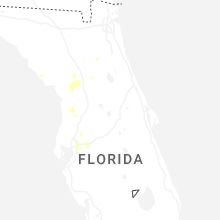
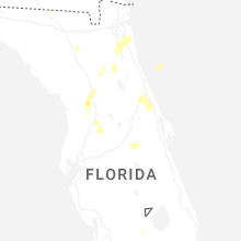
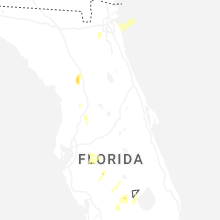
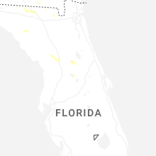


Connect with Interactive Hail Maps