

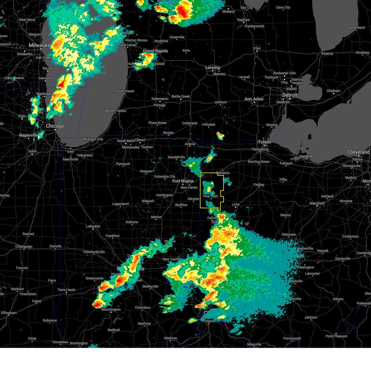
Hail Map for Ohio City, OH
The Ohio City, OH area has had 2 reports of on-the-ground hail by trained spotters, and has been under severe weather warnings 16 times during the past 12 months. Doppler radar has detected hail at or near Ohio City, OH on 29 occasions, including 1 occasion during the past year.
| Name: | Ohio City, OH |
| Where Located: | 32.8 miles SE of Fort Wayne, IN |
| Map: | Google Map for Ohio City, OH |
| Population: | 705 |
| Housing Units: | 338 |
| More Info: | Search Google for Ohio City, OH |
0
The Top Recent Hail Date for Ohio City, OH is Wednesday, April 2, 2025 (20th out of 29)

Hail and Wind Damage Spotted near Ohio City, OH
| Date / Time | Report Details |
|---|---|
| 6/18/2025 6:16 PM EDT | the severe thunderstorm warning has been cancelled and is no longer in effect |
| 6/18/2025 6:16 PM EDT | At 616 pm edt, severe thunderstorms were located along a line extending from near payne to near van wert to celina, moving northeast at 60 mph (radar indicated). Hazards include 60 mph wind gusts and small hail. Expect damage to roofs, siding, and trees. Locations impacted include, van wert, convoy, ohio city, middlebury, willshire, scott, haviland, wren, elgin, glenmore, cavett, dull, abanaka, jonestown, schumm, and tipton. |
| 6/18/2025 5:52 PM EDT | Svriwx the national weather service in northern indiana has issued a * severe thunderstorm warning for, southeastern allen county in northeastern indiana, eastern wells county in northeastern indiana, adams county in northeastern indiana, jay county in east central indiana, southwestern paulding county in west central ohio, van wert county in west central ohio, * until 630 pm edt. * at 552 pm edt, severe thunderstorms were located along a line extending from ossian to near monroe to near portland, moving northeast at 60 mph (radar indicated). Hazards include 60 mph wind gusts and penny size hail. expect damage to roofs, siding, and trees |
| 5/16/2025 8:59 PM EDT | the severe thunderstorm warning has been cancelled and is no longer in effect |
| 5/16/2025 8:41 PM EDT |
 At 840 pm edt, showers and embedded thunderstorms producing strong wind gusts were located along a line extending from near payne to fort loramie, moving east at 55 mph (radar indicated). Hazards include 70 mph wind gusts. Expect considerable tree damage. damage is likely to mobile homes, roofs, and outbuildings. Locations impacted include, van wert, delphos, paulding, antwerp, payne, convoy, ohio city, middlebury, middle point, grover hill, willshire, scott, melrose, haviland, wren, latty, cecil, venedocia, broughton, and elgin. At 840 pm edt, showers and embedded thunderstorms producing strong wind gusts were located along a line extending from near payne to fort loramie, moving east at 55 mph (radar indicated). Hazards include 70 mph wind gusts. Expect considerable tree damage. damage is likely to mobile homes, roofs, and outbuildings. Locations impacted include, van wert, delphos, paulding, antwerp, payne, convoy, ohio city, middlebury, middle point, grover hill, willshire, scott, melrose, haviland, wren, latty, cecil, venedocia, broughton, and elgin.
|
| 5/16/2025 8:19 PM EDT | Svriwx the national weather service in northern indiana has issued a * severe thunderstorm warning for, paulding county in west central ohio, van wert county in west central ohio, * until 915 pm edt. * at 818 pm edt, severe thunderstorms were located along a line extending from new haven to near st. henry, moving east at 55 mph (radar indicated). Hazards include 60 mph wind gusts. expect damage to roofs, siding, and trees |
| 4/2/2025 11:12 PM EDT |
 The storms which prompted the warning have moved out of the area. therefore, the warning will be allowed to expire. a tornado watch remains in effect until 400 am edt for west central ohio. The storms which prompted the warning have moved out of the area. therefore, the warning will be allowed to expire. a tornado watch remains in effect until 400 am edt for west central ohio.
|
| 4/2/2025 11:01 PM EDT |
 the severe thunderstorm warning has been cancelled and is no longer in effect the severe thunderstorm warning has been cancelled and is no longer in effect
|
| 4/2/2025 11:01 PM EDT |
 At 1101 pm edt, severe thunderstorms were located along a line extending from near convoy to near van wert to ohio city to near rockford, moving northeast at 75 mph (radar indicated). Hazards include 70 mph wind gusts and quarter size hail. Hail damage to vehicles is expected. expect considerable tree damage. wind damage is also likely to mobile homes, roofs, and outbuildings. Locations impacted include, dull, abanaka, jonestown, middlebury, schumm, willshire, glenmore, wren, ohio city, van wert, and elgin. At 1101 pm edt, severe thunderstorms were located along a line extending from near convoy to near van wert to ohio city to near rockford, moving northeast at 75 mph (radar indicated). Hazards include 70 mph wind gusts and quarter size hail. Hail damage to vehicles is expected. expect considerable tree damage. wind damage is also likely to mobile homes, roofs, and outbuildings. Locations impacted include, dull, abanaka, jonestown, middlebury, schumm, willshire, glenmore, wren, ohio city, van wert, and elgin.
|
| 4/2/2025 11:00 PM EDT | Village of ohio city fire dept reporting some poles snapped and some trees down on west side of tow in van wert county OH, 0.2 miles NE of Ohio City, OH |
| 4/2/2025 10:49 PM EDT | At 1048 pm edt, severe thunderstorms were located along a line extending from near decatur to near rockford to near coldwater to near st. henry, moving northeast at 60 mph (radar indicated). Hazards include 70 mph wind gusts and quarter size hail. Hail damage to vehicles is expected. expect considerable tree damage. wind damage is also likely to mobile homes, roofs, and outbuildings. Locations impacted include, preble, ceylon, monroe, geneva, glenmore, peterson, monmouth, wren, van wert, decatur, dull, abanaka, jonestown, linn grove, berne, middlebury, rivare, schumm, willshire, and pleasant mills. |
| 4/2/2025 10:49 PM EDT | the severe thunderstorm warning has been cancelled and is no longer in effect |
| 4/2/2025 10:19 PM EDT | Svriwx the national weather service in northern indiana has issued a * severe thunderstorm warning for, southeastern wells county in northeastern indiana, adams county in northeastern indiana, southwestern van wert county in west central ohio, * until 1115 pm edt. * at 1018 pm edt, severe thunderstorms were located along a line extending from near van buren to near pennville to near redkey to near winchester, moving northeast at 80 mph (radar indicated). Hazards include 70 mph wind gusts and quarter size hail. Hail damage to vehicles is expected. expect considerable tree damage. Wind damage is also likely to mobile homes, roofs, and outbuildings. |
| 4/2/2025 9:39 AM EDT |
 Svriwx the national weather service in northern indiana has issued a * severe thunderstorm warning for, southwestern putnam county in west central ohio, southeastern paulding county in west central ohio, van wert county in west central ohio, southwestern allen county in west central ohio, * until 1015 am edt. * at 938 am edt, a severe thunderstorm was located near van wert, moving northeast at 70 mph (radar indicated). Hazards include 60 mph wind gusts and quarter size hail. Hail damage to vehicles is expected. Expect wind damage to roofs, siding, and trees. Svriwx the national weather service in northern indiana has issued a * severe thunderstorm warning for, southwestern putnam county in west central ohio, southeastern paulding county in west central ohio, van wert county in west central ohio, southwestern allen county in west central ohio, * until 1015 am edt. * at 938 am edt, a severe thunderstorm was located near van wert, moving northeast at 70 mph (radar indicated). Hazards include 60 mph wind gusts and quarter size hail. Hail damage to vehicles is expected. Expect wind damage to roofs, siding, and trees.
|
| 7/14/2024 2:05 PM EDT |
 The storm which prompted the warning has moved out of the area. therefore, the warning will be allowed to expire. however, heavy rain is still possible with this thunderstorm. a severe thunderstorm watch remains in effect until 700 pm edt for west central ohio. The storm which prompted the warning has moved out of the area. therefore, the warning will be allowed to expire. however, heavy rain is still possible with this thunderstorm. a severe thunderstorm watch remains in effect until 700 pm edt for west central ohio.
|
| 7/14/2024 1:53 PM EDT |
 At 153 pm edt, a severe thunderstorm was located over rockford, or 9 miles northwest of celina, moving east at 30 mph (radar indicated). Hazards include 60 mph wind gusts. Expect damage to roofs, siding, and trees. Locations impacted include, van wert, ohio city, venedocia, elgin, dull, jonestown, and monticello. At 153 pm edt, a severe thunderstorm was located over rockford, or 9 miles northwest of celina, moving east at 30 mph (radar indicated). Hazards include 60 mph wind gusts. Expect damage to roofs, siding, and trees. Locations impacted include, van wert, ohio city, venedocia, elgin, dull, jonestown, and monticello.
|
| 7/14/2024 1:37 PM EDT |
 Svriwx the national weather service in northern indiana has issued a * severe thunderstorm warning for, southern van wert county in west central ohio, * until 215 pm edt. * at 137 pm edt, a severe thunderstorm was located 7 miles west of rockford, or 9 miles southeast of decatur, moving east at 35 mph (radar indicated). Hazards include 60 mph wind gusts. expect damage to roofs, siding, and trees Svriwx the national weather service in northern indiana has issued a * severe thunderstorm warning for, southern van wert county in west central ohio, * until 215 pm edt. * at 137 pm edt, a severe thunderstorm was located 7 miles west of rockford, or 9 miles southeast of decatur, moving east at 35 mph (radar indicated). Hazards include 60 mph wind gusts. expect damage to roofs, siding, and trees
|
| 4/17/2024 1:54 PM EDT |
 The storms which prompted the warning have moved out of the area. therefore, the warning will be allowed to expire. a tornado watch remains in effect until 700 pm edt for west central ohio. The storms which prompted the warning have moved out of the area. therefore, the warning will be allowed to expire. a tornado watch remains in effect until 700 pm edt for west central ohio.
|
| 4/17/2024 1:35 PM EDT |
 At 134 pm edt, severe thunderstorms were located along a line extending from convoy to near ohio city to near rockford, moving northeast at 50 mph (radar indicated). Hazards include 60 mph wind gusts. Expect damage to roofs, siding, and trees. Locations impacted include, van wert, convoy, ohio city, middlebury, willshire, wren, dull, abanaka, schumm, glenmore, and cavett. At 134 pm edt, severe thunderstorms were located along a line extending from convoy to near ohio city to near rockford, moving northeast at 50 mph (radar indicated). Hazards include 60 mph wind gusts. Expect damage to roofs, siding, and trees. Locations impacted include, van wert, convoy, ohio city, middlebury, willshire, wren, dull, abanaka, schumm, glenmore, and cavett.
|
| 4/17/2024 1:35 PM EDT |
 the severe thunderstorm warning has been cancelled and is no longer in effect the severe thunderstorm warning has been cancelled and is no longer in effect
|
| 4/17/2024 1:19 PM EDT |
 Svriwx the national weather service in northern indiana has issued a * severe thunderstorm warning for, central adams county in northeastern indiana, western van wert county in west central ohio, * until 200 pm edt. * at 118 pm edt, severe thunderstorms were located along a line extending from decatur to 6 miles southeast of monroe to near geneva, moving northeast at 45 mph (radar indicated). Hazards include ping pong ball size hail and 60 mph wind gusts. People and animals outdoors will be injured. expect hail damage to roofs, siding, windows, and vehicles. Expect wind damage to roofs, siding, and trees. Svriwx the national weather service in northern indiana has issued a * severe thunderstorm warning for, central adams county in northeastern indiana, western van wert county in west central ohio, * until 200 pm edt. * at 118 pm edt, severe thunderstorms were located along a line extending from decatur to 6 miles southeast of monroe to near geneva, moving northeast at 45 mph (radar indicated). Hazards include ping pong ball size hail and 60 mph wind gusts. People and animals outdoors will be injured. expect hail damage to roofs, siding, windows, and vehicles. Expect wind damage to roofs, siding, and trees.
|
| 7/20/2023 6:40 PM EDT |
 At 639 pm edt, a severe thunderstorm was located near ohio city, or 9 miles southeast of van wert, moving southeast at 30 mph (radar indicated). Hazards include 70 mph wind gusts and penny size hail. Expect considerable tree damage. damage is likely to mobile homes, roofs, and outbuildings. locations impacted include, van wert, delphos, ohio city, middle point, venedocia, elgin, dull, abanaka, jonestown, monticello, schumm, and glenmore. thunderstorm damage threat, considerable hail threat, radar indicated max hail size, 0. 75 in wind threat, radar indicated max wind gust, 70 mph. At 639 pm edt, a severe thunderstorm was located near ohio city, or 9 miles southeast of van wert, moving southeast at 30 mph (radar indicated). Hazards include 70 mph wind gusts and penny size hail. Expect considerable tree damage. damage is likely to mobile homes, roofs, and outbuildings. locations impacted include, van wert, delphos, ohio city, middle point, venedocia, elgin, dull, abanaka, jonestown, monticello, schumm, and glenmore. thunderstorm damage threat, considerable hail threat, radar indicated max hail size, 0. 75 in wind threat, radar indicated max wind gust, 70 mph.
|
| 7/20/2023 6:33 PM EDT | Half Dollar sized hail reported 2 miles WSW of Ohio City, OH, report from mping: half dollar (1.25 in.). |
| 7/20/2023 6:24 PM EDT | Corrects previous tstm wnd dmg report from ohio city to update number of injuries. emergency manager reports tree down on a house in ohio city in van wert county. two p in van wert county OH, 0.2 miles NE of Ohio City, OH |
| 7/20/2023 6:18 PM EDT |
 At 618 pm edt, a severe thunderstorm was located near convoy, or near van wert, moving southeast at 30 mph (radar indicated). Hazards include 70 mph wind gusts and penny size hail. Expect considerable tree damage. Damage is likely to mobile homes, roofs, and outbuildings. At 618 pm edt, a severe thunderstorm was located near convoy, or near van wert, moving southeast at 30 mph (radar indicated). Hazards include 70 mph wind gusts and penny size hail. Expect considerable tree damage. Damage is likely to mobile homes, roofs, and outbuildings.
|
| 7/20/2023 6:16 PM EDT |
 At 615 pm edt, a severe thunderstorm was located over ohio city, or near van wert, moving southeast at 45 mph (radar indicated). Hazards include 70 mph wind gusts and penny size hail. Expect considerable tree damage. damage is likely to mobile homes, roofs, and outbuildings. locations impacted include, van wert, decatur, delphos, convoy, ohio city, middlebury, middle point, willshire, scott, wren, venedocia, elgin, wetzel, monticello, glenmore, monmouth, cavett, dull, abanaka, and jonestown. thunderstorm damage threat, considerable hail threat, radar indicated max hail size, 0. 75 in wind threat, radar indicated max wind gust, 70 mph. At 615 pm edt, a severe thunderstorm was located over ohio city, or near van wert, moving southeast at 45 mph (radar indicated). Hazards include 70 mph wind gusts and penny size hail. Expect considerable tree damage. damage is likely to mobile homes, roofs, and outbuildings. locations impacted include, van wert, decatur, delphos, convoy, ohio city, middlebury, middle point, willshire, scott, wren, venedocia, elgin, wetzel, monticello, glenmore, monmouth, cavett, dull, abanaka, and jonestown. thunderstorm damage threat, considerable hail threat, radar indicated max hail size, 0. 75 in wind threat, radar indicated max wind gust, 70 mph.
|
| 7/20/2023 6:01 PM EDT |
 At 600 pm edt, a severe thunderstorm was located near decatur, moving southeast at 45 mph (radar indicated). Hazards include 70 mph wind gusts and penny size hail. Expect considerable tree damage. damage is likely to mobile homes, roofs, and outbuildings. locations impacted include, fort wayne, new haven, van wert, decatur, delphos, ossian, monroeville, convoy, ohio city, middletown, middlebury, preble, middle point, dixon, willshire, scott, haviland, wren, venedocia, and elgin. this includes interstate 469 near mile marker 6, and between mile markers 9 and 19. thunderstorm damage threat, considerable hail threat, radar indicated max hail size, 0. 75 in wind threat, radar indicated max wind gust, 70 mph. At 600 pm edt, a severe thunderstorm was located near decatur, moving southeast at 45 mph (radar indicated). Hazards include 70 mph wind gusts and penny size hail. Expect considerable tree damage. damage is likely to mobile homes, roofs, and outbuildings. locations impacted include, fort wayne, new haven, van wert, decatur, delphos, ossian, monroeville, convoy, ohio city, middletown, middlebury, preble, middle point, dixon, willshire, scott, haviland, wren, venedocia, and elgin. this includes interstate 469 near mile marker 6, and between mile markers 9 and 19. thunderstorm damage threat, considerable hail threat, radar indicated max hail size, 0. 75 in wind threat, radar indicated max wind gust, 70 mph.
|
| 7/20/2023 5:35 PM EDT |
 At 535 pm edt, a severe thunderstorm was located near fort wayne, moving southeast at 45 mph (radar indicated). Hazards include 70 mph wind gusts and penny size hail. Expect considerable tree damage. Damage is likely to mobile homes, roofs, and outbuildings. At 535 pm edt, a severe thunderstorm was located near fort wayne, moving southeast at 45 mph (radar indicated). Hazards include 70 mph wind gusts and penny size hail. Expect considerable tree damage. Damage is likely to mobile homes, roofs, and outbuildings.
|
| 6/25/2023 9:46 PM EDT |
 At 946 pm edt, a severe thunderstorm was located near van wert, moving east at 25 mph (radar indicated). Hazards include 60 mph wind gusts and quarter size hail. Hail damage to vehicles is expected. expect wind damage to roofs, siding, and trees. locations impacted include, van wert, delphos, ottoville, ohio city, middle point, fort jennings, venedocia, wetzel, dull, jonestown, rushmore and cavett. hail threat, radar indicated max hail size, 1. 00 in wind threat, radar indicated max wind gust, 60 mph. At 946 pm edt, a severe thunderstorm was located near van wert, moving east at 25 mph (radar indicated). Hazards include 60 mph wind gusts and quarter size hail. Hail damage to vehicles is expected. expect wind damage to roofs, siding, and trees. locations impacted include, van wert, delphos, ottoville, ohio city, middle point, fort jennings, venedocia, wetzel, dull, jonestown, rushmore and cavett. hail threat, radar indicated max hail size, 1. 00 in wind threat, radar indicated max wind gust, 60 mph.
|
| 6/25/2023 9:28 PM EDT |
 At 927 pm edt, a severe thunderstorm was located near ohio city, or near van wert, moving east at 25 mph (radar indicated). Hazards include 60 mph wind gusts and quarter size hail. Hail damage to vehicles is expected. Expect wind damage to roofs, siding, and trees. At 927 pm edt, a severe thunderstorm was located near ohio city, or near van wert, moving east at 25 mph (radar indicated). Hazards include 60 mph wind gusts and quarter size hail. Hail damage to vehicles is expected. Expect wind damage to roofs, siding, and trees.
|
| 4/5/2023 2:02 PM EDT |
 At 201 pm edt, a severe thunderstorm was located near ottoville, or 7 miles northwest of delphos, moving northeast at 60 mph (radar indicated). Hazards include 60 mph wind gusts. expect damage to roofs, siding, and trees At 201 pm edt, a severe thunderstorm was located near ottoville, or 7 miles northwest of delphos, moving northeast at 60 mph (radar indicated). Hazards include 60 mph wind gusts. expect damage to roofs, siding, and trees
|
| 4/5/2023 1:48 PM EDT |
 At 148 pm edt, a severe thunderstorm was located near convoy, or near van wert, moving northeast at 60 mph (radar indicated). Hazards include 60 mph wind gusts and penny size hail. Expect damage to roofs, siding, and trees. This severe thunderstorm will remain over mainly rural areas of southeastern paulding and van wert counties, including the following locations, wetzel, glenmore, cavett, dull, abanaka, jonestown, middle point, middlebury, grover hill and venedocia. At 148 pm edt, a severe thunderstorm was located near convoy, or near van wert, moving northeast at 60 mph (radar indicated). Hazards include 60 mph wind gusts and penny size hail. Expect damage to roofs, siding, and trees. This severe thunderstorm will remain over mainly rural areas of southeastern paulding and van wert counties, including the following locations, wetzel, glenmore, cavett, dull, abanaka, jonestown, middle point, middlebury, grover hill and venedocia.
|
| 4/5/2023 1:34 PM EDT |
 At 134 pm edt, a severe thunderstorm was located over decatur, moving northeast at 60 mph (radar indicated). Hazards include 60 mph wind gusts and penny size hail. Expect damage to roofs, siding, and trees. this severe thunderstorm will be near, convoy around 145 pm edt. Van wert around 150 pm edt. At 134 pm edt, a severe thunderstorm was located over decatur, moving northeast at 60 mph (radar indicated). Hazards include 60 mph wind gusts and penny size hail. Expect damage to roofs, siding, and trees. this severe thunderstorm will be near, convoy around 145 pm edt. Van wert around 150 pm edt.
|
| 4/1/2023 12:30 AM EDT | Semi blown ove in van wert county OH, 2 miles WSW of Ohio City, OH |
| 8/29/2022 5:04 PM EDT |
 At 503 pm edt, severe thunderstorms were located along a line extending from near edgerton to near woodburn to 6 miles northeast of ossian, moving east at 50 mph (radar indicated). Hazards include 70 mph wind gusts. Expect considerable tree damage. Damage is likely to mobile homes, roofs, and outbuildings. At 503 pm edt, severe thunderstorms were located along a line extending from near edgerton to near woodburn to 6 miles northeast of ossian, moving east at 50 mph (radar indicated). Hazards include 70 mph wind gusts. Expect considerable tree damage. Damage is likely to mobile homes, roofs, and outbuildings.
|
| 7/23/2022 9:54 AM EDT |
 The severe thunderstorm warning for southwestern putnam and van wert counties will expire at 1000 am edt, the storms which prompted the warning have moved out of the area. therefore, the warning will be allowed to expire. however gusty winds are still possible with lingering thunderstorms. a severe thunderstorm watch remains in effect until 200 pm edt for west central ohio. The severe thunderstorm warning for southwestern putnam and van wert counties will expire at 1000 am edt, the storms which prompted the warning have moved out of the area. therefore, the warning will be allowed to expire. however gusty winds are still possible with lingering thunderstorms. a severe thunderstorm watch remains in effect until 200 pm edt for west central ohio.
|
| 7/23/2022 9:35 AM EDT | Numerous trees and power lines down. park shelter destroyed. time estimated from rada in van wert county OH, 0.2 miles NE of Ohio City, OH |
| 7/23/2022 9:33 AM EDT |
 At 932 am edt, severe thunderstorms were located along a line extending from near van wert to ohio city, moving east at 45 mph (radar indicated). Hazards include 70 mph wind gusts. Expect considerable tree damage. damage is likely to mobile homes, roofs, and outbuildings. locations impacted include, van wert, delphos, kalida, ottoville, ohio city, middle point, fort jennings, scott, wren, venedocia, elgin, wetzel, glenmore, cavett, dull and jonestown. thunderstorm damage threat, considerable hail threat, radar indicated max hail size, <. 75 in wind threat, radar indicated max wind gust, 70 mph. At 932 am edt, severe thunderstorms were located along a line extending from near van wert to ohio city, moving east at 45 mph (radar indicated). Hazards include 70 mph wind gusts. Expect considerable tree damage. damage is likely to mobile homes, roofs, and outbuildings. locations impacted include, van wert, delphos, kalida, ottoville, ohio city, middle point, fort jennings, scott, wren, venedocia, elgin, wetzel, glenmore, cavett, dull and jonestown. thunderstorm damage threat, considerable hail threat, radar indicated max hail size, <. 75 in wind threat, radar indicated max wind gust, 70 mph.
|
| 7/23/2022 9:13 AM EDT |
 At 913 am edt, severe thunderstorms were located along a line extending from near monroeville to decatur, moving east at 35 mph (radar indicated). Hazards include 70 mph wind gusts. Expect considerable tree damage. Damage is likely to mobile homes, roofs, and outbuildings. At 913 am edt, severe thunderstorms were located along a line extending from near monroeville to decatur, moving east at 35 mph (radar indicated). Hazards include 70 mph wind gusts. Expect considerable tree damage. Damage is likely to mobile homes, roofs, and outbuildings.
|
| 7/5/2022 9:28 PM EDT |
 At 927 pm edt, a severe thunderstorm was located near convoy, or 8 miles west of van wert, moving southeast at 45 mph (radar indicated). Hazards include 70 mph wind gusts. Expect considerable tree damage. Damage is likely to mobile homes, roofs, and outbuildings. At 927 pm edt, a severe thunderstorm was located near convoy, or 8 miles west of van wert, moving southeast at 45 mph (radar indicated). Hazards include 70 mph wind gusts. Expect considerable tree damage. Damage is likely to mobile homes, roofs, and outbuildings.
|
| 7/5/2022 9:09 PM EDT |
 At 908 pm edt, a severe thunderstorm was located over convoy, or 7 miles west of van wert, moving southeast at 40 mph (radar indicated). Hazards include 70 mph wind gusts. Expect considerable tree damage. damage is likely to mobile homes, roofs, and outbuildings. locations impacted include, van wert, monroeville, convoy, ohio city, middlebury, dixon, scott, wren, tipton, glenmore, cavett, mcgill, dull, abanaka, hoagland and schumm. thunderstorm damage threat, considerable hail threat, radar indicated max hail size, <. 75 in wind threat, radar indicated max wind gust, 70 mph. At 908 pm edt, a severe thunderstorm was located over convoy, or 7 miles west of van wert, moving southeast at 40 mph (radar indicated). Hazards include 70 mph wind gusts. Expect considerable tree damage. damage is likely to mobile homes, roofs, and outbuildings. locations impacted include, van wert, monroeville, convoy, ohio city, middlebury, dixon, scott, wren, tipton, glenmore, cavett, mcgill, dull, abanaka, hoagland and schumm. thunderstorm damage threat, considerable hail threat, radar indicated max hail size, <. 75 in wind threat, radar indicated max wind gust, 70 mph.
|
| 7/5/2022 8:42 PM EDT |
 At 842 pm edt, a severe thunderstorm was located near new haven, moving southeast at 40 mph (radar indicated). Hazards include 70 mph wind gusts. Expect considerable tree damage. Damage is likely to mobile homes, roofs, and outbuildings. At 842 pm edt, a severe thunderstorm was located near new haven, moving southeast at 40 mph (radar indicated). Hazards include 70 mph wind gusts. Expect considerable tree damage. Damage is likely to mobile homes, roofs, and outbuildings.
|
| 6/13/2022 11:42 PM EDT |
 The severe thunderstorm warning for southwestern putnam, south central paulding, van wert and west central allen counties will expire at 1145 pm edt, the storm which prompted the warning has moved out of the area. therefore, the warning will be allowed to expire. a severe thunderstorm watch remains in effect until midnight edt for west central ohio. The severe thunderstorm warning for southwestern putnam, south central paulding, van wert and west central allen counties will expire at 1145 pm edt, the storm which prompted the warning has moved out of the area. therefore, the warning will be allowed to expire. a severe thunderstorm watch remains in effect until midnight edt for west central ohio.
|
| 6/13/2022 11:08 PM EDT | Corrects previous tstm wnd dmg report from 3 se ohio city. semi tipped over on us 127 and sr 81. updated information suggests the semi was not blown over... it crashed in van wert county OH, 2.9 miles NW of Ohio City, OH |
| 6/13/2022 11:04 PM EDT |
 At 1104 pm edt, a severe thunderstorm was located over convoy, or near van wert, moving southeast at 35 mph. this is a destructive storm! (radar indicated). Hazards include 80 mph wind gusts. Flying debris will be dangerous to those caught without shelter. mobile homes will be heavily damaged. expect considerable damage to roofs, windows, and vehicles. Extensive tree damage and power outages are likely. At 1104 pm edt, a severe thunderstorm was located over convoy, or near van wert, moving southeast at 35 mph. this is a destructive storm! (radar indicated). Hazards include 80 mph wind gusts. Flying debris will be dangerous to those caught without shelter. mobile homes will be heavily damaged. expect considerable damage to roofs, windows, and vehicles. Extensive tree damage and power outages are likely.
|
| 6/13/2022 11:00 PM EDT | Trained spotter reports several large trees downed around ohio city in van wert county ohio. one tree was uproote in van wert county OH, 0.2 miles NE of Ohio City, OH |
| 5/3/2022 4:56 PM EDT |
 The severe thunderstorm warning for southern van wert county will expire at 500 pm edt, the storm which prompted the warning was moving out of the area. therefore, the warning will be allowed to expire on time. The severe thunderstorm warning for southern van wert county will expire at 500 pm edt, the storm which prompted the warning was moving out of the area. therefore, the warning will be allowed to expire on time.
|
| 5/3/2022 4:31 PM EDT |
 At 430 pm edt, a severe thunderstorm was located 7 miles east of monroe, or 9 miles northeast of berne, moving east at 55 mph (radar indicated). Hazards include 60 mph wind gusts. Expect damage to roofs, siding, and trees. this severe thunderstorm will be near, ohio city around 445 pm edt. van wert around 450 pm edt. other locations impacted by this severe thunderstorm include dull, abanaka, jonestown, middle point, venedocia, schumm, elgin, willshire, glenmore and wren. hail threat, radar indicated max hail size, <. 75 in wind threat, radar indicated max wind gust, 60 mph. At 430 pm edt, a severe thunderstorm was located 7 miles east of monroe, or 9 miles northeast of berne, moving east at 55 mph (radar indicated). Hazards include 60 mph wind gusts. Expect damage to roofs, siding, and trees. this severe thunderstorm will be near, ohio city around 445 pm edt. van wert around 450 pm edt. other locations impacted by this severe thunderstorm include dull, abanaka, jonestown, middle point, venedocia, schumm, elgin, willshire, glenmore and wren. hail threat, radar indicated max hail size, <. 75 in wind threat, radar indicated max wind gust, 60 mph.
|
| 3/6/2022 3:53 AM EST |
 At 352 am est, severe thunderstorms were located along a line extending from wauseon to near kalida to near fort recovery, moving east at 65 mph (radar indicated). Hazards include 70 mph wind gusts. Expect considerable tree damage. damage is likely to mobile homes, roofs, and outbuildings. locations impacted include, lima, defiance, van wert, napoleon, bryan, wauseon, delphos, portland, ottawa, archbold, fort shawnee, paulding, delta, spencerville, columbus grove, elida, kalida, stryker, geneva and payne. This includes interstate 75 between mile markers 119 and 132. At 352 am est, severe thunderstorms were located along a line extending from wauseon to near kalida to near fort recovery, moving east at 65 mph (radar indicated). Hazards include 70 mph wind gusts. Expect considerable tree damage. damage is likely to mobile homes, roofs, and outbuildings. locations impacted include, lima, defiance, van wert, napoleon, bryan, wauseon, delphos, portland, ottawa, archbold, fort shawnee, paulding, delta, spencerville, columbus grove, elida, kalida, stryker, geneva and payne. This includes interstate 75 between mile markers 119 and 132.
|
| 3/6/2022 3:21 AM EST |
 At 321 am est, severe thunderstorms were located along a line extending from near auburn to near monroeville to near matthews, moving east at 80 mph (radar indicated). Hazards include 70 mph wind gusts. Expect considerable tree damage. Damage is likely to mobile homes, roofs, and outbuildings. At 321 am est, severe thunderstorms were located along a line extending from near auburn to near monroeville to near matthews, moving east at 80 mph (radar indicated). Hazards include 70 mph wind gusts. Expect considerable tree damage. Damage is likely to mobile homes, roofs, and outbuildings.
|
| 8/11/2021 2:53 PM EDT |
 At 253 pm edt, severe thunderstorms were located along a line extending from near holgate to near elida to celina, moving east at 45 mph (radar indicated). Hazards include 60 mph wind gusts and penny size hail. Expect damage to roofs, siding, and trees. locations impacted include, defiance, van wert, berne, geneva, convoy, monroe, ohio city, westchester, oakwood, middlebury, nottingham, middle point, grover hill, willshire, scott, melrose, bryant, wren, venedocia and vera cruz. hail threat, radar indicated max hail size, 0. 75 in wind threat, radar indicated max wind gust, 60 mph. At 253 pm edt, severe thunderstorms were located along a line extending from near holgate to near elida to celina, moving east at 45 mph (radar indicated). Hazards include 60 mph wind gusts and penny size hail. Expect damage to roofs, siding, and trees. locations impacted include, defiance, van wert, berne, geneva, convoy, monroe, ohio city, westchester, oakwood, middlebury, nottingham, middle point, grover hill, willshire, scott, melrose, bryant, wren, venedocia and vera cruz. hail threat, radar indicated max hail size, 0. 75 in wind threat, radar indicated max wind gust, 60 mph.
|
| 8/11/2021 2:36 PM EDT |
 At 236 pm edt, severe thunderstorms were located along a line extending from 6 miles northeast of antwerp to near ohio city to near geneva, moving southeast at 40 mph (radar indicated). Hazards include 60 mph wind gusts and penny size hail. Expect damage to roofs, siding, and trees. locations impacted include, fort wayne, defiance, new haven, van wert, bluffton, decatur, berne, hicksville, ossian, paulding, antwerp, woodburn, geneva, monroeville, payne, markle, convoy, monroe, ohio city and westchester. this includes the following highways, interstate 469 near mile marker 6, and between mile markers 9 and 23. interstate 69 in indiana between mile markers 276 and 282. hail threat, radar indicated max hail size, 0. 75 in wind threat, radar indicated max wind gust, 60 mph. At 236 pm edt, severe thunderstorms were located along a line extending from 6 miles northeast of antwerp to near ohio city to near geneva, moving southeast at 40 mph (radar indicated). Hazards include 60 mph wind gusts and penny size hail. Expect damage to roofs, siding, and trees. locations impacted include, fort wayne, defiance, new haven, van wert, bluffton, decatur, berne, hicksville, ossian, paulding, antwerp, woodburn, geneva, monroeville, payne, markle, convoy, monroe, ohio city and westchester. this includes the following highways, interstate 469 near mile marker 6, and between mile markers 9 and 23. interstate 69 in indiana between mile markers 276 and 282. hail threat, radar indicated max hail size, 0. 75 in wind threat, radar indicated max wind gust, 60 mph.
|
| 8/11/2021 2:14 PM EDT |
 At 214 pm edt, severe thunderstorms were located along a line extending from st. joe to near decatur to 7 miles north of montpelier, moving southeast at 40 mph (radar indicated). Hazards include 60 mph wind gusts and penny size hail. expect damage to roofs, siding, and trees At 214 pm edt, severe thunderstorms were located along a line extending from st. joe to near decatur to 7 miles north of montpelier, moving southeast at 40 mph (radar indicated). Hazards include 60 mph wind gusts and penny size hail. expect damage to roofs, siding, and trees
|
| 8/10/2020 8:26 PM EDT | Large tree down in ohio city. time estimated from rada in van wert county OH, 0.2 miles NE of Ohio City, OH |
| 8/10/2020 8:26 PM EDT |
 At 824 pm edt, severe thunderstorms were located along a line extending from near stryker to 7 miles east of paulding to near van wert, moving east at 45 mph (emergency management has reported trees and branches down in hicksville, ohio). Hazards include 60 mph wind gusts. Expect damage to roofs, siding, and trees. these severe storms will be near, ottoville around 840 pm edt. Other locations impacted by these severe thunderstorms include evansport, ney, melrose, arthur, charloe, oakwood, wren, cavett, haviland and dull. At 824 pm edt, severe thunderstorms were located along a line extending from near stryker to 7 miles east of paulding to near van wert, moving east at 45 mph (emergency management has reported trees and branches down in hicksville, ohio). Hazards include 60 mph wind gusts. Expect damage to roofs, siding, and trees. these severe storms will be near, ottoville around 840 pm edt. Other locations impacted by these severe thunderstorms include evansport, ney, melrose, arthur, charloe, oakwood, wren, cavett, haviland and dull.
|
| 8/10/2020 7:51 PM EDT |
 At 751 pm edt, severe thunderstorms were located along a line extending from near butler to near woodburn to near decatur, moving east at 45 mph (radar indicated). Hazards include 70 mph wind gusts. Expect considerable tree damage. damage is likely to mobile homes, roofs, and outbuildings. severe thunderstorms will be near, edgerton in williams county around 800 pm edt. antwerp and payne around 805 pm edt. convoy around 810 pm edt. bryan, paulding and ohio city around 815 pm edt. van wert around 820 pm edt. Ottoville around 835 pm edt. At 751 pm edt, severe thunderstorms were located along a line extending from near butler to near woodburn to near decatur, moving east at 45 mph (radar indicated). Hazards include 70 mph wind gusts. Expect considerable tree damage. damage is likely to mobile homes, roofs, and outbuildings. severe thunderstorms will be near, edgerton in williams county around 800 pm edt. antwerp and payne around 805 pm edt. convoy around 810 pm edt. bryan, paulding and ohio city around 815 pm edt. van wert around 820 pm edt. Ottoville around 835 pm edt.
|
| 7/7/2020 5:00 PM EDT |
 At 459 pm edt, severe thunderstorms were located along a line extending from 8 miles southwest of continental to near ottoville to near ohio city, moving east at 15 mph (radar indicated). Hazards include 60 mph wind gusts and penny size hail. expect damage to roofs, siding, and trees At 459 pm edt, severe thunderstorms were located along a line extending from 8 miles southwest of continental to near ottoville to near ohio city, moving east at 15 mph (radar indicated). Hazards include 60 mph wind gusts and penny size hail. expect damage to roofs, siding, and trees
|
| 5/10/2020 2:46 PM EDT |
 At 245 pm edt, severe thunderstorms were located along a line extending from near ottoville to near elida to near st. marys to 6 miles west of minster, moving northeast at 55 mph (radar indicated). Hazards include 60 mph wind gusts. expect damage to roofs, siding, and trees At 245 pm edt, severe thunderstorms were located along a line extending from near ottoville to near elida to near st. marys to 6 miles west of minster, moving northeast at 55 mph (radar indicated). Hazards include 60 mph wind gusts. expect damage to roofs, siding, and trees
|
| 3/28/2020 8:54 AM EDT | Half Dollar sized hail reported 0.2 miles NE of Ohio City, OH, photo of hail from spotter measuring mainly 1 inch... but a few nearing 1.5 inches. |
| 9/13/2019 4:44 PM EDT | Large tree limbs reported down in the city of ohio cit in van wert county OH, 0.2 miles NE of Ohio City, OH |
| 9/13/2019 4:40 PM EDT | 30 foot by 70 foot wooden barn destroyed south of ohio city on state route 11 in van wert county OH, 1 miles NE of Ohio City, OH |
| 6/5/2019 7:38 PM EDT |
 The severe thunderstorm warning for northeastern adams and southern van wert counties will expire at 745 pm edt, the storm which prompted the warning has weakened below severe limits, and no longer poses an immediate threat to life or property. therefore, the warning will be allowed to expire. however gusty winds and heavy rain are still possible with this thunderstorm. The severe thunderstorm warning for northeastern adams and southern van wert counties will expire at 745 pm edt, the storm which prompted the warning has weakened below severe limits, and no longer poses an immediate threat to life or property. therefore, the warning will be allowed to expire. however gusty winds and heavy rain are still possible with this thunderstorm.
|
| 6/5/2019 7:29 PM EDT |
 At 728 pm edt, a severe thunderstorm was located near monroeville, moving east at 35 mph (radar indicated). Hazards include 60 mph wind gusts and quarter size hail. Hail damage to vehicles is expected. expect wind damage to roofs, siding, and trees. Locations impacted include, van wert, ohio city, middlebury, wren, venedocia, dull, abanaka and glenmore. At 728 pm edt, a severe thunderstorm was located near monroeville, moving east at 35 mph (radar indicated). Hazards include 60 mph wind gusts and quarter size hail. Hail damage to vehicles is expected. expect wind damage to roofs, siding, and trees. Locations impacted include, van wert, ohio city, middlebury, wren, venedocia, dull, abanaka and glenmore.
|
| 6/5/2019 7:14 PM EDT |
 At 714 pm edt, severe thunderstorms were located along a line extending from 7 miles east of ossian to near decatur to 6 miles south of monroeville, moving southeast at 35 mph (radar indicated). Hazards include 60 mph wind gusts and quarter size hail. Hail damage to vehicles is expected. Expect wind damage to roofs, siding, and trees. At 714 pm edt, severe thunderstorms were located along a line extending from 7 miles east of ossian to near decatur to 6 miles south of monroeville, moving southeast at 35 mph (radar indicated). Hazards include 60 mph wind gusts and quarter size hail. Hail damage to vehicles is expected. Expect wind damage to roofs, siding, and trees.
|
| 6/1/2019 11:56 PM EDT |
 The severe thunderstorm warning for southwestern putnam, central van wert and southwestern allen counties will expire at midnight edt, the storms which prompted the warning have weakened below severe limits. therefore, the severe thunderstorm warning will be allowed to expire at midnight edt. however, gusty winds of 45 to 50 mph and pea sized hail will be possible with these storms across allen and southern putnam counties in northwest ohio through 1230 am edt. The severe thunderstorm warning for southwestern putnam, central van wert and southwestern allen counties will expire at midnight edt, the storms which prompted the warning have weakened below severe limits. therefore, the severe thunderstorm warning will be allowed to expire at midnight edt. however, gusty winds of 45 to 50 mph and pea sized hail will be possible with these storms across allen and southern putnam counties in northwest ohio through 1230 am edt.
|
| 6/1/2019 11:37 PM EDT |
 At 1137 pm edt, severe thunderstorms were located along a line extending from 7 miles northwest of ottoville to 6 miles west of delphos to near ohio city, moving east at 50 mph (radar indicated). Hazards include 60 mph wind gusts. Expect damage to roofs, siding, and trees. Locations impacted include, van wert, delphos, spencerville, elida, ottoville, ohio city, spencerville in allen county, middle point, fort jennings, venedocia, elgin, wetzel, vaughnsville, conant, monticello, rushmore, gomer, cavett, southworth and dull. At 1137 pm edt, severe thunderstorms were located along a line extending from 7 miles northwest of ottoville to 6 miles west of delphos to near ohio city, moving east at 50 mph (radar indicated). Hazards include 60 mph wind gusts. Expect damage to roofs, siding, and trees. Locations impacted include, van wert, delphos, spencerville, elida, ottoville, ohio city, spencerville in allen county, middle point, fort jennings, venedocia, elgin, wetzel, vaughnsville, conant, monticello, rushmore, gomer, cavett, southworth and dull.
|
| 6/1/2019 11:09 PM EDT |
 At 1109 pm edt, severe thunderstorms were located along a line extending from monroeville to near decatur to near berne, moving east at 50 mph (radar indicated). Hazards include 60 mph wind gusts and penny size hail. expect damage to roofs, siding, and trees At 1109 pm edt, severe thunderstorms were located along a line extending from monroeville to near decatur to near berne, moving east at 50 mph (radar indicated). Hazards include 60 mph wind gusts and penny size hail. expect damage to roofs, siding, and trees
|
| 5/23/2019 5:44 AM EDT |
 The national weather service in northern indiana has issued a * severe thunderstorm warning for. eastern adams county in northeastern indiana. jay county in east central indiana. western putnam county in west central ohio. Southern defiance county in northwestern ohio. The national weather service in northern indiana has issued a * severe thunderstorm warning for. eastern adams county in northeastern indiana. jay county in east central indiana. western putnam county in west central ohio. Southern defiance county in northwestern ohio.
|
| 5/23/2019 5:44 AM EDT |
 At 544 am edt, severe thunderstorms were located along a line extending from near hicksville to decatur to dunkirk, moving east at 55 mph (radar indicated). Hazards include 70 mph wind gusts. Expect considerable tree damage. Damage is likely to mobile homes, roofs, and outbuildings. At 544 am edt, severe thunderstorms were located along a line extending from near hicksville to decatur to dunkirk, moving east at 55 mph (radar indicated). Hazards include 70 mph wind gusts. Expect considerable tree damage. Damage is likely to mobile homes, roofs, and outbuildings.
|
| 5/17/2019 1:26 AM EDT |
 The severe thunderstorm warning for southern van wert and southern allen counties will expire at 130 am edt, the storms which prompted the warning have weakened below severe limits, and have exited the warned area. therefore, the warning will be allowed to expire. additional thunderstorms are expected overnight with a potential of some hail and locally heavy rainfall. The severe thunderstorm warning for southern van wert and southern allen counties will expire at 130 am edt, the storms which prompted the warning have weakened below severe limits, and have exited the warned area. therefore, the warning will be allowed to expire. additional thunderstorms are expected overnight with a potential of some hail and locally heavy rainfall.
|
| 5/17/2019 1:07 AM EDT |
 At 107 am edt, severe thunderstorms were located along a line extending from near ohio city to near spencerville to 6 miles northwest of alger, moving southeast at 30 mph (radar indicated). Hazards include 60 mph wind gusts. Expect damage to roofs, siding, and trees. Locations impacted include, lima, fort shawnee, spencerville, elida, ohio city, spencerville in allen county, harrod, venedocia, elgin, yoder, conant, westminster, hume, slabtown, monticello, glenmore, rousculp, southworth, dull and abanaka. At 107 am edt, severe thunderstorms were located along a line extending from near ohio city to near spencerville to 6 miles northwest of alger, moving southeast at 30 mph (radar indicated). Hazards include 60 mph wind gusts. Expect damage to roofs, siding, and trees. Locations impacted include, lima, fort shawnee, spencerville, elida, ohio city, spencerville in allen county, harrod, venedocia, elgin, yoder, conant, westminster, hume, slabtown, monticello, glenmore, rousculp, southworth, dull and abanaka.
|
| 5/17/2019 12:47 AM EDT |
 At 1246 am edt, severe thunderstorms were located along a line extending from near ohio city to near spencerville to 6 miles northeast of lima, moving southeast at 30 mph (radar indicated). Hazards include 60 mph wind gusts and penny size hail. expect damage to roofs, siding, and trees At 1246 am edt, severe thunderstorms were located along a line extending from near ohio city to near spencerville to 6 miles northeast of lima, moving southeast at 30 mph (radar indicated). Hazards include 60 mph wind gusts and penny size hail. expect damage to roofs, siding, and trees
|
| 5/16/2019 11:41 PM EDT |
 At 1141 pm edt, a severe thunderstorm was located over ohio city, or near van wert, moving southeast at 40 mph (radar indicated). Hazards include quarter size hail. damage to vehicles is expected At 1141 pm edt, a severe thunderstorm was located over ohio city, or near van wert, moving southeast at 40 mph (radar indicated). Hazards include quarter size hail. damage to vehicles is expected
|
| 8/4/2017 5:42 AM EDT |
 At 541 am edt, a severe thunderstorm was located over ohio city, or 8 miles south of van wert, moving northeast at 45 mph (radar indicated). Hazards include 60 mph wind gusts and quarter size hail. Hail damage to vehicles is expected. Expect wind damage to roofs, siding, and trees. At 541 am edt, a severe thunderstorm was located over ohio city, or 8 miles south of van wert, moving northeast at 45 mph (radar indicated). Hazards include 60 mph wind gusts and quarter size hail. Hail damage to vehicles is expected. Expect wind damage to roofs, siding, and trees.
|
| 7/10/2017 9:27 PM EDT |
 At 926 pm edt, a severe thunderstorm capable of producing a tornado was located over ohio city, or near van wert, moving southeast at 30 mph (radar indicated rotation). Hazards include tornado. Flying debris will be dangerous to those caught without shelter. mobile homes will be damaged or destroyed. damage to roofs, windows, and vehicles will occur. tree damage is likely. this dangerous storm will be near, spencerville around 950 pm edt. Other locations impacted by this tornadic thunderstorm include southworth, conant, needmore, jonestown, venedocia, monticello and elgin. At 926 pm edt, a severe thunderstorm capable of producing a tornado was located over ohio city, or near van wert, moving southeast at 30 mph (radar indicated rotation). Hazards include tornado. Flying debris will be dangerous to those caught without shelter. mobile homes will be damaged or destroyed. damage to roofs, windows, and vehicles will occur. tree damage is likely. this dangerous storm will be near, spencerville around 950 pm edt. Other locations impacted by this tornadic thunderstorm include southworth, conant, needmore, jonestown, venedocia, monticello and elgin.
|
| 6/5/2017 3:55 PM EDT |
 The severe thunderstorm warning for southwestern van wert county will expire at 400 pm edt, the severe thunderstorm which prompted the warning has moved out of the warned area. therefore, the warning will be allowed to expire at 400 pm edt. however small hail and gusty winds are still possible with thunderstorms through 410 pm edt across far southern van wert county. The severe thunderstorm warning for southwestern van wert county will expire at 400 pm edt, the severe thunderstorm which prompted the warning has moved out of the warned area. therefore, the warning will be allowed to expire at 400 pm edt. however small hail and gusty winds are still possible with thunderstorms through 410 pm edt across far southern van wert county.
|
| 6/5/2017 3:50 PM EDT | Tree limb dow in van wert county OH, 6.8 miles ESE of Ohio City, OH |
| 6/5/2017 3:36 PM EDT |
 At 336 pm edt, a severe thunderstorm was located near ohio city, or 7 miles southwest of van wert, moving south at 20 mph (radar indicated). Hazards include 60 mph wind gusts and half dollar size hail. Hail damage to vehicles is expected. expect wind damage to roofs, siding, and trees. Locations impacted include, van wert, ohio city, middlebury, willshire, wren, dull, abanaka, schumm and glenmore. At 336 pm edt, a severe thunderstorm was located near ohio city, or 7 miles southwest of van wert, moving south at 20 mph (radar indicated). Hazards include 60 mph wind gusts and half dollar size hail. Hail damage to vehicles is expected. expect wind damage to roofs, siding, and trees. Locations impacted include, van wert, ohio city, middlebury, willshire, wren, dull, abanaka, schumm and glenmore.
|
| 6/5/2017 3:26 PM EDT |
 At 326 pm edt, a severe thunderstorm was located near convoy, or 7 miles west of van wert, moving south at 20 mph (radar indicated). Hazards include 60 mph wind gusts and quarter size hail. Hail damage to vehicles is expected. Expect wind damage to roofs, siding, and trees. At 326 pm edt, a severe thunderstorm was located near convoy, or 7 miles west of van wert, moving south at 20 mph (radar indicated). Hazards include 60 mph wind gusts and quarter size hail. Hail damage to vehicles is expected. Expect wind damage to roofs, siding, and trees.
|
| 6/4/2017 3:45 PM EDT | Report of a few trees snapped near richey road. size of trees unknow in van wert county OH, 1.8 miles ESE of Ohio City, OH |
| 3/30/2017 6:29 PM EDT |
 At 629 pm edt, a severe thunderstorm was located over berne, moving northeast at 40 mph (radar indicated). Hazards include 60 mph wind gusts and quarter size hail. Hail damage to vehicles is expected. Expect wind damage to roofs, siding, and trees. At 629 pm edt, a severe thunderstorm was located over berne, moving northeast at 40 mph (radar indicated). Hazards include 60 mph wind gusts and quarter size hail. Hail damage to vehicles is expected. Expect wind damage to roofs, siding, and trees.
|
| 3/30/2017 6:26 PM EDT |
 At 629 pm edt, a severe thunderstorm was located over berne, moving northeast at 40 mph (radar indicated). Hazards include 60 mph wind gusts and quarter size hail. Hail damage to vehicles is expected. Expect wind damage to roofs, siding, and trees. At 629 pm edt, a severe thunderstorm was located over berne, moving northeast at 40 mph (radar indicated). Hazards include 60 mph wind gusts and quarter size hail. Hail damage to vehicles is expected. Expect wind damage to roofs, siding, and trees.
|
| 3/1/2017 3:46 AM EST |
 At 345 am est, a severe thunderstorm was located near columbus grove, or 9 miles south of ottawa, moving east northeast at 70 mph (radar indicated). Hazards include 60 mph wind gusts and quarter size hail. Hail damage to vehicles is expected. expect wind damage to roofs, siding, and trees. locations impacted include, van wert, delphos, ottawa, bluffton, columbus grove, leipsic, kalida, pandora, glandorf, ottoville, ohio city, middle point, fort jennings, west leipsic, gilboa, venedocia, elgin, rushmore, gomer and dull. A tornado watch remains in effect until 700 am est for northwestern and west central ohio. At 345 am est, a severe thunderstorm was located near columbus grove, or 9 miles south of ottawa, moving east northeast at 70 mph (radar indicated). Hazards include 60 mph wind gusts and quarter size hail. Hail damage to vehicles is expected. expect wind damage to roofs, siding, and trees. locations impacted include, van wert, delphos, ottawa, bluffton, columbus grove, leipsic, kalida, pandora, glandorf, ottoville, ohio city, middle point, fort jennings, west leipsic, gilboa, venedocia, elgin, rushmore, gomer and dull. A tornado watch remains in effect until 700 am est for northwestern and west central ohio.
|
| 3/1/2017 3:23 AM EST |
 At 323 am est, a severe thunderstorm was located over van wert, moving east at 70 mph (radar indicated). Hazards include 60 mph wind gusts and quarter size hail. Hail damage to vehicles is expected. Expect wind damage to roofs, siding, and trees. At 323 am est, a severe thunderstorm was located over van wert, moving east at 70 mph (radar indicated). Hazards include 60 mph wind gusts and quarter size hail. Hail damage to vehicles is expected. Expect wind damage to roofs, siding, and trees.
|
| 8/28/2016 6:18 PM EDT |
 At 618 pm edt, severe thunderstorms were located along a line extending from 6 miles west of ottoville to near ohio city, moving southeast at 10 mph (radar indicated). Hazards include 60 mph wind gusts and nickel size hail. Expect damage to roofs. siding. and trees. Locations impacted include, van wert, ohio city, middle point and dull. At 618 pm edt, severe thunderstorms were located along a line extending from 6 miles west of ottoville to near ohio city, moving southeast at 10 mph (radar indicated). Hazards include 60 mph wind gusts and nickel size hail. Expect damage to roofs. siding. and trees. Locations impacted include, van wert, ohio city, middle point and dull.
|
| 8/28/2016 6:08 PM EDT |
 At 607 pm edt, severe thunderstorms were located along a line extending from 7 miles northeast of van wert to 7 miles southwest of convoy, moving south at 10 mph (radar indicated). Hazards include 60 mph wind gusts and nickel size hail. Expect damage to roofs. siding. and trees. Locations impacted include, van wert, convoy, ohio city, middlebury, middle point, scott, glenmore, schumm, abanaka, dull and cavett. At 607 pm edt, severe thunderstorms were located along a line extending from 7 miles northeast of van wert to 7 miles southwest of convoy, moving south at 10 mph (radar indicated). Hazards include 60 mph wind gusts and nickel size hail. Expect damage to roofs. siding. and trees. Locations impacted include, van wert, convoy, ohio city, middlebury, middle point, scott, glenmore, schumm, abanaka, dull and cavett.
|
| 8/28/2016 5:59 PM EDT |
 At 559 pm edt, severe thunderstorms were located along a line extending from 7 miles northeast of van wert to 6 miles southwest of convoy, moving south at 15 mph (radar indicated). Hazards include 60 mph wind gusts and nickel size hail. Expect damage to roofs. siding. And trees. At 559 pm edt, severe thunderstorms were located along a line extending from 7 miles northeast of van wert to 6 miles southwest of convoy, moving south at 15 mph (radar indicated). Hazards include 60 mph wind gusts and nickel size hail. Expect damage to roofs. siding. And trees.
|
| 8/24/2016 6:35 PM EDT |
 At 634 pm edt, a confirmed large and extremely dangerous tornado was located near middlebury, or 3 miles west of van wert, moving northeast at 25 mph. this is a particularly dangerous situation. take cover now! (emergency management confirmed tornado. this storm has a history of producing multiple tornadoes). Hazards include damaging tornado. You are in a life-threatening situation. flying debris may be deadly to those caught without shelter. mobile homes will be destroyed. considerable damage to homes, businesses, and vehicles is likely and complete destruction is possible. the tornado will be near, van wert around 650 pm edt. Other locations impacted by this tornadic thunderstorm include glenmore, venedocia, jonestown, wetzel, dull, cavett, middle point, scott and middlebury. At 634 pm edt, a confirmed large and extremely dangerous tornado was located near middlebury, or 3 miles west of van wert, moving northeast at 25 mph. this is a particularly dangerous situation. take cover now! (emergency management confirmed tornado. this storm has a history of producing multiple tornadoes). Hazards include damaging tornado. You are in a life-threatening situation. flying debris may be deadly to those caught without shelter. mobile homes will be destroyed. considerable damage to homes, businesses, and vehicles is likely and complete destruction is possible. the tornado will be near, van wert around 650 pm edt. Other locations impacted by this tornadic thunderstorm include glenmore, venedocia, jonestown, wetzel, dull, cavett, middle point, scott and middlebury.
|
| 8/24/2016 6:24 PM EDT |
 At 623 pm edt, a confirmed large and extremely dangerous tornado was located 7 miles west of ohio city, or 9 miles east of decatur, moving northeast at 25 mph. this is a particularly dangerous situation. take cover now! (weather spotters confirmed tornado. this storm has a history of producing multiple tornadoes). Hazards include damaging tornado. You are in a life-threatening situation. flying debris may be deadly to those caught without shelter. mobile homes will be destroyed. considerable damage to homes, businesses, and vehicles is likely and complete destruction is possible. the tornado will be near, ohio city around 635 pm edt. convoy around 640 pm edt. van wert around 650 pm edt. Other locations impacted by this tornadic thunderstorm include schumm, venedocia, abanaka, wetzel, middle point, middlebury, willshire, glenmore, jonestown and wren. At 623 pm edt, a confirmed large and extremely dangerous tornado was located 7 miles west of ohio city, or 9 miles east of decatur, moving northeast at 25 mph. this is a particularly dangerous situation. take cover now! (weather spotters confirmed tornado. this storm has a history of producing multiple tornadoes). Hazards include damaging tornado. You are in a life-threatening situation. flying debris may be deadly to those caught without shelter. mobile homes will be destroyed. considerable damage to homes, businesses, and vehicles is likely and complete destruction is possible. the tornado will be near, ohio city around 635 pm edt. convoy around 640 pm edt. van wert around 650 pm edt. Other locations impacted by this tornadic thunderstorm include schumm, venedocia, abanaka, wetzel, middle point, middlebury, willshire, glenmore, jonestown and wren.
|
| 6/12/2015 1:06 PM EDT |
 At 104 pm edt, a severe thunderstorm was located over ohio city, or 7 miles south of van wert, moving east at 50 mph (radar indicated). Hazards include 60 mph wind gusts. Expect damage to roofs. Siding and trees. At 104 pm edt, a severe thunderstorm was located over ohio city, or 7 miles south of van wert, moving east at 50 mph (radar indicated). Hazards include 60 mph wind gusts. Expect damage to roofs. Siding and trees.
|
| 6/12/2015 12:49 PM EDT |
 At 1248 pm edt, a severe thunderstorm was located over monroe, or near decatur, moving east at 45 mph (radar indicated). Hazards include 60 mph wind gusts. Expect damage to roofs. siding and trees. Locations impacted include, van wert, decatur, convoy, monroe, ohio city, salem, middlebury, preble, willshire, wren, peterson, monmouth, schumm, dull, glenmore, abanaka, magley, rivare, williams and pleasant mills. At 1248 pm edt, a severe thunderstorm was located over monroe, or near decatur, moving east at 45 mph (radar indicated). Hazards include 60 mph wind gusts. Expect damage to roofs. siding and trees. Locations impacted include, van wert, decatur, convoy, monroe, ohio city, salem, middlebury, preble, willshire, wren, peterson, monmouth, schumm, dull, glenmore, abanaka, magley, rivare, williams and pleasant mills.
|
| 6/12/2015 12:30 PM EDT |
 At 1229 pm edt, a severe thunderstorm was located near bluffton, moving east at 45 mph (radar indicated). Hazards include 60 mph wind gusts. Expect damage to roofs. Siding and trees. At 1229 pm edt, a severe thunderstorm was located near bluffton, moving east at 45 mph (radar indicated). Hazards include 60 mph wind gusts. Expect damage to roofs. Siding and trees.
|
| 5/26/2015 4:50 PM EDT | At 447 pm edt, severe thunderstorms were located along a line extending from ohio city to spencerville to wapakoneta, and moving northeast at 55 mph (radar indicated). Hazards include 60 mph wind gusts. Expect damage to roofs. siding and trees. Locations impacted include, van wert, delphos, fort shawnee, lima, elida, ottoville, venedocia, conant, needmore, hume, kemp, middle point, rousculp, cavett, rushmore, gomer, rimer, fort jennings, yoder and wetzel. |
| 5/26/2015 4:34 PM EDT | At 432 pm edt, severe thunderstorms were located along a line extending from 6 miles west of rockford to 5 miles north of celina to st. marys, and moving northeast at 55 mph (radar indicated). Hazards include 60 mph wind gusts. Expect damage to roofs. Siding and trees. |
| 7/1/2014 2:45 AM EDT | Large tree with rot inside snapped hitting a house and garage on south side in van wert county OH, 0.2 miles NE of Ohio City, OH |
| 7/10/2013 2:18 PM EDT | Six inch diameter limb down in ohio cit in van wert county OH, 0.2 miles NE of Ohio City, OH |
| 1/1/0001 12:00 AM | Healthy foot to foot and a half diameter tree branch broken off in van wert county OH, 0.2 miles NE of Ohio City, OH |
| 1/1/0001 12:00 AM | Healthy foot to foot and a half diameter tree down in van wert county OH, 0.2 miles NE of Ohio City, OH |
Hail Maps for Ohio City, OH


Connect with Interactive Hail Maps