

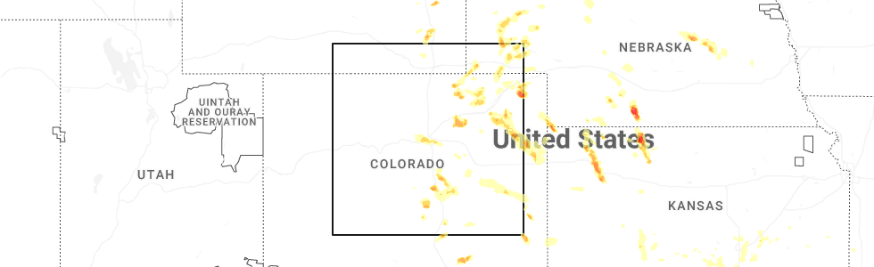
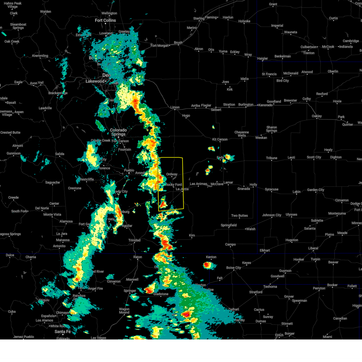
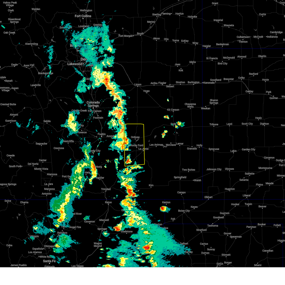
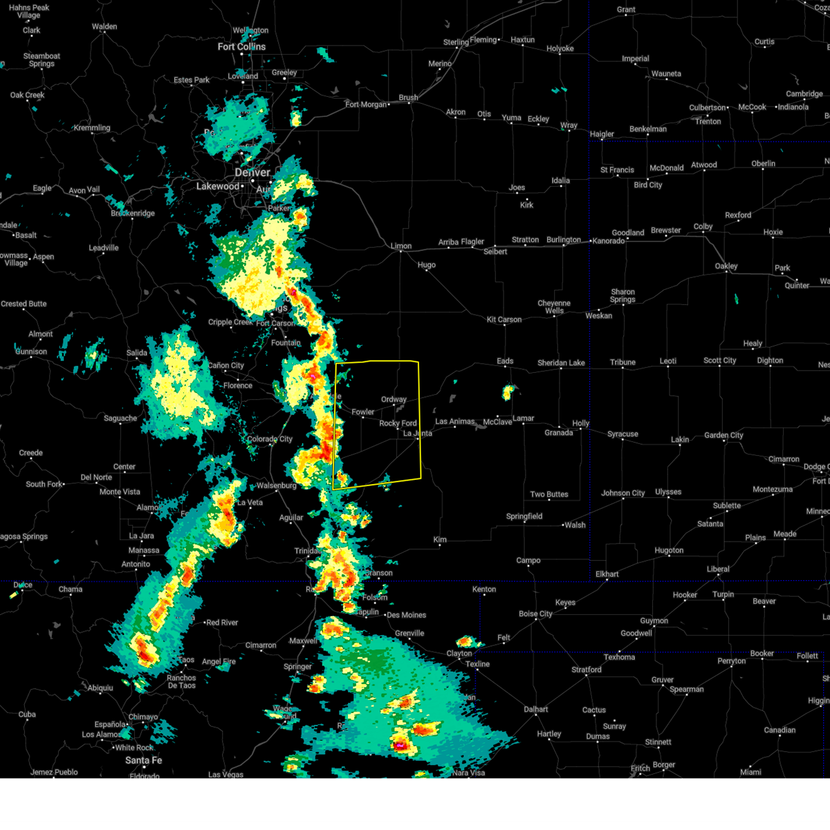
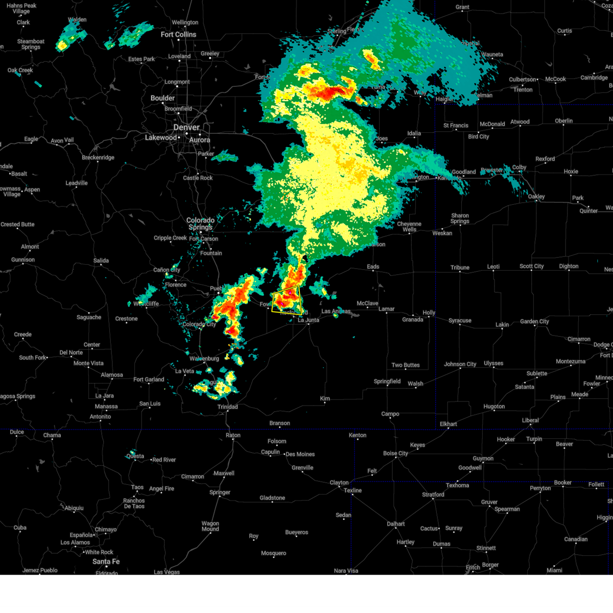
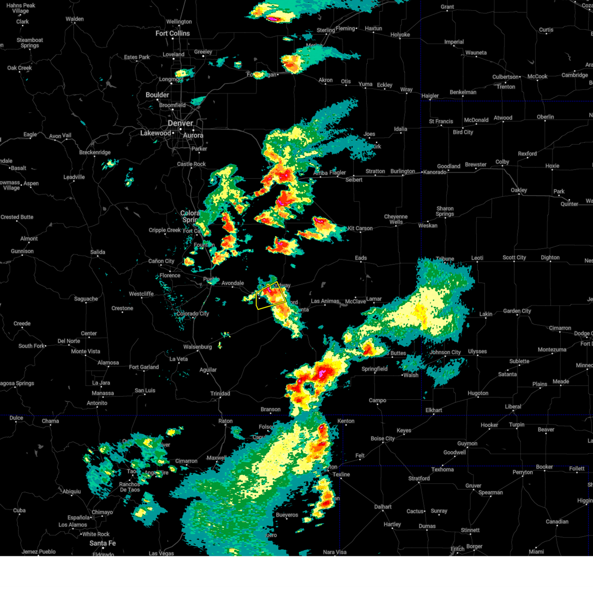
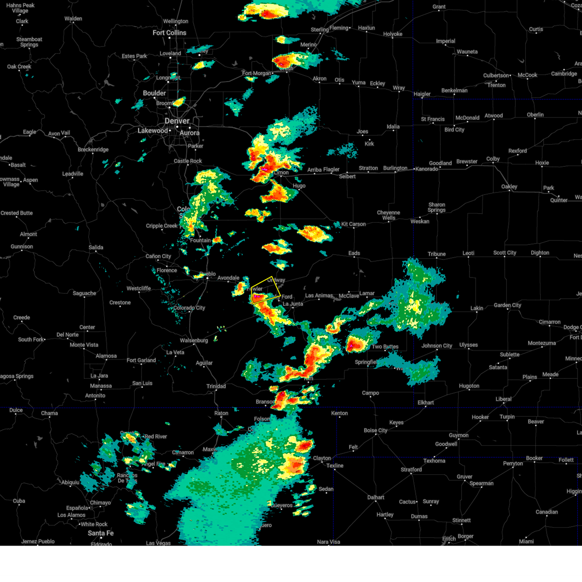
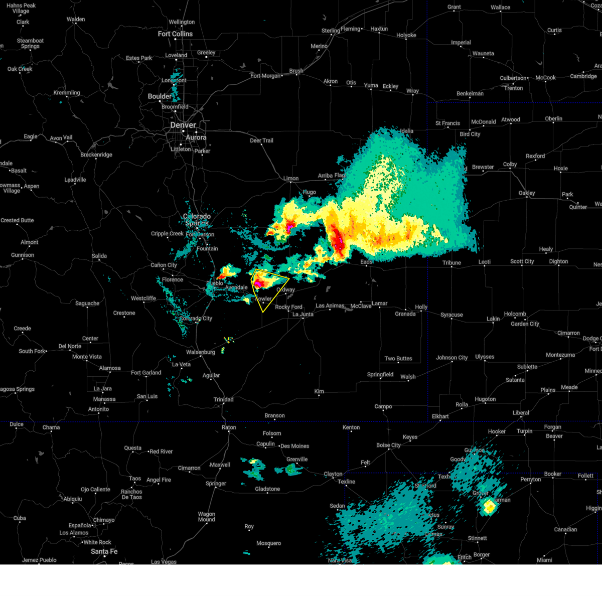
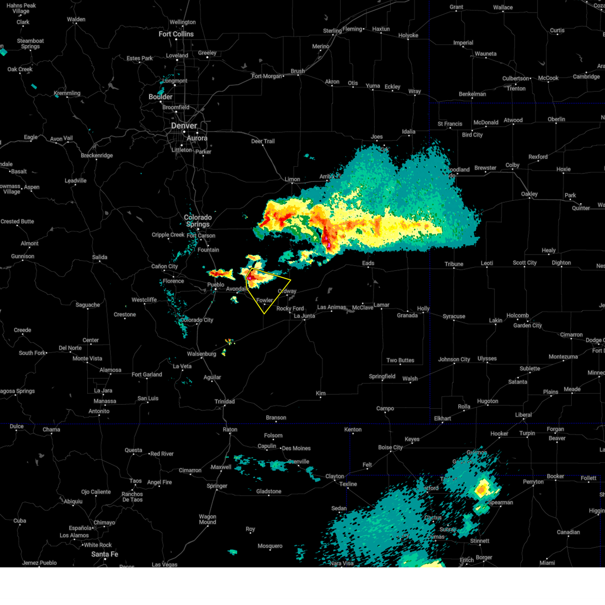
Hail Map for Olney Springs, CO
The Olney Springs, CO area has had 15 reports of on-the-ground hail by trained spotters, and has been under severe weather warnings 13 times during the past 12 months. Doppler radar has detected hail at or near Olney Springs, CO on 70 occasions, including 7 occasions during the past year.
| Name: | Olney Springs, CO |
| Where Located: | 36.9 miles E of Pueblo, CO |
| Map: | Google Map for Olney Springs, CO |
| Population: | 345 |
| Housing Units: | 161 |
| More Info: | Search Google for Olney Springs, CO |
1
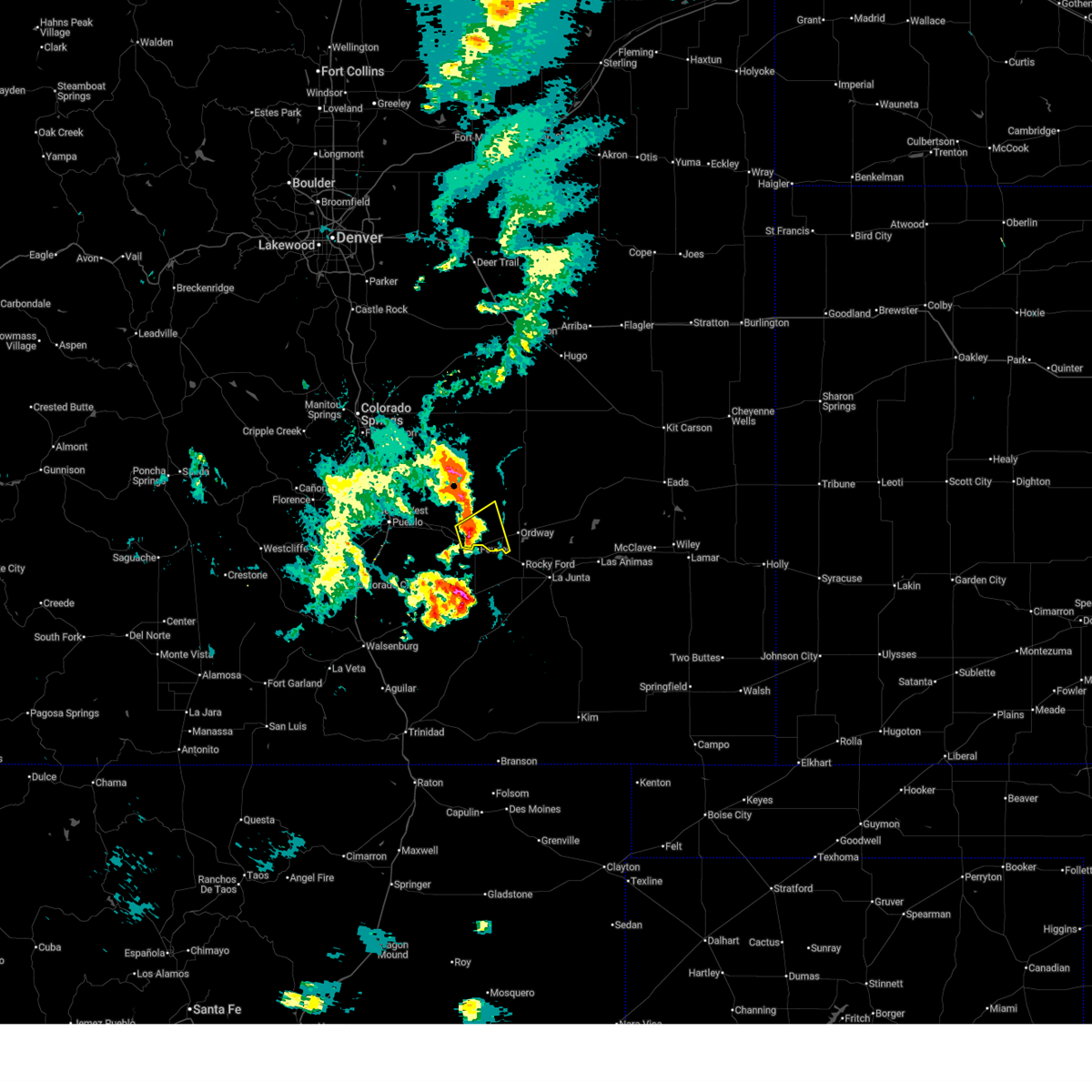
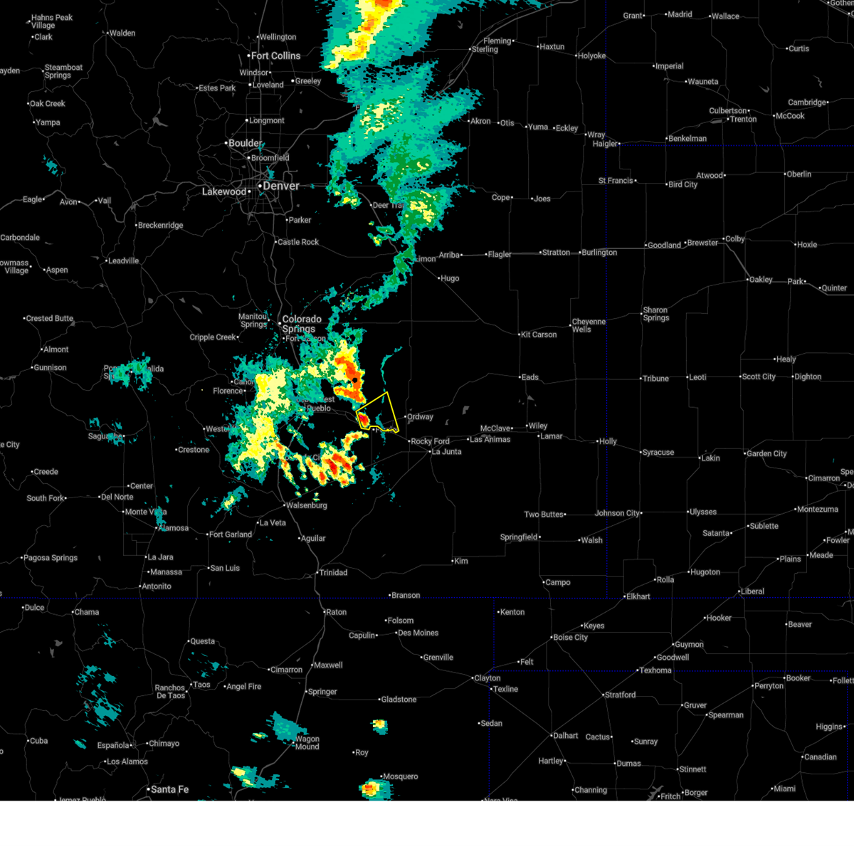
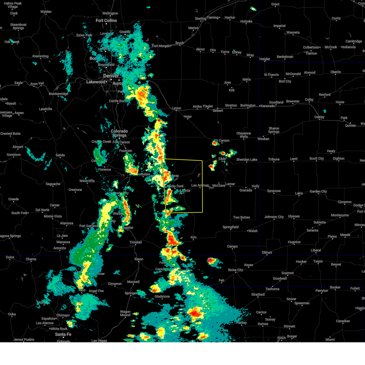
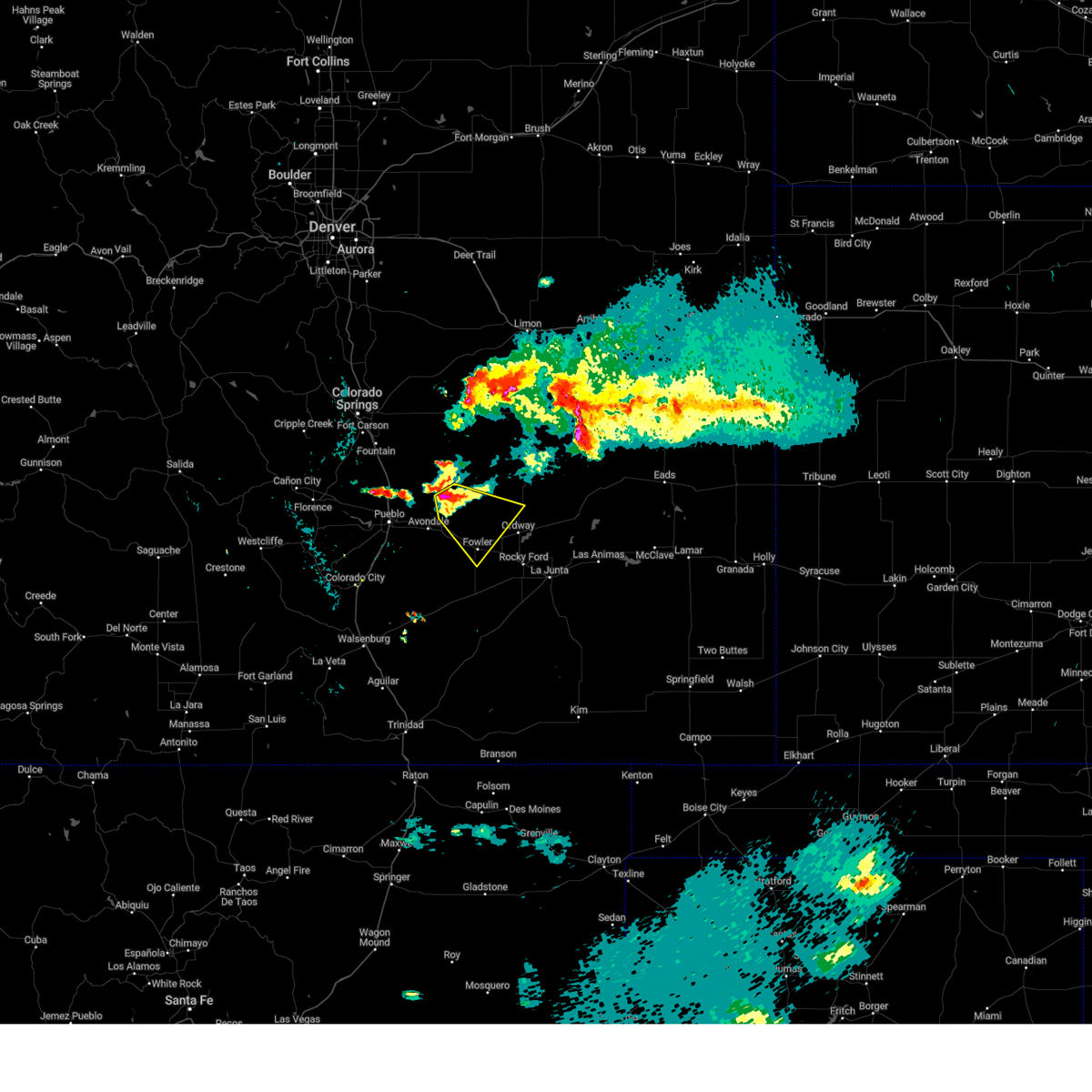
The Top Recent Hail Date for Olney Springs, CO is Sunday, July 6, 2025 (13th out of 70)
Hail and Wind Damage Spotted near Olney Springs, CO
| Date / Time | Report Details |
|---|---|
| 7/14/2025 6:50 PM MDT |
 The storm which prompted the warning has weakened below severe limits, and no longer poses an immediate threat to life or property. therefore, the warning will be allowed to expire. The storm which prompted the warning has weakened below severe limits, and no longer poses an immediate threat to life or property. therefore, the warning will be allowed to expire.
|
| 7/14/2025 6:33 PM MDT |
 Svrpub the national weather service in pueblo has issued a * severe thunderstorm warning for, southwestern crowley county in southeastern colorado, eastern pueblo county in southeastern colorado, * until 700 pm mdt. * at 633 pm mdt, a severe thunderstorm was located near fowler, or 23 miles east of pueblo airport, moving east at 15 mph (radar indicated). Hazards include 60 mph wind gusts and quarter size hail. Hail damage to vehicles is expected. Expect wind damage to roofs, siding, and trees. Svrpub the national weather service in pueblo has issued a * severe thunderstorm warning for, southwestern crowley county in southeastern colorado, eastern pueblo county in southeastern colorado, * until 700 pm mdt. * at 633 pm mdt, a severe thunderstorm was located near fowler, or 23 miles east of pueblo airport, moving east at 15 mph (radar indicated). Hazards include 60 mph wind gusts and quarter size hail. Hail damage to vehicles is expected. Expect wind damage to roofs, siding, and trees.
|
| 9/17/2024 3:54 PM MDT |
 Svrpub the national weather service in pueblo has issued a * severe thunderstorm warning for, otero county in southeastern colorado, southwestern kiowa county in southeastern colorado, crowley county in southeastern colorado, western bent county in southeastern colorado, * until 445 pm mdt. * at 354 pm mdt, a severe thunderstorm was located near rocky ford, or 13 miles west of la junta, moving northeast at 45 mph (radar indicated). Hazards include 60 mph wind gusts and nickel size hail. expect damage to roofs, siding, and trees Svrpub the national weather service in pueblo has issued a * severe thunderstorm warning for, otero county in southeastern colorado, southwestern kiowa county in southeastern colorado, crowley county in southeastern colorado, western bent county in southeastern colorado, * until 445 pm mdt. * at 354 pm mdt, a severe thunderstorm was located near rocky ford, or 13 miles west of la junta, moving northeast at 45 mph (radar indicated). Hazards include 60 mph wind gusts and nickel size hail. expect damage to roofs, siding, and trees
|
| 9/17/2024 3:45 PM MDT |
 the severe thunderstorm warning has been cancelled and is no longer in effect the severe thunderstorm warning has been cancelled and is no longer in effect
|
| 9/17/2024 3:45 PM MDT |
 At 344 pm mdt, a severe thunderstorm was located near fowler, or 27 miles west of la junta, moving northeast at 30 mph (radar indicated). Hazards include 70 mph wind gusts and nickel size hail. Expect considerable tree damage. damage is likely to mobile homes, roofs, and outbuildings. Locations impacted include, la junta, north la junta, rocky ford, fowler, ordway, swink, manzanola, olney springs, sugar city, crowley, and timpas. At 344 pm mdt, a severe thunderstorm was located near fowler, or 27 miles west of la junta, moving northeast at 30 mph (radar indicated). Hazards include 70 mph wind gusts and nickel size hail. Expect considerable tree damage. damage is likely to mobile homes, roofs, and outbuildings. Locations impacted include, la junta, north la junta, rocky ford, fowler, ordway, swink, manzanola, olney springs, sugar city, crowley, and timpas.
|
| 9/17/2024 3:17 PM MDT |
 Svrpub the national weather service in pueblo has issued a * severe thunderstorm warning for, otero county in southeastern colorado, north central las animas county in southeastern colorado, crowley county in southeastern colorado, eastern pueblo county in southeastern colorado, * until 400 pm mdt. * at 315 pm mdt, a severe thunderstorm was located 20 miles southwest of fowler, or 28 miles southeast of pueblo airport, moving northeast at 30 mph. this storm has a history of producing damaging winds. a wind gust to 72 mph was measured with this storm at 306 pm (radar indicated). Hazards include 70 mph wind gusts and nickel size hail. Expect considerable tree damage. Damage is likely to mobile homes, roofs, and outbuildings. Svrpub the national weather service in pueblo has issued a * severe thunderstorm warning for, otero county in southeastern colorado, north central las animas county in southeastern colorado, crowley county in southeastern colorado, eastern pueblo county in southeastern colorado, * until 400 pm mdt. * at 315 pm mdt, a severe thunderstorm was located 20 miles southwest of fowler, or 28 miles southeast of pueblo airport, moving northeast at 30 mph. this storm has a history of producing damaging winds. a wind gust to 72 mph was measured with this storm at 306 pm (radar indicated). Hazards include 70 mph wind gusts and nickel size hail. Expect considerable tree damage. Damage is likely to mobile homes, roofs, and outbuildings.
|
| 8/19/2024 7:40 PM MDT | Quarter sized hail reported 0.9 miles WNW of Olney Springs, CO, relayed via broadcast media. |
| 8/19/2024 7:39 PM MDT |
 Svrpub the national weather service in pueblo has issued a * severe thunderstorm warning for, northwestern otero county in southeastern colorado, southwestern crowley county in southeastern colorado, * until 815 pm mdt. * at 739 pm mdt, a severe thunderstorm was located over crowley, or 23 miles northwest of la junta, moving east at 15 mph (radar indicated). Hazards include 60 mph wind gusts and quarter size hail. Hail damage to vehicles is expected. Expect wind damage to roofs, siding, and trees. Svrpub the national weather service in pueblo has issued a * severe thunderstorm warning for, northwestern otero county in southeastern colorado, southwestern crowley county in southeastern colorado, * until 815 pm mdt. * at 739 pm mdt, a severe thunderstorm was located over crowley, or 23 miles northwest of la junta, moving east at 15 mph (radar indicated). Hazards include 60 mph wind gusts and quarter size hail. Hail damage to vehicles is expected. Expect wind damage to roofs, siding, and trees.
|
| 8/12/2024 6:26 PM MDT |
 The storm which prompted the warning has weakened below severe limits, and no longer poses an immediate threat to life or property. therefore, the warning will be allowed to expire. however, small hail, gusty winds and heavy rain are still possible with this thunderstorm. The storm which prompted the warning has weakened below severe limits, and no longer poses an immediate threat to life or property. therefore, the warning will be allowed to expire. however, small hail, gusty winds and heavy rain are still possible with this thunderstorm.
|
| 8/12/2024 5:58 PM MDT |
 Svrpub the national weather service in pueblo has issued a * severe thunderstorm warning for, northwestern otero county in southeastern colorado, southwestern crowley county in southeastern colorado, * until 630 pm mdt. * at 557 pm mdt, a severe thunderstorm was located near fowler, or 25 miles west of la junta, moving northeast at 25 mph (radar indicated). Hazards include 60 mph wind gusts and quarter size hail. Hail damage to vehicles is expected. Expect wind damage to roofs, siding, and trees. Svrpub the national weather service in pueblo has issued a * severe thunderstorm warning for, northwestern otero county in southeastern colorado, southwestern crowley county in southeastern colorado, * until 630 pm mdt. * at 557 pm mdt, a severe thunderstorm was located near fowler, or 25 miles west of la junta, moving northeast at 25 mph (radar indicated). Hazards include 60 mph wind gusts and quarter size hail. Hail damage to vehicles is expected. Expect wind damage to roofs, siding, and trees.
|
| 7/16/2024 4:28 PM MDT |
 The storms which prompted the warning have weakened below severe limits, and no longer pose an immediate threat to life or property. therefore, the warning will be allowed to expire. however, gusty winds and heavy rain are still possible with these thunderstorms. The storms which prompted the warning have weakened below severe limits, and no longer pose an immediate threat to life or property. therefore, the warning will be allowed to expire. however, gusty winds and heavy rain are still possible with these thunderstorms.
|
| 7/16/2024 4:21 PM MDT |
 At 420 pm mdt, severe thunderstorms were located along a line extending from 6 miles north of cheraw to near rocky ford to 7 miles southwest of swink to near delhi, moving southeast at 35 mph (radar indicated). Hazards include 60 mph wind gusts and quarter size hail. Hail damage to vehicles is expected. expect wind damage to roofs, siding, and trees. Locations impacted include, la junta, north la junta, rocky ford, fowler, ordway, swink, manzanola, olney springs, sugar city, cheraw, crowley, delhi, and timpas. At 420 pm mdt, severe thunderstorms were located along a line extending from 6 miles north of cheraw to near rocky ford to 7 miles southwest of swink to near delhi, moving southeast at 35 mph (radar indicated). Hazards include 60 mph wind gusts and quarter size hail. Hail damage to vehicles is expected. expect wind damage to roofs, siding, and trees. Locations impacted include, la junta, north la junta, rocky ford, fowler, ordway, swink, manzanola, olney springs, sugar city, cheraw, crowley, delhi, and timpas.
|
| 7/16/2024 4:21 PM MDT |
 the severe thunderstorm warning has been cancelled and is no longer in effect the severe thunderstorm warning has been cancelled and is no longer in effect
|
| 7/16/2024 3:39 PM MDT |
 Svrpub the national weather service in pueblo has issued a * severe thunderstorm warning for, otero county in southeastern colorado, northeastern huerfano county in southeastern colorado, western kiowa county in southeastern colorado, north central las animas county in southeastern colorado, crowley county in southeastern colorado, southeastern pueblo county in southeastern colorado, northwestern bent county in southeastern colorado, * until 430 pm mdt. * at 339 pm mdt, severe thunderstorms were located along a line extending from 13 miles north of crowley to 9 miles north of olney springs to near fowler to 25 miles south of avondale, moving southeast at 35 mph (radar indicated). Hazards include 70 mph wind gusts and quarter size hail. Hail damage to vehicles is expected. expect considerable tree damage. Wind damage is also likely to mobile homes, roofs, and outbuildings. Svrpub the national weather service in pueblo has issued a * severe thunderstorm warning for, otero county in southeastern colorado, northeastern huerfano county in southeastern colorado, western kiowa county in southeastern colorado, north central las animas county in southeastern colorado, crowley county in southeastern colorado, southeastern pueblo county in southeastern colorado, northwestern bent county in southeastern colorado, * until 430 pm mdt. * at 339 pm mdt, severe thunderstorms were located along a line extending from 13 miles north of crowley to 9 miles north of olney springs to near fowler to 25 miles south of avondale, moving southeast at 35 mph (radar indicated). Hazards include 70 mph wind gusts and quarter size hail. Hail damage to vehicles is expected. expect considerable tree damage. Wind damage is also likely to mobile homes, roofs, and outbuildings.
|
| 7/15/2024 4:26 PM MDT | Svrpub the national weather service in pueblo has issued a * severe thunderstorm warning for, northern otero county in southeastern colorado, southwestern kiowa county in southeastern colorado, crowley county in southeastern colorado, * until 500 pm mdt. * at 425 pm mdt, severe thunderstorms were located along a line extending from 13 miles southwest of wild horse point to near ordway to near manzanola, moving southeast at 25 mph (radar indicated). Hazards include 60 mph wind gusts. expect damage to roofs, siding, and trees |
| 7/15/2024 3:56 PM MDT | Svrpub the national weather service in pueblo has issued a * severe thunderstorm warning for, northwestern otero county in southeastern colorado, southwestern crowley county in southeastern colorado, eastern pueblo county in southeastern colorado, * until 430 pm mdt. * at 356 pm mdt, a severe thunderstorm was located near olney springs, or 26 miles east of pueblo airport, moving southeast at 15 mph (radar indicated). Hazards include 60 mph wind gusts and penny size hail. expect damage to roofs, siding, and trees |
| 7/7/2024 8:13 PM MDT |
 At 813 pm mdt, severe thunderstorms were located along a line extending from near rocky ford to 8 miles south of manzanola to 15 miles south of fowler, moving southeast at 30 mph (radar indicated). Hazards include golf ball size hail and 60 mph wind gusts. People and animals outdoors will be injured. expect hail damage to roofs, siding, windows, and vehicles. expect wind damage to roofs, siding, and trees. Locations impacted include, rocky ford, fowler, ordway, manzanola, olney springs, sugar city, and crowley. At 813 pm mdt, severe thunderstorms were located along a line extending from near rocky ford to 8 miles south of manzanola to 15 miles south of fowler, moving southeast at 30 mph (radar indicated). Hazards include golf ball size hail and 60 mph wind gusts. People and animals outdoors will be injured. expect hail damage to roofs, siding, windows, and vehicles. expect wind damage to roofs, siding, and trees. Locations impacted include, rocky ford, fowler, ordway, manzanola, olney springs, sugar city, and crowley.
|
| 7/7/2024 8:03 PM MDT |
 At 803 pm mdt, severe thunderstorms were located along a line extending from ordway to near manzanola to 10 miles south of fowler, moving southeast at 30 mph (radar indicated). Hazards include golf ball size hail and 60 mph wind gusts. People and animals outdoors will be injured. expect hail damage to roofs, siding, windows, and vehicles. expect wind damage to roofs, siding, and trees. Locations impacted include, rocky ford, fowler, ordway, manzanola, olney springs, sugar city, and crowley. At 803 pm mdt, severe thunderstorms were located along a line extending from ordway to near manzanola to 10 miles south of fowler, moving southeast at 30 mph (radar indicated). Hazards include golf ball size hail and 60 mph wind gusts. People and animals outdoors will be injured. expect hail damage to roofs, siding, windows, and vehicles. expect wind damage to roofs, siding, and trees. Locations impacted include, rocky ford, fowler, ordway, manzanola, olney springs, sugar city, and crowley.
|
| 7/7/2024 7:50 PM MDT |
 the severe thunderstorm warning has been cancelled and is no longer in effect the severe thunderstorm warning has been cancelled and is no longer in effect
|
| 7/7/2024 7:47 PM MDT |
 Svrpub the national weather service in pueblo has issued a * severe thunderstorm warning for, northern otero county in southeastern colorado, southern crowley county in southeastern colorado, east central pueblo county in southeastern colorado, * until 830 pm mdt. * at 746 pm mdt, severe thunderstorms were located along a line extending from 6 miles north of crowley to olney springs to 9 miles southwest of fowler, moving southeast at 25 mph (radar indicated). Hazards include golf ball size hail and 60 mph wind gusts. People and animals outdoors will be injured. expect hail damage to roofs, siding, windows, and vehicles. Expect wind damage to roofs, siding, and trees. Svrpub the national weather service in pueblo has issued a * severe thunderstorm warning for, northern otero county in southeastern colorado, southern crowley county in southeastern colorado, east central pueblo county in southeastern colorado, * until 830 pm mdt. * at 746 pm mdt, severe thunderstorms were located along a line extending from 6 miles north of crowley to olney springs to 9 miles southwest of fowler, moving southeast at 25 mph (radar indicated). Hazards include golf ball size hail and 60 mph wind gusts. People and animals outdoors will be injured. expect hail damage to roofs, siding, windows, and vehicles. Expect wind damage to roofs, siding, and trees.
|
| 7/7/2024 7:26 PM MDT |
 Svrpub the national weather service in pueblo has issued a * severe thunderstorm warning for, northwestern otero county in southeastern colorado, southwestern crowley county in southeastern colorado, east central pueblo county in southeastern colorado, * until 815 pm mdt. * at 726 pm mdt, a severe thunderstorm was located near boone, or 19 miles east of pueblo airport, moving southeast at 20 mph (radar indicated). Hazards include 60 mph wind gusts and half dollar size hail. Hail damage to vehicles is expected. Expect wind damage to roofs, siding, and trees. Svrpub the national weather service in pueblo has issued a * severe thunderstorm warning for, northwestern otero county in southeastern colorado, southwestern crowley county in southeastern colorado, east central pueblo county in southeastern colorado, * until 815 pm mdt. * at 726 pm mdt, a severe thunderstorm was located near boone, or 19 miles east of pueblo airport, moving southeast at 20 mph (radar indicated). Hazards include 60 mph wind gusts and half dollar size hail. Hail damage to vehicles is expected. Expect wind damage to roofs, siding, and trees.
|
| 7/3/2024 3:58 AM MDT |
 Svrpub the national weather service in pueblo has issued a * severe thunderstorm warning for, northwestern otero county in southeastern colorado, south central crowley county in southeastern colorado, * until 445 am mdt. * at 358 am mdt, a severe thunderstorm was located over manzanola, or 21 miles northwest of la junta, moving east at 10 mph (radar indicated). Hazards include 60 mph wind gusts and half dollar size hail. Hail damage to vehicles is expected. Expect wind damage to roofs, siding, and trees. Svrpub the national weather service in pueblo has issued a * severe thunderstorm warning for, northwestern otero county in southeastern colorado, south central crowley county in southeastern colorado, * until 445 am mdt. * at 358 am mdt, a severe thunderstorm was located over manzanola, or 21 miles northwest of la junta, moving east at 10 mph (radar indicated). Hazards include 60 mph wind gusts and half dollar size hail. Hail damage to vehicles is expected. Expect wind damage to roofs, siding, and trees.
|
| 6/14/2024 3:07 PM MDT |
 Svrpub the national weather service in pueblo has issued a * severe thunderstorm warning for, otero county in southeastern colorado, southern crowley county in southeastern colorado, * until 330 pm mdt. * at 306 pm mdt, severe thunderstorms were located along a line extending from 15 miles northwest of crowley to 8 miles east of delhi, moving east at 40 mph (radar indicated). Hazards include 60 mph wind gusts and quarter size hail. Hail damage to vehicles is expected. Expect wind damage to roofs, siding, and trees. Svrpub the national weather service in pueblo has issued a * severe thunderstorm warning for, otero county in southeastern colorado, southern crowley county in southeastern colorado, * until 330 pm mdt. * at 306 pm mdt, severe thunderstorms were located along a line extending from 15 miles northwest of crowley to 8 miles east of delhi, moving east at 40 mph (radar indicated). Hazards include 60 mph wind gusts and quarter size hail. Hail damage to vehicles is expected. Expect wind damage to roofs, siding, and trees.
|
| 6/8/2024 4:46 PM MDT |
 At 445 pm mdt, severe thunderstorms were located along a line extending from 10 miles northeast of ordway to near sugar city to near swink, moving east at 40 mph. these are destructive storms for the la junta area! (radar indicated). Hazards include 80 mph wind gusts and ping pong ball size hail. Flying debris will be dangerous to those caught without shelter. mobile homes will be heavily damaged. expect considerable damage to roofs, windows, and vehicles. extensive tree damage and power outages are likely. Locations impacted include, la junta, north la junta, rocky ford, ordway, swink, manzanola, olney springs, sugar city, cheraw, crowley, higbee, and timpas. At 445 pm mdt, severe thunderstorms were located along a line extending from 10 miles northeast of ordway to near sugar city to near swink, moving east at 40 mph. these are destructive storms for the la junta area! (radar indicated). Hazards include 80 mph wind gusts and ping pong ball size hail. Flying debris will be dangerous to those caught without shelter. mobile homes will be heavily damaged. expect considerable damage to roofs, windows, and vehicles. extensive tree damage and power outages are likely. Locations impacted include, la junta, north la junta, rocky ford, ordway, swink, manzanola, olney springs, sugar city, cheraw, crowley, higbee, and timpas.
|
| 6/8/2024 4:41 PM MDT |
 At 440 pm mdt, severe thunderstorms were located along a line extending from 9 miles north of ordway to near sugar city to near rocky ford, moving east at 40 mph (radar indicated). Hazards include 70 mph wind gusts and ping pong ball size hail. People and animals outdoors will be injured. expect hail damage to roofs, siding, windows, and vehicles. expect considerable tree damage. wind damage is also likely to mobile homes, roofs, and outbuildings. Locations impacted include, la junta, north la junta, rocky ford, ordway, swink, manzanola, olney springs, sugar city, cheraw, crowley, higbee, and timpas. At 440 pm mdt, severe thunderstorms were located along a line extending from 9 miles north of ordway to near sugar city to near rocky ford, moving east at 40 mph (radar indicated). Hazards include 70 mph wind gusts and ping pong ball size hail. People and animals outdoors will be injured. expect hail damage to roofs, siding, windows, and vehicles. expect considerable tree damage. wind damage is also likely to mobile homes, roofs, and outbuildings. Locations impacted include, la junta, north la junta, rocky ford, ordway, swink, manzanola, olney springs, sugar city, cheraw, crowley, higbee, and timpas.
|
| 6/8/2024 4:30 PM MDT |
 The storm which prompted the warning has moved out of the area. therefore, the warning will be allowed to expire. however, another severe thunderstorm warning has been issued for this area, and hail is still a threat with this thunderstorm. a severe thunderstorm watch remains in effect until 700 pm mdt for southeastern colorado. remember, a severe thunderstorm warning still remains in effect for crowley and otero counties!. The storm which prompted the warning has moved out of the area. therefore, the warning will be allowed to expire. however, another severe thunderstorm warning has been issued for this area, and hail is still a threat with this thunderstorm. a severe thunderstorm watch remains in effect until 700 pm mdt for southeastern colorado. remember, a severe thunderstorm warning still remains in effect for crowley and otero counties!.
|
| 6/8/2024 4:28 PM MDT |
 Svrpub the national weather service in pueblo has issued a * severe thunderstorm warning for, otero county in southeastern colorado, southwestern kiowa county in southeastern colorado, crowley county in southeastern colorado, * until 515 pm mdt. * at 428 pm mdt, severe thunderstorms were located along a line extending from 10 miles northwest of sugar city to near ordway to 8 miles south of manzanola, moving east at 40 mph (radar indicated). Hazards include 70 mph wind gusts and half dollar size hail. Hail damage to vehicles is expected. expect considerable tree damage. Wind damage is also likely to mobile homes, roofs, and outbuildings. Svrpub the national weather service in pueblo has issued a * severe thunderstorm warning for, otero county in southeastern colorado, southwestern kiowa county in southeastern colorado, crowley county in southeastern colorado, * until 515 pm mdt. * at 428 pm mdt, severe thunderstorms were located along a line extending from 10 miles northwest of sugar city to near ordway to 8 miles south of manzanola, moving east at 40 mph (radar indicated). Hazards include 70 mph wind gusts and half dollar size hail. Hail damage to vehicles is expected. expect considerable tree damage. Wind damage is also likely to mobile homes, roofs, and outbuildings.
|
| 6/8/2024 4:20 PM MDT |
 At 420 pm mdt, a severe thunderstorm was located near rocky ford, or 13 miles northwest of la junta, moving east at 40 mph (radar indicated). Hazards include 70 mph wind gusts and quarter size hail. Hail damage to vehicles is expected. expect considerable tree damage. wind damage is also likely to mobile homes, roofs, and outbuildings. Locations impacted include, la junta, rocky ford, fowler, ordway, swink, manzanola, olney springs, sugar city, and crowley. At 420 pm mdt, a severe thunderstorm was located near rocky ford, or 13 miles northwest of la junta, moving east at 40 mph (radar indicated). Hazards include 70 mph wind gusts and quarter size hail. Hail damage to vehicles is expected. expect considerable tree damage. wind damage is also likely to mobile homes, roofs, and outbuildings. Locations impacted include, la junta, rocky ford, fowler, ordway, swink, manzanola, olney springs, sugar city, and crowley.
|
| 6/8/2024 4:12 PM MDT |
 At 411 pm mdt, a severe thunderstorm was located near manzanola, or 19 miles west of la junta, moving east at 40 mph (radar indicated). Hazards include 70 mph wind gusts and quarter size hail. Hail damage to vehicles is expected. expect considerable tree damage. wind damage is also likely to mobile homes, roofs, and outbuildings. Locations impacted include, la junta, rocky ford, fowler, ordway, swink, manzanola, olney springs, sugar city, crowley, and timpas. At 411 pm mdt, a severe thunderstorm was located near manzanola, or 19 miles west of la junta, moving east at 40 mph (radar indicated). Hazards include 70 mph wind gusts and quarter size hail. Hail damage to vehicles is expected. expect considerable tree damage. wind damage is also likely to mobile homes, roofs, and outbuildings. Locations impacted include, la junta, rocky ford, fowler, ordway, swink, manzanola, olney springs, sugar city, crowley, and timpas.
|
| 6/8/2024 4:12 PM MDT |
 the severe thunderstorm warning has been cancelled and is no longer in effect the severe thunderstorm warning has been cancelled and is no longer in effect
|
| 6/8/2024 4:03 PM MDT |
 At 402 pm mdt, a severe thunderstorm was located near fowler, or 25 miles west of la junta, moving east at 40 mph (radar indicated). Hazards include 70 mph wind gusts and quarter size hail. Hail damage to vehicles is expected. expect considerable tree damage. wind damage is also likely to mobile homes, roofs, and outbuildings. Locations impacted include, la junta, rocky ford, fowler, ordway, swink, manzanola, olney springs, sugar city, crowley, and timpas. At 402 pm mdt, a severe thunderstorm was located near fowler, or 25 miles west of la junta, moving east at 40 mph (radar indicated). Hazards include 70 mph wind gusts and quarter size hail. Hail damage to vehicles is expected. expect considerable tree damage. wind damage is also likely to mobile homes, roofs, and outbuildings. Locations impacted include, la junta, rocky ford, fowler, ordway, swink, manzanola, olney springs, sugar city, crowley, and timpas.
|
| 6/8/2024 4:03 PM MDT |
 the severe thunderstorm warning has been cancelled and is no longer in effect the severe thunderstorm warning has been cancelled and is no longer in effect
|
| 6/8/2024 3:51 PM MDT |
 Svrpub the national weather service in pueblo has issued a * severe thunderstorm warning for, western otero county in southeastern colorado, north central las animas county in southeastern colorado, crowley county in southeastern colorado, eastern pueblo county in southeastern colorado, * until 430 pm mdt. * at 350 pm mdt, a cluster of severe thunderstorms was located 10 miles southwest of fowler, or 26 miles southeast of pueblo airport, moving east at 40 mph (radar indicated). Hazards include 70 mph wind gusts and quarter size hail. Hail damage to vehicles is expected. expect considerable tree damage. Wind damage is also likely to mobile homes, roofs, and outbuildings. Svrpub the national weather service in pueblo has issued a * severe thunderstorm warning for, western otero county in southeastern colorado, north central las animas county in southeastern colorado, crowley county in southeastern colorado, eastern pueblo county in southeastern colorado, * until 430 pm mdt. * at 350 pm mdt, a cluster of severe thunderstorms was located 10 miles southwest of fowler, or 26 miles southeast of pueblo airport, moving east at 40 mph (radar indicated). Hazards include 70 mph wind gusts and quarter size hail. Hail damage to vehicles is expected. expect considerable tree damage. Wind damage is also likely to mobile homes, roofs, and outbuildings.
|
| 5/31/2024 9:52 PM MDT |
 The storm which prompted the warning has weakened below severe limits, and no longer poses an immediate threat to life or property. therefore, the warning will be allowed to expire. however, small hail and gusty winds are still possible with this thunderstorm. a severe thunderstorm watch remains in effect until 1100 pm mdt for southeastern colorado. The storm which prompted the warning has weakened below severe limits, and no longer poses an immediate threat to life or property. therefore, the warning will be allowed to expire. however, small hail and gusty winds are still possible with this thunderstorm. a severe thunderstorm watch remains in effect until 1100 pm mdt for southeastern colorado.
|
| 5/31/2024 9:37 PM MDT |
 the severe thunderstorm warning has been cancelled and is no longer in effect the severe thunderstorm warning has been cancelled and is no longer in effect
|
| 5/31/2024 9:37 PM MDT |
 At 937 pm mdt, a severe thunderstorm was located over crowley, or 23 miles northwest of la junta, moving southeast at 25 mph (radar indicated). Hazards include 60 mph wind gusts and half dollar size hail. Hail damage to vehicles is expected. expect wind damage to roofs, siding, and trees. Locations impacted include, ordway, manzanola, olney springs, and crowley. At 937 pm mdt, a severe thunderstorm was located over crowley, or 23 miles northwest of la junta, moving southeast at 25 mph (radar indicated). Hazards include 60 mph wind gusts and half dollar size hail. Hail damage to vehicles is expected. expect wind damage to roofs, siding, and trees. Locations impacted include, ordway, manzanola, olney springs, and crowley.
|
| 5/31/2024 9:25 PM MDT |
 Svrpub the national weather service in pueblo has issued a * severe thunderstorm warning for, northwestern otero county in southeastern colorado, southwestern crowley county in southeastern colorado, eastern pueblo county in southeastern colorado, * until 1000 pm mdt. * at 924 pm mdt, a severe thunderstorm was located near olney springs, or 29 miles northwest of la junta, moving southeast at 25 mph (radar indicated). Hazards include 60 mph wind gusts and half dollar size hail. Hail damage to vehicles is expected. Expect wind damage to roofs, siding, and trees. Svrpub the national weather service in pueblo has issued a * severe thunderstorm warning for, northwestern otero county in southeastern colorado, southwestern crowley county in southeastern colorado, eastern pueblo county in southeastern colorado, * until 1000 pm mdt. * at 924 pm mdt, a severe thunderstorm was located near olney springs, or 29 miles northwest of la junta, moving southeast at 25 mph (radar indicated). Hazards include 60 mph wind gusts and half dollar size hail. Hail damage to vehicles is expected. Expect wind damage to roofs, siding, and trees.
|
| 5/31/2024 9:16 PM MDT |
 At 915 pm mdt, a severe thunderstorm was located 8 miles northwest of olney springs, or 26 miles east of pueblo airport, moving southeast at 20 mph (radar indicated). Hazards include 60 mph wind gusts and half dollar size hail. Hail damage to vehicles is expected. expect wind damage to roofs, siding, and trees. Locations impacted include, fowler and olney springs. At 915 pm mdt, a severe thunderstorm was located 8 miles northwest of olney springs, or 26 miles east of pueblo airport, moving southeast at 20 mph (radar indicated). Hazards include 60 mph wind gusts and half dollar size hail. Hail damage to vehicles is expected. expect wind damage to roofs, siding, and trees. Locations impacted include, fowler and olney springs.
|
| 5/31/2024 9:02 PM MDT |
 At 901 pm mdt, a severe thunderstorm was located 9 miles northeast of boone, or 20 miles east of pueblo airport, moving southeast at 20 mph (radar indicated). Hazards include 60 mph wind gusts and half dollar size hail. Hail damage to vehicles is expected. expect wind damage to roofs, siding, and trees. Locations impacted include, fowler and olney springs. At 901 pm mdt, a severe thunderstorm was located 9 miles northeast of boone, or 20 miles east of pueblo airport, moving southeast at 20 mph (radar indicated). Hazards include 60 mph wind gusts and half dollar size hail. Hail damage to vehicles is expected. expect wind damage to roofs, siding, and trees. Locations impacted include, fowler and olney springs.
|
| 5/31/2024 8:45 PM MDT |
 Svrpub the national weather service in pueblo has issued a * severe thunderstorm warning for, west central otero county in southeastern colorado, southwestern crowley county in southeastern colorado, northeastern pueblo county in southeastern colorado, * until 930 pm mdt. * at 844 pm mdt, a severe thunderstorm was located near pueblo depot, or 14 miles northeast of pueblo airport, moving southeast at 15 mph (radar indicated). Hazards include ping pong ball size hail and 60 mph wind gusts. People and animals outdoors will be injured. expect hail damage to roofs, siding, windows, and vehicles. Expect wind damage to roofs, siding, and trees. Svrpub the national weather service in pueblo has issued a * severe thunderstorm warning for, west central otero county in southeastern colorado, southwestern crowley county in southeastern colorado, northeastern pueblo county in southeastern colorado, * until 930 pm mdt. * at 844 pm mdt, a severe thunderstorm was located near pueblo depot, or 14 miles northeast of pueblo airport, moving southeast at 15 mph (radar indicated). Hazards include ping pong ball size hail and 60 mph wind gusts. People and animals outdoors will be injured. expect hail damage to roofs, siding, windows, and vehicles. Expect wind damage to roofs, siding, and trees.
|
| 5/30/2024 5:15 PM MDT |
 Svrpub the national weather service in pueblo has issued a * severe thunderstorm warning for, northern otero county in southeastern colorado, southwestern kiowa county in southeastern colorado, southeastern crowley county in southeastern colorado, * until 545 pm mdt. * at 515 pm mdt, severe thunderstorms were located along a line extending from 9 miles northwest of sugar city to near ordway to near manzanola, moving east at 20 mph (radar indicated). Hazards include 60 mph wind gusts and quarter size hail. Hail damage to vehicles is expected. Expect wind damage to roofs, siding, and trees. Svrpub the national weather service in pueblo has issued a * severe thunderstorm warning for, northern otero county in southeastern colorado, southwestern kiowa county in southeastern colorado, southeastern crowley county in southeastern colorado, * until 545 pm mdt. * at 515 pm mdt, severe thunderstorms were located along a line extending from 9 miles northwest of sugar city to near ordway to near manzanola, moving east at 20 mph (radar indicated). Hazards include 60 mph wind gusts and quarter size hail. Hail damage to vehicles is expected. Expect wind damage to roofs, siding, and trees.
|
| 5/30/2024 4:45 PM MDT |
 Svrpub the national weather service in pueblo has issued a * severe thunderstorm warning for, northwestern otero county in southeastern colorado, southwestern crowley county in southeastern colorado, east central pueblo county in southeastern colorado, * until 515 pm mdt. * at 445 pm mdt, severe thunderstorms were located along a line extending from 11 miles east of boone to 7 miles northwest of olney springs to 6 miles northwest of fowler, moving southeast at 25 mph (radar indicated). Hazards include 60 mph wind gusts and half dollar size hail. Hail damage to vehicles is expected. Expect wind damage to roofs, siding, and trees. Svrpub the national weather service in pueblo has issued a * severe thunderstorm warning for, northwestern otero county in southeastern colorado, southwestern crowley county in southeastern colorado, east central pueblo county in southeastern colorado, * until 515 pm mdt. * at 445 pm mdt, severe thunderstorms were located along a line extending from 11 miles east of boone to 7 miles northwest of olney springs to 6 miles northwest of fowler, moving southeast at 25 mph (radar indicated). Hazards include 60 mph wind gusts and half dollar size hail. Hail damage to vehicles is expected. Expect wind damage to roofs, siding, and trees.
|
| 8/5/2023 5:39 PM MDT |
 The severe thunderstorm warning for central otero and southwestern crowley counties will expire at 545 pm mdt, the storm which prompted the warning has moved out of the area. therefore, the warning will be allowed to expire. a severe thunderstorm watch remains in effect until 1000 pm mdt for southeastern colorado. The severe thunderstorm warning for central otero and southwestern crowley counties will expire at 545 pm mdt, the storm which prompted the warning has moved out of the area. therefore, the warning will be allowed to expire. a severe thunderstorm watch remains in effect until 1000 pm mdt for southeastern colorado.
|
| 8/5/2023 5:12 PM MDT |
 At 512 pm mdt, a severe thunderstorm was located near sugar city, or 12 miles northwest of la junta, moving east at 80 mph (radar indicated). Hazards include 70 mph wind gusts and ping pong ball size hail. People and animals outdoors will be injured. expect hail damage to roofs, siding, windows, and vehicles. expect considerable tree damage. wind damage is also likely to mobile homes, roofs, and outbuildings. this severe thunderstorm will remain over mainly rural areas of northern otero, southern crowley and northwestern bent counties. thunderstorm damage threat, considerable hail threat, radar indicated max hail size, 1. 50 in wind threat, radar indicated max wind gust, 70 mph. At 512 pm mdt, a severe thunderstorm was located near sugar city, or 12 miles northwest of la junta, moving east at 80 mph (radar indicated). Hazards include 70 mph wind gusts and ping pong ball size hail. People and animals outdoors will be injured. expect hail damage to roofs, siding, windows, and vehicles. expect considerable tree damage. wind damage is also likely to mobile homes, roofs, and outbuildings. this severe thunderstorm will remain over mainly rural areas of northern otero, southern crowley and northwestern bent counties. thunderstorm damage threat, considerable hail threat, radar indicated max hail size, 1. 50 in wind threat, radar indicated max wind gust, 70 mph.
|
| 8/5/2023 5:06 PM MDT |
 At 506 pm mdt, a severe thunderstorm was located over manzanola, or 19 miles west of la junta, moving southeast at 30 mph (trained weather spotters). Hazards include golf ball size hail in olney springs. People and animals outdoors will be injured. expect damage to roofs, siding, windows, and vehicles. this severe storm will be near, rocky ford around 520 pm mdt. Other locations in the path of this severe thunderstorm include swink and la junta. At 506 pm mdt, a severe thunderstorm was located over manzanola, or 19 miles west of la junta, moving southeast at 30 mph (trained weather spotters). Hazards include golf ball size hail in olney springs. People and animals outdoors will be injured. expect damage to roofs, siding, windows, and vehicles. this severe storm will be near, rocky ford around 520 pm mdt. Other locations in the path of this severe thunderstorm include swink and la junta.
|
| 8/5/2023 5:05 PM MDT | Golf Ball sized hail reported 0.4 miles SE of Olney Springs, CO |
| 8/5/2023 5:00 PM MDT |
 At 459 pm mdt, a severe thunderstorm was located near olney springs, or 23 miles northwest of la junta, moving southeast at 30 mph (trained weather spotters). Hazards include golf ball size hail in the town of fowler. People and animals outdoors will be injured. expect damage to roofs, siding, windows, and vehicles. this severe storm will be near, manzanola around 505 pm mdt. Other locations in the path of this severe thunderstorm include rocky ford, swink and la junta. At 459 pm mdt, a severe thunderstorm was located near olney springs, or 23 miles northwest of la junta, moving southeast at 30 mph (trained weather spotters). Hazards include golf ball size hail in the town of fowler. People and animals outdoors will be injured. expect damage to roofs, siding, windows, and vehicles. this severe storm will be near, manzanola around 505 pm mdt. Other locations in the path of this severe thunderstorm include rocky ford, swink and la junta.
|
| 8/5/2023 4:55 PM MDT |
 At 455 pm mdt, a severe thunderstorm was located over olney springs, or 25 miles northwest of la junta, moving southeast at 30 mph (radar indicated). Hazards include two inch hail and 70 mph wind gusts. People and animals outdoors will be injured. expect hail damage to roofs, siding, windows, and vehicles. expect considerable tree damage. wind damage is also likely to mobile homes, roofs, and outbuildings. this severe thunderstorm will be near, crowley around 500 pm mdt. manzanola around 505 pm mdt. Other locations in the path of this severe thunderstorm include rocky ford, swink and la junta. At 455 pm mdt, a severe thunderstorm was located over olney springs, or 25 miles northwest of la junta, moving southeast at 30 mph (radar indicated). Hazards include two inch hail and 70 mph wind gusts. People and animals outdoors will be injured. expect hail damage to roofs, siding, windows, and vehicles. expect considerable tree damage. wind damage is also likely to mobile homes, roofs, and outbuildings. this severe thunderstorm will be near, crowley around 500 pm mdt. manzanola around 505 pm mdt. Other locations in the path of this severe thunderstorm include rocky ford, swink and la junta.
|
| 8/5/2023 4:36 PM MDT |
 At 435 pm mdt, a severe thunderstorm capable of producing a tornado was located near boone, or 19 miles east of pueblo airport, moving southeast at 30 mph (radar indicated rotation). Hazards include tornado and tennis ball size hail. this storm has a long history of producing tornadoes and funnel clouds. Flying debris will be dangerous to those caught without shelter. mobile homes will be damaged or destroyed. damage to roofs, windows, and vehicles will occur. tree damage is likely. this dangerous storm will be near, fowler around 455 pm mdt. Other locations in the path of this tornadic thunderstorm include manzanola and olney springs. At 435 pm mdt, a severe thunderstorm capable of producing a tornado was located near boone, or 19 miles east of pueblo airport, moving southeast at 30 mph (radar indicated rotation). Hazards include tornado and tennis ball size hail. this storm has a long history of producing tornadoes and funnel clouds. Flying debris will be dangerous to those caught without shelter. mobile homes will be damaged or destroyed. damage to roofs, windows, and vehicles will occur. tree damage is likely. this dangerous storm will be near, fowler around 455 pm mdt. Other locations in the path of this tornadic thunderstorm include manzanola and olney springs.
|
| 7/20/2023 4:48 PM MDT | Quarter sized hail reported 1.9 miles SSW of Olney Springs, CO |
| 7/20/2023 4:48 PM MDT |
 At 447 pm mdt, a severe thunderstorm was located near manzanola, or 17 miles northwest of la junta, moving northeast at 50 mph (trained weather spotters). Hazards include 60 mph wind gusts, torrential rainfall and quarter size hail. Hail damage to vehicles is expected. expect wind damage to roofs, siding, and trees. locations impacted include, rocky ford, ordway, manzanola, olney springs, sugar city and crowley. hail threat, radar indicated max hail size, 1. 00 in wind threat, radar indicated max wind gust, 60 mph. At 447 pm mdt, a severe thunderstorm was located near manzanola, or 17 miles northwest of la junta, moving northeast at 50 mph (trained weather spotters). Hazards include 60 mph wind gusts, torrential rainfall and quarter size hail. Hail damage to vehicles is expected. expect wind damage to roofs, siding, and trees. locations impacted include, rocky ford, ordway, manzanola, olney springs, sugar city and crowley. hail threat, radar indicated max hail size, 1. 00 in wind threat, radar indicated max wind gust, 60 mph.
|
| 7/20/2023 4:31 PM MDT |
 At 431 pm mdt, a severe thunderstorm was located near fowler, or 26 miles west of la junta, moving northeast at 55 mph (radar indicated). Hazards include ping pong ball size hail, torrential rainfall, and 60 mph wind gusts. People and animals outdoors will be injured. expect hail damage to roofs, siding, windows, and vehicles. Expect wind damage to roofs, siding, and trees. At 431 pm mdt, a severe thunderstorm was located near fowler, or 26 miles west of la junta, moving northeast at 55 mph (radar indicated). Hazards include ping pong ball size hail, torrential rainfall, and 60 mph wind gusts. People and animals outdoors will be injured. expect hail damage to roofs, siding, windows, and vehicles. Expect wind damage to roofs, siding, and trees.
|
| 7/8/2023 8:18 PM MDT |
 At 817 pm mdt, severe thunderstorms were located along a line extending from 8 miles east of wild horse point to near crowley, moving southeast at 20 mph (radar indicated). Hazards include 60 mph wind gusts and quarter size hail. Hail damage to vehicles is expected. expect wind damage to roofs, siding, and trees. locations impacted include, la junta, rocky ford, ordway, swink, manzanola, olney springs, sugar city, cheraw, crowley, haswell, blue lake and arlington. hail threat, radar indicated max hail size, 1. 00 in wind threat, radar indicated max wind gust, 60 mph. At 817 pm mdt, severe thunderstorms were located along a line extending from 8 miles east of wild horse point to near crowley, moving southeast at 20 mph (radar indicated). Hazards include 60 mph wind gusts and quarter size hail. Hail damage to vehicles is expected. expect wind damage to roofs, siding, and trees. locations impacted include, la junta, rocky ford, ordway, swink, manzanola, olney springs, sugar city, cheraw, crowley, haswell, blue lake and arlington. hail threat, radar indicated max hail size, 1. 00 in wind threat, radar indicated max wind gust, 60 mph.
|
| 7/8/2023 8:00 PM MDT |
 At 759 pm mdt, severe thunderstorms were located along a line extending from near wild horse point to near olney springs, moving southeast at 20 mph (radar indicated). Hazards include 70 mph wind gusts and half dollar size hail. Hail damage to vehicles is expected. expect considerable tree damage. wind damage is also likely to mobile homes, roofs, and outbuildings. locations impacted include, la junta, rocky ford, ordway, swink, manzanola, olney springs, sugar city, cheraw, crowley, haswell, blue lake and arlington. thunderstorm damage threat, considerable hail threat, radar indicated max hail size, 1. 25 in wind threat, radar indicated max wind gust, 70 mph. At 759 pm mdt, severe thunderstorms were located along a line extending from near wild horse point to near olney springs, moving southeast at 20 mph (radar indicated). Hazards include 70 mph wind gusts and half dollar size hail. Hail damage to vehicles is expected. expect considerable tree damage. wind damage is also likely to mobile homes, roofs, and outbuildings. locations impacted include, la junta, rocky ford, ordway, swink, manzanola, olney springs, sugar city, cheraw, crowley, haswell, blue lake and arlington. thunderstorm damage threat, considerable hail threat, radar indicated max hail size, 1. 25 in wind threat, radar indicated max wind gust, 70 mph.
|
| 7/8/2023 7:47 PM MDT |
 At 746 pm mdt, severe thunderstorms were located along a line extending from near karval to 7 miles northwest of olney springs, moving southeast at 20 mph (radar indicated). Hazards include 70 mph wind gusts and half dollar size hail. Hail damage to vehicles is expected. expect considerable tree damage. Wind damage is also likely to mobile homes, roofs, and outbuildings. At 746 pm mdt, severe thunderstorms were located along a line extending from near karval to 7 miles northwest of olney springs, moving southeast at 20 mph (radar indicated). Hazards include 70 mph wind gusts and half dollar size hail. Hail damage to vehicles is expected. expect considerable tree damage. Wind damage is also likely to mobile homes, roofs, and outbuildings.
|
| 7/8/2023 6:27 PM MDT |
 At 627 pm mdt, a severe thunderstorm was located over ordway, or 23 miles northwest of la junta, moving southeast at 40 mph (radar indicated). Hazards include 70 mph wind gusts and ping pong ball size hail. very heavy rain is possible. People and animals outdoors will be injured. expect hail damage to roofs, siding, windows, and vehicles. expect considerable tree damage. wind damage is also likely to mobile homes, roofs, and outbuildings. this severe thunderstorm will be near, ordway around 630 pm mdt. sugar city around 635 pm mdt. rocky ford around 645 pm mdt. Other locations in the path of this severe thunderstorm include la junta, swink, cheraw and north la junta. At 627 pm mdt, a severe thunderstorm was located over ordway, or 23 miles northwest of la junta, moving southeast at 40 mph (radar indicated). Hazards include 70 mph wind gusts and ping pong ball size hail. very heavy rain is possible. People and animals outdoors will be injured. expect hail damage to roofs, siding, windows, and vehicles. expect considerable tree damage. wind damage is also likely to mobile homes, roofs, and outbuildings. this severe thunderstorm will be near, ordway around 630 pm mdt. sugar city around 635 pm mdt. rocky ford around 645 pm mdt. Other locations in the path of this severe thunderstorm include la junta, swink, cheraw and north la junta.
|
| 7/5/2023 9:06 PM MDT |
 At 904 pm mdt, severe thunderstorms were located along a line extending from near sweetwater reservoir to near fowler, moving southeast at 25 mph. the most intense storm along this line were over western crowley and otero counties (radar indicated). Hazards include 70 mph wind gusts and ping pong ball size hail. People and animals outdoors will be injured. expect hail damage to roofs, siding, windows, and vehicles. expect considerable tree damage. wind damage is also likely to mobile homes, roofs, and outbuildings. severe thunderstorms will be near, sweetwater reservoir around 910 pm mdt. neegronda reservoir around 915 pm mdt. neeoshe reservoir around 920 pm mdt. other locations in the path of these severe thunderstorms include queens reservoir, rocky ford and swink. thunderstorm damage threat, considerable hail threat, radar indicated max hail size, 1. 50 in wind threat, radar indicated max wind gust, 70 mph. At 904 pm mdt, severe thunderstorms were located along a line extending from near sweetwater reservoir to near fowler, moving southeast at 25 mph. the most intense storm along this line were over western crowley and otero counties (radar indicated). Hazards include 70 mph wind gusts and ping pong ball size hail. People and animals outdoors will be injured. expect hail damage to roofs, siding, windows, and vehicles. expect considerable tree damage. wind damage is also likely to mobile homes, roofs, and outbuildings. severe thunderstorms will be near, sweetwater reservoir around 910 pm mdt. neegronda reservoir around 915 pm mdt. neeoshe reservoir around 920 pm mdt. other locations in the path of these severe thunderstorms include queens reservoir, rocky ford and swink. thunderstorm damage threat, considerable hail threat, radar indicated max hail size, 1. 50 in wind threat, radar indicated max wind gust, 70 mph.
|
| 7/5/2023 9:05 PM MDT | Quarter sized hail reported 0.4 miles SW of Olney Springs, CO, estimated winds to 50 mph. |
| 7/5/2023 8:42 PM MDT |
 At 840 pm mdt, severe thunderstorms were located along a line extending from 8 miles west of eads to 6 miles northwest of olney springs, moving southeast at 20 mph. the most intense storms were over northern and western crowley county and western kiowa county (radar indicated). Hazards include ping pong ball size hail and 60 mph wind gusts. People and animals outdoors will be injured. expect hail damage to roofs, siding, windows, and vehicles. expect wind damage to roofs, siding, and trees. locations impacted include, rocky ford, fowler, ordway, eads, manzanola, olney springs, sugar city, cheraw, crowley, haswell, neeoshe reservoir, blue lake, sweetwater reservoir, neegronda reservoir, arlington and queens reservoir. hail threat, radar indicated max hail size, 1. 50 in wind threat, radar indicated max wind gust, 60 mph. At 840 pm mdt, severe thunderstorms were located along a line extending from 8 miles west of eads to 6 miles northwest of olney springs, moving southeast at 20 mph. the most intense storms were over northern and western crowley county and western kiowa county (radar indicated). Hazards include ping pong ball size hail and 60 mph wind gusts. People and animals outdoors will be injured. expect hail damage to roofs, siding, windows, and vehicles. expect wind damage to roofs, siding, and trees. locations impacted include, rocky ford, fowler, ordway, eads, manzanola, olney springs, sugar city, cheraw, crowley, haswell, neeoshe reservoir, blue lake, sweetwater reservoir, neegronda reservoir, arlington and queens reservoir. hail threat, radar indicated max hail size, 1. 50 in wind threat, radar indicated max wind gust, 60 mph.
|
| 7/5/2023 8:24 PM MDT |
 At 824 pm mdt, severe thunderstorms were located along a line extending from 9 miles west of eads to near boone, moving southeast at 20 mph (radar indicated). Hazards include ping pong ball size hail and 60 mph wind gusts. People and animals outdoors will be injured. expect hail damage to roofs, siding, windows, and vehicles. Expect wind damage to roofs, siding, and trees. At 824 pm mdt, severe thunderstorms were located along a line extending from 9 miles west of eads to near boone, moving southeast at 20 mph (radar indicated). Hazards include ping pong ball size hail and 60 mph wind gusts. People and animals outdoors will be injured. expect hail damage to roofs, siding, windows, and vehicles. Expect wind damage to roofs, siding, and trees.
|
| 7/5/2023 8:10 PM MDT |
 At 810 pm mdt, a severe thunderstorm was located near pueblo depot, or 21 miles east of pueblo, moving east at 30 mph (radar indicated). Hazards include ping pong ball size hail and 60 mph wind gusts. People and animals outdoors will be injured. expect hail damage to roofs, siding, windows, and vehicles. Expect wind damage to roofs, siding, and trees. At 810 pm mdt, a severe thunderstorm was located near pueblo depot, or 21 miles east of pueblo, moving east at 30 mph (radar indicated). Hazards include ping pong ball size hail and 60 mph wind gusts. People and animals outdoors will be injured. expect hail damage to roofs, siding, windows, and vehicles. Expect wind damage to roofs, siding, and trees.
|
| 6/22/2023 2:02 AM MDT |
 At 201 am mdt, a severe thunderstorm was located near fowler, or 30 miles southeast of pueblo, moving east at 25 mph (radar indicated). Hazards include ping pong ball size hail. People and animals outdoors will be injured. Expect damage to roofs, siding, windows, and vehicles. At 201 am mdt, a severe thunderstorm was located near fowler, or 30 miles southeast of pueblo, moving east at 25 mph (radar indicated). Hazards include ping pong ball size hail. People and animals outdoors will be injured. Expect damage to roofs, siding, windows, and vehicles.
|
| 6/17/2023 2:43 PM MDT |
 At 242 pm mdt, severe thunderstorms were located along a line extending from 16 miles southwest of forder to manzanola, moving northeast at 45 mph (radar indicated). Hazards include 70 mph wind gusts and quarter size hail. Hail damage to vehicles is expected. expect considerable tree damage. Wind damage is also likely to mobile homes, roofs, and outbuildings. At 242 pm mdt, severe thunderstorms were located along a line extending from 16 miles southwest of forder to manzanola, moving northeast at 45 mph (radar indicated). Hazards include 70 mph wind gusts and quarter size hail. Hail damage to vehicles is expected. expect considerable tree damage. Wind damage is also likely to mobile homes, roofs, and outbuildings.
|
| 6/12/2023 3:03 PM MDT |
 At 302 pm mdt, severe thunderstorms were located along a line extending from 16 miles northeast of pueblo depot to near blende to 15 miles northeast of greenhorn mountain, moving southeast at 30 mph (radar indicated). Hazards include 60 mph wind gusts and quarter size hail. Hail damage to vehicles is expected. expect wind damage to roofs, siding, and trees. the strongest storms on this line are located in southern pueblo county and far eastern crowley county. locations impacted include, pueblo, rocky ford, fowler, ordway, manzanola, olney springs, boone, sugar city, crowley, salt creek, pueblo depot, blende, avondale and colorado city. hail threat, radar indicated max hail size, 1. 00 in wind threat, radar indicated max wind gust, 60 mph. At 302 pm mdt, severe thunderstorms were located along a line extending from 16 miles northeast of pueblo depot to near blende to 15 miles northeast of greenhorn mountain, moving southeast at 30 mph (radar indicated). Hazards include 60 mph wind gusts and quarter size hail. Hail damage to vehicles is expected. expect wind damage to roofs, siding, and trees. the strongest storms on this line are located in southern pueblo county and far eastern crowley county. locations impacted include, pueblo, rocky ford, fowler, ordway, manzanola, olney springs, boone, sugar city, crowley, salt creek, pueblo depot, blende, avondale and colorado city. hail threat, radar indicated max hail size, 1. 00 in wind threat, radar indicated max wind gust, 60 mph.
|
| 6/12/2023 2:50 PM MDT |
 At 250 pm mdt, severe thunderstorms were located along a line extending from 18 miles south of truckton to near blende to 17 miles northeast of greenhorn mountain, moving southeast at 40 mph (radar indicated). Hazards include 60 mph wind gusts and quarter size hail. Hail damage to vehicles is expected. Expect wind damage to roofs, siding, and trees. At 250 pm mdt, severe thunderstorms were located along a line extending from 18 miles south of truckton to near blende to 17 miles northeast of greenhorn mountain, moving southeast at 40 mph (radar indicated). Hazards include 60 mph wind gusts and quarter size hail. Hail damage to vehicles is expected. Expect wind damage to roofs, siding, and trees.
|
| 6/10/2023 5:55 PM MDT |
 The severe thunderstorm warning for central otero and south central crowley counties will expire at 600 pm mdt, the storm which prompted the warning has weakened below severe limits, and no longer poses an immediate threat to life or property. therefore, the warning will be allowed to expire. however small hail and gusty winds are still possible with this thunderstorm. The severe thunderstorm warning for central otero and south central crowley counties will expire at 600 pm mdt, the storm which prompted the warning has weakened below severe limits, and no longer poses an immediate threat to life or property. therefore, the warning will be allowed to expire. however small hail and gusty winds are still possible with this thunderstorm.
|
| 6/10/2023 5:37 PM MDT |
 At 537 pm mdt, a severe thunderstorm was located over manzanola, or 18 miles northwest of la junta, moving southeast at 25 mph (radar indicated). Hazards include 60 mph wind gusts and quarter size hail. Hail damage to vehicles is expected. expect wind damage to roofs, siding, and trees. locations impacted include, rocky ford and swink. hail threat, radar indicated max hail size, 1. 00 in wind threat, radar indicated max wind gust, 60 mph. At 537 pm mdt, a severe thunderstorm was located over manzanola, or 18 miles northwest of la junta, moving southeast at 25 mph (radar indicated). Hazards include 60 mph wind gusts and quarter size hail. Hail damage to vehicles is expected. expect wind damage to roofs, siding, and trees. locations impacted include, rocky ford and swink. hail threat, radar indicated max hail size, 1. 00 in wind threat, radar indicated max wind gust, 60 mph.
|
| 6/10/2023 5:23 PM MDT |
 At 523 pm mdt, a severe thunderstorm was located over olney springs, or 23 miles northwest of la junta, moving southeast at 25 mph (radar indicated). Hazards include 60 mph wind gusts and quarter size hail. Hail damage to vehicles is expected. expect wind damage to roofs, siding, and trees. this severe thunderstorm will be near, manzanola around 535 pm mdt. other locations in the path of this severe thunderstorm include rocky ford and swink. hail threat, radar indicated max hail size, 1. 00 in wind threat, radar indicated max wind gust, 60 mph. At 523 pm mdt, a severe thunderstorm was located over olney springs, or 23 miles northwest of la junta, moving southeast at 25 mph (radar indicated). Hazards include 60 mph wind gusts and quarter size hail. Hail damage to vehicles is expected. expect wind damage to roofs, siding, and trees. this severe thunderstorm will be near, manzanola around 535 pm mdt. other locations in the path of this severe thunderstorm include rocky ford and swink. hail threat, radar indicated max hail size, 1. 00 in wind threat, radar indicated max wind gust, 60 mph.
|
| 6/10/2023 5:22 PM MDT | Quarter sized hail reported 1.9 miles SSW of Olney Springs, CO |
| 5/29/2023 9:29 PM MDT |
 At 928 pm mdt, a severe thunderstorm was located near sugar city, or 15 miles northwest of la junta, moving east at 35 mph (radar indicated). Hazards include 60 mph wind gusts and penny size hail. Expect damage to roofs, siding, and trees. locations impacted include, rocky ford, ordway, manzanola, olney springs, sugar city and crowley. hail threat, radar indicated max hail size, 0. 75 in wind threat, radar indicated max wind gust, 60 mph. At 928 pm mdt, a severe thunderstorm was located near sugar city, or 15 miles northwest of la junta, moving east at 35 mph (radar indicated). Hazards include 60 mph wind gusts and penny size hail. Expect damage to roofs, siding, and trees. locations impacted include, rocky ford, ordway, manzanola, olney springs, sugar city and crowley. hail threat, radar indicated max hail size, 0. 75 in wind threat, radar indicated max wind gust, 60 mph.
|
| 5/29/2023 9:13 PM MDT |
 At 913 pm mdt, a severe thunderstorm was located over crowley, or 22 miles northwest of la junta, moving east at 35 mph (radar indicated). Hazards include 60 mph wind gusts and quarter size hail. Hail damage to vehicles is expected. Expect wind damage to roofs, siding, and trees. At 913 pm mdt, a severe thunderstorm was located over crowley, or 22 miles northwest of la junta, moving east at 35 mph (radar indicated). Hazards include 60 mph wind gusts and quarter size hail. Hail damage to vehicles is expected. Expect wind damage to roofs, siding, and trees.
|
| 5/29/2023 9:02 PM MDT |
 At 902 pm mdt, a severe thunderstorm was located 8 miles north of crowley, or 29 miles northwest of la junta, moving northeast at 25 mph (radar indicated). Hazards include 60 mph wind gusts and quarter size hail. Hail damage to vehicles is expected. expect wind damage to roofs, siding, and trees. locations impacted include, olney springs. hail threat, radar indicated max hail size, 1. 00 in wind threat, radar indicated max wind gust, 60 mph. At 902 pm mdt, a severe thunderstorm was located 8 miles north of crowley, or 29 miles northwest of la junta, moving northeast at 25 mph (radar indicated). Hazards include 60 mph wind gusts and quarter size hail. Hail damage to vehicles is expected. expect wind damage to roofs, siding, and trees. locations impacted include, olney springs. hail threat, radar indicated max hail size, 1. 00 in wind threat, radar indicated max wind gust, 60 mph.
|
| 5/29/2023 8:46 PM MDT |
 At 845 pm mdt, a severe thunderstorm was located near olney springs, or 29 miles northwest of la junta, moving northeast at 25 mph (radar indicated). Hazards include 60 mph wind gusts and quarter size hail. Hail damage to vehicles is expected. Expect wind damage to roofs, siding, and trees. At 845 pm mdt, a severe thunderstorm was located near olney springs, or 29 miles northwest of la junta, moving northeast at 25 mph (radar indicated). Hazards include 60 mph wind gusts and quarter size hail. Hail damage to vehicles is expected. Expect wind damage to roofs, siding, and trees.
|
| 5/27/2023 1:53 PM MDT |
 At 153 pm mdt, a severe thunderstorm was located over crowley, or 23 miles northwest of la junta, moving north at 20 mph (radar indicated). Hazards include 60 mph wind gusts and quarter size hail. Hail damage to vehicles is expected. expect wind damage to roofs, siding, and trees. locations impacted include, ordway. hail threat, radar indicated max hail size, 1. 00 in wind threat, radar indicated max wind gust, 60 mph. At 153 pm mdt, a severe thunderstorm was located over crowley, or 23 miles northwest of la junta, moving north at 20 mph (radar indicated). Hazards include 60 mph wind gusts and quarter size hail. Hail damage to vehicles is expected. expect wind damage to roofs, siding, and trees. locations impacted include, ordway. hail threat, radar indicated max hail size, 1. 00 in wind threat, radar indicated max wind gust, 60 mph.
|
| 5/27/2023 1:39 PM MDT |
 At 139 pm mdt, a severe thunderstorm was located over crowley, or 21 miles northwest of la junta, moving northeast at 30 mph (radar indicated). Hazards include 60 mph wind gusts and quarter size hail. Hail damage to vehicles is expected. expect wind damage to roofs, siding, and trees. this severe thunderstorm will be near, ordway around 155 pm mdt. other locations in the path of this severe thunderstorm include sugar city. hail threat, radar indicated max hail size, 1. 00 in wind threat, radar indicated max wind gust, 60 mph. At 139 pm mdt, a severe thunderstorm was located over crowley, or 21 miles northwest of la junta, moving northeast at 30 mph (radar indicated). Hazards include 60 mph wind gusts and quarter size hail. Hail damage to vehicles is expected. expect wind damage to roofs, siding, and trees. this severe thunderstorm will be near, ordway around 155 pm mdt. other locations in the path of this severe thunderstorm include sugar city. hail threat, radar indicated max hail size, 1. 00 in wind threat, radar indicated max wind gust, 60 mph.
|
| 7/20/2022 4:32 PM MDT |
 At 432 pm mdt, severe thunderstorms were located along a line extending from near sugar city to 6 miles north of swink to near rocky ford, moving southeast at 35 mph (radar indicated). Hazards include 60 mph wind gusts and quarter size hail. Hail damage to vehicles is expected. expect wind damage to roofs, siding, and trees. these severe storms will be near, swink and cheraw around 440 pm mdt. la junta and north la junta around 445 pm mdt. hail threat, radar indicated max hail size, 1. 00 in wind threat, radar indicated max wind gust, 60 mph. At 432 pm mdt, severe thunderstorms were located along a line extending from near sugar city to 6 miles north of swink to near rocky ford, moving southeast at 35 mph (radar indicated). Hazards include 60 mph wind gusts and quarter size hail. Hail damage to vehicles is expected. expect wind damage to roofs, siding, and trees. these severe storms will be near, swink and cheraw around 440 pm mdt. la junta and north la junta around 445 pm mdt. hail threat, radar indicated max hail size, 1. 00 in wind threat, radar indicated max wind gust, 60 mph.
|
| 7/20/2022 4:09 PM MDT |
 At 408 pm mdt, severe thunderstorms were located along a line extending from 13 miles north of ordway to near crowley to near manzanola, moving east at 35 mph (radar indicated). Hazards include 60 mph wind gusts and quarter size hail. Hail damage to vehicles is expected. expect wind damage to roofs, siding, and trees. these severe storms will be near, ordway around 415 pm mdt. rocky ford and sugar city around 425 pm mdt. swink around 435 pm mdt. la junta and cheraw around 440 pm mdt. north la junta around 445 pm mdt. hail threat, radar indicated max hail size, 1. 00 in wind threat, radar indicated max wind gust, 60 mph. At 408 pm mdt, severe thunderstorms were located along a line extending from 13 miles north of ordway to near crowley to near manzanola, moving east at 35 mph (radar indicated). Hazards include 60 mph wind gusts and quarter size hail. Hail damage to vehicles is expected. expect wind damage to roofs, siding, and trees. these severe storms will be near, ordway around 415 pm mdt. rocky ford and sugar city around 425 pm mdt. swink around 435 pm mdt. la junta and cheraw around 440 pm mdt. north la junta around 445 pm mdt. hail threat, radar indicated max hail size, 1. 00 in wind threat, radar indicated max wind gust, 60 mph.
|
| 7/20/2022 3:40 PM MDT |
 At 340 pm mdt, severe thunderstorms were located along a line extending from 18 miles southeast of truckton to 10 miles east of boone to 7 miles west of fowler, moving southeast at 30 mph (radar indicated). Hazards include 60 mph wind gusts. Expect damage to roofs, siding, and trees. severe thunderstorms will be near, fowler around 350 pm mdt. olney springs around 405 pm mdt. manzanola around 415 pm mdt. ordway and crowley around 425 pm mdt. sugar city around 430 pm mdt. rocky ford around 445 pm mdt. swink and cheraw around 455 pm mdt. la junta around 500 pm mdt. hail threat, radar indicated max hail size, <. 75 in wind threat, radar indicated max wind gust, 60 mph. At 340 pm mdt, severe thunderstorms were located along a line extending from 18 miles southeast of truckton to 10 miles east of boone to 7 miles west of fowler, moving southeast at 30 mph (radar indicated). Hazards include 60 mph wind gusts. Expect damage to roofs, siding, and trees. severe thunderstorms will be near, fowler around 350 pm mdt. olney springs around 405 pm mdt. manzanola around 415 pm mdt. ordway and crowley around 425 pm mdt. sugar city around 430 pm mdt. rocky ford around 445 pm mdt. swink and cheraw around 455 pm mdt. la junta around 500 pm mdt. hail threat, radar indicated max hail size, <. 75 in wind threat, radar indicated max wind gust, 60 mph.
|
| 7/6/2022 8:17 PM MDT |
 At 816 pm mdt, a severe thunderstorm was located near rocky ford, or 14 miles northwest of la junta, moving northeast at 10 mph (radar indicated. at 807 pm quarter size hail was reported just southeast of manzanola). Hazards include golf ball size hail and 60 mph wind gusts. People and animals outdoors will be injured. expect hail damage to roofs, siding, windows, and vehicles. expect wind damage to roofs, siding, and trees. Locations impacted include, rocky ford, ordway, manzanola, olney springs, sugar city and crowley. At 816 pm mdt, a severe thunderstorm was located near rocky ford, or 14 miles northwest of la junta, moving northeast at 10 mph (radar indicated. at 807 pm quarter size hail was reported just southeast of manzanola). Hazards include golf ball size hail and 60 mph wind gusts. People and animals outdoors will be injured. expect hail damage to roofs, siding, windows, and vehicles. expect wind damage to roofs, siding, and trees. Locations impacted include, rocky ford, ordway, manzanola, olney springs, sugar city and crowley.
|
| 7/6/2022 8:07 PM MDT |
 At 807 pm mdt, a severe thunderstorm was located near rocky ford, or 15 miles northwest of la junta, moving north at 10 mph (radar indicated). Hazards include golf ball size hail and 60 mph wind gusts. People and animals outdoors will be injured. expect hail damage to roofs, siding, windows, and vehicles. expect wind damage to roofs, siding, and trees. locations impacted include, rocky ford, ordway, manzanola, olney springs, sugar city and crowley. thunderstorm damage threat, considerable hail threat, radar indicated max hail size, 1. 75 in wind threat, radar indicated max wind gust, 60 mph. At 807 pm mdt, a severe thunderstorm was located near rocky ford, or 15 miles northwest of la junta, moving north at 10 mph (radar indicated). Hazards include golf ball size hail and 60 mph wind gusts. People and animals outdoors will be injured. expect hail damage to roofs, siding, windows, and vehicles. expect wind damage to roofs, siding, and trees. locations impacted include, rocky ford, ordway, manzanola, olney springs, sugar city and crowley. thunderstorm damage threat, considerable hail threat, radar indicated max hail size, 1. 75 in wind threat, radar indicated max wind gust, 60 mph.
|
| 7/6/2022 7:56 PM MDT |
 At 756 pm mdt, a severe thunderstorm was located over manzanola, or 17 miles northwest of la junta, moving northeast at 10 mph (radar indicated). Hazards include 60 mph wind gusts and quarter size hail. Hail damage to vehicles is expected. Expect wind damage to roofs, siding, and trees. At 756 pm mdt, a severe thunderstorm was located over manzanola, or 17 miles northwest of la junta, moving northeast at 10 mph (radar indicated). Hazards include 60 mph wind gusts and quarter size hail. Hail damage to vehicles is expected. Expect wind damage to roofs, siding, and trees.
|
| 6/7/2022 4:20 PM MDT |
 At 420 pm mdt, a severe thunderstorm was located 17 miles south of blende, or 20 miles south of pueblo, moving east at 30 mph (public). Hazards include ping pong ball size hail and 60 mph wind gusts. People and animals outdoors will be injured. expect hail damage to roofs, siding, windows, and vehicles. expect wind damage to roofs, siding, and trees. locations impacted include, fowler and olney springs. hail threat, radar indicated max hail size, 1. 50 in wind threat, radar indicated max wind gust, 60 mph. At 420 pm mdt, a severe thunderstorm was located 17 miles south of blende, or 20 miles south of pueblo, moving east at 30 mph (public). Hazards include ping pong ball size hail and 60 mph wind gusts. People and animals outdoors will be injured. expect hail damage to roofs, siding, windows, and vehicles. expect wind damage to roofs, siding, and trees. locations impacted include, fowler and olney springs. hail threat, radar indicated max hail size, 1. 50 in wind threat, radar indicated max wind gust, 60 mph.
|
| 6/7/2022 3:55 PM MDT |
 At 354 pm mdt, a severe thunderstorm was located 14 miles south of salt creek, or 16 miles south of pueblo, moving east at 30 mph (public reported half dollar size hail. this storm remains capable of producing 2 inch hail). Hazards include two inch hail and 60 mph wind gusts. People and animals outdoors will be injured. expect hail damage to roofs, siding, windows, and vehicles. Expect wind damage to roofs, siding, and trees. At 354 pm mdt, a severe thunderstorm was located 14 miles south of salt creek, or 16 miles south of pueblo, moving east at 30 mph (public reported half dollar size hail. this storm remains capable of producing 2 inch hail). Hazards include two inch hail and 60 mph wind gusts. People and animals outdoors will be injured. expect hail damage to roofs, siding, windows, and vehicles. Expect wind damage to roofs, siding, and trees.
|
| 6/3/2022 4:39 PM MDT |
 At 437 pm mdt, severe thunderstorms were located along a line extending from near arlington to 6 miles northeast of rocky ford, moving east at 35 mph (radar indicated). Hazards include two inch hail and 70 mph wind gusts. People and animals outdoors will be injured. expect hail damage to roofs, siding, windows, and vehicles. expect considerable tree damage. wind damage is also likely to mobile homes, roofs, and outbuildings. Locations impacted include, la junta, rocky ford, fowler, ordway, swink, manzanola, olney springs, sugar city and crowley. At 437 pm mdt, severe thunderstorms were located along a line extending from near arlington to 6 miles northeast of rocky ford, moving east at 35 mph (radar indicated). Hazards include two inch hail and 70 mph wind gusts. People and animals outdoors will be injured. expect hail damage to roofs, siding, windows, and vehicles. expect considerable tree damage. wind damage is also likely to mobile homes, roofs, and outbuildings. Locations impacted include, la junta, rocky ford, fowler, ordway, swink, manzanola, olney springs, sugar city and crowley.
|
| 6/3/2022 4:35 PM MDT |
 At 435 pm mdt, severe thunderstorms were located along a line extending from near arlington to 6 miles northeast of rocky ford, moving east at 35 mph (radar indicated). Hazards include two inch hail and 70 mph wind gusts. People and animals outdoors will be injured. expect hail damage to roofs, siding, windows, and vehicles. expect considerable tree damage. wind damage is also likely to mobile homes, roofs, and outbuildings. Locations impacted include, la junta, rocky ford, fowler, ordway, swink, manzanola, olney springs, sugar city and crowley. At 435 pm mdt, severe thunderstorms were located along a line extending from near arlington to 6 miles northeast of rocky ford, moving east at 35 mph (radar indicated). Hazards include two inch hail and 70 mph wind gusts. People and animals outdoors will be injured. expect hail damage to roofs, siding, windows, and vehicles. expect considerable tree damage. wind damage is also likely to mobile homes, roofs, and outbuildings. Locations impacted include, la junta, rocky ford, fowler, ordway, swink, manzanola, olney springs, sugar city and crowley.
|
| 6/3/2022 4:12 PM MDT |
 At 412 pm mdt, severe thunderstorms were located along a line extending from 8 miles south of wild horse point to olney springs, moving east at 35 mph (radar indicated). Hazards include tennis ball size hail and 70 mph wind gusts. People and animals outdoors will be injured. expect hail damage to roofs, siding, windows, and vehicles. expect considerable tree damage. wind damage is also likely to mobile homes, roofs, and outbuildings. Locations impacted include, la junta, rocky ford, fowler, ordway, swink, manzanola, olney springs, sugar city and crowley. At 412 pm mdt, severe thunderstorms were located along a line extending from 8 miles south of wild horse point to olney springs, moving east at 35 mph (radar indicated). Hazards include tennis ball size hail and 70 mph wind gusts. People and animals outdoors will be injured. expect hail damage to roofs, siding, windows, and vehicles. expect considerable tree damage. wind damage is also likely to mobile homes, roofs, and outbuildings. Locations impacted include, la junta, rocky ford, fowler, ordway, swink, manzanola, olney springs, sugar city and crowley.
|
| 6/3/2022 4:03 PM MDT |
 At 403 pm mdt, severe thunderstorms were located along a line extending from 9 miles southwest of wild horse point to near olney springs, moving east at 35 mph (radar indicated). Hazards include two inch hail and 60 mph wind gusts. People and animals outdoors will be injured. expect hail damage to roofs, siding, windows, and vehicles. expect wind damage to roofs, siding, and trees. Locations impacted include, la junta, rocky ford, fowler, ordway, swink, manzanola, olney springs, sugar city and crowley. At 403 pm mdt, severe thunderstorms were located along a line extending from 9 miles southwest of wild horse point to near olney springs, moving east at 35 mph (radar indicated). Hazards include two inch hail and 60 mph wind gusts. People and animals outdoors will be injured. expect hail damage to roofs, siding, windows, and vehicles. expect wind damage to roofs, siding, and trees. Locations impacted include, la junta, rocky ford, fowler, ordway, swink, manzanola, olney springs, sugar city and crowley.
|
| 6/3/2022 3:57 PM MDT |
 At 357 pm mdt, severe thunderstorms were located along a line extending from 10 miles southwest of wild horse point to near fowler, moving east at 35 mph (radar indicated). Hazards include golf ball size hail and 60 mph wind gusts. People and animals outdoors will be injured. expect hail damage to roofs, siding, windows, and vehicles. expect wind damage to roofs, siding, and trees. locations impacted include, la junta, rocky ford, fowler, ordway, swink, manzanola, olney springs, sugar city and crowley. thunderstorm damage threat, considerable hail threat, radar indicated max hail size, 1. 75 in wind threat, radar indicated max wind gust, 60 mph. At 357 pm mdt, severe thunderstorms were located along a line extending from 10 miles southwest of wild horse point to near fowler, moving east at 35 mph (radar indicated). Hazards include golf ball size hail and 60 mph wind gusts. People and animals outdoors will be injured. expect hail damage to roofs, siding, windows, and vehicles. expect wind damage to roofs, siding, and trees. locations impacted include, la junta, rocky ford, fowler, ordway, swink, manzanola, olney springs, sugar city and crowley. thunderstorm damage threat, considerable hail threat, radar indicated max hail size, 1. 75 in wind threat, radar indicated max wind gust, 60 mph.
|
| 6/3/2022 3:48 PM MDT |
 At 348 pm mdt, developing severe thunderstorms were located along a line extending from 13 miles south of forder to 7 miles east of boone, moving east at 35 mph (radar indicated). Hazards include 60 mph wind gusts and quarter size hail. Hail damage to vehicles is expected. Expect wind damage to roofs, siding, and trees. At 348 pm mdt, developing severe thunderstorms were located along a line extending from 13 miles south of forder to 7 miles east of boone, moving east at 35 mph (radar indicated). Hazards include 60 mph wind gusts and quarter size hail. Hail damage to vehicles is expected. Expect wind damage to roofs, siding, and trees.
|
| 4/27/2022 1:27 PM MDT |
 At 124 pm mdt, the leading edge of an area of strong winds from dissipating showers was located along a line extending from 18 miles northeast of boone to near higbee, moving east at 40 mph (radar indicated. earlier automated weather sensor at pueblo indicated a wind gust of 64 mph). Hazards include 60 mph wind gusts. Expect damage to roofs, siding, and trees. locations impacted include, la junta, north la junta, rocky ford, fowler, ordway, swink, manzanola, olney springs, sugar city, cheraw, crowley, higbee and timpas. hail threat, radar indicated max hail size, <. 75 in wind threat, observed max wind gust, 60 mph. At 124 pm mdt, the leading edge of an area of strong winds from dissipating showers was located along a line extending from 18 miles northeast of boone to near higbee, moving east at 40 mph (radar indicated. earlier automated weather sensor at pueblo indicated a wind gust of 64 mph). Hazards include 60 mph wind gusts. Expect damage to roofs, siding, and trees. locations impacted include, la junta, north la junta, rocky ford, fowler, ordway, swink, manzanola, olney springs, sugar city, cheraw, crowley, higbee and timpas. hail threat, radar indicated max hail size, <. 75 in wind threat, observed max wind gust, 60 mph.
|
| 4/27/2022 1:05 PM MDT |
 At 103 pm mdt, very strong winds from dissipating showers were spreading across the warning area, moving northeast at 20 mph (automated weather observation at pueblo reporting winds gusting over 60 mph). Hazards include 60 mph wind gusts. Expect damage to roofs, siding, and trees. severe thunderstorms will be near, pueblo depot around 110 pm mdt. other locations in the path of these severe thunderstorms include higbee. hail threat, radar indicated max hail size, <. 75 in wind threat, observed max wind gust, 60 mph. At 103 pm mdt, very strong winds from dissipating showers were spreading across the warning area, moving northeast at 20 mph (automated weather observation at pueblo reporting winds gusting over 60 mph). Hazards include 60 mph wind gusts. Expect damage to roofs, siding, and trees. severe thunderstorms will be near, pueblo depot around 110 pm mdt. other locations in the path of these severe thunderstorms include higbee. hail threat, radar indicated max hail size, <. 75 in wind threat, observed max wind gust, 60 mph.
|
| 12/15/2021 7:41 AM MST |
 The severe thunderstorm warning for northwestern otero, northeastern huerfano, southeastern el paso, northwestern las animas, crowley and eastern pueblo counties will expire at 745 am mst, the storm which prompted the warning has weakened, however strong synoptic winds of 45 to 70 mph will continue across the southeastern colorado plains this morning into early afternoon. The severe thunderstorm warning for northwestern otero, northeastern huerfano, southeastern el paso, northwestern las animas, crowley and eastern pueblo counties will expire at 745 am mst, the storm which prompted the warning has weakened, however strong synoptic winds of 45 to 70 mph will continue across the southeastern colorado plains this morning into early afternoon.
|
| 12/15/2021 7:31 AM MST |
 At 730 am mst, a severe thunderstorm was located 11 miles southeast of avondale, or 23 miles southeast of pueblo, moving northeast at 65 mph (radar indicated). Hazards include 80 mph wind gusts. this storm was producing poor visibility due to dust across eastern pueblo county. Flying debris will be dangerous to those caught without shelter. mobile homes will be heavily damaged. expect considerable damage to roofs, windows, and vehicles. extensive tree damage and power outages are likely. this severe storm will be near, fowler around 740 am mst. other locations in the path of this severe thunderstorm include olney springs, crowley and ordway. thunderstorm damage threat, destructive hail threat, radar indicated max hail size, <. 75 in wind threat, radar indicated max wind gust, 80 mph. At 730 am mst, a severe thunderstorm was located 11 miles southeast of avondale, or 23 miles southeast of pueblo, moving northeast at 65 mph (radar indicated). Hazards include 80 mph wind gusts. this storm was producing poor visibility due to dust across eastern pueblo county. Flying debris will be dangerous to those caught without shelter. mobile homes will be heavily damaged. expect considerable damage to roofs, windows, and vehicles. extensive tree damage and power outages are likely. this severe storm will be near, fowler around 740 am mst. other locations in the path of this severe thunderstorm include olney springs, crowley and ordway. thunderstorm damage threat, destructive hail threat, radar indicated max hail size, <. 75 in wind threat, radar indicated max wind gust, 80 mph.
|
| 12/15/2021 7:22 AM MST |
 At 720 am mst, a severe thunderstorm was located 16 miles south of avondale, or 20 miles southeast of pueblo, moving northeast at 65 mph. a wind gusts to 76 mph were observed at national weather service pueblo. lightning was indicated with this storm (radar indicated). Hazards include 80 mph wind gusts. Flying debris will be dangerous to those caught without shelter. mobile homes will be heavily damaged. expect considerable damage to roofs, windows, and vehicles. extensive tree damage and power outages are likely. this severe thunderstorm will be near, fowler around 740 am mst. other locations in the path of this severe thunderstorm include olney springs. thunderstorm damage threat, destructive hail threat, radar indicated max hail size, <. 75 in wind threat, radar indicated max wind gust, 80 mph. At 720 am mst, a severe thunderstorm was located 16 miles south of avondale, or 20 miles southeast of pueblo, moving northeast at 65 mph. a wind gusts to 76 mph were observed at national weather service pueblo. lightning was indicated with this storm (radar indicated). Hazards include 80 mph wind gusts. Flying debris will be dangerous to those caught without shelter. mobile homes will be heavily damaged. expect considerable damage to roofs, windows, and vehicles. extensive tree damage and power outages are likely. this severe thunderstorm will be near, fowler around 740 am mst. other locations in the path of this severe thunderstorm include olney springs. thunderstorm damage threat, destructive hail threat, radar indicated max hail size, <. 75 in wind threat, radar indicated max wind gust, 80 mph.
|
| 9/14/2021 4:58 PM MDT |
 At 457 pm mdt, a severe thunderstorm was located 14 miles northwest of crowley, or 35 miles northwest of la junta, moving southeast at 30 mph (radar indicated). Hazards include golf ball size hail and 60 mph wind gusts. People and animals outdoors will be injured. expect hail damage to roofs, siding, windows, and vehicles. Expect wind damage to roofs, siding, and trees. At 457 pm mdt, a severe thunderstorm was located 14 miles northwest of crowley, or 35 miles northwest of la junta, moving southeast at 30 mph (radar indicated). Hazards include golf ball size hail and 60 mph wind gusts. People and animals outdoors will be injured. expect hail damage to roofs, siding, windows, and vehicles. Expect wind damage to roofs, siding, and trees.
|
| 7/4/2021 5:26 PM MDT |
 At 526 pm mdt, a severe thunderstorm was located over crowley, or 23 miles northwest of la junta, moving southeast at 15 mph (radar indicated). Hazards include 60 mph wind gusts and quarter size hail. Hail damage to vehicles is expected. Expect wind damage to roofs, siding, and trees. At 526 pm mdt, a severe thunderstorm was located over crowley, or 23 miles northwest of la junta, moving southeast at 15 mph (radar indicated). Hazards include 60 mph wind gusts and quarter size hail. Hail damage to vehicles is expected. Expect wind damage to roofs, siding, and trees.
|
| 7/4/2021 5:20 PM MDT | Quarter sized hail reported 1.9 miles SSW of Olney Springs, CO |
| 7/4/2021 5:11 PM MDT |
 At 511 pm mdt, a severe thunderstorm was located near manzanola, or 22 miles west of la junta, moving southeast at 10 mph (radar indicated). Hazards include ping pong ball size hail and 60 mph wind gusts. People and animals outdoors will be injured. expect hail damage to roofs, siding, windows, and vehicles. Expect wind damage to roofs, siding, and trees. At 511 pm mdt, a severe thunderstorm was located near manzanola, or 22 miles west of la junta, moving southeast at 10 mph (radar indicated). Hazards include ping pong ball size hail and 60 mph wind gusts. People and animals outdoors will be injured. expect hail damage to roofs, siding, windows, and vehicles. Expect wind damage to roofs, siding, and trees.
|
| 7/1/2021 5:25 PM MDT |
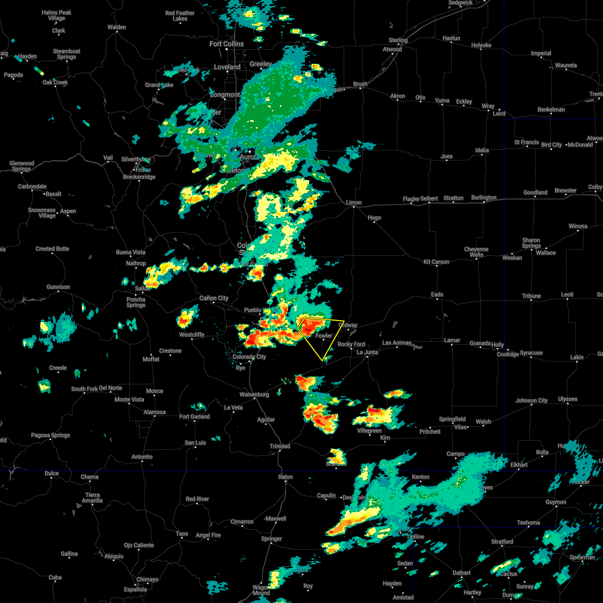 At 525 pm mdt, a severe thunderstorm was located 7 miles southeast of boone, or 26 miles east of pueblo, moving southeast at 20 mph (radar indicated). Hazards include 70 mph wind gusts and ping pong ball size hail. People and animals outdoors will be injured. expect hail damage to roofs, siding, windows, and vehicles. expect considerable tree damage. wind damage is also likely to mobile homes, roofs, and outbuildings. Locations impacted include, fowler, olney springs and boone. At 525 pm mdt, a severe thunderstorm was located 7 miles southeast of boone, or 26 miles east of pueblo, moving southeast at 20 mph (radar indicated). Hazards include 70 mph wind gusts and ping pong ball size hail. People and animals outdoors will be injured. expect hail damage to roofs, siding, windows, and vehicles. expect considerable tree damage. wind damage is also likely to mobile homes, roofs, and outbuildings. Locations impacted include, fowler, olney springs and boone.
|
| 7/1/2021 5:17 PM MDT |
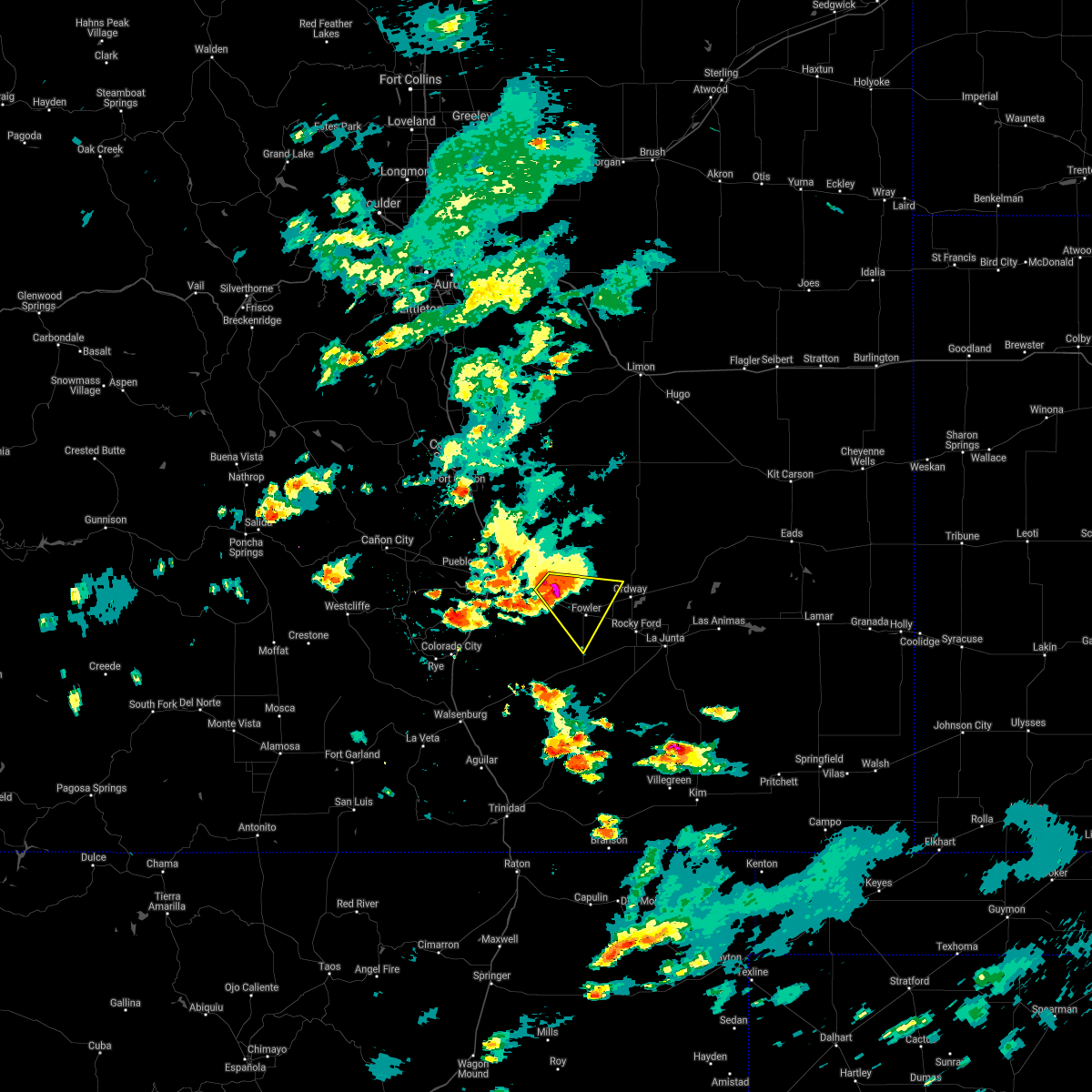 At 517 pm mdt, a severe thunderstorm was located near boone, or 24 miles east of pueblo, moving southeast at 20 mph (radar indicated). Hazards include two inch hail and 70 mph wind gusts. People and animals outdoors will be injured. expect hail damage to roofs, siding, windows, and vehicles. expect considerable tree damage. wind damage is also likely to mobile homes, roofs, and outbuildings. Locations impacted include, fowler, olney springs, boone and pueblo depot. At 517 pm mdt, a severe thunderstorm was located near boone, or 24 miles east of pueblo, moving southeast at 20 mph (radar indicated). Hazards include two inch hail and 70 mph wind gusts. People and animals outdoors will be injured. expect hail damage to roofs, siding, windows, and vehicles. expect considerable tree damage. wind damage is also likely to mobile homes, roofs, and outbuildings. Locations impacted include, fowler, olney springs, boone and pueblo depot.
|
| 7/1/2021 5:06 PM MDT |
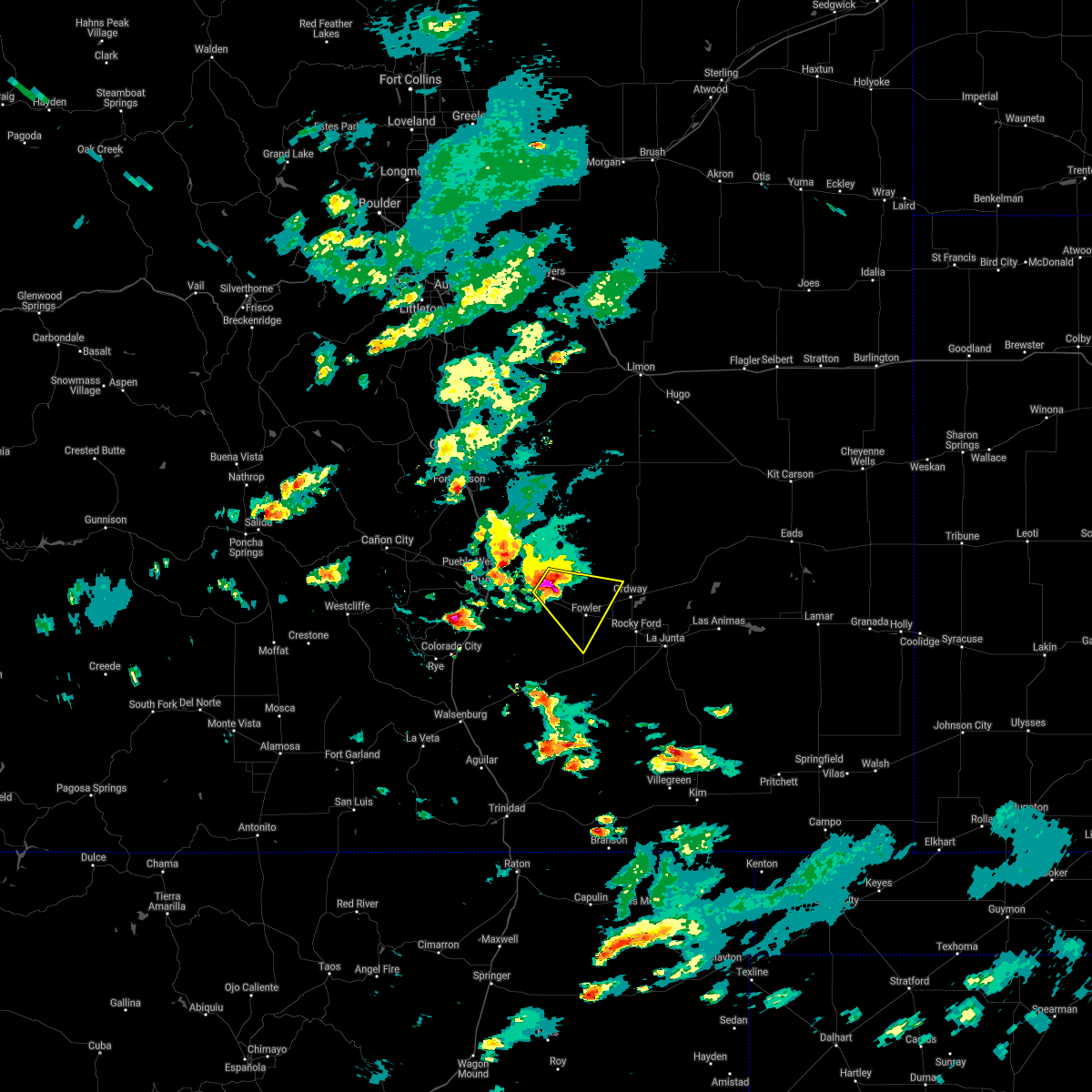 At 506 pm mdt, a severe thunderstorm was located over boone, or 21 miles east of pueblo, moving southeast at 20 mph. this is a very dangerous storm (radar indicated). Hazards include three inch hail and 70 mph wind gusts. People and animals outdoors will be severely injured. Expect shattered windows, extensive damage to roofs, siding, and vehicles. At 506 pm mdt, a severe thunderstorm was located over boone, or 21 miles east of pueblo, moving southeast at 20 mph. this is a very dangerous storm (radar indicated). Hazards include three inch hail and 70 mph wind gusts. People and animals outdoors will be severely injured. Expect shattered windows, extensive damage to roofs, siding, and vehicles.
|
| 5/16/2021 6:50 PM MDT |
 At 650 pm mdt, a severe thunderstorm was located near rocky ford, or 13 miles west of la junta, moving southeast at 25 mph (radar indicated). Hazards include 60 mph wind gusts and quarter size hail. Hail damage to vehicles is expected. expect wind damage to roofs, siding, and trees. Locations impacted include, rocky ford, manzanola, olney springs and crowley. At 650 pm mdt, a severe thunderstorm was located near rocky ford, or 13 miles west of la junta, moving southeast at 25 mph (radar indicated). Hazards include 60 mph wind gusts and quarter size hail. Hail damage to vehicles is expected. expect wind damage to roofs, siding, and trees. Locations impacted include, rocky ford, manzanola, olney springs and crowley.
|
| 5/16/2021 6:20 PM MDT |
 At 620 pm mdt, a severe thunderstorm was located 9 miles north of fowler, or 29 miles east of pueblo, moving southeast at 20 mph (radar indicated). Hazards include golf ball size hail and 60 mph wind gusts. People and animals outdoors will be injured. expect hail damage to roofs, siding, windows, and vehicles. Expect wind damage to roofs, siding, and trees. At 620 pm mdt, a severe thunderstorm was located 9 miles north of fowler, or 29 miles east of pueblo, moving southeast at 20 mph (radar indicated). Hazards include golf ball size hail and 60 mph wind gusts. People and animals outdoors will be injured. expect hail damage to roofs, siding, windows, and vehicles. Expect wind damage to roofs, siding, and trees.
|
| 5/2/2021 2:51 PM MDT |
 At 250 pm mdt, the leading edge of a line of severe wind gusts associated with thunderstorm activity was located along a line extending from 8 miles west of fowler to olney springs to 6 miles north of ordway, moving southeast at 45 mph (radar indicated). Hazards include 70 mph wind gusts and penny size hail. Expect considerable tree damage. damage is likely to mobile homes, roofs, and outbuildings. Locations impacted include, ordway, olney springs, sugar city and crowley. At 250 pm mdt, the leading edge of a line of severe wind gusts associated with thunderstorm activity was located along a line extending from 8 miles west of fowler to olney springs to 6 miles north of ordway, moving southeast at 45 mph (radar indicated). Hazards include 70 mph wind gusts and penny size hail. Expect considerable tree damage. damage is likely to mobile homes, roofs, and outbuildings. Locations impacted include, ordway, olney springs, sugar city and crowley.
|
| 5/2/2021 2:18 PM MDT |
 At 218 pm mdt, severe thunderstorms were located along a line extending from 7 miles northeast of pueblo depot to 16 miles southeast of truckton, moving southeast at 45 mph (radar indicated). Hazards include 70 mph wind gusts and penny size hail. Expect considerable tree damage. Damage is likely to mobile homes, roofs, and outbuildings. At 218 pm mdt, severe thunderstorms were located along a line extending from 7 miles northeast of pueblo depot to 16 miles southeast of truckton, moving southeast at 45 mph (radar indicated). Hazards include 70 mph wind gusts and penny size hail. Expect considerable tree damage. Damage is likely to mobile homes, roofs, and outbuildings.
|
| 8/10/2020 3:40 PM MDT |
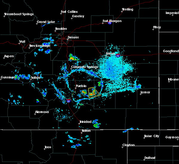 The severe thunderstorm warning for west central otero, southwestern crowley and east central pueblo counties will expire at 345 pm mdt, the storm which prompted the warning has weakened below severe limits, and no longer poses an immediate threat to life or property. therefore, the warning will be allowed to expire. however gusty winds and heavy rain are still possible with this thunderstorm. The severe thunderstorm warning for west central otero, southwestern crowley and east central pueblo counties will expire at 345 pm mdt, the storm which prompted the warning has weakened below severe limits, and no longer poses an immediate threat to life or property. therefore, the warning will be allowed to expire. however gusty winds and heavy rain are still possible with this thunderstorm.
|
| 8/10/2020 3:20 PM MDT |
 At 320 pm mdt, a severe thunderstorm was located over fowler, or 30 miles west of la junta, moving southeast at 10 mph (radar indicated). Hazards include 60 mph wind gusts and nickel size hail. Expect damage to roofs, siding, and trees. Locations impacted include, fowler and olney springs. At 320 pm mdt, a severe thunderstorm was located over fowler, or 30 miles west of la junta, moving southeast at 10 mph (radar indicated). Hazards include 60 mph wind gusts and nickel size hail. Expect damage to roofs, siding, and trees. Locations impacted include, fowler and olney springs.
|
| 8/10/2020 3:02 PM MDT |
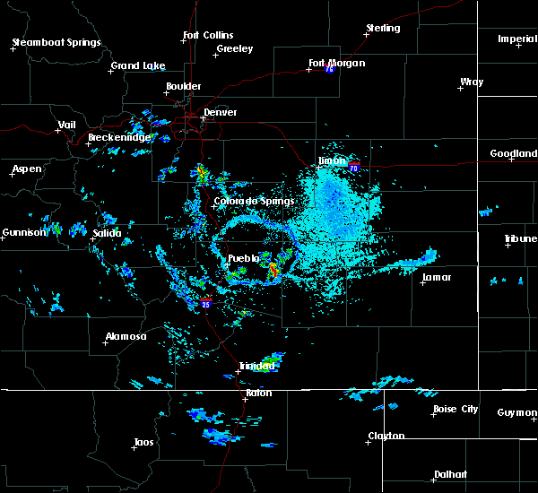 At 302 pm mdt, a severe thunderstorm was located near fowler, or 27 miles east of pueblo, moving south at 10 mph (radar indicated). Hazards include 60 mph wind gusts and nickel size hail. expect damage to roofs, siding, and trees At 302 pm mdt, a severe thunderstorm was located near fowler, or 27 miles east of pueblo, moving south at 10 mph (radar indicated). Hazards include 60 mph wind gusts and nickel size hail. expect damage to roofs, siding, and trees
|
| 8/4/2020 9:29 PM MDT |
 The severe thunderstorm warning for northwestern otero and southwestern crowley counties will expire at 930 pm mdt, the storm which prompted the warning has weakened below severe limits, and no longer poses an immediate threat to life or property. therefore, the warning will be allowed to expire. however small hail, gusty winds and heavy rain are still possible with this thunderstorm. The severe thunderstorm warning for northwestern otero and southwestern crowley counties will expire at 930 pm mdt, the storm which prompted the warning has weakened below severe limits, and no longer poses an immediate threat to life or property. therefore, the warning will be allowed to expire. however small hail, gusty winds and heavy rain are still possible with this thunderstorm.
|
| 8/4/2020 9:11 PM MDT |
 At 910 pm mdt, a severe thunderstorm was located just north of ordway, or 25 miles northwest of la junta, moving south at 25 mph (radar indicated). Hazards include ping pong ball size hail and 60 mph wind gusts. People and animals outdoors will be injured. expect hail damage to roofs, siding, windows, and vehicles. expect wind damage to roofs, siding, and trees. Locations impacted include, ordway, manzanola, olney springs, sugar city and crowley. At 910 pm mdt, a severe thunderstorm was located just north of ordway, or 25 miles northwest of la junta, moving south at 25 mph (radar indicated). Hazards include ping pong ball size hail and 60 mph wind gusts. People and animals outdoors will be injured. expect hail damage to roofs, siding, windows, and vehicles. expect wind damage to roofs, siding, and trees. Locations impacted include, ordway, manzanola, olney springs, sugar city and crowley.
|
| 8/4/2020 8:58 PM MDT |
 At 858 pm mdt, a severe thunderstorm was located 9 miles northwest of ordway, or 29 miles northwest of la junta, moving south at 25 mph (radar indicated). Hazards include ping pong ball size hail and 60 mph wind gusts. People and animals outdoors will be injured. expect hail damage to roofs, siding, windows, and vehicles. Expect wind damage to roofs, siding, and trees. At 858 pm mdt, a severe thunderstorm was located 9 miles northwest of ordway, or 29 miles northwest of la junta, moving south at 25 mph (radar indicated). Hazards include ping pong ball size hail and 60 mph wind gusts. People and animals outdoors will be injured. expect hail damage to roofs, siding, windows, and vehicles. Expect wind damage to roofs, siding, and trees.
|
| 8/4/2020 8:52 PM MDT |
 At 852 pm mdt, a severe thunderstorm was located 10 miles northwest of ordway, or 30 miles northwest of la junta, moving south at 35 mph (radar indicated). Hazards include ping pong ball size hail and 60 mph wind gusts. People and animals outdoors will be injured. expect hail damage to roofs, siding, windows, and vehicles. expect wind damage to roofs, siding, and trees. Locations impacted include, ordway, olney springs, sugar city and crowley. At 852 pm mdt, a severe thunderstorm was located 10 miles northwest of ordway, or 30 miles northwest of la junta, moving south at 35 mph (radar indicated). Hazards include ping pong ball size hail and 60 mph wind gusts. People and animals outdoors will be injured. expect hail damage to roofs, siding, windows, and vehicles. expect wind damage to roofs, siding, and trees. Locations impacted include, ordway, olney springs, sugar city and crowley.
|
| 8/4/2020 8:42 PM MDT |
 At 842 pm mdt, a severe thunderstorm was located 15 miles north of ordway, or 34 miles northwest of la junta, moving south at 35 mph (radar indicated). Hazards include golf ball size hail and 60 mph wind gusts. People and animals outdoors will be injured. expect hail damage to roofs, siding, windows, and vehicles. expect wind damage to roofs, siding, and trees. Locations impacted include, ordway, olney springs, sugar city and crowley. At 842 pm mdt, a severe thunderstorm was located 15 miles north of ordway, or 34 miles northwest of la junta, moving south at 35 mph (radar indicated). Hazards include golf ball size hail and 60 mph wind gusts. People and animals outdoors will be injured. expect hail damage to roofs, siding, windows, and vehicles. expect wind damage to roofs, siding, and trees. Locations impacted include, ordway, olney springs, sugar city and crowley.
|
| 8/4/2020 8:26 PM MDT |
 At 826 pm mdt, a severe thunderstorm was located 12 miles southwest of forder, or 42 miles northwest of la junta, moving south at 35 mph (radar indicated). Hazards include ping pong ball size hail and 60 mph wind gusts. People and animals outdoors will be injured. expect hail damage to roofs, siding, windows, and vehicles. Expect wind damage to roofs, siding, and trees. At 826 pm mdt, a severe thunderstorm was located 12 miles southwest of forder, or 42 miles northwest of la junta, moving south at 35 mph (radar indicated). Hazards include ping pong ball size hail and 60 mph wind gusts. People and animals outdoors will be injured. expect hail damage to roofs, siding, windows, and vehicles. Expect wind damage to roofs, siding, and trees.
|
| 7/15/2020 6:29 PM MDT |
 At 629 pm mdt, severe thunderstorms were located along a line extending from sugar city to near swink to near higbee, moving east at 30 mph (radar indicated). Hazards include 60 mph wind gusts and nickel size hail. Expect damage to roofs, siding, and trees. Locations impacted include, la junta, north la junta, rocky ford, las animas, ordway, swink, manzanola, olney springs, sugar city, cheraw, crowley, higbee and timpas. At 629 pm mdt, severe thunderstorms were located along a line extending from sugar city to near swink to near higbee, moving east at 30 mph (radar indicated). Hazards include 60 mph wind gusts and nickel size hail. Expect damage to roofs, siding, and trees. Locations impacted include, la junta, north la junta, rocky ford, las animas, ordway, swink, manzanola, olney springs, sugar city, cheraw, crowley, higbee and timpas.
|
| 7/15/2020 6:14 PM MDT |
 At 613 pm mdt, severe thunderstorms were located along a line extending from ordway to near rocky ford to near higbee, moving east at 30 mph (radar indicated). Hazards include 60 mph wind gusts and nickel size hail. Expect damage to roofs, siding, and trees. Locations impacted include, la junta, north la junta, rocky ford, las animas, fowler, ordway, swink, manzanola, olney springs, sugar city, cheraw, crowley, higbee and timpas. At 613 pm mdt, severe thunderstorms were located along a line extending from ordway to near rocky ford to near higbee, moving east at 30 mph (radar indicated). Hazards include 60 mph wind gusts and nickel size hail. Expect damage to roofs, siding, and trees. Locations impacted include, la junta, north la junta, rocky ford, las animas, fowler, ordway, swink, manzanola, olney springs, sugar city, cheraw, crowley, higbee and timpas.
|
| 7/15/2020 6:00 PM MDT |
 At 549 pm mdt, a severe thunderstorm was located over olney springs, or 24 miles northwest of la junta, moving northeast at 40 mph (radar indicated). Hazards include 60 mph wind gusts and nickel size hail. Expect damage to roofs, siding, and trees. Locations impacted include, fowler, olney springs and crowley. At 549 pm mdt, a severe thunderstorm was located over olney springs, or 24 miles northwest of la junta, moving northeast at 40 mph (radar indicated). Hazards include 60 mph wind gusts and nickel size hail. Expect damage to roofs, siding, and trees. Locations impacted include, fowler, olney springs and crowley.
|
| 7/15/2020 5:58 PM MDT |
 At 557 pm mdt, severe thunderstorms were located along a line extending from near olney springs to 7 miles southwest of rocky ford to near timpas, moving east at 30 mph (radar indicated). Hazards include 60 mph wind gusts and nickel size hail. expect damage to roofs, siding, and trees At 557 pm mdt, severe thunderstorms were located along a line extending from near olney springs to 7 miles southwest of rocky ford to near timpas, moving east at 30 mph (radar indicated). Hazards include 60 mph wind gusts and nickel size hail. expect damage to roofs, siding, and trees
|
| 7/15/2020 5:49 PM MDT |
 At 549 pm mdt, a severe thunderstorm was located over olney springs, or 24 miles northwest of la junta, moving northeast at 40 mph (radar indicated). Hazards include 60 mph wind gusts and nickel size hail. Expect damage to roofs, siding, and trees. Locations impacted include, fowler, olney springs and crowley. At 549 pm mdt, a severe thunderstorm was located over olney springs, or 24 miles northwest of la junta, moving northeast at 40 mph (radar indicated). Hazards include 60 mph wind gusts and nickel size hail. Expect damage to roofs, siding, and trees. Locations impacted include, fowler, olney springs and crowley.
|
| 7/15/2020 5:37 PM MDT |
 At 537 pm mdt, a severe thunderstorm was located 7 miles west of fowler, or 25 miles east of pueblo, moving northeast at 30 mph (radar indicated). Hazards include 60 mph wind gusts and nickel size hail. Expect damage to roofs, siding, and trees. Locations impacted include, fowler, olney springs, boone, crowley, avondale and pueblo depot. At 537 pm mdt, a severe thunderstorm was located 7 miles west of fowler, or 25 miles east of pueblo, moving northeast at 30 mph (radar indicated). Hazards include 60 mph wind gusts and nickel size hail. Expect damage to roofs, siding, and trees. Locations impacted include, fowler, olney springs, boone, crowley, avondale and pueblo depot.
|
| 7/15/2020 5:25 PM MDT |
 At 525 pm mdt, a severe thunderstorm was located 11 miles southeast of avondale, or 22 miles southeast of pueblo, moving northeast at 30 mph (radar indicated). Hazards include 60 mph wind gusts and nickel size hail. expect damage to roofs, siding, and trees At 525 pm mdt, a severe thunderstorm was located 11 miles southeast of avondale, or 22 miles southeast of pueblo, moving northeast at 30 mph (radar indicated). Hazards include 60 mph wind gusts and nickel size hail. expect damage to roofs, siding, and trees
|
| 7/14/2020 6:30 PM MDT |
 At 630 pm mdt, a severe thunderstorm capable of producing a tornado was located near ordway, or 15 miles northwest of la junta, moving southeast at 25 mph (radar indicated rotation). Hazards include tornado and tennis ball size hail. Flying debris will be dangerous to those caught without shelter. mobile homes will be damaged or destroyed. damage to roofs, windows, and vehicles will occur. tree damage is likely. this dangerous storm will be near, rocky ford around 640 pm mdt. Swink around 650 pm mdt. At 630 pm mdt, a severe thunderstorm capable of producing a tornado was located near ordway, or 15 miles northwest of la junta, moving southeast at 25 mph (radar indicated rotation). Hazards include tornado and tennis ball size hail. Flying debris will be dangerous to those caught without shelter. mobile homes will be damaged or destroyed. damage to roofs, windows, and vehicles will occur. tree damage is likely. this dangerous storm will be near, rocky ford around 640 pm mdt. Swink around 650 pm mdt.
|
| 7/14/2020 6:21 PM MDT |
 At 621 pm mdt, a severe thunderstorm capable of producing a tornado was located over crowley, or 20 miles northwest of la junta, moving southeast at 25 mph (radar indicated rotation). Hazards include tornado. Flying debris will be dangerous to those caught without shelter. mobile homes will be damaged or destroyed. damage to roofs, windows, and vehicles will occur. tree damage is likely. this dangerous storm will be near, ordway around 625 pm mdt. sugar city around 635 pm mdt. rocky ford around 640 pm mdt. Swink around 655 pm mdt. At 621 pm mdt, a severe thunderstorm capable of producing a tornado was located over crowley, or 20 miles northwest of la junta, moving southeast at 25 mph (radar indicated rotation). Hazards include tornado. Flying debris will be dangerous to those caught without shelter. mobile homes will be damaged or destroyed. damage to roofs, windows, and vehicles will occur. tree damage is likely. this dangerous storm will be near, ordway around 625 pm mdt. sugar city around 635 pm mdt. rocky ford around 640 pm mdt. Swink around 655 pm mdt.
|
| 7/14/2020 6:13 PM MDT |
 At 613 pm mdt, a severe thunderstorm capable of producing a tornado was located over crowley, or 23 miles northwest of la junta, moving southeast at 25 mph (radar indicated rotation). Hazards include tornado. Flying debris will be dangerous to those caught without shelter. mobile homes will be damaged or destroyed. damage to roofs, windows, and vehicles will occur. tree damage is likely. this dangerous storm will be near, manzanola around 620 pm mdt. ordway around 625 pm mdt. sugar city around 635 pm mdt. rocky ford around 640 pm mdt. Swink around 645 pm mdt. At 613 pm mdt, a severe thunderstorm capable of producing a tornado was located over crowley, or 23 miles northwest of la junta, moving southeast at 25 mph (radar indicated rotation). Hazards include tornado. Flying debris will be dangerous to those caught without shelter. mobile homes will be damaged or destroyed. damage to roofs, windows, and vehicles will occur. tree damage is likely. this dangerous storm will be near, manzanola around 620 pm mdt. ordway around 625 pm mdt. sugar city around 635 pm mdt. rocky ford around 640 pm mdt. Swink around 645 pm mdt.
|
| 7/14/2020 5:47 PM MDT |
 At 545 pm mdt, a severe thunderstorm was located 18 miles southwest of forder, or 38 miles northeast of pueblo, moving east at 25 mph. multipple severe storms were in the eastern pueblo county and crowley countyareas. in addition, a tornado warning remains in effect for centraly crowley county (radar indicated). Hazards include 70 mph wind gusts and ping pong ball size hail. People and animals outdoors will be injured. expect hail damage to roofs, siding, windows, and vehicles. expect considerable tree damage. wind damage is also likely to mobile homes, roofs, and outbuildings. Locations impacted include, ordway, olney springs, sugar city and crowley. At 545 pm mdt, a severe thunderstorm was located 18 miles southwest of forder, or 38 miles northeast of pueblo, moving east at 25 mph. multipple severe storms were in the eastern pueblo county and crowley countyareas. in addition, a tornado warning remains in effect for centraly crowley county (radar indicated). Hazards include 70 mph wind gusts and ping pong ball size hail. People and animals outdoors will be injured. expect hail damage to roofs, siding, windows, and vehicles. expect considerable tree damage. wind damage is also likely to mobile homes, roofs, and outbuildings. Locations impacted include, ordway, olney springs, sugar city and crowley.
|
| 7/14/2020 5:18 PM MDT |
 The national weather service in pueblo has issued a * severe thunderstorm warning for. crowley county in southeastern colorado. northeastern pueblo county in southeastern colorado. until 600 pm mdt. At 517 pm mdt, a severe thunderstorm was located 13 miles south of. The national weather service in pueblo has issued a * severe thunderstorm warning for. crowley county in southeastern colorado. northeastern pueblo county in southeastern colorado. until 600 pm mdt. At 517 pm mdt, a severe thunderstorm was located 13 miles south of.
|
| 7/4/2020 4:51 PM MDT |
 At 450 pm mdt, a severe thunderstorm was located 12 miles southwest of fowler, or 30 miles southeast of pueblo, moving north at 15 mph (radar indicated). Hazards include 60 mph wind gusts and half dollar size hail. Hail damage to vehicles is expected. expect wind damage to roofs, siding, and trees. Locations impacted include, fowler and olney springs and rural areas of pueblo county. At 450 pm mdt, a severe thunderstorm was located 12 miles southwest of fowler, or 30 miles southeast of pueblo, moving north at 15 mph (radar indicated). Hazards include 60 mph wind gusts and half dollar size hail. Hail damage to vehicles is expected. expect wind damage to roofs, siding, and trees. Locations impacted include, fowler and olney springs and rural areas of pueblo county.
|
| 7/4/2020 4:42 PM MDT |
 At 441 pm mdt, a severe thunderstorm was located 14 miles southwest of fowler, or 31 miles southeast of pueblo, moving north at 20 mph (radar indicated). Hazards include 60 mph wind gusts and quarter size hail. Hail damage to vehicles is expected. Expect wind damage to roofs, siding, and trees. At 441 pm mdt, a severe thunderstorm was located 14 miles southwest of fowler, or 31 miles southeast of pueblo, moving north at 20 mph (radar indicated). Hazards include 60 mph wind gusts and quarter size hail. Hail damage to vehicles is expected. Expect wind damage to roofs, siding, and trees.
|
| 6/6/2020 5:44 PM MDT |
 At 543 pm mdt, a severe thunderstorm was located near pueblo depot, or 19 miles northeast of pueblo, moving northeast at 40 mph (radar indicated). Hazards include 70 mph wind gusts and penny size hail. Expect considerable tree damage. damage is likely to mobile homes, roofs, and outbuildings. Locations impacted include, eastern pueblo, fowler, manzanola, olney springs, boone, hanover, truckton, yoder, ellicott, pueblo depot, blende, avondale and rush. At 543 pm mdt, a severe thunderstorm was located near pueblo depot, or 19 miles northeast of pueblo, moving northeast at 40 mph (radar indicated). Hazards include 70 mph wind gusts and penny size hail. Expect considerable tree damage. damage is likely to mobile homes, roofs, and outbuildings. Locations impacted include, eastern pueblo, fowler, manzanola, olney springs, boone, hanover, truckton, yoder, ellicott, pueblo depot, blende, avondale and rush.
|
| 6/6/2020 5:30 PM MDT |
 At 529 pm mdt, a severe thunderstorm was located near pueblo depot, or 13 miles east of pueblo, moving northeast at 65 mph. this is a very dangerous storm (radar indicated). Hazards include 80 mph wind gusts and quarter size hail. Flying debris will be dangerous to those caught without shelter. mobile homes will be heavily damaged. expect considerable damage to roofs, windows, and vehicles. extensive tree damage and power outages are likely. Locations impacted include, pueblo, fowler, manzanola, olney springs, boone, crowley, hanover, truckton, yoder, salt creek, ellicott, pueblo depot, blende, avondale and rush. At 529 pm mdt, a severe thunderstorm was located near pueblo depot, or 13 miles east of pueblo, moving northeast at 65 mph. this is a very dangerous storm (radar indicated). Hazards include 80 mph wind gusts and quarter size hail. Flying debris will be dangerous to those caught without shelter. mobile homes will be heavily damaged. expect considerable damage to roofs, windows, and vehicles. extensive tree damage and power outages are likely. Locations impacted include, pueblo, fowler, manzanola, olney springs, boone, crowley, hanover, truckton, yoder, salt creek, ellicott, pueblo depot, blende, avondale and rush.
|
| 6/6/2020 5:21 PM MDT |
 At 520 pm mdt, a severe thunderstorm was located near blende, or 9 miles southeast of pueblo, moving northeast at 65 mph. this is a very dangerous storm (radar indicated). Hazards include 80 mph wind gusts and quarter size hail. Flying debris will be dangerous to those caught without shelter. mobile homes will be heavily damaged. expect considerable damage to roofs, windows, and vehicles. extensive tree damage and power outages are likely. Locations impacted include, pueblo, fowler, manzanola, olney springs, boone, crowley, hanover, truckton, yoder, salt creek, ellicott, pueblo depot, blende, avondale and rush. At 520 pm mdt, a severe thunderstorm was located near blende, or 9 miles southeast of pueblo, moving northeast at 65 mph. this is a very dangerous storm (radar indicated). Hazards include 80 mph wind gusts and quarter size hail. Flying debris will be dangerous to those caught without shelter. mobile homes will be heavily damaged. expect considerable damage to roofs, windows, and vehicles. extensive tree damage and power outages are likely. Locations impacted include, pueblo, fowler, manzanola, olney springs, boone, crowley, hanover, truckton, yoder, salt creek, ellicott, pueblo depot, blende, avondale and rush.
|
| 6/6/2020 5:11 PM MDT |
 At 510 pm mdt, a severe thunderstorm was located 13 miles south of salt creek, or 15 miles south of pueblo, moving northeast at 65 mph. this is a very dangerous storm (radar indicated). Hazards include 80 mph wind gusts and quarter size hail. Flying debris will be dangerous to those caught without shelter. mobile homes will be heavily damaged. expect considerable damage to roofs, windows, and vehicles. Extensive tree damage and power outages are likely. At 510 pm mdt, a severe thunderstorm was located 13 miles south of salt creek, or 15 miles south of pueblo, moving northeast at 65 mph. this is a very dangerous storm (radar indicated). Hazards include 80 mph wind gusts and quarter size hail. Flying debris will be dangerous to those caught without shelter. mobile homes will be heavily damaged. expect considerable damage to roofs, windows, and vehicles. Extensive tree damage and power outages are likely.
|
| 7/27/2019 6:41 PM MDT |
 The severe thunderstorm warning for southeastern el paso, western crowley and northeastern pueblo counties will expire at 645 pm mdt, the storms which prompted the warning have weakened below severe limits, and no longer pose an immediate threat to life or property. therefore, the warning will be allowed to expire. however gusty winds are still possible with these thunderstorms. The severe thunderstorm warning for southeastern el paso, western crowley and northeastern pueblo counties will expire at 645 pm mdt, the storms which prompted the warning have weakened below severe limits, and no longer pose an immediate threat to life or property. therefore, the warning will be allowed to expire. however gusty winds are still possible with these thunderstorms.
|
| 7/27/2019 6:25 PM MDT |
 At 624 pm mdt, severe thunderstorms were located along a line extending from 14 miles northeast of pueblo depot to near boone, moving east at 45 mph (radar indicated). Hazards include 60 mph wind gusts. Expect damage to roofs, siding, and trees. Locations impacted include, olney springs, boone, crowley, avondale and pueblo depot. At 624 pm mdt, severe thunderstorms were located along a line extending from 14 miles northeast of pueblo depot to near boone, moving east at 45 mph (radar indicated). Hazards include 60 mph wind gusts. Expect damage to roofs, siding, and trees. Locations impacted include, olney springs, boone, crowley, avondale and pueblo depot.
|
| 7/27/2019 6:04 PM MDT |
 At 603 pm mdt, severe thunderstorms were located along a line extending from 7 miles south of hanover to near blende, moving east at 45 mph (radar indicated). Hazards include 60 mph wind gusts. expect damage to roofs, siding, and trees At 603 pm mdt, severe thunderstorms were located along a line extending from 7 miles south of hanover to near blende, moving east at 45 mph (radar indicated). Hazards include 60 mph wind gusts. expect damage to roofs, siding, and trees
|
| 7/20/2019 6:58 PM MDT |
 At 657 pm mdt, a severe thunderstorm was located near blue lake, or 22 miles northeast of north la junta, moving east at 50 mph (la junta airport weather station). Hazards include 60 to 70 mph winds. at 6:45 pm, the weather station at la junta airport measured a wind of 67 mph. Expect considerable tree damage. damage is likely to mobile homes, roofs, and outbuildings. Locations impacted include, la junta, north la junta, rocky ford, las animas, fowler, ordway, swink, manzanola, olney springs, sugar city, cheraw, crowley, higbee, blue lake, timpas, arlington, john martin reservoir and fort lyon. At 657 pm mdt, a severe thunderstorm was located near blue lake, or 22 miles northeast of north la junta, moving east at 50 mph (la junta airport weather station). Hazards include 60 to 70 mph winds. at 6:45 pm, the weather station at la junta airport measured a wind of 67 mph. Expect considerable tree damage. damage is likely to mobile homes, roofs, and outbuildings. Locations impacted include, la junta, north la junta, rocky ford, las animas, fowler, ordway, swink, manzanola, olney springs, sugar city, cheraw, crowley, higbee, blue lake, timpas, arlington, john martin reservoir and fort lyon.
|
| 7/20/2019 6:51 PM MDT |
 At 648 pm mdt, a severe thunderstorms were located over crowley and otero counties. a tornadic storm was noted over central crowley county while other severe storms were noted just west of la junta. the dangerous severe storms were moving east at 50 mph. residents in crowley and otero counties should seek shelter from these storms. locations impacted include, la junta, north la junta, rocky ford, las animas, fowler, ordway, swink, manzanola, olney springs, sugar city, cheraw, crowley, higbee, blue lake, timpas, arlington, john martin reservoir and fort lyon. At 648 pm mdt, a severe thunderstorms were located over crowley and otero counties. a tornadic storm was noted over central crowley county while other severe storms were noted just west of la junta. the dangerous severe storms were moving east at 50 mph. residents in crowley and otero counties should seek shelter from these storms. locations impacted include, la junta, north la junta, rocky ford, las animas, fowler, ordway, swink, manzanola, olney springs, sugar city, cheraw, crowley, higbee, blue lake, timpas, arlington, john martin reservoir and fort lyon.
|
| 7/20/2019 6:31 PM MDT |
 At 630 pm mdt, a severe thunderstorm was located over sugar city, or 20 miles north of la junta, moving east at 40 mph. other strong to severe storms were noted near swink and rocky ford (radar indicated). Hazards include 70 mph wind gusts and half dollar size hail. Hail damage to vehicles is expected. expect considerable tree damage. wind damage is also likely to mobile homes, roofs, and outbuildings. Locations impacted include, la junta, north la junta, rocky ford, las animas, fowler, ordway, swink, manzanola, olney springs, sugar city, cheraw, crowley, higbee, blue lake, timpas, arlington, john martin reservoir and fort lyon. At 630 pm mdt, a severe thunderstorm was located over sugar city, or 20 miles north of la junta, moving east at 40 mph. other strong to severe storms were noted near swink and rocky ford (radar indicated). Hazards include 70 mph wind gusts and half dollar size hail. Hail damage to vehicles is expected. expect considerable tree damage. wind damage is also likely to mobile homes, roofs, and outbuildings. Locations impacted include, la junta, north la junta, rocky ford, las animas, fowler, ordway, swink, manzanola, olney springs, sugar city, cheraw, crowley, higbee, blue lake, timpas, arlington, john martin reservoir and fort lyon.
|
| 7/20/2019 6:21 PM MDT |
 At 621 pm mdt, a severe thunderstorm was located near ordway, or 22 miles northwest of la junta, moving east at 50 mph (radar indicated). Hazards include 60 mph wind gusts and quarter size hail. Hail damage to vehicles is expected. expect wind damage to roofs, siding, and trees. Locations impacted include, la junta, north la junta, rocky ford, las animas, fowler, ordway, swink, manzanola, olney springs, sugar city, cheraw, crowley, higbee, blue lake, timpas, arlington, john martin reservoir and fort lyon. At 621 pm mdt, a severe thunderstorm was located near ordway, or 22 miles northwest of la junta, moving east at 50 mph (radar indicated). Hazards include 60 mph wind gusts and quarter size hail. Hail damage to vehicles is expected. expect wind damage to roofs, siding, and trees. Locations impacted include, la junta, north la junta, rocky ford, las animas, fowler, ordway, swink, manzanola, olney springs, sugar city, cheraw, crowley, higbee, blue lake, timpas, arlington, john martin reservoir and fort lyon.
|
| 7/20/2019 6:10 PM MDT |
 At 610 pm mdt, a severe thunderstorm was located 8 miles north of crowley, or 29 miles northwest of la junta, moving east at 50 mph (radar indicated). Hazards include 60 mph wind gusts and quarter size hail. Hail damage to vehicles is expected. Expect wind damage to roofs, siding, and trees. At 610 pm mdt, a severe thunderstorm was located 8 miles north of crowley, or 29 miles northwest of la junta, moving east at 50 mph (radar indicated). Hazards include 60 mph wind gusts and quarter size hail. Hail damage to vehicles is expected. Expect wind damage to roofs, siding, and trees.
|
| 7/20/2019 5:32 PM MDT |
 At 532 pm mdt, a severe thunderstorm was located 13 miles southeast of hanover, or 28 miles northeast of pueblo, moving southeast at 20 mph (radar indicated). Hazards include 70 mph wind gusts and half dollar size hail. Hail damage to vehicles is expected. expect considerable tree damage. wind damage is also likely to mobile homes, roofs, and outbuildings. Locations impacted include, fowler, manzanola, olney springs, boone, crowley, hanover, truckton, schriever afb and pueblo depot. At 532 pm mdt, a severe thunderstorm was located 13 miles southeast of hanover, or 28 miles northeast of pueblo, moving southeast at 20 mph (radar indicated). Hazards include 70 mph wind gusts and half dollar size hail. Hail damage to vehicles is expected. expect considerable tree damage. wind damage is also likely to mobile homes, roofs, and outbuildings. Locations impacted include, fowler, manzanola, olney springs, boone, crowley, hanover, truckton, schriever afb and pueblo depot.
|
| 7/20/2019 5:17 PM MDT |
 At 516 pm mdt, a severe thunderstorm was located 8 miles southeast of hanover, or 27 miles northeast of pueblo, moving southeast at 20 mph (radar indicated). Hazards include 70 mph wind gusts and half dollar size hail. Hail damage to vehicles is expected. expect considerable tree damage. Wind damage is also likely to mobile homes, roofs, and outbuildings. At 516 pm mdt, a severe thunderstorm was located 8 miles southeast of hanover, or 27 miles northeast of pueblo, moving southeast at 20 mph (radar indicated). Hazards include 70 mph wind gusts and half dollar size hail. Hail damage to vehicles is expected. expect considerable tree damage. Wind damage is also likely to mobile homes, roofs, and outbuildings.
|
| 7/5/2019 11:28 PM MDT |
 The severe thunderstorm warning for northern otero and southern crowley counties will expire at 1130 pm mdt, the storm which prompted the warning has weakened below severe limits, and no longer poses an immediate threat to life or property. therefore, the warning will be allowed to expire. however small hail is still possible with this thunderstorm. The severe thunderstorm warning for northern otero and southern crowley counties will expire at 1130 pm mdt, the storm which prompted the warning has weakened below severe limits, and no longer poses an immediate threat to life or property. therefore, the warning will be allowed to expire. however small hail is still possible with this thunderstorm.
|
| 7/5/2019 10:59 PM MDT |
 At 1058 pm mdt, a severe thunderstorm was located over olney springs, or 22 miles northwest of la junta, moving southeast at 20 mph (radar indicated). Hazards include ping pong ball size hail and 60 mph wind gusts. People and animals outdoors will be injured. expect hail damage to roofs, siding, windows, and vehicles. expect wind damage to roofs, siding, and trees. Locations impacted include, rocky ford, ordway, manzanola, olney springs, cheraw and crowley. At 1058 pm mdt, a severe thunderstorm was located over olney springs, or 22 miles northwest of la junta, moving southeast at 20 mph (radar indicated). Hazards include ping pong ball size hail and 60 mph wind gusts. People and animals outdoors will be injured. expect hail damage to roofs, siding, windows, and vehicles. expect wind damage to roofs, siding, and trees. Locations impacted include, rocky ford, ordway, manzanola, olney springs, cheraw and crowley.
|
| 7/5/2019 10:45 PM MDT |
 At 1045 pm mdt, a severe thunderstorm was located over olney springs, or 26 miles northwest of la junta, moving southeast at 20 mph (radar indicated). Hazards include ping pong ball size hail and 60 mph wind gusts. People and animals outdoors will be injured. expect hail damage to roofs, siding, windows, and vehicles. Expect wind damage to roofs, siding, and trees. At 1045 pm mdt, a severe thunderstorm was located over olney springs, or 26 miles northwest of la junta, moving southeast at 20 mph (radar indicated). Hazards include ping pong ball size hail and 60 mph wind gusts. People and animals outdoors will be injured. expect hail damage to roofs, siding, windows, and vehicles. Expect wind damage to roofs, siding, and trees.
|
| 7/5/2019 10:32 PM MDT |
 At 1032 pm mdt, a severe thunderstorm was located over olney springs, or 26 miles northwest of la junta, moving southeast at 35 mph (radar indicated). Hazards include ping pong ball size hail and 60 mph wind gusts. People and animals outdoors will be injured. expect hail damage to roofs, siding, windows, and vehicles. expect wind damage to roofs, siding, and trees. Locations impacted include, fowler, ordway, manzanola, olney springs, sugar city and crowley. At 1032 pm mdt, a severe thunderstorm was located over olney springs, or 26 miles northwest of la junta, moving southeast at 35 mph (radar indicated). Hazards include ping pong ball size hail and 60 mph wind gusts. People and animals outdoors will be injured. expect hail damage to roofs, siding, windows, and vehicles. expect wind damage to roofs, siding, and trees. Locations impacted include, fowler, ordway, manzanola, olney springs, sugar city and crowley.
|
| 7/5/2019 10:16 PM MDT |
 At 1015 pm mdt, a severe thunderstorm was located 9 miles east of boone, or 28 miles east of pueblo, moving southeast at 35 mph (radar indicated). Hazards include ping pong ball size hail and 60 mph wind gusts. People and animals outdoors will be injured. expect hail damage to roofs, siding, windows, and vehicles. Expect wind damage to roofs, siding, and trees. At 1015 pm mdt, a severe thunderstorm was located 9 miles east of boone, or 28 miles east of pueblo, moving southeast at 35 mph (radar indicated). Hazards include ping pong ball size hail and 60 mph wind gusts. People and animals outdoors will be injured. expect hail damage to roofs, siding, windows, and vehicles. Expect wind damage to roofs, siding, and trees.
|
| 6/21/2019 8:22 PM MDT |
 The severe thunderstorm warning for western otero, southwestern crowley and eastern pueblo counties will expire at 830 pm mdt, the storm which prompted the warning has weakened below severe limits, and no longer poses an immediate threat to life or property. therefore, the warning will be allowed to expire. however small hail and gusty winds are still possible with this thunderstorm. to report severe weather, contact your nearest law enforcement agency. they will relay your report to the national weather service pueblo. The severe thunderstorm warning for western otero, southwestern crowley and eastern pueblo counties will expire at 830 pm mdt, the storm which prompted the warning has weakened below severe limits, and no longer poses an immediate threat to life or property. therefore, the warning will be allowed to expire. however small hail and gusty winds are still possible with this thunderstorm. to report severe weather, contact your nearest law enforcement agency. they will relay your report to the national weather service pueblo.
|
| 6/21/2019 8:17 PM MDT |
 At 816 pm mdt, a severe thunderstorm was located near olney springs, or 30 miles northwest of la junta, moving northeast at 20 mph (radar indicated). Hazards include 60 mph wind gusts and quarter size hail. Hail damage to vehicles is expected. expect wind damage to roofs, siding, and trees. Locations impacted include, fowler, olney springs and crowley. At 816 pm mdt, a severe thunderstorm was located near olney springs, or 30 miles northwest of la junta, moving northeast at 20 mph (radar indicated). Hazards include 60 mph wind gusts and quarter size hail. Hail damage to vehicles is expected. expect wind damage to roofs, siding, and trees. Locations impacted include, fowler, olney springs and crowley.
|
| 6/21/2019 8:05 PM MDT |
 At 758 pm mdt, a severe thunderstorm was located near fowler, or 29 miles east of pueblo, moving east at 20 mph (radar indicated). Hazards include 60 mph wind gusts and half dollar size hail. Hail damage to vehicles is expected. Expect wind damage to roofs, siding, and trees. At 758 pm mdt, a severe thunderstorm was located near fowler, or 29 miles east of pueblo, moving east at 20 mph (radar indicated). Hazards include 60 mph wind gusts and half dollar size hail. Hail damage to vehicles is expected. Expect wind damage to roofs, siding, and trees.
|
| 6/21/2019 7:58 PM MDT |
 At 758 pm mdt, a severe thunderstorm was located near fowler, or 29 miles east of pueblo, moving east at 20 mph (radar indicated). Hazards include 60 mph wind gusts and half dollar size hail. Hail damage to vehicles is expected. Expect wind damage to roofs, siding, and trees. At 758 pm mdt, a severe thunderstorm was located near fowler, or 29 miles east of pueblo, moving east at 20 mph (radar indicated). Hazards include 60 mph wind gusts and half dollar size hail. Hail damage to vehicles is expected. Expect wind damage to roofs, siding, and trees.
|
| 6/18/2019 4:41 PM MDT |
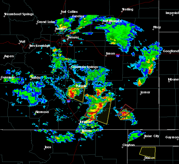 At 441 pm mdt, a severe thunderstorm was located over manzanola, or 21 miles northwest of la junta, moving southeast at 25 mph (radar indicated). Hazards include 60 mph wind gusts and quarter size hail. Hail damage to vehicles is expected. Expect wind damage to roofs, siding, and trees. At 441 pm mdt, a severe thunderstorm was located over manzanola, or 21 miles northwest of la junta, moving southeast at 25 mph (radar indicated). Hazards include 60 mph wind gusts and quarter size hail. Hail damage to vehicles is expected. Expect wind damage to roofs, siding, and trees.
|
| 6/18/2019 4:18 PM MDT |
 At 418 pm mdt, a severe thunderstorm was located near olney springs, or 28 miles northwest of la junta, moving southeast at 25 mph (radar indicated). Hazards include 60 mph wind gusts and quarter size hail. Hail damage to vehicles is expected. expect wind damage to roofs, siding, and trees. Locations impacted include, fowler, olney springs and crowley. At 418 pm mdt, a severe thunderstorm was located near olney springs, or 28 miles northwest of la junta, moving southeast at 25 mph (radar indicated). Hazards include 60 mph wind gusts and quarter size hail. Hail damage to vehicles is expected. expect wind damage to roofs, siding, and trees. Locations impacted include, fowler, olney springs and crowley.
|
| 6/18/2019 4:03 PM MDT |
 At 403 pm mdt, a severe thunderstorm was located 8 miles east of boone, or 27 miles east of pueblo, moving southeast at 25 mph (radar indicated). Hazards include 60 mph wind gusts and quarter size hail. Hail damage to vehicles is expected. Expect wind damage to roofs, siding, and trees. At 403 pm mdt, a severe thunderstorm was located 8 miles east of boone, or 27 miles east of pueblo, moving southeast at 25 mph (radar indicated). Hazards include 60 mph wind gusts and quarter size hail. Hail damage to vehicles is expected. Expect wind damage to roofs, siding, and trees.
|
| 8/8/2018 12:11 PM MDT |
 At 1210 pm mdt, a severe thunderstorm was located 13 miles north of crowley, or 34 miles northwest of la junta, moving southeast at 30 mph (radar indicated). Hazards include 60 mph wind gusts and quarter size hail. Hail damage to vehicles is expected. expect wind damage to roofs, siding, and trees. Locations impacted include, ordway, olney springs, sugar city and crowley. At 1210 pm mdt, a severe thunderstorm was located 13 miles north of crowley, or 34 miles northwest of la junta, moving southeast at 30 mph (radar indicated). Hazards include 60 mph wind gusts and quarter size hail. Hail damage to vehicles is expected. expect wind damage to roofs, siding, and trees. Locations impacted include, ordway, olney springs, sugar city and crowley.
|
| 8/8/2018 11:52 AM MDT |
 At 1152 am mdt, a severe thunderstorm was located 19 miles southeast of truckton, or 36 miles northeast of pueblo, moving southeast at 30 mph (radar indicated). Hazards include quarter size hail. damage to vehicles is expected At 1152 am mdt, a severe thunderstorm was located 19 miles southeast of truckton, or 36 miles northeast of pueblo, moving southeast at 30 mph (radar indicated). Hazards include quarter size hail. damage to vehicles is expected
|
| 8/6/2018 5:14 PM MDT |
 At 514 pm mdt, a severe thunderstorm was located over crowley, or 24 miles northwest of la junta, moving east at 25 mph (radar indicated). Hazards include two inch hail and 60 mph wind gusts. People and animals outdoors will be injured. expect hail damage to roofs, siding, windows, and vehicles. Expect wind damage to roofs, siding, and trees. At 514 pm mdt, a severe thunderstorm was located over crowley, or 24 miles northwest of la junta, moving east at 25 mph (radar indicated). Hazards include two inch hail and 60 mph wind gusts. People and animals outdoors will be injured. expect hail damage to roofs, siding, windows, and vehicles. Expect wind damage to roofs, siding, and trees.
|
| 8/6/2018 4:57 PM MDT |
 At 457 pm mdt, a severe thunderstorm was located over olney springs, or 25 miles northwest of la junta, moving southeast at 25 mph. this is a very dangerous storm (radar indicated). Hazards include three inch hail and 60 mph wind gusts. People and animals outdoors will be severely injured. expect shattered windows, extensive damage to roofs, siding, and vehicles. Locations impacted include, fowler, ordway, manzanola, olney springs, sugar city and crowley. At 457 pm mdt, a severe thunderstorm was located over olney springs, or 25 miles northwest of la junta, moving southeast at 25 mph. this is a very dangerous storm (radar indicated). Hazards include three inch hail and 60 mph wind gusts. People and animals outdoors will be severely injured. expect shattered windows, extensive damage to roofs, siding, and vehicles. Locations impacted include, fowler, ordway, manzanola, olney springs, sugar city and crowley.
|
| 8/6/2018 4:30 PM MDT |
 At 430 pm mdt, a severe thunderstorm was located 9 miles east of boone, or 29 miles east of pueblo, moving southeast at 25 mph. this is a very dangerous storm (radar indicated). Hazards include three inch hail and 60 mph wind gusts. People and animals outdoors will be severely injured. Expect shattered windows, extensive damage to roofs, siding, and vehicles. At 430 pm mdt, a severe thunderstorm was located 9 miles east of boone, or 29 miles east of pueblo, moving southeast at 25 mph. this is a very dangerous storm (radar indicated). Hazards include three inch hail and 60 mph wind gusts. People and animals outdoors will be severely injured. Expect shattered windows, extensive damage to roofs, siding, and vehicles.
|
| 8/6/2018 4:20 PM MDT |
 At 419 pm mdt, a severe thunderstorm was located 7 miles east of boone, or 26 miles east of pueblo, moving southeast at 35 mph. this is a very dangerous storm (radar indicated). Hazards include three inch hail and 60 mph wind gusts. People and animals outdoors will be severely injured. expect shattered windows, extensive damage to roofs, siding, and vehicles. Locations impacted include, fowler, olney springs, boone, crowley and pueblo depot. At 419 pm mdt, a severe thunderstorm was located 7 miles east of boone, or 26 miles east of pueblo, moving southeast at 35 mph. this is a very dangerous storm (radar indicated). Hazards include three inch hail and 60 mph wind gusts. People and animals outdoors will be severely injured. expect shattered windows, extensive damage to roofs, siding, and vehicles. Locations impacted include, fowler, olney springs, boone, crowley and pueblo depot.
|
| 8/6/2018 3:50 PM MDT |
 At 350 pm mdt, a severe thunderstorm was located 7 miles north of pueblo depot, or 20 miles northeast of pueblo, moving southeast at 30 mph. this is a very dangerous storm (radar indicated). Hazards include three inch hail and 60 mph wind gusts. People and animals outdoors will be severely injured. Expect shattered windows, extensive damage to roofs, siding, and vehicles. At 350 pm mdt, a severe thunderstorm was located 7 miles north of pueblo depot, or 20 miles northeast of pueblo, moving southeast at 30 mph. this is a very dangerous storm (radar indicated). Hazards include three inch hail and 60 mph wind gusts. People and animals outdoors will be severely injured. Expect shattered windows, extensive damage to roofs, siding, and vehicles.
|
| 7/29/2018 10:31 PM MDT |
 At 1030 pm mdt, a severe thunderstorm was located near fowler, or 28 miles northwest of la junta, moving south at 45 mph (radar indicated). Hazards include golf ball size hail and 60 mph wind gusts. People and animals outdoors will be injured. expect hail damage to roofs, siding, windows, and vehicles. expect wind damage to roofs, siding, and trees. Locations impacted include, fowler, manzanola, olney springs, and crowley. At 1030 pm mdt, a severe thunderstorm was located near fowler, or 28 miles northwest of la junta, moving south at 45 mph (radar indicated). Hazards include golf ball size hail and 60 mph wind gusts. People and animals outdoors will be injured. expect hail damage to roofs, siding, windows, and vehicles. expect wind damage to roofs, siding, and trees. Locations impacted include, fowler, manzanola, olney springs, and crowley.
|
| 7/29/2018 10:19 PM MDT |
 At 1018 pm mdt, a severe thunderstorm was located 10 miles east of boone, or 29 miles east of pueblo, moving south at 30 mph (radar indicated). Hazards include tennis ball size hail and 60 mph wind gusts. People and animals outdoors will be injured. expect hail damage to roofs, siding, windows, and vehicles. expect wind damage to roofs, siding, and trees. Locations impacted include, rocky ford, fowler, manzanola, olney springs, boone, and crowley. At 1018 pm mdt, a severe thunderstorm was located 10 miles east of boone, or 29 miles east of pueblo, moving south at 30 mph (radar indicated). Hazards include tennis ball size hail and 60 mph wind gusts. People and animals outdoors will be injured. expect hail damage to roofs, siding, windows, and vehicles. expect wind damage to roofs, siding, and trees. Locations impacted include, rocky ford, fowler, manzanola, olney springs, boone, and crowley.
|
| 7/29/2018 10:11 PM MDT |
 At 1009 pm mdt, a severe thunderstorm was located 12 miles northeast of boone, or 29 miles east of pueblo, moving south at 45 mph (radar indicated). Hazards include golf ball size hail and 60 mph wind gusts. People and animals outdoors will be injured. expect hail damage to roofs, siding, windows, and vehicles. Expect wind damage to roofs, siding, and trees. At 1009 pm mdt, a severe thunderstorm was located 12 miles northeast of boone, or 29 miles east of pueblo, moving south at 45 mph (radar indicated). Hazards include golf ball size hail and 60 mph wind gusts. People and animals outdoors will be injured. expect hail damage to roofs, siding, windows, and vehicles. Expect wind damage to roofs, siding, and trees.
|
| 7/23/2018 6:12 PM MDT |
 At 609 pm mdt, golf ball size was observed in boone. this is a very dangerous storm (weather spotters). Hazards include 80 mph wind gusts will be possible across the eastern parts of pueblo county, crowley county and otero county. Flying debris will be dangerous to those caught without shelter. mobile homes will be heavily damaged. expect considerable damage to roofs, windows, and vehicles. extensive tree damage and power outages are likely. another severe storm capable of producing quarter size hail will be possible in the city of pueblo. Locations impacted include, pueblo, fowler, manzanola, olney springs, boone, pueblo reservoir, salt creek, blende, avondale, pueblo depot and pueblo west. At 609 pm mdt, golf ball size was observed in boone. this is a very dangerous storm (weather spotters). Hazards include 80 mph wind gusts will be possible across the eastern parts of pueblo county, crowley county and otero county. Flying debris will be dangerous to those caught without shelter. mobile homes will be heavily damaged. expect considerable damage to roofs, windows, and vehicles. extensive tree damage and power outages are likely. another severe storm capable of producing quarter size hail will be possible in the city of pueblo. Locations impacted include, pueblo, fowler, manzanola, olney springs, boone, pueblo reservoir, salt creek, blende, avondale, pueblo depot and pueblo west.
|
| 7/23/2018 5:56 PM MDT |
 At 554 pm mdt, a severe thunderstorm was located near pueblo depot, or 13 miles northeast of pueblo, moving southeast at 30 mph. this is a very dangerous storm. a wind gusts to 78 mph wind gusts occurred at the national weather service in pueblo at 5:54 pm (national weather service weather station). Hazards include 80 mph wind gusts. Flying debris will be dangerous to those caught without shelter. mobile homes will be heavily damaged. expect considerable damage to roofs, windows, and vehicles. Extensive tree damage and power outages are likely. At 554 pm mdt, a severe thunderstorm was located near pueblo depot, or 13 miles northeast of pueblo, moving southeast at 30 mph. this is a very dangerous storm. a wind gusts to 78 mph wind gusts occurred at the national weather service in pueblo at 5:54 pm (national weather service weather station). Hazards include 80 mph wind gusts. Flying debris will be dangerous to those caught without shelter. mobile homes will be heavily damaged. expect considerable damage to roofs, windows, and vehicles. Extensive tree damage and power outages are likely.
|
| 8/13/2017 6:58 PM MDT |
 At 657 pm mdt, a severe thunderstorm was located over manzanola, or 21 miles northwest of la junta, moving southeast at 10 mph (trained weather spotters). Hazards include 60 mph wind gusts and half dollar size hail. Hail damage to vehicles is expected. expect wind damage to roofs, siding, and trees. Locations impacted include, rocky ford, fowler, manzanola and olney springs. At 657 pm mdt, a severe thunderstorm was located over manzanola, or 21 miles northwest of la junta, moving southeast at 10 mph (trained weather spotters). Hazards include 60 mph wind gusts and half dollar size hail. Hail damage to vehicles is expected. expect wind damage to roofs, siding, and trees. Locations impacted include, rocky ford, fowler, manzanola and olney springs.
|
| 8/13/2017 6:51 PM MDT | Half Dollar sized hail reported 1.9 miles SSW of Olney Springs, CO |
| 8/13/2017 6:46 PM MDT | Quarter sized hail reported 0.9 miles ENE of Olney Springs, CO |
| 8/13/2017 6:46 PM MDT |
 At 645 pm mdt, a severe thunderstorm was located over olney springs, or 23 miles northwest of la junta, moving southeast at 15 mph (radar indicated). Hazards include golf ball size hail and 60 mph wind gusts. People and animals outdoors will be injured. expect hail damage to roofs, siding, windows, and vehicles. expect wind damage to roofs, siding, and trees. Locations impacted include, rocky ford, fowler, ordway, manzanola, and olney springs. At 645 pm mdt, a severe thunderstorm was located over olney springs, or 23 miles northwest of la junta, moving southeast at 15 mph (radar indicated). Hazards include golf ball size hail and 60 mph wind gusts. People and animals outdoors will be injured. expect hail damage to roofs, siding, windows, and vehicles. expect wind damage to roofs, siding, and trees. Locations impacted include, rocky ford, fowler, ordway, manzanola, and olney springs.
|
| 8/13/2017 6:36 PM MDT |
 At 635 pm mdt, a severe thunderstorm was located over olney springs, or 26 miles northwest of la junta, moving southeast at 15 mph (radar indicated). Hazards include golf ball size hail and 60 mph wind gusts. People and animals outdoors will be injured. expect hail damage to roofs, siding, windows, and vehicles. expect wind damage to roofs, siding, and trees. Locations impacted include, rocky ford, fowler, manzanola, and olney springs. At 635 pm mdt, a severe thunderstorm was located over olney springs, or 26 miles northwest of la junta, moving southeast at 15 mph (radar indicated). Hazards include golf ball size hail and 60 mph wind gusts. People and animals outdoors will be injured. expect hail damage to roofs, siding, windows, and vehicles. expect wind damage to roofs, siding, and trees. Locations impacted include, rocky ford, fowler, manzanola, and olney springs.
|
| 8/13/2017 6:32 PM MDT |
 At 631 pm mdt, a severe thunderstorm was located over olney springs, or 27 miles northwest of la junta, moving southeast at 15 mph (radar indicated). Hazards include 60 mph wind gusts and half dollar size hail. Hail damage to vehicles is expected. expect wind damage to roofs, siding, and trees. Locations impacted include, rocky ford, fowler, ordway, manzanola, olney springs, and crowley. At 631 pm mdt, a severe thunderstorm was located over olney springs, or 27 miles northwest of la junta, moving southeast at 15 mph (radar indicated). Hazards include 60 mph wind gusts and half dollar size hail. Hail damage to vehicles is expected. expect wind damage to roofs, siding, and trees. Locations impacted include, rocky ford, fowler, ordway, manzanola, olney springs, and crowley.
|
| 8/13/2017 6:23 PM MDT |
 At 623 pm mdt, a severe thunderstorm was located near olney springs, or 29 miles northwest of la junta, moving east at 20 mph (radar indicated). Hazards include 60 mph wind gusts and quarter size hail. Hail damage to vehicles is expected. Expect wind damage to roofs, siding, and trees. At 623 pm mdt, a severe thunderstorm was located near olney springs, or 29 miles northwest of la junta, moving east at 20 mph (radar indicated). Hazards include 60 mph wind gusts and quarter size hail. Hail damage to vehicles is expected. Expect wind damage to roofs, siding, and trees.
|
| 8/10/2017 6:24 PM MDT |
 At 623 pm mdt, a severe thunderstorm was located near crowley, or 25 miles northwest of la junta, moving southeast at 25 mph (radar indicated). Hazards include ping pong ball size hail and 60 mph wind gusts. People and animals outdoors will be injured. expect wind and hail damage to roofs, siding, windows, and vehicles. Locations impacted include, ordway, manzanola, olney springs, and sugar city. At 623 pm mdt, a severe thunderstorm was located near crowley, or 25 miles northwest of la junta, moving southeast at 25 mph (radar indicated). Hazards include ping pong ball size hail and 60 mph wind gusts. People and animals outdoors will be injured. expect wind and hail damage to roofs, siding, windows, and vehicles. Locations impacted include, ordway, manzanola, olney springs, and sugar city.
|
| 8/10/2017 6:14 PM MDT |
 At 612 pm mdt, a severe thunderstorm was located 8 miles northwest of crowley, or 30 miles northwest of la junta, moving southeast at 40 mph (radar indicated). Hazards include 60 mph wind gusts and half dollar size hail. Hail damage to vehicles is expected. Expect wind damage to roofs, siding, and trees. At 612 pm mdt, a severe thunderstorm was located 8 miles northwest of crowley, or 30 miles northwest of la junta, moving southeast at 40 mph (radar indicated). Hazards include 60 mph wind gusts and half dollar size hail. Hail damage to vehicles is expected. Expect wind damage to roofs, siding, and trees.
|
| 7/26/2017 7:12 PM MDT |
 The severe thunderstorm warning for northern otero, southern crowley and eastern pueblo counties will expire at 715 pm mdt, the storm which prompted the warning has weakened below severe limits, and no longer poses an immediate threat to life or property. therefore the warning will be allowed to expire. however small hail and very gusty winds are still possible with this thunderstorm. heavy rain will occur with this storm. The severe thunderstorm warning for northern otero, southern crowley and eastern pueblo counties will expire at 715 pm mdt, the storm which prompted the warning has weakened below severe limits, and no longer poses an immediate threat to life or property. therefore the warning will be allowed to expire. however small hail and very gusty winds are still possible with this thunderstorm. heavy rain will occur with this storm.
|
| 7/26/2017 6:57 PM MDT |
 At 656 pm mdt, a severe thunderstorm was located over olney springs, or 24 miles northwest of la junta, moving southeast at 20 mph (radar indicated). Hazards include 60 mph wind gusts and quarter size hail. Hail damage to vehicles is expected. expect wind damage to roofs, siding, and trees. Locations impacted include, rocky ford, fowler, ordway, manzanola, olney springs, sugar city and crowley. At 656 pm mdt, a severe thunderstorm was located over olney springs, or 24 miles northwest of la junta, moving southeast at 20 mph (radar indicated). Hazards include 60 mph wind gusts and quarter size hail. Hail damage to vehicles is expected. expect wind damage to roofs, siding, and trees. Locations impacted include, rocky ford, fowler, ordway, manzanola, olney springs, sugar city and crowley.
|
| 7/26/2017 6:44 PM MDT |
 At 644 pm mdt, a severe thunderstorm was located near olney springs, or 28 miles northwest of la junta, moving southeast at 25 mph (radar indicated). Hazards include 60 mph wind gusts and quarter size hail. Hail damage to vehicles is expected. Expect wind damage to roofs, siding, and trees. At 644 pm mdt, a severe thunderstorm was located near olney springs, or 28 miles northwest of la junta, moving southeast at 25 mph (radar indicated). Hazards include 60 mph wind gusts and quarter size hail. Hail damage to vehicles is expected. Expect wind damage to roofs, siding, and trees.
|
| 5/8/2017 5:57 PM MDT |
 The severe thunderstorm warning for northwestern otero, southwestern crowley and east central pueblo counties will expire at 600 pm mdt, the severe thunderstorm which prompted the warning has weakened. therefore, the warning will be allowed to expire. a severe thunderstorm watch remains in effect until 800 pm mdt for southeastern colorado. The severe thunderstorm warning for northwestern otero, southwestern crowley and east central pueblo counties will expire at 600 pm mdt, the severe thunderstorm which prompted the warning has weakened. therefore, the warning will be allowed to expire. a severe thunderstorm watch remains in effect until 800 pm mdt for southeastern colorado.
|
| 5/8/2017 5:44 PM MDT |
 At 544 pm mdt, a severe thunderstorm was located near fowler, or 25 miles west of la junta, moving north at 20 mph (radar indicated). Hazards include 60 mph wind gusts and quarter size hail. Hail damage to vehicles is expected. expect wind damage to roofs, siding, and trees. Locations impacted include, fowler, manzanola and olney springs. At 544 pm mdt, a severe thunderstorm was located near fowler, or 25 miles west of la junta, moving north at 20 mph (radar indicated). Hazards include 60 mph wind gusts and quarter size hail. Hail damage to vehicles is expected. expect wind damage to roofs, siding, and trees. Locations impacted include, fowler, manzanola and olney springs.
|
| 5/8/2017 5:38 PM MDT |
 At 538 pm mdt, a severe thunderstorm was located near fowler, or 24 miles west of la junta, moving north at 20 mph (radar indicated). Hazards include 60 mph wind gusts and quarter size hail. Hail damage to vehicles is expected. expect wind damage to roofs, siding, and trees. Locations impacted include, fowler, manzanola and olney springs. At 538 pm mdt, a severe thunderstorm was located near fowler, or 24 miles west of la junta, moving north at 20 mph (radar indicated). Hazards include 60 mph wind gusts and quarter size hail. Hail damage to vehicles is expected. expect wind damage to roofs, siding, and trees. Locations impacted include, fowler, manzanola and olney springs.
|
| 5/8/2017 5:24 PM MDT |
 At 524 pm mdt, a severe thunderstorm was located 9 miles southwest of manzanola, or 22 miles west of la junta, moving northwest at 20 mph (radar indicated). Hazards include 60 mph wind gusts and quarter size hail. Hail damage to vehicles is expected. Expect wind damage to roofs, siding, and trees. At 524 pm mdt, a severe thunderstorm was located 9 miles southwest of manzanola, or 22 miles west of la junta, moving northwest at 20 mph (radar indicated). Hazards include 60 mph wind gusts and quarter size hail. Hail damage to vehicles is expected. Expect wind damage to roofs, siding, and trees.
|
| 5/8/2017 4:36 PM MDT |
 At 436 pm mdt, a severe thunderstorm was located near manzanola, or 22 miles northwest of la junta, moving north at 30 mph (radar indicated). Hazards include 60 mph wind gusts and quarter size hail. Hail damage to vehicles is expected. expect wind damage to roofs, siding, and trees. Locations impacted include, fowler, ordway, manzanola, olney springs and crowley. At 436 pm mdt, a severe thunderstorm was located near manzanola, or 22 miles northwest of la junta, moving north at 30 mph (radar indicated). Hazards include 60 mph wind gusts and quarter size hail. Hail damage to vehicles is expected. expect wind damage to roofs, siding, and trees. Locations impacted include, fowler, ordway, manzanola, olney springs and crowley.
|
| 5/8/2017 4:24 PM MDT |
 At 423 pm mdt, a severe thunderstorm was located near manzanola, or 20 miles west of la junta, moving north at 20 mph (radar indicated). Hazards include 60 mph wind gusts and quarter size hail. Hail damage to vehicles is expected. Expect wind damage to roofs, siding, and trees. At 423 pm mdt, a severe thunderstorm was located near manzanola, or 20 miles west of la junta, moving north at 20 mph (radar indicated). Hazards include 60 mph wind gusts and quarter size hail. Hail damage to vehicles is expected. Expect wind damage to roofs, siding, and trees.
|
| 9/14/2016 2:27 PM MDT | Quarter sized hail reported 0.4 miles SW of Olney Springs, CO, . |
| 9/14/2016 2:22 PM MDT |
 At 221 pm mdt, a severe thunderstorm was located over crowley, or 23 miles northwest of la junta, moving east at 35 mph (radar indicated). Hazards include ping pong ball size hail and 60 mph wind gusts. People and animals outdoors will be injured. expect hail damage to roofs, siding, windows, and vehicles. expect wind damage to roofs, siding, and trees. Locations impacted include, ordway, manzanola, olney springs, sugar city and crowley. At 221 pm mdt, a severe thunderstorm was located over crowley, or 23 miles northwest of la junta, moving east at 35 mph (radar indicated). Hazards include ping pong ball size hail and 60 mph wind gusts. People and animals outdoors will be injured. expect hail damage to roofs, siding, windows, and vehicles. expect wind damage to roofs, siding, and trees. Locations impacted include, ordway, manzanola, olney springs, sugar city and crowley.
|
| 9/14/2016 2:09 PM MDT |
 At 208 pm mdt, a severe thunderstorm was located near fowler, or 30 miles east of pueblo, moving east at 30 mph (radar indicated). Hazards include ping pong ball size hail and 60 mph wind gusts. People and animals outdoors will be injured. expect hail damage to roofs, siding, windows, and vehicles. Expect wind damage to roofs, siding, and trees. At 208 pm mdt, a severe thunderstorm was located near fowler, or 30 miles east of pueblo, moving east at 30 mph (radar indicated). Hazards include ping pong ball size hail and 60 mph wind gusts. People and animals outdoors will be injured. expect hail damage to roofs, siding, windows, and vehicles. Expect wind damage to roofs, siding, and trees.
|
| 9/14/2016 1:55 PM MDT |
 At 155 pm mdt, a severe thunderstorm was located near boone, or 24 miles east of pueblo, moving northeast at 20 mph (radar indicated). Hazards include 60 mph wind gusts and quarter size hail. Hail damage to vehicles is expected. expect wind damage to roofs, siding, and trees. Locations impacted include, fowler, olney springs and boone. At 155 pm mdt, a severe thunderstorm was located near boone, or 24 miles east of pueblo, moving northeast at 20 mph (radar indicated). Hazards include 60 mph wind gusts and quarter size hail. Hail damage to vehicles is expected. expect wind damage to roofs, siding, and trees. Locations impacted include, fowler, olney springs and boone.
|
| 9/14/2016 1:42 PM MDT |
 At 142 pm mdt, a severe thunderstorm was located near boone, or 22 miles east of pueblo, moving northeast at 20 mph (radar indicated). Hazards include 60 mph wind gusts and quarter size hail. Hail damage to vehicles is expected. Expect wind damage to roofs, siding, and trees. At 142 pm mdt, a severe thunderstorm was located near boone, or 22 miles east of pueblo, moving northeast at 20 mph (radar indicated). Hazards include 60 mph wind gusts and quarter size hail. Hail damage to vehicles is expected. Expect wind damage to roofs, siding, and trees.
|
| 7/28/2016 7:45 PM MDT |
 At 745 pm mdt, a severe thunderstorm was located 7 miles west of fowler, or 26 miles east of pueblo, moving east at 15 mph (radar indicated). Hazards include 60 mph wind gusts and half dollar size hail. Hail damage to vehicles is expected. expect wind damage to roofs, siding, and trees. Locations impacted include, fowler and olney springs. At 745 pm mdt, a severe thunderstorm was located 7 miles west of fowler, or 26 miles east of pueblo, moving east at 15 mph (radar indicated). Hazards include 60 mph wind gusts and half dollar size hail. Hail damage to vehicles is expected. expect wind damage to roofs, siding, and trees. Locations impacted include, fowler and olney springs.
|
| 7/28/2016 7:36 PM MDT |
 At 735 pm mdt, a severe thunderstorm was located 7 miles southeast of boone, or 25 miles east of pueblo, moving southeast at 20 mph (radar indicated). Hazards include 60 mph wind gusts and half dollar size hail. Hail damage to vehicles is expected. expect wind damage to roofs, siding, and trees. Locations impacted include, fowler, olney springs and crowley. At 735 pm mdt, a severe thunderstorm was located 7 miles southeast of boone, or 25 miles east of pueblo, moving southeast at 20 mph (radar indicated). Hazards include 60 mph wind gusts and half dollar size hail. Hail damage to vehicles is expected. expect wind damage to roofs, siding, and trees. Locations impacted include, fowler, olney springs and crowley.
|
| 7/28/2016 7:24 PM MDT |
 At 724 pm mdt, a severe thunderstorm was located near boone, or 22 miles east of pueblo, moving southeast at 20 mph (radar indicated). Hazards include 60 mph wind gusts and half dollar size hail. Hail damage to vehicles is expected. expect wind damage to roofs, siding, and trees. Locations impacted include, fowler, olney springs, boone, crowley and pueblo depot. At 724 pm mdt, a severe thunderstorm was located near boone, or 22 miles east of pueblo, moving southeast at 20 mph (radar indicated). Hazards include 60 mph wind gusts and half dollar size hail. Hail damage to vehicles is expected. expect wind damage to roofs, siding, and trees. Locations impacted include, fowler, olney springs, boone, crowley and pueblo depot.
|
| 7/28/2016 7:13 PM MDT |
 At 712 pm mdt, a severe thunderstorm was located over boone, or 19 miles east of pueblo, moving southeast at 20 mph (radar indicated). Hazards include 60 mph wind gusts and half dollar size hail. Hail damage to vehicles is expected. Expect wind damage to roofs, siding, and trees. At 712 pm mdt, a severe thunderstorm was located over boone, or 19 miles east of pueblo, moving southeast at 20 mph (radar indicated). Hazards include 60 mph wind gusts and half dollar size hail. Hail damage to vehicles is expected. Expect wind damage to roofs, siding, and trees.
|
| 7/25/2016 8:05 PM MDT |
 At 804 pm mdt, a severe thunderstorm was located 8 miles northwest of crowley, or 30 miles northwest of la junta, moving northeast at 15 mph (radar indicated). Hazards include 60 mph wind gusts and penny size hail. Expect damage to roofs. siding. and trees. Locations impacted include, ordway, olney springs, sugar city and crowley. At 804 pm mdt, a severe thunderstorm was located 8 miles northwest of crowley, or 30 miles northwest of la junta, moving northeast at 15 mph (radar indicated). Hazards include 60 mph wind gusts and penny size hail. Expect damage to roofs. siding. and trees. Locations impacted include, ordway, olney springs, sugar city and crowley.
|
| 7/25/2016 7:44 PM MDT |
 At 744 pm mdt, a severe thunderstorm was located near olney springs, or 30 miles northwest of la junta, moving southeast at 15 mph (radar indicated). Hazards include 60 mph wind gusts and quarter size hail. Hail damage to vehicles is expected. expect wind damage to roofs, siding, and trees. Locations impacted include, ordway, olney springs, sugar city and crowley. At 744 pm mdt, a severe thunderstorm was located near olney springs, or 30 miles northwest of la junta, moving southeast at 15 mph (radar indicated). Hazards include 60 mph wind gusts and quarter size hail. Hail damage to vehicles is expected. expect wind damage to roofs, siding, and trees. Locations impacted include, ordway, olney springs, sugar city and crowley.
|
| 7/25/2016 7:30 PM MDT |
 At 730 pm mdt, a severe thunderstorm was located near olney springs, or 30 miles northwest of la junta, moving northeast at 15 mph (radar indicated). Hazards include tennis ball size hail and 70 mph wind gusts. People and animals outdoors will be injured. expect hail damage to roofs, siding, windows, and vehicles. expect considerable tree damage. Wind damage is also likely to mobile homes, roofs, and outbuildings. At 730 pm mdt, a severe thunderstorm was located near olney springs, or 30 miles northwest of la junta, moving northeast at 15 mph (radar indicated). Hazards include tennis ball size hail and 70 mph wind gusts. People and animals outdoors will be injured. expect hail damage to roofs, siding, windows, and vehicles. expect considerable tree damage. Wind damage is also likely to mobile homes, roofs, and outbuildings.
|
| 7/25/2016 7:24 PM MDT |
 At 721 pm mdt, a severe thunderstorm and severe gust front was in western otero county (radar indicated). Hazards include 60 mph wind gusts and penny size hail. Expect damage to roofs. siding. and trees. Locations impacted include, manzanola, olney springs, boone, crowley. At 721 pm mdt, a severe thunderstorm and severe gust front was in western otero county (radar indicated). Hazards include 60 mph wind gusts and penny size hail. Expect damage to roofs. siding. and trees. Locations impacted include, manzanola, olney springs, boone, crowley.
|
| 7/25/2016 7:01 PM MDT |
 At 658 pm mdt, severe thunderstorms were located north of olney springs and west of fowler, and a severe outflow of winds was located nearing the pueblo otero county line south of fowler (radar indicated). Hazards include 60 mph wind gusts and penny size hail. Expect damage to roofs. siding. and trees. Locations impacted include, eastern pueblo, fowler, manzanola, olney springs, boone, crowley, blende, avondale, salt creek and pueblo depot. At 658 pm mdt, severe thunderstorms were located north of olney springs and west of fowler, and a severe outflow of winds was located nearing the pueblo otero county line south of fowler (radar indicated). Hazards include 60 mph wind gusts and penny size hail. Expect damage to roofs. siding. and trees. Locations impacted include, eastern pueblo, fowler, manzanola, olney springs, boone, crowley, blende, avondale, salt creek and pueblo depot.
|
| 7/25/2016 6:46 PM MDT |
 At 644 pm mdt, a line of severe thunderstorms was located across northeast pueblo county with outflow winds, moving east at 30 mph (radar indicated). Hazards include 60 mph wind gusts and quarter size hail. Hail damage to vehicles is expected. Expect wind damage to roofs, siding, and trees. At 644 pm mdt, a line of severe thunderstorms was located across northeast pueblo county with outflow winds, moving east at 30 mph (radar indicated). Hazards include 60 mph wind gusts and quarter size hail. Hail damage to vehicles is expected. Expect wind damage to roofs, siding, and trees.
|
| 7/1/2016 4:05 PM MDT |
 At 405 pm mdt, a severe thunderstorm was located 14 miles southwest of fowler, or 29 miles southeast of pueblo, moving northeast at 15 mph (radar indicated). Hazards include 60 mph wind gusts and quarter size hail. Hail damage to vehicles is expected. Expect wind damage to roofs, siding, and trees. At 405 pm mdt, a severe thunderstorm was located 14 miles southwest of fowler, or 29 miles southeast of pueblo, moving northeast at 15 mph (radar indicated). Hazards include 60 mph wind gusts and quarter size hail. Hail damage to vehicles is expected. Expect wind damage to roofs, siding, and trees.
|
| 6/25/2016 5:18 PM MDT |
 At 517 pm mdt, a severe thunderstorm was located near ordway, or 24 miles northwest of la junta, moving southeast at 30 mph (radar indicated). Hazards include 70 mph wind gusts and quarter size hail. Hail damage to vehicles is expected. expect considerable tree damage. Wind damage is also likely to mobile homes, roofs, and outbuildings. At 517 pm mdt, a severe thunderstorm was located near ordway, or 24 miles northwest of la junta, moving southeast at 30 mph (radar indicated). Hazards include 70 mph wind gusts and quarter size hail. Hail damage to vehicles is expected. expect considerable tree damage. Wind damage is also likely to mobile homes, roofs, and outbuildings.
|
| 6/23/2016 5:29 PM MDT |
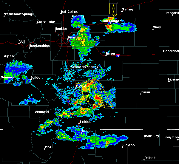 At 528 pm mdt, a severe thunderstorm was located over fowler, or 29 miles west of la junta, moving east at 35 mph (radar indicated). Hazards include 60 mph wind gusts and quarter size hail. Hail damage to vehicles is expected. expect wind damage to roofs, siding, and trees. Locations impacted include, olney springs. At 528 pm mdt, a severe thunderstorm was located over fowler, or 29 miles west of la junta, moving east at 35 mph (radar indicated). Hazards include 60 mph wind gusts and quarter size hail. Hail damage to vehicles is expected. expect wind damage to roofs, siding, and trees. Locations impacted include, olney springs.
|
| 6/23/2016 5:27 PM MDT |
 At 527 pm mdt, a severe thunderstorm was located near fowler, or 30 miles east of pueblo, moving east at 35 mph (radar indicated). Hazards include 60 mph wind gusts and quarter size hail. Hail damage to vehicles is expected. expect wind damage to roofs, siding, and trees. Locations impacted include, rocky ford, ordway, swink, manzanola, olney springs, crowley and timpas. At 527 pm mdt, a severe thunderstorm was located near fowler, or 30 miles east of pueblo, moving east at 35 mph (radar indicated). Hazards include 60 mph wind gusts and quarter size hail. Hail damage to vehicles is expected. expect wind damage to roofs, siding, and trees. Locations impacted include, rocky ford, ordway, swink, manzanola, olney springs, crowley and timpas.
|
| 6/23/2016 5:03 PM MDT |
 At 502 pm mdt, a severe thunderstorm was located over avondale, or 14 miles east of pueblo, moving east at 35 mph (radar indicated). Hazards include 60 mph wind gusts and quarter size hail. Hail damage to vehicles is expected. Expect wind damage to roofs, siding, and trees. At 502 pm mdt, a severe thunderstorm was located over avondale, or 14 miles east of pueblo, moving east at 35 mph (radar indicated). Hazards include 60 mph wind gusts and quarter size hail. Hail damage to vehicles is expected. Expect wind damage to roofs, siding, and trees.
|
| 6/23/2016 5:03 PM MDT |
 The national weather service in pueblo has issued a * severe thunderstorm warning for. central otero county in southeastern colorado. eastern pueblo county in southeastern colorado. western crowley county in southeastern colorado. Until 600 pm mdt. The national weather service in pueblo has issued a * severe thunderstorm warning for. central otero county in southeastern colorado. eastern pueblo county in southeastern colorado. western crowley county in southeastern colorado. Until 600 pm mdt.
|
| 6/12/2016 7:59 PM MDT |
 At 758 pm mdt, a severe thunderstorm was located near rocky ford, or 14 miles northwest of la junta, moving southeast at 55 mph (radar indicated). Hazards include golf ball size hail and 70 mph wind gusts. People and animals outdoors will be injured. expect hail damage to roofs, siding, windows, and vehicles. expect considerable tree damage. wind damage is also likely to mobile homes, roofs, and outbuildings. Locations impacted include, la junta, north la junta, rocky ford, ordway, swink, manzanola, olney springs, sugar city, cheraw and crowley. At 758 pm mdt, a severe thunderstorm was located near rocky ford, or 14 miles northwest of la junta, moving southeast at 55 mph (radar indicated). Hazards include golf ball size hail and 70 mph wind gusts. People and animals outdoors will be injured. expect hail damage to roofs, siding, windows, and vehicles. expect considerable tree damage. wind damage is also likely to mobile homes, roofs, and outbuildings. Locations impacted include, la junta, north la junta, rocky ford, ordway, swink, manzanola, olney springs, sugar city, cheraw and crowley.
|
| 6/12/2016 7:49 PM MDT |
 At 749 pm mdt, a severe thunderstorm was located over manzanola, or 22 miles northwest of la junta, moving southeast at 50 mph (trained weather spotters). Hazards include golf ball size hail and 70 mph wind gusts. People and animals outdoors will be injured. expect hail damage to roofs, siding, windows, and vehicles. expect considerable tree damage. wind damage is also likely to mobile homes, roofs, and outbuildings. Locations impacted include, la junta, north la junta, rocky ford, fowler, ordway, swink, manzanola, olney springs, sugar city, cheraw and crowley. At 749 pm mdt, a severe thunderstorm was located over manzanola, or 22 miles northwest of la junta, moving southeast at 50 mph (trained weather spotters). Hazards include golf ball size hail and 70 mph wind gusts. People and animals outdoors will be injured. expect hail damage to roofs, siding, windows, and vehicles. expect considerable tree damage. wind damage is also likely to mobile homes, roofs, and outbuildings. Locations impacted include, la junta, north la junta, rocky ford, fowler, ordway, swink, manzanola, olney springs, sugar city, cheraw and crowley.
|
| 6/12/2016 7:48 PM MDT | Half Dollar sized hail reported 0.4 miles SE of Olney Springs, CO, . |
| 6/12/2016 7:48 PM MDT | . in crowley county CO, 0.4 miles SE of Olney Springs, CO |
| 6/12/2016 7:44 PM MDT |
 At 744 pm mdt, a severe thunderstorm was located over olney springs, or 23 miles northwest of la junta, moving southeast at 55 mph (trained weather spotters). Hazards include 70 mph wind gusts and ping pong ball size hail. People and animals outdoors will be injured. expect hail damage to roofs, siding, windows, and vehicles. expect considerable tree damage. Wind damage is also likely to mobile homes, roofs, and outbuildings. At 744 pm mdt, a severe thunderstorm was located over olney springs, or 23 miles northwest of la junta, moving southeast at 55 mph (trained weather spotters). Hazards include 70 mph wind gusts and ping pong ball size hail. People and animals outdoors will be injured. expect hail damage to roofs, siding, windows, and vehicles. expect considerable tree damage. Wind damage is also likely to mobile homes, roofs, and outbuildings.
|
| 6/7/2016 7:13 PM MDT |
 At 713 pm mdt, a severe thunderstorm was located near manzanola, or 19 miles west of la junta, moving east at 10 mph (radar indicated). Hazards include 60 mph wind gusts and half dollar size hail. Hail damage to vehicles is expected. Expect wind damage to roofs, siding, and trees. At 713 pm mdt, a severe thunderstorm was located near manzanola, or 19 miles west of la junta, moving east at 10 mph (radar indicated). Hazards include 60 mph wind gusts and half dollar size hail. Hail damage to vehicles is expected. Expect wind damage to roofs, siding, and trees.
|
| 6/7/2016 6:56 PM MDT |
 At 656 pm mdt, a severe thunderstorm was located near manzanola, or 19 miles west of la junta, moving east at 10 mph (radar indicated). Hazards include golf ball size hail and 60 mph wind gusts. People and animals outdoors will be injured. expect hail damage to roofs, siding, windows, and vehicles. expect wind damage to roofs, siding, and trees. Locations impacted include, la junta, north la junta, rocky ford, ordway, swink, manzanola, olney springs, sugar city and crowley. At 656 pm mdt, a severe thunderstorm was located near manzanola, or 19 miles west of la junta, moving east at 10 mph (radar indicated). Hazards include golf ball size hail and 60 mph wind gusts. People and animals outdoors will be injured. expect hail damage to roofs, siding, windows, and vehicles. expect wind damage to roofs, siding, and trees. Locations impacted include, la junta, north la junta, rocky ford, ordway, swink, manzanola, olney springs, sugar city and crowley.
|
| 6/7/2016 6:43 PM MDT |
 At 643 pm mdt, a severe thunderstorm was located over manzanola, or 21 miles northwest of la junta, moving east at 15 mph (radar indicated). Hazards include 60 mph wind gusts and quarter size hail. Hail damage to vehicles is expected. Expect wind damage to roofs, siding, and trees. At 643 pm mdt, a severe thunderstorm was located over manzanola, or 21 miles northwest of la junta, moving east at 15 mph (radar indicated). Hazards include 60 mph wind gusts and quarter size hail. Hail damage to vehicles is expected. Expect wind damage to roofs, siding, and trees.
|
| 5/26/2016 3:34 PM MDT |
 At 334 pm mdt, a severe thunderstorm was located near rocky ford, or 12 miles northwest of la junta, moving northeast at 40 mph (radar indicated). Hazards include 60 mph wind gusts and quarter size hail. Hail damage to vehicles is expected. expect wind damage to roofs, siding, and trees. locations impacted include, la junta, north la junta, rocky ford, fowler, swink, manzanola and olney springs. A tornado watch remains in effect until 700 pm mdt for southeastern colorado. At 334 pm mdt, a severe thunderstorm was located near rocky ford, or 12 miles northwest of la junta, moving northeast at 40 mph (radar indicated). Hazards include 60 mph wind gusts and quarter size hail. Hail damage to vehicles is expected. expect wind damage to roofs, siding, and trees. locations impacted include, la junta, north la junta, rocky ford, fowler, swink, manzanola and olney springs. A tornado watch remains in effect until 700 pm mdt for southeastern colorado.
|
| 5/26/2016 3:17 PM MDT |
 At 317 pm mdt, a severe thunderstorm was located near manzanola, or 17 miles west of la junta, moving northeast at 40 mph (radar indicated). Hazards include 70 mph wind gusts and half dollar size hail. Hail damage to vehicles is expected. expect considerable tree damage. wind damage is also likely to mobile homes, roofs, and outbuildings. locations impacted include, la junta, north la junta, rocky ford, fowler, swink, manzanola and olney springs. A tornado watch remains in effect until 700 pm mdt for southeastern colorado. At 317 pm mdt, a severe thunderstorm was located near manzanola, or 17 miles west of la junta, moving northeast at 40 mph (radar indicated). Hazards include 70 mph wind gusts and half dollar size hail. Hail damage to vehicles is expected. expect considerable tree damage. wind damage is also likely to mobile homes, roofs, and outbuildings. locations impacted include, la junta, north la junta, rocky ford, fowler, swink, manzanola and olney springs. A tornado watch remains in effect until 700 pm mdt for southeastern colorado.
|
| 5/26/2016 3:09 PM MDT |
 At 309 pm mdt, a severe thunderstorm was located 9 miles southwest of manzanola, or 21 miles west of la junta, moving northeast at 30 mph (radar indicated). Hazards include 70 mph wind gusts and half dollar size hail. Hail damage to vehicles is expected. expect considerable tree damage. wind damage is also likely to mobile homes, roofs, and outbuildings. locations impacted include, la junta, north la junta, rocky ford, fowler, swink, manzanola and olney springs. A tornado watch remains in effect until 700 pm mdt for southeastern colorado. At 309 pm mdt, a severe thunderstorm was located 9 miles southwest of manzanola, or 21 miles west of la junta, moving northeast at 30 mph (radar indicated). Hazards include 70 mph wind gusts and half dollar size hail. Hail damage to vehicles is expected. expect considerable tree damage. wind damage is also likely to mobile homes, roofs, and outbuildings. locations impacted include, la junta, north la junta, rocky ford, fowler, swink, manzanola and olney springs. A tornado watch remains in effect until 700 pm mdt for southeastern colorado.
|
| 5/26/2016 2:57 PM MDT |
 At 256 pm mdt, a severe thunderstorm was located 13 miles south of fowler, or 28 miles west of la junta, moving northeast at 35 mph (radar indicated). Hazards include 70 mph wind gusts and half dollar size hail. Hail damage to vehicles is expected. expect considerable tree damage. wind damage is also likely to mobile homes, roofs, and outbuildings. locations impacted include, la junta, north la junta, rocky ford, fowler, swink, manzanola and olney springs. A tornado watch remains in effect until 700 pm mdt for southeastern colorado. At 256 pm mdt, a severe thunderstorm was located 13 miles south of fowler, or 28 miles west of la junta, moving northeast at 35 mph (radar indicated). Hazards include 70 mph wind gusts and half dollar size hail. Hail damage to vehicles is expected. expect considerable tree damage. wind damage is also likely to mobile homes, roofs, and outbuildings. locations impacted include, la junta, north la junta, rocky ford, fowler, swink, manzanola and olney springs. A tornado watch remains in effect until 700 pm mdt for southeastern colorado.
|
| 5/26/2016 2:47 PM MDT |
 At 247 pm mdt, a severe thunderstorm was located 16 miles south of fowler, or 31 miles west of la junta, moving northeast at 40 mph (radar indicated). Hazards include 70 mph wind gusts and half dollar size hail. Hail damage to vehicles is expected. expect considerable tree damage. Wind damage is also likely to mobile homes, roofs, and outbuildings. At 247 pm mdt, a severe thunderstorm was located 16 miles south of fowler, or 31 miles west of la junta, moving northeast at 40 mph (radar indicated). Hazards include 70 mph wind gusts and half dollar size hail. Hail damage to vehicles is expected. expect considerable tree damage. Wind damage is also likely to mobile homes, roofs, and outbuildings.
|
| 8/17/2015 5:57 PM MDT |
 At 556 pm mdt, a severe thunderstorm was located over olney springs, or 23 miles northwest of la junta, moving east at 30 mph (trained weather spotters). Hazards include 60 mph wind gusts and quarter size hail. Hail damage to vehicles is expected. Expect wind damage to roofs, siding and trees. At 556 pm mdt, a severe thunderstorm was located over olney springs, or 23 miles northwest of la junta, moving east at 30 mph (trained weather spotters). Hazards include 60 mph wind gusts and quarter size hail. Hail damage to vehicles is expected. Expect wind damage to roofs, siding and trees.
|
| 6/3/2015 11:10 PM MDT | At 1109 pm mdt, a severe thunderstorm was located near crowley, or 25 miles northwest of la junta, moving northeast at 25 mph (radar indicated). Hazards include golf ball size hail and 60 mph wind gusts. People and animals outdoors will be injured. expect hail damage to roofs, siding, windows and vehicles. Expect wind damage to roofs, siding and trees. |
| 6/3/2015 11:04 PM MDT | At 1104 pm mdt, a severe thunderstorm was located over crowley, or 25 miles northwest of la junta, moving east at 10 mph (radar indicated). Hazards include golf ball size hail and 60 mph wind gusts. People and animals outdoors will be injured. expect hail damage to roofs, siding, windows and vehicles. expect wind damage to roofs, siding and trees. Locations impacted include, ordway, olney springs and crowley. |
| 6/3/2015 10:53 PM MDT | At 1053 pm mdt, a severe thunderstorm was located near olney springs, or 27 miles northwest of la junta, moving east at 30 mph (radar indicated). Hazards include golf ball size hail and 60 mph wind gusts. People and animals outdoors will be injured. expect hail damage to roofs, siding, windows and vehicles. expect wind damage to roofs, siding and trees. Locations impacted include, fowler, ordway, olney springs and crowley. |
| 6/3/2015 10:37 PM MDT | At 1037 pm mdt, a severe thunderstorm was located 13 miles north of olney springs, or 33 miles east of pueblo, moving northeast at 30 mph (radar indicated). Hazards include ping pong ball size hail and 60 mph wind gusts. People and animals outdoors will be injured. expect hail damage to roofs, siding, windows and vehicles. Expect wind damage to roofs, siding and trees. |
| 6/3/2015 10:14 PM MDT | At 1014 pm mdt, a severe thunderstorm was located near boone, or 22 miles east of pueblo, moving northeast at 35 mph (radar indicated). Hazards include golf ball size hail and 60 mph wind gusts. People and animals outdoors will be injured. expect hail damage to roofs, siding, windows and vehicles. expect wind damage to roofs, siding and trees. Locations impacted include, fowler, olney springs and boone. |
| 6/3/2015 10:10 PM MDT | At 1009 pm mdt, a severe thunderstorm was located near boone, or 21 miles east of pueblo, moving northeast at 15 mph. it will cross highway 50 between mile markers 335 and 345 (radar indicated). Hazards include 60 mph wind gusts and half dollar size hail. Hail damage to vehicles is expected. expect wind damage to roofs, siding and trees. Locations impacted include, fowler, olney springs, boone and pueblo depot. |
| 6/3/2015 9:58 PM MDT | At 958 pm mdt, a severe thunderstorm was located near boone, or 21 miles east of pueblo, moving northeast at 25 mph (radar indicated). Hazards include 60 mph wind gusts and quarter size hail. Hail damage to vehicles is expected. Expect wind damage to roofs, siding and trees. |
| 5/23/2015 1:32 PM MDT | At 132 pm mdt, a severe thunderstorm was located over fowler, or 27 miles northwest of la junta, moving northeast at 25 mph (radar indicated). Hazards include 60 mph wind gusts and quarter size hail. Hail damage to vehicles is expected. expect wind damage to roofs, siding and trees. locations impacted include, fowler, manzanola, olney springs and crowley. A tornado watch remains in effect until 700 pm mdt for southeastern colorado. |
| 5/23/2015 1:27 PM MDT | At 127 pm mdt, a severe thunderstorm was located over fowler, or 28 miles northwest of la junta, moving northeast at 40 mph (radar indicated). Hazards include 60 mph wind gusts and quarter size hail. Hail damage to vehicles is expected. expect wind damage to roofs, siding and trees. locations impacted include, fowler, manzanola, olney springs and crowley. A tornado watch remains in effect until 700 pm mdt for southeastern colorado. |
| 5/23/2015 1:09 PM MDT | At 109 pm mdt, a severe thunderstorm was located 10 miles southwest of fowler, or 30 miles southeast of pueblo, moving northeast at 40 mph (radar indicated). Hazards include 60 mph wind gusts and quarter size hail. Hail damage to vehicles is expected. Expect wind damage to roofs, siding and trees. |
| 5/2/2015 5:02 PM MDT | At 501 pm mdt, a severe thunderstorm was located near boone, or 25 miles east of pueblo, moving east at 25 mph (radar indicated). Hazards include 60 mph wind gusts and quarter size hail. Hail damage to vehicles is expected. expect wind damage to roofs, siding and trees. locations impacted include, fowler, manzanola, olney springs and crowley. 1. 00in. |
| 5/2/2015 4:48 PM MDT | At 447 pm mdt, a severe thunderstorm was located near boone, or 18 miles east of pueblo, moving east at 25 mph (radar indicated). Hazards include 60 mph wind gusts and quarter size hail. Hail damage to vehicles is expected. Expect wind damage to roofs, siding and trees. |
| 6/5/2014 8:44 PM MDT | Quarter sized hail reported 1.9 miles SSW of Olney Springs, CO |
| 6/5/2014 8:42 PM MDT | Quarter sized hail reported 0.4 miles SW of Olney Springs, CO |
| 6/5/2014 8:40 PM MDT | Quarter sized hail reported 3.2 miles WSW of Olney Springs, CO |
| 7/31/2013 5:25 PM MDT | Thunderstorm winds knocked several tree limbs down as well as an approximately 15 foot tall pine tree. in add in crowley county CO, 0.4 miles SW of Olney Springs, CO |
| 1/1/0001 12:00 AM | Quarter sized hail reported 0.4 miles SW of Olney Springs, CO |
| 1/1/0001 12:00 AM | Golf Ball sized hail reported 0.4 miles SW of Olney Springs, CO |
Hail Maps for Olney Springs, CO

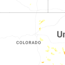


Connect with Interactive Hail Maps