

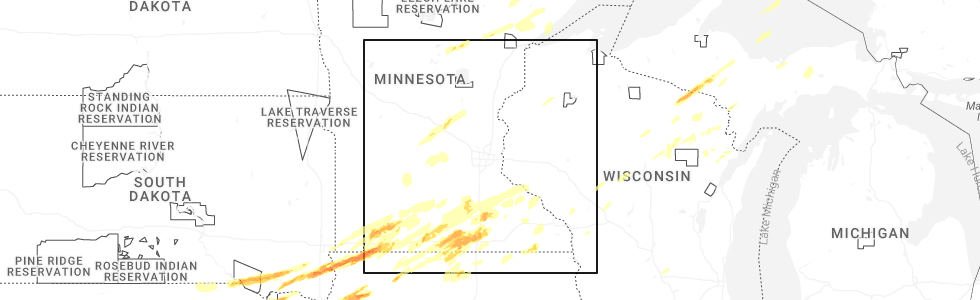
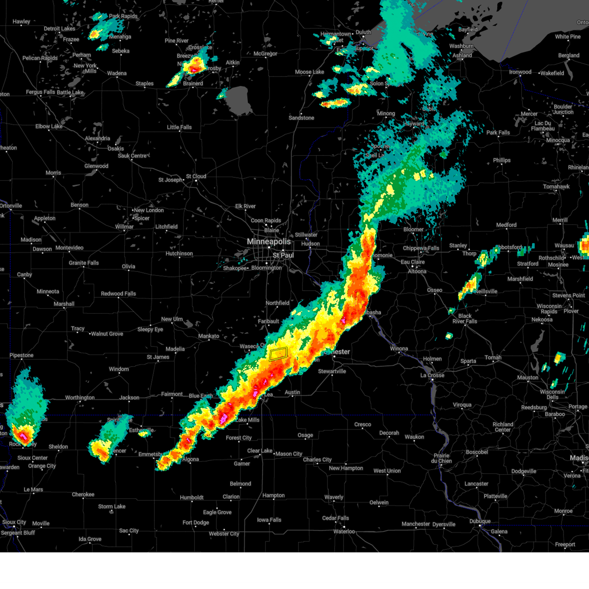
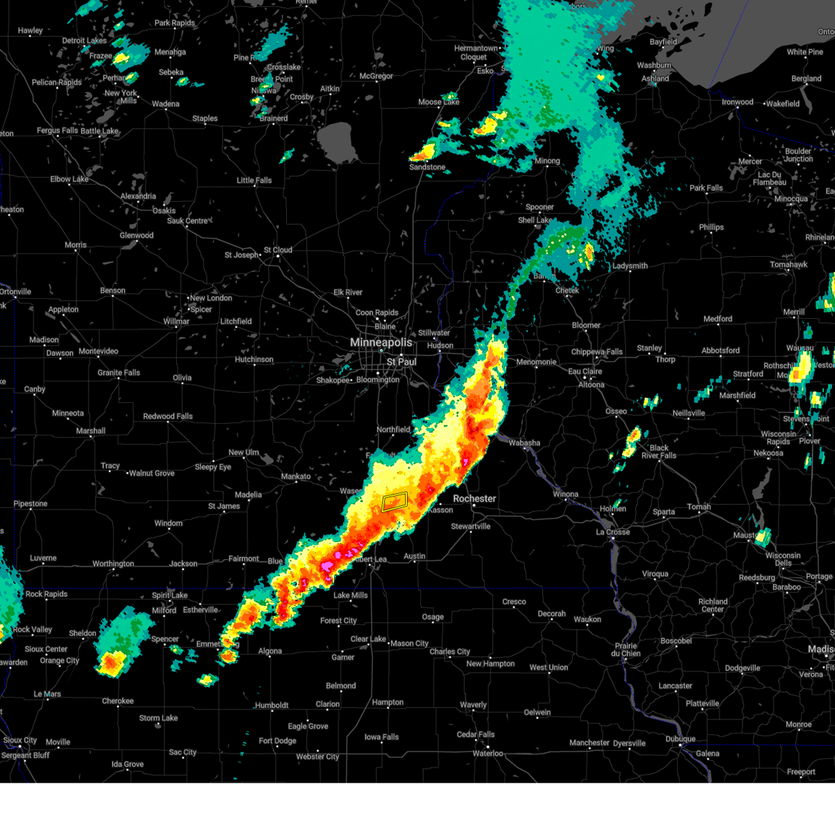
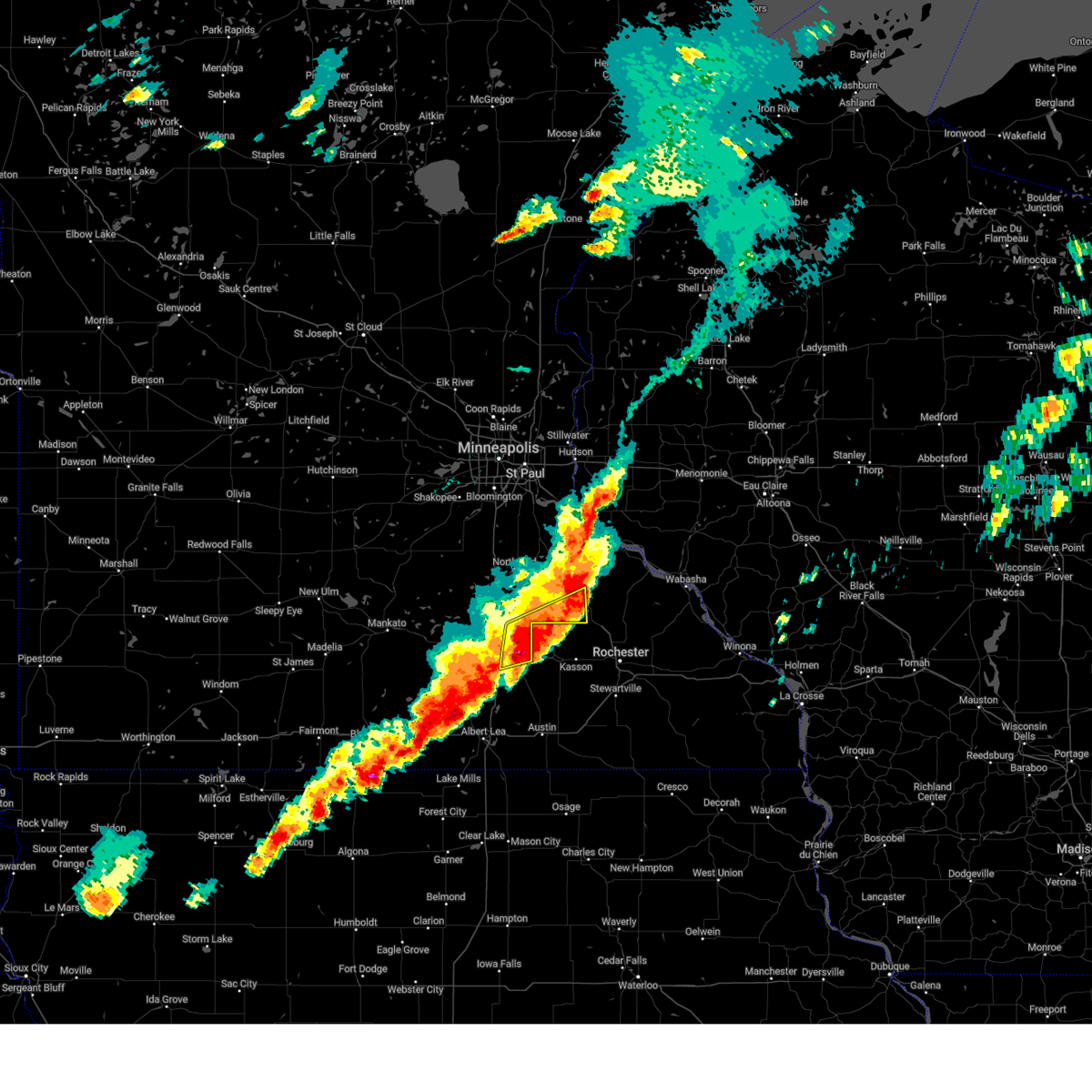
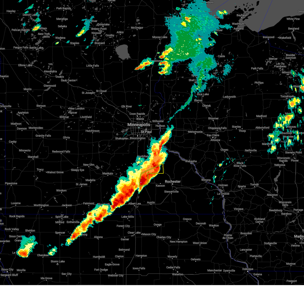
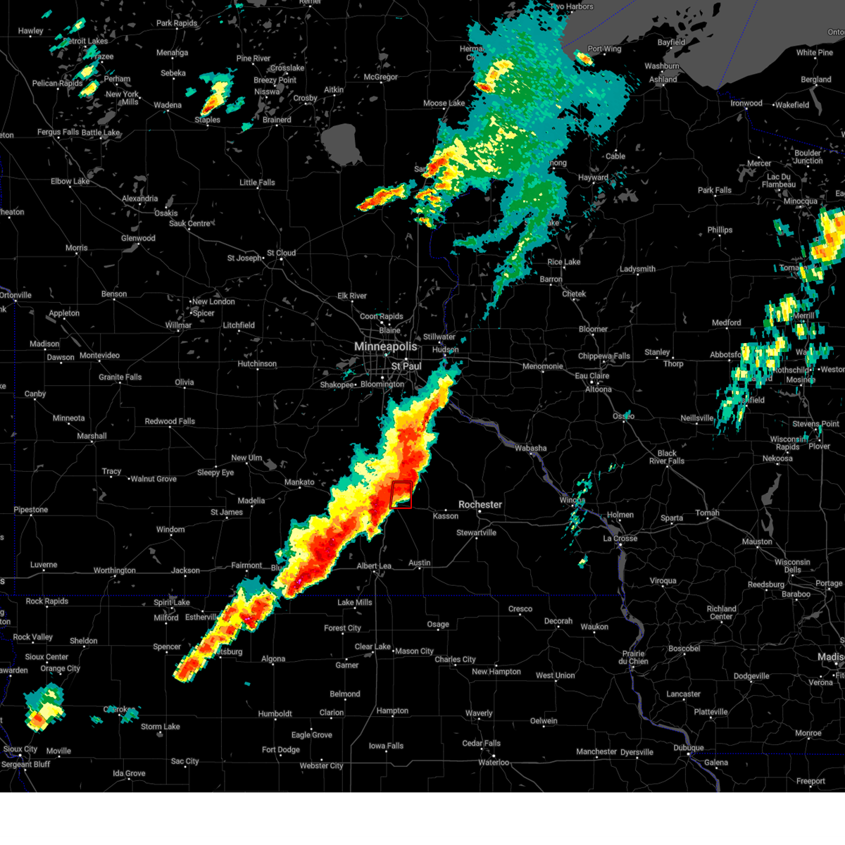
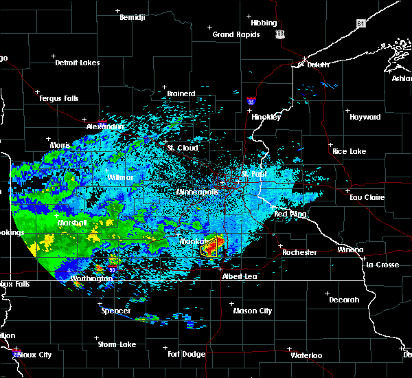
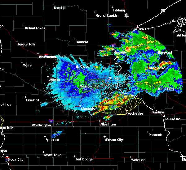
Hail Map for Owatonna, MN
The Owatonna, MN area has had 12 reports of on-the-ground hail by trained spotters, and has been under severe weather warnings 27 times during the past 12 months. Doppler radar has detected hail at or near Owatonna, MN on 74 occasions, including 5 occasions during the past year.
| Name: | Owatonna, MN |
| Where Located: | 61.1 miles S of Minneapolis, MN |
| Map: | Google Map for Owatonna, MN |
| Population: | 25599 |
| Housing Units: | 10724 |
| More Info: | Search Google for Owatonna, MN |
4
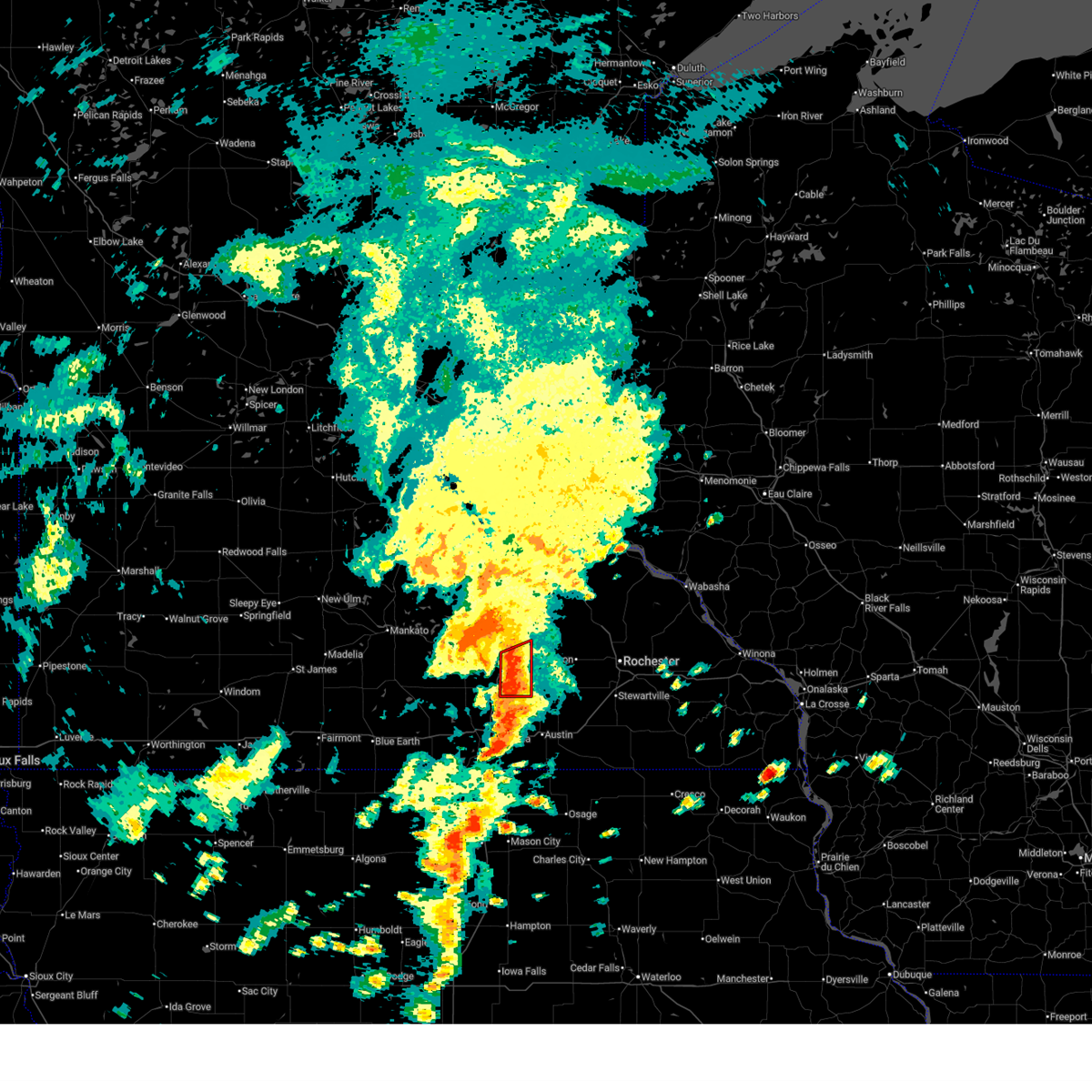
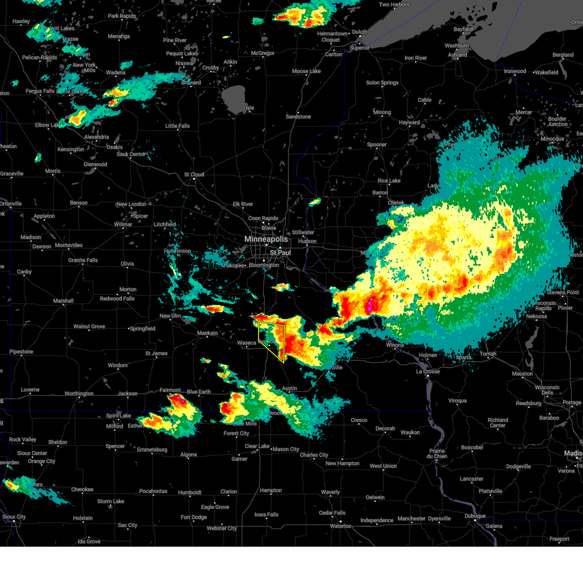
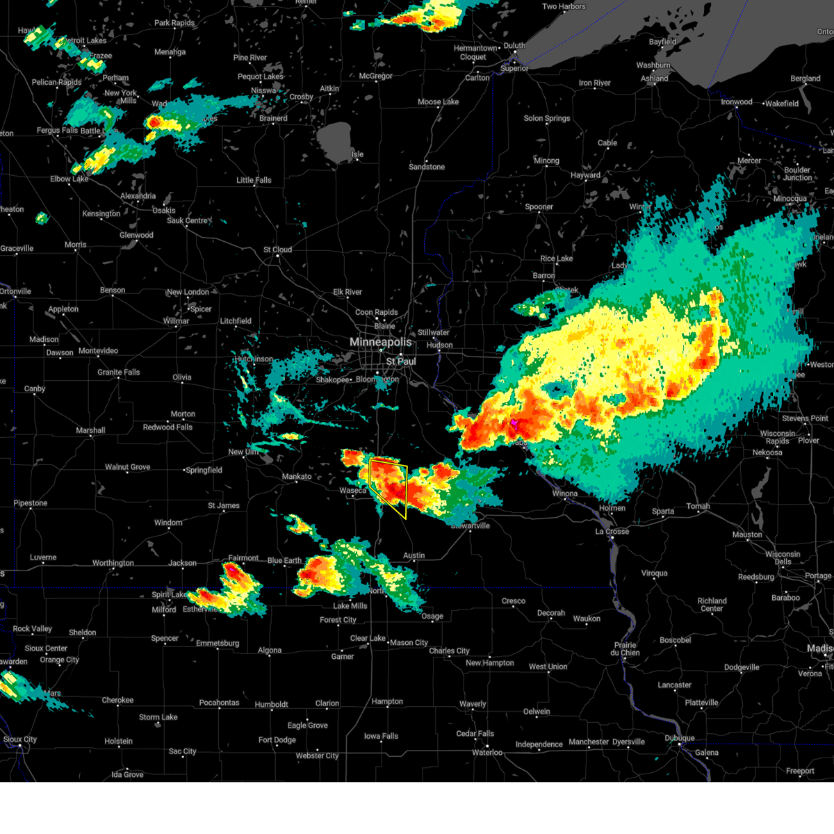
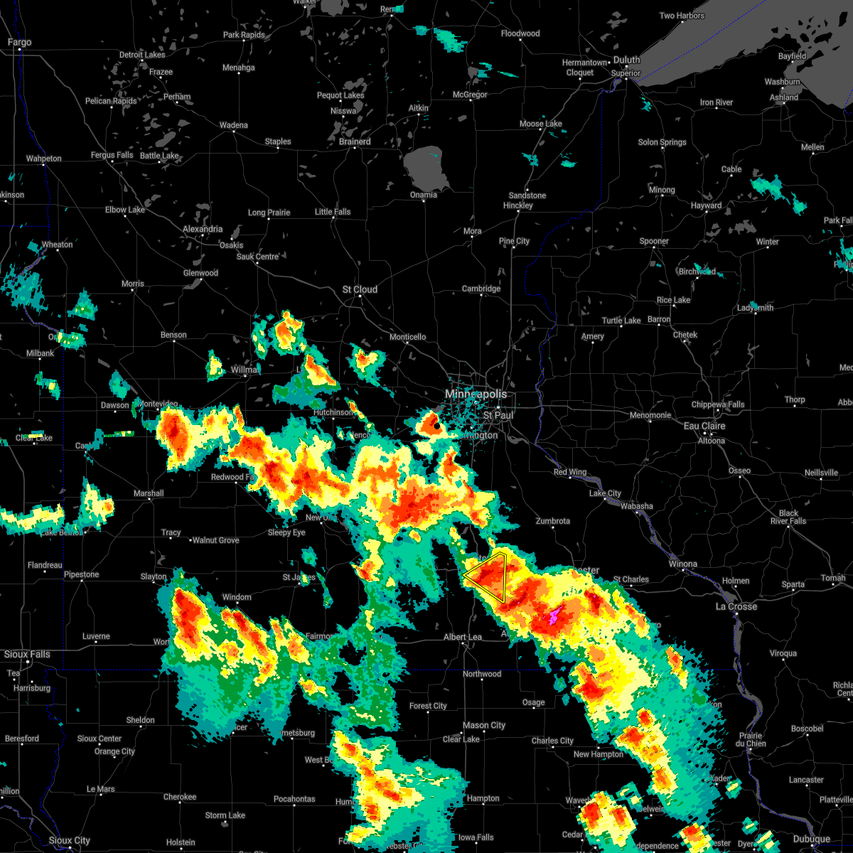
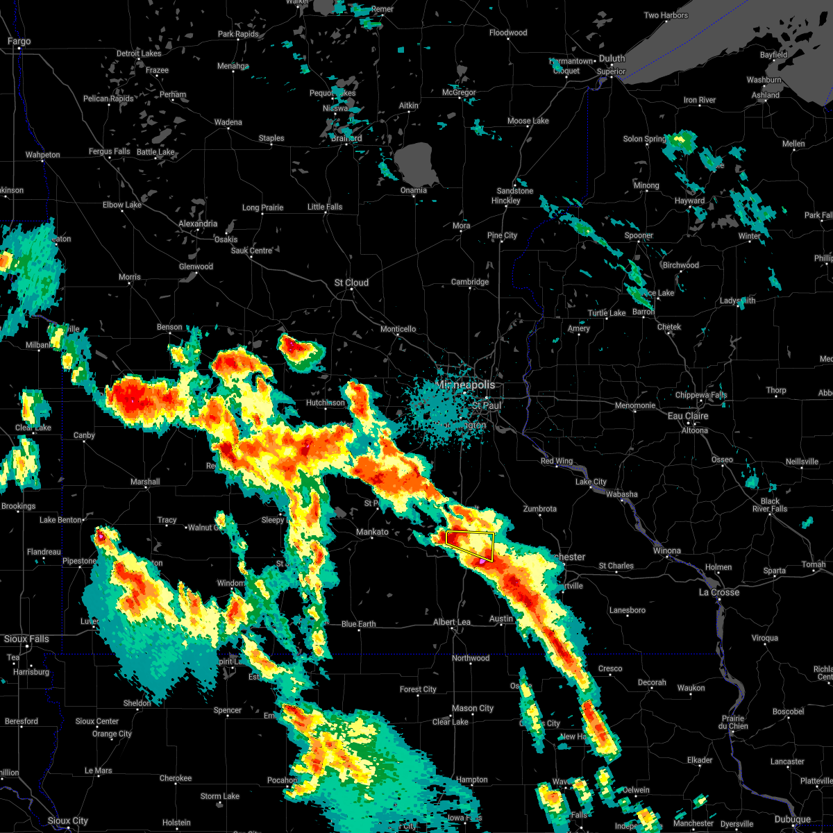
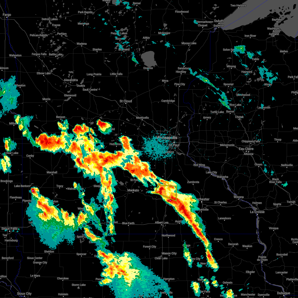
The Top Recent Hail Date for Owatonna, MN is Monday, April 28, 2025 (3rd out of 74)
Hail and Wind Damage Spotted near Owatonna, MN
| Date / Time | Report Details |
|---|---|
| 6/26/2025 1:54 PM CDT | The storm which prompted the warning has moved out of the county. therefore, the warning will be allowed to expire. a tornado watch remains in effect until 800 pm cdt thursday for a portion of south central minnesota. |
| 6/26/2025 1:44 PM CDT |
 Tormpx the national weather service in the twin cities has issued a * tornado warning for, southeastern steele county in south central minnesota, * until 200 pm cdt. * at 144 pm cdt, a severe thunderstorm capable of producing a tornado was located 7 miles northwest of blooming prairie, or 10 miles southeast of owatonna, moving northeast at 40 mph (radar indicated rotation). Hazards include tornado. Flying debris will be dangerous to those caught without shelter. mobile homes will be damaged or destroyed. damage to roofs, windows and vehicles will occur. Tree damage is likely. Tormpx the national weather service in the twin cities has issued a * tornado warning for, southeastern steele county in south central minnesota, * until 200 pm cdt. * at 144 pm cdt, a severe thunderstorm capable of producing a tornado was located 7 miles northwest of blooming prairie, or 10 miles southeast of owatonna, moving northeast at 40 mph (radar indicated rotation). Hazards include tornado. Flying debris will be dangerous to those caught without shelter. mobile homes will be damaged or destroyed. damage to roofs, windows and vehicles will occur. Tree damage is likely.
|
| 6/25/2025 5:36 PM CDT |
 The storm which prompted the warning has moved out of the area. therefore, the warning will be allowed to expire. a tornado watch remains in effect until 1000 pm cdt wednesday for a portion of south central minnesota. The storm which prompted the warning has moved out of the area. therefore, the warning will be allowed to expire. a tornado watch remains in effect until 1000 pm cdt wednesday for a portion of south central minnesota.
|
| 6/25/2025 5:26 PM CDT | At 526 pm cdt, a severe thunderstorm was located over owatonna, moving east at 25 mph (radar indicated). Hazards include 60 mph wind gusts. Expect damage to roofs, siding, and trees. Locations impacted include, owatonna, merton, moland and rice lake state park. |
| 6/25/2025 5:15 PM CDT | the severe thunderstorm warning has been cancelled and is no longer in effect |
| 6/25/2025 5:15 PM CDT | At 515 pm cdt, a severe thunderstorm was located 7 miles west of owatonna, moving east at 25 mph (radar indicated). Hazards include 60 mph wind gusts. Expect damage to roofs, siding, and trees. Locations impacted include, owatonna, medford, lemond, clinton falls, merton, moland, owatonna airport and rice lake state park. |
| 6/25/2025 5:07 PM CDT | Svrmpx the national weather service in the twin cities has issued a * severe thunderstorm warning for, northern steele county in south central minnesota, northeastern waseca county in south central minnesota, * until 545 pm cdt. * at 507 pm cdt, a severe thunderstorm was located near waseca, or 10 miles west of owatonna, moving east at 25 mph (radar indicated). Hazards include 60 mph wind gusts. expect damage to roofs, siding, and trees |
| 5/15/2025 1:27 PM CDT |
 Svrmpx the national weather service in the twin cities has issued a * severe thunderstorm warning for, southwestern dakota county in east central minnesota, scott county in east central minnesota, northeastern le sueur county in south central minnesota, rice county in south central minnesota, northeastern steele county in south central minnesota, southwestern goodhue county in southeastern minnesota, * until 200 pm cdt. * at 127 pm cdt, a broken line of severe thunderstorms were located along a line from over jordan to over owatonna, or along a line from 28 miles northwest of northfield to over owatonna, moving northeast at 35 mph (radar indicated). Hazards include 60 mph wind gusts and quarter size hail. Hail damage to vehicles is expected. Expect wind damage to roofs, siding, and trees. Svrmpx the national weather service in the twin cities has issued a * severe thunderstorm warning for, southwestern dakota county in east central minnesota, scott county in east central minnesota, northeastern le sueur county in south central minnesota, rice county in south central minnesota, northeastern steele county in south central minnesota, southwestern goodhue county in southeastern minnesota, * until 200 pm cdt. * at 127 pm cdt, a broken line of severe thunderstorms were located along a line from over jordan to over owatonna, or along a line from 28 miles northwest of northfield to over owatonna, moving northeast at 35 mph (radar indicated). Hazards include 60 mph wind gusts and quarter size hail. Hail damage to vehicles is expected. Expect wind damage to roofs, siding, and trees.
|
| 4/28/2025 6:58 PM CDT |
 The storm which prompted the warning has moved out of the area. therefore, the warning will be allowed to expire. to report severe weather, contact your nearest law enforcement agency. they will send your report to the national weather service office. a tornado watch remains in effect until 1100 pm cdt for a portion of south central minnesota. The storm which prompted the warning has moved out of the area. therefore, the warning will be allowed to expire. to report severe weather, contact your nearest law enforcement agency. they will send your report to the national weather service office. a tornado watch remains in effect until 1100 pm cdt for a portion of south central minnesota.
|
| 4/28/2025 6:42 PM CDT |
 At 642 pm cdt, a severe thunderstorm was located 8 miles south of wanamingo, or 22 miles east of owatonna, moving northeast at 40 mph (radar indicated). Hazards include 60 mph wind gusts and small hail. Expect damage to roofs, siding, and trees. Locations impacted include, owatonna and rice lake state park. At 642 pm cdt, a severe thunderstorm was located 8 miles south of wanamingo, or 22 miles east of owatonna, moving northeast at 40 mph (radar indicated). Hazards include 60 mph wind gusts and small hail. Expect damage to roofs, siding, and trees. Locations impacted include, owatonna and rice lake state park.
|
| 4/28/2025 6:42 PM CDT |
 the severe thunderstorm warning has been cancelled and is no longer in effect the severe thunderstorm warning has been cancelled and is no longer in effect
|
| 4/28/2025 6:19 PM CDT |
 At 619 pm cdt, a severe thunderstorm was located 6 miles east of owatonna, moving northeast at 40 mph (trained spotters reported. at 617 pm, golf ball size hail was reported along interstate 35 6 miles east of lemond). Hazards include golf ball size hail and 60 mph wind gusts. People and animals outdoors will be injured. expect hail damage to roofs, siding, windows, and vehicles. expect wind damage to roofs, siding, and trees. Locations impacted include, owatonna, zumbrota, kenyon, wanamingo, merton, moland, rice lake state park and bombay. At 619 pm cdt, a severe thunderstorm was located 6 miles east of owatonna, moving northeast at 40 mph (trained spotters reported. at 617 pm, golf ball size hail was reported along interstate 35 6 miles east of lemond). Hazards include golf ball size hail and 60 mph wind gusts. People and animals outdoors will be injured. expect hail damage to roofs, siding, windows, and vehicles. expect wind damage to roofs, siding, and trees. Locations impacted include, owatonna, zumbrota, kenyon, wanamingo, merton, moland, rice lake state park and bombay.
|
| 4/28/2025 6:17 PM CDT |
 The severe thunderstorm warning that was previously in effect has been reissued for and is in effect until 700 pm cdt. please refer to those bulletins for the latest severe weather information. a tornado watch remains in effect until 800 pm cdt for a portion of south central minnesota. The severe thunderstorm warning that was previously in effect has been reissued for and is in effect until 700 pm cdt. please refer to those bulletins for the latest severe weather information. a tornado watch remains in effect until 800 pm cdt for a portion of south central minnesota.
|
| 4/28/2025 6:15 PM CDT | Golf Ball sized hail reported 8 miles N of Owatonna, MN, picture via x showing golf ball sized hail. |
| 4/28/2025 6:15 PM CDT |
 Svrmpx the national weather service in the twin cities has issued a * severe thunderstorm warning for, southeastern rice county in south central minnesota, northeastern steele county in south central minnesota, southwestern goodhue county in southeastern minnesota, * until 700 pm cdt. * at 615 pm cdt, a severe thunderstorm was located near owatonna, moving northeast at 40 mph (trained spotters reported). Hazards include 60 mph wind gusts and half dollar size hail. Hail damage to vehicles is expected. Expect wind damage to roofs, siding, and trees. Svrmpx the national weather service in the twin cities has issued a * severe thunderstorm warning for, southeastern rice county in south central minnesota, northeastern steele county in south central minnesota, southwestern goodhue county in southeastern minnesota, * until 700 pm cdt. * at 615 pm cdt, a severe thunderstorm was located near owatonna, moving northeast at 40 mph (trained spotters reported). Hazards include 60 mph wind gusts and half dollar size hail. Hail damage to vehicles is expected. Expect wind damage to roofs, siding, and trees.
|
| 4/28/2025 6:13 PM CDT | Quarter sized hail reported 0.6 miles WNW of Owatonna, MN, measurement provided via phone. |
| 4/28/2025 6:10 PM CDT | Golf Ball sized hail reported 8 miles N of Owatonna, MN, measurement provided via phone. |
| 4/28/2025 5:58 PM CDT |
 The storm which prompted the warning has moved out of the area. therefore, the warning will be allowed to expire. however, small hail and gusty winds are still possible with this thunderstorm. a tornado watch remains in effect until 1100 pm cdt for a portion of south central minnesota. The storm which prompted the warning has moved out of the area. therefore, the warning will be allowed to expire. however, small hail and gusty winds are still possible with this thunderstorm. a tornado watch remains in effect until 1100 pm cdt for a portion of south central minnesota.
|
| 4/28/2025 5:51 PM CDT |
 At 551 pm cdt, a severe thunderstorm capable of producing a tornado was located 6 miles northeast of owatonna, moving east at 55 mph (radar indicated rotation). Hazards include tornado and quarter size hail. Flying debris will be dangerous to those caught without shelter. mobile homes will be damaged or destroyed. damage to roofs, windows and vehicles will occur. tree damage is likely. Locations impacted include, owatonna, merton, moland and rice lake state park. At 551 pm cdt, a severe thunderstorm capable of producing a tornado was located 6 miles northeast of owatonna, moving east at 55 mph (radar indicated rotation). Hazards include tornado and quarter size hail. Flying debris will be dangerous to those caught without shelter. mobile homes will be damaged or destroyed. damage to roofs, windows and vehicles will occur. tree damage is likely. Locations impacted include, owatonna, merton, moland and rice lake state park.
|
| 4/28/2025 5:41 PM CDT |
 Tormpx the national weather service in the twin cities has issued a * tornado warning for, northern steele county in south central minnesota, * until 600 pm cdt. * at 541 pm cdt, a severe thunderstorm capable of producing a tornado was located near owatonna, moving east at 55 mph (radar indicated rotation). Hazards include tornado and quarter size hail. Flying debris will be dangerous to those caught without shelter. mobile homes will be damaged or destroyed. damage to roofs, windows and vehicles will occur. Tree damage is likely. Tormpx the national weather service in the twin cities has issued a * tornado warning for, northern steele county in south central minnesota, * until 600 pm cdt. * at 541 pm cdt, a severe thunderstorm capable of producing a tornado was located near owatonna, moving east at 55 mph (radar indicated rotation). Hazards include tornado and quarter size hail. Flying debris will be dangerous to those caught without shelter. mobile homes will be damaged or destroyed. damage to roofs, windows and vehicles will occur. Tree damage is likely.
|
| 4/28/2025 5:35 PM CDT |
 At 535 pm cdt, a severe thunderstorm capable of producing a tornado was located near warsaw, or 5 miles southwest of faribault, moving northeast at 60 mph (radar indicated rotation). Hazards include tornado and quarter size hail. Flying debris will be dangerous to those caught without shelter. mobile homes will be damaged or destroyed. damage to roofs, windows and vehicles will occur. tree damage is likely. Locations impacted include, faribault, waseca, medford, morristown, warsaw, clinton falls, deerfield, faribault airport and sakatah lake state park. At 535 pm cdt, a severe thunderstorm capable of producing a tornado was located near warsaw, or 5 miles southwest of faribault, moving northeast at 60 mph (radar indicated rotation). Hazards include tornado and quarter size hail. Flying debris will be dangerous to those caught without shelter. mobile homes will be damaged or destroyed. damage to roofs, windows and vehicles will occur. tree damage is likely. Locations impacted include, faribault, waseca, medford, morristown, warsaw, clinton falls, deerfield, faribault airport and sakatah lake state park.
|
| 4/28/2025 5:35 PM CDT |
 the tornado warning has been cancelled and is no longer in effect the tornado warning has been cancelled and is no longer in effect
|
| 4/28/2025 5:29 PM CDT |
 Svrmpx the national weather service in the twin cities has issued a * severe thunderstorm warning for, southeastern blue earth county in south central minnesota, faribault county in south central minnesota, freeborn county in south central minnesota, southeastern martin county in south central minnesota, steele county in south central minnesota, waseca county in south central minnesota, * until 615 pm cdt. * at 529 pm cdt, severe thunderstorms were located along a line from over waseca to near elmore, or along a line from 13 miles west of owatonna to 17 miles southeast of fairmont, moving east at 50 mph (radar indicated). Hazards include 60 mph wind gusts and half dollar size hail. Hail damage to vehicles is expected. Expect wind damage to roofs, siding, and trees. Svrmpx the national weather service in the twin cities has issued a * severe thunderstorm warning for, southeastern blue earth county in south central minnesota, faribault county in south central minnesota, freeborn county in south central minnesota, southeastern martin county in south central minnesota, steele county in south central minnesota, waseca county in south central minnesota, * until 615 pm cdt. * at 529 pm cdt, severe thunderstorms were located along a line from over waseca to near elmore, or along a line from 13 miles west of owatonna to 17 miles southeast of fairmont, moving east at 50 mph (radar indicated). Hazards include 60 mph wind gusts and half dollar size hail. Hail damage to vehicles is expected. Expect wind damage to roofs, siding, and trees.
|
| 4/28/2025 5:20 PM CDT |
 Tormpx the national weather service in the twin cities has issued a * tornado warning for, southeastern le sueur county in south central minnesota, southwestern rice county in south central minnesota, northwestern steele county in south central minnesota, northern waseca county in south central minnesota, * until 545 pm cdt. * at 520 pm cdt, a severe thunderstorm capable of producing a tornado was located 5 miles northwest of waseca, or 19 miles west of owatonna, moving northeast at 60 mph (radar indicated rotation). Hazards include tornado and quarter size hail. Flying debris will be dangerous to those caught without shelter. mobile homes will be damaged or destroyed. damage to roofs, windows and vehicles will occur. Tree damage is likely. Tormpx the national weather service in the twin cities has issued a * tornado warning for, southeastern le sueur county in south central minnesota, southwestern rice county in south central minnesota, northwestern steele county in south central minnesota, northern waseca county in south central minnesota, * until 545 pm cdt. * at 520 pm cdt, a severe thunderstorm capable of producing a tornado was located 5 miles northwest of waseca, or 19 miles west of owatonna, moving northeast at 60 mph (radar indicated rotation). Hazards include tornado and quarter size hail. Flying debris will be dangerous to those caught without shelter. mobile homes will be damaged or destroyed. damage to roofs, windows and vehicles will occur. Tree damage is likely.
|
| 9/19/2024 5:11 PM CDT | Quarter sized hail reported 2.3 miles N of Owatonna, MN, picture on social media showed 1 inch hail. |
| 8/5/2024 6:53 PM CDT |
 At 653 pm cdt, a confirmed large rain wrapped tornado was located near waseca, or 17 miles west of owatonna, moving east at 20 mph (weather spotters confirmed tornado). Hazards include damaging tornado and quarter size hail. Flying debris will be dangerous to those caught without shelter. mobile homes will be damaged or destroyed. damage to roofs, windows, and vehicles will occur. tree damage is likely. this tornado will be near, waseca around 700 pm cdt. Other locations impacted by this tornadic thunderstorm include otisco, hope, and lemond. At 653 pm cdt, a confirmed large rain wrapped tornado was located near waseca, or 17 miles west of owatonna, moving east at 20 mph (weather spotters confirmed tornado). Hazards include damaging tornado and quarter size hail. Flying debris will be dangerous to those caught without shelter. mobile homes will be damaged or destroyed. damage to roofs, windows, and vehicles will occur. tree damage is likely. this tornado will be near, waseca around 700 pm cdt. Other locations impacted by this tornadic thunderstorm include otisco, hope, and lemond.
|
| 8/5/2024 6:39 PM CDT |
 Tormpx the national weather service in the twin cities has issued a * tornado warning for, southwestern steele county in south central minnesota, southern waseca county in south central minnesota, * until 715 pm cdt. * at 638 pm cdt, a confirmed tornado was located near janesville, or 17 miles southeast of mankato, moving east at 20 mph (weather spotters confirmed a large tornado 3 miles south of janesville). Hazards include damaging tornado and quarter size hail. Flying debris will be dangerous to those caught without shelter. mobile homes will be damaged or destroyed. damage to roofs, windows, and vehicles will occur. tree damage is likely. the tornado will be near, waseca around 650 pm cdt. Other locations impacted by this tornadic thunderstorm include waseca airport, otisco, lemond, and hope. Tormpx the national weather service in the twin cities has issued a * tornado warning for, southwestern steele county in south central minnesota, southern waseca county in south central minnesota, * until 715 pm cdt. * at 638 pm cdt, a confirmed tornado was located near janesville, or 17 miles southeast of mankato, moving east at 20 mph (weather spotters confirmed a large tornado 3 miles south of janesville). Hazards include damaging tornado and quarter size hail. Flying debris will be dangerous to those caught without shelter. mobile homes will be damaged or destroyed. damage to roofs, windows, and vehicles will occur. tree damage is likely. the tornado will be near, waseca around 650 pm cdt. Other locations impacted by this tornadic thunderstorm include waseca airport, otisco, lemond, and hope.
|
| 7/13/2024 6:28 PM CDT |
 Svrmpx the national weather service in the twin cities has issued a * severe thunderstorm warning for, steele county in south central minnesota, * until 715 pm cdt. * at 627 pm cdt, a severe thunderstorm was located near owatonna, moving southeast at 20 mph (radar indicated). Hazards include quarter size hail. damage to vehicles is expected Svrmpx the national weather service in the twin cities has issued a * severe thunderstorm warning for, steele county in south central minnesota, * until 715 pm cdt. * at 627 pm cdt, a severe thunderstorm was located near owatonna, moving southeast at 20 mph (radar indicated). Hazards include quarter size hail. damage to vehicles is expected
|
| 7/13/2024 6:08 PM CDT |
 the severe thunderstorm warning has been cancelled and is no longer in effect the severe thunderstorm warning has been cancelled and is no longer in effect
|
| 7/13/2024 6:08 PM CDT |
 At 607 pm cdt, a severe thunderstorm was located 7 miles east of waseca, or 7 miles west of owatonna, moving southeast at 20 mph (radar indicated). Hazards include quarter size hail. Damage to vehicles is expected. Locations impacted include, owatonna, waseca, medford, lemond, clinton falls, hope, deerfield, and owatonna airport. At 607 pm cdt, a severe thunderstorm was located 7 miles east of waseca, or 7 miles west of owatonna, moving southeast at 20 mph (radar indicated). Hazards include quarter size hail. Damage to vehicles is expected. Locations impacted include, owatonna, waseca, medford, lemond, clinton falls, hope, deerfield, and owatonna airport.
|
| 7/13/2024 5:52 PM CDT |
 Svrmpx the national weather service in the twin cities has issued a * severe thunderstorm warning for, steele county in south central minnesota, northeastern waseca county in south central minnesota, south central rice county in south central minnesota, * until 630 pm cdt. * at 552 pm cdt, a severe thunderstorm was located near morristown, or 11 miles southwest of faribault, moving southeast at 20 mph (radar indicated). Hazards include quarter size hail. damage to vehicles is expected Svrmpx the national weather service in the twin cities has issued a * severe thunderstorm warning for, steele county in south central minnesota, northeastern waseca county in south central minnesota, south central rice county in south central minnesota, * until 630 pm cdt. * at 552 pm cdt, a severe thunderstorm was located near morristown, or 11 miles southwest of faribault, moving southeast at 20 mph (radar indicated). Hazards include quarter size hail. damage to vehicles is expected
|
| 5/21/2024 4:50 PM CDT |
 Tormpx the national weather service in the twin cities has issued a * tornado warning for, northeastern steele county in south central minnesota, southwestern goodhue county in southeastern minnesota, eastern rice county in south central minnesota, * until 530 pm cdt. * at 450 pm cdt, a severe thunderstorm capable of producing a tornado was located over medford, or near owatonna, moving northeast at 50 mph (radar indicated rotation). Hazards include tornado. Flying debris will be dangerous to those caught without shelter. mobile homes will be damaged or destroyed. damage to roofs, windows, and vehicles will occur. tree damage is likely. this dangerous storm will be near, kenyon and nerstrand around 505 pm cdt. other locations impacted by this tornadic thunderstorm include clinton falls, merton, ruskin, bombay, nerstrand big woods state park, wastedo, hader, owatonna airport, and moland. This includes interstate 35 between mile markers 43 and 53. Tormpx the national weather service in the twin cities has issued a * tornado warning for, northeastern steele county in south central minnesota, southwestern goodhue county in southeastern minnesota, eastern rice county in south central minnesota, * until 530 pm cdt. * at 450 pm cdt, a severe thunderstorm capable of producing a tornado was located over medford, or near owatonna, moving northeast at 50 mph (radar indicated rotation). Hazards include tornado. Flying debris will be dangerous to those caught without shelter. mobile homes will be damaged or destroyed. damage to roofs, windows, and vehicles will occur. tree damage is likely. this dangerous storm will be near, kenyon and nerstrand around 505 pm cdt. other locations impacted by this tornadic thunderstorm include clinton falls, merton, ruskin, bombay, nerstrand big woods state park, wastedo, hader, owatonna airport, and moland. This includes interstate 35 between mile markers 43 and 53.
|
| 8/11/2023 6:58 PM CDT |
 The severe thunderstorm warning for northern steele and southeastern rice counties will expire at 700 pm cdt, the storm which prompted the warning has weakened below severe limits, and has exited the warned area. therefore, the warning will be allowed to expire. a severe thunderstorm watch remains in effect until 1000 pm cdt for south central and southeastern minnesota. The severe thunderstorm warning for northern steele and southeastern rice counties will expire at 700 pm cdt, the storm which prompted the warning has weakened below severe limits, and has exited the warned area. therefore, the warning will be allowed to expire. a severe thunderstorm watch remains in effect until 1000 pm cdt for south central and southeastern minnesota.
|
| 8/11/2023 6:47 PM CDT |
 At 647 pm cdt, a severe thunderstorm was located 6 miles northeast of owatonna, moving east at 45 mph (radar indicated). Hazards include 60 mph wind gusts and quarter size hail. Hail damage to vehicles is expected. expect wind damage to roofs, siding, and trees. locations impacted include, owatonna, faribault, medford, clinton falls, merton, moland, deerfield, ruskin, rice lake state park, owatonna airport and bixby. hail threat, radar indicated max hail size, 1. 00 in wind threat, radar indicated max wind gust, 60 mph. At 647 pm cdt, a severe thunderstorm was located 6 miles northeast of owatonna, moving east at 45 mph (radar indicated). Hazards include 60 mph wind gusts and quarter size hail. Hail damage to vehicles is expected. expect wind damage to roofs, siding, and trees. locations impacted include, owatonna, faribault, medford, clinton falls, merton, moland, deerfield, ruskin, rice lake state park, owatonna airport and bixby. hail threat, radar indicated max hail size, 1. 00 in wind threat, radar indicated max wind gust, 60 mph.
|
| 8/11/2023 6:23 PM CDT |
 At 623 pm cdt, severe thunderstorms were located along a line extending from owatonna to near elysian, moving east at 50 mph (radar indicated). Hazards include 60 mph wind gusts and half dollar size hail. Hail damage to vehicles is expected. expect wind damage to roofs, siding, and trees. locations impacted include, owatonna, faribault, waterville, medford, morristown, warsaw, clinton falls, merton, moland, kilkenny, deerfield and owatonna airport. hail threat, radar indicated max hail size, 1. 25 in wind threat, radar indicated max wind gust, 60 mph. At 623 pm cdt, severe thunderstorms were located along a line extending from owatonna to near elysian, moving east at 50 mph (radar indicated). Hazards include 60 mph wind gusts and half dollar size hail. Hail damage to vehicles is expected. expect wind damage to roofs, siding, and trees. locations impacted include, owatonna, faribault, waterville, medford, morristown, warsaw, clinton falls, merton, moland, kilkenny, deerfield and owatonna airport. hail threat, radar indicated max hail size, 1. 25 in wind threat, radar indicated max wind gust, 60 mph.
|
| 8/11/2023 6:03 PM CDT |
 At 603 pm cdt, a severe thunderstorm was located over cleveland, or 14 miles northeast of mankato, moving southeast at 40 mph (radar indicated). Hazards include 60 mph wind gusts and half dollar size hail. Hail damage to vehicles is expected. Expect wind damage to roofs, siding, and trees. At 603 pm cdt, a severe thunderstorm was located over cleveland, or 14 miles northeast of mankato, moving southeast at 40 mph (radar indicated). Hazards include 60 mph wind gusts and half dollar size hail. Hail damage to vehicles is expected. Expect wind damage to roofs, siding, and trees.
|
| 7/10/2023 9:29 PM CDT |
 At 929 pm cdt, severe thunderstorms were located along a line extending from 6 miles east of owatonna to near waseca, moving southeast at 25 mph (radar indicated). Hazards include quarter size hail. Damage to vehicles is expected. locations impacted include, owatonna, waseca, clinton falls, merton, rice lake state park and owatonna airport. hail threat, radar indicated max hail size, 1. 00 in wind threat, radar indicated max wind gust, <50 mph. At 929 pm cdt, severe thunderstorms were located along a line extending from 6 miles east of owatonna to near waseca, moving southeast at 25 mph (radar indicated). Hazards include quarter size hail. Damage to vehicles is expected. locations impacted include, owatonna, waseca, clinton falls, merton, rice lake state park and owatonna airport. hail threat, radar indicated max hail size, 1. 00 in wind threat, radar indicated max wind gust, <50 mph.
|
| 7/10/2023 9:25 PM CDT | Golf Ball sized hail reported 4.8 miles SW of Owatonna, MN, report from twitter. |
| 7/10/2023 9:21 PM CDT |
 At 921 pm cdt, severe thunderstorms were located along a line extending from 6 miles west of west concord to near waseca, moving southeast at 20 mph (radar indicated). Hazards include quarter size hail. Damage to vehicles is expected. locations impacted include, owatonna, waseca, medford, elysian, clinton falls, merton, moland, deerfield, rice lake state park and owatonna airport. hail threat, radar indicated max hail size, 1. 00 in wind threat, radar indicated max wind gust, <50 mph. At 921 pm cdt, severe thunderstorms were located along a line extending from 6 miles west of west concord to near waseca, moving southeast at 20 mph (radar indicated). Hazards include quarter size hail. Damage to vehicles is expected. locations impacted include, owatonna, waseca, medford, elysian, clinton falls, merton, moland, deerfield, rice lake state park and owatonna airport. hail threat, radar indicated max hail size, 1. 00 in wind threat, radar indicated max wind gust, <50 mph.
|
| 7/10/2023 9:05 PM CDT |
 At 905 pm cdt, severe thunderstorms were located along a line extending from near kenyon to near waterville, moving east at 30 mph (radar indicated). Hazards include 60 mph wind gusts and quarter size hail. Hail damage to vehicles is expected. Expect wind damage to roofs, siding, and trees. At 905 pm cdt, severe thunderstorms were located along a line extending from near kenyon to near waterville, moving east at 30 mph (radar indicated). Hazards include 60 mph wind gusts and quarter size hail. Hail damage to vehicles is expected. Expect wind damage to roofs, siding, and trees.
|
| 7/23/2022 9:05 PM CDT |
 At 905 pm cdt, a severe thunderstorm was located near west concord, or near dodge center, moving east at 50 mph (radar indicated). Hazards include 60 mph wind gusts and quarter size hail. Hail damage to vehicles is expected. expect wind damage to roofs, siding, and trees. locations impacted include, owatonna, lemond and bixby. hail threat, radar indicated max hail size, 1. 00 in wind threat, radar indicated max wind gust, 60 mph. At 905 pm cdt, a severe thunderstorm was located near west concord, or near dodge center, moving east at 50 mph (radar indicated). Hazards include 60 mph wind gusts and quarter size hail. Hail damage to vehicles is expected. expect wind damage to roofs, siding, and trees. locations impacted include, owatonna, lemond and bixby. hail threat, radar indicated max hail size, 1. 00 in wind threat, radar indicated max wind gust, 60 mph.
|
| 7/23/2022 8:56 PM CDT |
 At 853 pm cdt, a severe thunderstorm was located 6 miles east of owatonna, moving east at 50 mph (a 66 mph gust was measured at the wauseca airport at 835 pm). Hazards include 60 mph wind gusts and quarter size hail. Hail damage to vehicles is expected. expect wind damage to roofs, siding, and trees. this severe thunderstorm will remain over mainly rural areas of steele county, including the following locations, clinton falls, lemond, merton, bixby, deerfield, owatonna airport and moland. hail threat, radar indicated max hail size, 1. 00 in wind threat, radar indicated max wind gust, 60 mph. At 853 pm cdt, a severe thunderstorm was located 6 miles east of owatonna, moving east at 50 mph (a 66 mph gust was measured at the wauseca airport at 835 pm). Hazards include 60 mph wind gusts and quarter size hail. Hail damage to vehicles is expected. expect wind damage to roofs, siding, and trees. this severe thunderstorm will remain over mainly rural areas of steele county, including the following locations, clinton falls, lemond, merton, bixby, deerfield, owatonna airport and moland. hail threat, radar indicated max hail size, 1. 00 in wind threat, radar indicated max wind gust, 60 mph.
|
| 7/23/2022 8:37 PM CDT |
 At 837 pm cdt, a severe thunderstorm was located 6 miles west of owatonna, moving east at 50 mph (radar indicated). Hazards include 60 mph wind gusts and quarter size hail. Hail damage to vehicles is expected. expect wind damage to roofs, siding, and trees. this severe storm will be near, owatonna around 845 pm cdt. other locations impacted by this severe thunderstorm include clinton falls, waseca airport, lemond, merton, bixby, deerfield, owatonna airport and moland. hail threat, radar indicated max hail size, 1. 00 in wind threat, radar indicated max wind gust, 60 mph. At 837 pm cdt, a severe thunderstorm was located 6 miles west of owatonna, moving east at 50 mph (radar indicated). Hazards include 60 mph wind gusts and quarter size hail. Hail damage to vehicles is expected. expect wind damage to roofs, siding, and trees. this severe storm will be near, owatonna around 845 pm cdt. other locations impacted by this severe thunderstorm include clinton falls, waseca airport, lemond, merton, bixby, deerfield, owatonna airport and moland. hail threat, radar indicated max hail size, 1. 00 in wind threat, radar indicated max wind gust, 60 mph.
|
| 7/23/2022 8:23 PM CDT |
 At 822 pm cdt, a severe thunderstorm was located near waseca, or 18 miles west of owatonna, moving east at 50 mph (radar indicated). Hazards include ping pong ball size hail and 60 mph wind gusts. People and animals outdoors will be injured. expect hail damage to roofs, siding, windows, and vehicles. expect wind damage to roofs, siding, and trees. this severe storm will be near, owatonna and medford around 845 pm cdt. other locations impacted by this severe thunderstorm include clinton falls, waseca airport, alma city, lemond, merton, bixby, deerfield, owatonna airport, smiths mill and moland. hail threat, radar indicated max hail size, 1. 50 in wind threat, radar indicated max wind gust, 60 mph. At 822 pm cdt, a severe thunderstorm was located near waseca, or 18 miles west of owatonna, moving east at 50 mph (radar indicated). Hazards include ping pong ball size hail and 60 mph wind gusts. People and animals outdoors will be injured. expect hail damage to roofs, siding, windows, and vehicles. expect wind damage to roofs, siding, and trees. this severe storm will be near, owatonna and medford around 845 pm cdt. other locations impacted by this severe thunderstorm include clinton falls, waseca airport, alma city, lemond, merton, bixby, deerfield, owatonna airport, smiths mill and moland. hail threat, radar indicated max hail size, 1. 50 in wind threat, radar indicated max wind gust, 60 mph.
|
| 7/23/2022 8:17 PM CDT |
 At 817 pm cdt, a severe thunderstorm was located over janesville, or 16 miles east of mankato, moving east at 50 mph (radar indicated). Hazards include 60 mph wind gusts and quarter size hail. Hail damage to vehicles is expected. expect wind damage to roofs, siding, and trees. this severe thunderstorm will be near, waseca around 825 pm cdt. medford around 840 pm cdt. owatonna around 845 pm cdt. other locations impacted by this severe thunderstorm include clinton falls, waseca airport, alma city, lemond, merton, bixby, deerfield, owatonna airport, smiths mill and moland. hail threat, radar indicated max hail size, 1. 00 in wind threat, radar indicated max wind gust, 60 mph. At 817 pm cdt, a severe thunderstorm was located over janesville, or 16 miles east of mankato, moving east at 50 mph (radar indicated). Hazards include 60 mph wind gusts and quarter size hail. Hail damage to vehicles is expected. expect wind damage to roofs, siding, and trees. this severe thunderstorm will be near, waseca around 825 pm cdt. medford around 840 pm cdt. owatonna around 845 pm cdt. other locations impacted by this severe thunderstorm include clinton falls, waseca airport, alma city, lemond, merton, bixby, deerfield, owatonna airport, smiths mill and moland. hail threat, radar indicated max hail size, 1. 00 in wind threat, radar indicated max wind gust, 60 mph.
|
| 7/23/2022 12:14 PM CDT |
 At 1214 pm cdt, severe thunderstorms were located along a line extending from 6 miles northwest of faribault to near morristown to near waseca, moving east at 55 mph (radar indicated). Hazards include 60 mph wind gusts and quarter size hail. Hail damage to vehicles is expected. expect wind damage to roofs, siding, and trees. locations impacted include, faribault, medford, owatonna and nerstrand. hail threat, radar indicated max hail size, 1. 00 in wind threat, radar indicated max wind gust, 60 mph. At 1214 pm cdt, severe thunderstorms were located along a line extending from 6 miles northwest of faribault to near morristown to near waseca, moving east at 55 mph (radar indicated). Hazards include 60 mph wind gusts and quarter size hail. Hail damage to vehicles is expected. expect wind damage to roofs, siding, and trees. locations impacted include, faribault, medford, owatonna and nerstrand. hail threat, radar indicated max hail size, 1. 00 in wind threat, radar indicated max wind gust, 60 mph.
|
| 7/23/2022 11:57 AM CDT |
 At 1157 am cdt, a severe thunderstorm was located over janesville, or 13 miles east of mankato, moving east at 40 mph (radar indicated). Hazards include 60 mph wind gusts and quarter size hail. Hail damage to vehicles is expected. expect wind damage to roofs, siding, and trees. this severe thunderstorm will be near, elysian around 1200 pm cdt. waseca and waterville around 1210 pm cdt. other locations in the path of this severe thunderstorm include owatonna and medford. hail threat, radar indicated max hail size, 1. 00 in wind threat, radar indicated max wind gust, 60 mph. At 1157 am cdt, a severe thunderstorm was located over janesville, or 13 miles east of mankato, moving east at 40 mph (radar indicated). Hazards include 60 mph wind gusts and quarter size hail. Hail damage to vehicles is expected. expect wind damage to roofs, siding, and trees. this severe thunderstorm will be near, elysian around 1200 pm cdt. waseca and waterville around 1210 pm cdt. other locations in the path of this severe thunderstorm include owatonna and medford. hail threat, radar indicated max hail size, 1. 00 in wind threat, radar indicated max wind gust, 60 mph.
|
| 6/13/2022 9:21 AM CDT | Half Dollar sized hail reported 1.9 miles NNE of Owatonna, MN |
| 6/13/2022 9:20 AM CDT | Quarter sized hail reported 1.4 miles NW of Owatonna, MN |
| 5/11/2022 9:22 PM CDT |
 The severe thunderstorm warning for steele and eastern waseca counties will expire at 930 pm cdt, the storm which prompted the warning has moved out of the area. therefore, the warning will be allowed to expire. however heavy rain is still possible with this thunderstorm. a tornado watch remains in effect until midnight cdt for south central minnesota. The severe thunderstorm warning for steele and eastern waseca counties will expire at 930 pm cdt, the storm which prompted the warning has moved out of the area. therefore, the warning will be allowed to expire. however heavy rain is still possible with this thunderstorm. a tornado watch remains in effect until midnight cdt for south central minnesota.
|
| 5/11/2022 9:13 PM CDT |
 At 912 pm cdt, a severe thunderstorm was located over owatonna, moving northeast at 50 mph (radar indicated). Hazards include 60 mph wind gusts. Expect damage to roofs, siding, and trees. locations impacted include, owatonna, waseca, blooming prairie, medford, new richland, ellendale, otisco, lemond, clinton falls, merton, moland and hope. hail threat, radar indicated max hail size, <. 75 in wind threat, radar indicated max wind gust, 60 mph. At 912 pm cdt, a severe thunderstorm was located over owatonna, moving northeast at 50 mph (radar indicated). Hazards include 60 mph wind gusts. Expect damage to roofs, siding, and trees. locations impacted include, owatonna, waseca, blooming prairie, medford, new richland, ellendale, otisco, lemond, clinton falls, merton, moland and hope. hail threat, radar indicated max hail size, <. 75 in wind threat, radar indicated max wind gust, 60 mph.
|
| 5/11/2022 8:46 PM CDT |
 At 846 pm cdt, a severe thunderstorm was located near waseca, or 16 miles west of owatonna, moving east at 45 mph (radar indicated). Hazards include 70 mph wind gusts and quarter size hail. Hail damage to vehicles is expected. expect considerable tree damage. Wind damage is also likely to mobile homes, roofs, and outbuildings. At 846 pm cdt, a severe thunderstorm was located near waseca, or 16 miles west of owatonna, moving east at 45 mph (radar indicated). Hazards include 70 mph wind gusts and quarter size hail. Hail damage to vehicles is expected. expect considerable tree damage. Wind damage is also likely to mobile homes, roofs, and outbuildings.
|
| 5/11/2022 8:03 PM CDT |
 At 803 pm cdt, a severe thunderstorm was located near pemberton, or 17 miles southeast of mankato, moving northeast at 60 mph (radar indicated). Hazards include 70 mph wind gusts. Expect considerable tree damage. damage is likely to mobile homes, roofs, and outbuildings. this severe thunderstorm will be near, waseca around 815 pm cdt. Other locations in the path of this severe thunderstorm include owatonna and medford. At 803 pm cdt, a severe thunderstorm was located near pemberton, or 17 miles southeast of mankato, moving northeast at 60 mph (radar indicated). Hazards include 70 mph wind gusts. Expect considerable tree damage. damage is likely to mobile homes, roofs, and outbuildings. this severe thunderstorm will be near, waseca around 815 pm cdt. Other locations in the path of this severe thunderstorm include owatonna and medford.
|
| 4/23/2022 8:08 PM CDT |
 The severe thunderstorm warning for southeastern dakota, eastern steele, western goodhue and eastern rice counties will expire at 815 pm cdt, the storms which prompted the warning have moved out of the area. therefore, the warning will be allowed to expire. a severe thunderstorm watch remains in effect until 1000 pm cdt for south central, southeastern and east central minnesota. remember, a tornado warning still remains in effect for northeastern goodhue county until 830 pm cdt. The severe thunderstorm warning for southeastern dakota, eastern steele, western goodhue and eastern rice counties will expire at 815 pm cdt, the storms which prompted the warning have moved out of the area. therefore, the warning will be allowed to expire. a severe thunderstorm watch remains in effect until 1000 pm cdt for south central, southeastern and east central minnesota. remember, a tornado warning still remains in effect for northeastern goodhue county until 830 pm cdt.
|
| 4/23/2022 7:36 PM CDT |
 At 736 pm cdt, severe thunderstorms were located along a line extending from near faribault to 5 miles northeast of owatonna to 8 miles northeast of ellendale, moving northeast at 55 mph (radar indicated). Hazards include 60 mph wind gusts and penny size hail. Expect damage to roofs, siding, and trees. severe thunderstorms will be near, northfield and dundas around 745 pm cdt. kenyon, stanton and nerstrand around 750 pm cdt. other locations in the path of these severe thunderstorms include cannon falls, wanamingo and hastings. hail threat, radar indicated max hail size, 0. 75 in wind threat, radar indicated max wind gust, 60 mph. At 736 pm cdt, severe thunderstorms were located along a line extending from near faribault to 5 miles northeast of owatonna to 8 miles northeast of ellendale, moving northeast at 55 mph (radar indicated). Hazards include 60 mph wind gusts and penny size hail. Expect damage to roofs, siding, and trees. severe thunderstorms will be near, northfield and dundas around 745 pm cdt. kenyon, stanton and nerstrand around 750 pm cdt. other locations in the path of these severe thunderstorms include cannon falls, wanamingo and hastings. hail threat, radar indicated max hail size, 0. 75 in wind threat, radar indicated max wind gust, 60 mph.
|
| 4/23/2022 7:28 PM CDT | Delayed report: tree down partially blocking the road. time estimated from rada in steele county MN, 1.7 miles NNE of Owatonna, MN |
| 4/12/2022 8:00 PM CDT | Quarter sized hail reported 0.6 miles WNW of Owatonna, MN, time estimated via radar. |
| 4/12/2022 7:44 PM CDT |
 At 744 pm cdt, severe thunderstorms were located along a line extending from near owatonna to morristown, moving northeast at 60 mph (radar indicated). Hazards include 60 mph wind gusts and quarter size hail. Hail damage to vehicles is expected. expect wind damage to roofs, siding, and trees. severe thunderstorms will be near, faribault around 755 pm cdt. kenyon around 800 pm cdt. other locations in the path of these severe thunderstorms include dundas, wanamingo, nerstrand, northfield, zumbrota, stanton, cannon falls and goodhue. hail threat, radar indicated max hail size, 1. 00 in wind threat, radar indicated max wind gust, 60 mph. At 744 pm cdt, severe thunderstorms were located along a line extending from near owatonna to morristown, moving northeast at 60 mph (radar indicated). Hazards include 60 mph wind gusts and quarter size hail. Hail damage to vehicles is expected. expect wind damage to roofs, siding, and trees. severe thunderstorms will be near, faribault around 755 pm cdt. kenyon around 800 pm cdt. other locations in the path of these severe thunderstorms include dundas, wanamingo, nerstrand, northfield, zumbrota, stanton, cannon falls and goodhue. hail threat, radar indicated max hail size, 1. 00 in wind threat, radar indicated max wind gust, 60 mph.
|
| 5/24/2021 4:39 PM CDT | Report from mping: 1-inch tree limbs broken; shingles blown of in steele county MN, 0.4 miles SSW of Owatonna, MN |
| 9/6/2020 12:27 AM CDT |
 At 1227 am cdt, a severe thunderstorm was located near owatonna, moving southeast at 25 mph (radar indicated). Hazards include quarter size hail. Damage to vehicles is expected. This severe thunderstorm will remain over mainly rural areas of northeastern steele county, including the following locations, bixby. At 1227 am cdt, a severe thunderstorm was located near owatonna, moving southeast at 25 mph (radar indicated). Hazards include quarter size hail. Damage to vehicles is expected. This severe thunderstorm will remain over mainly rural areas of northeastern steele county, including the following locations, bixby.
|
| 9/6/2020 12:12 AM CDT |
 At 1211 am cdt, a severe thunderstorm was located over owatonna, moving southeast at 25 mph (radar indicated). Hazards include ping pong ball size hail. People and animals outdoors will be injured. expect damage to roofs, siding, windows, and vehicles. this severe thunderstorm will be near, owatonna around 1220 am cdt. Other locations impacted by this severe thunderstorm include clinton falls, bixby, merton and owatonna airport. At 1211 am cdt, a severe thunderstorm was located over owatonna, moving southeast at 25 mph (radar indicated). Hazards include ping pong ball size hail. People and animals outdoors will be injured. expect damage to roofs, siding, windows, and vehicles. this severe thunderstorm will be near, owatonna around 1220 am cdt. Other locations impacted by this severe thunderstorm include clinton falls, bixby, merton and owatonna airport.
|
| 9/6/2020 12:03 AM CDT |
 At 1202 am cdt, a severe thunderstorm was located near medford, or 7 miles northwest of owatonna, moving southeast at 25 mph (radar indicated). Hazards include ping pong ball size hail. People and animals outdoors will be injured. expect damage to roofs, siding, windows, and vehicles. this severe storm will be near, medford around 1210 am cdt. owatonna around 1225 am cdt. Other locations impacted by this severe thunderstorm include clinton falls, merton, deerfield, owatonna airport and moland. At 1202 am cdt, a severe thunderstorm was located near medford, or 7 miles northwest of owatonna, moving southeast at 25 mph (radar indicated). Hazards include ping pong ball size hail. People and animals outdoors will be injured. expect damage to roofs, siding, windows, and vehicles. this severe storm will be near, medford around 1210 am cdt. owatonna around 1225 am cdt. Other locations impacted by this severe thunderstorm include clinton falls, merton, deerfield, owatonna airport and moland.
|
| 9/5/2020 11:53 PM CDT |
 At 1153 pm cdt, a severe thunderstorm was located near warsaw, or 8 miles southwest of faribault, moving southeast at 30 mph (radar indicated). Hazards include quarter size hail. Damage to vehicles is expected. this severe storm will be near, medford around 1205 am cdt. owatonna around 1215 am cdt. Other locations impacted by this severe thunderstorm include clinton falls, merton, deerfield, owatonna airport and moland. At 1153 pm cdt, a severe thunderstorm was located near warsaw, or 8 miles southwest of faribault, moving southeast at 30 mph (radar indicated). Hazards include quarter size hail. Damage to vehicles is expected. this severe storm will be near, medford around 1205 am cdt. owatonna around 1215 am cdt. Other locations impacted by this severe thunderstorm include clinton falls, merton, deerfield, owatonna airport and moland.
|
| 9/5/2020 11:31 PM CDT |
 At 1130 pm cdt, a severe thunderstorm was located near morristown, or 11 miles west of faribault, moving east at 35 mph (radar indicated). Hazards include quarter size hail. Damage to vehicles is expected. this severe thunderstorm will be near, morristown around 1135 pm cdt. warsaw around 1140 pm cdt. faribault around 1145 pm cdt. medford around 1155 pm cdt. owatonna around 1200 am cdt. Other locations impacted by this severe thunderstorm include clinton falls, merton, ruskin, deerfield, owatonna airport, moland and kilkenny. At 1130 pm cdt, a severe thunderstorm was located near morristown, or 11 miles west of faribault, moving east at 35 mph (radar indicated). Hazards include quarter size hail. Damage to vehicles is expected. this severe thunderstorm will be near, morristown around 1135 pm cdt. warsaw around 1140 pm cdt. faribault around 1145 pm cdt. medford around 1155 pm cdt. owatonna around 1200 am cdt. Other locations impacted by this severe thunderstorm include clinton falls, merton, ruskin, deerfield, owatonna airport, moland and kilkenny.
|
| 8/28/2020 6:07 AM CDT |
 The severe thunderstorm warning for northern steele and southeastern rice counties will expire at 615 am cdt, the storm which prompted the warning has moved out of the area. therefore, the warning will be allowed to expire. however small hail is still possible with this thunderstorm. a severe thunderstorm watch remains in effect until 900 am cdt for south central and southeastern minnesota. The severe thunderstorm warning for northern steele and southeastern rice counties will expire at 615 am cdt, the storm which prompted the warning has moved out of the area. therefore, the warning will be allowed to expire. however small hail is still possible with this thunderstorm. a severe thunderstorm watch remains in effect until 900 am cdt for south central and southeastern minnesota.
|
| 8/28/2020 5:48 AM CDT |
 At 548 am cdt, a severe thunderstorm was located near owatonna, moving east at 35 mph (radar indicated). Hazards include 60 mph wind gusts and quarter size hail. Hail damage to vehicles is expected. expect wind damage to roofs, siding, and trees. this severe storm will be near, medford around 600 am cdt. owatonna around 605 am cdt. Other locations impacted by this severe thunderstorm include clinton falls, merton, deerfield, ruskin, owatonna airport and moland. At 548 am cdt, a severe thunderstorm was located near owatonna, moving east at 35 mph (radar indicated). Hazards include 60 mph wind gusts and quarter size hail. Hail damage to vehicles is expected. expect wind damage to roofs, siding, and trees. this severe storm will be near, medford around 600 am cdt. owatonna around 605 am cdt. Other locations impacted by this severe thunderstorm include clinton falls, merton, deerfield, ruskin, owatonna airport and moland.
|
| 8/28/2020 5:35 AM CDT |
 At 535 am cdt, a severe thunderstorm was located over waseca, or 17 miles west of owatonna, moving east at 30 mph (radar indicated). Hazards include 60 mph wind gusts and quarter size hail. Hail damage to vehicles is expected. expect wind damage to roofs, siding, and trees. this severe thunderstorm will be near, waseca around 540 am cdt. owatonna and medford around 610 am cdt. Other locations impacted by this severe thunderstorm include clinton falls, waseca airport, merton, ruskin, deerfield, owatonna airport and moland. At 535 am cdt, a severe thunderstorm was located over waseca, or 17 miles west of owatonna, moving east at 30 mph (radar indicated). Hazards include 60 mph wind gusts and quarter size hail. Hail damage to vehicles is expected. expect wind damage to roofs, siding, and trees. this severe thunderstorm will be near, waseca around 540 am cdt. owatonna and medford around 610 am cdt. Other locations impacted by this severe thunderstorm include clinton falls, waseca airport, merton, ruskin, deerfield, owatonna airport and moland.
|
| 8/10/2020 8:52 AM CDT |
 At 851 am cdt, a severe thunderstorm was located over ellendale, or 13 miles south of owatonna, moving east at 35 mph (radar indicated). Hazards include quarter size hail. Damage to vehicles is expected. Locations impacted include, owatonna, blooming prairie, ellendale, geneva, hollandale, merton, hope, steele center and bixby. At 851 am cdt, a severe thunderstorm was located over ellendale, or 13 miles south of owatonna, moving east at 35 mph (radar indicated). Hazards include quarter size hail. Damage to vehicles is expected. Locations impacted include, owatonna, blooming prairie, ellendale, geneva, hollandale, merton, hope, steele center and bixby.
|
| 8/10/2020 8:36 AM CDT |
 At 836 am cdt, a severe thunderstorm was located over new richland, or 17 miles southwest of owatonna, moving east at 30 mph (radar indicated). Hazards include quarter size hail. damage to vehicles is expected At 836 am cdt, a severe thunderstorm was located over new richland, or 17 miles southwest of owatonna, moving east at 30 mph (radar indicated). Hazards include quarter size hail. damage to vehicles is expected
|
| 8/10/2020 4:42 AM CDT |
 At 441 am cdt, a severe thunderstorm was located near owatonna, moving east at 25 mph (radar indicated). Hazards include 60 mph wind gusts and quarter size hail. Hail damage to vehicles is expected. expect wind damage to roofs, siding, and trees. Locations impacted include, owatonna, medford, clinton falls, merton, moland, deerfield, bixby, owatonna airport and steele center. At 441 am cdt, a severe thunderstorm was located near owatonna, moving east at 25 mph (radar indicated). Hazards include 60 mph wind gusts and quarter size hail. Hail damage to vehicles is expected. expect wind damage to roofs, siding, and trees. Locations impacted include, owatonna, medford, clinton falls, merton, moland, deerfield, bixby, owatonna airport and steele center.
|
| 8/10/2020 4:16 AM CDT |
 At 416 am cdt, a severe thunderstorm was located over waseca, or 12 miles west of owatonna, moving east at 25 mph (radar indicated). Hazards include 60 mph wind gusts and quarter size hail. Hail damage to vehicles is expected. Expect wind damage to roofs, siding, and trees. At 416 am cdt, a severe thunderstorm was located over waseca, or 12 miles west of owatonna, moving east at 25 mph (radar indicated). Hazards include 60 mph wind gusts and quarter size hail. Hail damage to vehicles is expected. Expect wind damage to roofs, siding, and trees.
|
| 8/8/2020 5:07 PM CDT |
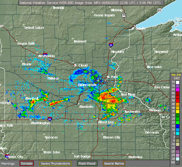 The severe thunderstorm warning for steele county will expire at 515 pm cdt, the storm which prompted the warning has moved out of the area. therefore, the warning will be allowed to expire. to report severe weather, contact your nearest law enforcement agency. they will relay your report to the national weather service the twin cities. The severe thunderstorm warning for steele county will expire at 515 pm cdt, the storm which prompted the warning has moved out of the area. therefore, the warning will be allowed to expire. to report severe weather, contact your nearest law enforcement agency. they will relay your report to the national weather service the twin cities.
|
| 8/8/2020 4:48 PM CDT |
 At 448 pm cdt, a severe thunderstorm was located near blooming prairie, or 12 miles southeast of owatonna, moving east at 30 mph (radar indicated). Hazards include 60 mph wind gusts. Expect damage to roofs, siding, and trees. Locations impacted include, owatonna, blooming prairie, medford, clinton falls, merton, deerfield, steele center, bixby and owatonna airport. At 448 pm cdt, a severe thunderstorm was located near blooming prairie, or 12 miles southeast of owatonna, moving east at 30 mph (radar indicated). Hazards include 60 mph wind gusts. Expect damage to roofs, siding, and trees. Locations impacted include, owatonna, blooming prairie, medford, clinton falls, merton, deerfield, steele center, bixby and owatonna airport.
|
| 8/8/2020 4:28 PM CDT |
 At 427 pm cdt, a severe thunderstorm was located 7 miles southwest of owatonna, moving east at 30 mph (radar indicated). Hazards include 60 mph wind gusts. expect damage to roofs, siding, and trees At 427 pm cdt, a severe thunderstorm was located 7 miles southwest of owatonna, moving east at 30 mph (radar indicated). Hazards include 60 mph wind gusts. expect damage to roofs, siding, and trees
|
| 7/11/2020 4:05 PM CDT |
 At 404 pm cdt, a severe thunderstorm was located near hartland, or 12 miles north of albert lea, moving southeast at 55 mph (radar indicated). Hazards include 70 mph wind gusts and quarter size hail. Hail damage to vehicles is expected. expect considerable tree damage. Wind damage is also likely to mobile homes, roofs, and outbuildings. At 404 pm cdt, a severe thunderstorm was located near hartland, or 12 miles north of albert lea, moving southeast at 55 mph (radar indicated). Hazards include 70 mph wind gusts and quarter size hail. Hail damage to vehicles is expected. expect considerable tree damage. Wind damage is also likely to mobile homes, roofs, and outbuildings.
|
| 7/11/2020 4:01 PM CDT |
 At 400 pm cdt, a severe thunderstorm was located near ellendale, or 13 miles north of albert lea, moving southeast at 55 mph (radar indicated). Hazards include 70 mph wind gusts and quarter size hail. Hail damage to vehicles is expected. expect considerable tree damage. wind damage is also likely to mobile homes, roofs, and outbuildings. Locations impacted include, owatonna, waseca, wells, janesville, new richland, minnesota lake, hartland, freeborn, waldorf, otisco, lemond and hope. At 400 pm cdt, a severe thunderstorm was located near ellendale, or 13 miles north of albert lea, moving southeast at 55 mph (radar indicated). Hazards include 70 mph wind gusts and quarter size hail. Hail damage to vehicles is expected. expect considerable tree damage. wind damage is also likely to mobile homes, roofs, and outbuildings. Locations impacted include, owatonna, waseca, wells, janesville, new richland, minnesota lake, hartland, freeborn, waldorf, otisco, lemond and hope.
|
| 7/11/2020 3:32 PM CDT |
 At 332 pm cdt, a severe thunderstorm was located near st. clair, or 12 miles southeast of mankato, moving southeast at 55 mph (radar indicated). Hazards include 70 mph wind gusts and quarter size hail. Hail damage to vehicles is expected. expect considerable tree damage. Wind damage is also likely to mobile homes, roofs, and outbuildings. At 332 pm cdt, a severe thunderstorm was located near st. clair, or 12 miles southeast of mankato, moving southeast at 55 mph (radar indicated). Hazards include 70 mph wind gusts and quarter size hail. Hail damage to vehicles is expected. expect considerable tree damage. Wind damage is also likely to mobile homes, roofs, and outbuildings.
|
| 7/11/2020 5:52 AM CDT |
 The severe thunderstorm warning for northern steele county will expire at 600 am cdt, the storm which prompted the warning has weakened below severe limits, and has exited the warned area. therefore, the warning will be allowed to expire. to report severe weather, contact your nearest law enforcement agency. they will relay your report to the national weather service the twin cities. The severe thunderstorm warning for northern steele county will expire at 600 am cdt, the storm which prompted the warning has weakened below severe limits, and has exited the warned area. therefore, the warning will be allowed to expire. to report severe weather, contact your nearest law enforcement agency. they will relay your report to the national weather service the twin cities.
|
| 7/11/2020 5:32 AM CDT |
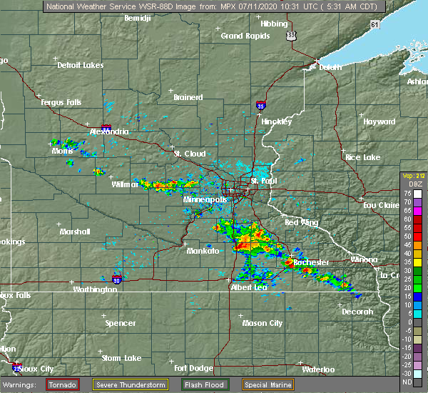 At 532 am cdt, a severe thunderstorm was located over medford, or near owatonna, moving southeast at 30 mph (radar indicated). Hazards include half dollar size hail. Damage to vehicles is expected. this severe thunderstorm will remain over mainly rural areas of northern steele county, including the following locations, clinton falls, merton, owatonna airport and moland. this includes the following highways, interstate 35 between mile markers 41 and 49. u. s. Highway 14 between mile markers 175 and 182. At 532 am cdt, a severe thunderstorm was located over medford, or near owatonna, moving southeast at 30 mph (radar indicated). Hazards include half dollar size hail. Damage to vehicles is expected. this severe thunderstorm will remain over mainly rural areas of northern steele county, including the following locations, clinton falls, merton, owatonna airport and moland. this includes the following highways, interstate 35 between mile markers 41 and 49. u. s. Highway 14 between mile markers 175 and 182.
|
| 6/28/2020 4:55 PM CDT | 4-6 inch tree branches down. time estimated by rada in steele county MN, 9 miles NNE of Owatonna, MN |
| 9/24/2019 7:03 PM CDT |
 At 703 pm cdt, a severe thunderstorm was located over warsaw, or 7 miles southwest of faribault, moving east at 40 mph (trained weather spotters). Hazards include 60 mph wind gusts. Expect damage to roofs, siding, and trees. this severe thunderstorm will be near, faribault around 710 pm cdt. medford around 715 pm cdt. Nerstrand around 730 pm cdt. At 703 pm cdt, a severe thunderstorm was located over warsaw, or 7 miles southwest of faribault, moving east at 40 mph (trained weather spotters). Hazards include 60 mph wind gusts. Expect damage to roofs, siding, and trees. this severe thunderstorm will be near, faribault around 710 pm cdt. medford around 715 pm cdt. Nerstrand around 730 pm cdt.
|
| 8/18/2019 1:05 AM CDT |
 At 105 am cdt, severe thunderstorms were located along a line extending from near morristown to near ellendale to near rice lake, moving east at 50 mph (radar indicated). Hazards include 60 mph wind gusts. expect damage to roofs, siding, and trees At 105 am cdt, severe thunderstorms were located along a line extending from near morristown to near ellendale to near rice lake, moving east at 50 mph (radar indicated). Hazards include 60 mph wind gusts. expect damage to roofs, siding, and trees
|
| 8/13/2019 4:17 PM CDT |
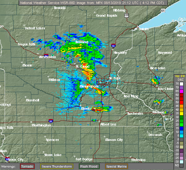 At 417 pm cdt, a severe thunderstorm was located near waseca, or 14 miles southwest of owatonna, moving southeast at 15 mph (radar indicated). Hazards include 60 mph wind gusts and quarter size hail. Hail damage to vehicles is expected. expect wind damage to roofs, siding, and trees. This severe thunderstorm will remain over mainly rural areas of west central steele and east central waseca counties, including the following locations, hope and lemond. At 417 pm cdt, a severe thunderstorm was located near waseca, or 14 miles southwest of owatonna, moving southeast at 15 mph (radar indicated). Hazards include 60 mph wind gusts and quarter size hail. Hail damage to vehicles is expected. expect wind damage to roofs, siding, and trees. This severe thunderstorm will remain over mainly rural areas of west central steele and east central waseca counties, including the following locations, hope and lemond.
|
| 8/13/2019 4:00 PM CDT |
 The national weather service in the twin cities has issued a * severe thunderstorm warning for. west central steele county in south central minnesota. northeastern waseca county in south central minnesota. until 445 pm cdt. At 400 pm cdt, a severe thunderstorm was located near waseca, or 17. The national weather service in the twin cities has issued a * severe thunderstorm warning for. west central steele county in south central minnesota. northeastern waseca county in south central minnesota. until 445 pm cdt. At 400 pm cdt, a severe thunderstorm was located near waseca, or 17.
|
| 7/27/2019 12:15 AM CDT |
 At 1215 am cdt, a severe thunderstorm was located near warsaw, or 7 miles west of faribault, moving southeast at 30 mph (radar indicated). Hazards include 60 mph wind gusts and half dollar size hail. Hail damage to vehicles is expected. Expect wind damage to roofs, siding, and trees. At 1215 am cdt, a severe thunderstorm was located near warsaw, or 7 miles west of faribault, moving southeast at 30 mph (radar indicated). Hazards include 60 mph wind gusts and half dollar size hail. Hail damage to vehicles is expected. Expect wind damage to roofs, siding, and trees.
|
| 7/20/2019 11:15 AM CDT | Tree uprooted at owatonna country club. time estimate in steele county MN, 2.5 miles NNE of Owatonna, MN |
| 7/20/2019 11:00 AM CDT | Large tree branches dow in steele county MN, 6 miles E of Owatonna, MN |
| 7/20/2019 10:58 AM CDT |
 At 1057 am cdt, a line of severe thunderstorm was located near nerstrand, or near northfield, moving east at 55 mph. these thunderstorms have a history of producing wind damage and gusts in excess of 60 mph (radar indicated). Hazards include 60 mph wind gusts and penny size hail. expect damage to roofs, siding, and trees At 1057 am cdt, a line of severe thunderstorm was located near nerstrand, or near northfield, moving east at 55 mph. these thunderstorms have a history of producing wind damage and gusts in excess of 60 mph (radar indicated). Hazards include 60 mph wind gusts and penny size hail. expect damage to roofs, siding, and trees
|
| 7/20/2019 10:34 AM CDT |
 At 1033 am cdt, a severe thunderstorm was located near janesville, or 12 miles southeast of mankato, moving east at 55 mph. this storm has a history of producing wind gusts in excess of 60 mph (radar indicated). Hazards include 60 mph wind gusts. expect damage to roofs, siding, and trees At 1033 am cdt, a severe thunderstorm was located near janesville, or 12 miles southeast of mankato, moving east at 55 mph. this storm has a history of producing wind gusts in excess of 60 mph (radar indicated). Hazards include 60 mph wind gusts. expect damage to roofs, siding, and trees
|
| 6/4/2019 5:42 PM CDT |
 At 541 pm cdt, a severe thunderstorm was located near kenyon, or 11 miles east of faribault, moving southeast at 35 mph (radar indicated). Hazards include 70 mph wind gusts and penny size hail. Expect considerable tree damage. Damage is likely to mobile homes, roofs, and outbuildings. At 541 pm cdt, a severe thunderstorm was located near kenyon, or 11 miles east of faribault, moving southeast at 35 mph (radar indicated). Hazards include 70 mph wind gusts and penny size hail. Expect considerable tree damage. Damage is likely to mobile homes, roofs, and outbuildings.
|
| 6/4/2019 5:11 PM CDT |
 At 510 pm cdt, a severe thunderstorm was located near nerstrand, or 11 miles east of faribault, moving southeast at 50 mph (trained weather spotters). Hazards include 70 mph wind gusts and penny size hail. Expect considerable tree damage. Damage is likely to mobile homes, roofs, and outbuildings. At 510 pm cdt, a severe thunderstorm was located near nerstrand, or 11 miles east of faribault, moving southeast at 50 mph (trained weather spotters). Hazards include 70 mph wind gusts and penny size hail. Expect considerable tree damage. Damage is likely to mobile homes, roofs, and outbuildings.
|
| 6/4/2019 4:47 PM CDT |
 At 446 pm cdt, a severe thunderstorm was located over medford, or near faribault, moving east at 55 mph (emergency management). Hazards include 60 mph wind gusts and penny size hail. expect damage to roofs, siding, and trees At 446 pm cdt, a severe thunderstorm was located over medford, or near faribault, moving east at 55 mph (emergency management). Hazards include 60 mph wind gusts and penny size hail. expect damage to roofs, siding, and trees
|
| 9/20/2018 7:55 PM CDT | Steele county em called to report numerous 6-12 inch trees snapped and down in owatonn in steele county MN, 0.4 miles SSW of Owatonna, MN |
| 9/20/2018 7:11 PM CDT |
 The severe thunderstorm warning for eastern freeborn, eastern steele and eastern rice counties will expire at 715 pm cdt, the storms which prompted the warning have moved out of the area. therefore, the warning will be allowed to expire. however gusty winds and heavy rain are still possible with these thunderstorms. a tornado watch remains in effect until 1100 pm cdt for south central minnesota. to report severe weather, contact your nearest law enforcement agency. they will relay your report to the national weather service the twin cities. The severe thunderstorm warning for eastern freeborn, eastern steele and eastern rice counties will expire at 715 pm cdt, the storms which prompted the warning have moved out of the area. therefore, the warning will be allowed to expire. however gusty winds and heavy rain are still possible with these thunderstorms. a tornado watch remains in effect until 1100 pm cdt for south central minnesota. to report severe weather, contact your nearest law enforcement agency. they will relay your report to the national weather service the twin cities.
|
| 9/20/2018 7:00 PM CDT |
 A severe thunderstorm warning remains in effect until 715 pm cdt for eastern freeborn. eastern steele and eastern rice counties. At 700 pm cdt, severe thunderstorms were located along a line extending from vermillion to lake byllesby to nerstrand to near county roads 1 and 24 to near steele center, moving northeast at 75 mph. A severe thunderstorm warning remains in effect until 715 pm cdt for eastern freeborn. eastern steele and eastern rice counties. At 700 pm cdt, severe thunderstorms were located along a line extending from vermillion to lake byllesby to nerstrand to near county roads 1 and 24 to near steele center, moving northeast at 75 mph.
|
| 9/20/2018 6:55 PM CDT | Corrects time - report from 1 nnw owatonna. steele county em called to report numerous 6-12 inch trees snapped and down in owatonn in steele county MN, 0.4 miles SSW of Owatonna, MN |
| 9/20/2018 6:52 PM CDT |
 At 651 pm cdt, severe thunderstorms were located along a line extending from near castle rock to near northfield to ruskin to near owatonna to ellendale, moving northeast at 75 mph (law enforcement). Hazards include 70 mph wind gusts. Expect considerable tree damage. damage is likely to mobile homes, roofs, and outbuildings. these severe storms will be near, northfield around 655 pm cdt. nerstrand around 700 pm cdt. other locations impacted by these severe thunderstorms include albert lea airport, lemond, myrtle, bridgewater, owatonna airport, clinton falls, merton, ruskin, faribault airport and manchester. A tornado watch remains in effect until 1100 pm cdt for south central and east central minnesota. At 651 pm cdt, severe thunderstorms were located along a line extending from near castle rock to near northfield to ruskin to near owatonna to ellendale, moving northeast at 75 mph (law enforcement). Hazards include 70 mph wind gusts. Expect considerable tree damage. damage is likely to mobile homes, roofs, and outbuildings. these severe storms will be near, northfield around 655 pm cdt. nerstrand around 700 pm cdt. other locations impacted by these severe thunderstorms include albert lea airport, lemond, myrtle, bridgewater, owatonna airport, clinton falls, merton, ruskin, faribault airport and manchester. A tornado watch remains in effect until 1100 pm cdt for south central and east central minnesota.
|
| 9/20/2018 6:50 PM CDT | Several trees down per skywarn group on social medi in steele county MN, 1.4 miles NW of Owatonna, MN |
| 9/20/2018 6:45 PM CDT |
 At 645 pm cdt, a confirmed tornado was located over ruskin, or near faribault, moving northeast at 65 mph (radar confirmed tornado). Hazards include damaging tornado. Flying debris will be dangerous to those caught without shelter. mobile homes will be damaged or destroyed. damage to roofs, windows, and vehicles will occur. tree damage is likely. this tornado will be near, kenyon and nerstrand around 650 pm cdt. wanamingo around 700 pm cdt. goodhue around 710 pm cdt. Other locations impacted by this tornadic thunderstorm include bellechester, merton, ruskin, hader, bombay and moland. At 645 pm cdt, a confirmed tornado was located over ruskin, or near faribault, moving northeast at 65 mph (radar confirmed tornado). Hazards include damaging tornado. Flying debris will be dangerous to those caught without shelter. mobile homes will be damaged or destroyed. damage to roofs, windows, and vehicles will occur. tree damage is likely. this tornado will be near, kenyon and nerstrand around 650 pm cdt. wanamingo around 700 pm cdt. goodhue around 710 pm cdt. Other locations impacted by this tornadic thunderstorm include bellechester, merton, ruskin, hader, bombay and moland.
|
| 9/20/2018 6:40 PM CDT |
 At 640 pm cdt, a severe thunderstorm capable of producing a tornado was located over medford, or 7 miles south of faribault, moving east at 70 mph (radar indicated rotation). Hazards include tornado. Flying debris will be dangerous to those caught without shelter. mobile homes will be damaged or destroyed. damage to roofs, windows, and vehicles will occur. tree damage is likely. this dangerous storm will be near, kenyon and nerstrand around 650 pm cdt. wanamingo around 700 pm cdt. pine island and zumbrota around 705 pm cdt. goodhue around 710 pm cdt. other locations impacted by this tornadic thunderstorm include clinton falls, bellechester, merton, ruskin, bombay, hader, owatonna airport and moland. This includes interstate 35 between mile markers 43 and 55. At 640 pm cdt, a severe thunderstorm capable of producing a tornado was located over medford, or 7 miles south of faribault, moving east at 70 mph (radar indicated rotation). Hazards include tornado. Flying debris will be dangerous to those caught without shelter. mobile homes will be damaged or destroyed. damage to roofs, windows, and vehicles will occur. tree damage is likely. this dangerous storm will be near, kenyon and nerstrand around 650 pm cdt. wanamingo around 700 pm cdt. pine island and zumbrota around 705 pm cdt. goodhue around 710 pm cdt. other locations impacted by this tornadic thunderstorm include clinton falls, bellechester, merton, ruskin, bombay, hader, owatonna airport and moland. This includes interstate 35 between mile markers 43 and 55.
|
| 9/20/2018 6:23 PM CDT |
 At 623 pm cdt, severe thunderstorms were located along a line extending from near lake jefferson to near janesville to near waldorf to near wells to near bricelyn, moving northeast at 75 mph (radar indicated). Hazards include 70 mph wind gusts. Expect considerable tree damage. damage is likely to mobile homes, roofs, and outbuildings. severe thunderstorms will be near, waterville and elysian around 630 pm cdt. waseca, montgomery, new richland, morristown and warsaw around 635 pm cdt. faribault and lonsdale around 640 pm cdt. webster, medford and clarks grove around 645 pm cdt. northfield, dundas, ellendale and geneva around 650 pm cdt. owatonna around 655 pm cdt. nerstrand around 700 pm cdt. A tornado watch remains in effect until 1100 pm cdt for south central and east central minnesota. At 623 pm cdt, severe thunderstorms were located along a line extending from near lake jefferson to near janesville to near waldorf to near wells to near bricelyn, moving northeast at 75 mph (radar indicated). Hazards include 70 mph wind gusts. Expect considerable tree damage. damage is likely to mobile homes, roofs, and outbuildings. severe thunderstorms will be near, waterville and elysian around 630 pm cdt. waseca, montgomery, new richland, morristown and warsaw around 635 pm cdt. faribault and lonsdale around 640 pm cdt. webster, medford and clarks grove around 645 pm cdt. northfield, dundas, ellendale and geneva around 650 pm cdt. owatonna around 655 pm cdt. nerstrand around 700 pm cdt. A tornado watch remains in effect until 1100 pm cdt for south central and east central minnesota.
|
| 8/31/2018 7:45 AM CDT | Photo shared via twitter shows a couple of large tree branches dow in steele county MN, 0.6 miles WNW of Owatonna, MN |
| 8/31/2018 6:27 AM CDT |
 At 626 am cdt, severe thunderstorms were located along a line extending from near waseca to near alma city, moving east at 25 mph (radar indicated). Hazards include quarter size hail. Damage to vehicles is expected. these severe storms will be near, waseca around 645 am cdt. medford around 700 am cdt. Other locations impacted by these severe thunderstorms include waseca airport, otisco, alma city, lemond, deerfield and hope. At 626 am cdt, severe thunderstorms were located along a line extending from near waseca to near alma city, moving east at 25 mph (radar indicated). Hazards include quarter size hail. Damage to vehicles is expected. these severe storms will be near, waseca around 645 am cdt. medford around 700 am cdt. Other locations impacted by these severe thunderstorms include waseca airport, otisco, alma city, lemond, deerfield and hope.
|
| 8/31/2018 6:10 AM CDT |
 At 609 am cdt, severe thunderstorms were located along a line extending from near janesville to near pemberton, moving east at 30 mph (radar indicated). Hazards include half dollar size hail. Damage to vehicles is expected. severe thunderstorms will be near, waseca around 645 am cdt. Medford around 650 am cdt. At 609 am cdt, severe thunderstorms were located along a line extending from near janesville to near pemberton, moving east at 30 mph (radar indicated). Hazards include half dollar size hail. Damage to vehicles is expected. severe thunderstorms will be near, waseca around 645 am cdt. Medford around 650 am cdt.
|
| 8/27/2018 5:23 PM CDT |
 The severe thunderstorm warning for freeborn and steele counties will expire at 530 pm cdt, the storms which prompted the warning have moved out of the area. therefore, the warning will be allowed to expire. a severe thunderstorm watch remains in effect until 1000 pm cdt for south central minnesota. to report severe weather, contact your nearest law enforcement agency. they will relay your report to the national weather service the twin cities. The severe thunderstorm warning for freeborn and steele counties will expire at 530 pm cdt, the storms which prompted the warning have moved out of the area. therefore, the warning will be allowed to expire. a severe thunderstorm watch remains in effect until 1000 pm cdt for south central minnesota. to report severe weather, contact your nearest law enforcement agency. they will relay your report to the national weather service the twin cities.
|
| 8/27/2018 5:13 PM CDT |
 At 512 pm cdt, severe thunderstorms were located along a line extending from near merton to near steele center to hollandale, moving northeast at 50 mph (radar indicated). Hazards include 60 mph wind gusts. Expect damage to roofs, siding, and trees. These severe thunderstorms will remain over mainly rural areas of freeborn and steele counties, including the following locations, clinton falls, albert lea airport, merton, myrtle, manchester, steele center, bixby, owatonna airport and moland. At 512 pm cdt, severe thunderstorms were located along a line extending from near merton to near steele center to hollandale, moving northeast at 50 mph (radar indicated). Hazards include 60 mph wind gusts. Expect damage to roofs, siding, and trees. These severe thunderstorms will remain over mainly rural areas of freeborn and steele counties, including the following locations, clinton falls, albert lea airport, merton, myrtle, manchester, steele center, bixby, owatonna airport and moland.
|
| 8/27/2018 5:00 PM CDT |
 At 500 pm cdt, severe thunderstorms were located along a line extending from near lemond to near hope to albert lea airport, moving northeast at 45 mph (radar indicated). Hazards include 60 mph wind gusts. Expect damage to roofs, siding, and trees. these severe storms will be near, owatonna and medford around 510 pm cdt. geneva and hollandale around 515 pm cdt. blooming prairie around 525 pm cdt. Other locations impacted by these severe thunderstorms include clinton falls, albert lea airport, lemond, merton, myrtle, manchester, steele center, bixby, deerfield and owatonna airport. At 500 pm cdt, severe thunderstorms were located along a line extending from near lemond to near hope to albert lea airport, moving northeast at 45 mph (radar indicated). Hazards include 60 mph wind gusts. Expect damage to roofs, siding, and trees. these severe storms will be near, owatonna and medford around 510 pm cdt. geneva and hollandale around 515 pm cdt. blooming prairie around 525 pm cdt. Other locations impacted by these severe thunderstorms include clinton falls, albert lea airport, lemond, merton, myrtle, manchester, steele center, bixby, deerfield and owatonna airport.
|
| 8/27/2018 4:52 PM CDT |
 At 452 pm cdt, severe thunderstorms were located along a line extending from near waseca airport to new richland to alden, moving northeast at 50 mph (radar indicated). Hazards include 60 mph wind gusts. Expect damage to roofs, siding, and trees. these severe storms will be near, waseca and new richland around 455 pm cdt. albert lea and ellendale around 505 pm cdt. clarks grove and hayward around 510 pm cdt. owatonna, medford, geneva and hollandale around 515 pm cdt. blooming prairie around 530 pm cdt. Other locations impacted by these severe thunderstorms include waseca airport, albert lea airport, lemond, myrtle, owatonna airport, clinton falls, merton, manchester, steele center and otisco. At 452 pm cdt, severe thunderstorms were located along a line extending from near waseca airport to new richland to alden, moving northeast at 50 mph (radar indicated). Hazards include 60 mph wind gusts. Expect damage to roofs, siding, and trees. these severe storms will be near, waseca and new richland around 455 pm cdt. albert lea and ellendale around 505 pm cdt. clarks grove and hayward around 510 pm cdt. owatonna, medford, geneva and hollandale around 515 pm cdt. blooming prairie around 530 pm cdt. Other locations impacted by these severe thunderstorms include waseca airport, albert lea airport, lemond, myrtle, owatonna airport, clinton falls, merton, manchester, steele center and otisco.
|
| 8/27/2018 4:42 PM CDT |
 At 442 pm cdt, severe thunderstorms were located along a line extending from near otisco to matawan to walters, moving northeast at 50 mph (radar indicated). Hazards include 60 mph wind gusts. Expect damage to roofs, siding, and trees. severe thunderstorms will be near, freeborn around 445 pm cdt. waseca, new richland and hartland around 450 pm cdt. albert lea and ellendale around 500 pm cdt. owatonna, medford, clarks grove and hayward around 510 pm cdt. geneva and hollandale around 515 pm cdt. Blooming prairie around 530 pm cdt. At 442 pm cdt, severe thunderstorms were located along a line extending from near otisco to matawan to walters, moving northeast at 50 mph (radar indicated). Hazards include 60 mph wind gusts. Expect damage to roofs, siding, and trees. severe thunderstorms will be near, freeborn around 445 pm cdt. waseca, new richland and hartland around 450 pm cdt. albert lea and ellendale around 500 pm cdt. owatonna, medford, clarks grove and hayward around 510 pm cdt. geneva and hollandale around 515 pm cdt. Blooming prairie around 530 pm cdt.
|
| 9/4/2017 6:01 PM CDT |
 At 601 pm cdt, severe thunderstorms were located along a line extending from near merton to near hope to near otisco, moving southeast at 50 mph (radar indicated). Hazards include 60 mph wind gusts. Expect damage to roofs, siding, and trees. these severe storms will be near, ellendale around 610 pm cdt. geneva around 615 pm cdt. blooming prairie, clarks grove and hollandale around 620 pm cdt. Other locations impacted by these severe thunderstorms include clinton falls, lemond, merton, matawan, manchester, steele center, otisco, bixby, owatonna airport and hope. At 601 pm cdt, severe thunderstorms were located along a line extending from near merton to near hope to near otisco, moving southeast at 50 mph (radar indicated). Hazards include 60 mph wind gusts. Expect damage to roofs, siding, and trees. these severe storms will be near, ellendale around 610 pm cdt. geneva around 615 pm cdt. blooming prairie, clarks grove and hollandale around 620 pm cdt. Other locations impacted by these severe thunderstorms include clinton falls, lemond, merton, matawan, manchester, steele center, otisco, bixby, owatonna airport and hope.
|
| 9/4/2017 5:55 PM CDT | Power poles down across owatonn in steele county MN, 0.6 miles WNW of Owatonna, MN |
| 9/4/2017 5:55 PM CDT | Trees of 10 to 24 inches in diameter uprooted at the brooktree golf cours in steele county MN, 1.6 miles WSW of Owatonna, MN |
| 9/4/2017 5:44 PM CDT |
 At 543 pm cdt, severe thunderstorms were located along a line extending from near nerstrand to near faribault to near waseca to near alma city, moving southeast at 50 mph (radar indicated). Hazards include 60 mph wind gusts. Expect damage to roofs, siding, and trees. severe thunderstorms will be near, medford around 550 pm cdt. owatonna around 555 pm cdt. new richland around 605 pm cdt. hartland around 610 pm cdt. clarks grove and ellendale around 615 pm cdt. blooming prairie and geneva around 620 pm cdt. Hollandale around 625 pm cdt. At 543 pm cdt, severe thunderstorms were located along a line extending from near nerstrand to near faribault to near waseca to near alma city, moving southeast at 50 mph (radar indicated). Hazards include 60 mph wind gusts. Expect damage to roofs, siding, and trees. severe thunderstorms will be near, medford around 550 pm cdt. owatonna around 555 pm cdt. new richland around 605 pm cdt. hartland around 610 pm cdt. clarks grove and ellendale around 615 pm cdt. blooming prairie and geneva around 620 pm cdt. Hollandale around 625 pm cdt.
|
| 8/1/2017 4:00 PM CDT | Multiple reports of trees down around owatonn in steele county MN, 1.1 miles NNW of Owatonna, MN |
| 7/19/2017 4:41 PM CDT |
 The severe thunderstorm warning for freeborn, southeastern faribault and steele counties will expire at 445 pm cdt, the storms which prompted the warning have moved out of the area. therefore the warning will be allowed to expire. a severe thunderstorm watch remains in effect until 600 pm cdt for south central minnesota. remember, a severe thunderstorm warning still remains in effect for southeast freeborn county until 500 pm. The severe thunderstorm warning for freeborn, southeastern faribault and steele counties will expire at 445 pm cdt, the storms which prompted the warning have moved out of the area. therefore the warning will be allowed to expire. a severe thunderstorm watch remains in effect until 600 pm cdt for south central minnesota. remember, a severe thunderstorm warning still remains in effect for southeast freeborn county until 500 pm.
|
| 7/19/2017 4:27 PM CDT |
 At 427 pm cdt, severe thunderstorms were located along a line extending from near kenyon to near claremont to hayward to near emmons, moving east at 55 mph (radar indicated). Hazards include 60 mph wind gusts and penny size hail. Expect damage to roofs, siding, and trees. these severe storms will be near, london around 445 pm cdt. Other locations impacted by these severe thunderstorms include albert lea airport, lemond, myrtle, owatonna airport, clinton falls, kiester, merton, walters, manchester and steele center. At 427 pm cdt, severe thunderstorms were located along a line extending from near kenyon to near claremont to hayward to near emmons, moving east at 55 mph (radar indicated). Hazards include 60 mph wind gusts and penny size hail. Expect damage to roofs, siding, and trees. these severe storms will be near, london around 445 pm cdt. Other locations impacted by these severe thunderstorms include albert lea airport, lemond, myrtle, owatonna airport, clinton falls, kiester, merton, walters, manchester and steele center.
|
| 7/19/2017 4:18 PM CDT | Trees dow in steele county MN, 1.6 miles W of Owatonna, MN |
| 7/19/2017 4:15 PM CDT | Tree dow in steele county MN, 0.6 miles WNW of Owatonna, MN |
| 7/19/2017 4:06 PM CDT |
 At 405 pm cdt, severe thunderstorms were located along a line extending from warsaw to near lemond to alden to near bricelyn, moving east at 55 mph (radar indicated). Hazards include 60 mph wind gusts and penny size hail. Expect damage to roofs, siding, and trees. severe thunderstorms will be near, owatonna, albert lea and medford around 415 pm cdt. clarks grove around 420 pm cdt. emmons, hollandale, hayward and twin lakes around 425 pm cdt. glenville around 435 pm cdt. London around 445 pm cdt. At 405 pm cdt, severe thunderstorms were located along a line extending from warsaw to near lemond to alden to near bricelyn, moving east at 55 mph (radar indicated). Hazards include 60 mph wind gusts and penny size hail. Expect damage to roofs, siding, and trees. severe thunderstorms will be near, owatonna, albert lea and medford around 415 pm cdt. clarks grove around 420 pm cdt. emmons, hollandale, hayward and twin lakes around 425 pm cdt. glenville around 435 pm cdt. London around 445 pm cdt.
|
| 7/9/2017 10:15 PM CDT |
 At 1015 pm cdt, a severe thunderstorm was located over alma city, or 18 miles southeast of mankato, moving south at 20 mph (public). Hazards include golf ball size hail and 70 mph wind gusts. People and animals outdoors will be injured. expect hail damage to roofs, siding, windows, and vehicles. expect considerable tree damage. wind damage is also likely to mobile homes, roofs, and outbuildings. this severe storm will be near, waldorf around 1035 pm cdt. other locations impacted by this severe thunderstorm include waseca airport, alma city, lemond, mankato airport, otisco, deerfield, smiths mill and hope. A tornado watch remains in effect until 100 am cdt for south central minnesota. At 1015 pm cdt, a severe thunderstorm was located over alma city, or 18 miles southeast of mankato, moving south at 20 mph (public). Hazards include golf ball size hail and 70 mph wind gusts. People and animals outdoors will be injured. expect hail damage to roofs, siding, windows, and vehicles. expect considerable tree damage. wind damage is also likely to mobile homes, roofs, and outbuildings. this severe storm will be near, waldorf around 1035 pm cdt. other locations impacted by this severe thunderstorm include waseca airport, alma city, lemond, mankato airport, otisco, deerfield, smiths mill and hope. A tornado watch remains in effect until 100 am cdt for south central minnesota.
|
| 7/9/2017 9:51 PM CDT |
 At 950 pm cdt, severe thunderstorms were located along a line extending from near janesville to nerstrand, moving southeast at 35 mph (public). Hazards include golf ball size hail and 70 mph wind gusts. People and animals outdoors will be injured. expect hail damage to roofs, siding, windows, and vehicles. expect considerable tree damage. wind damage is also likely to mobile homes, roofs, and outbuildings. severe thunderstorms will be near, waldorf around 1010 pm cdt. new richland around 1020 pm cdt. other locations impacted by these severe thunderstorms include waseca airport, alma city, lemond, mankato airport, owatonna airport, clinton falls, merton, steele center, otisco and bixby. this includes the following highways, interstate 35 between mile markers 26 and 49. u. s. highway 14 between mile markers 135 and 182. A tornado watch remains in effect until 100 am cdt for south central minnesota. At 950 pm cdt, severe thunderstorms were located along a line extending from near janesville to nerstrand, moving southeast at 35 mph (public). Hazards include golf ball size hail and 70 mph wind gusts. People and animals outdoors will be injured. expect hail damage to roofs, siding, windows, and vehicles. expect considerable tree damage. wind damage is also likely to mobile homes, roofs, and outbuildings. severe thunderstorms will be near, waldorf around 1010 pm cdt. new richland around 1020 pm cdt. other locations impacted by these severe thunderstorms include waseca airport, alma city, lemond, mankato airport, owatonna airport, clinton falls, merton, steele center, otisco and bixby. this includes the following highways, interstate 35 between mile markers 26 and 49. u. s. highway 14 between mile markers 135 and 182. A tornado watch remains in effect until 100 am cdt for south central minnesota.
|
| 6/22/2017 7:23 AM CDT |
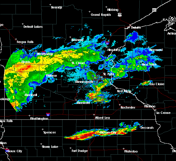 At 723 am cdt, a severe thunderstorm was located over warsaw, or 7 miles southwest of faribault, moving east at 35 mph (radar indicated). Hazards include ping pong ball size hail. People and animals outdoors will be injured. expect damage to roofs, siding, windows, and vehicles. this severe thunderstorm will be near, faribault around 730 am cdt. medford around 740 am cdt. owatonna around 745 am cdt. other locations impacted by this severe thunderstorm include clinton falls, merton, deerfield, ruskin and moland. This includes interstate 35 between mile markers 46 and 56. At 723 am cdt, a severe thunderstorm was located over warsaw, or 7 miles southwest of faribault, moving east at 35 mph (radar indicated). Hazards include ping pong ball size hail. People and animals outdoors will be injured. expect damage to roofs, siding, windows, and vehicles. this severe thunderstorm will be near, faribault around 730 am cdt. medford around 740 am cdt. owatonna around 745 am cdt. other locations impacted by this severe thunderstorm include clinton falls, merton, deerfield, ruskin and moland. This includes interstate 35 between mile markers 46 and 56.
|
| 6/12/2017 1:24 PM CDT |
 At 124 pm cdt, severe thunderstorms were located along a line extending from near waseca airport to near lemond to near new richland, moving northeast at 45 mph (radar indicated). Hazards include 60 mph wind gusts and penny size hail. Expect damage to roofs, siding, and trees. severe thunderstorms will be near, morristown around 135 pm cdt. warsaw around 140 pm cdt. faribault and medford around 145 pm cdt. owatonna around 150 pm cdt. other locations impacted by these severe thunderstorms include clinton falls, waseca airport, lemond, merton, ruskin, deerfield, owatonna airport, hope and moland. this includes the following highways, interstate 35 between mile markers 35 and 55. u. s. Highway 14 between mile markers 158 and 182. At 124 pm cdt, severe thunderstorms were located along a line extending from near waseca airport to near lemond to near new richland, moving northeast at 45 mph (radar indicated). Hazards include 60 mph wind gusts and penny size hail. Expect damage to roofs, siding, and trees. severe thunderstorms will be near, morristown around 135 pm cdt. warsaw around 140 pm cdt. faribault and medford around 145 pm cdt. owatonna around 150 pm cdt. other locations impacted by these severe thunderstorms include clinton falls, waseca airport, lemond, merton, ruskin, deerfield, owatonna airport, hope and moland. this includes the following highways, interstate 35 between mile markers 35 and 55. u. s. Highway 14 between mile markers 158 and 182.
|
| 5/17/2017 4:10 PM CDT |
 At 410 pm cdt, a severe thunderstorm capable of producing a tornado was located over moland, or 8 miles northeast of owatonna, moving north at 35 mph (radar indicated rotation). Hazards include tornado and half dollar size hail. Flying debris will be dangerous to those caught without shelter. mobile homes will be damaged or destroyed. damage to roofs, windows, and vehicles will occur. tree damage is likely. Locations impacted include, merton and moland. At 410 pm cdt, a severe thunderstorm capable of producing a tornado was located over moland, or 8 miles northeast of owatonna, moving north at 35 mph (radar indicated rotation). Hazards include tornado and half dollar size hail. Flying debris will be dangerous to those caught without shelter. mobile homes will be damaged or destroyed. damage to roofs, windows, and vehicles will occur. tree damage is likely. Locations impacted include, merton and moland.
|
| 5/17/2017 4:00 PM CDT |
 At 400 pm cdt, a severe thunderstorm was located over merton, or near owatonna, moving north at 30 mph (radar indicated). Hazards include 60 mph wind gusts and quarter size hail. Hail damage to vehicles is expected. expect wind damage to roofs, siding, and trees. this severe thunderstorm will be near, nerstrand around 425 pm cdt. other locations impacted by this severe thunderstorm include clinton falls, merton, ruskin, faribault airport and owatonna airport. this includes interstate 35 between mile markers 43 and 55, and between mile markers 59 and 62. A tornado watch remains in effect until 1000 pm cdt for south central and southeastern minnesota. At 400 pm cdt, a severe thunderstorm was located over merton, or near owatonna, moving north at 30 mph (radar indicated). Hazards include 60 mph wind gusts and quarter size hail. Hail damage to vehicles is expected. expect wind damage to roofs, siding, and trees. this severe thunderstorm will be near, nerstrand around 425 pm cdt. other locations impacted by this severe thunderstorm include clinton falls, merton, ruskin, faribault airport and owatonna airport. this includes interstate 35 between mile markers 43 and 55, and between mile markers 59 and 62. A tornado watch remains in effect until 1000 pm cdt for south central and southeastern minnesota.
|
| 5/17/2017 3:55 PM CDT |
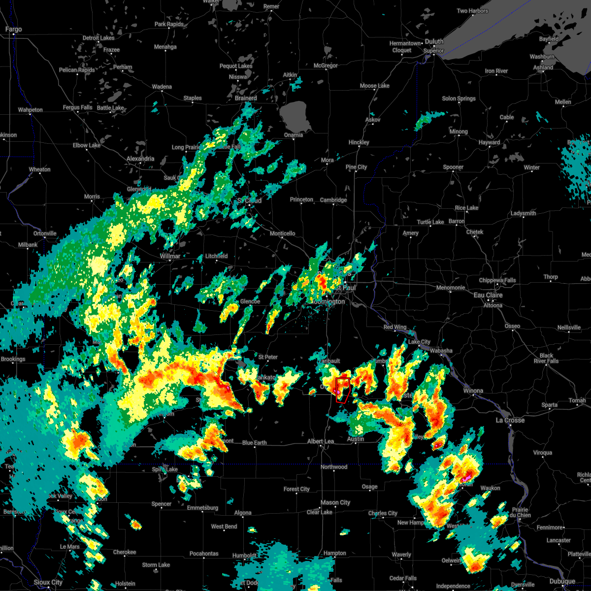 At 355 pm cdt, a severe thunderstorm capable of producing a tornado was located near owatonna, moving north at 35 mph (radar indicated rotation). Hazards include tornado and half dollar size hail. Flying debris will be dangerous to those caught without shelter. mobile homes will be damaged or destroyed. damage to roofs, windows, and vehicles will occur. tree damage is likely. this tornadic thunderstorm will remain over mainly rural areas of northeastern steele county, including the following locations: moland and merton. this includes u. s. Highway 14 between mile markers 177 and 181. At 355 pm cdt, a severe thunderstorm capable of producing a tornado was located near owatonna, moving north at 35 mph (radar indicated rotation). Hazards include tornado and half dollar size hail. Flying debris will be dangerous to those caught without shelter. mobile homes will be damaged or destroyed. damage to roofs, windows, and vehicles will occur. tree damage is likely. this tornadic thunderstorm will remain over mainly rural areas of northeastern steele county, including the following locations: moland and merton. this includes u. s. Highway 14 between mile markers 177 and 181.
|
| 5/17/2017 3:47 PM CDT |
 At 347 pm cdt, a severe thunderstorm was located over owatonna, moving north at 40 mph (radar indicated). Hazards include 60 mph wind gusts and half dollar size hail. Hail damage to vehicles is expected. expect wind damage to roofs, siding, and trees. this severe thunderstorm will remain over mainly rural areas of northeastern steele county, including the following locations: clinton falls, merton, owatonna airport and moland. A tornado watch remains in effect until 1000 pm cdt for south central minnesota. At 347 pm cdt, a severe thunderstorm was located over owatonna, moving north at 40 mph (radar indicated). Hazards include 60 mph wind gusts and half dollar size hail. Hail damage to vehicles is expected. expect wind damage to roofs, siding, and trees. this severe thunderstorm will remain over mainly rural areas of northeastern steele county, including the following locations: clinton falls, merton, owatonna airport and moland. A tornado watch remains in effect until 1000 pm cdt for south central minnesota.
|
| 5/17/2017 3:30 PM CDT |
 At 330 pm cdt, a severe thunderstorm was located near steele center, or 10 miles south of owatonna, moving north at 40 mph (radar indicated). Hazards include 60 mph wind gusts and half dollar size hail. Hail damage to vehicles is expected. expect wind damage to roofs, siding, and trees. this severe thunderstorm will be near, owatonna around 350 pm cdt. medford around 355 pm cdt. other locations impacted by this severe thunderstorm include clinton falls, steele center, merton, owatonna airport and moland. this includes the following highways, interstate 35 between mile markers 28 and 49. u. s. highway 14 between mile markers 170 and 179. A tornado watch remains in effect until 1000 pm cdt for south central minnesota. At 330 pm cdt, a severe thunderstorm was located near steele center, or 10 miles south of owatonna, moving north at 40 mph (radar indicated). Hazards include 60 mph wind gusts and half dollar size hail. Hail damage to vehicles is expected. expect wind damage to roofs, siding, and trees. this severe thunderstorm will be near, owatonna around 350 pm cdt. medford around 355 pm cdt. other locations impacted by this severe thunderstorm include clinton falls, steele center, merton, owatonna airport and moland. this includes the following highways, interstate 35 between mile markers 28 and 49. u. s. highway 14 between mile markers 170 and 179. A tornado watch remains in effect until 1000 pm cdt for south central minnesota.
|
| 5/15/2017 10:36 PM CDT |
 At 1036 pm cdt, a severe thunderstorm was located near owatonna, moving east at 25 mph (radar indicated). Hazards include half dollar size hail. Damage to vehicles is expected. this severe storm will be near, owatonna around 1055 pm cdt. Other locations impacted by this severe thunderstorm include clinton falls, merton, owatonna airport and moland. At 1036 pm cdt, a severe thunderstorm was located near owatonna, moving east at 25 mph (radar indicated). Hazards include half dollar size hail. Damage to vehicles is expected. this severe storm will be near, owatonna around 1055 pm cdt. Other locations impacted by this severe thunderstorm include clinton falls, merton, owatonna airport and moland.
|
| 5/15/2017 10:22 PM CDT |
 At 1022 pm cdt, a severe thunderstorm was located near lemond, or 8 miles southwest of owatonna, moving northeast at 30 mph (radar indicated). Hazards include half dollar size hail. Damage to vehicles is expected. this severe storm will be near, owatonna around 1045 pm cdt. Other locations impacted by this severe thunderstorm include clinton falls, lemond, merton, owatonna airport, hope and moland. At 1022 pm cdt, a severe thunderstorm was located near lemond, or 8 miles southwest of owatonna, moving northeast at 30 mph (radar indicated). Hazards include half dollar size hail. Damage to vehicles is expected. this severe storm will be near, owatonna around 1045 pm cdt. Other locations impacted by this severe thunderstorm include clinton falls, lemond, merton, owatonna airport, hope and moland.
|
| 5/15/2017 10:10 PM CDT | Half Dollar sized hail reported 1.1 miles WNW of Owatonna, MN |
| 5/15/2017 10:10 PM CDT | Golf Ball sized hail reported 0.3 miles NNW of Owatonna, MN |
| 5/15/2017 10:04 PM CDT |
 The national weather service in the twin cities has issued a * severe thunderstorm warning for. northern steele county in south central minnesota. Until 1100 pm cdt * at 1004 pm cdt, a severe thunderstorm was located near lemond, or 7 miles southwest of owatonna, moving northeast at 35 mph. The national weather service in the twin cities has issued a * severe thunderstorm warning for. northern steele county in south central minnesota. Until 1100 pm cdt * at 1004 pm cdt, a severe thunderstorm was located near lemond, or 7 miles southwest of owatonna, moving northeast at 35 mph.
|
| 3/6/2017 5:53 PM CST |
 At 553 pm cst, a severe thunderstorm was located near steele center, or 11 miles south of owatonna, moving northeast at 50 mph (radar indicated). Hazards include ping pong ball size hail and 60 mph wind gusts. People and animals outdoors will be injured. expect hail damage to roofs, siding, windows, and vehicles. expect wind damage to roofs, siding, and trees. A tornado watch remains in effect until 1000 pm cst for south central minnesota. At 553 pm cst, a severe thunderstorm was located near steele center, or 11 miles south of owatonna, moving northeast at 50 mph (radar indicated). Hazards include ping pong ball size hail and 60 mph wind gusts. People and animals outdoors will be injured. expect hail damage to roofs, siding, windows, and vehicles. expect wind damage to roofs, siding, and trees. A tornado watch remains in effect until 1000 pm cst for south central minnesota.
|
| 3/6/2017 5:42 PM CST |
 At 541 pm cst, a severe thunderstorm was located near clarks grove, or 10 miles north of albert lea, moving northeast at 50 mph (radar indicated). Hazards include ping pong ball size hail and 60 mph wind gusts. People and animals outdoors will be injured. expect hail damage to roofs, siding, windows, and vehicles. expect wind damage to roofs, siding, and trees. this severe thunderstorm will be near, ellendale and geneva around 550 pm cst. owatonna around 610 pm cst. other locations impacted by this severe thunderstorm include clinton falls, lemond, merton, steele center, bixby, and hope. A tornado watch remains in effect until 1000 pm cst for south central minnesota. At 541 pm cst, a severe thunderstorm was located near clarks grove, or 10 miles north of albert lea, moving northeast at 50 mph (radar indicated). Hazards include ping pong ball size hail and 60 mph wind gusts. People and animals outdoors will be injured. expect hail damage to roofs, siding, windows, and vehicles. expect wind damage to roofs, siding, and trees. this severe thunderstorm will be near, ellendale and geneva around 550 pm cst. owatonna around 610 pm cst. other locations impacted by this severe thunderstorm include clinton falls, lemond, merton, steele center, bixby, and hope. A tornado watch remains in effect until 1000 pm cst for south central minnesota.
|
| 8/18/2016 4:34 PM CDT |
 At 433 pm cdt, a severe thunderstorm was located near bixby, or 9 miles southeast of owatonna, moving east at 40 mph (radar indicated). Hazards include 70 mph wind gusts and quarter size hail. Hail damage to vehicles is expected. expect considerable tree damage. wind damage is also likely to mobile homes, roofs, and outbuildings. Locations impacted include, owatonna, waseca, lemond, clinton falls, hope, bixby, owatonna airport and steele center. At 433 pm cdt, a severe thunderstorm was located near bixby, or 9 miles southeast of owatonna, moving east at 40 mph (radar indicated). Hazards include 70 mph wind gusts and quarter size hail. Hail damage to vehicles is expected. expect considerable tree damage. wind damage is also likely to mobile homes, roofs, and outbuildings. Locations impacted include, owatonna, waseca, lemond, clinton falls, hope, bixby, owatonna airport and steele center.
|
| 8/18/2016 4:19 PM CDT |
 At 418 pm cdt, a severe thunderstorm was located near lemond, or 7 miles southwest of owatonna, moving east at 40 mph (at 415 pm cdt... winds gusted to 59 mph in waseca). Hazards include 70 mph wind gusts and quarter size hail. Hail damage to vehicles is expected. expect considerable tree damage. wind damage is also likely to mobile homes, roofs, and outbuildings. this severe storm will be near, owatonna around 430 pm cdt. Other locations impacted by this severe thunderstorm include lemond, bixby, owatonna airport, hope, steele center, clinton falls, waseca airport and otisco. At 418 pm cdt, a severe thunderstorm was located near lemond, or 7 miles southwest of owatonna, moving east at 40 mph (at 415 pm cdt... winds gusted to 59 mph in waseca). Hazards include 70 mph wind gusts and quarter size hail. Hail damage to vehicles is expected. expect considerable tree damage. wind damage is also likely to mobile homes, roofs, and outbuildings. this severe storm will be near, owatonna around 430 pm cdt. Other locations impacted by this severe thunderstorm include lemond, bixby, owatonna airport, hope, steele center, clinton falls, waseca airport and otisco.
|
| 8/18/2016 4:09 PM CDT |
 At 409 pm cdt, a severe thunderstorm was located near waseca, or 13 miles west of owatonna, moving east at 40 mph (radar indicated). Hazards include 60 mph wind gusts and quarter size hail. Hail damage to vehicles is expected. expect wind damage to roofs, siding, and trees. this severe thunderstorm will be near, owatonna around 430 pm cdt. other locations impacted by this severe thunderstorm include lemond, bixby, owatonna airport, hope, steele center, clinton falls, waseca airport and otisco. this includes the following highways, interstate 35 between mile markers 30 and 45. u. s. Highway 14 between mile markers 151 and 182. At 409 pm cdt, a severe thunderstorm was located near waseca, or 13 miles west of owatonna, moving east at 40 mph (radar indicated). Hazards include 60 mph wind gusts and quarter size hail. Hail damage to vehicles is expected. expect wind damage to roofs, siding, and trees. this severe thunderstorm will be near, owatonna around 430 pm cdt. other locations impacted by this severe thunderstorm include lemond, bixby, owatonna airport, hope, steele center, clinton falls, waseca airport and otisco. this includes the following highways, interstate 35 between mile markers 30 and 45. u. s. Highway 14 between mile markers 151 and 182.
|
| 8/4/2016 1:03 PM CDT | Ping Pong Ball sized hail reported 4.9 miles NNW of Owatonna, MN, photos posted to kaal facebook page. |
| 8/4/2016 12:53 PM CDT |
 At 1253 pm cdt, a severe thunderstorm was located near owatonna, moving east at 40 mph (radar indicated). Hazards include golf ball size hail and 60 mph wind gusts. People and animals outdoors will be injured. expect hail damage to roofs, siding, windows, and vehicles. expect wind damage to roofs, siding, and trees. this severe thunderstorm will remain over mainly rural areas of northeastern steele county, including the following locations: bixby. this includes u. s. Highway 14 between mile markers 176 and 182. At 1253 pm cdt, a severe thunderstorm was located near owatonna, moving east at 40 mph (radar indicated). Hazards include golf ball size hail and 60 mph wind gusts. People and animals outdoors will be injured. expect hail damage to roofs, siding, windows, and vehicles. expect wind damage to roofs, siding, and trees. this severe thunderstorm will remain over mainly rural areas of northeastern steele county, including the following locations: bixby. this includes u. s. Highway 14 between mile markers 176 and 182.
|
| 7/5/2016 8:53 PM CDT |
 The severe thunderstorm warning for steele and southern waseca counties will expire at 900 pm cdt, the storm which prompted the warning has moved out of the area. therefore the warning will be allowed to expire. however gusty winds are still possible with this thunderstorm. a severe thunderstorm watch remains in effect until 1100 pm cdt for south central minnesota. The severe thunderstorm warning for steele and southern waseca counties will expire at 900 pm cdt, the storm which prompted the warning has moved out of the area. therefore the warning will be allowed to expire. however gusty winds are still possible with this thunderstorm. a severe thunderstorm watch remains in effect until 1100 pm cdt for south central minnesota.
|
| 7/5/2016 8:30 PM CDT | A few trees down and power lines dow in steele county MN, 0.6 miles WNW of Owatonna, MN |
| 7/5/2016 8:23 PM CDT |
 At 822 pm cdt, a severe thunderstorm was located over hope, or 8 miles southwest of owatonna, moving east at 40 mph (radar indicated). Hazards include 60 mph wind gusts and quarter size hail. Hail damage to vehicles is expected. expect wind damage to roofs, siding, and trees. this severe storm will be near, blooming prairie around 850 pm cdt. Other locations impacted by this severe thunderstorm include lemond, hope, steele center, otisco and bixby. At 822 pm cdt, a severe thunderstorm was located over hope, or 8 miles southwest of owatonna, moving east at 40 mph (radar indicated). Hazards include 60 mph wind gusts and quarter size hail. Hail damage to vehicles is expected. expect wind damage to roofs, siding, and trees. this severe storm will be near, blooming prairie around 850 pm cdt. Other locations impacted by this severe thunderstorm include lemond, hope, steele center, otisco and bixby.
|
| 7/5/2016 7:56 PM CDT |
 At 755 pm cdt, a severe thunderstorm was located over janesville, or 16 miles east of mankato, moving southeast at 40 mph (radar indicated). Hazards include 60 mph wind gusts and quarter size hail. Hail damage to vehicles is expected. expect wind damage to roofs, siding, and trees. this severe thunderstorm will be near, waseca around 805 pm cdt. ellendale around 835 pm cdt. blooming prairie around 850 pm cdt. other locations impacted by this severe thunderstorm include lemond, otisco, bixby, owatonna airport, hope, steele center, moland, merton, alma city and deerfield. this includes the following highways, interstate 35 between mile markers 26 and 49. u. s. Highway 14 between mile markers 145 and 182. At 755 pm cdt, a severe thunderstorm was located over janesville, or 16 miles east of mankato, moving southeast at 40 mph (radar indicated). Hazards include 60 mph wind gusts and quarter size hail. Hail damage to vehicles is expected. expect wind damage to roofs, siding, and trees. this severe thunderstorm will be near, waseca around 805 pm cdt. ellendale around 835 pm cdt. blooming prairie around 850 pm cdt. other locations impacted by this severe thunderstorm include lemond, otisco, bixby, owatonna airport, hope, steele center, moland, merton, alma city and deerfield. this includes the following highways, interstate 35 between mile markers 26 and 49. u. s. Highway 14 between mile markers 145 and 182.
|
| 6/30/2016 1:06 PM CDT |
 At 105 pm cdt, severe thunderstorms were located along a line extending from near lemond to near ellendale to near wells, moving southeast at 35 mph (at 1252 pm a 61 mph wind gust was recorded at waseca). Hazards include 60 mph wind gusts and penny size hail. Expect damage to roofs. siding. and trees. these severe storms will be near, ellendale around 110 pm cdt. owatonna around 115 pm cdt. clarks grove and geneva around 120 pm cdt. alden around 125 pm cdt. albert lea, hollandale, hayward and conger around 130 pm cdt. Other locations impacted by these severe thunderstorms include lemond, walters, otisco, bixby, matawan, hope, steele center, baroda, and manchester. At 105 pm cdt, severe thunderstorms were located along a line extending from near lemond to near ellendale to near wells, moving southeast at 35 mph (at 1252 pm a 61 mph wind gust was recorded at waseca). Hazards include 60 mph wind gusts and penny size hail. Expect damage to roofs. siding. and trees. these severe storms will be near, ellendale around 110 pm cdt. owatonna around 115 pm cdt. clarks grove and geneva around 120 pm cdt. alden around 125 pm cdt. albert lea, hollandale, hayward and conger around 130 pm cdt. Other locations impacted by these severe thunderstorms include lemond, walters, otisco, bixby, matawan, hope, steele center, baroda, and manchester.
|
| 6/30/2016 12:50 PM CDT |
 At 1250 pm cdt, severe thunderstorms were located along a line extending from near waseca to otisco to near minnesota lake, moving southeast at 35 mph (radar indicated). Hazards include 60 mph wind gusts and penny size hail. Expect damage to roofs. siding. and trees. severe thunderstorms will be near, new richland around 100 pm cdt. wells and hartland around 110 pm cdt. freeborn around 115 pm cdt. Other locations impacted by these severe thunderstorms include lemond, walters, bixby, matawan, steele center, albert lea airport, baroda, waseca airport, brush creek and otisco. At 1250 pm cdt, severe thunderstorms were located along a line extending from near waseca to otisco to near minnesota lake, moving southeast at 35 mph (radar indicated). Hazards include 60 mph wind gusts and penny size hail. Expect damage to roofs. siding. and trees. severe thunderstorms will be near, new richland around 100 pm cdt. wells and hartland around 110 pm cdt. freeborn around 115 pm cdt. Other locations impacted by these severe thunderstorms include lemond, walters, bixby, matawan, steele center, albert lea airport, baroda, waseca airport, brush creek and otisco.
|
| 6/14/2016 5:27 PM CDT |
 The severe thunderstorm warning for western steele. northeastern waseca. central freeborn and southeastern le sueur counties will expire at 530 pm cdt. the storms which prompted the warning have weakened below severe limits. and have exited the warned area. Therefore the warning will be allowed to expire. The severe thunderstorm warning for western steele. northeastern waseca. central freeborn and southeastern le sueur counties will expire at 530 pm cdt. the storms which prompted the warning have weakened below severe limits. and have exited the warned area. Therefore the warning will be allowed to expire.
|
| 6/14/2016 5:18 PM CDT |
 At 518 pm cdt, severe thunderstorms were located along a line extending from near deerfield to ellendale to near twin lakes, moving east at 25 mph (radar indicated). Hazards include 60 mph wind gusts. Expect damage to roofs. siding. and trees. locations impacted include, albert lea, waseca, waterville, new richland, clarks grove, ellendale, elysian, glenville, emmons, hartland, twin lakes and lemond. A tornado watch remains in effect until 1000 pm cdt for south central minnesota. At 518 pm cdt, severe thunderstorms were located along a line extending from near deerfield to ellendale to near twin lakes, moving east at 25 mph (radar indicated). Hazards include 60 mph wind gusts. Expect damage to roofs. siding. and trees. locations impacted include, albert lea, waseca, waterville, new richland, clarks grove, ellendale, elysian, glenville, emmons, hartland, twin lakes and lemond. A tornado watch remains in effect until 1000 pm cdt for south central minnesota.
|
| 6/14/2016 4:33 PM CDT |
 At 433 pm cdt, severe thunderstorms were located along a line extending from near smiths mill to near minnesota lake to near kiester, moving east at 30 mph (radar indicated). Hazards include 60 mph wind gusts. Expect damage to roofs. siding. and trees. severe thunderstorms will be near, janesville around 440 pm cdt. freeborn and waldorf around 445 pm cdt. elysian around 450 pm cdt. waseca, emmons and hartland around 455 pm cdt. waterville, new richland, alden and conger around 500 pm cdt. other locations impacted by these severe thunderstorms include kiester, lemond, walters, matawan, smiths mill, baroda, albert lea airport, alma city, waseca airport and greenland. A tornado watch remains in effect until 1000 pm cdt for south central minnesota. At 433 pm cdt, severe thunderstorms were located along a line extending from near smiths mill to near minnesota lake to near kiester, moving east at 30 mph (radar indicated). Hazards include 60 mph wind gusts. Expect damage to roofs. siding. and trees. severe thunderstorms will be near, janesville around 440 pm cdt. freeborn and waldorf around 445 pm cdt. elysian around 450 pm cdt. waseca, emmons and hartland around 455 pm cdt. waterville, new richland, alden and conger around 500 pm cdt. other locations impacted by these severe thunderstorms include kiester, lemond, walters, matawan, smiths mill, baroda, albert lea airport, alma city, waseca airport and greenland. A tornado watch remains in effect until 1000 pm cdt for south central minnesota.
|
| 6/14/2016 10:33 AM CDT |
 At 433 pm cdt, severe thunderstorms were located along a line extending from near smiths mill to near minnesota lake to near kiester, moving east at 30 mph (radar indicated). Hazards include 60 mph wind gusts. Expect damage to roofs. siding. and trees. severe thunderstorms will be near, janesville around 440 pm cdt. freeborn and waldorf around 445 pm cdt. elysian around 450 pm cdt. waseca, emmons and hartland around 455 pm cdt. waterville, new richland, alden and conger around 500 pm cdt. other locations impacted by these severe thunderstorms include kiester, lemond, walters, matawan, smiths mill, baroda, albert lea airport, alma city, waseca airport and greenland. A tornado watch remains in effect until 1000 pm cdt for south central minnesota. At 433 pm cdt, severe thunderstorms were located along a line extending from near smiths mill to near minnesota lake to near kiester, moving east at 30 mph (radar indicated). Hazards include 60 mph wind gusts. Expect damage to roofs. siding. and trees. severe thunderstorms will be near, janesville around 440 pm cdt. freeborn and waldorf around 445 pm cdt. elysian around 450 pm cdt. waseca, emmons and hartland around 455 pm cdt. waterville, new richland, alden and conger around 500 pm cdt. other locations impacted by these severe thunderstorms include kiester, lemond, walters, matawan, smiths mill, baroda, albert lea airport, alma city, waseca airport and greenland. A tornado watch remains in effect until 1000 pm cdt for south central minnesota.
|
| 5/26/2016 2:51 AM CDT | Mndot sensor on i-35 north of ellendale in steele county MN, 10.8 miles N of Owatonna, MN |
| 7/24/2015 6:37 AM CDT |
 At 637 am cdt, severe thunderstorms were located along a line extending from near claremont to otisco to near good thunder, moving south at 25 mph (radar indicated). Hazards include 60 mph wind gusts and penny size hail. Expect damage to roofs. siding and trees. severe thunderstorms will be near, new richland around 650 am cdt. blooming prairie, minnesota lake and hartland around 705 am cdt. freeborn around 710 am cdt. easton around 715 am cdt. albert lea and alden around 725 am cdt. conger around 730 am cdt. other locations impacted by these severe thunderstorms include lemond, otisco, bixby, matawan, hope, steele center, baroda, albert lea airport, manchester and brush creek. this includes the following highways, interstate 35 between mile markers 8 and 39. interstate 90 between mile markers 127 and 173. u. s. Highway 14 between mile markers 175 and 182. At 637 am cdt, severe thunderstorms were located along a line extending from near claremont to otisco to near good thunder, moving south at 25 mph (radar indicated). Hazards include 60 mph wind gusts and penny size hail. Expect damage to roofs. siding and trees. severe thunderstorms will be near, new richland around 650 am cdt. blooming prairie, minnesota lake and hartland around 705 am cdt. freeborn around 710 am cdt. easton around 715 am cdt. albert lea and alden around 725 am cdt. conger around 730 am cdt. other locations impacted by these severe thunderstorms include lemond, otisco, bixby, matawan, hope, steele center, baroda, albert lea airport, manchester and brush creek. this includes the following highways, interstate 35 between mile markers 8 and 39. interstate 90 between mile markers 127 and 173. u. s. Highway 14 between mile markers 175 and 182.
|
| 7/18/2015 1:24 AM CDT |
 At 124 am cdt, severe thunderstorms were located along a line extending from ellsworth to near mazeppa to near steele center, moving east at 50 mph (radar indicated). Hazards include 70 mph wind gusts. Expect considerable tree damage. damage is likely to mobile homes, roofs and outbuildings. these severe storms will be near, ellsworth around 130 am cdt. Other locations impacted by these severe thunderstorms include lemond, frontenac state park, bixby, afton state park, owatonna airport, hader, clinton falls, diamond bluff, el paso and bellechester. At 124 am cdt, severe thunderstorms were located along a line extending from ellsworth to near mazeppa to near steele center, moving east at 50 mph (radar indicated). Hazards include 70 mph wind gusts. Expect considerable tree damage. damage is likely to mobile homes, roofs and outbuildings. these severe storms will be near, ellsworth around 130 am cdt. Other locations impacted by these severe thunderstorms include lemond, frontenac state park, bixby, afton state park, owatonna airport, hader, clinton falls, diamond bluff, el paso and bellechester.
|
| 7/18/2015 12:55 AM CDT |
 At 1254 am cdt, severe thunderstorms were located along a line extending from grey cloud township to near northfield to near waldorf, moving east at 45 mph (radar indicated). Hazards include 70 mph wind gusts. Expect considerable tree damage. damage is likely to mobile homes, roofs and outbuildings. severe thunderstorms will be near, northfield, cottage grove, st. paul park, stanton and randolph around 100 am cdt. hastings and cannon falls around 105 am cdt. prescott around 110 am cdt. river falls and ellendale around 120 am cdt. goodhue around 125 am cdt. ellsworth around 130 am cdt. blooming prairie around 135 am cdt. stockholm and frontenac around 145 am cdt. Other locations impacted by these severe thunderstorms include lemond, frontenac state park, bixby, afton state park, owatonna airport, hader, clinton falls, bridgewater, st paul park and diamond bluff. At 1254 am cdt, severe thunderstorms were located along a line extending from grey cloud township to near northfield to near waldorf, moving east at 45 mph (radar indicated). Hazards include 70 mph wind gusts. Expect considerable tree damage. damage is likely to mobile homes, roofs and outbuildings. severe thunderstorms will be near, northfield, cottage grove, st. paul park, stanton and randolph around 100 am cdt. hastings and cannon falls around 105 am cdt. prescott around 110 am cdt. river falls and ellendale around 120 am cdt. goodhue around 125 am cdt. ellsworth around 130 am cdt. blooming prairie around 135 am cdt. stockholm and frontenac around 145 am cdt. Other locations impacted by these severe thunderstorms include lemond, frontenac state park, bixby, afton state park, owatonna airport, hader, clinton falls, bridgewater, st paul park and diamond bluff.
|
| 6/22/2015 6:31 AM CDT |
 At 631 am cdt, severe thunderstorms were located along a line extending from st thomas to near waldorf to near mansfield, moving east at 70 mph (radar indicated). Hazards include 70 mph wind gusts and quarter size hail. Hail damage to vehicles is expected. expect considerable tree damage. Wind damage is also likely to mobile homes, roofs and outbuildings. At 631 am cdt, severe thunderstorms were located along a line extending from st thomas to near waldorf to near mansfield, moving east at 70 mph (radar indicated). Hazards include 70 mph wind gusts and quarter size hail. Hail damage to vehicles is expected. expect considerable tree damage. Wind damage is also likely to mobile homes, roofs and outbuildings.
|
| 8/18/2014 7:15 PM CDT | Storm damage reported in steele county MN, 2 miles SSE of Owatonna, MN |
| 6/16/2014 6:47 PM CDT | Four to six inch diameter tree branches severed. three foot diameter tree down over county road 21 in steele county MN, 9.6 miles NNE of Owatonna, MN |
| 6/16/2014 5:49 PM CDT | Tree down over road at county road 218 and county road 4 intersectio in steele county MN, 10.4 miles NNE of Owatonna, MN |
| 9/5/2012 12:15 AM CDT | Storm damage reported in steele county MN, 10.5 miles NE of Owatonna, MN |
| 1/1/0001 12:00 AM | Quarter sized hail reported 15 miles N of Owatonna, MN |
Hail Maps for Owatonna, MN


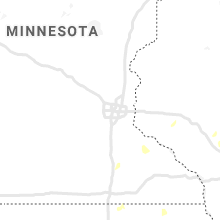


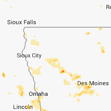


Connect with Interactive Hail Maps