

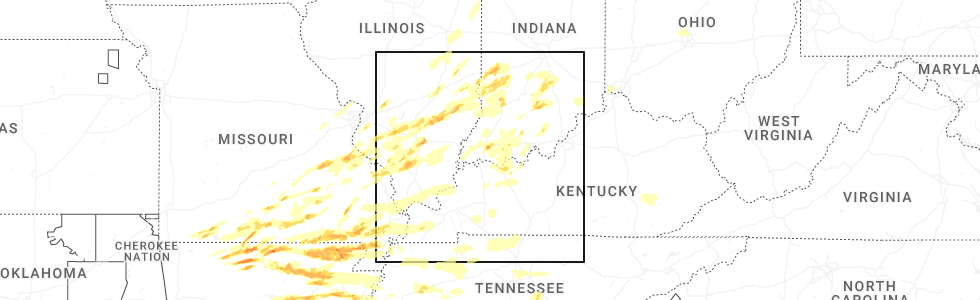
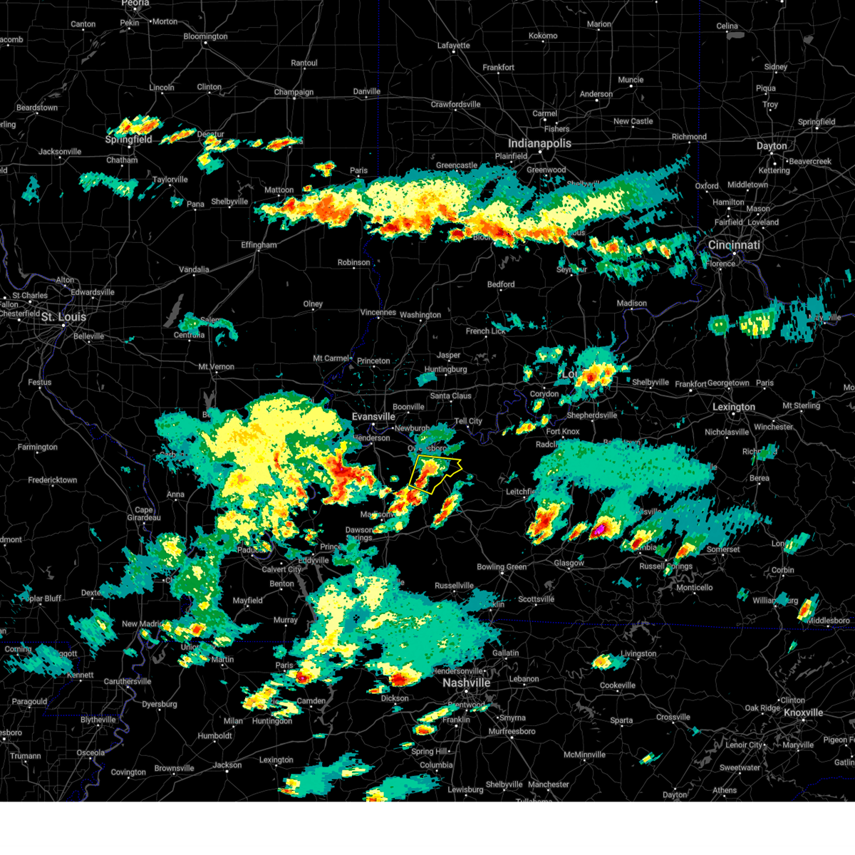
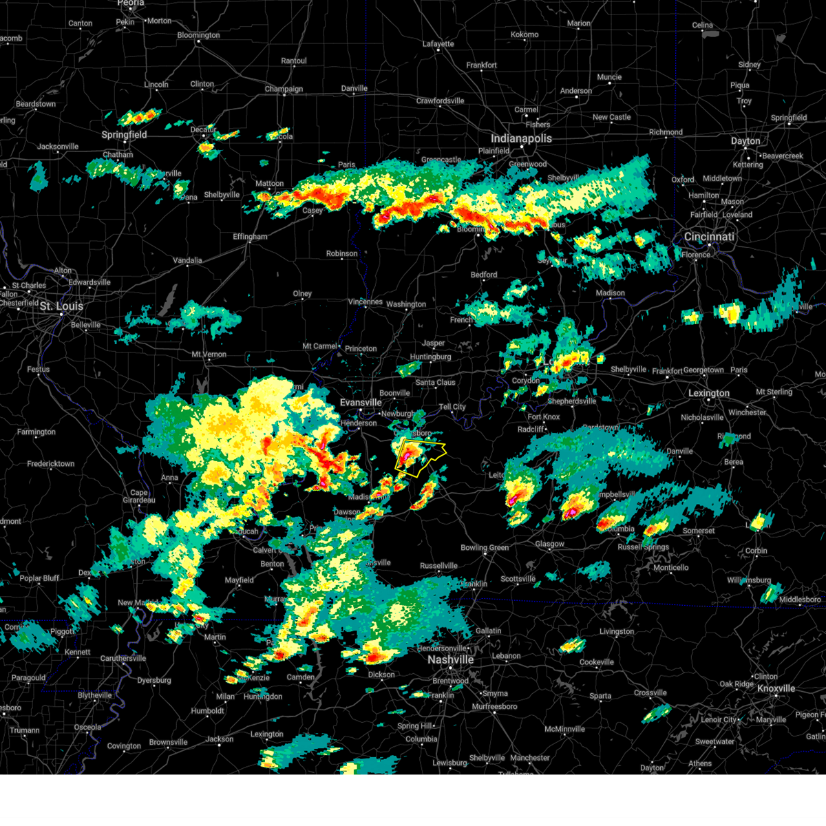
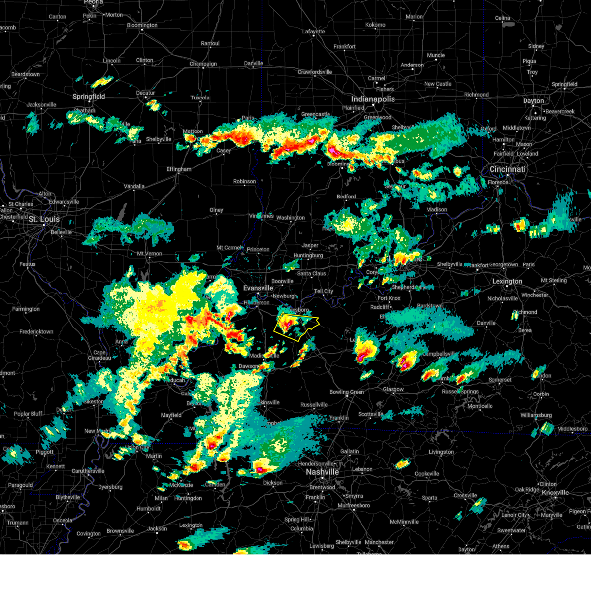
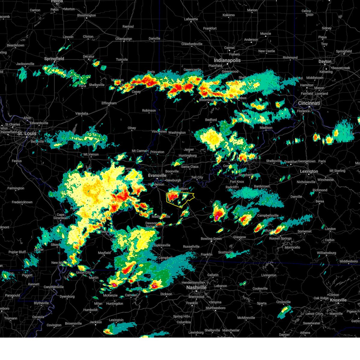
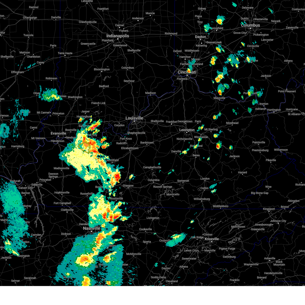
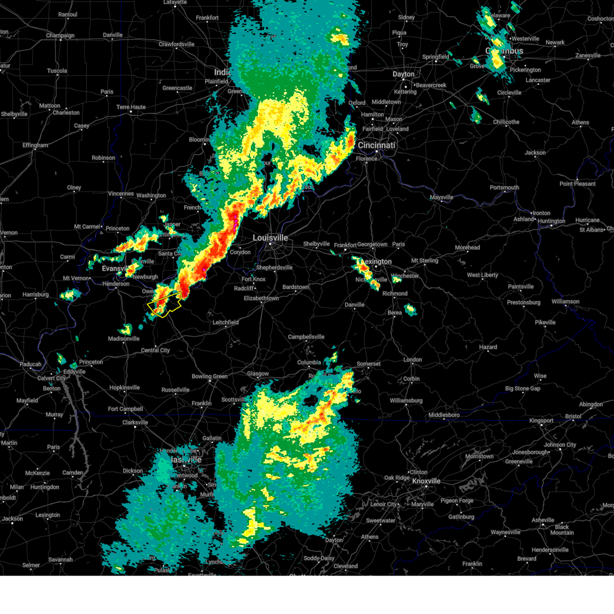
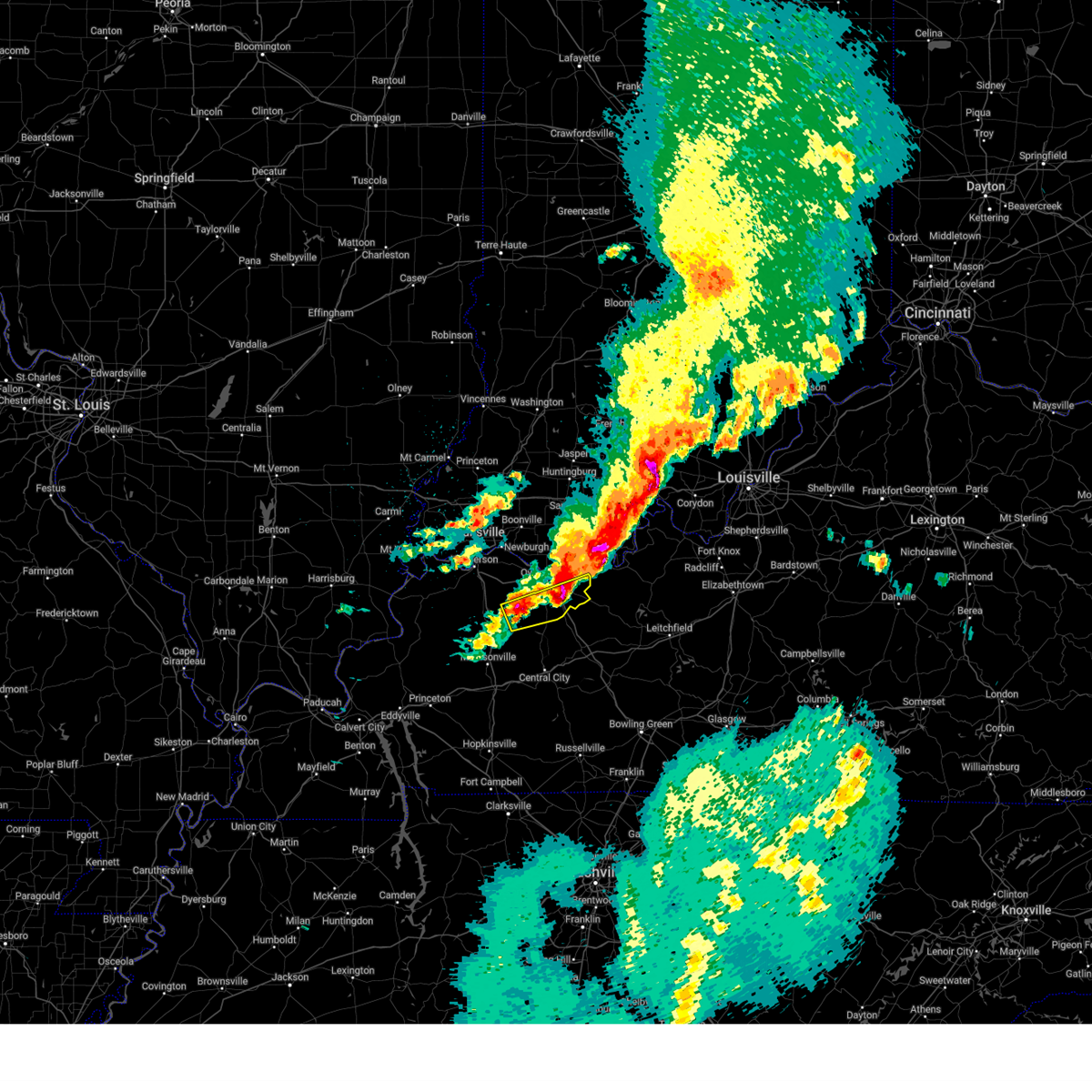
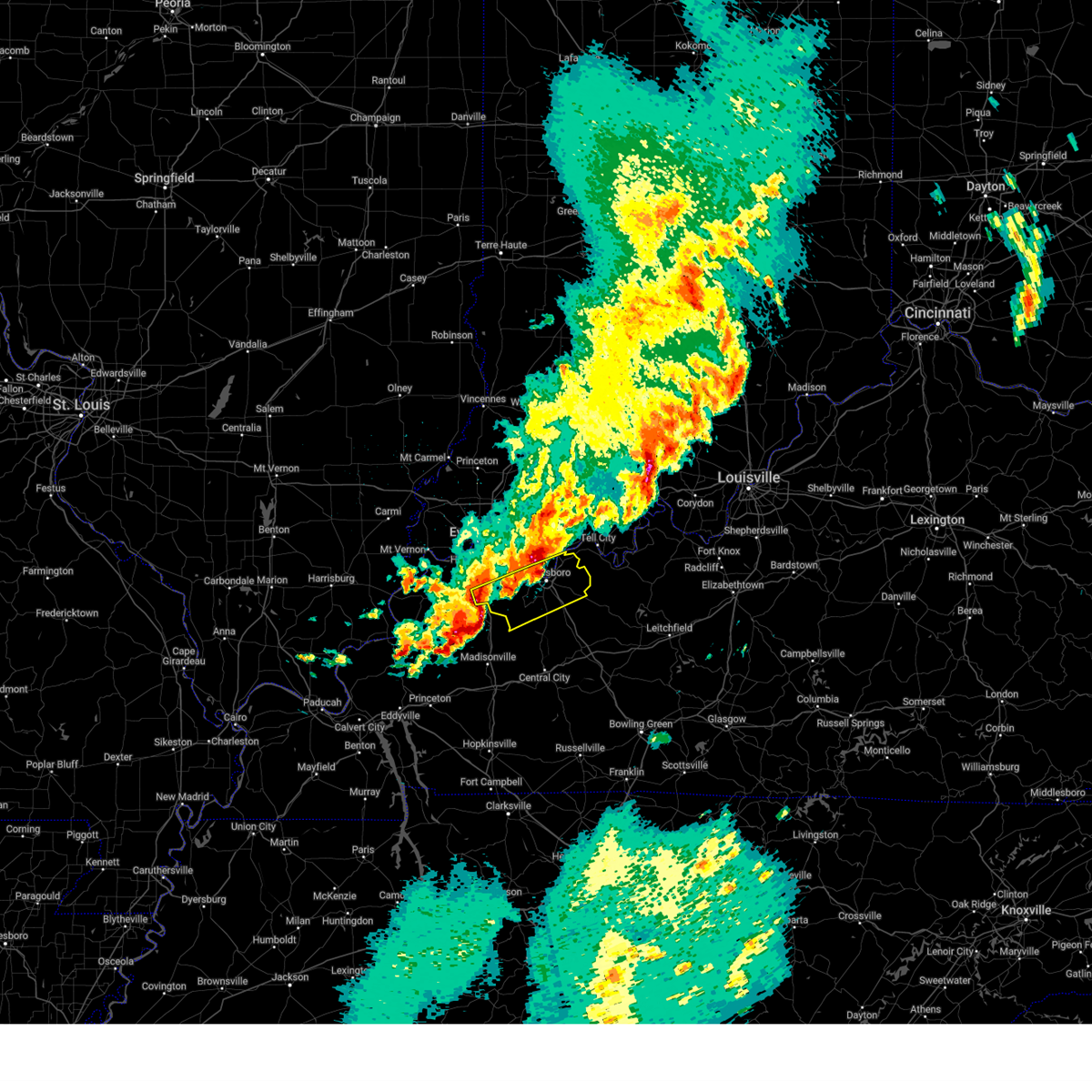
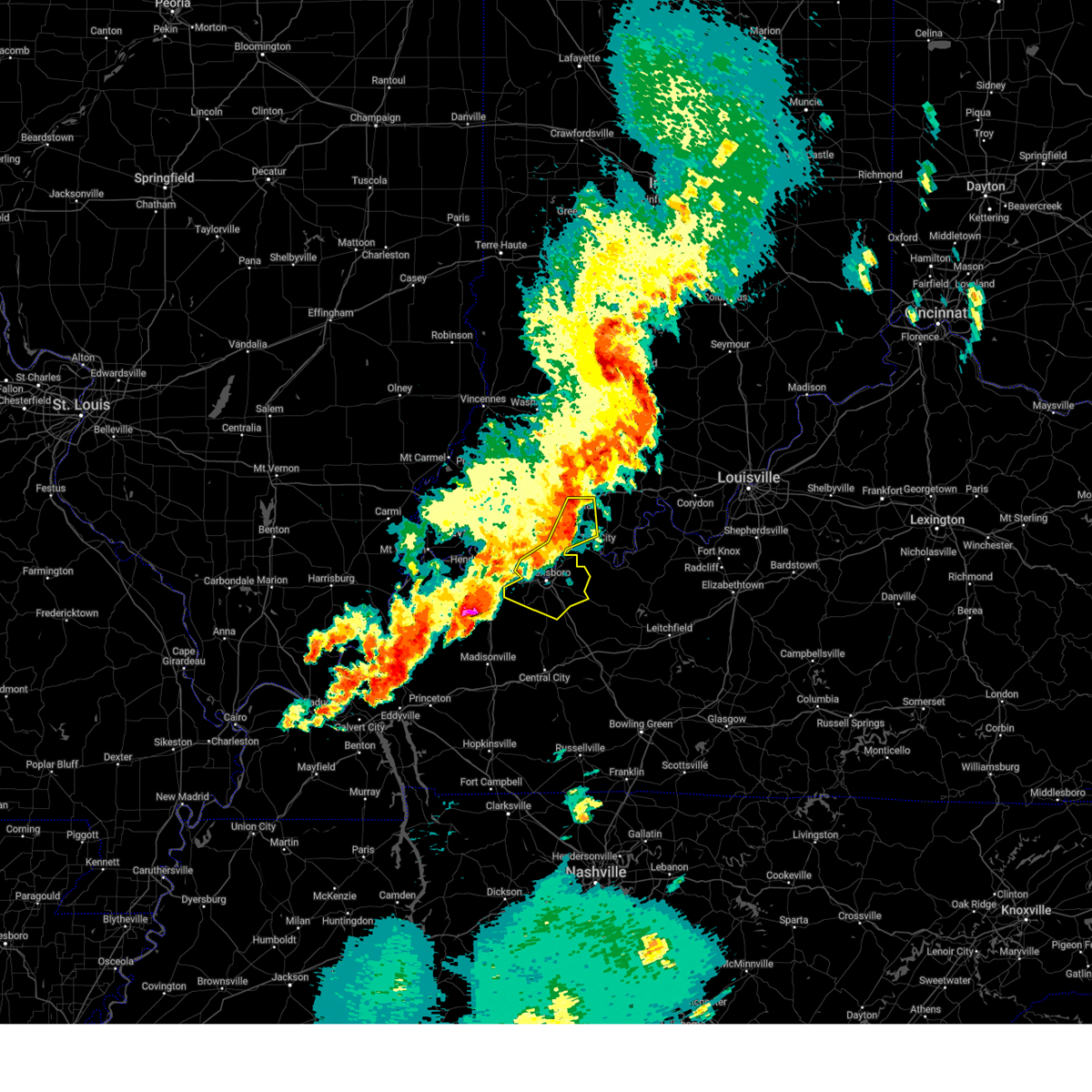
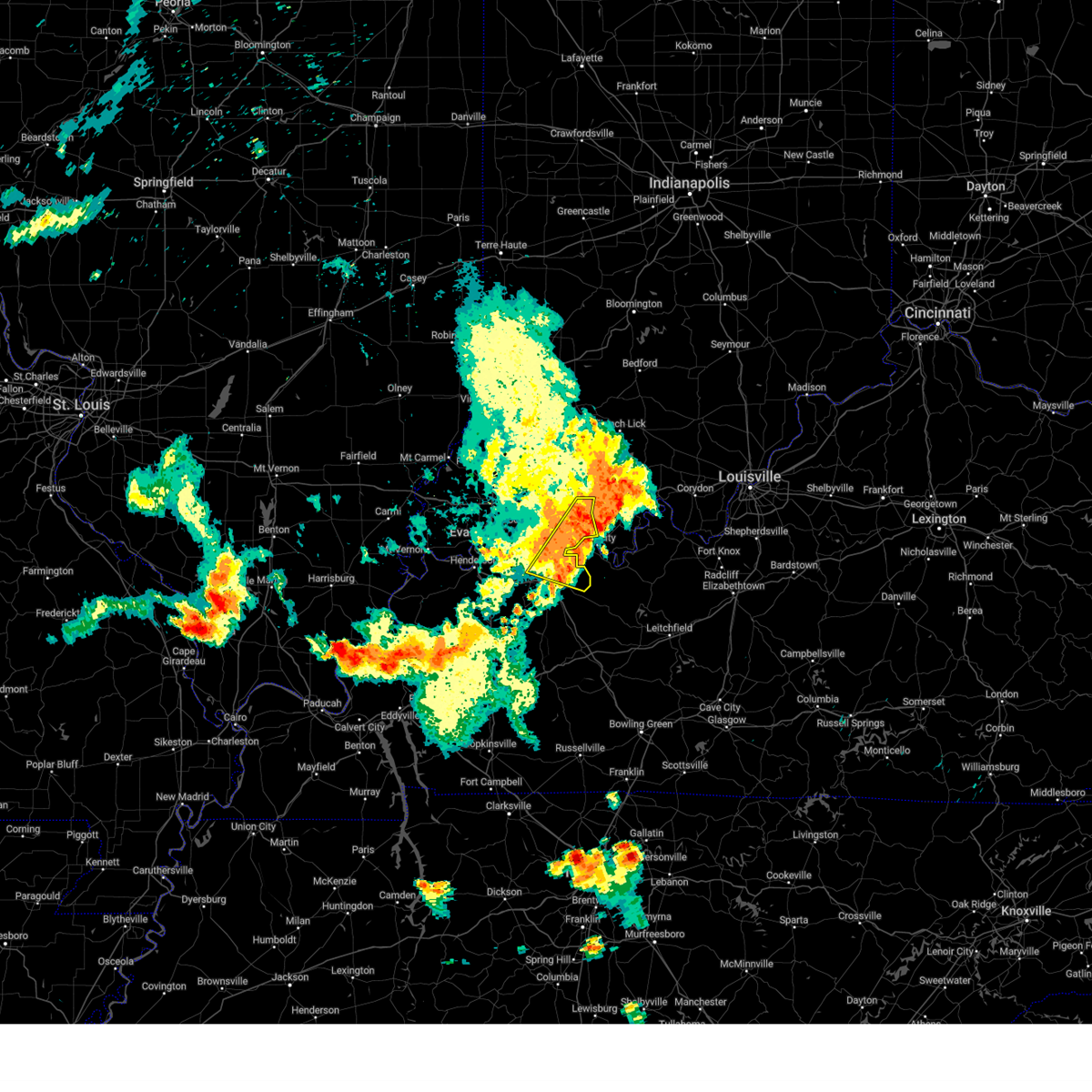
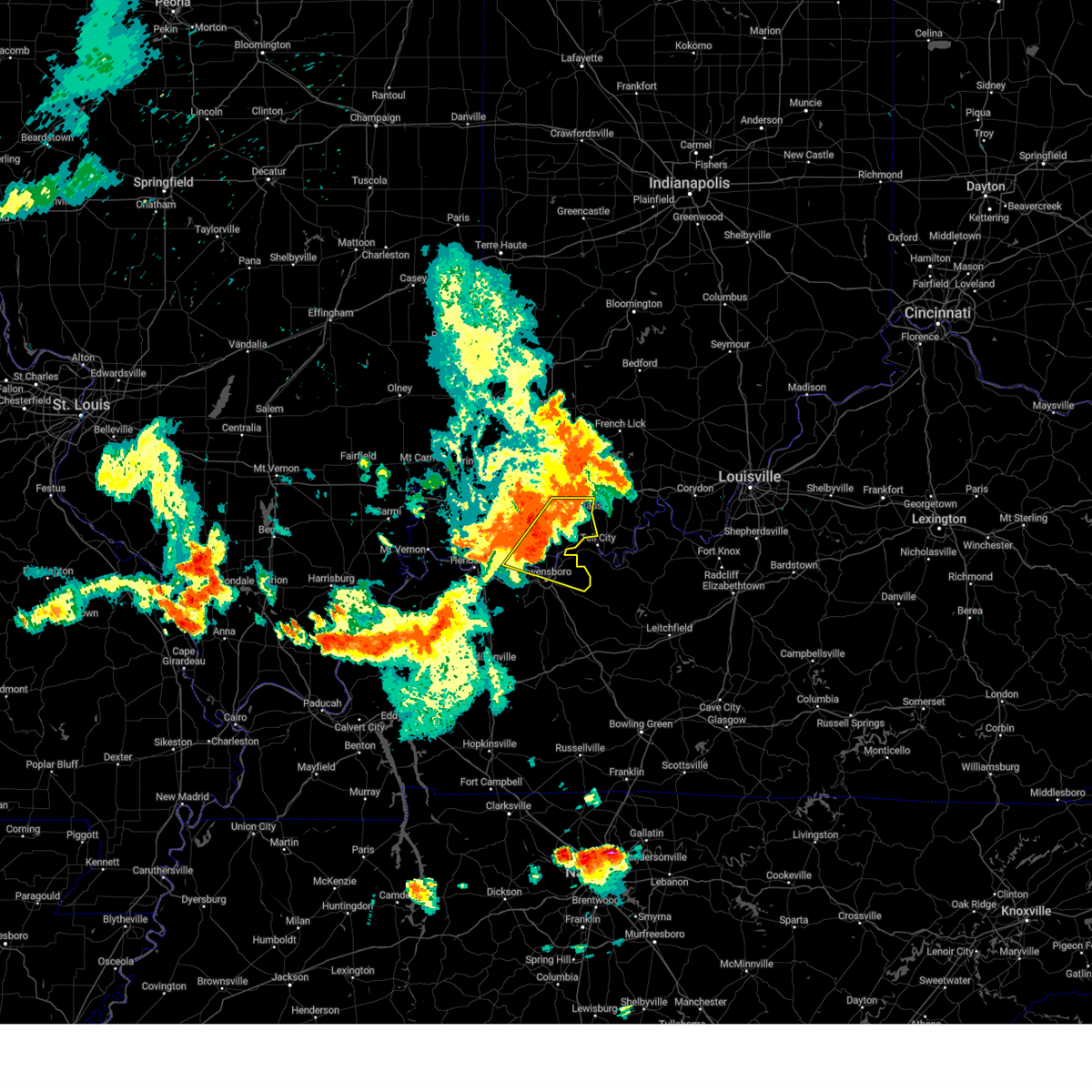
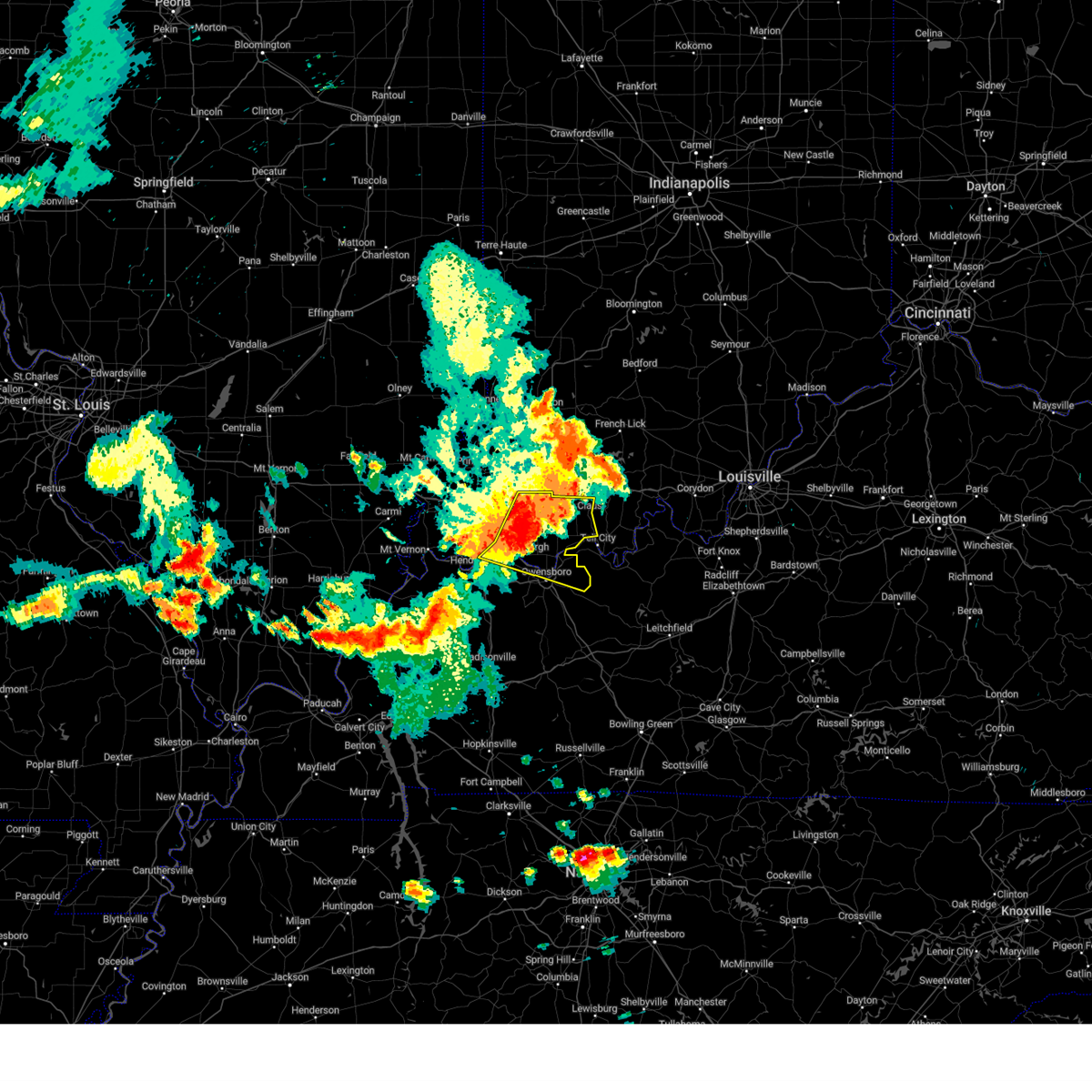
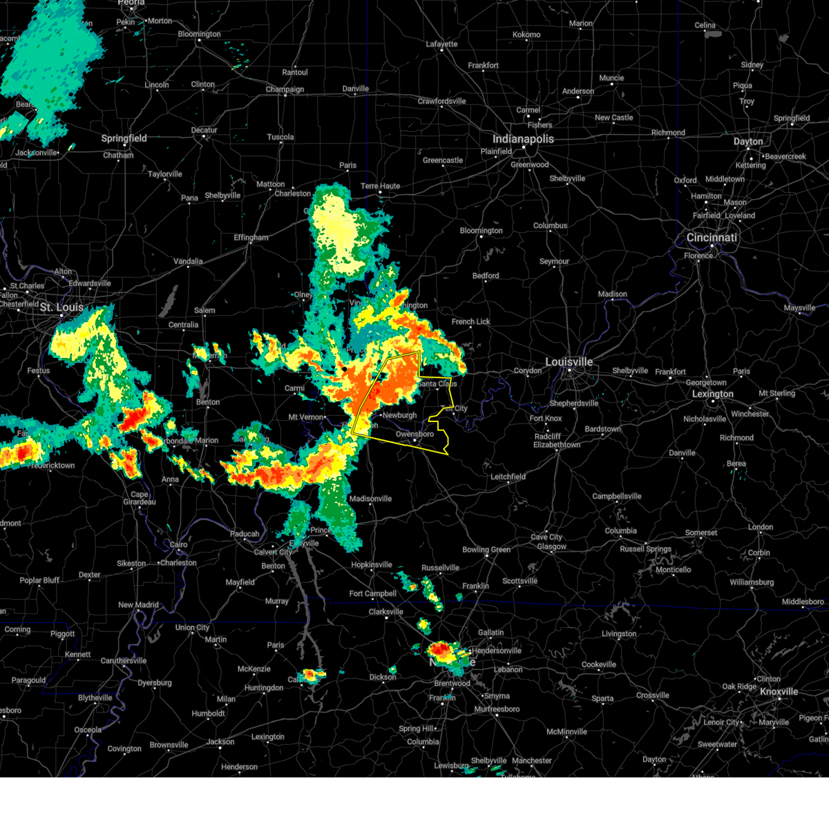
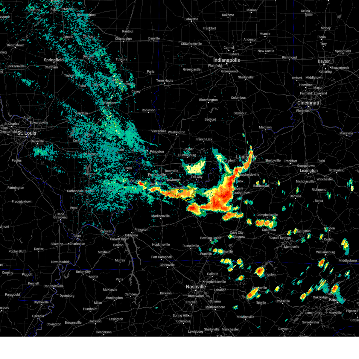
Hail Map for Owensboro, KY
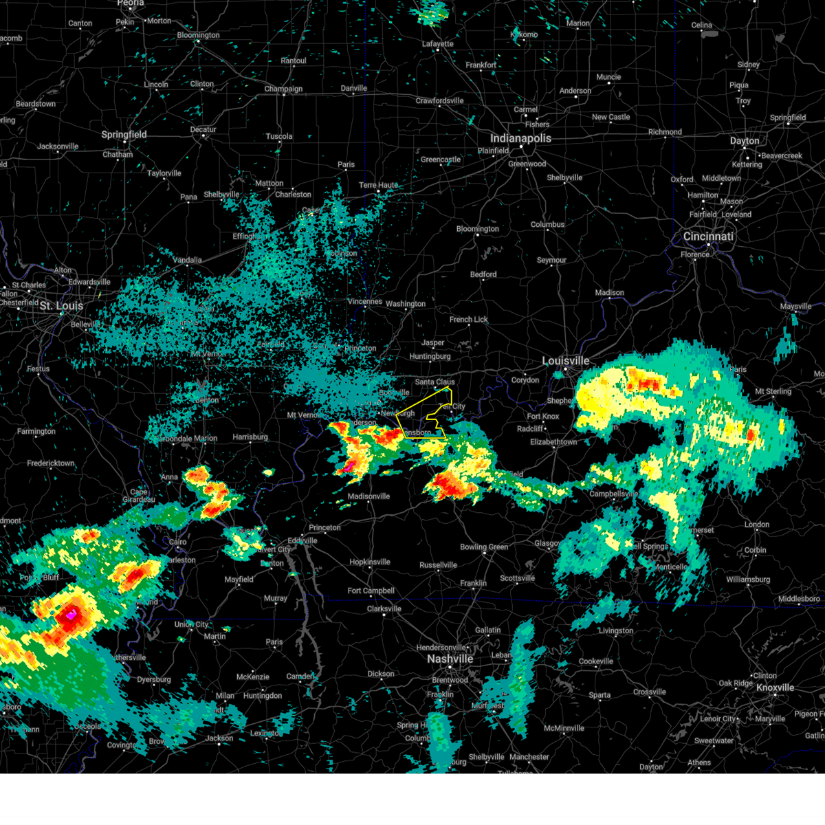
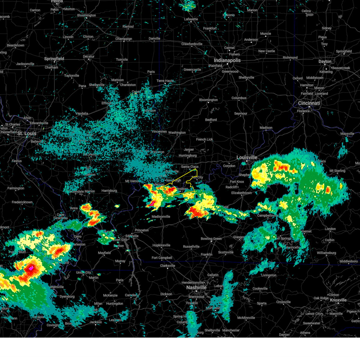
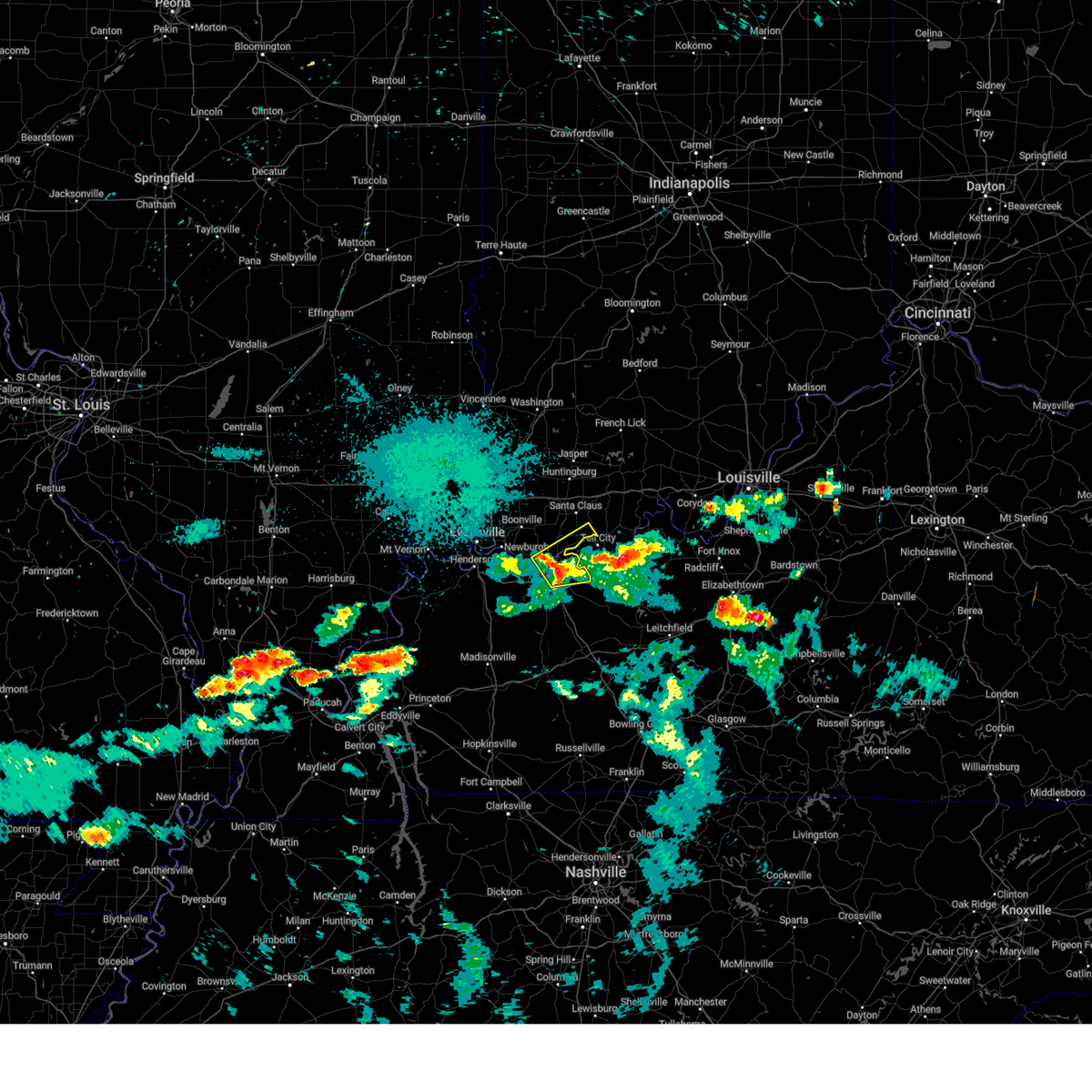
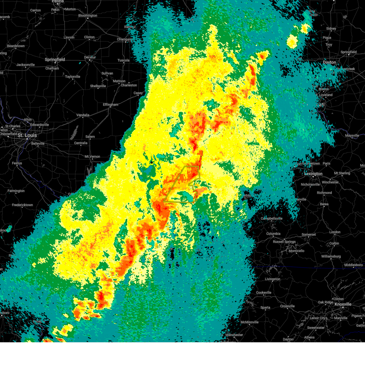
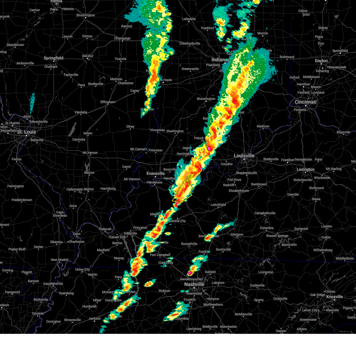
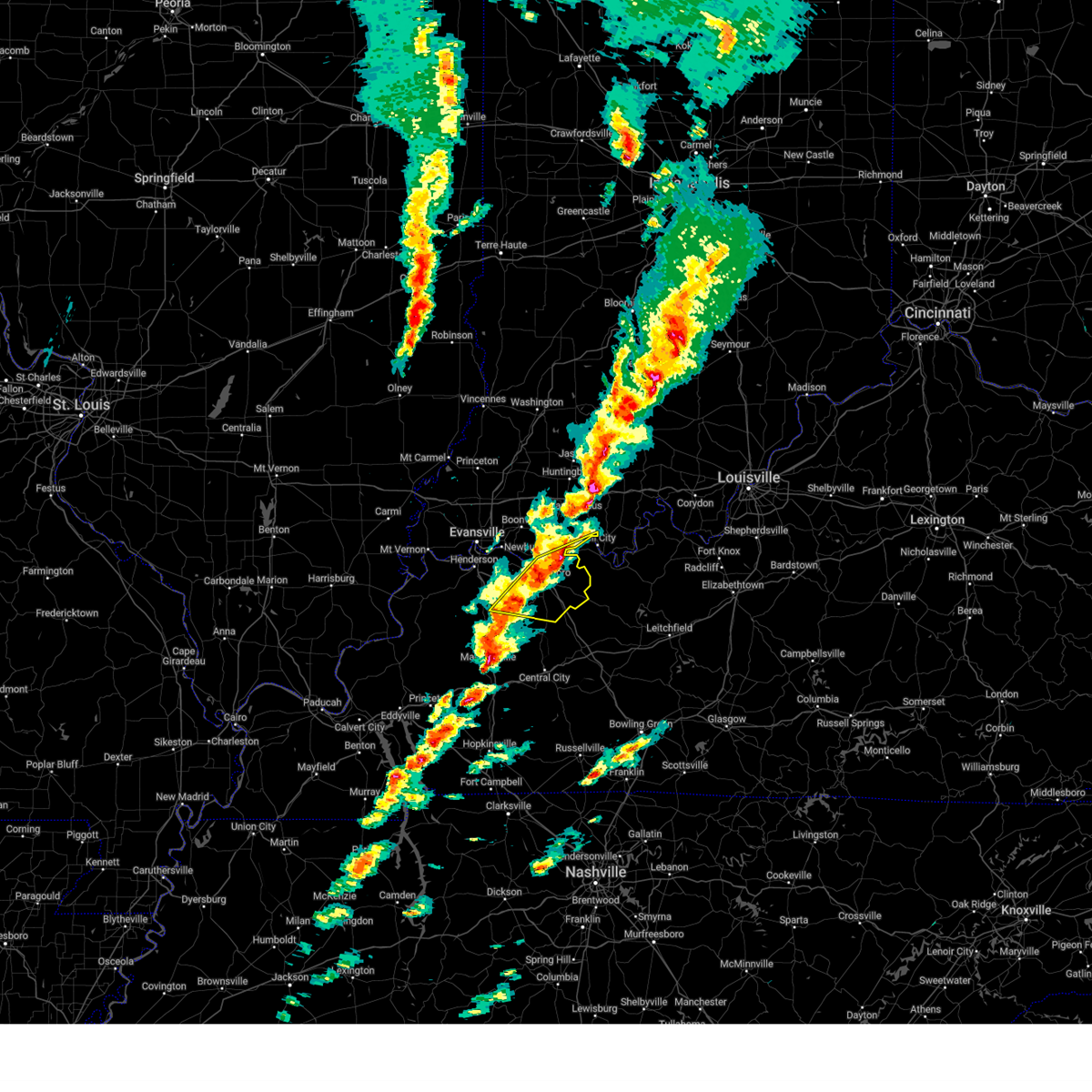
The Owensboro, KY area has had 27 reports of on-the-ground hail by trained spotters, and has been under severe weather warnings 76 times during the past 12 months. Doppler radar has detected hail at or near Owensboro, KY on 101 occasions, including 6 occasions during the past year.
| Name: | Owensboro, KY |
| Where Located: | 29.2 miles ESE of Evansville, IN |
| Map: | Google Map for Owensboro, KY |
| Population: | 57265 |
| Housing Units: | 26072 |
| More Info: | Search Google for Owensboro, KY |
1
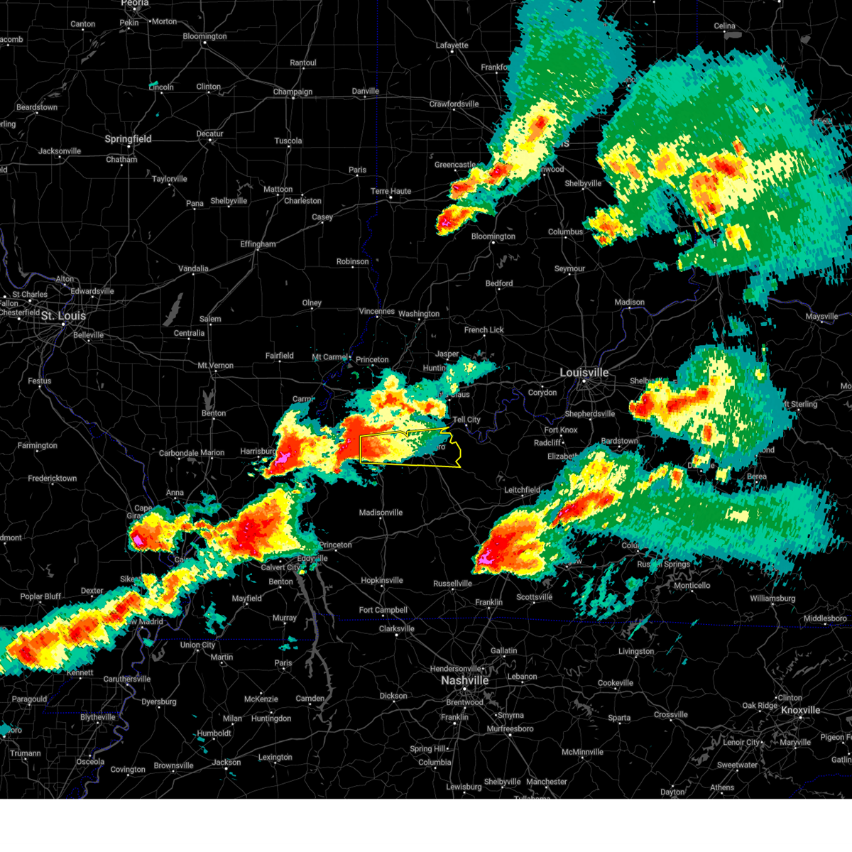
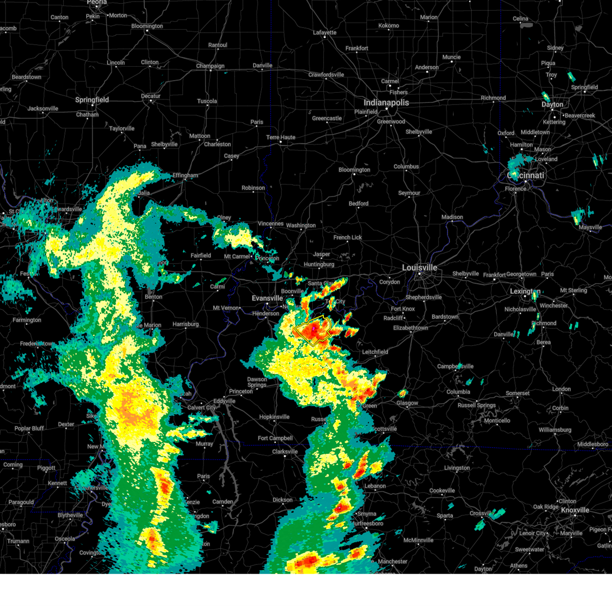
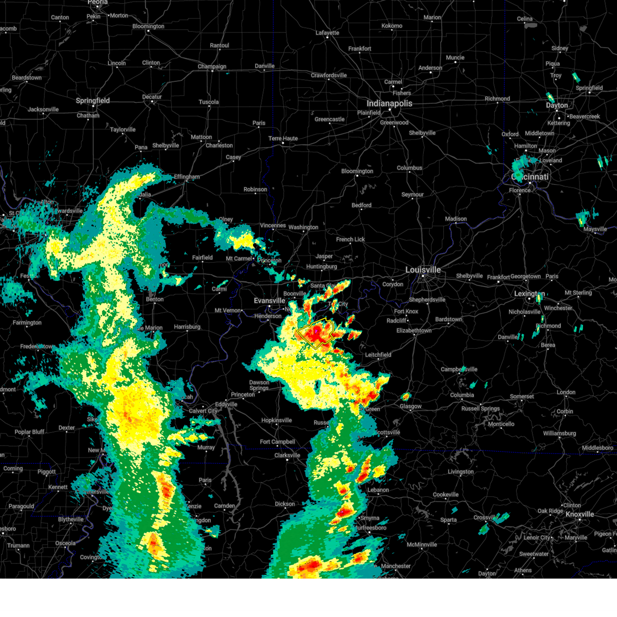
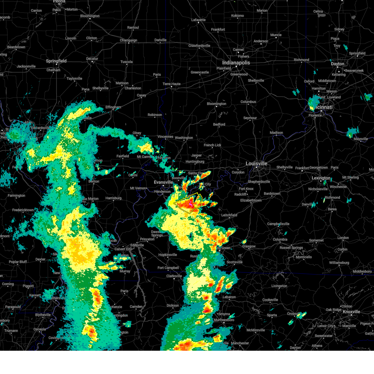
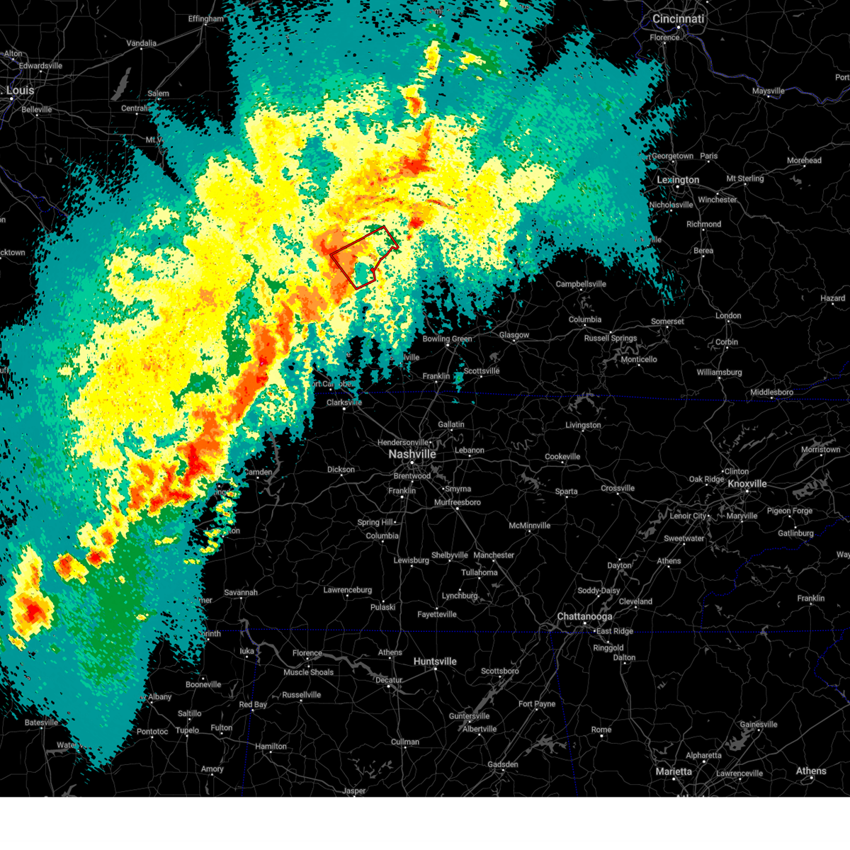
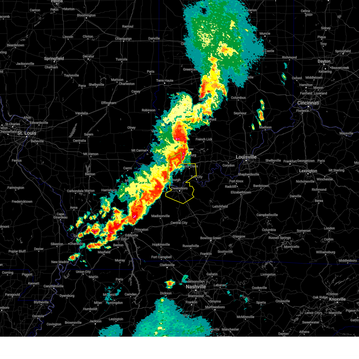
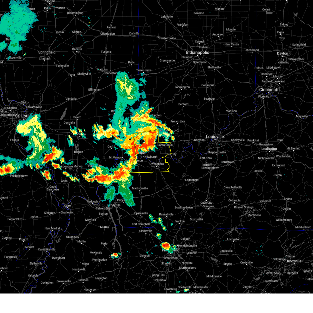
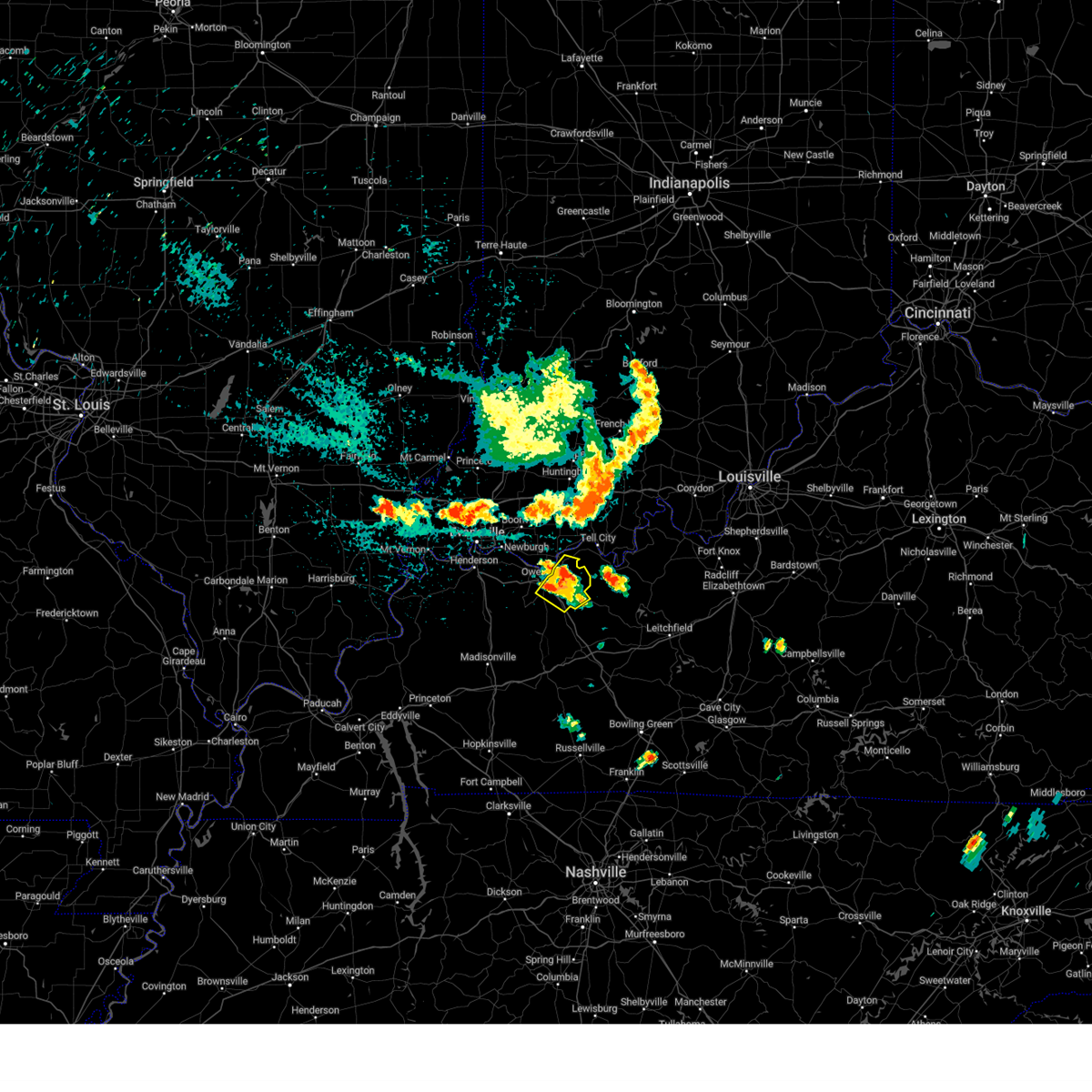
The Top Recent Hail Date for Owensboro, KY is Sunday, March 30, 2025 (4th out of 101)
Hail and Wind Damage Spotted near Owensboro, KY
| Date / Time | Report Details |
|---|---|
| 6/6/2025 10:38 AM CDT |
 Svrpah the national weather service in paducah has issued a * severe thunderstorm warning for, south central spencer county in southwestern indiana, daviess county in northwestern kentucky, * until 1115 am cdt. * at 1038 am cdt, a severe thunderstorm was located near masonville, or near owensboro, moving east at 35 mph (radar indicated). Hazards include 60 mph wind gusts and quarter size hail. Hail damage to vehicles is expected. Expect wind damage to roofs, siding, and trees. Svrpah the national weather service in paducah has issued a * severe thunderstorm warning for, south central spencer county in southwestern indiana, daviess county in northwestern kentucky, * until 1115 am cdt. * at 1038 am cdt, a severe thunderstorm was located near masonville, or near owensboro, moving east at 35 mph (radar indicated). Hazards include 60 mph wind gusts and quarter size hail. Hail damage to vehicles is expected. Expect wind damage to roofs, siding, and trees.
|
| 5/16/2025 8:31 PM CDT | At 831 pm cdt, a severe thunderstorm was located near hawesville, or 17 miles east of rockport, moving east at 50 mph (radar indicated). Hazards include ping pong ball size hail and 60 mph wind gusts. People and animals outdoors will be injured. expect hail damage to roofs, siding, windows, and vehicles. expect wind damage to roofs, siding, and trees. locations impacted include, owensboro, rockport, whitesville, masonville, stanley, knottsville, st. joseph, and eureka. this includes the following highways, interstate 165 between mile markers 66 and 70. Audubon parkway between mile markers 15 and 23. |
| 5/16/2025 8:31 PM CDT | the severe thunderstorm warning has been cancelled and is no longer in effect |
| 5/16/2025 8:22 PM CDT | the tornado warning has been cancelled and is no longer in effect |
| 5/16/2025 8:22 PM CDT | At 821 pm cdt, a severe thunderstorm capable of producing a tornado was located over masonville, or near owensboro, moving east at 50 mph (radar indicated rotation). Hazards include tornado and quarter size hail. Flying debris will be dangerous to those caught without shelter. mobile homes will be damaged or destroyed. damage to roofs, windows, and vehicles will occur. tree damage is likely. this dangerous storm will be near, owensboro, whitesville, and masonville around 825 pm cdt. other locations impacted by this tornadic thunderstorm include pleasant ridge. This includes interstate 165 between mile markers 60 and 70. |
| 5/16/2025 8:17 PM CDT | Quarter sized hail reported 0.6 miles ESE of Owensboro, KY |
| 5/16/2025 8:06 PM CDT |
 the tornado warning has been cancelled and is no longer in effect the tornado warning has been cancelled and is no longer in effect
|
| 5/16/2025 8:06 PM CDT |
 At 805 pm cdt, a severe thunderstorm capable of producing a tornado was located near st. joseph, or 8 miles northwest of calhoun, moving east at 45 mph (radar indicated rotation). Hazards include tornado and quarter size hail. Flying debris will be dangerous to those caught without shelter. mobile homes will be damaged or destroyed. damage to roofs, windows, and vehicles will occur. tree damage is likely. this dangerous storm will be near, owensboro around 810 pm cdt. masonville around 815 pm cdt. whitesville around 830 pm cdt. other locations impacted by this tornadic thunderstorm include pleasant ridge and moseleyville. This includes interstate 165 between mile markers 60 and 70. At 805 pm cdt, a severe thunderstorm capable of producing a tornado was located near st. joseph, or 8 miles northwest of calhoun, moving east at 45 mph (radar indicated rotation). Hazards include tornado and quarter size hail. Flying debris will be dangerous to those caught without shelter. mobile homes will be damaged or destroyed. damage to roofs, windows, and vehicles will occur. tree damage is likely. this dangerous storm will be near, owensboro around 810 pm cdt. masonville around 815 pm cdt. whitesville around 830 pm cdt. other locations impacted by this tornadic thunderstorm include pleasant ridge and moseleyville. This includes interstate 165 between mile markers 60 and 70.
|
| 5/16/2025 7:51 PM CDT |
 Torpah the national weather service in paducah has issued a * tornado warning for, southern daviess county in northwestern kentucky, southeastern henderson county in northwestern kentucky, northern mclean county in northwestern kentucky, north central webster county in northwestern kentucky, * until 830 pm cdt. * at 750 pm cdt, a severe thunderstorm capable of producing a tornado was located over robards, or 12 miles south of henderson, moving east at 50 mph. this storm is showing very strong rotation and could produce a strong tornado at any time! this is a particularly dangerous situation. take cover now! (radar indicated rotation). Hazards include damaging tornado. You are in a life-threatening situation. flying debris may be deadly to those caught without shelter. mobile homes will be destroyed. considerable damage to homes, businesses, and vehicles is likely and complete destruction is possible. the tornado will be near, st. joseph and beech grove around 755 pm cdt. owensboro around 805 pm cdt. masonville around 810 pm cdt. other locations impacted by this tornadic thunderstorm include pleasant ridge and moseleyville. this includes the following highways, interstate 165 between mile markers 60 and 70. Interstate 69 in kentucky between mile markers 135 and 143. Torpah the national weather service in paducah has issued a * tornado warning for, southern daviess county in northwestern kentucky, southeastern henderson county in northwestern kentucky, northern mclean county in northwestern kentucky, north central webster county in northwestern kentucky, * until 830 pm cdt. * at 750 pm cdt, a severe thunderstorm capable of producing a tornado was located over robards, or 12 miles south of henderson, moving east at 50 mph. this storm is showing very strong rotation and could produce a strong tornado at any time! this is a particularly dangerous situation. take cover now! (radar indicated rotation). Hazards include damaging tornado. You are in a life-threatening situation. flying debris may be deadly to those caught without shelter. mobile homes will be destroyed. considerable damage to homes, businesses, and vehicles is likely and complete destruction is possible. the tornado will be near, st. joseph and beech grove around 755 pm cdt. owensboro around 805 pm cdt. masonville around 810 pm cdt. other locations impacted by this tornadic thunderstorm include pleasant ridge and moseleyville. this includes the following highways, interstate 165 between mile markers 60 and 70. Interstate 69 in kentucky between mile markers 135 and 143.
|
| 5/16/2025 7:38 PM CDT |
 Svrpah the national weather service in paducah has issued a * severe thunderstorm warning for, southwestern vanderburgh county in southwestern indiana, southwestern spencer county in southwestern indiana, daviess county in northwestern kentucky, eastern henderson county in northwestern kentucky, * until 845 pm cdt. * at 737 pm cdt, a severe thunderstorm was located near henderson, moving east at 50 mph (radar indicated). Hazards include ping pong ball size hail and 60 mph wind gusts. People and animals outdoors will be injured. expect hail damage to roofs, siding, windows, and vehicles. Expect wind damage to roofs, siding, and trees. Svrpah the national weather service in paducah has issued a * severe thunderstorm warning for, southwestern vanderburgh county in southwestern indiana, southwestern spencer county in southwestern indiana, daviess county in northwestern kentucky, eastern henderson county in northwestern kentucky, * until 845 pm cdt. * at 737 pm cdt, a severe thunderstorm was located near henderson, moving east at 50 mph (radar indicated). Hazards include ping pong ball size hail and 60 mph wind gusts. People and animals outdoors will be injured. expect hail damage to roofs, siding, windows, and vehicles. Expect wind damage to roofs, siding, and trees.
|
| 5/16/2025 5:04 AM CDT |
 At 503 am cdt, a severe thunderstorm was located over rockport, moving northeast at 75 mph (radar indicated). Hazards include 60 mph wind gusts and quarter size hail. Hail damage to vehicles is expected. expect wind damage to roofs, siding, and trees. Locations impacted include, owensboro, rockport, grandview, knottsville, eureka, and chrisney. At 503 am cdt, a severe thunderstorm was located over rockport, moving northeast at 75 mph (radar indicated). Hazards include 60 mph wind gusts and quarter size hail. Hail damage to vehicles is expected. expect wind damage to roofs, siding, and trees. Locations impacted include, owensboro, rockport, grandview, knottsville, eureka, and chrisney.
|
| 5/16/2025 5:04 AM CDT |
 the severe thunderstorm warning has been cancelled and is no longer in effect the severe thunderstorm warning has been cancelled and is no longer in effect
|
| 5/16/2025 4:54 AM CDT |
 Svrpah the national weather service in paducah has issued a * severe thunderstorm warning for, spencer county in southwestern indiana, central daviess county in northwestern kentucky, east central henderson county in northwestern kentucky, * until 530 am cdt. * at 454 am cdt, a severe thunderstorm was located over stanley, or 8 miles northwest of owensboro, moving northeast at 75 mph (radar indicated). Hazards include 60 mph wind gusts and quarter size hail. Hail damage to vehicles is expected. Expect wind damage to roofs, siding, and trees. Svrpah the national weather service in paducah has issued a * severe thunderstorm warning for, spencer county in southwestern indiana, central daviess county in northwestern kentucky, east central henderson county in northwestern kentucky, * until 530 am cdt. * at 454 am cdt, a severe thunderstorm was located over stanley, or 8 miles northwest of owensboro, moving northeast at 75 mph (radar indicated). Hazards include 60 mph wind gusts and quarter size hail. Hail damage to vehicles is expected. Expect wind damage to roofs, siding, and trees.
|
| 5/16/2025 3:44 AM CDT |
 Svrpah the national weather service in paducah has issued a * severe thunderstorm warning for, southern spencer county in southwestern indiana, northeastern daviess county in northwestern kentucky, * until 415 am cdt. * at 344 am cdt, a severe thunderstorm was located near rockport, moving east at 60 mph (radar indicated). Hazards include 60 mph wind gusts and quarter size hail. Hail damage to vehicles is expected. Expect wind damage to roofs, siding, and trees. Svrpah the national weather service in paducah has issued a * severe thunderstorm warning for, southern spencer county in southwestern indiana, northeastern daviess county in northwestern kentucky, * until 415 am cdt. * at 344 am cdt, a severe thunderstorm was located near rockport, moving east at 60 mph (radar indicated). Hazards include 60 mph wind gusts and quarter size hail. Hail damage to vehicles is expected. Expect wind damage to roofs, siding, and trees.
|
| 5/8/2025 2:45 PM CDT |
 the severe thunderstorm warning has been cancelled and is no longer in effect the severe thunderstorm warning has been cancelled and is no longer in effect
|
| 5/8/2025 2:30 PM CDT |
 At 229 pm cdt, a severe thunderstorm was located near masonville, or 8 miles northeast of calhoun, moving east at 10 mph. the daviess county emergency manager reports there are funnel clouds associated with this storm, but they have not thus far touched the ground (radar indicated). Hazards include 60 mph wind gusts and quarter size hail. remember that cold air funnel clouds are possible, and these may briefly touch down. Hail damage to vehicles is expected. expect wind damage to roofs, siding, and trees. locations impacted include, owensboro, calhoun, whitesville, masonville, moseleyville, and pleasant ridge. This includes interstate 165 between mile markers 60 and 70. At 229 pm cdt, a severe thunderstorm was located near masonville, or 8 miles northeast of calhoun, moving east at 10 mph. the daviess county emergency manager reports there are funnel clouds associated with this storm, but they have not thus far touched the ground (radar indicated). Hazards include 60 mph wind gusts and quarter size hail. remember that cold air funnel clouds are possible, and these may briefly touch down. Hail damage to vehicles is expected. expect wind damage to roofs, siding, and trees. locations impacted include, owensboro, calhoun, whitesville, masonville, moseleyville, and pleasant ridge. This includes interstate 165 between mile markers 60 and 70.
|
| 5/8/2025 2:19 PM CDT |
 At 219 pm cdt, a severe thunderstorm was located near masonville, or 8 miles southwest of owensboro, moving east at 15 mph (radar indicated). Hazards include 60 mph wind gusts and quarter size hail. Hail damage to vehicles is expected. expect wind damage to roofs, siding, and trees. locations impacted include, owensboro, calhoun, whitesville, masonville, st. joseph, moseleyville, and pleasant ridge. this includes the following highways, interstate 165 between mile markers 60 and 70. Audubon parkway between mile markers 17 and 20. At 219 pm cdt, a severe thunderstorm was located near masonville, or 8 miles southwest of owensboro, moving east at 15 mph (radar indicated). Hazards include 60 mph wind gusts and quarter size hail. Hail damage to vehicles is expected. expect wind damage to roofs, siding, and trees. locations impacted include, owensboro, calhoun, whitesville, masonville, st. joseph, moseleyville, and pleasant ridge. this includes the following highways, interstate 165 between mile markers 60 and 70. Audubon parkway between mile markers 17 and 20.
|
| 5/8/2025 2:09 PM CDT |
 Svrpah the national weather service in paducah has issued a * severe thunderstorm warning for, southern daviess county in northwestern kentucky, northeastern mclean county in northwestern kentucky, * until 300 pm cdt. * at 209 pm cdt, a severe thunderstorm was located near st. joseph, or 8 miles north of calhoun, moving east at 15 mph (radar indicated). Hazards include 60 mph wind gusts and quarter size hail. Hail damage to vehicles is expected. Expect wind damage to roofs, siding, and trees. Svrpah the national weather service in paducah has issued a * severe thunderstorm warning for, southern daviess county in northwestern kentucky, northeastern mclean county in northwestern kentucky, * until 300 pm cdt. * at 209 pm cdt, a severe thunderstorm was located near st. joseph, or 8 miles north of calhoun, moving east at 15 mph (radar indicated). Hazards include 60 mph wind gusts and quarter size hail. Hail damage to vehicles is expected. Expect wind damage to roofs, siding, and trees.
|
| 5/2/2025 1:42 PM CDT |
 The storms which prompted the warning have moved out of the area. therefore, the warning will be allowed to expire. however, gusty winds are still possible with these thunderstorms. a severe thunderstorm watch remains in effect until 500 pm cdt for northwestern kentucky. The storms which prompted the warning have moved out of the area. therefore, the warning will be allowed to expire. however, gusty winds are still possible with these thunderstorms. a severe thunderstorm watch remains in effect until 500 pm cdt for northwestern kentucky.
|
| 5/2/2025 1:33 PM CDT | At 133 pm cdt, severe thunderstorms were located along a line extending from near rockport to near whitesville, moving northeast at 35 mph (radar indicated). Hazards include 60 mph wind gusts and quarter size hail. Hail damage to vehicles is expected. expect wind damage to roofs, siding, and trees. Locations impacted include, owensboro, whitesville, and knottsville. |
| 5/2/2025 1:26 PM CDT |
 the severe thunderstorm warning has been cancelled and is no longer in effect the severe thunderstorm warning has been cancelled and is no longer in effect
|
| 5/2/2025 1:26 PM CDT |
 At 126 pm cdt, severe thunderstorms were located along a line extending from near owensboro to near hartford, moving northeast at 30 mph (radar indicated). Hazards include 60 mph wind gusts and quarter size hail. Hail damage to vehicles is expected. expect wind damage to roofs, siding, and trees. locations impacted include, owensboro, whitesville, knottsville, and masonville. this includes the following highways, interstate 165 between mile markers 60 and 70. Audubon parkway near mile marker 23. At 126 pm cdt, severe thunderstorms were located along a line extending from near owensboro to near hartford, moving northeast at 30 mph (radar indicated). Hazards include 60 mph wind gusts and quarter size hail. Hail damage to vehicles is expected. expect wind damage to roofs, siding, and trees. locations impacted include, owensboro, whitesville, knottsville, and masonville. this includes the following highways, interstate 165 between mile markers 60 and 70. Audubon parkway near mile marker 23.
|
| 5/2/2025 1:19 PM CDT |
 At 119 pm cdt, severe thunderstorms were located along a line extending from near owensboro to near hartford, moving northeast at 30 mph (radar indicated). Hazards include 60 mph wind gusts and half dollar size hail. Hail damage to vehicles is expected. expect wind damage to roofs, siding, and trees. locations impacted include, owensboro, whitesville, knottsville, masonville, st. joseph, and moseleyville. this includes the following highways, interstate 165 between mile markers 60 and 70. Audubon parkway near mile marker 23. At 119 pm cdt, severe thunderstorms were located along a line extending from near owensboro to near hartford, moving northeast at 30 mph (radar indicated). Hazards include 60 mph wind gusts and half dollar size hail. Hail damage to vehicles is expected. expect wind damage to roofs, siding, and trees. locations impacted include, owensboro, whitesville, knottsville, masonville, st. joseph, and moseleyville. this includes the following highways, interstate 165 between mile markers 60 and 70. Audubon parkway near mile marker 23.
|
| 5/2/2025 1:09 PM CDT | At 109 pm cdt, severe thunderstorms were located along a line extending from near st. joseph to near hartford, moving northeast at 35 mph (radar indicated). Hazards include 60 mph wind gusts and quarter size hail. Hail damage to vehicles is expected. expect wind damage to roofs, siding, and trees. locations impacted include, owensboro, calhoun, livermore, whitesville, masonville, knottsville, st. joseph, island, and moseleyville. this includes the following highways, interstate 165 between mile markers 60 and 70. Audubon parkway near mile marker 23. |
| 5/2/2025 12:54 PM CDT | Svrpah the national weather service in paducah has issued a * severe thunderstorm warning for, daviess county in northwestern kentucky, eastern mclean county in northwestern kentucky, * until 145 pm cdt. * at 1254 pm cdt, severe thunderstorms were located along a line extending from near beech grove to near central city, moving northeast at 30 mph (radar indicated). Hazards include 60 mph wind gusts and nickel size hail. expect damage to roofs, siding, and trees |
| 4/10/2025 4:25 PM CDT | Roof blown off of building on leitchfield road in owensbor in daviess county KY, 0.6 miles ESE of Owensboro, KY |
| 4/10/2025 4:21 PM CDT | Svrpah the national weather service in paducah has issued a * severe thunderstorm warning for, east central warrick county in southwestern indiana, spencer county in southwestern indiana, central daviess county in northwestern kentucky, * until 500 pm cdt. * at 421 pm cdt, severe thunderstorms were located along a line extending from near dale to near owensboro, moving east at 40 mph (radar indicated). Hazards include 60 mph wind gusts. expect damage to roofs, siding, and trees |
| 4/2/2025 10:03 PM CDT | Torpah the national weather service in paducah has issued a * tornado warning for, southern daviess county in northwestern kentucky, northeastern mclean county in northwestern kentucky, * until 1045 pm cdt. * at 1003 pm cdt, a tornado producing storm was located over calhoun, moving northeast at 55 mph (radar confirmed tornado). Hazards include damaging tornado. Flying debris will be dangerous to those caught without shelter. mobile homes will be damaged or destroyed. damage to roofs, windows, and vehicles will occur. tree damage is likely. this tornadic storm will be near, owensboro and masonville around 1010 pm cdt. whitesville and knottsville around 1020 pm cdt. other locations impacted by this tornadic thunderstorm include moseleyville. This includes interstate 165 between mile markers 60 and 70. |
| 4/2/2025 10:00 PM CDT | Torpah the national weather service in paducah has issued a * tornado warning for, southwestern spencer county in southwestern indiana, central daviess county in northwestern kentucky, southeastern henderson county in northwestern kentucky, north central mclean county in northwestern kentucky, * until 1045 pm cdt. * at 1000 pm cdt, severe thunderstorms capable of producing both tornadoes and extensive straight line wind damage were located along a line extending from 8 miles northeast of robards to st. joseph to 6 miles northeast of beech grove, moving northeast at 65 mph (radar indicated rotation). Hazards include tornado. Flying debris will be dangerous to those caught without shelter. mobile homes will be damaged or destroyed. damage to roofs, windows, and vehicles will occur. tree damage is likely. these dangerous storms will be near, stanley and owensboro around 1005 pm cdt. eureka around 1010 pm cdt. rockport around 1015 pm cdt. grandview around 1020 pm cdt. other locations impacted by these tornadic storms include hebbardsville and waitman. This includes audubon parkway between mile markers 9 and 23. |
| 4/2/2025 9:58 PM CDT |
 At 958 pm cdt, a confirmed tornado was located over calhoun, moving northeast at 55 mph (radar confirmed tornado). Hazards include damaging tornado. Flying debris will be dangerous to those caught without shelter. mobile homes will be damaged or destroyed. damage to roofs, windows, and vehicles will occur. tree damage is likely. this tornado will be near, owensboro and masonville around 1005 pm cdt. other locations impacted by this tornadic thunderstorm include moseleyville, sacramento, pleasant ridge, island, and bremen. This includes interstate 165 between mile markers 60 and 70. At 958 pm cdt, a confirmed tornado was located over calhoun, moving northeast at 55 mph (radar confirmed tornado). Hazards include damaging tornado. Flying debris will be dangerous to those caught without shelter. mobile homes will be damaged or destroyed. damage to roofs, windows, and vehicles will occur. tree damage is likely. this tornado will be near, owensboro and masonville around 1005 pm cdt. other locations impacted by this tornadic thunderstorm include moseleyville, sacramento, pleasant ridge, island, and bremen. This includes interstate 165 between mile markers 60 and 70.
|
| 4/2/2025 9:50 PM CDT | At 950 pm cdt, a confirmed tornado was located 7 miles southwest of calhoun, moving northeast at 60 mph (radar confirmed tornado). Hazards include damaging tornado. Flying debris will be dangerous to those caught without shelter. mobile homes will be damaged or destroyed. damage to roofs, windows, and vehicles will occur. tree damage is likely. this tornado will be near, calhoun around 955 pm cdt. livermore around 1000 pm cdt. owensboro and masonville around 1005 pm cdt. other locations impacted by this tornadic thunderstorm include moseleyville, sacramento, pleasant ridge, slaughters, island, bremen, and hanson. this includes the following highways, interstate 165 between mile markers 60 and 70. Interstate 69 in kentucky between mile markers 121 and 131. |
| 4/2/2025 9:48 PM CDT | At 948 pm cdt, a severe thunderstorm capable of producing a tornado was located 9 miles northeast of madisonville, moving northeast at 55 mph. this storm has a history of producing tornadoes (radar indicated rotation). Hazards include tornado. Flying debris will be dangerous to those caught without shelter. mobile homes will be damaged or destroyed. damage to roofs, windows, and vehicles will occur. tree damage is likely. this dangerous storm will be near, calhoun and livermore around 955 pm cdt. owensboro and masonville around 1005 pm cdt. other locations impacted by this tornadic thunderstorm include moseleyville, sacramento, pleasant ridge, hanson, slaughters, island, and bremen. this includes the following highways, interstate 165 between mile markers 60 and 70. Interstate 69 in kentucky between mile markers 119 and 131. |
| 4/2/2025 9:44 PM CDT |
 At 943 pm cdt, severe thunderstorms were located along a line extending from 11 miles southwest of shoals to near tell city to near masonville, moving east at 55 mph (radar indicated). Hazards include 70 mph wind gusts. Expect considerable tree damage. damage is likely to mobile homes, roofs, and outbuildings. locations impacted include, whitesville, santa claus, knottsville, st. joseph, gentryville, masonville, moseleyville, stanley, dale, chrisney, rockport, grandview, owensboro, eureka, tennyson, and hebbardsville. this includes the following highways, interstate 165 between mile markers 62 and 70. interstate 64 in indiana between mile markers 52 and 60. Audubon parkway between mile markers 10 and 23. At 943 pm cdt, severe thunderstorms were located along a line extending from 11 miles southwest of shoals to near tell city to near masonville, moving east at 55 mph (radar indicated). Hazards include 70 mph wind gusts. Expect considerable tree damage. damage is likely to mobile homes, roofs, and outbuildings. locations impacted include, whitesville, santa claus, knottsville, st. joseph, gentryville, masonville, moseleyville, stanley, dale, chrisney, rockport, grandview, owensboro, eureka, tennyson, and hebbardsville. this includes the following highways, interstate 165 between mile markers 62 and 70. interstate 64 in indiana between mile markers 52 and 60. Audubon parkway between mile markers 10 and 23.
|
| 4/2/2025 9:44 PM CDT |
 the severe thunderstorm warning has been cancelled and is no longer in effect the severe thunderstorm warning has been cancelled and is no longer in effect
|
| 4/2/2025 9:41 PM CDT | At 941 pm cdt, a confirmed large and extremely dangerous tornado was located near madisonville, moving northeast at 55 mph. this is a particularly dangerous situation. take cover now! (weather spotters confirmed tornado). Hazards include damaging tornado. You are in a life-threatening situation. flying debris may be deadly to those caught without shelter. mobile homes will be destroyed. considerable damage to homes, businesses, and vehicles is likely and complete destruction is possible. the tornado will be near, calhoun around 950 pm cdt. beech grove around 955 pm cdt. livermore around 1000 pm cdt. owensboro and masonville around 1005 pm cdt. other locations impacted by this tornadic thunderstorm include moseleyville, sacramento, pleasant ridge, bremen, hanson, slaughters, and island. this includes the following highways, interstate 165 between mile markers 60 and 70. Interstate 69 in kentucky between mile markers 110 and 132. |
| 4/2/2025 9:36 PM CDT | Torpah the national weather service in paducah has issued a * tornado warning for, southern daviess county in northwestern kentucky, northwestern muhlenberg county in south central kentucky, mclean county in northwestern kentucky, northeastern hopkins county in northwestern kentucky, central webster county in northwestern kentucky, * until 1015 pm cdt. * at 936 pm cdt, severe thunderstorms capable of producing a tornado were located along a line extending from near providence to near madisonville, moving northeast at 55 mph (radar indicated rotation). Hazards include tornado. Flying debris will be dangerous to those caught without shelter. mobile homes will be damaged or destroyed. damage to roofs, windows, and vehicles will occur. tree damage is likely. these dangerous storms will be near, madisonville around 940 pm cdt. calhoun and beech grove around 955 pm cdt. livermore around 1000 pm cdt. other locations impacted by these tornadic storms include nebo, moseleyville, sacramento, pleasant ridge, hanson, slaughters, island, and bremen. this includes the following highways, interstate 165 between mile markers 60 and 70. Interstate 69 in kentucky between mile markers 111 and 132. |
| 4/2/2025 9:28 PM CDT | At 928 pm cdt/1028 pm edt/, severe thunderstorms were located along a line extending from 6 miles south of washington to 6 miles north of grandview to near calhoun, moving east at 55 mph (radar indicated). Hazards include 70 mph wind gusts. Expect considerable tree damage. damage is likely to mobile homes, roofs, and outbuildings. locations impacted include, boonville, santa claus, knottsville, st. joseph, spurgeon, masonville, moseleyville, winslow, stanley, lynnville, chandler, robards, whitesville, folsomville, gentryville, dale, chrisney, rockport, grandview, and owensboro. this includes the following highways, interstate 165 between mile markers 62 and 70. interstate 69 in kentucky between mile markers 138 and 148. interstate 69 in indiana between mile markers 3 and 10, and between mile markers 47 and 52. interstate 64 in indiana between mile markers 34 and 60. Audubon parkway between mile markers 1 and 23. |
| 4/2/2025 9:08 PM CDT | Svrpah the national weather service in paducah has issued a * severe thunderstorm warning for, warrick county in southwestern indiana, east central vanderburgh county in southwestern indiana, spencer county in southwestern indiana, east central gibson county in southwestern indiana, pike county in southwestern indiana, daviess county in northwestern kentucky, eastern henderson county in northwestern kentucky, northwestern mclean county in northwestern kentucky, * until 1000 pm cdt/1100 pm edt/. * at 908 pm cdt/1008 pm edt/, severe thunderstorms were located along a line extending from near washington to near chandler to sebree, moving east at 55 mph (radar indicated). Hazards include 60 mph wind gusts. expect damage to roofs, siding, and trees |
| 3/30/2025 7:58 PM CDT | At 758 pm cdt, severe thunderstorms were located along a line extending from near santa claus to near grandview to near masonville, moving east at 55 mph (radar indicated). Hazards include 60 mph wind gusts and quarter size hail. Hail damage to vehicles is expected. expect wind damage to roofs, siding, and trees. locations impacted include, masonville, whitesville, santa claus, chrisney, knottsville, rockport, grandview, and owensboro. This includes interstate 165 between mile markers 60 and 70. |
| 3/30/2025 7:58 PM CDT | the severe thunderstorm warning has been cancelled and is no longer in effect |
| 3/30/2025 7:55 PM CDT | Quarter sized hail reported 3.3 miles W of Owensboro, KY, report from mping: quarter (1.00 in.). |
| 3/30/2025 7:30 PM CDT | Svrpah the national weather service in paducah has issued a * severe thunderstorm warning for, central warrick county in southwestern indiana, spencer county in southwestern indiana, daviess county in northwestern kentucky, eastern henderson county in northwestern kentucky, * until 815 pm cdt. * at 729 pm cdt, a severe thunderstorm was located near stanley, or 8 miles south of newburgh, moving east at 55 mph (radar indicated). Hazards include 60 mph wind gusts and nickel size hail. expect damage to roofs, siding, and trees |
| 3/19/2025 7:48 PM CDT |
 At 747 pm cdt, severe thunderstorms were located along a line extending from near hawesville to near whitesville to near livermore, moving east at 45 mph (trained weather spotters). Hazards include 60 mph wind gusts. Expect damage to roofs, siding, and trees. locations impacted include, masonville, whitesville, pleasant ridge, knottsville, troy, owensboro, and lewisport. This includes interstate 165 between mile markers 60 and 70. At 747 pm cdt, severe thunderstorms were located along a line extending from near hawesville to near whitesville to near livermore, moving east at 45 mph (trained weather spotters). Hazards include 60 mph wind gusts. Expect damage to roofs, siding, and trees. locations impacted include, masonville, whitesville, pleasant ridge, knottsville, troy, owensboro, and lewisport. This includes interstate 165 between mile markers 60 and 70.
|
| 3/19/2025 7:48 PM CDT |
 the severe thunderstorm warning has been cancelled and is no longer in effect the severe thunderstorm warning has been cancelled and is no longer in effect
|
| 3/19/2025 7:21 PM CDT |
 Svrpah the national weather service in paducah has issued a * severe thunderstorm warning for, southern spencer county in southwestern indiana, daviess county in northwestern kentucky, southeastern henderson county in northwestern kentucky, northern mclean county in northwestern kentucky, * until 800 pm cdt. * at 721 pm cdt, severe thunderstorms were located along a line extending from near grandview to owensboro to near st. joseph, moving northeast at 35 mph (trained weather spotters). Hazards include 60 mph wind gusts. expect damage to roofs, siding, and trees Svrpah the national weather service in paducah has issued a * severe thunderstorm warning for, southern spencer county in southwestern indiana, daviess county in northwestern kentucky, southeastern henderson county in northwestern kentucky, northern mclean county in northwestern kentucky, * until 800 pm cdt. * at 721 pm cdt, severe thunderstorms were located along a line extending from near grandview to owensboro to near st. joseph, moving northeast at 35 mph (trained weather spotters). Hazards include 60 mph wind gusts. expect damage to roofs, siding, and trees
|
| 3/15/2025 5:36 AM CDT |
 At 536 am cdt, a severe thunderstorm was located over masonville, or 8 miles southeast of owensboro, moving east at 65 mph (radar indicated). Hazards include 60 mph wind gusts and half dollar size hail. Hail damage to vehicles is expected. expect wind damage to roofs, siding, and trees. locations impacted include, knottsville, masonville, whitesville, pleasant ridge, moseleyville, and owensboro. This includes interstate 165 between mile markers 60 and 69. At 536 am cdt, a severe thunderstorm was located over masonville, or 8 miles southeast of owensboro, moving east at 65 mph (radar indicated). Hazards include 60 mph wind gusts and half dollar size hail. Hail damage to vehicles is expected. expect wind damage to roofs, siding, and trees. locations impacted include, knottsville, masonville, whitesville, pleasant ridge, moseleyville, and owensboro. This includes interstate 165 between mile markers 60 and 69.
|
| 3/15/2025 5:36 AM CDT |
 the severe thunderstorm warning has been cancelled and is no longer in effect the severe thunderstorm warning has been cancelled and is no longer in effect
|
| 3/15/2025 5:18 AM CDT |
 Svrpah the national weather service in paducah has issued a * severe thunderstorm warning for, southern daviess county in northwestern kentucky, northern mclean county in northwestern kentucky, * until 600 am cdt. * at 518 am cdt, a severe thunderstorm was located over calhoun, moving east at 60 mph (radar indicated). Hazards include 60 mph wind gusts and half dollar size hail. Hail damage to vehicles is expected. Expect wind damage to roofs, siding, and trees. Svrpah the national weather service in paducah has issued a * severe thunderstorm warning for, southern daviess county in northwestern kentucky, northern mclean county in northwestern kentucky, * until 600 am cdt. * at 518 am cdt, a severe thunderstorm was located over calhoun, moving east at 60 mph (radar indicated). Hazards include 60 mph wind gusts and half dollar size hail. Hail damage to vehicles is expected. Expect wind damage to roofs, siding, and trees.
|
| 3/15/2025 5:12 AM CDT | Svrpah the national weather service in paducah has issued a * severe thunderstorm warning for, southeastern daviess county in northwestern kentucky, * until 545 am cdt. * at 512 am cdt, a severe thunderstorm was located near masonville, or near owensboro, moving northeast at 45 mph (radar indicated). Hazards include half dollar size hail. damage to vehicles is expected |
| 3/15/2025 5:09 AM CDT | At 508 am cdt, a severe thunderstorm was located near knottsville, or 8 miles southeast of rockport, moving northeast at 45 mph (radar indicated). Hazards include two inch hail and 70 mph wind gusts. People and animals outdoors will be injured. expect hail damage to roofs, siding, windows, and vehicles. expect considerable tree damage. wind damage is also likely to mobile homes, roofs, and outbuildings. locations impacted include, knottsville, masonville, moseleyville, owensboro, rockport, and lewisport. This includes interstate 165 between mile markers 66 and 70. |
| 3/15/2025 5:06 AM CDT | At 505 am cdt, severe thunderstorms were located near rockport to and near calhoun, moving northeast at 60 mph. numerous reports of very large hail have been recieved in owensboro with these storms (trained weather spotters). Hazards include golf ball size hail and 70 mph wind gusts. People and animals outdoors will be injured. expect hail damage to roofs, siding, windows, and vehicles. expect considerable tree damage. wind damage is also likely to mobile homes, roofs, and outbuildings. locations impacted include, masonville, moseleyville, whitesville, stanley, knottsville, rockport, st. joseph, and owensboro. this includes the following highways, interstate 165 between mile markers 62 and 70. Audubon parkway between mile markers 15 and 23. |
| 3/15/2025 4:50 AM CDT | Golf Ball sized hail reported 5 miles NE of Owensboro, KY, golf ball sized hail 1 mile east of panther creek park. |
| 3/15/2025 4:43 AM CDT | Ping Pong Ball sized hail reported 6.6 miles E of Owensboro, KY |
| 3/15/2025 4:43 AM CDT | Svrpah the national weather service in paducah has issued a * severe thunderstorm warning for, south central spencer county in southwestern indiana, daviess county in northwestern kentucky, * until 515 am cdt. * at 443 am cdt, a severe thunderstorm was located near st. joseph, or 9 miles west of owensboro, moving east at 55 mph. this is a destructive storm for owensboro (radar indicated). Hazards include baseball size hail and 70 mph wind gusts. People and animals outdoors will be severely injured. Expect shattered windows, extensive damage to roofs, siding, and vehicles. |
| 3/15/2025 4:36 AM CDT | At 435 am cdt, a severe thunderstorm was located over st. joseph, or 10 miles northwest of calhoun, moving northeast at 60 mph (trained weather spotters). Hazards include golf ball size hail and 70 mph wind gusts. People and animals outdoors will be injured. expect hail damage to roofs, siding, windows, and vehicles. expect considerable tree damage. wind damage is also likely to mobile homes, roofs, and outbuildings. locations impacted include, masonville, moseleyville, whitesville, stanley, calhoun, knottsville, rockport, st. joseph, owensboro, beech grove, and hebbardsville. this includes the following highways, interstate 165 between mile markers 62 and 70. interstate 69 in kentucky between mile markers 138 and 143. Audubon parkway between mile markers 8 and 23. |
| 3/15/2025 4:28 AM CDT |
 Svrpah the national weather service in paducah has issued a * severe thunderstorm warning for, southwestern spencer county in southwestern indiana, daviess county in northwestern kentucky, southeastern henderson county in northwestern kentucky, northern mclean county in northwestern kentucky, * until 515 am cdt. * at 427 am cdt, a severe thunderstorm was located over sebree, or 15 miles west of calhoun, moving northeast at 60 mph (radar indicated). Hazards include 70 mph wind gusts and half dollar size hail. Hail damage to vehicles is expected. expect considerable tree damage. Wind damage is also likely to mobile homes, roofs, and outbuildings. Svrpah the national weather service in paducah has issued a * severe thunderstorm warning for, southwestern spencer county in southwestern indiana, daviess county in northwestern kentucky, southeastern henderson county in northwestern kentucky, northern mclean county in northwestern kentucky, * until 515 am cdt. * at 427 am cdt, a severe thunderstorm was located over sebree, or 15 miles west of calhoun, moving northeast at 60 mph (radar indicated). Hazards include 70 mph wind gusts and half dollar size hail. Hail damage to vehicles is expected. expect considerable tree damage. Wind damage is also likely to mobile homes, roofs, and outbuildings.
|
| 3/15/2025 4:14 AM CDT | At 414 am cdt, a severe thunderstorm was located near st. joseph, or 10 miles west of owensboro, moving northeast at 60 mph (radar indicated). Hazards include golf ball size hail and 60 mph wind gusts. People and animals outdoors will be injured. expect hail damage to roofs, siding, windows, and vehicles. expect wind damage to roofs, siding, and trees. locations impacted include, knottsville, st. joseph, masonville, moseleyville, stanley, rockport, owensboro, eureka, beech grove, hebbardsville, waitman, grandview, and robards. this includes the following highways, interstate 165 between mile markers 66 and 70. interstate 69 in kentucky between mile markers 136 and 143. Audubon parkway between mile markers 7 and 23. |
| 3/15/2025 4:03 AM CDT |
 Svrpah the national weather service in paducah has issued a * severe thunderstorm warning for, southwestern spencer county in southwestern indiana, daviess county in northwestern kentucky, southeastern henderson county in northwestern kentucky, northwestern mclean county in northwestern kentucky, northeastern webster county in northwestern kentucky, * until 445 am cdt. * at 403 am cdt, a severe thunderstorm was located near sebree, or 14 miles south of henderson, moving northeast at 60 mph (radar indicated). Hazards include 60 mph wind gusts and half dollar size hail. Hail damage to vehicles is expected. Expect wind damage to roofs, siding, and trees. Svrpah the national weather service in paducah has issued a * severe thunderstorm warning for, southwestern spencer county in southwestern indiana, daviess county in northwestern kentucky, southeastern henderson county in northwestern kentucky, northwestern mclean county in northwestern kentucky, northeastern webster county in northwestern kentucky, * until 445 am cdt. * at 403 am cdt, a severe thunderstorm was located near sebree, or 14 miles south of henderson, moving northeast at 60 mph (radar indicated). Hazards include 60 mph wind gusts and half dollar size hail. Hail damage to vehicles is expected. Expect wind damage to roofs, siding, and trees.
|
| 3/15/2025 4:01 AM CDT |
 the severe thunderstorm warning has been cancelled and is no longer in effect the severe thunderstorm warning has been cancelled and is no longer in effect
|
| 3/15/2025 4:01 AM CDT |
 At 401 am cdt, severe thunderstorms were located along a line extending from 6 miles east of paoli to 11 miles southwest of english to tell city, moving northeast at 70 mph (radar indicated). Hazards include 70 mph wind gusts. Expect considerable tree damage. damage is likely to mobile homes, roofs, and outbuildings. locations impacted include, whitesville, santa claus, knottsville, st. joseph, troy, masonville, moseleyville, stanley, chrisney, rockport, grandview, owensboro, eureka, and dale. this includes the following highways, interstate 165 between mile markers 60 and 70. interstate 64 in indiana between mile markers 57 and 60. Audubon parkway between mile markers 15 and 23. At 401 am cdt, severe thunderstorms were located along a line extending from 6 miles east of paoli to 11 miles southwest of english to tell city, moving northeast at 70 mph (radar indicated). Hazards include 70 mph wind gusts. Expect considerable tree damage. damage is likely to mobile homes, roofs, and outbuildings. locations impacted include, whitesville, santa claus, knottsville, st. joseph, troy, masonville, moseleyville, stanley, chrisney, rockport, grandview, owensboro, eureka, and dale. this includes the following highways, interstate 165 between mile markers 60 and 70. interstate 64 in indiana between mile markers 57 and 60. Audubon parkway between mile markers 15 and 23.
|
| 3/15/2025 3:26 AM CDT |
 Svrpah the national weather service in paducah has issued a * severe thunderstorm warning for, warrick county in southwestern indiana, spencer county in southwestern indiana, southeastern pike county in southwestern indiana, daviess county in northwestern kentucky, * until 415 am cdt/515 am edt/. * at 325 am cdt/425 am edt/, severe thunderstorms were located along a line extending from 7 miles southeast of winslow to near boonville to near robards, moving northeast at 70 mph (radar indicated). Hazards include 70 mph wind gusts. Expect considerable tree damage. Damage is likely to mobile homes, roofs, and outbuildings. Svrpah the national weather service in paducah has issued a * severe thunderstorm warning for, warrick county in southwestern indiana, spencer county in southwestern indiana, southeastern pike county in southwestern indiana, daviess county in northwestern kentucky, * until 415 am cdt/515 am edt/. * at 325 am cdt/425 am edt/, severe thunderstorms were located along a line extending from 7 miles southeast of winslow to near boonville to near robards, moving northeast at 70 mph (radar indicated). Hazards include 70 mph wind gusts. Expect considerable tree damage. Damage is likely to mobile homes, roofs, and outbuildings.
|
| 8/1/2024 3:19 PM CDT |
 At 319 pm cdt, severe thunderstorms were located along a line extending from 6 miles southeast of knottsville to near whitesville to near livermore, moving east at 45 mph (law enforcement). Hazards include 60 mph wind gusts. Expect damage to roofs, siding, and trees. locations impacted include, owensboro, calhoun, livermore, whitesville, masonville, knottsville, island, and moseleyville. this includes the following highways, interstate 165 between mile markers 60 and 70. Audubon parkway between mile markers 22 and 23. At 319 pm cdt, severe thunderstorms were located along a line extending from 6 miles southeast of knottsville to near whitesville to near livermore, moving east at 45 mph (law enforcement). Hazards include 60 mph wind gusts. Expect damage to roofs, siding, and trees. locations impacted include, owensboro, calhoun, livermore, whitesville, masonville, knottsville, island, and moseleyville. this includes the following highways, interstate 165 between mile markers 60 and 70. Audubon parkway between mile markers 22 and 23.
|
| 8/1/2024 3:19 PM CDT |
 the severe thunderstorm warning has been cancelled and is no longer in effect the severe thunderstorm warning has been cancelled and is no longer in effect
|
| 8/1/2024 3:05 PM CDT | Damage to a few trees in the city of owensbor in daviess county KY, 0.3 miles S of Owensboro, KY |
| 8/1/2024 2:58 PM CDT |
 At 257 pm cdt, severe thunderstorms were located along a line extending from near owensboro to 6 miles west of masonville to near beech grove, moving east at 50 mph (law enforcement). Hazards include 60 mph wind gusts. Expect damage to roofs, siding, and trees. locations impacted include, owensboro, calhoun, livermore, whitesville, knottsville, st. joseph, masonville, stanley, eureka, beech grove, island, moseleyville, and hebbardsville. this includes the following highways, interstate 165 between mile markers 60 and 70. Audubon parkway between mile markers 11 and 23. At 257 pm cdt, severe thunderstorms were located along a line extending from near owensboro to 6 miles west of masonville to near beech grove, moving east at 50 mph (law enforcement). Hazards include 60 mph wind gusts. Expect damage to roofs, siding, and trees. locations impacted include, owensboro, calhoun, livermore, whitesville, knottsville, st. joseph, masonville, stanley, eureka, beech grove, island, moseleyville, and hebbardsville. this includes the following highways, interstate 165 between mile markers 60 and 70. Audubon parkway between mile markers 11 and 23.
|
| 8/1/2024 2:58 PM CDT |
 the severe thunderstorm warning has been cancelled and is no longer in effect the severe thunderstorm warning has been cancelled and is no longer in effect
|
| 8/1/2024 2:55 PM CDT | Storm damage reported in daviess county KY, 12.7 miles ENE of Owensboro, KY |
| 8/1/2024 2:43 PM CDT |
 Svrpah the national weather service in paducah has issued a * severe thunderstorm warning for, southwestern warrick county in southwestern indiana, southwestern spencer county in southwestern indiana, daviess county in northwestern kentucky, henderson county in northwestern kentucky, northern muhlenberg county in south central kentucky, mclean county in northwestern kentucky, northeastern hopkins county in northwestern kentucky, eastern union county in northwestern kentucky, northeastern webster county in northwestern kentucky, * until 330 pm cdt. * at 243 pm cdt, severe thunderstorms were located along a line extending from near stanley to near beech grove to near sebree, moving east at 45 mph (law enforcement). Hazards include 60 mph wind gusts. expect damage to roofs, siding, and trees Svrpah the national weather service in paducah has issued a * severe thunderstorm warning for, southwestern warrick county in southwestern indiana, southwestern spencer county in southwestern indiana, daviess county in northwestern kentucky, henderson county in northwestern kentucky, northern muhlenberg county in south central kentucky, mclean county in northwestern kentucky, northeastern hopkins county in northwestern kentucky, eastern union county in northwestern kentucky, northeastern webster county in northwestern kentucky, * until 330 pm cdt. * at 243 pm cdt, severe thunderstorms were located along a line extending from near stanley to near beech grove to near sebree, moving east at 45 mph (law enforcement). Hazards include 60 mph wind gusts. expect damage to roofs, siding, and trees
|
| 7/30/2024 7:21 PM CDT | The storms which prompted the warning have moved out of the area. therefore, the warning will be allowed to expire. a severe thunderstorm watch remains in effect until 1000 pm cdt for southwestern indiana, and northwestern kentucky. to report severe weather, contact your nearest law enforcement agency. they will relay your report to the national weather service paducah. |
| 7/30/2024 7:08 PM CDT |
 At 707 pm cdt, severe thunderstorms were located along a line extending from 7 miles northeast of santa claus to near grandview to near eureka, moving east at 55 mph. these are destructive storms (radar indicated). Hazards include 80 mph wind gusts. Flying debris will be dangerous to those caught without shelter. mobile homes will be heavily damaged. expect considerable damage to roofs, windows, and vehicles. extensive tree damage and power outages are likely. Locations impacted include, owensboro, rockport, grandview, santa claus, knottsville, chrisney, and troy. At 707 pm cdt, severe thunderstorms were located along a line extending from 7 miles northeast of santa claus to near grandview to near eureka, moving east at 55 mph. these are destructive storms (radar indicated). Hazards include 80 mph wind gusts. Flying debris will be dangerous to those caught without shelter. mobile homes will be heavily damaged. expect considerable damage to roofs, windows, and vehicles. extensive tree damage and power outages are likely. Locations impacted include, owensboro, rockport, grandview, santa claus, knottsville, chrisney, and troy.
|
| 7/30/2024 7:08 PM CDT |
 the severe thunderstorm warning has been cancelled and is no longer in effect the severe thunderstorm warning has been cancelled and is no longer in effect
|
| 7/30/2024 7:00 PM CDT |
 At 659 pm cdt, severe thunderstorms were located along a line extending from near dale to 7 miles northwest of grandview to near eureka, moving east at 55 mph. these are destructive storms! (radar indicated). Hazards include 80 mph wind gusts. Flying debris will be dangerous to those caught without shelter. mobile homes will be heavily damaged. expect considerable damage to roofs, windows, and vehicles. extensive tree damage and power outages are likely. locations impacted include, owensboro, rockport, dale, grandview, stanley, santa claus, knottsville, eureka, chrisney, troy, tennyson, and gentryville. This includes interstate 64 in indiana between mile markers 52 and 60. At 659 pm cdt, severe thunderstorms were located along a line extending from near dale to 7 miles northwest of grandview to near eureka, moving east at 55 mph. these are destructive storms! (radar indicated). Hazards include 80 mph wind gusts. Flying debris will be dangerous to those caught without shelter. mobile homes will be heavily damaged. expect considerable damage to roofs, windows, and vehicles. extensive tree damage and power outages are likely. locations impacted include, owensboro, rockport, dale, grandview, stanley, santa claus, knottsville, eureka, chrisney, troy, tennyson, and gentryville. This includes interstate 64 in indiana between mile markers 52 and 60.
|
| 7/30/2024 7:00 PM CDT |
 the severe thunderstorm warning has been cancelled and is no longer in effect the severe thunderstorm warning has been cancelled and is no longer in effect
|
| 7/30/2024 6:49 PM CDT |
 At 648 pm cdt, severe thunderstorms were located along a line extending from 7 miles northwest of dale to near boonville to 6 miles northeast of henderson, moving east at 60 mph. these are destructive storms! (radar indicated). Hazards include 80 mph wind gusts. Flying debris will be dangerous to those caught without shelter. mobile homes will be heavily damaged. expect considerable damage to roofs, windows, and vehicles. extensive tree damage and power outages are likely. locations impacted include, evansville, owensboro, boonville, newburgh, chandler, rockport, dale, lynnville, grandview, santa claus, knottsville, folsomville, stanley, eureka, chrisney, troy, tennyson, and gentryville. this includes the following highways, interstate 69 in indiana between mile markers 4 and 7. Interstate 64 in indiana between mile markers 38 and 60. At 648 pm cdt, severe thunderstorms were located along a line extending from 7 miles northwest of dale to near boonville to 6 miles northeast of henderson, moving east at 60 mph. these are destructive storms! (radar indicated). Hazards include 80 mph wind gusts. Flying debris will be dangerous to those caught without shelter. mobile homes will be heavily damaged. expect considerable damage to roofs, windows, and vehicles. extensive tree damage and power outages are likely. locations impacted include, evansville, owensboro, boonville, newburgh, chandler, rockport, dale, lynnville, grandview, santa claus, knottsville, folsomville, stanley, eureka, chrisney, troy, tennyson, and gentryville. this includes the following highways, interstate 69 in indiana between mile markers 4 and 7. Interstate 64 in indiana between mile markers 38 and 60.
|
| 7/30/2024 6:49 PM CDT |
 the severe thunderstorm warning has been cancelled and is no longer in effect the severe thunderstorm warning has been cancelled and is no longer in effect
|
| 7/30/2024 6:40 PM CDT |
 At 640 pm cdt/740 pm edt/, severe thunderstorms were located along a line extending from 7 miles north of folsomville to near melody hill to near henderson, moving east at 60 mph (trained weather spotters). Hazards include 70 mph wind gusts. Expect considerable tree damage. damage is likely to mobile homes, roofs, and outbuildings. locations impacted include, evansville, owensboro, henderson, boonville, newburgh, chandler, oakland city, rockport, melody hill, dale, lynnville, grandview, whitesville, santa claus, knottsville, stanley, folsomville, eureka, elberfeld, and chrisney. this includes the following highways, interstate 165 between mile markers 68 and 70. interstate 69 in indiana between mile markers 1 and 19. interstate 64 in indiana between mile markers 30 and 60. Audubon parkway between mile markers 1 and 5, and between mile markers 15 and 23. At 640 pm cdt/740 pm edt/, severe thunderstorms were located along a line extending from 7 miles north of folsomville to near melody hill to near henderson, moving east at 60 mph (trained weather spotters). Hazards include 70 mph wind gusts. Expect considerable tree damage. damage is likely to mobile homes, roofs, and outbuildings. locations impacted include, evansville, owensboro, henderson, boonville, newburgh, chandler, oakland city, rockport, melody hill, dale, lynnville, grandview, whitesville, santa claus, knottsville, stanley, folsomville, eureka, elberfeld, and chrisney. this includes the following highways, interstate 165 between mile markers 68 and 70. interstate 69 in indiana between mile markers 1 and 19. interstate 64 in indiana between mile markers 30 and 60. Audubon parkway between mile markers 1 and 5, and between mile markers 15 and 23.
|
| 7/30/2024 6:40 PM CDT |
 the severe thunderstorm warning has been cancelled and is no longer in effect the severe thunderstorm warning has been cancelled and is no longer in effect
|
| 7/30/2024 6:32 PM CDT |
 Svrpah the national weather service in paducah has issued a * severe thunderstorm warning for, warrick county in southwestern indiana, eastern vanderburgh county in southwestern indiana, spencer county in southwestern indiana, southeastern gibson county in southwestern indiana, southern pike county in southwestern indiana, daviess county in northwestern kentucky, henderson county in northwestern kentucky, northwestern mclean county in northwestern kentucky, * until 730 pm cdt/830 pm edt/. * at 631 pm cdt/731 pm edt/, severe thunderstorms were located along a line extending from near owensville to near evansville to near corydon, moving east at 55 mph (radar indicated). Hazards include 70 mph wind gusts. Expect considerable tree damage. Damage is likely to mobile homes, roofs, and outbuildings. Svrpah the national weather service in paducah has issued a * severe thunderstorm warning for, warrick county in southwestern indiana, eastern vanderburgh county in southwestern indiana, spencer county in southwestern indiana, southeastern gibson county in southwestern indiana, southern pike county in southwestern indiana, daviess county in northwestern kentucky, henderson county in northwestern kentucky, northwestern mclean county in northwestern kentucky, * until 730 pm cdt/830 pm edt/. * at 631 pm cdt/731 pm edt/, severe thunderstorms were located along a line extending from near owensville to near evansville to near corydon, moving east at 55 mph (radar indicated). Hazards include 70 mph wind gusts. Expect considerable tree damage. Damage is likely to mobile homes, roofs, and outbuildings.
|
| 7/30/2024 12:48 PM CDT |
 the severe thunderstorm warning has been cancelled and is no longer in effect the severe thunderstorm warning has been cancelled and is no longer in effect
|
| 7/30/2024 12:42 PM CDT |
 At 1242 pm cdt, severe thunderstorms were located along a line extending from near knottsville to near stanley, moving southeast at 25 mph (radar indicated). Hazards include 60 mph wind gusts and penny size hail. Expect damage to roofs, siding, and trees. locations impacted include, owensboro, whitesville, knottsville, and masonville. this includes the following highways, interstate 165 between mile markers 60 and 70. Audubon parkway between mile markers 15 and 23. At 1242 pm cdt, severe thunderstorms were located along a line extending from near knottsville to near stanley, moving southeast at 25 mph (radar indicated). Hazards include 60 mph wind gusts and penny size hail. Expect damage to roofs, siding, and trees. locations impacted include, owensboro, whitesville, knottsville, and masonville. this includes the following highways, interstate 165 between mile markers 60 and 70. Audubon parkway between mile markers 15 and 23.
|
| 7/30/2024 12:42 PM CDT |
 the severe thunderstorm warning has been cancelled and is no longer in effect the severe thunderstorm warning has been cancelled and is no longer in effect
|
| 7/30/2024 12:19 PM CDT |
 Svrpah the national weather service in paducah has issued a * severe thunderstorm warning for, southwestern spencer county in southwestern indiana, daviess county in northwestern kentucky, eastern henderson county in northwestern kentucky, * until 115 pm cdt. * at 1219 pm cdt, severe thunderstorms were located along a line extending from near knottsville to 6 miles northwest of stanley, moving southeast at 25 mph (radar indicated). Hazards include 60 mph wind gusts and nickel size hail. expect damage to roofs, siding, and trees Svrpah the national weather service in paducah has issued a * severe thunderstorm warning for, southwestern spencer county in southwestern indiana, daviess county in northwestern kentucky, eastern henderson county in northwestern kentucky, * until 115 pm cdt. * at 1219 pm cdt, severe thunderstorms were located along a line extending from near knottsville to 6 miles northwest of stanley, moving southeast at 25 mph (radar indicated). Hazards include 60 mph wind gusts and nickel size hail. expect damage to roofs, siding, and trees
|
| 7/30/2024 11:43 AM CDT |
 Svrpah the national weather service in paducah has issued a * severe thunderstorm warning for, eastern daviess county in northwestern kentucky, * until 1215 pm cdt. * at 1142 am cdt, a severe thunderstorm was located near knottsville, or near owensboro, moving southeast at 25 mph (radar indicated). Hazards include 60 mph wind gusts and quarter size hail. Hail damage to vehicles is expected. Expect wind damage to roofs, siding, and trees. Svrpah the national weather service in paducah has issued a * severe thunderstorm warning for, eastern daviess county in northwestern kentucky, * until 1215 pm cdt. * at 1142 am cdt, a severe thunderstorm was located near knottsville, or near owensboro, moving southeast at 25 mph (radar indicated). Hazards include 60 mph wind gusts and quarter size hail. Hail damage to vehicles is expected. Expect wind damage to roofs, siding, and trees.
|
| 6/17/2024 5:44 PM CDT |
 At 543 pm cdt, a severe thunderstorm was located near owensboro, moving north at 20 mph (radar indicated. at 5:34 pm tree damage from this storm was reported three miles west of philpot). Hazards include 60 mph wind gusts and penny size hail. Expect damage to roofs, siding, and trees. Locations impacted include, owensboro, rockport, grandview, and waitman. At 543 pm cdt, a severe thunderstorm was located near owensboro, moving north at 20 mph (radar indicated. at 5:34 pm tree damage from this storm was reported three miles west of philpot). Hazards include 60 mph wind gusts and penny size hail. Expect damage to roofs, siding, and trees. Locations impacted include, owensboro, rockport, grandview, and waitman.
|
| 6/17/2024 5:33 PM CDT | A large tree split down the middle that fell on vehicles in the gateway townhomes parking lo in daviess county KY, 3.8 miles W of Owensboro, KY |
| 6/17/2024 5:32 PM CDT |
 Svrpah the national weather service in paducah has issued a * severe thunderstorm warning for, south central spencer county in southwestern indiana, northeastern daviess county in northwestern kentucky, * until 615 pm cdt. * at 531 pm cdt, a severe thunderstorm was located near owensboro, moving north at 20 mph (radar indicated). Hazards include 60 mph wind gusts and penny size hail. expect damage to roofs, siding, and trees Svrpah the national weather service in paducah has issued a * severe thunderstorm warning for, south central spencer county in southwestern indiana, northeastern daviess county in northwestern kentucky, * until 615 pm cdt. * at 531 pm cdt, a severe thunderstorm was located near owensboro, moving north at 20 mph (radar indicated). Hazards include 60 mph wind gusts and penny size hail. expect damage to roofs, siding, and trees
|
| 5/26/2024 8:54 PM CDT |
 Svrpah the national weather service in paducah has issued a * severe thunderstorm warning for, spencer county in southwestern indiana, daviess county in northwestern kentucky, southeastern henderson county in northwestern kentucky, mclean county in northwestern kentucky, northeastern hopkins county in northwestern kentucky, central webster county in northwestern kentucky, * until 945 pm cdt. * at 854 pm cdt, severe thunderstorms were located along a line extending from near boonville to near stanley to near clay, moving east at 65 mph (radar indicated). Hazards include 60 mph wind gusts and quarter size hail. Hail damage to vehicles is expected. Expect wind damage to roofs, siding, and trees. Svrpah the national weather service in paducah has issued a * severe thunderstorm warning for, spencer county in southwestern indiana, daviess county in northwestern kentucky, southeastern henderson county in northwestern kentucky, mclean county in northwestern kentucky, northeastern hopkins county in northwestern kentucky, central webster county in northwestern kentucky, * until 945 pm cdt. * at 854 pm cdt, severe thunderstorms were located along a line extending from near boonville to near stanley to near clay, moving east at 65 mph (radar indicated). Hazards include 60 mph wind gusts and quarter size hail. Hail damage to vehicles is expected. Expect wind damage to roofs, siding, and trees.
|
| 5/26/2024 8:51 PM CDT |
 At 851 pm cdt, a severe thunderstorm was located over owensboro, moving east at 35 mph (radar indicated). Hazards include 60 mph wind gusts and half dollar size hail. Hail damage to vehicles is expected. expect wind damage to roofs, siding, and trees. locations impacted include, owensboro, rockport, and knottsville. This includes interstate 165 near mile marker 70. At 851 pm cdt, a severe thunderstorm was located over owensboro, moving east at 35 mph (radar indicated). Hazards include 60 mph wind gusts and half dollar size hail. Hail damage to vehicles is expected. expect wind damage to roofs, siding, and trees. locations impacted include, owensboro, rockport, and knottsville. This includes interstate 165 near mile marker 70.
|
| 5/26/2024 8:37 PM CDT |
 Svrpah the national weather service in paducah has issued a * severe thunderstorm warning for, southwestern spencer county in southwestern indiana, daviess county in northwestern kentucky, * until 915 pm cdt. * at 837 pm cdt, a severe thunderstorm was located near owensboro, moving east at 35 mph (radar indicated). Hazards include 60 mph wind gusts and half dollar size hail. Hail damage to vehicles is expected. Expect wind damage to roofs, siding, and trees. Svrpah the national weather service in paducah has issued a * severe thunderstorm warning for, southwestern spencer county in southwestern indiana, daviess county in northwestern kentucky, * until 915 pm cdt. * at 837 pm cdt, a severe thunderstorm was located near owensboro, moving east at 35 mph (radar indicated). Hazards include 60 mph wind gusts and half dollar size hail. Hail damage to vehicles is expected. Expect wind damage to roofs, siding, and trees.
|
| 5/26/2024 8:02 PM CDT |
 Torpah the national weather service in paducah has issued a * tornado warning for, southwestern daviess county in northwestern kentucky, southeastern henderson county in northwestern kentucky, northwestern mclean county in northwestern kentucky, northeastern webster county in northwestern kentucky, * until 845 pm cdt. * at 801 pm cdt, a severe thunderstorm capable of producing a tornado was located over robards, or 13 miles south of henderson, moving east at 35 mph (radar indicated rotation). Hazards include tornado and half dollar size hail. Flying debris will be dangerous to those caught without shelter. mobile homes will be damaged or destroyed. damage to roofs, windows, and vehicles will occur. tree damage is likely. this dangerous storm will be near, beech grove and st. joseph around 805 pm cdt. other locations impacted by this tornadic thunderstorm include moseleyville and hebbardsville. this includes the following highways, interstate 69 in kentucky between mile markers 134 and 136. Audubon parkway between mile markers 8 and 22. Torpah the national weather service in paducah has issued a * tornado warning for, southwestern daviess county in northwestern kentucky, southeastern henderson county in northwestern kentucky, northwestern mclean county in northwestern kentucky, northeastern webster county in northwestern kentucky, * until 845 pm cdt. * at 801 pm cdt, a severe thunderstorm capable of producing a tornado was located over robards, or 13 miles south of henderson, moving east at 35 mph (radar indicated rotation). Hazards include tornado and half dollar size hail. Flying debris will be dangerous to those caught without shelter. mobile homes will be damaged or destroyed. damage to roofs, windows, and vehicles will occur. tree damage is likely. this dangerous storm will be near, beech grove and st. joseph around 805 pm cdt. other locations impacted by this tornadic thunderstorm include moseleyville and hebbardsville. this includes the following highways, interstate 69 in kentucky between mile markers 134 and 136. Audubon parkway between mile markers 8 and 22.
|
| 5/26/2024 9:55 AM CDT |
 The storms which prompted the warning have moved out of the area. therefore, the warning will be allowed to expire. a tornado watch remains in effect until 300 pm cdt for southwestern indiana, and south central and northwestern kentucky. The storms which prompted the warning have moved out of the area. therefore, the warning will be allowed to expire. a tornado watch remains in effect until 300 pm cdt for southwestern indiana, and south central and northwestern kentucky.
|
| 5/26/2024 9:33 AM CDT |
 At 933 am cdt, severe thunderstorms were located along a line extending from near st. joseph to livermore to near guthrie, moving east at 60 mph (radar indicated). Hazards include 70 mph wind gusts and quarter size hail. Hail damage to vehicles is expected. expect considerable tree damage. wind damage is also likely to mobile homes, roofs, and outbuildings. locations impacted include, owensboro, oak grove, central city, elkton, calhoun, guthrie, livermore, pembroke, powderly, whitesville, graham, knottsville, st. joseph, masonville, beech grove, greenville, weir, dunmor, drakesboro, and sacramento. this includes the following highways, interstate 24 in kentucky between mile markers 87 and 91. interstate 165 between mile markers 60 and 70. western kentucky parkway between mile markers 46 and 65. Audubon parkway between mile markers 20 and 23. At 933 am cdt, severe thunderstorms were located along a line extending from near st. joseph to livermore to near guthrie, moving east at 60 mph (radar indicated). Hazards include 70 mph wind gusts and quarter size hail. Hail damage to vehicles is expected. expect considerable tree damage. wind damage is also likely to mobile homes, roofs, and outbuildings. locations impacted include, owensboro, oak grove, central city, elkton, calhoun, guthrie, livermore, pembroke, powderly, whitesville, graham, knottsville, st. joseph, masonville, beech grove, greenville, weir, dunmor, drakesboro, and sacramento. this includes the following highways, interstate 24 in kentucky between mile markers 87 and 91. interstate 165 between mile markers 60 and 70. western kentucky parkway between mile markers 46 and 65. Audubon parkway between mile markers 20 and 23.
|
| 5/26/2024 9:33 AM CDT |
 the severe thunderstorm warning has been cancelled and is no longer in effect the severe thunderstorm warning has been cancelled and is no longer in effect
|
| 5/26/2024 9:23 AM CDT |
 Svrpah the national weather service in paducah has issued a * severe thunderstorm warning for, daviess county in northwestern kentucky, southeastern henderson county in northwestern kentucky, muhlenberg county in south central kentucky, christian county in south central kentucky, mclean county in northwestern kentucky, eastern hopkins county in northwestern kentucky, todd county in south central kentucky, northeastern webster county in northwestern kentucky, * until 1000 am cdt. * at 922 am cdt, severe thunderstorms were located along a line extending from near sebree to 8 miles south of calhoun to near oak grove, moving northeast at 60 mph (radar indicated). Hazards include 70 mph wind gusts and penny size hail. Expect considerable tree damage. Damage is likely to mobile homes, roofs, and outbuildings. Svrpah the national weather service in paducah has issued a * severe thunderstorm warning for, daviess county in northwestern kentucky, southeastern henderson county in northwestern kentucky, muhlenberg county in south central kentucky, christian county in south central kentucky, mclean county in northwestern kentucky, eastern hopkins county in northwestern kentucky, todd county in south central kentucky, northeastern webster county in northwestern kentucky, * until 1000 am cdt. * at 922 am cdt, severe thunderstorms were located along a line extending from near sebree to 8 miles south of calhoun to near oak grove, moving northeast at 60 mph (radar indicated). Hazards include 70 mph wind gusts and penny size hail. Expect considerable tree damage. Damage is likely to mobile homes, roofs, and outbuildings.
|
| 5/26/2024 9:15 AM CDT |
 At 915 am cdt, severe thunderstorms were located along a line extending from near sebree to near madisonville to near fort campbell, moving northeast at 60 mph (trained weather spotters). Hazards include 70 mph wind gusts and penny size hail. Expect considerable tree damage. damage is likely to mobile homes, roofs, and outbuildings. locations impacted include, owensboro, hopkinsville, madisonville, oak grove, central city, dawson springs, elkton, calhoun, fort campbell, sebree, guthrie, earlington, livermore, nortonville, pembroke, mortons gap, dixon, crofton, powderly, and whitesville. this includes the following highways, interstate 24 in kentucky between mile markers 65 and 92. interstate 165 between mile markers 60 and 70. interstate 69 in kentucky between mile markers 94 and 137. western kentucky parkway between mile markers 39 and 65. pennyrile parkway between mile markers 1 and 34. Audubon parkway near mile marker 23. At 915 am cdt, severe thunderstorms were located along a line extending from near sebree to near madisonville to near fort campbell, moving northeast at 60 mph (trained weather spotters). Hazards include 70 mph wind gusts and penny size hail. Expect considerable tree damage. damage is likely to mobile homes, roofs, and outbuildings. locations impacted include, owensboro, hopkinsville, madisonville, oak grove, central city, dawson springs, elkton, calhoun, fort campbell, sebree, guthrie, earlington, livermore, nortonville, pembroke, mortons gap, dixon, crofton, powderly, and whitesville. this includes the following highways, interstate 24 in kentucky between mile markers 65 and 92. interstate 165 between mile markers 60 and 70. interstate 69 in kentucky between mile markers 94 and 137. western kentucky parkway between mile markers 39 and 65. pennyrile parkway between mile markers 1 and 34. Audubon parkway near mile marker 23.
|
| 5/26/2024 9:15 AM CDT |
 the severe thunderstorm warning has been cancelled and is no longer in effect the severe thunderstorm warning has been cancelled and is no longer in effect
|
| 5/26/2024 8:59 AM CDT |
 the severe thunderstorm warning has been cancelled and is no longer in effect the severe thunderstorm warning has been cancelled and is no longer in effect
|
| 5/26/2024 8:59 AM CDT |
 At 856 am cdt, severe thunderstorms were located along a line extending from clay to near olney to 7 miles north of big rock, moving east at 70 mph. these are destructive storms for all of caldwell, trigg, hopkins, and christian counties (trained weather spotters). Hazards include 80 mph wind gusts. Flying debris will be dangerous to those caught without shelter. mobile homes will be heavily damaged. expect considerable damage to roofs, windows, and vehicles. extensive tree damage and power outages are likely. locations impacted include, owensboro, hopkinsville, madisonville, oak grove, princeton, central city, providence, dawson springs, cadiz, elkton, calhoun, fort campbell, wranglers campground, land between the lakes area, sebree, guthrie, earlington, livermore, nortonville, and clay. this includes the following highways, interstate 24 in kentucky between mile markers 50 and 92. interstate 165 between mile markers 60 and 70. interstate 69 in kentucky between mile markers 76 and 137. western kentucky parkway between mile markers 39 and 65. pennyrile parkway between mile markers 1 and 34. Audubon parkway near mile marker 23. At 856 am cdt, severe thunderstorms were located along a line extending from clay to near olney to 7 miles north of big rock, moving east at 70 mph. these are destructive storms for all of caldwell, trigg, hopkins, and christian counties (trained weather spotters). Hazards include 80 mph wind gusts. Flying debris will be dangerous to those caught without shelter. mobile homes will be heavily damaged. expect considerable damage to roofs, windows, and vehicles. extensive tree damage and power outages are likely. locations impacted include, owensboro, hopkinsville, madisonville, oak grove, princeton, central city, providence, dawson springs, cadiz, elkton, calhoun, fort campbell, wranglers campground, land between the lakes area, sebree, guthrie, earlington, livermore, nortonville, and clay. this includes the following highways, interstate 24 in kentucky between mile markers 50 and 92. interstate 165 between mile markers 60 and 70. interstate 69 in kentucky between mile markers 76 and 137. western kentucky parkway between mile markers 39 and 65. pennyrile parkway between mile markers 1 and 34. Audubon parkway near mile marker 23.
|
| 5/26/2024 8:51 AM CDT |
 Svrpah the national weather service in paducah has issued a * severe thunderstorm warning for, southeastern henderson county in northwestern kentucky, caldwell county in western kentucky, trigg county in western kentucky, hopkins county in northwestern kentucky, southeastern lyon county in western kentucky, daviess county in northwestern kentucky, muhlenberg county in south central kentucky, northeastern crittenden county in western kentucky, christian county in south central kentucky, mclean county in northwestern kentucky, todd county in south central kentucky, south central union county in northwestern kentucky, webster county in northwestern kentucky, * until 930 am cdt. * at 850 am cdt, severe thunderstorms were located along a line extending from 6 miles northeast of marion to farmersville to 7 miles south of wranglers campground, moving east at 65 mph (radar indicated). Hazards include 70 mph wind gusts. Expect considerable tree damage. Damage is likely to mobile homes, roofs, and outbuildings. Svrpah the national weather service in paducah has issued a * severe thunderstorm warning for, southeastern henderson county in northwestern kentucky, caldwell county in western kentucky, trigg county in western kentucky, hopkins county in northwestern kentucky, southeastern lyon county in western kentucky, daviess county in northwestern kentucky, muhlenberg county in south central kentucky, northeastern crittenden county in western kentucky, christian county in south central kentucky, mclean county in northwestern kentucky, todd county in south central kentucky, south central union county in northwestern kentucky, webster county in northwestern kentucky, * until 930 am cdt. * at 850 am cdt, severe thunderstorms were located along a line extending from 6 miles northeast of marion to farmersville to 7 miles south of wranglers campground, moving east at 65 mph (radar indicated). Hazards include 70 mph wind gusts. Expect considerable tree damage. Damage is likely to mobile homes, roofs, and outbuildings.
|
| 5/22/2024 5:45 PM CDT | One large oak tree and two smaller trees down on a house on winkler lane in philpot. time estimated from rada in daviess county KY, 6.6 miles W of Owensboro, KY |
| 5/22/2024 5:41 PM CDT |
 the severe thunderstorm warning has been cancelled and is no longer in effect the severe thunderstorm warning has been cancelled and is no longer in effect
|
| 5/22/2024 5:41 PM CDT |
 At 540 pm cdt, a severe thunderstorm was located near masonville, or near owensboro, moving northeast at 25 mph (radar indicated). Hazards include 60 mph wind gusts and quarter size hail. Hail damage to vehicles is expected. expect wind damage to roofs, siding, and trees. Locations impacted include, owensboro, masonville, and moseleyville. At 540 pm cdt, a severe thunderstorm was located near masonville, or near owensboro, moving northeast at 25 mph (radar indicated). Hazards include 60 mph wind gusts and quarter size hail. Hail damage to vehicles is expected. expect wind damage to roofs, siding, and trees. Locations impacted include, owensboro, masonville, and moseleyville.
|
| 5/22/2024 5:34 PM CDT |
 Svrpah the national weather service in paducah has issued a * severe thunderstorm warning for, southeastern daviess county in northwestern kentucky, * until 615 pm cdt. * at 534 pm cdt, severe thunderstorms were located along a line extending from near rockport to near owensboro to 7 miles northeast of calhoun, moving east at 35 mph (radar indicated). Hazards include 60 mph wind gusts and quarter size hail. Hail damage to vehicles is expected. Expect wind damage to roofs, siding, and trees. Svrpah the national weather service in paducah has issued a * severe thunderstorm warning for, southeastern daviess county in northwestern kentucky, * until 615 pm cdt. * at 534 pm cdt, severe thunderstorms were located along a line extending from near rockport to near owensboro to 7 miles northeast of calhoun, moving east at 35 mph (radar indicated). Hazards include 60 mph wind gusts and quarter size hail. Hail damage to vehicles is expected. Expect wind damage to roofs, siding, and trees.
|
| 5/22/2024 5:30 PM CDT |
 the severe thunderstorm warning has been cancelled and is no longer in effect the severe thunderstorm warning has been cancelled and is no longer in effect
|
| 5/22/2024 5:30 PM CDT |
 At 528 pm cdt, a severe thunderstorm was located 5 miles north of calhoun, moving northeast at 25 mph (radar indicated). Hazards include 60 mph wind gusts and quarter size hail. Hail damage to vehicles is expected. expect wind damage to roofs, siding, and trees. Locations impacted include, owensboro, masonville, and moseleyville. At 528 pm cdt, a severe thunderstorm was located 5 miles north of calhoun, moving northeast at 25 mph (radar indicated). Hazards include 60 mph wind gusts and quarter size hail. Hail damage to vehicles is expected. expect wind damage to roofs, siding, and trees. Locations impacted include, owensboro, masonville, and moseleyville.
|
| 5/22/2024 5:12 PM CDT |
 Svrpah the national weather service in paducah has issued a * severe thunderstorm warning for, southwestern daviess county in northwestern kentucky, northern mclean county in northwestern kentucky, northeastern hopkins county in northwestern kentucky, northeastern webster county in northwestern kentucky, * until 600 pm cdt. * at 511 pm cdt, a severe thunderstorm was located near beech grove, or near calhoun, moving northeast at 25 mph (radar indicated). Hazards include 60 mph wind gusts and quarter size hail. Hail damage to vehicles is expected. Expect wind damage to roofs, siding, and trees. Svrpah the national weather service in paducah has issued a * severe thunderstorm warning for, southwestern daviess county in northwestern kentucky, northern mclean county in northwestern kentucky, northeastern hopkins county in northwestern kentucky, northeastern webster county in northwestern kentucky, * until 600 pm cdt. * at 511 pm cdt, a severe thunderstorm was located near beech grove, or near calhoun, moving northeast at 25 mph (radar indicated). Hazards include 60 mph wind gusts and quarter size hail. Hail damage to vehicles is expected. Expect wind damage to roofs, siding, and trees.
|
| 5/8/2024 10:01 PM CDT |
 At 1000 pm cdt, a severe thunderstorm was located near owensboro, moving east at 45 mph (emergency management). Hazards include 70 mph wind gusts. power poles and trees were reported down within the city of owensboro. Expect considerable tree damage. damage is likely to mobile homes, roofs, and outbuildings. locations impacted include, owensboro, rockport, whitesville, knottsville, masonville, and moseleyville. this includes the following highways, interstate 165 between mile markers 60 and 70. Audubon parkway between mile markers 22 and 23. At 1000 pm cdt, a severe thunderstorm was located near owensboro, moving east at 45 mph (emergency management). Hazards include 70 mph wind gusts. power poles and trees were reported down within the city of owensboro. Expect considerable tree damage. damage is likely to mobile homes, roofs, and outbuildings. locations impacted include, owensboro, rockport, whitesville, knottsville, masonville, and moseleyville. this includes the following highways, interstate 165 between mile markers 60 and 70. Audubon parkway between mile markers 22 and 23.
|
| 5/8/2024 9:50 PM CDT | Widespread wind damage across the county. homes damaged... trees down and power poles snappe in daviess county KY, 0.6 miles ESE of Owensboro, KY |
| 5/8/2024 9:49 PM CDT |
 At 949 pm cdt, a severe thunderstorm was located near owensboro, moving east at 45 mph (radar indicated). Hazards include 60 mph wind gusts. Expect damage to roofs, siding, and trees. locations impacted include, owensboro, rockport, whitesville, masonville, stanley, knottsville, and moseleyville. this includes the following highways, interstate 165 between mile markers 60 and 70. Audubon parkway between mile markers 16 and 23. At 949 pm cdt, a severe thunderstorm was located near owensboro, moving east at 45 mph (radar indicated). Hazards include 60 mph wind gusts. Expect damage to roofs, siding, and trees. locations impacted include, owensboro, rockport, whitesville, masonville, stanley, knottsville, and moseleyville. this includes the following highways, interstate 165 between mile markers 60 and 70. Audubon parkway between mile markers 16 and 23.
|
| 5/8/2024 9:49 PM CDT |
 the severe thunderstorm warning has been cancelled and is no longer in effect the severe thunderstorm warning has been cancelled and is no longer in effect
|
| 5/8/2024 9:37 PM CDT |
 Svrpah the national weather service in paducah has issued a * severe thunderstorm warning for, southwestern spencer county in southwestern indiana, daviess county in northwestern kentucky, eastern henderson county in northwestern kentucky, * until 1015 pm cdt. * at 937 pm cdt, a severe thunderstorm was located near stanley, or 11 miles west of owensboro, moving east at 45 mph (radar indicated). Hazards include 60 mph wind gusts. expect damage to roofs, siding, and trees Svrpah the national weather service in paducah has issued a * severe thunderstorm warning for, southwestern spencer county in southwestern indiana, daviess county in northwestern kentucky, eastern henderson county in northwestern kentucky, * until 1015 pm cdt. * at 937 pm cdt, a severe thunderstorm was located near stanley, or 11 miles west of owensboro, moving east at 45 mph (radar indicated). Hazards include 60 mph wind gusts. expect damage to roofs, siding, and trees
|
| 5/8/2024 4:16 PM CDT |
 the severe thunderstorm warning has been cancelled and is no longer in effect the severe thunderstorm warning has been cancelled and is no longer in effect
|
| 5/8/2024 4:16 PM CDT |
 At 416 pm cdt, a severe thunderstorm was located near st. joseph, or 7 miles southwest of owensboro, moving east at 50 mph (radar indicated). Hazards include 60 mph wind gusts and quarter size hail. Hail damage to vehicles is expected. expect wind damage to roofs, siding, and trees. locations impacted include, owensboro, whitesville, knottsville, masonville, and moseleyville. this includes the following highways, interstate 165 between mile markers 60 and 70. Audubon parkway between mile markers 16 and 23. At 416 pm cdt, a severe thunderstorm was located near st. joseph, or 7 miles southwest of owensboro, moving east at 50 mph (radar indicated). Hazards include 60 mph wind gusts and quarter size hail. Hail damage to vehicles is expected. expect wind damage to roofs, siding, and trees. locations impacted include, owensboro, whitesville, knottsville, masonville, and moseleyville. this includes the following highways, interstate 165 between mile markers 60 and 70. Audubon parkway between mile markers 16 and 23.
|
| 5/8/2024 4:06 PM CDT |
 Svrpah the national weather service in paducah has issued a * severe thunderstorm warning for, southwestern spencer county in southwestern indiana, daviess county in northwestern kentucky, southeastern henderson county in northwestern kentucky, northwestern mclean county in northwestern kentucky, * until 445 pm cdt. * at 405 pm cdt, a severe thunderstorm was located near st. joseph, or 12 miles northwest of calhoun, moving east at 50 mph (radar indicated). Hazards include 60 mph wind gusts and quarter size hail. Hail damage to vehicles is expected. Expect wind damage to roofs, siding, and trees. Svrpah the national weather service in paducah has issued a * severe thunderstorm warning for, southwestern spencer county in southwestern indiana, daviess county in northwestern kentucky, southeastern henderson county in northwestern kentucky, northwestern mclean county in northwestern kentucky, * until 445 pm cdt. * at 405 pm cdt, a severe thunderstorm was located near st. joseph, or 12 miles northwest of calhoun, moving east at 50 mph (radar indicated). Hazards include 60 mph wind gusts and quarter size hail. Hail damage to vehicles is expected. Expect wind damage to roofs, siding, and trees.
|
| 4/2/2024 3:49 PM CDT | Two trees down on homes along scherm road on the west side of owensbor in daviess county KY, 2 miles ENE of Owensboro, KY |
| 4/2/2024 6:33 AM CDT |
 the severe thunderstorm warning has been cancelled and is no longer in effect the severe thunderstorm warning has been cancelled and is no longer in effect
|
| 4/2/2024 6:33 AM CDT |
 At 633 am cdt, severe thunderstorms were located along a line extending from near rockport to near central city, moving east at 55 mph (radar indicated). Hazards include 70 mph wind gusts. Expect considerable tree damage. damage is likely to mobile homes, roofs, and outbuildings. locations impacted include, owensboro, central city, calhoun, livermore, powderly, whitesville, graham, greenville, knottsville, masonville, drakesboro, sacramento, island, bremen, south carrollton, moseleyville, and pleasant ridge. this includes the following highways, interstate 165 between mile markers 60 and 70. western kentucky parkway between mile markers 45 and 65. Audubon parkway near mile marker 23. At 633 am cdt, severe thunderstorms were located along a line extending from near rockport to near central city, moving east at 55 mph (radar indicated). Hazards include 70 mph wind gusts. Expect considerable tree damage. damage is likely to mobile homes, roofs, and outbuildings. locations impacted include, owensboro, central city, calhoun, livermore, powderly, whitesville, graham, greenville, knottsville, masonville, drakesboro, sacramento, island, bremen, south carrollton, moseleyville, and pleasant ridge. this includes the following highways, interstate 165 between mile markers 60 and 70. western kentucky parkway between mile markers 45 and 65. Audubon parkway near mile marker 23.
|
| 4/2/2024 6:01 AM CDT |
 Svrpah the national weather service in paducah has issued a * severe thunderstorm warning for, southwestern spencer county in southwestern indiana, daviess county in northwestern kentucky, eastern henderson county in northwestern kentucky, central muhlenberg county in south central kentucky, mclean county in northwestern kentucky, central hopkins county in northwestern kentucky, northeastern webster county in northwestern kentucky, * until 700 am cdt. * at 601 am cdt, severe thunderstorms were located along a line extending from near henderson to near providence, moving east at 65 mph (radar indicated). Hazards include 70 mph wind gusts. Expect considerable tree damage. Damage is likely to mobile homes, roofs, and outbuildings. Svrpah the national weather service in paducah has issued a * severe thunderstorm warning for, southwestern spencer county in southwestern indiana, daviess county in northwestern kentucky, eastern henderson county in northwestern kentucky, central muhlenberg county in south central kentucky, mclean county in northwestern kentucky, central hopkins county in northwestern kentucky, northeastern webster county in northwestern kentucky, * until 700 am cdt. * at 601 am cdt, severe thunderstorms were located along a line extending from near henderson to near providence, moving east at 65 mph (radar indicated). Hazards include 70 mph wind gusts. Expect considerable tree damage. Damage is likely to mobile homes, roofs, and outbuildings.
|
| 3/6/2024 9:05 AM CST |
 Torpah the national weather service in paducah has issued a * this is a test message. tornado warning for, henderson county in northwestern kentucky, caldwell county in western kentucky, marshall county in western kentucky, trigg county in western kentucky, ballard county in western kentucky, mccracken county in western kentucky, hopkins county in northwestern kentucky, lyon county in western kentucky, fulton county in western kentucky, calloway county in western kentucky, daviess county in northwestern kentucky, muhlenberg county in south central kentucky, crittenden county in western kentucky, livingston county in western kentucky, christian county in south central kentucky, carlisle county in western kentucky, hickman county in western kentucky, mclean county in northwestern kentucky, todd county in south central kentucky, union county in northwestern kentucky, webster county in northwestern kentucky, graves county in western kentucky, * this is a test message. until 915 am cst. * this is a test message. this is a test tornado warning message. there is no severe weather occurring at this time. this test warning message is part of the annual kentucky tornado drill. if this were an actual severe weather event, you would be given information about the hazard. the national weather service, kentucky emergency management agency and the kentucky weather preparedness committee encourages the use of this time to activate and review your severe weather safety plans. repeating, this has been a test tornado warning message for the 2024 kentucky tornado drill. this concludes the test (test radar indicated rotation). Hazards include test tornado. There are no impacts. this is a test tornado warning. this is a test message. Locations include, all counties in western kentucky. Torpah the national weather service in paducah has issued a * this is a test message. tornado warning for, henderson county in northwestern kentucky, caldwell county in western kentucky, marshall county in western kentucky, trigg county in western kentucky, ballard county in western kentucky, mccracken county in western kentucky, hopkins county in northwestern kentucky, lyon county in western kentucky, fulton county in western kentucky, calloway county in western kentucky, daviess county in northwestern kentucky, muhlenberg county in south central kentucky, crittenden county in western kentucky, livingston county in western kentucky, christian county in south central kentucky, carlisle county in western kentucky, hickman county in western kentucky, mclean county in northwestern kentucky, todd county in south central kentucky, union county in northwestern kentucky, webster county in northwestern kentucky, graves county in western kentucky, * this is a test message. until 915 am cst. * this is a test message. this is a test tornado warning message. there is no severe weather occurring at this time. this test warning message is part of the annual kentucky tornado drill. if this were an actual severe weather event, you would be given information about the hazard. the national weather service, kentucky emergency management agency and the kentucky weather preparedness committee encourages the use of this time to activate and review your severe weather safety plans. repeating, this has been a test tornado warning message for the 2024 kentucky tornado drill. this concludes the test (test radar indicated rotation). Hazards include test tornado. There are no impacts. this is a test tornado warning. this is a test message. Locations include, all counties in western kentucky.
|
| 2/28/2024 2:04 AM CST |
 At 204 am cst, severe thunderstorms were located along a line extending from near knottsville to near owensboro, moving east at 50 mph (radar indicated). Hazards include 60 mph wind gusts and quarter size hail. Hail damage to vehicles is expected. expect wind damage to roofs, siding, and trees. locations impacted include, owensboro, whitesville, knottsville, masonville, and moseleyville. this includes the following highways, interstate 165 between mile markers 62 and 70. Audubon parkway between mile markers 19 and 23. At 204 am cst, severe thunderstorms were located along a line extending from near knottsville to near owensboro, moving east at 50 mph (radar indicated). Hazards include 60 mph wind gusts and quarter size hail. Hail damage to vehicles is expected. expect wind damage to roofs, siding, and trees. locations impacted include, owensboro, whitesville, knottsville, masonville, and moseleyville. this includes the following highways, interstate 165 between mile markers 62 and 70. Audubon parkway between mile markers 19 and 23.
|
| 2/28/2024 2:02 AM CST | Near us 60 bypass in owensbor in daviess county KY, 2.2 miles W of Owensboro, KY |
| 2/28/2024 1:54 AM CST |
 Svrpah the national weather service in paducah has issued a * severe thunderstorm warning for, south central spencer county in southwestern indiana, central daviess county in northwestern kentucky, * until 215 am cst. * at 153 am cst, a severe thunderstorm was located over owensboro, moving east at 70 mph (radar indicated). Hazards include 60 mph wind gusts and quarter size hail. Hail damage to vehicles is expected. Expect wind damage to roofs, siding, and trees. Svrpah the national weather service in paducah has issued a * severe thunderstorm warning for, south central spencer county in southwestern indiana, central daviess county in northwestern kentucky, * until 215 am cst. * at 153 am cst, a severe thunderstorm was located over owensboro, moving east at 70 mph (radar indicated). Hazards include 60 mph wind gusts and quarter size hail. Hail damage to vehicles is expected. Expect wind damage to roofs, siding, and trees.
|
| 9/27/2023 11:10 PM CDT |
 The severe thunderstorm warning for eastern daviess county will expire at 1115 pm cdt, the strongest part of the storm which prompted the warning has moved out of the area. therefore, the warning will be allowed to expire. however heavy rain is still possible over the next 15 minutes as the storm completely exits the county. The severe thunderstorm warning for eastern daviess county will expire at 1115 pm cdt, the strongest part of the storm which prompted the warning has moved out of the area. therefore, the warning will be allowed to expire. however heavy rain is still possible over the next 15 minutes as the storm completely exits the county.
|
| 9/27/2023 10:52 PM CDT |
 At 1051 pm cdt, a severe thunderstorm was located near masonville, or 9 miles southeast of owensboro, moving northeast at 35 mph (radar indicated). Hazards include ping pong ball size hail and 60 mph wind gusts. People and animals outdoors will be injured. expect hail damage to roofs, siding, windows, and vehicles. expect wind damage to roofs, siding, and trees. locations impacted include, owensboro, whitesville, knottsville, and masonville. this includes interstate 165 between mile markers 60 and 70. hail threat, radar indicated max hail size, 1. 50 in wind threat, radar indicated max wind gust, 60 mph. At 1051 pm cdt, a severe thunderstorm was located near masonville, or 9 miles southeast of owensboro, moving northeast at 35 mph (radar indicated). Hazards include ping pong ball size hail and 60 mph wind gusts. People and animals outdoors will be injured. expect hail damage to roofs, siding, windows, and vehicles. expect wind damage to roofs, siding, and trees. locations impacted include, owensboro, whitesville, knottsville, and masonville. this includes interstate 165 between mile markers 60 and 70. hail threat, radar indicated max hail size, 1. 50 in wind threat, radar indicated max wind gust, 60 mph.
|
| 9/27/2023 10:35 PM CDT |
 At 1035 pm cdt, a severe thunderstorm was located near masonville, or 8 miles south of owensboro, moving northeast at 35 mph (radar indicated). Hazards include ping pong ball size hail and 60 mph wind gusts. People and animals outdoors will be injured. expect hail damage to roofs, siding, windows, and vehicles. expect wind damage to roofs, siding, and trees. locations impacted include, owensboro, whitesville, knottsville, masonville, and moseleyville. this includes interstate 165 between mile markers 60 and 70. hail threat, radar indicated max hail size, 1. 50 in wind threat, radar indicated max wind gust, 60 mph. At 1035 pm cdt, a severe thunderstorm was located near masonville, or 8 miles south of owensboro, moving northeast at 35 mph (radar indicated). Hazards include ping pong ball size hail and 60 mph wind gusts. People and animals outdoors will be injured. expect hail damage to roofs, siding, windows, and vehicles. expect wind damage to roofs, siding, and trees. locations impacted include, owensboro, whitesville, knottsville, masonville, and moseleyville. this includes interstate 165 between mile markers 60 and 70. hail threat, radar indicated max hail size, 1. 50 in wind threat, radar indicated max wind gust, 60 mph.
|
| 9/27/2023 10:25 PM CDT |
 At 1024 pm cdt, a severe thunderstorm was located near calhoun, moving northeast at 30 mph (radar indicated). Hazards include quarter size hail. damage to vehicles is expected At 1024 pm cdt, a severe thunderstorm was located near calhoun, moving northeast at 30 mph (radar indicated). Hazards include quarter size hail. damage to vehicles is expected
|
| 9/27/2023 9:27 PM CDT |
 At 926 pm cdt, a severe thunderstorm was located near rockport, moving east at 25 mph (radar indicated). Hazards include ping pong ball size hail and 60 mph wind gusts. People and animals outdoors will be injured. expect hail damage to roofs, siding, windows, and vehicles. Expect wind damage to roofs, siding, and trees. At 926 pm cdt, a severe thunderstorm was located near rockport, moving east at 25 mph (radar indicated). Hazards include ping pong ball size hail and 60 mph wind gusts. People and animals outdoors will be injured. expect hail damage to roofs, siding, windows, and vehicles. Expect wind damage to roofs, siding, and trees.
|
| 9/27/2023 9:25 PM CDT |
 At 925 pm cdt, a severe thunderstorm was located near rockport, moving east at 25 mph (radar indicated). Hazards include ping pong ball size hail and 60 mph wind gusts. People and animals outdoors will be injured. expect hail damage to roofs, siding, windows, and vehicles. Expect wind damage to roofs, siding, and trees. At 925 pm cdt, a severe thunderstorm was located near rockport, moving east at 25 mph (radar indicated). Hazards include ping pong ball size hail and 60 mph wind gusts. People and animals outdoors will be injured. expect hail damage to roofs, siding, windows, and vehicles. Expect wind damage to roofs, siding, and trees.
|
| 9/27/2023 9:03 PM CDT |
 At 902 pm cdt, two severe thunderstorms were located near grandview, and near eureka, moving east at 25 mph (radar indicated). Hazards include half dollar size hail. Damage to vehicles is expected. locations impacted include, owensboro, rockport, grandview, eureka, chrisney, and waitman. hail threat, radar indicated max hail size, 1. 25 in wind threat, radar indicated max wind gust, <50 mph. At 902 pm cdt, two severe thunderstorms were located near grandview, and near eureka, moving east at 25 mph (radar indicated). Hazards include half dollar size hail. Damage to vehicles is expected. locations impacted include, owensboro, rockport, grandview, eureka, chrisney, and waitman. hail threat, radar indicated max hail size, 1. 25 in wind threat, radar indicated max wind gust, <50 mph.
|
| 9/27/2023 8:41 PM CDT |
 At 840 pm cdt, two severe thunderstorms were located 7 miles northwest of grandview, and near newburgh, moving east at 25 mph (radar indicated). Hazards include 60 mph wind gusts and half dollar size hail. Hail damage to vehicles is expected. Expect wind damage to roofs, siding, and trees. At 840 pm cdt, two severe thunderstorms were located 7 miles northwest of grandview, and near newburgh, moving east at 25 mph (radar indicated). Hazards include 60 mph wind gusts and half dollar size hail. Hail damage to vehicles is expected. Expect wind damage to roofs, siding, and trees.
|
| 8/26/2023 1:43 AM CDT |
 At 143 am cdt, severe thunderstorms were located along a line extending from near santa claus to chandler, moving southeast at 25 mph (radar indicated). Hazards include 60 mph wind gusts. expect damage to roofs, siding, and trees At 143 am cdt, severe thunderstorms were located along a line extending from near santa claus to chandler, moving southeast at 25 mph (radar indicated). Hazards include 60 mph wind gusts. expect damage to roofs, siding, and trees
|
| 8/7/2023 2:25 AM CDT |
 At 225 am cdt, a severe thunderstorm was located near masonville, or 7 miles south of owensboro, moving east at 40 mph (radar indicated). Hazards include 60 mph wind gusts and penny size hail. Expect damage to roofs, siding, and trees. locations impacted include, owensboro, whitesville and masonville. this includes interstate 165 between mile markers 60 and 70. hail threat, radar indicated max hail size, 0. 75 in wind threat, radar indicated max wind gust, 60 mph. At 225 am cdt, a severe thunderstorm was located near masonville, or 7 miles south of owensboro, moving east at 40 mph (radar indicated). Hazards include 60 mph wind gusts and penny size hail. Expect damage to roofs, siding, and trees. locations impacted include, owensboro, whitesville and masonville. this includes interstate 165 between mile markers 60 and 70. hail threat, radar indicated max hail size, 0. 75 in wind threat, radar indicated max wind gust, 60 mph.
|
| 8/7/2023 2:14 AM CDT |
 At 214 am cdt, a severe thunderstorm was located near st. joseph, or 7 miles southwest of owensboro, moving east at 40 mph (radar indicated). Hazards include 60 mph wind gusts and penny size hail. Expect damage to roofs, siding, and trees. locations impacted include, owensboro, whitesville, masonville, stanley, knottsville, st. joseph and moseleyville. this includes the following highways, interstate 165 between mile markers 60 and 70. audubon parkway between mile markers 16 and 23. hail threat, radar indicated max hail size, 0. 75 in wind threat, radar indicated max wind gust, 60 mph. At 214 am cdt, a severe thunderstorm was located near st. joseph, or 7 miles southwest of owensboro, moving east at 40 mph (radar indicated). Hazards include 60 mph wind gusts and penny size hail. Expect damage to roofs, siding, and trees. locations impacted include, owensboro, whitesville, masonville, stanley, knottsville, st. joseph and moseleyville. this includes the following highways, interstate 165 between mile markers 60 and 70. audubon parkway between mile markers 16 and 23. hail threat, radar indicated max hail size, 0. 75 in wind threat, radar indicated max wind gust, 60 mph.
|
| 8/7/2023 1:54 AM CDT |
 At 154 am cdt, a severe thunderstorm was located near robards, or 10 miles southeast of henderson, moving east at 40 mph (radar indicated). Hazards include 60 mph wind gusts and penny size hail. expect damage to roofs, siding, and trees At 154 am cdt, a severe thunderstorm was located near robards, or 10 miles southeast of henderson, moving east at 40 mph (radar indicated). Hazards include 60 mph wind gusts and penny size hail. expect damage to roofs, siding, and trees
|
| 7/2/2023 4:40 PM CDT |
 The severe thunderstorm warning for southeastern daviess county will expire at 445 pm cdt, the storm which prompted the warning has weakened below severe limits, and no longer poses an immediate threat to life or property. therefore, the warning will be allowed to expire. a severe thunderstorm watch remains in effect until 800 pm cdt for northwestern kentucky. The severe thunderstorm warning for southeastern daviess county will expire at 445 pm cdt, the storm which prompted the warning has weakened below severe limits, and no longer poses an immediate threat to life or property. therefore, the warning will be allowed to expire. a severe thunderstorm watch remains in effect until 800 pm cdt for northwestern kentucky.
|
| 7/2/2023 4:06 PM CDT |
 At 406 pm cdt, a severe thunderstorm was located near masonville, or 8 miles southeast of owensboro, moving northeast at 30 mph (radar indicated). Hazards include 70 mph wind gusts and half dollar size hail. Hail damage to vehicles is expected. expect considerable tree damage. Wind damage is also likely to mobile homes, roofs, and outbuildings. At 406 pm cdt, a severe thunderstorm was located near masonville, or 8 miles southeast of owensboro, moving northeast at 30 mph (radar indicated). Hazards include 70 mph wind gusts and half dollar size hail. Hail damage to vehicles is expected. expect considerable tree damage. Wind damage is also likely to mobile homes, roofs, and outbuildings.
|
| 7/2/2023 3:37 PM CDT | Estimated wind gust of 60 mph. report from mping: trees uprooted or snappe in daviess county KY, 1.5 miles SE of Owensboro, KY |
| 7/2/2023 3:27 PM CDT |
 At 327 pm cdt, a severe thunderstorm was located near eureka, or 7 miles southeast of newburgh, moving east at 35 mph (radar indicated). Hazards include 60 mph wind gusts. expect damage to roofs, siding, and trees At 327 pm cdt, a severe thunderstorm was located near eureka, or 7 miles southeast of newburgh, moving east at 35 mph (radar indicated). Hazards include 60 mph wind gusts. expect damage to roofs, siding, and trees
|
| 7/2/2023 12:33 PM CDT |
 At 1232 pm cdt, a severe thunderstorm was located near knottsville, or 9 miles east of owensboro, moving northeast at 20 mph (radar indicated). Hazards include ping pong ball size hail and 60 mph wind gusts. People and animals outdoors will be injured. expect hail damage to roofs, siding, windows, and vehicles. expect wind damage to roofs, siding, and trees. locations impacted include, owensboro, whitesville, knottsville and masonville. this includes interstate 165 between mile markers 60 and 69. hail threat, radar indicated max hail size, 1. 50 in wind threat, radar indicated max wind gust, 60 mph. At 1232 pm cdt, a severe thunderstorm was located near knottsville, or 9 miles east of owensboro, moving northeast at 20 mph (radar indicated). Hazards include ping pong ball size hail and 60 mph wind gusts. People and animals outdoors will be injured. expect hail damage to roofs, siding, windows, and vehicles. expect wind damage to roofs, siding, and trees. locations impacted include, owensboro, whitesville, knottsville and masonville. this includes interstate 165 between mile markers 60 and 69. hail threat, radar indicated max hail size, 1. 50 in wind threat, radar indicated max wind gust, 60 mph.
|
| 7/2/2023 12:19 PM CDT |
 At 1219 pm cdt, a severe thunderstorm was located over masonville, or near owensboro, moving northeast at 20 mph (radar indicated). Hazards include 60 mph wind gusts and half dollar size hail. Hail damage to vehicles is expected. Expect wind damage to roofs, siding, and trees. At 1219 pm cdt, a severe thunderstorm was located over masonville, or near owensboro, moving northeast at 20 mph (radar indicated). Hazards include 60 mph wind gusts and half dollar size hail. Hail damage to vehicles is expected. Expect wind damage to roofs, siding, and trees.
|
| 7/1/2023 2:12 AM CDT |
 At 212 am cdt, severe thunderstorms were located along a line extending from near folsomville to 7 miles northwest of rockport to near eureka, moving southeast at 40 mph (trained weather spotters). Hazards include 70 mph wind gusts and nickel size hail. Expect considerable tree damage. damage is likely to mobile homes, roofs, and outbuildings. severe thunderstorms will be near, owensboro, rockport and grandview around 225 am cdt. knottsville around 240 am cdt. other locations impacted by these severe thunderstorms include tennyson, gentryville and chrisney. thunderstorm damage threat, considerable hail threat, radar indicated max hail size, 0. 88 in wind threat, radar indicated max wind gust, 70 mph. At 212 am cdt, severe thunderstorms were located along a line extending from near folsomville to 7 miles northwest of rockport to near eureka, moving southeast at 40 mph (trained weather spotters). Hazards include 70 mph wind gusts and nickel size hail. Expect considerable tree damage. damage is likely to mobile homes, roofs, and outbuildings. severe thunderstorms will be near, owensboro, rockport and grandview around 225 am cdt. knottsville around 240 am cdt. other locations impacted by these severe thunderstorms include tennyson, gentryville and chrisney. thunderstorm damage threat, considerable hail threat, radar indicated max hail size, 0. 88 in wind threat, radar indicated max wind gust, 70 mph.
|
| 6/30/2023 11:24 PM CDT |
 At 1123 pm cdt, a severe thunderstorm was located over knottsville, or 11 miles southeast of rockport, moving east at 35 mph (radar indicated). Hazards include 60 mph wind gusts and quarter size hail. Hail damage to vehicles is expected. expect wind damage to roofs, siding, and trees. locations impacted include, owensboro, rockport, whitesville, knottsville and waitman. this includes interstate 165 near mile marker 70. hail threat, radar indicated max hail size, 1. 00 in wind threat, radar indicated max wind gust, 60 mph. At 1123 pm cdt, a severe thunderstorm was located over knottsville, or 11 miles southeast of rockport, moving east at 35 mph (radar indicated). Hazards include 60 mph wind gusts and quarter size hail. Hail damage to vehicles is expected. expect wind damage to roofs, siding, and trees. locations impacted include, owensboro, rockport, whitesville, knottsville and waitman. this includes interstate 165 near mile marker 70. hail threat, radar indicated max hail size, 1. 00 in wind threat, radar indicated max wind gust, 60 mph.
|
| 6/30/2023 11:10 PM CDT | Tree damage reported near daviess county fish and game. time estimated by rad in daviess county KY, 3.2 miles WNW of Owensboro, KY |
| 6/30/2023 11:06 PM CDT |
 At 1106 pm cdt, a severe thunderstorm was located over rockport, moving east at 40 mph (radar indicated). Hazards include 60 mph wind gusts and quarter size hail. Hail damage to vehicles is expected. expect wind damage to roofs, siding, and trees. locations impacted include, owensboro, rockport, grandview, whitesville, stanley, knottsville, eureka, chrisney and waitman. this includes the following highways, interstate 165 near mile marker 70. audubon parkway near mile marker 23. hail threat, radar indicated max hail size, 1. 00 in wind threat, radar indicated max wind gust, 60 mph. At 1106 pm cdt, a severe thunderstorm was located over rockport, moving east at 40 mph (radar indicated). Hazards include 60 mph wind gusts and quarter size hail. Hail damage to vehicles is expected. expect wind damage to roofs, siding, and trees. locations impacted include, owensboro, rockport, grandview, whitesville, stanley, knottsville, eureka, chrisney and waitman. this includes the following highways, interstate 165 near mile marker 70. audubon parkway near mile marker 23. hail threat, radar indicated max hail size, 1. 00 in wind threat, radar indicated max wind gust, 60 mph.
|
| 6/30/2023 10:58 PM CDT |
 At 1057 pm cdt, a severe thunderstorm was located over rockport, moving east at 55 mph (radar indicated). Hazards include 60 mph wind gusts and quarter size hail. Hail damage to vehicles is expected. Expect wind damage to roofs, siding, and trees. At 1057 pm cdt, a severe thunderstorm was located over rockport, moving east at 55 mph (radar indicated). Hazards include 60 mph wind gusts and quarter size hail. Hail damage to vehicles is expected. Expect wind damage to roofs, siding, and trees.
|
| 6/29/2023 9:08 PM CDT | The severe thunderstorm warning for southeastern daviess and northeastern mclean counties will expire at 915 pm cdt, the storm which prompted the warning has moved out of the area. therefore, the warning will be allowed to expire. |
| 6/29/2023 8:58 PM CDT | At 858 pm cdt, a severe thunderstorm was located over masonville, or 7 miles south of owensboro, moving southeast at 45 mph (radar indicated). Hazards include 60 mph wind gusts and quarter size hail. Hail damage to vehicles is expected. expect wind damage to roofs, siding, and trees. locations impacted include, owensboro, livermore, masonville and pleasant ridge. this includes interstate 165 between mile markers 60 and 70. hail threat, radar indicated max hail size, 1. 00 in wind threat, observed max wind gust, 60 mph. |
| 6/29/2023 8:50 PM CDT | Quarter sized hail reported 1.5 miles NE of Owensboro, KY, dime size hail on ottawa dr in owensboro. |
| 6/29/2023 8:49 PM CDT | At 849 pm cdt, a severe thunderstorm was located near owensboro, moving southeast at 45 mph (radar indicated). Hazards include 70 mph wind gusts and quarter size hail. Hail damage to vehicles is expected. expect considerable tree damage. wind damage is also likely to mobile homes, roofs, and outbuildings. locations impacted include, owensboro, livermore, whitesville, masonville, moseleyville and pleasant ridge. this includes the following highways, interstate 165 between mile markers 60 and 70. audubon parkway between mile markers 21 and 23. thunderstorm damage threat, considerable hail threat, radar indicated max hail size, 1. 00 in wind threat, observed max wind gust, 70 mph. |
| 6/29/2023 8:49 PM CDT | At 849 pm cdt, a severe thunderstorm was located near owensboro, moving southeast at 45 mph (radar indicated). Hazards include 70 mph wind gusts and quarter size hail. Hail damage to vehicles is expected. expect considerable tree damage. wind damage is also likely to mobile homes, roofs, and outbuildings. locations impacted include, owensboro, livermore, whitesville, masonville, moseleyville and pleasant ridge. this includes the following highways, interstate 165 between mile markers 60 and 70. audubon parkway between mile markers 21 and 23. thunderstorm damage threat, considerable hail threat, radar indicated max hail size, 1. 00 in wind threat, observed max wind gust, 70 mph. |
| 6/29/2023 8:39 PM CDT | At 838 pm cdt, a severe thunderstorm was located over stanley, or 7 miles northwest of owensboro, moving southeast at 45 mph (radar indicated). Hazards include 70 mph wind gusts and quarter size hail. Hail damage to vehicles is expected. expect considerable tree damage. wind damage is also likely to mobile homes, roofs, and outbuildings. locations impacted include, owensboro, rockport, livermore, whitesville, masonville, stanley, knottsville, st. joseph, eureka, moseleyville, pleasant ridge and hebbardsville. this includes the following highways, interstate 165 between mile markers 60 and 70. audubon parkway between mile markers 5 and 23. thunderstorm damage threat, considerable hail threat, radar indicated max hail size, 1. 00 in wind threat, observed max wind gust, 70 mph. |
| 6/29/2023 8:39 PM CDT | At 838 pm cdt, a severe thunderstorm was located over stanley, or 7 miles northwest of owensboro, moving southeast at 45 mph (radar indicated). Hazards include 70 mph wind gusts and quarter size hail. Hail damage to vehicles is expected. expect considerable tree damage. wind damage is also likely to mobile homes, roofs, and outbuildings. locations impacted include, owensboro, rockport, livermore, whitesville, masonville, stanley, knottsville, st. joseph, eureka, moseleyville, pleasant ridge and hebbardsville. this includes the following highways, interstate 165 between mile markers 60 and 70. audubon parkway between mile markers 5 and 23. thunderstorm damage threat, considerable hail threat, radar indicated max hail size, 1. 00 in wind threat, observed max wind gust, 70 mph. |
| 6/29/2023 8:28 PM CDT | At 828 pm cdt, a severe thunderstorm was located near eureka, or near newburgh, moving southeast at 45 mph (radar indicated). Hazards include 70 mph wind gusts and quarter size hail. Hail damage to vehicles is expected. expect considerable tree damage. Wind damage is also likely to mobile homes, roofs, and outbuildings. |
| 6/29/2023 8:28 PM CDT | At 828 pm cdt, a severe thunderstorm was located near eureka, or near newburgh, moving southeast at 45 mph (radar indicated). Hazards include 70 mph wind gusts and quarter size hail. Hail damage to vehicles is expected. expect considerable tree damage. Wind damage is also likely to mobile homes, roofs, and outbuildings. |
| 6/29/2023 3:35 PM CDT | Estimated 60 mph wind in daviess county KY, 1 miles S of Owensboro, KY |
| 6/29/2023 9:54 AM CDT |
 At 953 am cdt, severe thunderstorms were located along a line extending from masonville to near whitesville, moving southeast at 30 mph (radar indicated). Hazards include 60 mph wind gusts and quarter size hail. Hail damage to vehicles is expected. expect wind damage to roofs, siding, and trees. locations impacted include, owensboro, whitesville, knottsville and masonville. this includes interstate 165 between mile markers 60 and 70. hail threat, radar indicated max hail size, 1. 00 in wind threat, observed max wind gust, 60 mph. At 953 am cdt, severe thunderstorms were located along a line extending from masonville to near whitesville, moving southeast at 30 mph (radar indicated). Hazards include 60 mph wind gusts and quarter size hail. Hail damage to vehicles is expected. expect wind damage to roofs, siding, and trees. locations impacted include, owensboro, whitesville, knottsville and masonville. this includes interstate 165 between mile markers 60 and 70. hail threat, radar indicated max hail size, 1. 00 in wind threat, observed max wind gust, 60 mph.
|
| 6/29/2023 9:51 AM CDT |
 At 951 am cdt, severe thunderstorms were located along a line extending from near sebree to near calhoun to near masonville, moving south at 40 mph (trained weather spotters). Hazards include 60 mph wind gusts and quarter size hail. Hail damage to vehicles is expected. expect wind damage to roofs, siding, and trees. locations impacted include, owensboro, calhoun, livermore, stanley, st. joseph, beech grove, masonville, island, moseleyville and hebbardsville. this includes the following highways, interstate 69 in kentucky between mile markers 129 and 132. audubon parkway between mile markers 7 and 23. hail threat, radar indicated max hail size, 1. 00 in wind threat, observed max wind gust, 60 mph. At 951 am cdt, severe thunderstorms were located along a line extending from near sebree to near calhoun to near masonville, moving south at 40 mph (trained weather spotters). Hazards include 60 mph wind gusts and quarter size hail. Hail damage to vehicles is expected. expect wind damage to roofs, siding, and trees. locations impacted include, owensboro, calhoun, livermore, stanley, st. joseph, beech grove, masonville, island, moseleyville and hebbardsville. this includes the following highways, interstate 69 in kentucky between mile markers 129 and 132. audubon parkway between mile markers 7 and 23. hail threat, radar indicated max hail size, 1. 00 in wind threat, observed max wind gust, 60 mph.
|
| 6/29/2023 9:35 AM CDT |
 At 934 am cdt, severe thunderstorms were located along a line extending from eureka to 6 miles east of hawesville, moving southeast at 25 mph (radar indicated. emergency management reported wind damage in owensboro). Hazards include 60 mph wind gusts and quarter size hail. Hail damage to vehicles is expected. Expect wind damage to roofs, siding, and trees. At 934 am cdt, severe thunderstorms were located along a line extending from eureka to 6 miles east of hawesville, moving southeast at 25 mph (radar indicated. emergency management reported wind damage in owensboro). Hazards include 60 mph wind gusts and quarter size hail. Hail damage to vehicles is expected. Expect wind damage to roofs, siding, and trees.
|
| 6/29/2023 9:27 AM CDT |
 At 926 am cdt, severe thunderstorms were located along a line extending from near evansville to near stanley to near owensboro, moving south at 25 mph (trained weather spotters reported trees down). Hazards include 70 mph wind gusts and quarter size hail. Hail damage to vehicles is expected. expect considerable tree damage. Wind damage is also likely to mobile homes, roofs, and outbuildings. At 926 am cdt, severe thunderstorms were located along a line extending from near evansville to near stanley to near owensboro, moving south at 25 mph (trained weather spotters reported trees down). Hazards include 70 mph wind gusts and quarter size hail. Hail damage to vehicles is expected. expect considerable tree damage. Wind damage is also likely to mobile homes, roofs, and outbuildings.
|
| 6/29/2023 9:21 AM CDT | Em reports trees down blocking road in daviess county KY, 2.4 miles WSW of Owensboro, KY |
| 6/29/2023 9:10 AM CDT |
 At 910 am cdt, a severe thunderstorm was located near owensboro, moving east at 40 mph (radar indicated). Hazards include golf ball size hail and 70 mph wind gusts. People and animals outdoors will be injured. expect hail damage to roofs, siding, windows, and vehicles. expect considerable tree damage. wind damage is also likely to mobile homes, roofs, and outbuildings. locations impacted include, owensboro, rockport, grandview, whitesville, masonville, knottsville, eureka and chrisney. this includes the following highways, interstate 165 between mile markers 60 and 70. audubon parkway between mile markers 21 and 23. thunderstorm damage threat, considerable hail threat, radar indicated max hail size, 1. 75 in wind threat, radar indicated max wind gust, 70 mph. At 910 am cdt, a severe thunderstorm was located near owensboro, moving east at 40 mph (radar indicated). Hazards include golf ball size hail and 70 mph wind gusts. People and animals outdoors will be injured. expect hail damage to roofs, siding, windows, and vehicles. expect considerable tree damage. wind damage is also likely to mobile homes, roofs, and outbuildings. locations impacted include, owensboro, rockport, grandview, whitesville, masonville, knottsville, eureka and chrisney. this includes the following highways, interstate 165 between mile markers 60 and 70. audubon parkway between mile markers 21 and 23. thunderstorm damage threat, considerable hail threat, radar indicated max hail size, 1. 75 in wind threat, radar indicated max wind gust, 70 mph.
|
| 6/29/2023 8:42 AM CDT |
 At 841 am cdt, a severe thunderstorm was located over grandview, or near rockport, moving southeast at 25 mph (radar indicated). Hazards include golf ball size hail and 70 mph wind gusts. People and animals outdoors will be injured. expect hail damage to roofs, siding, windows, and vehicles. expect considerable tree damage. Wind damage is also likely to mobile homes, roofs, and outbuildings. At 841 am cdt, a severe thunderstorm was located over grandview, or near rockport, moving southeast at 25 mph (radar indicated). Hazards include golf ball size hail and 70 mph wind gusts. People and animals outdoors will be injured. expect hail damage to roofs, siding, windows, and vehicles. expect considerable tree damage. Wind damage is also likely to mobile homes, roofs, and outbuildings.
|
| 6/25/2023 9:15 PM CDT |
 At 915 pm cdt, a severe thunderstorm was located over masonville, or near owensboro, moving east at 45 mph (radar indicated). Hazards include tennis ball size hail and 60 mph wind gusts. People and animals outdoors will be injured. expect hail damage to roofs, siding, windows, and vehicles. expect wind damage to roofs, siding, and trees. locations impacted include, owensboro, whitesville, knottsville and masonville. this includes interstate 165 between mile markers 60 and 70. thunderstorm damage threat, considerable hail threat, observed max hail size, 2. 50 in wind threat, radar indicated max wind gust, 60 mph. At 915 pm cdt, a severe thunderstorm was located over masonville, or near owensboro, moving east at 45 mph (radar indicated). Hazards include tennis ball size hail and 60 mph wind gusts. People and animals outdoors will be injured. expect hail damage to roofs, siding, windows, and vehicles. expect wind damage to roofs, siding, and trees. locations impacted include, owensboro, whitesville, knottsville and masonville. this includes interstate 165 between mile markers 60 and 70. thunderstorm damage threat, considerable hail threat, observed max hail size, 2. 50 in wind threat, radar indicated max wind gust, 60 mph.
|
| 6/25/2023 8:56 PM CDT | Numerous trees down from stanley to owensboro and across much of the rest of the county. very large hail... at least 2 inches in diameter reported in several areas. fir in daviess county KY, 0.3 miles S of Owensboro, KY |
| 6/25/2023 8:54 PM CDT |
 At 854 pm cdt, a severe thunderstorm was located over owensboro, moving east at 35 mph (emergency management reported 2 inch hail at the airport). Hazards include two inch hail and 60 mph wind gusts. People and animals outdoors will be injured. expect hail damage to roofs, siding, windows, and vehicles. Expect wind damage to roofs, siding, and trees. At 854 pm cdt, a severe thunderstorm was located over owensboro, moving east at 35 mph (emergency management reported 2 inch hail at the airport). Hazards include two inch hail and 60 mph wind gusts. People and animals outdoors will be injured. expect hail damage to roofs, siding, windows, and vehicles. Expect wind damage to roofs, siding, and trees.
|
| 6/25/2023 8:50 PM CDT |
 At 849 pm cdt, a severe thunderstorm was located over owensboro, moving east at 40 mph (emergency management reported 2 inch hail at the airport). Hazards include two inch hail and 60 mph wind gusts. People and animals outdoors will be injured. expect hail damage to roofs, siding, windows, and vehicles. expect wind damage to roofs, siding, and trees. locations impacted include, owensboro, rockport, whitesville, masonville, stanley, knottsville, st. joseph, eureka, moseleyville and hebbardsville. this includes the following highways, interstate 165 between mile markers 60 and 70. audubon parkway between mile markers 11 and 23. thunderstorm damage threat, considerable hail threat, observed max hail size, 2. 00 in wind threat, radar indicated max wind gust, 60 mph. At 849 pm cdt, a severe thunderstorm was located over owensboro, moving east at 40 mph (emergency management reported 2 inch hail at the airport). Hazards include two inch hail and 60 mph wind gusts. People and animals outdoors will be injured. expect hail damage to roofs, siding, windows, and vehicles. expect wind damage to roofs, siding, and trees. locations impacted include, owensboro, rockport, whitesville, masonville, stanley, knottsville, st. joseph, eureka, moseleyville and hebbardsville. this includes the following highways, interstate 165 between mile markers 60 and 70. audubon parkway between mile markers 11 and 23. thunderstorm damage threat, considerable hail threat, observed max hail size, 2. 00 in wind threat, radar indicated max wind gust, 60 mph.
|
| 6/25/2023 8:45 PM CDT | Hen Egg sized hail reported 3.5 miles ENE of Owensboro, KY, 2 inch diameter hail at owensboro airport. |
| 6/25/2023 8:40 PM CDT | Ping Pong Ball sized hail reported 5 miles E of Owensboro, KY, half dollar to ping pong sized hail near sorgho elementary school west of owensboro. |
| 6/25/2023 8:33 PM CDT |
 At 833 pm cdt, a severe thunderstorm was located near stanley, or 11 miles west of owensboro, moving east at 25 mph (emergency management reported quarter size hail). Hazards include ping pong ball size hail and 60 mph wind gusts. People and animals outdoors will be injured. expect hail damage to roofs, siding, windows, and vehicles. expect wind damage to roofs, siding, and trees. locations impacted include, owensboro, rockport, whitesville, masonville, stanley, knottsville, st. joseph, eureka, moseleyville and hebbardsville. this includes the following highways, interstate 165 between mile markers 60 and 70. audubon parkway between mile markers 11 and 23. hail threat, observed max hail size, 1. 50 in wind threat, radar indicated max wind gust, 60 mph. At 833 pm cdt, a severe thunderstorm was located near stanley, or 11 miles west of owensboro, moving east at 25 mph (emergency management reported quarter size hail). Hazards include ping pong ball size hail and 60 mph wind gusts. People and animals outdoors will be injured. expect hail damage to roofs, siding, windows, and vehicles. expect wind damage to roofs, siding, and trees. locations impacted include, owensboro, rockport, whitesville, masonville, stanley, knottsville, st. joseph, eureka, moseleyville and hebbardsville. this includes the following highways, interstate 165 between mile markers 60 and 70. audubon parkway between mile markers 11 and 23. hail threat, observed max hail size, 1. 50 in wind threat, radar indicated max wind gust, 60 mph.
|
| 6/25/2023 8:14 PM CDT |
 At 814 pm cdt, a severe thunderstorm was located near stanley, or 9 miles south of newburgh, moving east at 30 mph (radar indicated). Hazards include ping pong ball size hail and 60 mph wind gusts. People and animals outdoors will be injured. expect hail damage to roofs, siding, windows, and vehicles. Expect wind damage to roofs, siding, and trees. At 814 pm cdt, a severe thunderstorm was located near stanley, or 9 miles south of newburgh, moving east at 30 mph (radar indicated). Hazards include ping pong ball size hail and 60 mph wind gusts. People and animals outdoors will be injured. expect hail damage to roofs, siding, windows, and vehicles. Expect wind damage to roofs, siding, and trees.
|
| 4/5/2023 3:10 PM CDT |
 The severe thunderstorm warning for spencer and daviess counties will expire at 315 pm cdt, the storms which prompted the warning are moving out of the warned area. therefore, the warning will be allowed to expire. however gusty winds are still possible with thunderstorms. a tornado watch remains in effect until 400 pm cdt for southwestern indiana, and northwestern kentucky. The severe thunderstorm warning for spencer and daviess counties will expire at 315 pm cdt, the storms which prompted the warning are moving out of the warned area. therefore, the warning will be allowed to expire. however gusty winds are still possible with thunderstorms. a tornado watch remains in effect until 400 pm cdt for southwestern indiana, and northwestern kentucky.
|
| 4/5/2023 2:57 PM CDT |
 At 256 pm cdt, severe thunderstorms were located along a line extending from near dale to grandview to near masonville, moving east at 45 mph (trained weather spotters). Hazards include 70 mph wind gusts. Expect considerable tree damage. damage is likely to mobile homes, roofs, and outbuildings. locations impacted include, owensboro, rockport, dale, grandview, whitesville, and masonville. this includes the following highways, interstate 64 in indiana between mile markers 55 and 60. Audubon parkway between mile markers 22 and 23. At 256 pm cdt, severe thunderstorms were located along a line extending from near dale to grandview to near masonville, moving east at 45 mph (trained weather spotters). Hazards include 70 mph wind gusts. Expect considerable tree damage. damage is likely to mobile homes, roofs, and outbuildings. locations impacted include, owensboro, rockport, dale, grandview, whitesville, and masonville. this includes the following highways, interstate 64 in indiana between mile markers 55 and 60. Audubon parkway between mile markers 22 and 23.
|
| 4/5/2023 2:56 PM CDT | Awos station kowb owensboro k in daviess county KY, 4.1 miles NE of Owensboro, KY |
| 4/5/2023 2:54 PM CDT | Highway 81 closed in daviess county due to power lines and poles on the highway. time estimated via radar. location is estimated for ls in daviess county KY, 6.8 miles NE of Owensboro, KY |
| 4/5/2023 2:45 PM CDT | Hwy 81 poles in the roa in daviess county KY, 4.6 miles ENE of Owensboro, KY |
| 4/5/2023 2:44 PM CDT |
 At 242 pm cdt, severe thunderstorms were located along a line extending from folsomville to 7 miles northeast of eureka to 6 miles east of st. joseph, moving east at 45 mph (trained weather spotters. wind gusts to around 60 mph have been measured with these storms). Hazards include 70 mph wind gusts. Expect considerable tree damage. damage is likely to mobile homes, roofs, and outbuildings. locations impacted include, owensboro, rockport, dale, grandview, whitesville, chrisney, tennyson, gentryville and moseleyville. this includes the following highways, interstate 64 in indiana between mile markers 43 and 60. Audubon parkway between mile markers 15 and 23. At 242 pm cdt, severe thunderstorms were located along a line extending from folsomville to 7 miles northeast of eureka to 6 miles east of st. joseph, moving east at 45 mph (trained weather spotters. wind gusts to around 60 mph have been measured with these storms). Hazards include 70 mph wind gusts. Expect considerable tree damage. damage is likely to mobile homes, roofs, and outbuildings. locations impacted include, owensboro, rockport, dale, grandview, whitesville, chrisney, tennyson, gentryville and moseleyville. this includes the following highways, interstate 64 in indiana between mile markers 43 and 60. Audubon parkway between mile markers 15 and 23.
|
| 4/5/2023 2:43 PM CDT | Measured 66 mph gust at the owensboro airport in daviess county KY, 0.6 miles ESE of Owensboro, KY |
| 4/5/2023 2:26 PM CDT |
 At 224 pm cdt, severe thunderstorms were located along a line extending from 6 miles southwest of lynnville to near newburgh to near st. joseph, moving east at 50 mph (trained weather spotters. a wind gust to 62 mph was measured at the evansville airport). Hazards include 70 mph wind gusts. Expect considerable tree damage. Damage is likely to mobile homes, roofs, and outbuildings. At 224 pm cdt, severe thunderstorms were located along a line extending from 6 miles southwest of lynnville to near newburgh to near st. joseph, moving east at 50 mph (trained weather spotters. a wind gust to 62 mph was measured at the evansville airport). Hazards include 70 mph wind gusts. Expect considerable tree damage. Damage is likely to mobile homes, roofs, and outbuildings.
|
| 3/3/2023 1:01 PM CST |
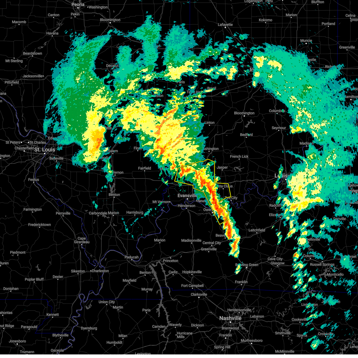 At 101 pm cst/201 pm est/, severe thunderstorms were located along a line extending from near owensville to near folsomville to 7 miles southeast of whitesville, moving northeast at 80 mph (trained weather spotters). Hazards include 60 mph wind gusts. Expect damage to roofs, siding, and trees. locations impacted include, owensboro, princeton, fort branch, oakland city, petersburg, rockport, dale, haubstadt, owensville, lynnville, winslow, grandview, patoka, whitesville, santa claus, knottsville, folsomville, elberfeld, chrisney and francisco. this includes the following highways, interstate 165 between mile markers 60 and 64, and between mile markers 66 and 68. interstate 69 in indiana between mile markers 21 and 52. interstate 64 in indiana between mile markers 30 and 59. hail threat, radar indicated max hail size, <. 75 in wind threat, radar indicated max wind gust, 60 mph. At 101 pm cst/201 pm est/, severe thunderstorms were located along a line extending from near owensville to near folsomville to 7 miles southeast of whitesville, moving northeast at 80 mph (trained weather spotters). Hazards include 60 mph wind gusts. Expect damage to roofs, siding, and trees. locations impacted include, owensboro, princeton, fort branch, oakland city, petersburg, rockport, dale, haubstadt, owensville, lynnville, winslow, grandview, patoka, whitesville, santa claus, knottsville, folsomville, elberfeld, chrisney and francisco. this includes the following highways, interstate 165 between mile markers 60 and 64, and between mile markers 66 and 68. interstate 69 in indiana between mile markers 21 and 52. interstate 64 in indiana between mile markers 30 and 59. hail threat, radar indicated max hail size, <. 75 in wind threat, radar indicated max wind gust, 60 mph.
|
| 3/3/2023 12:47 PM CST |
 At 1247 pm cst, severe thunderstorms were located along a line extending from near masonville to 6 miles northeast of russellville, moving northeast at 60 mph (trained weather spotters). Hazards include 70 mph wind gusts. Expect considerable tree damage. damage is likely to mobile homes, roofs, and outbuildings. locations impacted include, owensboro, livermore, masonville, stanley, island and moseleyville. this includes the following highways, interstate 165 between mile markers 60 and 70. western kentucky parkway between mile markers 61 and 64. audubon parkway between mile markers 15 and 23. thunderstorm damage threat, considerable hail threat, radar indicated max hail size, <. 75 in wind threat, radar indicated max wind gust, 70 mph. At 1247 pm cst, severe thunderstorms were located along a line extending from near masonville to 6 miles northeast of russellville, moving northeast at 60 mph (trained weather spotters). Hazards include 70 mph wind gusts. Expect considerable tree damage. damage is likely to mobile homes, roofs, and outbuildings. locations impacted include, owensboro, livermore, masonville, stanley, island and moseleyville. this includes the following highways, interstate 165 between mile markers 60 and 70. western kentucky parkway between mile markers 61 and 64. audubon parkway between mile markers 15 and 23. thunderstorm damage threat, considerable hail threat, radar indicated max hail size, <. 75 in wind threat, radar indicated max wind gust, 70 mph.
|
| 3/3/2023 12:45 PM CST | Mobile home home lifted and moved about 4 to 5 ft. nearby carport moved into neighbors yard. several barns destroyed in the are in daviess county KY, 3.9 miles E of Owensboro, KY |
| 3/3/2023 12:39 PM CST | Trees dow in daviess county KY, 1 miles S of Owensboro, KY |
| 3/3/2023 12:28 PM CST |
 At 1227 pm cst/127 pm est/, severe thunderstorms were located along a line extending from near henderson to 9 miles northeast of madisonville, moving northeast at 60 mph (trained weather spotters). Hazards include 70 mph wind gusts. Expect considerable tree damage. Damage is likely to mobile homes, roofs, and outbuildings. At 1227 pm cst/127 pm est/, severe thunderstorms were located along a line extending from near henderson to 9 miles northeast of madisonville, moving northeast at 60 mph (trained weather spotters). Hazards include 70 mph wind gusts. Expect considerable tree damage. Damage is likely to mobile homes, roofs, and outbuildings.
|
| 3/3/2023 12:09 PM CST |
 At 1209 pm cst, severe thunderstorms were located along a line extending from near providence to oak grove, moving northeast at 65 mph (trained weather spotters). Hazards include 70 mph wind gusts. Expect considerable tree damage. Damage is likely to mobile homes, roofs, and outbuildings. At 1209 pm cst, severe thunderstorms were located along a line extending from near providence to oak grove, moving northeast at 65 mph (trained weather spotters). Hazards include 70 mph wind gusts. Expect considerable tree damage. Damage is likely to mobile homes, roofs, and outbuildings.
|
| 3/1/2023 4:59 PM CST |
 At 458 pm cst, a severe thunderstorm was located near owensboro, moving northeast at 70 mph (radar indicated). Hazards include 60 mph wind gusts and quarter size hail. Hail damage to vehicles is expected. expect wind damage to roofs, siding, and trees. locations impacted include, owensboro, masonville, st. joseph, stanley and moseleyville. this includes the following highways, interstate 165 between mile markers 66 and 70. audubon parkway between mile markers 14 and 23. hail threat, radar indicated max hail size, 1. 00 in wind threat, radar indicated max wind gust, 60 mph. At 458 pm cst, a severe thunderstorm was located near owensboro, moving northeast at 70 mph (radar indicated). Hazards include 60 mph wind gusts and quarter size hail. Hail damage to vehicles is expected. expect wind damage to roofs, siding, and trees. locations impacted include, owensboro, masonville, st. joseph, stanley and moseleyville. this includes the following highways, interstate 165 between mile markers 66 and 70. audubon parkway between mile markers 14 and 23. hail threat, radar indicated max hail size, 1. 00 in wind threat, radar indicated max wind gust, 60 mph.
|
| 3/1/2023 4:50 PM CST | Semi blown off the road on highway 81. power line dow in daviess county KY, 5.4 miles NE of Owensboro, KY |
| 3/1/2023 4:50 PM CST | West daviess county at rome. large pine tree and weeping willow blown over. wind was so strong we couldnt see the road which is about 100 yards away. barn blown down to in daviess county KY, 4.6 miles ENE of Owensboro, KY |
| 3/1/2023 4:50 PM CST | Two garages collapsed along wayne bridges road west of hwy 8 in daviess county KY, 7.1 miles ENE of Owensboro, KY |
| 3/1/2023 4:50 PM CST | Quarter sized hail reported 4.1 miles SE of Owensboro, KY, report from mping: quarter (1.00 in.). |
| 3/1/2023 4:47 PM CST |
 At 446 pm cst, a severe thunderstorm was located over beech grove, or 8 miles northwest of calhoun, moving northeast at 60 mph (radar indicated). Hazards include 60 mph wind gusts and quarter size hail. Hail damage to vehicles is expected. expect wind damage to roofs, siding, and trees. locations impacted include, owensboro, masonville, st. joseph, beech grove, stanley and moseleyville. this includes the following highways, interstate 165 between mile markers 64 and 70. interstate 69 in kentucky near mile marker 137. audubon parkway between mile markers 13 and 23. hail threat, radar indicated max hail size, 1. 00 in wind threat, radar indicated max wind gust, 60 mph. At 446 pm cst, a severe thunderstorm was located over beech grove, or 8 miles northwest of calhoun, moving northeast at 60 mph (radar indicated). Hazards include 60 mph wind gusts and quarter size hail. Hail damage to vehicles is expected. expect wind damage to roofs, siding, and trees. locations impacted include, owensboro, masonville, st. joseph, beech grove, stanley and moseleyville. this includes the following highways, interstate 165 between mile markers 64 and 70. interstate 69 in kentucky near mile marker 137. audubon parkway between mile markers 13 and 23. hail threat, radar indicated max hail size, 1. 00 in wind threat, radar indicated max wind gust, 60 mph.
|
| 3/1/2023 4:33 PM CST |
 At 432 pm cst, a severe thunderstorm was located near dixon, or 11 miles northeast of providence, moving northeast at 50 mph (radar indicated). Hazards include 60 mph wind gusts and quarter size hail. Hail damage to vehicles is expected. Expect wind damage to roofs, siding, and trees. At 432 pm cst, a severe thunderstorm was located near dixon, or 11 miles northeast of providence, moving northeast at 50 mph (radar indicated). Hazards include 60 mph wind gusts and quarter size hail. Hail damage to vehicles is expected. Expect wind damage to roofs, siding, and trees.
|
| 1/12/2023 5:04 AM CST |
 At 504 am cst, a severe thunderstorm was located over rockport, moving northeast at 70 mph (radar indicated). Hazards include 60 mph wind gusts and quarter size hail. Hail damage to vehicles is expected. expect wind damage to roofs, siding, and trees. locations impacted include, owensboro, rockport, grandview, eureka, santa claus and chrisney. hail threat, radar indicated max hail size, 1. 00 in wind threat, radar indicated max wind gust, 60 mph. At 504 am cst, a severe thunderstorm was located over rockport, moving northeast at 70 mph (radar indicated). Hazards include 60 mph wind gusts and quarter size hail. Hail damage to vehicles is expected. expect wind damage to roofs, siding, and trees. locations impacted include, owensboro, rockport, grandview, eureka, santa claus and chrisney. hail threat, radar indicated max hail size, 1. 00 in wind threat, radar indicated max wind gust, 60 mph.
|
| 1/12/2023 4:53 AM CST |
 At 452 am cst, a severe thunderstorm was located over eureka, or 7 miles west of rockport, moving northeast at 45 mph (radar indicated). Hazards include 60 mph wind gusts and quarter size hail. Hail damage to vehicles is expected. expect wind damage to roofs, siding, and trees. locations impacted include, grandview and santa claus. this includes the following highways, interstate 64 in indiana near mile marker 60. audubon parkway between mile markers 15 and 21. hail threat, radar indicated max hail size, 1. 00 in wind threat, radar indicated max wind gust, 60 mph. At 452 am cst, a severe thunderstorm was located over eureka, or 7 miles west of rockport, moving northeast at 45 mph (radar indicated). Hazards include 60 mph wind gusts and quarter size hail. Hail damage to vehicles is expected. expect wind damage to roofs, siding, and trees. locations impacted include, grandview and santa claus. this includes the following highways, interstate 64 in indiana near mile marker 60. audubon parkway between mile markers 15 and 21. hail threat, radar indicated max hail size, 1. 00 in wind threat, radar indicated max wind gust, 60 mph.
|
| 1/12/2023 4:43 AM CST |
 At 442 am cst, a severe thunderstorm was located over calhoun, moving northeast at 75 mph (radar indicated). Hazards include 60 mph wind gusts and quarter size hail. Hail damage to vehicles is expected. expect wind damage to roofs, siding, and trees. this severe thunderstorm will be near, masonville around 455 am cst. whitesville around 500 am cst. other locations in the path of this severe thunderstorm include knottsville. this includes the following highways, interstate 165 between mile markers 60 and 70. Audubon parkway between mile markers 22 and 23. At 442 am cst, a severe thunderstorm was located over calhoun, moving northeast at 75 mph (radar indicated). Hazards include 60 mph wind gusts and quarter size hail. Hail damage to vehicles is expected. expect wind damage to roofs, siding, and trees. this severe thunderstorm will be near, masonville around 455 am cst. whitesville around 500 am cst. other locations in the path of this severe thunderstorm include knottsville. this includes the following highways, interstate 165 between mile markers 60 and 70. Audubon parkway between mile markers 22 and 23.
|
| 1/12/2023 4:41 AM CST |
 At 440 am cst, a severe thunderstorm was located over stanley, or 11 miles northwest of owensboro, moving northeast at 45 mph (radar indicated). Hazards include 60 mph wind gusts and quarter size hail. Hail damage to vehicles is expected. expect wind damage to roofs, siding, and trees. this severe storm will be near, owensboro and eureka around 445 am cst. other locations in the path of this severe thunderstorm include rockport, grandview and santa claus. this includes audubon parkway between mile markers 15 and 21. hail threat, radar indicated max hail size, 1. 00 in wind threat, radar indicated max wind gust, 60 mph. At 440 am cst, a severe thunderstorm was located over stanley, or 11 miles northwest of owensboro, moving northeast at 45 mph (radar indicated). Hazards include 60 mph wind gusts and quarter size hail. Hail damage to vehicles is expected. expect wind damage to roofs, siding, and trees. this severe storm will be near, owensboro and eureka around 445 am cst. other locations in the path of this severe thunderstorm include rockport, grandview and santa claus. this includes audubon parkway between mile markers 15 and 21. hail threat, radar indicated max hail size, 1. 00 in wind threat, radar indicated max wind gust, 60 mph.
|
| 1/12/2023 4:28 AM CST |
 At 428 am cst, a severe thunderstorm was located near st. joseph, or 11 miles southeast of henderson, moving northeast at 50 mph (radar indicated). Hazards include 60 mph wind gusts and quarter size hail. Hail damage to vehicles is expected. expect wind damage to roofs, siding, and trees. this severe thunderstorm will be near, owensboro and stanley around 440 am cst. eureka around 445 am cst. other locations in the path of this severe thunderstorm include rockport, grandview and santa claus. this includes audubon parkway between mile markers 3 and 21. hail threat, radar indicated max hail size, 1. 00 in wind threat, radar indicated max wind gust, 60 mph. At 428 am cst, a severe thunderstorm was located near st. joseph, or 11 miles southeast of henderson, moving northeast at 50 mph (radar indicated). Hazards include 60 mph wind gusts and quarter size hail. Hail damage to vehicles is expected. expect wind damage to roofs, siding, and trees. this severe thunderstorm will be near, owensboro and stanley around 440 am cst. eureka around 445 am cst. other locations in the path of this severe thunderstorm include rockport, grandview and santa claus. this includes audubon parkway between mile markers 3 and 21. hail threat, radar indicated max hail size, 1. 00 in wind threat, radar indicated max wind gust, 60 mph.
|
| 1/12/2023 3:58 AM CST |
 At 357 am cst, a severe thunderstorm was located over owensboro, moving northeast at 60 mph (radar indicated). Hazards include quarter size hail. Damage to vehicles is expected. this severe storm will be near, rockport around 405 am cst. this includes the following highways, interstate 165 between mile markers 68 and 70. audubon parkway between mile markers 20 and 23. hail threat, radar indicated max hail size, 1. 00 in wind threat, radar indicated max wind gust, <50 mph. At 357 am cst, a severe thunderstorm was located over owensboro, moving northeast at 60 mph (radar indicated). Hazards include quarter size hail. Damage to vehicles is expected. this severe storm will be near, rockport around 405 am cst. this includes the following highways, interstate 165 between mile markers 68 and 70. audubon parkway between mile markers 20 and 23. hail threat, radar indicated max hail size, 1. 00 in wind threat, radar indicated max wind gust, <50 mph.
|
| 1/12/2023 3:47 AM CST |
 At 347 am cst, a severe thunderstorm was located near st. joseph, or 7 miles north of calhoun, moving northeast at 60 mph (radar indicated). Hazards include quarter size hail. Damage to vehicles is expected. this severe thunderstorm will be near, owensboro and masonville around 355 am cst. rockport and knottsville around 405 am cst. this includes the following highways, interstate 165 between mile markers 62 and 70. audubon parkway between mile markers 21 and 23. hail threat, radar indicated max hail size, 1. 00 in wind threat, radar indicated max wind gust, <50 mph. At 347 am cst, a severe thunderstorm was located near st. joseph, or 7 miles north of calhoun, moving northeast at 60 mph (radar indicated). Hazards include quarter size hail. Damage to vehicles is expected. this severe thunderstorm will be near, owensboro and masonville around 355 am cst. rockport and knottsville around 405 am cst. this includes the following highways, interstate 165 between mile markers 62 and 70. audubon parkway between mile markers 21 and 23. hail threat, radar indicated max hail size, 1. 00 in wind threat, radar indicated max wind gust, <50 mph.
|
| 1/12/2023 3:31 AM CST |
 At 331 am cst, a severe thunderstorm was located near stanley, or 12 miles west of owensboro, moving northeast at 60 mph (radar indicated). Hazards include quarter size hail. Damage to vehicles is expected. this severe thunderstorm will be near, stanley around 335 am cst. owensboro and eureka around 340 am cst. other locations in the path of this severe thunderstorm include folsomville, dale and santa claus. this includes the following highways, interstate 64 in indiana between mile markers 50 and 60. audubon parkway between mile markers 5 and 22. hail threat, radar indicated max hail size, 1. 00 in wind threat, radar indicated max wind gust, <50 mph. At 331 am cst, a severe thunderstorm was located near stanley, or 12 miles west of owensboro, moving northeast at 60 mph (radar indicated). Hazards include quarter size hail. Damage to vehicles is expected. this severe thunderstorm will be near, stanley around 335 am cst. owensboro and eureka around 340 am cst. other locations in the path of this severe thunderstorm include folsomville, dale and santa claus. this includes the following highways, interstate 64 in indiana between mile markers 50 and 60. audubon parkway between mile markers 5 and 22. hail threat, radar indicated max hail size, 1. 00 in wind threat, radar indicated max wind gust, <50 mph.
|
| 8/1/2022 7:54 PM CDT |
 At 753 pm cdt, a severe thunderstorm was located near st. joseph, or 8 miles southwest of owensboro, moving southeast at 30 mph (radar indicated). Hazards include ping pong ball size hail and 60 mph wind gusts. People and animals outdoors will be injured. expect hail damage to roofs, siding, windows, and vehicles. expect wind damage to roofs, siding, and trees. this severe thunderstorm will be near, livermore around 825 pm cdt. other locations impacted by this severe thunderstorm include pleasant ridge, island and moseleyville. this includes interstate 165 near mile marker 60. hail threat, radar indicated max hail size, 1. 50 in wind threat, radar indicated max wind gust, 60 mph. At 753 pm cdt, a severe thunderstorm was located near st. joseph, or 8 miles southwest of owensboro, moving southeast at 30 mph (radar indicated). Hazards include ping pong ball size hail and 60 mph wind gusts. People and animals outdoors will be injured. expect hail damage to roofs, siding, windows, and vehicles. expect wind damage to roofs, siding, and trees. this severe thunderstorm will be near, livermore around 825 pm cdt. other locations impacted by this severe thunderstorm include pleasant ridge, island and moseleyville. this includes interstate 165 near mile marker 60. hail threat, radar indicated max hail size, 1. 50 in wind threat, radar indicated max wind gust, 60 mph.
|
| 8/1/2022 7:51 PM CDT | Quarter sized hail reported 10.6 miles ENE of Owensboro, KY |
| 8/1/2022 7:51 PM CDT | Tree fell on a camper at diamond lake in daviess county KY, 10.4 miles ENE of Owensboro, KY |
| 8/1/2022 7:50 PM CDT | Power lines down in st. josep in daviess county KY, 12.4 miles ENE of Owensboro, KY |
| 8/1/2022 7:47 PM CDT |
 At 746 pm cdt, a severe thunderstorm was located near st. joseph, or 10 miles west of owensboro, moving southeast at 40 mph (radar indicated). Hazards include 60 mph wind gusts and quarter size hail. Hail damage to vehicles is expected. expect wind damage to roofs, siding, and trees. this severe storm will be near, owensboro around 750 pm cdt. masonville around 805 pm cdt. other locations impacted by this severe thunderstorm include moseleyville. this includes the following highways, interstate 165 between mile markers 66 and 68. audubon parkway between mile markers 12 and 23. hail threat, radar indicated max hail size, 1. 00 in wind threat, radar indicated max wind gust, 60 mph. At 746 pm cdt, a severe thunderstorm was located near st. joseph, or 10 miles west of owensboro, moving southeast at 40 mph (radar indicated). Hazards include 60 mph wind gusts and quarter size hail. Hail damage to vehicles is expected. expect wind damage to roofs, siding, and trees. this severe storm will be near, owensboro around 750 pm cdt. masonville around 805 pm cdt. other locations impacted by this severe thunderstorm include moseleyville. this includes the following highways, interstate 165 between mile markers 66 and 68. audubon parkway between mile markers 12 and 23. hail threat, radar indicated max hail size, 1. 00 in wind threat, radar indicated max wind gust, 60 mph.
|
| 8/1/2022 7:36 PM CDT |
 At 735 pm cdt, a severe thunderstorm was located near stanley, or 11 miles south of newburgh, moving southeast at 40 mph (radar indicated). Hazards include 60 mph wind gusts and nickel size hail. Expect damage to roofs, siding, and trees. this severe storm will be near, stanley around 740 pm cdt. owensboro around 745 pm cdt. masonville around 805 pm cdt. other locations impacted by this severe thunderstorm include moseleyville and hebbardsville. this includes the following highways, interstate 165 between mile markers 66 and 70. audubon parkway between mile markers 13 and 23. hail threat, radar indicated max hail size, 0. 88 in wind threat, radar indicated max wind gust, 60 mph. At 735 pm cdt, a severe thunderstorm was located near stanley, or 11 miles south of newburgh, moving southeast at 40 mph (radar indicated). Hazards include 60 mph wind gusts and nickel size hail. Expect damage to roofs, siding, and trees. this severe storm will be near, stanley around 740 pm cdt. owensboro around 745 pm cdt. masonville around 805 pm cdt. other locations impacted by this severe thunderstorm include moseleyville and hebbardsville. this includes the following highways, interstate 165 between mile markers 66 and 70. audubon parkway between mile markers 13 and 23. hail threat, radar indicated max hail size, 0. 88 in wind threat, radar indicated max wind gust, 60 mph.
|
| 8/1/2022 7:26 PM CDT |
 At 726 pm cdt, a severe thunderstorm was located near stanley, or 7 miles southeast of newburgh, moving southeast at 40 mph (radar indicated). Hazards include 70 mph wind gusts and half dollar size hail. Hail damage to vehicles is expected. expect considerable tree damage. wind damage is also likely to mobile homes, roofs, and outbuildings. this severe storm will be near, eureka around 730 pm cdt. stanley around 735 pm cdt. owensboro around 740 pm cdt. masonville around 800 pm cdt. other locations impacted by this severe thunderstorm include moseleyville and hebbardsville. this includes the following highways, interstate 165 between mile markers 66 and 70. audubon parkway between mile markers 13 and 23. thunderstorm damage threat, considerable hail threat, radar indicated max hail size, 1. 25 in wind threat, radar indicated max wind gust, 70 mph. At 726 pm cdt, a severe thunderstorm was located near stanley, or 7 miles southeast of newburgh, moving southeast at 40 mph (radar indicated). Hazards include 70 mph wind gusts and half dollar size hail. Hail damage to vehicles is expected. expect considerable tree damage. wind damage is also likely to mobile homes, roofs, and outbuildings. this severe storm will be near, eureka around 730 pm cdt. stanley around 735 pm cdt. owensboro around 740 pm cdt. masonville around 800 pm cdt. other locations impacted by this severe thunderstorm include moseleyville and hebbardsville. this includes the following highways, interstate 165 between mile markers 66 and 70. audubon parkway between mile markers 13 and 23. thunderstorm damage threat, considerable hail threat, radar indicated max hail size, 1. 25 in wind threat, radar indicated max wind gust, 70 mph.
|
| 8/1/2022 7:10 PM CDT |
 At 709 pm cdt, a severe thunderstorm was located near newburgh, moving southeast at 40 mph (trained spotters reported a 70 mph gust on the southeast side of evansville). Hazards include 70 mph wind gusts and half dollar size hail. Hail damage to vehicles is expected. expect considerable tree damage. wind damage is also likely to mobile homes, roofs, and outbuildings. this severe thunderstorm will be near, eureka around 730 pm cdt. stanley around 735 pm cdt. owensboro around 740 pm cdt. masonville around 755 pm cdt. other locations impacted by this severe thunderstorm include moseleyville and hebbardsville. this includes the following highways, interstate 165 between mile markers 66 and 70. interstate 69 in indiana between mile markers 1 and 13. audubon parkway between mile markers 13 and 23. thunderstorm damage threat, considerable hail threat, radar indicated max hail size, 1. 25 in wind threat, observed max wind gust, 70 mph. At 709 pm cdt, a severe thunderstorm was located near newburgh, moving southeast at 40 mph (trained spotters reported a 70 mph gust on the southeast side of evansville). Hazards include 70 mph wind gusts and half dollar size hail. Hail damage to vehicles is expected. expect considerable tree damage. wind damage is also likely to mobile homes, roofs, and outbuildings. this severe thunderstorm will be near, eureka around 730 pm cdt. stanley around 735 pm cdt. owensboro around 740 pm cdt. masonville around 755 pm cdt. other locations impacted by this severe thunderstorm include moseleyville and hebbardsville. this includes the following highways, interstate 165 between mile markers 66 and 70. interstate 69 in indiana between mile markers 1 and 13. audubon parkway between mile markers 13 and 23. thunderstorm damage threat, considerable hail threat, radar indicated max hail size, 1. 25 in wind threat, observed max wind gust, 70 mph.
|
| 6/17/2022 8:16 AM CDT |
 At 816 am cdt, severe thunderstorms were located along a line extending from near rockport to near beech grove to near creswell, moving southeast at 40 mph (radar indicated). Hazards include 60 mph wind gusts. Expect damage to roofs, siding, and trees. locations impacted include, rockport, grandview, beech grove, calhoun, knottsville, livermore and dawson springs. this includes the following highways, interstate 165 between mile markers 60 and 70. interstate 69 in kentucky between mile markers 91 and 101, and between mile markers 110 and 138. interstate 64 in indiana between mile markers 57 and 59. audubon parkway between mile markers 16 and 23. hail threat, radar indicated max hail size, <. 75 in wind threat, radar indicated max wind gust, 60 mph. At 816 am cdt, severe thunderstorms were located along a line extending from near rockport to near beech grove to near creswell, moving southeast at 40 mph (radar indicated). Hazards include 60 mph wind gusts. Expect damage to roofs, siding, and trees. locations impacted include, rockport, grandview, beech grove, calhoun, knottsville, livermore and dawson springs. this includes the following highways, interstate 165 between mile markers 60 and 70. interstate 69 in kentucky between mile markers 91 and 101, and between mile markers 110 and 138. interstate 64 in indiana between mile markers 57 and 59. audubon parkway between mile markers 16 and 23. hail threat, radar indicated max hail size, <. 75 in wind threat, radar indicated max wind gust, 60 mph.
|
| 6/17/2022 7:52 AM CDT |
 At 751 am cdt, severe thunderstorms were located along a line extending from chandler to near corydon to 8 miles northwest of marion, moving southeast at 40 mph (radar indicated). Hazards include 60 mph wind gusts. Expect damage to roofs, siding, and trees. severe thunderstorms will be near, robards around 805 am cdt. sebree around 810 am cdt. other locations in the path of these severe thunderstorms include eureka, beech grove, rockport, calhoun, grandview and olney. this includes the following highways, interstate 165 between mile markers 60 and 70. interstate 69 in kentucky between mile markers 91 and 101, and between mile markers 110 and 148. interstate 69 in indiana between mile markers 1 and 4. interstate 64 in indiana between mile markers 57 and 59. audubon parkway between mile markers 1 and 23. hail threat, radar indicated max hail size, <. 75 in wind threat, radar indicated max wind gust, 60 mph. At 751 am cdt, severe thunderstorms were located along a line extending from chandler to near corydon to 8 miles northwest of marion, moving southeast at 40 mph (radar indicated). Hazards include 60 mph wind gusts. Expect damage to roofs, siding, and trees. severe thunderstorms will be near, robards around 805 am cdt. sebree around 810 am cdt. other locations in the path of these severe thunderstorms include eureka, beech grove, rockport, calhoun, grandview and olney. this includes the following highways, interstate 165 between mile markers 60 and 70. interstate 69 in kentucky between mile markers 91 and 101, and between mile markers 110 and 148. interstate 69 in indiana between mile markers 1 and 4. interstate 64 in indiana between mile markers 57 and 59. audubon parkway between mile markers 1 and 23. hail threat, radar indicated max hail size, <. 75 in wind threat, radar indicated max wind gust, 60 mph.
|
| 5/19/2022 1:17 PM CDT |
 At 116 pm cdt, a severe thunderstorm was located near owensboro, moving northeast at 30 mph (trained weather spotters). Hazards include 60 mph wind gusts and quarter size hail. Hail damage to vehicles is expected. expect wind damage to roofs, siding, and trees. this severe thunderstorm will be near, knottsville around 125 pm cdt. grandview around 130 pm cdt. this includes interstate 165 between mile markers 67 and 70. hail threat, radar indicated max hail size, 1. 00 in wind threat, radar indicated max wind gust, 60 mph. At 116 pm cdt, a severe thunderstorm was located near owensboro, moving northeast at 30 mph (trained weather spotters). Hazards include 60 mph wind gusts and quarter size hail. Hail damage to vehicles is expected. expect wind damage to roofs, siding, and trees. this severe thunderstorm will be near, knottsville around 125 pm cdt. grandview around 130 pm cdt. this includes interstate 165 between mile markers 67 and 70. hail threat, radar indicated max hail size, 1. 00 in wind threat, radar indicated max wind gust, 60 mph.
|
| 5/19/2022 1:12 PM CDT | Half Dollar sized hail reported 4.5 miles WSW of Owensboro, KY, report from mping: half dollar (1.25 in.). |
| 5/19/2022 1:08 PM CDT | Quarter sized hail reported 0.4 miles N of Owensboro, KY |
| 3/30/2022 7:34 PM CDT |
 At 732 pm cdt, a line of severe thunderstorms was located from near whitesville to rockport, moving northeast at 30 mph. wind gusts to near 60 mph and tree damage were reported with these storms at owensboro (radar indicated). Hazards include 60 mph wind gusts. Expect damage to roofs, siding, and trees. this severe thunderstorm will remain over mainly rural areas of eastern daviess county. this includes interstate 165 between mile markers 60 and 66. hail threat, radar indicated max hail size, <. 75 in wind threat, radar indicated max wind gust, 60 mph. At 732 pm cdt, a line of severe thunderstorms was located from near whitesville to rockport, moving northeast at 30 mph. wind gusts to near 60 mph and tree damage were reported with these storms at owensboro (radar indicated). Hazards include 60 mph wind gusts. Expect damage to roofs, siding, and trees. this severe thunderstorm will remain over mainly rural areas of eastern daviess county. this includes interstate 165 between mile markers 60 and 66. hail threat, radar indicated max hail size, <. 75 in wind threat, radar indicated max wind gust, 60 mph.
|
| 3/30/2022 7:21 PM CDT |
 At 719 pm cdt, severe thunderstorms were located along a line extending from hazleton south across evansville to near henderson, moving northeast at 50 mph (trained weather spotters reported tree damage). Hazards include 70 mph wind gusts. Expect considerable tree damage. damage is likely to mobile homes, roofs, and outbuildings. locations impacted include, stanley, petersburg, eureka, boonville, dale and santa claus. this includes the following highways, interstate 69 in kentucky between mile markers 142 and 148. interstate 69 in indiana between mile markers 1 and 52. interstate 64 in indiana between mile markers 18 and 60. Audubon parkway between mile markers 1 and 12. At 719 pm cdt, severe thunderstorms were located along a line extending from hazleton south across evansville to near henderson, moving northeast at 50 mph (trained weather spotters reported tree damage). Hazards include 70 mph wind gusts. Expect considerable tree damage. damage is likely to mobile homes, roofs, and outbuildings. locations impacted include, stanley, petersburg, eureka, boonville, dale and santa claus. this includes the following highways, interstate 69 in kentucky between mile markers 142 and 148. interstate 69 in indiana between mile markers 1 and 52. interstate 64 in indiana between mile markers 18 and 60. Audubon parkway between mile markers 1 and 12.
|
| 3/30/2022 7:10 PM CDT | Tree down along hwy 5 in daviess county KY, 3.9 miles E of Owensboro, KY |
| 3/30/2022 7:07 PM CDT |
 At 707 pm cdt, a severe thunderstorm was located near owensboro, moving northeast at 30 mph (radar indicated). Hazards include 70 mph wind gusts. Expect considerable tree damage. damage is likely to mobile homes, roofs, and outbuildings. this severe thunderstorm will be near, owensboro around 715 pm cdt. other locations in the path of this severe thunderstorm include rockport and knottsville. this includes the following highways, interstate 165 between mile markers 60 and 70. Audubon parkway between mile markers 21 and 23. At 707 pm cdt, a severe thunderstorm was located near owensboro, moving northeast at 30 mph (radar indicated). Hazards include 70 mph wind gusts. Expect considerable tree damage. damage is likely to mobile homes, roofs, and outbuildings. this severe thunderstorm will be near, owensboro around 715 pm cdt. other locations in the path of this severe thunderstorm include rockport and knottsville. this includes the following highways, interstate 165 between mile markers 60 and 70. Audubon parkway between mile markers 21 and 23.
|
| 3/30/2022 7:03 PM CDT |
 At 703 pm cdt, severe thunderstorms were located along a line extending from near st. joseph to near calhoun to near graham, moving northeast at 85 mph (trained weather spotters). Hazards include 60 mph wind gusts. Expect damage to roofs, siding, and trees. locations impacted include, owensboro, livermore and masonville. this includes the following highways, interstate 165 between mile markers 65 and 69. western kentucky parkway between mile markers 44 and 64. Audubon parkway between mile markers 16 and 21. At 703 pm cdt, severe thunderstorms were located along a line extending from near st. joseph to near calhoun to near graham, moving northeast at 85 mph (trained weather spotters). Hazards include 60 mph wind gusts. Expect damage to roofs, siding, and trees. locations impacted include, owensboro, livermore and masonville. this includes the following highways, interstate 165 between mile markers 65 and 69. western kentucky parkway between mile markers 44 and 64. Audubon parkway between mile markers 16 and 21.
|
| 3/30/2022 6:54 PM CDT |
 At 652 pm cdt, severe thunderstorms were located along a line extending from near mount carmel to near morganfield, moving northeast at 35 mph (trained weather spotters. winds to 70 mph have been measured along this line). Hazards include 70 mph wind gusts. Expect considerable tree damage. damage is likely to mobile homes, roofs, and outbuildings. severe thunderstorms will be near, owensville around 710 pm cdt. other locations in the path of these severe thunderstorms include fort branch, princeton, patoka, henderson, oakland city, newburgh, winslow, stanley, petersburg, boonville and eureka. this includes the following highways, interstate 69 in kentucky between mile markers 141 and 148. interstate 69 in indiana between mile markers 1 and 52. interstate 64 in indiana between mile markers 18 and 60. Audubon parkway between mile markers 1 and 14. At 652 pm cdt, severe thunderstorms were located along a line extending from near mount carmel to near morganfield, moving northeast at 35 mph (trained weather spotters. winds to 70 mph have been measured along this line). Hazards include 70 mph wind gusts. Expect considerable tree damage. damage is likely to mobile homes, roofs, and outbuildings. severe thunderstorms will be near, owensville around 710 pm cdt. other locations in the path of these severe thunderstorms include fort branch, princeton, patoka, henderson, oakland city, newburgh, winslow, stanley, petersburg, boonville and eureka. this includes the following highways, interstate 69 in kentucky between mile markers 141 and 148. interstate 69 in indiana between mile markers 1 and 52. interstate 64 in indiana between mile markers 18 and 60. Audubon parkway between mile markers 1 and 14.
|
| 3/30/2022 6:40 PM CDT |
 At 640 pm cdt, severe thunderstorms were located along a line extending from 6 miles west of madisonville to near crofton to near hopkinsville, moving northeast at 85 mph (trained weather spotters). Hazards include 70 mph wind gusts. Expect considerable tree damage. damage is likely to mobile homes, roofs, and outbuildings. severe thunderstorms will be near, nortonville and mortons gap around 645 pm cdt. madisonville and earlington around 650 pm cdt. beech grove around 655 pm cdt. st. joseph and weir around 700 pm cdt. other locations in the path of these severe thunderstorms include calhoun, powderly, graham, greenville, central city, owensboro, livermore and masonville. this includes the following highways, interstate 165 between mile markers 65 and 69. interstate 69 in kentucky between mile markers 94 and 135. western kentucky parkway between mile markers 39 and 64. pennyrile parkway between mile markers 25 and 34. Audubon parkway between mile markers 15 and 21. At 640 pm cdt, severe thunderstorms were located along a line extending from 6 miles west of madisonville to near crofton to near hopkinsville, moving northeast at 85 mph (trained weather spotters). Hazards include 70 mph wind gusts. Expect considerable tree damage. damage is likely to mobile homes, roofs, and outbuildings. severe thunderstorms will be near, nortonville and mortons gap around 645 pm cdt. madisonville and earlington around 650 pm cdt. beech grove around 655 pm cdt. st. joseph and weir around 700 pm cdt. other locations in the path of these severe thunderstorms include calhoun, powderly, graham, greenville, central city, owensboro, livermore and masonville. this includes the following highways, interstate 165 between mile markers 65 and 69. interstate 69 in kentucky between mile markers 94 and 135. western kentucky parkway between mile markers 39 and 64. pennyrile parkway between mile markers 25 and 34. Audubon parkway between mile markers 15 and 21.
|
| 12/6/2021 12:53 AM CST |
 At 1253 am cst, a severe thunderstorm was located near rockport, moving east at 55 mph (radar indicated). Hazards include 60 mph wind gusts. Expect damage to roofs, siding, and trees. this severe thunderstorm will remain over mainly rural areas of southeastern spencer and northeastern daviess counties, including the following locations, waitman. hail threat, radar indicated max hail size, <. 75 in wind threat, radar indicated max wind gust, 60 mph. At 1253 am cst, a severe thunderstorm was located near rockport, moving east at 55 mph (radar indicated). Hazards include 60 mph wind gusts. Expect damage to roofs, siding, and trees. this severe thunderstorm will remain over mainly rural areas of southeastern spencer and northeastern daviess counties, including the following locations, waitman. hail threat, radar indicated max hail size, <. 75 in wind threat, radar indicated max wind gust, 60 mph.
|
| 12/6/2021 12:40 AM CST |
 At 1240 am cst, a severe thunderstorm was located over eureka, or 9 miles northwest of owensboro, moving east at 55 mph (radar indicated). Hazards include 60 mph wind gusts. Expect damage to roofs, siding, and trees. this severe thunderstorm will be near, owensboro around 1245 am cst. rockport around 1250 am cst. grandview around 1255 am cst. hail threat, radar indicated max hail size, <. 75 in wind threat, radar indicated max wind gust, 60 mph. At 1240 am cst, a severe thunderstorm was located over eureka, or 9 miles northwest of owensboro, moving east at 55 mph (radar indicated). Hazards include 60 mph wind gusts. Expect damage to roofs, siding, and trees. this severe thunderstorm will be near, owensboro around 1245 am cst. rockport around 1250 am cst. grandview around 1255 am cst. hail threat, radar indicated max hail size, <. 75 in wind threat, radar indicated max wind gust, 60 mph.
|
| 5/4/2021 1:10 AM CDT |
 At 109 am cdt, a severe thunderstorm was located near masonville, or 8 miles south of owensboro, moving east at 20 mph (radar indicated). Hazards include 60 mph wind gusts and quarter size hail. Hail damage to vehicles is expected. Expect wind damage to roofs, siding, and trees. At 109 am cdt, a severe thunderstorm was located near masonville, or 8 miles south of owensboro, moving east at 20 mph (radar indicated). Hazards include 60 mph wind gusts and quarter size hail. Hail damage to vehicles is expected. Expect wind damage to roofs, siding, and trees.
|
| 4/25/2020 2:43 PM CDT |
 At 243 pm cdt, a severe thunderstorm was located near rockport, moving north at 20 mph (radar indicated). Hazards include quarter size hail. Damage to vehicles is expected. Locations impacted include, owensboro, rockport and grandview. At 243 pm cdt, a severe thunderstorm was located near rockport, moving north at 20 mph (radar indicated). Hazards include quarter size hail. Damage to vehicles is expected. Locations impacted include, owensboro, rockport and grandview.
|
| 4/25/2020 2:22 PM CDT |
 At 222 pm cdt, a severe thunderstorm was located over owensboro, moving north at 20 mph (radar indicated). Hazards include quarter size hail. damage to vehicles is expected At 222 pm cdt, a severe thunderstorm was located over owensboro, moving north at 20 mph (radar indicated). Hazards include quarter size hail. damage to vehicles is expected
|
| 3/28/2020 9:21 PM CDT |
 At 920 pm cdt, a severe thunderstorm was located over st. joseph, or 10 miles north of calhoun, moving northeast at 60 mph (radar indicated). Hazards include 60 mph wind gusts and penny size hail. Expect damage to roofs, siding, and trees. locations impacted include, owensboro, rockport, calhoun, whitesville, masonville, stanley, knottsville, st. Joseph, beech grove, moseleyville and pleasant ridge. At 920 pm cdt, a severe thunderstorm was located over st. joseph, or 10 miles north of calhoun, moving northeast at 60 mph (radar indicated). Hazards include 60 mph wind gusts and penny size hail. Expect damage to roofs, siding, and trees. locations impacted include, owensboro, rockport, calhoun, whitesville, masonville, stanley, knottsville, st. Joseph, beech grove, moseleyville and pleasant ridge.
|
| 3/28/2020 9:07 PM CDT |
 At 907 pm cdt, a severe thunderstorm was located over sebree, or 16 miles south of henderson, moving northeast at 65 mph (radar indicated). Hazards include 60 mph wind gusts and nickel size hail. Expect damage to roofs, siding, and trees. locations impacted include, owensboro, providence, rockport, calhoun, sebree, dixon, whitesville, robards, knottsville, st. Joseph. At 907 pm cdt, a severe thunderstorm was located over sebree, or 16 miles south of henderson, moving northeast at 65 mph (radar indicated). Hazards include 60 mph wind gusts and nickel size hail. Expect damage to roofs, siding, and trees. locations impacted include, owensboro, providence, rockport, calhoun, sebree, dixon, whitesville, robards, knottsville, st. Joseph.
|
| 3/28/2020 8:46 PM CDT |
 At 845 pm cdt, a severe thunderstorm capable of producing a tornado was located over santa claus, or 15 miles northeast of rockport, moving northeast at 55 mph (radar indicated rotation). Hazards include tornado and quarter size hail. Flying debris will be dangerous to those caught without shelter. mobile homes will be damaged or destroyed. damage to roofs, windows, and vehicles will occur. tree damage is likely. This tornadic thunderstorm will remain over mainly rural areas of eastern warrick and spencer counties, including the following locations, tennyson, gentryville and chrisney. At 845 pm cdt, a severe thunderstorm capable of producing a tornado was located over santa claus, or 15 miles northeast of rockport, moving northeast at 55 mph (radar indicated rotation). Hazards include tornado and quarter size hail. Flying debris will be dangerous to those caught without shelter. mobile homes will be damaged or destroyed. damage to roofs, windows, and vehicles will occur. tree damage is likely. This tornadic thunderstorm will remain over mainly rural areas of eastern warrick and spencer counties, including the following locations, tennyson, gentryville and chrisney.
|
| 3/28/2020 8:44 PM CDT |
 At 844 pm cdt, severe thunderstorms were located along a line extending from robards to near providence, moving northeast at 60 mph (radar indicated). Hazards include 60 mph wind gusts and nickel size hail. expect damage to roofs, siding, and trees At 844 pm cdt, severe thunderstorms were located along a line extending from robards to near providence, moving northeast at 60 mph (radar indicated). Hazards include 60 mph wind gusts and nickel size hail. expect damage to roofs, siding, and trees
|
| 3/28/2020 8:16 PM CDT |
 At 815 pm cdt, a severe thunderstorm capable of producing a tornado was located near newburgh, moving northeast at 65 mph. this storm produced 90 mph winds in henderson, take cover now! (radar indicated rotation). Hazards include tornado and quarter size hail. Flying debris will be dangerous to those caught without shelter. mobile homes will be damaged or destroyed. damage to roofs, windows, and vehicles will occur. tree damage is likely. this dangerous storm will be near, eureka around 820 pm cdt. dale and santa claus around 840 pm cdt. other locations impacted by this tornadic thunderstorm include tennyson, gentryville and chrisney. This includes interstate 64 in indiana between mile markers 46 and 60. At 815 pm cdt, a severe thunderstorm capable of producing a tornado was located near newburgh, moving northeast at 65 mph. this storm produced 90 mph winds in henderson, take cover now! (radar indicated rotation). Hazards include tornado and quarter size hail. Flying debris will be dangerous to those caught without shelter. mobile homes will be damaged or destroyed. damage to roofs, windows, and vehicles will occur. tree damage is likely. this dangerous storm will be near, eureka around 820 pm cdt. dale and santa claus around 840 pm cdt. other locations impacted by this tornadic thunderstorm include tennyson, gentryville and chrisney. This includes interstate 64 in indiana between mile markers 46 and 60.
|
| 1/11/2020 7:04 AM CST |
 At 704 am cst, a severe thunderstorm was located 8 miles south of newburgh, moving northeast at 55 mph (radar indicated). Hazards include 60 mph wind gusts. Expect damage to roofs, siding, and trees. locations impacted include, henderson, newburgh, robards, st. Joseph, stanley and hebbardsville. At 704 am cst, a severe thunderstorm was located 8 miles south of newburgh, moving northeast at 55 mph (radar indicated). Hazards include 60 mph wind gusts. Expect damage to roofs, siding, and trees. locations impacted include, henderson, newburgh, robards, st. Joseph, stanley and hebbardsville.
|
| 1/11/2020 6:42 AM CST |
 At 642 am cst, a severe thunderstorm was located near dixon, or 12 miles southeast of breckinridge center, moving northeast at 55 mph (radar indicated). Hazards include 60 mph wind gusts. expect damage to roofs, siding, and trees At 642 am cst, a severe thunderstorm was located near dixon, or 12 miles southeast of breckinridge center, moving northeast at 55 mph (radar indicated). Hazards include 60 mph wind gusts. expect damage to roofs, siding, and trees
|
| 10/26/2019 4:15 PM CDT | Soffit damage to a home. report relayed via twitte in daviess county KY, 4.5 miles WSW of Owensboro, KY |
| 10/26/2019 4:07 PM CDT |
 At 406 pm cdt, severe thunderstorms were located along a line extending from near blairsville to near stanley to 7 miles south of masonville, moving northeast at 50 mph (trained weather spotters. the mesonet site in henderson reported a 66 mph wind gust at 400 pm). Hazards include 70 mph wind gusts. Expect considerable tree damage. Damage is likely to mobile homes, roofs, and outbuildings. At 406 pm cdt, severe thunderstorms were located along a line extending from near blairsville to near stanley to 7 miles south of masonville, moving northeast at 50 mph (trained weather spotters. the mesonet site in henderson reported a 66 mph wind gust at 400 pm). Hazards include 70 mph wind gusts. Expect considerable tree damage. Damage is likely to mobile homes, roofs, and outbuildings.
|
| 8/20/2019 2:50 PM CDT | Isolated tree damage relayed via social media... pictures. mostly minor. two larger limbs... couple of trees seemed stressed or partially rotted out. peak wind at the a in daviess county KY, 0.6 miles ESE of Owensboro, KY |
| 8/20/2019 2:46 PM CDT |
 At 246 pm cdt, severe thunderstorms were located along a line extending from 8 miles east of santa claus to near eureka, moving southeast at 20 mph (trained weather spotters). Hazards include 60 mph wind gusts. Expect damage to roofs, siding, and trees. Locations impacted include, boonville, newburgh, rockport, dale, grandview, santa claus, eureka, chrisney, tennyson and gentryville. At 246 pm cdt, severe thunderstorms were located along a line extending from 8 miles east of santa claus to near eureka, moving southeast at 20 mph (trained weather spotters). Hazards include 60 mph wind gusts. Expect damage to roofs, siding, and trees. Locations impacted include, boonville, newburgh, rockport, dale, grandview, santa claus, eureka, chrisney, tennyson and gentryville.
|
| 8/20/2019 2:34 PM CDT |
 At 233 pm cdt, severe thunderstorms were located along a line extending from 6 miles northeast of santa claus to near eureka, moving east, southeast up to 30 mph (radar indicated). Hazards include 60 mph wind gusts. expect damage to roofs, siding, and trees At 233 pm cdt, severe thunderstorms were located along a line extending from 6 miles northeast of santa claus to near eureka, moving east, southeast up to 30 mph (radar indicated). Hazards include 60 mph wind gusts. expect damage to roofs, siding, and trees
|
| 8/18/2019 5:23 PM CDT |
 At 514 pm cdt, severe thunderstorms were located along a line extending from near lynnville to near boonville to near newburgh, moving east at 35 mph (radar indicated). Hazards include 60 mph wind gusts and quarter size hail. Hail damage to vehicles is expected. Expect wind damage to roofs, siding, and trees. At 514 pm cdt, severe thunderstorms were located along a line extending from near lynnville to near boonville to near newburgh, moving east at 35 mph (radar indicated). Hazards include 60 mph wind gusts and quarter size hail. Hail damage to vehicles is expected. Expect wind damage to roofs, siding, and trees.
|
| 8/18/2019 5:14 PM CDT |
 The national weather service in paducah has issued a * severe thunderstorm warning for. warrick county in southwestern indiana. spencer county in southwestern indiana. until 600 pm cdt. At 514 pm cdt, severe thunderstorms were located along a line. The national weather service in paducah has issued a * severe thunderstorm warning for. warrick county in southwestern indiana. spencer county in southwestern indiana. until 600 pm cdt. At 514 pm cdt, severe thunderstorms were located along a line.
|
| 8/18/2019 4:51 PM CDT |
 The national weather service in paducah has issued a * severe thunderstorm warning for. warrick county in southwestern indiana. spencer county in southwestern indiana. until 515 pm cdt. At 451 pm cdt, a severe thunderstorm was located over chandler,. The national weather service in paducah has issued a * severe thunderstorm warning for. warrick county in southwestern indiana. spencer county in southwestern indiana. until 515 pm cdt. At 451 pm cdt, a severe thunderstorm was located over chandler,.
|
| 7/16/2019 1:13 PM CDT |
 The national weather service in paducah has issued a * tornado warning for. southwestern spencer county in southwestern indiana. north central daviess county in northwestern kentucky. until 145 pm cdt. At 113 pm cdt, a severe thunderstorm capable of producing a tornado. The national weather service in paducah has issued a * tornado warning for. southwestern spencer county in southwestern indiana. north central daviess county in northwestern kentucky. until 145 pm cdt. At 113 pm cdt, a severe thunderstorm capable of producing a tornado.
|
| 7/15/2019 4:46 PM CDT |
 At 446 pm cdt, a severe thunderstorm was located over stanley, or 7 miles northwest of owensboro, moving north at 30 mph (radar indicated). Hazards include 60 mph wind gusts. Expect damage to roofs, siding, and trees. Locations impacted include, owensboro, rockport, stanley, eureka and hebbardsville. At 446 pm cdt, a severe thunderstorm was located over stanley, or 7 miles northwest of owensboro, moving north at 30 mph (radar indicated). Hazards include 60 mph wind gusts. Expect damage to roofs, siding, and trees. Locations impacted include, owensboro, rockport, stanley, eureka and hebbardsville.
|
| 7/15/2019 4:35 PM CDT |
 At 435 pm cdt, a severe thunderstorm was located near stanley, or 7 miles west of owensboro, moving north at 30 mph (radar indicated). Hazards include 60 mph wind gusts. expect damage to roofs, siding, and trees At 435 pm cdt, a severe thunderstorm was located near stanley, or 7 miles west of owensboro, moving north at 30 mph (radar indicated). Hazards include 60 mph wind gusts. expect damage to roofs, siding, and trees
|
| 7/3/2019 3:35 PM CDT |
 At 335 pm cdt, a severe thunderstorm was located over st. joseph, or 12 miles north of calhoun, moving east at 25 mph (radar indicated). Hazards include 60 mph wind gusts and quarter size hail. Hail damage to vehicles is expected. Expect wind damage to roofs, siding, and trees. At 335 pm cdt, a severe thunderstorm was located over st. joseph, or 12 miles north of calhoun, moving east at 25 mph (radar indicated). Hazards include 60 mph wind gusts and quarter size hail. Hail damage to vehicles is expected. Expect wind damage to roofs, siding, and trees.
|
| 6/30/2019 8:08 PM CDT |
 At 806 pm cdt, a line of severe winds out ahead of approaching thunderstorms was located along a line extending from near corydon to near st. joseph to 7 miles southeast of whitesville, moving southeast at 50 mph. there have been many reports of downed trees and power outages with these winds (trained weather spotters). Hazards include 60 mph wind gusts. Expect damage to roofs, siding, and trees. locations impacted include, evansville, owensboro, henderson, newburgh, corydon, whitesville, robards, knottsville, st. Joseph, masonville, stanley, moseleyville, pleasant ridge and hebbardsville. At 806 pm cdt, a line of severe winds out ahead of approaching thunderstorms was located along a line extending from near corydon to near st. joseph to 7 miles southeast of whitesville, moving southeast at 50 mph. there have been many reports of downed trees and power outages with these winds (trained weather spotters). Hazards include 60 mph wind gusts. Expect damage to roofs, siding, and trees. locations impacted include, evansville, owensboro, henderson, newburgh, corydon, whitesville, robards, knottsville, st. Joseph, masonville, stanley, moseleyville, pleasant ridge and hebbardsville.
|
| 6/30/2019 8:05 PM CDT | Report of trees and power lines down scattered across town. time estimated by rada in daviess county KY, 0.6 miles ESE of Owensboro, KY |
| 6/30/2019 7:42 PM CDT |
 At 740 pm cdt, severe winds out ahead of approaching thunderstorms were located along a line extending from near mount vernon to near evansville to near eureka to hawesville, moving southeast at 50 mph. there have been reports of 50 to 60 mph winds with this line (trained weather spotters). Hazards include 60 mph wind gusts. expect damage to roofs, siding, and trees At 740 pm cdt, severe winds out ahead of approaching thunderstorms were located along a line extending from near mount vernon to near evansville to near eureka to hawesville, moving southeast at 50 mph. there have been reports of 50 to 60 mph winds with this line (trained weather spotters). Hazards include 60 mph wind gusts. expect damage to roofs, siding, and trees
|
| 6/23/2019 6:40 PM CDT |
 At 640 pm cdt, severe thunderstorms were located along a line extending from near owensboro to near knottsville to whitesville, moving northeast at 60 mph (radar indicated). Hazards include 60 mph wind gusts and penny size hail. expect damage to roofs, siding, and trees At 640 pm cdt, severe thunderstorms were located along a line extending from near owensboro to near knottsville to whitesville, moving northeast at 60 mph (radar indicated). Hazards include 60 mph wind gusts and penny size hail. expect damage to roofs, siding, and trees
|
| 6/23/2019 6:40 PM CDT |
 The national weather service in paducah has issued a * severe thunderstorm warning for. southeastern spencer county in southwestern indiana. eastern daviess county in northwestern kentucky. until 700 pm cdt. At 640 pm cdt, severe thunderstorms were located along a line. The national weather service in paducah has issued a * severe thunderstorm warning for. southeastern spencer county in southwestern indiana. eastern daviess county in northwestern kentucky. until 700 pm cdt. At 640 pm cdt, severe thunderstorms were located along a line.
|
| 6/23/2019 6:35 PM CDT |
 At 635 pm cdt, severe thunderstorms were located along a line extending from near stanley to near owensboro to near masonville to near hartford to near hopkinsville, moving northeast at 65 mph (radar indicated). Hazards include 70 mph wind gusts and quarter size hail. Hail damage to vehicles is expected. expect considerable tree damage. wind damage is also likely to mobile homes, roofs, and outbuildings. Locations impacted include, owensboro, central city, rockport, greenville, powderly, whitesville, knottsville, masonville, stanley, central city--greenville, weir, dunmor, drakesboro and south carrollton. At 635 pm cdt, severe thunderstorms were located along a line extending from near stanley to near owensboro to near masonville to near hartford to near hopkinsville, moving northeast at 65 mph (radar indicated). Hazards include 70 mph wind gusts and quarter size hail. Hail damage to vehicles is expected. expect considerable tree damage. wind damage is also likely to mobile homes, roofs, and outbuildings. Locations impacted include, owensboro, central city, rockport, greenville, powderly, whitesville, knottsville, masonville, stanley, central city--greenville, weir, dunmor, drakesboro and south carrollton.
|
| 6/23/2019 6:23 PM CDT |
 A severe thunderstorm warning remains in effect until 645 pm cdt for southwestern spencer. southeastern henderson. daviess. muhlenberg. mclean and northeastern hopkins counties. At 622 pm cdt, severe thunderstorms were located along a line extending from near beech grove to near calhoun to 8 miles southwest of masonville to near livermore to 7 miles southwest of hopkinsville,. A severe thunderstorm warning remains in effect until 645 pm cdt for southwestern spencer. southeastern henderson. daviess. muhlenberg. mclean and northeastern hopkins counties. At 622 pm cdt, severe thunderstorms were located along a line extending from near beech grove to near calhoun to 8 miles southwest of masonville to near livermore to 7 miles southwest of hopkinsville,.
|
| 6/23/2019 5:53 PM CDT |
 At 552 pm cdt, severe thunderstorms were located along a line extending from 6 miles southeast of shawneetown to near clay to near dixon to 7 miles southeast of providence to 9 miles west of big rock, moving northeast at 65 mph (radar indicated). Hazards include 70 mph wind gusts and quarter size hail. Hail damage to vehicles is expected. expect considerable tree damage. Wind damage is also likely to mobile homes, roofs, and outbuildings. At 552 pm cdt, severe thunderstorms were located along a line extending from 6 miles southeast of shawneetown to near clay to near dixon to 7 miles southeast of providence to 9 miles west of big rock, moving northeast at 65 mph (radar indicated). Hazards include 70 mph wind gusts and quarter size hail. Hail damage to vehicles is expected. expect considerable tree damage. Wind damage is also likely to mobile homes, roofs, and outbuildings.
|
| 6/23/2019 2:40 PM CDT |
 The severe thunderstorm warning for southwestern spencer and daviess counties will expire at 245 pm cdt, the severe thunderstorm which prompted the warning has moved out of the warned area. therefore, the warning will be allowed to expire. The severe thunderstorm warning for southwestern spencer and daviess counties will expire at 245 pm cdt, the severe thunderstorm which prompted the warning has moved out of the warned area. therefore, the warning will be allowed to expire.
|
| 6/23/2019 2:40 PM CDT |
 At 216 pm cdt, a severe thunderstorm was located near knottsville, or near owensboro, moving northeast at 55 mph (spotter reported nickle to quarter size hail 3 miles west northwest of owensboro kentucky). Hazards include 60 mph wind gusts and quarter size hail. Hail damage to vehicles is expected. expect wind damage to roofs, siding, and trees. Locations impacted include, owensboro, rockport, whitesville, knottsville, masonville and moseleyville. At 216 pm cdt, a severe thunderstorm was located near knottsville, or near owensboro, moving northeast at 55 mph (spotter reported nickle to quarter size hail 3 miles west northwest of owensboro kentucky). Hazards include 60 mph wind gusts and quarter size hail. Hail damage to vehicles is expected. expect wind damage to roofs, siding, and trees. Locations impacted include, owensboro, rockport, whitesville, knottsville, masonville and moseleyville.
|
| 6/23/2019 2:18 PM CDT |
 At 216 pm cdt, a severe thunderstorm was located near knottsville, or near owensboro, moving northeast at 55 mph (spotter reported nickle to quarter size hail 3 miles west northwest of owensboro kentucky). Hazards include 60 mph wind gusts and quarter size hail. Hail damage to vehicles is expected. expect wind damage to roofs, siding, and trees. Locations impacted include, owensboro, rockport, whitesville, knottsville, masonville and moseleyville. At 216 pm cdt, a severe thunderstorm was located near knottsville, or near owensboro, moving northeast at 55 mph (spotter reported nickle to quarter size hail 3 miles west northwest of owensboro kentucky). Hazards include 60 mph wind gusts and quarter size hail. Hail damage to vehicles is expected. expect wind damage to roofs, siding, and trees. Locations impacted include, owensboro, rockport, whitesville, knottsville, masonville and moseleyville.
|
| 6/23/2019 2:13 PM CDT |
 At 213 pm cdt, a severe thunderstorm was located near owensboro, moving northeast at 55 mph (radar indicated). Hazards include 60 mph wind gusts. expect damage to roofs, siding, and trees At 213 pm cdt, a severe thunderstorm was located near owensboro, moving northeast at 55 mph (radar indicated). Hazards include 60 mph wind gusts. expect damage to roofs, siding, and trees
|
| 6/23/2019 2:12 PM CDT | Quarter sized hail reported 3.6 miles SE of Owensboro, KY, nickel to quarter size hail. |
| 6/21/2019 5:31 PM CDT |
 At 531 pm cdt, a severe thunderstorm was located near owensboro, moving southeast at 50 mph (trained weather spotters). Hazards include 70 mph wind gusts and quarter size hail. Hail damage to vehicles is expected. expect considerable tree damage. Wind damage is also likely to mobile homes, roofs, and outbuildings. At 531 pm cdt, a severe thunderstorm was located near owensboro, moving southeast at 50 mph (trained weather spotters). Hazards include 70 mph wind gusts and quarter size hail. Hail damage to vehicles is expected. expect considerable tree damage. Wind damage is also likely to mobile homes, roofs, and outbuildings.
|
| 6/21/2019 5:23 PM CDT | Quarter sized hail reported 1.7 miles S of Owensboro, KY |
| 6/21/2019 5:21 PM CDT | Storm damage reported in daviess county KY, 1.7 miles S of Owensboro, KY |
| 6/21/2019 5:19 PM CDT |
 At 453 pm cdt, a severe thunderstorm was located over newburgh, moving east at 45 mph (trained weather spotters). Hazards include 60 mph wind gusts and nickel size hail. a trained spotter reported 50-60 mph wind gusts in angel mounds in vanderburgh county. expect damage to roofs, siding, and trees At 453 pm cdt, a severe thunderstorm was located over newburgh, moving east at 45 mph (trained weather spotters). Hazards include 60 mph wind gusts and nickel size hail. a trained spotter reported 50-60 mph wind gusts in angel mounds in vanderburgh county. expect damage to roofs, siding, and trees
|
| 6/21/2019 5:19 PM CDT |
 At 518 pm cdt, a severe thunderstorm was located near st. joseph, or 8 miles southwest of owensboro, moving southeast at 40 mph (trained weather spotters). Hazards include 60 mph wind gusts and quarter size hail. Hail damage to vehicles is expected. expect wind damage to roofs, siding, and trees. locations impacted include, owensboro, rockport, grandview, whitesville, masonville, stanley, knottsville, st. Joseph, eureka, chrisney and moseleyville. At 518 pm cdt, a severe thunderstorm was located near st. joseph, or 8 miles southwest of owensboro, moving southeast at 40 mph (trained weather spotters). Hazards include 60 mph wind gusts and quarter size hail. Hail damage to vehicles is expected. expect wind damage to roofs, siding, and trees. locations impacted include, owensboro, rockport, grandview, whitesville, masonville, stanley, knottsville, st. Joseph, eureka, chrisney and moseleyville.
|
| 6/21/2019 4:54 PM CDT |
 The national weather service in paducah has issued a * severe thunderstorm warning for. southwestern warrick county in southwestern indiana. southwestern spencer county in southwestern indiana. east central vanderburgh county in southwestern indiana. Eastern henderson county in northwestern kentucky. The national weather service in paducah has issued a * severe thunderstorm warning for. southwestern warrick county in southwestern indiana. southwestern spencer county in southwestern indiana. east central vanderburgh county in southwestern indiana. Eastern henderson county in northwestern kentucky.
|
| 6/21/2019 4:54 PM CDT |
 At 453 pm cdt, a severe thunderstorm was located over newburgh, moving east at 45 mph (trained weather spotters). Hazards include 60 mph wind gusts and nickel size hail. a trained spotter reported 50-60 mph wind gusts in angel mounds in vanderburgh county. expect damage to roofs, siding, and trees At 453 pm cdt, a severe thunderstorm was located over newburgh, moving east at 45 mph (trained weather spotters). Hazards include 60 mph wind gusts and nickel size hail. a trained spotter reported 50-60 mph wind gusts in angel mounds in vanderburgh county. expect damage to roofs, siding, and trees
|
| 5/26/2019 3:46 PM CDT |
 At 345 pm cdt, severe thunderstorms were located along a line extending from near hawesville to near knottsville to near masonville, moving east at 50 mph (radar indicated). Hazards include 60 mph wind gusts. Expect damage to roofs, siding, and trees. Locations impacted include, whitesville, knottsville and masonville. At 345 pm cdt, severe thunderstorms were located along a line extending from near hawesville to near knottsville to near masonville, moving east at 50 mph (radar indicated). Hazards include 60 mph wind gusts. Expect damage to roofs, siding, and trees. Locations impacted include, whitesville, knottsville and masonville.
|
| 5/26/2019 3:32 PM CDT |
 At 332 pm cdt, severe thunderstorms were located along a line extending from near rockport to near owensboro to near st. joseph, moving east at 50 mph (radar indicated). Hazards include 60 mph wind gusts. expect damage to roofs, siding, and trees At 332 pm cdt, severe thunderstorms were located along a line extending from near rockport to near owensboro to near st. joseph, moving east at 50 mph (radar indicated). Hazards include 60 mph wind gusts. expect damage to roofs, siding, and trees
|
| 5/26/2019 3:27 PM CDT | Wind strong enough to move a barge in the industrial drive/river road area of owensbor in daviess county KY, 0.6 miles ESE of Owensboro, KY |
| 5/26/2019 3:23 PM CDT | Multiple barn/building roofs damaged... major tree damage with up to 8-10ft diameter trees uprooted. multiple trees fell on vehicles at diamond lake campground near wes in daviess county KY, 12.9 miles ENE of Owensboro, KY |
| 3/14/2019 1:32 PM CDT |
 At 132 pm cdt, a severe thunderstorm was located near st. joseph, or 8 miles southwest of owensboro, moving northeast at 70 mph (radar indicated). Hazards include 60 mph wind gusts and quarter size hail. Hail damage to vehicles is expected. Expect wind damage to roofs, siding, and trees. At 132 pm cdt, a severe thunderstorm was located near st. joseph, or 8 miles southwest of owensboro, moving northeast at 70 mph (radar indicated). Hazards include 60 mph wind gusts and quarter size hail. Hail damage to vehicles is expected. Expect wind damage to roofs, siding, and trees.
|
| 3/14/2019 1:05 PM CDT | Trees dow in daviess county KY, 8.9 miles ESE of Owensboro, KY |
| 3/14/2019 1:05 PM CDT | Power poles blown down on us 60 between stanley and owensboro. time estimate in daviess county KY, 6 miles ESE of Owensboro, KY |
| 3/14/2019 1:04 PM CDT |
 At 104 pm cdt, a severe thunderstorm was located near stanley, or near owensboro, moving northeast at 55 mph (radar indicated). Hazards include 70 mph wind gusts. Expect considerable tree damage. Damage is likely to mobile homes, roofs, and outbuildings. At 104 pm cdt, a severe thunderstorm was located near stanley, or near owensboro, moving northeast at 55 mph (radar indicated). Hazards include 70 mph wind gusts. Expect considerable tree damage. Damage is likely to mobile homes, roofs, and outbuildings.
|
| 3/14/2019 12:24 PM CDT |
 At 1224 pm cdt, a severe thunderstorm capable of producing a tornado was located near robards, or 9 miles southeast of henderson, moving northeast at 65 mph (radar indicated rotation). Hazards include tornado. Flying debris will be dangerous to those caught without shelter. mobile homes will be damaged or destroyed. damage to roofs, windows, and vehicles will occur. tree damage is likely. this dangerous storm will be near, stanley around 1240 pm cdt. Other locations impacted by this tornadic thunderstorm include hebbardsville. At 1224 pm cdt, a severe thunderstorm capable of producing a tornado was located near robards, or 9 miles southeast of henderson, moving northeast at 65 mph (radar indicated rotation). Hazards include tornado. Flying debris will be dangerous to those caught without shelter. mobile homes will be damaged or destroyed. damage to roofs, windows, and vehicles will occur. tree damage is likely. this dangerous storm will be near, stanley around 1240 pm cdt. Other locations impacted by this tornadic thunderstorm include hebbardsville.
|
| 9/8/2018 3:59 PM CDT | Trees down and power outages just south of stanley. possible tornad in daviess county KY, 8.4 miles ESE of Owensboro, KY |
| 9/8/2018 3:56 PM CDT |
 At 354 pm cdt, a severe thunderstorm capable of producing a tornado was located over stanley, or 7 miles west of owensboro, moving east at 25 mph. this tornadic storm will pass just northwest of owensboro into extreme southern spencer county (radar indicated rotation). Hazards include tornado. Flying debris will be dangerous to those caught without shelter. mobile homes will be damaged or destroyed. damage to roofs, windows, and vehicles will occur. tree damage is likely. this dangerous storm will be near, just northwest of owensboro around 405 pm cdt. Approaching rockport around 415 pm cdt. At 354 pm cdt, a severe thunderstorm capable of producing a tornado was located over stanley, or 7 miles west of owensboro, moving east at 25 mph. this tornadic storm will pass just northwest of owensboro into extreme southern spencer county (radar indicated rotation). Hazards include tornado. Flying debris will be dangerous to those caught without shelter. mobile homes will be damaged or destroyed. damage to roofs, windows, and vehicles will occur. tree damage is likely. this dangerous storm will be near, just northwest of owensboro around 405 pm cdt. Approaching rockport around 415 pm cdt.
|
| 9/8/2018 3:43 PM CDT |
 At 342 pm cdt, a severe thunderstorm capable of producing a tornado was located near stanley, or 11 miles west of owensboro, moving east at 20 mph (radar indicated rotation). Hazards include tornado. Flying debris will be dangerous to those caught without shelter. mobile homes will be damaged or destroyed. damage to roofs, windows, and vehicles will occur. tree damage is likely. this dangerous storm will be near, stanley around 350 pm cdt. northwest owensboro and eureka around 405 pm cdt. Approaching rockport around 415 pm cdt. At 342 pm cdt, a severe thunderstorm capable of producing a tornado was located near stanley, or 11 miles west of owensboro, moving east at 20 mph (radar indicated rotation). Hazards include tornado. Flying debris will be dangerous to those caught without shelter. mobile homes will be damaged or destroyed. damage to roofs, windows, and vehicles will occur. tree damage is likely. this dangerous storm will be near, stanley around 350 pm cdt. northwest owensboro and eureka around 405 pm cdt. Approaching rockport around 415 pm cdt.
|
| 9/8/2018 3:34 PM CDT |
 At 332 pm cdt, a severe thunderstorm capable of producing a tornado was located near st. joseph, or 11 miles southeast of henderson, moving east at 25 mph. this storm will pass near or over hebbardsville by 335 pm, and stanley around 340 pm. at this time, the tornado appears likely to pass just northwest of owensboro (radar indicated rotation). Hazards include tornado. Flying debris will be dangerous to those caught without shelter. mobile homes will be damaged or destroyed. damage to roofs, windows, and vehicles will occur. tree damage is likely. locations impacted include, owensboro, st. Joseph, stanley, eureka and hebbardsville. At 332 pm cdt, a severe thunderstorm capable of producing a tornado was located near st. joseph, or 11 miles southeast of henderson, moving east at 25 mph. this storm will pass near or over hebbardsville by 335 pm, and stanley around 340 pm. at this time, the tornado appears likely to pass just northwest of owensboro (radar indicated rotation). Hazards include tornado. Flying debris will be dangerous to those caught without shelter. mobile homes will be damaged or destroyed. damage to roofs, windows, and vehicles will occur. tree damage is likely. locations impacted include, owensboro, st. Joseph, stanley, eureka and hebbardsville.
|
| 9/8/2018 3:23 PM CDT |
 At 322 pm cdt, a severe thunderstorm capable of producing a tornado was located near robards, or 9 miles southeast of henderson, moving northeast at 25 mph (radar indicated rotation). Hazards include tornado. Flying debris will be dangerous to those caught without shelter. mobile homes will be damaged or destroyed. damage to roofs, windows, and vehicles will occur. Tree damage is likely. At 322 pm cdt, a severe thunderstorm capable of producing a tornado was located near robards, or 9 miles southeast of henderson, moving northeast at 25 mph (radar indicated rotation). Hazards include tornado. Flying debris will be dangerous to those caught without shelter. mobile homes will be damaged or destroyed. damage to roofs, windows, and vehicles will occur. Tree damage is likely.
|
| 8/15/2018 5:31 PM CDT | Trees and power lines dow in daviess county KY, 0.6 miles ESE of Owensboro, KY |
| 8/15/2018 5:26 PM CDT | Trees dow in daviess county KY, 11.4 miles NE of Owensboro, KY |
| 8/15/2018 5:06 PM CDT |
 At 506 pm cdt, severe thunderstorms were located along a line extending from near folsomville to near owensboro, moving east at 35 mph (radar indicated). Hazards include 60 mph wind gusts and penny size hail. Expect damage to roofs, siding, and trees. Locations impacted include, owensboro, rockport, dale, grandview, stanley, knottsville, holiday world, eureka, folsomville, chrisney, tennyson and gentryville. At 506 pm cdt, severe thunderstorms were located along a line extending from near folsomville to near owensboro, moving east at 35 mph (radar indicated). Hazards include 60 mph wind gusts and penny size hail. Expect damage to roofs, siding, and trees. Locations impacted include, owensboro, rockport, dale, grandview, stanley, knottsville, holiday world, eureka, folsomville, chrisney, tennyson and gentryville.
|
| 8/15/2018 4:47 PM CDT |
 At 447 pm cdt, severe thunderstorms were located along a line extending from near lynnville to stanley, moving east at 35 mph (radar indicated). Hazards include 60 mph wind gusts and penny size hail. expect damage to roofs, siding, and trees At 447 pm cdt, severe thunderstorms were located along a line extending from near lynnville to stanley, moving east at 35 mph (radar indicated). Hazards include 60 mph wind gusts and penny size hail. expect damage to roofs, siding, and trees
|
| 7/20/2018 9:25 PM CDT |
 At 925 pm cdt, severe thunderstorms were located along a line extending from 6 miles northwest of tell city to near eureka, moving southeast at 15 mph (radar indicated). Hazards include 60 mph wind gusts and quarter size hail. Hail damage to vehicles is expected. expect wind damage to roofs, siding, and trees. locations impacted include, rockport, grandview, eureka and chrisney. A tornado watch remains in effect until 200 am cdt for southwestern indiana, and northwestern kentucky. At 925 pm cdt, severe thunderstorms were located along a line extending from 6 miles northwest of tell city to near eureka, moving southeast at 15 mph (radar indicated). Hazards include 60 mph wind gusts and quarter size hail. Hail damage to vehicles is expected. expect wind damage to roofs, siding, and trees. locations impacted include, rockport, grandview, eureka and chrisney. A tornado watch remains in effect until 200 am cdt for southwestern indiana, and northwestern kentucky.
|
| 7/20/2018 9:07 PM CDT |
 At 907 pm cdt, a severe thunderstorm was located near holiday world, or 13 miles northeast of rockport, moving southeast at 20 mph (radar indicated). Hazards include 60 mph wind gusts and quarter size hail. Hail damage to vehicles is expected. Expect wind damage to roofs, siding, and trees. At 907 pm cdt, a severe thunderstorm was located near holiday world, or 13 miles northeast of rockport, moving southeast at 20 mph (radar indicated). Hazards include 60 mph wind gusts and quarter size hail. Hail damage to vehicles is expected. Expect wind damage to roofs, siding, and trees.
|
| 6/26/2018 7:25 PM CDT |
 The national weather service in paducah has issued a * severe thunderstorm warning for. warrick county in southwestern indiana. spencer county in southwestern indiana. northeastern vanderburgh county in southwestern indiana. Eastern daviess county in northwestern kentucky. The national weather service in paducah has issued a * severe thunderstorm warning for. warrick county in southwestern indiana. spencer county in southwestern indiana. northeastern vanderburgh county in southwestern indiana. Eastern daviess county in northwestern kentucky.
|
| 6/26/2018 7:25 PM CDT |
 At 724 pm cdt, severe thunderstorms were located along a line extending from 7 miles northwest of chandler to near eureka to near masonville, moving northeast at 30 mph (radar indicated). Hazards include 60 mph wind gusts and nickel size hail. expect damage to roofs, siding, and trees At 724 pm cdt, severe thunderstorms were located along a line extending from 7 miles northwest of chandler to near eureka to near masonville, moving northeast at 30 mph (radar indicated). Hazards include 60 mph wind gusts and nickel size hail. expect damage to roofs, siding, and trees
|
| 6/26/2018 7:10 PM CDT | Trees uprooted. relayed via faceboo in daviess county KY, 10.6 miles ENE of Owensboro, KY |
| 6/26/2018 6:49 PM CDT |
 At 648 pm cdt, severe thunderstorms were located along a line extending from near robards to near sebree to near madisonville, moving east at 40 mph (radar indicated). Hazards include 60 mph wind gusts and nickel size hail. expect damage to roofs, siding, and trees At 648 pm cdt, severe thunderstorms were located along a line extending from near robards to near sebree to near madisonville, moving east at 40 mph (radar indicated). Hazards include 60 mph wind gusts and nickel size hail. expect damage to roofs, siding, and trees
|
| 6/26/2018 11:13 AM CDT | Semi tractor blown on west side of community at the tractor supply stor in daviess county KY, 0.6 miles ESE of Owensboro, KY |
| 6/26/2018 11:10 AM CDT |
 A severe thunderstorm warning remains in effect until 1130 am cdt for daviess. muhlenberg and mclean counties. at 1108 am cdt, severe thunderstorms were located along a line extending from near owensboro to 7 miles southwest of masonville to near graham, moving east at 35 mph. Wind gusts from 50 to 60 mph have been reported with this line of storms, causing some damage to. A severe thunderstorm warning remains in effect until 1130 am cdt for daviess. muhlenberg and mclean counties. at 1108 am cdt, severe thunderstorms were located along a line extending from near owensboro to 7 miles southwest of masonville to near graham, moving east at 35 mph. Wind gusts from 50 to 60 mph have been reported with this line of storms, causing some damage to.
|
| 6/26/2018 11:05 AM CDT | Large tree snapped with widespread tree limbs down. winds estimated 50 to 60 mp in daviess county KY, 7.9 miles SE of Owensboro, KY |
| 6/26/2018 10:53 AM CDT |
 At 1052 am cdt, a severe thunderstorm was located near newburgh, moving northeast at 45 mph. these storms have a history of wind damage (radar indicated). Hazards include 70 mph wind gusts. Expect considerable tree damage. Damage is likely to mobile homes, roofs, and outbuildings. At 1052 am cdt, a severe thunderstorm was located near newburgh, moving northeast at 45 mph. these storms have a history of wind damage (radar indicated). Hazards include 70 mph wind gusts. Expect considerable tree damage. Damage is likely to mobile homes, roofs, and outbuildings.
|
| 6/26/2018 10:48 AM CDT |
 At 1047 am cdt, severe thunderstorms were located along a line extending from newburgh to beech grove to near earlington, moving east at 35 mph. trained spotters reported isolated wind damage to trees in henderson county (trained weather spotters). Hazards include 60 mph wind gusts and nickel size hail. expect damage to roofs, siding, and trees At 1047 am cdt, severe thunderstorms were located along a line extending from newburgh to beech grove to near earlington, moving east at 35 mph. trained spotters reported isolated wind damage to trees in henderson county (trained weather spotters). Hazards include 60 mph wind gusts and nickel size hail. expect damage to roofs, siding, and trees
|
| 6/10/2018 11:13 AM CDT |
 The severe thunderstorm warning for eastern daviess county will expire at 1115 am cdt, the storm which prompted the warning will move out of the warned area soon. therefore, the warning will be allowed to expire. the storm produced high winds west of whitesville, bringing large tree branches down. The severe thunderstorm warning for eastern daviess county will expire at 1115 am cdt, the storm which prompted the warning will move out of the warned area soon. therefore, the warning will be allowed to expire. the storm produced high winds west of whitesville, bringing large tree branches down.
|
| 6/10/2018 10:50 AM CDT |
 At 1049 am cdt, a severe thunderstorm was located near knottsville, or 7 miles east of owensboro, moving southeast at 20 mph (radar indicated). Hazards include 60 mph wind gusts and penny size hail. expect damage to roofs, siding, and trees At 1049 am cdt, a severe thunderstorm was located near knottsville, or 7 miles east of owensboro, moving southeast at 20 mph (radar indicated). Hazards include 60 mph wind gusts and penny size hail. expect damage to roofs, siding, and trees
|
| 5/31/2018 12:45 PM CDT | Quarter sized hail reported 0.6 miles ESE of Owensboro, KY, reported along the daviess hancock county line. |
| 5/31/2018 12:45 PM CDT |
 At 1244 pm cdt, a severe thunderstorm was located near knottsville, or 7 miles southeast of rockport, moving northeast at 40 mph (radar indicated). Hazards include 60 mph wind gusts. expect damage to roofs, siding, and trees At 1244 pm cdt, a severe thunderstorm was located near knottsville, or 7 miles southeast of rockport, moving northeast at 40 mph (radar indicated). Hazards include 60 mph wind gusts. expect damage to roofs, siding, and trees
|
| 5/31/2018 12:10 PM CDT |
 At 1210 pm cdt, a severe thunderstorm capable of producing a tornado was located near rockport, moving northeast at 45 mph (radar indicated rotation). Hazards include tornado. Flying debris will be dangerous to those caught without shelter. mobile homes will be damaged or destroyed. damage to roofs, windows, and vehicles will occur. tree damage is likely. this dangerous storm will be near, grandview around 1225 pm cdt. Other locations impacted by this tornadic thunderstorm include chrisney and waitman. At 1210 pm cdt, a severe thunderstorm capable of producing a tornado was located near rockport, moving northeast at 45 mph (radar indicated rotation). Hazards include tornado. Flying debris will be dangerous to those caught without shelter. mobile homes will be damaged or destroyed. damage to roofs, windows, and vehicles will occur. tree damage is likely. this dangerous storm will be near, grandview around 1225 pm cdt. Other locations impacted by this tornadic thunderstorm include chrisney and waitman.
|
| 5/31/2018 12:10 PM CDT |
 The national weather service in paducah has issued a * tornado warning for. central spencer county in southwestern indiana. northeastern daviess county in northwestern kentucky. until 100 pm cdt. At 1210 pm cdt, a severe thunderstorm capable of producing a. The national weather service in paducah has issued a * tornado warning for. central spencer county in southwestern indiana. northeastern daviess county in northwestern kentucky. until 100 pm cdt. At 1210 pm cdt, a severe thunderstorm capable of producing a.
|
| 5/31/2018 11:36 AM CDT |
 At 1135 am cdt, severe thunderstorms were located along a line extending from near patoka to near lynnville to near newburgh to near robards, moving east at 45 mph. these storms have a history of producing 40 to 60 mph wind gusts and due to the wet grounds, this is downing trees and power lines (radar indicated). Hazards include 60 mph wind gusts. expect damage to roofs, siding, and trees At 1135 am cdt, severe thunderstorms were located along a line extending from near patoka to near lynnville to near newburgh to near robards, moving east at 45 mph. these storms have a history of producing 40 to 60 mph wind gusts and due to the wet grounds, this is downing trees and power lines (radar indicated). Hazards include 60 mph wind gusts. expect damage to roofs, siding, and trees
|
| 5/10/2018 6:54 PM CDT |
 At 653 pm cdt, a severe thunderstorm was located over southern owensboro, moving southeast at 20 mph. reports of wind damage and hail have been received in owensboro (trained weather spotters). Hazards include 70 mph wind gusts and ping pong ball size hail. People and animals outdoors will be injured. expect hail damage to roofs, siding, windows, and vehicles. expect considerable tree damage. Wind damage is also likely to mobile homes, roofs, and outbuildings. At 653 pm cdt, a severe thunderstorm was located over southern owensboro, moving southeast at 20 mph. reports of wind damage and hail have been received in owensboro (trained weather spotters). Hazards include 70 mph wind gusts and ping pong ball size hail. People and animals outdoors will be injured. expect hail damage to roofs, siding, windows, and vehicles. expect considerable tree damage. Wind damage is also likely to mobile homes, roofs, and outbuildings.
|
| 5/10/2018 6:49 PM CDT | Wind gusts measure in daviess county KY, 2.5 miles NNE of Owensboro, KY |
| 5/10/2018 6:49 PM CDT |
 At 648 pm cdt, a severe thunderstorm was located over western owensboro, moving southeast at 20 mph. spotters reported wind damage, including a roof blown off a building in western owensboro at 646 pm. numerous reports of winds to 60 mph have also been received (trained weather spotters). Hazards include 70 mph wind gusts and ping pong ball size hail. People and animals outdoors will be injured. expect hail damage to roofs, siding, windows, and vehicles. expect considerable tree damage. wind damage is also likely to mobile homes, roofs, and outbuildings. Locations impacted include, owensboro and masonville. At 648 pm cdt, a severe thunderstorm was located over western owensboro, moving southeast at 20 mph. spotters reported wind damage, including a roof blown off a building in western owensboro at 646 pm. numerous reports of winds to 60 mph have also been received (trained weather spotters). Hazards include 70 mph wind gusts and ping pong ball size hail. People and animals outdoors will be injured. expect hail damage to roofs, siding, windows, and vehicles. expect considerable tree damage. wind damage is also likely to mobile homes, roofs, and outbuildings. Locations impacted include, owensboro and masonville.
|
| 5/10/2018 6:48 PM CDT | Metal roof blown off of spectrum building on northwest side of town. wind gust speed unknow in daviess county KY, 0.6 miles ESE of Owensboro, KY |
| 5/10/2018 6:45 PM CDT |
 At 644 pm cdt, a severe thunderstorm was located over western owensboro, moving southeast at 20 mph. spotters reported 60 mph winds in western owensboro at 642 pm (trained weather spotters). Hazards include ping pong ball size hail and 60 mph wind gusts. People and animals outdoors will be injured. expect hail damage to roofs, siding, windows, and vehicles. expect wind damage to roofs, siding, and trees. Locations impacted include, owensboro and masonville. At 644 pm cdt, a severe thunderstorm was located over western owensboro, moving southeast at 20 mph. spotters reported 60 mph winds in western owensboro at 642 pm (trained weather spotters). Hazards include ping pong ball size hail and 60 mph wind gusts. People and animals outdoors will be injured. expect hail damage to roofs, siding, windows, and vehicles. expect wind damage to roofs, siding, and trees. Locations impacted include, owensboro and masonville.
|
| 5/10/2018 6:42 PM CDT | Winds estimated. marble size hail reported with stor in daviess county KY, 1.7 miles E of Owensboro, KY |
| 5/10/2018 6:31 PM CDT |
 At 630 pm cdt, a severe thunderstorm was located near stanley, or just west of owensboro, moving southeast at 20 mph. this storm will impact the city of owensboro through 650 pm (radar indicated). Hazards include two inch hail and 70 mph wind gusts. People and animals outdoors will be injured. expect hail damage to roofs, siding, windows, and vehicles. expect considerable tree damage. wind damage is also likely to mobile homes, roofs, and outbuildings. Locations impacted include, owensboro, masonville and stanley. At 630 pm cdt, a severe thunderstorm was located near stanley, or just west of owensboro, moving southeast at 20 mph. this storm will impact the city of owensboro through 650 pm (radar indicated). Hazards include two inch hail and 70 mph wind gusts. People and animals outdoors will be injured. expect hail damage to roofs, siding, windows, and vehicles. expect considerable tree damage. wind damage is also likely to mobile homes, roofs, and outbuildings. Locations impacted include, owensboro, masonville and stanley.
|
| 5/10/2018 6:17 PM CDT | Late report. barn destroyed. time of event is based on rada in daviess county KY, 9.6 miles ESE of Owensboro, KY |
| 5/10/2018 6:08 PM CDT |
 At 607 pm cdt, a severe thunderstorm was located near stanley, or 7 miles southeast of newburgh, moving southeast at 20 mph (radar indicated). Hazards include two inch hail and 70 mph wind gusts. People and animals outdoors will be injured. expect hail damage to roofs, siding, windows, and vehicles. expect considerable tree damage. Wind damage is also likely to mobile homes, roofs, and outbuildings. At 607 pm cdt, a severe thunderstorm was located near stanley, or 7 miles southeast of newburgh, moving southeast at 20 mph (radar indicated). Hazards include two inch hail and 70 mph wind gusts. People and animals outdoors will be injured. expect hail damage to roofs, siding, windows, and vehicles. expect considerable tree damage. Wind damage is also likely to mobile homes, roofs, and outbuildings.
|
| 5/10/2018 5:59 PM CDT |
 A severe thunderstorm warning remains in effect until 615 pm cdt for south central warrick. southwestern spencer. northeastern henderson and northwestern daviess counties. at 558 pm cdt, a severe thunderstorm was located just south of newburgh, moving southeast at 20 mph. Numerous reports of quarter to ping pong ball sized hail have been received with this storm and. A severe thunderstorm warning remains in effect until 615 pm cdt for south central warrick. southwestern spencer. northeastern henderson and northwestern daviess counties. at 558 pm cdt, a severe thunderstorm was located just south of newburgh, moving southeast at 20 mph. Numerous reports of quarter to ping pong ball sized hail have been received with this storm and.
|
| 5/10/2018 5:59 PM CDT |
 At 558 pm cdt, a severe thunderstorm was located just south of newburgh, moving southeast at 20 mph. numerous reports of quarter to ping pong ball sized hail have been received with this storm and it remains capable of hail to two inches in diameter and damaging winds to 70 mph (trained weather spotters). Hazards include two inch hail and 70 mph wind gusts. People and animals outdoors will be injured. expect hail damage to roofs, siding, windows, and vehicles. expect considerable tree damage. wind damage is also likely to mobile homes, roofs, and outbuildings. Locations impacted include, eureka and stanley. At 558 pm cdt, a severe thunderstorm was located just south of newburgh, moving southeast at 20 mph. numerous reports of quarter to ping pong ball sized hail have been received with this storm and it remains capable of hail to two inches in diameter and damaging winds to 70 mph (trained weather spotters). Hazards include two inch hail and 70 mph wind gusts. People and animals outdoors will be injured. expect hail damage to roofs, siding, windows, and vehicles. expect considerable tree damage. wind damage is also likely to mobile homes, roofs, and outbuildings. Locations impacted include, eureka and stanley.
|
| 5/10/2018 5:44 PM CDT |
 At 543 pm cdt, a severe thunderstorm was located just west of newburgh, moving southeast at 20 mph. numerous reports of quarter sized hail have been received with this storm. this storm is capable of hail to two inches in diameter and 70 mph wind gusts (trained weather spotters). Hazards include two inch hail and 70 mph wind gusts. People and animals outdoors will be injured. expect hail damage to roofs, siding, windows, and vehicles. expect considerable tree damage. wind damage is also likely to mobile homes, roofs, and outbuildings. Locations impacted include, evansville, newburgh, stanley and eureka. At 543 pm cdt, a severe thunderstorm was located just west of newburgh, moving southeast at 20 mph. numerous reports of quarter sized hail have been received with this storm. this storm is capable of hail to two inches in diameter and 70 mph wind gusts (trained weather spotters). Hazards include two inch hail and 70 mph wind gusts. People and animals outdoors will be injured. expect hail damage to roofs, siding, windows, and vehicles. expect considerable tree damage. wind damage is also likely to mobile homes, roofs, and outbuildings. Locations impacted include, evansville, newburgh, stanley and eureka.
|
| 5/10/2018 5:35 PM CDT |
 At 535 pm cdt, a severe thunderstorm was located near evansville, moving southeast at 15 mph. numerous reports of quarter to ping pong ball sized hail have been recieved with this storm in evansville (trained weather spotters). Hazards include ping pong ball size hail and 60 mph wind gusts. People and animals outdoors will be injured. expect hail damage to roofs, siding, windows, and vehicles. Expect wind damage to roofs, siding, and trees. At 535 pm cdt, a severe thunderstorm was located near evansville, moving southeast at 15 mph. numerous reports of quarter to ping pong ball sized hail have been recieved with this storm in evansville (trained weather spotters). Hazards include ping pong ball size hail and 60 mph wind gusts. People and animals outdoors will be injured. expect hail damage to roofs, siding, windows, and vehicles. Expect wind damage to roofs, siding, and trees.
|
| 11/18/2017 2:58 PM CST |
 At 255 pm cst, a severe thunderstorm was located near tell city, or 17 miles northeast of rockport, moving east at 60 mph (radar indicated). Hazards include 60 mph wind gusts. Expect damage to roofs, siding, and trees. locations impacted include, owensboro, rockport, santa claus, dale, grandview, stanley, knottsville, st. Joseph, eureka, chrisney, troy and gentryville. At 255 pm cst, a severe thunderstorm was located near tell city, or 17 miles northeast of rockport, moving east at 60 mph (radar indicated). Hazards include 60 mph wind gusts. Expect damage to roofs, siding, and trees. locations impacted include, owensboro, rockport, santa claus, dale, grandview, stanley, knottsville, st. Joseph, eureka, chrisney, troy and gentryville.
|
| 11/18/2017 2:39 PM CST |
 At 238 pm cst, a severe thunderstorm was located near rockport, moving east at 60 mph (radar indicated). Hazards include 60 mph wind gusts. expect damage to roofs, siding, and trees At 238 pm cst, a severe thunderstorm was located near rockport, moving east at 60 mph (radar indicated). Hazards include 60 mph wind gusts. expect damage to roofs, siding, and trees
|
| 3/1/2017 6:07 AM CST |
 At 606 am cst, severe thunderstorms were located along a line extending from whitesville to near livermore to 7 miles north of dawson springs, moving east at 50 mph (radar indicated). Hazards include 60 mph wind gusts and penny size hail. Expect damage to roofs, siding, and trees. locations impacted include, owensboro, madisonville, providence, marion, calhoun, sebree, earlington, clay, dixon, knottsville, st. joseph, masonville, beech grove, hanson, sacramento, nebo, slaughters, wheatcroft and moseleyville. a tornado watch remains in effect until 800 am cst for southwestern indiana, and western, south central and northwestern kentucky. A tornado watch also remains in effect until 800 am cst for southwestern indiana, and western, south central and northwestern kentucky. At 606 am cst, severe thunderstorms were located along a line extending from whitesville to near livermore to 7 miles north of dawson springs, moving east at 50 mph (radar indicated). Hazards include 60 mph wind gusts and penny size hail. Expect damage to roofs, siding, and trees. locations impacted include, owensboro, madisonville, providence, marion, calhoun, sebree, earlington, clay, dixon, knottsville, st. joseph, masonville, beech grove, hanson, sacramento, nebo, slaughters, wheatcroft and moseleyville. a tornado watch remains in effect until 800 am cst for southwestern indiana, and western, south central and northwestern kentucky. A tornado watch also remains in effect until 800 am cst for southwestern indiana, and western, south central and northwestern kentucky.
|
| 3/1/2017 5:46 AM CST |
 At 545 am cst, severe thunderstorms were located along a line extending from near owensboro to 9 miles northeast of madisonville to marion, moving east at 60 mph (radar indicated). Hazards include 70 mph wind gusts and penny size hail. Expect considerable tree damage. damage is likely to mobile homes, roofs, and outbuildings. locations impacted include, owensboro, madisonville, providence, marion, calhoun, sebree, earlington, clay, dixon, knottsville, st. joseph, masonville, beech grove, hanson, sacramento, nebo, slaughters, wheatcroft and moseleyville. a tornado watch remains in effect until 800 am cst for southwestern indiana, and western, south central and northwestern kentucky. A tornado watch also remains in effect until 800 am cst for southwestern indiana, and western, south central and northwestern kentucky. At 545 am cst, severe thunderstorms were located along a line extending from near owensboro to 9 miles northeast of madisonville to marion, moving east at 60 mph (radar indicated). Hazards include 70 mph wind gusts and penny size hail. Expect considerable tree damage. damage is likely to mobile homes, roofs, and outbuildings. locations impacted include, owensboro, madisonville, providence, marion, calhoun, sebree, earlington, clay, dixon, knottsville, st. joseph, masonville, beech grove, hanson, sacramento, nebo, slaughters, wheatcroft and moseleyville. a tornado watch remains in effect until 800 am cst for southwestern indiana, and western, south central and northwestern kentucky. A tornado watch also remains in effect until 800 am cst for southwestern indiana, and western, south central and northwestern kentucky.
|
| 3/1/2017 5:18 AM CST |
 At 517 am cst, severe thunderstorms were located along a line extending from near breckinridge center to near salem, moving east at 50 mph (radar indicated). Hazards include 70 mph wind gusts. Expect considerable tree damage. Damage is likely to mobile homes, roofs, and outbuildings. At 517 am cst, severe thunderstorms were located along a line extending from near breckinridge center to near salem, moving east at 50 mph (radar indicated). Hazards include 70 mph wind gusts. Expect considerable tree damage. Damage is likely to mobile homes, roofs, and outbuildings.
|
| 3/1/2017 1:13 AM CST |
 The severe thunderstorm warning for southeastern daviess, central mclean and northeastern hopkins counties will expire at 115 am cst, the storms which prompted the warning is moving out of the warned area. therefore, the warning will be allowed to expire. however gusty winds and heavy rain are still possible with these thunderstorms. a small area of southeast davisiess county still has some potential for srong to severe storms and is still being monitored for a possible warning. a tornado watch remains in effect until 400 am cst for northwestern kentucky. to report severe weather, contact your nearest law enforcement agency. they will relay your report to the national weather service paducah. The severe thunderstorm warning for southeastern daviess, central mclean and northeastern hopkins counties will expire at 115 am cst, the storms which prompted the warning is moving out of the warned area. therefore, the warning will be allowed to expire. however gusty winds and heavy rain are still possible with these thunderstorms. a small area of southeast davisiess county still has some potential for srong to severe storms and is still being monitored for a possible warning. a tornado watch remains in effect until 400 am cst for northwestern kentucky. to report severe weather, contact your nearest law enforcement agency. they will relay your report to the national weather service paducah.
|
| 3/1/2017 1:03 AM CST |
 At 100 am cst, severe thunderstorms were located along a line extending from near hawesville to whitesville to near livermore to near calhoun, moving east at 60 mph. at 1241 am cst, the airport in owensboro reported a 66 mph wind. at 1257 am cst, a kentucky mesonet approximately 5 northwest of calhoun kentucky reported 51 mph winds (radar indicated). Hazards include 70 mph wind gusts and penny size hail. Expect considerable tree damage. damage is likely to mobile homes, roofs, and outbuildings. locations impacted include, owensboro, calhoun, livermore, whitesville, knottsville and masonville. A tornado watch remains in effect until 400 am cst for northwestern kentucky. At 100 am cst, severe thunderstorms were located along a line extending from near hawesville to whitesville to near livermore to near calhoun, moving east at 60 mph. at 1241 am cst, the airport in owensboro reported a 66 mph wind. at 1257 am cst, a kentucky mesonet approximately 5 northwest of calhoun kentucky reported 51 mph winds (radar indicated). Hazards include 70 mph wind gusts and penny size hail. Expect considerable tree damage. damage is likely to mobile homes, roofs, and outbuildings. locations impacted include, owensboro, calhoun, livermore, whitesville, knottsville and masonville. A tornado watch remains in effect until 400 am cst for northwestern kentucky.
|
| 3/1/2017 12:52 AM CST |
 At 1251 am cst, severe thunderstorms were located along a line extending from knottsville to masonville to calhoun to 9 miles northeast of madisonville, moving east at 60 mph (radar indicated). Hazards include 70 mph wind gusts. Expect considerable tree damage. Damage is likely to mobile homes, roofs, and outbuildings. At 1251 am cst, severe thunderstorms were located along a line extending from knottsville to masonville to calhoun to 9 miles northeast of madisonville, moving east at 60 mph (radar indicated). Hazards include 70 mph wind gusts. Expect considerable tree damage. Damage is likely to mobile homes, roofs, and outbuildings.
|
| 3/1/2017 12:45 AM CST | Several trees and power poles down across town. street signs down as well. over 5000 customers without power in owensboro/daviess county in daviess county KY, 0.6 miles ESE of Owensboro, KY |
| 3/1/2017 12:41 AM CST | Measured at owensboro airport aso in daviess county KY, 0.6 miles ESE of Owensboro, KY |
| 12/17/2016 3:13 PM CST |
 At 313 pm cst, a severe thunderstorm was located near owensboro, moving northeast at 45 mph (radar indicated). Hazards include quarter size hail. damage to vehicles is expected At 313 pm cst, a severe thunderstorm was located near owensboro, moving northeast at 45 mph (radar indicated). Hazards include quarter size hail. damage to vehicles is expected
|
| 7/14/2016 9:23 AM CDT |
 At 922 am cdt, severe thunderstorms were located along a line extending from near owensboro to 6 miles southwest of masonville to near calhoun, moving east at 30 mph. a kentucky mesonet weather station on the southern end of the storm produced 35 mph wind gust at 915 am cdt (radar indicated). Hazards include 60 mph wind gusts and nickel size hail. Expect damage to roofs. siding. and trees. Locations impacted include, owensboro, calhoun, livermore, masonville and moseleyville. At 922 am cdt, severe thunderstorms were located along a line extending from near owensboro to 6 miles southwest of masonville to near calhoun, moving east at 30 mph. a kentucky mesonet weather station on the southern end of the storm produced 35 mph wind gust at 915 am cdt (radar indicated). Hazards include 60 mph wind gusts and nickel size hail. Expect damage to roofs. siding. and trees. Locations impacted include, owensboro, calhoun, livermore, masonville and moseleyville.
|
| 7/14/2016 9:03 AM CDT |
 At 902 am cdt, severe thunderstorms were located along a line extending from near stanley to near st. joseph to beech grove, moving east at 30 mph (radar indicated). Hazards include 60 mph wind gusts and nickel size hail. Expect damage to roofs. siding. And trees. At 902 am cdt, severe thunderstorms were located along a line extending from near stanley to near st. joseph to beech grove, moving east at 30 mph (radar indicated). Hazards include 60 mph wind gusts and nickel size hail. Expect damage to roofs. siding. And trees.
|
| 7/13/2016 6:40 PM CDT |
 At 634 pm, spotters reported 65 mph winds on the southeast side of evansville near angel mounds. at 638 pm cdt, severe thunderstorms were located along a line extending from near petersburg to near lynnville to newburgh, moving east at 55 mph (trained weather spotters). Hazards include 60 to 70 mph wind gusts and penny size hail. Expect considerable tree damage. Damage is likely to mobile homes, roofs, and outbuildings. At 634 pm, spotters reported 65 mph winds on the southeast side of evansville near angel mounds. at 638 pm cdt, severe thunderstorms were located along a line extending from near petersburg to near lynnville to newburgh, moving east at 55 mph (trained weather spotters). Hazards include 60 to 70 mph wind gusts and penny size hail. Expect considerable tree damage. Damage is likely to mobile homes, roofs, and outbuildings.
|
| 7/8/2016 8:10 AM CDT | Widespread tree damage with some homes damaged throughout the community. reported by fire chief while respondin in daviess county KY, 0.6 miles ESE of Owensboro, KY |
| 7/8/2016 8:06 AM CDT |
 At 805 am cdt, a severe thunderstorm was located over owensboro, moving northeast at 55 mph (trained weather spotters. a wind gust to 61 mph was measured at the owensboro airport). Hazards include 60 mph wind gusts and nickel size hail. Expect damage to roofs. siding. And trees. At 805 am cdt, a severe thunderstorm was located over owensboro, moving northeast at 55 mph (trained weather spotters. a wind gust to 61 mph was measured at the owensboro airport). Hazards include 60 mph wind gusts and nickel size hail. Expect damage to roofs. siding. And trees.
|
| 7/8/2016 8:03 AM CDT | Large tree fell and damaged roof awning on apartment buildin in daviess county KY, 9.3 miles E of Owensboro, KY |
| 7/8/2016 8:02 AM CDT | Late report. barn blown down along curdsville delaware roa in daviess county KY, 0.6 miles ESE of Owensboro, KY |
| 7/8/2016 8:02 AM CDT | Late report. barn blown down along curdsville delaware roa in daviess county KY, 0.6 miles ESE of Owensboro, KY |
| 7/8/2016 8:00 AM CDT | Storm damage reported in daviess county KY, 0.6 miles ESE of Owensboro, KY |
| 7/7/2016 2:29 PM CDT | Tree down blocking thruston dermont road in daviess county KY, 0.6 miles ESE of Owensboro, KY |
| 7/7/2016 2:25 PM CDT |
 At 224 pm cdt, severe thunderstorms were located along a line extending from near dale to near knottsville to near central city, moving east at 50 mph (trained weather spotters). Hazards include 70 mph wind gusts. Expect considerable tree damage. damage is likely to mobile homes, roofs, and outbuildings. Locations impacted include, owensboro, rockport, santa claus, dale, grandview, whitesville, knottsville, masonville, chrisney, troy and gentryville. At 224 pm cdt, severe thunderstorms were located along a line extending from near dale to near knottsville to near central city, moving east at 50 mph (trained weather spotters). Hazards include 70 mph wind gusts. Expect considerable tree damage. damage is likely to mobile homes, roofs, and outbuildings. Locations impacted include, owensboro, rockport, santa claus, dale, grandview, whitesville, knottsville, masonville, chrisney, troy and gentryville.
|
| 7/7/2016 2:15 PM CDT | Winds estimated 65 to 70 mph occurring on northwest side of the communti in daviess county KY, 0.6 miles ESE of Owensboro, KY |
| 7/7/2016 2:12 PM CDT | Trees reported down throughout the communit in daviess county KY, 0.6 miles ESE of Owensboro, KY |
| 7/7/2016 2:11 PM CDT |
 At 210 pm cdt/310 pm edt/, severe thunderstorms were located along a line extending from near folsomville to near eureka to 6 miles northwest of graham, moving east at 50 mph (trained weather spotters). Hazards include 70 mph wind gusts. Expect considerable tree damage. Damage is likely to mobile homes, roofs, and outbuildings. At 210 pm cdt/310 pm edt/, severe thunderstorms were located along a line extending from near folsomville to near eureka to 6 miles northwest of graham, moving east at 50 mph (trained weather spotters). Hazards include 70 mph wind gusts. Expect considerable tree damage. Damage is likely to mobile homes, roofs, and outbuildings.
|
| 7/7/2016 1:57 PM CDT |
 At 156 pm cdt, severe thunderstorms were located along a line extending from near chandler to near st. joseph, moving east at 60 mph (trained weather spotters). Hazards include 70 mph wind gusts. Expect considerable tree damage. damage is likely to mobile homes, roofs, and outbuildings. Locations impacted include, evansville, owensboro, henderson, boonville, newburgh, chandler, rockport, melody hill, santa claus, grandview, eureka, folsomville, stanley, masonville, chrisney, tennyson, gentryville and hebbardsville. At 156 pm cdt, severe thunderstorms were located along a line extending from near chandler to near st. joseph, moving east at 60 mph (trained weather spotters). Hazards include 70 mph wind gusts. Expect considerable tree damage. damage is likely to mobile homes, roofs, and outbuildings. Locations impacted include, evansville, owensboro, henderson, boonville, newburgh, chandler, rockport, melody hill, santa claus, grandview, eureka, folsomville, stanley, masonville, chrisney, tennyson, gentryville and hebbardsville.
|
| 7/7/2016 1:46 PM CDT |
 At 145 pm cdt, severe thunderstorms were located along a line extending from near darmstadt to near robards, moving east at 60 mph (trained weather spotters). Hazards include 60 mph wind gusts. Expect damage to roofs. siding. And trees. At 145 pm cdt, severe thunderstorms were located along a line extending from near darmstadt to near robards, moving east at 60 mph (trained weather spotters). Hazards include 60 mph wind gusts. Expect damage to roofs. siding. And trees.
|
| 6/15/2016 1:45 PM CDT | Several trees down on west side of county. also a large tree limb down on east side of owensbor in daviess county KY, 10.6 miles ENE of Owensboro, KY |
| 6/15/2016 1:45 PM CDT |
 At 145 pm cdt, severe thunderstorms were located along a line extending from near rockport to 7 miles southwest of owensboro, moving east at 30 mph (radar indicated). Hazards include 60 mph wind gusts. Expect damage to roofs. siding. and trees. locations impacted include, owensboro, st. Joseph, masonville and moseleyville. At 145 pm cdt, severe thunderstorms were located along a line extending from near rockport to 7 miles southwest of owensboro, moving east at 30 mph (radar indicated). Hazards include 60 mph wind gusts. Expect damage to roofs. siding. and trees. locations impacted include, owensboro, st. Joseph, masonville and moseleyville.
|
| 6/15/2016 1:23 PM CDT |
 At 123 pm cdt, severe thunderstorms were located along a line extending from near eureka to near st. joseph, moving east at 30 mph (radar indicated). Hazards include 60 mph wind gusts. Expect damage to roofs. siding. And trees. At 123 pm cdt, severe thunderstorms were located along a line extending from near eureka to near st. joseph, moving east at 30 mph (radar indicated). Hazards include 60 mph wind gusts. Expect damage to roofs. siding. And trees.
|
| 5/11/2016 6:12 PM CDT |
 At 612 pm cdt, a severe thunderstorm was located over stanley, or 9 miles northwest of owensboro, moving east at 30 mph (radar indicated). Hazards include 60 mph wind gusts and quarter size hail. Hail damage to vehicles is expected. Expect wind damage to roofs, siding, and trees. At 612 pm cdt, a severe thunderstorm was located over stanley, or 9 miles northwest of owensboro, moving east at 30 mph (radar indicated). Hazards include 60 mph wind gusts and quarter size hail. Hail damage to vehicles is expected. Expect wind damage to roofs, siding, and trees.
|
| 5/10/2016 1:11 PM CDT | Quarter sized hail reported 0.6 miles ESE of Owensboro, KY, hail reported on the east side of town. |
| 5/10/2016 1:08 PM CDT |
 At 106 pm cdt, a severe thunderstorm was located near knottsville, or near rockport, moving northeast at 55 mph. there have been numerous reports in and around owensboro of 1 to 2 inch hail (radar indicated). Hazards include two inch hail and 60 mph wind gusts. People and animals outdoors will be injured. expect hail damage to roofs, siding, windows, and vehicles. expect wind damage to roofs, siding, and trees. Locations impacted include, owensboro, rockport, whitesville, masonville, knottsville, lewisport and moseleyville. At 106 pm cdt, a severe thunderstorm was located near knottsville, or near rockport, moving northeast at 55 mph. there have been numerous reports in and around owensboro of 1 to 2 inch hail (radar indicated). Hazards include two inch hail and 60 mph wind gusts. People and animals outdoors will be injured. expect hail damage to roofs, siding, windows, and vehicles. expect wind damage to roofs, siding, and trees. Locations impacted include, owensboro, rockport, whitesville, masonville, knottsville, lewisport and moseleyville.
|
| 5/10/2016 1:06 PM CDT | Quarter sized hail reported 0.6 miles ESE of Owensboro, KY, quarter sized hail near hwy 431 |
| 5/10/2016 1:05 PM CDT | Half Dollar sized hail reported 7.7 miles E of Owensboro, KY |
| 5/10/2016 1:03 PM CDT | Quarter sized hail reported 0.6 miles ESE of Owensboro, KY, also reported 55+ winds. |
| 5/10/2016 1:03 PM CDT | Golf Ball sized hail reported 0.6 miles ESE of Owensboro, KY |
| 5/10/2016 1:03 PM CDT | Hen Egg sized hail reported 2.4 miles ENE of Owensboro, KY |
| 5/10/2016 1:00 PM CDT | Lots of pea sized hail along with estimated 60 mph wind in daviess county KY, 1.7 miles E of Owensboro, KY |
| 5/10/2016 12:56 PM CDT |
 At 1254 pm cdt, a severe thunderstorm was located near owensboro, moving northeast at 55 mph (radar indicated). Hazards include two inch hail and 60 mph wind gusts. People and animals outdoors will be injured. expect hail damage to roofs, siding, windows, and vehicles. Expect wind damage to roofs, siding, and trees. At 1254 pm cdt, a severe thunderstorm was located near owensboro, moving northeast at 55 mph (radar indicated). Hazards include two inch hail and 60 mph wind gusts. People and animals outdoors will be injured. expect hail damage to roofs, siding, windows, and vehicles. Expect wind damage to roofs, siding, and trees.
|
| 5/10/2016 12:41 PM CDT | Hen Egg sized hail reported 10.6 miles ENE of Owensboro, KY |
| 5/10/2016 12:28 PM CDT |
 At 1227 pm cdt, a severe thunderstorm was located near sebree, or 13 miles southeast of henderson, moving east at 50 mph. this is a second intensifying storm within a larger cluster of storms (radar indicated). Hazards include 60 mph wind gusts and quarter size hail. Hail damage to vehicles is expected. Expect wind damage to roofs, siding, and trees. At 1227 pm cdt, a severe thunderstorm was located near sebree, or 13 miles southeast of henderson, moving east at 50 mph. this is a second intensifying storm within a larger cluster of storms (radar indicated). Hazards include 60 mph wind gusts and quarter size hail. Hail damage to vehicles is expected. Expect wind damage to roofs, siding, and trees.
|
| 5/10/2016 12:06 PM CDT |
 At 1205 pm cdt, a severe thunderstorm was located near st. joseph, or 12 miles west of owensboro, moving east at 40 mph (radar indicated). Hazards include 60 mph wind gusts and quarter size hail. Hail damage to vehicles is expected. Expect wind damage to roofs, siding, and trees. At 1205 pm cdt, a severe thunderstorm was located near st. joseph, or 12 miles west of owensboro, moving east at 40 mph (radar indicated). Hazards include 60 mph wind gusts and quarter size hail. Hail damage to vehicles is expected. Expect wind damage to roofs, siding, and trees.
|
| 5/7/2016 8:23 PM CDT |
 The severe thunderstorm warning for spencer, pike, warrick, southeastern henderson and daviess counties will expire at 830 pm cdt/930 pm edt/, the storms which prompted the warning have moved out of the area. therefore the warning will be allowed to expire. a severe thunderstorm watch remains in effect until 100 am cdt/200 am edt/ for southwestern indiana, and northwestern kentucky. The severe thunderstorm warning for spencer, pike, warrick, southeastern henderson and daviess counties will expire at 830 pm cdt/930 pm edt/, the storms which prompted the warning have moved out of the area. therefore the warning will be allowed to expire. a severe thunderstorm watch remains in effect until 100 am cdt/200 am edt/ for southwestern indiana, and northwestern kentucky.
|
| 5/7/2016 8:23 PM CDT |
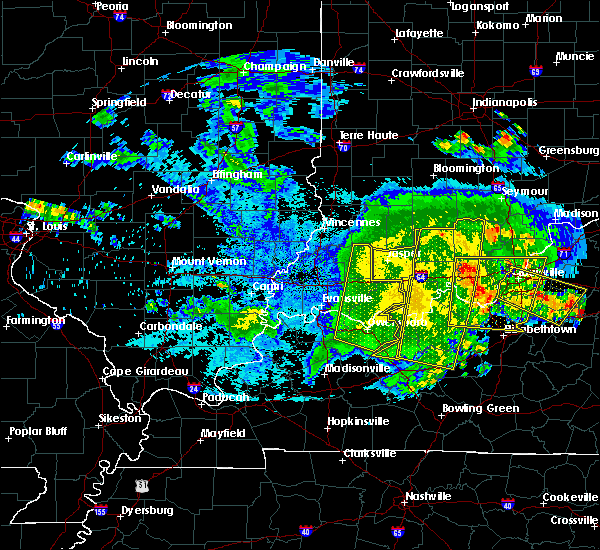 The severe thunderstorm warning for spencer, pike, warrick, southeastern henderson and daviess counties will expire at 830 pm cdt/930 pm edt/, the storms which prompted the warning have moved out of the area. therefore the warning will be allowed to expire. a severe thunderstorm watch remains in effect until 100 am cdt/200 am edt/ for southwestern indiana, and northwestern kentucky. The severe thunderstorm warning for spencer, pike, warrick, southeastern henderson and daviess counties will expire at 830 pm cdt/930 pm edt/, the storms which prompted the warning have moved out of the area. therefore the warning will be allowed to expire. a severe thunderstorm watch remains in effect until 100 am cdt/200 am edt/ for southwestern indiana, and northwestern kentucky.
|
| 5/7/2016 7:45 PM CDT |
 At 744 pm cdt/844 pm edt/, severe thunderstorms were located along a line extending from 7 miles northeast of jasper to 7 miles north of tell city to 7 miles east of st. joseph, moving southeast at 55 mph (radar indicated). Hazards include 60 mph wind gusts. Expect damage to roofs. siding. And trees. At 744 pm cdt/844 pm edt/, severe thunderstorms were located along a line extending from 7 miles northeast of jasper to 7 miles north of tell city to 7 miles east of st. joseph, moving southeast at 55 mph (radar indicated). Hazards include 60 mph wind gusts. Expect damage to roofs. siding. And trees.
|
| 5/7/2016 7:36 PM CDT | Late report of tree dow in daviess county KY, 0.6 miles ESE of Owensboro, KY |
| 5/7/2016 7:34 PM CDT |
 At 733 pm cdt, severe thunderstorms were located along a line extending from jasper to 6 miles northwest of grandview to near robards, moving east at 60 mph. these storms have a history of producing widespread wind damage with winds in excess of 60 mph (radar indicated). Hazards include 60 mph wind gusts. Expect damage to roofs. siding. and trees. locations impacted include, evansville, owensboro, henderson, newburgh, rockport, santa claus, dale, grandview, corydon, whitesville, robards, masonville, eureka, knottsville, st. Joseph, stanley, lewisport, chrisney, troy and gentryville. At 733 pm cdt, severe thunderstorms were located along a line extending from jasper to 6 miles northwest of grandview to near robards, moving east at 60 mph. these storms have a history of producing widespread wind damage with winds in excess of 60 mph (radar indicated). Hazards include 60 mph wind gusts. Expect damage to roofs. siding. and trees. locations impacted include, evansville, owensboro, henderson, newburgh, rockport, santa claus, dale, grandview, corydon, whitesville, robards, masonville, eureka, knottsville, st. Joseph, stanley, lewisport, chrisney, troy and gentryville.
|
| 5/7/2016 7:10 PM CDT |
 At 708 pm cdt, severe thunderstorms were located along a line extending from near petersburg to near boonville to near uniontown, moving east at 60 mph. this line of storms snapped power poles and tree limbs as it moved across carmi illinois, and winds were measured at 66 mph as they moved across the mount carmel airport in southern illinois (radar indicated). Hazards include 60 mph wind gusts. Expect damage to roofs. siding. And trees. At 708 pm cdt, severe thunderstorms were located along a line extending from near petersburg to near boonville to near uniontown, moving east at 60 mph. this line of storms snapped power poles and tree limbs as it moved across carmi illinois, and winds were measured at 66 mph as they moved across the mount carmel airport in southern illinois (radar indicated). Hazards include 60 mph wind gusts. Expect damage to roofs. siding. And trees.
|
| 4/27/2016 6:40 PM CDT | At 639 pm cdt, a confirmed tornado was located near knottsville, or 8 miles southeast of rockport, moving northeast at 55 mph (public confirmed tornado). Hazards include damaging tornado and quarter size hail. Flying debris will be dangerous to those caught without shelter. mobile homes will be damaged or destroyed. damage to roofs, windows, and vehicles will occur. tree damage is likely. Locations impacted include, owensboro and knottsville. |
| 4/27/2016 6:35 PM CDT | Trailer rolled over and destroyed on keenland parkway in daviess county KY, 0.6 miles ESE of Owensboro, KY |
| 4/27/2016 6:33 PM CDT |
 At 633 pm cdt, a severe thunderstorm capable of producing a tornado was located near knottsville, or near owensboro, moving northeast at 55 mph (weather spotters reported funnel cloud). Hazards include tornado and quarter size hail. Flying debris will be dangerous to those caught without shelter. mobile homes will be damaged or destroyed. damage to roofs, windows, and vehicles will occur. tree damage is likely. This tornadic thunderstorm will remain over mainly rural areas of northeastern daviess county. At 633 pm cdt, a severe thunderstorm capable of producing a tornado was located near knottsville, or near owensboro, moving northeast at 55 mph (weather spotters reported funnel cloud). Hazards include tornado and quarter size hail. Flying debris will be dangerous to those caught without shelter. mobile homes will be damaged or destroyed. damage to roofs, windows, and vehicles will occur. tree damage is likely. This tornadic thunderstorm will remain over mainly rural areas of northeastern daviess county.
|
| 4/27/2016 6:25 PM CDT |
 At 624 pm cdt, a severe thunderstorm capable of producing a tornado was located near owensboro, moving northeast at 55 mph (radar indicated rotation). Hazards include tornado and quarter size hail. Flying debris will be dangerous to those caught without shelter. mobile homes will be damaged or destroyed. damage to roofs, windows, and vehicles will occur. tree damage is likely. This tornadic thunderstorm will remain over mainly rural areas of central daviess county. At 624 pm cdt, a severe thunderstorm capable of producing a tornado was located near owensboro, moving northeast at 55 mph (radar indicated rotation). Hazards include tornado and quarter size hail. Flying debris will be dangerous to those caught without shelter. mobile homes will be damaged or destroyed. damage to roofs, windows, and vehicles will occur. tree damage is likely. This tornadic thunderstorm will remain over mainly rural areas of central daviess county.
|
| 4/27/2016 6:10 PM CDT |
 At 610 pm cdt, a severe thunderstorm capable of producing a tornado was located near st. joseph, or 8 miles north of calhoun, moving northeast at 55 mph (radar indicated rotation). Hazards include tornado and quarter size hail. Flying debris will be dangerous to those caught without shelter. mobile homes will be damaged or destroyed. damage to roofs, windows, and vehicles will occur. tree damage is likely. this dangerous storm will be near, owensboro and masonville around 620 pm cdt. Other locations impacted by this tornadic thunderstorm include moseleyville. At 610 pm cdt, a severe thunderstorm capable of producing a tornado was located near st. joseph, or 8 miles north of calhoun, moving northeast at 55 mph (radar indicated rotation). Hazards include tornado and quarter size hail. Flying debris will be dangerous to those caught without shelter. mobile homes will be damaged or destroyed. damage to roofs, windows, and vehicles will occur. tree damage is likely. this dangerous storm will be near, owensboro and masonville around 620 pm cdt. Other locations impacted by this tornadic thunderstorm include moseleyville.
|
| 4/26/2016 6:48 PM CDT |
 At 648 pm cdt, a severe thunderstorm was located over masonville, or 8 miles southeast of owensboro, moving east at 45 mph (radar indicated). Hazards include 60 mph wind gusts and quarter size hail. Hail damage to vehicles is expected. Expect wind damage to roofs, siding, and trees. At 648 pm cdt, a severe thunderstorm was located over masonville, or 8 miles southeast of owensboro, moving east at 45 mph (radar indicated). Hazards include 60 mph wind gusts and quarter size hail. Hail damage to vehicles is expected. Expect wind damage to roofs, siding, and trees.
|
| 4/26/2016 6:35 PM CDT |
 At 634 pm cdt, a severe thunderstorm was located over st. joseph, or 9 miles north of calhoun, moving east at 30 mph (radar indicated). Hazards include 60 mph wind gusts and quarter size hail. Hail damage to vehicles is expected. Expect wind damage to roofs, siding, and trees. At 634 pm cdt, a severe thunderstorm was located over st. joseph, or 9 miles north of calhoun, moving east at 30 mph (radar indicated). Hazards include 60 mph wind gusts and quarter size hail. Hail damage to vehicles is expected. Expect wind damage to roofs, siding, and trees.
|
| 12/23/2015 4:28 PM CST | At 428 pm cst, a severe thunderstorm was located near st. joseph, or 7 miles north of calhoun, moving northeast at 50 mph (radar indicated). Hazards include 60 mph wind gusts and quarter size hail. Hail damage to vehicles is expected. Expect wind damage to roofs, siding and trees. |
| 12/23/2015 3:44 PM CST | At 344 pm cst, a confirmed tornado was located over rockport, moving northeast at 60 mph (radar confirmed tornado). Hazards include damaging tornado and half dollar size hail. Flying debris will be dangerous to those caught without shelter. mobile homes will be damaged or destroyed. damage to roofs, windows and vehicles will occur. tree damage is likely. this tornado will be near, grandview around 350 pm cst. Other locations impacted by this tornadic thunderstorm include chrisney. |
| 12/23/2015 3:44 PM CST | At 344 pm cst, a confirmed tornado was located over rockport, moving northeast at 60 mph (radar confirmed tornado). Hazards include damaging tornado and half dollar size hail. Flying debris will be dangerous to those caught without shelter. mobile homes will be damaged or destroyed. damage to roofs, windows and vehicles will occur. tree damage is likely. this tornado will be near, grandview around 350 pm cst. Other locations impacted by this tornadic thunderstorm include chrisney. |
| 12/23/2015 3:36 PM CST | At 335 pm cst, a severe thunderstorm capable of producing a tornado was located near stanley, or near owensboro, moving northeast at 70 mph (radar indicated rotation). Hazards include tornado and quarter size hail. Flying debris will be dangerous to those caught without shelter. mobile homes will be damaged or destroyed. damage to roofs, windows and vehicles will occur. tree damage is likely. this dangerous storm will be near, rockport around 345 pm cst. grandview around 350 pm cst. santa claus around 355 pm cst. Other locations impacted by this tornadic thunderstorm include chrisney. |
| 12/23/2015 3:36 PM CST | At 335 pm cst, a severe thunderstorm capable of producing a tornado was located near stanley, or near owensboro, moving northeast at 70 mph (radar indicated rotation). Hazards include tornado and quarter size hail. Flying debris will be dangerous to those caught without shelter. mobile homes will be damaged or destroyed. damage to roofs, windows and vehicles will occur. tree damage is likely. this dangerous storm will be near, rockport around 345 pm cst. grandview around 350 pm cst. santa claus around 355 pm cst. Other locations impacted by this tornadic thunderstorm include chrisney. |
| 12/23/2015 3:33 PM CST | At 333 pm cst, a severe thunderstorm capable of producing a tornado was located over stanley, or near owensboro, moving northeast at 70 mph (radar indicated rotation). Hazards include tornado and half dollar size hail. Flying debris will be dangerous to those caught without shelter. mobile homes will be damaged or destroyed. damage to roofs, windows and vehicles will occur. tree damage is likely. This tornadic thunderstorm will remain over mainly rural areas of east central henderson and northwestern daviess counties, including the following locations, hebbardsville. |
| 12/23/2015 3:18 PM CST | At 318 pm cst, a severe thunderstorm capable of producing a tornado was located near sebree, or 11 miles northwest of calhoun, moving northeast at 70 mph (radar indicated rotation). Hazards include tornado and half dollar size hail. Flying debris will be dangerous to those caught without shelter. mobile homes will be damaged or destroyed. damage to roofs, windows and vehicles will occur. tree damage is likely. this dangerous storm will be near, st. joseph around 325 pm cst. owensboro and stanley around 335 pm cst. Other locations impacted by this tornadic thunderstorm include hebbardsville. |
| 8/4/2015 4:19 PM CDT |
 At 419 pm cdt, a severe thunderstorm was located over eureka, or 8 miles south of boonville, moving southeast at 5 mph (radar indicated). Hazards include 60 mph wind gusts and half dollar size hail. Hail damage to vehicles is expected. Expect wind damage to roofs, siding and trees. At 419 pm cdt, a severe thunderstorm was located over eureka, or 8 miles south of boonville, moving southeast at 5 mph (radar indicated). Hazards include 60 mph wind gusts and half dollar size hail. Hail damage to vehicles is expected. Expect wind damage to roofs, siding and trees.
|
| 6/21/2015 8:56 PM CDT |
 At 855 pm cdt, a severe thunderstorm was located about 10 miles south of owensboro, moving southeast at 30 mph. another potentially severe thunderstorm was locatd 5 miles northwest of beech grove moving southeast at 30 mph (radar indicated). Hazards include 60 mph wind gusts and quarter size hail. Hail damage to vehicles is expected. expect wind damage to roofs, siding and trees. locations impacted include, owensboro, calhoun, livermore, whitesville, beech grove, st. Joseph, masonville and island. At 855 pm cdt, a severe thunderstorm was located about 10 miles south of owensboro, moving southeast at 30 mph. another potentially severe thunderstorm was locatd 5 miles northwest of beech grove moving southeast at 30 mph (radar indicated). Hazards include 60 mph wind gusts and quarter size hail. Hail damage to vehicles is expected. expect wind damage to roofs, siding and trees. locations impacted include, owensboro, calhoun, livermore, whitesville, beech grove, st. Joseph, masonville and island.
|
| 6/21/2015 8:28 PM CDT |
 At 826 pm cdt, a severe thunderstorm was located near st. joseph, or 11 miles southeast of henderson, moving southeast at 35 mph. media sources reported nickel size hail in western daviess county at 823 pm (trained weather spotters). Hazards include 60 mph wind gusts and quarter size hail. Hail damage to vehicles is expected. Expect wind damage to roofs, siding and trees. At 826 pm cdt, a severe thunderstorm was located near st. joseph, or 11 miles southeast of henderson, moving southeast at 35 mph. media sources reported nickel size hail in western daviess county at 823 pm (trained weather spotters). Hazards include 60 mph wind gusts and quarter size hail. Hail damage to vehicles is expected. Expect wind damage to roofs, siding and trees.
|
| 6/21/2015 8:17 PM CDT |
 At 815 pm cdt, a severe thunderstorm was located a few miles southwest of owensboro, moving southeast at 35 mph. another severe storm was located near baskett in northern henderson county, also moving southeast (radar indicated). Hazards include 60 mph wind gusts and quarter size hail. Hail damage to vehicles is expected. expect wind damage to roofs, siding and trees. locations impacted include, owensboro, rockport, robards, st. Joseph, stanley, eureka, masonville, hebbardsville and moseleyville. At 815 pm cdt, a severe thunderstorm was located a few miles southwest of owensboro, moving southeast at 35 mph. another severe storm was located near baskett in northern henderson county, also moving southeast (radar indicated). Hazards include 60 mph wind gusts and quarter size hail. Hail damage to vehicles is expected. expect wind damage to roofs, siding and trees. locations impacted include, owensboro, rockport, robards, st. Joseph, stanley, eureka, masonville, hebbardsville and moseleyville.
|
| 6/21/2015 7:55 PM CDT |
 At 753 pm cdt, a severe thunderstorm was located near reed in extreme northeast henderson county, moving south at 15 mph. another severe storm was located just west of rockport in spencer county indiana (radar indicated). Hazards include 60 mph wind gusts and quarter size hail. Hail damage to vehicles is expected. Expect wind damage to roofs, siding and trees. At 753 pm cdt, a severe thunderstorm was located near reed in extreme northeast henderson county, moving south at 15 mph. another severe storm was located just west of rockport in spencer county indiana (radar indicated). Hazards include 60 mph wind gusts and quarter size hail. Hail damage to vehicles is expected. Expect wind damage to roofs, siding and trees.
|
| 4/25/2015 6:05 PM CDT | At 605 pm cdt, severe thunderstorms were located along a line extending from just south of owensboro to 8 miles north of livermore to near calhoun, moving east at 50 mph (radar indicated). Hazards include 60 mph wind gusts. Expect damage to roofs. Siding and trees. |
| 4/25/2015 5:39 PM CDT | At 538 pm cdt, severe thunderstorms were located along a line extending from near henderson to near robards to near dixon, moving east at 45 mph (radar indicated). Hazards include 70 mph wind gusts and quarter size hail. Hail damage to vehicles is expected. expect considerable tree damage. Wind damage is also likely to mobile homes, roofs and outbuildings. |
| 7/7/2014 5:40 PM CDT | Large tree limbs and power lines down. large tree limb blocking griffith ave east. utility pole across todd bridge roa in daviess county KY, 0.6 miles ESE of Owensboro, KY |
| 7/7/2014 5:30 PM CDT | Large limbs reported down. one blocking a road. power lines reported down as wel in daviess county KY, 0.6 miles ESE of Owensboro, KY |
| 5/10/2014 1:10 PM CDT | Thunderstorm wind damage - cross arms broken off at railroad crossing - street signs down - est wind speed 60 mp in daviess county KY, 8.4 miles ESE of Owensboro, KY |
| 12/21/2013 6:40 PM CST | Trees down and power outage across from owensboro catholic high schoo in daviess county KY, 0.6 miles ESE of Owensboro, KY |
| 12/21/2013 6:38 PM CST | Report from owensboro airport aso in daviess county KY, 0.6 miles ESE of Owensboro, KY |
| 12/21/2013 6:38 PM CST | Report from owensboro airport asos. widespread tree and power line damage reported in the communit in daviess county KY, 0.6 miles ESE of Owensboro, KY |
| 9/1/2013 12:34 AM CDT | Several tree limbs reported down along with a few power outage in daviess county KY, 0.6 miles ESE of Owensboro, KY |
| 7/23/2013 7:09 PM CDT | Quarter sized hail reported 0.6 miles ESE of Owensboro, KY, quarter size hail reported. |
| 5/30/2013 6:18 PM CDT | Tree branches breaking off on the west side of owensbor in daviess county KY, 0.6 miles ESE of Owensboro, KY |
| 5/30/2013 6:16 PM CDT | Large tree branches blown down in daviess county KY, 0.6 miles ESE of Owensboro, KY |
| 3/15/2012 3:54 PM CDT | Quarter sized hail reported 0.6 miles ESE of Owensboro, KY, several reports of quarter size hail. |
| 3/2/2012 2:25 PM CST | Storm damage reported in daviess county KY, 0.6 miles ESE of Owensboro, KY |
| 3/2/2012 2:21 PM CST | Quarter sized hail reported 0.6 miles ESE of Owensboro, KY, nickel to quarter size hail reported in the community. |
| 1/1/0001 12:00 AM | ...late report...mobile home received extensive damage along old state roa in daviess county KY, 0.6 miles ESE of Owensboro, KY |
| 1/1/0001 12:00 AM | Measured in downtown owensboro along parrish stree in daviess county KY, 0.6 miles ESE of Owensboro, KY |
| 1/1/0001 12:00 AM | Measured on west side of tow in daviess county KY, 0.6 miles ESE of Owensboro, KY |
| 1/1/0001 12:00 AM | Time estimated. numerous large tree limbs down on the west side of tow in daviess county KY, 0.6 miles ESE of Owensboro, KY |
| 1/1/0001 12:00 AM | Event occurred on west side of tow in daviess county KY, 0.6 miles ESE of Owensboro, KY |
| 1/1/0001 12:00 AM | Relayed by channel 1 in daviess county KY, 0.6 miles ESE of Owensboro, KY |
| 1/1/0001 12:00 AM | Tree limbs down in owensboro near cravens elementary school. estimated 45 mph wind in daviess county KY, 0.6 miles ESE of Owensboro, KY |
| 1/1/0001 12:00 AM | Occurred along pleasant valley roa in daviess county KY, 0.6 miles ESE of Owensboro, KY |
| 1/1/0001 12:00 AM | Trees down near apollo high schoo in daviess county KY, 0.6 miles ESE of Owensboro, KY |
| 1/1/0001 12:00 AM | Storm damage reported in daviess county KY, 0.6 miles ESE of Owensboro, KY |
| 1/1/0001 12:00 AM | Storm damage reported in daviess county KY, 10.4 miles E of Owensboro, KY |
| 1/1/0001 12:00 AM | Quarter sized hail reported 0.6 miles WSW of Owensboro, KY, quarter size hail reported on the east side of town. |
| 1/1/0001 12:00 AM | Quarter sized hail reported 10.6 miles ENE of Owensboro, KY |
| 1/1/0001 12:00 AM | West side of owensboro in daviess county KY, 0.6 miles ESE of Owensboro, KY |
| 1/1/0001 12:00 AM | On the east side of the city in daviess county KY, 0.6 miles ESE of Owensboro, KY |
| 1/1/0001 12:00 AM | On the east side of the city in daviess county KY, 0.6 miles ESE of Owensboro, KY |
| 1/1/0001 12:00 AM | Quarter sized hail reported 7.9 miles NNE of Owensboro, KY, nickel to quarter sized |
Hail Maps for Owensboro, KY

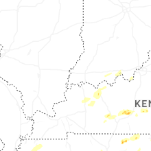
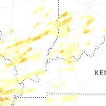


Connect with Interactive Hail Maps